

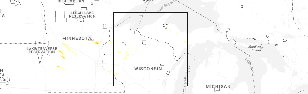
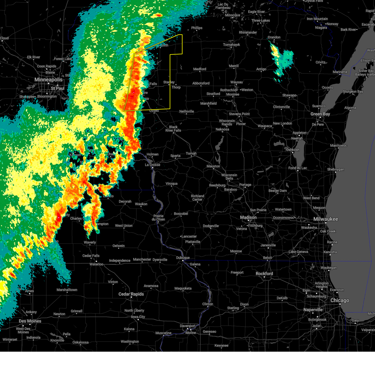
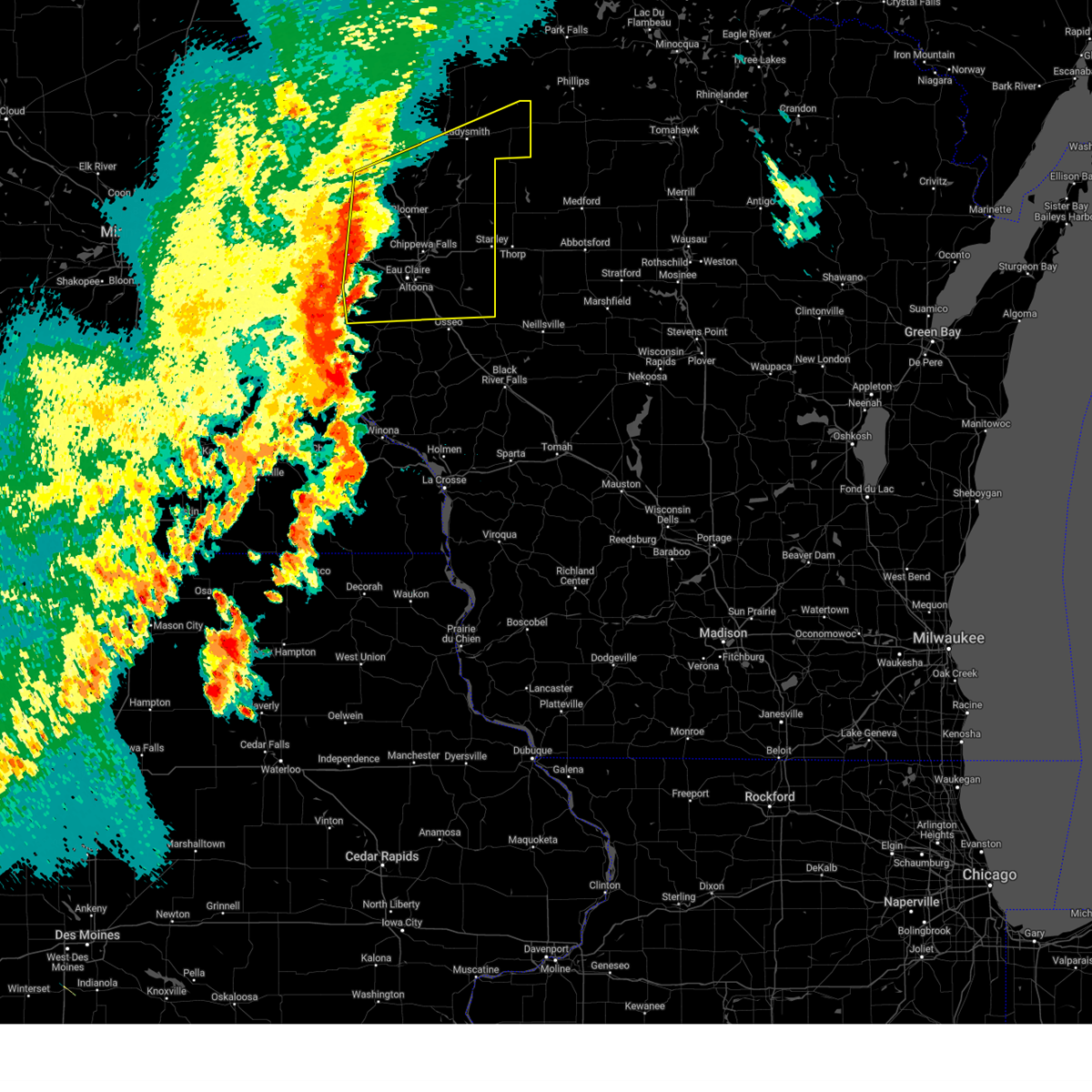
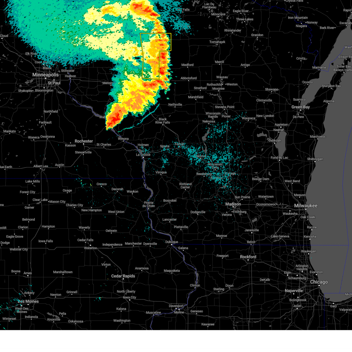
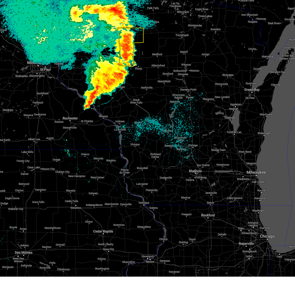
Hail Map for Bruce, WI
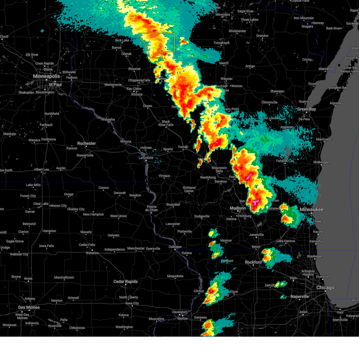
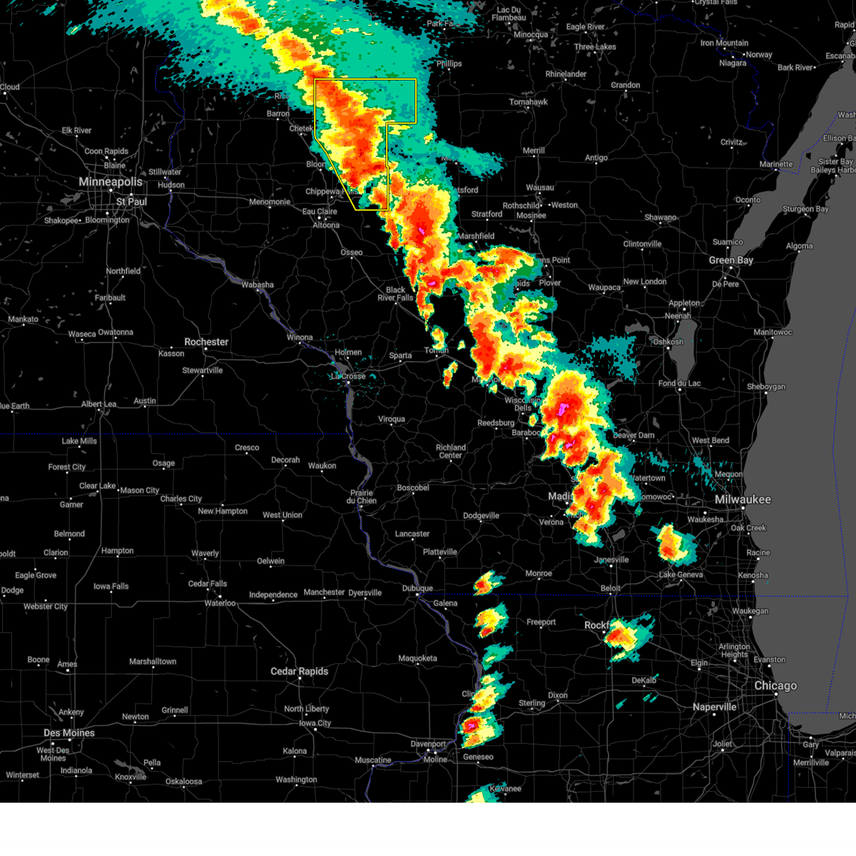
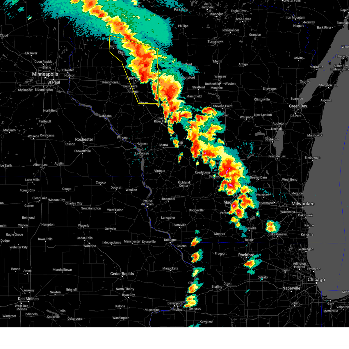
The Bruce, WI area has had 5 reports of on-the-ground hail by trained spotters, and has been under severe weather warnings 0 times during the past 12 months. Doppler radar has detected hail at or near Bruce, WI on 47 occasions, including 1 occasion during the past year.
| Name: | Bruce, WI |
| Where Located: | 91 miles W of Rhinelander, WI |
| Map: | Google Map for Bruce, WI |
| Population: | 779 |
| Housing Units: | 419 |
| More Info: | Search Google for Bruce, WI |
0
The Top Recent Hail Date for Bruce, WI is Friday, June 5, 2026 (22nd out of 47)
Hail and Wind Damage Spotted near Bruce, WI
| Date / Time | Report Details |
|---|---|
| 5/15/2025 5:08 PM CDT |
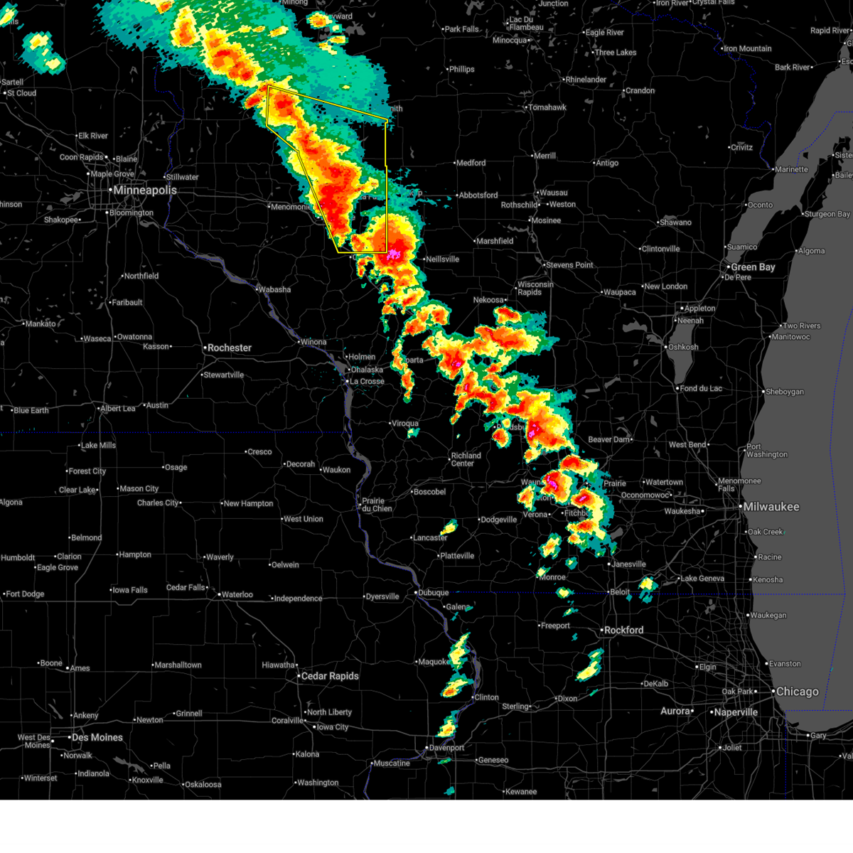
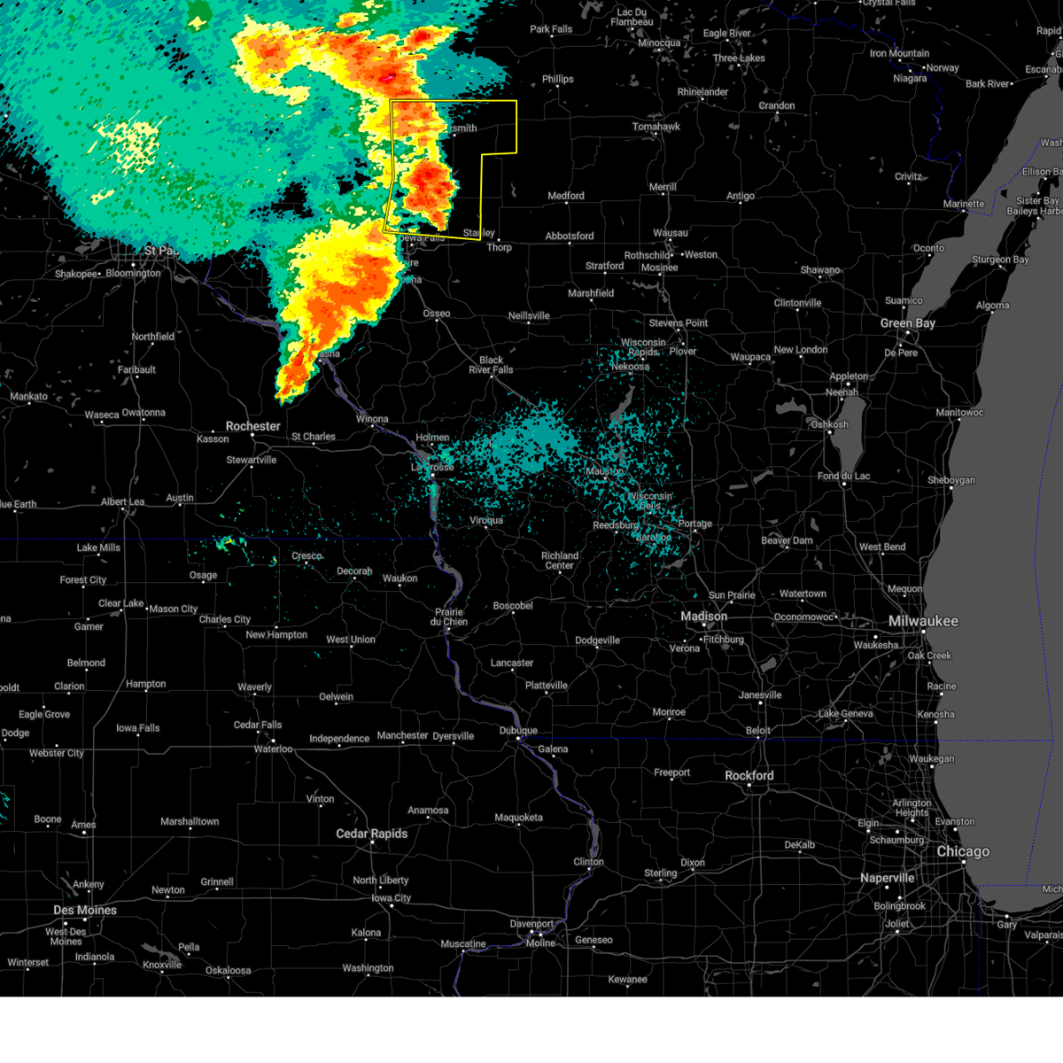
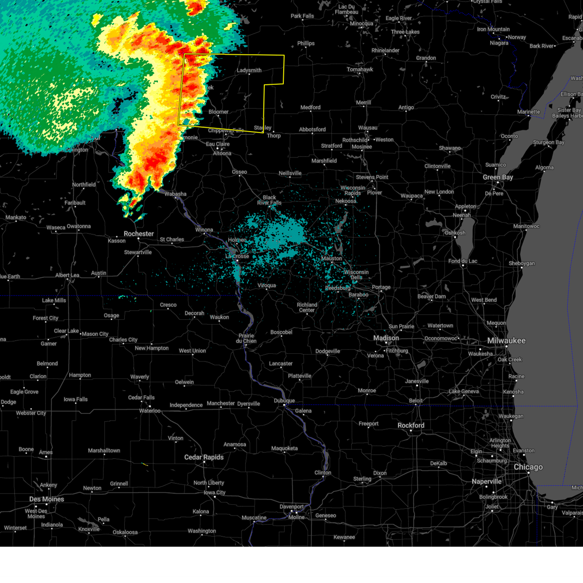
 At 508 pm cdt, severe thunderstorms were located along a line from 25 miles north of haugen to 12 miles southeast of stanley, or along a line from 33 miles north of rice lake to 37 miles east of eau claire, moving north at 50 mph (radar indicated). Hazards include 60 mph wind gusts and quarter size hail. Hail damage to vehicles is expected. expect wind damage to roofs, siding, and trees. Locations impacted include, ladysmith, bruce, hawkins, sheldon, tony, conrath, glen flora, ingram and rusk county airport. At 508 pm cdt, severe thunderstorms were located along a line from 25 miles north of haugen to 12 miles southeast of stanley, or along a line from 33 miles north of rice lake to 37 miles east of eau claire, moving north at 50 mph (radar indicated). Hazards include 60 mph wind gusts and quarter size hail. Hail damage to vehicles is expected. expect wind damage to roofs, siding, and trees. Locations impacted include, ladysmith, bruce, hawkins, sheldon, tony, conrath, glen flora, ingram and rusk county airport.
|
| 5/15/2025 5:08 PM CDT |
 the severe thunderstorm warning has been cancelled and is no longer in effect the severe thunderstorm warning has been cancelled and is no longer in effect
|
| 5/15/2025 4:53 PM CDT |
 the severe thunderstorm warning has been cancelled and is no longer in effect the severe thunderstorm warning has been cancelled and is no longer in effect
|
| 5/15/2025 4:53 PM CDT |
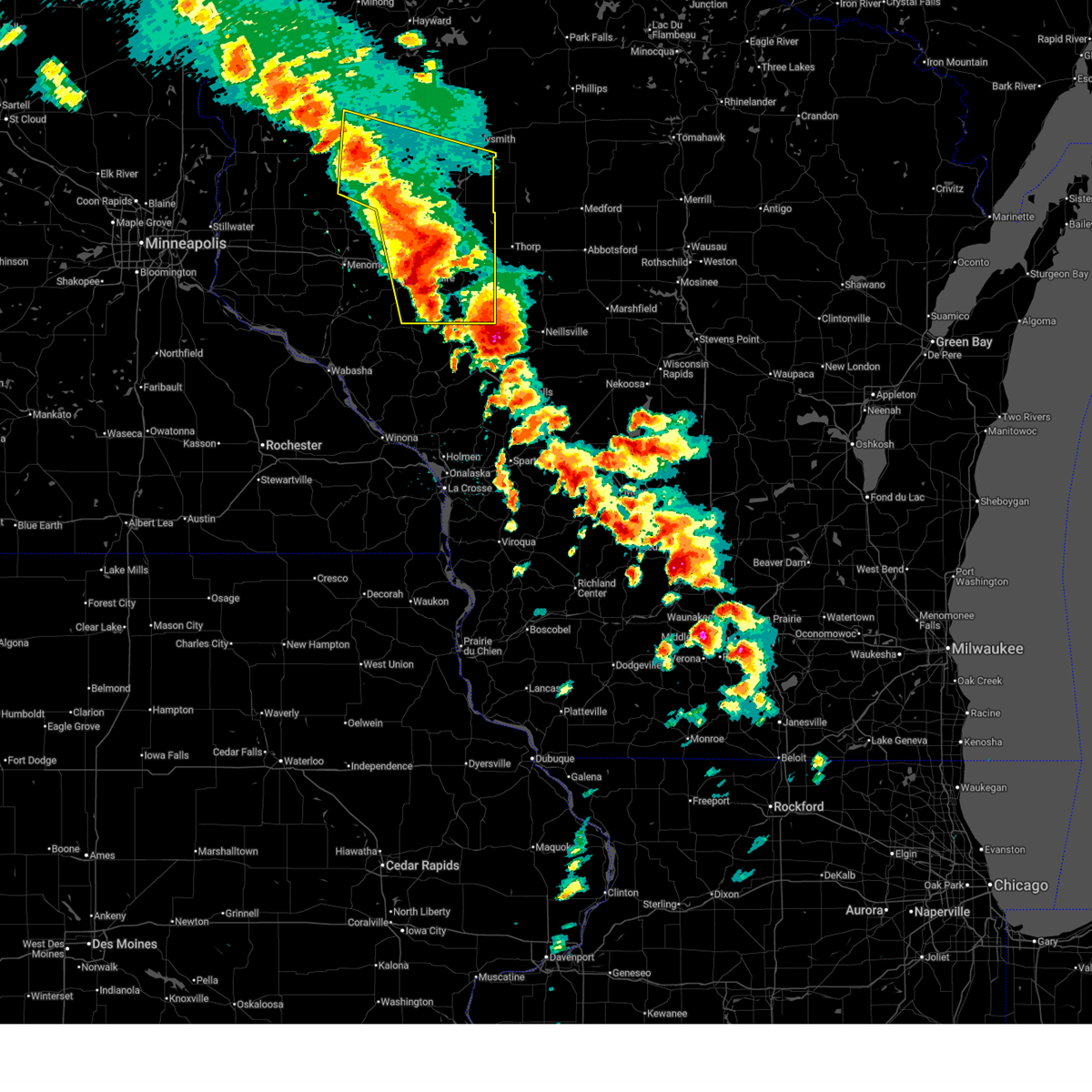
 At 453 pm cdt, severe thunderstorms were located along a line from 14 miles north of haugen to 9 miles northeast of fairchild, or along a line from 22 miles north of rice lake to 34 miles east of eau claire, moving north at 50 mph (radar indicated). Hazards include 60 mph wind gusts and quarter size hail. Hail damage to vehicles is expected. expect wind damage to roofs, siding, and trees. Locations impacted include, ladysmith, stanley, cornell, cadott, bruce, boyd, hawkins, weyerhaeuser, sheldon, tony, conrath, glen flora, ingram, holcombe, rusk county airport, island lake, chippewa moraine state rec area, jim falls and otter lake. At 453 pm cdt, severe thunderstorms were located along a line from 14 miles north of haugen to 9 miles northeast of fairchild, or along a line from 22 miles north of rice lake to 34 miles east of eau claire, moving north at 50 mph (radar indicated). Hazards include 60 mph wind gusts and quarter size hail. Hail damage to vehicles is expected. expect wind damage to roofs, siding, and trees. Locations impacted include, ladysmith, stanley, cornell, cadott, bruce, boyd, hawkins, weyerhaeuser, sheldon, tony, conrath, glen flora, ingram, holcombe, rusk county airport, island lake, chippewa moraine state rec area, jim falls and otter lake.
|
| 5/15/2025 4:44 PM CDT |
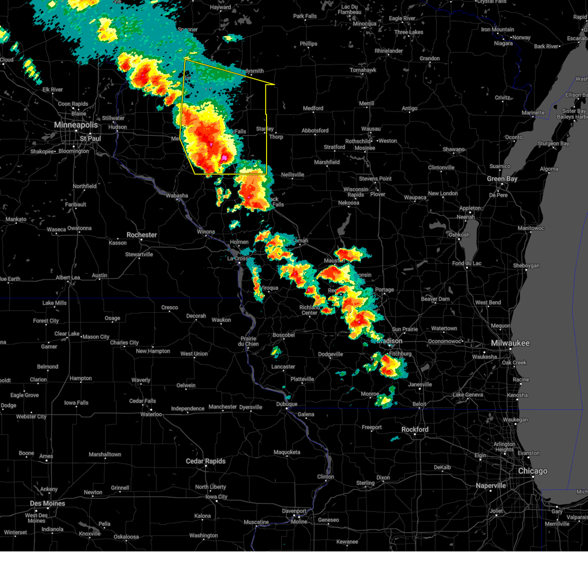
 The severe thunderstorm warning that was previously in effect has been reissued for barron, chippewa, eau claire, and rusk counties and is in effect until 530 pm cdt. please refer to that bulletin for the latest severe weather information. The severe thunderstorm warning that was previously in effect has been reissued for barron, chippewa, eau claire, and rusk counties and is in effect until 530 pm cdt. please refer to that bulletin for the latest severe weather information.
|
| 5/15/2025 4:43 PM CDT |
 Svrmpx the national weather service in the twin cities has issued a * severe thunderstorm warning for, northeastern barron county in northwestern wisconsin, rusk county in northwestern wisconsin, chippewa county in west central wisconsin, eastern eau claire county in west central wisconsin, * until 530 pm cdt. * at 443 pm cdt, severe thunderstorms were located along a line from 7 miles northwest of haugen to near fairchild, or along a line from 15 miles northwest of rice lake to 33 miles southeast of eau claire, moving north at 50 mph (radar indicated). Hazards include 60 mph wind gusts and quarter size hail. Hail damage to vehicles is expected. Expect wind damage to roofs, siding, and trees. Svrmpx the national weather service in the twin cities has issued a * severe thunderstorm warning for, northeastern barron county in northwestern wisconsin, rusk county in northwestern wisconsin, chippewa county in west central wisconsin, eastern eau claire county in west central wisconsin, * until 530 pm cdt. * at 443 pm cdt, severe thunderstorms were located along a line from 7 miles northwest of haugen to near fairchild, or along a line from 15 miles northwest of rice lake to 33 miles southeast of eau claire, moving north at 50 mph (radar indicated). Hazards include 60 mph wind gusts and quarter size hail. Hail damage to vehicles is expected. Expect wind damage to roofs, siding, and trees.
|
| 5/15/2025 4:27 PM CDT |
 the severe thunderstorm warning has been cancelled and is no longer in effect the severe thunderstorm warning has been cancelled and is no longer in effect
|
| 5/15/2025 4:27 PM CDT |
 At 427 pm cdt, a severe thunderstorm was located 10 miles south of weyerhaeuser, or 20 miles southwest of ladysmith, moving northeast at 50 mph (radar indicated). Hazards include 60 mph wind gusts and half dollar size hail. Hail damage to vehicles is expected. expect wind damage to roofs, siding, and trees. Locations impacted include, eau claire, rice lake, chippewa falls, altoona, lake hallie, stanley, bloomer, barron, lake wissota, chetek, cameron, augusta, cornell, cadott, fall creek, bruce, boyd, fairchild, new auburn and weyerhaeuser. At 427 pm cdt, a severe thunderstorm was located 10 miles south of weyerhaeuser, or 20 miles southwest of ladysmith, moving northeast at 50 mph (radar indicated). Hazards include 60 mph wind gusts and half dollar size hail. Hail damage to vehicles is expected. expect wind damage to roofs, siding, and trees. Locations impacted include, eau claire, rice lake, chippewa falls, altoona, lake hallie, stanley, bloomer, barron, lake wissota, chetek, cameron, augusta, cornell, cadott, fall creek, bruce, boyd, fairchild, new auburn and weyerhaeuser.
|
| 5/15/2025 4:14 PM CDT |
 At 414 pm cdt, a severe thunderstorm was located near new auburn, or 22 miles north of eau claire, moving northeast at 50 mph (radar indicated). Hazards include 60 mph wind gusts and quarter size hail. Hail damage to vehicles is expected. expect wind damage to roofs, siding, and trees. Locations impacted include, eau claire, rice lake, chippewa falls, altoona, lake hallie, stanley, bloomer, barron, lake wissota, chetek, cameron, augusta, cornell, cadott, fall creek, bruce, boyd, fairchild, new auburn and dallas. At 414 pm cdt, a severe thunderstorm was located near new auburn, or 22 miles north of eau claire, moving northeast at 50 mph (radar indicated). Hazards include 60 mph wind gusts and quarter size hail. Hail damage to vehicles is expected. expect wind damage to roofs, siding, and trees. Locations impacted include, eau claire, rice lake, chippewa falls, altoona, lake hallie, stanley, bloomer, barron, lake wissota, chetek, cameron, augusta, cornell, cadott, fall creek, bruce, boyd, fairchild, new auburn and dallas.
|
| 5/15/2025 4:14 PM CDT |
 the severe thunderstorm warning has been cancelled and is no longer in effect the severe thunderstorm warning has been cancelled and is no longer in effect
|
| 5/15/2025 3:58 PM CDT |
 Svrmpx the national weather service in the twin cities has issued a * severe thunderstorm warning for, eastern barron county in northwestern wisconsin, southern rusk county in northwestern wisconsin, chippewa county in west central wisconsin, dunn county in west central wisconsin, eau claire county in west central wisconsin, northeastern pepin county in west central wisconsin, * until 445 pm cdt. * at 358 pm cdt, a line of severe thunderstorms was located from near prairie farm through elk mound through fall creek moving northeast at 50 mph (radar indicated). Hazards include 60 mph wind gusts and quarter size hail. Hail damage to vehicles is expected. Expect wind damage to roofs, siding, and trees. Svrmpx the national weather service in the twin cities has issued a * severe thunderstorm warning for, eastern barron county in northwestern wisconsin, southern rusk county in northwestern wisconsin, chippewa county in west central wisconsin, dunn county in west central wisconsin, eau claire county in west central wisconsin, northeastern pepin county in west central wisconsin, * until 445 pm cdt. * at 358 pm cdt, a line of severe thunderstorms was located from near prairie farm through elk mound through fall creek moving northeast at 50 mph (radar indicated). Hazards include 60 mph wind gusts and quarter size hail. Hail damage to vehicles is expected. Expect wind damage to roofs, siding, and trees.
|
| 9/21/2024 3:44 PM CDT |
 The storm which prompted the warning has weakened below severe limits, and no longer poses an immediate threat to life or property. therefore, the warning will be allowed to expire. however, small hail is still possible with this thunderstorm. The storm which prompted the warning has weakened below severe limits, and no longer poses an immediate threat to life or property. therefore, the warning will be allowed to expire. however, small hail is still possible with this thunderstorm.
|
| 9/21/2024 3:27 PM CDT |
 At 325 pm cdt, a severe thunderstorm was located over bruce, or 6 miles west of ladysmith, moving east at 40 mph. dime size hail was reported in weyerhaeuser at 321 pm (radar indicated). Hazards include quarter size hail. Damage to vehicles is expected. Locations impacted include, ladysmith, bruce, tony, conrath, glen flora, and rusk county airport. At 325 pm cdt, a severe thunderstorm was located over bruce, or 6 miles west of ladysmith, moving east at 40 mph. dime size hail was reported in weyerhaeuser at 321 pm (radar indicated). Hazards include quarter size hail. Damage to vehicles is expected. Locations impacted include, ladysmith, bruce, tony, conrath, glen flora, and rusk county airport.
|
| 9/21/2024 3:06 PM CDT |
 Svrmpx the national weather service in the twin cities has issued a * severe thunderstorm warning for, central rusk county in northwestern wisconsin, * until 345 pm cdt. * at 306 pm cdt, a severe thunderstorm was located over weyerhaeuser, or 14 miles east of rice lake, moving east at 40 mph (radar indicated). Hazards include half dollar size hail. damage to vehicles is expected Svrmpx the national weather service in the twin cities has issued a * severe thunderstorm warning for, central rusk county in northwestern wisconsin, * until 345 pm cdt. * at 306 pm cdt, a severe thunderstorm was located over weyerhaeuser, or 14 miles east of rice lake, moving east at 40 mph (radar indicated). Hazards include half dollar size hail. damage to vehicles is expected
|
| 8/29/2024 7:48 PM CDT |
 At 748 pm cdt, severe thunderstorms were located along a line extending from near bruce to near cornell to 5 miles southeast of lake wissota to 5 miles south of fall creek, moving east at 50 mph (radar indicated). Hazards include 60 mph wind gusts. Expect damage to roofs, siding, and trees. these severe storms will be near, ladysmith, augusta, cornell, cadott, and boyd around 755 pm cdt. stanley and sheldon around 800 pm cdt. Hawkins around 815 pm cdt. At 748 pm cdt, severe thunderstorms were located along a line extending from near bruce to near cornell to 5 miles southeast of lake wissota to 5 miles south of fall creek, moving east at 50 mph (radar indicated). Hazards include 60 mph wind gusts. Expect damage to roofs, siding, and trees. these severe storms will be near, ladysmith, augusta, cornell, cadott, and boyd around 755 pm cdt. stanley and sheldon around 800 pm cdt. Hawkins around 815 pm cdt.
|
| 8/29/2024 7:40 PM CDT |
 the severe thunderstorm warning has been cancelled and is no longer in effect the severe thunderstorm warning has been cancelled and is no longer in effect
|
| 8/29/2024 7:40 PM CDT |
 At 739 pm cdt, severe thunderstorms were located along a line extending from near bruce to 7 miles east of bloomer to near lake hallie to 7 miles north of strum, moving east at 35 mph (radar indicated). Hazards include 60 mph wind gusts. Expect damage to roofs, siding, and trees. these severe storms will be near, ladysmith, lake wissota, cornell, cadott, and fall creek around 745 pm cdt. augusta and boyd around 755 pm cdt. sheldon around 800 pm cdt. stanley around 805 pm cdt. Hawkins around 815 pm cdt. At 739 pm cdt, severe thunderstorms were located along a line extending from near bruce to 7 miles east of bloomer to near lake hallie to 7 miles north of strum, moving east at 35 mph (radar indicated). Hazards include 60 mph wind gusts. Expect damage to roofs, siding, and trees. these severe storms will be near, ladysmith, lake wissota, cornell, cadott, and fall creek around 745 pm cdt. augusta and boyd around 755 pm cdt. sheldon around 800 pm cdt. stanley around 805 pm cdt. Hawkins around 815 pm cdt.
|
| 8/29/2024 7:29 PM CDT |
 At 729 pm cdt, severe thunderstorms were located along a line extending from 5 miles south of weyerhaeuser to near bloomer to near eau claire to 8 miles northeast of mondovi, moving east at 40 mph (radar indicated). Hazards include 60 mph wind gusts. Expect damage to roofs, siding, and trees. these severe storms will be near, eau claire, chippewa falls, altoona, lake hallie, and lake wissota around 735 pm cdt. fall creek around 740 pm cdt. cornell and cadott around 745 pm cdt. ladysmith around 750 pm cdt. boyd around 755 pm cdt. Stanley and sheldon around 800 pm cdt. At 729 pm cdt, severe thunderstorms were located along a line extending from 5 miles south of weyerhaeuser to near bloomer to near eau claire to 8 miles northeast of mondovi, moving east at 40 mph (radar indicated). Hazards include 60 mph wind gusts. Expect damage to roofs, siding, and trees. these severe storms will be near, eau claire, chippewa falls, altoona, lake hallie, and lake wissota around 735 pm cdt. fall creek around 740 pm cdt. cornell and cadott around 745 pm cdt. ladysmith around 750 pm cdt. boyd around 755 pm cdt. Stanley and sheldon around 800 pm cdt.
|
| 8/29/2024 7:07 PM CDT |
 Svrmpx the national weather service in the twin cities has issued a * severe thunderstorm warning for, northeastern pepin county in west central wisconsin, rusk county in northwestern wisconsin, eastern dunn county in west central wisconsin, chippewa county in west central wisconsin, eau claire county in west central wisconsin, southeastern barron county in northwestern wisconsin, * until 800 pm cdt. * at 706 pm cdt, severe thunderstorms were located along a line extending from near chetek to near colfax to 5 miles south of elk mound to 5 miles northwest of mondovi, moving east at 50 mph (radar indicated). Hazards include 60 mph wind gusts. expect damage to roofs, siding, and trees Svrmpx the national weather service in the twin cities has issued a * severe thunderstorm warning for, northeastern pepin county in west central wisconsin, rusk county in northwestern wisconsin, eastern dunn county in west central wisconsin, chippewa county in west central wisconsin, eau claire county in west central wisconsin, southeastern barron county in northwestern wisconsin, * until 800 pm cdt. * at 706 pm cdt, severe thunderstorms were located along a line extending from near chetek to near colfax to 5 miles south of elk mound to 5 miles northwest of mondovi, moving east at 50 mph (radar indicated). Hazards include 60 mph wind gusts. expect damage to roofs, siding, and trees
|
| 8/26/2024 10:00 PM CDT |
 The storm which prompted the warning has moved out of the area. therefore, the warning has been allowed to expire. a severe thunderstorm watch remains in effect until 1100 pm cdt for northwestern and west central wisconsin. The storm which prompted the warning has moved out of the area. therefore, the warning has been allowed to expire. a severe thunderstorm watch remains in effect until 1100 pm cdt for northwestern and west central wisconsin.
|
| 8/26/2024 9:43 PM CDT |
 At 942 pm cdt, a severe thunderstorm was located 6 miles southeast of sheldon, or 19 miles southeast of ladysmith, moving east at 30 mph (radar indicated). Hazards include 60 mph wind gusts and penny size hail. Expect damage to roofs, siding, and trees. Locations impacted include, ladysmith, stanley, cornell, bruce, hawkins, sheldon, tony, conrath, glen flora, ingram, holcombe, and otter lake. At 942 pm cdt, a severe thunderstorm was located 6 miles southeast of sheldon, or 19 miles southeast of ladysmith, moving east at 30 mph (radar indicated). Hazards include 60 mph wind gusts and penny size hail. Expect damage to roofs, siding, and trees. Locations impacted include, ladysmith, stanley, cornell, bruce, hawkins, sheldon, tony, conrath, glen flora, ingram, holcombe, and otter lake.
|
| 8/26/2024 9:26 PM CDT |
 the severe thunderstorm warning has been cancelled and is no longer in effect the severe thunderstorm warning has been cancelled and is no longer in effect
|
| 8/26/2024 9:26 PM CDT |
 At 925 pm cdt, a severe thunderstorm was located near sheldon, or 16 miles south of ladysmith, moving east at 55 mph (radar indicated). Hazards include 60 mph wind gusts and penny size hail. Expect damage to roofs, siding, and trees. Locations impacted include, ladysmith, stanley, bloomer, cornell, bruce, hawkins, weyerhaeuser, sheldon, tilden, tony, conrath, and glen flora. At 925 pm cdt, a severe thunderstorm was located near sheldon, or 16 miles south of ladysmith, moving east at 55 mph (radar indicated). Hazards include 60 mph wind gusts and penny size hail. Expect damage to roofs, siding, and trees. Locations impacted include, ladysmith, stanley, bloomer, cornell, bruce, hawkins, weyerhaeuser, sheldon, tilden, tony, conrath, and glen flora.
|
| 8/26/2024 8:55 PM CDT |
 Svrmpx the national weather service in the twin cities has issued a * severe thunderstorm warning for, rusk county in northwestern wisconsin, northeastern dunn county in west central wisconsin, chippewa county in west central wisconsin, barron county in northwestern wisconsin, * until 1000 pm cdt. * at 854 pm cdt, a severe thunderstorm was located over chetek, or 11 miles southeast of rice lake, moving east at 50 mph (radar indicated). Hazards include 60 mph wind gusts and penny size hail. expect damage to roofs, siding, and trees Svrmpx the national weather service in the twin cities has issued a * severe thunderstorm warning for, rusk county in northwestern wisconsin, northeastern dunn county in west central wisconsin, chippewa county in west central wisconsin, barron county in northwestern wisconsin, * until 1000 pm cdt. * at 854 pm cdt, a severe thunderstorm was located over chetek, or 11 miles southeast of rice lake, moving east at 50 mph (radar indicated). Hazards include 60 mph wind gusts and penny size hail. expect damage to roofs, siding, and trees
|
| 8/11/2023 5:14 PM CDT |
 At 514 pm cdt, a severe thunderstorm was located over new auburn, or 20 miles south of rice lake, moving southeast at 45 mph (radar indicated). Hazards include 60 mph wind gusts and quarter size hail. Hail damage to vehicles is expected. expect wind damage to roofs, siding, and trees. this severe thunderstorm will be near, bloomer around 525 pm cdt. other locations in the path of this severe thunderstorm include cornell. hail threat, radar indicated max hail size, 1. 00 in wind threat, radar indicated max wind gust, 60 mph. At 514 pm cdt, a severe thunderstorm was located over new auburn, or 20 miles south of rice lake, moving southeast at 45 mph (radar indicated). Hazards include 60 mph wind gusts and quarter size hail. Hail damage to vehicles is expected. expect wind damage to roofs, siding, and trees. this severe thunderstorm will be near, bloomer around 525 pm cdt. other locations in the path of this severe thunderstorm include cornell. hail threat, radar indicated max hail size, 1. 00 in wind threat, radar indicated max wind gust, 60 mph.
|
| 7/10/2023 6:10 PM CDT | Quarter sized hail reported 5.5 miles NNE of Bruce, WI, photo relayed via twitter. |
| 7/10/2023 6:09 PM CDT |
 At 608 pm cdt, a severe thunderstorm was located near bruce, or near ladysmith, moving east at 40 mph (radar indicated). Hazards include 60 mph wind gusts and half dollar size hail. Hail damage to vehicles is expected. expect wind damage to roofs, siding, and trees. this severe thunderstorm will be near, ladysmith around 615 pm cdt. hawkins around 645 pm cdt. other locations impacted by this severe thunderstorm include tony, conrath, rusk county airport, ingram and glen flora. hail threat, radar indicated max hail size, 1. 25 in wind threat, radar indicated max wind gust, 60 mph. At 608 pm cdt, a severe thunderstorm was located near bruce, or near ladysmith, moving east at 40 mph (radar indicated). Hazards include 60 mph wind gusts and half dollar size hail. Hail damage to vehicles is expected. expect wind damage to roofs, siding, and trees. this severe thunderstorm will be near, ladysmith around 615 pm cdt. hawkins around 645 pm cdt. other locations impacted by this severe thunderstorm include tony, conrath, rusk county airport, ingram and glen flora. hail threat, radar indicated max hail size, 1. 25 in wind threat, radar indicated max wind gust, 60 mph.
|
| 7/10/2023 6:08 PM CDT | Quarter sized hail reported 4 miles NE of Bruce, WI |
| 7/10/2023 6:06 PM CDT | Half Dollar sized hail reported 4 miles NW of Bruce, WI, photo relayed via social media. |
| 8/2/2022 10:25 PM CDT |
 The severe thunderstorm warning for rusk, barron and northeastern polk counties will expire at 1030 pm cdt, the storms which prompted the warning have moved out of the area. therefore, the warning will be allowed to expire. however gusty winds and heavy rain are still possible with these thunderstorms. a severe thunderstorm watch remains in effect until 200 am cdt for northwestern wisconsin. The severe thunderstorm warning for rusk, barron and northeastern polk counties will expire at 1030 pm cdt, the storms which prompted the warning have moved out of the area. therefore, the warning will be allowed to expire. however gusty winds and heavy rain are still possible with these thunderstorms. a severe thunderstorm watch remains in effect until 200 am cdt for northwestern wisconsin.
|
| 8/2/2022 10:16 PM CDT |
 At 1015 pm cdt, severe thunderstorms were located along a line extending from cumberland to near barron to near ladysmith, moving southeast at 25 mph (radar indicated). Hazards include 60 mph wind gusts and quarter size hail. Hail damage to vehicles is expected. expect wind damage to roofs, siding, and trees. Locations impacted include, ladysmith and chetek. At 1015 pm cdt, severe thunderstorms were located along a line extending from cumberland to near barron to near ladysmith, moving southeast at 25 mph (radar indicated). Hazards include 60 mph wind gusts and quarter size hail. Hail damage to vehicles is expected. expect wind damage to roofs, siding, and trees. Locations impacted include, ladysmith and chetek.
|
| 8/2/2022 9:47 PM CDT |
 At 947 pm cdt, severe thunderstorms were located along a line extending from 6 miles east of frederic to 5 miles northeast of cumberland to 7 miles southeast of exeland, moving southeast at 25 mph (radar indicated). Hazards include 60 mph wind gusts and quarter size hail. Hail damage to vehicles is expected. expect wind damage to roofs, siding, and trees. severe thunderstorms will be near, ladysmith around 1005 pm cdt. Other locations in the path of these severe thunderstorms include rice lake, barron, cameron, chetek, turtle lake and almena. At 947 pm cdt, severe thunderstorms were located along a line extending from 6 miles east of frederic to 5 miles northeast of cumberland to 7 miles southeast of exeland, moving southeast at 25 mph (radar indicated). Hazards include 60 mph wind gusts and quarter size hail. Hail damage to vehicles is expected. expect wind damage to roofs, siding, and trees. severe thunderstorms will be near, ladysmith around 1005 pm cdt. Other locations in the path of these severe thunderstorms include rice lake, barron, cameron, chetek, turtle lake and almena.
|
| 5/12/2022 3:20 PM CDT | Quarter sized hail reported 0.2 miles SSE of Bruce, WI, time estimated by radar. |
| 5/11/2022 11:53 PM CDT |
 The severe thunderstorm warning for rusk, chippewa and eastern eau claire counties will expire at midnight cdt, the storms which prompted the warning have weakened below severe limits, and no longer pose an immediate threat to life or property. therefore, the warning will be allowed to expire. however gusty winds and heavy rain are still possible with these thunderstorms. a tornado watch remains in effect until midnight cdt for northwestern and west central wisconsin. The severe thunderstorm warning for rusk, chippewa and eastern eau claire counties will expire at midnight cdt, the storms which prompted the warning have weakened below severe limits, and no longer pose an immediate threat to life or property. therefore, the warning will be allowed to expire. however gusty winds and heavy rain are still possible with these thunderstorms. a tornado watch remains in effect until midnight cdt for northwestern and west central wisconsin.
|
| 5/11/2022 10:53 PM CDT |
 At 1053 pm cdt, severe thunderstorms were located along a line extending from 5 miles south of exeland to 5 miles south of fall creek, moving east at 35 mph (trained weather spotters). Hazards include 60 mph wind gusts and quarter size hail. Hail damage to vehicles is expected. expect wind damage to roofs, siding, and trees. Severe thunderstorms will be near, augusta around 1110 pm cdt. At 1053 pm cdt, severe thunderstorms were located along a line extending from 5 miles south of exeland to 5 miles south of fall creek, moving east at 35 mph (trained weather spotters). Hazards include 60 mph wind gusts and quarter size hail. Hail damage to vehicles is expected. expect wind damage to roofs, siding, and trees. Severe thunderstorms will be near, augusta around 1110 pm cdt.
|
| 5/11/2022 10:22 PM CDT |
 At 1021 pm cdt, a severe thunderstorm was located 6 miles east of rice lake, moving east at 40 mph (radar indicated). Hazards include 60 mph wind gusts and quarter size hail. Hail damage to vehicles is expected. expect wind damage to roofs, siding, and trees. this severe thunderstorm will be near, weyerhaeuser around 1035 pm cdt. Other locations in the path of this severe thunderstorm include bruce. At 1021 pm cdt, a severe thunderstorm was located 6 miles east of rice lake, moving east at 40 mph (radar indicated). Hazards include 60 mph wind gusts and quarter size hail. Hail damage to vehicles is expected. expect wind damage to roofs, siding, and trees. this severe thunderstorm will be near, weyerhaeuser around 1035 pm cdt. Other locations in the path of this severe thunderstorm include bruce.
|
| 7/28/2021 8:46 PM CDT |
 At 845 pm cdt, a severe thunderstorm was located 11 miles south of weyerhaeuser, or 17 miles southwest of ladysmith, moving southeast at 50 mph (radar indicated). Hazards include 70 mph wind gusts and half dollar size hail. Hail damage to vehicles is expected. expect considerable tree damage. wind damage is also likely to mobile homes, roofs, and outbuildings. This severe thunderstorm will be near, cornell around 900 pm cdt. At 845 pm cdt, a severe thunderstorm was located 11 miles south of weyerhaeuser, or 17 miles southwest of ladysmith, moving southeast at 50 mph (radar indicated). Hazards include 70 mph wind gusts and half dollar size hail. Hail damage to vehicles is expected. expect considerable tree damage. wind damage is also likely to mobile homes, roofs, and outbuildings. This severe thunderstorm will be near, cornell around 900 pm cdt.
|
| 7/28/2021 8:20 PM CDT | Trees and power lines down. time estimated based on rada in rusk county WI, 0.8 miles NE of Bruce, WI |
| 7/28/2021 8:17 PM CDT |
 At 816 pm cdt, a severe thunderstorm was located near weyerhaeuser, or 12 miles west of ladysmith, moving southeast at 45 mph (radar indicated). Hazards include 70 mph wind gusts and half dollar size hail. Hail damage to vehicles is expected. expect considerable tree damage. wind damage is also likely to mobile homes, roofs, and outbuildings. this severe storm will be near, bruce around 820 pm cdt. Other locations in the path of this severe thunderstorm include ladysmith and sheldon. At 816 pm cdt, a severe thunderstorm was located near weyerhaeuser, or 12 miles west of ladysmith, moving southeast at 45 mph (radar indicated). Hazards include 70 mph wind gusts and half dollar size hail. Hail damage to vehicles is expected. expect considerable tree damage. wind damage is also likely to mobile homes, roofs, and outbuildings. this severe storm will be near, bruce around 820 pm cdt. Other locations in the path of this severe thunderstorm include ladysmith and sheldon.
|
| 7/28/2021 8:01 PM CDT |
 At 800 pm cdt, a severe thunderstorm was located 6 miles south of birchwood, or 10 miles northeast of rice lake, moving southeast at 45 mph (radar indicated). Hazards include 60 mph wind gusts and quarter size hail. Hail damage to vehicles is expected. expect wind damage to roofs, siding, and trees. this severe thunderstorm will be near, weyerhaeuser around 815 pm cdt. bruce around 820 pm cdt. Other locations in the path of this severe thunderstorm include ladysmith and sheldon. At 800 pm cdt, a severe thunderstorm was located 6 miles south of birchwood, or 10 miles northeast of rice lake, moving southeast at 45 mph (radar indicated). Hazards include 60 mph wind gusts and quarter size hail. Hail damage to vehicles is expected. expect wind damage to roofs, siding, and trees. this severe thunderstorm will be near, weyerhaeuser around 815 pm cdt. bruce around 820 pm cdt. Other locations in the path of this severe thunderstorm include ladysmith and sheldon.
|
| 7/28/2021 7:43 PM CDT |
 At 743 pm cdt, a severe thunderstorm was located over haugen, or 10 miles north of rice lake, moving southeast at 50 mph (radar indicated). Hazards include 60 mph wind gusts and quarter size hail. Hail damage to vehicles is expected. expect wind damage to roofs, siding, and trees. this severe thunderstorm will be near, rice lake around 755 pm cdt. Other locations in the path of this severe thunderstorm include weyerhaeuser. At 743 pm cdt, a severe thunderstorm was located over haugen, or 10 miles north of rice lake, moving southeast at 50 mph (radar indicated). Hazards include 60 mph wind gusts and quarter size hail. Hail damage to vehicles is expected. expect wind damage to roofs, siding, and trees. this severe thunderstorm will be near, rice lake around 755 pm cdt. Other locations in the path of this severe thunderstorm include weyerhaeuser.
|
| 4/7/2020 9:24 AM CDT | Golf Ball sized hail reported 8.5 miles S of Bruce, WI, hailed for several minutes. |
| 8/5/2019 3:28 PM CDT |
 At 327 pm cdt, a severe thunderstorm was located near exeland, or 9 miles northwest of ladysmith, moving east at 45 mph (radar indicated). Hazards include 60 mph wind gusts and half dollar size hail. Hail damage to vehicles is expected. expect wind damage to roofs, siding, and trees. Locations impacted include, ladysmith, bruce, hawkins, tony, glen flora, ingram and rusk county airport. At 327 pm cdt, a severe thunderstorm was located near exeland, or 9 miles northwest of ladysmith, moving east at 45 mph (radar indicated). Hazards include 60 mph wind gusts and half dollar size hail. Hail damage to vehicles is expected. expect wind damage to roofs, siding, and trees. Locations impacted include, ladysmith, bruce, hawkins, tony, glen flora, ingram and rusk county airport.
|
| 8/5/2019 3:14 PM CDT |
 At 314 pm cdt, a severe thunderstorm was located near weyerhaeuser, or 15 miles west of ladysmith, moving east at 40 mph (radar indicated). Hazards include 60 mph wind gusts and half dollar size hail. Hail damage to vehicles is expected. Expect wind damage to roofs, siding, and trees. At 314 pm cdt, a severe thunderstorm was located near weyerhaeuser, or 15 miles west of ladysmith, moving east at 40 mph (radar indicated). Hazards include 60 mph wind gusts and half dollar size hail. Hail damage to vehicles is expected. Expect wind damage to roofs, siding, and trees.
|
| 7/19/2019 6:55 PM CDT |
 The severe thunderstorm warning for southern rusk, northeastern dunn, northern chippewa and southeastern barron counties will expire at 700 pm cdt, the storms which prompted the warning have moved out of the area. therefore, the warning will be allowed to expire. a tornado watch remains in effect until 1000 pm cdt for northwestern and west central wisconsin. to report severe weather, contact your nearest law enforcement agency. they will relay your report to the national weather service the twin cities. The severe thunderstorm warning for southern rusk, northeastern dunn, northern chippewa and southeastern barron counties will expire at 700 pm cdt, the storms which prompted the warning have moved out of the area. therefore, the warning will be allowed to expire. a tornado watch remains in effect until 1000 pm cdt for northwestern and west central wisconsin. to report severe weather, contact your nearest law enforcement agency. they will relay your report to the national weather service the twin cities.
|
| 7/19/2019 6:41 PM CDT |
 At 641 pm cdt, severe thunderstorms were located along a line extending from near sheldon to 7 miles west of cornell to 6 miles northeast of colfax, moving east at 45 mph. these are very dangerous storms (radar indicated). Hazards include 80 mph wind gusts and quarter size hail. Flying debris will be dangerous to those caught without shelter. mobile homes will be heavily damaged. expect considerable damage to roofs, windows, and vehicles. extensive tree damage and power outages are likely. these severe storms will be near, sheldon around 645 pm cdt. Cornell around 655 pm cdt. At 641 pm cdt, severe thunderstorms were located along a line extending from near sheldon to 7 miles west of cornell to 6 miles northeast of colfax, moving east at 45 mph. these are very dangerous storms (radar indicated). Hazards include 80 mph wind gusts and quarter size hail. Flying debris will be dangerous to those caught without shelter. mobile homes will be heavily damaged. expect considerable damage to roofs, windows, and vehicles. extensive tree damage and power outages are likely. these severe storms will be near, sheldon around 645 pm cdt. Cornell around 655 pm cdt.
|
| 7/19/2019 6:26 PM CDT |
 At 625 pm cdt, severe thunderstorms were located along a line extending from near ladysmith to near new auburn to 6 miles southeast of ridgeland, moving east at 50 mph. these are very dangerous storms (radar indicated. widespread wind damage is occurring with this storm). Hazards include 80 mph wind gusts and quarter size hail. Flying debris will be dangerous to those caught without shelter. mobile homes will be heavily damaged. expect considerable damage to roofs, windows, and vehicles. extensive tree damage and power outages are likely. these severe storms will be near, ladysmith around 630 pm cdt. colfax around 635 pm cdt. sheldon around 640 pm cdt. bloomer around 645 pm cdt. Cornell around 650 pm cdt. At 625 pm cdt, severe thunderstorms were located along a line extending from near ladysmith to near new auburn to 6 miles southeast of ridgeland, moving east at 50 mph. these are very dangerous storms (radar indicated. widespread wind damage is occurring with this storm). Hazards include 80 mph wind gusts and quarter size hail. Flying debris will be dangerous to those caught without shelter. mobile homes will be heavily damaged. expect considerable damage to roofs, windows, and vehicles. extensive tree damage and power outages are likely. these severe storms will be near, ladysmith around 630 pm cdt. colfax around 635 pm cdt. sheldon around 640 pm cdt. bloomer around 645 pm cdt. Cornell around 650 pm cdt.
|
| 7/19/2019 6:16 PM CDT |
 At 615 pm cdt, severe thunderstorms were located along a line extending from near bruce to near chetek to near ridgeland, moving east at 50 mph. these are very dangerous storms (radar indicated. many reports of wind damage have been received across barron county). Hazards include 80 mph wind gusts and quarter size hail. Flying debris will be dangerous to those caught without shelter. mobile homes will be heavily damaged. expect considerable damage to roofs, windows, and vehicles. extensive tree damage and power outages are likely. these severe storms will be near, bruce and new auburn around 620 pm cdt. ladysmith around 625 pm cdt. colfax around 635 pm cdt. Sheldon around 640 pm cdt. At 615 pm cdt, severe thunderstorms were located along a line extending from near bruce to near chetek to near ridgeland, moving east at 50 mph. these are very dangerous storms (radar indicated. many reports of wind damage have been received across barron county). Hazards include 80 mph wind gusts and quarter size hail. Flying debris will be dangerous to those caught without shelter. mobile homes will be heavily damaged. expect considerable damage to roofs, windows, and vehicles. extensive tree damage and power outages are likely. these severe storms will be near, bruce and new auburn around 620 pm cdt. ladysmith around 625 pm cdt. colfax around 635 pm cdt. Sheldon around 640 pm cdt.
|
| 7/19/2019 5:58 PM CDT |
 At 557 pm cdt, severe thunderstorms were located along a line extending from 6 miles east of rice lake to near barron to clear lake, moving east at 50 mph. these are very dangerous storms (radar indicated). Hazards include 80 mph wind gusts and ping pong ball size hail. Flying debris will be dangerous to those caught without shelter. mobile homes will be heavily damaged. expect considerable damage to roofs, windows, and vehicles. extensive tree damage and power outages are likely. severe thunderstorms will be near, cameron and dallas around 605 pm cdt. chetek and weyerhaeuser around 610 pm cdt. bruce, new auburn and ridgeland around 620 pm cdt. Ladysmith and wheeler around 625 pm cdt. At 557 pm cdt, severe thunderstorms were located along a line extending from 6 miles east of rice lake to near barron to clear lake, moving east at 50 mph. these are very dangerous storms (radar indicated). Hazards include 80 mph wind gusts and ping pong ball size hail. Flying debris will be dangerous to those caught without shelter. mobile homes will be heavily damaged. expect considerable damage to roofs, windows, and vehicles. extensive tree damage and power outages are likely. severe thunderstorms will be near, cameron and dallas around 605 pm cdt. chetek and weyerhaeuser around 610 pm cdt. bruce, new auburn and ridgeland around 620 pm cdt. Ladysmith and wheeler around 625 pm cdt.
|
| 7/15/2019 7:20 PM CDT |
 At 720 pm cdt, a confirmed tornado was located over bruce, or near ladysmith, moving east at 35 mph (law enforcement confirmed tornado). Hazards include damaging tornado. Flying debris will be dangerous to those caught without shelter. mobile homes will be damaged or destroyed. damage to roofs, windows, and vehicles will occur. tree damage is likely. the tornado will be near, ladysmith around 730 pm cdt. Other locations impacted by this tornadic thunderstorm include tony, conrath, rusk county airport, ingram and glen flora. At 720 pm cdt, a confirmed tornado was located over bruce, or near ladysmith, moving east at 35 mph (law enforcement confirmed tornado). Hazards include damaging tornado. Flying debris will be dangerous to those caught without shelter. mobile homes will be damaged or destroyed. damage to roofs, windows, and vehicles will occur. tree damage is likely. the tornado will be near, ladysmith around 730 pm cdt. Other locations impacted by this tornadic thunderstorm include tony, conrath, rusk county airport, ingram and glen flora.
|
| 7/4/2019 6:06 PM CDT |
 The national weather service in the twin cities has issued a * severe thunderstorm warning for. eastern rusk county in northwestern wisconsin. until 630 pm cdt. At 606 pm cdt, a severe thunderstorm was located near ladysmith, moving northeast at 40 mph. The national weather service in the twin cities has issued a * severe thunderstorm warning for. eastern rusk county in northwestern wisconsin. until 630 pm cdt. At 606 pm cdt, a severe thunderstorm was located near ladysmith, moving northeast at 40 mph.
|
| 8/27/2018 7:01 PM CDT |
 At 701 pm cdt, severe thunderstorms were located along a line extending from near cumberland airport to weyerhaeuser to near chippewa moraine state rec area, moving northeast at 65 mph (radar indicated). Hazards include 60 mph wind gusts. Expect damage to roofs, siding, and trees. these severe storms will be near, weyerhaeuser around 705 pm cdt. bruce around 710 pm cdt. ladysmith around 720 pm cdt. Other locations impacted by these severe thunderstorms include cumberland airport, tony, rice lake airport, island lake, sumner, mikana, conrath, rusk county airport, canton and ingram. At 701 pm cdt, severe thunderstorms were located along a line extending from near cumberland airport to weyerhaeuser to near chippewa moraine state rec area, moving northeast at 65 mph (radar indicated). Hazards include 60 mph wind gusts. Expect damage to roofs, siding, and trees. these severe storms will be near, weyerhaeuser around 705 pm cdt. bruce around 710 pm cdt. ladysmith around 720 pm cdt. Other locations impacted by these severe thunderstorms include cumberland airport, tony, rice lake airport, island lake, sumner, mikana, conrath, rusk county airport, canton and ingram.
|
| 8/27/2018 6:41 PM CDT |
 At 640 pm cdt, severe thunderstorms were located along a line extending from near clayton to near sand creek to near colfax, moving northeast at 60 mph (radar indicated). Hazards include 60 mph wind gusts. Expect damage to roofs, siding, and trees. severe thunderstorms will be near, barron and cumberland around 655 pm cdt. rice lake around 700 pm cdt. haugen and weyerhaeuser around 705 pm cdt. bruce around 715 pm cdt. ladysmith around 720 pm cdt. sheldon around 725 pm cdt. hawkins around 740 pm cdt. other locations impacted by these severe thunderstorms include cumberland airport, tony, hillsdale, island lake, conrath, ingram, brill, glen flora, rice lake airport and sumner. this includes u. s. Highway 53 between mile markers 120 and 152. At 640 pm cdt, severe thunderstorms were located along a line extending from near clayton to near sand creek to near colfax, moving northeast at 60 mph (radar indicated). Hazards include 60 mph wind gusts. Expect damage to roofs, siding, and trees. severe thunderstorms will be near, barron and cumberland around 655 pm cdt. rice lake around 700 pm cdt. haugen and weyerhaeuser around 705 pm cdt. bruce around 715 pm cdt. ladysmith around 720 pm cdt. sheldon around 725 pm cdt. hawkins around 740 pm cdt. other locations impacted by these severe thunderstorms include cumberland airport, tony, hillsdale, island lake, conrath, ingram, brill, glen flora, rice lake airport and sumner. this includes u. s. Highway 53 between mile markers 120 and 152.
|
| 8/26/2018 8:15 AM CDT |
 At 814 am cdt, a severe thunderstorm was located over island lake, or 15 miles southwest of ladysmith, moving east at 35 mph (radar indicated). Hazards include quarter size hail. Damage to vehicles is expected. Locations impacted include, bruce, weyerhaeuser and island lake. At 814 am cdt, a severe thunderstorm was located over island lake, or 15 miles southwest of ladysmith, moving east at 35 mph (radar indicated). Hazards include quarter size hail. Damage to vehicles is expected. Locations impacted include, bruce, weyerhaeuser and island lake.
|
| 8/26/2018 8:04 AM CDT |
 At 802 am cdt, a severe thunderstorm was located near sumner, or 14 miles southeast of rice lake, moving east at 35 mph (radar indicated). Hazards include half dollar size hail. Damage to vehicles is expected. locations impacted include, rice lake, barron, chetek, cameron, bruce, weyerhaeuser, sumner, canton, cumberland airport, hillsdale, island lake and rice lake airport. In addition, another thunderstorm capable of producing large hail was just north of turtle lake, or just west of almena, also moving east at 35 mph. At 802 am cdt, a severe thunderstorm was located near sumner, or 14 miles southeast of rice lake, moving east at 35 mph (radar indicated). Hazards include half dollar size hail. Damage to vehicles is expected. locations impacted include, rice lake, barron, chetek, cameron, bruce, weyerhaeuser, sumner, canton, cumberland airport, hillsdale, island lake and rice lake airport. In addition, another thunderstorm capable of producing large hail was just north of turtle lake, or just west of almena, also moving east at 35 mph.
|
| 8/26/2018 7:28 AM CDT |
 At 728 am cdt, a severe thunderstorm was located near barron, or 8 miles west of rice lake, moving east at 35 mph (radar indicated). Hazards include half dollar size hail. damage to vehicles is expected At 728 am cdt, a severe thunderstorm was located near barron, or 8 miles west of rice lake, moving east at 35 mph (radar indicated). Hazards include half dollar size hail. damage to vehicles is expected
|
| 7/12/2018 7:16 PM CDT |
 At 716 pm cdt, a severe thunderstorm was located over island lake, or 17 miles southwest of ladysmith, moving east at 35 mph (radar indicated). Hazards include 60 mph wind gusts and penny size hail. Expect damage to roofs, siding, and trees. Locations impacted include, rice lake, chetek, bruce, new auburn, weyerhaeuser, sumner, canton, island lake and chippewa moraine state rec area. At 716 pm cdt, a severe thunderstorm was located over island lake, or 17 miles southwest of ladysmith, moving east at 35 mph (radar indicated). Hazards include 60 mph wind gusts and penny size hail. Expect damage to roofs, siding, and trees. Locations impacted include, rice lake, chetek, bruce, new auburn, weyerhaeuser, sumner, canton, island lake and chippewa moraine state rec area.
|
| 7/12/2018 6:58 PM CDT |
 At 658 pm cdt, a severe thunderstorm was located near chetek, or 15 miles southeast of rice lake, moving east at 35 mph (radar indicated). Hazards include 60 mph wind gusts and quarter size hail. Hail damage to vehicles is expected. expect wind damage to roofs, siding, and trees. Locations impacted include, rice lake, barron, chetek, cameron, bruce, new auburn, weyerhaeuser, sumner, canton, rice lake airport, island lake and chippewa moraine state rec area. At 658 pm cdt, a severe thunderstorm was located near chetek, or 15 miles southeast of rice lake, moving east at 35 mph (radar indicated). Hazards include 60 mph wind gusts and quarter size hail. Hail damage to vehicles is expected. expect wind damage to roofs, siding, and trees. Locations impacted include, rice lake, barron, chetek, cameron, bruce, new auburn, weyerhaeuser, sumner, canton, rice lake airport, island lake and chippewa moraine state rec area.
|
| 7/12/2018 6:44 PM CDT |
 At 644 pm cdt, a severe thunderstorm was located near dallas, or 13 miles south of rice lake, moving east at 35 mph (radar indicated). Hazards include 60 mph wind gusts and quarter size hail. Hail damage to vehicles is expected. Expect wind damage to roofs, siding, and trees. At 644 pm cdt, a severe thunderstorm was located near dallas, or 13 miles south of rice lake, moving east at 35 mph (radar indicated). Hazards include 60 mph wind gusts and quarter size hail. Hail damage to vehicles is expected. Expect wind damage to roofs, siding, and trees.
|
| 6/17/2018 6:30 PM CDT |
 At 629 pm cdt, severe thunderstorms were located along a line extending from near weyerhaeuser to near island lake to near new auburn, moving east at 45 mph (radar indicated). Hazards include 60 mph wind gusts. Expect damage to roofs, siding, and trees. locations impacted include, ladysmith, bloomer, cornell, bruce, new auburn, weyerhaeuser, sand creek, island lake and chippewa moraine state rec area. A tornado watch remains in effect until 900 pm cdt for northwestern and west central wisconsin. At 629 pm cdt, severe thunderstorms were located along a line extending from near weyerhaeuser to near island lake to near new auburn, moving east at 45 mph (radar indicated). Hazards include 60 mph wind gusts. Expect damage to roofs, siding, and trees. locations impacted include, ladysmith, bloomer, cornell, bruce, new auburn, weyerhaeuser, sand creek, island lake and chippewa moraine state rec area. A tornado watch remains in effect until 900 pm cdt for northwestern and west central wisconsin.
|
| 6/17/2018 6:16 PM CDT |
 At 616 pm cdt, severe thunderstorms were located along a line extending from near rice lake to near chetek to sand creek, moving east at 45 mph (radar indicated). Hazards include 60 mph wind gusts. expect damage to roofs, siding, and trees At 616 pm cdt, severe thunderstorms were located along a line extending from near rice lake to near chetek to sand creek, moving east at 45 mph (radar indicated). Hazards include 60 mph wind gusts. expect damage to roofs, siding, and trees
|
| 9/22/2017 9:58 AM CDT |
 At 957 am cdt, a severe thunderstorm was located 7 miles north of weyerhaeuser, or 15 miles west of ladysmith, moving northeast at 50 mph (radar indicated). Hazards include 60 mph wind gusts and half dollar size hail. Hail damage to vehicles is expected. expect wind damage to roofs, siding, and trees. Locations impacted include, bruce and weyerhaeuser. At 957 am cdt, a severe thunderstorm was located 7 miles north of weyerhaeuser, or 15 miles west of ladysmith, moving northeast at 50 mph (radar indicated). Hazards include 60 mph wind gusts and half dollar size hail. Hail damage to vehicles is expected. expect wind damage to roofs, siding, and trees. Locations impacted include, bruce and weyerhaeuser.
|
| 9/22/2017 9:49 AM CDT |
 At 948 am cdt, a severe thunderstorm was located 7 miles northeast of canton, or 9 miles east of rice lake, moving northeast at 50 mph (radar indicated). Hazards include quarter size hail. Damage to vehicles is expected. This severe thunderstorm will remain over mainly rural areas of northern rusk and east central barron counties, including the following locations: canton. At 948 am cdt, a severe thunderstorm was located 7 miles northeast of canton, or 9 miles east of rice lake, moving northeast at 50 mph (radar indicated). Hazards include quarter size hail. Damage to vehicles is expected. This severe thunderstorm will remain over mainly rural areas of northern rusk and east central barron counties, including the following locations: canton.
|
| 7/12/2017 4:01 AM CDT |
 At 341 am cdt, severe thunderstorms were located along a line extending from comstock to near rice lake to near canton to near bloomer, moving east at 50 mph (radar indicated). Hazards include 60 mph wind gusts. Expect damage to roofs, siding, and trees. severe thunderstorms will be near, weyerhaeuser around 350 am cdt. cornell and bruce around 400 am cdt. ladysmith around 405 am cdt. Hawkins around 430 am cdt. At 341 am cdt, severe thunderstorms were located along a line extending from comstock to near rice lake to near canton to near bloomer, moving east at 50 mph (radar indicated). Hazards include 60 mph wind gusts. Expect damage to roofs, siding, and trees. severe thunderstorms will be near, weyerhaeuser around 350 am cdt. cornell and bruce around 400 am cdt. ladysmith around 405 am cdt. Hawkins around 430 am cdt.
|
| 7/12/2017 3:41 AM CDT |
 At 341 am cdt, severe thunderstorms were located along a line extending from comstock to near rice lake to near canton to near bloomer, moving east at 50 mph (radar indicated). Hazards include 60 mph wind gusts. Expect damage to roofs, siding, and trees. severe thunderstorms will be near, weyerhaeuser around 350 am cdt. cornell and bruce around 400 am cdt. ladysmith around 405 am cdt. Hawkins around 430 am cdt. At 341 am cdt, severe thunderstorms were located along a line extending from comstock to near rice lake to near canton to near bloomer, moving east at 50 mph (radar indicated). Hazards include 60 mph wind gusts. Expect damage to roofs, siding, and trees. severe thunderstorms will be near, weyerhaeuser around 350 am cdt. cornell and bruce around 400 am cdt. ladysmith around 405 am cdt. Hawkins around 430 am cdt.
|
| 6/11/2017 10:51 AM CDT |
 At 1050 am cdt, severe thunderstorms were located along a line extending from near glen flora to near junction, moving east at 60 mph (law enforcement). Hazards include golf ball size hail and 60 mph wind gusts. People and animals outdoors will be injured. expect hail damage to roofs, siding, windows, and vehicles. expect wind damage to roofs, siding, and trees. these severe storms will be near, hawkins around 1100 am cdt. Other locations impacted by these severe thunderstorms include tony, holcombe, bateman, eau claire airport, otter lake, jim falls, conrath, rusk county airport, ingram and glen flora. At 1050 am cdt, severe thunderstorms were located along a line extending from near glen flora to near junction, moving east at 60 mph (law enforcement). Hazards include golf ball size hail and 60 mph wind gusts. People and animals outdoors will be injured. expect hail damage to roofs, siding, windows, and vehicles. expect wind damage to roofs, siding, and trees. these severe storms will be near, hawkins around 1100 am cdt. Other locations impacted by these severe thunderstorms include tony, holcombe, bateman, eau claire airport, otter lake, jim falls, conrath, rusk county airport, ingram and glen flora.
|
| 6/11/2017 10:41 AM CDT |
 At 1040 am cdt, severe thunderstorms were located along a line extending from near conrath to near boyd, moving east at 60 mph (law enforcement). Hazards include golf ball size hail and 60 mph wind gusts. People and animals outdoors will be injured. expect hail damage to roofs, siding, windows, and vehicles. expect wind damage to roofs, siding, and trees. these severe storms will be near, hawkins around 1100 am cdt. Other locations impacted by these severe thunderstorms include tony, island lake, holcombe, tilden, otter lake, jim falls, conrath, ingram, chippewa moraine state rec area and glen flora. At 1040 am cdt, severe thunderstorms were located along a line extending from near conrath to near boyd, moving east at 60 mph (law enforcement). Hazards include golf ball size hail and 60 mph wind gusts. People and animals outdoors will be injured. expect hail damage to roofs, siding, windows, and vehicles. expect wind damage to roofs, siding, and trees. these severe storms will be near, hawkins around 1100 am cdt. Other locations impacted by these severe thunderstorms include tony, island lake, holcombe, tilden, otter lake, jim falls, conrath, ingram, chippewa moraine state rec area and glen flora.
|
| 6/11/2017 10:27 AM CDT |
 At 1025 am cdt, severe thunderstorms were located along a line extending from near island lake to near lake wissota, moving east at 70 mph (law enforcement). Hazards include golf ball size hail and 70 mph wind gusts. People and animals outdoors will be injured. expect hail damage to roofs, siding, windows, and vehicles. expect considerable tree damage. wind damage is also likely to mobile homes, roofs, and outbuildings. these severe storms will be near, ladysmith and cadott around 1035 am cdt. boyd around 1040 am cdt. stanley and sheldon around 1045 am cdt. Other locations impacted by these severe thunderstorms include tony, island lake, holcombe, tilden, otter lake, jim falls, conrath, ingram, chippewa moraine state rec area and glen flora. At 1025 am cdt, severe thunderstorms were located along a line extending from near island lake to near lake wissota, moving east at 70 mph (law enforcement). Hazards include golf ball size hail and 70 mph wind gusts. People and animals outdoors will be injured. expect hail damage to roofs, siding, windows, and vehicles. expect considerable tree damage. wind damage is also likely to mobile homes, roofs, and outbuildings. these severe storms will be near, ladysmith and cadott around 1035 am cdt. boyd around 1040 am cdt. stanley and sheldon around 1045 am cdt. Other locations impacted by these severe thunderstorms include tony, island lake, holcombe, tilden, otter lake, jim falls, conrath, ingram, chippewa moraine state rec area and glen flora.
|
| 6/11/2017 10:03 AM CDT |
 At 1003 am cdt, severe thunderstorms were located along a line extending from near barron to near colfax, moving east at 60 mph (law enforcement). Hazards include golf ball size hail and 70 mph wind gusts. People and animals outdoors will be injured. expect hail damage to roofs, siding, windows, and vehicles. expect considerable tree damage. wind damage is also likely to mobile homes, roofs, and outbuildings. severe thunderstorms will be near, bloomer around 1010 am cdt. weyerhaeuser around 1025 am cdt. cornell around 1030 am cdt. bruce around 1035 am cdt. ladysmith around 1040 am cdt. hawkins around 1100 am cdt. other locations impacted by these severe thunderstorms include tony, island lake, holcombe, tilden, otter lake, jim falls, conrath, ingram, chippewa moraine state rec area and glen flora. this includes u. s. Highway 53 between mile markers 93 and 119. At 1003 am cdt, severe thunderstorms were located along a line extending from near barron to near colfax, moving east at 60 mph (law enforcement). Hazards include golf ball size hail and 70 mph wind gusts. People and animals outdoors will be injured. expect hail damage to roofs, siding, windows, and vehicles. expect considerable tree damage. wind damage is also likely to mobile homes, roofs, and outbuildings. severe thunderstorms will be near, bloomer around 1010 am cdt. weyerhaeuser around 1025 am cdt. cornell around 1030 am cdt. bruce around 1035 am cdt. ladysmith around 1040 am cdt. hawkins around 1100 am cdt. other locations impacted by these severe thunderstorms include tony, island lake, holcombe, tilden, otter lake, jim falls, conrath, ingram, chippewa moraine state rec area and glen flora. this includes u. s. Highway 53 between mile markers 93 and 119.
|
| 5/16/2017 6:05 PM CDT |
 At 559 pm cdt, a confirmed tornado was located near bruce, or 11 miles west of ladysmith, moving east at 35 mph (public confirmed tornado). Hazards include damaging tornado and ping pong ball size hail. Flying debris will be dangerous to those caught without shelter. mobile homes will be damaged or destroyed. damage to roofs, windows, and vehicles will occur. tree damage is likely. this tornado will be near, bruce around 605 pm cdt. Ladysmith around 615 pm cdt. At 559 pm cdt, a confirmed tornado was located near bruce, or 11 miles west of ladysmith, moving east at 35 mph (public confirmed tornado). Hazards include damaging tornado and ping pong ball size hail. Flying debris will be dangerous to those caught without shelter. mobile homes will be damaged or destroyed. damage to roofs, windows, and vehicles will occur. tree damage is likely. this tornado will be near, bruce around 605 pm cdt. Ladysmith around 615 pm cdt.
|
| 5/16/2017 5:59 PM CDT |
 At 559 pm cdt, a confirmed tornado was located near bruce, or 11 miles west of ladysmith, moving east at 35 mph (public confirmed tornado). Hazards include damaging tornado and ping pong ball size hail. Flying debris will be dangerous to those caught without shelter. mobile homes will be damaged or destroyed. damage to roofs, windows, and vehicles will occur. tree damage is likely. this tornado will be near, bruce around 605 pm cdt. Ladysmith around 615 pm cdt. At 559 pm cdt, a confirmed tornado was located near bruce, or 11 miles west of ladysmith, moving east at 35 mph (public confirmed tornado). Hazards include damaging tornado and ping pong ball size hail. Flying debris will be dangerous to those caught without shelter. mobile homes will be damaged or destroyed. damage to roofs, windows, and vehicles will occur. tree damage is likely. this tornado will be near, bruce around 605 pm cdt. Ladysmith around 615 pm cdt.
|
| 5/16/2017 5:52 PM CDT |
 At 551 pm cdt, a confirmed tornado was located over weyerhaeuser, or 15 miles west of ladysmith, moving east at 30 mph (public confirmed tornado). Hazards include damaging tornado and ping pong ball size hail. Flying debris will be dangerous to those caught without shelter. mobile homes will be damaged or destroyed. damage to roofs, windows, and vehicles will occur. tree damage is likely. This tornado will be near, bruce around 605 pm cdt. At 551 pm cdt, a confirmed tornado was located over weyerhaeuser, or 15 miles west of ladysmith, moving east at 30 mph (public confirmed tornado). Hazards include damaging tornado and ping pong ball size hail. Flying debris will be dangerous to those caught without shelter. mobile homes will be damaged or destroyed. damage to roofs, windows, and vehicles will occur. tree damage is likely. This tornado will be near, bruce around 605 pm cdt.
|
| 5/16/2017 5:37 PM CDT |
 At 537 pm cdt, a severe thunderstorm capable of producing a tornado was located near sumner, or 10 miles southeast of rice lake, moving east at 35 mph (radar indicated rotation). Hazards include tornado and ping pong ball size hail. Flying debris will be dangerous to those caught without shelter. mobile homes will be damaged or destroyed. damage to roofs, windows, and vehicles will occur. tree damage is likely. this dangerous storm will be near, weyerhaeuser around 550 pm cdt. Bruce around 605 pm cdt. At 537 pm cdt, a severe thunderstorm capable of producing a tornado was located near sumner, or 10 miles southeast of rice lake, moving east at 35 mph (radar indicated rotation). Hazards include tornado and ping pong ball size hail. Flying debris will be dangerous to those caught without shelter. mobile homes will be damaged or destroyed. damage to roofs, windows, and vehicles will occur. tree damage is likely. this dangerous storm will be near, weyerhaeuser around 550 pm cdt. Bruce around 605 pm cdt.
|
| 8/19/2016 4:44 AM CDT |
 At 443 am cdt, severe thunderstorms were located along a line extending from near spooner to island lake to near osseo, moving northeast at 40 mph (radar indicated). Hazards include 60 mph wind gusts. Expect damage to roofs. siding. and trees. these severe storms will be near, bruce around 455 am cdt. Other locations impacted by these severe thunderstorms include tilden, jim falls, ludington, rice lake airport, foster, chippewa moraine state rec area, seymour, eagleton, lake eau claire county park and island lake. At 443 am cdt, severe thunderstorms were located along a line extending from near spooner to island lake to near osseo, moving northeast at 40 mph (radar indicated). Hazards include 60 mph wind gusts. Expect damage to roofs. siding. and trees. these severe storms will be near, bruce around 455 am cdt. Other locations impacted by these severe thunderstorms include tilden, jim falls, ludington, rice lake airport, foster, chippewa moraine state rec area, seymour, eagleton, lake eau claire county park and island lake.
|
| 8/19/2016 4:24 AM CDT |
 At 423 am cdt, severe thunderstorms were located along a line extending from near trade lake to near ridgeland to modena, moving east at 40 mph (radar indicated). Hazards include 60 mph wind gusts. Expect damage to roofs. siding. and trees. these severe storms will be near, dallas and ridgeland around 430 am cdt. new auburn around 450 am cdt. Other locations impacted by these severe thunderstorms include jim falls, arkansaw, caryville, ludington, arland, mikana, sand creek, menomonie airport, wolf creek and chippewa moraine state rec area. At 423 am cdt, severe thunderstorms were located along a line extending from near trade lake to near ridgeland to modena, moving east at 40 mph (radar indicated). Hazards include 60 mph wind gusts. Expect damage to roofs. siding. and trees. these severe storms will be near, dallas and ridgeland around 430 am cdt. new auburn around 450 am cdt. Other locations impacted by these severe thunderstorms include jim falls, arkansaw, caryville, ludington, arland, mikana, sand creek, menomonie airport, wolf creek and chippewa moraine state rec area.
|
| 8/19/2016 4:02 AM CDT |
 At 402 am cdt, severe thunderstorms were located along a line extending from near trade lake to near boyceville to near county roads f and k k, moving northeast at 45 mph (radar indicated). Hazards include 60 mph wind gusts. Expect damage to roofs. siding. and trees. severe thunderstorms will be near, boyceville and wheeler around 405 am cdt. ridgeland around 415 am cdt. dallas around 420 am cdt. new auburn around 430 am cdt. weyerhaeuser around 450 am cdt. fall creek around 455 am cdt. augusta and bruce around 500 am cdt. other locations impacted by these severe thunderstorms include jim falls, arkansaw, porcupine, caryville, ludington, arland, nye. mikana, sand creek and menomonie airport. this includes the following highways, interstate 94 in wisconsin between mile markers 20 and 87. u. s. highway 53 between mile markers 86 and 152. u. s. highway 8 in minnesota between mile markers 21 and 22. u. s. Highway 61 near mile marker 165. At 402 am cdt, severe thunderstorms were located along a line extending from near trade lake to near boyceville to near county roads f and k k, moving northeast at 45 mph (radar indicated). Hazards include 60 mph wind gusts. Expect damage to roofs. siding. and trees. severe thunderstorms will be near, boyceville and wheeler around 405 am cdt. ridgeland around 415 am cdt. dallas around 420 am cdt. new auburn around 430 am cdt. weyerhaeuser around 450 am cdt. fall creek around 455 am cdt. augusta and bruce around 500 am cdt. other locations impacted by these severe thunderstorms include jim falls, arkansaw, porcupine, caryville, ludington, arland, nye. mikana, sand creek and menomonie airport. this includes the following highways, interstate 94 in wisconsin between mile markers 20 and 87. u. s. highway 53 between mile markers 86 and 152. u. s. highway 8 in minnesota between mile markers 21 and 22. u. s. Highway 61 near mile marker 165.
|
| 7/21/2016 6:12 AM CDT |
 The severe thunderstorm warning for rusk, east central dunn and chippewa counties will expire at 615 am cdt, the storms which prompted the warning have weakened below severe limits, and have exited the warned area. therefore the warning will be allowed to expire. a severe thunderstorm watch remains in effect until 700 am cdt for west central and northwestern wisconsin. The severe thunderstorm warning for rusk, east central dunn and chippewa counties will expire at 615 am cdt, the storms which prompted the warning have weakened below severe limits, and have exited the warned area. therefore the warning will be allowed to expire. a severe thunderstorm watch remains in effect until 700 am cdt for west central and northwestern wisconsin.
|
| 7/21/2016 5:44 AM CDT |
 At 544 am cdt, severe thunderstorms were located along a line extending from 6 miles south of kennan to near tilden, moving southeast at 55 mph (trained weather spotters). Hazards include 60 mph wind gusts. Expect damage to roofs. siding. and trees. these severe storms will be near, boyd around 605 am cdt. Other locations impacted by these severe thunderstorms include island lake, tilden, jim falls, conrath, rusk county airport, chippewa moraine state rec area, eagleton, otter lake, tony and bateman. At 544 am cdt, severe thunderstorms were located along a line extending from 6 miles south of kennan to near tilden, moving southeast at 55 mph (trained weather spotters). Hazards include 60 mph wind gusts. Expect damage to roofs. siding. and trees. these severe storms will be near, boyd around 605 am cdt. Other locations impacted by these severe thunderstorms include island lake, tilden, jim falls, conrath, rusk county airport, chippewa moraine state rec area, eagleton, otter lake, tony and bateman.
|
| 7/21/2016 5:10 AM CDT |
 At 509 am cdt, severe thunderstorms were located along a line extending from near exeland to near ridgeland, moving southeast at 55 mph (trained weather spotters. spotters reported trees down in barron county). Hazards include 60 mph wind gusts. Expect damage to roofs. siding. and trees. severe thunderstorms will be near, bloomer and hawkins around 535 am cdt. chippewa falls around 545 am cdt. lake wissota around 550 am cdt. cadott around 555 am cdt. boyd around 600 am cdt. other locations impacted by these severe thunderstorms include tilden, jim falls, chippewa moraine state rec area, hillsdale, eagleton, ingram, holcombe, island lake, conrath and rusk county airport. this includes u. s. Highway 53 between mile markers 97 and 135. At 509 am cdt, severe thunderstorms were located along a line extending from near exeland to near ridgeland, moving southeast at 55 mph (trained weather spotters. spotters reported trees down in barron county). Hazards include 60 mph wind gusts. Expect damage to roofs. siding. and trees. severe thunderstorms will be near, bloomer and hawkins around 535 am cdt. chippewa falls around 545 am cdt. lake wissota around 550 am cdt. cadott around 555 am cdt. boyd around 600 am cdt. other locations impacted by these severe thunderstorms include tilden, jim falls, chippewa moraine state rec area, hillsdale, eagleton, ingram, holcombe, island lake, conrath and rusk county airport. this includes u. s. Highway 53 between mile markers 97 and 135.
|
| 6/10/2016 3:32 PM CDT |
 At 331 pm cdt, severe thunderstorms were located along a line extending from near exeland to near bruce to near new auburn, moving east at 45 mph (radar indicated). Hazards include golf ball size hail and 60 mph wind gusts. People and animals outdoors will be injured. expect hail damage to roofs, siding, windows, and vehicles. expect wind damage to roofs, siding, and trees. locations impacted include, ladysmith, bruce, new auburn, hawkins, weyerhaeuser, sheldon, tony, conrath, glen flora, ingram, chippewa moraine state rec area and holcombe. A tornado watch remains in effect until 900 pm cdt for northwestern wisconsin. At 331 pm cdt, severe thunderstorms were located along a line extending from near exeland to near bruce to near new auburn, moving east at 45 mph (radar indicated). Hazards include golf ball size hail and 60 mph wind gusts. People and animals outdoors will be injured. expect hail damage to roofs, siding, windows, and vehicles. expect wind damage to roofs, siding, and trees. locations impacted include, ladysmith, bruce, new auburn, hawkins, weyerhaeuser, sheldon, tony, conrath, glen flora, ingram, chippewa moraine state rec area and holcombe. A tornado watch remains in effect until 900 pm cdt for northwestern wisconsin.
|
| 6/10/2016 3:11 PM CDT |
 At 310 pm cdt, severe thunderstorms were located along a line extending from near exeland to new auburn, moving east at 35 mph (radar indicated). Hazards include golf ball size hail and 60 mph wind gusts. People and animals outdoors will be injured. expect hail damage to roofs, siding, windows, and vehicles. expect wind damage to roofs, siding, and trees. locations impacted include, ladysmith, bruce, new auburn, hawkins, weyerhaeuser, sheldon, tony, conrath, glen flora, ingram, chippewa moraine state rec area and holcombe. A tornado watch remains in effect until 900 pm cdt for northwestern wisconsin. At 310 pm cdt, severe thunderstorms were located along a line extending from near exeland to new auburn, moving east at 35 mph (radar indicated). Hazards include golf ball size hail and 60 mph wind gusts. People and animals outdoors will be injured. expect hail damage to roofs, siding, windows, and vehicles. expect wind damage to roofs, siding, and trees. locations impacted include, ladysmith, bruce, new auburn, hawkins, weyerhaeuser, sheldon, tony, conrath, glen flora, ingram, chippewa moraine state rec area and holcombe. A tornado watch remains in effect until 900 pm cdt for northwestern wisconsin.
|
| 6/10/2016 2:55 PM CDT |
 At 255 pm cdt, severe thunderstorms were located along a line extending from 8 miles southeast of birchwood to near sand creek, moving east at 35 mph (radar indicated). Hazards include 60 mph wind gusts and quarter size hail. Hail damage to vehicles is expected. Expect wind damage to roofs, siding, and trees. At 255 pm cdt, severe thunderstorms were located along a line extending from 8 miles southeast of birchwood to near sand creek, moving east at 35 mph (radar indicated). Hazards include 60 mph wind gusts and quarter size hail. Hail damage to vehicles is expected. Expect wind damage to roofs, siding, and trees.
|
| 7/3/2012 3:35 AM CDT | Power lines dow in rusk county WI, 0.2 miles SSE of Bruce, WI |
Hail Maps for Bruce, WI


Connect with Interactive Hail Maps