

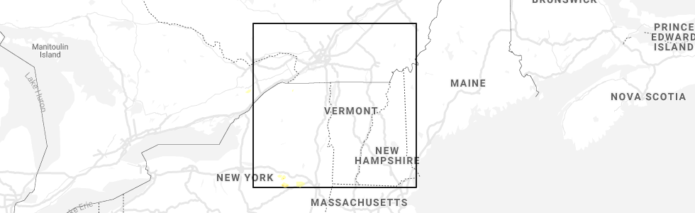
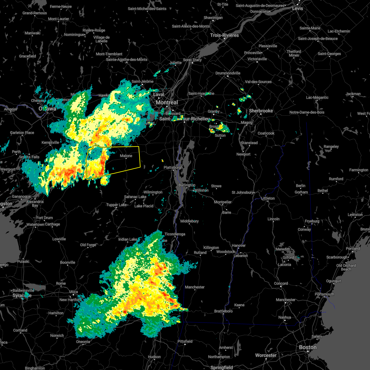
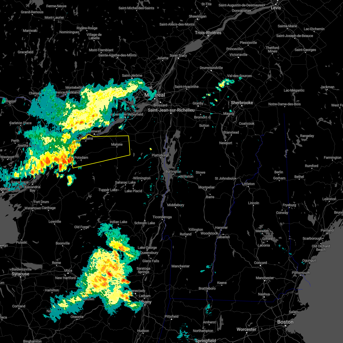
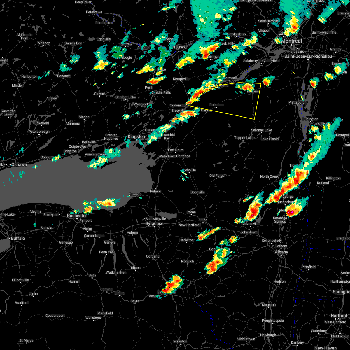
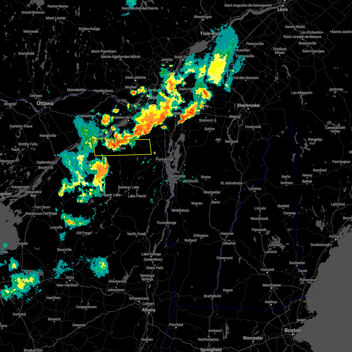
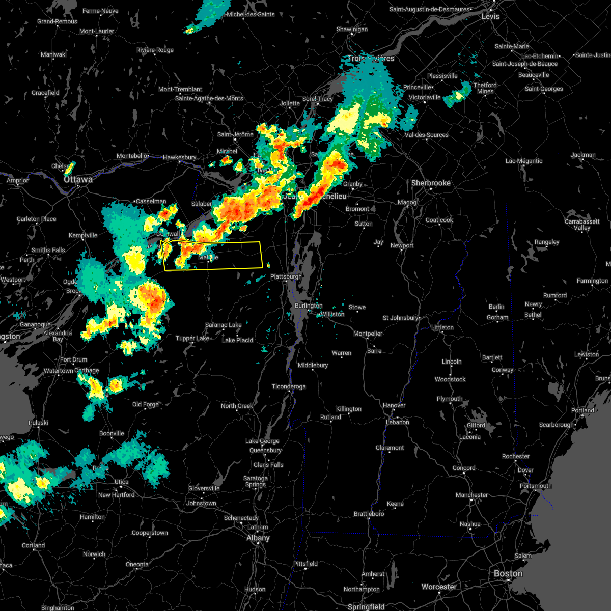
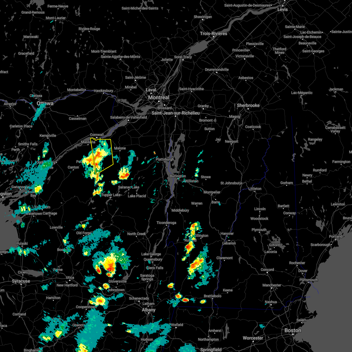
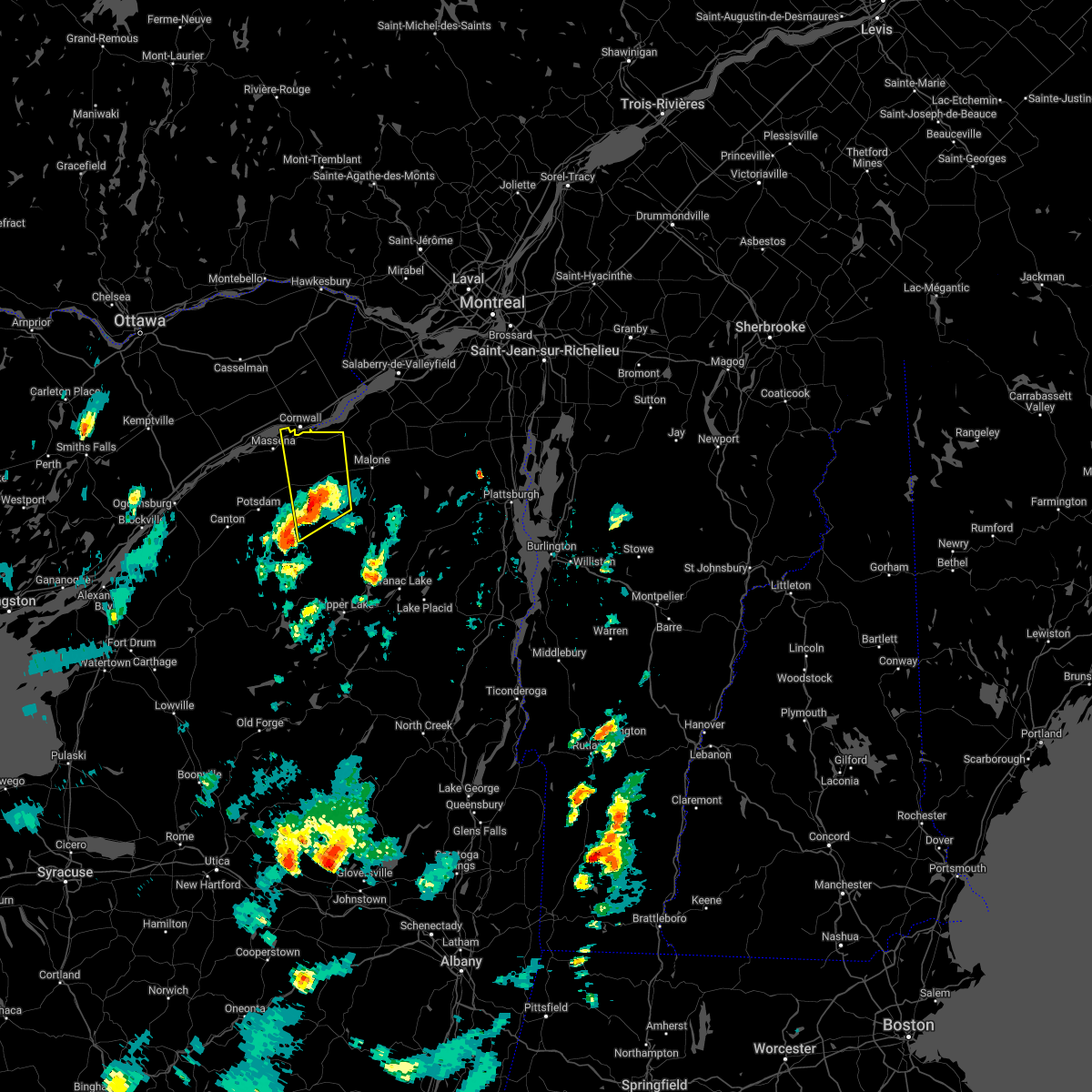
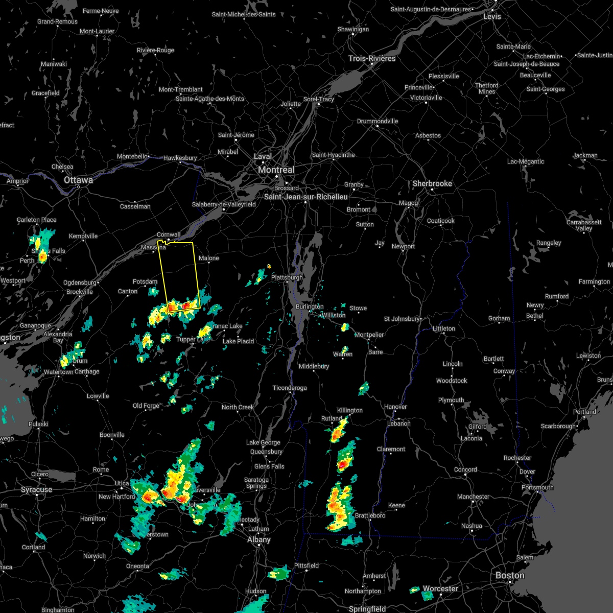
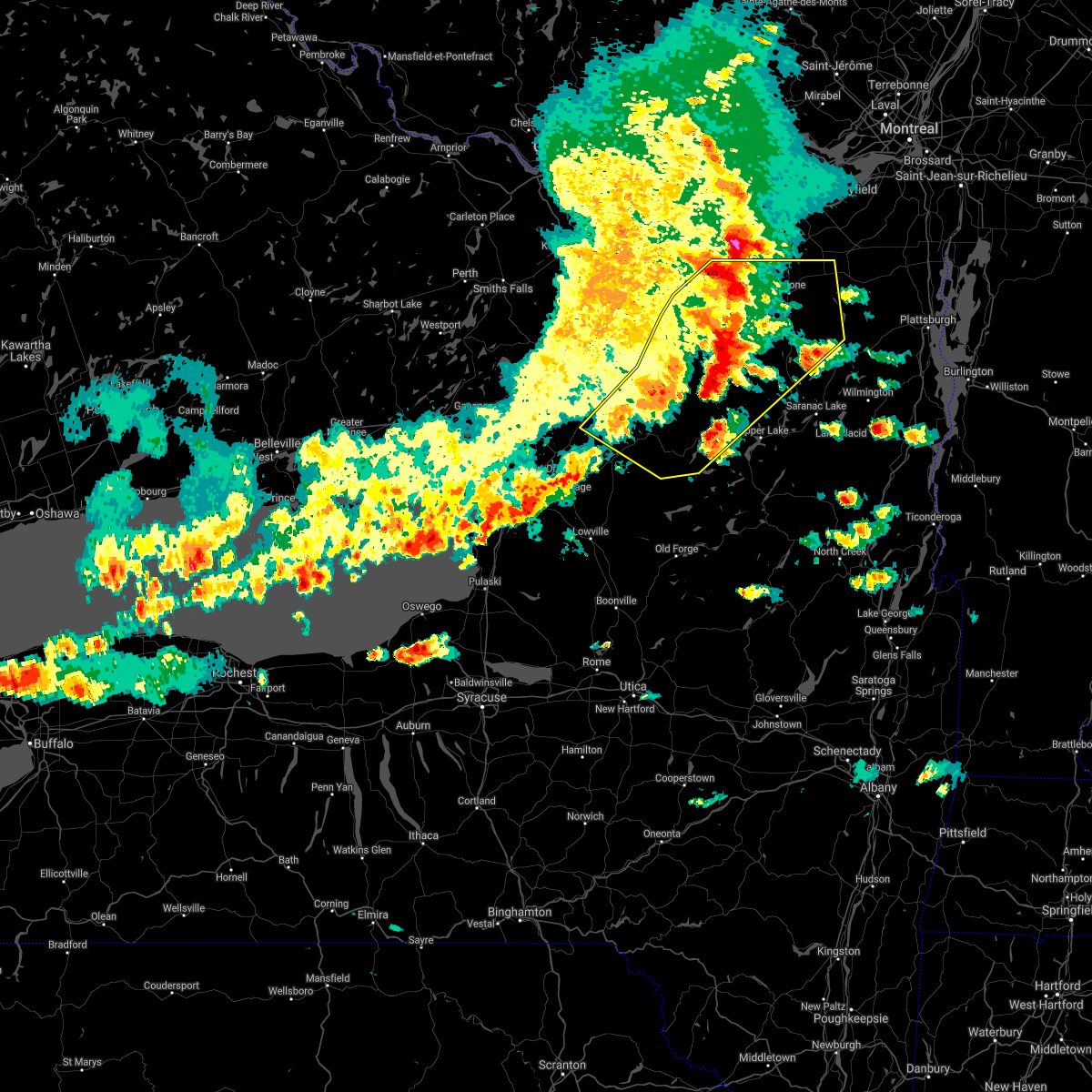
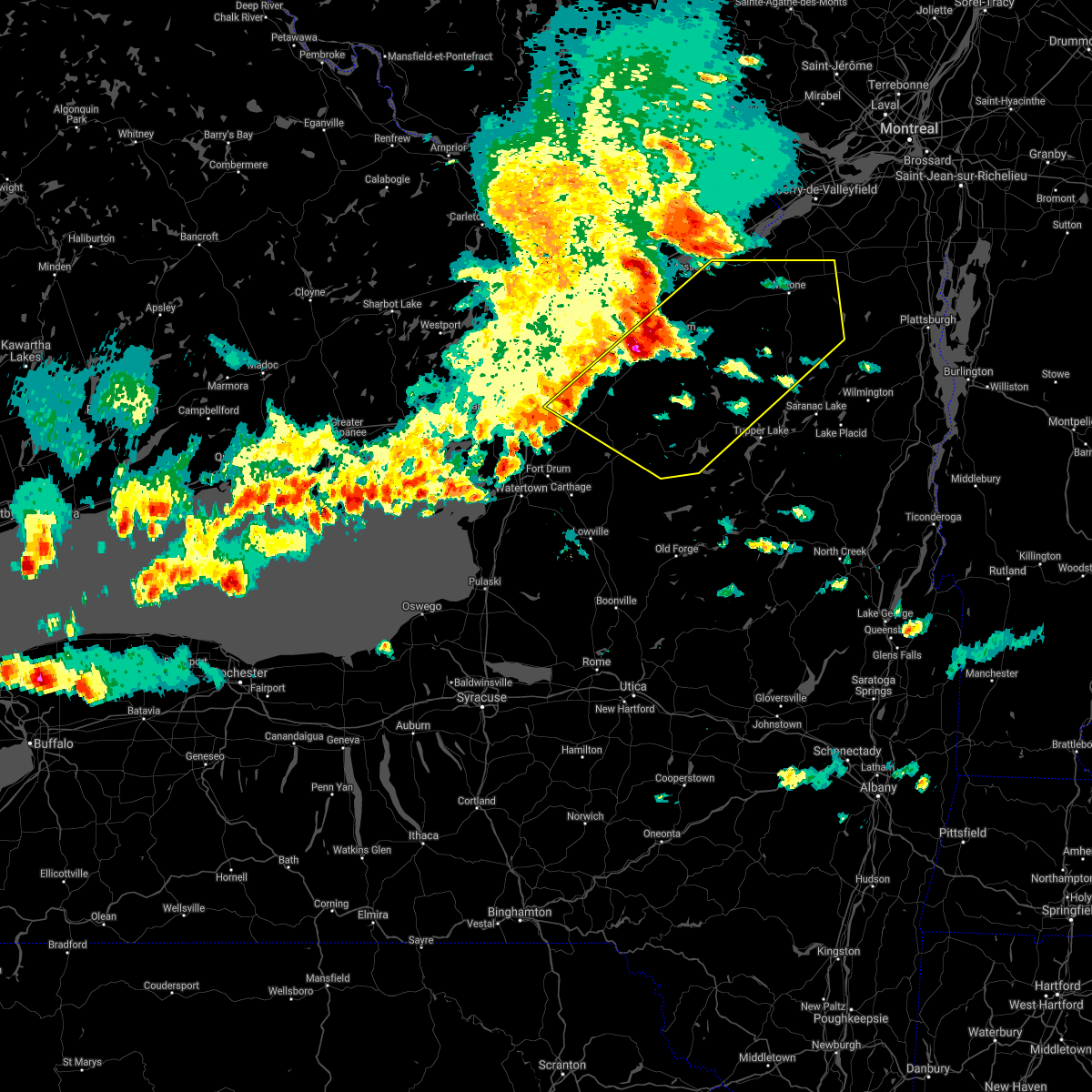
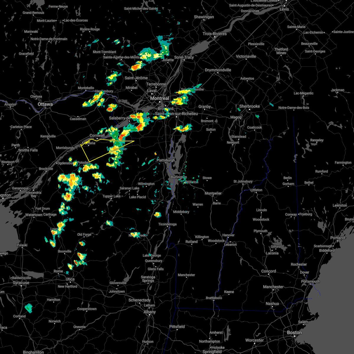
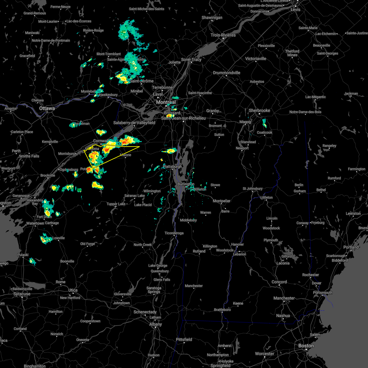
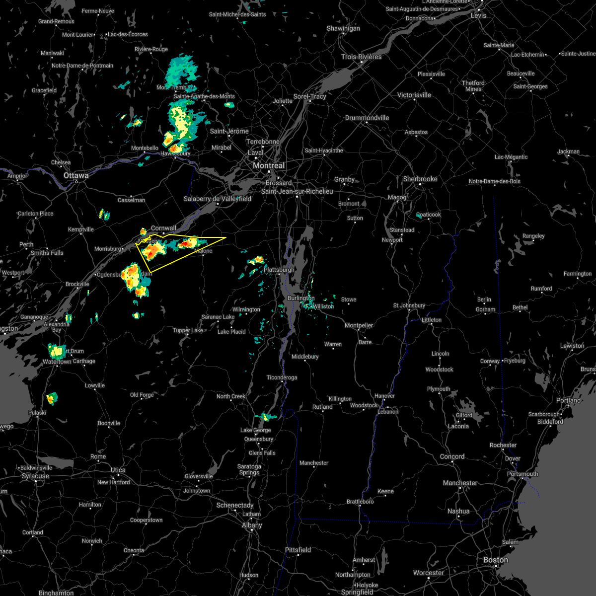
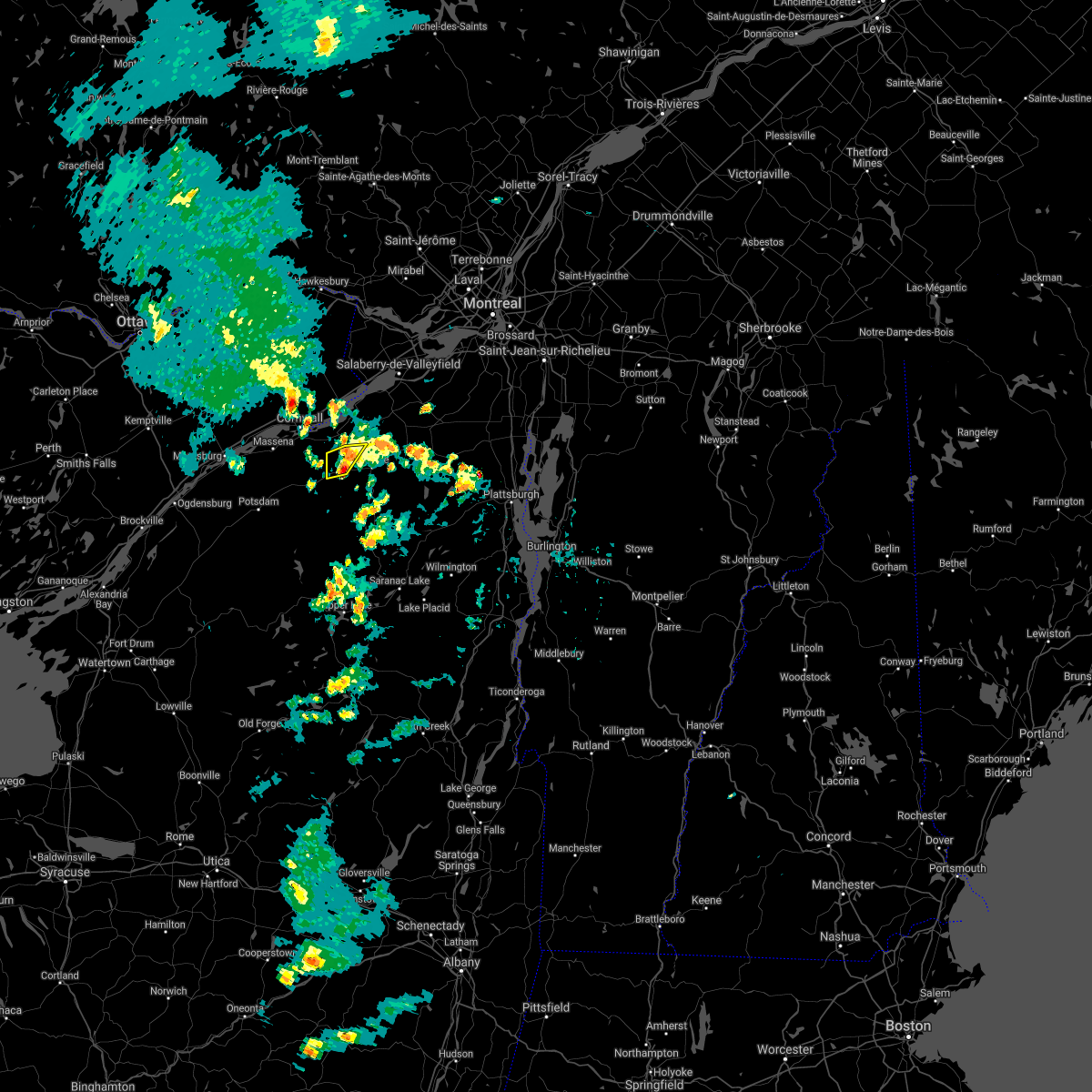
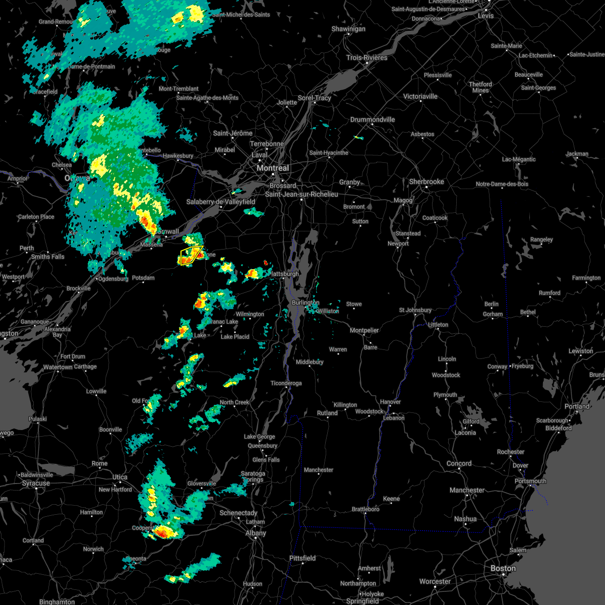
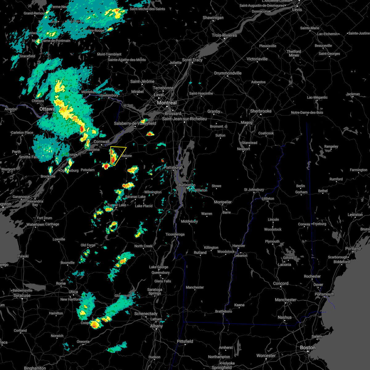
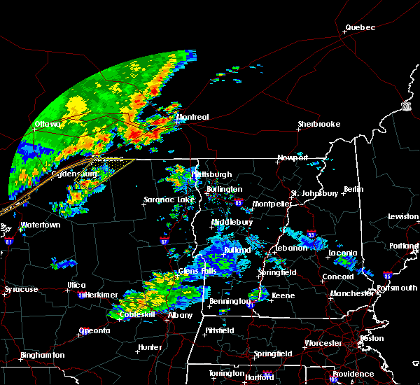
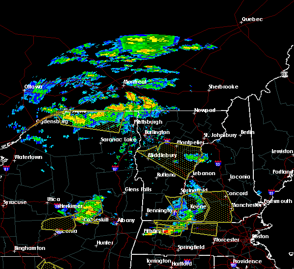
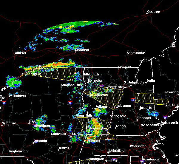
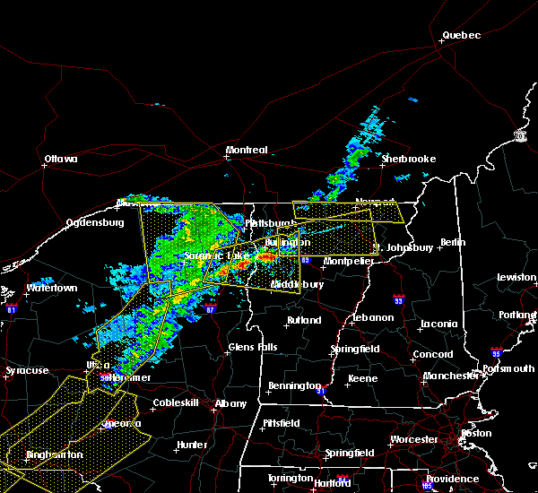
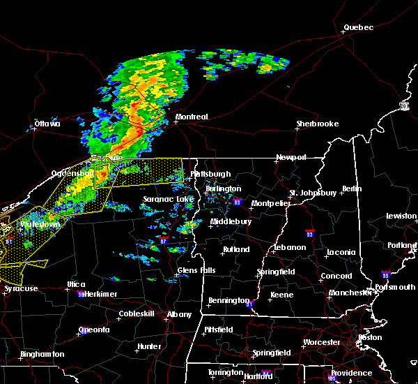
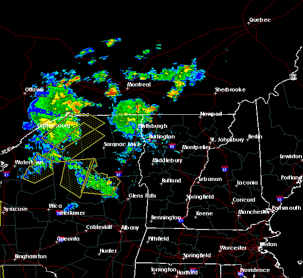
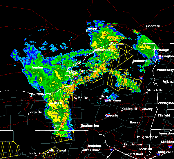
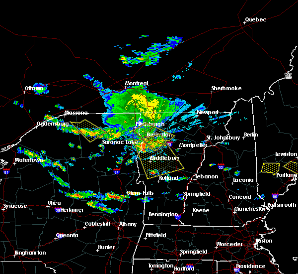
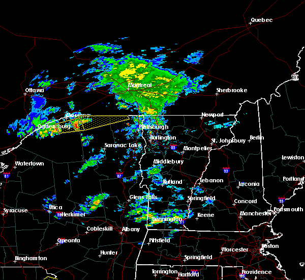
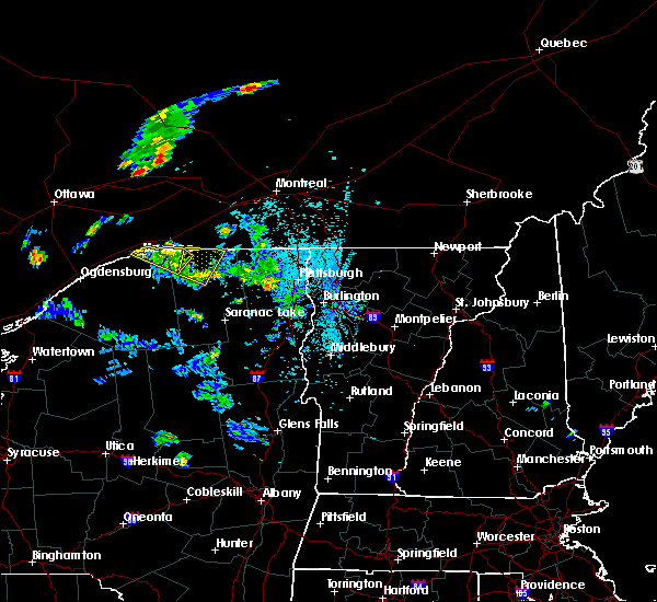
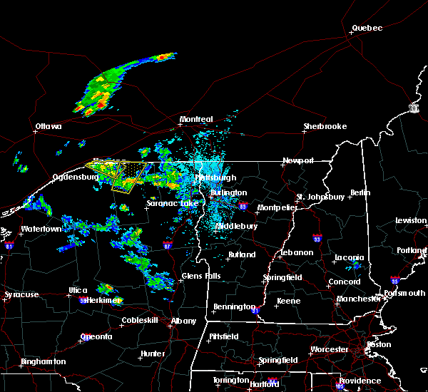
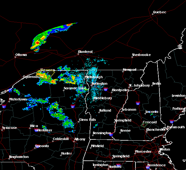
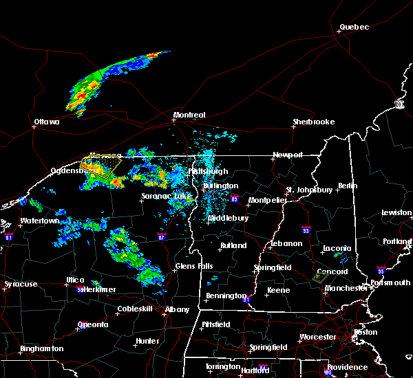
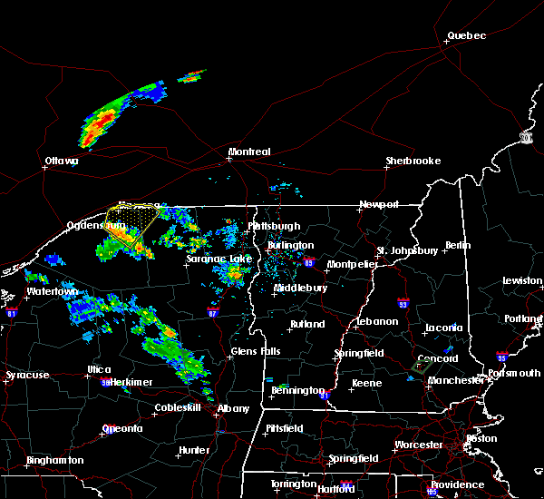
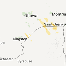
Hail Map for Brushton, NY
The Brushton, NY area has had 6 reports of on-the-ground hail by trained spotters, and has been under severe weather warnings 3 times during the past 12 months. Doppler radar has detected hail at or near Brushton, NY on 7 occasions.
| Name: | Brushton, NY |
| Where Located: | 48.9 miles E of Ogdensburg, NY |
| Map: | Google Map for Brushton, NY |
| Population: | 474 |
| Housing Units: | 241 |
| More Info: | Search Google for Brushton, NY |
5
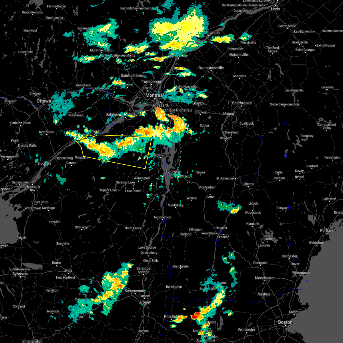
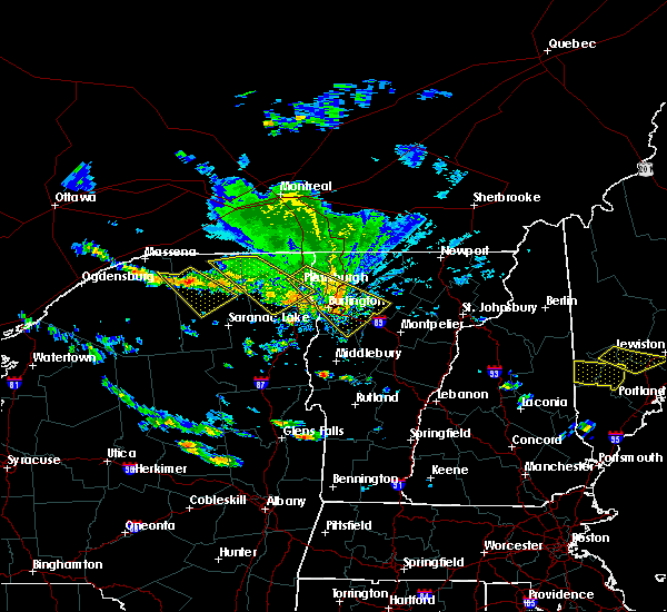
The Top Recent Hail Date for Brushton, NY is Monday, June 14, 2021 (2nd out of 7)
Hail and Wind Damage Spotted near Brushton, NY
| Date / Time | Report Details |
|---|---|
| 7/13/2023 2:36 PM EDT |
 At 235 pm edt, a severe thunderstorm was located over brasher center, moving northeast at 35 mph (public reported a funnel cloud not reaching the ground with this storm at 212 pm). Hazards include 60 mph wind gusts and quarter size hail. Minor hail damage to vehicles is possible. expect wind damage to trees and powerlines. locations impacted include, massena, moira, bangor, fort covington, bombay, malone, massena international airport - richards field, helena, brasher falls, burke, st. Regis, brushton, lawrenceville, dickinson, constable, hopkinton, fort covington center, west bangor, dickinson center, and south bombay. At 235 pm edt, a severe thunderstorm was located over brasher center, moving northeast at 35 mph (public reported a funnel cloud not reaching the ground with this storm at 212 pm). Hazards include 60 mph wind gusts and quarter size hail. Minor hail damage to vehicles is possible. expect wind damage to trees and powerlines. locations impacted include, massena, moira, bangor, fort covington, bombay, malone, massena international airport - richards field, helena, brasher falls, burke, st. Regis, brushton, lawrenceville, dickinson, constable, hopkinton, fort covington center, west bangor, dickinson center, and south bombay.
|
| 7/13/2023 2:23 PM EDT |
 At 222 pm edt, a severe thunderstorm was located over norfolk, moving northeast at 35 mph (radar indicated). Hazards include 60 mph wind gusts and quarter size hail. Minor hail damage to vehicles is possible. expect wind damage to trees and powerlines. locations impacted include, potsdam, massena, norfolk, louisville, moira, bangor, fort covington, bombay, malone, norwood, massena international airport - richards field, helena, brasher falls, burke, st. Regis, brushton, lawrenceville, madrid, waddington, and dickinson. At 222 pm edt, a severe thunderstorm was located over norfolk, moving northeast at 35 mph (radar indicated). Hazards include 60 mph wind gusts and quarter size hail. Minor hail damage to vehicles is possible. expect wind damage to trees and powerlines. locations impacted include, potsdam, massena, norfolk, louisville, moira, bangor, fort covington, bombay, malone, norwood, massena international airport - richards field, helena, brasher falls, burke, st. Regis, brushton, lawrenceville, madrid, waddington, and dickinson.
|
| 7/13/2023 2:17 PM EDT |
 At 217 pm edt, a severe thunderstorm was located over norfolk, moving northeast at 35 mph (radar indicated). Hazards include 60 mph wind gusts and quarter size hail. Minor hail damage to vehicles is possible. Expect wind damage to trees and powerlines. At 217 pm edt, a severe thunderstorm was located over norfolk, moving northeast at 35 mph (radar indicated). Hazards include 60 mph wind gusts and quarter size hail. Minor hail damage to vehicles is possible. Expect wind damage to trees and powerlines.
|
| 7/24/2022 11:54 PM EDT |
 At 1153 pm edt, a severe thunderstorm was located over north stockholm, moving east at 50 mph (radar indicated). Hazards include 70 mph wind gusts. Expect considerable tree damage. damage is likely to mobile homes, roofs, and outbuildings. locations impacted include, potsdam, massena, norfolk, moira, bangor, parishville, fort covington, bombay, massena international airport - richards field, helena, burke, brushton, lawrenceville, malone, chateaugay, norwood, brasher falls, dickinson, constable and hopkinton. thunderstorm damage threat, considerable hail threat, radar indicated max hail size, <. 75 in wind threat, radar indicated max wind gust, 70 mph. At 1153 pm edt, a severe thunderstorm was located over north stockholm, moving east at 50 mph (radar indicated). Hazards include 70 mph wind gusts. Expect considerable tree damage. damage is likely to mobile homes, roofs, and outbuildings. locations impacted include, potsdam, massena, norfolk, moira, bangor, parishville, fort covington, bombay, massena international airport - richards field, helena, burke, brushton, lawrenceville, malone, chateaugay, norwood, brasher falls, dickinson, constable and hopkinton. thunderstorm damage threat, considerable hail threat, radar indicated max hail size, <. 75 in wind threat, radar indicated max wind gust, 70 mph.
|
| 7/24/2022 11:18 PM EDT |
 At 1118 pm edt, a severe thunderstorm was located near raymondville, moving east at 50 mph (radar indicated). Hazards include 70 mph wind gusts. Expect considerable tree damage. Damage is likely to mobile homes, roofs, and outbuildings. At 1118 pm edt, a severe thunderstorm was located near raymondville, moving east at 50 mph (radar indicated). Hazards include 70 mph wind gusts. Expect considerable tree damage. Damage is likely to mobile homes, roofs, and outbuildings.
|
| 7/12/2022 2:43 PM EDT |
 At 243 pm edt, a severe thunderstorm was located over louisville, moving east at 50 mph (radar indicated). Hazards include 60 mph wind gusts and penny size hail. Expect damage to trees and powerlines. locations impacted include, potsdam, massena, norfolk, louisville, moira, bangor, parishville, fort covington, bombay, morley, massena international airport - richards field, helena, burke, waddington, madrid, brushton, lawrenceville, malone, norwood and chipman. hail threat, radar indicated max hail size, 0. 75 in wind threat, radar indicated max wind gust, 60 mph. At 243 pm edt, a severe thunderstorm was located over louisville, moving east at 50 mph (radar indicated). Hazards include 60 mph wind gusts and penny size hail. Expect damage to trees and powerlines. locations impacted include, potsdam, massena, norfolk, louisville, moira, bangor, parishville, fort covington, bombay, morley, massena international airport - richards field, helena, burke, waddington, madrid, brushton, lawrenceville, malone, norwood and chipman. hail threat, radar indicated max hail size, 0. 75 in wind threat, radar indicated max wind gust, 60 mph.
|
| 7/12/2022 2:21 PM EDT |
 At 221 pm edt, a severe thunderstorm was located over waddington, moving east at 45 mph (radar indicated). Hazards include 60 mph wind gusts and quarter size hail. Minor hail damage to vehicles is possible. Expect wind damage to trees and powerlines. At 221 pm edt, a severe thunderstorm was located over waddington, moving east at 45 mph (radar indicated). Hazards include 60 mph wind gusts and quarter size hail. Minor hail damage to vehicles is possible. Expect wind damage to trees and powerlines.
|
| 6/16/2022 5:44 PM EDT |
 At 543 pm edt, a severe thunderstorm was located near burke center, moving east at 40 mph (radar indicated). Hazards include ping pong ball size hail and 60 mph wind gusts. People and animals outdoors will be injured. expect hail damage to roofs, siding, windows, and vehicles. expect wind damage to trees and powerlines. locations impacted include, moira, bangor, fort covington, bombay, malone, churubusco, ellenburg depot, chateaugay, helena, burke, st. Regis, brushton, ellenburg, constable, earlville, fort covington center, west bangor, south bombay, cannon corners and ironton. At 543 pm edt, a severe thunderstorm was located near burke center, moving east at 40 mph (radar indicated). Hazards include ping pong ball size hail and 60 mph wind gusts. People and animals outdoors will be injured. expect hail damage to roofs, siding, windows, and vehicles. expect wind damage to trees and powerlines. locations impacted include, moira, bangor, fort covington, bombay, malone, churubusco, ellenburg depot, chateaugay, helena, burke, st. Regis, brushton, ellenburg, constable, earlville, fort covington center, west bangor, south bombay, cannon corners and ironton.
|
| 6/16/2022 5:25 PM EDT |
 At 524 pm edt, a severe thunderstorm was located over westville center, moving east at 30 mph (radar indicated). Hazards include 60 mph wind gusts and quarter size hail. Minor hail damage to vehicles is possible. Expect wind damage to trees and powerlines. At 524 pm edt, a severe thunderstorm was located over westville center, moving east at 30 mph (radar indicated). Hazards include 60 mph wind gusts and quarter size hail. Minor hail damage to vehicles is possible. Expect wind damage to trees and powerlines.
|
| 5/16/2022 2:10 PM EDT |
 The severe thunderstorm warning for northwestern franklin and northeastern st. lawrence counties will expire at 215 pm edt, the storm which prompted the warning has weakened below severe limits, and no longer poses an immediate threat to life or property. therefore, the warning will be allowed to expire on time at 215 pm. however heavy rain and dangerous cloud to ground lightning is still possible with this thunderstorm. a severe thunderstorm watch remains in effect until 800 pm edt for northern new york. The severe thunderstorm warning for northwestern franklin and northeastern st. lawrence counties will expire at 215 pm edt, the storm which prompted the warning has weakened below severe limits, and no longer poses an immediate threat to life or property. therefore, the warning will be allowed to expire on time at 215 pm. however heavy rain and dangerous cloud to ground lightning is still possible with this thunderstorm. a severe thunderstorm watch remains in effect until 800 pm edt for northern new york.
|
| 5/16/2022 1:47 PM EDT |
 At 147 pm edt, a severe thunderstorm was located over st. regis falls, moving north at 30 mph (radar indicated). Hazards include 60 mph wind gusts and quarter size hail. Minor hail damage to vehicles is possible. expect wind damage to trees and powerlines. locations impacted include, moira, fort covington, bombay, st. regis, helena, brushton, lawrenceville, brasher falls, dickinson, hopkinton, fort covington center, dickinson center, south bombay, brasher center, hogansburg, st. lawrence state park, st. regis falls, ironton, rooseveltown and north lawrence. hail threat, radar indicated max hail size, 1. 00 in wind threat, radar indicated max wind gust, 60 mph. At 147 pm edt, a severe thunderstorm was located over st. regis falls, moving north at 30 mph (radar indicated). Hazards include 60 mph wind gusts and quarter size hail. Minor hail damage to vehicles is possible. expect wind damage to trees and powerlines. locations impacted include, moira, fort covington, bombay, st. regis, helena, brushton, lawrenceville, brasher falls, dickinson, hopkinton, fort covington center, dickinson center, south bombay, brasher center, hogansburg, st. lawrence state park, st. regis falls, ironton, rooseveltown and north lawrence. hail threat, radar indicated max hail size, 1. 00 in wind threat, radar indicated max wind gust, 60 mph.
|
| 5/16/2022 1:22 PM EDT |
 At 121 pm edt, a severe thunderstorm was located near azure mountain, moving north at 30 mph (radar indicated). Hazards include 60 mph wind gusts and quarter size hail. Minor hail damage to vehicles is possible. Expect wind damage to trees and powerlines. At 121 pm edt, a severe thunderstorm was located near azure mountain, moving north at 30 mph (radar indicated). Hazards include 60 mph wind gusts and quarter size hail. Minor hail damage to vehicles is possible. Expect wind damage to trees and powerlines.
|
| 9/15/2021 3:33 AM EDT | Tree on wires on delancy ave. time estimated by rada in franklin county NY, 0.2 miles W of Brushton, NY |
| 7/20/2021 5:21 PM EDT |
 At 519 pm edt, a line of severe thunderstorms over northern new york was located along a line extending from north burke to near balmat, moving east at 45 mph (law enforcement and public reported numerous trees down in ogdensburg and lisbon in saint lawrence county new york). Hazards include 60 mph wind gusts and quarter size hail. Expect wind damage to trees and powerlines. minor hail damage to vehicles is possible. Locations impacted include, potsdam, gouverneur, canton, massena, norfolk, oswegatchie, moira, bangor, fowler, parishville, fort covington, colton, bombay, bryants mill, degrasse, helena, burke, carry falls reservoir, cranberry lake and brushton. At 519 pm edt, a line of severe thunderstorms over northern new york was located along a line extending from north burke to near balmat, moving east at 45 mph (law enforcement and public reported numerous trees down in ogdensburg and lisbon in saint lawrence county new york). Hazards include 60 mph wind gusts and quarter size hail. Expect wind damage to trees and powerlines. minor hail damage to vehicles is possible. Locations impacted include, potsdam, gouverneur, canton, massena, norfolk, oswegatchie, moira, bangor, fowler, parishville, fort covington, colton, bombay, bryants mill, degrasse, helena, burke, carry falls reservoir, cranberry lake and brushton.
|
| 7/20/2021 4:44 PM EDT |
 At 442 pm edt, a line of severe thunderstorms was located from near st. regis, new york to 18 miles southwest of nelson corner, new york moving east at 40 mph (radar indicated). Hazards include 70 mph wind gusts and quarter size hail. Expect considerable tree damage. wind damage is also likely to mobile homes, roofs, and outbuildings. Minor hail damage to vehicles is possible. At 442 pm edt, a line of severe thunderstorms was located from near st. regis, new york to 18 miles southwest of nelson corner, new york moving east at 40 mph (radar indicated). Hazards include 70 mph wind gusts and quarter size hail. Expect considerable tree damage. wind damage is also likely to mobile homes, roofs, and outbuildings. Minor hail damage to vehicles is possible.
|
| 6/21/2021 2:27 PM EDT |
 The severe thunderstorm warning for northwestern franklin and northeastern st. lawrence counties will expire at 230 pm edt, the storm which prompted the warning has moved out of the area. therefore, the warning will be allowed to expire. a severe thunderstorm watch remains in effect until 900 pm edt for northern new york. to report severe weather, contact your nearest law enforcement agency. they will relay your report to the national weather service burlington. The severe thunderstorm warning for northwestern franklin and northeastern st. lawrence counties will expire at 230 pm edt, the storm which prompted the warning has moved out of the area. therefore, the warning will be allowed to expire. a severe thunderstorm watch remains in effect until 900 pm edt for northern new york. to report severe weather, contact your nearest law enforcement agency. they will relay your report to the national weather service burlington.
|
| 6/21/2021 2:02 PM EDT |
 At 202 pm edt, a severe thunderstorm was located near north burke, moving northeast at 35 mph (radar indicated). Hazards include 60 mph wind gusts and quarter size hail. Minor hail damage to vehicles is possible. expect wind damage to trees and powerlines. locations impacted include, massena, moira, fort covington, bombay, st. regis, massena international airport - richards field, helena, brasher falls, brushton, constable, eisenhower lock, fort covington center, south bombay, brasher center, hogansburg, westville center, st. Lawrence state park, ironton, rooseveltown and north lawrence. At 202 pm edt, a severe thunderstorm was located near north burke, moving northeast at 35 mph (radar indicated). Hazards include 60 mph wind gusts and quarter size hail. Minor hail damage to vehicles is possible. expect wind damage to trees and powerlines. locations impacted include, massena, moira, fort covington, bombay, st. regis, massena international airport - richards field, helena, brasher falls, brushton, constable, eisenhower lock, fort covington center, south bombay, brasher center, hogansburg, westville center, st. Lawrence state park, ironton, rooseveltown and north lawrence.
|
| 6/21/2021 1:41 PM EDT |
 At 141 pm edt, a severe thunderstorm was located over fort covington center, moving northeast at 35 mph (radar indicated). Hazards include 60 mph wind gusts and quarter size hail. Minor hail damage to vehicles is possible. Expect wind damage to trees and powerlines. At 141 pm edt, a severe thunderstorm was located over fort covington center, moving northeast at 35 mph (radar indicated). Hazards include 60 mph wind gusts and quarter size hail. Minor hail damage to vehicles is possible. Expect wind damage to trees and powerlines.
|
| 6/14/2021 4:43 PM EDT |
 The severe thunderstorm warning for northwestern franklin county will expire at 445 pm edt, the storm which prompted the warning has weakened below severe limits, and no longer poses an immediate threat to life or property. therefore, the warning will be allowed to expire. however small hail and heavy rain are still possible with this thunderstorm. The severe thunderstorm warning for northwestern franklin county will expire at 445 pm edt, the storm which prompted the warning has weakened below severe limits, and no longer poses an immediate threat to life or property. therefore, the warning will be allowed to expire. however small hail and heavy rain are still possible with this thunderstorm.
|
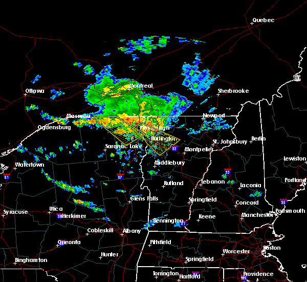
| 6/14/2021 4:18 PM EDT |
 At 417 pm edt, a severe thunderstorm was located over brushton, moving northeast at 10 mph (public in brushton reported dime sized hail). Hazards include 60 mph wind gusts and quarter size hail. Minor hail damage to vehicles is possible. expect wind damage to trees and powerlines. Locations impacted include, moira, brushton, south bombay and westville center. At 417 pm edt, a severe thunderstorm was located over brushton, moving northeast at 10 mph (public in brushton reported dime sized hail). Hazards include 60 mph wind gusts and quarter size hail. Minor hail damage to vehicles is possible. expect wind damage to trees and powerlines. Locations impacted include, moira, brushton, south bombay and westville center.
|
| 6/14/2021 4:06 PM EDT | Quarter sized hail reported 2.4 miles ENE of Brushton, NY, quarter size hail reported in moira. |
| 6/14/2021 4:02 PM EDT | Quarter sized hail reported 0.2 miles W of Brushton, NY, dime to quarter size hail reported in brushton. |
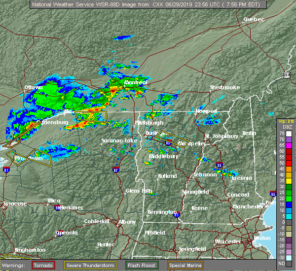
| 6/14/2021 3:57 PM EDT |
 The national weather service in burlington has issued a * severe thunderstorm warning for. northwestern franklin county in northern new york. until 445 pm edt. At 356 pm edt, a severe thunderstorm was located over brushton, moving northeast at 10 mph. The national weather service in burlington has issued a * severe thunderstorm warning for. northwestern franklin county in northern new york. until 445 pm edt. At 356 pm edt, a severe thunderstorm was located over brushton, moving northeast at 10 mph.
|
| 10/10/2020 3:30 PM EDT | Tree and powerline down in franklin county NY, 2.4 miles ENE of Brushton, NY |
| 7/19/2020 6:37 PM EDT |
 At 637 pm edt, severe thunderstorms were located along a line extending from near brushton to near carry falls reservoir to aldrich, moving east at 55 mph (radar indicated). Hazards include 60 mph wind gusts. Expect damage to trees and powerlines. Locations impacted include, tupper lake, adirondack regional airport, oswegatchie, moira, bangor, parishville, piercefield, bryants mill, wawbeek, degrasse, burke, carry falls reservoir, cranberry lake, brushton, lawrenceville, malone, debar mountain, horseshoe lake, lake ozonia and star lake. At 637 pm edt, severe thunderstorms were located along a line extending from near brushton to near carry falls reservoir to aldrich, moving east at 55 mph (radar indicated). Hazards include 60 mph wind gusts. Expect damage to trees and powerlines. Locations impacted include, tupper lake, adirondack regional airport, oswegatchie, moira, bangor, parishville, piercefield, bryants mill, wawbeek, degrasse, burke, carry falls reservoir, cranberry lake, brushton, lawrenceville, malone, debar mountain, horseshoe lake, lake ozonia and star lake.
|
| 7/19/2020 6:19 PM EDT |
 At 619 pm edt, severe thunderstorms were located along a line extending from near nicholville to near south colton to fine, moving east at 45 mph (radar indicated). Hazards include 60 mph wind gusts. Expect damage to trees and powerlines. Locations impacted include, tupper lake, adirondack regional airport, oswegatchie, moira, bangor, fowler, parishville, colton, piercefield, bryants mill, wawbeek, degrasse, burke, carry falls reservoir, cranberry lake, brushton, lawrenceville, malone, debar mountain and brasher falls. At 619 pm edt, severe thunderstorms were located along a line extending from near nicholville to near south colton to fine, moving east at 45 mph (radar indicated). Hazards include 60 mph wind gusts. Expect damage to trees and powerlines. Locations impacted include, tupper lake, adirondack regional airport, oswegatchie, moira, bangor, fowler, parishville, colton, piercefield, bryants mill, wawbeek, degrasse, burke, carry falls reservoir, cranberry lake, brushton, lawrenceville, malone, debar mountain and brasher falls.
|
| 7/19/2020 6:03 PM EDT |
 At 603 pm edt, severe thunderstorms were located along a line extending from west stockholm to near west pierrepont to near pitcairn, moving northeast at 30 mph (radar indicated). Hazards include 60 mph wind gusts and quarter size hail. Minor hail damage to vehicles is possible. Expect wind damage to trees and powerlines. At 603 pm edt, severe thunderstorms were located along a line extending from west stockholm to near west pierrepont to near pitcairn, moving northeast at 30 mph (radar indicated). Hazards include 60 mph wind gusts and quarter size hail. Minor hail damage to vehicles is possible. Expect wind damage to trees and powerlines.
|
| 5/27/2020 5:00 PM EDT |
 At 459 pm edt, a severe thunderstorm was located over moira, moving north at 20 mph (radar indicated). Hazards include 60 mph wind gusts and penny size hail. expect damage to trees and powerlines At 459 pm edt, a severe thunderstorm was located over moira, moving north at 20 mph (radar indicated). Hazards include 60 mph wind gusts and penny size hail. expect damage to trees and powerlines
|
| 5/27/2020 4:21 PM EDT |
 At 420 pm edt, a severe thunderstorm was located over nicholville, moving north at 10 mph (radar indicated). Hazards include 60 mph wind gusts and penny size hail. expect damage to trees and powerlines At 420 pm edt, a severe thunderstorm was located over nicholville, moving north at 10 mph (radar indicated). Hazards include 60 mph wind gusts and penny size hail. expect damage to trees and powerlines
|
| 3/20/2020 3:00 PM EDT |
 At 259 pm edt, a severe thunderstorm was located 9 miles northwest of north burke, moving northeast at 55 mph (public in rooseveltown reported wind damage. law enforcement also reported widespread wind damage in st lawrence county). Hazards include 60 mph wind gusts and penny size hail. Expect damage to trees and powerlines. Locations impacted include, bangor, malone, churubusco, ellenburg depot, chateaugay, burke, brushton, dickinson, ellenburg, constable, earlville, irona, west bangor, cannon corners, ellenburg center, whippleville, alder bend, burke center, westville center and miner lake state park. At 259 pm edt, a severe thunderstorm was located 9 miles northwest of north burke, moving northeast at 55 mph (public in rooseveltown reported wind damage. law enforcement also reported widespread wind damage in st lawrence county). Hazards include 60 mph wind gusts and penny size hail. Expect damage to trees and powerlines. Locations impacted include, bangor, malone, churubusco, ellenburg depot, chateaugay, burke, brushton, dickinson, ellenburg, constable, earlville, irona, west bangor, cannon corners, ellenburg center, whippleville, alder bend, burke center, westville center and miner lake state park.
|
| 3/20/2020 2:32 PM EDT |
 At 232 pm edt, a severe thunderstorm was located over helena, moving northeast at 55 mph (radar indicated). Hazards include 60 mph wind gusts and penny size hail. expect damage to trees and powerlines At 232 pm edt, a severe thunderstorm was located over helena, moving northeast at 55 mph (radar indicated). Hazards include 60 mph wind gusts and penny size hail. expect damage to trees and powerlines
|
| 10/1/2019 2:07 PM EDT |
 At 206 pm edt, a severe thunderstorm was located near ironton, moving east at 45 mph (radar indicated). Hazards include 60 mph wind gusts and quarter size hail. Minor hail damage to vehicles is possible. expect wind damage to trees and powerlines. Locations impacted include, moira, bangor, bombay, helena, brushton, lawrenceville, brasher falls, malone, dickinson, west bangor, dickinson center, south bombay, brasher center, hogansburg, ironton, north lawrence and north bangor. At 206 pm edt, a severe thunderstorm was located near ironton, moving east at 45 mph (radar indicated). Hazards include 60 mph wind gusts and quarter size hail. Minor hail damage to vehicles is possible. expect wind damage to trees and powerlines. Locations impacted include, moira, bangor, bombay, helena, brushton, lawrenceville, brasher falls, malone, dickinson, west bangor, dickinson center, south bombay, brasher center, hogansburg, ironton, north lawrence and north bangor.
|
| 10/1/2019 1:49 PM EDT |
 At 149 pm edt, a severe thunderstorm was located over massena, moving east at 45 mph (radar indicated). Hazards include 60 mph wind gusts and quarter size hail. Minor hail damage to vehicles is possible. Expect wind damage to trees and powerlines. At 149 pm edt, a severe thunderstorm was located over massena, moving east at 45 mph (radar indicated). Hazards include 60 mph wind gusts and quarter size hail. Minor hail damage to vehicles is possible. Expect wind damage to trees and powerlines.
|
| 7/11/2019 6:56 PM EDT |
 At 625 pm edt, a severe thunderstorm was located over hannawa falls, moving northeast at 15 mph (radar indicated. as of 623 pm emergency management reports several trees down across the potsdam area). Hazards include 60 mph wind gusts and quarter size hail. Minor hail damage to vehicles is possible. expect wind damage to trees and powerlines. locations impacted include, potsdam, canton, massena, norfolk, moira, parishville, fort covington, colton, bombay, norwood, massena international airport - richards field, helena, brasher falls, st. Regis, brushton, lawrenceville, dickinson, pierrepont, hopkinton and north stockholm. At 625 pm edt, a severe thunderstorm was located over hannawa falls, moving northeast at 15 mph (radar indicated. as of 623 pm emergency management reports several trees down across the potsdam area). Hazards include 60 mph wind gusts and quarter size hail. Minor hail damage to vehicles is possible. expect wind damage to trees and powerlines. locations impacted include, potsdam, canton, massena, norfolk, moira, parishville, fort covington, colton, bombay, norwood, massena international airport - richards field, helena, brasher falls, st. Regis, brushton, lawrenceville, dickinson, pierrepont, hopkinton and north stockholm.
|
| 7/11/2019 6:27 PM EDT |
 A severe thunderstorm warning remains in effect until 700 pm edt for northwestern franklin and northeastern st. lawrence counties. at 625 pm edt, a severe thunderstorm was located over hannawa falls, moving northeast at 15 mph. hazard. 60 mph wind gusts and quarter size hail. source. radar indicated. As of 623 pm emergency management reports. A severe thunderstorm warning remains in effect until 700 pm edt for northwestern franklin and northeastern st. lawrence counties. at 625 pm edt, a severe thunderstorm was located over hannawa falls, moving northeast at 15 mph. hazard. 60 mph wind gusts and quarter size hail. source. radar indicated. As of 623 pm emergency management reports.
|
| 7/11/2019 6:10 PM EDT |
 The severe thunderstorm warning for northwestern franklin and northeastern st. lawrence counties will expire at 615 pm edt. the warning for this storm has been combined with a severe thunderstorm just to the south and therefore the warning will be allowed to expire. A severe thunderstorm watch remains in effect until midnight edt for. The severe thunderstorm warning for northwestern franklin and northeastern st. lawrence counties will expire at 615 pm edt. the warning for this storm has been combined with a severe thunderstorm just to the south and therefore the warning will be allowed to expire. A severe thunderstorm watch remains in effect until midnight edt for.
|
| 7/11/2019 6:08 PM EDT |
 The national weather service in burlington has issued a * severe thunderstorm warning for. northwestern franklin county in northern new york. northeastern st. lawrence county in northern new york. until 700 pm edt. At 606 pm edt, an area of severe thunderstorms was located over. The national weather service in burlington has issued a * severe thunderstorm warning for. northwestern franklin county in northern new york. northeastern st. lawrence county in northern new york. until 700 pm edt. At 606 pm edt, an area of severe thunderstorms was located over.
|
| 7/11/2019 6:02 PM EDT |
 At 602 pm edt, a severe thunderstorm was located over hannawa falls, moving northeast at 30 mph (radar indicated. at 559 pm a trained spotter reported 1 inch hail falling in potsdam, ny). Hazards include 60 mph wind gusts and quarter size hail. Minor hail damage to vehicles is possible. expect wind damage to trees and powerlines. locations impacted include, potsdam, massena, norfolk, moira, parishville, fort covington, bombay, norwood, massena international airport - richards field, helena, brasher falls, st. Regis, brushton, lawrenceville, madrid, hopkinton, north stockholm, fort covington center, south bombay and west parishville. At 602 pm edt, a severe thunderstorm was located over hannawa falls, moving northeast at 30 mph (radar indicated. at 559 pm a trained spotter reported 1 inch hail falling in potsdam, ny). Hazards include 60 mph wind gusts and quarter size hail. Minor hail damage to vehicles is possible. expect wind damage to trees and powerlines. locations impacted include, potsdam, massena, norfolk, moira, parishville, fort covington, bombay, norwood, massena international airport - richards field, helena, brasher falls, st. Regis, brushton, lawrenceville, madrid, hopkinton, north stockholm, fort covington center, south bombay and west parishville.
|
| 7/11/2019 5:41 PM EDT |
 A severe thunderstorm warning remains in effect until 615 pm edt for northwestern franklin and northeastern st. lawrence counties. at 540 pm edt, a severe thunderstorm was located over north stockholm, moving northeast at 20 mph. hazard. 60 mph wind gusts and quarter size hail. source. radar indicated. At 518 pm 1/2 inch hail was reported near. A severe thunderstorm warning remains in effect until 615 pm edt for northwestern franklin and northeastern st. lawrence counties. at 540 pm edt, a severe thunderstorm was located over north stockholm, moving northeast at 20 mph. hazard. 60 mph wind gusts and quarter size hail. source. radar indicated. At 518 pm 1/2 inch hail was reported near.
|
| 7/11/2019 5:21 PM EDT |
 The national weather service in burlington has issued a * severe thunderstorm warning for. northwestern franklin county in northern new york. northeastern st. lawrence county in northern new york. until 615 pm edt. At 521 pm edt, a severe thunderstorm was located near. The national weather service in burlington has issued a * severe thunderstorm warning for. northwestern franklin county in northern new york. northeastern st. lawrence county in northern new york. until 615 pm edt. At 521 pm edt, a severe thunderstorm was located near.
|
| 6/29/2019 7:59 PM EDT |
 At 759 pm edt, a severe thunderstorm was located over constable, moving east at 20 mph (radar indicated). Hazards include 60 mph wind gusts and quarter size hail. Minor hail damage to vehicles is possible. expect wind damage to trees and powerlines. locations impacted include, fort covington, bombay, malone, burke, st. Regis, chateaugay, brushton, constable, earlville, fort covington center, whippleville, south bombay, burke center, westville center, north burke, north bangor and brainardsville. At 759 pm edt, a severe thunderstorm was located over constable, moving east at 20 mph (radar indicated). Hazards include 60 mph wind gusts and quarter size hail. Minor hail damage to vehicles is possible. expect wind damage to trees and powerlines. locations impacted include, fort covington, bombay, malone, burke, st. Regis, chateaugay, brushton, constable, earlville, fort covington center, whippleville, south bombay, burke center, westville center, north burke, north bangor and brainardsville.
|
| 6/29/2019 7:13 PM EDT |
 At 712 pm edt, a severe thunderstorm was located over hogansburg, moving east at 20 mph (radar indicated). Hazards include 60 mph wind gusts and quarter size hail. Minor hail damage to vehicles is possible. Expect wind damage to trees and powerlines. At 712 pm edt, a severe thunderstorm was located over hogansburg, moving east at 20 mph (radar indicated). Hazards include 60 mph wind gusts and quarter size hail. Minor hail damage to vehicles is possible. Expect wind damage to trees and powerlines.
|
| 6/18/2018 5:28 PM EDT |
 The severe thunderstorm warning for western clinton, northern franklin and northeastern st. lawrence counties will expire at 530 pm edt, the storm which prompted the warning has weakened below severe limits, and no longer poses an immediate threat to life or property. therefore, the warning will be allowed to expire. however gusty winds and heavy rain are still possible with this thunderstorm. a severe thunderstorm watch remains in effect until 1000 pm edt for northern new york. The severe thunderstorm warning for western clinton, northern franklin and northeastern st. lawrence counties will expire at 530 pm edt, the storm which prompted the warning has weakened below severe limits, and no longer poses an immediate threat to life or property. therefore, the warning will be allowed to expire. however gusty winds and heavy rain are still possible with this thunderstorm. a severe thunderstorm watch remains in effect until 1000 pm edt for northern new york.
|
| 6/18/2018 5:23 PM EDT |
 At 523 pm edt, a severe thunderstorm was located over ironton, moving east at 35 mph (radar indicated). Hazards include 60 mph wind gusts and penny size hail. Expect damage to trees and powerlines. Locations impacted include, massena, saranac, louisville, moira, altona, bangor, fort covington, bombay, ellenburg depot, bryants mill, massena international airport - richards field, helena, lyon mountain, burke, clayburg, merrill, brushton, lawrenceville, malone and churubusco. At 523 pm edt, a severe thunderstorm was located over ironton, moving east at 35 mph (radar indicated). Hazards include 60 mph wind gusts and penny size hail. Expect damage to trees and powerlines. Locations impacted include, massena, saranac, louisville, moira, altona, bangor, fort covington, bombay, ellenburg depot, bryants mill, massena international airport - richards field, helena, lyon mountain, burke, clayburg, merrill, brushton, lawrenceville, malone and churubusco.
|
| 6/18/2018 4:37 PM EDT |
 At 436 pm edt, a severe thunderstorm was located 7 miles northwest of coles creek state park, moving east at 35 mph (radar indicated). Hazards include 60 mph wind gusts and penny size hail. expect damage to trees and powerlines At 436 pm edt, a severe thunderstorm was located 7 miles northwest of coles creek state park, moving east at 35 mph (radar indicated). Hazards include 60 mph wind gusts and penny size hail. expect damage to trees and powerlines
|
| 5/4/2018 7:10 PM EDT |
 At 709 pm edt, severe thunderstorms were located along a line extending from fort covington center to near alder brook to near tahawus, moving east at 65 mph (radar indicated). Hazards include 60 mph wind gusts and quarter size hail. Minor hail damage to vehicles is possible. expect wind damage to trees and powerlines. locations impacted include, saranac lake, tupper lake, adirondack regional airport, lake placid, schuyler falls, saranac, moira, bangor, fort covington, bombay, wilmington, keene, ellenburg depot, bryants mill, wawbeek, burke, brushton, churubusco, au sable forks and mount marcy. A tornado watch remains in effect until 1000 pm edt for northern new york. At 709 pm edt, severe thunderstorms were located along a line extending from fort covington center to near alder brook to near tahawus, moving east at 65 mph (radar indicated). Hazards include 60 mph wind gusts and quarter size hail. Minor hail damage to vehicles is possible. expect wind damage to trees and powerlines. locations impacted include, saranac lake, tupper lake, adirondack regional airport, lake placid, schuyler falls, saranac, moira, bangor, fort covington, bombay, wilmington, keene, ellenburg depot, bryants mill, wawbeek, burke, brushton, churubusco, au sable forks and mount marcy. A tornado watch remains in effect until 1000 pm edt for northern new york.
|
| 5/4/2018 6:51 PM EDT |
 At 651 pm edt, severe thunderstorms were located along a line extending from norfolk to debar mountain to tahawus, moving northeast at 70 mph (radar indicated). Hazards include 60 mph wind gusts and quarter size hail. Minor hail damage to vehicles is possible. Expect wind damage to trees and powerlines. At 651 pm edt, severe thunderstorms were located along a line extending from norfolk to debar mountain to tahawus, moving northeast at 70 mph (radar indicated). Hazards include 60 mph wind gusts and quarter size hail. Minor hail damage to vehicles is possible. Expect wind damage to trees and powerlines.
|
| 5/4/2018 5:11 PM EDT | Trees and wires dow in franklin county NY, 0.2 miles W of Brushton, NY |
| 5/4/2018 4:49 PM EDT |
 At 448 pm edt, a severe thunderstorm was located over converse, moving northeast at 40 mph (radar indicated). Hazards include 60 mph wind gusts and quarter size hail. Minor hail damage to vehicles is possible. Expect wind damage to trees and powerlines. At 448 pm edt, a severe thunderstorm was located over converse, moving northeast at 40 mph (radar indicated). Hazards include 60 mph wind gusts and quarter size hail. Minor hail damage to vehicles is possible. Expect wind damage to trees and powerlines.
|
| 8/22/2017 2:39 PM EDT |
 At 239 pm edt, a severe thunderstorm was located over moira, moving east at 50 mph (radar indicated). Hazards include 70 mph wind gusts and penny size hail. Expect considerable tree damage. Damage is likely to mobile homes, roofs, and outbuildings. At 239 pm edt, a severe thunderstorm was located over moira, moving east at 50 mph (radar indicated). Hazards include 70 mph wind gusts and penny size hail. Expect considerable tree damage. Damage is likely to mobile homes, roofs, and outbuildings.
|
| 8/22/2017 2:29 PM EDT |
 At 228 pm edt, severe thunderstorms were located along a line extending from near ironton to converse to west fowler, moving east at 50 mph (radar indicated). Hazards include 60 mph wind gusts and penny size hail. Expect damage to trees and powerlines. locations impacted include, potsdam, massena, gouverneur, canton, norfolk, louisville, moira, de kalb, fowler, parishville, colton, bombay, morley, degrasse, massena international airport - richards field, helena, carry falls reservoir, richville, cranberry lake and madrid. A tornado watch remains in effect until 900 pm edt for northern new york. At 228 pm edt, severe thunderstorms were located along a line extending from near ironton to converse to west fowler, moving east at 50 mph (radar indicated). Hazards include 60 mph wind gusts and penny size hail. Expect damage to trees and powerlines. locations impacted include, potsdam, massena, gouverneur, canton, norfolk, louisville, moira, de kalb, fowler, parishville, colton, bombay, morley, degrasse, massena international airport - richards field, helena, carry falls reservoir, richville, cranberry lake and madrid. A tornado watch remains in effect until 900 pm edt for northern new york.
|
| 8/22/2017 1:45 PM EDT |
 At 144 pm edt, severe thunderstorms were located along a line extending from jacques cartier state park to near hammond to nelson corner, moving east at 40 mph (radar indicated). Hazards include 60 mph wind gusts. expect damage to trees and powerlines At 144 pm edt, severe thunderstorms were located along a line extending from jacques cartier state park to near hammond to nelson corner, moving east at 40 mph (radar indicated). Hazards include 60 mph wind gusts. expect damage to trees and powerlines
|
| 8/4/2017 8:49 PM EDT |
 At 848 pm edt, a severe thunderstorm was located near carry falls reservoir, moving northeast at 45 mph (radar indicated). Hazards include 60 mph wind gusts and quarter size hail. Minor hail damage to vehicles is possible. expect wind damage to trees and powerlines. locations impacted include, debar mountain, carry falls reservoir, degrasse, cranberry lake, lake ozonia, madawaska, brushton, dickinson, stark, santa clara, dickinson center, duane center, higley flow state park, st. Regis falls, gale, azure mountain, childwold, shurtleff, nicholville and south colton. At 848 pm edt, a severe thunderstorm was located near carry falls reservoir, moving northeast at 45 mph (radar indicated). Hazards include 60 mph wind gusts and quarter size hail. Minor hail damage to vehicles is possible. expect wind damage to trees and powerlines. locations impacted include, debar mountain, carry falls reservoir, degrasse, cranberry lake, lake ozonia, madawaska, brushton, dickinson, stark, santa clara, dickinson center, duane center, higley flow state park, st. Regis falls, gale, azure mountain, childwold, shurtleff, nicholville and south colton.
|
| 8/4/2017 8:28 PM EDT |
 The severe thunderstorm warning for northwestern franklin and northeastern st. lawrence counties will expire at 830 pm edt, the storms which prompted the warning have weakened below severe limits, and have exited the warned area. therefore the warning will be allowed to expire. The severe thunderstorm warning for northwestern franklin and northeastern st. lawrence counties will expire at 830 pm edt, the storms which prompted the warning have weakened below severe limits, and have exited the warned area. therefore the warning will be allowed to expire.
|
| 8/4/2017 8:12 PM EDT |
 At 810 pm edt, severe thunderstorms were located along a line extending from near massena to north lawrence, moving northeast at 40 mph (radar indicated). Hazards include 60 mph wind gusts and quarter size hail. Minor hail damage to vehicles is possible. expect wind damage to trees and powerlines. locations impacted include, massena, moira, bangor, fort covington, bombay, malone, massena international airport - richards field, helena, brasher falls, st. Regis, brushton, lawrenceville, dickinson, constable, hopkinton, fort covington center, west bangor, dickinson center, south bombay and brasher center. At 810 pm edt, severe thunderstorms were located along a line extending from near massena to north lawrence, moving northeast at 40 mph (radar indicated). Hazards include 60 mph wind gusts and quarter size hail. Minor hail damage to vehicles is possible. expect wind damage to trees and powerlines. locations impacted include, massena, moira, bangor, fort covington, bombay, malone, massena international airport - richards field, helena, brasher falls, st. Regis, brushton, lawrenceville, dickinson, constable, hopkinton, fort covington center, west bangor, dickinson center, south bombay and brasher center.
|
| 8/4/2017 8:08 PM EDT |
 At 808 pm edt, a severe thunderstorm was located over oswegatchie, moving northeast at 40 mph (radar indicated). Hazards include 60 mph wind gusts and quarter size hail. Minor hail damage to vehicles is possible. Expect wind damage to trees and powerlines. At 808 pm edt, a severe thunderstorm was located over oswegatchie, moving northeast at 40 mph (radar indicated). Hazards include 60 mph wind gusts and quarter size hail. Minor hail damage to vehicles is possible. Expect wind damage to trees and powerlines.
|
| 8/4/2017 8:01 PM EDT |
 At 800 pm edt, severe thunderstorms were located along a line extending from near north stockholm to nicholville, moving northeast at 45 mph (radar indicated). Hazards include 60 mph wind gusts and quarter size hail. Minor hail damage to vehicles is possible. expect wind damage to trees and powerlines. locations impacted include, potsdam, canton, massena, norfolk, moira, bangor, parishville, fort covington, colton, bombay, morley, massena international airport - richards field, helena, brushton, lawrenceville, malone, norwood, hermon, brasher falls and st. Regis. At 800 pm edt, severe thunderstorms were located along a line extending from near north stockholm to nicholville, moving northeast at 45 mph (radar indicated). Hazards include 60 mph wind gusts and quarter size hail. Minor hail damage to vehicles is possible. expect wind damage to trees and powerlines. locations impacted include, potsdam, canton, massena, norfolk, moira, bangor, parishville, fort covington, colton, bombay, morley, massena international airport - richards field, helena, brushton, lawrenceville, malone, norwood, hermon, brasher falls and st. Regis.
|
| 8/4/2017 7:29 PM EDT |
 At 728 pm edt, severe thunderstorms were located along a line extending from near pyrites to near degrasse, moving northeast at 40 mph (radar indicated). Hazards include 60 mph wind gusts and quarter size hail. Minor hail damage to vehicles is possible. Expect wind damage to trees and powerlines. At 728 pm edt, severe thunderstorms were located along a line extending from near pyrites to near degrasse, moving northeast at 40 mph (radar indicated). Hazards include 60 mph wind gusts and quarter size hail. Minor hail damage to vehicles is possible. Expect wind damage to trees and powerlines.
|
| 5/1/2017 8:05 PM EDT |
 At 804 pm edt, severe thunderstorms were located along a line extending from near nicholville to near st. regis falls to near madawaska to 7 miles west of saranac inn, moving northeast at 55 mph. this storm has a history of producing wind damage with reports of damage in fine and russell new york (radar indicated). Hazards include 60 mph wind gusts. Expect damage to roofs, siding, and trees. Locations impacted include, adirondack regional airport, altona, bangor, ellenburg depot, bryants mill, lyon mountain, merrill, clayburg, churubusco, debar mountain, jericho, peasleeville, madawaska, harrietstown, dickinson, saranac, moira, ellenburg, constable and black brook. At 804 pm edt, severe thunderstorms were located along a line extending from near nicholville to near st. regis falls to near madawaska to 7 miles west of saranac inn, moving northeast at 55 mph. this storm has a history of producing wind damage with reports of damage in fine and russell new york (radar indicated). Hazards include 60 mph wind gusts. Expect damage to roofs, siding, and trees. Locations impacted include, adirondack regional airport, altona, bangor, ellenburg depot, bryants mill, lyon mountain, merrill, clayburg, churubusco, debar mountain, jericho, peasleeville, madawaska, harrietstown, dickinson, saranac, moira, ellenburg, constable and black brook.
|
| 5/1/2017 7:43 PM EDT |
 At 742 pm edt, severe thunderstorms were located along a line extending from near west parishville to near parishville to near carry falls reservoir to childwold, moving northeast at 60 mph. this storm has a history of producing wind damage with reports of damage in fine and russell new york (radar indicated). Hazards include 60 mph wind gusts. expect damage to roofs, siding, and trees At 742 pm edt, severe thunderstorms were located along a line extending from near west parishville to near parishville to near carry falls reservoir to childwold, moving northeast at 60 mph. this storm has a history of producing wind damage with reports of damage in fine and russell new york (radar indicated). Hazards include 60 mph wind gusts. expect damage to roofs, siding, and trees
|
| 9/11/2016 12:47 AM EDT |
 At 1246 am edt, severe thunderstorms were located along a line extending from brasher center to near stark, moving northeast at 45 mph (radar indicated). Hazards include 60 mph wind gusts. Expect damage to roofs. siding. and trees. locations impacted include, norfolk, madrid, fort covington, norwood, colton, bombay, brushton, st. Regis, lake ozonia, massena international airport - richards field, lawrenceville, helena, brasher falls, dickinson, louisville, moira, pierrepont, parishville, hopkinton and stark. At 1246 am edt, severe thunderstorms were located along a line extending from brasher center to near stark, moving northeast at 45 mph (radar indicated). Hazards include 60 mph wind gusts. Expect damage to roofs. siding. and trees. locations impacted include, norfolk, madrid, fort covington, norwood, colton, bombay, brushton, st. Regis, lake ozonia, massena international airport - richards field, lawrenceville, helena, brasher falls, dickinson, louisville, moira, pierrepont, parishville, hopkinton and stark.
|
| 9/11/2016 12:12 AM EDT |
 At 1211 am edt, severe thunderstorms were located along a line extending from near canton to fine, moving northeast at 50 mph (radar indicated). Hazards include 60 mph wind gusts. Expect damage to roofs. siding. And trees. At 1211 am edt, severe thunderstorms were located along a line extending from near canton to fine, moving northeast at 50 mph (radar indicated). Hazards include 60 mph wind gusts. Expect damage to roofs. siding. And trees.
|
| 9/10/2016 11:26 PM EDT |
 At 1124 pm edt, severe thunderstorms were located along a line extending from louisville to near norwood to fowler, moving northeast at 45 mph (radar indicated). Hazards include 60 mph wind gusts. Expect damage to roofs. siding. And trees. At 1124 pm edt, severe thunderstorms were located along a line extending from louisville to near norwood to fowler, moving northeast at 45 mph (radar indicated). Hazards include 60 mph wind gusts. Expect damage to roofs. siding. And trees.
|
| 7/23/2016 3:53 PM EDT |
 The severe thunderstorm warning for east central st. lawrence and central franklin counties will expire at 400 pm edt, the storm which prompted the warning has weakened below severe limits, and no longer pose an immediate threat to life or property. therefore the warning will be allowed to expire. however gusty winds and heavy rain are still possible with this thunderstorm. a severe thunderstorm watch remains in effect until 800 pm edt for northern new york. The severe thunderstorm warning for east central st. lawrence and central franklin counties will expire at 400 pm edt, the storm which prompted the warning has weakened below severe limits, and no longer pose an immediate threat to life or property. therefore the warning will be allowed to expire. however gusty winds and heavy rain are still possible with this thunderstorm. a severe thunderstorm watch remains in effect until 800 pm edt for northern new york.
|
| 7/23/2016 3:29 PM EDT |
 At 329 pm edt, a severe thunderstorm was located near dickinson center, moving southeast at 30 mph (radar indicated). Hazards include 60 mph wind gusts and quarter size hail. Hail damage to vehicles is expected. expect wind damage to roofs, siding, and trees. locations impacted include, bangor, brushton, debar mountain, madawaska, lawrenceville, dickinson, santa clara, duane center, west bangor, st. Regis falls, dickinson center, north lawrence and azure mountain. At 329 pm edt, a severe thunderstorm was located near dickinson center, moving southeast at 30 mph (radar indicated). Hazards include 60 mph wind gusts and quarter size hail. Hail damage to vehicles is expected. expect wind damage to roofs, siding, and trees. locations impacted include, bangor, brushton, debar mountain, madawaska, lawrenceville, dickinson, santa clara, duane center, west bangor, st. Regis falls, dickinson center, north lawrence and azure mountain.
|
| 7/23/2016 3:25 PM EDT | Trees down on course and dime sized hail in franklin county NY, 4.2 miles N of Brushton, NY |
| 7/23/2016 3:06 PM EDT |
 At 305 pm edt, a severe thunderstorm was located over north lawrence, moving southeast at 35 mph (radar indicated). Hazards include 60 mph wind gusts and quarter size hail. Hail damage to vehicles is expected. Expect wind damage to roofs, siding, and trees. At 305 pm edt, a severe thunderstorm was located over north lawrence, moving southeast at 35 mph (radar indicated). Hazards include 60 mph wind gusts and quarter size hail. Hail damage to vehicles is expected. Expect wind damage to roofs, siding, and trees.
|
| 7/9/2016 3:52 PM EDT |
 The severe thunderstorm warning for northwestern clinton and northern franklin counties will expire at 400 pm edt, the storm which prompted the warning has weakened below severe limits, and no longer pose an immediate threat to life or property. therefore the warning will be allowed to expire. The severe thunderstorm warning for northwestern clinton and northern franklin counties will expire at 400 pm edt, the storm which prompted the warning has weakened below severe limits, and no longer pose an immediate threat to life or property. therefore the warning will be allowed to expire.
|
| 7/9/2016 3:25 PM EDT |
 At 324 pm edt, a severe thunderstorm was located near bangor, moving northeast at 40 mph (radar indicated). Hazards include 60 mph wind gusts and quarter size hail. Hail damage to vehicles is expected. expect wind damage to roofs, siding, and trees. locations impacted include, bangor, fort covington, bombay, chateaugay, brushton, burke, ellenburg depot, churubusco, dickinson, moira, westville, ellenburg, constable, earlville, north burke, cannon corners, whippleville, burke center, harrigan and westville center. At 324 pm edt, a severe thunderstorm was located near bangor, moving northeast at 40 mph (radar indicated). Hazards include 60 mph wind gusts and quarter size hail. Hail damage to vehicles is expected. expect wind damage to roofs, siding, and trees. locations impacted include, bangor, fort covington, bombay, chateaugay, brushton, burke, ellenburg depot, churubusco, dickinson, moira, westville, ellenburg, constable, earlville, north burke, cannon corners, whippleville, burke center, harrigan and westville center.
|
| 7/9/2016 2:55 PM EDT |
 At 254 pm edt, a severe thunderstorm was located over lawrenceville, moving east at 40 mph (trained weather spotters had reported multiple trees and powerlines downed from this thunderstorm). Hazards include 60 mph wind gusts and half dollar size hail. Hail damage to vehicles is expected. Expect wind damage to roofs, siding, and trees. At 254 pm edt, a severe thunderstorm was located over lawrenceville, moving east at 40 mph (trained weather spotters had reported multiple trees and powerlines downed from this thunderstorm). Hazards include 60 mph wind gusts and half dollar size hail. Hail damage to vehicles is expected. Expect wind damage to roofs, siding, and trees.
|
| 8/18/2015 9:11 PM EDT |
 At 909 pm edt, doppler radar indicated a severe thunderstorm capable of producing damaging winds in excess of 60 mph. this storm was located near bangor, moving northeast at 20 mph. locations impacted include, bangor, brushton, burke, westville, constable, burke center, westville center, fort covington center, west bangor, whippleville and north bangor. At 909 pm edt, doppler radar indicated a severe thunderstorm capable of producing damaging winds in excess of 60 mph. this storm was located near bangor, moving northeast at 20 mph. locations impacted include, bangor, brushton, burke, westville, constable, burke center, westville center, fort covington center, west bangor, whippleville and north bangor.
|
| 8/18/2015 9:07 PM EDT |
 At 904 pm edt, severe thunderstorms were still moving across portions of northern st. lawrence county and northwest franklin county. these storms are capable of still producing 60 mph winds. these storms were located along a line extending from near massena international airport - richards field to near brushton, moving northeast at 15 mph. less than an hour ago, severe thunderstorms produced wind damage in potsdam and stockholm. locations impacted include, fort covington, bombay, brushton, st. regis, massena international airport - richards field, helena, moira, ironton, st. lawrence state park, eisenhower lock, brasher center, raquette river, fort covington center, rooseveltown, south bombay and hogansburg. At 904 pm edt, severe thunderstorms were still moving across portions of northern st. lawrence county and northwest franklin county. these storms are capable of still producing 60 mph winds. these storms were located along a line extending from near massena international airport - richards field to near brushton, moving northeast at 15 mph. less than an hour ago, severe thunderstorms produced wind damage in potsdam and stockholm. locations impacted include, fort covington, bombay, brushton, st. regis, massena international airport - richards field, helena, moira, ironton, st. lawrence state park, eisenhower lock, brasher center, raquette river, fort covington center, rooseveltown, south bombay and hogansburg.
|
| 8/18/2015 8:44 PM EDT |
 At 843 pm edt, doppler radar indicated a severe thunderstorm capable of producing damaging winds in excess of 60 mph. this storm was located 8 miles northeast of lake ozonia, and moving northeast at 20 mph. an earlier storm produced damaging winds near potsdam. * locations to be impacted include, bangor, brushton, burke, dickinson, westville, constable, santa clara, westville center, west bangor, whippleville, st. regis falls, dickinson center, burke center, fort covington center and north bangor. At 843 pm edt, doppler radar indicated a severe thunderstorm capable of producing damaging winds in excess of 60 mph. this storm was located 8 miles northeast of lake ozonia, and moving northeast at 20 mph. an earlier storm produced damaging winds near potsdam. * locations to be impacted include, bangor, brushton, burke, dickinson, westville, constable, santa clara, westville center, west bangor, whippleville, st. regis falls, dickinson center, burke center, fort covington center and north bangor.
|
| 8/18/2015 8:38 PM EDT |
 At 836 pm edt, emergency management reported a line of severe thunderstorms that produced damaging winds in excess of 60 mph that has caused downed trees and some roof damage to a structure in potsdam. these storms were located along a line extending from norwood to 9 miles northeast of colton. these storms were moving northeast at 20 mph and are still capable of producing wind damage. locations impacted include, fort covington, bombay, brushton, st. regis, massena international airport - richards field, lawrenceville, helena, brasher falls, dickinson, moira, eisenhower lock, buckton, raquette river, ironton, st. lawrence state park, stockholm center, nicholville, winthrop, brasher center and raymondville. At 836 pm edt, emergency management reported a line of severe thunderstorms that produced damaging winds in excess of 60 mph that has caused downed trees and some roof damage to a structure in potsdam. these storms were located along a line extending from norwood to 9 miles northeast of colton. these storms were moving northeast at 20 mph and are still capable of producing wind damage. locations impacted include, fort covington, bombay, brushton, st. regis, massena international airport - richards field, lawrenceville, helena, brasher falls, dickinson, moira, eisenhower lock, buckton, raquette river, ironton, st. lawrence state park, stockholm center, nicholville, winthrop, brasher center and raymondville.
|
| 8/18/2015 8:12 PM EDT |
 At 811 pm edt, doppler radar indicated a line of severe thunderstorms capable of producing damaging winds in excess of 60 mph. these storms were located along a line extending from norwood to 9 miles northeast of colton, and moving north at 20 mph. penny size hail may also accompany the damaging winds. in fact, potsdam airport reported winds of 58 mph. * locations to be impacted include, norfolk, fort covington, norwood, bombay, brushton, st. regis, massena international airport - richards field, lawrenceville, helena, brasher falls, dickinson, moira, parishville, hopkinton, eisenhower lock, buckton, raquette river, converse, ironton and west stockholm. At 811 pm edt, doppler radar indicated a line of severe thunderstorms capable of producing damaging winds in excess of 60 mph. these storms were located along a line extending from norwood to 9 miles northeast of colton, and moving north at 20 mph. penny size hail may also accompany the damaging winds. in fact, potsdam airport reported winds of 58 mph. * locations to be impacted include, norfolk, fort covington, norwood, bombay, brushton, st. regis, massena international airport - richards field, lawrenceville, helena, brasher falls, dickinson, moira, parishville, hopkinton, eisenhower lock, buckton, raquette river, converse, ironton and west stockholm.
|
| 8/2/2014 3:06 PM EDT | Quarter sized hail reported 0.2 miles W of Brushton, NY, quarter sized hail |
| 9/11/2013 8:27 PM EDT | Ping Pong Ball sized hail reported 2.4 miles ENE of Brushton, NY |
| 7/19/2013 6:12 PM EDT | Numerous trees down on county routes 7 and 8 in franklin county NY, 0.2 miles W of Brushton, NY |
| 7/19/2013 6:12 PM EDT | Widespread tree damage in moira in franklin county NY, 2.4 miles ENE of Brushton, NY |
| 6/8/2012 6:34 PM EDT | Half Dollar sized hail reported 0.2 miles W of Brushton, NY, public |
| 6/8/2012 6:34 PM EDT | Trees down in moira in franklin county NY, 2.4 miles ENE of Brushton, NY |
| 6/8/2012 6:30 PM EDT | Quarter sized hail reported 4.5 miles SSE of Brushton, NY, hail pierced vinyl siding on home and damaged car windshields in driveway |
| 6/8/2012 6:25 PM EDT | Trees down in franklin county NY, 0.2 miles W of Brushton, NY |
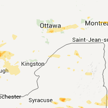
Hail Maps for Brushton, NY


Connect with Interactive Hail Maps