

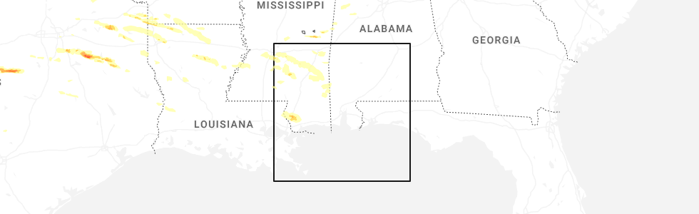
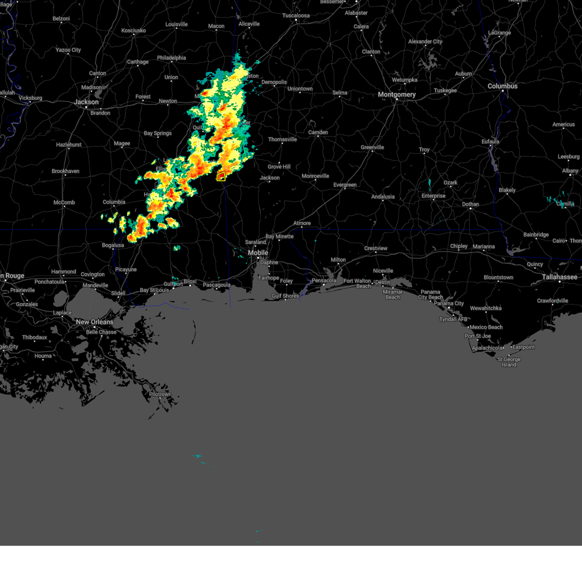
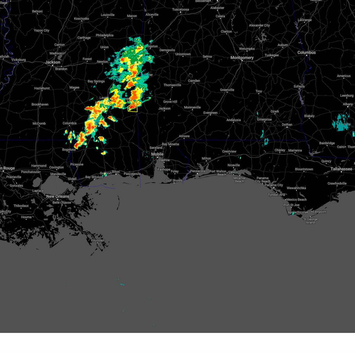
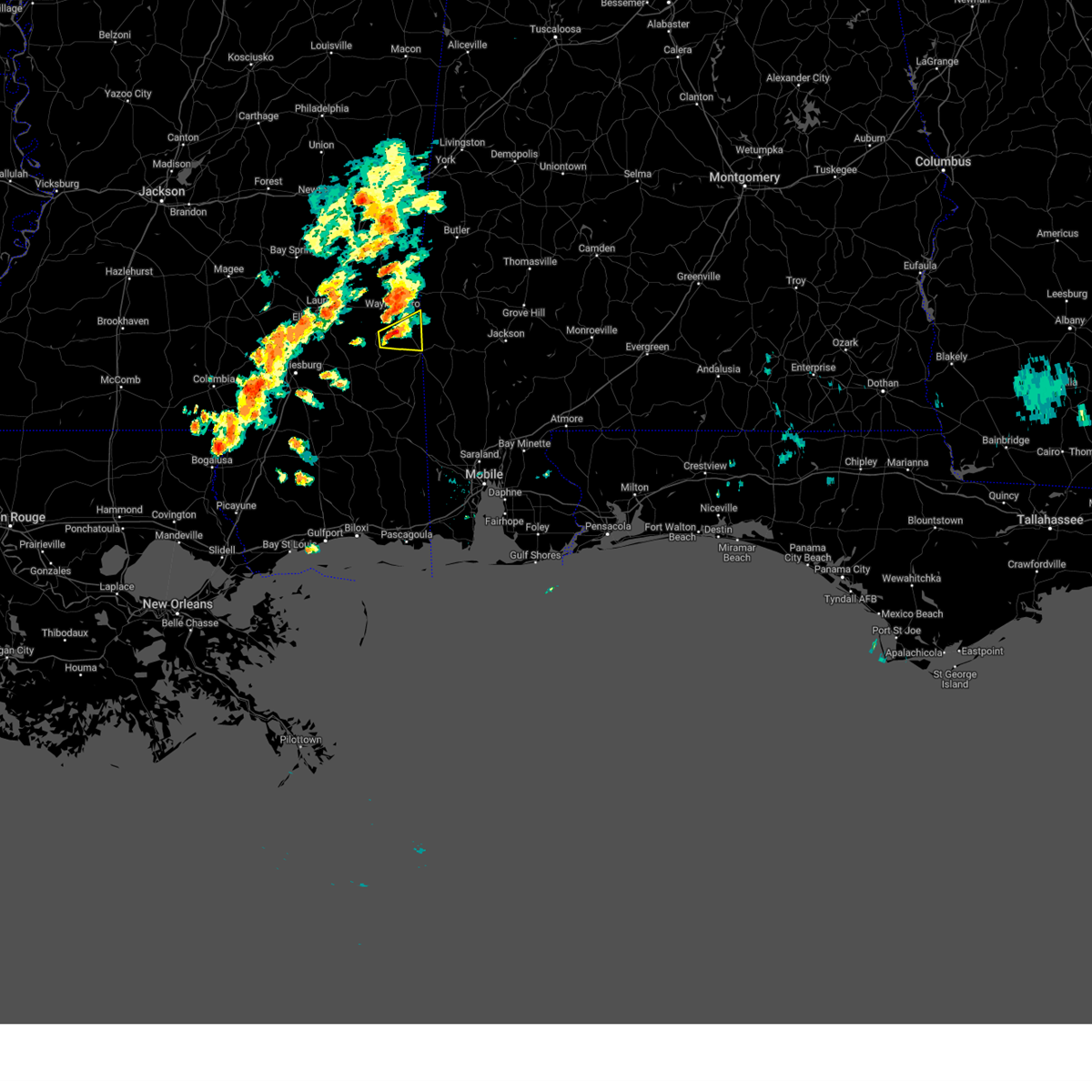
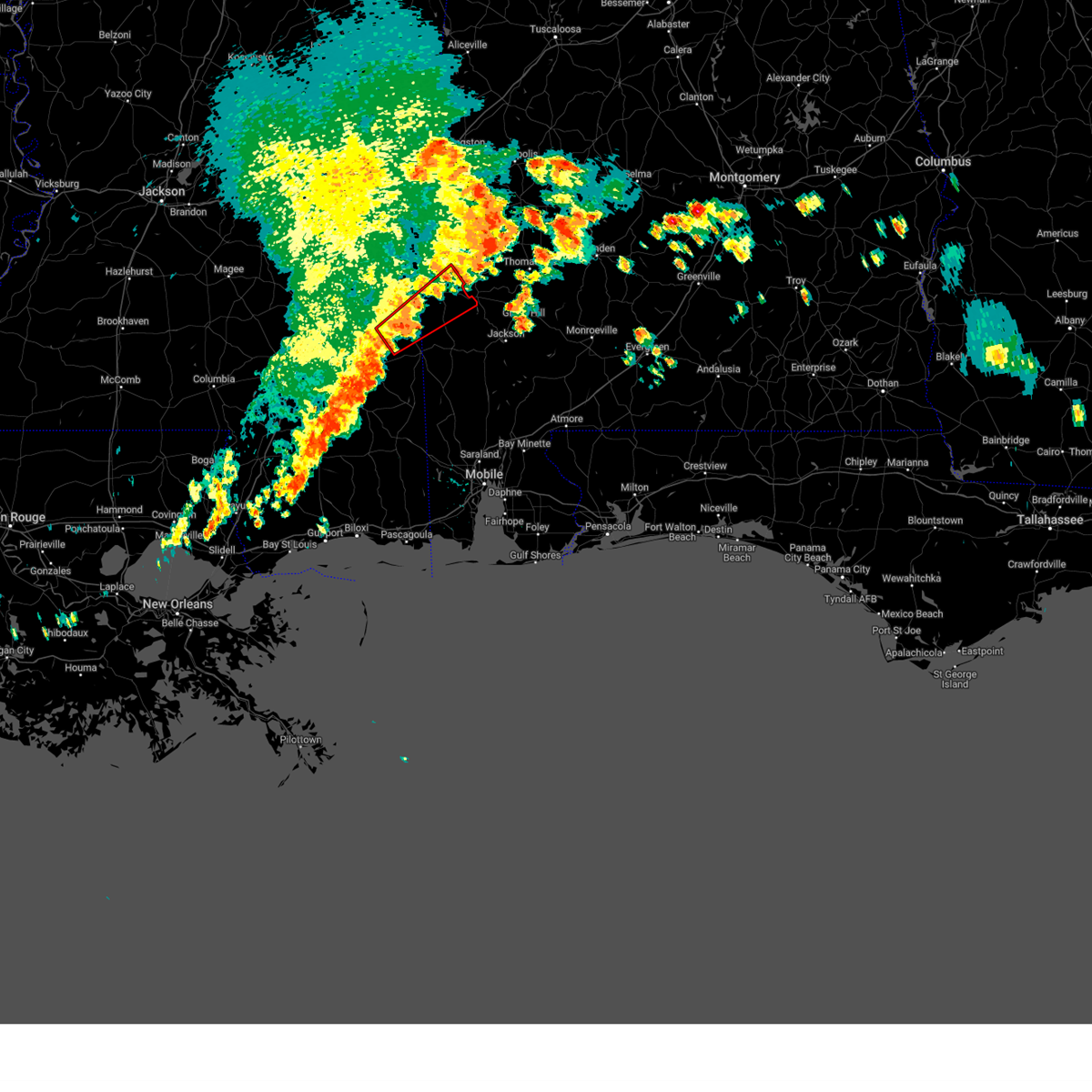
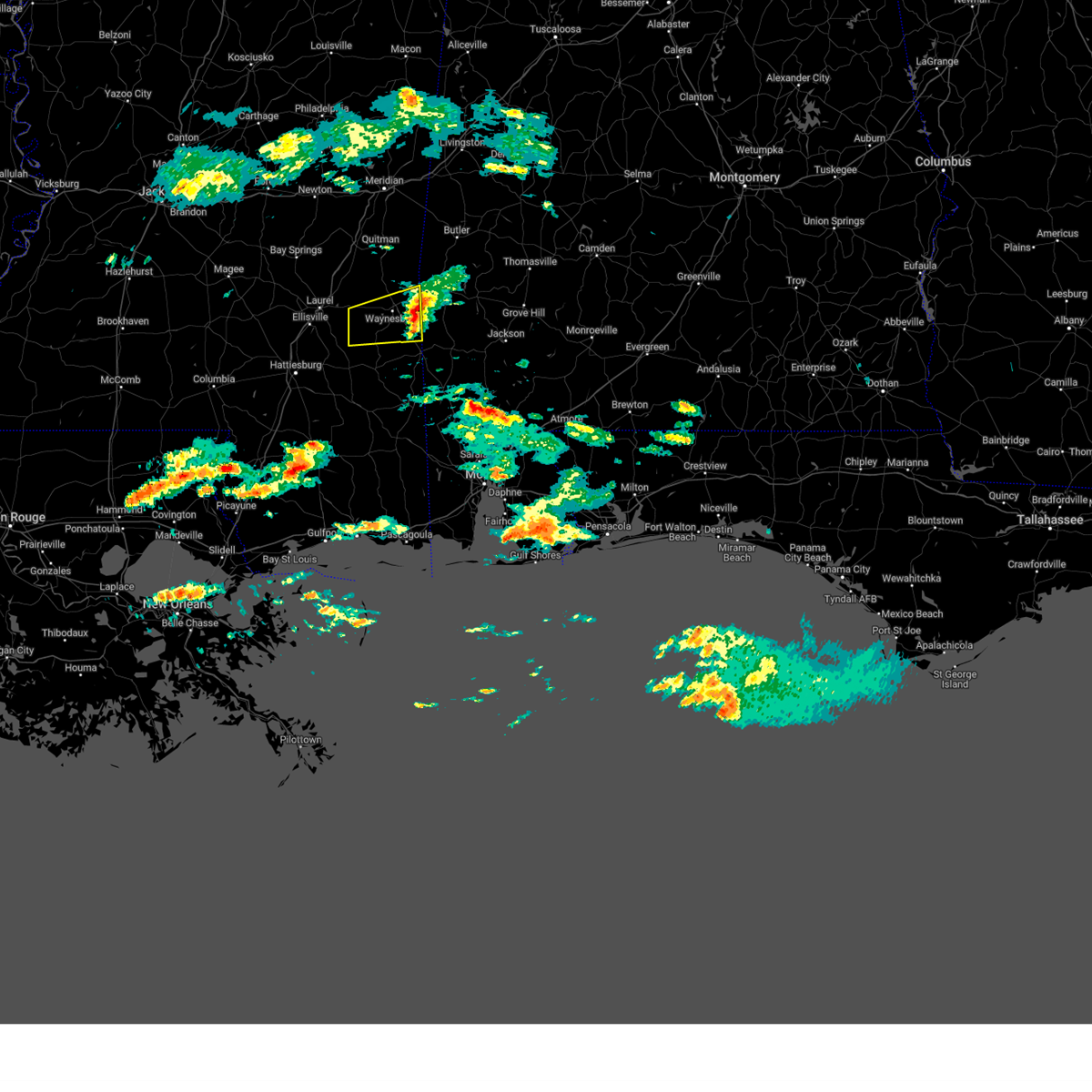
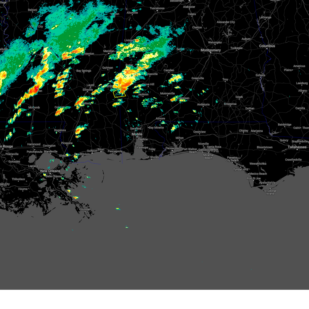
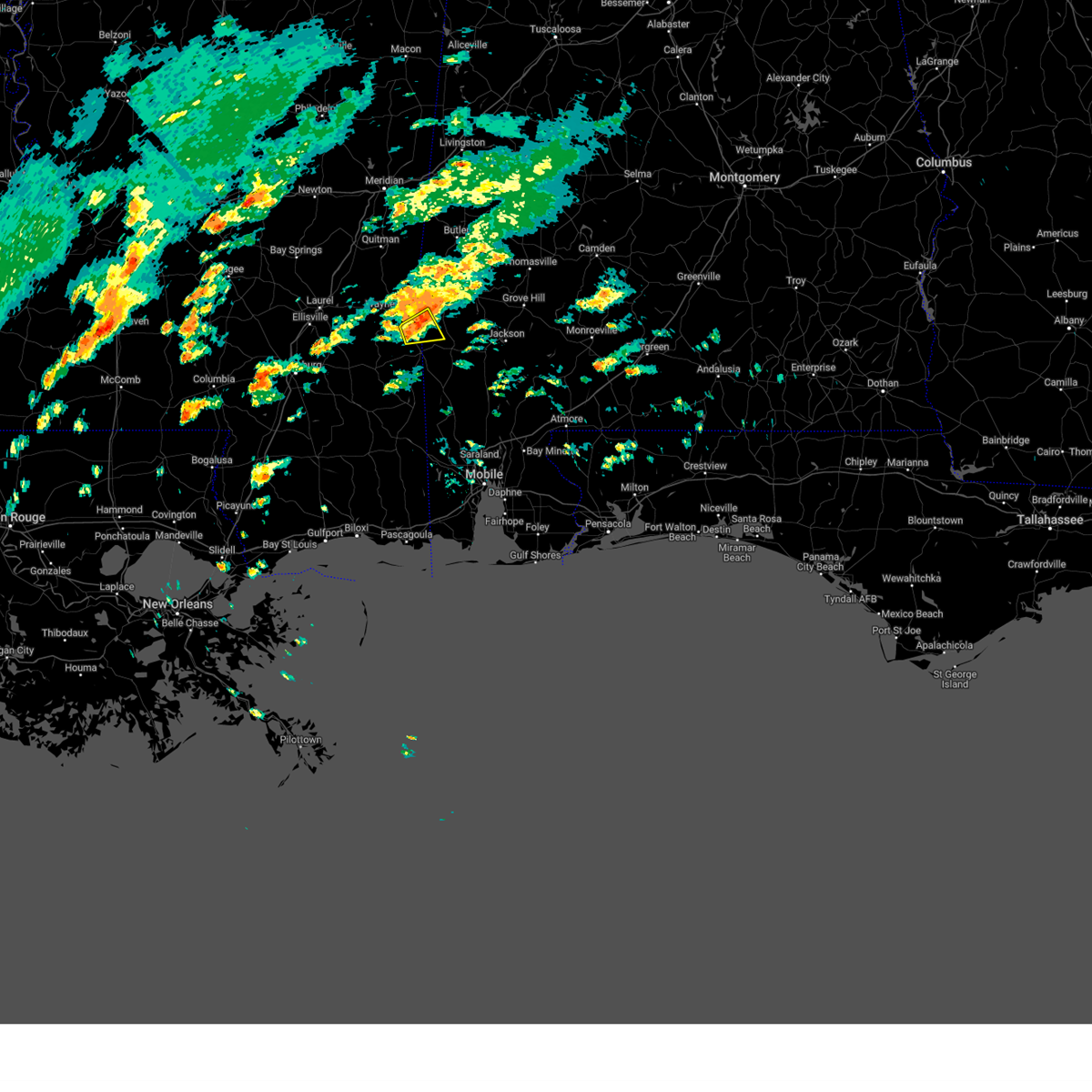
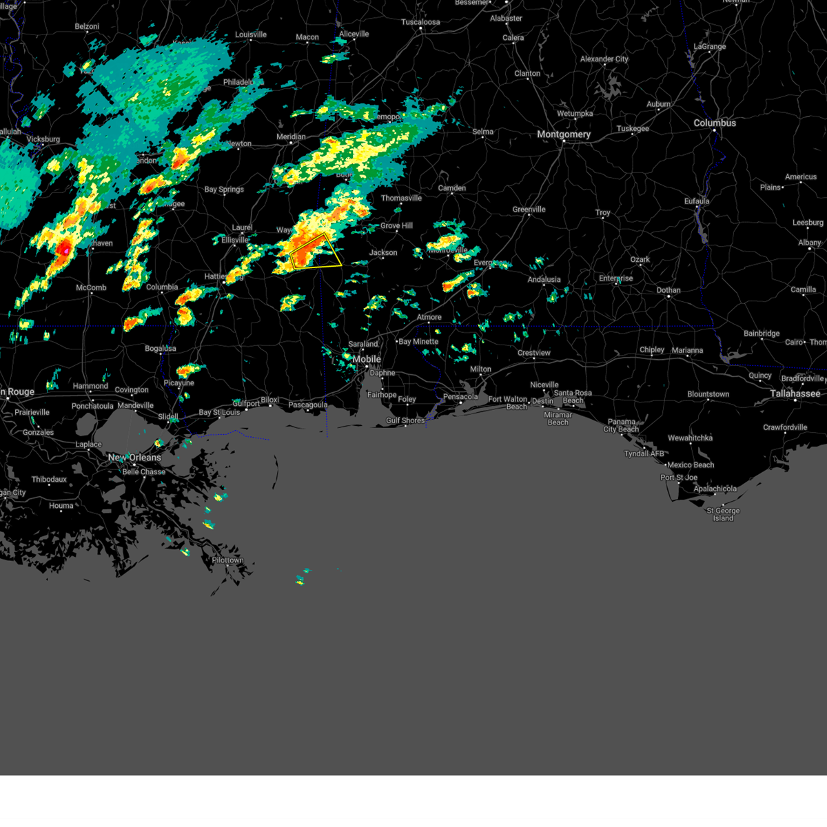
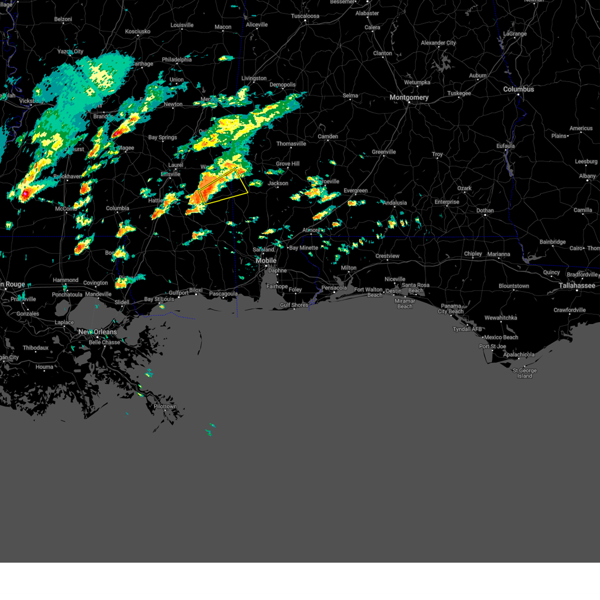
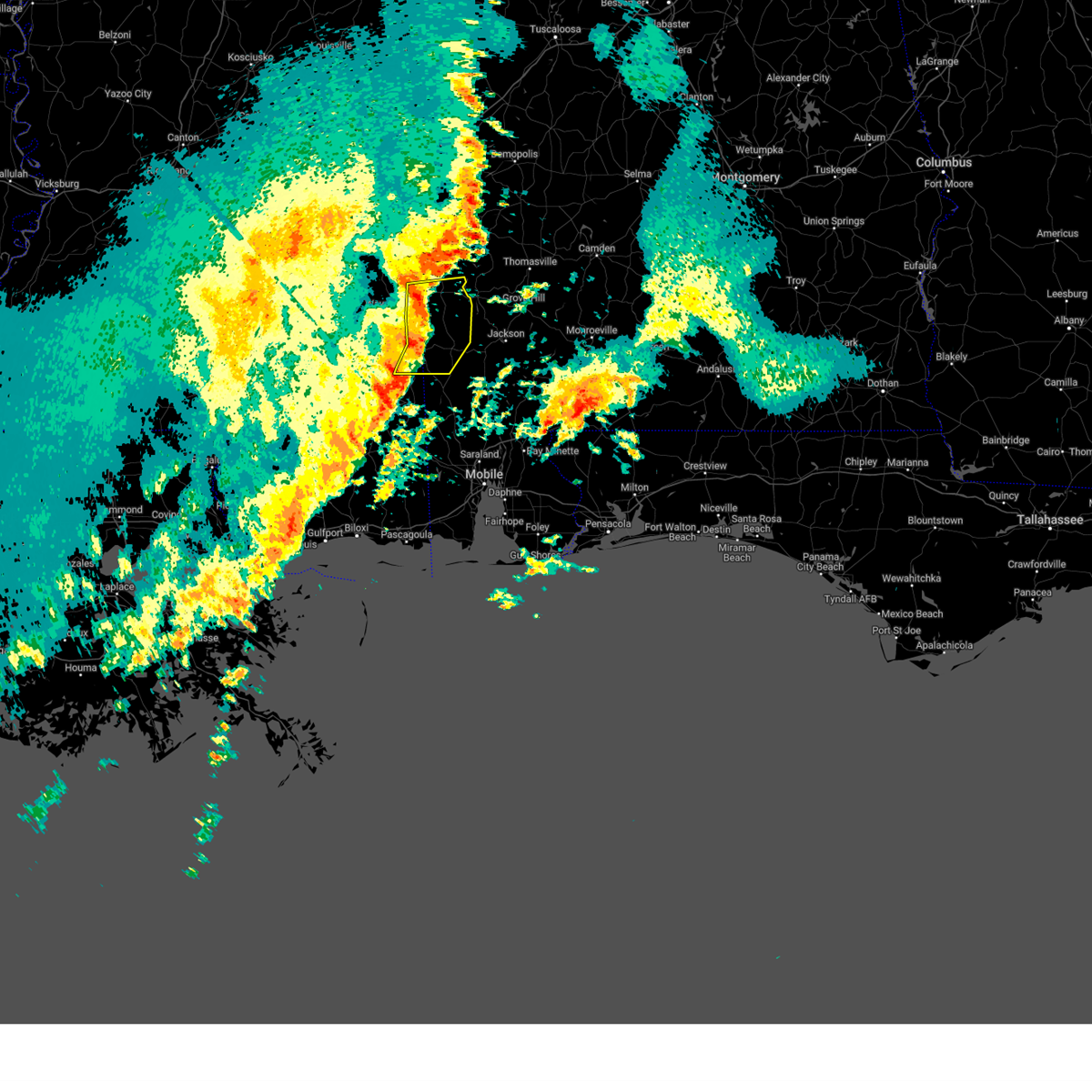
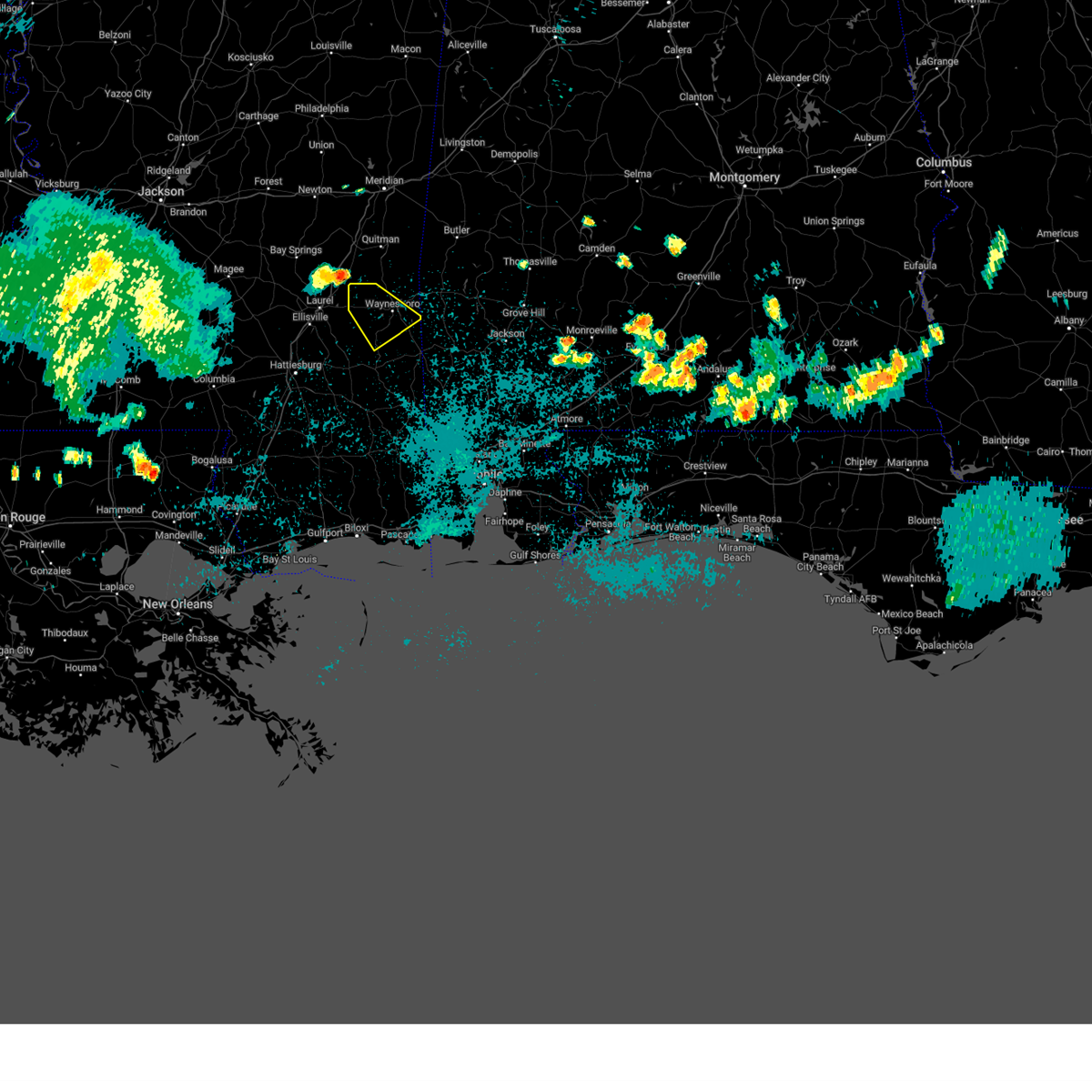
Hail Map for Buckatunna, MS
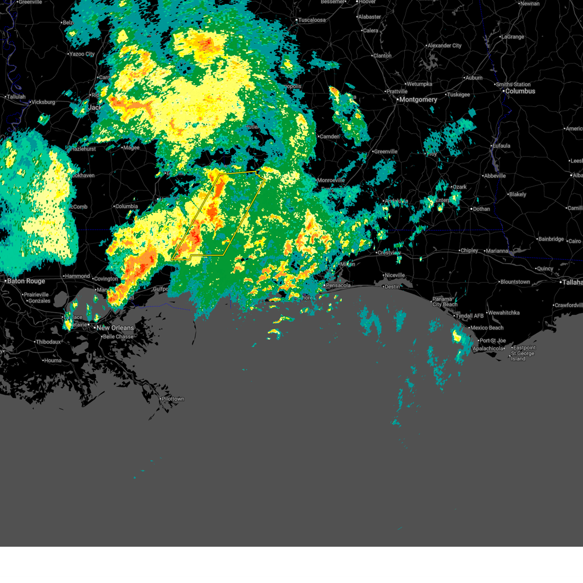
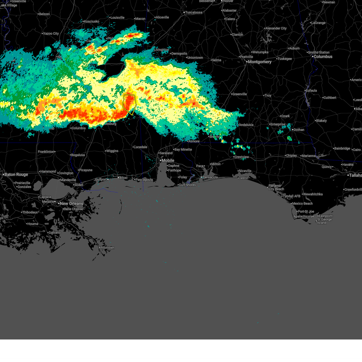
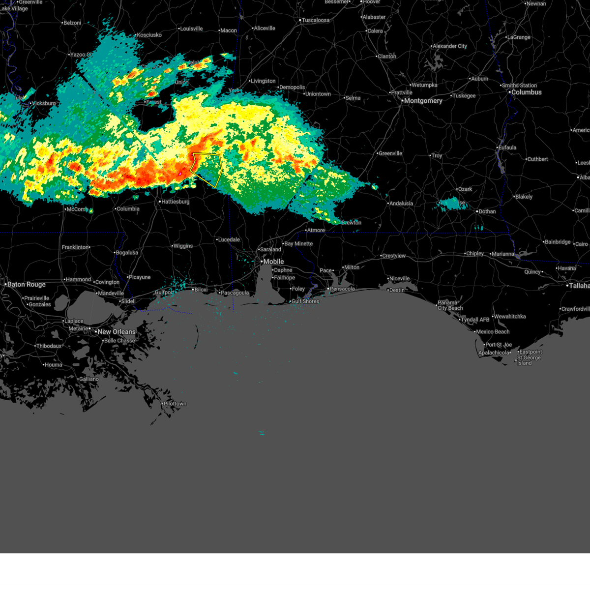
The Buckatunna, MS area has had 2 reports of on-the-ground hail by trained spotters, and has been under severe weather warnings 9 times during the past 12 months. Doppler radar has detected hail at or near Buckatunna, MS on 60 occasions, including 2 occasions during the past year.
| Name: | Buckatunna, MS |
| Where Located: | 64.9 miles NNW of Mobile, AL |
| Map: | Google Map for Buckatunna, MS |
| Population: | 516 |
| Housing Units: | 235 |
| More Info: | Search Google for Buckatunna, MS |
0
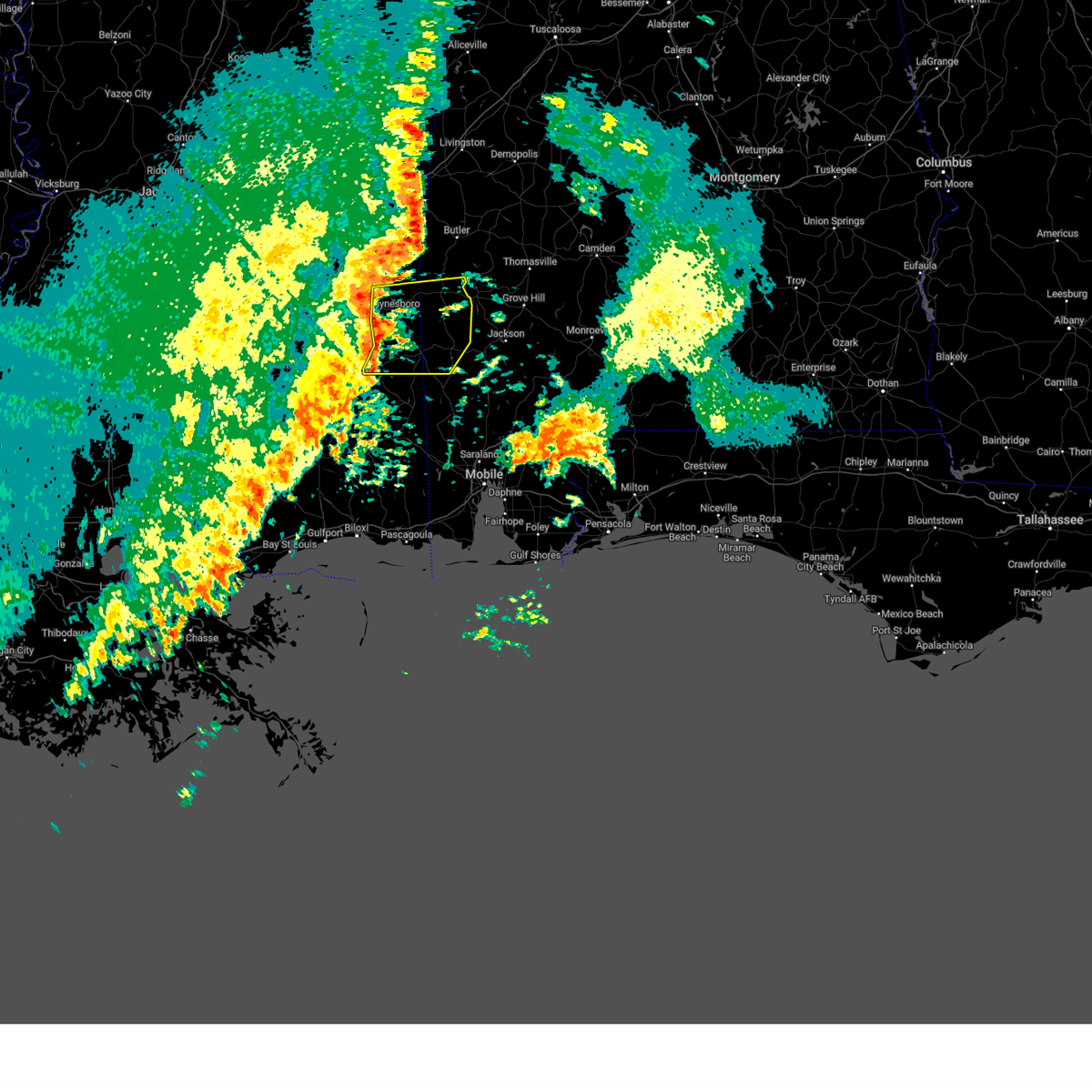
The Top Recent Hail Date for Buckatunna, MS is Wednesday, April 29, 2026 (59th out of 60)
Hail and Wind Damage Spotted near Buckatunna, MS
| Date / Time | Report Details |
|---|---|
| 6/18/2026 9:33 AM CDT |
 Svrmob the national weather service in mobile has issued a * severe thunderstorm warning for, northwestern mobile county in southwestern alabama, washington county in southwestern alabama, george county in southeastern mississippi, southeastern perry county in southeastern mississippi, southeastern wayne county in southeastern mississippi, greene county in southeastern mississippi, eastern stone county in southeastern mississippi, * until 1030 am cdt. * at 933 am cdt, severe thunderstorms were located along a line extending from buckatunna to 5 miles east of mchenry, moving east at 20 mph (radar indicated). Hazards include 60 mph wind gusts. expect damage to roofs, siding, and trees Svrmob the national weather service in mobile has issued a * severe thunderstorm warning for, northwestern mobile county in southwestern alabama, washington county in southwestern alabama, george county in southeastern mississippi, southeastern perry county in southeastern mississippi, southeastern wayne county in southeastern mississippi, greene county in southeastern mississippi, eastern stone county in southeastern mississippi, * until 1030 am cdt. * at 933 am cdt, severe thunderstorms were located along a line extending from buckatunna to 5 miles east of mchenry, moving east at 20 mph (radar indicated). Hazards include 60 mph wind gusts. expect damage to roofs, siding, and trees
|
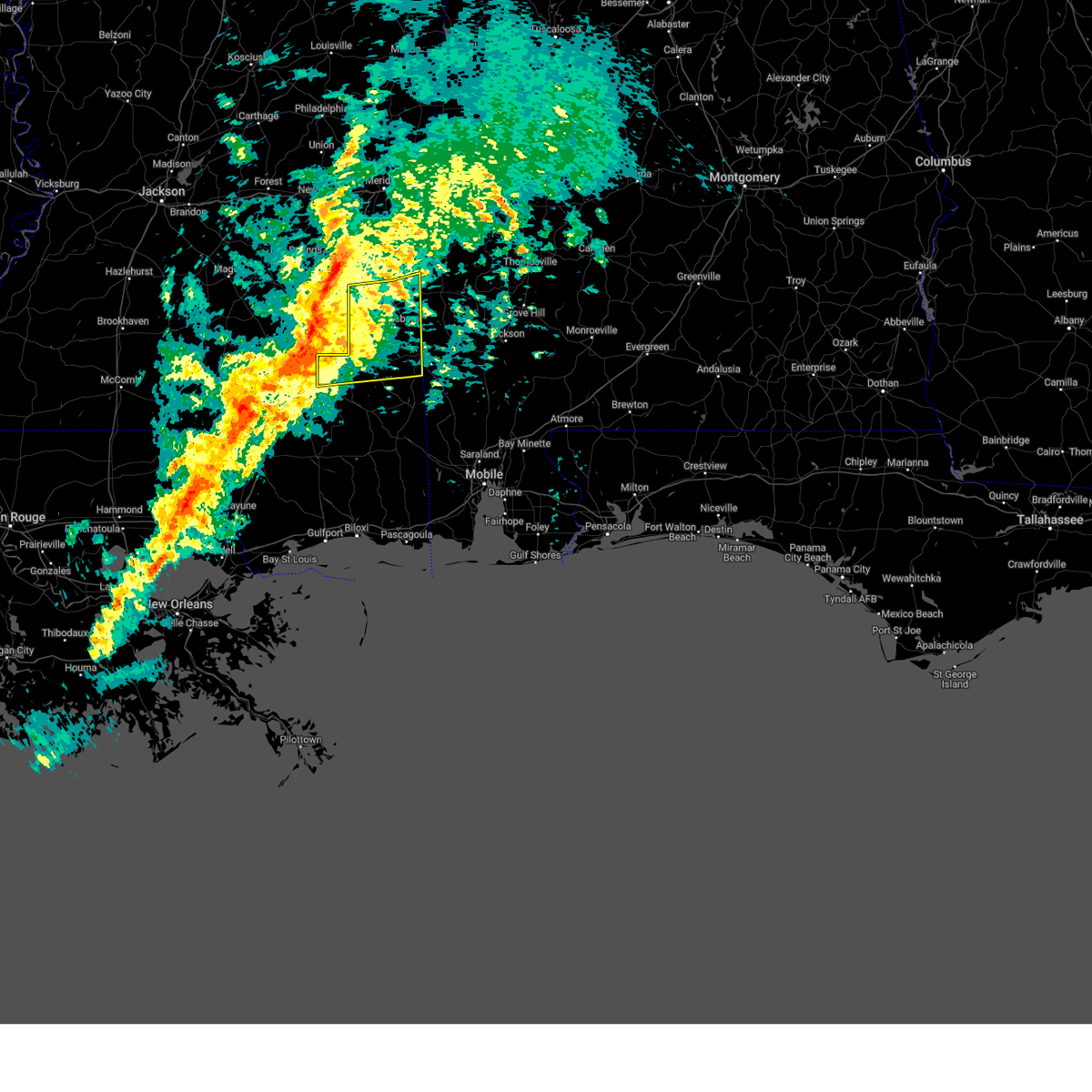
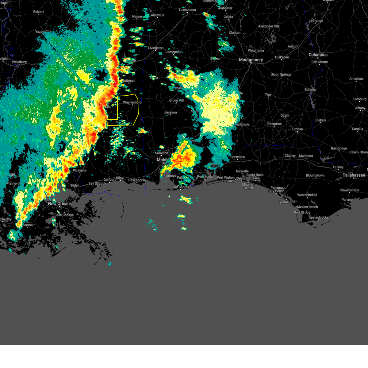
| 4/29/2026 4:29 PM CDT |
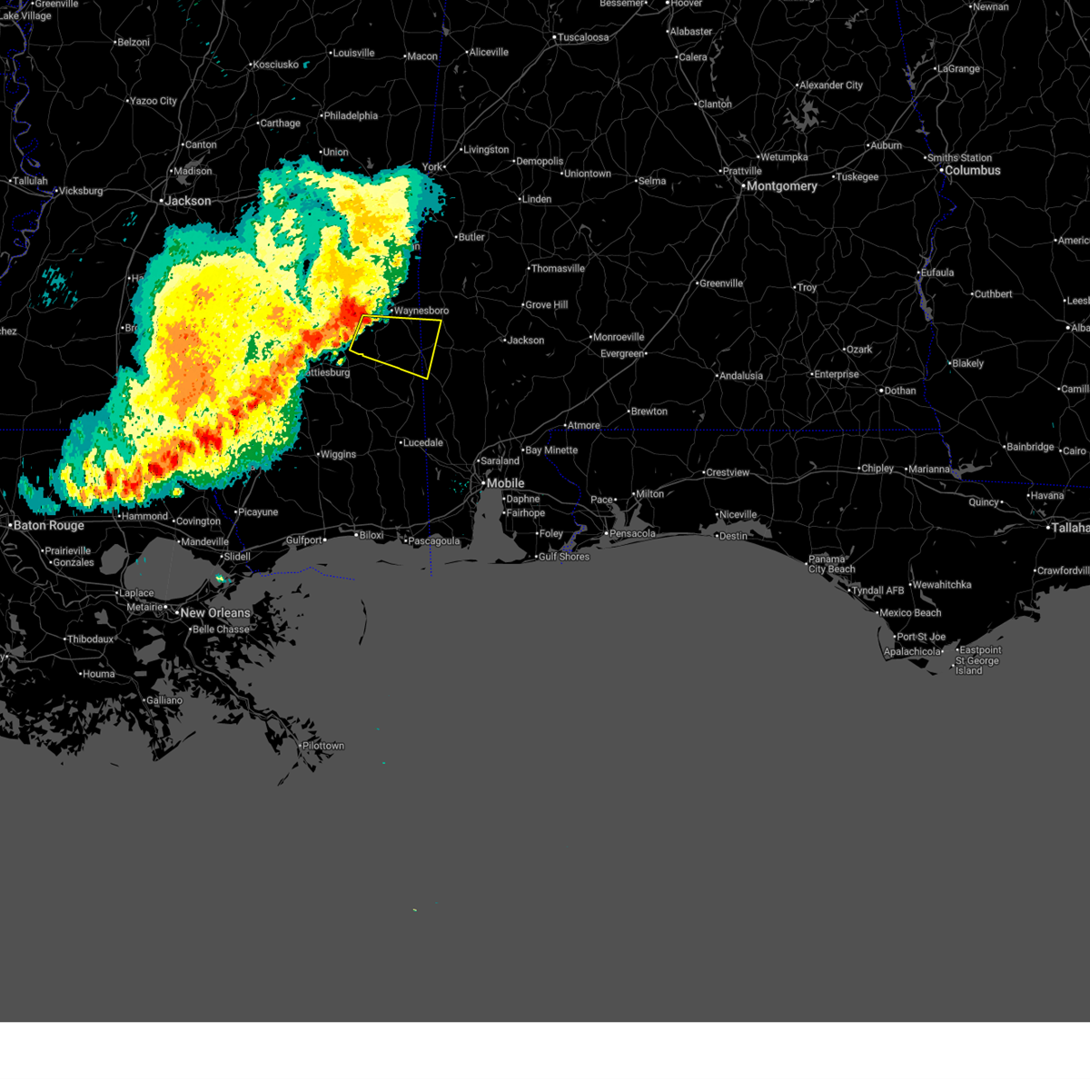
 Svrmob the national weather service in mobile has issued a * severe thunderstorm warning for, southwestern choctaw county in southwestern alabama, northwestern washington county in southwestern alabama, eastern wayne county in southeastern mississippi, * until 530 pm cdt. * at 429 pm cdt, severe thunderstorms were located along a line extending from 8 miles east of shubuta to 4 miles east of waynesboro to 4 miles southeast of clara, moving east at 20 mph (radar indicated). Hazards include 60 mph wind gusts and quarter size hail. Hail damage to vehicles is expected. Expect wind damage to roofs, siding, and trees. Svrmob the national weather service in mobile has issued a * severe thunderstorm warning for, southwestern choctaw county in southwestern alabama, northwestern washington county in southwestern alabama, eastern wayne county in southeastern mississippi, * until 530 pm cdt. * at 429 pm cdt, severe thunderstorms were located along a line extending from 8 miles east of shubuta to 4 miles east of waynesboro to 4 miles southeast of clara, moving east at 20 mph (radar indicated). Hazards include 60 mph wind gusts and quarter size hail. Hail damage to vehicles is expected. Expect wind damage to roofs, siding, and trees.
|
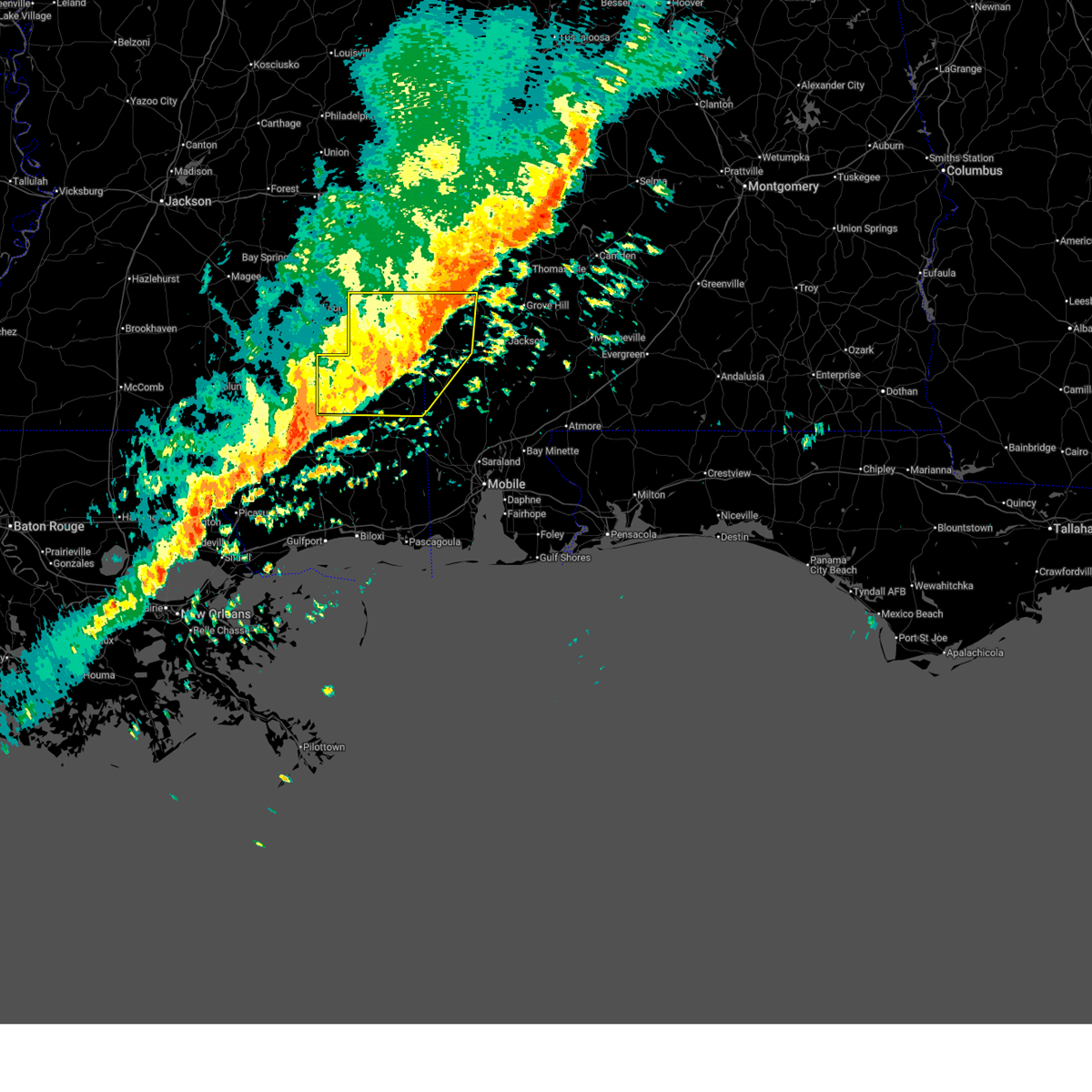
| 4/29/2026 4:18 PM CDT |
 At 418 pm cdt, severe thunderstorms were located along a line extending from 8 miles south of shubuta to waynesboro to near clara, moving southeast at 25 mph (radar indicated). Hazards include 60 mph wind gusts and quarter size hail. Hail damage to vehicles is expected. expect wind damage to roofs, siding, and trees. Locations impacted include, waynesboro and clara. At 418 pm cdt, severe thunderstorms were located along a line extending from 8 miles south of shubuta to waynesboro to near clara, moving southeast at 25 mph (radar indicated). Hazards include 60 mph wind gusts and quarter size hail. Hail damage to vehicles is expected. expect wind damage to roofs, siding, and trees. Locations impacted include, waynesboro and clara.
|
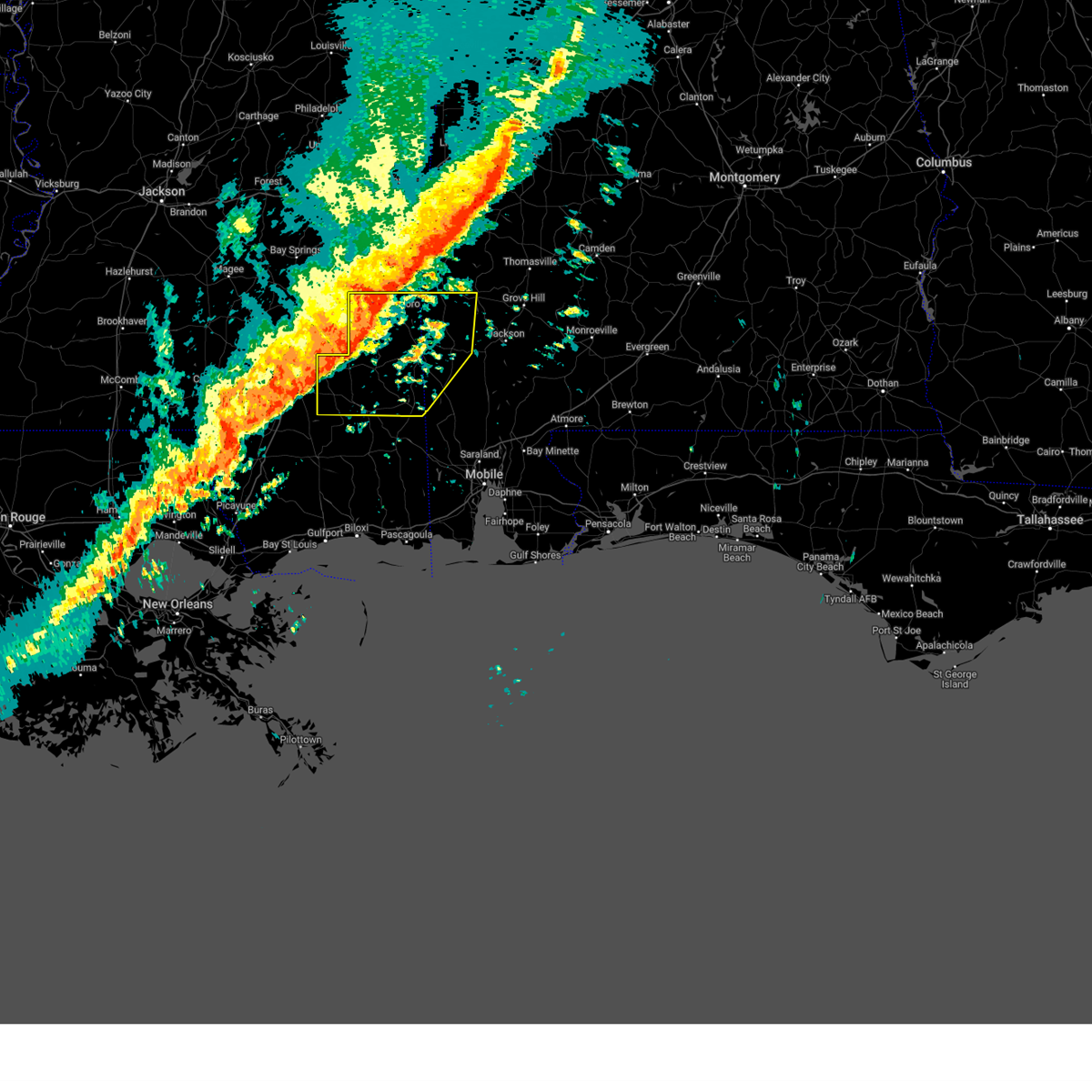
| 4/29/2026 3:56 PM CDT |
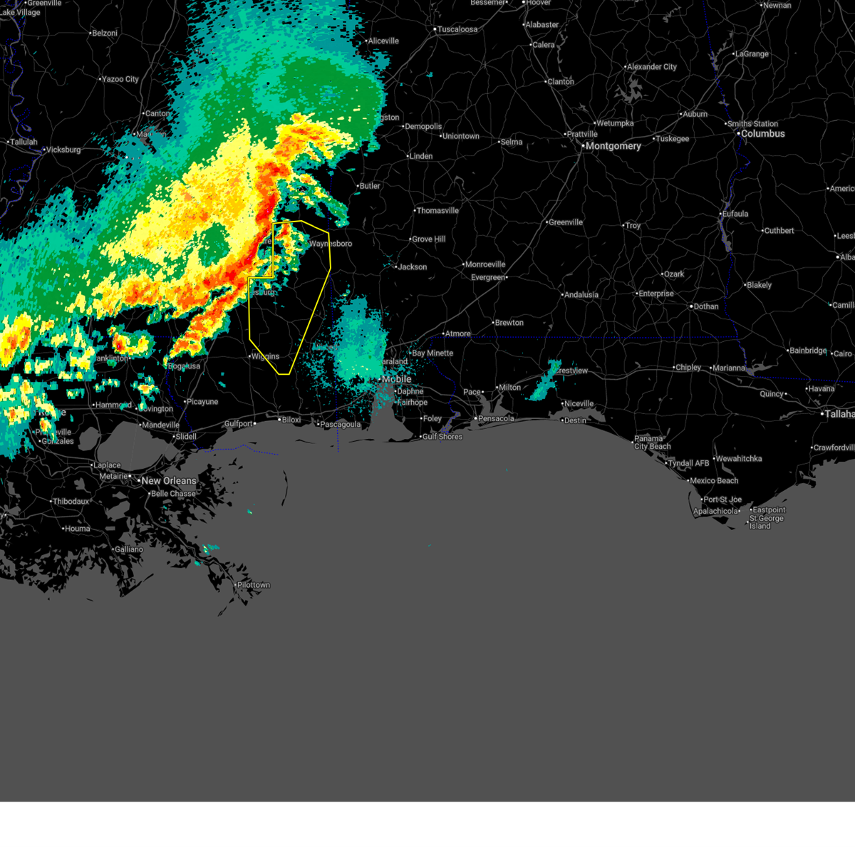
 Svrmob the national weather service in mobile has issued a * severe thunderstorm warning for, central wayne county in southeastern mississippi, * until 445 pm cdt. * at 355 pm cdt, severe thunderstorms were located along a line extending from 7 miles southwest of shubuta to 10 miles northwest of waynesboro to 9 miles northwest of clara to 7 miles southeast of mill creek, moving southeast at 25 mph (radar indicated). Hazards include 70 mph wind gusts and half dollar size hail. Hail damage to vehicles is expected. expect considerable tree damage. Wind damage is also likely to mobile homes, roofs, and outbuildings. Svrmob the national weather service in mobile has issued a * severe thunderstorm warning for, central wayne county in southeastern mississippi, * until 445 pm cdt. * at 355 pm cdt, severe thunderstorms were located along a line extending from 7 miles southwest of shubuta to 10 miles northwest of waynesboro to 9 miles northwest of clara to 7 miles southeast of mill creek, moving southeast at 25 mph (radar indicated). Hazards include 70 mph wind gusts and half dollar size hail. Hail damage to vehicles is expected. expect considerable tree damage. Wind damage is also likely to mobile homes, roofs, and outbuildings.
|
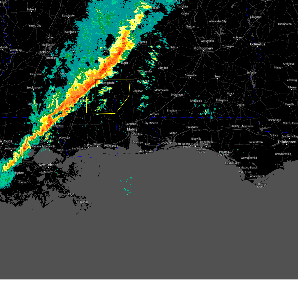
| 4/26/2026 8:25 AM CDT |
 Svrmob the national weather service in mobile has issued a * severe thunderstorm warning for, northwestern washington county in southwestern alabama, southern wayne county in southeastern mississippi, northern greene county in southeastern mississippi, * until 915 am cdt. * at 825 am cdt, a severe thunderstorm was located 5 miles west of clara, or 11 miles southwest of waynesboro, moving east at 35 mph (radar indicated). Hazards include 60 mph wind gusts and quarter size hail. Hail damage to vehicles is expected. Expect wind damage to roofs, siding, and trees. Svrmob the national weather service in mobile has issued a * severe thunderstorm warning for, northwestern washington county in southwestern alabama, southern wayne county in southeastern mississippi, northern greene county in southeastern mississippi, * until 915 am cdt. * at 825 am cdt, a severe thunderstorm was located 5 miles west of clara, or 11 miles southwest of waynesboro, moving east at 35 mph (radar indicated). Hazards include 60 mph wind gusts and quarter size hail. Hail damage to vehicles is expected. Expect wind damage to roofs, siding, and trees.
|
| 4/25/2026 4:23 AM CDT |
 Svrmob the national weather service in mobile has issued a * severe thunderstorm warning for, western george county in southeastern mississippi, perry county in southeastern mississippi, wayne county in southeastern mississippi, greene county in southeastern mississippi, northeastern stone county in southeastern mississippi, * until 500 am cdt. * at 422 am cdt, severe thunderstorms were located along a line extending from 3 miles south of stafford springs to 6 miles northwest of mclaurin, moving southeast at 45 mph (radar indicated). Hazards include 60 mph wind gusts and penny size hail. expect damage to roofs, siding, and trees Svrmob the national weather service in mobile has issued a * severe thunderstorm warning for, western george county in southeastern mississippi, perry county in southeastern mississippi, wayne county in southeastern mississippi, greene county in southeastern mississippi, northeastern stone county in southeastern mississippi, * until 500 am cdt. * at 422 am cdt, severe thunderstorms were located along a line extending from 3 miles south of stafford springs to 6 miles northwest of mclaurin, moving southeast at 45 mph (radar indicated). Hazards include 60 mph wind gusts and penny size hail. expect damage to roofs, siding, and trees
|
| 3/16/2026 1:29 AM CDT |
 Svrmob the national weather service in mobile has issued a * severe thunderstorm warning for, southwestern choctaw county in southwestern alabama, northwestern washington county in southwestern alabama, wayne county in southeastern mississippi, * until 230 am cdt. * at 128 am cdt, severe thunderstorms were located along a line extending from sandersville to tuckers crossing to 3 miles east of moselle, moving east at 50 mph (radar indicated). Hazards include 60 mph wind gusts. expect damage to roofs, siding, and trees Svrmob the national weather service in mobile has issued a * severe thunderstorm warning for, southwestern choctaw county in southwestern alabama, northwestern washington county in southwestern alabama, wayne county in southeastern mississippi, * until 230 am cdt. * at 128 am cdt, severe thunderstorms were located along a line extending from sandersville to tuckers crossing to 3 miles east of moselle, moving east at 50 mph (radar indicated). Hazards include 60 mph wind gusts. expect damage to roofs, siding, and trees
|
| 3/11/2026 10:25 PM CDT |
 Svrmob the national weather service in mobile has issued a * severe thunderstorm warning for, southern choctaw county in southwestern alabama, northern washington county in southwestern alabama, northwestern clarke county in southwestern alabama, eastern wayne county in southeastern mississippi, * until 1115 pm cdt. * at 1025 pm cdt, severe thunderstorms were located along a line extending from 5 miles east of crandall to 4 miles west of buckatunna, moving northeast at 55 mph (radar indicated). Hazards include 60 mph wind gusts. expect damage to roofs, siding, and trees Svrmob the national weather service in mobile has issued a * severe thunderstorm warning for, southern choctaw county in southwestern alabama, northern washington county in southwestern alabama, northwestern clarke county in southwestern alabama, eastern wayne county in southeastern mississippi, * until 1115 pm cdt. * at 1025 pm cdt, severe thunderstorms were located along a line extending from 5 miles east of crandall to 4 miles west of buckatunna, moving northeast at 55 mph (radar indicated). Hazards include 60 mph wind gusts. expect damage to roofs, siding, and trees
|
| 3/11/2026 9:38 PM CDT |
 Svrmob the national weather service in mobile has issued a * severe thunderstorm warning for, northern perry county in southeastern mississippi, wayne county in southeastern mississippi, northern greene county in southeastern mississippi, * until 1045 pm cdt. * at 938 pm cdt, severe thunderstorms were located along a line extending from heidelberg to 5 miles south of hattiesburg, moving east at 45 mph (radar indicated). Hazards include 70 mph wind gusts. Expect considerable tree damage. Damage is likely to mobile homes, roofs, and outbuildings. Svrmob the national weather service in mobile has issued a * severe thunderstorm warning for, northern perry county in southeastern mississippi, wayne county in southeastern mississippi, northern greene county in southeastern mississippi, * until 1045 pm cdt. * at 938 pm cdt, severe thunderstorms were located along a line extending from heidelberg to 5 miles south of hattiesburg, moving east at 45 mph (radar indicated). Hazards include 70 mph wind gusts. Expect considerable tree damage. Damage is likely to mobile homes, roofs, and outbuildings.
|
| 5/27/2025 6:33 PM CDT |
 the severe thunderstorm warning has been cancelled and is no longer in effect the severe thunderstorm warning has been cancelled and is no longer in effect
|
| 5/27/2025 6:23 PM CDT |
 At 623 pm cdt, a severe thunderstorm was located near buckatunna, or 12 miles southeast of waynesboro, moving east at 15 mph (radar indicated). Hazards include golf ball size hail and 60 mph wind gusts. People and animals outdoors will be injured. expect hail damage to roofs, siding, windows, and vehicles. expect wind damage to roofs, siding, and trees. Locations impacted include, buckatunna. At 623 pm cdt, a severe thunderstorm was located near buckatunna, or 12 miles southeast of waynesboro, moving east at 15 mph (radar indicated). Hazards include golf ball size hail and 60 mph wind gusts. People and animals outdoors will be injured. expect hail damage to roofs, siding, windows, and vehicles. expect wind damage to roofs, siding, and trees. Locations impacted include, buckatunna.
|
| 5/27/2025 6:20 PM CDT | Quarter sized hail reported 0.4 miles ESE of Buckatunna, MS |
| 5/27/2025 6:06 PM CDT |
 At 606 pm cdt, a severe thunderstorm was located over buckatunna, or 9 miles southeast of waynesboro, moving northeast at 20 mph (radar indicated). Hazards include ping pong ball size hail and 60 mph wind gusts. People and animals outdoors will be injured. expect hail damage to roofs, siding, windows, and vehicles. expect wind damage to roofs, siding, and trees. Locations impacted include, buckatunna. At 606 pm cdt, a severe thunderstorm was located over buckatunna, or 9 miles southeast of waynesboro, moving northeast at 20 mph (radar indicated). Hazards include ping pong ball size hail and 60 mph wind gusts. People and animals outdoors will be injured. expect hail damage to roofs, siding, windows, and vehicles. expect wind damage to roofs, siding, and trees. Locations impacted include, buckatunna.
|
| 5/27/2025 5:52 PM CDT |
 Svrmob the national weather service in mobile has issued a * severe thunderstorm warning for, southeastern wayne county in southeastern mississippi, * until 645 pm cdt. * at 552 pm cdt, a severe thunderstorm was located 5 miles southeast of clara, or 10 miles south of waynesboro, moving east at 15 mph (radar indicated). Hazards include 60 mph wind gusts and quarter size hail. Hail damage to vehicles is expected. Expect wind damage to roofs, siding, and trees. Svrmob the national weather service in mobile has issued a * severe thunderstorm warning for, southeastern wayne county in southeastern mississippi, * until 645 pm cdt. * at 552 pm cdt, a severe thunderstorm was located 5 miles southeast of clara, or 10 miles south of waynesboro, moving east at 15 mph (radar indicated). Hazards include 60 mph wind gusts and quarter size hail. Hail damage to vehicles is expected. Expect wind damage to roofs, siding, and trees.
|
| 5/26/2025 5:08 PM CDT |
 the tornado warning has been cancelled and is no longer in effect the tornado warning has been cancelled and is no longer in effect
|
| 5/26/2025 4:50 PM CDT |
 Tormob the national weather service in mobile has issued a * tornado warning for, southwestern choctaw county in southwestern alabama, northwestern washington county in southwestern alabama, southeastern wayne county in southeastern mississippi, * until 530 pm cdt. * at 450 pm cdt, a severe thunderstorm capable of producing a tornado was located 4 miles southeast of clara, or 8 miles south of waynesboro, moving northeast at 35 mph (radar indicated rotation). Hazards include tornado. Flying debris will be dangerous to those caught without shelter. mobile homes will be damaged or destroyed. damage to roofs, windows, and vehicles will occur. tree damage is likely. This dangerous storm will be near, silas around 525 pm cdt. Tormob the national weather service in mobile has issued a * tornado warning for, southwestern choctaw county in southwestern alabama, northwestern washington county in southwestern alabama, southeastern wayne county in southeastern mississippi, * until 530 pm cdt. * at 450 pm cdt, a severe thunderstorm capable of producing a tornado was located 4 miles southeast of clara, or 8 miles south of waynesboro, moving northeast at 35 mph (radar indicated rotation). Hazards include tornado. Flying debris will be dangerous to those caught without shelter. mobile homes will be damaged or destroyed. damage to roofs, windows, and vehicles will occur. tree damage is likely. This dangerous storm will be near, silas around 525 pm cdt.
|
| 4/6/2025 8:00 AM CDT |
 The storms which prompted the warning have weakened. therefore, the warning will be allowed to expire. a tornado watch remains in effect until 1000 am cdt for southwestern alabama, and southeastern mississippi. The storms which prompted the warning have weakened. therefore, the warning will be allowed to expire. a tornado watch remains in effect until 1000 am cdt for southwestern alabama, and southeastern mississippi.
|
| 4/6/2025 7:38 AM CDT |
 At 738 am cdt, severe thunderstorms were located along a line extending from 5 miles northwest of putnam to 5 miles southwest of beaumont, moving east at 15 mph (radar indicated). Hazards include 60 mph wind gusts. Expect damage to roofs, siding, and trees. Locations impacted include, gilbertown, toxey, state line, clara, silas, coffeeville, millry, waynesboro, butler, and buckatunna. At 738 am cdt, severe thunderstorms were located along a line extending from 5 miles northwest of putnam to 5 miles southwest of beaumont, moving east at 15 mph (radar indicated). Hazards include 60 mph wind gusts. Expect damage to roofs, siding, and trees. Locations impacted include, gilbertown, toxey, state line, clara, silas, coffeeville, millry, waynesboro, butler, and buckatunna.
|
| 4/6/2025 6:07 AM CDT |
 Svrmob the national weather service in mobile has issued a * severe thunderstorm warning for, northern perry county in southeastern mississippi, wayne county in southeastern mississippi, northwestern greene county in southeastern mississippi, * until 700 am cdt. * at 606 am cdt, severe thunderstorms were located along a line extending from 4 miles east of goodwater to 7 miles southeast of sandy hook, moving east at 35 mph (radar indicated). Hazards include 60 mph wind gusts. expect damage to roofs, siding, and trees Svrmob the national weather service in mobile has issued a * severe thunderstorm warning for, northern perry county in southeastern mississippi, wayne county in southeastern mississippi, northwestern greene county in southeastern mississippi, * until 700 am cdt. * at 606 am cdt, severe thunderstorms were located along a line extending from 4 miles east of goodwater to 7 miles southeast of sandy hook, moving east at 35 mph (radar indicated). Hazards include 60 mph wind gusts. expect damage to roofs, siding, and trees
|
| 3/9/2025 12:38 AM CDT |
 The storm which prompted the warning has weakened below severe limits, and has exited the warned area. therefore, the warning will be allowed to expire. The storm which prompted the warning has weakened below severe limits, and has exited the warned area. therefore, the warning will be allowed to expire.
|
| 3/8/2025 11:46 PM CDT |
 Svrmob the national weather service in mobile has issued a * severe thunderstorm warning for, wayne county in southeastern mississippi, * until 1145 pm cst. * at 1045 pm cst, a severe thunderstorm was located 4 miles southeast of tuckers crossing, or 9 miles east of ellisville, moving east at 45 mph (radar indicated). Hazards include quarter size hail. damage to vehicles is expected Svrmob the national weather service in mobile has issued a * severe thunderstorm warning for, wayne county in southeastern mississippi, * until 1145 pm cst. * at 1045 pm cst, a severe thunderstorm was located 4 miles southeast of tuckers crossing, or 9 miles east of ellisville, moving east at 45 mph (radar indicated). Hazards include quarter size hail. damage to vehicles is expected
|
| 3/4/2025 6:57 PM CST |
 Svrmob the national weather service in mobile has issued a * severe thunderstorm warning for, choctaw county in southwestern alabama, washington county in southwestern alabama, western clarke county in southwestern alabama, eastern wayne county in southeastern mississippi, northern greene county in southeastern mississippi, * until 800 pm cst. * at 656 pm cst, severe thunderstorms were located along a line extending from 3 miles southeast of kinterbish to 3 miles northwest of silas to 14 miles southwest of state line, moving east at 40 mph (radar indicated). Hazards include 60 mph wind gusts. expect damage to roofs, siding, and trees Svrmob the national weather service in mobile has issued a * severe thunderstorm warning for, choctaw county in southwestern alabama, washington county in southwestern alabama, western clarke county in southwestern alabama, eastern wayne county in southeastern mississippi, northern greene county in southeastern mississippi, * until 800 pm cst. * at 656 pm cst, severe thunderstorms were located along a line extending from 3 miles southeast of kinterbish to 3 miles northwest of silas to 14 miles southwest of state line, moving east at 40 mph (radar indicated). Hazards include 60 mph wind gusts. expect damage to roofs, siding, and trees
|
| 3/4/2025 6:56 PM CST |
 the tornado warning has been cancelled and is no longer in effect the tornado warning has been cancelled and is no longer in effect
|
| 3/4/2025 6:56 PM CST |
 At 656 pm cst, a severe thunderstorm capable of producing a tornado was located 4 miles southwest of buckatunna, or 13 miles south of waynesboro, moving east at 55 mph (radar indicated rotation). Hazards include tornado. Flying debris will be dangerous to those caught without shelter. mobile homes will be damaged or destroyed. damage to roofs, windows, and vehicles will occur. tree damage is likely. This dangerous storm will be near, buckatunna around 700 pm cst. At 656 pm cst, a severe thunderstorm capable of producing a tornado was located 4 miles southwest of buckatunna, or 13 miles south of waynesboro, moving east at 55 mph (radar indicated rotation). Hazards include tornado. Flying debris will be dangerous to those caught without shelter. mobile homes will be damaged or destroyed. damage to roofs, windows, and vehicles will occur. tree damage is likely. This dangerous storm will be near, buckatunna around 700 pm cst.
|
| 3/4/2025 6:34 PM CST |
 Tormob the national weather service in mobile has issued a * tornado warning for, northwestern washington county in southwestern alabama, northeastern perry county in southeastern mississippi, southern wayne county in southeastern mississippi, northern greene county in southeastern mississippi, * until 715 pm cst. * at 634 pm cst, a severe thunderstorm capable of producing a tornado was located near richton, moving east at 60 mph (radar indicated rotation). Hazards include tornado. Flying debris will be dangerous to those caught without shelter. mobile homes will be damaged or destroyed. damage to roofs, windows, and vehicles will occur. tree damage is likely. This dangerous storm will be near, buckatunna around 655 pm cst. Tormob the national weather service in mobile has issued a * tornado warning for, northwestern washington county in southwestern alabama, northeastern perry county in southeastern mississippi, southern wayne county in southeastern mississippi, northern greene county in southeastern mississippi, * until 715 pm cst. * at 634 pm cst, a severe thunderstorm capable of producing a tornado was located near richton, moving east at 60 mph (radar indicated rotation). Hazards include tornado. Flying debris will be dangerous to those caught without shelter. mobile homes will be damaged or destroyed. damage to roofs, windows, and vehicles will occur. tree damage is likely. This dangerous storm will be near, buckatunna around 655 pm cst.
|
| 3/4/2025 6:31 PM CST |
 Svrmob the national weather service in mobile has issued a * severe thunderstorm warning for, choctaw county in southwestern alabama, northern washington county in southwestern alabama, northwestern clarke county in southwestern alabama, southeastern wayne county in southeastern mississippi, * until 700 pm cst. * at 631 pm cst, severe thunderstorms were located along a line extending from near causeyville to 3 miles west of waynesboro to 4 miles southwest of clara to near richton, moving east at 45 mph (radar indicated). Hazards include 60 mph wind gusts. expect damage to roofs, siding, and trees Svrmob the national weather service in mobile has issued a * severe thunderstorm warning for, choctaw county in southwestern alabama, northern washington county in southwestern alabama, northwestern clarke county in southwestern alabama, southeastern wayne county in southeastern mississippi, * until 700 pm cst. * at 631 pm cst, severe thunderstorms were located along a line extending from near causeyville to 3 miles west of waynesboro to 4 miles southwest of clara to near richton, moving east at 45 mph (radar indicated). Hazards include 60 mph wind gusts. expect damage to roofs, siding, and trees
|
| 3/4/2025 5:54 PM CST |
 Svrmob the national weather service in mobile has issued a * severe thunderstorm warning for, northern perry county in southeastern mississippi, wayne county in southeastern mississippi, northern greene county in southeastern mississippi, * until 700 pm cst. * at 553 pm cst, severe thunderstorms were located along a line extending from heidelberg to 6 miles northwest of ovett to hattiesburg, moving east at 40 mph (radar indicated). Hazards include 60 mph wind gusts. expect damage to roofs, siding, and trees Svrmob the national weather service in mobile has issued a * severe thunderstorm warning for, northern perry county in southeastern mississippi, wayne county in southeastern mississippi, northern greene county in southeastern mississippi, * until 700 pm cst. * at 553 pm cst, severe thunderstorms were located along a line extending from heidelberg to 6 miles northwest of ovett to hattiesburg, moving east at 40 mph (radar indicated). Hazards include 60 mph wind gusts. expect damage to roofs, siding, and trees
|
| 2/16/2025 1:16 AM CST |
 The storms which prompted the warning have moved out of the area. therefore, the warning has been allowed to expire. a tornado watch remains in effect until 400 am cst for southwestern alabama, and southeastern mississippi. remember, a severe thunderstorm warning still remains in effect for southeastern wayne and greene counties until 2 am. The storms which prompted the warning have moved out of the area. therefore, the warning has been allowed to expire. a tornado watch remains in effect until 400 am cst for southwestern alabama, and southeastern mississippi. remember, a severe thunderstorm warning still remains in effect for southeastern wayne and greene counties until 2 am.
|
| 2/16/2025 12:44 AM CST |
 At 1243 am cst, severe thunderstorms were located along a line extending from 6 miles north of waynesboro to 4 miles west of richton to 3 miles northwest of mclaurin, moving east at 55 mph (radar indicated). Hazards include 60 mph wind gusts. Expect damage to roofs, siding, and trees. Locations impacted include, clara, new augusta, silas, chatom, leakesville, mclain, waynesboro, beaumont, state line, richton, fruitdale, millry, tibbie, and buckatunna. At 1243 am cst, severe thunderstorms were located along a line extending from 6 miles north of waynesboro to 4 miles west of richton to 3 miles northwest of mclaurin, moving east at 55 mph (radar indicated). Hazards include 60 mph wind gusts. Expect damage to roofs, siding, and trees. Locations impacted include, clara, new augusta, silas, chatom, leakesville, mclain, waynesboro, beaumont, state line, richton, fruitdale, millry, tibbie, and buckatunna.
|
| 2/16/2025 12:22 AM CST |
 Svrmob the national weather service in mobile has issued a * severe thunderstorm warning for, southwestern choctaw county in southwestern alabama, western washington county in southwestern alabama, northwestern clarke county in southwestern alabama, perry county in southeastern mississippi, wayne county in southeastern mississippi, greene county in southeastern mississippi, * until 115 am cst. * at 1222 am cst, severe thunderstorms were located along a line extending from 4 miles northeast of mill creek to eastabuchie to 6 miles northwest of pine ridge, moving east at 50 mph (radar indicated). Hazards include 60 mph wind gusts. expect damage to roofs, siding, and trees Svrmob the national weather service in mobile has issued a * severe thunderstorm warning for, southwestern choctaw county in southwestern alabama, western washington county in southwestern alabama, northwestern clarke county in southwestern alabama, perry county in southeastern mississippi, wayne county in southeastern mississippi, greene county in southeastern mississippi, * until 115 am cst. * at 1222 am cst, severe thunderstorms were located along a line extending from 4 miles northeast of mill creek to eastabuchie to 6 miles northwest of pine ridge, moving east at 50 mph (radar indicated). Hazards include 60 mph wind gusts. expect damage to roofs, siding, and trees
|
| 2/12/2025 3:59 PM CST |
 The storm which prompted the warning has weakened below severe limits, and no longer poses an immediate threat to life or property. therefore, the warning will be allowed to expire. a tornado watch remains in effect until 1000 pm cst for southwestern alabama, and southeastern mississippi. The storm which prompted the warning has weakened below severe limits, and no longer poses an immediate threat to life or property. therefore, the warning will be allowed to expire. a tornado watch remains in effect until 1000 pm cst for southwestern alabama, and southeastern mississippi.
|
| 2/12/2025 3:46 PM CST |
 At 346 pm cst, a severe thunderstorm was located 4 miles northeast of buckatunna, or 13 miles southeast of waynesboro, moving northeast at 35 mph (radar indicated). Hazards include 60 mph wind gusts. Expect damage to roofs, siding, and trees. Locations impacted include, buckatunna. At 346 pm cst, a severe thunderstorm was located 4 miles northeast of buckatunna, or 13 miles southeast of waynesboro, moving northeast at 35 mph (radar indicated). Hazards include 60 mph wind gusts. Expect damage to roofs, siding, and trees. Locations impacted include, buckatunna.
|
| 2/12/2025 3:32 PM CST |
 the severe thunderstorm warning has been cancelled and is no longer in effect the severe thunderstorm warning has been cancelled and is no longer in effect
|
| 2/12/2025 3:32 PM CST |
 At 331 pm cst, a severe thunderstorm was located 7 miles southwest of buckatunna, or 15 miles south of waynesboro, moving northeast at 30 mph (radar indicated). Hazards include 60 mph wind gusts. Expect damage to roofs, siding, and trees. Locations impacted include, buckatunna. At 331 pm cst, a severe thunderstorm was located 7 miles southwest of buckatunna, or 15 miles south of waynesboro, moving northeast at 30 mph (radar indicated). Hazards include 60 mph wind gusts. Expect damage to roofs, siding, and trees. Locations impacted include, buckatunna.
|
| 2/12/2025 3:14 PM CST |
 Svrmob the national weather service in mobile has issued a * severe thunderstorm warning for, northwestern washington county in southwestern alabama, southeastern wayne county in southeastern mississippi, northern greene county in southeastern mississippi, * until 400 pm cst. * at 314 pm cst, a severe thunderstorm was located 12 miles east of richton, moving northeast at 30 mph (radar indicated). Hazards include 60 mph wind gusts. expect damage to roofs, siding, and trees Svrmob the national weather service in mobile has issued a * severe thunderstorm warning for, northwestern washington county in southwestern alabama, southeastern wayne county in southeastern mississippi, northern greene county in southeastern mississippi, * until 400 pm cst. * at 314 pm cst, a severe thunderstorm was located 12 miles east of richton, moving northeast at 30 mph (radar indicated). Hazards include 60 mph wind gusts. expect damage to roofs, siding, and trees
|
| 12/28/2024 9:53 PM CST |
 At 952 pm cst, severe thunderstorms were located along a line extending from 7 miles southeast of shubuta to 9 miles east of waynesboro to 3 miles east of buckatunna to 4 miles southwest of state line, moving east at 30 mph (radar indicated). Hazards include 60 mph wind gusts. Expect damage to roofs, siding, and trees. Locations impacted include, state line, fruitdale, silas, chatom, millry, tibbie, and buckatunna. At 952 pm cst, severe thunderstorms were located along a line extending from 7 miles southeast of shubuta to 9 miles east of waynesboro to 3 miles east of buckatunna to 4 miles southwest of state line, moving east at 30 mph (radar indicated). Hazards include 60 mph wind gusts. Expect damage to roofs, siding, and trees. Locations impacted include, state line, fruitdale, silas, chatom, millry, tibbie, and buckatunna.
|
| 12/28/2024 9:40 PM CST | Shingles off a roof... trees down... and a shed destroyed. time and location estimate in wayne county MS, 0.4 miles ESE of Buckatunna, MS |
| 12/28/2024 9:24 PM CST |
 Svrmob the national weather service in mobile has issued a * severe thunderstorm warning for, southwestern choctaw county in southwestern alabama, northwestern washington county in southwestern alabama, wayne county in southeastern mississippi, northern greene county in southeastern mississippi, * until 1030 pm cst. * at 923 pm cst, severe thunderstorms were located along a line extending from 7 miles northeast of mill creek to 4 miles northwest of clara to 11 miles west of buckatunna to 9 miles east of richton, moving east at 30 mph (radar indicated). Hazards include 60 mph wind gusts. expect damage to roofs, siding, and trees Svrmob the national weather service in mobile has issued a * severe thunderstorm warning for, southwestern choctaw county in southwestern alabama, northwestern washington county in southwestern alabama, wayne county in southeastern mississippi, northern greene county in southeastern mississippi, * until 1030 pm cst. * at 923 pm cst, severe thunderstorms were located along a line extending from 7 miles northeast of mill creek to 4 miles northwest of clara to 11 miles west of buckatunna to 9 miles east of richton, moving east at 30 mph (radar indicated). Hazards include 60 mph wind gusts. expect damage to roofs, siding, and trees
|
| 12/28/2024 8:36 PM CST |
 Svrmob the national weather service in mobile has issued a * severe thunderstorm warning for, northern perry county in southeastern mississippi, wayne county in southeastern mississippi, northwestern greene county in southeastern mississippi, * until 930 pm cst. * at 835 pm cst, severe thunderstorms were located along a line extending from near soso to 5 miles west of laurel to ellisville to 3 miles northwest of petal, moving east at 40 mph (radar indicated). Hazards include 60 mph wind gusts. expect damage to roofs, siding, and trees Svrmob the national weather service in mobile has issued a * severe thunderstorm warning for, northern perry county in southeastern mississippi, wayne county in southeastern mississippi, northwestern greene county in southeastern mississippi, * until 930 pm cst. * at 835 pm cst, severe thunderstorms were located along a line extending from near soso to 5 miles west of laurel to ellisville to 3 miles northwest of petal, moving east at 40 mph (radar indicated). Hazards include 60 mph wind gusts. expect damage to roofs, siding, and trees
|
| 8/19/2024 12:20 AM CDT |
 the severe thunderstorm warning has been cancelled and is no longer in effect the severe thunderstorm warning has been cancelled and is no longer in effect
|
| 8/18/2024 11:55 PM CDT |
 Svrmob the national weather service in mobile has issued a * severe thunderstorm warning for, central wayne county in southeastern mississippi, * until 1245 am cdt. * at 1155 pm cdt, a severe thunderstorm was located over heidelberg, or 15 miles northeast of laurel, moving southeast at 40 mph (radar indicated). Hazards include 60 mph wind gusts and quarter size hail. Hail damage to vehicles is expected. Expect wind damage to roofs, siding, and trees. Svrmob the national weather service in mobile has issued a * severe thunderstorm warning for, central wayne county in southeastern mississippi, * until 1245 am cdt. * at 1155 pm cdt, a severe thunderstorm was located over heidelberg, or 15 miles northeast of laurel, moving southeast at 40 mph (radar indicated). Hazards include 60 mph wind gusts and quarter size hail. Hail damage to vehicles is expected. Expect wind damage to roofs, siding, and trees.
|
| 5/13/2024 5:23 AM CDT |
 Svrmob the national weather service in mobile has issued a * severe thunderstorm warning for, washington county in southwestern alabama, southeastern wayne county in southeastern mississippi, northeastern greene county in southeastern mississippi, * until 615 am cdt. * at 522 am cdt, a severe thunderstorm was located 7 miles west of state line, or 17 miles north of leakesville, moving east at 55 mph (radar indicated). Hazards include 60 mph wind gusts and quarter size hail. Hail damage to vehicles is expected. Expect wind damage to roofs, siding, and trees. Svrmob the national weather service in mobile has issued a * severe thunderstorm warning for, washington county in southwestern alabama, southeastern wayne county in southeastern mississippi, northeastern greene county in southeastern mississippi, * until 615 am cdt. * at 522 am cdt, a severe thunderstorm was located 7 miles west of state line, or 17 miles north of leakesville, moving east at 55 mph (radar indicated). Hazards include 60 mph wind gusts and quarter size hail. Hail damage to vehicles is expected. Expect wind damage to roofs, siding, and trees.
|
| 5/13/2024 5:19 AM CDT |
 At 519 am cdt, severe thunderstorms were located along a line extending from 6 miles west of gilbertown to 7 miles west of silas to near buckatunna to 5 miles southwest of clara, moving east at 45 mph (radar indicated). Hazards include 60 mph wind gusts and quarter size hail. Hail damage to vehicles is expected. expect wind damage to roofs, siding, and trees. Locations impacted include, clara, buckatunna, silas, gilbertown, and toxey. At 519 am cdt, severe thunderstorms were located along a line extending from 6 miles west of gilbertown to 7 miles west of silas to near buckatunna to 5 miles southwest of clara, moving east at 45 mph (radar indicated). Hazards include 60 mph wind gusts and quarter size hail. Hail damage to vehicles is expected. expect wind damage to roofs, siding, and trees. Locations impacted include, clara, buckatunna, silas, gilbertown, and toxey.
|
| 5/13/2024 4:45 AM CDT |
 Svrmob the national weather service in mobile has issued a * severe thunderstorm warning for, southwestern choctaw county in southwestern alabama, northwestern washington county in southwestern alabama, wayne county in southeastern mississippi, north central greene county in southeastern mississippi, * until 530 am cdt. * at 445 am cdt, severe thunderstorms were located along a line extending from 3 miles northeast of goodwater to 9 miles southeast of stafford springs to 3 miles south of mill creek to 5 miles south of tuckers crossing, moving east at 40 mph (radar indicated). Hazards include 60 mph wind gusts and quarter size hail. Hail damage to vehicles is expected. Expect wind damage to roofs, siding, and trees. Svrmob the national weather service in mobile has issued a * severe thunderstorm warning for, southwestern choctaw county in southwestern alabama, northwestern washington county in southwestern alabama, wayne county in southeastern mississippi, north central greene county in southeastern mississippi, * until 530 am cdt. * at 445 am cdt, severe thunderstorms were located along a line extending from 3 miles northeast of goodwater to 9 miles southeast of stafford springs to 3 miles south of mill creek to 5 miles south of tuckers crossing, moving east at 40 mph (radar indicated). Hazards include 60 mph wind gusts and quarter size hail. Hail damage to vehicles is expected. Expect wind damage to roofs, siding, and trees.
|
| 5/10/2024 1:17 AM CDT |
 the severe thunderstorm warning has been cancelled and is no longer in effect the severe thunderstorm warning has been cancelled and is no longer in effect
|
| 5/10/2024 12:45 AM CDT |
 Svrmob the national weather service in mobile has issued a * severe thunderstorm warning for, northern perry county in southeastern mississippi, southern wayne county in southeastern mississippi, northern greene county in southeastern mississippi, * until 130 am cdt. * at 1243 am cdt, severe thunderstorms were located along a line extending from waynesboro to near eastabuchie, moving east at 50 mph (radar indicated). Hazards include 60 mph wind gusts and quarter size hail. Hail damage to vehicles is expected. Expect wind damage to roofs, siding, and trees. Svrmob the national weather service in mobile has issued a * severe thunderstorm warning for, northern perry county in southeastern mississippi, southern wayne county in southeastern mississippi, northern greene county in southeastern mississippi, * until 130 am cdt. * at 1243 am cdt, severe thunderstorms were located along a line extending from waynesboro to near eastabuchie, moving east at 50 mph (radar indicated). Hazards include 60 mph wind gusts and quarter size hail. Hail damage to vehicles is expected. Expect wind damage to roofs, siding, and trees.
|
| 4/20/2024 6:51 PM CDT |
 The storm which prompted the warning has weakened below severe limits and is exiting the warned area. therefore, the warning will be allowed to expire. this storm will still be capable of producing wind gusts up to around 50 mph and nickel sized hail. The storm which prompted the warning has weakened below severe limits and is exiting the warned area. therefore, the warning will be allowed to expire. this storm will still be capable of producing wind gusts up to around 50 mph and nickel sized hail.
|
| 4/20/2024 6:34 PM CDT |
 At 634 pm cdt, a severe thunderstorm was located over buckatunna, or 13 miles southeast of waynesboro, moving east at 30 mph (radar indicated). Hazards include 60 mph wind gusts and half dollar size hail. Hail damage to vehicles is expected. expect wind damage to roofs, siding, and trees. Locations impacted include, millry, state line, and buckatunna. At 634 pm cdt, a severe thunderstorm was located over buckatunna, or 13 miles southeast of waynesboro, moving east at 30 mph (radar indicated). Hazards include 60 mph wind gusts and half dollar size hail. Hail damage to vehicles is expected. expect wind damage to roofs, siding, and trees. Locations impacted include, millry, state line, and buckatunna.
|
| 4/20/2024 6:18 PM CDT |
 At 617 pm cdt, a severe thunderstorm was located 5 miles south of clara, or 11 miles south of waynesboro, moving east at 30 mph (radar indicated). Hazards include golf ball size hail and 60 mph wind gusts. People and animals outdoors will be injured. expect hail damage to roofs, siding, windows, and vehicles. expect wind damage to roofs, siding, and trees. Locations impacted include, clara, millry, buckatunna, and state line. At 617 pm cdt, a severe thunderstorm was located 5 miles south of clara, or 11 miles south of waynesboro, moving east at 30 mph (radar indicated). Hazards include golf ball size hail and 60 mph wind gusts. People and animals outdoors will be injured. expect hail damage to roofs, siding, windows, and vehicles. expect wind damage to roofs, siding, and trees. Locations impacted include, clara, millry, buckatunna, and state line.
|
| 4/20/2024 6:13 PM CDT |
 Svrmob the national weather service in mobile has issued a * severe thunderstorm warning for, northwestern washington county in southwestern alabama, southeastern wayne county in southeastern mississippi, * until 700 pm cdt. * at 612 pm cdt, a severe thunderstorm was located 5 miles south of clara, or 12 miles south of waynesboro, moving east at 30 mph (radar indicated). Hazards include 60 mph wind gusts and half dollar size hail. Hail damage to vehicles is expected. Expect wind damage to roofs, siding, and trees. Svrmob the national weather service in mobile has issued a * severe thunderstorm warning for, northwestern washington county in southwestern alabama, southeastern wayne county in southeastern mississippi, * until 700 pm cdt. * at 612 pm cdt, a severe thunderstorm was located 5 miles south of clara, or 12 miles south of waynesboro, moving east at 30 mph (radar indicated). Hazards include 60 mph wind gusts and half dollar size hail. Hail damage to vehicles is expected. Expect wind damage to roofs, siding, and trees.
|
| 4/10/2024 11:03 AM CDT |
 At 1102 am cdt, severe thunderstorms were located along a line extending from 3 miles northeast of laurel to 12 miles southwest of mclain to 7 miles north of biloxi, moving east at 60 mph (radar indicated). Hazards include 60 mph wind gusts. Expect damage to roofs, siding, and trees. Locations impacted include, waynesboro, wiggins, lucedale, richton, leakesville, clara, perkinston, mchenry, beaumont, new augusta, mclain, state line, and buckatunna. At 1102 am cdt, severe thunderstorms were located along a line extending from 3 miles northeast of laurel to 12 miles southwest of mclain to 7 miles north of biloxi, moving east at 60 mph (radar indicated). Hazards include 60 mph wind gusts. Expect damage to roofs, siding, and trees. Locations impacted include, waynesboro, wiggins, lucedale, richton, leakesville, clara, perkinston, mchenry, beaumont, new augusta, mclain, state line, and buckatunna.
|
| 4/10/2024 10:33 AM CDT |
 Svrmob the national weather service in mobile has issued a * severe thunderstorm warning for, george county in southeastern mississippi, perry county in southeastern mississippi, wayne county in southeastern mississippi, greene county in southeastern mississippi, stone county in southeastern mississippi, * until 1130 am cdt. * at 1033 am cdt, severe thunderstorms were located along a line extending from 3 miles southwest of hebron to 6 miles west of maxie to 9 miles northeast of diamondhead, moving east at 55 mph (radar indicated). Hazards include 70 mph wind gusts. Expect considerable tree damage. Damage is likely to mobile homes, roofs, and outbuildings. Svrmob the national weather service in mobile has issued a * severe thunderstorm warning for, george county in southeastern mississippi, perry county in southeastern mississippi, wayne county in southeastern mississippi, greene county in southeastern mississippi, stone county in southeastern mississippi, * until 1130 am cdt. * at 1033 am cdt, severe thunderstorms were located along a line extending from 3 miles southwest of hebron to 6 miles west of maxie to 9 miles northeast of diamondhead, moving east at 55 mph (radar indicated). Hazards include 70 mph wind gusts. Expect considerable tree damage. Damage is likely to mobile homes, roofs, and outbuildings.
|
| 2/12/2024 3:52 AM CST |
 The severe thunderstorm warning for southeastern wayne and north central greene counties will expire at 400 am cst, the storm which prompted the warning has weakened below severe limits, and no longer poses an immediate threat to life or property. therefore, the warning will be allowed to expire. a tornado watch remains in effect until 900 am cst for southwestern alabama, and southeastern mississippi. The severe thunderstorm warning for southeastern wayne and north central greene counties will expire at 400 am cst, the storm which prompted the warning has weakened below severe limits, and no longer poses an immediate threat to life or property. therefore, the warning will be allowed to expire. a tornado watch remains in effect until 900 am cst for southwestern alabama, and southeastern mississippi.
|
| 2/12/2024 3:35 AM CST |
 At 334 am cst, a severe thunderstorm was located near buckatunna, or 9 miles south of waynesboro, moving northeast at 50 mph (radar indicated). Hazards include 60 mph wind gusts and quarter size hail. Hail damage to vehicles is expected. expect wind damage to roofs, siding, and trees. locations impacted include, buckatunna. hail threat, radar indicated max hail size, 1. 00 in wind threat, radar indicated max wind gust, 60 mph. At 334 am cst, a severe thunderstorm was located near buckatunna, or 9 miles south of waynesboro, moving northeast at 50 mph (radar indicated). Hazards include 60 mph wind gusts and quarter size hail. Hail damage to vehicles is expected. expect wind damage to roofs, siding, and trees. locations impacted include, buckatunna. hail threat, radar indicated max hail size, 1. 00 in wind threat, radar indicated max wind gust, 60 mph.
|
| 2/12/2024 3:17 AM CST |
 At 317 am cst, a severe thunderstorm was located 8 miles northeast of richton, moving northeast at 40 mph (radar indicated). Hazards include 60 mph wind gusts and quarter size hail. Hail damage to vehicles is expected. Expect wind damage to roofs, siding, and trees. At 317 am cst, a severe thunderstorm was located 8 miles northeast of richton, moving northeast at 40 mph (radar indicated). Hazards include 60 mph wind gusts and quarter size hail. Hail damage to vehicles is expected. Expect wind damage to roofs, siding, and trees.
|
| 2/12/2024 3:06 AM CST |
 At 305 am cst, a severe thunderstorm was located 7 miles east of waynesboro, moving northeast at 50 mph (radar indicated). Hazards include 60 mph wind gusts and quarter size hail. Hail damage to vehicles is expected. expect wind damage to roofs, siding, and trees. Locations impacted include, waynesboro, millry, buckatunna, and silas. At 305 am cst, a severe thunderstorm was located 7 miles east of waynesboro, moving northeast at 50 mph (radar indicated). Hazards include 60 mph wind gusts and quarter size hail. Hail damage to vehicles is expected. expect wind damage to roofs, siding, and trees. Locations impacted include, waynesboro, millry, buckatunna, and silas.
|
| 2/12/2024 2:48 AM CST |
 At 247 am cst, a severe thunderstorm was located over clara, or 9 miles southwest of waynesboro, moving east at 35 mph (radar indicated). Hazards include 60 mph wind gusts and quarter size hail. Hail damage to vehicles is expected. Expect wind damage to roofs, siding, and trees. At 247 am cst, a severe thunderstorm was located over clara, or 9 miles southwest of waynesboro, moving east at 35 mph (radar indicated). Hazards include 60 mph wind gusts and quarter size hail. Hail damage to vehicles is expected. Expect wind damage to roofs, siding, and trees.
|
| 1/25/2024 11:43 AM CST |
 The severe thunderstorm warning for george, eastern perry, southern wayne, greene and eastern stone counties will expire at 1145 am cst, the storms which prompted the warning have weakened below severe limits, and no longer pose an immediate threat to life or property. therefore, the warning will be allowed to expire. however, strong, gusty winds are still possible with these thunderstorms. a severe thunderstorm watch remains in effect until 400 pm cst for southwestern alabama, and southeastern mississippi. The severe thunderstorm warning for george, eastern perry, southern wayne, greene and eastern stone counties will expire at 1145 am cst, the storms which prompted the warning have weakened below severe limits, and no longer pose an immediate threat to life or property. therefore, the warning will be allowed to expire. however, strong, gusty winds are still possible with these thunderstorms. a severe thunderstorm watch remains in effect until 400 pm cst for southwestern alabama, and southeastern mississippi.
|
| 1/25/2024 11:27 AM CST |
 At 1127 am cst, severe thunderstorms were located along a line extending from 5 miles northeast of richton to 4 miles north of mclain to 13 miles east of mchenry, moving east at 45 mph (radar indicated). Hazards include 60 mph wind gusts. Expect damage to roofs, siding, and trees. locations impacted include, lucedale, richton, leakesville, beaumont, mclain, state line, and buckatunna. hail threat, radar indicated max hail size, <. 75 in wind threat, radar indicated max wind gust, 60 mph. At 1127 am cst, severe thunderstorms were located along a line extending from 5 miles northeast of richton to 4 miles north of mclain to 13 miles east of mchenry, moving east at 45 mph (radar indicated). Hazards include 60 mph wind gusts. Expect damage to roofs, siding, and trees. locations impacted include, lucedale, richton, leakesville, beaumont, mclain, state line, and buckatunna. hail threat, radar indicated max hail size, <. 75 in wind threat, radar indicated max wind gust, 60 mph.
|
| 1/25/2024 11:13 AM CST |
 At 1112 am cst, severe thunderstorms were located along a line extending from 5 miles west of richton to 4 miles southwest of beaumont to 5 miles east of mchenry, moving east at 50 mph (radar indicated). Hazards include 60 mph wind gusts. Expect damage to roofs, siding, and trees. locations impacted include, lucedale, richton, leakesville, beaumont, new augusta, mclain, state line, and buckatunna. hail threat, radar indicated max hail size, <. 75 in wind threat, radar indicated max wind gust, 60 mph. At 1112 am cst, severe thunderstorms were located along a line extending from 5 miles west of richton to 4 miles southwest of beaumont to 5 miles east of mchenry, moving east at 50 mph (radar indicated). Hazards include 60 mph wind gusts. Expect damage to roofs, siding, and trees. locations impacted include, lucedale, richton, leakesville, beaumont, new augusta, mclain, state line, and buckatunna. hail threat, radar indicated max hail size, <. 75 in wind threat, radar indicated max wind gust, 60 mph.
|
| 1/25/2024 10:45 AM CST |
 At 1044 am cst, severe thunderstorms were located along a line extending from oak grove to 4 miles southwest of rock hill to 14 miles west of saucier, moving east at 45 mph (radar indicated). Hazards include 60 mph wind gusts. expect damage to roofs, siding, and trees At 1044 am cst, severe thunderstorms were located along a line extending from oak grove to 4 miles southwest of rock hill to 14 miles west of saucier, moving east at 45 mph (radar indicated). Hazards include 60 mph wind gusts. expect damage to roofs, siding, and trees
|
| 7/22/2023 9:57 PM CDT |
 The severe thunderstorm warning for central wayne county will expire at 1000 pm cdt, the storm which prompted the warning has weakened below severe limits, and no longer poses an immediate threat to life or property. therefore, the warning will be allowed to expire. The severe thunderstorm warning for central wayne county will expire at 1000 pm cdt, the storm which prompted the warning has weakened below severe limits, and no longer poses an immediate threat to life or property. therefore, the warning will be allowed to expire.
|
| 7/22/2023 9:22 PM CDT |
 At 921 pm cdt, a severe thunderstorm was located 6 miles northwest of waynesboro, moving southeast at 20 mph (radar indicated). Hazards include 60 mph wind gusts and half dollar size hail. Hail damage to vehicles is expected. Expect wind damage to roofs, siding, and trees. At 921 pm cdt, a severe thunderstorm was located 6 miles northwest of waynesboro, moving southeast at 20 mph (radar indicated). Hazards include 60 mph wind gusts and half dollar size hail. Hail damage to vehicles is expected. Expect wind damage to roofs, siding, and trees.
|
| 6/26/2023 1:17 AM CDT |
 At 117 am cdt, severe thunderstorms were located along a line extending from 5 miles southwest of sweet water to 7 miles south of putnam to 4 miles northeast of silas to near waynesboro, moving east at 35 mph (radar indicated). Hazards include 60 mph wind gusts. Expect damage to roofs, siding, and trees. locations impacted include, thomasville, millry, silas and coffeeville. hail threat, radar indicated max hail size, <. 75 in wind threat, radar indicated max wind gust, 60 mph. At 117 am cdt, severe thunderstorms were located along a line extending from 5 miles southwest of sweet water to 7 miles south of putnam to 4 miles northeast of silas to near waynesboro, moving east at 35 mph (radar indicated). Hazards include 60 mph wind gusts. Expect damage to roofs, siding, and trees. locations impacted include, thomasville, millry, silas and coffeeville. hail threat, radar indicated max hail size, <. 75 in wind threat, radar indicated max wind gust, 60 mph.
|
| 6/26/2023 1:14 AM CDT |
 At 113 am cdt, severe thunderstorms were located along a line extending from 7 miles southwest of millry to 7 miles southwest of state line to 4 miles northeast of mclain to 7 miles east of brooklyn, moving southeast at 50 mph (radar indicated). Hazards include 60 mph wind gusts. expect damage to roofs, siding, and trees At 113 am cdt, severe thunderstorms were located along a line extending from 7 miles southwest of millry to 7 miles southwest of state line to 4 miles northeast of mclain to 7 miles east of brooklyn, moving southeast at 50 mph (radar indicated). Hazards include 60 mph wind gusts. expect damage to roofs, siding, and trees
|
| 6/26/2023 12:46 AM CDT |
 At 1246 am cdt, severe thunderstorms were located along a line extending from butler to 4 miles north of toxey to 8 miles south of crandall to 6 miles northeast of mill creek, moving east at 35 mph (radar indicated). Hazards include 60 mph wind gusts. expect damage to roofs, siding, and trees At 1246 am cdt, severe thunderstorms were located along a line extending from butler to 4 miles north of toxey to 8 miles south of crandall to 6 miles northeast of mill creek, moving east at 35 mph (radar indicated). Hazards include 60 mph wind gusts. expect damage to roofs, siding, and trees
|
| 6/26/2023 12:31 AM CDT |
 At 1230 am cdt, severe thunderstorms were located along a line extending from 8 miles east of mill creek to near tuckers crossing to 4 miles west of moselle to 3 miles north of progress, moving southeast at 45 mph (radar indicated). Hazards include 60 mph wind gusts. expect damage to roofs, siding, and trees At 1230 am cdt, severe thunderstorms were located along a line extending from 8 miles east of mill creek to near tuckers crossing to 4 miles west of moselle to 3 miles north of progress, moving southeast at 45 mph (radar indicated). Hazards include 60 mph wind gusts. expect damage to roofs, siding, and trees
|
| 6/18/2023 10:40 AM CDT |
 At 1040 am cdt, a severe thunderstorm was located over tuckers crossing, or 5 miles southeast of laurel, moving east at 40 mph (radar indicated). Hazards include 60 mph wind gusts and half dollar size hail. Hail damage to vehicles is expected. Expect wind damage to roofs, siding, and trees. At 1040 am cdt, a severe thunderstorm was located over tuckers crossing, or 5 miles southeast of laurel, moving east at 40 mph (radar indicated). Hazards include 60 mph wind gusts and half dollar size hail. Hail damage to vehicles is expected. Expect wind damage to roofs, siding, and trees.
|
| 6/18/2023 8:38 AM CDT |
 At 838 am cdt, a severe thunderstorm was located 5 miles southeast of mill creek, or 14 miles west of waynesboro, moving east at 45 mph (radar indicated). Hazards include 60 mph wind gusts and quarter size hail. Hail damage to vehicles is expected. expect wind damage to roofs, siding, and trees. locations impacted include, waynesboro, clara and buckatunna. hail threat, radar indicated max hail size, 1. 00 in wind threat, radar indicated max wind gust, 60 mph. At 838 am cdt, a severe thunderstorm was located 5 miles southeast of mill creek, or 14 miles west of waynesboro, moving east at 45 mph (radar indicated). Hazards include 60 mph wind gusts and quarter size hail. Hail damage to vehicles is expected. expect wind damage to roofs, siding, and trees. locations impacted include, waynesboro, clara and buckatunna. hail threat, radar indicated max hail size, 1. 00 in wind threat, radar indicated max wind gust, 60 mph.
|
| 6/18/2023 8:26 AM CDT |
 At 823 am cdt, a severe thunderstorm was located near tuckers crossing, or 4 miles east of laurel, moving east at 45 mph (radar indicated). Hazards include 60 mph wind gusts and quarter size hail. Hail damage to vehicles is expected. Expect wind damage to roofs, siding, and trees. At 823 am cdt, a severe thunderstorm was located near tuckers crossing, or 4 miles east of laurel, moving east at 45 mph (radar indicated). Hazards include 60 mph wind gusts and quarter size hail. Hail damage to vehicles is expected. Expect wind damage to roofs, siding, and trees.
|
| 6/17/2023 2:42 PM CDT |
 The severe thunderstorm warning for southwestern choctaw, northwestern washington and east central wayne counties will expire at 245 pm cdt, the storm which prompted the warning has moved out of the area. therefore, the warning will be allowed to expire. a severe thunderstorm watch remains in effect until 800 pm cdt for southwestern alabama, and southeastern mississippi. remember, a severe thunderstorm warning still remains in effect for washington and choctaw counties until 330 pm cdt. The severe thunderstorm warning for southwestern choctaw, northwestern washington and east central wayne counties will expire at 245 pm cdt, the storm which prompted the warning has moved out of the area. therefore, the warning will be allowed to expire. a severe thunderstorm watch remains in effect until 800 pm cdt for southwestern alabama, and southeastern mississippi. remember, a severe thunderstorm warning still remains in effect for washington and choctaw counties until 330 pm cdt.
|
| 6/17/2023 2:19 PM CDT |
 At 219 pm cdt, a severe thunderstorm was located 7 miles north of buckatunna, or 8 miles east of waynesboro, moving east at 30 mph (radar indicated). Hazards include 60 mph wind gusts and quarter size hail. Hail damage to vehicles is expected. expect wind damage to roofs, siding, and trees. locations impacted include, waynesboro, millry and buckatunna. hail threat, radar indicated max hail size, 1. 00 in wind threat, radar indicated max wind gust, 60 mph. At 219 pm cdt, a severe thunderstorm was located 7 miles north of buckatunna, or 8 miles east of waynesboro, moving east at 30 mph (radar indicated). Hazards include 60 mph wind gusts and quarter size hail. Hail damage to vehicles is expected. expect wind damage to roofs, siding, and trees. locations impacted include, waynesboro, millry and buckatunna. hail threat, radar indicated max hail size, 1. 00 in wind threat, radar indicated max wind gust, 60 mph.
|
| 6/17/2023 1:56 PM CDT |
 At 156 pm cdt, a severe thunderstorm was located over waynesboro, moving east at 30 mph (radar indicated). Hazards include ping pong ball size hail and 60 mph wind gusts. People and animals outdoors will be injured. expect hail damage to roofs, siding, windows, and vehicles. Expect wind damage to roofs, siding, and trees. At 156 pm cdt, a severe thunderstorm was located over waynesboro, moving east at 30 mph (radar indicated). Hazards include ping pong ball size hail and 60 mph wind gusts. People and animals outdoors will be injured. expect hail damage to roofs, siding, windows, and vehicles. Expect wind damage to roofs, siding, and trees.
|
| 6/16/2023 9:35 PM CDT |
 At 934 pm cdt, severe thunderstorms were located along a line extending from near paulding to 10 miles south of crandall to near silas, moving south at 40 mph (radar indicated). Hazards include 60 mph wind gusts and quarter size hail. Hail damage to vehicles is expected. Expect wind damage to roofs, siding, and trees. At 934 pm cdt, severe thunderstorms were located along a line extending from near paulding to 10 miles south of crandall to near silas, moving south at 40 mph (radar indicated). Hazards include 60 mph wind gusts and quarter size hail. Hail damage to vehicles is expected. Expect wind damage to roofs, siding, and trees.
|
| 6/16/2023 7:56 AM CDT |
 At 756 am cdt, severe thunderstorms were located along a line extending from 5 miles northeast of magnolia to 4 miles east of fulton to 10 miles south of jackson, moving east at 55 mph (radar indicated). Hazards include 70 mph wind gusts. Expect considerable tree damage. damage is likely to mobile homes, roofs, and outbuildings. locations impacted include, jackson, waynesboro, thomasville, camden, butler, grove hill, chatom, wagarville, saint stephens, leroy, clara, whatley, pine hill, lisman, millry, state line, buckatunna, silas, coffeeville and pennington. thunderstorm damage threat, considerable hail threat, radar indicated max hail size, <. 75 in wind threat, radar indicated max wind gust, 70 mph. At 756 am cdt, severe thunderstorms were located along a line extending from 5 miles northeast of magnolia to 4 miles east of fulton to 10 miles south of jackson, moving east at 55 mph (radar indicated). Hazards include 70 mph wind gusts. Expect considerable tree damage. damage is likely to mobile homes, roofs, and outbuildings. locations impacted include, jackson, waynesboro, thomasville, camden, butler, grove hill, chatom, wagarville, saint stephens, leroy, clara, whatley, pine hill, lisman, millry, state line, buckatunna, silas, coffeeville and pennington. thunderstorm damage threat, considerable hail threat, radar indicated max hail size, <. 75 in wind threat, radar indicated max wind gust, 70 mph.
|
| 6/16/2023 7:16 AM CDT |
 At 715 am cdt, severe thunderstorms were located along a line extending from 7 miles west of pennington to 5 miles southeast of gilbertown to 3 miles east of state line, moving east at 55 mph (radar indicated). Hazards include 60 mph wind gusts and quarter size hail. Hail damage to vehicles is expected. Expect wind damage to roofs, siding, and trees. At 715 am cdt, severe thunderstorms were located along a line extending from 7 miles west of pennington to 5 miles southeast of gilbertown to 3 miles east of state line, moving east at 55 mph (radar indicated). Hazards include 60 mph wind gusts and quarter size hail. Hail damage to vehicles is expected. Expect wind damage to roofs, siding, and trees.
|
| 6/16/2023 6:46 AM CDT |
 At 643 am cdt, severe thunderstorms were located along a line extending from savoy to 7 miles northeast of mill creek to near ovett, moving southeast at 65 mph (radar indicated). Hazards include 70 mph wind gusts and quarter size hail. Hail damage to vehicles is expected. expect considerable tree damage. wind damage is also likely to mobile homes, roofs, and outbuildings. locations impacted include, waynesboro, butler, clara, lisman, millry, state line, buckatunna, silas, pennington, gilbertown and toxey. thunderstorm damage threat, considerable hail threat, radar indicated max hail size, 1. 00 in wind threat, radar indicated max wind gust, 70 mph. At 643 am cdt, severe thunderstorms were located along a line extending from savoy to 7 miles northeast of mill creek to near ovett, moving southeast at 65 mph (radar indicated). Hazards include 70 mph wind gusts and quarter size hail. Hail damage to vehicles is expected. expect considerable tree damage. wind damage is also likely to mobile homes, roofs, and outbuildings. locations impacted include, waynesboro, butler, clara, lisman, millry, state line, buckatunna, silas, pennington, gilbertown and toxey. thunderstorm damage threat, considerable hail threat, radar indicated max hail size, 1. 00 in wind threat, radar indicated max wind gust, 70 mph.
|
| 6/16/2023 6:20 AM CDT |
 At 619 am cdt, severe thunderstorms were located along a line extending from 4 miles northwest of prospect to garlandville to moselle, moving east at 60 mph (radar indicated). Hazards include 70 mph wind gusts and quarter size hail. Hail damage to vehicles is expected. expect considerable tree damage. Wind damage is also likely to mobile homes, roofs, and outbuildings. At 619 am cdt, severe thunderstorms were located along a line extending from 4 miles northwest of prospect to garlandville to moselle, moving east at 60 mph (radar indicated). Hazards include 70 mph wind gusts and quarter size hail. Hail damage to vehicles is expected. expect considerable tree damage. Wind damage is also likely to mobile homes, roofs, and outbuildings.
|
| 6/14/2023 7:17 PM CDT |
 At 715 pm cdt, severe thunderstorms were located along a line extending from 5 miles northwest of ovett to 4 miles southeast of macedonia to 3 miles south of purvis, moving east at 50 mph (radar indicated). Hazards include 60 mph wind gusts and penny size hail. expect damage to roofs, siding, and trees At 715 pm cdt, severe thunderstorms were located along a line extending from 5 miles northwest of ovett to 4 miles southeast of macedonia to 3 miles south of purvis, moving east at 50 mph (radar indicated). Hazards include 60 mph wind gusts and penny size hail. expect damage to roofs, siding, and trees
|
| 5/23/2023 3:04 PM CDT |
 At 304 pm cdt, a severe thunderstorm was located 4 miles north of buckatunna, or 7 miles southeast of waynesboro, moving south at 20 mph (radar indicated). Hazards include 60 mph wind gusts and penny size hail. Expect damage to roofs, siding, and trees. locations impacted include, buckatunna. hail threat, radar indicated max hail size, 0. 75 in wind threat, radar indicated max wind gust, 60 mph. At 304 pm cdt, a severe thunderstorm was located 4 miles north of buckatunna, or 7 miles southeast of waynesboro, moving south at 20 mph (radar indicated). Hazards include 60 mph wind gusts and penny size hail. Expect damage to roofs, siding, and trees. locations impacted include, buckatunna. hail threat, radar indicated max hail size, 0. 75 in wind threat, radar indicated max wind gust, 60 mph.
|
| 5/23/2023 2:47 PM CDT |
 At 246 pm cdt, a severe thunderstorm was located 4 miles northeast of waynesboro, moving south at 15 mph (radar indicated). Hazards include 60 mph wind gusts and nickel size hail. expect damage to roofs, siding, and trees At 246 pm cdt, a severe thunderstorm was located 4 miles northeast of waynesboro, moving south at 15 mph (radar indicated). Hazards include 60 mph wind gusts and nickel size hail. expect damage to roofs, siding, and trees
|
| 4/3/2023 6:45 AM CDT |
 At 644 am cdt, a severe thunderstorm was located 8 miles north of buckatunna, or 10 miles east of waynesboro, moving east at 35 mph (radar indicated). Hazards include 60 mph wind gusts and half dollar size hail. Hail damage to vehicles is expected. Expect wind damage to roofs, siding, and trees. At 644 am cdt, a severe thunderstorm was located 8 miles north of buckatunna, or 10 miles east of waynesboro, moving east at 35 mph (radar indicated). Hazards include 60 mph wind gusts and half dollar size hail. Hail damage to vehicles is expected. Expect wind damage to roofs, siding, and trees.
|
| 4/3/2023 6:15 AM CDT |
 At 614 am cdt, a severe thunderstorm was located 4 miles west of waynesboro, moving east at 40 mph (radar indicated). Hazards include 60 mph wind gusts and quarter size hail. Hail damage to vehicles is expected. expect wind damage to roofs, siding, and trees. Locations impacted include, waynesboro, chatom, clara, millry, buckatunna and silas. At 614 am cdt, a severe thunderstorm was located 4 miles west of waynesboro, moving east at 40 mph (radar indicated). Hazards include 60 mph wind gusts and quarter size hail. Hail damage to vehicles is expected. expect wind damage to roofs, siding, and trees. Locations impacted include, waynesboro, chatom, clara, millry, buckatunna and silas.
|
| 4/3/2023 5:51 AM CDT |
 At 550 am cdt, severe thunderstorms were located along a line extending from 7 miles south of goodwater to 3 miles west of tuckers crossing, moving east at 40 mph (radar indicated). Hazards include 60 mph wind gusts and quarter size hail. Hail damage to vehicles is expected. Expect wind damage to roofs, siding, and trees. At 550 am cdt, severe thunderstorms were located along a line extending from 7 miles south of goodwater to 3 miles west of tuckers crossing, moving east at 40 mph (radar indicated). Hazards include 60 mph wind gusts and quarter size hail. Hail damage to vehicles is expected. Expect wind damage to roofs, siding, and trees.
|
| 3/26/2023 8:11 PM CDT |
 At 811 pm cdt, severe thunderstorms were located along a line extending from 5 miles south of putnam to 6 miles west of coffeeville to 6 miles east of waynesboro, moving east at 55 mph (radar indicated). Hazards include 60 mph wind gusts and quarter size hail. Hail damage to vehicles is expected. expect wind damage to roofs, siding, and trees. Locations impacted include, waynesboro, clara, millry, silas, coffeeville and gilbertown. At 811 pm cdt, severe thunderstorms were located along a line extending from 5 miles south of putnam to 6 miles west of coffeeville to 6 miles east of waynesboro, moving east at 55 mph (radar indicated). Hazards include 60 mph wind gusts and quarter size hail. Hail damage to vehicles is expected. expect wind damage to roofs, siding, and trees. Locations impacted include, waynesboro, clara, millry, silas, coffeeville and gilbertown.
|
| 3/26/2023 7:42 PM CDT |
 At 741 pm cdt, severe thunderstorms were located along a line extending from 3 miles northwest of toxey to 8 miles southeast of mill creek, moving east at 40 mph (radar indicated). Hazards include 60 mph wind gusts and quarter size hail. Hail damage to vehicles is expected. Expect wind damage to roofs, siding, and trees. At 741 pm cdt, severe thunderstorms were located along a line extending from 3 miles northwest of toxey to 8 miles southeast of mill creek, moving east at 40 mph (radar indicated). Hazards include 60 mph wind gusts and quarter size hail. Hail damage to vehicles is expected. Expect wind damage to roofs, siding, and trees.
|
| 3/26/2023 4:30 PM CDT |
 At 429 pm cdt, a severe thunderstorm was located over clara, or 5 miles southwest of waynesboro, moving northeast at 35 mph (radar indicated). Hazards include 60 mph wind gusts and quarter size hail. Hail damage to vehicles is expected. Expect wind damage to roofs, siding, and trees. At 429 pm cdt, a severe thunderstorm was located over clara, or 5 miles southwest of waynesboro, moving northeast at 35 mph (radar indicated). Hazards include 60 mph wind gusts and quarter size hail. Hail damage to vehicles is expected. Expect wind damage to roofs, siding, and trees.
|
| 1/12/2023 11:54 AM CST |
 At 1154 am cst, severe thunderstorms were located along a line extending from 4 miles south of myrtlewood to 8 miles west of clara, moving east at 45 mph (radar indicated). Hazards include 60 mph wind gusts and quarter size hail. Hail damage to vehicles is expected. Expect wind damage to roofs, siding, and trees. At 1154 am cst, severe thunderstorms were located along a line extending from 4 miles south of myrtlewood to 8 miles west of clara, moving east at 45 mph (radar indicated). Hazards include 60 mph wind gusts and quarter size hail. Hail damage to vehicles is expected. Expect wind damage to roofs, siding, and trees.
|
| 1/4/2023 12:19 AM CST |
 At 1219 am cst, severe thunderstorms were located along a line extending from 6 miles east of silas to 5 miles east of millry to 3 miles west of chatom to 8 miles west of fruitdale, moving northeast at 55 mph (radar indicated). Hazards include 60 mph wind gusts. Expect damage to roofs, siding, and trees. Locations impacted include, chatom, saint stephens, tibbie, millry, state line, silas, fruitdale and coffeeville. At 1219 am cst, severe thunderstorms were located along a line extending from 6 miles east of silas to 5 miles east of millry to 3 miles west of chatom to 8 miles west of fruitdale, moving northeast at 55 mph (radar indicated). Hazards include 60 mph wind gusts. Expect damage to roofs, siding, and trees. Locations impacted include, chatom, saint stephens, tibbie, millry, state line, silas, fruitdale and coffeeville.
|
| 1/3/2023 11:56 PM CST |
 At 1156 pm cst, severe thunderstorms were located along a line extending from 7 miles east of waynesboro to buckatunna to 12 miles southwest of state line to 5 miles north of mclain, moving northeast at 50 mph (radar indicated). Hazards include 60 mph wind gusts. expect damage to roofs, siding, and trees At 1156 pm cst, severe thunderstorms were located along a line extending from 7 miles east of waynesboro to buckatunna to 12 miles southwest of state line to 5 miles north of mclain, moving northeast at 50 mph (radar indicated). Hazards include 60 mph wind gusts. expect damage to roofs, siding, and trees
|
| 1/3/2023 11:44 PM CST |
 At 1144 pm cst, a severe thunderstorm was located 11 miles south of clara, or 14 miles east of richton, moving northeast at 35 mph (radar indicated). Hazards include 60 mph wind gusts. Expect damage to roofs, siding, and trees. locations impacted include, state line and buckatunna. hail threat, radar indicated max hail size, <. 75 in wind threat, radar indicated max wind gust, 60 mph. At 1144 pm cst, a severe thunderstorm was located 11 miles south of clara, or 14 miles east of richton, moving northeast at 35 mph (radar indicated). Hazards include 60 mph wind gusts. Expect damage to roofs, siding, and trees. locations impacted include, state line and buckatunna. hail threat, radar indicated max hail size, <. 75 in wind threat, radar indicated max wind gust, 60 mph.
|
| 1/3/2023 11:27 PM CST |
 At 1126 pm cst, a severe thunderstorm was located 4 miles east of richton, moving northeast at 35 mph (radar indicated). Hazards include 60 mph wind gusts. expect damage to roofs, siding, and trees At 1126 pm cst, a severe thunderstorm was located 4 miles east of richton, moving northeast at 35 mph (radar indicated). Hazards include 60 mph wind gusts. expect damage to roofs, siding, and trees
|
| 12/14/2022 4:58 PM CST |
 At 457 pm cst, a severe thunderstorm was located 6 miles southwest of state line, or 15 miles north of leakesville, moving northeast at 40 mph (radar indicated). Hazards include 60 mph wind gusts. expect damage to roofs, siding, and trees At 457 pm cst, a severe thunderstorm was located 6 miles southwest of state line, or 15 miles north of leakesville, moving northeast at 40 mph (radar indicated). Hazards include 60 mph wind gusts. expect damage to roofs, siding, and trees
|
| 11/30/2022 3:04 AM CST |
 At 304 am cst, severe thunderstorms were located along a line extending from 6 miles west of chatom to 8 miles east of richton to 3 miles north of beaumont to 5 miles northeast of brooklyn, moving east at 30 mph (radar indicated). Hazards include 60 mph wind gusts. expect damage to roofs, siding, and trees At 304 am cst, severe thunderstorms were located along a line extending from 6 miles west of chatom to 8 miles east of richton to 3 miles north of beaumont to 5 miles northeast of brooklyn, moving east at 30 mph (radar indicated). Hazards include 60 mph wind gusts. expect damage to roofs, siding, and trees
|
| 11/30/2022 2:13 AM CST |
 At 212 am cst, a severe thunderstorm was located 9 miles west of state line, or 18 miles south of waynesboro, moving east at 50 mph (radar indicated). Hazards include 60 mph wind gusts. Expect damage to roofs, siding, and trees. Locations impacted include, chatom, tibbie, millry, state line, buckatunna and fruitdale. At 212 am cst, a severe thunderstorm was located 9 miles west of state line, or 18 miles south of waynesboro, moving east at 50 mph (radar indicated). Hazards include 60 mph wind gusts. Expect damage to roofs, siding, and trees. Locations impacted include, chatom, tibbie, millry, state line, buckatunna and fruitdale.
|
| 11/30/2022 1:48 AM CST |
 At 148 am cst, a severe thunderstorm was located over richton, moving east at 50 mph (radar indicated). Hazards include 60 mph wind gusts. expect damage to roofs, siding, and trees At 148 am cst, a severe thunderstorm was located over richton, moving east at 50 mph (radar indicated). Hazards include 60 mph wind gusts. expect damage to roofs, siding, and trees
|
| 10/29/2022 8:16 PM CDT |
 At 816 pm cdt, a severe thunderstorm was located near state line, or 14 miles west of chatom, moving northeast at 25 mph (radar indicated). Hazards include 60 mph wind gusts. expect damage to roofs, siding, and trees At 816 pm cdt, a severe thunderstorm was located near state line, or 14 miles west of chatom, moving northeast at 25 mph (radar indicated). Hazards include 60 mph wind gusts. expect damage to roofs, siding, and trees
|
| 10/29/2022 7:37 PM CDT |
 At 737 pm cdt, a severe thunderstorm was located 11 miles northwest of leakesville, moving northeast at 20 mph (radar indicated). Hazards include 60 mph wind gusts. expect damage to roofs, siding, and trees At 737 pm cdt, a severe thunderstorm was located 11 miles northwest of leakesville, moving northeast at 20 mph (radar indicated). Hazards include 60 mph wind gusts. expect damage to roofs, siding, and trees
|
| 10/29/2022 7:16 PM CDT |
 At 715 pm cdt, a severe thunderstorm capable of producing a tornado was located 9 miles south of clara, or 14 miles northeast of richton, moving northeast at 25 mph (radar indicated rotation). Hazards include tornado. Flying debris will be dangerous to those caught without shelter. mobile homes will be damaged or destroyed. damage to roofs, windows, and vehicles will occur. tree damage is likely. this dangerous storm will be near, clara around 740 pm cdt. Buckatunna around 745 pm cdt. At 715 pm cdt, a severe thunderstorm capable of producing a tornado was located 9 miles south of clara, or 14 miles northeast of richton, moving northeast at 25 mph (radar indicated rotation). Hazards include tornado. Flying debris will be dangerous to those caught without shelter. mobile homes will be damaged or destroyed. damage to roofs, windows, and vehicles will occur. tree damage is likely. this dangerous storm will be near, clara around 740 pm cdt. Buckatunna around 745 pm cdt.
|
| 10/29/2022 6:46 PM CDT |
 At 645 pm cdt, a severe thunderstorm capable of producing a tornado was located 9 miles east of richton, moving northeast at 30 mph (radar indicated rotation). Hazards include tornado. Flying debris will be dangerous to those caught without shelter. mobile homes will be damaged or destroyed. damage to roofs, windows, and vehicles will occur. tree damage is likely. this dangerous storm will be near, clara around 725 pm cdt. Buckatunna around 730 pm cdt. At 645 pm cdt, a severe thunderstorm capable of producing a tornado was located 9 miles east of richton, moving northeast at 30 mph (radar indicated rotation). Hazards include tornado. Flying debris will be dangerous to those caught without shelter. mobile homes will be damaged or destroyed. damage to roofs, windows, and vehicles will occur. tree damage is likely. this dangerous storm will be near, clara around 725 pm cdt. Buckatunna around 730 pm cdt.
|
| 7/13/2022 6:27 PM CDT |
 The severe thunderstorm warning for wayne county will expire at 630 pm cdt, the storm which prompted the warning has weakened below severe limits. therefore, the warning will be allowed to expire. however gusty winds and heavy rain are still possible with this thunderstorm. The severe thunderstorm warning for wayne county will expire at 630 pm cdt, the storm which prompted the warning has weakened below severe limits. therefore, the warning will be allowed to expire. however gusty winds and heavy rain are still possible with this thunderstorm.
|
| 7/13/2022 5:50 PM CDT |
 At 550 pm cdt, a severe thunderstorm was located over waynesboro, moving southeast at 15 mph (radar indicated). Hazards include 60 mph wind gusts. expect damage to roofs, siding, and trees At 550 pm cdt, a severe thunderstorm was located over waynesboro, moving southeast at 15 mph (radar indicated). Hazards include 60 mph wind gusts. expect damage to roofs, siding, and trees
|
| 6/10/2022 3:01 PM CDT |
 At 301 pm cdt, severe thunderstorms were located along a line extending from 5 miles north of toxey to 7 miles northwest of saint stephens to 3 miles southwest of tibbie to 7 miles west of leakesville, moving east at 35 mph (radar indicated). Hazards include 60 mph wind gusts and quarter size hail. Hail damage to vehicles is expected. expect wind damage to roofs, siding, and trees. locations impacted include, jackson, butler, chatom, saint stephens, wagarville, leroy, deer park, tibbie, millry, state line, buckatunna, silas, fruitdale, coffeeville, mcintosh, gilbertown and toxey. hail threat, radar indicated max hail size, 1. 00 in wind threat, radar indicated max wind gust, 60 mph. At 301 pm cdt, severe thunderstorms were located along a line extending from 5 miles north of toxey to 7 miles northwest of saint stephens to 3 miles southwest of tibbie to 7 miles west of leakesville, moving east at 35 mph (radar indicated). Hazards include 60 mph wind gusts and quarter size hail. Hail damage to vehicles is expected. expect wind damage to roofs, siding, and trees. locations impacted include, jackson, butler, chatom, saint stephens, wagarville, leroy, deer park, tibbie, millry, state line, buckatunna, silas, fruitdale, coffeeville, mcintosh, gilbertown and toxey. hail threat, radar indicated max hail size, 1. 00 in wind threat, radar indicated max wind gust, 60 mph.
|
| 6/10/2022 2:48 PM CDT |
 At 248 pm cdt, severe thunderstorms were located along a line extending from 8 miles northwest of silas to 6 miles northwest of chatom to 4 miles southeast of richton, moving east at 45 mph (emergency management). Hazards include 60 mph wind gusts and quarter size hail. Hail damage to vehicles is expected. expect wind damage to roofs, siding, and trees. locations impacted include, waynesboro, richton, leakesville, clara, beaumont, new augusta, state line and buckatunna. hail threat, radar indicated max hail size, 1. 00 in wind threat, observed max wind gust, 60 mph. At 248 pm cdt, severe thunderstorms were located along a line extending from 8 miles northwest of silas to 6 miles northwest of chatom to 4 miles southeast of richton, moving east at 45 mph (emergency management). Hazards include 60 mph wind gusts and quarter size hail. Hail damage to vehicles is expected. expect wind damage to roofs, siding, and trees. locations impacted include, waynesboro, richton, leakesville, clara, beaumont, new augusta, state line and buckatunna. hail threat, radar indicated max hail size, 1. 00 in wind threat, observed max wind gust, 60 mph.
|
| 6/10/2022 2:32 PM CDT |
 At 231 pm cdt, severe thunderstorms were located along a line extending from 10 miles north of waynesboro to near buckatunna to 6 miles east of sunrise, moving east at 40 mph (emergency management reported wind damage to a building in runnelstown). Hazards include 60 mph wind gusts and quarter size hail. Hail damage to vehicles is expected. expect wind damage to roofs, siding, and trees. locations impacted include, waynesboro, richton, leakesville, clara, beaumont, new augusta, state line and buckatunna. hail threat, radar indicated max hail size, 1. 00 in wind threat, observed max wind gust, 60 mph. At 231 pm cdt, severe thunderstorms were located along a line extending from 10 miles north of waynesboro to near buckatunna to 6 miles east of sunrise, moving east at 40 mph (emergency management reported wind damage to a building in runnelstown). Hazards include 60 mph wind gusts and quarter size hail. Hail damage to vehicles is expected. expect wind damage to roofs, siding, and trees. locations impacted include, waynesboro, richton, leakesville, clara, beaumont, new augusta, state line and buckatunna. hail threat, radar indicated max hail size, 1. 00 in wind threat, observed max wind gust, 60 mph.
|
| 6/10/2022 2:25 PM CDT |
 At 224 pm cdt, severe thunderstorms were located along a line extending from 4 miles southwest of stonewall to near waynesboro to 9 miles northeast of richton to 4 miles northeast of mclaurin, moving east at 40 mph (radar indicated). Hazards include 60 mph wind gusts and quarter size hail. Hail damage to vehicles is expected. Expect wind damage to roofs, siding, and trees. At 224 pm cdt, severe thunderstorms were located along a line extending from 4 miles southwest of stonewall to near waynesboro to 9 miles northeast of richton to 4 miles northeast of mclaurin, moving east at 40 mph (radar indicated). Hazards include 60 mph wind gusts and quarter size hail. Hail damage to vehicles is expected. Expect wind damage to roofs, siding, and trees.
|
| 6/10/2022 1:53 PM CDT |
 At 152 pm cdt, severe thunderstorms were located along a line extending from near heidelberg to 6 miles east of improve, moving east at 45 mph (radar indicated). Hazards include 60 mph wind gusts and quarter size hail. Hail damage to vehicles is expected. Expect wind damage to roofs, siding, and trees. At 152 pm cdt, severe thunderstorms were located along a line extending from near heidelberg to 6 miles east of improve, moving east at 45 mph (radar indicated). Hazards include 60 mph wind gusts and quarter size hail. Hail damage to vehicles is expected. Expect wind damage to roofs, siding, and trees.
|
| 5/12/2022 3:12 PM CDT |
 At 312 pm cdt, a severe thunderstorm was located near waynesboro, moving south at 15 mph (radar indicated). Hazards include 60 mph wind gusts and quarter size hail. Hail damage to vehicles is expected. expect wind damage to roofs, siding, and trees. locations impacted include, waynesboro and clara. hail threat, radar indicated max hail size, 1. 00 in wind threat, radar indicated max wind gust, 60 mph. At 312 pm cdt, a severe thunderstorm was located near waynesboro, moving south at 15 mph (radar indicated). Hazards include 60 mph wind gusts and quarter size hail. Hail damage to vehicles is expected. expect wind damage to roofs, siding, and trees. locations impacted include, waynesboro and clara. hail threat, radar indicated max hail size, 1. 00 in wind threat, radar indicated max wind gust, 60 mph.
|
| 5/12/2022 3:00 PM CDT |
 At 300 pm cdt, a severe thunderstorm was located over waynesboro, moving south at 15 mph (radar indicated). Hazards include 60 mph wind gusts and quarter size hail. Hail damage to vehicles is expected. Expect wind damage to roofs, siding, and trees. At 300 pm cdt, a severe thunderstorm was located over waynesboro, moving south at 15 mph (radar indicated). Hazards include 60 mph wind gusts and quarter size hail. Hail damage to vehicles is expected. Expect wind damage to roofs, siding, and trees.
|
| 4/17/2022 8:12 PM CDT |
 At 811 pm cdt, severe thunderstorms were located along a line extending from 3 miles north of heidelberg to tuckers crossing, moving southeast at 35 mph (radar indicated). Hazards include 70 mph wind gusts and quarter size hail. Hail damage to vehicles is expected. expect considerable tree damage. Wind damage is also likely to mobile homes, roofs, and outbuildings. At 811 pm cdt, severe thunderstorms were located along a line extending from 3 miles north of heidelberg to tuckers crossing, moving southeast at 35 mph (radar indicated). Hazards include 70 mph wind gusts and quarter size hail. Hail damage to vehicles is expected. expect considerable tree damage. Wind damage is also likely to mobile homes, roofs, and outbuildings.
|
| 4/16/2022 3:57 PM CDT |
 At 357 pm cdt, a severe thunderstorm was located near waynesboro, moving southeast at 40 mph (radar indicated). Hazards include 60 mph wind gusts and quarter size hail. Hail damage to vehicles is expected. expect wind damage to roofs, siding, and trees. Locations impacted include, waynesboro, clara and buckatunna. At 357 pm cdt, a severe thunderstorm was located near waynesboro, moving southeast at 40 mph (radar indicated). Hazards include 60 mph wind gusts and quarter size hail. Hail damage to vehicles is expected. expect wind damage to roofs, siding, and trees. Locations impacted include, waynesboro, clara and buckatunna.
|
| 4/16/2022 3:35 PM CDT |
 At 335 pm cdt, a severe thunderstorm was located 7 miles southeast of stafford springs, or 16 miles northwest of waynesboro, moving southeast at 35 mph (radar indicated). Hazards include 60 mph wind gusts and quarter size hail. Hail damage to vehicles is expected. Expect wind damage to roofs, siding, and trees. At 335 pm cdt, a severe thunderstorm was located 7 miles southeast of stafford springs, or 16 miles northwest of waynesboro, moving southeast at 35 mph (radar indicated). Hazards include 60 mph wind gusts and quarter size hail. Hail damage to vehicles is expected. Expect wind damage to roofs, siding, and trees.
|
| 4/13/2022 9:32 PM CDT |
 At 931 pm cdt, severe thunderstorms were located along a line extending from 4 miles east of kinterbish to 8 miles southwest of gilbertown to 6 miles southeast of ovett, moving east at 65 mph (radar indicated). Hazards include 70 mph wind gusts and penny size hail. Expect considerable tree damage. damage is likely to mobile homes, roofs, and outbuildings. Locations impacted include, waynesboro, butler, chatom, richton, clara, lisman, millry, state line, buckatunna, silas, fruitdale, pennington, gilbertown and toxey. At 931 pm cdt, severe thunderstorms were located along a line extending from 4 miles east of kinterbish to 8 miles southwest of gilbertown to 6 miles southeast of ovett, moving east at 65 mph (radar indicated). Hazards include 70 mph wind gusts and penny size hail. Expect considerable tree damage. damage is likely to mobile homes, roofs, and outbuildings. Locations impacted include, waynesboro, butler, chatom, richton, clara, lisman, millry, state line, buckatunna, silas, fruitdale, pennington, gilbertown and toxey.
|
| 4/13/2022 8:52 PM CDT |
 At 850 pm cdt, severe thunderstorms were located along a line extending from 7 miles west of meehan to near moss to 3 miles north of improve, moving east at 60 mph (radar indicated). Hazards include 70 mph wind gusts and penny size hail. Expect considerable tree damage. Damage is likely to mobile homes, roofs, and outbuildings. At 850 pm cdt, severe thunderstorms were located along a line extending from 7 miles west of meehan to near moss to 3 miles north of improve, moving east at 60 mph (radar indicated). Hazards include 70 mph wind gusts and penny size hail. Expect considerable tree damage. Damage is likely to mobile homes, roofs, and outbuildings.
|
| 4/5/2022 9:32 AM CDT |
 At 931 am cdt, severe thunderstorms were located along a line extending from 3 miles northwest of chatom to 10 miles east of richton to 4 miles west of new augusta, moving east at 40 mph (radar indicated). Hazards include 60 mph wind gusts. expect damage to roofs, siding, and trees At 931 am cdt, severe thunderstorms were located along a line extending from 3 miles northwest of chatom to 10 miles east of richton to 4 miles west of new augusta, moving east at 40 mph (radar indicated). Hazards include 60 mph wind gusts. expect damage to roofs, siding, and trees
|
| 4/5/2022 8:57 AM CDT |
 At 856 am cdt, severe thunderstorms were located along a line extending from near myrtlewood to 3 miles northeast of millry to near buckatunna, moving east at 65 mph (radar indicated). Hazards include 70 mph wind gusts and quarter size hail. Hail damage to vehicles is expected. expect considerable tree damage. wind damage is also likely to mobile homes, roofs, and outbuildings. Locations impacted include, jackson, thomasville, butler, grove hill, chatom, saint stephens, leroy, pine hill, millry, buckatunna, silas, coffeeville, pennington, fulton, gilbertown and toxey. At 856 am cdt, severe thunderstorms were located along a line extending from near myrtlewood to 3 miles northeast of millry to near buckatunna, moving east at 65 mph (radar indicated). Hazards include 70 mph wind gusts and quarter size hail. Hail damage to vehicles is expected. expect considerable tree damage. wind damage is also likely to mobile homes, roofs, and outbuildings. Locations impacted include, jackson, thomasville, butler, grove hill, chatom, saint stephens, leroy, pine hill, millry, buckatunna, silas, coffeeville, pennington, fulton, gilbertown and toxey.
|
| 4/5/2022 8:40 AM CDT |
 At 839 am cdt, severe thunderstorms were located along a line extending from 5 miles south of kinterbish to 6 miles southeast of waynesboro to 10 miles southwest of clara, moving east at 60 mph (radar indicated). Hazards include 60 mph wind gusts and quarter size hail. Hail damage to vehicles is expected. Expect wind damage to roofs, siding, and trees. At 839 am cdt, severe thunderstorms were located along a line extending from 5 miles south of kinterbish to 6 miles southeast of waynesboro to 10 miles southwest of clara, moving east at 60 mph (radar indicated). Hazards include 60 mph wind gusts and quarter size hail. Hail damage to vehicles is expected. Expect wind damage to roofs, siding, and trees.
|
| 4/5/2022 8:31 AM CDT |
 At 830 am cdt, a severe thunderstorm capable of producing a tornado was located over waynesboro, moving east at 45 mph (radar indicated rotation). Hazards include tornado and quarter size hail. Flying debris will be dangerous to those caught without shelter. mobile homes will be damaged or destroyed. damage to roofs, windows, and vehicles will occur. tree damage is likely. this dangerous storm will be near, millry around 855 am cdt. Silas around 900 am cdt. At 830 am cdt, a severe thunderstorm capable of producing a tornado was located over waynesboro, moving east at 45 mph (radar indicated rotation). Hazards include tornado and quarter size hail. Flying debris will be dangerous to those caught without shelter. mobile homes will be damaged or destroyed. damage to roofs, windows, and vehicles will occur. tree damage is likely. this dangerous storm will be near, millry around 855 am cdt. Silas around 900 am cdt.
|
| 4/5/2022 8:19 AM CDT |
 At 819 am cdt, severe thunderstorms were located along a line extending from near middleton to 7 miles northwest of clara to near ovett, moving east at 60 mph (radar indicated). Hazards include 60 mph wind gusts and quarter size hail. Hail damage to vehicles is expected. expect wind damage to roofs, siding, and trees. Locations impacted include, waynesboro, butler, chatom, clara, lisman, millry, state line, buckatunna, silas, pennington, gilbertown and toxey. At 819 am cdt, severe thunderstorms were located along a line extending from near middleton to 7 miles northwest of clara to near ovett, moving east at 60 mph (radar indicated). Hazards include 60 mph wind gusts and quarter size hail. Hail damage to vehicles is expected. expect wind damage to roofs, siding, and trees. Locations impacted include, waynesboro, butler, chatom, clara, lisman, millry, state line, buckatunna, silas, pennington, gilbertown and toxey.
|
| 4/5/2022 8:11 AM CDT |
 At 811 am cdt, a severe thunderstorm capable of producing a tornado was located 5 miles south of mill creek, or 12 miles southeast of laurel, moving east at 40 mph (radar indicated rotation). Hazards include tornado and quarter size hail. Flying debris will be dangerous to those caught without shelter. mobile homes will be damaged or destroyed. damage to roofs, windows, and vehicles will occur. tree damage is likely. this dangerous storm will be near, clara around 835 am cdt. waynesboro around 840 am cdt. Millry and silas around 900 am cdt. At 811 am cdt, a severe thunderstorm capable of producing a tornado was located 5 miles south of mill creek, or 12 miles southeast of laurel, moving east at 40 mph (radar indicated rotation). Hazards include tornado and quarter size hail. Flying debris will be dangerous to those caught without shelter. mobile homes will be damaged or destroyed. damage to roofs, windows, and vehicles will occur. tree damage is likely. this dangerous storm will be near, clara around 835 am cdt. waynesboro around 840 am cdt. Millry and silas around 900 am cdt.
|
| 4/5/2022 7:59 AM CDT |
 At 758 am cdt, severe thunderstorms were located along a line extending from near rose hill to near tuckers crossing to 3 miles northwest of eastabuchie, moving east at 60 mph (radar indicated). Hazards include 60 mph wind gusts and quarter size hail. Hail damage to vehicles is expected. Expect wind damage to roofs, siding, and trees. At 758 am cdt, severe thunderstorms were located along a line extending from near rose hill to near tuckers crossing to 3 miles northwest of eastabuchie, moving east at 60 mph (radar indicated). Hazards include 60 mph wind gusts and quarter size hail. Hail damage to vehicles is expected. Expect wind damage to roofs, siding, and trees.
|
| 4/5/2022 6:35 AM CDT |
 At 635 am cdt, a severe thunderstorm was located 4 miles west of richton, moving northeast at 40 mph (radar indicated). Hazards include 60 mph wind gusts and quarter size hail. Hail damage to vehicles is expected. Expect wind damage to roofs, siding, and trees. At 635 am cdt, a severe thunderstorm was located 4 miles west of richton, moving northeast at 40 mph (radar indicated). Hazards include 60 mph wind gusts and quarter size hail. Hail damage to vehicles is expected. Expect wind damage to roofs, siding, and trees.
|
| 3/30/2022 8:47 PM CDT |
 At 847 pm cdt, a severe thunderstorm capable of producing a tornado was located 5 miles southeast of waynesboro, moving northeast at 60 mph (radar indicated rotation). Hazards include tornado. Flying debris will be dangerous to those caught without shelter. mobile homes will be damaged or destroyed. damage to roofs, windows, and vehicles will occur. tree damage is likely. This tornadic thunderstorm will remain over mainly rural areas of southeastern wayne county. At 847 pm cdt, a severe thunderstorm capable of producing a tornado was located 5 miles southeast of waynesboro, moving northeast at 60 mph (radar indicated rotation). Hazards include tornado. Flying debris will be dangerous to those caught without shelter. mobile homes will be damaged or destroyed. damage to roofs, windows, and vehicles will occur. tree damage is likely. This tornadic thunderstorm will remain over mainly rural areas of southeastern wayne county.
|
| 3/30/2022 8:46 PM CDT |
 At 845 pm cdt, severe thunderstorms were located along a line extending from clara to 6 miles southwest of buckatunna to 12 miles northeast of beaumont to 4 miles south of mclain to 13 miles east of wiggins, moving northeast at 50 mph. these are destructive storms for mclain, avent, jonathan, (radar indicated). Hazards include 80 mph wind gusts. Flying debris will be dangerous to those caught without shelter. mobile homes will be heavily damaged. expect considerable damage to roofs, windows, and vehicles. extensive tree damage and power outages are likely. Locations impacted include, wiggins, citronelle, lucedale, chatom, richton, leakesville, saint stephens, wagarville, clara, perkinston, mchenry, gulfcrest, deer park, tibbie, beaumont, calvert, mount vernon, new augusta, millry and mclain. At 845 pm cdt, severe thunderstorms were located along a line extending from clara to 6 miles southwest of buckatunna to 12 miles northeast of beaumont to 4 miles south of mclain to 13 miles east of wiggins, moving northeast at 50 mph. these are destructive storms for mclain, avent, jonathan, (radar indicated). Hazards include 80 mph wind gusts. Flying debris will be dangerous to those caught without shelter. mobile homes will be heavily damaged. expect considerable damage to roofs, windows, and vehicles. extensive tree damage and power outages are likely. Locations impacted include, wiggins, citronelle, lucedale, chatom, richton, leakesville, saint stephens, wagarville, clara, perkinston, mchenry, gulfcrest, deer park, tibbie, beaumont, calvert, mount vernon, new augusta, millry and mclain.
|
| 3/30/2022 8:42 PM CDT |
 At 841 pm cdt, severe thunderstorms were located along a line extending from 4 miles east of alamucha to near crandall to 3 miles west of waynesboro, moving east at 45 mph (radar indicated). Hazards include 70 mph wind gusts. Expect considerable tree damage. Damage is likely to mobile homes, roofs, and outbuildings. At 841 pm cdt, severe thunderstorms were located along a line extending from 4 miles east of alamucha to near crandall to 3 miles west of waynesboro, moving east at 45 mph (radar indicated). Hazards include 70 mph wind gusts. Expect considerable tree damage. Damage is likely to mobile homes, roofs, and outbuildings.
|
| 3/30/2022 8:39 PM CDT |
 At 838 pm cdt, severe thunderstorms were located along a line extending from near clara to 7 miles southwest of mclain to 9 miles north of kiln, moving northeast at 60 mph (radar indicated). Hazards include 70 mph wind gusts. Expect considerable tree damage. Damage is likely to mobile homes, roofs, and outbuildings. At 838 pm cdt, severe thunderstorms were located along a line extending from near clara to 7 miles southwest of mclain to 9 miles north of kiln, moving northeast at 60 mph (radar indicated). Hazards include 70 mph wind gusts. Expect considerable tree damage. Damage is likely to mobile homes, roofs, and outbuildings.
|
| 3/30/2022 8:26 PM CDT |
 At 825 pm cdt, a severe thunderstorm capable of producing a tornado was located 6 miles north of richton, moving northeast at 45 mph (radar indicated rotation). Hazards include tornado. Flying debris will be dangerous to those caught without shelter. mobile homes will be damaged or destroyed. damage to roofs, windows, and vehicles will occur. tree damage is likely. this dangerous storm will be near, clara around 845 pm cdt. Waynesboro around 855 pm cdt. At 825 pm cdt, a severe thunderstorm capable of producing a tornado was located 6 miles north of richton, moving northeast at 45 mph (radar indicated rotation). Hazards include tornado. Flying debris will be dangerous to those caught without shelter. mobile homes will be damaged or destroyed. damage to roofs, windows, and vehicles will occur. tree damage is likely. this dangerous storm will be near, clara around 845 pm cdt. Waynesboro around 855 pm cdt.
|
| 3/30/2022 8:13 PM CDT |
 At 813 pm cdt, severe thunderstorms were located along a line extending from 3 miles southwest of sable to 4 miles east of goodwater to 4 miles southeast of tuckers crossing, moving east at 40 mph (radar indicated). Hazards include 70 mph wind gusts. Expect considerable tree damage. damage is likely to mobile homes, roofs, and outbuildings. Locations impacted include, waynesboro, butler, clara, lisman, state line, buckatunna, silas, gilbertown and toxey. At 813 pm cdt, severe thunderstorms were located along a line extending from 3 miles southwest of sable to 4 miles east of goodwater to 4 miles southeast of tuckers crossing, moving east at 40 mph (radar indicated). Hazards include 70 mph wind gusts. Expect considerable tree damage. damage is likely to mobile homes, roofs, and outbuildings. Locations impacted include, waynesboro, butler, clara, lisman, state line, buckatunna, silas, gilbertown and toxey.
|
| 3/30/2022 8:08 PM CDT |
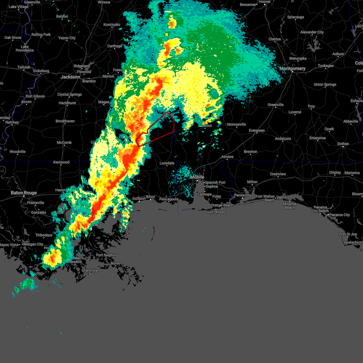 At 808 pm cdt, a severe thunderstorm capable of producing a tornado was located 7 miles north of new augusta, or 8 miles southwest of richton, moving northeast at 55 mph (radar indicated rotation). Hazards include tornado. Flying debris will be dangerous to those caught without shelter. mobile homes will be damaged or destroyed. damage to roofs, windows, and vehicles will occur. tree damage is likely. this dangerous storm will be near, richton around 815 pm cdt. clara around 840 pm cdt. Buckatunna around 845 pm cdt. At 808 pm cdt, a severe thunderstorm capable of producing a tornado was located 7 miles north of new augusta, or 8 miles southwest of richton, moving northeast at 55 mph (radar indicated rotation). Hazards include tornado. Flying debris will be dangerous to those caught without shelter. mobile homes will be damaged or destroyed. damage to roofs, windows, and vehicles will occur. tree damage is likely. this dangerous storm will be near, richton around 815 pm cdt. clara around 840 pm cdt. Buckatunna around 845 pm cdt.
|
| 3/30/2022 7:52 PM CDT |
 At 752 pm cdt, severe thunderstorms were located along a line extending from near orange to heidelberg to 3 miles southwest of ellisville, moving east at 40 mph (radar indicated). Hazards include 60 mph wind gusts. expect damage to roofs, siding, and trees At 752 pm cdt, severe thunderstorms were located along a line extending from near orange to heidelberg to 3 miles southwest of ellisville, moving east at 40 mph (radar indicated). Hazards include 60 mph wind gusts. expect damage to roofs, siding, and trees
|
| 3/18/2022 8:42 AM CDT |
 The severe thunderstorm warning for northwestern washington, east central perry, southeastern wayne and northern greene counties will expire at 845 am cdt, the storms which prompted the warning have weakened below severe limits. therefore, the warning will be allowed to expire. however gusty winds are still possible with these thunderstorms. a tornado watch remains in effect until 1000 am cdt for southwestern alabama, and southeastern mississippi. The severe thunderstorm warning for northwestern washington, east central perry, southeastern wayne and northern greene counties will expire at 845 am cdt, the storms which prompted the warning have weakened below severe limits. therefore, the warning will be allowed to expire. however gusty winds are still possible with these thunderstorms. a tornado watch remains in effect until 1000 am cdt for southwestern alabama, and southeastern mississippi.
|
| 3/18/2022 8:25 AM CDT |
 At 824 am cdt, severe thunderstorms were located along a line extending from 6 miles south of clara to 9 miles east of richton to beaumont, moving northeast at 65 mph (radar indicated). Hazards include 60 mph wind gusts and penny size hail. Expect damage to roofs, siding, and trees. Locations impacted include, chatom, saint stephens, millry, state line, buckatunna and fruitdale. At 824 am cdt, severe thunderstorms were located along a line extending from 6 miles south of clara to 9 miles east of richton to beaumont, moving northeast at 65 mph (radar indicated). Hazards include 60 mph wind gusts and penny size hail. Expect damage to roofs, siding, and trees. Locations impacted include, chatom, saint stephens, millry, state line, buckatunna and fruitdale.
|
| 3/18/2022 8:03 AM CDT |
 At 803 am cdt, severe thunderstorms were located along a line extending from 5 miles east of clara to 7 miles west of state line to 5 miles northeast of beaumont, moving east at 60 mph (radar indicated). Hazards include 60 mph wind gusts and penny size hail. expect damage to roofs, siding, and trees At 803 am cdt, severe thunderstorms were located along a line extending from 5 miles east of clara to 7 miles west of state line to 5 miles northeast of beaumont, moving east at 60 mph (radar indicated). Hazards include 60 mph wind gusts and penny size hail. expect damage to roofs, siding, and trees
|
| 3/18/2022 7:49 AM CDT |
 At 748 am cdt, a severe thunderstorm capable of producing a tornado was located over new augusta, or 10 miles southwest of richton, moving northeast at 45 mph (radar indicated rotation). Hazards include tornado. Flying debris will be dangerous to those caught without shelter. mobile homes will be damaged or destroyed. damage to roofs, windows, and vehicles will occur. tree damage is likely. this dangerous storm will be near, richton around 800 am cdt. Clara and buckatunna around 830 am cdt. At 748 am cdt, a severe thunderstorm capable of producing a tornado was located over new augusta, or 10 miles southwest of richton, moving northeast at 45 mph (radar indicated rotation). Hazards include tornado. Flying debris will be dangerous to those caught without shelter. mobile homes will be damaged or destroyed. damage to roofs, windows, and vehicles will occur. tree damage is likely. this dangerous storm will be near, richton around 800 am cdt. Clara and buckatunna around 830 am cdt.
|
| 3/18/2022 5:43 AM CDT |
 At 542 am cdt, severe thunderstorms were located along a line extending from near stonewall to ovett, moving east at 65 mph (radar indicated). Hazards include 70 mph wind gusts and nickel size hail. Expect considerable tree damage. damage is likely to mobile homes, roofs, and outbuildings. locations impacted include, waynesboro, butler, clara, lisman, millry, state line, buckatunna, silas, pennington, gilbertown and toxey. thunderstorm damage threat, considerable hail threat, radar indicated max hail size, 0. 88 in wind threat, radar indicated max wind gust, 70 mph. At 542 am cdt, severe thunderstorms were located along a line extending from near stonewall to ovett, moving east at 65 mph (radar indicated). Hazards include 70 mph wind gusts and nickel size hail. Expect considerable tree damage. damage is likely to mobile homes, roofs, and outbuildings. locations impacted include, waynesboro, butler, clara, lisman, millry, state line, buckatunna, silas, pennington, gilbertown and toxey. thunderstorm damage threat, considerable hail threat, radar indicated max hail size, 0. 88 in wind threat, radar indicated max wind gust, 70 mph.
|
| 3/18/2022 5:24 AM CDT |
 At 523 am cdt, severe thunderstorms were located along a line extending from 3 miles north of turnerville to sanford, moving east at 60 mph (radar indicated). Hazards include 60 mph wind gusts and nickel size hail. expect damage to roofs, siding, and trees At 523 am cdt, severe thunderstorms were located along a line extending from 3 miles north of turnerville to sanford, moving east at 60 mph (radar indicated). Hazards include 60 mph wind gusts and nickel size hail. expect damage to roofs, siding, and trees
|
| 2/3/2022 1:01 PM CST |
 At 101 pm cst, severe thunderstorms were located along a line extending from 4 miles north of clara to 4 miles northwest of buckatunna to 13 miles southwest of state line, moving northeast at 40 mph (radar indicated). Hazards include 60 mph wind gusts. Expect damage to roofs, siding, and trees. Locations impacted include, waynesboro, clara, state line and buckatunna. At 101 pm cst, severe thunderstorms were located along a line extending from 4 miles north of clara to 4 miles northwest of buckatunna to 13 miles southwest of state line, moving northeast at 40 mph (radar indicated). Hazards include 60 mph wind gusts. Expect damage to roofs, siding, and trees. Locations impacted include, waynesboro, clara, state line and buckatunna.
|
| 2/3/2022 12:43 PM CST |
 At 1242 pm cst, severe thunderstorms were located along a line extending from 8 miles northeast of ovett to 9 miles northeast of richton to 3 miles north of beaumont, moving northeast at 45 mph (radar indicated). Hazards include 60 mph wind gusts. Expect damage to roofs, siding, and trees. Locations impacted include, waynesboro, clara, state line and buckatunna. At 1242 pm cst, severe thunderstorms were located along a line extending from 8 miles northeast of ovett to 9 miles northeast of richton to 3 miles north of beaumont, moving northeast at 45 mph (radar indicated). Hazards include 60 mph wind gusts. Expect damage to roofs, siding, and trees. Locations impacted include, waynesboro, clara, state line and buckatunna.
|
| 2/3/2022 12:30 PM CST |
 At 1229 pm cst, severe thunderstorms were located along a line extending from ovett to richton to 6 miles southwest of new augusta, moving northeast at 45 mph (radar indicated). Hazards include 60 mph wind gusts. expect damage to roofs, siding, and trees At 1229 pm cst, severe thunderstorms were located along a line extending from ovett to richton to 6 miles southwest of new augusta, moving northeast at 45 mph (radar indicated). Hazards include 60 mph wind gusts. expect damage to roofs, siding, and trees
|
| 1/9/2022 2:04 PM CST |
 At 204 pm cst, a severe thunderstorm capable of producing a tornado was located 5 miles southwest of buckatunna, or 14 miles south of waynesboro, moving east at 25 mph (radar indicated rotation). Hazards include tornado. Flying debris will be dangerous to those caught without shelter. mobile homes will be damaged or destroyed. damage to roofs, windows, and vehicles will occur. tree damage is likely. This tornadic thunderstorm will remain over mainly rural areas of southeastern wayne county. At 204 pm cst, a severe thunderstorm capable of producing a tornado was located 5 miles southwest of buckatunna, or 14 miles south of waynesboro, moving east at 25 mph (radar indicated rotation). Hazards include tornado. Flying debris will be dangerous to those caught without shelter. mobile homes will be damaged or destroyed. damage to roofs, windows, and vehicles will occur. tree damage is likely. This tornadic thunderstorm will remain over mainly rural areas of southeastern wayne county.
|
| 1/9/2022 1:54 PM CST |
 At 154 pm cst, a severe thunderstorm was located near buckatunna, or 9 miles south of waynesboro, moving east at 35 mph (radar indicated). Hazards include 60 mph wind gusts and nickel size hail. Expect damage to roofs, siding, and trees. Locations impacted include, buckatunna. At 154 pm cst, a severe thunderstorm was located near buckatunna, or 9 miles south of waynesboro, moving east at 35 mph (radar indicated). Hazards include 60 mph wind gusts and nickel size hail. Expect damage to roofs, siding, and trees. Locations impacted include, buckatunna.
|
| 1/9/2022 1:52 PM CST |
 At 151 pm cst, a severe thunderstorm capable of producing a tornado was located 7 miles south of clara, or 14 miles south of waynesboro, moving east at 25 mph (radar indicated rotation). Hazards include tornado. Flying debris will be dangerous to those caught without shelter. mobile homes will be damaged or destroyed. damage to roofs, windows, and vehicles will occur. tree damage is likely. This dangerous storm will be near, buckatunna around 215 pm cst. At 151 pm cst, a severe thunderstorm capable of producing a tornado was located 7 miles south of clara, or 14 miles south of waynesboro, moving east at 25 mph (radar indicated rotation). Hazards include tornado. Flying debris will be dangerous to those caught without shelter. mobile homes will be damaged or destroyed. damage to roofs, windows, and vehicles will occur. tree damage is likely. This dangerous storm will be near, buckatunna around 215 pm cst.
|
| 1/9/2022 1:29 PM CST |
 At 128 pm cst, a severe thunderstorm was located 9 miles northeast of richton, moving east at 35 mph (radar indicated). Hazards include 60 mph wind gusts and nickel size hail. expect damage to roofs, siding, and trees At 128 pm cst, a severe thunderstorm was located 9 miles northeast of richton, moving east at 35 mph (radar indicated). Hazards include 60 mph wind gusts and nickel size hail. expect damage to roofs, siding, and trees
|
| 9/1/2021 7:55 PM CDT |
 At 754 pm cdt, severe thunderstorms were located along a line extending from mill creek to 3 miles west of clara to near buckatunna, moving south at 35 mph (radar indicated). Hazards include 60 mph wind gusts. Expect damage to roofs, siding, and trees. locations impacted include, waynesboro, clara and buckatunna. hail threat, radar indicated max hail size, <. 75 in wind threat, radar indicated max wind gust, 60 mph. At 754 pm cdt, severe thunderstorms were located along a line extending from mill creek to 3 miles west of clara to near buckatunna, moving south at 35 mph (radar indicated). Hazards include 60 mph wind gusts. Expect damage to roofs, siding, and trees. locations impacted include, waynesboro, clara and buckatunna. hail threat, radar indicated max hail size, <. 75 in wind threat, radar indicated max wind gust, 60 mph.
|
| 9/1/2021 7:34 PM CDT |
 At 733 pm cdt, severe thunderstorms were located along a line extending from 7 miles northeast of mill creek to 5 miles southwest of crandall, moving south at 30 mph (radar indicated). Hazards include 60 mph wind gusts. expect damage to roofs, siding, and trees At 733 pm cdt, severe thunderstorms were located along a line extending from 7 miles northeast of mill creek to 5 miles southwest of crandall, moving south at 30 mph (radar indicated). Hazards include 60 mph wind gusts. expect damage to roofs, siding, and trees
|
| 8/30/2021 2:32 PM CDT |
 At 232 pm cdt, a severe thunderstorm capable of producing a tornado was located 8 miles southwest of clara, or 13 miles northeast of richton, moving northeast at 30 mph (radar indicated rotation). Hazards include tornado. Flying debris will be dangerous to those caught without shelter. mobile homes will be damaged or destroyed. damage to roofs, windows, and vehicles will occur. tree damage is likely. this dangerous storm will be near, clara around 250 pm cdt. Waynesboro around 305 pm cdt. At 232 pm cdt, a severe thunderstorm capable of producing a tornado was located 8 miles southwest of clara, or 13 miles northeast of richton, moving northeast at 30 mph (radar indicated rotation). Hazards include tornado. Flying debris will be dangerous to those caught without shelter. mobile homes will be damaged or destroyed. damage to roofs, windows, and vehicles will occur. tree damage is likely. this dangerous storm will be near, clara around 250 pm cdt. Waynesboro around 305 pm cdt.
|
| 6/24/2021 7:26 PM CDT |
 At 726 pm cdt, a severe thunderstorm was located 7 miles northwest of silas, or 15 miles northeast of waynesboro, moving southwest at 20 mph (radar indicated). Hazards include 60 mph wind gusts and quarter size hail. Hail damage to vehicles is expected. Expect wind damage to roofs, siding, and trees. At 726 pm cdt, a severe thunderstorm was located 7 miles northwest of silas, or 15 miles northeast of waynesboro, moving southwest at 20 mph (radar indicated). Hazards include 60 mph wind gusts and quarter size hail. Hail damage to vehicles is expected. Expect wind damage to roofs, siding, and trees.
|
| 6/13/2021 5:11 PM CDT |
 At 510 pm cdt, severe thunderstorms were located along a line extending from 6 miles northeast of ovett to clara to 6 miles west of fruitdale, moving south at 30 mph (radar indicated). Hazards include 60 mph wind gusts and penny size hail. expect damage to roofs, siding, and trees At 510 pm cdt, severe thunderstorms were located along a line extending from 6 miles northeast of ovett to clara to 6 miles west of fruitdale, moving south at 30 mph (radar indicated). Hazards include 60 mph wind gusts and penny size hail. expect damage to roofs, siding, and trees
|
| 5/4/2021 5:35 PM CDT |
 At 534 pm cdt, severe thunderstorms were located along a line extending from 3 miles northeast of vineland to 10 miles west of fulton to 7 miles east of millry to near buckatunna, moving east at 40 mph (radar indicated). Hazards include 60 mph wind gusts. Expect damage to roofs, siding, and trees. Locations impacted include, jackson, thomasville, grove hill, saint stephens, leroy, pine hill, millry, buckatunna, coffeeville, fulton and yellow bluff. At 534 pm cdt, severe thunderstorms were located along a line extending from 3 miles northeast of vineland to 10 miles west of fulton to 7 miles east of millry to near buckatunna, moving east at 40 mph (radar indicated). Hazards include 60 mph wind gusts. Expect damage to roofs, siding, and trees. Locations impacted include, jackson, thomasville, grove hill, saint stephens, leroy, pine hill, millry, buckatunna, coffeeville, fulton and yellow bluff.
|
| 5/4/2021 5:23 PM CDT |
 At 523 pm cdt, severe thunderstorms were located along a line extending from surginer to 7 miles northeast of coffeeville to 4 miles north of millry to 3 miles west of buckatunna, moving east at 45 mph (radar indicated). Hazards include 60 mph wind gusts. Expect damage to roofs, siding, and trees. Locations impacted include, jackson, waynesboro, thomasville, grove hill, saint stephens, leroy, clara, pine hill, millry, buckatunna, silas, coffeeville, fulton and yellow bluff. At 523 pm cdt, severe thunderstorms were located along a line extending from surginer to 7 miles northeast of coffeeville to 4 miles north of millry to 3 miles west of buckatunna, moving east at 45 mph (radar indicated). Hazards include 60 mph wind gusts. Expect damage to roofs, siding, and trees. Locations impacted include, jackson, waynesboro, thomasville, grove hill, saint stephens, leroy, clara, pine hill, millry, buckatunna, silas, coffeeville, fulton and yellow bluff.
|
| 5/4/2021 5:13 PM CDT |
 At 513 pm cdt, severe thunderstorms were located along a line extending from 4 miles west of silas to 3 miles east of clara to 8 miles northeast of richton to sunrise, moving east at 45 mph (radar indicated). Hazards include 60 mph wind gusts. Expect damage to roofs, siding, and trees. Locations impacted include, citronelle, chatom, richton, leakesville, wagarville, gulfcrest, deer park, tibbie, beaumont, calvert, mount vernon, new augusta, mclain, state line, fruitdale, mcintosh and movico. At 513 pm cdt, severe thunderstorms were located along a line extending from 4 miles west of silas to 3 miles east of clara to 8 miles northeast of richton to sunrise, moving east at 45 mph (radar indicated). Hazards include 60 mph wind gusts. Expect damage to roofs, siding, and trees. Locations impacted include, citronelle, chatom, richton, leakesville, wagarville, gulfcrest, deer park, tibbie, beaumont, calvert, mount vernon, new augusta, mclain, state line, fruitdale, mcintosh and movico.
|
| 5/4/2021 4:59 PM CDT |
 The national weather service in mobile has issued a * severe thunderstorm warning for. choctaw county in southwestern alabama. northern washington county in southwestern alabama. clarke county in southwestern alabama. Western wilcox county in south central alabama. The national weather service in mobile has issued a * severe thunderstorm warning for. choctaw county in southwestern alabama. northern washington county in southwestern alabama. clarke county in southwestern alabama. Western wilcox county in south central alabama.
|
| 5/4/2021 4:50 PM CDT |
 At 449 pm cdt, severe thunderstorms were located along a line extending from 7 miles northwest of waynesboro to 6 miles southeast of mill creek to 3 miles west of ovett to rawls springs, moving east at 45 mph (radar indicated). Hazards include 60 mph wind gusts. Expect damage to roofs, siding, and trees. Locations impacted include, citronelle, lucedale, frisco city, chatom, richton, leakesville, chunchula, wagarville, gulfcrest, deer park, uriah, tibbie, beaumont, calvert, mount vernon, new augusta, mclain, excel, state line and fruitdale. At 449 pm cdt, severe thunderstorms were located along a line extending from 7 miles northwest of waynesboro to 6 miles southeast of mill creek to 3 miles west of ovett to rawls springs, moving east at 45 mph (radar indicated). Hazards include 60 mph wind gusts. Expect damage to roofs, siding, and trees. Locations impacted include, citronelle, lucedale, frisco city, chatom, richton, leakesville, chunchula, wagarville, gulfcrest, deer park, uriah, tibbie, beaumont, calvert, mount vernon, new augusta, mclain, excel, state line and fruitdale.
|
| 5/4/2021 4:44 PM CDT |
 At 444 pm cdt, severe thunderstorms were located along a line extending from 7 miles north of waynesboro to 9 miles southeast of mill creek to 3 miles west of ovett to west hattiesburg, moving east at 75 mph (radar indicated). Hazards include 60 mph wind gusts. expect damage to roofs, siding, and trees At 444 pm cdt, severe thunderstorms were located along a line extending from 7 miles north of waynesboro to 9 miles southeast of mill creek to 3 miles west of ovett to west hattiesburg, moving east at 75 mph (radar indicated). Hazards include 60 mph wind gusts. expect damage to roofs, siding, and trees
|
| 5/4/2021 3:55 PM CDT |
 At 354 pm cdt, severe thunderstorms were located along a line extending from 4 miles east of suqualena to 3 miles northwest of paulding to 5 miles south of turnerville to near mount olive, moving east at 70 mph (radar indicated). Hazards include 70 mph wind gusts. Expect considerable tree damage. Damage is likely to mobile homes, roofs, and outbuildings. At 354 pm cdt, severe thunderstorms were located along a line extending from 4 miles east of suqualena to 3 miles northwest of paulding to 5 miles south of turnerville to near mount olive, moving east at 70 mph (radar indicated). Hazards include 70 mph wind gusts. Expect considerable tree damage. Damage is likely to mobile homes, roofs, and outbuildings.
|
| 4/24/2021 3:59 PM CDT |
 The national weather service in mobile has issued a * severe thunderstorm warning for. central washington county in southwestern alabama. southeastern wayne county in southeastern mississippi. until 445 pm cdt. At 359 pm cdt, a severe thunderstorm was located near buckatunna,. The national weather service in mobile has issued a * severe thunderstorm warning for. central washington county in southwestern alabama. southeastern wayne county in southeastern mississippi. until 445 pm cdt. At 359 pm cdt, a severe thunderstorm was located near buckatunna,.
|
| 4/24/2021 3:59 PM CDT |
 At 359 pm cdt, a severe thunderstorm was located near buckatunna, or 14 miles southeast of waynesboro, moving east at 55 mph (radar indicated). Hazards include 60 mph wind gusts and quarter size hail. Hail damage to vehicles is expected. Expect wind damage to roofs, siding, and trees. At 359 pm cdt, a severe thunderstorm was located near buckatunna, or 14 miles southeast of waynesboro, moving east at 55 mph (radar indicated). Hazards include 60 mph wind gusts and quarter size hail. Hail damage to vehicles is expected. Expect wind damage to roofs, siding, and trees.
|
| 4/24/2021 4:25 AM CDT |
 At 425 am cdt, severe thunderstorms were located along a line extending from 7 miles east of buckatunna to leakesville to 13 miles north of latimer, moving east at 60 mph (radar indicated). Hazards include 60 mph wind gusts. expect damage to roofs, siding, and trees At 425 am cdt, severe thunderstorms were located along a line extending from 7 miles east of buckatunna to leakesville to 13 miles north of latimer, moving east at 60 mph (radar indicated). Hazards include 60 mph wind gusts. expect damage to roofs, siding, and trees
|
| 4/10/2021 1:58 AM CDT |
 At 157 am cdt, severe thunderstorms were located along a line extending from 8 miles northwest of pennington to beaumont, moving east at 65 mph (radar indicated). Hazards include 70 mph wind gusts and quarter size hail. Hail damage to vehicles is expected. expect considerable tree damage. Wind damage is also likely to mobile homes, roofs, and outbuildings. At 157 am cdt, severe thunderstorms were located along a line extending from 8 miles northwest of pennington to beaumont, moving east at 65 mph (radar indicated). Hazards include 70 mph wind gusts and quarter size hail. Hail damage to vehicles is expected. expect considerable tree damage. Wind damage is also likely to mobile homes, roofs, and outbuildings.
|
| 4/10/2021 1:46 AM CDT |
 At 146 am cdt, severe thunderstorms were located along a line extending from 4 miles north of waynesboro to near brooklyn, moving east at 50 mph (radar indicated). Hazards include 70 mph wind gusts and quarter size hail. Hail damage to vehicles is expected. expect considerable tree damage. wind damage is also likely to mobile homes, roofs, and outbuildings. Locations impacted include, waynesboro, richton, clara, beaumont, new augusta, millry, mclain, state line and buckatunna. At 146 am cdt, severe thunderstorms were located along a line extending from 4 miles north of waynesboro to near brooklyn, moving east at 50 mph (radar indicated). Hazards include 70 mph wind gusts and quarter size hail. Hail damage to vehicles is expected. expect considerable tree damage. wind damage is also likely to mobile homes, roofs, and outbuildings. Locations impacted include, waynesboro, richton, clara, beaumont, new augusta, millry, mclain, state line and buckatunna.
|
| 4/10/2021 1:15 AM CDT |
 At 114 am cdt, severe thunderstorms were located along a line extending from 6 miles northeast of mill creek to near pinebur, moving east at 60 mph (radar indicated). Hazards include 60 mph wind gusts. expect damage to roofs, siding, and trees At 114 am cdt, severe thunderstorms were located along a line extending from 6 miles northeast of mill creek to near pinebur, moving east at 60 mph (radar indicated). Hazards include 60 mph wind gusts. expect damage to roofs, siding, and trees
|
| 3/17/2021 8:08 PM CDT |
 The severe thunderstorm warning for choctaw, western washington, southeastern perry, eastern wayne and greene counties will expire at 815 pm cdt, the storms which prompted the warning have weakened below severe limits, and no longer pose an immediate threat to life or property. therefore, the warning will be allowed to expire. however gusty winds are still possible with these thunderstorms. a tornado watch remains in effect until 300 am cdt for southwestern alabama, and southeastern mississippi. The severe thunderstorm warning for choctaw, western washington, southeastern perry, eastern wayne and greene counties will expire at 815 pm cdt, the storms which prompted the warning have weakened below severe limits, and no longer pose an immediate threat to life or property. therefore, the warning will be allowed to expire. however gusty winds are still possible with these thunderstorms. a tornado watch remains in effect until 300 am cdt for southwestern alabama, and southeastern mississippi.
|
| 3/17/2021 7:44 PM CDT |
 At 742 pm cdt, severe thunderstorms were located along a line extending from near melvin to 5 miles northeast of buckatunna to 7 miles west of fruitdale to 5 miles east of mclain, moving northeast at 60 mph (radar indicated). Hazards include 60 mph wind gusts. Expect damage to roofs, siding, and trees. Locations impacted include, waynesboro, butler, chatom, leakesville, deer park, tibbie, beaumont, lisman, millry, mclain, state line, buckatunna, silas, fruitdale, gilbertown and toxey. At 742 pm cdt, severe thunderstorms were located along a line extending from near melvin to 5 miles northeast of buckatunna to 7 miles west of fruitdale to 5 miles east of mclain, moving northeast at 60 mph (radar indicated). Hazards include 60 mph wind gusts. Expect damage to roofs, siding, and trees. Locations impacted include, waynesboro, butler, chatom, leakesville, deer park, tibbie, beaumont, lisman, millry, mclain, state line, buckatunna, silas, fruitdale, gilbertown and toxey.
|
| 3/17/2021 7:27 PM CDT |
 At 725 pm cdt, severe thunderstorms were located along a line extending from 8 miles southeast of goodwater to waynesboro to 10 miles east of richton to 5 miles south of beaumont, moving northeast at 55 mph (radar indicated). Hazards include 60 mph wind gusts. Expect damage to roofs, siding, and trees. Locations impacted include, waynesboro, butler, chatom, richton, leakesville, clara, tibbie, beaumont, new augusta, lisman, millry, mclain, state line, buckatunna, silas, fruitdale, gilbertown and toxey. At 725 pm cdt, severe thunderstorms were located along a line extending from 8 miles southeast of goodwater to waynesboro to 10 miles east of richton to 5 miles south of beaumont, moving northeast at 55 mph (radar indicated). Hazards include 60 mph wind gusts. Expect damage to roofs, siding, and trees. Locations impacted include, waynesboro, butler, chatom, richton, leakesville, clara, tibbie, beaumont, new augusta, lisman, millry, mclain, state line, buckatunna, silas, fruitdale, gilbertown and toxey.
|
| 3/17/2021 7:10 PM CDT |
 At 710 pm cdt, severe thunderstorms were located along a line extending from sandersville to 8 miles west of clara to 4 miles south of richton to 3 miles east of maxie, moving northeast at 55 mph (radar indicated). Hazards include 60 mph wind gusts. expect damage to roofs, siding, and trees At 710 pm cdt, severe thunderstorms were located along a line extending from sandersville to 8 miles west of clara to 4 miles south of richton to 3 miles east of maxie, moving northeast at 55 mph (radar indicated). Hazards include 60 mph wind gusts. expect damage to roofs, siding, and trees
|
| 3/17/2021 4:04 PM CDT |
 At 404 pm cdt, a severe thunderstorm capable of producing a tornado was located near buckatunna, or 7 miles southeast of waynesboro, moving northeast at 40 mph (radar indicated rotation). Hazards include tornado. Flying debris will be dangerous to those caught without shelter. mobile homes will be damaged or destroyed. damage to roofs, windows, and vehicles will occur. tree damage is likely. This dangerous storm will be near, silas around 430 pm cdt. At 404 pm cdt, a severe thunderstorm capable of producing a tornado was located near buckatunna, or 7 miles southeast of waynesboro, moving northeast at 40 mph (radar indicated rotation). Hazards include tornado. Flying debris will be dangerous to those caught without shelter. mobile homes will be damaged or destroyed. damage to roofs, windows, and vehicles will occur. tree damage is likely. This dangerous storm will be near, silas around 430 pm cdt.
|
| 3/17/2021 3:28 PM CDT |
 At 327 pm cdt, a severe thunderstorm was located near clara, or 4 miles south of waynesboro. other severe storms were located near toxey and 5 miles southwest of lavaca, moving northeast at 40 mph (radar indicated). Hazards include 60 mph wind gusts and quarter size hail. Hail damage to vehicles is expected. Expect wind damage to roofs, siding, and trees. At 327 pm cdt, a severe thunderstorm was located near clara, or 4 miles south of waynesboro. other severe storms were located near toxey and 5 miles southwest of lavaca, moving northeast at 40 mph (radar indicated). Hazards include 60 mph wind gusts and quarter size hail. Hail damage to vehicles is expected. Expect wind damage to roofs, siding, and trees.
|
| 3/17/2021 2:34 PM CDT |
 At 234 pm cdt, a severe thunderstorm was located 5 miles southeast of waynesboro, and another was located near coffeeville, moving northeast at 40 mph (radar indicated). Hazards include 60 mph wind gusts and quarter size hail. Hail damage to vehicles is expected. Expect wind damage to roofs, siding, and trees. At 234 pm cdt, a severe thunderstorm was located 5 miles southeast of waynesboro, and another was located near coffeeville, moving northeast at 40 mph (radar indicated). Hazards include 60 mph wind gusts and quarter size hail. Hail damage to vehicles is expected. Expect wind damage to roofs, siding, and trees.
|
| 8/21/2020 6:39 PM CDT |
 At 603 pm cdt, a severe thunderstorm was located near state line, or 15 miles west of chatom, moving north at 15 mph (radar indicated). Hazards include 60 mph wind gusts. expect damage to roofs, siding, and trees At 603 pm cdt, a severe thunderstorm was located near state line, or 15 miles west of chatom, moving north at 15 mph (radar indicated). Hazards include 60 mph wind gusts. expect damage to roofs, siding, and trees
|
| 8/21/2020 6:04 PM CDT |
 At 603 pm cdt, a severe thunderstorm was located near state line, or 15 miles west of chatom, moving north at 15 mph (radar indicated). Hazards include 60 mph wind gusts. expect damage to roofs, siding, and trees At 603 pm cdt, a severe thunderstorm was located near state line, or 15 miles west of chatom, moving north at 15 mph (radar indicated). Hazards include 60 mph wind gusts. expect damage to roofs, siding, and trees
|
| 8/16/2020 6:29 PM CDT |
 At 628 pm cdt, a severe thunderstorm was located 8 miles northeast of mill creek, or 14 miles northwest of waynesboro, moving south at 15 mph (radar indicated). Hazards include 60 mph wind gusts. expect damage to roofs, siding, and trees At 628 pm cdt, a severe thunderstorm was located 8 miles northeast of mill creek, or 14 miles northwest of waynesboro, moving south at 15 mph (radar indicated). Hazards include 60 mph wind gusts. expect damage to roofs, siding, and trees
|
| 7/12/2020 7:09 PM CDT |
 The severe thunderstorm warning for washington, northeastern perry, southern wayne and northern greene counties will expire at 715 pm cdt, the storm which prompted the warning has moved out of the area. therefore, the warning will be allowed to expire. however, gusty winds and heavy rain are still possible with this thunderstorm. a severe thunderstorm watch remains in effect until 1000 pm cdt for southwestern alabama, and southeastern mississippi. remember, a severe thunderstorm warning still remains in effect for southern washington county and southeastern greene county until 800 pm cdt. The severe thunderstorm warning for washington, northeastern perry, southern wayne and northern greene counties will expire at 715 pm cdt, the storm which prompted the warning has moved out of the area. therefore, the warning will be allowed to expire. however, gusty winds and heavy rain are still possible with this thunderstorm. a severe thunderstorm watch remains in effect until 1000 pm cdt for southwestern alabama, and southeastern mississippi. remember, a severe thunderstorm warning still remains in effect for southern washington county and southeastern greene county until 800 pm cdt.
|
| 7/12/2020 6:48 PM CDT |
 At 647 pm cdt, a cluster of severe thunderstorms was located 5 miles southwest of buckatunna, or 12 miles south of waynesboro, moving southeast at 30 mph (radar indicated). Hazards include 60 mph wind gusts and penny size hail. Expect damage to roofs, siding, and trees. Locations impacted include, chatom, clara, tibbie, state line, buckatunna, fruitdale and mcintosh. At 647 pm cdt, a cluster of severe thunderstorms was located 5 miles southwest of buckatunna, or 12 miles south of waynesboro, moving southeast at 30 mph (radar indicated). Hazards include 60 mph wind gusts and penny size hail. Expect damage to roofs, siding, and trees. Locations impacted include, chatom, clara, tibbie, state line, buckatunna, fruitdale and mcintosh.
|
| 7/12/2020 6:33 PM CDT |
 At 631 pm cdt, a cluster of severe thunderstorms was located over clara, or 9 miles southwest of waynesboro, moving southeast at 30 mph (radar indicated). Hazards include 60 mph wind gusts and penny size hail. expect damage to roofs, siding, and trees At 631 pm cdt, a cluster of severe thunderstorms was located over clara, or 9 miles southwest of waynesboro, moving southeast at 30 mph (radar indicated). Hazards include 60 mph wind gusts and penny size hail. expect damage to roofs, siding, and trees
|
| 6/25/2020 6:37 PM CDT |
 At 637 pm cdt, severe thunderstorms were located along a line extending from near stonewall to 3 miles northeast of waynesboro to 8 miles southwest of clara, moving east at 35 mph (radar indicated). Hazards include 60 mph wind gusts. expect damage to roofs, siding, and trees At 637 pm cdt, severe thunderstorms were located along a line extending from near stonewall to 3 miles northeast of waynesboro to 8 miles southwest of clara, moving east at 35 mph (radar indicated). Hazards include 60 mph wind gusts. expect damage to roofs, siding, and trees
|
| 6/25/2020 6:10 PM CDT |
 At 610 pm cdt, a severe thunderstorm was located over mill creek, or 12 miles east of laurel, moving east at 35 mph (radar indicated). Hazards include 60 mph wind gusts. expect damage to roofs, siding, and trees At 610 pm cdt, a severe thunderstorm was located over mill creek, or 12 miles east of laurel, moving east at 35 mph (radar indicated). Hazards include 60 mph wind gusts. expect damage to roofs, siding, and trees
|
| 6/5/2020 7:31 PM CDT |
 At 730 pm cdt, severe thunderstorms were located along a line extending from 3 miles south of coatopa to 6 miles west of lisman to 4 miles southeast of turnerville, moving southeast at 30 mph (radar indicated). Hazards include 60 mph wind gusts. expect damage to roofs, siding, and trees At 730 pm cdt, severe thunderstorms were located along a line extending from 3 miles south of coatopa to 6 miles west of lisman to 4 miles southeast of turnerville, moving southeast at 30 mph (radar indicated). Hazards include 60 mph wind gusts. expect damage to roofs, siding, and trees
|
| 5/22/2020 4:10 PM CDT |
 At 410 pm cdt, a severe thunderstorm was located over waynesboro, moving northeast at 25 mph (radar indicated). Hazards include 60 mph wind gusts and nickel size hail. expect damage to roofs, siding, and trees At 410 pm cdt, a severe thunderstorm was located over waynesboro, moving northeast at 25 mph (radar indicated). Hazards include 60 mph wind gusts and nickel size hail. expect damage to roofs, siding, and trees
|
| 4/23/2020 3:59 PM CDT |
 At 358 pm cdt, a severe thunderstorm was located 8 miles northeast of ovett, or 14 miles north of richton, moving east at 35 mph (radar indicated). Hazards include 60 mph wind gusts. Expect damage to roofs, siding, and trees. Locations impacted include, waynesboro, clara and buckatunna. At 358 pm cdt, a severe thunderstorm was located 8 miles northeast of ovett, or 14 miles north of richton, moving east at 35 mph (radar indicated). Hazards include 60 mph wind gusts. Expect damage to roofs, siding, and trees. Locations impacted include, waynesboro, clara and buckatunna.
|
| 4/23/2020 3:38 PM CDT |
 At 338 pm cdt, a severe thunderstorm was located 6 miles west of ovett, or 7 miles southeast of ellisville, moving northeast at 35 mph (radar indicated). Hazards include 60 mph wind gusts. expect damage to roofs, siding, and trees At 338 pm cdt, a severe thunderstorm was located 6 miles west of ovett, or 7 miles southeast of ellisville, moving northeast at 35 mph (radar indicated). Hazards include 60 mph wind gusts. expect damage to roofs, siding, and trees
|
| 4/23/2020 5:19 AM CDT |
 At 519 am cdt, a severe thunderstorm capable of producing a tornado was located 7 miles west of clara, or 11 miles west of waynesboro, moving east at 40 mph (radar indicated rotation). Hazards include tornado. Flying debris will be dangerous to those caught without shelter. mobile homes will be damaged or destroyed. damage to roofs, windows, and vehicles will occur. tree damage is likely. this dangerous storm will be near, clara around 530 am cdt. waynesboro around 535 am cdt. Millry and silas around 600 am cdt. At 519 am cdt, a severe thunderstorm capable of producing a tornado was located 7 miles west of clara, or 11 miles west of waynesboro, moving east at 40 mph (radar indicated rotation). Hazards include tornado. Flying debris will be dangerous to those caught without shelter. mobile homes will be damaged or destroyed. damage to roofs, windows, and vehicles will occur. tree damage is likely. this dangerous storm will be near, clara around 530 am cdt. waynesboro around 535 am cdt. Millry and silas around 600 am cdt.
|
| 4/12/2020 9:20 PM CDT |
 At 919 pm cdt, severe thunderstorms were located from near coffeeville to near buckatunna, moving northeast at 55 mph (radar indicated). Hazards include 70 mph wind gusts and penny size hail. Expect considerable tree damage. damage is likely to mobile homes, roofs, and outbuildings. Locations impacted include, clara, millry, buckatunna, silas, coffeeville and gilbertown. At 919 pm cdt, severe thunderstorms were located from near coffeeville to near buckatunna, moving northeast at 55 mph (radar indicated). Hazards include 70 mph wind gusts and penny size hail. Expect considerable tree damage. damage is likely to mobile homes, roofs, and outbuildings. Locations impacted include, clara, millry, buckatunna, silas, coffeeville and gilbertown.
|
| 4/12/2020 9:04 PM CDT |
 At 903 pm cdt, a severe thunderstorm was located 4 miles southwest of silas, or 15 miles east of waynesboro, moving northeast at 55 mph (radar indicated). Hazards include 70 mph wind gusts and penny size hail. Expect considerable tree damage. damage is likely to mobile homes, roofs, and outbuildings. Locations impacted include, waynesboro, clara, millry, buckatunna, silas, coffeeville, gilbertown and toxey. At 903 pm cdt, a severe thunderstorm was located 4 miles southwest of silas, or 15 miles east of waynesboro, moving northeast at 55 mph (radar indicated). Hazards include 70 mph wind gusts and penny size hail. Expect considerable tree damage. damage is likely to mobile homes, roofs, and outbuildings. Locations impacted include, waynesboro, clara, millry, buckatunna, silas, coffeeville, gilbertown and toxey.
|
| 4/12/2020 8:46 PM CDT |
 At 845 pm cdt, a severe thunderstorm was located 4 miles east of clara, or 5 miles south of waynesboro, moving northeast at 55 mph (radar indicated). Hazards include 60 mph wind gusts and penny size hail. expect damage to roofs, siding, and trees At 845 pm cdt, a severe thunderstorm was located 4 miles east of clara, or 5 miles south of waynesboro, moving northeast at 55 mph (radar indicated). Hazards include 60 mph wind gusts and penny size hail. expect damage to roofs, siding, and trees
|
| 3/31/2020 8:29 AM CDT |
 At 828 am cdt, severe thunderstorms were located along a line extending from 12 miles south of clara to 6 miles northeast of buckatunna to 4 miles northeast of coffeeville, moving east at 50 mph. residents near piave should seek safe shelter immediately (radar indicated). Hazards include 70 mph wind gusts. Expect considerable tree damage. damage is likely to mobile homes, roofs, and outbuildings. Locations impacted include, chatom, millry, state line, buckatunna and silas. At 828 am cdt, severe thunderstorms were located along a line extending from 12 miles south of clara to 6 miles northeast of buckatunna to 4 miles northeast of coffeeville, moving east at 50 mph. residents near piave should seek safe shelter immediately (radar indicated). Hazards include 70 mph wind gusts. Expect considerable tree damage. damage is likely to mobile homes, roofs, and outbuildings. Locations impacted include, chatom, millry, state line, buckatunna and silas.
|
| 3/31/2020 7:59 AM CDT |
 The national weather service in mobile has issued a * severe thunderstorm warning for. southwestern choctaw county in southwestern alabama. northwestern washington county in southwestern alabama. northern perry county in southeastern mississippi. Wayne county in southeastern mississippi. The national weather service in mobile has issued a * severe thunderstorm warning for. southwestern choctaw county in southwestern alabama. northwestern washington county in southwestern alabama. northern perry county in southeastern mississippi. Wayne county in southeastern mississippi.
|
| 3/20/2020 6:45 PM CDT |
 At 643 pm cdt, a severe thunderstorm was located near waynesboro, moving east at 40 mph (radar indicated). Hazards include 60 mph wind gusts and penny size hail. Expect damage to roofs, siding, and trees. Locations impacted include, waynesboro and clara. At 643 pm cdt, a severe thunderstorm was located near waynesboro, moving east at 40 mph (radar indicated). Hazards include 60 mph wind gusts and penny size hail. Expect damage to roofs, siding, and trees. Locations impacted include, waynesboro and clara.
|
| 3/20/2020 6:27 PM CDT |
 At 626 pm cdt, a severe thunderstorm was located 7 miles southeast of mill creek, or 14 miles west of waynesboro, moving east at 40 mph (radar indicated). Hazards include 60 mph wind gusts and penny size hail. expect damage to roofs, siding, and trees At 626 pm cdt, a severe thunderstorm was located 7 miles southeast of mill creek, or 14 miles west of waynesboro, moving east at 40 mph (radar indicated). Hazards include 60 mph wind gusts and penny size hail. expect damage to roofs, siding, and trees
|
| 3/4/2020 6:21 AM CST |
 At 621 am cst, severe thunderstorms were located along a line extending from 5 miles northeast of buckatunna to near state line to 7 miles west of fruitdale, moving southeast at 40 mph (radar indicated). Hazards include 60 mph wind gusts and quarter size hail. Hail damage to vehicles is expected. expect wind damage to roofs, siding, and trees. Locations impacted include, state line. At 621 am cst, severe thunderstorms were located along a line extending from 5 miles northeast of buckatunna to near state line to 7 miles west of fruitdale, moving southeast at 40 mph (radar indicated). Hazards include 60 mph wind gusts and quarter size hail. Hail damage to vehicles is expected. expect wind damage to roofs, siding, and trees. Locations impacted include, state line.
|
| 3/4/2020 6:06 AM CST |
 At 606 am cst, severe thunderstorms were located along a line extending from 6 miles northeast of waynesboro to 5 miles northwest of buckatunna to 3 miles southeast of clara, moving east at 40 mph (radar indicated). Hazards include 60 mph wind gusts and quarter size hail. Hail damage to vehicles is expected. expect wind damage to roofs, siding, and trees. Locations impacted include, waynesboro and clara. At 606 am cst, severe thunderstorms were located along a line extending from 6 miles northeast of waynesboro to 5 miles northwest of buckatunna to 3 miles southeast of clara, moving east at 40 mph (radar indicated). Hazards include 60 mph wind gusts and quarter size hail. Hail damage to vehicles is expected. expect wind damage to roofs, siding, and trees. Locations impacted include, waynesboro and clara.
|
| 3/4/2020 5:39 AM CST |
 At 539 am cst, a severe thunderstorm was located 7 miles southeast of mill creek, or 13 miles west of waynesboro, moving east at 50 mph (radar indicated). Hazards include tennis ball size hail and 70 mph wind gusts. People and animals outdoors will be injured. expect hail damage to roofs, siding, windows, and vehicles. expect considerable tree damage. wind damage is also likely to mobile homes, roofs, and outbuildings. Locations impacted include, waynesboro, clara and buckatunna. At 539 am cst, a severe thunderstorm was located 7 miles southeast of mill creek, or 13 miles west of waynesboro, moving east at 50 mph (radar indicated). Hazards include tennis ball size hail and 70 mph wind gusts. People and animals outdoors will be injured. expect hail damage to roofs, siding, windows, and vehicles. expect considerable tree damage. wind damage is also likely to mobile homes, roofs, and outbuildings. Locations impacted include, waynesboro, clara and buckatunna.
|
| 3/4/2020 5:31 AM CST |
 At 530 am cst, a severe thunderstorm was located over tuckers crossing, or 6 miles southeast of laurel, moving east at 55 mph (radar indicated). Hazards include golf ball size hail and 60 mph wind gusts. People and animals outdoors will be injured. expect hail damage to roofs, siding, windows, and vehicles. Expect wind damage to roofs, siding, and trees. At 530 am cst, a severe thunderstorm was located over tuckers crossing, or 6 miles southeast of laurel, moving east at 55 mph (radar indicated). Hazards include golf ball size hail and 60 mph wind gusts. People and animals outdoors will be injured. expect hail damage to roofs, siding, windows, and vehicles. Expect wind damage to roofs, siding, and trees.
|
| 2/10/2020 6:47 PM CST |
 At 646 pm cst, a severe thunderstorm was located 5 miles east of buckatunna, or 11 miles northwest of chatom, moving east at 45 mph (radar indicated). Hazards include 60 mph wind gusts. expect damage to roofs, siding, and trees At 646 pm cst, a severe thunderstorm was located 5 miles east of buckatunna, or 11 miles northwest of chatom, moving east at 45 mph (radar indicated). Hazards include 60 mph wind gusts. expect damage to roofs, siding, and trees
|
| 2/10/2020 6:29 PM CST |
 At 628 pm cst, a severe thunderstorm was located over buckatunna, or 10 miles southeast of waynesboro, moving northeast at 45 mph (radar indicated). Hazards include 60 mph wind gusts. Expect damage to roofs, siding, and trees. Locations impacted include, buckatunna. At 628 pm cst, a severe thunderstorm was located over buckatunna, or 10 miles southeast of waynesboro, moving northeast at 45 mph (radar indicated). Hazards include 60 mph wind gusts. Expect damage to roofs, siding, and trees. Locations impacted include, buckatunna.
|
| 2/10/2020 6:19 PM CST |
 At 619 pm cst, a severe thunderstorm was located 6 miles southeast of clara, or 12 miles south of waynesboro, moving northeast at 45 mph (radar indicated). Hazards include 60 mph wind gusts. Expect damage to roofs, siding, and trees. Locations impacted include, buckatunna. At 619 pm cst, a severe thunderstorm was located 6 miles southeast of clara, or 12 miles south of waynesboro, moving northeast at 45 mph (radar indicated). Hazards include 60 mph wind gusts. Expect damage to roofs, siding, and trees. Locations impacted include, buckatunna.
|
| 2/10/2020 6:08 PM CST |
 At 607 pm cst, a severe thunderstorm was located 11 miles south of clara, or 11 miles northeast of richton, moving northeast at 45 mph (radar indicated). Hazards include 60 mph wind gusts. expect damage to roofs, siding, and trees At 607 pm cst, a severe thunderstorm was located 11 miles south of clara, or 11 miles northeast of richton, moving northeast at 45 mph (radar indicated). Hazards include 60 mph wind gusts. expect damage to roofs, siding, and trees
|
| 1/11/2020 11:18 AM CST |
 At 1118 am cst, severe thunderstorms were located along a line extending from york to 7 miles southwest of mclain, moving east at 30 mph (radar indicated). Hazards include 60 mph wind gusts. Expect damage to roofs, siding, and trees. Locations impacted include, waynesboro, butler, chatom, leakesville, clara, beaumont, lisman, millry, mclain, state line, buckatunna, silas, fruitdale, pennington, gilbertown and toxey. At 1118 am cst, severe thunderstorms were located along a line extending from york to 7 miles southwest of mclain, moving east at 30 mph (radar indicated). Hazards include 60 mph wind gusts. Expect damage to roofs, siding, and trees. Locations impacted include, waynesboro, butler, chatom, leakesville, clara, beaumont, lisman, millry, mclain, state line, buckatunna, silas, fruitdale, pennington, gilbertown and toxey.
|
| 1/11/2020 10:55 AM CST |
 At 1054 am cst, severe thunderstorms were located along a line extending from toomsuba to 4 miles east of maxie, moving east at 30 mph (radar indicated). Hazards include 60 mph wind gusts. expect damage to roofs, siding, and trees At 1054 am cst, severe thunderstorms were located along a line extending from toomsuba to 4 miles east of maxie, moving east at 30 mph (radar indicated). Hazards include 60 mph wind gusts. expect damage to roofs, siding, and trees
|
| 10/26/2019 8:36 AM CDT |
 At 835 am cdt, a severe thunderstorm was located 6 miles southeast of leakesville, moving north at 45 mph (radar indicated). Hazards include 60 mph wind gusts. Expect damage to roofs, siding, and trees. Locations impacted include, chatom, leakesville, clara, state line, buckatunna and fruitdale. At 835 am cdt, a severe thunderstorm was located 6 miles southeast of leakesville, moving north at 45 mph (radar indicated). Hazards include 60 mph wind gusts. Expect damage to roofs, siding, and trees. Locations impacted include, chatom, leakesville, clara, state line, buckatunna and fruitdale.
|
| 10/26/2019 8:28 AM CDT |
 At 828 am cdt, a severe thunderstorm was located 8 miles southeast of leakesville, moving north at 50 mph (radar indicated). Hazards include 60 mph wind gusts. expect damage to roofs, siding, and trees At 828 am cdt, a severe thunderstorm was located 8 miles southeast of leakesville, moving north at 50 mph (radar indicated). Hazards include 60 mph wind gusts. expect damage to roofs, siding, and trees
|
| 10/25/2019 3:23 PM CDT |
 At 322 pm cdt, a severe thunderstorm capable of producing a tornado was located 7 miles southeast of richton, moving north at 30 mph (radar indicated rotation). Hazards include tornado. Flying debris will be dangerous to those caught without shelter. mobile homes will be damaged or destroyed. damage to roofs, windows, and vehicles will occur. tree damage is likely. This tornadic thunderstorm will remain over mainly rural areas of southeastern wayne and northwestern greene counties. At 322 pm cdt, a severe thunderstorm capable of producing a tornado was located 7 miles southeast of richton, moving north at 30 mph (radar indicated rotation). Hazards include tornado. Flying debris will be dangerous to those caught without shelter. mobile homes will be damaged or destroyed. damage to roofs, windows, and vehicles will occur. tree damage is likely. This tornadic thunderstorm will remain over mainly rural areas of southeastern wayne and northwestern greene counties.
|
| 10/25/2019 2:55 PM CDT |
 At 255 pm cdt, a severe thunderstorm capable of producing a tornado was located 6 miles northeast of beaumont, or 8 miles southeast of richton, moving north at 40 mph (radar indicated rotation). Hazards include tornado. Flying debris will be dangerous to those caught without shelter. mobile homes will be damaged or destroyed. damage to roofs, windows, and vehicles will occur. tree damage is likely. This dangerous storm will be near, clara around 335 pm cdt. At 255 pm cdt, a severe thunderstorm capable of producing a tornado was located 6 miles northeast of beaumont, or 8 miles southeast of richton, moving north at 40 mph (radar indicated rotation). Hazards include tornado. Flying debris will be dangerous to those caught without shelter. mobile homes will be damaged or destroyed. damage to roofs, windows, and vehicles will occur. tree damage is likely. This dangerous storm will be near, clara around 335 pm cdt.
|
| 8/19/2019 5:43 PM CDT |
 At 543 pm cdt, severe thunderstorms were located along a line extending from 7 miles southwest of buckatunna to 3 miles northwest of tibbie to 4 miles south of mcintosh, moving southwest at 10 mph (radar indicated). Hazards include 60 mph wind gusts. expect damage to roofs, siding, and trees At 543 pm cdt, severe thunderstorms were located along a line extending from 7 miles southwest of buckatunna to 3 miles northwest of tibbie to 4 miles south of mcintosh, moving southwest at 10 mph (radar indicated). Hazards include 60 mph wind gusts. expect damage to roofs, siding, and trees
|
| 8/4/2019 7:39 PM CDT |
 The severe thunderstorm warning for northwestern washington and southeastern wayne counties will expire at 745 pm cdt, the storm which prompted the warning has weakened below severe limits, therefore the warning will be allowed to expire. The severe thunderstorm warning for northwestern washington and southeastern wayne counties will expire at 745 pm cdt, the storm which prompted the warning has weakened below severe limits, therefore the warning will be allowed to expire.
|
| 8/4/2019 7:39 PM CDT |
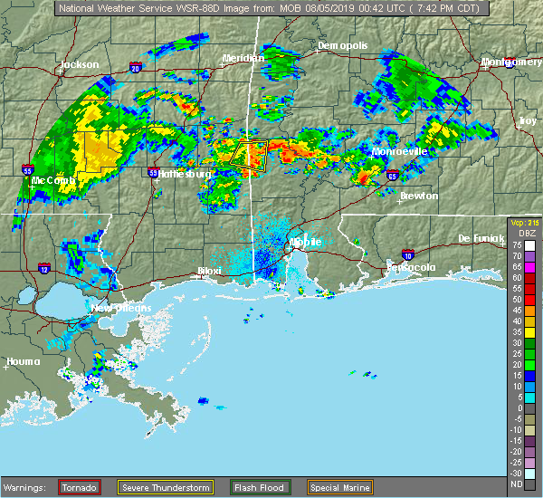 The severe thunderstorm warning for northwestern washington and southeastern wayne counties will expire at 745 pm cdt, the storm which prompted the warning has weakened below severe limits, therefore the warning will be allowed to expire. The severe thunderstorm warning for northwestern washington and southeastern wayne counties will expire at 745 pm cdt, the storm which prompted the warning has weakened below severe limits, therefore the warning will be allowed to expire.
|
| 8/4/2019 7:29 PM CDT |
 At 728 pm cdt, a severe thunderstorm was located 5 miles northeast of buckatunna, or 13 miles southeast of waynesboro, moving southeast at 5 mph (radar indicated). Hazards include 60 mph wind gusts. Expect damage to roofs, siding, and trees. Locations impacted include, millry and buckatunna. At 728 pm cdt, a severe thunderstorm was located 5 miles northeast of buckatunna, or 13 miles southeast of waynesboro, moving southeast at 5 mph (radar indicated). Hazards include 60 mph wind gusts. Expect damage to roofs, siding, and trees. Locations impacted include, millry and buckatunna.
|
| 8/4/2019 6:53 PM CDT |
 At 653 pm cdt, a severe thunderstorm was located 4 miles west of buckatunna, or 8 miles south of waynesboro, and is nearly stationary (radar indicated). Hazards include 60 mph wind gusts. expect damage to roofs, siding, and trees At 653 pm cdt, a severe thunderstorm was located 4 miles west of buckatunna, or 8 miles south of waynesboro, and is nearly stationary (radar indicated). Hazards include 60 mph wind gusts. expect damage to roofs, siding, and trees
|
| 6/27/2019 5:30 PM CDT | Trees down in southeast wayne county including a tree on a powerline. report via social medi in wayne county MS, 0.4 miles ESE of Buckatunna, MS |
| 6/27/2019 5:22 PM CDT |
 At 522 pm cdt, a severe thunderstorm was located over buckatunna, or 12 miles southeast of waynesboro, moving south at 10 mph (radar indicated). Hazards include 60 mph wind gusts and quarter size hail. Hail damage to vehicles is expected. Expect wind damage to roofs, siding, and trees. At 522 pm cdt, a severe thunderstorm was located over buckatunna, or 12 miles southeast of waynesboro, moving south at 10 mph (radar indicated). Hazards include 60 mph wind gusts and quarter size hail. Hail damage to vehicles is expected. Expect wind damage to roofs, siding, and trees.
|
| 6/27/2019 5:20 PM CDT | Trees down in southeast wayne county including a tree on a powerline. report via social medi in wayne county MS, 0.4 miles ESE of Buckatunna, MS |
| 6/7/2019 4:21 PM CDT |
 At 420 pm cdt, a severe thunderstorm was located near state line, or 15 miles west of chatom, moving east at 35 mph (radar indicated). Hazards include 60 mph wind gusts and quarter size hail. Hail damage to vehicles is expected. expect wind damage to roofs, siding, and trees. Locations impacted include, clara and buckatunna. At 420 pm cdt, a severe thunderstorm was located near state line, or 15 miles west of chatom, moving east at 35 mph (radar indicated). Hazards include 60 mph wind gusts and quarter size hail. Hail damage to vehicles is expected. expect wind damage to roofs, siding, and trees. Locations impacted include, clara and buckatunna.
|
| 6/7/2019 3:57 PM CDT |
 At 357 pm cdt, a severe thunderstorm was located 9 miles southwest of clara, or 12 miles northeast of richton, moving east at 35 mph (radar indicated). Hazards include 60 mph wind gusts and quarter size hail. Hail damage to vehicles is expected. Expect wind damage to roofs, siding, and trees. At 357 pm cdt, a severe thunderstorm was located 9 miles southwest of clara, or 12 miles northeast of richton, moving east at 35 mph (radar indicated). Hazards include 60 mph wind gusts and quarter size hail. Hail damage to vehicles is expected. Expect wind damage to roofs, siding, and trees.
|
| 4/18/2019 9:39 PM CDT |
 At 939 pm cdt, severe thunderstorms were located along a line extending from 7 miles west of silas to 5 miles northeast of buckatunna to 5 miles west of state line, moving east at 35 mph (radar indicated). Hazards include 60 mph wind gusts. expect damage to roofs, siding, and trees At 939 pm cdt, severe thunderstorms were located along a line extending from 7 miles west of silas to 5 miles northeast of buckatunna to 5 miles west of state line, moving east at 35 mph (radar indicated). Hazards include 60 mph wind gusts. expect damage to roofs, siding, and trees
|
| 4/18/2019 6:06 PM CDT |
 At 606 pm cdt, severe thunderstorms were located along a line extending from 3 miles south of pin hook to 3 miles northeast of state line, moving east at 45 mph (radar indicated). Hazards include 60 mph wind gusts. Expect damage to roofs, siding, and trees. Locations impacted include, butler, chatom, millry, state line, buckatunna, silas, coffeeville, pennington, gilbertown and toxey. At 606 pm cdt, severe thunderstorms were located along a line extending from 3 miles south of pin hook to 3 miles northeast of state line, moving east at 45 mph (radar indicated). Hazards include 60 mph wind gusts. Expect damage to roofs, siding, and trees. Locations impacted include, butler, chatom, millry, state line, buckatunna, silas, coffeeville, pennington, gilbertown and toxey.
|
| 4/18/2019 5:30 PM CDT |
 At 530 pm cdt, severe thunderstorms were located along a line extending from near kinterbish to 9 miles northeast of richton, moving east at 30 mph (radar indicated). Hazards include 60 mph wind gusts. expect damage to roofs, siding, and trees At 530 pm cdt, severe thunderstorms were located along a line extending from near kinterbish to 9 miles northeast of richton, moving east at 30 mph (radar indicated). Hazards include 60 mph wind gusts. expect damage to roofs, siding, and trees
|
| 4/18/2019 5:20 PM CDT |
 At 520 pm cdt, severe thunderstorms were located along a line extending from near kinterbish to 7 miles southwest of clara, moving east at 45 mph (radar indicated). Hazards include 60 mph wind gusts. Expect damage to roofs, siding, and trees. Locations impacted include, waynesboro, butler, clara, lisman, pennington, gilbertown and toxey. At 520 pm cdt, severe thunderstorms were located along a line extending from near kinterbish to 7 miles southwest of clara, moving east at 45 mph (radar indicated). Hazards include 60 mph wind gusts. Expect damage to roofs, siding, and trees. Locations impacted include, waynesboro, butler, clara, lisman, pennington, gilbertown and toxey.
|
| 4/18/2019 4:38 PM CDT |
 At 437 pm cdt, severe thunderstorms were located along a line extending from savoy to 3 miles southwest of moselle, moving east at 35 mph (radar indicated). Hazards include 60 mph wind gusts. expect damage to roofs, siding, and trees At 437 pm cdt, severe thunderstorms were located along a line extending from savoy to 3 miles southwest of moselle, moving east at 35 mph (radar indicated). Hazards include 60 mph wind gusts. expect damage to roofs, siding, and trees
|
| 3/3/2019 12:23 PM CST |
 At 1223 pm cst, severe thunderstorms were located along a line extending from 6 miles northeast of millry to 7 miles west of state line to 4 miles northwest of new augusta, moving east at 55 mph (radar indicated). Hazards include 60 mph wind gusts and penny size hail. expect damage to roofs, siding, and trees At 1223 pm cst, severe thunderstorms were located along a line extending from 6 miles northeast of millry to 7 miles west of state line to 4 miles northwest of new augusta, moving east at 55 mph (radar indicated). Hazards include 60 mph wind gusts and penny size hail. expect damage to roofs, siding, and trees
|
| 3/3/2019 12:11 PM CST |
 At 1210 pm cst, severe thunderstorms were located along a line extending from 7 miles west of millry to 4 miles southwest of richton, moving east at 55 mph (radar indicated). Hazards include 60 mph wind gusts and penny size hail. Expect damage to roofs, siding, and trees. locations impacted include, chatom, richton, clara, new augusta, millry, state line, buckatunna and fruitdale. A tornado watch remains in effect until 600 pm cst for southwestern alabama, and southeastern mississippi. At 1210 pm cst, severe thunderstorms were located along a line extending from 7 miles west of millry to 4 miles southwest of richton, moving east at 55 mph (radar indicated). Hazards include 60 mph wind gusts and penny size hail. Expect damage to roofs, siding, and trees. locations impacted include, chatom, richton, clara, new augusta, millry, state line, buckatunna and fruitdale. A tornado watch remains in effect until 600 pm cst for southwestern alabama, and southeastern mississippi.
|
| 3/3/2019 11:58 AM CST |
 At 1158 am cst, severe thunderstorms were located along a line extending from 3 miles southeast of waynesboro to sunrise, moving east at 55 mph (radar indicated). Hazards include 60 mph wind gusts and penny size hail. Expect damage to roofs, siding, and trees. locations impacted include, waynesboro, chatom, richton, clara, new augusta, millry, state line, buckatunna and fruitdale. A tornado watch remains in effect until 600 pm cst for southwestern alabama, and southeastern mississippi. At 1158 am cst, severe thunderstorms were located along a line extending from 3 miles southeast of waynesboro to sunrise, moving east at 55 mph (radar indicated). Hazards include 60 mph wind gusts and penny size hail. Expect damage to roofs, siding, and trees. locations impacted include, waynesboro, chatom, richton, clara, new augusta, millry, state line, buckatunna and fruitdale. A tornado watch remains in effect until 600 pm cst for southwestern alabama, and southeastern mississippi.
|
| 3/3/2019 11:52 AM CST |
 At 1152 am cst, severe thunderstorms were located along a line extending from 3 miles north of clara to hattiesburg, moving east at 55 mph (radar indicated). Hazards include 60 mph wind gusts and penny size hail. expect damage to roofs, siding, and trees At 1152 am cst, severe thunderstorms were located along a line extending from 3 miles north of clara to hattiesburg, moving east at 55 mph (radar indicated). Hazards include 60 mph wind gusts and penny size hail. expect damage to roofs, siding, and trees
|
| 2/12/2019 7:33 AM CST |
 At 732 am cst, a severe thunderstorm was located 7 miles west of millry, or 12 miles east of waynesboro, moving northeast at 50 mph (radar indicated). Hazards include 60 mph wind gusts. expect damage to roofs, siding, and trees At 732 am cst, a severe thunderstorm was located 7 miles west of millry, or 12 miles east of waynesboro, moving northeast at 50 mph (radar indicated). Hazards include 60 mph wind gusts. expect damage to roofs, siding, and trees
|
| 1/19/2019 11:31 AM CST |
 At 1130 am cst, severe thunderstorms were located along a line extending from 7 miles south of crandall to 12 miles south of clara, moving east at 55 mph (radar indicated). Hazards include 60 mph wind gusts. expect damage to roofs, siding, and trees At 1130 am cst, severe thunderstorms were located along a line extending from 7 miles south of crandall to 12 miles south of clara, moving east at 55 mph (radar indicated). Hazards include 60 mph wind gusts. expect damage to roofs, siding, and trees
|
| 1/19/2019 11:24 AM CST |
 At 1124 am cst, severe thunderstorms were located along a line extending from 8 miles north of waynesboro to clara to 3 miles east of new augusta, moving northeast at 55 mph (radar indicated). Hazards include 60 mph wind gusts. Expect damage to roofs, siding, and trees. locations impacted include, waynesboro, richton, clara, beaumont, new augusta, mclain, state line and buckatunna. A tornado watch remains in effect until 500 pm cst for southwestern alabama, and southeastern mississippi. At 1124 am cst, severe thunderstorms were located along a line extending from 8 miles north of waynesboro to clara to 3 miles east of new augusta, moving northeast at 55 mph (radar indicated). Hazards include 60 mph wind gusts. Expect damage to roofs, siding, and trees. locations impacted include, waynesboro, richton, clara, beaumont, new augusta, mclain, state line and buckatunna. A tornado watch remains in effect until 500 pm cst for southwestern alabama, and southeastern mississippi.
|
| 1/19/2019 10:53 AM CST |
 At 1053 am cst, severe thunderstorms were located along a line extending from 3 miles south of mill creek to 5 miles southeast of lumberton, moving northeast at 65 mph (radar indicated). Hazards include 60 mph wind gusts. expect damage to roofs, siding, and trees At 1053 am cst, severe thunderstorms were located along a line extending from 3 miles south of mill creek to 5 miles southeast of lumberton, moving northeast at 65 mph (radar indicated). Hazards include 60 mph wind gusts. expect damage to roofs, siding, and trees
|
| 11/1/2018 6:37 AM CDT |
 At 637 am cdt, a severe thunderstorm capable of producing a tornado was located near buckatunna, or 14 miles southeast of waynesboro, moving northeast at 45 mph (radar indicated rotation). Hazards include tornado. Flying debris will be dangerous to those caught without shelter. mobile homes will be damaged or destroyed. damage to roofs, windows, and vehicles will occur. tree damage is likely. This dangerous storm will be near, millry around 700 am cdt. At 637 am cdt, a severe thunderstorm capable of producing a tornado was located near buckatunna, or 14 miles southeast of waynesboro, moving northeast at 45 mph (radar indicated rotation). Hazards include tornado. Flying debris will be dangerous to those caught without shelter. mobile homes will be damaged or destroyed. damage to roofs, windows, and vehicles will occur. tree damage is likely. This dangerous storm will be near, millry around 700 am cdt.
|
| 11/1/2018 6:29 AM CDT |
 At 628 am cdt, a severe thunderstorm capable of producing a tornado was located 8 miles west of state line, or 16 miles south of waynesboro, moving northeast at 45 mph (radar indicated rotation). Hazards include tornado. Flying debris will be dangerous to those caught without shelter. mobile homes will be damaged or destroyed. damage to roofs, windows, and vehicles will occur. tree damage is likely. this dangerous storm will be near, buckatunna and state line around 640 am cdt. Millry around 700 am cdt. At 628 am cdt, a severe thunderstorm capable of producing a tornado was located 8 miles west of state line, or 16 miles south of waynesboro, moving northeast at 45 mph (radar indicated rotation). Hazards include tornado. Flying debris will be dangerous to those caught without shelter. mobile homes will be damaged or destroyed. damage to roofs, windows, and vehicles will occur. tree damage is likely. this dangerous storm will be near, buckatunna and state line around 640 am cdt. Millry around 700 am cdt.
|
| 11/1/2018 6:25 AM CDT |
 At 623 am cdt, a severe thunderstorm was located over clara, or 6 miles south of waynesboro, moving northeast at 45 mph (radar indicated). Hazards include 70 mph wind gusts. Expect considerable tree damage. damage is likely to mobile homes, roofs, and outbuildings. locations impacted include, waynesboro, clara, state line and buckatunna. A tornado watch remains in effect until 900 am cdt for southeastern mississippi. At 623 am cdt, a severe thunderstorm was located over clara, or 6 miles south of waynesboro, moving northeast at 45 mph (radar indicated). Hazards include 70 mph wind gusts. Expect considerable tree damage. damage is likely to mobile homes, roofs, and outbuildings. locations impacted include, waynesboro, clara, state line and buckatunna. A tornado watch remains in effect until 900 am cdt for southeastern mississippi.
|
| 11/1/2018 6:04 AM CDT |
 At 603 am cdt, a severe thunderstorm was located 8 miles northeast of richton, moving northeast at 40 mph (radar indicated). Hazards include 70 mph wind gusts. Expect considerable tree damage. damage is likely to mobile homes, roofs, and outbuildings. locations impacted include, waynesboro, richton, clara, beaumont, new augusta, state line and buckatunna. a tornado watch remains in effect until 900 am cdt for southeastern mississippi. A tornado watch also remains in effect until 100 pm cdt for southwestern alabama. At 603 am cdt, a severe thunderstorm was located 8 miles northeast of richton, moving northeast at 40 mph (radar indicated). Hazards include 70 mph wind gusts. Expect considerable tree damage. damage is likely to mobile homes, roofs, and outbuildings. locations impacted include, waynesboro, richton, clara, beaumont, new augusta, state line and buckatunna. a tornado watch remains in effect until 900 am cdt for southeastern mississippi. A tornado watch also remains in effect until 100 pm cdt for southwestern alabama.
|
| 11/1/2018 5:53 AM CDT |
 At 552 am cdt, severe thunderstorms were located along a line extending from 5 miles east of sandersville to 4 miles southeast of tuckers crossing to near ovett to 4 miles west of new augusta, moving northeast at 40 mph (radar indicated). Hazards include 60 mph wind gusts. expect damage to roofs, siding, and trees At 552 am cdt, severe thunderstorms were located along a line extending from 5 miles east of sandersville to 4 miles southeast of tuckers crossing to near ovett to 4 miles west of new augusta, moving northeast at 40 mph (radar indicated). Hazards include 60 mph wind gusts. expect damage to roofs, siding, and trees
|
| 8/10/2018 3:46 PM CDT |
 At 346 pm cdt, a severe thunderstorm was located 9 miles southwest of clara, or 11 miles northeast of richton, moving northeast at 10 mph (radar indicated). Hazards include 60 mph wind gusts and penny size hail. Expect damage to roofs, siding, and trees. Locations impacted include, clara and buckatunna. At 346 pm cdt, a severe thunderstorm was located 9 miles southwest of clara, or 11 miles northeast of richton, moving northeast at 10 mph (radar indicated). Hazards include 60 mph wind gusts and penny size hail. Expect damage to roofs, siding, and trees. Locations impacted include, clara and buckatunna.
|
| 8/10/2018 3:38 PM CDT |
 At 338 pm cdt, a severe thunderstorm was located 7 miles southwest of clara, or 13 miles northeast of richton, moving northeast at 20 mph (radar indicated). Hazards include 60 mph wind gusts and quarter size hail. Hail damage to vehicles is expected. Expect wind damage to roofs, siding, and trees. At 338 pm cdt, a severe thunderstorm was located 7 miles southwest of clara, or 13 miles northeast of richton, moving northeast at 20 mph (radar indicated). Hazards include 60 mph wind gusts and quarter size hail. Hail damage to vehicles is expected. Expect wind damage to roofs, siding, and trees.
|
| 6/30/2018 7:42 PM CDT |
 The severe thunderstorm warning for west central washington, southeastern wayne and northeastern greene counties will expire at 745 pm cdt, the storm which prompted the warning has weakened below severe limits, and no longer poses an immediate threat to life or property. therefore, the warning will be allowed to expire. however gusty winds are still possible with this thunderstorm. The severe thunderstorm warning for west central washington, southeastern wayne and northeastern greene counties will expire at 745 pm cdt, the storm which prompted the warning has weakened below severe limits, and no longer poses an immediate threat to life or property. therefore, the warning will be allowed to expire. however gusty winds are still possible with this thunderstorm.
|
| 6/30/2018 7:14 PM CDT |
 At 714 pm cdt, a severe thunderstorm was located near state line, or 10 miles west of chatom, moving south at 20 mph (radar indicated). Hazards include 60 mph wind gusts. Expect damage to roofs, siding, and trees. Locations impacted include, state line and fruitdale. At 714 pm cdt, a severe thunderstorm was located near state line, or 10 miles west of chatom, moving south at 20 mph (radar indicated). Hazards include 60 mph wind gusts. Expect damage to roofs, siding, and trees. Locations impacted include, state line and fruitdale.
|
| 6/30/2018 7:02 PM CDT |
 At 702 pm cdt, a severe thunderstorm was located near buckatunna, or 13 miles west of chatom, moving south at 10 mph (radar indicated). Hazards include 60 mph wind gusts. expect damage to roofs, siding, and trees At 702 pm cdt, a severe thunderstorm was located near buckatunna, or 13 miles west of chatom, moving south at 10 mph (radar indicated). Hazards include 60 mph wind gusts. expect damage to roofs, siding, and trees
|
| 4/14/2018 11:59 AM CDT |
 At 1158 am cdt, severe thunderstorms were located along a line extending from near snell to 12 miles southwest of state line, moving northeast at 65 mph (radar indicated). Hazards include 60 mph wind gusts. expect damage to roofs, siding, and trees At 1158 am cdt, severe thunderstorms were located along a line extending from near snell to 12 miles southwest of state line, moving northeast at 65 mph (radar indicated). Hazards include 60 mph wind gusts. expect damage to roofs, siding, and trees
|
| 4/14/2018 11:27 AM CDT |
 At 1124 am cdt, severe thunderstorms were located along a line extending from 7 miles southeast of goodwater to near new augusta, moving northeast at 50 mph (radar indicated). Hazards include 60 mph wind gusts. Expect damage to roofs, siding, and trees. locations impacted include, waynesboro, richton, clara and new augusta. A tornado watch remains in effect until 700 pm cdt for southeastern mississippi. At 1124 am cdt, severe thunderstorms were located along a line extending from 7 miles southeast of goodwater to near new augusta, moving northeast at 50 mph (radar indicated). Hazards include 60 mph wind gusts. Expect damage to roofs, siding, and trees. locations impacted include, waynesboro, richton, clara and new augusta. A tornado watch remains in effect until 700 pm cdt for southeastern mississippi.
|
| 4/14/2018 10:58 AM CDT |
 At 1057 am cdt, severe thunderstorms were located along a line extending from near sandersville to near mclaurin, moving northeast at 45 mph (radar indicated). Hazards include 60 mph wind gusts. expect damage to roofs, siding, and trees At 1057 am cdt, severe thunderstorms were located along a line extending from near sandersville to near mclaurin, moving northeast at 45 mph (radar indicated). Hazards include 60 mph wind gusts. expect damage to roofs, siding, and trees
|
| 2/10/2018 5:18 PM CST |
 At 517 pm cst, a severe thunderstorm was located 4 miles southwest of state line, or 15 miles north of leakesville, moving northeast at 25 mph (radar indicated). Hazards include 60 mph wind gusts. Expect damage to roofs, siding, and trees. Locations impacted include, knobtown and state line. At 517 pm cst, a severe thunderstorm was located 4 miles southwest of state line, or 15 miles north of leakesville, moving northeast at 25 mph (radar indicated). Hazards include 60 mph wind gusts. Expect damage to roofs, siding, and trees. Locations impacted include, knobtown and state line.
|
| 2/10/2018 4:49 PM CST |
 At 448 pm cst, a severe thunderstorm was located 8 miles southwest of state line, or 12 miles north of leakesville, moving northeast at 35 mph (radar indicated). Hazards include 60 mph wind gusts. expect damage to roofs, siding, and trees At 448 pm cst, a severe thunderstorm was located 8 miles southwest of state line, or 12 miles north of leakesville, moving northeast at 35 mph (radar indicated). Hazards include 60 mph wind gusts. expect damage to roofs, siding, and trees
|
| 8/5/2017 6:20 PM CDT |
 At 620 pm cdt, a severe thunderstorm was located near fruitdale, or 13 miles north of leakesville, moving northwest at 15 mph (radar indicated). Hazards include 60 mph wind gusts and penny size hail. expect damage to roofs, siding, and trees At 620 pm cdt, a severe thunderstorm was located near fruitdale, or 13 miles north of leakesville, moving northwest at 15 mph (radar indicated). Hazards include 60 mph wind gusts and penny size hail. expect damage to roofs, siding, and trees
|
| 4/30/2017 1:46 PM CDT |
 At 146 pm cdt, severe thunderstorms were located along a line extending from near putnam to near chatom to near fruitdale, moving east at 25 mph (radar indicated). Hazards include 60 mph wind gusts. expect damage to roofs, siding, and trees At 146 pm cdt, severe thunderstorms were located along a line extending from near putnam to near chatom to near fruitdale, moving east at 25 mph (radar indicated). Hazards include 60 mph wind gusts. expect damage to roofs, siding, and trees
|
| 4/30/2017 1:39 PM CDT |
 At 138 pm cdt, severe thunderstorms were located along a line extending from near putnam to near chatom, moving east at 20 mph. a new severe thunderstorm warning may be issued soon for much of this area (radar indicated). Hazards include 60 mph wind gusts. Expect damage to roofs, siding, and trees. locations impacted include, thomasville, butler, chatom, saint stephens, millry, buckatunna, silas, coffeeville, pennington, gilbertown and toxey. a tornado watch remains in effect until 300 pm cdt for southeastern mississippi. A tornado watch also remains in effect until 700 pm cdt for southwestern alabama. At 138 pm cdt, severe thunderstorms were located along a line extending from near putnam to near chatom, moving east at 20 mph. a new severe thunderstorm warning may be issued soon for much of this area (radar indicated). Hazards include 60 mph wind gusts. Expect damage to roofs, siding, and trees. locations impacted include, thomasville, butler, chatom, saint stephens, millry, buckatunna, silas, coffeeville, pennington, gilbertown and toxey. a tornado watch remains in effect until 300 pm cdt for southeastern mississippi. A tornado watch also remains in effect until 700 pm cdt for southwestern alabama.
|
| 4/30/2017 1:06 PM CDT |
 At 105 pm cdt, severe thunderstorms were located along a line extending from near putnam to near state line, moving east at 25 mph (radar indicated). Hazards include 60 mph wind gusts. expect damage to roofs, siding, and trees At 105 pm cdt, severe thunderstorms were located along a line extending from near putnam to near state line, moving east at 25 mph (radar indicated). Hazards include 60 mph wind gusts. expect damage to roofs, siding, and trees
|
| 4/22/2017 8:50 PM CDT |
 At 850 pm cdt, a severe thunderstorm was located over buckatunna, or 11 miles southeast of waynesboro, moving southeast at 35 mph (radar indicated). Hazards include 60 mph wind gusts and nickel size hail. expect damage to roofs, siding, and trees At 850 pm cdt, a severe thunderstorm was located over buckatunna, or 11 miles southeast of waynesboro, moving southeast at 35 mph (radar indicated). Hazards include 60 mph wind gusts and nickel size hail. expect damage to roofs, siding, and trees
|
| 4/5/2017 7:26 AM CDT |
 At 726 am cdt, a severe thunderstorm was located near state line, or 11 miles west of chatom, moving northeast at 35 mph (radar indicated). Hazards include 70 mph wind gusts and ping pong ball size hail. People and animals outdoors will be injured. expect hail damage to roofs, siding, windows, and vehicles. expect considerable tree damage. wind damage is also likely to mobile homes, roofs, and outbuildings. locations impacted include, millry and buckatunna. A tornado watch remains in effect until noon cdt for southwestern alabama, and southeastern mississippi. At 726 am cdt, a severe thunderstorm was located near state line, or 11 miles west of chatom, moving northeast at 35 mph (radar indicated). Hazards include 70 mph wind gusts and ping pong ball size hail. People and animals outdoors will be injured. expect hail damage to roofs, siding, windows, and vehicles. expect considerable tree damage. wind damage is also likely to mobile homes, roofs, and outbuildings. locations impacted include, millry and buckatunna. A tornado watch remains in effect until noon cdt for southwestern alabama, and southeastern mississippi.
|
| 4/5/2017 7:04 AM CDT |
 At 703 am cdt, a severe thunderstorm was located 12 miles west of state line, or 15 miles east of richton, moving northeast at 35 mph (radar indicated). Hazards include 70 mph wind gusts and quarter size hail. Hail damage to vehicles is expected. expect considerable tree damage. Wind damage is also likely to mobile homes, roofs, and outbuildings. At 703 am cdt, a severe thunderstorm was located 12 miles west of state line, or 15 miles east of richton, moving northeast at 35 mph (radar indicated). Hazards include 70 mph wind gusts and quarter size hail. Hail damage to vehicles is expected. expect considerable tree damage. Wind damage is also likely to mobile homes, roofs, and outbuildings.
|
| 4/3/2017 5:40 AM CDT |
 At 540 am cdt, severe thunderstorms were located along a line extending from near buckatunna to 6 miles northwest of lucedale, moving east at 35 mph (radar indicated). Hazards include 60 mph wind gusts. Expect damage to roofs, siding, and trees. locations impacted include, chatom, leakesville, deer park, tibbie, mclain, state line and fruitdale. A tornado watch remains in effect until 900 am cdt for southwestern alabama, and southeastern mississippi. At 540 am cdt, severe thunderstorms were located along a line extending from near buckatunna to 6 miles northwest of lucedale, moving east at 35 mph (radar indicated). Hazards include 60 mph wind gusts. Expect damage to roofs, siding, and trees. locations impacted include, chatom, leakesville, deer park, tibbie, mclain, state line and fruitdale. A tornado watch remains in effect until 900 am cdt for southwestern alabama, and southeastern mississippi.
|
| 4/3/2017 5:10 AM CDT |
 At 510 am cdt, severe thunderstorms were located along a line extending from 9 miles south of clara to 8 miles southwest of mclain, moving east at 40 mph (radar indicated). Hazards include 60 mph wind gusts. expect damage to roofs, siding, and trees At 510 am cdt, severe thunderstorms were located along a line extending from 9 miles south of clara to 8 miles southwest of mclain, moving east at 40 mph (radar indicated). Hazards include 60 mph wind gusts. expect damage to roofs, siding, and trees
|
| 2/7/2017 10:41 AM CST |
 At 1041 am cst, severe thunderstorms were located along a line extending from 8 miles southwest of putnam to millry to near state line, moving east at 50 mph (radar indicated). Hazards include 60 mph wind gusts and quarter size hail. Hail damage to vehicles is expected. expect wind damage to roofs, siding, and trees. locations impacted include, chatom, saint stephens, millry, state line, buckatunna, silas, gilbertown and toxey. A tornado watch remains in effect until 200 pm cst for southeastern mississippi. At 1041 am cst, severe thunderstorms were located along a line extending from 8 miles southwest of putnam to millry to near state line, moving east at 50 mph (radar indicated). Hazards include 60 mph wind gusts and quarter size hail. Hail damage to vehicles is expected. expect wind damage to roofs, siding, and trees. locations impacted include, chatom, saint stephens, millry, state line, buckatunna, silas, gilbertown and toxey. A tornado watch remains in effect until 200 pm cst for southeastern mississippi.
|
| 2/7/2017 10:31 AM CST |
 At 1031 am cst, severe thunderstorms were located along a line extending from near toxey to near millry to 11 miles south of clara, moving east at 55 mph (radar indicated). Hazards include 60 mph wind gusts and quarter size hail. Hail damage to vehicles is expected. expect wind damage to roofs, siding, and trees. locations impacted include, waynesboro, chatom, saint stephens, clara, millry, state line, buckatunna, silas, gilbertown and toxey. A tornado watch remains in effect until 200 pm cst for southeastern mississippi. At 1031 am cst, severe thunderstorms were located along a line extending from near toxey to near millry to 11 miles south of clara, moving east at 55 mph (radar indicated). Hazards include 60 mph wind gusts and quarter size hail. Hail damage to vehicles is expected. expect wind damage to roofs, siding, and trees. locations impacted include, waynesboro, chatom, saint stephens, clara, millry, state line, buckatunna, silas, gilbertown and toxey. A tornado watch remains in effect until 200 pm cst for southeastern mississippi.
|
| 2/7/2017 10:16 AM CST |
 At 1015 am cst, clusters of severe thunderstorms were located over wayne county. one cluster was located 12 miles southeast of waynesboro. another line of severe thunderstorms was located from gretna to hollis creek. movement was east at 50 mph (radar indicated). Hazards include 60 mph wind gusts and quarter size hail. Hail damage to vehicles is expected. Expect wind damage to roofs, siding, and trees. At 1015 am cst, clusters of severe thunderstorms were located over wayne county. one cluster was located 12 miles southeast of waynesboro. another line of severe thunderstorms was located from gretna to hollis creek. movement was east at 50 mph (radar indicated). Hazards include 60 mph wind gusts and quarter size hail. Hail damage to vehicles is expected. Expect wind damage to roofs, siding, and trees.
|
| 1/21/2017 10:15 PM CST |
 At 1014 pm cst, a severe thunderstorm was located over state line, or 14 miles west of chatom, moving northeast at 60 mph (radar indicated). Hazards include 60 mph wind gusts and half dollar size hail. Hail damage to vehicles is expected. Expect wind damage to roofs, siding, and trees. At 1014 pm cst, a severe thunderstorm was located over state line, or 14 miles west of chatom, moving northeast at 60 mph (radar indicated). Hazards include 60 mph wind gusts and half dollar size hail. Hail damage to vehicles is expected. Expect wind damage to roofs, siding, and trees.
|
| 1/21/2017 10:11 PM CST |
 At 1011 pm cst, a severe thunderstorm was located near buckatunna, or 15 miles south of waynesboro, moving northeast at 45 mph (radar indicated). Hazards include 60 mph wind gusts and half dollar size hail. Hail damage to vehicles is expected. expect wind damage to roofs, siding, and trees. locations impacted include, buckatunna and state line. A tornado watch remains in effect until 300 am cst for southwestern alabama, and southeastern mississippi. At 1011 pm cst, a severe thunderstorm was located near buckatunna, or 15 miles south of waynesboro, moving northeast at 45 mph (radar indicated). Hazards include 60 mph wind gusts and half dollar size hail. Hail damage to vehicles is expected. expect wind damage to roofs, siding, and trees. locations impacted include, buckatunna and state line. A tornado watch remains in effect until 300 am cst for southwestern alabama, and southeastern mississippi.
|
| 1/21/2017 9:48 PM CST |
 At 948 pm cst, a severe thunderstorm was located 7 miles east of richton, moving northeast at 50 mph (radar indicated). Hazards include 60 mph wind gusts and half dollar size hail. Hail damage to vehicles is expected. Expect wind damage to roofs, siding, and trees. At 948 pm cst, a severe thunderstorm was located 7 miles east of richton, moving northeast at 50 mph (radar indicated). Hazards include 60 mph wind gusts and half dollar size hail. Hail damage to vehicles is expected. Expect wind damage to roofs, siding, and trees.
|
| 1/21/2017 9:38 PM CST |
 The severe thunderstorm warning for south central choctaw, northwestern washington, northwestern clarke and southeastern wayne counties will expire at 945 pm cst, the storm which prompted the warning has weakened below severe limits, and no longer pose an immediate threat to life or property. therefore the warning will be allowed to expire. however gusty winds are still possible with this thunderstorm. a tornado watch remains in effect until 300 am cst for southwestern alabama, and southeastern mississippi. The severe thunderstorm warning for south central choctaw, northwestern washington, northwestern clarke and southeastern wayne counties will expire at 945 pm cst, the storm which prompted the warning has weakened below severe limits, and no longer pose an immediate threat to life or property. therefore the warning will be allowed to expire. however gusty winds are still possible with this thunderstorm. a tornado watch remains in effect until 300 am cst for southwestern alabama, and southeastern mississippi.
|
| 1/21/2017 9:06 PM CST |
 At 905 pm cst, a severe thunderstorm was located near buckatunna, or 13 miles west of chatom, moving northeast at 50 mph (radar indicated). Hazards include 60 mph wind gusts and half dollar size hail. Hail damage to vehicles is expected. Expect wind damage to roofs, siding, and trees. At 905 pm cst, a severe thunderstorm was located near buckatunna, or 13 miles west of chatom, moving northeast at 50 mph (radar indicated). Hazards include 60 mph wind gusts and half dollar size hail. Hail damage to vehicles is expected. Expect wind damage to roofs, siding, and trees.
|
| 1/21/2017 8:43 PM CST |
 At 843 pm cst, a severe thunderstorm was located 11 miles east of richton, moving northeast at 50 mph (radar indicated). Hazards include 60 mph wind gusts and half dollar size hail. Hail damage to vehicles is expected. expect wind damage to roofs, siding, and trees. locations impacted include, buckatunna and state line. a tornado watch remains in effect until 900 pm cst for southeastern mississippi. A tornado watch also remains in effect until 300 am cst for southwestern alabama, and southeastern mississippi. At 843 pm cst, a severe thunderstorm was located 11 miles east of richton, moving northeast at 50 mph (radar indicated). Hazards include 60 mph wind gusts and half dollar size hail. Hail damage to vehicles is expected. expect wind damage to roofs, siding, and trees. locations impacted include, buckatunna and state line. a tornado watch remains in effect until 900 pm cst for southeastern mississippi. A tornado watch also remains in effect until 300 am cst for southwestern alabama, and southeastern mississippi.
|
| 1/21/2017 8:28 PM CST |
 At 827 pm cst, a severe thunderstorm was located near beaumont, or 7 miles south of richton, moving northeast at 50 mph (radar indicated). Hazards include 60 mph wind gusts and half dollar size hail. Hail damage to vehicles is expected. Expect wind damage to roofs, siding, and trees. At 827 pm cst, a severe thunderstorm was located near beaumont, or 7 miles south of richton, moving northeast at 50 mph (radar indicated). Hazards include 60 mph wind gusts and half dollar size hail. Hail damage to vehicles is expected. Expect wind damage to roofs, siding, and trees.
|
| 1/21/2017 5:12 AM CST |
 The tornado warning for southwestern choctaw, northwestern washington and southern wayne counties will expire at 515 am cst, the storm which prompted the warning has moved out of the area. therefore the warning will be allowed to expire. a tornado watch remains in effect until 700 am cst for southeastern mississippi. a tornado watch also remains in effect until 1100 am cst for southwestern alabama. The tornado warning for southwestern choctaw, northwestern washington and southern wayne counties will expire at 515 am cst, the storm which prompted the warning has moved out of the area. therefore the warning will be allowed to expire. a tornado watch remains in effect until 700 am cst for southeastern mississippi. a tornado watch also remains in effect until 1100 am cst for southwestern alabama.
|
| 1/21/2017 4:59 AM CST |
 At 455 am cst, a large and extremely dangerous tornado was located near waynesboro, moving northeast at 55 mph. this is a particularly dangerous situation. take cover now! in addition to this dangerous storm, a second severe thunderstorm capable of producing a tornado was located 9 miles east of ovett, or 11 miles northeast of richton, moving east at 50 mph. this second storm capable of producing a tornado will be near waynesboro and buckatunna around 515 am cst. this is a particularly dangerous situation. take cover now! (radar indicated rotation). Hazards include damaging tornado. You are in a life-threatening situation. flying debris may be deadly to those caught without shelter. mobile homes will be destroyed. considerable damage to homes, businesses, and vehicles is likely and complete destruction is possible. The tornado will be near, silas around 505 am cst. At 455 am cst, a large and extremely dangerous tornado was located near waynesboro, moving northeast at 55 mph. this is a particularly dangerous situation. take cover now! in addition to this dangerous storm, a second severe thunderstorm capable of producing a tornado was located 9 miles east of ovett, or 11 miles northeast of richton, moving east at 50 mph. this second storm capable of producing a tornado will be near waynesboro and buckatunna around 515 am cst. this is a particularly dangerous situation. take cover now! (radar indicated rotation). Hazards include damaging tornado. You are in a life-threatening situation. flying debris may be deadly to those caught without shelter. mobile homes will be destroyed. considerable damage to homes, businesses, and vehicles is likely and complete destruction is possible. The tornado will be near, silas around 505 am cst.
|
| 1/21/2017 4:50 AM CST |
 At 450 am cst, a large and extremely dangerous tornado was located near waynesboro, moving northeast at 55 mph. this is a particularly dangerous situation. take cover now! (radar indicated rotation). Hazards include damaging tornado. You are in a life-threatening situation. flying debris may be deadly to those caught without shelter. mobile homes will be destroyed. considerable damage to homes, businesses, and vehicles is likely and complete destruction is possible. The tornado will be near, silas around 505 am cst. At 450 am cst, a large and extremely dangerous tornado was located near waynesboro, moving northeast at 55 mph. this is a particularly dangerous situation. take cover now! (radar indicated rotation). Hazards include damaging tornado. You are in a life-threatening situation. flying debris may be deadly to those caught without shelter. mobile homes will be destroyed. considerable damage to homes, businesses, and vehicles is likely and complete destruction is possible. The tornado will be near, silas around 505 am cst.
|
| 1/21/2017 4:30 AM CST |
 At 429 am cst, a large and extremely dangerous tornado was located 7 miles west of clara, or 13 miles southwest of waynesboro, moving northeast at 50 mph. this is a particularly dangerous situation. take cover now! (radar indicated rotation). Hazards include damaging tornado. You are in a life-threatening situation. flying debris may be deadly to those caught without shelter. mobile homes will be destroyed. considerable damage to homes, businesses, and vehicles is likely and complete destruction is possible. the tornado will be near, clara around 440 am cst. waynesboro around 445 am cst. Silas around 510 am cst. At 429 am cst, a large and extremely dangerous tornado was located 7 miles west of clara, or 13 miles southwest of waynesboro, moving northeast at 50 mph. this is a particularly dangerous situation. take cover now! (radar indicated rotation). Hazards include damaging tornado. You are in a life-threatening situation. flying debris may be deadly to those caught without shelter. mobile homes will be destroyed. considerable damage to homes, businesses, and vehicles is likely and complete destruction is possible. the tornado will be near, clara around 440 am cst. waynesboro around 445 am cst. Silas around 510 am cst.
|
| 1/21/2017 4:24 AM CST |
 At 424 am cst, a severe thunderstorm capable of producing a tornado was located 8 miles east of ovett, or 10 miles north of richton, moving northeast at 45 mph (radar indicated rotation). Hazards include tornado. Flying debris will be dangerous to those caught without shelter. mobile homes will be damaged or destroyed. damage to roofs, windows, and vehicles will occur. tree damage is likely. this dangerous storm will be near, clara around 440 am cst. waynesboro and buckatunna around 450 am cst. millry around 510 am cst. Silas around 515 am cst. At 424 am cst, a severe thunderstorm capable of producing a tornado was located 8 miles east of ovett, or 10 miles north of richton, moving northeast at 45 mph (radar indicated rotation). Hazards include tornado. Flying debris will be dangerous to those caught without shelter. mobile homes will be damaged or destroyed. damage to roofs, windows, and vehicles will occur. tree damage is likely. this dangerous storm will be near, clara around 440 am cst. waynesboro and buckatunna around 450 am cst. millry around 510 am cst. Silas around 515 am cst.
|
| 1/2/2017 3:40 PM CST |
 At 340 pm cst, severe thunderstorms were located along a line extending from near kewanee to 9 miles west of silas to 7 miles west of leakesville to 8 miles east of wiggins, moving northeast at 65 mph (radar indicated). Hazards include 70 mph wind gusts and quarter size hail. Hail damage to vehicles is expected. expect considerable tree damage. wind damage is also likely to mobile homes, roofs, and outbuildings. locations impacted include, waynesboro, wiggins, lucedale, butler, chatom, richton, leakesville, clara, mchenry, perkinston, beaumont, new augusta, lisman, millry, mclain, buckatunna, state line, silas, fruitdale and pennington. A tornado watch remains in effect until 800 pm cst for southwestern alabama, and southeastern mississippi. At 340 pm cst, severe thunderstorms were located along a line extending from near kewanee to 9 miles west of silas to 7 miles west of leakesville to 8 miles east of wiggins, moving northeast at 65 mph (radar indicated). Hazards include 70 mph wind gusts and quarter size hail. Hail damage to vehicles is expected. expect considerable tree damage. wind damage is also likely to mobile homes, roofs, and outbuildings. locations impacted include, waynesboro, wiggins, lucedale, butler, chatom, richton, leakesville, clara, mchenry, perkinston, beaumont, new augusta, lisman, millry, mclain, buckatunna, state line, silas, fruitdale and pennington. A tornado watch remains in effect until 800 pm cst for southwestern alabama, and southeastern mississippi.
|
| 1/2/2017 3:07 PM CST |
 At 307 pm cst, severe thunderstorms were located along a line extending from near rose hill to near ovett to maxie to 8 miles east of mcneil, moving northeast at 60 mph (radar indicated). Hazards include 60 mph wind gusts and quarter size hail. Hail damage to vehicles is expected. Expect wind damage to roofs, siding, and trees. At 307 pm cst, severe thunderstorms were located along a line extending from near rose hill to near ovett to maxie to 8 miles east of mcneil, moving northeast at 60 mph (radar indicated). Hazards include 60 mph wind gusts and quarter size hail. Hail damage to vehicles is expected. Expect wind damage to roofs, siding, and trees.
|
| 1/2/2017 3:07 PM CST |
 The national weather service in mobile has issued a * severe thunderstorm warning for. choctaw county in southwestern alabama. western washington county in southwestern alabama. northwestern clarke county in southwestern alabama. George county in southeastern mississippi. The national weather service in mobile has issued a * severe thunderstorm warning for. choctaw county in southwestern alabama. western washington county in southwestern alabama. northwestern clarke county in southwestern alabama. George county in southeastern mississippi.
|
| 1/2/2017 3:07 PM CST |
 At 307 pm cst, severe thunderstorms were located along a line extending from near rose hill to near ovett to maxie to 8 miles east of mcneil, moving northeast at 60 mph (radar indicated). Hazards include 60 mph wind gusts and quarter size hail. Hail damage to vehicles is expected. Expect wind damage to roofs, siding, and trees. At 307 pm cst, severe thunderstorms were located along a line extending from near rose hill to near ovett to maxie to 8 miles east of mcneil, moving northeast at 60 mph (radar indicated). Hazards include 60 mph wind gusts and quarter size hail. Hail damage to vehicles is expected. Expect wind damage to roofs, siding, and trees.
|
| 6/17/2016 6:11 PM CDT |
 At 610 pm cdt, severe thunderstorms were located along a line extending from near moss to 6 miles southwest of state line to near castleberry to near goshen, moving southeast at 50 mph (radar indicated). Hazards include 60 mph wind gusts and quarter size hail. Hail damage to vehicles is expected. expect wind damage to roofs, siding, and trees. Locations impacted include, andalusia, atmore, greenville, monroeville, opp, brewton, jackson, waynesboro, citronelle, evergreen, luverne, florala, frisco city, chatom, richton, leakesville, mccullough, peterman, saint stephens and wagarville. At 610 pm cdt, severe thunderstorms were located along a line extending from near moss to 6 miles southwest of state line to near castleberry to near goshen, moving southeast at 50 mph (radar indicated). Hazards include 60 mph wind gusts and quarter size hail. Hail damage to vehicles is expected. expect wind damage to roofs, siding, and trees. Locations impacted include, andalusia, atmore, greenville, monroeville, opp, brewton, jackson, waynesboro, citronelle, evergreen, luverne, florala, frisco city, chatom, richton, leakesville, mccullough, peterman, saint stephens and wagarville.
|
| 6/17/2016 6:00 PM CDT |
 At 559 pm cdt, severe thunderstorms were located along a line extending from bay springs to near buckatunna to near i65 and us 84 to near lapine, moving southeast at 50 mph (radar indicated). Hazards include 60 mph wind gusts and nickel size hail. Expect damage to roofs. siding. And trees. At 559 pm cdt, severe thunderstorms were located along a line extending from bay springs to near buckatunna to near i65 and us 84 to near lapine, moving southeast at 50 mph (radar indicated). Hazards include 60 mph wind gusts and nickel size hail. Expect damage to roofs. siding. And trees.
|
| 6/17/2016 5:26 PM CDT |
 At 523 pm cdt, severe thunderstorms were located along a line extending from near pintlala to near pine apple to near silas to bay springs, moving south at 45 mph (radar indicated. several reports of winds around 60 mph have been received with this line of storms. trees have been blown down in choctaw and clarke counties). Hazards include 60 mph wind gusts and quarter size hail. Hail damage to vehicles is expected. expect wind damage to roofs, siding, and trees. Locations impacted include, greenville, monroeville, jackson, waynesboro, thomasville, luverne, camden, butler, frisco city, grove hill, chatom, peterman, saint stephens, wagarville, leroy, clara, georgiana, whatley, pine hill and mckenzie. At 523 pm cdt, severe thunderstorms were located along a line extending from near pintlala to near pine apple to near silas to bay springs, moving south at 45 mph (radar indicated. several reports of winds around 60 mph have been received with this line of storms. trees have been blown down in choctaw and clarke counties). Hazards include 60 mph wind gusts and quarter size hail. Hail damage to vehicles is expected. expect wind damage to roofs, siding, and trees. Locations impacted include, greenville, monroeville, jackson, waynesboro, thomasville, luverne, camden, butler, frisco city, grove hill, chatom, peterman, saint stephens, wagarville, leroy, clara, georgiana, whatley, pine hill and mckenzie.
|
| 6/17/2016 5:02 PM CDT |
 At 500 pm cdt, severe thunderstorms were located along a line extending from near dannelly field to 10 miles southeast of dannelly reservoir to near butler to near conehatta, moving south at 45 mph. additional severe thunderstorm development is possible ahead of the main line (radar indicated). Hazards include 60 mph wind gusts and quarter size hail. Hail damage to vehicles is expected. Expect wind damage to roofs, siding, and trees. At 500 pm cdt, severe thunderstorms were located along a line extending from near dannelly field to 10 miles southeast of dannelly reservoir to near butler to near conehatta, moving south at 45 mph. additional severe thunderstorm development is possible ahead of the main line (radar indicated). Hazards include 60 mph wind gusts and quarter size hail. Hail damage to vehicles is expected. Expect wind damage to roofs, siding, and trees.
|
| 4/11/2016 7:39 PM CDT |
 The severe thunderstorm warning for southwestern choctaw, northwestern washington and central wayne counties will expire at 745 pm cdt, the storm which prompted the warning has weakened below severe limits, and no longer pose an immediate threat to life or property. therefore the warning will be allowed to expire. however gusty winds are still possible with this thunderstorm. a severe thunderstorm watch remains in effect until midnight cdt for southwestern alabama, and southeastern mississippi. The severe thunderstorm warning for southwestern choctaw, northwestern washington and central wayne counties will expire at 745 pm cdt, the storm which prompted the warning has weakened below severe limits, and no longer pose an immediate threat to life or property. therefore the warning will be allowed to expire. however gusty winds are still possible with this thunderstorm. a severe thunderstorm watch remains in effect until midnight cdt for southwestern alabama, and southeastern mississippi.
|
| 4/11/2016 7:29 PM CDT |
 At 729 pm cdt, a severe thunderstorm was located near gilbertown, or 19 miles southwest of butler, moving east at 55 mph (radar indicated). Hazards include 60 mph wind gusts and quarter size hail. Hail damage to vehicles is expected. expect wind damage to roofs, siding, and trees. Locations impacted include, waynesboro, millry, silas, gilbertown, toxey and needham. At 729 pm cdt, a severe thunderstorm was located near gilbertown, or 19 miles southwest of butler, moving east at 55 mph (radar indicated). Hazards include 60 mph wind gusts and quarter size hail. Hail damage to vehicles is expected. expect wind damage to roofs, siding, and trees. Locations impacted include, waynesboro, millry, silas, gilbertown, toxey and needham.
|
| 4/11/2016 6:56 PM CDT |
 At 656 pm cdt, a severe thunderstorm was located near goodwater, or 9 miles southwest of quitman, moving east at 55 mph (radar indicated). Hazards include 60 mph wind gusts and quarter size hail. Hail damage to vehicles is expected. Expect wind damage to roofs, siding, and trees. At 656 pm cdt, a severe thunderstorm was located near goodwater, or 9 miles southwest of quitman, moving east at 55 mph (radar indicated). Hazards include 60 mph wind gusts and quarter size hail. Hail damage to vehicles is expected. Expect wind damage to roofs, siding, and trees.
|
| 3/17/2016 6:33 PM CDT |
 At 632 pm cdt, a severe thunderstorm was located near buckatunna, or 10 miles south of waynesboro, moving east at 35 mph (radar indicated). Hazards include 60 mph wind gusts and nickel size hail. Expect damage to roofs. siding. and trees. Locations impacted include, clara. At 632 pm cdt, a severe thunderstorm was located near buckatunna, or 10 miles south of waynesboro, moving east at 35 mph (radar indicated). Hazards include 60 mph wind gusts and nickel size hail. Expect damage to roofs. siding. and trees. Locations impacted include, clara.
|
| 3/17/2016 5:44 PM CDT |
 At 543 pm cdt, a severe thunderstorm was located near ovett, or 8 miles southeast of ellisville, moving east at 35 mph (radar indicated). Hazards include 60 mph wind gusts and quarter size hail. Hail damage to vehicles is expected. Expect wind damage to roofs, siding, and trees. At 543 pm cdt, a severe thunderstorm was located near ovett, or 8 miles southeast of ellisville, moving east at 35 mph (radar indicated). Hazards include 60 mph wind gusts and quarter size hail. Hail damage to vehicles is expected. Expect wind damage to roofs, siding, and trees.
|
| 3/17/2016 4:24 PM CDT |
 At 424 pm cdt, a severe thunderstorm was located over buckatunna, or 11 miles southeast of waynesboro, moving northeast at 30 mph (radar indicated). Hazards include tennis ball size hail and 60 mph wind gusts. People and animals outdoors will be injured. expect hail damage to roofs, siding, windows, and vehicles. expect wind damage to roofs, siding, and trees. Locations impacted include, waynesboro, millry and buckatunna. At 424 pm cdt, a severe thunderstorm was located over buckatunna, or 11 miles southeast of waynesboro, moving northeast at 30 mph (radar indicated). Hazards include tennis ball size hail and 60 mph wind gusts. People and animals outdoors will be injured. expect hail damage to roofs, siding, windows, and vehicles. expect wind damage to roofs, siding, and trees. Locations impacted include, waynesboro, millry and buckatunna.
|
| 3/17/2016 4:08 PM CDT |
 At 408 pm cdt, a severe thunderstorm was located 9 miles west of state line, or 16 miles south of waynesboro, moving northeast at 30 mph (radar indicated). Hazards include tennis ball size hail and 60 mph wind gusts. People and animals outdoors will be injured. expect hail damage to roofs, siding, windows, and vehicles. Expect wind damage to roofs, siding, and trees. At 408 pm cdt, a severe thunderstorm was located 9 miles west of state line, or 16 miles south of waynesboro, moving northeast at 30 mph (radar indicated). Hazards include tennis ball size hail and 60 mph wind gusts. People and animals outdoors will be injured. expect hail damage to roofs, siding, windows, and vehicles. Expect wind damage to roofs, siding, and trees.
|
| 2/23/2016 5:48 PM CST |
 At 547 pm cst, a confirmed large and extremely dangerous tornado was located over state line, or 13 miles west of chatom, moving east at 45 mph. this is a particularly dangerous situation (radar confirmed tornado). Hazards include damaging tornado. You are in a life threatening situation. flying debris may be deadly to those caught without shelter. mobile homes will be destroyed. considerable damage to homes, businesses, and vehicles is likely and complete destruction is possible. the tornado will be near, chatom around 605 pm cst. Saint stephens around 615 pm cst. At 547 pm cst, a confirmed large and extremely dangerous tornado was located over state line, or 13 miles west of chatom, moving east at 45 mph. this is a particularly dangerous situation (radar confirmed tornado). Hazards include damaging tornado. You are in a life threatening situation. flying debris may be deadly to those caught without shelter. mobile homes will be destroyed. considerable damage to homes, businesses, and vehicles is likely and complete destruction is possible. the tornado will be near, chatom around 605 pm cst. Saint stephens around 615 pm cst.
|
| 2/23/2016 5:44 PM CST |
 At 544 pm cst, severe thunderstorms were located along a line extending from 6 miles northeast of buckatunna to 7 miles southwest of fruitdale to near wiggins, moving northeast at 55 mph (radar indicated). Hazards include 60 mph wind gusts and quarter size hail. Hail damage to vehicles is expected. Expect wind damage to roofs, siding, and trees. At 544 pm cst, severe thunderstorms were located along a line extending from 6 miles northeast of buckatunna to 7 miles southwest of fruitdale to near wiggins, moving northeast at 55 mph (radar indicated). Hazards include 60 mph wind gusts and quarter size hail. Hail damage to vehicles is expected. Expect wind damage to roofs, siding, and trees.
|
| 2/23/2016 5:35 PM CST |
 At 534 pm cst, a confirmed large and extremely dangerous tornado was located 11 miles southwest of state line, or 12 miles north of leakesville, moving northeast at 50 mph. this is a particularly dangerous situation (radar confirmed tornado). Hazards include damaging tornado. You are in a life threatening situation. flying debris may be deadly to those caught without shelter. mobile homes will be destroyed. considerable damage to homes, businesses, and vehicles is likely and complete destruction is possible. the tornado will be near, fruitdale around 545 pm cst. state line around 550 pm cst. chatom around 600 pm cst. millry around 605 pm cst. Saint stephens around 615 pm cst. At 534 pm cst, a confirmed large and extremely dangerous tornado was located 11 miles southwest of state line, or 12 miles north of leakesville, moving northeast at 50 mph. this is a particularly dangerous situation (radar confirmed tornado). Hazards include damaging tornado. You are in a life threatening situation. flying debris may be deadly to those caught without shelter. mobile homes will be destroyed. considerable damage to homes, businesses, and vehicles is likely and complete destruction is possible. the tornado will be near, fruitdale around 545 pm cst. state line around 550 pm cst. chatom around 600 pm cst. millry around 605 pm cst. Saint stephens around 615 pm cst.
|
| 2/23/2016 5:30 PM CST |
 At 529 pm cst, severe thunderstorms were located along a line extending from near buckatunna to 8 miles northwest of leakesville to near mclain to 11 miles east of maxie, moving east at 30 mph (radar indicated). Hazards include 70 mph wind gusts and quarter size hail. Hail damage to vehicles is expected. expect considerable tree damage. wind damage is also likely to mobile homes, roofs, and outbuildings. locations impacted include, wiggins, lucedale, leakesville, beaumont, state line, mclain and buckatunna. A tornado watch remains in effect until 1000 pm cst for southeastern mississippi. At 529 pm cst, severe thunderstorms were located along a line extending from near buckatunna to 8 miles northwest of leakesville to near mclain to 11 miles east of maxie, moving east at 30 mph (radar indicated). Hazards include 70 mph wind gusts and quarter size hail. Hail damage to vehicles is expected. expect considerable tree damage. wind damage is also likely to mobile homes, roofs, and outbuildings. locations impacted include, wiggins, lucedale, leakesville, beaumont, state line, mclain and buckatunna. A tornado watch remains in effect until 1000 pm cst for southeastern mississippi.
|
| 2/23/2016 5:26 PM CST |
 At 526 pm cst, a severe thunderstorm capable of producing a tornado was located 11 miles northwest of leakesville, moving northeast at 50 mph (radar indicated rotation). Hazards include tornado. Flying debris will be dangerous to those caught without shelter. mobile homes will be damaged or destroyed. damage to roofs, windows, and vehicles will occur. tree damage is likely. this dangerous storm will be near, state line and buckatunna around 550 pm cst. Millry around 605 pm cst. At 526 pm cst, a severe thunderstorm capable of producing a tornado was located 11 miles northwest of leakesville, moving northeast at 50 mph (radar indicated rotation). Hazards include tornado. Flying debris will be dangerous to those caught without shelter. mobile homes will be damaged or destroyed. damage to roofs, windows, and vehicles will occur. tree damage is likely. this dangerous storm will be near, state line and buckatunna around 550 pm cst. Millry around 605 pm cst.
|
| 2/23/2016 5:14 PM CST |
 At 513 pm cst, severe thunderstorms were located along a line extending from near clara to near beaumont to 7 miles southwest of mclain to near maxie, moving northeast at 40 mph (radar indicated). Hazards include 70 mph wind gusts and quarter size hail. Hail damage to vehicles is expected. expect considerable tree damage. wind damage is also likely to mobile homes, roofs, and outbuildings. locations impacted include, wiggins, lucedale, leakesville, beaumont, state line, mclain, buckatunna and clara. A tornado watch remains in effect until 1000 pm cst for southeastern mississippi. At 513 pm cst, severe thunderstorms were located along a line extending from near clara to near beaumont to 7 miles southwest of mclain to near maxie, moving northeast at 40 mph (radar indicated). Hazards include 70 mph wind gusts and quarter size hail. Hail damage to vehicles is expected. expect considerable tree damage. wind damage is also likely to mobile homes, roofs, and outbuildings. locations impacted include, wiggins, lucedale, leakesville, beaumont, state line, mclain, buckatunna and clara. A tornado watch remains in effect until 1000 pm cst for southeastern mississippi.
|
| 2/23/2016 5:00 PM CST |
 At 459 pm cst, severe thunderstorms were located along a line extending from 9 miles northeast of richton to near beaumont to 8 miles east of maxie to 10 miles west of wiggins, moving northeast at 40 mph (radar indicated). Hazards include 70 mph wind gusts and quarter size hail. Hail damage to vehicles is expected. expect considerable tree damage. Wind damage is also likely to mobile homes, roofs, and outbuildings. At 459 pm cst, severe thunderstorms were located along a line extending from 9 miles northeast of richton to near beaumont to 8 miles east of maxie to 10 miles west of wiggins, moving northeast at 40 mph (radar indicated). Hazards include 70 mph wind gusts and quarter size hail. Hail damage to vehicles is expected. expect considerable tree damage. Wind damage is also likely to mobile homes, roofs, and outbuildings.
|
| 2/15/2016 3:19 PM CST |
 At 319 pm cst, severe thunderstorms were located along a line extending from near lisman to 6 miles southwest of fruitdale to 10 miles south of mclain to saucier, moving east at 50 mph (radar indicated). Hazards include 70 mph wind gusts and quarter size hail. Hail damage to vehicles is expected. expect considerable tree damage. Wind damage is also likely to mobile homes, roofs, and outbuildings. At 319 pm cst, severe thunderstorms were located along a line extending from near lisman to 6 miles southwest of fruitdale to 10 miles south of mclain to saucier, moving east at 50 mph (radar indicated). Hazards include 70 mph wind gusts and quarter size hail. Hail damage to vehicles is expected. expect considerable tree damage. Wind damage is also likely to mobile homes, roofs, and outbuildings.
|
| 2/15/2016 2:58 PM CST |
 At 257 pm cst, severe thunderstorms were located along a line extending from near clara to near beaumont to 6 miles southeast of brooklyn, moving northeast at 60 mph (radar indicated). Hazards include 70 mph wind gusts and quarter size hail. Hail damage to vehicles is expected. expect considerable tree damage. wind damage is also likely to mobile homes, roofs, and outbuildings. locations impacted include, waynesboro, richton, beaumont, new augusta, state line, mclain, buckatunna and clara. a tornado watch remains in effect until 600 pm cst for southeastern mississippi. A tornado watch also remains in effect until 900 pm cst for southwestern alabama. At 257 pm cst, severe thunderstorms were located along a line extending from near clara to near beaumont to 6 miles southeast of brooklyn, moving northeast at 60 mph (radar indicated). Hazards include 70 mph wind gusts and quarter size hail. Hail damage to vehicles is expected. expect considerable tree damage. wind damage is also likely to mobile homes, roofs, and outbuildings. locations impacted include, waynesboro, richton, beaumont, new augusta, state line, mclain, buckatunna and clara. a tornado watch remains in effect until 600 pm cst for southeastern mississippi. A tornado watch also remains in effect until 900 pm cst for southwestern alabama.
|
| 2/15/2016 2:38 PM CST |
 At 238 pm cst, severe thunderstorms were located along a line extending from near ovett to near brooklyn to 7 miles southeast of lumberton, moving northeast at 60 mph (radar indicated). Hazards include 70 mph wind gusts and quarter size hail. Hail damage to vehicles is expected. expect considerable tree damage. Wind damage is also likely to mobile homes, roofs, and outbuildings. At 238 pm cst, severe thunderstorms were located along a line extending from near ovett to near brooklyn to 7 miles southeast of lumberton, moving northeast at 60 mph (radar indicated). Hazards include 70 mph wind gusts and quarter size hail. Hail damage to vehicles is expected. expect considerable tree damage. Wind damage is also likely to mobile homes, roofs, and outbuildings.
|
| 12/28/2015 8:13 AM CST |
 At 812 am cst, a line of severe thunderstorms capable of producing damaging winds over 60 mph was located along a line extending from near buckatunna to 8 miles southeast of leakesville to near hurley to 6 miles east of pascagoula, and moving northeast at 65 mph. At 812 am cst, a line of severe thunderstorms capable of producing damaging winds over 60 mph was located along a line extending from near buckatunna to 8 miles southeast of leakesville to near hurley to 6 miles east of pascagoula, and moving northeast at 65 mph.
|
| 12/28/2015 7:28 AM CST |
 The national weather service in mobile has issued a * tornado warning for. southwestern choctaw county in southwestern alabama. northwestern washington county in southwestern alabama. eastern wayne county in southeastern mississippi. Until 815 am cst. The national weather service in mobile has issued a * tornado warning for. southwestern choctaw county in southwestern alabama. northwestern washington county in southwestern alabama. eastern wayne county in southeastern mississippi. Until 815 am cst.
|
| 12/28/2015 7:28 AM CST |
 At 727 am cst, a severe thunderstorm capable of producing a tornado was located near buckatunna, or 12 miles south of waynesboro, moving northeast at 45 mph (radar indicated rotation). Hazards include tornado. Flying debris will be dangerous to those caught without shelter. mobile homes will be damaged or destroyed. damage to roofs, windows and vehicles will occur. tree damage is likely. this dangerous storm will be near, buckatunna around 730 am cst. silas around 755 am cst. Gilbertown around 805 am cst. At 727 am cst, a severe thunderstorm capable of producing a tornado was located near buckatunna, or 12 miles south of waynesboro, moving northeast at 45 mph (radar indicated rotation). Hazards include tornado. Flying debris will be dangerous to those caught without shelter. mobile homes will be damaged or destroyed. damage to roofs, windows and vehicles will occur. tree damage is likely. this dangerous storm will be near, buckatunna around 730 am cst. silas around 755 am cst. Gilbertown around 805 am cst.
|
| 12/28/2015 7:13 AM CST |
 At 712 am cst, a severe thunderstorm capable of producing a tornado was located 9 miles southwest of state line, or 16 miles north of leakesville, moving north at 55 mph (radar indicated rotation). Hazards include tornado and quarter size hail. Flying debris will be dangerous to those caught without shelter. mobile homes will be damaged or destroyed. damage to roofs, windows and vehicles will occur. tree damage is likely. this dangerous storm will be near, state line around 720 am cst. buckatunna around 725 am cst. Waynesboro around 735 am cst. At 712 am cst, a severe thunderstorm capable of producing a tornado was located 9 miles southwest of state line, or 16 miles north of leakesville, moving north at 55 mph (radar indicated rotation). Hazards include tornado and quarter size hail. Flying debris will be dangerous to those caught without shelter. mobile homes will be damaged or destroyed. damage to roofs, windows and vehicles will occur. tree damage is likely. this dangerous storm will be near, state line around 720 am cst. buckatunna around 725 am cst. Waynesboro around 735 am cst.
|
| 12/28/2015 7:04 AM CST |
 At 703 am cst, a severe thunderstorm capable of producing a tornado was located 9 miles northwest of leakesville, moving northeast at 55 mph (radar indicated rotation). Hazards include tornado and quarter size hail. Flying debris will be dangerous to those caught without shelter. mobile homes will be damaged or destroyed. damage to roofs, windows and vehicles will occur. tree damage is likely. this dangerous storm will be near, state line around 720 am cst. Buckatunna around 725 am cst. At 703 am cst, a severe thunderstorm capable of producing a tornado was located 9 miles northwest of leakesville, moving northeast at 55 mph (radar indicated rotation). Hazards include tornado and quarter size hail. Flying debris will be dangerous to those caught without shelter. mobile homes will be damaged or destroyed. damage to roofs, windows and vehicles will occur. tree damage is likely. this dangerous storm will be near, state line around 720 am cst. Buckatunna around 725 am cst.
|
| 12/28/2015 6:59 AM CST |
 At 659 am cst, a severe thunderstorm capable of producing a tornado was located 9 miles northwest of leakesville, moving northeast at 55 mph (radar indicated rotation). Hazards include tornado and quarter size hail. Flying debris will be dangerous to those caught without shelter. mobile homes will be damaged or destroyed. damage to roofs, windows and vehicles will occur. tree damage is likely. this dangerous storm will be near, state line around 715 am cst. Buckatunna around 725 am cst. At 659 am cst, a severe thunderstorm capable of producing a tornado was located 9 miles northwest of leakesville, moving northeast at 55 mph (radar indicated rotation). Hazards include tornado and quarter size hail. Flying debris will be dangerous to those caught without shelter. mobile homes will be damaged or destroyed. damage to roofs, windows and vehicles will occur. tree damage is likely. this dangerous storm will be near, state line around 715 am cst. Buckatunna around 725 am cst.
|
| 12/28/2015 6:48 AM CST |
 At 647 am cst, a severe thunderstorm was located near kinterbish, or 8 miles south of cuba, moving north at 55 mph (radar indicated). Hazards include 60 mph wind gusts. Expect damage to roofs. siding and trees. locations impacted include, waynesboro, mclain, buckatunna and clara. a tornado watch remains in effect until 800 am cst for southeastern mississippi. A tornado watch also remains in effect until noon cst for southwestern alabama. At 647 am cst, a severe thunderstorm was located near kinterbish, or 8 miles south of cuba, moving north at 55 mph (radar indicated). Hazards include 60 mph wind gusts. Expect damage to roofs. siding and trees. locations impacted include, waynesboro, mclain, buckatunna and clara. a tornado watch remains in effect until 800 am cst for southeastern mississippi. A tornado watch also remains in effect until noon cst for southwestern alabama.
|
| 12/28/2015 6:41 AM CST |
 At 640 am cst, a severe thunderstorm was located near mclain, or 13 miles northwest of lucedale, moving north at 55 mph (radar indicated). Hazards include 60 mph wind gusts. Expect damage to roofs. Siding and trees. At 640 am cst, a severe thunderstorm was located near mclain, or 13 miles northwest of lucedale, moving north at 55 mph (radar indicated). Hazards include 60 mph wind gusts. Expect damage to roofs. Siding and trees.
|
| 12/25/2015 3:27 AM CST | The severe thunderstorm warning for southeastern wayne and northern greene counties will expire at 330 am cst, the storm which prompted the warning has weakened below severe limits, and no longer poses an immediate threat to life or property. therefore the warning will be allowed to expire. however heavy rain and gusty winds are still possible with this thunderstorm. |
| 12/25/2015 3:12 AM CST |
 At 309 am cst, a severe thunderstorm was located 12 miles east of richton, moving northeast at 25 mph (radar indicated). Hazards include 60 mph wind gusts and penny size hail. Expect damage to roofs. siding and trees. Locations impacted include, sand hill, avera, carson city, state line and clara. At 309 am cst, a severe thunderstorm was located 12 miles east of richton, moving northeast at 25 mph (radar indicated). Hazards include 60 mph wind gusts and penny size hail. Expect damage to roofs. siding and trees. Locations impacted include, sand hill, avera, carson city, state line and clara.
|
| 12/25/2015 2:50 AM CST |
 At 249 am cst, a severe thunderstorm was located 9 miles northeast of beaumont, or 11 miles southeast of richton, moving northeast at 35 mph (radar indicated). Hazards include 60 mph wind gusts and penny size hail. Expect damage to roofs. Siding and trees. At 249 am cst, a severe thunderstorm was located 9 miles northeast of beaumont, or 11 miles southeast of richton, moving northeast at 35 mph (radar indicated). Hazards include 60 mph wind gusts and penny size hail. Expect damage to roofs. Siding and trees.
|
| 11/18/2015 6:35 AM CST |
 At 634 am cst, a severe thunderstorm capable of producing a tornado was located near buckatunna, or 8 miles east of waynesboro, moving northeast at 45 mph (radar indicated rotation). Hazards include tornado. Flying debris will be dangerous to those caught without shelter. mobile homes will be damaged or destroyed. damage to roofs, windows and vehicles will occur. tree damage is likely. This tornadic thunderstorm will remain over mainly rural areas of southeastern wayne county. At 634 am cst, a severe thunderstorm capable of producing a tornado was located near buckatunna, or 8 miles east of waynesboro, moving northeast at 45 mph (radar indicated rotation). Hazards include tornado. Flying debris will be dangerous to those caught without shelter. mobile homes will be damaged or destroyed. damage to roofs, windows and vehicles will occur. tree damage is likely. This tornadic thunderstorm will remain over mainly rural areas of southeastern wayne county.
|
| 11/18/2015 6:22 AM CST |
 At 621 am cst, a severe thunderstorm capable of producing a tornado was located near buckatunna, or 10 miles south of waynesboro, moving northeast at 35 mph (radar indicated rotation). Hazards include tornado. Flying debris will be dangerous to those caught without shelter. mobile homes will be damaged or destroyed. damage to roofs, windows and vehicles will occur. tree damage is likely. This dangerous storm will be near, buckatunna around 630 am cst. At 621 am cst, a severe thunderstorm capable of producing a tornado was located near buckatunna, or 10 miles south of waynesboro, moving northeast at 35 mph (radar indicated rotation). Hazards include tornado. Flying debris will be dangerous to those caught without shelter. mobile homes will be damaged or destroyed. damage to roofs, windows and vehicles will occur. tree damage is likely. This dangerous storm will be near, buckatunna around 630 am cst.
|
| 10/31/2015 5:57 PM CDT |
 At 556 pm cdt, severe thunderstorms were located along a line extending from gilbertown to 9 miles southeast of mclain, moving southeast at 20 mph (radar indicated). Hazards include 60 mph wind gusts. Expect damage to roofs. siding and trees. locations impacted include, chatom, leakesville, state line, millry, silas, gilbertown, toxey, vinegar bend, buckatunna and fruitdale. a tornado watch remains in effect until 700 pm cdt for southeastern mississippi. A tornado watch also remains in effect until 1000 pm cdt for southwestern alabama. At 556 pm cdt, severe thunderstorms were located along a line extending from gilbertown to 9 miles southeast of mclain, moving southeast at 20 mph (radar indicated). Hazards include 60 mph wind gusts. Expect damage to roofs. siding and trees. locations impacted include, chatom, leakesville, state line, millry, silas, gilbertown, toxey, vinegar bend, buckatunna and fruitdale. a tornado watch remains in effect until 700 pm cdt for southeastern mississippi. A tornado watch also remains in effect until 1000 pm cdt for southwestern alabama.
|
| 10/31/2015 5:40 PM CDT |
 At 540 pm cdt, severe thunderstorms were located along a line extending from 7 miles southeast of crandall to 6 miles southeast of mclain, moving east at 30 mph (radar indicated). Hazards include 60 mph wind gusts. Expect damage to roofs. siding and trees. locations impacted include, waynesboro, chatom, leakesville, state line, millry, silas, mclain, gilbertown, toxey, vinegar bend, buckatunna and fruitdale. a tornado watch remains in effect until 700 pm cdt for southeastern mississippi. A tornado watch also remains in effect until 1000 pm cdt for southwestern alabama. At 540 pm cdt, severe thunderstorms were located along a line extending from 7 miles southeast of crandall to 6 miles southeast of mclain, moving east at 30 mph (radar indicated). Hazards include 60 mph wind gusts. Expect damage to roofs. siding and trees. locations impacted include, waynesboro, chatom, leakesville, state line, millry, silas, mclain, gilbertown, toxey, vinegar bend, buckatunna and fruitdale. a tornado watch remains in effect until 700 pm cdt for southeastern mississippi. A tornado watch also remains in effect until 1000 pm cdt for southwestern alabama.
|
| 10/31/2015 5:28 PM CDT |
 At 528 pm cdt, severe thunderstorms were located along a line extending from 8 miles southeast of de soto to near mclain, moving east at 30 mph (radar indicated). Hazards include 60 mph wind gusts. Expect damage to roofs. Siding and trees. At 528 pm cdt, severe thunderstorms were located along a line extending from 8 miles southeast of de soto to near mclain, moving east at 30 mph (radar indicated). Hazards include 60 mph wind gusts. Expect damage to roofs. Siding and trees.
|
| 10/31/2015 5:26 PM CDT |
 At 525 pm cdt, severe thunderstorms were located along a line extending from 7 miles southwest of crandall to beaumont, moving east at 20 mph (radar indicated). Hazards include 60 mph wind gusts. Expect damage to roofs. Siding and trees. At 525 pm cdt, severe thunderstorms were located along a line extending from 7 miles southwest of crandall to beaumont, moving east at 20 mph (radar indicated). Hazards include 60 mph wind gusts. Expect damage to roofs. Siding and trees.
|
| 7/4/2015 3:46 PM CDT |
 At 345 pm cdt, a line of severe thunderstorms capable of producing damaging winds over 60 mph was located along a line extending from silas to 7 miles northeast of leakesville, and moving east at 35 mph. At 345 pm cdt, a line of severe thunderstorms capable of producing damaging winds over 60 mph was located along a line extending from silas to 7 miles northeast of leakesville, and moving east at 35 mph.
|
| 7/4/2015 3:33 PM CDT |
 At 333 pm cdt, a line of severe thunderstorms capable of producing damaging winds over 60 mph were located along a line extending from 6 miles northeast of waynesboro to 11 miles south of clara to near beaumont, moving east at 30 mph. At 333 pm cdt, a line of severe thunderstorms capable of producing damaging winds over 60 mph were located along a line extending from 6 miles northeast of waynesboro to 11 miles south of clara to near beaumont, moving east at 30 mph.
|
| 7/4/2015 3:07 PM CDT |
 At 306 pm cdt, a line of severe thunderstorms capable of producing damaging winds over 60 mph was located along a line extending from 6 miles west of waynesboro to near richton to near new augusta, and moving east at 30 mph. At 306 pm cdt, a line of severe thunderstorms capable of producing damaging winds over 60 mph was located along a line extending from 6 miles west of waynesboro to near richton to near new augusta, and moving east at 30 mph.
|
| 7/23/2013 4:27 PM CDT | Tree down on buckatunna chicora clara r in wayne county MS, 4.5 miles SE of Buckatunna, MS |
| 1/13/2013 6:22 PM CST | Wayne county ema relayed a report of damage to a mobile home and other structures on jordan sumrall road in the denham-progress community near buckatunna. trees and pow in wayne county MS, 5.9 miles SSW of Buckatunna, MS |
| 5/31/2012 4:50 PM CDT | Quarter sized hail reported 0.4 miles ESE of Buckatunna, MS, buckatunna building supply store reported quarter size hail. |
Hail Maps for Buckatunna, MS
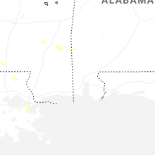
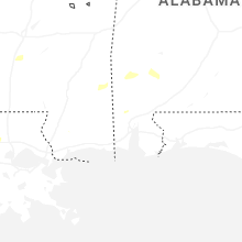
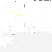
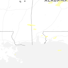


Connect with Interactive Hail Maps