

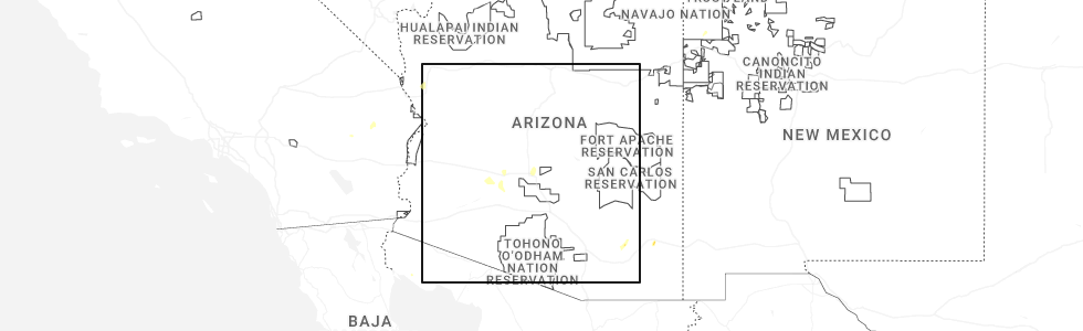
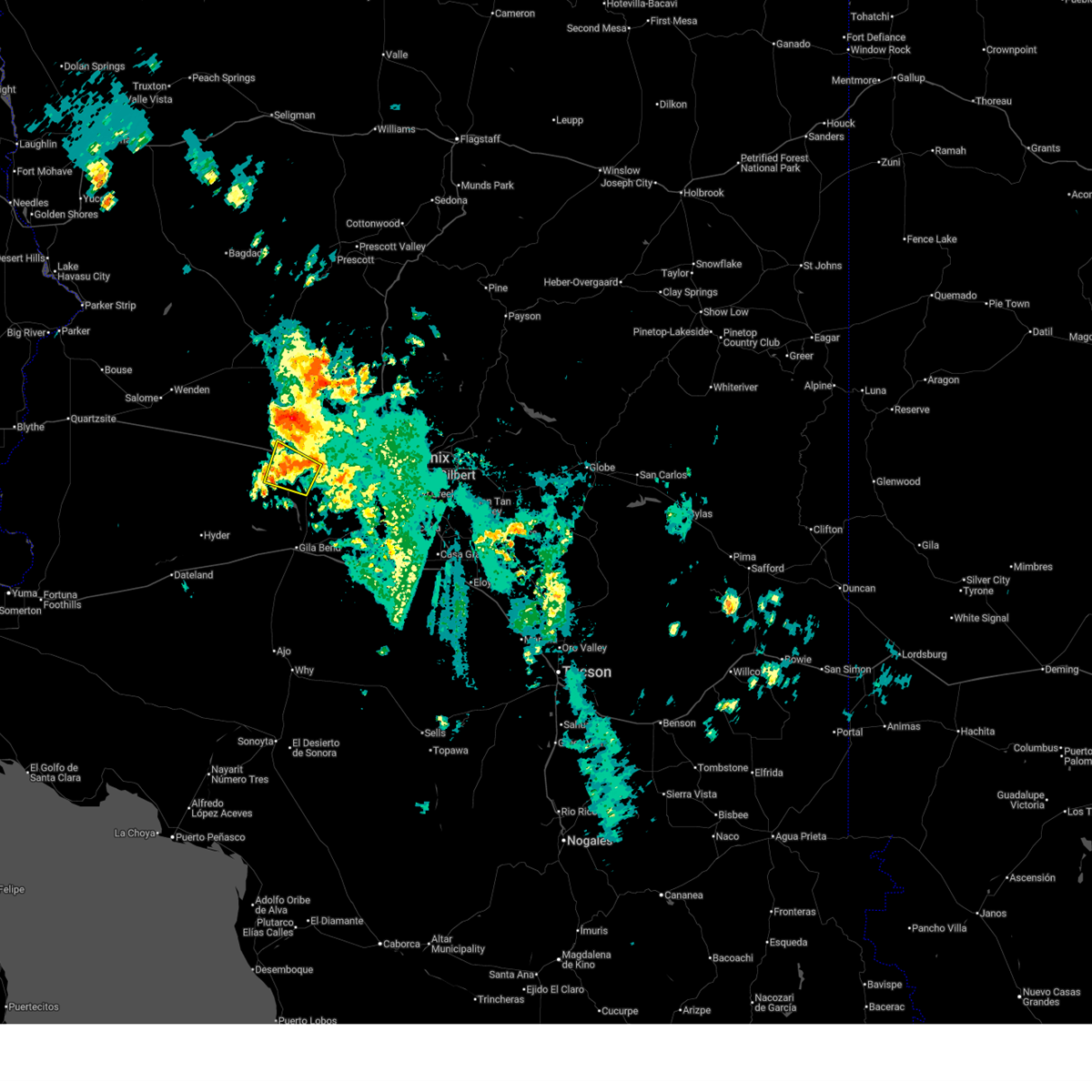
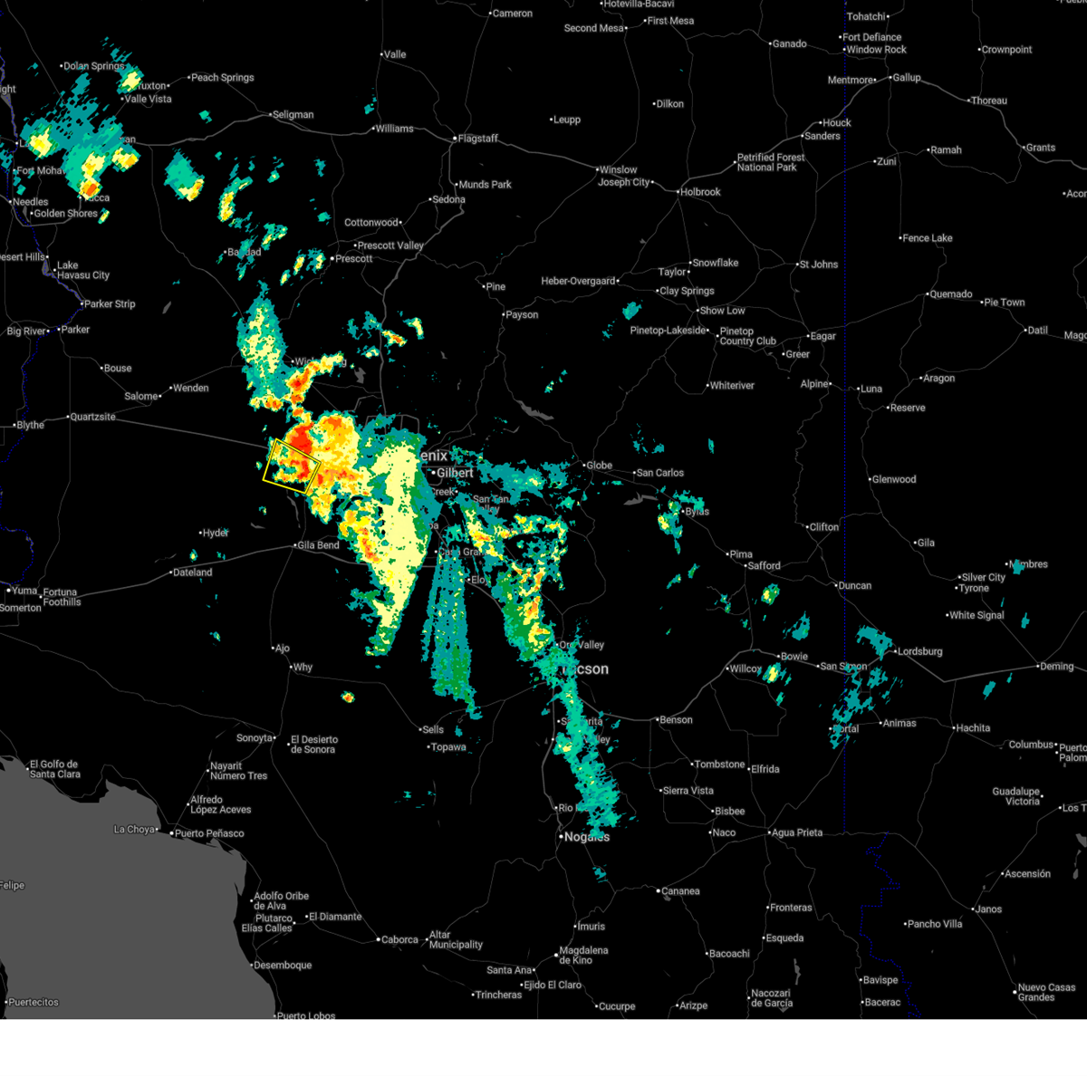
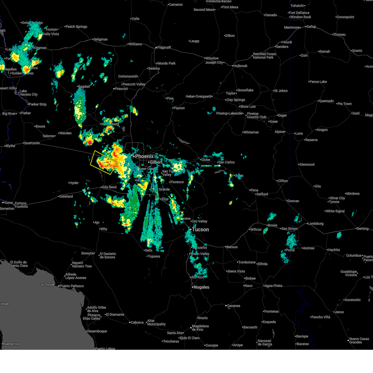
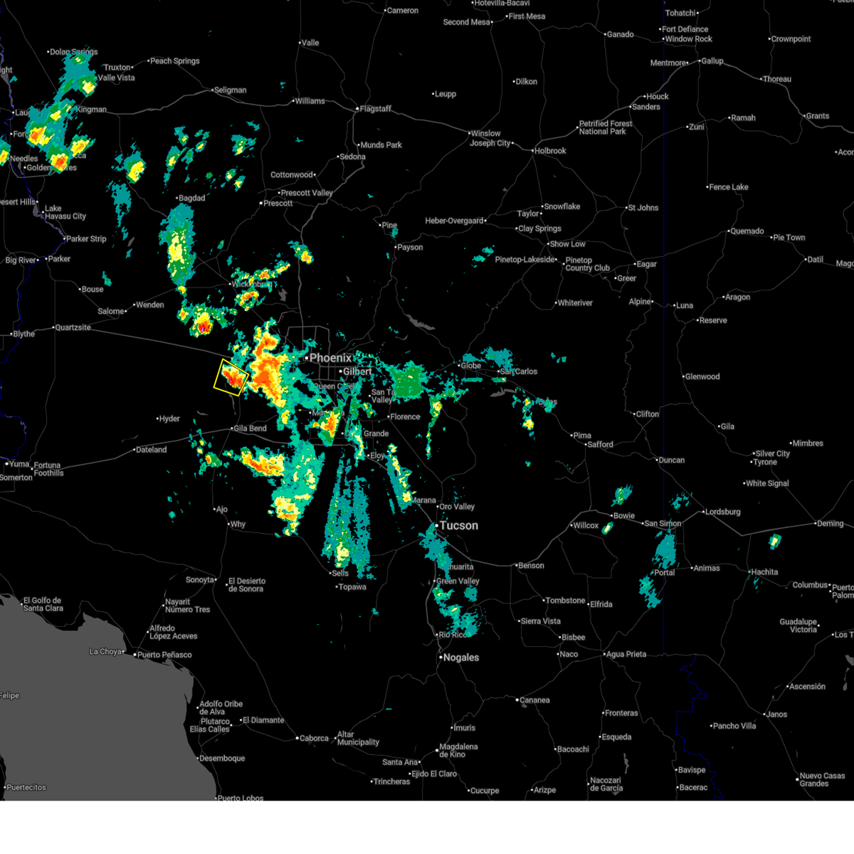
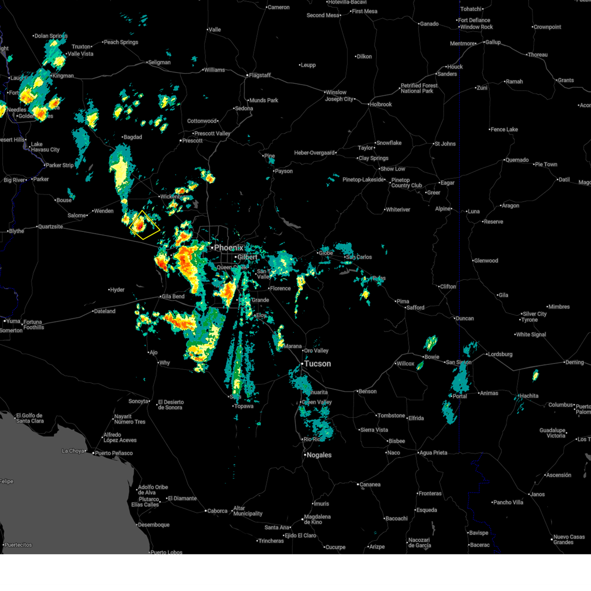
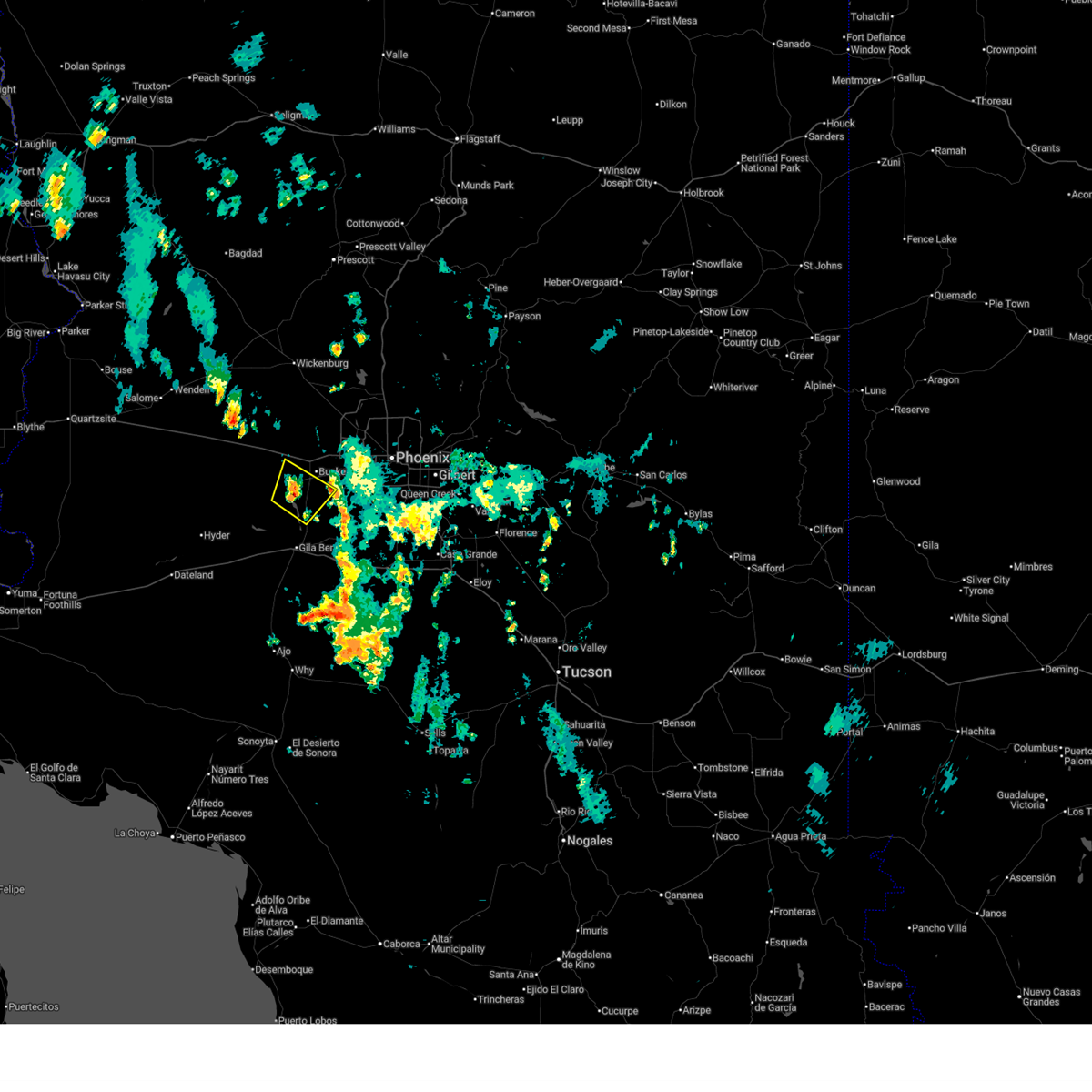
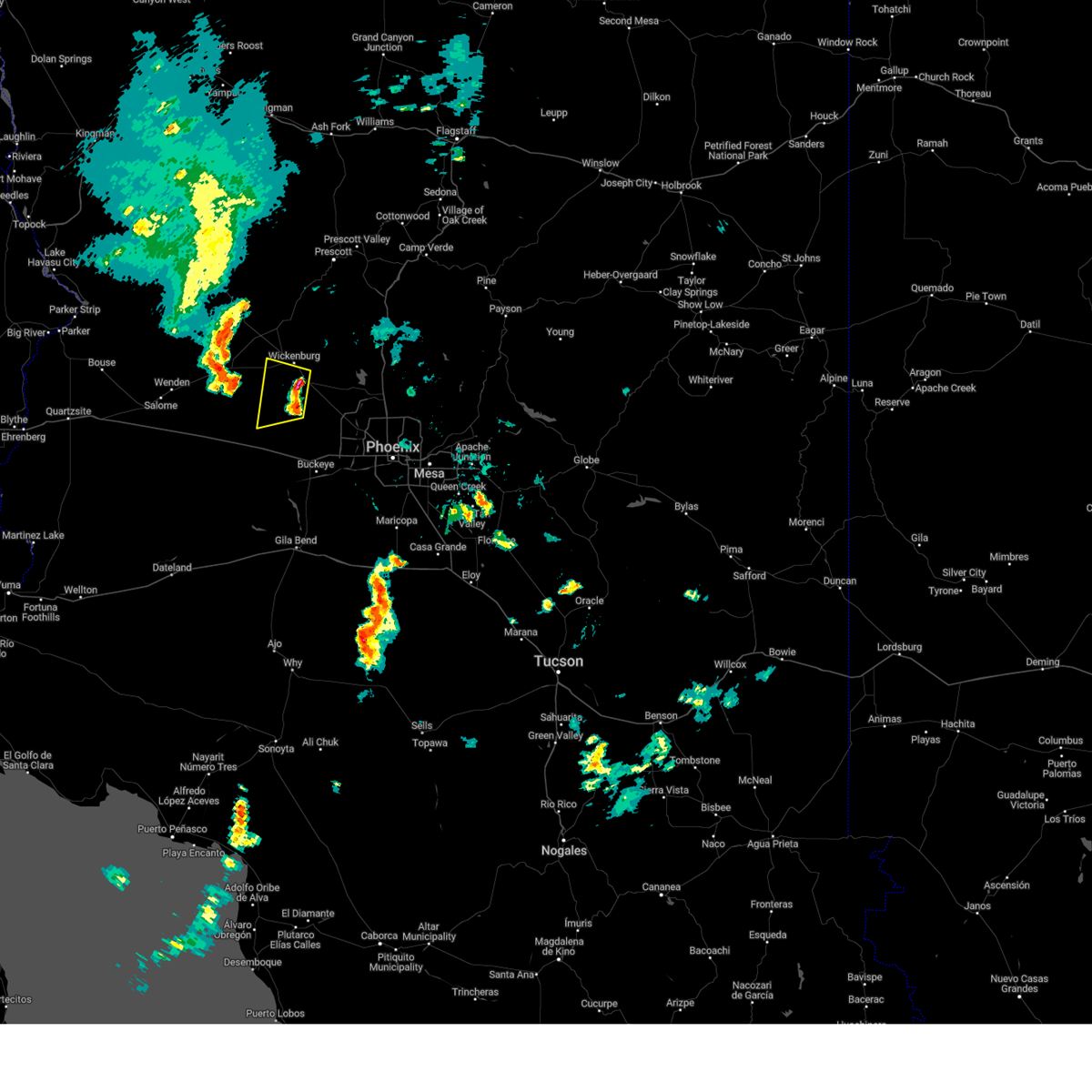
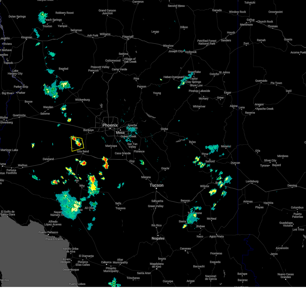
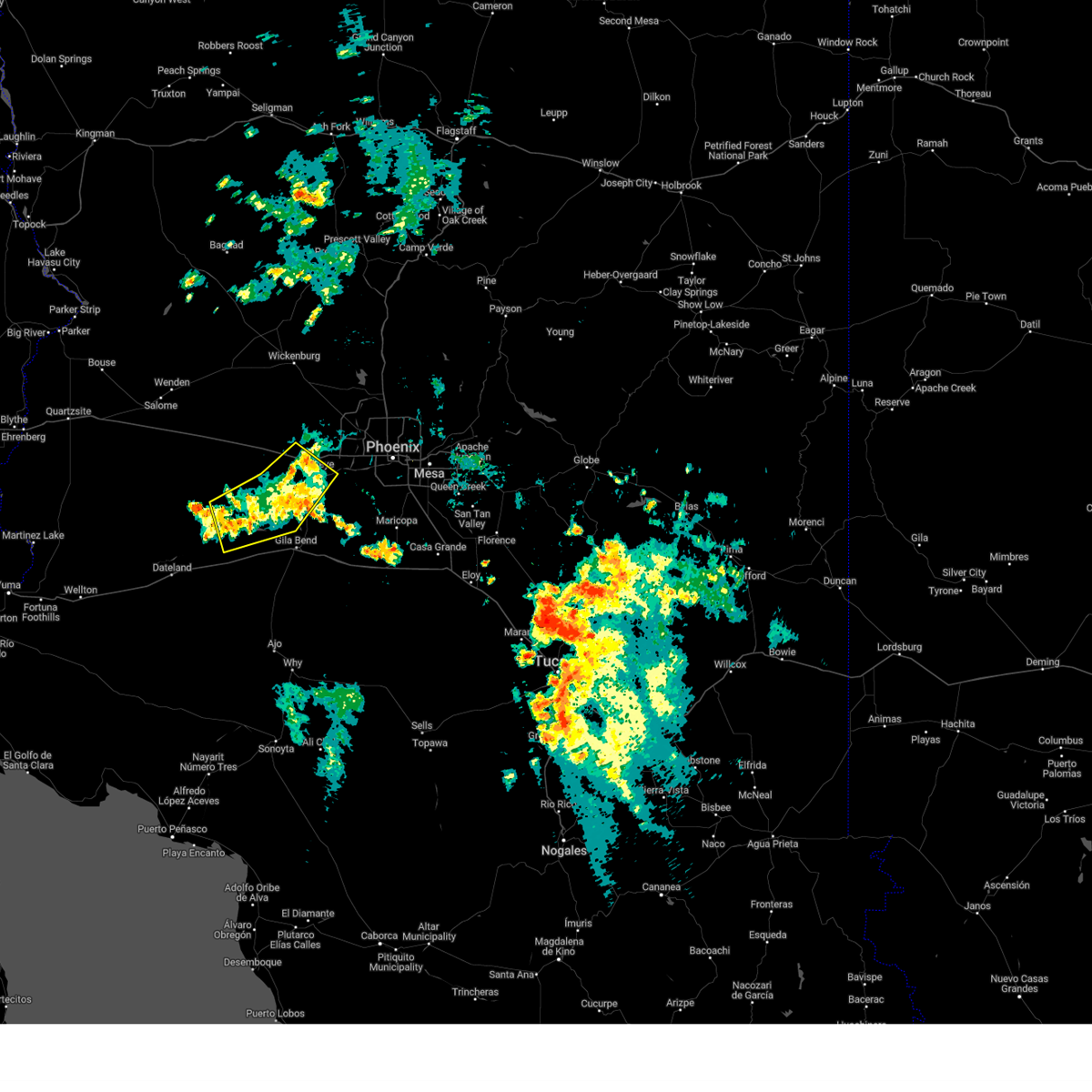
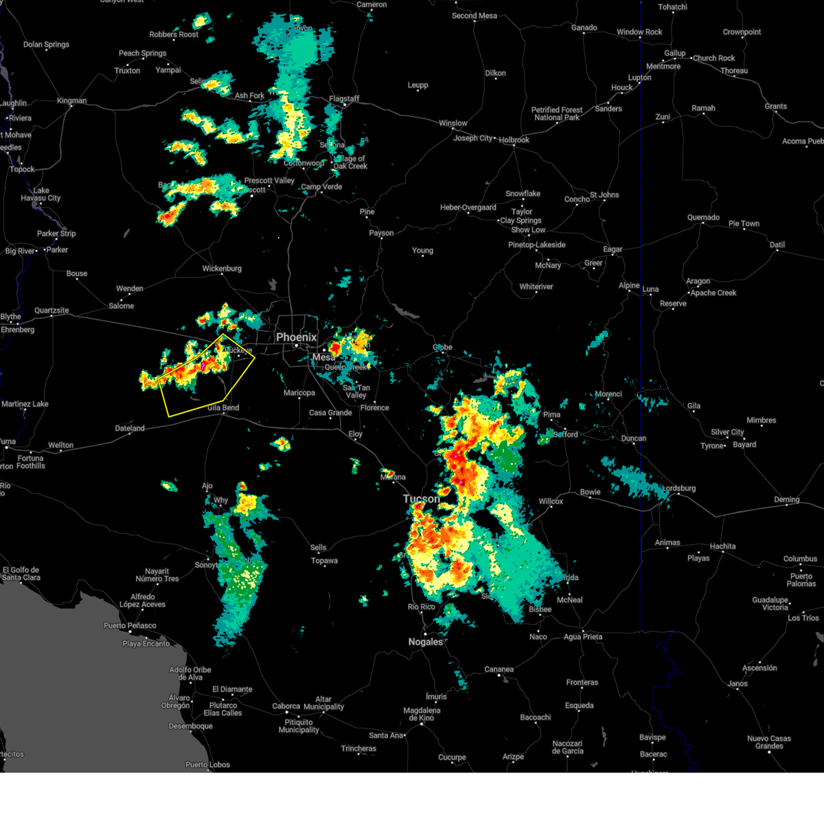
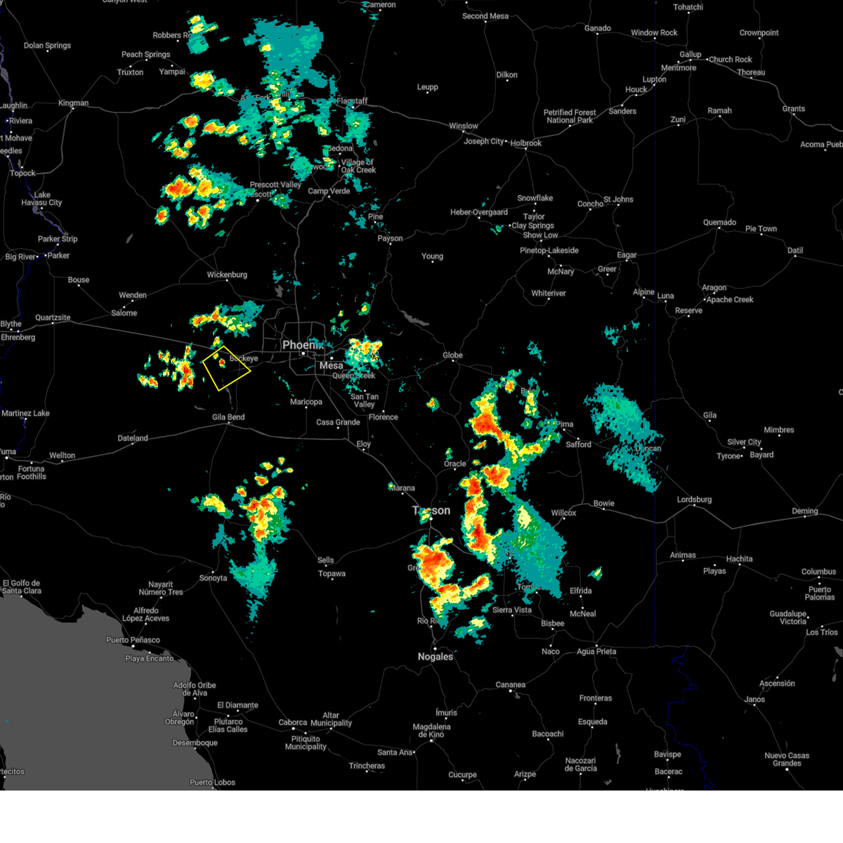
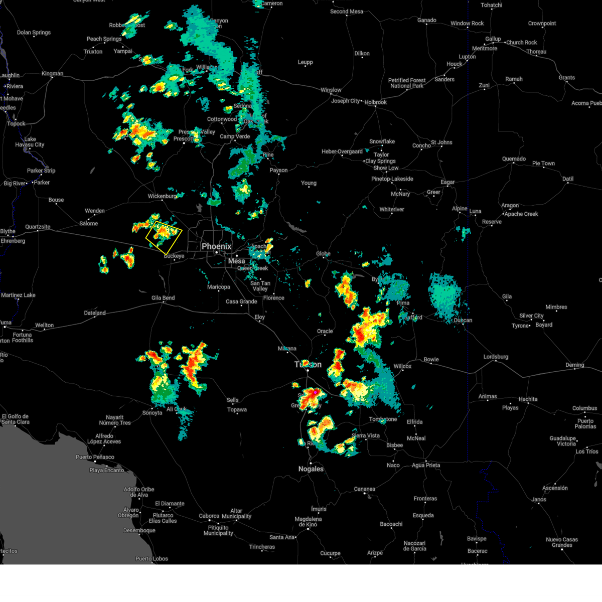
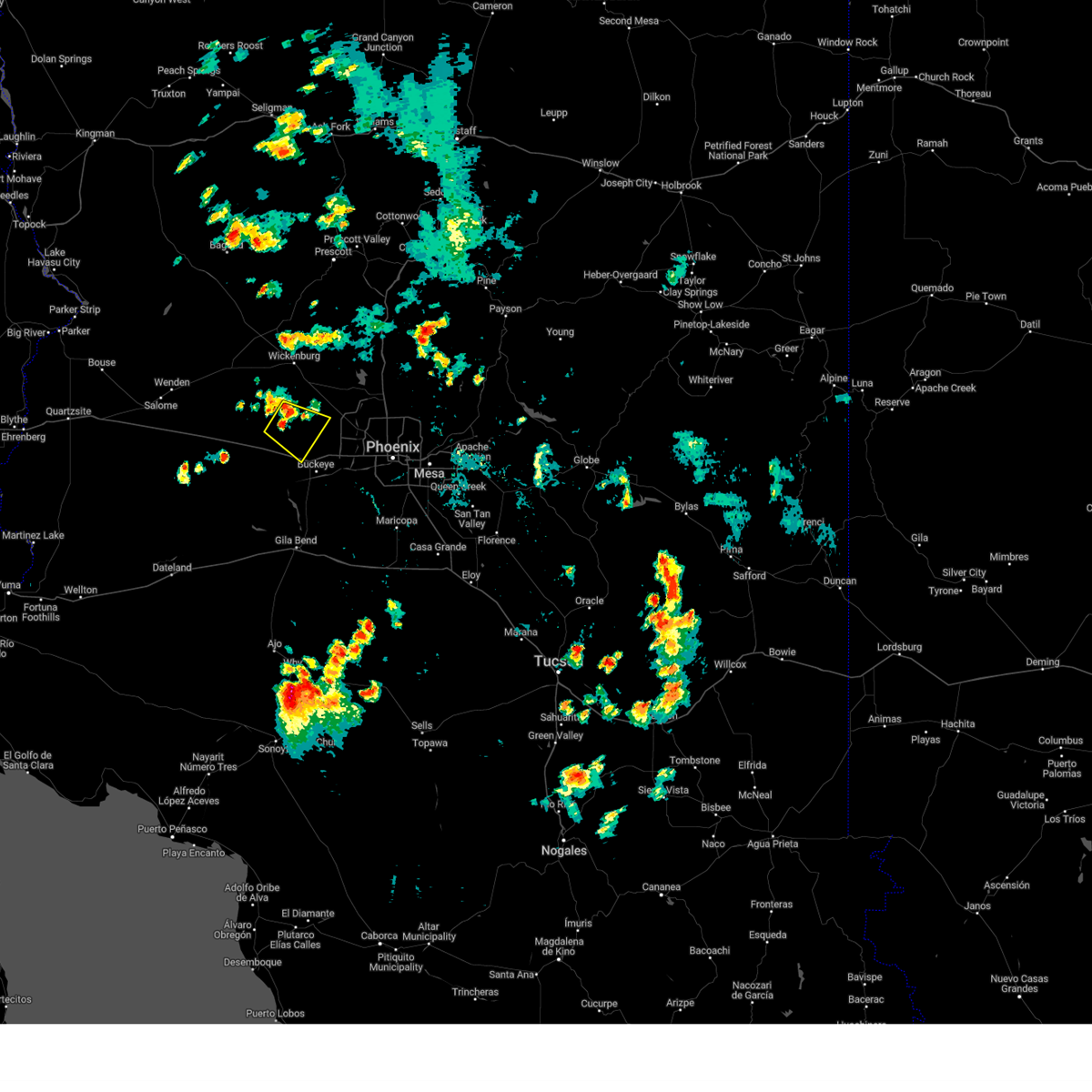
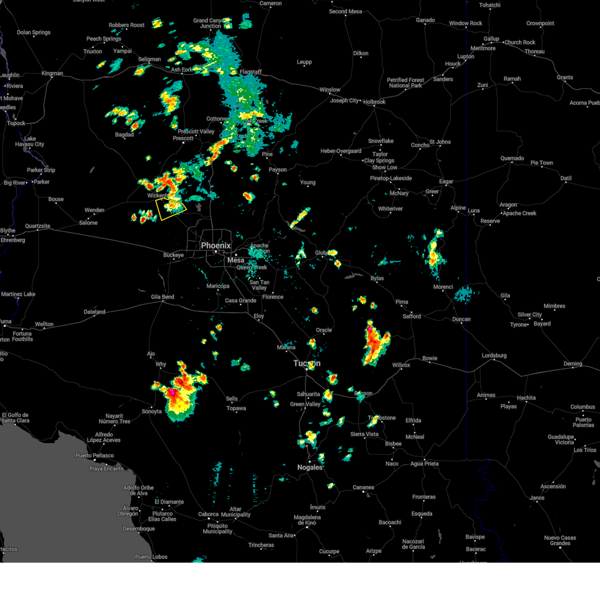
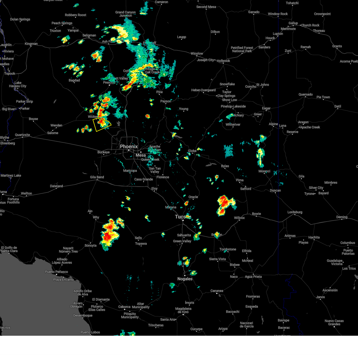
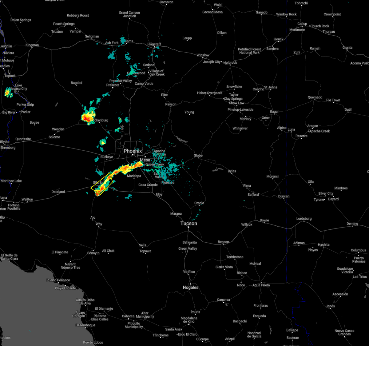
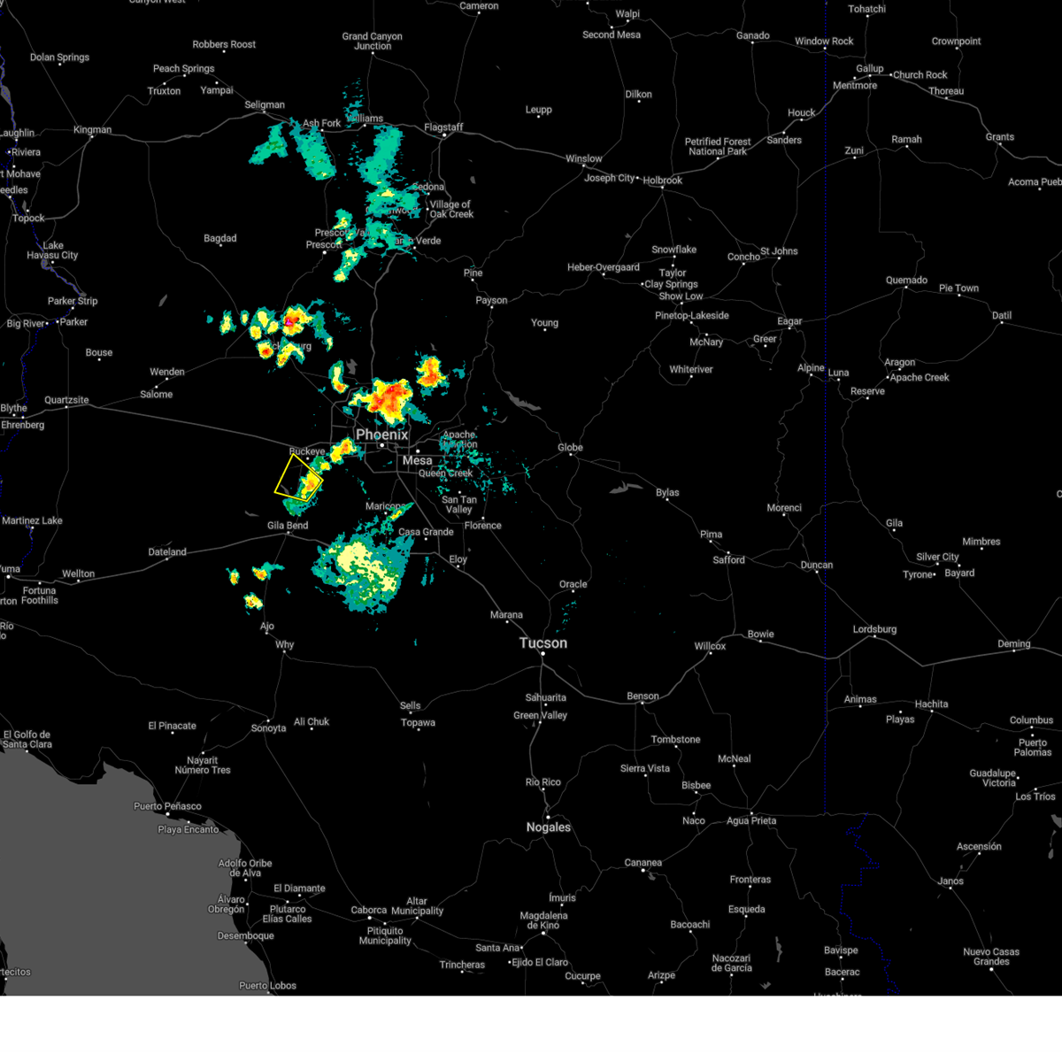
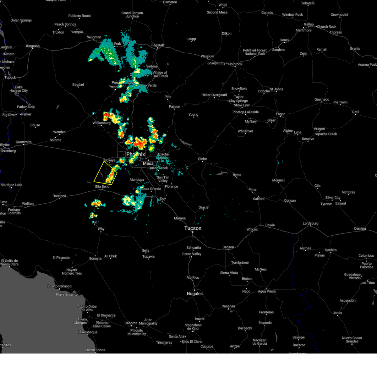
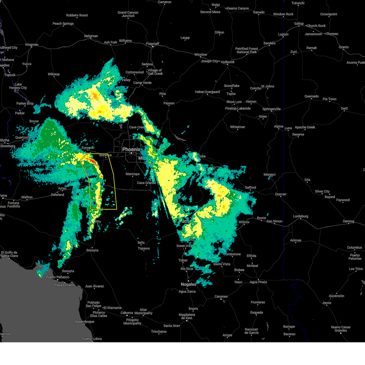
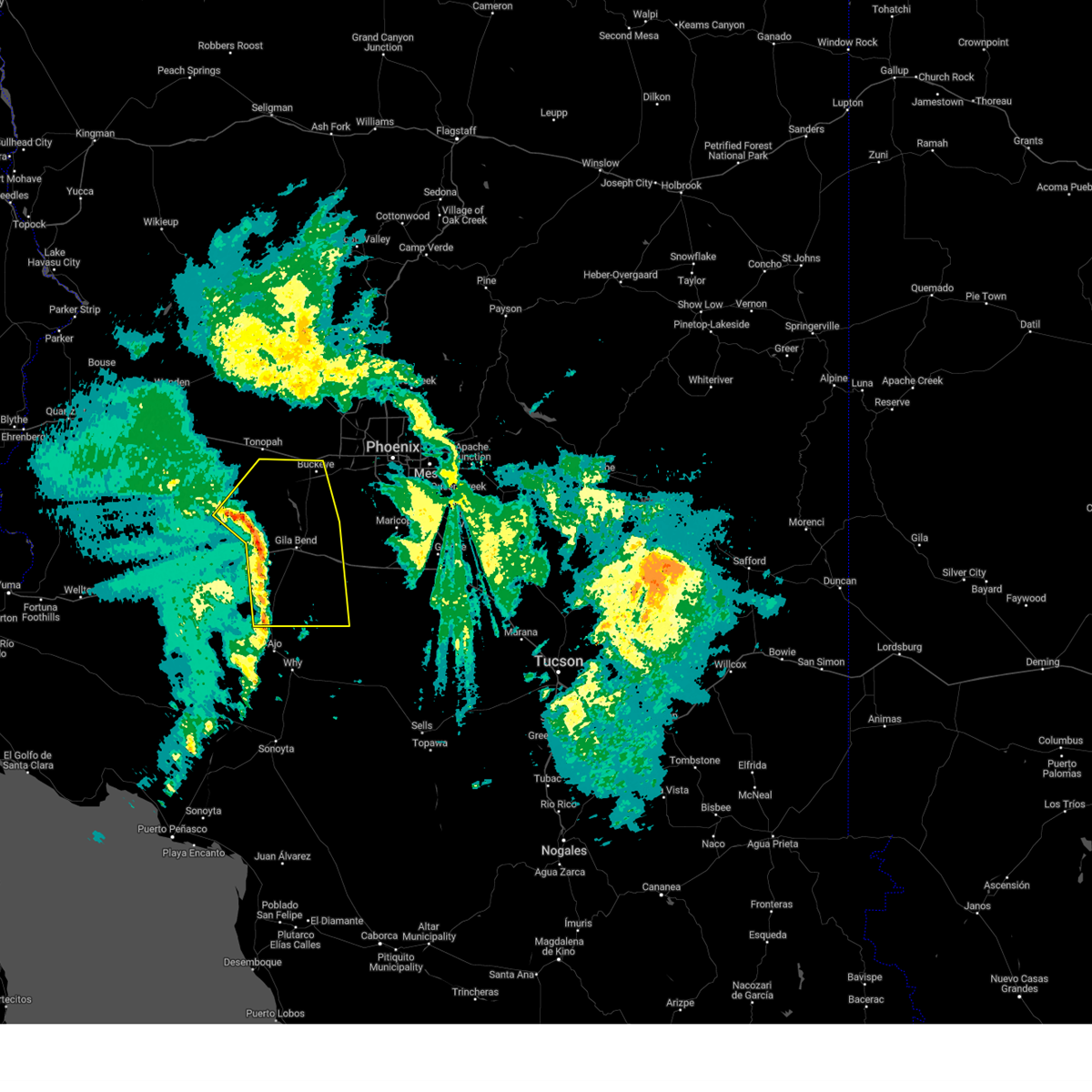
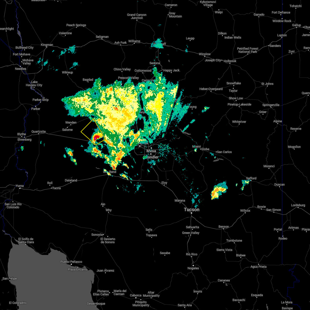
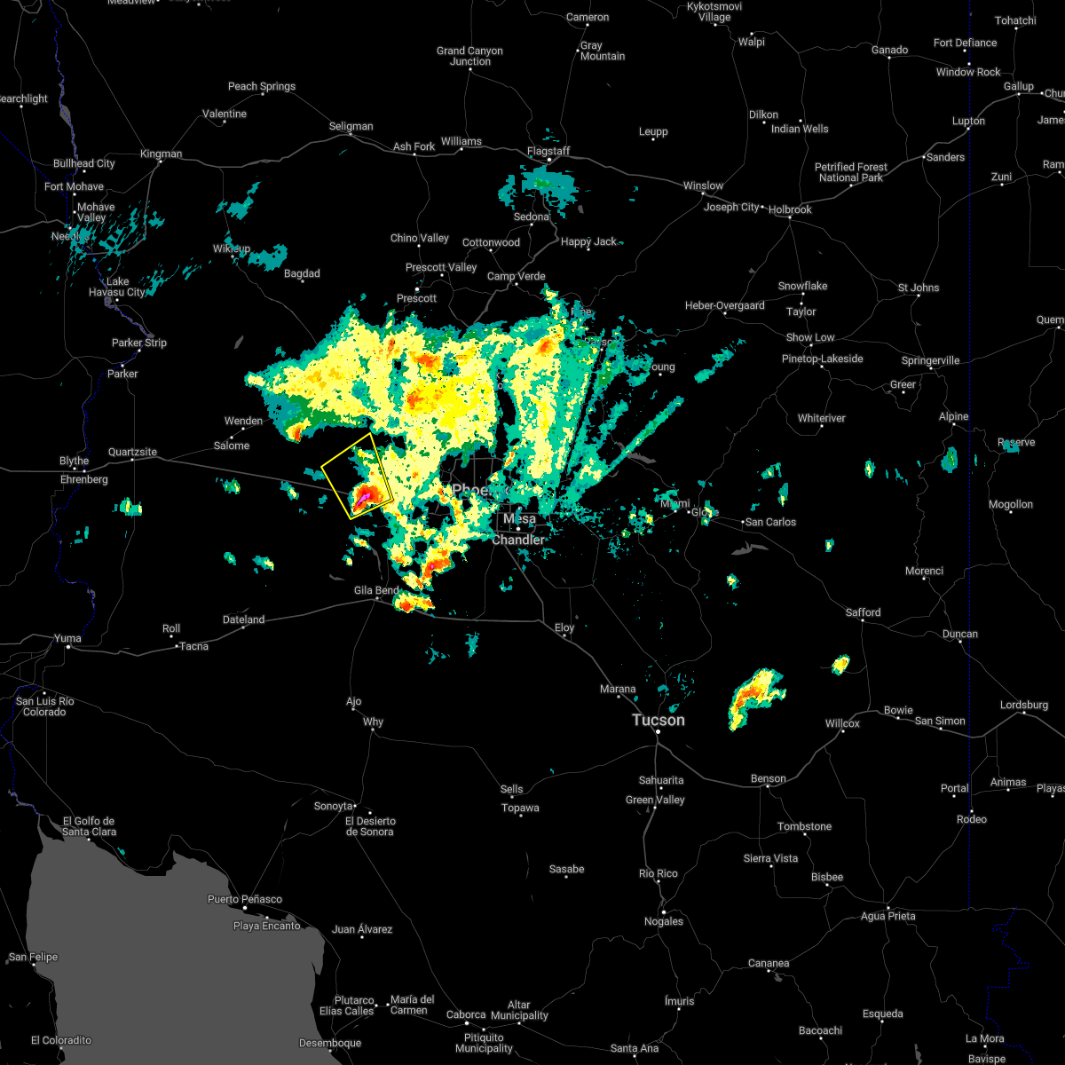
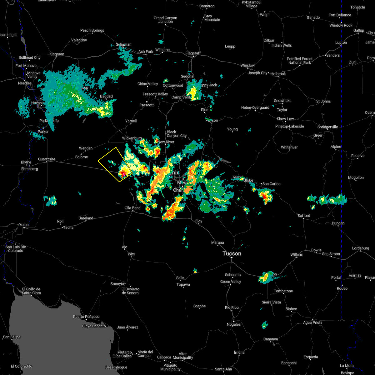
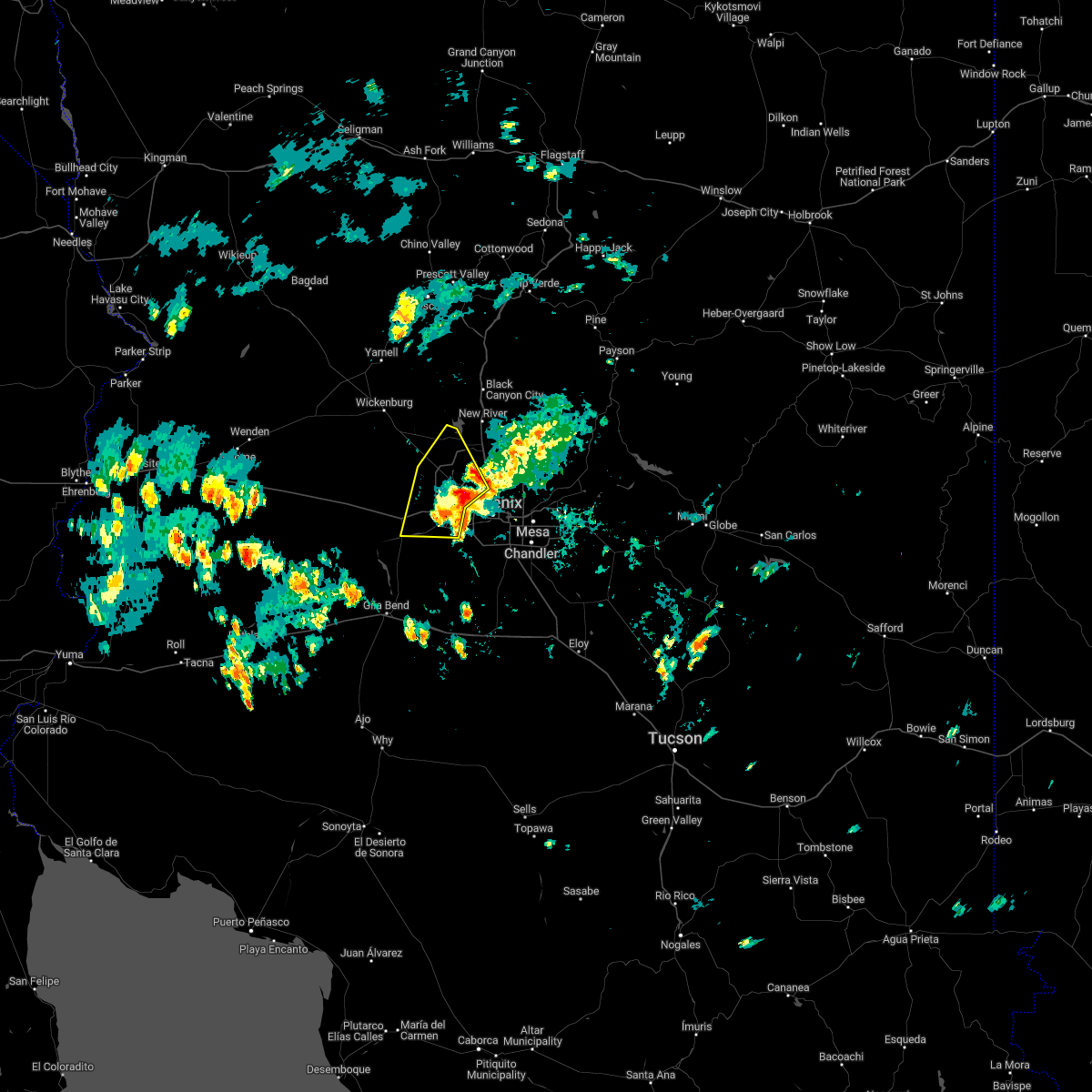
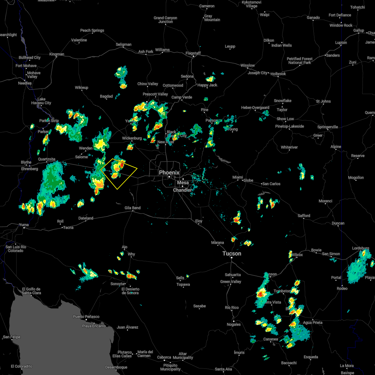
Hail Map for Buckeye, AZ
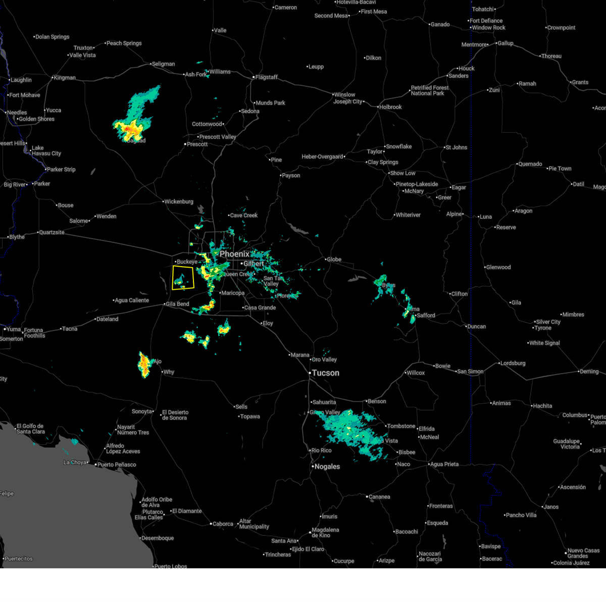
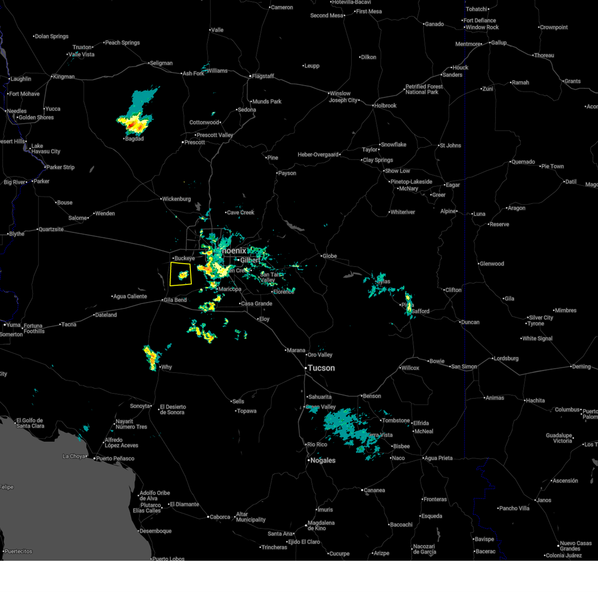
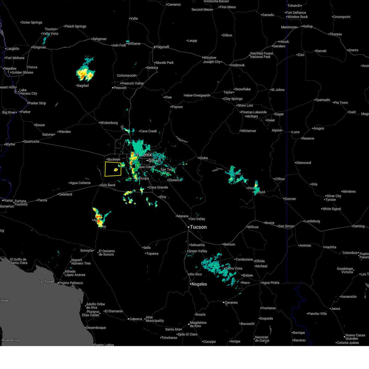
The Buckeye, AZ area has had 2 reports of on-the-ground hail by trained spotters, and has been under severe weather warnings 29 times during the past 12 months. Doppler radar has detected hail at or near Buckeye, AZ on 49 occasions, including 5 occasions during the past year.
| Name: | Buckeye, AZ |
| Where Located: | 31.1 miles W of Phoenix, AZ |
| Map: | Google Map for Buckeye, AZ |
| Population: | 50876 |
| Housing Units: | 18207 |
| More Info: | Search Google for Buckeye, AZ |
4
The Top Recent Hail Date for Buckeye, AZ is Saturday, September 27, 2025 (8th out of 49)
Hail and Wind Damage Spotted near Buckeye, AZ
| Date / Time | Report Details |
|---|---|
| 11/18/2025 3:42 PM MST | Quarter sized hail reported 16.1 miles S of Buckeye, AZ, report of hail between 0.5-1.0 inches in diameter. hail also accumulated to cover the ground. |
| 11/18/2025 12:59 PM MST | Svrpsr the national weather service in phoenix has issued a * severe thunderstorm warning for, maricopa county in south central arizona, * until 130 pm mst. * at 1259 pm mst, a severe thunderstorm was located over avondale, moving northeast at 45 mph (radar indicated). Hazards include 60 mph wind gusts and quarter size hail. Hail damage to vehicles is expected. Expect wind damage to roofs, siding, and trees. |
| 9/27/2025 5:59 PM MST | At 559 pm mst, a severe thunderstorm was located near white tank mountain park, or 7 miles north of buckeye, moving north at 20 mph (radar indicated). Hazards include 60 mph wind gusts and quarter size hail. Hail damage to vehicles is expected. expect wind damage to roofs, siding, and trees. Locations impacted include, surprise and buckeye. |
| 9/27/2025 5:39 PM MST | Svrpsr the national weather service in phoenix has issued a * severe thunderstorm warning for, maricopa county in south central arizona, * until 615 pm mst. * at 539 pm mst, a severe thunderstorm was located over buckeye, moving north at 20 mph (radar indicated). Hazards include 60 mph wind gusts and quarter size hail. Hail damage to vehicles is expected. Expect wind damage to roofs, siding, and trees. |
| 9/27/2025 3:51 PM MST | Downed power pole in maricopa county AZ, 16.7 miles NNE of Buckeye, AZ |
| 9/27/2025 3:19 PM MST | At 319 pm mst, a severe thunderstorm was located near painted rock dam, or 17 miles south of buckeye, moving north at 15 mph (radar indicated). Hazards include quarter size hail. Damage to vehicles is expected. locations impacted include, buckeye, palo verde, painted rock dam, hassayampa, and arlington. this includes the following highways, az interstate 10 between mile markers 112 and 120. Az route 85 between mile markers 136 and 154. |
| 9/27/2025 3:01 PM MST | Svrpsr the national weather service in phoenix has issued a * severe thunderstorm warning for, maricopa county in south central arizona, * until 345 pm mst. * at 301 pm mst, a severe thunderstorm was located 7 miles north of cotton center, or 16 miles southwest of goodyear, moving north at 15 mph (radar indicated). Hazards include quarter size hail. damage to vehicles is expected |
| 9/26/2025 2:11 PM MST | The storm which prompted the warning has weakened below severe limits, and no longer poses an immediate threat to life or property. therefore, the warning will be allowed to expire. however, gusty winds and heavy rain are still possible with this thunderstorm. a severe thunderstorm watch remains in effect until 700 pm mst for south central arizona. |
| 9/26/2025 1:59 PM MST | At 159 pm mst, a severe thunderstorm was located 10 miles southwest of circle city, moving north at 30 mph (radar indicated). Hazards include 60 mph wind gusts and quarter size hail. Hail damage to vehicles is expected. expect wind damage to roofs, siding, and trees. locations impacted include, surprise, buckeye, wittmann, and circle city. This includes us highway 60 between mile markers 124 and 131. |
| 9/26/2025 1:32 PM MST | Svrpsr the national weather service in phoenix has issued a * severe thunderstorm warning for, maricopa county in south central arizona, * until 215 pm mst. * at 132 pm mst, a severe thunderstorm was located over buckeye, moving north at 30 mph (radar indicated). Hazards include 60 mph wind gusts and quarter size hail. Hail damage to vehicles is expected. Expect wind damage to roofs, siding, and trees. |
| 9/26/2025 1:29 PM MST | the severe thunderstorm warning has been cancelled and is no longer in effect |
| 9/26/2025 1:29 PM MST | At 128 pm mst, severe thunderstorms were located along a line extending from near litchfield park to downtown phoenix, moving northeast at 35 mph (radar indicated). Hazards include 60 mph wind gusts and quarter size hail. Hail damage to vehicles is expected. expect wind damage to roofs, siding, and trees. locations impacted include, phoenix, glendale, scottsdale, tempe, surprise, avondale, goodyear, buckeye, el mirage, fountain hills, paradise valley, tolleson, youngtown, waddell, and laveen. this includes the following highways, az interstate 10 between mile markers 115 and 157. az interstate 17 between mile markers 195 and 212. Az route 51 between mile markers 1 and 13. |
| 9/26/2025 1:02 PM MST | Svrpsr the national weather service in phoenix has issued a * severe thunderstorm warning for, maricopa county in south central arizona, pinal county in southeastern arizona, * until 145 pm mst. * at 101 pm mst, severe thunderstorms were located along a line extending from near estrella mountain ranch to 6 miles southwest of south mountain park, moving northeast at 35 mph (radar indicated). Hazards include 60 mph wind gusts and quarter size hail. Hail damage to vehicles is expected. Expect wind damage to roofs, siding, and trees. |
| 9/26/2025 12:37 PM MST | Powerlines down in the area of chandler heights rd. to komatke rd. and hays rd. to 189th av in maricopa county AZ, 16.5 miles NNW of Buckeye, AZ |
| 9/26/2025 10:13 AM MST | Svrpsr the national weather service in phoenix has issued a * severe thunderstorm warning for, maricopa county in south central arizona, * until 1045 am mst. * at 1013 am mst, a severe thunderstorm was located over youngtown, moving northeast at 20 mph (radar indicated). Hazards include ping pong ball size hail and 60 mph wind gusts. People and animals outdoors will be injured. expect hail damage to roofs, siding, windows, and vehicles. Expect wind damage to roofs, siding, and trees. |
| 9/19/2025 1:36 AM MST | At 136 am mst, a severe thunderstorm was located near buckeye, moving north at 25 mph (radar indicated). Hazards include 60 mph wind gusts and quarter size hail. Hail damage to vehicles is expected. expect wind damage to roofs, siding, and trees. locations impacted include, buckeye and wintersburg. This includes az interstate 10 between mile markers 99 and 112. |
| 9/19/2025 1:22 AM MST | Svrpsr the national weather service in phoenix has issued a * severe thunderstorm warning for, maricopa county in south central arizona, * until 145 am mst. * at 122 am mst, a severe thunderstorm was located 7 miles east of wintersburg, or 8 miles southwest of buckeye, moving north at 25 mph (radar indicated). Hazards include 60 mph wind gusts and quarter size hail. Hail damage to vehicles is expected. Expect wind damage to roofs, siding, and trees. |
| 9/18/2025 8:11 PM MST | the severe thunderstorm warning has been cancelled and is no longer in effect |
| 9/18/2025 8:11 PM MST | The storm which prompted the warning has moved out of the area. therefore, the warning will be allowed to expire. |
| 9/18/2025 8:06 PM MST | At 806 pm mst, a severe thunderstorm was located over painted rock dam, or 17 miles south of buckeye, moving north at 15 mph (radar indicated). Hazards include 60 mph wind gusts and quarter size hail. Hail damage to vehicles is expected. expect wind damage to roofs, siding, and trees. locations impacted include, painted rock dam. This includes az route 85 between mile markers 143 and 145. |
| 9/18/2025 8:04 PM MST | Svrpsr the national weather service in phoenix has issued a * severe thunderstorm warning for, maricopa county in south central arizona, * until 845 pm mst. * at 804 pm mst, a severe thunderstorm was located over painted rock dam, or 17 miles south of buckeye, moving north at 15 mph (radar indicated). Hazards include 60 mph wind gusts and quarter size hail. Hail damage to vehicles is expected. Expect wind damage to roofs, siding, and trees. |
| 9/18/2025 7:48 PM MST | Svrpsr the national weather service in phoenix has issued a * severe thunderstorm warning for, maricopa county in south central arizona, * until 815 pm mst. * at 748 pm mst, a severe thunderstorm was located over painted rock dam, or 18 miles north of gila bend, moving north at 15 mph (radar indicated). Hazards include 60 mph wind gusts and quarter size hail. Hail damage to vehicles is expected. Expect wind damage to roofs, siding, and trees. |
| 9/1/2025 7:15 PM MST |
 the severe thunderstorm warning has been cancelled and is no longer in effect the severe thunderstorm warning has been cancelled and is no longer in effect
|
| 9/1/2025 7:02 PM MST |
 At 702 pm mst, a severe thunderstorm was located 8 miles south of estrella mountain ranch, or 10 miles south of goodyear, moving east at 10 mph (radar indicated). Hazards include 60 mph wind gusts. Expect damage to roofs, siding, and trees. Locations impacted include, goodyear and rainbow valley. At 702 pm mst, a severe thunderstorm was located 8 miles south of estrella mountain ranch, or 10 miles south of goodyear, moving east at 10 mph (radar indicated). Hazards include 60 mph wind gusts. Expect damage to roofs, siding, and trees. Locations impacted include, goodyear and rainbow valley.
|
| 9/1/2025 6:44 PM MST |
 Svrpsr the national weather service in phoenix has issued a * severe thunderstorm warning for, maricopa county in south central arizona, * until 730 pm mst. * at 644 pm mst, a severe thunderstorm was located 8 miles south of estrella mountain ranch, or 10 miles south of goodyear, moving west at 10 mph (radar indicated). Hazards include 60 mph wind gusts. expect damage to roofs, siding, and trees Svrpsr the national weather service in phoenix has issued a * severe thunderstorm warning for, maricopa county in south central arizona, * until 730 pm mst. * at 644 pm mst, a severe thunderstorm was located 8 miles south of estrella mountain ranch, or 10 miles south of goodyear, moving west at 10 mph (radar indicated). Hazards include 60 mph wind gusts. expect damage to roofs, siding, and trees
|
| 7/2/2025 8:42 PM MST |
 The storm which prompted the warning has weakened below severe limits, and no longer poses an immediate threat to life or property. therefore, the warning will be allowed to expire. however, gusty winds and heavy rain are still possible with this thunderstorm. The storm which prompted the warning has weakened below severe limits, and no longer poses an immediate threat to life or property. therefore, the warning will be allowed to expire. however, gusty winds and heavy rain are still possible with this thunderstorm.
|
| 7/2/2025 8:22 PM MST |
 At 822 pm mst, a severe thunderstorm was located near palo verde, or 7 miles south of buckeye, moving north at 15 mph (radar indicated). Hazards include 60 mph wind gusts. Expect damage to roofs, siding, and trees. Locations impacted include, buckeye, palo verde, palo verde nuclear generation station, wintersburg, hassayampa, and arlington. At 822 pm mst, a severe thunderstorm was located near palo verde, or 7 miles south of buckeye, moving north at 15 mph (radar indicated). Hazards include 60 mph wind gusts. Expect damage to roofs, siding, and trees. Locations impacted include, buckeye, palo verde, palo verde nuclear generation station, wintersburg, hassayampa, and arlington.
|
| 7/2/2025 8:20 PM MST |
 The storm which prompted the warning has weakened below severe limits, and has exited the warned area. therefore, the warning will be allowed to expire. however, gusty winds are still possible with this thunderstorm. The storm which prompted the warning has weakened below severe limits, and has exited the warned area. therefore, the warning will be allowed to expire. however, gusty winds are still possible with this thunderstorm.
|
| 7/2/2025 7:58 PM MST |
 Svrpsr the national weather service in phoenix has issued a * severe thunderstorm warning for, maricopa county in south central arizona, * until 845 pm mst. * at 758 pm mst, a severe thunderstorm was located near palo verde nuclear generation station, or 12 miles southwest of buckeye, and is nearly stationary (radar indicated). Hazards include 60 mph wind gusts. expect damage to roofs, siding, and trees Svrpsr the national weather service in phoenix has issued a * severe thunderstorm warning for, maricopa county in south central arizona, * until 845 pm mst. * at 758 pm mst, a severe thunderstorm was located near palo verde nuclear generation station, or 12 miles southwest of buckeye, and is nearly stationary (radar indicated). Hazards include 60 mph wind gusts. expect damage to roofs, siding, and trees
|
| 7/2/2025 7:51 PM MST |
 At 751 pm mst, a severe thunderstorm was located over painted rock dam, or 17 miles south of buckeye, and is nearly stationary (radar indicated). Hazards include 60 mph wind gusts and penny size hail. Expect damage to roofs, siding, and trees. Locations impacted include, buckeye, palo verde, painted rock dam, hassayampa, and arlington. At 751 pm mst, a severe thunderstorm was located over painted rock dam, or 17 miles south of buckeye, and is nearly stationary (radar indicated). Hazards include 60 mph wind gusts and penny size hail. Expect damage to roofs, siding, and trees. Locations impacted include, buckeye, palo verde, painted rock dam, hassayampa, and arlington.
|
| 7/2/2025 7:48 PM MST |
 Svrpsr the national weather service in phoenix has issued a * severe thunderstorm warning for, maricopa county in south central arizona, * until 830 pm mst. * at 748 pm mst, a severe thunderstorm was located 10 miles north of tonopah, and is nearly stationary (radar indicated). Hazards include 60 mph wind gusts and penny size hail. Expect damage to roofs, siding, and trees. This severe thunderstorm will remain over mainly rural areas of maricopa county. Svrpsr the national weather service in phoenix has issued a * severe thunderstorm warning for, maricopa county in south central arizona, * until 830 pm mst. * at 748 pm mst, a severe thunderstorm was located 10 miles north of tonopah, and is nearly stationary (radar indicated). Hazards include 60 mph wind gusts and penny size hail. Expect damage to roofs, siding, and trees. This severe thunderstorm will remain over mainly rural areas of maricopa county.
|
| 7/2/2025 7:21 PM MST |
 Svrpsr the national weather service in phoenix has issued a * severe thunderstorm warning for, maricopa county in south central arizona, * until 800 pm mst. * at 721 pm mst, a severe thunderstorm was located over painted rock dam, or 19 miles south of buckeye, and is nearly stationary (radar indicated). Hazards include 60 mph wind gusts and penny size hail. expect damage to roofs, siding, and trees Svrpsr the national weather service in phoenix has issued a * severe thunderstorm warning for, maricopa county in south central arizona, * until 800 pm mst. * at 721 pm mst, a severe thunderstorm was located over painted rock dam, or 19 miles south of buckeye, and is nearly stationary (radar indicated). Hazards include 60 mph wind gusts and penny size hail. expect damage to roofs, siding, and trees
|
| 8/6/2024 8:17 PM MST |
 The storm which prompted the warning has weakened below severe limits, and no longer poses an immediate threat to life or property. therefore, the warning has been allowed to expire. The storm which prompted the warning has weakened below severe limits, and no longer poses an immediate threat to life or property. therefore, the warning has been allowed to expire.
|
| 8/6/2024 7:51 PM MST |
 At 750 pm mst, a severe thunderstorm was located 7 miles south of wickenburg, moving west at 15 mph (radar indicated). Hazards include 60 mph wind gusts. Expect damage to roofs, siding, and trees. this severe thunderstorm will remain over mainly rural areas of maricopa county. This includes us highway 60 between mile markers 100 and 107, and between mile markers 113 and 120. At 750 pm mst, a severe thunderstorm was located 7 miles south of wickenburg, moving west at 15 mph (radar indicated). Hazards include 60 mph wind gusts. Expect damage to roofs, siding, and trees. this severe thunderstorm will remain over mainly rural areas of maricopa county. This includes us highway 60 between mile markers 100 and 107, and between mile markers 113 and 120.
|
| 8/6/2024 7:37 PM MST |
 Svrpsr the national weather service in phoenix has issued a * severe thunderstorm warning for, maricopa county in south central arizona, * until 815 pm mst. * at 737 pm mst, a severe thunderstorm was located near morristown, or 7 miles west of circle city, moving west at 15 mph (radar indicated). Hazards include 60 mph wind gusts. Expect damage to roofs, siding, and trees. this severe thunderstorm will remain over mainly rural areas of maricopa county. This includes us highway 60 between mile markers 99 and 108, and between mile markers 113 and 120. Svrpsr the national weather service in phoenix has issued a * severe thunderstorm warning for, maricopa county in south central arizona, * until 815 pm mst. * at 737 pm mst, a severe thunderstorm was located near morristown, or 7 miles west of circle city, moving west at 15 mph (radar indicated). Hazards include 60 mph wind gusts. Expect damage to roofs, siding, and trees. this severe thunderstorm will remain over mainly rural areas of maricopa county. This includes us highway 60 between mile markers 99 and 108, and between mile markers 113 and 120.
|
| 8/3/2024 6:30 PM MST |
 Svrpsr the national weather service in phoenix has issued a * severe thunderstorm warning for, maricopa county in south central arizona, * until 700 pm mst. * at 629 pm mst, a severe thunderstorm was located near painted rock dam, or 15 miles northwest of gila bend, and is nearly stationary (radar indicated). Hazards include 60 mph wind gusts and penny size hail. expect damage to roofs, siding, and trees Svrpsr the national weather service in phoenix has issued a * severe thunderstorm warning for, maricopa county in south central arizona, * until 700 pm mst. * at 629 pm mst, a severe thunderstorm was located near painted rock dam, or 15 miles northwest of gila bend, and is nearly stationary (radar indicated). Hazards include 60 mph wind gusts and penny size hail. expect damage to roofs, siding, and trees
|
| 7/25/2024 7:26 PM MST |
 The storms which prompted the warning have weakened below severe limits, and have exited the warned area. therefore, the warning will be allowed to expire. however, gusty winds and heavy rain are still possible with these thunderstorms. The storms which prompted the warning have weakened below severe limits, and have exited the warned area. therefore, the warning will be allowed to expire. however, gusty winds and heavy rain are still possible with these thunderstorms.
|
| 7/25/2024 7:15 PM MST | Power poles down near van buren st and 295th av in maricopa county AZ, 4.7 miles ESE of Buckeye, AZ |
| 7/25/2024 6:43 PM MST |
 Svrpsr the national weather service in phoenix has issued a * severe thunderstorm warning for, maricopa county in south central arizona, * until 730 pm mst. * at 643 pm mst, severe thunderstorms were located along a line extending from 6 miles east of wintersburg to 7 miles west of painted rock dam to near sundad, moving southeast at 15 mph (radar indicated). Hazards include 60 mph wind gusts and penny size hail. expect damage to roofs, siding, and trees Svrpsr the national weather service in phoenix has issued a * severe thunderstorm warning for, maricopa county in south central arizona, * until 730 pm mst. * at 643 pm mst, severe thunderstorms were located along a line extending from 6 miles east of wintersburg to 7 miles west of painted rock dam to near sundad, moving southeast at 15 mph (radar indicated). Hazards include 60 mph wind gusts and penny size hail. expect damage to roofs, siding, and trees
|
| 7/25/2024 6:08 PM MST |
 Svrpsr the national weather service in phoenix has issued a * severe thunderstorm warning for, maricopa county in south central arizona, * until 645 pm mst. * at 608 pm mst, a severe thunderstorm was located near palo verde nuclear generation station, or 12 miles southwest of buckeye, moving southeast at 5 mph (radar indicated). Hazards include 60 mph wind gusts and penny size hail. expect damage to roofs, siding, and trees Svrpsr the national weather service in phoenix has issued a * severe thunderstorm warning for, maricopa county in south central arizona, * until 645 pm mst. * at 608 pm mst, a severe thunderstorm was located near palo verde nuclear generation station, or 12 miles southwest of buckeye, moving southeast at 5 mph (radar indicated). Hazards include 60 mph wind gusts and penny size hail. expect damage to roofs, siding, and trees
|
| 7/25/2024 5:45 PM MST |
 the severe thunderstorm warning has been cancelled and is no longer in effect the severe thunderstorm warning has been cancelled and is no longer in effect
|
| 7/25/2024 5:13 PM MST |
 Svrpsr the national weather service in phoenix has issued a * severe thunderstorm warning for, maricopa county in south central arizona, * until 600 pm mst. * at 513 pm mst, a severe thunderstorm was located 11 miles northeast of tonopah, moving southeast at 10 mph (radar indicated). Hazards include 60 mph wind gusts and penny size hail. expect damage to roofs, siding, and trees Svrpsr the national weather service in phoenix has issued a * severe thunderstorm warning for, maricopa county in south central arizona, * until 600 pm mst. * at 513 pm mst, a severe thunderstorm was located 11 miles northeast of tonopah, moving southeast at 10 mph (radar indicated). Hazards include 60 mph wind gusts and penny size hail. expect damage to roofs, siding, and trees
|
| 7/25/2024 4:33 PM MST |
 the severe thunderstorm warning has been cancelled and is no longer in effect the severe thunderstorm warning has been cancelled and is no longer in effect
|
| 7/25/2024 4:15 PM MST |
 Svrpsr the national weather service in phoenix has issued a * severe thunderstorm warning for, maricopa county in south central arizona, * until 500 pm mst. * at 415 pm mst, a severe thunderstorm was located near morristown, or near wickenburg, and is nearly stationary (radar indicated). Hazards include 60 mph wind gusts and penny size hail. expect damage to roofs, siding, and trees Svrpsr the national weather service in phoenix has issued a * severe thunderstorm warning for, maricopa county in south central arizona, * until 500 pm mst. * at 415 pm mst, a severe thunderstorm was located near morristown, or near wickenburg, and is nearly stationary (radar indicated). Hazards include 60 mph wind gusts and penny size hail. expect damage to roofs, siding, and trees
|
| 7/25/2024 3:55 PM MST |
 At 355 pm mst, a severe thunderstorm was located near morristown, or near wickenburg, moving southeast at 5 mph (radar indicated). Hazards include 60 mph wind gusts and penny size hail. Expect damage to roofs, siding, and trees. locations impacted include, wickenburg, circle city, and morristown. this includes the following highways, us highway 60 between mile markers 107 and 127. Az route 74 between mile markers 1 and 9. At 355 pm mst, a severe thunderstorm was located near morristown, or near wickenburg, moving southeast at 5 mph (radar indicated). Hazards include 60 mph wind gusts and penny size hail. Expect damage to roofs, siding, and trees. locations impacted include, wickenburg, circle city, and morristown. this includes the following highways, us highway 60 between mile markers 107 and 127. Az route 74 between mile markers 1 and 9.
|
| 7/25/2024 3:25 PM MST |
 Svrpsr the national weather service in phoenix has issued a * severe thunderstorm warning for, maricopa county in south central arizona, * until 415 pm mst. * at 325 pm mst, a severe thunderstorm was located near wickenburg, moving southeast at 5 mph (radar indicated). Hazards include 60 mph wind gusts and penny size hail. expect damage to roofs, siding, and trees Svrpsr the national weather service in phoenix has issued a * severe thunderstorm warning for, maricopa county in south central arizona, * until 415 pm mst. * at 325 pm mst, a severe thunderstorm was located near wickenburg, moving southeast at 5 mph (radar indicated). Hazards include 60 mph wind gusts and penny size hail. expect damage to roofs, siding, and trees
|
| 7/24/2024 10:52 PM MST |
 The storm which prompted the warning has weakened below severe limits, and no longer poses an immediate threat to life or property. therefore, the warning will be allowed to expire. however, gusty winds are still possible with this thunderstorm. The storm which prompted the warning has weakened below severe limits, and no longer poses an immediate threat to life or property. therefore, the warning will be allowed to expire. however, gusty winds are still possible with this thunderstorm.
|
| 7/24/2024 10:37 PM MST |
 Svrpsr the national weather service in phoenix has issued a * severe thunderstorm warning for, maricopa county in south central arizona, * until 1115 pm mst. * at 1037 pm mst, a severe thunderstorm was located 7 miles northwest of palo verde, or 7 miles southwest of buckeye, moving southeast at 10 mph (radar indicated). Hazards include 60 mph wind gusts. expect damage to roofs, siding, and trees Svrpsr the national weather service in phoenix has issued a * severe thunderstorm warning for, maricopa county in south central arizona, * until 1115 pm mst. * at 1037 pm mst, a severe thunderstorm was located 7 miles northwest of palo verde, or 7 miles southwest of buckeye, moving southeast at 10 mph (radar indicated). Hazards include 60 mph wind gusts. expect damage to roofs, siding, and trees
|
| 7/24/2024 10:25 PM MST |
 Svrpsr the national weather service in phoenix has issued a * severe thunderstorm warning for, maricopa county in south central arizona, * until 1100 pm mst. * at 1025 pm mst, a severe thunderstorm was located near luke afb, or 7 miles southwest of waddell, moving southeast at 15 mph (radar indicated). Hazards include 60 mph wind gusts. expect damage to roofs, siding, and trees Svrpsr the national weather service in phoenix has issued a * severe thunderstorm warning for, maricopa county in south central arizona, * until 1100 pm mst. * at 1025 pm mst, a severe thunderstorm was located near luke afb, or 7 miles southwest of waddell, moving southeast at 15 mph (radar indicated). Hazards include 60 mph wind gusts. expect damage to roofs, siding, and trees
|
| 7/14/2024 10:57 PM MST |
 The storm which prompted the warning has weakened below severe limits, and no longer poses an immediate threat to life or property. therefore, the warning will be allowed to expire. The storm which prompted the warning has weakened below severe limits, and no longer poses an immediate threat to life or property. therefore, the warning will be allowed to expire.
|
| 7/14/2024 10:42 PM MST |
 At 1042 pm mst, a severe thunderstorm was located over bosque, or near gila bend, moving northwest at 10 mph (radar indicated). Hazards include 60 mph wind gusts and penny size hail. Expect damage to roofs, siding, and trees. locations impacted include, gila bend, gila bend auxiliary field, bosque, and sonoran national monument. this includes the following highways, az interstate 8 between mile markers 108 and 125. az route 238 between mile markers 1 and 13. Az route 85 between mile markers 1 and 9, and between mile markers 119 and 129. At 1042 pm mst, a severe thunderstorm was located over bosque, or near gila bend, moving northwest at 10 mph (radar indicated). Hazards include 60 mph wind gusts and penny size hail. Expect damage to roofs, siding, and trees. locations impacted include, gila bend, gila bend auxiliary field, bosque, and sonoran national monument. this includes the following highways, az interstate 8 between mile markers 108 and 125. az route 238 between mile markers 1 and 13. Az route 85 between mile markers 1 and 9, and between mile markers 119 and 129.
|
| 7/14/2024 10:19 PM MST |
 Svrpsr the national weather service in phoenix has issued a * severe thunderstorm warning for, maricopa county in south central arizona, * until 1100 pm mst. * at 1019 pm mst, a severe thunderstorm was located near bosque, or 9 miles east of gila bend, moving northwest at 10 mph (radar indicated). Hazards include 60 mph wind gusts and penny size hail. expect damage to roofs, siding, and trees Svrpsr the national weather service in phoenix has issued a * severe thunderstorm warning for, maricopa county in south central arizona, * until 1100 pm mst. * at 1019 pm mst, a severe thunderstorm was located near bosque, or 9 miles east of gila bend, moving northwest at 10 mph (radar indicated). Hazards include 60 mph wind gusts and penny size hail. expect damage to roofs, siding, and trees
|
| 7/14/2024 10:14 PM MST |
 The storm which prompted the warning has weakened below severe limits, and no longer poses an immediate threat to life or property. therefore, the warning will be allowed to expire. The storm which prompted the warning has weakened below severe limits, and no longer poses an immediate threat to life or property. therefore, the warning will be allowed to expire.
|
| 7/14/2024 9:56 PM MST |
 At 956 pm mst, a severe thunderstorm was located 7 miles northeast of cotton center, or 16 miles southwest of goodyear, moving northwest at 10 mph (radar indicated). Hazards include 60 mph wind gusts and penny size hail. Expect damage to roofs, siding, and trees. locations impacted include, buckeye, palo verde, painted rock dam, and arlington. This includes az route 85 between mile markers 135 and 149. At 956 pm mst, a severe thunderstorm was located 7 miles northeast of cotton center, or 16 miles southwest of goodyear, moving northwest at 10 mph (radar indicated). Hazards include 60 mph wind gusts and penny size hail. Expect damage to roofs, siding, and trees. locations impacted include, buckeye, palo verde, painted rock dam, and arlington. This includes az route 85 between mile markers 135 and 149.
|
| 7/14/2024 9:36 PM MST |
 Svrpsr the national weather service in phoenix has issued a * severe thunderstorm warning for, maricopa county in south central arizona, * until 1015 pm mst. * at 936 pm mst, a severe thunderstorm was located 8 miles northeast of cotton center, or 15 miles southwest of goodyear, moving northwest at 10 mph (radar indicated). Hazards include 60 mph wind gusts and penny size hail. expect damage to roofs, siding, and trees Svrpsr the national weather service in phoenix has issued a * severe thunderstorm warning for, maricopa county in south central arizona, * until 1015 pm mst. * at 936 pm mst, a severe thunderstorm was located 8 miles northeast of cotton center, or 15 miles southwest of goodyear, moving northwest at 10 mph (radar indicated). Hazards include 60 mph wind gusts and penny size hail. expect damage to roofs, siding, and trees
|
| 3/7/2024 6:19 PM MST |
 At 618 pm mst, a severe thunderstorm was located over youngtown, moving southeast at 15 mph (trained weather spotters). Hazards include quarter size hail. Damage to vehicles is expected. locations impacted include, glendale, surprise, north goodyear, el mirage, youngtown, sun city, waddell, litchfield park, luke afb, and downtown peoria. this includes the following highways, az interstate 10 between mile markers 124 and 126. us highway 60 between mile markers 137 and 151. Az route 101 between mile markers 8 and 14. At 618 pm mst, a severe thunderstorm was located over youngtown, moving southeast at 15 mph (trained weather spotters). Hazards include quarter size hail. Damage to vehicles is expected. locations impacted include, glendale, surprise, north goodyear, el mirage, youngtown, sun city, waddell, litchfield park, luke afb, and downtown peoria. this includes the following highways, az interstate 10 between mile markers 124 and 126. us highway 60 between mile markers 137 and 151. Az route 101 between mile markers 8 and 14.
|
| 3/7/2024 5:59 PM MST |
 Svrpsr the national weather service in phoenix has issued a * severe thunderstorm warning for, maricopa county in south central arizona, * until 645 pm mst. * at 558 pm mst, a severe thunderstorm was located over surprise stadium, or over waddell, moving southeast at 15 mph (radar indicated). Hazards include up to quarter size hail. damage to vehicles is expected Svrpsr the national weather service in phoenix has issued a * severe thunderstorm warning for, maricopa county in south central arizona, * until 645 pm mst. * at 558 pm mst, a severe thunderstorm was located over surprise stadium, or over waddell, moving southeast at 15 mph (radar indicated). Hazards include up to quarter size hail. damage to vehicles is expected
|
| 12/22/2023 6:24 PM MST |
 At 624 pm mst, severe thunderstorms were located along a line extending from palo verde nuclear generation station to near painted rock dam to near sonoran national monument to 10 miles southeast of gila bend auxiliary field, moving northeast at 45 mph (radar indicated). Hazards include 60 mph wind gusts. Expect damage to roofs, siding, and trees. locations impacted include, buckeye, gila bend, palo verde, painted rock dam, gila bend auxiliary field, bosque, cotton center, sonoran national monument, palo verde nuclear generation station, wintersburg, hassayampa, and arlington. this includes the following highways, az interstate 10 between mile markers 112 and 114. az interstate 8 between mile markers 106 and 135. Az route 238 between mile markers 1 and 17. At 624 pm mst, severe thunderstorms were located along a line extending from palo verde nuclear generation station to near painted rock dam to near sonoran national monument to 10 miles southeast of gila bend auxiliary field, moving northeast at 45 mph (radar indicated). Hazards include 60 mph wind gusts. Expect damage to roofs, siding, and trees. locations impacted include, buckeye, gila bend, palo verde, painted rock dam, gila bend auxiliary field, bosque, cotton center, sonoran national monument, palo verde nuclear generation station, wintersburg, hassayampa, and arlington. this includes the following highways, az interstate 10 between mile markers 112 and 114. az interstate 8 between mile markers 106 and 135. Az route 238 between mile markers 1 and 17.
|
| 12/22/2023 5:54 PM MST |
 At 553 pm mst, severe thunderstorms were located along a line extending from near sundad to 16 miles northwest of gila bend to 11 miles west of gila bend auxiliary field to 15 miles north of ajo, moving northeast at 45 mph (radar indicated). Hazards include 60 mph wind gusts. expect damage to roofs, siding, and trees At 553 pm mst, severe thunderstorms were located along a line extending from near sundad to 16 miles northwest of gila bend to 11 miles west of gila bend auxiliary field to 15 miles north of ajo, moving northeast at 45 mph (radar indicated). Hazards include 60 mph wind gusts. expect damage to roofs, siding, and trees
|
| 9/12/2023 7:43 PM MST |
 At 742 pm mst, a severe thunderstorm was located near luke afb, moving northeast at 15 mph (radar indicated). Hazards include 60 mph wind gusts and penny size hail. Expect damage to roofs, siding, and trees. locations impacted include, glendale, surprise, avondale, goodyear, el mirage, tolleson, youngtown, sun city west, sun city, waddell, litchfield park, glendale sports complex, luke afb, and surprise stadium. this includes the following highways, az interstate 10 between mile markers 121 and 136. us highway 60 between mile markers 140 and 149. az route 101 between mile markers 2 and 11. hail threat, radar indicated max hail size, 0. 75 in wind threat, radar indicated max wind gust, 60 mph. At 742 pm mst, a severe thunderstorm was located near luke afb, moving northeast at 15 mph (radar indicated). Hazards include 60 mph wind gusts and penny size hail. Expect damage to roofs, siding, and trees. locations impacted include, glendale, surprise, avondale, goodyear, el mirage, tolleson, youngtown, sun city west, sun city, waddell, litchfield park, glendale sports complex, luke afb, and surprise stadium. this includes the following highways, az interstate 10 between mile markers 121 and 136. us highway 60 between mile markers 140 and 149. az route 101 between mile markers 2 and 11. hail threat, radar indicated max hail size, 0. 75 in wind threat, radar indicated max wind gust, 60 mph.
|
| 9/12/2023 7:27 PM MST |
 The severe thunderstorm warning for maricopa county will expire at 730 pm mst, the storm which prompted the warning has partly moved out of the area. therefore, the warning will be allowed to expire. however small hail, gusty winds and heavy rain are still possible with this thunderstorm. remember, a severe thunderstorm warning still remains in effect for central maricopa county until 815 pm mst. The severe thunderstorm warning for maricopa county will expire at 730 pm mst, the storm which prompted the warning has partly moved out of the area. therefore, the warning will be allowed to expire. however small hail, gusty winds and heavy rain are still possible with this thunderstorm. remember, a severe thunderstorm warning still remains in effect for central maricopa county until 815 pm mst.
|
| 9/12/2023 7:25 PM MST |
 At 725 pm mst, a severe thunderstorm was located near perryville, or near buckeye, moving east at 15 mph (radar indicated). Hazards include 60 mph wind gusts and nickel size hail. expect damage to roofs, siding, and trees At 725 pm mst, a severe thunderstorm was located near perryville, or near buckeye, moving east at 15 mph (radar indicated). Hazards include 60 mph wind gusts and nickel size hail. expect damage to roofs, siding, and trees
|
| 9/12/2023 7:11 PM MST |
 At 711 pm mst, a severe thunderstorm was located near white tank mountain park, or 7 miles east of buckeye, moving northeast at 20 mph (radar indicated). Hazards include 60 mph wind gusts and nickel size hail. Expect damage to roofs, siding, and trees. locations impacted include, glendale, surprise, goodyear, buckeye, el mirage, youngtown, sun city west, waddell, sun city, litchfield park, perryville, white tank mountain park, luke afb, surprise stadium, and camelback ranch. this includes the following highways, az interstate 10 between mile markers 114 and 126. us highway 60 between mile markers 141 and 146. az route 101 between mile markers 6 and 7. hail threat, radar indicated max hail size, 0. 88 in wind threat, radar indicated max wind gust, 60 mph. At 711 pm mst, a severe thunderstorm was located near white tank mountain park, or 7 miles east of buckeye, moving northeast at 20 mph (radar indicated). Hazards include 60 mph wind gusts and nickel size hail. Expect damage to roofs, siding, and trees. locations impacted include, glendale, surprise, goodyear, buckeye, el mirage, youngtown, sun city west, waddell, sun city, litchfield park, perryville, white tank mountain park, luke afb, surprise stadium, and camelback ranch. this includes the following highways, az interstate 10 between mile markers 114 and 126. us highway 60 between mile markers 141 and 146. az route 101 between mile markers 6 and 7. hail threat, radar indicated max hail size, 0. 88 in wind threat, radar indicated max wind gust, 60 mph.
|
| 9/12/2023 6:47 PM MST |
 At 647 pm mst, a severe thunderstorm was located near buckeye, moving northeast at 20 mph (radar indicated). Hazards include 60 mph wind gusts and nickel size hail. expect damage to roofs, siding, and trees At 647 pm mst, a severe thunderstorm was located near buckeye, moving northeast at 20 mph (radar indicated). Hazards include 60 mph wind gusts and nickel size hail. expect damage to roofs, siding, and trees
|
| 8/31/2023 9:11 PM MST |
 At 911 pm mst, severe winds associated with thunderstorms were located along a line extending from cave creek to near peoria to near litchfield park, moving north at 50 mph (radar indicated). Hazards include 60 mph wind gusts. expect damage to roofs, siding, and trees At 911 pm mst, severe winds associated with thunderstorms were located along a line extending from cave creek to near peoria to near litchfield park, moving north at 50 mph (radar indicated). Hazards include 60 mph wind gusts. expect damage to roofs, siding, and trees
|
| 7/26/2023 11:11 PM MST |
 The severe thunderstorm warning for gila and maricopa counties will expire at 1115 pm mst, the thunderstorm winds which prompted the warning have weakened below severe limits. therefore, the warning will be allowed to expire. The severe thunderstorm warning for gila and maricopa counties will expire at 1115 pm mst, the thunderstorm winds which prompted the warning have weakened below severe limits. therefore, the warning will be allowed to expire.
|
| 7/26/2023 10:33 PM MST |
 At 1033 pm mst, severe thunderstorm winds were located along a line extending from near peoria to 6 miles north of desert ridge marketplace to round valley, moving northwest at 45 mph (radar indicated). Hazards include 60 mph wind gusts. expect damage to roofs, siding, and trees At 1033 pm mst, severe thunderstorm winds were located along a line extending from near peoria to 6 miles north of desert ridge marketplace to round valley, moving northwest at 45 mph (radar indicated). Hazards include 60 mph wind gusts. expect damage to roofs, siding, and trees
|
| 1/1/2023 2:11 PM MST |
 The severe thunderstorm warning for maricopa county will expire at 215 pm mst, the storms which prompted the warning have weakened below severe limits, and no longer pose an immediate threat to life or property. therefore, the warning will be allowed to expire. however gusty winds are still possible with these thunderstorms. The severe thunderstorm warning for maricopa county will expire at 215 pm mst, the storms which prompted the warning have weakened below severe limits, and no longer pose an immediate threat to life or property. therefore, the warning will be allowed to expire. however gusty winds are still possible with these thunderstorms.
|
| 1/1/2023 2:04 PM MST |
 At 203 pm mst, severe thunderstorms were located along a line extending from near morristown to near buckeye to 8 miles west of painted rock dam, moving northeast at 50 mph (radar indicated). Hazards include 60 mph wind gusts. Expect damage to roofs, siding, and trees. locations impacted include, surprise, buckeye, wittmann, circle city, white tank mountain park, morristown, palo verde nuclear generation station, wintersburg and hassayampa. this includes the following highways, az interstate 10 between mile markers 95 and 117. us highway 60 between mile markers 115 and 136. az route 74 between mile markers 1 and 14. hail threat, radar indicated max hail size, <. 75 in wind threat, radar indicated max wind gust, 60 mph. At 203 pm mst, severe thunderstorms were located along a line extending from near morristown to near buckeye to 8 miles west of painted rock dam, moving northeast at 50 mph (radar indicated). Hazards include 60 mph wind gusts. Expect damage to roofs, siding, and trees. locations impacted include, surprise, buckeye, wittmann, circle city, white tank mountain park, morristown, palo verde nuclear generation station, wintersburg and hassayampa. this includes the following highways, az interstate 10 between mile markers 95 and 117. us highway 60 between mile markers 115 and 136. az route 74 between mile markers 1 and 14. hail threat, radar indicated max hail size, <. 75 in wind threat, radar indicated max wind gust, 60 mph.
|
| 1/1/2023 1:54 PM MST |
 At 154 pm mst, severe thunderstorms were located along a line extending from near morristown to 7 miles northwest of buckeye to 11 miles southwest of palo verde nuclear generation station, moving northeast at 55 mph (radar indicated). Hazards include 60 mph wind gusts. Expect damage to roofs, siding, and trees. locations impacted include, surprise, buckeye, wittmann, tonopah, circle city, white tank mountain park, morristown, palo verde nuclear generation station, wintersburg and hassayampa. this includes the following highways, az interstate 10 between mile markers 92 and 117. us highway 60 between mile markers 114 and 136. az route 74 between mile markers 1 and 14. hail threat, radar indicated max hail size, <. 75 in wind threat, radar indicated max wind gust, 60 mph. At 154 pm mst, severe thunderstorms were located along a line extending from near morristown to 7 miles northwest of buckeye to 11 miles southwest of palo verde nuclear generation station, moving northeast at 55 mph (radar indicated). Hazards include 60 mph wind gusts. Expect damage to roofs, siding, and trees. locations impacted include, surprise, buckeye, wittmann, tonopah, circle city, white tank mountain park, morristown, palo verde nuclear generation station, wintersburg and hassayampa. this includes the following highways, az interstate 10 between mile markers 92 and 117. us highway 60 between mile markers 114 and 136. az route 74 between mile markers 1 and 14. hail threat, radar indicated max hail size, <. 75 in wind threat, radar indicated max wind gust, 60 mph.
|
| 1/1/2023 1:41 PM MST |
 At 141 pm mst, severe thunderstorms were located along a line extending from 13 miles north of tonopah to near wintersburg to 8 miles southwest of palo verde nuclear generation station, moving northeast at 55 mph (radar indicated). Hazards include 60 mph wind gusts. expect damage to roofs, siding, and trees At 141 pm mst, severe thunderstorms were located along a line extending from 13 miles north of tonopah to near wintersburg to 8 miles southwest of palo verde nuclear generation station, moving northeast at 55 mph (radar indicated). Hazards include 60 mph wind gusts. expect damage to roofs, siding, and trees
|
| 10/15/2022 10:35 PM MST |
 The severe thunderstorm warning for maricopa county will expire at 1045 pm mst, the storm which prompted the warning has weakened below severe limits, and no longer poses an immediate threat to life or property. therefore, the warning will be allowed to expire. however gusty winds and heavy rain are still possible with this thunderstorm. The severe thunderstorm warning for maricopa county will expire at 1045 pm mst, the storm which prompted the warning has weakened below severe limits, and no longer poses an immediate threat to life or property. therefore, the warning will be allowed to expire. however gusty winds and heavy rain are still possible with this thunderstorm.
|
| 10/15/2022 10:00 PM MST |
 At 1000 pm mst, a severe thunderstorm was located 9 miles southwest of estrella mountain ranch, or 12 miles southwest of goodyear, moving northwest at 25 mph (radar indicated). Hazards include ping pong ball size hail and 60 mph wind gusts. People and animals outdoors will be injured. expect hail damage to roofs, siding, windows, and vehicles. Expect wind damage to roofs, siding, and trees. At 1000 pm mst, a severe thunderstorm was located 9 miles southwest of estrella mountain ranch, or 12 miles southwest of goodyear, moving northwest at 25 mph (radar indicated). Hazards include ping pong ball size hail and 60 mph wind gusts. People and animals outdoors will be injured. expect hail damage to roofs, siding, windows, and vehicles. Expect wind damage to roofs, siding, and trees.
|
| 10/15/2022 7:51 PM MST |
 The severe thunderstorm warning for maricopa county will expire at 800 pm mst, the storm which prompted the warning has weakened below severe limits, and no longer poses an immediate threat to life or property. therefore, the warning will be allowed to expire. however gusty winds and heavy rain are still possible with this thunderstorm. The severe thunderstorm warning for maricopa county will expire at 800 pm mst, the storm which prompted the warning has weakened below severe limits, and no longer poses an immediate threat to life or property. therefore, the warning will be allowed to expire. however gusty winds and heavy rain are still possible with this thunderstorm.
|
| 10/15/2022 7:25 PM MST |
 At 724 pm mst, a severe thunderstorm was located 7 miles northwest of tonopah, moving northwest at 25 mph (radar indicated). Hazards include ping pong ball size hail and 60 mph wind gusts. People and animals outdoors will be injured. expect hail damage to roofs, siding, windows, and vehicles. expect wind damage to roofs, siding, and trees. this severe thunderstorm will remain over mainly rural areas of maricopa county. this includes az interstate 10 between mile markers 86 and 93. hail threat, radar indicated max hail size, 1. 50 in wind threat, radar indicated max wind gust, 60 mph. At 724 pm mst, a severe thunderstorm was located 7 miles northwest of tonopah, moving northwest at 25 mph (radar indicated). Hazards include ping pong ball size hail and 60 mph wind gusts. People and animals outdoors will be injured. expect hail damage to roofs, siding, windows, and vehicles. expect wind damage to roofs, siding, and trees. this severe thunderstorm will remain over mainly rural areas of maricopa county. this includes az interstate 10 between mile markers 86 and 93. hail threat, radar indicated max hail size, 1. 50 in wind threat, radar indicated max wind gust, 60 mph.
|
| 10/15/2022 7:12 PM MST |
 At 712 pm mst, a severe thunderstorm was located near tonopah, moving northwest at 30 mph (radar indicated). Hazards include 70 mph wind gusts and quarter size hail. Hail damage to vehicles is expected. expect considerable tree damage. wind damage is also likely to mobile homes, roofs, and outbuildings. locations impacted include, buckeye, tonopah, palo verde nuclear generation station and wintersburg. This includes az interstate 10 between mile markers 92 and 109. At 712 pm mst, a severe thunderstorm was located near tonopah, moving northwest at 30 mph (radar indicated). Hazards include 70 mph wind gusts and quarter size hail. Hail damage to vehicles is expected. expect considerable tree damage. wind damage is also likely to mobile homes, roofs, and outbuildings. locations impacted include, buckeye, tonopah, palo verde nuclear generation station and wintersburg. This includes az interstate 10 between mile markers 92 and 109.
|
| 10/15/2022 7:04 PM MST |
 At 704 pm mst, a severe thunderstorm was located near tonopah, moving northwest at 30 mph (radar indicated). Hazards include 60 mph wind gusts and quarter size hail. Hail damage to vehicles is expected. expect wind damage to roofs, siding, and trees. locations impacted include, buckeye, tonopah, palo verde nuclear generation station and wintersburg. this includes az interstate 10 between mile markers 92 and 109. hail threat, radar indicated max hail size, 1. 00 in wind threat, radar indicated max wind gust, 60 mph. At 704 pm mst, a severe thunderstorm was located near tonopah, moving northwest at 30 mph (radar indicated). Hazards include 60 mph wind gusts and quarter size hail. Hail damage to vehicles is expected. expect wind damage to roofs, siding, and trees. locations impacted include, buckeye, tonopah, palo verde nuclear generation station and wintersburg. this includes az interstate 10 between mile markers 92 and 109. hail threat, radar indicated max hail size, 1. 00 in wind threat, radar indicated max wind gust, 60 mph.
|
| 10/15/2022 6:49 PM MST |
 At 649 pm mst, a severe thunderstorm was located 7 miles southwest of buckeye, moving northwest at 30 mph (radar indicated). Hazards include ping pong ball size hail and 60 mph wind gusts. People and animals outdoors will be injured. expect hail damage to roofs, siding, windows, and vehicles. Expect wind damage to roofs, siding, and trees. At 649 pm mst, a severe thunderstorm was located 7 miles southwest of buckeye, moving northwest at 30 mph (radar indicated). Hazards include ping pong ball size hail and 60 mph wind gusts. People and animals outdoors will be injured. expect hail damage to roofs, siding, windows, and vehicles. Expect wind damage to roofs, siding, and trees.
|
| 10/15/2022 6:14 PM MST |
 At 614 pm mst, a severe thunderstorm was located near tonopah, moving northwest at 25 mph (radar indicated). Hazards include 60 mph wind gusts and quarter size hail. Hail damage to vehicles is expected. expect wind damage to roofs, siding, and trees. locations impacted include, tonopah. This includes az interstate 10 between mile markers 82 and 96. At 614 pm mst, a severe thunderstorm was located near tonopah, moving northwest at 25 mph (radar indicated). Hazards include 60 mph wind gusts and quarter size hail. Hail damage to vehicles is expected. expect wind damage to roofs, siding, and trees. locations impacted include, tonopah. This includes az interstate 10 between mile markers 82 and 96.
|
| 10/15/2022 6:01 PM MST |
 At 600 pm mst, a severe thunderstorm was located over tonopah, moving northwest at 30 mph (radar indicated). Hazards include 60 mph wind gusts and quarter size hail. Hail damage to vehicles is expected. Expect wind damage to roofs, siding, and trees. At 600 pm mst, a severe thunderstorm was located over tonopah, moving northwest at 30 mph (radar indicated). Hazards include 60 mph wind gusts and quarter size hail. Hail damage to vehicles is expected. Expect wind damage to roofs, siding, and trees.
|
| 10/15/2022 2:27 PM MST |
 The severe thunderstorm warning for maricopa county will expire at 230 pm mst, the storms which prompted the warning have weakened below severe limits, and no longer pose an immediate threat to life or property. therefore, the warning will be allowed to expire. however gusty winds are still possible with these thunderstorms. The severe thunderstorm warning for maricopa county will expire at 230 pm mst, the storms which prompted the warning have weakened below severe limits, and no longer pose an immediate threat to life or property. therefore, the warning will be allowed to expire. however gusty winds are still possible with these thunderstorms.
|
| 10/15/2022 2:05 PM MST |
 At 205 pm mst, severe thunderstorms were located along a line extending from 6 miles north of peoria to near surprise to perryville, moving northwest at 40 mph (radar indicated). Hazards include 60 mph wind gusts. Expect damage to roofs, siding, and trees. locations impacted include, phoenix, glendale, peoria, surprise, avondale, goodyear, buckeye, el mirage, tolleson, youngtown, sun city west, waddell, cashion, sun city and litchfield park. this includes the following highways, az interstate 10 between mile markers 115 and 135. az interstate 17 between mile markers 208 and 210. us highway 60 between mile markers 133 and 155. hail threat, radar indicated max hail size, <. 75 in wind threat, radar indicated max wind gust, 60 mph. At 205 pm mst, severe thunderstorms were located along a line extending from 6 miles north of peoria to near surprise to perryville, moving northwest at 40 mph (radar indicated). Hazards include 60 mph wind gusts. Expect damage to roofs, siding, and trees. locations impacted include, phoenix, glendale, peoria, surprise, avondale, goodyear, buckeye, el mirage, tolleson, youngtown, sun city west, waddell, cashion, sun city and litchfield park. this includes the following highways, az interstate 10 between mile markers 115 and 135. az interstate 17 between mile markers 208 and 210. us highway 60 between mile markers 133 and 155. hail threat, radar indicated max hail size, <. 75 in wind threat, radar indicated max wind gust, 60 mph.
|
| 10/15/2022 1:53 PM MST |
 At 153 pm mst, severe thunderstorms were located along a line extending from near arrowhead mall to litchfield park to estrella mountain ranch, moving northwest at 30 mph (radar indicated). Hazards include 60 mph wind gusts. Expect damage to roofs, siding, and trees. locations impacted include, phoenix, glendale, peoria, surprise, avondale, goodyear, buckeye, el mirage, tolleson, youngtown, sun city west, waddell, cashion, sun city and litchfield park. this includes the following highways, az interstate 10 between mile markers 115 and 143. az interstate 17 between mile markers 201 and 210. us highway 60 between mile markers 133 and 160. hail threat, radar indicated max hail size, <. 75 in wind threat, radar indicated max wind gust, 60 mph. At 153 pm mst, severe thunderstorms were located along a line extending from near arrowhead mall to litchfield park to estrella mountain ranch, moving northwest at 30 mph (radar indicated). Hazards include 60 mph wind gusts. Expect damage to roofs, siding, and trees. locations impacted include, phoenix, glendale, peoria, surprise, avondale, goodyear, buckeye, el mirage, tolleson, youngtown, sun city west, waddell, cashion, sun city and litchfield park. this includes the following highways, az interstate 10 between mile markers 115 and 143. az interstate 17 between mile markers 201 and 210. us highway 60 between mile markers 133 and 160. hail threat, radar indicated max hail size, <. 75 in wind threat, radar indicated max wind gust, 60 mph.
|
| 10/15/2022 1:39 PM MST |
 At 139 pm mst, severe thunderstorms were located along a line extending from phoenix to near tolleson to 7 miles south of estrella mountain park, moving northwest at 40 mph (radar indicated). Hazards include 60 mph wind gusts. Expect damage to roofs, siding, and trees. locations impacted include, phoenix, glendale, peoria, surprise, avondale, goodyear, buckeye, el mirage, tolleson, youngtown, sun city west, waddell, laveen, cashion and sun city. this includes the following highways, az interstate 10 between mile markers 115 and 152. az interstate 17 between mile markers 195 and 210. az route 51 near mile marker 1. hail threat, radar indicated max hail size, <. 75 in wind threat, radar indicated max wind gust, 60 mph. At 139 pm mst, severe thunderstorms were located along a line extending from phoenix to near tolleson to 7 miles south of estrella mountain park, moving northwest at 40 mph (radar indicated). Hazards include 60 mph wind gusts. Expect damage to roofs, siding, and trees. locations impacted include, phoenix, glendale, peoria, surprise, avondale, goodyear, buckeye, el mirage, tolleson, youngtown, sun city west, waddell, laveen, cashion and sun city. this includes the following highways, az interstate 10 between mile markers 115 and 152. az interstate 17 between mile markers 195 and 210. az route 51 near mile marker 1. hail threat, radar indicated max hail size, <. 75 in wind threat, radar indicated max wind gust, 60 mph.
|
| 10/15/2022 1:27 PM MST |
 At 126 pm mst, severe thunderstorms were located along a line extending from downtown phoenix to near south mountain park to 8 miles east of estrella, moving northwest at 25 mph (radar indicated). Hazards include 60 mph wind gusts. blowing dust with visibility as low as one mile. expect damage to roofs, siding, and trees At 126 pm mst, severe thunderstorms were located along a line extending from downtown phoenix to near south mountain park to 8 miles east of estrella, moving northwest at 25 mph (radar indicated). Hazards include 60 mph wind gusts. blowing dust with visibility as low as one mile. expect damage to roofs, siding, and trees
|
| 9/23/2022 3:10 PM MST |
 The severe thunderstorm warning for maricopa county will expire at 315 pm mst, the storm which prompted the warning has weakened below severe limits, and no longer poses an immediate threat to life or property. therefore, the warning will be allowed to expire. The severe thunderstorm warning for maricopa county will expire at 315 pm mst, the storm which prompted the warning has weakened below severe limits, and no longer poses an immediate threat to life or property. therefore, the warning will be allowed to expire.
|
| 9/23/2022 2:32 PM MST |
 At 232 pm mst, a severe thunderstorm was located 8 miles northwest of tonopah, moving southeast at 10 mph (radar indicated). Hazards include 60 mph wind gusts and penny size hail. expect damage to roofs, siding, and trees At 232 pm mst, a severe thunderstorm was located 8 miles northwest of tonopah, moving southeast at 10 mph (radar indicated). Hazards include 60 mph wind gusts and penny size hail. expect damage to roofs, siding, and trees
|
| 9/12/2022 3:06 AM MST |
 At 306 am mst, a severe thunderstorm was located 13 miles southwest of wickenburg, moving north at 15 mph (radar indicated). Hazards include 60 mph wind gusts and quarter size hail. Hail damage to vehicles is expected. Expect wind damage to roofs, siding, and trees. At 306 am mst, a severe thunderstorm was located 13 miles southwest of wickenburg, moving north at 15 mph (radar indicated). Hazards include 60 mph wind gusts and quarter size hail. Hail damage to vehicles is expected. Expect wind damage to roofs, siding, and trees.
|
| 8/27/2022 2:11 PM MST | The severe thunderstorm warning for maricopa county will expire at 215 pm mst, the storm which prompted the warning has weakened below severe limits, and no longer poses an immediate threat to life or property. therefore, the warning will be allowed to expire. however gusty winds are still possible with this thunderstorm. |
| 8/27/2022 1:55 PM MST | At 155 pm mst, a severe thunderstorm was located over white tank mountain park, or 11 miles west of waddell, moving east at 15 mph (radar indicated). Hazards include 60 mph wind gusts. Expect damage to roofs, siding, and trees. locations impacted include, glendale, surprise, avondale, goodyear, buckeye, el mirage, youngtown, sun city west, sun city, waddell, litchfield park, white tank mountain park, luke afb, beardsley and surprise stadium. this includes the following highways, az interstate 10 between mile markers 124 and 131. us highway 60 between mile markers 136 and 148. az route 303 between mile markers 105 and 123. hail threat, radar indicated max hail size, <. 75 in wind threat, radar indicated max wind gust, 60 mph. |
| 8/27/2022 1:28 PM MST | At 128 pm mst, a severe thunderstorm was located near white tank mountain park, or 8 miles west of sun city west, moving southeast at 15 mph (radar indicated). Hazards include 60 mph wind gusts. expect damage to roofs, siding, and trees |
| 8/27/2022 1:24 PM MST | At 124 pm mst, a severe thunderstorm was located near white tank mountain park, or 11 miles southwest of wittmann, moving southeast at 10 mph (radar indicated). Hazards include 60 mph wind gusts. Expect damage to roofs, siding, and trees. locations impacted include, surprise, wittmann and white tank mountain park. this includes us highway 60 between mile markers 126 and 137. hail threat, radar indicated max hail size, <. 75 in wind threat, radar indicated max wind gust, 60 mph. |
| 8/27/2022 1:15 PM MST | Numerous trees downed across the sun city festival are in maricopa county AZ, 16.1 miles S of Buckeye, AZ |
| 8/27/2022 1:07 PM MST | At 107 pm mst, a severe thunderstorm was located 9 miles northwest of white tank mountain park, or 11 miles southwest of wittmann, moving southeast at 10 mph (radar indicated). Hazards include 60 mph wind gusts. expect damage to roofs, siding, and trees |
| 8/23/2022 6:36 PM MST | At 635 pm mst, severe thunderstorms were located along a line extending from 8 miles southeast of aguila to 15 miles southwest of morristown to 7 miles northeast of wintersburg, moving southwest at 10 mph (radar indicated). Hazards include 60 mph wind gusts and quarter size hail. Hail damage to vehicles is expected. expect wind damage to roofs, siding, and trees. locations impacted include, surprise, buckeye, wittmann, circle city and morristown. this includes the following highways, az interstate 10 between mile markers 96 and 109. us highway 60 between mile markers 85 and 103, and between mile markers 117 and 132. az route 74 between mile markers 1 and 9. hail threat, radar indicated max hail size, 1. 00 in wind threat, radar indicated max wind gust, 60 mph. |
| 8/23/2022 5:58 PM MST | At 558 pm mst, severe thunderstorms were located along a line extending from 9 miles east of aguila to 10 miles southwest of morristown to 10 miles west of white tank mountain park, moving southwest at 10 mph (radar indicated). Hazards include 60 mph wind gusts and quarter size hail. Hail damage to vehicles is expected. Expect wind damage to roofs, siding, and trees. |
| 8/23/2022 5:54 PM MST | At 554 pm mst, a severe thunderstorm was located near bosque, or 9 miles northeast of gila bend, and is nearly stationary (radar indicated). Hazards include 60 mph wind gusts. expect damage to roofs, siding, and trees |
| 8/23/2022 5:16 PM MST | At 516 pm mst, severe thunderstorms were located along a line extending from 8 miles northwest of congress to 7 miles south of yarnell to 8 miles west of castle hot springs, moving southwest at 25 mph (radar indicated). Hazards include 60 mph wind gusts. expect damage to roofs, siding, and trees |
| 8/21/2022 6:53 PM MST | At 653 pm mst, a severe thunderstorm was located 8 miles northeast of wickenburg, moving southwest at 10 mph (radar indicated). Hazards include 60 mph wind gusts. expect damage to roofs, siding, and trees |
| 8/20/2022 9:54 PM MST |
 The severe thunderstorm warning for maricopa and pinal counties will expire at 1000 pm mst, the storms which prompted the warning have weakened below severe limits, and no longer pose an immediate threat to life or property. therefore, the warning will be allowed to expire. however gusty winds and heavy rain are still possible with these thunderstorms. The severe thunderstorm warning for maricopa and pinal counties will expire at 1000 pm mst, the storms which prompted the warning have weakened below severe limits, and no longer pose an immediate threat to life or property. therefore, the warning will be allowed to expire. however gusty winds and heavy rain are still possible with these thunderstorms.
|
| 8/20/2022 9:43 PM MST |
 At 942 pm mst, severe thunderstorms were located along a line extending from painted rock dam to 6 miles south of estrella mountain park to laveen, moving south at 30 mph (radar indicated). Hazards include 60 mph wind gusts. Expect damage to roofs, siding, and trees. locations impacted include, phoenix, chandler, glendale, tempe, avondale, goodyear, buckeye, tolleson, laveen, cashion, litchfield park, palo verde, south phoenix, liberty and arizona state fairgrounds. this includes the following highways, az interstate 10 between mile markers 101 and 153, and between mile markers 157 and 162. az interstate 17 between mile markers 195 and 206. az route 51 between mile markers 1 and 5. hail threat, radar indicated max hail size, <. 75 in wind threat, radar indicated max wind gust, 60 mph. At 942 pm mst, severe thunderstorms were located along a line extending from painted rock dam to 6 miles south of estrella mountain park to laveen, moving south at 30 mph (radar indicated). Hazards include 60 mph wind gusts. Expect damage to roofs, siding, and trees. locations impacted include, phoenix, chandler, glendale, tempe, avondale, goodyear, buckeye, tolleson, laveen, cashion, litchfield park, palo verde, south phoenix, liberty and arizona state fairgrounds. this includes the following highways, az interstate 10 between mile markers 101 and 153, and between mile markers 157 and 162. az interstate 17 between mile markers 195 and 206. az route 51 between mile markers 1 and 5. hail threat, radar indicated max hail size, <. 75 in wind threat, radar indicated max wind gust, 60 mph.
|
| 8/20/2022 9:14 PM MST |
 At 913 pm mst, severe thunderstorms were located along a line extending from 6 miles northwest of buckeye to tolleson to near scottsdale airport, moving south at 15 mph (radar indicated). Hazards include 60 mph wind gusts. expect damage to roofs, siding, and trees At 913 pm mst, severe thunderstorms were located along a line extending from 6 miles northwest of buckeye to tolleson to near scottsdale airport, moving south at 15 mph (radar indicated). Hazards include 60 mph wind gusts. expect damage to roofs, siding, and trees
|
| 8/20/2022 8:56 PM MST |
 At 856 pm mst, a severe thunderstorm was located near white tank mountain park, or 9 miles northwest of goodyear, moving south at 20 mph (radar indicated). Hazards include 60 mph wind gusts. Expect damage to roofs, siding, and trees. locations impacted include, phoenix, glendale, peoria, surprise, avondale, goodyear, buckeye, el mirage, tolleson, youngtown, sun city west, waddell, cashion, sun city and litchfield park. this includes the following highways, az interstate 10 between mile markers 100 and 140. us highway 60 between mile markers 139 and 156. az route 101 between mile markers 2 and 17. hail threat, radar indicated max hail size, <. 75 in wind threat, radar indicated max wind gust, 60 mph. At 856 pm mst, a severe thunderstorm was located near white tank mountain park, or 9 miles northwest of goodyear, moving south at 20 mph (radar indicated). Hazards include 60 mph wind gusts. Expect damage to roofs, siding, and trees. locations impacted include, phoenix, glendale, peoria, surprise, avondale, goodyear, buckeye, el mirage, tolleson, youngtown, sun city west, waddell, cashion, sun city and litchfield park. this includes the following highways, az interstate 10 between mile markers 100 and 140. us highway 60 between mile markers 139 and 156. az route 101 between mile markers 2 and 17. hail threat, radar indicated max hail size, <. 75 in wind threat, radar indicated max wind gust, 60 mph.
|
| 8/20/2022 8:35 PM MST |
 At 835 pm mst, a severe thunderstorm was located near white tank mountain park, or near waddell, moving south at 10 mph (radar indicated). Hazards include 60 mph wind gusts. expect damage to roofs, siding, and trees At 835 pm mst, a severe thunderstorm was located near white tank mountain park, or near waddell, moving south at 10 mph (radar indicated). Hazards include 60 mph wind gusts. expect damage to roofs, siding, and trees
|
| 8/20/2022 8:29 PM MST |
 At 828 pm mst, a severe thunderstorm was located over wittmann, moving south at 10 mph (radar indicated). Hazards include 60 mph wind gusts. Expect damage to roofs, siding, and trees. locations impacted include, peoria, surprise, wittmann, sun city west, circle city, sun city, surprise stadium, white tank mountain park, morristown, beardsley and vistancia. this includes the following highways, us highway 60 between mile markers 110 and 144. az route 74 between mile markers 1 and 21. az route 303 between mile markers 112 and 132. hail threat, radar indicated max hail size, <. 75 in wind threat, radar indicated max wind gust, 60 mph. At 828 pm mst, a severe thunderstorm was located over wittmann, moving south at 10 mph (radar indicated). Hazards include 60 mph wind gusts. Expect damage to roofs, siding, and trees. locations impacted include, peoria, surprise, wittmann, sun city west, circle city, sun city, surprise stadium, white tank mountain park, morristown, beardsley and vistancia. this includes the following highways, us highway 60 between mile markers 110 and 144. az route 74 between mile markers 1 and 21. az route 303 between mile markers 112 and 132. hail threat, radar indicated max hail size, <. 75 in wind threat, radar indicated max wind gust, 60 mph.
|
| 8/20/2022 8:09 PM MST |
 At 809 pm mst, a severe thunderstorm was located over wittmann, moving south at 10 mph (radar indicated). Hazards include 60 mph wind gusts. Expect damage to roofs, siding, and trees. locations impacted include, peoria, surprise, wittmann, sun city west, circle city, sun city, surprise stadium, white tank mountain park, morristown, beardsley and vistancia. this includes the following highways, us highway 60 between mile markers 110 and 144. az route 74 between mile markers 1 and 21. az route 303 between mile markers 112 and 132. hail threat, radar indicated max hail size, <. 75 in wind threat, radar indicated max wind gust, 60 mph. At 809 pm mst, a severe thunderstorm was located over wittmann, moving south at 10 mph (radar indicated). Hazards include 60 mph wind gusts. Expect damage to roofs, siding, and trees. locations impacted include, peoria, surprise, wittmann, sun city west, circle city, sun city, surprise stadium, white tank mountain park, morristown, beardsley and vistancia. this includes the following highways, us highway 60 between mile markers 110 and 144. az route 74 between mile markers 1 and 21. az route 303 between mile markers 112 and 132. hail threat, radar indicated max hail size, <. 75 in wind threat, radar indicated max wind gust, 60 mph.
|
| 8/20/2022 7:53 PM MST |
 At 752 pm mst, a severe thunderstorm was located 7 miles northeast of wittmann, moving south at 5 mph (radar indicated). Hazards include 60 mph wind gusts. expect damage to roofs, siding, and trees At 752 pm mst, a severe thunderstorm was located 7 miles northeast of wittmann, moving south at 5 mph (radar indicated). Hazards include 60 mph wind gusts. expect damage to roofs, siding, and trees
|
| 8/18/2022 5:39 PM MST |
 At 539 pm mst, a severe thunderstorm was located 8 miles northwest of buckeye, moving northeast at 5 mph (radar indicated). Hazards include 60 mph wind gusts. expect damage to roofs, siding, and trees At 539 pm mst, a severe thunderstorm was located 8 miles northwest of buckeye, moving northeast at 5 mph (radar indicated). Hazards include 60 mph wind gusts. expect damage to roofs, siding, and trees
|
| 8/17/2022 4:11 PM MST |
 The severe thunderstorm warning for maricopa county will expire at 415 pm mst, the storm which prompted the warning has weakened below severe limits, and no longer poses an immediate threat to life or property. therefore, the warning will be allowed to expire. however heavy rain is still possible with this thunderstorm. The severe thunderstorm warning for maricopa county will expire at 415 pm mst, the storm which prompted the warning has weakened below severe limits, and no longer poses an immediate threat to life or property. therefore, the warning will be allowed to expire. however heavy rain is still possible with this thunderstorm.
|
| 8/17/2022 4:05 PM MST | Mesonet in litchfield park measured thunderstorm wind gust of 61 mp in maricopa county AZ, 8.5 miles WSW of Buckeye, AZ |
| 8/17/2022 3:55 PM MST |
 At 355 pm mst, a severe thunderstorm was located near perryville, or 7 miles northwest of goodyear, moving south at 10 mph (radar indicated). Hazards include 60 mph wind gusts and penny size hail. Expect damage to roofs, siding, and trees. locations impacted include, glendale, avondale, goodyear, buckeye, cashion, litchfield park, phoenix international raceway, palo verde, perryville, luke afb and liberty. this includes the following highways, az interstate 10 between mile markers 112 and 130. az route 85 between mile markers 149 and 154. az route 303 between mile markers 105 and 111. hail threat, radar indicated max hail size, 0. 75 in wind threat, radar indicated max wind gust, 60 mph. At 355 pm mst, a severe thunderstorm was located near perryville, or 7 miles northwest of goodyear, moving south at 10 mph (radar indicated). Hazards include 60 mph wind gusts and penny size hail. Expect damage to roofs, siding, and trees. locations impacted include, glendale, avondale, goodyear, buckeye, cashion, litchfield park, phoenix international raceway, palo verde, perryville, luke afb and liberty. this includes the following highways, az interstate 10 between mile markers 112 and 130. az route 85 between mile markers 149 and 154. az route 303 between mile markers 105 and 111. hail threat, radar indicated max hail size, 0. 75 in wind threat, radar indicated max wind gust, 60 mph.
|
| 8/17/2022 3:44 PM MST |
 At 344 pm mst, a severe thunderstorm was located over luke afb, or near waddell, moving south at 10 mph (radar indicated). Hazards include 60 mph wind gusts. Expect damage to roofs, siding, and trees. locations impacted include, glendale, surprise, avondale, goodyear, buckeye, el mirage, tolleson, youngtown, waddell, cashion, sun city, litchfield park, palo verde, perryville and luke afb. this includes the following highways, az interstate 10 between mile markers 112 and 135. us highway 60 between mile markers 143 and 146. az route 101 between mile markers 2 and 6. hail threat, radar indicated max hail size, <. 75 in wind threat, radar indicated max wind gust, 60 mph. At 344 pm mst, a severe thunderstorm was located over luke afb, or near waddell, moving south at 10 mph (radar indicated). Hazards include 60 mph wind gusts. Expect damage to roofs, siding, and trees. locations impacted include, glendale, surprise, avondale, goodyear, buckeye, el mirage, tolleson, youngtown, waddell, cashion, sun city, litchfield park, palo verde, perryville and luke afb. this includes the following highways, az interstate 10 between mile markers 112 and 135. us highway 60 between mile markers 143 and 146. az route 101 between mile markers 2 and 6. hail threat, radar indicated max hail size, <. 75 in wind threat, radar indicated max wind gust, 60 mph.
|
| 8/17/2022 3:31 PM MST |
 At 331 pm mst, a severe thunderstorm was located over luke afb, or over waddell, moving south at 10 mph (radar indicated). Hazards include 60 mph wind gusts. expect damage to roofs, siding, and trees At 331 pm mst, a severe thunderstorm was located over luke afb, or over waddell, moving south at 10 mph (radar indicated). Hazards include 60 mph wind gusts. expect damage to roofs, siding, and trees
|
| 8/14/2022 4:39 PM MST |
 The severe thunderstorm warning for maricopa county will expire at 445 pm mst, the storm which prompted the warning has weakened below severe limits, and no longer poses an immediate threat to life or property. therefore, the warning will be allowed to expire. however heavy rain is still possible with this thunderstorm. The severe thunderstorm warning for maricopa county will expire at 445 pm mst, the storm which prompted the warning has weakened below severe limits, and no longer poses an immediate threat to life or property. therefore, the warning will be allowed to expire. however heavy rain is still possible with this thunderstorm.
|
| 8/14/2022 4:28 PM MST |
 At 428 pm mst, a severe thunderstorm was located 9 miles south of estrella mountain ranch, or 14 miles southeast of buckeye, and is nearly stationary (radar indicated). Hazards include 60 mph wind gusts and penny size hail. Expect damage to roofs, siding, and trees. locations impacted include, phoenix, avondale, goodyear, buckeye, tolleson, cashion, estrella, litchfield park, palo verde, perryville, liberty, phoenix international raceway, estrella sailport, sonoran national monument and estrella mountain park. this includes the following highways, az interstate 10 between mile markers 111 and 138. az route 101 between mile markers 2 and 3. az route 238 between mile markers 12 and 39. hail threat, radar indicated max hail size, 0. 75 in wind threat, radar indicated max wind gust, 60 mph. At 428 pm mst, a severe thunderstorm was located 9 miles south of estrella mountain ranch, or 14 miles southeast of buckeye, and is nearly stationary (radar indicated). Hazards include 60 mph wind gusts and penny size hail. Expect damage to roofs, siding, and trees. locations impacted include, phoenix, avondale, goodyear, buckeye, tolleson, cashion, estrella, litchfield park, palo verde, perryville, liberty, phoenix international raceway, estrella sailport, sonoran national monument and estrella mountain park. this includes the following highways, az interstate 10 between mile markers 111 and 138. az route 101 between mile markers 2 and 3. az route 238 between mile markers 12 and 39. hail threat, radar indicated max hail size, 0. 75 in wind threat, radar indicated max wind gust, 60 mph.
|
| 8/14/2022 4:27 PM MST |
 At 427 pm mst, a severe thunderstorm was located over sun city, moving southeast at 20 mph (radar indicated). Hazards include 60 mph wind gusts and penny size hail. Expect damage to roofs, siding, and trees. locations impacted include, phoenix, glendale, peoria, surprise, avondale, el mirage, youngtown, sun city west, waddell, circle city, sun city, wittmann, litchfield park, deer valley airport and white tank mountain park. this includes the following highways, az interstate 17 between mile markers 210 and 219. us highway 60 between mile markers 121 and 156. az route 101 between mile markers 3 and 25. hail threat, radar indicated max hail size, 0. 75 in wind threat, radar indicated max wind gust, 60 mph. At 427 pm mst, a severe thunderstorm was located over sun city, moving southeast at 20 mph (radar indicated). Hazards include 60 mph wind gusts and penny size hail. Expect damage to roofs, siding, and trees. locations impacted include, phoenix, glendale, peoria, surprise, avondale, el mirage, youngtown, sun city west, waddell, circle city, sun city, wittmann, litchfield park, deer valley airport and white tank mountain park. this includes the following highways, az interstate 17 between mile markers 210 and 219. us highway 60 between mile markers 121 and 156. az route 101 between mile markers 3 and 25. hail threat, radar indicated max hail size, 0. 75 in wind threat, radar indicated max wind gust, 60 mph.
|
| 8/14/2022 4:13 PM MST |
 At 413 pm mst, a severe thunderstorm was located 9 miles south of estrella mountain ranch, or 14 miles southeast of buckeye, and is nearly stationary (radar indicated). Hazards include 60 mph wind gusts and penny size hail. expect damage to roofs, siding, and trees At 413 pm mst, a severe thunderstorm was located 9 miles south of estrella mountain ranch, or 14 miles southeast of buckeye, and is nearly stationary (radar indicated). Hazards include 60 mph wind gusts and penny size hail. expect damage to roofs, siding, and trees
|
| 8/14/2022 3:58 PM MST |
 At 358 pm mst, a severe thunderstorm was located near beardsley, or near sun city west, moving southeast at 20 mph (radar indicated). Hazards include 60 mph wind gusts and penny size hail. expect damage to roofs, siding, and trees At 358 pm mst, a severe thunderstorm was located near beardsley, or near sun city west, moving southeast at 20 mph (radar indicated). Hazards include 60 mph wind gusts and penny size hail. expect damage to roofs, siding, and trees
|
| 8/14/2022 3:43 PM MST |
 At 343 pm mst, a severe thunderstorm was located near morristown, or 7 miles north of circle city, moving northeast at 5 mph (radar indicated). Hazards include 60 mph wind gusts and penny size hail. Expect damage to roofs, siding, and trees. locations impacted include, surprise, wickenburg, wittmann, sun city west, circle city, lake pleasant, morristown, beardsley and vistancia. this includes the following highways, us highway 60 between mile markers 93 and 141. az route 74 between mile markers 1 and 24. az route 303 between mile markers 117 and 132. hail threat, radar indicated max hail size, 0. 75 in wind threat, radar indicated max wind gust, 60 mph. At 343 pm mst, a severe thunderstorm was located near morristown, or 7 miles north of circle city, moving northeast at 5 mph (radar indicated). Hazards include 60 mph wind gusts and penny size hail. Expect damage to roofs, siding, and trees. locations impacted include, surprise, wickenburg, wittmann, sun city west, circle city, lake pleasant, morristown, beardsley and vistancia. this includes the following highways, us highway 60 between mile markers 93 and 141. az route 74 between mile markers 1 and 24. az route 303 between mile markers 117 and 132. hail threat, radar indicated max hail size, 0. 75 in wind threat, radar indicated max wind gust, 60 mph.
|
| 8/14/2022 3:23 PM MST |
 At 323 pm mst, a severe thunderstorm was located near morristown, or near circle city, moving northeast at 5 mph (radar indicated). Hazards include 60 mph wind gusts. expect damage to roofs, siding, and trees At 323 pm mst, a severe thunderstorm was located near morristown, or near circle city, moving northeast at 5 mph (radar indicated). Hazards include 60 mph wind gusts. expect damage to roofs, siding, and trees
|
| 8/12/2022 5:10 PM MST |
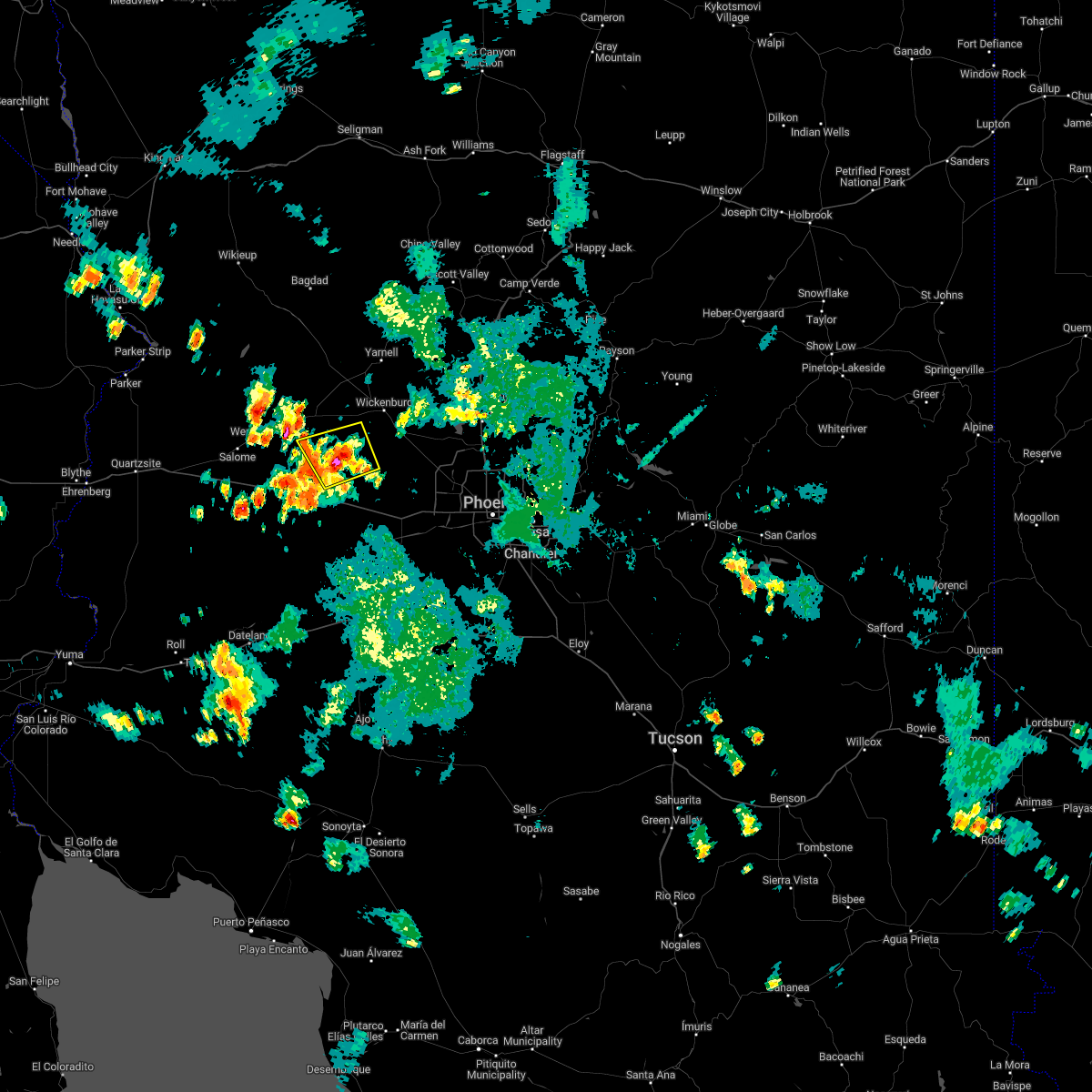 At 509 pm mst, a severe thunderstorm was located 16 miles north of tonopah, moving north at 5 mph (radar indicated). Hazards include 60 mph wind gusts and quarter size hail. Hail damage to vehicles is expected. expect wind damage to roofs, siding, and trees. this severe thunderstorm will remain over mainly rural areas of maricopa county. hail threat, radar indicated max hail size, 1. 00 in wind threat, radar indicated max wind gust, 60 mph. At 509 pm mst, a severe thunderstorm was located 16 miles north of tonopah, moving north at 5 mph (radar indicated). Hazards include 60 mph wind gusts and quarter size hail. Hail damage to vehicles is expected. expect wind damage to roofs, siding, and trees. this severe thunderstorm will remain over mainly rural areas of maricopa county. hail threat, radar indicated max hail size, 1. 00 in wind threat, radar indicated max wind gust, 60 mph.
|
| 8/10/2022 5:03 PM MST |
 At 503 pm mst, a severe thunderstorm was located over white tank mountain park, or 12 miles west of waddell, and is nearly stationary (radar indicated). Hazards include 60 mph wind gusts and penny size hail. expect damage to roofs, siding, and trees At 503 pm mst, a severe thunderstorm was located over white tank mountain park, or 12 miles west of waddell, and is nearly stationary (radar indicated). Hazards include 60 mph wind gusts and penny size hail. expect damage to roofs, siding, and trees
|
| 8/7/2022 9:41 PM MST |
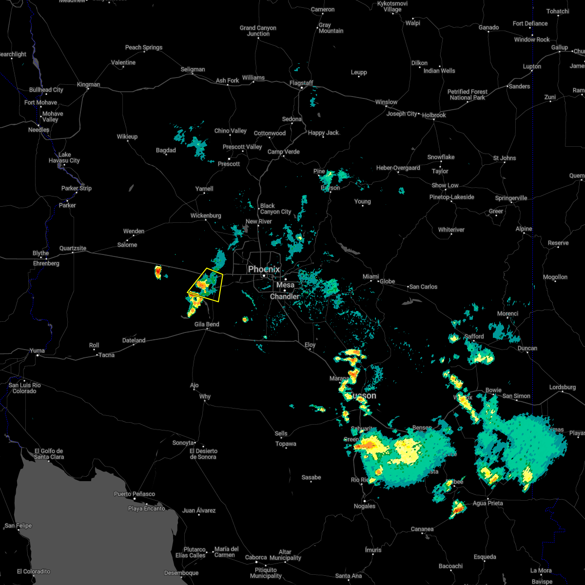 The severe thunderstorm warning for maricopa county will expire at 945 pm mst, the storm which prompted the warning has weakened below severe limits, and no longer poses an immediate threat to life or property. therefore, the warning will be allowed to expire. however small hail, gusty winds and heavy rain are still possible with this thunderstorm. The severe thunderstorm warning for maricopa county will expire at 945 pm mst, the storm which prompted the warning has weakened below severe limits, and no longer poses an immediate threat to life or property. therefore, the warning will be allowed to expire. however small hail, gusty winds and heavy rain are still possible with this thunderstorm.
|
| 8/7/2022 9:16 PM MST |
 At 916 pm mst, a severe thunderstorm was located near palo verde, or near buckeye, moving southwest at 15 mph (radar indicated). Hazards include 60 mph wind gusts and nickel size hail. Expect damage to roofs, siding, and trees. locations impacted include, buckeye, palo verde, hassayampa and arlington. this includes the following highways, az interstate 10 between mile markers 104 and 117. az route 85 between mile markers 140 and 154. hail threat, radar indicated max hail size, 0. 88 in wind threat, radar indicated max wind gust, 60 mph. At 916 pm mst, a severe thunderstorm was located near palo verde, or near buckeye, moving southwest at 15 mph (radar indicated). Hazards include 60 mph wind gusts and nickel size hail. Expect damage to roofs, siding, and trees. locations impacted include, buckeye, palo verde, hassayampa and arlington. this includes the following highways, az interstate 10 between mile markers 104 and 117. az route 85 between mile markers 140 and 154. hail threat, radar indicated max hail size, 0. 88 in wind threat, radar indicated max wind gust, 60 mph.
|
| 8/7/2022 9:15 PM MST | Awos station kbxk buckey in maricopa county AZ, 3.9 miles E of Buckeye, AZ |
| 8/7/2022 9:15 PM MST | Buckeye azmet weather statio in maricopa county AZ, 4 miles ENE of Buckeye, AZ |
| 8/7/2022 9:15 PM MST | Two semis flipped on i-10 westbound causing both lanes to be temporarily blocke in maricopa county AZ, 1.6 miles E of Buckeye, AZ |
| 8/7/2022 8:59 PM MST |
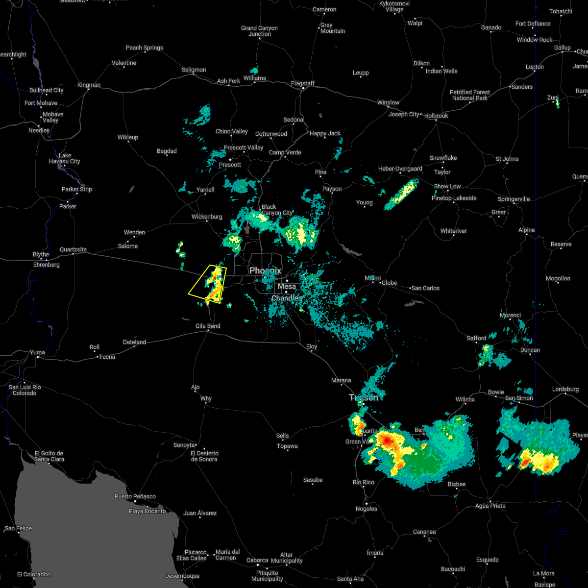 At 859 pm mst, a severe thunderstorm was located near buckeye, moving southwest at 15 mph (radar indicated). Hazards include 60 mph wind gusts and nickel size hail. expect damage to roofs, siding, and trees At 859 pm mst, a severe thunderstorm was located near buckeye, moving southwest at 15 mph (radar indicated). Hazards include 60 mph wind gusts and nickel size hail. expect damage to roofs, siding, and trees
|
| 8/7/2022 8:16 PM MST |
 At 816 pm mst, a severe thunderstorm was located near white tank mountain park, or 7 miles west of waddell, moving south at 5 mph (radar indicated). Hazards include 60 mph wind gusts and nickel size hail. Expect damage to roofs, siding, and trees. locations impacted include, glendale, surprise, avondale, goodyear, buckeye, el mirage, sun city west, waddell, litchfield park, white tank mountain park, luke afb, beardsley, surprise stadium and vistancia. this includes the following highways, az interstate 10 between mile markers 121 and 130. us highway 60 between mile markers 129 and 144. az route 303 between mile markers 105 and 123. hail threat, radar indicated max hail size, 0. 88 in wind threat, radar indicated max wind gust, 60 mph. At 816 pm mst, a severe thunderstorm was located near white tank mountain park, or 7 miles west of waddell, moving south at 5 mph (radar indicated). Hazards include 60 mph wind gusts and nickel size hail. Expect damage to roofs, siding, and trees. locations impacted include, glendale, surprise, avondale, goodyear, buckeye, el mirage, sun city west, waddell, litchfield park, white tank mountain park, luke afb, beardsley, surprise stadium and vistancia. this includes the following highways, az interstate 10 between mile markers 121 and 130. us highway 60 between mile markers 129 and 144. az route 303 between mile markers 105 and 123. hail threat, radar indicated max hail size, 0. 88 in wind threat, radar indicated max wind gust, 60 mph.
|
| 8/7/2022 7:59 PM MST |
 At 759 pm mst, a severe thunderstorm was located near white tank mountain park, or near waddell, moving south at 5 mph (radar indicated). Hazards include 60 mph wind gusts and nickel size hail. expect damage to roofs, siding, and trees At 759 pm mst, a severe thunderstorm was located near white tank mountain park, or near waddell, moving south at 5 mph (radar indicated). Hazards include 60 mph wind gusts and nickel size hail. expect damage to roofs, siding, and trees
|
| 7/17/2022 10:58 PM MST |
 The severe thunderstorm warning for maricopa county will expire at 1100 pm mst, the storms which prompted the warning have weakened below severe limits, and no longer pose an immediate threat to life or property. therefore, the warning will be allowed to expire. however gusty winds are still possible with these thunderstorms. The severe thunderstorm warning for maricopa county will expire at 1100 pm mst, the storms which prompted the warning have weakened below severe limits, and no longer pose an immediate threat to life or property. therefore, the warning will be allowed to expire. however gusty winds are still possible with these thunderstorms.
|
| 7/17/2022 10:49 PM MST |
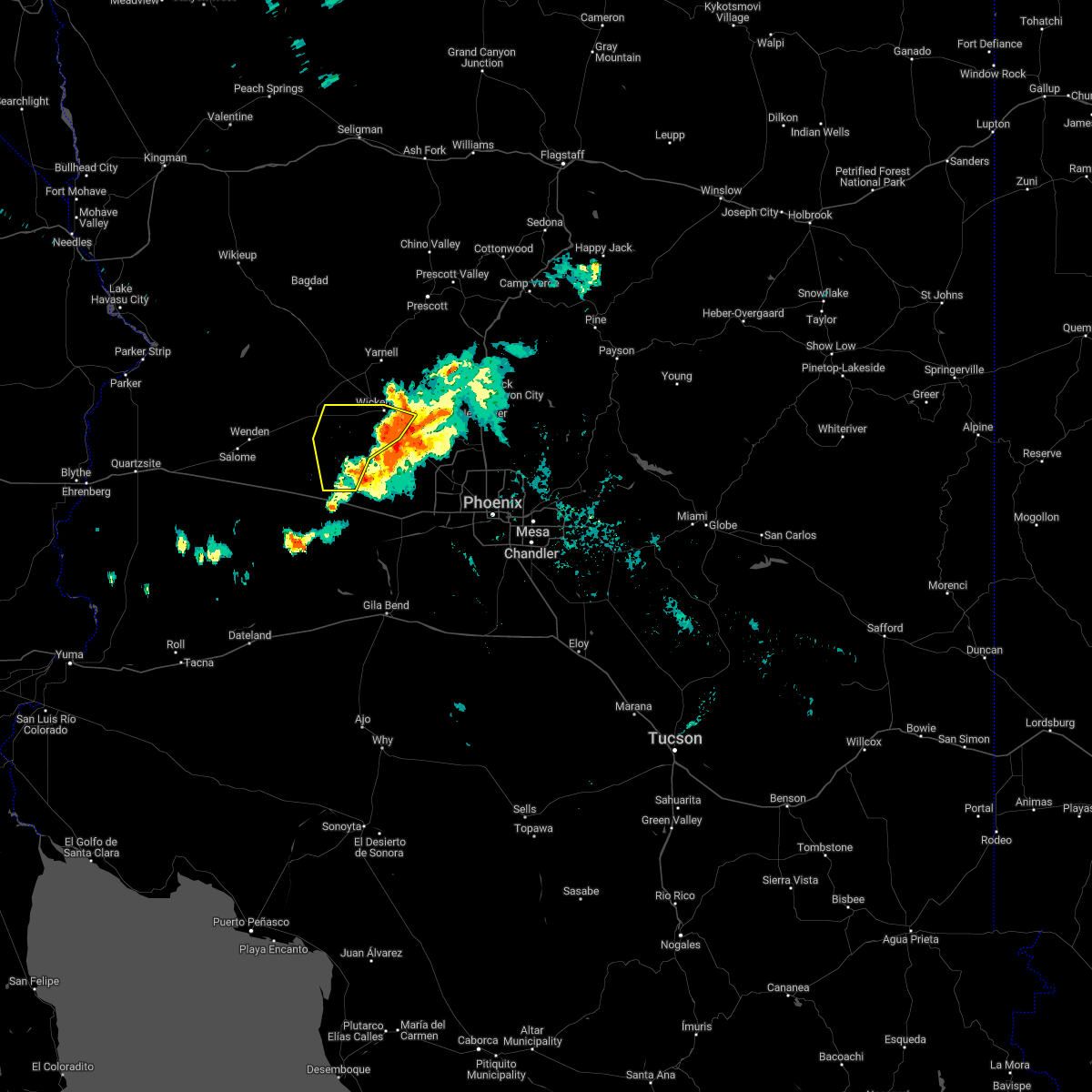 At 1049 pm mst, severe thunderstorms were located along a line extending from near yarnell to 8 miles west of wickenburg to 18 miles southeast of aguila to 8 miles north of tonopah, moving northwest at 35 mph (radar indicated). Hazards include 60 mph wind gusts. Expect damage to roofs, siding, and trees. locations impacted include, wickenburg. this includes the following highways, us highway 60 between mile markers 88 and 121. az route 74 near mile marker 1. hail threat, radar indicated max hail size, <. 75 in wind threat, radar indicated max wind gust, 60 mph. At 1049 pm mst, severe thunderstorms were located along a line extending from near yarnell to 8 miles west of wickenburg to 18 miles southeast of aguila to 8 miles north of tonopah, moving northwest at 35 mph (radar indicated). Hazards include 60 mph wind gusts. Expect damage to roofs, siding, and trees. locations impacted include, wickenburg. this includes the following highways, us highway 60 between mile markers 88 and 121. az route 74 near mile marker 1. hail threat, radar indicated max hail size, <. 75 in wind threat, radar indicated max wind gust, 60 mph.
|
| 7/17/2022 10:40 PM MST |
 At 1040 pm mst, severe thunderstorms were located along a line extending from 7 miles southwest of wagoner to near wickenburg to 19 miles southwest of morristown to 6 miles northeast of tonopah, moving northwest at 35 mph (radar indicated). Hazards include 60 mph wind gusts. Expect damage to roofs, siding, and trees. locations impacted include, wickenburg, wittmann, tonopah, circle city and morristown. this includes the following highways, az interstate 10 between mile markers 85 and 96. us highway 60 between mile markers 88 and 128. az route 74 between mile markers 1 and 9. hail threat, radar indicated max hail size, <. 75 in wind threat, radar indicated max wind gust, 60 mph. At 1040 pm mst, severe thunderstorms were located along a line extending from 7 miles southwest of wagoner to near wickenburg to 19 miles southwest of morristown to 6 miles northeast of tonopah, moving northwest at 35 mph (radar indicated). Hazards include 60 mph wind gusts. Expect damage to roofs, siding, and trees. locations impacted include, wickenburg, wittmann, tonopah, circle city and morristown. this includes the following highways, az interstate 10 between mile markers 85 and 96. us highway 60 between mile markers 88 and 128. az route 74 between mile markers 1 and 9. hail threat, radar indicated max hail size, <. 75 in wind threat, radar indicated max wind gust, 60 mph.
|
| 7/17/2022 10:12 PM MST |
 At 1012 pm mst, severe thunderstorms were located along a line extending from near castle hot springs to near circle city to 9 miles west of white tank mountain park to near buckeye, moving northwest at 35 mph (radar indicated). Hazards include 60 mph wind gusts. expect damage to roofs, siding, and trees At 1012 pm mst, severe thunderstorms were located along a line extending from near castle hot springs to near circle city to 9 miles west of white tank mountain park to near buckeye, moving northwest at 35 mph (radar indicated). Hazards include 60 mph wind gusts. expect damage to roofs, siding, and trees
|
| 7/17/2022 10:10 PM MST |
 At 1010 pm mst, severe thunderstorms were located along a line extending from 7 miles northeast of wittmann to 9 miles south of circle city to 7 miles southwest of white tank mountain park to buckeye, moving west at 25 mph (radar indicated). Hazards include 60 mph wind gusts. Expect damage to roofs, siding, and trees. locations impacted include, surprise, buckeye, sun city west, wittmann, circle city, palo verde, perryville, white tank mountain park, beardsley, morristown, vistancia, hassayampa and arlington. this includes the following highways, az interstate 10 between mile markers 106 and 121. us highway 60 between mile markers 122 and 141. az route 74 between mile markers 2 and 16. hail threat, radar indicated max hail size, <. 75 in wind threat, radar indicated max wind gust, 60 mph. At 1010 pm mst, severe thunderstorms were located along a line extending from 7 miles northeast of wittmann to 9 miles south of circle city to 7 miles southwest of white tank mountain park to buckeye, moving west at 25 mph (radar indicated). Hazards include 60 mph wind gusts. Expect damage to roofs, siding, and trees. locations impacted include, surprise, buckeye, sun city west, wittmann, circle city, palo verde, perryville, white tank mountain park, beardsley, morristown, vistancia, hassayampa and arlington. this includes the following highways, az interstate 10 between mile markers 106 and 121. us highway 60 between mile markers 122 and 141. az route 74 between mile markers 2 and 16. hail threat, radar indicated max hail size, <. 75 in wind threat, radar indicated max wind gust, 60 mph.
|
| 7/17/2022 10:01 PM MST |
 At 1000 pm mst, severe thunderstorms were located along a line extending from 6 miles east of wittmann to 6 miles southwest of white tank mountain park to near liberty, moving northwest at 30 mph (radar indicated). Hazards include 60 mph wind gusts. Expect damage to roofs, siding, and trees. locations impacted include, glendale, peoria, surprise, goodyear, buckeye, el mirage, youngtown, sun city west, waddell, circle city, wittmann, sun city, litchfield park, palo verde and white tank mountain park. this includes the following highways, az interstate 10 between mile markers 106 and 128. us highway 60 between mile markers 122 and 146. az route 74 between mile markers 2 and 16. hail threat, radar indicated max hail size, <. 75 in wind threat, radar indicated max wind gust, 60 mph. At 1000 pm mst, severe thunderstorms were located along a line extending from 6 miles east of wittmann to 6 miles southwest of white tank mountain park to near liberty, moving northwest at 30 mph (radar indicated). Hazards include 60 mph wind gusts. Expect damage to roofs, siding, and trees. locations impacted include, glendale, peoria, surprise, goodyear, buckeye, el mirage, youngtown, sun city west, waddell, circle city, wittmann, sun city, litchfield park, palo verde and white tank mountain park. this includes the following highways, az interstate 10 between mile markers 106 and 128. us highway 60 between mile markers 122 and 146. az route 74 between mile markers 2 and 16. hail threat, radar indicated max hail size, <. 75 in wind threat, radar indicated max wind gust, 60 mph.
|
| 7/17/2022 9:45 PM MST |
 At 944 pm mst, severe thunderstorms were located along a line extending from sun city west to near luke afb to estrella mountain ranch, moving west at 25 mph (radar indicated). Hazards include 60 mph wind gusts. expect damage to roofs, siding, and trees At 944 pm mst, severe thunderstorms were located along a line extending from sun city west to near luke afb to estrella mountain ranch, moving west at 25 mph (radar indicated). Hazards include 60 mph wind gusts. expect damage to roofs, siding, and trees
|
| 7/17/2022 9:31 PM MST |
 At 931 pm mst, severe thunderstorms were located along a line extending from near peoria to luke afb to estrella mountain park, moving northwest at 25 mph (radar indicated). Hazards include 60 mph wind gusts. Expect damage to roofs, siding, and trees. locations impacted include, phoenix, glendale, peoria, surprise, avondale, goodyear, buckeye, el mirage, tolleson, youngtown, sun city west, waddell, laveen, cashion and sun city. this includes the following highways, az interstate 10 between mile markers 117 and 143. az interstate 17 between mile markers 198 and 222. us highway 60 between mile markers 131 and 160. hail threat, radar indicated max hail size, <. 75 in wind threat, radar indicated max wind gust, 60 mph. At 931 pm mst, severe thunderstorms were located along a line extending from near peoria to luke afb to estrella mountain park, moving northwest at 25 mph (radar indicated). Hazards include 60 mph wind gusts. Expect damage to roofs, siding, and trees. locations impacted include, phoenix, glendale, peoria, surprise, avondale, goodyear, buckeye, el mirage, tolleson, youngtown, sun city west, waddell, laveen, cashion and sun city. this includes the following highways, az interstate 10 between mile markers 117 and 143. az interstate 17 between mile markers 198 and 222. us highway 60 between mile markers 131 and 160. hail threat, radar indicated max hail size, <. 75 in wind threat, radar indicated max wind gust, 60 mph.
|
| 7/17/2022 9:16 PM MST |
 At 916 pm mst, severe thunderstorms were located along a line extending from near deer valley airport to near downtown peoria to near tolleson, moving west at 30 mph (radar indicated). Hazards include 60 mph wind gusts. Expect damage to roofs, siding, and trees. locations impacted include, phoenix, chandler, glendale, scottsdale, tempe, peoria, surprise, avondale, goodyear, buckeye, el mirage, paradise valley, tolleson, youngtown and waddell. this includes the following highways, az interstate 10 between mile markers 117 and 161. az interstate 17 between mile markers 195 and 222. az route 51 between mile markers 1 and 15. hail threat, radar indicated max hail size, <. 75 in wind threat, radar indicated max wind gust, 60 mph. At 916 pm mst, severe thunderstorms were located along a line extending from near deer valley airport to near downtown peoria to near tolleson, moving west at 30 mph (radar indicated). Hazards include 60 mph wind gusts. Expect damage to roofs, siding, and trees. locations impacted include, phoenix, chandler, glendale, scottsdale, tempe, peoria, surprise, avondale, goodyear, buckeye, el mirage, paradise valley, tolleson, youngtown and waddell. this includes the following highways, az interstate 10 between mile markers 117 and 161. az interstate 17 between mile markers 195 and 222. az route 51 between mile markers 1 and 15. hail threat, radar indicated max hail size, <. 75 in wind threat, radar indicated max wind gust, 60 mph.
|
| 7/17/2022 8:58 PM MST |
 At 858 pm mst, severe thunderstorms were located along a line extending from desert ridge marketplace to metro center mall to south mountain park, moving west at 30 mph (radar indicated). Hazards include 60 mph wind gusts. expect damage to roofs, siding, and trees At 858 pm mst, severe thunderstorms were located along a line extending from desert ridge marketplace to metro center mall to south mountain park, moving west at 30 mph (radar indicated). Hazards include 60 mph wind gusts. expect damage to roofs, siding, and trees
|
| 7/16/2022 9:05 PM MST |
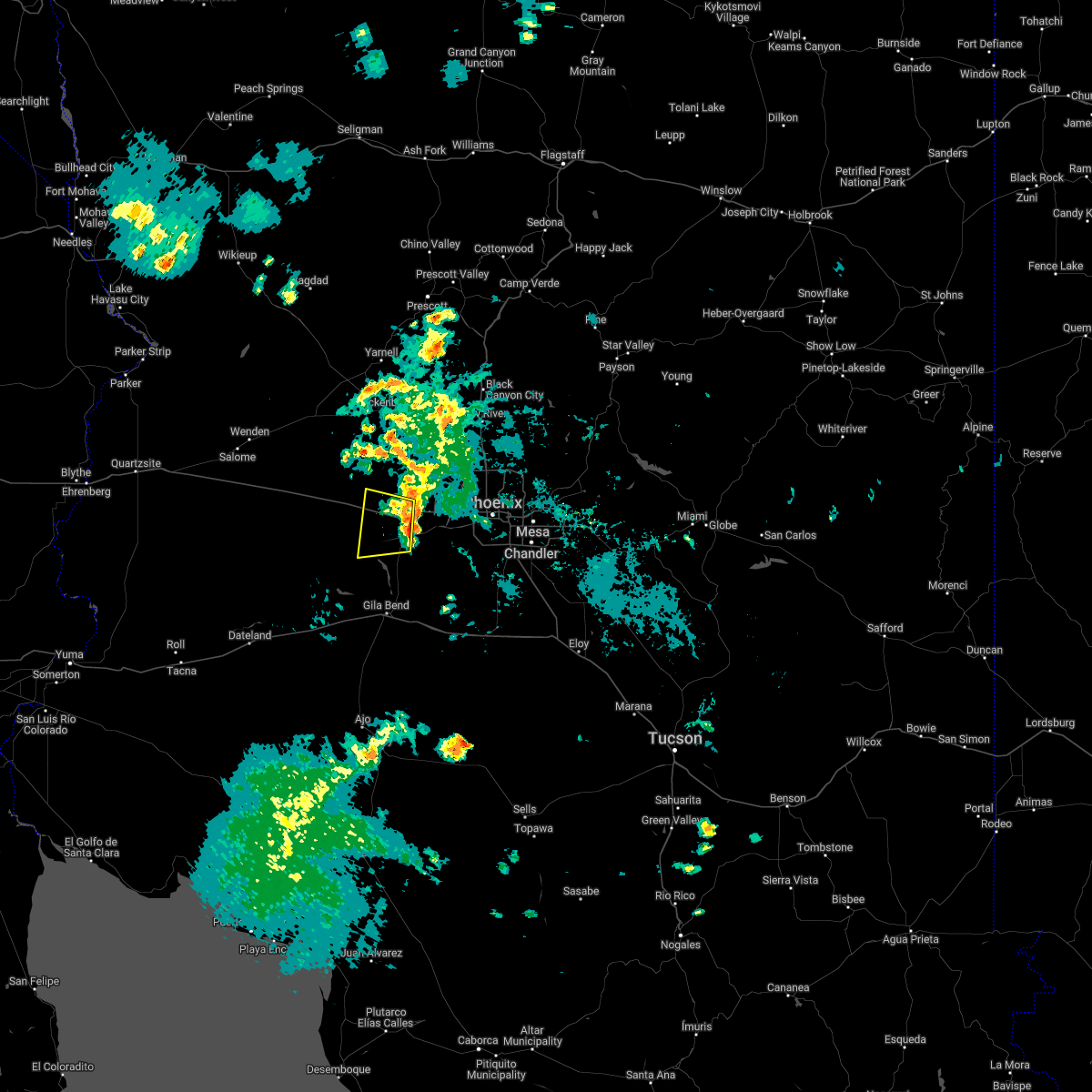 At 904 pm mst, a severe thunderstorm was located near palo verde, or near buckeye, moving west at 20 mph (radar indicated). Hazards include 60 mph wind gusts. Expect damage to roofs, siding, and trees. locations impacted include, buckeye, palo verde, palo verde nuclear generation station, hassayampa and arlington. this includes the following highways, az interstate 10 between mile markers 100 and 117. az route 85 between mile markers 143 and 154. hail threat, radar indicated max hail size, <. 75 in wind threat, radar indicated max wind gust, 60 mph. At 904 pm mst, a severe thunderstorm was located near palo verde, or near buckeye, moving west at 20 mph (radar indicated). Hazards include 60 mph wind gusts. Expect damage to roofs, siding, and trees. locations impacted include, buckeye, palo verde, palo verde nuclear generation station, hassayampa and arlington. this includes the following highways, az interstate 10 between mile markers 100 and 117. az route 85 between mile markers 143 and 154. hail threat, radar indicated max hail size, <. 75 in wind threat, radar indicated max wind gust, 60 mph.
|
| 7/16/2022 8:48 PM MST |
 At 848 pm mst, a severe thunderstorm was located over buckeye, moving west at 30 mph (radar indicated). Hazards include 60 mph wind gusts. Expect damage to roofs, siding, and trees. locations impacted include, buckeye, palo verde, perryville, liberty, palo verde nuclear generation station, hassayampa and arlington. this includes the following highways, az interstate 10 between mile markers 100 and 122. az route 85 between mile markers 143 and 154. hail threat, radar indicated max hail size, <. 75 in wind threat, radar indicated max wind gust, 60 mph. At 848 pm mst, a severe thunderstorm was located over buckeye, moving west at 30 mph (radar indicated). Hazards include 60 mph wind gusts. Expect damage to roofs, siding, and trees. locations impacted include, buckeye, palo verde, perryville, liberty, palo verde nuclear generation station, hassayampa and arlington. this includes the following highways, az interstate 10 between mile markers 100 and 122. az route 85 between mile markers 143 and 154. hail threat, radar indicated max hail size, <. 75 in wind threat, radar indicated max wind gust, 60 mph.
|
| 7/16/2022 8:32 PM MST |
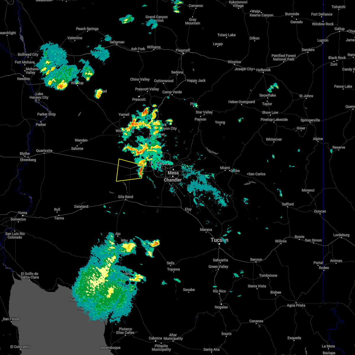 At 832 pm mst, a severe thunderstorm was located near liberty, or near buckeye, moving west at 20 mph (radar indicated). Hazards include 60 mph wind gusts. expect damage to roofs, siding, and trees At 832 pm mst, a severe thunderstorm was located near liberty, or near buckeye, moving west at 20 mph (radar indicated). Hazards include 60 mph wind gusts. expect damage to roofs, siding, and trees
|
| 7/16/2022 8:06 PM MST |
 At 806 pm mst, a severe thunderstorm was located over beardsley, or over sun city west, moving west at 15 mph (radar indicated). Hazards include 60 mph wind gusts. Expect damage to roofs, siding, and trees. locations impacted include, surprise, el mirage, youngtown, wittmann, sun city west, sun city, waddell, surprise stadium, white tank mountain park, beardsley and vistancia. this includes the following highways, us highway 60 between mile markers 125 and 148. az route 74 between mile markers 4 and 12. az route 303 between mile markers 112 and 129. hail threat, radar indicated max hail size, <. 75 in wind threat, radar indicated max wind gust, 60 mph. At 806 pm mst, a severe thunderstorm was located over beardsley, or over sun city west, moving west at 15 mph (radar indicated). Hazards include 60 mph wind gusts. Expect damage to roofs, siding, and trees. locations impacted include, surprise, el mirage, youngtown, wittmann, sun city west, sun city, waddell, surprise stadium, white tank mountain park, beardsley and vistancia. this includes the following highways, us highway 60 between mile markers 125 and 148. az route 74 between mile markers 4 and 12. az route 303 between mile markers 112 and 129. hail threat, radar indicated max hail size, <. 75 in wind threat, radar indicated max wind gust, 60 mph.
|
| 7/16/2022 7:47 PM MST |
 At 747 pm mst, a severe thunderstorm was located over surprise, moving west at 15 mph (radar indicated). Hazards include 60 mph wind gusts. expect damage to roofs, siding, and trees At 747 pm mst, a severe thunderstorm was located over surprise, moving west at 15 mph (radar indicated). Hazards include 60 mph wind gusts. expect damage to roofs, siding, and trees
|
| 10/5/2021 5:10 PM MST |
 At 510 pm mst, a severe thunderstorm was located 11 miles north of estrella, or 17 miles south of goodyear, moving northeast at 25 mph (radar indicated). Hazards include two inch hail and 60 mph wind gusts. People and animals outdoors will be injured. expect hail damage to roofs, siding, windows, and vehicles. expect wind damage to roofs, siding, and trees. Locations impacted include, avondale, goodyear and rainbow valley. At 510 pm mst, a severe thunderstorm was located 11 miles north of estrella, or 17 miles south of goodyear, moving northeast at 25 mph (radar indicated). Hazards include two inch hail and 60 mph wind gusts. People and animals outdoors will be injured. expect hail damage to roofs, siding, windows, and vehicles. expect wind damage to roofs, siding, and trees. Locations impacted include, avondale, goodyear and rainbow valley.
|
| 10/5/2021 5:05 PM MST |
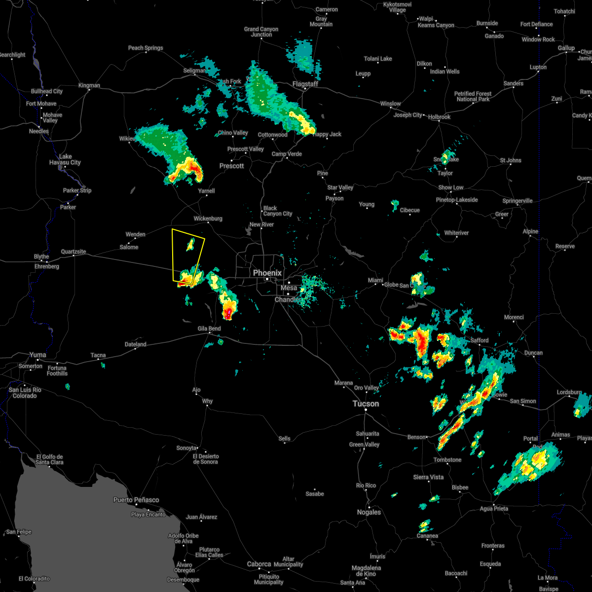 At 505 pm mst, a severe thunderstorm was located near tonopah, moving north at 40 mph (radar indicated). Hazards include 60 mph wind gusts and quarter size hail. Hail damage to vehicles is expected. Expect wind damage to roofs, siding, and trees. At 505 pm mst, a severe thunderstorm was located near tonopah, moving north at 40 mph (radar indicated). Hazards include 60 mph wind gusts and quarter size hail. Hail damage to vehicles is expected. Expect wind damage to roofs, siding, and trees.
|
| 10/5/2021 4:59 PM MST |
 At 459 pm mst, a severe thunderstorm was located 8 miles northeast of cotton center, or 15 miles northeast of gila bend, moving northeast at 20 mph (radar indicated). Hazards include golf ball size hail and 60 mph wind gusts. People and animals outdoors will be injured. expect hail damage to roofs, siding, windows, and vehicles. expect wind damage to roofs, siding, and trees. Locations impacted include, avondale, goodyear, estrella mountain ranch and rainbow valley. At 459 pm mst, a severe thunderstorm was located 8 miles northeast of cotton center, or 15 miles northeast of gila bend, moving northeast at 20 mph (radar indicated). Hazards include golf ball size hail and 60 mph wind gusts. People and animals outdoors will be injured. expect hail damage to roofs, siding, windows, and vehicles. expect wind damage to roofs, siding, and trees. Locations impacted include, avondale, goodyear, estrella mountain ranch and rainbow valley.
|
| 10/5/2021 4:41 PM MST |
 At 441 pm mst, a severe thunderstorm was located near cotton center, or 9 miles northeast of gila bend, moving northeast at 20 mph (radar indicated). Hazards include 60 mph wind gusts and half dollar size hail. Hail damage to vehicles is expected. Expect wind damage to roofs, siding, and trees. At 441 pm mst, a severe thunderstorm was located near cotton center, or 9 miles northeast of gila bend, moving northeast at 20 mph (radar indicated). Hazards include 60 mph wind gusts and half dollar size hail. Hail damage to vehicles is expected. Expect wind damage to roofs, siding, and trees.
|
| 10/5/2021 4:29 PM MST |
 At 429 pm mst, a severe thunderstorm was located over gila bend, moving northeast at 25 mph (radar indicated). Hazards include 60 mph wind gusts and half dollar size hail. Hail damage to vehicles is expected. expect wind damage to roofs, siding, and trees. locations impacted include, gila bend and cotton center. this includes the following highways, az interstate 8 between mile markers 113 and 119. az route 238 between mile markers 1 and 2. Az route 85 between mile markers 1 and 3, and between mile markers 119 and 134. At 429 pm mst, a severe thunderstorm was located over gila bend, moving northeast at 25 mph (radar indicated). Hazards include 60 mph wind gusts and half dollar size hail. Hail damage to vehicles is expected. expect wind damage to roofs, siding, and trees. locations impacted include, gila bend and cotton center. this includes the following highways, az interstate 8 between mile markers 113 and 119. az route 238 between mile markers 1 and 2. Az route 85 between mile markers 1 and 3, and between mile markers 119 and 134.
|
| 10/5/2021 4:06 PM MST |
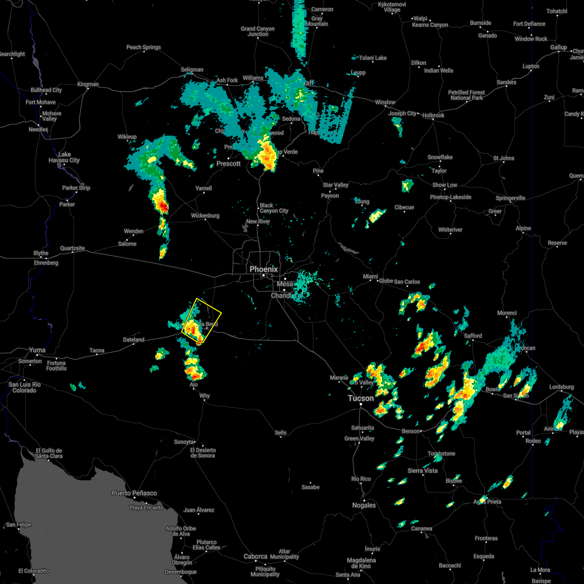 At 405 pm mst, a severe thunderstorm was located 7 miles northwest of gila bend auxiliary field, or 9 miles west of gila bend, moving northeast at 25 mph (radar indicated). Hazards include 60 mph wind gusts and quarter size hail. Hail damage to vehicles is expected. Expect wind damage to roofs, siding, and trees. At 405 pm mst, a severe thunderstorm was located 7 miles northwest of gila bend auxiliary field, or 9 miles west of gila bend, moving northeast at 25 mph (radar indicated). Hazards include 60 mph wind gusts and quarter size hail. Hail damage to vehicles is expected. Expect wind damage to roofs, siding, and trees.
|
| 8/17/2021 12:09 AM MST |
 At 1209 am mst, severe thunderstorms were located along a line extending from near palo verde nuclear generation station to near cotton center to near gila bend to 9 miles southwest of big horn to near kaka, moving southwest at 35 mph (radar indicated). Hazards include 60 mph wind gusts. Expect damage to roofs, siding, and trees. locations impacted include, avondale, goodyear, buckeye, gila bend, maricopa, estrella, palo verde, big horn, cotton center, liberty, estrella sailport, estrella mountain park, palo verde nuclear generation station, estrella mountain ranch and bosque. this includes the following highways, az interstate 8 between mile markers 100 and 173. az route 238 between mile markers 1 and 41. az route 85 between mile markers 1 and 16, and between mile markers 119 and 153. hail threat, radar indicated max hail size, <. 75 in wind threat, radar indicated max wind gust, 60 mph. At 1209 am mst, severe thunderstorms were located along a line extending from near palo verde nuclear generation station to near cotton center to near gila bend to 9 miles southwest of big horn to near kaka, moving southwest at 35 mph (radar indicated). Hazards include 60 mph wind gusts. Expect damage to roofs, siding, and trees. locations impacted include, avondale, goodyear, buckeye, gila bend, maricopa, estrella, palo verde, big horn, cotton center, liberty, estrella sailport, estrella mountain park, palo verde nuclear generation station, estrella mountain ranch and bosque. this includes the following highways, az interstate 8 between mile markers 100 and 173. az route 238 between mile markers 1 and 41. az route 85 between mile markers 1 and 16, and between mile markers 119 and 153. hail threat, radar indicated max hail size, <. 75 in wind threat, radar indicated max wind gust, 60 mph.
|
| 8/16/2021 11:41 PM MST |
 At 1140 pm mst, severe thunderstorms were located along a line extending from near white tank mountain park to near palo verde to 10 miles northeast of cotton center to near estrella to 11 miles west of chui-chu, moving southwest at 35 mph (radar indicated). Hazards include 70 mph wind gusts and nickel size hail. Expect considerable tree damage. Damage is likely to mobile homes, roofs, and outbuildings. At 1140 pm mst, severe thunderstorms were located along a line extending from near white tank mountain park to near palo verde to 10 miles northeast of cotton center to near estrella to 11 miles west of chui-chu, moving southwest at 35 mph (radar indicated). Hazards include 70 mph wind gusts and nickel size hail. Expect considerable tree damage. Damage is likely to mobile homes, roofs, and outbuildings.
|
| 8/16/2021 11:33 PM MST |
 At 1133 pm mst, severe thunderstorms were located along a line extending from near white tank mountain park to near liberty to 9 miles south of estrella mountain ranch to 7 miles west of estrella sailport to 8 miles northwest of chui-chu, moving southwest at 35 mph (radar indicated). Hazards include 70 mph wind gusts and nickel size hail. Expect considerable tree damage. damage is likely to mobile homes, roofs, and outbuildings. locations impacted include, phoenix, mesa, chandler, glendale, scottsdale, gilbert, tempe, peoria, surprise, avondale, goodyear, buckeye, casa grande, el mirage and paradise valley. this includes the following highways, az interstate 10 between mile markers 117 and 204. az interstate 17 between mile markers 195 and 219. az interstate 8 between mile markers 146 and 178. thunderstorm damage threat, considerable hail threat, radar indicated max hail size, 0. 88 in wind threat, radar indicated max wind gust, 70 mph. At 1133 pm mst, severe thunderstorms were located along a line extending from near white tank mountain park to near liberty to 9 miles south of estrella mountain ranch to 7 miles west of estrella sailport to 8 miles northwest of chui-chu, moving southwest at 35 mph (radar indicated). Hazards include 70 mph wind gusts and nickel size hail. Expect considerable tree damage. damage is likely to mobile homes, roofs, and outbuildings. locations impacted include, phoenix, mesa, chandler, glendale, scottsdale, gilbert, tempe, peoria, surprise, avondale, goodyear, buckeye, casa grande, el mirage and paradise valley. this includes the following highways, az interstate 10 between mile markers 117 and 204. az interstate 17 between mile markers 195 and 219. az interstate 8 between mile markers 146 and 178. thunderstorm damage threat, considerable hail threat, radar indicated max hail size, 0. 88 in wind threat, radar indicated max wind gust, 70 mph.
|
| 8/16/2021 10:54 PM MST |
 At 1054 pm mst, severe thunderstorms were located along a line extending from near deer valley airport to arizona state fairgrounds to south phoenix to 6 miles east of bapchule, moving southwest at 30 mph. these are destructive storms for phoenix metro area (radar indicated). Hazards include 80 mph wind gusts and quarter size hail. Flying debris will be dangerous to those caught without shelter. mobile homes will be heavily damaged. expect considerable damage to roofs, windows, and vehicles. Extensive tree damage and power outages are likely. At 1054 pm mst, severe thunderstorms were located along a line extending from near deer valley airport to arizona state fairgrounds to south phoenix to 6 miles east of bapchule, moving southwest at 30 mph. these are destructive storms for phoenix metro area (radar indicated). Hazards include 80 mph wind gusts and quarter size hail. Flying debris will be dangerous to those caught without shelter. mobile homes will be heavily damaged. expect considerable damage to roofs, windows, and vehicles. Extensive tree damage and power outages are likely.
|
| 8/16/2021 12:49 AM MST |
 At 1248 am mst, a severe thunderstorm was located near aguila, or 19 miles west of wickenburg, moving southwest at 40 mph (radar indicated). Hazards include 60 mph wind gusts and penny size hail. expect damage to roofs, siding, and trees At 1248 am mst, a severe thunderstorm was located near aguila, or 19 miles west of wickenburg, moving southwest at 40 mph (radar indicated). Hazards include 60 mph wind gusts and penny size hail. expect damage to roofs, siding, and trees
|
| 8/13/2021 10:16 PM MST |
 At 1016 pm mst, a severe thunderstorm was located over metro center mall, or near glendale, moving west at 20 mph (radar indicated). Hazards include 60 mph wind gusts and nickel size hail. expect damage to roofs, siding, and trees At 1016 pm mst, a severe thunderstorm was located over metro center mall, or near glendale, moving west at 20 mph (radar indicated). Hazards include 60 mph wind gusts and nickel size hail. expect damage to roofs, siding, and trees
|
| 8/13/2021 10:08 PM MST |
 At 1007 pm mst, severe thunderstorms were located along a line extending from near congress to near wickenburg to near morristown, moving east at 35 mph (radar indicated). Hazards include 60 mph wind gusts and nickel size hail. Expect damage to roofs, siding, and trees. locations impacted include, wickenburg, wittmann, circle city, morristown and aguila. this includes the following highways, us highway 60 between mile markers 83 and 131. az route 74 between mile markers 1 and 10. hail threat, radar indicated max hail size, 0. 88 in wind threat, radar indicated max wind gust, 60 mph. At 1007 pm mst, severe thunderstorms were located along a line extending from near congress to near wickenburg to near morristown, moving east at 35 mph (radar indicated). Hazards include 60 mph wind gusts and nickel size hail. Expect damage to roofs, siding, and trees. locations impacted include, wickenburg, wittmann, circle city, morristown and aguila. this includes the following highways, us highway 60 between mile markers 83 and 131. az route 74 between mile markers 1 and 10. hail threat, radar indicated max hail size, 0. 88 in wind threat, radar indicated max wind gust, 60 mph.
|
| 8/13/2021 9:38 PM MST |
 At 938 pm mst, severe thunderstorms were located along a line extending from near walnut grove to 11 miles west of castle hot springs to 6 miles west of lake pleasant, moving west at 35 mph (radar indicated). Hazards include 60 mph wind gusts and nickel size hail. expect damage to roofs, siding, and trees At 938 pm mst, severe thunderstorms were located along a line extending from near walnut grove to 11 miles west of castle hot springs to 6 miles west of lake pleasant, moving west at 35 mph (radar indicated). Hazards include 60 mph wind gusts and nickel size hail. expect damage to roofs, siding, and trees
|
| 8/11/2021 6:51 PM MST |
 At 650 pm mst, a severe thunderstorm was located over avondale, moving east at 10 mph (radar indicated). Hazards include 60 mph wind gusts. small hail. Expect damage to roofs, siding, and trees. locations impacted include, glendale, avondale, goodyear, buckeye, el mirage, tolleson, youngtown, cashion, sun city, litchfield park, and luke afb. this includes the following highways, az interstate 10 between mile markers 120 and 134. az route 101 near mile marker 2. Az route 303 between mile markers 105 and 110. At 650 pm mst, a severe thunderstorm was located over avondale, moving east at 10 mph (radar indicated). Hazards include 60 mph wind gusts. small hail. Expect damage to roofs, siding, and trees. locations impacted include, glendale, avondale, goodyear, buckeye, el mirage, tolleson, youngtown, cashion, sun city, litchfield park, and luke afb. this includes the following highways, az interstate 10 between mile markers 120 and 134. az route 101 near mile marker 2. Az route 303 between mile markers 105 and 110.
|
| 8/11/2021 6:22 PM MST |
 At 621 pm mst, a severe thunderstorm was located over goodyear, moving east at 10 mph (radar indicated). Hazards include 60 mph wind gusts and nickel size hail. Expect damage to roofs, siding, and trees. locations impacted include, glendale, avondale, goodyear, buckeye, el mirage, tolleson, youngtown, sun city, litchfield park, west phoenix, and luke afb. this includes the following highways, az interstate 10 between mile markers 120 and 134. az route 101 near mile marker 2. Az route 303 between mile markers 105 and 110. At 621 pm mst, a severe thunderstorm was located over goodyear, moving east at 10 mph (radar indicated). Hazards include 60 mph wind gusts and nickel size hail. Expect damage to roofs, siding, and trees. locations impacted include, glendale, avondale, goodyear, buckeye, el mirage, tolleson, youngtown, sun city, litchfield park, west phoenix, and luke afb. this includes the following highways, az interstate 10 between mile markers 120 and 134. az route 101 near mile marker 2. Az route 303 between mile markers 105 and 110.
|
| 8/11/2021 6:19 PM MST |
 At 618 pm mst, a severe thunderstorm was located over goodyear, moving east at 10 mph (radar indicated). Hazards include 60 mph wind gusts. small hail. expect damage to roofs, siding, and trees At 618 pm mst, a severe thunderstorm was located over goodyear, moving east at 10 mph (radar indicated). Hazards include 60 mph wind gusts. small hail. expect damage to roofs, siding, and trees
|
| 8/11/2021 6:09 PM MST |
 At 609 pm mst, a severe thunderstorm was located 7 miles northwest of estrella sailport, or 17 miles south of laveen, moving northeast at 15 mph (radar indicated). Hazards include 60 mph wind gusts. Expect damage to roofs, siding, and trees. locations impacted include, maricopa, estrella, estrella sailport, sonoran national monument, rainbow valley, ak-chin village and mobile. this includes the following highways, az route 238 between mile markers 9 and 42. Az route 347 between mile markers 168 and 172. At 609 pm mst, a severe thunderstorm was located 7 miles northwest of estrella sailport, or 17 miles south of laveen, moving northeast at 15 mph (radar indicated). Hazards include 60 mph wind gusts. Expect damage to roofs, siding, and trees. locations impacted include, maricopa, estrella, estrella sailport, sonoran national monument, rainbow valley, ak-chin village and mobile. this includes the following highways, az route 238 between mile markers 9 and 42. Az route 347 between mile markers 168 and 172.
|
| 8/11/2021 5:56 PM MST |
 At 555 pm mst, a severe thunderstorm was located 8 miles northwest of estrella sailport, or 19 miles south of avondale, moving northeast at 15 mph (radar indicated). Hazards include 60 mph wind gusts and nickel size hail. Expect damage to roofs, siding, and trees. locations impacted include, south avondale, south goodyear, gila bend, city of maricopa, rainbow valley, ak-chin village and mobile. this includes the following highways, az interstate 8 between mile markers 116 and 133. az route 238 between mile markers 1 and 42. Az route 85 between mile markers 2 and 5, and between mile markers 119 and 130. At 555 pm mst, a severe thunderstorm was located 8 miles northwest of estrella sailport, or 19 miles south of avondale, moving northeast at 15 mph (radar indicated). Hazards include 60 mph wind gusts and nickel size hail. Expect damage to roofs, siding, and trees. locations impacted include, south avondale, south goodyear, gila bend, city of maricopa, rainbow valley, ak-chin village and mobile. this includes the following highways, az interstate 8 between mile markers 116 and 133. az route 238 between mile markers 1 and 42. Az route 85 between mile markers 2 and 5, and between mile markers 119 and 130.
|
| 8/11/2021 5:30 PM MST |
 At 529 pm mst, a severe thunderstorm was located near estrella, or 19 miles northeast of gila bend, moving northeast at 15 mph (radar indicated). Hazards include 60 mph wind gusts and nickel size hail. expect damage to roofs, siding, and trees At 529 pm mst, a severe thunderstorm was located near estrella, or 19 miles northeast of gila bend, moving northeast at 15 mph (radar indicated). Hazards include 60 mph wind gusts and nickel size hail. expect damage to roofs, siding, and trees
|
| 8/10/2021 5:08 PM MST |
 At 506 pm mst, a severe thunderstorm was located near wickenburg, moving southwest at 10 mph (radar indicated). Hazards include 60 mph wind gusts. small hail. Expect damage to roofs, siding, and trees. locations impacted include, wickenburg, circle city and morristown. this includes the following highways, us highway 60 between mile markers 100 and 127. Az route 74 between mile markers 1 and 7. At 506 pm mst, a severe thunderstorm was located near wickenburg, moving southwest at 10 mph (radar indicated). Hazards include 60 mph wind gusts. small hail. Expect damage to roofs, siding, and trees. locations impacted include, wickenburg, circle city and morristown. this includes the following highways, us highway 60 between mile markers 100 and 127. Az route 74 between mile markers 1 and 7.
|
| 8/10/2021 4:56 PM MST |
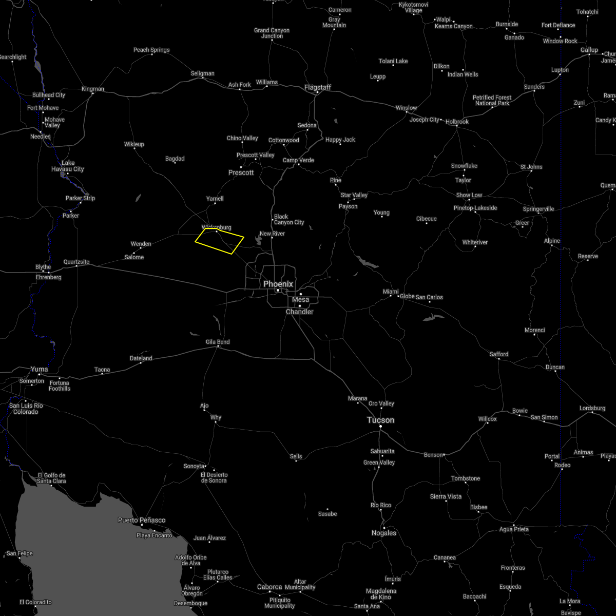 At 456 pm mst, a severe thunderstorm was located near wickenburg, moving southwest at 10 mph (radar indicated). Hazards include 60 mph wind gusts. small hail. expect damage to roofs, siding, and trees At 456 pm mst, a severe thunderstorm was located near wickenburg, moving southwest at 10 mph (radar indicated). Hazards include 60 mph wind gusts. small hail. expect damage to roofs, siding, and trees
|
| 7/22/2021 3:58 PM MST |
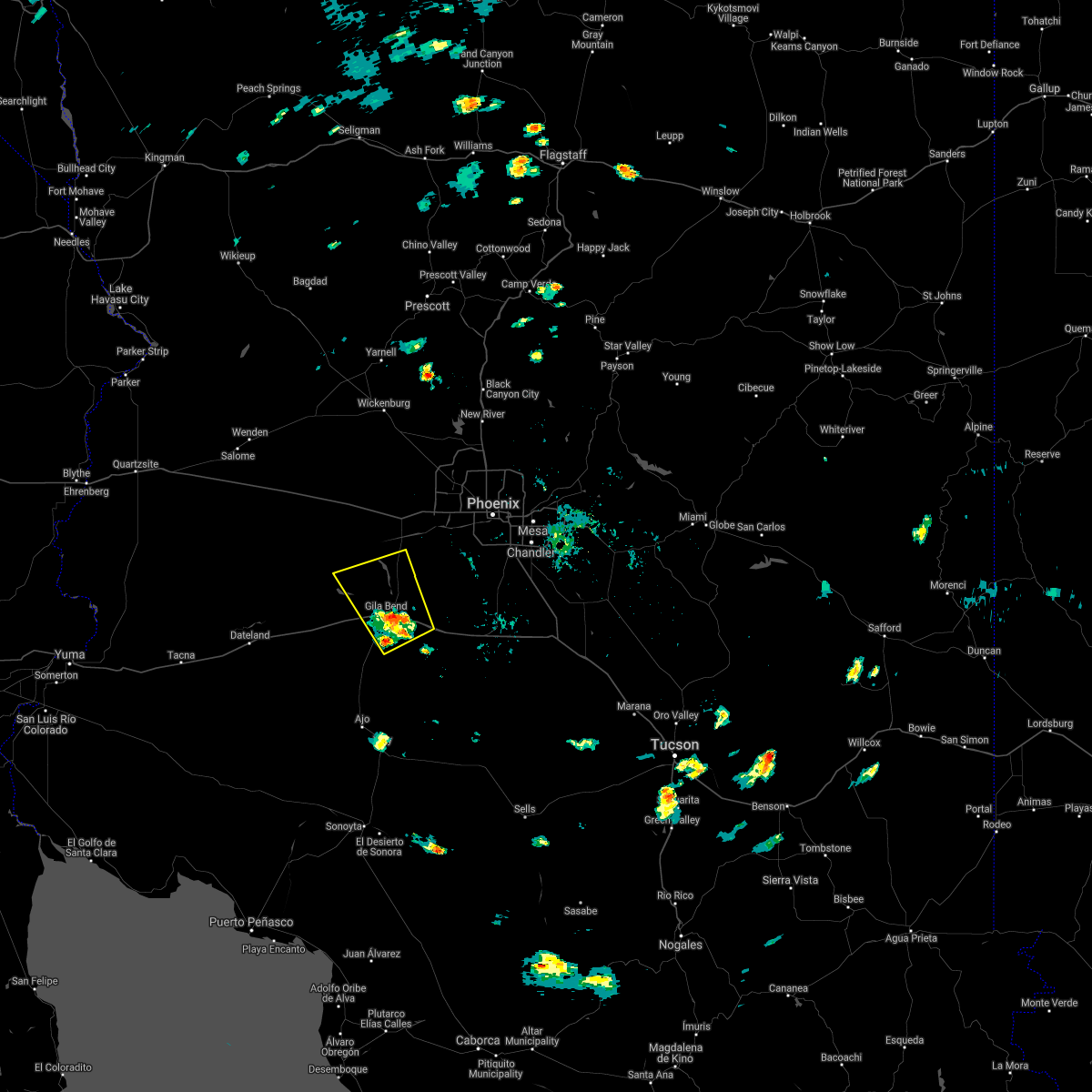 At 357 pm mst, a severe thunderstorm was located over gila bend, moving northwest at 20 mph (radar indicated). Hazards include 60 mph wind gusts. expect damage to roofs, siding, and trees At 357 pm mst, a severe thunderstorm was located over gila bend, moving northwest at 20 mph (radar indicated). Hazards include 60 mph wind gusts. expect damage to roofs, siding, and trees
|
| 7/21/2021 4:08 PM MST |
 At 407 pm mst, a severe thunderstorm was located over estrella mountain ranch, or near goodyear, and is nearly stationary (radar indicated). Hazards include 60 mph wind gusts. Expect damage to roofs, siding, and trees. locations impacted include, avondale, goodyear, buckeye, litchfield park, perryville, liberty, estrella mountain park and estrella mountain ranch. this includes the following highways, az interstate 10 between mile markers 114 and 128. Az route 303 between mile markers 105 and 107. At 407 pm mst, a severe thunderstorm was located over estrella mountain ranch, or near goodyear, and is nearly stationary (radar indicated). Hazards include 60 mph wind gusts. Expect damage to roofs, siding, and trees. locations impacted include, avondale, goodyear, buckeye, litchfield park, perryville, liberty, estrella mountain park and estrella mountain ranch. this includes the following highways, az interstate 10 between mile markers 114 and 128. Az route 303 between mile markers 105 and 107.
|
| 7/21/2021 3:53 PM MST |
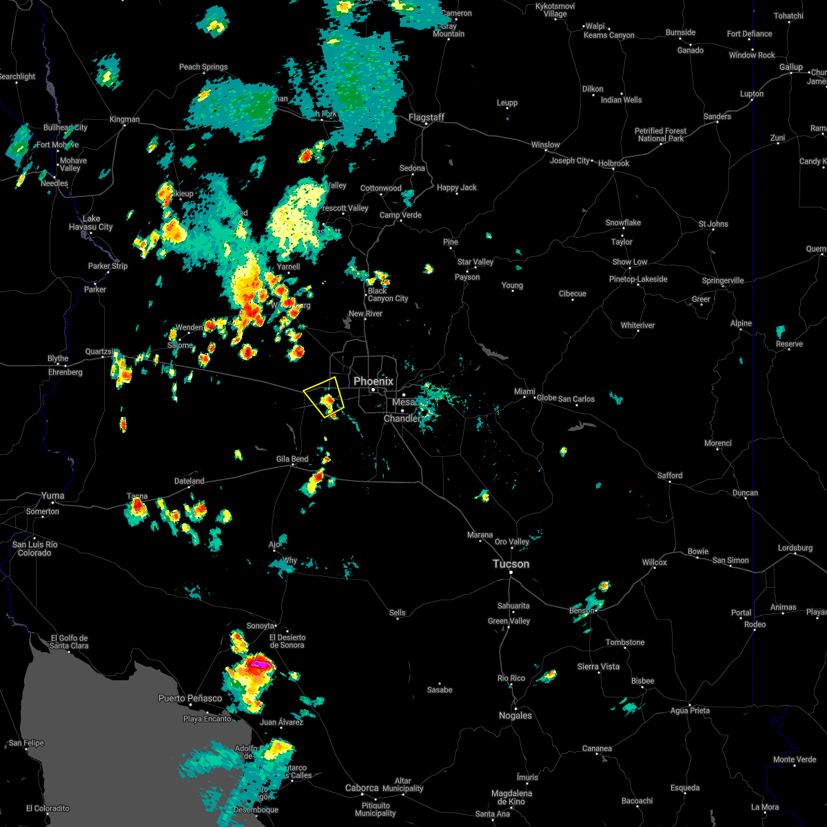 At 353 pm mst, a severe thunderstorm was located near goodyear, moving northwest at 5 mph (radar indicated). Hazards include 60 mph wind gusts. expect damage to roofs, siding, and trees At 353 pm mst, a severe thunderstorm was located near goodyear, moving northwest at 5 mph (radar indicated). Hazards include 60 mph wind gusts. expect damage to roofs, siding, and trees
|
| 7/10/2021 9:00 PM MST |
 At 859 pm mst, the leading edge of strong outflow winds from strong thunderstorms were located along a line extending from 10 miles south of estrella mountain ranch to estrella to freeman, moving west at 40 mph (radar indicated). Hazards include 60 mph wind gusts. expect damage to roofs, siding, and trees At 859 pm mst, the leading edge of strong outflow winds from strong thunderstorms were located along a line extending from 10 miles south of estrella mountain ranch to estrella to freeman, moving west at 40 mph (radar indicated). Hazards include 60 mph wind gusts. expect damage to roofs, siding, and trees
|
| 7/10/2021 8:41 PM MST |
 At 840 pm mst, the leading edge of very strong outflow winds from thunderstorms was located along a line extending from 7 miles west of south mountain park to 11 miles southeast of estrella mountain park to near estrella sailport to 11 miles east of freeman, moving west at 40 mph (radar indicated). Hazards include 70 mph wind gusts and penny size hail. Expect considerable tree damage. damage is likely to mobile homes, roofs, and outbuildings. locations impacted include, phoenix, mesa, chandler, glendale, scottsdale, gilbert, tempe, avondale, goodyear, buckeye, casa grande, apache junction, paradise valley, coolidge and tolleson. this includes the following highways, az interstate 10 between mile markers 121 and 199. az interstate 17 between mile markers 195 and 209. Az interstate 8 between mile markers 135 and 178. At 840 pm mst, the leading edge of very strong outflow winds from thunderstorms was located along a line extending from 7 miles west of south mountain park to 11 miles southeast of estrella mountain park to near estrella sailport to 11 miles east of freeman, moving west at 40 mph (radar indicated). Hazards include 70 mph wind gusts and penny size hail. Expect considerable tree damage. damage is likely to mobile homes, roofs, and outbuildings. locations impacted include, phoenix, mesa, chandler, glendale, scottsdale, gilbert, tempe, avondale, goodyear, buckeye, casa grande, apache junction, paradise valley, coolidge and tolleson. this includes the following highways, az interstate 10 between mile markers 121 and 199. az interstate 17 between mile markers 195 and 209. Az interstate 8 between mile markers 135 and 178.
|
| 7/10/2021 8:16 PM MST |
 At 816 pm mst, severe thunderstorms were located along a line extending from falcon field airport to queen creek to blackwater, moving west at 20 mph (radar indicated). Hazards include 60 mph wind gusts and penny size hail. expect damage to roofs, siding, and trees At 816 pm mst, severe thunderstorms were located along a line extending from falcon field airport to queen creek to blackwater, moving west at 20 mph (radar indicated). Hazards include 60 mph wind gusts and penny size hail. expect damage to roofs, siding, and trees
|
| 7/10/2021 7:45 PM MST |
 At 744 pm mst, severe thunderstorms were located along a line extending from downtown peoria to fiesta mall to near san tan mountain park, moving southwest at 40 mph (radar indicated). Hazards include 70 mph wind gusts and nickel size hail. Expect considerable tree damage. Damage is likely to mobile homes, roofs, and outbuildings. At 744 pm mst, severe thunderstorms were located along a line extending from downtown peoria to fiesta mall to near san tan mountain park, moving southwest at 40 mph (radar indicated). Hazards include 70 mph wind gusts and nickel size hail. Expect considerable tree damage. Damage is likely to mobile homes, roofs, and outbuildings.
|
| 7/9/2021 10:44 PM MST |
 At 1044 pm mst, severe thunderstorms were located along a line extending from 8 miles south of south mountain park to near maricopa to 11 miles west of casa grande, moving west at 55 mph (radar indicated). Hazards include 60 mph wind gusts. expect damage to roofs, siding, and trees At 1044 pm mst, severe thunderstorms were located along a line extending from 8 miles south of south mountain park to near maricopa to 11 miles west of casa grande, moving west at 55 mph (radar indicated). Hazards include 60 mph wind gusts. expect damage to roofs, siding, and trees
|
| 7/9/2021 10:30 PM MST |
 At 1030 pm mst, severe thunderstorms were located along a line extending from near falcon field airport to near chandler fashion center mall to sun lakes, moving west at 40 mph (radar indicated). Hazards include 70 mph wind gusts. Expect considerable tree damage. Damage is likely to mobile homes, roofs, and outbuildings. At 1030 pm mst, severe thunderstorms were located along a line extending from near falcon field airport to near chandler fashion center mall to sun lakes, moving west at 40 mph (radar indicated). Hazards include 70 mph wind gusts. Expect considerable tree damage. Damage is likely to mobile homes, roofs, and outbuildings.
|
| 8/29/2020 8:09 PM MST |
 The severe thunderstorm warning for maricopa county will expire at 815 pm mst, the storm which prompted the warning has weakened below severe limits, and will be exiting the warned area. therefore, the warning will be allowed to expire. The severe thunderstorm warning for maricopa county will expire at 815 pm mst, the storm which prompted the warning has weakened below severe limits, and will be exiting the warned area. therefore, the warning will be allowed to expire.
|
| 8/29/2020 7:35 PM MST |
 At 735 pm mst, a severe thunderstorm was located near estrella mountain ranch, or near goodyear, moving northeast at 25 mph (radar indicated). Hazards include 60 mph wind gusts and quarter size hail. Hail damage to vehicles is expected. expect wind damage to roofs, siding, and trees. locations impacted include, avondale, goodyear, buckeye, perryville, liberty, estrella mountain park, estrella mountain ranch and rainbow valley. this includes the following highways, az interstate 10 between mile markers 118 and 123. Az route 85 between mile markers 142 and 149. At 735 pm mst, a severe thunderstorm was located near estrella mountain ranch, or near goodyear, moving northeast at 25 mph (radar indicated). Hazards include 60 mph wind gusts and quarter size hail. Hail damage to vehicles is expected. expect wind damage to roofs, siding, and trees. locations impacted include, avondale, goodyear, buckeye, perryville, liberty, estrella mountain park, estrella mountain ranch and rainbow valley. this includes the following highways, az interstate 10 between mile markers 118 and 123. Az route 85 between mile markers 142 and 149.
|
| 8/29/2020 7:16 PM MST |
 At 716 pm mst, a severe thunderstorm was located near estrella mountain ranch, or 7 miles southeast of buckeye, moving northeast at 25 mph (radar indicated). Hazards include 60 mph wind gusts and quarter size hail. Hail damage to vehicles is expected. Expect wind damage to roofs, siding, and trees. At 716 pm mst, a severe thunderstorm was located near estrella mountain ranch, or 7 miles southeast of buckeye, moving northeast at 25 mph (radar indicated). Hazards include 60 mph wind gusts and quarter size hail. Hail damage to vehicles is expected. Expect wind damage to roofs, siding, and trees.
|
| 8/20/2020 9:05 PM MST |
 At 905 pm mst, a severe thunderstorm was located near palo verde, or 7 miles southwest of buckeye, moving southwest at 10 mph (radar indicated). Hazards include 60 mph wind gusts and quarter size hail. Hail damage to vehicles is expected. expect wind damage to roofs, siding, and trees. locations impacted include, buckeye, palo verde, hassayampa and arlington. this includes the following highways, az interstate 10 between mile markers 104 and 117. Az route 85 between mile markers 144 and 154. At 905 pm mst, a severe thunderstorm was located near palo verde, or 7 miles southwest of buckeye, moving southwest at 10 mph (radar indicated). Hazards include 60 mph wind gusts and quarter size hail. Hail damage to vehicles is expected. expect wind damage to roofs, siding, and trees. locations impacted include, buckeye, palo verde, hassayampa and arlington. this includes the following highways, az interstate 10 between mile markers 104 and 117. Az route 85 between mile markers 144 and 154.
|
| 8/20/2020 8:46 PM MST |
 At 846 pm mst, a severe thunderstorm was located near palo verde, or near buckeye, moving southwest at 10 mph (radar indicated). Hazards include 60 mph wind gusts and quarter size hail. Hail damage to vehicles is expected. Expect wind damage to roofs, siding, and trees. At 846 pm mst, a severe thunderstorm was located near palo verde, or near buckeye, moving southwest at 10 mph (radar indicated). Hazards include 60 mph wind gusts and quarter size hail. Hail damage to vehicles is expected. Expect wind damage to roofs, siding, and trees.
|
| 8/20/2020 8:23 PM MST |
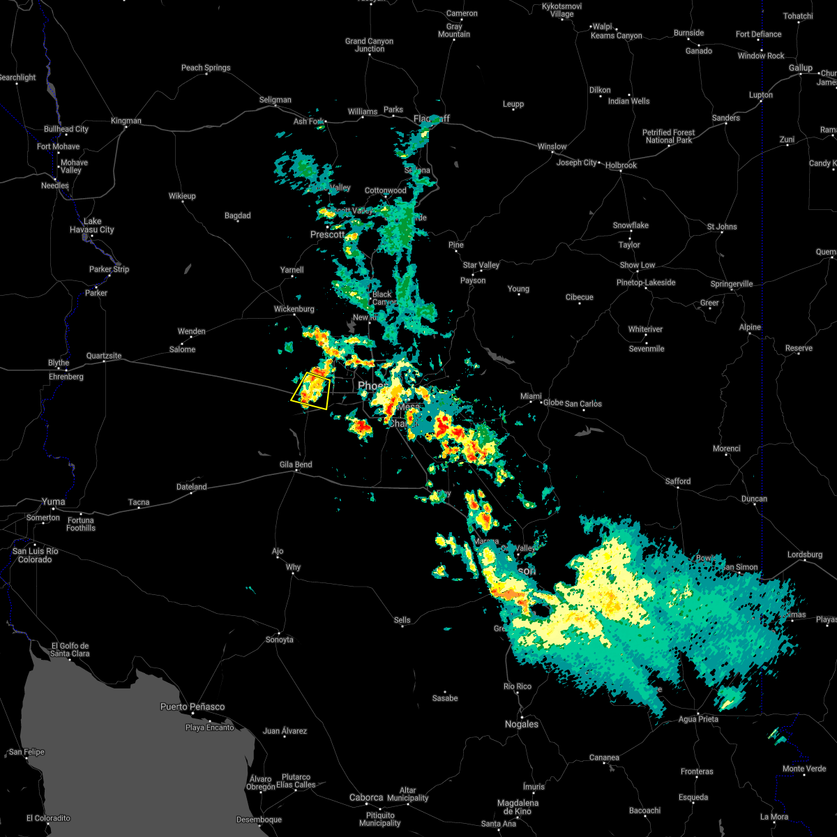 The severe thunderstorm warning for maricopa county will expire at 830 pm mst, the storm which prompted the warning has weakened below severe limits, and no longer poses an immediate threat to life or property. therefore, the warning will be allowed to expire. however gusty winds are still possible with this thunderstorm. The severe thunderstorm warning for maricopa county will expire at 830 pm mst, the storm which prompted the warning has weakened below severe limits, and no longer poses an immediate threat to life or property. therefore, the warning will be allowed to expire. however gusty winds are still possible with this thunderstorm.
|
| 8/20/2020 8:02 PM MST |
 At 802 pm mst, a severe thunderstorm was located near perryville, or 7 miles north of buckeye, moving southwest at 15 mph (radar indicated). Hazards include 60 mph wind gusts and quarter size hail. Hail damage to vehicles is expected. Expect wind damage to roofs, siding, and trees. At 802 pm mst, a severe thunderstorm was located near perryville, or 7 miles north of buckeye, moving southwest at 15 mph (radar indicated). Hazards include 60 mph wind gusts and quarter size hail. Hail damage to vehicles is expected. Expect wind damage to roofs, siding, and trees.
|
| 7/23/2020 12:38 PM MST |
 The severe thunderstorm warning for maricopa county will expire at 1245 pm mst, the storm which prompted the warning has moved out of the area. therefore, the warning will be allowed to expire. however gusty winds and heavy rain are still possible with this thunderstorm. The severe thunderstorm warning for maricopa county will expire at 1245 pm mst, the storm which prompted the warning has moved out of the area. therefore, the warning will be allowed to expire. however gusty winds and heavy rain are still possible with this thunderstorm.
|
| 7/23/2020 12:32 PM MST |
 At 1232 pm mst, a severe thunderstorm was located near luke afb, or near goodyear, moving north at 20 mph (radar indicated). Hazards include 60 mph wind gusts and nickel size hail. expect damage to roofs, siding, and trees At 1232 pm mst, a severe thunderstorm was located near luke afb, or near goodyear, moving north at 20 mph (radar indicated). Hazards include 60 mph wind gusts and nickel size hail. expect damage to roofs, siding, and trees
|
| 7/23/2020 12:24 PM MST |
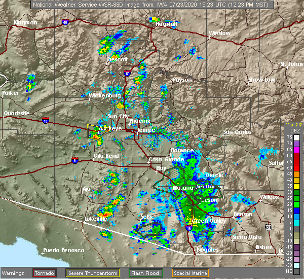 At 1224 pm mst, a severe thunderstorm was located near buckeye, moving north at 20 mph (radar indicated). Hazards include 60 mph wind gusts. Expect damage to roofs, siding, and trees. locations impacted include, buckeye, palo verde, perryville, hassayampa and arlington. this includes the following highways, az interstate 10 between mile markers 105 and 124. Az route 85 between mile markers 145 and 154. At 1224 pm mst, a severe thunderstorm was located near buckeye, moving north at 20 mph (radar indicated). Hazards include 60 mph wind gusts. Expect damage to roofs, siding, and trees. locations impacted include, buckeye, palo verde, perryville, hassayampa and arlington. this includes the following highways, az interstate 10 between mile markers 105 and 124. Az route 85 between mile markers 145 and 154.
|
| 7/23/2020 12:08 PM MST |
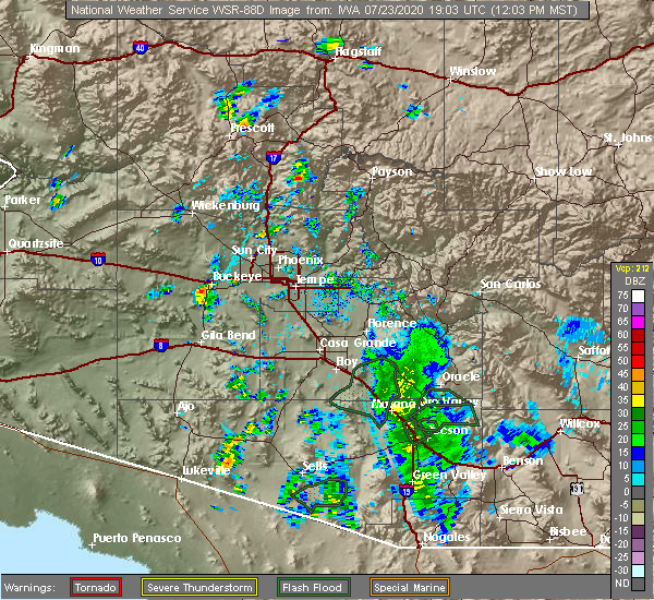 At 1207 pm mst, a severe thunderstorm was located over buckeye, moving north at 20 mph (radar indicated). Hazards include 60 mph wind gusts. expect damage to roofs, siding, and trees At 1207 pm mst, a severe thunderstorm was located over buckeye, moving north at 20 mph (radar indicated). Hazards include 60 mph wind gusts. expect damage to roofs, siding, and trees
|
| 3/18/2020 4:26 PM MST |
 At 426 pm mst, a severe thunderstorm was located over estrella mountain ranch, or near goodyear, moving northeast at 25 mph (radar indicated). Hazards include 60 mph wind gusts. expect damage to roofs, siding, and trees At 426 pm mst, a severe thunderstorm was located over estrella mountain ranch, or near goodyear, moving northeast at 25 mph (radar indicated). Hazards include 60 mph wind gusts. expect damage to roofs, siding, and trees
|
| 11/29/2019 2:56 AM MST |
 The severe thunderstorm warning for maricopa county will expire at 300 am mst, the storms which prompted the warning have weakened below severe limits, and no longer pose an immediate threat to life or property. therefore, the warning will be allowed to expire. however gusty winds and heavy rain are still possible with these thunderstorms. The severe thunderstorm warning for maricopa county will expire at 300 am mst, the storms which prompted the warning have weakened below severe limits, and no longer pose an immediate threat to life or property. therefore, the warning will be allowed to expire. however gusty winds and heavy rain are still possible with these thunderstorms.
|
| 11/29/2019 2:47 AM MST |
 At 246 am mst, severe thunderstorms were located along a line extending from 9 miles west of castle hot springs to wittmann to near white tank mountain park, moving northeast at 30 mph (radar indicated). Hazards include 60 mph wind gusts. Expect damage to roofs, siding, and trees. locations impacted include, surprise, wittmann, sun city west, circle city, lake pleasant, white tank mountain park, beardsley and vistancia. this includes the following highways, us highway 60 between mile markers 123 and 141. az route 74 between mile markers 2 and 24. Az route 303 between mile markers 116 and 132. At 246 am mst, severe thunderstorms were located along a line extending from 9 miles west of castle hot springs to wittmann to near white tank mountain park, moving northeast at 30 mph (radar indicated). Hazards include 60 mph wind gusts. Expect damage to roofs, siding, and trees. locations impacted include, surprise, wittmann, sun city west, circle city, lake pleasant, white tank mountain park, beardsley and vistancia. this includes the following highways, us highway 60 between mile markers 123 and 141. az route 74 between mile markers 2 and 24. Az route 303 between mile markers 116 and 132.
|
| 11/29/2019 2:34 AM MST |
 At 234 am mst, severe thunderstorms were located along a line extending from near wickenburg to morristown to 8 miles southwest of white tank mountain park, moving northeast at 50 mph (radar indicated). Hazards include 60 mph wind gusts. expect damage to roofs, siding, and trees At 234 am mst, severe thunderstorms were located along a line extending from near wickenburg to morristown to 8 miles southwest of white tank mountain park, moving northeast at 50 mph (radar indicated). Hazards include 60 mph wind gusts. expect damage to roofs, siding, and trees
|
| 11/21/2019 2:52 PM MST | Half Dollar sized hail reported 6.6 miles W of Buckeye, AZ, **delayed report** hail 1.25 measured w ruler (picture on social media). |
| 11/21/2019 2:51 PM MST |
 At 251 pm mst, a severe thunderstorm was located over goodyear, moving east at 15 mph (radar indicated). Hazards include quarter size hail. Damage to vehicles is expected. locations impacted include, phoenix, glendale, avondale, goodyear, buckeye, el mirage, tolleson, youngtown, cashion, sun city, litchfield park, glendale sports complex, perryville, luke afb and liberty. this includes the following highways, az interstate 10 between mile markers 120 and 136. us highway 60 near mile marker 149. Az route 101 between mile markers 2 and 11. At 251 pm mst, a severe thunderstorm was located over goodyear, moving east at 15 mph (radar indicated). Hazards include quarter size hail. Damage to vehicles is expected. locations impacted include, phoenix, glendale, avondale, goodyear, buckeye, el mirage, tolleson, youngtown, cashion, sun city, litchfield park, glendale sports complex, perryville, luke afb and liberty. this includes the following highways, az interstate 10 between mile markers 120 and 136. us highway 60 near mile marker 149. Az route 101 between mile markers 2 and 11.
|
| 11/21/2019 2:37 PM MST |
 At 237 pm mst, a severe thunderstorm was located over perryville, or near goodyear, moving east at 15 mph (radar indicated). Hazards include quarter size hail. damage to vehicles is expected At 237 pm mst, a severe thunderstorm was located over perryville, or near goodyear, moving east at 15 mph (radar indicated). Hazards include quarter size hail. damage to vehicles is expected
|
| 9/26/2019 4:05 PM MST |
 The severe thunderstorm warning for maricopa county will expire at 415 pm mst, the storm which prompted the warning has weakened below severe limits, and no longer poses an immediate threat to life or property. therefore, the warning will be allowed to expire. however small hail, gusty winds and heavy rain are still possible with this thunderstorm. The severe thunderstorm warning for maricopa county will expire at 415 pm mst, the storm which prompted the warning has weakened below severe limits, and no longer poses an immediate threat to life or property. therefore, the warning will be allowed to expire. however small hail, gusty winds and heavy rain are still possible with this thunderstorm.
|
| 9/26/2019 3:53 PM MST |
 At 352 pm mst, a severe thunderstorm was located 7 miles southeast of palo verde, or 8 miles south of buckeye, moving north at 20 mph (radar indicated). Hazards include 60 mph wind gusts and quarter size hail. Hail damage to vehicles is expected. Expect wind damage to roofs, siding, and trees. At 352 pm mst, a severe thunderstorm was located 7 miles southeast of palo verde, or 8 miles south of buckeye, moving north at 20 mph (radar indicated). Hazards include 60 mph wind gusts and quarter size hail. Hail damage to vehicles is expected. Expect wind damage to roofs, siding, and trees.
|
| 9/25/2019 8:20 PM MST |
 At 820 pm mst, a severe thunderstorm was located 12 miles west of white tank mountain park, or 13 miles northeast of tonopah, moving northwest at 40 mph (radar indicated). Hazards include 60 mph wind gusts and quarter size hail. Hail damage to vehicles is expected. expect wind damage to roofs, siding, and trees. locations impacted include, buckeye, palo verde, hassayampa and arlington. this includes the following highways, az interstate 10 between mile markers 100 and 117. Az route 85 between mile markers 145 and 154. At 820 pm mst, a severe thunderstorm was located 12 miles west of white tank mountain park, or 13 miles northeast of tonopah, moving northwest at 40 mph (radar indicated). Hazards include 60 mph wind gusts and quarter size hail. Hail damage to vehicles is expected. expect wind damage to roofs, siding, and trees. locations impacted include, buckeye, palo verde, hassayampa and arlington. this includes the following highways, az interstate 10 between mile markers 100 and 117. Az route 85 between mile markers 145 and 154.
|
| 9/25/2019 7:53 PM MST |
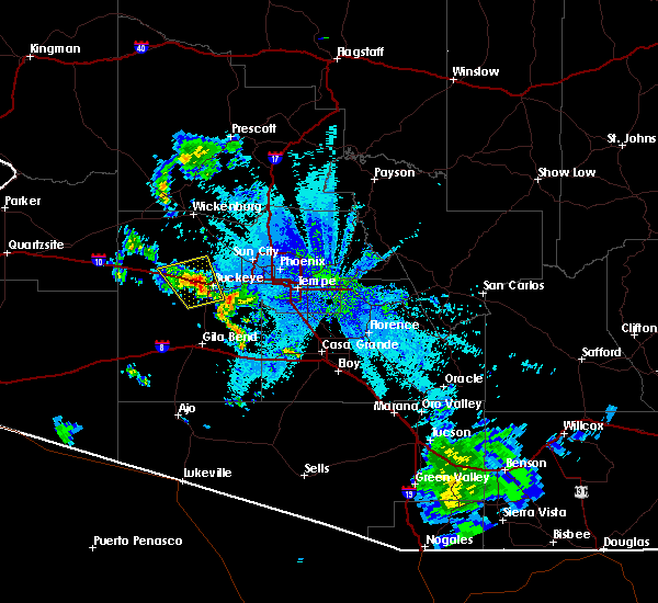 At 752 pm mst, a severe thunderstorm was located 7 miles east of wintersburg, or 8 miles northwest of buckeye, moving northwest at 40 mph (radar indicated). Hazards include 60 mph wind gusts and quarter size hail. Hail damage to vehicles is expected. Expect wind damage to roofs, siding, and trees. At 752 pm mst, a severe thunderstorm was located 7 miles east of wintersburg, or 8 miles northwest of buckeye, moving northwest at 40 mph (radar indicated). Hazards include 60 mph wind gusts and quarter size hail. Hail damage to vehicles is expected. Expect wind damage to roofs, siding, and trees.
|
| 9/23/2019 5:29 PM MST |
 At 528 pm mst, a severe thunderstorm was located near white tank mountain park, or 8 miles southwest of waddell, moving east at 30 mph (radar indicated). Hazards include 60 mph wind gusts and quarter size hail. Hail damage to vehicles is expected. Expect wind damage to roofs, siding, and trees. At 528 pm mst, a severe thunderstorm was located near white tank mountain park, or 8 miles southwest of waddell, moving east at 30 mph (radar indicated). Hazards include 60 mph wind gusts and quarter size hail. Hail damage to vehicles is expected. Expect wind damage to roofs, siding, and trees.
|
| 9/23/2019 5:11 PM MST |
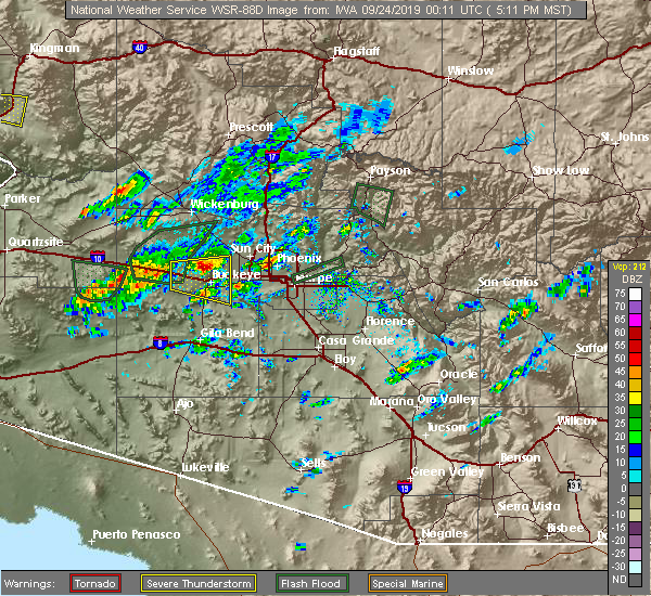 At 511 pm mst, a severe thunderstorm was located near white tank mountain park, or 8 miles north of buckeye, moving east at 25 mph (radar indicated). Hazards include 60 mph wind gusts and quarter size hail. Hail damage to vehicles is expected. expect wind damage to roofs, siding, and trees. locations impacted include, goodyear, buckeye, palo verde, perryville, white tank mountain park, liberty, palo verde nuclear generation station, wintersburg, estrella mountain ranch, hassayampa and arlington. this includes the following highways, az interstate 10 between mile markers 97 and 124. Az route 85 between mile markers 145 and 154. At 511 pm mst, a severe thunderstorm was located near white tank mountain park, or 8 miles north of buckeye, moving east at 25 mph (radar indicated). Hazards include 60 mph wind gusts and quarter size hail. Hail damage to vehicles is expected. expect wind damage to roofs, siding, and trees. locations impacted include, goodyear, buckeye, palo verde, perryville, white tank mountain park, liberty, palo verde nuclear generation station, wintersburg, estrella mountain ranch, hassayampa and arlington. this includes the following highways, az interstate 10 between mile markers 97 and 124. Az route 85 between mile markers 145 and 154.
|
| 9/23/2019 4:51 PM MST |
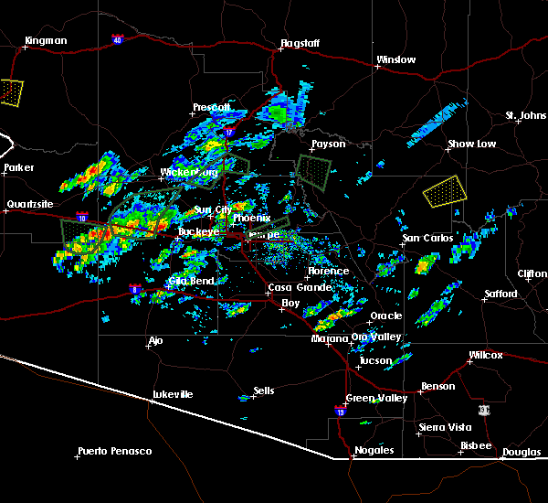 At 451 pm mst, a severe thunderstorm was located near wintersburg, or 9 miles east of tonopah, moving east at 25 mph (radar indicated). Hazards include 60 mph wind gusts and quarter size hail. Hail damage to vehicles is expected. Expect wind damage to roofs, siding, and trees. At 451 pm mst, a severe thunderstorm was located near wintersburg, or 9 miles east of tonopah, moving east at 25 mph (radar indicated). Hazards include 60 mph wind gusts and quarter size hail. Hail damage to vehicles is expected. Expect wind damage to roofs, siding, and trees.
|
| 9/16/2019 8:23 PM MST |
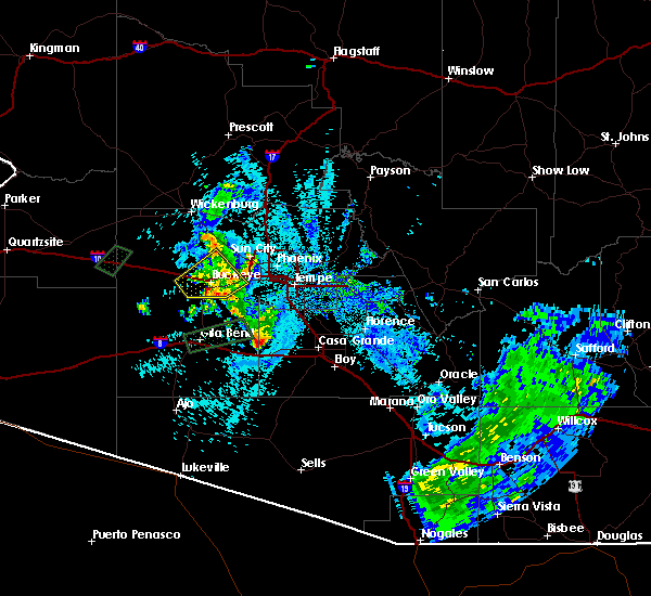 The severe thunderstorm warning for maricopa county will expire at 830 pm mst, the storm which prompted the warning has weakened below severe limits, and no longer poses an immediate threat to life or property. therefore, the warning will be allowed to expire. however gusty winds and heavy rain are still possible with this thunderstorm and flash flooding is ongoing in buckeye. to report severe weather, contact your nearest law enforcement agency. they will relay your report to the national weather service phoenix. The severe thunderstorm warning for maricopa county will expire at 830 pm mst, the storm which prompted the warning has weakened below severe limits, and no longer poses an immediate threat to life or property. therefore, the warning will be allowed to expire. however gusty winds and heavy rain are still possible with this thunderstorm and flash flooding is ongoing in buckeye. to report severe weather, contact your nearest law enforcement agency. they will relay your report to the national weather service phoenix.
|
| 9/16/2019 8:15 PM MST |
 At 815 pm mst, a severe thunderstorm was located near perryville, or 7 miles northwest of goodyear, moving east at 20 mph (radar indicated). Hazards include 60 mph wind gusts and penny size hail. Expect damage to roofs, siding, and trees. locations impacted include, avondale, goodyear, buckeye, cashion, litchfield park, palo verde, perryville, white tank mountain park, liberty and estrella mountain ranch. this includes the following highways, az interstate 10 between mile markers 110 and 130. az route 85 between mile markers 146 and 154. Az route 303 between mile markers 105 and 110. At 815 pm mst, a severe thunderstorm was located near perryville, or 7 miles northwest of goodyear, moving east at 20 mph (radar indicated). Hazards include 60 mph wind gusts and penny size hail. Expect damage to roofs, siding, and trees. locations impacted include, avondale, goodyear, buckeye, cashion, litchfield park, palo verde, perryville, white tank mountain park, liberty and estrella mountain ranch. this includes the following highways, az interstate 10 between mile markers 110 and 130. az route 85 between mile markers 146 and 154. Az route 303 between mile markers 105 and 110.
|
| 9/16/2019 7:58 PM MST |
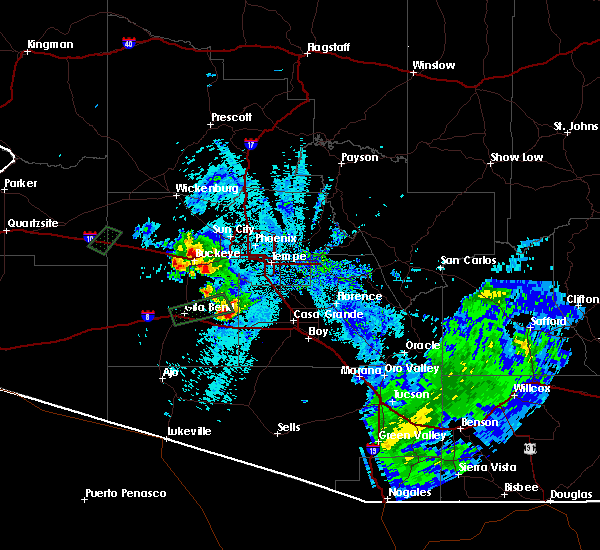 At 757 pm mst, severe thunderstorms were located near buckeye and hassayampa, moving east at 20 mph (radar indicated). Hazards include 60 mph wind gusts and nickel size hail. expect damage to roofs, siding, and trees At 757 pm mst, severe thunderstorms were located near buckeye and hassayampa, moving east at 20 mph (radar indicated). Hazards include 60 mph wind gusts and nickel size hail. expect damage to roofs, siding, and trees
|
| 9/16/2019 7:48 PM MST |
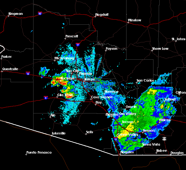 At 747 pm mst, severe thunderstorms were located along a line extending from 6 miles north of palo verde to near buckeye to near estrella mountain ranch, moving northeast at 20 mph (radar indicated). Hazards include 60 mph wind gusts and quarter size hail. Hail damage to vehicles is expected. expect wind damage to roofs, siding, and trees. locations impacted include, avondale, goodyear, buckeye, palo verde, painted rock dam, perryville, white tank mountain park, liberty, estrella mountain ranch, hassayampa and arlington. this includes the following highways, az interstate 10 between mile markers 106 and 128. az route 85 between mile markers 140 and 154. Az route 303 between mile markers 105 and 108. At 747 pm mst, severe thunderstorms were located along a line extending from 6 miles north of palo verde to near buckeye to near estrella mountain ranch, moving northeast at 20 mph (radar indicated). Hazards include 60 mph wind gusts and quarter size hail. Hail damage to vehicles is expected. expect wind damage to roofs, siding, and trees. locations impacted include, avondale, goodyear, buckeye, palo verde, painted rock dam, perryville, white tank mountain park, liberty, estrella mountain ranch, hassayampa and arlington. this includes the following highways, az interstate 10 between mile markers 106 and 128. az route 85 between mile markers 140 and 154. Az route 303 between mile markers 105 and 108.
|
| 9/16/2019 7:36 PM MST | Power outage in buckeye from power poles down. location approximate. time estimated from rada in maricopa county AZ, 1.8 miles NW of Buckeye, AZ |
| 9/16/2019 7:22 PM MST |
 The severe thunderstorm warning for maricopa county will expire at 730 pm mst, the storm which prompted the warning has moved out of the area. therefore, the warning will be allowed to expire. however gusty winds are still possible with this thunderstorm. remember, a severe thunderstorm warning still remains in effect for western maricopa county. The severe thunderstorm warning for maricopa county will expire at 730 pm mst, the storm which prompted the warning has moved out of the area. therefore, the warning will be allowed to expire. however gusty winds are still possible with this thunderstorm. remember, a severe thunderstorm warning still remains in effect for western maricopa county.
|
| 9/16/2019 7:19 PM MST |
 The national weather service in phoenix has issued a * severe thunderstorm warning for. maricopa county in south central arizona. until 800 pm mst. At 719 pm mst, severe thunderstorms were located along a line extending from near buckeye to 6 miles south of palo verde to near. The national weather service in phoenix has issued a * severe thunderstorm warning for. maricopa county in south central arizona. until 800 pm mst. At 719 pm mst, severe thunderstorms were located along a line extending from near buckeye to 6 miles south of palo verde to near.
|
| 9/16/2019 7:03 PM MST |
 At 641 pm mst, a severe thunderstorm was located over gila bend, moving northeast at 20 mph (radar indicated). Hazards include 60 mph wind gusts and nickel size hail. expect damage to roofs, siding, and trees At 641 pm mst, a severe thunderstorm was located over gila bend, moving northeast at 20 mph (radar indicated). Hazards include 60 mph wind gusts and nickel size hail. expect damage to roofs, siding, and trees
|
| 9/16/2019 6:54 PM MST |
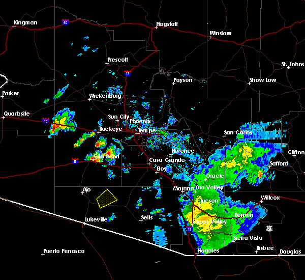 At 653 pm mst, a severe thunderstorm was located 9 miles northeast of cotton center, or 11 miles south of buckeye, moving northeast at 15 mph (radar indicated). Hazards include 60 mph wind gusts and nickel size hail. expect damage to roofs, siding, and trees At 653 pm mst, a severe thunderstorm was located 9 miles northeast of cotton center, or 11 miles south of buckeye, moving northeast at 15 mph (radar indicated). Hazards include 60 mph wind gusts and nickel size hail. expect damage to roofs, siding, and trees
|
| 9/16/2019 6:41 PM MST |
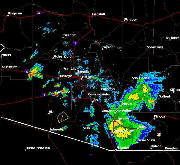 The national weather service in phoenix has issued a * severe thunderstorm warning for. maricopa county in south central arizona. until 715 pm mst. At 641 pm mst, a severe thunderstorm was located over gila bend, moving northeast at 20 mph. The national weather service in phoenix has issued a * severe thunderstorm warning for. maricopa county in south central arizona. until 715 pm mst. At 641 pm mst, a severe thunderstorm was located over gila bend, moving northeast at 20 mph.
|
| 9/1/2019 7:29 PM MST |
 The national weather service in phoenix has issued a * severe thunderstorm warning for. southeastern la paz county in west central arizona. northeastern yuma county in southwestern arizona. maricopa county in south central arizona. Until 815 pm mst. The national weather service in phoenix has issued a * severe thunderstorm warning for. southeastern la paz county in west central arizona. northeastern yuma county in southwestern arizona. maricopa county in south central arizona. Until 815 pm mst.
|
| 9/1/2019 7:04 PM MST |
 At 703 pm mst, a severe thunderstorm was located near gila bend, moving northwest at 20 mph (radar indicated). Hazards include 70 mph wind gusts and quarter size hail. Hail damage to vehicles is expected. expect considerable tree damage. wind damage is also likely to mobile homes, roofs, and outbuildings. locations impacted include, buckeye, gila bend, estrella, freeman, big horn, gila bend auxiliary field, bosque, cotton center and sonoran national monument. this includes the following highways, az interstate 8 between mile markers 102 and 148. az route 238 between mile markers 1 and 28. Az route 85 between mile markers 1 and 16, and between mile markers 119 and 140. At 703 pm mst, a severe thunderstorm was located near gila bend, moving northwest at 20 mph (radar indicated). Hazards include 70 mph wind gusts and quarter size hail. Hail damage to vehicles is expected. expect considerable tree damage. wind damage is also likely to mobile homes, roofs, and outbuildings. locations impacted include, buckeye, gila bend, estrella, freeman, big horn, gila bend auxiliary field, bosque, cotton center and sonoran national monument. this includes the following highways, az interstate 8 between mile markers 102 and 148. az route 238 between mile markers 1 and 28. Az route 85 between mile markers 1 and 16, and between mile markers 119 and 140.
|
| 9/1/2019 6:44 PM MST |
 At 644 pm mst, a severe thunderstorm was located near bosque, or 9 miles southeast of gila bend, moving northwest at 20 mph (radar indicated). Hazards include 70 mph wind gusts and half dollar size hail. Hail damage to vehicles is expected. expect considerable tree damage. wind damage is also likely to mobile homes, roofs, and outbuildings. locations impacted include, buckeye, gila bend, estrella, freeman, big horn, gila bend auxiliary field, bosque, cotton center, sonoran national monument and mobile. this includes the following highways, az interstate 8 between mile markers 98 and 148. az route 238 between mile markers 1 and 34. Az route 85 between mile markers 1 and 24, and between mile markers 119 and 140. At 644 pm mst, a severe thunderstorm was located near bosque, or 9 miles southeast of gila bend, moving northwest at 20 mph (radar indicated). Hazards include 70 mph wind gusts and half dollar size hail. Hail damage to vehicles is expected. expect considerable tree damage. wind damage is also likely to mobile homes, roofs, and outbuildings. locations impacted include, buckeye, gila bend, estrella, freeman, big horn, gila bend auxiliary field, bosque, cotton center, sonoran national monument and mobile. this includes the following highways, az interstate 8 between mile markers 98 and 148. az route 238 between mile markers 1 and 34. Az route 85 between mile markers 1 and 24, and between mile markers 119 and 140.
|
| 9/1/2019 6:15 PM MST |
 At 615 pm mst, a severe thunderstorm was located 7 miles west of big horn, or 11 miles southeast of gila bend, moving northwest at 20 mph (radar indicated). Hazards include 70 mph wind gusts and ping pong ball size hail. People and animals outdoors will be injured. expect hail damage to roofs, siding, windows, and vehicles. expect considerable tree damage. wind damage is also likely to mobile homes, roofs, and outbuildings. locations impacted include, buckeye, gila bend, maricopa, estrella, big horn, bosque, cotton center, freeman, gila bend auxiliary field, estrella sailport, sonoran national monument, mobile and ak-chin village. this includes the following highways, az interstate 8 between mile markers 98 and 152. az route 238 between mile markers 1 and 44. Az route 85 between mile markers 1 and 28, and between mile markers 119 and 140. At 615 pm mst, a severe thunderstorm was located 7 miles west of big horn, or 11 miles southeast of gila bend, moving northwest at 20 mph (radar indicated). Hazards include 70 mph wind gusts and ping pong ball size hail. People and animals outdoors will be injured. expect hail damage to roofs, siding, windows, and vehicles. expect considerable tree damage. wind damage is also likely to mobile homes, roofs, and outbuildings. locations impacted include, buckeye, gila bend, maricopa, estrella, big horn, bosque, cotton center, freeman, gila bend auxiliary field, estrella sailport, sonoran national monument, mobile and ak-chin village. this includes the following highways, az interstate 8 between mile markers 98 and 152. az route 238 between mile markers 1 and 44. Az route 85 between mile markers 1 and 28, and between mile markers 119 and 140.
|
| 9/1/2019 5:56 PM MST |
 At 555 pm mst, an area of severe thunderstorms was located over big horn, or 18 miles southeast of gila bend, moving northwest at 20 mph. additional severe storms will be developing along interstate 8 and near gila bend in the next 30 to 45 minutes (radar indicated). Hazards include 60 mph wind gusts. expect damage to roofs, siding, and trees At 555 pm mst, an area of severe thunderstorms was located over big horn, or 18 miles southeast of gila bend, moving northwest at 20 mph. additional severe storms will be developing along interstate 8 and near gila bend in the next 30 to 45 minutes (radar indicated). Hazards include 60 mph wind gusts. expect damage to roofs, siding, and trees
|
| 10/13/2018 9:28 AM MST |
 The severe thunderstorm warning for maricopa county will expire at 930 am mst, the storm which prompted the warning has weakened below severe limits, and no longer poses an immediate threat to life or property. therefore, the warning will be allowed to expire. however small hail and gusty winds are still possible with this thunderstorm. The severe thunderstorm warning for maricopa county will expire at 930 am mst, the storm which prompted the warning has weakened below severe limits, and no longer poses an immediate threat to life or property. therefore, the warning will be allowed to expire. however small hail and gusty winds are still possible with this thunderstorm.
|
| 10/13/2018 9:16 AM MST |
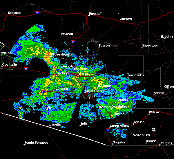 At 916 am mst, a severe thunderstorm was located near white tank mountain park, or 13 miles north of buckeye, moving east at 25 mph (radar indicated). Hazards include 60 mph wind gusts and penny size hail. Expect damage to roofs, siding, and trees. locations impacted include, surprise, buckeye and white tank mountain park. this includes the following highways, us highway 60 near mile marker 135. Az route 303 between mile markers 112 and 115. At 916 am mst, a severe thunderstorm was located near white tank mountain park, or 13 miles north of buckeye, moving east at 25 mph (radar indicated). Hazards include 60 mph wind gusts and penny size hail. Expect damage to roofs, siding, and trees. locations impacted include, surprise, buckeye and white tank mountain park. this includes the following highways, us highway 60 near mile marker 135. Az route 303 between mile markers 112 and 115.
|
| 10/13/2018 8:49 AM MST |
 At 849 am mst, a severe thunderstorm was located 8 miles northeast of wintersburg, or 9 miles east of tonopah, moving east at 30 mph (radar indicated). Hazards include 60 mph wind gusts and penny size hail. expect damage to roofs, siding, and trees At 849 am mst, a severe thunderstorm was located 8 miles northeast of wintersburg, or 9 miles east of tonopah, moving east at 30 mph (radar indicated). Hazards include 60 mph wind gusts and penny size hail. expect damage to roofs, siding, and trees
|
| 9/2/2018 6:01 PM MST |
 At 601 pm mst, a severe thunderstorm was located over circle city, moving north at 15 mph (radar indicated). Hazards include 60 mph wind gusts and quarter size hail. Hail damage to vehicles is expected. expect wind damage to roofs, siding, and trees. locations impacted include, surprise, wittmann, circle city and morristown. this includes the following highways, us highway 60 between mile markers 118 and 136. Az route 74 between mile markers 1 and 15. At 601 pm mst, a severe thunderstorm was located over circle city, moving north at 15 mph (radar indicated). Hazards include 60 mph wind gusts and quarter size hail. Hail damage to vehicles is expected. expect wind damage to roofs, siding, and trees. locations impacted include, surprise, wittmann, circle city and morristown. this includes the following highways, us highway 60 between mile markers 118 and 136. Az route 74 between mile markers 1 and 15.
|
| 9/2/2018 5:31 PM MST |
 At 531 pm mst, a severe thunderstorm was located near wittmann, moving north at 15 mph (radar indicated). Hazards include 60 mph wind gusts and quarter size hail. Hail damage to vehicles is expected. Expect wind damage to roofs, siding, and trees. At 531 pm mst, a severe thunderstorm was located near wittmann, moving north at 15 mph (radar indicated). Hazards include 60 mph wind gusts and quarter size hail. Hail damage to vehicles is expected. Expect wind damage to roofs, siding, and trees.
|
| 9/2/2018 5:27 PM MST |
 At 527 pm mst, a severe thunderstorm was located over litchfield park, or near el mirage, moving northeast at 10 mph (radar indicated). Hazards include 60 mph wind gusts and quarter size hail. Hail damage to vehicles is expected. expect wind damage to roofs, siding, and trees. locations impacted include, phoenix, glendale, surprise, avondale, goodyear, el mirage, tolleson, youngtown, sun city west, sun city, waddell, cashion, litchfield park, glendale sports complex and luke afb. this includes the following highways, az interstate 10 between mile markers 129 and 146. az interstate 17 between mile markers 199 and 206. Us highway 60 between mile markers 137 and 160. At 527 pm mst, a severe thunderstorm was located over litchfield park, or near el mirage, moving northeast at 10 mph (radar indicated). Hazards include 60 mph wind gusts and quarter size hail. Hail damage to vehicles is expected. expect wind damage to roofs, siding, and trees. locations impacted include, phoenix, glendale, surprise, avondale, goodyear, el mirage, tolleson, youngtown, sun city west, sun city, waddell, cashion, litchfield park, glendale sports complex and luke afb. this includes the following highways, az interstate 10 between mile markers 129 and 146. az interstate 17 between mile markers 199 and 206. Us highway 60 between mile markers 137 and 160.
|
| 9/2/2018 5:19 PM MST |
 At 518 pm mst, a severe thunderstorm was located over litchfield park, or near cashion, moving northeast at 10 mph (radar indicated). Hazards include 60 mph wind gusts and quarter size hail. Hail damage to vehicles is expected. Expect wind damage to roofs, siding, and trees. At 518 pm mst, a severe thunderstorm was located over litchfield park, or near cashion, moving northeast at 10 mph (radar indicated). Hazards include 60 mph wind gusts and quarter size hail. Hail damage to vehicles is expected. Expect wind damage to roofs, siding, and trees.
|
| 8/12/2018 7:46 PM MST |
 At 746 pm mst, a severe thunderstorm was located over wittmann, moving west at 15 mph (radar indicated). Hazards include 60 mph wind gusts and quarter size hail. Hail damage to vehicles is expected. expect wind damage to roofs, siding, and trees. locations impacted include, surprise, wittmann, sun city west, circle city, surprise stadium, white tank mountain park, morristown and beardsley. this includes the following highways, us highway 60 between mile markers 122 and 144. az route 74 between mile markers 4 and 13. Az route 303 between mile markers 113 and 122. At 746 pm mst, a severe thunderstorm was located over wittmann, moving west at 15 mph (radar indicated). Hazards include 60 mph wind gusts and quarter size hail. Hail damage to vehicles is expected. expect wind damage to roofs, siding, and trees. locations impacted include, surprise, wittmann, sun city west, circle city, surprise stadium, white tank mountain park, morristown and beardsley. this includes the following highways, us highway 60 between mile markers 122 and 144. az route 74 between mile markers 4 and 13. Az route 303 between mile markers 113 and 122.
|
| 8/12/2018 7:35 PM MST |
 At 735 pm mst, a severe thunderstorm was located near wittmann, moving west at 15 mph (radar indicated). Hazards include 60 mph wind gusts and half dollar size hail. Hail damage to vehicles is expected. Expect wind damage to roofs, siding, and trees. At 735 pm mst, a severe thunderstorm was located near wittmann, moving west at 15 mph (radar indicated). Hazards include 60 mph wind gusts and half dollar size hail. Hail damage to vehicles is expected. Expect wind damage to roofs, siding, and trees.
|
| 8/10/2018 11:21 PM MST |
 At 1121 pm mst, a severe thunderstorm was located over laveen, moving west at 35 mph (radar indicated). Hazards include 60 mph wind gusts. Expect damage to roofs, siding, and trees. locations impacted include, phoenix, glendale, tempe, avondale, goodyear, tolleson, laveen, cashion, litchfield park, glendale sports complex, arizona mills mall, luke afb, south phoenix, arizona state fairgrounds and south mountain park. this includes the following highways, az interstate 10 between mile markers 124 and 159. az interstate 17 between mile markers 195 and 210. Az route 51 between mile markers 1 and 4. At 1121 pm mst, a severe thunderstorm was located over laveen, moving west at 35 mph (radar indicated). Hazards include 60 mph wind gusts. Expect damage to roofs, siding, and trees. locations impacted include, phoenix, glendale, tempe, avondale, goodyear, tolleson, laveen, cashion, litchfield park, glendale sports complex, arizona mills mall, luke afb, south phoenix, arizona state fairgrounds and south mountain park. this includes the following highways, az interstate 10 between mile markers 124 and 159. az interstate 17 between mile markers 195 and 210. Az route 51 between mile markers 1 and 4.
|
| 8/10/2018 11:02 PM MST |
 At 1101 pm mst, severe thunderstorms were located along a line extending from near metro center to near tempe, moving southwest at 25 mph (radar indicated). Hazards include 60 mph wind gusts. expect damage to roofs, siding, and trees At 1101 pm mst, severe thunderstorms were located along a line extending from near metro center to near tempe, moving southwest at 25 mph (radar indicated). Hazards include 60 mph wind gusts. expect damage to roofs, siding, and trees
|
| 8/9/2018 9:11 PM MST |
 The severe thunderstorm warning for maricopa county will expire at 915 pm mst, the storm which prompted the warning has weakened below severe limits, and no longer poses an immediate threat to life or property. therefore, the warning will be allowed to expire. however gusty winds are still possible with this thunderstorm. The severe thunderstorm warning for maricopa county will expire at 915 pm mst, the storm which prompted the warning has weakened below severe limits, and no longer poses an immediate threat to life or property. therefore, the warning will be allowed to expire. however gusty winds are still possible with this thunderstorm.
|
| 8/9/2018 9:00 PM MST |
 At 900 pm mst, a severe thunderstorm was located near beardsley, or near sun city west, moving southwest at 15 mph (radar indicated). Hazards include 60 mph wind gusts and penny size hail. Expect damage to roofs, siding, and trees. locations impacted include, surprise, el mirage, sun city west, waddell, sun city, surprise stadium, white tank mountain park and beardsley. this includes the following highways, us highway 60 between mile markers 131 and 145. Az route 303 between mile markers 109 and 123. At 900 pm mst, a severe thunderstorm was located near beardsley, or near sun city west, moving southwest at 15 mph (radar indicated). Hazards include 60 mph wind gusts and penny size hail. Expect damage to roofs, siding, and trees. locations impacted include, surprise, el mirage, sun city west, waddell, sun city, surprise stadium, white tank mountain park and beardsley. this includes the following highways, us highway 60 between mile markers 131 and 145. Az route 303 between mile markers 109 and 123.
|
| 8/9/2018 8:46 PM MST |
 The national weather service in phoenix has issued a * severe thunderstorm warning for. maricopa county in south central arizona. until 915 pm mst. At 846 pm mst, a severe thunderstorm was located over beardsley, or near sun city west, moving southwest at 15 mph. The national weather service in phoenix has issued a * severe thunderstorm warning for. maricopa county in south central arizona. until 915 pm mst. At 846 pm mst, a severe thunderstorm was located over beardsley, or near sun city west, moving southwest at 15 mph.
|
| 8/8/2018 8:15 PM MST | Storm damage reported in maricopa county AZ, 4.5 miles E of Buckeye, AZ |
| 8/2/2018 8:25 PM MST |
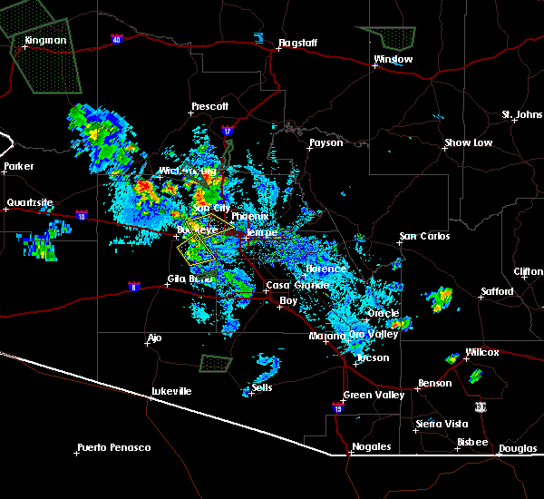 The severe thunderstorm warning for maricopa county will expire at 830 pm mst, the storm which prompted the warning has weakened below severe limits, and no longer poses an immediate threat to life or property. therefore, the warning will be allowed to expire. however gusty winds and heavy rain are still possible with this thunderstorm. The severe thunderstorm warning for maricopa county will expire at 830 pm mst, the storm which prompted the warning has weakened below severe limits, and no longer poses an immediate threat to life or property. therefore, the warning will be allowed to expire. however gusty winds and heavy rain are still possible with this thunderstorm.
|
| 8/2/2018 8:05 PM MST |
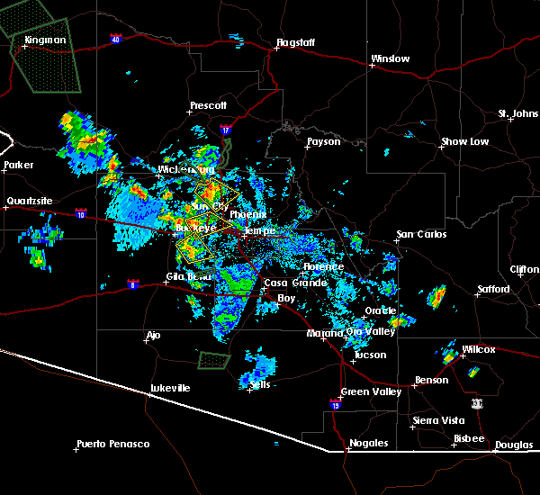 At 805 pm mst, a severe thunderstorm was located near estrella mountain ranch, or 10 miles south of goodyear, moving northeast at 20 mph (radar indicated). Hazards include 60 mph wind gusts and penny size hail. expect damage to roofs, siding, and trees At 805 pm mst, a severe thunderstorm was located near estrella mountain ranch, or 10 miles south of goodyear, moving northeast at 20 mph (radar indicated). Hazards include 60 mph wind gusts and penny size hail. expect damage to roofs, siding, and trees
|
| 8/2/2018 7:14 PM MST | Overturned semi in i-10 at milepost 11 in maricopa county AZ, 2.1 miles E of Buckeye, AZ |
| 8/2/2018 6:59 PM MST |
 At 659 pm mst, severe thunderstorms were located along a line extending from near palo verde to 7 miles southwest of south mountain park, moving northeast at 15 mph (radar indicated). Hazards include 60 mph wind gusts and penny size hail. Expect damage to roofs, siding, and trees. locations impacted include, avondale, goodyear, buckeye, palo verde, perryville, liberty, phoenix international raceway, estrella mountain park, estrella mountain ranch, hassayampa, rainbow valley, komatke and arlington. this includes the following highways, az interstate 10 between mile markers 111 and 119. Az route 85 between mile markers 140 and 154. At 659 pm mst, severe thunderstorms were located along a line extending from near palo verde to 7 miles southwest of south mountain park, moving northeast at 15 mph (radar indicated). Hazards include 60 mph wind gusts and penny size hail. Expect damage to roofs, siding, and trees. locations impacted include, avondale, goodyear, buckeye, palo verde, perryville, liberty, phoenix international raceway, estrella mountain park, estrella mountain ranch, hassayampa, rainbow valley, komatke and arlington. this includes the following highways, az interstate 10 between mile markers 111 and 119. Az route 85 between mile markers 140 and 154.
|
| 8/2/2018 6:42 PM MST |
 At 642 pm mst, severe thunderstorms were located along a line extending from near painted rock dam to 9 miles southeast of estrella mountain park, moving northeast at 15 mph (radar indicated). Hazards include 60 mph wind gusts and penny size hail. expect damage to roofs, siding, and trees At 642 pm mst, severe thunderstorms were located along a line extending from near painted rock dam to 9 miles southeast of estrella mountain park, moving northeast at 15 mph (radar indicated). Hazards include 60 mph wind gusts and penny size hail. expect damage to roofs, siding, and trees
|
| 8/2/2018 6:15 PM MST | **delayed report** news reported that buckeye valley fd stated 10-15 homes in the area suffered heavy damage from strong winds. time estimate in maricopa county AZ, 9.7 miles NW of Buckeye, AZ |
| 8/2/2018 6:12 PM MST |
 At 612 pm mst, severe thunderstorms were located along a line extending from near liberty to 6 miles northwest of estrella sailport, moving northeast at 10 mph (radar indicated). Hazards include 60 mph wind gusts and penny size hail. expect damage to roofs, siding, and trees At 612 pm mst, severe thunderstorms were located along a line extending from near liberty to 6 miles northwest of estrella sailport, moving northeast at 10 mph (radar indicated). Hazards include 60 mph wind gusts and penny size hail. expect damage to roofs, siding, and trees
|
| 8/2/2018 6:08 PM MST | Homes reported destroyed with major roof damage. high tension power line down. 190th ave and arlington. per fire dep in maricopa county AZ, 11.1 miles NW of Buckeye, AZ |
| 7/30/2018 8:15 PM MST |
 At 813 pm mst, severe thunderstorms were located along a line extending from near tonopah to near chandler city hall, moving west at 30 mph. gusts up to 50 mph have been reported at i-10 and 107th and a 49 mph gust at buckeye municipal airport. gusts up to 60 mph are still possible. small hail will also be possible (radar indicated). Hazards include 60 mph wind gusts. Expect damage to roofs, siding, and trees. locations impacted include, phoenix, tempe, avondale, goodyear, buckeye, tolleson, laveen, cashion, litchfield park, palo verde, perryville, luke afb, south phoenix, arizona state fairgrounds and liberty. this includes the following highways, az interstate 10 between mile markers 102 and 153. az interstate 17 between mile markers 195 and 202. Us highway 60 near mile marker 160. At 813 pm mst, severe thunderstorms were located along a line extending from near tonopah to near chandler city hall, moving west at 30 mph. gusts up to 50 mph have been reported at i-10 and 107th and a 49 mph gust at buckeye municipal airport. gusts up to 60 mph are still possible. small hail will also be possible (radar indicated). Hazards include 60 mph wind gusts. Expect damage to roofs, siding, and trees. locations impacted include, phoenix, tempe, avondale, goodyear, buckeye, tolleson, laveen, cashion, litchfield park, palo verde, perryville, luke afb, south phoenix, arizona state fairgrounds and liberty. this includes the following highways, az interstate 10 between mile markers 102 and 153. az interstate 17 between mile markers 195 and 202. Us highway 60 near mile marker 160.
|
| 7/30/2018 8:13 PM MST |
 The severe thunderstorm warning for maricopa county will expire at 815 pm mst. the storms which prompted the warning have moved out of the area. Therefore, the warning will be allowed to expire. The severe thunderstorm warning for maricopa county will expire at 815 pm mst. the storms which prompted the warning have moved out of the area. Therefore, the warning will be allowed to expire.
|
| 7/30/2018 8:01 PM MST |
 At 723 pm mst, severe thunderstorms were located along a line extending from sugarloaf mountain to 8 miles northeast of morristown, moving southwest at 25 mph (radar indicated). Hazards include 60 mph wind gusts. expect damage to roofs, siding, and trees At 723 pm mst, severe thunderstorms were located along a line extending from sugarloaf mountain to 8 miles northeast of morristown, moving southwest at 25 mph (radar indicated). Hazards include 60 mph wind gusts. expect damage to roofs, siding, and trees
|
| 7/30/2018 7:46 PM MST |
 At 746 pm mst, severe thunderstorms were located along a line extending from 7 miles west of white tank mountain park to near superstition springs mall, moving west at 30 mph (radar indicated). Hazards include 60 mph wind gusts. expect damage to roofs, siding, and trees At 746 pm mst, severe thunderstorms were located along a line extending from 7 miles west of white tank mountain park to near superstition springs mall, moving west at 30 mph (radar indicated). Hazards include 60 mph wind gusts. expect damage to roofs, siding, and trees
|
| 7/30/2018 7:23 PM MST |
 At 723 pm mst, severe thunderstorms were located along a line extending from sugarloaf mountain to 8 miles northeast of morristown, moving southwest at 25 mph (radar indicated). Hazards include 60 mph wind gusts. expect damage to roofs, siding, and trees At 723 pm mst, severe thunderstorms were located along a line extending from sugarloaf mountain to 8 miles northeast of morristown, moving southwest at 25 mph (radar indicated). Hazards include 60 mph wind gusts. expect damage to roofs, siding, and trees
|
| 7/9/2018 5:00 PM MST |
 At 459 pm mst, severe thunderstorms were located along a line extending from arrowhead mall to near laveen, moving west at 25 mph. these types of storms have a history of producing severe winds and small hail (radar indicated). Hazards include 70 mph wind gusts and penny size hail. Expect considerable tree damage. damage is likely to mobile homes, roofs, and outbuildings. locations impacted include, phoenix, glendale, peoria, surprise, avondale, goodyear, buckeye, el mirage, tolleson, youngtown, sun city west, waddell, laveen, cashion and sun city. this includes the following highways, az interstate 10 between mile markers 121 and 144. az interstate 17 between mile markers 198 and 216. Us highway 60 between mile markers 131 and 160. At 459 pm mst, severe thunderstorms were located along a line extending from arrowhead mall to near laveen, moving west at 25 mph. these types of storms have a history of producing severe winds and small hail (radar indicated). Hazards include 70 mph wind gusts and penny size hail. Expect considerable tree damage. damage is likely to mobile homes, roofs, and outbuildings. locations impacted include, phoenix, glendale, peoria, surprise, avondale, goodyear, buckeye, el mirage, tolleson, youngtown, sun city west, waddell, laveen, cashion and sun city. this includes the following highways, az interstate 10 between mile markers 121 and 144. az interstate 17 between mile markers 198 and 216. Us highway 60 between mile markers 131 and 160.
|
| 7/9/2018 4:50 PM MST |
 At 450 pm mst, severe thunderstorms were located along a line extending from near arrowhead mall to laveen, moving west at 25 mph (radar indicated). Hazards include 70 mph wind gusts and penny size hail. Expect considerable tree damage. Damage is likely to mobile homes, roofs, and outbuildings. At 450 pm mst, severe thunderstorms were located along a line extending from near arrowhead mall to laveen, moving west at 25 mph (radar indicated). Hazards include 70 mph wind gusts and penny size hail. Expect considerable tree damage. Damage is likely to mobile homes, roofs, and outbuildings.
|
| 7/8/2018 10:34 PM MST | 3 trees down. largest was 16 inches in diameter and 30 ft. tall. root system about 5 feet in diameter and about 3 ft. dee in maricopa county AZ, 16.8 miles S of Buckeye, AZ |
| 7/8/2018 9:15 PM MST | Corrects previous tstm wnd dmg report from 9 sw wittmann. 3 trees down. largest was 16 inches in diameter and 30 ft. tall. root system about 5 feet in diameter and abou in maricopa county AZ, 16.8 miles S of Buckeye, AZ |
| 7/8/2018 9:00 PM MST | Two semi trucks overturned on i-10 between verrado and highway 85. time is estimated. maa1126 in maricopa county AZ, 1.4 miles W of Buckeye, AZ |
| 7/8/2018 9:00 PM MST | A few trailers were completely demolished due to thunderstorm wind in maricopa county AZ, 5 miles ESE of Buckeye, AZ |
| 7/8/2018 9:00 PM MST | Time is estimated. 2 full sized palo verde trees uprooteded. base of trunk 7-8'' in diamete in maricopa county AZ, 1.8 miles NW of Buckeye, AZ |
| 8/12/2017 10:40 PM MST |
 The severe thunderstorm warning for maricopa county will expire at 1045 pm mst, the storm which prompted the warning has weakened below severe limits, and no longer poses an immediate threat to life or property. therefore the warning will be allowed to expire. however heavy rain is still possible with this thunderstorm. a flash flood warning is in effect for areas that were included in this expiring severe thunderstorm warning. The severe thunderstorm warning for maricopa county will expire at 1045 pm mst, the storm which prompted the warning has weakened below severe limits, and no longer poses an immediate threat to life or property. therefore the warning will be allowed to expire. however heavy rain is still possible with this thunderstorm. a flash flood warning is in effect for areas that were included in this expiring severe thunderstorm warning.
|
| 8/12/2017 10:14 PM MST |
 At 1014 pm mst, a severe thunderstorm was located over camelback ranch, or near youngtown, moving northeast at 15 mph (radar indicated). Hazards include 60 mph wind gusts. Expect damage to roofs, siding, and trees. Locations impacted include, phoenix, glendale, surprise, avondale, goodyear, buckeye, el mirage, tolleson, youngtown, sun city west, waddell, laveen, cashion, sun city and litchfield park. At 1014 pm mst, a severe thunderstorm was located over camelback ranch, or near youngtown, moving northeast at 15 mph (radar indicated). Hazards include 60 mph wind gusts. Expect damage to roofs, siding, and trees. Locations impacted include, phoenix, glendale, surprise, avondale, goodyear, buckeye, el mirage, tolleson, youngtown, sun city west, waddell, laveen, cashion, sun city and litchfield park.
|
| 8/12/2017 9:55 PM MST |
 At 955 pm mst, a severe thunderstorm was located over litchfield park, or near cashion, moving northeast at 15 mph (radar indicated). Hazards include 60 mph wind gusts. expect damage to roofs, siding, and trees At 955 pm mst, a severe thunderstorm was located over litchfield park, or near cashion, moving northeast at 15 mph (radar indicated). Hazards include 60 mph wind gusts. expect damage to roofs, siding, and trees
|
| 8/3/2017 3:41 PM MST |
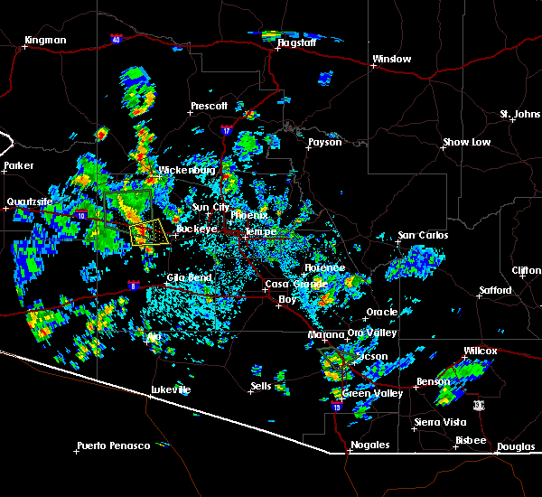 The severe thunderstorm warning for maricopa county will expire at 345 pm mst, the severe thunderstorm which prompted the warning is now below severe thresholds. therefore, the warning will be allowed to expire. however, storms are still in the area. The severe thunderstorm warning for maricopa county will expire at 345 pm mst, the severe thunderstorm which prompted the warning is now below severe thresholds. therefore, the warning will be allowed to expire. however, storms are still in the area.
|
| 8/3/2017 3:32 PM MST |
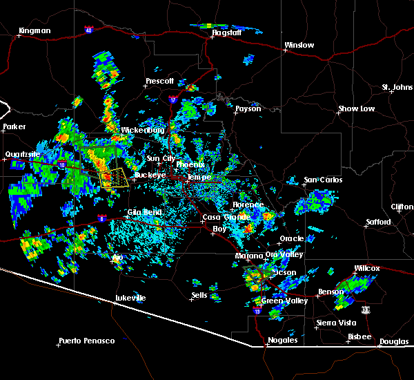 At 332 pm mst, a severe thunderstorm was located near wintersburg, or near tonopah, moving east at 10 mph (radar indicated). Hazards include 60 mph wind gusts. Expect damage to roofs, siding, and trees. Locations impacted include, tonopah, palo verde nuclear generation station, wintersburg and hassayampa. At 332 pm mst, a severe thunderstorm was located near wintersburg, or near tonopah, moving east at 10 mph (radar indicated). Hazards include 60 mph wind gusts. Expect damage to roofs, siding, and trees. Locations impacted include, tonopah, palo verde nuclear generation station, wintersburg and hassayampa.
|
| 8/3/2017 3:20 PM MST |
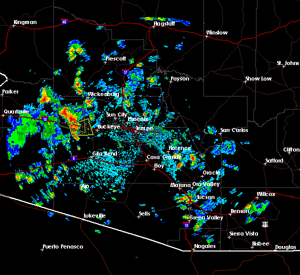 At 320 pm mst, a severe thunderstorm was located near tonopah, moving east at 10 mph (radar indicated). Hazards include 60 mph wind gusts. expect damage to roofs, siding, and trees At 320 pm mst, a severe thunderstorm was located near tonopah, moving east at 10 mph (radar indicated). Hazards include 60 mph wind gusts. expect damage to roofs, siding, and trees
|
| 8/3/2017 3:08 PM MST |
 The severe thunderstorm warning for maricopa county will expire at 315 pm mst, the storm which prompted the warning has weakened below severe limits, and no longer poses an immediate threat to life or property. therefore the warning will be allowed to expire. however heavy rain is still possible with this thunderstorm. The severe thunderstorm warning for maricopa county will expire at 315 pm mst, the storm which prompted the warning has weakened below severe limits, and no longer poses an immediate threat to life or property. therefore the warning will be allowed to expire. however heavy rain is still possible with this thunderstorm.
|
| 8/3/2017 2:50 PM MST |
 At 250 pm mst, a severe thunderstorm was located 8 miles northwest of tonopah, moving north at 5 mph (radar indicated). Hazards include 60 mph wind gusts. Expect damage to roofs, siding, and trees. This severe thunderstorm will remain over mainly rural areas of maricopa county; however, interstate-10 may be impacted. At 250 pm mst, a severe thunderstorm was located 8 miles northwest of tonopah, moving north at 5 mph (radar indicated). Hazards include 60 mph wind gusts. Expect damage to roofs, siding, and trees. This severe thunderstorm will remain over mainly rural areas of maricopa county; however, interstate-10 may be impacted.
|
| 8/3/2017 2:42 PM MST |
 At 241 pm mst, a severe thunderstorm was located 8 miles northwest of tonopah, moving north at 5 mph (radar indicated). Hazards include 60 mph wind gusts. Expect damage to roofs, siding, and trees. This severe thunderstorm will remain over mainly rural areas of maricopa county but also includes interstate 10 near tonopah. At 241 pm mst, a severe thunderstorm was located 8 miles northwest of tonopah, moving north at 5 mph (radar indicated). Hazards include 60 mph wind gusts. Expect damage to roofs, siding, and trees. This severe thunderstorm will remain over mainly rural areas of maricopa county but also includes interstate 10 near tonopah.
|
| 7/16/2017 10:46 PM MST |
 At 1043 pm mst, a belt of severe thunderstorm winds were moving through parts of the phoenix far southwest valley including the communities of estrella, buckeye, palo verde, rainbow valley and western parts of the gila river indian reservation, moving southwest at 35 mph (radar indicated). Hazards include 60 mph wind gusts. expect damage to roofs, siding, and trees At 1043 pm mst, a belt of severe thunderstorm winds were moving through parts of the phoenix far southwest valley including the communities of estrella, buckeye, palo verde, rainbow valley and western parts of the gila river indian reservation, moving southwest at 35 mph (radar indicated). Hazards include 60 mph wind gusts. expect damage to roofs, siding, and trees
|
| 7/16/2017 10:20 PM MST |
 At 1019 pm mst, a severe thunderstorm was located over arizona state fairgrounds, or near phoenix, moving south at 30 mph (radar indicated numerous severe thunderstorms). Hazards include 60 mph wind gusts. expect damage to roofs, siding, and trees At 1019 pm mst, a severe thunderstorm was located over arizona state fairgrounds, or near phoenix, moving south at 30 mph (radar indicated numerous severe thunderstorms). Hazards include 60 mph wind gusts. expect damage to roofs, siding, and trees
|
| 7/15/2017 8:05 PM MST |
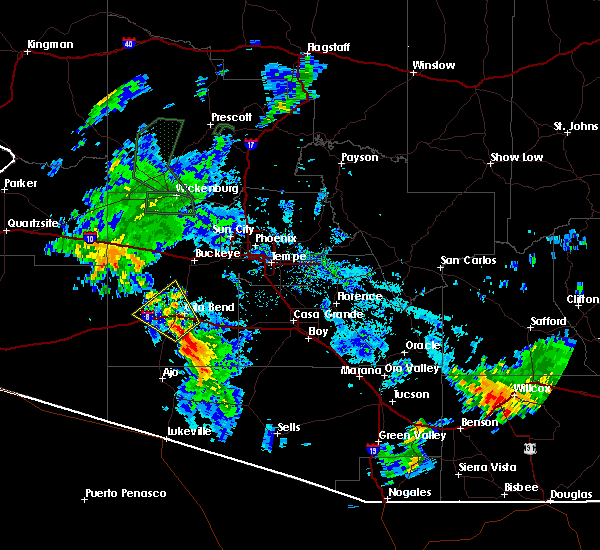 At 805 pm mst, a severe thunderstorm was located over gila bend auxiliary field, or over gila bend, moving northwest at 40 mph (radar indicated). Hazards include 60 mph wind gusts and quarter size hail. Hail damage to vehicles is expected. Expect wind damage to roofs, siding, and trees. At 805 pm mst, a severe thunderstorm was located over gila bend auxiliary field, or over gila bend, moving northwest at 40 mph (radar indicated). Hazards include 60 mph wind gusts and quarter size hail. Hail damage to vehicles is expected. Expect wind damage to roofs, siding, and trees.
|
| 7/15/2017 6:21 PM MST |
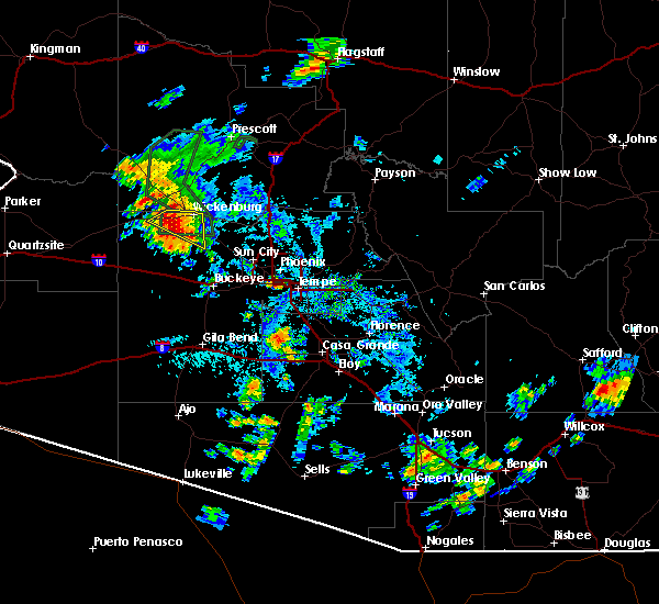 At 620 pm mst, a severe thunderstorm was located 12 miles southwest of wickenburg, moving southwest at 30 mph (radar indicated). Hazards include 60 mph wind gusts and quarter size hail. Hail damage to vehicles is expected. expect wind damage to roofs, siding, and trees. Locations impacted include, wickenburg. At 620 pm mst, a severe thunderstorm was located 12 miles southwest of wickenburg, moving southwest at 30 mph (radar indicated). Hazards include 60 mph wind gusts and quarter size hail. Hail damage to vehicles is expected. expect wind damage to roofs, siding, and trees. Locations impacted include, wickenburg.
|
| 7/15/2017 5:55 PM MST |
 At 554 pm mst, a severe thunderstorm was located over wickenburg, moving southwest at 30 mph (radar indicated). Hazards include 60 mph wind gusts and quarter size hail. Hail damage to vehicles is expected. Expect wind damage to roofs, siding, and trees. At 554 pm mst, a severe thunderstorm was located over wickenburg, moving southwest at 30 mph (radar indicated). Hazards include 60 mph wind gusts and quarter size hail. Hail damage to vehicles is expected. Expect wind damage to roofs, siding, and trees.
|
| 8/20/2016 6:40 PM MST |
 The severe thunderstorm warning for maricopa county will expire at 645 pm mst, the severe thunderstorm which prompted the warning has weakened. therefore the warning will be allowed to expire. The severe thunderstorm warning for maricopa county will expire at 645 pm mst, the severe thunderstorm which prompted the warning has weakened. therefore the warning will be allowed to expire.
|
| 8/20/2016 6:22 PM MST |
 At 622 pm mst, doppler radar indicated a severe thunderstorm capable of producing quarter size hail and destructive winds in excess of 70 mph. this storm was located over arrowhead mall, or near sun city, and moving southwest at 40 mph. At 622 pm mst, doppler radar indicated a severe thunderstorm capable of producing quarter size hail and destructive winds in excess of 70 mph. this storm was located over arrowhead mall, or near sun city, and moving southwest at 40 mph.
|
| 8/10/2016 8:40 PM MST | Buckeye pd reported one power pole and several trees down. in maricopa county AZ, 4.1 miles NNW of Buckeye, AZ |
| 8/9/2016 8:37 PM MST |
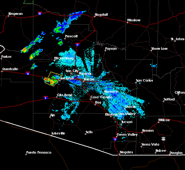 At 836 pm mst, doppler radar indicated a severe thunderstorm capable of producing damaging winds in excess of 60 mph. this storm was located 10 miles west of white tank mountain park, or 13 miles northeast of tonopah, moving northeast at 20 mph. penny size hail may also accompany the damaging winds. this storm reamins at severe levels and another storm is starting to develop within the warned polygon. locations impacted include, buckeye, palo verde nuclear generation station, wintersburg and hassayampa. At 836 pm mst, doppler radar indicated a severe thunderstorm capable of producing damaging winds in excess of 60 mph. this storm was located 10 miles west of white tank mountain park, or 13 miles northeast of tonopah, moving northeast at 20 mph. penny size hail may also accompany the damaging winds. this storm reamins at severe levels and another storm is starting to develop within the warned polygon. locations impacted include, buckeye, palo verde nuclear generation station, wintersburg and hassayampa.
|
| 8/9/2016 8:20 PM MST |
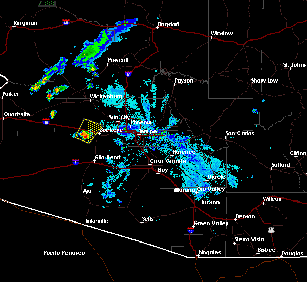 At 819 pm mst, doppler radar indicated a severe thunderstorm capable of producing damaging winds in excess of 60 mph. this storm was located 8 miles northeast of wintersburg, or 9 miles east of tonopah, and moving northeast at 20 mph. penny size hail may also accompany the damaging winds. At 819 pm mst, doppler radar indicated a severe thunderstorm capable of producing damaging winds in excess of 60 mph. this storm was located 8 miles northeast of wintersburg, or 9 miles east of tonopah, and moving northeast at 20 mph. penny size hail may also accompany the damaging winds.
|
| 7/29/2016 9:48 PM MST |
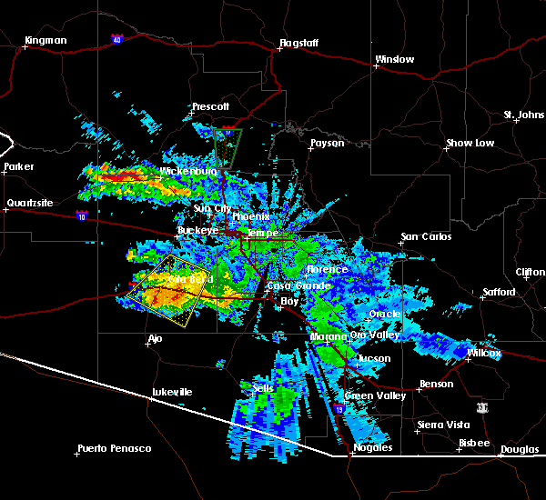 At 947 pm mst, doppler radar indicated a severe thunderstorm capable of producing quarter size hail and destructive winds in excess of 80 mph. this storm was located 9 miles southeast of gila bend auxiliary field, or 12 miles south of gila bend, moving southwest at 30 mph. the gila bend auxiliary field measured a wind gusts in excess of 85 mph. locations impacted include, buckeye, gila bend, estrella, big horn, gila bend auxiliary field, cotton center, bosque and sonoran national monument. At 947 pm mst, doppler radar indicated a severe thunderstorm capable of producing quarter size hail and destructive winds in excess of 80 mph. this storm was located 9 miles southeast of gila bend auxiliary field, or 12 miles south of gila bend, moving southwest at 30 mph. the gila bend auxiliary field measured a wind gusts in excess of 85 mph. locations impacted include, buckeye, gila bend, estrella, big horn, gila bend auxiliary field, cotton center, bosque and sonoran national monument.
|
| 7/29/2016 9:39 PM MST |
 The severe thunderstorm warning for west central maricopa county will expire at 945 pm mst, the storm which prompted the warning has moved out of the area. therefore the warning will be allowed to expire. The severe thunderstorm warning for west central maricopa county will expire at 945 pm mst, the storm which prompted the warning has moved out of the area. therefore the warning will be allowed to expire.
|
| 7/29/2016 9:16 PM MST |
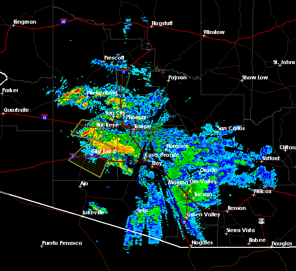 At 915 pm mst, doppler radar indicated a severe thunderstorm capable of producing destructive winds in excess of 70 mph. this storm was located over sonoran national monument, or 9 miles east of gila bend, and moving southwest at 30 mph. nickel size hail may also accompany the damaging winds along with blowing dust and reduced visibilities below one-half mile. At 915 pm mst, doppler radar indicated a severe thunderstorm capable of producing destructive winds in excess of 70 mph. this storm was located over sonoran national monument, or 9 miles east of gila bend, and moving southwest at 30 mph. nickel size hail may also accompany the damaging winds along with blowing dust and reduced visibilities below one-half mile.
|
| 7/29/2016 9:00 PM MST |
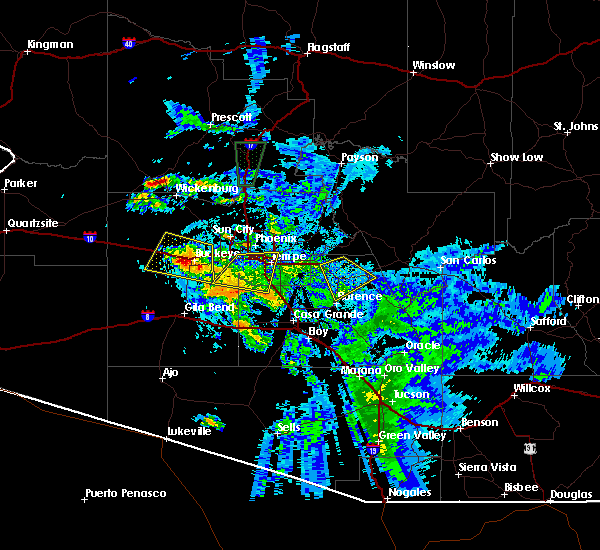 At 859 pm mst, doppler radar continued to indicate a severe thunderstorm capable of producing half dollar size hail and destructive winds in excess of 80 mph. this storm was located near palo verde, or near buckeye, and moving southwest at 10 mph. this storm has been very to slow to move off the interstate 10 and state route 85 interchange. At 859 pm mst, doppler radar continued to indicate a severe thunderstorm capable of producing half dollar size hail and destructive winds in excess of 80 mph. this storm was located near palo verde, or near buckeye, and moving southwest at 10 mph. this storm has been very to slow to move off the interstate 10 and state route 85 interchange.
|
| 7/29/2016 8:55 PM MST | Awos station 6 wnw buckeye /bxk in maricopa county AZ, 4.5 miles E of Buckeye, AZ |
| 7/29/2016 8:43 PM MST |
 At 842 pm mst, doppler radar indicated a severe thunderstorm capable of producing destructive winds in excess of 70 mph. this storm was located over buckeye, moving southwest at 10 mph. nickel size hail and heavy rainfall will also accompany the damaging winds. locations impacted include, goodyear, buckeye, liberty, white tank mountain park, palo verde nuclear generation station, perryville, wintersburg, estrella mountain ranch, palo verde, hassayampa and arlington. At 842 pm mst, doppler radar indicated a severe thunderstorm capable of producing destructive winds in excess of 70 mph. this storm was located over buckeye, moving southwest at 10 mph. nickel size hail and heavy rainfall will also accompany the damaging winds. locations impacted include, goodyear, buckeye, liberty, white tank mountain park, palo verde nuclear generation station, perryville, wintersburg, estrella mountain ranch, palo verde, hassayampa and arlington.
|
| 7/29/2016 8:40 PM MST | A few palo verde trees down and curb to curb flooding. time estimated based on radar. yuma road and watson r in maricopa county AZ, 3.2 miles WSW of Buckeye, AZ |
| 7/29/2016 8:21 PM MST |
 At 821 pm mst, doppler radar indicated a severe thunderstorm capable of producing destructive winds in excess of 70 mph. this storm was located near buckeye, and moving southwest at 10 mph. penny size hail may also accompany the damaging winds. At 821 pm mst, doppler radar indicated a severe thunderstorm capable of producing destructive winds in excess of 70 mph. this storm was located near buckeye, and moving southwest at 10 mph. penny size hail may also accompany the damaging winds.
|
| 7/1/2016 6:31 PM MST |
 At 631 pm mst, doppler radar indicated a line of severe thunderstorms capable of producing damaging winds in excess of 60 mph. these storms were located along a line extending from goodyear to 10 miles northwest of gila bend auxiliary field, and moving southeast at 15 mph. penny size hail may also accompany the damaging winds. At 631 pm mst, doppler radar indicated a line of severe thunderstorms capable of producing damaging winds in excess of 60 mph. these storms were located along a line extending from goodyear to 10 miles northwest of gila bend auxiliary field, and moving southeast at 15 mph. penny size hail may also accompany the damaging winds.
|
| 7/1/2016 6:25 PM MST |
 At 622 pm mst, the doppler radar indicated that the circulation with the tornado has weakened but is still in place, thus we are letting the tornado warning remain in effect. this dangerous storm was located near estrella mountain ranch, or 8 miles southeast of buckeye, moving east at 10 mph. locations impacted include, goodyear, estrella mountain ranch and rainbow valley. At 622 pm mst, the doppler radar indicated that the circulation with the tornado has weakened but is still in place, thus we are letting the tornado warning remain in effect. this dangerous storm was located near estrella mountain ranch, or 8 miles southeast of buckeye, moving east at 10 mph. locations impacted include, goodyear, estrella mountain ranch and rainbow valley.
|
| 7/1/2016 6:05 PM MST |
 At 605 pm mst, doppler radar indicated a severe thunderstorm capable of producing a tornado. this dangerous storm was located near palo verde, or 7 miles south of buckeye, and moving east at 10 mph. At 605 pm mst, doppler radar indicated a severe thunderstorm capable of producing a tornado. this dangerous storm was located near palo verde, or 7 miles south of buckeye, and moving east at 10 mph.
|
| 7/1/2016 6:00 PM MST |
 At 600 pm mst, doppler radar indicated a line of severe thunderstorms capable of producing quarter size hail and damaging winds in excess of 60 mph. these storms were located along a line extending from near white tank mountain park to 8 miles west of painted rock dam, and moving southeast at 10 mph. At 600 pm mst, doppler radar indicated a line of severe thunderstorms capable of producing quarter size hail and damaging winds in excess of 60 mph. these storms were located along a line extending from near white tank mountain park to 8 miles west of painted rock dam, and moving southeast at 10 mph.
|
| 7/1/2016 5:44 PM MST |
 At 543 pm mst, doppler radar indicated severe thunderstorms capable of producing quarter size hail and damaging winds in excess of 60 mph. these storms were located along a line extending from 6 miles northwest of buckeye to 6 miles southwest of palo verde nuclear generation station, moving east at 10 mph. locations impacted include, glendale, avondale, goodyear, buckeye, tolleson, cashion, litchfield park, luke afb, liberty, white tank mountain park, palo verde nuclear generation station, perryville, wintersburg, painted rock dam, palo verde, hassayampa and arlington. At 543 pm mst, doppler radar indicated severe thunderstorms capable of producing quarter size hail and damaging winds in excess of 60 mph. these storms were located along a line extending from 6 miles northwest of buckeye to 6 miles southwest of palo verde nuclear generation station, moving east at 10 mph. locations impacted include, glendale, avondale, goodyear, buckeye, tolleson, cashion, litchfield park, luke afb, liberty, white tank mountain park, palo verde nuclear generation station, perryville, wintersburg, painted rock dam, palo verde, hassayampa and arlington.
|
| 7/1/2016 5:28 PM MST |
 At 528 pm mst, doppler radar indicated a broken line of severe thunderstorms capable of producing damaging winds in excess of 60 mph. these storms were located along a line extending from 7 miles northwest of buckeye to 8 miles southwest of palo verde nuclear generation station, and moving east at 10 mph. nickel size hail may also accompany the damaging winds. At 528 pm mst, doppler radar indicated a broken line of severe thunderstorms capable of producing damaging winds in excess of 60 mph. these storms were located along a line extending from 7 miles northwest of buckeye to 8 miles southwest of palo verde nuclear generation station, and moving east at 10 mph. nickel size hail may also accompany the damaging winds.
|
| 7/1/2016 5:21 PM MST |
 At 521 pm mst, doppler radar indicated a severe thunderstorm capable of producing damaging winds in excess of 60 mph. this storm was located near luke afb, or near waddell, moving east at 10 mph. nickel size hail may also accompany the damaging winds. locations impacted include, phoenix, glendale, surprise, avondale, goodyear, buckeye, el mirage, tolleson, youngtown, cashion, sun city, waddell, litchfield park, downtown glendale, luke afb, glendale sports complex, camelback ranch, phoenix international raceway and downtown peoria. At 521 pm mst, doppler radar indicated a severe thunderstorm capable of producing damaging winds in excess of 60 mph. this storm was located near luke afb, or near waddell, moving east at 10 mph. nickel size hail may also accompany the damaging winds. locations impacted include, phoenix, glendale, surprise, avondale, goodyear, buckeye, el mirage, tolleson, youngtown, cashion, sun city, waddell, litchfield park, downtown glendale, luke afb, glendale sports complex, camelback ranch, phoenix international raceway and downtown peoria.
|
| 7/1/2016 4:58 PM MST |
 At 457 pm mst, doppler radar indicated a severe thunderstorm capable of producing damaging winds in excess of 60 mph. this storm was located near white tank mountain park, or 8 miles west of waddell, and moving east at 10 mph. nickel size hail may also accompany the damaging winds. At 457 pm mst, doppler radar indicated a severe thunderstorm capable of producing damaging winds in excess of 60 mph. this storm was located near white tank mountain park, or 8 miles west of waddell, and moving east at 10 mph. nickel size hail may also accompany the damaging winds.
|
| 7/1/2016 4:53 PM MST |
 At 453 pm mst, doppler radar indicated a severe thunderstorm capable of producing damaging winds in excess of 60 mph. this storm was located over glendale sports complex, or near youngtown, moving east at 25 mph. nickel size hail may also accompany the damaging winds. locations impacted include, phoenix, glendale, surprise, avondale, goodyear, buckeye, el mirage, tolleson, youngtown, cashion, sun city, waddell, sun city west, litchfield park, downtown glendale, surprise stadium, luke afb, glendale sports complex, camelback ranch and white tank mountain park. At 453 pm mst, doppler radar indicated a severe thunderstorm capable of producing damaging winds in excess of 60 mph. this storm was located over glendale sports complex, or near youngtown, moving east at 25 mph. nickel size hail may also accompany the damaging winds. locations impacted include, phoenix, glendale, surprise, avondale, goodyear, buckeye, el mirage, tolleson, youngtown, cashion, sun city, waddell, sun city west, litchfield park, downtown glendale, surprise stadium, luke afb, glendale sports complex, camelback ranch and white tank mountain park.
|
| 7/1/2016 4:26 PM MST |
 At 426 pm mst, doppler radar indicated a severe thunderstorm capable of producing damaging winds in excess of 60 mph. this storm was located near white tank mountain park, or near waddell, and moving east at 25 mph. penny size hail may also accompany the damaging winds. At 426 pm mst, doppler radar indicated a severe thunderstorm capable of producing damaging winds in excess of 60 mph. this storm was located near white tank mountain park, or near waddell, and moving east at 25 mph. penny size hail may also accompany the damaging winds.
|
| 6/11/2016 4:04 PM MST |
 At 403 pm mst, doppler radar indicated a severe thunderstorm capable of producing quarter size hail and damaging winds in excess of 60 mph. this storm was located over wittmann, and moving north at 30 mph. At 403 pm mst, doppler radar indicated a severe thunderstorm capable of producing quarter size hail and damaging winds in excess of 60 mph. this storm was located over wittmann, and moving north at 30 mph.
|
| 10/29/2015 2:10 PM MST |
 The severe thunderstorm warning for central maricopa county will expire at 215 pm mst, the storm which prompted the warning near buckeye has weakened below severe limits, and no longer poses an immediate threat to life or property. therefore the warning will be allowed to expire. The severe thunderstorm warning for central maricopa county will expire at 215 pm mst, the storm which prompted the warning near buckeye has weakened below severe limits, and no longer poses an immediate threat to life or property. therefore the warning will be allowed to expire.
|
| 10/29/2015 1:59 PM MST |
 At 159 pm mst, doppler radar indicated a severe thunderstorm capable of producing quarter size hail and damaging winds in excess of 60 mph. this storm was located over liberty, or near goodyear, moving northeast at 30 mph. locations impacted include, avondale, goodyear, estrella mountain park, liberty, perryville, estrella mountain ranch and rainbow valley. At 159 pm mst, doppler radar indicated a severe thunderstorm capable of producing quarter size hail and damaging winds in excess of 60 mph. this storm was located over liberty, or near goodyear, moving northeast at 30 mph. locations impacted include, avondale, goodyear, estrella mountain park, liberty, perryville, estrella mountain ranch and rainbow valley.
|
| 10/29/2015 1:42 PM MST |
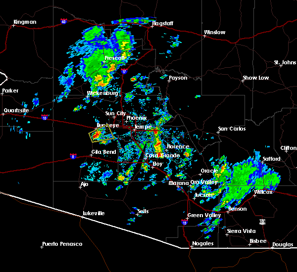 At 142 pm mst, doppler radar indicated a severe thunderstorm capable of producing quarter size hail and damaging winds in excess of 60 mph. this storm was located near palo verde, or near buckeye, and moving east at 15 mph. At 142 pm mst, doppler radar indicated a severe thunderstorm capable of producing quarter size hail and damaging winds in excess of 60 mph. this storm was located near palo verde, or near buckeye, and moving east at 15 mph.
|
| 10/20/2015 12:09 PM MST |
 At 1208 pm mst, doppler radar indicated a severe thunderstorms still capable of producing quarter size hailstones. there have been several reports of large hail, mainly 3/4 inches in size, in the phoenix west valley in the warned area. locations impacted include, phoenix, glendale, peoria, surprise, avondale, goodyear, buckeye, el mirage, tolleson, youngtown, sun city, laveen, sun city west, cashion, waddell, litchfield park, surprise stadium, sky harbor airport, luke afb and glendale sports complex. At 1208 pm mst, doppler radar indicated a severe thunderstorms still capable of producing quarter size hailstones. there have been several reports of large hail, mainly 3/4 inches in size, in the phoenix west valley in the warned area. locations impacted include, phoenix, glendale, peoria, surprise, avondale, goodyear, buckeye, el mirage, tolleson, youngtown, sun city, laveen, sun city west, cashion, waddell, litchfield park, surprise stadium, sky harbor airport, luke afb and glendale sports complex.
|
| 10/20/2015 11:44 AM MST |
 At 1143 am mst, doppler radar indicated a severe thunderstorm capable of producing quarter size hailstones. this storm was located over avondale, and moving northeast at 15 mph. At 1143 am mst, doppler radar indicated a severe thunderstorm capable of producing quarter size hailstones. this storm was located over avondale, and moving northeast at 15 mph.
|
| 10/19/2015 6:08 PM MST |
 The severe thunderstorm warning for northwestern maricopa county will expire at 615 pm mst, the severe thunderstorm which prompted the warning has weakened considerably. therefore, the warning will be allowed to expire at 615 pm. brief heavy rain and gusty winds can still be expected with this storm over the next 15 minutes as it moves over wickenburg and the surrounding area. The severe thunderstorm warning for northwestern maricopa county will expire at 615 pm mst, the severe thunderstorm which prompted the warning has weakened considerably. therefore, the warning will be allowed to expire at 615 pm. brief heavy rain and gusty winds can still be expected with this storm over the next 15 minutes as it moves over wickenburg and the surrounding area.
|
| 10/19/2015 5:48 PM MST |
 At 543 pm mst, doppler radar indicated the severe thunderstorm had weakened. this storm still has the potential to rapidly strengthen again, and is capable of producing quarter size hail and damaging winds in excess of 60 mph. this storm is currently located south of wickenburg. locations impacted include, wickenburg, wittmann, and the vulture mine road. At 543 pm mst, doppler radar indicated the severe thunderstorm had weakened. this storm still has the potential to rapidly strengthen again, and is capable of producing quarter size hail and damaging winds in excess of 60 mph. this storm is currently located south of wickenburg. locations impacted include, wickenburg, wittmann, and the vulture mine road.
|
| 10/19/2015 5:24 PM MST |
 At 522 pm mst, doppler radar indicated a severe thunderstorm capable of producing quarter size hail and damaging winds in excess of 60 mph. this storm was located 14 miles northeast of tonopah, and moving quickly northeast toward wickenburg. At 522 pm mst, doppler radar indicated a severe thunderstorm capable of producing quarter size hail and damaging winds in excess of 60 mph. this storm was located 14 miles northeast of tonopah, and moving quickly northeast toward wickenburg.
|
| 9/3/2015 5:32 PM MST |
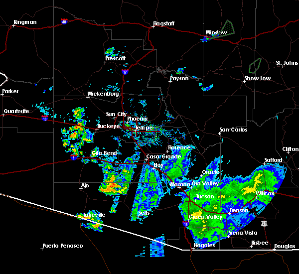 At 532 pm mst, doppler radar indicated a severe thunderstorm capable of producing damaging winds in excess of 60 mph. this storm was located near tonopah, and moving north at 10 mph. At 532 pm mst, doppler radar indicated a severe thunderstorm capable of producing damaging winds in excess of 60 mph. this storm was located near tonopah, and moving north at 10 mph.
|
| 8/27/2015 5:16 PM MST |
 At 515 pm mst, doppler radar indicated a severe thunderstorm capable of producing damaging winds in excess of 60 mph. this storm was located over estrella mountain ranch, or near goodyear, moving east at 5 mph. locations impacted include, goodyear, liberty and estrella mountain ranch. At 515 pm mst, doppler radar indicated a severe thunderstorm capable of producing damaging winds in excess of 60 mph. this storm was located over estrella mountain ranch, or near goodyear, moving east at 5 mph. locations impacted include, goodyear, liberty and estrella mountain ranch.
|
| 8/27/2015 4:57 PM MST | The severe thunderstorm warning for central maricopa county will expire at 500 pm mst, the storm which prompted the warning has weakened below severe limits and exited the warned area. therefore the warning will be allowed to expire. however gusty winds and heavy rain are still possible with this thunderstorm. |
| 8/27/2015 4:56 PM MST |
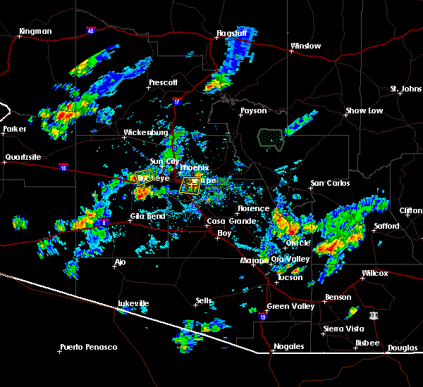 At 456 pm mst, doppler radar indicated a severe thunderstorm capable of producing destructive winds in excess of 70 mph. this storm was located 8 miles southeast of palo verde, or 8 miles south of buckeye. this storm was nearly stationary. At 456 pm mst, doppler radar indicated a severe thunderstorm capable of producing destructive winds in excess of 70 mph. this storm was located 8 miles southeast of palo verde, or 8 miles south of buckeye. this storm was nearly stationary.
|
| 8/27/2015 4:40 PM MST |
 At 439 pm mst, doppler radar indicated a severe thunderstorm capable of producing damaging winds in excess of 60 mph. this storm was located near perryville, or 7 miles northwest of goodyear. this storm was nearly stationary. locations impacted include, goodyear, buckeye and perryville. At 439 pm mst, doppler radar indicated a severe thunderstorm capable of producing damaging winds in excess of 60 mph. this storm was located near perryville, or 7 miles northwest of goodyear. this storm was nearly stationary. locations impacted include, goodyear, buckeye and perryville.
|
| 8/27/2015 4:23 PM MST |
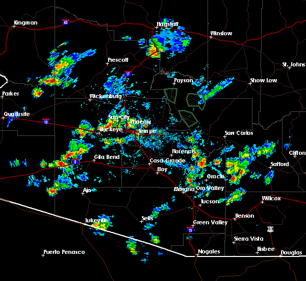 At 423 pm mst, doppler radar indicated a severe thunderstorm capable of producing damaging winds in excess of 60 mph. this storm was located near white tank mountain park, or 8 miles northwest of goodyear, and moving east at 20 mph. At 423 pm mst, doppler radar indicated a severe thunderstorm capable of producing damaging winds in excess of 60 mph. this storm was located near white tank mountain park, or 8 miles northwest of goodyear, and moving east at 20 mph.
|
| 6/29/2015 7:58 PM MST |
 At 756 pm mst, trained weather spotters reported severe thunderstorms producing damaging winds in excess of 60 mph. these storms were centered over wickenburg, and moving west at 10 mph. penny size hail may also accompany the damaging winds. At 756 pm mst, trained weather spotters reported severe thunderstorms producing damaging winds in excess of 60 mph. these storms were centered over wickenburg, and moving west at 10 mph. penny size hail may also accompany the damaging winds.
|
| 8/25/2014 9:54 PM MST | Buckeye police department reports traffic shut down due to power poles dow in maricopa county AZ, 3.5 miles NNW of Buckeye, AZ |
| 7/31/2014 8:45 PM MST | Update...at least 10 rv trailers overturned at 1500 s apache road in buckeye. media reports some injuries involved. update...time of incident and impacts via buckeye po in maricopa county AZ, 2.5 miles W of Buckeye, AZ |
| 7/31/2014 8:37 PM MST | Several rv trailers overturned. media reports some injuries involved. time estimated in maricopa county AZ, 4.2 miles W of Buckeye, AZ |
| 7/31/2014 8:37 PM MST | Several rv trailers overturned. media reports some injuries involved. time estimated in maricopa county AZ, 2.5 miles W of Buckeye, AZ |
| 8/28/2013 8:35 PM MST | Delayed report...50kt gust at buckeye airport in maricopa county AZ, 4.5 miles E of Buckeye, AZ |
| 8/26/2013 7:35 PM MST | Buckeye airport mesonet wind. sustained 43 gust to 68 mph at 735 pm ms in maricopa county AZ, 3.3 miles NNW of Buckeye, AZ |
Hail Maps for Buckeye, AZ
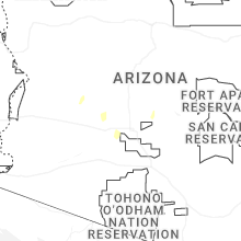
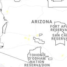
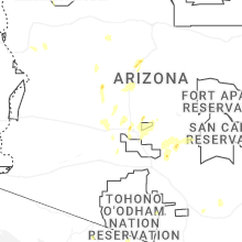
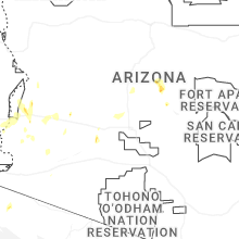
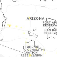


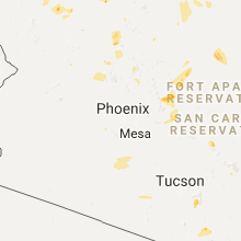


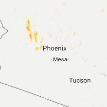


Connect with Interactive Hail Maps