

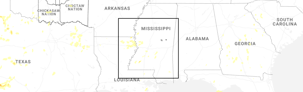
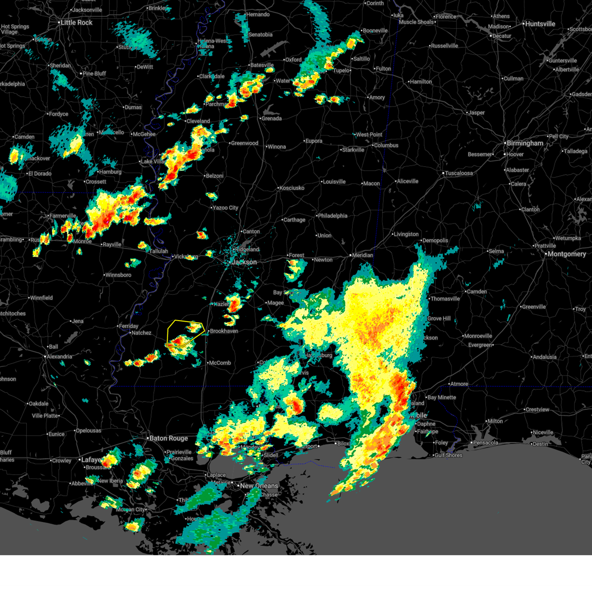
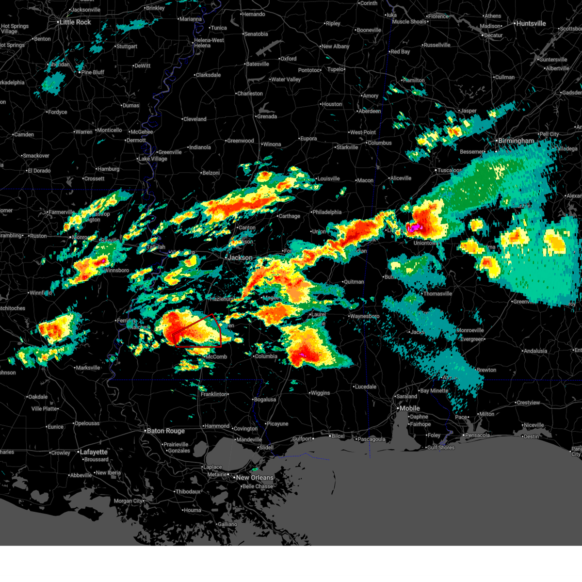
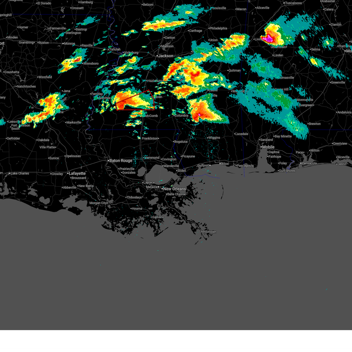
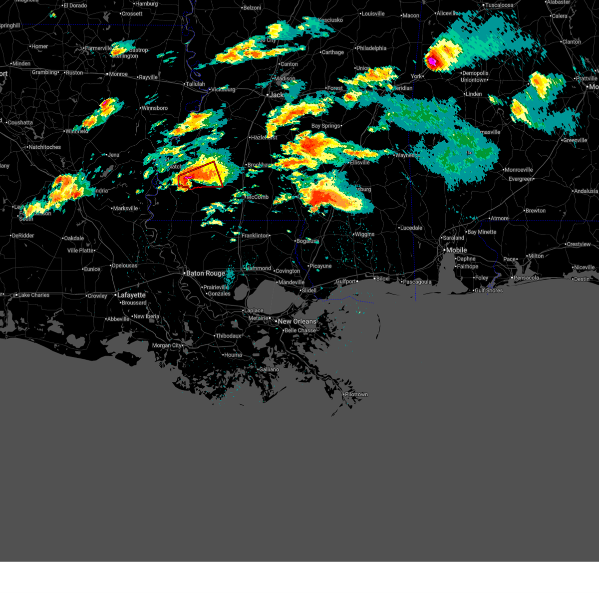
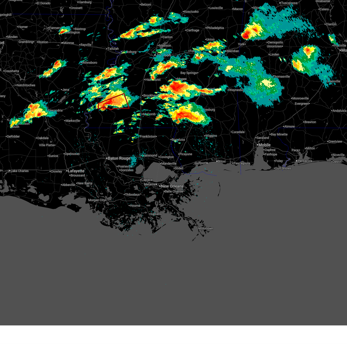
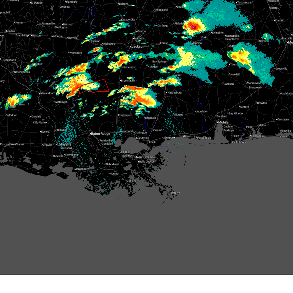
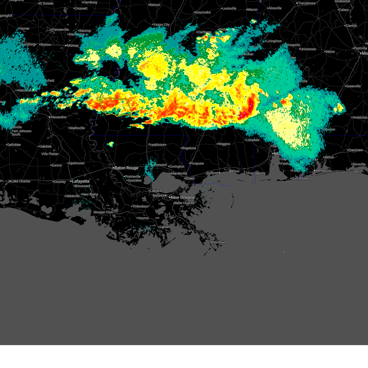
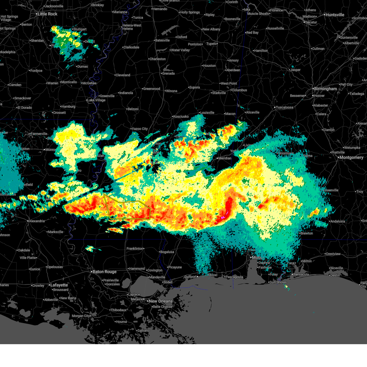
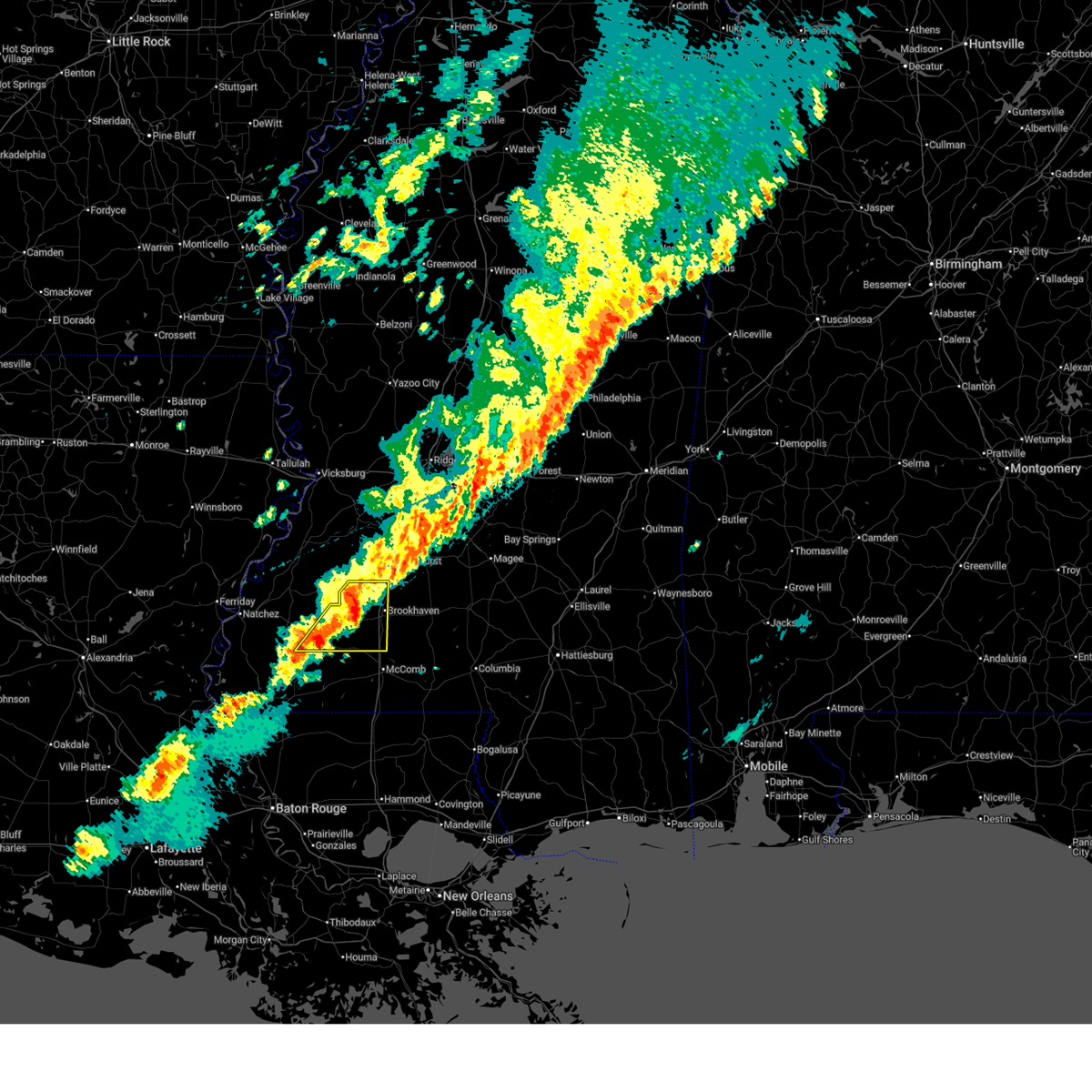
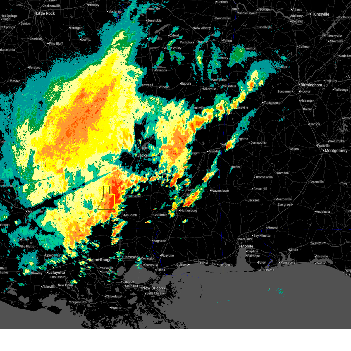
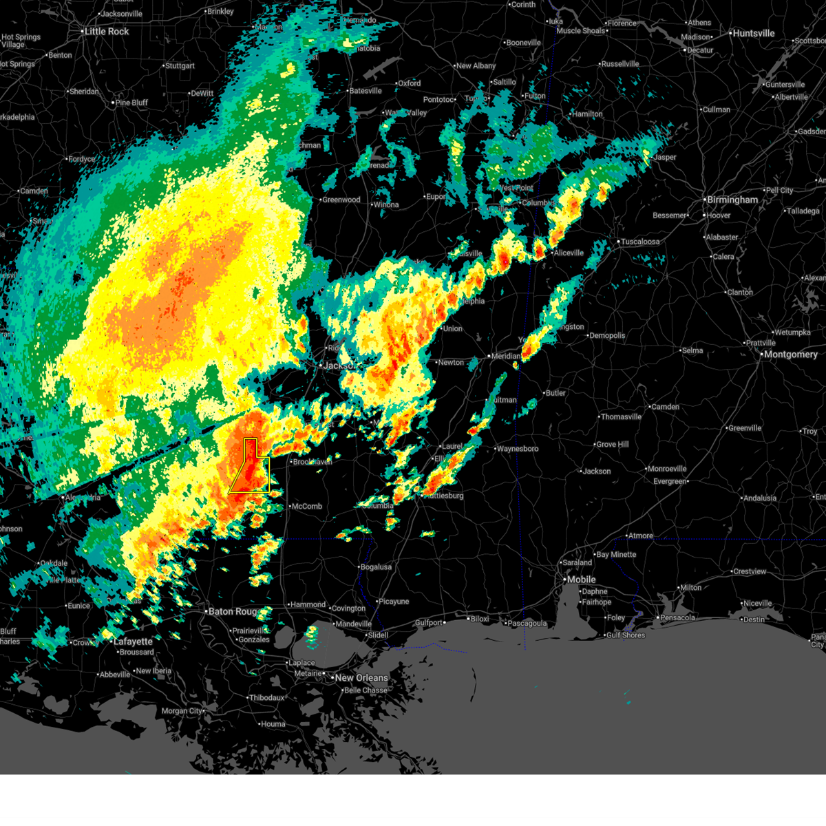
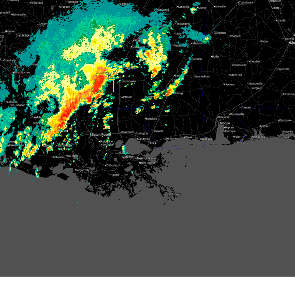
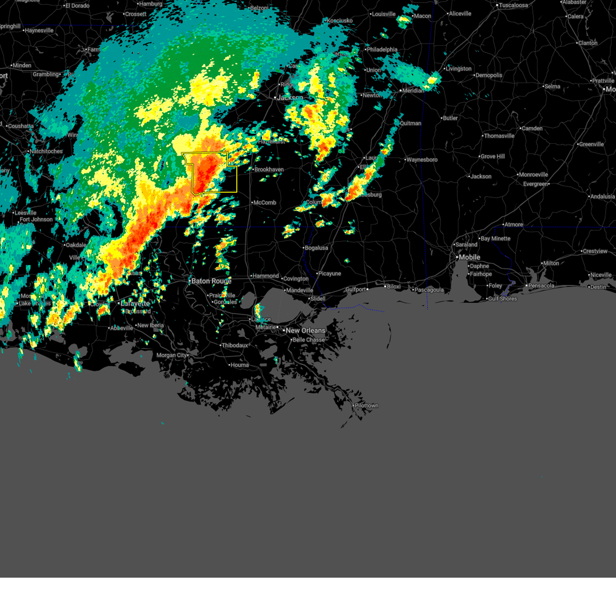
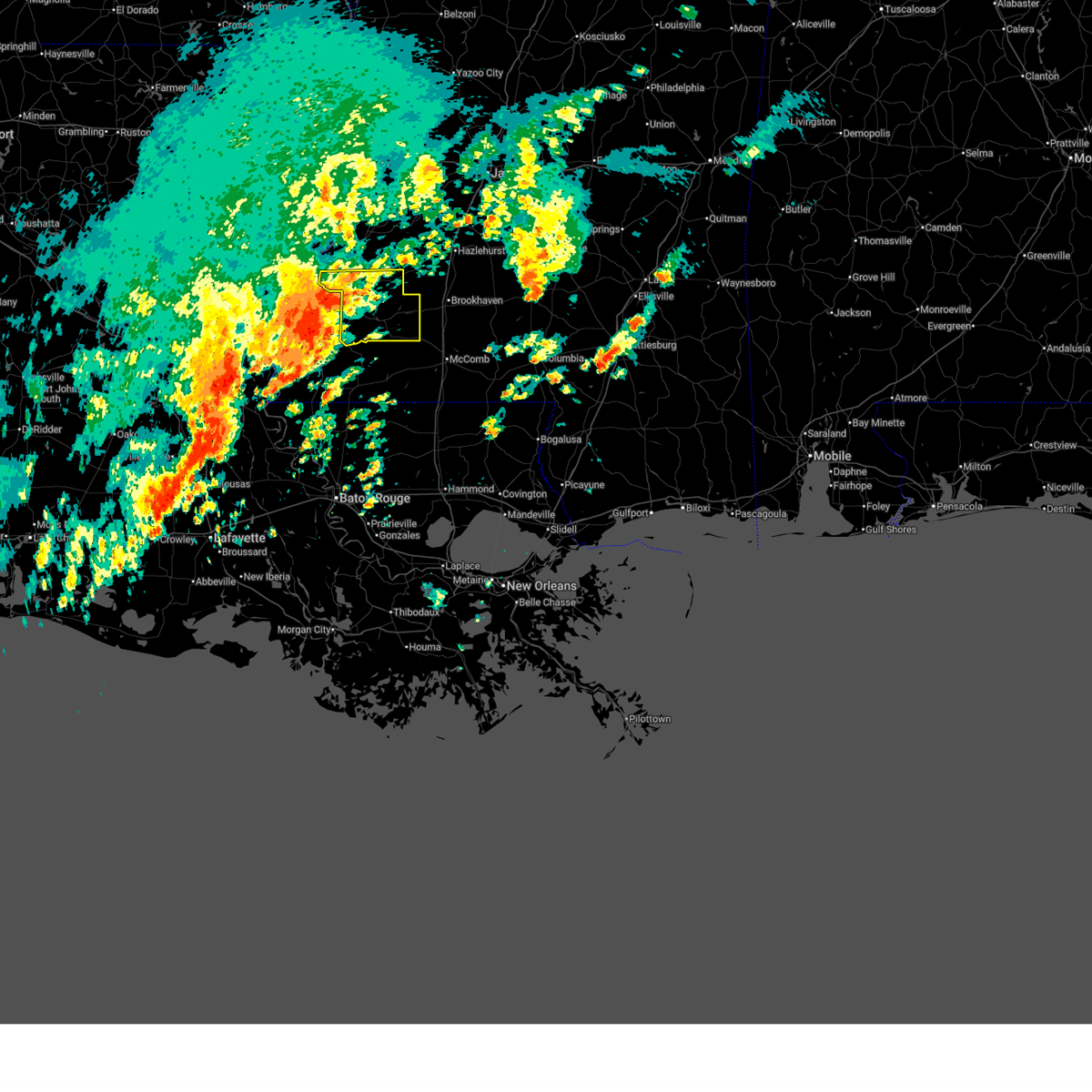
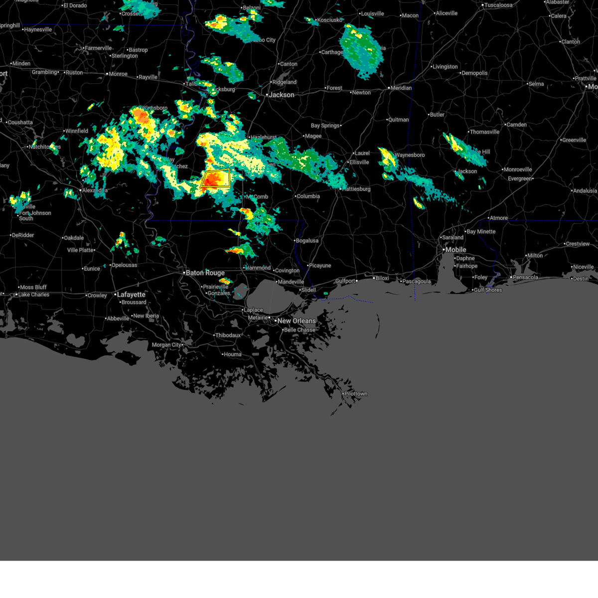
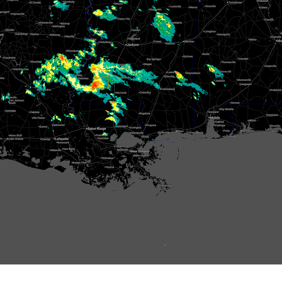
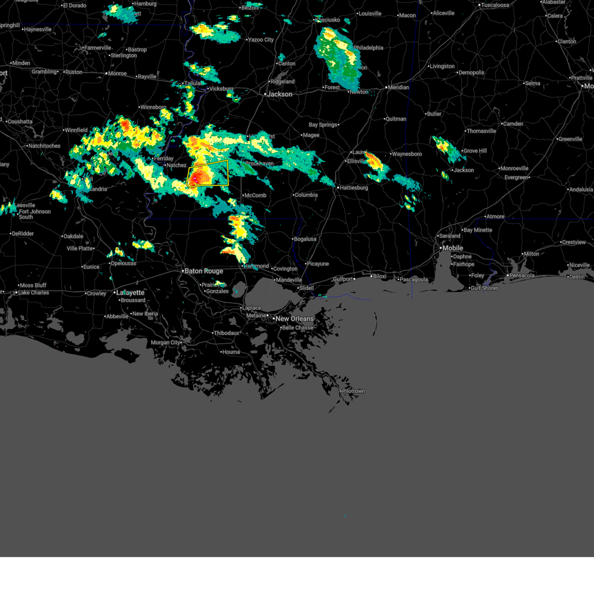
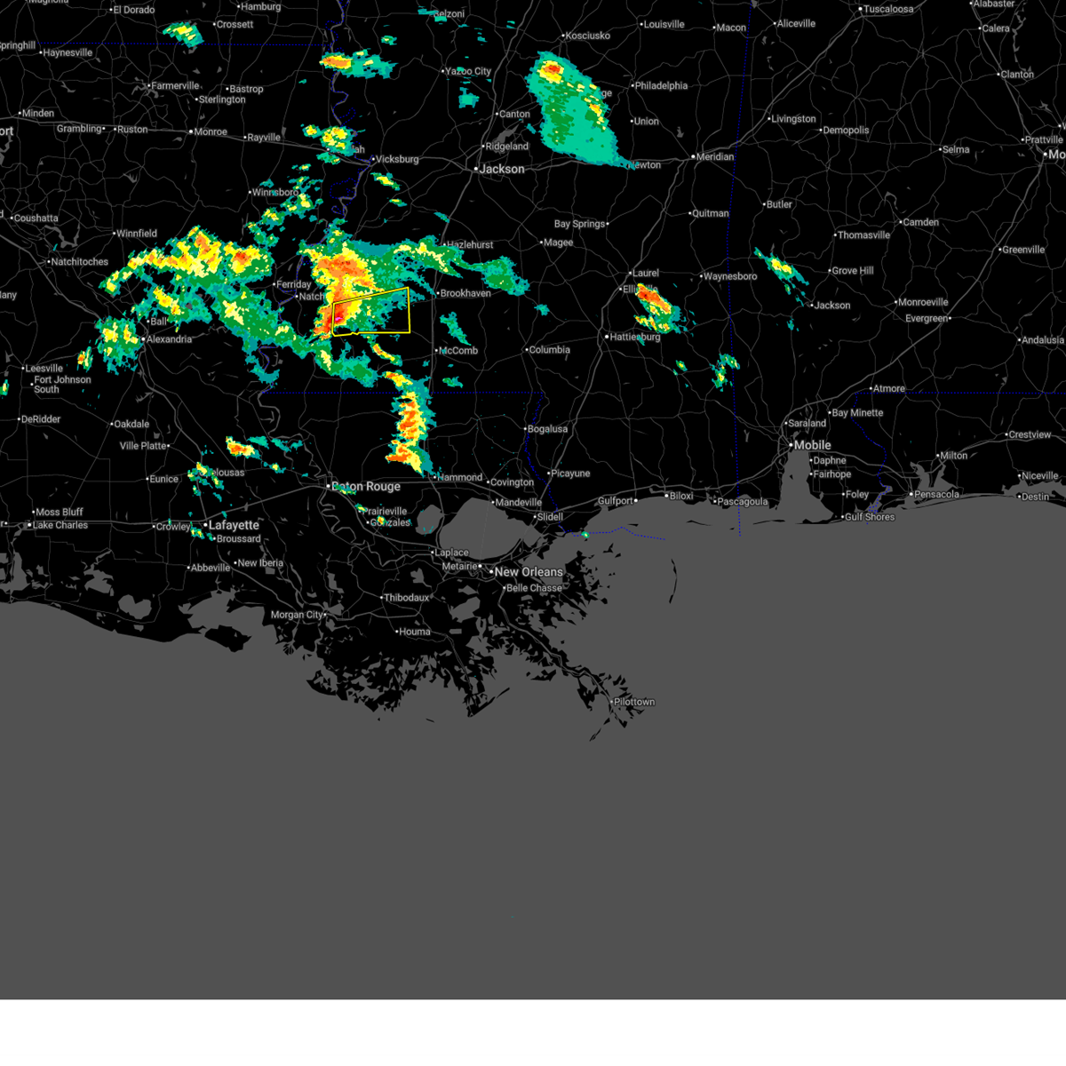
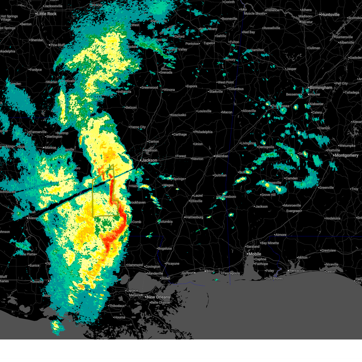
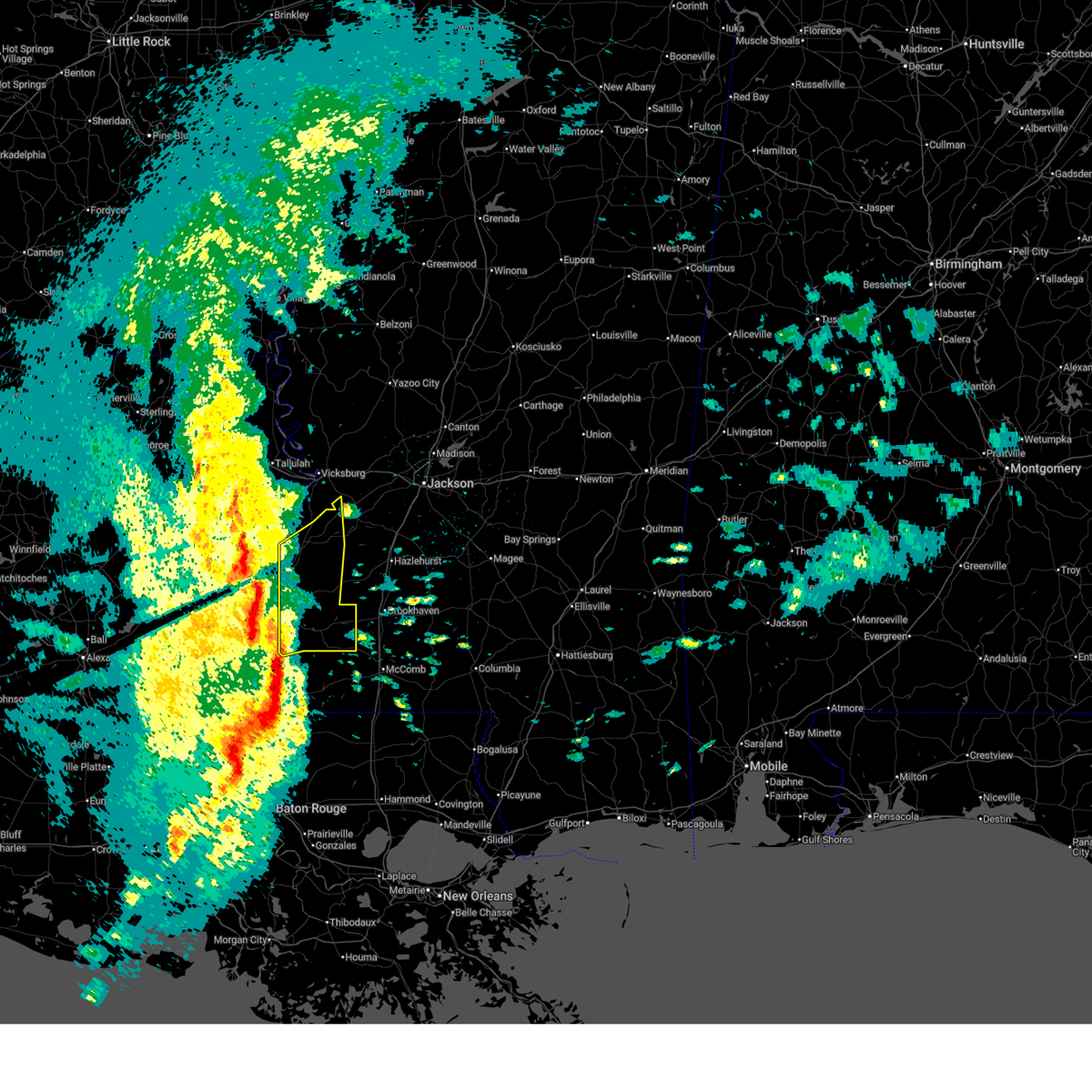
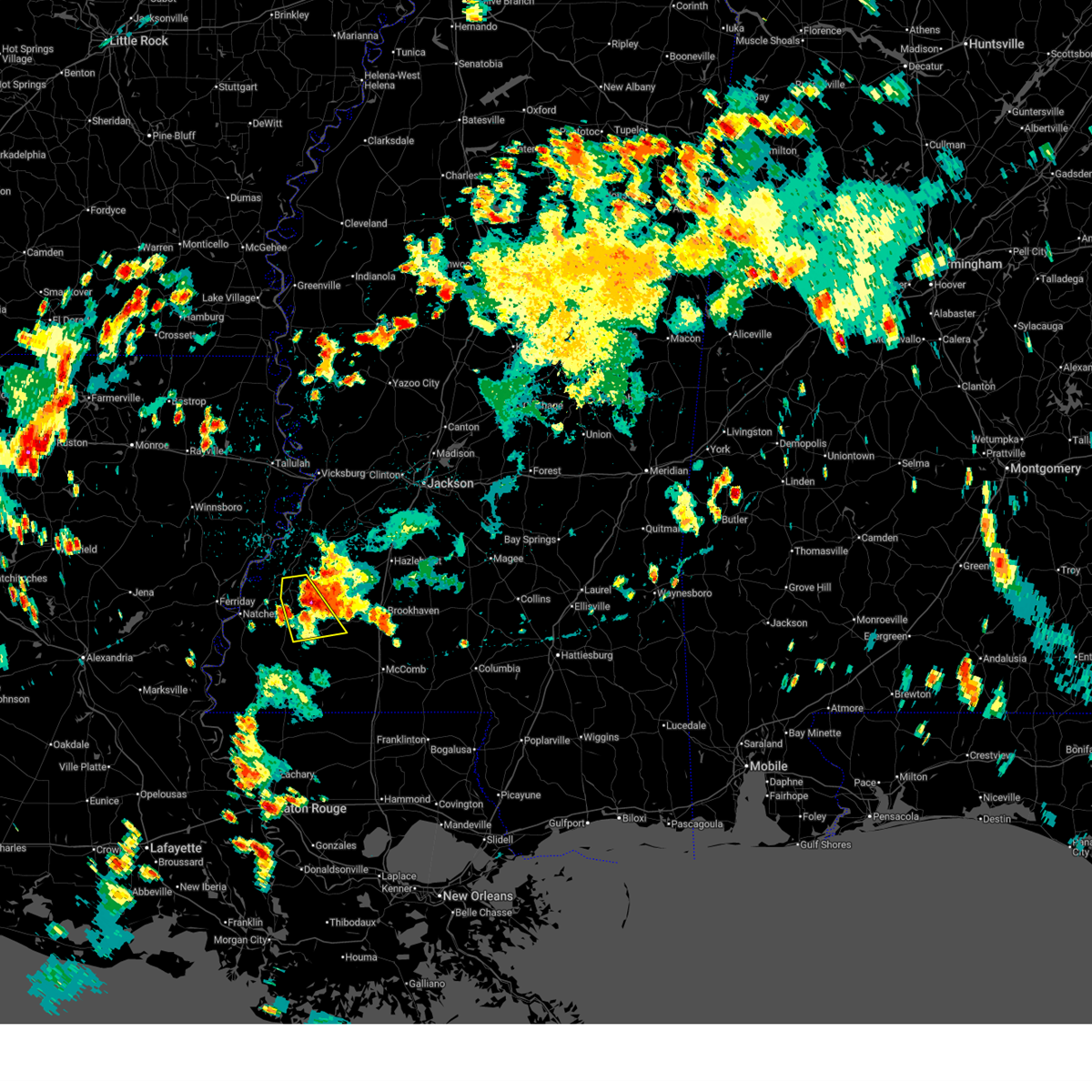
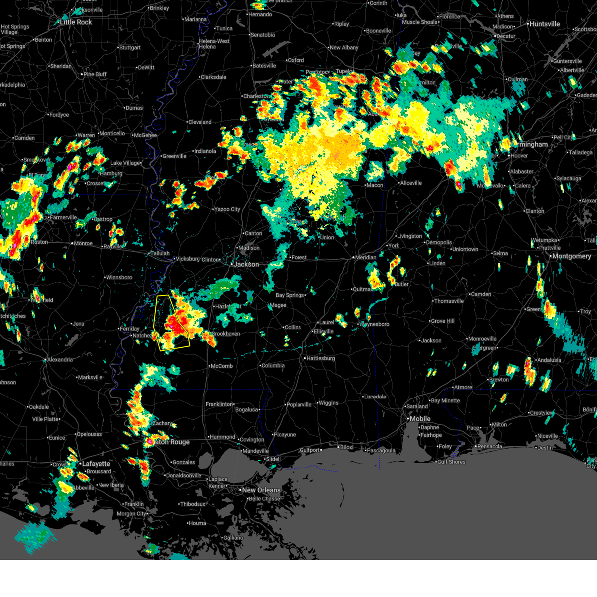
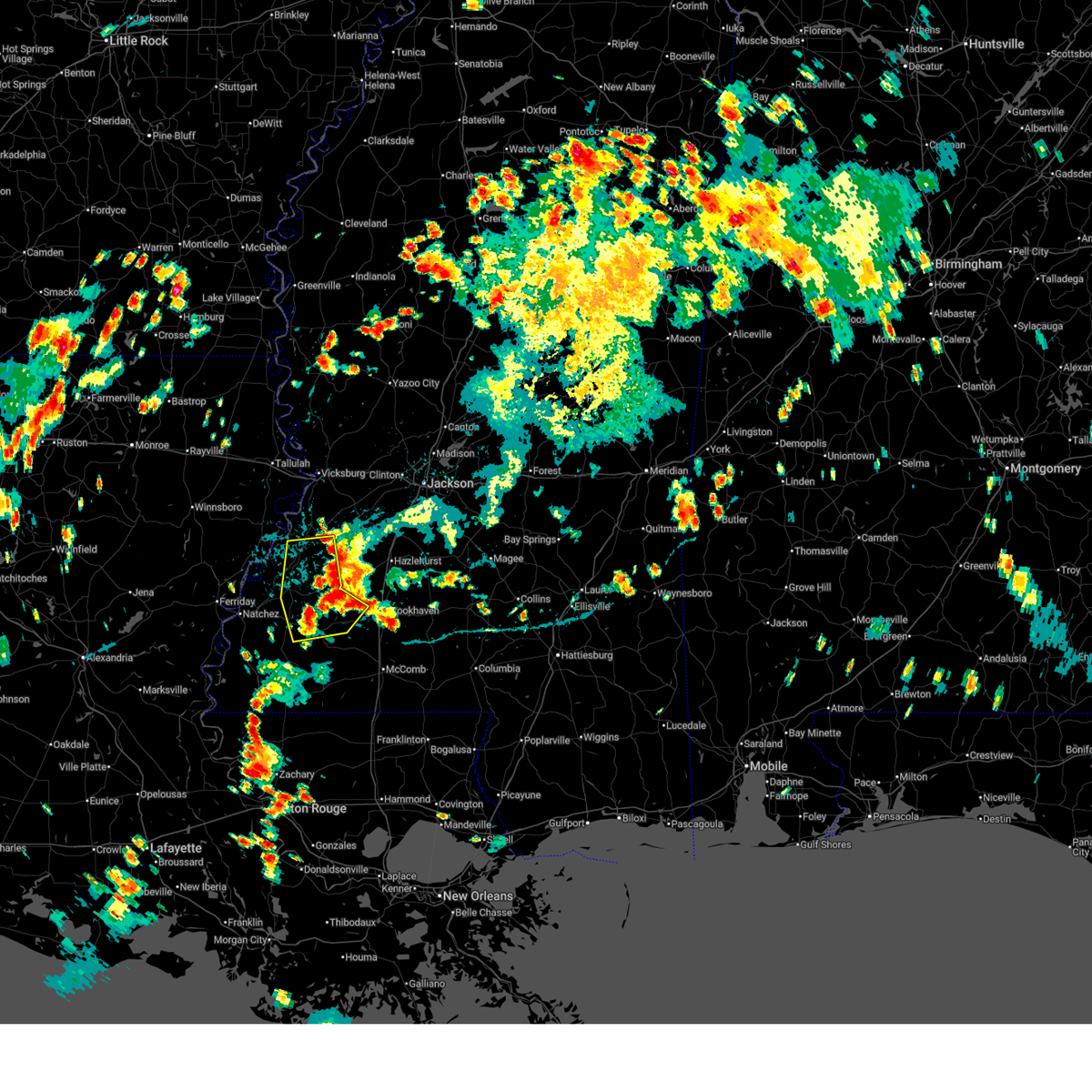
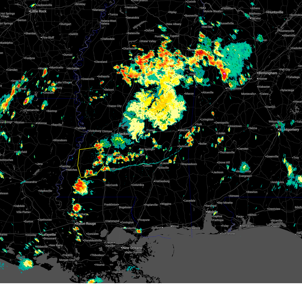
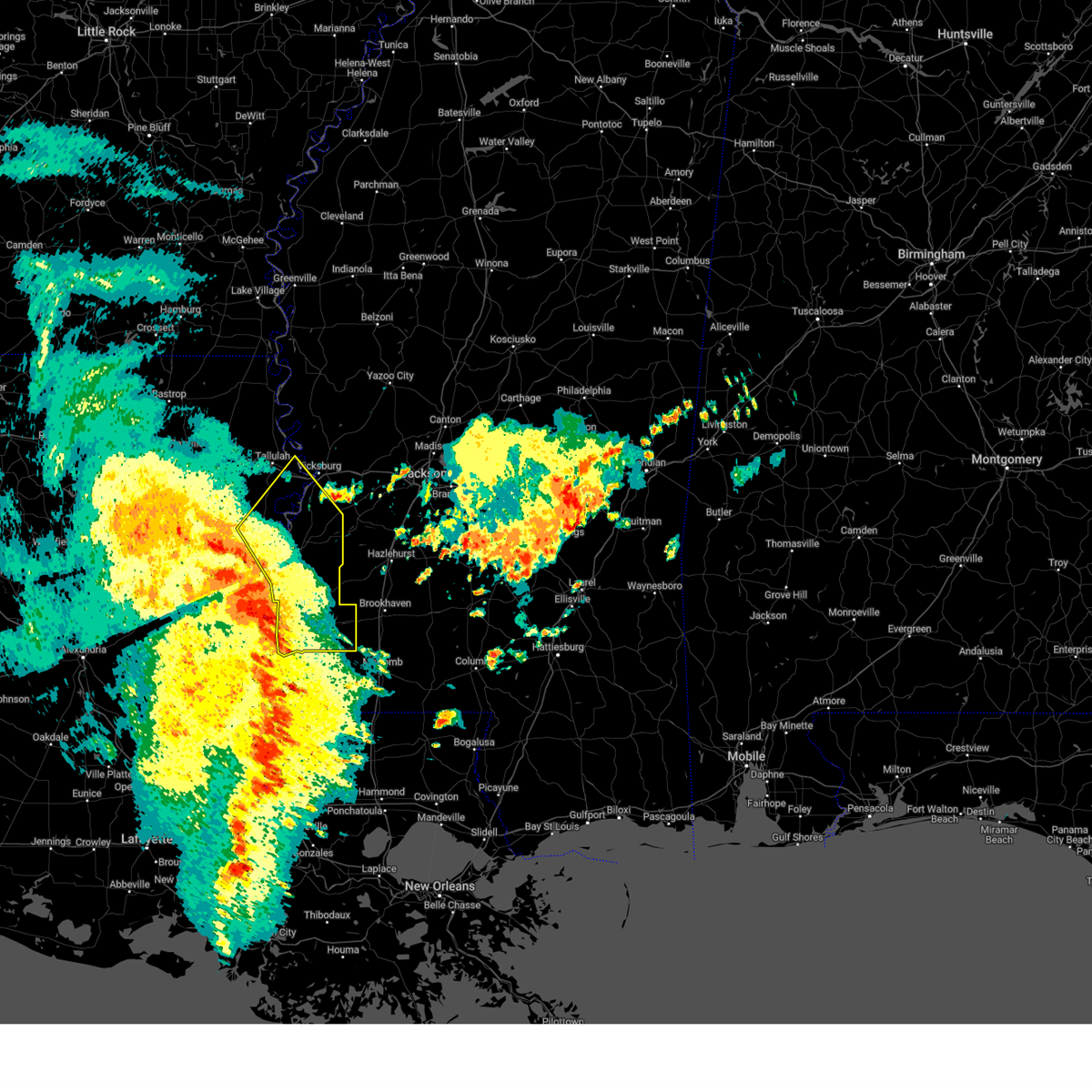
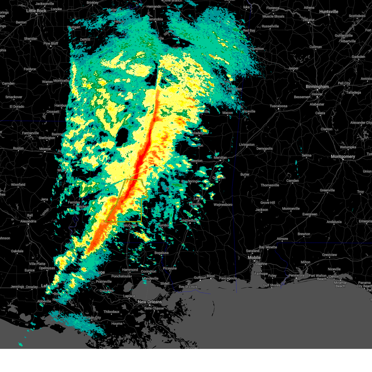
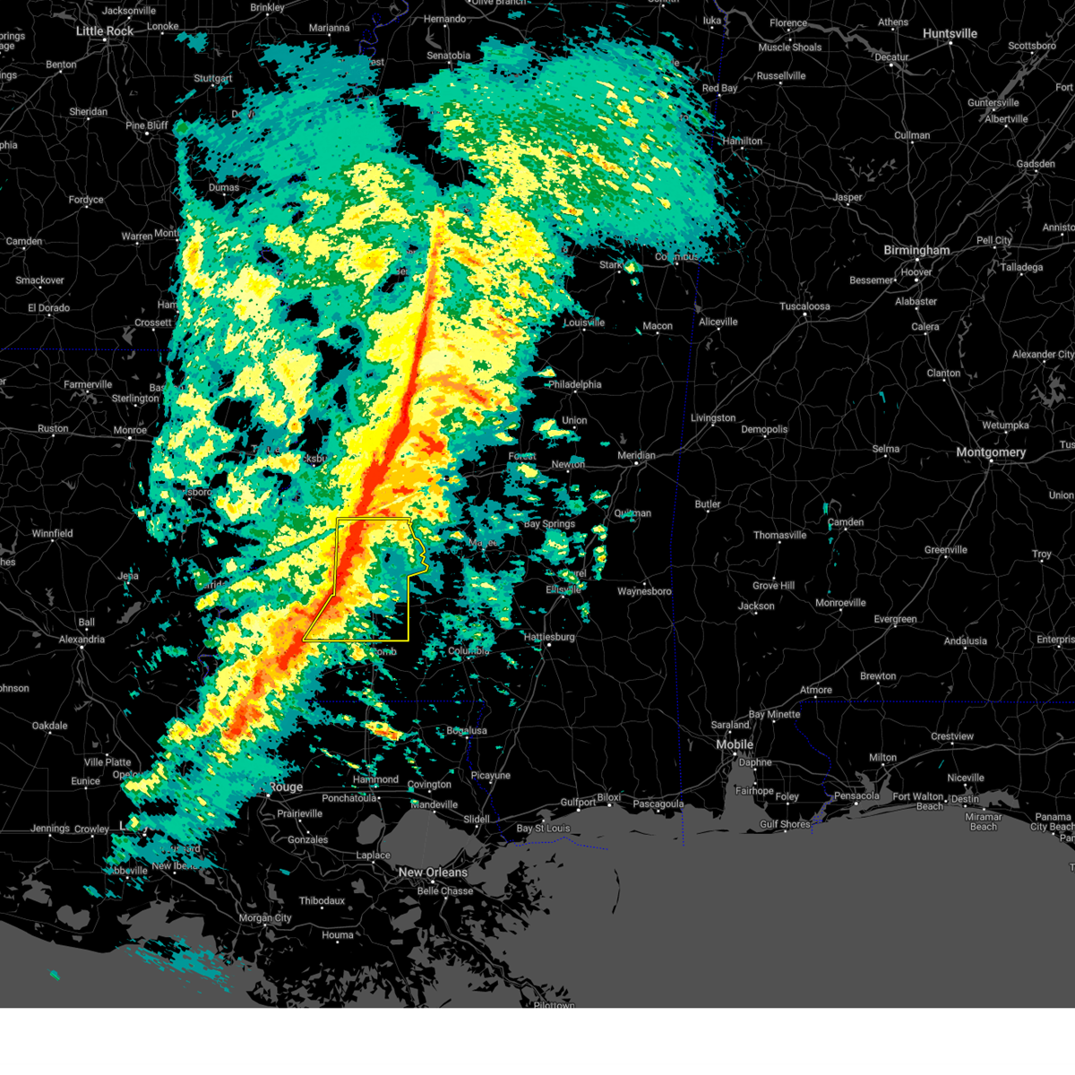
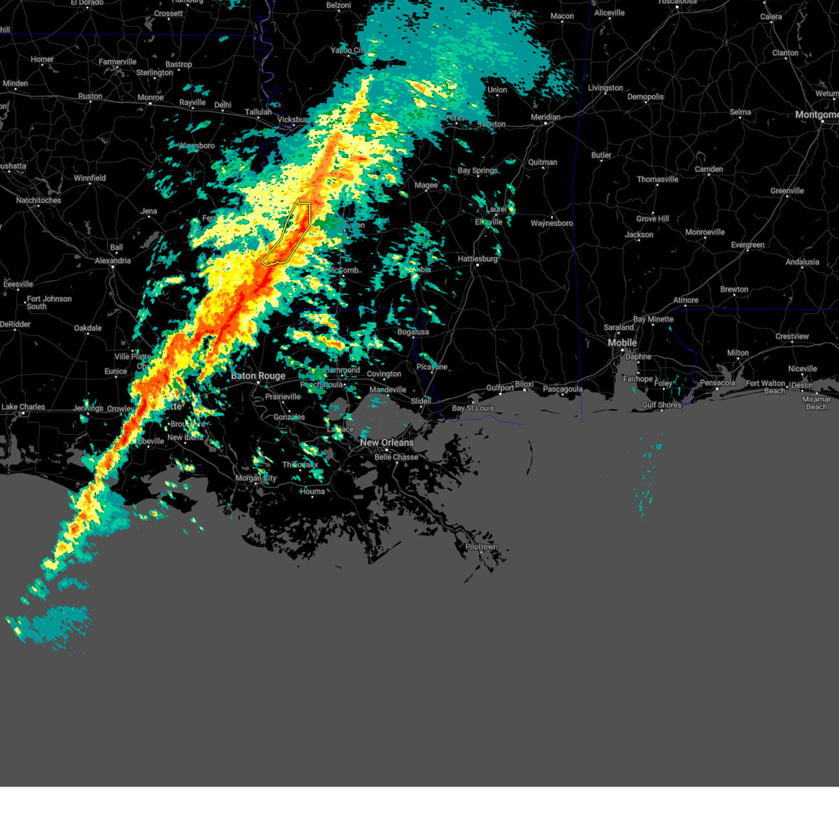
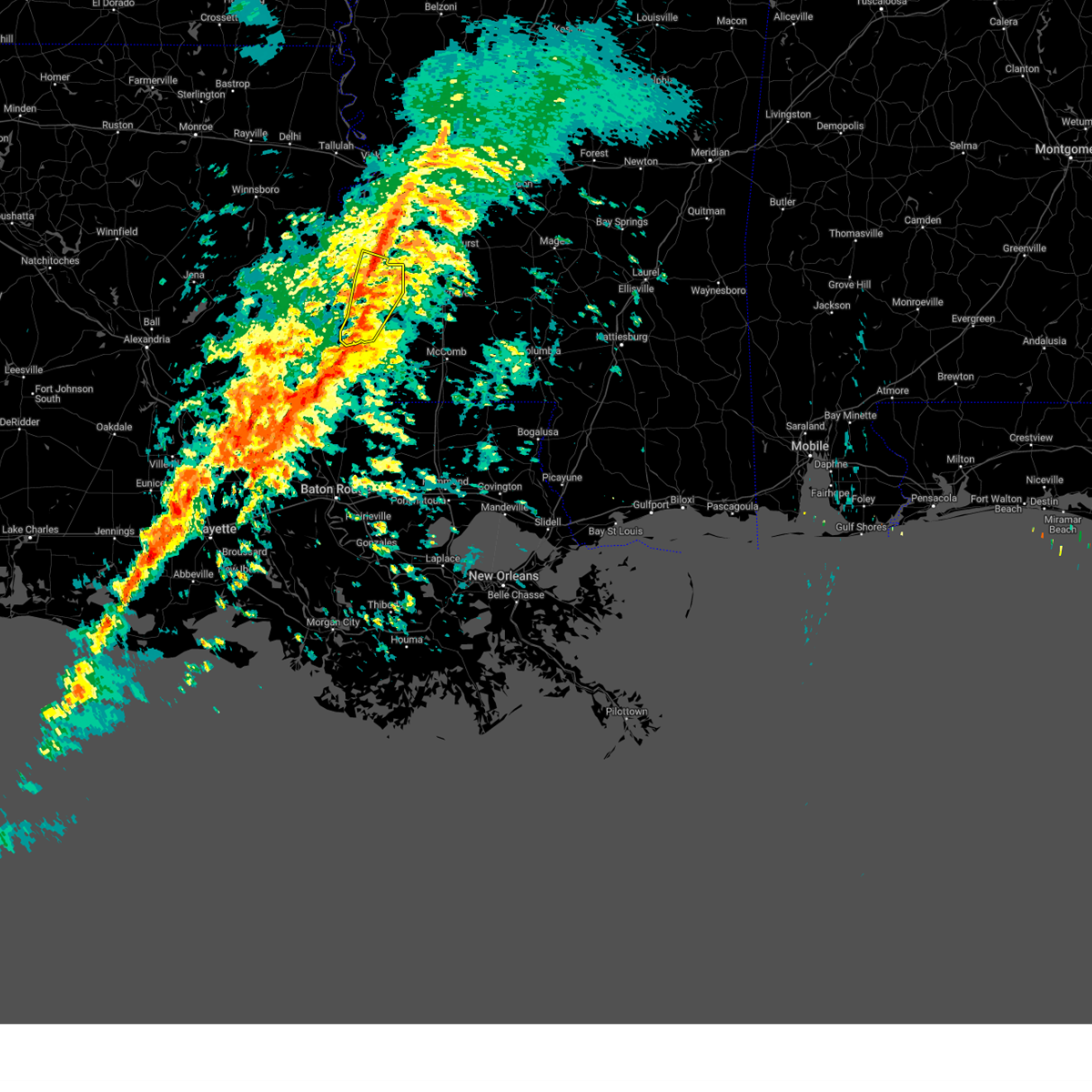
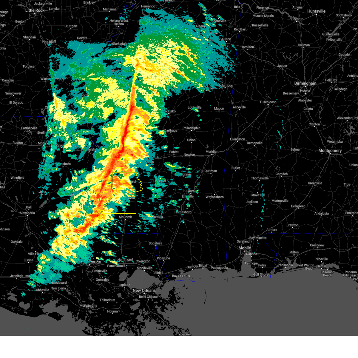
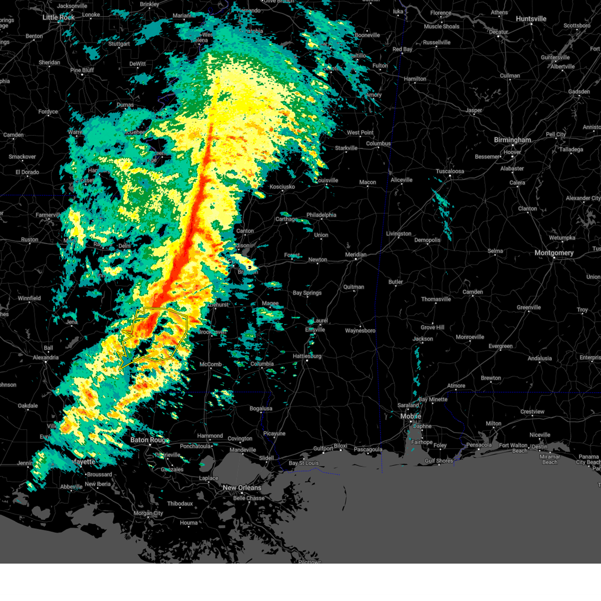
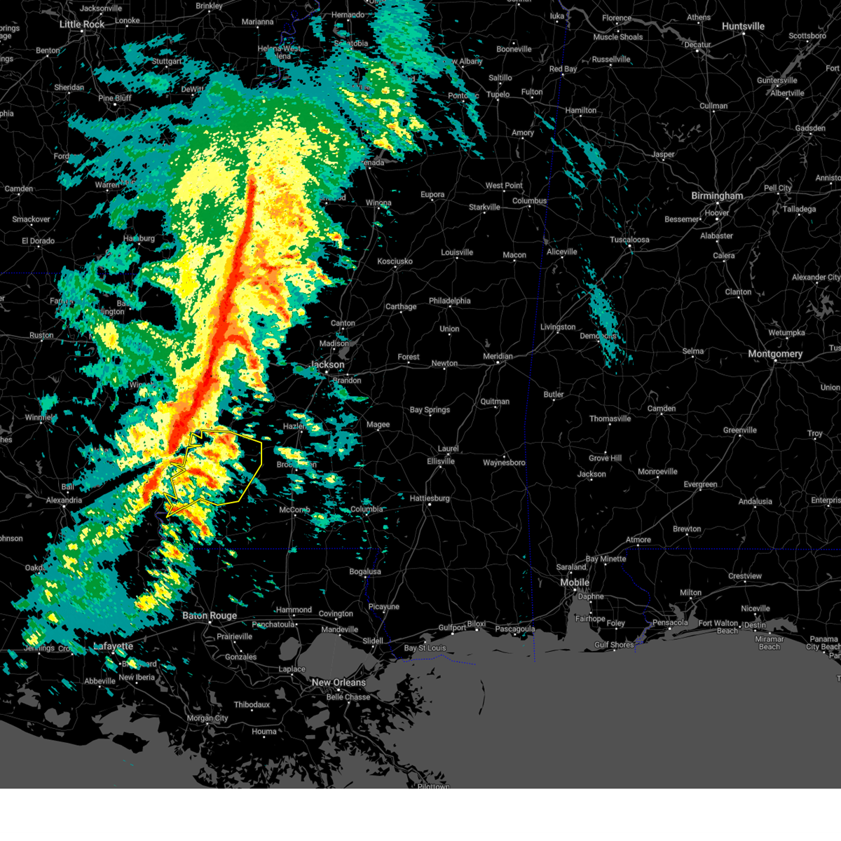
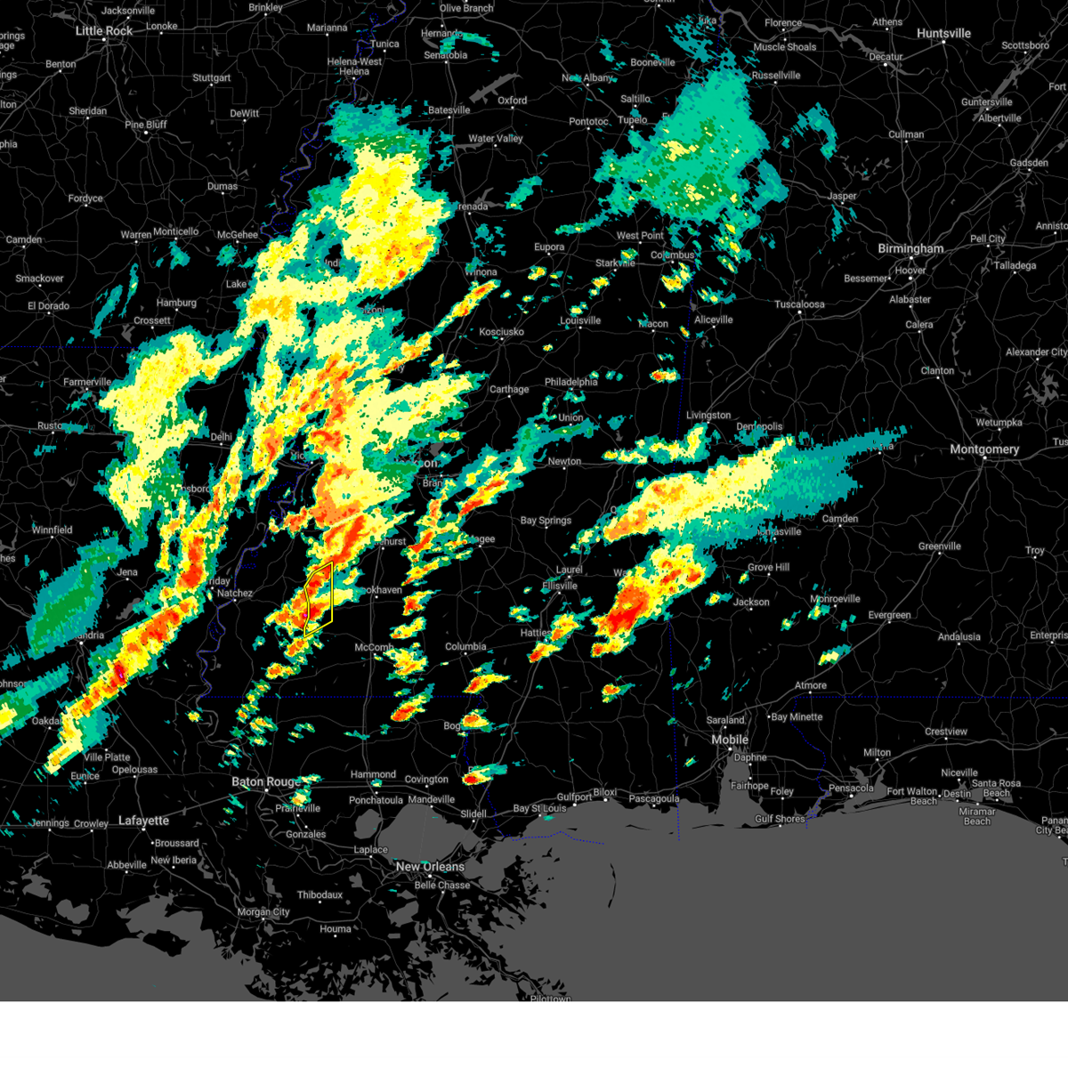
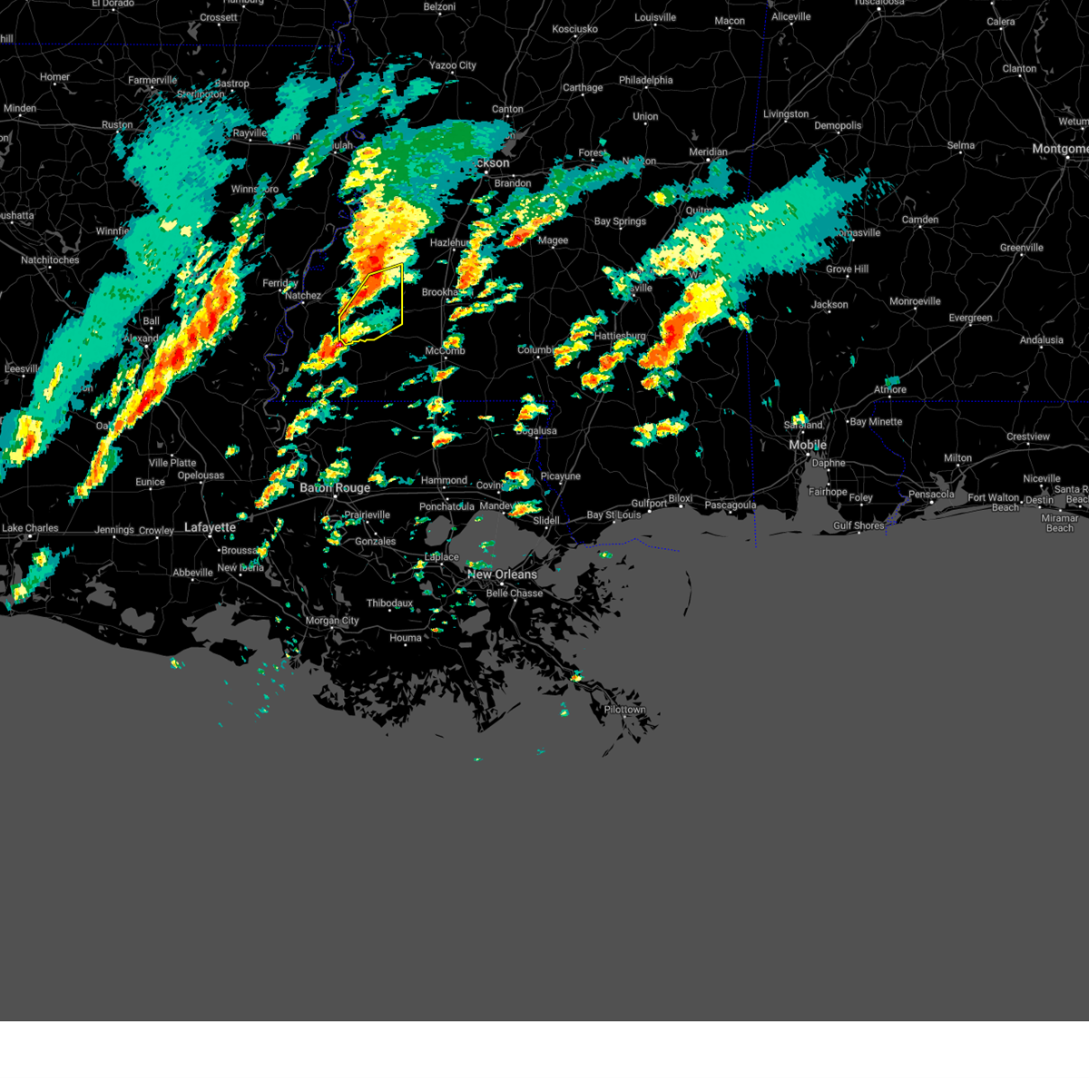
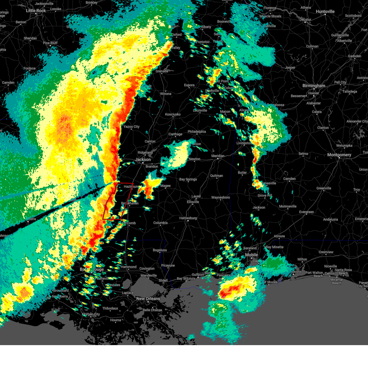
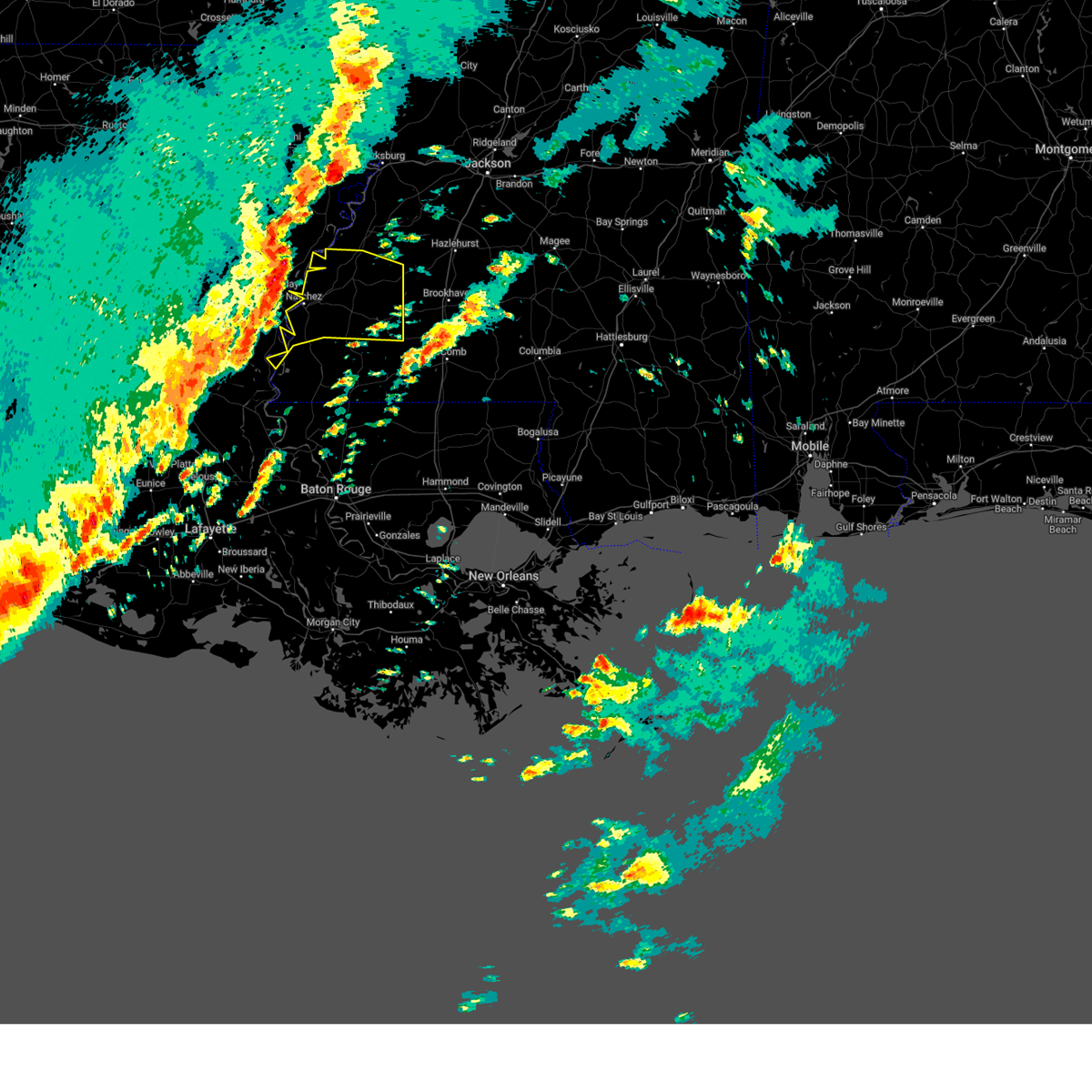
Hail Map for Bude, MS
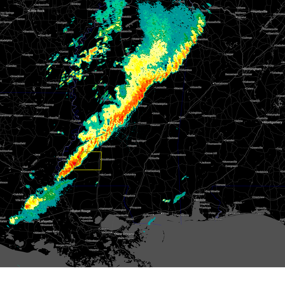
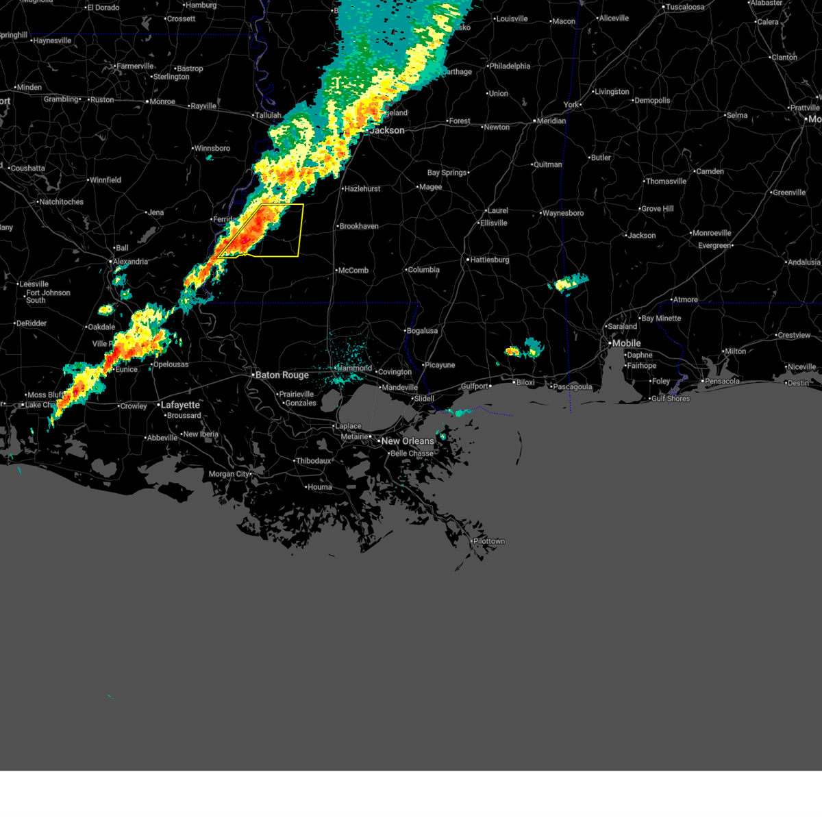
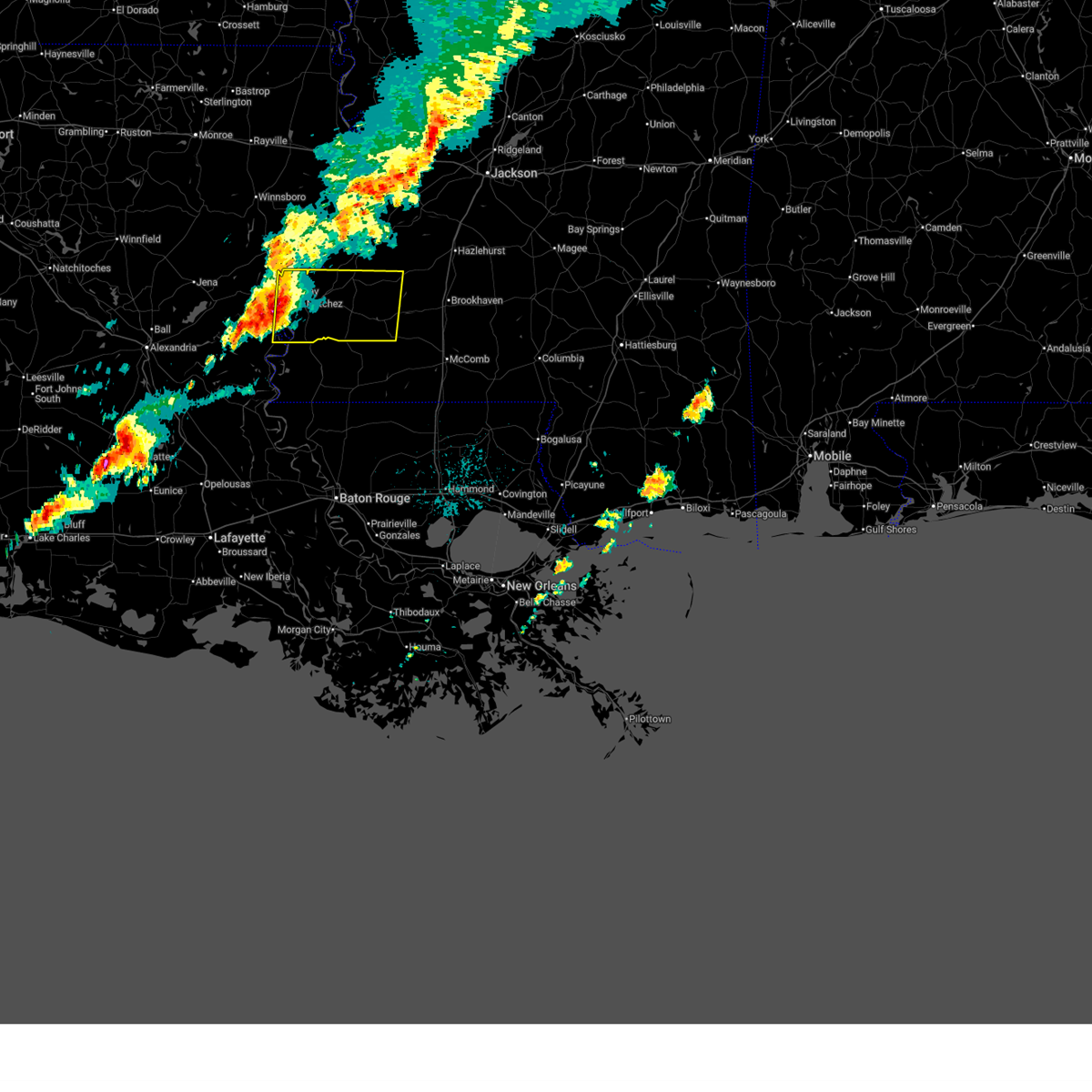
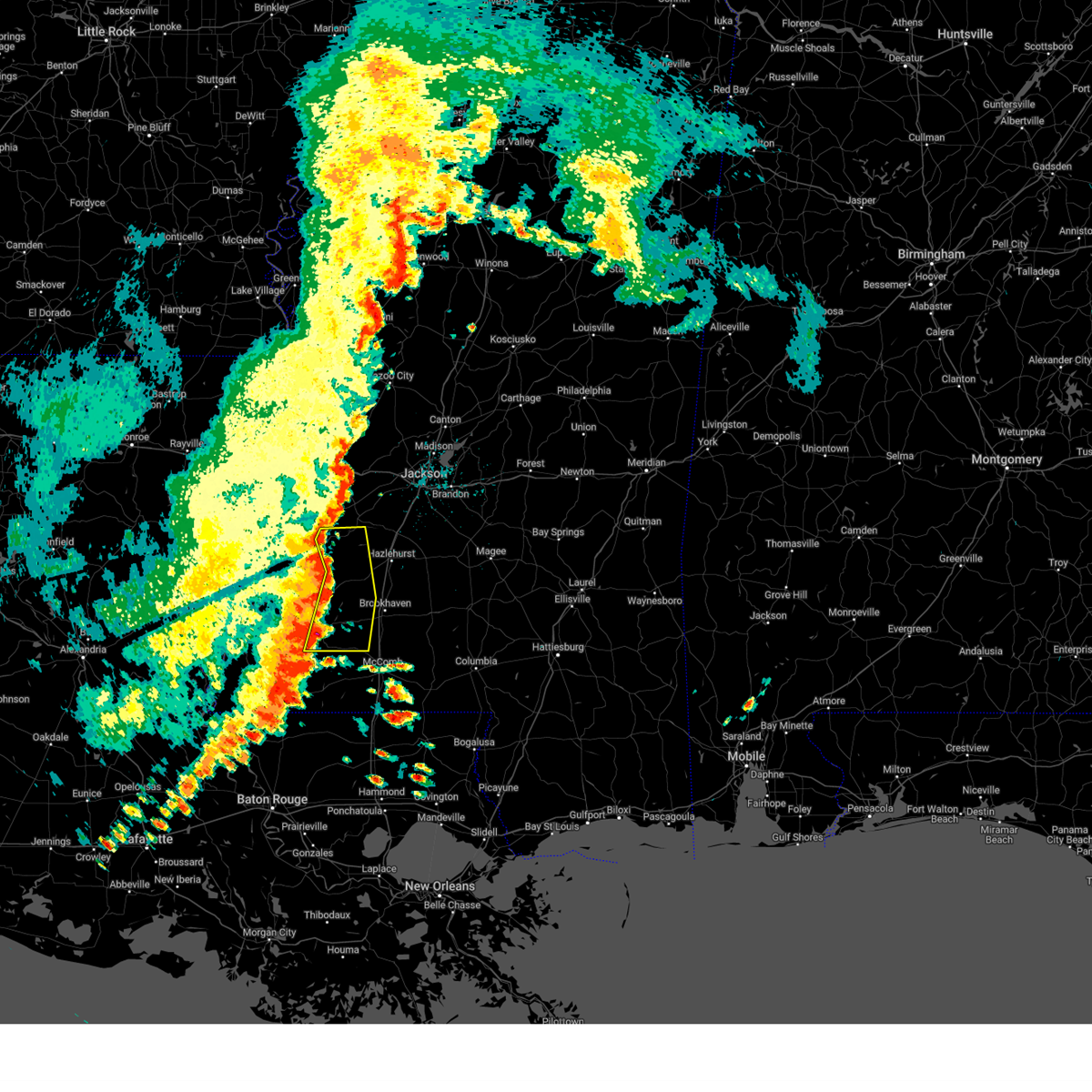
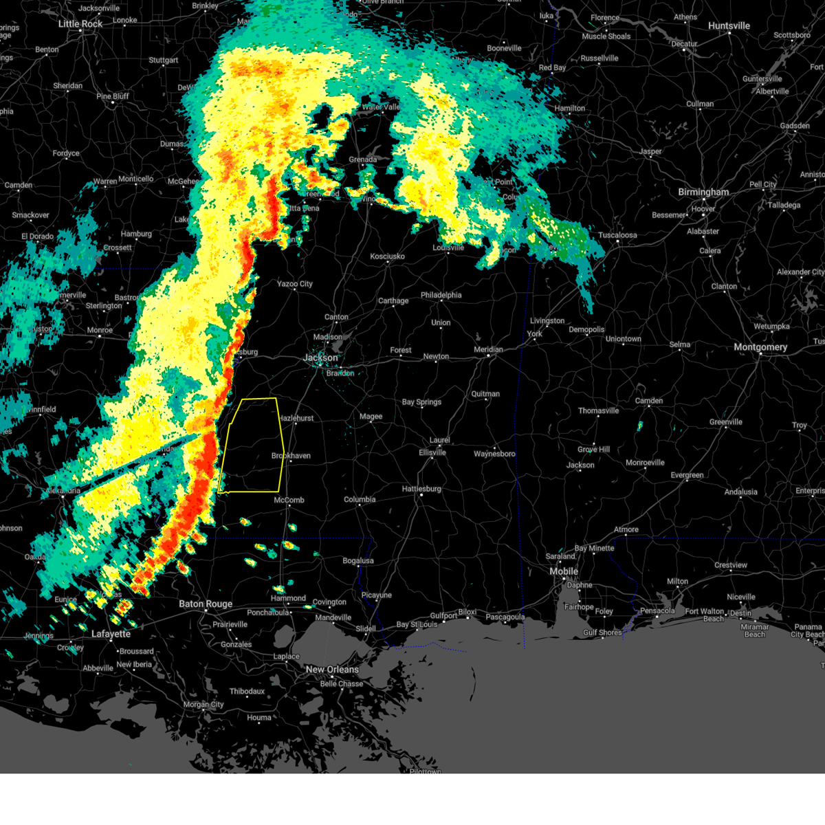
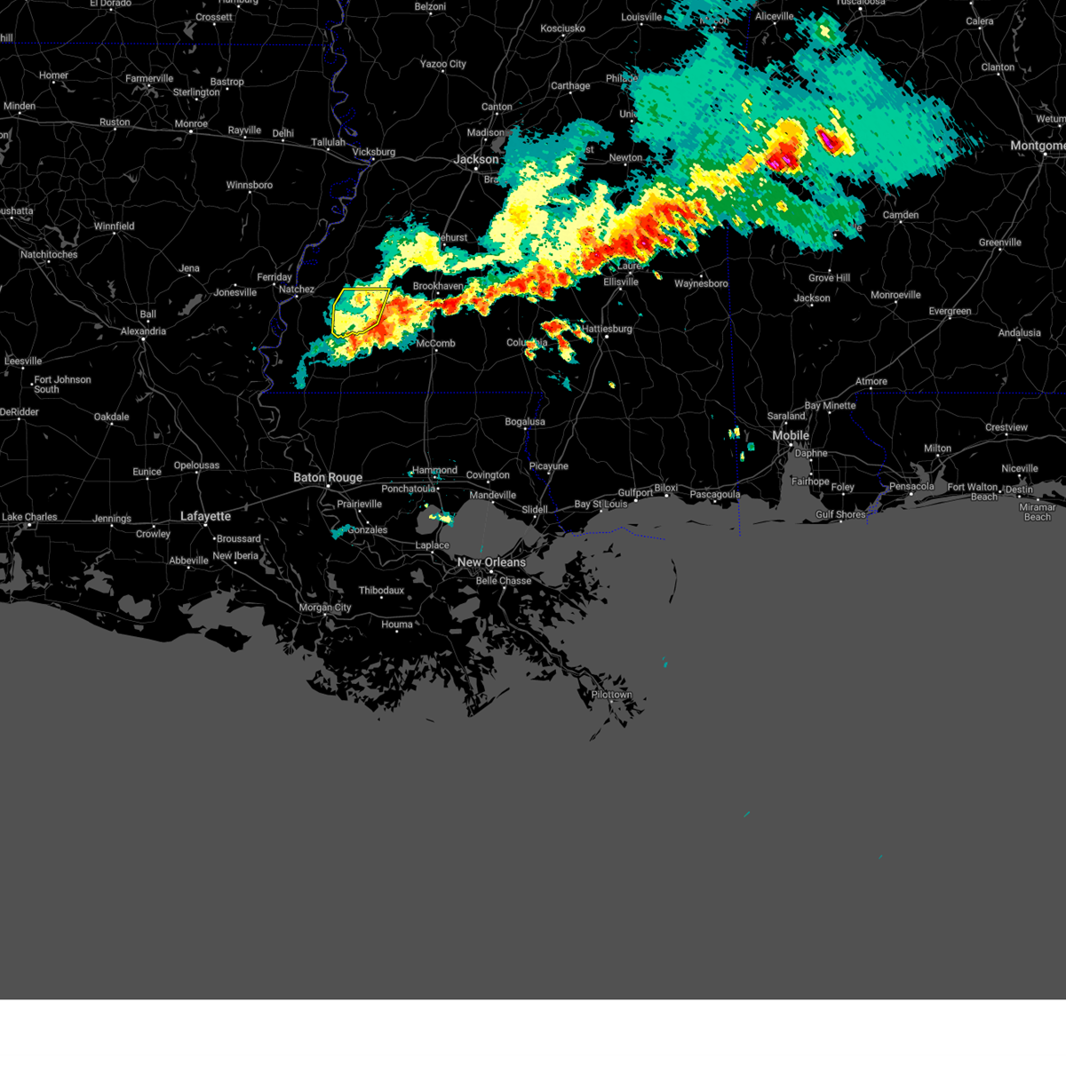
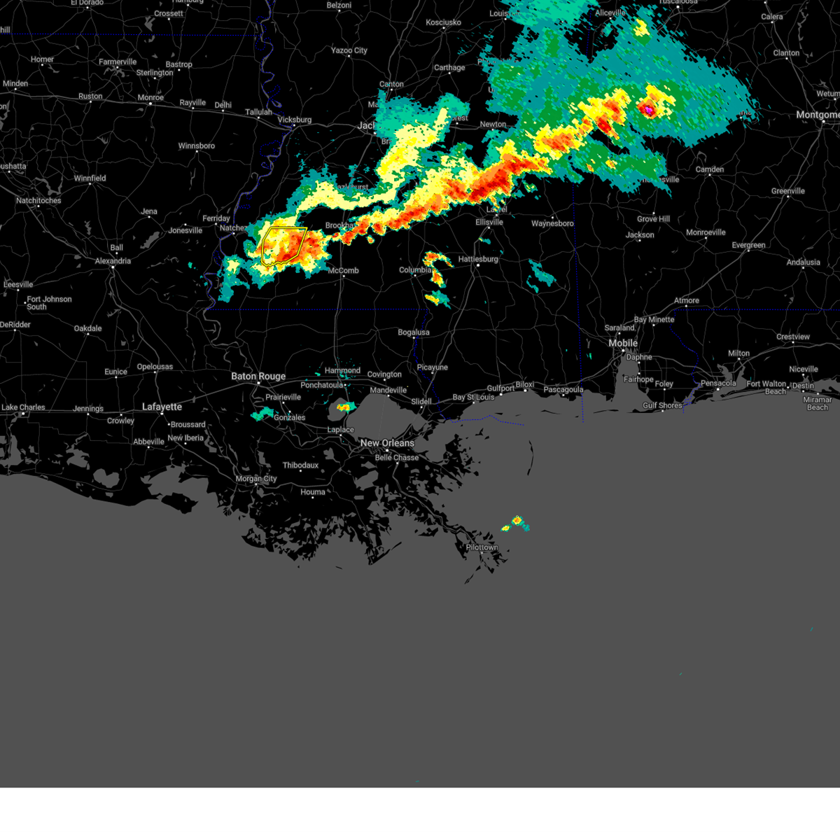
The Bude, MS area has had 8 reports of on-the-ground hail by trained spotters, and has been under severe weather warnings 46 times during the past 12 months. Doppler radar has detected hail at or near Bude, MS on 51 occasions, including 4 occasions during the past year.
| Name: | Bude, MS |
| Where Located: | 69.8 miles SW of Jackson, MS |
| Map: | Google Map for Bude, MS |
| Population: | 1063 |
| Housing Units: | 525 |
| More Info: | Search Google for Bude, MS |
1
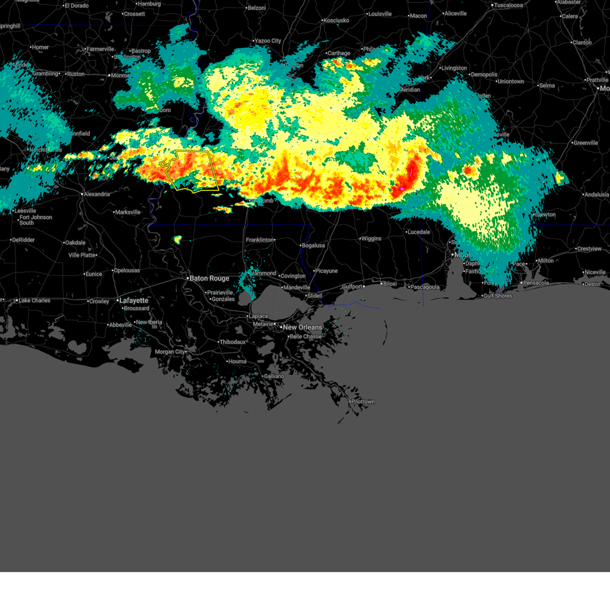
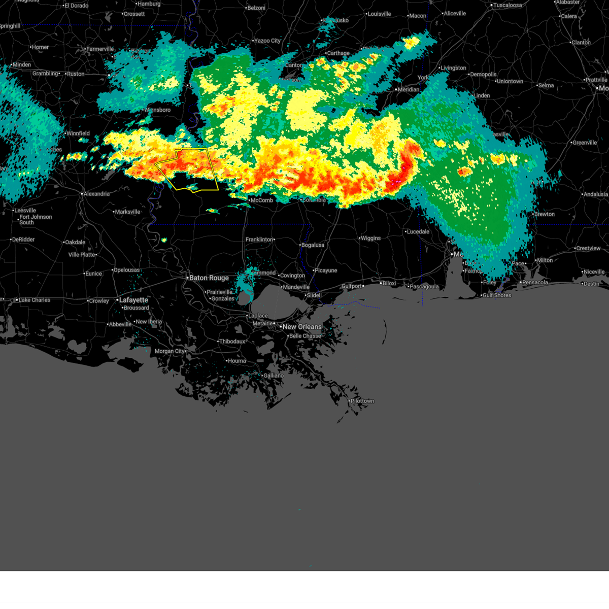
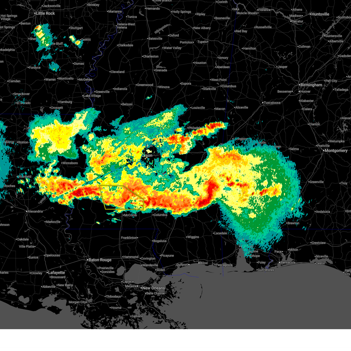
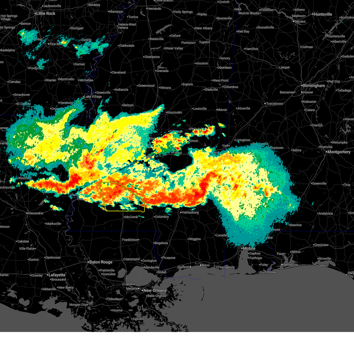
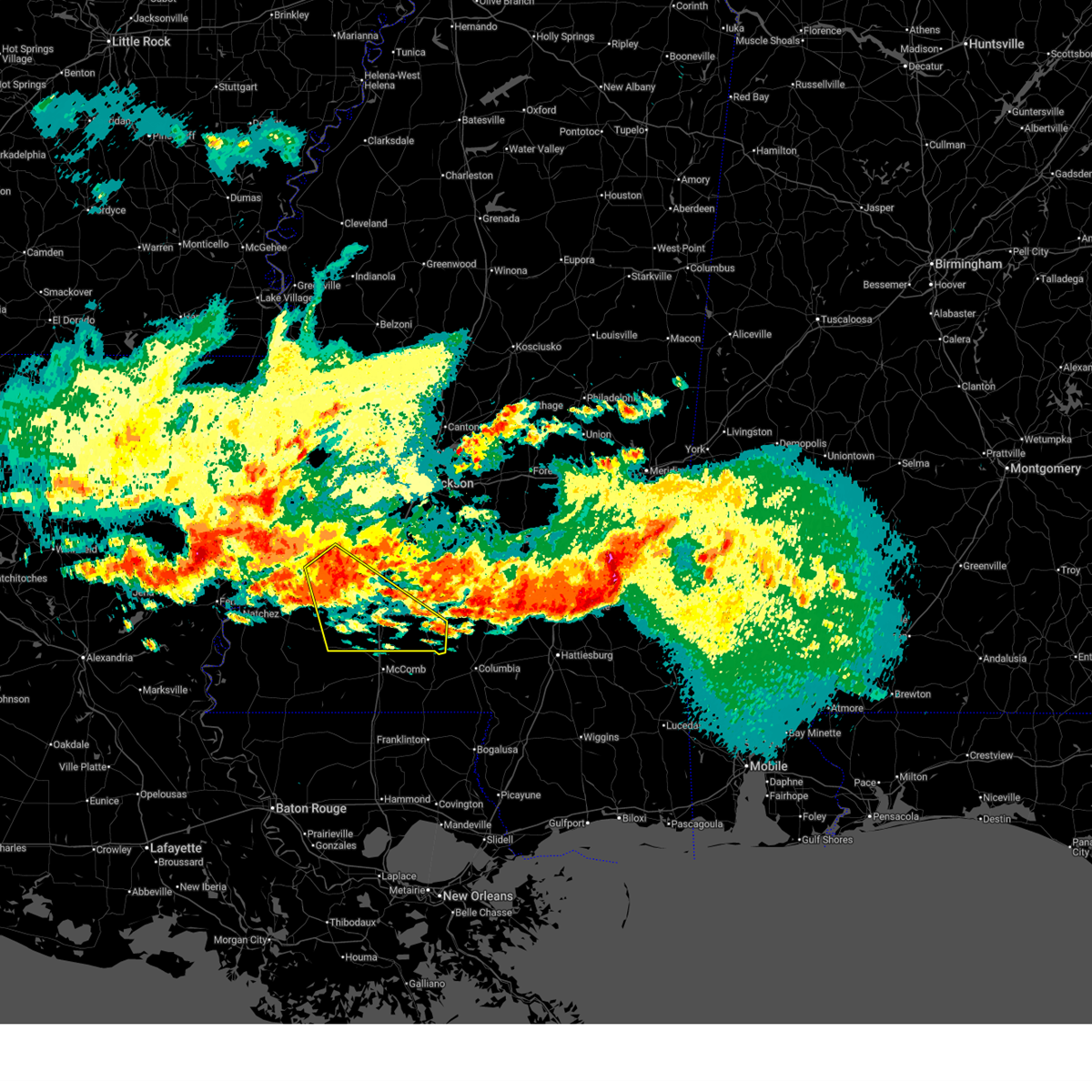
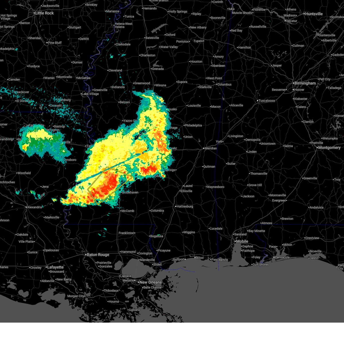
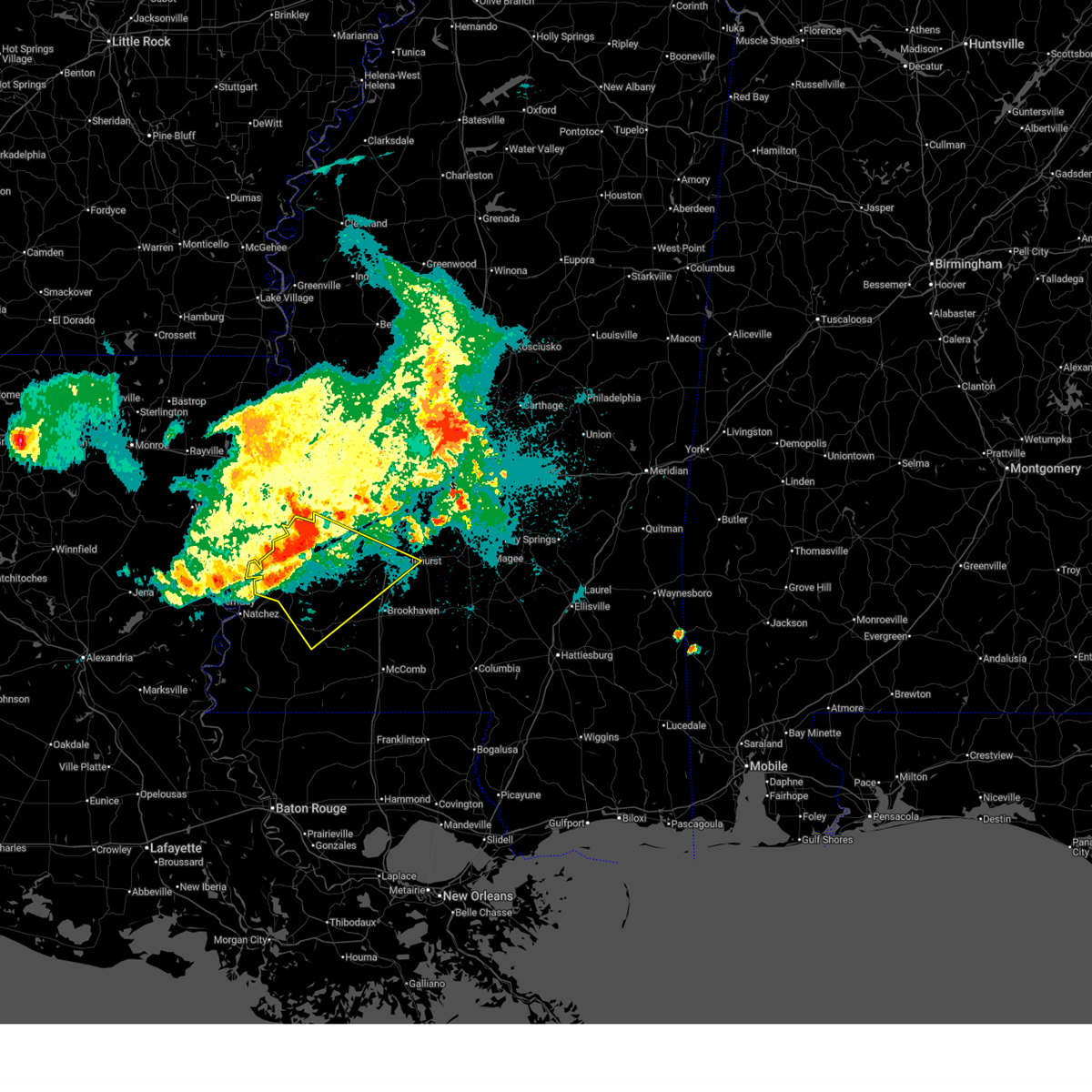
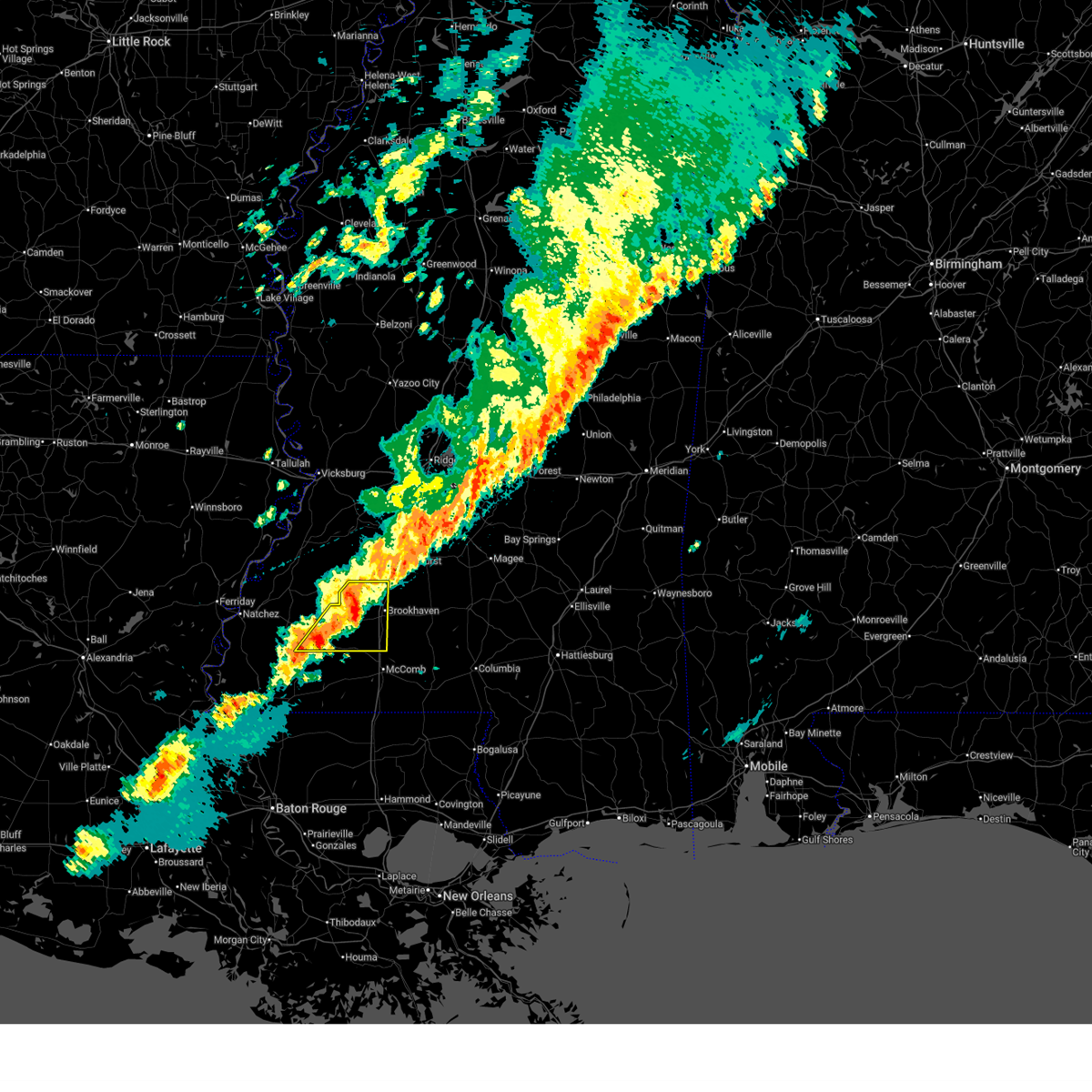
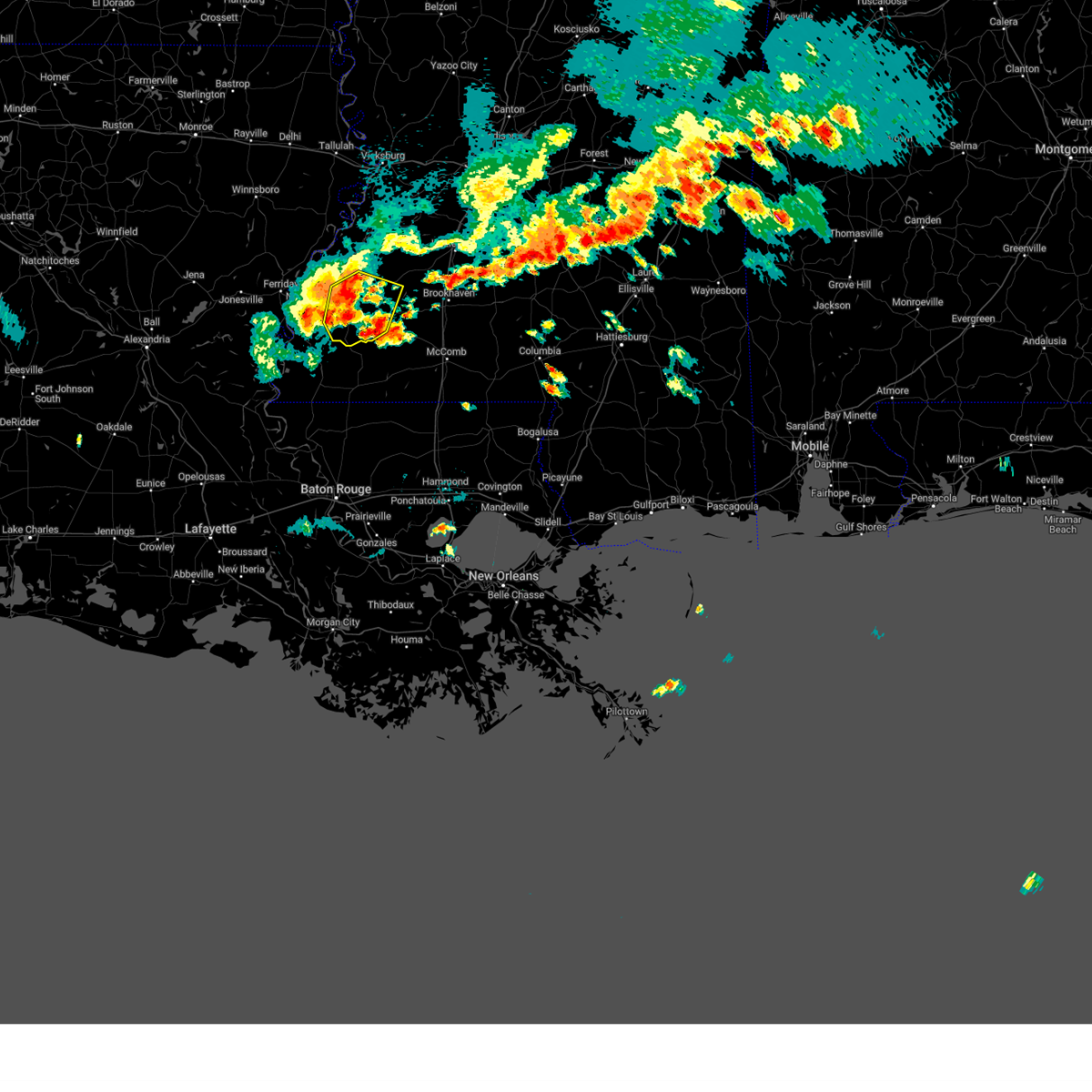
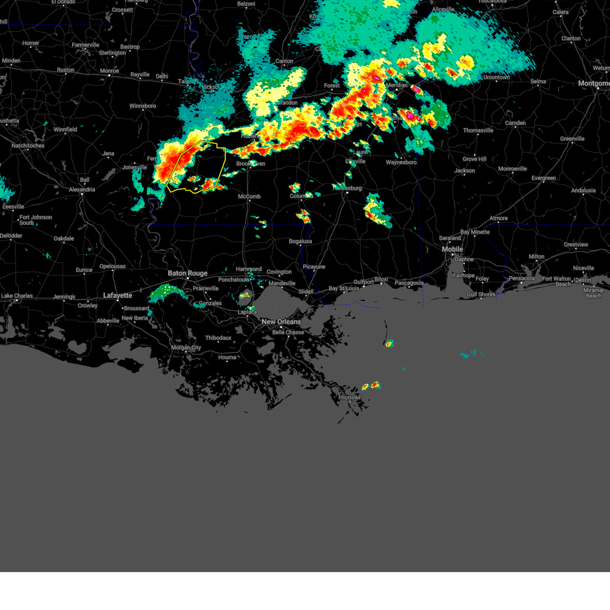
The Top Recent Hail Date for Bude, MS is Friday, May 22, 2026 (8th out of 51)
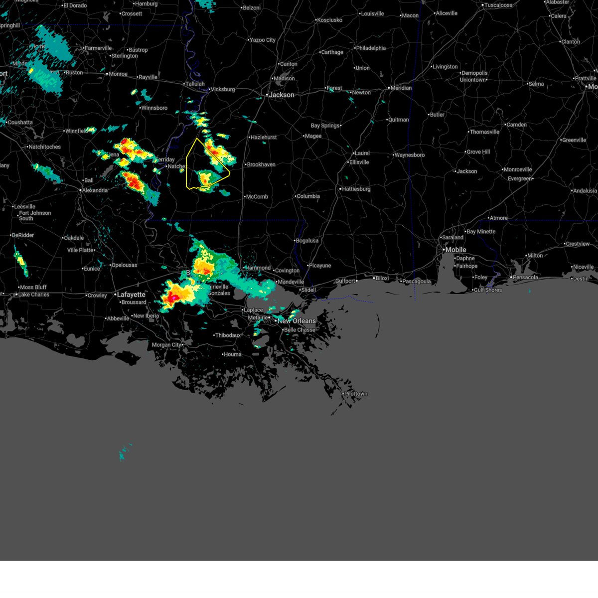
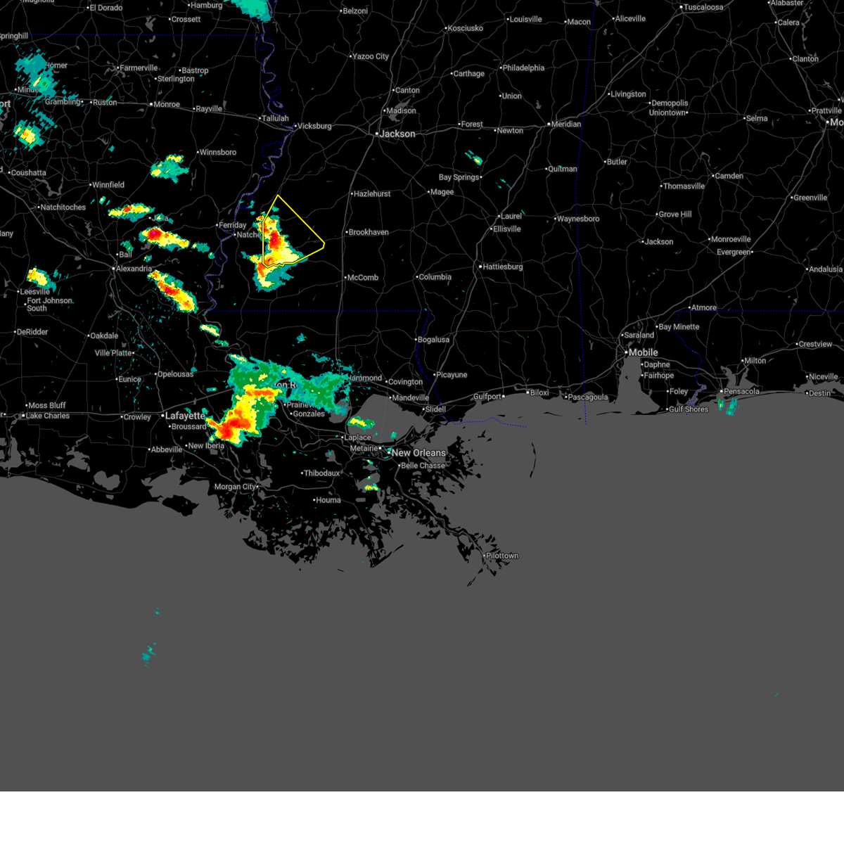
Hail and Wind Damage Spotted near Bude, MS
| Date / Time | Report Details |
|---|---|
| 5/23/2026 1:17 PM CDT | Multiple trees down on ms 550 in union churc in jefferson county MS, 15.3 miles SSW of Bude, MS |
| 5/23/2026 1:05 PM CDT |
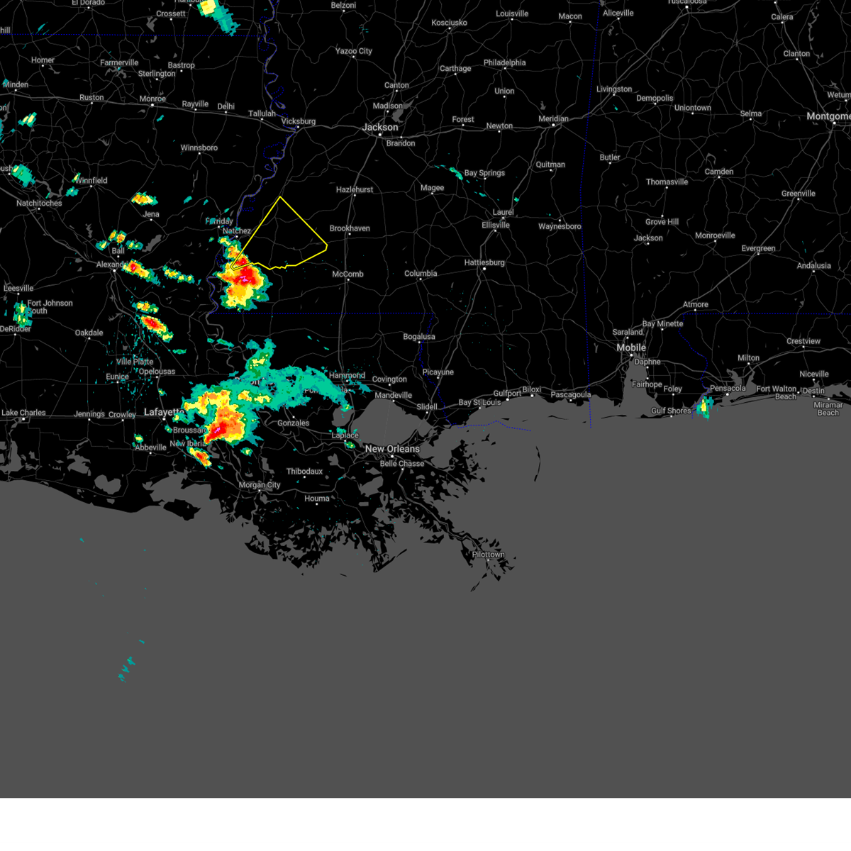
 Svrjan the national weather service in jackson has issued a * severe thunderstorm warning for, northern lincoln county in south central mississippi, northeastern franklin county in southwestern mississippi, eastern jefferson county in southwestern mississippi, western copiah county in central mississippi, * until 200 pm cdt. * at 105 pm cdt, severe thunderstorms were located along a line extending from near red lick to near bude, moving northeast at 40 mph (radar indicated). Hazards include 60 mph wind gusts. expect damage to roofs, siding, and trees Svrjan the national weather service in jackson has issued a * severe thunderstorm warning for, northern lincoln county in south central mississippi, northeastern franklin county in southwestern mississippi, eastern jefferson county in southwestern mississippi, western copiah county in central mississippi, * until 200 pm cdt. * at 105 pm cdt, severe thunderstorms were located along a line extending from near red lick to near bude, moving northeast at 40 mph (radar indicated). Hazards include 60 mph wind gusts. expect damage to roofs, siding, and trees
|
| 5/23/2026 12:47 PM CDT |
 At 1247 pm cdt, severe thunderstorms were located along a line extending from 6 miles south of crowville to st. joseph to near roxie, moving northeast at 50 mph (radar indicated). Hazards include 60 mph wind gusts. Expect damage to roofs, siding, and trees. locations impacted include, natchez, fayette, st. Joseph, meadville, newellton, alcorn state, bude, waterproof, gilbert, roxie, stanton, hamburg, kingston, lorman, cranfield, stampley, red lick, helena, lake bruin, and kirby. At 1247 pm cdt, severe thunderstorms were located along a line extending from 6 miles south of crowville to st. joseph to near roxie, moving northeast at 50 mph (radar indicated). Hazards include 60 mph wind gusts. Expect damage to roofs, siding, and trees. locations impacted include, natchez, fayette, st. Joseph, meadville, newellton, alcorn state, bude, waterproof, gilbert, roxie, stanton, hamburg, kingston, lorman, cranfield, stampley, red lick, helena, lake bruin, and kirby.
|
| 5/23/2026 12:16 PM CDT |
 Svrjan the national weather service in jackson has issued a * severe thunderstorm warning for, tensas parish in northeastern louisiana, northeastern concordia parish in northeastern louisiana, northeastern catahoula parish in northeastern louisiana, franklin parish in northeastern louisiana, southwestern claiborne county in southwestern mississippi, western franklin county in southwestern mississippi, jefferson county in southwestern mississippi, adams county in southwestern mississippi, * until 115 pm cdt. * at 1215 pm cdt, severe thunderstorms were located along a line extending from near enterprise to near clayton to near kingston, moving northeast at 40 mph (radar indicated). Hazards include 60 mph wind gusts. Expect damage to roofs, siding, and trees. severe thunderstorms will be near, natchez, wisner, waterproof, sicily island, spokane, kingston, and jigger around 1220 pm cdt. gilbert, cranfield, helena, stanton, and cooter point around 1225 pm cdt. church hill around 1230 pm cdt. roxie, hamburg, and stampley around 1235 pm cdt. st. joseph and mcnair around 1240 pm cdt. fayette, alcorn state, lake bruin, kirby, and newlight around 1245 pm cdt. lorman around 1250 pm cdt. Newellton and red lick around 1255 pm cdt. Svrjan the national weather service in jackson has issued a * severe thunderstorm warning for, tensas parish in northeastern louisiana, northeastern concordia parish in northeastern louisiana, northeastern catahoula parish in northeastern louisiana, franklin parish in northeastern louisiana, southwestern claiborne county in southwestern mississippi, western franklin county in southwestern mississippi, jefferson county in southwestern mississippi, adams county in southwestern mississippi, * until 115 pm cdt. * at 1215 pm cdt, severe thunderstorms were located along a line extending from near enterprise to near clayton to near kingston, moving northeast at 40 mph (radar indicated). Hazards include 60 mph wind gusts. Expect damage to roofs, siding, and trees. severe thunderstorms will be near, natchez, wisner, waterproof, sicily island, spokane, kingston, and jigger around 1220 pm cdt. gilbert, cranfield, helena, stanton, and cooter point around 1225 pm cdt. church hill around 1230 pm cdt. roxie, hamburg, and stampley around 1235 pm cdt. st. joseph and mcnair around 1240 pm cdt. fayette, alcorn state, lake bruin, kirby, and newlight around 1245 pm cdt. lorman around 1250 pm cdt. Newellton and red lick around 1255 pm cdt.
|
| 5/22/2026 7:01 PM CDT |
 Svrjan the national weather service in jackson has issued a * severe thunderstorm warning for, northwestern lincoln county in south central mississippi, northeastern franklin county in southwestern mississippi, southeastern jefferson county in southwestern mississippi, * until 800 pm cdt. * at 701 pm cdt, a severe thunderstorm was located near bude, or near meadville, moving northeast at 20 mph (radar indicated). Hazards include 60 mph wind gusts and half dollar size hail. Hail damage to vehicles is expected. expect wind damage to roofs, siding, and trees. this severe thunderstorm will be near, mccall creek and new hope around 705 pm cdt. vaughn around 725 pm cdt. Loyd star around 735 pm cdt. Svrjan the national weather service in jackson has issued a * severe thunderstorm warning for, northwestern lincoln county in south central mississippi, northeastern franklin county in southwestern mississippi, southeastern jefferson county in southwestern mississippi, * until 800 pm cdt. * at 701 pm cdt, a severe thunderstorm was located near bude, or near meadville, moving northeast at 20 mph (radar indicated). Hazards include 60 mph wind gusts and half dollar size hail. Hail damage to vehicles is expected. expect wind damage to roofs, siding, and trees. this severe thunderstorm will be near, mccall creek and new hope around 705 pm cdt. vaughn around 725 pm cdt. Loyd star around 735 pm cdt.
|
| 5/6/2026 7:26 PM CDT |
 At 726 pm cdt, a confirmed large and extremely dangerous tornado was located near little springs, or 7 miles east of meadville, moving east at 45 mph. this is a particularly dangerous situation. take cover now! (radar confirmed tornado). Hazards include damaging tornado. You are in a life-threatening situation. flying debris may be deadly to those caught without shelter. mobile homes will be destroyed. considerable damage to homes, businesses, and vehicles is likely and complete destruction is possible. the tornado will be near, mccall creek, center point, and little springs around 730 pm cdt. west lincoln around 735 pm cdt. vaughn around 740 pm cdt. brookhaven and bogue chitto around 745 pm cdt. enterprise around 750 pm cdt. East lincoln around 755 pm cdt. At 726 pm cdt, a confirmed large and extremely dangerous tornado was located near little springs, or 7 miles east of meadville, moving east at 45 mph. this is a particularly dangerous situation. take cover now! (radar confirmed tornado). Hazards include damaging tornado. You are in a life-threatening situation. flying debris may be deadly to those caught without shelter. mobile homes will be destroyed. considerable damage to homes, businesses, and vehicles is likely and complete destruction is possible. the tornado will be near, mccall creek, center point, and little springs around 730 pm cdt. west lincoln around 735 pm cdt. vaughn around 740 pm cdt. brookhaven and bogue chitto around 745 pm cdt. enterprise around 750 pm cdt. East lincoln around 755 pm cdt.
|
| 5/6/2026 7:10 PM CDT |
 Torjan the national weather service in jackson has issued a * tornado warning for, lincoln county in south central mississippi, eastern franklin county in southwestern mississippi, * until 815 pm cdt. * at 709 pm cdt, a confirmed large and destructive tornado was observed near meadville, moving east at 50 mph. tornado emergency for bude, meadeville, mccall creek, brookhaven, bogue chitto . this is a particularly dangerous situation. take cover now! (radar confirmed tornado). Hazards include deadly tornado. You are in a life-threatening situation. flying debris may be deadly to those caught without shelter. mobile homes will be destroyed. considerable damage to homes, businesses, and vehicles is likely and complete destruction is possible. the tornado will be near, meadville, bude, and little springs around 715 pm cdt. mccall creek around 720 pm cdt. center point around 725 pm cdt. west lincoln around 730 pm cdt. bogue chitto around 735 pm cdt. brookhaven and enterprise around 740 pm cdt. east lincoln around 745 pm cdt. Ruth around 750 pm cdt. Torjan the national weather service in jackson has issued a * tornado warning for, lincoln county in south central mississippi, eastern franklin county in southwestern mississippi, * until 815 pm cdt. * at 709 pm cdt, a confirmed large and destructive tornado was observed near meadville, moving east at 50 mph. tornado emergency for bude, meadeville, mccall creek, brookhaven, bogue chitto . this is a particularly dangerous situation. take cover now! (radar confirmed tornado). Hazards include deadly tornado. You are in a life-threatening situation. flying debris may be deadly to those caught without shelter. mobile homes will be destroyed. considerable damage to homes, businesses, and vehicles is likely and complete destruction is possible. the tornado will be near, meadville, bude, and little springs around 715 pm cdt. mccall creek around 720 pm cdt. center point around 725 pm cdt. west lincoln around 730 pm cdt. bogue chitto around 735 pm cdt. brookhaven and enterprise around 740 pm cdt. east lincoln around 745 pm cdt. Ruth around 750 pm cdt.
|
| 5/6/2026 7:00 PM CDT |
 At 700 pm cdt, a confirmed large and destructive tornado was located near bude, or near meadville, moving east at 50 mph. tornado emergency for meadeville, bude. this is a particularly dangerous situation. take cover now! (radar confirmed tornado). Hazards include deadly tornado. You are in a life-threatening situation. flying debris may be deadly to those caught without shelter. mobile homes will be destroyed. considerable damage to homes, businesses, and vehicles is likely and complete destruction is possible. This tornadic thunderstorm will remain over mainly rural areas of central franklin county. At 700 pm cdt, a confirmed large and destructive tornado was located near bude, or near meadville, moving east at 50 mph. tornado emergency for meadeville, bude. this is a particularly dangerous situation. take cover now! (radar confirmed tornado). Hazards include deadly tornado. You are in a life-threatening situation. flying debris may be deadly to those caught without shelter. mobile homes will be destroyed. considerable damage to homes, businesses, and vehicles is likely and complete destruction is possible. This tornadic thunderstorm will remain over mainly rural areas of central franklin county.
|
| 5/6/2026 6:51 PM CDT |
 At 651 pm cdt, a confirmed large and extremely dangerous tornado was located near meadville, moving east at 50 mph. this is a particularly dangerous situation. take cover now! (radar confirmed tornado). Hazards include damaging tornado. You are in a life-threatening situation. flying debris may be deadly to those caught without shelter. mobile homes will be destroyed. considerable damage to homes, businesses, and vehicles is likely and complete destruction is possible. The tornado will be near, meadville and bude around 655 pm cdt. At 651 pm cdt, a confirmed large and extremely dangerous tornado was located near meadville, moving east at 50 mph. this is a particularly dangerous situation. take cover now! (radar confirmed tornado). Hazards include damaging tornado. You are in a life-threatening situation. flying debris may be deadly to those caught without shelter. mobile homes will be destroyed. considerable damage to homes, businesses, and vehicles is likely and complete destruction is possible. The tornado will be near, meadville and bude around 655 pm cdt.
|
| 5/6/2026 6:44 PM CDT |
 At 644 pm cdt, a confirmed large and extremely dangerous tornado was located near garden city, or 11 miles southwest of meadville, moving east at 50 mph. this is a particularly dangerous situation. take cover now! (radar confirmed tornado). Hazards include damaging tornado. You are in a life-threatening situation. flying debris may be deadly to those caught without shelter. mobile homes will be destroyed. considerable damage to homes, businesses, and vehicles is likely and complete destruction is possible. The tornado will be near, meadville, bude, and kirby around 650 pm cdt. At 644 pm cdt, a confirmed large and extremely dangerous tornado was located near garden city, or 11 miles southwest of meadville, moving east at 50 mph. this is a particularly dangerous situation. take cover now! (radar confirmed tornado). Hazards include damaging tornado. You are in a life-threatening situation. flying debris may be deadly to those caught without shelter. mobile homes will be destroyed. considerable damage to homes, businesses, and vehicles is likely and complete destruction is possible. The tornado will be near, meadville, bude, and kirby around 650 pm cdt.
|
| 5/6/2026 6:12 PM CDT |
 Torjan the national weather service in jackson has issued a * tornado warning for, franklin county in southwestern mississippi, southeastern adams county in southwestern mississippi, * until 715 pm cdt. * at 612 pm cdt, a severe thunderstorm capable of producing a tornado was located 7 miles southeast of deer park, or 17 miles south of vidalia, moving east at 50 mph (radar indicated rotation). Hazards include tornado and quarter size hail. Flying debris will be dangerous to those caught without shelter. mobile homes will be damaged or destroyed. damage to roofs, windows, and vehicles will occur. tree damage is likely. this dangerous storm will be near, kingston and sibley around 620 pm cdt. garden city around 630 pm cdt. meadville around 650 pm cdt. Bude around 655 pm cdt. Torjan the national weather service in jackson has issued a * tornado warning for, franklin county in southwestern mississippi, southeastern adams county in southwestern mississippi, * until 715 pm cdt. * at 612 pm cdt, a severe thunderstorm capable of producing a tornado was located 7 miles southeast of deer park, or 17 miles south of vidalia, moving east at 50 mph (radar indicated rotation). Hazards include tornado and quarter size hail. Flying debris will be dangerous to those caught without shelter. mobile homes will be damaged or destroyed. damage to roofs, windows, and vehicles will occur. tree damage is likely. this dangerous storm will be near, kingston and sibley around 620 pm cdt. garden city around 630 pm cdt. meadville around 650 pm cdt. Bude around 655 pm cdt.
|
| 5/6/2026 5:00 PM CDT | Half Dollar sized hail reported 9.5 miles WSW of Bude, MS, this was reported by a nearby convenience store... and video was taken of the hail as well. |
| 4/29/2026 5:02 PM CDT |
 At 502 pm cdt, a severe thunderstorm was located near garden city, or 11 miles west of meadville, moving southeast at 35 mph (radar indicated). Hazards include 60 mph wind gusts and penny size hail. Expect damage to roofs, siding, and trees. This severe thunderstorm will remain over mainly rural areas of western franklin and northeastern adams counties. At 502 pm cdt, a severe thunderstorm was located near garden city, or 11 miles west of meadville, moving southeast at 35 mph (radar indicated). Hazards include 60 mph wind gusts and penny size hail. Expect damage to roofs, siding, and trees. This severe thunderstorm will remain over mainly rural areas of western franklin and northeastern adams counties.
|
| 4/29/2026 4:53 PM CDT |
 The storm which prompted the warning has moved out of the area. therefore, the warning will be allowed to expire. a severe thunderstorm watch remains in effect until 900 pm cdt for south central and southwestern mississippi. The storm which prompted the warning has moved out of the area. therefore, the warning will be allowed to expire. a severe thunderstorm watch remains in effect until 900 pm cdt for south central and southwestern mississippi.
|
| 4/29/2026 4:47 PM CDT |
 the severe thunderstorm warning has been cancelled and is no longer in effect the severe thunderstorm warning has been cancelled and is no longer in effect
|
| 4/29/2026 4:47 PM CDT |
 At 446 pm cdt, a severe thunderstorm was located over cranfield, or 13 miles southwest of fayette, moving southeast at 45 mph (radar indicated). Hazards include 60 mph wind gusts and penny size hail. Expect damage to roofs, siding, and trees. this severe storm will be near, roxie, hamburg, and kirby around 450 pm cdt. garden city around 455 pm cdt. Meadville around 500 pm cdt. At 446 pm cdt, a severe thunderstorm was located over cranfield, or 13 miles southwest of fayette, moving southeast at 45 mph (radar indicated). Hazards include 60 mph wind gusts and penny size hail. Expect damage to roofs, siding, and trees. this severe storm will be near, roxie, hamburg, and kirby around 450 pm cdt. garden city around 455 pm cdt. Meadville around 500 pm cdt.
|
| 4/29/2026 4:32 PM CDT |
 At 432 pm cdt, a severe thunderstorm was located over roxie, or 10 miles west of meadville, moving southeast at 40 mph (radar indicated). Hazards include 60 mph wind gusts and penny size hail. Expect damage to roofs, siding, and trees. This severe storm will be near, meadville and kirby around 440 pm cdt. At 432 pm cdt, a severe thunderstorm was located over roxie, or 10 miles west of meadville, moving southeast at 40 mph (radar indicated). Hazards include 60 mph wind gusts and penny size hail. Expect damage to roofs, siding, and trees. This severe storm will be near, meadville and kirby around 440 pm cdt.
|
| 4/29/2026 4:25 PM CDT |
 At 425 pm cdt, a severe thunderstorm was located over enterprise, or 10 miles southeast of brookhaven, moving southeast at 40 mph (radar indicated). Hazards include 60 mph wind gusts and penny size hail. Expect damage to roofs, siding, and trees. This severe storm will be near, ruth, jayess, east lincoln, and topeka around 430 pm cdt. At 425 pm cdt, a severe thunderstorm was located over enterprise, or 10 miles southeast of brookhaven, moving southeast at 40 mph (radar indicated). Hazards include 60 mph wind gusts and penny size hail. Expect damage to roofs, siding, and trees. This severe storm will be near, ruth, jayess, east lincoln, and topeka around 430 pm cdt.
|
| 4/29/2026 4:11 PM CDT |
 At 410 pm cdt, a severe thunderstorm was located near vaughn, or near brookhaven, moving southeast at 40 mph (radar indicated). Hazards include 60 mph wind gusts and penny size hail. Expect damage to roofs, siding, and trees. this severe storm will be near, brookhaven, bogue chitto, and enterprise around 415 pm cdt. east lincoln around 420 pm cdt. ruth around 425 pm cdt. Jayess and topeka around 430 pm cdt. At 410 pm cdt, a severe thunderstorm was located near vaughn, or near brookhaven, moving southeast at 40 mph (radar indicated). Hazards include 60 mph wind gusts and penny size hail. Expect damage to roofs, siding, and trees. this severe storm will be near, brookhaven, bogue chitto, and enterprise around 415 pm cdt. east lincoln around 420 pm cdt. ruth around 425 pm cdt. Jayess and topeka around 430 pm cdt.
|
| 4/29/2026 4:01 PM CDT |
 Svrjan the national weather service in jackson has issued a * severe thunderstorm warning for, south central tensas parish in northeastern louisiana, northeastern concordia parish in northeastern louisiana, southwestern claiborne county in southwestern mississippi, western franklin county in southwestern mississippi, jefferson county in southwestern mississippi, adams county in southwestern mississippi, * until 515 pm cdt. * at 401 pm cdt, a severe thunderstorm was located over waterproof, or 13 miles northeast of ferriday, moving southeast at 35 mph (radar indicated). Hazards include 60 mph wind gusts and penny size hail. Expect damage to roofs, siding, and trees. this severe thunderstorm will be near, church hill around 405 pm cdt. natchez and stanton around 415 pm cdt. stampley around 420 pm cdt. fayette, hamburg, cranfield, and mcnair around 430 pm cdt. roxie around 440 pm cdt. kirby around 445 pm cdt. Meadville around 455 pm cdt. Svrjan the national weather service in jackson has issued a * severe thunderstorm warning for, south central tensas parish in northeastern louisiana, northeastern concordia parish in northeastern louisiana, southwestern claiborne county in southwestern mississippi, western franklin county in southwestern mississippi, jefferson county in southwestern mississippi, adams county in southwestern mississippi, * until 515 pm cdt. * at 401 pm cdt, a severe thunderstorm was located over waterproof, or 13 miles northeast of ferriday, moving southeast at 35 mph (radar indicated). Hazards include 60 mph wind gusts and penny size hail. Expect damage to roofs, siding, and trees. this severe thunderstorm will be near, church hill around 405 pm cdt. natchez and stanton around 415 pm cdt. stampley around 420 pm cdt. fayette, hamburg, cranfield, and mcnair around 430 pm cdt. roxie around 440 pm cdt. kirby around 445 pm cdt. Meadville around 455 pm cdt.
|
| 4/29/2026 3:40 PM CDT |
 Svrjan the national weather service in jackson has issued a * severe thunderstorm warning for, southeastern claiborne county in southwestern mississippi, lincoln county in south central mississippi, southwestern lawrence county in south central mississippi, eastern franklin county in southwestern mississippi, eastern jefferson county in southwestern mississippi, southwestern copiah county in central mississippi, * until 500 pm cdt. * at 340 pm cdt, a severe thunderstorm was located over union church, or 16 miles northeast of meadville, moving southeast at 65 mph (radar indicated). Hazards include 60 mph wind gusts and penny size hail. Expect damage to roofs, siding, and trees. this severe thunderstorm will be near, mccall creek, caseyville, vaughn, and loyd star around 345 pm cdt. brookhaven and west lincoln around 350 pm cdt. bogue chitto and enterprise around 355 pm cdt. ruth and east lincoln around 405 pm cdt. Jayess and topeka around 410 pm cdt. Svrjan the national weather service in jackson has issued a * severe thunderstorm warning for, southeastern claiborne county in southwestern mississippi, lincoln county in south central mississippi, southwestern lawrence county in south central mississippi, eastern franklin county in southwestern mississippi, eastern jefferson county in southwestern mississippi, southwestern copiah county in central mississippi, * until 500 pm cdt. * at 340 pm cdt, a severe thunderstorm was located over union church, or 16 miles northeast of meadville, moving southeast at 65 mph (radar indicated). Hazards include 60 mph wind gusts and penny size hail. Expect damage to roofs, siding, and trees. this severe thunderstorm will be near, mccall creek, caseyville, vaughn, and loyd star around 345 pm cdt. brookhaven and west lincoln around 350 pm cdt. bogue chitto and enterprise around 355 pm cdt. ruth and east lincoln around 405 pm cdt. Jayess and topeka around 410 pm cdt.
|
| 4/26/2026 6:25 AM CDT |
 At 625 am cdt, a severe thunderstorm was located near loyd star, or 9 miles northwest of brookhaven, moving southeast at 45 mph (radar indicated). Hazards include 60 mph wind gusts and quarter size hail. Hail damage to vehicles is expected. expect wind damage to roofs, siding, and trees. This severe storm will be near, loyd star around 630 am cdt. At 625 am cdt, a severe thunderstorm was located near loyd star, or 9 miles northwest of brookhaven, moving southeast at 45 mph (radar indicated). Hazards include 60 mph wind gusts and quarter size hail. Hail damage to vehicles is expected. expect wind damage to roofs, siding, and trees. This severe storm will be near, loyd star around 630 am cdt.
|
| 4/26/2026 5:42 AM CDT |
 Svrjan the national weather service in jackson has issued a * severe thunderstorm warning for, claiborne county in southwestern mississippi, northwestern lincoln county in south central mississippi, franklin county in southwestern mississippi, jefferson county in southwestern mississippi, copiah county in central mississippi, * until 645 am cdt. * at 542 am cdt, a severe thunderstorm was located over port gibson, moving southeast at 45 mph (radar indicated). Hazards include 60 mph wind gusts and quarter size hail. Hail damage to vehicles is expected. expect wind damage to roofs, siding, and trees. this severe thunderstorm will be near, hermanville and pattison around 545 am cdt. red lick and peyton around 550 am cdt. blue hill and mcbride around 555 am cdt. pleasant hill around 600 am cdt. allen, union church, and barlow around 605 am cdt. caseyville around 610 am cdt. Loyd star around 620 am cdt. Svrjan the national weather service in jackson has issued a * severe thunderstorm warning for, claiborne county in southwestern mississippi, northwestern lincoln county in south central mississippi, franklin county in southwestern mississippi, jefferson county in southwestern mississippi, copiah county in central mississippi, * until 645 am cdt. * at 542 am cdt, a severe thunderstorm was located over port gibson, moving southeast at 45 mph (radar indicated). Hazards include 60 mph wind gusts and quarter size hail. Hail damage to vehicles is expected. expect wind damage to roofs, siding, and trees. this severe thunderstorm will be near, hermanville and pattison around 545 am cdt. red lick and peyton around 550 am cdt. blue hill and mcbride around 555 am cdt. pleasant hill around 600 am cdt. allen, union church, and barlow around 605 am cdt. caseyville around 610 am cdt. Loyd star around 620 am cdt.
|
| 3/15/2026 11:39 PM CDT |
 the severe thunderstorm warning has been cancelled and is no longer in effect the severe thunderstorm warning has been cancelled and is no longer in effect
|
| 3/15/2026 11:39 PM CDT |
 At 1138 pm cdt, a severe thunderstorm was located over mccall creek, or 11 miles east of meadville, moving east at 40 mph (radar indicated). Hazards include 60 mph wind gusts and nickel size hail. Expect damage to roofs, siding, and trees. this severe storm will be near, west lincoln, center point, and vaughn around 1145 pm cdt. Brookhaven and bogue chitto around 1150 pm cdt. At 1138 pm cdt, a severe thunderstorm was located over mccall creek, or 11 miles east of meadville, moving east at 40 mph (radar indicated). Hazards include 60 mph wind gusts and nickel size hail. Expect damage to roofs, siding, and trees. this severe storm will be near, west lincoln, center point, and vaughn around 1145 pm cdt. Brookhaven and bogue chitto around 1150 pm cdt.
|
| 3/15/2026 11:13 PM CDT |
 Svrjan the national weather service in jackson has issued a * severe thunderstorm warning for, central lincoln county in south central mississippi, southeastern jefferson county in southwestern mississippi, franklin county in southwestern mississippi, southwestern copiah county in central mississippi, * until 1215 am cdt. * at 1113 pm cdt, a severe thunderstorm was located near kirby, or near meadville, moving east at 40 mph (radar indicated). Hazards include 60 mph wind gusts and nickel size hail. Expect damage to roofs, siding, and trees. this severe thunderstorm will be near, meadville, bude, and new hope around 1120 pm cdt. little springs around 1125 pm cdt. mccall creek around 1130 pm cdt. center point around 1135 pm cdt. west lincoln around 1140 pm cdt. vaughn around 1145 pm cdt. Brookhaven and bogue chitto around 1150 pm cdt. Svrjan the national weather service in jackson has issued a * severe thunderstorm warning for, central lincoln county in south central mississippi, southeastern jefferson county in southwestern mississippi, franklin county in southwestern mississippi, southwestern copiah county in central mississippi, * until 1215 am cdt. * at 1113 pm cdt, a severe thunderstorm was located near kirby, or near meadville, moving east at 40 mph (radar indicated). Hazards include 60 mph wind gusts and nickel size hail. Expect damage to roofs, siding, and trees. this severe thunderstorm will be near, meadville, bude, and new hope around 1120 pm cdt. little springs around 1125 pm cdt. mccall creek around 1130 pm cdt. center point around 1135 pm cdt. west lincoln around 1140 pm cdt. vaughn around 1145 pm cdt. Brookhaven and bogue chitto around 1150 pm cdt.
|
| 3/15/2026 10:58 PM CDT |
 At 1058 pm cdt, a severe thunderstorm was located over new hope, or near meadville, moving east at 60 mph (radar indicated). Hazards include 70 mph wind gusts and nickel size hail. Expect considerable tree damage. damage is likely to mobile homes, roofs, and outbuildings. This severe thunderstorm will remain over mainly rural areas of southeastern jefferson, franklin and east central adams counties. At 1058 pm cdt, a severe thunderstorm was located over new hope, or near meadville, moving east at 60 mph (radar indicated). Hazards include 70 mph wind gusts and nickel size hail. Expect considerable tree damage. damage is likely to mobile homes, roofs, and outbuildings. This severe thunderstorm will remain over mainly rural areas of southeastern jefferson, franklin and east central adams counties.
|
| 3/15/2026 10:58 PM CDT |
 the severe thunderstorm warning has been cancelled and is no longer in effect the severe thunderstorm warning has been cancelled and is no longer in effect
|
| 3/15/2026 10:18 PM CDT |
 Svrjan the national weather service in jackson has issued a * severe thunderstorm warning for, northeastern concordia parish in northeastern louisiana, southern jefferson county in southwestern mississippi, franklin county in southwestern mississippi, adams county in southwestern mississippi, * until 1115 pm cdt. * at 1018 pm cdt, a severe thunderstorm was located near ridgecrest, or near vidalia, moving east at 60 mph (radar indicated). Hazards include 70 mph wind gusts and nickel size hail. Expect considerable tree damage. damage is likely to mobile homes, roofs, and outbuildings. this severe thunderstorm will be near, natchez and vidalia around 1025 pm cdt. kingston, stanton, and cranfield around 1030 pm cdt. roxie around 1035 pm cdt. hamburg and stampley around 1040 pm cdt. kirby and mcnair around 1045 pm cdt. Meadville, bude, and new hope around 1050 pm cdt. Svrjan the national weather service in jackson has issued a * severe thunderstorm warning for, northeastern concordia parish in northeastern louisiana, southern jefferson county in southwestern mississippi, franklin county in southwestern mississippi, adams county in southwestern mississippi, * until 1115 pm cdt. * at 1018 pm cdt, a severe thunderstorm was located near ridgecrest, or near vidalia, moving east at 60 mph (radar indicated). Hazards include 70 mph wind gusts and nickel size hail. Expect considerable tree damage. damage is likely to mobile homes, roofs, and outbuildings. this severe thunderstorm will be near, natchez and vidalia around 1025 pm cdt. kingston, stanton, and cranfield around 1030 pm cdt. roxie around 1035 pm cdt. hamburg and stampley around 1040 pm cdt. kirby and mcnair around 1045 pm cdt. Meadville, bude, and new hope around 1050 pm cdt.
|
| 3/11/2026 7:40 PM CDT |
 The storms which prompted the warning have moved out of the area. therefore, the warning will be allowed to expire. however, gusty winds are still possible with these thunderstorms. a tornado watch remains in effect until 200 am cdt for south central and southwestern mississippi. The storms which prompted the warning have moved out of the area. therefore, the warning will be allowed to expire. however, gusty winds are still possible with these thunderstorms. a tornado watch remains in effect until 200 am cdt for south central and southwestern mississippi.
|
| 3/11/2026 7:34 PM CDT | Trees and powerlines down across portions of southwest franklin county m in franklin county MS, 11.1 miles WNW of Bude, MS |
| 3/11/2026 7:25 PM CDT |
 At 725 pm cdt, severe thunderstorms were located along a line extending from allen to near mccall creek to near little springs, moving east at 50 mph (radar indicated). Hazards include 60 mph wind gusts. Expect damage to roofs, siding, and trees. These severe storms will be near, little springs around 730 pm cdt. At 725 pm cdt, severe thunderstorms were located along a line extending from allen to near mccall creek to near little springs, moving east at 50 mph (radar indicated). Hazards include 60 mph wind gusts. Expect damage to roofs, siding, and trees. These severe storms will be near, little springs around 730 pm cdt.
|
| 3/11/2026 7:11 PM CDT |
 At 710 pm cdt, severe thunderstorms were located along a line extending from union church to near garden city, moving east at 40 mph (radar indicated). Hazards include 60 mph wind gusts. Expect damage to roofs, siding, and trees. these severe storms will be near, meadville, bude, union church, and new hope around 715 pm cdt. mccall creek around 725 pm cdt. Little springs around 730 pm cdt. At 710 pm cdt, severe thunderstorms were located along a line extending from union church to near garden city, moving east at 40 mph (radar indicated). Hazards include 60 mph wind gusts. Expect damage to roofs, siding, and trees. these severe storms will be near, meadville, bude, union church, and new hope around 715 pm cdt. mccall creek around 725 pm cdt. Little springs around 730 pm cdt.
|
| 3/11/2026 7:06 PM CDT |
 At 706 pm cdt, severe thunderstorms were located along a line extending from near union church to near garden city, moving east at 45 mph (radar indicated). Hazards include 60 mph wind gusts. Expect damage to roofs, siding, and trees. these severe storms will be near, meadville, bude, and new hope around 710 pm cdt. mccall creek around 715 pm cdt. Little springs around 720 pm cdt. At 706 pm cdt, severe thunderstorms were located along a line extending from near union church to near garden city, moving east at 45 mph (radar indicated). Hazards include 60 mph wind gusts. Expect damage to roofs, siding, and trees. these severe storms will be near, meadville, bude, and new hope around 710 pm cdt. mccall creek around 715 pm cdt. Little springs around 720 pm cdt.
|
| 3/11/2026 6:47 PM CDT |
 Svrjan the national weather service in jackson has issued a * severe thunderstorm warning for, southern jefferson county in southwestern mississippi, franklin county in southwestern mississippi, * until 745 pm cdt. * at 647 pm cdt, severe thunderstorms were located along a line extending from near stampley to near kingston, moving east at 40 mph (radar indicated). Hazards include 60 mph wind gusts. Expect damage to roofs, siding, and trees. severe thunderstorms will be near, roxie, garden city, hamburg, stampley, and mcnair around 650 pm cdt. fayette around 655 pm cdt. kirby around 700 pm cdt. meadville around 705 pm cdt. bude and new hope around 710 pm cdt. union church around 715 pm cdt. little springs around 720 pm cdt. Mccall creek around 725 pm cdt. Svrjan the national weather service in jackson has issued a * severe thunderstorm warning for, southern jefferson county in southwestern mississippi, franklin county in southwestern mississippi, * until 745 pm cdt. * at 647 pm cdt, severe thunderstorms were located along a line extending from near stampley to near kingston, moving east at 40 mph (radar indicated). Hazards include 60 mph wind gusts. Expect damage to roofs, siding, and trees. severe thunderstorms will be near, roxie, garden city, hamburg, stampley, and mcnair around 650 pm cdt. fayette around 655 pm cdt. kirby around 700 pm cdt. meadville around 705 pm cdt. bude and new hope around 710 pm cdt. union church around 715 pm cdt. little springs around 720 pm cdt. Mccall creek around 725 pm cdt.
|
| 3/9/2026 4:46 PM CDT |
 At 446 pm cdt, a severe thunderstorm was located over bude, or near meadville, moving east at 25 mph (radar indicated). Hazards include 60 mph wind gusts and half dollar size hail. Hail damage to vehicles is expected. expect wind damage to roofs, siding, and trees. This severe storm will be near, mccall creek and little springs around 450 pm cdt. At 446 pm cdt, a severe thunderstorm was located over bude, or near meadville, moving east at 25 mph (radar indicated). Hazards include 60 mph wind gusts and half dollar size hail. Hail damage to vehicles is expected. expect wind damage to roofs, siding, and trees. This severe storm will be near, mccall creek and little springs around 450 pm cdt.
|
| 3/9/2026 4:35 PM CDT |
 At 434 pm cdt, a severe thunderstorm was located over meadville, moving east at 25 mph (radar indicated). Hazards include 60 mph wind gusts and half dollar size hail. Hail damage to vehicles is expected. expect wind damage to roofs, siding, and trees. this severe storm will be near, bude, new hope, and little springs around 440 pm cdt. Mccall creek around 445 pm cdt. At 434 pm cdt, a severe thunderstorm was located over meadville, moving east at 25 mph (radar indicated). Hazards include 60 mph wind gusts and half dollar size hail. Hail damage to vehicles is expected. expect wind damage to roofs, siding, and trees. this severe storm will be near, bude, new hope, and little springs around 440 pm cdt. Mccall creek around 445 pm cdt.
|
| 3/9/2026 4:24 PM CDT |
 At 423 pm cdt, a severe thunderstorm was located near kirby, or near meadville, moving east at 25 mph (radar indicated). Hazards include 60 mph wind gusts and half dollar size hail. Hail damage to vehicles is expected. expect wind damage to roofs, siding, and trees. this severe storm will be near, meadville and bude around 430 pm cdt. new hope around 435 pm cdt. little springs around 440 pm cdt. Mccall creek around 445 pm cdt. At 423 pm cdt, a severe thunderstorm was located near kirby, or near meadville, moving east at 25 mph (radar indicated). Hazards include 60 mph wind gusts and half dollar size hail. Hail damage to vehicles is expected. expect wind damage to roofs, siding, and trees. this severe storm will be near, meadville and bude around 430 pm cdt. new hope around 435 pm cdt. little springs around 440 pm cdt. Mccall creek around 445 pm cdt.
|
| 3/9/2026 4:07 PM CDT |
 Svrjan the national weather service in jackson has issued a * severe thunderstorm warning for, franklin county in southwestern mississippi, * until 500 pm cdt. * at 407 pm cdt, a severe thunderstorm was located near garden city, or 11 miles west of meadville, moving east at 25 mph (radar indicated). Hazards include 60 mph wind gusts and nickel size hail. Expect damage to roofs, siding, and trees. this severe thunderstorm will be near, roxie and kirby around 410 pm cdt. meadville around 415 pm cdt. bude around 420 pm cdt. new hope around 435 pm cdt. Little springs around 440 pm cdt. Svrjan the national weather service in jackson has issued a * severe thunderstorm warning for, franklin county in southwestern mississippi, * until 500 pm cdt. * at 407 pm cdt, a severe thunderstorm was located near garden city, or 11 miles west of meadville, moving east at 25 mph (radar indicated). Hazards include 60 mph wind gusts and nickel size hail. Expect damage to roofs, siding, and trees. this severe thunderstorm will be near, roxie and kirby around 410 pm cdt. meadville around 415 pm cdt. bude around 420 pm cdt. new hope around 435 pm cdt. Little springs around 440 pm cdt.
|
| 2/14/2026 11:50 PM CST |
 The storms which prompted the warning have moved out of the area. therefore, the warning will be allowed to expire. a tornado watch remains in effect until 200 am cst for central, south central, southwestern and west central mississippi. The storms which prompted the warning have moved out of the area. therefore, the warning will be allowed to expire. a tornado watch remains in effect until 200 am cst for central, south central, southwestern and west central mississippi.
|
| 2/14/2026 11:02 PM CST |
 Svrjan the national weather service in jackson has issued a * severe thunderstorm warning for, claiborne county in southwestern mississippi, jefferson county in southwestern mississippi, franklin county in southwestern mississippi, * until midnight cst. * at 1102 pm cst, severe thunderstorms were located along a line extending from near newellton to garden city, moving east at 45 mph (radar indicated). Hazards include 60 mph wind gusts. Expect damage to roofs, siding, and trees. severe thunderstorms will be near, fayette, alcorn state, roxie, garden city, hamburg, stampley, and mcnair around 1105 pm cst. kirby and lorman around 1110 pm cst. port gibson, meadville, and red lick around 1115 pm cst. bude around 1120 pm cst. hermanville, pattison, blue hill, and new hope around 1125 pm cst. pleasant hill, mccall creek, union church, rocky springs, peyton, little springs, and mcbride around 1130 pm cst. Reganton around 1135 pm cst. Svrjan the national weather service in jackson has issued a * severe thunderstorm warning for, claiborne county in southwestern mississippi, jefferson county in southwestern mississippi, franklin county in southwestern mississippi, * until midnight cst. * at 1102 pm cst, severe thunderstorms were located along a line extending from near newellton to garden city, moving east at 45 mph (radar indicated). Hazards include 60 mph wind gusts. Expect damage to roofs, siding, and trees. severe thunderstorms will be near, fayette, alcorn state, roxie, garden city, hamburg, stampley, and mcnair around 1105 pm cst. kirby and lorman around 1110 pm cst. port gibson, meadville, and red lick around 1115 pm cst. bude around 1120 pm cst. hermanville, pattison, blue hill, and new hope around 1125 pm cst. pleasant hill, mccall creek, union church, rocky springs, peyton, little springs, and mcbride around 1130 pm cst. Reganton around 1135 pm cst.
|
| 10/26/2025 3:26 AM CDT | Svrjan the national weather service in jackson has issued a * severe thunderstorm warning for, northwestern lincoln county in south central mississippi, southeastern jefferson county in southwestern mississippi, northeastern franklin county in southwestern mississippi, southwestern copiah county in central mississippi, * until 430 am cdt. * at 325 am cdt, a severe thunderstorm was located over new hope, or 8 miles northeast of meadville, moving northeast at 25 mph (radar indicated). Hazards include 60 mph wind gusts. Expect damage to roofs, siding, and trees. this severe thunderstorm will be near, caseyville around 335 am cdt. Allen, vaughn, and loyd star around 345 am cdt. |
| 8/20/2025 4:57 PM CDT |
 At 457 pm cdt, a severe thunderstorm was located over mcnair, or 7 miles south of fayette, moving southwest at 20 mph (radar indicated). Hazards include 60 mph wind gusts. Expect damage to roofs, siding, and trees. This severe storm will be near, roxie and hamburg around 505 pm cdt. At 457 pm cdt, a severe thunderstorm was located over mcnair, or 7 miles south of fayette, moving southwest at 20 mph (radar indicated). Hazards include 60 mph wind gusts. Expect damage to roofs, siding, and trees. This severe storm will be near, roxie and hamburg around 505 pm cdt.
|
| 8/20/2025 4:57 PM CDT |
 the severe thunderstorm warning has been cancelled and is no longer in effect the severe thunderstorm warning has been cancelled and is no longer in effect
|
| 8/20/2025 4:46 PM CDT |
 the severe thunderstorm warning has been cancelled and is no longer in effect the severe thunderstorm warning has been cancelled and is no longer in effect
|
| 8/20/2025 4:46 PM CDT |
 At 446 pm cdt, a severe thunderstorm was located near mcnair, or 7 miles southeast of fayette, moving southwest at 20 mph (radar indicated). Hazards include 60 mph wind gusts. Expect damage to roofs, siding, and trees. this severe storm will be near, fayette, hamburg, and mcnair around 450 pm cdt. kirby around 455 pm cdt. Roxie around 500 pm cdt. At 446 pm cdt, a severe thunderstorm was located near mcnair, or 7 miles southeast of fayette, moving southwest at 20 mph (radar indicated). Hazards include 60 mph wind gusts. Expect damage to roofs, siding, and trees. this severe storm will be near, fayette, hamburg, and mcnair around 450 pm cdt. kirby around 455 pm cdt. Roxie around 500 pm cdt.
|
| 8/20/2025 4:28 PM CDT |
 the severe thunderstorm warning has been cancelled and is no longer in effect the severe thunderstorm warning has been cancelled and is no longer in effect
|
| 8/20/2025 4:28 PM CDT |
 At 428 pm cdt, a severe thunderstorm was located over peyton, or 14 miles southeast of port gibson, moving west at 15 mph (radar indicated). Hazards include 60 mph wind gusts. Expect damage to roofs, siding, and trees. this severe storm will be near, pattison and blue hill around 435 pm cdt. red lick around 440 pm cdt. lorman around 500 pm cdt. fayette around 505 pm cdt. Mcnair around 535 pm cdt. At 428 pm cdt, a severe thunderstorm was located over peyton, or 14 miles southeast of port gibson, moving west at 15 mph (radar indicated). Hazards include 60 mph wind gusts. Expect damage to roofs, siding, and trees. this severe storm will be near, pattison and blue hill around 435 pm cdt. red lick around 440 pm cdt. lorman around 500 pm cdt. fayette around 505 pm cdt. Mcnair around 535 pm cdt.
|
| 8/20/2025 4:01 PM CDT |
 Svrjan the national weather service in jackson has issued a * severe thunderstorm warning for, southeastern claiborne county in southwestern mississippi, northwestern lincoln county in south central mississippi, jefferson county in southwestern mississippi, northern franklin county in southwestern mississippi, western copiah county in central mississippi, * until 515 pm cdt. * at 401 pm cdt, a severe thunderstorm was located near barlow, or 17 miles west of hazlehurst, moving west at 15 mph (radar indicated). Hazards include 60 mph wind gusts. Expect damage to roofs, siding, and trees. this severe thunderstorm will be near, pleasant hill, peyton, and mcbride around 405 pm cdt. blue hill around 415 pm cdt. pattison around 420 pm cdt. Red lick around 440 pm cdt. Svrjan the national weather service in jackson has issued a * severe thunderstorm warning for, southeastern claiborne county in southwestern mississippi, northwestern lincoln county in south central mississippi, jefferson county in southwestern mississippi, northern franklin county in southwestern mississippi, western copiah county in central mississippi, * until 515 pm cdt. * at 401 pm cdt, a severe thunderstorm was located near barlow, or 17 miles west of hazlehurst, moving west at 15 mph (radar indicated). Hazards include 60 mph wind gusts. Expect damage to roofs, siding, and trees. this severe thunderstorm will be near, pleasant hill, peyton, and mcbride around 405 pm cdt. blue hill around 415 pm cdt. pattison around 420 pm cdt. Red lick around 440 pm cdt.
|
| 5/27/2025 6:33 AM CDT |
 Svrjan the national weather service in jackson has issued a * severe thunderstorm warning for, central tensas parish in northeastern louisiana, southeastern madison parish in northeastern louisiana, southwestern warren county in west central mississippi, claiborne county in southwestern mississippi, jefferson county in southwestern mississippi, franklin county in southwestern mississippi, * until 730 am cdt. * at 633 am cdt, severe thunderstorms were located along a line extending from near helena to church hill to garden city, moving northeast at 50 mph (radar indicated). Hazards include 60 mph wind gusts and penny size hail. Expect damage to roofs, siding, and trees. severe thunderstorms will be near, fayette, st. joseph, alcorn state, roxie, lake bruin, kirby, lorman, hamburg, stampley, and mcnair around 640 am cdt. newellton around 645 am cdt. meadville and red lick around 650 am cdt. port gibson and new hope around 655 am cdt. pattison, union church, and blue hill around 700 am cdt. hermanville, yokena, peyton, and mcbride around 705 am cdt. vicksburg, mound, rocky springs, and le tourneau around 710 am cdt. reganton around 715 am cdt. Other locations impacted by these severe thunderstorms include delta. Svrjan the national weather service in jackson has issued a * severe thunderstorm warning for, central tensas parish in northeastern louisiana, southeastern madison parish in northeastern louisiana, southwestern warren county in west central mississippi, claiborne county in southwestern mississippi, jefferson county in southwestern mississippi, franklin county in southwestern mississippi, * until 730 am cdt. * at 633 am cdt, severe thunderstorms were located along a line extending from near helena to church hill to garden city, moving northeast at 50 mph (radar indicated). Hazards include 60 mph wind gusts and penny size hail. Expect damage to roofs, siding, and trees. severe thunderstorms will be near, fayette, st. joseph, alcorn state, roxie, lake bruin, kirby, lorman, hamburg, stampley, and mcnair around 640 am cdt. newellton around 645 am cdt. meadville and red lick around 650 am cdt. port gibson and new hope around 655 am cdt. pattison, union church, and blue hill around 700 am cdt. hermanville, yokena, peyton, and mcbride around 705 am cdt. vicksburg, mound, rocky springs, and le tourneau around 710 am cdt. reganton around 715 am cdt. Other locations impacted by these severe thunderstorms include delta.
|
| 5/26/2025 1:39 PM CDT |
 At 139 pm cdt, severe thunderstorms were located along a line extending from near hermanville to pleasant hill to near bude, moving east at 40 mph (radar indicated). Hazards include 60 mph wind gusts and penny size hail. Expect damage to roofs, siding, and trees. Locations impacted include, meadville, bude, hermanville, union church, peyton, caseyville, mccall creek, west lincoln, allen, barlow, vaughn, little springs, mcbride, loyd star, pleasant hill, center point, new hope, carpenter, and dentville. At 139 pm cdt, severe thunderstorms were located along a line extending from near hermanville to pleasant hill to near bude, moving east at 40 mph (radar indicated). Hazards include 60 mph wind gusts and penny size hail. Expect damage to roofs, siding, and trees. Locations impacted include, meadville, bude, hermanville, union church, peyton, caseyville, mccall creek, west lincoln, allen, barlow, vaughn, little springs, mcbride, loyd star, pleasant hill, center point, new hope, carpenter, and dentville.
|
| 5/26/2025 1:15 PM CDT |
 Svrjan the national weather service in jackson has issued a * severe thunderstorm warning for, southeastern claiborne county in southwestern mississippi, western lincoln county in south central mississippi, eastern jefferson county in southwestern mississippi, franklin county in southwestern mississippi, western copiah county in central mississippi, * until 215 pm cdt. * at 115 pm cdt, severe thunderstorms were located along a line extending from near alcorn state to mcnair to garden city, moving east at 40 mph (radar indicated). Hazards include 60 mph wind gusts and nickel size hail. expect damage to roofs, siding, and trees Svrjan the national weather service in jackson has issued a * severe thunderstorm warning for, southeastern claiborne county in southwestern mississippi, western lincoln county in south central mississippi, eastern jefferson county in southwestern mississippi, franklin county in southwestern mississippi, western copiah county in central mississippi, * until 215 pm cdt. * at 115 pm cdt, severe thunderstorms were located along a line extending from near alcorn state to mcnair to garden city, moving east at 40 mph (radar indicated). Hazards include 60 mph wind gusts and nickel size hail. expect damage to roofs, siding, and trees
|
| 5/24/2025 6:32 PM CDT |
 the severe thunderstorm warning has been cancelled and is no longer in effect the severe thunderstorm warning has been cancelled and is no longer in effect
|
| 5/24/2025 6:17 PM CDT |
 At 616 pm cdt, severe thunderstorms were located along a line extending from near union church to bude to 7 miles south of garden city, moving southeast at 25 mph (radar indicated). Hazards include 60 mph wind gusts and half dollar size hail. Hail damage to vehicles is expected. expect wind damage to roofs, siding, and trees. Locations impacted include, meadville, bude, roxie, kirby, hamburg, garden city, and new hope. At 616 pm cdt, severe thunderstorms were located along a line extending from near union church to bude to 7 miles south of garden city, moving southeast at 25 mph (radar indicated). Hazards include 60 mph wind gusts and half dollar size hail. Hail damage to vehicles is expected. expect wind damage to roofs, siding, and trees. Locations impacted include, meadville, bude, roxie, kirby, hamburg, garden city, and new hope.
|
| 5/24/2025 6:17 PM CDT |
 the severe thunderstorm warning has been cancelled and is no longer in effect the severe thunderstorm warning has been cancelled and is no longer in effect
|
| 5/24/2025 6:05 PM CDT |
 At 605 pm cdt, severe thunderstorms were located along a line extending from union church to meadville to 7 miles southwest of garden city, moving southeast at 40 mph (radar indicated). Hazards include 60 mph wind gusts and quarter size hail. Hail damage to vehicles is expected. expect wind damage to roofs, siding, and trees. Locations impacted include, fayette, meadville, bude, roxie, cranfield, stampley, kirby, hamburg, mcnair, garden city, and new hope. At 605 pm cdt, severe thunderstorms were located along a line extending from union church to meadville to 7 miles southwest of garden city, moving southeast at 40 mph (radar indicated). Hazards include 60 mph wind gusts and quarter size hail. Hail damage to vehicles is expected. expect wind damage to roofs, siding, and trees. Locations impacted include, fayette, meadville, bude, roxie, cranfield, stampley, kirby, hamburg, mcnair, garden city, and new hope.
|
| 5/24/2025 5:40 PM CDT |
 Svrjan the national weather service in jackson has issued a * severe thunderstorm warning for, jefferson county in southwestern mississippi, franklin county in southwestern mississippi, northeastern adams county in southwestern mississippi, * until 645 pm cdt. * at 539 pm cdt, severe thunderstorms were located along a line extending from lorman to stampley to near sibley, moving southeast at 25 mph (radar indicated). Hazards include 60 mph wind gusts and nickel size hail. expect damage to roofs, siding, and trees Svrjan the national weather service in jackson has issued a * severe thunderstorm warning for, jefferson county in southwestern mississippi, franklin county in southwestern mississippi, northeastern adams county in southwestern mississippi, * until 645 pm cdt. * at 539 pm cdt, severe thunderstorms were located along a line extending from lorman to stampley to near sibley, moving southeast at 25 mph (radar indicated). Hazards include 60 mph wind gusts and nickel size hail. expect damage to roofs, siding, and trees
|
| 5/6/2025 1:52 PM CDT |
 The storm which prompted the warning has moved out of the area and weakened. therefore, the warning will be allowed to expire. The storm which prompted the warning has moved out of the area and weakened. therefore, the warning will be allowed to expire.
|
| 5/6/2025 1:30 PM CDT |
 At 129 pm cdt, a severe thunderstorm was located near kirby, or near meadville, moving northeast at 40 mph (radar indicated). Hazards include 60 mph wind gusts and quarter size hail. Hail damage to vehicles is expected. expect wind damage to roofs, siding, and trees. This severe storm will be near, meadville, kirby, bude, and new hope around 135 pm cdt. At 129 pm cdt, a severe thunderstorm was located near kirby, or near meadville, moving northeast at 40 mph (radar indicated). Hazards include 60 mph wind gusts and quarter size hail. Hail damage to vehicles is expected. expect wind damage to roofs, siding, and trees. This severe storm will be near, meadville, kirby, bude, and new hope around 135 pm cdt.
|
| 5/6/2025 1:30 PM CDT |
 the severe thunderstorm warning has been cancelled and is no longer in effect the severe thunderstorm warning has been cancelled and is no longer in effect
|
| 5/6/2025 12:57 PM CDT |
 Svrjan the national weather service in jackson has issued a * severe thunderstorm warning for, eastern jefferson county in southwestern mississippi, franklin county in southwestern mississippi, southeastern adams county in southwestern mississippi, * until 200 pm cdt. * at 1256 pm cdt, a severe thunderstorm was located near dolorosa, or 19 miles south of natchez, moving northeast at 40 mph (radar indicated). Hazards include 60 mph wind gusts and quarter size hail. Hail damage to vehicles is expected. expect wind damage to roofs, siding, and trees. this severe thunderstorm will be near, kingston and garden city around 100 pm cdt. roxie around 120 pm cdt. kirby around 125 pm cdt. meadville and bude around 130 pm cdt. new hope around 135 pm cdt. Mccall creek around 150 pm cdt. Svrjan the national weather service in jackson has issued a * severe thunderstorm warning for, eastern jefferson county in southwestern mississippi, franklin county in southwestern mississippi, southeastern adams county in southwestern mississippi, * until 200 pm cdt. * at 1256 pm cdt, a severe thunderstorm was located near dolorosa, or 19 miles south of natchez, moving northeast at 40 mph (radar indicated). Hazards include 60 mph wind gusts and quarter size hail. Hail damage to vehicles is expected. expect wind damage to roofs, siding, and trees. this severe thunderstorm will be near, kingston and garden city around 100 pm cdt. roxie around 120 pm cdt. kirby around 125 pm cdt. meadville and bude around 130 pm cdt. new hope around 135 pm cdt. Mccall creek around 150 pm cdt.
|
| 3/31/2025 5:14 AM CDT |
 Svrjan the national weather service in jackson has issued a * severe thunderstorm warning for, lincoln county in south central mississippi, lawrence county in south central mississippi, southeastern jefferson county in southwestern mississippi, franklin county in southwestern mississippi, southern copiah county in central mississippi, western jefferson davis county in south central mississippi, * until 615 am cdt. * at 514 am cdt, a severe thunderstorm was located near loyd star, or 10 miles west of brookhaven, moving east at 50 mph (radar indicated). Hazards include 60 mph wind gusts and penny size hail. Expect damage to roofs, siding, and trees. this severe thunderstorm will be near, brookhaven and loyd star around 520 am cdt. wesson around 525 am cdt. east lincoln and sontag around 535 am cdt. monticello and wanilla around 540 am cdt. silver creek and robinwood around 545 am cdt. Arm and progress around 550 am cdt. Svrjan the national weather service in jackson has issued a * severe thunderstorm warning for, lincoln county in south central mississippi, lawrence county in south central mississippi, southeastern jefferson county in southwestern mississippi, franklin county in southwestern mississippi, southern copiah county in central mississippi, western jefferson davis county in south central mississippi, * until 615 am cdt. * at 514 am cdt, a severe thunderstorm was located near loyd star, or 10 miles west of brookhaven, moving east at 50 mph (radar indicated). Hazards include 60 mph wind gusts and penny size hail. Expect damage to roofs, siding, and trees. this severe thunderstorm will be near, brookhaven and loyd star around 520 am cdt. wesson around 525 am cdt. east lincoln and sontag around 535 am cdt. monticello and wanilla around 540 am cdt. silver creek and robinwood around 545 am cdt. Arm and progress around 550 am cdt.
|
| 3/15/2025 11:17 AM CDT |
 At 1116 am cdt, a severe thunderstorm capable of producing a tornado was located near new hope, or 7 miles east of meadville, moving northeast at 45 mph (radar indicated rotation). Hazards include tornado. Flying debris will be dangerous to those caught without shelter. mobile homes will be damaged or destroyed. damage to roofs, windows, and vehicles will occur. tree damage is likely. this dangerous storm will be near, mccall creek around 1120 am cdt. caseyville and vaughn around 1125 am cdt. Loyd star around 1130 am cdt. At 1116 am cdt, a severe thunderstorm capable of producing a tornado was located near new hope, or 7 miles east of meadville, moving northeast at 45 mph (radar indicated rotation). Hazards include tornado. Flying debris will be dangerous to those caught without shelter. mobile homes will be damaged or destroyed. damage to roofs, windows, and vehicles will occur. tree damage is likely. this dangerous storm will be near, mccall creek around 1120 am cdt. caseyville and vaughn around 1125 am cdt. Loyd star around 1130 am cdt.
|
| 3/15/2025 11:17 AM CDT |
 the tornado warning has been cancelled and is no longer in effect the tornado warning has been cancelled and is no longer in effect
|
| 3/15/2025 10:59 AM CDT |
 Torjan the national weather service in jackson has issued a * tornado warning for, lincoln county in south central mississippi, southeastern jefferson county in southwestern mississippi, franklin county in southwestern mississippi, * until noon cdt. * at 1058 am cdt, a severe thunderstorm capable of producing a tornado was located 8 miles south of meadville, moving northeast at 45 mph (radar indicated rotation). Hazards include tornado. Flying debris will be dangerous to those caught without shelter. mobile homes will be damaged or destroyed. damage to roofs, windows, and vehicles will occur. tree damage is likely. this dangerous storm will be near, meadville and bude around 1105 am cdt. new hope and little springs around 1110 am cdt. mccall creek around 1115 am cdt. caseyville and vaughn around 1125 am cdt. Loyd star around 1130 am cdt. Torjan the national weather service in jackson has issued a * tornado warning for, lincoln county in south central mississippi, southeastern jefferson county in southwestern mississippi, franklin county in southwestern mississippi, * until noon cdt. * at 1058 am cdt, a severe thunderstorm capable of producing a tornado was located 8 miles south of meadville, moving northeast at 45 mph (radar indicated rotation). Hazards include tornado. Flying debris will be dangerous to those caught without shelter. mobile homes will be damaged or destroyed. damage to roofs, windows, and vehicles will occur. tree damage is likely. this dangerous storm will be near, meadville and bude around 1105 am cdt. new hope and little springs around 1110 am cdt. mccall creek around 1115 am cdt. caseyville and vaughn around 1125 am cdt. Loyd star around 1130 am cdt.
|
| 3/4/2025 2:51 PM CST |
 At 251 pm cst, severe thunderstorms were located along a line extending from near crystal springs to near loyd star to near smithdale, moving east at 35 mph (radar indicated). Hazards include 60 mph wind gusts. Expect damage to roofs, siding, and trees. these severe storms will be near, hopewell, center point, west lincoln, brookhaven, martinsville, beauregard, vaughn, crystal springs, hazlehurst, and wesson around 255 pm cst. bogue chitto and georgetown around 305 pm cst. rockport and enterprise around 310 pm cst. east lincoln around 320 pm cst. Ruth around 325 pm cst. At 251 pm cst, severe thunderstorms were located along a line extending from near crystal springs to near loyd star to near smithdale, moving east at 35 mph (radar indicated). Hazards include 60 mph wind gusts. Expect damage to roofs, siding, and trees. these severe storms will be near, hopewell, center point, west lincoln, brookhaven, martinsville, beauregard, vaughn, crystal springs, hazlehurst, and wesson around 255 pm cst. bogue chitto and georgetown around 305 pm cst. rockport and enterprise around 310 pm cst. east lincoln around 320 pm cst. Ruth around 325 pm cst.
|
| 3/4/2025 2:38 PM CST |
 At 237 pm cst, severe thunderstorms were located along a line extending from 6 miles northeast of dentville to caseyville to 7 miles southwest of bude, moving east at 40 mph (radar indicated). Hazards include 60 mph wind gusts. Expect damage to roofs, siding, and trees. these severe storms will be near, mccall creek, glancy, caseyville, vaughn, crystal springs, gallman, hazlehurst, little springs, and loyd star around 245 pm cst. martinsville around 250 pm cst. center point, west lincoln, brookhaven, beauregard, and wesson around 255 pm cst. hopewell around 300 pm cst. bogue chitto and georgetown around 310 pm cst. rockport and enterprise around 315 pm cst. east lincoln around 320 pm cst. Ruth around 330 pm cst. At 237 pm cst, severe thunderstorms were located along a line extending from 6 miles northeast of dentville to caseyville to 7 miles southwest of bude, moving east at 40 mph (radar indicated). Hazards include 60 mph wind gusts. Expect damage to roofs, siding, and trees. these severe storms will be near, mccall creek, glancy, caseyville, vaughn, crystal springs, gallman, hazlehurst, little springs, and loyd star around 245 pm cst. martinsville around 250 pm cst. center point, west lincoln, brookhaven, beauregard, and wesson around 255 pm cst. hopewell around 300 pm cst. bogue chitto and georgetown around 310 pm cst. rockport and enterprise around 315 pm cst. east lincoln around 320 pm cst. Ruth around 330 pm cst.
|
| 3/4/2025 2:36 PM CST |
 The storms which prompted the warning have moved out of the area. therefore, the warning will be allowed to expire. a tornado watch remains in effect until 700 pm cst for southwestern mississippi. The storms which prompted the warning have moved out of the area. therefore, the warning will be allowed to expire. a tornado watch remains in effect until 700 pm cst for southwestern mississippi.
|
| 3/4/2025 2:27 PM CST |
 At 226 pm cst, severe thunderstorms were located along a line extending from near allen to near gloster, moving east at 30 mph (radar indicated). Hazards include 60 mph wind gusts. Expect damage to roofs, siding, and trees. These severe storms will be near, meadville and new hope around 230 pm cst. At 226 pm cst, severe thunderstorms were located along a line extending from near allen to near gloster, moving east at 30 mph (radar indicated). Hazards include 60 mph wind gusts. Expect damage to roofs, siding, and trees. These severe storms will be near, meadville and new hope around 230 pm cst.
|
| 3/4/2025 2:19 PM CST |
 the severe thunderstorm warning has been cancelled and is no longer in effect the severe thunderstorm warning has been cancelled and is no longer in effect
|
| 3/4/2025 2:19 PM CST |
 At 219 pm cst, severe thunderstorms were located along a line extending from near blue hill to 8 miles southeast of dolorosa, moving east at 35 mph (radar indicated). Hazards include 60 mph wind gusts. Expect damage to roofs, siding, and trees. these severe storms will be near, union church, kirby, garden city, blue hill, and mcbride around 225 pm cst. Meadville and new hope around 230 pm cst. At 219 pm cst, severe thunderstorms were located along a line extending from near blue hill to 8 miles southeast of dolorosa, moving east at 35 mph (radar indicated). Hazards include 60 mph wind gusts. Expect damage to roofs, siding, and trees. these severe storms will be near, union church, kirby, garden city, blue hill, and mcbride around 225 pm cst. Meadville and new hope around 230 pm cst.
|
| 3/4/2025 2:17 PM CST |
 Svrjan the national weather service in jackson has issued a * severe thunderstorm warning for, lincoln county in south central mississippi, eastern franklin county in southwestern mississippi, copiah county in central mississippi, * until 330 pm cst. * at 217 pm cst, severe thunderstorms were located along a line extending from near carpenter to 6 miles east of mcnair to near garden city, moving east at 40 mph (radar indicated). Hazards include 60 mph wind gusts. Expect damage to roofs, siding, and trees. severe thunderstorms will be near, carpenter around 220 pm cst. bude around 225 pm cst. allen, dentville, and barlow around 230 pm cst. caseyville around 235 pm cst. mccall creek and little springs around 240 pm cst. glancy, vaughn, crystal springs, and loyd star around 245 pm cst. center point, west lincoln, gallman, and hazlehurst around 250 pm cst. Brookhaven and martinsville around 255 pm cst. Svrjan the national weather service in jackson has issued a * severe thunderstorm warning for, lincoln county in south central mississippi, eastern franklin county in southwestern mississippi, copiah county in central mississippi, * until 330 pm cst. * at 217 pm cst, severe thunderstorms were located along a line extending from near carpenter to 6 miles east of mcnair to near garden city, moving east at 40 mph (radar indicated). Hazards include 60 mph wind gusts. Expect damage to roofs, siding, and trees. severe thunderstorms will be near, carpenter around 220 pm cst. bude around 225 pm cst. allen, dentville, and barlow around 230 pm cst. caseyville around 235 pm cst. mccall creek and little springs around 240 pm cst. glancy, vaughn, crystal springs, and loyd star around 245 pm cst. center point, west lincoln, gallman, and hazlehurst around 250 pm cst. Brookhaven and martinsville around 255 pm cst.
|
| 3/4/2025 1:59 PM CST |
 At 159 pm cst, severe thunderstorms were located along a line extending from near red lick to near dolorosa, moving east at 40 mph (radar indicated). Hazards include 60 mph wind gusts. Expect damage to roofs, siding, and trees. these severe storms will be near, garden city, blue hill, roxie, hamburg, red lick, and mcnair around 205 pm cst. kirby around 210 pm cst. mcbride around 215 pm cst. Union church, meadville, and new hope around 220 pm cst. At 159 pm cst, severe thunderstorms were located along a line extending from near red lick to near dolorosa, moving east at 40 mph (radar indicated). Hazards include 60 mph wind gusts. Expect damage to roofs, siding, and trees. these severe storms will be near, garden city, blue hill, roxie, hamburg, red lick, and mcnair around 205 pm cst. kirby around 210 pm cst. mcbride around 215 pm cst. Union church, meadville, and new hope around 220 pm cst.
|
| 3/4/2025 1:24 PM CST |
 Svrjan the national weather service in jackson has issued a * severe thunderstorm warning for, jefferson county in southwestern mississippi, franklin county in southwestern mississippi, adams county in southwestern mississippi, * until 245 pm cst. * at 124 pm cst, severe thunderstorms were located along a line extending from waterproof to near acme, moving east at 35 mph (radar indicated). Hazards include 60 mph wind gusts. Expect damage to roofs, siding, and trees. severe thunderstorms will be near, natchez around 130 pm cst. church hill around 135 pm cst. sibley and stanton around 140 pm cst. kingston, fayette, cranfield, lorman, and stampley around 150 pm cst. red lick around 155 pm cst. hamburg and mcnair around 200 pm cst. roxie around 205 pm cst. Garden city and blue hill around 210 pm cst. Svrjan the national weather service in jackson has issued a * severe thunderstorm warning for, jefferson county in southwestern mississippi, franklin county in southwestern mississippi, adams county in southwestern mississippi, * until 245 pm cst. * at 124 pm cst, severe thunderstorms were located along a line extending from waterproof to near acme, moving east at 35 mph (radar indicated). Hazards include 60 mph wind gusts. Expect damage to roofs, siding, and trees. severe thunderstorms will be near, natchez around 130 pm cst. church hill around 135 pm cst. sibley and stanton around 140 pm cst. kingston, fayette, cranfield, lorman, and stampley around 150 pm cst. red lick around 155 pm cst. hamburg and mcnair around 200 pm cst. roxie around 205 pm cst. Garden city and blue hill around 210 pm cst.
|
| 2/12/2025 3:23 PM CST |
 At 322 pm cst, a severe thunderstorm was located over new hope, or near meadville, moving northeast at 45 mph (radar indicated). Hazards include 60 mph wind gusts and quarter size hail. Hail damage to vehicles is expected. expect wind damage to roofs, siding, and trees. This severe storm will be near, union church around 330 pm cst. At 322 pm cst, a severe thunderstorm was located over new hope, or near meadville, moving northeast at 45 mph (radar indicated). Hazards include 60 mph wind gusts and quarter size hail. Hail damage to vehicles is expected. expect wind damage to roofs, siding, and trees. This severe storm will be near, union church around 330 pm cst.
|
| 2/12/2025 3:00 PM CST |
 Svrjan the national weather service in jackson has issued a * severe thunderstorm warning for, southeastern jefferson county in southwestern mississippi, franklin county in southwestern mississippi, * until 345 pm cst. * at 300 pm cst, a severe thunderstorm was located over garden city, or 13 miles southwest of meadville, moving northeast at 40 mph (radar indicated). Hazards include 60 mph wind gusts and quarter size hail. Hail damage to vehicles is expected. expect wind damage to roofs, siding, and trees. this severe thunderstorm will be near, kirby and roxie around 305 pm cst. meadville around 310 pm cst. bude around 315 pm cst. new hope around 320 pm cst. Union church around 330 pm cst. Svrjan the national weather service in jackson has issued a * severe thunderstorm warning for, southeastern jefferson county in southwestern mississippi, franklin county in southwestern mississippi, * until 345 pm cst. * at 300 pm cst, a severe thunderstorm was located over garden city, or 13 miles southwest of meadville, moving northeast at 40 mph (radar indicated). Hazards include 60 mph wind gusts and quarter size hail. Hail damage to vehicles is expected. expect wind damage to roofs, siding, and trees. this severe thunderstorm will be near, kirby and roxie around 305 pm cst. meadville around 310 pm cst. bude around 315 pm cst. new hope around 320 pm cst. Union church around 330 pm cst.
|
| 12/28/2024 6:16 PM CST |
 Torjan the national weather service in jackson has issued a * tornado warning for, western lincoln county in south central mississippi, southeastern jefferson county in southwestern mississippi, eastern franklin county in southwestern mississippi, southwestern copiah county in central mississippi, * until 700 pm cst. * at 616 pm cst, a severe thunderstorm capable of producing a tornado was located over new hope, or near meadville, moving northeast at 70 mph (radar indicated rotation). Hazards include tornado and quarter size hail. Flying debris will be dangerous to those caught without shelter. mobile homes will be damaged or destroyed. damage to roofs, windows, and vehicles will occur. tree damage is likely. this dangerous storm will be near, mccall creek, caseyville, and union church around 620 pm cst. allen, vaughn, and loyd star around 625 pm cst. glancy around 635 pm cst. hazlehurst around 640 pm cst. Gallman around 645 pm cst. Torjan the national weather service in jackson has issued a * tornado warning for, western lincoln county in south central mississippi, southeastern jefferson county in southwestern mississippi, eastern franklin county in southwestern mississippi, southwestern copiah county in central mississippi, * until 700 pm cst. * at 616 pm cst, a severe thunderstorm capable of producing a tornado was located over new hope, or near meadville, moving northeast at 70 mph (radar indicated rotation). Hazards include tornado and quarter size hail. Flying debris will be dangerous to those caught without shelter. mobile homes will be damaged or destroyed. damage to roofs, windows, and vehicles will occur. tree damage is likely. this dangerous storm will be near, mccall creek, caseyville, and union church around 620 pm cst. allen, vaughn, and loyd star around 625 pm cst. glancy around 635 pm cst. hazlehurst around 640 pm cst. Gallman around 645 pm cst.
|
| 12/28/2024 5:13 PM CST |
 Svrjan the national weather service in jackson has issued a * severe thunderstorm warning for, jefferson county in southwestern mississippi, franklin county in southwestern mississippi, adams county in southwestern mississippi, * until 630 pm cst. * at 512 pm cst, severe thunderstorms were located along a line extending from clayton to 6 miles south of ridgecrest to near acme, moving east at 50 mph (radar indicated). Hazards include 60 mph wind gusts and quarter size hail. Hail damage to vehicles is expected. expect wind damage to roofs, siding, and trees. severe thunderstorms will be near, natchez around 520 pm cst. sibley around 525 pm cst. church hill and stanton around 530 pm cst. kingston, cranfield, and stampley around 535 pm cst. fayette around 540 pm cst. garden city, roxie, lorman, hamburg, red lick, and mcnair around 545 pm cst. kirby around 550 pm cst. Blue hill around 555 pm cst. Svrjan the national weather service in jackson has issued a * severe thunderstorm warning for, jefferson county in southwestern mississippi, franklin county in southwestern mississippi, adams county in southwestern mississippi, * until 630 pm cst. * at 512 pm cst, severe thunderstorms were located along a line extending from clayton to 6 miles south of ridgecrest to near acme, moving east at 50 mph (radar indicated). Hazards include 60 mph wind gusts and quarter size hail. Hail damage to vehicles is expected. expect wind damage to roofs, siding, and trees. severe thunderstorms will be near, natchez around 520 pm cst. sibley around 525 pm cst. church hill and stanton around 530 pm cst. kingston, cranfield, and stampley around 535 pm cst. fayette around 540 pm cst. garden city, roxie, lorman, hamburg, red lick, and mcnair around 545 pm cst. kirby around 550 pm cst. Blue hill around 555 pm cst.
|
| 12/28/2024 3:50 PM CST |
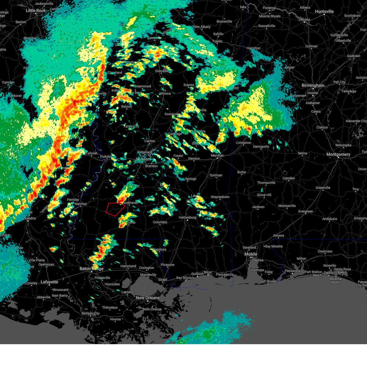 the tornado warning has been cancelled and is no longer in effect the tornado warning has been cancelled and is no longer in effect
|
| 12/28/2024 3:27 PM CST |
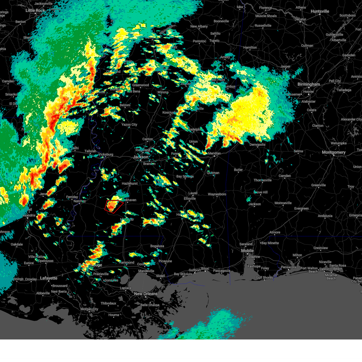 At 327 pm cst, a confirmed large and extremely dangerous tornado was located near mccall creek, or 7 miles east of meadville, moving northeast at 35 mph. this is a particularly dangerous situation. take cover now! (weather spotters confirmed tornado). Hazards include damaging tornado. You are in a life-threatening situation. flying debris may be deadly to those caught without shelter. mobile homes will be destroyed. considerable damage to homes, businesses, and vehicles is likely and complete destruction is possible. the tornado will be near, mccall creek and new hope around 330 pm cst. Vaughn around 335 pm cst. At 327 pm cst, a confirmed large and extremely dangerous tornado was located near mccall creek, or 7 miles east of meadville, moving northeast at 35 mph. this is a particularly dangerous situation. take cover now! (weather spotters confirmed tornado). Hazards include damaging tornado. You are in a life-threatening situation. flying debris may be deadly to those caught without shelter. mobile homes will be destroyed. considerable damage to homes, businesses, and vehicles is likely and complete destruction is possible. the tornado will be near, mccall creek and new hope around 330 pm cst. Vaughn around 335 pm cst.
|
| 12/28/2024 3:19 PM CST |
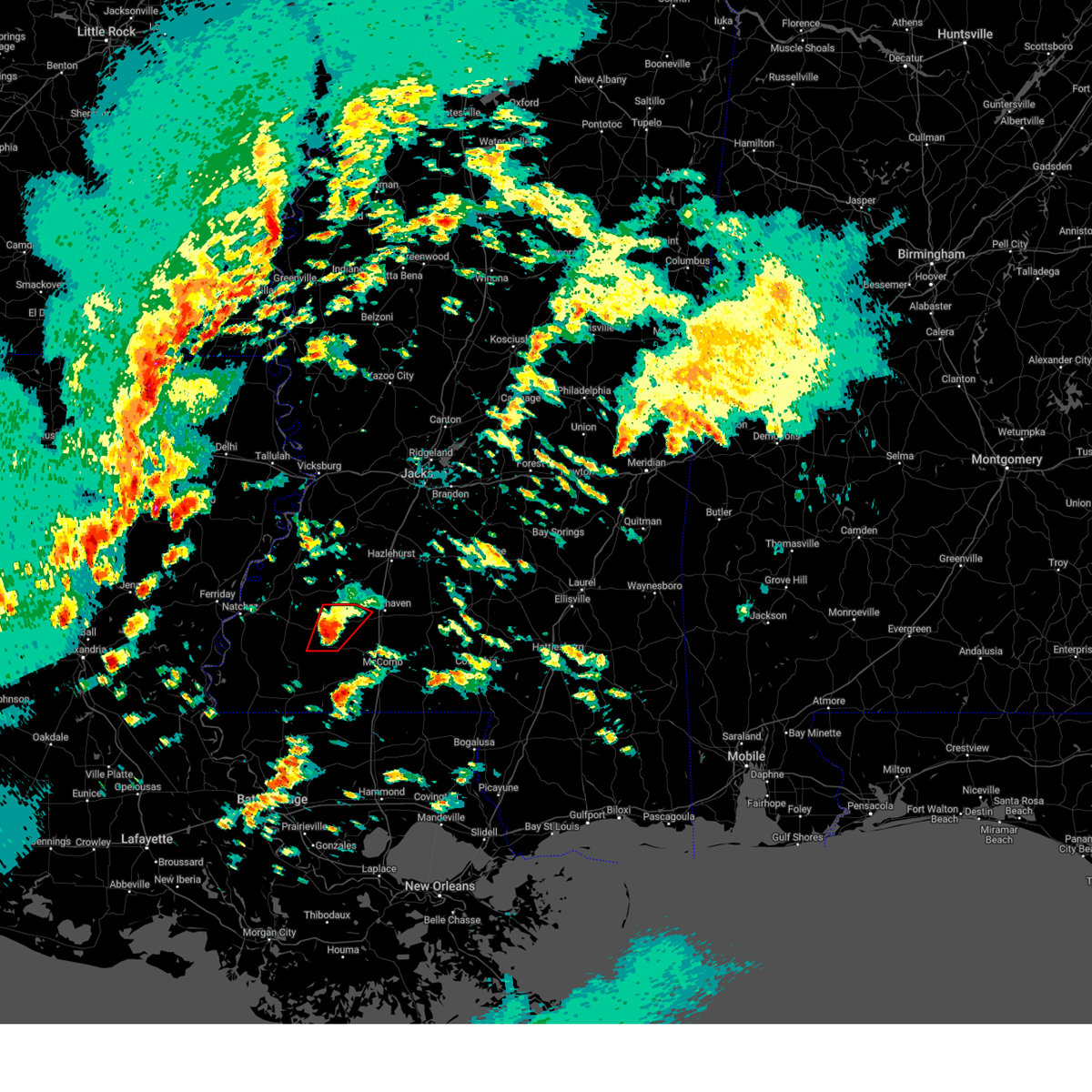 At 319 pm cst, a confirmed large and extremely dangerous tornado was located near bude, or near meadville, moving northeast at 30 mph. this is a particularly dangerous situation. take cover now! (weather spotters confirmed tornado). Hazards include damaging tornado. You are in a life-threatening situation. flying debris may be deadly to those caught without shelter. mobile homes will be destroyed. considerable damage to homes, businesses, and vehicles is likely and complete destruction is possible. the tornado will be near, mccall creek, bude, new hope, and little springs around 325 pm cst. Vaughn around 345 pm cst. At 319 pm cst, a confirmed large and extremely dangerous tornado was located near bude, or near meadville, moving northeast at 30 mph. this is a particularly dangerous situation. take cover now! (weather spotters confirmed tornado). Hazards include damaging tornado. You are in a life-threatening situation. flying debris may be deadly to those caught without shelter. mobile homes will be destroyed. considerable damage to homes, businesses, and vehicles is likely and complete destruction is possible. the tornado will be near, mccall creek, bude, new hope, and little springs around 325 pm cst. Vaughn around 345 pm cst.
|
| 12/28/2024 3:16 PM CST |
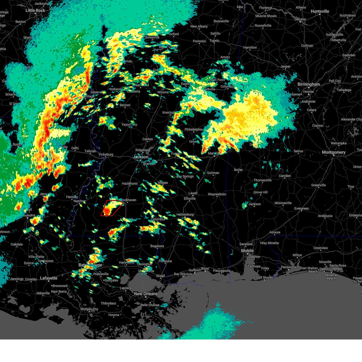 At 315 pm cst, a severe thunderstorm capable of producing a tornado was located near bude, or near meadville, moving northeast at 30 mph (radar indicated rotation). Hazards include tornado. Flying debris will be dangerous to those caught without shelter. mobile homes will be damaged or destroyed. damage to roofs, windows, and vehicles will occur. tree damage is likely. this dangerous storm will be near, meadville, bude, and little springs around 320 pm cst. mccall creek and new hope around 325 pm cst. Vaughn around 345 pm cst. At 315 pm cst, a severe thunderstorm capable of producing a tornado was located near bude, or near meadville, moving northeast at 30 mph (radar indicated rotation). Hazards include tornado. Flying debris will be dangerous to those caught without shelter. mobile homes will be damaged or destroyed. damage to roofs, windows, and vehicles will occur. tree damage is likely. this dangerous storm will be near, meadville, bude, and little springs around 320 pm cst. mccall creek and new hope around 325 pm cst. Vaughn around 345 pm cst.
|
| 12/28/2024 2:58 PM CST |
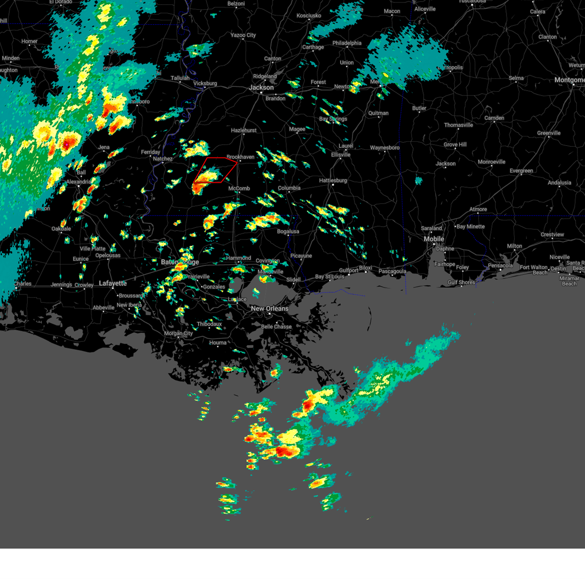 Torjan the national weather service in jackson has issued a * tornado warning for, southwestern lincoln county in south central mississippi, eastern franklin county in southwestern mississippi, * until 400 pm cst. * at 258 pm cst, a severe thunderstorm capable of producing a tornado was located near gloster, or 12 miles northwest of liberty, moving northeast at 30 mph (radar indicated rotation). Hazards include tornado. Flying debris will be dangerous to those caught without shelter. mobile homes will be damaged or destroyed. damage to roofs, windows, and vehicles will occur. tree damage is likely. this dangerous storm will be near, meadville and bude around 310 pm cst. little springs around 315 pm cst. mccall creek and new hope around 325 pm cst. Vaughn around 345 pm cst. Torjan the national weather service in jackson has issued a * tornado warning for, southwestern lincoln county in south central mississippi, eastern franklin county in southwestern mississippi, * until 400 pm cst. * at 258 pm cst, a severe thunderstorm capable of producing a tornado was located near gloster, or 12 miles northwest of liberty, moving northeast at 30 mph (radar indicated rotation). Hazards include tornado. Flying debris will be dangerous to those caught without shelter. mobile homes will be damaged or destroyed. damage to roofs, windows, and vehicles will occur. tree damage is likely. this dangerous storm will be near, meadville and bude around 310 pm cst. little springs around 315 pm cst. mccall creek and new hope around 325 pm cst. Vaughn around 345 pm cst.
|
| 6/4/2024 4:46 PM CDT |
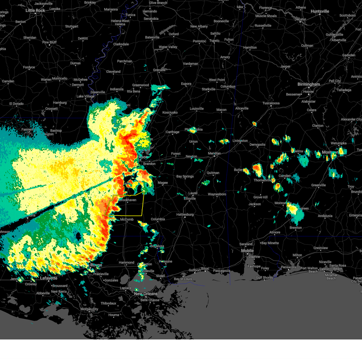 Svrjan the national weather service in jackson has issued a * severe thunderstorm warning for, lincoln county in south central mississippi, western lawrence county in south central mississippi, eastern franklin county in southwestern mississippi, * until 545 pm cdt. * at 446 pm cdt, a severe thunderstorm was located over mccall creek, or 13 miles east of meadville, moving east at 35 mph (radar indicated). Hazards include 60 mph wind gusts and quarter size hail. Hail damage to vehicles is expected. expect wind damage to roofs, siding, and trees. this severe thunderstorm will be near, west lincoln, vaughn, and loyd star around 450 pm cdt. brookhaven around 455 pm cdt. bogue chitto and enterprise around 505 pm cdt. east lincoln around 510 pm cdt. sontag around 525 pm cdt. Wanilla around 530 pm cdt. Svrjan the national weather service in jackson has issued a * severe thunderstorm warning for, lincoln county in south central mississippi, western lawrence county in south central mississippi, eastern franklin county in southwestern mississippi, * until 545 pm cdt. * at 446 pm cdt, a severe thunderstorm was located over mccall creek, or 13 miles east of meadville, moving east at 35 mph (radar indicated). Hazards include 60 mph wind gusts and quarter size hail. Hail damage to vehicles is expected. expect wind damage to roofs, siding, and trees. this severe thunderstorm will be near, west lincoln, vaughn, and loyd star around 450 pm cdt. brookhaven around 455 pm cdt. bogue chitto and enterprise around 505 pm cdt. east lincoln around 510 pm cdt. sontag around 525 pm cdt. Wanilla around 530 pm cdt.
|
| 6/4/2024 4:06 PM CDT |
 At 406 pm cdt, a severe thunderstorm was located over peyton, or 16 miles southeast of port gibson, moving east at 35 mph (radar indicated). Hazards include 60 mph wind gusts and quarter size hail. Hail damage to vehicles is expected. expect wind damage to roofs, siding, and trees. This severe thunderstorm will remain over mainly rural areas of southeastern claiborne, jefferson, franklin and adams counties. At 406 pm cdt, a severe thunderstorm was located over peyton, or 16 miles southeast of port gibson, moving east at 35 mph (radar indicated). Hazards include 60 mph wind gusts and quarter size hail. Hail damage to vehicles is expected. expect wind damage to roofs, siding, and trees. This severe thunderstorm will remain over mainly rural areas of southeastern claiborne, jefferson, franklin and adams counties.
|
| 6/4/2024 4:06 PM CDT |
 the severe thunderstorm warning has been cancelled and is no longer in effect the severe thunderstorm warning has been cancelled and is no longer in effect
|
| 6/4/2024 3:12 PM CDT |
 Svrjan the national weather service in jackson has issued a * severe thunderstorm warning for, south central tensas parish in northeastern louisiana, northeastern concordia parish in northeastern louisiana, southern claiborne county in southwestern mississippi, jefferson county in southwestern mississippi, franklin county in southwestern mississippi, adams county in southwestern mississippi, * until 415 pm cdt. * at 312 pm cdt, a severe thunderstorm was located over church hill, or 12 miles west of fayette, moving east at 35 mph (radar indicated). Hazards include 60 mph wind gusts and quarter size hail. Hail damage to vehicles is expected. expect wind damage to roofs, siding, and trees. this severe thunderstorm will be near, church hill, stanton, and stampley around 315 pm cdt. fayette around 320 pm cdt. lorman and mcnair around 325 pm cdt. red lick around 330 pm cdt. blue hill around 340 pm cdt. pattison, peyton, and mcbride around 350 pm cdt. Pleasant hill around 355 pm cdt. Svrjan the national weather service in jackson has issued a * severe thunderstorm warning for, south central tensas parish in northeastern louisiana, northeastern concordia parish in northeastern louisiana, southern claiborne county in southwestern mississippi, jefferson county in southwestern mississippi, franklin county in southwestern mississippi, adams county in southwestern mississippi, * until 415 pm cdt. * at 312 pm cdt, a severe thunderstorm was located over church hill, or 12 miles west of fayette, moving east at 35 mph (radar indicated). Hazards include 60 mph wind gusts and quarter size hail. Hail damage to vehicles is expected. expect wind damage to roofs, siding, and trees. this severe thunderstorm will be near, church hill, stanton, and stampley around 315 pm cdt. fayette around 320 pm cdt. lorman and mcnair around 325 pm cdt. red lick around 330 pm cdt. blue hill around 340 pm cdt. pattison, peyton, and mcbride around 350 pm cdt. Pleasant hill around 355 pm cdt.
|
| 6/3/2024 10:42 PM CDT |
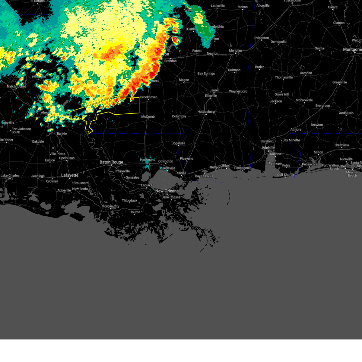 the severe thunderstorm warning has been cancelled and is no longer in effect the severe thunderstorm warning has been cancelled and is no longer in effect
|
| 6/3/2024 10:33 PM CDT |
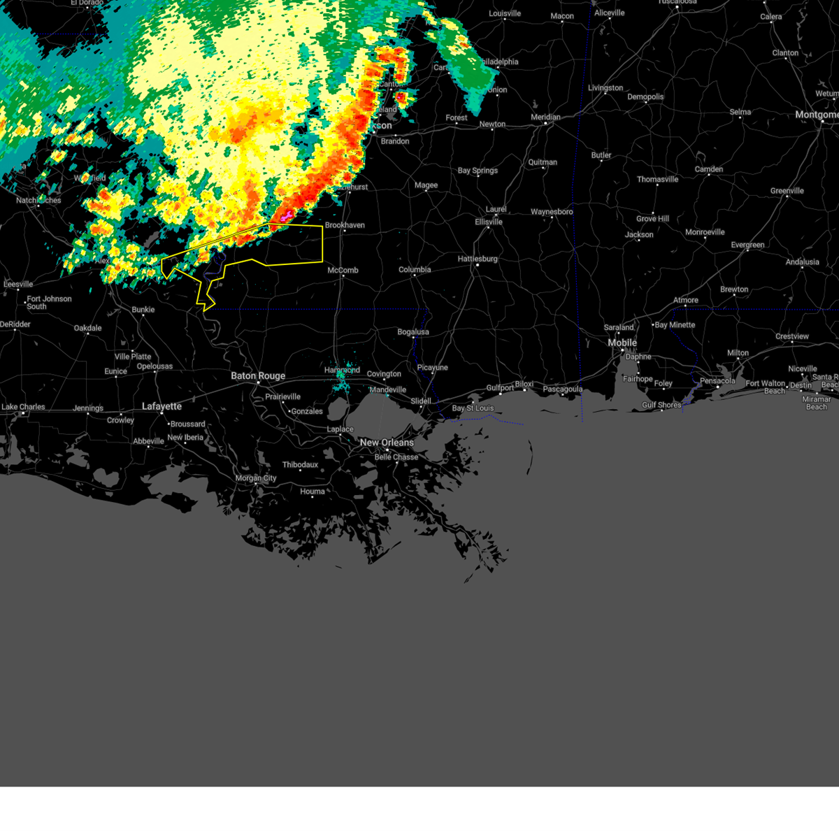 At 1033 pm cdt, severe thunderstorms were located along a line extending from near roxie to sibley to 6 miles southeast of acme, moving southeast at 40 mph (radar indicated). Hazards include 60 mph wind gusts. Expect damage to roofs, siding, and trees. These severe storms will be near, black hawk and garden city around 1040 pm cdt. At 1033 pm cdt, severe thunderstorms were located along a line extending from near roxie to sibley to 6 miles southeast of acme, moving southeast at 40 mph (radar indicated). Hazards include 60 mph wind gusts. Expect damage to roofs, siding, and trees. These severe storms will be near, black hawk and garden city around 1040 pm cdt.
|
| 6/3/2024 10:01 PM CDT |
 Svrjan the national weather service in jackson has issued a * severe thunderstorm warning for, concordia parish in northeastern louisiana, southwestern catahoula parish in northeastern louisiana, southern jefferson county in southwestern mississippi, franklin county in southwestern mississippi, adams county in southwestern mississippi, * until 1115 pm cdt. * at 1001 pm cdt, severe thunderstorms were located along a line extending from near church hill to near frogmore to near larto, moving southeast at 40 mph (radar indicated). Hazards include 60 mph wind gusts. Expect damage to roofs, siding, and trees. severe thunderstorms will be near, natchez, vidalia, monterey, larto, new era, stanton, and mayna around 1005 pm cdt. deer park, cranfield, and acme around 1010 pm cdt. kingston, sibley, and slocum around 1020 pm cdt. roxie around 1025 pm cdt. garden city around 1030 pm cdt. Black hawk around 1035 pm cdt. Svrjan the national weather service in jackson has issued a * severe thunderstorm warning for, concordia parish in northeastern louisiana, southwestern catahoula parish in northeastern louisiana, southern jefferson county in southwestern mississippi, franklin county in southwestern mississippi, adams county in southwestern mississippi, * until 1115 pm cdt. * at 1001 pm cdt, severe thunderstorms were located along a line extending from near church hill to near frogmore to near larto, moving southeast at 40 mph (radar indicated). Hazards include 60 mph wind gusts. Expect damage to roofs, siding, and trees. severe thunderstorms will be near, natchez, vidalia, monterey, larto, new era, stanton, and mayna around 1005 pm cdt. deer park, cranfield, and acme around 1010 pm cdt. kingston, sibley, and slocum around 1020 pm cdt. roxie around 1025 pm cdt. garden city around 1030 pm cdt. Black hawk around 1035 pm cdt.
|
| 5/10/2024 12:30 AM CDT |
 the severe thunderstorm warning has been cancelled and is no longer in effect the severe thunderstorm warning has been cancelled and is no longer in effect
|
| 5/10/2024 12:30 AM CDT |
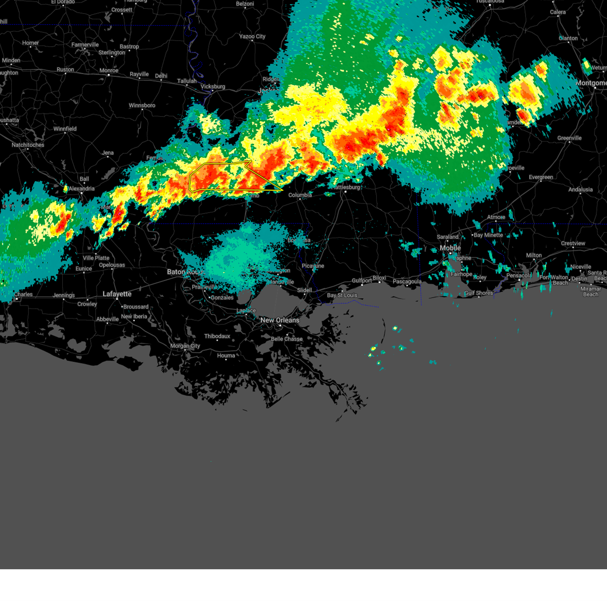 At 1229 am cdt, severe thunderstorms were located meadville, moving southeast at 50 mph (radar indicated). Hazards include 60 mph wind gusts and quarter size hail. Hail damage to vehicles is expected. expect wind damage to roofs, siding, and trees. Locations impacted include, brookhaven, meadville, bude, roxie, bogue chitto, topeka, mccall creek, garden city, west lincoln, vaughn, little springs, ruth, jayess, center point, enterprise, kirby, and new hope. At 1229 am cdt, severe thunderstorms were located meadville, moving southeast at 50 mph (radar indicated). Hazards include 60 mph wind gusts and quarter size hail. Hail damage to vehicles is expected. expect wind damage to roofs, siding, and trees. Locations impacted include, brookhaven, meadville, bude, roxie, bogue chitto, topeka, mccall creek, garden city, west lincoln, vaughn, little springs, ruth, jayess, center point, enterprise, kirby, and new hope.
|
| 5/10/2024 12:23 AM CDT |
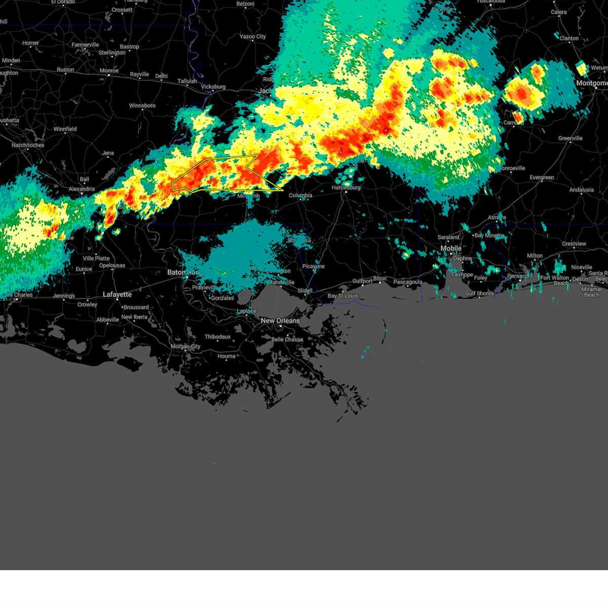 the severe thunderstorm warning has been cancelled and is no longer in effect the severe thunderstorm warning has been cancelled and is no longer in effect
|
| 5/10/2024 12:23 AM CDT |
 At 1222 am cdt, severe thunderstorms were located along a line extending from silver creek to near bogue chitto to near roxie, moving southeast at 25 mph (radar indicated). Hazards include 60 mph wind gusts and quarter size hail. Hail damage to vehicles is expected. expect wind damage to roofs, siding, and trees. Locations impacted include, brookhaven, meadville, bude, roxie, bogue chitto, topeka, caseyville, mccall creek, hamburg, kingston, garden city, west lincoln, vaughn, little springs, ruth, loyd star, jayess, center point, enterprise, and kirby. At 1222 am cdt, severe thunderstorms were located along a line extending from silver creek to near bogue chitto to near roxie, moving southeast at 25 mph (radar indicated). Hazards include 60 mph wind gusts and quarter size hail. Hail damage to vehicles is expected. expect wind damage to roofs, siding, and trees. Locations impacted include, brookhaven, meadville, bude, roxie, bogue chitto, topeka, caseyville, mccall creek, hamburg, kingston, garden city, west lincoln, vaughn, little springs, ruth, loyd star, jayess, center point, enterprise, and kirby.
|
| 5/10/2024 12:00 AM CDT |
 At 1159 pm cdt, severe thunderstorms were located along a line extending from near oma to near west lincoln to cranfield, moving east at 30 mph (radar indicated). Hazards include 60 mph wind gusts and quarter size hail. Hail damage to vehicles is expected. expect wind damage to roofs, siding, and trees. Locations impacted include, natchez, brookhaven, meadville, wesson, bude, roxie, bogue chitto, beauregard, topeka, union church, caseyville, mccall creek, stanton, hamburg, kingston, west lincoln, little springs, cranfield, stampley, and jayess. At 1159 pm cdt, severe thunderstorms were located along a line extending from near oma to near west lincoln to cranfield, moving east at 30 mph (radar indicated). Hazards include 60 mph wind gusts and quarter size hail. Hail damage to vehicles is expected. expect wind damage to roofs, siding, and trees. Locations impacted include, natchez, brookhaven, meadville, wesson, bude, roxie, bogue chitto, beauregard, topeka, union church, caseyville, mccall creek, stanton, hamburg, kingston, west lincoln, little springs, cranfield, stampley, and jayess.
|
| 5/9/2024 11:39 PM CDT |
 Svrjan the national weather service in jackson has issued a * severe thunderstorm warning for, lincoln county in south central mississippi, southwestern lawrence county in south central mississippi, jefferson county in southwestern mississippi, franklin county in southwestern mississippi, northeastern adams county in southwestern mississippi, southern copiah county in central mississippi, * until 100 am cdt. * at 1138 pm cdt, severe thunderstorms were located along a line extending from near beauregard to near new hope to near natchez, moving east at 30 mph (radar indicated). Hazards include 60 mph wind gusts and quarter size hail. Hail damage to vehicles is expected. expect wind damage to roofs, siding, and trees. severe thunderstorms will be near, brookhaven, meadville, wesson, roxie, mccall creek, cranfield, kirby, west lincoln, new hope, and vaughn around 1145 pm cdt. Enterprise around 1210 am cdt. Svrjan the national weather service in jackson has issued a * severe thunderstorm warning for, lincoln county in south central mississippi, southwestern lawrence county in south central mississippi, jefferson county in southwestern mississippi, franklin county in southwestern mississippi, northeastern adams county in southwestern mississippi, southern copiah county in central mississippi, * until 100 am cdt. * at 1138 pm cdt, severe thunderstorms were located along a line extending from near beauregard to near new hope to near natchez, moving east at 30 mph (radar indicated). Hazards include 60 mph wind gusts and quarter size hail. Hail damage to vehicles is expected. expect wind damage to roofs, siding, and trees. severe thunderstorms will be near, brookhaven, meadville, wesson, roxie, mccall creek, cranfield, kirby, west lincoln, new hope, and vaughn around 1145 pm cdt. Enterprise around 1210 am cdt.
|
| 3/5/2024 9:45 AM CST |
 At 945 am cst, severe thunderstorms were located along a line extending from near dentville to glancy to loyd star, moving east at 60 mph (radar indicated). Hazards include 60 mph wind gusts and quarter size hail. Hail damage to vehicles is expected. expect wind damage to roofs, siding, and trees. these severe storms will be near, brookhaven, crystal springs, hazlehurst, wesson, beauregard, martinsville, dentville, and gallman around 950 am cst. georgetown and hopewell around 1000 am cst. Rockport around 1005 am cst. At 945 am cst, severe thunderstorms were located along a line extending from near dentville to glancy to loyd star, moving east at 60 mph (radar indicated). Hazards include 60 mph wind gusts and quarter size hail. Hail damage to vehicles is expected. expect wind damage to roofs, siding, and trees. these severe storms will be near, brookhaven, crystal springs, hazlehurst, wesson, beauregard, martinsville, dentville, and gallman around 950 am cst. georgetown and hopewell around 1000 am cst. Rockport around 1005 am cst.
|
| 3/5/2024 9:41 AM CST |
 At 941 am cst, severe thunderstorms were located along a line extending from near dentville to glancy to vaughn, moving east at 60 mph (radar indicated). Hazards include 60 mph wind gusts and quarter size hail. Hail damage to vehicles is expected. expect wind damage to roofs, siding, and trees. these severe storms will be near, brookhaven, hazlehurst, wesson, beauregard, glancy, martinsville, dentville, and loyd star around 945 am cst. crystal springs and gallman around 950 am cst. Georgetown, hopewell, and rockport around 1000 am cst. At 941 am cst, severe thunderstorms were located along a line extending from near dentville to glancy to vaughn, moving east at 60 mph (radar indicated). Hazards include 60 mph wind gusts and quarter size hail. Hail damage to vehicles is expected. expect wind damage to roofs, siding, and trees. these severe storms will be near, brookhaven, hazlehurst, wesson, beauregard, glancy, martinsville, dentville, and loyd star around 945 am cst. crystal springs and gallman around 950 am cst. Georgetown, hopewell, and rockport around 1000 am cst.
|
| 3/5/2024 9:32 AM CST |
 At 932 am cst, severe thunderstorms were located along a line extending from near peyton to barlow to near mccall creek, moving east at 60 mph (radar indicated). Hazards include 60 mph wind gusts and quarter size hail. Hail damage to vehicles is expected. expect wind damage to roofs, siding, and trees. these severe storms will be near, glancy, caseyville, allen, vaughn, barlow, and loyd star around 935 am cst. brookhaven, martinsville, and dentville around 940 am cst. hazlehurst, wesson, and beauregard around 945 am cst. crystal springs and gallman around 950 am cst. rockport around 955 am cst. Georgetown and hopewell around 1000 am cst. At 932 am cst, severe thunderstorms were located along a line extending from near peyton to barlow to near mccall creek, moving east at 60 mph (radar indicated). Hazards include 60 mph wind gusts and quarter size hail. Hail damage to vehicles is expected. expect wind damage to roofs, siding, and trees. these severe storms will be near, glancy, caseyville, allen, vaughn, barlow, and loyd star around 935 am cst. brookhaven, martinsville, and dentville around 940 am cst. hazlehurst, wesson, and beauregard around 945 am cst. crystal springs and gallman around 950 am cst. rockport around 955 am cst. Georgetown and hopewell around 1000 am cst.
|
| 3/5/2024 9:23 AM CST |
 At 923 am cst, severe thunderstorms were located along a line extending from near pattison to near mcbride to new hope, moving east at 60 mph (radar indicated). Hazards include 60 mph wind gusts and quarter size hail. Hail damage to vehicles is expected. expect wind damage to roofs, siding, and trees. these severe storms will be near, caseyville, allen, and barlow around 930 am cst. glancy, vaughn, dentville, and loyd star around 935 am cst. brookhaven, hazlehurst, wesson, and martinsville around 940 am cst. crystal springs, beauregard, and gallman around 945 am cst. Georgetown, hopewell, and rockport around 955 am cst. At 923 am cst, severe thunderstorms were located along a line extending from near pattison to near mcbride to new hope, moving east at 60 mph (radar indicated). Hazards include 60 mph wind gusts and quarter size hail. Hail damage to vehicles is expected. expect wind damage to roofs, siding, and trees. these severe storms will be near, caseyville, allen, and barlow around 930 am cst. glancy, vaughn, dentville, and loyd star around 935 am cst. brookhaven, hazlehurst, wesson, and martinsville around 940 am cst. crystal springs, beauregard, and gallman around 945 am cst. Georgetown, hopewell, and rockport around 955 am cst.
|
| 3/5/2024 9:00 AM CST |
 Svrjan the national weather service in jackson has issued a * severe thunderstorm warning for, southern claiborne county in southwestern mississippi, northern lincoln county in south central mississippi, jefferson county in southwestern mississippi, franklin county in southwestern mississippi, northeastern adams county in southwestern mississippi, copiah county in central mississippi, * until 1000 am cst. * at 859 am cst, severe thunderstorms were located along a line extending from near alcorn state to fayette to near roxie, moving east at 60 mph (radar indicated). Hazards include 60 mph wind gusts and quarter size hail. Hail damage to vehicles is expected. expect wind damage to roofs, siding, and trees. severe thunderstorms will be near, roxie, kirby, lorman, hamburg, red lick, and mcnair around 905 am cst. meadville and blue hill around 910 am cst. pattison, pleasant hill, union church, new hope, peyton, and mcbride around 915 am cst. allen and barlow around 920 am cst. mccall creek and caseyville around 925 am cst. glancy, vaughn, and loyd star around 930 am cst. brookhaven, hazlehurst, martinsville, and dentville around 935 am cst. Wesson, beauregard, and gallman around 940 am cst. Svrjan the national weather service in jackson has issued a * severe thunderstorm warning for, southern claiborne county in southwestern mississippi, northern lincoln county in south central mississippi, jefferson county in southwestern mississippi, franklin county in southwestern mississippi, northeastern adams county in southwestern mississippi, copiah county in central mississippi, * until 1000 am cst. * at 859 am cst, severe thunderstorms were located along a line extending from near alcorn state to fayette to near roxie, moving east at 60 mph (radar indicated). Hazards include 60 mph wind gusts and quarter size hail. Hail damage to vehicles is expected. expect wind damage to roofs, siding, and trees. severe thunderstorms will be near, roxie, kirby, lorman, hamburg, red lick, and mcnair around 905 am cst. meadville and blue hill around 910 am cst. pattison, pleasant hill, union church, new hope, peyton, and mcbride around 915 am cst. allen and barlow around 920 am cst. mccall creek and caseyville around 925 am cst. glancy, vaughn, and loyd star around 930 am cst. brookhaven, hazlehurst, martinsville, and dentville around 935 am cst. Wesson, beauregard, and gallman around 940 am cst.
|
| 11/20/2023 9:22 PM CST | Mobile home had porch damaged... trees down... metal shed damaged... possible tornad in franklin county MS, 8 miles WNW of Bude, MS |
| 11/20/2023 7:12 PM CST |
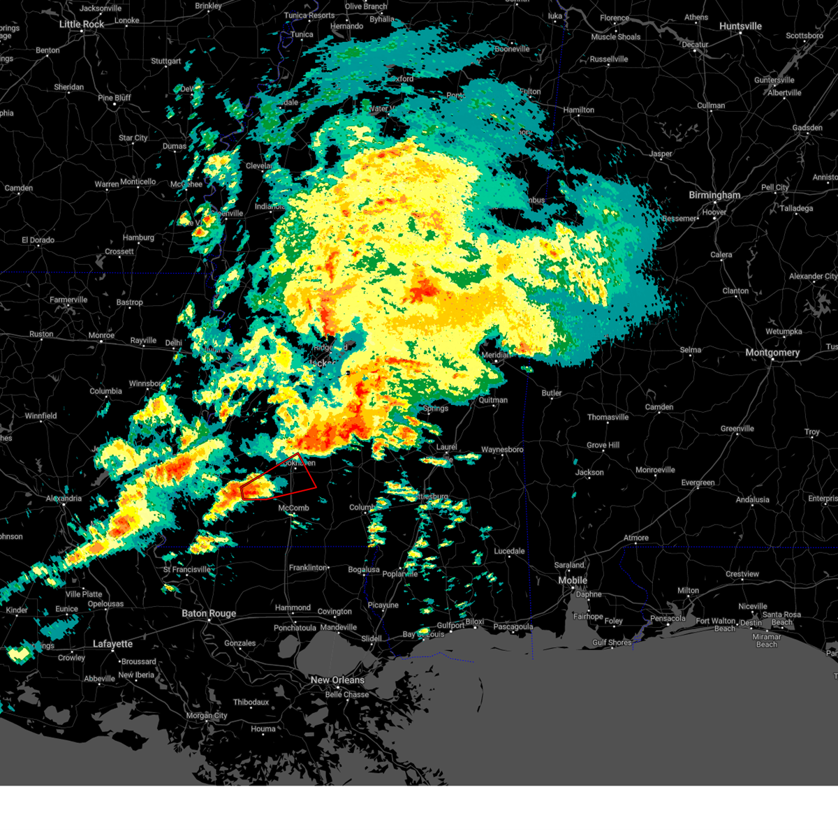 At 711 pm cst, a severe thunderstorm capable of producing a tornado was located near little springs, or 7 miles southeast of meadville, moving northeast at 40 mph (radar indicated rotation). Hazards include tornado. Flying debris will be dangerous to those caught without shelter. mobile homes will be damaged or destroyed. damage to roofs, windows, and vehicles will occur. tree damage is likely. this dangerous storm will be near, mccall creek and little springs around 715 pm cst. center point around 720 pm cst. west lincoln around 725 pm cst. vaughn around 730 pm cst. brookhaven around 735 pm cst. bogue chitto around 740 pm cst. Enterprise around 745 pm cst. At 711 pm cst, a severe thunderstorm capable of producing a tornado was located near little springs, or 7 miles southeast of meadville, moving northeast at 40 mph (radar indicated rotation). Hazards include tornado. Flying debris will be dangerous to those caught without shelter. mobile homes will be damaged or destroyed. damage to roofs, windows, and vehicles will occur. tree damage is likely. this dangerous storm will be near, mccall creek and little springs around 715 pm cst. center point around 720 pm cst. west lincoln around 725 pm cst. vaughn around 730 pm cst. brookhaven around 735 pm cst. bogue chitto around 740 pm cst. Enterprise around 745 pm cst.
|
| 7/16/2023 6:55 PM CDT |
 The severe thunderstorm warning for tensas parish, southern claiborne, jefferson and franklin counties will expire at 700 pm cdt, the storms which prompted the warning have moved out of the area. therefore, the warning will be allowed to expire. a severe thunderstorm watch remains in effect until 1000 pm cdt for northeastern louisiana, and central, south central, southwestern and west central mississippi. The severe thunderstorm warning for tensas parish, southern claiborne, jefferson and franklin counties will expire at 700 pm cdt, the storms which prompted the warning have moved out of the area. therefore, the warning will be allowed to expire. a severe thunderstorm watch remains in effect until 1000 pm cdt for northeastern louisiana, and central, south central, southwestern and west central mississippi.
|
| 7/16/2023 5:29 PM CDT |
 At 528 pm cdt, severe thunderstorms were located along a line extending from near winnsboro to near kingston, moving east at 25 mph (radar indicated). Hazards include 60 mph wind gusts and quarter size hail. Hail damage to vehicles is expected. expect wind damage to roofs, siding, and trees. severe thunderstorms will be near, garden city around 555 pm cdt. newlight around 600 pm cdt. meadville, newellton and somerset around 630 pm cdt. bude around 635 pm cdt. little springs around 655 pm cdt. hail threat, radar indicated max hail size, 1. 00 in wind threat, radar indicated max wind gust, 60 mph. At 528 pm cdt, severe thunderstorms were located along a line extending from near winnsboro to near kingston, moving east at 25 mph (radar indicated). Hazards include 60 mph wind gusts and quarter size hail. Hail damage to vehicles is expected. expect wind damage to roofs, siding, and trees. severe thunderstorms will be near, garden city around 555 pm cdt. newlight around 600 pm cdt. meadville, newellton and somerset around 630 pm cdt. bude around 635 pm cdt. little springs around 655 pm cdt. hail threat, radar indicated max hail size, 1. 00 in wind threat, radar indicated max wind gust, 60 mph.
|
| 6/16/2023 4:47 AM CDT |
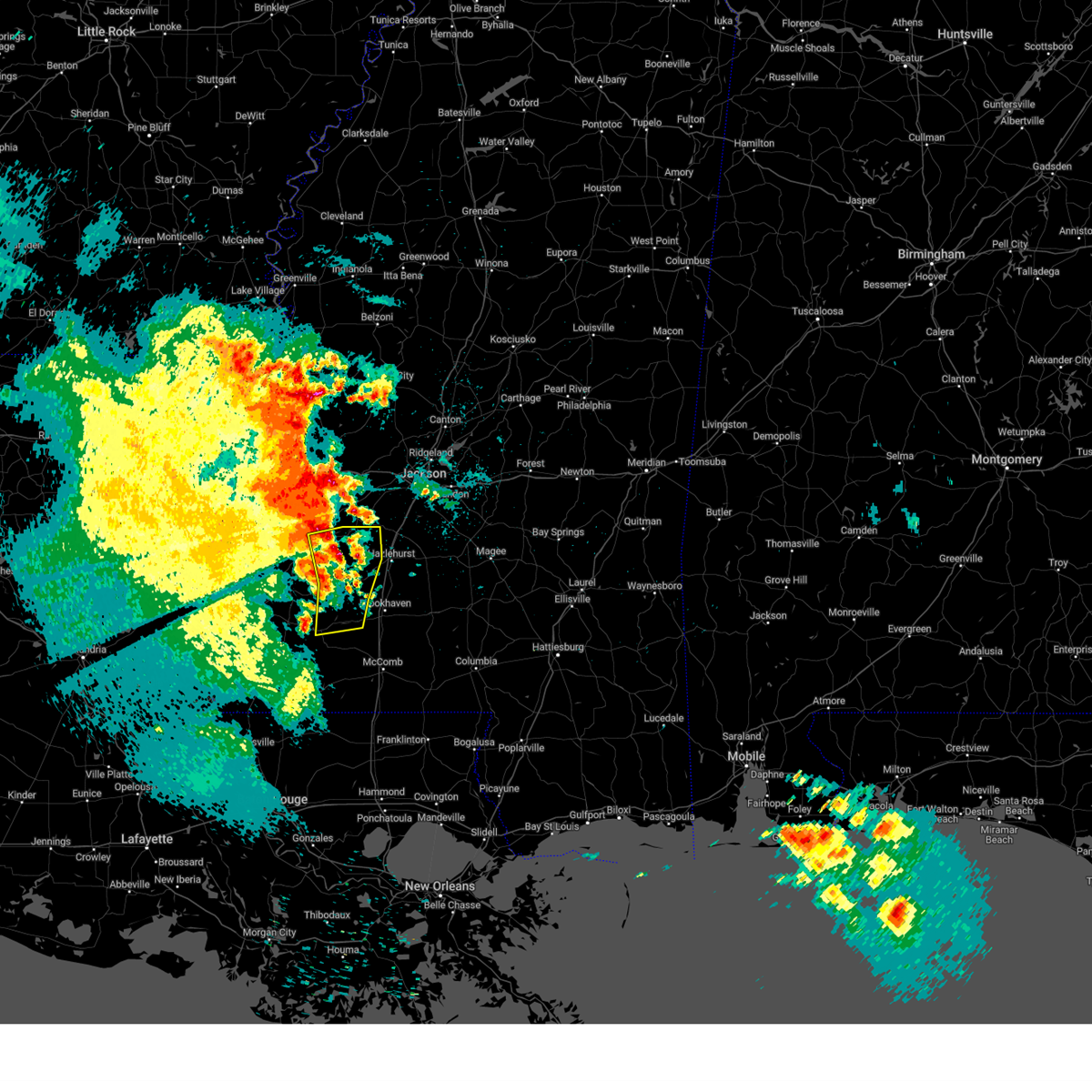 At 446 am cdt, severe thunderstorms were located along a line extending from near carpenter to near barlow, moving east at 55 mph (radar indicated). Hazards include 70 mph wind gusts and penny size hail. Expect considerable tree damage. damage is likely to mobile homes, roofs, and outbuildings. these severe storms will be near, barlow and carpenter around 450 am cdt. dentville around 455 am cdt. glancy around 500 am cdt. thunderstorm damage threat, considerable hail threat, radar indicated max hail size, 0. 75 in wind threat, radar indicated max wind gust, 70 mph. At 446 am cdt, severe thunderstorms were located along a line extending from near carpenter to near barlow, moving east at 55 mph (radar indicated). Hazards include 70 mph wind gusts and penny size hail. Expect considerable tree damage. damage is likely to mobile homes, roofs, and outbuildings. these severe storms will be near, barlow and carpenter around 450 am cdt. dentville around 455 am cdt. glancy around 500 am cdt. thunderstorm damage threat, considerable hail threat, radar indicated max hail size, 0. 75 in wind threat, radar indicated max wind gust, 70 mph.
|
| 6/16/2023 4:33 AM CDT |
 At 432 am cdt, severe thunderstorms were located along a line extending from near port gibson to near red lick to near garden city, moving east at 60 mph (radar indicated). Hazards include 70 mph wind gusts. Expect considerable tree damage. damage is likely to mobile homes, roofs, and outbuildings. these severe storms will be near, pattison and blue hill around 435 am cdt. hermanville, mcbride, peyton and union church around 440 am cdt. meadville and pleasant hill around 445 am cdt. bude, barlow, carpenter and allen around 450 am cdt. little springs, dentville and mccall creek around 455 am cdt. glancy and center point around 500 am cdt. thunderstorm damage threat, considerable hail threat, radar indicated max hail size, <. 75 in wind threat, radar indicated max wind gust, 70 mph. At 432 am cdt, severe thunderstorms were located along a line extending from near port gibson to near red lick to near garden city, moving east at 60 mph (radar indicated). Hazards include 70 mph wind gusts. Expect considerable tree damage. damage is likely to mobile homes, roofs, and outbuildings. these severe storms will be near, pattison and blue hill around 435 am cdt. hermanville, mcbride, peyton and union church around 440 am cdt. meadville and pleasant hill around 445 am cdt. bude, barlow, carpenter and allen around 450 am cdt. little springs, dentville and mccall creek around 455 am cdt. glancy and center point around 500 am cdt. thunderstorm damage threat, considerable hail threat, radar indicated max hail size, <. 75 in wind threat, radar indicated max wind gust, 70 mph.
|
| 6/16/2023 4:04 AM CDT |
 At 403 am cdt, severe thunderstorms were located along a line extending from near newlight to near waterproof to near deer park, moving east at 50 mph. these are destructive storms for southwest mississippi (radar indicated). Hazards include 80 mph wind gusts and penny size hail. Flying debris will be dangerous to those caught without shelter. mobile homes will be heavily damaged. expect considerable damage to roofs, windows, and vehicles. extensive tree damage and power outages are likely. severe thunderstorms will be near, alcorn state around 420 am cdt. fayette and lorman around 430 am cdt. port gibson and red lick around 435 am cdt. pattison, blue hill and garden city around 440 am cdt. hermanville, roxie and peyton around 445 am cdt. kirby, mcbride and pleasant hill around 450 am cdt. meadville, barlow and allen around 455 am cdt. bude, carpenter and new hope around 500 am cdt. thunderstorm damage threat, destructive hail threat, radar indicated max hail size, 0. 75 in wind threat, radar indicated max wind gust, 80 mph. At 403 am cdt, severe thunderstorms were located along a line extending from near newlight to near waterproof to near deer park, moving east at 50 mph. these are destructive storms for southwest mississippi (radar indicated). Hazards include 80 mph wind gusts and penny size hail. Flying debris will be dangerous to those caught without shelter. mobile homes will be heavily damaged. expect considerable damage to roofs, windows, and vehicles. extensive tree damage and power outages are likely. severe thunderstorms will be near, alcorn state around 420 am cdt. fayette and lorman around 430 am cdt. port gibson and red lick around 435 am cdt. pattison, blue hill and garden city around 440 am cdt. hermanville, roxie and peyton around 445 am cdt. kirby, mcbride and pleasant hill around 450 am cdt. meadville, barlow and allen around 455 am cdt. bude, carpenter and new hope around 500 am cdt. thunderstorm damage threat, destructive hail threat, radar indicated max hail size, 0. 75 in wind threat, radar indicated max wind gust, 80 mph.
|
| 6/15/2023 11:29 AM CDT | Quarter sized hail reported 18 miles SSW of Bude, MS |
| 6/14/2023 5:52 PM CDT |
 The severe thunderstorm warning for southeastern claiborne, jefferson and franklin counties will expire at 600 pm cdt, the storm which prompted the warning has moved out of the area. therefore, the warning will be allowed to expire. however gusty winds are still possible with this thunderstorm. a severe thunderstorm watch remains in effect until 800 pm cdt for central, south central and southwestern mississippi. The severe thunderstorm warning for southeastern claiborne, jefferson and franklin counties will expire at 600 pm cdt, the storm which prompted the warning has moved out of the area. therefore, the warning will be allowed to expire. however gusty winds are still possible with this thunderstorm. a severe thunderstorm watch remains in effect until 800 pm cdt for central, south central and southwestern mississippi.
|
| 6/14/2023 5:29 PM CDT |
 At 529 pm cdt, a severe thunderstorm was located near union church, or 13 miles north of meadville, moving east at 45 mph (radar indicated). Hazards include ping pong ball size hail and 60 mph wind gusts. People and animals outdoors will be injured. expect hail damage to roofs, siding, windows, and vehicles. expect wind damage to roofs, siding, and trees. this severe storm will be near, mccall creek around 545 pm cdt. hail threat, radar indicated max hail size, 1. 50 in wind threat, radar indicated max wind gust, 60 mph. At 529 pm cdt, a severe thunderstorm was located near union church, or 13 miles north of meadville, moving east at 45 mph (radar indicated). Hazards include ping pong ball size hail and 60 mph wind gusts. People and animals outdoors will be injured. expect hail damage to roofs, siding, windows, and vehicles. expect wind damage to roofs, siding, and trees. this severe storm will be near, mccall creek around 545 pm cdt. hail threat, radar indicated max hail size, 1. 50 in wind threat, radar indicated max wind gust, 60 mph.
|
| 6/14/2023 5:20 PM CDT |
 At 519 pm cdt, a severe thunderstorm was located near new hope, or 10 miles north of meadville, moving east at 55 mph (radar indicated). Hazards include golf ball size hail and 60 mph wind gusts. People and animals outdoors will be injured. expect hail damage to roofs, siding, windows, and vehicles. expect wind damage to roofs, siding, and trees. this severe storm will be near, new hope and union church around 525 pm cdt. mccall creek around 535 pm cdt. thunderstorm damage threat, considerable hail threat, radar indicated max hail size, 1. 75 in wind threat, radar indicated max wind gust, 60 mph. At 519 pm cdt, a severe thunderstorm was located near new hope, or 10 miles north of meadville, moving east at 55 mph (radar indicated). Hazards include golf ball size hail and 60 mph wind gusts. People and animals outdoors will be injured. expect hail damage to roofs, siding, windows, and vehicles. expect wind damage to roofs, siding, and trees. this severe storm will be near, new hope and union church around 525 pm cdt. mccall creek around 535 pm cdt. thunderstorm damage threat, considerable hail threat, radar indicated max hail size, 1. 75 in wind threat, radar indicated max wind gust, 60 mph.
|
| 6/14/2023 5:15 PM CDT |
 At 515 pm cdt, a severe thunderstorm was located near mcnair, or 7 miles southeast of fayette, moving southeast at 55 mph (radar indicated). Hazards include 60 mph wind gusts and half dollar size hail. Hail damage to vehicles is expected. expect wind damage to roofs, siding, and trees. this severe storm will be near, new hope and union church around 525 pm cdt. bude around 530 pm cdt. mccall creek around 535 pm cdt. hail threat, radar indicated max hail size, 1. 25 in wind threat, radar indicated max wind gust, 60 mph. At 515 pm cdt, a severe thunderstorm was located near mcnair, or 7 miles southeast of fayette, moving southeast at 55 mph (radar indicated). Hazards include 60 mph wind gusts and half dollar size hail. Hail damage to vehicles is expected. expect wind damage to roofs, siding, and trees. this severe storm will be near, new hope and union church around 525 pm cdt. bude around 530 pm cdt. mccall creek around 535 pm cdt. hail threat, radar indicated max hail size, 1. 25 in wind threat, radar indicated max wind gust, 60 mph.
|
| 6/14/2023 5:05 PM CDT |
 At 505 pm cdt, a severe thunderstorm was located over fayette, moving east at 55 mph (radar indicated). Hazards include 60 mph wind gusts and half dollar size hail. Hail damage to vehicles is expected. expect wind damage to roofs, siding, and trees. this severe storm will be near, red lick and mcnair around 510 pm cdt. blue hill around 520 pm cdt. union church, pleasant hill, mcbride and new hope around 525 pm cdt. mccall creek around 535 pm cdt. hail threat, radar indicated max hail size, 1. 25 in wind threat, radar indicated max wind gust, 60 mph. At 505 pm cdt, a severe thunderstorm was located over fayette, moving east at 55 mph (radar indicated). Hazards include 60 mph wind gusts and half dollar size hail. Hail damage to vehicles is expected. expect wind damage to roofs, siding, and trees. this severe storm will be near, red lick and mcnair around 510 pm cdt. blue hill around 520 pm cdt. union church, pleasant hill, mcbride and new hope around 525 pm cdt. mccall creek around 535 pm cdt. hail threat, radar indicated max hail size, 1. 25 in wind threat, radar indicated max wind gust, 60 mph.
|
| 6/14/2023 4:45 PM CDT |
 At 445 pm cdt, a severe thunderstorm was located over helena, or 9 miles southwest of st. joseph, moving east at 55 mph (radar indicated). Hazards include ping pong ball size hail and 60 mph wind gusts. People and animals outdoors will be injured. expect hail damage to roofs, siding, windows, and vehicles. expect wind damage to roofs, siding, and trees. this severe thunderstorm will be near, church hill around 455 pm cdt. alcorn state around 500 pm cdt. lorman around 505 pm cdt. fayette, red lick and mcnair around 510 pm cdt. blue hill around 520 pm cdt. union church, pleasant hill, mcbride and new hope around 525 pm cdt. mccall creek around 535 pm cdt. hail threat, radar indicated max hail size, 1. 50 in wind threat, radar indicated max wind gust, 60 mph. At 445 pm cdt, a severe thunderstorm was located over helena, or 9 miles southwest of st. joseph, moving east at 55 mph (radar indicated). Hazards include ping pong ball size hail and 60 mph wind gusts. People and animals outdoors will be injured. expect hail damage to roofs, siding, windows, and vehicles. expect wind damage to roofs, siding, and trees. this severe thunderstorm will be near, church hill around 455 pm cdt. alcorn state around 500 pm cdt. lorman around 505 pm cdt. fayette, red lick and mcnair around 510 pm cdt. blue hill around 520 pm cdt. union church, pleasant hill, mcbride and new hope around 525 pm cdt. mccall creek around 535 pm cdt. hail threat, radar indicated max hail size, 1. 50 in wind threat, radar indicated max wind gust, 60 mph.
|
| 6/10/2023 6:30 PM CDT | Tree down on the side of the west bound line of hwy 84 between eddiceton and quinto in franklin county MS, 5.8 miles WSW of Bude, MS |
| 5/12/2023 4:40 PM CDT |
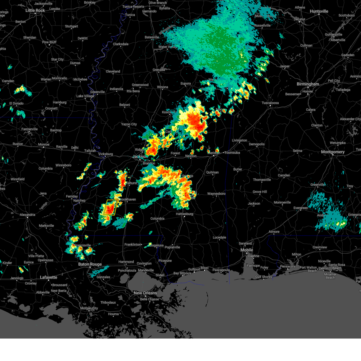 At 440 pm cdt, a severe thunderstorm was located over mccall creek, or 9 miles east of meadville, moving northeast at 20 mph (radar indicated). Hazards include 60 mph wind gusts and quarter size hail. Hail damage to vehicles is expected. Expect wind damage to roofs, siding, and trees. At 440 pm cdt, a severe thunderstorm was located over mccall creek, or 9 miles east of meadville, moving northeast at 20 mph (radar indicated). Hazards include 60 mph wind gusts and quarter size hail. Hail damage to vehicles is expected. Expect wind damage to roofs, siding, and trees.
|
| 3/12/2023 8:13 AM CDT |
 At 813 am cdt, severe thunderstorms were located along a line extending from near martinsville to near west lincoln to near bude, moving east at 45 mph (radar indicated). Hazards include 60 mph wind gusts and quarter size hail. Hail damage to vehicles is expected. expect wind damage to roofs, siding, and trees. these severe storms will be near, rockport around 825 am cdt. other locations impacted by these severe thunderstorms include beauregard, meadville and georgetown. hail threat, radar indicated max hail size, 1. 00 in wind threat, radar indicated max wind gust, 60 mph. At 813 am cdt, severe thunderstorms were located along a line extending from near martinsville to near west lincoln to near bude, moving east at 45 mph (radar indicated). Hazards include 60 mph wind gusts and quarter size hail. Hail damage to vehicles is expected. expect wind damage to roofs, siding, and trees. these severe storms will be near, rockport around 825 am cdt. other locations impacted by these severe thunderstorms include beauregard, meadville and georgetown. hail threat, radar indicated max hail size, 1. 00 in wind threat, radar indicated max wind gust, 60 mph.
|
| 3/12/2023 7:57 AM CDT |
 At 756 am cdt, severe thunderstorms were located along a line extending from near gallman to near mccall creek to near kirby, moving southeast at 50 mph (radar indicated). Hazards include 60 mph wind gusts and quarter size hail. Hail damage to vehicles is expected. expect wind damage to roofs, siding, and trees. these severe storms will be near, crystal springs, hazlehurst, gallman, mccall creek, glancy and caseyville around 800 am cdt. vaughn, martinsville and loyd star around 805 am cdt. bude and west lincoln around 810 am cdt. rockport and little springs around 820 am cdt. other locations impacted by these severe thunderstorms include roxie, meadville, beauregard and georgetown. hail threat, radar indicated max hail size, 1. 00 in wind threat, radar indicated max wind gust, 60 mph. At 756 am cdt, severe thunderstorms were located along a line extending from near gallman to near mccall creek to near kirby, moving southeast at 50 mph (radar indicated). Hazards include 60 mph wind gusts and quarter size hail. Hail damage to vehicles is expected. expect wind damage to roofs, siding, and trees. these severe storms will be near, crystal springs, hazlehurst, gallman, mccall creek, glancy and caseyville around 800 am cdt. vaughn, martinsville and loyd star around 805 am cdt. bude and west lincoln around 810 am cdt. rockport and little springs around 820 am cdt. other locations impacted by these severe thunderstorms include roxie, meadville, beauregard and georgetown. hail threat, radar indicated max hail size, 1. 00 in wind threat, radar indicated max wind gust, 60 mph.
|
| 3/12/2023 7:41 AM CDT |
 At 740 am cdt, severe thunderstorms were located along a line extending from near dentville to 7 miles west of union church to cranfield, moving southeast at 50 mph (radar indicated). Hazards include 60 mph wind gusts and quarter size hail. Hail damage to vehicles is expected. expect wind damage to roofs, siding, and trees. these severe storms will be near, union church and new hope around 750 am cdt. hazlehurst, glancy, gallman and caseyville around 755 am cdt. kirby, martinsville and mccall creek around 800 am cdt. vaughn and loyd star around 805 am cdt. bude and west lincoln around 810 am cdt. rockport around 815 am cdt. little springs around 820 am cdt. other locations impacted by these severe thunderstorms include roxie, meadville, beauregard and georgetown. hail threat, radar indicated max hail size, 1. 00 in wind threat, radar indicated max wind gust, 60 mph. At 740 am cdt, severe thunderstorms were located along a line extending from near dentville to 7 miles west of union church to cranfield, moving southeast at 50 mph (radar indicated). Hazards include 60 mph wind gusts and quarter size hail. Hail damage to vehicles is expected. expect wind damage to roofs, siding, and trees. these severe storms will be near, union church and new hope around 750 am cdt. hazlehurst, glancy, gallman and caseyville around 755 am cdt. kirby, martinsville and mccall creek around 800 am cdt. vaughn and loyd star around 805 am cdt. bude and west lincoln around 810 am cdt. rockport around 815 am cdt. little springs around 820 am cdt. other locations impacted by these severe thunderstorms include roxie, meadville, beauregard and georgetown. hail threat, radar indicated max hail size, 1. 00 in wind threat, radar indicated max wind gust, 60 mph.
|
| 3/12/2023 7:30 AM CDT |
 At 730 am cdt, severe thunderstorms were located along a line extending from near hermanville to fayette to near natchez, moving southeast at 45 mph (radar indicated). Hazards include 60 mph wind gusts and quarter size hail. Hail damage to vehicles is expected. expect wind damage to roofs, siding, and trees. severe thunderstorms will be near, carpenter around 735 am cdt. blue hill around 740 am cdt. dentville and stampley around 745 am cdt. union church, hamburg, new hope and pleasant hill around 750 am cdt. glancy around 755 am cdt. crystal springs, hazlehurst, kirby, gallman, mccall creek and caseyville around 800 am cdt. martinsville around 805 am cdt. bude, vaughn, west lincoln and loyd star around 810 am cdt. other locations impacted by these severe thunderstorms include roxie, meadville, beauregard and georgetown. hail threat, radar indicated max hail size, 1. 00 in wind threat, radar indicated max wind gust, 60 mph. At 730 am cdt, severe thunderstorms were located along a line extending from near hermanville to fayette to near natchez, moving southeast at 45 mph (radar indicated). Hazards include 60 mph wind gusts and quarter size hail. Hail damage to vehicles is expected. expect wind damage to roofs, siding, and trees. severe thunderstorms will be near, carpenter around 735 am cdt. blue hill around 740 am cdt. dentville and stampley around 745 am cdt. union church, hamburg, new hope and pleasant hill around 750 am cdt. glancy around 755 am cdt. crystal springs, hazlehurst, kirby, gallman, mccall creek and caseyville around 800 am cdt. martinsville around 805 am cdt. bude, vaughn, west lincoln and loyd star around 810 am cdt. other locations impacted by these severe thunderstorms include roxie, meadville, beauregard and georgetown. hail threat, radar indicated max hail size, 1. 00 in wind threat, radar indicated max wind gust, 60 mph.
|
| 2/8/2023 8:55 PM CST |
 The severe thunderstorm warning for southeastern claiborne, northwestern lincoln, eastern jefferson, franklin and western copiah counties will expire at 900 pm cst, the severe thunderstorm which prompted the warning has moved out of the warned area. therefore, the warning will be allowed to expire. a tornado watch remains in effect until 1100 pm cst for central, south central and southwestern mississippi. The severe thunderstorm warning for southeastern claiborne, northwestern lincoln, eastern jefferson, franklin and western copiah counties will expire at 900 pm cst, the severe thunderstorm which prompted the warning has moved out of the warned area. therefore, the warning will be allowed to expire. a tornado watch remains in effect until 1100 pm cst for central, south central and southwestern mississippi.
|
| 2/8/2023 7:59 PM CST |
 At 759 pm cst, a severe thunderstorm was located over cranfield, or 13 miles east of natchez, moving northeast at 60 mph (radar indicated). Hazards include 60 mph wind gusts. Expect damage to roofs, siding, and trees. this severe thunderstorm will be near, stampley around 805 pm cst. hamburg, mcnair and kirby around 810 pm cst. fayette around 815 pm cst. union church and blue hill around 825 pm cst. mcbride, pleasant hill and peyton around 830 pm cst. allen around 835 pm cst. barlow around 840 pm cst. glancy around 845 pm cst. other locations impacted by this severe thunderstorm include roxie and meadville. hail threat, radar indicated max hail size, <. 75 in wind threat, radar indicated max wind gust, 60 mph. At 759 pm cst, a severe thunderstorm was located over cranfield, or 13 miles east of natchez, moving northeast at 60 mph (radar indicated). Hazards include 60 mph wind gusts. Expect damage to roofs, siding, and trees. this severe thunderstorm will be near, stampley around 805 pm cst. hamburg, mcnair and kirby around 810 pm cst. fayette around 815 pm cst. union church and blue hill around 825 pm cst. mcbride, pleasant hill and peyton around 830 pm cst. allen around 835 pm cst. barlow around 840 pm cst. glancy around 845 pm cst. other locations impacted by this severe thunderstorm include roxie and meadville. hail threat, radar indicated max hail size, <. 75 in wind threat, radar indicated max wind gust, 60 mph.
|
| 2/8/2023 3:57 PM CST |
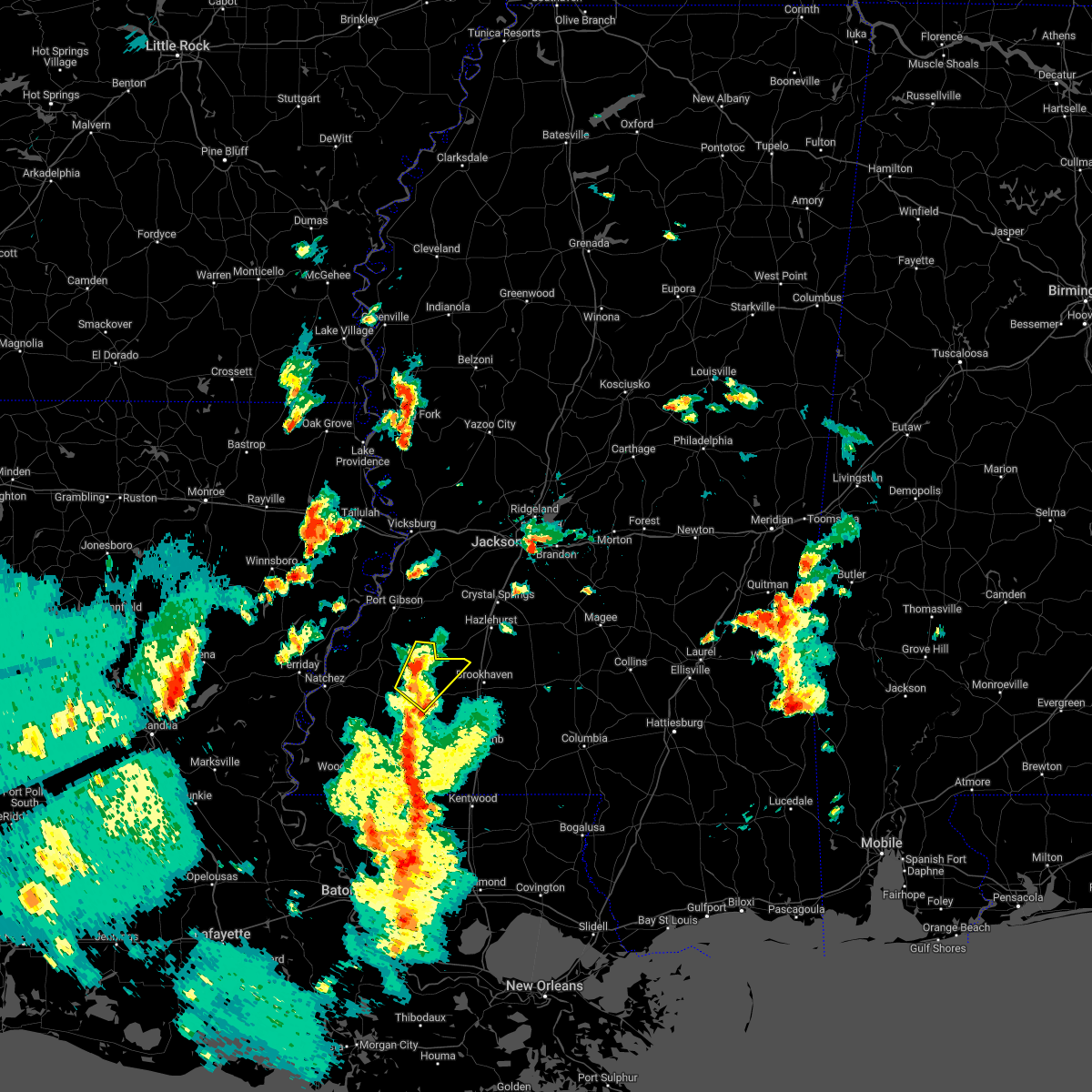 At 357 pm cst, a severe thunderstorm was located over new hope, or 22 miles west of brookhaven, moving northeast at 45 mph (radar indicated). Hazards include 60 mph wind gusts. Expect damage to roofs, siding, and trees. locations impacted include, union church, pleasant hill, new hope, caseyville, blue hill and mcbride. hail threat, radar indicated max hail size, <. 75 in wind threat, radar indicated max wind gust, 60 mph. At 357 pm cst, a severe thunderstorm was located over new hope, or 22 miles west of brookhaven, moving northeast at 45 mph (radar indicated). Hazards include 60 mph wind gusts. Expect damage to roofs, siding, and trees. locations impacted include, union church, pleasant hill, new hope, caseyville, blue hill and mcbride. hail threat, radar indicated max hail size, <. 75 in wind threat, radar indicated max wind gust, 60 mph.
|
| 2/8/2023 3:40 PM CST |
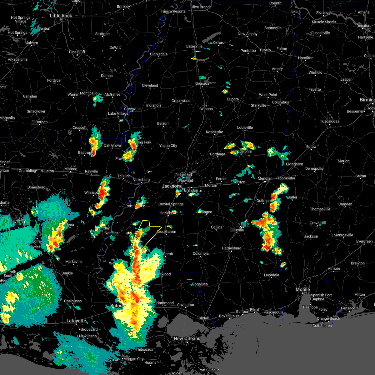 At 340 pm cst, a severe thunderstorm was located near bude, or 19 miles northwest of liberty, moving northeast at 45 mph (radar indicated). Hazards include 60 mph wind gusts. Expect damage to roofs, siding, and trees. this severe thunderstorm will be near, kirby around 345 pm cst. bude around 350 pm cst. new hope around 355 pm cst. union church around 410 pm cst. pleasant hill, caseyville and mcbride around 415 pm cst. other locations impacted by this severe thunderstorm include meadville. hail threat, radar indicated max hail size, <. 75 in wind threat, radar indicated max wind gust, 60 mph. At 340 pm cst, a severe thunderstorm was located near bude, or 19 miles northwest of liberty, moving northeast at 45 mph (radar indicated). Hazards include 60 mph wind gusts. Expect damage to roofs, siding, and trees. this severe thunderstorm will be near, kirby around 345 pm cst. bude around 350 pm cst. new hope around 355 pm cst. union church around 410 pm cst. pleasant hill, caseyville and mcbride around 415 pm cst. other locations impacted by this severe thunderstorm include meadville. hail threat, radar indicated max hail size, <. 75 in wind threat, radar indicated max wind gust, 60 mph.
|
| 1/3/2023 8:43 PM CST |
 At 843 pm cst, a severe thunderstorm was located over garden city, or 21 miles northwest of liberty, moving northeast at 50 mph (radar indicated). Hazards include 60 mph wind gusts and half dollar size hail. Hail damage to vehicles is expected. expect wind damage to roofs, siding, and trees. this severe thunderstorm will be near, bude around 900 pm cst. new hope around 905 pm cst. little springs around 910 pm cst. mccall creek around 915 pm cst. west lincoln around 920 pm cst. vaughn and loyd star around 925 pm cst. other locations impacted by this severe thunderstorm include meadville. hail threat, radar indicated max hail size, 1. 25 in wind threat, radar indicated max wind gust, 60 mph. At 843 pm cst, a severe thunderstorm was located over garden city, or 21 miles northwest of liberty, moving northeast at 50 mph (radar indicated). Hazards include 60 mph wind gusts and half dollar size hail. Hail damage to vehicles is expected. expect wind damage to roofs, siding, and trees. this severe thunderstorm will be near, bude around 900 pm cst. new hope around 905 pm cst. little springs around 910 pm cst. mccall creek around 915 pm cst. west lincoln around 920 pm cst. vaughn and loyd star around 925 pm cst. other locations impacted by this severe thunderstorm include meadville. hail threat, radar indicated max hail size, 1. 25 in wind threat, radar indicated max wind gust, 60 mph.
|
| 12/14/2022 4:17 AM CST |
 At 417 am cst, a severe thunderstorm was located over new hope, or 24 miles west of brookhaven, moving east at 30 mph (radar indicated). Hazards include 60 mph wind gusts. Expect damage to roofs, siding, and trees. locations impacted include, bude, kirby, new hope and meadville. hail threat, radar indicated max hail size, <. 75 in wind threat, radar indicated max wind gust, 60 mph. At 417 am cst, a severe thunderstorm was located over new hope, or 24 miles west of brookhaven, moving east at 30 mph (radar indicated). Hazards include 60 mph wind gusts. Expect damage to roofs, siding, and trees. locations impacted include, bude, kirby, new hope and meadville. hail threat, radar indicated max hail size, <. 75 in wind threat, radar indicated max wind gust, 60 mph.
|
| 12/14/2022 3:43 AM CST |
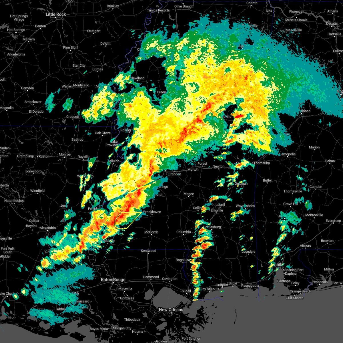 At 343 am cst, severe thunderstorms were located along a line extending from 6 miles northwest of new hope to near garden city, moving east at 25 mph (radar indicated). Hazards include 60 mph wind gusts and penny size hail. expect damage to roofs, siding, and trees At 343 am cst, severe thunderstorms were located along a line extending from 6 miles northwest of new hope to near garden city, moving east at 25 mph (radar indicated). Hazards include 60 mph wind gusts and penny size hail. expect damage to roofs, siding, and trees
|
| 5/15/2022 9:27 PM CDT |
 At 926 pm cdt, severe thunderstorms were located along a line extending from brookhaven to bude to near cranfield, moving south at 45 mph (radar indicated). Hazards include 60 mph wind gusts and quarter size hail. Hail damage to vehicles is expected. expect wind damage to roofs, siding, and trees. severe thunderstorms will be near, enterprise around 935 pm cdt. bogue chitto and garden city around 940 pm cdt. ruth around 945 pm cdt. other locations impacted by these severe thunderstorms include roxie and meadville. hail threat, radar indicated max hail size, 1. 00 in wind threat, radar indicated max wind gust, 60 mph. At 926 pm cdt, severe thunderstorms were located along a line extending from brookhaven to bude to near cranfield, moving south at 45 mph (radar indicated). Hazards include 60 mph wind gusts and quarter size hail. Hail damage to vehicles is expected. expect wind damage to roofs, siding, and trees. severe thunderstorms will be near, enterprise around 935 pm cdt. bogue chitto and garden city around 940 pm cdt. ruth around 945 pm cdt. other locations impacted by these severe thunderstorms include roxie and meadville. hail threat, radar indicated max hail size, 1. 00 in wind threat, radar indicated max wind gust, 60 mph.
|
| 5/15/2022 9:23 PM CDT |
 At 923 pm cdt, severe thunderstorms were located along a line extending from brookhaven to near bude to near cranfield, moving south at 45 mph (radar indicated). Hazards include 60 mph wind gusts and quarter size hail. Hail damage to vehicles is expected. expect wind damage to roofs, siding, and trees. these severe thunderstorms will remain over mainly rural areas of southern jefferson, northern franklin and northeastern adams counties, including the following locations, roxie and meadville. hail threat, radar indicated max hail size, 1. 00 in wind threat, radar indicated max wind gust, 60 mph. At 923 pm cdt, severe thunderstorms were located along a line extending from brookhaven to near bude to near cranfield, moving south at 45 mph (radar indicated). Hazards include 60 mph wind gusts and quarter size hail. Hail damage to vehicles is expected. expect wind damage to roofs, siding, and trees. these severe thunderstorms will remain over mainly rural areas of southern jefferson, northern franklin and northeastern adams counties, including the following locations, roxie and meadville. hail threat, radar indicated max hail size, 1. 00 in wind threat, radar indicated max wind gust, 60 mph.
|
| 5/15/2022 8:46 PM CDT |
 At 845 pm cdt, severe thunderstorms were located along a line extending from near dentville to near pattison to near helena, moving south at 45 mph (radar indicated). Hazards include 60 mph wind gusts and quarter size hail. Hail damage to vehicles is expected. expect wind damage to roofs, siding, and trees. severe thunderstorms will be near, red lick and lorman around 850 pm cdt. blue hill around 855 pm cdt. church hill, union church and mcnair around 905 pm cdt. new hope and stanton around 915 pm cdt. natchez, cranfield and kirby around 920 pm cdt. bude around 925 pm cdt. other locations impacted by these severe thunderstorms include roxie and meadville. hail threat, radar indicated max hail size, 1. 00 in wind threat, radar indicated max wind gust, 60 mph. At 845 pm cdt, severe thunderstorms were located along a line extending from near dentville to near pattison to near helena, moving south at 45 mph (radar indicated). Hazards include 60 mph wind gusts and quarter size hail. Hail damage to vehicles is expected. expect wind damage to roofs, siding, and trees. severe thunderstorms will be near, red lick and lorman around 850 pm cdt. blue hill around 855 pm cdt. church hill, union church and mcnair around 905 pm cdt. new hope and stanton around 915 pm cdt. natchez, cranfield and kirby around 920 pm cdt. bude around 925 pm cdt. other locations impacted by these severe thunderstorms include roxie and meadville. hail threat, radar indicated max hail size, 1. 00 in wind threat, radar indicated max wind gust, 60 mph.
|
| 5/13/2022 2:26 PM CDT |
 The severe thunderstorm warning for western lincoln, jefferson, franklin, northeastern adams and southwestern copiah counties will expire at 230 pm cdt, the storms which prompted the warning have moved out of the area. The severe thunderstorm warning for western lincoln, jefferson, franklin, northeastern adams and southwestern copiah counties will expire at 230 pm cdt, the storms which prompted the warning have moved out of the area.
|
| 5/13/2022 1:21 PM CDT |
 At 121 pm cdt, severe thunderstorms were located along a line extending from near glancy to new hope to near alcorn, moving south at 20 mph (radar indicated). Hazards include 60 mph wind gusts and quarter size hail. Hail damage to vehicles is expected. expect wind damage to roofs, siding, and trees. severe thunderstorms will be near, new hope around 125 pm cdt. fayette and kirby around 135 pm cdt. bude and church hill around 140 pm cdt. loyd star and stampley around 155 pm cdt. stanton around 200 pm cdt. vaughn around 205 pm cdt. cranfield around 215 pm cdt. west lincoln around 220 pm cdt. other locations impacted by these severe thunderstorms include roxie and meadville. hail threat, radar indicated max hail size, 1. 00 in wind threat, radar indicated max wind gust, 60 mph. At 121 pm cdt, severe thunderstorms were located along a line extending from near glancy to new hope to near alcorn, moving south at 20 mph (radar indicated). Hazards include 60 mph wind gusts and quarter size hail. Hail damage to vehicles is expected. expect wind damage to roofs, siding, and trees. severe thunderstorms will be near, new hope around 125 pm cdt. fayette and kirby around 135 pm cdt. bude and church hill around 140 pm cdt. loyd star and stampley around 155 pm cdt. stanton around 200 pm cdt. vaughn around 205 pm cdt. cranfield around 215 pm cdt. west lincoln around 220 pm cdt. other locations impacted by these severe thunderstorms include roxie and meadville. hail threat, radar indicated max hail size, 1. 00 in wind threat, radar indicated max wind gust, 60 mph.
|
| 4/17/2022 7:42 PM CDT |
 At 742 pm cdt, severe thunderstorms were located along a line extending from near wesson to enterprise to 8 miles southwest of smithdale, moving east at 50 mph (radar indicated). Hazards include 60 mph wind gusts and nickel size hail. Expect damage to roofs, siding, and trees. these severe storms will be near, enterprise, east lincoln and ruth around 750 pm cdt. topeka, sontag and oma around 755 pm cdt. monticello, wanilla, jayess and robinwood around 800 pm cdt. tilton, oak vale and arm around 810 pm cdt. other locations impacted by these severe thunderstorms include new hebron, silver creek, beauregard and meadville. hail threat, radar indicated max hail size, 0. 88 in wind threat, radar indicated max wind gust, 60 mph. At 742 pm cdt, severe thunderstorms were located along a line extending from near wesson to enterprise to 8 miles southwest of smithdale, moving east at 50 mph (radar indicated). Hazards include 60 mph wind gusts and nickel size hail. Expect damage to roofs, siding, and trees. these severe storms will be near, enterprise, east lincoln and ruth around 750 pm cdt. topeka, sontag and oma around 755 pm cdt. monticello, wanilla, jayess and robinwood around 800 pm cdt. tilton, oak vale and arm around 810 pm cdt. other locations impacted by these severe thunderstorms include new hebron, silver creek, beauregard and meadville. hail threat, radar indicated max hail size, 0. 88 in wind threat, radar indicated max wind gust, 60 mph.
|
| 4/17/2022 7:39 PM CDT |
 At 739 pm cdt, severe thunderstorms were located along a line extending from hazlehurst to west lincoln to near liberty, moving southeast at 45 mph (radar indicated). Hazards include 60 mph wind gusts and nickel size hail. Expect damage to roofs, siding, and trees. locations impacted include, bude, kirby, kingston, garden city, new hope, sibley, roxie and meadville. hail threat, radar indicated max hail size, 0. 88 in wind threat, radar indicated max wind gust, 60 mph. At 739 pm cdt, severe thunderstorms were located along a line extending from hazlehurst to west lincoln to near liberty, moving southeast at 45 mph (radar indicated). Hazards include 60 mph wind gusts and nickel size hail. Expect damage to roofs, siding, and trees. locations impacted include, bude, kirby, kingston, garden city, new hope, sibley, roxie and meadville. hail threat, radar indicated max hail size, 0. 88 in wind threat, radar indicated max wind gust, 60 mph.
|
| 4/17/2022 7:20 PM CDT |
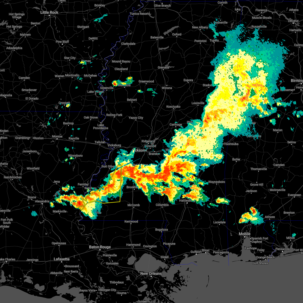 At 720 pm cdt, severe thunderstorms were located along a line extending from near dentville to near new hope to 6 miles north of gloster, moving southeast at 45 mph (radar indicated). Hazards include 60 mph wind gusts and nickel size hail. Expect damage to roofs, siding, and trees. these severe thunderstorms will remain over mainly rural areas of southeastern claiborne, eastern jefferson, franklin and central adams counties, including the following locations, roxie and meadville. hail threat, radar indicated max hail size, 0. 88 in wind threat, radar indicated max wind gust, 60 mph. At 720 pm cdt, severe thunderstorms were located along a line extending from near dentville to near new hope to 6 miles north of gloster, moving southeast at 45 mph (radar indicated). Hazards include 60 mph wind gusts and nickel size hail. Expect damage to roofs, siding, and trees. these severe thunderstorms will remain over mainly rural areas of southeastern claiborne, eastern jefferson, franklin and central adams counties, including the following locations, roxie and meadville. hail threat, radar indicated max hail size, 0. 88 in wind threat, radar indicated max wind gust, 60 mph.
|
| 4/17/2022 7:19 PM CDT |
 At 718 pm cdt, severe thunderstorms were located along a line extending from barlow to near mccall creek to near garden city, moving east at 50 mph (radar indicated). Hazards include 60 mph wind gusts and nickel size hail. Expect damage to roofs, siding, and trees. severe thunderstorms will be near, vaughn, loyd star and mccall creek around 725 pm cdt. glancy and west lincoln around 730 pm cdt. brookhaven and martinsville around 735 pm cdt. wesson, enterprise and bogue chitto around 740 pm cdt. east lincoln around 745 pm cdt. sontag and ruth around 750 pm cdt. topeka, wanilla, jayess and oma around 755 pm cdt. monticello and robinwood around 800 pm cdt. other locations impacted by these severe thunderstorms include new hebron, meadville, silver creek and beauregard. hail threat, radar indicated max hail size, 0. 88 in wind threat, radar indicated max wind gust, 60 mph. At 718 pm cdt, severe thunderstorms were located along a line extending from barlow to near mccall creek to near garden city, moving east at 50 mph (radar indicated). Hazards include 60 mph wind gusts and nickel size hail. Expect damage to roofs, siding, and trees. severe thunderstorms will be near, vaughn, loyd star and mccall creek around 725 pm cdt. glancy and west lincoln around 730 pm cdt. brookhaven and martinsville around 735 pm cdt. wesson, enterprise and bogue chitto around 740 pm cdt. east lincoln around 745 pm cdt. sontag and ruth around 750 pm cdt. topeka, wanilla, jayess and oma around 755 pm cdt. monticello and robinwood around 800 pm cdt. other locations impacted by these severe thunderstorms include new hebron, meadville, silver creek and beauregard. hail threat, radar indicated max hail size, 0. 88 in wind threat, radar indicated max wind gust, 60 mph.
|
| 4/17/2022 6:36 PM CDT |
 At 636 pm cdt, severe thunderstorms were located along a line extending from 8 miles southwest of yokena to near church hill to 6 miles southwest of vidalia, moving southeast at 45 mph (radar indicated). Hazards include 60 mph wind gusts and quarter size hail. Hail damage to vehicles is expected. expect wind damage to roofs, siding, and trees. severe thunderstorms will be near, church hill around 640 pm cdt. fayette, sibley and stampley around 650 pm cdt. kingston, mcnair and hamburg around 655 pm cdt. hermanville around 700 pm cdt. garden city and union church around 710 pm cdt. new hope around 715 pm cdt. other locations impacted by these severe thunderstorms include roxie and meadville. hail threat, radar indicated max hail size, 1. 00 in wind threat, radar indicated max wind gust, 60 mph. At 636 pm cdt, severe thunderstorms were located along a line extending from 8 miles southwest of yokena to near church hill to 6 miles southwest of vidalia, moving southeast at 45 mph (radar indicated). Hazards include 60 mph wind gusts and quarter size hail. Hail damage to vehicles is expected. expect wind damage to roofs, siding, and trees. severe thunderstorms will be near, church hill around 640 pm cdt. fayette, sibley and stampley around 650 pm cdt. kingston, mcnair and hamburg around 655 pm cdt. hermanville around 700 pm cdt. garden city and union church around 710 pm cdt. new hope around 715 pm cdt. other locations impacted by these severe thunderstorms include roxie and meadville. hail threat, radar indicated max hail size, 1. 00 in wind threat, radar indicated max wind gust, 60 mph.
|
| 4/13/2022 7:25 PM CDT |
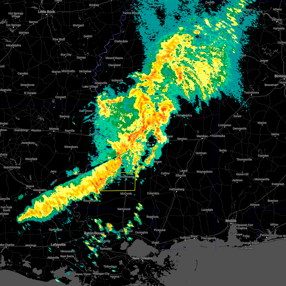 At 724 pm cdt, a severe thunderstorm was located near kirby, or 25 miles north of liberty, moving east at 55 mph (radar indicated). Hazards include 60 mph wind gusts. Expect damage to roofs, siding, and trees. this severe thunderstorm will be near, mccall creek around 740 pm cdt. center point around 745 pm cdt. west lincoln, vaughn and loyd star around 750 pm cdt. brookhaven and bogue chitto around 755 pm cdt. enterprise around 800 pm cdt. east lincoln around 805 pm cdt. other locations impacted by this severe thunderstorm include meadville. hail threat, radar indicated max hail size, <. 75 in wind threat, radar indicated max wind gust, 60 mph. At 724 pm cdt, a severe thunderstorm was located near kirby, or 25 miles north of liberty, moving east at 55 mph (radar indicated). Hazards include 60 mph wind gusts. Expect damage to roofs, siding, and trees. this severe thunderstorm will be near, mccall creek around 740 pm cdt. center point around 745 pm cdt. west lincoln, vaughn and loyd star around 750 pm cdt. brookhaven and bogue chitto around 755 pm cdt. enterprise around 800 pm cdt. east lincoln around 805 pm cdt. other locations impacted by this severe thunderstorm include meadville. hail threat, radar indicated max hail size, <. 75 in wind threat, radar indicated max wind gust, 60 mph.
|
| 4/5/2022 7:35 AM CDT | Tree down across hwy 9 in franklin county MS, 0.5 miles ENE of Bude, MS |
| 4/5/2022 6:26 AM CDT |
 At 626 am cdt, severe thunderstorms were located along a line extending from near hopewell to near vaughn, moving east at 50 mph (radar indicated). Hazards include 60 mph wind gusts. Expect damage to roofs, siding, and trees. locations impacted include, brookhaven, crystal springs, hazlehurst, mendenhall, pinola, union, wesson, bude, enterprise, mccall creek, bogue chitto, west lincoln, little springs, center point, shivers, kirby, martinsville, sontag, new hope and wanilla. hail threat, radar indicated max hail size, <. 75 in wind threat, radar indicated max wind gust, 60 mph. At 626 am cdt, severe thunderstorms were located along a line extending from near hopewell to near vaughn, moving east at 50 mph (radar indicated). Hazards include 60 mph wind gusts. Expect damage to roofs, siding, and trees. locations impacted include, brookhaven, crystal springs, hazlehurst, mendenhall, pinola, union, wesson, bude, enterprise, mccall creek, bogue chitto, west lincoln, little springs, center point, shivers, kirby, martinsville, sontag, new hope and wanilla. hail threat, radar indicated max hail size, <. 75 in wind threat, radar indicated max wind gust, 60 mph.
|
| 4/5/2022 6:00 AM CDT |
 At 600 am cdt, severe thunderstorms were located along a line extending from near peyton to near hamburg, moving east at 60 mph (radar indicated). Hazards include 60 mph wind gusts. expect damage to roofs, siding, and trees At 600 am cdt, severe thunderstorms were located along a line extending from near peyton to near hamburg, moving east at 60 mph (radar indicated). Hazards include 60 mph wind gusts. expect damage to roofs, siding, and trees
|
| 3/30/2022 4:30 PM CDT |
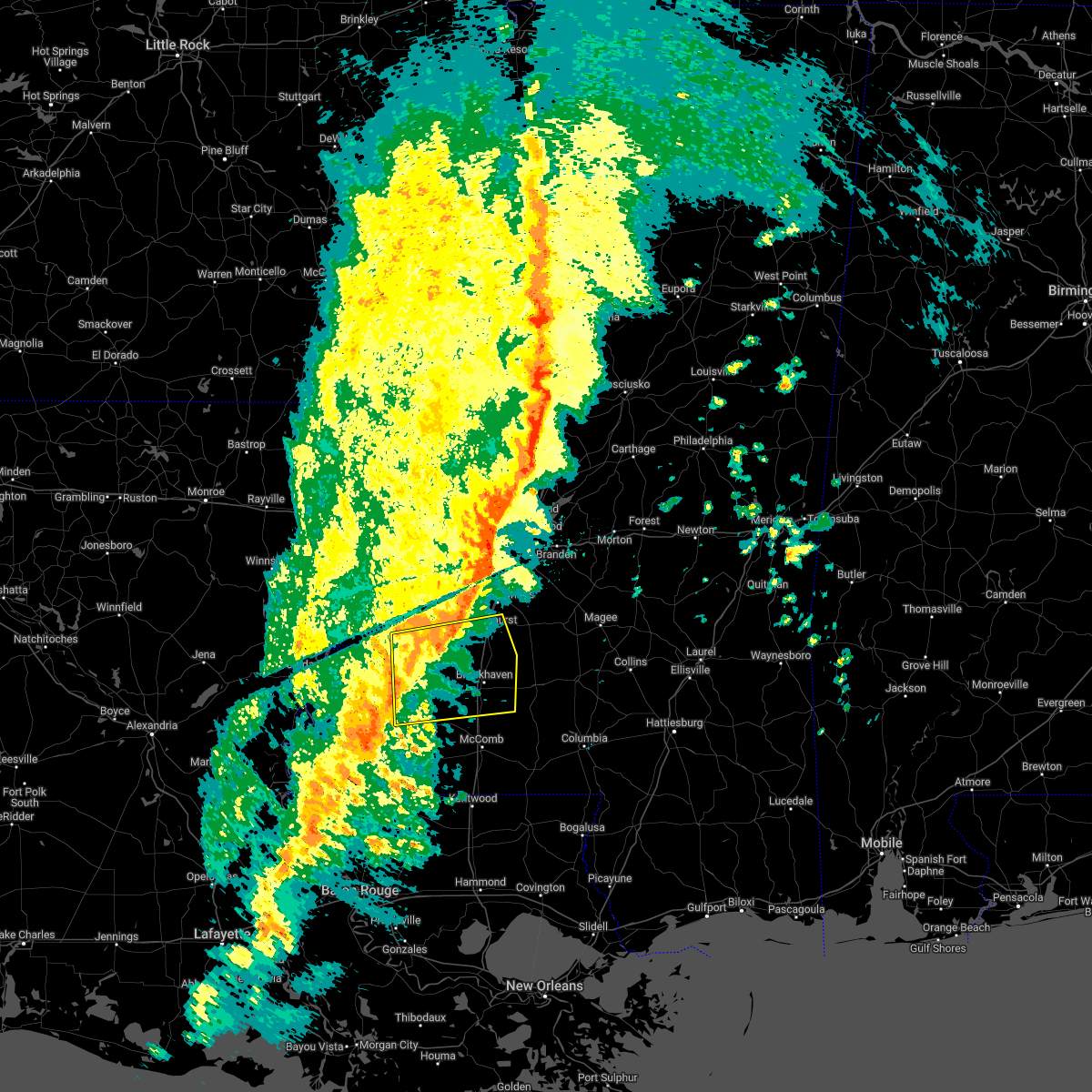 At 430 pm cdt, severe thunderstorms were located along a line extending from near fayette to near bude, moving east at 45 mph (radar indicated). Hazards include 60 mph wind gusts. expect damage to roofs, siding, and trees At 430 pm cdt, severe thunderstorms were located along a line extending from near fayette to near bude, moving east at 45 mph (radar indicated). Hazards include 60 mph wind gusts. expect damage to roofs, siding, and trees
|
| 3/30/2022 3:31 PM CDT |
 At 331 pm cdt, severe thunderstorms were located along a line extending from near red lick to sibley, moving east at 40 mph (radar indicated). Hazards include 60 mph wind gusts. Expect damage to roofs, siding, and trees. severe thunderstorms will be near, fayette, red lick and lorman around 335 pm cdt. pattison and blue hill around 345 pm cdt. peyton, mcbride and cranfield around 350 pm cdt. garden city around 355 pm cdt. hamburg around 405 pm cdt. kirby around 410 pm cdt. bude and new hope around 415 pm cdt. Other locations impacted by these severe thunderstorms include roxie and meadville. At 331 pm cdt, severe thunderstorms were located along a line extending from near red lick to sibley, moving east at 40 mph (radar indicated). Hazards include 60 mph wind gusts. Expect damage to roofs, siding, and trees. severe thunderstorms will be near, fayette, red lick and lorman around 335 pm cdt. pattison and blue hill around 345 pm cdt. peyton, mcbride and cranfield around 350 pm cdt. garden city around 355 pm cdt. hamburg around 405 pm cdt. kirby around 410 pm cdt. bude and new hope around 415 pm cdt. Other locations impacted by these severe thunderstorms include roxie and meadville.
|
| 10/27/2021 4:41 PM CDT |
 The severe thunderstorm warning for eastern jefferson and eastern franklin counties will expire at 445 pm cdt, the storms which prompted the warning have weakened below severe limits, and no longer pose an immediate threat to life or property. therefore, the warning will be allowed to expire. to report severe weather, contact your nearest law enforcement agency. they will relay your report to the national weather service jackson. The severe thunderstorm warning for eastern jefferson and eastern franklin counties will expire at 445 pm cdt, the storms which prompted the warning have weakened below severe limits, and no longer pose an immediate threat to life or property. therefore, the warning will be allowed to expire. to report severe weather, contact your nearest law enforcement agency. they will relay your report to the national weather service jackson.
|
| 10/27/2021 4:30 PM CDT |
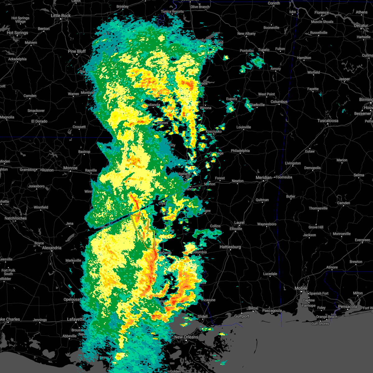 At 430 pm cdt, severe thunderstorms were located along a line extending from near red lick to near center point, moving east at 40 mph (radar indicated). Hazards include 60 mph wind gusts. Expect damage to roofs, siding, and trees. these severe storms will be near, mcbride around 445 pm cdt. hail threat, radar indicated max hail size, <. 75 in wind threat, radar indicated max wind gust, 60 mph. At 430 pm cdt, severe thunderstorms were located along a line extending from near red lick to near center point, moving east at 40 mph (radar indicated). Hazards include 60 mph wind gusts. Expect damage to roofs, siding, and trees. these severe storms will be near, mcbride around 445 pm cdt. hail threat, radar indicated max hail size, <. 75 in wind threat, radar indicated max wind gust, 60 mph.
|
| 10/27/2021 4:05 PM CDT |
 At 404 pm cdt, severe thunderstorms were located along a line extending from near church hill to 8 miles southwest of bude, moving northeast at 40 mph (radar indicated). Hazards include 60 mph wind gusts. Expect damage to roofs, siding, and trees. these severe storms will be near, bude around 415 pm cdt. little springs around 420 pm cdt. new hope around 425 pm cdt. mccall creek around 430 pm cdt. other locations impacted by these severe thunderstorms include roxie and meadville. hail threat, radar indicated max hail size, <. 75 in wind threat, radar indicated max wind gust, 60 mph. At 404 pm cdt, severe thunderstorms were located along a line extending from near church hill to 8 miles southwest of bude, moving northeast at 40 mph (radar indicated). Hazards include 60 mph wind gusts. Expect damage to roofs, siding, and trees. these severe storms will be near, bude around 415 pm cdt. little springs around 420 pm cdt. new hope around 425 pm cdt. mccall creek around 430 pm cdt. other locations impacted by these severe thunderstorms include roxie and meadville. hail threat, radar indicated max hail size, <. 75 in wind threat, radar indicated max wind gust, 60 mph.
|
| 10/27/2021 3:38 PM CDT |
 At 338 pm cdt, severe thunderstorms were located along a line extending from clayton to near gloster, moving northeast at 40 mph (radar indicated). Hazards include 60 mph wind gusts. Expect damage to roofs, siding, and trees. severe thunderstorms will be near, bude around 415 pm cdt. little springs around 420 pm cdt. new hope around 425 pm cdt. mccall creek around 430 pm cdt. other locations impacted by these severe thunderstorms include roxie and meadville. hail threat, radar indicated max hail size, <. 75 in wind threat, radar indicated max wind gust, 60 mph. At 338 pm cdt, severe thunderstorms were located along a line extending from clayton to near gloster, moving northeast at 40 mph (radar indicated). Hazards include 60 mph wind gusts. Expect damage to roofs, siding, and trees. severe thunderstorms will be near, bude around 415 pm cdt. little springs around 420 pm cdt. new hope around 425 pm cdt. mccall creek around 430 pm cdt. other locations impacted by these severe thunderstorms include roxie and meadville. hail threat, radar indicated max hail size, <. 75 in wind threat, radar indicated max wind gust, 60 mph.
|
| 5/4/2021 2:57 PM CDT |
 At 257 pm cdt, severe thunderstorms were located along a line extending from 7 miles east of newman to near gloster, moving east at 45 mph (radar indicated). Hazards include 70 mph wind gusts and nickel size hail. Expect considerable tree damage. damage is likely to mobile homes, roofs, and outbuildings. these severe thunderstorms will remain over mainly rural areas of southeastern claiborne, eastern jefferson, western franklin, southwestern hinds and northwestern copiah counties, including the following locations, roxie and meadville. a tornado watch remains in effect until 400 pm cdt for central mississippi. A tornado watch also remains in effect until 600 pm cdt for southwestern mississippi. At 257 pm cdt, severe thunderstorms were located along a line extending from 7 miles east of newman to near gloster, moving east at 45 mph (radar indicated). Hazards include 70 mph wind gusts and nickel size hail. Expect considerable tree damage. damage is likely to mobile homes, roofs, and outbuildings. these severe thunderstorms will remain over mainly rural areas of southeastern claiborne, eastern jefferson, western franklin, southwestern hinds and northwestern copiah counties, including the following locations, roxie and meadville. a tornado watch remains in effect until 400 pm cdt for central mississippi. A tornado watch also remains in effect until 600 pm cdt for southwestern mississippi.
|
| 5/4/2021 2:18 PM CDT |
 At 218 pm cdt, severe thunderstorms were located along a line extending from 7 miles west of yokena to 7 miles southwest of dolorosa, moving east at 45 mph (radar indicated). Hazards include 70 mph wind gusts and nickel size hail. Expect considerable tree damage. damage is likely to mobile homes, roofs, and outbuildings. these severe storms will be near, yokena around 230 pm cdt. rocky springs around 235 pm cdt. reganton around 240 pm cdt. utica around 250 pm cdt. other locations impacted by these severe thunderstorms include roxie and meadville. a tornado watch remains in effect until 400 pm cdt for central mississippi. A tornado watch also remains in effect until 600 pm cdt for northeastern louisiana, and southwestern and west central mississippi. At 218 pm cdt, severe thunderstorms were located along a line extending from 7 miles west of yokena to 7 miles southwest of dolorosa, moving east at 45 mph (radar indicated). Hazards include 70 mph wind gusts and nickel size hail. Expect considerable tree damage. damage is likely to mobile homes, roofs, and outbuildings. these severe storms will be near, yokena around 230 pm cdt. rocky springs around 235 pm cdt. reganton around 240 pm cdt. utica around 250 pm cdt. other locations impacted by these severe thunderstorms include roxie and meadville. a tornado watch remains in effect until 400 pm cdt for central mississippi. A tornado watch also remains in effect until 600 pm cdt for northeastern louisiana, and southwestern and west central mississippi.
|
| 5/4/2021 1:57 PM CDT |
 At 157 pm cdt, severe thunderstorms were located along a line extending from near somerset to 6 miles northwest of black hawk, moving east at 45 mph (radar indicated). Hazards include 70 mph wind gusts and nickel size hail. Expect considerable tree damage. damage is likely to mobile homes, roofs, and outbuildings. severe thunderstorms will be near, newellton and somerset around 205 pm cdt. yokena around 225 pm cdt. rocky springs around 235 pm cdt. reganton around 240 pm cdt. utica around 250 pm cdt. other locations impacted by these severe thunderstorms include roxie and meadville. a tornado watch remains in effect until 400 pm cdt for central mississippi. A tornado watch also remains in effect until 600 pm cdt for northeastern louisiana, and southwestern and west central mississippi. At 157 pm cdt, severe thunderstorms were located along a line extending from near somerset to 6 miles northwest of black hawk, moving east at 45 mph (radar indicated). Hazards include 70 mph wind gusts and nickel size hail. Expect considerable tree damage. damage is likely to mobile homes, roofs, and outbuildings. severe thunderstorms will be near, newellton and somerset around 205 pm cdt. yokena around 225 pm cdt. rocky springs around 235 pm cdt. reganton around 240 pm cdt. utica around 250 pm cdt. other locations impacted by these severe thunderstorms include roxie and meadville. a tornado watch remains in effect until 400 pm cdt for central mississippi. A tornado watch also remains in effect until 600 pm cdt for northeastern louisiana, and southwestern and west central mississippi.
|
| 4/24/2021 1:30 AM CDT |
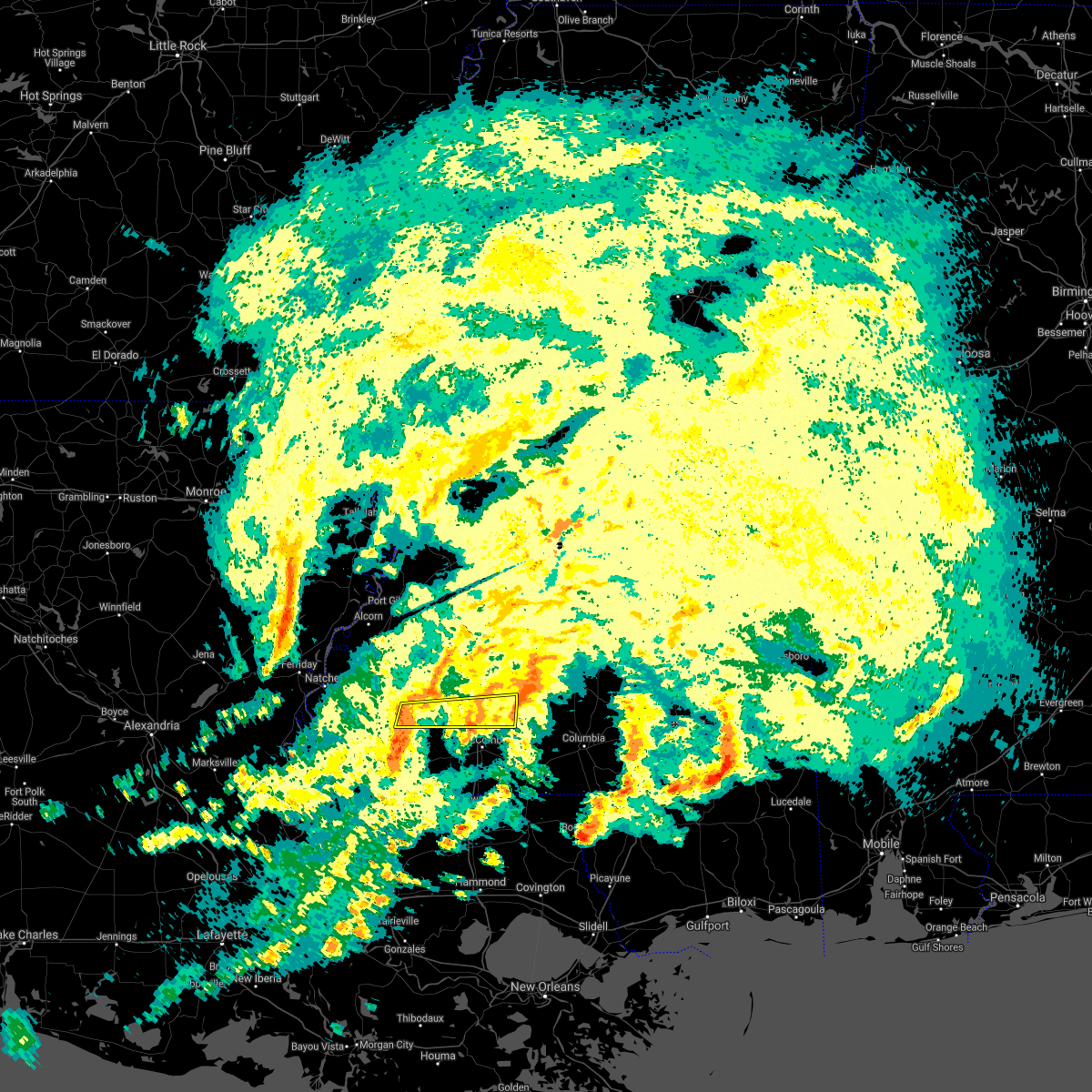 At 130 am cdt, severe thunderstorms were located along a line extending from near bude to near centreville, moving east at 50 mph (radar indicated). Hazards include 60 mph wind gusts. Expect damage to roofs, siding, and trees. severe thunderstorms will be near, bude around 135 am cdt. little springs around 140 am cdt. center point and west lincoln around 150 am cdt. bogue chitto around 200 am cdt. enterprise around 205 am cdt. ruth and east lincoln around 210 am cdt. other locations impacted by these severe thunderstorms include meadville. A tornado watch remains in effect until 400 am cdt for south central and southwestern mississippi. At 130 am cdt, severe thunderstorms were located along a line extending from near bude to near centreville, moving east at 50 mph (radar indicated). Hazards include 60 mph wind gusts. Expect damage to roofs, siding, and trees. severe thunderstorms will be near, bude around 135 am cdt. little springs around 140 am cdt. center point and west lincoln around 150 am cdt. bogue chitto around 200 am cdt. enterprise around 205 am cdt. ruth and east lincoln around 210 am cdt. other locations impacted by these severe thunderstorms include meadville. A tornado watch remains in effect until 400 am cdt for south central and southwestern mississippi.
|
| 3/17/2021 4:41 PM CDT |
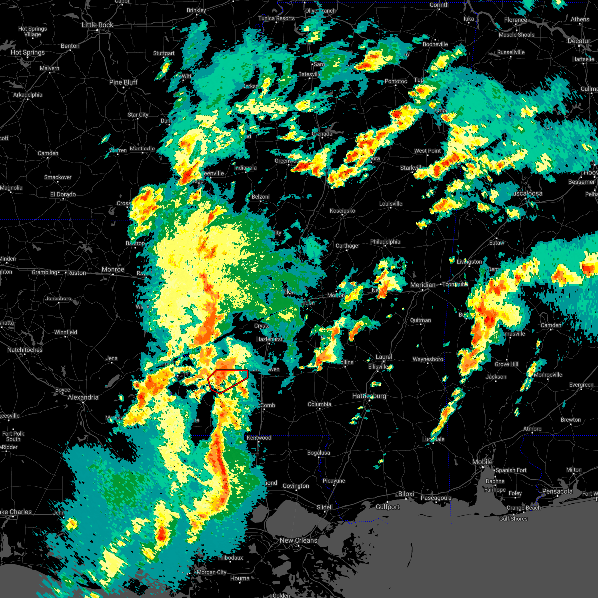 At 441 pm cdt, a severe thunderstorm capable of producing a tornado was located over kirby, or 24 miles northwest of liberty, moving northeast at 50 mph (radar indicated rotation). Hazards include tornado. Flying debris will be dangerous to those caught without shelter. mobile homes will be damaged or destroyed. damage to roofs, windows, and vehicles will occur. tree damage is likely. this dangerous storm will be near, bude around 445 pm cdt. new hope around 450 pm cdt. Other locations impacted by this tornadic thunderstorm include meadville. At 441 pm cdt, a severe thunderstorm capable of producing a tornado was located over kirby, or 24 miles northwest of liberty, moving northeast at 50 mph (radar indicated rotation). Hazards include tornado. Flying debris will be dangerous to those caught without shelter. mobile homes will be damaged or destroyed. damage to roofs, windows, and vehicles will occur. tree damage is likely. this dangerous storm will be near, bude around 445 pm cdt. new hope around 450 pm cdt. Other locations impacted by this tornadic thunderstorm include meadville.
|
| 3/17/2021 4:35 PM CDT |
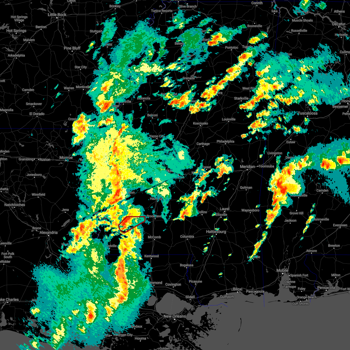 At 435 pm cdt, a severe thunderstorm capable of producing a tornado was located near kirby, or 22 miles east of natchez, moving northeast at 50 mph (radar indicated rotation). Hazards include tornado. Flying debris will be dangerous to those caught without shelter. mobile homes will be damaged or destroyed. damage to roofs, windows, and vehicles will occur. tree damage is likely. this dangerous storm will be near, kirby around 440 pm cdt. bude around 450 pm cdt. new hope around 455 pm cdt. mccall creek around 500 pm cdt. Other locations impacted by this tornadic thunderstorm include roxie and meadville. At 435 pm cdt, a severe thunderstorm capable of producing a tornado was located near kirby, or 22 miles east of natchez, moving northeast at 50 mph (radar indicated rotation). Hazards include tornado. Flying debris will be dangerous to those caught without shelter. mobile homes will be damaged or destroyed. damage to roofs, windows, and vehicles will occur. tree damage is likely. this dangerous storm will be near, kirby around 440 pm cdt. bude around 450 pm cdt. new hope around 455 pm cdt. mccall creek around 500 pm cdt. Other locations impacted by this tornadic thunderstorm include roxie and meadville.
|
| 3/17/2021 4:10 PM CDT |
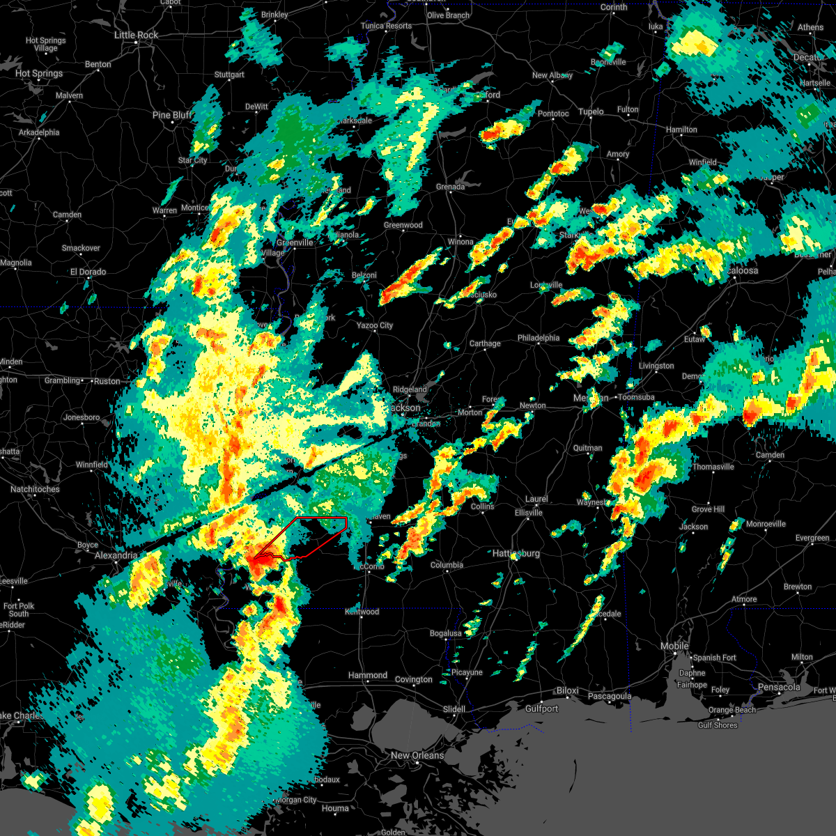 At 409 pm cdt, a severe thunderstorm capable of producing a tornado was located near dolorosa, or 20 miles south of natchez, moving northeast at 50 mph (radar indicated rotation). Hazards include tornado and quarter size hail. Flying debris will be dangerous to those caught without shelter. mobile homes will be damaged or destroyed. damage to roofs, windows, and vehicles will occur. tree damage is likely. this dangerous storm will be near, garden city around 425 pm cdt. kirby around 440 pm cdt. bude around 445 pm cdt. new hope around 450 pm cdt. Other locations impacted by this tornadic thunderstorm include roxie and meadville. At 409 pm cdt, a severe thunderstorm capable of producing a tornado was located near dolorosa, or 20 miles south of natchez, moving northeast at 50 mph (radar indicated rotation). Hazards include tornado and quarter size hail. Flying debris will be dangerous to those caught without shelter. mobile homes will be damaged or destroyed. damage to roofs, windows, and vehicles will occur. tree damage is likely. this dangerous storm will be near, garden city around 425 pm cdt. kirby around 440 pm cdt. bude around 445 pm cdt. new hope around 450 pm cdt. Other locations impacted by this tornadic thunderstorm include roxie and meadville.
|
| 12/23/2020 11:21 PM CST |
 The severe thunderstorm warning for western lincoln, southeastern jefferson, franklin, east central adams and southwestern copiah counties will expire at 1130 pm cst, the storm which prompted the warning has weakened below severe limits, and no longer poses an immediate threat to life or property. therefore, the warning will be allowed to expire. a tornado watch remains in effect until 200 am cst for south central and southwestern mississippi. The severe thunderstorm warning for western lincoln, southeastern jefferson, franklin, east central adams and southwestern copiah counties will expire at 1130 pm cst, the storm which prompted the warning has weakened below severe limits, and no longer poses an immediate threat to life or property. therefore, the warning will be allowed to expire. a tornado watch remains in effect until 200 am cst for south central and southwestern mississippi.
|
| 12/23/2020 10:43 PM CST |
 At 1043 pm cst, a severe thunderstorm was located over hamburg, or 19 miles east of natchez, moving east at 40 mph (radar indicated). Hazards include 60 mph wind gusts. Expect damage to roofs, siding, and trees. this severe storm will be near, kirby around 1050 pm cst. bude and new hope around 1105 pm cst. union church around 1110 pm cst. mccall creek around 1115 pm cst. caseyville around 1120 pm cst. vaughn and west lincoln around 1130 pm cst. other locations impacted by this severe thunderstorm include roxie and meadville. A tornado watch remains in effect until 200 am cst for south central and southwestern mississippi. At 1043 pm cst, a severe thunderstorm was located over hamburg, or 19 miles east of natchez, moving east at 40 mph (radar indicated). Hazards include 60 mph wind gusts. Expect damage to roofs, siding, and trees. this severe storm will be near, kirby around 1050 pm cst. bude and new hope around 1105 pm cst. union church around 1110 pm cst. mccall creek around 1115 pm cst. caseyville around 1120 pm cst. vaughn and west lincoln around 1130 pm cst. other locations impacted by this severe thunderstorm include roxie and meadville. A tornado watch remains in effect until 200 am cst for south central and southwestern mississippi.
|
| 12/23/2020 10:37 PM CST |
 At 1036 pm cst, a severe thunderstorm was located near stampley, or 14 miles east of natchez, moving east at 40 mph (radar indicated). Hazards include 60 mph wind gusts. Expect damage to roofs, siding, and trees. this severe thunderstorm will be near, hamburg and mcnair around 1045 pm cst. kirby around 1050 pm cst. bude and new hope around 1105 pm cst. mccall creek around 1115 pm cst. caseyville around 1120 pm cst. vaughn and west lincoln around 1130 pm cst. other locations impacted by this severe thunderstorm include roxie and meadville. A tornado watch remains in effect until 200 am cst for south central and southwestern mississippi. At 1036 pm cst, a severe thunderstorm was located near stampley, or 14 miles east of natchez, moving east at 40 mph (radar indicated). Hazards include 60 mph wind gusts. Expect damage to roofs, siding, and trees. this severe thunderstorm will be near, hamburg and mcnair around 1045 pm cst. kirby around 1050 pm cst. bude and new hope around 1105 pm cst. mccall creek around 1115 pm cst. caseyville around 1120 pm cst. vaughn and west lincoln around 1130 pm cst. other locations impacted by this severe thunderstorm include roxie and meadville. A tornado watch remains in effect until 200 am cst for south central and southwestern mississippi.
|
| 8/27/2020 6:29 AM CDT |
 At 629 am cdt, severe thunderstorms were located along a line extending from near vidalia to near clinton, moving north at 65 mph (radar indicated). Hazards include 60 mph wind gusts. Expect damage to roofs, siding, and trees. severe thunderstorms will be near, natchez around 635 am cdt. bude and kirby around 715 am cdt. new hope around 720 am cdt. blue hill, union church, mcbride and red lick around 730 am cdt. other locations impacted by these severe thunderstorms include roxie and meadville. A tornado watch remains in effect until 800 am cdt for northeastern louisiana, and southwestern mississippi. At 629 am cdt, severe thunderstorms were located along a line extending from near vidalia to near clinton, moving north at 65 mph (radar indicated). Hazards include 60 mph wind gusts. Expect damage to roofs, siding, and trees. severe thunderstorms will be near, natchez around 635 am cdt. bude and kirby around 715 am cdt. new hope around 720 am cdt. blue hill, union church, mcbride and red lick around 730 am cdt. other locations impacted by these severe thunderstorms include roxie and meadville. A tornado watch remains in effect until 800 am cdt for northeastern louisiana, and southwestern mississippi.
|
| 6/25/2020 4:28 PM CDT |
 At 428 pm cdt, severe thunderstorms were located along a line extending from near deer park to near mcbride, moving north at 30 mph (radar indicated). Hazards include 60 mph wind gusts. Expect damage to roofs, siding, and trees. these severe storms will be near, mcbride and blue hill around 435 pm cdt. Other locations impacted by these severe thunderstorms include roxie and meadville. At 428 pm cdt, severe thunderstorms were located along a line extending from near deer park to near mcbride, moving north at 30 mph (radar indicated). Hazards include 60 mph wind gusts. Expect damage to roofs, siding, and trees. these severe storms will be near, mcbride and blue hill around 435 pm cdt. Other locations impacted by these severe thunderstorms include roxie and meadville.
|
| 6/25/2020 3:48 PM CDT |
 At 348 pm cdt, severe thunderstorms were located along a line extending from 7 miles southwest of dolorosa to near bude to 6 miles west of magnolia, moving northeast at 45 mph (radar indicated). Hazards include 60 mph wind gusts. Expect damage to roofs, siding, and trees. these severe storms will be near, bude and kirby around 355 pm cdt. new hope around 405 pm cdt. kingston around 410 pm cdt. union church around 415 pm cdt. blue hill around 420 pm cdt. mcbride and cranfield around 425 pm cdt. stanton around 430 pm cdt. stampley around 435 pm cdt. Other locations impacted by these severe thunderstorms include roxie and meadville. At 348 pm cdt, severe thunderstorms were located along a line extending from 7 miles southwest of dolorosa to near bude to 6 miles west of magnolia, moving northeast at 45 mph (radar indicated). Hazards include 60 mph wind gusts. Expect damage to roofs, siding, and trees. these severe storms will be near, bude and kirby around 355 pm cdt. new hope around 405 pm cdt. kingston around 410 pm cdt. union church around 415 pm cdt. blue hill around 420 pm cdt. mcbride and cranfield around 425 pm cdt. stanton around 430 pm cdt. stampley around 435 pm cdt. Other locations impacted by these severe thunderstorms include roxie and meadville.
|
| 6/25/2020 3:27 PM CDT |
 At 327 pm cdt, severe thunderstorms were located along a line extending from near sibley to near garden city to 7 miles west of gillsberg, moving north at 40 mph (radar indicated). Hazards include 60 mph wind gusts. Expect damage to roofs, siding, and trees. severe thunderstorms will be near, garden city around 330 pm cdt. sibley around 335 pm cdt. kirby around 340 pm cdt. hamburg around 345 pm cdt. natchez and stampley around 350 pm cdt. mcnair around 355 pm cdt. fayette around 400 pm cdt. little springs around 405 pm cdt. Other locations impacted by these severe thunderstorms include roxie and meadville. At 327 pm cdt, severe thunderstorms were located along a line extending from near sibley to near garden city to 7 miles west of gillsberg, moving north at 40 mph (radar indicated). Hazards include 60 mph wind gusts. Expect damage to roofs, siding, and trees. severe thunderstorms will be near, garden city around 330 pm cdt. sibley around 335 pm cdt. kirby around 340 pm cdt. hamburg around 345 pm cdt. natchez and stampley around 350 pm cdt. mcnair around 355 pm cdt. fayette around 400 pm cdt. little springs around 405 pm cdt. Other locations impacted by these severe thunderstorms include roxie and meadville.
|
| 6/5/2020 8:47 PM CDT |
 At 846 pm cdt, severe thunderstorms were located along a line extending from pine ridge to near bude, moving southwest at 35 mph (radar indicated). Hazards include 60 mph wind gusts. Expect damage to roofs, siding, and trees. these severe storms will be near, stanton around 850 pm cdt. spokane around 855 pm cdt. natchez and vidalia around 900 pm cdt. ferriday and west ferriday around 905 pm cdt. garden city around 910 pm cdt. Other locations impacted by these severe thunderstorms include roxie, ridgecrest and meadville. At 846 pm cdt, severe thunderstorms were located along a line extending from pine ridge to near bude, moving southwest at 35 mph (radar indicated). Hazards include 60 mph wind gusts. Expect damage to roofs, siding, and trees. these severe storms will be near, stanton around 850 pm cdt. spokane around 855 pm cdt. natchez and vidalia around 900 pm cdt. ferriday and west ferriday around 905 pm cdt. garden city around 910 pm cdt. Other locations impacted by these severe thunderstorms include roxie, ridgecrest and meadville.
|
| 6/5/2020 8:31 PM CDT |
 At 831 pm cdt, severe thunderstorms were located along a line extending from near stampley to center point, moving southwest at 35 mph (radar indicated). Hazards include 60 mph wind gusts. Expect damage to roofs, siding, and trees. these severe storms will be near, stanton around 835 pm cdt. cranfield around 845 pm cdt. kingston around 900 pm cdt. sibley around 910 pm cdt. Other locations impacted by these severe thunderstorms include roxie, ridgecrest and meadville. At 831 pm cdt, severe thunderstorms were located along a line extending from near stampley to center point, moving southwest at 35 mph (radar indicated). Hazards include 60 mph wind gusts. Expect damage to roofs, siding, and trees. these severe storms will be near, stanton around 835 pm cdt. cranfield around 845 pm cdt. kingston around 900 pm cdt. sibley around 910 pm cdt. Other locations impacted by these severe thunderstorms include roxie, ridgecrest and meadville.
|
| 6/5/2020 8:06 PM CDT |
 At 806 pm cdt, severe thunderstorms were located along a line extending from lorman to near vaughn, moving southwest at 30 mph (radar indicated). Hazards include 60 mph wind gusts. Expect damage to roofs, siding, and trees. severe thunderstorms will be near, mccall creek around 825 pm cdt. stanton and little springs around 840 pm cdt. cranfield around 845 pm cdt. natchez and vidalia around 855 pm cdt. kingston around 900 pm cdt. sibley around 915 pm cdt. Other locations impacted by these severe thunderstorms include roxie, ridgecrest and meadville. At 806 pm cdt, severe thunderstorms were located along a line extending from lorman to near vaughn, moving southwest at 30 mph (radar indicated). Hazards include 60 mph wind gusts. Expect damage to roofs, siding, and trees. severe thunderstorms will be near, mccall creek around 825 pm cdt. stanton and little springs around 840 pm cdt. cranfield around 845 pm cdt. natchez and vidalia around 855 pm cdt. kingston around 900 pm cdt. sibley around 915 pm cdt. Other locations impacted by these severe thunderstorms include roxie, ridgecrest and meadville.
|
| 5/8/2020 9:40 AM CDT |
 The severe thunderstorm warning for franklin and southern adams counties will expire at 945 am cdt, the storms which prompted the warning have moved out of the area. therefore, the warning will be allowed to expire. The severe thunderstorm warning for franklin and southern adams counties will expire at 945 am cdt, the storms which prompted the warning have moved out of the area. therefore, the warning will be allowed to expire.
|
| 5/8/2020 9:24 AM CDT |
 At 924 am cdt, severe thunderstorms were located along a line extending from glancy to near mccall creek to near bude to near garden city, moving east at 50 mph (radar indicated). Hazards include 60 mph wind gusts. Expect damage to roofs, siding, and trees. These severe thunderstorms will remain over mainly rural areas of franklin and southern adams counties, including the following locations, meadville. At 924 am cdt, severe thunderstorms were located along a line extending from glancy to near mccall creek to near bude to near garden city, moving east at 50 mph (radar indicated). Hazards include 60 mph wind gusts. Expect damage to roofs, siding, and trees. These severe thunderstorms will remain over mainly rural areas of franklin and southern adams counties, including the following locations, meadville.
|
| 5/8/2020 9:20 AM CDT |
 At 920 am cdt, severe thunderstorms were located along a line extending from near glancy to near new hope to bude to garden city, moving southeast at 45 mph (radar indicated). Hazards include 60 mph wind gusts. Expect damage to roofs, siding, and trees. these severe storms will be near, little springs around 935 am cdt. Other locations impacted by these severe thunderstorms include roxie and meadville. At 920 am cdt, severe thunderstorms were located along a line extending from near glancy to near new hope to bude to garden city, moving southeast at 45 mph (radar indicated). Hazards include 60 mph wind gusts. Expect damage to roofs, siding, and trees. these severe storms will be near, little springs around 935 am cdt. Other locations impacted by these severe thunderstorms include roxie and meadville.
|
| 5/8/2020 9:20 AM CDT |
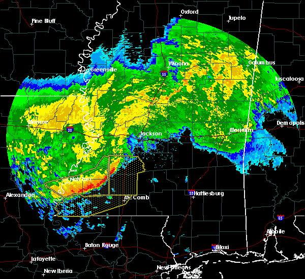 At 920 am cdt, severe thunderstorms were located along a line extending from near glancy to near new hope to bude to garden city, moving southeast at 45 mph (radar indicated). Hazards include 60 mph wind gusts. Expect damage to roofs, siding, and trees. these severe storms will be near, little springs around 935 am cdt. Other locations impacted by these severe thunderstorms include roxie and meadville. At 920 am cdt, severe thunderstorms were located along a line extending from near glancy to near new hope to bude to garden city, moving southeast at 45 mph (radar indicated). Hazards include 60 mph wind gusts. Expect damage to roofs, siding, and trees. these severe storms will be near, little springs around 935 am cdt. Other locations impacted by these severe thunderstorms include roxie and meadville.
|
| 5/8/2020 9:06 AM CDT |
 At 905 am cdt, severe thunderstorms were located along a line extending from near barlow to 7 miles west of union church to near kingston, moving east at 50 mph (radar indicated). Hazards include 60 mph wind gusts. Expect damage to roofs, siding, and trees. these severe storms will be near, union church, new hope and pleasant hill around 915 am cdt. garden city around 920 am cdt. Other locations impacted by these severe thunderstorms include roxie, ridgecrest and meadville. At 905 am cdt, severe thunderstorms were located along a line extending from near barlow to 7 miles west of union church to near kingston, moving east at 50 mph (radar indicated). Hazards include 60 mph wind gusts. Expect damage to roofs, siding, and trees. these severe storms will be near, union church, new hope and pleasant hill around 915 am cdt. garden city around 920 am cdt. Other locations impacted by these severe thunderstorms include roxie, ridgecrest and meadville.
|
| 5/8/2020 8:53 AM CDT |
 At 853 am cdt, severe thunderstorms were located along a line extending from near hermanville to fayette to 6 miles southwest of vidalia, moving southeast at 50 mph (radar indicated). Hazards include 60 mph wind gusts and penny size hail. Expect damage to roofs, siding, and trees. these severe storms will be near, fayette, mcnair, hermanville, peyton, pattison and red lick around 900 am cdt. kingston around 910 am cdt. new hope and union church around 915 am cdt. garden city around 925 am cdt. Other locations impacted by these severe thunderstorms include roxie, ridgecrest and meadville. At 853 am cdt, severe thunderstorms were located along a line extending from near hermanville to fayette to 6 miles southwest of vidalia, moving southeast at 50 mph (radar indicated). Hazards include 60 mph wind gusts and penny size hail. Expect damage to roofs, siding, and trees. these severe storms will be near, fayette, mcnair, hermanville, peyton, pattison and red lick around 900 am cdt. kingston around 910 am cdt. new hope and union church around 915 am cdt. garden city around 925 am cdt. Other locations impacted by these severe thunderstorms include roxie, ridgecrest and meadville.
|
| 5/8/2020 8:30 AM CDT |
 At 830 am cdt, severe thunderstorms were located along a line extending from near newellton to waterproof to wildsville, moving east at 45 mph (radar indicated). Hazards include 60 mph wind gusts and penny size hail. Expect damage to roofs, siding, and trees. severe thunderstorms will be near, port gibson, church hill and west ferriday around 845 am cdt. ferriday around 850 am cdt. fayette, hermanville, pattison, stampley and lorman around 855 am cdt. natchez, vidalia, mcnair and red lick around 900 am cdt. peyton around 905 am cdt. sibley and blue hill around 910 am cdt. kingston around 915 am cdt. union church, new hope and pleasant hill around 920 am cdt. Other locations impacted by these severe thunderstorms include roxie, ridgecrest and meadville. At 830 am cdt, severe thunderstorms were located along a line extending from near newellton to waterproof to wildsville, moving east at 45 mph (radar indicated). Hazards include 60 mph wind gusts and penny size hail. Expect damage to roofs, siding, and trees. severe thunderstorms will be near, port gibson, church hill and west ferriday around 845 am cdt. ferriday around 850 am cdt. fayette, hermanville, pattison, stampley and lorman around 855 am cdt. natchez, vidalia, mcnair and red lick around 900 am cdt. peyton around 905 am cdt. sibley and blue hill around 910 am cdt. kingston around 915 am cdt. union church, new hope and pleasant hill around 920 am cdt. Other locations impacted by these severe thunderstorms include roxie, ridgecrest and meadville.
|
| 1/11/2020 7:35 AM CST | Power lines down near the intersection of hwy 98 and 18 in franklin county MS, 0.5 miles ENE of Bude, MS |
| 1/11/2020 7:34 AM CST | Tree down across hwy 28 in union churc in jefferson county MS, 15.3 miles SSW of Bude, MS |
| 1/11/2020 7:30 AM CST |
 At 730 am cst, severe thunderstorms were located along a line extending from near union church to 8 miles northeast of gloster, moving northeast at 45 mph (radar indicated). Hazards include 60 mph wind gusts. Expect damage to roofs, siding, and trees. severe thunderstorms will be near, union church around 735 am cst. pleasant hill around 740 am cst. bude, allen and caseyville around 745 am cst. little springs and barlow around 750 am cst. glancy, center point and mccall creek around 800 am cst. west lincoln and martinsville around 805 am cst. hazlehurst, vaughn and bogue chitto around 810 am cst. gallman around 815 am cst. other locations impacted by these severe thunderstorms include beauregard and meadville. A tornado watch remains in effect until 900 am cst for central, south central and southwestern mississippi. At 730 am cst, severe thunderstorms were located along a line extending from near union church to 8 miles northeast of gloster, moving northeast at 45 mph (radar indicated). Hazards include 60 mph wind gusts. Expect damage to roofs, siding, and trees. severe thunderstorms will be near, union church around 735 am cst. pleasant hill around 740 am cst. bude, allen and caseyville around 745 am cst. little springs and barlow around 750 am cst. glancy, center point and mccall creek around 800 am cst. west lincoln and martinsville around 805 am cst. hazlehurst, vaughn and bogue chitto around 810 am cst. gallman around 815 am cst. other locations impacted by these severe thunderstorms include beauregard and meadville. A tornado watch remains in effect until 900 am cst for central, south central and southwestern mississippi.
|
| 1/11/2020 7:19 AM CST |
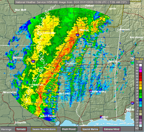 At 719 am cst, severe thunderstorms were located along a line extending from near barlow to near kirby, moving east at 60 mph (radar indicated). Hazards include 60 mph wind gusts. Expect damage to roofs, siding, and trees. these severe storms will be near, barlow around 725 am cst. other locations impacted by these severe thunderstorms include meadville. A tornado watch remains in effect until 900 am cst for central, south central and southwestern mississippi. At 719 am cst, severe thunderstorms were located along a line extending from near barlow to near kirby, moving east at 60 mph (radar indicated). Hazards include 60 mph wind gusts. Expect damage to roofs, siding, and trees. these severe storms will be near, barlow around 725 am cst. other locations impacted by these severe thunderstorms include meadville. A tornado watch remains in effect until 900 am cst for central, south central and southwestern mississippi.
|
| 1/11/2020 7:00 AM CST |
 At 700 am cst, severe thunderstorms were located along a line extending from near peyton to 6 miles southeast of cranfield, moving northeast at 65 mph (radar indicated). Hazards include 60 mph wind gusts. Expect damage to roofs, siding, and trees. these severe storms will be near, peyton around 705 am cst. mcnair and barlow around 710 am cst. new hope around 715 am cst. union church, pleasant hill and mcbride around 725 am cst. caseyville and allen around 730 am cst. other locations impacted by these severe thunderstorms include roxie and meadville. A tornado watch remains in effect until 900 am cst for central, south central and southwestern mississippi. At 700 am cst, severe thunderstorms were located along a line extending from near peyton to 6 miles southeast of cranfield, moving northeast at 65 mph (radar indicated). Hazards include 60 mph wind gusts. Expect damage to roofs, siding, and trees. these severe storms will be near, peyton around 705 am cst. mcnair and barlow around 710 am cst. new hope around 715 am cst. union church, pleasant hill and mcbride around 725 am cst. caseyville and allen around 730 am cst. other locations impacted by these severe thunderstorms include roxie and meadville. A tornado watch remains in effect until 900 am cst for central, south central and southwestern mississippi.
|
| 1/11/2020 6:26 AM CST |
 At 626 am cst, severe thunderstorms were located along a line extending from near lorman to near natchez, moving east at 50 mph (radar indicated). Hazards include 60 mph wind gusts. Expect damage to roofs, siding, and trees. severe thunderstorms will be near, alcorn, lorman and red lick around 630 am cst. stanton around 640 am cst. stampley and peyton around 645 am cst. hamburg and mcnair around 650 am cst. kirby around 655 am cst. new hope around 705 am cst. union church around 710 am cst. pleasant hill around 715 am cst. other locations impacted by these severe thunderstorms include roxie and meadville. A tornado watch remains in effect until 900 am cst for central, south central and southwestern mississippi. At 626 am cst, severe thunderstorms were located along a line extending from near lorman to near natchez, moving east at 50 mph (radar indicated). Hazards include 60 mph wind gusts. Expect damage to roofs, siding, and trees. severe thunderstorms will be near, alcorn, lorman and red lick around 630 am cst. stanton around 640 am cst. stampley and peyton around 645 am cst. hamburg and mcnair around 650 am cst. kirby around 655 am cst. new hope around 705 am cst. union church around 710 am cst. pleasant hill around 715 am cst. other locations impacted by these severe thunderstorms include roxie and meadville. A tornado watch remains in effect until 900 am cst for central, south central and southwestern mississippi.
|
| 12/16/2019 5:10 PM CST |
 At 509 pm cst, a severe thunderstorm was located over kirby, or 23 miles east of natchez, moving northeast at 50 mph (radar indicated). Hazards include 60 mph wind gusts. Expect damage to roofs, siding, and trees. this severe storm will be near, bude around 515 pm cst. new hope around 520 pm cst. other locations impacted by this severe thunderstorm include roxie and meadville. A tornado watch remains in effect until 600 pm cst for southwestern mississippi. At 509 pm cst, a severe thunderstorm was located over kirby, or 23 miles east of natchez, moving northeast at 50 mph (radar indicated). Hazards include 60 mph wind gusts. Expect damage to roofs, siding, and trees. this severe storm will be near, bude around 515 pm cst. new hope around 520 pm cst. other locations impacted by this severe thunderstorm include roxie and meadville. A tornado watch remains in effect until 600 pm cst for southwestern mississippi.
|
| 12/16/2019 4:55 PM CST |
 At 455 pm cst, a severe thunderstorm was located over dolorosa, or 16 miles south of natchez, moving northeast at 45 mph (radar indicated). Hazards include 60 mph wind gusts. Expect damage to roofs, siding, and trees. this severe thunderstorm will be near, kingston around 505 pm cst. garden city around 515 pm cst. hamburg around 530 pm cst. kirby around 535 pm cst. bude around 540 pm cst. new hope around 545 pm cst. other locations impacted by this severe thunderstorm include roxie and meadville. A tornado watch remains in effect until 600 pm cst for southwestern mississippi. At 455 pm cst, a severe thunderstorm was located over dolorosa, or 16 miles south of natchez, moving northeast at 45 mph (radar indicated). Hazards include 60 mph wind gusts. Expect damage to roofs, siding, and trees. this severe thunderstorm will be near, kingston around 505 pm cst. garden city around 515 pm cst. hamburg around 530 pm cst. kirby around 535 pm cst. bude around 540 pm cst. new hope around 545 pm cst. other locations impacted by this severe thunderstorm include roxie and meadville. A tornado watch remains in effect until 600 pm cst for southwestern mississippi.
|
| 12/16/2019 2:41 PM CST |
 At 241 pm cst, a confirmed large and extremely dangerous tornado was located near garden city, or 18 miles east of natchez, moving northeast at 35 mph. this is a particularly dangerous situation. take cover now! (radar confirmed tornado). Hazards include damaging tornado. You are in a life-threatening situation. flying debris may be deadly to those caught without shelter. mobile homes will be destroyed. considerable damage to homes, businesses, and vehicles is likely and complete destruction is possible. the tornado will be near, hamburg around 250 pm cst. kirby around 255 pm cst. bude around 305 pm cst. new hope around 310 pm cst. Other locations impacted by this tornadic thunderstorm include roxie and meadville. At 241 pm cst, a confirmed large and extremely dangerous tornado was located near garden city, or 18 miles east of natchez, moving northeast at 35 mph. this is a particularly dangerous situation. take cover now! (radar confirmed tornado). Hazards include damaging tornado. You are in a life-threatening situation. flying debris may be deadly to those caught without shelter. mobile homes will be destroyed. considerable damage to homes, businesses, and vehicles is likely and complete destruction is possible. the tornado will be near, hamburg around 250 pm cst. kirby around 255 pm cst. bude around 305 pm cst. new hope around 310 pm cst. Other locations impacted by this tornadic thunderstorm include roxie and meadville.
|
| 12/16/2019 2:34 PM CST |
 At 234 pm cst, a severe thunderstorm capable of producing a tornado was located near garden city, or 17 miles southeast of natchez, moving northeast at 35 mph (radar indicated rotation). Hazards include tornado and quarter size hail. Flying debris will be dangerous to those caught without shelter. mobile homes will be damaged or destroyed. damage to roofs, windows, and vehicles will occur. tree damage is likely. this dangerous storm will be near, kirby around 250 pm cst. bude and new hope around 300 pm cst. Other locations impacted by this tornadic thunderstorm include roxie and meadville. At 234 pm cst, a severe thunderstorm capable of producing a tornado was located near garden city, or 17 miles southeast of natchez, moving northeast at 35 mph (radar indicated rotation). Hazards include tornado and quarter size hail. Flying debris will be dangerous to those caught without shelter. mobile homes will be damaged or destroyed. damage to roofs, windows, and vehicles will occur. tree damage is likely. this dangerous storm will be near, kirby around 250 pm cst. bude and new hope around 300 pm cst. Other locations impacted by this tornadic thunderstorm include roxie and meadville.
|
| 12/16/2019 2:18 PM CST |
 At 218 pm cst, a severe thunderstorm capable of producing a tornado was located over kingston, or 13 miles southeast of natchez, moving northeast at 35 mph (radar indicated rotation). Hazards include tornado. Flying debris will be dangerous to those caught without shelter. mobile homes will be damaged or destroyed. damage to roofs, windows, and vehicles will occur. tree damage is likely. this dangerous storm will be near, garden city around 230 pm cst. kirby and hamburg around 250 pm cst. bude around 300 pm cst. new hope around 305 pm cst. Other locations impacted by this tornadic thunderstorm include roxie and meadville. At 218 pm cst, a severe thunderstorm capable of producing a tornado was located over kingston, or 13 miles southeast of natchez, moving northeast at 35 mph (radar indicated rotation). Hazards include tornado. Flying debris will be dangerous to those caught without shelter. mobile homes will be damaged or destroyed. damage to roofs, windows, and vehicles will occur. tree damage is likely. this dangerous storm will be near, garden city around 230 pm cst. kirby and hamburg around 250 pm cst. bude around 300 pm cst. new hope around 305 pm cst. Other locations impacted by this tornadic thunderstorm include roxie and meadville.
|
| 7/14/2019 12:12 PM CDT |
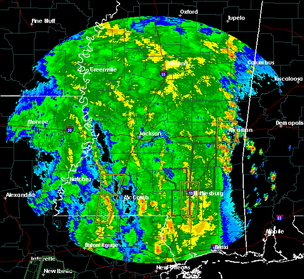 At 1212 pm cdt, a severe thunderstorm was located over smithdale, or 13 miles north of liberty, moving north at 50 mph (radar indicated). Hazards include 60 mph wind gusts. Expect damage to roofs, siding, and trees. this severe thunderstorm will be near, little springs around 1215 pm cdt. center point around 1220 pm cdt. mccall creek and west lincoln around 1225 pm cdt. vaughn and loyd star around 1235 pm cdt. caseyville around 1240 pm cdt. A tornado watch remains in effect until 700 pm cdt for central, south central and southwestern mississippi. At 1212 pm cdt, a severe thunderstorm was located over smithdale, or 13 miles north of liberty, moving north at 50 mph (radar indicated). Hazards include 60 mph wind gusts. Expect damage to roofs, siding, and trees. this severe thunderstorm will be near, little springs around 1215 pm cdt. center point around 1220 pm cdt. mccall creek and west lincoln around 1225 pm cdt. vaughn and loyd star around 1235 pm cdt. caseyville around 1240 pm cdt. A tornado watch remains in effect until 700 pm cdt for central, south central and southwestern mississippi.
|
| 6/28/2019 2:18 PM CDT |
 At 217 pm cdt, a severe thunderstorm was located over fayette, or 20 miles northeast of natchez, moving southeast at 20 mph (radar indicated). Hazards include 60 mph wind gusts and penny size hail. expect damage to roofs, siding, and trees At 217 pm cdt, a severe thunderstorm was located over fayette, or 20 miles northeast of natchez, moving southeast at 20 mph (radar indicated). Hazards include 60 mph wind gusts and penny size hail. expect damage to roofs, siding, and trees
|
| 5/8/2019 8:34 PM CDT |
 At 758 pm cdt, severe thunderstorms were located along a line extending from near alcorn to near stanton to 6 miles southwest of sibley, moving east northeast at 50 mph (radar indicated). Hazards include 60 mph wind gusts. Expect damage to roofs, siding, and trees. these severe storms will be near, church hill around 805 pm cdt. fayette and kingston around 815 pm cdt. red lick, cranfield and lorman around 825 pm cdt. blue hill around 830 pm cdt. pattison, hamburg and stampley around 835 pm cdt. mcnair and peyton around 840 pm cdt. other locations impacted by these severe thunderstorms include roxie and meadville. a tornado watch remains in effect until 1100 pm cdt for northeastern louisiana. A tornado watch also remains in effect until midnight cdt for central, south central and southwestern mississippi. At 758 pm cdt, severe thunderstorms were located along a line extending from near alcorn to near stanton to 6 miles southwest of sibley, moving east northeast at 50 mph (radar indicated). Hazards include 60 mph wind gusts. Expect damage to roofs, siding, and trees. these severe storms will be near, church hill around 805 pm cdt. fayette and kingston around 815 pm cdt. red lick, cranfield and lorman around 825 pm cdt. blue hill around 830 pm cdt. pattison, hamburg and stampley around 835 pm cdt. mcnair and peyton around 840 pm cdt. other locations impacted by these severe thunderstorms include roxie and meadville. a tornado watch remains in effect until 1100 pm cdt for northeastern louisiana. A tornado watch also remains in effect until midnight cdt for central, south central and southwestern mississippi.
|
| 5/8/2019 7:58 PM CDT |
 At 758 pm cdt, severe thunderstorms were located along a line extending from near alcorn to near stanton to 6 miles southwest of sibley, moving east northeast at 50 mph (radar indicated). Hazards include 60 mph wind gusts. Expect damage to roofs, siding, and trees. these severe storms will be near, church hill around 805 pm cdt. fayette and kingston around 815 pm cdt. red lick, cranfield and lorman around 825 pm cdt. blue hill around 830 pm cdt. pattison, hamburg and stampley around 835 pm cdt. mcnair and peyton around 840 pm cdt. other locations impacted by these severe thunderstorms include roxie and meadville. a tornado watch remains in effect until 1100 pm cdt for northeastern louisiana. A tornado watch also remains in effect until midnight cdt for central, south central and southwestern mississippi. At 758 pm cdt, severe thunderstorms were located along a line extending from near alcorn to near stanton to 6 miles southwest of sibley, moving east northeast at 50 mph (radar indicated). Hazards include 60 mph wind gusts. Expect damage to roofs, siding, and trees. these severe storms will be near, church hill around 805 pm cdt. fayette and kingston around 815 pm cdt. red lick, cranfield and lorman around 825 pm cdt. blue hill around 830 pm cdt. pattison, hamburg and stampley around 835 pm cdt. mcnair and peyton around 840 pm cdt. other locations impacted by these severe thunderstorms include roxie and meadville. a tornado watch remains in effect until 1100 pm cdt for northeastern louisiana. A tornado watch also remains in effect until midnight cdt for central, south central and southwestern mississippi.
|
| 5/8/2019 7:34 PM CDT |
 At 734 pm cdt, severe thunderstorms were located along a line extending from near waterproof to near vidalia to near monterey, moving east at 45 mph (radar indicated). Hazards include 60 mph wind gusts. Expect damage to roofs, siding, and trees. severe thunderstorms will be near, natchez around 740 pm cdt. alcorn around 750 pm cdt. stanton and lorman around 755 pm cdt. sibley, cranfield and red lick around 800 pm cdt. stampley around 805 pm cdt. fayette, kingston, hamburg, pattison, mcnair and blue hill around 810 pm cdt. peyton and mcbride around 815 pm cdt. garden city around 820 pm cdt. other locations impacted by these severe thunderstorms include roxie and meadville. a tornado watch remains in effect until 1100 pm cdt for northeastern louisiana. A tornado watch also remains in effect until midnight cdt for central, south central and southwestern mississippi. At 734 pm cdt, severe thunderstorms were located along a line extending from near waterproof to near vidalia to near monterey, moving east at 45 mph (radar indicated). Hazards include 60 mph wind gusts. Expect damage to roofs, siding, and trees. severe thunderstorms will be near, natchez around 740 pm cdt. alcorn around 750 pm cdt. stanton and lorman around 755 pm cdt. sibley, cranfield and red lick around 800 pm cdt. stampley around 805 pm cdt. fayette, kingston, hamburg, pattison, mcnair and blue hill around 810 pm cdt. peyton and mcbride around 815 pm cdt. garden city around 820 pm cdt. other locations impacted by these severe thunderstorms include roxie and meadville. a tornado watch remains in effect until 1100 pm cdt for northeastern louisiana. A tornado watch also remains in effect until midnight cdt for central, south central and southwestern mississippi.
|
| 4/25/2019 7:23 AM CDT |
 At 723 am cdt, severe thunderstorms were located along a line extending from near church hill to near kingston, moving northeast at 45 mph (radar indicated). Hazards include 60 mph wind gusts. Expect damage to roofs, siding, and trees. severe thunderstorms will be near, alcorn and hamburg around 740 am cdt. lorman, kirby, mcnair and red lick around 745 am cdt. port gibson and new hope around 755 am cdt. pattison around 800 am cdt. hermanville, union church and blue hill around 805 am cdt. mcbride around 810 am cdt. rocky springs around 815 am cdt. reganton around 820 am cdt. Other locations impacted by these severe thunderstorms include roxie and meadville. At 723 am cdt, severe thunderstorms were located along a line extending from near church hill to near kingston, moving northeast at 45 mph (radar indicated). Hazards include 60 mph wind gusts. Expect damage to roofs, siding, and trees. severe thunderstorms will be near, alcorn and hamburg around 740 am cdt. lorman, kirby, mcnair and red lick around 745 am cdt. port gibson and new hope around 755 am cdt. pattison around 800 am cdt. hermanville, union church and blue hill around 805 am cdt. mcbride around 810 am cdt. rocky springs around 815 am cdt. reganton around 820 am cdt. Other locations impacted by these severe thunderstorms include roxie and meadville.
|
| 4/18/2019 2:03 PM CDT |
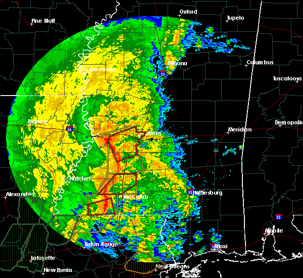 At 203 pm cdt, severe thunderstorms were located along a line extending from near mccall creek to near little springs, moving east at 40 mph (radar indicated). Hazards include 60 mph wind gusts. Expect damage to roofs, siding, and trees. locations impacted include, bude, mccall creek and little springs. A tornado watch remains in effect until 700 pm cdt for south central and southwestern mississippi. At 203 pm cdt, severe thunderstorms were located along a line extending from near mccall creek to near little springs, moving east at 40 mph (radar indicated). Hazards include 60 mph wind gusts. Expect damage to roofs, siding, and trees. locations impacted include, bude, mccall creek and little springs. A tornado watch remains in effect until 700 pm cdt for south central and southwestern mississippi.
|
| 4/18/2019 1:48 PM CDT |
 At 147 pm cdt, severe thunderstorms were located along a line extending from near yokena to 7 miles south of carpenter to near new hope, moving northeast at 40 mph (radar indicated). Hazards include 60 mph wind gusts. Expect damage to roofs, siding, and trees. these severe storms will be near, vicksburg and reganton around 155 pm cdt. other locations impacted by these severe thunderstorms include roxie and meadville. A tornado watch remains in effect until 700 pm cdt for central, south central, southwestern and west central mississippi. At 147 pm cdt, severe thunderstorms were located along a line extending from near yokena to 7 miles south of carpenter to near new hope, moving northeast at 40 mph (radar indicated). Hazards include 60 mph wind gusts. Expect damage to roofs, siding, and trees. these severe storms will be near, vicksburg and reganton around 155 pm cdt. other locations impacted by these severe thunderstorms include roxie and meadville. A tornado watch remains in effect until 700 pm cdt for central, south central, southwestern and west central mississippi.
|
| 4/18/2019 1:01 PM CDT |
 At 101 pm cdt, severe thunderstorms were located along a line extending from 7 miles southeast of newlight to near church hill to kingston, moving east at 40 mph (radar indicated). Hazards include 60 mph wind gusts. Expect damage to roofs, siding, and trees. severe thunderstorms will be near, garden city around 110 pm cdt. fayette and lorman around 115 pm cdt. red lick around 120 pm cdt. kirby around 125 pm cdt. blue hill and pattison around 130 pm cdt. bude, peyton and mcbride around 135 pm cdt. new hope, yokena and pleasant hill around 140 pm cdt. little springs around 145 pm cdt. other locations impacted by these severe thunderstorms include roxie, delta and meadville. A tornado watch remains in effect until 700 pm cdt for northeastern louisiana, and central, south central, southwestern and west central mississippi. At 101 pm cdt, severe thunderstorms were located along a line extending from 7 miles southeast of newlight to near church hill to kingston, moving east at 40 mph (radar indicated). Hazards include 60 mph wind gusts. Expect damage to roofs, siding, and trees. severe thunderstorms will be near, garden city around 110 pm cdt. fayette and lorman around 115 pm cdt. red lick around 120 pm cdt. kirby around 125 pm cdt. blue hill and pattison around 130 pm cdt. bude, peyton and mcbride around 135 pm cdt. new hope, yokena and pleasant hill around 140 pm cdt. little springs around 145 pm cdt. other locations impacted by these severe thunderstorms include roxie, delta and meadville. A tornado watch remains in effect until 700 pm cdt for northeastern louisiana, and central, south central, southwestern and west central mississippi.
|
| 4/12/2019 11:07 PM CDT | Quarter sized hail reported 15.3 miles SSW of Bude, MS, resends previous hail report from union church. lots of dime to nickel size hail with several larger stones around quarter size. |
| 4/7/2019 8:07 PM CDT |
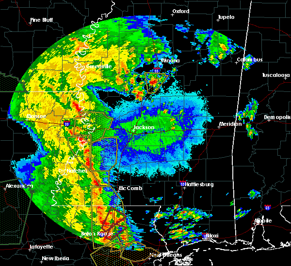 At 807 pm cdt, severe thunderstorms were located along a line extending from 6 miles southwest of union church to near little springs, moving northeast at 30 mph (radar indicated). Hazards include 60 mph wind gusts. Expect damage to roofs, siding, and trees. These severe storms will be near, mccall creek around 820 pm cdt. At 807 pm cdt, severe thunderstorms were located along a line extending from 6 miles southwest of union church to near little springs, moving northeast at 30 mph (radar indicated). Hazards include 60 mph wind gusts. Expect damage to roofs, siding, and trees. These severe storms will be near, mccall creek around 820 pm cdt.
|
| 4/7/2019 7:57 PM CDT |
 At 757 pm cdt, severe thunderstorms were located along a line extending from near kirby to 6 miles southwest of little springs, moving northeast at 30 mph (radar indicated). Hazards include 60 mph wind gusts. Expect damage to roofs, siding, and trees. these severe storms will be near, new hope around 805 pm cdt. mccall creek around 820 pm cdt. Other locations impacted by these severe thunderstorms include meadville. At 757 pm cdt, severe thunderstorms were located along a line extending from near kirby to 6 miles southwest of little springs, moving northeast at 30 mph (radar indicated). Hazards include 60 mph wind gusts. Expect damage to roofs, siding, and trees. these severe storms will be near, new hope around 805 pm cdt. mccall creek around 820 pm cdt. Other locations impacted by these severe thunderstorms include meadville.
|
| 4/7/2019 7:41 PM CDT |
 At 741 pm cdt, severe thunderstorms were located along a line extending from near kirby to 8 miles northeast of gloster, moving northeast at 25 mph (radar indicated). Hazards include 60 mph wind gusts. Expect damage to roofs, siding, and trees. severe thunderstorms will be near, kirby and hamburg around 750 pm cdt. new hope around 805 pm cdt. bude around 810 pm cdt. little springs around 815 pm cdt. mccall creek around 830 pm cdt. Other locations impacted by these severe thunderstorms include roxie and meadville. At 741 pm cdt, severe thunderstorms were located along a line extending from near kirby to 8 miles northeast of gloster, moving northeast at 25 mph (radar indicated). Hazards include 60 mph wind gusts. Expect damage to roofs, siding, and trees. severe thunderstorms will be near, kirby and hamburg around 750 pm cdt. new hope around 805 pm cdt. bude around 810 pm cdt. little springs around 815 pm cdt. mccall creek around 830 pm cdt. Other locations impacted by these severe thunderstorms include roxie and meadville.
|
| 1/19/2019 7:11 AM CST |
 At 711 am cst, severe thunderstorms were located along a line extending from near terry to near caseyville to near bude, moving northeast at 65 mph (radar indicated). Hazards include 60 mph wind gusts. Expect damage to roofs, siding, and trees. severe thunderstorms will be near, wesson and glancy around 720 am cst. hazlehurst, star, martinsville, mccall creek and center point around 725 am cst. west lincoln and vaughn around 730 am cst. rockport, hopewell, bogue chitto and johns around 735 am cst. brookhaven, union and enterprise around 740 am cst. pinola and harrisville around 745 am cst. sontag around 750 am cst. mendenhall, wanilla, oma and cato around 755 am cst. other locations impacted by these severe thunderstorms include d`lo, beauregard, braxton, puckett and georgetown. A tornado watch remains in effect until 100 pm cst for central, south central and southwestern mississippi. At 711 am cst, severe thunderstorms were located along a line extending from near terry to near caseyville to near bude, moving northeast at 65 mph (radar indicated). Hazards include 60 mph wind gusts. Expect damage to roofs, siding, and trees. severe thunderstorms will be near, wesson and glancy around 720 am cst. hazlehurst, star, martinsville, mccall creek and center point around 725 am cst. west lincoln and vaughn around 730 am cst. rockport, hopewell, bogue chitto and johns around 735 am cst. brookhaven, union and enterprise around 740 am cst. pinola and harrisville around 745 am cst. sontag around 750 am cst. mendenhall, wanilla, oma and cato around 755 am cst. other locations impacted by these severe thunderstorms include d`lo, beauregard, braxton, puckett and georgetown. A tornado watch remains in effect until 100 pm cst for central, south central and southwestern mississippi.
|
| 1/19/2019 7:03 AM CST |
 At 702 am cst, severe thunderstorms were located along a line extending from near barlow to bude, moving east at 45 mph (radar indicated). Hazards include 60 mph wind gusts. Expect damage to roofs, siding, and trees. these severe storms will be near, barlow around 710 am cst. other locations impacted by these severe thunderstorms include meadville. A tornado watch remains in effect until 100 pm cst for central, south central and southwestern mississippi. At 702 am cst, severe thunderstorms were located along a line extending from near barlow to bude, moving east at 45 mph (radar indicated). Hazards include 60 mph wind gusts. Expect damage to roofs, siding, and trees. these severe storms will be near, barlow around 710 am cst. other locations impacted by these severe thunderstorms include meadville. A tornado watch remains in effect until 100 pm cst for central, south central and southwestern mississippi.
|
| 1/19/2019 6:37 AM CST |
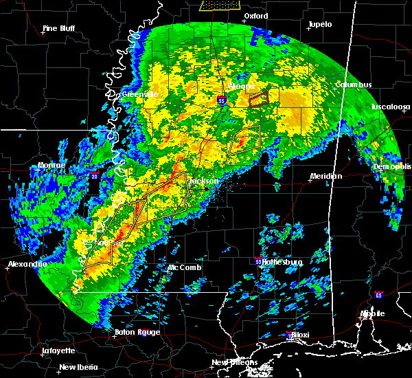 At 637 am cst, severe thunderstorms were located along a line extending from near red lick to near garden city, moving east at 45 mph (radar indicated). Hazards include 60 mph wind gusts. Expect damage to roofs, siding, and trees. severe thunderstorms will be near, blue hill around 645 am cst. mcbride around 650 am cst. peyton, kirby and pleasant hill around 655 am cst. allen around 700 am cst. bude, barlow and new hope around 705 am cst. little springs around 710 am cst. mccall creek around 715 am cst. other locations impacted by these severe thunderstorms include roxie and meadville. A tornado watch remains in effect until 100 pm cst for central, south central and southwestern mississippi. At 637 am cst, severe thunderstorms were located along a line extending from near red lick to near garden city, moving east at 45 mph (radar indicated). Hazards include 60 mph wind gusts. Expect damage to roofs, siding, and trees. severe thunderstorms will be near, blue hill around 645 am cst. mcbride around 650 am cst. peyton, kirby and pleasant hill around 655 am cst. allen around 700 am cst. bude, barlow and new hope around 705 am cst. little springs around 710 am cst. mccall creek around 715 am cst. other locations impacted by these severe thunderstorms include roxie and meadville. A tornado watch remains in effect until 100 pm cst for central, south central and southwestern mississippi.
|
| 12/27/2018 11:02 AM CST |
 At 1101 am cst, a severe thunderstorm was located near cranfield, or 12 miles southeast of natchez, moving northeast at 35 mph (radar indicated). Hazards include 60 mph wind gusts. Expect damage to roofs, siding, and trees. this severe storm will be near, hamburg around 1120 am cst. kirby and mcnair around 1125 am cst. new hope around 1140 am cst. union church around 1145 am cst. other locations impacted by this severe thunderstorm include roxie and meadville. A tornado watch remains in effect until 600 pm cst for south central and southwestern mississippi. At 1101 am cst, a severe thunderstorm was located near cranfield, or 12 miles southeast of natchez, moving northeast at 35 mph (radar indicated). Hazards include 60 mph wind gusts. Expect damage to roofs, siding, and trees. this severe storm will be near, hamburg around 1120 am cst. kirby and mcnair around 1125 am cst. new hope around 1140 am cst. union church around 1145 am cst. other locations impacted by this severe thunderstorm include roxie and meadville. A tornado watch remains in effect until 600 pm cst for south central and southwestern mississippi.
|
| 12/27/2018 10:40 AM CST |
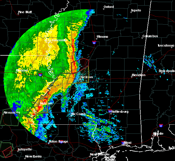 At 1040 am cst, a severe thunderstorm was located near cranfield, or 7 miles east of natchez, moving east at 40 mph (radar indicated). Hazards include 60 mph wind gusts. Expect damage to roofs, siding, and trees. this severe thunderstorm will be near, cranfield around 1045 am cst. stampley around 1055 am cst. hamburg around 1100 am cst. kirby and mcnair around 1105 am cst. new hope around 1120 am cst. union church around 1125 am cst. mccall creek around 1130 am cst. other locations impacted by this severe thunderstorm include roxie and meadville. A tornado watch remains in effect until 600 pm cst for south central and southwestern mississippi. At 1040 am cst, a severe thunderstorm was located near cranfield, or 7 miles east of natchez, moving east at 40 mph (radar indicated). Hazards include 60 mph wind gusts. Expect damage to roofs, siding, and trees. this severe thunderstorm will be near, cranfield around 1045 am cst. stampley around 1055 am cst. hamburg around 1100 am cst. kirby and mcnair around 1105 am cst. new hope around 1120 am cst. union church around 1125 am cst. mccall creek around 1130 am cst. other locations impacted by this severe thunderstorm include roxie and meadville. A tornado watch remains in effect until 600 pm cst for south central and southwestern mississippi.
|
| 11/1/2018 2:45 AM CDT |
 At 244 am cdt, a severe thunderstorm capable of producing a tornado was located over kirby, or 24 miles east of natchez, moving northeast at 45 mph (radar indicated rotation). Hazards include tornado. Flying debris will be dangerous to those caught without shelter. mobile homes will be damaged or destroyed. damage to roofs, windows, and vehicles will occur. tree damage is likely. this dangerous storm will be near, bude around 250 am cdt. Other locations impacted by this tornadic thunderstorm include meadville. At 244 am cdt, a severe thunderstorm capable of producing a tornado was located over kirby, or 24 miles east of natchez, moving northeast at 45 mph (radar indicated rotation). Hazards include tornado. Flying debris will be dangerous to those caught without shelter. mobile homes will be damaged or destroyed. damage to roofs, windows, and vehicles will occur. tree damage is likely. this dangerous storm will be near, bude around 250 am cdt. Other locations impacted by this tornadic thunderstorm include meadville.
|
| 11/1/2018 2:36 AM CDT |
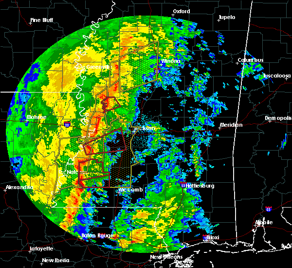 At 236 am cdt, a severe thunderstorm capable of producing a tornado was located near garden city, or 18 miles southeast of natchez, moving northeast at 40 mph (radar indicated rotation). Hazards include tornado. Flying debris will be dangerous to those caught without shelter. mobile homes will be damaged or destroyed. damage to roofs, windows, and vehicles will occur. tree damage is likely. this dangerous storm will be near, bude around 255 am cdt. Other locations impacted by this tornadic thunderstorm include meadville. At 236 am cdt, a severe thunderstorm capable of producing a tornado was located near garden city, or 18 miles southeast of natchez, moving northeast at 40 mph (radar indicated rotation). Hazards include tornado. Flying debris will be dangerous to those caught without shelter. mobile homes will be damaged or destroyed. damage to roofs, windows, and vehicles will occur. tree damage is likely. this dangerous storm will be near, bude around 255 am cdt. Other locations impacted by this tornadic thunderstorm include meadville.
|
| 11/1/2018 2:26 AM CDT |
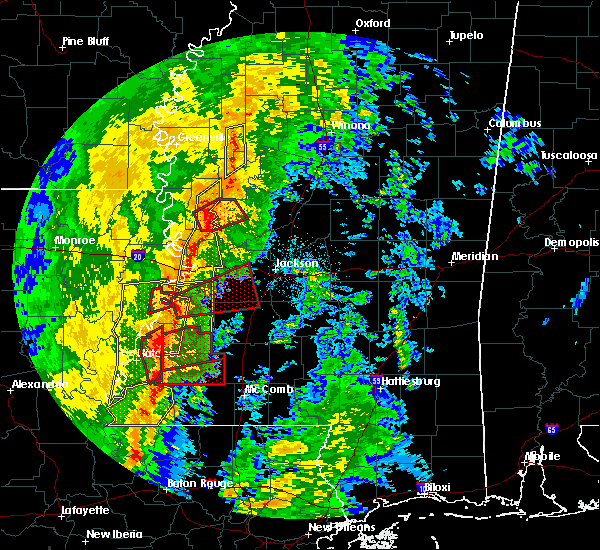 At 226 am cdt, a severe thunderstorm capable of producing a tornado was located over garden city, or 17 miles southeast of natchez, moving northeast at 45 mph (radar indicated rotation). Hazards include tornado. Flying debris will be dangerous to those caught without shelter. mobile homes will be damaged or destroyed. damage to roofs, windows, and vehicles will occur. tree damage is likely. this dangerous storm will be near, bude around 250 am cdt. mccall creek around 305 am cdt. Other locations impacted by this tornadic thunderstorm include meadville. At 226 am cdt, a severe thunderstorm capable of producing a tornado was located over garden city, or 17 miles southeast of natchez, moving northeast at 45 mph (radar indicated rotation). Hazards include tornado. Flying debris will be dangerous to those caught without shelter. mobile homes will be damaged or destroyed. damage to roofs, windows, and vehicles will occur. tree damage is likely. this dangerous storm will be near, bude around 250 am cdt. mccall creek around 305 am cdt. Other locations impacted by this tornadic thunderstorm include meadville.
|
| 11/1/2018 2:06 AM CDT |
 At 205 am cdt, severe thunderstorms were located along a line extending from near afton to near church hill to 6 miles southeast of kingston, moving east at 55 mph (radar indicated). Hazards include 60 mph wind gusts. Expect damage to roofs, siding, and trees. severe thunderstorms will be near, yokena around 220 am cdt. red lick around 230 am cdt. bude and blue hill around 235 am cdt. peyton, little springs, mcbride and pattison around 240 am cdt. mccall creek around 245 am cdt. other locations impacted by these severe thunderstorms include roxie and meadville. a tornado watch remains in effect until 400 am cdt for northeastern louisiana, and southwestern mississippi. A tornado watch also remains in effect until 700 am cdt for south central, southwestern and west central mississippi. At 205 am cdt, severe thunderstorms were located along a line extending from near afton to near church hill to 6 miles southeast of kingston, moving east at 55 mph (radar indicated). Hazards include 60 mph wind gusts. Expect damage to roofs, siding, and trees. severe thunderstorms will be near, yokena around 220 am cdt. red lick around 230 am cdt. bude and blue hill around 235 am cdt. peyton, little springs, mcbride and pattison around 240 am cdt. mccall creek around 245 am cdt. other locations impacted by these severe thunderstorms include roxie and meadville. a tornado watch remains in effect until 400 am cdt for northeastern louisiana, and southwestern mississippi. A tornado watch also remains in effect until 700 am cdt for south central, southwestern and west central mississippi.
|
| 8/18/2018 6:54 PM CDT |
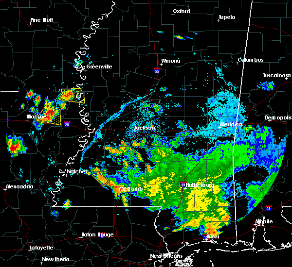 The severe thunderstorm warning for eastern franklin county will expire at 700 pm cdt, the storm which prompted the warning has weakened below severe limits, and no longer poses an immediate threat to life or property. therefore, the warning will be allowed to expire. to report severe weather, contact your nearest law enforcement agency. they will relay your report to the national weather service jackson. The severe thunderstorm warning for eastern franklin county will expire at 700 pm cdt, the storm which prompted the warning has weakened below severe limits, and no longer poses an immediate threat to life or property. therefore, the warning will be allowed to expire. to report severe weather, contact your nearest law enforcement agency. they will relay your report to the national weather service jackson.
|
| 8/18/2018 6:43 PM CDT |
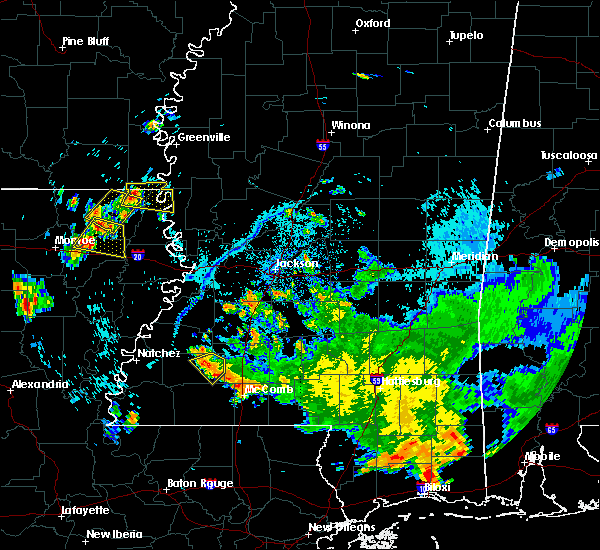 At 643 pm cdt, a severe thunderstorm was located near bude, or 20 miles west of brookhaven, moving southwest at 10 mph (radar indicated). Hazards include 60 mph wind gusts and penny size hail. Expect damage to roofs, siding, and trees. Locations impacted include, little springs and new hope. At 643 pm cdt, a severe thunderstorm was located near bude, or 20 miles west of brookhaven, moving southwest at 10 mph (radar indicated). Hazards include 60 mph wind gusts and penny size hail. Expect damage to roofs, siding, and trees. Locations impacted include, little springs and new hope.
|
| 8/18/2018 6:18 PM CDT |
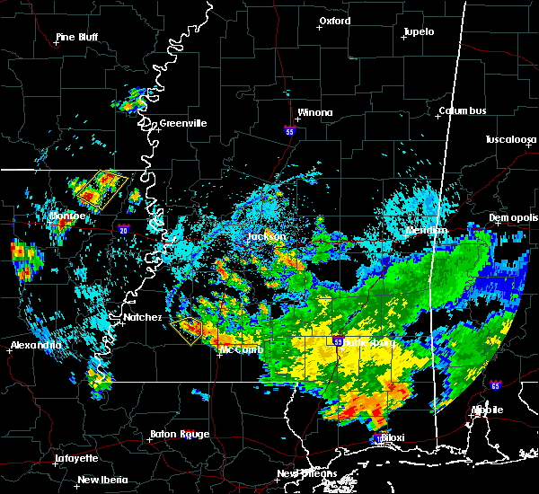 At 618 pm cdt, a severe thunderstorm was located over mccall creek, or 15 miles west of brookhaven, moving southwest at 5 mph (radar indicated). Hazards include 60 mph wind gusts and quarter size hail. Hail damage to vehicles is possible. Expect wind damage to roofs, siding, and trees. At 618 pm cdt, a severe thunderstorm was located over mccall creek, or 15 miles west of brookhaven, moving southwest at 5 mph (radar indicated). Hazards include 60 mph wind gusts and quarter size hail. Hail damage to vehicles is possible. Expect wind damage to roofs, siding, and trees.
|
| 4/14/2018 7:51 AM CDT |
 At 751 am cdt, severe thunderstorms were located along a line extending from near terry to near wesson to near little springs, moving east at 25 mph (emergency management). Hazards include 60 mph wind gusts. Expect damage to roofs, siding, and trees. these severe storms will be near, wesson and martinsville around 755 am cdt. hopewell around 800 am cdt. west lincoln around 815 am cdt. other locations impacted by these severe thunderstorms include beauregard. a tornado watch remains in effect until 800 am cdt for southwestern mississippi. A tornado watch also remains in effect until 200 pm cdt for central, south central and southwestern mississippi. At 751 am cdt, severe thunderstorms were located along a line extending from near terry to near wesson to near little springs, moving east at 25 mph (emergency management). Hazards include 60 mph wind gusts. Expect damage to roofs, siding, and trees. these severe storms will be near, wesson and martinsville around 755 am cdt. hopewell around 800 am cdt. west lincoln around 815 am cdt. other locations impacted by these severe thunderstorms include beauregard. a tornado watch remains in effect until 800 am cdt for southwestern mississippi. A tornado watch also remains in effect until 200 pm cdt for central, south central and southwestern mississippi.
|
| 4/14/2018 7:27 AM CDT |
 At 727 am cdt, severe thunderstorms were located along a line extending from 6 miles northwest of crystal springs to near caseyville to 8 miles south of bude, moving east at 25 mph (emergency management). Hazards include 60 mph wind gusts. Expect damage to roofs, siding, and trees. severe thunderstorms will be near, loyd star and gallman around 735 am cdt. crystal springs around 740 am cdt. glancy around 745 am cdt. brookhaven around 750 am cdt. wesson and martinsville around 755 am cdt. hopewell around 800 am cdt. center point around 805 am cdt. west lincoln around 815 am cdt. other locations impacted by these severe thunderstorms include beauregard. a tornado watch remains in effect until 800 am cdt for southwestern mississippi. A tornado watch also remains in effect until 200 pm cdt for central, south central and southwestern mississippi. At 727 am cdt, severe thunderstorms were located along a line extending from 6 miles northwest of crystal springs to near caseyville to 8 miles south of bude, moving east at 25 mph (emergency management). Hazards include 60 mph wind gusts. Expect damage to roofs, siding, and trees. severe thunderstorms will be near, loyd star and gallman around 735 am cdt. crystal springs around 740 am cdt. glancy around 745 am cdt. brookhaven around 750 am cdt. wesson and martinsville around 755 am cdt. hopewell around 800 am cdt. center point around 805 am cdt. west lincoln around 815 am cdt. other locations impacted by these severe thunderstorms include beauregard. a tornado watch remains in effect until 800 am cdt for southwestern mississippi. A tornado watch also remains in effect until 200 pm cdt for central, south central and southwestern mississippi.
|
| 4/14/2018 7:17 AM CDT |
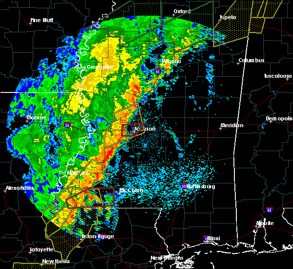 At 717 am cdt, a severe thunderstorm was located near mcnair, or 22 miles east of natchez, moving northeast at 50 mph (radar indicated). Hazards include 60 mph wind gusts. Expect damage to roofs, siding, and trees. this severe storm will be near, blue hill and union church around 735 am cdt. mcbride around 740 am cdt. other locations impacted by this severe thunderstorm include roxie and meadville. a tornado watch remains in effect until 800 am cdt for southwestern mississippi. A tornado watch also remains in effect until 200 pm cdt for south central and southwestern mississippi. At 717 am cdt, a severe thunderstorm was located near mcnair, or 22 miles east of natchez, moving northeast at 50 mph (radar indicated). Hazards include 60 mph wind gusts. Expect damage to roofs, siding, and trees. this severe storm will be near, blue hill and union church around 735 am cdt. mcbride around 740 am cdt. other locations impacted by this severe thunderstorm include roxie and meadville. a tornado watch remains in effect until 800 am cdt for southwestern mississippi. A tornado watch also remains in effect until 200 pm cdt for south central and southwestern mississippi.
|
| 4/14/2018 6:57 AM CDT |
 At 657 am cdt, a severe thunderstorm was located near kingston, or 12 miles southeast of natchez, moving northeast at 50 mph (radar indicated). Hazards include 60 mph wind gusts. Expect damage to roofs, siding, and trees. this severe storm will be near, cranfield around 705 am cdt. hamburg and kirby around 715 am cdt. mcnair around 720 am cdt. blue hill and union church around 735 am cdt. mcbride around 740 am cdt. other locations impacted by this severe thunderstorm include roxie and meadville. a tornado watch remains in effect until 800 am cdt for southwestern mississippi. A tornado watch also remains in effect until 200 pm cdt for south central and southwestern mississippi. At 657 am cdt, a severe thunderstorm was located near kingston, or 12 miles southeast of natchez, moving northeast at 50 mph (radar indicated). Hazards include 60 mph wind gusts. Expect damage to roofs, siding, and trees. this severe storm will be near, cranfield around 705 am cdt. hamburg and kirby around 715 am cdt. mcnair around 720 am cdt. blue hill and union church around 735 am cdt. mcbride around 740 am cdt. other locations impacted by this severe thunderstorm include roxie and meadville. a tornado watch remains in effect until 800 am cdt for southwestern mississippi. A tornado watch also remains in effect until 200 pm cdt for south central and southwestern mississippi.
|
| 4/14/2018 6:44 AM CDT |
 At 644 am cdt, a severe thunderstorm was located over dolorosa, or 15 miles south of natchez, moving northeast at 50 mph (radar indicated). Hazards include 60 mph wind gusts. Expect damage to roofs, siding, and trees. this severe thunderstorm will be near, kingston around 655 am cdt. garden city around 700 am cdt. cranfield around 705 am cdt. hamburg, kirby and stampley around 715 am cdt. mcnair around 720 am cdt. union church and blue hill around 735 am cdt. mcbride around 740 am cdt. other locations impacted by this severe thunderstorm include roxie and meadville. A tornado watch remains in effect until 800 am cdt for northeastern louisiana, and southwestern mississippi. At 644 am cdt, a severe thunderstorm was located over dolorosa, or 15 miles south of natchez, moving northeast at 50 mph (radar indicated). Hazards include 60 mph wind gusts. Expect damage to roofs, siding, and trees. this severe thunderstorm will be near, kingston around 655 am cdt. garden city around 700 am cdt. cranfield around 705 am cdt. hamburg, kirby and stampley around 715 am cdt. mcnair around 720 am cdt. union church and blue hill around 735 am cdt. mcbride around 740 am cdt. other locations impacted by this severe thunderstorm include roxie and meadville. A tornado watch remains in effect until 800 am cdt for northeastern louisiana, and southwestern mississippi.
|
| 4/6/2018 11:36 PM CDT |
 At 1136 pm cdt, a severe thunderstorm was located near west lincoln, or 12 miles southwest of brookhaven, moving east at 30 mph (radar indicated). Hazards include 60 mph wind gusts. Expect damage to roofs, siding, and trees. this severe thunderstorm will be near, center point around 1140 pm cdt. west lincoln around 1145 pm cdt. bogue chitto around 1200 am cdt. enterprise around 1205 am cdt. Ruth and east lincoln around 1215 am cdt. At 1136 pm cdt, a severe thunderstorm was located near west lincoln, or 12 miles southwest of brookhaven, moving east at 30 mph (radar indicated). Hazards include 60 mph wind gusts. Expect damage to roofs, siding, and trees. this severe thunderstorm will be near, center point around 1140 pm cdt. west lincoln around 1145 pm cdt. bogue chitto around 1200 am cdt. enterprise around 1205 am cdt. Ruth and east lincoln around 1215 am cdt.
|
| 4/6/2018 10:51 PM CDT |
 At 1050 pm cdt, severe thunderstorms were located along a line extending from 6 miles southwest of blue hill to 6 miles north of garden city to near new era, moving southeast at 20 mph (radar indicated). Hazards include 60 mph wind gusts. Expect damage to roofs, siding, and trees. severe thunderstorms will be near, blue hill, mcnair and kingston around 1055 pm cdt. garden city and union church around 1110 pm cdt. slocum around 1120 pm cdt. bude, new hope, black hawk and mccall creek around 1130 pm cdt. other locations impacted by these severe thunderstorms include roxie and meadville. A tornado watch remains in effect until 1100 pm cdt for northeastern louisiana, and south central and southwestern mississippi. At 1050 pm cdt, severe thunderstorms were located along a line extending from 6 miles southwest of blue hill to 6 miles north of garden city to near new era, moving southeast at 20 mph (radar indicated). Hazards include 60 mph wind gusts. Expect damage to roofs, siding, and trees. severe thunderstorms will be near, blue hill, mcnair and kingston around 1055 pm cdt. garden city and union church around 1110 pm cdt. slocum around 1120 pm cdt. bude, new hope, black hawk and mccall creek around 1130 pm cdt. other locations impacted by these severe thunderstorms include roxie and meadville. A tornado watch remains in effect until 1100 pm cdt for northeastern louisiana, and south central and southwestern mississippi.
|
| 4/6/2018 3:56 PM CDT |
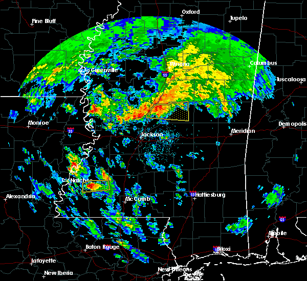 At 355 pm cdt, a severe thunderstorm was located near hamburg, or 17 miles east of natchez, moving east at 30 mph (radar indicated). Hazards include 60 mph wind gusts and quarter size hail. Hail damage to vehicles is expected. expect wind damage to roofs, siding, and trees. this severe storm will be near, hamburg around 405 pm cdt. kirby around 410 pm cdt. bude around 425 pm cdt. new hope around 430 pm cdt. other locations impacted by this severe thunderstorm include roxie and meadville. A tornado watch remains in effect until 1100 pm cdt for southwestern mississippi. At 355 pm cdt, a severe thunderstorm was located near hamburg, or 17 miles east of natchez, moving east at 30 mph (radar indicated). Hazards include 60 mph wind gusts and quarter size hail. Hail damage to vehicles is expected. expect wind damage to roofs, siding, and trees. this severe storm will be near, hamburg around 405 pm cdt. kirby around 410 pm cdt. bude around 425 pm cdt. new hope around 430 pm cdt. other locations impacted by this severe thunderstorm include roxie and meadville. A tornado watch remains in effect until 1100 pm cdt for southwestern mississippi.
|
| 4/6/2018 3:39 PM CDT |
 The national weather service in jackson has issued a * severe thunderstorm warning for. northern franklin county in southwestern mississippi. east central adams county in southwestern mississippi. Until 445 pm cdt * at 339 pm cdt, a severe thunderstorm was located near kingston, or. The national weather service in jackson has issued a * severe thunderstorm warning for. northern franklin county in southwestern mississippi. east central adams county in southwestern mississippi. Until 445 pm cdt * at 339 pm cdt, a severe thunderstorm was located near kingston, or.
|
| 2/21/2018 2:53 PM CST |
 At 252 pm cst, a severe thunderstorm was located near new hope, or 26 miles north of liberty, moving northeast at 30 mph (radar indicated). Hazards include 60 mph wind gusts and quarter size hail. Hail damage to vehicles is expected. expect wind damage to roofs, siding, and trees. this severe thunderstorm will be near, union church around 315 pm cst. blue hill and caseyville around 320 pm cst. pleasant hill and mcbride around 325 pm cst. allen and peyton around 330 pm cst. Other locations impacted by this severe thunderstorm include meadville. At 252 pm cst, a severe thunderstorm was located near new hope, or 26 miles north of liberty, moving northeast at 30 mph (radar indicated). Hazards include 60 mph wind gusts and quarter size hail. Hail damage to vehicles is expected. expect wind damage to roofs, siding, and trees. this severe thunderstorm will be near, union church around 315 pm cst. blue hill and caseyville around 320 pm cst. pleasant hill and mcbride around 325 pm cst. allen and peyton around 330 pm cst. Other locations impacted by this severe thunderstorm include meadville.
|
| 7/17/2017 6:52 PM CDT |
 At 651 pm cdt, a severe thunderstorm was located near little springs, or 19 miles north of liberty, moving southwest at 10 mph (radar indicated). Hazards include 60 mph wind gusts. Expect damage to roofs, siding, and trees. This severe storm will be near, bude around 700 pm cdt. At 651 pm cdt, a severe thunderstorm was located near little springs, or 19 miles north of liberty, moving southwest at 10 mph (radar indicated). Hazards include 60 mph wind gusts. Expect damage to roofs, siding, and trees. This severe storm will be near, bude around 700 pm cdt.
|
| 7/17/2017 6:44 PM CDT |
 At 644 pm cdt, severe thunderstorms were located along a line extending from near new hope to near center point, moving southwest at 20 mph (radar indicated). Hazards include 60 mph wind gusts. Expect damage to roofs, siding, and trees. These severe storms will be near, bude and little springs around 700 pm cdt. At 644 pm cdt, severe thunderstorms were located along a line extending from near new hope to near center point, moving southwest at 20 mph (radar indicated). Hazards include 60 mph wind gusts. Expect damage to roofs, siding, and trees. These severe storms will be near, bude and little springs around 700 pm cdt.
|
| 7/17/2017 6:30 PM CDT | Trees down across new salem r in franklin county MS, 10.3 miles WSW of Bude, MS |
| 7/17/2017 6:15 PM CDT |
 At 615 pm cdt, severe thunderstorms were located along a line extending from near vaughn to near enterprise, moving southwest at 20 mph (radar indicated). Hazards include 60 mph wind gusts and penny size hail. Expect damage to roofs, siding, and trees. severe thunderstorms will be near, west lincoln around 620 pm cdt. mccall creek around 630 pm cdt. little springs around 650 pm cdt. Bude around 655 pm cdt. At 615 pm cdt, severe thunderstorms were located along a line extending from near vaughn to near enterprise, moving southwest at 20 mph (radar indicated). Hazards include 60 mph wind gusts and penny size hail. Expect damage to roofs, siding, and trees. severe thunderstorms will be near, west lincoln around 620 pm cdt. mccall creek around 630 pm cdt. little springs around 650 pm cdt. Bude around 655 pm cdt.
|
| 5/21/2017 4:07 PM CDT |
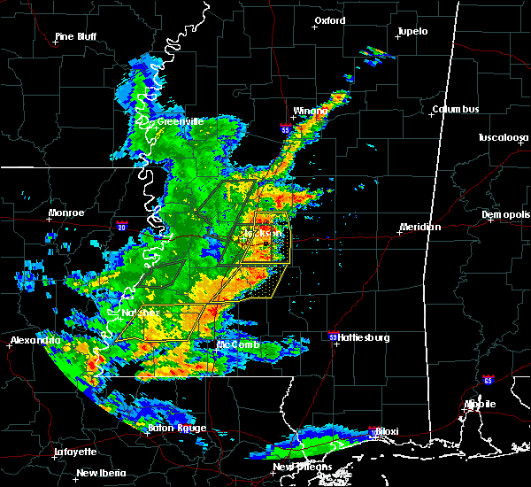 The severe thunderstorm warning for northwestern lincoln, southeastern jefferson, franklin and east central adams counties will expire at 415 pm cdt, the storm which prompted the warning has weakened below severe limits, and has exited the warned area. therefore, the warning will be allowed to expire. The severe thunderstorm warning for northwestern lincoln, southeastern jefferson, franklin and east central adams counties will expire at 415 pm cdt, the storm which prompted the warning has weakened below severe limits, and has exited the warned area. therefore, the warning will be allowed to expire.
|
| 5/21/2017 3:45 PM CDT |
 At 344 pm cdt, a severe thunderstorm was located near mccall creek, or 15 miles west of brookhaven, moving east at 40 mph (radar indicated). Hazards include 60 mph wind gusts and quarter size hail. Hail damage to vehicles is expected. expect wind damage to roofs, siding, and trees. This severe thunderstorm will remain over mainly rural areas of northwestern lincoln, southeastern jefferson, franklin and east central adams counties, including the following locations: roxie and meadville. At 344 pm cdt, a severe thunderstorm was located near mccall creek, or 15 miles west of brookhaven, moving east at 40 mph (radar indicated). Hazards include 60 mph wind gusts and quarter size hail. Hail damage to vehicles is expected. expect wind damage to roofs, siding, and trees. This severe thunderstorm will remain over mainly rural areas of northwestern lincoln, southeastern jefferson, franklin and east central adams counties, including the following locations: roxie and meadville.
|
| 5/21/2017 3:20 PM CDT |
 At 320 pm cdt, a severe thunderstorm was located over mcnair, or 22 miles east of natchez, moving east at 15 mph (radar indicated). Hazards include 60 mph wind gusts and quarter size hail. Hail damage to vehicles is expected. expect wind damage to roofs, siding, and trees. this severe thunderstorm will be near, kirby around 335 pm cdt. new hope around 410 pm cdt. union church around 415 pm cdt. Other locations impacted by this severe thunderstorm include roxie, ridgecrest and meadville. At 320 pm cdt, a severe thunderstorm was located over mcnair, or 22 miles east of natchez, moving east at 15 mph (radar indicated). Hazards include 60 mph wind gusts and quarter size hail. Hail damage to vehicles is expected. expect wind damage to roofs, siding, and trees. this severe thunderstorm will be near, kirby around 335 pm cdt. new hope around 410 pm cdt. union church around 415 pm cdt. Other locations impacted by this severe thunderstorm include roxie, ridgecrest and meadville.
|
| 4/30/2017 7:17 AM CDT |
 At 716 am cdt, a severe thunderstorm was located near hamburg, or 22 miles east of natchez, moving northeast at 40 mph (radar indicated). Hazards include 60 mph wind gusts. Expect damage to roofs, siding, and trees. locations impacted include, bude, union church, stampley, kirby, hamburg, mcnair, garden city, new hope, blue hill, mcbride, roxie and meadville. A tornado watch remains in effect until 900 am cdt for southwestern mississippi. At 716 am cdt, a severe thunderstorm was located near hamburg, or 22 miles east of natchez, moving northeast at 40 mph (radar indicated). Hazards include 60 mph wind gusts. Expect damage to roofs, siding, and trees. locations impacted include, bude, union church, stampley, kirby, hamburg, mcnair, garden city, new hope, blue hill, mcbride, roxie and meadville. A tornado watch remains in effect until 900 am cdt for southwestern mississippi.
|
| 4/30/2017 7:05 AM CDT |
 At 705 am cdt, a severe thunderstorm was located from near stanton to near garden city, or 21 miles east of natchez, moving northeast at 40 mph (radar indicated). Hazards include 60 mph wind gusts. Expect damage to roofs, siding, and trees. locations impacted include, natchez, bude, union church, stanton, hamburg, garden city, mcbride, cranfield, stampley, kirby, mcnair, new hope, blue hill, roxie and meadville. A tornado watch remains in effect until 900 am cdt for northeastern louisiana, and southwestern mississippi. At 705 am cdt, a severe thunderstorm was located from near stanton to near garden city, or 21 miles east of natchez, moving northeast at 40 mph (radar indicated). Hazards include 60 mph wind gusts. Expect damage to roofs, siding, and trees. locations impacted include, natchez, bude, union church, stanton, hamburg, garden city, mcbride, cranfield, stampley, kirby, mcnair, new hope, blue hill, roxie and meadville. A tornado watch remains in effect until 900 am cdt for northeastern louisiana, and southwestern mississippi.
|
| 4/30/2017 6:50 AM CDT |
 At 649 am cdt, a severe thunderstorm was located over cranfield, or 11 miles east of natchez, moving northeast at 40 mph (radar indicated). Hazards include 60 mph wind gusts. expect damage to roofs, siding, and trees At 649 am cdt, a severe thunderstorm was located over cranfield, or 11 miles east of natchez, moving northeast at 40 mph (radar indicated). Hazards include 60 mph wind gusts. expect damage to roofs, siding, and trees
|
| 4/3/2017 12:25 AM CDT |
 At 1224 am cdt, severe thunderstorms were located along a line extending from fayette to near mcnair to near kirby to near garden city, moving northeast at 50 mph (radar indicated). Hazards include 60 mph wind gusts and penny size hail. Expect damage to roofs, siding, and trees. these severe storms will be near, new hope around 1240 am cdt. bude, mccall creek and little springs around 1245 am cdt. other locations impacted by these severe thunderstorms include roxie and meadville. A tornado watch remains in effect until 200 am cdt for south central and southwestern mississippi. At 1224 am cdt, severe thunderstorms were located along a line extending from fayette to near mcnair to near kirby to near garden city, moving northeast at 50 mph (radar indicated). Hazards include 60 mph wind gusts and penny size hail. Expect damage to roofs, siding, and trees. these severe storms will be near, new hope around 1240 am cdt. bude, mccall creek and little springs around 1245 am cdt. other locations impacted by these severe thunderstorms include roxie and meadville. A tornado watch remains in effect until 200 am cdt for south central and southwestern mississippi.
|
| 4/3/2017 12:07 AM CDT |
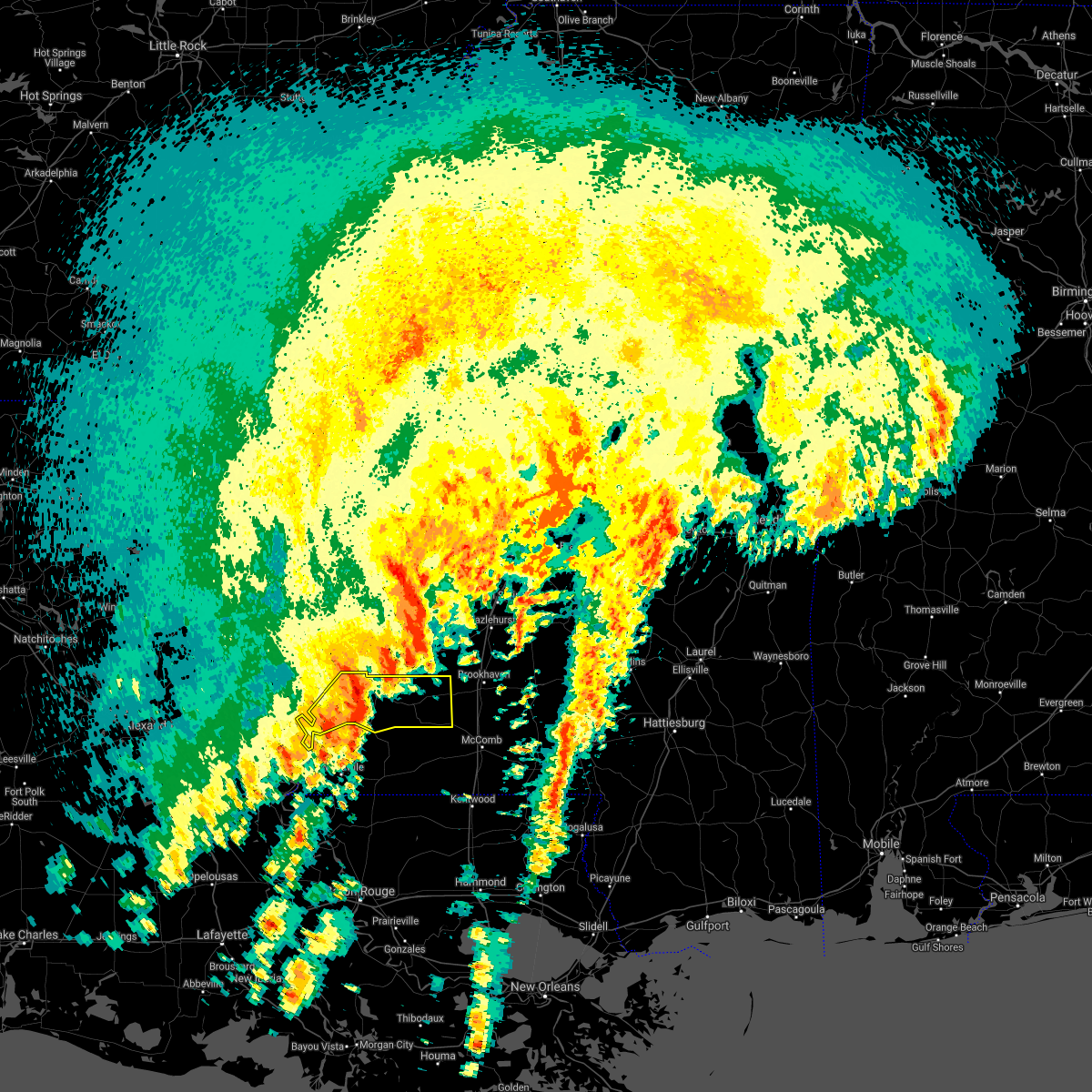 At 1207 am cdt, severe thunderstorms were located along a line extending from stanton to near cranfield to near garden city, moving northeast at 50 mph (radar indicated). Hazards include 60 mph wind gusts and penny size hail. Expect damage to roofs, siding, and trees. these severe storms will be near, stanton and cranfield around 1210 am cdt. hamburg around 1220 am cdt. kirby around 1225 am cdt. bude around 1230 am cdt. new hope around 1235 am cdt. other locations impacted by these severe thunderstorms include roxie and meadville. A tornado watch remains in effect until 200 am cdt for northeastern louisiana, and south central and southwestern mississippi. At 1207 am cdt, severe thunderstorms were located along a line extending from stanton to near cranfield to near garden city, moving northeast at 50 mph (radar indicated). Hazards include 60 mph wind gusts and penny size hail. Expect damage to roofs, siding, and trees. these severe storms will be near, stanton and cranfield around 1210 am cdt. hamburg around 1220 am cdt. kirby around 1225 am cdt. bude around 1230 am cdt. new hope around 1235 am cdt. other locations impacted by these severe thunderstorms include roxie and meadville. A tornado watch remains in effect until 200 am cdt for northeastern louisiana, and south central and southwestern mississippi.
|
| 4/2/2017 11:43 PM CDT |
 At 1143 pm cdt, a severe thunderstorm was located near sibley, or 14 miles south of natchez, moving northeast at 50 mph (radar indicated). Hazards include 60 mph wind gusts and penny size hail. Expect damage to roofs, siding, and trees. this severe thunderstorm will be near, kingston around 1155 pm cdt. cranfield around 1210 am cdt. hamburg around 1215 am cdt. kirby around 1220 am cdt. other locations impacted by this severe thunderstorm include roxie and meadville. A tornado watch remains in effect until 200 am cdt for northeastern louisiana, and south central and southwestern mississippi. At 1143 pm cdt, a severe thunderstorm was located near sibley, or 14 miles south of natchez, moving northeast at 50 mph (radar indicated). Hazards include 60 mph wind gusts and penny size hail. Expect damage to roofs, siding, and trees. this severe thunderstorm will be near, kingston around 1155 pm cdt. cranfield around 1210 am cdt. hamburg around 1215 am cdt. kirby around 1220 am cdt. other locations impacted by this severe thunderstorm include roxie and meadville. A tornado watch remains in effect until 200 am cdt for northeastern louisiana, and south central and southwestern mississippi.
|
| 4/2/2017 12:14 PM CDT |
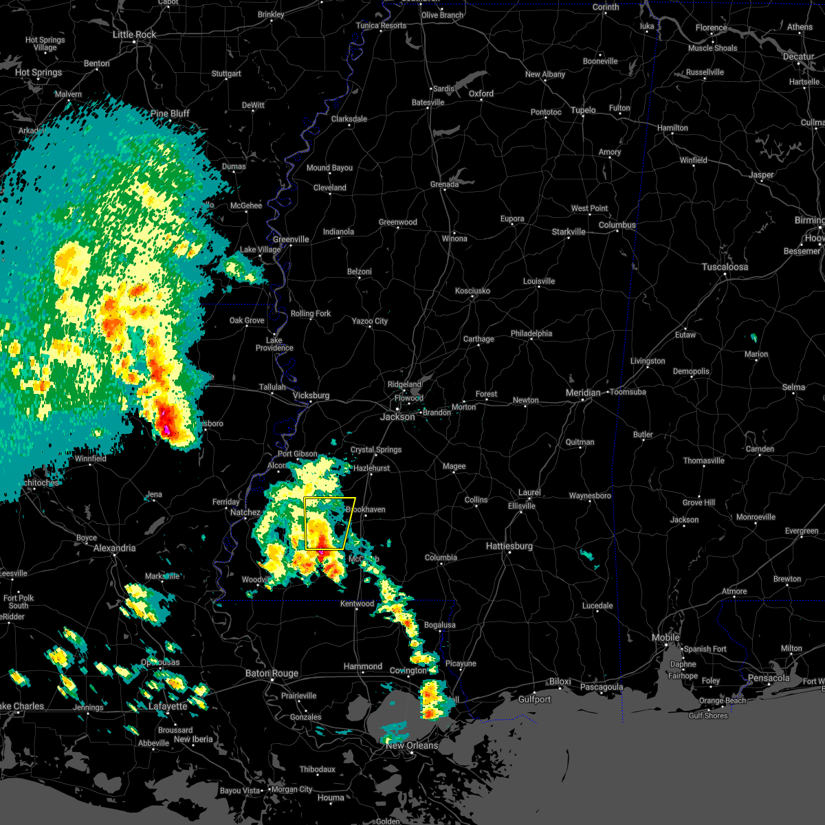 At 1214 pm cdt, a severe thunderstorm was located near little springs, or 13 miles north of liberty, moving north at 40 mph (radar indicated). Hazards include 60 mph wind gusts and quarter size hail. Hail damage to vehicles is expected. expect wind damage to roofs, siding, and trees. this severe thunderstorm will be near, little springs around 1220 pm cdt. bude around 1225 pm cdt. mccall creek and new hope around 1235 pm cdt. caseyville and union church around 1250 pm cdt. Other locations impacted by this severe thunderstorm include meadville. At 1214 pm cdt, a severe thunderstorm was located near little springs, or 13 miles north of liberty, moving north at 40 mph (radar indicated). Hazards include 60 mph wind gusts and quarter size hail. Hail damage to vehicles is expected. expect wind damage to roofs, siding, and trees. this severe thunderstorm will be near, little springs around 1220 pm cdt. bude around 1225 pm cdt. mccall creek and new hope around 1235 pm cdt. caseyville and union church around 1250 pm cdt. Other locations impacted by this severe thunderstorm include meadville.
|
| 3/30/2017 12:32 AM CDT | Tree down across bogue chitto r in franklin county MS, 10 miles WNW of Bude, MS |
| 3/30/2017 12:20 AM CDT |
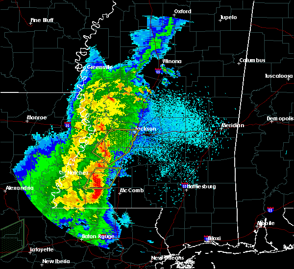 At 1220 am cdt, a severe thunderstorm was located over bude, or 21 miles north of liberty, moving northeast at 35 mph (radar indicated). Hazards include 60 mph wind gusts. Expect damage to roofs, siding, and trees. this severe storm will be near, new hope around 1225 am cdt. mccall creek around 1230 am cdt. caseyville, vaughn and loyd star around 1245 am cdt. other locations impacted by this severe thunderstorm include meadville. A tornado watch remains in effect until 300 am cdt for central, south central and southwestern mississippi. At 1220 am cdt, a severe thunderstorm was located over bude, or 21 miles north of liberty, moving northeast at 35 mph (radar indicated). Hazards include 60 mph wind gusts. Expect damage to roofs, siding, and trees. this severe storm will be near, new hope around 1225 am cdt. mccall creek around 1230 am cdt. caseyville, vaughn and loyd star around 1245 am cdt. other locations impacted by this severe thunderstorm include meadville. A tornado watch remains in effect until 300 am cdt for central, south central and southwestern mississippi.
|
| 3/30/2017 12:01 AM CDT |
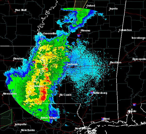 At 1201 am cdt, a severe thunderstorm was located near bude, or 18 miles northwest of liberty, moving northeast at 40 mph (radar indicated). Hazards include 60 mph wind gusts. Expect damage to roofs, siding, and trees. this severe thunderstorm will be near, kirby around 1205 am cdt. bude around 1210 am cdt. new hope and mccall creek around 1220 am cdt. union church around 1230 am cdt. caseyville around 1235 am cdt. other locations impacted by this severe thunderstorm include meadville. A tornado watch remains in effect until 300 am cdt for central, south central and southwestern mississippi. At 1201 am cdt, a severe thunderstorm was located near bude, or 18 miles northwest of liberty, moving northeast at 40 mph (radar indicated). Hazards include 60 mph wind gusts. Expect damage to roofs, siding, and trees. this severe thunderstorm will be near, kirby around 1205 am cdt. bude around 1210 am cdt. new hope and mccall creek around 1220 am cdt. union church around 1230 am cdt. caseyville around 1235 am cdt. other locations impacted by this severe thunderstorm include meadville. A tornado watch remains in effect until 300 am cdt for central, south central and southwestern mississippi.
|
| 1/21/2017 2:04 AM CST |
 At 204 am cst, severe thunderstorms were located along a line extending from near new hope to 7 miles southwest of little springs, moving northeast at 45 mph (radar indicated). Hazards include 60 mph wind gusts and quarter size hail. Hail damage to vehicles is expected. expect wind damage to roofs, siding, and trees. these severe storms will be near, little springs and mccall creek around 215 am cst. other locations impacted by these severe thunderstorms include meadville. A tornado watch remains in effect until 700 am cst for south central and southwestern mississippi. At 204 am cst, severe thunderstorms were located along a line extending from near new hope to 7 miles southwest of little springs, moving northeast at 45 mph (radar indicated). Hazards include 60 mph wind gusts and quarter size hail. Hail damage to vehicles is expected. expect wind damage to roofs, siding, and trees. these severe storms will be near, little springs and mccall creek around 215 am cst. other locations impacted by these severe thunderstorms include meadville. A tornado watch remains in effect until 700 am cst for south central and southwestern mississippi.
|
| 1/21/2017 1:38 AM CST |
 At 137 am cst, severe thunderstorms were located along a line extending from near kingston to 7 miles west of gloster, moving east at 55 mph (radar indicated). Hazards include 60 mph wind gusts and quarter size hail. Hail damage to vehicles is expected. expect wind damage to roofs, siding, and trees. severe thunderstorms will be near, garden city around 140 am cst. hamburg around 150 am cst. kirby around 155 am cst. bude around 200 am cst. new hope around 205 am cst. little springs around 210 am cst. mccall creek around 215 am cst. other locations impacted by these severe thunderstorms include meadville and roxie. A tornado watch remains in effect until 700 am cst for south central and southwestern mississippi. At 137 am cst, severe thunderstorms were located along a line extending from near kingston to 7 miles west of gloster, moving east at 55 mph (radar indicated). Hazards include 60 mph wind gusts and quarter size hail. Hail damage to vehicles is expected. expect wind damage to roofs, siding, and trees. severe thunderstorms will be near, garden city around 140 am cst. hamburg around 150 am cst. kirby around 155 am cst. bude around 200 am cst. new hope around 205 am cst. little springs around 210 am cst. mccall creek around 215 am cst. other locations impacted by these severe thunderstorms include meadville and roxie. A tornado watch remains in effect until 700 am cst for south central and southwestern mississippi.
|
| 1/21/2017 1:04 AM CST |
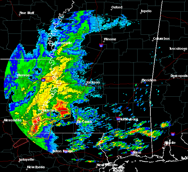 At 104 am cst, a severe thunderstorm was located over bude, or 22 miles north of liberty, moving northeast at 40 mph (radar indicated). Hazards include 60 mph wind gusts and half dollar size hail. Hail damage to vehicles is expected. expect wind damage to roofs, siding, and trees. this severe storm will be near, mccall creek around 115 am cst. other locations impacted by this severe thunderstorm include meadville. A tornado watch remains in effect until 700 am cst for south central and southwestern mississippi. At 104 am cst, a severe thunderstorm was located over bude, or 22 miles north of liberty, moving northeast at 40 mph (radar indicated). Hazards include 60 mph wind gusts and half dollar size hail. Hail damage to vehicles is expected. expect wind damage to roofs, siding, and trees. this severe storm will be near, mccall creek around 115 am cst. other locations impacted by this severe thunderstorm include meadville. A tornado watch remains in effect until 700 am cst for south central and southwestern mississippi.
|
| 1/21/2017 12:50 AM CST |
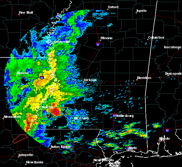 At 1250 am cst, a severe thunderstorm was located over kirby, or 23 miles northwest of liberty, moving northeast at 45 mph (radar indicated). Hazards include tennis ball size hail and 60 mph wind gusts. People and animals outdoors will be injured. expect hail damage to roofs, siding, windows, and vehicles. expect wind damage to roofs, siding, and trees. this severe storm will be near, bude around 1255 am cst. new hope around 105 am cst. other locations impacted by this severe thunderstorm include meadville and roxie. A tornado watch remains in effect until 700 am cst for south central and southwestern mississippi. At 1250 am cst, a severe thunderstorm was located over kirby, or 23 miles northwest of liberty, moving northeast at 45 mph (radar indicated). Hazards include tennis ball size hail and 60 mph wind gusts. People and animals outdoors will be injured. expect hail damage to roofs, siding, windows, and vehicles. expect wind damage to roofs, siding, and trees. this severe storm will be near, bude around 1255 am cst. new hope around 105 am cst. other locations impacted by this severe thunderstorm include meadville and roxie. A tornado watch remains in effect until 700 am cst for south central and southwestern mississippi.
|
| 1/21/2017 12:41 AM CST |
 At 1240 am cst, a severe thunderstorm was located near garden city, or 20 miles southeast of natchez, moving northeast at 45 mph (radar indicated). Hazards include tennis ball size hail and 60 mph wind gusts. People and animals outdoors will be injured. expect hail damage to roofs, siding, windows, and vehicles. expect wind damage to roofs, siding, and trees. this severe storm will be near, kirby around 1255 am cst. bude around 100 am cst. new hope around 105 am cst. other locations impacted by this severe thunderstorm include meadville and roxie. A tornado watch remains in effect until 700 am cst for south central and southwestern mississippi. At 1240 am cst, a severe thunderstorm was located near garden city, or 20 miles southeast of natchez, moving northeast at 45 mph (radar indicated). Hazards include tennis ball size hail and 60 mph wind gusts. People and animals outdoors will be injured. expect hail damage to roofs, siding, windows, and vehicles. expect wind damage to roofs, siding, and trees. this severe storm will be near, kirby around 1255 am cst. bude around 100 am cst. new hope around 105 am cst. other locations impacted by this severe thunderstorm include meadville and roxie. A tornado watch remains in effect until 700 am cst for south central and southwestern mississippi.
|
| 1/21/2017 12:24 AM CST |
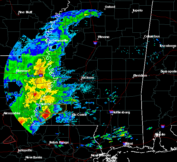 At 1223 am cst, a severe thunderstorm was located 8 miles east of dolorosa, or 21 miles southeast of natchez, moving northeast at 45 mph (radar indicated). Hazards include golf ball size hail and 60 mph wind gusts. People and animals outdoors will be injured. expect hail damage to roofs, siding, windows, and vehicles. expect wind damage to roofs, siding, and trees. this severe thunderstorm will be near, garden city around 1235 am cst. bude and kirby around 1255 am cst. new hope around 105 am cst. other locations impacted by this severe thunderstorm include roxie and meadville. A tornado watch remains in effect until 700 am cst for south central and southwestern mississippi. At 1223 am cst, a severe thunderstorm was located 8 miles east of dolorosa, or 21 miles southeast of natchez, moving northeast at 45 mph (radar indicated). Hazards include golf ball size hail and 60 mph wind gusts. People and animals outdoors will be injured. expect hail damage to roofs, siding, windows, and vehicles. expect wind damage to roofs, siding, and trees. this severe thunderstorm will be near, garden city around 1235 am cst. bude and kirby around 1255 am cst. new hope around 105 am cst. other locations impacted by this severe thunderstorm include roxie and meadville. A tornado watch remains in effect until 700 am cst for south central and southwestern mississippi.
|
| 1/2/2017 1:14 PM CST | A few trees down along with a power line and power pol in franklin county MS, 5.8 miles WSW of Bude, MS |
| 1/2/2017 1:06 PM CST | A couple trees down in bude and meadville in franklin county MS, 0.3 miles NNW of Bude, MS |
| 1/2/2017 12:48 PM CST |
 At 1248 pm cst, a severe thunderstorm was located near new hope, or 26 miles west of brookhaven, moving northeast at 50 mph (radar indicated). Hazards include 70 mph wind gusts. Expect considerable tree damage. damage is likely to mobile homes, roofs, and outbuildings. this severe storm will be near, union church and blue hill around 100 pm cst. mcbride around 105 pm cst. other locations impacted by this severe thunderstorm include roxie and meadville. A tornado watch remains in effect until 800 pm cst for south central and southwestern mississippi. At 1248 pm cst, a severe thunderstorm was located near new hope, or 26 miles west of brookhaven, moving northeast at 50 mph (radar indicated). Hazards include 70 mph wind gusts. Expect considerable tree damage. damage is likely to mobile homes, roofs, and outbuildings. this severe storm will be near, union church and blue hill around 100 pm cst. mcbride around 105 pm cst. other locations impacted by this severe thunderstorm include roxie and meadville. A tornado watch remains in effect until 800 pm cst for south central and southwestern mississippi.
|
| 1/2/2017 12:37 PM CST |
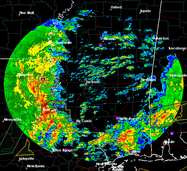 At 1237 pm cst, a severe thunderstorm was located over kirby, or 21 miles east of natchez, moving northeast at 65 mph (radar indicated). Hazards include 60 mph wind gusts. Expect damage to roofs, siding, and trees. this severe thunderstorm will be near, mcnair and new hope around 1245 pm cst. blue hill and union church around 1255 pm cst. mcbride around 100 pm cst. other locations impacted by this severe thunderstorm include roxie and meadville. A tornado watch remains in effect until 800 pm cst for south central and southwestern mississippi. At 1237 pm cst, a severe thunderstorm was located over kirby, or 21 miles east of natchez, moving northeast at 65 mph (radar indicated). Hazards include 60 mph wind gusts. Expect damage to roofs, siding, and trees. this severe thunderstorm will be near, mcnair and new hope around 1245 pm cst. blue hill and union church around 1255 pm cst. mcbride around 100 pm cst. other locations impacted by this severe thunderstorm include roxie and meadville. A tornado watch remains in effect until 800 pm cst for south central and southwestern mississippi.
|
| 11/30/2016 2:00 AM CST |
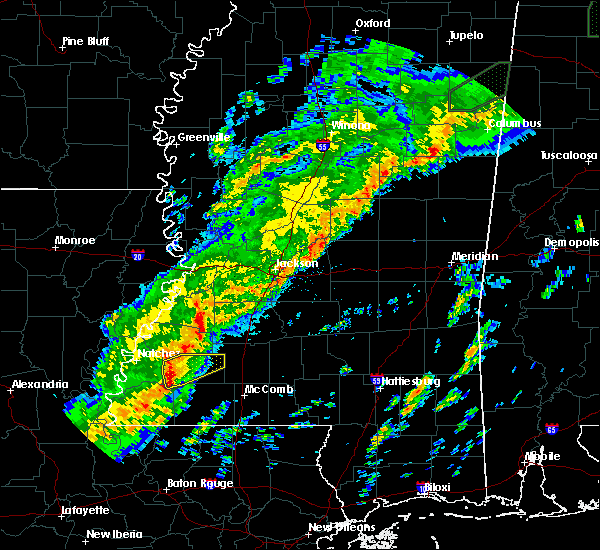 At 159 am cst, a severe thunderstorm was located near garden city, or 19 miles southeast of natchez, moving northeast at 45 mph (radar indicated). Hazards include 60 mph wind gusts and nickel size hail. Expect damage to roofs. siding. and trees. this severe storm will be near, kirby around 210 am cst. bude around 220 am cst. new hope around 225 am cst. mccall creek around 230 am cst. other locations impacted by this severe thunderstorm include meadville and roxie. A tornado watch remains in effect until 500 am cst for south central and southwestern mississippi. At 159 am cst, a severe thunderstorm was located near garden city, or 19 miles southeast of natchez, moving northeast at 45 mph (radar indicated). Hazards include 60 mph wind gusts and nickel size hail. Expect damage to roofs. siding. and trees. this severe storm will be near, kirby around 210 am cst. bude around 220 am cst. new hope around 225 am cst. mccall creek around 230 am cst. other locations impacted by this severe thunderstorm include meadville and roxie. A tornado watch remains in effect until 500 am cst for south central and southwestern mississippi.
|
| 11/30/2016 1:37 AM CST |
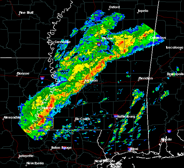 At 137 am cst, a severe thunderstorm was located over dolorosa, or 15 miles south of natchez, moving northeast at 55 mph (radar indicated). Hazards include 60 mph wind gusts and quarter size hail. Hail damage to vehicles is expected. expect wind damage to roofs, siding, and trees. this severe thunderstorm will be near, kingston around 145 am cst. garden city around 150 am cst. hamburg around 200 am cst. kirby around 205 am cst. bude around 210 am cst. new hope around 215 am cst. mccall creek around 220 am cst. other locations impacted by this severe thunderstorm include roxie and meadville. A tornado watch remains in effect until 500 am cst for south central and southwestern mississippi. At 137 am cst, a severe thunderstorm was located over dolorosa, or 15 miles south of natchez, moving northeast at 55 mph (radar indicated). Hazards include 60 mph wind gusts and quarter size hail. Hail damage to vehicles is expected. expect wind damage to roofs, siding, and trees. this severe thunderstorm will be near, kingston around 145 am cst. garden city around 150 am cst. hamburg around 200 am cst. kirby around 205 am cst. bude around 210 am cst. new hope around 215 am cst. mccall creek around 220 am cst. other locations impacted by this severe thunderstorm include roxie and meadville. A tornado watch remains in effect until 500 am cst for south central and southwestern mississippi.
|
| 7/14/2016 10:15 PM CDT |
 At 1013 pm cdt, severe thunderstorms were located along a line extending from near dentville to near brouillette, moving southeast at 40 mph (radar indicated). Hazards include 70 mph wind gusts. Expect considerable tree damage. damage is likely to mobile homes, roofs, and outbuildings. severe thunderstorms will be near, hazlehurst and glancy around 1020 pm cdt. martinsville around 1025 pm cdt. wesson around 1030 pm cdt. Other locations impacted by these severe thunderstorms include meadville, beauregard, ridgecrest and roxie. At 1013 pm cdt, severe thunderstorms were located along a line extending from near dentville to near brouillette, moving southeast at 40 mph (radar indicated). Hazards include 70 mph wind gusts. Expect considerable tree damage. damage is likely to mobile homes, roofs, and outbuildings. severe thunderstorms will be near, hazlehurst and glancy around 1020 pm cdt. martinsville around 1025 pm cdt. wesson around 1030 pm cdt. Other locations impacted by these severe thunderstorms include meadville, beauregard, ridgecrest and roxie.
|
| 4/30/2016 1:29 PM CDT |
 At 129 pm cdt, a severe thunderstorm was located over mccall creek, or 17 miles southwest of brookhaven, moving northeast at 30 mph (radar indicated). Hazards include 60 mph wind gusts. Expect damage to roofs. siding. and trees. this severe storm will be near, west lincoln around 145 pm cdt. vaughn around 150 pm cdt. loyd star around 200 pm cdt. Brookhaven around 205 pm cdt. At 129 pm cdt, a severe thunderstorm was located over mccall creek, or 17 miles southwest of brookhaven, moving northeast at 30 mph (radar indicated). Hazards include 60 mph wind gusts. Expect damage to roofs. siding. and trees. this severe storm will be near, west lincoln around 145 pm cdt. vaughn around 150 pm cdt. loyd star around 200 pm cdt. Brookhaven around 205 pm cdt.
|
| 4/30/2016 1:13 PM CDT |
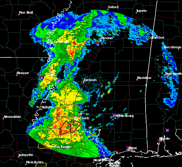 At 113 pm cdt, a severe thunderstorm was located near bude, or 17 miles north of liberty, moving northeast at 30 mph (radar indicated). Hazards include 60 mph wind gusts. Expect damage to roofs. siding. and trees. this severe thunderstorm will be near, little springs around 120 pm cdt. mccall creek around 135 pm cdt. west lincoln around 145 pm cdt. vaughn around 150 pm cdt. loyd star around 200 pm cdt. brookhaven around 210 pm cdt. Other locations impacted by this severe thunderstorm include meadville. At 113 pm cdt, a severe thunderstorm was located near bude, or 17 miles north of liberty, moving northeast at 30 mph (radar indicated). Hazards include 60 mph wind gusts. Expect damage to roofs. siding. and trees. this severe thunderstorm will be near, little springs around 120 pm cdt. mccall creek around 135 pm cdt. west lincoln around 145 pm cdt. vaughn around 150 pm cdt. loyd star around 200 pm cdt. brookhaven around 210 pm cdt. Other locations impacted by this severe thunderstorm include meadville.
|
| 4/1/2016 2:10 PM CDT |
 At 209 pm cdt, a severe thunderstorm was located over garden city, or 21 miles northwest of liberty, moving northeast at 40 mph (radar indicated). Hazards include 60 mph wind gusts and quarter size hail. Hail damage to vehicles is expected. expect wind damage to roofs, siding and trees. this severe thunderstorm will be near, kirby around 220 pm cdt. bude around 225 pm cdt. Other locations impacted by this severe thunderstorm include meadville and roxie. At 209 pm cdt, a severe thunderstorm was located over garden city, or 21 miles northwest of liberty, moving northeast at 40 mph (radar indicated). Hazards include 60 mph wind gusts and quarter size hail. Hail damage to vehicles is expected. expect wind damage to roofs, siding and trees. this severe thunderstorm will be near, kirby around 220 pm cdt. bude around 225 pm cdt. Other locations impacted by this severe thunderstorm include meadville and roxie.
|
| 3/30/2016 7:12 PM CDT |
 At 712 pm cdt, a severe thunderstorm was located over kirby, or 26 miles east of natchez, moving northeast at 25 mph (radar indicated). Hazards include golf ball size hail and 60 mph wind gusts. People and animals outdoors will be injured. expect hail damage to roofs, siding, windows and vehicles. expect wind damage to roofs, siding and trees. this severe storm will be near, new hope around 720 pm cdt. Other locations impacted by this severe thunderstorm include meadville. At 712 pm cdt, a severe thunderstorm was located over kirby, or 26 miles east of natchez, moving northeast at 25 mph (radar indicated). Hazards include golf ball size hail and 60 mph wind gusts. People and animals outdoors will be injured. expect hail damage to roofs, siding, windows and vehicles. expect wind damage to roofs, siding and trees. this severe storm will be near, new hope around 720 pm cdt. Other locations impacted by this severe thunderstorm include meadville.
|
| 3/30/2016 7:01 PM CDT |
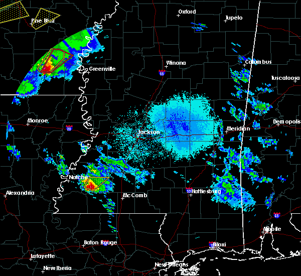 At 700 pm cdt, a severe thunderstorm was located over kirby, or 23 miles east of natchez, moving northeast at 35 mph (radar indicated). Hazards include ping pong ball size hail and 60 mph wind gusts. People and animals outdoors will be injured. expect hail damage to roofs, siding, windows and vehicles. expect wind damage to roofs, siding and trees. this severe storm will be near, new hope around 715 pm cdt. Other locations impacted by this severe thunderstorm include meadville and roxie. At 700 pm cdt, a severe thunderstorm was located over kirby, or 23 miles east of natchez, moving northeast at 35 mph (radar indicated). Hazards include ping pong ball size hail and 60 mph wind gusts. People and animals outdoors will be injured. expect hail damage to roofs, siding, windows and vehicles. expect wind damage to roofs, siding and trees. this severe storm will be near, new hope around 715 pm cdt. Other locations impacted by this severe thunderstorm include meadville and roxie.
|
| 3/30/2016 6:42 PM CDT |
 At 642 pm cdt, a severe thunderstorm was located over garden city, or 20 miles southeast of natchez, moving northeast at 35 mph (radar indicated). Hazards include ping pong ball size hail and 60 mph wind gusts. People and animals outdoors will be injured. expect hail damage to roofs, siding, windows and vehicles. expect wind damage to roofs, siding and trees. this severe storm will be near, kirby and hamburg around 700 pm cdt. new hope around 715 pm cdt. Other locations impacted by this severe thunderstorm include meadville and roxie. At 642 pm cdt, a severe thunderstorm was located over garden city, or 20 miles southeast of natchez, moving northeast at 35 mph (radar indicated). Hazards include ping pong ball size hail and 60 mph wind gusts. People and animals outdoors will be injured. expect hail damage to roofs, siding, windows and vehicles. expect wind damage to roofs, siding and trees. this severe storm will be near, kirby and hamburg around 700 pm cdt. new hope around 715 pm cdt. Other locations impacted by this severe thunderstorm include meadville and roxie.
|
| 3/30/2016 6:32 PM CDT |
 At 632 pm cdt, a severe thunderstorm was located over garden city, or 20 miles southeast of natchez, moving northeast at 35 mph (radar indicated). Hazards include golf ball size hail and 60 mph wind gusts. People and animals outdoors will be injured. expect hail damage to roofs, siding, windows and vehicles. expect wind damage to roofs, siding and trees. this severe thunderstorm will be near, garden city around 635 pm cdt. kirby and hamburg around 700 pm cdt. new hope around 715 pm cdt. Other locations impacted by this severe thunderstorm include meadville and roxie. At 632 pm cdt, a severe thunderstorm was located over garden city, or 20 miles southeast of natchez, moving northeast at 35 mph (radar indicated). Hazards include golf ball size hail and 60 mph wind gusts. People and animals outdoors will be injured. expect hail damage to roofs, siding, windows and vehicles. expect wind damage to roofs, siding and trees. this severe thunderstorm will be near, garden city around 635 pm cdt. kirby and hamburg around 700 pm cdt. new hope around 715 pm cdt. Other locations impacted by this severe thunderstorm include meadville and roxie.
|
| 3/17/2016 4:55 PM CDT |
 At 455 pm cdt, a severe thunderstorm was located near bogue chitto, or 9 miles south of brookhaven, moving east at 35 mph (radar indicated). Hazards include golf ball size hail and 60 mph wind gusts. People and animals outdoors will be injured. expect hail damage to roofs, siding, windows and vehicles. expect wind damage to roofs, siding and trees. this severe storm will be near, bogue chitto around 500 pm cdt. enterprise around 505 pm cdt. ruth and east lincoln around 515 pm cdt. Other locations impacted by this severe thunderstorm include meadville. At 455 pm cdt, a severe thunderstorm was located near bogue chitto, or 9 miles south of brookhaven, moving east at 35 mph (radar indicated). Hazards include golf ball size hail and 60 mph wind gusts. People and animals outdoors will be injured. expect hail damage to roofs, siding, windows and vehicles. expect wind damage to roofs, siding and trees. this severe storm will be near, bogue chitto around 500 pm cdt. enterprise around 505 pm cdt. ruth and east lincoln around 515 pm cdt. Other locations impacted by this severe thunderstorm include meadville.
|
| 3/17/2016 4:36 PM CDT |
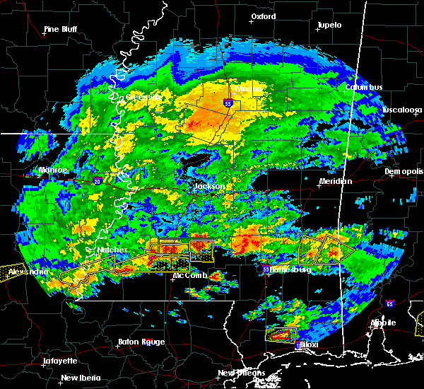 At 436 pm cdt, a severe thunderstorm was located over mccall creek, or 15 miles west of brookhaven, moving east at 35 mph (radar indicated). Hazards include tennis ball size hail and 60 mph wind gusts. People and animals outdoors will be injured. expect hail damage to roofs, siding, windows and vehicles. expect wind damage to roofs, siding and trees. this severe storm will be near, center point around 445 pm cdt. west lincoln around 450 pm cdt. bogue chitto around 500 pm cdt. enterprise around 505 pm cdt. ruth and east lincoln around 515 pm cdt. Other locations impacted by this severe thunderstorm include meadville. At 436 pm cdt, a severe thunderstorm was located over mccall creek, or 15 miles west of brookhaven, moving east at 35 mph (radar indicated). Hazards include tennis ball size hail and 60 mph wind gusts. People and animals outdoors will be injured. expect hail damage to roofs, siding, windows and vehicles. expect wind damage to roofs, siding and trees. this severe storm will be near, center point around 445 pm cdt. west lincoln around 450 pm cdt. bogue chitto around 500 pm cdt. enterprise around 505 pm cdt. ruth and east lincoln around 515 pm cdt. Other locations impacted by this severe thunderstorm include meadville.
|
| 3/17/2016 4:30 PM CDT | Quarter sized hail reported 6.8 miles WSW of Bude, MS |
| 3/17/2016 4:09 PM CDT |
 At 409 pm cdt, a severe thunderstorm was located near kirby, or 25 miles north of liberty, moving east at 50 mph (radar indicated). Hazards include golf ball size hail and 60 mph wind gusts. People and animals outdoors will be injured. expect hail damage to roofs, siding, windows and vehicles. expect wind damage to roofs, siding and trees. this severe thunderstorm will be near, new hope around 415 pm cdt. mccall creek around 425 pm cdt. west lincoln around 435 pm cdt. bogue chitto around 440 pm cdt. enterprise around 445 pm cdt. east lincoln around 455 pm cdt. Other locations impacted by this severe thunderstorm include roxie and meadville. At 409 pm cdt, a severe thunderstorm was located near kirby, or 25 miles north of liberty, moving east at 50 mph (radar indicated). Hazards include golf ball size hail and 60 mph wind gusts. People and animals outdoors will be injured. expect hail damage to roofs, siding, windows and vehicles. expect wind damage to roofs, siding and trees. this severe thunderstorm will be near, new hope around 415 pm cdt. mccall creek around 425 pm cdt. west lincoln around 435 pm cdt. bogue chitto around 440 pm cdt. enterprise around 445 pm cdt. east lincoln around 455 pm cdt. Other locations impacted by this severe thunderstorm include roxie and meadville.
|
| 3/17/2016 8:44 AM CDT | Ping Pong Ball sized hail reported 10.6 miles WNW of Bude, MS, quater to ping pong ball size |
| 3/17/2016 8:44 AM CDT | Baseball sized hail reported 10.3 miles W of Bude, MS |
| 3/17/2016 8:40 AM CDT |
 At 839 am cdt, a severe thunderstorm was located near bude, or 20 miles north of liberty, moving east at 25 mph (radar indicated). Hazards include golf ball size hail and 60 mph wind gusts. People and animals outdoors will be injured. expect hail damage to roofs, siding, windows and vehicles. expect wind damage to roofs, siding and trees. this severe storm will be near, little springs around 845 am cdt. mccall creek around 850 am cdt. center point around 900 am cdt. west lincoln and vaughn around 910 am cdt. bogue chitto around 920 am cdt. Brookhaven and enterprise around 930 am cdt. At 839 am cdt, a severe thunderstorm was located near bude, or 20 miles north of liberty, moving east at 25 mph (radar indicated). Hazards include golf ball size hail and 60 mph wind gusts. People and animals outdoors will be injured. expect hail damage to roofs, siding, windows and vehicles. expect wind damage to roofs, siding and trees. this severe storm will be near, little springs around 845 am cdt. mccall creek around 850 am cdt. center point around 900 am cdt. west lincoln and vaughn around 910 am cdt. bogue chitto around 920 am cdt. Brookhaven and enterprise around 930 am cdt.
|
| 3/17/2016 8:30 AM CDT |
 At 830 am cdt, a severe thunderstorm was located over bude, or 19 miles north of liberty, moving east at 30 mph (radar indicated). Hazards include ping pong ball size hail and 60 mph wind gusts. People and animals outdoors will be injured. expect hail damage to roofs, siding, windows and vehicles. expect wind damage to roofs, siding and trees. this severe thunderstorm will be near, little springs around 840 am cdt. mccall creek around 845 am cdt. center point around 850 am cdt. west lincoln and vaughn around 900 am cdt. bogue chitto around 910 am cdt. enterprise around 920 am cdt. Ruth around 925 am cdt. At 830 am cdt, a severe thunderstorm was located over bude, or 19 miles north of liberty, moving east at 30 mph (radar indicated). Hazards include ping pong ball size hail and 60 mph wind gusts. People and animals outdoors will be injured. expect hail damage to roofs, siding, windows and vehicles. expect wind damage to roofs, siding and trees. this severe thunderstorm will be near, little springs around 840 am cdt. mccall creek around 845 am cdt. center point around 850 am cdt. west lincoln and vaughn around 900 am cdt. bogue chitto around 910 am cdt. enterprise around 920 am cdt. Ruth around 925 am cdt.
|
| 3/10/2016 10:24 AM CST |
 At 1024 am cst, severe thunderstorms were located along a line extending from near port gibson to kirby, moving east at 45 mph (radar indicated). Hazards include 60 mph wind gusts. Expect damage to roofs. siding and trees. these severe storms will be near, port gibson around 1030 am cst. new hope and pattison around 1035 am cst. hermanville, peyton and union church around 1040 am cst. mccall creek around 1045 am cst. caseyville around 1050 am cst. vaughn and carpenter around 1055 am cst. loyd star and dentville around 1100 am cst. Other locations impacted by these severe thunderstorms include meadville. At 1024 am cst, severe thunderstorms were located along a line extending from near port gibson to kirby, moving east at 45 mph (radar indicated). Hazards include 60 mph wind gusts. Expect damage to roofs. siding and trees. these severe storms will be near, port gibson around 1030 am cst. new hope and pattison around 1035 am cst. hermanville, peyton and union church around 1040 am cst. mccall creek around 1045 am cst. caseyville around 1050 am cst. vaughn and carpenter around 1055 am cst. loyd star and dentville around 1100 am cst. Other locations impacted by these severe thunderstorms include meadville.
|
| 3/10/2016 10:06 AM CST |
 At 1005 am cst, severe thunderstorms were located along a line extending from near alcorn to 6 miles north of garden city, moving east at 40 mph (radar indicated). Hazards include 60 mph wind gusts. Expect damage to roofs. siding and trees. severe thunderstorms will be near, alcorn around 1010 am cst. lorman around 1015 am cst. kirby and red lick around 1020 am cst. port gibson around 1025 am cst. bude, pattison and new hope around 1030 am cst. peyton around 1035 am cst. hermanville around 1040 am cst. mccall creek around 1045 am cst. Other locations impacted by these severe thunderstorms include roxie and meadville. At 1005 am cst, severe thunderstorms were located along a line extending from near alcorn to 6 miles north of garden city, moving east at 40 mph (radar indicated). Hazards include 60 mph wind gusts. Expect damage to roofs. siding and trees. severe thunderstorms will be near, alcorn around 1010 am cst. lorman around 1015 am cst. kirby and red lick around 1020 am cst. port gibson around 1025 am cst. bude, pattison and new hope around 1030 am cst. peyton around 1035 am cst. hermanville around 1040 am cst. mccall creek around 1045 am cst. Other locations impacted by these severe thunderstorms include roxie and meadville.
|
| 2/15/2016 11:37 AM CST | Tree down on cupit roa in jefferson county MS, 14.5 miles SSW of Bude, MS |
| 2/2/2016 5:42 PM CST |
 At 541 pm cst, a severe thunderstorm was located 7 miles east of garden city, or 18 miles northwest of liberty, moving northeast at 55 mph (radar indicated). Hazards include 60 mph wind gusts and penny size hail. Expect damage to roofs. siding and trees. this severe thunderstorm will be near, bude and kirby around 550 pm cst. new hope around 600 pm cst. other locations impacted by this severe thunderstorm include meadville. A tornado watch remains in effect until 700 pm cst for southwestern mississippi. At 541 pm cst, a severe thunderstorm was located 7 miles east of garden city, or 18 miles northwest of liberty, moving northeast at 55 mph (radar indicated). Hazards include 60 mph wind gusts and penny size hail. Expect damage to roofs. siding and trees. this severe thunderstorm will be near, bude and kirby around 550 pm cst. new hope around 600 pm cst. other locations impacted by this severe thunderstorm include meadville. A tornado watch remains in effect until 700 pm cst for southwestern mississippi.
|
| 1/21/2016 3:21 PM CST | At 321 pm cst, a severe thunderstorm capable of producing a tornado was located over kingston, or 12 miles southeast of natchez, moving northeast at 30 mph (radar indicated rotation). Hazards include tornado. Flying debris will be dangerous to those caught without shelter. mobile homes will be damaged or destroyed. damage to roofs, windows and vehicles will occur. tree damage is likely. this dangerous storm will be near, garden city around 330 pm cst. cranfield around 335 pm cst. hamburg around 350 pm cst. kirby around 355 pm cst. mcnair around 400 pm cst. new hope around 410 pm cst. Other locations impacted by this tornadic thunderstorm include meadville and roxie. |
| 12/28/2015 3:03 AM CST |
 At 303 am cst, a severe thunderstorm capable of producing a tornado was located near new hope, or 26 miles west of brookhaven, moving northeast at 45 mph (radar indicated rotation). Hazards include tornado. Flying debris will be dangerous to those caught without shelter. mobile homes will be damaged or destroyed. damage to roofs, windows and vehicles will occur. tree damage is likely. this dangerous storm will be near, union church, mcbride and blue hill around 315 am cst. Other locations impacted by this tornadic thunderstorm include meadville. At 303 am cst, a severe thunderstorm capable of producing a tornado was located near new hope, or 26 miles west of brookhaven, moving northeast at 45 mph (radar indicated rotation). Hazards include tornado. Flying debris will be dangerous to those caught without shelter. mobile homes will be damaged or destroyed. damage to roofs, windows and vehicles will occur. tree damage is likely. this dangerous storm will be near, union church, mcbride and blue hill around 315 am cst. Other locations impacted by this tornadic thunderstorm include meadville.
|
| 12/28/2015 2:50 AM CST |
 At 249 am cst, a severe thunderstorm capable of producing a tornado was located near fayette, or 19 miles northeast of natchez, moving north at 55 mph (radar indicated rotation). Hazards include tornado. Flying debris will be dangerous to those caught without shelter. mobile homes will be damaged or destroyed. damage to roofs, windows and vehicles will occur. tree damage is likely. this dangerous storm will be near, lorman and red lick around 300 am cst. Other locations impacted by this tornadic thunderstorm include roxie and meadville. At 249 am cst, a severe thunderstorm capable of producing a tornado was located near fayette, or 19 miles northeast of natchez, moving north at 55 mph (radar indicated rotation). Hazards include tornado. Flying debris will be dangerous to those caught without shelter. mobile homes will be damaged or destroyed. damage to roofs, windows and vehicles will occur. tree damage is likely. this dangerous storm will be near, lorman and red lick around 300 am cst. Other locations impacted by this tornadic thunderstorm include roxie and meadville.
|
| 12/28/2015 2:35 AM CST |
 At 234 am cst, a severe thunderstorm capable of producing a tornado was located over cranfield, or 12 miles east of natchez, moving northeast at 60 mph (radar indicated rotation). Hazards include tornado. Flying debris will be dangerous to those caught without shelter. mobile homes will be damaged or destroyed. damage to roofs, windows and vehicles will occur. tree damage is likely. this dangerous storm will be near, hamburg around 240 am cst. stampley and mcnair around 245 am cst. fayette around 250 am cst. red lick around 255 am cst. lorman around 300 am cst. Other locations impacted by this tornadic thunderstorm include roxie and meadville. At 234 am cst, a severe thunderstorm capable of producing a tornado was located over cranfield, or 12 miles east of natchez, moving northeast at 60 mph (radar indicated rotation). Hazards include tornado. Flying debris will be dangerous to those caught without shelter. mobile homes will be damaged or destroyed. damage to roofs, windows and vehicles will occur. tree damage is likely. this dangerous storm will be near, hamburg around 240 am cst. stampley and mcnair around 245 am cst. fayette around 250 am cst. red lick around 255 am cst. lorman around 300 am cst. Other locations impacted by this tornadic thunderstorm include roxie and meadville.
|
| 12/28/2015 2:21 AM CST |
 At 220 am cst, a severe thunderstorm capable of producing a tornado was located near kingston, or 16 miles southeast of natchez, moving northeast at 55 mph (radar indicated rotation). Hazards include tornado. Flying debris will be dangerous to those caught without shelter. mobile homes will be damaged or destroyed. damage to roofs, windows and vehicles will occur. tree damage is likely. this dangerous storm will be near, kingston around 225 am cst. garden city around 230 am cst. cranfield around 235 am cst. hamburg and stampley around 245 am cst. mcnair around 250 am cst. fayette around 255 am cst. red lick, lorman and blue hill around 300 am cst. Other locations impacted by this tornadic thunderstorm include roxie and meadville. At 220 am cst, a severe thunderstorm capable of producing a tornado was located near kingston, or 16 miles southeast of natchez, moving northeast at 55 mph (radar indicated rotation). Hazards include tornado. Flying debris will be dangerous to those caught without shelter. mobile homes will be damaged or destroyed. damage to roofs, windows and vehicles will occur. tree damage is likely. this dangerous storm will be near, kingston around 225 am cst. garden city around 230 am cst. cranfield around 235 am cst. hamburg and stampley around 245 am cst. mcnair around 250 am cst. fayette around 255 am cst. red lick, lorman and blue hill around 300 am cst. Other locations impacted by this tornadic thunderstorm include roxie and meadville.
|
| 11/17/2015 10:03 PM CST |
 At 1003 pm cst, a severe thunderstorm capable of producing a tornado was located 9 miles southwest of little springs, or 10 miles north of liberty, moving northeast at 55 mph (radar indicated rotation). Hazards include tornado. Flying debris will be dangerous to those caught without shelter. mobile homes will be damaged or destroyed. damage to roofs, windows and vehicles will occur. tree damage is likely. this dangerous storm will be near, bude around 1010 pm cst. little springs around 1015 pm cst. mccall creek and center point around 1020 pm cst. west lincoln around 1025 pm cst. vaughn and caseyville around 1030 pm cst. Brookhaven and loyd star around 1035 pm cst. At 1003 pm cst, a severe thunderstorm capable of producing a tornado was located 9 miles southwest of little springs, or 10 miles north of liberty, moving northeast at 55 mph (radar indicated rotation). Hazards include tornado. Flying debris will be dangerous to those caught without shelter. mobile homes will be damaged or destroyed. damage to roofs, windows and vehicles will occur. tree damage is likely. this dangerous storm will be near, bude around 1010 pm cst. little springs around 1015 pm cst. mccall creek and center point around 1020 pm cst. west lincoln around 1025 pm cst. vaughn and caseyville around 1030 pm cst. Brookhaven and loyd star around 1035 pm cst.
|
| 10/31/2015 1:39 PM CDT |
 The tornado warning for eastern franklin county will expire at 145 pm cdt, the storm which prompted the warning has weakened below severe limits, and no longer appears capable of producing a tornado. therefore the warning will be allowed to expire. however gusty winds are still possible with this thunderstorm. a tornado watch remains in effect until 700 pm cdt for southwestern mississippi. remember, a severe thunderstorm warning still remains in effect for lincoln and eastern franklin counties. The tornado warning for eastern franklin county will expire at 145 pm cdt, the storm which prompted the warning has weakened below severe limits, and no longer appears capable of producing a tornado. therefore the warning will be allowed to expire. however gusty winds are still possible with this thunderstorm. a tornado watch remains in effect until 700 pm cdt for southwestern mississippi. remember, a severe thunderstorm warning still remains in effect for lincoln and eastern franklin counties.
|
| 10/31/2015 1:38 PM CDT |
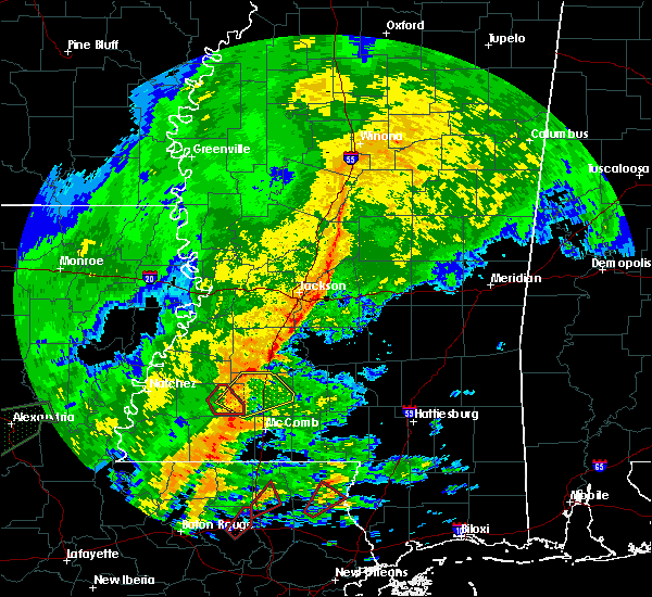 At 137 pm cdt, a severe thunderstorm was located near little springs, or 17 miles southwest of brookhaven, moving northeast at 40 mph (radar indicated). Hazards include 60 mph wind gusts. Expect damage to roofs. Siding and trees. At 137 pm cdt, a severe thunderstorm was located near little springs, or 17 miles southwest of brookhaven, moving northeast at 40 mph (radar indicated). Hazards include 60 mph wind gusts. Expect damage to roofs. Siding and trees.
|
| 10/31/2015 1:33 PM CDT |
 At 132 pm cdt, a severe thunderstorm capable of producing a tornado was located near mccall creek, or 19 miles west of brookhaven, moving northeast at 40 mph (radar indicated rotation). Hazards include tornado. Flying debris will be dangerous to those caught without shelter. mobile homes will be damaged or destroyed. damage to roofs, windows and vehicles will occur. tree damage is likely. This tornadic thunderstorm will remain over mainly rural areas of eastern franklin county, including the following locations, meadville. At 132 pm cdt, a severe thunderstorm capable of producing a tornado was located near mccall creek, or 19 miles west of brookhaven, moving northeast at 40 mph (radar indicated rotation). Hazards include tornado. Flying debris will be dangerous to those caught without shelter. mobile homes will be damaged or destroyed. damage to roofs, windows and vehicles will occur. tree damage is likely. This tornadic thunderstorm will remain over mainly rural areas of eastern franklin county, including the following locations, meadville.
|
| 10/31/2015 1:20 PM CDT |
 At 120 pm cdt, a severe thunderstorm capable of producing a tornado was located over bude, or 21 miles north of liberty, moving northeast at 50 mph (radar indicated rotation). Hazards include tornado. Flying debris will be dangerous to those caught without shelter. mobile homes will be damaged or destroyed. damage to roofs, windows and vehicles will occur. tree damage is likely. this dangerous storm will be near, new hope around 125 pm cdt. mccall creek around 135 pm cdt. Other locations impacted by this tornadic thunderstorm include meadville. At 120 pm cdt, a severe thunderstorm capable of producing a tornado was located over bude, or 21 miles north of liberty, moving northeast at 50 mph (radar indicated rotation). Hazards include tornado. Flying debris will be dangerous to those caught without shelter. mobile homes will be damaged or destroyed. damage to roofs, windows and vehicles will occur. tree damage is likely. this dangerous storm will be near, new hope around 125 pm cdt. mccall creek around 135 pm cdt. Other locations impacted by this tornadic thunderstorm include meadville.
|
| 10/31/2015 1:09 PM CDT |
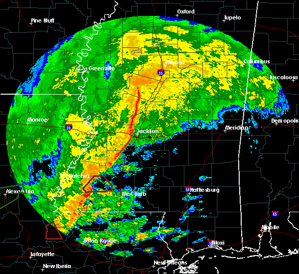 At 108 pm cdt, a severe thunderstorm capable of producing a tornado was located near garden city, or 20 miles northwest of liberty, moving northeast at 50 mph (radar indicated rotation). Hazards include tornado. Flying debris will be dangerous to those caught without shelter. mobile homes will be damaged or destroyed. damage to roofs, windows and vehicles will occur. tree damage is likely. this dangerous storm will be near, kirby around 115 pm cdt. bude around 120 pm cdt. new hope around 130 pm cdt. mccall creek around 135 pm cdt. Other locations impacted by this tornadic thunderstorm include meadville. At 108 pm cdt, a severe thunderstorm capable of producing a tornado was located near garden city, or 20 miles northwest of liberty, moving northeast at 50 mph (radar indicated rotation). Hazards include tornado. Flying debris will be dangerous to those caught without shelter. mobile homes will be damaged or destroyed. damage to roofs, windows and vehicles will occur. tree damage is likely. this dangerous storm will be near, kirby around 115 pm cdt. bude around 120 pm cdt. new hope around 130 pm cdt. mccall creek around 135 pm cdt. Other locations impacted by this tornadic thunderstorm include meadville.
|
| 10/31/2015 12:56 PM CDT |
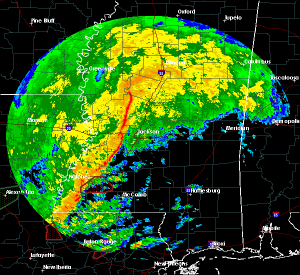 At 1255 pm cdt, a severe thunderstorm capable of producing a tornado was located near garden city, or 20 miles southeast of natchez, moving northeast at 50 mph (radar indicated rotation). Hazards include tornado. Flying debris will be dangerous to those caught without shelter. mobile homes will be damaged or destroyed. damage to roofs, windows and vehicles will occur. tree damage is likely. this dangerous storm will be near, garden city around 100 pm cdt. kirby around 115 pm cdt. bude around 120 pm cdt. new hope around 130 pm cdt. mccall creek around 135 pm cdt. Other locations impacted by this tornadic thunderstorm include meadville. At 1255 pm cdt, a severe thunderstorm capable of producing a tornado was located near garden city, or 20 miles southeast of natchez, moving northeast at 50 mph (radar indicated rotation). Hazards include tornado. Flying debris will be dangerous to those caught without shelter. mobile homes will be damaged or destroyed. damage to roofs, windows and vehicles will occur. tree damage is likely. this dangerous storm will be near, garden city around 100 pm cdt. kirby around 115 pm cdt. bude around 120 pm cdt. new hope around 130 pm cdt. mccall creek around 135 pm cdt. Other locations impacted by this tornadic thunderstorm include meadville.
|
| 7/29/2015 3:30 PM CDT | Trees down and a fence blown over in franklin county MS, 6.1 miles SSW of Bude, MS |
| 5/11/2015 12:24 PM CDT | At 1223 pm cdt, a severe thunderstorm was located near kirby, or 21 miles north of liberty, moving northeast at 30 mph (radar indicated). Hazards include 60 mph wind gusts and quarter size hail. Hail damage to vehicles is expected. expect wind damage to roofs, siding and trees. this severe storm will be near, bude around 1235 pm cdt. other locations impacted by this severe thunderstorm include meadville. 1. 00in. |
| 5/11/2015 12:07 PM CDT | At 1206 pm cdt, a severe thunderstorm was located over garden city, or 21 miles southeast of natchez, moving northeast at 30 mph (radar indicated). Hazards include 60 mph wind gusts and quarter size hail. Hail damage to vehicles is expected. expect wind damage to roofs, siding and trees. this severe thunderstorm will be near, kirby around 1225 pm cdt. bude around 1235 pm cdt. other locations impacted by this severe thunderstorm include roxie and meadville. 1. 00in. |
| 7/14/2013 4:06 PM CDT | Tree down along hwy 28 in jefferson county MS, 15.3 miles SSW of Bude, MS |
| 6/28/2013 11:15 PM CDT | Few trees blown down just east of bude in franklin county MS, 1.9 miles W of Bude, MS |
| 3/18/2013 8:15 PM CDT | Golf Ball sized hail reported 9.5 miles NNW of Bude, MS, sheriffs deputy near franklin county line and highway 567 reported golfball size hail. |
| 10/18/2012 2:09 AM CDT | Power lines down in franklin county MS, 9.5 miles WSW of Bude, MS |
| 4/3/2012 8:15 PM CDT | Trees were downed on beach st in bude and yap rd south of bud in franklin county MS, 2.4 miles N of Bude, MS |
| 4/3/2012 8:10 PM CDT | Quarter sized hail reported 12 miles NW of Bude, MS, high winds were also occurring at the time |
| 1/1/0001 12:00 AM | Tree down along highway 98 south of bude in franklin county MS, 3 miles N of Bude, MS |
| 1/1/0001 12:00 AM | Trees down in the city...at least one large tree was blown dow in franklin county MS, 0.3 miles NNW of Bude, MS |
| 1/1/0001 12:00 AM | Large limbs were reported dow in franklin county MS, 9.5 miles WSW of Bude, MS |
Hail Maps for Bude, MS
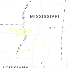
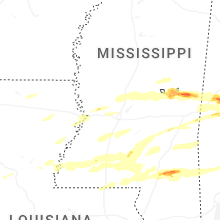
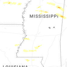
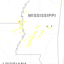

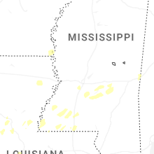


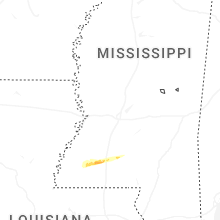
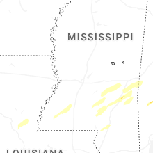
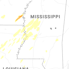


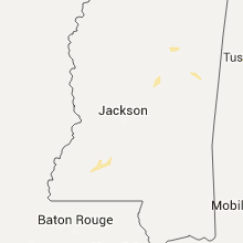
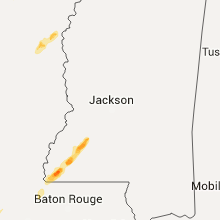


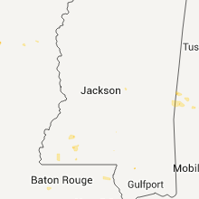


Connect with Interactive Hail Maps