

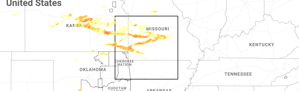
Hail Map for Buffalo, MO
The Buffalo, MO area has had 21 reports of on-the-ground hail by trained spotters, and has been under severe weather warnings 31 times during the past 12 months. Doppler radar has detected hail at or near Buffalo, MO on 88 occasions, including 8 occasions during the past year.
| Name: | Buffalo, MO |
| Where Located: | 32.1 miles NNE of Springfield, MO |
| Map: | Google Map for Buffalo, MO |
| Population: | 3084 |
| Housing Units: | 1518 |
| More Info: | Search Google for Buffalo, MO |
5
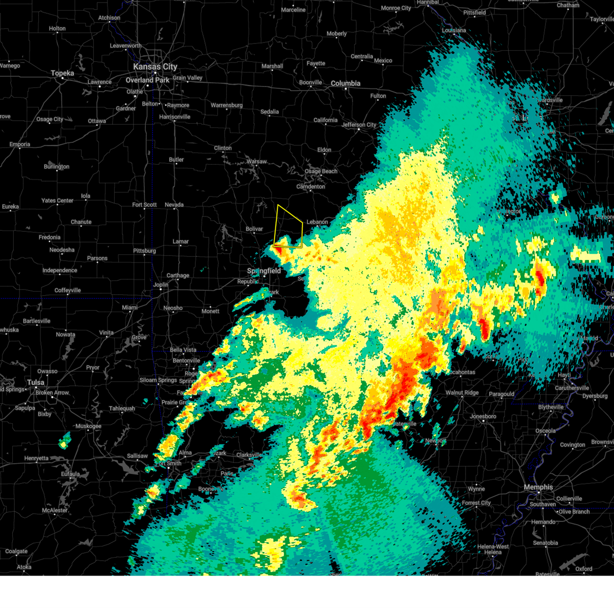
The Top Recent Hail Date for Buffalo, MO is Sunday, April 26, 2026 (2nd out of 88)
Hail and Wind Damage Spotted near Buffalo, MO
| Date / Time | Report Details |
|---|---|
| 6/17/2026 9:26 PM CDT |
 The storm which prompted the warning has moved out of the area. therefore, the warning will be allowed to expire. a tornado watch remains in effect until 1000 pm cdt for southwestern missouri. to report severe weather, contact your nearest law enforcement agency. they will relay your report to the national weather service springfield. The storm which prompted the warning has moved out of the area. therefore, the warning will be allowed to expire. a tornado watch remains in effect until 1000 pm cdt for southwestern missouri. to report severe weather, contact your nearest law enforcement agency. they will relay your report to the national weather service springfield.
|
| 6/17/2026 9:10 PM CDT |
 At 910 pm cdt, a severe thunderstorm was located near buffalo, moving east at 35 mph (radar indicated). Hazards include 60 mph wind gusts and nickel size hail. Expect damage to roofs, siding, and trees. Locations impacted include, bennett spring state park, buffalo, windyville, long lane, and foose. At 910 pm cdt, a severe thunderstorm was located near buffalo, moving east at 35 mph (radar indicated). Hazards include 60 mph wind gusts and nickel size hail. Expect damage to roofs, siding, and trees. Locations impacted include, bennett spring state park, buffalo, windyville, long lane, and foose.
|
| 6/17/2026 8:49 PM CDT |
 Svrsgf the national weather service in springfield has issued a * severe thunderstorm warning for, dallas county in southwestern missouri, * until 930 pm cdt. * at 848 pm cdt, a severe thunderstorm was located 8 miles northwest of buffalo, moving east at 35 mph (radar indicated). Hazards include 60 mph wind gusts and nickel size hail. expect damage to roofs, siding, and trees Svrsgf the national weather service in springfield has issued a * severe thunderstorm warning for, dallas county in southwestern missouri, * until 930 pm cdt. * at 848 pm cdt, a severe thunderstorm was located 8 miles northwest of buffalo, moving east at 35 mph (radar indicated). Hazards include 60 mph wind gusts and nickel size hail. expect damage to roofs, siding, and trees
|
| 5/18/2026 12:27 PM CDT |
 At 1227 pm cdt, a severe thunderstorm was located 8 miles west of buffalo, moving northeast at 40 mph (radar indicated). Hazards include 60 mph wind gusts and penny size hail. Expect damage to roofs, siding, and trees. Locations impacted include, buffalo, polk, halfway, louisburg, windyville, goodson, and pumpkin center. At 1227 pm cdt, a severe thunderstorm was located 8 miles west of buffalo, moving northeast at 40 mph (radar indicated). Hazards include 60 mph wind gusts and penny size hail. Expect damage to roofs, siding, and trees. Locations impacted include, buffalo, polk, halfway, louisburg, windyville, goodson, and pumpkin center.
|
| 5/18/2026 12:11 PM CDT |
 At 1211 pm cdt, a severe thunderstorm was located near bolivar, moving northeast at 25 mph (radar indicated). Hazards include 60 mph wind gusts and penny size hail. Expect damage to roofs, siding, and trees. Locations impacted include, bolivar, buffalo, polk, halfway, louisburg, windyville, goodson, and pumpkin center. At 1211 pm cdt, a severe thunderstorm was located near bolivar, moving northeast at 25 mph (radar indicated). Hazards include 60 mph wind gusts and penny size hail. Expect damage to roofs, siding, and trees. Locations impacted include, bolivar, buffalo, polk, halfway, louisburg, windyville, goodson, and pumpkin center.
|
| 5/18/2026 11:56 AM CDT |
 Svrsgf the national weather service in springfield has issued a * severe thunderstorm warning for, central dallas county in southwestern missouri, southeastern polk county in southwestern missouri, * until 1245 pm cdt. * at 1155 am cdt, a severe thunderstorm was located near bolivar, moving northeast at 35 mph (radar indicated). Hazards include 60 mph wind gusts and quarter size hail. Hail damage to vehicles is expected. Expect wind damage to roofs, siding, and trees. Svrsgf the national weather service in springfield has issued a * severe thunderstorm warning for, central dallas county in southwestern missouri, southeastern polk county in southwestern missouri, * until 1245 pm cdt. * at 1155 am cdt, a severe thunderstorm was located near bolivar, moving northeast at 35 mph (radar indicated). Hazards include 60 mph wind gusts and quarter size hail. Hail damage to vehicles is expected. Expect wind damage to roofs, siding, and trees.
|
| 4/28/2026 12:10 PM CDT | Half Dollar sized hail reported 11.3 miles NNE of Buffalo, MO, report from mping half dollar 1.25 in. |
| 4/28/2026 12:09 PM CDT | Quarter sized hail reported 14.4 miles NNE of Buffalo, MO |
| 4/28/2026 11:58 AM CDT |
 Svrsgf the national weather service in springfield has issued a * severe thunderstorm warning for, northwestern webster county in southwestern missouri, dallas county in southwestern missouri, southwestern laclede county in southwestern missouri, southeastern polk county in southwestern missouri, northeastern greene county in southwestern missouri, * until 1230 pm cdt. * at 1157 am cdt, a severe thunderstorm was located near fair grove, or 8 miles northwest of strafford, moving northeast at 65 mph. this is a destructive storm for areas from ebenezer through buffalo toward bennett springs park (radar indicated). Hazards include softball size hail. People and animals outdoors will be severely injured. expect shattered windows, extensive damage to roofs, siding, and vehicles. this severe thunderstorm will be near, fair grove around 1200 pm cdt. buffalo around 1215 pm cdt. other locations impacted by this severe thunderstorm include phillipsburg, halfway, louisburg, elkland, bassville, brighton, march, pumpkin center, olive, and foose. This includes interstate 44 between mile markers 88 and 95, and between mile markers 97 and 118, and near mile marker 120. Svrsgf the national weather service in springfield has issued a * severe thunderstorm warning for, northwestern webster county in southwestern missouri, dallas county in southwestern missouri, southwestern laclede county in southwestern missouri, southeastern polk county in southwestern missouri, northeastern greene county in southwestern missouri, * until 1230 pm cdt. * at 1157 am cdt, a severe thunderstorm was located near fair grove, or 8 miles northwest of strafford, moving northeast at 65 mph. this is a destructive storm for areas from ebenezer through buffalo toward bennett springs park (radar indicated). Hazards include softball size hail. People and animals outdoors will be severely injured. expect shattered windows, extensive damage to roofs, siding, and vehicles. this severe thunderstorm will be near, fair grove around 1200 pm cdt. buffalo around 1215 pm cdt. other locations impacted by this severe thunderstorm include phillipsburg, halfway, louisburg, elkland, bassville, brighton, march, pumpkin center, olive, and foose. This includes interstate 44 between mile markers 88 and 95, and between mile markers 97 and 118, and near mile marker 120.
|
| 4/27/2026 5:37 PM CDT |
 The storm which prompted the warning has weakened below severe limits, and has exited the warned area. therefore, the warning will be allowed to expire. however, small hail and gusty winds are still possible with this thunderstorm. a tornado watch remains in effect until 900 pm cdt for southwestern missouri. The storm which prompted the warning has weakened below severe limits, and has exited the warned area. therefore, the warning will be allowed to expire. however, small hail and gusty winds are still possible with this thunderstorm. a tornado watch remains in effect until 900 pm cdt for southwestern missouri.
|
| 4/27/2026 5:08 PM CDT |
 At 508 pm cdt, a severe thunderstorm was located 7 miles southeast of buffalo, moving northeast at 40 mph (radar indicated). Hazards include 60 mph wind gusts and half dollar size hail. Hail damage to vehicles is expected. expect wind damage to roofs, siding, and trees. Locations impacted include, bennett spring state park, buffalo, pleasant hope, halfway, olive, windyville, foose, march, long lane, and charity. At 508 pm cdt, a severe thunderstorm was located 7 miles southeast of buffalo, moving northeast at 40 mph (radar indicated). Hazards include 60 mph wind gusts and half dollar size hail. Hail damage to vehicles is expected. expect wind damage to roofs, siding, and trees. Locations impacted include, bennett spring state park, buffalo, pleasant hope, halfway, olive, windyville, foose, march, long lane, and charity.
|
| 4/27/2026 4:53 PM CDT |
 Svrsgf the national weather service in springfield has issued a * severe thunderstorm warning for, dallas county in southwestern missouri, southeastern polk county in southwestern missouri, * until 545 pm cdt. * at 453 pm cdt, a severe thunderstorm was located near pleasant hope, or 10 miles southwest of buffalo, moving northeast at 35 mph (radar indicated). Hazards include 60 mph wind gusts and half dollar size hail. Hail damage to vehicles is expected. Expect wind damage to roofs, siding, and trees. Svrsgf the national weather service in springfield has issued a * severe thunderstorm warning for, dallas county in southwestern missouri, southeastern polk county in southwestern missouri, * until 545 pm cdt. * at 453 pm cdt, a severe thunderstorm was located near pleasant hope, or 10 miles southwest of buffalo, moving northeast at 35 mph (radar indicated). Hazards include 60 mph wind gusts and half dollar size hail. Hail damage to vehicles is expected. Expect wind damage to roofs, siding, and trees.
|
| 4/26/2026 9:32 PM CDT |
 Torsgf the national weather service in springfield has issued a * tornado warning for, central dallas county in southwestern missouri, west central laclede county in southwestern missouri, * until 1015 pm cdt. * at 932 pm cdt, a severe thunderstorm capable of producing a tornado was located over buffalo, moving northeast at 25 mph (radar indicated rotation). Hazards include tornado and hail up to two inches in diameter. Flying debris will be dangerous to those caught without shelter. mobile homes will be damaged or destroyed. damage to roofs, windows, and vehicles will occur. Tree damage is likely. Torsgf the national weather service in springfield has issued a * tornado warning for, central dallas county in southwestern missouri, west central laclede county in southwestern missouri, * until 1015 pm cdt. * at 932 pm cdt, a severe thunderstorm capable of producing a tornado was located over buffalo, moving northeast at 25 mph (radar indicated rotation). Hazards include tornado and hail up to two inches in diameter. Flying debris will be dangerous to those caught without shelter. mobile homes will be damaged or destroyed. damage to roofs, windows, and vehicles will occur. Tree damage is likely.
|
| 4/26/2026 9:20 PM CDT |
 At 919 pm cdt, a severe thunderstorm capable of producing a tornado was located near buffalo, moving east at 25 mph (radar indicated rotation). Hazards include tornado and golf ball size hail. Flying debris will be dangerous to those caught without shelter. mobile homes will be damaged or destroyed. damage to roofs, windows, and vehicles will occur. tree damage is likely. Locations impacted include, buffalo, march, charity, and foose. At 919 pm cdt, a severe thunderstorm capable of producing a tornado was located near buffalo, moving east at 25 mph (radar indicated rotation). Hazards include tornado and golf ball size hail. Flying debris will be dangerous to those caught without shelter. mobile homes will be damaged or destroyed. damage to roofs, windows, and vehicles will occur. tree damage is likely. Locations impacted include, buffalo, march, charity, and foose.
|
| 4/26/2026 9:20 PM CDT |
 the tornado warning has been cancelled and is no longer in effect the tornado warning has been cancelled and is no longer in effect
|
| 4/26/2026 9:06 PM CDT |
 Svrsgf the national weather service in springfield has issued a * severe thunderstorm warning for, dallas county in southwestern missouri, northeastern polk county in southwestern missouri, * until 945 pm cdt. * at 906 pm cdt, a severe thunderstorm was located near buffalo, moving east at 20 mph (radar indicated). Hazards include tennis ball size hail and 60 mph wind gusts. People and animals outdoors will be injured. expect hail damage to roofs, siding, windows, and vehicles. Expect wind damage to roofs, siding, and trees. Svrsgf the national weather service in springfield has issued a * severe thunderstorm warning for, dallas county in southwestern missouri, northeastern polk county in southwestern missouri, * until 945 pm cdt. * at 906 pm cdt, a severe thunderstorm was located near buffalo, moving east at 20 mph (radar indicated). Hazards include tennis ball size hail and 60 mph wind gusts. People and animals outdoors will be injured. expect hail damage to roofs, siding, windows, and vehicles. Expect wind damage to roofs, siding, and trees.
|
| 4/26/2026 8:54 PM CDT |
 Torsgf the national weather service in springfield has issued a * tornado warning for, northwestern webster county in southwestern missouri, southern dallas county in southwestern missouri, southeastern polk county in southwestern missouri, * until 945 pm cdt. * at 854 pm cdt, a severe thunderstorm capable of producing a tornado was located near pleasant hope, or 11 miles southwest of buffalo, moving east at 25 mph (radar indicated rotation). Hazards include tornado and golf ball size hail. Flying debris will be dangerous to those caught without shelter. mobile homes will be damaged or destroyed. damage to roofs, windows, and vehicles will occur. Tree damage is likely. Torsgf the national weather service in springfield has issued a * tornado warning for, northwestern webster county in southwestern missouri, southern dallas county in southwestern missouri, southeastern polk county in southwestern missouri, * until 945 pm cdt. * at 854 pm cdt, a severe thunderstorm capable of producing a tornado was located near pleasant hope, or 11 miles southwest of buffalo, moving east at 25 mph (radar indicated rotation). Hazards include tornado and golf ball size hail. Flying debris will be dangerous to those caught without shelter. mobile homes will be damaged or destroyed. damage to roofs, windows, and vehicles will occur. Tree damage is likely.
|
| 4/26/2026 8:28 PM CDT |
 Svrsgf the national weather service in springfield has issued a * severe thunderstorm warning for, southwestern dallas county in southwestern missouri, polk county in southwestern missouri, * until 915 pm cdt. * at 828 pm cdt, a severe thunderstorm was located near morrisville, or near bolivar, moving east at 25 mph (radar indicated). Hazards include golf ball size hail and 60 mph wind gusts. People and animals outdoors will be injured. expect hail damage to roofs, siding, windows, and vehicles. Expect wind damage to roofs, siding, and trees. Svrsgf the national weather service in springfield has issued a * severe thunderstorm warning for, southwestern dallas county in southwestern missouri, polk county in southwestern missouri, * until 915 pm cdt. * at 828 pm cdt, a severe thunderstorm was located near morrisville, or near bolivar, moving east at 25 mph (radar indicated). Hazards include golf ball size hail and 60 mph wind gusts. People and animals outdoors will be injured. expect hail damage to roofs, siding, windows, and vehicles. Expect wind damage to roofs, siding, and trees.
|
| 4/15/2026 7:39 PM CDT |
 Svrsgf the national weather service in springfield has issued a * severe thunderstorm warning for, northern dallas county in southwestern missouri, southeastern miller county in central missouri, northern laclede county in southwestern missouri, northwestern pulaski county in central missouri, southeastern camden county in central missouri, * until 830 pm cdt. * at 739 pm cdt, severe thunderstorms were located along a line extending from near camdenton to 11 miles northwest of lebanon to near buffalo, moving northeast at 45 mph (radar indicated). Hazards include 60 mph wind gusts and penny size hail. expect damage to roofs, siding, and trees Svrsgf the national weather service in springfield has issued a * severe thunderstorm warning for, northern dallas county in southwestern missouri, southeastern miller county in central missouri, northern laclede county in southwestern missouri, northwestern pulaski county in central missouri, southeastern camden county in central missouri, * until 830 pm cdt. * at 739 pm cdt, severe thunderstorms were located along a line extending from near camdenton to 11 miles northwest of lebanon to near buffalo, moving northeast at 45 mph (radar indicated). Hazards include 60 mph wind gusts and penny size hail. expect damage to roofs, siding, and trees
|
| 4/15/2026 7:00 PM CDT |
 Svrsgf the national weather service in springfield has issued a * severe thunderstorm warning for, dallas county in southwestern missouri, northwestern laclede county in southwestern missouri, northeastern polk county in southwestern missouri, southwestern camden county in central missouri, * until 745 pm cdt. * at 659 pm cdt, a severe thunderstorm was located near buffalo, moving east at 35 mph (radar indicated). Hazards include 60 mph wind gusts and nickel size hail. expect damage to roofs, siding, and trees Svrsgf the national weather service in springfield has issued a * severe thunderstorm warning for, dallas county in southwestern missouri, northwestern laclede county in southwestern missouri, northeastern polk county in southwestern missouri, southwestern camden county in central missouri, * until 745 pm cdt. * at 659 pm cdt, a severe thunderstorm was located near buffalo, moving east at 35 mph (radar indicated). Hazards include 60 mph wind gusts and nickel size hail. expect damage to roofs, siding, and trees
|
| 4/15/2026 6:28 PM CDT |
 Svrsgf the national weather service in springfield has issued a * severe thunderstorm warning for, southeastern hickory county in central missouri, northwestern dallas county in southwestern missouri, polk county in southwestern missouri, * until 715 pm cdt. * at 628 pm cdt, a severe thunderstorm was located near fair play, or near bolivar, moving northeast at 55 mph (radar indicated). Hazards include 60 mph wind gusts and half dollar size hail. Hail damage to vehicles is expected. Expect wind damage to roofs, siding, and trees. Svrsgf the national weather service in springfield has issued a * severe thunderstorm warning for, southeastern hickory county in central missouri, northwestern dallas county in southwestern missouri, polk county in southwestern missouri, * until 715 pm cdt. * at 628 pm cdt, a severe thunderstorm was located near fair play, or near bolivar, moving northeast at 55 mph (radar indicated). Hazards include 60 mph wind gusts and half dollar size hail. Hail damage to vehicles is expected. Expect wind damage to roofs, siding, and trees.
|
| 3/15/2026 1:20 PM CDT |
 Svrsgf the national weather service in springfield has issued a * severe thunderstorm warning for, northern dallas county in southwestern missouri, northwestern laclede county in southwestern missouri, southwestern camden county in central missouri, * until 200 pm cdt. * at 120 pm cdt, a severe thunderstorm was located 8 miles northeast of buffalo, moving northeast at 45 mph (radar indicated). Hazards include 60 mph wind gusts and penny size hail. expect damage to roofs, siding, and trees Svrsgf the national weather service in springfield has issued a * severe thunderstorm warning for, northern dallas county in southwestern missouri, northwestern laclede county in southwestern missouri, southwestern camden county in central missouri, * until 200 pm cdt. * at 120 pm cdt, a severe thunderstorm was located 8 miles northeast of buffalo, moving northeast at 45 mph (radar indicated). Hazards include 60 mph wind gusts and penny size hail. expect damage to roofs, siding, and trees
|
| 3/11/2026 1:34 AM CDT |
 Svrsgf the national weather service in springfield has issued a * severe thunderstorm warning for, northern dallas county in southwestern missouri, southern miller county in central missouri, northwestern laclede county in southwestern missouri, northwestern pulaski county in central missouri, eastern camden county in central missouri, * until 215 am cdt. * at 134 am cdt, severe thunderstorms were located along a line extending from near lake ozark to camdenton to 12 miles east of urbana to buffalo, moving east at 45 mph (radar indicated). Hazards include 60 mph wind gusts. expect damage to roofs, siding, and trees Svrsgf the national weather service in springfield has issued a * severe thunderstorm warning for, northern dallas county in southwestern missouri, southern miller county in central missouri, northwestern laclede county in southwestern missouri, northwestern pulaski county in central missouri, eastern camden county in central missouri, * until 215 am cdt. * at 134 am cdt, severe thunderstorms were located along a line extending from near lake ozark to camdenton to 12 miles east of urbana to buffalo, moving east at 45 mph (radar indicated). Hazards include 60 mph wind gusts. expect damage to roofs, siding, and trees
|
| 3/6/2026 11:48 PM CST |
 At 1148 pm cst, severe thunderstorms were located along a line extending from 8 miles east of buffalo to 7 miles east of fair grove to near highlandville to near galena, moving northeast at 60 mph (radar indicated). Hazards include 60 mph wind gusts and penny size hail. Expect damage to roofs, siding, and trees. locations impacted include, springfield, nixa, ozark, republic, lebanon, bennett spring state park, marshfield, battlefield, willard, buffalo, rogersville, strafford, clever, seymour, sparta, morgan, crane, fair grove, billings, and highlandville. This includes interstate 44 between mile markers 61 and 143. At 1148 pm cst, severe thunderstorms were located along a line extending from 8 miles east of buffalo to 7 miles east of fair grove to near highlandville to near galena, moving northeast at 60 mph (radar indicated). Hazards include 60 mph wind gusts and penny size hail. Expect damage to roofs, siding, and trees. locations impacted include, springfield, nixa, ozark, republic, lebanon, bennett spring state park, marshfield, battlefield, willard, buffalo, rogersville, strafford, clever, seymour, sparta, morgan, crane, fair grove, billings, and highlandville. This includes interstate 44 between mile markers 61 and 143.
|
| 3/6/2026 11:48 PM CST |
 the severe thunderstorm warning has been cancelled and is no longer in effect the severe thunderstorm warning has been cancelled and is no longer in effect
|
| 3/6/2026 11:25 PM CST |
 Svrsgf the national weather service in springfield has issued a * severe thunderstorm warning for, webster county in southwestern missouri, dallas county in southwestern missouri, northwestern wright county in southwestern missouri, northwestern douglas county in southwestern missouri, christian county in southwestern missouri, laclede county in southwestern missouri, southern polk county in southwestern missouri, northern stone county in southwestern missouri, northern barry county in southwestern missouri, lawrence county in southwestern missouri, greene county in southwestern missouri, southeastern dade county in southwestern missouri, * until 1230 am cst. * at 1125 pm cst, severe thunderstorms were located along a line extending from 7 miles north of pleasant hope to near willard to near crane to near cassville, moving northeast at 60 mph (radar indicated). Hazards include 70 mph wind gusts. Expect considerable tree damage. Damage is likely to mobile homes, roofs, and outbuildings. Svrsgf the national weather service in springfield has issued a * severe thunderstorm warning for, webster county in southwestern missouri, dallas county in southwestern missouri, northwestern wright county in southwestern missouri, northwestern douglas county in southwestern missouri, christian county in southwestern missouri, laclede county in southwestern missouri, southern polk county in southwestern missouri, northern stone county in southwestern missouri, northern barry county in southwestern missouri, lawrence county in southwestern missouri, greene county in southwestern missouri, southeastern dade county in southwestern missouri, * until 1230 am cst. * at 1125 pm cst, severe thunderstorms were located along a line extending from 7 miles north of pleasant hope to near willard to near crane to near cassville, moving northeast at 60 mph (radar indicated). Hazards include 70 mph wind gusts. Expect considerable tree damage. Damage is likely to mobile homes, roofs, and outbuildings.
|
| 3/6/2026 9:54 PM CST |
 The storms which prompted the warning have moved out of the area. therefore, the warning will be allowed to expire. a tornado watch remains in effect until 100 am cst for central, southwestern and west central missouri. The storms which prompted the warning have moved out of the area. therefore, the warning will be allowed to expire. a tornado watch remains in effect until 100 am cst for central, southwestern and west central missouri.
|
| 3/6/2026 9:42 PM CST |
 Svrsgf the national weather service in springfield has issued a * severe thunderstorm warning for, northeastern hickory county in central missouri, western maries county in central missouri, central dallas county in southwestern missouri, miller county in central missouri, northwestern laclede county in southwestern missouri, northern pulaski county in central missouri, camden county in central missouri, * until 1030 pm cst. * at 942 pm cst, severe thunderstorms were located along a line extending from 8 miles east of hermitage to 8 miles southeast of urbana to 7 miles southwest of buffalo, moving northeast at 75 mph (radar indicated). Hazards include 60 mph wind gusts. expect damage to roofs, siding, and trees Svrsgf the national weather service in springfield has issued a * severe thunderstorm warning for, northeastern hickory county in central missouri, western maries county in central missouri, central dallas county in southwestern missouri, miller county in central missouri, northwestern laclede county in southwestern missouri, northern pulaski county in central missouri, camden county in central missouri, * until 1030 pm cst. * at 942 pm cst, severe thunderstorms were located along a line extending from 8 miles east of hermitage to 8 miles southeast of urbana to 7 miles southwest of buffalo, moving northeast at 75 mph (radar indicated). Hazards include 60 mph wind gusts. expect damage to roofs, siding, and trees
|
| 3/6/2026 9:28 PM CST |
 At 928 pm cst, severe thunderstorms were located along a line extending from 8 miles east of osceola to 6 miles southwest of urbana to near walnut grove, moving northeast at 60 mph (radar indicated). Hazards include 60 mph wind gusts and penny size hail. Expect damage to roofs, siding, and trees. Locations impacted include, bolivar, pomme de terre lake, stockton lake, truman lake, pomme de terre state park, buffalo, pittsburg, polk, hermitage, weaubleau, urbana, morrisville, wheatland, preston, cross timbers, halfway, flemington, louisburg, aldrich, and gerster. At 928 pm cst, severe thunderstorms were located along a line extending from 8 miles east of osceola to 6 miles southwest of urbana to near walnut grove, moving northeast at 60 mph (radar indicated). Hazards include 60 mph wind gusts and penny size hail. Expect damage to roofs, siding, and trees. Locations impacted include, bolivar, pomme de terre lake, stockton lake, truman lake, pomme de terre state park, buffalo, pittsburg, polk, hermitage, weaubleau, urbana, morrisville, wheatland, preston, cross timbers, halfway, flemington, louisburg, aldrich, and gerster.
|
| 3/6/2026 9:28 PM CST |
 the severe thunderstorm warning has been cancelled and is no longer in effect the severe thunderstorm warning has been cancelled and is no longer in effect
|
| 3/6/2026 9:09 PM CST |
 Svrsgf the national weather service in springfield has issued a * severe thunderstorm warning for, hickory county in central missouri, western dallas county in southwestern missouri, eastern cedar county in southwestern missouri, southern benton county in central missouri, polk county in southwestern missouri, northern greene county in southwestern missouri, southeastern st. clair county in west central missouri, eastern dade county in southwestern missouri, * until 1000 pm cst. * at 908 pm cst, severe thunderstorms were located along a line extending from 10 miles southwest of osceola to near fair play to 6 miles south of greenfield, moving northeast at 55 mph (radar indicated). Hazards include 60 mph wind gusts and penny size hail. expect damage to roofs, siding, and trees Svrsgf the national weather service in springfield has issued a * severe thunderstorm warning for, hickory county in central missouri, western dallas county in southwestern missouri, eastern cedar county in southwestern missouri, southern benton county in central missouri, polk county in southwestern missouri, northern greene county in southwestern missouri, southeastern st. clair county in west central missouri, eastern dade county in southwestern missouri, * until 1000 pm cst. * at 908 pm cst, severe thunderstorms were located along a line extending from 10 miles southwest of osceola to near fair play to 6 miles south of greenfield, moving northeast at 55 mph (radar indicated). Hazards include 60 mph wind gusts and penny size hail. expect damage to roofs, siding, and trees
|
| 3/4/2026 8:42 AM CST |
 The storm which prompted the warning has weakened below severe limits, and no longer poses an immediate threat to life or property. therefore, the warning will be allowed to expire. however, small hail is still possible with this thunderstorm. The storm which prompted the warning has weakened below severe limits, and no longer poses an immediate threat to life or property. therefore, the warning will be allowed to expire. however, small hail is still possible with this thunderstorm.
|
| 3/4/2026 8:22 AM CST |
 Svrsgf the national weather service in springfield has issued a * severe thunderstorm warning for, southwestern dallas county in southwestern missouri, southeastern polk county in southwestern missouri, north central greene county in southwestern missouri, * until 845 am cst. * at 822 am cst, a severe thunderstorm was located near morrisville, or 12 miles south of bolivar, moving northeast at 35 mph (radar indicated). Hazards include half dollar size hail. damage to vehicles is expected Svrsgf the national weather service in springfield has issued a * severe thunderstorm warning for, southwestern dallas county in southwestern missouri, southeastern polk county in southwestern missouri, north central greene county in southwestern missouri, * until 845 am cst. * at 822 am cst, a severe thunderstorm was located near morrisville, or 12 miles south of bolivar, moving northeast at 35 mph (radar indicated). Hazards include half dollar size hail. damage to vehicles is expected
|
| 9/23/2025 8:30 PM CDT | Tree down at 545 red top r in dallas county MO, 11.3 miles NNE of Buffalo, MO |
| 8/10/2025 7:32 PM CDT | Quarter sized hail reported 14.6 miles NNE of Buffalo, MO |
| 6/3/2025 5:10 PM CDT |
 The storm which prompted the warning has weakened below severe limits, and no longer poses an immediate threat to life or property. therefore, the warning will be allowed to expire. to report severe weather, contact your nearest law enforcement agency. they will relay your report to the national weather service springfield. The storm which prompted the warning has weakened below severe limits, and no longer poses an immediate threat to life or property. therefore, the warning will be allowed to expire. to report severe weather, contact your nearest law enforcement agency. they will relay your report to the national weather service springfield.
|
| 6/3/2025 5:02 PM CDT |
 the severe thunderstorm warning has been cancelled and is no longer in effect the severe thunderstorm warning has been cancelled and is no longer in effect
|
| 6/3/2025 5:02 PM CDT |
 At 502 pm cdt, a severe thunderstorm was located near buffalo, moving north at 35 mph (radar indicated). Hazards include 60 mph wind gusts and quarter size hail. Hail damage to vehicles is expected. expect wind damage to roofs, siding, and trees. Locations impacted include, buffalo, louisburg, and pumpkin center. At 502 pm cdt, a severe thunderstorm was located near buffalo, moving north at 35 mph (radar indicated). Hazards include 60 mph wind gusts and quarter size hail. Hail damage to vehicles is expected. expect wind damage to roofs, siding, and trees. Locations impacted include, buffalo, louisburg, and pumpkin center.
|
| 6/3/2025 4:55 PM CDT |
 At 455 pm cdt, a severe thunderstorm was located near buffalo, moving northeast at 30 mph (radar indicated). Hazards include 60 mph wind gusts and quarter size hail. Hail damage to vehicles is expected. expect wind damage to roofs, siding, and trees. Locations impacted include, buffalo, halfway, louisburg, and pumpkin center. At 455 pm cdt, a severe thunderstorm was located near buffalo, moving northeast at 30 mph (radar indicated). Hazards include 60 mph wind gusts and quarter size hail. Hail damage to vehicles is expected. expect wind damage to roofs, siding, and trees. Locations impacted include, buffalo, halfway, louisburg, and pumpkin center.
|
| 6/3/2025 4:40 PM CDT |
 At 439 pm cdt, a severe thunderstorm was located 7 miles west of buffalo, moving north at 35 mph (radar indicated). Hazards include 60 mph wind gusts and quarter size hail. Hail damage to vehicles is expected. expect wind damage to roofs, siding, and trees. Locations impacted include, buffalo, halfway, louisburg, goodson, and pumpkin center. At 439 pm cdt, a severe thunderstorm was located 7 miles west of buffalo, moving north at 35 mph (radar indicated). Hazards include 60 mph wind gusts and quarter size hail. Hail damage to vehicles is expected. expect wind damage to roofs, siding, and trees. Locations impacted include, buffalo, halfway, louisburg, goodson, and pumpkin center.
|
| 6/3/2025 4:26 PM CDT |
 Svrsgf the national weather service in springfield has issued a * severe thunderstorm warning for, northwestern dallas county in southwestern missouri, eastern polk county in southwestern missouri, * until 515 pm cdt. * at 425 pm cdt, a severe thunderstorm was located near pleasant hope, or 10 miles southeast of bolivar, moving north at 35 mph (radar indicated). Hazards include 60 mph wind gusts and quarter size hail. Hail damage to vehicles is expected. Expect wind damage to roofs, siding, and trees. Svrsgf the national weather service in springfield has issued a * severe thunderstorm warning for, northwestern dallas county in southwestern missouri, eastern polk county in southwestern missouri, * until 515 pm cdt. * at 425 pm cdt, a severe thunderstorm was located near pleasant hope, or 10 miles southeast of bolivar, moving north at 35 mph (radar indicated). Hazards include 60 mph wind gusts and quarter size hail. Hail damage to vehicles is expected. Expect wind damage to roofs, siding, and trees.
|
| 5/19/2025 7:35 PM CDT |
 Svrsgf the national weather service in springfield has issued a * severe thunderstorm warning for, dallas county in southwestern missouri, western laclede county in southwestern missouri, camden county in central missouri, * until 815 pm cdt. * at 735 pm cdt, severe thunderstorms were located along a line extending from near urbana to 7 miles northeast of fair grove, moving northeast at 50 mph (radar indicated). Hazards include 60 mph wind gusts. expect damage to roofs, siding, and trees Svrsgf the national weather service in springfield has issued a * severe thunderstorm warning for, dallas county in southwestern missouri, western laclede county in southwestern missouri, camden county in central missouri, * until 815 pm cdt. * at 735 pm cdt, severe thunderstorms were located along a line extending from near urbana to 7 miles northeast of fair grove, moving northeast at 50 mph (radar indicated). Hazards include 60 mph wind gusts. expect damage to roofs, siding, and trees
|
| 4/29/2025 10:04 AM CDT |
 At 1003 am cdt, severe thunderstorms were located along a line extending from buffalo to near niangua to near seymour to 7 miles east of taneyville, moving northeast at 60 mph (emergency management). Hazards include 70 mph wind gusts and quarter size hail. Hail damage to vehicles is expected. expect considerable tree damage. wind damage is also likely to mobile homes, roofs, and outbuildings. locations impacted include, dawson, competition, windyville, elkland, mansfield, manes, brushyknob, march, lynchburg, grovespring, sleeper, falcon, stoutland, norwood, morgan, rome, rader, squires, long lane, and seymour. This includes interstate 44 between mile markers 91 and 144. At 1003 am cdt, severe thunderstorms were located along a line extending from buffalo to near niangua to near seymour to 7 miles east of taneyville, moving northeast at 60 mph (emergency management). Hazards include 70 mph wind gusts and quarter size hail. Hail damage to vehicles is expected. expect considerable tree damage. wind damage is also likely to mobile homes, roofs, and outbuildings. locations impacted include, dawson, competition, windyville, elkland, mansfield, manes, brushyknob, march, lynchburg, grovespring, sleeper, falcon, stoutland, norwood, morgan, rome, rader, squires, long lane, and seymour. This includes interstate 44 between mile markers 91 and 144.
|
| 4/29/2025 10:04 AM CDT |
 the severe thunderstorm warning has been cancelled and is no longer in effect the severe thunderstorm warning has been cancelled and is no longer in effect
|
| 4/29/2025 9:40 AM CDT |
 Svrsgf the national weather service in springfield has issued a * severe thunderstorm warning for, webster county in southwestern missouri, southern dallas county in southwestern missouri, wright county in southwestern missouri, western douglas county in southwestern missouri, eastern christian county in southwestern missouri, southeastern polk county in southwestern missouri, laclede county in southwestern missouri, eastern greene county in southwestern missouri, * until 1045 am cdt. * at 940 am cdt, severe thunderstorms were located along a line extending from near morrisville to near strafford to near rogersville to near hollister, moving east at 55 mph. these are destructive storms for strafford and marshfield (emergency management). Hazards include 80 mph wind gusts and quarter size hail. Flying debris will be dangerous to those caught without shelter. mobile homes will be heavily damaged. expect considerable damage to roofs, windows, and vehicles. Extensive tree damage and power outages are likely. Svrsgf the national weather service in springfield has issued a * severe thunderstorm warning for, webster county in southwestern missouri, southern dallas county in southwestern missouri, wright county in southwestern missouri, western douglas county in southwestern missouri, eastern christian county in southwestern missouri, southeastern polk county in southwestern missouri, laclede county in southwestern missouri, eastern greene county in southwestern missouri, * until 1045 am cdt. * at 940 am cdt, severe thunderstorms were located along a line extending from near morrisville to near strafford to near rogersville to near hollister, moving east at 55 mph. these are destructive storms for strafford and marshfield (emergency management). Hazards include 80 mph wind gusts and quarter size hail. Flying debris will be dangerous to those caught without shelter. mobile homes will be heavily damaged. expect considerable damage to roofs, windows, and vehicles. Extensive tree damage and power outages are likely.
|
| 4/20/2025 4:41 PM CDT |
 the severe thunderstorm warning has been cancelled and is no longer in effect the severe thunderstorm warning has been cancelled and is no longer in effect
|
| 4/20/2025 4:41 PM CDT |
 At 440 pm cdt, severe thunderstorms were located along a line extending from near bunceton to near village of four seasons to 10 miles west of ava, moving northeast at 55 mph (radar indicated). Hazards include 70 mph wind gusts and quarter size hail. Hail damage to vehicles is expected. expect considerable tree damage. wind damage is also likely to mobile homes, roofs, and outbuildings. locations impacted include, competition, osage beach, florence, tunas, pumpkin center, sleeper, freedom, tuscumbia, old linn creek, barnumton, linn creek, syracuse, decaturville, lake of the ozarks state park, plad, long lane, brumley, lake of the ozarks, bagnell, and eldridge. This includes interstate 44 between mile markers 110 and 144. At 440 pm cdt, severe thunderstorms were located along a line extending from near bunceton to near village of four seasons to 10 miles west of ava, moving northeast at 55 mph (radar indicated). Hazards include 70 mph wind gusts and quarter size hail. Hail damage to vehicles is expected. expect considerable tree damage. wind damage is also likely to mobile homes, roofs, and outbuildings. locations impacted include, competition, osage beach, florence, tunas, pumpkin center, sleeper, freedom, tuscumbia, old linn creek, barnumton, linn creek, syracuse, decaturville, lake of the ozarks state park, plad, long lane, brumley, lake of the ozarks, bagnell, and eldridge. This includes interstate 44 between mile markers 110 and 144.
|
| 4/20/2025 4:28 PM CDT |
 the tornado warning has been cancelled and is no longer in effect the tornado warning has been cancelled and is no longer in effect
|
| 4/20/2025 4:15 PM CDT | Mesonet station fw9620 pumpkin center measured a 58mph wind gus in dallas county MO, 7.2 miles SSW of Buffalo, MO |
| 4/20/2025 4:13 PM CDT |
 At 412 pm cdt, a severe thunderstorm capable of producing a tornado was located over buffalo, moving northeast at 60 mph (radar indicated rotation). Hazards include tornado. Flying debris will be dangerous to those caught without shelter. mobile homes will be damaged or destroyed. damage to roofs, windows, and vehicles will occur. tree damage is likely. Locations impacted include, windyville, foose, louisburg, plad, long lane, pumpkin center, buffalo, and bennett spring state park. At 412 pm cdt, a severe thunderstorm capable of producing a tornado was located over buffalo, moving northeast at 60 mph (radar indicated rotation). Hazards include tornado. Flying debris will be dangerous to those caught without shelter. mobile homes will be damaged or destroyed. damage to roofs, windows, and vehicles will occur. tree damage is likely. Locations impacted include, windyville, foose, louisburg, plad, long lane, pumpkin center, buffalo, and bennett spring state park.
|
| 4/20/2025 4:13 PM CDT |
 the tornado warning has been cancelled and is no longer in effect the tornado warning has been cancelled and is no longer in effect
|
| 4/20/2025 4:08 PM CDT |
 Torsgf the national weather service in springfield has issued a * tornado warning for, dallas county in southwestern missouri, southeastern polk county in southwestern missouri, * until 445 pm cdt. * at 407 pm cdt, a severe thunderstorm capable of producing a tornado was located near buffalo, moving northeast at 60 mph (radar indicated rotation). Hazards include tornado. Flying debris will be dangerous to those caught without shelter. mobile homes will be damaged or destroyed. damage to roofs, windows, and vehicles will occur. Tree damage is likely. Torsgf the national weather service in springfield has issued a * tornado warning for, dallas county in southwestern missouri, southeastern polk county in southwestern missouri, * until 445 pm cdt. * at 407 pm cdt, a severe thunderstorm capable of producing a tornado was located near buffalo, moving northeast at 60 mph (radar indicated rotation). Hazards include tornado. Flying debris will be dangerous to those caught without shelter. mobile homes will be damaged or destroyed. damage to roofs, windows, and vehicles will occur. Tree damage is likely.
|
| 4/20/2025 3:58 PM CDT |
 Svrsgf the national weather service in springfield has issued a * severe thunderstorm warning for, eastern hickory county in central missouri, dallas county in southwestern missouri, benton county in central missouri, miller county in central missouri, eastern polk county in southwestern missouri, laclede county in southwestern missouri, camden county in central missouri, morgan county in central missouri, * until 500 pm cdt. * at 354 pm cdt, severe thunderstorms were located along a line extending from near lincoln to 10 miles northwest of buffalo to 6 miles northwest of roberson hollow, moving northeast at 55 mph (radar indicated). Hazards include 70 mph wind gusts and quarter size hail. Hail damage to vehicles is expected. expect considerable tree damage. Wind damage is also likely to mobile homes, roofs, and outbuildings. Svrsgf the national weather service in springfield has issued a * severe thunderstorm warning for, eastern hickory county in central missouri, dallas county in southwestern missouri, benton county in central missouri, miller county in central missouri, eastern polk county in southwestern missouri, laclede county in southwestern missouri, camden county in central missouri, morgan county in central missouri, * until 500 pm cdt. * at 354 pm cdt, severe thunderstorms were located along a line extending from near lincoln to 10 miles northwest of buffalo to 6 miles northwest of roberson hollow, moving northeast at 55 mph (radar indicated). Hazards include 70 mph wind gusts and quarter size hail. Hail damage to vehicles is expected. expect considerable tree damage. Wind damage is also likely to mobile homes, roofs, and outbuildings.
|
| 4/20/2025 5:28 AM CDT |
 The storms which prompted the warning have moved out of the area. therefore, the warning will be allowed to expire. however, gusty winds and heavy rain are still possible with these thunderstorms. a severe thunderstorm watch remains in effect until 800 am cdt for southwestern missouri. The storms which prompted the warning have moved out of the area. therefore, the warning will be allowed to expire. however, gusty winds and heavy rain are still possible with these thunderstorms. a severe thunderstorm watch remains in effect until 800 am cdt for southwestern missouri.
|
| 4/20/2025 5:16 AM CDT |
 At 516 am cdt, severe thunderstorms were located along a line extending from 7 miles southeast of urbana to near buffalo to near fair grove, moving northeast at 40 mph (radar indicated). Hazards include 60 mph wind gusts. Expect damage to roofs, siding, and trees. Locations impacted include, windyville, leadmine, march, tunas, pumpkin center, urbana, olive, foose, louisburg, plad, long lane, charity, and buffalo. At 516 am cdt, severe thunderstorms were located along a line extending from 7 miles southeast of urbana to near buffalo to near fair grove, moving northeast at 40 mph (radar indicated). Hazards include 60 mph wind gusts. Expect damage to roofs, siding, and trees. Locations impacted include, windyville, leadmine, march, tunas, pumpkin center, urbana, olive, foose, louisburg, plad, long lane, charity, and buffalo.
|
| 4/20/2025 5:16 AM CDT |
 the severe thunderstorm warning has been cancelled and is no longer in effect the severe thunderstorm warning has been cancelled and is no longer in effect
|
| 4/20/2025 5:03 AM CDT |
 At 503 am cdt, severe thunderstorms were located along a line extending from 11 miles south of urbana to near buffalo to near strafford, moving northeast at 50 mph (radar indicated). Hazards include 60 mph wind gusts. Expect damage to roofs, siding, and trees. locations impacted include, windyville, elkland, glidewell, ebenezer, bassville, leadmine, march, tunas, fair grove, pumpkin center, urbana, olive, halfway, foose, pleasant hope, polk, louisburg, goodson, plad, and long lane. This includes interstate 44 between mile markers 102 and 107. At 503 am cdt, severe thunderstorms were located along a line extending from 11 miles south of urbana to near buffalo to near strafford, moving northeast at 50 mph (radar indicated). Hazards include 60 mph wind gusts. Expect damage to roofs, siding, and trees. locations impacted include, windyville, elkland, glidewell, ebenezer, bassville, leadmine, march, tunas, fair grove, pumpkin center, urbana, olive, halfway, foose, pleasant hope, polk, louisburg, goodson, plad, and long lane. This includes interstate 44 between mile markers 102 and 107.
|
| 4/20/2025 5:03 AM CDT |
 the severe thunderstorm warning has been cancelled and is no longer in effect the severe thunderstorm warning has been cancelled and is no longer in effect
|
| 4/20/2025 4:32 AM CDT |
 Svrsgf the national weather service in springfield has issued a * severe thunderstorm warning for, western webster county in southwestern missouri, dallas county in southwestern missouri, northwestern christian county in southwestern missouri, southeastern polk county in southwestern missouri, greene county in southwestern missouri, * until 530 am cdt. * at 432 am cdt, severe thunderstorms were located along a line extending from near morrisville to near willard to near crane, moving northeast at 40 mph (radar indicated). Hazards include 60 mph wind gusts. expect damage to roofs, siding, and trees Svrsgf the national weather service in springfield has issued a * severe thunderstorm warning for, western webster county in southwestern missouri, dallas county in southwestern missouri, northwestern christian county in southwestern missouri, southeastern polk county in southwestern missouri, greene county in southwestern missouri, * until 530 am cdt. * at 432 am cdt, severe thunderstorms were located along a line extending from near morrisville to near willard to near crane, moving northeast at 40 mph (radar indicated). Hazards include 60 mph wind gusts. expect damage to roofs, siding, and trees
|
| 4/4/2025 8:01 PM CDT |
 At 800 pm cdt, a severe thunderstorm was located 7 miles south of buffalo, moving northeast at 60 mph (radar indicated). Hazards include 60 mph wind gusts and quarter size hail. Hail damage to vehicles is expected. expect wind damage to roofs, siding, and trees. locations impacted include, windyville, bennett spring state park, foose, louisburg, march, plad, long lane, pumpkin center, charity, buffalo, and conway. This includes interstate 44 between mile markers 110 and 111. At 800 pm cdt, a severe thunderstorm was located 7 miles south of buffalo, moving northeast at 60 mph (radar indicated). Hazards include 60 mph wind gusts and quarter size hail. Hail damage to vehicles is expected. expect wind damage to roofs, siding, and trees. locations impacted include, windyville, bennett spring state park, foose, louisburg, march, plad, long lane, pumpkin center, charity, buffalo, and conway. This includes interstate 44 between mile markers 110 and 111.
|
| 4/4/2025 8:01 PM CDT |
 the severe thunderstorm warning has been cancelled and is no longer in effect the severe thunderstorm warning has been cancelled and is no longer in effect
|
| 4/4/2025 7:54 PM CDT | Half Dollar sized hail reported 11.2 miles NNE of Buffalo, MO, larger than quarter sized hail at high praire church on redtop rd near the buffalo and fair grove line. lasted about 1 min. |
| 4/4/2025 7:52 PM CDT |
 At 752 pm cdt, a severe thunderstorm was located near fair grove, or 12 miles south of buffalo, moving northeast at 70 mph (radar indicated). Hazards include ping pong ball size hail and 60 mph wind gusts. People and animals outdoors will be injured. expect hail damage to roofs, siding, windows, and vehicles. expect wind damage to roofs, siding, and trees. this severe thunderstorm will remain over mainly rural areas of northwestern webster, dallas, eastern polk, southwestern laclede and northeastern greene counties, including the following locations, windyville, elkland, bassville, march, pumpkin center, olive, bennett spring state park, halfway, foose, and louisburg. This includes interstate 44 between mile markers 106 and 121. At 752 pm cdt, a severe thunderstorm was located near fair grove, or 12 miles south of buffalo, moving northeast at 70 mph (radar indicated). Hazards include ping pong ball size hail and 60 mph wind gusts. People and animals outdoors will be injured. expect hail damage to roofs, siding, windows, and vehicles. expect wind damage to roofs, siding, and trees. this severe thunderstorm will remain over mainly rural areas of northwestern webster, dallas, eastern polk, southwestern laclede and northeastern greene counties, including the following locations, windyville, elkland, bassville, march, pumpkin center, olive, bennett spring state park, halfway, foose, and louisburg. This includes interstate 44 between mile markers 106 and 121.
|
| 4/4/2025 7:42 PM CDT |
 At 740 pm cdt, a severe thunderstorm was located near willard, or 8 miles north of springfield, moving northeast at 70 mph (trained weather spotters. at 724 pm, fire department reported ping pong ball sized hail west of republic). Hazards include ping pong ball size hail and 60 mph wind gusts. People and animals outdoors will be injured. expect hail damage to roofs, siding, windows, and vehicles. expect wind damage to roofs, siding, and trees. locations impacted include, windyville, elkland, glidewell, march, fair grove, pumpkin center, halfway, goodson, plad, long lane, buffalo, sacville, ebenezer, bassville, brighton, conway, willard, urbana, olive, and bennett spring state park. This includes interstate 44 between mile markers 74 and 84, and between mile markers 106 and 121. At 740 pm cdt, a severe thunderstorm was located near willard, or 8 miles north of springfield, moving northeast at 70 mph (trained weather spotters. at 724 pm, fire department reported ping pong ball sized hail west of republic). Hazards include ping pong ball size hail and 60 mph wind gusts. People and animals outdoors will be injured. expect hail damage to roofs, siding, windows, and vehicles. expect wind damage to roofs, siding, and trees. locations impacted include, windyville, elkland, glidewell, march, fair grove, pumpkin center, halfway, goodson, plad, long lane, buffalo, sacville, ebenezer, bassville, brighton, conway, willard, urbana, olive, and bennett spring state park. This includes interstate 44 between mile markers 74 and 84, and between mile markers 106 and 121.
|
| 4/4/2025 7:38 PM CDT |
 Svrsgf the national weather service in springfield has issued a * severe thunderstorm warning for, northwestern webster county in southwestern missouri, dallas county in southwestern missouri, eastern polk county in southwestern missouri, southwestern laclede county in southwestern missouri, greene county in southwestern missouri, * until 830 pm cdt. * at 737 pm cdt, a severe thunderstorm was located near willard, or near springfield, moving northeast at 70 mph (trained spotter. at 735 pm, nws employees measured quarter sized hail northwest of springfield). Hazards include 60 mph wind gusts and half dollar size hail. Hail damage to vehicles is expected. Expect wind damage to roofs, siding, and trees. Svrsgf the national weather service in springfield has issued a * severe thunderstorm warning for, northwestern webster county in southwestern missouri, dallas county in southwestern missouri, eastern polk county in southwestern missouri, southwestern laclede county in southwestern missouri, greene county in southwestern missouri, * until 830 pm cdt. * at 737 pm cdt, a severe thunderstorm was located near willard, or near springfield, moving northeast at 70 mph (trained spotter. at 735 pm, nws employees measured quarter sized hail northwest of springfield). Hazards include 60 mph wind gusts and half dollar size hail. Hail damage to vehicles is expected. Expect wind damage to roofs, siding, and trees.
|
| 3/22/2025 10:48 PM CDT |
 Svrsgf the national weather service in springfield has issued a * severe thunderstorm warning for, east central dallas county in southwestern missouri, southwestern laclede county in southwestern missouri, * until 1115 pm cdt. * at 1048 pm cdt, a severe thunderstorm was located 8 miles east of buffalo, moving east at 65 mph (radar indicated). Hazards include 60 mph wind gusts and half dollar size hail. Hail damage to vehicles is expected. Expect wind damage to roofs, siding, and trees. Svrsgf the national weather service in springfield has issued a * severe thunderstorm warning for, east central dallas county in southwestern missouri, southwestern laclede county in southwestern missouri, * until 1115 pm cdt. * at 1048 pm cdt, a severe thunderstorm was located 8 miles east of buffalo, moving east at 65 mph (radar indicated). Hazards include 60 mph wind gusts and half dollar size hail. Hail damage to vehicles is expected. Expect wind damage to roofs, siding, and trees.
|
| 3/22/2025 10:40 PM CDT |
 Svrsgf the national weather service in springfield has issued a * severe thunderstorm warning for, northern dallas county in southwestern missouri, northwestern laclede county in southwestern missouri, * until 1115 pm cdt. * at 1040 pm cdt, a severe thunderstorm was located near buffalo, moving east at 45 mph (radar indicated). Hazards include 60 mph wind gusts and half dollar size hail. Hail damage to vehicles is expected. Expect wind damage to roofs, siding, and trees. Svrsgf the national weather service in springfield has issued a * severe thunderstorm warning for, northern dallas county in southwestern missouri, northwestern laclede county in southwestern missouri, * until 1115 pm cdt. * at 1040 pm cdt, a severe thunderstorm was located near buffalo, moving east at 45 mph (radar indicated). Hazards include 60 mph wind gusts and half dollar size hail. Hail damage to vehicles is expected. Expect wind damage to roofs, siding, and trees.
|
| 3/14/2025 5:41 PM CDT |
 Svrsgf the national weather service in springfield has issued a * severe thunderstorm warning for, southeastern hickory county in central missouri, dallas county in southwestern missouri, polk county in southwestern missouri, northwestern laclede county in southwestern missouri, * until 645 pm cdt. * at 540 pm cdt, a severe thunderstorm was located 7 miles northwest of buffalo, moving northeast at 75 mph (radar indicated). Hazards include 70 mph wind gusts and quarter size hail. Hail damage to vehicles is expected. expect considerable tree damage. Wind damage is also likely to mobile homes, roofs, and outbuildings. Svrsgf the national weather service in springfield has issued a * severe thunderstorm warning for, southeastern hickory county in central missouri, dallas county in southwestern missouri, polk county in southwestern missouri, northwestern laclede county in southwestern missouri, * until 645 pm cdt. * at 540 pm cdt, a severe thunderstorm was located 7 miles northwest of buffalo, moving northeast at 75 mph (radar indicated). Hazards include 70 mph wind gusts and quarter size hail. Hail damage to vehicles is expected. expect considerable tree damage. Wind damage is also likely to mobile homes, roofs, and outbuildings.
|
| 8/15/2024 6:58 PM CDT |
 Svrsgf the national weather service in springfield has issued a * severe thunderstorm warning for, dallas county in southwestern missouri, southern miller county in central missouri, laclede county in southwestern missouri, northwestern pulaski county in central missouri, camden county in central missouri, * until 800 pm cdt. * at 657 pm cdt, severe thunderstorms were located along a line extending from near camdenton to 14 miles east of macks creek to 8 miles north of lebanon, moving northeast at 25 mph (radar indicated). Hazards include 60 mph wind gusts and quarter size hail. Hail damage to vehicles is expected. Expect wind damage to roofs, siding, and trees. Svrsgf the national weather service in springfield has issued a * severe thunderstorm warning for, dallas county in southwestern missouri, southern miller county in central missouri, laclede county in southwestern missouri, northwestern pulaski county in central missouri, camden county in central missouri, * until 800 pm cdt. * at 657 pm cdt, severe thunderstorms were located along a line extending from near camdenton to 14 miles east of macks creek to 8 miles north of lebanon, moving northeast at 25 mph (radar indicated). Hazards include 60 mph wind gusts and quarter size hail. Hail damage to vehicles is expected. Expect wind damage to roofs, siding, and trees.
|
| 8/15/2024 6:47 PM CDT |
 At 646 pm cdt, a severe thunderstorm was located 9 miles east of buffalo, moving east at 25 mph (trained weather spotters reported quarter size hail east of buffalo with this storm). Hazards include 60 mph wind gusts and quarter size hail. Hail damage to vehicles is expected. expect wind damage to roofs, siding, and trees. locations impacted include, bennett spring state park, buffalo, conway, phillipsburg, bennett springs, windyville, leadmine, march, pumpkin center, foose, plad, long lane, and charity. This includes interstate 44 between mile markers 110 and 120. At 646 pm cdt, a severe thunderstorm was located 9 miles east of buffalo, moving east at 25 mph (trained weather spotters reported quarter size hail east of buffalo with this storm). Hazards include 60 mph wind gusts and quarter size hail. Hail damage to vehicles is expected. expect wind damage to roofs, siding, and trees. locations impacted include, bennett spring state park, buffalo, conway, phillipsburg, bennett springs, windyville, leadmine, march, pumpkin center, foose, plad, long lane, and charity. This includes interstate 44 between mile markers 110 and 120.
|
| 8/15/2024 6:37 PM CDT | Quarter sized hail reported 1.7 miles WNW of Buffalo, MO |
| 8/15/2024 6:31 PM CDT |
 the severe thunderstorm warning has been cancelled and is no longer in effect the severe thunderstorm warning has been cancelled and is no longer in effect
|
| 8/15/2024 6:31 PM CDT |
 At 631 pm cdt, a severe thunderstorm was located over buffalo, moving northeast at 30 mph (radar indicated). Hazards include 60 mph wind gusts and quarter size hail. Hail damage to vehicles is expected. expect wind damage to roofs, siding, and trees. locations impacted include, bennett spring state park, buffalo, conway, phillipsburg, bennett springs, louisburg, windyville, leadmine, march, tunas, pumpkin center, foose, plad, long lane, and charity. This includes interstate 44 between mile markers 110 and 120. At 631 pm cdt, a severe thunderstorm was located over buffalo, moving northeast at 30 mph (radar indicated). Hazards include 60 mph wind gusts and quarter size hail. Hail damage to vehicles is expected. expect wind damage to roofs, siding, and trees. locations impacted include, bennett spring state park, buffalo, conway, phillipsburg, bennett springs, louisburg, windyville, leadmine, march, tunas, pumpkin center, foose, plad, long lane, and charity. This includes interstate 44 between mile markers 110 and 120.
|
| 8/15/2024 6:25 PM CDT | Delayed report of tree limbs down... siding damage... and a wooden play set tipped over. time estimated from rada in dallas county MO, 2 miles N of Buffalo, MO |
| 8/15/2024 6:25 PM CDT | Quarter sized hail reported 0.6 miles N of Buffalo, MO, 2 to 3 inch tree limbs were also downed with the storm along with the hail. |
| 8/15/2024 6:17 PM CDT |
 Svrsgf the national weather service in springfield has issued a * severe thunderstorm warning for, dallas county in southwestern missouri, eastern polk county in southwestern missouri, western laclede county in southwestern missouri, * until 700 pm cdt. * at 616 pm cdt, a severe thunderstorm was located near buffalo, moving east at 25 mph (radar indicated). Hazards include 60 mph wind gusts and quarter size hail. Hail damage to vehicles is expected. Expect wind damage to roofs, siding, and trees. Svrsgf the national weather service in springfield has issued a * severe thunderstorm warning for, dallas county in southwestern missouri, eastern polk county in southwestern missouri, western laclede county in southwestern missouri, * until 700 pm cdt. * at 616 pm cdt, a severe thunderstorm was located near buffalo, moving east at 25 mph (radar indicated). Hazards include 60 mph wind gusts and quarter size hail. Hail damage to vehicles is expected. Expect wind damage to roofs, siding, and trees.
|
| 7/4/2024 11:09 PM CDT |
 At 1109 pm cdt, severe thunderstorms were located along a line extending from near buffalo to near conway, moving northeast at 35 mph (radar indicated). Hazards include 60 mph wind gusts and penny size hail. Expect damage to roofs, siding, and trees. locations impacted include, buffalo, conway, phillipsburg, elkland, rader, march, long lane, charity, and windyville. This includes interstate 44 between mile markers 103 and 116. At 1109 pm cdt, severe thunderstorms were located along a line extending from near buffalo to near conway, moving northeast at 35 mph (radar indicated). Hazards include 60 mph wind gusts and penny size hail. Expect damage to roofs, siding, and trees. locations impacted include, buffalo, conway, phillipsburg, elkland, rader, march, long lane, charity, and windyville. This includes interstate 44 between mile markers 103 and 116.
|
| 7/4/2024 11:09 PM CDT |
 the severe thunderstorm warning has been cancelled and is no longer in effect the severe thunderstorm warning has been cancelled and is no longer in effect
|
| 7/4/2024 10:53 PM CDT |
 At 1053 pm cdt, severe thunderstorms were located along a line extending from 6 miles south of buffalo to 12 miles northeast of fair grove to 6 miles southwest of conway, moving east at 35 mph (radar indicated). Hazards include 60 mph wind gusts and penny size hail. Expect damage to roofs, siding, and trees. locations impacted include, buffalo, fair grove, conway, phillipsburg, halfway, elkland, bassville, march, olive, rader, foose, long lane, charity, and windyville. This includes interstate 44 between mile markers 103 and 116. At 1053 pm cdt, severe thunderstorms were located along a line extending from 6 miles south of buffalo to 12 miles northeast of fair grove to 6 miles southwest of conway, moving east at 35 mph (radar indicated). Hazards include 60 mph wind gusts and penny size hail. Expect damage to roofs, siding, and trees. locations impacted include, buffalo, fair grove, conway, phillipsburg, halfway, elkland, bassville, march, olive, rader, foose, long lane, charity, and windyville. This includes interstate 44 between mile markers 103 and 116.
|
| 7/4/2024 10:42 PM CDT |
 Svrsgf the national weather service in springfield has issued a * severe thunderstorm warning for, northern webster county in southwestern missouri, southern dallas county in southwestern missouri, southeastern polk county in southwestern missouri, southwestern laclede county in southwestern missouri, northeastern greene county in southwestern missouri, * until 1115 pm cdt. * at 1041 pm cdt, severe thunderstorms were located along a line extending from near pleasant hope to 6 miles northeast of fair grove, moving northeast at 35 mph (radar indicated). Hazards include 60 mph wind gusts and penny size hail. expect damage to roofs, siding, and trees Svrsgf the national weather service in springfield has issued a * severe thunderstorm warning for, northern webster county in southwestern missouri, southern dallas county in southwestern missouri, southeastern polk county in southwestern missouri, southwestern laclede county in southwestern missouri, northeastern greene county in southwestern missouri, * until 1115 pm cdt. * at 1041 pm cdt, severe thunderstorms were located along a line extending from near pleasant hope to 6 miles northeast of fair grove, moving northeast at 35 mph (radar indicated). Hazards include 60 mph wind gusts and penny size hail. expect damage to roofs, siding, and trees
|
| 6/26/2024 5:56 AM CDT |
 The storms which prompted the warning have weakened below severe limits, and no longer pose an immediate threat to life or property. therefore, the warning will be allowed to expire. however, gusty winds are still possible with these thunderstorms. a severe thunderstorm watch remains in effect until 900 am cdt for southwestern missouri. a severe thunderstorm watch also remains in effect until 1100 am cdt for southwestern missouri. The storms which prompted the warning have weakened below severe limits, and no longer pose an immediate threat to life or property. therefore, the warning will be allowed to expire. however, gusty winds are still possible with these thunderstorms. a severe thunderstorm watch remains in effect until 900 am cdt for southwestern missouri. a severe thunderstorm watch also remains in effect until 1100 am cdt for southwestern missouri.
|
| 6/26/2024 5:36 AM CDT |
 At 535 am cdt, severe thunderstorms were located along a line extending from 7 miles west of conway to willard to 6 miles northeast of mount vernon, moving southeast at 50 mph (law enforcement. multiple trees were report downed in the walnut grove area). Hazards include 70 mph wind gusts. Expect considerable tree damage. damage is likely to mobile homes, roofs, and outbuildings. locations impacted include, springfield, nixa, ozark, republic, stockton lake, marshfield, battlefield, willard, buffalo, rogersville, strafford, seymour, ash grove, fair grove, greenfield, mansfield, billings, fremont hills, fordland, and walnut grove. This includes interstate 44 between mile markers 53 and 105. At 535 am cdt, severe thunderstorms were located along a line extending from 7 miles west of conway to willard to 6 miles northeast of mount vernon, moving southeast at 50 mph (law enforcement. multiple trees were report downed in the walnut grove area). Hazards include 70 mph wind gusts. Expect considerable tree damage. damage is likely to mobile homes, roofs, and outbuildings. locations impacted include, springfield, nixa, ozark, republic, stockton lake, marshfield, battlefield, willard, buffalo, rogersville, strafford, seymour, ash grove, fair grove, greenfield, mansfield, billings, fremont hills, fordland, and walnut grove. This includes interstate 44 between mile markers 53 and 105.
|
| 6/26/2024 5:11 AM CDT |
 Svrsgf the national weather service in springfield has issued a * severe thunderstorm warning for, webster county in southwestern missouri, southwestern dallas county in southwestern missouri, southwestern wright county in southwestern missouri, northern christian county in southwestern missouri, southern polk county in southwestern missouri, northeastern lawrence county in southwestern missouri, greene county in southwestern missouri, southeastern dade county in southwestern missouri, * until 600 am cdt. * at 511 am cdt, severe thunderstorms were located along a line extending from near buffalo to near walnut grove to near lockwood, moving southeast at 60 mph (radar indicated). Hazards include 60 mph wind gusts. expect damage to roofs, siding, and trees Svrsgf the national weather service in springfield has issued a * severe thunderstorm warning for, webster county in southwestern missouri, southwestern dallas county in southwestern missouri, southwestern wright county in southwestern missouri, northern christian county in southwestern missouri, southern polk county in southwestern missouri, northeastern lawrence county in southwestern missouri, greene county in southwestern missouri, southeastern dade county in southwestern missouri, * until 600 am cdt. * at 511 am cdt, severe thunderstorms were located along a line extending from near buffalo to near walnut grove to near lockwood, moving southeast at 60 mph (radar indicated). Hazards include 60 mph wind gusts. expect damage to roofs, siding, and trees
|
| 6/26/2024 4:31 AM CDT |
 Svrsgf the national weather service in springfield has issued a * severe thunderstorm warning for, bourbon county in southeastern kansas, crawford county in southeastern kansas, southwestern hickory county in central missouri, barton county in southwestern missouri, southwestern dallas county in southwestern missouri, cedar county in southwestern missouri, polk county in southwestern missouri, southern st. clair county in west central missouri, vernon county in west central missouri, northern dade county in southwestern missouri, * until 515 am cdt. * at 431 am cdt, severe thunderstorms were located along a line extending from near weaubleau to near el dorado springs to near bronson, moving southeast at 40 mph (radar indicated). Hazards include 60 mph wind gusts and penny size hail. expect damage to roofs, siding, and trees Svrsgf the national weather service in springfield has issued a * severe thunderstorm warning for, bourbon county in southeastern kansas, crawford county in southeastern kansas, southwestern hickory county in central missouri, barton county in southwestern missouri, southwestern dallas county in southwestern missouri, cedar county in southwestern missouri, polk county in southwestern missouri, southern st. clair county in west central missouri, vernon county in west central missouri, northern dade county in southwestern missouri, * until 515 am cdt. * at 431 am cdt, severe thunderstorms were located along a line extending from near weaubleau to near el dorado springs to near bronson, moving southeast at 40 mph (radar indicated). Hazards include 60 mph wind gusts and penny size hail. expect damage to roofs, siding, and trees
|
| 6/9/2024 3:12 AM CDT |
 the severe thunderstorm warning has been cancelled and is no longer in effect the severe thunderstorm warning has been cancelled and is no longer in effect
|
| 6/9/2024 2:39 AM CDT |
 Svrsgf the national weather service in springfield has issued a * severe thunderstorm warning for, southwestern dallas county in southwestern missouri, southeastern polk county in southwestern missouri, northern greene county in southwestern missouri, * until 330 am cdt. * at 239 am cdt, a severe thunderstorm was located near willard, or 15 miles northwest of springfield, moving east at 25 mph (radar indicated). Hazards include 60 mph wind gusts and quarter size hail. Hail damage to vehicles is expected. Expect wind damage to roofs, siding, and trees. Svrsgf the national weather service in springfield has issued a * severe thunderstorm warning for, southwestern dallas county in southwestern missouri, southeastern polk county in southwestern missouri, northern greene county in southwestern missouri, * until 330 am cdt. * at 239 am cdt, a severe thunderstorm was located near willard, or 15 miles northwest of springfield, moving east at 25 mph (radar indicated). Hazards include 60 mph wind gusts and quarter size hail. Hail damage to vehicles is expected. Expect wind damage to roofs, siding, and trees.
|
| 6/8/2024 8:11 PM CDT |
 At 811 pm cdt, a severe thunderstorm was located near buffalo, moving southeast at 20 mph (radar indicated). Hazards include 60 mph wind gusts and half dollar size hail. Hail damage to vehicles is expected. expect wind damage to roofs, siding, and trees. Locations impacted include, buffalo, olive, elkland, march, charity, and foose. At 811 pm cdt, a severe thunderstorm was located near buffalo, moving southeast at 20 mph (radar indicated). Hazards include 60 mph wind gusts and half dollar size hail. Hail damage to vehicles is expected. expect wind damage to roofs, siding, and trees. Locations impacted include, buffalo, olive, elkland, march, charity, and foose.
|
| 6/8/2024 7:56 PM CDT |
 Svrsgf the national weather service in springfield has issued a * severe thunderstorm warning for, northwestern webster county in southwestern missouri, southern dallas county in southwestern missouri, southeastern polk county in southwestern missouri, * until 845 pm cdt. * at 756 pm cdt, a severe thunderstorm was located 7 miles southwest of buffalo, moving southeast at 20 mph (radar indicated). Hazards include ping pong ball size hail and 60 mph wind gusts. People and animals outdoors will be injured. expect hail damage to roofs, siding, windows, and vehicles. Expect wind damage to roofs, siding, and trees. Svrsgf the national weather service in springfield has issued a * severe thunderstorm warning for, northwestern webster county in southwestern missouri, southern dallas county in southwestern missouri, southeastern polk county in southwestern missouri, * until 845 pm cdt. * at 756 pm cdt, a severe thunderstorm was located 7 miles southwest of buffalo, moving southeast at 20 mph (radar indicated). Hazards include ping pong ball size hail and 60 mph wind gusts. People and animals outdoors will be injured. expect hail damage to roofs, siding, windows, and vehicles. Expect wind damage to roofs, siding, and trees.
|
| 6/8/2024 7:42 PM CDT |
 At 742 pm cdt, a severe thunderstorm was located 9 miles west of buffalo, moving southeast at 20 mph (radar indicated). Hazards include 60 mph wind gusts and quarter size hail. Hail damage to vehicles is expected. expect wind damage to roofs, siding, and trees. Locations impacted include, bolivar, buffalo, polk, halfway, goodson, and foose. At 742 pm cdt, a severe thunderstorm was located 9 miles west of buffalo, moving southeast at 20 mph (radar indicated). Hazards include 60 mph wind gusts and quarter size hail. Hail damage to vehicles is expected. expect wind damage to roofs, siding, and trees. Locations impacted include, bolivar, buffalo, polk, halfway, goodson, and foose.
|
| 6/8/2024 7:27 PM CDT |
 Svrsgf the national weather service in springfield has issued a * severe thunderstorm warning for, southwestern dallas county in southwestern missouri, northeastern polk county in southwestern missouri, * until 800 pm cdt. * at 727 pm cdt, a severe thunderstorm was located 7 miles northeast of bolivar, moving southeast at 20 mph (radar indicated). Hazards include ping pong ball size hail and 60 mph wind gusts. People and animals outdoors will be injured. expect hail damage to roofs, siding, windows, and vehicles. Expect wind damage to roofs, siding, and trees. Svrsgf the national weather service in springfield has issued a * severe thunderstorm warning for, southwestern dallas county in southwestern missouri, northeastern polk county in southwestern missouri, * until 800 pm cdt. * at 727 pm cdt, a severe thunderstorm was located 7 miles northeast of bolivar, moving southeast at 20 mph (radar indicated). Hazards include ping pong ball size hail and 60 mph wind gusts. People and animals outdoors will be injured. expect hail damage to roofs, siding, windows, and vehicles. Expect wind damage to roofs, siding, and trees.
|
| 6/8/2024 7:18 PM CDT |
 the severe thunderstorm warning has been cancelled and is no longer in effect the severe thunderstorm warning has been cancelled and is no longer in effect
|
| 6/8/2024 7:18 PM CDT |
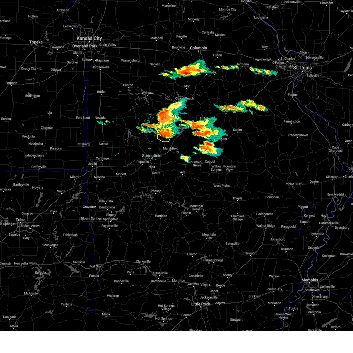 At 717 pm cdt, a severe thunderstorm was located over buffalo, moving east at 25 mph (emergency management. at 700 pm, emergency management reported quarter size hail near half way). Hazards include golf ball size hail and 60 mph wind gusts. People and animals outdoors will be injured. expect hail damage to roofs, siding, windows, and vehicles. expect wind damage to roofs, siding, and trees. Locations impacted include, buffalo, march, long lane, charity, and foose. At 717 pm cdt, a severe thunderstorm was located over buffalo, moving east at 25 mph (emergency management. at 700 pm, emergency management reported quarter size hail near half way). Hazards include golf ball size hail and 60 mph wind gusts. People and animals outdoors will be injured. expect hail damage to roofs, siding, windows, and vehicles. expect wind damage to roofs, siding, and trees. Locations impacted include, buffalo, march, long lane, charity, and foose.
|
| 6/8/2024 7:03 PM CDT |
 At 703 pm cdt, a severe thunderstorm was located near buffalo, moving east at 25 mph (emergency management. at 700 pm, emergency management reported quarter size hail near half way). Hazards include two inch hail and 60 mph wind gusts. People and animals outdoors will be injured. expect hail damage to roofs, siding, windows, and vehicles. expect wind damage to roofs, siding, and trees. Locations impacted include, buffalo, halfway, march, long lane, charity, and foose. At 703 pm cdt, a severe thunderstorm was located near buffalo, moving east at 25 mph (emergency management. at 700 pm, emergency management reported quarter size hail near half way). Hazards include two inch hail and 60 mph wind gusts. People and animals outdoors will be injured. expect hail damage to roofs, siding, windows, and vehicles. expect wind damage to roofs, siding, and trees. Locations impacted include, buffalo, halfway, march, long lane, charity, and foose.
|
| 6/8/2024 6:55 PM CDT |
 At 655 pm cdt, a severe thunderstorm was located 9 miles northeast of bolivar, moving east at 25 mph (radar indicated). Hazards include two inch hail and 60 mph wind gusts. People and animals outdoors will be injured. expect hail damage to roofs, siding, windows, and vehicles. expect wind damage to roofs, siding, and trees. Locations impacted include, buffalo, polk, halfway, foose, march, goodson, long lane, and charity. At 655 pm cdt, a severe thunderstorm was located 9 miles northeast of bolivar, moving east at 25 mph (radar indicated). Hazards include two inch hail and 60 mph wind gusts. People and animals outdoors will be injured. expect hail damage to roofs, siding, windows, and vehicles. expect wind damage to roofs, siding, and trees. Locations impacted include, buffalo, polk, halfway, foose, march, goodson, long lane, and charity.
|
| 6/8/2024 6:44 PM CDT |
 Svrsgf the national weather service in springfield has issued a * severe thunderstorm warning for, central dallas county in southwestern missouri, northeastern polk county in southwestern missouri, * until 730 pm cdt. * at 644 pm cdt, a severe thunderstorm was located 7 miles northeast of bolivar, moving east at 25 mph (radar indicated). Hazards include two inch hail and 60 mph wind gusts. People and animals outdoors will be injured. expect hail damage to roofs, siding, windows, and vehicles. Expect wind damage to roofs, siding, and trees. Svrsgf the national weather service in springfield has issued a * severe thunderstorm warning for, central dallas county in southwestern missouri, northeastern polk county in southwestern missouri, * until 730 pm cdt. * at 644 pm cdt, a severe thunderstorm was located 7 miles northeast of bolivar, moving east at 25 mph (radar indicated). Hazards include two inch hail and 60 mph wind gusts. People and animals outdoors will be injured. expect hail damage to roofs, siding, windows, and vehicles. Expect wind damage to roofs, siding, and trees.
|
| 5/26/2024 5:33 PM CDT |
 At 532 pm cdt, severe thunderstorms were located along a line extending from near richland to near lebanon to near buffalo, moving east at 40 mph (radar indicated). Hazards include ping pong ball size hail and 60 mph wind gusts. People and animals outdoors will be injured. expect hail damage to roofs, siding, windows, and vehicles. expect wind damage to roofs, siding, and trees. locations impacted include, lebanon, bennett spring state park, buffalo, morgan, conway, phillipsburg, stoutland, bennett springs, twin bridges, windyville, eldridge, leadmine, sleeper, falcon, plad, long lane, and dry knob. This includes interstate 44 between mile markers 112 and 147. At 532 pm cdt, severe thunderstorms were located along a line extending from near richland to near lebanon to near buffalo, moving east at 40 mph (radar indicated). Hazards include ping pong ball size hail and 60 mph wind gusts. People and animals outdoors will be injured. expect hail damage to roofs, siding, windows, and vehicles. expect wind damage to roofs, siding, and trees. locations impacted include, lebanon, bennett spring state park, buffalo, morgan, conway, phillipsburg, stoutland, bennett springs, twin bridges, windyville, eldridge, leadmine, sleeper, falcon, plad, long lane, and dry knob. This includes interstate 44 between mile markers 112 and 147.
|
| 5/26/2024 5:33 PM CDT |
 the severe thunderstorm warning has been cancelled and is no longer in effect the severe thunderstorm warning has been cancelled and is no longer in effect
|
| 5/26/2024 5:31 PM CDT |
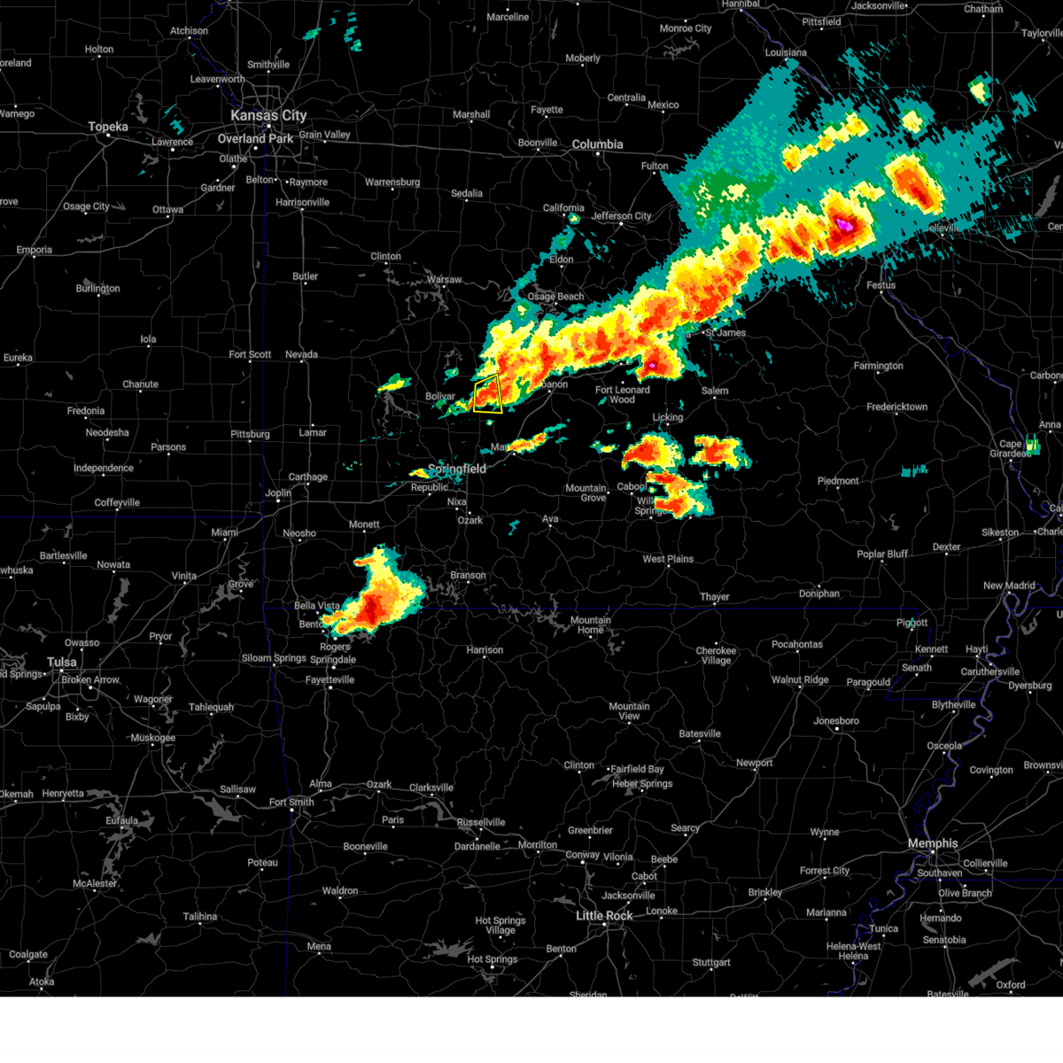 the severe thunderstorm warning has been cancelled and is no longer in effect the severe thunderstorm warning has been cancelled and is no longer in effect
|
| 5/26/2024 5:31 PM CDT |
 At 530 pm cdt, a severe thunderstorm was located near buffalo, moving east at 35 mph (radar indicated). Hazards include golf ball size hail and 60 mph wind gusts. People and animals outdoors will be injured. expect hail damage to roofs, siding, windows, and vehicles. expect wind damage to roofs, siding, and trees. Locations impacted include, buffalo and pumpkin center. At 530 pm cdt, a severe thunderstorm was located near buffalo, moving east at 35 mph (radar indicated). Hazards include golf ball size hail and 60 mph wind gusts. People and animals outdoors will be injured. expect hail damage to roofs, siding, windows, and vehicles. expect wind damage to roofs, siding, and trees. Locations impacted include, buffalo and pumpkin center.
|
| 5/26/2024 5:23 PM CDT |
 Svrsgf the national weather service in springfield has issued a * severe thunderstorm warning for, southeastern hickory county in central missouri, dallas county in southwestern missouri, northeastern polk county in southwestern missouri, laclede county in southwestern missouri, west central pulaski county in central missouri, southwestern camden county in central missouri, * until 615 pm cdt. * at 523 pm cdt, severe thunderstorms were located along a line extending from near richland to 6 miles west of lebanon to near buffalo, moving east at 40 mph (radar indicated). Hazards include ping pong ball size hail and 60 mph wind gusts. People and animals outdoors will be injured. expect hail damage to roofs, siding, windows, and vehicles. Expect wind damage to roofs, siding, and trees. Svrsgf the national weather service in springfield has issued a * severe thunderstorm warning for, southeastern hickory county in central missouri, dallas county in southwestern missouri, northeastern polk county in southwestern missouri, laclede county in southwestern missouri, west central pulaski county in central missouri, southwestern camden county in central missouri, * until 615 pm cdt. * at 523 pm cdt, severe thunderstorms were located along a line extending from near richland to 6 miles west of lebanon to near buffalo, moving east at 40 mph (radar indicated). Hazards include ping pong ball size hail and 60 mph wind gusts. People and animals outdoors will be injured. expect hail damage to roofs, siding, windows, and vehicles. Expect wind damage to roofs, siding, and trees.
|
| 5/26/2024 5:01 PM CDT |
 At 459 pm cdt, a severe thunderstorm was located near bolivar, moving east at 35 mph (radar indicated). Hazards include golf ball size hail and 60 mph wind gusts. People and animals outdoors will be injured. expect hail damage to roofs, siding, windows, and vehicles. expect wind damage to roofs, siding, and trees. Locations impacted include, bolivar, pomme de terre lake, buffalo, pittsburg, polk, urbana, halfway, louisburg, goodson, and pumpkin center. At 459 pm cdt, a severe thunderstorm was located near bolivar, moving east at 35 mph (radar indicated). Hazards include golf ball size hail and 60 mph wind gusts. People and animals outdoors will be injured. expect hail damage to roofs, siding, windows, and vehicles. expect wind damage to roofs, siding, and trees. Locations impacted include, bolivar, pomme de terre lake, buffalo, pittsburg, polk, urbana, halfway, louisburg, goodson, and pumpkin center.
|
| 5/26/2024 5:01 PM CDT |
 the severe thunderstorm warning has been cancelled and is no longer in effect the severe thunderstorm warning has been cancelled and is no longer in effect
|
| 5/26/2024 4:41 PM CDT |
 Svrsgf the national weather service in springfield has issued a * severe thunderstorm warning for, south central hickory county in central missouri, northwestern dallas county in southwestern missouri, southeastern cedar county in southwestern missouri, northern polk county in southwestern missouri, * until 545 pm cdt. * at 441 pm cdt, a severe thunderstorm was located over fair play, or 10 miles east of stockton, moving east at 35 mph (radar indicated). Hazards include golf ball size hail and 60 mph wind gusts. People and animals outdoors will be injured. expect hail damage to roofs, siding, windows, and vehicles. Expect wind damage to roofs, siding, and trees. Svrsgf the national weather service in springfield has issued a * severe thunderstorm warning for, south central hickory county in central missouri, northwestern dallas county in southwestern missouri, southeastern cedar county in southwestern missouri, northern polk county in southwestern missouri, * until 545 pm cdt. * at 441 pm cdt, a severe thunderstorm was located over fair play, or 10 miles east of stockton, moving east at 35 mph (radar indicated). Hazards include golf ball size hail and 60 mph wind gusts. People and animals outdoors will be injured. expect hail damage to roofs, siding, windows, and vehicles. Expect wind damage to roofs, siding, and trees.
|
| 5/26/2024 4:38 AM CDT |
 The storms which prompted the warning have weakened below severe limits, and no longer pose an immediate threat to life or property. therefore, the warning will be allowed to expire. however, small hail and gusty winds are still possible with these thunderstorms. a tornado watch remains in effect until 1000 am cdt for central and southwestern missouri. The storms which prompted the warning have weakened below severe limits, and no longer pose an immediate threat to life or property. therefore, the warning will be allowed to expire. however, small hail and gusty winds are still possible with these thunderstorms. a tornado watch remains in effect until 1000 am cdt for central and southwestern missouri.
|
| 5/26/2024 4:28 AM CDT |
 At 428 am cdt, severe thunderstorms were located along a line extending from 11 miles southeast of macks creek to near buffalo to near ash grove, moving east at 50 mph (radar indicated). Hazards include 60 mph wind gusts and quarter size hail. Hail damage to vehicles is expected. expect wind damage to roofs, siding, and trees. locations impacted include, lebanon, bolivar, bennett spring state park, marshfield, willard, buffalo, morgan, fair grove, conway, polk, pleasant hope, urbana, niangua, morrisville, phillipsburg, stoutland, halfway, bennett springs, louisburg, and twin bridges. This includes interstate 44 between mile markers 97 and 144. At 428 am cdt, severe thunderstorms were located along a line extending from 11 miles southeast of macks creek to near buffalo to near ash grove, moving east at 50 mph (radar indicated). Hazards include 60 mph wind gusts and quarter size hail. Hail damage to vehicles is expected. expect wind damage to roofs, siding, and trees. locations impacted include, lebanon, bolivar, bennett spring state park, marshfield, willard, buffalo, morgan, fair grove, conway, polk, pleasant hope, urbana, niangua, morrisville, phillipsburg, stoutland, halfway, bennett springs, louisburg, and twin bridges. This includes interstate 44 between mile markers 97 and 144.
|
| 5/26/2024 4:28 AM CDT |
 the severe thunderstorm warning has been cancelled and is no longer in effect the severe thunderstorm warning has been cancelled and is no longer in effect
|
| 5/26/2024 4:23 AM CDT |
 the tornado warning has been cancelled and is no longer in effect the tornado warning has been cancelled and is no longer in effect
|
| 5/26/2024 4:11 AM CDT |
 Torsgf the national weather service in springfield has issued a * tornado warning for, central dallas county in southwestern missouri, * until 445 am cdt. * at 411 am cdt, a severe thunderstorm capable of producing a tornado was located over buffalo, moving east at 45 mph (radar indicated rotation). Hazards include tornado. Flying debris will be dangerous to those caught without shelter. mobile homes will be damaged or destroyed. damage to roofs, windows, and vehicles will occur. Tree damage is likely. Torsgf the national weather service in springfield has issued a * tornado warning for, central dallas county in southwestern missouri, * until 445 am cdt. * at 411 am cdt, a severe thunderstorm capable of producing a tornado was located over buffalo, moving east at 45 mph (radar indicated rotation). Hazards include tornado. Flying debris will be dangerous to those caught without shelter. mobile homes will be damaged or destroyed. damage to roofs, windows, and vehicles will occur. Tree damage is likely.
|
| 5/26/2024 4:04 AM CDT |
 Svrsgf the national weather service in springfield has issued a * severe thunderstorm warning for, southeastern hickory county in central missouri, northern webster county in southwestern missouri, dallas county in southwestern missouri, southeastern cedar county in southwestern missouri, polk county in southwestern missouri, laclede county in southwestern missouri, northern greene county in southwestern missouri, eastern dade county in southwestern missouri, * until 445 am cdt. * at 403 am cdt, severe thunderstorms were located along a line extending from 6 miles southeast of urbana to near pleasant hope to near everton, moving east at 50 mph (radar indicated). Hazards include 60 mph wind gusts and quarter size hail. Hail damage to vehicles is expected. Expect wind damage to roofs, siding, and trees. Svrsgf the national weather service in springfield has issued a * severe thunderstorm warning for, southeastern hickory county in central missouri, northern webster county in southwestern missouri, dallas county in southwestern missouri, southeastern cedar county in southwestern missouri, polk county in southwestern missouri, laclede county in southwestern missouri, northern greene county in southwestern missouri, eastern dade county in southwestern missouri, * until 445 am cdt. * at 403 am cdt, severe thunderstorms were located along a line extending from 6 miles southeast of urbana to near pleasant hope to near everton, moving east at 50 mph (radar indicated). Hazards include 60 mph wind gusts and quarter size hail. Hail damage to vehicles is expected. Expect wind damage to roofs, siding, and trees.
|
| 5/26/2024 1:10 AM CDT |
 the tornado warning has been cancelled and is no longer in effect the tornado warning has been cancelled and is no longer in effect
|
| 5/26/2024 12:54 AM CDT |
 Torsgf the national weather service in springfield has issued a * tornado warning for, west central dallas county in southwestern missouri, east central polk county in southwestern missouri, * until 145 am cdt. * at 1253 am cdt, a severe thunderstorm capable of producing a tornado was located 7 miles northeast of bolivar, moving east at 20 mph (radar indicated rotation). Hazards include tornado and golf ball size hail. Flying debris will be dangerous to those caught without shelter. mobile homes will be damaged or destroyed. damage to roofs, windows, and vehicles will occur. Tree damage is likely. Torsgf the national weather service in springfield has issued a * tornado warning for, west central dallas county in southwestern missouri, east central polk county in southwestern missouri, * until 145 am cdt. * at 1253 am cdt, a severe thunderstorm capable of producing a tornado was located 7 miles northeast of bolivar, moving east at 20 mph (radar indicated rotation). Hazards include tornado and golf ball size hail. Flying debris will be dangerous to those caught without shelter. mobile homes will be damaged or destroyed. damage to roofs, windows, and vehicles will occur. Tree damage is likely.
|
| 5/24/2024 8:35 PM CDT |
 the severe thunderstorm warning has been cancelled and is no longer in effect the severe thunderstorm warning has been cancelled and is no longer in effect
|
| 5/24/2024 8:28 PM CDT |
 the severe thunderstorm warning has been cancelled and is no longer in effect the severe thunderstorm warning has been cancelled and is no longer in effect
|
| 5/24/2024 8:28 PM CDT |
 At 828 pm cdt, a severe thunderstorm was located near buffalo, moving northeast at 30 mph (radar indicated). Hazards include 60 mph wind gusts and quarter size hail. Hail damage to vehicles is expected. expect wind damage to roofs, siding, and trees. locations impacted include, bennett spring state park, buffalo, conway, windyville, foose, march, long lane, and charity. This includes interstate 44 between mile markers 110 and 111. At 828 pm cdt, a severe thunderstorm was located near buffalo, moving northeast at 30 mph (radar indicated). Hazards include 60 mph wind gusts and quarter size hail. Hail damage to vehicles is expected. expect wind damage to roofs, siding, and trees. locations impacted include, bennett spring state park, buffalo, conway, windyville, foose, march, long lane, and charity. This includes interstate 44 between mile markers 110 and 111.
|
| 5/24/2024 8:15 PM CDT |
 Svrsgf the national weather service in springfield has issued a * severe thunderstorm warning for, southern dallas county in southwestern missouri, southeastern polk county in southwestern missouri, * until 900 pm cdt. * at 815 pm cdt, a severe thunderstorm was located near pleasant hope, or 10 miles southeast of bolivar, moving northeast at 30 mph (radar indicated). Hazards include ping pong ball size hail and 60 mph wind gusts. People and animals outdoors will be injured. expect hail damage to roofs, siding, windows, and vehicles. Expect wind damage to roofs, siding, and trees. Svrsgf the national weather service in springfield has issued a * severe thunderstorm warning for, southern dallas county in southwestern missouri, southeastern polk county in southwestern missouri, * until 900 pm cdt. * at 815 pm cdt, a severe thunderstorm was located near pleasant hope, or 10 miles southeast of bolivar, moving northeast at 30 mph (radar indicated). Hazards include ping pong ball size hail and 60 mph wind gusts. People and animals outdoors will be injured. expect hail damage to roofs, siding, windows, and vehicles. Expect wind damage to roofs, siding, and trees.
|
| 5/24/2024 6:43 PM CDT |
 the severe thunderstorm warning has been cancelled and is no longer in effect the severe thunderstorm warning has been cancelled and is no longer in effect
|
| 5/24/2024 6:28 PM CDT |
 Svrsgf the national weather service in springfield has issued a * severe thunderstorm warning for, southern hickory county in central missouri, dallas county in southwestern missouri, northeastern polk county in southwestern missouri, * until 715 pm cdt. * at 627 pm cdt, a severe thunderstorm was located 7 miles northeast of bolivar, moving east at 20 mph (radar indicated). Hazards include 60 mph wind gusts and quarter size hail. Hail damage to vehicles is expected. Expect wind damage to roofs, siding, and trees. Svrsgf the national weather service in springfield has issued a * severe thunderstorm warning for, southern hickory county in central missouri, dallas county in southwestern missouri, northeastern polk county in southwestern missouri, * until 715 pm cdt. * at 627 pm cdt, a severe thunderstorm was located 7 miles northeast of bolivar, moving east at 20 mph (radar indicated). Hazards include 60 mph wind gusts and quarter size hail. Hail damage to vehicles is expected. Expect wind damage to roofs, siding, and trees.
|
| 5/24/2024 6:20 PM CDT |
 At 620 pm cdt, a severe thunderstorm was located near urbana, or 11 miles north of buffalo, moving east at 40 mph (radar indicated). Hazards include 60 mph wind gusts and half dollar size hail. Hail damage to vehicles is expected. expect wind damage to roofs, siding, and trees. Locations impacted include, bolivar, pomme de terre lake, buffalo, pittsburg, humansville, polk, fair play, urbana, halfway, flemington, louisburg, tunas, pumpkin center, goodson, plad, and dunnegan. At 620 pm cdt, a severe thunderstorm was located near urbana, or 11 miles north of buffalo, moving east at 40 mph (radar indicated). Hazards include 60 mph wind gusts and half dollar size hail. Hail damage to vehicles is expected. expect wind damage to roofs, siding, and trees. Locations impacted include, bolivar, pomme de terre lake, buffalo, pittsburg, humansville, polk, fair play, urbana, halfway, flemington, louisburg, tunas, pumpkin center, goodson, plad, and dunnegan.
|
| 5/24/2024 6:20 PM CDT |
 the severe thunderstorm warning has been cancelled and is no longer in effect the severe thunderstorm warning has been cancelled and is no longer in effect
|
| 5/24/2024 5:45 PM CDT |
 Svrsgf the national weather service in springfield has issued a * severe thunderstorm warning for, southern hickory county in central missouri, northwestern dallas county in southwestern missouri, southeastern cedar county in southwestern missouri, northern polk county in southwestern missouri, * until 630 pm cdt. * at 544 pm cdt, a severe thunderstorm was located near humansville, or 11 miles northwest of bolivar, moving east at 40 mph (radar indicated). Hazards include 60 mph wind gusts and half dollar size hail. Hail damage to vehicles is expected. Expect wind damage to roofs, siding, and trees. Svrsgf the national weather service in springfield has issued a * severe thunderstorm warning for, southern hickory county in central missouri, northwestern dallas county in southwestern missouri, southeastern cedar county in southwestern missouri, northern polk county in southwestern missouri, * until 630 pm cdt. * at 544 pm cdt, a severe thunderstorm was located near humansville, or 11 miles northwest of bolivar, moving east at 40 mph (radar indicated). Hazards include 60 mph wind gusts and half dollar size hail. Hail damage to vehicles is expected. Expect wind damage to roofs, siding, and trees.
|
| 5/8/2024 4:31 PM CDT |
 the severe thunderstorm warning has been cancelled and is no longer in effect the severe thunderstorm warning has been cancelled and is no longer in effect
|
| 5/8/2024 4:21 PM CDT |
 Svrsgf the national weather service in springfield has issued a * severe thunderstorm warning for, central dallas county in southwestern missouri, northeastern polk county in southwestern missouri, northwestern laclede county in southwestern missouri, * until 500 pm cdt. * at 421 pm cdt, a severe thunderstorm was located 8 miles west of buffalo, moving east at 40 mph (radar indicated). Hazards include golf ball size hail and 60 mph wind gusts. People and animals outdoors will be injured. expect hail damage to roofs, siding, windows, and vehicles. Expect wind damage to roofs, siding, and trees. Svrsgf the national weather service in springfield has issued a * severe thunderstorm warning for, central dallas county in southwestern missouri, northeastern polk county in southwestern missouri, northwestern laclede county in southwestern missouri, * until 500 pm cdt. * at 421 pm cdt, a severe thunderstorm was located 8 miles west of buffalo, moving east at 40 mph (radar indicated). Hazards include golf ball size hail and 60 mph wind gusts. People and animals outdoors will be injured. expect hail damage to roofs, siding, windows, and vehicles. Expect wind damage to roofs, siding, and trees.
|
| 5/7/2024 1:17 AM CDT |
 At 116 am cdt, severe thunderstorms were located along a line extending from near otterville to 7 miles northwest of conway to near rogersville, moving northeast at 55 mph (radar indicated). Hazards include 60 mph wind gusts. Expect damage to roofs, siding, and trees. locations impacted include, lebanon, lake of the ozarks, lake of the ozarks state park, ha ha tonka state park, bennett spring state park, marshfield, mountain grove, eldon, osage beach, camdenton, buffalo, rogersville, versailles, village of four seasons, seymour, richland, lake ozark, morgan, mansfield, and stover. This includes interstate 44 between mile markers 91 and 148. At 116 am cdt, severe thunderstorms were located along a line extending from near otterville to 7 miles northwest of conway to near rogersville, moving northeast at 55 mph (radar indicated). Hazards include 60 mph wind gusts. Expect damage to roofs, siding, and trees. locations impacted include, lebanon, lake of the ozarks, lake of the ozarks state park, ha ha tonka state park, bennett spring state park, marshfield, mountain grove, eldon, osage beach, camdenton, buffalo, rogersville, versailles, village of four seasons, seymour, richland, lake ozark, morgan, mansfield, and stover. This includes interstate 44 between mile markers 91 and 148.
|
| 5/7/2024 1:17 AM CDT |
 the severe thunderstorm warning has been cancelled and is no longer in effect the severe thunderstorm warning has been cancelled and is no longer in effect
|
| 5/7/2024 1:15 AM CDT |
 the tornado warning has been cancelled and is no longer in effect the tornado warning has been cancelled and is no longer in effect
|
| 5/7/2024 12:58 AM CDT |
 the tornado warning has been cancelled and is no longer in effect the tornado warning has been cancelled and is no longer in effect
|
| 5/7/2024 12:58 AM CDT |
 At 1257 am cdt, a severe thunderstorm capable of producing a tornado was located 8 miles north of fair grove, or 10 miles south of buffalo, moving northeast at 55 mph (radar indicated rotation). Hazards include tornado. Flying debris will be dangerous to those caught without shelter. mobile homes will be damaged or destroyed. damage to roofs, windows, and vehicles will occur. tree damage is likely. locations impacted include, buffalo, conway, louisburg, olive, elkland, foose, march, long lane, pumpkin center, and charity. This includes interstate 44 between mile markers 109 and 111. At 1257 am cdt, a severe thunderstorm capable of producing a tornado was located 8 miles north of fair grove, or 10 miles south of buffalo, moving northeast at 55 mph (radar indicated rotation). Hazards include tornado. Flying debris will be dangerous to those caught without shelter. mobile homes will be damaged or destroyed. damage to roofs, windows, and vehicles will occur. tree damage is likely. locations impacted include, buffalo, conway, louisburg, olive, elkland, foose, march, long lane, pumpkin center, and charity. This includes interstate 44 between mile markers 109 and 111.
|
| 5/7/2024 12:44 AM CDT |
 Torsgf the national weather service in springfield has issued a * tornado warning for, northwestern webster county in southwestern missouri, dallas county in southwestern missouri, southeastern polk county in southwestern missouri, * until 130 am cdt. * at 1244 am cdt, a tornado producing storm was located near pleasant hope, or 13 miles northwest of strafford, moving northeast at 55 mph (radar confirmed tornado). Hazards include damaging tornado. Flying debris will be dangerous to those caught without shelter. mobile homes will be damaged or destroyed. damage to roofs, windows, and vehicles will occur. Tree damage is likely. Torsgf the national weather service in springfield has issued a * tornado warning for, northwestern webster county in southwestern missouri, dallas county in southwestern missouri, southeastern polk county in southwestern missouri, * until 130 am cdt. * at 1244 am cdt, a tornado producing storm was located near pleasant hope, or 13 miles northwest of strafford, moving northeast at 55 mph (radar confirmed tornado). Hazards include damaging tornado. Flying debris will be dangerous to those caught without shelter. mobile homes will be damaged or destroyed. damage to roofs, windows, and vehicles will occur. Tree damage is likely.
|
| 5/7/2024 12:40 AM CDT |
 Svrsgf the national weather service in springfield has issued a * severe thunderstorm warning for, hickory county in central missouri, webster county in southwestern missouri, dallas county in southwestern missouri, wright county in southwestern missouri, benton county in central missouri, western miller county in central missouri, laclede county in southwestern missouri, northwestern pulaski county in central missouri, camden county in central missouri, morgan county in central missouri, * until 130 am cdt. * at 1240 am cdt, severe thunderstorms were located along a line extending from 8 miles northwest of warsaw to near bolivar to 8 miles southwest of crane, moving northeast at 60 mph (radar indicated). Hazards include 60 mph wind gusts. expect damage to roofs, siding, and trees Svrsgf the national weather service in springfield has issued a * severe thunderstorm warning for, hickory county in central missouri, webster county in southwestern missouri, dallas county in southwestern missouri, wright county in southwestern missouri, benton county in central missouri, western miller county in central missouri, laclede county in southwestern missouri, northwestern pulaski county in central missouri, camden county in central missouri, morgan county in central missouri, * until 130 am cdt. * at 1240 am cdt, severe thunderstorms were located along a line extending from 8 miles northwest of warsaw to near bolivar to 8 miles southwest of crane, moving northeast at 60 mph (radar indicated). Hazards include 60 mph wind gusts. expect damage to roofs, siding, and trees
|
| 4/28/2024 8:57 PM CDT |
 Svrsgf the national weather service in springfield has issued a * severe thunderstorm warning for, western webster county in southwestern missouri, southern dallas county in southwestern missouri, northeastern christian county in southwestern missouri, southeastern polk county in southwestern missouri, eastern greene county in southwestern missouri, * until 945 pm cdt. * at 857 pm cdt, severe thunderstorms were located along a line extending from near pleasant hope to near strafford to near ozark, moving northeast at 20 mph (radar indicated). Hazards include 60 mph wind gusts. expect damage to roofs, siding, and trees Svrsgf the national weather service in springfield has issued a * severe thunderstorm warning for, western webster county in southwestern missouri, southern dallas county in southwestern missouri, northeastern christian county in southwestern missouri, southeastern polk county in southwestern missouri, eastern greene county in southwestern missouri, * until 945 pm cdt. * at 857 pm cdt, severe thunderstorms were located along a line extending from near pleasant hope to near strafford to near ozark, moving northeast at 20 mph (radar indicated). Hazards include 60 mph wind gusts. expect damage to roofs, siding, and trees
|
| 4/1/2024 10:41 PM CDT |
 Svrsgf the national weather service in springfield has issued a * severe thunderstorm warning for, webster county in southwestern missouri, southern dallas county in southwestern missouri, southwestern laclede county in southwestern missouri, southeastern polk county in southwestern missouri, eastern greene county in southwestern missouri, * until 1130 pm cdt. * at 1040 pm cdt, severe thunderstorms were located along a line extending from 8 miles northeast of bolivar to near willard, moving east at 40 mph (radar indicated). Hazards include two inch hail and 70 mph wind gusts. People and animals outdoors will be injured. expect hail damage to roofs, siding, windows, and vehicles. expect considerable tree damage. Wind damage is also likely to mobile homes, roofs, and outbuildings. Svrsgf the national weather service in springfield has issued a * severe thunderstorm warning for, webster county in southwestern missouri, southern dallas county in southwestern missouri, southwestern laclede county in southwestern missouri, southeastern polk county in southwestern missouri, eastern greene county in southwestern missouri, * until 1130 pm cdt. * at 1040 pm cdt, severe thunderstorms were located along a line extending from 8 miles northeast of bolivar to near willard, moving east at 40 mph (radar indicated). Hazards include two inch hail and 70 mph wind gusts. People and animals outdoors will be injured. expect hail damage to roofs, siding, windows, and vehicles. expect considerable tree damage. Wind damage is also likely to mobile homes, roofs, and outbuildings.
|
| 4/1/2024 8:08 PM CDT |
 The tornado threat has diminished and the tornado warning has been cancelled. however, large hail and damaging winds remain likely and a severe thunderstorm warning remains in effect for the area. however, small hail and gusty winds are still possible with this thunderstorm. a tornado watch remains in effect until 1100 pm cdt for southwestern missouri. a tornado watch also remains in effect until midnight cdt for central and southwestern missouri. The tornado threat has diminished and the tornado warning has been cancelled. however, large hail and damaging winds remain likely and a severe thunderstorm warning remains in effect for the area. however, small hail and gusty winds are still possible with this thunderstorm. a tornado watch remains in effect until 1100 pm cdt for southwestern missouri. a tornado watch also remains in effect until midnight cdt for central and southwestern missouri.
|
| 4/1/2024 7:58 PM CDT |
 the severe thunderstorm warning has been cancelled and is no longer in effect the severe thunderstorm warning has been cancelled and is no longer in effect
|
| 4/1/2024 7:58 PM CDT |
 At 757 pm cdt, a severe thunderstorm was located 9 miles northeast of buffalo, moving east at 50 mph. this is a destructive storm for lebanon missouri (emergency management). Hazards include baseball size hail and 70 mph wind gusts. People and animals outdoors will be severely injured. expect shattered windows, extensive damage to roofs, siding, and vehicles. locations impacted include, lebanon, bennett spring state park, buffalo, stoutland, bennett springs, twin bridges, windyville, pumpkin center, sleeper, falcon, plad, long lane, and dry knob. This includes interstate 44 between mile markers 117 and 119, and between mile markers 121 and 144. At 757 pm cdt, a severe thunderstorm was located 9 miles northeast of buffalo, moving east at 50 mph. this is a destructive storm for lebanon missouri (emergency management). Hazards include baseball size hail and 70 mph wind gusts. People and animals outdoors will be severely injured. expect shattered windows, extensive damage to roofs, siding, and vehicles. locations impacted include, lebanon, bennett spring state park, buffalo, stoutland, bennett springs, twin bridges, windyville, pumpkin center, sleeper, falcon, plad, long lane, and dry knob. This includes interstate 44 between mile markers 117 and 119, and between mile markers 121 and 144.
|
| 4/1/2024 7:56 PM CDT |
 the tornado warning has been cancelled and is no longer in effect the tornado warning has been cancelled and is no longer in effect
|
| 4/1/2024 7:56 PM CDT |
 At 756 pm cdt, a severe thunderstorm capable of producing a tornado was located near buffalo, moving east at 50 mph (radar indicated rotation). Hazards include tornado and baseball size hail. Flying debris will be dangerous to those caught without shelter. mobile homes will be damaged or destroyed. damage to roofs, windows, and vehicles will occur. tree damage is likely. locations impacted include, lebanon, bennett spring state park, buffalo, bennett springs, windyville, plad, long lane, sleeper, dry knob, and falcon. This includes interstate 44 near mile marker 119, and between mile markers 121 and 144. At 756 pm cdt, a severe thunderstorm capable of producing a tornado was located near buffalo, moving east at 50 mph (radar indicated rotation). Hazards include tornado and baseball size hail. Flying debris will be dangerous to those caught without shelter. mobile homes will be damaged or destroyed. damage to roofs, windows, and vehicles will occur. tree damage is likely. locations impacted include, lebanon, bennett spring state park, buffalo, bennett springs, windyville, plad, long lane, sleeper, dry knob, and falcon. This includes interstate 44 near mile marker 119, and between mile markers 121 and 144.
|
| 4/1/2024 7:48 PM CDT | Golf Ball sized hail reported 5.8 miles SSW of Buffalo, MO, video sent from le of golf ball size hail. |
| 4/1/2024 7:48 PM CDT | 12 inch tree down over power line in dallas county MO, 0.9 miles SW of Buffalo, MO |
| 4/1/2024 7:45 PM CDT |
 Torsgf the national weather service in springfield has issued a * tornado warning for, central dallas county in southwestern missouri, east central polk county in southwestern missouri, laclede county in southwestern missouri, * until 815 pm cdt. * at 744 pm cdt, a severe thunderstorm capable of producing a tornado was located over buffalo, moving east at 50 mph (radar indicated rotation). Hazards include tornado and baseball size hail. Flying debris will be dangerous to those caught without shelter. mobile homes will be damaged or destroyed. damage to roofs, windows, and vehicles will occur. Tree damage is likely. Torsgf the national weather service in springfield has issued a * tornado warning for, central dallas county in southwestern missouri, east central polk county in southwestern missouri, laclede county in southwestern missouri, * until 815 pm cdt. * at 744 pm cdt, a severe thunderstorm capable of producing a tornado was located over buffalo, moving east at 50 mph (radar indicated rotation). Hazards include tornado and baseball size hail. Flying debris will be dangerous to those caught without shelter. mobile homes will be damaged or destroyed. damage to roofs, windows, and vehicles will occur. Tree damage is likely.
|
| 4/1/2024 7:35 PM CDT |
 Svrsgf the national weather service in springfield has issued a * severe thunderstorm warning for, dallas county in southwestern missouri, northeastern polk county in southwestern missouri, laclede county in southwestern missouri, * until 830 pm cdt. * at 733 pm cdt, a severe thunderstorm was located 9 miles northeast of bolivar, moving east at 60 mph. this is a destructive storm for half way buffalo and lebenon missouri areas (emergency management. large hail and damaging winds have been reported with this storm). Hazards include baseball size hail and 70 mph wind gusts. People and animals outdoors will be severely injured. Expect shattered windows, extensive damage to roofs, siding, and vehicles. Svrsgf the national weather service in springfield has issued a * severe thunderstorm warning for, dallas county in southwestern missouri, northeastern polk county in southwestern missouri, laclede county in southwestern missouri, * until 830 pm cdt. * at 733 pm cdt, a severe thunderstorm was located 9 miles northeast of bolivar, moving east at 60 mph. this is a destructive storm for half way buffalo and lebenon missouri areas (emergency management. large hail and damaging winds have been reported with this storm). Hazards include baseball size hail and 70 mph wind gusts. People and animals outdoors will be severely injured. Expect shattered windows, extensive damage to roofs, siding, and vehicles.
|
| 4/1/2024 7:24 PM CDT |
 Svrsgf the national weather service in springfield has issued a * severe thunderstorm warning for, dallas county in southwestern missouri, northwestern laclede county in southwestern missouri, camden county in central missouri, morgan county in central missouri, * until 830 pm cdt. * at 723 pm cdt, severe thunderstorms were located along a line extending from 6 miles southwest of warsaw to 10 miles southwest of urbana to near bolivar, moving east at 60 mph (emergency management). Hazards include golf ball size hail and 70 mph wind gusts. People and animals outdoors will be injured. expect hail damage to roofs, siding, windows, and vehicles. expect considerable tree damage. Wind damage is also likely to mobile homes, roofs, and outbuildings. Svrsgf the national weather service in springfield has issued a * severe thunderstorm warning for, dallas county in southwestern missouri, northwestern laclede county in southwestern missouri, camden county in central missouri, morgan county in central missouri, * until 830 pm cdt. * at 723 pm cdt, severe thunderstorms were located along a line extending from 6 miles southwest of warsaw to 10 miles southwest of urbana to near bolivar, moving east at 60 mph (emergency management). Hazards include golf ball size hail and 70 mph wind gusts. People and animals outdoors will be injured. expect hail damage to roofs, siding, windows, and vehicles. expect considerable tree damage. Wind damage is also likely to mobile homes, roofs, and outbuildings.
|
| 9/23/2023 8:38 PM CDT |
 At 837 pm cdt, severe thunderstorms were located along a line extending from 8 miles east of urbana to near pleasant hope to near ash grove, moving southeast at 30 mph (emergency management. 60 mph winds reported in walnut grove). Hazards include 70 mph wind gusts and quarter size hail. Hail damage to vehicles is expected. expect considerable tree damage. wind damage is also likely to mobile homes, roofs, and outbuildings. locations impacted include, springfield, republic, bennett spring state park, marshfield, battlefield, willard, buffalo, rogersville, strafford, ash grove, fair grove, conway, walnut grove, urbana, brookline, bennett springs, louisburg, windyville, elkland and glidewell. this includes interstate 44 between mile markers 59 and 111. thunderstorm damage threat, considerable hail threat, radar indicated max hail size, 1. 00 in wind threat, radar indicated max wind gust, 70 mph. At 837 pm cdt, severe thunderstorms were located along a line extending from 8 miles east of urbana to near pleasant hope to near ash grove, moving southeast at 30 mph (emergency management. 60 mph winds reported in walnut grove). Hazards include 70 mph wind gusts and quarter size hail. Hail damage to vehicles is expected. expect considerable tree damage. wind damage is also likely to mobile homes, roofs, and outbuildings. locations impacted include, springfield, republic, bennett spring state park, marshfield, battlefield, willard, buffalo, rogersville, strafford, ash grove, fair grove, conway, walnut grove, urbana, brookline, bennett springs, louisburg, windyville, elkland and glidewell. this includes interstate 44 between mile markers 59 and 111. thunderstorm damage threat, considerable hail threat, radar indicated max hail size, 1. 00 in wind threat, radar indicated max wind gust, 70 mph.
|
| 9/23/2023 8:31 PM CDT |
 At 831 pm cdt, severe thunderstorms were located along a line extending from 6 miles east of urbana to near morrisville to near ash grove, moving southeast at 30 mph (radar indicated). Hazards include 70 mph wind gusts and quarter size hail. Hail damage to vehicles is expected. expect considerable tree damage. wind damage is also likely to mobile homes, roofs, and outbuildings. locations impacted include, springfield, republic, bennett spring state park, marshfield, battlefield, willard, buffalo, rogersville, strafford, ash grove, fair grove, conway, walnut grove, urbana, brookline, bennett springs, louisburg, windyville, elkland and glidewell. this includes interstate 44 between mile markers 59 and 111. thunderstorm damage threat, considerable hail threat, radar indicated max hail size, 1. 00 in wind threat, radar indicated max wind gust, 70 mph. At 831 pm cdt, severe thunderstorms were located along a line extending from 6 miles east of urbana to near morrisville to near ash grove, moving southeast at 30 mph (radar indicated). Hazards include 70 mph wind gusts and quarter size hail. Hail damage to vehicles is expected. expect considerable tree damage. wind damage is also likely to mobile homes, roofs, and outbuildings. locations impacted include, springfield, republic, bennett spring state park, marshfield, battlefield, willard, buffalo, rogersville, strafford, ash grove, fair grove, conway, walnut grove, urbana, brookline, bennett springs, louisburg, windyville, elkland and glidewell. this includes interstate 44 between mile markers 59 and 111. thunderstorm damage threat, considerable hail threat, radar indicated max hail size, 1. 00 in wind threat, radar indicated max wind gust, 70 mph.
|
| 9/23/2023 8:17 PM CDT |
 At 816 pm cdt, severe thunderstorms were located along a line extending from near urbana to near morrisville to near everton, moving southeast at 25 mph (emergency management). Hazards include 60 mph wind gusts and quarter size hail. Hail damage to vehicles is expected. Expect wind damage to roofs, siding, and trees. At 816 pm cdt, severe thunderstorms were located along a line extending from near urbana to near morrisville to near everton, moving southeast at 25 mph (emergency management). Hazards include 60 mph wind gusts and quarter size hail. Hail damage to vehicles is expected. Expect wind damage to roofs, siding, and trees.
|
| 7/30/2023 10:36 PM CDT |
 At 1034 pm cdt, severe thunderstorms were located along a line extending from near urbana to near bolivar to 8 miles southwest of fair play, moving southeast at 45 mph (law enforcement). Hazards include 70 mph wind gusts. Expect considerable tree damage. damage is likely to mobile homes, roofs, and outbuildings. severe thunderstorms will be near, buffalo, pleasant hope and morrisville around 1050 pm cdt. willard and fair grove around 1100 pm cdt. springfield and conway around 1110 pm cdt. marshfield around 1115 pm cdt. strafford and niangua around 1120 pm cdt. rogersville, seymour, fordland and diggins around 1130 pm cdt. other locations impacted by these severe thunderstorms include stockton lake, polk, brookline, dadeville, halfway, louisburg, aldrich, windyville, elkland and glidewell. this includes interstate 44 between mile markers 59 and 111. thunderstorm damage threat, considerable hail threat, radar indicated max hail size, <. 75 in wind threat, observed max wind gust, 70 mph. At 1034 pm cdt, severe thunderstorms were located along a line extending from near urbana to near bolivar to 8 miles southwest of fair play, moving southeast at 45 mph (law enforcement). Hazards include 70 mph wind gusts. Expect considerable tree damage. damage is likely to mobile homes, roofs, and outbuildings. severe thunderstorms will be near, buffalo, pleasant hope and morrisville around 1050 pm cdt. willard and fair grove around 1100 pm cdt. springfield and conway around 1110 pm cdt. marshfield around 1115 pm cdt. strafford and niangua around 1120 pm cdt. rogersville, seymour, fordland and diggins around 1130 pm cdt. other locations impacted by these severe thunderstorms include stockton lake, polk, brookline, dadeville, halfway, louisburg, aldrich, windyville, elkland and glidewell. this includes interstate 44 between mile markers 59 and 111. thunderstorm damage threat, considerable hail threat, radar indicated max hail size, <. 75 in wind threat, observed max wind gust, 70 mph.
|
| 7/30/2023 10:15 PM CDT |
 At 1015 pm cdt, a severe thunderstorm was located near macks creek, or 15 miles west of camdenton, moving southeast at 50 mph (public). Hazards include 60 mph wind gusts. Expect damage to roofs, siding, and trees. locations impacted include, bolivar, pomme de terre lake, stockton lake, pomme de terre state park, bennett spring state park, buffalo, pittsburg, humansville, conway, polk, pleasant hope, fair play, hermitage, weaubleau, urbana, morrisville, wheatland, preston, cross timbers and halfway. hail threat, radar indicated max hail size, <. 75 in wind threat, observed max wind gust, 60 mph. At 1015 pm cdt, a severe thunderstorm was located near macks creek, or 15 miles west of camdenton, moving southeast at 50 mph (public). Hazards include 60 mph wind gusts. Expect damage to roofs, siding, and trees. locations impacted include, bolivar, pomme de terre lake, stockton lake, pomme de terre state park, bennett spring state park, buffalo, pittsburg, humansville, conway, polk, pleasant hope, fair play, hermitage, weaubleau, urbana, morrisville, wheatland, preston, cross timbers and halfway. hail threat, radar indicated max hail size, <. 75 in wind threat, observed max wind gust, 60 mph.
|
| 7/30/2023 9:39 PM CDT |
 At 939 pm cdt, a severe thunderstorm was located 8 miles west of warsaw, moving southeast at 50 mph (public). Hazards include 60 mph wind gusts. expect damage to roofs, siding, and trees At 939 pm cdt, a severe thunderstorm was located 8 miles west of warsaw, moving southeast at 50 mph (public). Hazards include 60 mph wind gusts. expect damage to roofs, siding, and trees
|
| 7/17/2023 3:36 PM CDT | Report from mping: 1-inch tree limbs broken; shingles blown off. time based on rada in dallas county MO, 0.8 miles S of Buffalo, MO |
| 7/17/2023 3:26 PM CDT |
 At 326 pm cdt, a severe thunderstorm was located near bolivar, moving southeast at 25 mph (radar indicated). Hazards include tennis ball size hail and 70 mph wind gusts. People and animals outdoors will be injured. expect hail damage to roofs, siding, windows, and vehicles. expect considerable tree damage. wind damage is also likely to mobile homes, roofs, and outbuildings. locations impacted include, bolivar, buffalo, polk, louisburg and goodson. thunderstorm damage threat, considerable hail threat, radar indicated max hail size, 2. 50 in wind threat, radar indicated max wind gust, 70 mph. At 326 pm cdt, a severe thunderstorm was located near bolivar, moving southeast at 25 mph (radar indicated). Hazards include tennis ball size hail and 70 mph wind gusts. People and animals outdoors will be injured. expect hail damage to roofs, siding, windows, and vehicles. expect considerable tree damage. wind damage is also likely to mobile homes, roofs, and outbuildings. locations impacted include, bolivar, buffalo, polk, louisburg and goodson. thunderstorm damage threat, considerable hail threat, radar indicated max hail size, 2. 50 in wind threat, radar indicated max wind gust, 70 mph.
|
| 7/17/2023 3:25 PM CDT |
 At 325 pm cdt, a severe thunderstorm was located near bolivar, moving south at 30 mph (radar indicated). Hazards include tennis ball size hail and 70 mph wind gusts. People and animals outdoors will be injured. expect hail damage to roofs, siding, windows, and vehicles. expect considerable tree damage. wind damage is also likely to mobile homes, roofs, and outbuildings. locations impacted include, bolivar, buffalo, pleasant hope, morrisville, halfway, olive, brighton, foose, march and charity. thunderstorm damage threat, considerable hail threat, radar indicated max hail size, 2. 50 in wind threat, radar indicated max wind gust, 70 mph. At 325 pm cdt, a severe thunderstorm was located near bolivar, moving south at 30 mph (radar indicated). Hazards include tennis ball size hail and 70 mph wind gusts. People and animals outdoors will be injured. expect hail damage to roofs, siding, windows, and vehicles. expect considerable tree damage. wind damage is also likely to mobile homes, roofs, and outbuildings. locations impacted include, bolivar, buffalo, pleasant hope, morrisville, halfway, olive, brighton, foose, march and charity. thunderstorm damage threat, considerable hail threat, radar indicated max hail size, 2. 50 in wind threat, radar indicated max wind gust, 70 mph.
|
| 7/17/2023 3:19 PM CDT |
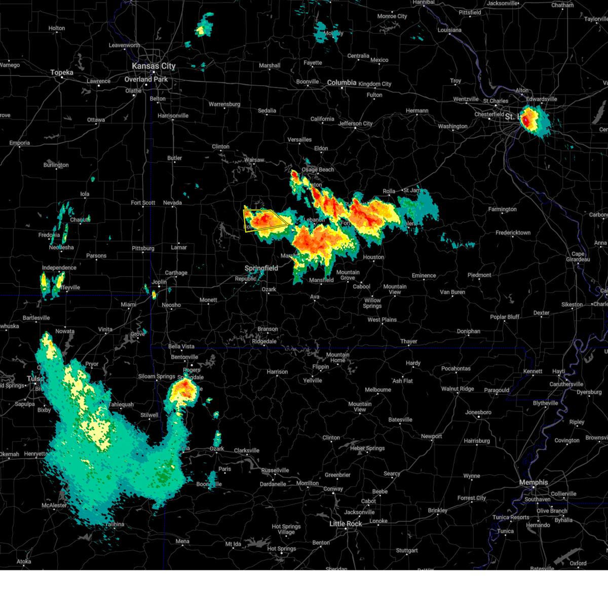 At 319 pm cdt, a severe thunderstorm was located near bolivar, moving south at 30 mph (radar indicated). Hazards include golf ball size hail and 70 mph wind gusts. People and animals outdoors will be injured. expect hail damage to roofs, siding, windows, and vehicles. expect considerable tree damage. wind damage is also likely to mobile homes, roofs, and outbuildings. locations impacted include, bolivar, pomme de terre lake, buffalo, polk, flemington, louisburg and goodson. thunderstorm damage threat, considerable hail threat, radar indicated max hail size, 1. 75 in wind threat, radar indicated max wind gust, 70 mph. At 319 pm cdt, a severe thunderstorm was located near bolivar, moving south at 30 mph (radar indicated). Hazards include golf ball size hail and 70 mph wind gusts. People and animals outdoors will be injured. expect hail damage to roofs, siding, windows, and vehicles. expect considerable tree damage. wind damage is also likely to mobile homes, roofs, and outbuildings. locations impacted include, bolivar, pomme de terre lake, buffalo, polk, flemington, louisburg and goodson. thunderstorm damage threat, considerable hail threat, radar indicated max hail size, 1. 75 in wind threat, radar indicated max wind gust, 70 mph.
|
| 7/17/2023 3:18 PM CDT |
 At 318 pm cdt, a severe thunderstorm was located near bolivar, moving south at 30 mph (radar indicated). Hazards include golf ball size hail and 70 mph wind gusts. People and animals outdoors will be injured. expect hail damage to roofs, siding, windows, and vehicles. expect considerable tree damage. wind damage is also likely to mobile homes, roofs, and outbuildings. locations impacted include, bolivar, buffalo, pleasant hope, morrisville, halfway, olive, brighton, foose, march and charity. thunderstorm damage threat, considerable hail threat, radar indicated max hail size, 1. 75 in wind threat, radar indicated max wind gust, 70 mph. At 318 pm cdt, a severe thunderstorm was located near bolivar, moving south at 30 mph (radar indicated). Hazards include golf ball size hail and 70 mph wind gusts. People and animals outdoors will be injured. expect hail damage to roofs, siding, windows, and vehicles. expect considerable tree damage. wind damage is also likely to mobile homes, roofs, and outbuildings. locations impacted include, bolivar, buffalo, pleasant hope, morrisville, halfway, olive, brighton, foose, march and charity. thunderstorm damage threat, considerable hail threat, radar indicated max hail size, 1. 75 in wind threat, radar indicated max wind gust, 70 mph.
|
| 7/17/2023 3:15 PM CDT |
 At 314 pm cdt, a severe thunderstorm was located 8 miles northeast of bolivar, moving south at 30 mph (radar indicated). Hazards include ping pong ball size hail and 60 mph wind gusts. People and animals outdoors will be injured. expect hail damage to roofs, siding, windows, and vehicles. Expect wind damage to roofs, siding, and trees. At 314 pm cdt, a severe thunderstorm was located 8 miles northeast of bolivar, moving south at 30 mph (radar indicated). Hazards include ping pong ball size hail and 60 mph wind gusts. People and animals outdoors will be injured. expect hail damage to roofs, siding, windows, and vehicles. Expect wind damage to roofs, siding, and trees.
|
| 7/17/2023 3:03 PM CDT |
 At 303 pm cdt, a severe thunderstorm was located 8 miles south of hermitage, moving southeast at 25 mph (radar indicated). Hazards include golf ball size hail and 60 mph wind gusts. People and animals outdoors will be injured. expect hail damage to roofs, siding, windows, and vehicles. Expect wind damage to roofs, siding, and trees. At 303 pm cdt, a severe thunderstorm was located 8 miles south of hermitage, moving southeast at 25 mph (radar indicated). Hazards include golf ball size hail and 60 mph wind gusts. People and animals outdoors will be injured. expect hail damage to roofs, siding, windows, and vehicles. Expect wind damage to roofs, siding, and trees.
|
| 7/13/2023 12:18 AM CDT |
 At 1218 am cdt, severe thunderstorms were located along a line extending from 6 miles southeast of urbana to 7 miles east of bolivar to near fair play, moving southeast at 40 mph (radar indicated). Hazards include 60 mph wind gusts and penny size hail. expect damage to roofs, siding, and trees At 1218 am cdt, severe thunderstorms were located along a line extending from 6 miles southeast of urbana to 7 miles east of bolivar to near fair play, moving southeast at 40 mph (radar indicated). Hazards include 60 mph wind gusts and penny size hail. expect damage to roofs, siding, and trees
|
| 6/18/2023 4:25 AM CDT |
 The severe thunderstorm warning for dallas, cedar, polk and eastern greene counties will expire at 430 am cdt, the storms which prompted the warning have weakened below severe limits, and no longer pose an immediate threat to life or property. therefore, the warning will be allowed to expire. however gusty winds are still possible with these thunderstorms. a severe thunderstorm watch remains in effect until 600 am cdt for southwestern missouri. to report severe weather, contact your nearest law enforcement agency. they will relay your report to the national weather service springfield. The severe thunderstorm warning for dallas, cedar, polk and eastern greene counties will expire at 430 am cdt, the storms which prompted the warning have weakened below severe limits, and no longer pose an immediate threat to life or property. therefore, the warning will be allowed to expire. however gusty winds are still possible with these thunderstorms. a severe thunderstorm watch remains in effect until 600 am cdt for southwestern missouri. to report severe weather, contact your nearest law enforcement agency. they will relay your report to the national weather service springfield.
|
| 6/18/2023 4:07 AM CDT |
 At 402 am cdt, severe thunderstorms were located along a line extending from near el dorado springs to near bolivar to near fair grove, moving northeast at 45 mph (radar indicated). Hazards include 60 mph wind gusts. Expect damage to roofs, siding, and trees. these severe storms will be near, strafford around 405 am cdt. bolivar and fair grove around 410 am cdt. conway around 435 am cdt. other locations impacted by these severe thunderstorms include stockton lake, pomme de terre lake, stockton state park, bennett spring state park, polk, halfway, flemington, louisburg, aldrich and umber view heights. this includes interstate 44 between mile markers 75 and 90. hail threat, radar indicated max hail size, <. 75 in wind threat, radar indicated max wind gust, 60 mph. At 402 am cdt, severe thunderstorms were located along a line extending from near el dorado springs to near bolivar to near fair grove, moving northeast at 45 mph (radar indicated). Hazards include 60 mph wind gusts. Expect damage to roofs, siding, and trees. these severe storms will be near, strafford around 405 am cdt. bolivar and fair grove around 410 am cdt. conway around 435 am cdt. other locations impacted by these severe thunderstorms include stockton lake, pomme de terre lake, stockton state park, bennett spring state park, polk, halfway, flemington, louisburg, aldrich and umber view heights. this includes interstate 44 between mile markers 75 and 90. hail threat, radar indicated max hail size, <. 75 in wind threat, radar indicated max wind gust, 60 mph.
|
| 6/18/2023 3:41 AM CDT |
 At 340 am cdt, severe thunderstorms were located along a line extending from 9 miles east of sheldon to near walnut grove to near battlefield, moving northeast at 45 mph (radar indicated). Hazards include 60 mph wind gusts. Expect damage to roofs, siding, and trees. severe thunderstorms will be near, walnut grove around 345 am cdt. springfield and morrisville around 355 am cdt. el dorado springs and fair play around 400 am cdt. bolivar and strafford around 405 am cdt. fair grove around 410 am cdt. conway around 430 am cdt. other locations impacted by these severe thunderstorms include stockton lake, pomme de terre lake, stockton state park, bennett spring state park, polk, brookline, dadeville, jerico springs, halfway and flemington. this includes interstate 44 between mile markers 63 and 90. hail threat, radar indicated max hail size, <. 75 in wind threat, radar indicated max wind gust, 60 mph. At 340 am cdt, severe thunderstorms were located along a line extending from 9 miles east of sheldon to near walnut grove to near battlefield, moving northeast at 45 mph (radar indicated). Hazards include 60 mph wind gusts. Expect damage to roofs, siding, and trees. severe thunderstorms will be near, walnut grove around 345 am cdt. springfield and morrisville around 355 am cdt. el dorado springs and fair play around 400 am cdt. bolivar and strafford around 405 am cdt. fair grove around 410 am cdt. conway around 430 am cdt. other locations impacted by these severe thunderstorms include stockton lake, pomme de terre lake, stockton state park, bennett spring state park, polk, brookline, dadeville, jerico springs, halfway and flemington. this includes interstate 44 between mile markers 63 and 90. hail threat, radar indicated max hail size, <. 75 in wind threat, radar indicated max wind gust, 60 mph.
|
| 5/9/2023 8:06 PM CDT |
 At 806 pm cdt, severe thunderstorms were located along a line extending from 8 miles north of bolivar to 7 miles south of ash grove to near monett, moving southeast at 35 mph (radar indicated). Hazards include 60 mph wind gusts and quarter size hail. Hail damage to vehicles is expected. Expect wind damage to roofs, siding, and trees. At 806 pm cdt, severe thunderstorms were located along a line extending from 8 miles north of bolivar to 7 miles south of ash grove to near monett, moving southeast at 35 mph (radar indicated). Hazards include 60 mph wind gusts and quarter size hail. Hail damage to vehicles is expected. Expect wind damage to roofs, siding, and trees.
|
| 4/15/2023 3:13 PM CDT |
 At 312 pm cdt, severe thunderstorms were located along a line extending from 6 miles north of camdenton to near macks creek to 7 miles west of buffalo, moving east at 30 mph (radar indicated). Hazards include golf ball size hail and 60 mph wind gusts. People and animals outdoors will be injured. expect hail damage to roofs, siding, windows, and vehicles. Expect wind damage to roofs, siding, and trees. At 312 pm cdt, severe thunderstorms were located along a line extending from 6 miles north of camdenton to near macks creek to 7 miles west of buffalo, moving east at 30 mph (radar indicated). Hazards include golf ball size hail and 60 mph wind gusts. People and animals outdoors will be injured. expect hail damage to roofs, siding, windows, and vehicles. Expect wind damage to roofs, siding, and trees.
|
| 4/15/2023 2:55 PM CDT |
 At 254 pm cdt, a severe thunderstorm was located 10 miles northwest of buffalo, moving northeast at 40 mph (public. this storm has a history of producing very large hail of tennis ball to three inches in size). Hazards include tennis ball size hail and 60 mph wind gusts. People and animals outdoors will be injured. expect hail damage to roofs, siding, windows, and vehicles. expect wind damage to roofs, siding, and trees. locations impacted include, bolivar, stockton lake, buffalo, polk, fair play, halfway, louisburg, aldrich, bearcreek, masters, march, foose and goodson. thunderstorm damage threat, considerable hail threat, radar indicated max hail size, 2. 50 in wind threat, radar indicated max wind gust, 60 mph. At 254 pm cdt, a severe thunderstorm was located 10 miles northwest of buffalo, moving northeast at 40 mph (public. this storm has a history of producing very large hail of tennis ball to three inches in size). Hazards include tennis ball size hail and 60 mph wind gusts. People and animals outdoors will be injured. expect hail damage to roofs, siding, windows, and vehicles. expect wind damage to roofs, siding, and trees. locations impacted include, bolivar, stockton lake, buffalo, polk, fair play, halfway, louisburg, aldrich, bearcreek, masters, march, foose and goodson. thunderstorm damage threat, considerable hail threat, radar indicated max hail size, 2. 50 in wind threat, radar indicated max wind gust, 60 mph.
|
| 4/15/2023 2:17 PM CDT |
 At 215 pm cdt, a severe thunderstorm was located 8 miles south of stockton, moving east at 45 mph. this is a destructive storm for cane hill, fair play, and bolivar missouri (public. several reports of tennis ball to three inch size hail has occurred with this storm). Hazards include baseball size hail and 60 mph wind gusts. People and animals outdoors will be severely injured. Expect shattered windows, extensive damage to roofs, siding, and vehicles. At 215 pm cdt, a severe thunderstorm was located 8 miles south of stockton, moving east at 45 mph. this is a destructive storm for cane hill, fair play, and bolivar missouri (public. several reports of tennis ball to three inch size hail has occurred with this storm). Hazards include baseball size hail and 60 mph wind gusts. People and animals outdoors will be severely injured. Expect shattered windows, extensive damage to roofs, siding, and vehicles.
|
| 4/5/2023 5:17 AM CDT |
 At 516 am cdt, a severe thunderstorm was located 8 miles north of pleasant hope, or 9 miles east of bolivar, moving east at 65 mph (public. half dollar size hail was reported with this storm). Hazards include 60 mph wind gusts and half dollar size hail. Hail damage to vehicles is expected. Expect wind damage to roofs, siding, and trees. At 516 am cdt, a severe thunderstorm was located 8 miles north of pleasant hope, or 9 miles east of bolivar, moving east at 65 mph (public. half dollar size hail was reported with this storm). Hazards include 60 mph wind gusts and half dollar size hail. Hail damage to vehicles is expected. Expect wind damage to roofs, siding, and trees.
|
| 2/27/2023 2:42 AM CST |
 At 241 am cst, severe thunderstorms were located along a line extending from 12 miles west of laurie to near macks creek to 6 miles northeast of buffalo, moving northeast at 65 mph (radar indicated). Hazards include 60 mph wind gusts. Expect damage to roofs, siding, and trees. Locations impacted include, lake of the ozarks, bennett spring state park, laurie, macks creek, bennett springs, climax springs, windyville, leadmine, tunas, pumpkin center, branch, barnumton, plad and long lane. At 241 am cst, severe thunderstorms were located along a line extending from 12 miles west of laurie to near macks creek to 6 miles northeast of buffalo, moving northeast at 65 mph (radar indicated). Hazards include 60 mph wind gusts. Expect damage to roofs, siding, and trees. Locations impacted include, lake of the ozarks, bennett spring state park, laurie, macks creek, bennett springs, climax springs, windyville, leadmine, tunas, pumpkin center, branch, barnumton, plad and long lane.
|
| 2/27/2023 2:21 AM CST |
 At 221 am cst, severe thunderstorms were located along a line extending from near hermitage to near urbana to near pleasant hope, moving northeast at 65 mph (radar indicated). Hazards include 60 mph wind gusts. expect damage to roofs, siding, and trees At 221 am cst, severe thunderstorms were located along a line extending from near hermitage to near urbana to near pleasant hope, moving northeast at 65 mph (radar indicated). Hazards include 60 mph wind gusts. expect damage to roofs, siding, and trees
|
| 5/15/2022 10:50 AM CDT |
 At 1050 am cdt, severe thunderstorms were located along a line extending from 11 miles south of stover to near macks creek to 7 miles west of buffalo, moving southeast at 25 mph (radar indicated). Hazards include 60 mph wind gusts and penny size hail. Expect damage to roofs, siding, and trees. locations impacted include, lebanon, lake of the ozarks, pomme de terre lake, pomme de terre state park, ha ha tonka state park, bennett spring state park, lake of the ozarks state park, osage beach, camdenton, buffalo, village of four seasons, lake ozark, pittsburg, laurie, conway, polk, hermitage, sunrise beach, urbana, macks creek, this includes interstate 44 between mile markers 111 and 117. hail threat, radar indicated max hail size, 0. 75 in wind threat, radar indicated max wind gust, 60 mph. At 1050 am cdt, severe thunderstorms were located along a line extending from 11 miles south of stover to near macks creek to 7 miles west of buffalo, moving southeast at 25 mph (radar indicated). Hazards include 60 mph wind gusts and penny size hail. Expect damage to roofs, siding, and trees. locations impacted include, lebanon, lake of the ozarks, pomme de terre lake, pomme de terre state park, ha ha tonka state park, bennett spring state park, lake of the ozarks state park, osage beach, camdenton, buffalo, village of four seasons, lake ozark, pittsburg, laurie, conway, polk, hermitage, sunrise beach, urbana, macks creek, this includes interstate 44 between mile markers 111 and 117. hail threat, radar indicated max hail size, 0. 75 in wind threat, radar indicated max wind gust, 60 mph.
|
| 5/15/2022 10:26 AM CDT |
 At 1025 am cdt, severe thunderstorms were located along a line extending from near cole camp to 8 miles east of hermitage to fair play, moving east at 50 mph (radar indicated). Hazards include 60 mph wind gusts and quarter size hail. Hail damage to vehicles is expected. expect wind damage to roofs, siding, and trees. locations impacted include, lebanon, lake of the ozarks, pomme de terre lake, truman lake, pomme de terre state park, ha ha tonka state park, bennett spring state park, lake of the ozarks state park, osage beach, camdenton, buffalo, village of four seasons, warsaw, lake ozark, pittsburg, laurie, conway, polk, hermitage, sunrise beach, this includes interstate 44 between mile markers 111 and 117. hail threat, radar indicated max hail size, 1. 00 in wind threat, radar indicated max wind gust, 60 mph. At 1025 am cdt, severe thunderstorms were located along a line extending from near cole camp to 8 miles east of hermitage to fair play, moving east at 50 mph (radar indicated). Hazards include 60 mph wind gusts and quarter size hail. Hail damage to vehicles is expected. expect wind damage to roofs, siding, and trees. locations impacted include, lebanon, lake of the ozarks, pomme de terre lake, truman lake, pomme de terre state park, ha ha tonka state park, bennett spring state park, lake of the ozarks state park, osage beach, camdenton, buffalo, village of four seasons, warsaw, lake ozark, pittsburg, laurie, conway, polk, hermitage, sunrise beach, this includes interstate 44 between mile markers 111 and 117. hail threat, radar indicated max hail size, 1. 00 in wind threat, radar indicated max wind gust, 60 mph.
|
| 5/15/2022 10:12 AM CDT |
 At 1012 am cdt, severe thunderstorms were located along a line extending from 6 miles northwest of lincoln to near hermitage to stockton, moving southeast at 50 mph (radar indicated). Hazards include 60 mph wind gusts and quarter size hail. Hail damage to vehicles is expected. Expect wind damage to roofs, siding, and trees. At 1012 am cdt, severe thunderstorms were located along a line extending from 6 miles northwest of lincoln to near hermitage to stockton, moving southeast at 50 mph (radar indicated). Hazards include 60 mph wind gusts and quarter size hail. Hail damage to vehicles is expected. Expect wind damage to roofs, siding, and trees.
|
| 4/21/2022 4:30 PM CDT |
 At 429 pm cdt, a severe thunderstorm was located near fair play, or near bolivar, moving east at 25 mph (radar indicated). Hazards include 60 mph wind gusts and half dollar size hail. Hail damage to vehicles is expected. expect wind damage to roofs, siding, and trees. locations impacted include, bolivar, pomme de terre lake, stockton lake, buffalo, humansville, polk, pleasant hope, fair play, morrisville, halfway, flemington, louisburg, aldrich, brighton, pumpkin center, eudora, foose, goodson, dunnegan, hail threat, radar indicated max hail size, 1. 25 in wind threat, radar indicated max wind gust, 60 mph. At 429 pm cdt, a severe thunderstorm was located near fair play, or near bolivar, moving east at 25 mph (radar indicated). Hazards include 60 mph wind gusts and half dollar size hail. Hail damage to vehicles is expected. expect wind damage to roofs, siding, and trees. locations impacted include, bolivar, pomme de terre lake, stockton lake, buffalo, humansville, polk, pleasant hope, fair play, morrisville, halfway, flemington, louisburg, aldrich, brighton, pumpkin center, eudora, foose, goodson, dunnegan, hail threat, radar indicated max hail size, 1. 25 in wind threat, radar indicated max wind gust, 60 mph.
|
| 4/21/2022 4:21 PM CDT |
 At 420 pm cdt, a severe thunderstorm was located over fair play, or 9 miles west of bolivar, moving east at 25 mph (radar indicated). Hazards include ping pong ball size hail and 60 mph wind gusts. People and animals outdoors will be injured. expect hail damage to roofs, siding, windows, and vehicles. Expect wind damage to roofs, siding, and trees. At 420 pm cdt, a severe thunderstorm was located over fair play, or 9 miles west of bolivar, moving east at 25 mph (radar indicated). Hazards include ping pong ball size hail and 60 mph wind gusts. People and animals outdoors will be injured. expect hail damage to roofs, siding, windows, and vehicles. Expect wind damage to roofs, siding, and trees.
|
| 4/11/2022 2:37 AM CDT |
 At 236 am cdt, severe thunderstorms were located along a line extending from near buffalo to 7 miles northeast of fair grove to strafford, moving northeast at 35 mph (radar indicated). Hazards include 60 mph wind gusts and quarter size hail. Hail damage to vehicles is expected. Expect wind damage to roofs, siding, and trees. At 236 am cdt, severe thunderstorms were located along a line extending from near buffalo to 7 miles northeast of fair grove to strafford, moving northeast at 35 mph (radar indicated). Hazards include 60 mph wind gusts and quarter size hail. Hail damage to vehicles is expected. Expect wind damage to roofs, siding, and trees.
|
| 4/11/2022 2:00 AM CDT | Quarter sized hail reported 7.7 miles NNE of Buffalo, MO, via social media. time estimated via radar. |
| 6/11/2021 6:55 PM CDT |
 At 654 pm cdt, severe thunderstorms were located along a line extending from near osage beach to 6 miles southeast of macks creek to near buffalo, moving southeast at 25 mph (radar indicated). Hazards include 60 mph wind gusts and half dollar size hail. Hail damage to vehicles is expected. Expect wind damage to roofs, siding, and trees. At 654 pm cdt, severe thunderstorms were located along a line extending from near osage beach to 6 miles southeast of macks creek to near buffalo, moving southeast at 25 mph (radar indicated). Hazards include 60 mph wind gusts and half dollar size hail. Hail damage to vehicles is expected. Expect wind damage to roofs, siding, and trees.
|
| 5/27/2021 12:42 PM CDT |
 The severe thunderstorm warning for dallas and southern polk counties will expire at 1245 pm cdt, the storms which prompted the warning have moved out of the area. therefore, the warning will be allowed to expire. however heavy rain is still possible with these thunderstorms. a severe thunderstorm watch remains in effect until 700 pm cdt for southwestern missouri. to report severe weather, contact your nearest law enforcement agency. they will relay your report to the national weather service springfield. The severe thunderstorm warning for dallas and southern polk counties will expire at 1245 pm cdt, the storms which prompted the warning have moved out of the area. therefore, the warning will be allowed to expire. however heavy rain is still possible with these thunderstorms. a severe thunderstorm watch remains in effect until 700 pm cdt for southwestern missouri. to report severe weather, contact your nearest law enforcement agency. they will relay your report to the national weather service springfield.
|
| 5/27/2021 12:14 PM CDT |
 At 1210 pm cdt, severe thunderstorms were located along a line extending from 8 miles northeast of buffalo to 8 miles east of bolivar to morrisville, moving southeast at 50 mph (radar indicated). Hazards include 70 mph wind gusts and quarter size hail. Hail damage to vehicles is expected. expect considerable tree damage. wind damage is also likely to mobile homes, roofs, and outbuildings. Locations impacted include, bolivar, stockton lake, bennett spring state park, buffalo, conway, pleasant hope, morrisville, halfway, louisburg, aldrich, windyville, brighton, march, pumpkin center, olive, eudora, foose, plad, long lane, charity, this includes interstate 44 between mile markers 110 and 111. At 1210 pm cdt, severe thunderstorms were located along a line extending from 8 miles northeast of buffalo to 8 miles east of bolivar to morrisville, moving southeast at 50 mph (radar indicated). Hazards include 70 mph wind gusts and quarter size hail. Hail damage to vehicles is expected. expect considerable tree damage. wind damage is also likely to mobile homes, roofs, and outbuildings. Locations impacted include, bolivar, stockton lake, bennett spring state park, buffalo, conway, pleasant hope, morrisville, halfway, louisburg, aldrich, windyville, brighton, march, pumpkin center, olive, eudora, foose, plad, long lane, charity, this includes interstate 44 between mile markers 110 and 111.
|
| 5/27/2021 11:58 AM CDT |
 At 1158 am cdt, severe thunderstorms were located along a line extending from near urbana to near bolivar to 7 miles southwest of fair play, moving east at 40 mph. these are very dangerous storms (radar indicated). Hazards include 80 mph wind gusts and quarter size hail. Flying debris will be dangerous to those caught without shelter. mobile homes will be heavily damaged. expect considerable damage to roofs, windows, and vehicles. extensive tree damage and power outages are likely. Locations impacted include, bolivar, stockton lake, bennett spring state park, buffalo, conway, polk, pleasant hope, urbana, morrisville, dadeville, halfway, louisburg, aldrich, windyville, march, tunas, pumpkin center, eudora, goodson, plad, this includes interstate 44 between mile markers 110 and 111. At 1158 am cdt, severe thunderstorms were located along a line extending from near urbana to near bolivar to 7 miles southwest of fair play, moving east at 40 mph. these are very dangerous storms (radar indicated). Hazards include 80 mph wind gusts and quarter size hail. Flying debris will be dangerous to those caught without shelter. mobile homes will be heavily damaged. expect considerable damage to roofs, windows, and vehicles. extensive tree damage and power outages are likely. Locations impacted include, bolivar, stockton lake, bennett spring state park, buffalo, conway, polk, pleasant hope, urbana, morrisville, dadeville, halfway, louisburg, aldrich, windyville, march, tunas, pumpkin center, eudora, goodson, plad, this includes interstate 44 between mile markers 110 and 111.
|
| 5/27/2021 11:45 AM CDT |
 At 1145 am cdt, severe thunderstorms were located along a line extending from 7 miles south of hermitage to near fair play to 8 miles south of stockton, moving east at 40 mph (radar indicated). Hazards include 70 mph wind gusts and quarter size hail. Hail damage to vehicles is expected. expect considerable tree damage. Wind damage is also likely to mobile homes, roofs, and outbuildings. At 1145 am cdt, severe thunderstorms were located along a line extending from 7 miles south of hermitage to near fair play to 8 miles south of stockton, moving east at 40 mph (radar indicated). Hazards include 70 mph wind gusts and quarter size hail. Hail damage to vehicles is expected. expect considerable tree damage. Wind damage is also likely to mobile homes, roofs, and outbuildings.
|
| 4/7/2021 2:55 PM CDT | Few large trees blown down in a field southeast of highway 65 and rainbow roa in dallas county MO, 2.8 miles S of Buffalo, MO |
| 11/14/2020 7:24 PM CST |
 The tornado warning for central dallas county will expire at 730 pm cst, the tornado threat has diminished and the tornado warning has been cancelled. however, large hail and damaging winds remain likely and a severe thunderstorm warning remains in effect for the area. a tornado watch remains in effect until midnight cst for southwestern missouri. The tornado warning for central dallas county will expire at 730 pm cst, the tornado threat has diminished and the tornado warning has been cancelled. however, large hail and damaging winds remain likely and a severe thunderstorm warning remains in effect for the area. a tornado watch remains in effect until midnight cst for southwestern missouri.
|
| 11/14/2020 6:59 PM CST |
 At 659 pm cst, a severe thunderstorm capable of producing a tornado was located near buffalo, moving east at 40 mph (radar indicated rotation). Hazards include tornado. Flying debris will be dangerous to those caught without shelter. mobile homes will be damaged or destroyed. damage to roofs, windows, and vehicles will occur. Tree damage is likely. At 659 pm cst, a severe thunderstorm capable of producing a tornado was located near buffalo, moving east at 40 mph (radar indicated rotation). Hazards include tornado. Flying debris will be dangerous to those caught without shelter. mobile homes will be damaged or destroyed. damage to roofs, windows, and vehicles will occur. Tree damage is likely.
|
| 11/14/2020 6:52 PM CST |
 At 652 pm cst, severe thunderstorms were located along a line extending from near camdenton to near pleasant hope, moving east at 40 mph (radar indicated). Hazards include golf ball size hail and 60 mph wind gusts. People and animals outdoors will be injured. expect hail damage to roofs, siding, windows, and vehicles. expect wind damage to roofs, siding, and trees. Locations impacted include, lebanon, lake of the ozarks, lake of the ozarks state park, ha ha tonka state park, bennett spring state park, osage beach, camdenton, buffalo, village of four seasons, richland, lake ozark, conway, iberia, pleasant hope, sunrise beach, morrisville, macks creek, linn creek, phillipsburg, stoutland, this includes interstate 44 between mile markers 109 and 143. At 652 pm cst, severe thunderstorms were located along a line extending from near camdenton to near pleasant hope, moving east at 40 mph (radar indicated). Hazards include golf ball size hail and 60 mph wind gusts. People and animals outdoors will be injured. expect hail damage to roofs, siding, windows, and vehicles. expect wind damage to roofs, siding, and trees. Locations impacted include, lebanon, lake of the ozarks, lake of the ozarks state park, ha ha tonka state park, bennett spring state park, osage beach, camdenton, buffalo, village of four seasons, richland, lake ozark, conway, iberia, pleasant hope, sunrise beach, morrisville, macks creek, linn creek, phillipsburg, stoutland, this includes interstate 44 between mile markers 109 and 143.
|
| 11/14/2020 6:49 PM CST |
 At 649 pm cst, a severe thunderstorm capable of producing a tornado was located near buffalo, moving northeast at 55 mph (radar indicated rotation). Hazards include tornado and golf ball size hail. Flying debris will be dangerous to those caught without shelter. mobile homes will be damaged or destroyed. damage to roofs, windows, and vehicles will occur. tree damage is likely. Locations impacted include, bennett spring state park, buffalo, morrisville, halfway, bennett springs, windyville, foose, plad, long lane, pumpkin center, march,. At 649 pm cst, a severe thunderstorm capable of producing a tornado was located near buffalo, moving northeast at 55 mph (radar indicated rotation). Hazards include tornado and golf ball size hail. Flying debris will be dangerous to those caught without shelter. mobile homes will be damaged or destroyed. damage to roofs, windows, and vehicles will occur. tree damage is likely. Locations impacted include, bennett spring state park, buffalo, morrisville, halfway, bennett springs, windyville, foose, plad, long lane, pumpkin center, march,.
|
| 11/14/2020 6:45 PM CST |
 At 645 pm cst, severe thunderstorms were located along a line extending from near camdenton to near pleasant hope, moving east at 40 mph (radar indicated). Hazards include 60 mph wind gusts and quarter size hail. Hail damage to vehicles is expected. Expect wind damage to roofs, siding, and trees. At 645 pm cst, severe thunderstorms were located along a line extending from near camdenton to near pleasant hope, moving east at 40 mph (radar indicated). Hazards include 60 mph wind gusts and quarter size hail. Hail damage to vehicles is expected. Expect wind damage to roofs, siding, and trees.
|
| 11/14/2020 6:34 PM CST |
 At 634 pm cst, a severe thunderstorm capable of producing a tornado was located over morrisville, or 8 miles south of bolivar, moving northeast at 55 mph (radar indicated rotation). Hazards include tornado. Flying debris will be dangerous to those caught without shelter. mobile homes will be damaged or destroyed. damage to roofs, windows, and vehicles will occur. Tree damage is likely. At 634 pm cst, a severe thunderstorm capable of producing a tornado was located over morrisville, or 8 miles south of bolivar, moving northeast at 55 mph (radar indicated rotation). Hazards include tornado. Flying debris will be dangerous to those caught without shelter. mobile homes will be damaged or destroyed. damage to roofs, windows, and vehicles will occur. Tree damage is likely.
|
| 9/27/2020 4:01 PM CDT |
 At 401 pm cdt, a severe thunderstorm was located near buffalo, moving east at 35 mph (radar indicated). Hazards include 60 mph wind gusts. Expect damage to roofs, siding, and trees. Locations impacted include, bennett spring state park, buffalo, louisburg, windyville, plad, goodson, pumpkin center,. At 401 pm cdt, a severe thunderstorm was located near buffalo, moving east at 35 mph (radar indicated). Hazards include 60 mph wind gusts. Expect damage to roofs, siding, and trees. Locations impacted include, bennett spring state park, buffalo, louisburg, windyville, plad, goodson, pumpkin center,.
|
| 9/27/2020 3:41 PM CDT |
 At 341 pm cdt, a severe thunderstorm was located 8 miles north of bolivar, moving east at 35 mph (radar indicated). Hazards include 60 mph wind gusts and quarter size hail. Hail damage to vehicles is expected. Expect wind damage to roofs, siding, and trees. At 341 pm cdt, a severe thunderstorm was located 8 miles north of bolivar, moving east at 35 mph (radar indicated). Hazards include 60 mph wind gusts and quarter size hail. Hail damage to vehicles is expected. Expect wind damage to roofs, siding, and trees.
|
| 8/10/2020 7:35 PM CDT |
 The severe thunderstorm warning for hickory, dallas, northern polk and southwestern camden counties will expire at 745 pm cdt, the storms which prompted the warning have weakened below severe limits, and no longer pose an immediate threat to life or property. therefore, the warning will be allowed to expire. however gusty winds and heavy rain are still possible with these thunderstorms. The severe thunderstorm warning for hickory, dallas, northern polk and southwestern camden counties will expire at 745 pm cdt, the storms which prompted the warning have weakened below severe limits, and no longer pose an immediate threat to life or property. therefore, the warning will be allowed to expire. however gusty winds and heavy rain are still possible with these thunderstorms.
|
| 8/10/2020 7:30 PM CDT | Several trees snapped in yard and along roadway. via social medi in dallas county MO, 0.8 miles NW of Buffalo, MO |
| 8/10/2020 6:54 PM CDT |
 At 654 pm cdt, severe thunderstorms were located along a line extending from near hermitage to near urbana to 10 miles north of bolivar to near humansville, moving east at 35 mph (radar indicated). Hazards include 60 mph wind gusts and nickel size hail. expect damage to roofs, siding, and trees At 654 pm cdt, severe thunderstorms were located along a line extending from near hermitage to near urbana to 10 miles north of bolivar to near humansville, moving east at 35 mph (radar indicated). Hazards include 60 mph wind gusts and nickel size hail. expect damage to roofs, siding, and trees
|
| 6/4/2020 4:45 AM CDT |
 At 444 am cdt, severe thunderstorms were located along a line extending from 8 miles west of buffalo to morrisville to near everton, moving southeast at 60 mph (radar indicated). Hazards include 60 mph wind gusts. expect damage to roofs, siding, and trees At 444 am cdt, severe thunderstorms were located along a line extending from 8 miles west of buffalo to morrisville to near everton, moving southeast at 60 mph (radar indicated). Hazards include 60 mph wind gusts. expect damage to roofs, siding, and trees
|
| 5/5/2020 1:37 PM CDT | Barn destroyed with large tree uprooted. time estimated by radar. delayed repor in dallas county MO, 5 miles SSE of Buffalo, MO |
| 5/4/2020 1:22 PM CDT |
 At 121 pm cdt, severe thunderstorms were located along a line extending from near weaubleau to 8 miles south of stockton, moving south at 95 mph (radar indicated). Hazards include 70 mph wind gusts and quarter size hail. Hail damage to vehicles is expected. expect considerable tree damage. Wind damage is also likely to mobile homes, roofs, and outbuildings. At 121 pm cdt, severe thunderstorms were located along a line extending from near weaubleau to 8 miles south of stockton, moving south at 95 mph (radar indicated). Hazards include 70 mph wind gusts and quarter size hail. Hail damage to vehicles is expected. expect considerable tree damage. Wind damage is also likely to mobile homes, roofs, and outbuildings.
|
| 5/3/2020 10:36 AM CDT |
 At 1035 am cdt, severe thunderstorms were located along a line extending from near buffalo to strafford, moving east at 40 mph (radar indicated). Hazards include 60 mph wind gusts and quarter size hail. Hail damage to vehicles is expected. Expect wind damage to roofs, siding, and trees. At 1035 am cdt, severe thunderstorms were located along a line extending from near buffalo to strafford, moving east at 40 mph (radar indicated). Hazards include 60 mph wind gusts and quarter size hail. Hail damage to vehicles is expected. Expect wind damage to roofs, siding, and trees.
|
| 8/16/2019 3:05 AM CDT |
 The severe thunderstorm warning for eastern hickory, dallas, polk and southwestern camden counties will expire at 315 am cdt, the storms which prompted the warning have weakened below severe limits, and no longer pose an immediate threat to life or property. therefore, the warning will be allowed to expire. a severe thunderstorm watch remains in effect until 700 am cdt for central and southwestern missouri. The severe thunderstorm warning for eastern hickory, dallas, polk and southwestern camden counties will expire at 315 am cdt, the storms which prompted the warning have weakened below severe limits, and no longer pose an immediate threat to life or property. therefore, the warning will be allowed to expire. a severe thunderstorm watch remains in effect until 700 am cdt for central and southwestern missouri.
|
| 8/16/2019 2:37 AM CDT |
 At 237 am cdt, severe thunderstorms were located along a line extending from near hermitage to 7 miles south of urbana to 8 miles west of buffalo to near walnut grove, moving east at 45 mph (radar indicated). Hazards include 60 mph wind gusts and penny size hail. Expect damage to roofs, siding, and trees. Locations impacted include, bolivar, pomme de terre lake, stockton lake, pomme de terre state park, bennett spring state park, buffalo, pittsburg, conway, polk, pleasant hope, hermitage, urbana, morrisville, macks creek, preston, cross timbers, halfway, bennett springs, louisburg, aldrich,. At 237 am cdt, severe thunderstorms were located along a line extending from near hermitage to 7 miles south of urbana to 8 miles west of buffalo to near walnut grove, moving east at 45 mph (radar indicated). Hazards include 60 mph wind gusts and penny size hail. Expect damage to roofs, siding, and trees. Locations impacted include, bolivar, pomme de terre lake, stockton lake, pomme de terre state park, bennett spring state park, buffalo, pittsburg, conway, polk, pleasant hope, hermitage, urbana, morrisville, macks creek, preston, cross timbers, halfway, bennett springs, louisburg, aldrich,.
|
| 8/16/2019 2:08 AM CDT |
 At 208 am cdt, severe thunderstorms were located along a line extending from 8 miles northwest of wheatland to near weaubleau to near humansville to 9 miles southwest of stockton, moving east at 50 mph (radar indicated). Hazards include 60 mph wind gusts and quarter size hail. Hail damage to vehicles is expected. Expect wind damage to roofs, siding, and trees. At 208 am cdt, severe thunderstorms were located along a line extending from 8 miles northwest of wheatland to near weaubleau to near humansville to 9 miles southwest of stockton, moving east at 50 mph (radar indicated). Hazards include 60 mph wind gusts and quarter size hail. Hail damage to vehicles is expected. Expect wind damage to roofs, siding, and trees.
|
| 6/21/2019 2:17 PM CDT |
 At 217 pm cdt, a severe thunderstorm was located near pleasant hope, or 10 miles southeast of bolivar, moving east at 25 mph (radar indicated). Hazards include 60 mph wind gusts and quarter size hail. Hail damage to vehicles is expected. expect wind damage to roofs, siding, and trees. Locations impacted include, bolivar, buffalo, fair grove, walnut grove, pleasant hope, morrisville, halfway, sacville, ebenezer, bassville, brighton, march, olive, foose,. At 217 pm cdt, a severe thunderstorm was located near pleasant hope, or 10 miles southeast of bolivar, moving east at 25 mph (radar indicated). Hazards include 60 mph wind gusts and quarter size hail. Hail damage to vehicles is expected. expect wind damage to roofs, siding, and trees. Locations impacted include, bolivar, buffalo, fair grove, walnut grove, pleasant hope, morrisville, halfway, sacville, ebenezer, bassville, brighton, march, olive, foose,.
|
| 6/21/2019 2:07 PM CDT | A tree fell and blocked a roadway on 240th road northeast of pleasant hope. time estimated from rada in polk county MO, 12.3 miles NNE of Buffalo, MO |
| 6/21/2019 1:56 PM CDT |
 The national weather service in springfield has issued a * severe thunderstorm warning for. southwestern dallas county in southwestern missouri. southern polk county in southwestern missouri. northern greene county in southwestern missouri. Until 245 pm cdt. The national weather service in springfield has issued a * severe thunderstorm warning for. southwestern dallas county in southwestern missouri. southern polk county in southwestern missouri. northern greene county in southwestern missouri. Until 245 pm cdt.
|
| 6/4/2019 4:45 PM CDT | Report of two power poles down on highway 215 between potters road and red top road. time estimated from rada in dallas county MO, 14.1 miles NNE of Buffalo, MO |
| 5/23/2019 2:52 AM CDT |
 At 252 am cdt, a severe thunderstorm was located near willard, or 9 miles north of republic, moving northeast at 40 mph (radar indicated). Hazards include 60 mph wind gusts and quarter size hail. Hail damage to vehicles is expected. Expect wind damage to roofs, siding, and trees. At 252 am cdt, a severe thunderstorm was located near willard, or 9 miles north of republic, moving northeast at 40 mph (radar indicated). Hazards include 60 mph wind gusts and quarter size hail. Hail damage to vehicles is expected. Expect wind damage to roofs, siding, and trees.
|
| 5/23/2019 12:58 AM CDT |
 At 1258 am cdt, a severe thunderstorm was located 10 miles northeast of buffalo, moving east at 45 mph (radar indicated). Hazards include 60 mph wind gusts and half dollar size hail. Hail damage to vehicles is expected. expect wind damage to roofs, siding, and trees. Locations impacted include, lebanon, bennett spring state park, buffalo, bennett springs, windyville, eldridge, leadmine, tunas, plad, pumpkin center, this includes interstate 44 near mile marker 123. At 1258 am cdt, a severe thunderstorm was located 10 miles northeast of buffalo, moving east at 45 mph (radar indicated). Hazards include 60 mph wind gusts and half dollar size hail. Hail damage to vehicles is expected. expect wind damage to roofs, siding, and trees. Locations impacted include, lebanon, bennett spring state park, buffalo, bennett springs, windyville, eldridge, leadmine, tunas, plad, pumpkin center, this includes interstate 44 near mile marker 123.
|
| 5/23/2019 12:33 AM CDT |
 At 1232 am cdt, a severe thunderstorm was located 9 miles northeast of bolivar, moving east at 40 mph (radar indicated). Hazards include 60 mph wind gusts and half dollar size hail. Hail damage to vehicles is expected. Expect wind damage to roofs, siding, and trees. At 1232 am cdt, a severe thunderstorm was located 9 miles northeast of bolivar, moving east at 40 mph (radar indicated). Hazards include 60 mph wind gusts and half dollar size hail. Hail damage to vehicles is expected. Expect wind damage to roofs, siding, and trees.
|
| 5/22/2019 11:06 PM CDT |
 The tornado warning for south central hickory, northern dallas and northeastern polk counties will expire at 1115 pm cdt, the storm which prompted the warning has weakened below severe limits, and no longer appears capable of producing a tornado. therefore, the warning will be allowed to expire. however gusty winds are still possible with this thunderstorm. a tornado watch remains in effect until 400 am cdt for central and southwestern missouri. to report severe weather, contact your nearest law enforcement agency. they will relay your report to the national weather service springfield. The tornado warning for south central hickory, northern dallas and northeastern polk counties will expire at 1115 pm cdt, the storm which prompted the warning has weakened below severe limits, and no longer appears capable of producing a tornado. therefore, the warning will be allowed to expire. however gusty winds are still possible with this thunderstorm. a tornado watch remains in effect until 400 am cdt for central and southwestern missouri. to report severe weather, contact your nearest law enforcement agency. they will relay your report to the national weather service springfield.
|
| 5/22/2019 10:54 PM CDT |
 At 1052 pm cdt, a severe thunderstorm capable of producing a tornado was located near urbana with a second circulation located 5 miles northeast of bolivar. both cells are moving east at 35 mph (radar indicated rotation). Hazards include tornado and half dollar size hail. Flying debris will be dangerous to those caught without shelter. mobile homes will be damaged or destroyed. damage to roofs, windows, and vehicles will occur. tree damage is likely. Locations impacted include, bolivar, pomme de terre lake, buffalo, pittsburg, polk, urbana, halfway, louisburg, leadmine, tunas, pumpkin center, goodson, plad,. At 1052 pm cdt, a severe thunderstorm capable of producing a tornado was located near urbana with a second circulation located 5 miles northeast of bolivar. both cells are moving east at 35 mph (radar indicated rotation). Hazards include tornado and half dollar size hail. Flying debris will be dangerous to those caught without shelter. mobile homes will be damaged or destroyed. damage to roofs, windows, and vehicles will occur. tree damage is likely. Locations impacted include, bolivar, pomme de terre lake, buffalo, pittsburg, polk, urbana, halfway, louisburg, leadmine, tunas, pumpkin center, goodson, plad,.
|
| 5/22/2019 10:43 PM CDT |
 At 1041 pm cdt, a severe thunderstorm capable of producing a tornado was located 9 miles northeast of bolivar, moving east at 35 mph. circulations continue northeast of polk and north and west of bolivar (radar indicated rotation). Hazards include tornado and half dollar size hail. Flying debris will be dangerous to those caught without shelter. mobile homes will be damaged or destroyed. damage to roofs, windows, and vehicles will occur. tree damage is likely. Locations impacted include, bolivar, pomme de terre lake, buffalo, pittsburg, polk, fair play, urbana, halfway, louisburg, leadmine, tunas, pumpkin center, goodson, plad, dunnegan,. At 1041 pm cdt, a severe thunderstorm capable of producing a tornado was located 9 miles northeast of bolivar, moving east at 35 mph. circulations continue northeast of polk and north and west of bolivar (radar indicated rotation). Hazards include tornado and half dollar size hail. Flying debris will be dangerous to those caught without shelter. mobile homes will be damaged or destroyed. damage to roofs, windows, and vehicles will occur. tree damage is likely. Locations impacted include, bolivar, pomme de terre lake, buffalo, pittsburg, polk, fair play, urbana, halfway, louisburg, leadmine, tunas, pumpkin center, goodson, plad, dunnegan,.
|
| 5/22/2019 10:30 PM CDT |
 At 1026 pm cdt, a severe thunderstorm capable of producing a tornado was located over bolivar, moving east at 35 mph. this warning replaces the previous warning for the same areas (radar indicated rotation. two separate rotations were tracking to the east northeast. one near fair play and a second west of goodson). Hazards include tornado and half dollar size hail. Flying debris will be dangerous to those caught without shelter. mobile homes will be damaged or destroyed. damage to roofs, windows, and vehicles will occur. Tree damage is likely. At 1026 pm cdt, a severe thunderstorm capable of producing a tornado was located over bolivar, moving east at 35 mph. this warning replaces the previous warning for the same areas (radar indicated rotation. two separate rotations were tracking to the east northeast. one near fair play and a second west of goodson). Hazards include tornado and half dollar size hail. Flying debris will be dangerous to those caught without shelter. mobile homes will be damaged or destroyed. damage to roofs, windows, and vehicles will occur. Tree damage is likely.
|
| 5/20/2019 11:00 PM CDT | Corrects previous tstm wnd dmg report from 3 wsw march. roof blown off a milk barn in that are in dallas county MO, 10.5 miles NNE of Buffalo, MO |
| 5/20/2019 8:16 PM CDT |
 At 816 pm cdt, severe thunderstorms were located along a line extending from near urbana to 7 miles northwest of buffalo to 7 miles north of pleasant hope, moving northeast at 50 mph (radar indicated). Hazards include 60 mph wind gusts. expect damage to roofs, siding, and trees At 816 pm cdt, severe thunderstorms were located along a line extending from near urbana to 7 miles northwest of buffalo to 7 miles north of pleasant hope, moving northeast at 50 mph (radar indicated). Hazards include 60 mph wind gusts. expect damage to roofs, siding, and trees
|
| 5/20/2019 7:30 PM CDT | Barn lifted up slightly. tin off of the milk barn roof... tore trees out and took out a small pole barn. possible tornado. via social medi in dallas county MO, 9.8 miles NNE of Buffalo, MO |
| 5/20/2019 7:30 PM CDT | Large trees uprooted. via social medi in polk county MO, 14.4 miles NNE of Buffalo, MO |
| 5/18/2019 4:26 PM CDT |
 The severe thunderstorm warning for hickory, northern webster, dallas, northwestern wright, southeastern benton, western laclede, eastern polk, eastern greene and southwestern camden counties will expire at 430 pm cdt, the storms which prompted the warning have weakened below severe limits, and no longer pose an immediate threat to life or property. therefore, the warning will be allowed to expire. however gusty winds are still possible with these thunderstorms. a tornado watch remains in effect until 500 pm cdt for central and southwestern missouri. The severe thunderstorm warning for hickory, northern webster, dallas, northwestern wright, southeastern benton, western laclede, eastern polk, eastern greene and southwestern camden counties will expire at 430 pm cdt, the storms which prompted the warning have weakened below severe limits, and no longer pose an immediate threat to life or property. therefore, the warning will be allowed to expire. however gusty winds are still possible with these thunderstorms. a tornado watch remains in effect until 500 pm cdt for central and southwestern missouri.
|
| 5/18/2019 4:03 PM CDT |
 At 403 pm cdt, severe thunderstorms were located along a line extending from near wheatland to near urbana to near buffalo to near strafford, moving northeast at 50 mph (radar indicated). Hazards include 60 mph wind gusts. Expect damage to roofs, siding, and trees. Locations impacted include, northeastern springfield, lebanon, pomme de terre lake, pomme de terre state park, bennett spring state park, marshfield, buffalo, strafford, morgan, fair grove, pittsburg, conway, polk, hermitage, urbana, niangua, wheatland, macks creek, preston, cross timbers, this includes interstate 44 between mile markers 81 and 124. At 403 pm cdt, severe thunderstorms were located along a line extending from near wheatland to near urbana to near buffalo to near strafford, moving northeast at 50 mph (radar indicated). Hazards include 60 mph wind gusts. Expect damage to roofs, siding, and trees. Locations impacted include, northeastern springfield, lebanon, pomme de terre lake, pomme de terre state park, bennett spring state park, marshfield, buffalo, strafford, morgan, fair grove, pittsburg, conway, polk, hermitage, urbana, niangua, wheatland, macks creek, preston, cross timbers, this includes interstate 44 between mile markers 81 and 124.
|
| 5/18/2019 3:51 PM CDT |
 A severe thunderstorm warning remains in effect until 430 pm cdt for hickory. northern webster. dallas. northwestern wright. southeastern benton. western laclede. polk. eastern greene. southeastern st. clair and southwestern camden counties. At 350 pm cdt, severe thunderstorms were located along a line extending from weaubleau to 11 miles east of humansville to 7 miles. A severe thunderstorm warning remains in effect until 430 pm cdt for hickory. northern webster. dallas. northwestern wright. southeastern benton. western laclede. polk. eastern greene. southeastern st. clair and southwestern camden counties. At 350 pm cdt, severe thunderstorms were located along a line extending from weaubleau to 11 miles east of humansville to 7 miles.
|
| 5/18/2019 3:38 PM CDT |
 At 337 pm cdt, severe thunderstorms were located along a line extending from near humansville to near fair play to near morrisville to near pleasant hope to springfield, moving northeast at 50 mph (radar indicated). Hazards include 60 mph wind gusts. expect damage to roofs, siding, and trees At 337 pm cdt, severe thunderstorms were located along a line extending from near humansville to near fair play to near morrisville to near pleasant hope to springfield, moving northeast at 50 mph (radar indicated). Hazards include 60 mph wind gusts. expect damage to roofs, siding, and trees
|
| 4/18/2019 1:45 AM CDT |
 At 144 am cdt, severe thunderstorms were located along a line extending from near hermitage to near buffalo to 7 miles northeast of fair grove, moving east at 55 mph (radar indicated). Hazards include 70 mph wind gusts. Expect considerable tree damage. damage is likely to mobile homes, roofs, and outbuildings. Locations impacted include, pomme de terre lake, pomme de terre state park, bennett spring state park, buffalo, pittsburg, polk, hermitage, urbana, wheatland, preston, cross timbers, halfway, louisburg, windyville, march, tunas, pumpkin center, goodson, plad, long lane,. At 144 am cdt, severe thunderstorms were located along a line extending from near hermitage to near buffalo to 7 miles northeast of fair grove, moving east at 55 mph (radar indicated). Hazards include 70 mph wind gusts. Expect considerable tree damage. damage is likely to mobile homes, roofs, and outbuildings. Locations impacted include, pomme de terre lake, pomme de terre state park, bennett spring state park, buffalo, pittsburg, polk, hermitage, urbana, wheatland, preston, cross timbers, halfway, louisburg, windyville, march, tunas, pumpkin center, goodson, plad, long lane,.
|
| 4/18/2019 1:02 AM CDT |
 At 102 am cdt, severe thunderstorms were located along a line extending from 10 miles south of el dorado springs to 6 miles north of greenfield to near miller, moving east at 65 mph (radar indicated). Hazards include 70 mph wind gusts. Expect considerable tree damage. Damage is likely to mobile homes, roofs, and outbuildings. At 102 am cdt, severe thunderstorms were located along a line extending from 10 miles south of el dorado springs to 6 miles north of greenfield to near miller, moving east at 65 mph (radar indicated). Hazards include 70 mph wind gusts. Expect considerable tree damage. Damage is likely to mobile homes, roofs, and outbuildings.
|
| 2/6/2019 10:48 PM CST |
 At 1048 pm cst, a severe thunderstorm was located 8 miles north of fair grove, or 10 miles south of buffalo, moving northeast at 65 mph. quarter size hail has been reported in fair grove (trained weather spotters). Hazards include quarter size hail. damage to vehicles is expected At 1048 pm cst, a severe thunderstorm was located 8 miles north of fair grove, or 10 miles south of buffalo, moving northeast at 65 mph. quarter size hail has been reported in fair grove (trained weather spotters). Hazards include quarter size hail. damage to vehicles is expected
|
| 12/1/2018 1:53 AM CST |
 The severe thunderstorm warning for northern webster and dallas counties will expire at 200 am cst, the storms which prompted the warning have moved out of the area. therefore, the warning will be allowed to expire. however heavy rain is still possible with these thunderstorms. a tornado watch remains in effect until 500 am cst for southwestern missouri. to report severe weather, contact your nearest law enforcement agency. they will relay your report to the national weather service springfield. The severe thunderstorm warning for northern webster and dallas counties will expire at 200 am cst, the storms which prompted the warning have moved out of the area. therefore, the warning will be allowed to expire. however heavy rain is still possible with these thunderstorms. a tornado watch remains in effect until 500 am cst for southwestern missouri. to report severe weather, contact your nearest law enforcement agency. they will relay your report to the national weather service springfield.
|
| 12/1/2018 1:38 AM CST |
 At 137 am cst, severe thunderstorms were located along a line extending from 9 miles northeast of hermitage to 6 miles southwest of lebanon, moving northeast at 75 mph (trained weather spotters. these storms have a long history of producing wind damage across southern missouri). Hazards include 70 mph wind gusts. Expect considerable tree damage. damage is likely to mobile homes, roofs, and outbuildings. locations impacted include, bennett spring state park, marshfield, buffalo, urbana, niangua, duncan, bennett springs, louisburg, windyville, elkland, leadmine, march, tunas, pumpkin center, rader, foose, plad, long lane, charity, this includes interstate 44 between mile markers 100 and 109. A tornado watch remains in effect until 500 am cst for southwestern missouri. At 137 am cst, severe thunderstorms were located along a line extending from 9 miles northeast of hermitage to 6 miles southwest of lebanon, moving northeast at 75 mph (trained weather spotters. these storms have a long history of producing wind damage across southern missouri). Hazards include 70 mph wind gusts. Expect considerable tree damage. damage is likely to mobile homes, roofs, and outbuildings. locations impacted include, bennett spring state park, marshfield, buffalo, urbana, niangua, duncan, bennett springs, louisburg, windyville, elkland, leadmine, march, tunas, pumpkin center, rader, foose, plad, long lane, charity, this includes interstate 44 between mile markers 100 and 109. A tornado watch remains in effect until 500 am cst for southwestern missouri.
|
| 12/1/2018 1:34 AM CST | Tree limbs down. highway 65 south of buffal in dallas county MO, 3.6 miles NNE of Buffalo, MO |
| 12/1/2018 1:10 AM CST |
 At 109 am cst, severe thunderstorms were located along a line extending from near fair play to near rogersville, moving northeast at 75 mph (trained weather spotters). Hazards include 70 mph wind gusts. these storms have a history of producing wind damage across greene county. Expect considerable tree damage. damage is likely to mobile homes, roofs, and outbuildings. locations impacted include, bennett spring state park, marshfield, buffalo, rogersville, seymour, fordland, urbana, niangua, duncan, diggins, bennett springs, louisburg, windyville, elkland, march, tunas, pumpkin center, rader, plad, long lane, this includes interstate 44 between mile markers 91 and 109. A tornado watch remains in effect until 500 am cst for southwestern missouri. At 109 am cst, severe thunderstorms were located along a line extending from near fair play to near rogersville, moving northeast at 75 mph (trained weather spotters). Hazards include 70 mph wind gusts. these storms have a history of producing wind damage across greene county. Expect considerable tree damage. damage is likely to mobile homes, roofs, and outbuildings. locations impacted include, bennett spring state park, marshfield, buffalo, rogersville, seymour, fordland, urbana, niangua, duncan, diggins, bennett springs, louisburg, windyville, elkland, march, tunas, pumpkin center, rader, plad, long lane, this includes interstate 44 between mile markers 91 and 109. A tornado watch remains in effect until 500 am cst for southwestern missouri.
|
| 12/1/2018 1:02 AM CST |
 At 102 am cst, severe thunderstorms were located along a line extending from near walnut grove to near sparta, moving northeast at 75 mph (radar indicated). Hazards include 60 mph wind gusts. expect damage to roofs, siding, and trees At 102 am cst, severe thunderstorms were located along a line extending from near walnut grove to near sparta, moving northeast at 75 mph (radar indicated). Hazards include 60 mph wind gusts. expect damage to roofs, siding, and trees
|
| 8/19/2018 7:52 PM CDT |
 At 752 pm cdt, severe thunderstorms were located along a line extending from 7 miles south of urbana to 6 miles southeast of fair grove to 6 miles southeast of clever, moving east at 35 mph (trained weather spotters). Hazards include 60 mph wind gusts. Expect damage to roofs, siding, and trees. locations impacted include, springfield, nixa, ozark, republic, marshfield, battlefield, buffalo, rogersville, strafford, clever, sparta, fair grove, highlandville, fremont hills, fordland, niangua, brookline, hurley, louisburg, elkland, this includes interstate 44 near mile marker 69, and between mile markers 71 and 109. A tornado watch remains in effect until 900 pm cdt for southwestern missouri. At 752 pm cdt, severe thunderstorms were located along a line extending from 7 miles south of urbana to 6 miles southeast of fair grove to 6 miles southeast of clever, moving east at 35 mph (trained weather spotters). Hazards include 60 mph wind gusts. Expect damage to roofs, siding, and trees. locations impacted include, springfield, nixa, ozark, republic, marshfield, battlefield, buffalo, rogersville, strafford, clever, sparta, fair grove, highlandville, fremont hills, fordland, niangua, brookline, hurley, louisburg, elkland, this includes interstate 44 near mile marker 69, and between mile markers 71 and 109. A tornado watch remains in effect until 900 pm cdt for southwestern missouri.
|
| 8/19/2018 7:31 PM CDT |
 At 731 pm cdt, severe thunderstorms were located along a line extending from 7 miles north of bolivar to 7 miles southwest of fair grove to near marionville, moving east at 10 mph (radar indicated). Hazards include 60 mph wind gusts. expect damage to roofs, siding, and trees At 731 pm cdt, severe thunderstorms were located along a line extending from 7 miles north of bolivar to 7 miles southwest of fair grove to near marionville, moving east at 10 mph (radar indicated). Hazards include 60 mph wind gusts. expect damage to roofs, siding, and trees
|
| 7/14/2018 7:05 PM CDT | Multiple utility poles downed near the woods supermarket... one of which fell onto a tractor-trailer. time estimated by rada in dallas county MO, 0.6 miles N of Buffalo, MO |
| 5/19/2018 6:53 PM CDT |
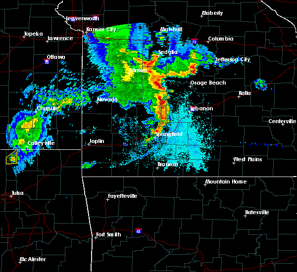 At 653 pm cdt, a severe thunderstorm was located near buffalo, moving east at 30 mph (radar indicated). Hazards include 60 mph wind gusts and quarter size hail. Hail damage to vehicles is expected. expect wind damage to roofs, siding, and trees. Locations impacted include, buffalo, louisburg, march, foose,. At 653 pm cdt, a severe thunderstorm was located near buffalo, moving east at 30 mph (radar indicated). Hazards include 60 mph wind gusts and quarter size hail. Hail damage to vehicles is expected. expect wind damage to roofs, siding, and trees. Locations impacted include, buffalo, louisburg, march, foose,.
|
| 5/19/2018 6:40 PM CDT |
 At 640 pm cdt, a severe thunderstorm was located 8 miles north of pleasant hope, or 8 miles east of bolivar, moving east at 30 mph (radar indicated). Hazards include 60 mph wind gusts and quarter size hail. Hail damage to vehicles is expected. expect wind damage to roofs, siding, and trees. Locations impacted include, buffalo, pleasant hope, halfway, louisburg, foose, march, goodson,. At 640 pm cdt, a severe thunderstorm was located 8 miles north of pleasant hope, or 8 miles east of bolivar, moving east at 30 mph (radar indicated). Hazards include 60 mph wind gusts and quarter size hail. Hail damage to vehicles is expected. expect wind damage to roofs, siding, and trees. Locations impacted include, buffalo, pleasant hope, halfway, louisburg, foose, march, goodson,.
|
| 5/19/2018 6:23 PM CDT |
 At 623 pm cdt, a severe thunderstorm was located near bolivar, moving east at 25 mph (radar indicated). Hazards include 60 mph wind gusts and quarter size hail. Hail damage to vehicles is expected. Expect wind damage to roofs, siding, and trees. At 623 pm cdt, a severe thunderstorm was located near bolivar, moving east at 25 mph (radar indicated). Hazards include 60 mph wind gusts and quarter size hail. Hail damage to vehicles is expected. Expect wind damage to roofs, siding, and trees.
|
| 5/19/2018 8:27 AM CDT |
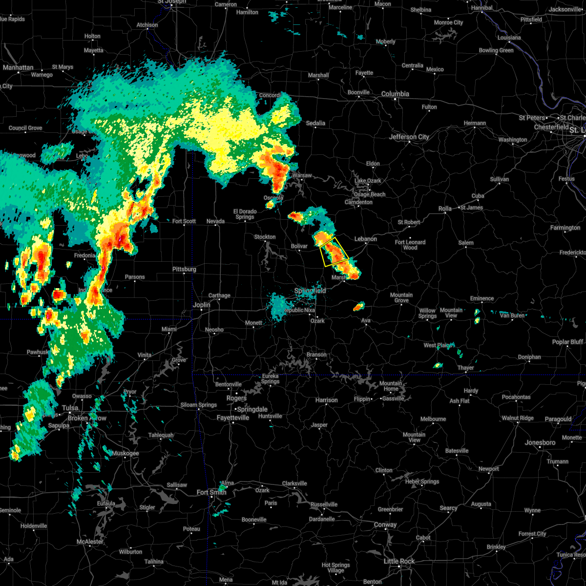 The severe thunderstorm warning for southern dallas county will expire at 830 am cdt, the storm which prompted the warning has weakened below severe limits, and no longer poses an immediate threat to life or property. therefore the warning will be allowed to expire. however small hail is still possible with this thunderstorm. The severe thunderstorm warning for southern dallas county will expire at 830 am cdt, the storm which prompted the warning has weakened below severe limits, and no longer poses an immediate threat to life or property. therefore the warning will be allowed to expire. however small hail is still possible with this thunderstorm.
|
| 5/19/2018 8:17 AM CDT |
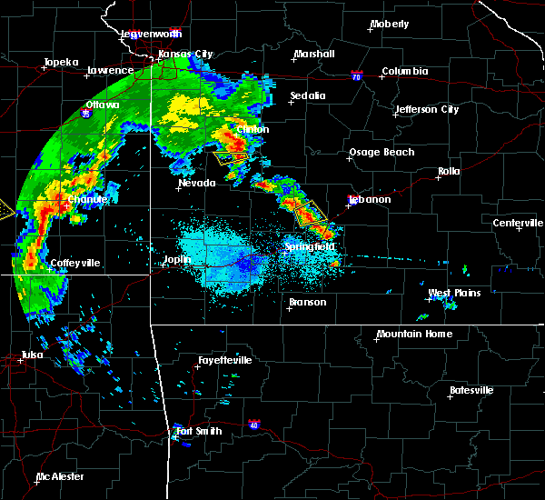 At 816 am cdt, a severe thunderstorm was located near buffalo, moving northeast at 20 mph (radar indicated). Hazards include 60 mph wind gusts and quarter size hail. Hail damage to vehicles is expected. expect wind damage to roofs, siding, and trees. Locations impacted include, buffalo, march, charity, foose, long lane,. At 816 am cdt, a severe thunderstorm was located near buffalo, moving northeast at 20 mph (radar indicated). Hazards include 60 mph wind gusts and quarter size hail. Hail damage to vehicles is expected. expect wind damage to roofs, siding, and trees. Locations impacted include, buffalo, march, charity, foose, long lane,.
|
| 5/19/2018 8:03 AM CDT |
 At 803 am cdt, a severe thunderstorm was located near pleasant hope, or 10 miles southwest of buffalo, moving northeast at 20 mph (radar indicated). Hazards include 60 mph wind gusts and quarter size hail. Hail damage to vehicles is expected. expect wind damage to roofs, siding, and trees. Locations impacted include, buffalo, halfway, march, charity, foose, long lane,. At 803 am cdt, a severe thunderstorm was located near pleasant hope, or 10 miles southwest of buffalo, moving northeast at 20 mph (radar indicated). Hazards include 60 mph wind gusts and quarter size hail. Hail damage to vehicles is expected. expect wind damage to roofs, siding, and trees. Locations impacted include, buffalo, halfway, march, charity, foose, long lane,.
|
| 5/19/2018 7:46 AM CDT |
 At 745 am cdt, a severe thunderstorm was located over pleasant hope, or 10 miles southeast of bolivar, moving northeast at 20 mph (radar indicated). Hazards include 60 mph wind gusts and quarter size hail. Hail damage to vehicles is expected. Expect wind damage to roofs, siding, and trees. At 745 am cdt, a severe thunderstorm was located over pleasant hope, or 10 miles southeast of bolivar, moving northeast at 20 mph (radar indicated). Hazards include 60 mph wind gusts and quarter size hail. Hail damage to vehicles is expected. Expect wind damage to roofs, siding, and trees.
|
| 6/30/2017 12:37 AM CDT |
 At 536 am cdt, severe thunderstorms were located along a line extending from 11 miles east of urbana to 6 miles southeast of buffalo to 6 miles northeast of fair grove to strafford to springfield, moving east at 45 mph (radar indicated). Hazards include 60 mph wind gusts. Expect damage to roofs, siding, and trees. Locations impacted include, springfield, republic, bennett spring state park, marshfield, battlefield, willard, buffalo, rogersville, strafford, fair grove, conway, pleasant hope, brookline, halfway, louisburg, windyville, elkland, glidewell, turners, march, this includes interstate 44 between mile markers 69 and 109. At 536 am cdt, severe thunderstorms were located along a line extending from 11 miles east of urbana to 6 miles southeast of buffalo to 6 miles northeast of fair grove to strafford to springfield, moving east at 45 mph (radar indicated). Hazards include 60 mph wind gusts. Expect damage to roofs, siding, and trees. Locations impacted include, springfield, republic, bennett spring state park, marshfield, battlefield, willard, buffalo, rogersville, strafford, fair grove, conway, pleasant hope, brookline, halfway, louisburg, windyville, elkland, glidewell, turners, march, this includes interstate 44 between mile markers 69 and 109.
|
| 6/30/2017 12:26 AM CDT |
 At 526 am cdt, severe thunderstorms were located along a line extending from 6 miles southeast of urbana to 6 miles south of buffalo to near pleasant hope to springfield to battlefield, moving east at 50 mph (radar indicated). Hazards include 60 mph wind gusts. Expect damage to roofs, siding, and trees. Locations impacted include, springfield, nixa, ozark, republic, bolivar, pomme de terre lake, bennett spring state park, marshfield, battlefield, willard, buffalo, rogersville, strafford, clever, fair grove, billings, fremont hills, conway, polk, pleasant hope, this includes interstate 44 between mile markers 61 and 109. At 526 am cdt, severe thunderstorms were located along a line extending from 6 miles southeast of urbana to 6 miles south of buffalo to near pleasant hope to springfield to battlefield, moving east at 50 mph (radar indicated). Hazards include 60 mph wind gusts. Expect damage to roofs, siding, and trees. Locations impacted include, springfield, nixa, ozark, republic, bolivar, pomme de terre lake, bennett spring state park, marshfield, battlefield, willard, buffalo, rogersville, strafford, clever, fair grove, billings, fremont hills, conway, polk, pleasant hope, this includes interstate 44 between mile markers 61 and 109.
|
| 6/30/2017 12:10 AM CDT |
 At 510 am cdt, severe thunderstorms were located along a line extending from near bolivar to willard to near billings, moving east at 45 mph (radar indicated). Hazards include 60 mph wind gusts. Expect damage to roofs, siding, and trees. Locations impacted include, springfield, nixa, ozark, republic, bolivar, pomme de terre lake, stockton lake, bennett spring state park, aurora, marshfield, battlefield, willard, buffalo, rogersville, strafford, marionville, clever, ash grove, fair grove, humansville, this includes interstate 44 between mile markers 53 and 109. At 510 am cdt, severe thunderstorms were located along a line extending from near bolivar to willard to near billings, moving east at 45 mph (radar indicated). Hazards include 60 mph wind gusts. Expect damage to roofs, siding, and trees. Locations impacted include, springfield, nixa, ozark, republic, bolivar, pomme de terre lake, stockton lake, bennett spring state park, aurora, marshfield, battlefield, willard, buffalo, rogersville, strafford, marionville, clever, ash grove, fair grove, humansville, this includes interstate 44 between mile markers 53 and 109.
|
| 6/30/2017 12:07 AM CDT |
 At 507 am cdt, severe thunderstorms were located along a line extending from near bolivar to near willard to near billings, moving east at 45 mph (radar indicated). Hazards include 60 mph wind gusts. expect damage to roofs, siding, and trees At 507 am cdt, severe thunderstorms were located along a line extending from near bolivar to near willard to near billings, moving east at 45 mph (radar indicated). Hazards include 60 mph wind gusts. expect damage to roofs, siding, and trees
|
| 6/17/2017 3:02 AM CDT |
 At 302 am cdt, severe thunderstorms were located along a line extending from near laurie to near macks creek to near urbana to near fair play to 8 miles west of stockton to walker, moving southeast at 55 mph (radar indicated). Hazards include 60 mph wind gusts. Expect damage to roofs, siding, and trees. Locations impacted include, bolivar, lake of the ozarks, pomme de terre lake, stockton lake, truman lake, pomme de terre state park, stockton state park, ha ha tonka state park, bennett spring state park, osage beach, camdenton, el dorado springs, buffalo, versailles, village of four seasons, stockton, pittsburg, cole camp, stover, humansville,. At 302 am cdt, severe thunderstorms were located along a line extending from near laurie to near macks creek to near urbana to near fair play to 8 miles west of stockton to walker, moving southeast at 55 mph (radar indicated). Hazards include 60 mph wind gusts. Expect damage to roofs, siding, and trees. Locations impacted include, bolivar, lake of the ozarks, pomme de terre lake, stockton lake, truman lake, pomme de terre state park, stockton state park, ha ha tonka state park, bennett spring state park, osage beach, camdenton, el dorado springs, buffalo, versailles, village of four seasons, stockton, pittsburg, cole camp, stover, humansville,.
|
| 6/17/2017 2:35 AM CDT |
 At 235 am cdt, severe thunderstorms were located along a line extending from near cole camp to 11 miles east of warsaw to 6 miles northwest of wheatland to 9 miles east of el dorado springs to 6 miles north of walker to near hume, moving southeast at 55 mph (radar indicated). Hazards include 60 mph wind gusts. expect damage to roofs, siding, and trees At 235 am cdt, severe thunderstorms were located along a line extending from near cole camp to 11 miles east of warsaw to 6 miles northwest of wheatland to 9 miles east of el dorado springs to 6 miles north of walker to near hume, moving southeast at 55 mph (radar indicated). Hazards include 60 mph wind gusts. expect damage to roofs, siding, and trees
|
| 5/27/2017 6:56 PM CDT |
 At 656 pm cdt, a severe thunderstorm was located near buffalo, moving southeast at 30 mph (radar indicated). Hazards include quarter size hail. damage to vehicles is expected At 656 pm cdt, a severe thunderstorm was located near buffalo, moving southeast at 30 mph (radar indicated). Hazards include quarter size hail. damage to vehicles is expected
|
| 5/27/2017 6:26 PM CDT |
 At 625 pm cdt, a severe thunderstorm was located 9 miles east of humansville, or 11 miles southwest of hermitage, moving east at 25 mph (public). Hazards include half dollar size hail. half dollar size hail was reported near flemington. Damage to vehicles is expected. Locations impacted include, pomme de terre lake, pomme de terre state park, pittsburg, polk, weaubleau, urbana, flemington, louisburg, tunas, pumpkin center, elkton, plad, goodson, nemo, a tornado watch remains in effect until 700 pm cdt for central and southwestern missouri. At 625 pm cdt, a severe thunderstorm was located 9 miles east of humansville, or 11 miles southwest of hermitage, moving east at 25 mph (public). Hazards include half dollar size hail. half dollar size hail was reported near flemington. Damage to vehicles is expected. Locations impacted include, pomme de terre lake, pomme de terre state park, pittsburg, polk, weaubleau, urbana, flemington, louisburg, tunas, pumpkin center, elkton, plad, goodson, nemo, a tornado watch remains in effect until 700 pm cdt for central and southwestern missouri.
|
| 5/27/2017 6:17 PM CDT |
 At 617 pm cdt, a severe thunderstorm was located near humansville, or 12 miles southwest of hermitage, moving east at 25 mph (radar indicated). Hazards include quarter size hail. damage to vehicles is expected At 617 pm cdt, a severe thunderstorm was located near humansville, or 12 miles southwest of hermitage, moving east at 25 mph (radar indicated). Hazards include quarter size hail. damage to vehicles is expected
|
| 5/27/2017 2:44 PM CDT |
 At 243 pm cdt, severe thunderstorms were located along a line extending from 10 miles northwest of lebanon to near battlefield, moving east at 40 mph (public. tree damage was reported with these storms in the pleasant hope area along the polk and greene county line). Hazards include 60 mph wind gusts and half dollar size hail. Hail damage to vehicles is expected. expect wind damage to roofs, siding, and trees. locations impacted include, springfield, republic, lebanon, bennett spring state park, marshfield, battlefield, willard, buffalo, rogersville, strafford, seymour, morgan, fair grove, fordland, conway, pleasant hope, niangua, brookline, diggins, phillipsburg, this includes interstate 44 between mile markers 64 and 140. A tornado watch remains in effect until 700 pm cdt for central and southwestern missouri. At 243 pm cdt, severe thunderstorms were located along a line extending from 10 miles northwest of lebanon to near battlefield, moving east at 40 mph (public. tree damage was reported with these storms in the pleasant hope area along the polk and greene county line). Hazards include 60 mph wind gusts and half dollar size hail. Hail damage to vehicles is expected. expect wind damage to roofs, siding, and trees. locations impacted include, springfield, republic, lebanon, bennett spring state park, marshfield, battlefield, willard, buffalo, rogersville, strafford, seymour, morgan, fair grove, fordland, conway, pleasant hope, niangua, brookline, diggins, phillipsburg, this includes interstate 44 between mile markers 64 and 140. A tornado watch remains in effect until 700 pm cdt for central and southwestern missouri.
|
| 5/27/2017 2:33 PM CDT |
 At 232 pm cdt, severe thunderstorms were located along a line extending from 11 miles northeast of buffalo to near republic, moving east at 40 mph (radar indicated). Hazards include 60 mph wind gusts and half dollar size hail. Hail damage to vehicles is expected. Expect wind damage to roofs, siding, and trees. At 232 pm cdt, severe thunderstorms were located along a line extending from 11 miles northeast of buffalo to near republic, moving east at 40 mph (radar indicated). Hazards include 60 mph wind gusts and half dollar size hail. Hail damage to vehicles is expected. Expect wind damage to roofs, siding, and trees.
|
| 5/27/2017 2:30 PM CDT |
 At 229 pm cdt, severe thunderstorms were located along a line extending from near morrisville to near buffalo, moving east at 45 mph (law enforcement. this storm has a history of producing large hail in polk county). Hazards include ping pong ball size hail and 60 mph wind gusts. People and animals outdoors will be injured. expect hail damage to roofs, siding, windows, and vehicles. expect wind damage to roofs, siding, and trees. Locations impacted include, bolivar, stockton lake, buffalo, polk, pleasant hope, fair play, morrisville, dadeville, halfway, louisburg, aldrich, windyville, brighton, march, pumpkin center, olive, eudora, foose, plad, goodson, a tornado watch remains in effect until 700 pm cdt for southwestern missouri. At 229 pm cdt, severe thunderstorms were located along a line extending from near morrisville to near buffalo, moving east at 45 mph (law enforcement. this storm has a history of producing large hail in polk county). Hazards include ping pong ball size hail and 60 mph wind gusts. People and animals outdoors will be injured. expect hail damage to roofs, siding, windows, and vehicles. expect wind damage to roofs, siding, and trees. Locations impacted include, bolivar, stockton lake, buffalo, polk, pleasant hope, fair play, morrisville, dadeville, halfway, louisburg, aldrich, windyville, brighton, march, pumpkin center, olive, eudora, foose, plad, goodson, a tornado watch remains in effect until 700 pm cdt for southwestern missouri.
|
| 5/27/2017 2:18 PM CDT |
 At 217 pm cdt, severe thunderstorms were located along a line extending from 9 miles southwest of fair play to 6 miles west of buffalo, moving east at 25 mph (law enforcement. golf ball sized hail was just reported along highway 13 south of bolivar). Hazards include golf ball size hail and 60 mph wind gusts. People and animals outdoors will be injured. expect hail damage to roofs, siding, windows, and vehicles. expect wind damage to roofs, siding, and trees. Locations impacted include, bolivar, stockton lake, pomme de terre lake, stockton state park, buffalo, polk, pleasant hope, fair play, morrisville, dadeville, halfway, flemington, louisburg, aldrich, windyville, bearcreek, march, cane hill, pumpkin center, eudora, a tornado watch remains in effect until 700 pm cdt for southwestern missouri. At 217 pm cdt, severe thunderstorms were located along a line extending from 9 miles southwest of fair play to 6 miles west of buffalo, moving east at 25 mph (law enforcement. golf ball sized hail was just reported along highway 13 south of bolivar). Hazards include golf ball size hail and 60 mph wind gusts. People and animals outdoors will be injured. expect hail damage to roofs, siding, windows, and vehicles. expect wind damage to roofs, siding, and trees. Locations impacted include, bolivar, stockton lake, pomme de terre lake, stockton state park, buffalo, polk, pleasant hope, fair play, morrisville, dadeville, halfway, flemington, louisburg, aldrich, windyville, bearcreek, march, cane hill, pumpkin center, eudora, a tornado watch remains in effect until 700 pm cdt for southwestern missouri.
|
| 5/27/2017 2:06 PM CDT |
 At 205 pm cdt, severe thunderstorms were located along a line extending from 7 miles south of stockton to 6 miles east of bolivar, moving northeast at 30 mph (emergency management. multiple instances of severe hail have been received with this area of thunderstorms). Hazards include ping pong ball size hail and 60 mph wind gusts. People and animals outdoors will be injured. expect hail damage to roofs, siding, windows, and vehicles. Expect wind damage to roofs, siding, and trees. At 205 pm cdt, severe thunderstorms were located along a line extending from 7 miles south of stockton to 6 miles east of bolivar, moving northeast at 30 mph (emergency management. multiple instances of severe hail have been received with this area of thunderstorms). Hazards include ping pong ball size hail and 60 mph wind gusts. People and animals outdoors will be injured. expect hail damage to roofs, siding, windows, and vehicles. Expect wind damage to roofs, siding, and trees.
|
| 5/26/2017 4:46 AM CDT |
 At 445 am cdt, severe thunderstorms were located along a line extending from near hermitage to buffalo, moving east at 55 mph (radar indicated). Hazards include quarter size hail. damage to vehicles is expected At 445 am cdt, severe thunderstorms were located along a line extending from near hermitage to buffalo, moving east at 55 mph (radar indicated). Hazards include quarter size hail. damage to vehicles is expected
|
| 5/19/2017 4:57 PM CDT |
 At 456 pm cdt, a severe squall line capable of producing both tornadoes and extensive straight line wind damage was located along a line extending from 6 miles southeast of weaubleau to 6 miles southwest of urbana to near buffalo to 11 miles northeast of fair grove, moving northeast at 45 mph (radar indicated rotation). Hazards include tornado. Flying debris will be dangerous to those caught without shelter. mobile homes will be damaged or destroyed. damage to roofs, windows, and vehicles will occur. tree damage is likely. Locations impacted include, pomme de terre lake, pomme de terre state park, bennett spring state park, buffalo, pittsburg, polk, hermitage, urbana, preston, cross timbers, flemington, louisburg, windyville, leadmine, march, tunas, pumpkin center, elkton, foose, plad,. At 456 pm cdt, a severe squall line capable of producing both tornadoes and extensive straight line wind damage was located along a line extending from 6 miles southeast of weaubleau to 6 miles southwest of urbana to near buffalo to 11 miles northeast of fair grove, moving northeast at 45 mph (radar indicated rotation). Hazards include tornado. Flying debris will be dangerous to those caught without shelter. mobile homes will be damaged or destroyed. damage to roofs, windows, and vehicles will occur. tree damage is likely. Locations impacted include, pomme de terre lake, pomme de terre state park, bennett spring state park, buffalo, pittsburg, polk, hermitage, urbana, preston, cross timbers, flemington, louisburg, windyville, leadmine, march, tunas, pumpkin center, elkton, foose, plad,.
|
| 5/19/2017 4:36 PM CDT |
 At 435 pm cdt, severe thunderstorms capable of producing both tornadoes and extensive straight line wind damage were located along a line extending from near fair play to near bolivar to pleasant hope to 6 miles west of fair grove, moving northeast at 50 mph (radar indicated rotation). Hazards include tornado. Flying debris will be dangerous to those caught without shelter. mobile homes will be damaged or destroyed. damage to roofs, windows, and vehicles will occur. Tree damage is likely. At 435 pm cdt, severe thunderstorms capable of producing both tornadoes and extensive straight line wind damage were located along a line extending from near fair play to near bolivar to pleasant hope to 6 miles west of fair grove, moving northeast at 50 mph (radar indicated rotation). Hazards include tornado. Flying debris will be dangerous to those caught without shelter. mobile homes will be damaged or destroyed. damage to roofs, windows, and vehicles will occur. Tree damage is likely.
|
| 4/4/2017 8:30 PM CDT |
 At 830 pm cdt, severe thunderstorms were located along a line extending from near pleasant hope to near fair grove to near strafford to near nixa, moving northeast at 45 mph (radar indicated). Hazards include 60 mph wind gusts and quarter size hail. Hail damage to vehicles is expected. Expect wind damage to roofs, siding, and trees. At 830 pm cdt, severe thunderstorms were located along a line extending from near pleasant hope to near fair grove to near strafford to near nixa, moving northeast at 45 mph (radar indicated). Hazards include 60 mph wind gusts and quarter size hail. Hail damage to vehicles is expected. Expect wind damage to roofs, siding, and trees.
|
| 3/21/2017 12:38 PM CDT | Quarter sized hail reported 0.5 miles W of Buffalo, MO, . |
| 3/21/2017 12:30 PM CDT |
 At 1229 pm cdt, a severe thunderstorm was located near buffalo, moving southeast at 25 mph (radar indicated). Hazards include quarter size hail. Damage to vehicles is expected. Locations impacted include, buffalo, long lane,. At 1229 pm cdt, a severe thunderstorm was located near buffalo, moving southeast at 25 mph (radar indicated). Hazards include quarter size hail. Damage to vehicles is expected. Locations impacted include, buffalo, long lane,.
|
| 3/21/2017 11:59 AM CDT |
 At 1158 am cdt, a severe thunderstorm was located 9 miles northeast of bolivar, moving east at 30 mph (radar indicated). Hazards include quarter size hail. Damage to vehicles is expected. Locations impacted include, bennett spring state park, buffalo, windyville, goodson, plad, long lane, pumpkin center,. At 1158 am cdt, a severe thunderstorm was located 9 miles northeast of bolivar, moving east at 30 mph (radar indicated). Hazards include quarter size hail. Damage to vehicles is expected. Locations impacted include, bennett spring state park, buffalo, windyville, goodson, plad, long lane, pumpkin center,.
|
| 3/21/2017 11:38 AM CDT |
 At 1138 am cdt, a severe thunderstorm was located 8 miles north of bolivar, moving east at 35 mph (radar indicated). Hazards include quarter size hail. damage to vehicles is expected At 1138 am cdt, a severe thunderstorm was located 8 miles north of bolivar, moving east at 35 mph (radar indicated). Hazards include quarter size hail. damage to vehicles is expected
|
| 3/9/2017 3:00 PM CST |
 At 300 pm cst, a severe thunderstorm was located near buffalo, moving east at 45 mph (radar indicated). Hazards include 60 mph wind gusts and quarter size hail. Hail damage to vehicles is expected. Expect wind damage to roofs, siding, and trees. At 300 pm cst, a severe thunderstorm was located near buffalo, moving east at 45 mph (radar indicated). Hazards include 60 mph wind gusts and quarter size hail. Hail damage to vehicles is expected. Expect wind damage to roofs, siding, and trees.
|
| 3/6/2017 10:46 PM CST |
 At 1045 pm cst, severe thunderstorms were located along a line extending from buffalo to near willard, moving east at 65 mph (law enforcement. the springfield airport just measured a 65 mph wind gusts with these storms. numerous reports of wind damage to structures and trees down with these storms). Hazards include 70 mph wind gusts and quarter size hail. Hail damage to vehicles is expected. expect considerable tree damage. wind damage is also likely to mobile homes, roofs, and outbuildings. locations impacted include, springfield, nixa, ozark, republic, lebanon, bolivar, bennett spring state park, marshfield, battlefield, willard, buffalo, strafford, clever, ash grove, fair grove, billings, fremont hills, conway, polk, pleasant hope, this includes interstate 44 between mile markers 53 and 142. A tornado watch remains in effect until 300 am cst for central and southwestern missouri. At 1045 pm cst, severe thunderstorms were located along a line extending from buffalo to near willard, moving east at 65 mph (law enforcement. the springfield airport just measured a 65 mph wind gusts with these storms. numerous reports of wind damage to structures and trees down with these storms). Hazards include 70 mph wind gusts and quarter size hail. Hail damage to vehicles is expected. expect considerable tree damage. wind damage is also likely to mobile homes, roofs, and outbuildings. locations impacted include, springfield, nixa, ozark, republic, lebanon, bolivar, bennett spring state park, marshfield, battlefield, willard, buffalo, strafford, clever, ash grove, fair grove, billings, fremont hills, conway, polk, pleasant hope, this includes interstate 44 between mile markers 53 and 142. A tornado watch remains in effect until 300 am cst for central and southwestern missouri.
|
| 3/6/2017 10:19 PM CST |
 At 1019 pm cst, severe thunderstorms were located along a line extending from humansville to 6 miles south of greenfield, moving east at 60 mph (radar indicated). Hazards include 70 mph wind gusts and quarter size hail. Hail damage to vehicles is expected. expect considerable tree damage. Wind damage is also likely to mobile homes, roofs, and outbuildings. At 1019 pm cst, severe thunderstorms were located along a line extending from humansville to 6 miles south of greenfield, moving east at 60 mph (radar indicated). Hazards include 70 mph wind gusts and quarter size hail. Hail damage to vehicles is expected. expect considerable tree damage. Wind damage is also likely to mobile homes, roofs, and outbuildings.
|
| 3/1/2017 12:57 AM CST |
 At 1256 am cst, severe thunderstorms were located along a line extending from 11 miles north of lebanon to 7 miles southwest of buffalo, moving east at 100 mph (radar indicated). Hazards include 60 mph wind gusts and quarter size hail. Hail damage to vehicles is expected. expect wind damage to roofs, siding, and trees. these severe storms will be near, conway around 105 am cst. lebanon around 115 am cst. other locations impacted by these severe thunderstorms include bennett spring state park, morgan, phillipsburg, stoutland, bennett springs, twin bridges, windyville, eldridge, march and sleeper. this includes interstate 44 between mile markers 110 and 143. A tornado watch remains in effect until 400 am cst for central, south central and southwestern missouri. At 1256 am cst, severe thunderstorms were located along a line extending from 11 miles north of lebanon to 7 miles southwest of buffalo, moving east at 100 mph (radar indicated). Hazards include 60 mph wind gusts and quarter size hail. Hail damage to vehicles is expected. expect wind damage to roofs, siding, and trees. these severe storms will be near, conway around 105 am cst. lebanon around 115 am cst. other locations impacted by these severe thunderstorms include bennett spring state park, morgan, phillipsburg, stoutland, bennett springs, twin bridges, windyville, eldridge, march and sleeper. this includes interstate 44 between mile markers 110 and 143. A tornado watch remains in effect until 400 am cst for central, south central and southwestern missouri.
|
| 3/1/2017 12:48 AM CST |
 At 1248 am cst, a severe thunderstorm was located near buffalo, moving east at 60 mph (radar indicated). Hazards include 60 mph wind gusts and quarter size hail. Hail damage to vehicles is expected. expect wind damage to roofs, siding, and trees. this severe thunderstorm will be near, lebanon around 115 am cst. other locations impacted by this severe thunderstorm include bennett spring state park, morgan, phillipsburg, stoutland, halfway, bennett springs, twin bridges, windyville, eldridge and march. this includes interstate 44 between mile markers 110 and 143. A tornado watch remains in effect until 400 am cst for central, south central and southwestern missouri. At 1248 am cst, a severe thunderstorm was located near buffalo, moving east at 60 mph (radar indicated). Hazards include 60 mph wind gusts and quarter size hail. Hail damage to vehicles is expected. expect wind damage to roofs, siding, and trees. this severe thunderstorm will be near, lebanon around 115 am cst. other locations impacted by this severe thunderstorm include bennett spring state park, morgan, phillipsburg, stoutland, halfway, bennett springs, twin bridges, windyville, eldridge and march. this includes interstate 44 between mile markers 110 and 143. A tornado watch remains in effect until 400 am cst for central, south central and southwestern missouri.
|
| 10/19/2016 9:48 PM CDT |
 At 948 pm cdt, a severe thunderstorm was located near buffalo, moving northeast at 35 mph (radar indicated). Hazards include quarter size hail. Damage to vehicles is expected. Locations impacted include, bennett spring state park, buffalo, pumpkin center, plad, windyville,. At 948 pm cdt, a severe thunderstorm was located near buffalo, moving northeast at 35 mph (radar indicated). Hazards include quarter size hail. Damage to vehicles is expected. Locations impacted include, bennett spring state park, buffalo, pumpkin center, plad, windyville,.
|
| 10/19/2016 9:45 PM CDT | Quarter sized hail reported 0.8 miles NW of Buffalo, MO, nickle to quarter size hail fell for 5 to 10 minutes. |
| 10/19/2016 9:38 PM CDT |
 At 938 pm cdt, a severe thunderstorm was located over buffalo, moving east at 40 mph (radar indicated). Hazards include quarter size hail. damage to vehicles is expected At 938 pm cdt, a severe thunderstorm was located over buffalo, moving east at 40 mph (radar indicated). Hazards include quarter size hail. damage to vehicles is expected
|
| 8/25/2016 7:19 PM CDT |
 At 719 pm cdt, severe thunderstorms were located along a line extending from near urbana to 6 miles southwest of buffalo, moving east at 10 mph (radar indicated). Hazards include 60 mph wind gusts and penny size hail. Expect damage to roofs. siding. and trees. Locations impacted include, buffalo, urbana, halfway, louisburg, tunas, pumpkin center, plad, foose,. At 719 pm cdt, severe thunderstorms were located along a line extending from near urbana to 6 miles southwest of buffalo, moving east at 10 mph (radar indicated). Hazards include 60 mph wind gusts and penny size hail. Expect damage to roofs. siding. and trees. Locations impacted include, buffalo, urbana, halfway, louisburg, tunas, pumpkin center, plad, foose,.
|
| 8/25/2016 6:53 PM CDT |
 At 652 pm cdt, severe thunderstorms were located along a line extending from 6 miles south of urbana to 8 miles southwest of buffalo, moving northeast at 15 mph (radar indicated). Hazards include 60 mph wind gusts and quarter size hail. Hail damage to vehicles is expected. Expect wind damage to roofs, siding, and trees. At 652 pm cdt, severe thunderstorms were located along a line extending from 6 miles south of urbana to 8 miles southwest of buffalo, moving northeast at 15 mph (radar indicated). Hazards include 60 mph wind gusts and quarter size hail. Hail damage to vehicles is expected. Expect wind damage to roofs, siding, and trees.
|
| 8/25/2016 6:24 PM CDT |
 At 623 pm cdt, severe thunderstorms were located along a line extending from 3 miles west of morrisville to 8 miles east of bolivar, moving northeast at 20 mph (radar indicated). Hazards include 60 mph wind gusts. Expect damage to roofs. siding. and trees. Locations impacted include, bolivar, stockton lake, buffalo, polk, morrisville, halfway, louisburg, aldrich, eudora, goodson, plad, foose, pumpkin center,. At 623 pm cdt, severe thunderstorms were located along a line extending from 3 miles west of morrisville to 8 miles east of bolivar, moving northeast at 20 mph (radar indicated). Hazards include 60 mph wind gusts. Expect damage to roofs. siding. and trees. Locations impacted include, bolivar, stockton lake, buffalo, polk, morrisville, halfway, louisburg, aldrich, eudora, goodson, plad, foose, pumpkin center,.
|
| 8/25/2016 6:02 PM CDT |
 At 601 pm cdt, a severe thunderstorm was located 2 miles northwest of walnut grove, or 13 miles southwest of bolivar, moving northeast at 30 mph. another severe thunderstorm was located 2 miles southeast of bolivar, and moving northeast at 30 mph (radar indicated). Hazards include 60 mph wind gusts. Expect damage to roofs. siding. And trees. At 601 pm cdt, a severe thunderstorm was located 2 miles northwest of walnut grove, or 13 miles southwest of bolivar, moving northeast at 30 mph. another severe thunderstorm was located 2 miles southeast of bolivar, and moving northeast at 30 mph (radar indicated). Hazards include 60 mph wind gusts. Expect damage to roofs. siding. And trees.
|
| 8/2/2016 10:07 PM CDT |
 At 1007 pm cdt, a severe thunderstorm was located 8 miles northeast of buffalo, moving east at 15 mph (radar indicated). Hazards include 60 mph wind gusts and quarter size hail. Hail damage to vehicles is expected. Expect wind damage to roofs, siding, and trees. At 1007 pm cdt, a severe thunderstorm was located 8 miles northeast of buffalo, moving east at 15 mph (radar indicated). Hazards include 60 mph wind gusts and quarter size hail. Hail damage to vehicles is expected. Expect wind damage to roofs, siding, and trees.
|
| 7/7/2016 7:53 AM CDT |
 At 753 am cdt, severe thunderstorms were located along a line extending from 6 miles southwest of belle to near richland to 8 miles northeast of pleasant hope, moving southeast at 30 mph (radar indicated). Hazards include 60 mph wind gusts. Expect damage to roofs. siding. and trees. locations impacted include, rolla, fort leonard wood, lebanon, bennett spring state park, waynesville, st. robert, st. James, buffalo, richland, dixon, belle, morgan, crocker, conway, doolittle, vienna, newburg, urbana, edgar springs, phillipsburg, this includes interstate 44 between mile markers 110 and 169, and between mile markers 171 and 200. At 753 am cdt, severe thunderstorms were located along a line extending from 6 miles southwest of belle to near richland to 8 miles northeast of pleasant hope, moving southeast at 30 mph (radar indicated). Hazards include 60 mph wind gusts. Expect damage to roofs. siding. and trees. locations impacted include, rolla, fort leonard wood, lebanon, bennett spring state park, waynesville, st. robert, st. James, buffalo, richland, dixon, belle, morgan, crocker, conway, doolittle, vienna, newburg, urbana, edgar springs, phillipsburg, this includes interstate 44 between mile markers 110 and 169, and between mile markers 171 and 200.
|
| 7/7/2016 7:09 AM CDT |
 At 708 am cdt, severe thunderstorms were located along a line extending from near hickory hill to near camdenton to near urbana, moving southeast at 60 mph (law enforcement). Hazards include 60 mph wind gusts. Expect damage to roofs. siding. And trees. At 708 am cdt, severe thunderstorms were located along a line extending from near hickory hill to near camdenton to near urbana, moving southeast at 60 mph (law enforcement). Hazards include 60 mph wind gusts. Expect damage to roofs. siding. And trees.
|
| 6/30/2016 7:24 PM CDT |
 The severe thunderstorm warning for southwestern dallas and southeastern polk counties will expire at 730 pm cdt, the storms which prompted the warning have weakened below severe limits, and no longer pose an immediate threat to life or property. therefore the warning will be allowed to expire. to report severe weather, contact your nearest law enforcement agency. they will relay your report to the national weather service springfield. The severe thunderstorm warning for southwestern dallas and southeastern polk counties will expire at 730 pm cdt, the storms which prompted the warning have weakened below severe limits, and no longer pose an immediate threat to life or property. therefore the warning will be allowed to expire. to report severe weather, contact your nearest law enforcement agency. they will relay your report to the national weather service springfield.
|
| 6/30/2016 7:01 PM CDT |
 At 701 pm cdt, severe thunderstorms were located along a line extending from near buffalo to near bolivar, moving south at 25 mph (radar indicated). Hazards include 60 mph wind gusts. Expect damage to roofs. siding. and trees. Locations impacted include, bolivar, buffalo, pleasant hope, morrisville, halfway, brighton, march, foose,. At 701 pm cdt, severe thunderstorms were located along a line extending from near buffalo to near bolivar, moving south at 25 mph (radar indicated). Hazards include 60 mph wind gusts. Expect damage to roofs. siding. and trees. Locations impacted include, bolivar, buffalo, pleasant hope, morrisville, halfway, brighton, march, foose,.
|
| 6/30/2016 6:37 PM CDT |
 At 637 pm cdt, severe thunderstorms were located along a line extending from near urbana to 7 miles northeast of fair play, moving southeast at 25 mph (radar indicated). Hazards include 60 mph wind gusts. Expect damage to roofs. siding. And trees. At 637 pm cdt, severe thunderstorms were located along a line extending from near urbana to 7 miles northeast of fair play, moving southeast at 25 mph (radar indicated). Hazards include 60 mph wind gusts. Expect damage to roofs. siding. And trees.
|
| 6/15/2016 4:54 AM CDT | The severe thunderstorm warning for central dallas, laclede and southern camden counties will expire at 500 am cdt, the storms which prompted the warning have weakened below severe limits, and no longer pose an immediate threat to life or property. therefore the warning will be allowed to expire. however gusty winds and heavy rain are still possible with these thunderstorms. to report severe weather, contact your nearest law enforcement agency. they will relay your report to the national weather service springfield. |
| 6/15/2016 4:29 AM CDT |
 At 427 am cdt, severe thunderstorms were located along a line extending from near camdenton to 12 miles southeast of macks creek to 7 miles east of buffalo, moving east at 35 mph (radar indicated). Hazards include 60 mph wind gusts and penny size hail. Expect damage to roofs. siding. and trees. Locations impacted include, lebanon, lake of the ozarks, ha ha tonka state park, bennett spring state park, lake of the ozarks state park, camdenton, buffalo, richland, macks creek, linn creek, phillipsburg, stoutland, bennett springs, louisburg, twin bridges, tunas, branch, plad, decaturville, dry knob, this includes interstate 44 between mile markers 115 and 144. At 427 am cdt, severe thunderstorms were located along a line extending from near camdenton to 12 miles southeast of macks creek to 7 miles east of buffalo, moving east at 35 mph (radar indicated). Hazards include 60 mph wind gusts and penny size hail. Expect damage to roofs. siding. and trees. Locations impacted include, lebanon, lake of the ozarks, ha ha tonka state park, bennett spring state park, lake of the ozarks state park, camdenton, buffalo, richland, macks creek, linn creek, phillipsburg, stoutland, bennett springs, louisburg, twin bridges, tunas, branch, plad, decaturville, dry knob, this includes interstate 44 between mile markers 115 and 144.
|
| 6/15/2016 4:06 AM CDT |
 At 405 am cdt, severe thunderstorms were located along a line extending from 15 miles southwest of laurie to near macks creek to near buffalo, moving east at 35 mph (radar indicated). Hazards include 60 mph wind gusts and quarter size hail. Hail damage to vehicles is expected. Expect wind damage to roofs, siding, and trees. At 405 am cdt, severe thunderstorms were located along a line extending from 15 miles southwest of laurie to near macks creek to near buffalo, moving east at 35 mph (radar indicated). Hazards include 60 mph wind gusts and quarter size hail. Hail damage to vehicles is expected. Expect wind damage to roofs, siding, and trees.
|
| 8/23/2015 4:22 AM CDT |
 At 422 am cdt, severe thunderstorms were located along a line extending from 6 miles west of commerce to near diamond to near mount vernon to near morrisville to 6 miles northeast of bolivar, moving southeast at 45 mph (radar indicated). Hazards include 60 mph wind gusts. Expect damage to roofs. Siding and trees. At 422 am cdt, severe thunderstorms were located along a line extending from 6 miles west of commerce to near diamond to near mount vernon to near morrisville to 6 miles northeast of bolivar, moving southeast at 45 mph (radar indicated). Hazards include 60 mph wind gusts. Expect damage to roofs. Siding and trees.
|
| 8/17/2015 4:54 PM CDT |
 At 453 pm cdt, a severe thunderstorm was located near 5 miles southwest of buffalo, moving northeast at 10 mph (radar indicated). Hazards include 60 mph wind gusts. Expect damage to roofs. Siding and trees. At 453 pm cdt, a severe thunderstorm was located near 5 miles southwest of buffalo, moving northeast at 10 mph (radar indicated). Hazards include 60 mph wind gusts. Expect damage to roofs. Siding and trees.
|
| 7/24/2015 8:23 PM CDT |
 At 821 pm cdt, severe thunderstorms were located along a line extending from 7 miles north of pleasant hope to 12 miles east of pleasant hope to 14 miles southeast of conway, and moving south at 45 mph (emergency management. these storms have a history of producing wind damage across laclede, dallas counties and northwestern wright counties). Hazards include 70 mph wind gusts and nickel size hail. Expect considerable tree damage. damage is likely to mobile homes, roofs and outbuildings. locations impacted include, buffalo, conway and pleasant hope. interstate 44 between mile markers 102 and 116 will also be impacted by severe thunderstorms. A severe thunderstorm watch remains in effect until midnight cdt saturday morning for southwest missouri. At 821 pm cdt, severe thunderstorms were located along a line extending from 7 miles north of pleasant hope to 12 miles east of pleasant hope to 14 miles southeast of conway, and moving south at 45 mph (emergency management. these storms have a history of producing wind damage across laclede, dallas counties and northwestern wright counties). Hazards include 70 mph wind gusts and nickel size hail. Expect considerable tree damage. damage is likely to mobile homes, roofs and outbuildings. locations impacted include, buffalo, conway and pleasant hope. interstate 44 between mile markers 102 and 116 will also be impacted by severe thunderstorms. A severe thunderstorm watch remains in effect until midnight cdt saturday morning for southwest missouri.
|
| 7/24/2015 8:07 PM CDT |
 At 805 pm cdt, severe thunderstorms were located along a line extending from 8 miles west of buffalo to 10 miles southeast of buffalo to 13 miles southeast of conway, and moving south at 40 mph (emergency management. these storms have downed power lines and trees throughout portions of dallas and laclede counties). Hazards include 70 mph wind gusts and nickel size hail. Expect considerable tree damage. damage is likely to mobile homes, roofs and outbuildings. locations impacted include, buffalo, conway and pleasant hope. this warning also includes bennett spring state park. Interstate 44 between mile markers 102 and 123 will also be impacted by severe thunderstorms. At 805 pm cdt, severe thunderstorms were located along a line extending from 8 miles west of buffalo to 10 miles southeast of buffalo to 13 miles southeast of conway, and moving south at 40 mph (emergency management. these storms have downed power lines and trees throughout portions of dallas and laclede counties). Hazards include 70 mph wind gusts and nickel size hail. Expect considerable tree damage. damage is likely to mobile homes, roofs and outbuildings. locations impacted include, buffalo, conway and pleasant hope. this warning also includes bennett spring state park. Interstate 44 between mile markers 102 and 123 will also be impacted by severe thunderstorms.
|
| 7/24/2015 7:54 PM CDT |
 At 752 pm cdt, severe thunderstorms were located along a line extending from 11 miles northwest of buffalo to buffalo to 10 miles east of conway, and moving south at 45 mph (radar indicated). Hazards include 70 mph wind gusts and nickel size hail. Expect considerable tree damage. damage is likely to mobile homes, roofs and outbuildings. locations impacted include, buffalo, conway and pleasant hope. this warning also includes bennett spring state park. interstate 44 between mile markers 102 and 123 will also be impacted by severe thunderstorms. A severe thunderstorm watch remains in effect until midnight cdt saturday morning for southwest missouri. At 752 pm cdt, severe thunderstorms were located along a line extending from 11 miles northwest of buffalo to buffalo to 10 miles east of conway, and moving south at 45 mph (radar indicated). Hazards include 70 mph wind gusts and nickel size hail. Expect considerable tree damage. damage is likely to mobile homes, roofs and outbuildings. locations impacted include, buffalo, conway and pleasant hope. this warning also includes bennett spring state park. interstate 44 between mile markers 102 and 123 will also be impacted by severe thunderstorms. A severe thunderstorm watch remains in effect until midnight cdt saturday morning for southwest missouri.
|
| 7/24/2015 7:40 PM CDT |
 At 739 pm cdt, severe thunderstorms were located along a line extending from 24 miles northwest of buffalo to 8 miles northeast of buffalo to 15 miles northeast of conway, and moving south at 40 mph (radar indicated). Hazards include 60 mph wind gusts and nickel size hail. Expect damage to roofs. Siding and trees. At 739 pm cdt, severe thunderstorms were located along a line extending from 24 miles northwest of buffalo to 8 miles northeast of buffalo to 15 miles northeast of conway, and moving south at 40 mph (radar indicated). Hazards include 60 mph wind gusts and nickel size hail. Expect damage to roofs. Siding and trees.
|
| 7/2/2015 12:39 AM CDT |
 The severe thunderstorm warning for dallas, extreme northeastern wright, southeastern st. clair, polk, laclede, hickory and eastern cedar counties will expire at 1245 am cdt, the line of storms which prompted the warning has weakened below severe limits, and no longer poses an immediate threat to life or property. however, gusty winds and heavy rain are still possible with these thunderstorms. a severe thunderstorm watch remains in effect until 400 am cdt thursday morning for southeast kansas and southwestern missouri. The severe thunderstorm warning for dallas, extreme northeastern wright, southeastern st. clair, polk, laclede, hickory and eastern cedar counties will expire at 1245 am cdt, the line of storms which prompted the warning has weakened below severe limits, and no longer poses an immediate threat to life or property. however, gusty winds and heavy rain are still possible with these thunderstorms. a severe thunderstorm watch remains in effect until 400 am cdt thursday morning for southeast kansas and southwestern missouri.
|
| 7/2/2015 12:20 AM CDT |
 At 1217 am cdt, severe thunderstorms were located along a line extending from humansville to 18 miles southeast of lebanon, and moving south southeast at 25 mph (radar indicated). Hazards include 60 mph wind gusts and nickel size hail. Expect damage to roofs. siding and trees. locations impacted include, bolivar, buffalo, conway, extreme southwestern fort leonard wood, fair play, hermitage, humansville, lebanon, stockton, urbana, weaubleau and wheatland. this warning also includes bennett spring state park, pomme de terre lake, pomme de terre state park, stockton lake and truman lake. interstate 44 between mile markers 109 and 143 will also be impacted by severe thunderstorms. A severe thunderstorm watch remains in effect until 400 am cdt thursday morning for southeast kansas and southwestern missouri. At 1217 am cdt, severe thunderstorms were located along a line extending from humansville to 18 miles southeast of lebanon, and moving south southeast at 25 mph (radar indicated). Hazards include 60 mph wind gusts and nickel size hail. Expect damage to roofs. siding and trees. locations impacted include, bolivar, buffalo, conway, extreme southwestern fort leonard wood, fair play, hermitage, humansville, lebanon, stockton, urbana, weaubleau and wheatland. this warning also includes bennett spring state park, pomme de terre lake, pomme de terre state park, stockton lake and truman lake. interstate 44 between mile markers 109 and 143 will also be impacted by severe thunderstorms. A severe thunderstorm watch remains in effect until 400 am cdt thursday morning for southeast kansas and southwestern missouri.
|
| 7/1/2015 11:50 PM CDT |
 At 1148 pm cdt, severe thunderstorms were located along a line extending from weaubleau to 19 miles southeast of fort leonard wood, and moving southeast at 25 mph (radar indicated). Hazards include 60 mph wind gusts and quarter size hail. Hail damage to vehicles is expected. Expect wind damage to roofs, siding and trees. At 1148 pm cdt, severe thunderstorms were located along a line extending from weaubleau to 19 miles southeast of fort leonard wood, and moving southeast at 25 mph (radar indicated). Hazards include 60 mph wind gusts and quarter size hail. Hail damage to vehicles is expected. Expect wind damage to roofs, siding and trees.
|
| 7/1/2015 10:48 PM CDT |
 At 1045 pm cdt, severe thunderstorms were located along a line extending from 7 miles northwest of wheatland to 7 miles west of macks creek to 13 miles southeast of camdenton, and moving south at 35 mph (radar indicated). Hazards include 60 mph wind gusts and quarter size hail. Hail damage to vehicles is expected. Expect wind damage to roofs, siding and trees. At 1045 pm cdt, severe thunderstorms were located along a line extending from 7 miles northwest of wheatland to 7 miles west of macks creek to 13 miles southeast of camdenton, and moving south at 35 mph (radar indicated). Hazards include 60 mph wind gusts and quarter size hail. Hail damage to vehicles is expected. Expect wind damage to roofs, siding and trees.
|
| 7/1/2015 4:19 AM CDT |
 At 415 am cdt, severe thunderstorms were located along a line extending from 11 miles northeast of lebanon to pleasant hope to 6 miles southwest of fair play, and moving southeast at 35 mph (radar indicated). Hazards include 60 mph wind gusts. Expect damage to roofs. siding and trees. locations impacted include, bolivar, buffalo, conway, fair grove, fair play, lebanon, morrisville and pleasant hope. this warning also includes bennett spring state park and stockton lake. Interstate 44 between mile markers 106 and 142 will also be impacted by severe thunderstorms. At 415 am cdt, severe thunderstorms were located along a line extending from 11 miles northeast of lebanon to pleasant hope to 6 miles southwest of fair play, and moving southeast at 35 mph (radar indicated). Hazards include 60 mph wind gusts. Expect damage to roofs. siding and trees. locations impacted include, bolivar, buffalo, conway, fair grove, fair play, lebanon, morrisville and pleasant hope. this warning also includes bennett spring state park and stockton lake. Interstate 44 between mile markers 106 and 142 will also be impacted by severe thunderstorms.
|
| 7/1/2015 3:58 AM CDT |
 At 354 am cdt, severe thunderstorms were located along a line extending from camdenton to 13 miles southeast of urbana to 8 miles south of humansville to stockton, and moving south at 40 mph (radar indicated). Hazards include 60 mph wind gusts. Expect damage to roofs. siding and trees. locations impacted include, camdenton, hermitage, humansville, macks creek, stockton, urbana, weaubleau and wheatland. This warning also includes ha ha tonka state park, lake of the ozarks, pomme de terre lake, pomme de terre state park, stockton lake and truman lake. At 354 am cdt, severe thunderstorms were located along a line extending from camdenton to 13 miles southeast of urbana to 8 miles south of humansville to stockton, and moving south at 40 mph (radar indicated). Hazards include 60 mph wind gusts. Expect damage to roofs. siding and trees. locations impacted include, camdenton, hermitage, humansville, macks creek, stockton, urbana, weaubleau and wheatland. This warning also includes ha ha tonka state park, lake of the ozarks, pomme de terre lake, pomme de terre state park, stockton lake and truman lake.
|
| 7/1/2015 3:54 AM CDT |
 At 352 am cdt, severe thunderstorms were located along a line extending from camdenton to bolivar to stockton, and moving southeast at 35 mph (radar indicated). Hazards include 60 mph wind gusts. Expect damage to roofs. Siding and trees. At 352 am cdt, severe thunderstorms were located along a line extending from camdenton to bolivar to stockton, and moving southeast at 35 mph (radar indicated). Hazards include 60 mph wind gusts. Expect damage to roofs. Siding and trees.
|
| 7/1/2015 3:47 AM CDT |
 At 346 am cdt, severe thunderstorms were located along a line extending from 8 miles northwest of camdenton to 7 miles south of macks creek to humansville to 12 miles north of stockton, and moving southeast at 30 mph (radar indicated). Hazards include 60 mph wind gusts. Expect damage to roofs. siding and trees. locations impacted include, camdenton, hermitage, humansville, macks creek, osceola, stockton, urbana, weaubleau and wheatland. This warning also includes ha ha tonka state park, lake of the ozarks, pomme de terre lake, pomme de terre state park, stockton lake and truman lake. At 346 am cdt, severe thunderstorms were located along a line extending from 8 miles northwest of camdenton to 7 miles south of macks creek to humansville to 12 miles north of stockton, and moving southeast at 30 mph (radar indicated). Hazards include 60 mph wind gusts. Expect damage to roofs. siding and trees. locations impacted include, camdenton, hermitage, humansville, macks creek, osceola, stockton, urbana, weaubleau and wheatland. This warning also includes ha ha tonka state park, lake of the ozarks, pomme de terre lake, pomme de terre state park, stockton lake and truman lake.
|
| 7/1/2015 3:33 AM CDT |
 At 330 am cdt, severe thunderstorms were located along a line extending from 16 miles northwest of camdenton to macks creek to 9 miles west of weaubleau to 13 miles southwest of osceola, and moving southeast at 30 mph (radar indicated). Hazards include 60 mph wind gusts. Expect damage to roofs. Siding and trees. At 330 am cdt, severe thunderstorms were located along a line extending from 16 miles northwest of camdenton to macks creek to 9 miles west of weaubleau to 13 miles southwest of osceola, and moving southeast at 30 mph (radar indicated). Hazards include 60 mph wind gusts. Expect damage to roofs. Siding and trees.
|
| 6/26/2015 5:13 AM CDT | The severe thunderstorm warning for southern dallas, dade, northern webster, southern polk, western miller, laclede, northern greene and eastern camden counties will expire at 515 am cdt, the line of storms which prompted the warning has weakened below severe limits, and no longer poses an immediate threat to life or property. however, gusty winds and heavy rain are still possible with these thunderstorms. a severe thunderstorm watch remains in effect until 900 am cdt friday morning for portions of southeast kansas and southern missouri. |
| 6/26/2015 4:51 AM CDT |
 At 449 am cdt, severe thunderstorms were located along a line extending from 10 miles east of lakeland to lebanon to 9 miles northeast of fair grove to greenfield, and moving southeast at 30 mph (radar indicated). Hazards include 60 mph wind gusts. Expect damage to roofs. siding and trees. locations impacted include, ash grove, bolivar, buffalo, camdenton, conway, eldon, everton, fair grove, fair play, greenfield, lake ozark, lakeland, lebanon, lockwood, marshfield, morrisville, niangua, osage beach, pleasant hope, village of four seasons, walnut grove and willard. this warning also includes bennett spring state park, ha ha tonka state park, lake of the ozarks state park, lake of the ozarks and stockton lake. Interstate 44 between mile markers 94 and 142 will also be impacted by severe thunderstorms. At 449 am cdt, severe thunderstorms were located along a line extending from 10 miles east of lakeland to lebanon to 9 miles northeast of fair grove to greenfield, and moving southeast at 30 mph (radar indicated). Hazards include 60 mph wind gusts. Expect damage to roofs. siding and trees. locations impacted include, ash grove, bolivar, buffalo, camdenton, conway, eldon, everton, fair grove, fair play, greenfield, lake ozark, lakeland, lebanon, lockwood, marshfield, morrisville, niangua, osage beach, pleasant hope, village of four seasons, walnut grove and willard. this warning also includes bennett spring state park, ha ha tonka state park, lake of the ozarks state park, lake of the ozarks and stockton lake. Interstate 44 between mile markers 94 and 142 will also be impacted by severe thunderstorms.
|
| 6/26/2015 4:10 AM CDT |
 At 407 am cdt, severe thunderstorms were located along a line extending from 10 miles northwest of eldon to 12 miles southwest of camdenton to 8 miles northeast of bolivar to 21 miles north of lockwood, and moving southeast at 30 mph (radar indicated). Hazards include 60 mph wind gusts and penny size hail. Expect damage to roofs. Siding and trees. At 407 am cdt, severe thunderstorms were located along a line extending from 10 miles northwest of eldon to 12 miles southwest of camdenton to 8 miles northeast of bolivar to 21 miles north of lockwood, and moving southeast at 30 mph (radar indicated). Hazards include 60 mph wind gusts and penny size hail. Expect damage to roofs. Siding and trees.
|
| 6/26/2015 4:03 AM CDT |
 At 400 am cdt, severe thunderstorms were located along a line extending from laurie to 6 miles southwest of macks creek to 8 miles northeast of fair play to 9 miles west of stockton, and moving southeast at 40 mph (radar indicated). Hazards include 60 mph wind gusts and penny size hail. Expect damage to roofs. siding and trees. locations impacted include, el dorado springs, fair play, hermitage, humansville, laurie, macks creek, stockton, stover, urbana, versailles, village of four seasons, weaubleau and wheatland. This warning also includes ha ha tonka state park, lake of the ozarks, pomme de terre lake, pomme de terre state park, stockton lake, stockton state park and truman lake. At 400 am cdt, severe thunderstorms were located along a line extending from laurie to 6 miles southwest of macks creek to 8 miles northeast of fair play to 9 miles west of stockton, and moving southeast at 40 mph (radar indicated). Hazards include 60 mph wind gusts and penny size hail. Expect damage to roofs. siding and trees. locations impacted include, el dorado springs, fair play, hermitage, humansville, laurie, macks creek, stockton, stover, urbana, versailles, village of four seasons, weaubleau and wheatland. This warning also includes ha ha tonka state park, lake of the ozarks, pomme de terre lake, pomme de terre state park, stockton lake, stockton state park and truman lake.
|
| 6/26/2015 3:42 AM CDT |
 At 339 am cdt, severe thunderstorms were located along a line extending from 5 miles southwest of stover to 8 miles northeast of hermitage to 6 miles northwest of humansville to 9 miles southwest of el dorado springs, and moving southeast at 40 mph (trained weather spotters). Hazards include 70 mph wind gusts and penny size hail. these storms have a history of producing wind damage across central missouri. Expect considerable tree damage. damage is likely to mobile homes, roofs and outbuildings. locations impacted include, el dorado springs, fair play, hermitage, humansville, laurie, macks creek, sheldon, stockton, stover, urbana, versailles, village of four seasons, weaubleau and wheatland. This warning also includes ha ha tonka state park, lake of the ozarks, pomme de terre lake, pomme de terre state park, stockton lake, stockton state park and truman lake. At 339 am cdt, severe thunderstorms were located along a line extending from 5 miles southwest of stover to 8 miles northeast of hermitage to 6 miles northwest of humansville to 9 miles southwest of el dorado springs, and moving southeast at 40 mph (trained weather spotters). Hazards include 70 mph wind gusts and penny size hail. these storms have a history of producing wind damage across central missouri. Expect considerable tree damage. damage is likely to mobile homes, roofs and outbuildings. locations impacted include, el dorado springs, fair play, hermitage, humansville, laurie, macks creek, sheldon, stockton, stover, urbana, versailles, village of four seasons, weaubleau and wheatland. This warning also includes ha ha tonka state park, lake of the ozarks, pomme de terre lake, pomme de terre state park, stockton lake, stockton state park and truman lake.
|
| 6/26/2015 3:26 AM CDT |
 At 323 am cdt, severe thunderstorms were located along a line extending from 11 miles west of stover to 13 miles north of wheatland to 13 miles northeast of el dorado springs to 17 miles west of el dorado springs, and moving southeast at 40 mph (law enforcement). Hazards include 70 mph wind gusts and penny size hail. these storms have a history of producing wind damage across central missouri. Expect considerable tree damage. Damage is likely to mobile homes, roofs and outbuildings. At 323 am cdt, severe thunderstorms were located along a line extending from 11 miles west of stover to 13 miles north of wheatland to 13 miles northeast of el dorado springs to 17 miles west of el dorado springs, and moving southeast at 40 mph (law enforcement). Hazards include 70 mph wind gusts and penny size hail. these storms have a history of producing wind damage across central missouri. Expect considerable tree damage. Damage is likely to mobile homes, roofs and outbuildings.
|
| 5/17/2015 2:34 AM CDT | At 231 am cdt, severe thunderstorms capable of producing a tornado were located along a line extending from hermitage to 6 miles south of urbana to 6 miles southwest of buffalo, and moving east at 45 mph (radar indicated rotation). Hazards include tornado. Flying debris will be dangerous to those caught without shelter. mobile homes will be damaged or destroyed. damage to roofs, windows and vehicles will occur. tree damage is likely. locations impacted include, buffalo, cross timbers, foose, goodson, half way, hermitage, louisburg, nemo, pittsburg, polk, preston, pumpkin center and urbana. this warning also includes pomme de terre lake, pomme de terre state park and truman lake. a tornado watch remains in effect until 500 am cdt sunday morning for southwestern missouri. a severe thunderstorm watch also remains in effect until 700 am cdt sunday morning for southern missouri. Radar indicated. |
| 5/17/2015 2:15 AM CDT | At 212 am cdt, severe thunderstorms capable of producing a tornado were located along a line extending from weaubleau to 9 miles north of bolivar to bolivar, and moving east at 45 mph (radar indicated rotation). Hazards include tornado. Flying debris will be dangerous to those caught without shelter. mobile homes will be damaged or destroyed. damage to roofs, windows and vehicles will occur. Tree damage is likely. |
| 4/21/2015 4:22 PM CDT | At 419 pm cdt, a severe thunderstorm was located over east central polk county, and moving east at 45 mph (public. nickel and quarter size hail was reported east of bolivar with this storm). Hazards include quarter size hail. Damage to vehicles is expected. locations impacted include, charity, foose, half way, long lane and march. interstate 44 between mile markers 104 and 109 will also be impacted by the severe thunderstorm. 1. 00in. |
| 4/21/2015 4:16 PM CDT | At 414 pm cdt, a severe thunderstorm was located over central polk county, and moving east at 40 mph (radar indicated). Hazards include quarter size hail. damage to vehicles is expected |
| 4/21/2015 3:56 PM CDT | The severe thunderstorm warning for central dallas county is being reissued further east, please refer to that bulletin for the latest severe weather information. |
| 4/21/2015 3:45 PM CDT | Quarter sized hail reported 0.8 miles NW of Buffalo, MO, buffalo usps reported quarter sized hail. |
| 4/21/2015 3:42 PM CDT | Quarter sized hail reported 0.9 miles SW of Buffalo, MO |
| 4/21/2015 3:37 PM CDT | At 335 pm cdt, a severe thunderstorm was located near buffalo, and moving east at 40 mph (radar indicated). Hazards include 60 mph wind gusts and half dollar size hail. Hail damage to vehicles is expected. expect wind damage to roofs, siding and trees. locations impacted include, buffalo. 1. 25in. |
| 4/21/2015 3:23 PM CDT | At 321 pm cdt, a severe thunderstorm was located 13 miles west of buffalo, and moving east at 40 mph (radar indicated). Hazards include quarter size hail. damage to vehicles is expected |
| 4/1/2015 5:37 PM CDT | A severe thunderstorm warning remains in effect for dallas county until 600 pm cdt. at 535 pm cdt. a severe thunderstorm was located near buffalo. and moving east at 40 mph. hazard. quarter size hail. source. Radar indicated. |
| 4/1/2015 5:21 PM CDT | The national weather service in springfield has issued a * severe thunderstorm warning for. dallas county in southwest missouri. until 600 pm cdt * at 519 pm cdt. a severe thunderstorm was located 6 miles southwest of buffalo. And moving northeast at 40 mph. |
| 3/24/2015 6:27 PM CDT | A severe thunderstorm warning remains in effect for central dallas county until 700 pm cdt. at 624 pm cdt. a severe thunderstorm was located near buffalo. and moving east at 50 mph. hazard. quarter size hail. source. trained weather spotters. Reported quarter size hail in. |
| 3/24/2015 5:25 PM CST | Quarter sized hail reported 0.8 miles NW of Buffalo, MO, nickle to quarter |
| 3/24/2015 6:13 PM CDT | The national weather service in springfield has issued a * severe thunderstorm warning for. central dallas county in southwest missouri. until 700 pm cdt * at 611 pm cdt. a severe thunderstorm was located 10 miles west of buffalo. And moving east at 50 mph. |
| 3/24/2015 5:01 PM CST | Quarter sized hail reported 0.8 miles NW of Buffalo, MO, via facebook |
| 3/24/2015 5:50 PM CDT | The national weather service in springfield has issued a * severe thunderstorm warning for. dallas county in southwest missouri. northwestern webster county in southwest missouri. until 615 pm cdt * at 549 pm cdt. Severe thunderstorms were located along a line. |
| 6/28/2013 1:53 AM CDT | Wind gusts estimated 55-60 mp in dallas county MO, 0.9 miles SW of Buffalo, MO |
| 5/20/2013 1:30 AM CDT | Trees down across road at 270 falling rock roa in dallas county MO, 5.5 miles NW of Buffalo, MO |
| 5/20/2013 1:20 AM CDT | Trees uprooted near granger lan in dallas county MO, 5 miles NNE of Buffalo, MO |
| 4/16/2013 7:43 AM CDT | Quarter sized hail reported 8.5 miles S of Buffalo, MO |
| 4/7/2013 8:00 PM CDT | Quarter sized hail reported 0.8 miles NW of Buffalo, MO |
| 9/7/2012 5:00 PM CDT | Roof damage to a small outbuildin in dallas county MO, 8.3 miles N of Buffalo, MO |
| 9/6/2012 1:30 PM CDT | Several large limbs down along highway 3 in dallas county MO, 1.8 miles ENE of Buffalo, MO |
| 1/1/0001 12:00 AM | Debris structure damage trees down power lines down near hwy 32 and hwy a sw of lebanon...also tracker trailers blown off i-44 from possible tornado in dallas county MO, 1.4 miles NNE of Buffalo, MO |
| 1/1/0001 12:00 AM | Houses destroyed and major damage just sw of buffalo. likely a tornado in dallas county MO, 2.3 miles NNE of Buffalo, MO |
| 2/27/2011 11:00 PM CST | Quarter sized hail reported 0.8 miles NW of Buffalo, MO |
| 1/1/0001 12:00 AM | Half Dollar sized hail reported 3.3 miles W of Buffalo, MO |
| 1/1/0001 12:00 AM | Ping Pong Ball sized hail reported 8.6 miles WNW of Buffalo, MO, correction for time. |
| 2/27/2011 10:18 PM CST | Baseball sized hail reported 0.8 miles NW of Buffalo, MO, law enforcement reported baseball sized hail. |
| 1/1/0001 12:00 AM | Ping Pong Ball sized hail reported 8.6 miles WNW of Buffalo, MO |
Hail Maps for Buffalo, MO
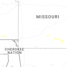
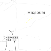


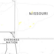
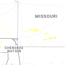
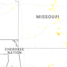


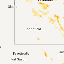


Connect with Interactive Hail Maps