

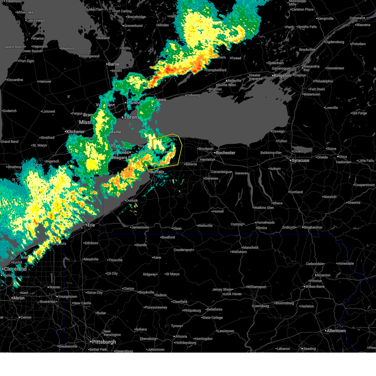
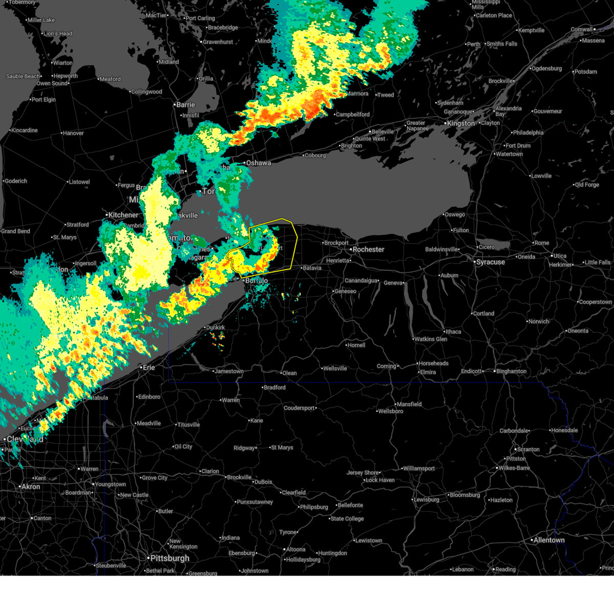
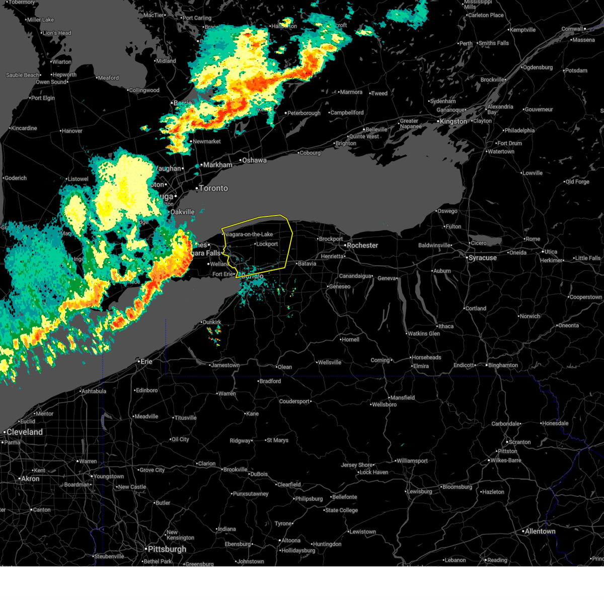
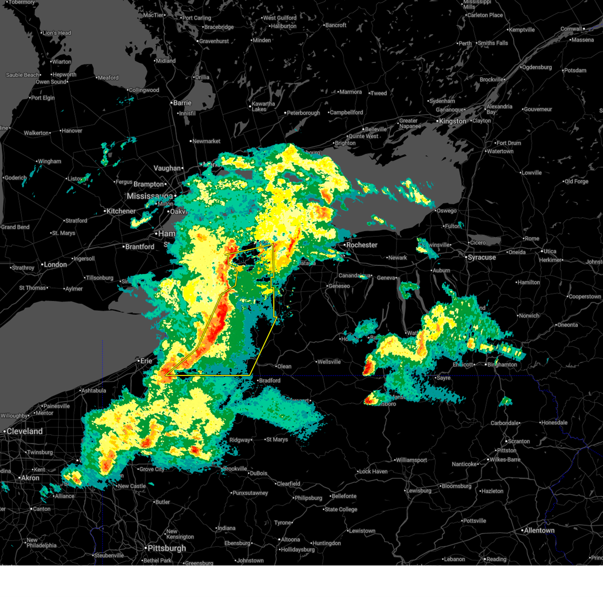
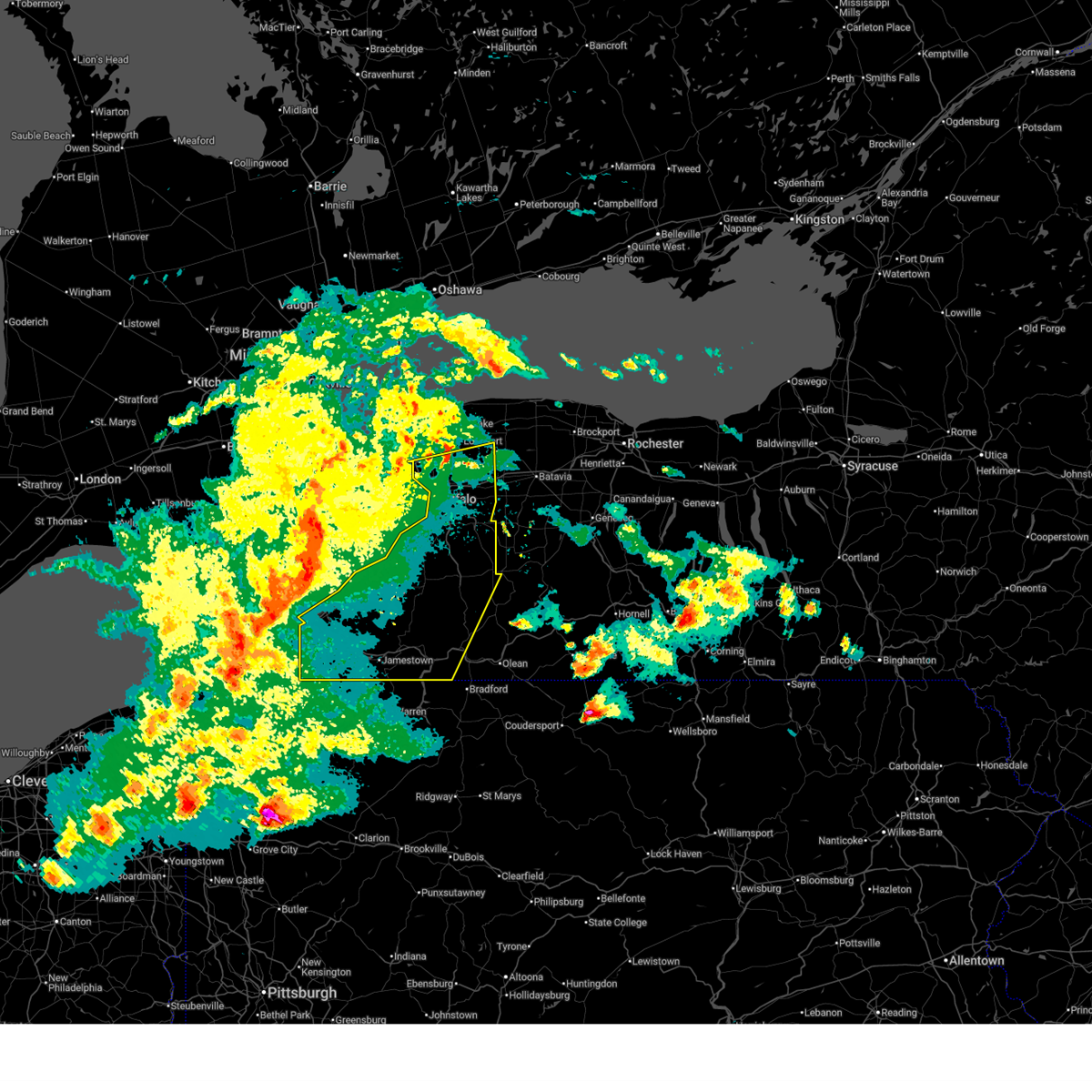
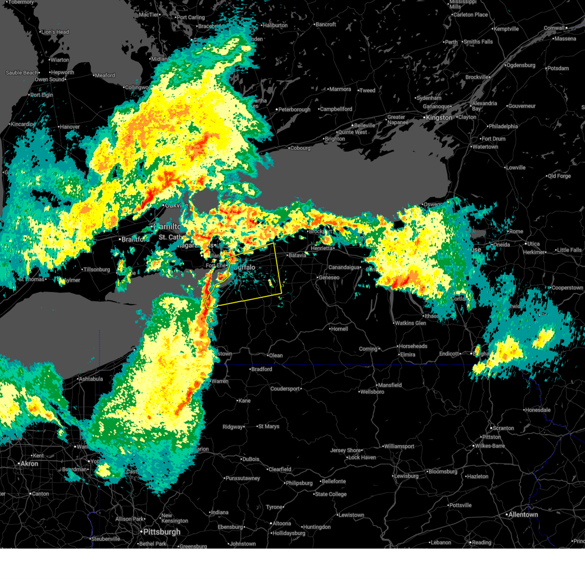
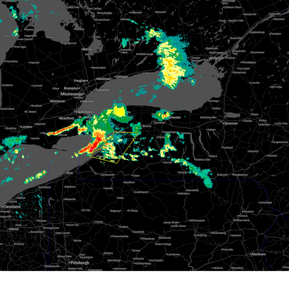
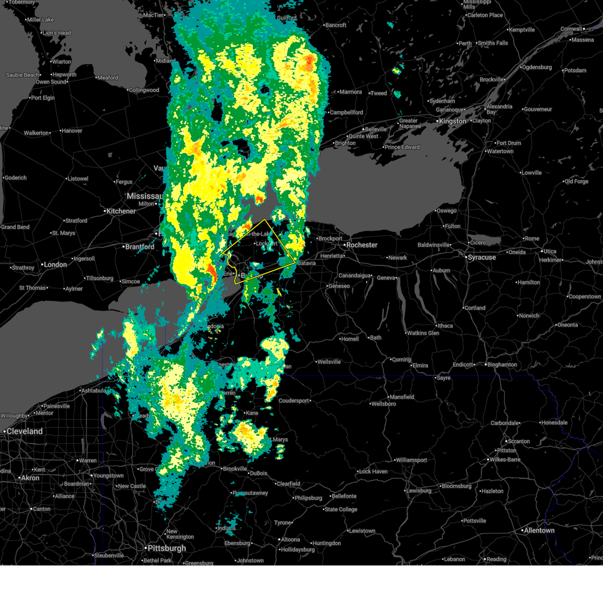
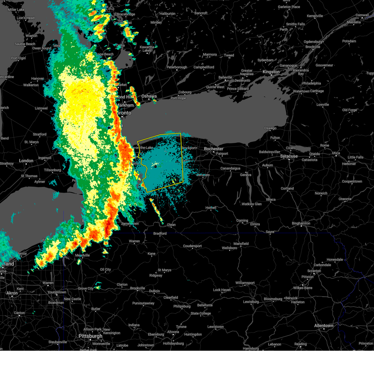
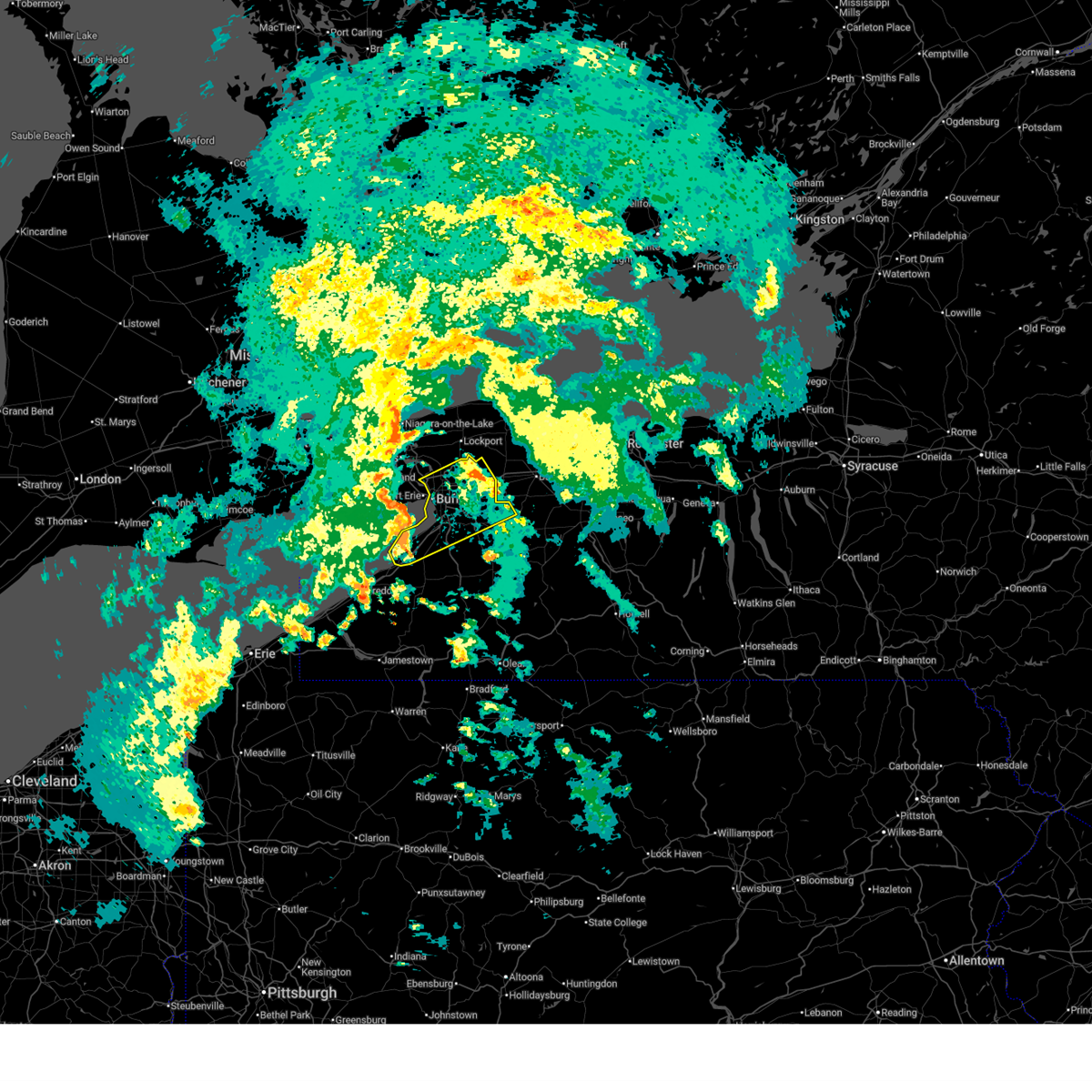
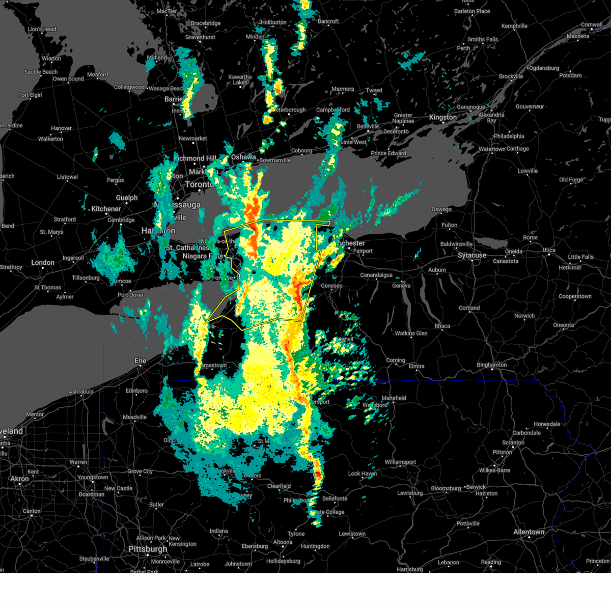
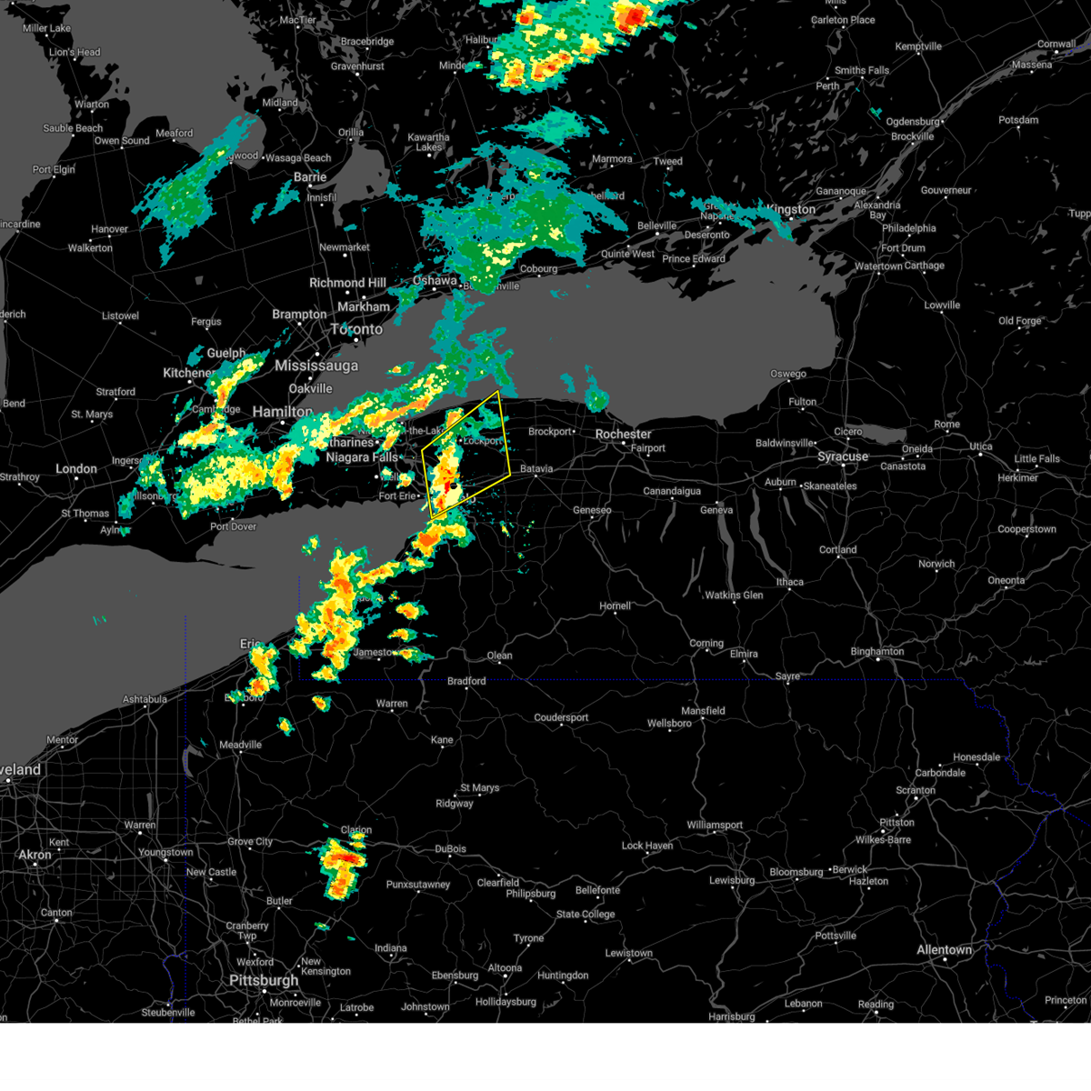
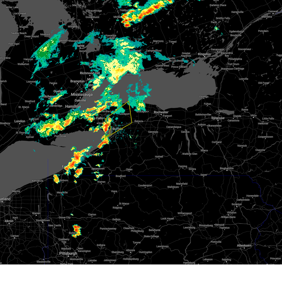
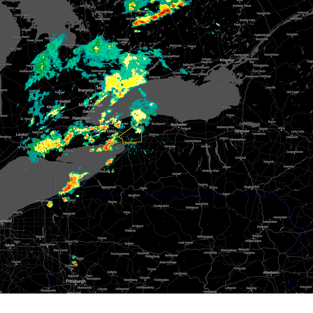
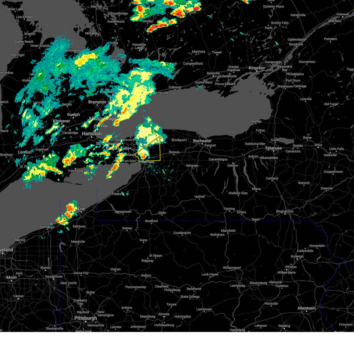
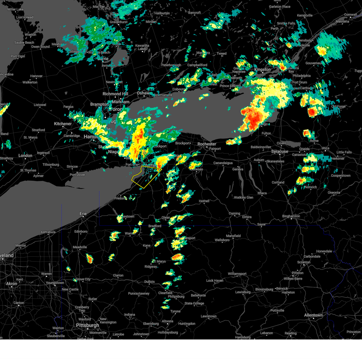
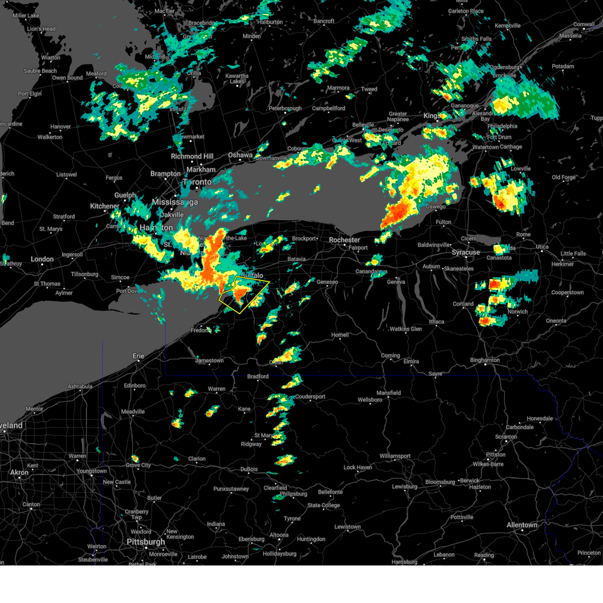
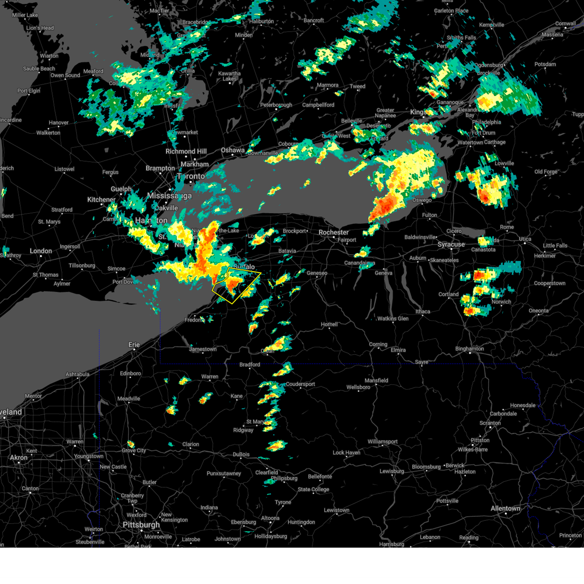
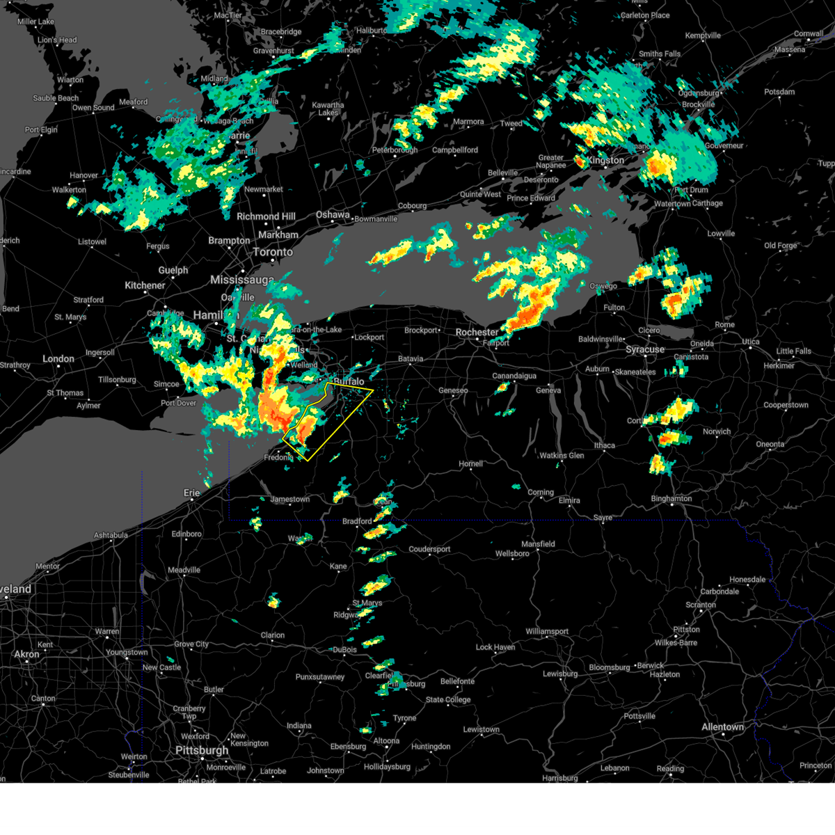
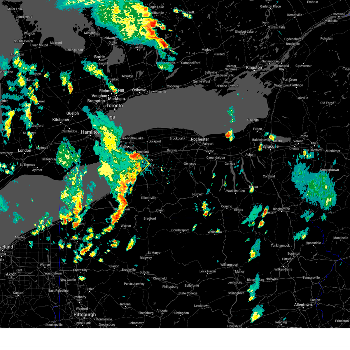
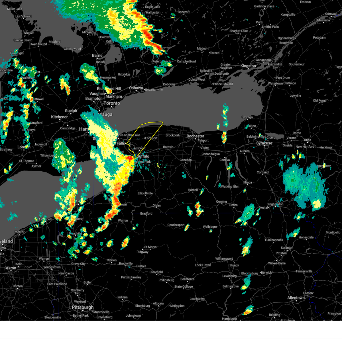
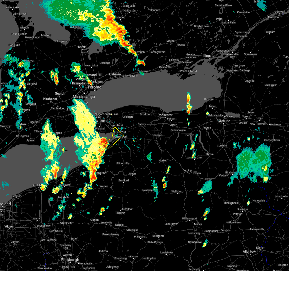
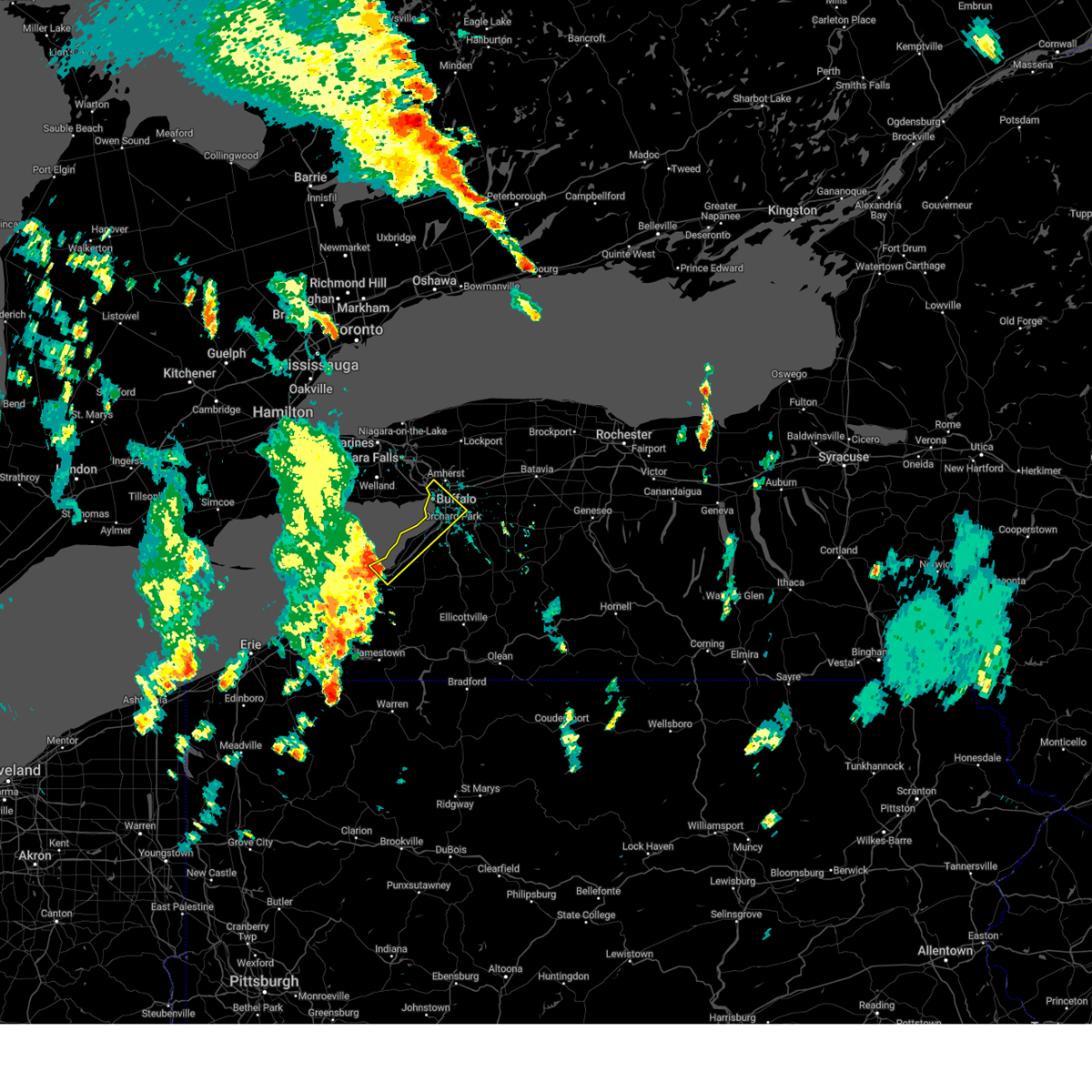
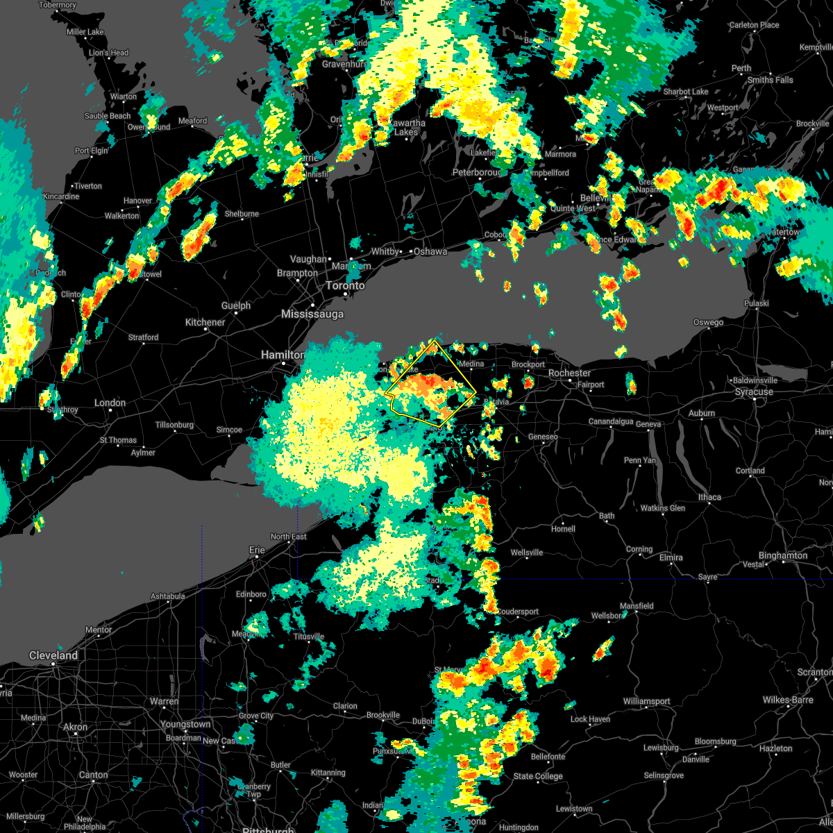
Hail Map for Buffalo, NY
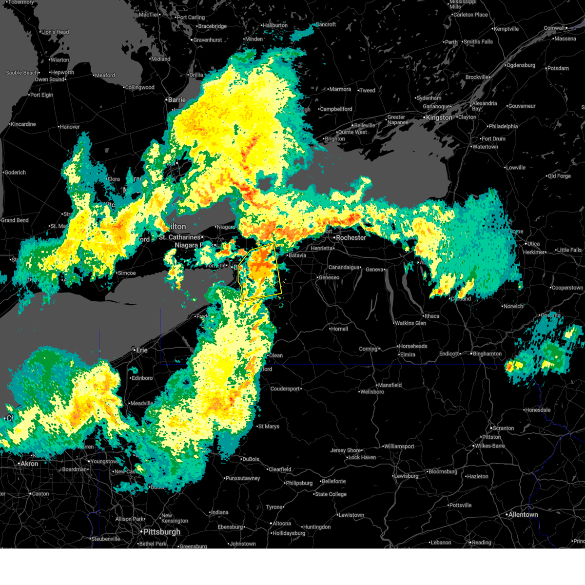
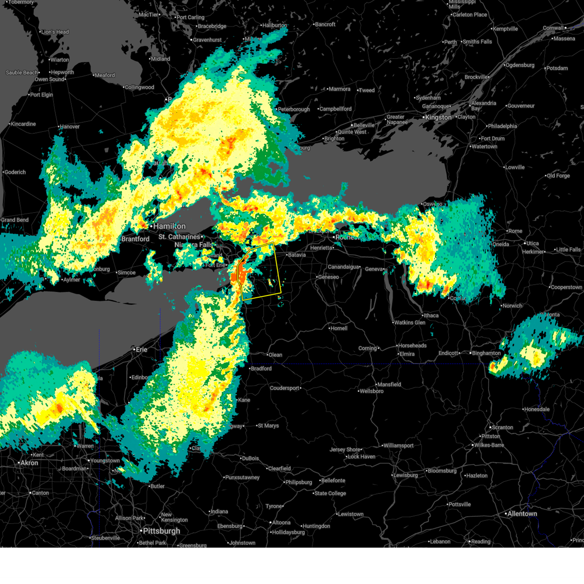
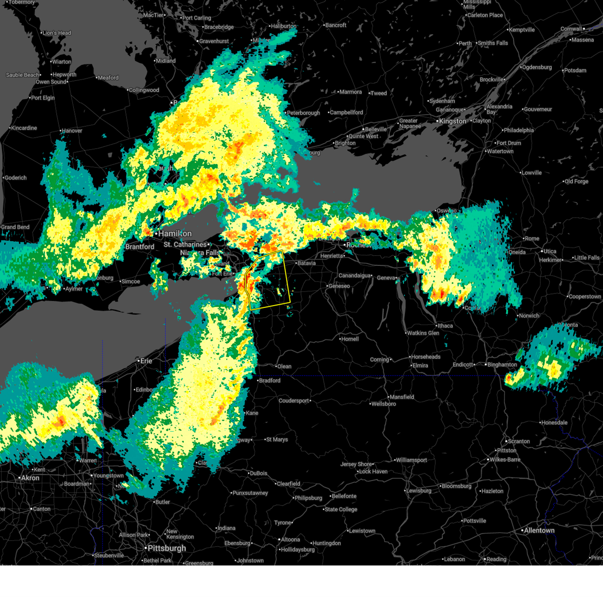
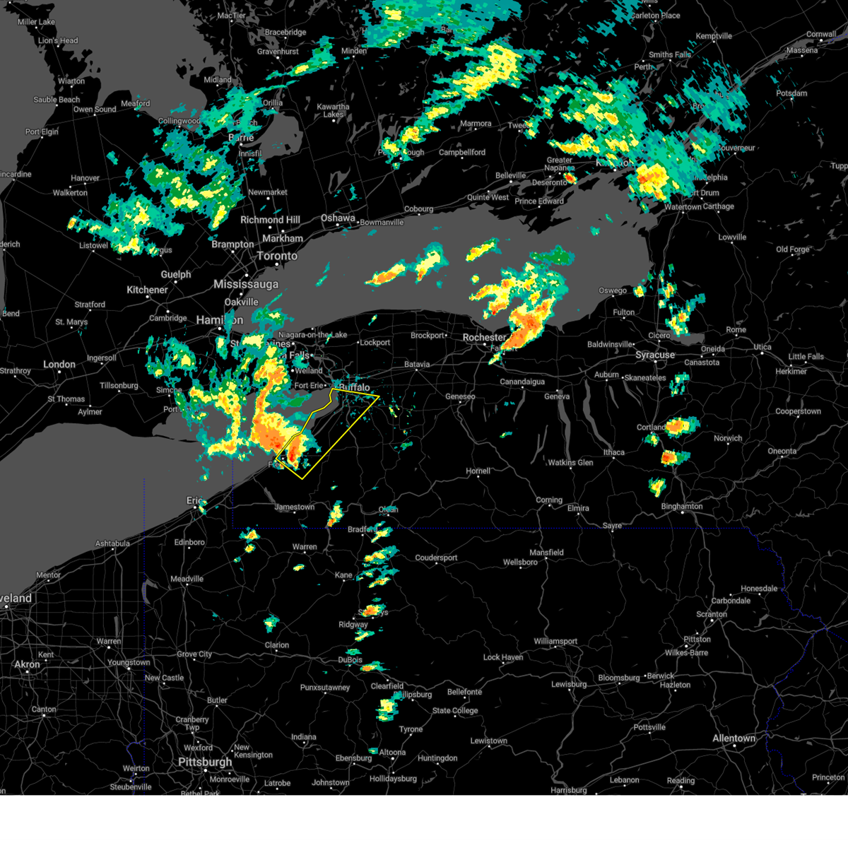
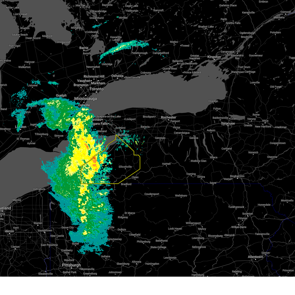
The Buffalo, NY area has had 7 reports of on-the-ground hail by trained spotters, and has been under severe weather warnings 12 times during the past 12 months. Doppler radar has detected hail at or near Buffalo, NY on 9 occasions.
| Name: | Buffalo, NY |
| Where Located: | 2.7 miles ENE of Buffalo, NY |
| Map: | Google Map for Buffalo, NY |
| Population: | 261310 |
| Housing Units: | 133444 |
| More Info: | Search Google for Buffalo, NY |
2
The Top Recent Hail Date for Buffalo, NY is Monday, July 15, 2024 (3rd out of 9)

Hail and Wind Damage Spotted near Buffalo, NY
| Date / Time | Report Details |
|---|---|
| 5/19/2026 8:41 PM EDT |
 The storms which prompted the warning have weakened below severe limits, and no longer pose an immediate threat to life or property. therefore, the warning will be allowed to expire. however, gusty winds and heavy rain are still possible with these thunderstorms. to report severe weather, contact your nearest law enforcement agency. they will relay your report to the national weather service buffalo. The storms which prompted the warning have weakened below severe limits, and no longer pose an immediate threat to life or property. therefore, the warning will be allowed to expire. however, gusty winds and heavy rain are still possible with these thunderstorms. to report severe weather, contact your nearest law enforcement agency. they will relay your report to the national weather service buffalo.
|
| 5/19/2026 8:26 PM EDT |
 At 823 pm edt, severe thunderstorms were located along a line extending from newfane to near lockport to amherst to near kenmore, moving east at 45 mph (radar indicated. at 822 pm edt, downed trees were reported across portions of niagara county). Hazards include 60 mph wind gusts. Expect damage to roofs, siding, and trees. locations impacted include, buffalo, cheektowaga, niagara falls, north tonawanda, clarence, lockport, kenmore, tonawanda, amherst, and medina. This includes interstate 90 between exits 48a and 51. At 823 pm edt, severe thunderstorms were located along a line extending from newfane to near lockport to amherst to near kenmore, moving east at 45 mph (radar indicated. at 822 pm edt, downed trees were reported across portions of niagara county). Hazards include 60 mph wind gusts. Expect damage to roofs, siding, and trees. locations impacted include, buffalo, cheektowaga, niagara falls, north tonawanda, clarence, lockport, kenmore, tonawanda, amherst, and medina. This includes interstate 90 between exits 48a and 51.
|
| 5/19/2026 7:39 PM EDT |
 Svrbuf the national weather service in buffalo has issued a * severe thunderstorm warning for, northeastern erie county in western new york, niagara county in western new york, western orleans county in western new york, northwestern genesee county in western new york, * until 845 pm edt. * at 738 pm edt, severe thunderstorms were located along a line extending from 15 miles west of youngstown to 17 miles west of lewiston to 13 miles west of niagara falls to 27 miles west of grand island, moving east at 55 mph (radar indicated). Hazards include 60 mph wind gusts. expect damage to roofs, siding, and trees Svrbuf the national weather service in buffalo has issued a * severe thunderstorm warning for, northeastern erie county in western new york, niagara county in western new york, western orleans county in western new york, northwestern genesee county in western new york, * until 845 pm edt. * at 738 pm edt, severe thunderstorms were located along a line extending from 15 miles west of youngstown to 17 miles west of lewiston to 13 miles west of niagara falls to 27 miles west of grand island, moving east at 55 mph (radar indicated). Hazards include 60 mph wind gusts. expect damage to roofs, siding, and trees
|
| 5/9/2026 6:59 PM EDT | Storm damage reported in erie county NY, 5.8 miles WSW of Buffalo, NY |
| 4/15/2026 7:43 PM EDT |
 At 742 pm edt, severe thunderstorms were located along a line extending from woodlawn beach state park to gowanda to near falconer, moving east at 45 mph (radar indicated). Hazards include 60 mph wind gusts and nickel size hail. Expect damage to roofs, siding, and trees. locations impacted include, buffalo, cheektowaga, west seneca, north tonawanda, jamestown, clarence, lackawanna, kenmore, depew, and amherst. this includes the following highways, interstate 90 between exits 49 and 58. Interstate 86 between exits 7 and 21. At 742 pm edt, severe thunderstorms were located along a line extending from woodlawn beach state park to gowanda to near falconer, moving east at 45 mph (radar indicated). Hazards include 60 mph wind gusts and nickel size hail. Expect damage to roofs, siding, and trees. locations impacted include, buffalo, cheektowaga, west seneca, north tonawanda, jamestown, clarence, lackawanna, kenmore, depew, and amherst. this includes the following highways, interstate 90 between exits 49 and 58. Interstate 86 between exits 7 and 21.
|
| 4/15/2026 7:06 PM EDT |
 Svrbuf the national weather service in buffalo has issued a * severe thunderstorm warning for, cattaraugus county in western new york, erie county in western new york, southern niagara county in western new york, chautauqua county in western new york, * until 800 pm edt. * at 705 pm edt, severe thunderstorms were located along a line extending from 29 miles southwest of niagara falls to 12 miles northwest of lake erie state park to near north east, moving east at 45 mph (radar indicated). Hazards include 60 mph wind gusts and quarter size hail. Hail damage to vehicles is expected. Expect wind damage to roofs, siding, and trees. Svrbuf the national weather service in buffalo has issued a * severe thunderstorm warning for, cattaraugus county in western new york, erie county in western new york, southern niagara county in western new york, chautauqua county in western new york, * until 800 pm edt. * at 705 pm edt, severe thunderstorms were located along a line extending from 29 miles southwest of niagara falls to 12 miles northwest of lake erie state park to near north east, moving east at 45 mph (radar indicated). Hazards include 60 mph wind gusts and quarter size hail. Hail damage to vehicles is expected. Expect wind damage to roofs, siding, and trees.
|
| 3/31/2026 8:14 PM EDT |
 The storms which prompted the warning have weakened below severe limits, and no longer pose an immediate threat to life or property. therefore, the warning will be allowed to expire. however, gusty winds and heavy rain are still possible with these thunderstorms. a severe thunderstorm watch remains in effect until 900 pm edt for western new york. The storms which prompted the warning have weakened below severe limits, and no longer pose an immediate threat to life or property. therefore, the warning will be allowed to expire. however, gusty winds and heavy rain are still possible with these thunderstorms. a severe thunderstorm watch remains in effect until 900 pm edt for western new york.
|
| 3/31/2026 8:03 PM EDT |
 At 802 pm edt, severe thunderstorms were located along a line extending from clarence to near boston, moving east at 65 mph (radar indicated). Hazards include 60 mph wind gusts. Expect damage to roofs, siding, and trees. locations impacted include, cheektowaga, west seneca, clarence, lackawanna, depew, lancaster, east aurora, williamsville, darien lakes state park, and elma. This includes interstate 90 between exits 48a and 49, and between exits 52 and 55. At 802 pm edt, severe thunderstorms were located along a line extending from clarence to near boston, moving east at 65 mph (radar indicated). Hazards include 60 mph wind gusts. Expect damage to roofs, siding, and trees. locations impacted include, cheektowaga, west seneca, clarence, lackawanna, depew, lancaster, east aurora, williamsville, darien lakes state park, and elma. This includes interstate 90 between exits 48a and 49, and between exits 52 and 55.
|
| 3/31/2026 8:03 PM EDT |
 the severe thunderstorm warning has been cancelled and is no longer in effect the severe thunderstorm warning has been cancelled and is no longer in effect
|
| 3/31/2026 7:38 PM EDT |
 Svrbuf the national weather service in buffalo has issued a * severe thunderstorm warning for, northwestern wyoming county in western new york, erie county in western new york, northeastern chautauqua county in western new york, western genesee county in western new york, * until 815 pm edt. * at 736 pm edt, a severe thunderstorm was located near evangola state park, or 14 miles northeast of dunkirk, moving northeast at 60 mph (radar indicated). Hazards include 60 mph wind gusts. expect damage to roofs, siding, and trees Svrbuf the national weather service in buffalo has issued a * severe thunderstorm warning for, northwestern wyoming county in western new york, erie county in western new york, northeastern chautauqua county in western new york, western genesee county in western new york, * until 815 pm edt. * at 736 pm edt, a severe thunderstorm was located near evangola state park, or 14 miles northeast of dunkirk, moving northeast at 60 mph (radar indicated). Hazards include 60 mph wind gusts. expect damage to roofs, siding, and trees
|
| 3/31/2026 2:41 PM EDT |
 Svrbuf the national weather service in buffalo has issued a * severe thunderstorm warning for, northwestern wyoming county in western new york, northwestern cattaraugus county in western new york, erie county in western new york, northeastern chautauqua county in western new york, * until 345 pm edt. * at 241 pm edt, severe thunderstorms were located along a line extending from 13 miles northwest of angola on the lake to 12 miles northwest of westfield, moving east at 40 mph (radar indicated). Hazards include 60 mph wind gusts and nickel size hail. expect damage to roofs, siding, and trees Svrbuf the national weather service in buffalo has issued a * severe thunderstorm warning for, northwestern wyoming county in western new york, northwestern cattaraugus county in western new york, erie county in western new york, northeastern chautauqua county in western new york, * until 345 pm edt. * at 241 pm edt, severe thunderstorms were located along a line extending from 13 miles northwest of angola on the lake to 12 miles northwest of westfield, moving east at 40 mph (radar indicated). Hazards include 60 mph wind gusts and nickel size hail. expect damage to roofs, siding, and trees
|
| 9/4/2025 10:18 AM EDT |
 the severe thunderstorm warning has been cancelled and is no longer in effect the severe thunderstorm warning has been cancelled and is no longer in effect
|
| 9/4/2025 9:58 AM EDT |
 Svrbuf the national weather service in buffalo has issued a * severe thunderstorm warning for, northeastern erie county in western new york, niagara county in western new york, southwestern orleans county in western new york, northwestern genesee county in western new york, * until 1100 am edt. * at 957 am edt, a severe thunderstorm was located near erie basin marina, or 7 miles west of kenmore, moving northeast at 40 mph (radar indicated). Hazards include 60 mph wind gusts. expect damage to roofs, siding, and trees Svrbuf the national weather service in buffalo has issued a * severe thunderstorm warning for, northeastern erie county in western new york, niagara county in western new york, southwestern orleans county in western new york, northwestern genesee county in western new york, * until 1100 am edt. * at 957 am edt, a severe thunderstorm was located near erie basin marina, or 7 miles west of kenmore, moving northeast at 40 mph (radar indicated). Hazards include 60 mph wind gusts. expect damage to roofs, siding, and trees
|
| 5/16/2025 5:22 AM EDT | Downed power lines on lakewood avenue in buffalo. time estimated based on rada in erie county NY, 3.8 miles N of Buffalo, NY |
| 5/16/2025 5:03 AM EDT |
 Svrbuf the national weather service in buffalo has issued a * severe thunderstorm warning for, northwestern wyoming county in western new york, erie county in western new york, niagara county in western new york, western orleans county in western new york, western genesee county in western new york, * until 615 am edt. * at 502 am edt, severe thunderstorms were located along a line extending from 11 miles northwest of fort niagara state park to 7 miles north of derby, moving northeast at 35 mph (radar indicated). Hazards include 60 mph wind gusts and quarter size hail. Hail damage to vehicles is expected. Expect wind damage to roofs, siding, and trees. Svrbuf the national weather service in buffalo has issued a * severe thunderstorm warning for, northwestern wyoming county in western new york, erie county in western new york, niagara county in western new york, western orleans county in western new york, western genesee county in western new york, * until 615 am edt. * at 502 am edt, severe thunderstorms were located along a line extending from 11 miles northwest of fort niagara state park to 7 miles north of derby, moving northeast at 35 mph (radar indicated). Hazards include 60 mph wind gusts and quarter size hail. Hail damage to vehicles is expected. Expect wind damage to roofs, siding, and trees.
|
| 5/1/2025 6:24 PM EDT |
 Svrbuf the national weather service in buffalo has issued a * severe thunderstorm warning for, northwestern wyoming county in western new york, erie county in western new york, * until 715 pm edt. * at 624 pm edt, severe thunderstorms were located along a line extending from 14 miles southwest of grand island to near angola on the lake, moving northeast at 55 mph (radar indicated). Hazards include 60 mph wind gusts. expect damage to roofs, siding, and trees Svrbuf the national weather service in buffalo has issued a * severe thunderstorm warning for, northwestern wyoming county in western new york, erie county in western new york, * until 715 pm edt. * at 624 pm edt, severe thunderstorms were located along a line extending from 14 miles southwest of grand island to near angola on the lake, moving northeast at 55 mph (radar indicated). Hazards include 60 mph wind gusts. expect damage to roofs, siding, and trees
|
| 4/19/2025 11:24 AM EDT |
 At 1124 am edt, a severe thunderstorm was located over orchard park, or near west seneca, moving northeast at 60 mph (radar indicated). Hazards include 60 mph wind gusts. Expect damage to roofs, siding, and trees. locations impacted include, eden, hamburg, depew, colden, pembroke, corfu, woodlawn beach state park, lackawanna, south wales, and orchard park. This includes interstate 90 near exit 48a, and between exits 52a and 57a. At 1124 am edt, a severe thunderstorm was located over orchard park, or near west seneca, moving northeast at 60 mph (radar indicated). Hazards include 60 mph wind gusts. Expect damage to roofs, siding, and trees. locations impacted include, eden, hamburg, depew, colden, pembroke, corfu, woodlawn beach state park, lackawanna, south wales, and orchard park. This includes interstate 90 near exit 48a, and between exits 52a and 57a.
|
| 4/19/2025 11:24 AM EDT |
 the severe thunderstorm warning has been cancelled and is no longer in effect the severe thunderstorm warning has been cancelled and is no longer in effect
|
| 4/19/2025 11:07 AM EDT |
 Svrbuf the national weather service in buffalo has issued a * severe thunderstorm warning for, northwestern wyoming county in western new york, erie county in western new york, northeastern chautauqua county in western new york, western genesee county in western new york, * until 1145 am edt. * at 1106 am edt, a severe thunderstorm was located over evans, or 11 miles west of hamburg, moving northeast at 70 mph (radar indicated). Hazards include 60 mph wind gusts. expect damage to roofs, siding, and trees Svrbuf the national weather service in buffalo has issued a * severe thunderstorm warning for, northwestern wyoming county in western new york, erie county in western new york, northeastern chautauqua county in western new york, western genesee county in western new york, * until 1145 am edt. * at 1106 am edt, a severe thunderstorm was located over evans, or 11 miles west of hamburg, moving northeast at 70 mph (radar indicated). Hazards include 60 mph wind gusts. expect damage to roofs, siding, and trees
|
| 3/16/2025 2:50 PM EDT |
 At 249 pm edt, severe thunderstorms were located along a line extending from 21 miles north of newfane to lockport to lackawanna, moving northeast at 60 mph (radar indicated). Hazards include 60 mph wind gusts and quarter size hail. Hail damage to vehicles is expected. expect wind damage to roofs, siding, and trees. locations impacted include, angola, clarence center, fort niagara state park, bliss, depew, colden, newfane, pembroke, woodlawn beach state park, and lewiston. This includes interstate 90 between exits 48 and 57a. At 249 pm edt, severe thunderstorms were located along a line extending from 21 miles north of newfane to lockport to lackawanna, moving northeast at 60 mph (radar indicated). Hazards include 60 mph wind gusts and quarter size hail. Hail damage to vehicles is expected. expect wind damage to roofs, siding, and trees. locations impacted include, angola, clarence center, fort niagara state park, bliss, depew, colden, newfane, pembroke, woodlawn beach state park, and lewiston. This includes interstate 90 between exits 48 and 57a.
|
| 3/16/2025 2:19 PM EDT |
 Svrbuf the national weather service in buffalo has issued a * severe thunderstorm warning for, wyoming county in western new york, erie county in western new york, niagara county in western new york, orleans county in western new york, genesee county in western new york, * until 315 pm edt. * at 218 pm edt, severe thunderstorms were located along a line extending from 9 miles northwest of fort niagara state park to 8 miles southwest of grand island to 6 miles northwest of silver creek, moving northeast at 65 mph (radar indicated). Hazards include 60 mph wind gusts and quarter size hail. Hail damage to vehicles is expected. Expect wind damage to roofs, siding, and trees. Svrbuf the national weather service in buffalo has issued a * severe thunderstorm warning for, wyoming county in western new york, erie county in western new york, niagara county in western new york, orleans county in western new york, genesee county in western new york, * until 315 pm edt. * at 218 pm edt, severe thunderstorms were located along a line extending from 9 miles northwest of fort niagara state park to 8 miles southwest of grand island to 6 miles northwest of silver creek, moving northeast at 65 mph (radar indicated). Hazards include 60 mph wind gusts and quarter size hail. Hail damage to vehicles is expected. Expect wind damage to roofs, siding, and trees.
|
| 9/9/2024 5:08 PM EDT |
 The storm which prompted the warning has weakened below severe limits, and no longer poses an immediate threat to life or property. therefore, the warning will be allowed to expire. The storm which prompted the warning has weakened below severe limits, and no longer poses an immediate threat to life or property. therefore, the warning will be allowed to expire.
|
| 9/9/2024 4:52 PM EDT |
 At 452 pm edt, a severe thunderstorm was located over kenmore, moving southeast at 25 mph (radar indicated). Hazards include 60 mph wind gusts and penny size hail. Expect damage to roofs, siding, and trees. locations impacted include, buffalo, cheektowaga, west seneca, lackawanna, kenmore, depew, amherst, tonawanda, lancaster, and williamsville. This includes interstate 90 between exits 49 and 56. At 452 pm edt, a severe thunderstorm was located over kenmore, moving southeast at 25 mph (radar indicated). Hazards include 60 mph wind gusts and penny size hail. Expect damage to roofs, siding, and trees. locations impacted include, buffalo, cheektowaga, west seneca, lackawanna, kenmore, depew, amherst, tonawanda, lancaster, and williamsville. This includes interstate 90 between exits 49 and 56.
|
| 9/9/2024 4:52 PM EDT |
 the severe thunderstorm warning has been cancelled and is no longer in effect the severe thunderstorm warning has been cancelled and is no longer in effect
|
| 9/9/2024 4:22 PM EDT |
 Svrbuf the national weather service in buffalo has issued a * severe thunderstorm warning for, northeastern erie county in western new york, southwestern niagara county in western new york, * until 515 pm edt. * at 421 pm edt, a severe thunderstorm was located near niagara falls, moving southeast at 25 mph (radar indicated). Hazards include 60 mph wind gusts and quarter size hail. Hail damage to vehicles is expected. Expect wind damage to roofs, siding, and trees. Svrbuf the national weather service in buffalo has issued a * severe thunderstorm warning for, northeastern erie county in western new york, southwestern niagara county in western new york, * until 515 pm edt. * at 421 pm edt, a severe thunderstorm was located near niagara falls, moving southeast at 25 mph (radar indicated). Hazards include 60 mph wind gusts and quarter size hail. Hail damage to vehicles is expected. Expect wind damage to roofs, siding, and trees.
|
| 8/5/2024 4:00 PM EDT |
 The storm which prompted the warning has weakened below severe limits, and no longer poses an immediate threat to life or property. therefore, the warning has been allowed to expire. a severe thunderstorm watch remains in effect until 800 pm edt for western new york. The storm which prompted the warning has weakened below severe limits, and no longer poses an immediate threat to life or property. therefore, the warning has been allowed to expire. a severe thunderstorm watch remains in effect until 800 pm edt for western new york.
|
| 8/5/2024 3:32 PM EDT |
 At 330 pm edt, a severe thunderstorm was located near williamsville, moving east at 40 mph (radar indicated). Hazards include 60 mph wind gusts and quarter size hail. Hail damage to vehicles is expected. expect wind damage to roofs, siding, and trees. locations impacted include, buffalo, cheektowaga, west seneca, north tonawanda, clarence, lackawanna, kenmore, depew, tonawanda, and amherst. This includes interstate 90 between exits 48a and 55. At 330 pm edt, a severe thunderstorm was located near williamsville, moving east at 40 mph (radar indicated). Hazards include 60 mph wind gusts and quarter size hail. Hail damage to vehicles is expected. expect wind damage to roofs, siding, and trees. locations impacted include, buffalo, cheektowaga, west seneca, north tonawanda, clarence, lackawanna, kenmore, depew, tonawanda, and amherst. This includes interstate 90 between exits 48a and 55.
|
| 8/5/2024 3:00 PM EDT |
 Svrbuf the national weather service in buffalo has issued a * severe thunderstorm warning for, northwestern wyoming county in western new york, northeastern erie county in western new york, southwestern niagara county in western new york, western genesee county in western new york, * until 400 pm edt. * at 300 pm edt, a severe thunderstorm was located over grand island, or near tonawanda, moving east at 40 mph (radar indicated). Hazards include 60 mph wind gusts and quarter size hail. Hail damage to vehicles is expected. Expect wind damage to roofs, siding, and trees. Svrbuf the national weather service in buffalo has issued a * severe thunderstorm warning for, northwestern wyoming county in western new york, northeastern erie county in western new york, southwestern niagara county in western new york, western genesee county in western new york, * until 400 pm edt. * at 300 pm edt, a severe thunderstorm was located over grand island, or near tonawanda, moving east at 40 mph (radar indicated). Hazards include 60 mph wind gusts and quarter size hail. Hail damage to vehicles is expected. Expect wind damage to roofs, siding, and trees.
|
| 8/5/2024 1:11 PM EDT |
 At 111 pm edt, a severe thunderstorm was located over west seneca, moving east at 10 mph (radar indicated). Hazards include 60 mph wind gusts and penny size hail. Expect damage to roofs, siding, and trees. locations impacted include, buffalo, cheektowaga, west seneca, lackawanna, depew, lancaster, east aurora, elma, marilla, and orchard park. This includes interstate 90 between exits 52 and 56. At 111 pm edt, a severe thunderstorm was located over west seneca, moving east at 10 mph (radar indicated). Hazards include 60 mph wind gusts and penny size hail. Expect damage to roofs, siding, and trees. locations impacted include, buffalo, cheektowaga, west seneca, lackawanna, depew, lancaster, east aurora, elma, marilla, and orchard park. This includes interstate 90 between exits 52 and 56.
|
| 8/5/2024 1:07 PM EDT |
 Svrbuf the national weather service in buffalo has issued a * severe thunderstorm warning for, east central erie county in western new york, * until 230 pm edt. * at 106 pm edt, a severe thunderstorm was located over west seneca, moving east at 10 mph (radar indicated). Hazards include 60 mph wind gusts and penny size hail. expect damage to roofs, siding, and trees Svrbuf the national weather service in buffalo has issued a * severe thunderstorm warning for, east central erie county in western new york, * until 230 pm edt. * at 106 pm edt, a severe thunderstorm was located over west seneca, moving east at 10 mph (radar indicated). Hazards include 60 mph wind gusts and penny size hail. expect damage to roofs, siding, and trees
|
| 8/5/2024 12:45 PM EDT | Trees down... car flipped and bricks fell off a building in the city of buffalo. time estimate in erie county NY, 2.6 miles ENE of Buffalo, NY |
| 7/15/2024 2:53 PM EDT |
 Svrbuf the national weather service in buffalo has issued a * severe thunderstorm warning for, northwestern wyoming county in western new york, east central erie county in western new york, western genesee county in western new york, * until 400 pm edt. * at 253 pm edt, a severe thunderstorm was located over orchard park, or near hamburg, moving northeast at 45 mph (radar indicated). Hazards include 60 mph wind gusts. expect damage to roofs, siding, and trees Svrbuf the national weather service in buffalo has issued a * severe thunderstorm warning for, northwestern wyoming county in western new york, east central erie county in western new york, western genesee county in western new york, * until 400 pm edt. * at 253 pm edt, a severe thunderstorm was located over orchard park, or near hamburg, moving northeast at 45 mph (radar indicated). Hazards include 60 mph wind gusts. expect damage to roofs, siding, and trees
|
| 7/15/2024 2:44 PM EDT |
 At 244 pm edt, a severe thunderstorm was located over williamsville, moving east at 30 mph (radar indicated). Hazards include 60 mph wind gusts and quarter size hail. Hail damage to vehicles is expected. expect wind damage to roofs, siding, and trees. locations impacted include, buffalo, cheektowaga, west seneca, north tonawanda, clarence, lockport, lackawanna, kenmore, depew, and tonawanda. This includes interstate 90 between exits 48a and 55. At 244 pm edt, a severe thunderstorm was located over williamsville, moving east at 30 mph (radar indicated). Hazards include 60 mph wind gusts and quarter size hail. Hail damage to vehicles is expected. expect wind damage to roofs, siding, and trees. locations impacted include, buffalo, cheektowaga, west seneca, north tonawanda, clarence, lockport, lackawanna, kenmore, depew, and tonawanda. This includes interstate 90 between exits 48a and 55.
|
| 7/15/2024 2:43 PM EDT |
 At 243 pm edt, a severe thunderstorm was located over hamburg, moving northeast at 30 mph (radar indicated). Hazards include 60 mph wind gusts and penny size hail. Expect damage to roofs, siding, and trees. locations impacted include, cheektowaga, west seneca, lackawanna, lancaster, hamburg, east aurora, elma, boston, eden, and marilla. This includes interstate 90 between exits 55 and 57a. At 243 pm edt, a severe thunderstorm was located over hamburg, moving northeast at 30 mph (radar indicated). Hazards include 60 mph wind gusts and penny size hail. Expect damage to roofs, siding, and trees. locations impacted include, cheektowaga, west seneca, lackawanna, lancaster, hamburg, east aurora, elma, boston, eden, and marilla. This includes interstate 90 between exits 55 and 57a.
|
| 7/15/2024 2:43 PM EDT |
 the severe thunderstorm warning has been cancelled and is no longer in effect the severe thunderstorm warning has been cancelled and is no longer in effect
|
| 7/15/2024 2:28 PM EDT |
 At 228 pm edt, a severe thunderstorm was located over derby, or 7 miles southwest of hamburg, moving northeast at 30 mph (radar indicated). Hazards include 60 mph wind gusts and penny size hail. Expect damage to roofs, siding, and trees. locations impacted include, buffalo, cheektowaga, west seneca, lackawanna, lancaster, hamburg, east aurora, evans, elma, and boston. This includes interstate 90 between exits 55 and 58. At 228 pm edt, a severe thunderstorm was located over derby, or 7 miles southwest of hamburg, moving northeast at 30 mph (radar indicated). Hazards include 60 mph wind gusts and penny size hail. Expect damage to roofs, siding, and trees. locations impacted include, buffalo, cheektowaga, west seneca, lackawanna, lancaster, hamburg, east aurora, evans, elma, and boston. This includes interstate 90 between exits 55 and 58.
|
| 7/15/2024 2:22 PM EDT |
 Svrbuf the national weather service in buffalo has issued a * severe thunderstorm warning for, northeastern erie county in western new york, niagara county in western new york, western orleans county in western new york, northwestern genesee county in western new york, * until 315 pm edt. * at 222 pm edt, a severe thunderstorm was located near grand island, or near tonawanda, moving northeast at 35 mph (radar indicated). Hazards include 60 mph wind gusts and quarter size hail. Hail damage to vehicles is expected. Expect wind damage to roofs, siding, and trees. Svrbuf the national weather service in buffalo has issued a * severe thunderstorm warning for, northeastern erie county in western new york, niagara county in western new york, western orleans county in western new york, northwestern genesee county in western new york, * until 315 pm edt. * at 222 pm edt, a severe thunderstorm was located near grand island, or near tonawanda, moving northeast at 35 mph (radar indicated). Hazards include 60 mph wind gusts and quarter size hail. Hail damage to vehicles is expected. Expect wind damage to roofs, siding, and trees.
|
| 7/15/2024 2:07 PM EDT |
 Svrbuf the national weather service in buffalo has issued a * severe thunderstorm warning for, central erie county in western new york, northeastern chautauqua county in western new york, * until 300 pm edt. * at 207 pm edt, a severe thunderstorm was located over evangola state park, or 14 miles northeast of dunkirk, moving northeast at 35 mph (radar indicated). Hazards include 60 mph wind gusts and nickel size hail. expect damage to roofs, siding, and trees Svrbuf the national weather service in buffalo has issued a * severe thunderstorm warning for, central erie county in western new york, northeastern chautauqua county in western new york, * until 300 pm edt. * at 207 pm edt, a severe thunderstorm was located over evangola state park, or 14 miles northeast of dunkirk, moving northeast at 35 mph (radar indicated). Hazards include 60 mph wind gusts and nickel size hail. expect damage to roofs, siding, and trees
|
| 7/15/2024 1:55 PM EDT |
 The storm which prompted the warning has weakened below severe limits, and no longer poses an immediate threat to life or property. therefore, the warning will be allowed to expire. a severe thunderstorm watch remains in effect until 700 pm edt for western new york. The storm which prompted the warning has weakened below severe limits, and no longer poses an immediate threat to life or property. therefore, the warning will be allowed to expire. a severe thunderstorm watch remains in effect until 700 pm edt for western new york.
|
| 7/15/2024 1:30 PM EDT | Large tree down intersection of west avenue and bird avenu in erie county NY, 3.8 miles ESE of Buffalo, NY |
| 7/15/2024 1:29 PM EDT |
 At 129 pm edt, a severe thunderstorm was located near williamsville, moving northeast at 50 mph. this storm has a history of producing quarter sized hail (radar indicated). Hazards include 60 mph wind gusts and quarter size hail. Hail damage to vehicles is expected. expect wind damage to roofs, siding, and trees. locations impacted include, buffalo, cheektowaga, north tonawanda, clarence, lockport, kenmore, depew, amherst, tonawanda, and lancaster. This includes interstate 90 between exits 49 and 52. At 129 pm edt, a severe thunderstorm was located near williamsville, moving northeast at 50 mph. this storm has a history of producing quarter sized hail (radar indicated). Hazards include 60 mph wind gusts and quarter size hail. Hail damage to vehicles is expected. expect wind damage to roofs, siding, and trees. locations impacted include, buffalo, cheektowaga, north tonawanda, clarence, lockport, kenmore, depew, amherst, tonawanda, and lancaster. This includes interstate 90 between exits 49 and 52.
|
| 7/15/2024 1:24 PM EDT | Half Dollar sized hail reported 2.2 miles ESE of Buffalo, NY, report from mping: half dollar (1.25 in.). |
| 7/15/2024 1:24 PM EDT | Quarter sized hail reported 3 miles SE of Buffalo, NY |
| 7/15/2024 1:20 PM EDT | Quarter sized hail reported 3.1 miles ESE of Buffalo, NY |
| 7/15/2024 1:20 PM EDT | Quarter sized hail reported 4.2 miles SE of Buffalo, NY |
| 7/15/2024 1:12 PM EDT |
 Svrbuf the national weather service in buffalo has issued a * severe thunderstorm warning for, northeastern erie county in western new york, southeastern niagara county in western new york, * until 200 pm edt. * at 112 pm edt, a severe thunderstorm was located near erie basin marina, or near kenmore, moving northeast at 50 mph (radar indicated). Hazards include 60 mph wind gusts and penny size hail. expect damage to roofs, siding, and trees Svrbuf the national weather service in buffalo has issued a * severe thunderstorm warning for, northeastern erie county in western new york, southeastern niagara county in western new york, * until 200 pm edt. * at 112 pm edt, a severe thunderstorm was located near erie basin marina, or near kenmore, moving northeast at 50 mph (radar indicated). Hazards include 60 mph wind gusts and penny size hail. expect damage to roofs, siding, and trees
|
| 7/10/2024 1:37 PM EDT | Tree down on youngs road near lyndhurst road. time estimated by rada in erie county NY, 6.9 miles SW of Buffalo, NY |
| 7/10/2024 1:37 PM EDT |
 the severe thunderstorm warning has been cancelled and is no longer in effect the severe thunderstorm warning has been cancelled and is no longer in effect
|
| 7/10/2024 1:15 PM EDT |
 The storm which prompted the warning has moved out of the area. therefore, the warning has been allowed to expire. a tornado watch remains in effect until 900 pm edt for western new york. to report severe weather, contact your nearest law enforcement agency. they will relay your report to the national weather service buffalo. remember, a tornado warning still remains in effect for eastern erie county. The storm which prompted the warning has moved out of the area. therefore, the warning has been allowed to expire. a tornado watch remains in effect until 900 pm edt for western new york. to report severe weather, contact your nearest law enforcement agency. they will relay your report to the national weather service buffalo. remember, a tornado warning still remains in effect for eastern erie county.
|
| 7/10/2024 1:08 PM EDT | Tree down near harlem and rt 33. time estimated by rada in erie county NY, 3.2 miles WSW of Buffalo, NY |
| 7/10/2024 1:06 PM EDT |
 Svrbuf the national weather service in buffalo has issued a * severe thunderstorm warning for, northeastern erie county in western new york, southwestern niagara county in western new york, * until 200 pm edt. * at 106 pm edt, a severe thunderstorm was located over depew, moving north at 30 mph (radar indicated). Hazards include 60 mph wind gusts. expect damage to roofs, siding, and trees Svrbuf the national weather service in buffalo has issued a * severe thunderstorm warning for, northeastern erie county in western new york, southwestern niagara county in western new york, * until 200 pm edt. * at 106 pm edt, a severe thunderstorm was located over depew, moving north at 30 mph (radar indicated). Hazards include 60 mph wind gusts. expect damage to roofs, siding, and trees
|
| 7/10/2024 12:46 PM EDT |
 the severe thunderstorm warning has been cancelled and is no longer in effect the severe thunderstorm warning has been cancelled and is no longer in effect
|
| 7/10/2024 12:46 PM EDT |
 At 1245 pm edt, a severe thunderstorm was located over hamburg, moving northeast at 45 mph (radar indicated). Hazards include 60 mph wind gusts. Expect damage to roofs, siding, and trees. locations impacted include, buffalo, west seneca, lackawanna, hamburg, east aurora, evans, eden, orchard park, small boat harbor, and blasdell. This includes interstate 90 between exits 54 and 57a. At 1245 pm edt, a severe thunderstorm was located over hamburg, moving northeast at 45 mph (radar indicated). Hazards include 60 mph wind gusts. Expect damage to roofs, siding, and trees. locations impacted include, buffalo, west seneca, lackawanna, hamburg, east aurora, evans, eden, orchard park, small boat harbor, and blasdell. This includes interstate 90 between exits 54 and 57a.
|
| 7/10/2024 12:25 PM EDT |
 At 1225 pm edt, a severe thunderstorm was located over evangola state park, or 14 miles northeast of dunkirk, moving northeast at 45 mph (radar indicated). Hazards include 60 mph wind gusts. Expect damage to roofs, siding, and trees. locations impacted include, buffalo, west seneca, lackawanna, hamburg, east aurora, evans, eden, orchard park, small boat harbor, and silver creek. This includes interstate 90 between exits 54 and 58. At 1225 pm edt, a severe thunderstorm was located over evangola state park, or 14 miles northeast of dunkirk, moving northeast at 45 mph (radar indicated). Hazards include 60 mph wind gusts. Expect damage to roofs, siding, and trees. locations impacted include, buffalo, west seneca, lackawanna, hamburg, east aurora, evans, eden, orchard park, small boat harbor, and silver creek. This includes interstate 90 between exits 54 and 58.
|
| 7/10/2024 12:09 PM EDT |
 Svrbuf the national weather service in buffalo has issued a * severe thunderstorm warning for, northwestern cattaraugus county in western new york, central erie county in western new york, northeastern chautauqua county in western new york, * until 115 pm edt. * at 1208 pm edt, a severe thunderstorm was located near fredonia, moving northeast at 45 mph (radar indicated). Hazards include 60 mph wind gusts. expect damage to roofs, siding, and trees Svrbuf the national weather service in buffalo has issued a * severe thunderstorm warning for, northwestern cattaraugus county in western new york, central erie county in western new york, northeastern chautauqua county in western new york, * until 115 pm edt. * at 1208 pm edt, a severe thunderstorm was located near fredonia, moving northeast at 45 mph (radar indicated). Hazards include 60 mph wind gusts. expect damage to roofs, siding, and trees
|
| 5/22/2024 2:30 PM EDT |
 At 229 pm edt, a cluster of severe thunderstorms. was located over alden, or near darien lakes state park, moving northeast at 30 mph (radar indicated). Hazards include 60 mph wind gusts and quarter size hail. Hail damage to vehicles is expected. expect wind damage to roofs, siding, and trees. locations impacted include, buffalo, cheektowaga, west seneca, clarence, lackawanna, depew, amherst, lancaster, east aurora, and williamsville. This includes interstate 90 between exits 48a and 56. At 229 pm edt, a cluster of severe thunderstorms. was located over alden, or near darien lakes state park, moving northeast at 30 mph (radar indicated). Hazards include 60 mph wind gusts and quarter size hail. Hail damage to vehicles is expected. expect wind damage to roofs, siding, and trees. locations impacted include, buffalo, cheektowaga, west seneca, clarence, lackawanna, depew, amherst, lancaster, east aurora, and williamsville. This includes interstate 90 between exits 48a and 56.
|
| 5/22/2024 2:14 PM EDT |
 At 214 pm edt, a cluser of severe thunderstorms was located over elma center, or near east aurora, moving northeast at 30 mph (radar indicated). Hazards include 60 mph wind gusts and quarter size hail. Hail damage to vehicles is expected. expect wind damage to roofs, siding, and trees. locations impacted include, buffalo, cheektowaga, west seneca, clarence, lackawanna, depew, amherst, lancaster, hamburg, and east aurora. This includes interstate 90 between exits 48a and 57. At 214 pm edt, a cluser of severe thunderstorms was located over elma center, or near east aurora, moving northeast at 30 mph (radar indicated). Hazards include 60 mph wind gusts and quarter size hail. Hail damage to vehicles is expected. expect wind damage to roofs, siding, and trees. locations impacted include, buffalo, cheektowaga, west seneca, clarence, lackawanna, depew, amherst, lancaster, hamburg, and east aurora. This includes interstate 90 between exits 48a and 57.
|
| 5/22/2024 1:56 PM EDT |
 Svrbuf the national weather service in buffalo has issued a * severe thunderstorm warning for, northwestern wyoming county in western new york, northeastern erie county in western new york, southeastern niagara county in western new york, southwestern orleans county in western new york, western genesee county in western new york, * until 300 pm edt. * at 156 pm edt, a severe thunderstorm was located over orchard park, or near hamburg, moving northeast at 35 mph (radar indicated). Hazards include 60 mph wind gusts and quarter size hail. Hail damage to vehicles is expected. Expect wind damage to roofs, siding, and trees. Svrbuf the national weather service in buffalo has issued a * severe thunderstorm warning for, northwestern wyoming county in western new york, northeastern erie county in western new york, southeastern niagara county in western new york, southwestern orleans county in western new york, western genesee county in western new york, * until 300 pm edt. * at 156 pm edt, a severe thunderstorm was located over orchard park, or near hamburg, moving northeast at 35 mph (radar indicated). Hazards include 60 mph wind gusts and quarter size hail. Hail damage to vehicles is expected. Expect wind damage to roofs, siding, and trees.
|
| 8/10/2023 3:11 PM EDT |
 The severe thunderstorm warning for northeastern erie county will expire at 315 pm edt, the storm which prompted the warning has moved out of the area. therefore, the warning will be allowed to expire. however, gusty winds and heavy rain are still possible with this thunderstorm. The severe thunderstorm warning for northeastern erie county will expire at 315 pm edt, the storm which prompted the warning has moved out of the area. therefore, the warning will be allowed to expire. however, gusty winds and heavy rain are still possible with this thunderstorm.
|
| 8/10/2023 2:54 PM EDT |
 At 253 pm edt, a severe thunderstorm was located near amherst, moving southeast at 20 mph (radar indicated). Hazards include 60 mph wind gusts. Expect damage to roofs, siding, and trees. locations impacted include, buffalo, cheektowaga, north tonawanda, clarence, kenmore, depew, amherst, tonawanda, lancaster, and williamsville. this includes interstate 90 between exits 49 and 52. hail threat, radar indicated max hail size, <. 75 in wind threat, radar indicated max wind gust, 60 mph. At 253 pm edt, a severe thunderstorm was located near amherst, moving southeast at 20 mph (radar indicated). Hazards include 60 mph wind gusts. Expect damage to roofs, siding, and trees. locations impacted include, buffalo, cheektowaga, north tonawanda, clarence, kenmore, depew, amherst, tonawanda, lancaster, and williamsville. this includes interstate 90 between exits 49 and 52. hail threat, radar indicated max hail size, <. 75 in wind threat, radar indicated max wind gust, 60 mph.
|
| 8/10/2023 2:30 PM EDT |
 At 230 pm edt, a severe thunderstorm was located over north tonawanda, moving east at 30 mph (radar indicated). Hazards include 60 mph wind gusts and quarter size hail. Hail damage to vehicles is expected. expect wind damage to roofs, siding, and trees. locations impacted include, buffalo, cheektowaga, north tonawanda, clarence, lockport, kenmore, depew, amherst, tonawanda, and lancaster. this includes interstate 90 between exits 49 and 52. hail threat, radar indicated max hail size, 1. 00 in wind threat, radar indicated max wind gust, 60 mph. At 230 pm edt, a severe thunderstorm was located over north tonawanda, moving east at 30 mph (radar indicated). Hazards include 60 mph wind gusts and quarter size hail. Hail damage to vehicles is expected. expect wind damage to roofs, siding, and trees. locations impacted include, buffalo, cheektowaga, north tonawanda, clarence, lockport, kenmore, depew, amherst, tonawanda, and lancaster. this includes interstate 90 between exits 49 and 52. hail threat, radar indicated max hail size, 1. 00 in wind threat, radar indicated max wind gust, 60 mph.
|
| 8/10/2023 2:12 PM EDT |
 At 212 pm edt, a severe thunderstorm was located over niagara falls, moving southeast at 20 mph (radar indicated). Hazards include 60 mph wind gusts and nickel size hail. expect damage to roofs, siding, and trees At 212 pm edt, a severe thunderstorm was located over niagara falls, moving southeast at 20 mph (radar indicated). Hazards include 60 mph wind gusts and nickel size hail. expect damage to roofs, siding, and trees
|
| 7/26/2023 8:27 PM EDT |
 The severe thunderstorm warning for cattaraugus, erie and niagara counties will expire at 830 pm edt, the storms which prompted the warning have weakened below severe limits, and no longer pose an immediate threat to life or property. therefore, the warning will be allowed to expire. however, gusty winds are still possible with these thunderstorms. The severe thunderstorm warning for cattaraugus, erie and niagara counties will expire at 830 pm edt, the storms which prompted the warning have weakened below severe limits, and no longer pose an immediate threat to life or property. therefore, the warning will be allowed to expire. however, gusty winds are still possible with these thunderstorms.
|
| 7/26/2023 8:21 PM EDT | Tree down on eggert roa in erie county NY, 4.7 miles SSW of Buffalo, NY |
| 7/26/2023 8:12 PM EDT |
 At 808 pm edt, severe thunderstorms were located along a line extending from 7 miles north of fort niagara state park to near orchard park to near frewsburg, moving east at 50 mph (radar indicated). Hazards include 60 mph wind gusts. Expect damage to roofs, siding, and trees. locations impacted include, buffalo, cheektowaga, niagara falls, west seneca, north tonawanda, clarence, lockport, lackawanna, kenmore, and depew, and lockport, niagara falls, springville, little valley, and salamanca. this includes the following highways, interstate 90 between exits 49 and 57a. interstate 86 between exits 15 and 24. hail threat, radar indicated max hail size, <. 75 in wind threat, radar indicated max wind gust, 60 mph. At 808 pm edt, severe thunderstorms were located along a line extending from 7 miles north of fort niagara state park to near orchard park to near frewsburg, moving east at 50 mph (radar indicated). Hazards include 60 mph wind gusts. Expect damage to roofs, siding, and trees. locations impacted include, buffalo, cheektowaga, niagara falls, west seneca, north tonawanda, clarence, lockport, lackawanna, kenmore, and depew, and lockport, niagara falls, springville, little valley, and salamanca. this includes the following highways, interstate 90 between exits 49 and 57a. interstate 86 between exits 15 and 24. hail threat, radar indicated max hail size, <. 75 in wind threat, radar indicated max wind gust, 60 mph.
|
| 7/26/2023 7:41 PM EDT |
 At 739 pm edt, severe thunderstorms were located along a line extending from 20 miles west of fort niagara state park to 11 miles northwest of angola on the lake to 6 miles northeast of lottsville, moving east at 50 mph (radar indicated). Hazards include 60 mph wind gusts. expect damage to roofs, siding, and trees At 739 pm edt, severe thunderstorms were located along a line extending from 20 miles west of fort niagara state park to 11 miles northwest of angola on the lake to 6 miles northeast of lottsville, moving east at 50 mph (radar indicated). Hazards include 60 mph wind gusts. expect damage to roofs, siding, and trees
|
| 7/26/2023 6:43 PM EDT |
 At 641 pm edt, severe thunderstorms were located along a line extending from 37 miles north of north east to near erie to near andover, moving east at 45 mph (radar indicated). Hazards include 60 mph wind gusts. expect damage to roofs, siding, and trees At 641 pm edt, severe thunderstorms were located along a line extending from 37 miles north of north east to near erie to near andover, moving east at 45 mph (radar indicated). Hazards include 60 mph wind gusts. expect damage to roofs, siding, and trees
|
| 7/20/2023 8:07 PM EDT | Tree down on doat street near poplar av in erie county NY, 1.7 miles WSW of Buffalo, NY |
| 7/20/2023 8:07 PM EDT |
 At 806 pm edt, severe thunderstorms were located along a line extending from near hamburg to near allegany state park, moving east at 45 mph (radar indicated). Hazards include 60 mph wind gusts. expect damage to trees and power lines At 806 pm edt, severe thunderstorms were located along a line extending from near hamburg to near allegany state park, moving east at 45 mph (radar indicated). Hazards include 60 mph wind gusts. expect damage to trees and power lines
|
| 7/20/2023 7:44 PM EDT |
 At 744 pm edt, severe thunderstorms were located along a line extending from near fort niagara state park to near grand island to 5 miles west of erie basin marina, moving northeast at 35 mph (radar indicated). Hazards include 60 mph wind gusts and penny size hail. Expect damage to trees and power lines. locations impacted include, buffalo, cheektowaga, niagara falls, west seneca, north tonawanda, clarence, lockport, lackawanna, kenmore, and depew. this includes interstate 90 between exits 49 and 57a. hail threat, radar indicated max hail size, 0. 75 in wind threat, radar indicated max wind gust, 60 mph. At 744 pm edt, severe thunderstorms were located along a line extending from near fort niagara state park to near grand island to 5 miles west of erie basin marina, moving northeast at 35 mph (radar indicated). Hazards include 60 mph wind gusts and penny size hail. Expect damage to trees and power lines. locations impacted include, buffalo, cheektowaga, niagara falls, west seneca, north tonawanda, clarence, lockport, lackawanna, kenmore, and depew. this includes interstate 90 between exits 49 and 57a. hail threat, radar indicated max hail size, 0. 75 in wind threat, radar indicated max wind gust, 60 mph.
|
| 7/20/2023 7:11 PM EDT |
 At 710 pm edt, severe thunderstorms were located along a line extending from near youngstown to 11 miles northwest of evangola state park, moving northeast at 35 mph (radar indicated). Hazards include 60 mph wind gusts and penny size hail. expect damage to trees and power lines At 710 pm edt, severe thunderstorms were located along a line extending from near youngstown to 11 miles northwest of evangola state park, moving northeast at 35 mph (radar indicated). Hazards include 60 mph wind gusts and penny size hail. expect damage to trees and power lines
|
| 7/6/2023 6:31 PM EDT |
 At 630 pm edt, a severe thunderstorm was located over tonawanda, moving northeast at 20 mph (radar indicated). Hazards include 60 mph wind gusts. Expect damage to trees and power lines. locations impacted include, buffalo, north tonawanda, kenmore, amherst, tonawanda, grand island, and pendleton. hail threat, radar indicated max hail size, <. 75 in wind threat, radar indicated max wind gust, 60 mph. At 630 pm edt, a severe thunderstorm was located over tonawanda, moving northeast at 20 mph (radar indicated). Hazards include 60 mph wind gusts. Expect damage to trees and power lines. locations impacted include, buffalo, north tonawanda, kenmore, amherst, tonawanda, grand island, and pendleton. hail threat, radar indicated max hail size, <. 75 in wind threat, radar indicated max wind gust, 60 mph.
|
| 7/6/2023 6:08 PM EDT |
 At 607 pm edt, a severe thunderstorm was located 7 miles west of erie basin marina, or 8 miles southwest of kenmore, moving northeast at 20 mph (radar indicated). Hazards include 60 mph wind gusts. expect damage to trees and power lines At 607 pm edt, a severe thunderstorm was located 7 miles west of erie basin marina, or 8 miles southwest of kenmore, moving northeast at 20 mph (radar indicated). Hazards include 60 mph wind gusts. expect damage to trees and power lines
|
| 6/26/2023 1:13 PM EDT |
 The severe thunderstorm warning for central erie county will expire at 115 pm edt, the storm which prompted the warning has been replaced by another warning. therefore, the warning will be allowed to expire. a severe thunderstorm watch remains in effect until 900 pm edt for western new york. The severe thunderstorm warning for central erie county will expire at 115 pm edt, the storm which prompted the warning has been replaced by another warning. therefore, the warning will be allowed to expire. a severe thunderstorm watch remains in effect until 900 pm edt for western new york.
|
| 6/26/2023 1:06 PM EDT | Storm damage reported in lez041 county NY, 3.3 miles ENE of Buffalo, NY |
| 6/26/2023 1:05 PM EDT | Large tree branch snappe in erie county NY, 3 miles SE of Buffalo, NY |
| 6/26/2023 1:02 PM EDT |
 At 101 pm edt, a severe thunderstorm was located near erie basin marina, or near kenmore, moving northeast at 40 mph (radar indicated). Hazards include 60 mph wind gusts and penny size hail. expect damage to trees and power lines At 101 pm edt, a severe thunderstorm was located near erie basin marina, or near kenmore, moving northeast at 40 mph (radar indicated). Hazards include 60 mph wind gusts and penny size hail. expect damage to trees and power lines
|
| 6/26/2023 12:47 PM EDT |
 At 1246 pm edt, a severe thunderstorm was located near derby, or 8 miles west of hamburg, moving northeast at 40 mph (radar indicated). Hazards include 60 mph wind gusts and penny size hail. Expect damage to trees and power lines. locations impacted include, buffalo, cheektowaga, west seneca, lackawanna, kenmore, tonawanda, hamburg, evans, eden, and orchard park. this includes interstate 90 between exits 52 and 57a. hail threat, radar indicated max hail size, 0. 75 in wind threat, radar indicated max wind gust, 60 mph. At 1246 pm edt, a severe thunderstorm was located near derby, or 8 miles west of hamburg, moving northeast at 40 mph (radar indicated). Hazards include 60 mph wind gusts and penny size hail. Expect damage to trees and power lines. locations impacted include, buffalo, cheektowaga, west seneca, lackawanna, kenmore, tonawanda, hamburg, evans, eden, and orchard park. this includes interstate 90 between exits 52 and 57a. hail threat, radar indicated max hail size, 0. 75 in wind threat, radar indicated max wind gust, 60 mph.
|
| 6/26/2023 12:24 PM EDT |
 At 1224 pm edt, a severe thunderstorm was located near silver creek, or 10 miles northeast of dunkirk, moving northeast at 35 mph (radar indicated). Hazards include 60 mph wind gusts. expect damage to trees and power lines At 1224 pm edt, a severe thunderstorm was located near silver creek, or 10 miles northeast of dunkirk, moving northeast at 35 mph (radar indicated). Hazards include 60 mph wind gusts. expect damage to trees and power lines
|
| 4/16/2023 8:15 PM EDT | Storm damage reported in erie county NY, 6.1 miles WSW of Buffalo, NY |
| 4/16/2023 8:11 PM EDT |
 At 810 pm edt, a severe thunderstorm was located over depew, moving northeast at 50 mph (radar indicated). Hazards include 60 mph wind gusts and quarter size hail. Minor damage to vehicles is possible. expect wind damage to trees and power lines. locations impacted include, buffalo, cheektowaga, west seneca, north tonawanda, lackawanna, kenmore, depew, tonawanda, amherst and lancaster. this includes interstate 90 between exits 49 and 57. hail threat, radar indicated max hail size, 1. 00 in wind threat, radar indicated max wind gust, 60 mph. At 810 pm edt, a severe thunderstorm was located over depew, moving northeast at 50 mph (radar indicated). Hazards include 60 mph wind gusts and quarter size hail. Minor damage to vehicles is possible. expect wind damage to trees and power lines. locations impacted include, buffalo, cheektowaga, west seneca, north tonawanda, lackawanna, kenmore, depew, tonawanda, amherst and lancaster. this includes interstate 90 between exits 49 and 57. hail threat, radar indicated max hail size, 1. 00 in wind threat, radar indicated max wind gust, 60 mph.
|
| 4/16/2023 8:09 PM EDT |
 At 808 pm edt, severe thunderstorms were located along a line extending from near grand island to near williamsville to near orchard park, moving east at 40 mph (radar indicated). Hazards include 60 mph wind gusts. expect damage to trees and power lines At 808 pm edt, severe thunderstorms were located along a line extending from near grand island to near williamsville to near orchard park, moving east at 40 mph (radar indicated). Hazards include 60 mph wind gusts. expect damage to trees and power lines
|
| 4/16/2023 8:04 PM EDT | Trees and wires down on taunton place in buffal in erie county NY, 4 miles SSE of Buffalo, NY |
| 4/16/2023 8:04 PM EDT | Trees down near bailey ave and broadway intersection in buffal in erie county NY, 1.2 miles WNW of Buffalo, NY |
| 4/16/2023 8:04 PM EDT | Several trees down on parker ave in buffal in erie county NY, 3.2 miles S of Buffalo, NY |
| 4/16/2023 8:04 PM EDT | Trees down on east parade ave in buffal in erie county NY, 0.5 miles SE of Buffalo, NY |
| 4/16/2023 8:04 PM EDT | Trees and wires down on newburgh ave in buffal in erie county NY, 2.1 miles SSW of Buffalo, NY |
| 4/16/2023 7:40 PM EDT |
 At 739 pm edt, a severe thunderstorm was located near silver creek, or 12 miles east of dunkirk, moving northeast at 50 mph (radar indicated). Hazards include 60 mph wind gusts and quarter size hail. Minor damage to vehicles is possible. Expect wind damage to trees and power lines. At 739 pm edt, a severe thunderstorm was located near silver creek, or 12 miles east of dunkirk, moving northeast at 50 mph (radar indicated). Hazards include 60 mph wind gusts and quarter size hail. Minor damage to vehicles is possible. Expect wind damage to trees and power lines.
|
| 4/1/2023 2:26 PM EDT |
 At 225 pm edt, a severe thunderstorm was located 9 miles northwest of derby, or 12 miles west of lackawanna, moving northeast at 55 mph (radar indicated). Hazards include 60 mph wind gusts and penny size hail. expect damage to trees and power lines At 225 pm edt, a severe thunderstorm was located 9 miles northwest of derby, or 12 miles west of lackawanna, moving northeast at 55 mph (radar indicated). Hazards include 60 mph wind gusts and penny size hail. expect damage to trees and power lines
|
| 4/1/2023 2:08 PM EDT |
 At 205 pm edt, a severe thunderstorm was located 9 miles north of falconer, or 10 miles north of jamestown, moving northeast at 65 mph (radar indicated). Hazards include 70 mph wind gusts and penny size hail. Expect considerable tree damage. damage is likely to mobile homes, roofs, and outbuildings. locations impacted include, buffalo, west seneca, jamestown, lackawanna, dunkirk, fredonia, hamburg, salamanca, allegany state park and evans. this includes the following highways, interstate 90 between exits 56 and 61. interstate 86 between exits 4 and 21. thunderstorm damage threat, considerable hail threat, radar indicated max hail size, 0. 75 in wind threat, radar indicated max wind gust, 70 mph. At 205 pm edt, a severe thunderstorm was located 9 miles north of falconer, or 10 miles north of jamestown, moving northeast at 65 mph (radar indicated). Hazards include 70 mph wind gusts and penny size hail. Expect considerable tree damage. damage is likely to mobile homes, roofs, and outbuildings. locations impacted include, buffalo, west seneca, jamestown, lackawanna, dunkirk, fredonia, hamburg, salamanca, allegany state park and evans. this includes the following highways, interstate 90 between exits 56 and 61. interstate 86 between exits 4 and 21. thunderstorm damage threat, considerable hail threat, radar indicated max hail size, 0. 75 in wind threat, radar indicated max wind gust, 70 mph.
|
| 4/1/2023 1:35 PM EDT |
 At 133 pm edt, a severe thunderstorm was located near northwest harborcreek, or 7 miles east of erie, moving northeast at 80 mph (radar indicated). Hazards include 70 mph wind gusts and penny size hail. Expect considerable tree damage. Damage is likely to mobile homes, roofs, and outbuildings. At 133 pm edt, a severe thunderstorm was located near northwest harborcreek, or 7 miles east of erie, moving northeast at 80 mph (radar indicated). Hazards include 70 mph wind gusts and penny size hail. Expect considerable tree damage. Damage is likely to mobile homes, roofs, and outbuildings.
|
| 12/23/2022 10:10 AM EST | Observed from the ny state mesonet station on the skywa in erie county NY, 4 miles NNE of Buffalo, NY |
| 8/29/2022 3:05 PM EDT | At 304 pm edt, severe thunderstorms were located along a line extending from near colden to near frewsburg, moving northeast at 35 mph (radar indicated). Hazards include 60 mph wind gusts. expect damage to trees and power lines |
| 8/8/2022 7:34 PM EDT | Tree down in the back yard in the city of buffal in erie county NY, 2.6 miles ESE of Buffalo, NY |
| 8/8/2022 7:26 PM EDT |
 At 725 pm edt, a severe thunderstorm was located 8 miles west of erie basin marina, or 10 miles west of buffalo, moving east at 45 mph (radar indicated). Hazards include 60 mph wind gusts. expect damage to trees and power lines At 725 pm edt, a severe thunderstorm was located 8 miles west of erie basin marina, or 10 miles west of buffalo, moving east at 45 mph (radar indicated). Hazards include 60 mph wind gusts. expect damage to trees and power lines
|
| 7/25/2022 12:17 AM EDT |
 At 1217 am edt, a severe thunderstorm was located over west seneca, moving northeast at 55 mph (radar indicated). Hazards include 60 mph wind gusts. expect damage to trees and power lines At 1217 am edt, a severe thunderstorm was located over west seneca, moving northeast at 55 mph (radar indicated). Hazards include 60 mph wind gusts. expect damage to trees and power lines
|
| 7/24/2022 11:24 PM EDT |
 At 1124 pm edt, severe thunderstorms were located along a line extending from near woodlawn beach state park to 7 miles north of westfield, moving east at 35 mph (radar indicated). Hazards include 60 mph wind gusts. expect damage to trees and power lines At 1124 pm edt, severe thunderstorms were located along a line extending from near woodlawn beach state park to 7 miles north of westfield, moving east at 35 mph (radar indicated). Hazards include 60 mph wind gusts. expect damage to trees and power lines
|
| 7/20/2022 11:52 PM EDT |
 At 1152 pm edt, a severe thunderstorm was located over kenmore, moving northeast at 35 mph (radar indicated). Hazards include 60 mph wind gusts. expect damage to trees and power lines At 1152 pm edt, a severe thunderstorm was located over kenmore, moving northeast at 35 mph (radar indicated). Hazards include 60 mph wind gusts. expect damage to trees and power lines
|
| 6/22/2022 3:11 PM EDT | Trees and wires dow in erie county NY, 3.7 miles NW of Buffalo, NY |
| 9/13/2021 12:26 AM EDT | Tree down on wire in south buffalo. time estimated from radar. source is erie co dispatc in erie county NY, 4.5 miles N of Buffalo, NY |
| 9/13/2021 12:09 AM EDT |
 At 1207 am edt, severe thunderstorms were located along a line extending from near grand island to near erie basin marina to near eden, moving east at 60 mph (radar indicated). Hazards include 60 mph wind gusts. expect damage to trees and power lines At 1207 am edt, severe thunderstorms were located along a line extending from near grand island to near erie basin marina to near eden, moving east at 60 mph (radar indicated). Hazards include 60 mph wind gusts. expect damage to trees and power lines
|
| 9/12/2021 11:23 PM EDT |
 At 1122 pm edt, severe thunderstorms were located along a line extending from 34 miles northwest of dunkirk to 22 miles northwest of westfield to 15 miles north of northwest harborcreek, moving east at 70 mph (radar indicated). Hazards include 70 mph wind gusts. Expect considerable tree damage. damage is likely to mobile homes, roofs, and outbuildings. locations impacted include, buffalo, cheektowaga, west seneca, jamestown, clarence, lackawanna, kenmore, depew, amherst and tonawanda. this includes the following highways, interstate 90 between exits 61 and 49. Interstate 86 between exits 4 and 21. At 1122 pm edt, severe thunderstorms were located along a line extending from 34 miles northwest of dunkirk to 22 miles northwest of westfield to 15 miles north of northwest harborcreek, moving east at 70 mph (radar indicated). Hazards include 70 mph wind gusts. Expect considerable tree damage. damage is likely to mobile homes, roofs, and outbuildings. locations impacted include, buffalo, cheektowaga, west seneca, jamestown, clarence, lackawanna, kenmore, depew, amherst and tonawanda. this includes the following highways, interstate 90 between exits 61 and 49. Interstate 86 between exits 4 and 21.
|
| 9/12/2021 11:00 PM EDT |
 At 1100 pm edt, severe thunderstorms were located along a line extending from 38 miles northwest of erie to 32 miles northwest of girard, moving east at 65 mph (radar indicated). Hazards include 70 mph wind gusts. Expect considerable tree damage. Damage is likely to mobile homes, roofs, and outbuildings. At 1100 pm edt, severe thunderstorms were located along a line extending from 38 miles northwest of erie to 32 miles northwest of girard, moving east at 65 mph (radar indicated). Hazards include 70 mph wind gusts. Expect considerable tree damage. Damage is likely to mobile homes, roofs, and outbuildings.
|
| 8/11/2021 7:40 AM EDT |
 The severe thunderstorm warning for western wyoming, eastern erie and southwestern genesee counties will expire at 745 am edt, the storm which prompted the warning has moved out of the area. therefore, the warning will be allowed to expire. The severe thunderstorm warning for western wyoming, eastern erie and southwestern genesee counties will expire at 745 am edt, the storm which prompted the warning has moved out of the area. therefore, the warning will be allowed to expire.
|
| 8/11/2021 7:17 AM EDT |
 At 717 am edt, a severe thunderstorm was located over billington heights, or over east aurora, moving northeast at 25 mph (radar indicated). Hazards include 60 mph wind gusts. Expect damage to trees and power lines. locations impacted include, buffalo, cheektowaga, west seneca, clarence, lackawanna, depew, lancaster, hamburg, east aurora and williamsville. this includes interstate 90 between exits 57 and 49. hail threat, radar indicated max hail size, <. 75 in wind threat, radar indicated max wind gust, 60 mph. At 717 am edt, a severe thunderstorm was located over billington heights, or over east aurora, moving northeast at 25 mph (radar indicated). Hazards include 60 mph wind gusts. Expect damage to trees and power lines. locations impacted include, buffalo, cheektowaga, west seneca, clarence, lackawanna, depew, lancaster, hamburg, east aurora and williamsville. this includes interstate 90 between exits 57 and 49. hail threat, radar indicated max hail size, <. 75 in wind threat, radar indicated max wind gust, 60 mph.
|
| 8/11/2021 6:55 AM EDT | Nys mesonet site at buffalo harbor state par in erie county NY, 4 miles NNE of Buffalo, NY |
| 8/11/2021 6:55 AM EDT | At the lake erie shore at buffalo harbor state par in lez041 county NY, 4.2 miles NNE of Buffalo, NY |
| 8/11/2021 6:40 AM EDT |
 At 640 am edt, a severe thunderstorm was located over derby, or 7 miles southwest of hamburg, moving northeast at 50 mph (radar indicated). Hazards include 60 mph wind gusts. expect damage to trees and power lines At 640 am edt, a severe thunderstorm was located over derby, or 7 miles southwest of hamburg, moving northeast at 50 mph (radar indicated). Hazards include 60 mph wind gusts. expect damage to trees and power lines
|
| 7/20/2021 7:05 PM EDT |
 At 704 pm edt, a severe thunderstorm was located over clarence, moving southeast at 15 mph (radar indicated). Hazards include 60 mph wind gusts. Expect damage to roofs, siding, and trees. locations impacted include, buffalo, cheektowaga, west seneca, clarence, depew, amherst, tonawanda, lancaster, williamsville and elma. This includes interstate 90 between exits 52a and 49. At 704 pm edt, a severe thunderstorm was located over clarence, moving southeast at 15 mph (radar indicated). Hazards include 60 mph wind gusts. Expect damage to roofs, siding, and trees. locations impacted include, buffalo, cheektowaga, west seneca, clarence, depew, amherst, tonawanda, lancaster, williamsville and elma. This includes interstate 90 between exits 52a and 49.
|
| 7/20/2021 6:52 PM EDT | Trees down in clarenc in erie county NY, 10.2 miles SW of Buffalo, NY |
| 7/20/2021 6:37 PM EDT |
 At 637 pm edt, a severe thunderstorm was located over amherst, moving southeast at 15 mph (radar indicated). Hazards include 60 mph wind gusts and quarter size hail. Minor damage to vehicles is possible. Expect wind damage to roofs, siding, and trees. At 637 pm edt, a severe thunderstorm was located over amherst, moving southeast at 15 mph (radar indicated). Hazards include 60 mph wind gusts and quarter size hail. Minor damage to vehicles is possible. Expect wind damage to roofs, siding, and trees.
|
| 7/20/2021 6:02 PM EDT |
 At 601 pm edt, a severe thunderstorm was located near lockport, moving east at 20 mph (radar indicated). Hazards include 60 mph wind gusts and half dollar size hail. Minor damage to vehicles is possible. expect wind damage to roofs, siding, and trees. locations impacted include, buffalo, cheektowaga, north tonawanda, clarence, lockport, kenmore, depew, tonawanda, amherst and medina. This includes interstate 90 between exits 51 and 48a. At 601 pm edt, a severe thunderstorm was located near lockport, moving east at 20 mph (radar indicated). Hazards include 60 mph wind gusts and half dollar size hail. Minor damage to vehicles is possible. expect wind damage to roofs, siding, and trees. locations impacted include, buffalo, cheektowaga, north tonawanda, clarence, lockport, kenmore, depew, tonawanda, amherst and medina. This includes interstate 90 between exits 51 and 48a.
|
| 7/20/2021 5:30 PM EDT |
 At 529 pm edt, a severe thunderstorm was located over lewiston, or near niagara falls, moving east at 20 mph (radar indicated). Hazards include 60 mph wind gusts and quarter size hail. Minor damage to vehicles is possible. Expect wind damage to roofs, siding, and trees. At 529 pm edt, a severe thunderstorm was located over lewiston, or near niagara falls, moving east at 20 mph (radar indicated). Hazards include 60 mph wind gusts and quarter size hail. Minor damage to vehicles is possible. Expect wind damage to roofs, siding, and trees.
|
| 7/13/2021 6:46 PM EDT |
 At 645 pm edt, a severe thunderstorm was located over lockport, moving northeast at 45 mph (radar indicated). Hazards include 60 mph wind gusts. Expect damage to roofs, siding, and trees. locations impacted include, buffalo, cheektowaga, north tonawanda, clarence, lockport, kenmore, depew, tonawanda, amherst and lancaster. This includes interstate 90 between exits 51 and 49. At 645 pm edt, a severe thunderstorm was located over lockport, moving northeast at 45 mph (radar indicated). Hazards include 60 mph wind gusts. Expect damage to roofs, siding, and trees. locations impacted include, buffalo, cheektowaga, north tonawanda, clarence, lockport, kenmore, depew, tonawanda, amherst and lancaster. This includes interstate 90 between exits 51 and 49.
|
| 7/13/2021 6:23 PM EDT | Trees down in the town of tonawanda. time estimated based on rada in erie county NY, 6.4 miles SSE of Buffalo, NY |
| 7/13/2021 6:19 PM EDT |
 At 618 pm edt, a severe thunderstorm was located near erie basin marina, or near kenmore, moving northeast at 45 mph (radar indicated). Hazards include 60 mph wind gusts. expect damage to roofs, siding, and trees At 618 pm edt, a severe thunderstorm was located near erie basin marina, or near kenmore, moving northeast at 45 mph (radar indicated). Hazards include 60 mph wind gusts. expect damage to roofs, siding, and trees
|
| 7/8/2021 4:08 PM EDT |
 At 408 pm edt, a severe thunderstorm was located over clarence, moving east at 35 mph (radar indicated). Hazards include 70 mph wind gusts and penny size hail. Expect considerable tree damage. damage is likely to mobile homes, roofs, and outbuildings. locations impacted include, buffalo, cheektowaga, west seneca, clarence, lockport, depew, amherst, tonawanda, lancaster and williamsville. This includes interstate 90 between exits 53 and 49. At 408 pm edt, a severe thunderstorm was located over clarence, moving east at 35 mph (radar indicated). Hazards include 70 mph wind gusts and penny size hail. Expect considerable tree damage. damage is likely to mobile homes, roofs, and outbuildings. locations impacted include, buffalo, cheektowaga, west seneca, clarence, lockport, depew, amherst, tonawanda, lancaster and williamsville. This includes interstate 90 between exits 53 and 49.
|
| 7/8/2021 3:57 PM EDT | Tree down near sheridan driv in erie county NY, 6.1 miles SSW of Buffalo, NY |
| 7/8/2021 3:50 PM EDT |
 At 349 pm edt, a severe thunderstorm was located over kenmore, moving east at 30 mph (radar indicated). Hazards include 70 mph wind gusts and half dollar size hail. Minor damage to vehicles is possible. expect considerable tree damage. wind damage is also likely to mobile homes, roofs, and outbuildings. locations impacted include, buffalo, cheektowaga, west seneca, north tonawanda, clarence, lockport, kenmore, depew, tonawanda and amherst. This includes interstate 90 between exits 53 and 49. At 349 pm edt, a severe thunderstorm was located over kenmore, moving east at 30 mph (radar indicated). Hazards include 70 mph wind gusts and half dollar size hail. Minor damage to vehicles is possible. expect considerable tree damage. wind damage is also likely to mobile homes, roofs, and outbuildings. locations impacted include, buffalo, cheektowaga, west seneca, north tonawanda, clarence, lockport, kenmore, depew, tonawanda and amherst. This includes interstate 90 between exits 53 and 49.
|
| 7/8/2021 3:46 PM EDT | Large tree branch down on leicester r in erie county NY, 4.7 miles SSE of Buffalo, NY |
| 7/8/2021 3:46 PM EDT | Tree down on westchester blv in erie county NY, 5.6 miles SSE of Buffalo, NY |
| 7/8/2021 3:41 PM EDT |
 At 341 pm edt, a severe thunderstorm was located near tonawanda, moving east at 30 mph (radar indicated). Hazards include 60 mph wind gusts and penny size hail. expect damage to roofs, siding, and trees At 341 pm edt, a severe thunderstorm was located near tonawanda, moving east at 30 mph (radar indicated). Hazards include 60 mph wind gusts and penny size hail. expect damage to roofs, siding, and trees
|
| 6/21/2021 2:18 PM EDT |
 At 217 pm edt, severe thunderstorms were located along a line extending from near erie basin marina to angola, moving northeast at 60 mph.0 (radar indicated). Hazards include 60 mph wind gusts and penny size hail. expect damage to roofs, siding, and trees At 217 pm edt, severe thunderstorms were located along a line extending from near erie basin marina to angola, moving northeast at 60 mph.0 (radar indicated). Hazards include 60 mph wind gusts and penny size hail. expect damage to roofs, siding, and trees
|
| 6/21/2021 12:17 AM EDT |
 At 1216 am edt, a severe thunderstorm was located near dunkirk, moving northeast at 40 mph (radar indicated). Hazards include 60 mph wind gusts and quarter size hail. Minor damage to vehicles is possible. Expect wind damage to roofs, siding, and trees. At 1216 am edt, a severe thunderstorm was located near dunkirk, moving northeast at 40 mph (radar indicated). Hazards include 60 mph wind gusts and quarter size hail. Minor damage to vehicles is possible. Expect wind damage to roofs, siding, and trees.
|
| 6/13/2021 7:49 PM EDT |
 At 749 pm edt, a severe thunderstorm was located over grand island, or near north tonawanda, moving east at 20 mph (radar indicated). Hazards include 60 mph wind gusts and penny size hail. Expect damage to roofs, siding, and trees. Locations impacted include, buffalo, cheektowaga, niagara falls, north tonawanda, kenmore, amherst, tonawanda, grand island and pendleton center. At 749 pm edt, a severe thunderstorm was located over grand island, or near north tonawanda, moving east at 20 mph (radar indicated). Hazards include 60 mph wind gusts and penny size hail. Expect damage to roofs, siding, and trees. Locations impacted include, buffalo, cheektowaga, niagara falls, north tonawanda, kenmore, amherst, tonawanda, grand island and pendleton center.
|
| 6/13/2021 7:23 PM EDT |
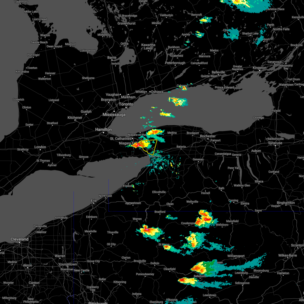 At 722 pm edt, a severe thunderstorm was located 5 miles west of niagara falls, moving east at 20 mph (radar indicated). Hazards include 60 mph wind gusts and quarter size hail. Minor damage to vehicles is possible. Expect wind damage to roofs, siding, and trees. At 722 pm edt, a severe thunderstorm was located 5 miles west of niagara falls, moving east at 20 mph (radar indicated). Hazards include 60 mph wind gusts and quarter size hail. Minor damage to vehicles is possible. Expect wind damage to roofs, siding, and trees.
|
| 3/26/2021 7:34 AM EDT |
 At 733 am edt, severe thunderstorms were located along a line extending from tonawanda to woodlawn beach state park, moving northeast at 70 mph (radar indicated). Hazards include 60 mph wind gusts. Expect damage to roofs, siding, and trees. locations impacted include, buffalo, cheektowaga, niagara falls, west seneca, north tonawanda, clarence, lockport, lackawanna, hamburg, kenmore and depew. This includes interstate 90 between exits 57 and 49. At 733 am edt, severe thunderstorms were located along a line extending from tonawanda to woodlawn beach state park, moving northeast at 70 mph (radar indicated). Hazards include 60 mph wind gusts. Expect damage to roofs, siding, and trees. locations impacted include, buffalo, cheektowaga, niagara falls, west seneca, north tonawanda, clarence, lockport, lackawanna, hamburg, kenmore and depew. This includes interstate 90 between exits 57 and 49.
|
| 3/26/2021 7:15 AM EDT |
 At 714 am edt, severe thunderstorms were located along a line extending from 13 miles southwest of grand island to 8 miles northwest of silver creek, moving northeast at 70 mph (radar indicated). Hazards include 60 mph wind gusts. expect damage to roofs, siding, and trees At 714 am edt, severe thunderstorms were located along a line extending from 13 miles southwest of grand island to 8 miles northwest of silver creek, moving northeast at 70 mph (radar indicated). Hazards include 60 mph wind gusts. expect damage to roofs, siding, and trees
|
| 11/15/2020 3:44 PM EST | Storm damage reported in erie county NY, 5.3 miles WSW of Buffalo, NY |
| 11/15/2020 3:32 PM EST | Tree and power lines dow in erie county NY, 6.1 miles NW of Buffalo, NY |
| 11/15/2020 3:24 PM EST |
 At 323 pm est, severe thunderstorms were located along a line extending from 6 miles west of newfane to 6 miles south of jamestown west, moving east at 65 mph (radar indicated). Hazards include 70 mph wind gusts. Expect considerable tree damage. Damage is likely to mobile homes, roofs, and outbuildings. At 323 pm est, severe thunderstorms were located along a line extending from 6 miles west of newfane to 6 miles south of jamestown west, moving east at 65 mph (radar indicated). Hazards include 70 mph wind gusts. Expect considerable tree damage. Damage is likely to mobile homes, roofs, and outbuildings.
|
| 11/15/2020 3:08 PM EST |
 At 306 pm est, severe thunderstorms were located along a line extending from near lewiston to mayville, moving northeast at 60 mph (radar indicated). Hazards include 70 mph wind gusts. Expect considerable tree damage. damage is likely to mobile homes, roofs, and outbuildings. locations impacted include, niagara falls, lewiston, youngstown, buffalo, cheektowaga, niagara falls, west seneca, north tonawanda, jamestown, clarence, lockport, lackawanna, kenmore, ripley, westfield, dunkirk, and silver creek. this includes the following highways, interstate 90 between exits 61 and 49. Interstate 86 between exits 4 and 16. At 306 pm est, severe thunderstorms were located along a line extending from near lewiston to mayville, moving northeast at 60 mph (radar indicated). Hazards include 70 mph wind gusts. Expect considerable tree damage. damage is likely to mobile homes, roofs, and outbuildings. locations impacted include, niagara falls, lewiston, youngstown, buffalo, cheektowaga, niagara falls, west seneca, north tonawanda, jamestown, clarence, lockport, lackawanna, kenmore, ripley, westfield, dunkirk, and silver creek. this includes the following highways, interstate 90 between exits 61 and 49. Interstate 86 between exits 4 and 16.
|
| 11/15/2020 2:39 PM EST |
 At 237 pm est, severe thunderstorms were located along a line extending from 31 miles west of niagara falls to 10 miles west of ripley, moving east at 60 mph (radar indicated). Hazards include 70 mph wind gusts. Expect considerable tree damage. Damage is likely to mobile homes, roofs, and outbuildings. At 237 pm est, severe thunderstorms were located along a line extending from 31 miles west of niagara falls to 10 miles west of ripley, moving east at 60 mph (radar indicated). Hazards include 70 mph wind gusts. Expect considerable tree damage. Damage is likely to mobile homes, roofs, and outbuildings.
|
| 10/23/2020 8:55 PM EDT | Storm damage reported in lez041 county NY, 4.2 miles NNE of Buffalo, NY |
| 8/27/2020 4:54 PM EDT |
 The severe thunderstorm warning for northwestern wyoming, northeastern erie and western genesee counties will expire at 500 pm edt, the storm which prompted the warning has weakened below severe limits, and has exited the warned area. therefore, the warning will be allowed to expire. a severe thunderstorm watch remains in effect until 800 pm edt for western new york. The severe thunderstorm warning for northwestern wyoming, northeastern erie and western genesee counties will expire at 500 pm edt, the storm which prompted the warning has weakened below severe limits, and has exited the warned area. therefore, the warning will be allowed to expire. a severe thunderstorm watch remains in effect until 800 pm edt for western new york.
|
| 8/27/2020 4:35 PM EDT |
 At 435 pm edt, a severe thunderstorm was located near alden, or near lancaster, moving east at 50 mph (radar indicated). Hazards include 60 mph wind gusts. Expect damage to roofs, siding, and trees. locations impacted include, buffalo, cheektowaga, west seneca, clarence, lackawanna, depew, amherst, lancaster, east aurora and williamsville. This includes interstate 90 between exits 56 and 48a. At 435 pm edt, a severe thunderstorm was located near alden, or near lancaster, moving east at 50 mph (radar indicated). Hazards include 60 mph wind gusts. Expect damage to roofs, siding, and trees. locations impacted include, buffalo, cheektowaga, west seneca, clarence, lackawanna, depew, amherst, lancaster, east aurora and williamsville. This includes interstate 90 between exits 56 and 48a.
|
| 8/27/2020 4:32 PM EDT |
 At 431 pm edt, a severe thunderstorm was located over hamburg, moving east at 40 mph (radar indicated). Hazards include 60 mph wind gusts. Expect damage to roofs, siding, and trees. locations impacted include, buffalo, west seneca, lackawanna, hamburg, east aurora, evans, elma, boston, eden and marilla. This includes interstate 90 between exits 58 and 54. At 431 pm edt, a severe thunderstorm was located over hamburg, moving east at 40 mph (radar indicated). Hazards include 60 mph wind gusts. Expect damage to roofs, siding, and trees. locations impacted include, buffalo, west seneca, lackawanna, hamburg, east aurora, evans, elma, boston, eden and marilla. This includes interstate 90 between exits 58 and 54.
|
| 8/27/2020 4:20 PM EDT | Dot skywa in erie county NY, 4 miles NNE of Buffalo, NY |
| 8/27/2020 4:18 PM EDT | Storm damage reported in lez041 county NY, 3.3 miles ENE of Buffalo, NY |
| 8/27/2020 4:12 PM EDT |
 At 412 pm edt, a severe thunderstorm was located over erie basin marina, or near buffalo, moving east at 50 mph (radar indicated). Hazards include 60 mph wind gusts and quarter size hail. Minor damage to vehicles is possible. Expect wind damage to roofs, siding, and trees. At 412 pm edt, a severe thunderstorm was located over erie basin marina, or near buffalo, moving east at 50 mph (radar indicated). Hazards include 60 mph wind gusts and quarter size hail. Minor damage to vehicles is possible. Expect wind damage to roofs, siding, and trees.
|
| 8/27/2020 4:01 PM EDT |
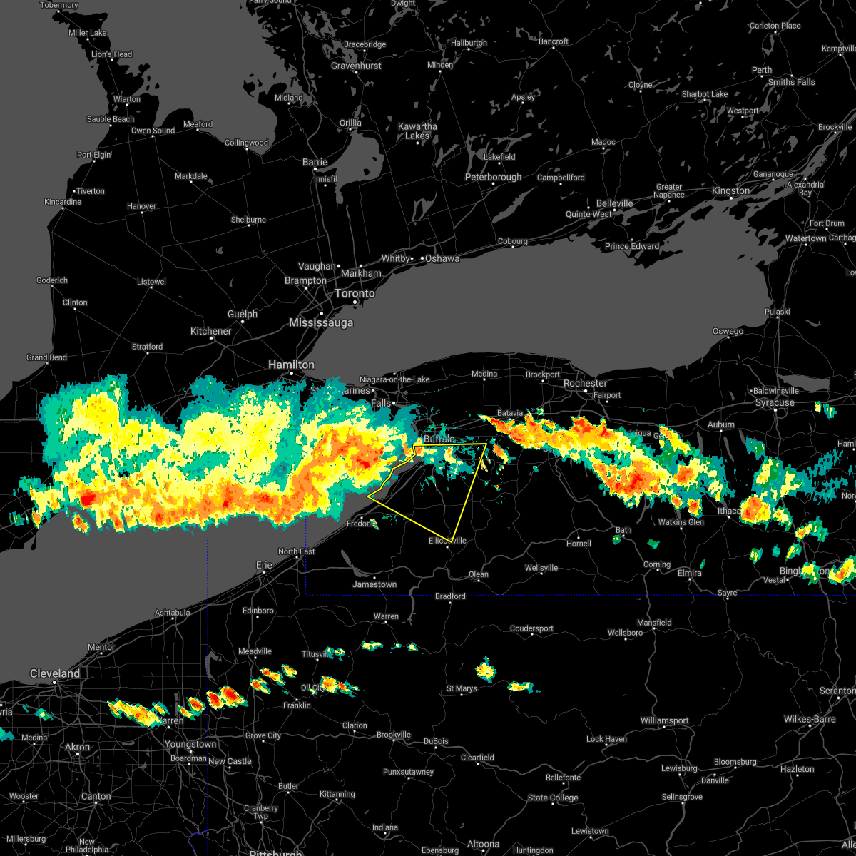 At 401 pm edt, a severe thunderstorm was located 10 miles northwest of angola on the lake, or 17 miles north of dunkirk, moving east at 40 mph (radar indicated). Hazards include 60 mph wind gusts and quarter size hail. Minor damage to vehicles is possible. Expect wind damage to roofs, siding, and trees. At 401 pm edt, a severe thunderstorm was located 10 miles northwest of angola on the lake, or 17 miles north of dunkirk, moving east at 40 mph (radar indicated). Hazards include 60 mph wind gusts and quarter size hail. Minor damage to vehicles is possible. Expect wind damage to roofs, siding, and trees.
|
| 8/25/2020 2:54 AM EDT |
 The severe thunderstorm warning for northeastern erie and niagara counties will expire at 300 am edt, the storm which prompted the warning has weakened below severe limits, and continues to exit the warned area. therefore, the warning will be allowed to expire. to report severe weather, contact your nearest law enforcement agency. they will relay your report to the national weather service buffalo. The severe thunderstorm warning for northeastern erie and niagara counties will expire at 300 am edt, the storm which prompted the warning has weakened below severe limits, and continues to exit the warned area. therefore, the warning will be allowed to expire. to report severe weather, contact your nearest law enforcement agency. they will relay your report to the national weather service buffalo.
|
| 8/25/2020 1:59 AM EDT |
 The national weather service in buffalo has issued a * severe thunderstorm warning for. northeastern erie county in western new york. niagara county in western new york. until 300 am edt. At 158 am edt, a severe thunderstorm was located near niagara. The national weather service in buffalo has issued a * severe thunderstorm warning for. northeastern erie county in western new york. niagara county in western new york. until 300 am edt. At 158 am edt, a severe thunderstorm was located near niagara.
|
| 8/15/2020 8:21 PM EDT |
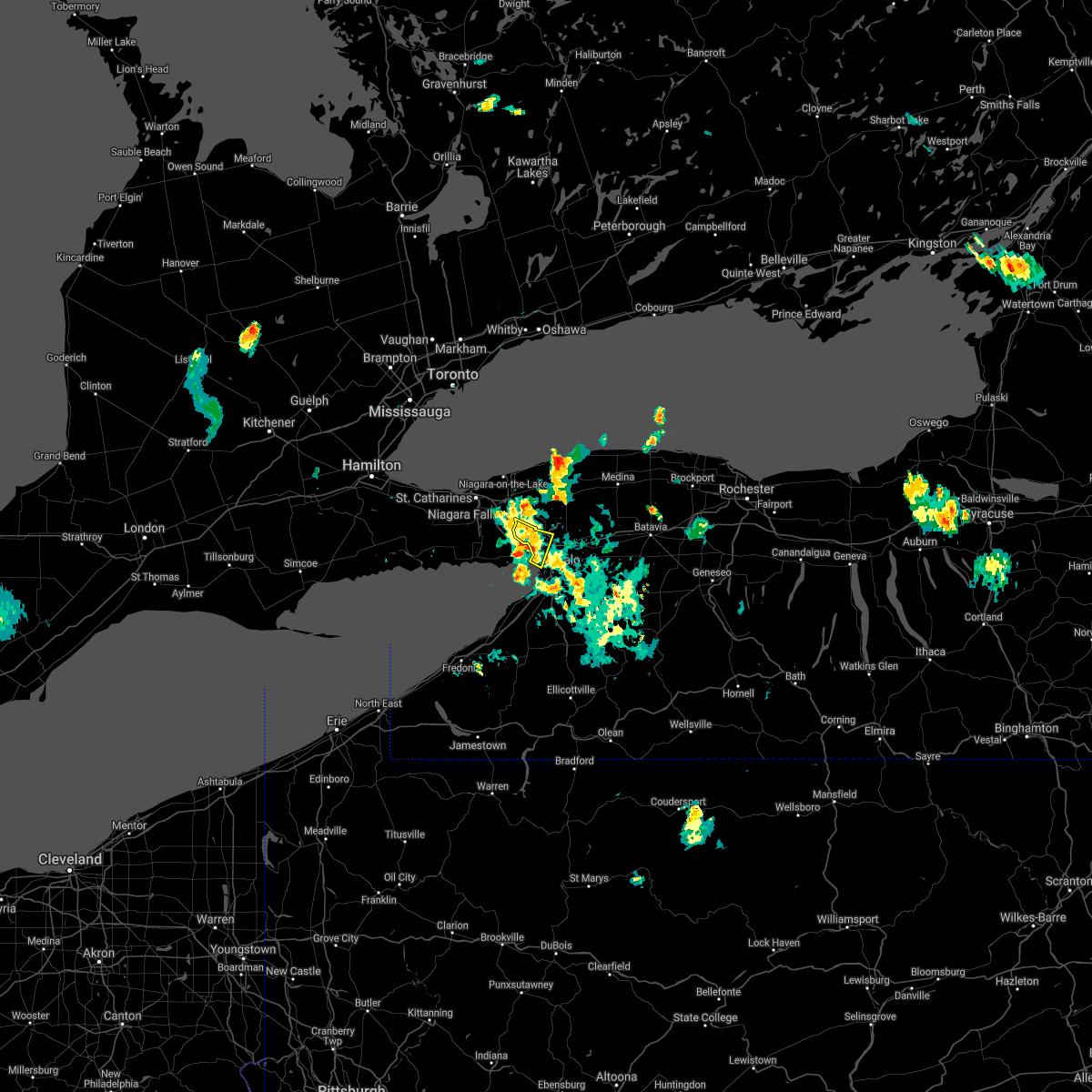 The severe thunderstorm warning for north central erie county will expire at 830 pm edt, the storm which prompted the warning has weakened below severe limits, and no longer poses an immediate threat to life or property. therefore, the warning will be allowed to expire. however heavy rain is still possible with this thunderstorm. The severe thunderstorm warning for north central erie county will expire at 830 pm edt, the storm which prompted the warning has weakened below severe limits, and no longer poses an immediate threat to life or property. therefore, the warning will be allowed to expire. however heavy rain is still possible with this thunderstorm.
|
| 8/15/2020 7:44 PM EDT |
 At 744 pm edt, a severe thunderstorm was located over elma, or near lancaster, moving southeast at 10 mph (radar indicated). Hazards include 60 mph wind gusts. Expect damage to roofs, siding, and trees. locations impacted include, buffalo, cheektowaga, west seneca, depew, amherst, lancaster, williamsville, elma, marilla and elma center. This includes interstate 90 between exits 53 and 49. At 744 pm edt, a severe thunderstorm was located over elma, or near lancaster, moving southeast at 10 mph (radar indicated). Hazards include 60 mph wind gusts. Expect damage to roofs, siding, and trees. locations impacted include, buffalo, cheektowaga, west seneca, depew, amherst, lancaster, williamsville, elma, marilla and elma center. This includes interstate 90 between exits 53 and 49.
|
| 8/15/2020 7:36 PM EDT | Trees down onto frontenac stree in erie county NY, 3.3 miles SSE of Buffalo, NY |
| 8/15/2020 7:27 PM EDT |
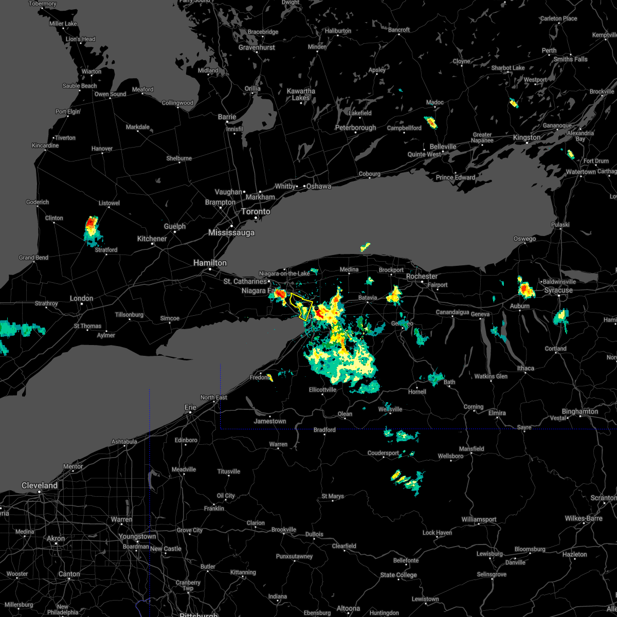 At 727 pm edt, a severe thunderstorm was located over kenmore, and is nearly stationary (radar indicated). Hazards include 60 mph wind gusts and quarter size hail. Minor damage to vehicles is possible. Expect wind damage to roofs, siding, and trees. At 727 pm edt, a severe thunderstorm was located over kenmore, and is nearly stationary (radar indicated). Hazards include 60 mph wind gusts and quarter size hail. Minor damage to vehicles is possible. Expect wind damage to roofs, siding, and trees.
|
| 8/15/2020 7:17 PM EDT |
 At 717 pm edt, a severe thunderstorm was located over depew, and is nearly stationary (radar indicated). Hazards include 60 mph wind gusts and quarter size hail. Minor damage to vehicles is possible. Expect wind damage to roofs, siding, and trees. At 717 pm edt, a severe thunderstorm was located over depew, and is nearly stationary (radar indicated). Hazards include 60 mph wind gusts and quarter size hail. Minor damage to vehicles is possible. Expect wind damage to roofs, siding, and trees.
|
| 8/4/2020 9:21 PM EDT |
 At 920 pm edt, a severe thunderstorm was located over derby, or 7 miles west of hamburg, moving east at 40 mph (radar indicated). Hazards include 60 mph wind gusts. expect damage to roofs, siding, and trees At 920 pm edt, a severe thunderstorm was located over derby, or 7 miles west of hamburg, moving east at 40 mph (radar indicated). Hazards include 60 mph wind gusts. expect damage to roofs, siding, and trees
|
| 7/16/2020 4:43 PM EDT |
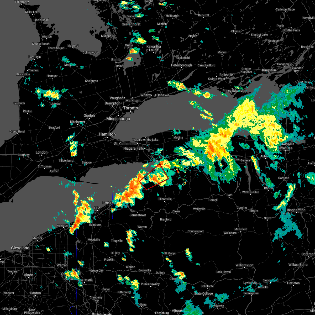 The tornado warning for northwestern cattaraugus, southern erie and northeastern chautauqua counties will expire at 445 pm edt, the storm which prompted the warning has weakened below severe limits, and no longer appears capable of producing a tornado. therefore, the warning will be allowed to expire. a severe thunderstorm watch remains in effect until 900 pm edt for western new york. The tornado warning for northwestern cattaraugus, southern erie and northeastern chautauqua counties will expire at 445 pm edt, the storm which prompted the warning has weakened below severe limits, and no longer appears capable of producing a tornado. therefore, the warning will be allowed to expire. a severe thunderstorm watch remains in effect until 900 pm edt for western new york.
|
| 7/16/2020 4:19 PM EDT |
 At 419 pm edt, a severe thunderstorm capable of producing a tornado was located near evangola state park, or 13 miles east of dunkirk, moving northeast at 20 mph (radar indicated rotation). Hazards include tornado. Flying debris will be dangerous to those caught without shelter. mobile homes will be damaged or destroyed. damage to roofs, windows, and vehicles will occur. tree damage is likely. this dangerous storm will be near, evans, angola and angola on the lake around 435 pm edt. north collins around 440 pm edt. derby around 445 pm edt. eden around 455 pm edt. hamburg, boston and north boston around 500 pm edt. other locations impacted by this tornadic thunderstorm include versailles, farnham, west falls and langford. This includes interstate 90 between exits 58 and 55. At 419 pm edt, a severe thunderstorm capable of producing a tornado was located near evangola state park, or 13 miles east of dunkirk, moving northeast at 20 mph (radar indicated rotation). Hazards include tornado. Flying debris will be dangerous to those caught without shelter. mobile homes will be damaged or destroyed. damage to roofs, windows, and vehicles will occur. tree damage is likely. this dangerous storm will be near, evans, angola and angola on the lake around 435 pm edt. north collins around 440 pm edt. derby around 445 pm edt. eden around 455 pm edt. hamburg, boston and north boston around 500 pm edt. other locations impacted by this tornadic thunderstorm include versailles, farnham, west falls and langford. This includes interstate 90 between exits 58 and 55.
|
| 7/16/2020 4:16 PM EDT |
 At 415 pm edt, a severe thunderstorm was located over angola on the lake and moving northeast at 35 mph (radar indicated). Hazards include 60 mph wind gusts. Expect damage to roofs, siding, and trees. locations impacted include, lackawanna, hamburg, evans, boston, eden, colden, silver creek, blasdell, angola and north collins. This includes interstate 90 between exits 58 and 57. At 415 pm edt, a severe thunderstorm was located over angola on the lake and moving northeast at 35 mph (radar indicated). Hazards include 60 mph wind gusts. Expect damage to roofs, siding, and trees. locations impacted include, lackawanna, hamburg, evans, boston, eden, colden, silver creek, blasdell, angola and north collins. This includes interstate 90 between exits 58 and 57.
|
| 7/16/2020 4:07 PM EDT |
 At 406 pm edt, a severe thunderstorm capable of producing a tornado was located over silver creek, or 8 miles east of dunkirk, moving northeast at 20 mph (radar indicated rotation). Hazards include tornado. Flying debris will be dangerous to those caught without shelter. mobile homes will be damaged or destroyed. damage to roofs, windows, and vehicles will occur. tree damage is likely. this dangerous storm will be near, evangola state park around 425 pm edt. evans, angola and angola on the lake around 435 pm edt. north collins around 440 pm edt. eden and derby around 445 pm edt. other locations impacted by this tornadic thunderstorm include sheridan, silver creek reservoir, west falls, forestville, versailles, farnham, langford, collins and perrysburg. This includes interstate 90 between exits 58 and 55. At 406 pm edt, a severe thunderstorm capable of producing a tornado was located over silver creek, or 8 miles east of dunkirk, moving northeast at 20 mph (radar indicated rotation). Hazards include tornado. Flying debris will be dangerous to those caught without shelter. mobile homes will be damaged or destroyed. damage to roofs, windows, and vehicles will occur. tree damage is likely. this dangerous storm will be near, evangola state park around 425 pm edt. evans, angola and angola on the lake around 435 pm edt. north collins around 440 pm edt. eden and derby around 445 pm edt. other locations impacted by this tornadic thunderstorm include sheridan, silver creek reservoir, west falls, forestville, versailles, farnham, langford, collins and perrysburg. This includes interstate 90 between exits 58 and 55.
|
| 7/16/2020 3:52 PM EDT |
 At 351 pm edt, a severe thunderstorm was located over dunkirk, moving northeast at 35 mph (radar indicated). Hazards include 60 mph wind gusts. expect damage to roofs, siding, and trees At 351 pm edt, a severe thunderstorm was located over dunkirk, moving northeast at 35 mph (radar indicated). Hazards include 60 mph wind gusts. expect damage to roofs, siding, and trees
|
| 6/23/2020 4:15 PM EDT |
 The severe thunderstorm warning for northern erie and niagara counties has expired, the storm which prompted the warning has weakened below severe limits, and no longer poses an immediate threat to life or property. therefore, the warning has been allowed to expire. however gusty winds and heavy rain are still possible with this thunderstorm. The severe thunderstorm warning for northern erie and niagara counties has expired, the storm which prompted the warning has weakened below severe limits, and no longer poses an immediate threat to life or property. therefore, the warning has been allowed to expire. however gusty winds and heavy rain are still possible with this thunderstorm.
|
| 6/23/2020 4:05 PM EDT | A few trees down on old falls blvd in niagara county NY, 10.1 miles S of Buffalo, NY |
| 6/23/2020 3:50 PM EDT |
 At 349 pm edt, a severe thunderstorm was located over tonawanda, moving northeast at 40 mph (radar indicated). Hazards include 60 mph wind gusts and quarter size hail. Minor damage to vehicles is possible. expect wind damage to roofs, siding, and trees. locations impacted include, buffalo, cheektowaga, niagara falls, west seneca, north tonawanda, clarence, lockport, lackawanna, kenmore and depew. This includes interstate 90 between exits 57 and 49. At 349 pm edt, a severe thunderstorm was located over tonawanda, moving northeast at 40 mph (radar indicated). Hazards include 60 mph wind gusts and quarter size hail. Minor damage to vehicles is possible. expect wind damage to roofs, siding, and trees. locations impacted include, buffalo, cheektowaga, niagara falls, west seneca, north tonawanda, clarence, lockport, lackawanna, kenmore and depew. This includes interstate 90 between exits 57 and 49.
|
| 6/23/2020 3:20 PM EDT |
 At 320 pm edt, a severe thunderstorm was located 11 miles northwest of angola on the lake, or 17 miles west of buffalo, moving northeast at 40 mph (radar indicated). Hazards include 60 mph wind gusts and quarter size hail. Minor damage to vehicles is possible. Expect wind damage to roofs, siding, and trees. At 320 pm edt, a severe thunderstorm was located 11 miles northwest of angola on the lake, or 17 miles west of buffalo, moving northeast at 40 mph (radar indicated). Hazards include 60 mph wind gusts and quarter size hail. Minor damage to vehicles is possible. Expect wind damage to roofs, siding, and trees.
|
| 6/10/2020 11:22 PM EDT |
 At 1122 pm edt, a severe thunderstorm was located over depew, moving east at 50 mph (radar indicated). Hazards include 60 mph wind gusts. Expect damage to roofs, siding, and trees. locations impacted include, buffalo, cheektowaga, niagara falls, west seneca, north tonawanda, clarence, lockport, lackawanna, batavia and kenmore. This includes interstate 90 between exits 56 and 48. At 1122 pm edt, a severe thunderstorm was located over depew, moving east at 50 mph (radar indicated). Hazards include 60 mph wind gusts. Expect damage to roofs, siding, and trees. locations impacted include, buffalo, cheektowaga, niagara falls, west seneca, north tonawanda, clarence, lockport, lackawanna, batavia and kenmore. This includes interstate 90 between exits 56 and 48.
|
| 6/10/2020 10:49 PM EDT |
 At 1048 pm edt, a severe thunderstorm was located over niagara falls, moving northeast at 50 mph (radar indicated). Hazards include 60 mph wind gusts. expect damage to roofs, siding, and trees At 1048 pm edt, a severe thunderstorm was located over niagara falls, moving northeast at 50 mph (radar indicated). Hazards include 60 mph wind gusts. expect damage to roofs, siding, and trees
|
| 6/2/2020 11:24 PM EDT | Storm damage reported in lez041 county NY, 3.5 miles ENE of Buffalo, NY |
| 6/2/2020 11:24 PM EDT | Large tree down on clinton stree in erie county NY, 2.5 miles NE of Buffalo, NY |
| 6/2/2020 11:20 PM EDT | Half Dollar sized hail reported 5.4 miles NNW of Buffalo, NY |
| 6/2/2020 11:20 PM EDT |
 At 1120 pm edt, a severe thunderstorm was located over west seneca, moving southeast at 45 mph (radar indicated). Hazards include ping pong ball size hail and 60 mph wind gusts. People and animals outdoors will be injured. expect hail damage to roofs, siding, windows, and vehicles. expect wind damage to roofs, siding, and trees. locations impacted include, buffalo, cheektowaga, west seneca, clarence, lackawanna, depew, amherst, lancaster, hamburg and east aurora. This includes interstate 90 between exits 57a and 49. At 1120 pm edt, a severe thunderstorm was located over west seneca, moving southeast at 45 mph (radar indicated). Hazards include ping pong ball size hail and 60 mph wind gusts. People and animals outdoors will be injured. expect hail damage to roofs, siding, windows, and vehicles. expect wind damage to roofs, siding, and trees. locations impacted include, buffalo, cheektowaga, west seneca, clarence, lackawanna, depew, amherst, lancaster, hamburg and east aurora. This includes interstate 90 between exits 57a and 49.
|
| 6/2/2020 11:15 PM EDT | Quarter sized hail reported 1.7 miles NE of Buffalo, NY |
| 6/2/2020 11:13 PM EDT | Quarter sized hail reported 2.2 miles ESE of Buffalo, NY, hail in elmwood village |
| 6/2/2020 11:12 PM EDT | Large tree fell on car on elmwood av in erie county NY, 2.4 miles E of Buffalo, NY |
| 6/2/2020 11:09 PM EDT | Several massive trees down on horton place in erie county NY, 1.8 miles SE of Buffalo, NY |
| 6/2/2020 10:53 PM EDT |
 At 1053 pm edt, a severe thunderstorm was located near north tonawanda, moving southeast at 55 mph (radar indicated). Hazards include 60 mph wind gusts and half dollar size hail. Minor damage to vehicles is possible. expect wind damage to roofs, siding, and trees. Locations impacted include, buffalo, niagara falls, north tonawanda, lockport, kenmore, amherst, tonawanda, williamsville, grand island and newfane. At 1053 pm edt, a severe thunderstorm was located near north tonawanda, moving southeast at 55 mph (radar indicated). Hazards include 60 mph wind gusts and half dollar size hail. Minor damage to vehicles is possible. expect wind damage to roofs, siding, and trees. Locations impacted include, buffalo, niagara falls, north tonawanda, lockport, kenmore, amherst, tonawanda, williamsville, grand island and newfane.
|
| 6/2/2020 10:49 PM EDT |
 At 1048 pm edt, a severe thunderstorm was located over sanborn, or near north tonawanda, moving southeast at 55 mph (radar indicated). Hazards include 60 mph wind gusts and half dollar size hail. Minor damage to vehicles is possible. Expect wind damage to roofs, siding, and trees. At 1048 pm edt, a severe thunderstorm was located over sanborn, or near north tonawanda, moving southeast at 55 mph (radar indicated). Hazards include 60 mph wind gusts and half dollar size hail. Minor damage to vehicles is possible. Expect wind damage to roofs, siding, and trees.
|
| 6/2/2020 10:42 PM EDT |
 At 1041 pm edt, a severe thunderstorm was located over sanborn, moving southeast at 55 mph (radar indicated). Hazards include 60 mph wind gusts and half dollar size hail. Minor damage to vehicles is possible. expect wind damage to roofs, siding, and trees. Locations impacted include, buffalo, niagara falls, north tonawanda, lockport, kenmore, tonawanda, amherst, williamsville, grand island and newfane. At 1041 pm edt, a severe thunderstorm was located over sanborn, moving southeast at 55 mph (radar indicated). Hazards include 60 mph wind gusts and half dollar size hail. Minor damage to vehicles is possible. expect wind damage to roofs, siding, and trees. Locations impacted include, buffalo, niagara falls, north tonawanda, lockport, kenmore, tonawanda, amherst, williamsville, grand island and newfane.
|
| 6/2/2020 10:13 PM EDT |
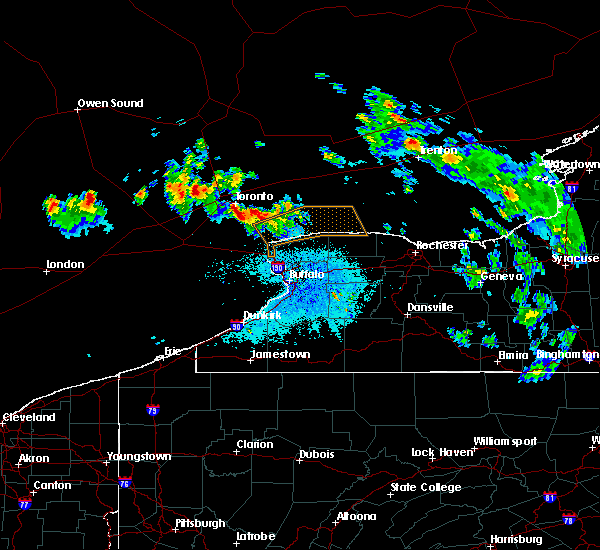 At 1012 pm edt, a severe thunderstorm was located 14 miles north of fort niagara state park and moving southeast at 60 mph (radar indicated). Hazards include 60 mph wind gusts and half dollar size hail. Minor damage to vehicles is possible. Expect wind damage to roofs, siding, and trees. At 1012 pm edt, a severe thunderstorm was located 14 miles north of fort niagara state park and moving southeast at 60 mph (radar indicated). Hazards include 60 mph wind gusts and half dollar size hail. Minor damage to vehicles is possible. Expect wind damage to roofs, siding, and trees.
|
| 5/29/2020 4:51 PM EDT |
 At 451 pm edt, a severe thunderstorm was located over blasdell, or over lackawanna, moving northeast at 30 mph (radar indicated). Hazards include 60 mph wind gusts. expect damage to roofs, siding, and trees At 451 pm edt, a severe thunderstorm was located over blasdell, or over lackawanna, moving northeast at 30 mph (radar indicated). Hazards include 60 mph wind gusts. expect damage to roofs, siding, and trees
|
| 5/29/2020 12:44 PM EDT |
 At 1244 pm edt, a severe thunderstorm was located near orchard park, or near west seneca, moving northeast at 35 mph (radar indicated). Hazards include 60 mph wind gusts and penny size hail. expect damage to roofs, siding, and trees At 1244 pm edt, a severe thunderstorm was located near orchard park, or near west seneca, moving northeast at 35 mph (radar indicated). Hazards include 60 mph wind gusts and penny size hail. expect damage to roofs, siding, and trees
|
| 3/29/2020 2:04 PM EDT | Storm damage reported in erie county NY, 5.3 miles WSW of Buffalo, NY |
| 3/29/2020 1:55 PM EDT |
 At 155 pm edt, severe thunderstorms were located along a line extending from lewiston to near hamburg, moving northeast at 65 mph (radar indicated). Hazards include 70 mph wind gusts and nickel size hail. Expect considerable tree damage. damage is likely to mobile homes, roofs, and outbuildings. locations impacted include, buffalo, cheektowaga, niagara falls, west seneca, north tonawanda, clarence, lockport, lackawanna, kenmore and depew. This includes interstate 90 between exits 57a and 49. At 155 pm edt, severe thunderstorms were located along a line extending from lewiston to near hamburg, moving northeast at 65 mph (radar indicated). Hazards include 70 mph wind gusts and nickel size hail. Expect considerable tree damage. damage is likely to mobile homes, roofs, and outbuildings. locations impacted include, buffalo, cheektowaga, niagara falls, west seneca, north tonawanda, clarence, lockport, lackawanna, kenmore and depew. This includes interstate 90 between exits 57a and 49.
|
| 3/29/2020 1:24 PM EDT |
 At 122 pm edt, severe thunderstorms were located along a line extending from 26 miles southwest of niagara falls to near lake erie state park, moving northeast at 50 mph (radar indicated). Hazards include 60 mph wind gusts and nickel size hail. expect damage to roofs, siding, and trees At 122 pm edt, severe thunderstorms were located along a line extending from 26 miles southwest of niagara falls to near lake erie state park, moving northeast at 50 mph (radar indicated). Hazards include 60 mph wind gusts and nickel size hail. expect damage to roofs, siding, and trees
|
| 11/1/2019 6:34 AM EDT | Buffalo public works commissioner reports more than 130 tree-related calls overnight across the city of buffalo in erie county NY, 1.7 miles NE of Buffalo, NY |
| 10/1/2019 5:19 PM EDT |
 At 518 pm edt, a severe thunderstorm was located over lockport, moving east at 55 mph (radar indicated). Hazards include 60 mph wind gusts. Expect damage to roofs, siding, and trees. locations impacted include, niagara falls, north tonawanda, clarence, lockport, batavia, kenmore, tonawanda, amherst, medina and albion. This includes interstate 90 between exits 48a and 48. At 518 pm edt, a severe thunderstorm was located over lockport, moving east at 55 mph (radar indicated). Hazards include 60 mph wind gusts. Expect damage to roofs, siding, and trees. locations impacted include, niagara falls, north tonawanda, clarence, lockport, batavia, kenmore, tonawanda, amherst, medina and albion. This includes interstate 90 between exits 48a and 48.
|
| 10/1/2019 4:45 PM EDT |
 At 444 pm edt, a severe thunderstorm was located 13 miles west of niagara falls, moving east at 65 mph (radar indicated). Hazards include 60 mph wind gusts. expect damage to roofs, siding, and trees At 444 pm edt, a severe thunderstorm was located 13 miles west of niagara falls, moving east at 65 mph (radar indicated). Hazards include 60 mph wind gusts. expect damage to roofs, siding, and trees
|
| 8/8/2019 11:16 AM EDT |
 At 1116 am edt, severe thunderstorms were located along a line extending from near clarence to west seneca, moving east at 30 mph (radar indicated). Hazards include 60 mph wind gusts. Expect damage to roofs, siding, and trees. locations impacted include, buffalo, cheektowaga, west seneca, north tonawanda, clarence, lackawanna, kenmore, depew, amherst and tonawanda. This includes interstate 90 between exits 55 and 49. At 1116 am edt, severe thunderstorms were located along a line extending from near clarence to west seneca, moving east at 30 mph (radar indicated). Hazards include 60 mph wind gusts. Expect damage to roofs, siding, and trees. locations impacted include, buffalo, cheektowaga, west seneca, north tonawanda, clarence, lackawanna, kenmore, depew, amherst and tonawanda. This includes interstate 90 between exits 55 and 49.
|
| 8/8/2019 10:48 AM EDT |
 At 1048 am edt, a severe thunderstorm was located over kenmore, moving east at 35 mph (radar indicated). Hazards include 60 mph wind gusts. expect damage to roofs, siding, and trees At 1048 am edt, a severe thunderstorm was located over kenmore, moving east at 35 mph (radar indicated). Hazards include 60 mph wind gusts. expect damage to roofs, siding, and trees
|
| 7/20/2019 11:10 PM EDT |
 At 1109 pm edt, severe thunderstorms were located along a line extending from 11 miles north of angola on the lake to north boston, moving northeast at 45 mph (radar indicated). Hazards include 60 mph wind gusts. expect damage to roofs, siding, and trees At 1109 pm edt, severe thunderstorms were located along a line extending from 11 miles north of angola on the lake to north boston, moving northeast at 45 mph (radar indicated). Hazards include 60 mph wind gusts. expect damage to roofs, siding, and trees
|
| 7/19/2019 2:46 PM EDT | Tree down in elmlawn memorial park in erie county NY, 6.1 miles SSE of Buffalo, NY |
| 7/19/2019 2:44 PM EDT |
 At 243 pm edt, a severe thunderstorm was located over grand island, or near tonawanda, moving southeast at 30 mph (radar indicated). Hazards include 70 mph wind gusts. Expect considerable tree damage. damage is likely to mobile homes, roofs, and outbuildings. locations impacted include, buffalo, cheektowaga, niagara falls, west seneca, north tonawanda, clarence, kenmore, depew, amherst and tonawanda. This includes interstate 90 between exits 53 and 49. At 243 pm edt, a severe thunderstorm was located over grand island, or near tonawanda, moving southeast at 30 mph (radar indicated). Hazards include 70 mph wind gusts. Expect considerable tree damage. damage is likely to mobile homes, roofs, and outbuildings. locations impacted include, buffalo, cheektowaga, niagara falls, west seneca, north tonawanda, clarence, kenmore, depew, amherst and tonawanda. This includes interstate 90 between exits 53 and 49.
|
| 7/19/2019 2:28 PM EDT |
 At 227 pm edt, a severe thunderstorm was located near niagara falls, moving east at 30 mph (radar indicated). Hazards include 60 mph wind gusts. expect damage to roofs, siding, and trees At 227 pm edt, a severe thunderstorm was located near niagara falls, moving east at 30 mph (radar indicated). Hazards include 60 mph wind gusts. expect damage to roofs, siding, and trees
|
| 5/25/2019 6:45 PM EDT |
 At 645 pm edt, severe thunderstorms were located along a line extending from near grand island to 17 miles northwest of angola on the lake, moving east at 45 mph (radar indicated). Hazards include 70 mph wind gusts. Expect considerable tree damage. Damage is likely to mobile homes, roofs, and outbuildings. At 645 pm edt, severe thunderstorms were located along a line extending from near grand island to 17 miles northwest of angola on the lake, moving east at 45 mph (radar indicated). Hazards include 70 mph wind gusts. Expect considerable tree damage. Damage is likely to mobile homes, roofs, and outbuildings.
|
| 5/23/2019 10:31 AM EDT |
 At 1030 am edt, severe thunderstorms were located along a line extending from lewiston to 8 miles west of ashford hollow, moving east at 55 mph (radar indicated). Hazards include 60 mph wind gusts and quarter size hail. Minor damage to vehicles is possible. expect wind damage to roofs, siding, and trees. locations impacted include, buffalo, cheektowaga, niagara falls, west seneca, north tonawanda, clarence, lockport, lackawanna, kenmore, depew, springville, angola, boston, cattaraugus, ashford hollow. this includes the following highways, interstate 90 between exits 57a and 49. Interstate 86 between exits 15 and 25. At 1030 am edt, severe thunderstorms were located along a line extending from lewiston to 8 miles west of ashford hollow, moving east at 55 mph (radar indicated). Hazards include 60 mph wind gusts and quarter size hail. Minor damage to vehicles is possible. expect wind damage to roofs, siding, and trees. locations impacted include, buffalo, cheektowaga, niagara falls, west seneca, north tonawanda, clarence, lockport, lackawanna, kenmore, depew, springville, angola, boston, cattaraugus, ashford hollow. this includes the following highways, interstate 90 between exits 57a and 49. Interstate 86 between exits 15 and 25.
|
| 5/23/2019 9:54 AM EDT |
 At 953 am edt, severe thunderstorms were located along a line extending from 27 miles west of niagara falls to near panama, moving east at 60 mph (radar indicated). Hazards include 60 mph wind gusts and nickel size hail. expect damage to roofs, siding, and trees At 953 am edt, severe thunderstorms were located along a line extending from 27 miles west of niagara falls to near panama, moving east at 60 mph (radar indicated). Hazards include 60 mph wind gusts and nickel size hail. expect damage to roofs, siding, and trees
|
| 3/10/2019 5:30 PM EDT | Noco light post shimmerville and main... clarenc in erie county NY, 9.6 miles WSW of Buffalo, NY |
| 9/21/2018 5:55 PM EDT |
 At 554 pm edt, a severe thunderstorm was located over oakfield, or 7 miles northwest of batavia, moving east at 70 mph (radar indicated). Hazards include 60 mph wind gusts. Expect damage to roofs, siding, and trees. Locations impacted include, buffalo, cheektowaga, west seneca, clarence, batavia, depew, lancaster, darien lakes state park, elma and pembroke. At 554 pm edt, a severe thunderstorm was located over oakfield, or 7 miles northwest of batavia, moving east at 70 mph (radar indicated). Hazards include 60 mph wind gusts. Expect damage to roofs, siding, and trees. Locations impacted include, buffalo, cheektowaga, west seneca, clarence, batavia, depew, lancaster, darien lakes state park, elma and pembroke.
|
| 9/21/2018 5:54 PM EDT |
 At 553 pm edt, severe thunderstorms were located along a line extending from west seneca to near clymer, moving east at 60 mph (radar indicated). Hazards include 60 mph wind gusts. expect damage to roofs, siding, and trees At 553 pm edt, severe thunderstorms were located along a line extending from west seneca to near clymer, moving east at 60 mph (radar indicated). Hazards include 60 mph wind gusts. expect damage to roofs, siding, and trees
|
| 9/21/2018 5:40 PM EDT | Trees dow in erie county NY, 6.1 miles NW of Buffalo, NY |
| 9/21/2018 5:34 PM EDT | Tree blocking tonawanda creek rd near campbell bvld in erie county NY, 9.3 miles SSW of Buffalo, NY |
| 9/21/2018 5:27 PM EDT |
 At 527 pm edt, a severe thunderstorm was located over erie basin marina, or over buffalo, moving east at 70 mph (radar indicated). Hazards include 60 mph wind gusts. expect damage to roofs, siding, and trees At 527 pm edt, a severe thunderstorm was located over erie basin marina, or over buffalo, moving east at 70 mph (radar indicated). Hazards include 60 mph wind gusts. expect damage to roofs, siding, and trees
|
| 8/8/2018 9:30 AM EDT |
 At 929 am edt, a severe thunderstorm was located over wales center, or near east aurora, moving east at 35 mph (radar indicated). Hazards include 60 mph wind gusts. Expect damage to roofs, siding, and trees. Locations impacted include, west seneca, east aurora, darien lakes state park, elma, marilla, bennington, colden and orchard park. At 929 am edt, a severe thunderstorm was located over wales center, or near east aurora, moving east at 35 mph (radar indicated). Hazards include 60 mph wind gusts. Expect damage to roofs, siding, and trees. Locations impacted include, west seneca, east aurora, darien lakes state park, elma, marilla, bennington, colden and orchard park.
|
| 8/8/2018 9:07 AM EDT |
 At 907 am edt, a severe thunderstorm was located over orchard park, or near hamburg, moving east at 35 mph (radar indicated). Hazards include 60 mph wind gusts. expect damage to roofs, siding, and trees At 907 am edt, a severe thunderstorm was located over orchard park, or near hamburg, moving east at 35 mph (radar indicated). Hazards include 60 mph wind gusts. expect damage to roofs, siding, and trees
|
| 8/8/2018 8:43 AM EDT |
 At 842 am edt, a severe thunderstorm was located near woodlawn beach state park, or near lackawanna, moving east at 30 mph (radar indicated). Hazards include 60 mph wind gusts. Expect damage to roofs, siding, and trees. Locations impacted include, angola, hamburg, buffalo, cheektowaga, west seneca, clarence, lackawanna, kenmore, and depew. At 842 am edt, a severe thunderstorm was located near woodlawn beach state park, or near lackawanna, moving east at 30 mph (radar indicated). Hazards include 60 mph wind gusts. Expect damage to roofs, siding, and trees. Locations impacted include, angola, hamburg, buffalo, cheektowaga, west seneca, clarence, lackawanna, kenmore, and depew.
|
| 8/8/2018 8:26 AM EDT |
 At 825 am edt, a severe thunderstorm was located 9 miles north of angola on the lake, or 13 miles west of lackawanna, moving northeast at 35 mph (radar indicated). Hazards include 60 mph wind gusts. Expect damage to roofs, siding, and trees. Locations impacted include, buffalo, cheektowaga, west seneca, north tonawanda, clarence, lackawanna, kenmore and depew. At 825 am edt, a severe thunderstorm was located 9 miles north of angola on the lake, or 13 miles west of lackawanna, moving northeast at 35 mph (radar indicated). Hazards include 60 mph wind gusts. Expect damage to roofs, siding, and trees. Locations impacted include, buffalo, cheektowaga, west seneca, north tonawanda, clarence, lackawanna, kenmore and depew.
|
| 8/8/2018 8:09 AM EDT |
 At 808 am edt, a severe thunderstorm was located 13 miles northwest of angola on the lake, or 19 miles north of dunkirk, moving northeast at 30 mph (radar indicated). Hazards include 60 mph wind gusts. expect damage to roofs, siding, and trees At 808 am edt, a severe thunderstorm was located 13 miles northwest of angola on the lake, or 19 miles north of dunkirk, moving northeast at 30 mph (radar indicated). Hazards include 60 mph wind gusts. expect damage to roofs, siding, and trees
|
| 7/5/2018 10:14 PM EDT |
 At 1014 pm edt, severe thunderstorms were located along a line extending from near lockport to 7 miles southwest of niagara falls, moving southeast at 40 mph (radar indicated). Hazards include 60 mph wind gusts. expect damage to roofs, siding, and trees At 1014 pm edt, severe thunderstorms were located along a line extending from near lockport to 7 miles southwest of niagara falls, moving southeast at 40 mph (radar indicated). Hazards include 60 mph wind gusts. expect damage to roofs, siding, and trees
|
| 6/13/2018 4:45 PM EDT |
 At 445 pm edt, a severe thunderstorm was located over west seneca, moving east at 55 mph (radar indicated). Hazards include 60 mph wind gusts. Expect damage to roofs, siding, and trees. Locations impacted include, buffalo, cheektowaga, west seneca, clarence, lackawanna, depew, amherst and tonawanda. At 445 pm edt, a severe thunderstorm was located over west seneca, moving east at 55 mph (radar indicated). Hazards include 60 mph wind gusts. Expect damage to roofs, siding, and trees. Locations impacted include, buffalo, cheektowaga, west seneca, clarence, lackawanna, depew, amherst and tonawanda.
|
| 6/13/2018 4:38 PM EDT | Tree on car near prospect and virginia ave in buffalo. time estimated from rada in erie county NY, 2.6 miles ENE of Buffalo, NY |
| 6/13/2018 4:26 PM EDT |
 At 425 pm edt, a severe thunderstorm was located 7 miles west of erie basin marina, or 10 miles west of buffalo, moving east at 60 mph (radar indicated). Hazards include 60 mph wind gusts. expect damage to roofs, siding, and trees At 425 pm edt, a severe thunderstorm was located 7 miles west of erie basin marina, or 10 miles west of buffalo, moving east at 60 mph (radar indicated). Hazards include 60 mph wind gusts. expect damage to roofs, siding, and trees
|
| 10/15/2017 3:56 PM EDT |
 At 356 pm edt, severe thunderstorms were located along a line extending from near lakeside beach state park to north collins to 8 miles south of fredonia, moving southeast at 45 mph (radar indicated). Hazards include 60 mph wind gusts. expect wind damage to trees and power lines At 356 pm edt, severe thunderstorms were located along a line extending from near lakeside beach state park to north collins to 8 miles south of fredonia, moving southeast at 45 mph (radar indicated). Hazards include 60 mph wind gusts. expect wind damage to trees and power lines
|
| 10/15/2017 3:53 PM EDT |
 At 352 pm edt, a severe thunderstorm was located over williamsville, moving east at 40 mph (radar indicated). Hazards include 60 mph wind gusts. Expect wind damage to trees and power lines. locations impacted include, buffalo, cheektowaga, west seneca, clarence, lackawanna, depew, amherst and tonawanda. This includes interstate 90 between exits 54 and 48a. At 352 pm edt, a severe thunderstorm was located over williamsville, moving east at 40 mph (radar indicated). Hazards include 60 mph wind gusts. Expect wind damage to trees and power lines. locations impacted include, buffalo, cheektowaga, west seneca, clarence, lackawanna, depew, amherst and tonawanda. This includes interstate 90 between exits 54 and 48a.
|
| 10/15/2017 3:37 PM EDT |
 The national weather service in buffalo has issued a * severe thunderstorm warning for. northeastern erie county in western new york. southeastern niagara county in western new york. western genesee county in western new york. Until 400 pm edt. The national weather service in buffalo has issued a * severe thunderstorm warning for. northeastern erie county in western new york. southeastern niagara county in western new york. western genesee county in western new york. Until 400 pm edt.
|
| 9/4/2017 11:12 PM EDT |
 The severe thunderstorm warning for northwestern cattaraugus, southern erie and east central chautauqua counties will expire at 1115 pm edt, the storms which prompted the warning have weakened below severe limits, and no longer pose an immediate threat to life or property. therefore the warning will be allowed to expire. The severe thunderstorm warning for northwestern cattaraugus, southern erie and east central chautauqua counties will expire at 1115 pm edt, the storms which prompted the warning have weakened below severe limits, and no longer pose an immediate threat to life or property. therefore the warning will be allowed to expire.
|
| 9/4/2017 11:03 PM EDT |
 At 1102 pm edt, severe thunderstorms were located along a line extending from near orchard park to 8 miles south of gowanda, moving east at 65 mph (radar indicated). Hazards include 60 mph wind gusts. Expect wind damage to trees and power lines. locations impacted include, west seneca, lackawanna, hamburg, east aurora, boston, eden, springville and colden. This includes interstate 90 between exits 57 and 55. At 1102 pm edt, severe thunderstorms were located along a line extending from near orchard park to 8 miles south of gowanda, moving east at 65 mph (radar indicated). Hazards include 60 mph wind gusts. Expect wind damage to trees and power lines. locations impacted include, west seneca, lackawanna, hamburg, east aurora, boston, eden, springville and colden. This includes interstate 90 between exits 57 and 55.
|
| 9/4/2017 10:43 PM EDT |
 At 1042 pm edt, severe thunderstorms were located along a line extending from near evangola state park to 7 miles north of long point state park, moving east at 65 mph (radar indicated). Hazards include 60 mph wind gusts. Expect wind damage to trees and power lines. locations impacted include, buffalo, west seneca, lackawanna, dunkirk, fredonia, hamburg, east aurora and evans. This includes interstate 90 between exits 61 and 55. At 1042 pm edt, severe thunderstorms were located along a line extending from near evangola state park to 7 miles north of long point state park, moving east at 65 mph (radar indicated). Hazards include 60 mph wind gusts. Expect wind damage to trees and power lines. locations impacted include, buffalo, west seneca, lackawanna, dunkirk, fredonia, hamburg, east aurora and evans. This includes interstate 90 between exits 61 and 55.
|
| 9/4/2017 10:12 PM EDT |
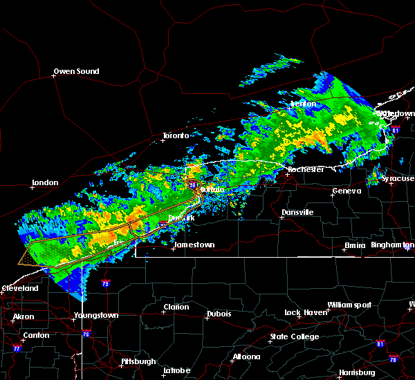 At 1011 pm edt, severe thunderstorms were located along a line extending from 14 miles northwest of westfield to 8 miles northwest of northwest harborcreek, moving east at 70 mph (radar indicated). Hazards include 60 mph wind gusts. expect wind damage to trees and power lines At 1011 pm edt, severe thunderstorms were located along a line extending from 14 miles northwest of westfield to 8 miles northwest of northwest harborcreek, moving east at 70 mph (radar indicated). Hazards include 60 mph wind gusts. expect wind damage to trees and power lines
|
| 8/22/2017 6:54 PM EDT |
 At 654 pm edt, a severe thunderstorm was located over kenmore, moving east at 40 mph (radar indicated). Hazards include 60 mph wind gusts. Expect wind damage to trees and power lines. locations impacted include, buffalo, cheektowaga, west seneca, north tonawanda, clarence, lackawanna, kenmore and depew. This includes interstate 90 between exits 56 and 49. At 654 pm edt, a severe thunderstorm was located over kenmore, moving east at 40 mph (radar indicated). Hazards include 60 mph wind gusts. Expect wind damage to trees and power lines. locations impacted include, buffalo, cheektowaga, west seneca, north tonawanda, clarence, lackawanna, kenmore and depew. This includes interstate 90 between exits 56 and 49.
|
| 8/22/2017 6:28 PM EDT |
 At 628 pm edt, a severe thunderstorm was located 9 miles southwest of niagara falls, moving east at 40 mph (radar indicated). Hazards include 60 mph wind gusts. expect wind damage to trees and power lines At 628 pm edt, a severe thunderstorm was located 9 miles southwest of niagara falls, moving east at 40 mph (radar indicated). Hazards include 60 mph wind gusts. expect wind damage to trees and power lines
|
| 8/4/2017 5:37 PM EDT |
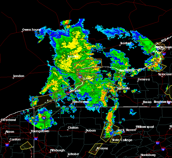 The severe thunderstorm warning for northeastern erie, southern niagara and northwestern genesee counties will expire at 545 pm edt, the storm which prompted the warning has moved out of the area. therefore the warning will be allowed to expire. a severe thunderstorm watch remains in effect until 900 pm edt for western new york. The severe thunderstorm warning for northeastern erie, southern niagara and northwestern genesee counties will expire at 545 pm edt, the storm which prompted the warning has moved out of the area. therefore the warning will be allowed to expire. a severe thunderstorm watch remains in effect until 900 pm edt for western new york.
|
| 8/4/2017 5:23 PM EDT |
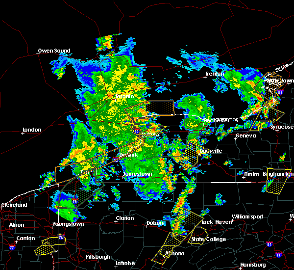 At 523 pm edt, a severe thunderstorm was located near pendleton, or near clarence, moving northeast at 60 mph (radar indicated). Hazards include 60 mph wind gusts. Expect wind damage to trees and power lines. locations impacted include, buffalo, cheektowaga, north tonawanda, clarence, lockport, kenmore, amherst and tonawanda. This includes interstate 90 between exits 50 and 49. At 523 pm edt, a severe thunderstorm was located near pendleton, or near clarence, moving northeast at 60 mph (radar indicated). Hazards include 60 mph wind gusts. Expect wind damage to trees and power lines. locations impacted include, buffalo, cheektowaga, north tonawanda, clarence, lockport, kenmore, amherst and tonawanda. This includes interstate 90 between exits 50 and 49.
|
| 8/4/2017 5:10 PM EDT | Tree down on chapel ave. - time estimated by radar in erie county NY, 4.6 miles WSW of Buffalo, NY |
| 8/4/2017 5:08 PM EDT | Tree down on bright st. - time estimated by radar in erie county NY, 3.2 miles WNW of Buffalo, NY |
| 8/4/2017 5:00 PM EDT |
 At 459 pm edt, a severe thunderstorm was located over blasdell, or over lackawanna, moving northeast at 50 mph (radar indicated). Hazards include 60 mph wind gusts. expect wind damage to trees and power lines At 459 pm edt, a severe thunderstorm was located over blasdell, or over lackawanna, moving northeast at 50 mph (radar indicated). Hazards include 60 mph wind gusts. expect wind damage to trees and power lines
|
| 8/4/2017 1:57 PM EDT |
 At 157 pm edt, a severe thunderstorm was located over elma, or near west seneca, moving northeast at 45 mph (radar indicated). Hazards include 60 mph wind gusts and penny size hail. Expect wind damage to trees and power lines. locations impacted include, buffalo, cheektowaga, west seneca, clarence, lackawanna, depew, lancaster and east aurora. This includes interstate 90 between exits 55 and 54, and near exit 48a. At 157 pm edt, a severe thunderstorm was located over elma, or near west seneca, moving northeast at 45 mph (radar indicated). Hazards include 60 mph wind gusts and penny size hail. Expect wind damage to trees and power lines. locations impacted include, buffalo, cheektowaga, west seneca, clarence, lackawanna, depew, lancaster and east aurora. This includes interstate 90 between exits 55 and 54, and near exit 48a.
|
| 8/4/2017 1:41 PM EDT |
 At 141 pm edt, a severe thunderstorm was located over hamburg, moving northeast at 45 mph (radar indicated). Hazards include 60 mph wind gusts and penny size hail. expect wind damage to trees and power lines At 141 pm edt, a severe thunderstorm was located over hamburg, moving northeast at 45 mph (radar indicated). Hazards include 60 mph wind gusts and penny size hail. expect wind damage to trees and power lines
|
| 8/4/2017 1:27 PM EDT |
 The severe thunderstorm warning for northeastern erie county will expire at 130 pm edt. the severe thunderstorm which prompted the warning has moved out of the warned area. therefore, the warning will be allowed to expire. however heavy rain is still possible with this thunderstorm. A severe thunderstorm watch remains in effect until 900 pm edt for. The severe thunderstorm warning for northeastern erie county will expire at 130 pm edt. the severe thunderstorm which prompted the warning has moved out of the warned area. therefore, the warning will be allowed to expire. however heavy rain is still possible with this thunderstorm. A severe thunderstorm watch remains in effect until 900 pm edt for.
|
| 8/4/2017 12:51 PM EDT |
 At 1251 pm edt, a severe thunderstorm was located over depew, moving northeast at 35 mph (radar indicated). Hazards include 60 mph wind gusts and quarter size hail. Minor damage to vehicles is possible. expect wind damage to trees and power lines. locations impacted include, buffalo, cheektowaga, west seneca, clarence, lackawanna, depew, amherst and lancaster. This includes interstate 90 between exits 55 and 49. At 1251 pm edt, a severe thunderstorm was located over depew, moving northeast at 35 mph (radar indicated). Hazards include 60 mph wind gusts and quarter size hail. Minor damage to vehicles is possible. expect wind damage to trees and power lines. locations impacted include, buffalo, cheektowaga, west seneca, clarence, lackawanna, depew, amherst and lancaster. This includes interstate 90 between exits 55 and 49.
|
| 8/4/2017 12:50 PM EDT | Tree down on dash st in buffalo in erie county NY, 3.1 miles NNW of Buffalo, NY |
| 8/4/2017 12:50 PM EDT | Small tree down at south park and spaulding in erie county NY, 1.7 miles NE of Buffalo, NY |
| 8/4/2017 12:45 PM EDT | Dozens of trees down near melrose stree in erie county NY, 3.8 miles N of Buffalo, NY |
| 8/4/2017 12:43 PM EDT | Trees down in cazenovia par in erie county NY, 4.1 miles NNW of Buffalo, NY |
| 8/4/2017 12:42 PM EDT | Trees blown down at intersection of oconnell and alabam in erie county NY, 2.7 miles NNE of Buffalo, NY |
| 8/4/2017 12:40 PM EDT | Roof partially blown off building - corner of utica and massachusetts ave in erie county NY, 2.9 miles E of Buffalo, NY |
| 8/4/2017 12:27 PM EDT |
 At 1226 pm edt, a severe thunderstorm was located near small boat harbor, or 7 miles west of lackawanna, moving northeast at 35 mph (radar indicated). Hazards include 60 mph wind gusts and quarter size hail. Minor damage to vehicles is possible. Expect wind damage to trees and power lines. At 1226 pm edt, a severe thunderstorm was located near small boat harbor, or 7 miles west of lackawanna, moving northeast at 35 mph (radar indicated). Hazards include 60 mph wind gusts and quarter size hail. Minor damage to vehicles is possible. Expect wind damage to trees and power lines.
|
| 7/20/2017 12:36 PM EDT |
 At 1236 pm edt, a severe thunderstorm capable of producing a tornado was located over hamburg, moving east at 40 mph (radar indicated rotation). Hazards include tornado. Flying debris will be dangerous to those caught without shelter. mobile homes will be damaged or destroyed. damage to roofs, windows, and vehicles will occur. Tree damage is likely. At 1236 pm edt, a severe thunderstorm capable of producing a tornado was located over hamburg, moving east at 40 mph (radar indicated rotation). Hazards include tornado. Flying debris will be dangerous to those caught without shelter. mobile homes will be damaged or destroyed. damage to roofs, windows, and vehicles will occur. Tree damage is likely.
|
| 7/20/2017 12:31 PM EDT |
 At 1230 pm edt, a severe thunderstorm was located over blasdell, or over lackawanna, moving east at 30 mph (radar indicated). Hazards include 60 mph wind gusts and penny size hail. expect wind damage to trees and power lines At 1230 pm edt, a severe thunderstorm was located over blasdell, or over lackawanna, moving east at 30 mph (radar indicated). Hazards include 60 mph wind gusts and penny size hail. expect wind damage to trees and power lines
|
| 5/1/2017 3:38 PM EDT | Storm damage reported in erie county NY, 8.7 miles N of Buffalo, NY |
| 5/1/2017 3:36 PM EDT | Large tree down on gilber in erie county NY, 7.2 miles N of Buffalo, NY |
| 5/1/2017 3:33 PM EDT |
 At 332 pm edt, severe thunderstorms were located along a line extending from 15 miles north of newfane to small boat harbor, moving northeast at 55 mph (radar indicated). Hazards include 70 mph wind gusts. Expect considerable tree damage. damage is likely to mobile homes, roofs, and outbuildings. locations impacted include, buffalo, cheektowaga, niagara falls, west seneca, north tonawanda, clarence, lockport and lackawanna. this includes interstate 90 between exits 57 and 49. A tornado watch remains in effect until 1000 pm edt for western new york. At 332 pm edt, severe thunderstorms were located along a line extending from 15 miles north of newfane to small boat harbor, moving northeast at 55 mph (radar indicated). Hazards include 70 mph wind gusts. Expect considerable tree damage. damage is likely to mobile homes, roofs, and outbuildings. locations impacted include, buffalo, cheektowaga, niagara falls, west seneca, north tonawanda, clarence, lockport and lackawanna. this includes interstate 90 between exits 57 and 49. A tornado watch remains in effect until 1000 pm edt for western new york.
|
| 5/1/2017 3:00 PM EDT |
 At 300 pm edt, severe thunderstorms were located along a line extending from 6 miles west of fort niagara state park to near dunkirk, moving northeast at 55 mph (radar indicated). Hazards include 60 mph wind gusts. expect damage to roofs, siding, and trees At 300 pm edt, severe thunderstorms were located along a line extending from 6 miles west of fort niagara state park to near dunkirk, moving northeast at 55 mph (radar indicated). Hazards include 60 mph wind gusts. expect damage to roofs, siding, and trees
|
| 9/10/2016 7:40 PM EDT |
 The severe thunderstorm warning for northern erie and southeastern niagara counties will expire at 745 pm edt, the storm which prompted the warning has moved out of the area. therefore, the warning will be allowed to expire. however gusty winds and heavy rain are still possible with this thunderstorm. a severe thunderstorm watch remains in effect until 1000 pm edt for western new york. The severe thunderstorm warning for northern erie and southeastern niagara counties will expire at 745 pm edt, the storm which prompted the warning has moved out of the area. therefore, the warning will be allowed to expire. however gusty winds and heavy rain are still possible with this thunderstorm. a severe thunderstorm watch remains in effect until 1000 pm edt for western new york.
|
| 9/10/2016 7:21 PM EDT |
 At 721 pm edt, a severe thunderstorm was located over lancaster, moving northeast at 50 mph (radar indicated). Hazards include 60 mph wind gusts and penny size hail. Expect damage to roofs. siding. and trees. locations impacted include, buffalo, cheektowaga, west seneca, north tonawanda, clarence, lackawanna, kenmore and depew. This includes interstate 90 between exits 57 and 49. At 721 pm edt, a severe thunderstorm was located over lancaster, moving northeast at 50 mph (radar indicated). Hazards include 60 mph wind gusts and penny size hail. Expect damage to roofs. siding. and trees. locations impacted include, buffalo, cheektowaga, west seneca, north tonawanda, clarence, lackawanna, kenmore and depew. This includes interstate 90 between exits 57 and 49.
|
| 9/10/2016 7:14 PM EDT | Tree and powerlines down on mariemont ave blocking roadwa in erie county NY, 4.5 miles N of Buffalo, NY |
| 9/10/2016 7:10 PM EDT | Light pole dow in erie county NY, 5.8 miles N of Buffalo, NY |
| 9/10/2016 7:03 PM EDT |
 At 703 pm edt, a severe thunderstorm was located 9 miles west of lackawanna, moving northeast at 55 mph (radar indicated). Hazards include 60 mph wind gusts and penny size hail. Expect damage to roofs. siding. and trees. locations impacted include, buffalo, cheektowaga, west seneca, north tonawanda, clarence, lackawanna, kenmore and depew. This includes interstate 90 between exits 57 and 49. At 703 pm edt, a severe thunderstorm was located 9 miles west of lackawanna, moving northeast at 55 mph (radar indicated). Hazards include 60 mph wind gusts and penny size hail. Expect damage to roofs. siding. and trees. locations impacted include, buffalo, cheektowaga, west seneca, north tonawanda, clarence, lackawanna, kenmore and depew. This includes interstate 90 between exits 57 and 49.
|
| 9/10/2016 6:41 PM EDT |
 At 641 pm edt, a severe thunderstorm was located 12 miles north of dunkirk, moving northeast at 45 mph (radar indicated). Hazards include 60 mph wind gusts. Expect damage to roofs. siding. And trees. At 641 pm edt, a severe thunderstorm was located 12 miles north of dunkirk, moving northeast at 45 mph (radar indicated). Hazards include 60 mph wind gusts. Expect damage to roofs. siding. And trees.
|
| 7/14/2016 1:28 AM EDT | Storm damage reported in erie county NY, 5.3 miles WSW of Buffalo, NY |
| 6/20/2016 10:04 PM EDT |
 At 1003 pm edt, a severe thunderstorm was located over alden, or near darien lakes state park, moving east at 40 mph (radar indicated). Hazards include 60 mph wind gusts and quarter size hail. Hail damage to vehicles is expected. expect wind damage to roofs, siding, and trees. Locations impacted include, buffalo, cheektowaga, west seneca, clarence, lackawanna, batavia, depew and lancaster. At 1003 pm edt, a severe thunderstorm was located over alden, or near darien lakes state park, moving east at 40 mph (radar indicated). Hazards include 60 mph wind gusts and quarter size hail. Hail damage to vehicles is expected. expect wind damage to roofs, siding, and trees. Locations impacted include, buffalo, cheektowaga, west seneca, clarence, lackawanna, batavia, depew and lancaster.
|
| 6/20/2016 9:52 PM EDT |
 At 950 pm edt, a severe thunderstorm was located near clarence, moving east at 55 mph (radar indicated). Hazards include 60 mph wind gusts and quarter size hail. Hail damage to vehicles is expected. expect wind damage to roofs, siding, and trees. Locations impacted include, buffalo, cheektowaga, west seneca, clarence, lackawanna, batavia, kenmore and depew. At 950 pm edt, a severe thunderstorm was located near clarence, moving east at 55 mph (radar indicated). Hazards include 60 mph wind gusts and quarter size hail. Hail damage to vehicles is expected. expect wind damage to roofs, siding, and trees. Locations impacted include, buffalo, cheektowaga, west seneca, clarence, lackawanna, batavia, kenmore and depew.
|
| 6/20/2016 9:30 PM EDT |
 At 929 pm edt, a severe thunderstorm was located over kenmore, moving east at 55 mph (radar indicated). Hazards include 60 mph wind gusts and quarter size hail. Hail damage to vehicles is expected. Expect wind damage to roofs, siding, and trees. At 929 pm edt, a severe thunderstorm was located over kenmore, moving east at 55 mph (radar indicated). Hazards include 60 mph wind gusts and quarter size hail. Hail damage to vehicles is expected. Expect wind damage to roofs, siding, and trees.
|
| 1/12/2016 12:33 PM EST | Storm damage reported in erie county NY, 5.3 miles WSW of Buffalo, NY |
| 11/6/2015 11:15 AM EST | Light pole down across oak street near seneca in erie county NY, 1.7 miles NE of Buffalo, NY |
| 10/29/2015 10:00 AM EDT | Tree on home and car on manitoba st in erie county NY, 1.8 miles NNW of Buffalo, NY |
| 7/7/2015 4:55 PM EDT |
 At 455 pm edt, doppler radar indicated a severe thunderstorm capable of producing damaging winds in excess of 60 mph. this storm was located over orchard park, or near west seneca, moving northeast at 40 mph. locations impacted include, buffalo, cheektowaga, west seneca, lackawanna, kenmore, depew, tonawanda and amherst. At 455 pm edt, doppler radar indicated a severe thunderstorm capable of producing damaging winds in excess of 60 mph. this storm was located over orchard park, or near west seneca, moving northeast at 40 mph. locations impacted include, buffalo, cheektowaga, west seneca, lackawanna, kenmore, depew, tonawanda and amherst.
|
| 7/7/2015 4:34 PM EDT |
 At 434 pm edt, doppler radar indicated a severe thunderstorm capable of producing damaging winds in excess of 60 mph. this storm was located near derby, or near hamburg, and moving northeast at 55 mph. At 434 pm edt, doppler radar indicated a severe thunderstorm capable of producing damaging winds in excess of 60 mph. this storm was located near derby, or near hamburg, and moving northeast at 55 mph.
|
| 6/23/2015 4:12 AM EDT |
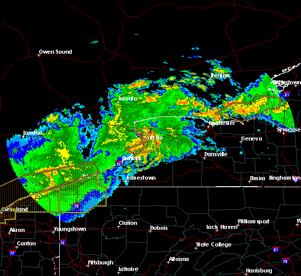 At 411 am edt, doppler radar indicated a line of severe thunderstorms capable of producing damaging winds in excess of 60 mph. these storms were located along a line extending from near pendleton to near hamburg, moving east at 65 mph. locations impacted include, amherst, buffalo, cheektowaga, west seneca, tonawanda, lockport, lackawanna, hamburg, kenmore and depew. At 411 am edt, doppler radar indicated a line of severe thunderstorms capable of producing damaging winds in excess of 60 mph. these storms were located along a line extending from near pendleton to near hamburg, moving east at 65 mph. locations impacted include, amherst, buffalo, cheektowaga, west seneca, tonawanda, lockport, lackawanna, hamburg, kenmore and depew.
|
| 6/23/2015 3:52 AM EDT |
 At 350 am edt, doppler radar indicated a line of severe thunderstorms capable of producing damaging winds in excess of 60 mph. these storms were located along a line extending from near grand island to 16 miles north of dunkirk, and moving east at 55 mph. At 350 am edt, doppler radar indicated a line of severe thunderstorms capable of producing damaging winds in excess of 60 mph. these storms were located along a line extending from near grand island to 16 miles north of dunkirk, and moving east at 55 mph.
|
| 6/12/2015 3:45 PM EDT |
 At 344 pm edt, doppler radar indicated a line of severe thunderstorms capable of producing quarter size hail and damaging winds in excess of 60 mph. these storms were located along a line extending from near lockport to near cheektowaga, moving east at 45 mph. locations impacted include, buffalo, cheektowaga, west seneca, north tonawanda, clarence, lackawanna, kenmore and depew. At 344 pm edt, doppler radar indicated a line of severe thunderstorms capable of producing quarter size hail and damaging winds in excess of 60 mph. these storms were located along a line extending from near lockport to near cheektowaga, moving east at 45 mph. locations impacted include, buffalo, cheektowaga, west seneca, north tonawanda, clarence, lackawanna, kenmore and depew.
|
| 6/12/2015 3:37 PM EDT | Large tree on house on bennett village terrace in erie county NY, 2.5 miles S of Buffalo, NY |
| 6/12/2015 3:37 PM EDT | Trees down on house and garage on dutton ave in erie county NY, 1.1 miles S of Buffalo, NY |
| 6/12/2015 3:20 PM EDT |
 At 319 pm edt, doppler radar indicated a line of severe thunderstorms capable of producing quarter size hail and damaging winds in excess of 60 mph. these storms were located along a line extending from near niagara falls to 7 miles west of erie basin marina, and moving east at 50 mph. At 319 pm edt, doppler radar indicated a line of severe thunderstorms capable of producing quarter size hail and damaging winds in excess of 60 mph. these storms were located along a line extending from near niagara falls to 7 miles west of erie basin marina, and moving east at 50 mph.
|
| 6/12/2015 3:14 PM EDT |
 At 314 pm edt, doppler radar indicated a line of severe thunderstorms capable of producing quarter size hail and damaging winds in excess of 60 mph. these storms were located along a line extending from 6 miles southwest of niagara falls to 13 miles northwest of angola on the lake, and moving east at 45 mph. At 314 pm edt, doppler radar indicated a line of severe thunderstorms capable of producing quarter size hail and damaging winds in excess of 60 mph. these storms were located along a line extending from 6 miles southwest of niagara falls to 13 miles northwest of angola on the lake, and moving east at 45 mph.
|
| 8/12/2014 5:00 PM EDT | Large tree limb down...in city of buffalo on delaware ave between utica ave and lexington in erie county NY, 1.8 miles SE of Buffalo, NY |
| 8/12/2014 4:57 PM EDT | Large tree down on the west side in erie county NY, 2.9 miles E of Buffalo, NY |
| 7/7/2014 10:24 PM EDT | Storm damage reported in lez041 county NY, 3.8 miles ENE of Buffalo, NY |
| 9/8/2012 11:15 AM EDT | Erie county em reported 20 to 30 large trees down in cheektowaga town par in erie county NY, 2.5 miles NE of Buffalo, NY |
| 9/8/2012 9:49 AM EDT | Erie county em reported 20 to 30 large trees down in cheektowaga town par in erie county NY, 2.5 miles NE of Buffalo, NY |
| 9/8/2012 9:36 AM EDT | Two buildings damage in erie county NY, 1.7 miles NE of Buffalo, NY |
| 9/8/2012 8:37 AM EDT | Trailer toppled and multiple trees and wires down at parker and two rod roads in erie county NY, 2.9 miles NE of Buffalo, NY |
| 8/5/2012 1:45 PM EDT | Tree down on louisiana and republic in the city of buffalo in erie county NY, 1.7 miles NE of Buffalo, NY |
| 1/1/0001 12:00 AM | Trees and powerlines down in erie county NY, 1.7 miles NE of Buffalo, NY |
| 1/1/0001 12:00 AM | Tree down on richmond ave in erie county NY, 2.9 miles NE of Buffalo, NY |
| 1/1/0001 12:00 AM | Tree blown dow in erie county NY, 3.9 miles NNW of Buffalo, NY |
Hail Maps for Buffalo, NY


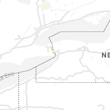


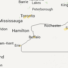

Connect with Interactive Hail Maps