

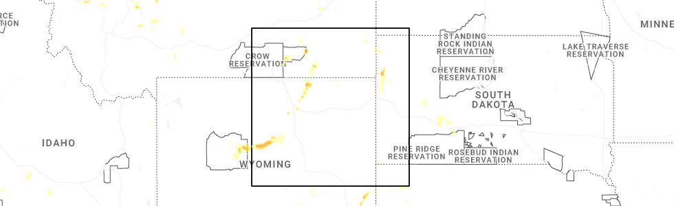
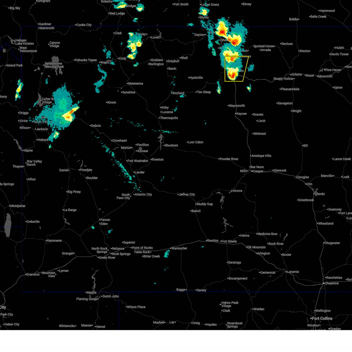
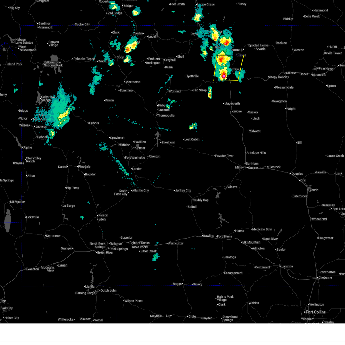
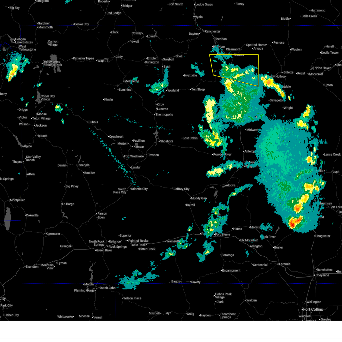
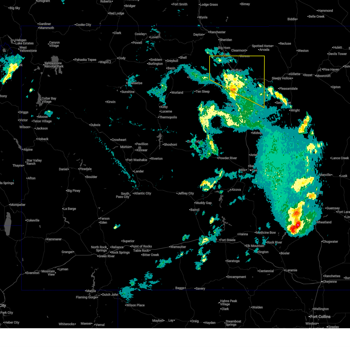
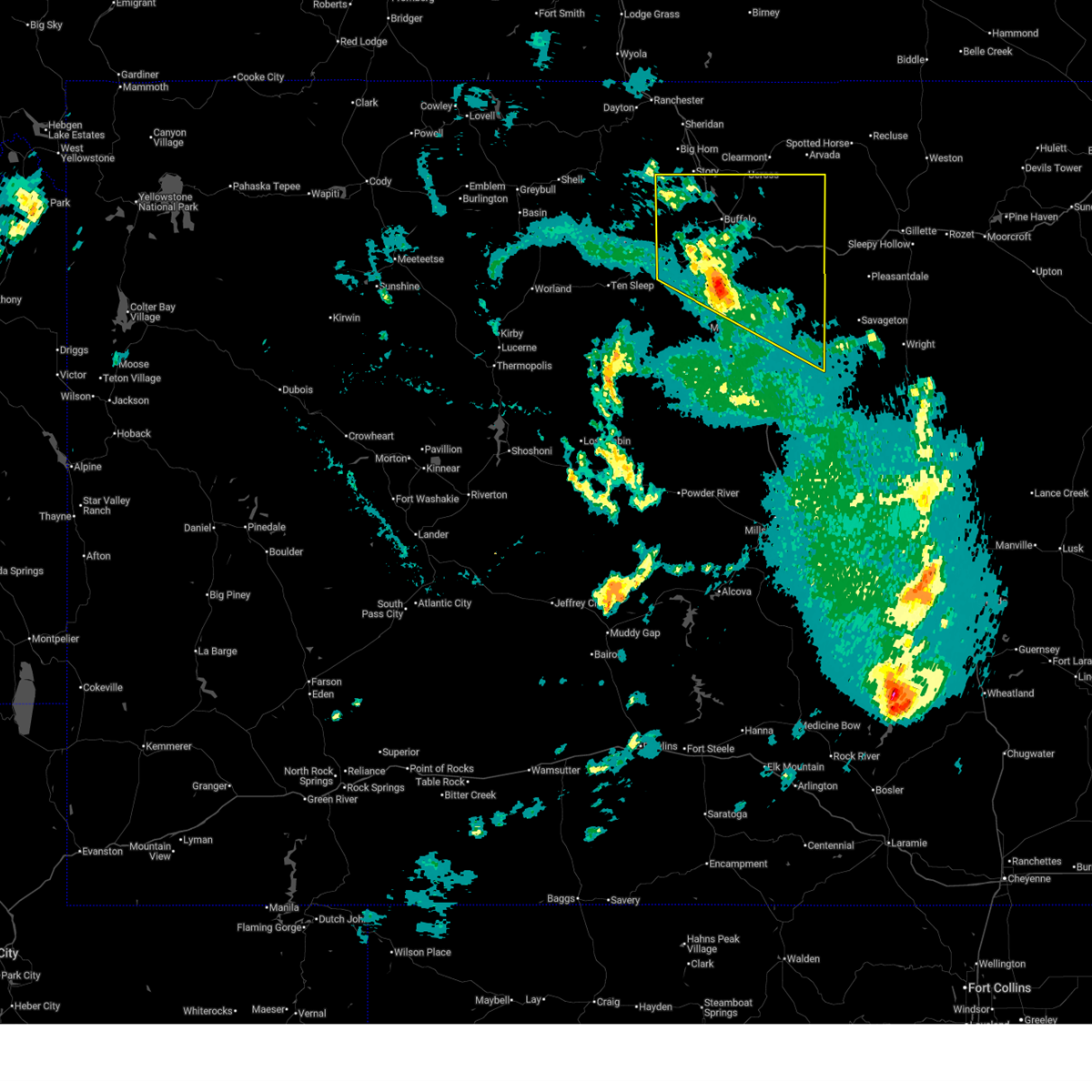
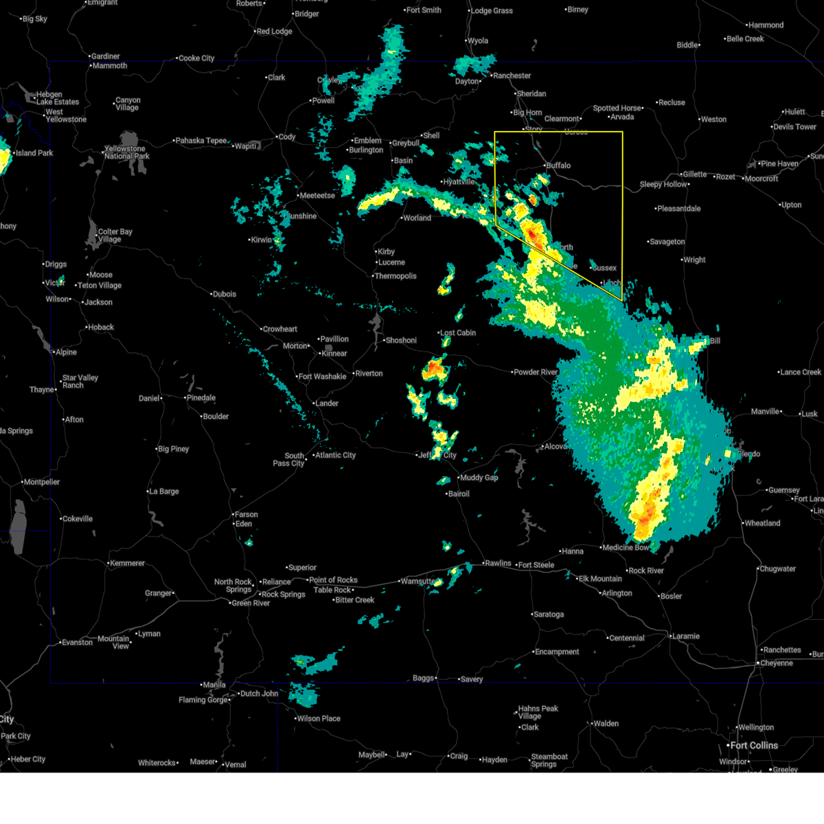
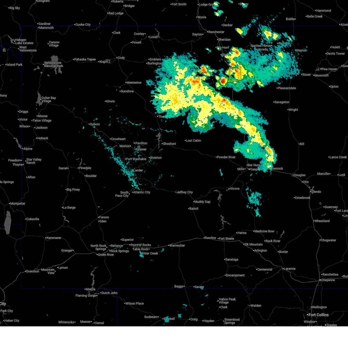
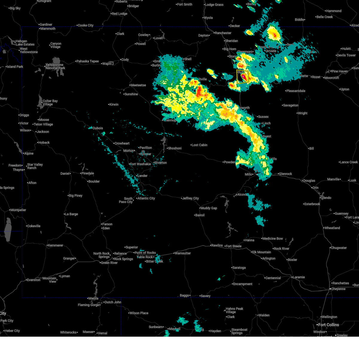
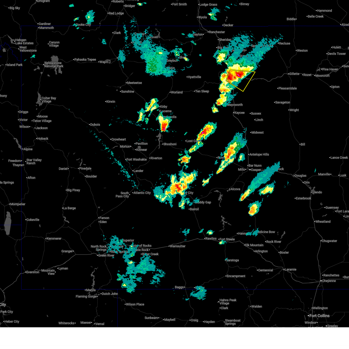
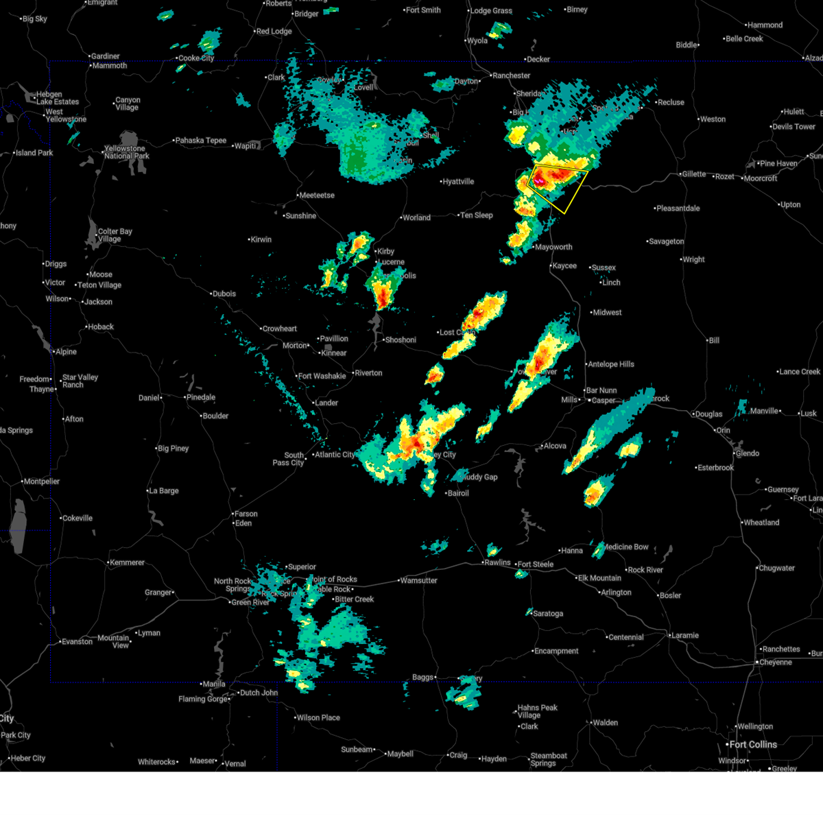
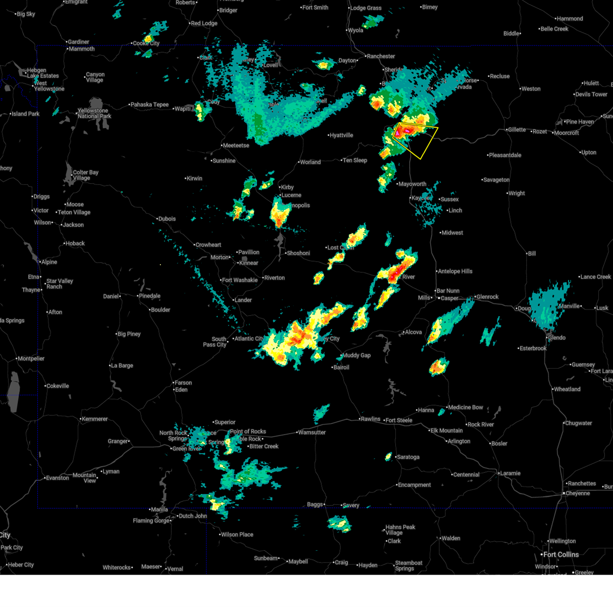
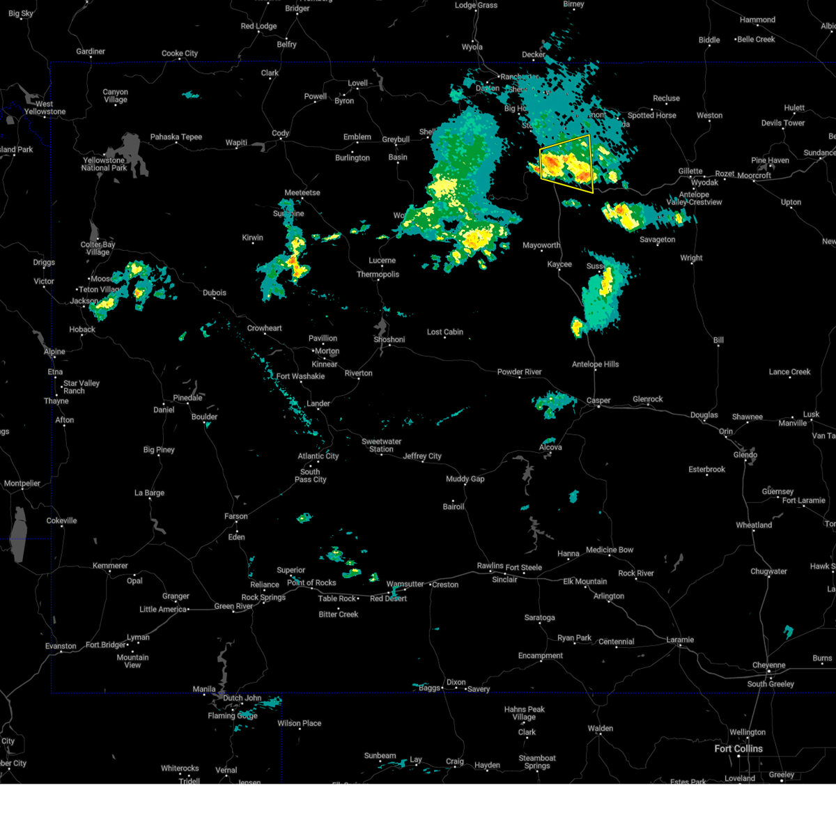
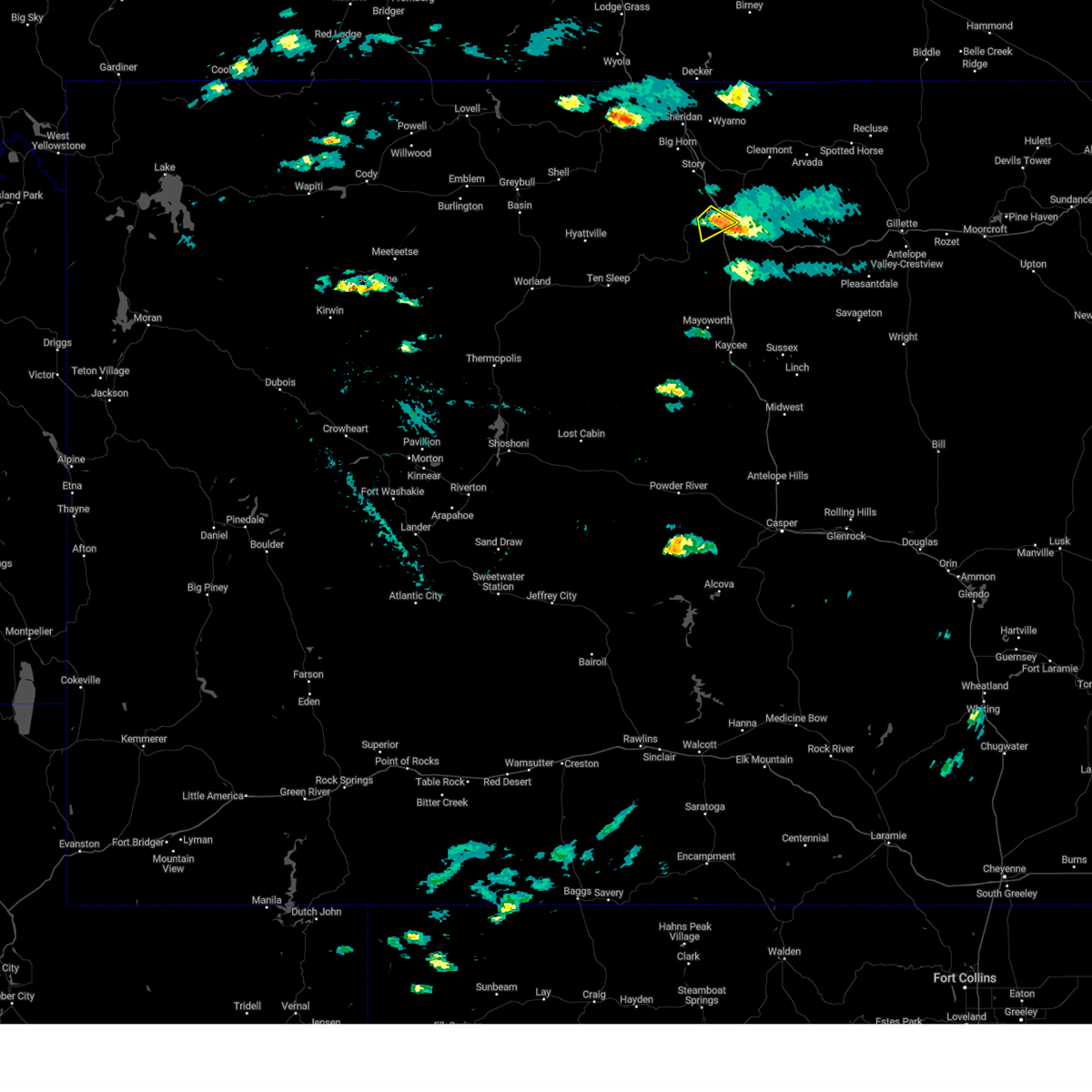
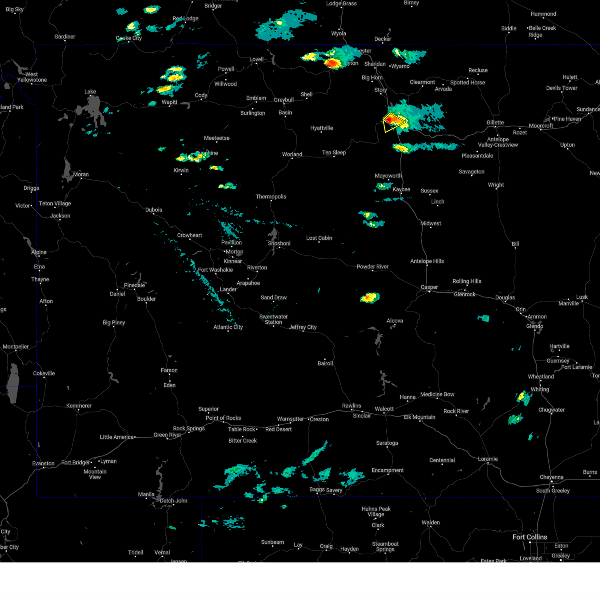
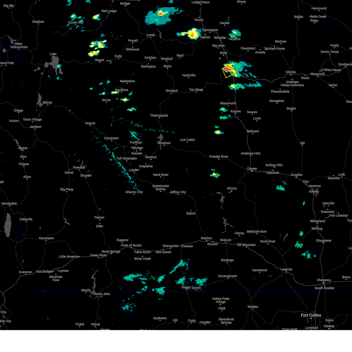
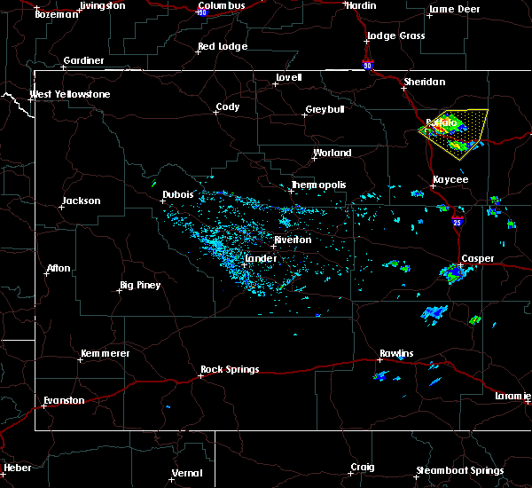
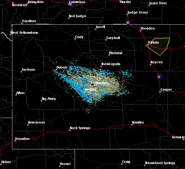
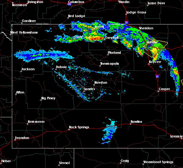
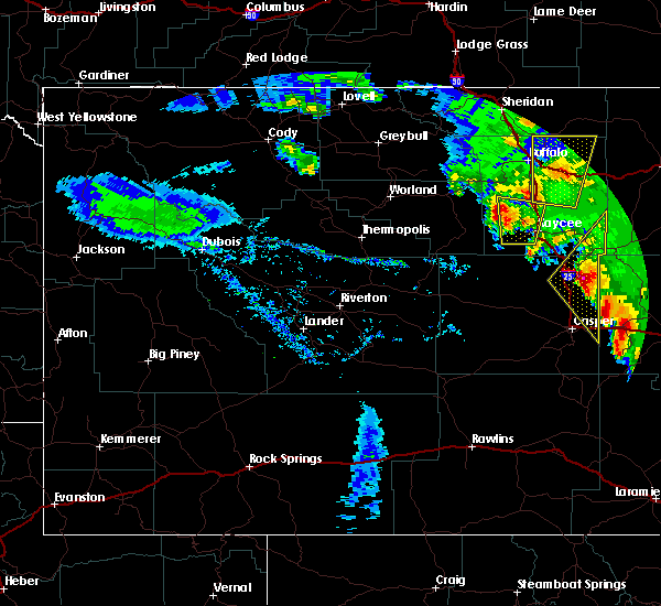
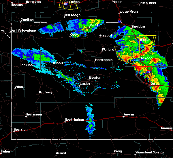
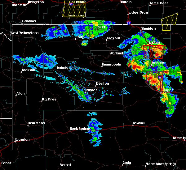
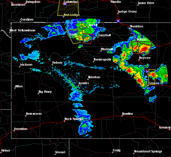
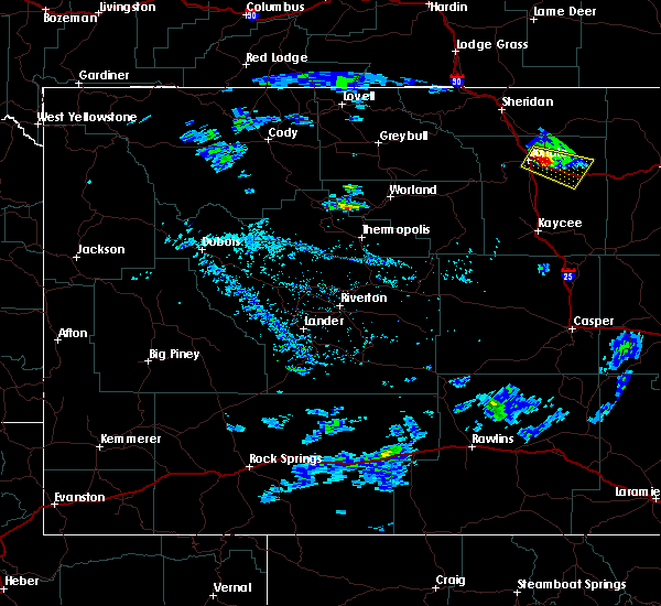
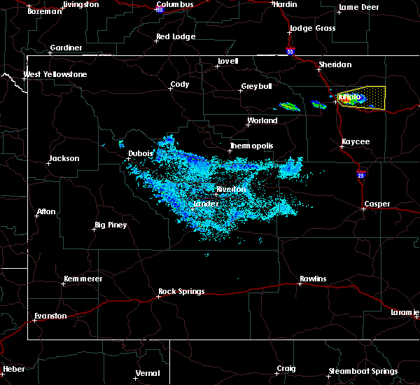
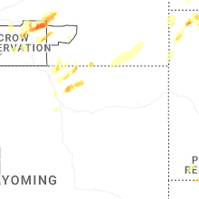
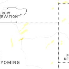
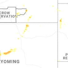
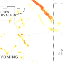
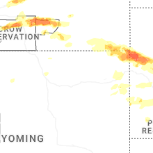
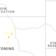
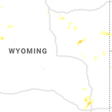
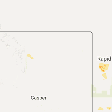
Hail Map for Buffalo, WY
The Buffalo, WY area has had 30 reports of on-the-ground hail by trained spotters, and has been under severe weather warnings 11 times during the past 12 months. Doppler radar has detected hail at or near Buffalo, WY on 36 occasions, including 4 occasions during the past year.
| Name: | Buffalo, WY |
| Where Located: | 59.6 miles W of Gillette, WY |
| Map: | Google Map for Buffalo, WY |
| Population: | 4585 |
| Housing Units: | 2300 |
| More Info: | Search Google for Buffalo, WY |
2
The Top Recent Hail Date for Buffalo, WY is Thursday, July 31, 2025 (5th out of 36)
Hail and Wind Damage Spotted near Buffalo, WY
| Date / Time | Report Details |
|---|---|
| 6/27/2026 5:20 PM MDT | Mesonet station wy3 i-90 indian creek rd (dot in johnson county WY, 24.2 miles WNW of Buffalo, WY |
| 6/27/2026 5:08 PM MDT | Mesonet station pc578 purdy east (pc). time estimate from rada in johnson county WY, 22.7 miles N of Buffalo, WY |
| 6/27/2026 1:26 PM MDT |
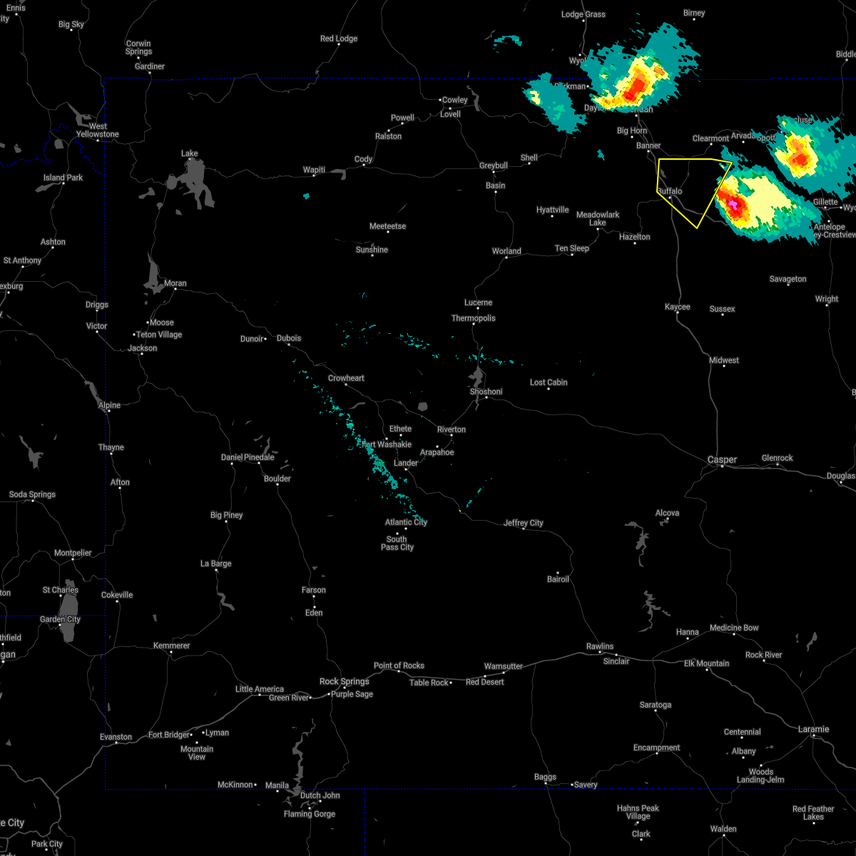
 At 126 pm mdt, a severe thunderstorm was located near lake de smet, which is 10 miles north of buffalo, moving northeast at 40 mph (radar indicated). Hazards include 60 mph wind gusts and quarter size hail. Hail damage to vehicles is expected. expect wind damage to roofs, siding, and trees. this severe thunderstorm will remain over mainly rural areas of north central johnson county, including the following locations, buffalo johnson county airport and johnson county fairgrounds. this includes the following highways, interstate 25 between mile markers 288 and 299. Interstate 90 between mile markers 42 and 71. At 126 pm mdt, a severe thunderstorm was located near lake de smet, which is 10 miles north of buffalo, moving northeast at 40 mph (radar indicated). Hazards include 60 mph wind gusts and quarter size hail. Hail damage to vehicles is expected. expect wind damage to roofs, siding, and trees. this severe thunderstorm will remain over mainly rural areas of north central johnson county, including the following locations, buffalo johnson county airport and johnson county fairgrounds. this includes the following highways, interstate 25 between mile markers 288 and 299. Interstate 90 between mile markers 42 and 71.
|
| 6/27/2026 1:09 PM MDT |
 Svrriw the national weather service in riverton has issued a * severe thunderstorm warning for, north central johnson county in north central wyoming, * until 145 pm mdt. * at 109 pm mdt, a severe thunderstorm was located over buffalo, moving northeast at 40 mph (radar indicated). Hazards include 60 mph wind gusts and quarter size hail. Hail damage to vehicles is expected. expect wind damage to roofs, siding, and trees. this severe thunderstorm will be near, buffalo and lake de smet around 115 pm mdt. this includes the following highways, interstate 25 between mile markers 287 and 299. Interstate 90 between mile markers 42 and 71. Svrriw the national weather service in riverton has issued a * severe thunderstorm warning for, north central johnson county in north central wyoming, * until 145 pm mdt. * at 109 pm mdt, a severe thunderstorm was located over buffalo, moving northeast at 40 mph (radar indicated). Hazards include 60 mph wind gusts and quarter size hail. Hail damage to vehicles is expected. expect wind damage to roofs, siding, and trees. this severe thunderstorm will be near, buffalo and lake de smet around 115 pm mdt. this includes the following highways, interstate 25 between mile markers 287 and 299. Interstate 90 between mile markers 42 and 71.
|
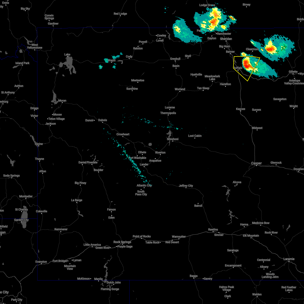
| 6/20/2026 5:29 PM MDT |
 At 529 pm mdt, a severe thunderstorm was located 14 miles southeast of buffalo, moving northeast at 35 mph (radar indicated). Hazards include 60 mph wind gusts. Expect damage to roofs, siding, and trees. locations impacted include, buffalo, powder river rest area, fort phil kearny historical site, saddlestring, lake de smet, south fork campground, johnson county fairgrounds, and buffalo johnson county airport. this includes the following highways, interstate 25 between mile markers 289 and 299. Interstate 90 between mile markers 42 and 95. At 529 pm mdt, a severe thunderstorm was located 14 miles southeast of buffalo, moving northeast at 35 mph (radar indicated). Hazards include 60 mph wind gusts. Expect damage to roofs, siding, and trees. locations impacted include, buffalo, powder river rest area, fort phil kearny historical site, saddlestring, lake de smet, south fork campground, johnson county fairgrounds, and buffalo johnson county airport. this includes the following highways, interstate 25 between mile markers 289 and 299. Interstate 90 between mile markers 42 and 95.
|
| 6/20/2026 5:14 PM MDT |
 Svrriw the national weather service in riverton has issued a * severe thunderstorm warning for, northern johnson county in north central wyoming, * until 615 pm mdt. * at 513 pm mdt, a severe thunderstorm was located 16 miles southeast of buffalo, moving northeast at 35 mph (radar indicated). Hazards include 70 mph wind gusts. Expect considerable tree damage. damage is likely to mobile homes, roofs, and outbuildings. this severe thunderstorm will remain over mainly rural areas of northern johnson county, including the following locations, south fork campground, buffalo johnson county airport, lost cabin campground, and johnson county fairgrounds. this includes the following highways, interstate 25 between mile markers 276 and 299. Interstate 90 between mile markers 42 and 95. Svrriw the national weather service in riverton has issued a * severe thunderstorm warning for, northern johnson county in north central wyoming, * until 615 pm mdt. * at 513 pm mdt, a severe thunderstorm was located 16 miles southeast of buffalo, moving northeast at 35 mph (radar indicated). Hazards include 70 mph wind gusts. Expect considerable tree damage. damage is likely to mobile homes, roofs, and outbuildings. this severe thunderstorm will remain over mainly rural areas of northern johnson county, including the following locations, south fork campground, buffalo johnson county airport, lost cabin campground, and johnson county fairgrounds. this includes the following highways, interstate 25 between mile markers 276 and 299. Interstate 90 between mile markers 42 and 95.
|
| 6/20/2026 5:00 PM MDT | Purdy east pc sensor. sustained 37 mph wind with 59 mph gus in johnson county WY, 22.7 miles N of Buffalo, WY |
| 6/20/2026 4:49 PM MDT |
 At 449 pm mdt, a severe thunderstorm was located 14 miles southeast of buffalo, moving northeast at 45 mph (radar indicated). Hazards include 70 mph wind gusts. Expect considerable tree damage. damage is likely to mobile homes, roofs, and outbuildings. locations impacted include, buffalo, powder river rest area, fort reno historical site, fort phil kearny historical site, saddlestring, powder river pass, lake de smet, south fork campground, lost cabin campground, johnson county fairgrounds, and buffalo johnson county airport. this includes the following highways, interstate 25 between mile markers 265 and 299. Interstate 90 between mile markers 42 and 95. At 449 pm mdt, a severe thunderstorm was located 14 miles southeast of buffalo, moving northeast at 45 mph (radar indicated). Hazards include 70 mph wind gusts. Expect considerable tree damage. damage is likely to mobile homes, roofs, and outbuildings. locations impacted include, buffalo, powder river rest area, fort reno historical site, fort phil kearny historical site, saddlestring, powder river pass, lake de smet, south fork campground, lost cabin campground, johnson county fairgrounds, and buffalo johnson county airport. this includes the following highways, interstate 25 between mile markers 265 and 299. Interstate 90 between mile markers 42 and 95.
|
| 6/20/2026 4:29 PM MDT |
 Svrriw the national weather service in riverton has issued a * severe thunderstorm warning for, johnson county in north central wyoming, * until 515 pm mdt. * at 427 pm mdt, a severe thunderstorm was located 10 miles northeast of mayoworth, which is 17 miles north of kaycee, moving northeast at 45 mph (radar indicated). Hazards include 70 mph wind gusts. Expect considerable tree damage. damage is likely to mobile homes, roofs, and outbuildings. this severe thunderstorm will remain over mainly rural areas of johnson county, including the following locations, south fork campground, sussex, buffalo johnson county airport, lost cabin campground, and johnson county fairgrounds. this includes the following highways, interstate 25 between mile markers 257 and 299. Interstate 90 between mile markers 42 and 95. Svrriw the national weather service in riverton has issued a * severe thunderstorm warning for, johnson county in north central wyoming, * until 515 pm mdt. * at 427 pm mdt, a severe thunderstorm was located 10 miles northeast of mayoworth, which is 17 miles north of kaycee, moving northeast at 45 mph (radar indicated). Hazards include 70 mph wind gusts. Expect considerable tree damage. damage is likely to mobile homes, roofs, and outbuildings. this severe thunderstorm will remain over mainly rural areas of johnson county, including the following locations, south fork campground, sussex, buffalo johnson county airport, lost cabin campground, and johnson county fairgrounds. this includes the following highways, interstate 25 between mile markers 257 and 299. Interstate 90 between mile markers 42 and 95.
|
| 6/7/2026 6:56 PM MDT | Mesonet station wy3 i-90 indian creek rd (dot in johnson county WY, 24.2 miles WNW of Buffalo, WY |
| 4/11/2026 4:38 PM MDT | Asos station kbyg buffalo airport (asos in johnson county WY, 2.5 miles SSE of Buffalo, WY |
| 4/11/2026 4:30 PM MDT | Mesonet station pc460 buffalo south (pc in johnson county WY, 1.8 miles N of Buffalo, WY |
| 9/12/2025 4:55 PM MDT | Quarter sized hail reported 13.2 miles NNW of Buffalo, WY, called report in and social media photo. |
| 7/31/2025 9:34 PM MDT |
 the severe thunderstorm warning has been cancelled and is no longer in effect the severe thunderstorm warning has been cancelled and is no longer in effect
|
| 7/31/2025 9:18 PM MDT |
 Svrriw the national weather service in riverton has issued a * severe thunderstorm warning for, north central johnson county in north central wyoming, * until 1000 pm mdt. * at 917 pm mdt, a severe thunderstorm was located 7 miles southeast of buffalo, moving west at 5 mph (radar indicated). Hazards include 60 mph wind gusts and quarter size hail. Hail damage to vehicles is expected. expect wind damage to roofs, siding, and trees. this severe thunderstorm will remain over mainly rural areas of north central johnson county, including the following locations, johnson county fairgrounds. this includes the following highways, interstate 25 between mile markers 288 and 299. Interstate 90 between mile markers 57 and 70. Svrriw the national weather service in riverton has issued a * severe thunderstorm warning for, north central johnson county in north central wyoming, * until 1000 pm mdt. * at 917 pm mdt, a severe thunderstorm was located 7 miles southeast of buffalo, moving west at 5 mph (radar indicated). Hazards include 60 mph wind gusts and quarter size hail. Hail damage to vehicles is expected. expect wind damage to roofs, siding, and trees. this severe thunderstorm will remain over mainly rural areas of north central johnson county, including the following locations, johnson county fairgrounds. this includes the following highways, interstate 25 between mile markers 288 and 299. Interstate 90 between mile markers 57 and 70.
|
| 7/29/2025 5:42 PM MDT | Ping Pong Ball sized hail reported 8 miles N of Buffalo, WY, photo from social media. time estimated from radar. |
| 7/29/2025 5:26 PM MDT |
 Svrriw the national weather service in riverton has issued a * severe thunderstorm warning for, northeastern johnson county in north central wyoming, * until 615 pm mdt. * at 525 pm mdt, a severe thunderstorm was located 8 miles south of buffalo, moving east at 20 mph (radar indicated). Hazards include ping pong ball size hail and 60 mph wind gusts. People and animals outdoors will be injured. expect hail damage to roofs, siding, windows, and vehicles. expect wind damage to roofs, siding, and trees. this severe thunderstorm will remain over mainly rural areas of northeastern johnson county. this includes the following highways, interstate 25 between mile markers 283 and 298. Interstate 90 between mile markers 60 and 81. Svrriw the national weather service in riverton has issued a * severe thunderstorm warning for, northeastern johnson county in north central wyoming, * until 615 pm mdt. * at 525 pm mdt, a severe thunderstorm was located 8 miles south of buffalo, moving east at 20 mph (radar indicated). Hazards include ping pong ball size hail and 60 mph wind gusts. People and animals outdoors will be injured. expect hail damage to roofs, siding, windows, and vehicles. expect wind damage to roofs, siding, and trees. this severe thunderstorm will remain over mainly rural areas of northeastern johnson county. this includes the following highways, interstate 25 between mile markers 283 and 298. Interstate 90 between mile markers 60 and 81.
|
| 7/29/2025 5:25 PM MDT | Ping Pong Ball sized hail reported 8 miles N of Buffalo, WY, corrects previous hail report from 8 s buffalo. photo from social media. time estimated from radar. |
| 7/29/2025 5:22 PM MDT |
 the severe thunderstorm warning has been cancelled and is no longer in effect the severe thunderstorm warning has been cancelled and is no longer in effect
|
| 7/29/2025 5:11 PM MDT |
 Svrriw the national weather service in riverton has issued a * severe thunderstorm warning for, north central johnson county in north central wyoming, * until 600 pm mdt. * at 511 pm mdt, a severe thunderstorm was located near buffalo, moving southeast at 20 mph (radar indicated). Hazards include 60 mph wind gusts and half dollar size hail. Hail damage to vehicles is expected. expect wind damage to roofs, siding, and trees. this severe thunderstorm will remain over mainly rural areas of north central johnson county. this includes the following highways, interstate 25 between mile markers 282 and 298. Interstate 90 between mile markers 61 and 76. Svrriw the national weather service in riverton has issued a * severe thunderstorm warning for, north central johnson county in north central wyoming, * until 600 pm mdt. * at 511 pm mdt, a severe thunderstorm was located near buffalo, moving southeast at 20 mph (radar indicated). Hazards include 60 mph wind gusts and half dollar size hail. Hail damage to vehicles is expected. expect wind damage to roofs, siding, and trees. this severe thunderstorm will remain over mainly rural areas of north central johnson county. this includes the following highways, interstate 25 between mile markers 282 and 298. Interstate 90 between mile markers 61 and 76.
|
| 6/14/2025 7:54 PM MDT | Half Dollar sized hail reported 19 miles NNW of Buffalo, WY, reported by a rancher east of interstate 25 exit 280. |
| 5/1/2025 5:00 PM MDT | Mesonet station gw1458 buffalo; convective shower... but no lightning presen in johnson county WY, 1 miles SSE of Buffalo, WY |
| 5/1/2025 4:59 PM MDT | Asos station kbyg buffalo airport; convective rain shower with no lightning presen in johnson county WY, 2.5 miles SSE of Buffalo, WY |
| 8/6/2024 5:38 PM MDT | Wydot station i-25 at indian creek roa in johnson county WY, 24.2 miles WNW of Buffalo, WY |
| 8/6/2024 5:10 PM MDT | Storm damage reported in johnson county WY, 2.5 miles SSE of Buffalo, WY |
| 8/6/2024 5:10 PM MDT |
 Svrriw the national weather service in riverton has issued a * severe thunderstorm warning for, north central johnson county in north central wyoming, * until 530 pm mdt. * at 510 pm mdt, a severe thunderstorm was located over buffalo, moving east at 35 mph (radar indicated). Hazards include 60 mph wind gusts and penny size hail. Expect damage to roofs, siding, and trees. this severe thunderstorm will remain over mainly rural areas of north central johnson county, including the following locations, buffalo johnson county airport and johnson county fairgrounds. this includes the following highways, interstate 25 between mile markers 293 and 299. Interstate 90 between mile markers 49 and 77. Svrriw the national weather service in riverton has issued a * severe thunderstorm warning for, north central johnson county in north central wyoming, * until 530 pm mdt. * at 510 pm mdt, a severe thunderstorm was located over buffalo, moving east at 35 mph (radar indicated). Hazards include 60 mph wind gusts and penny size hail. Expect damage to roofs, siding, and trees. this severe thunderstorm will remain over mainly rural areas of north central johnson county, including the following locations, buffalo johnson county airport and johnson county fairgrounds. this includes the following highways, interstate 25 between mile markers 293 and 299. Interstate 90 between mile markers 49 and 77.
|
| 7/6/2024 3:44 PM MDT | Asos station kbyg buffalo airpor in johnson county WY, 2.5 miles SSE of Buffalo, WY |
| 6/27/2024 5:12 PM MDT | Mesonet station wy3 ucross 28 se (wydot in johnson county WY, 24.2 miles WNW of Buffalo, WY |
| 6/27/2024 5:02 PM MDT | Mesonet station wy3 ucross 28 se (wydot in johnson county WY, 24.2 miles WNW of Buffalo, WY |
| 6/27/2024 4:53 PM MDT | Asos station kbyg buffalo airpor in johnson county WY, 2.5 miles SSE of Buffalo, WY |
| 6/27/2024 4:52 PM MDT |
 The storm which prompted the warning has moved out of the area. therefore, the warning will be allowed to expire. however, gusty winds are still possible with this thunderstorm. remember, a severe thunderstorm warning still remains in effect for central and northeast portions of johnson county. The storm which prompted the warning has moved out of the area. therefore, the warning will be allowed to expire. however, gusty winds are still possible with this thunderstorm. remember, a severe thunderstorm warning still remains in effect for central and northeast portions of johnson county.
|
| 6/27/2024 4:37 PM MDT |
 At 435 pm mdt, a severe thunderstorm was located near lake de smet, which is 10 miles north of buffalo, moving southeast at 20 mph (radar indicated. at 4:25 pm mdt, a 59 mph wind gust was reported at buffalo - johnson county airport). Hazards include 60 mph wind gusts. Expect damage to roofs, siding, and trees. this severe thunderstorm will remain over mainly rural areas of north central johnson county, including the following locations, buffalo johnson county airport and johnson county fairgrounds. this includes the following highways, interstate 25 between mile markers 296 and 299. Interstate 90 between mile markers 42 and 60. At 435 pm mdt, a severe thunderstorm was located near lake de smet, which is 10 miles north of buffalo, moving southeast at 20 mph (radar indicated. at 4:25 pm mdt, a 59 mph wind gust was reported at buffalo - johnson county airport). Hazards include 60 mph wind gusts. Expect damage to roofs, siding, and trees. this severe thunderstorm will remain over mainly rural areas of north central johnson county, including the following locations, buffalo johnson county airport and johnson county fairgrounds. this includes the following highways, interstate 25 between mile markers 296 and 299. Interstate 90 between mile markers 42 and 60.
|
| 6/27/2024 4:15 PM MDT |
 Svrriw the national weather service in riverton has issued a * severe thunderstorm warning for, north central johnson county in north central wyoming, * until 500 pm mdt. * at 415 pm mdt, a severe thunderstorm was located over fort phil kearny historical site, which is 13 miles north of buffalo, moving southeast at 30 mph (radar indicated). Hazards include 60 mph wind gusts. Expect damage to roofs, siding, and trees. this severe thunderstorm will be near, lake de smet around 420 pm mdt. this includes the following highways, interstate 25 between mile markers 296 and 299. Interstate 90 between mile markers 42 and 60. Svrriw the national weather service in riverton has issued a * severe thunderstorm warning for, north central johnson county in north central wyoming, * until 500 pm mdt. * at 415 pm mdt, a severe thunderstorm was located over fort phil kearny historical site, which is 13 miles north of buffalo, moving southeast at 30 mph (radar indicated). Hazards include 60 mph wind gusts. Expect damage to roofs, siding, and trees. this severe thunderstorm will be near, lake de smet around 420 pm mdt. this includes the following highways, interstate 25 between mile markers 296 and 299. Interstate 90 between mile markers 42 and 60.
|
| 7/6/2023 2:22 PM MDT |
 The severe thunderstorm warning for north central johnson county will expire at 230 pm mdt, the storm which prompted the warning has weakened below severe limits, and no longer poses an immediate threat to life or property. therefore, the warning will be allowed to expire. however heavy rain is still possible with this thunderstorm. a severe thunderstorm watch remains in effect until 900 pm mdt for north central wyoming. The severe thunderstorm warning for north central johnson county will expire at 230 pm mdt, the storm which prompted the warning has weakened below severe limits, and no longer poses an immediate threat to life or property. therefore, the warning will be allowed to expire. however heavy rain is still possible with this thunderstorm. a severe thunderstorm watch remains in effect until 900 pm mdt for north central wyoming.
|
| 7/6/2023 2:10 PM MDT | Golf Ball sized hail reported 2.8 miles E of Buffalo, WY, public report relayed through em. |
| 7/6/2023 2:10 PM MDT | Half Dollar sized hail reported 0.4 miles SW of Buffalo, WY |
| 7/6/2023 2:06 PM MDT |
 At 205 pm mdt, a severe thunderstorm was located near buffalo, moving southeast at 10 mph (radar indicated). Hazards include quarter size hail. Damage to vehicles is expected. locations impacted include, buffalo, buffalo johnson county airport and johnson county fairgrounds. this includes the following highways, interstate 25 between mile markers 296 and 299. interstate 90 between mile markers 57 and 62. hail threat, radar indicated max hail size, 1. 00 in wind threat, radar indicated max wind gust, <50 mph. At 205 pm mdt, a severe thunderstorm was located near buffalo, moving southeast at 10 mph (radar indicated). Hazards include quarter size hail. Damage to vehicles is expected. locations impacted include, buffalo, buffalo johnson county airport and johnson county fairgrounds. this includes the following highways, interstate 25 between mile markers 296 and 299. interstate 90 between mile markers 57 and 62. hail threat, radar indicated max hail size, 1. 00 in wind threat, radar indicated max wind gust, <50 mph.
|
| 7/6/2023 1:56 PM MDT |
 At 155 pm mdt, a severe thunderstorm was located near buffalo, moving southeast at 10 mph (radar indicated). Hazards include quarter size hail. damage to vehicles is expected At 155 pm mdt, a severe thunderstorm was located near buffalo, moving southeast at 10 mph (radar indicated). Hazards include quarter size hail. damage to vehicles is expected
|
| 8/27/2022 7:53 PM MDT | Asos station kbyg buffalo airport. this was from a strong outflow boundar in johnson county WY, 2.5 miles SSE of Buffalo, WY |
| 7/15/2022 6:53 PM MDT | Asos station kbyg buffalo airpor in johnson county WY, 2.5 miles SSE of Buffalo, WY |
| 6/29/2022 5:30 PM MDT | Buffalo airport. peak wind gust from shower activit in johnson county WY, 1.9 miles SSE of Buffalo, WY |
| 6/29/2022 12:42 AM MDT | Buffalo airport - severe wind gust from weak shower activit in johnson county WY, 2.5 miles SSE of Buffalo, WY |
| 6/20/2022 3:18 PM MDT | Report from mping: 1-inch tree limbs broken; shingles blown of in johnson county WY, 0.8 miles ENE of Buffalo, WY |
| 7/9/2021 5:50 PM MDT |
 The severe thunderstorm warning for north central johnson county will expire at 600 pm mdt, the storm which prompted the warning has weakened below severe limits, and has exited the warned area. therefore, the warning will be allowed to expire. however gusty winds are still possible with this thunderstorm. The severe thunderstorm warning for north central johnson county will expire at 600 pm mdt, the storm which prompted the warning has weakened below severe limits, and has exited the warned area. therefore, the warning will be allowed to expire. however gusty winds are still possible with this thunderstorm.
|
| 7/9/2021 5:36 PM MDT | Quarter sized hail reported 14.1 miles W of Buffalo, WY, winds to around 20 mph with quarter-sized hail. |
| 7/9/2021 5:29 PM MDT |
 At 529 pm mdt, a severe thunderstorm was located 7 miles east of lake de smet, or 10 miles northeast of buffalo, moving east at 35 mph (trained weather spotters). Hazards include 60 mph wind gusts and quarter size hail. Hail damage to vehicles is expected. expect wind damage to roofs, siding, and trees. locations impacted include, buffalo, lake de smet, buffalo johnson county airport and johnson county fairgrounds. this includes the following highways, interstate 25 between mile markers 296 and 299. Interstate 90 between mile markers 49 and 72. At 529 pm mdt, a severe thunderstorm was located 7 miles east of lake de smet, or 10 miles northeast of buffalo, moving east at 35 mph (trained weather spotters). Hazards include 60 mph wind gusts and quarter size hail. Hail damage to vehicles is expected. expect wind damage to roofs, siding, and trees. locations impacted include, buffalo, lake de smet, buffalo johnson county airport and johnson county fairgrounds. this includes the following highways, interstate 25 between mile markers 296 and 299. Interstate 90 between mile markers 49 and 72.
|
| 7/9/2021 5:12 PM MDT |
 At 512 pm mdt, a severe thunderstorm was located over fort phil kearny historical site, or 13 miles north of buffalo, moving east at 35 mph (trained weather spotters). Hazards include 60 mph wind gusts and quarter size hail. Hail damage to vehicles is expected. expect wind damage to roofs, siding, and trees. this severe thunderstorm will remain over mainly rural areas of north central johnson county, including the following locations, buffalo johnson county airport and johnson county fairgrounds. this includes the following highways, interstate 25 between mile markers 296 and 299. Interstate 90 between mile markers 42 and 72. At 512 pm mdt, a severe thunderstorm was located over fort phil kearny historical site, or 13 miles north of buffalo, moving east at 35 mph (trained weather spotters). Hazards include 60 mph wind gusts and quarter size hail. Hail damage to vehicles is expected. expect wind damage to roofs, siding, and trees. this severe thunderstorm will remain over mainly rural areas of north central johnson county, including the following locations, buffalo johnson county airport and johnson county fairgrounds. this includes the following highways, interstate 25 between mile markers 296 and 299. Interstate 90 between mile markers 42 and 72.
|
| 8/6/2020 6:10 PM MDT | Byg asos. weakening showers coming off the bighorn mountains produced this downburs in johnson county WY, 2.5 miles SSE of Buffalo, WY |
| 6/6/2020 5:22 PM MDT |
 At 518 pm mdt, severe thunderstorms were located along a line extending from 7 miles northwest of cloud peak to 12 miles northwest of savageton, moving north at 60 mph (radar indicated. at 5 pm the weather sensor at deadhorse reported a wind gust of 73 mph). Hazards include 60 mph wind gusts and pea size hail. Expect damage to roofs, siding, and trees. these severe storms will be near, powder river rest area around 550 pm mdt. other locations impacted by these severe thunderstorms include buffalo, south fork campground, buffalo johnson county airport, lost cabin campground and johnson county fairgrounds. this includes the following highways, interstate 25 between mile markers 266 and 299. Interstate 90 between mile markers 42 and 95. At 518 pm mdt, severe thunderstorms were located along a line extending from 7 miles northwest of cloud peak to 12 miles northwest of savageton, moving north at 60 mph (radar indicated. at 5 pm the weather sensor at deadhorse reported a wind gust of 73 mph). Hazards include 60 mph wind gusts and pea size hail. Expect damage to roofs, siding, and trees. these severe storms will be near, powder river rest area around 550 pm mdt. other locations impacted by these severe thunderstorms include buffalo, south fork campground, buffalo johnson county airport, lost cabin campground and johnson county fairgrounds. this includes the following highways, interstate 25 between mile markers 266 and 299. Interstate 90 between mile markers 42 and 95.
|
| 6/6/2020 5:02 PM MDT |
 At 459 pm mdt, severe thunderstorms were located along a line extending from 7 miles southwest of cloud peak to 6 miles northwest of pumpkin buttes, moving north at 35 mph (radar indicated. at 446 pm a wind gust of 57 mph was reported at the johnson county airport near buffalo). Hazards include 60 to 70 mph wind gusts and pea size hail. Expect damage to roofs, siding, and trees. severe thunderstorms will be near, cloud peak around 510 pm mdt. powder river rest area around 545 pm mdt. other locations impacted by these severe thunderstorms include buffalo, south fork campground, buffalo johnson county airport, lost cabin campground and johnson county fairgrounds. this includes the following highways, interstate 25 between mile markers 266 and 299. Interstate 90 between mile markers 42 and 95. At 459 pm mdt, severe thunderstorms were located along a line extending from 7 miles southwest of cloud peak to 6 miles northwest of pumpkin buttes, moving north at 35 mph (radar indicated. at 446 pm a wind gust of 57 mph was reported at the johnson county airport near buffalo). Hazards include 60 to 70 mph wind gusts and pea size hail. Expect damage to roofs, siding, and trees. severe thunderstorms will be near, cloud peak around 510 pm mdt. powder river rest area around 545 pm mdt. other locations impacted by these severe thunderstorms include buffalo, south fork campground, buffalo johnson county airport, lost cabin campground and johnson county fairgrounds. this includes the following highways, interstate 25 between mile markers 266 and 299. Interstate 90 between mile markers 42 and 95.
|
| 6/6/2020 4:52 PM MDT | Wind gusts 60 to 75 mph beginning at 448 pm at the indian creek wydot anemometer in johnson county WY, 22.6 miles WNW of Buffalo, WY |
| 6/6/2020 4:21 AM MDT | Asos station kbyg buffalo airpor in johnson county WY, 2.5 miles SSE of Buffalo, WY |
| 5/30/2020 7:35 PM MDT |
 At 734 pm mdt, a severe thunderstorm was located near buffalo, moving northeast at 30 mph (radar indicated). Hazards include 60 mph wind gusts and quarter size hail. Hail damage to vehicles is expected. expect wind damage to roofs, siding, and trees. this severe thunderstorm will remain over mainly rural areas of north central johnson county, including the following locations, buffalo johnson county airport and johnson county fairgrounds. this includes the following highways, interstate 25 between mile markers 296 and 299. Interstate 90 between mile markers 53 and 62. At 734 pm mdt, a severe thunderstorm was located near buffalo, moving northeast at 30 mph (radar indicated). Hazards include 60 mph wind gusts and quarter size hail. Hail damage to vehicles is expected. expect wind damage to roofs, siding, and trees. this severe thunderstorm will remain over mainly rural areas of north central johnson county, including the following locations, buffalo johnson county airport and johnson county fairgrounds. this includes the following highways, interstate 25 between mile markers 296 and 299. Interstate 90 between mile markers 53 and 62.
|
| 5/30/2020 7:30 PM MDT | Quarter sized hail reported 0.4 miles SW of Buffalo, WY, time estimated from radar. |
| 5/30/2020 7:19 PM MDT |
 At 718 pm mdt, a severe thunderstorm was located near buffalo, moving northeast at 30 mph (radar indicated). Hazards include 60 mph wind gusts and quarter size hail. Hail damage to vehicles is expected. expect wind damage to roofs, siding, and trees. this severe thunderstorm will be near, buffalo around 730 pm mdt. other locations impacted by this severe thunderstorm include buffalo johnson county airport and johnson county fairgrounds. this includes the following highways, interstate 25 between mile markers 292 and 299. Interstate 90 between mile markers 53 and 64. At 718 pm mdt, a severe thunderstorm was located near buffalo, moving northeast at 30 mph (radar indicated). Hazards include 60 mph wind gusts and quarter size hail. Hail damage to vehicles is expected. expect wind damage to roofs, siding, and trees. this severe thunderstorm will be near, buffalo around 730 pm mdt. other locations impacted by this severe thunderstorm include buffalo johnson county airport and johnson county fairgrounds. this includes the following highways, interstate 25 between mile markers 292 and 299. Interstate 90 between mile markers 53 and 64.
|
| 8/11/2019 10:24 PM MDT | Buffalo airport. severe outflow gust from distant thunderstorm in johnson county WY, 2.5 miles SSE of Buffalo, WY |
| 7/8/2019 7:20 PM MDT | Half Dollar sized hail reported 20.5 miles SW of Buffalo, WY |
| 7/27/2018 8:00 PM MDT | Storm damage reported in johnson county WY, 22.6 miles WNW of Buffalo, WY |
| 7/27/2018 7:40 PM MDT | Quarter sized hail reported 3 miles NW of Buffalo, WY |
| 7/27/2018 7:36 PM MDT |
 At 736 pm mdt, a severe thunderstorm was located 7 miles southeast of buffalo, moving southeast at 40 mph (trained weather spotters). Hazards include golf ball size hail and 60 mph wind gusts. People and animals outdoors will be injured. expect hail damage to roofs, siding, windows, and vehicles. expect wind damage to roofs, siding, and trees. this severe thunderstorm will remain over mainly rural areas of north central johnson county, including the following locations, buffalo johnson county airport and johnson county fairgrounds. this includes the following highways, interstate 25 between mile markers 287 and 299. Interstate 90 between mile markers 55 and 70. At 736 pm mdt, a severe thunderstorm was located 7 miles southeast of buffalo, moving southeast at 40 mph (trained weather spotters). Hazards include golf ball size hail and 60 mph wind gusts. People and animals outdoors will be injured. expect hail damage to roofs, siding, windows, and vehicles. expect wind damage to roofs, siding, and trees. this severe thunderstorm will remain over mainly rural areas of north central johnson county, including the following locations, buffalo johnson county airport and johnson county fairgrounds. this includes the following highways, interstate 25 between mile markers 287 and 299. Interstate 90 between mile markers 55 and 70.
|
| 7/27/2018 7:35 PM MDT | Ping Pong Ball sized hail reported 6.6 miles ESE of Buffalo, WY |
| 7/27/2018 7:32 PM MDT | Half Dollar sized hail reported 0.8 miles ENE of Buffalo, WY |
| 7/27/2018 7:30 PM MDT | Half Dollar sized hail reported 0.8 miles ENE of Buffalo, WY |
| 7/27/2018 7:27 PM MDT | Storm damage reported in johnson county WY, 2.4 miles ESE of Buffalo, WY |
| 7/27/2018 7:21 PM MDT |
 At 720 pm mdt, a severe thunderstorm was located just northwest of buffalo, moving southeast at 45 mph (trained weather spotters. golf ball size hail has been reported in saddlestring). Hazards include golf ball size hail and 60 mph wind gusts. People and animals outdoors will be injured. expect hail damage to roofs, siding, windows, and vehicles. expect wind damage to roofs, siding, and trees. this severe storm will be near, buffalo around 725 pm mdt. other locations impacted by this severe thunderstorm include buffalo johnson county airport and johnson county fairgrounds. this includes the following highways, interstate 25 between mile markers 285 and 299. Interstate 90 between mile markers 42 and 70. At 720 pm mdt, a severe thunderstorm was located just northwest of buffalo, moving southeast at 45 mph (trained weather spotters. golf ball size hail has been reported in saddlestring). Hazards include golf ball size hail and 60 mph wind gusts. People and animals outdoors will be injured. expect hail damage to roofs, siding, windows, and vehicles. expect wind damage to roofs, siding, and trees. this severe storm will be near, buffalo around 725 pm mdt. other locations impacted by this severe thunderstorm include buffalo johnson county airport and johnson county fairgrounds. this includes the following highways, interstate 25 between mile markers 285 and 299. Interstate 90 between mile markers 42 and 70.
|
| 7/27/2018 7:14 PM MDT | Golf Ball sized hail reported 12.5 miles SE of Buffalo, WY |
| 7/27/2018 7:01 PM MDT |
 The national weather service in riverton has issued a * severe thunderstorm warning for. north central johnson county in north central wyoming. until 745 pm mdt. At 701 pm mdt, a severe thunderstorm was located near saddlestring, or 17 miles northwest of buffalo, moving southeast at 40 mph. The national weather service in riverton has issued a * severe thunderstorm warning for. north central johnson county in north central wyoming. until 745 pm mdt. At 701 pm mdt, a severe thunderstorm was located near saddlestring, or 17 miles northwest of buffalo, moving southeast at 40 mph.
|
| 7/27/2018 6:45 PM MDT | Golf Ball sized hail reported 12.8 miles NNW of Buffalo, WY, two windows broken due to hail and wind |
| 7/27/2018 6:27 PM MDT |
 At 626 pm mdt, a severe thunderstorm was located 13 miles southeast of buffalo, moving southeast at 35 mph (radar indicated). Hazards include two inch hail and 60 mph wind gusts. People and animals outdoors will be injured. expect hail damage to roofs, siding, windows, and vehicles. expect wind damage to roofs, siding, and trees. locations impacted include, buffalo, powder river rest area and johnson county fairgrounds. this includes the following highways, interstate 25 between mile markers 266 and 299. Interstate 90 between mile markers 60 and 88. At 626 pm mdt, a severe thunderstorm was located 13 miles southeast of buffalo, moving southeast at 35 mph (radar indicated). Hazards include two inch hail and 60 mph wind gusts. People and animals outdoors will be injured. expect hail damage to roofs, siding, windows, and vehicles. expect wind damage to roofs, siding, and trees. locations impacted include, buffalo, powder river rest area and johnson county fairgrounds. this includes the following highways, interstate 25 between mile markers 266 and 299. Interstate 90 between mile markers 60 and 88.
|
| 7/27/2018 6:15 PM MDT |
 At 614 pm mdt, a severe thunderstorm was located 7 miles south of buffalo, moving southeast at 35 mph (radar indicated). Hazards include 60 mph wind gusts and half dollar size hail. Hail damage to vehicles is expected. Expect wind damage to roofs, siding, and trees. At 614 pm mdt, a severe thunderstorm was located 7 miles south of buffalo, moving southeast at 35 mph (radar indicated). Hazards include 60 mph wind gusts and half dollar size hail. Hail damage to vehicles is expected. Expect wind damage to roofs, siding, and trees.
|
| 7/26/2018 4:50 PM MDT | Half Dollar sized hail reported 13 miles NNW of Buffalo, WY, a trained spotter reported half dollar size hail 13 miles se of buffalo. |
| 7/26/2018 1:20 PM MDT | Golf Ball sized hail reported 12.5 miles ENE of Buffalo, WY, a trained spotter estimated golf ball size hail that caused damage along forest road 460. |
| 7/26/2018 12:42 PM MDT |
 At 1242 pm mdt, a severe thunderstorm was located near buffalo, moving southeast at 40 mph (radar indicated). Hazards include 60 mph wind gusts and quarter size hail. Hail damage to vehicles is expected. expect wind damage to roofs, siding, and trees. this severe thunderstorm will remain over mainly rural areas of central johnson county, including the following locations, south fork campground. This includes interstate 25 between mile markers 269 and 295. At 1242 pm mdt, a severe thunderstorm was located near buffalo, moving southeast at 40 mph (radar indicated). Hazards include 60 mph wind gusts and quarter size hail. Hail damage to vehicles is expected. expect wind damage to roofs, siding, and trees. this severe thunderstorm will remain over mainly rural areas of central johnson county, including the following locations, south fork campground. This includes interstate 25 between mile markers 269 and 295.
|
| 7/17/2018 3:41 PM MDT |
 At 341 pm mdt, a severe thunderstorm was located near lake de smet, or near buffalo, moving southeast at 15 mph (public). Hazards include 60 mph wind gusts and quarter size hail. Hail damage to vehicles is expected. expect wind damage to roofs, siding, and trees. this severe thunderstorm will remain over mainly rural areas of north central johnson county, including the following locations, buffalo johnson county airport and johnson county fairgrounds. This includes interstate 90 between mile markers 50 and 67. At 341 pm mdt, a severe thunderstorm was located near lake de smet, or near buffalo, moving southeast at 15 mph (public). Hazards include 60 mph wind gusts and quarter size hail. Hail damage to vehicles is expected. expect wind damage to roofs, siding, and trees. this severe thunderstorm will remain over mainly rural areas of north central johnson county, including the following locations, buffalo johnson county airport and johnson county fairgrounds. This includes interstate 90 between mile markers 50 and 67.
|
| 7/17/2018 3:38 PM MDT | Quarter sized hail reported 9 miles SSE of Buffalo, WY |
| 7/5/2018 8:26 PM MDT | Cwop mesonet site registered a 60 mph wind gus in johnson county WY, 7.7 miles SW of Buffalo, WY |
| 7/5/2018 8:00 PM MDT |
 At 759 pm mdt, a severe thunderstorm was located near buffalo, moving northeast at 30 mph (radar indicated). Hazards include 60 mph wind gusts and quarter size hail. Hail damage to vehicles is expected. expect wind damage to roofs, siding, and trees. locations impacted include, buffalo, saddlestring, lake de smet, buffalo johnson county airport and johnson county fairgrounds. the strongest storm is continuing to move northeast near the intersection of tipperary and tw roads. a 58 mph wind gust was recorded at the johnson county airport in buffalo at 748 pm. While some hail could be the size of quarters, much of the hail will be smaller and it may cover the ground completely. At 759 pm mdt, a severe thunderstorm was located near buffalo, moving northeast at 30 mph (radar indicated). Hazards include 60 mph wind gusts and quarter size hail. Hail damage to vehicles is expected. expect wind damage to roofs, siding, and trees. locations impacted include, buffalo, saddlestring, lake de smet, buffalo johnson county airport and johnson county fairgrounds. the strongest storm is continuing to move northeast near the intersection of tipperary and tw roads. a 58 mph wind gust was recorded at the johnson county airport in buffalo at 748 pm. While some hail could be the size of quarters, much of the hail will be smaller and it may cover the ground completely.
|
| 7/5/2018 7:49 PM MDT |
 At 748 pm mdt, a severe thunderstorm was located near buffalo, moving northeast at 25 mph (radar indicated). Hazards include 60 mph wind gusts and half dollar size hail. Hail damage to vehicles is expected. expect wind damage to roofs, siding, and trees. locations impacted include, buffalo, i-25 between buffalo and the trabing road interchange south of buffalo, and i-90 east of buffalo between mileposts 58 and 69. Additional thunderstorms were developing near klondike road and saddlestring. At 748 pm mdt, a severe thunderstorm was located near buffalo, moving northeast at 25 mph (radar indicated). Hazards include 60 mph wind gusts and half dollar size hail. Hail damage to vehicles is expected. expect wind damage to roofs, siding, and trees. locations impacted include, buffalo, i-25 between buffalo and the trabing road interchange south of buffalo, and i-90 east of buffalo between mileposts 58 and 69. Additional thunderstorms were developing near klondike road and saddlestring.
|
| 7/5/2018 7:48 PM MDT | The asos at johnson county airport on the north side of buffalo measured a 58 mph wind gus in johnson county WY, 0.8 miles ENE of Buffalo, WY |
| 7/5/2018 7:43 PM MDT |
 At 742 pm mdt, a severe thunderstorm was located near buffalo, moving northeast at 30 mph (radar indicated). Hazards include 60 mph wind gusts and half dollar size hail. Hail damage to vehicles is expected. expect wind damage to roofs, siding, and trees. this severe thunderstorm will remain over mainly rural areas of northeastern johnson county, including the following locations, buffalo johnson county airport and johnson county fairgrounds. this includes the following highways, interstate 25 between mile markers 287 and 299. Interstate 90 between mile markers 47 and 85. At 742 pm mdt, a severe thunderstorm was located near buffalo, moving northeast at 30 mph (radar indicated). Hazards include 60 mph wind gusts and half dollar size hail. Hail damage to vehicles is expected. expect wind damage to roofs, siding, and trees. this severe thunderstorm will remain over mainly rural areas of northeastern johnson county, including the following locations, buffalo johnson county airport and johnson county fairgrounds. this includes the following highways, interstate 25 between mile markers 287 and 299. Interstate 90 between mile markers 47 and 85.
|
| 6/21/2018 6:05 PM MDT | Storm damage reported in johnson county WY, 0.8 miles ENE of Buffalo, WY |
| 6/7/2018 6:42 PM MDT | The buffalo airport measured a wind gust of 58 mp in johnson county WY, 0.8 miles ENE of Buffalo, WY |
| 6/7/2018 6:41 PM MDT | Half Dollar sized hail reported 9.9 miles NW of Buffalo, WY, the public reported half dollar size hail southeast of buffalo via facebook. |
| 6/6/2018 5:58 PM MDT |
 At 558 pm mdt, a severe thunderstorm was located 11 miles east of powder river pass, or 13 miles southwest of buffalo, moving northeast at 15 mph (radar indicated). Hazards include golf ball size hail. People and animals outdoors will be injured. expect damage to roofs, siding, windows, and vehicles. this severe thunderstorm will remain over mainly rural areas of north central johnson county, including the following locations, lost cabin campground. this includes the following highways, interstate 25 between mile markers 285 and 299. Interstate 90 between mile markers 63 and 67. At 558 pm mdt, a severe thunderstorm was located 11 miles east of powder river pass, or 13 miles southwest of buffalo, moving northeast at 15 mph (radar indicated). Hazards include golf ball size hail. People and animals outdoors will be injured. expect damage to roofs, siding, windows, and vehicles. this severe thunderstorm will remain over mainly rural areas of north central johnson county, including the following locations, lost cabin campground. this includes the following highways, interstate 25 between mile markers 285 and 299. Interstate 90 between mile markers 63 and 67.
|
| 6/6/2018 5:44 PM MDT |
 At 543 pm mdt, a severe thunderstorm was located 10 miles east of powder river pass, or 16 miles southwest of buffalo, moving northeast at 15 mph (radar indicated). Hazards include quarter size hail. Damage to vehicles is expected. this severe thunderstorm will be near, buffalo around 630 pm mdt. other locations impacted by this severe thunderstorm include lost cabin campground. this includes the following highways, interstate 25 between mile markers 285 and 299. Interstate 90 between mile markers 63 and 67. At 543 pm mdt, a severe thunderstorm was located 10 miles east of powder river pass, or 16 miles southwest of buffalo, moving northeast at 15 mph (radar indicated). Hazards include quarter size hail. Damage to vehicles is expected. this severe thunderstorm will be near, buffalo around 630 pm mdt. other locations impacted by this severe thunderstorm include lost cabin campground. this includes the following highways, interstate 25 between mile markers 285 and 299. Interstate 90 between mile markers 63 and 67.
|
| 6/1/2018 11:17 AM MDT |
 At 1117 am mdt, a severe thunderstorm was located near buffalo, moving north at 30 mph (radar indicated). Hazards include 60 mph wind gusts and quarter size hail. Hail damage to vehicles is expected. expect wind damage to roofs, siding, and trees. locations impacted include, areas around ft. phil kearny, piney creek, and rock creek. this includes the following highways, interstate 25 between mile markers 296 and 299. Interstate 90 between mile markers 42 and 66. At 1117 am mdt, a severe thunderstorm was located near buffalo, moving north at 30 mph (radar indicated). Hazards include 60 mph wind gusts and quarter size hail. Hail damage to vehicles is expected. expect wind damage to roofs, siding, and trees. locations impacted include, areas around ft. phil kearny, piney creek, and rock creek. this includes the following highways, interstate 25 between mile markers 296 and 299. Interstate 90 between mile markers 42 and 66.
|
| 6/1/2018 11:10 AM MDT |
 At 1109 am mdt, a severe thunderstorm was located over buffalo, moving north at 30 mph (radar indicated). Hazards include ping pong ball size hail and 60 mph wind gusts. People and animals outdoors will be injured. expect hail damage to roofs, siding, windows, and vehicles. expect wind damage to roofs, siding, and trees. this severe thunderstorm will be near, lake de smet around 1125 am mdt. fort phil kearny historical site around 1135 am mdt. other locations impacted by this severe thunderstorm include buffalo johnson county airport and johnson county fairgrounds. this includes the following highways, interstate 25 between mile markers 290 and 299. Interstate 90 between mile markers 42 and 66. At 1109 am mdt, a severe thunderstorm was located over buffalo, moving north at 30 mph (radar indicated). Hazards include ping pong ball size hail and 60 mph wind gusts. People and animals outdoors will be injured. expect hail damage to roofs, siding, windows, and vehicles. expect wind damage to roofs, siding, and trees. this severe thunderstorm will be near, lake de smet around 1125 am mdt. fort phil kearny historical site around 1135 am mdt. other locations impacted by this severe thunderstorm include buffalo johnson county airport and johnson county fairgrounds. this includes the following highways, interstate 25 between mile markers 290 and 299. Interstate 90 between mile markers 42 and 66.
|
| 5/7/2018 1:36 AM MDT | Rain shower produced 60kt wind gust at the byg airport. no lightning reporte in johnson county WY, 3.2 miles ESE of Buffalo, WY |
| 8/1/2017 6:33 PM MDT |
 At 630 pm mdt, a severe thunderstorm was located near buffalo, moving southeast at 10 mph (trained weather spotters. at 6 miles west northwest of buffalo reported a wind gust of 62 mph). Hazards include 60 mph wind gusts and penny size hail. expect damage to roofs, siding, and trees At 630 pm mdt, a severe thunderstorm was located near buffalo, moving southeast at 10 mph (trained weather spotters. at 6 miles west northwest of buffalo reported a wind gust of 62 mph). Hazards include 60 mph wind gusts and penny size hail. expect damage to roofs, siding, and trees
|
| 8/1/2017 6:20 PM MDT | Storm damage reported in johnson county WY, 6.2 miles ESE of Buffalo, WY |
| 7/12/2017 4:13 PM MDT |
 At 412 pm mdt, severe thunderstorms were located along a line extending from 19 miles northwest of powder river rest area to 8 miles southeast of buffalo, moving southeast at 15 mph (radar indicated). Hazards include 60 mph wind gusts and quarter size hail. Hail damage to vehicles is expected. expect wind damage to roofs, siding, and trees. locations impacted include, buffalo and powder river rest area. this includes the following highways, interstate 25 between mile markers 292 and 299. Interstate 90 between mile markers 57 and 91. At 412 pm mdt, severe thunderstorms were located along a line extending from 19 miles northwest of powder river rest area to 8 miles southeast of buffalo, moving southeast at 15 mph (radar indicated). Hazards include 60 mph wind gusts and quarter size hail. Hail damage to vehicles is expected. expect wind damage to roofs, siding, and trees. locations impacted include, buffalo and powder river rest area. this includes the following highways, interstate 25 between mile markers 292 and 299. Interstate 90 between mile markers 57 and 91.
|
| 7/12/2017 3:59 PM MDT |
 At 359 pm mdt, severe thunderstorms were located along a line extending from 17 miles east of lake de smet to near buffalo, moving southeast at 15 mph (radar indicated). Hazards include 60 mph wind gusts and quarter size hail. Hail damage to vehicles is expected. expect wind damage to roofs, siding, and trees. this includes the following highways, interstate 25 between mile markers 292 and 299. Interstate 90 between mile markers 57 and 91. At 359 pm mdt, severe thunderstorms were located along a line extending from 17 miles east of lake de smet to near buffalo, moving southeast at 15 mph (radar indicated). Hazards include 60 mph wind gusts and quarter size hail. Hail damage to vehicles is expected. expect wind damage to roofs, siding, and trees. this includes the following highways, interstate 25 between mile markers 292 and 299. Interstate 90 between mile markers 57 and 91.
|
| 6/12/2017 8:24 PM MDT |
 The severe thunderstorm warning for northeastern johnson county will expire at 830 pm mdt, the storm which prompted the warning has weakened below severe limits, and no longer poses an immediate threat to life or property. therefore the warning will be allowed to expire. however small hail and gusty winds are still possible with this thunderstorm. a severe thunderstorm watch remains in effect until 1000 pm mdt for north central wyoming. to report severe weather, contact your nearest law enforcement agency. they will relay your report to the national weather service riverton. The severe thunderstorm warning for northeastern johnson county will expire at 830 pm mdt, the storm which prompted the warning has weakened below severe limits, and no longer poses an immediate threat to life or property. therefore the warning will be allowed to expire. however small hail and gusty winds are still possible with this thunderstorm. a severe thunderstorm watch remains in effect until 1000 pm mdt for north central wyoming. to report severe weather, contact your nearest law enforcement agency. they will relay your report to the national weather service riverton.
|
| 6/12/2017 7:44 PM MDT |
 At 743 pm mdt, a severe thunderstorm was located 18 miles south of buffalo, moving northeast at 35 mph (radar indicated). Hazards include ping pong ball size hail. People and animals outdoors will be injured. expect damage to roofs, siding, windows, and vehicles. this severe thunderstorm will remain over mainly rural areas of northeastern johnson county. this includes the following highways, interstate 25 between mile markers 275 and 299. Interstate 90 between mile markers 56 and 87. At 743 pm mdt, a severe thunderstorm was located 18 miles south of buffalo, moving northeast at 35 mph (radar indicated). Hazards include ping pong ball size hail. People and animals outdoors will be injured. expect damage to roofs, siding, windows, and vehicles. this severe thunderstorm will remain over mainly rural areas of northeastern johnson county. this includes the following highways, interstate 25 between mile markers 275 and 299. Interstate 90 between mile markers 56 and 87.
|
| 6/12/2017 7:31 PM MDT |
 At 731 pm mdt, a severe thunderstorm was located 13 miles northwest of powder river rest area, which is 15 miles east of buffalo, moving north at 35 mph (radar indicated). Hazards include ping pong ball size hail and 60 mph wind gusts. People and animals outdoors will be injured. expect hail damage to roofs, siding, windows, and vehicles. expect wind damage to roofs, siding, and trees. this severe thunderstorm will remain over mainly rural areas of northeastern johnson county. this includes the following highways, interstate 25 between mile markers 273 and 288. Interstate 90 between mile markers 59 and 86. At 731 pm mdt, a severe thunderstorm was located 13 miles northwest of powder river rest area, which is 15 miles east of buffalo, moving north at 35 mph (radar indicated). Hazards include ping pong ball size hail and 60 mph wind gusts. People and animals outdoors will be injured. expect hail damage to roofs, siding, windows, and vehicles. expect wind damage to roofs, siding, and trees. this severe thunderstorm will remain over mainly rural areas of northeastern johnson county. this includes the following highways, interstate 25 between mile markers 273 and 288. Interstate 90 between mile markers 59 and 86.
|
| 6/12/2017 7:02 PM MDT |
 At 701 pm mdt, a severe thunderstorm was located 14 miles southwest of powder river rest area, which is 20 miles southeast of buffalo, moving north at 35 mph (radar indicated. tennis ball size hail as well as a tornadoes and multiple funnel clouds have been reported with this storm complex). Hazards include ping pong ball size hail and 60 mph wind gusts. People and animals outdoors will be injured. expect hail damage to roofs, siding, windows, and vehicles. expect wind damage to roofs, siding, and trees. this severe thunderstorm will remain over mainly rural areas of northeastern johnson county. this includes the following highways, interstate 25 between mile markers 273 and 288. Interstate 90 between mile markers 59 and 86. At 701 pm mdt, a severe thunderstorm was located 14 miles southwest of powder river rest area, which is 20 miles southeast of buffalo, moving north at 35 mph (radar indicated. tennis ball size hail as well as a tornadoes and multiple funnel clouds have been reported with this storm complex). Hazards include ping pong ball size hail and 60 mph wind gusts. People and animals outdoors will be injured. expect hail damage to roofs, siding, windows, and vehicles. expect wind damage to roofs, siding, and trees. this severe thunderstorm will remain over mainly rural areas of northeastern johnson county. this includes the following highways, interstate 25 between mile markers 273 and 288. Interstate 90 between mile markers 59 and 86.
|
| 6/12/2017 6:49 PM MDT |
 At 646 pm mdt, a confirmed funnel cloud was located 27 miles southeast of buffalo, moving north at 35 mph (weather spotters confirmed funnel cloud. at 645 pm mdt, a funnel cloud was reported about 25 miles south east of buffalo. another possible location is 12 miles south southwest of buffalo, just west of i25). Hazards include damaging tornado and ping pong ball size hail. Flying debris will be dangerous to those caught without shelter. mobile homes will be damaged or destroyed. damage to roofs, windows, and vehicles will occur. tree damage is likely. this includes the following highways, interstate 25 between mile markers 270 and 297. Interstate 90 between mile markers 62 and 85. At 646 pm mdt, a confirmed funnel cloud was located 27 miles southeast of buffalo, moving north at 35 mph (weather spotters confirmed funnel cloud. at 645 pm mdt, a funnel cloud was reported about 25 miles south east of buffalo. another possible location is 12 miles south southwest of buffalo, just west of i25). Hazards include damaging tornado and ping pong ball size hail. Flying debris will be dangerous to those caught without shelter. mobile homes will be damaged or destroyed. damage to roofs, windows, and vehicles will occur. tree damage is likely. this includes the following highways, interstate 25 between mile markers 270 and 297. Interstate 90 between mile markers 62 and 85.
|
| 6/12/2017 6:32 PM MDT |
 At 631 pm mdt, a severe thunderstorm capable of producing a tornado was located 17 miles northwest of fort reno historical site, which is 21 miles north of kaycee, moving north at 35 mph (radar indicated rotation. a tornado was reported from this storm just west of kaycee). Hazards include tornado and ping pong ball size hail. Flying debris will be dangerous to those caught without shelter. mobile homes will be damaged or destroyed. damage to roofs, windows, and vehicles will occur. tree damage is likely. this tornadic thunderstorm will remain over mainly rural areas of central johnson county. this includes the following highways, interstate 25 between mile markers 270 and 297. Interstate 90 between mile markers 62 and 85. At 631 pm mdt, a severe thunderstorm capable of producing a tornado was located 17 miles northwest of fort reno historical site, which is 21 miles north of kaycee, moving north at 35 mph (radar indicated rotation. a tornado was reported from this storm just west of kaycee). Hazards include tornado and ping pong ball size hail. Flying debris will be dangerous to those caught without shelter. mobile homes will be damaged or destroyed. damage to roofs, windows, and vehicles will occur. tree damage is likely. this tornadic thunderstorm will remain over mainly rural areas of central johnson county. this includes the following highways, interstate 25 between mile markers 270 and 297. Interstate 90 between mile markers 62 and 85.
|
| 6/1/2017 8:06 PM MDT | Buffalo airpor in johnson county WY, 2.5 miles SSE of Buffalo, WY |
| 7/26/2016 5:20 PM MDT | Quarter sized hail reported 4.2 miles W of Buffalo, WY |
| 7/26/2016 5:05 PM MDT | Quarter sized hail reported 1.3 miles WNW of Buffalo, WY |
| 7/26/2016 5:05 PM MDT |
 At 504 pm mdt, a severe thunderstorm was located near buffalo, moving east at 35 mph (radar indicated. at 456 pm...quarter size hail was reported on the northwest side of buffalo). Hazards include quarter size hail. Damage to vehicles is expected. this includes the following highways, interstate 25 between mile markers 293 and 299. Interstate 90 between mile markers 55 and 85. At 504 pm mdt, a severe thunderstorm was located near buffalo, moving east at 35 mph (radar indicated. at 456 pm...quarter size hail was reported on the northwest side of buffalo). Hazards include quarter size hail. Damage to vehicles is expected. this includes the following highways, interstate 25 between mile markers 293 and 299. Interstate 90 between mile markers 55 and 85.
|
| 7/26/2016 4:51 PM MDT |
 At 450 pm mdt, a severe thunderstorm was located near buffalo, moving southeast at 30 mph (radar indicated). Hazards include 60 mph wind gusts and quarter size hail. Hail damage to vehicles is expected. expect wind damage to roofs, siding and trees. this severe thunderstorm will be near, buffalo around 500 pm mdt. this includes the following highways, interstate 25 between mile markers 293 and 299. Interstate 90 between mile markers 48 and 85. At 450 pm mdt, a severe thunderstorm was located near buffalo, moving southeast at 30 mph (radar indicated). Hazards include 60 mph wind gusts and quarter size hail. Hail damage to vehicles is expected. expect wind damage to roofs, siding and trees. this severe thunderstorm will be near, buffalo around 500 pm mdt. this includes the following highways, interstate 25 between mile markers 293 and 299. Interstate 90 between mile markers 48 and 85.
|
| 7/26/2016 4:50 PM MDT | Quarter sized hail reported 5.2 miles SSE of Buffalo, WY |
| 7/26/2016 4:45 PM MDT | Quarter sized hail reported 12.5 miles SE of Buffalo, WY |
| 6/28/2016 5:48 PM MDT |
 At 547 pm mdt, a severe thunderstorm was located just southeast of buffalo, moving southeast at 25 mph (radar indicated). Hazards include quarter size hail. Damage to vehicles is expected. this storm will continue to move into central johnson county through 600 pm. this includes the following highways, interstate 25 between mile markers 292 and 299. Interstate 90 between mile markers 57 and 77. At 547 pm mdt, a severe thunderstorm was located just southeast of buffalo, moving southeast at 25 mph (radar indicated). Hazards include quarter size hail. Damage to vehicles is expected. this storm will continue to move into central johnson county through 600 pm. this includes the following highways, interstate 25 between mile markers 292 and 299. Interstate 90 between mile markers 57 and 77.
|
| 6/28/2016 5:35 PM MDT |
 At 533 pm mdt, a severe thunderstorm was located near buffalo, moving southeast at 30 mph (radar indicated). Hazards include quarter size hail. Damage to vehicles is expected. this severe thunderstorm will impact the following locations, johnson county airport. this includes the following highways, interstate 25 between mile markers 292 and 299. Interstate 90 between mile markers 44 and 77. At 533 pm mdt, a severe thunderstorm was located near buffalo, moving southeast at 30 mph (radar indicated). Hazards include quarter size hail. Damage to vehicles is expected. this severe thunderstorm will impact the following locations, johnson county airport. this includes the following highways, interstate 25 between mile markers 292 and 299. Interstate 90 between mile markers 44 and 77.
|
| 6/28/2016 5:22 PM MDT |
 At 520 pm mdt, a severe thunderstorm was located near lake de smet, which is near buffalo, moving southeast at 30 mph (radar indicated. nickel size hail has been reported with this storm from a spotter located at hf bar ranch northwest of buffalo). Hazards include quarter size hail. Damage to vehicles is expected. this severe thunderstorm will be near, buffalo around 535 pm mdt. other locations impacted by this severe thunderstorm include buffalo johnson county airport. this includes the following highways, interstate 25 between mile markers 292 and 299. Interstate 90 between mile markers 44 and 77. At 520 pm mdt, a severe thunderstorm was located near lake de smet, which is near buffalo, moving southeast at 30 mph (radar indicated. nickel size hail has been reported with this storm from a spotter located at hf bar ranch northwest of buffalo). Hazards include quarter size hail. Damage to vehicles is expected. this severe thunderstorm will be near, buffalo around 535 pm mdt. other locations impacted by this severe thunderstorm include buffalo johnson county airport. this includes the following highways, interstate 25 between mile markers 292 and 299. Interstate 90 between mile markers 44 and 77.
|
| 5/21/2016 7:11 PM MDT | Golf Ball sized hail reported 18.7 miles W of Buffalo, WY, a trained spotter reported golf ball size hail. |
| 5/21/2016 7:04 PM MDT | Golf Ball sized hail reported 17 miles WSW of Buffalo, WY, a trained spotter reported golf ball size hail. |
| 5/21/2016 7:00 PM MDT | Tennis Ball sized hail reported 15.1 miles W of Buffalo, WY, a picture of hail up to the size of tennis balls was posted on facebook. |
| 8/17/2015 5:56 PM MDT | Storm damage reported in johnson county WY, 0.8 miles ENE of Buffalo, WY |
| 6/23/2015 10:40 PM MDT | Quarter sized hail reported 19.2 miles W of Buffalo, WY |
| 6/23/2015 10:15 PM MDT | Golf Ball sized hail reported 9.2 miles W of Buffalo, WY, hail knocked out a house window. |
| 6/23/2015 10:06 PM MDT |
 At 1005 pm mdt, a severe thunderstorm was located 8 miles northeast of buffalo, moving east at 25 mph (radar indicated). Hazards include quarter size hail. Damage to vehicles is expected. this severe thunderstorm will remain over mainly rural areas of northeastern johnson county. This includes interstate 90 between mile markers 58 and 66. At 1005 pm mdt, a severe thunderstorm was located 8 miles northeast of buffalo, moving east at 25 mph (radar indicated). Hazards include quarter size hail. Damage to vehicles is expected. this severe thunderstorm will remain over mainly rural areas of northeastern johnson county. This includes interstate 90 between mile markers 58 and 66.
|
| 5/28/2014 5:55 PM MDT | Storm damage reported in johnson county WY, 2.5 miles SSE of Buffalo, WY |
| 6/12/2013 8:30 PM MDT | Golf Ball sized hail reported 20.4 miles N of Buffalo, WY, hail lasted 10 minutes and shredded leaves. |
| 6/12/2013 5:44 PM MDT | Half Dollar sized hail reported 6.2 miles ESE of Buffalo, WY |
| 1/1/0001 12:00 AM | Buffalo asos reported a 60 mph wind gust from a thunderstorm at 1559l in johnson county WY, 0.8 miles ENE of Buffalo, WY |
Hail Maps for Buffalo, WY


Connect with Interactive Hail Maps