

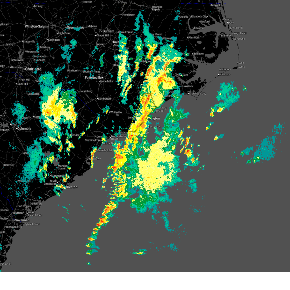
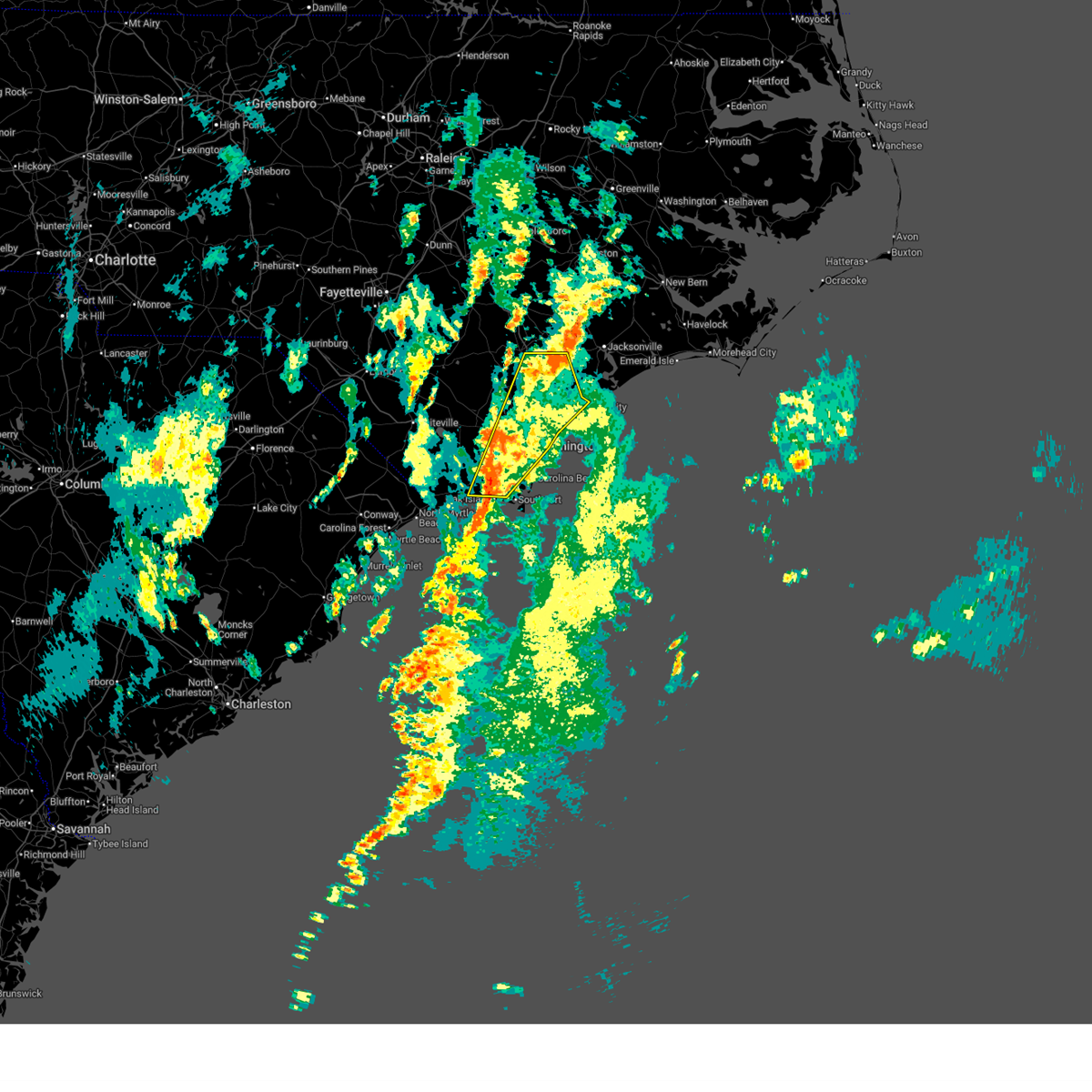
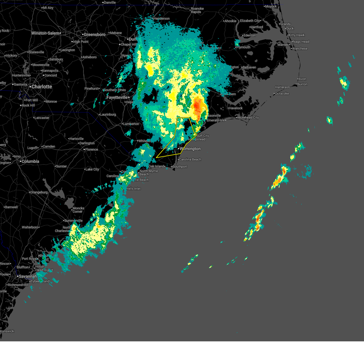
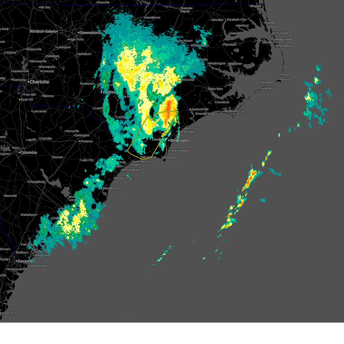
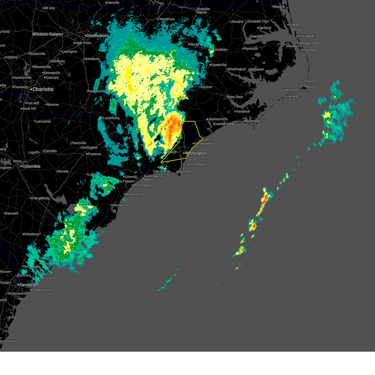
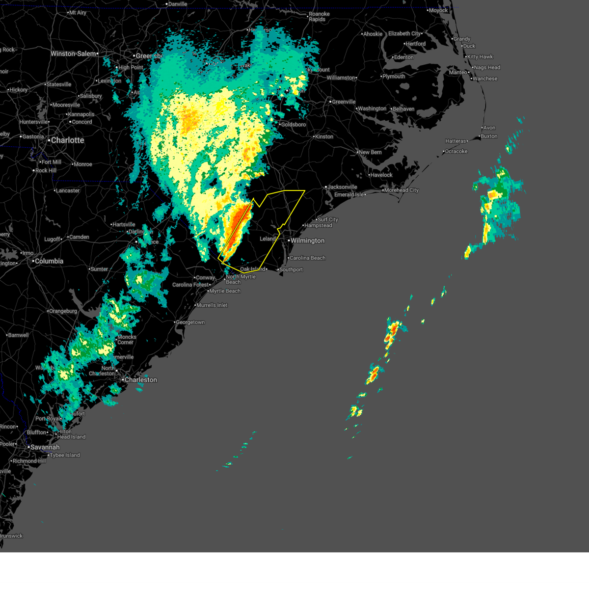
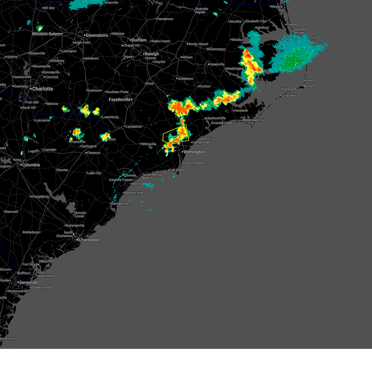
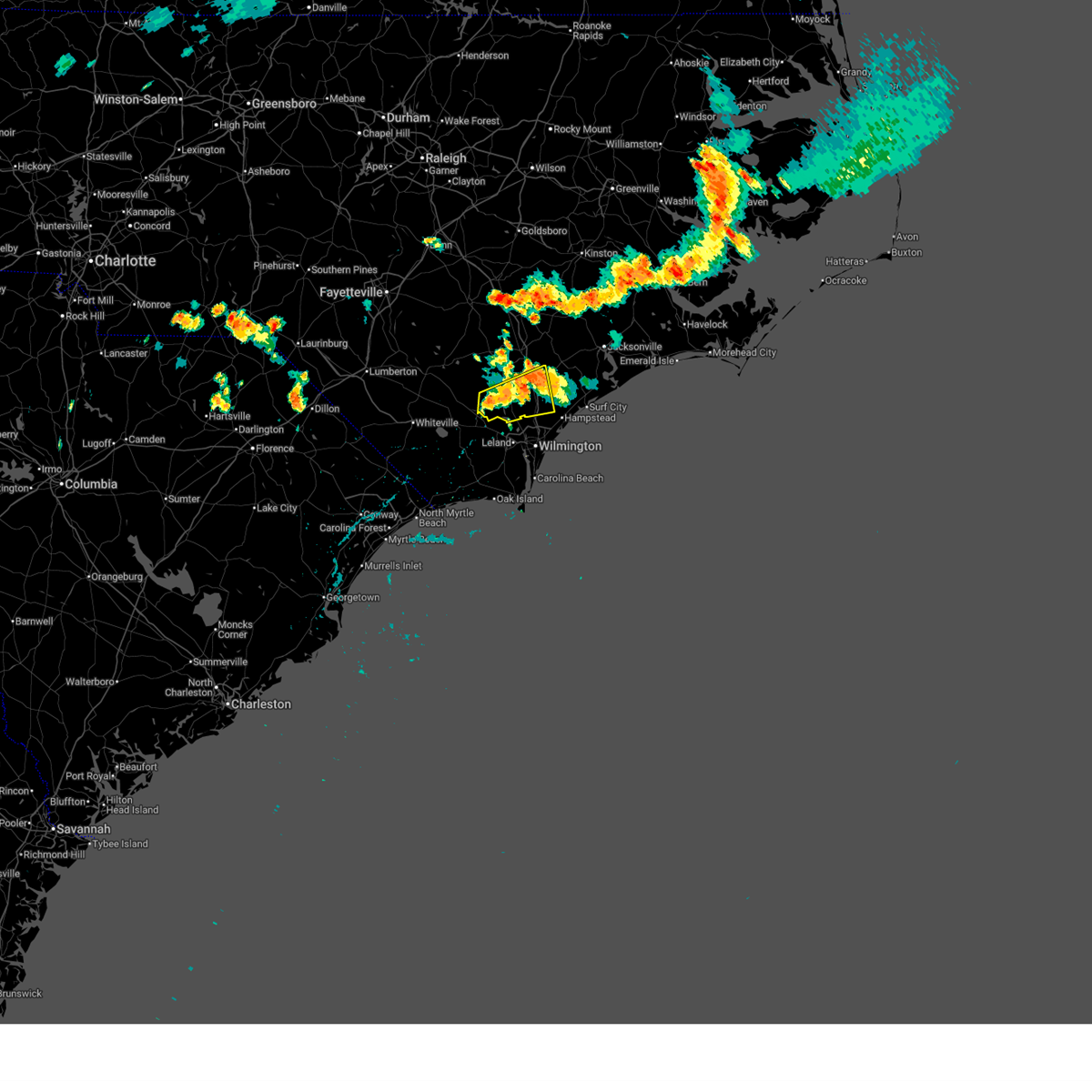
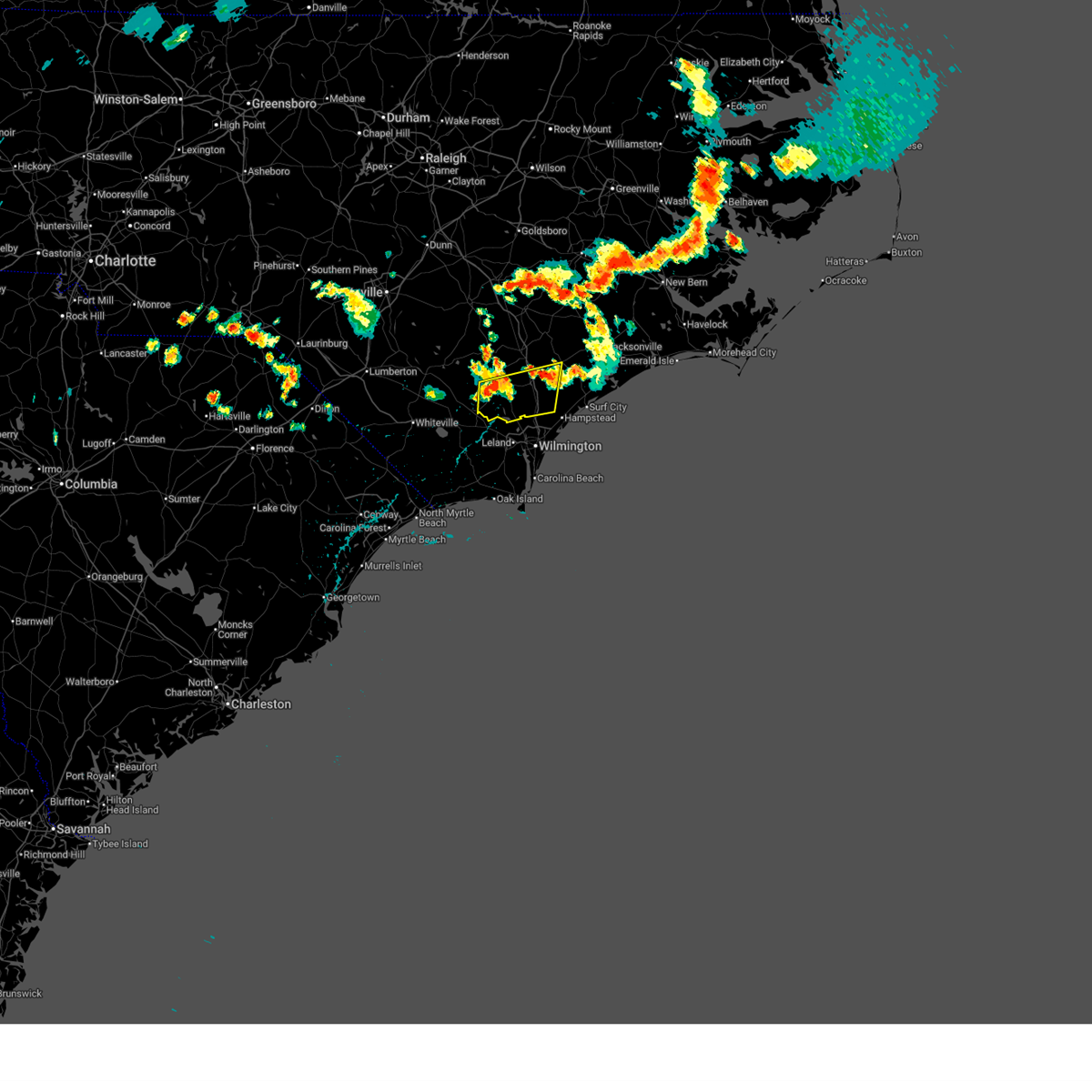
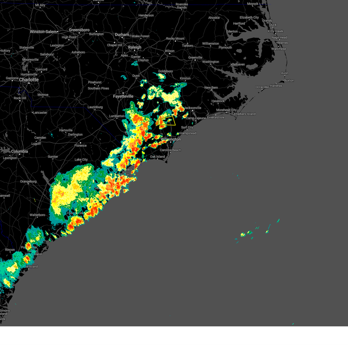
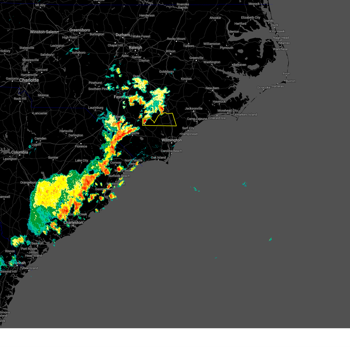
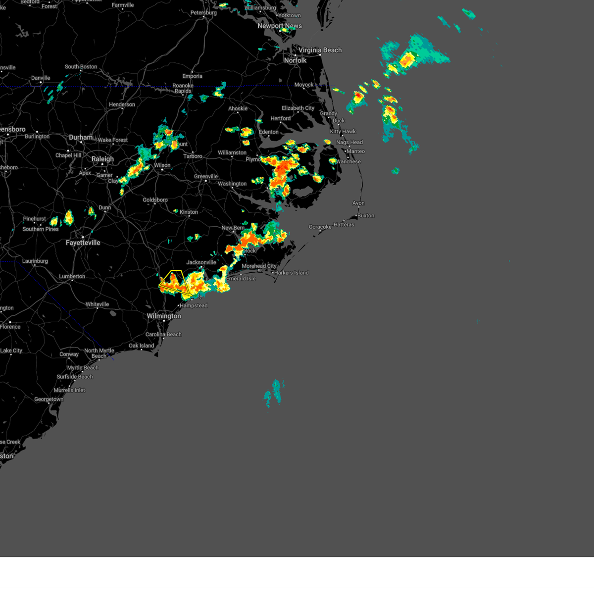
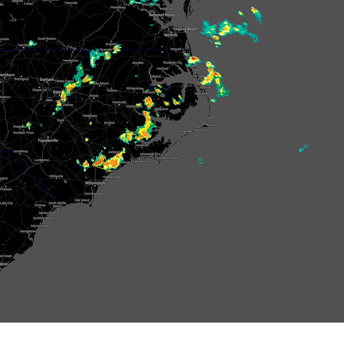
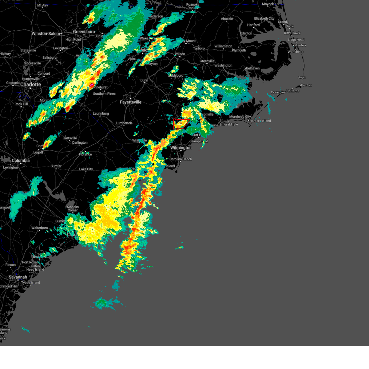
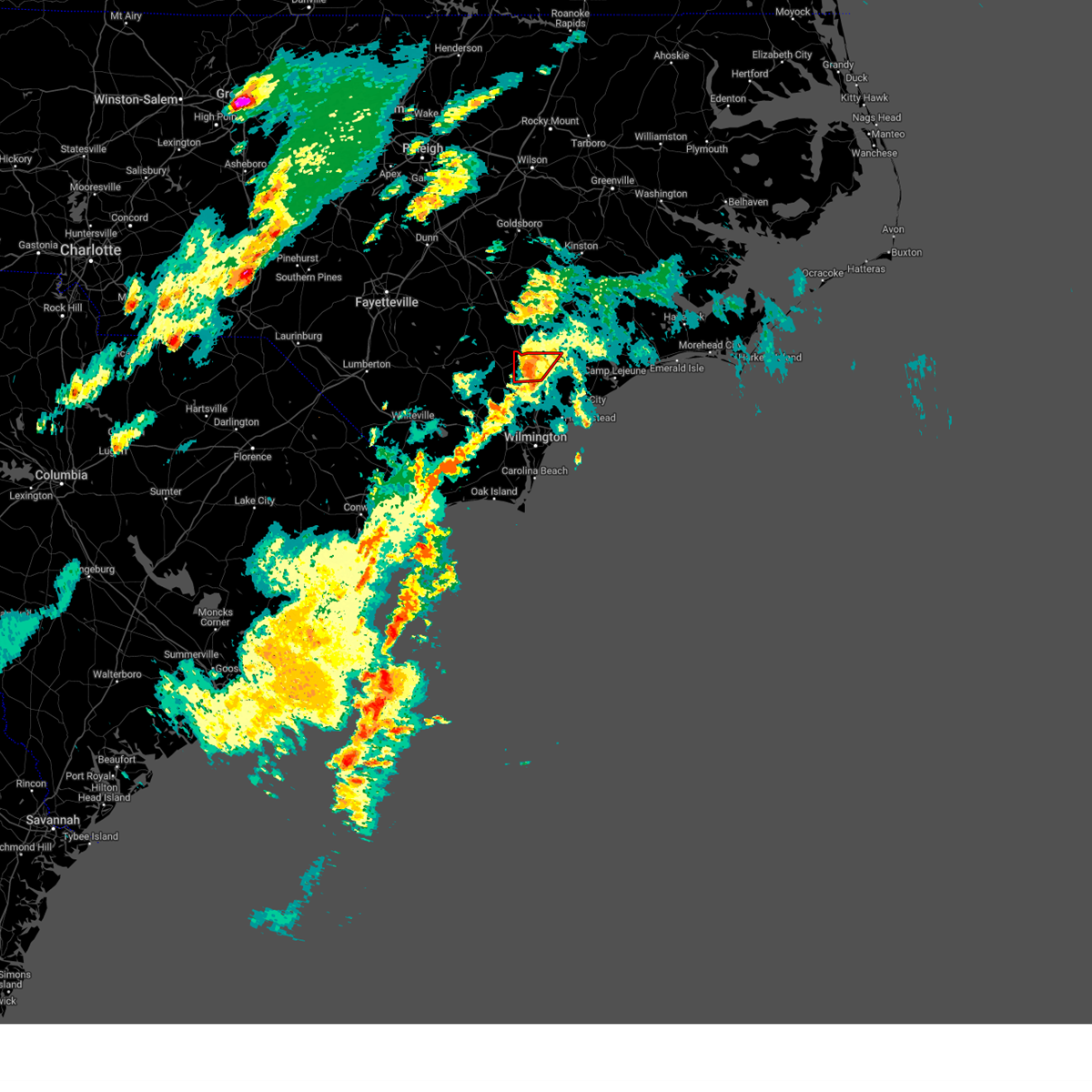
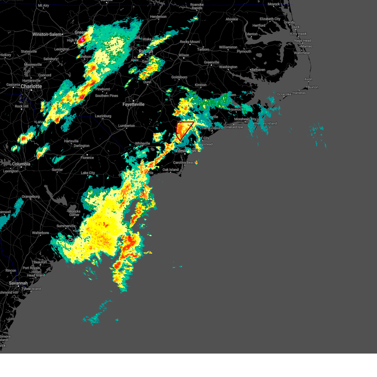
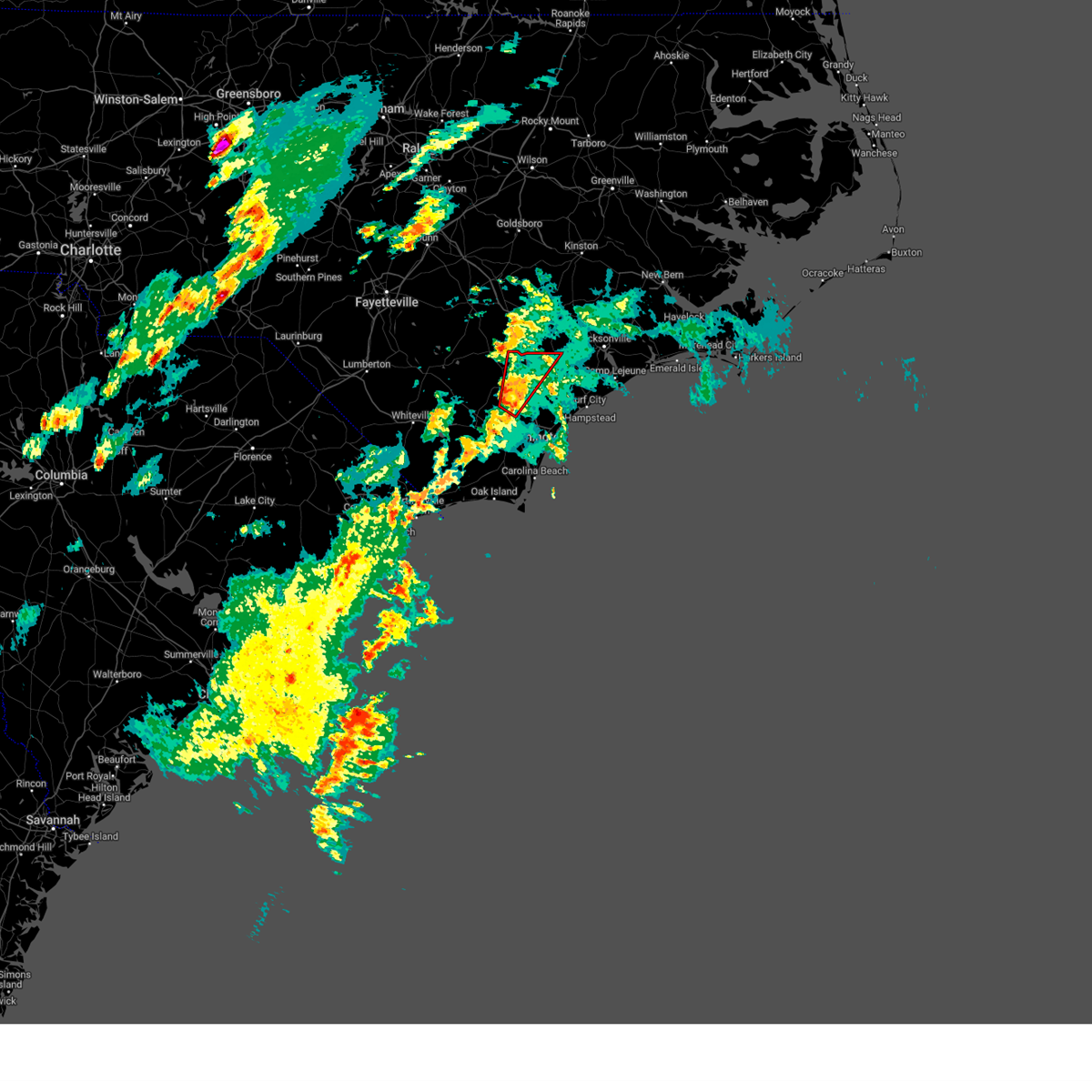
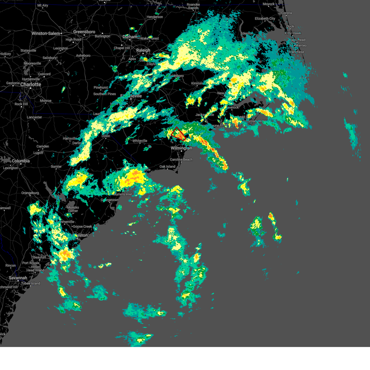
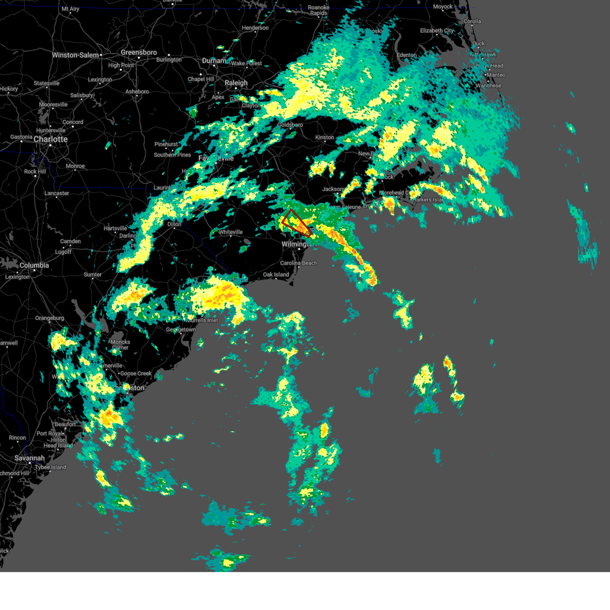
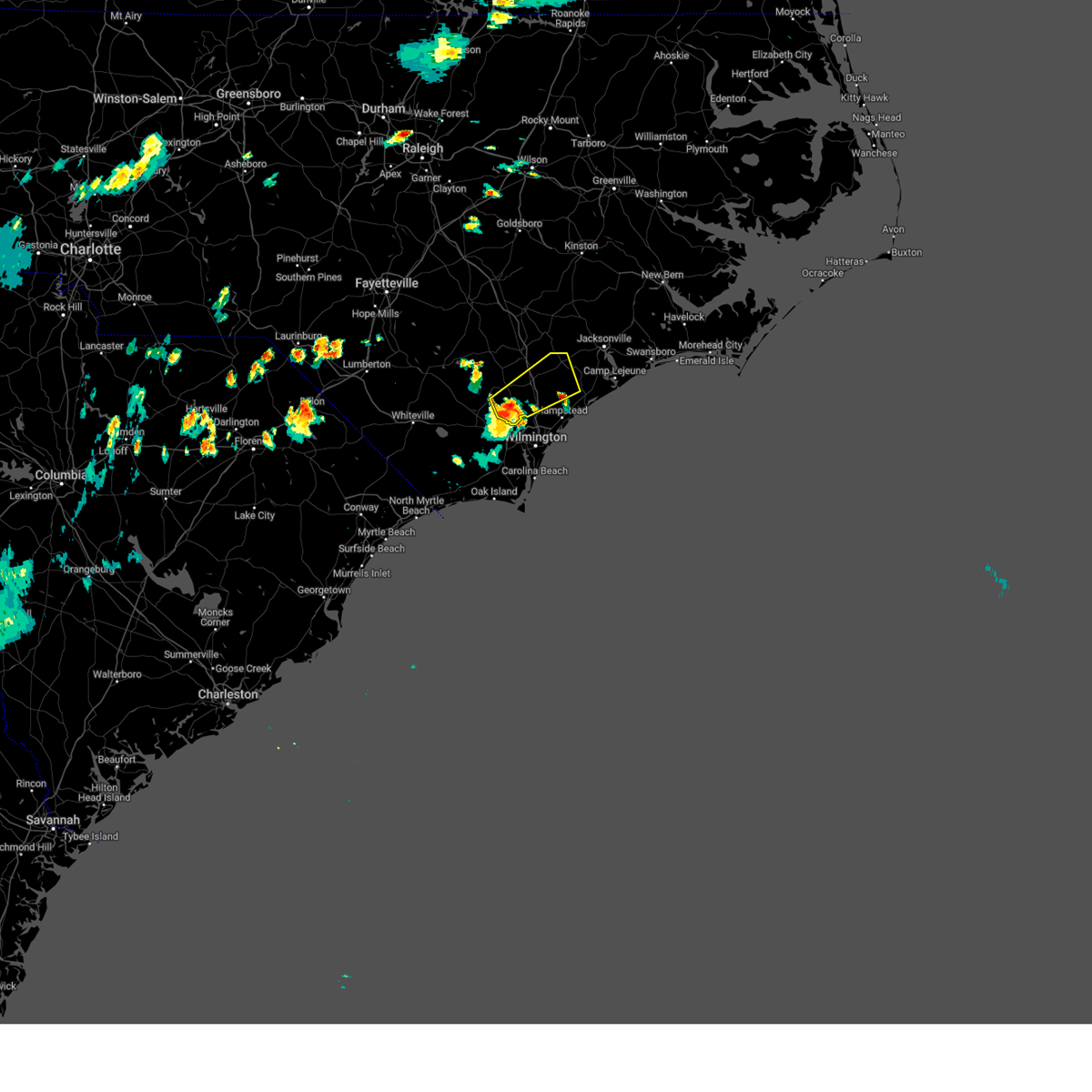
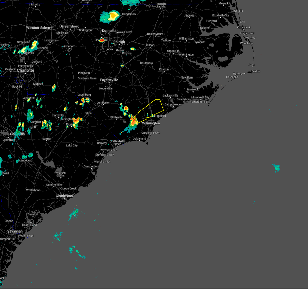
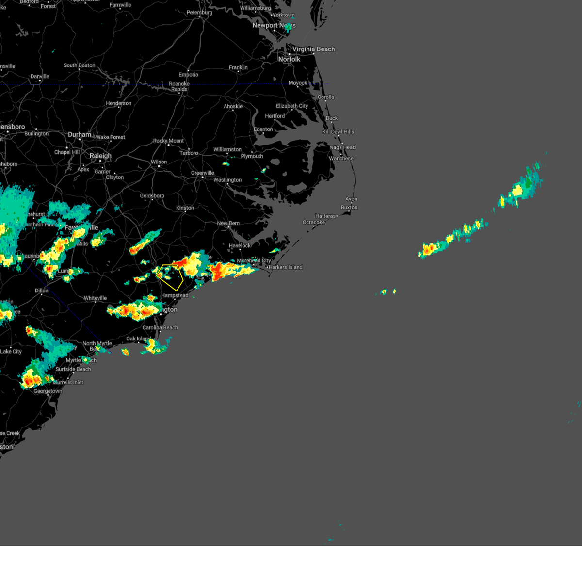
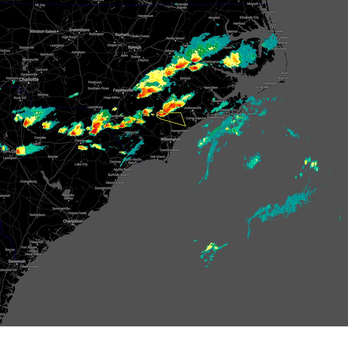
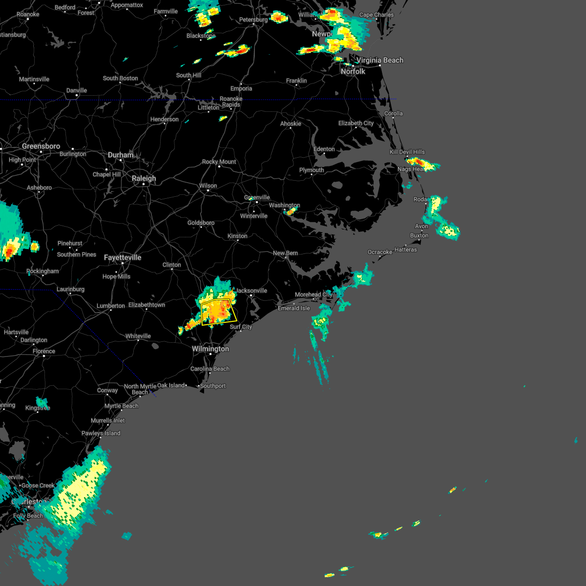
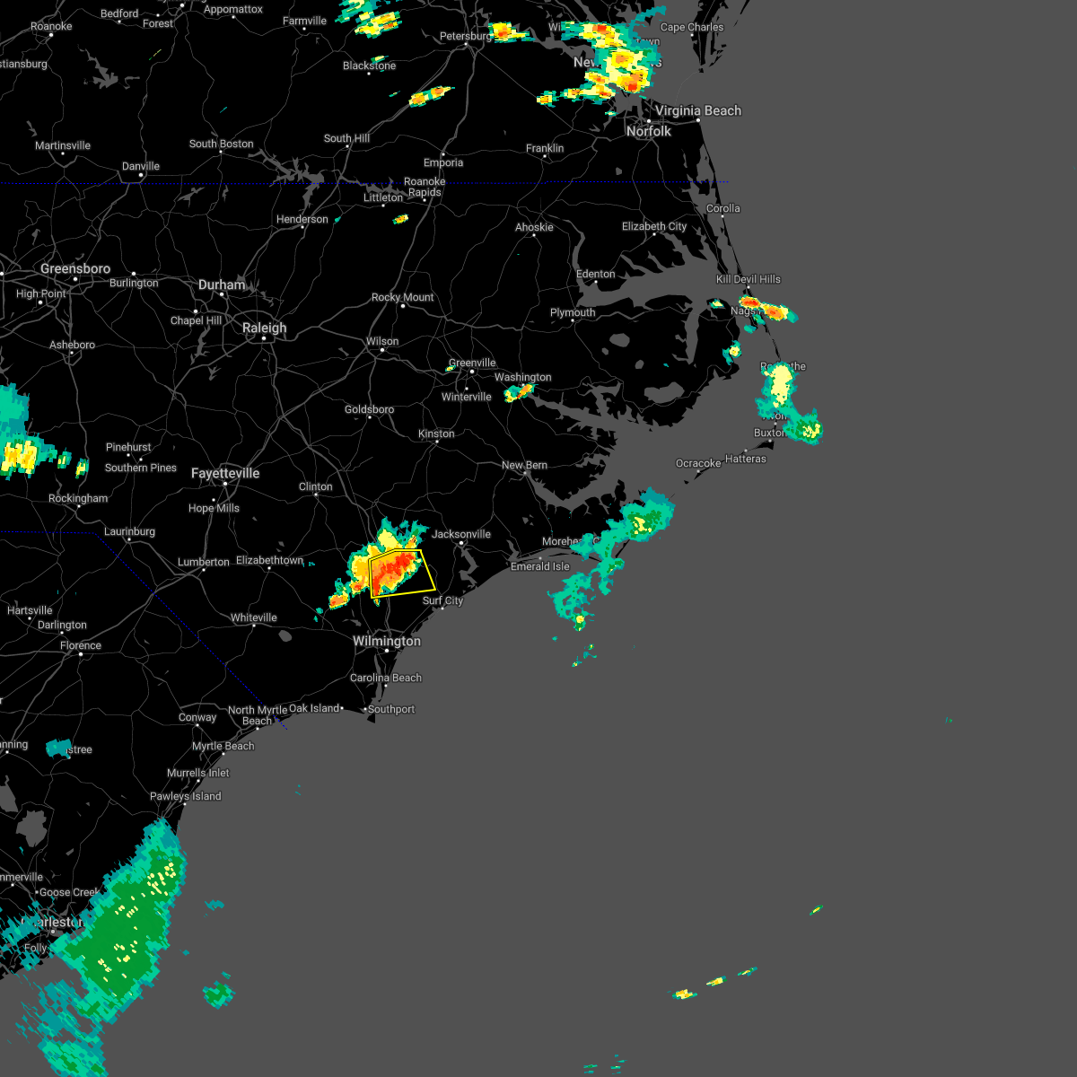
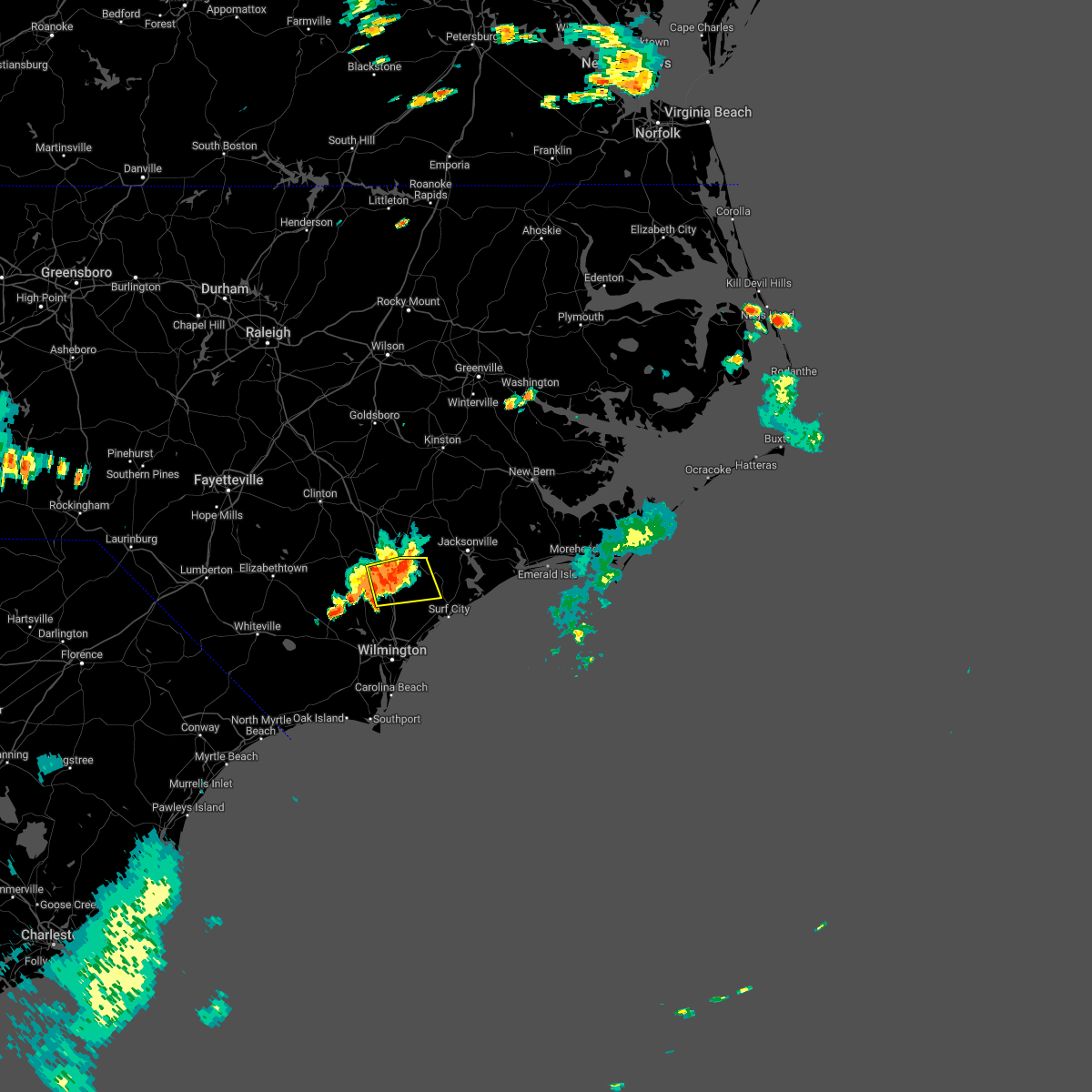
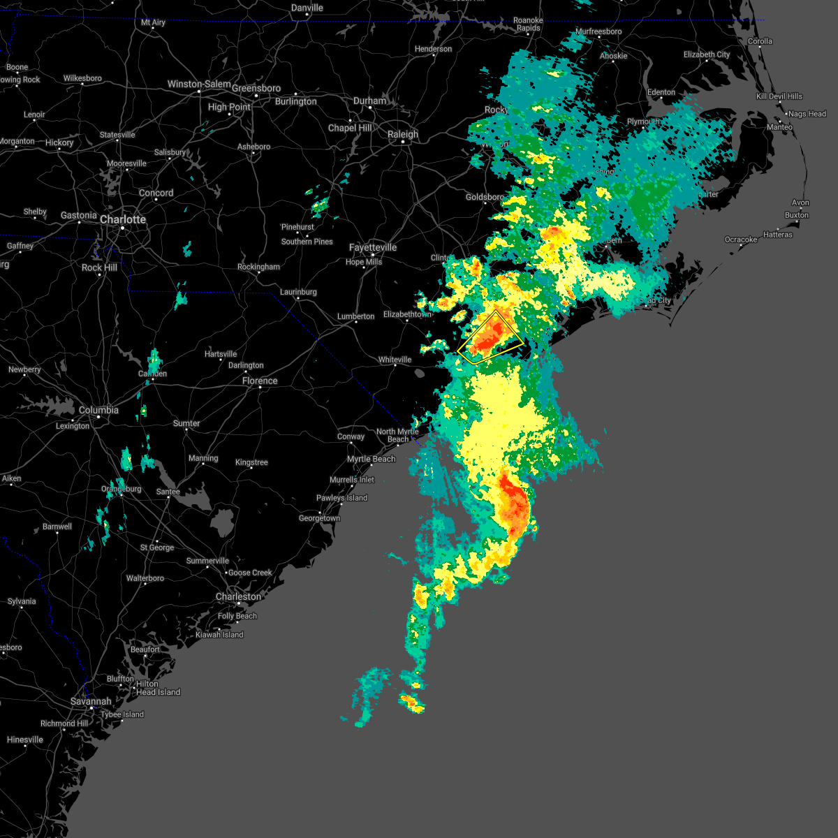
Hail Map for Burgaw, NC
The Burgaw, NC area has had 5 reports of on-the-ground hail by trained spotters, and has been under severe weather warnings 9 times during the past 12 months. Doppler radar has detected hail at or near Burgaw, NC on 55 occasions, including 4 occasions during the past year.
| Name: | Burgaw, NC |
| Where Located: | 22.2 miles N of Wilmington, NC |
| Map: | Google Map for Burgaw, NC |
| Population: | 3872 |
| Housing Units: | 1473 |
| More Info: | Search Google for Burgaw, NC |
0
The Top Recent Hail Date for Burgaw, NC is Sunday, June 14, 2026 (55th out of 55)

Hail and Wind Damage Spotted near Burgaw, NC
| Date / Time | Report Details |
|---|---|
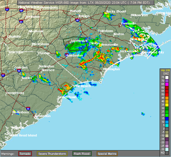
| 3/16/2026 1:56 PM EDT |
 At 154 pm edt, strong to severe thunderstorms were from near burgaw to wilmington and oak, moving northeast at 50 mph (radar indicated). Hazards include 60 mph wind gusts. Expect some wind damage to trees and power lines. locations impacted include, wilmington, leland, burgaw, wrightsville beach, surf city, figure eight island, hampstead, boiling spring lakes, st. James, topsail beach, maple hill, hightsville, wilmington international airport, murrayville, castle hayne, ogden, and winnabow. At 154 pm edt, strong to severe thunderstorms were from near burgaw to wilmington and oak, moving northeast at 50 mph (radar indicated). Hazards include 60 mph wind gusts. Expect some wind damage to trees and power lines. locations impacted include, wilmington, leland, burgaw, wrightsville beach, surf city, figure eight island, hampstead, boiling spring lakes, st. James, topsail beach, maple hill, hightsville, wilmington international airport, murrayville, castle hayne, ogden, and winnabow.
|
| 3/16/2026 1:28 PM EDT |
 Svrilm the national weather service in wilmington has issued a * severe thunderstorm warning for, new hanover county in southeastern north carolina, pender county in southeastern north carolina, eastern brunswick county in southeastern north carolina, * until 230 pm edt. * at 127 pm edt, a severe thunderstorm was located between supply and boiling spring lakes, moving northeast at 50 mph (radar indicated). Hazards include 60 mph wind gusts. expect wind damage to trees and power lines Svrilm the national weather service in wilmington has issued a * severe thunderstorm warning for, new hanover county in southeastern north carolina, pender county in southeastern north carolina, eastern brunswick county in southeastern north carolina, * until 230 pm edt. * at 127 pm edt, a severe thunderstorm was located between supply and boiling spring lakes, moving northeast at 50 mph (radar indicated). Hazards include 60 mph wind gusts. expect wind damage to trees and power lines
|
| 3/12/2026 2:12 PM EDT |
 the severe thunderstorm warning has been cancelled and is no longer in effect the severe thunderstorm warning has been cancelled and is no longer in effect
|
| 3/12/2026 1:51 PM EDT |
 The storms which prompted the warning have moved out of the area. therefore, the warning will be allowed to expire. a severe thunderstorm watch remains in effect until 500 pm edt for southeastern north carolina, and northeastern south carolina. please send your reports of hail or wind damage, including trees or large limbs downed, by calling the national weather service office in wilmington at 1 800 697 3901. The storms which prompted the warning have moved out of the area. therefore, the warning will be allowed to expire. a severe thunderstorm watch remains in effect until 500 pm edt for southeastern north carolina, and northeastern south carolina. please send your reports of hail or wind damage, including trees or large limbs downed, by calling the national weather service office in wilmington at 1 800 697 3901.
|
| 3/12/2026 1:33 PM EDT |
 Svrilm the national weather service in wilmington has issued a * severe thunderstorm warning for, new hanover county in southeastern north carolina, eastern pender county in southeastern north carolina, northeastern brunswick county in southeastern north carolina, * until 230 pm edt. * at 133 pm edt, severe thunderstorms were located along a line extending from 7 miles east of willard to rocky point to 6 miles north of brunswick county community college main campus, moving east at 50 mph (radar indicated). Hazards include 60 mph wind gusts. expect wind damage to trees and power lines Svrilm the national weather service in wilmington has issued a * severe thunderstorm warning for, new hanover county in southeastern north carolina, eastern pender county in southeastern north carolina, northeastern brunswick county in southeastern north carolina, * until 230 pm edt. * at 133 pm edt, severe thunderstorms were located along a line extending from 7 miles east of willard to rocky point to 6 miles north of brunswick county community college main campus, moving east at 50 mph (radar indicated). Hazards include 60 mph wind gusts. expect wind damage to trees and power lines
|
| 3/12/2026 1:08 PM EDT |
 Svrilm the national weather service in wilmington has issued a * severe thunderstorm warning for, pender county in southeastern north carolina, southeastern bladen county in southeastern north carolina, brunswick county in southeastern north carolina, eastern columbus county in southeastern north carolina, * until 200 pm edt. * at 108 pm edt, severe thunderstorms were located along a line extending from near rowan to dulah, moving east at 45 mph (radar indicated). Hazards include 60 mph wind gusts. expect wind damage to trees and power lines Svrilm the national weather service in wilmington has issued a * severe thunderstorm warning for, pender county in southeastern north carolina, southeastern bladen county in southeastern north carolina, brunswick county in southeastern north carolina, eastern columbus county in southeastern north carolina, * until 200 pm edt. * at 108 pm edt, severe thunderstorms were located along a line extending from near rowan to dulah, moving east at 45 mph (radar indicated). Hazards include 60 mph wind gusts. expect wind damage to trees and power lines
|
| 7/27/2025 5:21 PM EDT |
 The storms which prompted the warning are moving out of the area. please send any reports of hail or wind damage, including trees or large limbs downed, by calling the national weather service office in wilmington at 1 800 697 3901. The storms which prompted the warning are moving out of the area. please send any reports of hail or wind damage, including trees or large limbs downed, by calling the national weather service office in wilmington at 1 800 697 3901.
|
| 7/27/2025 4:53 PM EDT |
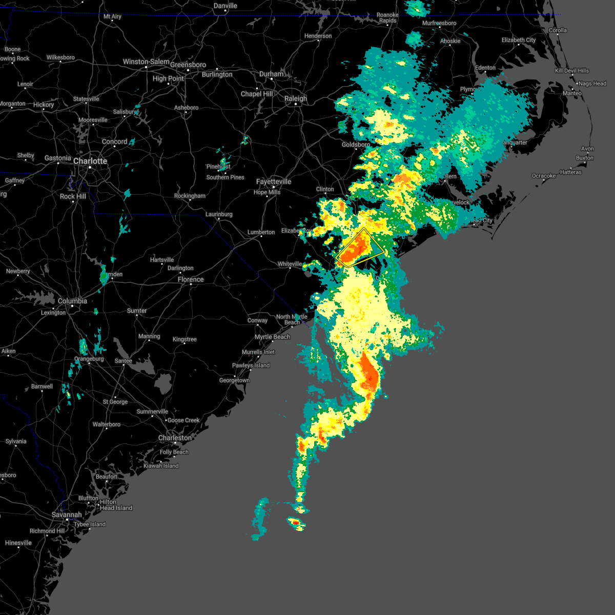
 At 452 pm edt, severe thunderstorms were located along a line extending from white stocking to burgaw to near point caswell, moving south at 15 mph (radar indicated). Hazards include 60 mph wind gusts and penny size hail. Expect wind damage to trees and power lines. locations impacted include, burgaw, white stocking, point caswell, long creek, murray town, rooks, ashton, malpass corner, montague, rocky point, currie, wards corner, the borough, st. Helena, atkinson, and pender memorial hospital. At 452 pm edt, severe thunderstorms were located along a line extending from white stocking to burgaw to near point caswell, moving south at 15 mph (radar indicated). Hazards include 60 mph wind gusts and penny size hail. Expect wind damage to trees and power lines. locations impacted include, burgaw, white stocking, point caswell, long creek, murray town, rooks, ashton, malpass corner, montague, rocky point, currie, wards corner, the borough, st. Helena, atkinson, and pender memorial hospital.
|
| 7/27/2025 4:31 PM EDT |
 Svrilm the national weather service in wilmington has issued a * severe thunderstorm warning for, pender county in southeastern north carolina, southeastern bladen county in southeastern north carolina, * until 530 pm edt. * at 431 pm edt, severe thunderstorms were located along a line extending from white stocking to near rooks, moving south at 15 mph (radar indicated). Hazards include 60 mph wind gusts and quarter size hail. Minor hail damage to vehicles is possible. Expect wind damage to trees and power lines. Svrilm the national weather service in wilmington has issued a * severe thunderstorm warning for, pender county in southeastern north carolina, southeastern bladen county in southeastern north carolina, * until 530 pm edt. * at 431 pm edt, severe thunderstorms were located along a line extending from white stocking to near rooks, moving south at 15 mph (radar indicated). Hazards include 60 mph wind gusts and quarter size hail. Minor hail damage to vehicles is possible. Expect wind damage to trees and power lines.
|
| 6/8/2025 2:04 PM EDT |
 the severe thunderstorm warning has been cancelled and is no longer in effect the severe thunderstorm warning has been cancelled and is no longer in effect
|
| 6/8/2025 2:04 PM EDT |
 At 203 pm edt, a severe thunderstorm was located near burgaw, moving east at 35 mph (radar indicated). Hazards include 60 mph wind gusts and quarter size hail. Minor hail damage to vehicles is possible. expect wind damage to trees and power lines. locations impacted include, burgaw, white stocking, murray town, wards corner, st. Helena, and pender memorial hospital. At 203 pm edt, a severe thunderstorm was located near burgaw, moving east at 35 mph (radar indicated). Hazards include 60 mph wind gusts and quarter size hail. Minor hail damage to vehicles is possible. expect wind damage to trees and power lines. locations impacted include, burgaw, white stocking, murray town, wards corner, st. Helena, and pender memorial hospital.
|
| 6/8/2025 1:20 PM EDT |
 Svrilm the national weather service in wilmington has issued a * severe thunderstorm warning for, northwestern pender county in southeastern north carolina, eastern bladen county in southeastern north carolina, * until 215 pm edt. * at 120 pm edt, a severe thunderstorm was located over lagoon, or 12 miles east of elizabethtown, moving east at 35 mph (radar indicated). Hazards include 60 mph wind gusts and quarter size hail. Minor hail damage to vehicles is possible. Expect wind damage to trees and power lines. Svrilm the national weather service in wilmington has issued a * severe thunderstorm warning for, northwestern pender county in southeastern north carolina, eastern bladen county in southeastern north carolina, * until 215 pm edt. * at 120 pm edt, a severe thunderstorm was located over lagoon, or 12 miles east of elizabethtown, moving east at 35 mph (radar indicated). Hazards include 60 mph wind gusts and quarter size hail. Minor hail damage to vehicles is possible. Expect wind damage to trees and power lines.
|
| 6/7/2025 6:45 PM EDT |
 The storm which prompted the warning has weakened slightly, however, gusty winds are still possible with this thunderstorm. please send your reports of hail and/or wind damage, including trees or large limbs downed, by calling the national weather service office in wilmington at 1-800-697-3901. The storm which prompted the warning has weakened slightly, however, gusty winds are still possible with this thunderstorm. please send your reports of hail and/or wind damage, including trees or large limbs downed, by calling the national weather service office in wilmington at 1-800-697-3901.
|
| 6/7/2025 6:13 PM EDT |
 Svrilm the national weather service in wilmington has issued a * severe thunderstorm warning for, northeastern pender county in southeastern north carolina, * until 645 pm edt. * at 613 pm edt, a severe thunderstorm was located over white stocking, or 7 miles northeast of burgaw, moving east at 35 mph (radar indicated). Hazards include 60 mph wind gusts and penny size hail. expect wind damage to trees and power lines Svrilm the national weather service in wilmington has issued a * severe thunderstorm warning for, northeastern pender county in southeastern north carolina, * until 645 pm edt. * at 613 pm edt, a severe thunderstorm was located over white stocking, or 7 miles northeast of burgaw, moving east at 35 mph (radar indicated). Hazards include 60 mph wind gusts and penny size hail. expect wind damage to trees and power lines
|
| 6/7/2025 5:48 PM EDT |
 At 548 pm edt, severe thunderstorms were located along a line extending from penderlea to near maple hill, moving east at 30 mph (radar indicated). Hazards include 60 mph wind gusts and quarter size hail. Minor hail damage to vehicles is possible. expect wind damage to trees and power lines. Locations impacted include, penderlea, white stocking, murray town, maple hill, willard, and watha. At 548 pm edt, severe thunderstorms were located along a line extending from penderlea to near maple hill, moving east at 30 mph (radar indicated). Hazards include 60 mph wind gusts and quarter size hail. Minor hail damage to vehicles is possible. expect wind damage to trees and power lines. Locations impacted include, penderlea, white stocking, murray town, maple hill, willard, and watha.
|
| 6/7/2025 5:34 PM EDT |
 At 533 pm edt, severe thunderstorms were located along a broken line extending from near harrells to about 5 miles west of maple hill, moving east at 25 mph (radar indicated). Hazards include 60 mph wind gusts. Expect wind damage to trees and power lines. Locations impacted include, penderlea, white stocking, murray town, maple hill, willard, and watha. At 533 pm edt, severe thunderstorms were located along a broken line extending from near harrells to about 5 miles west of maple hill, moving east at 25 mph (radar indicated). Hazards include 60 mph wind gusts. Expect wind damage to trees and power lines. Locations impacted include, penderlea, white stocking, murray town, maple hill, willard, and watha.
|
| 6/7/2025 5:12 PM EDT |
 Svrilm the national weather service in wilmington has issued a * severe thunderstorm warning for, northern pender county in southeastern north carolina, * until 615 pm edt. * at 511 pm edt, severe thunderstorms were located along a line extending from near harrells to wallace, moving east at 30 mph (radar indicated). Hazards include 60 mph wind gusts and penny size hail. expect wind damage to trees and power lines Svrilm the national weather service in wilmington has issued a * severe thunderstorm warning for, northern pender county in southeastern north carolina, * until 615 pm edt. * at 511 pm edt, severe thunderstorms were located along a line extending from near harrells to wallace, moving east at 30 mph (radar indicated). Hazards include 60 mph wind gusts and penny size hail. expect wind damage to trees and power lines
|
| 3/16/2025 7:54 PM EDT |
 The storm which prompted the warning has weakened below severe limits, and has exited the warned area. therefore, the warning will be allowed to expire. please send your reports of hail and/or wind damage, including trees or large limbs downed, by calling the national weather service office in wilmington at 1-800-697-3901. The storm which prompted the warning has weakened below severe limits, and has exited the warned area. therefore, the warning will be allowed to expire. please send your reports of hail and/or wind damage, including trees or large limbs downed, by calling the national weather service office in wilmington at 1-800-697-3901.
|
| 3/16/2025 7:37 PM EDT |
 At 737 pm edt, a severe thunderstorm capable of producing a tornado was located near murray town, or near burgaw, moving northeast at 45 mph (radar indicated rotation). Hazards include tornado. Flying debris will be dangerous to those caught without shelter. mobile homes will be damaged or destroyed. damage to roofs, windows, and vehicles will occur. tree damage is likely. This tornadic thunderstorm will remain over mainly rural areas of north central pender county, including the following locations, watha. At 737 pm edt, a severe thunderstorm capable of producing a tornado was located near murray town, or near burgaw, moving northeast at 45 mph (radar indicated rotation). Hazards include tornado. Flying debris will be dangerous to those caught without shelter. mobile homes will be damaged or destroyed. damage to roofs, windows, and vehicles will occur. tree damage is likely. This tornadic thunderstorm will remain over mainly rural areas of north central pender county, including the following locations, watha.
|
| 3/16/2025 7:30 PM EDT |
 At 730 pm edt, a severe thunderstorm capable of producing a tornado was located near malpass corner, or near burgaw, moving northeast at 40 mph (radar indicated rotation). Hazards include tornado. Flying debris will be dangerous to those caught without shelter. mobile homes will be damaged or destroyed. damage to roofs, windows, and vehicles will occur. tree damage is likely. this dangerous storm will be near, burgaw and murray town around 735 pm edt. other locations impacted by this tornadic thunderstorm include watha, pender memorial hospital, and st. Helena. At 730 pm edt, a severe thunderstorm capable of producing a tornado was located near malpass corner, or near burgaw, moving northeast at 40 mph (radar indicated rotation). Hazards include tornado. Flying debris will be dangerous to those caught without shelter. mobile homes will be damaged or destroyed. damage to roofs, windows, and vehicles will occur. tree damage is likely. this dangerous storm will be near, burgaw and murray town around 735 pm edt. other locations impacted by this tornadic thunderstorm include watha, pender memorial hospital, and st. Helena.
|
| 3/16/2025 7:27 PM EDT | Power lines and stand of trees down between the 3000 and 4000 block of herring's chapel road. possible tornado in pender county NC, 8.5 miles NE of Burgaw, NC |
| 3/16/2025 7:24 PM EDT |
 Torilm the national weather service in wilmington has issued a * tornado warning for, western pender county in southeastern north carolina, * until 800 pm edt. * at 723 pm edt, a severe thunderstorm capable of producing a tornado was located over malpass corner, or 8 miles southwest of burgaw, moving northeast at 45 mph (radar indicated rotation). Hazards include tornado. Flying debris will be dangerous to those caught without shelter. mobile homes will be damaged or destroyed. damage to roofs, windows, and vehicles will occur. tree damage is likely. this dangerous storm will be near, burgaw around 730 pm edt. murray town around 735 pm edt. other locations impacted by this tornadic thunderstorm include watha, pender memorial hospital, and st. helena. This includes interstate 40 between mile markers 388 and 402. Torilm the national weather service in wilmington has issued a * tornado warning for, western pender county in southeastern north carolina, * until 800 pm edt. * at 723 pm edt, a severe thunderstorm capable of producing a tornado was located over malpass corner, or 8 miles southwest of burgaw, moving northeast at 45 mph (radar indicated rotation). Hazards include tornado. Flying debris will be dangerous to those caught without shelter. mobile homes will be damaged or destroyed. damage to roofs, windows, and vehicles will occur. tree damage is likely. this dangerous storm will be near, burgaw around 730 pm edt. murray town around 735 pm edt. other locations impacted by this tornadic thunderstorm include watha, pender memorial hospital, and st. helena. This includes interstate 40 between mile markers 388 and 402.
|
| 8/7/2024 1:03 PM EDT |
 the tornado warning has been cancelled and is no longer in effect the tornado warning has been cancelled and is no longer in effect
|
| 8/7/2024 12:56 PM EDT |
 At 1256 pm edt, a severe thunderstorm capable of producing a tornado was located over rocky point, or 10 miles southeast of burgaw, moving northwest at 35 mph (radar indicated rotation). Hazards include tornado. Flying debris will be dangerous to those caught without shelter. mobile homes will be damaged or destroyed. damage to roofs, windows, and vehicles will occur. tree damage is likely. this dangerous storm will be near, rocky point and ashton around 100 pm edt. burgaw around 110 pm edt. other locations impacted by this tornadic thunderstorm include st. Helena. At 1256 pm edt, a severe thunderstorm capable of producing a tornado was located over rocky point, or 10 miles southeast of burgaw, moving northwest at 35 mph (radar indicated rotation). Hazards include tornado. Flying debris will be dangerous to those caught without shelter. mobile homes will be damaged or destroyed. damage to roofs, windows, and vehicles will occur. tree damage is likely. this dangerous storm will be near, rocky point and ashton around 100 pm edt. burgaw around 110 pm edt. other locations impacted by this tornadic thunderstorm include st. Helena.
|
| 8/7/2024 12:56 PM EDT |
 the tornado warning has been cancelled and is no longer in effect the tornado warning has been cancelled and is no longer in effect
|
| 8/7/2024 12:51 PM EDT |
 Torilm the national weather service in wilmington has issued a * tornado warning for, northeastern new hanover county in southeastern north carolina, central pender county in southeastern north carolina, * until 115 pm edt. * at 1251 pm edt, a thunderstorm capable of producing a tornado was located near scotts hill, or 7 miles northwest of rich inlet, moving northwest at 35 mph (radar indicated rotation). Hazards include tornado. Flying debris will be dangerous to those caught without shelter. mobile homes will be damaged or destroyed. damage to roofs, windows, and vehicles will occur. tree damage is likely. this dangerous storm will be near, rocky point around 1255 pm edt. ashton around 100 pm edt. burgaw around 110 pm edt. other locations impacted by this tornadic thunderstorm include st. Helena. Torilm the national weather service in wilmington has issued a * tornado warning for, northeastern new hanover county in southeastern north carolina, central pender county in southeastern north carolina, * until 115 pm edt. * at 1251 pm edt, a thunderstorm capable of producing a tornado was located near scotts hill, or 7 miles northwest of rich inlet, moving northwest at 35 mph (radar indicated rotation). Hazards include tornado. Flying debris will be dangerous to those caught without shelter. mobile homes will be damaged or destroyed. damage to roofs, windows, and vehicles will occur. tree damage is likely. this dangerous storm will be near, rocky point around 1255 pm edt. ashton around 100 pm edt. burgaw around 110 pm edt. other locations impacted by this tornadic thunderstorm include st. Helena.
|
| 6/6/2024 5:55 PM EDT |
 At 555 pm edt, a severe thunderstorm was located near long creek, or 7 miles south of burgaw, moving east at 35 mph (radar indicated). Hazards include 60 mph wind gusts and quarter size hail. Minor hail damage to vehicles is possible. expect wind damage to trees and power lines. locations impacted include, burgaw, white stocking, point caswell, maple hill, long creek, murray town, rooks, montague, malpass corner, ashton, rocky point, currie, wards corner, the borough, st. Helena, and pender memorial hospital. At 555 pm edt, a severe thunderstorm was located near long creek, or 7 miles south of burgaw, moving east at 35 mph (radar indicated). Hazards include 60 mph wind gusts and quarter size hail. Minor hail damage to vehicles is possible. expect wind damage to trees and power lines. locations impacted include, burgaw, white stocking, point caswell, maple hill, long creek, murray town, rooks, montague, malpass corner, ashton, rocky point, currie, wards corner, the borough, st. Helena, and pender memorial hospital.
|
| 6/6/2024 5:55 PM EDT |
 the severe thunderstorm warning has been cancelled and is no longer in effect the severe thunderstorm warning has been cancelled and is no longer in effect
|
| 6/6/2024 5:33 PM EDT |
 Svrilm the national weather service in wilmington has issued a * severe thunderstorm warning for, central pender county in southeastern north carolina, north central brunswick county in southeastern north carolina, east central columbus county in southeastern north carolina, * until 630 pm edt. * at 533 pm edt, a severe thunderstorm was located near riegelwood, or 13 miles northwest of leland, moving northeast at 35 mph (radar indicated). Hazards include 60 mph wind gusts and quarter size hail. Minor hail damage to vehicles is possible. Expect wind damage to trees and power lines. Svrilm the national weather service in wilmington has issued a * severe thunderstorm warning for, central pender county in southeastern north carolina, north central brunswick county in southeastern north carolina, east central columbus county in southeastern north carolina, * until 630 pm edt. * at 533 pm edt, a severe thunderstorm was located near riegelwood, or 13 miles northwest of leland, moving northeast at 35 mph (radar indicated). Hazards include 60 mph wind gusts and quarter size hail. Minor hail damage to vehicles is possible. Expect wind damage to trees and power lines.
|
| 5/15/2024 8:49 PM EDT |
 Svrilm the national weather service in wilmington has issued a * severe thunderstorm warning for, new hanover county in southeastern north carolina, pender county in southeastern north carolina, northeastern brunswick county in southeastern north carolina, * until 930 pm edt. * at 849 pm edt, severe thunderstorms were located along a line extending from near maple hill to near leland, moving east at 50 mph (radar indicated). Hazards include 60 mph wind gusts and quarter size hail. Minor hail damage to vehicles is possible. Expect wind damage to trees and power lines. Svrilm the national weather service in wilmington has issued a * severe thunderstorm warning for, new hanover county in southeastern north carolina, pender county in southeastern north carolina, northeastern brunswick county in southeastern north carolina, * until 930 pm edt. * at 849 pm edt, severe thunderstorms were located along a line extending from near maple hill to near leland, moving east at 50 mph (radar indicated). Hazards include 60 mph wind gusts and quarter size hail. Minor hail damage to vehicles is possible. Expect wind damage to trees and power lines.
|
| 5/15/2024 5:53 PM EDT |
 the severe thunderstorm warning has been cancelled and is no longer in effect the severe thunderstorm warning has been cancelled and is no longer in effect
|
| 5/15/2024 5:24 PM EDT |
 Svrilm the national weather service in wilmington has issued a * severe thunderstorm warning for, northeastern pender county in southeastern north carolina, * until 630 pm edt. * at 524 pm edt, a severe thunderstorm was located over white stocking, or 7 miles northeast of burgaw, moving northeast at 15 mph (radar indicated). Hazards include 60 mph wind gusts and quarter size hail. Minor hail damage to vehicles is possible. Expect wind damage to trees and power lines. Svrilm the national weather service in wilmington has issued a * severe thunderstorm warning for, northeastern pender county in southeastern north carolina, * until 630 pm edt. * at 524 pm edt, a severe thunderstorm was located over white stocking, or 7 miles northeast of burgaw, moving northeast at 15 mph (radar indicated). Hazards include 60 mph wind gusts and quarter size hail. Minor hail damage to vehicles is possible. Expect wind damage to trees and power lines.
|
| 5/10/2024 5:42 PM EDT |
 At 541 pm edt, a severe thunderstorm was located near wards corner, or 5 miles west of burgaw, moving southeast at 30 mph (radar indicated). Hazards include 60 mph wind gusts and quarter size hail. Minor hail damage to vehicles is possible. expect wind damage to trees and power lines. Locations impacted include, burgaw, murray town, malpass corner, wards corner, and pender memorial hospital. At 541 pm edt, a severe thunderstorm was located near wards corner, or 5 miles west of burgaw, moving southeast at 30 mph (radar indicated). Hazards include 60 mph wind gusts and quarter size hail. Minor hail damage to vehicles is possible. expect wind damage to trees and power lines. Locations impacted include, burgaw, murray town, malpass corner, wards corner, and pender memorial hospital.
|
| 5/10/2024 5:16 PM EDT |
 Svrilm the national weather service in wilmington has issued a * severe thunderstorm warning for, northwestern pender county in southeastern north carolina, * until 600 pm edt. * at 516 pm edt, a severe thunderstorm was located near harrells, or 14 miles southwest of wallace, moving east at 30 mph (radar indicated). Hazards include 60 mph wind gusts and quarter size hail. Minor hail damage to vehicles is possible. expect wind damage to trees and power lines. this severe thunderstorm will be near, penderlea around 530 pm edt. burgaw around 540 pm edt. murray town around 550 pm edt. Other locations impacted by this severe thunderstorm include watha and pender memorial hospital. Svrilm the national weather service in wilmington has issued a * severe thunderstorm warning for, northwestern pender county in southeastern north carolina, * until 600 pm edt. * at 516 pm edt, a severe thunderstorm was located near harrells, or 14 miles southwest of wallace, moving east at 30 mph (radar indicated). Hazards include 60 mph wind gusts and quarter size hail. Minor hail damage to vehicles is possible. expect wind damage to trees and power lines. this severe thunderstorm will be near, penderlea around 530 pm edt. burgaw around 540 pm edt. murray town around 550 pm edt. Other locations impacted by this severe thunderstorm include watha and pender memorial hospital.
|
| 5/10/2024 5:00 PM EDT |
 At 500 pm edt, severe thunderstorms were located along a line extending from near willard to near harrells, moving southeast at 35 mph (radar indicated). Hazards include 60 mph wind gusts and quarter size hail. Minor hail damage to vehicles is possible. expect wind damage to trees and power lines. these severe storms will be near, willard and penderlea around 505 pm edt. murray town and maple hill around 510 pm edt. white stocking around 515 pm edt. Other locations impacted by these severe thunderstorms include watha. At 500 pm edt, severe thunderstorms were located along a line extending from near willard to near harrells, moving southeast at 35 mph (radar indicated). Hazards include 60 mph wind gusts and quarter size hail. Minor hail damage to vehicles is possible. expect wind damage to trees and power lines. these severe storms will be near, willard and penderlea around 505 pm edt. murray town and maple hill around 510 pm edt. white stocking around 515 pm edt. Other locations impacted by these severe thunderstorms include watha.
|
| 5/10/2024 4:36 PM EDT |
 Svrilm the national weather service in wilmington has issued a * severe thunderstorm warning for, northern pender county in southeastern north carolina, * until 530 pm edt. * at 436 pm edt, a severe thunderstorm was located over harrells, or 12 miles west of wallace, moving east at 35 mph (radar indicated). Hazards include 60 mph wind gusts and quarter size hail. Minor hail damage to vehicles is possible. expect wind damage to trees and power lines. this severe thunderstorm will be near, penderlea around 450 pm edt. willard around 455 pm edt. maple hill around 520 pm edt. Other locations impacted by this severe thunderstorm include watha. Svrilm the national weather service in wilmington has issued a * severe thunderstorm warning for, northern pender county in southeastern north carolina, * until 530 pm edt. * at 436 pm edt, a severe thunderstorm was located over harrells, or 12 miles west of wallace, moving east at 35 mph (radar indicated). Hazards include 60 mph wind gusts and quarter size hail. Minor hail damage to vehicles is possible. expect wind damage to trees and power lines. this severe thunderstorm will be near, penderlea around 450 pm edt. willard around 455 pm edt. maple hill around 520 pm edt. Other locations impacted by this severe thunderstorm include watha.
|
| 1/9/2024 7:30 PM EST |
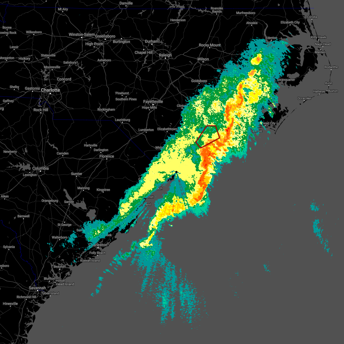
 At 728 pm est, severe thunderstorms were located along a line extending from near bowdens to 12 miles south of holden beach, moving east at 45 mph. the wilmington international airport recently observed a gust to 73 miles per hour. these are destructive storms for new hanover and pender counties (radar confirmed by automated surface observing station). Hazards include 80 mph wind gusts. Flying debris will be dangerous to those caught without shelter. mobile homes will be heavily damaged. expect considerable damage to roofs, windows, and vehicles. extensive tree damage and power outages are likely. Locations impacted include, wilmington, leland, oak island, carolina beach, burgaw, shallotte, sunset beach, wrightsville beach, kure beach, surf city, holden beach, ocean isle beach, caswell beach, bald head island, snows cut, south masonboro island, ocean crest pier, figure eight island, yaupon beach, and rich inlet. At 728 pm est, severe thunderstorms were located along a line extending from near bowdens to 12 miles south of holden beach, moving east at 45 mph. the wilmington international airport recently observed a gust to 73 miles per hour. these are destructive storms for new hanover and pender counties (radar confirmed by automated surface observing station). Hazards include 80 mph wind gusts. Flying debris will be dangerous to those caught without shelter. mobile homes will be heavily damaged. expect considerable damage to roofs, windows, and vehicles. extensive tree damage and power outages are likely. Locations impacted include, wilmington, leland, oak island, carolina beach, burgaw, shallotte, sunset beach, wrightsville beach, kure beach, surf city, holden beach, ocean isle beach, caswell beach, bald head island, snows cut, south masonboro island, ocean crest pier, figure eight island, yaupon beach, and rich inlet.
|
| 1/9/2024 7:18 PM EST |
 At 718 pm est, severe thunderstorms were located along a line extending from near bowdens to 13 miles south of ocean isle beach, moving east at 40 mph (radar indicated). Hazards include 70 mph wind gusts. Expect considerable tree damage. damage is likely to mobile homes, roofs, and outbuildings. Locations impacted include, wilmington, leland, oak island, carolina beach, burgaw, shallotte, sunset beach, wrightsville beach, kure beach, surf city, holden beach, ocean isle beach, caswell beach, bald head island, snows cut, south masonboro island, ocean crest pier, figure eight island, yaupon beach, and rich inlet. At 718 pm est, severe thunderstorms were located along a line extending from near bowdens to 13 miles south of ocean isle beach, moving east at 40 mph (radar indicated). Hazards include 70 mph wind gusts. Expect considerable tree damage. damage is likely to mobile homes, roofs, and outbuildings. Locations impacted include, wilmington, leland, oak island, carolina beach, burgaw, shallotte, sunset beach, wrightsville beach, kure beach, surf city, holden beach, ocean isle beach, caswell beach, bald head island, snows cut, south masonboro island, ocean crest pier, figure eight island, yaupon beach, and rich inlet.
|
| 1/9/2024 7:01 PM EST |
 At 701 pm est, severe thunderstorms were located along a line extending from 7 miles southwest of warsaw to 9 miles south of cherry grove beach, moving east at 45 mph (radar indicated). Hazards include 70 mph wind gusts. Expect considerable tree damage. damage is likely to mobile homes, roofs, and outbuildings. Locations impacted include, wilmington, north myrtle beach, leland, oak island, carolina beach, burgaw, shallotte, sunset beach, wrightsville beach, kure beach, surf city, holden beach, ocean isle beach, caswell beach, bald head island, snows cut, little river entrance, south masonboro island, ocean crest pier, and figure eight island. At 701 pm est, severe thunderstorms were located along a line extending from 7 miles southwest of warsaw to 9 miles south of cherry grove beach, moving east at 45 mph (radar indicated). Hazards include 70 mph wind gusts. Expect considerable tree damage. damage is likely to mobile homes, roofs, and outbuildings. Locations impacted include, wilmington, north myrtle beach, leland, oak island, carolina beach, burgaw, shallotte, sunset beach, wrightsville beach, kure beach, surf city, holden beach, ocean isle beach, caswell beach, bald head island, snows cut, little river entrance, south masonboro island, ocean crest pier, and figure eight island.
|
| 1/9/2024 6:23 PM EST |
 At 623 pm est, a severe thunderstorm was located near lagoon, or 15 miles east of elizabethtown, moving northeast at 65 mph (radar indicated). Hazards include 60 mph wind gusts. expect wind damage to trees and power lines At 623 pm est, a severe thunderstorm was located near lagoon, or 15 miles east of elizabethtown, moving northeast at 65 mph (radar indicated). Hazards include 60 mph wind gusts. expect wind damage to trees and power lines
|
| 1/9/2024 4:32 PM EST |
 At 432 pm est, a severe thunderstorm was located over malpass corner, or 10 miles west of burgaw, moving northeast at 60 mph (radar indicated). Hazards include 60 mph wind gusts. expect wind damage to trees and power lines At 432 pm est, a severe thunderstorm was located over malpass corner, or 10 miles west of burgaw, moving northeast at 60 mph (radar indicated). Hazards include 60 mph wind gusts. expect wind damage to trees and power lines
|
| 1/9/2024 4:23 PM EST |
 The severe thunderstorm warning for western pender, southeastern bladen, north central brunswick and northeastern columbus counties will expire at 430 pm est, the storm which prompted the warning has weakened below severe limits, and has exited the warned area. therefore, the warning will be allowed to expire. however, gusty winds are still possible with this thunderstorm. a tornado watch remains in effect until 900 pm est for southeastern north carolina. The severe thunderstorm warning for western pender, southeastern bladen, north central brunswick and northeastern columbus counties will expire at 430 pm est, the storm which prompted the warning has weakened below severe limits, and has exited the warned area. therefore, the warning will be allowed to expire. however, gusty winds are still possible with this thunderstorm. a tornado watch remains in effect until 900 pm est for southeastern north carolina.
|
| 1/9/2024 4:05 PM EST |
 At 405 pm est, a severe thunderstorm was located near rowan, or 16 miles west of burgaw, moving northeast at 60 mph (radar indicated). Hazards include 60 mph wind gusts. Expect wind damage to trees and power lines. locations impacted include, rowan, northwest, sandyfield, penderlea, point caswell, honey island, montague, rooks, malpass corner, willard, kelly, currie, freeman, wards corner, the borough, delco, riegelwood, bolton, east arcadia, and atkinson. hail threat, radar indicated max hail size, <. 75 in wind threat, radar indicated max wind gust, 60 mph. At 405 pm est, a severe thunderstorm was located near rowan, or 16 miles west of burgaw, moving northeast at 60 mph (radar indicated). Hazards include 60 mph wind gusts. Expect wind damage to trees and power lines. locations impacted include, rowan, northwest, sandyfield, penderlea, point caswell, honey island, montague, rooks, malpass corner, willard, kelly, currie, freeman, wards corner, the borough, delco, riegelwood, bolton, east arcadia, and atkinson. hail threat, radar indicated max hail size, <. 75 in wind threat, radar indicated max wind gust, 60 mph.
|
| 1/9/2024 3:52 PM EST |
 At 352 pm est, a severe thunderstorm was located over sandyfield, or 19 miles northwest of leland, moving northeast at 60 mph (radar indicated). Hazards include 60 mph wind gusts. Expect wind damage to trees and power lines. locations impacted include, rowan, lake waccamaw, northwest, sandyfield, penderlea, makatoka, point caswell, freeland, exum, currie, wards corner, ash, the borough, riegelwood, carvers, honey island, montague, rooks, malpass corner, and willard. hail threat, radar indicated max hail size, <. 75 in wind threat, radar indicated max wind gust, 60 mph. At 352 pm est, a severe thunderstorm was located over sandyfield, or 19 miles northwest of leland, moving northeast at 60 mph (radar indicated). Hazards include 60 mph wind gusts. Expect wind damage to trees and power lines. locations impacted include, rowan, lake waccamaw, northwest, sandyfield, penderlea, makatoka, point caswell, freeland, exum, currie, wards corner, ash, the borough, riegelwood, carvers, honey island, montague, rooks, malpass corner, and willard. hail threat, radar indicated max hail size, <. 75 in wind threat, radar indicated max wind gust, 60 mph.
|
| 1/9/2024 3:34 PM EST |
 At 333 pm est, a severe thunderstorm was located over exum, or 12 miles north of shallotte, moving northeast at 60 mph (radar indicated). Hazards include 60 mph wind gusts. expect wind damage to trees and power lines At 333 pm est, a severe thunderstorm was located over exum, or 12 miles north of shallotte, moving northeast at 60 mph (radar indicated). Hazards include 60 mph wind gusts. expect wind damage to trees and power lines
|
| 8/27/2023 4:37 PM EDT |
 At 437 pm edt, severe thunderstorms were located along a line extending from near white stocking to near the community of northwest, moving southeast at 15 mph (radar indicated). Hazards include 60 mph wind gusts. Expect wind damage to trees and power lines. locations impacted include, leland, burgaw, northwest, white stocking, long creek, cape fear community college north campus, murray town, wrightsboro, montague, ashton, rocky point, castle hayne, the borough, phoenix, hightsville, wilmington international airport, navassa, st. helena, and pender memorial hospital. hail threat, radar indicated max hail size, <. 75 in wind threat, radar indicated max wind gust, 60 mph. At 437 pm edt, severe thunderstorms were located along a line extending from near white stocking to near the community of northwest, moving southeast at 15 mph (radar indicated). Hazards include 60 mph wind gusts. Expect wind damage to trees and power lines. locations impacted include, leland, burgaw, northwest, white stocking, long creek, cape fear community college north campus, murray town, wrightsboro, montague, ashton, rocky point, castle hayne, the borough, phoenix, hightsville, wilmington international airport, navassa, st. helena, and pender memorial hospital. hail threat, radar indicated max hail size, <. 75 in wind threat, radar indicated max wind gust, 60 mph.
|
| 8/27/2023 4:24 PM EDT |
 At 424 pm edt, severe thunderstorms were located along a line extending from white stocking to the borough, moving southeast at 25 mph (radar indicated). Hazards include 60 mph wind gusts and penny size hail. expect wind damage to trees and power lines At 424 pm edt, severe thunderstorms were located along a line extending from white stocking to the borough, moving southeast at 25 mph (radar indicated). Hazards include 60 mph wind gusts and penny size hail. expect wind damage to trees and power lines
|
| 8/7/2023 9:32 PM EDT |
 At 932 pm edt, a severe thunderstorm was located over caswell beach, moving east at 55 mph (radar indicated). Hazards include 60 mph wind gusts and penny size hail. Expect wind damage to trees and power lines. Locations impacted include, wilmington, leland, oak island, carolina beach, burgaw, wrightsville beach, kure beach, surf city, holden beach, caswell beach, bald head island, snows cut, rich inlet, south masonboro island, ocean crest pier, figure eight island, yaupon beach, north masonboro island, hampstead, and boiling spring lakes. At 932 pm edt, a severe thunderstorm was located over caswell beach, moving east at 55 mph (radar indicated). Hazards include 60 mph wind gusts and penny size hail. Expect wind damage to trees and power lines. Locations impacted include, wilmington, leland, oak island, carolina beach, burgaw, wrightsville beach, kure beach, surf city, holden beach, caswell beach, bald head island, snows cut, rich inlet, south masonboro island, ocean crest pier, figure eight island, yaupon beach, north masonboro island, hampstead, and boiling spring lakes.
|
| 8/7/2023 9:19 PM EDT |
 At 919 pm edt, a severe thunderstorm was located over holden beach, moving east at 55 mph (radar indicated). Hazards include 60 mph wind gusts and penny size hail. Expect wind damage to trees and power lines. Locations impacted include, wilmington, leland, oak island, carolina beach, burgaw, shallotte, sunset beach, wrightsville beach, kure beach, surf city, holden beach, ocean isle beach, caswell beach, bald head island, snows cut, rich inlet, south masonboro island, ocean crest pier, figure eight island, and yaupon beach. At 919 pm edt, a severe thunderstorm was located over holden beach, moving east at 55 mph (radar indicated). Hazards include 60 mph wind gusts and penny size hail. Expect wind damage to trees and power lines. Locations impacted include, wilmington, leland, oak island, carolina beach, burgaw, shallotte, sunset beach, wrightsville beach, kure beach, surf city, holden beach, ocean isle beach, caswell beach, bald head island, snows cut, rich inlet, south masonboro island, ocean crest pier, figure eight island, and yaupon beach.
|
| 8/7/2023 9:03 PM EDT |
 At 903 pm edt, a severe thunderstorm was located over longwood, or 10 miles north of sunset beach, moving east at 55 mph (radar indicated). Hazards include 60 mph wind gusts and penny size hail. expect wind damage to trees and power lines At 903 pm edt, a severe thunderstorm was located over longwood, or 10 miles north of sunset beach, moving east at 55 mph (radar indicated). Hazards include 60 mph wind gusts and penny size hail. expect wind damage to trees and power lines
|
| 7/14/2023 2:41 PM EDT |
 The severe thunderstorm warning for northwestern pender county will expire at 245 pm edt, the storm which prompted the warning continues to weaken. therefore, the warning will be allowed to expire. however gusty winds, frequent lightning and heavy rain are still expected with this thunderstorm. to report severe weather, contact your nearest law enforcement agency. they will relay your report to the national weather service wilmington. The severe thunderstorm warning for northwestern pender county will expire at 245 pm edt, the storm which prompted the warning continues to weaken. therefore, the warning will be allowed to expire. however gusty winds, frequent lightning and heavy rain are still expected with this thunderstorm. to report severe weather, contact your nearest law enforcement agency. they will relay your report to the national weather service wilmington.
|
| 7/14/2023 2:27 PM EDT |
 At 226 pm edt, a severe thunderstorm was located over burgaw, moving southeast at 15 mph (radar indicated). Hazards include 60 mph wind gusts. Expect wind damage to trees and power lines. locations impacted include, burgaw, rocky point, long creek, wards corner, murray town, malpass corner, ashton, rooks, st. helena, atkinson, watha and pender memorial hospital. hail threat, radar indicated max hail size, <. 75 in wind threat, radar indicated max wind gust, 60 mph. At 226 pm edt, a severe thunderstorm was located over burgaw, moving southeast at 15 mph (radar indicated). Hazards include 60 mph wind gusts. Expect wind damage to trees and power lines. locations impacted include, burgaw, rocky point, long creek, wards corner, murray town, malpass corner, ashton, rooks, st. helena, atkinson, watha and pender memorial hospital. hail threat, radar indicated max hail size, <. 75 in wind threat, radar indicated max wind gust, 60 mph.
|
| 7/14/2023 2:07 PM EDT |
 At 206 pm edt, a severe thunderstorm was located over wards corner, or near burgaw, moving east at 20 mph (radar indicated). Hazards include 60 mph wind gusts and penny size hail. expect wind damage to trees and power lines At 206 pm edt, a severe thunderstorm was located over wards corner, or near burgaw, moving east at 20 mph (radar indicated). Hazards include 60 mph wind gusts and penny size hail. expect wind damage to trees and power lines
|
| 6/27/2023 1:52 AM EDT |
 At 151 am edt, severe thunderstorms were located along a line extending from new river station to near winnabow, moving east at 35 mph (radar indicated). Hazards include 60 mph wind gusts and penny size hail. Expect wind damage to trees and power lines. locations impacted include, wilmington, leland, burgaw, wrightsville beach, surf city, masonboro island, figure eight island, hampstead, northwest, topsail beach, makatoka, and maple hill. hail threat, radar indicated max hail size, 0. 75 in wind threat, radar indicated max wind gust, 60 mph. At 151 am edt, severe thunderstorms were located along a line extending from new river station to near winnabow, moving east at 35 mph (radar indicated). Hazards include 60 mph wind gusts and penny size hail. Expect wind damage to trees and power lines. locations impacted include, wilmington, leland, burgaw, wrightsville beach, surf city, masonboro island, figure eight island, hampstead, northwest, topsail beach, makatoka, and maple hill. hail threat, radar indicated max hail size, 0. 75 in wind threat, radar indicated max wind gust, 60 mph.
|
| 6/27/2023 1:35 AM EDT |
 At 134 am edt, severe thunderstorms were located along a line extending from near maple hill to makatoka, moving east at 25 mph (radar indicated). Hazards include 60 mph wind gusts and penny size hail. expect wind damage to trees and power lines At 134 am edt, severe thunderstorms were located along a line extending from near maple hill to makatoka, moving east at 25 mph (radar indicated). Hazards include 60 mph wind gusts and penny size hail. expect wind damage to trees and power lines
|
| 5/2/2023 9:00 PM EDT | Two trees reported blown down along new road southeast of burgaw in pender county NC, 4.6 miles NNW of Burgaw, NC |
| 4/30/2023 3:38 PM EDT |
 At 337 pm edt, severe thunderstorms were located along a line extending from white stocking to near holden beach, moving east at 40 mph (radar indicated). Hazards include 60 mph wind gusts and quarter size hail. Minor hail damage to vehicles is possible. expect wind damage to trees and power lines. locations impacted include, wilmington, leland, oak island, burgaw, holden beach, ocean crest pier, boiling spring lakes, st. james, bishop, hightsville, long creek, ashton, rocky point, castle hayne, phoenix, winnabow, white stocking, murray town, wrightsboro and montague. hail threat, radar indicated max hail size, 1. 00 in wind threat, radar indicated max wind gust, 60 mph. At 337 pm edt, severe thunderstorms were located along a line extending from white stocking to near holden beach, moving east at 40 mph (radar indicated). Hazards include 60 mph wind gusts and quarter size hail. Minor hail damage to vehicles is possible. expect wind damage to trees and power lines. locations impacted include, wilmington, leland, oak island, burgaw, holden beach, ocean crest pier, boiling spring lakes, st. james, bishop, hightsville, long creek, ashton, rocky point, castle hayne, phoenix, winnabow, white stocking, murray town, wrightsboro and montague. hail threat, radar indicated max hail size, 1. 00 in wind threat, radar indicated max wind gust, 60 mph.
|
| 4/30/2023 3:36 PM EDT |
 At 335 pm edt, severe thunderstorms were located along a line extending from near cypress creek to near holden beach, moving east at 30 mph (radar indicated). Hazards include 60 mph wind gusts and quarter size hail. Minor hail damage to vehicles is possible. Expect wind damage to trees and power lines. At 335 pm edt, severe thunderstorms were located along a line extending from near cypress creek to near holden beach, moving east at 30 mph (radar indicated). Hazards include 60 mph wind gusts and quarter size hail. Minor hail damage to vehicles is possible. Expect wind damage to trees and power lines.
|
| 4/30/2023 3:17 PM EDT |
 At 315 pm edt, severe thunderstorms were located along a line extending from wards corner to little river entrance, moving east at 40 mph (radar indicated). Hazards include 60 mph wind gusts and quarter size hail. Minor hail damage to vehicles is possible. expect wind damage to trees and power lines. locations impacted include, wilmington, leland, oak island, burgaw, shallotte, sunset beach, holden beach, ocean isle beach, ocean crest pier, boiling spring lakes, st. james, northwest, sandyfield, penderlea, makatoka, point caswell, hightsville, long creek, exum and seaside. hail threat, radar indicated max hail size, 1. 00 in wind threat, radar indicated max wind gust, 60 mph. At 315 pm edt, severe thunderstorms were located along a line extending from wards corner to little river entrance, moving east at 40 mph (radar indicated). Hazards include 60 mph wind gusts and quarter size hail. Minor hail damage to vehicles is possible. expect wind damage to trees and power lines. locations impacted include, wilmington, leland, oak island, burgaw, shallotte, sunset beach, holden beach, ocean isle beach, ocean crest pier, boiling spring lakes, st. james, northwest, sandyfield, penderlea, makatoka, point caswell, hightsville, long creek, exum and seaside. hail threat, radar indicated max hail size, 1. 00 in wind threat, radar indicated max wind gust, 60 mph.
|
| 4/30/2023 2:49 PM EDT |
 At 249 pm edt, severe thunderstorms were located along a line extending from near rowan to near barefoot landing area of north myrtle beach, moving east at 40 mph (radar indicated). Hazards include 60 mph wind gusts and quarter size hail. Minor hail damage to vehicles is possible. Expect wind damage to trees and power lines. At 249 pm edt, severe thunderstorms were located along a line extending from near rowan to near barefoot landing area of north myrtle beach, moving east at 40 mph (radar indicated). Hazards include 60 mph wind gusts and quarter size hail. Minor hail damage to vehicles is possible. Expect wind damage to trees and power lines.
|
| 9/11/2022 5:50 PM EDT |
 At 549 pm edt, a severe thunderstorm capable of producing a tornado was located over burgaw, moving northeast at 15 mph (radar indicated rotation). Hazards include tornado. Flying debris will be dangerous to those caught without shelter. mobile homes will be damaged or destroyed. damage to roofs, windows, and vehicles will occur. tree damage is likely. this dangerous storm will be near, murray town around 605 pm edt. white stocking around 610 pm edt. other locations impacted by this tornadic thunderstorm include watha, st. Helena and pender memorial hospital. At 549 pm edt, a severe thunderstorm capable of producing a tornado was located over burgaw, moving northeast at 15 mph (radar indicated rotation). Hazards include tornado. Flying debris will be dangerous to those caught without shelter. mobile homes will be damaged or destroyed. damage to roofs, windows, and vehicles will occur. tree damage is likely. this dangerous storm will be near, murray town around 605 pm edt. white stocking around 610 pm edt. other locations impacted by this tornadic thunderstorm include watha, st. Helena and pender memorial hospital.
|
| 8/21/2022 3:11 PM EDT |
 At 311 pm edt, a severe thunderstorm was located near burgaw, moving northeast at 15 mph (radar indicated). Hazards include 60 mph wind gusts. expect wind damage to trees and power lines At 311 pm edt, a severe thunderstorm was located near burgaw, moving northeast at 15 mph (radar indicated). Hazards include 60 mph wind gusts. expect wind damage to trees and power lines
|
| 7/19/2022 7:52 PM EDT |
 The severe thunderstorm warning for pender county will expire at 800 pm edt, the storm which prompted the warning has weakened below severe limits. however heavy rain is still possible with this thunderstorm, and with new thunderstorms developing across southwestern pender county near long creek and point caswell. The severe thunderstorm warning for pender county will expire at 800 pm edt, the storm which prompted the warning has weakened below severe limits. however heavy rain is still possible with this thunderstorm, and with new thunderstorms developing across southwestern pender county near long creek and point caswell.
|
| 7/19/2022 7:39 PM EDT |
 At 739 pm edt, a severe thunderstorm was located over burgaw, moving east at 35 mph (radar indicated). Hazards include 60 mph wind gusts. Expect wind damage to trees and power lines. locations impacted include, burgaw, white stocking, maple hill, murray town, st. Helena, watha and pender memorial hospital. At 739 pm edt, a severe thunderstorm was located over burgaw, moving east at 35 mph (radar indicated). Hazards include 60 mph wind gusts. Expect wind damage to trees and power lines. locations impacted include, burgaw, white stocking, maple hill, murray town, st. Helena, watha and pender memorial hospital.
|
| 7/19/2022 7:29 PM EDT |
 At 729 pm edt, a severe thunderstorm was located over murray town, or near burgaw, moving east at 45 mph (radar indicated). Hazards include 60 mph wind gusts. expect wind damage to trees and power lines At 729 pm edt, a severe thunderstorm was located over murray town, or near burgaw, moving east at 45 mph (radar indicated). Hazards include 60 mph wind gusts. expect wind damage to trees and power lines
|
| 7/7/2022 7:10 PM EDT | Vinyl siding torn from house in 4800 block of malpass road in pender county NC, 8.4 miles ENE of Burgaw, NC |
| 7/7/2022 7:06 PM EDT | Several trees fell over roadway approximately 100 yards east of the highway 421 and malpass road intersectio in pender county NC, 8.7 miles ENE of Burgaw, NC |
| 6/17/2022 9:06 PM EDT |
 At 905 pm edt, severe thunderstorms were located along a line extending from murray town to near exum to near pee dee crossroads, moving southeast at 45 mph (radar indicated). Hazards include 60 mph wind gusts. Expect wind damage to trees and power lines. locations impacted include, conway, leland, whiteville, burgaw, red hill, horry, iredell, rowan, tabor city, loris, chadbourn, bethel, johnsonville, lake waccamaw, northwest, sandyfield, hickory grove, penderlea, makatoka and maple hill. hail threat, radar indicated max hail size, <. 75 in wind threat, radar indicated max wind gust, 60 mph. At 905 pm edt, severe thunderstorms were located along a line extending from murray town to near exum to near pee dee crossroads, moving southeast at 45 mph (radar indicated). Hazards include 60 mph wind gusts. Expect wind damage to trees and power lines. locations impacted include, conway, leland, whiteville, burgaw, red hill, horry, iredell, rowan, tabor city, loris, chadbourn, bethel, johnsonville, lake waccamaw, northwest, sandyfield, hickory grove, penderlea, makatoka and maple hill. hail threat, radar indicated max hail size, <. 75 in wind threat, radar indicated max wind gust, 60 mph.
|
| 6/17/2022 8:46 PM EDT |
 At 845 pm edt, severe thunderstorms were located along a line extending from near penderlea to near redbug to near gresham, moving southeast at 45 mph (radar indicated). Hazards include 60 mph wind gusts. expect wind damage to trees and power lines At 845 pm edt, severe thunderstorms were located along a line extending from near penderlea to near redbug to near gresham, moving southeast at 45 mph (radar indicated). Hazards include 60 mph wind gusts. expect wind damage to trees and power lines
|
| 3/12/2022 9:55 AM EST |
 The severe thunderstorm warning for northwestern new hanover, pender, southeastern bladen, central brunswick, eastern columbus and east central horry counties will expire at 1000 am est, the storms which prompted the warning have moved out of the area. therefore, the warning will be allowed to expire. however gusty winds are still possible behind these thunderstorms. The severe thunderstorm warning for northwestern new hanover, pender, southeastern bladen, central brunswick, eastern columbus and east central horry counties will expire at 1000 am est, the storms which prompted the warning have moved out of the area. therefore, the warning will be allowed to expire. however gusty winds are still possible behind these thunderstorms.
|
| 3/12/2022 9:15 AM EST |
 At 914 am est, severe thunderstorms were located along a line extending from penderlea to near longs, moving east at 60 mph (radar indicated). Hazards include 70 mph wind gusts. Expect considerable tree damage. Damage is likely to mobile homes, roofs, and outbuildings. At 914 am est, severe thunderstorms were located along a line extending from penderlea to near longs, moving east at 60 mph (radar indicated). Hazards include 70 mph wind gusts. Expect considerable tree damage. Damage is likely to mobile homes, roofs, and outbuildings.
|
| 1/3/2022 6:50 AM EST |
 At 649 am est, severe thunderstorms were located along a line extending from rex to nixonville, moving east at 50 mph (radar indicated). Hazards include 60 mph wind gusts. expect wind damage to trees and power lines At 649 am est, severe thunderstorms were located along a line extending from rex to nixonville, moving east at 50 mph (radar indicated). Hazards include 60 mph wind gusts. expect wind damage to trees and power lines
|
| 5/7/2021 10:27 AM EDT |
 At 1027 am edt, severe thunderstorms were located along a line extending from near white stocking to near mill creek, moving east at 25 mph (radar indicated). Hazards include 60 mph wind gusts and quarter size hail. Minor hail damage to vehicles is possible. Expect wind damage to trees and power lines. At 1027 am edt, severe thunderstorms were located along a line extending from near white stocking to near mill creek, moving east at 25 mph (radar indicated). Hazards include 60 mph wind gusts and quarter size hail. Minor hail damage to vehicles is possible. Expect wind damage to trees and power lines.
|
| 5/7/2021 10:20 AM EDT | Quarter sized hail reported 2.7 miles E of Burgaw, NC |
| 5/7/2021 10:05 AM EDT | Ping Pong Ball sized hail reported 6.1 miles E of Burgaw, NC, social media post from business is southern willard showed hail stone slightly smaller than a two inch challenge coin. |
| 2/16/2021 12:56 AM EST |
 The severe thunderstorm warning for central pender county will expire at 100 am est, the storm which prompted the warning has weakened below severe limits, and no longer poses an immediate threat to life or property. therefore, the warning will be allowed to expire. however gusty winds are still possible with this thunderstorm. The severe thunderstorm warning for central pender county will expire at 100 am est, the storm which prompted the warning has weakened below severe limits, and no longer poses an immediate threat to life or property. therefore, the warning will be allowed to expire. however gusty winds are still possible with this thunderstorm.
|
| 2/16/2021 12:46 AM EST |
 At 1245 am est, a severe thunderstorm was located over long creek, or 9 miles southwest of burgaw, moving northeast at 45 mph (radar indicated). Hazards include 60 mph wind gusts. Expect wind damage to trees and power lines. locations impacted include, burgaw, white stocking, point caswell, long creek, murray town, montague, malpass corner, ashton, rocky point, currie, wards corner, the borough, st. Helena, watha and pender memorial hospital. At 1245 am est, a severe thunderstorm was located over long creek, or 9 miles southwest of burgaw, moving northeast at 45 mph (radar indicated). Hazards include 60 mph wind gusts. Expect wind damage to trees and power lines. locations impacted include, burgaw, white stocking, point caswell, long creek, murray town, montague, malpass corner, ashton, rocky point, currie, wards corner, the borough, st. Helena, watha and pender memorial hospital.
|
| 2/16/2021 12:29 AM EST |
 At 1229 am est, a severe thunderstorm was located over northwest, or 9 miles northwest of leland, moving northeast at 45 mph (radar indicated). Hazards include 60 mph wind gusts. expect wind damage to trees and power lines At 1229 am est, a severe thunderstorm was located over northwest, or 9 miles northwest of leland, moving northeast at 45 mph (radar indicated). Hazards include 60 mph wind gusts. expect wind damage to trees and power lines
|
| 12/24/2020 10:28 PM EST |
 At 1028 pm est, severe thunderstorms were located along a line extending from white stocking to johnny mercer pier, moving northeast at 70 mph (trained weather spotters). Hazards include 60 mph wind gusts. expect wind damage to trees and power lines At 1028 pm est, severe thunderstorms were located along a line extending from white stocking to johnny mercer pier, moving northeast at 70 mph (trained weather spotters). Hazards include 60 mph wind gusts. expect wind damage to trees and power lines
|
| 6/20/2020 7:07 PM EDT |
 The severe thunderstorm warning for northwestern pender county will expire at 715 pm edt, the storm which prompted the warning has weakened below severe limits, and no longer poses an immediate threat to life or property. therefore, the warning will be allowed to expire. however small hail and gusty winds are still possible with this thunderstorm. The severe thunderstorm warning for northwestern pender county will expire at 715 pm edt, the storm which prompted the warning has weakened below severe limits, and no longer poses an immediate threat to life or property. therefore, the warning will be allowed to expire. however small hail and gusty winds are still possible with this thunderstorm.
|
| 6/20/2020 6:49 PM EDT |
 At 648 pm edt, a severe thunderstorm was located near penderlea, or near wallace, moving east at 10 mph. at 637 pm edt, pender county em reported quarter-sized hail near the town of penderlea (emergency management). Hazards include 60 mph wind gusts and quarter size hail. Minor hail damage to vehicles is possible. expect wind damage to trees and power lines. locations impacted include, burgaw, penderlea, murray town, ashton, willard, st. Helena, watha and pender memorial hospital. At 648 pm edt, a severe thunderstorm was located near penderlea, or near wallace, moving east at 10 mph. at 637 pm edt, pender county em reported quarter-sized hail near the town of penderlea (emergency management). Hazards include 60 mph wind gusts and quarter size hail. Minor hail damage to vehicles is possible. expect wind damage to trees and power lines. locations impacted include, burgaw, penderlea, murray town, ashton, willard, st. Helena, watha and pender memorial hospital.
|
| 6/20/2020 6:35 PM EDT |
 At 635 pm edt, a severe thunderstorm was located over penderlea, or near wallace, moving east at 10 mph (radar indicated). Hazards include 60 mph wind gusts and quarter size hail. Minor hail damage to vehicles is possible. Expect wind damage to trees and power lines. At 635 pm edt, a severe thunderstorm was located over penderlea, or near wallace, moving east at 10 mph (radar indicated). Hazards include 60 mph wind gusts and quarter size hail. Minor hail damage to vehicles is possible. Expect wind damage to trees and power lines.
|
| 4/30/2020 10:09 AM EDT |
 At 1009 am edt, a severe thunderstorm was located over ashton, or near burgaw, moving north at 55 mph (radar indicated). Hazards include 60 mph wind gusts. expect wind damage to trees and power lines At 1009 am edt, a severe thunderstorm was located over ashton, or near burgaw, moving north at 55 mph (radar indicated). Hazards include 60 mph wind gusts. expect wind damage to trees and power lines
|
| 4/13/2020 9:45 AM EDT |
 At 944 am edt, a severe thunderstorm was located over wilmington international airport, or near wilmington, moving northeast at 60 mph (radar indicated). Hazards include 60 mph wind gusts. expect wind damage to trees and power lines At 944 am edt, a severe thunderstorm was located over wilmington international airport, or near wilmington, moving northeast at 60 mph (radar indicated). Hazards include 60 mph wind gusts. expect wind damage to trees and power lines
|
| 4/13/2020 9:43 AM EDT |
 The tornado warning for central pender county will expire at 945 am edt, the storm which prompted the warning has moved out of the area. therefore, the warning will be allowed to expire. however gusty winds are still possible with this thunderstorm. a tornado watch remains in effect until noon edt for southeastern north carolina. The tornado warning for central pender county will expire at 945 am edt, the storm which prompted the warning has moved out of the area. therefore, the warning will be allowed to expire. however gusty winds are still possible with this thunderstorm. a tornado watch remains in effect until noon edt for southeastern north carolina.
|
| 4/13/2020 9:27 AM EDT |
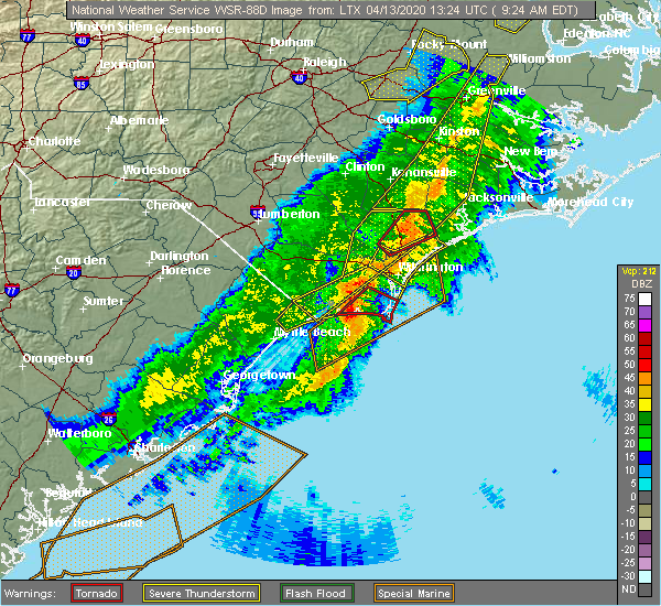 At 925 am edt, a confirmed tornado was located near white stocking, or near burgaw, moving northeast at 60 mph (public confirmed tornado). Hazards include damaging tornado. Flying debris will be dangerous to those caught without shelter. mobile homes will be damaged or destroyed. damage to roofs, windows, and vehicles will occur. tree damage is likely. this tornado will be near, maple hill around 935 am edt. other locations impacted by this tornadic thunderstorm include st. Helena and pender memorial hospital. At 925 am edt, a confirmed tornado was located near white stocking, or near burgaw, moving northeast at 60 mph (public confirmed tornado). Hazards include damaging tornado. Flying debris will be dangerous to those caught without shelter. mobile homes will be damaged or destroyed. damage to roofs, windows, and vehicles will occur. tree damage is likely. this tornado will be near, maple hill around 935 am edt. other locations impacted by this tornadic thunderstorm include st. Helena and pender memorial hospital.
|
| 4/13/2020 9:24 AM EDT |
 The severe thunderstorm warning for northwestern new hanover, pender, southeastern bladen, central brunswick and southeastern columbus counties will expire at 930 am edt, the storm which prompted the warning has moved out of the area. therefore, the warning will be allowed to expire. a tornado watch remains in effect until noon edt for southeastern north carolina, and northeastern south carolina. remember, a tornado warning still remains in effect for portions of pender county until 9:45 am edt. remember, a severe thunderstorm warning still remains in effect for portions of pender, new hanover, and brunswick county until 9:45 am edt. The severe thunderstorm warning for northwestern new hanover, pender, southeastern bladen, central brunswick and southeastern columbus counties will expire at 930 am edt, the storm which prompted the warning has moved out of the area. therefore, the warning will be allowed to expire. a tornado watch remains in effect until noon edt for southeastern north carolina, and northeastern south carolina. remember, a tornado warning still remains in effect for portions of pender county until 9:45 am edt. remember, a severe thunderstorm warning still remains in effect for portions of pender, new hanover, and brunswick county until 9:45 am edt.
|
| 4/13/2020 9:15 AM EDT |
 At 915 am edt, a severe thunderstorm capable of producing a tornado was located over long creek, or 7 miles south of burgaw, moving northeast at 60 mph (radar indicated rotation). Hazards include tornado. Flying debris will be dangerous to those caught without shelter. mobile homes will be damaged or destroyed. damage to roofs, windows, and vehicles will occur. tree damage is likely. this dangerous storm will be near, burgaw and ashton around 920 am edt. white stocking and murray town around 925 am edt. maple hill around 935 am edt. other locations impacted by this tornadic thunderstorm include st. helena and pender memorial hospital. This includes interstate 40 between mile markers 395 and 410. At 915 am edt, a severe thunderstorm capable of producing a tornado was located over long creek, or 7 miles south of burgaw, moving northeast at 60 mph (radar indicated rotation). Hazards include tornado. Flying debris will be dangerous to those caught without shelter. mobile homes will be damaged or destroyed. damage to roofs, windows, and vehicles will occur. tree damage is likely. this dangerous storm will be near, burgaw and ashton around 920 am edt. white stocking and murray town around 925 am edt. maple hill around 935 am edt. other locations impacted by this tornadic thunderstorm include st. helena and pender memorial hospital. This includes interstate 40 between mile markers 395 and 410.
|
| 4/13/2020 9:06 AM EDT |
 At 906 am edt, a severe thunderstorm was located over point caswell, or 16 miles southwest of burgaw, moving northeast at 65 mph (radar indicated). Hazards include 60 mph wind gusts. Expect wind damage to trees and power lines. Locations impacted include, leland, burgaw, shallotte, sunset beach, iredell, carolina shores, calabash, northwest, sandyfield, penderlea, makatoka, point caswell, freeland, maple hill, long creek, exum, longwood, ashton, rocky point and currie. At 906 am edt, a severe thunderstorm was located over point caswell, or 16 miles southwest of burgaw, moving northeast at 65 mph (radar indicated). Hazards include 60 mph wind gusts. Expect wind damage to trees and power lines. Locations impacted include, leland, burgaw, shallotte, sunset beach, iredell, carolina shores, calabash, northwest, sandyfield, penderlea, makatoka, point caswell, freeland, maple hill, long creek, exum, longwood, ashton, rocky point and currie.
|
| 4/13/2020 9:02 AM EDT |
 At 901 am edt, a severe thunderstorm capable of producing a tornado was located near the borough, or 14 miles northwest of leland, moving northeast at 70 mph (radar indicated rotation). Hazards include tornado. Flying debris will be dangerous to those caught without shelter. mobile homes will be damaged or destroyed. damage to roofs, windows, and vehicles will occur. tree damage is likely. this dangerous storm will be near, the borough, currie, montague and rooks around 905 am edt. malpass corner, long creek and wards corner around 910 am edt. ashton and rocky point around 915 am edt. other locations impacted by this tornadic thunderstorm include st. Helena and atkinson. At 901 am edt, a severe thunderstorm capable of producing a tornado was located near the borough, or 14 miles northwest of leland, moving northeast at 70 mph (radar indicated rotation). Hazards include tornado. Flying debris will be dangerous to those caught without shelter. mobile homes will be damaged or destroyed. damage to roofs, windows, and vehicles will occur. tree damage is likely. this dangerous storm will be near, the borough, currie, montague and rooks around 905 am edt. malpass corner, long creek and wards corner around 910 am edt. ashton and rocky point around 915 am edt. other locations impacted by this tornadic thunderstorm include st. Helena and atkinson.
|
| 4/13/2020 8:50 AM EDT |
 At 850 am edt, a severe thunderstorm capable of producing a tornado was located near freeman, or 19 miles east of whiteville, moving northeast at 70 mph (radar indicated rotation). Hazards include tornado. Flying debris will be dangerous to those caught without shelter. mobile homes will be damaged or destroyed. damage to roofs, windows, and vehicles will occur. tree damage is likely. this dangerous storm will be near, sandyfield, riegelwood and delco around 855 am edt. northwest around 900 am edt. the borough, currie, montague, point caswell and rooks around 905 am edt. malpass corner, long creek and wards corner around 910 am edt. ashton around 915 am edt. other locations impacted by this tornadic thunderstorm include bolton, atkinson, east arcadia and st. helena. this includes the following highways, interstate 40 between mile markers 406 and 409. Us route 74 between mile markers 407 and 424. At 850 am edt, a severe thunderstorm capable of producing a tornado was located near freeman, or 19 miles east of whiteville, moving northeast at 70 mph (radar indicated rotation). Hazards include tornado. Flying debris will be dangerous to those caught without shelter. mobile homes will be damaged or destroyed. damage to roofs, windows, and vehicles will occur. tree damage is likely. this dangerous storm will be near, sandyfield, riegelwood and delco around 855 am edt. northwest around 900 am edt. the borough, currie, montague, point caswell and rooks around 905 am edt. malpass corner, long creek and wards corner around 910 am edt. ashton around 915 am edt. other locations impacted by this tornadic thunderstorm include bolton, atkinson, east arcadia and st. helena. this includes the following highways, interstate 40 between mile markers 406 and 409. Us route 74 between mile markers 407 and 424.
|
| 4/13/2020 8:42 AM EDT |
 At 842 am edt, a severe thunderstorm was located over crusoe island, or 12 miles southeast of whiteville, moving northeast at 65 mph (radar indicated). Hazards include 60 mph wind gusts. expect wind damage to trees and power lines At 842 am edt, a severe thunderstorm was located over crusoe island, or 12 miles southeast of whiteville, moving northeast at 65 mph (radar indicated). Hazards include 60 mph wind gusts. expect wind damage to trees and power lines
|
| 9/9/2019 5:34 PM EDT |
 At 533 pm edt, a severe thunderstorm was located over rocky point, or 9 miles south of burgaw, moving southeast at 20 mph (radar indicated). Hazards include 60 mph wind gusts and penny size hail. expect wind damage to trees and power lines At 533 pm edt, a severe thunderstorm was located over rocky point, or 9 miles south of burgaw, moving southeast at 20 mph (radar indicated). Hazards include 60 mph wind gusts and penny size hail. expect wind damage to trees and power lines
|
| 9/5/2019 12:00 PM EDT |
 At 1200 pm edt, a severe thunderstorm capable of producing a tornado was located near the cape fear community college north campus, or 8 miles northwest of figure eight island, moving northwest at 45 mph (radar indicated rotation). Hazards include tornado. Flying debris will be dangerous to those caught without shelter. mobile homes will be damaged or destroyed. damage to roofs, windows, and vehicles will occur. tree damage is likely. this dangerous storm will be near, rocky point around 1205 pm edt. ashton around 1210 pm edt. long creek around 1215 pm edt. montague and the borough around 1220 pm edt. other locations impacted by this tornadic thunderstorm include st. Helena and pender memorial hospital. At 1200 pm edt, a severe thunderstorm capable of producing a tornado was located near the cape fear community college north campus, or 8 miles northwest of figure eight island, moving northwest at 45 mph (radar indicated rotation). Hazards include tornado. Flying debris will be dangerous to those caught without shelter. mobile homes will be damaged or destroyed. damage to roofs, windows, and vehicles will occur. tree damage is likely. this dangerous storm will be near, rocky point around 1205 pm edt. ashton around 1210 pm edt. long creek around 1215 pm edt. montague and the borough around 1220 pm edt. other locations impacted by this tornadic thunderstorm include st. Helena and pender memorial hospital.
|
| 9/5/2019 11:54 AM EDT |
 At 1154 am edt, a severe thunderstorm capable of producing a tornado was located over porters neck, or just inland from figure eight island, moving northwest at 45 mph (radar indicated rotation). Hazards include tornado. Flying debris will be dangerous to those caught without shelter. mobile homes will be damaged or destroyed. damage to roofs, windows, and vehicles will occur. tree damage is likely. this dangerous storm will be near, cape fear community college north campus around 1200 pm edt. castle hayne, rocky point and wrightsboro around 1205 pm edt. ashton around 1210 pm edt. long creek around 1215 pm edt. montague and the borough around 1220 pm edt. other locations impacted by this tornadic thunderstorm include st. Helena and pender memorial hospital. At 1154 am edt, a severe thunderstorm capable of producing a tornado was located over porters neck, or just inland from figure eight island, moving northwest at 45 mph (radar indicated rotation). Hazards include tornado. Flying debris will be dangerous to those caught without shelter. mobile homes will be damaged or destroyed. damage to roofs, windows, and vehicles will occur. tree damage is likely. this dangerous storm will be near, cape fear community college north campus around 1200 pm edt. castle hayne, rocky point and wrightsboro around 1205 pm edt. ashton around 1210 pm edt. long creek around 1215 pm edt. montague and the borough around 1220 pm edt. other locations impacted by this tornadic thunderstorm include st. Helena and pender memorial hospital.
|
| 9/5/2019 11:44 AM EDT |
 The national weather service in wilmington has issued a * tornado warning for. northern new hanover county in southeastern north carolina. southwestern pender county in southeastern north carolina. until 1230 pm edt. At 1144 am edt, a severe thunderstorm capable of producing a. The national weather service in wilmington has issued a * tornado warning for. northern new hanover county in southeastern north carolina. southwestern pender county in southeastern north carolina. until 1230 pm edt. At 1144 am edt, a severe thunderstorm capable of producing a.
|
| 9/5/2019 7:54 AM EDT |
 The tornado warning for central pender county will expire at 800 am edt, the storm which prompted the warning has moved out of the area. therefore, the warning will be allowed to expire. a tornado watch remains in effect until 400 pm edt for southeastern north carolina. remember, a different tornado warning still remains in effect for northwestern pender county including the city of burgaw. The tornado warning for central pender county will expire at 800 am edt, the storm which prompted the warning has moved out of the area. therefore, the warning will be allowed to expire. a tornado watch remains in effect until 400 pm edt for southeastern north carolina. remember, a different tornado warning still remains in effect for northwestern pender county including the city of burgaw.
|
| 9/5/2019 7:47 AM EDT |
 At 747 am edt, a severe thunderstorm capable of producing a tornado was located near burgaw, moving northwest at 30 mph (radar indicated rotation). Hazards include tornado. Expect damage to mobile homes, roofs, and vehicles. this dangerous storm will be near, wards corner around 805 am edt. penderlea around 815 am edt. other locations impacted by this tornadic thunderstorm include st. helena, pender memorial hospital, watha and atkinson. This includes interstate 40 between mile markers 398 and 405. At 747 am edt, a severe thunderstorm capable of producing a tornado was located near burgaw, moving northwest at 30 mph (radar indicated rotation). Hazards include tornado. Expect damage to mobile homes, roofs, and vehicles. this dangerous storm will be near, wards corner around 805 am edt. penderlea around 815 am edt. other locations impacted by this tornadic thunderstorm include st. helena, pender memorial hospital, watha and atkinson. This includes interstate 40 between mile markers 398 and 405.
|
| 9/5/2019 7:34 AM EDT |
 At 734 am edt, a severe thunderstorm capable of producing a tornado was located near ashton, or 9 miles southeast of burgaw, moving northwest at 25 mph (radar indicated rotation). Hazards include tornado. Flying debris will be dangerous to those caught without shelter. mobile homes will be damaged or destroyed. damage to roofs, windows, and vehicles will occur. tree damage is likely. this dangerous storm will be near, rocky point around 740 am edt. ashton around 745 am edt. white stocking around 755 am edt. burgaw around 800 am edt. other locations impacted by this tornadic thunderstorm include st. Helena and pender memorial hospital. At 734 am edt, a severe thunderstorm capable of producing a tornado was located near ashton, or 9 miles southeast of burgaw, moving northwest at 25 mph (radar indicated rotation). Hazards include tornado. Flying debris will be dangerous to those caught without shelter. mobile homes will be damaged or destroyed. damage to roofs, windows, and vehicles will occur. tree damage is likely. this dangerous storm will be near, rocky point around 740 am edt. ashton around 745 am edt. white stocking around 755 am edt. burgaw around 800 am edt. other locations impacted by this tornadic thunderstorm include st. Helena and pender memorial hospital.
|
| 9/5/2019 7:13 AM EDT |
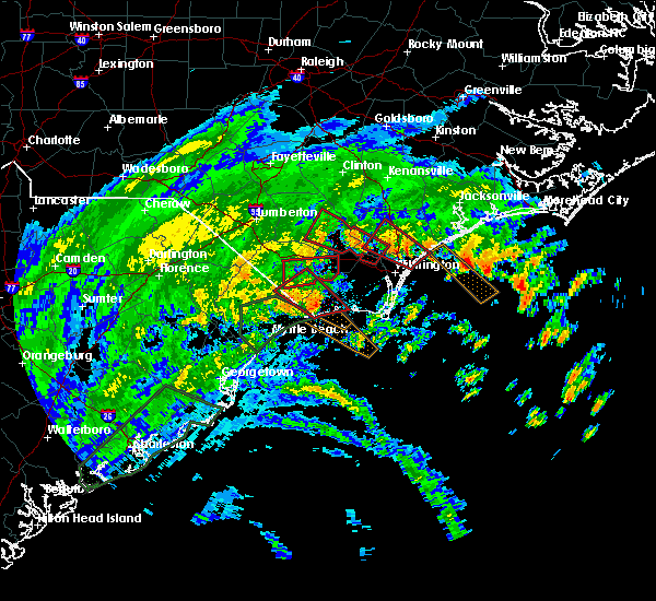 At 713 am edt, a severe thunderstorm capable of producing a tornado was located over topsail, or near rich inlet, moving northwest at 25 mph (radar indicated rotation). Hazards include tornado. Flying debris will be dangerous to those caught without shelter. mobile homes will be damaged or destroyed. damage to roofs, windows, and vehicles will occur. tree damage is likely. this dangerous storm will be near, rocky point around 740 am edt. ashton around 745 am edt. white stocking around 755 am edt. burgaw around 800 am edt. other locations impacted by this tornadic thunderstorm include st. helena and pender memorial hospital. This includes interstate 40 between mile markers 399 and 412. At 713 am edt, a severe thunderstorm capable of producing a tornado was located over topsail, or near rich inlet, moving northwest at 25 mph (radar indicated rotation). Hazards include tornado. Flying debris will be dangerous to those caught without shelter. mobile homes will be damaged or destroyed. damage to roofs, windows, and vehicles will occur. tree damage is likely. this dangerous storm will be near, rocky point around 740 am edt. ashton around 745 am edt. white stocking around 755 am edt. burgaw around 800 am edt. other locations impacted by this tornadic thunderstorm include st. helena and pender memorial hospital. This includes interstate 40 between mile markers 399 and 412.
|
| 9/5/2019 6:47 AM EDT |
 At 647 am edt, a severe thunderstorm capable of producing a tornado was located near rich inlet, moving northwest at 40 mph (radar indicated rotation). Hazards include tornado. Flying debris will be dangerous to those caught without shelter. mobile homes will be damaged or destroyed. damage to roofs, windows, and vehicles will occur. tree damage is likely. this dangerous storm will be near, rich inlet around 650 am edt. figure eight island, hampstead, bayshore and topsail around 655 am edt. scotts hill, porters neck, murrayville and ogden around 700 am edt. cape fear community college north campus around 705 am edt. castle hayne around 710 am edt. rocky point and ashton around 715 am edt. burgaw around 720 am edt. long creek and montague around 725 am edt. other locations impacted by this tornadic thunderstorm include st. helena and pender memorial hospital. this includes the following highways, interstate 40 between mile markers 398 and 416. Interstate 140. At 647 am edt, a severe thunderstorm capable of producing a tornado was located near rich inlet, moving northwest at 40 mph (radar indicated rotation). Hazards include tornado. Flying debris will be dangerous to those caught without shelter. mobile homes will be damaged or destroyed. damage to roofs, windows, and vehicles will occur. tree damage is likely. this dangerous storm will be near, rich inlet around 650 am edt. figure eight island, hampstead, bayshore and topsail around 655 am edt. scotts hill, porters neck, murrayville and ogden around 700 am edt. cape fear community college north campus around 705 am edt. castle hayne around 710 am edt. rocky point and ashton around 715 am edt. burgaw around 720 am edt. long creek and montague around 725 am edt. other locations impacted by this tornadic thunderstorm include st. helena and pender memorial hospital. this includes the following highways, interstate 40 between mile markers 398 and 416. Interstate 140.
|
| 8/10/2019 3:35 PM EDT |
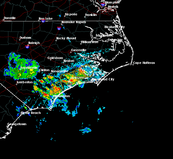 At 335 pm edt, a severe thunderstorm was located near white stocking, or 9 miles east of burgaw, moving northeast at 20 mph (radar indicated). Hazards include 60 mph wind gusts and quarter size hail. Minor hail damage to vehicles is possible. expect wind damage to trees and power lines. Locations impacted include, maple hill and white stocking. At 335 pm edt, a severe thunderstorm was located near white stocking, or 9 miles east of burgaw, moving northeast at 20 mph (radar indicated). Hazards include 60 mph wind gusts and quarter size hail. Minor hail damage to vehicles is possible. expect wind damage to trees and power lines. Locations impacted include, maple hill and white stocking.
|
| 8/10/2019 3:21 PM EDT | Trees down across roadway at newroad ave in rocky point in pender county NC, 3.2 miles N of Burgaw, NC |
| 8/10/2019 3:19 PM EDT | Power lines down on stag park rd in pender county NC, 2.5 miles W of Burgaw, NC |
| 8/10/2019 3:13 PM EDT |
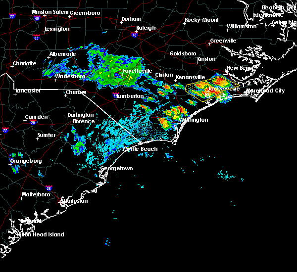 At 313 pm edt, a severe thunderstorm was located over ashton, or near burgaw, moving northeast at 20 mph (radar indicated). Hazards include 60 mph wind gusts and quarter size hail. Minor hail damage to vehicles is possible. Expect wind damage to trees and power lines. At 313 pm edt, a severe thunderstorm was located over ashton, or near burgaw, moving northeast at 20 mph (radar indicated). Hazards include 60 mph wind gusts and quarter size hail. Minor hail damage to vehicles is possible. Expect wind damage to trees and power lines.
|
| 5/31/2019 5:02 PM EDT |
 At 501 pm edt, severe thunderstorms were located along a line extending from 11 miles east of burgaw to 10 miles north of leland, moving east at 20 mph (radar indicated). Hazards include 60 mph wind gusts and half dollar size hail. Minor hail damage to vehicles is possible. Expect wind damage to trees and powerlines. At 501 pm edt, severe thunderstorms were located along a line extending from 11 miles east of burgaw to 10 miles north of leland, moving east at 20 mph (radar indicated). Hazards include 60 mph wind gusts and half dollar size hail. Minor hail damage to vehicles is possible. Expect wind damage to trees and powerlines.
|
| 5/12/2019 3:30 PM EDT |
 At 330 pm edt, a severe thunderstorm was located over white stocking, or 7 miles northeast of burgaw, moving northeast at 30 mph (radar indicated). Hazards include 60 mph wind gusts and quarter size hail. Minor hail damage to vehicles is possible. expect wind damage to trees and power lines. Locations impacted include, burgaw, surf city, hampstead, topsail beach, white stocking, topsail, maple hill, murray town, woodside, edgecomb and scotts hill. At 330 pm edt, a severe thunderstorm was located over white stocking, or 7 miles northeast of burgaw, moving northeast at 30 mph (radar indicated). Hazards include 60 mph wind gusts and quarter size hail. Minor hail damage to vehicles is possible. expect wind damage to trees and power lines. Locations impacted include, burgaw, surf city, hampstead, topsail beach, white stocking, topsail, maple hill, murray town, woodside, edgecomb and scotts hill.
|
| 5/12/2019 3:25 PM EDT | At 325 pm... the public reported trees down with damage to power lines in burga in pender county NC, 2.1 miles E of Burgaw, NC |
| 5/12/2019 3:22 PM EDT | Public reported damage to muliple metal roofs which led to power line damage in burgaw. large... industrial-sized... drain pipes were also blown across wallace street i in pender county NC, 1 miles ENE of Burgaw, NC |
| 5/12/2019 3:18 PM EDT |
 At 317 pm edt, a severe thunderstorm was located over burgaw, moving northeast at 30 mph (radar indicated). Hazards include 60 mph wind gusts and quarter size hail. Minor hail damage to vehicles is possible. Expect wind damage to trees and power lines. At 317 pm edt, a severe thunderstorm was located over burgaw, moving northeast at 30 mph (radar indicated). Hazards include 60 mph wind gusts and quarter size hail. Minor hail damage to vehicles is possible. Expect wind damage to trees and power lines.
|
| 4/19/2019 6:08 PM EDT |
 At 608 pm edt, severe thunderstorms were located along a line extending from near kenansville to 16 miles southeast of topsail beach, moving northeast at 55 mph (radar indicated). Hazards include 60 mph wind gusts. Expect wind damage to trees and power lines. Locations impacted include, wilmington, leland, oak island, carolina beach, burgaw, wrightsville beach, kure beach, surf city, caswell beach, bald head island, snows cut, rich inlet, south masonboro island, figure eight island, yaupon beach, north masonboro island, hampstead, boiling spring lakes, southport and topsail beach. At 608 pm edt, severe thunderstorms were located along a line extending from near kenansville to 16 miles southeast of topsail beach, moving northeast at 55 mph (radar indicated). Hazards include 60 mph wind gusts. Expect wind damage to trees and power lines. Locations impacted include, wilmington, leland, oak island, carolina beach, burgaw, wrightsville beach, kure beach, surf city, caswell beach, bald head island, snows cut, rich inlet, south masonboro island, figure eight island, yaupon beach, north masonboro island, hampstead, boiling spring lakes, southport and topsail beach.
|
| 4/19/2019 5:49 PM EDT |
 At 549 pm edt, severe thunderstorms were located along a line extending from near rose hill to 10 miles southeast of north masonboro island, moving northeast at 55 mph (radar indicated). Hazards include 60 mph wind gusts. Expect wind damage to trees and power lines. Locations impacted include, wilmington, leland, oak island, carolina beach, burgaw, wrightsville beach, kure beach, surf city, caswell beach, bald head island, snows cut, rich inlet, south masonboro island, figure eight island, yaupon beach, north masonboro island, hampstead, boiling spring lakes, southport and topsail beach. At 549 pm edt, severe thunderstorms were located along a line extending from near rose hill to 10 miles southeast of north masonboro island, moving northeast at 55 mph (radar indicated). Hazards include 60 mph wind gusts. Expect wind damage to trees and power lines. Locations impacted include, wilmington, leland, oak island, carolina beach, burgaw, wrightsville beach, kure beach, surf city, caswell beach, bald head island, snows cut, rich inlet, south masonboro island, figure eight island, yaupon beach, north masonboro island, hampstead, boiling spring lakes, southport and topsail beach.
|
| 4/19/2019 5:25 PM EDT |
 At 524 pm edt, severe thunderstorms were located along a line extending from 9 miles north of lagoon to southport, moving northeast at 55 mph (radar indicated). Hazards include 60 mph wind gusts. expect wind damage to trees and power lines At 524 pm edt, severe thunderstorms were located along a line extending from 9 miles north of lagoon to southport, moving northeast at 55 mph (radar indicated). Hazards include 60 mph wind gusts. expect wind damage to trees and power lines
|
| 10/11/2018 8:37 AM EDT |
 At 837 am edt, a severe thunderstorm capable of producing a tornado was located over burgaw, moving north at 35 mph (radar indicated rotation). Hazards include tornado. Expect damage to mobile homes, roofs, and vehicles. locations impacted include, burgaw, murray town, willard, watha and pender memorial hospital. This includes interstate 40 between mile markers 388 and 400. At 837 am edt, a severe thunderstorm capable of producing a tornado was located over burgaw, moving north at 35 mph (radar indicated rotation). Hazards include tornado. Expect damage to mobile homes, roofs, and vehicles. locations impacted include, burgaw, murray town, willard, watha and pender memorial hospital. This includes interstate 40 between mile markers 388 and 400.
|
| 10/11/2018 8:26 AM EDT |
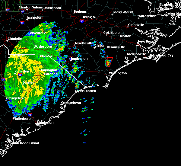 At 827 am edt, a severe thunderstorm capable of producing a tornado was located near ashton, or near burgaw, moving north at 45 mph (radar indicated rotation). Hazards include tornado. Expect damage to mobile homes, roofs, and vehicles. locations impacted include, burgaw, murray town, ashton, willard, st. helena, watha and pender memorial hospital. This includes interstate 40 between mile markers 388 and 404. At 827 am edt, a severe thunderstorm capable of producing a tornado was located near ashton, or near burgaw, moving north at 45 mph (radar indicated rotation). Hazards include tornado. Expect damage to mobile homes, roofs, and vehicles. locations impacted include, burgaw, murray town, ashton, willard, st. helena, watha and pender memorial hospital. This includes interstate 40 between mile markers 388 and 404.
|
| 10/11/2018 8:19 AM EDT |
 At 819 am edt, a severe thunderstorm capable of producing a tornado was located near long creek, or 9 miles south of burgaw, moving north at 45 mph (radar indicated rotation). Hazards include tornado. expect damage to mobile homes, roofs, and vehicles At 819 am edt, a severe thunderstorm capable of producing a tornado was located near long creek, or 9 miles south of burgaw, moving north at 45 mph (radar indicated rotation). Hazards include tornado. expect damage to mobile homes, roofs, and vehicles
|
| 9/15/2018 10:31 PM EDT |
 At 1031 pm edt, a severe thunderstorm capable of producing a tornado was located over ashton, or near burgaw, moving northwest at 45 mph (radar indicated rotation). Hazards include tornado. expect damage to mobile homes, roofs, and vehicles At 1031 pm edt, a severe thunderstorm capable of producing a tornado was located over ashton, or near burgaw, moving northwest at 45 mph (radar indicated rotation). Hazards include tornado. expect damage to mobile homes, roofs, and vehicles
|
| 9/15/2018 11:12 AM EDT |
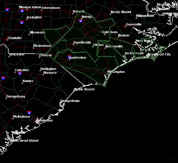 At 1112 am edt, a severe thunderstorm capable of producing a tornado was located over burgaw, moving northwest at 45 mph (radar indicated rotation). Hazards include tornado. expect damage to mobile homes, roofs, and vehicles At 1112 am edt, a severe thunderstorm capable of producing a tornado was located over burgaw, moving northwest at 45 mph (radar indicated rotation). Hazards include tornado. expect damage to mobile homes, roofs, and vehicles
|
| 7/23/2018 1:16 AM EDT |
 At 115 am edt, a severe thunderstorm was located near burgaw, moving north at 45 mph (radar indicated). Hazards include 60 mph wind gusts. Expect wind damage to trees and power lines. locations impacted include, burgaw, white stocking, rocky point, maple hill, murray town, ashton, willard, st. helena, watha and pender memorial hospital. This includes interstate 40 between mile markers 388 and 408. At 115 am edt, a severe thunderstorm was located near burgaw, moving north at 45 mph (radar indicated). Hazards include 60 mph wind gusts. Expect wind damage to trees and power lines. locations impacted include, burgaw, white stocking, rocky point, maple hill, murray town, ashton, willard, st. helena, watha and pender memorial hospital. This includes interstate 40 between mile markers 388 and 408.
|
| 7/23/2018 12:57 AM EDT |
 The national weather service in wilmington has issued a * severe thunderstorm warning for. new hanover county in southeastern north carolina. pender county in southeastern north carolina. until 200 am edt. At 1257 am edt, a severe thunderstorm was located over wilmington,. The national weather service in wilmington has issued a * severe thunderstorm warning for. new hanover county in southeastern north carolina. pender county in southeastern north carolina. until 200 am edt. At 1257 am edt, a severe thunderstorm was located over wilmington,.
|
| 6/24/2018 11:03 PM EDT |
 At 1103 pm edt, a severe thunderstorm was located over white stocking, or near burgaw, moving southeast at 25 mph (radar indicated). Hazards include 60 mph wind gusts and penny size hail. Expect damage trees and power lines. locations impacted include, burgaw, surf city, hampstead, topsail beach, white stocking, maple hill, murray town, ashton, topsail, woodside, edgecomb, rocky point, st. helena and pender memorial hospital. This includes interstate 40 between mile markers 392 and 408. At 1103 pm edt, a severe thunderstorm was located over white stocking, or near burgaw, moving southeast at 25 mph (radar indicated). Hazards include 60 mph wind gusts and penny size hail. Expect damage trees and power lines. locations impacted include, burgaw, surf city, hampstead, topsail beach, white stocking, maple hill, murray town, ashton, topsail, woodside, edgecomb, rocky point, st. helena and pender memorial hospital. This includes interstate 40 between mile markers 392 and 408.
|
| 6/24/2018 10:50 PM EDT |
 At 1050 pm edt, a severe thunderstorm was located over murray town, or near burgaw, moving southeast at 30 mph (radar indicated). Hazards include 60 mph wind gusts. expect damage to trees and power lines At 1050 pm edt, a severe thunderstorm was located over murray town, or near burgaw, moving southeast at 30 mph (radar indicated). Hazards include 60 mph wind gusts. expect damage to trees and power lines
|
| 6/24/2018 7:02 PM EDT |
 At 701 pm edt, a severe thunderstorm was located near maple hill, or 10 miles northeast of burgaw, moving southeast at 20 mph (radar indicated). Hazards include 60 mph wind gusts and quarter size hail. Minor hail damage to vehicles is possible. Expect wind damage to trees and power lines. At 701 pm edt, a severe thunderstorm was located near maple hill, or 10 miles northeast of burgaw, moving southeast at 20 mph (radar indicated). Hazards include 60 mph wind gusts and quarter size hail. Minor hail damage to vehicles is possible. Expect wind damage to trees and power lines.
|
| 6/24/2018 6:33 PM EDT |
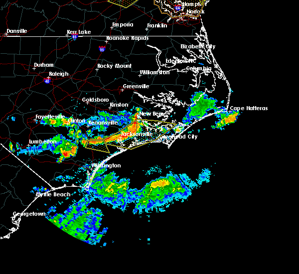 At 632 pm edt, a severe thunderstorm was located near murray town, or 7 miles southeast of wallace, moving east, southeast at 20 mph (radar indicated). Hazards include 60 mph wind gusts. expect damage trees and power lines At 632 pm edt, a severe thunderstorm was located near murray town, or 7 miles southeast of wallace, moving east, southeast at 20 mph (radar indicated). Hazards include 60 mph wind gusts. expect damage trees and power lines
|
| 3/1/2018 6:12 PM EST |
 At 612 pm est, strong to severe thunderstorms were located along a line extending from near atkinson, delco, and pireway, moving east at 50 55 mph. although this line has shown some weakening, a few locations in the warned area may still receive a wind gust to 60 mph (radar indicated). Hazards include 60 mph wind gusts. Some downed trees and power lines possible. Locations impacted include, burgaw, shallotte, lake waccamaw, penderlea, makatoka, long creek, exum, longwood, currie, winnabow, and rooks. At 612 pm est, strong to severe thunderstorms were located along a line extending from near atkinson, delco, and pireway, moving east at 50 55 mph. although this line has shown some weakening, a few locations in the warned area may still receive a wind gust to 60 mph (radar indicated). Hazards include 60 mph wind gusts. Some downed trees and power lines possible. Locations impacted include, burgaw, shallotte, lake waccamaw, penderlea, makatoka, long creek, exum, longwood, currie, winnabow, and rooks.
|
| 3/1/2018 5:44 PM EST |
 At 543 pm est, severe thunderstorms were located along a line extending from 7 miles east of ammon to near elizabethtown, clarkton, whiteville and green sea, moving east at 50 to 55 mph. this line of storms has a history of producing wind damage (radar indicated). Hazards include 60 mph wind gusts. expect downed trees and power lines in those areas that receive the highest winds At 543 pm est, severe thunderstorms were located along a line extending from 7 miles east of ammon to near elizabethtown, clarkton, whiteville and green sea, moving east at 50 to 55 mph. this line of storms has a history of producing wind damage (radar indicated). Hazards include 60 mph wind gusts. expect downed trees and power lines in those areas that receive the highest winds
|
| 5/5/2017 5:36 AM EDT |
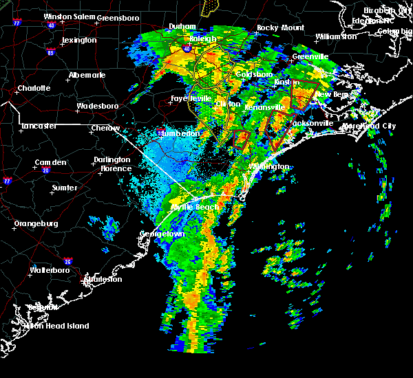 At 535 am edt, a severe thunderstorm capable of producing a tornado was located near wards corner, or near burgaw, moving north at 45 mph (radar indicated rotation). Hazards include tornado. Flying debris will be dangerous to those caught without shelter. mobile homes will be damaged or destroyed. damage to roofs, windows, and vehicles will occur. tree damage is likely. locations impacted include, burgaw, penderlea, wards corner, willard and watha. This includes interstate 40 between mile markers 388 and 396. At 535 am edt, a severe thunderstorm capable of producing a tornado was located near wards corner, or near burgaw, moving north at 45 mph (radar indicated rotation). Hazards include tornado. Flying debris will be dangerous to those caught without shelter. mobile homes will be damaged or destroyed. damage to roofs, windows, and vehicles will occur. tree damage is likely. locations impacted include, burgaw, penderlea, wards corner, willard and watha. This includes interstate 40 between mile markers 388 and 396.
|
| 5/5/2017 5:28 AM EDT |
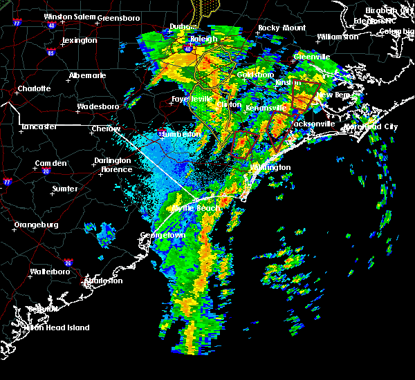 At 527 am edt, a severe thunderstorm capable of producing a tornado was located over montague, or 10 miles southwest of burgaw, moving north at 45 mph (radar indicated rotation). Hazards include tornado. Flying debris will be dangerous to those caught without shelter. mobile homes will be damaged or destroyed. damage to roofs, windows, and vehicles will occur. tree damage is likely. locations impacted include, burgaw, penderlea, long creek, murray town, malpass corner, montague, willard, currie, wards corner, the borough, white stocking, st. helena, watha and pender memorial hospital. This includes interstate 40 between mile markers 388 and 403. At 527 am edt, a severe thunderstorm capable of producing a tornado was located over montague, or 10 miles southwest of burgaw, moving north at 45 mph (radar indicated rotation). Hazards include tornado. Flying debris will be dangerous to those caught without shelter. mobile homes will be damaged or destroyed. damage to roofs, windows, and vehicles will occur. tree damage is likely. locations impacted include, burgaw, penderlea, long creek, murray town, malpass corner, montague, willard, currie, wards corner, the borough, white stocking, st. helena, watha and pender memorial hospital. This includes interstate 40 between mile markers 388 and 403.
|
| 5/5/2017 5:13 AM EDT |
 At 513 am edt, a severe thunderstorm capable of producing a tornado was located near the borough, or 11 miles north of leland, moving north at 45 mph (radar indicated rotation). Hazards include tornado. expect damage to mobile homes, roofs, and vehicles At 513 am edt, a severe thunderstorm capable of producing a tornado was located near the borough, or 11 miles north of leland, moving north at 45 mph (radar indicated rotation). Hazards include tornado. expect damage to mobile homes, roofs, and vehicles
|
| 3/18/2017 8:15 PM EDT |
 At 815 pm edt, a severe thunderstorm was located near malpass corner, or near burgaw, moving east at 40 mph (radar indicated). Hazards include 60 mph wind gusts and quarter size hail. Hail damage to vehicles is expected. expect wind damage to roofs, siding, and trees. locations impacted include, burgaw, hampstead, topsail beach, white stocking, penderlea, maple hill, long creek, murray town, malpass corner, ashton, willard, rocky point, topsail, wards corner, scotts hill, woodside, edgecomb, castle hayne, st. Helena and watha. At 815 pm edt, a severe thunderstorm was located near malpass corner, or near burgaw, moving east at 40 mph (radar indicated). Hazards include 60 mph wind gusts and quarter size hail. Hail damage to vehicles is expected. expect wind damage to roofs, siding, and trees. locations impacted include, burgaw, hampstead, topsail beach, white stocking, penderlea, maple hill, long creek, murray town, malpass corner, ashton, willard, rocky point, topsail, wards corner, scotts hill, woodside, edgecomb, castle hayne, st. Helena and watha.
|
| 3/18/2017 7:45 PM EDT |
 At 745 pm edt, a severe thunderstorm was located near lagoon, or 15 miles east of elizabethtown, moving east at 40 mph (law enforcement). Hazards include 60 mph wind gusts and quarter size hail. Hail damage to vehicles is expected. Expect wind damage to roofs, siding, and trees. At 745 pm edt, a severe thunderstorm was located near lagoon, or 15 miles east of elizabethtown, moving east at 40 mph (law enforcement). Hazards include 60 mph wind gusts and quarter size hail. Hail damage to vehicles is expected. Expect wind damage to roofs, siding, and trees.
|
| 10/8/2016 8:08 AM EDT |
 At 808 am edt, a severe thunderstorm capable of producing a tornado was located over malpass corner, or 7 miles southwest of burgaw, moving northwest at 45 mph (radar indicated rotation). Hazards include tornado...quarter size hail...and 60 mph wind gusts. Expect damage to mobile homes. roofs. and vehicles. this dangerous storm will be near, rooks and point caswell around 815 am edt. Other locations impacted by this tornadic thunderstorm include atkinson. At 808 am edt, a severe thunderstorm capable of producing a tornado was located over malpass corner, or 7 miles southwest of burgaw, moving northwest at 45 mph (radar indicated rotation). Hazards include tornado...quarter size hail...and 60 mph wind gusts. Expect damage to mobile homes. roofs. and vehicles. this dangerous storm will be near, rooks and point caswell around 815 am edt. Other locations impacted by this tornadic thunderstorm include atkinson.
|
| 7/9/2016 12:26 AM EDT | The severe thunderstorm warning for pender county will expire at 1230 am edt, the severe thunderstorm which prompted the warning has weakened, therefore the warning will be allowed to expire. a severe thunderstorm watch remains in effect until 200 am edt for southeastern north carolina. |
| 7/9/2016 12:11 AM EDT |
 At 1210 am edt, a severe thunderstorm was located near white stocking, or 10 miles east of burgaw, moving east at 35 mph (radar indicated). Hazards include 60 mph wind gusts and penny size hail. Expect damage to roofs. siding. and trees. locations impacted include, burgaw, surf city, hampstead, topsail beach, topsail, murray town, white stocking, rocky point, woodside, edgecomb, maple hill, ashton, st. Helena and pender memorial hospital. At 1210 am edt, a severe thunderstorm was located near white stocking, or 10 miles east of burgaw, moving east at 35 mph (radar indicated). Hazards include 60 mph wind gusts and penny size hail. Expect damage to roofs. siding. and trees. locations impacted include, burgaw, surf city, hampstead, topsail beach, topsail, murray town, white stocking, rocky point, woodside, edgecomb, maple hill, ashton, st. Helena and pender memorial hospital.
|
| 7/8/2016 11:30 PM EDT |
 At 1130 pm edt, a severe thunderstorm was located near penderlea, or 11 miles southwest of wallace, moving east at 35 mph (radar indicated). Hazards include 60 mph wind gusts and penny size hail. Expect damage to roofs. siding. And trees. At 1130 pm edt, a severe thunderstorm was located near penderlea, or 11 miles southwest of wallace, moving east at 35 mph (radar indicated). Hazards include 60 mph wind gusts and penny size hail. Expect damage to roofs. siding. And trees.
|
| 6/14/2016 6:25 PM EDT |
 At 625 pm edt, a severe thunderstorm was located over council, or 16 miles northeast of whiteville, moving east at 30 mph (radar indicated). Hazards include 60 mph wind gusts and quarter size hail. Hail damage to vehicles is expected. Expect wind damage to roofs, siding, and trees. At 625 pm edt, a severe thunderstorm was located over council, or 16 miles northeast of whiteville, moving east at 30 mph (radar indicated). Hazards include 60 mph wind gusts and quarter size hail. Hail damage to vehicles is expected. Expect wind damage to roofs, siding, and trees.
|
| 5/13/2016 4:39 PM EDT | Quarter sized hail reported 3 miles SW of Burgaw, NC, video of dime to quarter size hail just northeast of burgaw. time estimated by radar. report relayed by media. |
| 5/12/2016 4:54 PM EDT |
 At 454 pm edt, a severe thunderstorm was located over castle hayne, or 10 miles north of wilmington, moving southeast at 15 mph (radar indicated). Hazards include 60 mph wind gusts and quarter size hail. hail was reported between dime and quarter size with these storms. there was also a report of a funnel cloud and rotation in the storm near rocky point. Hail damage to vehicles is expected. expect wind damage to roofs, siding, and trees. Locations impacted include, wilmington, burgaw, wrightsville beach, north masonboro island, figure eight island, hampstead, topsail beach, topsail, wrightsboro, bayshore, montague, ogden, windemere, scotts hill, rocky point, cape fear community college north campus, wilmington international airport, ashton, porters neck and mayfaire. At 454 pm edt, a severe thunderstorm was located over castle hayne, or 10 miles north of wilmington, moving southeast at 15 mph (radar indicated). Hazards include 60 mph wind gusts and quarter size hail. hail was reported between dime and quarter size with these storms. there was also a report of a funnel cloud and rotation in the storm near rocky point. Hail damage to vehicles is expected. expect wind damage to roofs, siding, and trees. Locations impacted include, wilmington, burgaw, wrightsville beach, north masonboro island, figure eight island, hampstead, topsail beach, topsail, wrightsboro, bayshore, montague, ogden, windemere, scotts hill, rocky point, cape fear community college north campus, wilmington international airport, ashton, porters neck and mayfaire.
|
| 5/12/2016 4:29 PM EDT |
 At 429 pm edt, a severe thunderstorm was located over long creek, or 9 miles south of burgaw, moving southeast at 15 mph (radar indicated). Hazards include 60 mph wind gusts and quarter size hail. Hail damage to vehicles is expected. Expect wind damage to roofs, siding, and trees. At 429 pm edt, a severe thunderstorm was located over long creek, or 9 miles south of burgaw, moving southeast at 15 mph (radar indicated). Hazards include 60 mph wind gusts and quarter size hail. Hail damage to vehicles is expected. Expect wind damage to roofs, siding, and trees.
|
| 5/3/2016 9:56 PM EDT |
 The severe thunderstorm warning for northeastern pender county will expire at 1000 pm edt, the severe thunderstorm which prompted the warning has weakened and therefore the warning will be allowed to expire. a severe thunderstorm watch remains in effect until 1100 pm edt for southeastern north carolina. The severe thunderstorm warning for northeastern pender county will expire at 1000 pm edt, the severe thunderstorm which prompted the warning has weakened and therefore the warning will be allowed to expire. a severe thunderstorm watch remains in effect until 1100 pm edt for southeastern north carolina.
|
| 5/3/2016 9:37 PM EDT |
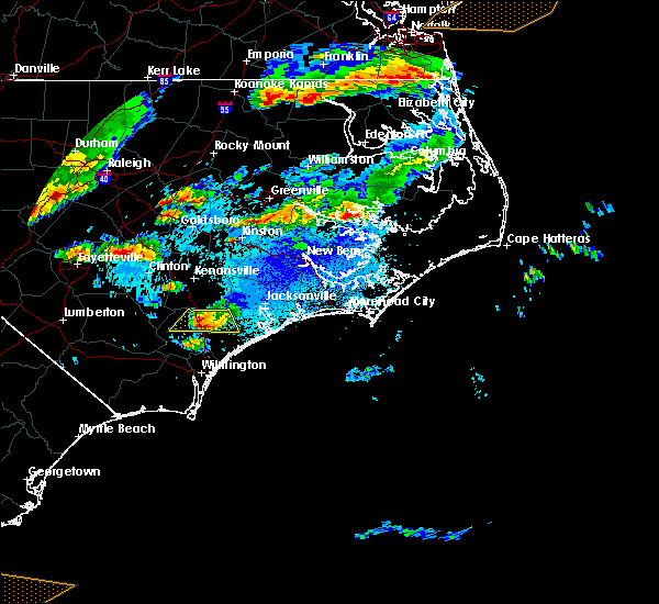 At 937 pm edt, a severe thunderstorm was located near maple hill, or 11 miles southwest of new river station, moving east at 40 mph (radar indicated). Hazards include 60 mph wind gusts and quarter size hail. Hail damage to vehicles is expected. expect wind damage to roofs, siding, and trees. Locations impacted include, burgaw, willard, murray town, maple hill, white stocking, watha and pender memorial hospital. At 937 pm edt, a severe thunderstorm was located near maple hill, or 11 miles southwest of new river station, moving east at 40 mph (radar indicated). Hazards include 60 mph wind gusts and quarter size hail. Hail damage to vehicles is expected. expect wind damage to roofs, siding, and trees. Locations impacted include, burgaw, willard, murray town, maple hill, white stocking, watha and pender memorial hospital.
|
| 5/3/2016 9:22 PM EDT |
 At 921 pm edt, a severe thunderstorm was located near white stocking, or 9 miles northeast of burgaw, moving east at 40 mph (radar indicated). Hazards include 60 mph wind gusts and quarter size hail. Hail damage to vehicles is expected. expect wind damage to roofs, siding, and trees. Locations impacted include, burgaw, willard, murray town, maple hill, white stocking, penderlea, watha and pender memorial hospital. At 921 pm edt, a severe thunderstorm was located near white stocking, or 9 miles northeast of burgaw, moving east at 40 mph (radar indicated). Hazards include 60 mph wind gusts and quarter size hail. Hail damage to vehicles is expected. expect wind damage to roofs, siding, and trees. Locations impacted include, burgaw, willard, murray town, maple hill, white stocking, penderlea, watha and pender memorial hospital.
|
| 5/3/2016 8:55 PM EDT |
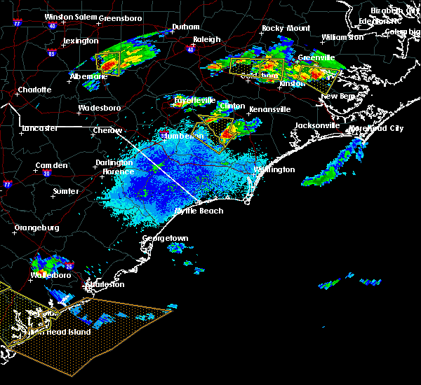 At 854 pm edt, a severe thunderstorm was located near penderlea, or 8 miles southwest of wallace, moving east at 40 mph (radar indicated). Hazards include 60 mph wind gusts and quarter size hail. Hail damage to vehicles is expected. Expect wind damage to roofs, siding, and trees. At 854 pm edt, a severe thunderstorm was located near penderlea, or 8 miles southwest of wallace, moving east at 40 mph (radar indicated). Hazards include 60 mph wind gusts and quarter size hail. Hail damage to vehicles is expected. Expect wind damage to roofs, siding, and trees.
|
| 9/4/2015 8:26 PM EDT |
 The severe thunderstorm warning for northwestern pender county will expire at 830 pm edt, the storm which prompted the warning has weakened below severe limits, and no longer poses an immediate threat to life or property. therefore the warning will be allowed to expire. however gusty winds and heavy rain are still expected with this thunderstorm. The severe thunderstorm warning for northwestern pender county will expire at 830 pm edt, the storm which prompted the warning has weakened below severe limits, and no longer poses an immediate threat to life or property. therefore the warning will be allowed to expire. however gusty winds and heavy rain are still expected with this thunderstorm.
|
| 9/4/2015 8:00 PM EDT |
 At 800 pm edt, doppler radar indicated a severe thunderstorm capable of producing quarter size hail and damaging winds in excess of 60 mph. this storm was located over burgaw, moving south at 5 mph. this storm was beginning to slow down and weaken and was producing very heavy rainfall. locations impacted include, burgaw, malpass corner, murray town, white stocking, wards corner, rocky point, rooks, willard, ashton, penderlea, currie, long creek, st. helena, atkinson, watha and pender memorial hospital. this includes interstate 40 between mile markers 388 and 410. At 800 pm edt, doppler radar indicated a severe thunderstorm capable of producing quarter size hail and damaging winds in excess of 60 mph. this storm was located over burgaw, moving south at 5 mph. this storm was beginning to slow down and weaken and was producing very heavy rainfall. locations impacted include, burgaw, malpass corner, murray town, white stocking, wards corner, rocky point, rooks, willard, ashton, penderlea, currie, long creek, st. helena, atkinson, watha and pender memorial hospital. this includes interstate 40 between mile markers 388 and 410.
|
| 9/4/2015 7:27 PM EDT |
 At 727 pm edt, doppler radar indicated a severe thunderstorm capable of producing quarter size hail and damaging winds in excess of 60 mph. this storm was located over murray town, or near burgaw, and moving south at 10 mph. At 727 pm edt, doppler radar indicated a severe thunderstorm capable of producing quarter size hail and damaging winds in excess of 60 mph. this storm was located over murray town, or near burgaw, and moving south at 10 mph.
|
| 8/6/2015 6:22 PM EDT |
 At 622 pm edt, doppler radar indicated a severe thunderstorm capable of producing quarter size hail and damaging winds in excess of 60 mph. this storm was located near rowan, or 16 miles southwest of wallace, and moving east at 15 mph. At 622 pm edt, doppler radar indicated a severe thunderstorm capable of producing quarter size hail and damaging winds in excess of 60 mph. this storm was located near rowan, or 16 miles southwest of wallace, and moving east at 15 mph.
|
| 7/23/2015 3:10 PM EDT |
 The severe thunderstorm warning for pender county will expire at 315 pm edt, the storm which prompted the warning has weakened below severe limits, and no longer poses an immediate threat to life or property. therefore the warning will be allowed to expire. however heavy rain is still possible with this thunderstorm. The severe thunderstorm warning for pender county will expire at 315 pm edt, the storm which prompted the warning has weakened below severe limits, and no longer poses an immediate threat to life or property. therefore the warning will be allowed to expire. however heavy rain is still possible with this thunderstorm.
|
| 7/23/2015 2:43 PM EDT |
 At 240 pm edt, doppler radar indicated a severe thunderstorm cluster capable of producing quarter size hail and damaging winds in excess of 60 mph. this storm covered much of pender county mainly south of a maple hill to watha line. the storm was moving to the east at 20 mph. locations impacted include, burgaw, surf city, rich inlet, hampstead, topsail beach, topsail, montague, currie, the borough, malpass corner, murray town, white stocking, scotts hill, rocky point, maple hill, ashton, point caswell, wards corner, woodside and rooks. this includes interstate 40 between mile markers 393 and 412. At 240 pm edt, doppler radar indicated a severe thunderstorm cluster capable of producing quarter size hail and damaging winds in excess of 60 mph. this storm covered much of pender county mainly south of a maple hill to watha line. the storm was moving to the east at 20 mph. locations impacted include, burgaw, surf city, rich inlet, hampstead, topsail beach, topsail, montague, currie, the borough, malpass corner, murray town, white stocking, scotts hill, rocky point, maple hill, ashton, point caswell, wards corner, woodside and rooks. this includes interstate 40 between mile markers 393 and 412.
|
| 7/23/2015 2:17 PM EDT |
 At 216 pm edt, doppler radar indicated a severe thunderstorm capable of producing quarter size hail and damaging winds in excess of 60 mph. this storm was located over rooks, or 12 miles west of burgaw, and moving east at 25 mph. At 216 pm edt, doppler radar indicated a severe thunderstorm capable of producing quarter size hail and damaging winds in excess of 60 mph. this storm was located over rooks, or 12 miles west of burgaw, and moving east at 25 mph.
|
| 7/23/2015 1:18 PM EDT |
 At 118 pm edt, doppler radar indicated a severe thunderstorm capable of producing quarter size hail and damaging winds in excess of 60 mph. this storm was located near penderlea, or 11 miles west of burgaw, and moving east at 25 mph. At 118 pm edt, doppler radar indicated a severe thunderstorm capable of producing quarter size hail and damaging winds in excess of 60 mph. this storm was located near penderlea, or 11 miles west of burgaw, and moving east at 25 mph.
|
| 7/13/2015 1:05 PM EDT |
 At 104 pm edt, doppler radar indicated a severe thunderstorm capable of producing quarter size hail and damaging winds in excess of 60 mph. this storm was located near ashton, or near burgaw, and moving east at 20 mph. At 104 pm edt, doppler radar indicated a severe thunderstorm capable of producing quarter size hail and damaging winds in excess of 60 mph. this storm was located near ashton, or near burgaw, and moving east at 20 mph.
|
| 7/13/2015 12:56 PM EDT |
 The severe thunderstorm warning for western pender county will expire at 100 pm edt, the storm which prompted the warning has weakened below severe limits, and no longer poses an immediate threat to life or property. therefore the warning will be allowed to expire. however gusty winds are still possible with this thunderstorm. The severe thunderstorm warning for western pender county will expire at 100 pm edt, the storm which prompted the warning has weakened below severe limits, and no longer poses an immediate threat to life or property. therefore the warning will be allowed to expire. however gusty winds are still possible with this thunderstorm.
|
| 7/13/2015 12:43 PM EDT |
 At 1242 pm edt, doppler radar indicated a severe thunderstorm capable of producing quarter size hail and damaging winds in excess of 60 mph. this storm was located over long creek, or 9 miles south of burgaw. this storm was moving southeast at 20 mph. locations impacted include, burgaw, montague, currie, the borough, malpass corner, wards corner, rooks, long creek, penderlea, point caswell, murray town, st. helena, atkinson, watha and pender memorial hospital. this includes interstate 40 between mile markers 394 and 403. At 1242 pm edt, doppler radar indicated a severe thunderstorm capable of producing quarter size hail and damaging winds in excess of 60 mph. this storm was located over long creek, or 9 miles south of burgaw. this storm was moving southeast at 20 mph. locations impacted include, burgaw, montague, currie, the borough, malpass corner, wards corner, rooks, long creek, penderlea, point caswell, murray town, st. helena, atkinson, watha and pender memorial hospital. this includes interstate 40 between mile markers 394 and 403.
|
| 7/13/2015 12:26 PM EDT |
 At 1225 pm edt, doppler radar indicated a severe thunderstorm capable of producing quarter size hail and damaging winds in excess of 60 mph. this storm was located over long creek, or 8 miles southwest of burgaw, moving southeast at 20 mph. locations impacted include, burgaw, montague, currie, the borough, malpass corner, wards corner, rooks, long creek, penderlea, point caswell, st. helena, atkinson, watha and pender memorial hospital. this includes interstate 40 between mile markers 395 and 403. At 1225 pm edt, doppler radar indicated a severe thunderstorm capable of producing quarter size hail and damaging winds in excess of 60 mph. this storm was located over long creek, or 8 miles southwest of burgaw, moving southeast at 20 mph. locations impacted include, burgaw, montague, currie, the borough, malpass corner, wards corner, rooks, long creek, penderlea, point caswell, st. helena, atkinson, watha and pender memorial hospital. this includes interstate 40 between mile markers 395 and 403.
|
| 7/13/2015 12:08 PM EDT |
 At 1208 pm edt, doppler radar indicated a severe thunderstorm capable of producing quarter size hail and damaging winds in excess of 60 mph. this storm was located near rowan, or 16 miles southwest of wallace, and moving southeast at 20 mph. At 1208 pm edt, doppler radar indicated a severe thunderstorm capable of producing quarter size hail and damaging winds in excess of 60 mph. this storm was located near rowan, or 16 miles southwest of wallace, and moving southeast at 20 mph.
|
| 6/18/2015 5:37 PM EDT | At 527 pm edt, doppler radar indicated a severe thunderstorm capable of producing quarter size hail and damaging winds in excess of 60 mph. this storm was located south of burgaw, moving southeast at 35 mph. locations impacted include, burgaw, montague, currie, the borough, malpass corner, white stocking, wards corner, rocky point, rooks, long creek, ashton, point caswell, st. helena, atkinson and pender memorial hospital. this includes interstate 40 between mile markers 397 and 408. |
| 6/18/2015 5:28 PM EDT | At 527 pm edt, doppler radar indicated a severe thunderstorm capable of producing quarter size hail and damaging winds in excess of 60 mph. this storm was located south of burgaw, moving southeast at 35 mph. locations impacted include, burgaw, montague, currie, the borough, malpass corner, white stocking, wards corner, rocky point, rooks, long creek, ashton, point caswell, st. helena, atkinson and pender memorial hospital. this includes interstate 40 between mile markers 397 and 408. |
| 6/18/2015 5:05 PM EDT | At 504 pm edt, doppler radar indicated a severe thunderstorm capable of producing quarter size hail and damaging winds in excess of 60 mph. this storm was located near atkinson, moving southeast at 35 mph. locations impacted include, burgaw, montague, currie, the borough, malpass corner, murray town, white stocking, wards corner, rocky point, rooks, long creek, ashton, point caswell, penderlea, st. helena, atkinson, watha and pender memorial hospital. this includes interstate 40 between mile markers 394 and 408. |
| 6/18/2015 4:47 PM EDT | At 447 pm edt, doppler radar indicated a severe thunderstorm capable of producing quarter size hail and damaging winds in excess of 60 mph. this storm was located near wards corner, or 13 miles southwest of wallace, and moving southeast at 35 mph. |
| 6/9/2015 9:33 PM EDT |
 At 933 pm edt, doppler radar indicated a severe thunderstorm capable of producing quarter size hail and damaging winds in excess of 60 mph. this storm was located near phoenix, or 8 miles northwest of leland, moving southeast at 30 mph. locations impacted include, burgaw, rowan, northwest, sandyfield, montague, currie, the borough, malpass corner, phoenix, batarora, kelly, riegelwood, point caswell, freeman, delco, wards corner, carvers, rooks, long creek and council. this includes the following highways, interstate 40 near mile marker 400. us route 74 between mile markers 404 and 429. At 933 pm edt, doppler radar indicated a severe thunderstorm capable of producing quarter size hail and damaging winds in excess of 60 mph. this storm was located near phoenix, or 8 miles northwest of leland, moving southeast at 30 mph. locations impacted include, burgaw, rowan, northwest, sandyfield, montague, currie, the borough, malpass corner, phoenix, batarora, kelly, riegelwood, point caswell, freeman, delco, wards corner, carvers, rooks, long creek and council. this includes the following highways, interstate 40 near mile marker 400. us route 74 between mile markers 404 and 429.
|
| 6/9/2015 9:14 PM EDT |
 At 914 pm edt, doppler radar indicated a severe thunderstorm capable of producing quarter size hail and damaging winds in excess of 60 mph. this storm was located over lagoon, or 13 miles southeast of elizabethtown, and moving southeast at 30 mph. At 914 pm edt, doppler radar indicated a severe thunderstorm capable of producing quarter size hail and damaging winds in excess of 60 mph. this storm was located over lagoon, or 13 miles southeast of elizabethtown, and moving southeast at 30 mph.
|
| 7/15/2014 2:06 PM EDT | Media relayed viewer report of a tree down on a house in burgaw. time estimated based on rada in pender county NC, 4.4 miles E of Burgaw, NC |
| 2/21/2014 2:00 PM EST | Four to five trees down near penderlea hwy and basden rd - time estimated based on radar in pender county NC, 2.1 miles E of Burgaw, NC |
| 11/27/2013 12:10 AM EST | Multiple reports of trees snapped along with some roof and other structural damage along stag park road in pender county NC, 1 miles SSW of Burgaw, NC |
| 3/25/2012 3:18 PM EDT | Quarter sized hail reported 1 miles ENE of Burgaw, NC, nickel to quarter size hail still falling...covering the ground. |
| 9/28/2011 4:30 PM EDT | Quarter sized hail reported 0.5 miles SE of Burgaw, NC, hail reported on hwy 53 and burgaw creek loop road. |
| 1/1/0001 12:00 AM | Trees and power lines down along stag park road between i-40 and highway 5 in pender county NC, 1 miles SSW of Burgaw, NC |
Hail Maps for Burgaw, NC
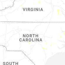

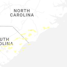
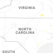
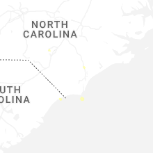


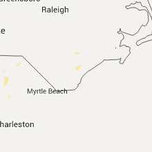


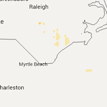


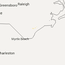


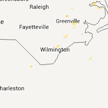


Connect with Interactive Hail Maps