

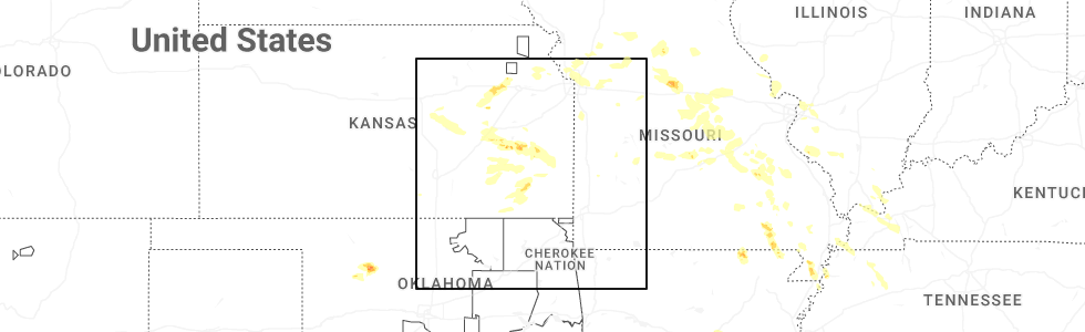
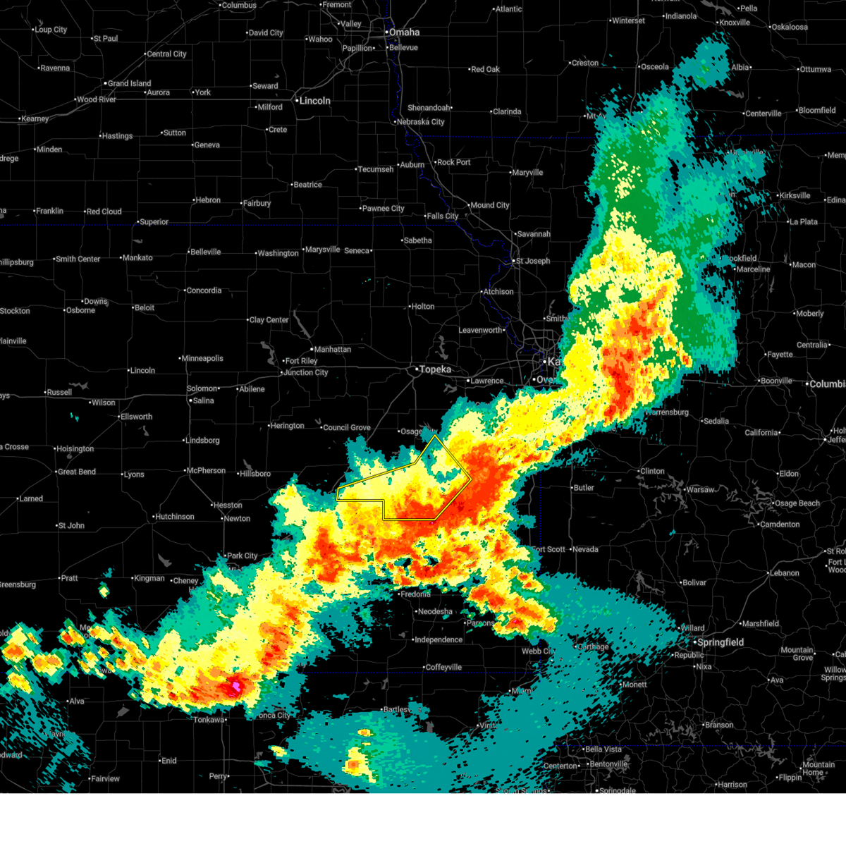
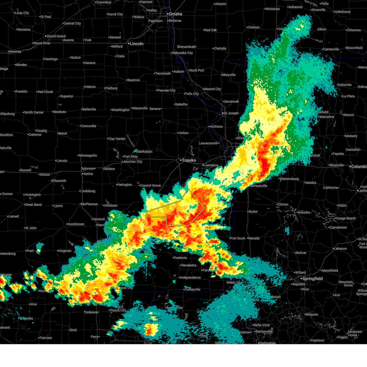
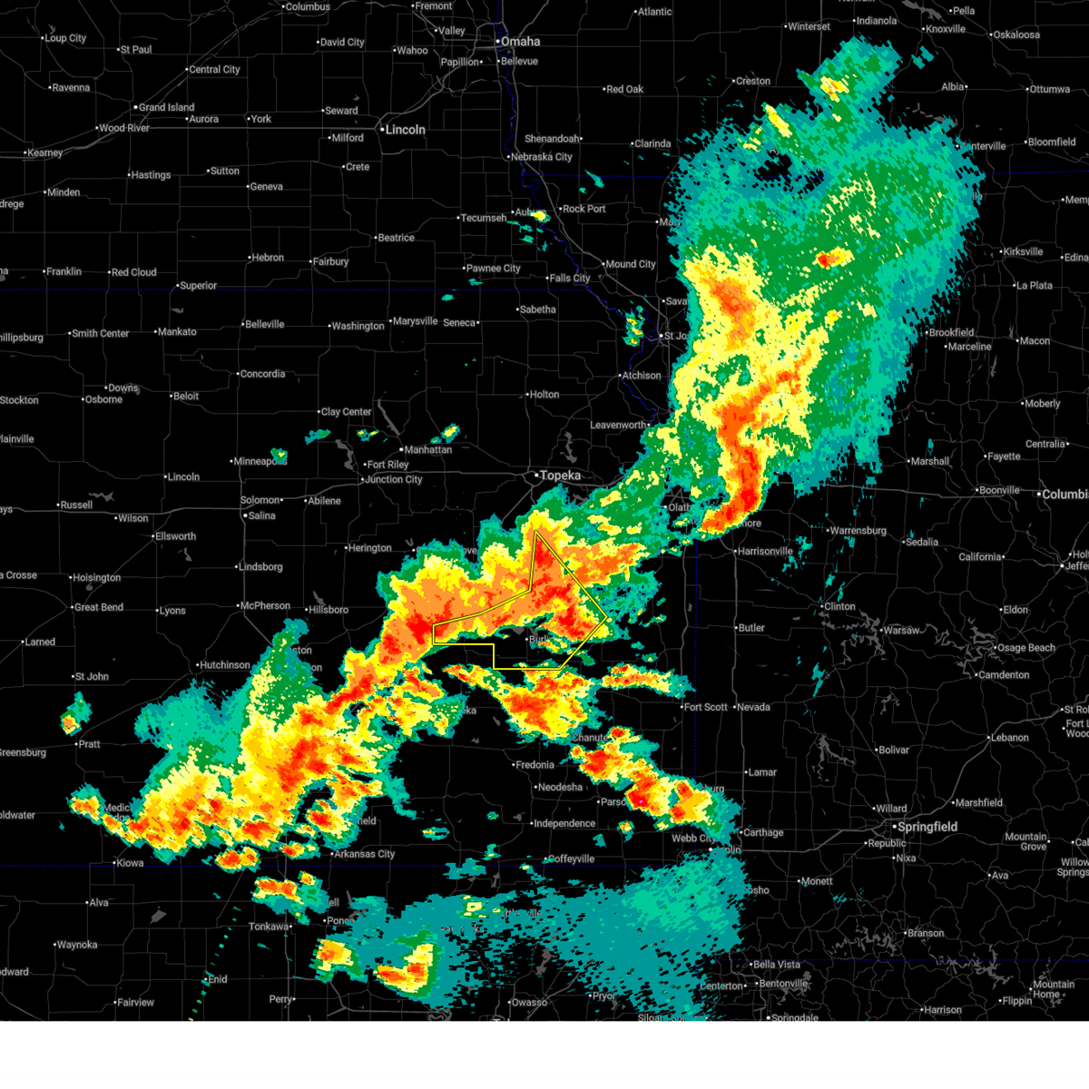
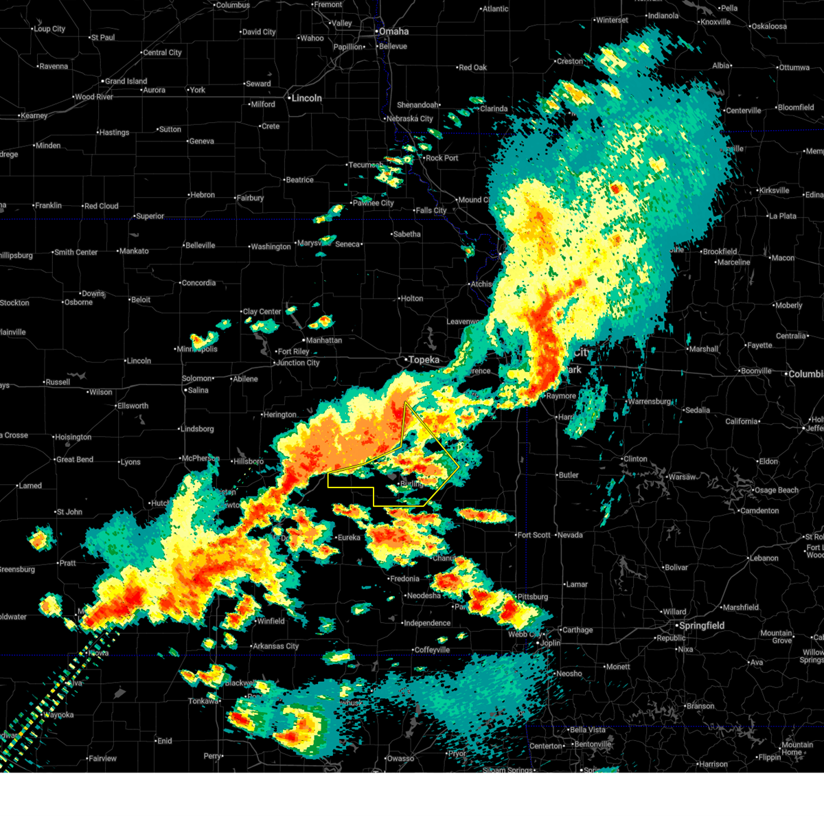
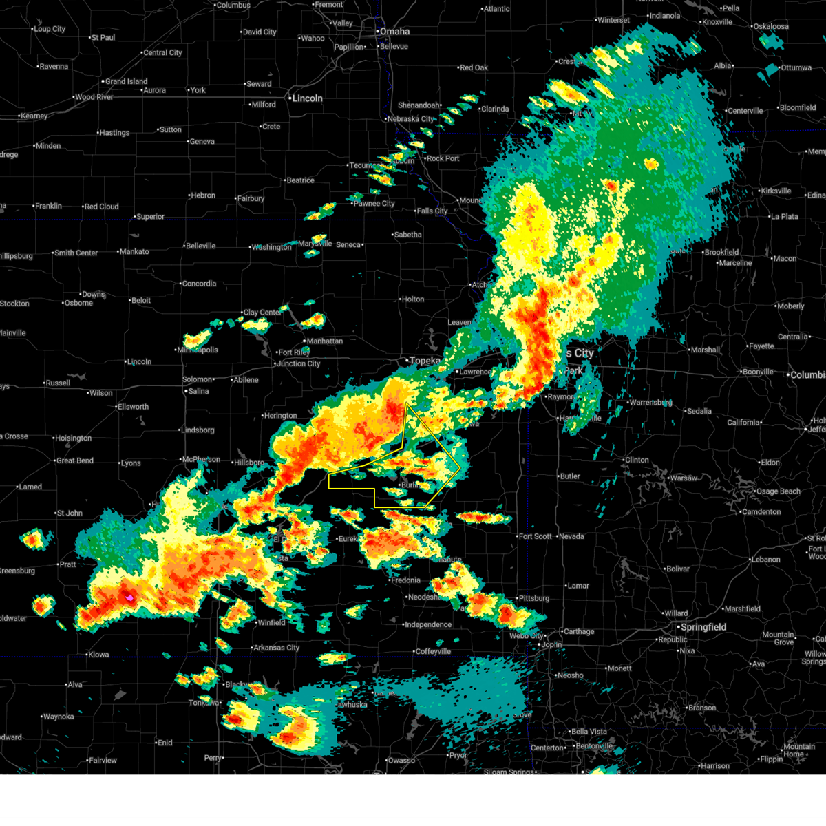
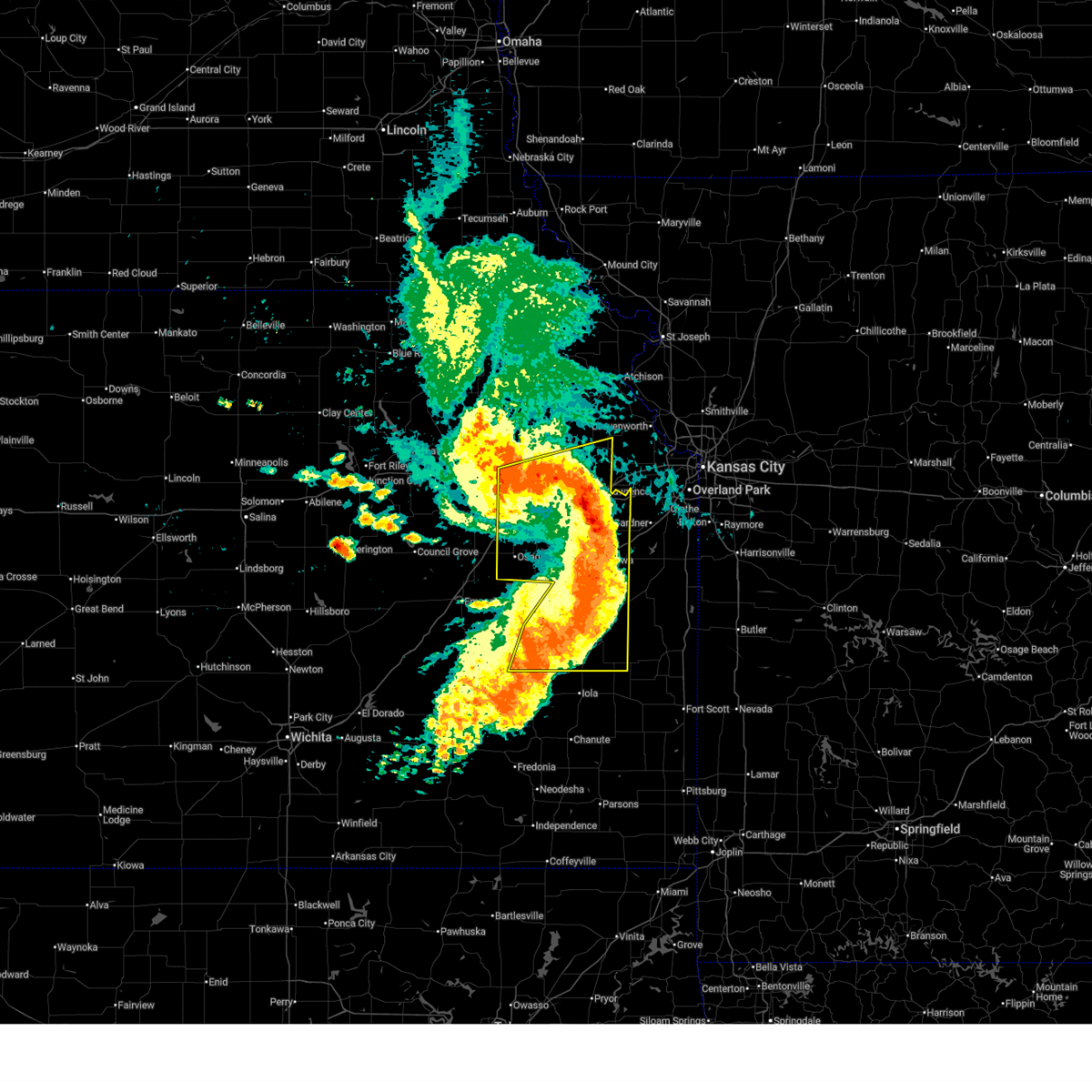
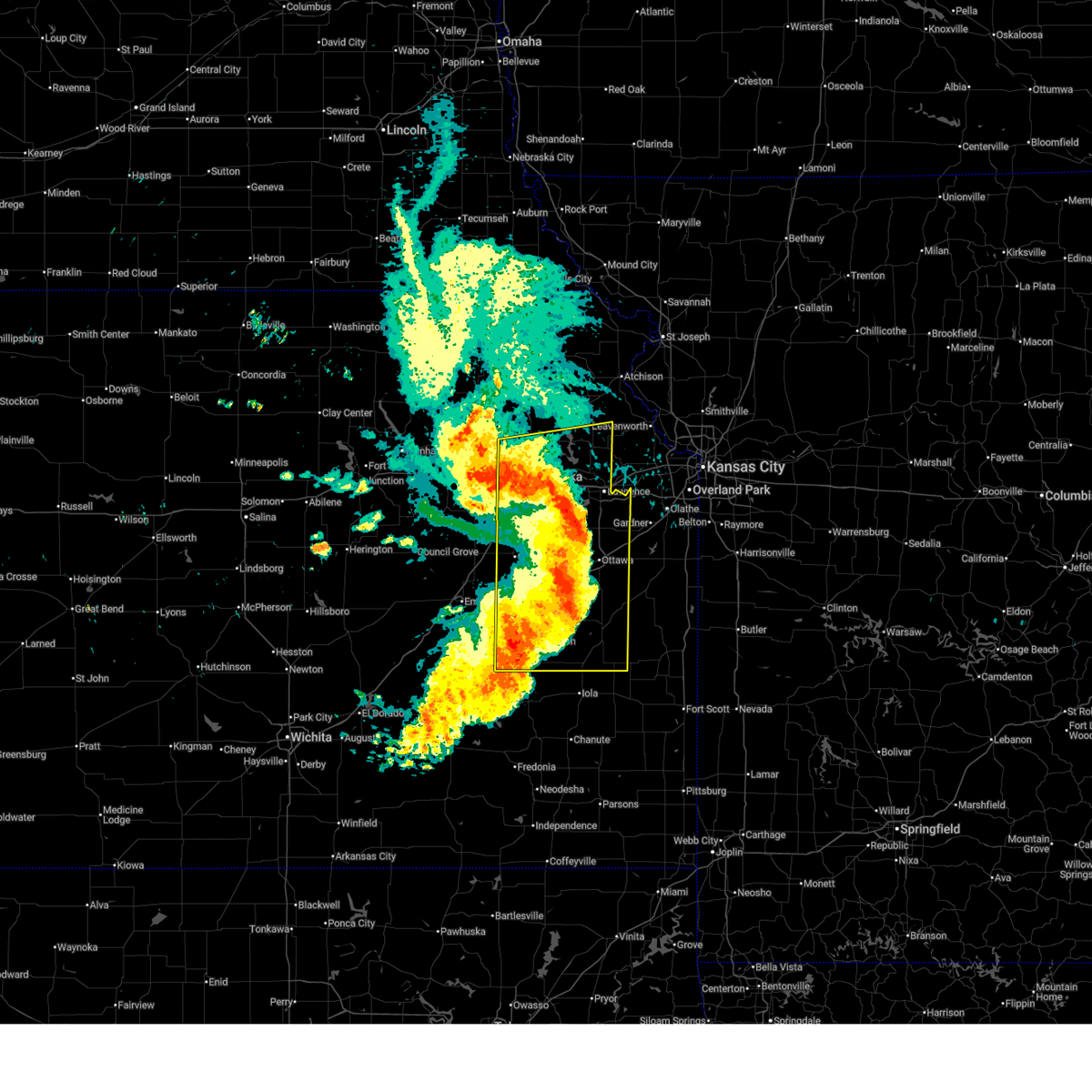
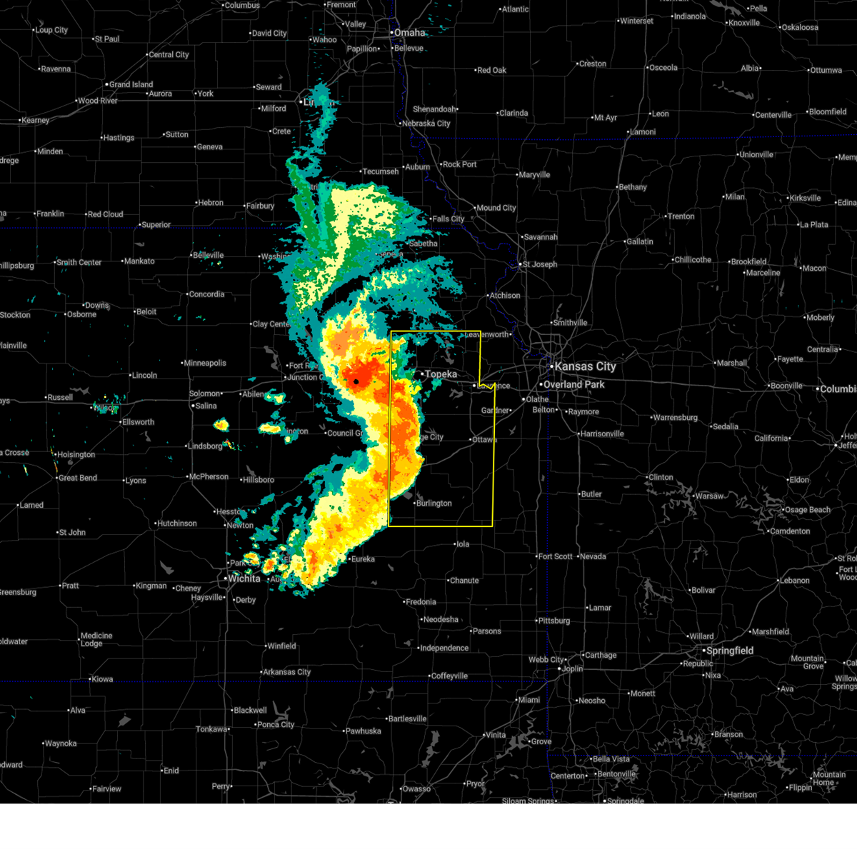
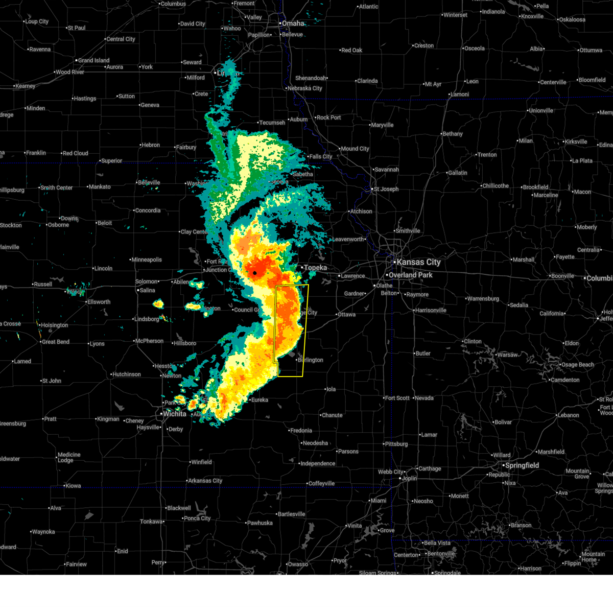
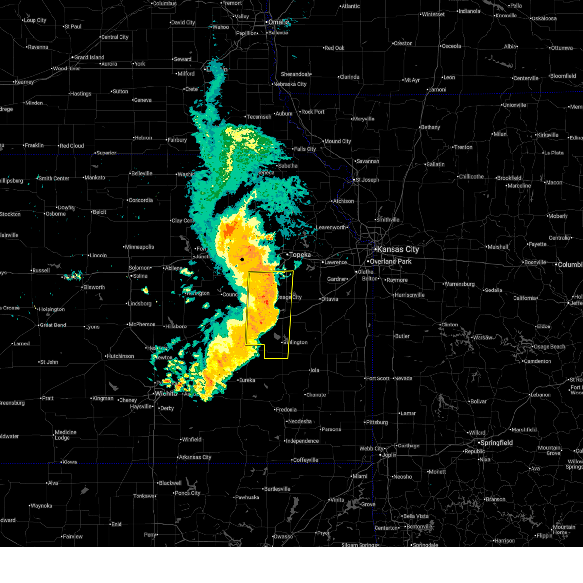
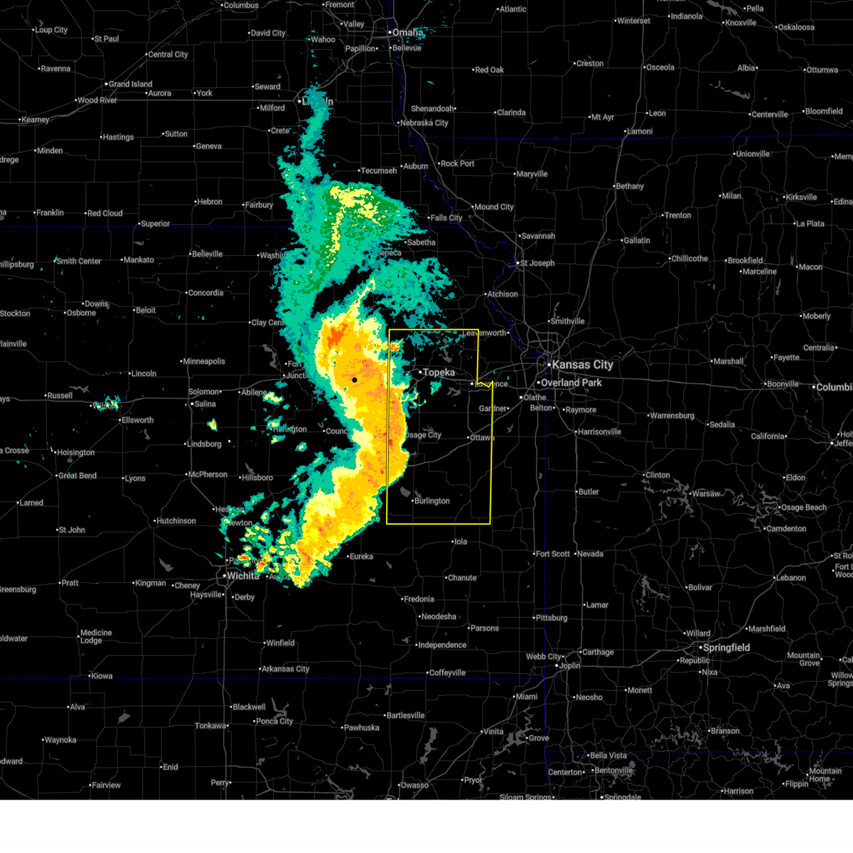
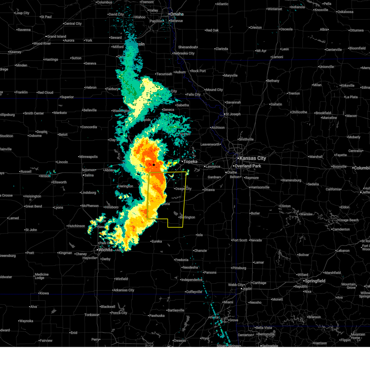
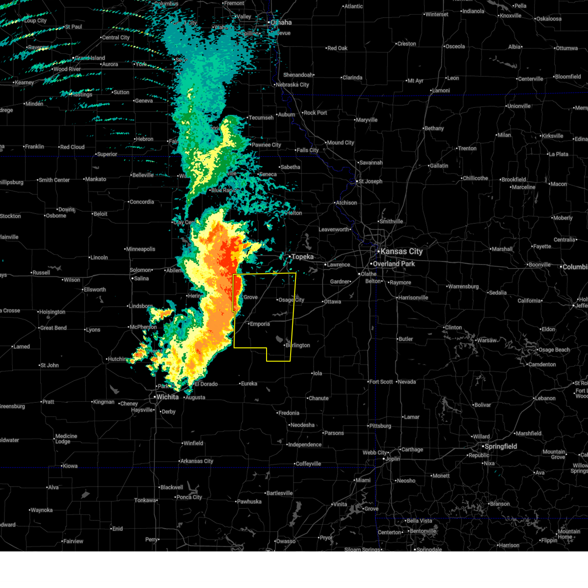
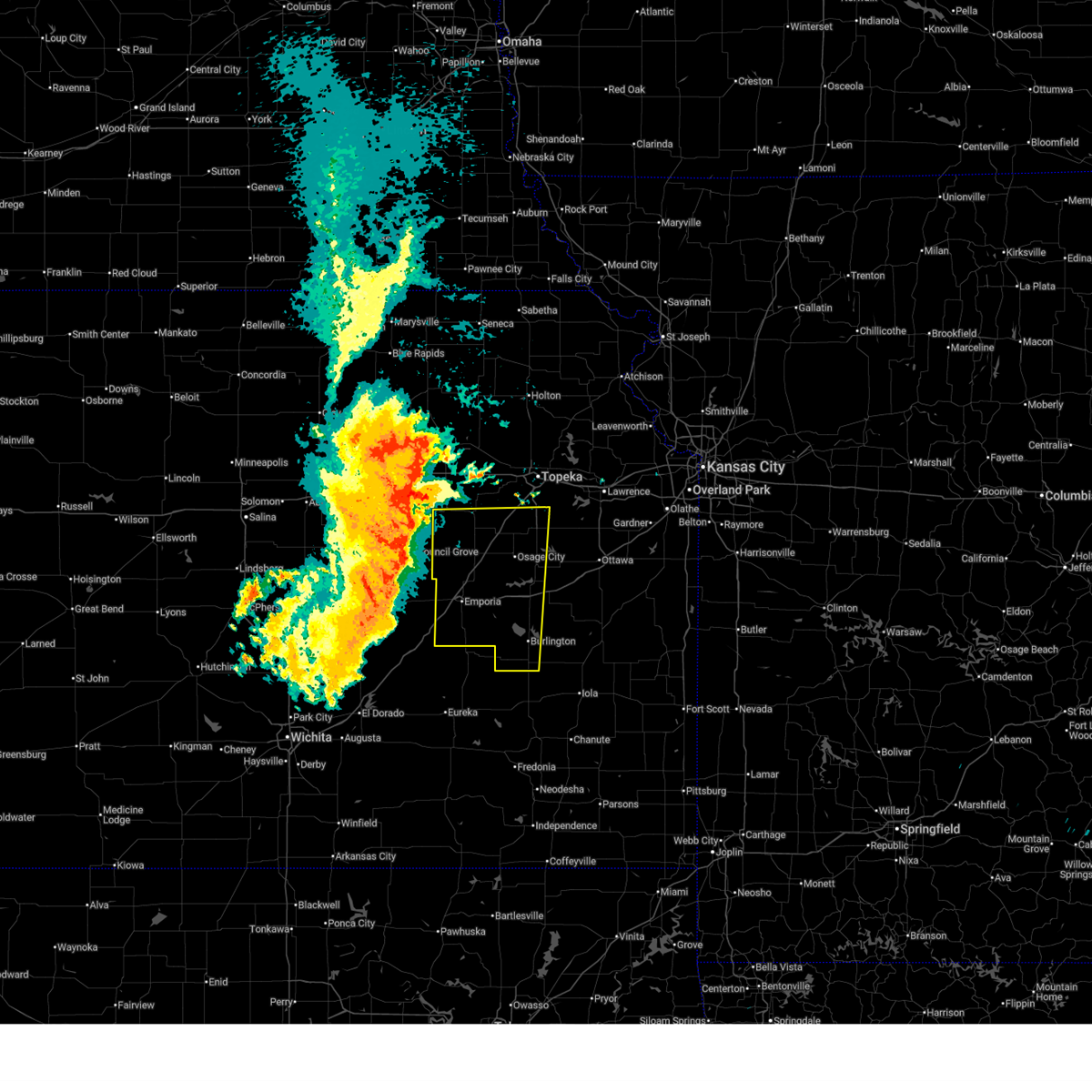
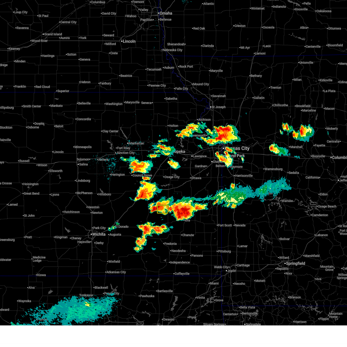
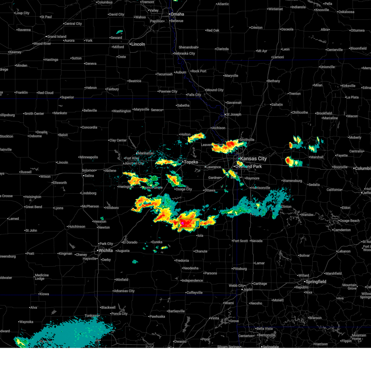
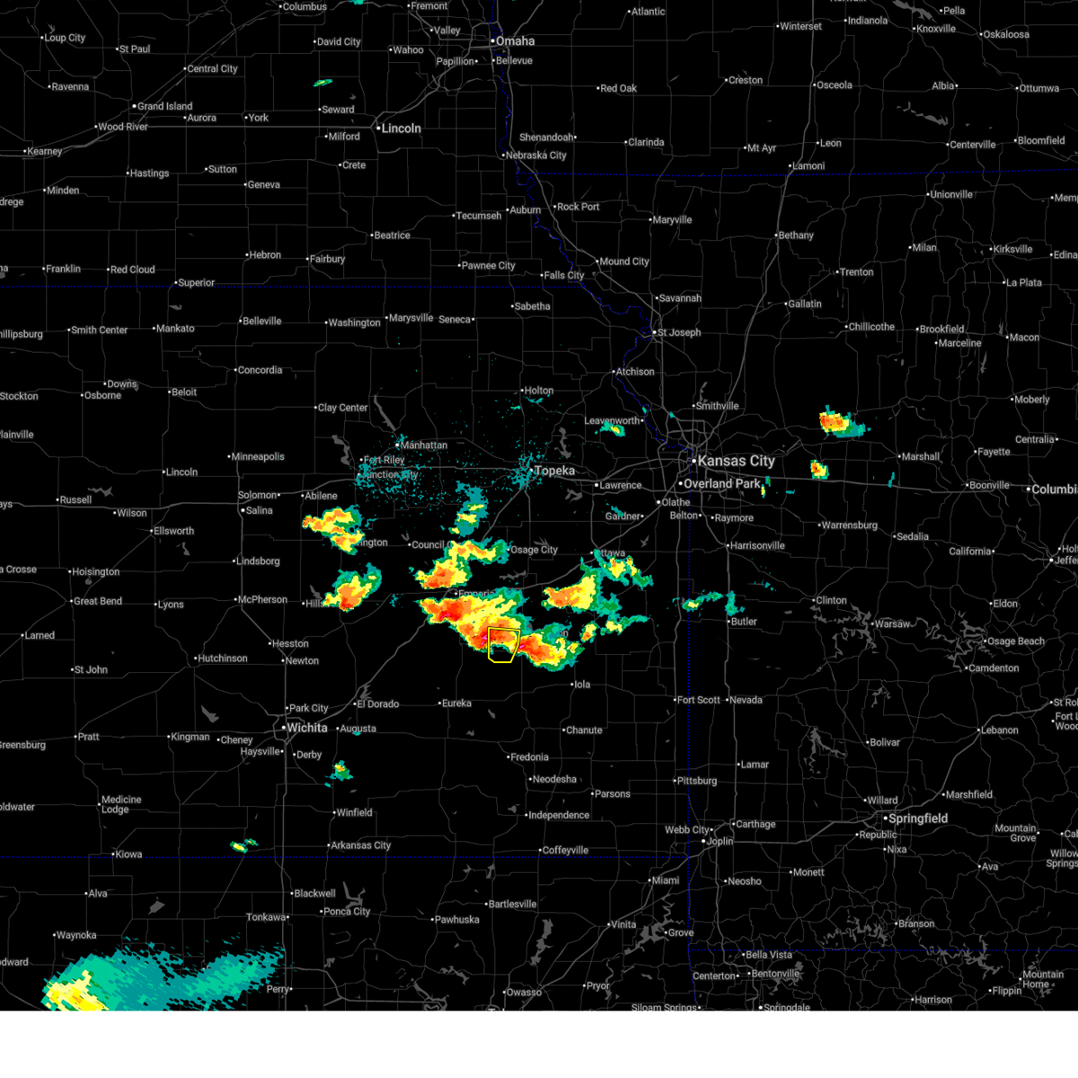
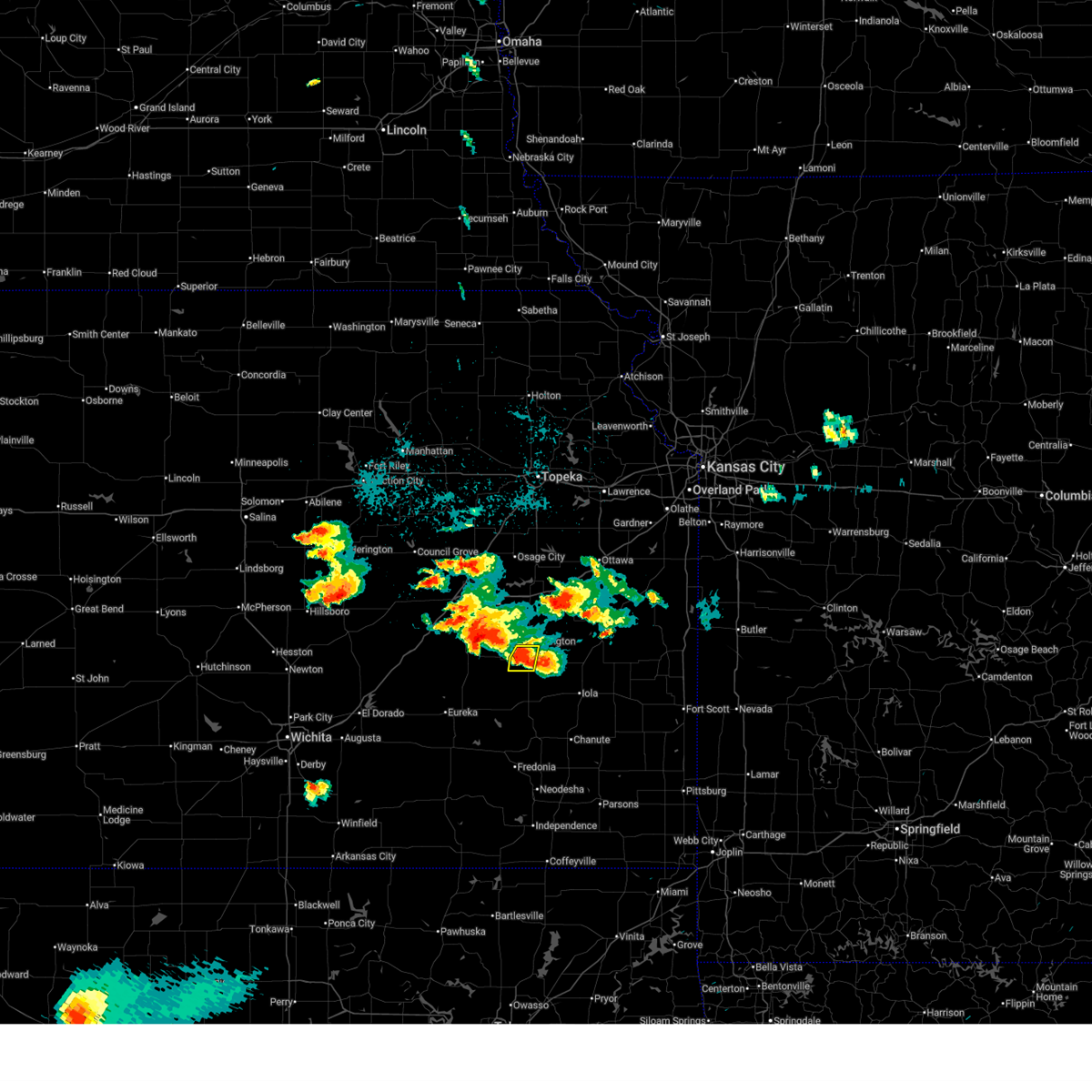
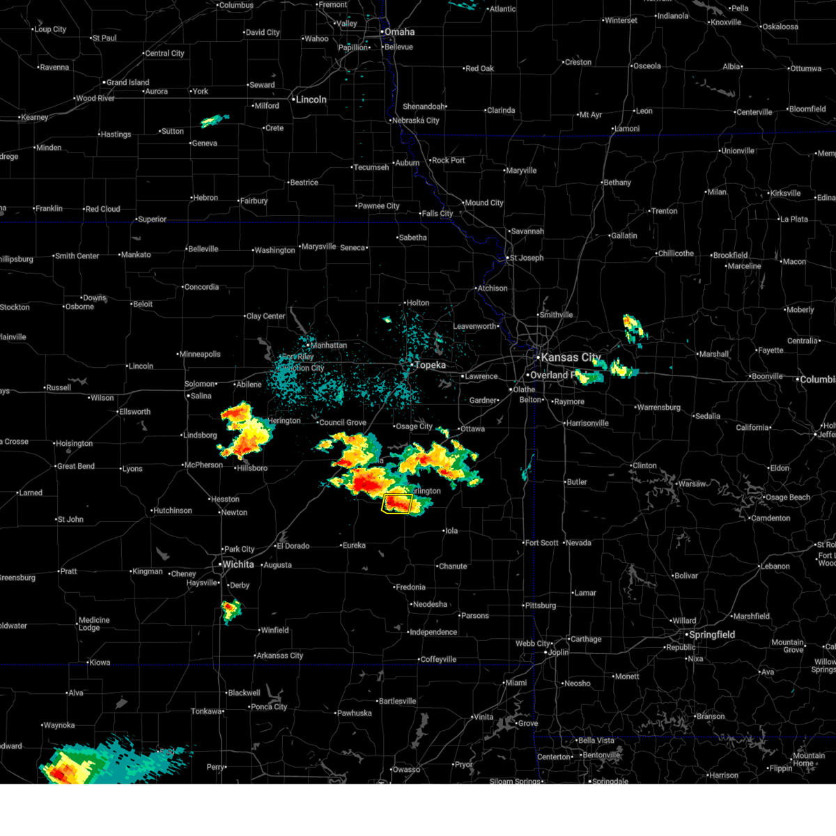
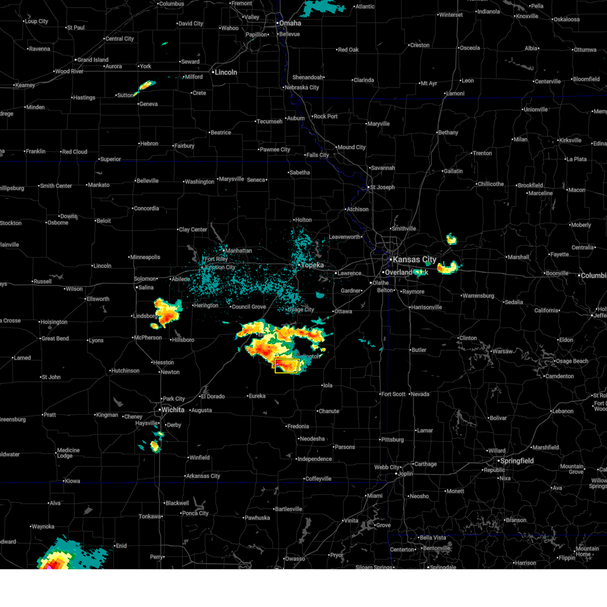
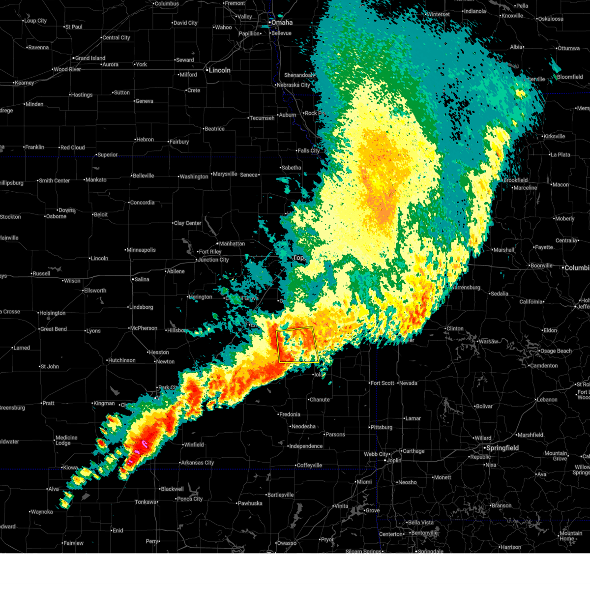
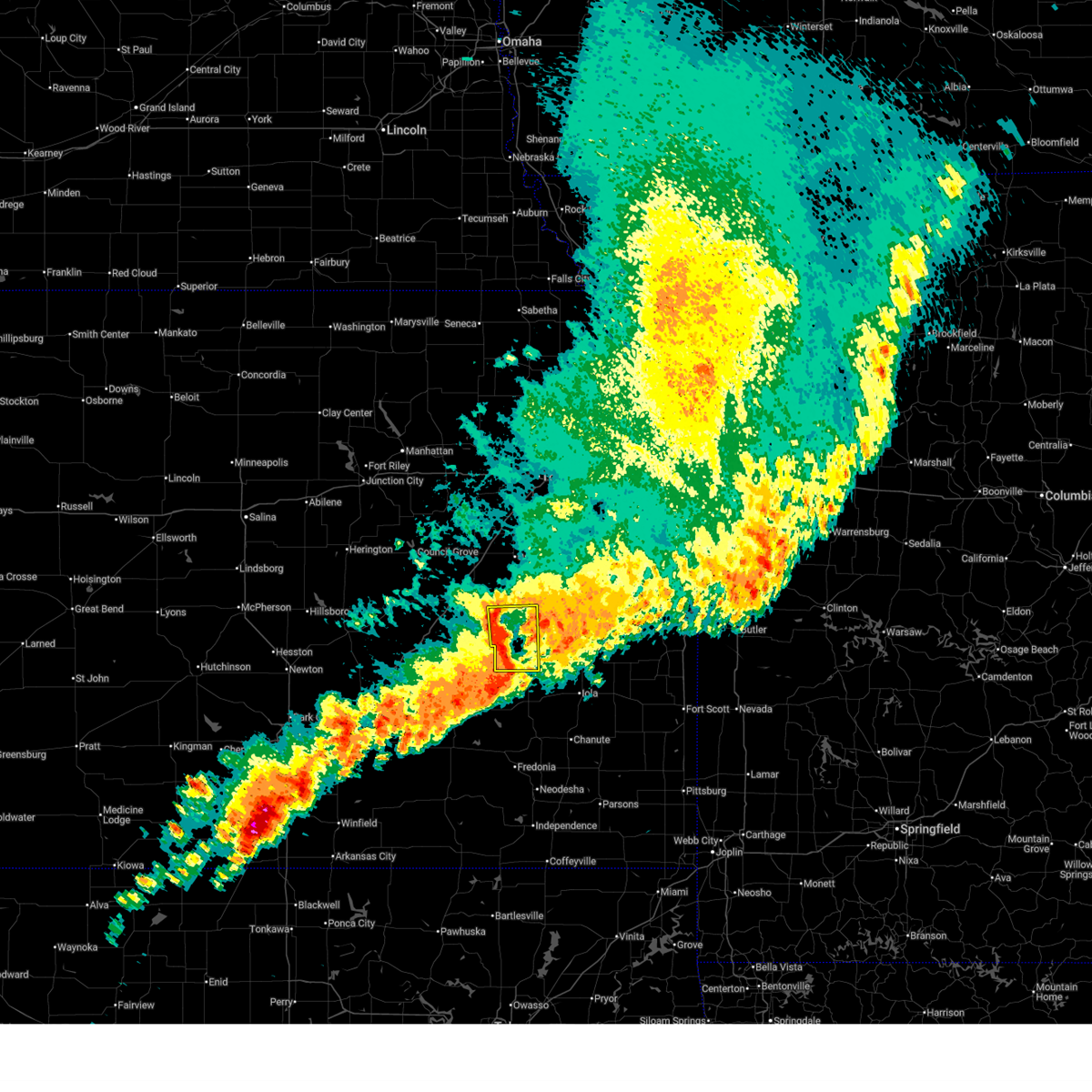
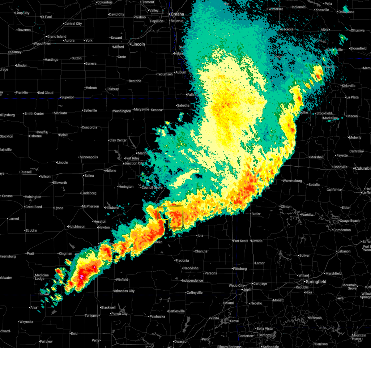
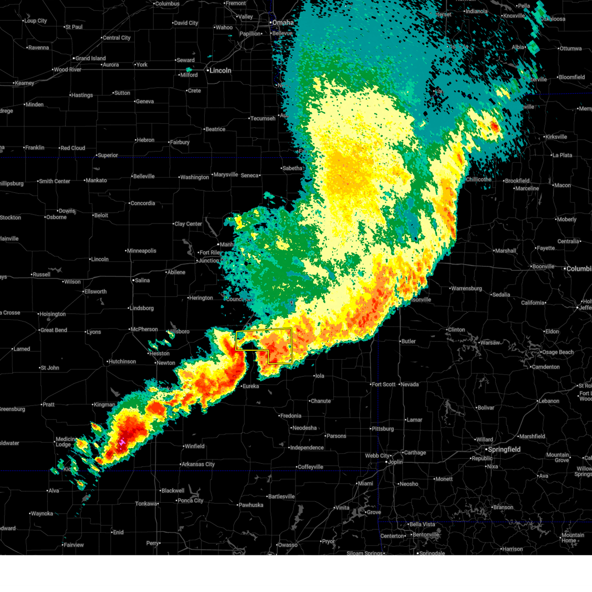
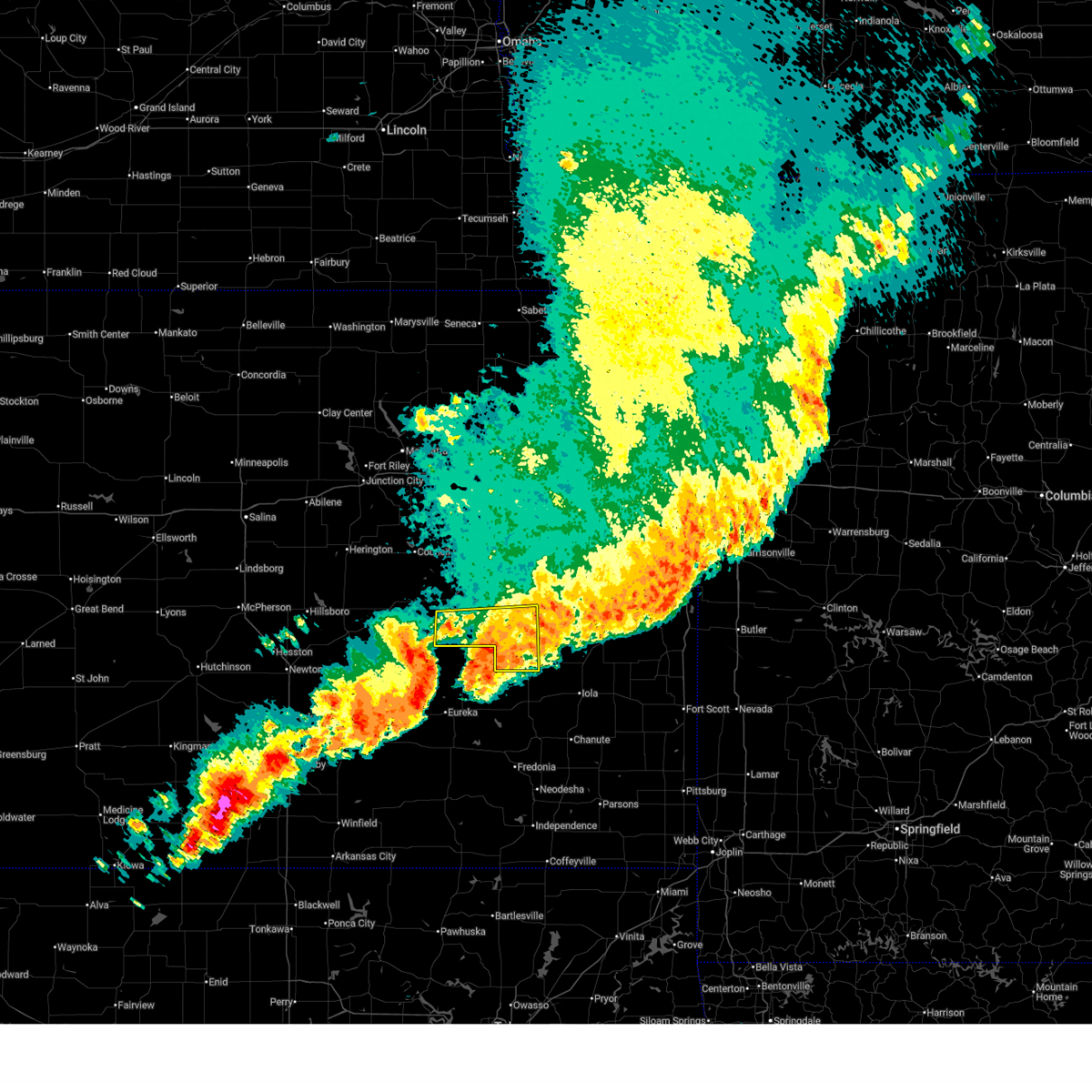
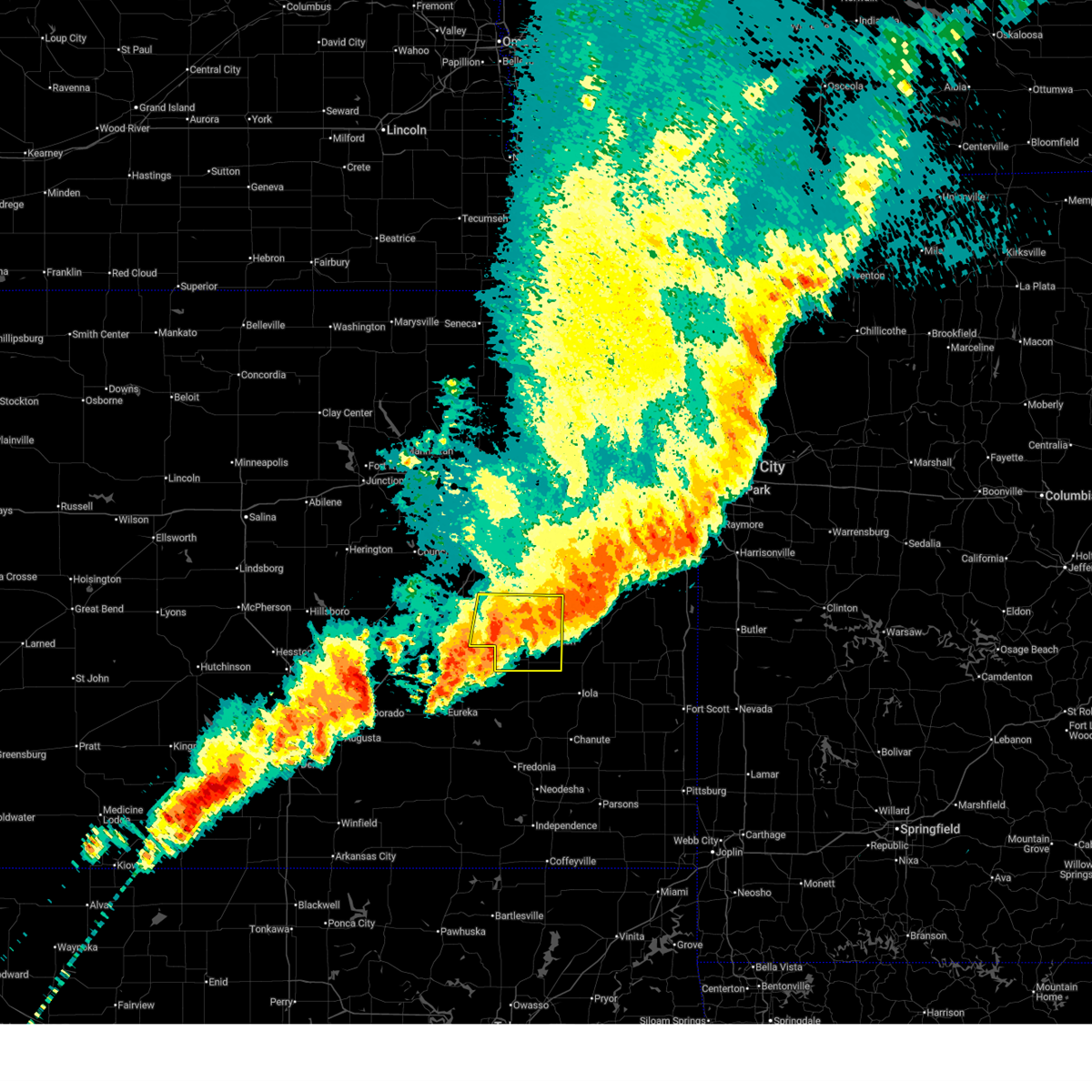
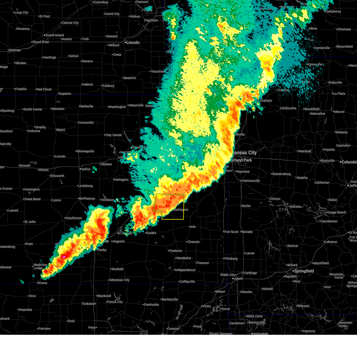
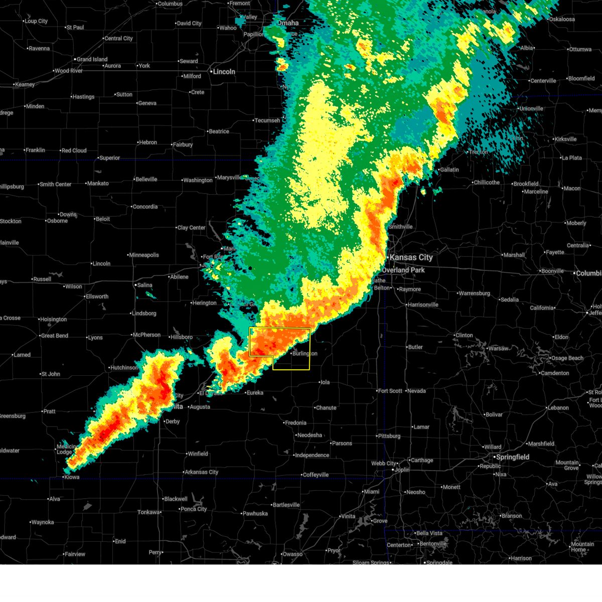
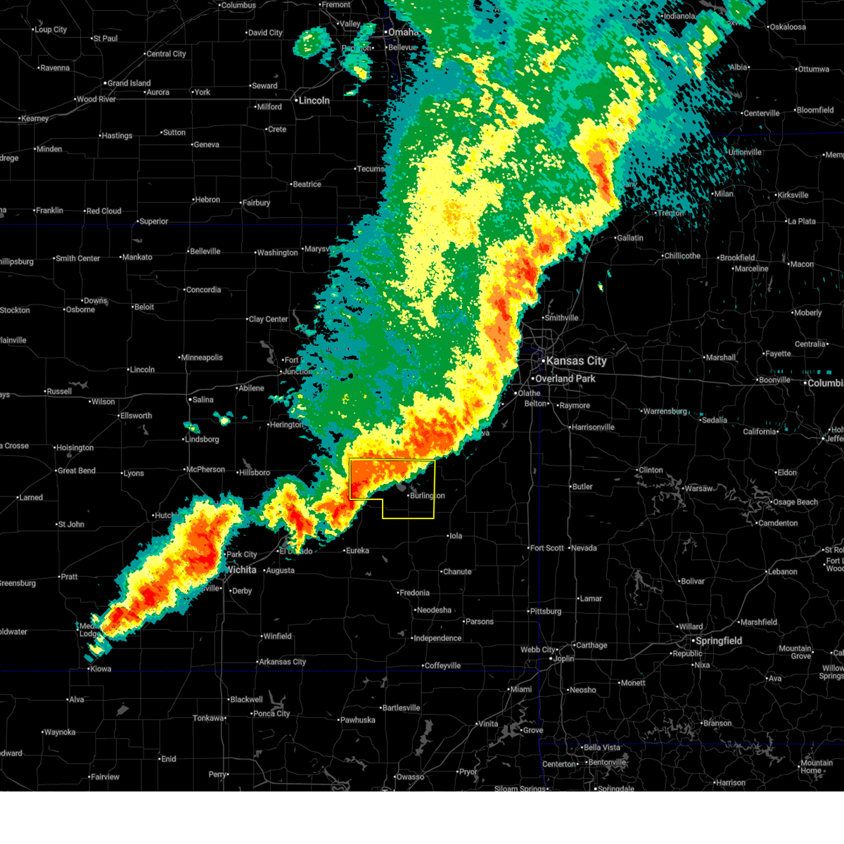
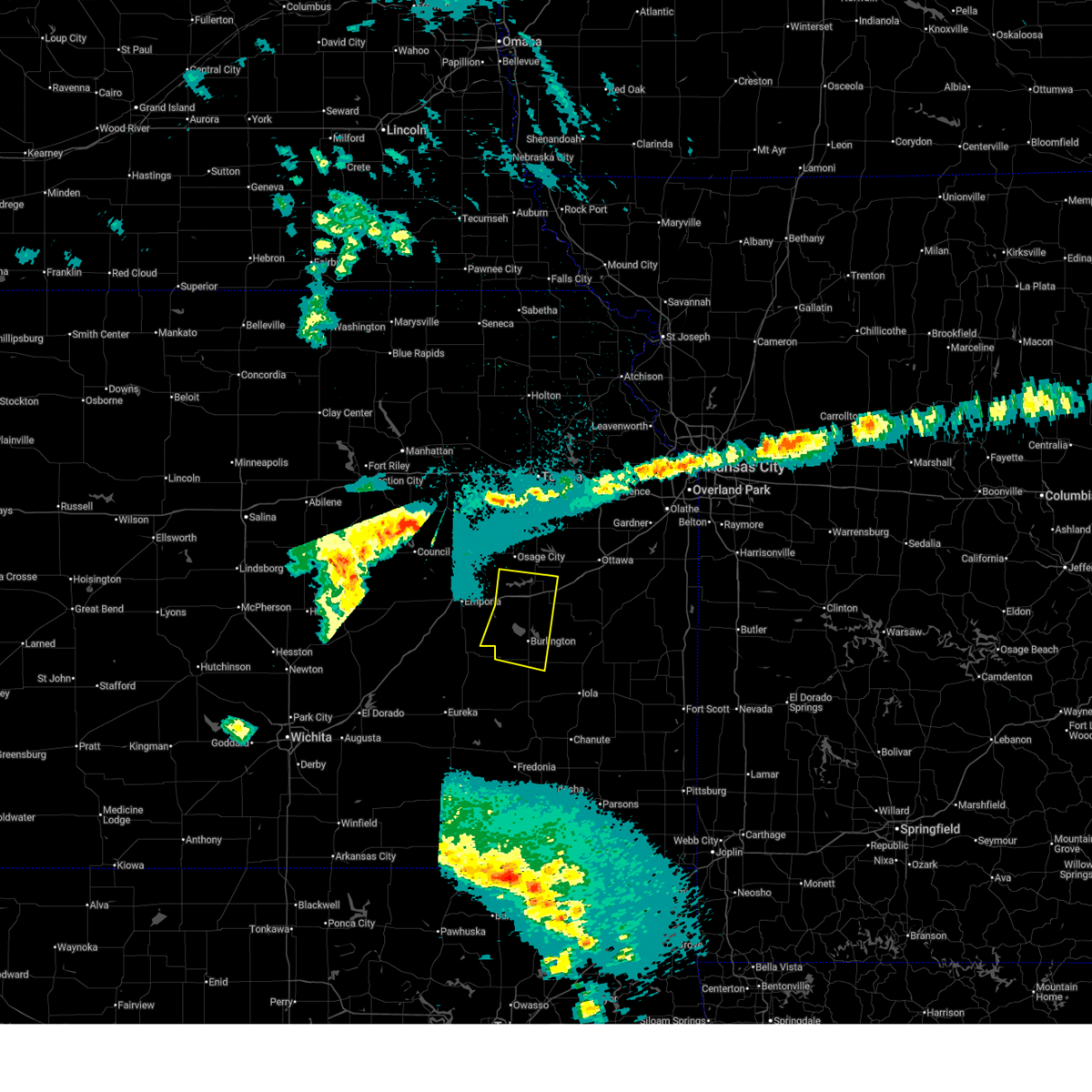
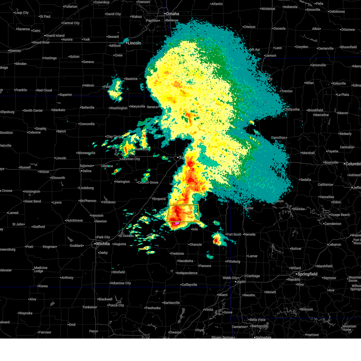
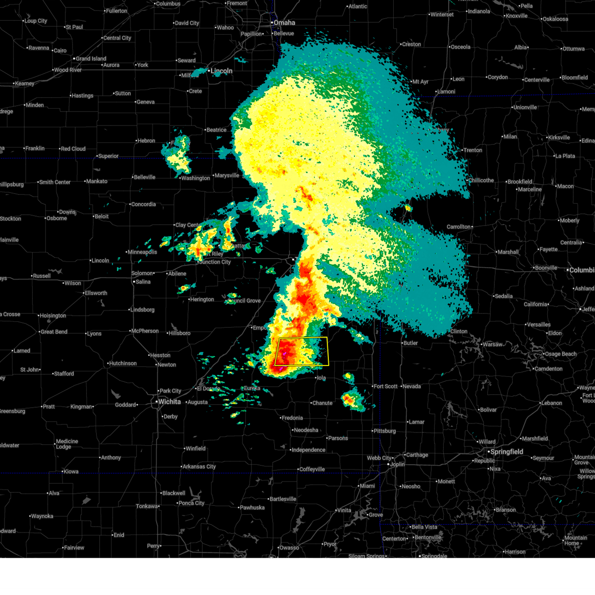
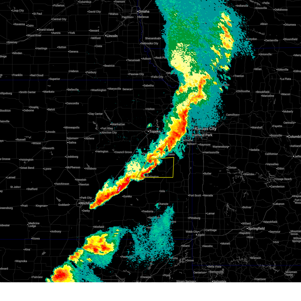
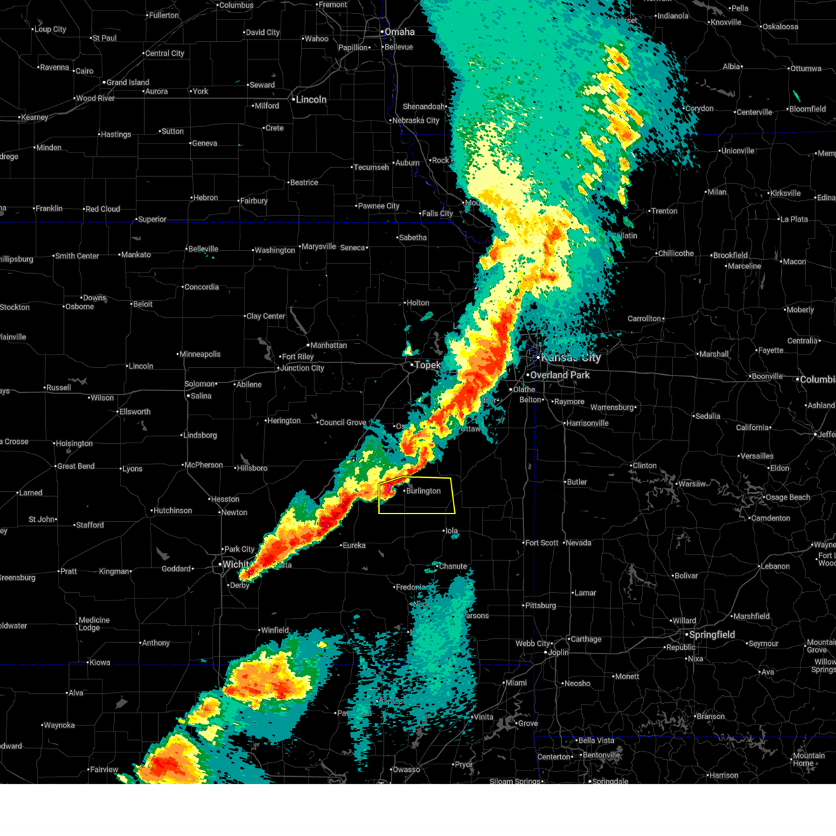
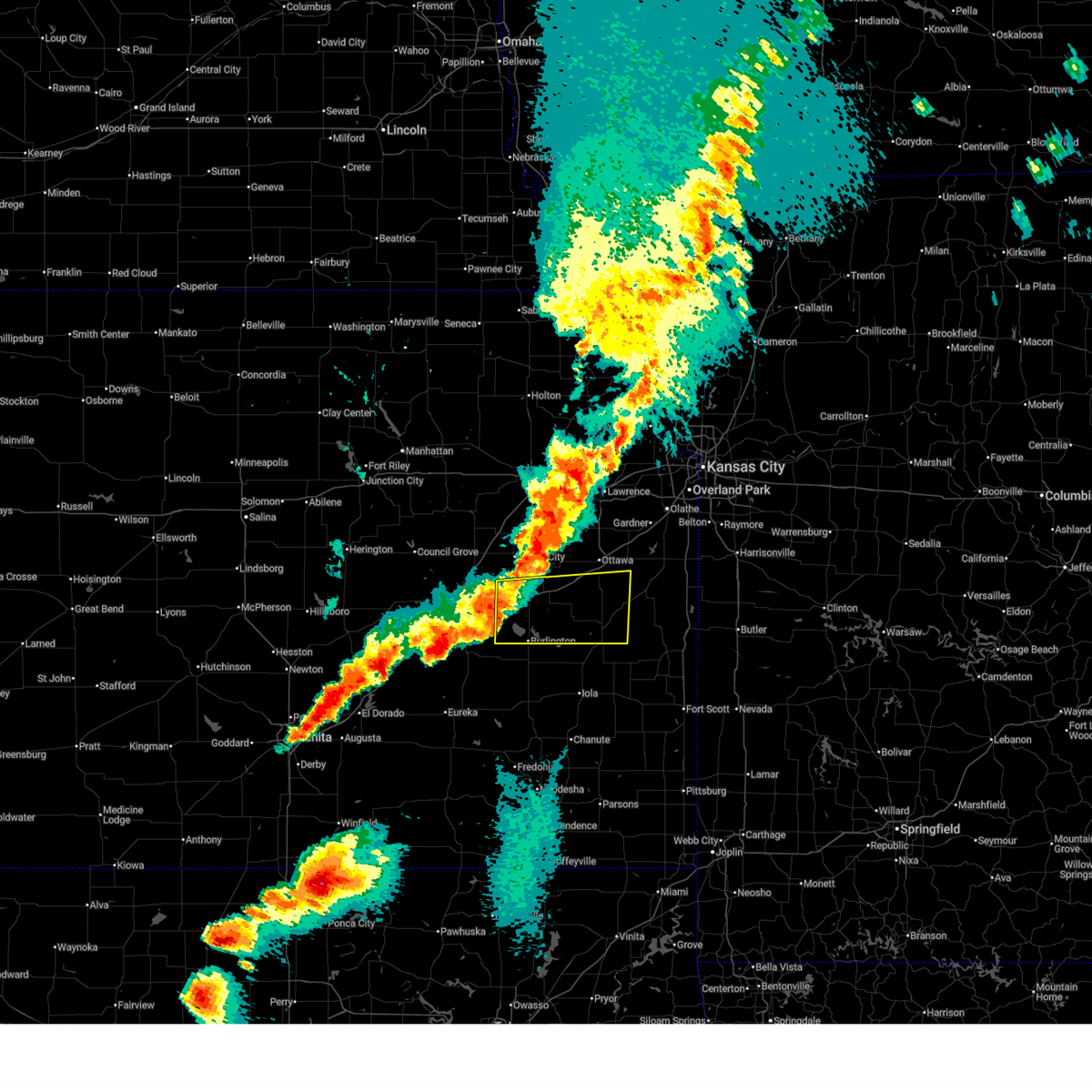
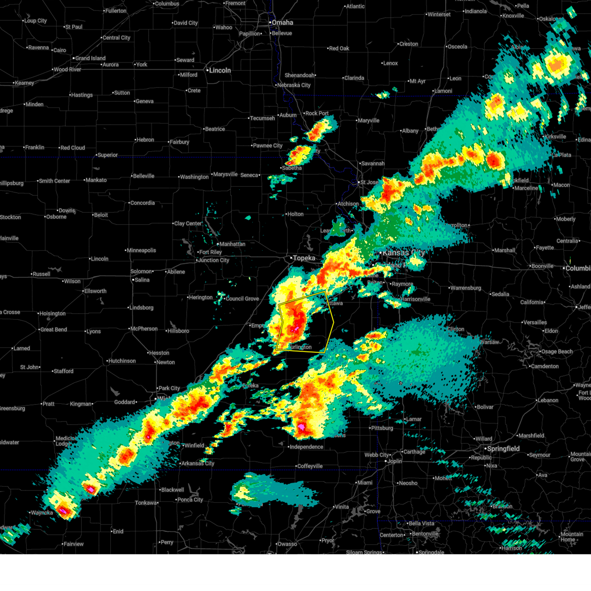
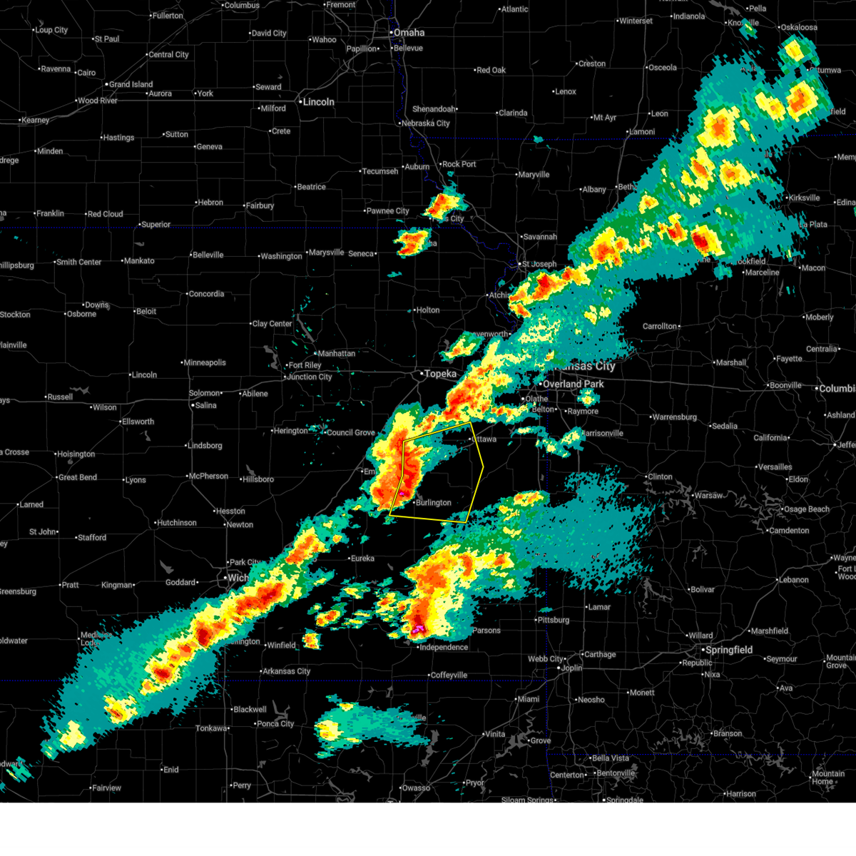
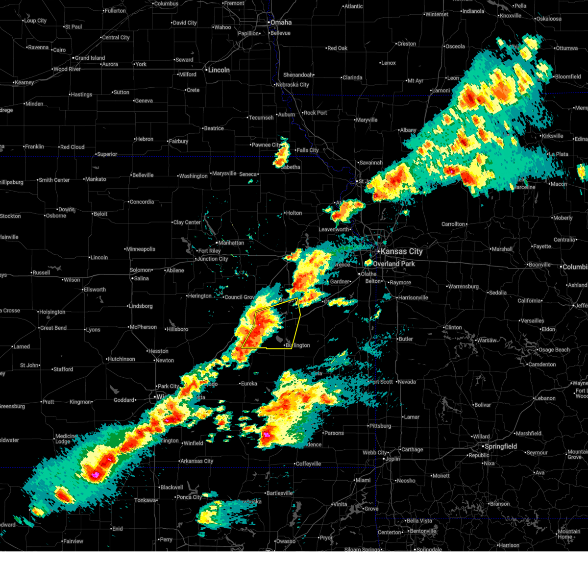
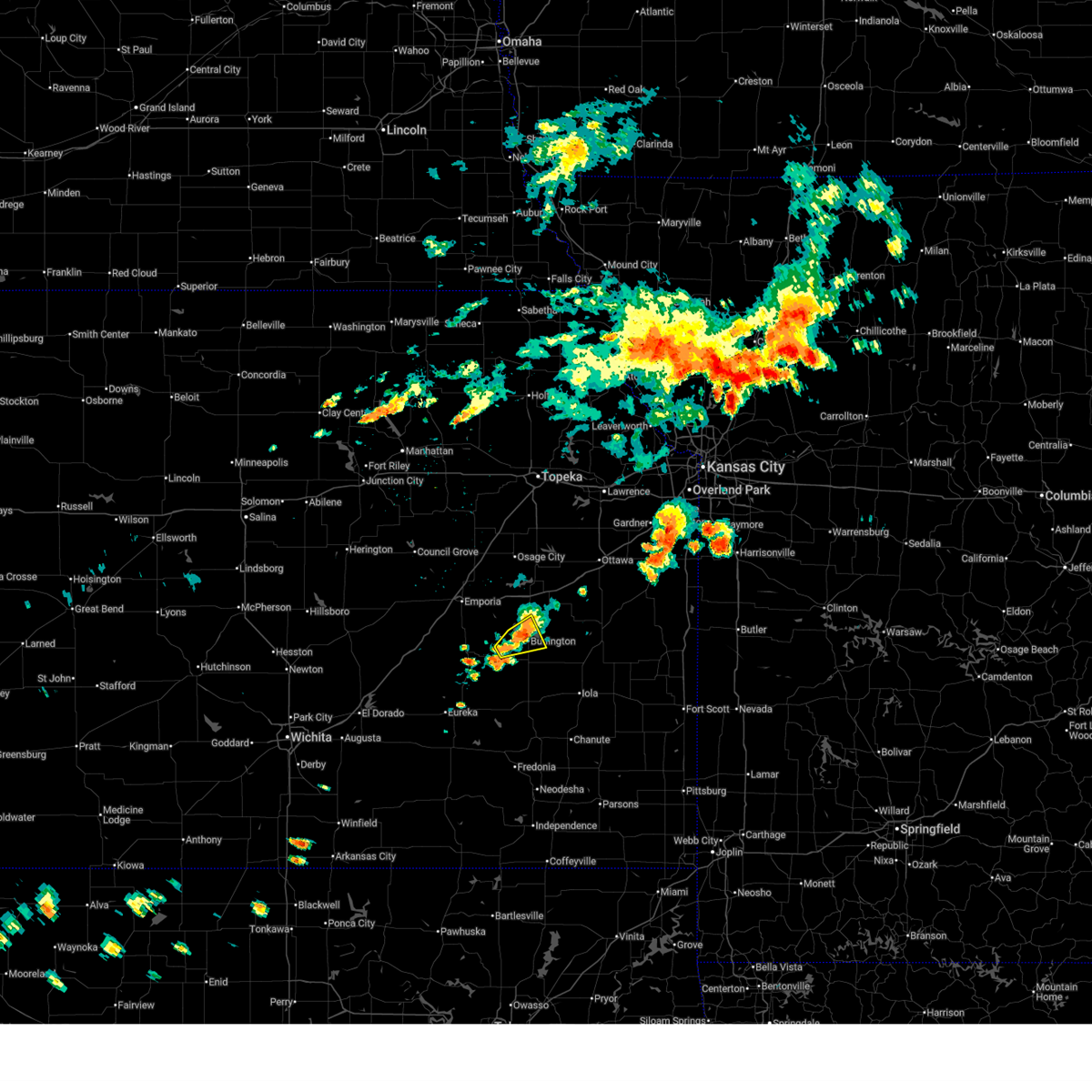
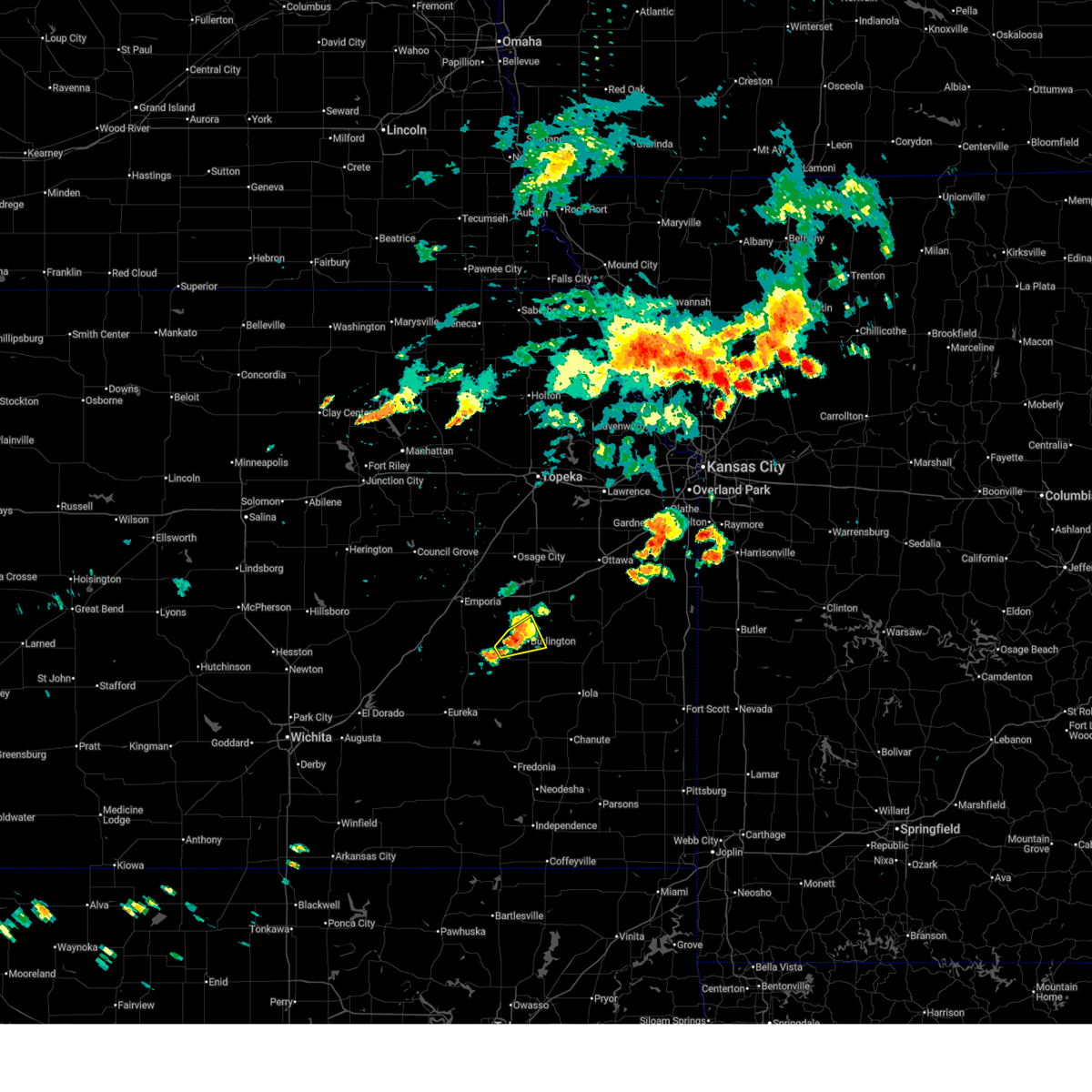
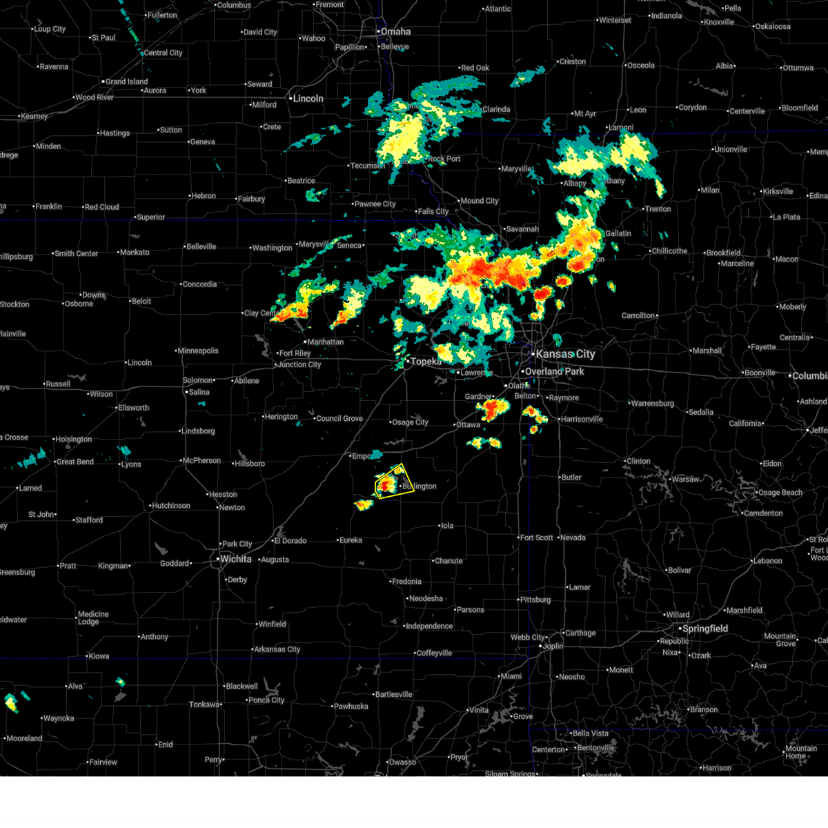
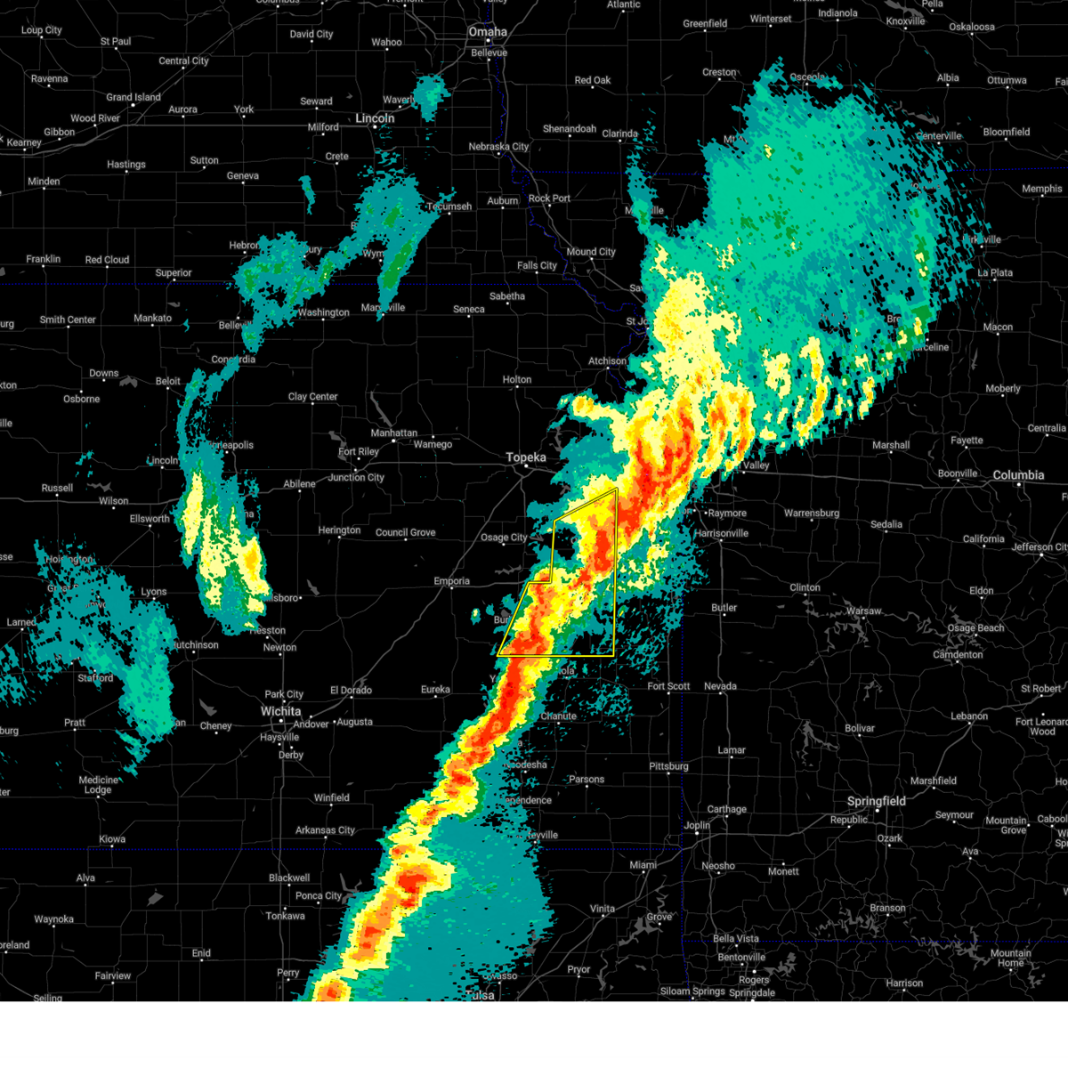
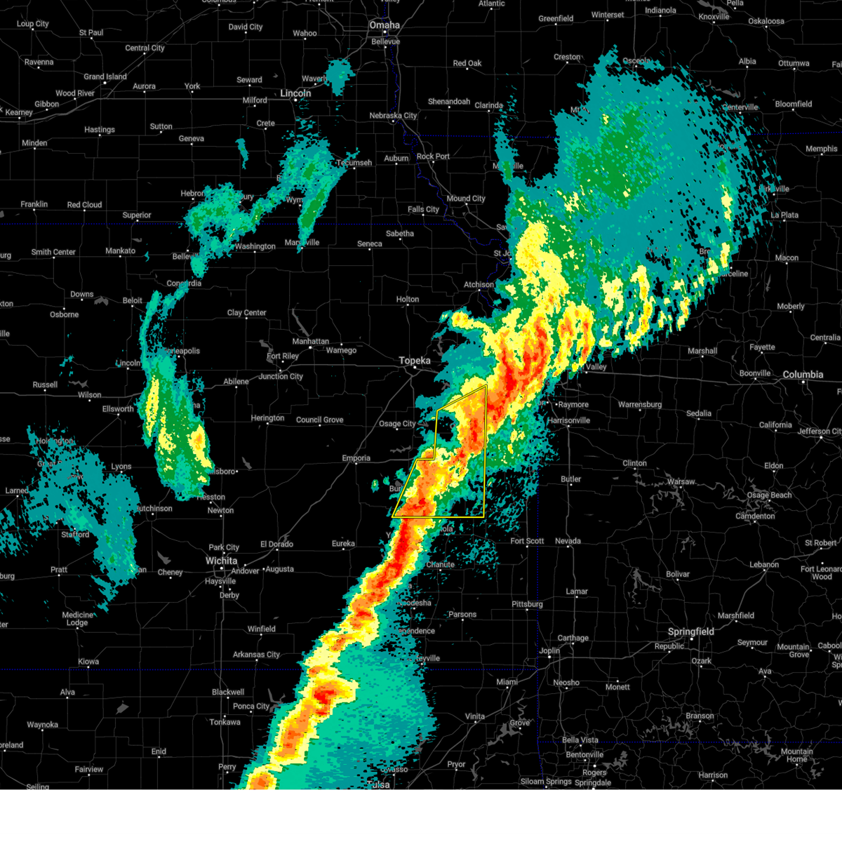
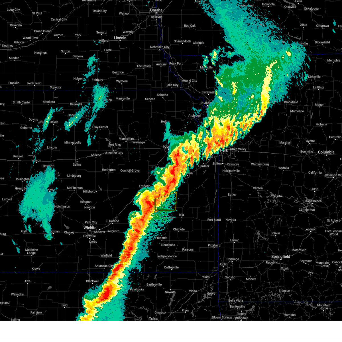
Hail Map for Burlington, KS
The Burlington, KS area has had 17 reports of on-the-ground hail by trained spotters, and has been under severe weather warnings 49 times during the past 12 months. Doppler radar has detected hail at or near Burlington, KS on 88 occasions, including 6 occasions during the past year.
| Name: | Burlington, KS |
| Where Located: | 38.7 miles NNW of Chanute, KS |
| Map: | Google Map for Burlington, KS |
| Population: | 2674 |
| Housing Units: | 1296 |
| More Info: | Search Google for Burlington, KS |
2
The Top Recent Hail Date for Burlington, KS is Sunday, May 31, 2026 (8th out of 88)
Hail and Wind Damage Spotted near Burlington, KS
| Date / Time | Report Details |
|---|---|
| 6/13/2026 9:40 PM CDT |
 The storms which prompted the warning have moved out of the area. therefore, the warning will be allowed to expire. however, small hail, gusty winds and heavy rain are still possible with these thunderstorms. a tornado watch remains in effect until 1100 pm cdt for east central kansas. The storms which prompted the warning have moved out of the area. therefore, the warning will be allowed to expire. however, small hail, gusty winds and heavy rain are still possible with these thunderstorms. a tornado watch remains in effect until 1100 pm cdt for east central kansas.
|
| 6/13/2026 9:32 PM CDT |
 At 927 pm cdt, severe thunderstorms were located along a line extending from 6 miles southeast of madison to 5 miles east of gridley to 5 miles west of richmond, moving southeast at 40 mph (trained weather spotters). Hazards include 70 mph wind gusts and nickel size hail. Expect considerable tree damage. damage is likely to mobile homes, roofs, and outbuildings. locations impacted include, garnett, burlington, waverly, olpe, williamsburg, new strawn, quenemo, hartford, gridley, westphalia, harris, john redmond reservoir, and le roy. this includes interstate 35 between mile markers 159 and 173. An automated weather station 6 miles north of burlington, reported a 66 mph wind gust at 915 pm cst. At 927 pm cdt, severe thunderstorms were located along a line extending from 6 miles southeast of madison to 5 miles east of gridley to 5 miles west of richmond, moving southeast at 40 mph (trained weather spotters). Hazards include 70 mph wind gusts and nickel size hail. Expect considerable tree damage. damage is likely to mobile homes, roofs, and outbuildings. locations impacted include, garnett, burlington, waverly, olpe, williamsburg, new strawn, quenemo, hartford, gridley, westphalia, harris, john redmond reservoir, and le roy. this includes interstate 35 between mile markers 159 and 173. An automated weather station 6 miles north of burlington, reported a 66 mph wind gust at 915 pm cst.
|
| 6/13/2026 9:15 PM CDT | Awos station kukl burlingto in coffey county KS, 7.4 miles S of Burlington, KS |
| 6/13/2026 9:03 PM CDT |
 At 902 pm cdt, severe thunderstorms were located along a line extending from 5 miles west of olpe to 4 miles southwest of hartford to near quenemo, moving southeast at 40 mph (trained weather spotters. at 9:01 pm, 60 mph wind gusts were reported 5 miles east of waverly). Hazards include 70 mph wind gusts and nickel size hail. Expect considerable tree damage. damage is likely to mobile homes, roofs, and outbuildings. locations impacted include, garnett, burlington, lyndon, waverly, olpe, williamsburg, new strawn, quenemo, melvern, hartford, gridley, westphalia, beto junction, harris, pomona lake, john redmond reservoir, and le roy. This includes interstate 35 between mile markers 153 and 173. At 902 pm cdt, severe thunderstorms were located along a line extending from 5 miles west of olpe to 4 miles southwest of hartford to near quenemo, moving southeast at 40 mph (trained weather spotters. at 9:01 pm, 60 mph wind gusts were reported 5 miles east of waverly). Hazards include 70 mph wind gusts and nickel size hail. Expect considerable tree damage. damage is likely to mobile homes, roofs, and outbuildings. locations impacted include, garnett, burlington, lyndon, waverly, olpe, williamsburg, new strawn, quenemo, melvern, hartford, gridley, westphalia, beto junction, harris, pomona lake, john redmond reservoir, and le roy. This includes interstate 35 between mile markers 153 and 173.
|
| 6/13/2026 9:00 PM CDT |
 At 859 pm cdt, severe thunderstorms were located along a line extending from 5 miles west of olpe to 4 miles southwest of hartford to near quenemo, moving southeast at 40 mph (automated weather station. at 8:55 pm, the asos at emporia airport gusted at 58 mph). Hazards include 70 mph wind gusts and nickel size hail. Expect considerable tree damage. damage is likely to mobile homes, roofs, and outbuildings. locations impacted include, garnett, burlington, lyndon, waverly, olpe, williamsburg, new strawn, quenemo, melvern, hartford, gridley, westphalia, beto junction, harris, pomona lake, john redmond reservoir, and le roy. This includes interstate 35 between mile markers 153 and 173. At 859 pm cdt, severe thunderstorms were located along a line extending from 5 miles west of olpe to 4 miles southwest of hartford to near quenemo, moving southeast at 40 mph (automated weather station. at 8:55 pm, the asos at emporia airport gusted at 58 mph). Hazards include 70 mph wind gusts and nickel size hail. Expect considerable tree damage. damage is likely to mobile homes, roofs, and outbuildings. locations impacted include, garnett, burlington, lyndon, waverly, olpe, williamsburg, new strawn, quenemo, melvern, hartford, gridley, westphalia, beto junction, harris, pomona lake, john redmond reservoir, and le roy. This includes interstate 35 between mile markers 153 and 173.
|
| 6/13/2026 8:50 PM CDT |
 Svrtop the national weather service in topeka has issued a * severe thunderstorm warning for, southwestern franklin county in east central kansas, northwestern anderson county in east central kansas, southeastern osage county in east central kansas, coffey county in east central kansas, southern lyon county in east central kansas, * until 945 pm cdt. * at 849 pm cdt, severe thunderstorms were located along a line extending from 10 miles west of olpe to 5 miles southwest of neosho rapids to near lyndon, moving southeast at 40 mph (trained weather spotters. at 8:48 pm, 60-70 mph winds were reported in osage city). Hazards include 70 mph wind gusts and nickel size hail. Expect considerable tree damage. Damage is likely to mobile homes, roofs, and outbuildings. Svrtop the national weather service in topeka has issued a * severe thunderstorm warning for, southwestern franklin county in east central kansas, northwestern anderson county in east central kansas, southeastern osage county in east central kansas, coffey county in east central kansas, southern lyon county in east central kansas, * until 945 pm cdt. * at 849 pm cdt, severe thunderstorms were located along a line extending from 10 miles west of olpe to 5 miles southwest of neosho rapids to near lyndon, moving southeast at 40 mph (trained weather spotters. at 8:48 pm, 60-70 mph winds were reported in osage city). Hazards include 70 mph wind gusts and nickel size hail. Expect considerable tree damage. Damage is likely to mobile homes, roofs, and outbuildings.
|
| 6/9/2026 12:31 AM CDT |
 At 1230 am cdt, severe thunderstorms were located along a line extending from 4 miles southeast of oskaloosa to 5 miles south of wellsville to 6 miles north of lone elm, moving east at 50 mph (trained weather spotters). Hazards include 70 mph wind gusts and quarter size hail. Hail damage to vehicles is expected. expect considerable tree damage. wind damage is also likely to mobile homes, roofs, and outbuildings. locations impacted include, topeka, lawrence, ottawa, baldwin city, garnett, osage city, burlington, carbondale, oskaloosa, tecumseh, eudora, richland, wellsville, dover, silver lake, auburn, overbrook, lyndon, centropolis, and burlingame. this includes the following highways, interstate 35 between mile markers 162 and 198. interstate 70 between mile markers 347 and 355. Kansas turnpike between mile markers 155 and 205. At 1230 am cdt, severe thunderstorms were located along a line extending from 4 miles southeast of oskaloosa to 5 miles south of wellsville to 6 miles north of lone elm, moving east at 50 mph (trained weather spotters). Hazards include 70 mph wind gusts and quarter size hail. Hail damage to vehicles is expected. expect considerable tree damage. wind damage is also likely to mobile homes, roofs, and outbuildings. locations impacted include, topeka, lawrence, ottawa, baldwin city, garnett, osage city, burlington, carbondale, oskaloosa, tecumseh, eudora, richland, wellsville, dover, silver lake, auburn, overbrook, lyndon, centropolis, and burlingame. this includes the following highways, interstate 35 between mile markers 162 and 198. interstate 70 between mile markers 347 and 355. Kansas turnpike between mile markers 155 and 205.
|
| 6/9/2026 12:31 AM CDT |
 the severe thunderstorm warning has been cancelled and is no longer in effect the severe thunderstorm warning has been cancelled and is no longer in effect
|
| 6/9/2026 12:12 AM CDT |
 At 1211 am cdt, severe thunderstorms were located along a line extending from near meriden to 4 miles south of centropolis to westphalia, moving east at 50 mph (trained weather spotters). Hazards include 70 mph wind gusts and nickel size hail. Expect considerable tree damage. damage is likely to mobile homes, roofs, and outbuildings. locations impacted include, topeka, lawrence, ottawa, baldwin city, garnett, osage city, burlington, carbondale, oskaloosa, tecumseh, eudora, richland, wellsville, dover, silver lake, auburn, overbrook, lyndon, centropolis, and lebo. this includes the following highways, interstate 35 between mile markers 143 and 198. interstate 70 between mile markers 347 and 355. kansas turnpike between mile markers 155 and 205. A tornado warning remains in effect for southern jefferson, southeastern shawnee, and douglas counties until 1230 am. At 1211 am cdt, severe thunderstorms were located along a line extending from near meriden to 4 miles south of centropolis to westphalia, moving east at 50 mph (trained weather spotters). Hazards include 70 mph wind gusts and nickel size hail. Expect considerable tree damage. damage is likely to mobile homes, roofs, and outbuildings. locations impacted include, topeka, lawrence, ottawa, baldwin city, garnett, osage city, burlington, carbondale, oskaloosa, tecumseh, eudora, richland, wellsville, dover, silver lake, auburn, overbrook, lyndon, centropolis, and lebo. this includes the following highways, interstate 35 between mile markers 143 and 198. interstate 70 between mile markers 347 and 355. kansas turnpike between mile markers 155 and 205. A tornado warning remains in effect for southern jefferson, southeastern shawnee, and douglas counties until 1230 am.
|
| 6/8/2026 11:52 PM CDT |
 At 1151 pm cdt, severe thunderstorms were located along a line extending from 6 miles southeast of delia to 3 miles north of lyndon to 4 miles south of john redmond reservoir, moving east at 50 mph (emergency management. at 11:50 pm, 70-80 mph winds were reported at melvern lake). Hazards include 70 mph wind gusts and nickel size hail. Expect considerable tree damage. damage is likely to mobile homes, roofs, and outbuildings. locations impacted include, topeka, lawrence, ottawa, baldwin city, garnett, osage city, burlington, carbondale, rossville, oskaloosa, tecumseh, eudora, richland, wellsville, dover, silver lake, auburn, overbrook, lyndon, and centropolis. this includes the following highways, interstate 35 between mile markers 143 and 198. interstate 70 between mile markers 347 and 355. Kansas turnpike between mile markers 155 and 205. At 1151 pm cdt, severe thunderstorms were located along a line extending from 6 miles southeast of delia to 3 miles north of lyndon to 4 miles south of john redmond reservoir, moving east at 50 mph (emergency management. at 11:50 pm, 70-80 mph winds were reported at melvern lake). Hazards include 70 mph wind gusts and nickel size hail. Expect considerable tree damage. damage is likely to mobile homes, roofs, and outbuildings. locations impacted include, topeka, lawrence, ottawa, baldwin city, garnett, osage city, burlington, carbondale, rossville, oskaloosa, tecumseh, eudora, richland, wellsville, dover, silver lake, auburn, overbrook, lyndon, and centropolis. this includes the following highways, interstate 35 between mile markers 143 and 198. interstate 70 between mile markers 347 and 355. Kansas turnpike between mile markers 155 and 205.
|
| 6/8/2026 11:51 PM CDT |
 At 1151 pm cdt, a severe thunderstorm was located near lyndon, moving east at 45 mph (emergency management. at 11:50 pm, 70-80 mph winds were reported near melvern lake). Hazards include 70 mph wind gusts and nickel size hail. Expect considerable tree damage. damage is likely to mobile homes, roofs, and outbuildings. locations impacted include, osage city, burlington, carbondale, lyndon, lebo, burlingame, scranton, new strawn, melvern, hartford, gridley, neosho rapids, harveyville, reading, olivet, beto junction, john redmond reservoir, and melvern lake. this includes the following highways, interstate 35 between mile markers 141 and 160. Kansas turnpike between mile markers 152 and 166. At 1151 pm cdt, a severe thunderstorm was located near lyndon, moving east at 45 mph (emergency management. at 11:50 pm, 70-80 mph winds were reported near melvern lake). Hazards include 70 mph wind gusts and nickel size hail. Expect considerable tree damage. damage is likely to mobile homes, roofs, and outbuildings. locations impacted include, osage city, burlington, carbondale, lyndon, lebo, burlingame, scranton, new strawn, melvern, hartford, gridley, neosho rapids, harveyville, reading, olivet, beto junction, john redmond reservoir, and melvern lake. this includes the following highways, interstate 35 between mile markers 141 and 160. Kansas turnpike between mile markers 152 and 166.
|
| 6/8/2026 11:44 PM CDT |
 At 1144 pm cdt, a severe thunderstorm was located near osage city, moving east at 50 mph (trained weather spotters. at 11:41 pm, 61 mph wind gust was reported in eskridge). Hazards include 60 mph wind gusts and nickel size hail. Expect damage to roofs, siding, and trees. locations impacted include, emporia, osage city, burlington, carbondale, eskridge, lyndon, lebo, burlingame, scranton, olpe, new strawn, melvern, hartford, gridley, neosho rapids, harveyville, reading, admire, olivet, and beto junction. this includes the following highways, interstate 35 between mile markers 131 and 160. Kansas turnpike between mile markers 133 and 167. At 1144 pm cdt, a severe thunderstorm was located near osage city, moving east at 50 mph (trained weather spotters. at 11:41 pm, 61 mph wind gust was reported in eskridge). Hazards include 60 mph wind gusts and nickel size hail. Expect damage to roofs, siding, and trees. locations impacted include, emporia, osage city, burlington, carbondale, eskridge, lyndon, lebo, burlingame, scranton, olpe, new strawn, melvern, hartford, gridley, neosho rapids, harveyville, reading, admire, olivet, and beto junction. this includes the following highways, interstate 35 between mile markers 131 and 160. Kansas turnpike between mile markers 133 and 167.
|
| 6/8/2026 11:42 PM CDT |
 Svrtop the national weather service in topeka has issued a * severe thunderstorm warning for, franklin county in east central kansas, jefferson county in northeastern kansas, shawnee county in east central kansas, anderson county in east central kansas, douglas county in east central kansas, osage county in east central kansas, southern jackson county in northeastern kansas, coffey county in east central kansas, east central lyon county in east central kansas, * until 1245 am cdt. * at 1141 pm cdt, severe thunderstorms were located along a line extending from near delia to near osage city to 6 miles northwest of gridley, moving east at 50 mph (trained spotter. at 11:40 pm, 61 mph wind gust was reported in eskridge). Hazards include 60 mph wind gusts and quarter size hail. Hail damage to vehicles is expected. Expect wind damage to roofs, siding, and trees. Svrtop the national weather service in topeka has issued a * severe thunderstorm warning for, franklin county in east central kansas, jefferson county in northeastern kansas, shawnee county in east central kansas, anderson county in east central kansas, douglas county in east central kansas, osage county in east central kansas, southern jackson county in northeastern kansas, coffey county in east central kansas, east central lyon county in east central kansas, * until 1245 am cdt. * at 1141 pm cdt, severe thunderstorms were located along a line extending from near delia to near osage city to 6 miles northwest of gridley, moving east at 50 mph (trained spotter. at 11:40 pm, 61 mph wind gust was reported in eskridge). Hazards include 60 mph wind gusts and quarter size hail. Hail damage to vehicles is expected. Expect wind damage to roofs, siding, and trees.
|
| 6/8/2026 11:28 PM CDT |
 At 1128 pm cdt, a severe thunderstorm was located 6 miles northeast of admire, moving east at 45 mph (radar indicated). Hazards include 70 mph wind gusts and quarter size hail. Hail damage to vehicles is expected. expect considerable tree damage. wind damage is also likely to mobile homes, roofs, and outbuildings. locations impacted include, emporia, osage city, burlington, carbondale, eskridge, lyndon, lebo, burlingame, americus, scranton, olpe, new strawn, melvern, hartford, gridley, neosho rapids, harveyville, reading, allen, and admire. this includes the following highways, interstate 35 between mile markers 128 and 160. Kansas turnpike between mile markers 117 and 167. At 1128 pm cdt, a severe thunderstorm was located 6 miles northeast of admire, moving east at 45 mph (radar indicated). Hazards include 70 mph wind gusts and quarter size hail. Hail damage to vehicles is expected. expect considerable tree damage. wind damage is also likely to mobile homes, roofs, and outbuildings. locations impacted include, emporia, osage city, burlington, carbondale, eskridge, lyndon, lebo, burlingame, americus, scranton, olpe, new strawn, melvern, hartford, gridley, neosho rapids, harveyville, reading, allen, and admire. this includes the following highways, interstate 35 between mile markers 128 and 160. Kansas turnpike between mile markers 117 and 167.
|
| 6/8/2026 11:16 PM CDT |
 At 1115 pm cdt, a severe thunderstorm was located near allen, moving east at 50 mph (radar indicated). Hazards include 70 mph wind gusts and quarter size hail. Hail damage to vehicles is expected. expect considerable tree damage. wind damage is also likely to mobile homes, roofs, and outbuildings. locations impacted include, emporia, osage city, burlington, carbondale, eskridge, lyndon, lebo, burlingame, americus, scranton, olpe, new strawn, melvern, hartford, gridley, neosho rapids, harveyville, reading, allen, and admire. this includes the following highways, interstate 35 between mile markers 128 and 160. Kansas turnpike between mile markers 117 and 167. At 1115 pm cdt, a severe thunderstorm was located near allen, moving east at 50 mph (radar indicated). Hazards include 70 mph wind gusts and quarter size hail. Hail damage to vehicles is expected. expect considerable tree damage. wind damage is also likely to mobile homes, roofs, and outbuildings. locations impacted include, emporia, osage city, burlington, carbondale, eskridge, lyndon, lebo, burlingame, americus, scranton, olpe, new strawn, melvern, hartford, gridley, neosho rapids, harveyville, reading, allen, and admire. this includes the following highways, interstate 35 between mile markers 128 and 160. Kansas turnpike between mile markers 117 and 167.
|
| 6/8/2026 10:55 PM CDT |
 Svrtop the national weather service in topeka has issued a * severe thunderstorm warning for, southeastern morris county in east central kansas, south central shawnee county in east central kansas, southeastern wabaunsee county in east central kansas, osage county in east central kansas, coffey county in east central kansas, lyon county in east central kansas, * until midnight cdt. * at 1055 pm cdt, a severe thunderstorm was located near council grove, moving east at 45 mph (public and trained spotters. multiple personal weather stations and spotters have reported 60-70 mph wind gusts along the line). Hazards include 70 mph wind gusts and nickel size hail. Expect considerable tree damage. Damage is likely to mobile homes, roofs, and outbuildings. Svrtop the national weather service in topeka has issued a * severe thunderstorm warning for, southeastern morris county in east central kansas, south central shawnee county in east central kansas, southeastern wabaunsee county in east central kansas, osage county in east central kansas, coffey county in east central kansas, lyon county in east central kansas, * until midnight cdt. * at 1055 pm cdt, a severe thunderstorm was located near council grove, moving east at 45 mph (public and trained spotters. multiple personal weather stations and spotters have reported 60-70 mph wind gusts along the line). Hazards include 70 mph wind gusts and nickel size hail. Expect considerable tree damage. Damage is likely to mobile homes, roofs, and outbuildings.
|
| 6/1/2026 12:40 AM CDT |
 Svrtop the national weather service in topeka has issued a * severe thunderstorm warning for, southwestern coffey county in east central kansas, * until 130 am cdt. * at 1240 am cdt, a severe thunderstorm was located 5 miles west of gridley, moving east at 20 mph (radar indicated). Hazards include 60 mph wind gusts and half dollar size hail. Hail damage to vehicles is expected. Expect wind damage to roofs, siding, and trees. Svrtop the national weather service in topeka has issued a * severe thunderstorm warning for, southwestern coffey county in east central kansas, * until 130 am cdt. * at 1240 am cdt, a severe thunderstorm was located 5 miles west of gridley, moving east at 20 mph (radar indicated). Hazards include 60 mph wind gusts and half dollar size hail. Hail damage to vehicles is expected. Expect wind damage to roofs, siding, and trees.
|
| 6/1/2026 12:09 AM CDT |
 Svrtop the national weather service in topeka has issued a * severe thunderstorm warning for, southwestern anderson county in east central kansas, southeastern coffey county in east central kansas, * until 100 am cdt. * at 1209 am cdt, a severe thunderstorm was located over le roy, moving east at 25 mph (radar indicated). Hazards include golf ball size hail and 70 mph wind gusts. People and animals outdoors will be injured. expect hail damage to roofs, siding, windows, and vehicles. expect considerable tree damage. Wind damage is also likely to mobile homes, roofs, and outbuildings. Svrtop the national weather service in topeka has issued a * severe thunderstorm warning for, southwestern anderson county in east central kansas, southeastern coffey county in east central kansas, * until 100 am cdt. * at 1209 am cdt, a severe thunderstorm was located over le roy, moving east at 25 mph (radar indicated). Hazards include golf ball size hail and 70 mph wind gusts. People and animals outdoors will be injured. expect hail damage to roofs, siding, windows, and vehicles. expect considerable tree damage. Wind damage is also likely to mobile homes, roofs, and outbuildings.
|
| 5/31/2026 11:29 PM CDT |
 Svrtop the national weather service in topeka has issued a * severe thunderstorm warning for, southwestern coffey county in east central kansas, * until 1215 am cdt. * at 1128 pm cdt, a severe thunderstorm was located 7 miles northwest of gridley, moving east at 15 mph (radar indicated). Hazards include golf ball size hail and 70 mph wind gusts. People and animals outdoors will be injured. expect hail damage to roofs, siding, windows, and vehicles. expect considerable tree damage. Wind damage is also likely to mobile homes, roofs, and outbuildings. Svrtop the national weather service in topeka has issued a * severe thunderstorm warning for, southwestern coffey county in east central kansas, * until 1215 am cdt. * at 1128 pm cdt, a severe thunderstorm was located 7 miles northwest of gridley, moving east at 15 mph (radar indicated). Hazards include golf ball size hail and 70 mph wind gusts. People and animals outdoors will be injured. expect hail damage to roofs, siding, windows, and vehicles. expect considerable tree damage. Wind damage is also likely to mobile homes, roofs, and outbuildings.
|
| 5/31/2026 11:26 PM CDT | Golf Ball sized hail reported 6.4 miles N of Burlington, KS, report from mping: golf ball (1.75 in.). |
| 5/31/2026 11:24 PM CDT |
 The storm which prompted the warning has moved out of the area and has been replaced by another severe thunderstorm warning. therefore, the warning will be allowed to expire. a severe thunderstorm watch remains in effect until 400 am cdt for east central kansas. The storm which prompted the warning has moved out of the area and has been replaced by another severe thunderstorm warning. therefore, the warning will be allowed to expire. a severe thunderstorm watch remains in effect until 400 am cdt for east central kansas.
|
| 5/31/2026 11:10 PM CDT |
 At 1109 pm cdt, a severe thunderstorm was located 6 miles south of burlington, moving east at 15 mph (public). Hazards include golf ball size hail and 60 mph wind gusts. People and animals outdoors will be injured. expect hail damage to roofs, siding, windows, and vehicles. expect wind damage to roofs, siding, and trees. Locations impacted include, burlington. At 1109 pm cdt, a severe thunderstorm was located 6 miles south of burlington, moving east at 15 mph (public). Hazards include golf ball size hail and 60 mph wind gusts. People and animals outdoors will be injured. expect hail damage to roofs, siding, windows, and vehicles. expect wind damage to roofs, siding, and trees. Locations impacted include, burlington.
|
| 5/31/2026 10:58 PM CDT |
 At 1057 pm cdt, a severe thunderstorm was located near gridley, moving east at 15 mph (public reported hen egg sized hail (2.25") east of gridley at 1055pm). Hazards include tennis ball size hail and 60 mph wind gusts. People and animals outdoors will be injured. expect hail damage to roofs, siding, windows, and vehicles. expect wind damage to roofs, siding, and trees. Locations impacted include, burlington and gridley. At 1057 pm cdt, a severe thunderstorm was located near gridley, moving east at 15 mph (public reported hen egg sized hail (2.25") east of gridley at 1055pm). Hazards include tennis ball size hail and 60 mph wind gusts. People and animals outdoors will be injured. expect hail damage to roofs, siding, windows, and vehicles. expect wind damage to roofs, siding, and trees. Locations impacted include, burlington and gridley.
|
| 5/31/2026 10:39 PM CDT |
 Svrtop the national weather service in topeka has issued a * severe thunderstorm warning for, southwestern coffey county in east central kansas, * until 1130 pm cdt. * at 1038 pm cdt, a severe thunderstorm was located over gridley, moving east at 15 mph (public reported golf ball sized hail 5 miles west of gridley at 1031 pm). Hazards include golf ball size hail and 60 mph wind gusts. People and animals outdoors will be injured. expect hail damage to roofs, siding, windows, and vehicles. Expect wind damage to roofs, siding, and trees. Svrtop the national weather service in topeka has issued a * severe thunderstorm warning for, southwestern coffey county in east central kansas, * until 1130 pm cdt. * at 1038 pm cdt, a severe thunderstorm was located over gridley, moving east at 15 mph (public reported golf ball sized hail 5 miles west of gridley at 1031 pm). Hazards include golf ball size hail and 60 mph wind gusts. People and animals outdoors will be injured. expect hail damage to roofs, siding, windows, and vehicles. Expect wind damage to roofs, siding, and trees.
|
| 5/18/2026 11:05 PM CDT | Mping report. tree (unknown diameter) uproote in coffey county KS, 0.5 miles SSW of Burlington, KS |
| 5/18/2026 10:57 PM CDT |
 Svrtop the national weather service in topeka has issued a * severe thunderstorm warning for, western anderson county in east central kansas, central coffey county in east central kansas, * until 1130 pm cdt. * at 1056 pm cdt, a severe thunderstorm was located near burlington, moving east at 50 mph (radar indicated). Hazards include 60 mph wind gusts and quarter size hail. Hail damage to vehicles is expected. Expect wind damage to roofs, siding, and trees. Svrtop the national weather service in topeka has issued a * severe thunderstorm warning for, western anderson county in east central kansas, central coffey county in east central kansas, * until 1130 pm cdt. * at 1056 pm cdt, a severe thunderstorm was located near burlington, moving east at 50 mph (radar indicated). Hazards include 60 mph wind gusts and quarter size hail. Hail damage to vehicles is expected. Expect wind damage to roofs, siding, and trees.
|
| 5/18/2026 10:50 PM CDT |
 At 1050 pm cdt, a severe thunderstorm was located near john redmond reservoir, moving northeast at 55 mph (radar indicated). Hazards include 60 mph wind gusts. Expect damage to roofs, siding, and trees. Locations impacted include, burlington, new strawn, hartford, gridley, neosho rapids, and john redmond reservoir. At 1050 pm cdt, a severe thunderstorm was located near john redmond reservoir, moving northeast at 55 mph (radar indicated). Hazards include 60 mph wind gusts. Expect damage to roofs, siding, and trees. Locations impacted include, burlington, new strawn, hartford, gridley, neosho rapids, and john redmond reservoir.
|
| 5/18/2026 10:42 PM CDT |
 At 1042 pm cdt, a severe thunderstorm was located 7 miles northwest of gridley, moving northeast at 60 mph (radar indicated). Hazards include 60 mph wind gusts. Expect damage to roofs, siding, and trees. Locations impacted include, burlington, olpe, new strawn, hartford, gridley, neosho rapids, and john redmond reservoir. At 1042 pm cdt, a severe thunderstorm was located 7 miles northwest of gridley, moving northeast at 60 mph (radar indicated). Hazards include 60 mph wind gusts. Expect damage to roofs, siding, and trees. Locations impacted include, burlington, olpe, new strawn, hartford, gridley, neosho rapids, and john redmond reservoir.
|
| 5/18/2026 10:28 PM CDT |
 At 1028 pm cdt, a severe thunderstorm was located near madison, moving east at 55 mph (radar indicated). Hazards include 60 mph wind gusts. Expect damage to roofs, siding, and trees. locations impacted include, burlington, olpe, new strawn, hartford, gridley, neosho rapids, and john redmond reservoir. This includes kansas turnpike between mile markers 117 and 121. At 1028 pm cdt, a severe thunderstorm was located near madison, moving east at 55 mph (radar indicated). Hazards include 60 mph wind gusts. Expect damage to roofs, siding, and trees. locations impacted include, burlington, olpe, new strawn, hartford, gridley, neosho rapids, and john redmond reservoir. This includes kansas turnpike between mile markers 117 and 121.
|
| 5/18/2026 10:20 PM CDT | Personal weather station. delayed repor in coffey county KS, 2.2 miles ENE of Burlington, KS |
| 5/18/2026 10:18 PM CDT |
 Svrtop the national weather service in topeka has issued a * severe thunderstorm warning for, western coffey county in east central kansas, southern lyon county in east central kansas, * until 1100 pm cdt. * at 1018 pm cdt, a severe thunderstorm was located 10 miles northwest of hamilton, moving northeast at 60 mph (radar indicated). Hazards include 60 mph wind gusts. expect damage to roofs, siding, and trees Svrtop the national weather service in topeka has issued a * severe thunderstorm warning for, western coffey county in east central kansas, southern lyon county in east central kansas, * until 1100 pm cdt. * at 1018 pm cdt, a severe thunderstorm was located 10 miles northwest of hamilton, moving northeast at 60 mph (radar indicated). Hazards include 60 mph wind gusts. expect damage to roofs, siding, and trees
|
| 5/18/2026 9:54 PM CDT |
 The storm which prompted the warning has weakened below severe limits, and no longer poses an immediate threat to life or property. therefore, the warning will be allowed to expire. however, gusty winds are still possible with this thunderstorm. a tornado watch remains in effect until 100 am cdt for east central kansas. The storm which prompted the warning has weakened below severe limits, and no longer poses an immediate threat to life or property. therefore, the warning will be allowed to expire. however, gusty winds are still possible with this thunderstorm. a tornado watch remains in effect until 100 am cdt for east central kansas.
|
| 5/18/2026 9:34 PM CDT |
 At 934 pm cdt, a severe thunderstorm was located 4 miles southwest of john redmond reservoir, moving east at 35 mph (radar indicated). Hazards include 60 mph wind gusts. Expect damage to roofs, siding, and trees. locations impacted include, burlington, lebo, waverly, new strawn, hartford, gridley, neosho rapids, beto junction, john redmond reservoir, and le roy. This includes interstate 35 between mile markers 137 and 156. At 934 pm cdt, a severe thunderstorm was located 4 miles southwest of john redmond reservoir, moving east at 35 mph (radar indicated). Hazards include 60 mph wind gusts. Expect damage to roofs, siding, and trees. locations impacted include, burlington, lebo, waverly, new strawn, hartford, gridley, neosho rapids, beto junction, john redmond reservoir, and le roy. This includes interstate 35 between mile markers 137 and 156.
|
| 5/18/2026 9:25 PM CDT |
 At 925 pm cdt, a severe thunderstorm was located 7 miles south of hartford, moving east at 35 mph (radar indicated). Hazards include 60 mph wind gusts. Expect damage to roofs, siding, and trees. locations impacted include, emporia, burlington, lebo, waverly, olpe, new strawn, hartford, gridley, neosho rapids, beto junction, john redmond reservoir, and le roy. this includes the following highways, interstate 35 between mile markers 128 and 156. Kansas turnpike between mile markers 127 and 128. At 925 pm cdt, a severe thunderstorm was located 7 miles south of hartford, moving east at 35 mph (radar indicated). Hazards include 60 mph wind gusts. Expect damage to roofs, siding, and trees. locations impacted include, emporia, burlington, lebo, waverly, olpe, new strawn, hartford, gridley, neosho rapids, beto junction, john redmond reservoir, and le roy. this includes the following highways, interstate 35 between mile markers 128 and 156. Kansas turnpike between mile markers 127 and 128.
|
| 5/18/2026 9:13 PM CDT |
 Svrtop the national weather service in topeka has issued a * severe thunderstorm warning for, coffey county in east central kansas, southeastern lyon county in east central kansas, * until 1000 pm cdt. * at 913 pm cdt, a severe thunderstorm was located 4 miles southeast of olpe, moving east at 35 mph (radar indicated). Hazards include 60 mph wind gusts. expect damage to roofs, siding, and trees Svrtop the national weather service in topeka has issued a * severe thunderstorm warning for, coffey county in east central kansas, southeastern lyon county in east central kansas, * until 1000 pm cdt. * at 913 pm cdt, a severe thunderstorm was located 4 miles southeast of olpe, moving east at 35 mph (radar indicated). Hazards include 60 mph wind gusts. expect damage to roofs, siding, and trees
|
| 5/5/2026 1:00 AM CDT |
 At 1259 am cdt, severe thunderstorms were located along a line extending from near osage city to near lebo to near gridley, moving east at 35 mph (a few public weather stations reported 58-61 mph along the line of thunderstorms between 1245-1251 pm). Hazards include 60 mph wind gusts and penny size hail. Expect damage to roofs, siding, and trees. locations impacted include, burlington, lebo, waverly, new strawn, melvern, hartford, gridley, olivet, beto junction, john redmond reservoir, melvern lake, and le roy. This includes interstate 35 between mile markers 143 and 165. At 1259 am cdt, severe thunderstorms were located along a line extending from near osage city to near lebo to near gridley, moving east at 35 mph (a few public weather stations reported 58-61 mph along the line of thunderstorms between 1245-1251 pm). Hazards include 60 mph wind gusts and penny size hail. Expect damage to roofs, siding, and trees. locations impacted include, burlington, lebo, waverly, new strawn, melvern, hartford, gridley, olivet, beto junction, john redmond reservoir, melvern lake, and le roy. This includes interstate 35 between mile markers 143 and 165.
|
| 5/5/2026 12:49 AM CDT |
 Svrtop the national weather service in topeka has issued a * severe thunderstorm warning for, southern osage county in east central kansas, coffey county in east central kansas, southeastern lyon county in east central kansas, * until 115 am cdt. * at 1249 am cdt, severe thunderstorms were located along a line extending from 3 miles west of osage city to near lebo to 5 miles northwest of gridley, moving east at 35 mph (radar indicated). Hazards include 60 mph wind gusts and penny size hail. expect damage to roofs, siding, and trees Svrtop the national weather service in topeka has issued a * severe thunderstorm warning for, southern osage county in east central kansas, coffey county in east central kansas, southeastern lyon county in east central kansas, * until 115 am cdt. * at 1249 am cdt, severe thunderstorms were located along a line extending from 3 miles west of osage city to near lebo to 5 miles northwest of gridley, moving east at 35 mph (radar indicated). Hazards include 60 mph wind gusts and penny size hail. expect damage to roofs, siding, and trees
|
| 4/26/2026 3:57 PM CDT |
 At 357 pm cdt, a severe thunderstorm was located 4 miles northeast of le roy, moving east at 35 mph (emergency management reported ping pong ball size hail 4 miles southwest of leroy). Hazards include ping pong ball size hail and 60 mph wind gusts. People and animals outdoors will be injured. expect hail damage to roofs, siding, windows, and vehicles. expect wind damage to roofs, siding, and trees. Locations impacted include, garnett, burlington, colony, new strawn, westphalia, lone elm, and le roy. At 357 pm cdt, a severe thunderstorm was located 4 miles northeast of le roy, moving east at 35 mph (emergency management reported ping pong ball size hail 4 miles southwest of leroy). Hazards include ping pong ball size hail and 60 mph wind gusts. People and animals outdoors will be injured. expect hail damage to roofs, siding, windows, and vehicles. expect wind damage to roofs, siding, and trees. Locations impacted include, garnett, burlington, colony, new strawn, westphalia, lone elm, and le roy.
|
| 4/26/2026 3:51 PM CDT |
 At 350 pm cdt, a severe thunderstorm was located near le roy, moving east at 35 mph (emergency management. at 348 pm, quarter size hail was reported 6 miles west of leroy). Hazards include ping pong ball size hail and 60 mph wind gusts. People and animals outdoors will be injured. expect hail damage to roofs, siding, windows, and vehicles. expect wind damage to roofs, siding, and trees. Locations impacted include, garnett, burlington, colony, new strawn, gridley, westphalia, lone elm, john redmond reservoir, and le roy. At 350 pm cdt, a severe thunderstorm was located near le roy, moving east at 35 mph (emergency management. at 348 pm, quarter size hail was reported 6 miles west of leroy). Hazards include ping pong ball size hail and 60 mph wind gusts. People and animals outdoors will be injured. expect hail damage to roofs, siding, windows, and vehicles. expect wind damage to roofs, siding, and trees. Locations impacted include, garnett, burlington, colony, new strawn, gridley, westphalia, lone elm, john redmond reservoir, and le roy.
|
| 4/26/2026 3:48 PM CDT | Quarter sized hail reported 6.4 miles N of Burlington, KS |
| 4/26/2026 3:44 PM CDT |
 At 343 pm cdt, a severe thunderstorm was located 5 miles south of burlington, moving east at 35 mph (trained weather spotters. at 329 pm, half dollar size hail was reported in gridley). Hazards include ping pong ball size hail and 60 mph wind gusts. People and animals outdoors will be injured. expect hail damage to roofs, siding, windows, and vehicles. expect wind damage to roofs, siding, and trees. Locations impacted include, garnett, burlington, colony, new strawn, gridley, westphalia, lone elm, john redmond reservoir, and le roy. At 343 pm cdt, a severe thunderstorm was located 5 miles south of burlington, moving east at 35 mph (trained weather spotters. at 329 pm, half dollar size hail was reported in gridley). Hazards include ping pong ball size hail and 60 mph wind gusts. People and animals outdoors will be injured. expect hail damage to roofs, siding, windows, and vehicles. expect wind damage to roofs, siding, and trees. Locations impacted include, garnett, burlington, colony, new strawn, gridley, westphalia, lone elm, john redmond reservoir, and le roy.
|
| 4/26/2026 3:03 PM CDT | Svrtop the national weather service in topeka has issued a * severe thunderstorm warning for, southern osage county in east central kansas, coffey county in east central kansas, southeastern lyon county in east central kansas, * until 345 pm cdt. * at 303 pm cdt, severe thunderstorms were located along a line extending from 3 miles south of reading to madison, moving east at 30 mph (radar indicated). Hazards include 60 mph wind gusts and quarter size hail. Hail damage to vehicles is expected. Expect wind damage to roofs, siding, and trees. |
| 4/23/2026 8:57 PM CDT |
 At 857 pm cdt, a severe thunderstorm was located 6 miles west of westphalia, moving east at 40 mph (radar indicated). Hazards include 70 mph wind gusts and ping pong ball size hail. People and animals outdoors will be injured. expect hail damage to roofs, siding, windows, and vehicles. expect considerable tree damage. wind damage is also likely to mobile homes, roofs, and outbuildings. Locations impacted include, burlington, colony, new strawn, gridley, westphalia, john redmond reservoir, and le roy. At 857 pm cdt, a severe thunderstorm was located 6 miles west of westphalia, moving east at 40 mph (radar indicated). Hazards include 70 mph wind gusts and ping pong ball size hail. People and animals outdoors will be injured. expect hail damage to roofs, siding, windows, and vehicles. expect considerable tree damage. wind damage is also likely to mobile homes, roofs, and outbuildings. Locations impacted include, burlington, colony, new strawn, gridley, westphalia, john redmond reservoir, and le roy.
|
| 4/23/2026 8:49 PM CDT |
 At 849 pm cdt, a severe thunderstorm was located 4 miles north of harris, moving east at 40 mph (radar indicated). Hazards include 70 mph wind gusts and quarter size hail. Hail damage to vehicles is expected. expect considerable tree damage. wind damage is also likely to mobile homes, roofs, and outbuildings. locations impacted include, garnett, burlington, waverly, richmond, williamsburg, new strawn, melvern, greeley, princeton, lane, rantoul, westphalia, beto junction, harris, and john redmond reservoir. This includes interstate 35 between mile markers 154 and 176. At 849 pm cdt, a severe thunderstorm was located 4 miles north of harris, moving east at 40 mph (radar indicated). Hazards include 70 mph wind gusts and quarter size hail. Hail damage to vehicles is expected. expect considerable tree damage. wind damage is also likely to mobile homes, roofs, and outbuildings. locations impacted include, garnett, burlington, waverly, richmond, williamsburg, new strawn, melvern, greeley, princeton, lane, rantoul, westphalia, beto junction, harris, and john redmond reservoir. This includes interstate 35 between mile markers 154 and 176.
|
| 4/23/2026 8:47 PM CDT |
 At 847 pm cdt, a severe thunderstorm was located 4 miles north of harris, moving east at 40 mph (radar indicated). Hazards include 70 mph wind gusts and penny size hail. Expect considerable tree damage. damage is likely to mobile homes, roofs, and outbuildings. locations impacted include, garnett, burlington, waverly, richmond, williamsburg, new strawn, melvern, greeley, princeton, lane, rantoul, westphalia, beto junction, harris, and john redmond reservoir. This includes interstate 35 between mile markers 154 and 176. At 847 pm cdt, a severe thunderstorm was located 4 miles north of harris, moving east at 40 mph (radar indicated). Hazards include 70 mph wind gusts and penny size hail. Expect considerable tree damage. damage is likely to mobile homes, roofs, and outbuildings. locations impacted include, garnett, burlington, waverly, richmond, williamsburg, new strawn, melvern, greeley, princeton, lane, rantoul, westphalia, beto junction, harris, and john redmond reservoir. This includes interstate 35 between mile markers 154 and 176.
|
| 4/23/2026 8:45 PM CDT | Building lost its roof. scattered tree damage elsewhere in burlington. time estimated from radar dat in coffey county KS, 0.4 miles ENE of Burlington, KS |
| 4/23/2026 8:43 PM CDT |
 Svrtop the national weather service in topeka has issued a * severe thunderstorm warning for, southwestern anderson county in east central kansas, coffey county in east central kansas, * until 915 pm cdt. * at 843 pm cdt, a severe thunderstorm was located near burlington, moving east at 40 mph (radar indicated). Hazards include 70 mph wind gusts and half dollar size hail. Hail damage to vehicles is expected. expect considerable tree damage. Wind damage is also likely to mobile homes, roofs, and outbuildings. Svrtop the national weather service in topeka has issued a * severe thunderstorm warning for, southwestern anderson county in east central kansas, coffey county in east central kansas, * until 915 pm cdt. * at 843 pm cdt, a severe thunderstorm was located near burlington, moving east at 40 mph (radar indicated). Hazards include 70 mph wind gusts and half dollar size hail. Hail damage to vehicles is expected. expect considerable tree damage. Wind damage is also likely to mobile homes, roofs, and outbuildings.
|
| 4/23/2026 8:16 PM CDT |
 Svrtop the national weather service in topeka has issued a * severe thunderstorm warning for, southern franklin county in east central kansas, northern anderson county in east central kansas, southern osage county in east central kansas, coffey county in east central kansas, * until 915 pm cdt. * at 815 pm cdt, a severe thunderstorm was located 6 miles northwest of new strawn, moving east at 45 mph (radar indicated). Hazards include 70 mph wind gusts and penny size hail. Expect considerable tree damage. Damage is likely to mobile homes, roofs, and outbuildings. Svrtop the national weather service in topeka has issued a * severe thunderstorm warning for, southern franklin county in east central kansas, northern anderson county in east central kansas, southern osage county in east central kansas, coffey county in east central kansas, * until 915 pm cdt. * at 815 pm cdt, a severe thunderstorm was located 6 miles northwest of new strawn, moving east at 45 mph (radar indicated). Hazards include 70 mph wind gusts and penny size hail. Expect considerable tree damage. Damage is likely to mobile homes, roofs, and outbuildings.
|
| 4/17/2026 4:18 PM CDT |
 At 418 pm cdt, severe thunderstorms were located along a line extending from near pomona lake to near williamsburg to 7 miles northwest of westphalia, moving northeast at 65 mph (radar indicated). Hazards include 70 mph wind gusts and quarter size hail. Hail damage to vehicles is expected. expect considerable tree damage. wind damage is also likely to mobile homes, roofs, and outbuildings. locations impacted include, ottawa, garnett, burlington, lyndon, pomona, waverly, richmond, williamsburg, new strawn, quenemo, melvern, princeton, westphalia, olivet, beto junction, harris, john redmond reservoir, and melvern lake. This includes interstate 35 between mile markers 153 and 188. At 418 pm cdt, severe thunderstorms were located along a line extending from near pomona lake to near williamsburg to 7 miles northwest of westphalia, moving northeast at 65 mph (radar indicated). Hazards include 70 mph wind gusts and quarter size hail. Hail damage to vehicles is expected. expect considerable tree damage. wind damage is also likely to mobile homes, roofs, and outbuildings. locations impacted include, ottawa, garnett, burlington, lyndon, pomona, waverly, richmond, williamsburg, new strawn, quenemo, melvern, princeton, westphalia, olivet, beto junction, harris, john redmond reservoir, and melvern lake. This includes interstate 35 between mile markers 153 and 188.
|
| 4/17/2026 4:12 PM CDT |
 Svrtop the national weather service in topeka has issued a * severe thunderstorm warning for, franklin county in east central kansas, western anderson county in east central kansas, southeastern osage county in east central kansas, coffey county in east central kansas, * until 445 pm cdt. * at 411 pm cdt, severe thunderstorms were located along a line extending from near lyndon to near waverly to near burlington, moving east at 60 mph (radar indicated). Hazards include 60 mph wind gusts and quarter size hail. Hail damage to vehicles is expected. Expect wind damage to roofs, siding, and trees. Svrtop the national weather service in topeka has issued a * severe thunderstorm warning for, franklin county in east central kansas, western anderson county in east central kansas, southeastern osage county in east central kansas, coffey county in east central kansas, * until 445 pm cdt. * at 411 pm cdt, severe thunderstorms were located along a line extending from near lyndon to near waverly to near burlington, moving east at 60 mph (radar indicated). Hazards include 60 mph wind gusts and quarter size hail. Hail damage to vehicles is expected. Expect wind damage to roofs, siding, and trees.
|
| 4/17/2026 4:06 PM CDT |
 At 406 pm cdt, severe thunderstorms were located along a line extending from near olivet to 3 miles south of beto junction to john redmond reservoir, moving east at 60 mph (radar indicated). Hazards include 60 mph wind gusts and quarter size hail. Hail damage to vehicles is expected. expect wind damage to roofs, siding, and trees. locations impacted include, burlington, lyndon, lebo, waverly, new strawn, melvern, hartford, neosho rapids, reading, olivet, beto junction, john redmond reservoir, and melvern lake. This includes interstate 35 between mile markers 142 and 165. At 406 pm cdt, severe thunderstorms were located along a line extending from near olivet to 3 miles south of beto junction to john redmond reservoir, moving east at 60 mph (radar indicated). Hazards include 60 mph wind gusts and quarter size hail. Hail damage to vehicles is expected. expect wind damage to roofs, siding, and trees. locations impacted include, burlington, lyndon, lebo, waverly, new strawn, melvern, hartford, neosho rapids, reading, olivet, beto junction, john redmond reservoir, and melvern lake. This includes interstate 35 between mile markers 142 and 165.
|
| 4/17/2026 3:52 PM CDT |
 Svrtop the national weather service in topeka has issued a * severe thunderstorm warning for, southern osage county in east central kansas, northern coffey county in east central kansas, southeastern lyon county in east central kansas, * until 415 pm cdt. * at 352 pm cdt, severe thunderstorms were located along a line extending from 4 miles north of neosho rapids to near hartford to 6 miles northeast of madison, moving northeast at 55 mph (radar indicated). Hazards include 70 mph wind gusts and quarter size hail. Hail damage to vehicles is expected. expect considerable tree damage. Wind damage is also likely to mobile homes, roofs, and outbuildings. Svrtop the national weather service in topeka has issued a * severe thunderstorm warning for, southern osage county in east central kansas, northern coffey county in east central kansas, southeastern lyon county in east central kansas, * until 415 pm cdt. * at 352 pm cdt, severe thunderstorms were located along a line extending from 4 miles north of neosho rapids to near hartford to 6 miles northeast of madison, moving northeast at 55 mph (radar indicated). Hazards include 70 mph wind gusts and quarter size hail. Hail damage to vehicles is expected. expect considerable tree damage. Wind damage is also likely to mobile homes, roofs, and outbuildings.
|
| 7/24/2025 4:06 PM CDT |
 The storm which prompted the warning has weakened below severe limits, and no longer poses an immediate threat to life or property. therefore, the warning will be allowed to expire. however, heavy rain is still possible with this thunderstorm. The storm which prompted the warning has weakened below severe limits, and no longer poses an immediate threat to life or property. therefore, the warning will be allowed to expire. however, heavy rain is still possible with this thunderstorm.
|
| 7/24/2025 3:55 PM CDT |
 At 355 pm cdt, a severe thunderstorm was located near john redmond reservoir, moving northeast at 20 mph (radar indicated). Hazards include 60 mph wind gusts and penny size hail. Expect damage to roofs, siding, and trees. Locations impacted include, burlington, new strawn, and john redmond reservoir. At 355 pm cdt, a severe thunderstorm was located near john redmond reservoir, moving northeast at 20 mph (radar indicated). Hazards include 60 mph wind gusts and penny size hail. Expect damage to roofs, siding, and trees. Locations impacted include, burlington, new strawn, and john redmond reservoir.
|
| 7/24/2025 3:36 PM CDT |
 Svrtop the national weather service in topeka has issued a * severe thunderstorm warning for, western coffey county in east central kansas, * until 415 pm cdt. * at 335 pm cdt, a severe thunderstorm was located 5 miles north of gridley, moving northeast at 20 mph (radar indicated). Hazards include 60 mph wind gusts and nickel size hail. expect damage to roofs, siding, and trees Svrtop the national weather service in topeka has issued a * severe thunderstorm warning for, western coffey county in east central kansas, * until 415 pm cdt. * at 335 pm cdt, a severe thunderstorm was located 5 miles north of gridley, moving northeast at 20 mph (radar indicated). Hazards include 60 mph wind gusts and nickel size hail. expect damage to roofs, siding, and trees
|
| 4/2/2025 5:13 AM CDT |
 At 512 am cdt, severe thunderstorms were located along a line extending from 3 miles southwest of merriam to 4 miles west of paola to 5 miles southwest of garnett, moving northeast at 55 mph (radar indicated). Hazards include 60 mph wind gusts and nickel size hail. Expect damage to roofs, siding, and trees. locations impacted include, lone elm, centropolis, vinland, princeton, pomona, lane, harris, new strawn, wellsville, waverly, greeley, garnett, kincaid, burlington, globe, rantoul, colony, williamsburg, le roy, and baldwin city. This includes interstate 35 between mile markers 169 and 198. At 512 am cdt, severe thunderstorms were located along a line extending from 3 miles southwest of merriam to 4 miles west of paola to 5 miles southwest of garnett, moving northeast at 55 mph (radar indicated). Hazards include 60 mph wind gusts and nickel size hail. Expect damage to roofs, siding, and trees. locations impacted include, lone elm, centropolis, vinland, princeton, pomona, lane, harris, new strawn, wellsville, waverly, greeley, garnett, kincaid, burlington, globe, rantoul, colony, williamsburg, le roy, and baldwin city. This includes interstate 35 between mile markers 169 and 198.
|
| 4/2/2025 5:13 AM CDT |
 the severe thunderstorm warning has been cancelled and is no longer in effect the severe thunderstorm warning has been cancelled and is no longer in effect
|
| 4/2/2025 4:54 AM CDT |
 Svrtop the national weather service in topeka has issued a * severe thunderstorm warning for, franklin county in east central kansas, anderson county in east central kansas, southern douglas county in east central kansas, southeastern osage county in east central kansas, coffey county in east central kansas, * until 545 am cdt. * at 453 am cdt, severe thunderstorms were located along a line extending from 5 miles east of vinland to near princeton to 3 miles northwest of le roy, moving northeast at 55 mph (radar indicated). Hazards include 60 mph wind gusts and nickel size hail. expect damage to roofs, siding, and trees Svrtop the national weather service in topeka has issued a * severe thunderstorm warning for, franklin county in east central kansas, anderson county in east central kansas, southern douglas county in east central kansas, southeastern osage county in east central kansas, coffey county in east central kansas, * until 545 am cdt. * at 453 am cdt, severe thunderstorms were located along a line extending from 5 miles east of vinland to near princeton to 3 miles northwest of le roy, moving northeast at 55 mph (radar indicated). Hazards include 60 mph wind gusts and nickel size hail. expect damage to roofs, siding, and trees
|
| 4/2/2025 4:37 AM CDT |
 Svrtop the national weather service in topeka has issued a * severe thunderstorm warning for, coffey county in east central kansas, * until 500 am cdt. * at 436 am cdt, a severe thunderstorm was located 5 miles southwest of gridley, moving east at 55 mph (radar indicated). Hazards include 60 mph wind gusts and quarter size hail. Hail damage to vehicles is expected. Expect wind damage to roofs, siding, and trees. Svrtop the national weather service in topeka has issued a * severe thunderstorm warning for, coffey county in east central kansas, * until 500 am cdt. * at 436 am cdt, a severe thunderstorm was located 5 miles southwest of gridley, moving east at 55 mph (radar indicated). Hazards include 60 mph wind gusts and quarter size hail. Hail damage to vehicles is expected. Expect wind damage to roofs, siding, and trees.
|
| 4/1/2025 10:06 PM CDT |
 Svrtop the national weather service in topeka has issued a * severe thunderstorm warning for, southwestern franklin county in east central kansas, northwestern anderson county in east central kansas, southeastern osage county in east central kansas, northern coffey county in east central kansas, * until 1045 pm cdt. * at 1005 pm cdt, a severe thunderstorm was located over new strawn, moving northeast at 50 mph (radar indicated). Hazards include 60 mph wind gusts and quarter size hail. Hail damage to vehicles is expected. Expect wind damage to roofs, siding, and trees. Svrtop the national weather service in topeka has issued a * severe thunderstorm warning for, southwestern franklin county in east central kansas, northwestern anderson county in east central kansas, southeastern osage county in east central kansas, northern coffey county in east central kansas, * until 1045 pm cdt. * at 1005 pm cdt, a severe thunderstorm was located over new strawn, moving northeast at 50 mph (radar indicated). Hazards include 60 mph wind gusts and quarter size hail. Hail damage to vehicles is expected. Expect wind damage to roofs, siding, and trees.
|
| 10/24/2024 9:10 PM CDT |
 At 909 pm cdt, a severe thunderstorm was located near burlington, moving east at 50 mph (radar indicated). Hazards include 60 mph wind gusts. Expect damage to roofs, siding, and trees. Locations impacted include, burlington, new strawn, westphalia, harris, john redmond reservoir, and le roy. At 909 pm cdt, a severe thunderstorm was located near burlington, moving east at 50 mph (radar indicated). Hazards include 60 mph wind gusts. Expect damage to roofs, siding, and trees. Locations impacted include, burlington, new strawn, westphalia, harris, john redmond reservoir, and le roy.
|
| 10/24/2024 9:03 PM CDT | Storm damage reported in coffey county KS, 1 miles ESE of Burlington, KS |
| 10/24/2024 9:02 PM CDT |
 Svrtop the national weather service in topeka has issued a * severe thunderstorm warning for, western anderson county in east central kansas, central coffey county in east central kansas, * until 930 pm cdt. * at 901 pm cdt, a severe thunderstorm was located near john redmond reservoir, moving east at 50 mph (radar indicated). Hazards include 60 mph wind gusts. expect damage to roofs, siding, and trees Svrtop the national weather service in topeka has issued a * severe thunderstorm warning for, western anderson county in east central kansas, central coffey county in east central kansas, * until 930 pm cdt. * at 901 pm cdt, a severe thunderstorm was located near john redmond reservoir, moving east at 50 mph (radar indicated). Hazards include 60 mph wind gusts. expect damage to roofs, siding, and trees
|
| 7/31/2024 9:18 PM CDT |
 At 916 pm cdt, severe thunderstorms were located along a line extending from 4 miles southwest of circleville to 3 miles southwest of auburn to 3 miles west of olpe, moving east at 45 mph (trained weather spotters. wind gust of 70 mph were reported in dover at 913pm, and 68mph wind gusts were reported 2 miles nw of wamego at 854pm). Hazards include 70 mph wind gusts and nickel size hail. Expect considerable tree damage. damage is likely to mobile homes, roofs, and outbuildings. locations impacted include, topeka, emporia, holton, osage city, carbondale, valley falls, rossville, eskridge, tecumseh, st. marys, richland, dover, silver lake, auburn, overbrook, lyndon, lebo, burlingame, perry, and americus. this includes the following highways, interstate 35 between mile markers 128 and 162. interstate 70 between mile markers 337 and 355. Kansas turnpike between mile markers 117 and 195. At 916 pm cdt, severe thunderstorms were located along a line extending from 4 miles southwest of circleville to 3 miles southwest of auburn to 3 miles west of olpe, moving east at 45 mph (trained weather spotters. wind gust of 70 mph were reported in dover at 913pm, and 68mph wind gusts were reported 2 miles nw of wamego at 854pm). Hazards include 70 mph wind gusts and nickel size hail. Expect considerable tree damage. damage is likely to mobile homes, roofs, and outbuildings. locations impacted include, topeka, emporia, holton, osage city, carbondale, valley falls, rossville, eskridge, tecumseh, st. marys, richland, dover, silver lake, auburn, overbrook, lyndon, lebo, burlingame, perry, and americus. this includes the following highways, interstate 35 between mile markers 128 and 162. interstate 70 between mile markers 337 and 355. Kansas turnpike between mile markers 117 and 195.
|
| 7/31/2024 9:07 PM CDT |
 Svrtop the national weather service in topeka has issued a * severe thunderstorm warning for, northwestern franklin county in east central kansas, western jefferson county in northeastern kansas, shawnee county in east central kansas, eastern wabaunsee county in east central kansas, western douglas county in east central kansas, osage county in east central kansas, eastern pottawatomie county in northeastern kansas, southeastern nemaha county in northeastern kansas, jackson county in northeastern kansas, western coffey county in east central kansas, lyon county in east central kansas, * until 945 pm cdt. * at 906 pm cdt, severe thunderstorms were located along a line extending from 3 miles southeast of havensville to 6 miles north of harveyville to 10 miles west of olpe, moving east at 45 mph (radar indicated). Hazards include 60 mph wind gusts and nickel size hail. expect damage to roofs, siding, and trees Svrtop the national weather service in topeka has issued a * severe thunderstorm warning for, northwestern franklin county in east central kansas, western jefferson county in northeastern kansas, shawnee county in east central kansas, eastern wabaunsee county in east central kansas, western douglas county in east central kansas, osage county in east central kansas, eastern pottawatomie county in northeastern kansas, southeastern nemaha county in northeastern kansas, jackson county in northeastern kansas, western coffey county in east central kansas, lyon county in east central kansas, * until 945 pm cdt. * at 906 pm cdt, severe thunderstorms were located along a line extending from 3 miles southeast of havensville to 6 miles north of harveyville to 10 miles west of olpe, moving east at 45 mph (radar indicated). Hazards include 60 mph wind gusts and nickel size hail. expect damage to roofs, siding, and trees
|
| 6/26/2024 4:25 AM CDT |
 At 424 am cdt, a severe thunderstorm was located near iola, moving southeast at 60 mph (radar indicated). Hazards include 70 mph wind gusts. Expect considerable tree damage. damage is likely to mobile homes, roofs, and outbuildings. locations impacted include, garnett, burlington, lebo, waverly, colony, new strawn, hartford, gridley, westphalia, kincaid, lone elm, beto junction, harris, john redmond reservoir, and le roy. This includes interstate 35 between mile markers 144 and 155. At 424 am cdt, a severe thunderstorm was located near iola, moving southeast at 60 mph (radar indicated). Hazards include 70 mph wind gusts. Expect considerable tree damage. damage is likely to mobile homes, roofs, and outbuildings. locations impacted include, garnett, burlington, lebo, waverly, colony, new strawn, hartford, gridley, westphalia, kincaid, lone elm, beto junction, harris, john redmond reservoir, and le roy. This includes interstate 35 between mile markers 144 and 155.
|
| 6/26/2024 4:25 AM CDT |
 the severe thunderstorm warning has been cancelled and is no longer in effect the severe thunderstorm warning has been cancelled and is no longer in effect
|
| 6/26/2024 4:11 AM CDT |
 Svrtop the national weather service in topeka has issued a * severe thunderstorm warning for, southwestern franklin county in east central kansas, anderson county in east central kansas, southern osage county in east central kansas, coffey county in east central kansas, southeastern lyon county in east central kansas, * until 445 am cdt. * at 410 am cdt, a severe thunderstorm was located over westphalia, moving southeast at 40 mph (radar indicated). Hazards include 70 mph wind gusts. Expect considerable tree damage. Damage is likely to mobile homes, roofs, and outbuildings. Svrtop the national weather service in topeka has issued a * severe thunderstorm warning for, southwestern franklin county in east central kansas, anderson county in east central kansas, southern osage county in east central kansas, coffey county in east central kansas, southeastern lyon county in east central kansas, * until 445 am cdt. * at 410 am cdt, a severe thunderstorm was located over westphalia, moving southeast at 40 mph (radar indicated). Hazards include 70 mph wind gusts. Expect considerable tree damage. Damage is likely to mobile homes, roofs, and outbuildings.
|
| 6/26/2024 3:40 AM CDT |
 Svrtop the national weather service in topeka has issued a * severe thunderstorm warning for, southwestern franklin county in east central kansas, western anderson county in east central kansas, southern osage county in east central kansas, coffey county in east central kansas, southeastern lyon county in east central kansas, * until 415 am cdt. * at 339 am cdt, a severe thunderstorm was located near olivet, moving southeast at 50 mph. this is a destructive storm for melvern, beto junction, new strawn and westphalia areas. (trained weather spotters). Hazards include 80 mph wind gusts. Flying debris will be dangerous to those caught without shelter. mobile homes will be heavily damaged. expect considerable damage to roofs, windows, and vehicles. extensive tree damage and power outages are likely. this severe thunderstorm will be near, waverly, melvern, and beto junction around 345 am cdt. westphalia and harris around 355 am cdt. colony around 405 am cdt. This includes interstate 35 between mile markers 136 and 173. Svrtop the national weather service in topeka has issued a * severe thunderstorm warning for, southwestern franklin county in east central kansas, western anderson county in east central kansas, southern osage county in east central kansas, coffey county in east central kansas, southeastern lyon county in east central kansas, * until 415 am cdt. * at 339 am cdt, a severe thunderstorm was located near olivet, moving southeast at 50 mph. this is a destructive storm for melvern, beto junction, new strawn and westphalia areas. (trained weather spotters). Hazards include 80 mph wind gusts. Flying debris will be dangerous to those caught without shelter. mobile homes will be heavily damaged. expect considerable damage to roofs, windows, and vehicles. extensive tree damage and power outages are likely. this severe thunderstorm will be near, waverly, melvern, and beto junction around 345 am cdt. westphalia and harris around 355 am cdt. colony around 405 am cdt. This includes interstate 35 between mile markers 136 and 173.
|
| 6/4/2024 8:36 PM CDT |
 The storm which prompted the warning has weakened below severe limits, and no longer poses an immediate threat to life or property. therefore, the warning will be allowed to expire. however, gusty winds and heavy rain are still possible with this thunderstorm. a severe thunderstorm watch remains in effect until 1100 pm cdt for east central kansas. The storm which prompted the warning has weakened below severe limits, and no longer poses an immediate threat to life or property. therefore, the warning will be allowed to expire. however, gusty winds and heavy rain are still possible with this thunderstorm. a severe thunderstorm watch remains in effect until 1100 pm cdt for east central kansas.
|
| 6/4/2024 8:32 PM CDT |
 At 831 pm cdt, a severe thunderstorm was located 5 miles west of le roy, moving east at 25 mph (trained weather spotters reported winds around 60 mph around 7:22 pm cdt). Hazards include 60 mph wind gusts and penny size hail. Expect damage to roofs, siding, and trees. Locations impacted include, burlington, gridley, le roy, and john redmond reservoir. At 831 pm cdt, a severe thunderstorm was located 5 miles west of le roy, moving east at 25 mph (trained weather spotters reported winds around 60 mph around 7:22 pm cdt). Hazards include 60 mph wind gusts and penny size hail. Expect damage to roofs, siding, and trees. Locations impacted include, burlington, gridley, le roy, and john redmond reservoir.
|
| 6/4/2024 7:51 PM CDT |
 Svrtop the national weather service in topeka has issued a * severe thunderstorm warning for, southern coffey county in east central kansas, * until 845 pm cdt. * at 750 pm cdt, a severe thunderstorm was located 5 miles east of madison, moving east at 30 mph (radar indicated). Hazards include 70 mph wind gusts and quarter size hail. Hail damage to vehicles is expected. expect considerable tree damage. Wind damage is also likely to mobile homes, roofs, and outbuildings. Svrtop the national weather service in topeka has issued a * severe thunderstorm warning for, southern coffey county in east central kansas, * until 845 pm cdt. * at 750 pm cdt, a severe thunderstorm was located 5 miles east of madison, moving east at 30 mph (radar indicated). Hazards include 70 mph wind gusts and quarter size hail. Hail damage to vehicles is expected. expect considerable tree damage. Wind damage is also likely to mobile homes, roofs, and outbuildings.
|
| 5/19/2024 9:41 PM CDT |
 the severe thunderstorm warning has been cancelled and is no longer in effect the severe thunderstorm warning has been cancelled and is no longer in effect
|
| 5/19/2024 9:41 PM CDT |
 At 940 pm cdt, severe thunderstorms were located along a line extending from near scranton to near williamsburg to 4 miles south of westphalia, moving east at 50 mph (trained weather spotters reported 60-70mph winds in osage city at 9:39pm). Hazards include 70 mph wind gusts and quarter size hail. Hail damage to vehicles is expected. expect considerable tree damage. wind damage is also likely to mobile homes, roofs, and outbuildings. locations impacted include, osage city, burlington, carbondale, richland, overbrook, lyndon, burlingame, pomona, scranton, waverly, colony, williamsburg, quenemo, melvern, westphalia, olivet, beto junction, harris, pomona lake, and melvern lake. this includes the following highways, interstate 35 between mile markers 154 and 179. Kansas turnpike between mile markers 155 and 158. At 940 pm cdt, severe thunderstorms were located along a line extending from near scranton to near williamsburg to 4 miles south of westphalia, moving east at 50 mph (trained weather spotters reported 60-70mph winds in osage city at 9:39pm). Hazards include 70 mph wind gusts and quarter size hail. Hail damage to vehicles is expected. expect considerable tree damage. wind damage is also likely to mobile homes, roofs, and outbuildings. locations impacted include, osage city, burlington, carbondale, richland, overbrook, lyndon, burlingame, pomona, scranton, waverly, colony, williamsburg, quenemo, melvern, westphalia, olivet, beto junction, harris, pomona lake, and melvern lake. this includes the following highways, interstate 35 between mile markers 154 and 179. Kansas turnpike between mile markers 155 and 158.
|
| 5/19/2024 9:30 PM CDT |
 At 930 pm cdt, severe thunderstorms were located along a line extending from 3 miles southwest of burlingame to near waverly to le roy, moving east at 60 mph (radar indicated). Hazards include 70 mph wind gusts and quarter size hail. Hail damage to vehicles is expected. expect considerable tree damage. wind damage is also likely to mobile homes, roofs, and outbuildings. locations impacted include, osage city, burlington, carbondale, richland, overbrook, lyndon, lebo, burlingame, pomona, scranton, waverly, colony, williamsburg, new strawn, quenemo, melvern, reading, westphalia, olivet, and beto junction. this includes the following highways, interstate 35 between mile markers 148 and 179. Kansas turnpike between mile markers 146 and 158. At 930 pm cdt, severe thunderstorms were located along a line extending from 3 miles southwest of burlingame to near waverly to le roy, moving east at 60 mph (radar indicated). Hazards include 70 mph wind gusts and quarter size hail. Hail damage to vehicles is expected. expect considerable tree damage. wind damage is also likely to mobile homes, roofs, and outbuildings. locations impacted include, osage city, burlington, carbondale, richland, overbrook, lyndon, lebo, burlingame, pomona, scranton, waverly, colony, williamsburg, new strawn, quenemo, melvern, reading, westphalia, olivet, and beto junction. this includes the following highways, interstate 35 between mile markers 148 and 179. Kansas turnpike between mile markers 146 and 158.
|
| 5/19/2024 9:20 PM CDT |
 At 920 pm cdt, severe thunderstorms were located along a line extending from 3 miles northeast of admire to 4 miles southeast of lebo to 4 miles east of gridley, moving east at 60 mph (radar indicated). Hazards include 70 mph wind gusts and quarter size hail. Hail damage to vehicles is expected. expect considerable tree damage. wind damage is also likely to mobile homes, roofs, and outbuildings. locations impacted include, osage city, burlington, carbondale, richland, overbrook, lyndon, lebo, burlingame, pomona, scranton, waverly, colony, williamsburg, new strawn, quenemo, melvern, hartford, gridley, reading, and allen. this includes the following highways, interstate 35 between mile markers 141 and 179. Kansas turnpike between mile markers 140 and 158. At 920 pm cdt, severe thunderstorms were located along a line extending from 3 miles northeast of admire to 4 miles southeast of lebo to 4 miles east of gridley, moving east at 60 mph (radar indicated). Hazards include 70 mph wind gusts and quarter size hail. Hail damage to vehicles is expected. expect considerable tree damage. wind damage is also likely to mobile homes, roofs, and outbuildings. locations impacted include, osage city, burlington, carbondale, richland, overbrook, lyndon, lebo, burlingame, pomona, scranton, waverly, colony, williamsburg, new strawn, quenemo, melvern, hartford, gridley, reading, and allen. this includes the following highways, interstate 35 between mile markers 141 and 179. Kansas turnpike between mile markers 140 and 158.
|
| 5/19/2024 9:09 PM CDT |
 Svrtop the national weather service in topeka has issued a * severe thunderstorm warning for, western franklin county in east central kansas, southeastern shawnee county in east central kansas, western anderson county in east central kansas, southwestern douglas county in east central kansas, osage county in east central kansas, coffey county in east central kansas, eastern lyon county in east central kansas, * until 1000 pm cdt. * at 908 pm cdt, severe thunderstorms were located along a line extending from 4 miles southwest of admire to near neosho rapids to 5 miles southwest of gridley, moving east at 50 mph (radar indicated). Hazards include 70 mph wind gusts and quarter size hail. Hail damage to vehicles is expected. expect considerable tree damage. Wind damage is also likely to mobile homes, roofs, and outbuildings. Svrtop the national weather service in topeka has issued a * severe thunderstorm warning for, western franklin county in east central kansas, southeastern shawnee county in east central kansas, western anderson county in east central kansas, southwestern douglas county in east central kansas, osage county in east central kansas, coffey county in east central kansas, eastern lyon county in east central kansas, * until 1000 pm cdt. * at 908 pm cdt, severe thunderstorms were located along a line extending from 4 miles southwest of admire to near neosho rapids to 5 miles southwest of gridley, moving east at 50 mph (radar indicated). Hazards include 70 mph wind gusts and quarter size hail. Hail damage to vehicles is expected. expect considerable tree damage. Wind damage is also likely to mobile homes, roofs, and outbuildings.
|
| 5/6/2024 9:56 PM CDT |
 The storms which prompted the warning have moved out of the area. therefore, the warning will be allowed to expire. however, gusty winds are still possible with these thunderstorms. a tornado watch remains in effect until 1100 pm cdt for east central kansas. The storms which prompted the warning have moved out of the area. therefore, the warning will be allowed to expire. however, gusty winds are still possible with these thunderstorms. a tornado watch remains in effect until 1100 pm cdt for east central kansas.
|
| 5/6/2024 9:24 PM CDT |
 Svrtop the national weather service in topeka has issued a * severe thunderstorm warning for, southwestern franklin county in east central kansas, northwestern anderson county in east central kansas, southeastern osage county in east central kansas, coffey county in east central kansas, * until 1000 pm cdt. * at 923 pm cdt, severe thunderstorms were located along a line extending from 3 miles southeast of beto junction to 5 miles south of burlington, moving north at 55 mph (radar indicated). Hazards include 60 mph wind gusts and penny size hail. expect damage to roofs, siding, and trees Svrtop the national weather service in topeka has issued a * severe thunderstorm warning for, southwestern franklin county in east central kansas, northwestern anderson county in east central kansas, southeastern osage county in east central kansas, coffey county in east central kansas, * until 1000 pm cdt. * at 923 pm cdt, severe thunderstorms were located along a line extending from 3 miles southeast of beto junction to 5 miles south of burlington, moving north at 55 mph (radar indicated). Hazards include 60 mph wind gusts and penny size hail. expect damage to roofs, siding, and trees
|
| 3/14/2024 2:14 AM CDT |
 The storm which prompted the warning is moving out of coffey county. therefore, the warning will be allowed to expire. a severe thunderstorm watch remains in effect until 600 am cdt for east central kansas. remember, a severe thunderstorm warning still remains in effect for anderson and franklin counties until 245 am cdt. The storm which prompted the warning is moving out of coffey county. therefore, the warning will be allowed to expire. a severe thunderstorm watch remains in effect until 600 am cdt for east central kansas. remember, a severe thunderstorm warning still remains in effect for anderson and franklin counties until 245 am cdt.
|
| 3/14/2024 2:02 AM CDT |
 At 201 am cdt, a severe thunderstorm was located near le roy, moving northeast at 55 mph (radar indicated). Hazards include 60 mph wind gusts. Expect damage to roofs, siding, and trees. Locations impacted include, burlington, colony, westphalia, harris, and le roy. At 201 am cdt, a severe thunderstorm was located near le roy, moving northeast at 55 mph (radar indicated). Hazards include 60 mph wind gusts. Expect damage to roofs, siding, and trees. Locations impacted include, burlington, colony, westphalia, harris, and le roy.
|
| 3/14/2024 2:00 AM CDT | Personal weather statio in coffey county KS, 3.6 miles NNE of Burlington, KS |
| 3/14/2024 1:52 AM CDT |
 Svrtop the national weather service in topeka has issued a * severe thunderstorm warning for, western anderson county in east central kansas, southern coffey county in east central kansas, * until 215 am cdt. * at 151 am cdt, a severe thunderstorm was located 6 miles east of gridley, moving northeast at 55 mph (radar indicated). Hazards include 60 mph wind gusts and penny size hail. expect damage to roofs, siding, and trees Svrtop the national weather service in topeka has issued a * severe thunderstorm warning for, western anderson county in east central kansas, southern coffey county in east central kansas, * until 215 am cdt. * at 151 am cdt, a severe thunderstorm was located 6 miles east of gridley, moving northeast at 55 mph (radar indicated). Hazards include 60 mph wind gusts and penny size hail. expect damage to roofs, siding, and trees
|
| 8/13/2023 7:22 PM CDT |
 At 721 pm cdt, a severe thunderstorm was located 5 miles southwest of westphalia, moving southeast at 35 mph (radar indicated). Hazards include 70 mph wind gusts and half dollar size hail. Hail damage to vehicles is expected. expect considerable tree damage. wind damage is also likely to mobile homes, roofs, and outbuildings. locations impacted include, burlington, colony, new strawn, westphalia and le roy. thunderstorm damage threat, considerable hail threat, radar indicated max hail size, 1. 25 in wind threat, radar indicated max wind gust, 70 mph. At 721 pm cdt, a severe thunderstorm was located 5 miles southwest of westphalia, moving southeast at 35 mph (radar indicated). Hazards include 70 mph wind gusts and half dollar size hail. Hail damage to vehicles is expected. expect considerable tree damage. wind damage is also likely to mobile homes, roofs, and outbuildings. locations impacted include, burlington, colony, new strawn, westphalia and le roy. thunderstorm damage threat, considerable hail threat, radar indicated max hail size, 1. 25 in wind threat, radar indicated max wind gust, 70 mph.
|
| 8/13/2023 7:20 PM CDT | Personal weather statio in coffey county KS, 1.4 miles E of Burlington, KS |
| 8/13/2023 7:16 PM CDT |
 At 716 pm cdt, a severe thunderstorm was located 5 miles west of westphalia, moving east at 35 mph (radar indicated). Hazards include 70 mph wind gusts and half dollar size hail. Hail damage to vehicles is expected. expect considerable tree damage. wind damage is also likely to mobile homes, roofs, and outbuildings. locations impacted include, burlington, colony, new strawn, gridley, westphalia, john redmond reservoir and le roy. thunderstorm damage threat, considerable hail threat, radar indicated max hail size, 1. 25 in wind threat, radar indicated max wind gust, 70 mph. At 716 pm cdt, a severe thunderstorm was located 5 miles west of westphalia, moving east at 35 mph (radar indicated). Hazards include 70 mph wind gusts and half dollar size hail. Hail damage to vehicles is expected. expect considerable tree damage. wind damage is also likely to mobile homes, roofs, and outbuildings. locations impacted include, burlington, colony, new strawn, gridley, westphalia, john redmond reservoir and le roy. thunderstorm damage threat, considerable hail threat, radar indicated max hail size, 1. 25 in wind threat, radar indicated max wind gust, 70 mph.
|
| 8/13/2023 7:10 PM CDT | Personal weather statio in coffey county KS, 4.2 miles NNE of Burlington, KS |
| 8/13/2023 7:08 PM CDT |
 At 708 pm cdt, a severe thunderstorm was located 4 miles east of burlington, moving east at 35 mph (radar indicated). Hazards include 70 mph wind gusts and half dollar size hail. Hail damage to vehicles is expected. expect considerable tree damage. Wind damage is also likely to mobile homes, roofs, and outbuildings. At 708 pm cdt, a severe thunderstorm was located 4 miles east of burlington, moving east at 35 mph (radar indicated). Hazards include 70 mph wind gusts and half dollar size hail. Hail damage to vehicles is expected. expect considerable tree damage. Wind damage is also likely to mobile homes, roofs, and outbuildings.
|
| 8/13/2023 7:02 PM CDT |
 At 702 pm cdt, a severe thunderstorm was located 5 miles east of new strawn, moving southeast at 35 mph (radar indicated). Hazards include 70 mph wind gusts and half dollar size hail. Hail damage to vehicles is expected. expect considerable tree damage. wind damage is also likely to mobile homes, roofs, and outbuildings. locations impacted include, burlington, new strawn, gridley and john redmond reservoir. thunderstorm damage threat, considerable hail threat, radar indicated max hail size, 1. 25 in wind threat, radar indicated max wind gust, 70 mph. At 702 pm cdt, a severe thunderstorm was located 5 miles east of new strawn, moving southeast at 35 mph (radar indicated). Hazards include 70 mph wind gusts and half dollar size hail. Hail damage to vehicles is expected. expect considerable tree damage. wind damage is also likely to mobile homes, roofs, and outbuildings. locations impacted include, burlington, new strawn, gridley and john redmond reservoir. thunderstorm damage threat, considerable hail threat, radar indicated max hail size, 1. 25 in wind threat, radar indicated max wind gust, 70 mph.
|
| 8/13/2023 7:01 PM CDT | Large 120 year old tree uprooted... electric pole snapped. time estimated from rada in coffey county KS, 7.8 miles ENE of Burlington, KS |
| 8/13/2023 6:42 PM CDT |
 At 642 pm cdt, a severe thunderstorm was located 5 miles south of lebo, moving southeast at 35 mph (radar indicated). Hazards include 70 mph wind gusts and quarter size hail. Hail damage to vehicles is expected. expect considerable tree damage. Wind damage is also likely to mobile homes, roofs, and outbuildings. At 642 pm cdt, a severe thunderstorm was located 5 miles south of lebo, moving southeast at 35 mph (radar indicated). Hazards include 70 mph wind gusts and quarter size hail. Hail damage to vehicles is expected. expect considerable tree damage. Wind damage is also likely to mobile homes, roofs, and outbuildings.
|
| 8/6/2023 1:24 AM CDT |
 The severe thunderstorm warning for southwestern osage and northwestern coffey counties will expire at 130 am cdt, the storm which prompted the warning has weakened below severe limits, and has exited the warned area. therefore, the warning will be allowed to expire. The severe thunderstorm warning for southwestern osage and northwestern coffey counties will expire at 130 am cdt, the storm which prompted the warning has weakened below severe limits, and has exited the warned area. therefore, the warning will be allowed to expire.
|
| 8/6/2023 1:13 AM CDT |
 At 113 am cdt, a severe thunderstorm was located 5 miles north of john redmond reservoir, moving east at 60 mph (radar indicated). Hazards include 60 mph wind gusts. Expect damage to roofs, siding, and trees. locations impacted include, burlington, lebo, new strawn, hartford, reading and john redmond reservoir. this includes interstate 35 between mile markers 143 and 152. hail threat, radar indicated max hail size, <. 75 in wind threat, radar indicated max wind gust, 60 mph. At 113 am cdt, a severe thunderstorm was located 5 miles north of john redmond reservoir, moving east at 60 mph (radar indicated). Hazards include 60 mph wind gusts. Expect damage to roofs, siding, and trees. locations impacted include, burlington, lebo, new strawn, hartford, reading and john redmond reservoir. this includes interstate 35 between mile markers 143 and 152. hail threat, radar indicated max hail size, <. 75 in wind threat, radar indicated max wind gust, 60 mph.
|
| 8/6/2023 12:57 AM CDT |
 At 1257 am cdt, a severe thunderstorm was located 4 miles north of olpe, moving east at 45 mph (radar indicated). Hazards include 60 mph wind gusts and penny size hail. expect damage to roofs, siding, and trees At 1257 am cdt, a severe thunderstorm was located 4 miles north of olpe, moving east at 45 mph (radar indicated). Hazards include 60 mph wind gusts and penny size hail. expect damage to roofs, siding, and trees
|
| 7/30/2023 9:29 PM CDT |
 At 927 pm cdt, a severe thunderstorm was located 4 miles southwest of burlington, moving southeast at 45 mph (trained weather spotters. at 925 pm cdt, a spotter estimated winds of 70 mph 1 mile west of new strawn). Hazards include 70 mph wind gusts and half dollar size hail. Hail damage to vehicles is expected. expect considerable tree damage. wind damage is also likely to mobile homes, roofs, and outbuildings. locations impacted include, burlington, new strawn, gridley, le roy and john redmond reservoir. thunderstorm damage threat, considerable hail threat, observed max hail size, 1. 25 in wind threat, observed max wind gust, 70 mph. At 927 pm cdt, a severe thunderstorm was located 4 miles southwest of burlington, moving southeast at 45 mph (trained weather spotters. at 925 pm cdt, a spotter estimated winds of 70 mph 1 mile west of new strawn). Hazards include 70 mph wind gusts and half dollar size hail. Hail damage to vehicles is expected. expect considerable tree damage. wind damage is also likely to mobile homes, roofs, and outbuildings. locations impacted include, burlington, new strawn, gridley, le roy and john redmond reservoir. thunderstorm damage threat, considerable hail threat, observed max hail size, 1. 25 in wind threat, observed max wind gust, 70 mph.
|
| 7/30/2023 9:25 PM CDT | 60-70 es in coffey county KS, 5.5 miles SSE of Burlington, KS |
| 7/30/2023 9:19 PM CDT |
 At 918 pm cdt, a severe thunderstorm was located over john redmond reservoir, moving southeast at 40 mph (trained weather spotters). Hazards include golf ball size hail and 60 mph wind gusts. People and animals outdoors will be injured. expect hail damage to roofs, siding, windows, and vehicles. Expect wind damage to roofs, siding, and trees. At 918 pm cdt, a severe thunderstorm was located over john redmond reservoir, moving southeast at 40 mph (trained weather spotters). Hazards include golf ball size hail and 60 mph wind gusts. People and animals outdoors will be injured. expect hail damage to roofs, siding, windows, and vehicles. Expect wind damage to roofs, siding, and trees.
|
| 7/30/2023 9:15 PM CDT |
 At 913 pm cdt, a severe thunderstorm was located near john redmond reservoir, moving southeast at 45 mph (trained weather spotters. at 908 pm cdt, a spotter in lebo reported golfball sized hail). Hazards include golf ball size hail and 60 mph wind gusts. People and animals outdoors will be injured. expect hail damage to roofs, siding, windows, and vehicles. expect wind damage to roofs, siding, and trees. locations impacted include, burlington, lebo, new strawn, hartford, neosho rapids, john redmond reservoir and le roy. this includes interstate 35 between mile markers 141 and 146, and between mile markers 150 and 154. thunderstorm damage threat, considerable hail threat, observed max hail size, 1. 75 in wind threat, radar indicated max wind gust, 60 mph. At 913 pm cdt, a severe thunderstorm was located near john redmond reservoir, moving southeast at 45 mph (trained weather spotters. at 908 pm cdt, a spotter in lebo reported golfball sized hail). Hazards include golf ball size hail and 60 mph wind gusts. People and animals outdoors will be injured. expect hail damage to roofs, siding, windows, and vehicles. expect wind damage to roofs, siding, and trees. locations impacted include, burlington, lebo, new strawn, hartford, neosho rapids, john redmond reservoir and le roy. this includes interstate 35 between mile markers 141 and 146, and between mile markers 150 and 154. thunderstorm damage threat, considerable hail threat, observed max hail size, 1. 75 in wind threat, radar indicated max wind gust, 60 mph.
|
| 7/30/2023 9:09 PM CDT |
 At 908 pm cdt, a severe thunderstorm was located 4 miles northeast of hartford, moving southeast at 35 mph (radar indicated. at 853 pm cdt, a spotter near reading reported quarter sized hail). Hazards include 70 mph wind gusts and half dollar size hail. Hail damage to vehicles is expected. expect considerable tree damage. wind damage is also likely to mobile homes, roofs, and outbuildings. locations impacted include, osage city, burlington, lebo, new strawn, hartford, neosho rapids, reading, olivet, john redmond reservoir, melvern lake and le roy. this includes the following highways, interstate 35 between mile markers 133 and 154. kansas turnpike between mile markers 140 and 148. thunderstorm damage threat, considerable hail threat, radar indicated max hail size, 1. 25 in wind threat, radar indicated max wind gust, 70 mph. At 908 pm cdt, a severe thunderstorm was located 4 miles northeast of hartford, moving southeast at 35 mph (radar indicated. at 853 pm cdt, a spotter near reading reported quarter sized hail). Hazards include 70 mph wind gusts and half dollar size hail. Hail damage to vehicles is expected. expect considerable tree damage. wind damage is also likely to mobile homes, roofs, and outbuildings. locations impacted include, osage city, burlington, lebo, new strawn, hartford, neosho rapids, reading, olivet, john redmond reservoir, melvern lake and le roy. this includes the following highways, interstate 35 between mile markers 133 and 154. kansas turnpike between mile markers 140 and 148. thunderstorm damage threat, considerable hail threat, radar indicated max hail size, 1. 25 in wind threat, radar indicated max wind gust, 70 mph.
|
| 7/30/2023 8:49 PM CDT |
 At 849 pm cdt, a severe thunderstorm was located near reading, moving south at 25 mph (radar indicated). Hazards include golf ball size hail and 70 mph wind gusts. People and animals outdoors will be injured. expect hail damage to roofs, siding, windows, and vehicles. expect considerable tree damage. wind damage is also likely to mobile homes, roofs, and outbuildings. locations impacted include, osage city, burlington, lebo, new strawn, hartford, neosho rapids, reading, olivet, john redmond reservoir, melvern lake and le roy. this includes the following highways, interstate 35 between mile markers 133 and 154. kansas turnpike between mile markers 140 and 148. thunderstorm damage threat, considerable hail threat, radar indicated max hail size, 1. 75 in wind threat, radar indicated max wind gust, 70 mph. At 849 pm cdt, a severe thunderstorm was located near reading, moving south at 25 mph (radar indicated). Hazards include golf ball size hail and 70 mph wind gusts. People and animals outdoors will be injured. expect hail damage to roofs, siding, windows, and vehicles. expect considerable tree damage. wind damage is also likely to mobile homes, roofs, and outbuildings. locations impacted include, osage city, burlington, lebo, new strawn, hartford, neosho rapids, reading, olivet, john redmond reservoir, melvern lake and le roy. this includes the following highways, interstate 35 between mile markers 133 and 154. kansas turnpike between mile markers 140 and 148. thunderstorm damage threat, considerable hail threat, radar indicated max hail size, 1. 75 in wind threat, radar indicated max wind gust, 70 mph.
|
| 7/30/2023 8:36 PM CDT |
 At 836 pm cdt, a severe thunderstorm was located 5 miles southeast of admire, moving southeast at 20 mph (radar indicated). Hazards include 60 mph wind gusts and half dollar size hail. Hail damage to vehicles is expected. Expect wind damage to roofs, siding, and trees. At 836 pm cdt, a severe thunderstorm was located 5 miles southeast of admire, moving southeast at 20 mph (radar indicated). Hazards include 60 mph wind gusts and half dollar size hail. Hail damage to vehicles is expected. Expect wind damage to roofs, siding, and trees.
|
| 7/5/2023 12:56 AM CDT |
 At 1255 am cdt, severe thunderstorms were located along a line extending from 6 miles northwest of mound city to 3 miles south of lone elm to 4 miles northeast of yates center, moving southeast at 55 mph (radar indicated). Hazards include 60 mph wind gusts and penny size hail. Expect damage to roofs, siding, and trees. locations impacted include, garnett, burlington, waverly, richmond, colony, new strawn, gridley, greeley, lane, westphalia, kincaid, lone elm, beto junction, harris, john redmond reservoir and le roy. this includes interstate 35 between mile markers 152 and 155. hail threat, radar indicated max hail size, 0. 75 in wind threat, radar indicated max wind gust, 60 mph. At 1255 am cdt, severe thunderstorms were located along a line extending from 6 miles northwest of mound city to 3 miles south of lone elm to 4 miles northeast of yates center, moving southeast at 55 mph (radar indicated). Hazards include 60 mph wind gusts and penny size hail. Expect damage to roofs, siding, and trees. locations impacted include, garnett, burlington, waverly, richmond, colony, new strawn, gridley, greeley, lane, westphalia, kincaid, lone elm, beto junction, harris, john redmond reservoir and le roy. this includes interstate 35 between mile markers 152 and 155. hail threat, radar indicated max hail size, 0. 75 in wind threat, radar indicated max wind gust, 60 mph.
|
| 7/5/2023 12:40 AM CDT |
 At 1239 am cdt, severe thunderstorms were located along a line extending from 3 miles northwest of parker to 6 miles east of westphalia to 5 miles southeast of gridley, moving southeast at 55 mph (radar indicated). Hazards include 60 mph wind gusts and penny size hail. expect damage to roofs, siding, and trees At 1239 am cdt, severe thunderstorms were located along a line extending from 3 miles northwest of parker to 6 miles east of westphalia to 5 miles southeast of gridley, moving southeast at 55 mph (radar indicated). Hazards include 60 mph wind gusts and penny size hail. expect damage to roofs, siding, and trees
|
| 7/5/2023 12:30 AM CDT |
 At 1229 am cdt, severe thunderstorms were located along a line extending from near lane to 4 miles northeast of westphalia to near gridley, moving southeast at 45 mph (radar indicated). Hazards include 60 mph wind gusts and penny size hail. Expect damage to roofs, siding, and trees. locations impacted include, ottawa, garnett, burlington, lebo, pomona, waverly, richmond, colony, williamsburg, new strawn, quenemo, melvern, hartford, gridley, greeley, princeton, lane, rantoul, westphalia and kincaid. this includes interstate 35 between mile markers 147 and 194. hail threat, radar indicated max hail size, 0. 75 in wind threat, radar indicated max wind gust, 60 mph. At 1229 am cdt, severe thunderstorms were located along a line extending from near lane to 4 miles northeast of westphalia to near gridley, moving southeast at 45 mph (radar indicated). Hazards include 60 mph wind gusts and penny size hail. Expect damage to roofs, siding, and trees. locations impacted include, ottawa, garnett, burlington, lebo, pomona, waverly, richmond, colony, williamsburg, new strawn, quenemo, melvern, hartford, gridley, greeley, princeton, lane, rantoul, westphalia and kincaid. this includes interstate 35 between mile markers 147 and 194. hail threat, radar indicated max hail size, 0. 75 in wind threat, radar indicated max wind gust, 60 mph.
|
| 7/5/2023 12:20 AM CDT |
 At 1219 am cdt, severe thunderstorms were located along a line extending from 3 miles east of princeton to 6 miles west of harris to 7 miles east of madison, moving southeast at 35 mph (radar indicated). Hazards include 60 mph wind gusts and penny size hail. Expect damage to roofs, siding, and trees. locations impacted include, emporia, ottawa, garnett, burlington, centropolis, lebo, pomona, waverly, olpe, richmond, colony, williamsburg, new strawn, quenemo, melvern, hartford, gridley, greeley, princeton and neosho rapids. this includes the following highways, interstate 35 between mile markers 128 and 194. kansas turnpike between mile markers 117 and 130. hail threat, radar indicated max hail size, 0. 75 in wind threat, radar indicated max wind gust, 60 mph. At 1219 am cdt, severe thunderstorms were located along a line extending from 3 miles east of princeton to 6 miles west of harris to 7 miles east of madison, moving southeast at 35 mph (radar indicated). Hazards include 60 mph wind gusts and penny size hail. Expect damage to roofs, siding, and trees. locations impacted include, emporia, ottawa, garnett, burlington, centropolis, lebo, pomona, waverly, olpe, richmond, colony, williamsburg, new strawn, quenemo, melvern, hartford, gridley, greeley, princeton and neosho rapids. this includes the following highways, interstate 35 between mile markers 128 and 194. kansas turnpike between mile markers 117 and 130. hail threat, radar indicated max hail size, 0. 75 in wind threat, radar indicated max wind gust, 60 mph.
|
| 7/5/2023 12:11 AM CDT |
 At 1211 am cdt, severe thunderstorms were located along a line extending from 3 miles southeast of princeton to 6 miles west of harris to 7 miles east of madison, moving southeast at 45 mph (radar indicated). Hazards include 60 mph wind gusts and penny size hail. Expect damage to roofs, siding, and trees. locations impacted include, emporia, ottawa, garnett, burlington, centropolis, lebo, pomona, waverly, olpe, richmond, colony, williamsburg, new strawn, quenemo, melvern, hartford, gridley, greeley, princeton and neosho rapids. this includes the following highways, interstate 35 between mile markers 128 and 194. kansas turnpike between mile markers 117 and 130. hail threat, radar indicated max hail size, 0. 75 in wind threat, radar indicated max wind gust, 60 mph. At 1211 am cdt, severe thunderstorms were located along a line extending from 3 miles southeast of princeton to 6 miles west of harris to 7 miles east of madison, moving southeast at 45 mph (radar indicated). Hazards include 60 mph wind gusts and penny size hail. Expect damage to roofs, siding, and trees. locations impacted include, emporia, ottawa, garnett, burlington, centropolis, lebo, pomona, waverly, olpe, richmond, colony, williamsburg, new strawn, quenemo, melvern, hartford, gridley, greeley, princeton and neosho rapids. this includes the following highways, interstate 35 between mile markers 128 and 194. kansas turnpike between mile markers 117 and 130. hail threat, radar indicated max hail size, 0. 75 in wind threat, radar indicated max wind gust, 60 mph.
|
| 7/4/2023 11:38 PM CDT |
 At 1137 pm cdt, severe thunderstorms were located along a line extending from near pomona lake to near reading to 9 miles west of emporia, moving southeast at 45 mph (radar indicated). Hazards include 60 mph wind gusts. expect damage to roofs, siding, and trees At 1137 pm cdt, severe thunderstorms were located along a line extending from near pomona lake to near reading to 9 miles west of emporia, moving southeast at 45 mph (radar indicated). Hazards include 60 mph wind gusts. expect damage to roofs, siding, and trees
|
| 6/5/2023 5:27 PM CDT |
 At 526 pm cdt, a severe thunderstorm was located 4 miles north of gridley, moving west at 15 mph (radar indicated. this storm has a history of producing damaging winds). Hazards include 60 mph wind gusts and quarter size hail. Hail damage to vehicles is expected. Expect wind damage to roofs, siding, and trees. At 526 pm cdt, a severe thunderstorm was located 4 miles north of gridley, moving west at 15 mph (radar indicated. this storm has a history of producing damaging winds). Hazards include 60 mph wind gusts and quarter size hail. Hail damage to vehicles is expected. Expect wind damage to roofs, siding, and trees.
|
| 6/5/2023 5:21 PM CDT |
 At 521 pm cdt, a severe thunderstorm was located near burlington, moving west at 10 mph (law enforcement. at 515 pm cdt, tree damage was reported in burlington). Hazards include 60 mph wind gusts and quarter size hail. Hail damage to vehicles is expected. expect wind damage to roofs, siding, and trees. locations impacted include, burlington, new strawn, gridley and john redmond reservoir. hail threat, radar indicated max hail size, 1. 00 in wind threat, radar indicated max wind gust, 60 mph. At 521 pm cdt, a severe thunderstorm was located near burlington, moving west at 10 mph (law enforcement. at 515 pm cdt, tree damage was reported in burlington). Hazards include 60 mph wind gusts and quarter size hail. Hail damage to vehicles is expected. expect wind damage to roofs, siding, and trees. locations impacted include, burlington, new strawn, gridley and john redmond reservoir. hail threat, radar indicated max hail size, 1. 00 in wind threat, radar indicated max wind gust, 60 mph.
|
| 6/5/2023 5:15 PM CDT | Tree damage over roadways and a stop sign was blown over in burlingto in coffey county KS, 0.3 miles NW of Burlington, KS |
| 6/5/2023 5:05 PM CDT |
 At 505 pm cdt, a severe thunderstorm was located over burlington, moving west at 10 mph (radar indicated). Hazards include 60 mph wind gusts and quarter size hail. Hail damage to vehicles is expected. Expect wind damage to roofs, siding, and trees. At 505 pm cdt, a severe thunderstorm was located over burlington, moving west at 10 mph (radar indicated). Hazards include 60 mph wind gusts and quarter size hail. Hail damage to vehicles is expected. Expect wind damage to roofs, siding, and trees.
|
| 5/12/2023 7:15 PM CDT |
 At 715 pm cdt, a severe thunderstorm was located 4 miles north of gridley, moving northeast at 15 mph (radar indicated). Hazards include 60 mph wind gusts and quarter size hail. Hail damage to vehicles is expected. Expect wind damage to roofs, siding, and trees. At 715 pm cdt, a severe thunderstorm was located 4 miles north of gridley, moving northeast at 15 mph (radar indicated). Hazards include 60 mph wind gusts and quarter size hail. Hail damage to vehicles is expected. Expect wind damage to roofs, siding, and trees.
|
| 5/9/2023 5:07 PM CDT |
 At 506 pm cdt, severe thunderstorms were located along a line extending from 3 miles north of wellsville to 3 miles south of greeley to 5 miles northeast of neosho falls, moving east at 45 mph (radar indicated). Hazards include 70 mph wind gusts and quarter size hail. Hail damage to vehicles is expected. expect considerable tree damage. wind damage is also likely to mobile homes, roofs, and outbuildings. locations impacted include, ottawa, baldwin city, garnett, burlington, wellsville, overbrook, centropolis, pomona, waverly, richmond, colony, williamsburg, quenemo, gridley, greeley, princeton, lane, rantoul, westphalia and kincaid. this includes interstate 35 between mile markers 165 and 198. thunderstorm damage threat, considerable hail threat, radar indicated max hail size, 1. 00 in wind threat, radar indicated max wind gust, 70 mph. At 506 pm cdt, severe thunderstorms were located along a line extending from 3 miles north of wellsville to 3 miles south of greeley to 5 miles northeast of neosho falls, moving east at 45 mph (radar indicated). Hazards include 70 mph wind gusts and quarter size hail. Hail damage to vehicles is expected. expect considerable tree damage. wind damage is also likely to mobile homes, roofs, and outbuildings. locations impacted include, ottawa, baldwin city, garnett, burlington, wellsville, overbrook, centropolis, pomona, waverly, richmond, colony, williamsburg, quenemo, gridley, greeley, princeton, lane, rantoul, westphalia and kincaid. this includes interstate 35 between mile markers 165 and 198. thunderstorm damage threat, considerable hail threat, radar indicated max hail size, 1. 00 in wind threat, radar indicated max wind gust, 70 mph.
|
| 5/9/2023 4:53 PM CDT |
 At 452 pm cdt, severe thunderstorms were located along a line extending from 3 miles east of centropolis to 5 miles southeast of harris to 5 miles southeast of gridley, moving east at 45 mph (trained weather spotters). Hazards include 60 mph wind gusts and quarter size hail. Hail damage to vehicles is expected. expect wind damage to roofs, siding, and trees. locations impacted include, burlington, carbondale, overbrook, lyndon, scranton, waverly, new strawn, quenemo, melvern, gridley, westphalia, olivet, beto junction, pomona lake, john redmond reservoir and le roy. this includes interstate 35 between mile markers 154 and 170. hail threat, observed max hail size, 1. 00 in wind threat, observed max wind gust, 60 mph. At 452 pm cdt, severe thunderstorms were located along a line extending from 3 miles east of centropolis to 5 miles southeast of harris to 5 miles southeast of gridley, moving east at 45 mph (trained weather spotters). Hazards include 60 mph wind gusts and quarter size hail. Hail damage to vehicles is expected. expect wind damage to roofs, siding, and trees. locations impacted include, burlington, carbondale, overbrook, lyndon, scranton, waverly, new strawn, quenemo, melvern, gridley, westphalia, olivet, beto junction, pomona lake, john redmond reservoir and le roy. this includes interstate 35 between mile markers 154 and 170. hail threat, observed max hail size, 1. 00 in wind threat, observed max wind gust, 60 mph.
|
| 5/9/2023 4:51 PM CDT |
 At 450 pm cdt, severe thunderstorms were located along a line extending from 4 miles south of pleasant grove to 5 miles east of harris to near le roy, moving east at 40 mph (radar indicated). Hazards include 70 mph wind gusts and quarter size hail. Hail damage to vehicles is expected. expect considerable tree damage. wind damage is also likely to mobile homes, roofs, and outbuildings. locations impacted include, ottawa, baldwin city, garnett, burlington, wellsville, overbrook, centropolis, pomona, waverly, richmond, colony, williamsburg, new strawn, quenemo, melvern, gridley, greeley, princeton, lane and rantoul. this includes interstate 35 between mile markers 160 and 198. thunderstorm damage threat, considerable hail threat, radar indicated max hail size, 1. 00 in wind threat, radar indicated max wind gust, 70 mph. At 450 pm cdt, severe thunderstorms were located along a line extending from 4 miles south of pleasant grove to 5 miles east of harris to near le roy, moving east at 40 mph (radar indicated). Hazards include 70 mph wind gusts and quarter size hail. Hail damage to vehicles is expected. expect considerable tree damage. wind damage is also likely to mobile homes, roofs, and outbuildings. locations impacted include, ottawa, baldwin city, garnett, burlington, wellsville, overbrook, centropolis, pomona, waverly, richmond, colony, williamsburg, new strawn, quenemo, melvern, gridley, greeley, princeton, lane and rantoul. this includes interstate 35 between mile markers 160 and 198. thunderstorm damage threat, considerable hail threat, radar indicated max hail size, 1. 00 in wind threat, radar indicated max wind gust, 70 mph.
|
| 5/9/2023 4:34 PM CDT |
 At 432 pm cdt, severe thunderstorms were located along a line extending from near overbrook to 5 miles south of waverly to 6 miles southeast of madison, moving southeast at 40 mph (trained weather spotters). Hazards include 60 mph wind gusts and quarter size hail. Hail damage to vehicles is expected. expect wind damage to roofs, siding, and trees. locations impacted include, osage city, burlington, carbondale, overbrook, lyndon, lebo, burlingame, scranton, waverly, olpe, new strawn, quenemo, melvern, hartford, gridley, neosho rapids, westphalia, olivet, beto junction and pomona lake. this includes the following highways, interstate 35 between mile markers 142 and 170. kansas turnpike between mile markers 156 and 165. hail threat, observed max hail size, 1. 00 in wind threat, observed max wind gust, 60 mph. At 432 pm cdt, severe thunderstorms were located along a line extending from near overbrook to 5 miles south of waverly to 6 miles southeast of madison, moving southeast at 40 mph (trained weather spotters). Hazards include 60 mph wind gusts and quarter size hail. Hail damage to vehicles is expected. expect wind damage to roofs, siding, and trees. locations impacted include, osage city, burlington, carbondale, overbrook, lyndon, lebo, burlingame, scranton, waverly, olpe, new strawn, quenemo, melvern, hartford, gridley, neosho rapids, westphalia, olivet, beto junction and pomona lake. this includes the following highways, interstate 35 between mile markers 142 and 170. kansas turnpike between mile markers 156 and 165. hail threat, observed max hail size, 1. 00 in wind threat, observed max wind gust, 60 mph.
|
| 5/9/2023 4:31 PM CDT |
 At 430 pm cdt, severe thunderstorms were located along a line extending from near overbrook to 4 miles south of waverly to 4 miles southeast of madison, moving east at 30 mph (trained weather spotters). Hazards include 60 mph wind gusts and quarter size hail. Hail damage to vehicles is expected. expect wind damage to roofs, siding, and trees. locations impacted include, osage city, burlington, carbondale, auburn, overbrook, lyndon, lebo, burlingame, scranton, waverly, olpe, new strawn, quenemo, melvern, hartford, gridley, neosho rapids, reading, westphalia and olivet. this includes the following highways, interstate 35 between mile markers 140 and 170. kansas turnpike between mile markers 156 and 173. hail threat, observed max hail size, 1. 00 in wind threat, observed max wind gust, 60 mph. At 430 pm cdt, severe thunderstorms were located along a line extending from near overbrook to 4 miles south of waverly to 4 miles southeast of madison, moving east at 30 mph (trained weather spotters). Hazards include 60 mph wind gusts and quarter size hail. Hail damage to vehicles is expected. expect wind damage to roofs, siding, and trees. locations impacted include, osage city, burlington, carbondale, auburn, overbrook, lyndon, lebo, burlingame, scranton, waverly, olpe, new strawn, quenemo, melvern, hartford, gridley, neosho rapids, reading, westphalia and olivet. this includes the following highways, interstate 35 between mile markers 140 and 170. kansas turnpike between mile markers 156 and 173. hail threat, observed max hail size, 1. 00 in wind threat, observed max wind gust, 60 mph.
|
| 5/9/2023 4:27 PM CDT |
 At 426 pm cdt, severe thunderstorms were located along a line extending from 3 miles northeast of overbrook to near waverly to 4 miles east of madison, moving east at 40 mph (radar indicated). Hazards include 60 mph wind gusts and quarter size hail. Hail damage to vehicles is expected. Expect wind damage to roofs, siding, and trees. At 426 pm cdt, severe thunderstorms were located along a line extending from 3 miles northeast of overbrook to near waverly to 4 miles east of madison, moving east at 40 mph (radar indicated). Hazards include 60 mph wind gusts and quarter size hail. Hail damage to vehicles is expected. Expect wind damage to roofs, siding, and trees.
|
| 5/9/2023 4:14 PM CDT |
 At 414 pm cdt, severe thunderstorms were located along a line extending from 4 miles west of overbrook to 4 miles north of new strawn to near hamilton, moving southeast at 40 mph (trained weather spotters). Hazards include 60 mph wind gusts and quarter size hail. Hail damage to vehicles is expected. Expect wind damage to roofs, siding, and trees. At 414 pm cdt, severe thunderstorms were located along a line extending from 4 miles west of overbrook to 4 miles north of new strawn to near hamilton, moving southeast at 40 mph (trained weather spotters). Hazards include 60 mph wind gusts and quarter size hail. Hail damage to vehicles is expected. Expect wind damage to roofs, siding, and trees.
|
| 5/9/2023 3:49 PM CDT |
 At 349 pm cdt, severe thunderstorms were located along a line extending from near auburn to 4 miles west of lebo to 12 miles west of madison, moving southeast at 40 mph (trained weather spotters). Hazards include 60 mph wind gusts and quarter size hail. Hail damage to vehicles is expected. Expect wind damage to roofs, siding, and trees. At 349 pm cdt, severe thunderstorms were located along a line extending from near auburn to 4 miles west of lebo to 12 miles west of madison, moving southeast at 40 mph (trained weather spotters). Hazards include 60 mph wind gusts and quarter size hail. Hail damage to vehicles is expected. Expect wind damage to roofs, siding, and trees.
|
| 4/20/2023 1:12 AM CDT |
 The severe thunderstorm warning for osage, coffey and lyon counties will expire at 115 am cdt, the storms which prompted the warning have weakened below severe limits, and no longer pose an immediate threat to life or property. therefore, the warning will be allowed to expire. however small hail and gusty winds are still possible with these thunderstorms. a severe thunderstorm watch remains in effect until 600 am cdt for east central kansas. The severe thunderstorm warning for osage, coffey and lyon counties will expire at 115 am cdt, the storms which prompted the warning have weakened below severe limits, and no longer pose an immediate threat to life or property. therefore, the warning will be allowed to expire. however small hail and gusty winds are still possible with these thunderstorms. a severe thunderstorm watch remains in effect until 600 am cdt for east central kansas.
|
| 4/20/2023 1:06 AM CDT |
 At 106 am cdt, severe thunderstorms were located along a line extending from 3 miles northeast of allen to near waverly, moving northeast at 60 mph (emergency management). Hazards include 60 mph wind gusts and penny size hail. Expect damage to roofs, siding, and trees. locations impacted include, emporia, osage city, burlington, lyndon, lebo, burlingame, americus, waverly, olpe, new strawn, quenemo, melvern, hartford, neosho rapids, reading, allen, admire, olivet, bushong and beto junction. this includes the following highways, interstate 35 between mile markers 128 and 167. kansas turnpike between mile markers 119 and 154. hail threat, radar indicated max hail size, 0. 75 in wind threat, radar indicated max wind gust, 60 mph. At 106 am cdt, severe thunderstorms were located along a line extending from 3 miles northeast of allen to near waverly, moving northeast at 60 mph (emergency management). Hazards include 60 mph wind gusts and penny size hail. Expect damage to roofs, siding, and trees. locations impacted include, emporia, osage city, burlington, lyndon, lebo, burlingame, americus, waverly, olpe, new strawn, quenemo, melvern, hartford, neosho rapids, reading, allen, admire, olivet, bushong and beto junction. this includes the following highways, interstate 35 between mile markers 128 and 167. kansas turnpike between mile markers 119 and 154. hail threat, radar indicated max hail size, 0. 75 in wind threat, radar indicated max wind gust, 60 mph.
|
| 4/20/2023 12:57 AM CDT |
 At 1257 am cdt, severe thunderstorms were located along a line extending from 3 miles southeast of bushong to 3 miles east of new strawn, moving northeast at 60 mph (emergency management). Hazards include 60 mph wind gusts and penny size hail. Expect damage to roofs, siding, and trees. locations impacted include, emporia, osage city, burlington, lyndon, lebo, burlingame, americus, waverly, olpe, new strawn, quenemo, melvern, hartford, gridley, neosho rapids, reading, allen, admire, olivet and bushong. this includes the following highways, interstate 35 between mile markers 128 and 167. kansas turnpike between mile markers 119 and 154. hail threat, radar indicated max hail size, 0. 75 in wind threat, radar indicated max wind gust, 60 mph. At 1257 am cdt, severe thunderstorms were located along a line extending from 3 miles southeast of bushong to 3 miles east of new strawn, moving northeast at 60 mph (emergency management). Hazards include 60 mph wind gusts and penny size hail. Expect damage to roofs, siding, and trees. locations impacted include, emporia, osage city, burlington, lyndon, lebo, burlingame, americus, waverly, olpe, new strawn, quenemo, melvern, hartford, gridley, neosho rapids, reading, allen, admire, olivet and bushong. this includes the following highways, interstate 35 between mile markers 128 and 167. kansas turnpike between mile markers 119 and 154. hail threat, radar indicated max hail size, 0. 75 in wind threat, radar indicated max wind gust, 60 mph.
|
| 4/20/2023 12:49 AM CDT |
 At 1249 am cdt, severe thunderstorms were located along a line extending from near americus to near burlington, moving northeast at 60 mph (radar indicated). Hazards include 60 mph wind gusts and nickel size hail. expect damage to roofs, siding, and trees At 1249 am cdt, severe thunderstorms were located along a line extending from near americus to near burlington, moving northeast at 60 mph (radar indicated). Hazards include 60 mph wind gusts and nickel size hail. expect damage to roofs, siding, and trees
|
| 6/10/2022 4:42 AM CDT |
 The severe thunderstorm warning for northwestern coffey county will expire at 445 am cdt, the storm which prompted the warning has weakened below severe limits, and has exited the warned area. therefore, the warning will be allowed to expire. however small hail is still possible with this thunderstorm. The severe thunderstorm warning for northwestern coffey county will expire at 445 am cdt, the storm which prompted the warning has weakened below severe limits, and has exited the warned area. therefore, the warning will be allowed to expire. however small hail is still possible with this thunderstorm.
|
| 6/10/2022 4:18 AM CDT |
 At 417 am cdt, a severe thunderstorm was located near lebo, moving south at 50 mph (radar indicated). Hazards include 60 mph wind gusts and quarter size hail. Hail damage to vehicles is expected. expect wind damage to roofs, siding, and trees. locations impacted include, burlington, lebo, new strawn and john redmond reservoir. this includes interstate 35 near mile marker 152. hail threat, radar indicated max hail size, 1. 00 in wind threat, radar indicated max wind gust, 60 mph. At 417 am cdt, a severe thunderstorm was located near lebo, moving south at 50 mph (radar indicated). Hazards include 60 mph wind gusts and quarter size hail. Hail damage to vehicles is expected. expect wind damage to roofs, siding, and trees. locations impacted include, burlington, lebo, new strawn and john redmond reservoir. this includes interstate 35 near mile marker 152. hail threat, radar indicated max hail size, 1. 00 in wind threat, radar indicated max wind gust, 60 mph.
|
| 10/10/2021 7:33 PM CDT |
 At 732 pm cdt, a severe thunderstorm was located near new strawn, moving northeast at 35 mph (radar indicated). Hazards include 60 mph wind gusts and quarter size hail. Hail damage to vehicles is expected. Expect wind damage to roofs, siding, and trees. At 732 pm cdt, a severe thunderstorm was located near new strawn, moving northeast at 35 mph (radar indicated). Hazards include 60 mph wind gusts and quarter size hail. Hail damage to vehicles is expected. Expect wind damage to roofs, siding, and trees.
|
| 6/20/2021 8:11 PM CDT | Quarter sized hail reported 5.5 miles SSE of Burlington, KS |
| 6/20/2021 8:02 PM CDT |
 At 802 pm cdt, a severe thunderstorm was located 4 miles north of john redmond reservoir, moving east at 35 mph (radar indicated). Hazards include 60 mph wind gusts and half dollar size hail. Hail damage to vehicles is expected. Expect wind damage to roofs, siding, and trees. At 802 pm cdt, a severe thunderstorm was located 4 miles north of john redmond reservoir, moving east at 35 mph (radar indicated). Hazards include 60 mph wind gusts and half dollar size hail. Hail damage to vehicles is expected. Expect wind damage to roofs, siding, and trees.
|
| 3/10/2021 8:16 PM CST |
 At 816 pm cst, a severe thunderstorm was located near westphalia, moving northeast at 45 mph (radar indicated). Hazards include 60 mph wind gusts and quarter size hail. Hail damage to vehicles is expected. expect wind damage to roofs, siding, and trees. Locations impacted include, garnett, burlington, new strawn, gridley, westphalia, john redmond reservoir, harris and le roy. At 816 pm cst, a severe thunderstorm was located near westphalia, moving northeast at 45 mph (radar indicated). Hazards include 60 mph wind gusts and quarter size hail. Hail damage to vehicles is expected. expect wind damage to roofs, siding, and trees. Locations impacted include, garnett, burlington, new strawn, gridley, westphalia, john redmond reservoir, harris and le roy.
|
| 3/10/2021 7:59 PM CST |
 The national weather service in topeka has issued a * severe thunderstorm warning for. anderson county in east central kansas. southern coffey county in east central kansas. until 845 pm cst. At 758 pm cst, a severe thunderstorm was located 4 miles southwest. The national weather service in topeka has issued a * severe thunderstorm warning for. anderson county in east central kansas. southern coffey county in east central kansas. until 845 pm cst. At 758 pm cst, a severe thunderstorm was located 4 miles southwest.
|
| 3/10/2021 7:53 PM CST |
 A severe thunderstorm warning remains in effect until 800 pm cst for central coffey county. at 753 pm cst, a severe thunderstorm was located over new strawn, moving northeast at 50 mph. hazard. 60 mph wind gusts and quarter size hail. source. Radar indicated. A severe thunderstorm warning remains in effect until 800 pm cst for central coffey county. at 753 pm cst, a severe thunderstorm was located over new strawn, moving northeast at 50 mph. hazard. 60 mph wind gusts and quarter size hail. source. Radar indicated.
|
| 3/10/2021 7:32 PM CST |
 At 732 pm cst, a severe thunderstorm was located 6 miles northwest of gridley, moving northeast at 50 mph (radar indicated). Hazards include 60 mph wind gusts and quarter size hail. Hail damage to vehicles is expected. Expect wind damage to roofs, siding, and trees. At 732 pm cst, a severe thunderstorm was located 6 miles northwest of gridley, moving northeast at 50 mph (radar indicated). Hazards include 60 mph wind gusts and quarter size hail. Hail damage to vehicles is expected. Expect wind damage to roofs, siding, and trees.
|
| 7/11/2020 3:59 PM CDT |
 At 358 pm cdt, a severe thunderstorm was located 6 miles west of westphalia, moving southeast at 55 mph (radar indicated). Hazards include 60 mph wind gusts and half dollar size hail. Hail damage to vehicles is expected. Expect wind damage to roofs, siding, and trees. At 358 pm cdt, a severe thunderstorm was located 6 miles west of westphalia, moving southeast at 55 mph (radar indicated). Hazards include 60 mph wind gusts and half dollar size hail. Hail damage to vehicles is expected. Expect wind damage to roofs, siding, and trees.
|
| 7/9/2020 5:05 AM CDT |
 The severe thunderstorm warning for anderson and southern coffey counties will expire at 515 am cdt. the storms which prompted the warning have weakened below severe limits, and no longer pose an immediate threat to life or property. therefore, the warning will be allowed to expire. However gusty winds and heavy rain are still possible with these thunderstorms. The severe thunderstorm warning for anderson and southern coffey counties will expire at 515 am cdt. the storms which prompted the warning have weakened below severe limits, and no longer pose an immediate threat to life or property. therefore, the warning will be allowed to expire. However gusty winds and heavy rain are still possible with these thunderstorms.
|
| 7/9/2020 4:41 AM CDT |
 A severe thunderstorm warning remains in effect until 515 am cdt for anderson and southern coffey counties. at 440 am cdt, severe thunderstorms were located along a line extending from 3 miles southeast of greeley to 3 miles north of colony to 8 miles southeast of gridley, moving southeast at 45 mph. hazard. 60 mph wind gusts. A severe thunderstorm warning remains in effect until 515 am cdt for anderson and southern coffey counties. at 440 am cdt, severe thunderstorms were located along a line extending from 3 miles southeast of greeley to 3 miles north of colony to 8 miles southeast of gridley, moving southeast at 45 mph. hazard. 60 mph wind gusts.
|
| 7/9/2020 4:30 AM CDT |
 A severe thunderstorm warning remains in effect until 515 am cdt for southeastern franklin. anderson and coffey counties. at 429 am cdt, severe thunderstorms were located along a line extending from 3 miles northeast of richmond to near westphalia to 6 miles west of gridley, moving southeast at 45 mph. hazard. 60 mph wind gusts. A severe thunderstorm warning remains in effect until 515 am cdt for southeastern franklin. anderson and coffey counties. at 429 am cdt, severe thunderstorms were located along a line extending from 3 miles northeast of richmond to near westphalia to 6 miles west of gridley, moving southeast at 45 mph. hazard. 60 mph wind gusts.
|
| 7/9/2020 4:13 AM CDT |
 The national weather service in topeka has issued a * severe thunderstorm warning for. southern franklin county in east central kansas. anderson county in east central kansas. coffey county in east central kansas. Southern lyon county in east central kansas. The national weather service in topeka has issued a * severe thunderstorm warning for. southern franklin county in east central kansas. anderson county in east central kansas. coffey county in east central kansas. Southern lyon county in east central kansas.
|
| 7/9/2020 3:51 AM CDT |
 A severe thunderstorm warning remains in effect until 415 am cdt for franklin. anderson. osage. coffey and lyon counties. at 349 am cdt, severe thunderstorms were located along a line extending from 5 miles southeast of overbrook to lebo to 9 miles west of olpe, moving southeast at 40 mph. hazard. 60 mph wind gusts. A severe thunderstorm warning remains in effect until 415 am cdt for franklin. anderson. osage. coffey and lyon counties. at 349 am cdt, severe thunderstorms were located along a line extending from 5 miles southeast of overbrook to lebo to 9 miles west of olpe, moving southeast at 40 mph. hazard. 60 mph wind gusts.
|
| 7/9/2020 3:20 AM CDT |
 At 319 am cdt, severe thunderstorms were located along a line extending from 6 miles southeast of overbrook to olivet to 6 miles west of olpe, moving southeast at 45 mph (radar indicated). Hazards include 60 mph wind gusts. Expect damage to roofs, siding, and trees. locations impacted include, emporia, ottawa, garnett, osage city, burlington, wellsville, lyndon, centropolis, lebo, burlingame, americus, pomona, scranton, waverly, olpe, richmond, williamsburg, new strawn, quenemo and melvern. this includes the following highways, interstate 35 between mile markers 128 and 198. Kansas turnpike between mile markers 116 and 164. At 319 am cdt, severe thunderstorms were located along a line extending from 6 miles southeast of overbrook to olivet to 6 miles west of olpe, moving southeast at 45 mph (radar indicated). Hazards include 60 mph wind gusts. Expect damage to roofs, siding, and trees. locations impacted include, emporia, ottawa, garnett, osage city, burlington, wellsville, lyndon, centropolis, lebo, burlingame, americus, pomona, scranton, waverly, olpe, richmond, williamsburg, new strawn, quenemo and melvern. this includes the following highways, interstate 35 between mile markers 128 and 198. Kansas turnpike between mile markers 116 and 164.
|
| 7/9/2020 3:15 AM CDT |
 The national weather service in topeka has issued a * severe thunderstorm warning for. franklin county in east central kansas. southeastern wabaunsee county in east central kansas. anderson county in east central kansas. Osage county in east central kansas. The national weather service in topeka has issued a * severe thunderstorm warning for. franklin county in east central kansas. southeastern wabaunsee county in east central kansas. anderson county in east central kansas. Osage county in east central kansas.
|
| 6/4/2020 3:12 AM CDT |
 The severe thunderstorm warning for southern franklin, anderson, southern osage and coffey counties will expire at 315 am cdt, the storms which prompted the warning have weakened below severe limits, and no longer pose an immediate threat to life or property. therefore, the warning will be allowed to expire. however gusty winds and heavy rain are still possible with these thunderstorms. a severe thunderstorm watch remains in effect until 400 am cdt for east central kansas. The severe thunderstorm warning for southern franklin, anderson, southern osage and coffey counties will expire at 315 am cdt, the storms which prompted the warning have weakened below severe limits, and no longer pose an immediate threat to life or property. therefore, the warning will be allowed to expire. however gusty winds and heavy rain are still possible with these thunderstorms. a severe thunderstorm watch remains in effect until 400 am cdt for east central kansas.
|
| 6/4/2020 3:04 AM CDT |
 At 303 am cdt, severe thunderstorms were located along a line extending from 8 miles northwest of blue mound to 4 miles north of colony to 4 miles east of hartford, moving southeast at 50 mph (radar indicated). Hazards include 60 mph wind gusts and penny size hail. Expect damage to roofs, siding, and trees. locations impacted include, garnett, burlington, lebo, waverly, richmond, colony, new strawn, gridley, greeley, westphalia, kincaid, olivet, lone elm, beto junction, harris, john redmond reservoir, melvern lake and le roy. This includes interstate 35 between mile markers 144 and 166. At 303 am cdt, severe thunderstorms were located along a line extending from 8 miles northwest of blue mound to 4 miles north of colony to 4 miles east of hartford, moving southeast at 50 mph (radar indicated). Hazards include 60 mph wind gusts and penny size hail. Expect damage to roofs, siding, and trees. locations impacted include, garnett, burlington, lebo, waverly, richmond, colony, new strawn, gridley, greeley, westphalia, kincaid, olivet, lone elm, beto junction, harris, john redmond reservoir, melvern lake and le roy. This includes interstate 35 between mile markers 144 and 166.
|
| 6/4/2020 2:40 AM CDT |
 At 238 am cdt, severe thunderstorms were located along a line extending from near osawatomie to near richmond to near reading, moving southeast at 50 mph (radar indicated). Hazards include 60 mph wind gusts and penny size hail. Expect damage to roofs, siding, and trees. locations impacted include, ottawa, garnett, osage city, burlington, wellsville, lyndon, lebo, pomona, waverly, richmond, colony, williamsburg, new strawn, quenemo, melvern, hartford, gridley, greeley, princeton and neosho rapids. this includes the following highways, interstate 35 between mile markers 138 and 198. Kansas turnpike between mile markers 142 and 153. At 238 am cdt, severe thunderstorms were located along a line extending from near osawatomie to near richmond to near reading, moving southeast at 50 mph (radar indicated). Hazards include 60 mph wind gusts and penny size hail. Expect damage to roofs, siding, and trees. locations impacted include, ottawa, garnett, osage city, burlington, wellsville, lyndon, lebo, pomona, waverly, richmond, colony, williamsburg, new strawn, quenemo, melvern, hartford, gridley, greeley, princeton and neosho rapids. this includes the following highways, interstate 35 between mile markers 138 and 198. Kansas turnpike between mile markers 142 and 153.
|
| 6/4/2020 2:20 AM CDT |
 At 219 am cdt, severe thunderstorms were located along a line extending from near gardner to near pomona to 3 miles east of admire, moving southeast at 50 mph (radar indicated). Hazards include 60 mph wind gusts. expect damage to roofs, siding, and trees At 219 am cdt, severe thunderstorms were located along a line extending from near gardner to near pomona to 3 miles east of admire, moving southeast at 50 mph (radar indicated). Hazards include 60 mph wind gusts. expect damage to roofs, siding, and trees
|
| 5/15/2020 12:28 AM CDT |
 The severe thunderstorm warning for southeastern coffey county will expire at 1230 am cdt, the storms which prompted the warning have moved out of the area. therefore, the warning will be allowed to expire. however small hail, gusty winds and heavy rain are still possible with these thunderstorms. a severe thunderstorm watch remains in effect until 100 am cdt for east central kansas. The severe thunderstorm warning for southeastern coffey county will expire at 1230 am cdt, the storms which prompted the warning have moved out of the area. therefore, the warning will be allowed to expire. however small hail, gusty winds and heavy rain are still possible with these thunderstorms. a severe thunderstorm watch remains in effect until 100 am cdt for east central kansas.
|
| 5/15/2020 12:24 AM CDT |
 At 1220 am cdt, severe thunderstorms were located along a line extending from 4 miles north of westphalia to 7 miles north of yates center, moving east at 30 mph (at 1221 am trained weather spotters report dime to quarter size hail covering the road 4 miles west of le roy). Hazards include 60 mph wind gusts and quarter size hail. Hail damage to vehicles is expected. expect wind damage to roofs, siding, and trees. Locations impacted include, burlington and le roy. At 1220 am cdt, severe thunderstorms were located along a line extending from 4 miles north of westphalia to 7 miles north of yates center, moving east at 30 mph (at 1221 am trained weather spotters report dime to quarter size hail covering the road 4 miles west of le roy). Hazards include 60 mph wind gusts and quarter size hail. Hail damage to vehicles is expected. expect wind damage to roofs, siding, and trees. Locations impacted include, burlington and le roy.
|
| 5/15/2020 12:09 AM CDT |
 At 1201 am cdt, severe thunderstorms were located along a line extending from 3 miles northeast of burlington to 6 miles south of gridley, moving east at 30 mph (radar indicated). Hazards include 60 mph wind gusts and nickel size hail. Expect damage to roofs, siding, and trees. Locations impacted include, burlington, new strawn, gridley, le roy and john redmond reservoir. At 1201 am cdt, severe thunderstorms were located along a line extending from 3 miles northeast of burlington to 6 miles south of gridley, moving east at 30 mph (radar indicated). Hazards include 60 mph wind gusts and nickel size hail. Expect damage to roofs, siding, and trees. Locations impacted include, burlington, new strawn, gridley, le roy and john redmond reservoir.
|
| 5/15/2020 12:01 AM CDT |
 At 1201 am cdt, severe thunderstorms were located along a line extending from 3 miles northeast of burlington to 6 miles south of gridley, moving east at 30 mph (radar indicated). Hazards include 60 mph wind gusts and nickel size hail. Expect damage to roofs, siding, and trees. Locations impacted include, burlington, new strawn, gridley, le roy and john redmond reservoir. At 1201 am cdt, severe thunderstorms were located along a line extending from 3 miles northeast of burlington to 6 miles south of gridley, moving east at 30 mph (radar indicated). Hazards include 60 mph wind gusts and nickel size hail. Expect damage to roofs, siding, and trees. Locations impacted include, burlington, new strawn, gridley, le roy and john redmond reservoir.
|
| 5/14/2020 11:51 PM CDT |
 At 1150 pm cdt, severe thunderstorms were located along a line extending from near john redmond reservoir to 8 miles southwest of gridley, moving east at 30 mph (radar indicated). Hazards include 60 mph wind gusts and nickel size hail. expect damage to roofs, siding, and trees At 1150 pm cdt, severe thunderstorms were located along a line extending from near john redmond reservoir to 8 miles southwest of gridley, moving east at 30 mph (radar indicated). Hazards include 60 mph wind gusts and nickel size hail. expect damage to roofs, siding, and trees
|
| 5/14/2020 11:11 PM CDT |
 At 1110 pm cdt, severe thunderstorms were located along a line extending from near princeton to 4 miles southwest of garnett to 3 miles east of le roy, moving southeast at 40 mph (trained weather spotters). Hazards include 60 mph wind gusts and nickel size hail. Expect damage to roofs, siding, and trees. locations impacted include, garnett, burlington, waverly, richmond, colony, new strawn, gridley, greeley, princeton, lane, westphalia, kincaid, lone elm, harris, john redmond reservoir, le roy and beto junction. This includes interstate 35 between mile markers 152 and 155, and between mile markers 176 and 178. At 1110 pm cdt, severe thunderstorms were located along a line extending from near princeton to 4 miles southwest of garnett to 3 miles east of le roy, moving southeast at 40 mph (trained weather spotters). Hazards include 60 mph wind gusts and nickel size hail. Expect damage to roofs, siding, and trees. locations impacted include, garnett, burlington, waverly, richmond, colony, new strawn, gridley, greeley, princeton, lane, westphalia, kincaid, lone elm, harris, john redmond reservoir, le roy and beto junction. This includes interstate 35 between mile markers 152 and 155, and between mile markers 176 and 178.
|
| 5/14/2020 10:52 PM CDT |
 At 1052 pm cdt, severe thunderstorms were located along a line extending from 3 miles north of williamsburg to near harris to 3 miles south of burlington, moving southeast at 40 mph (trained weather spotters). Hazards include 60 mph wind gusts and nickel size hail. Expect damage to roofs, siding, and trees. locations impacted include, garnett, burlington, waverly, richmond, colony, williamsburg, new strawn, quenemo, melvern, gridley, greeley, princeton, lane, westphalia, kincaid, lone elm, beto junction, harris, john redmond reservoir and le roy. This includes interstate 35 between mile markers 152 and 180. At 1052 pm cdt, severe thunderstorms were located along a line extending from 3 miles north of williamsburg to near harris to 3 miles south of burlington, moving southeast at 40 mph (trained weather spotters). Hazards include 60 mph wind gusts and nickel size hail. Expect damage to roofs, siding, and trees. locations impacted include, garnett, burlington, waverly, richmond, colony, williamsburg, new strawn, quenemo, melvern, gridley, greeley, princeton, lane, westphalia, kincaid, lone elm, beto junction, harris, john redmond reservoir and le roy. This includes interstate 35 between mile markers 152 and 180.
|
| 5/14/2020 10:44 PM CDT |
 At 1043 pm cdt, severe thunderstorms were located along a line extending from near beto junction to near new strawn to 6 miles east of madison, moving east at 35 mph (trained weather spotters. tree and power line damage has been reported in lyon county). Hazards include 70 mph wind gusts and quarter size hail. Hail damage to vehicles is expected. expect considerable tree damage. wind damage is also likely to mobile homes, roofs, and outbuildings. locations impacted include, emporia, burlington, lyndon, lebo, waverly, olpe, new strawn, quenemo, melvern, hartford, gridley, neosho rapids, olivet, beto junction, john redmond reservoir, melvern lake and le roy. this includes the following highways, interstate 35 between mile markers 128 and 167. Kansas turnpike between mile markers 117 and 128. At 1043 pm cdt, severe thunderstorms were located along a line extending from near beto junction to near new strawn to 6 miles east of madison, moving east at 35 mph (trained weather spotters. tree and power line damage has been reported in lyon county). Hazards include 70 mph wind gusts and quarter size hail. Hail damage to vehicles is expected. expect considerable tree damage. wind damage is also likely to mobile homes, roofs, and outbuildings. locations impacted include, emporia, burlington, lyndon, lebo, waverly, olpe, new strawn, quenemo, melvern, hartford, gridley, neosho rapids, olivet, beto junction, john redmond reservoir, melvern lake and le roy. this includes the following highways, interstate 35 between mile markers 128 and 167. Kansas turnpike between mile markers 117 and 128.
|
| 5/14/2020 10:30 PM CDT |
 At 1029 pm cdt, severe thunderstorms were located along a line extending from near lyndon to near beto junction to 4 miles south of hartford, moving southeast at 40 mph (trained weather spotters). Hazards include 70 mph wind gusts and quarter size hail. Hail damage to vehicles is expected. expect considerable tree damage. Wind damage is also likely to mobile homes, roofs, and outbuildings. At 1029 pm cdt, severe thunderstorms were located along a line extending from near lyndon to near beto junction to 4 miles south of hartford, moving southeast at 40 mph (trained weather spotters). Hazards include 70 mph wind gusts and quarter size hail. Hail damage to vehicles is expected. expect considerable tree damage. Wind damage is also likely to mobile homes, roofs, and outbuildings.
|
| 5/14/2020 10:08 PM CDT |
 At 1008 pm cdt, severe thunderstorms were located along a line extending from 3 miles west of osage city to 4 miles northwest of lebo to 4 miles northwest of olpe, moving southeast at 35 mph (trained weather spotters). Hazards include 70 mph wind gusts and quarter size hail. Hail damage to vehicles is expected. expect considerable tree damage. Wind damage is also likely to mobile homes, roofs, and outbuildings. At 1008 pm cdt, severe thunderstorms were located along a line extending from 3 miles west of osage city to 4 miles northwest of lebo to 4 miles northwest of olpe, moving southeast at 35 mph (trained weather spotters). Hazards include 70 mph wind gusts and quarter size hail. Hail damage to vehicles is expected. expect considerable tree damage. Wind damage is also likely to mobile homes, roofs, and outbuildings.
|
| 5/4/2020 11:17 AM CDT |
 At 1117 am cdt, severe thunderstorms were located along a line extending from 5 miles east of harris to 3 miles northwest of le roy, moving east at 45 mph (radar indicated). Hazards include 60 mph wind gusts. Expect damage to roofs, siding, and trees. Locations impacted include, garnett, burlington, colony, westphalia, kincaid, lone elm, harris and le roy. At 1117 am cdt, severe thunderstorms were located along a line extending from 5 miles east of harris to 3 miles northwest of le roy, moving east at 45 mph (radar indicated). Hazards include 60 mph wind gusts. Expect damage to roofs, siding, and trees. Locations impacted include, garnett, burlington, colony, westphalia, kincaid, lone elm, harris and le roy.
|
| 5/4/2020 10:56 AM CDT |
 At 1055 am cdt, severe thunderstorms were located along a line extending from 3 miles northwest of waverly to 6 miles east of madison, moving east at 55 mph (automated weather observations and doppler radar. a 55 mph wind gust was reported at emporia). Hazards include 70 mph wind gusts and quarter size hail. Hail damage to vehicles is expected. expect considerable tree damage. Wind damage is also likely to mobile homes, roofs, and outbuildings. At 1055 am cdt, severe thunderstorms were located along a line extending from 3 miles northwest of waverly to 6 miles east of madison, moving east at 55 mph (automated weather observations and doppler radar. a 55 mph wind gust was reported at emporia). Hazards include 70 mph wind gusts and quarter size hail. Hail damage to vehicles is expected. expect considerable tree damage. Wind damage is also likely to mobile homes, roofs, and outbuildings.
|
| 5/4/2020 8:45 AM CDT | From kukl. reported on 20-minute 855 am observation. exact time based on radar dat in coffey county KS, 7.4 miles S of Burlington, KS |
| 5/4/2020 7:57 AM CDT |
 At 757 am cdt, severe thunderstorms were located along a line extending from 3 miles south of americus to near new strawn, moving northeast at 40 mph (radar indicated. hail up to penny size has been reported with these storms in the last 10 minutes). Hazards include quarter size hail. damage to vehicles is expected At 757 am cdt, severe thunderstorms were located along a line extending from 3 miles south of americus to near new strawn, moving northeast at 40 mph (radar indicated. hail up to penny size has been reported with these storms in the last 10 minutes). Hazards include quarter size hail. damage to vehicles is expected
|
| 8/30/2019 2:04 AM CDT |
 At 204 am cdt, severe thunderstorms were located along a line extending from 3 miles southeast of quenemo to 4 miles northwest of westphalia to 8 miles north of yates center, moving southeast at 40 mph. these are very dangerous storms (radar indicated. at 201 am cdt...burlington airport reported a 63 mph wind gust). Hazards include 80 mph wind gusts. Flying debris will be dangerous to those caught without shelter. mobile homes will be heavily damaged. expect considerable damage to roofs, windows, and vehicles. Extensive tree damage and power outages are likely. At 204 am cdt, severe thunderstorms were located along a line extending from 3 miles southeast of quenemo to 4 miles northwest of westphalia to 8 miles north of yates center, moving southeast at 40 mph. these are very dangerous storms (radar indicated. at 201 am cdt...burlington airport reported a 63 mph wind gust). Hazards include 80 mph wind gusts. Flying debris will be dangerous to those caught without shelter. mobile homes will be heavily damaged. expect considerable damage to roofs, windows, and vehicles. Extensive tree damage and power outages are likely.
|
| 8/30/2019 2:01 AM CDT | Storm damage reported in coffey county KS, 7.4 miles S of Burlington, KS |
| 8/30/2019 1:54 AM CDT |
 At 154 am cdt, severe thunderstorms were located along a line extending from 4 miles north of new strawn to near hamilton, moving southeast at 50 mph. these are very dangerous storms (trained weather spotters. at 153 am cdt...trained spotters estimated 70 mph wind gusts in hartford). Hazards include 90 mph wind gusts. You are in a life-threatening situation. flying debris may be deadly to those caught without shelter. mobile homes will be heavily damaged or destroyed. homes and businesses will have substantial roof and window damage. expect extensive tree damage and power outages. locations impacted include, emporia, burlington, lebo, americus, olpe, new strawn, hartford, gridley, neosho rapids, reading and john redmond reservoir. this includes the following highways, interstate 35 between mile markers 128 and 151. Kansas turnpike between mile markers 116 and 146. At 154 am cdt, severe thunderstorms were located along a line extending from 4 miles north of new strawn to near hamilton, moving southeast at 50 mph. these are very dangerous storms (trained weather spotters. at 153 am cdt...trained spotters estimated 70 mph wind gusts in hartford). Hazards include 90 mph wind gusts. You are in a life-threatening situation. flying debris may be deadly to those caught without shelter. mobile homes will be heavily damaged or destroyed. homes and businesses will have substantial roof and window damage. expect extensive tree damage and power outages. locations impacted include, emporia, burlington, lebo, americus, olpe, new strawn, hartford, gridley, neosho rapids, reading and john redmond reservoir. this includes the following highways, interstate 35 between mile markers 128 and 151. Kansas turnpike between mile markers 116 and 146.
|
| 8/30/2019 1:37 AM CDT |
 At 136 am cdt, severe thunderstorms were located along a line extending from 4 miles southeast of reading to 7 miles west of madison, moving southeast at 50 mph. these are very dangerous storms (official observation station at the emporia airport). Hazards include 90 mph wind gusts. You are in a life-threatening situation. flying debris may be deadly to those caught without shelter. mobile homes will be heavily damaged or destroyed. homes and businesses will have substantial roof and window damage. Expect extensive tree damage and power outages. At 136 am cdt, severe thunderstorms were located along a line extending from 4 miles southeast of reading to 7 miles west of madison, moving southeast at 50 mph. these are very dangerous storms (official observation station at the emporia airport). Hazards include 90 mph wind gusts. You are in a life-threatening situation. flying debris may be deadly to those caught without shelter. mobile homes will be heavily damaged or destroyed. homes and businesses will have substantial roof and window damage. Expect extensive tree damage and power outages.
|
| 8/30/2019 1:33 AM CDT |
 At 132 am cdt, severe thunderstorms were located along a line extending from near reading to 7 miles southwest of olpe, moving southeast at 50 mph. these are very dangerous storms (trained weather spotters. at 128 am cdt...emporia asos reported a 89 mph wind gust). Hazards include 90 mph wind gusts. You are in a life-threatening situation. flying debris may be deadly to those caught without shelter. mobile homes will be heavily damaged or destroyed. homes and businesses will have substantial roof and window damage. expect extensive tree damage and power outages. locations impacted include, emporia, burlington, lebo, americus, olpe, new strawn, hartford, gridley, neosho rapids, reading and john redmond reservoir. this includes the following highways, interstate 35 between mile markers 128 and 151. Kansas turnpike between mile markers 116 and 146. At 132 am cdt, severe thunderstorms were located along a line extending from near reading to 7 miles southwest of olpe, moving southeast at 50 mph. these are very dangerous storms (trained weather spotters. at 128 am cdt...emporia asos reported a 89 mph wind gust). Hazards include 90 mph wind gusts. You are in a life-threatening situation. flying debris may be deadly to those caught without shelter. mobile homes will be heavily damaged or destroyed. homes and businesses will have substantial roof and window damage. expect extensive tree damage and power outages. locations impacted include, emporia, burlington, lebo, americus, olpe, new strawn, hartford, gridley, neosho rapids, reading and john redmond reservoir. this includes the following highways, interstate 35 between mile markers 128 and 151. Kansas turnpike between mile markers 116 and 146.
|
| 8/30/2019 1:28 AM CDT |
 At 127 am cdt, severe thunderstorms were located along a line extending from 3 miles north of reading to 8 miles west of olpe, moving southeast at 50 mph. these are very dangerous storms (trained weather spotters. at 126 am cdt...emporia official observation station reported a 80 mph wind gust). Hazards include 80 mph wind gusts. Flying debris will be dangerous to those caught without shelter. mobile homes will be heavily damaged. expect considerable damage to roofs, windows, and vehicles. Extensive tree damage and power outages are likely. At 127 am cdt, severe thunderstorms were located along a line extending from 3 miles north of reading to 8 miles west of olpe, moving southeast at 50 mph. these are very dangerous storms (trained weather spotters. at 126 am cdt...emporia official observation station reported a 80 mph wind gust). Hazards include 80 mph wind gusts. Flying debris will be dangerous to those caught without shelter. mobile homes will be heavily damaged. expect considerable damage to roofs, windows, and vehicles. Extensive tree damage and power outages are likely.
|
| 8/16/2019 12:40 AM CDT |
 At 1239 am cdt, a severe thunderstorm was located 4 miles southwest of le roy, moving southeast at 30 mph (radar indicated). Hazards include ping pong ball size hail and 60 mph wind gusts. People and animals outdoors will be injured. expect hail damage to roofs, siding, windows, and vehicles. expect wind damage to roofs, siding, and trees. Locations impacted include, burlington and le roy. At 1239 am cdt, a severe thunderstorm was located 4 miles southwest of le roy, moving southeast at 30 mph (radar indicated). Hazards include ping pong ball size hail and 60 mph wind gusts. People and animals outdoors will be injured. expect hail damage to roofs, siding, windows, and vehicles. expect wind damage to roofs, siding, and trees. Locations impacted include, burlington and le roy.
|
| 8/16/2019 12:27 AM CDT |
 At 1226 am cdt, a severe thunderstorm was located near gridley, moving southeast at 30 mph (radar indicated). Hazards include ping pong ball size hail and 60 mph wind gusts. People and animals outdoors will be injured. expect hail damage to roofs, siding, windows, and vehicles. expect wind damage to roofs, siding, and trees. Locations impacted include, burlington, new strawn, gridley, le roy and john redmond reservoir. At 1226 am cdt, a severe thunderstorm was located near gridley, moving southeast at 30 mph (radar indicated). Hazards include ping pong ball size hail and 60 mph wind gusts. People and animals outdoors will be injured. expect hail damage to roofs, siding, windows, and vehicles. expect wind damage to roofs, siding, and trees. Locations impacted include, burlington, new strawn, gridley, le roy and john redmond reservoir.
|
| 8/16/2019 12:13 AM CDT |
 The national weather service in topeka has issued a * severe thunderstorm warning for. southern coffey county in east central kansas. southeastern lyon county in east central kansas. until 100 am cdt. At 1212 am cdt, a severe thunderstorm was located 6 miles north of. The national weather service in topeka has issued a * severe thunderstorm warning for. southern coffey county in east central kansas. southeastern lyon county in east central kansas. until 100 am cdt. At 1212 am cdt, a severe thunderstorm was located 6 miles north of.
|
| 8/16/2019 12:08 AM CDT |
 At 1207 am cdt, a severe thunderstorm was located 6 miles south of hartford, moving southeast at 35 mph (radar indicated). Hazards include ping pong ball size hail and 60 mph wind gusts. People and animals outdoors will be injured. expect hail damage to roofs, siding, windows, and vehicles. expect wind damage to roofs, siding, and trees. Locations impacted include, burlington, hartford and john redmond reservoir. At 1207 am cdt, a severe thunderstorm was located 6 miles south of hartford, moving southeast at 35 mph (radar indicated). Hazards include ping pong ball size hail and 60 mph wind gusts. People and animals outdoors will be injured. expect hail damage to roofs, siding, windows, and vehicles. expect wind damage to roofs, siding, and trees. Locations impacted include, burlington, hartford and john redmond reservoir.
|
| 8/16/2019 12:05 AM CDT |
 A severe thunderstorm warning remains in effect until 1230 am cdt for southeastern franklin. anderson and coffey counties. at 1204 am cdt, severe thunderstorms were located along a line extending from 3 miles northwest of parker to 4 miles south of westphalia to near le roy, moving southeast at 35 mph. hazard. 70 mph wind gusts and quarter size hail. A severe thunderstorm warning remains in effect until 1230 am cdt for southeastern franklin. anderson and coffey counties. at 1204 am cdt, severe thunderstorms were located along a line extending from 3 miles northwest of parker to 4 miles south of westphalia to near le roy, moving southeast at 35 mph. hazard. 70 mph wind gusts and quarter size hail.
|
| 8/16/2019 12:00 AM CDT |
 At 1159 pm cdt, a severe thunderstorm was located over hartford, moving southeast at 40 mph (radar indicated). Hazards include ping pong ball size hail and 60 mph wind gusts. People and animals outdoors will be injured. expect hail damage to roofs, siding, windows, and vehicles. expect wind damage to roofs, siding, and trees. locations impacted include, burlington, hartford, neosho rapids and john redmond reservoir. This includes interstate 35 near mile marker 142. At 1159 pm cdt, a severe thunderstorm was located over hartford, moving southeast at 40 mph (radar indicated). Hazards include ping pong ball size hail and 60 mph wind gusts. People and animals outdoors will be injured. expect hail damage to roofs, siding, windows, and vehicles. expect wind damage to roofs, siding, and trees. locations impacted include, burlington, hartford, neosho rapids and john redmond reservoir. This includes interstate 35 near mile marker 142.
|
| 8/15/2019 11:54 PM CDT |
 A severe thunderstorm warning remains in effect until 1230 am cdt for southern franklin. anderson and coffey counties. at 1154 pm cdt, severe thunderstorms were located along a line extending from near lane to near westphalia to 4 miles northwest of le roy, moving southeast at 40 mph. hazard. 60 mph wind gusts and quarter size hail. A severe thunderstorm warning remains in effect until 1230 am cdt for southern franklin. anderson and coffey counties. at 1154 pm cdt, severe thunderstorms were located along a line extending from near lane to near westphalia to 4 miles northwest of le roy, moving southeast at 40 mph. hazard. 60 mph wind gusts and quarter size hail.
|
| 8/15/2019 11:47 PM CDT |
 At 1147 pm cdt, a severe thunderstorm was located near neosho rapids, moving southeast at 40 mph (radar indicated). Hazards include 60 mph wind gusts and quarter size hail. Hail damage to vehicles is expected. expect wind damage to roofs, siding, and trees. locations impacted include, emporia, burlington, olpe, hartford, neosho rapids and john redmond reservoir. This includes interstate 35 between mile markers 130 and 145. At 1147 pm cdt, a severe thunderstorm was located near neosho rapids, moving southeast at 40 mph (radar indicated). Hazards include 60 mph wind gusts and quarter size hail. Hail damage to vehicles is expected. expect wind damage to roofs, siding, and trees. locations impacted include, emporia, burlington, olpe, hartford, neosho rapids and john redmond reservoir. This includes interstate 35 between mile markers 130 and 145.
|
| 8/15/2019 11:41 PM CDT |
 At 1139 pm cdt, severe thunderstorms were located along a line extending from 3 miles east of princeton to 3 miles southeast of new strawn to 3 miles north of gridley, moving southeast at 35 mph (radar indicated). Hazards include 60 mph wind gusts and quarter size hail. Hail damage to vehicles is expected. Expect wind damage to roofs, siding, and trees. At 1139 pm cdt, severe thunderstorms were located along a line extending from 3 miles east of princeton to 3 miles southeast of new strawn to 3 miles north of gridley, moving southeast at 35 mph (radar indicated). Hazards include 60 mph wind gusts and quarter size hail. Hail damage to vehicles is expected. Expect wind damage to roofs, siding, and trees.
|
| 8/15/2019 11:32 PM CDT |
 The national weather service in topeka has issued a * severe thunderstorm warning for. northwestern coffey county in east central kansas. lyon county in east central kansas. until 1215 am cdt. At 1132 pm cdt, a severe thunderstorm was located 5 miles north of. The national weather service in topeka has issued a * severe thunderstorm warning for. northwestern coffey county in east central kansas. lyon county in east central kansas. until 1215 am cdt. At 1132 pm cdt, a severe thunderstorm was located 5 miles north of.
|
| 8/15/2019 11:21 PM CDT |
 At 1121 pm cdt, a severe thunderstorm was located over lebo, moving southeast at 40 mph (radar indicated). Hazards include 60 mph wind gusts and half dollar size hail. Hail damage to vehicles is expected. expect wind damage to roofs, siding, and trees. locations impacted include, burlington, lebo, new strawn, hartford, neosho rapids, reading, beto junction, john redmond reservoir and melvern lake. This includes interstate 35 between mile markers 136 and 156. At 1121 pm cdt, a severe thunderstorm was located over lebo, moving southeast at 40 mph (radar indicated). Hazards include 60 mph wind gusts and half dollar size hail. Hail damage to vehicles is expected. expect wind damage to roofs, siding, and trees. locations impacted include, burlington, lebo, new strawn, hartford, neosho rapids, reading, beto junction, john redmond reservoir and melvern lake. This includes interstate 35 between mile markers 136 and 156.
|
| 8/15/2019 11:05 PM CDT |
 At 1105 pm cdt, a severe thunderstorm was located near reading, moving southeast at 35 mph (radar indicated). Hazards include 70 mph wind gusts and ping pong ball size hail. People and animals outdoors will be injured. expect hail damage to roofs, siding, windows, and vehicles. expect considerable tree damage. Wind damage is also likely to mobile homes, roofs, and outbuildings. At 1105 pm cdt, a severe thunderstorm was located near reading, moving southeast at 35 mph (radar indicated). Hazards include 70 mph wind gusts and ping pong ball size hail. People and animals outdoors will be injured. expect hail damage to roofs, siding, windows, and vehicles. expect considerable tree damage. Wind damage is also likely to mobile homes, roofs, and outbuildings.
|
| 8/12/2019 10:12 PM CDT |
 At 1012 pm cdt, a severe thunderstorm was located 5 miles northwest of westphalia, moving east at 30 mph (radar indicated). Hazards include half dollar size hail. Damage to vehicles is expected. Locations impacted include, burlington, new strawn, westphalia and harris. At 1012 pm cdt, a severe thunderstorm was located 5 miles northwest of westphalia, moving east at 30 mph (radar indicated). Hazards include half dollar size hail. Damage to vehicles is expected. Locations impacted include, burlington, new strawn, westphalia and harris.
|
| 8/12/2019 10:08 PM CDT |
 At 1008 pm cdt, a severe thunderstorm was located 4 miles northwest of le roy, moving east at 25 mph (radar indicated). Hazards include half dollar size hail. damage to vehicles is expected At 1008 pm cdt, a severe thunderstorm was located 4 miles northwest of le roy, moving east at 25 mph (radar indicated). Hazards include half dollar size hail. damage to vehicles is expected
|
| 8/12/2019 9:46 PM CDT |
 At 946 pm cdt, a severe thunderstorm was located near john redmond reservoir, moving east at 30 mph (radar indicated). Hazards include half dollar size hail. damage to vehicles is expected At 946 pm cdt, a severe thunderstorm was located near john redmond reservoir, moving east at 30 mph (radar indicated). Hazards include half dollar size hail. damage to vehicles is expected
|
| 8/7/2019 7:26 AM CDT |
 At 725 am cdt, severe thunderstorms were located along a line extending from 5 miles east of vinland to 3 miles northeast of williamsburg to near hartford, moving southeast at 50 mph (radar indicated). Hazards include 60 mph wind gusts. Expect damage to roofs, siding, and trees. locations impacted include, lawrence, ottawa, baldwin city, garnett, osage city, burlington, eudora, wellsville, overbrook, lyndon, centropolis, lebo, perry, pomona, lecompton, waverly, clinton, richmond, williamsburg and new strawn. this includes the following highways, interstate 35 between mile markers 142 and 198. Kansas turnpike between mile markers 140 and 146, and between mile markers 192 and 205. At 725 am cdt, severe thunderstorms were located along a line extending from 5 miles east of vinland to 3 miles northeast of williamsburg to near hartford, moving southeast at 50 mph (radar indicated). Hazards include 60 mph wind gusts. Expect damage to roofs, siding, and trees. locations impacted include, lawrence, ottawa, baldwin city, garnett, osage city, burlington, eudora, wellsville, overbrook, lyndon, centropolis, lebo, perry, pomona, lecompton, waverly, clinton, richmond, williamsburg and new strawn. this includes the following highways, interstate 35 between mile markers 142 and 198. Kansas turnpike between mile markers 140 and 146, and between mile markers 192 and 205.
|
| 8/7/2019 7:09 AM CDT |
 At 706 am cdt, severe thunderstorms were located along a line extending from 4 miles north of lawrence to near pomona lake to 5 miles northeast of emporia, moving southeast at 50 mph (the asos at forbes field measured a 61 mph wind gust at 700 am). Hazards include 60 mph wind gusts and penny size hail. Expect damage to roofs, siding, and trees. locations impacted include, topeka, lawrence, emporia, ottawa, baldwin city, garnett, osage city, burlington, carbondale, tecumseh, eudora, richland, wellsville, auburn, overbrook, lyndon, centropolis, lebo, burlingame and perry. this includes the following highways, interstate 35 between mile markers 129 and 198. Kansas turnpike between mile markers 129 and 205. At 706 am cdt, severe thunderstorms were located along a line extending from 4 miles north of lawrence to near pomona lake to 5 miles northeast of emporia, moving southeast at 50 mph (the asos at forbes field measured a 61 mph wind gust at 700 am). Hazards include 60 mph wind gusts and penny size hail. Expect damage to roofs, siding, and trees. locations impacted include, topeka, lawrence, emporia, ottawa, baldwin city, garnett, osage city, burlington, carbondale, tecumseh, eudora, richland, wellsville, auburn, overbrook, lyndon, centropolis, lebo, burlingame and perry. this includes the following highways, interstate 35 between mile markers 129 and 198. Kansas turnpike between mile markers 129 and 205.
|
| 8/7/2019 7:04 AM CDT |
 At 702 am cdt, severe thunderstorms were located along a line extending from near williamstown to 4 miles southeast of scranton to 5 miles east of americus, moving southeast at 50 mph (asos at forbes field, measured a wind gust of 59 mph at 653 am). Hazards include 60 mph wind gusts and penny size hail. Expect damage to roofs, siding, and trees. locations impacted include, topeka, lawrence, emporia, ottawa, baldwin city, garnett, osage city, burlington, carbondale, eskridge, tecumseh, eudora, richland, wellsville, auburn, overbrook, lyndon, centropolis, lebo and burlingame. this includes the following highways, interstate 35 between mile markers 128 and 198. Kansas turnpike between mile markers 128 and 205. At 702 am cdt, severe thunderstorms were located along a line extending from near williamstown to 4 miles southeast of scranton to 5 miles east of americus, moving southeast at 50 mph (asos at forbes field, measured a wind gust of 59 mph at 653 am). Hazards include 60 mph wind gusts and penny size hail. Expect damage to roofs, siding, and trees. locations impacted include, topeka, lawrence, emporia, ottawa, baldwin city, garnett, osage city, burlington, carbondale, eskridge, tecumseh, eudora, richland, wellsville, auburn, overbrook, lyndon, centropolis, lebo and burlingame. this includes the following highways, interstate 35 between mile markers 128 and 198. Kansas turnpike between mile markers 128 and 205.
|
| 8/7/2019 6:54 AM CDT |
 At 653 am cdt, severe thunderstorms were located along a line extending from 4 miles north of perry to near scranton to 4 miles northeast of americus, moving southeast at 50 mph (radar indicated). Hazards include 60 mph wind gusts and penny size hail. expect damage to roofs, siding, and trees At 653 am cdt, severe thunderstorms were located along a line extending from 4 miles north of perry to near scranton to 4 miles northeast of americus, moving southeast at 50 mph (radar indicated). Hazards include 60 mph wind gusts and penny size hail. expect damage to roofs, siding, and trees
|
| 8/1/2019 12:31 AM CDT |
 At 1231 am cdt, severe thunderstorms were located along a line extending from 6 miles northwest of westphalia to near burlington, moving south at 35 mph (radar indicated). Hazards include 70 mph wind gusts and half dollar size hail. Hail damage to vehicles is expected. expect considerable tree damage. wind damage is also likely to mobile homes, roofs, and outbuildings. Locations impacted include, burlington, new strawn, gridley, le roy and john redmond reservoir. At 1231 am cdt, severe thunderstorms were located along a line extending from 6 miles northwest of westphalia to near burlington, moving south at 35 mph (radar indicated). Hazards include 70 mph wind gusts and half dollar size hail. Hail damage to vehicles is expected. expect considerable tree damage. wind damage is also likely to mobile homes, roofs, and outbuildings. Locations impacted include, burlington, new strawn, gridley, le roy and john redmond reservoir.
|
| 8/1/2019 12:30 AM CDT | Wind shattered a vinyl fenc in coffey county KS, 1 miles ESE of Burlington, KS |
| 8/1/2019 12:30 AM CDT | Quarter sized hail reported 1 miles ESE of Burlington, KS |
| 8/1/2019 12:18 AM CDT |
 At 1217 am cdt, severe thunderstorms were located along a line extending from 5 miles west of richmond to 5 miles south of beto junction, moving south at 25 mph (radar indicated. at 1211 am the coffey county airport measured a 60 mph wind gust). Hazards include 60 mph wind gusts and quarter size hail. Hail damage to vehicles is expected. expect wind damage to roofs, siding, and trees. locations impacted include, garnett, burlington, waverly, colony, new strawn, gridley, greeley, westphalia, kincaid, lone elm, beto junction, harris, john redmond reservoir and le roy. This includes interstate 35 between mile markers 150 and 155. At 1217 am cdt, severe thunderstorms were located along a line extending from 5 miles west of richmond to 5 miles south of beto junction, moving south at 25 mph (radar indicated. at 1211 am the coffey county airport measured a 60 mph wind gust). Hazards include 60 mph wind gusts and quarter size hail. Hail damage to vehicles is expected. expect wind damage to roofs, siding, and trees. locations impacted include, garnett, burlington, waverly, colony, new strawn, gridley, greeley, westphalia, kincaid, lone elm, beto junction, harris, john redmond reservoir and le roy. This includes interstate 35 between mile markers 150 and 155.
|
| 8/1/2019 12:10 AM CDT |
 At 1210 am cdt, severe thunderstorms were located along a line extending from 5 miles west of richmond to 3 miles south of beto junction, moving south at 25 mph (radar indicated). Hazards include 60 mph wind gusts and quarter size hail. Hail damage to vehicles is expected. Expect wind damage to roofs, siding, and trees. At 1210 am cdt, severe thunderstorms were located along a line extending from 5 miles west of richmond to 3 miles south of beto junction, moving south at 25 mph (radar indicated). Hazards include 60 mph wind gusts and quarter size hail. Hail damage to vehicles is expected. Expect wind damage to roofs, siding, and trees.
|
| 7/21/2019 6:37 PM CDT |
 At 636 pm cdt, a severe thunderstorm was located 3 miles northwest of westphalia, moving southeast at 20 mph (radar indicated). Hazards include 70 mph wind gusts and half dollar size hail. Hail damage to vehicles is expected. expect considerable tree damage. wind damage is also likely to mobile homes, roofs, and outbuildings. Locations impacted include, burlington, westphalia and harris. At 636 pm cdt, a severe thunderstorm was located 3 miles northwest of westphalia, moving southeast at 20 mph (radar indicated). Hazards include 70 mph wind gusts and half dollar size hail. Hail damage to vehicles is expected. expect considerable tree damage. wind damage is also likely to mobile homes, roofs, and outbuildings. Locations impacted include, burlington, westphalia and harris.
|
| 7/21/2019 6:23 PM CDT |
 At 623 pm cdt, a severe thunderstorm was located 7 miles northwest of westphalia, moving southeast at 20 mph (radar indicated). Hazards include 70 mph wind gusts and quarter size hail. Hail damage to vehicles is expected. expect considerable tree damage. Wind damage is also likely to mobile homes, roofs, and outbuildings. At 623 pm cdt, a severe thunderstorm was located 7 miles northwest of westphalia, moving southeast at 20 mph (radar indicated). Hazards include 70 mph wind gusts and quarter size hail. Hail damage to vehicles is expected. expect considerable tree damage. Wind damage is also likely to mobile homes, roofs, and outbuildings.
|
| 6/22/2019 9:44 PM CDT |
 At 943 pm cdt, severe thunderstorms were located along a line extending from 4 miles south of edgerton to 6 miles west of gridley, moving southeast at 25 mph (radar indicated). Hazards include 60 mph wind gusts. Expect damage to roofs, siding, and trees. locations impacted include, ottawa, burlington, wellsville, waverly, richmond, williamsburg, new strawn, gridley, princeton, lane, rantoul, westphalia, harris and john redmond reservoir. This includes interstate 35 between mile markers 162 and 198. At 943 pm cdt, severe thunderstorms were located along a line extending from 4 miles south of edgerton to 6 miles west of gridley, moving southeast at 25 mph (radar indicated). Hazards include 60 mph wind gusts. Expect damage to roofs, siding, and trees. locations impacted include, ottawa, burlington, wellsville, waverly, richmond, williamsburg, new strawn, gridley, princeton, lane, rantoul, westphalia, harris and john redmond reservoir. This includes interstate 35 between mile markers 162 and 198.
|
| 6/22/2019 9:31 PM CDT |
 The national weather service in topeka has issued a * severe thunderstorm warning for. franklin county in east central kansas. northwestern anderson county in east central kansas. southeastern osage county in east central kansas. Coffey county in east central kansas. The national weather service in topeka has issued a * severe thunderstorm warning for. franklin county in east central kansas. northwestern anderson county in east central kansas. southeastern osage county in east central kansas. Coffey county in east central kansas.
|
| 6/21/2019 9:15 AM CDT |
 At 914 am cdt, severe thunderstorms were located along a line extending from 3 miles northeast of nortonville to 3 miles north of richland to 9 miles west of olpe, moving east at 55 mph (radar indicated). Hazards include 60 mph wind gusts and penny size hail. Expect damage to roofs, siding, and trees. locations impacted include, topeka, lawrence, emporia, osage city, burlington, carbondale, valley falls, oskaloosa, eskridge, tecumseh, eudora, richland, dover, silver lake, auburn, overbrook, lyndon, centropolis, lebo and burlingame. this includes the following highways, interstate 35 between mile markers 128 and 169. interstate 70 between mile markers 348 and 355. Kansas turnpike between mile markers 117 and 205. At 914 am cdt, severe thunderstorms were located along a line extending from 3 miles northeast of nortonville to 3 miles north of richland to 9 miles west of olpe, moving east at 55 mph (radar indicated). Hazards include 60 mph wind gusts and penny size hail. Expect damage to roofs, siding, and trees. locations impacted include, topeka, lawrence, emporia, osage city, burlington, carbondale, valley falls, oskaloosa, eskridge, tecumseh, eudora, richland, dover, silver lake, auburn, overbrook, lyndon, centropolis, lebo and burlingame. this includes the following highways, interstate 35 between mile markers 128 and 169. interstate 70 between mile markers 348 and 355. Kansas turnpike between mile markers 117 and 205.
|
| 6/21/2019 8:58 AM CDT |
 At 842 am cdt, severe thunderstorms were located along a line extending from everest to 4 miles west of cottonwood falls, moving east at 55 mph (radar indicated). Hazards include 60 mph wind gusts and penny size hail. expect damage to roofs, siding, and trees At 842 am cdt, severe thunderstorms were located along a line extending from everest to 4 miles west of cottonwood falls, moving east at 55 mph (radar indicated). Hazards include 60 mph wind gusts and penny size hail. expect damage to roofs, siding, and trees
|
| 6/21/2019 8:43 AM CDT |
 At 842 am cdt, severe thunderstorms were located along a line extending from everest to 4 miles west of cottonwood falls, moving east at 55 mph (radar indicated). Hazards include 60 mph wind gusts and penny size hail. expect damage to roofs, siding, and trees At 842 am cdt, severe thunderstorms were located along a line extending from everest to 4 miles west of cottonwood falls, moving east at 55 mph (radar indicated). Hazards include 60 mph wind gusts and penny size hail. expect damage to roofs, siding, and trees
|
| 5/27/2019 3:51 AM CDT |
 The severe thunderstorm warning for shawnee, osage and coffey counties will expire at 400 am cdt, the storms which prompted the warning have weakened below severe limits, and no longer pose an immediate threat to life or property. therefore, the warning will be allowed to expire. however gusty winds and heavy rain are still possible with these thunderstorms. a severe thunderstorm watch remains in effect until 500 am cdt for northeastern and east central kansas. a severe thunderstorm watch also remains in effect until 800 am cdt for northeastern and east central kansas. The severe thunderstorm warning for shawnee, osage and coffey counties will expire at 400 am cdt, the storms which prompted the warning have weakened below severe limits, and no longer pose an immediate threat to life or property. therefore, the warning will be allowed to expire. however gusty winds and heavy rain are still possible with these thunderstorms. a severe thunderstorm watch remains in effect until 500 am cdt for northeastern and east central kansas. a severe thunderstorm watch also remains in effect until 800 am cdt for northeastern and east central kansas.
|
| 5/27/2019 3:45 AM CDT |
 At 343 am cdt, severe thunderstorms were located along a line extending from near delia to 5 miles northwest of pomona lake to 3 miles west of le roy, moving east at 50 mph. the line has been weakening in time, so there may only be isolated severe wind gusts within the line of thunderstorms (radar indicated). Hazards include 60 mph wind gusts. Expect damage to roofs, siding, and trees. these severe storms will be near, carbondale and pomona lake around 350 am cdt. overbrook around 355 am cdt. this includes the following highways, interstate 35 between mile markers 143 and 167. interstate 70 between mile markers 346 and 355. Kansas turnpike between mile markers 155 and 188. At 343 am cdt, severe thunderstorms were located along a line extending from near delia to 5 miles northwest of pomona lake to 3 miles west of le roy, moving east at 50 mph. the line has been weakening in time, so there may only be isolated severe wind gusts within the line of thunderstorms (radar indicated). Hazards include 60 mph wind gusts. Expect damage to roofs, siding, and trees. these severe storms will be near, carbondale and pomona lake around 350 am cdt. overbrook around 355 am cdt. this includes the following highways, interstate 35 between mile markers 143 and 167. interstate 70 between mile markers 346 and 355. Kansas turnpike between mile markers 155 and 188.
|
| 5/27/2019 3:26 AM CDT |
 At 325 am cdt, severe thunderstorms were located along a line extending from st. marys to near osage city to 4 miles southwest of gridley, moving east at 50 mph (radar indicated). Hazards include 60 mph wind gusts. Expect damage to roofs, siding, and trees. these severe storms will be near, osage city, rossville and burlingame around 330 am cdt. lyndon and scranton around 335 am cdt. burlington, carbondale and pomona lake around 340 am cdt. overbrook and le roy around 345 am cdt. richland around 350 am cdt. this includes the following highways, interstate 35 between mile markers 143 and 167. interstate 70 between mile markers 346 and 355. Kansas turnpike between mile markers 155 and 188. At 325 am cdt, severe thunderstorms were located along a line extending from st. marys to near osage city to 4 miles southwest of gridley, moving east at 50 mph (radar indicated). Hazards include 60 mph wind gusts. Expect damage to roofs, siding, and trees. these severe storms will be near, osage city, rossville and burlingame around 330 am cdt. lyndon and scranton around 335 am cdt. burlington, carbondale and pomona lake around 340 am cdt. overbrook and le roy around 345 am cdt. richland around 350 am cdt. this includes the following highways, interstate 35 between mile markers 143 and 167. interstate 70 between mile markers 346 and 355. Kansas turnpike between mile markers 155 and 188.
|
| 5/27/2019 3:12 AM CDT |
 At 311 am cdt, severe thunderstorms were located along a line extending from 5 miles northwest of mcfarland to 3 miles southeast of admire to near hamilton, moving east at 50 mph (radar indicated). Hazards include 60 mph wind gusts. Expect damage to roofs, siding, and trees. these severe storms will be near, reading around 315 am cdt. osage city, rossville, burlingame and gridley around 330 am cdt. lyndon and scranton around 335 am cdt. burlington, carbondale and pomona lake around 340 am cdt. overbrook and le roy around 345 am cdt. richland around 350 am cdt. this includes the following highways, interstate 35 between mile markers 143 and 167. interstate 70 between mile markers 346 and 355. Kansas turnpike between mile markers 155 and 188. At 311 am cdt, severe thunderstorms were located along a line extending from 5 miles northwest of mcfarland to 3 miles southeast of admire to near hamilton, moving east at 50 mph (radar indicated). Hazards include 60 mph wind gusts. Expect damage to roofs, siding, and trees. these severe storms will be near, reading around 315 am cdt. osage city, rossville, burlingame and gridley around 330 am cdt. lyndon and scranton around 335 am cdt. burlington, carbondale and pomona lake around 340 am cdt. overbrook and le roy around 345 am cdt. richland around 350 am cdt. this includes the following highways, interstate 35 between mile markers 143 and 167. interstate 70 between mile markers 346 and 355. Kansas turnpike between mile markers 155 and 188.
|
| 5/27/2019 3:00 AM CDT |
 At 259 am cdt, severe thunderstorms were located along a line extending from 8 miles north of volland to 3 miles northeast of americus to 6 miles north of eureka, moving east at 50 mph (radar indicated). Hazards include 60 mph wind gusts. Expect damage to roofs, siding, and trees. severe thunderstorms will be near, reading around 315 am cdt. osage city around 325 am cdt. rossville, burlingame, gridley and willard around 330 am cdt. lyndon and scranton around 335 am cdt. burlington, carbondale and pomona lake around 340 am cdt. overbrook and le roy around 345 am cdt. this includes the following highways, interstate 35 between mile markers 143 and 167. interstate 70 between mile markers 346 and 355. Kansas turnpike between mile markers 155 and 188. At 259 am cdt, severe thunderstorms were located along a line extending from 8 miles north of volland to 3 miles northeast of americus to 6 miles north of eureka, moving east at 50 mph (radar indicated). Hazards include 60 mph wind gusts. Expect damage to roofs, siding, and trees. severe thunderstorms will be near, reading around 315 am cdt. osage city around 325 am cdt. rossville, burlingame, gridley and willard around 330 am cdt. lyndon and scranton around 335 am cdt. burlington, carbondale and pomona lake around 340 am cdt. overbrook and le roy around 345 am cdt. this includes the following highways, interstate 35 between mile markers 143 and 167. interstate 70 between mile markers 346 and 355. Kansas turnpike between mile markers 155 and 188.
|
| 5/24/2019 7:46 PM CDT |
 At 746 pm cdt, severe thunderstorms were located along a line extending from 7 miles northeast of rantoul to near greeley to near colony, moving northeast at 45 mph (radar indicated). Hazards include 70 mph wind gusts. Expect considerable tree damage. damage is likely to mobile homes, roofs, and outbuildings. Locations impacted include, garnett, burlington, richmond, colony, gridley, greeley, princeton, lane, rantoul, westphalia, kincaid, lone elm, harris and le roy. At 746 pm cdt, severe thunderstorms were located along a line extending from 7 miles northeast of rantoul to near greeley to near colony, moving northeast at 45 mph (radar indicated). Hazards include 70 mph wind gusts. Expect considerable tree damage. damage is likely to mobile homes, roofs, and outbuildings. Locations impacted include, garnett, burlington, richmond, colony, gridley, greeley, princeton, lane, rantoul, westphalia, kincaid, lone elm, harris and le roy.
|
| 5/24/2019 7:18 PM CDT |
 At 718 pm cdt, severe thunderstorms were located along a line extending from 4 miles west of rantoul to 4 miles southwest of garnett to 6 miles northeast of yates center, moving east at 30 mph (radar indicated). Hazards include 70 mph wind gusts. Expect considerable tree damage. Damage is likely to mobile homes, roofs, and outbuildings. At 718 pm cdt, severe thunderstorms were located along a line extending from 4 miles west of rantoul to 4 miles southwest of garnett to 6 miles northeast of yates center, moving east at 30 mph (radar indicated). Hazards include 70 mph wind gusts. Expect considerable tree damage. Damage is likely to mobile homes, roofs, and outbuildings.
|
| 1/1/0001 12:00 AM | Delayed report from personal weather statio in coffey county KS, 5.4 miles WSW of Burlington, KS |
| 5/24/2019 6:05 PM CDT |
 At 605 pm cdt, a severe thunderstorm was located 7 miles east of hamilton, moving east at 30 mph (radar indicated). Hazards include 60 mph wind gusts and penny size hail. expect damage to roofs, siding, and trees At 605 pm cdt, a severe thunderstorm was located 7 miles east of hamilton, moving east at 30 mph (radar indicated). Hazards include 60 mph wind gusts and penny size hail. expect damage to roofs, siding, and trees
|
| 5/6/2019 9:09 PM CDT |
 At 909 pm cdt, severe thunderstorms were located along a line extending from near westphalia to 3 miles north of hamilton, moving east at 45 mph (radar indicated). Hazards include 60 mph wind gusts and quarter size hail. Hail damage to vehicles is expected. expect wind damage to roofs, siding, and trees. Locations impacted include, burlington, gridley and le roy. At 909 pm cdt, severe thunderstorms were located along a line extending from near westphalia to 3 miles north of hamilton, moving east at 45 mph (radar indicated). Hazards include 60 mph wind gusts and quarter size hail. Hail damage to vehicles is expected. expect wind damage to roofs, siding, and trees. Locations impacted include, burlington, gridley and le roy.
|
| 5/6/2019 8:45 PM CDT |
 At 845 pm cdt, severe thunderstorms were located along a line extending from 6 miles east of new strawn to 12 miles east of burns, moving east at 45 mph (radar indicated). Hazards include 60 mph wind gusts and quarter size hail. Hail damage to vehicles is expected. Expect wind damage to roofs, siding, and trees. At 845 pm cdt, severe thunderstorms were located along a line extending from 6 miles east of new strawn to 12 miles east of burns, moving east at 45 mph (radar indicated). Hazards include 60 mph wind gusts and quarter size hail. Hail damage to vehicles is expected. Expect wind damage to roofs, siding, and trees.
|
| 5/6/2019 8:33 PM CDT |
 At 833 pm cdt, severe thunderstorms were located along a line extending from 6 miles southwest of harris to 7 miles west of olpe, moving southeast at 25 mph (radar indicated). Hazards include 60 mph wind gusts and half dollar size hail. Hail damage to vehicles is expected. expect wind damage to roofs, siding, and trees. locations impacted include, burlington, olpe, new strawn, hartford, gridley, john redmond reservoir and le roy. This includes kansas turnpike between mile markers 117 and 121. At 833 pm cdt, severe thunderstorms were located along a line extending from 6 miles southwest of harris to 7 miles west of olpe, moving southeast at 25 mph (radar indicated). Hazards include 60 mph wind gusts and half dollar size hail. Hail damage to vehicles is expected. expect wind damage to roofs, siding, and trees. locations impacted include, burlington, olpe, new strawn, hartford, gridley, john redmond reservoir and le roy. This includes kansas turnpike between mile markers 117 and 121.
|
| 5/6/2019 8:30 PM CDT | Tennis Ball sized hail reported 7.8 miles ENE of Burlington, KS, delayed report. |
| 5/6/2019 8:22 PM CDT |
 At 759 pm cdt, severe thunderstorms were located along a line extending from 4 miles southwest of beto junction to near cottonwood falls, moving southeast at 25 mph (radar indicated. winds up to 50 mph and nickel size hail has been reported so far). Hazards include 60 mph wind gusts and quarter size hail. Hail damage to vehicles is expected. Expect wind damage to roofs, siding, and trees. At 759 pm cdt, severe thunderstorms were located along a line extending from 4 miles southwest of beto junction to near cottonwood falls, moving southeast at 25 mph (radar indicated. winds up to 50 mph and nickel size hail has been reported so far). Hazards include 60 mph wind gusts and quarter size hail. Hail damage to vehicles is expected. Expect wind damage to roofs, siding, and trees.
|
| 5/6/2019 8:00 PM CDT |
 At 759 pm cdt, severe thunderstorms were located along a line extending from 4 miles southwest of beto junction to near cottonwood falls, moving southeast at 25 mph (radar indicated. winds up to 50 mph and nickel size hail has been reported so far). Hazards include 60 mph wind gusts and quarter size hail. Hail damage to vehicles is expected. Expect wind damage to roofs, siding, and trees. At 759 pm cdt, severe thunderstorms were located along a line extending from 4 miles southwest of beto junction to near cottonwood falls, moving southeast at 25 mph (radar indicated. winds up to 50 mph and nickel size hail has been reported so far). Hazards include 60 mph wind gusts and quarter size hail. Hail damage to vehicles is expected. Expect wind damage to roofs, siding, and trees.
|
| 5/6/2019 6:48 PM CDT | 60-70 mph winds reported by deput in coffey county KS, 4.7 miles E of Burlington, KS |
| 4/29/2019 3:31 AM CDT |
 At 330 am cdt, severe thunderstorms were located along a line extending from near harris to near le roy, moving east at 65 mph (automated weather stations reported winds of 60 mph). Hazards include 70 mph wind gusts and penny size hail. Expect considerable tree damage. damage is likely to mobile homes, roofs, and outbuildings. these severe storms will be near, harris around 335 am cdt. garnett and colony around 345 am cdt. lone elm around 350 am cdt. kincaid around 355 am cdt. Other locations impacted by these severe thunderstorms include garnett airport. At 330 am cdt, severe thunderstorms were located along a line extending from near harris to near le roy, moving east at 65 mph (automated weather stations reported winds of 60 mph). Hazards include 70 mph wind gusts and penny size hail. Expect considerable tree damage. damage is likely to mobile homes, roofs, and outbuildings. these severe storms will be near, harris around 335 am cdt. garnett and colony around 345 am cdt. lone elm around 350 am cdt. kincaid around 355 am cdt. Other locations impacted by these severe thunderstorms include garnett airport.
|
| 4/29/2019 3:23 AM CDT | Storm damage reported in coffey county KS, 8.1 miles S of Burlington, KS |
| 4/29/2019 3:18 AM CDT |
 At 318 am cdt, severe thunderstorms were located along a line extending from 3 miles north of new strawn to 3 miles south of gridley, moving east at 60 mph (radar indicated). Hazards include 70 mph wind gusts and penny size hail. Expect considerable tree damage. damage is likely to mobile homes, roofs, and outbuildings. these severe storms will be near, le roy around 330 am cdt. westphalia and harris around 335 am cdt. garnett and colony around 345 am cdt. Other locations impacted by these severe thunderstorms include garnett airport. At 318 am cdt, severe thunderstorms were located along a line extending from 3 miles north of new strawn to 3 miles south of gridley, moving east at 60 mph (radar indicated). Hazards include 70 mph wind gusts and penny size hail. Expect considerable tree damage. damage is likely to mobile homes, roofs, and outbuildings. these severe storms will be near, le roy around 330 am cdt. westphalia and harris around 335 am cdt. garnett and colony around 345 am cdt. Other locations impacted by these severe thunderstorms include garnett airport.
|
| 4/29/2019 3:14 AM CDT |
 At 314 am cdt, severe thunderstorms were located along a line extending from 4 miles northwest of new strawn to 3 miles southwest of gridley, moving east at 60 mph (radar indicated). Hazards include 60 mph wind gusts and penny size hail. Expect damage to roofs, siding, and trees. severe thunderstorms will be near, new strawn around 320 am cdt. westphalia and le roy around 330 am cdt. harris around 335 am cdt. garnett and colony around 345 am cdt. Other locations impacted by these severe thunderstorms include garnett airport. At 314 am cdt, severe thunderstorms were located along a line extending from 4 miles northwest of new strawn to 3 miles southwest of gridley, moving east at 60 mph (radar indicated). Hazards include 60 mph wind gusts and penny size hail. Expect damage to roofs, siding, and trees. severe thunderstorms will be near, new strawn around 320 am cdt. westphalia and le roy around 330 am cdt. harris around 335 am cdt. garnett and colony around 345 am cdt. Other locations impacted by these severe thunderstorms include garnett airport.
|
| 4/17/2019 9:14 PM CDT |
 At 913 pm cdt, severe thunderstorms were located along a line extending from 5 miles northwest of harris to burlington, moving northeast at 25 mph. a tornado warning is also in effect for northern anderson and southern franklin counties until 10 pm (radar indicated). Hazards include 60 mph wind gusts and quarter size hail. Hail damage to vehicles is expected. Expect wind damage to roofs, siding, and trees. At 913 pm cdt, severe thunderstorms were located along a line extending from 5 miles northwest of harris to burlington, moving northeast at 25 mph. a tornado warning is also in effect for northern anderson and southern franklin counties until 10 pm (radar indicated). Hazards include 60 mph wind gusts and quarter size hail. Hail damage to vehicles is expected. Expect wind damage to roofs, siding, and trees.
|
| 4/17/2019 8:59 PM CDT |
 At 859 pm cdt, severe thunderstorms were located along a line extending from near burlington to 3 miles southeast of hamilton, moving northeast at 40 mph (radar indicated). Hazards include 60 mph wind gusts and quarter size hail. Hail damage to vehicles is expected. Expect wind damage to roofs, siding, and trees. At 859 pm cdt, severe thunderstorms were located along a line extending from near burlington to 3 miles southeast of hamilton, moving northeast at 40 mph (radar indicated). Hazards include 60 mph wind gusts and quarter size hail. Hail damage to vehicles is expected. Expect wind damage to roofs, siding, and trees.
|
| 4/17/2019 8:47 PM CDT |
 At 846 pm cdt, a severe thunderstorm was located over gridley, moving northeast at 30 mph. this is a new cell that has developed across portions of southwestern coffey county (radar indicated). Hazards include ping pong ball size hail and 60 mph wind gusts. People and animals outdoors will be injured. expect hail damage to roofs, siding, windows, and vehicles. expect wind damage to roofs, siding, and trees. Locations impacted include, burlington, gridley and john redmond reservoir. At 846 pm cdt, a severe thunderstorm was located over gridley, moving northeast at 30 mph. this is a new cell that has developed across portions of southwestern coffey county (radar indicated). Hazards include ping pong ball size hail and 60 mph wind gusts. People and animals outdoors will be injured. expect hail damage to roofs, siding, windows, and vehicles. expect wind damage to roofs, siding, and trees. Locations impacted include, burlington, gridley and john redmond reservoir.
|
| 4/17/2019 8:44 PM CDT |
 At 844 pm cdt, a severe thunderstorm was located over burlington, moving northeast at 25 mph (trained weather spotters. at 842 pm golf ball size hail was reported in burlington). Hazards include two inch hail and 60 mph wind gusts. People and animals outdoors will be injured. expect hail damage to roofs, siding, windows, and vehicles. expect wind damage to roofs, siding, and trees. Locations impacted include, garnett, burlington, waverly, williamsburg, new strawn, westphalia and harris. At 844 pm cdt, a severe thunderstorm was located over burlington, moving northeast at 25 mph (trained weather spotters. at 842 pm golf ball size hail was reported in burlington). Hazards include two inch hail and 60 mph wind gusts. People and animals outdoors will be injured. expect hail damage to roofs, siding, windows, and vehicles. expect wind damage to roofs, siding, and trees. Locations impacted include, garnett, burlington, waverly, williamsburg, new strawn, westphalia and harris.
|
| 4/17/2019 8:42 PM CDT | Golf Ball sized hail reported 1 miles ESE of Burlington, KS |
| 4/17/2019 8:35 PM CDT |
 At 835 pm cdt, a severe thunderstorm was located over burlington, moving northeast at 35 mph (radar indicated). Hazards include two inch hail and 60 mph wind gusts. People and animals outdoors will be injured. expect hail damage to roofs, siding, windows, and vehicles. expect wind damage to roofs, siding, and trees. Locations impacted include, burlington, gridley and john redmond reservoir. At 835 pm cdt, a severe thunderstorm was located over burlington, moving northeast at 35 mph (radar indicated). Hazards include two inch hail and 60 mph wind gusts. People and animals outdoors will be injured. expect hail damage to roofs, siding, windows, and vehicles. expect wind damage to roofs, siding, and trees. Locations impacted include, burlington, gridley and john redmond reservoir.
|
| 4/17/2019 8:31 PM CDT |
 At 831 pm cdt, a severe thunderstorm was located near burlington, moving northeast at 25 mph (radar indicated). Hazards include two inch hail and 60 mph wind gusts. People and animals outdoors will be injured. expect hail damage to roofs, siding, windows, and vehicles. expect wind damage to roofs, siding, and trees. Locations impacted include, garnett, burlington, waverly, williamsburg, new strawn, westphalia and harris. At 831 pm cdt, a severe thunderstorm was located near burlington, moving northeast at 25 mph (radar indicated). Hazards include two inch hail and 60 mph wind gusts. People and animals outdoors will be injured. expect hail damage to roofs, siding, windows, and vehicles. expect wind damage to roofs, siding, and trees. Locations impacted include, garnett, burlington, waverly, williamsburg, new strawn, westphalia and harris.
|
| 4/17/2019 8:28 PM CDT |
 At 827 pm cdt, a severe thunderstorm was located near gridley, moving northeast at 30 mph (radar indicated). Hazards include two inch hail and 60 mph wind gusts. People and animals outdoors will be injured. expect hail damage to roofs, siding, windows, and vehicles. expect wind damage to roofs, siding, and trees. Locations impacted include, burlington, gridley and john redmond reservoir. At 827 pm cdt, a severe thunderstorm was located near gridley, moving northeast at 30 mph (radar indicated). Hazards include two inch hail and 60 mph wind gusts. People and animals outdoors will be injured. expect hail damage to roofs, siding, windows, and vehicles. expect wind damage to roofs, siding, and trees. Locations impacted include, burlington, gridley and john redmond reservoir.
|
| 4/17/2019 8:25 PM CDT |
 At 824 pm cdt, a severe thunderstorm was located near burlington, moving northeast at 30 mph (trained weather spotters. at 824 pm golf ball size hail was reported in burlington). Hazards include golf ball size hail and 60 mph wind gusts. People and animals outdoors will be injured. expect hail damage to roofs, siding, windows, and vehicles. expect wind damage to roofs, siding, and trees. Locations impacted include, garnett, burlington, waverly, williamsburg, new strawn, westphalia and harris. At 824 pm cdt, a severe thunderstorm was located near burlington, moving northeast at 30 mph (trained weather spotters. at 824 pm golf ball size hail was reported in burlington). Hazards include golf ball size hail and 60 mph wind gusts. People and animals outdoors will be injured. expect hail damage to roofs, siding, windows, and vehicles. expect wind damage to roofs, siding, and trees. Locations impacted include, garnett, burlington, waverly, williamsburg, new strawn, westphalia and harris.
|
| 4/17/2019 8:21 PM CDT | Ping Pong Ball sized hail reported 0.9 miles WSW of Burlington, KS |
| 4/17/2019 8:21 PM CDT |
 At 820 pm cdt, a severe thunderstorm was located over gridley, moving east at 30 mph (trained weather spotters. at 820 pm ping pong ball size hail was reported in gridley). Hazards include golf ball size hail and 60 mph wind gusts. People and animals outdoors will be injured. expect hail damage to roofs, siding, windows, and vehicles. expect wind damage to roofs, siding, and trees. Locations impacted include, burlington, gridley and john redmond reservoir. At 820 pm cdt, a severe thunderstorm was located over gridley, moving east at 30 mph (trained weather spotters. at 820 pm ping pong ball size hail was reported in gridley). Hazards include golf ball size hail and 60 mph wind gusts. People and animals outdoors will be injured. expect hail damage to roofs, siding, windows, and vehicles. expect wind damage to roofs, siding, and trees. Locations impacted include, burlington, gridley and john redmond reservoir.
|
| 4/17/2019 8:19 PM CDT |
 At 818 pm cdt, a severe thunderstorm was located over burlington, moving east at 20 mph (radar indicated). Hazards include ping pong ball size hail and 60 mph wind gusts. People and animals outdoors will be injured. expect hail damage to roofs, siding, windows, and vehicles. expect wind damage to roofs, siding, and trees. Locations impacted include, garnett, burlington, waverly, williamsburg, new strawn, westphalia and harris. At 818 pm cdt, a severe thunderstorm was located over burlington, moving east at 20 mph (radar indicated). Hazards include ping pong ball size hail and 60 mph wind gusts. People and animals outdoors will be injured. expect hail damage to roofs, siding, windows, and vehicles. expect wind damage to roofs, siding, and trees. Locations impacted include, garnett, burlington, waverly, williamsburg, new strawn, westphalia and harris.
|
| 4/17/2019 8:18 PM CDT |
 At 820 pm cdt, a severe thunderstorm was located over gridley, moving east at 30 mph (trained weather spotters. at 820 pm ping pong ball size hail was reported in gridley). Hazards include golf ball size hail and 60 mph wind gusts. People and animals outdoors will be injured. expect hail damage to roofs, siding, windows, and vehicles. expect wind damage to roofs, siding, and trees. Locations impacted include, burlington, gridley and john redmond reservoir. At 820 pm cdt, a severe thunderstorm was located over gridley, moving east at 30 mph (trained weather spotters. at 820 pm ping pong ball size hail was reported in gridley). Hazards include golf ball size hail and 60 mph wind gusts. People and animals outdoors will be injured. expect hail damage to roofs, siding, windows, and vehicles. expect wind damage to roofs, siding, and trees. Locations impacted include, burlington, gridley and john redmond reservoir.
|
| 4/17/2019 8:11 PM CDT |
 At 811 pm cdt, a severe thunderstorm was located 4 miles west of gridley, moving northeast at 20 mph (radar indicated). Hazards include ping pong ball size hail and 60 mph wind gusts. People and animals outdoors will be injured. expect hail damage to roofs, siding, windows, and vehicles. expect wind damage to roofs, siding, and trees. Locations impacted include, burlington, gridley and john redmond reservoir. At 811 pm cdt, a severe thunderstorm was located 4 miles west of gridley, moving northeast at 20 mph (radar indicated). Hazards include ping pong ball size hail and 60 mph wind gusts. People and animals outdoors will be injured. expect hail damage to roofs, siding, windows, and vehicles. expect wind damage to roofs, siding, and trees. Locations impacted include, burlington, gridley and john redmond reservoir.
|
| 4/17/2019 8:10 PM CDT |
 At 808 pm cdt, a severe thunderstorm was located over burlington, moving northeast at 40 mph (radar indicated). Hazards include 60 mph wind gusts and quarter size hail. Hail damage to vehicles is expected. Expect wind damage to roofs, siding, and trees. At 808 pm cdt, a severe thunderstorm was located over burlington, moving northeast at 40 mph (radar indicated). Hazards include 60 mph wind gusts and quarter size hail. Hail damage to vehicles is expected. Expect wind damage to roofs, siding, and trees.
|
| 4/17/2019 8:01 PM CDT |
 At 801 pm cdt, severe thunderstorms were located along a line extending from 4 miles north of gridley to 3 miles northeast of hamilton, moving northeast at 35 mph (radar indicated). Hazards include 60 mph wind gusts and quarter size hail. Hail damage to vehicles is expected. expect wind damage to roofs, siding, and trees. Locations impacted include, burlington, gridley and john redmond reservoir. At 801 pm cdt, severe thunderstorms were located along a line extending from 4 miles north of gridley to 3 miles northeast of hamilton, moving northeast at 35 mph (radar indicated). Hazards include 60 mph wind gusts and quarter size hail. Hail damage to vehicles is expected. expect wind damage to roofs, siding, and trees. Locations impacted include, burlington, gridley and john redmond reservoir.
|
| 4/17/2019 7:53 PM CDT |
 At 752 pm cdt, a severe thunderstorm was located near hamilton, moving northeast at 30 mph (radar indicated). Hazards include 60 mph wind gusts and half dollar size hail. Hail damage to vehicles is expected. Expect wind damage to roofs, siding, and trees. At 752 pm cdt, a severe thunderstorm was located near hamilton, moving northeast at 30 mph (radar indicated). Hazards include 60 mph wind gusts and half dollar size hail. Hail damage to vehicles is expected. Expect wind damage to roofs, siding, and trees.
|
| 4/17/2019 4:41 PM CDT |
 At 441 pm cdt, a severe thunderstorm was located near burlington, moving northeast at 50 mph (radar indicated). Hazards include 60 mph wind gusts and quarter size hail. Hail damage to vehicles is expected. expect wind damage to roofs, siding, and trees. Locations impacted include, burlington, waverly, new strawn, le roy and john redmond reservoir. At 441 pm cdt, a severe thunderstorm was located near burlington, moving northeast at 50 mph (radar indicated). Hazards include 60 mph wind gusts and quarter size hail. Hail damage to vehicles is expected. expect wind damage to roofs, siding, and trees. Locations impacted include, burlington, waverly, new strawn, le roy and john redmond reservoir.
|
| 4/17/2019 4:37 PM CDT |
 At 434 pm cdt, a severe thunderstorm was located 4 miles east of gridley, moving northeast at 50 mph (radar indicated). Hazards include 60 mph wind gusts and quarter size hail. Hail damage to vehicles is expected. expect wind damage to roofs, siding, and trees. Locations impacted include, burlington, waverly, new strawn, gridley, le roy and john redmond reservoir. At 434 pm cdt, a severe thunderstorm was located 4 miles east of gridley, moving northeast at 50 mph (radar indicated). Hazards include 60 mph wind gusts and quarter size hail. Hail damage to vehicles is expected. expect wind damage to roofs, siding, and trees. Locations impacted include, burlington, waverly, new strawn, gridley, le roy and john redmond reservoir.
|
| 4/17/2019 4:29 PM CDT |
 At 429 pm cdt, a severe thunderstorm was located near gridley, moving northeast at 55 mph (radar indicated). Hazards include 60 mph wind gusts and quarter size hail. Hail damage to vehicles is expected. expect wind damage to roofs, siding, and trees. Locations impacted include, burlington, waverly, new strawn, gridley, le roy and john redmond reservoir. At 429 pm cdt, a severe thunderstorm was located near gridley, moving northeast at 55 mph (radar indicated). Hazards include 60 mph wind gusts and quarter size hail. Hail damage to vehicles is expected. expect wind damage to roofs, siding, and trees. Locations impacted include, burlington, waverly, new strawn, gridley, le roy and john redmond reservoir.
|
| 4/17/2019 4:22 PM CDT |
 At 421 pm cdt, a severe thunderstorm was located 6 miles southwest of gridley, moving northeast at 55 mph (radar indicated). Hazards include 60 mph wind gusts and half dollar size hail. Hail damage to vehicles is expected. Expect wind damage to roofs, siding, and trees. At 421 pm cdt, a severe thunderstorm was located 6 miles southwest of gridley, moving northeast at 55 mph (radar indicated). Hazards include 60 mph wind gusts and half dollar size hail. Hail damage to vehicles is expected. Expect wind damage to roofs, siding, and trees.
|
| 8/16/2018 6:13 PM CDT |
 At 612 pm cdt, a severe thunderstorm was located 4 miles southeast of new strawn, moving southeast at 15 mph (radar indicated). Hazards include 60 mph wind gusts and quarter size hail. Hail damage to vehicles is expected. Expect wind damage to roofs, siding, and trees. At 612 pm cdt, a severe thunderstorm was located 4 miles southeast of new strawn, moving southeast at 15 mph (radar indicated). Hazards include 60 mph wind gusts and quarter size hail. Hail damage to vehicles is expected. Expect wind damage to roofs, siding, and trees.
|
| 8/16/2018 5:49 PM CDT |
 At 549 pm cdt, severe thunderstorms were located along a line extending from 3 miles northeast of westphalia to 3 miles southeast of burlington to 3 miles northwest of gridley, moving southeast at 25 mph (radar indicated). Hazards include 60 mph wind gusts and quarter size hail. Hail damage to vehicles is expected. expect wind damage to roofs, siding, and trees. Locations impacted include, burlington, waverly, colony, new strawn, gridley, westphalia, lone elm, john redmond reservoir and le roy. At 549 pm cdt, severe thunderstorms were located along a line extending from 3 miles northeast of westphalia to 3 miles southeast of burlington to 3 miles northwest of gridley, moving southeast at 25 mph (radar indicated). Hazards include 60 mph wind gusts and quarter size hail. Hail damage to vehicles is expected. expect wind damage to roofs, siding, and trees. Locations impacted include, burlington, waverly, colony, new strawn, gridley, westphalia, lone elm, john redmond reservoir and le roy.
|
| 8/16/2018 5:19 PM CDT |
 At 519 pm cdt, severe thunderstorms were located along a line extending from 5 miles southeast of waverly to 3 miles northwest of john redmond reservoir to 5 miles southwest of hartford, moving southeast at 25 mph (radar indicated). Hazards include 60 mph wind gusts and quarter size hail. Hail damage to vehicles is expected. Expect wind damage to roofs, siding, and trees. At 519 pm cdt, severe thunderstorms were located along a line extending from 5 miles southeast of waverly to 3 miles northwest of john redmond reservoir to 5 miles southwest of hartford, moving southeast at 25 mph (radar indicated). Hazards include 60 mph wind gusts and quarter size hail. Hail damage to vehicles is expected. Expect wind damage to roofs, siding, and trees.
|
| 8/16/2018 4:48 PM CDT |
 At 447 pm cdt, a severe thunderstorm was located near new strawn, moving northeast at 30 mph (radar indicated). Hazards include 60 mph wind gusts and quarter size hail. Hail damage to vehicles is expected. Expect wind damage to roofs, siding, and trees. At 447 pm cdt, a severe thunderstorm was located near new strawn, moving northeast at 30 mph (radar indicated). Hazards include 60 mph wind gusts and quarter size hail. Hail damage to vehicles is expected. Expect wind damage to roofs, siding, and trees.
|
| 7/29/2018 4:01 AM CDT |
 At 401 am cdt, severe thunderstorms were located along a line extending from 4 miles northwest of melvern lake to 5 miles west of hartford to 6 miles west of madison, moving east at 35 mph (radar indicated). Hazards include 60 mph wind gusts and penny size hail. Expect damage to roofs, siding, and trees. locations impacted include, burlington, lebo, waverly, olpe, new strawn, hartford, gridley, neosho rapids, olivet, beto junction, john redmond reservoir and melvern lake. This includes interstate 35 between mile markers 139 and 161. At 401 am cdt, severe thunderstorms were located along a line extending from 4 miles northwest of melvern lake to 5 miles west of hartford to 6 miles west of madison, moving east at 35 mph (radar indicated). Hazards include 60 mph wind gusts and penny size hail. Expect damage to roofs, siding, and trees. locations impacted include, burlington, lebo, waverly, olpe, new strawn, hartford, gridley, neosho rapids, olivet, beto junction, john redmond reservoir and melvern lake. This includes interstate 35 between mile markers 139 and 161.
|
| 7/29/2018 3:43 AM CDT |
 At 343 am cdt, severe thunderstorms were located along a line extending from 7 miles east of admire to 6 miles northwest of olpe to 13 miles south of cottonwood falls, moving southeast at 40 mph (radar indicated). Hazards include 60 mph wind gusts and penny size hail. expect damage to roofs, siding, and trees At 343 am cdt, severe thunderstorms were located along a line extending from 7 miles east of admire to 6 miles northwest of olpe to 13 miles south of cottonwood falls, moving southeast at 40 mph (radar indicated). Hazards include 60 mph wind gusts and penny size hail. expect damage to roofs, siding, and trees
|
| 7/28/2018 4:05 PM CDT |
 At 405 pm cdt, a severe thunderstorm was located 4 miles northeast of gridley, moving south at 15 mph (radar indicated). Hazards include 60 mph wind gusts and quarter size hail. Hail damage to vehicles is expected. expect wind damage to roofs, siding, and trees. Locations impacted include, burlington, gridley and le roy. At 405 pm cdt, a severe thunderstorm was located 4 miles northeast of gridley, moving south at 15 mph (radar indicated). Hazards include 60 mph wind gusts and quarter size hail. Hail damage to vehicles is expected. expect wind damage to roofs, siding, and trees. Locations impacted include, burlington, gridley and le roy.
|
| 7/28/2018 3:45 PM CDT |
 At 345 pm cdt, a severe thunderstorm was located 6 miles southwest of john redmond reservoir, moving south at 15 mph (radar indicated). Hazards include 60 mph wind gusts and quarter size hail. Hail damage to vehicles is expected. Expect wind damage to roofs, siding, and trees. At 345 pm cdt, a severe thunderstorm was located 6 miles southwest of john redmond reservoir, moving south at 15 mph (radar indicated). Hazards include 60 mph wind gusts and quarter size hail. Hail damage to vehicles is expected. Expect wind damage to roofs, siding, and trees.
|
| 7/19/2018 3:39 PM CDT |
 At 337 pm cdt, severe thunderstorms were located along a line extending from near lyndon to near olivet to 4 miles southeast of madison, moving east at 40 mph. these are very dangerous storms (radar indicated). Hazards include 80 mph wind gusts and quarter size hail. emergency management and spotters reported 70 mph winds, tree damage and a roof blown off near lebo at 335 pm. Flying debris will be dangerous to those caught without shelter. mobile homes will be heavily damaged. expect considerable damage to roofs, windows, and vehicles. extensive tree damage and power outages are likely. locations impacted include, ottawa, osage city, burlington, lyndon, lebo, pomona, waverly, williamsburg, new strawn, quenemo, melvern, hartford, gridley, princeton, westphalia, olivet, beto junction, harris, john redmond reservoir and melvern lake. This includes interstate 35 between mile markers 144 and 184. At 337 pm cdt, severe thunderstorms were located along a line extending from near lyndon to near olivet to 4 miles southeast of madison, moving east at 40 mph. these are very dangerous storms (radar indicated). Hazards include 80 mph wind gusts and quarter size hail. emergency management and spotters reported 70 mph winds, tree damage and a roof blown off near lebo at 335 pm. Flying debris will be dangerous to those caught without shelter. mobile homes will be heavily damaged. expect considerable damage to roofs, windows, and vehicles. extensive tree damage and power outages are likely. locations impacted include, ottawa, osage city, burlington, lyndon, lebo, pomona, waverly, williamsburg, new strawn, quenemo, melvern, hartford, gridley, princeton, westphalia, olivet, beto junction, harris, john redmond reservoir and melvern lake. This includes interstate 35 between mile markers 144 and 184.
|
| 7/19/2018 3:24 PM CDT |
 At 324 pm cdt, severe thunderstorms were located along a line extending from 6 miles south of harveyville to 3 miles west of reading to 10 miles west of madison, moving southeast at 30 mph. these are very dangerous storms (radar indicated). Hazards include 80 mph wind gusts and quarter size hail. Flying debris will be dangerous to those caught without shelter. mobile homes will be heavily damaged. expect considerable damage to roofs, windows, and vehicles. Extensive tree damage and power outages are likely. At 324 pm cdt, severe thunderstorms were located along a line extending from 6 miles south of harveyville to 3 miles west of reading to 10 miles west of madison, moving southeast at 30 mph. these are very dangerous storms (radar indicated). Hazards include 80 mph wind gusts and quarter size hail. Flying debris will be dangerous to those caught without shelter. mobile homes will be heavily damaged. expect considerable damage to roofs, windows, and vehicles. Extensive tree damage and power outages are likely.
|
| 7/19/2018 3:05 PM CDT |
 At 305 pm cdt, severe thunderstorms were located along a line extending from 6 miles southwest of burlingame to 3 miles west of reading to 8 miles west of madison, moving southeast at 55 mph (radar indicated). Hazards include 60 mph wind gusts and penny size hail. expect damage to roofs, siding, and trees At 305 pm cdt, severe thunderstorms were located along a line extending from 6 miles southwest of burlingame to 3 miles west of reading to 8 miles west of madison, moving southeast at 55 mph (radar indicated). Hazards include 60 mph wind gusts and penny size hail. expect damage to roofs, siding, and trees
|
| 6/26/2018 6:56 PM CDT |
 At 656 pm cdt, a severe thunderstorm was located 4 miles southeast of burlington, moving east at 30 mph (radar indicated). Hazards include 60 mph wind gusts and quarter size hail. Hail damage to vehicles is expected. Expect wind damage to roofs, siding, and trees. At 656 pm cdt, a severe thunderstorm was located 4 miles southeast of burlington, moving east at 30 mph (radar indicated). Hazards include 60 mph wind gusts and quarter size hail. Hail damage to vehicles is expected. Expect wind damage to roofs, siding, and trees.
|
| 6/20/2018 10:55 PM CDT |
 At 1055 pm cdt, a severe thunderstorm was located near burlington, moving southeast at 35 mph (radar indicated). Hazards include 60 mph wind gusts and quarter size hail. Hail damage to vehicles is expected. expect wind damage to roofs, siding, and trees. Locations impacted include, burlington, colony and le roy. At 1055 pm cdt, a severe thunderstorm was located near burlington, moving southeast at 35 mph (radar indicated). Hazards include 60 mph wind gusts and quarter size hail. Hail damage to vehicles is expected. expect wind damage to roofs, siding, and trees. Locations impacted include, burlington, colony and le roy.
|
| 6/20/2018 10:46 PM CDT |
 At 1046 pm cdt, a severe thunderstorm was located near burlington, moving southeast at 35 mph (radar indicated). Hazards include 60 mph wind gusts and quarter size hail. Hail damage to vehicles is expected. expect wind damage to roofs, siding, and trees. Locations impacted include, burlington, colony, gridley, le roy and john redmond reservoir. At 1046 pm cdt, a severe thunderstorm was located near burlington, moving southeast at 35 mph (radar indicated). Hazards include 60 mph wind gusts and quarter size hail. Hail damage to vehicles is expected. expect wind damage to roofs, siding, and trees. Locations impacted include, burlington, colony, gridley, le roy and john redmond reservoir.
|
| 6/20/2018 10:40 PM CDT |
 At 1039 pm cdt, a severe thunderstorm was located 4 miles west of john redmond reservoir, moving southeast at 35 mph (radar indicated). Hazards include 60 mph wind gusts and quarter size hail. Hail damage to vehicles is expected. Expect wind damage to roofs, siding, and trees. At 1039 pm cdt, a severe thunderstorm was located 4 miles west of john redmond reservoir, moving southeast at 35 mph (radar indicated). Hazards include 60 mph wind gusts and quarter size hail. Hail damage to vehicles is expected. Expect wind damage to roofs, siding, and trees.
|
| 6/12/2018 1:30 AM CDT |
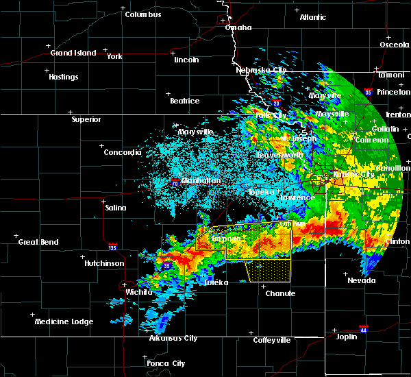 At 112 am cdt, severe thunderstorms were located along a line extending from 7 miles southwest of parker to 3 miles west of madison, moving south at 40 mph (law enforcement. damaging winds have been reported with these storms). Hazards include 60 mph wind gusts and quarter size hail. Hail damage to vehicles is expected. expect wind damage to roofs, siding, and trees. locations impacted include, emporia, ottawa, garnett, burlington, wellsville, lyndon, lebo, pomona, waverly, olpe, richmond, colony, williamsburg, new strawn, quenemo, melvern, hartford, gridley, greeley and princeton. this includes the following highways, interstate 35 between mile markers 128 and 198. Kansas turnpike between mile markers 116 and 126. At 112 am cdt, severe thunderstorms were located along a line extending from 7 miles southwest of parker to 3 miles west of madison, moving south at 40 mph (law enforcement. damaging winds have been reported with these storms). Hazards include 60 mph wind gusts and quarter size hail. Hail damage to vehicles is expected. expect wind damage to roofs, siding, and trees. locations impacted include, emporia, ottawa, garnett, burlington, wellsville, lyndon, lebo, pomona, waverly, olpe, richmond, colony, williamsburg, new strawn, quenemo, melvern, hartford, gridley, greeley and princeton. this includes the following highways, interstate 35 between mile markers 128 and 198. Kansas turnpike between mile markers 116 and 126.
|
| 6/12/2018 1:13 AM CDT |
 At 112 am cdt, severe thunderstorms were located along a line extending from 7 miles southwest of parker to 3 miles west of madison, moving south at 40 mph (law enforcement. damaging winds have been reported with these storms). Hazards include 60 mph wind gusts and quarter size hail. Hail damage to vehicles is expected. expect wind damage to roofs, siding, and trees. locations impacted include, emporia, ottawa, garnett, burlington, wellsville, lyndon, lebo, pomona, waverly, olpe, richmond, colony, williamsburg, new strawn, quenemo, melvern, hartford, gridley, greeley and princeton. this includes the following highways, interstate 35 between mile markers 128 and 198. Kansas turnpike between mile markers 116 and 126. At 112 am cdt, severe thunderstorms were located along a line extending from 7 miles southwest of parker to 3 miles west of madison, moving south at 40 mph (law enforcement. damaging winds have been reported with these storms). Hazards include 60 mph wind gusts and quarter size hail. Hail damage to vehicles is expected. expect wind damage to roofs, siding, and trees. locations impacted include, emporia, ottawa, garnett, burlington, wellsville, lyndon, lebo, pomona, waverly, olpe, richmond, colony, williamsburg, new strawn, quenemo, melvern, hartford, gridley, greeley and princeton. this includes the following highways, interstate 35 between mile markers 128 and 198. Kansas turnpike between mile markers 116 and 126.
|
| 6/12/2018 1:08 AM CDT |
 At 108 am cdt, severe thunderstorms were located along a line extending from 5 miles southwest of parker to 4 miles northwest of madison, moving south at 35 mph (radar indicated). Hazards include 60 mph wind gusts and quarter size hail. Hail damage to vehicles is expected. expect wind damage to roofs, siding, and trees. locations impacted include, emporia, ottawa, garnett, burlington, wellsville, lyndon, lebo, pomona, waverly, olpe, richmond, colony, williamsburg, new strawn, quenemo, melvern, hartford, gridley, greeley and princeton. this includes the following highways, interstate 35 between mile markers 128 and 198. Kansas turnpike between mile markers 116 and 126. At 108 am cdt, severe thunderstorms were located along a line extending from 5 miles southwest of parker to 4 miles northwest of madison, moving south at 35 mph (radar indicated). Hazards include 60 mph wind gusts and quarter size hail. Hail damage to vehicles is expected. expect wind damage to roofs, siding, and trees. locations impacted include, emporia, ottawa, garnett, burlington, wellsville, lyndon, lebo, pomona, waverly, olpe, richmond, colony, williamsburg, new strawn, quenemo, melvern, hartford, gridley, greeley and princeton. this includes the following highways, interstate 35 between mile markers 128 and 198. Kansas turnpike between mile markers 116 and 126.
|
| 6/12/2018 12:57 AM CDT |
 At 1256 am cdt, severe thunderstorms were located along a line extending from greeley to 9 miles west of olpe, moving south at 40 mph (trained weather spotters. measured severe winds have been reported with these storms). Hazards include 60 mph wind gusts and quarter size hail. Hail damage to vehicles is expected. expect wind damage to roofs, siding, and trees. locations impacted include, emporia, ottawa, garnett, burlington, wellsville, lyndon, lebo, pomona, waverly, olpe, richmond, colony, williamsburg, new strawn, quenemo, melvern, hartford, gridley, greeley and princeton. this includes the following highways, interstate 35 between mile markers 128 and 198. Kansas turnpike between mile markers 116 and 126. At 1256 am cdt, severe thunderstorms were located along a line extending from greeley to 9 miles west of olpe, moving south at 40 mph (trained weather spotters. measured severe winds have been reported with these storms). Hazards include 60 mph wind gusts and quarter size hail. Hail damage to vehicles is expected. expect wind damage to roofs, siding, and trees. locations impacted include, emporia, ottawa, garnett, burlington, wellsville, lyndon, lebo, pomona, waverly, olpe, richmond, colony, williamsburg, new strawn, quenemo, melvern, hartford, gridley, greeley and princeton. this includes the following highways, interstate 35 between mile markers 128 and 198. Kansas turnpike between mile markers 116 and 126.
|
| 6/12/2018 12:47 AM CDT |
 At 1246 am cdt, severe thunderstorms were located along a line extending from near lane to 7 miles west of olpe, moving south at 40 mph (radar indicated). Hazards include 60 mph wind gusts and quarter size hail. Hail damage to vehicles is expected. Expect wind damage to roofs, siding, and trees. At 1246 am cdt, severe thunderstorms were located along a line extending from near lane to 7 miles west of olpe, moving south at 40 mph (radar indicated). Hazards include 60 mph wind gusts and quarter size hail. Hail damage to vehicles is expected. Expect wind damage to roofs, siding, and trees.
|
| 6/12/2018 12:43 AM CDT |
 At 1241 am cdt, severe thunderstorms were located along a line extending from near paola to 3 miles northeast of harris to near neosho rapids, moving south at 40 mph (trained weather spotters. at 1245 am cdt...the ottawa asos site measured a 61 mph wind gust). Hazards include 70 mph wind gusts and half dollar size hail. Hail damage to vehicles is expected. expect considerable tree damage. wind damage is also likely to mobile homes, roofs, and outbuildings. locations impacted include, southern lawrence, emporia, ottawa, baldwin city, garnett, osage city, burlington, carbondale, eskridge, eudora, richland, wellsville, overbrook, lyndon, centropolis, lebo, burlingame, pomona, scranton and waverly. this includes the following highways, interstate 35 between mile markers 130 and 198. Kansas turnpike between mile markers 133 and 167. At 1241 am cdt, severe thunderstorms were located along a line extending from near paola to 3 miles northeast of harris to near neosho rapids, moving south at 40 mph (trained weather spotters. at 1245 am cdt...the ottawa asos site measured a 61 mph wind gust). Hazards include 70 mph wind gusts and half dollar size hail. Hail damage to vehicles is expected. expect considerable tree damage. wind damage is also likely to mobile homes, roofs, and outbuildings. locations impacted include, southern lawrence, emporia, ottawa, baldwin city, garnett, osage city, burlington, carbondale, eskridge, eudora, richland, wellsville, overbrook, lyndon, centropolis, lebo, burlingame, pomona, scranton and waverly. this includes the following highways, interstate 35 between mile markers 130 and 198. Kansas turnpike between mile markers 133 and 167.
|
| 6/12/2018 12:21 AM CDT |
 At 1221 am cdt, severe thunderstorms were located along a line extending from near edgerton to 3 miles southeast of quenemo to 5 miles west of reading, moving south at 40 mph (trained weather spotters. at 1208 am cdt...trained spotter reported ping pong ball size hail 2 miles northeast of pleasant grove). Hazards include 70 mph wind gusts and ping pong ball size hail. People and animals outdoors will be injured. expect hail damage to roofs, siding, windows, and vehicles. expect considerable tree damage. wind damage is also likely to mobile homes, roofs, and outbuildings. locations impacted include, southern lawrence, emporia, ottawa, baldwin city, garnett, osage city, burlington, carbondale, eskridge, eudora, richland, wellsville, overbrook, lyndon, centropolis, lebo, burlingame, pomona, scranton and waverly. this includes the following highways, interstate 35 between mile markers 130 and 198. Kansas turnpike between mile markers 133 and 167. At 1221 am cdt, severe thunderstorms were located along a line extending from near edgerton to 3 miles southeast of quenemo to 5 miles west of reading, moving south at 40 mph (trained weather spotters. at 1208 am cdt...trained spotter reported ping pong ball size hail 2 miles northeast of pleasant grove). Hazards include 70 mph wind gusts and ping pong ball size hail. People and animals outdoors will be injured. expect hail damage to roofs, siding, windows, and vehicles. expect considerable tree damage. wind damage is also likely to mobile homes, roofs, and outbuildings. locations impacted include, southern lawrence, emporia, ottawa, baldwin city, garnett, osage city, burlington, carbondale, eskridge, eudora, richland, wellsville, overbrook, lyndon, centropolis, lebo, burlingame, pomona, scranton and waverly. this includes the following highways, interstate 35 between mile markers 130 and 198. Kansas turnpike between mile markers 133 and 167.
|
| 6/12/2018 12:09 AM CDT |
 At 1208 am cdt, severe thunderstorms were located along a line extending from 6 miles southeast of eudora to near pomona lake to near admire, moving south at 40 mph (trained weather spotters. at 1202 am cdt...trained spotters reported quarter size hail and estimated 60 mph wind gusts in lawrence). Hazards include 70 mph wind gusts and half dollar size hail. Hail damage to vehicles is expected. expect considerable tree damage. wind damage is also likely to mobile homes, roofs, and outbuildings. locations impacted include, southern lawrence, emporia, ottawa, baldwin city, garnett, osage city, burlington, carbondale, eskridge, eudora, richland, wellsville, overbrook, lyndon, centropolis, lebo, burlingame, pomona, scranton and waverly. this includes the following highways, interstate 35 between mile markers 130 and 198. Kansas turnpike between mile markers 133 and 167. At 1208 am cdt, severe thunderstorms were located along a line extending from 6 miles southeast of eudora to near pomona lake to near admire, moving south at 40 mph (trained weather spotters. at 1202 am cdt...trained spotters reported quarter size hail and estimated 60 mph wind gusts in lawrence). Hazards include 70 mph wind gusts and half dollar size hail. Hail damage to vehicles is expected. expect considerable tree damage. wind damage is also likely to mobile homes, roofs, and outbuildings. locations impacted include, southern lawrence, emporia, ottawa, baldwin city, garnett, osage city, burlington, carbondale, eskridge, eudora, richland, wellsville, overbrook, lyndon, centropolis, lebo, burlingame, pomona, scranton and waverly. this includes the following highways, interstate 35 between mile markers 130 and 198. Kansas turnpike between mile markers 133 and 167.
|
| 6/12/2018 12:05 AM CDT |
 At 1204 am cdt, severe thunderstorms were located along a line extending from 3 miles southeast of eudora to near pomona lake to 3 miles northeast of allen, moving south at 40 mph (trained weather spotters). Hazards include 70 mph wind gusts and half dollar size hail. Hail damage to vehicles is expected. expect considerable tree damage. Wind damage is also likely to mobile homes, roofs, and outbuildings. At 1204 am cdt, severe thunderstorms were located along a line extending from 3 miles southeast of eudora to near pomona lake to 3 miles northeast of allen, moving south at 40 mph (trained weather spotters). Hazards include 70 mph wind gusts and half dollar size hail. Hail damage to vehicles is expected. expect considerable tree damage. Wind damage is also likely to mobile homes, roofs, and outbuildings.
|
| 6/2/2018 5:36 AM CDT |
 At 536 am cdt, a severe thunderstorm was located 5 miles southeast of lebo, moving east at 30 mph (radar indicated). Hazards include 60 mph wind gusts. Expect damage to roofs, siding, and trees. locations impacted include, burlington, lebo, waverly, new strawn, quenemo, melvern, hartford, neosho rapids, reading, olivet, beto junction, john redmond reservoir and melvern lake. This includes interstate 35 between mile markers 139 and 167. At 536 am cdt, a severe thunderstorm was located 5 miles southeast of lebo, moving east at 30 mph (radar indicated). Hazards include 60 mph wind gusts. Expect damage to roofs, siding, and trees. locations impacted include, burlington, lebo, waverly, new strawn, quenemo, melvern, hartford, neosho rapids, reading, olivet, beto junction, john redmond reservoir and melvern lake. This includes interstate 35 between mile markers 139 and 167.
|
| 6/2/2018 5:17 AM CDT |
 At 517 am cdt, a severe thunderstorm was located over neosho rapids, moving east at 30 mph (radar indicated). Hazards include 60 mph wind gusts. expect damage to roofs, siding, and trees At 517 am cdt, a severe thunderstorm was located over neosho rapids, moving east at 30 mph (radar indicated). Hazards include 60 mph wind gusts. expect damage to roofs, siding, and trees
|
| 5/14/2018 6:24 PM CDT |
 At 624 pm cdt, a severe thunderstorm was located 8 miles northwest of yates center, moving northeast at 30 mph (radar indicated). Hazards include ping pong ball size hail and 60 mph wind gusts. People and animals outdoors will be injured. expect hail damage to roofs, siding, windows, and vehicles. Expect wind damage to roofs, siding, and trees. At 624 pm cdt, a severe thunderstorm was located 8 miles northwest of yates center, moving northeast at 30 mph (radar indicated). Hazards include ping pong ball size hail and 60 mph wind gusts. People and animals outdoors will be injured. expect hail damage to roofs, siding, windows, and vehicles. Expect wind damage to roofs, siding, and trees.
|
| 5/14/2018 5:48 PM CDT |
 At 548 pm cdt, a severe thunderstorm was located 6 miles southwest of john redmond reservoir, moving northeast at 20 mph (trained weather spotters). Hazards include 60 mph wind gusts and half dollar size hail. Hail damage to vehicles is expected. Expect wind damage to roofs, siding, and trees. At 548 pm cdt, a severe thunderstorm was located 6 miles southwest of john redmond reservoir, moving northeast at 20 mph (trained weather spotters). Hazards include 60 mph wind gusts and half dollar size hail. Hail damage to vehicles is expected. Expect wind damage to roofs, siding, and trees.
|
| 5/14/2018 4:09 PM CDT |
 The severe thunderstorm warning for southwestern coffey county will expire at 415 pm cdt, the storm which prompted the warning has moved out of the area. therefore the warning will be allowed to expire. a severe thunderstorm watch remains in effect until 1000 pm cdt for east central kansas. The severe thunderstorm warning for southwestern coffey county will expire at 415 pm cdt, the storm which prompted the warning has moved out of the area. therefore the warning will be allowed to expire. a severe thunderstorm watch remains in effect until 1000 pm cdt for east central kansas.
|
| 5/14/2018 3:59 PM CDT |
 At 359 pm cdt, a severe thunderstorm was located 5 miles east of gridley, moving east at 15 mph (radar indicated). Hazards include 60 mph wind gusts and half dollar size hail. Hail damage to vehicles is expected. expect wind damage to roofs, siding, and trees. Locations impacted include, burlington and gridley. At 359 pm cdt, a severe thunderstorm was located 5 miles east of gridley, moving east at 15 mph (radar indicated). Hazards include 60 mph wind gusts and half dollar size hail. Hail damage to vehicles is expected. expect wind damage to roofs, siding, and trees. Locations impacted include, burlington and gridley.
|
| 5/14/2018 3:30 PM CDT |
 At 330 pm cdt, a severe thunderstorm was located 4 miles southwest of gridley, moving east at 25 mph (radar indicated). Hazards include golf ball size hail and 60 mph wind gusts. People and animals outdoors will be injured. expect hail damage to roofs, siding, windows, and vehicles. Expect wind damage to roofs, siding, and trees. At 330 pm cdt, a severe thunderstorm was located 4 miles southwest of gridley, moving east at 25 mph (radar indicated). Hazards include golf ball size hail and 60 mph wind gusts. People and animals outdoors will be injured. expect hail damage to roofs, siding, windows, and vehicles. Expect wind damage to roofs, siding, and trees.
|
| 5/14/2018 3:17 PM CDT |
 At 316 pm cdt, a severe thunderstorm was located near neosho falls, moving northeast at 10 mph. an additional thunderstorm located east of gridley was also moving northeast at 10 mph (radar indicated). Hazards include 60 mph wind gusts and half dollar size hail. Hail damage to vehicles is expected. Expect wind damage to roofs, siding, and trees. At 316 pm cdt, a severe thunderstorm was located near neosho falls, moving northeast at 10 mph. an additional thunderstorm located east of gridley was also moving northeast at 10 mph (radar indicated). Hazards include 60 mph wind gusts and half dollar size hail. Hail damage to vehicles is expected. Expect wind damage to roofs, siding, and trees.
|
| 5/14/2018 3:03 PM CDT |
 At 243 pm cdt, a severe thunderstorm was located 4 miles southwest of gridley, moving northeast at 15 mph (radar indicated). Hazards include 60 mph wind gusts and quarter size hail. Hail damage to vehicles is expected. Expect wind damage to roofs, siding, and trees. At 243 pm cdt, a severe thunderstorm was located 4 miles southwest of gridley, moving northeast at 15 mph (radar indicated). Hazards include 60 mph wind gusts and quarter size hail. Hail damage to vehicles is expected. Expect wind damage to roofs, siding, and trees.
|
| 5/14/2018 2:43 PM CDT |
 At 243 pm cdt, a severe thunderstorm was located 4 miles southwest of gridley, moving northeast at 15 mph (radar indicated). Hazards include 60 mph wind gusts and quarter size hail. Hail damage to vehicles is expected. Expect wind damage to roofs, siding, and trees. At 243 pm cdt, a severe thunderstorm was located 4 miles southwest of gridley, moving northeast at 15 mph (radar indicated). Hazards include 60 mph wind gusts and quarter size hail. Hail damage to vehicles is expected. Expect wind damage to roofs, siding, and trees.
|
| 5/14/2018 2:32 PM CDT |
 At 232 pm cdt, a severe thunderstorm was located over burlington, moving east at 25 mph (radar indicated). Hazards include 60 mph wind gusts and quarter size hail. Hail damage to vehicles is expected. expect wind damage to roofs, siding, and trees. Locations impacted include, burlington, new strawn, gridley, le roy and john redmond reservoir. At 232 pm cdt, a severe thunderstorm was located over burlington, moving east at 25 mph (radar indicated). Hazards include 60 mph wind gusts and quarter size hail. Hail damage to vehicles is expected. expect wind damage to roofs, siding, and trees. Locations impacted include, burlington, new strawn, gridley, le roy and john redmond reservoir.
|
| 5/14/2018 1:53 PM CDT |
 At 152 pm cdt, a severe thunderstorm was located 6 miles east of madison, moving east at 25 mph (radar indicated). Hazards include 60 mph wind gusts and quarter size hail. Hail damage to vehicles is expected. Expect wind damage to roofs, siding, and trees. At 152 pm cdt, a severe thunderstorm was located 6 miles east of madison, moving east at 25 mph (radar indicated). Hazards include 60 mph wind gusts and quarter size hail. Hail damage to vehicles is expected. Expect wind damage to roofs, siding, and trees.
|
| 5/2/2018 8:09 PM CDT |
 At 809 pm cdt, a severe thunderstorm was located near burlington, moving east at 45 mph (trained weather spotters). Hazards include golf ball size hail and 60 mph wind gusts. People and animals outdoors will be injured. expect hail damage to roofs, siding, windows, and vehicles. expect wind damage to roofs, siding, and trees. this severe thunderstorm will remain over mainly rural areas of southeastern coffey county. A tornado watch remains in effect until 1000 pm cdt for east central kansas. At 809 pm cdt, a severe thunderstorm was located near burlington, moving east at 45 mph (trained weather spotters). Hazards include golf ball size hail and 60 mph wind gusts. People and animals outdoors will be injured. expect hail damage to roofs, siding, windows, and vehicles. expect wind damage to roofs, siding, and trees. this severe thunderstorm will remain over mainly rural areas of southeastern coffey county. A tornado watch remains in effect until 1000 pm cdt for east central kansas.
|
| 5/2/2018 8:07 PM CDT | Golf Ball sized hail reported 1.5 miles ESE of Burlington, KS |
| 5/2/2018 7:56 PM CDT |
 At 756 pm cdt, a severe thunderstorm was located 5 miles northwest of gridley, moving east at 45 mph (radar indicated). Hazards include 60 mph wind gusts and half dollar size hail. Hail damage to vehicles is expected. expect wind damage to roofs, siding, and trees. this severe thunderstorm will be near, burlington around 810 pm cdt. new strawn around 815 pm cdt. A tornado watch remains in effect until 1000 pm cdt for east central kansas. At 756 pm cdt, a severe thunderstorm was located 5 miles northwest of gridley, moving east at 45 mph (radar indicated). Hazards include 60 mph wind gusts and half dollar size hail. Hail damage to vehicles is expected. expect wind damage to roofs, siding, and trees. this severe thunderstorm will be near, burlington around 810 pm cdt. new strawn around 815 pm cdt. A tornado watch remains in effect until 1000 pm cdt for east central kansas.
|
| 4/13/2018 4:50 PM CDT |
 At 450 pm cdt, a severe thunderstorm was located near burlington, moving northeast at 60 mph (radar indicated). Hazards include 60 mph wind gusts and quarter size hail. Hail damage to vehicles is expected. expect wind damage to roofs, siding, and trees. locations impacted include, burlington. A tornado watch remains in effect until 900 pm cdt for east central kansas. At 450 pm cdt, a severe thunderstorm was located near burlington, moving northeast at 60 mph (radar indicated). Hazards include 60 mph wind gusts and quarter size hail. Hail damage to vehicles is expected. expect wind damage to roofs, siding, and trees. locations impacted include, burlington. A tornado watch remains in effect until 900 pm cdt for east central kansas.
|
| 4/13/2018 4:23 PM CDT |
 At 423 pm cdt, severe thunderstorms were located along a line extending from 4 miles southwest of burlington to 7 miles north of toronto, moving northeast at 30 mph (radar indicated). Hazards include 60 mph wind gusts and half dollar size hail. Hail damage to vehicles is expected. expect wind damage to roofs, siding, and trees. locations impacted include, burlington and le roy. A tornado watch remains in effect until 900 pm cdt for east central kansas. At 423 pm cdt, severe thunderstorms were located along a line extending from 4 miles southwest of burlington to 7 miles north of toronto, moving northeast at 30 mph (radar indicated). Hazards include 60 mph wind gusts and half dollar size hail. Hail damage to vehicles is expected. expect wind damage to roofs, siding, and trees. locations impacted include, burlington and le roy. A tornado watch remains in effect until 900 pm cdt for east central kansas.
|
| 4/13/2018 4:01 PM CDT |
 At 401 pm cdt, severe thunderstorms were located along a line extending from 6 miles south of gridley to 5 miles west of toronto, moving northeast at 35 mph (radar indicated). Hazards include 60 mph wind gusts and half dollar size hail. Hail damage to vehicles is expected. Expect wind damage to roofs, siding, and trees. At 401 pm cdt, severe thunderstorms were located along a line extending from 6 miles south of gridley to 5 miles west of toronto, moving northeast at 35 mph (radar indicated). Hazards include 60 mph wind gusts and half dollar size hail. Hail damage to vehicles is expected. Expect wind damage to roofs, siding, and trees.
|
| 4/13/2018 3:44 PM CDT |
 At 344 pm cdt, a severe thunderstorm was located over john redmond reservoir, moving northeast at 60 mph (radar indicated). Hazards include golf ball size hail and 60 mph wind gusts. People and animals outdoors will be injured. expect hail damage to roofs, siding, windows, and vehicles. expect wind damage to roofs, siding, and trees. locations impacted include, burlington, waverly, new strawn, gridley, le roy and john redmond reservoir. this includes interstate 35 between mile markers 160 and 167. A tornado watch remains in effect until 900 pm cdt for east central kansas. At 344 pm cdt, a severe thunderstorm was located over john redmond reservoir, moving northeast at 60 mph (radar indicated). Hazards include golf ball size hail and 60 mph wind gusts. People and animals outdoors will be injured. expect hail damage to roofs, siding, windows, and vehicles. expect wind damage to roofs, siding, and trees. locations impacted include, burlington, waverly, new strawn, gridley, le roy and john redmond reservoir. this includes interstate 35 between mile markers 160 and 167. A tornado watch remains in effect until 900 pm cdt for east central kansas.
|
| 4/13/2018 3:35 PM CDT | Quarter sized hail reported 7.8 miles ENE of Burlington, KS, mostly dime size hail with a few the size of quarters. |
| 4/13/2018 3:05 PM CDT |
 At 305 pm cdt, severe thunderstorms were located along a line extending from 7 miles northwest of gridley to 6 miles southeast of hamilton to 6 miles southeast of eureka, moving northeast at 50 mph (radar indicated). Hazards include 60 mph wind gusts and half dollar size hail. Hail damage to vehicles is expected. Expect wind damage to roofs, siding, and trees. At 305 pm cdt, severe thunderstorms were located along a line extending from 7 miles northwest of gridley to 6 miles southeast of hamilton to 6 miles southeast of eureka, moving northeast at 50 mph (radar indicated). Hazards include 60 mph wind gusts and half dollar size hail. Hail damage to vehicles is expected. Expect wind damage to roofs, siding, and trees.
|
| 10/14/2017 6:38 PM CDT |
 The severe thunderstorm warning for central coffey county will expire at 645 pm cdt, the storm which prompted the warning has weakened below severe limits, and no longer poses an immediate threat to life or property. therefore the warning will be allowed to expire. however gusty winds and heavy rain are still possible with this thunderstorm. a severe thunderstorm watch remains in effect until midnight cdt for east central kansas. The severe thunderstorm warning for central coffey county will expire at 645 pm cdt, the storm which prompted the warning has weakened below severe limits, and no longer poses an immediate threat to life or property. therefore the warning will be allowed to expire. however gusty winds and heavy rain are still possible with this thunderstorm. a severe thunderstorm watch remains in effect until midnight cdt for east central kansas.
|
| 10/14/2017 6:22 PM CDT |
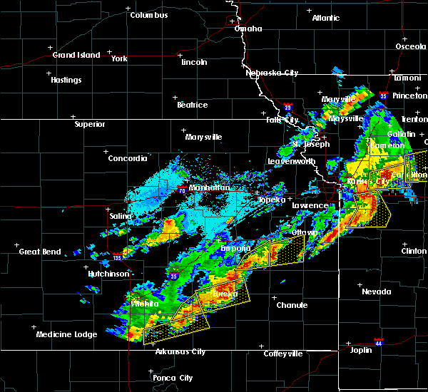 At 622 pm cdt, a severe thunderstorm was located near gridley, moving east at 30 mph (radar indicated). Hazards include 60 mph wind gusts and penny size hail. Expect damage to roofs, siding, and trees. Locations impacted include, burlington, new strawn, gridley, le roy and john redmond reservoir. At 622 pm cdt, a severe thunderstorm was located near gridley, moving east at 30 mph (radar indicated). Hazards include 60 mph wind gusts and penny size hail. Expect damage to roofs, siding, and trees. Locations impacted include, burlington, new strawn, gridley, le roy and john redmond reservoir.
|
| 10/14/2017 6:03 PM CDT |
 At 602 pm cdt, a severe thunderstorm was located near gridley, moving northeast at 45 mph (radar indicated). Hazards include 60 mph wind gusts and penny size hail. Expect damage to roofs, siding, and trees. this severe storm will be near, burlington and john redmond reservoir around 620 pm cdt. New strawn and le roy around 625 pm cdt. At 602 pm cdt, a severe thunderstorm was located near gridley, moving northeast at 45 mph (radar indicated). Hazards include 60 mph wind gusts and penny size hail. Expect damage to roofs, siding, and trees. this severe storm will be near, burlington and john redmond reservoir around 620 pm cdt. New strawn and le roy around 625 pm cdt.
|
| 10/14/2017 5:42 PM CDT |
 At 540 pm cdt, a severe thunderstorm was located near hamilton, moving northeast at 50 mph (trained weather spotters. at 537 pm, spotters estimated winds up to 70 mph 10 miles northwest of eureka). Hazards include 70 mph wind gusts and penny size hail. Expect considerable tree damage. damage is likely to mobile homes, roofs, and outbuildings. this severe thunderstorm will be near, gridley around 605 pm cdt. burlington and john redmond reservoir around 615 pm cdt. new strawn around 620 pm cdt. Waverly around 630 pm cdt. At 540 pm cdt, a severe thunderstorm was located near hamilton, moving northeast at 50 mph (trained weather spotters. at 537 pm, spotters estimated winds up to 70 mph 10 miles northwest of eureka). Hazards include 70 mph wind gusts and penny size hail. Expect considerable tree damage. damage is likely to mobile homes, roofs, and outbuildings. this severe thunderstorm will be near, gridley around 605 pm cdt. burlington and john redmond reservoir around 615 pm cdt. new strawn around 620 pm cdt. Waverly around 630 pm cdt.
|
| 10/14/2017 5:11 PM CDT |
 At 510 pm cdt, a severe thunderstorm was located 5 miles southwest of beto junction, moving northeast at 55 mph (emergency management. at 455 pm, 64 mph winds were measured near the coffey county lake). Hazards include 70 mph wind gusts and penny size hail. Expect considerable tree damage. damage is likely to mobile homes, roofs, and outbuildings. locations impacted include, burlington, waverly, new strawn, quenemo, melvern, olivet, beto junction, john redmond reservoir and melvern lake. This severe thunderstorm will also impact interstate 35. At 510 pm cdt, a severe thunderstorm was located 5 miles southwest of beto junction, moving northeast at 55 mph (emergency management. at 455 pm, 64 mph winds were measured near the coffey county lake). Hazards include 70 mph wind gusts and penny size hail. Expect considerable tree damage. damage is likely to mobile homes, roofs, and outbuildings. locations impacted include, burlington, waverly, new strawn, quenemo, melvern, olivet, beto junction, john redmond reservoir and melvern lake. This severe thunderstorm will also impact interstate 35.
|
| 10/14/2017 4:55 PM CDT | Relayed by the e in coffey county KS, 4.1 miles SSW of Burlington, KS |
| 10/14/2017 4:45 PM CDT |
 At 445 pm cdt, a severe thunderstorm was located near olpe, moving northeast at 50 mph (radar indicated). Hazards include 60 mph wind gusts and penny size hail. expect damage to roofs, siding, and trees At 445 pm cdt, a severe thunderstorm was located near olpe, moving northeast at 50 mph (radar indicated). Hazards include 60 mph wind gusts and penny size hail. expect damage to roofs, siding, and trees
|
| 8/16/2017 4:32 PM CDT |
 At 431 pm cdt, a severe thunderstorm was located 7 miles northeast of madison, moving northeast at 30 mph (radar indicated). Hazards include 60 mph wind gusts and quarter size hail. Hail damage to vehicles is expected. Expect wind damage to roofs, siding, and trees. At 431 pm cdt, a severe thunderstorm was located 7 miles northeast of madison, moving northeast at 30 mph (radar indicated). Hazards include 60 mph wind gusts and quarter size hail. Hail damage to vehicles is expected. Expect wind damage to roofs, siding, and trees.
|
| 6/17/2017 9:55 PM CDT |
 The severe thunderstorm warning for southwestern anderson and southeastern coffey counties will expire at 1000 pm cdt, the storms which prompted the warning have weakened below severe limits, and no longer pose an immediate threat to life or property. therefore the warning will be allowed to expire. however small hail, gusty winds and heavy rain are still possible with these thunderstorms. a severe thunderstorm watch remains in effect until 200 am cdt for east central kansas. The severe thunderstorm warning for southwestern anderson and southeastern coffey counties will expire at 1000 pm cdt, the storms which prompted the warning have weakened below severe limits, and no longer pose an immediate threat to life or property. therefore the warning will be allowed to expire. however small hail, gusty winds and heavy rain are still possible with these thunderstorms. a severe thunderstorm watch remains in effect until 200 am cdt for east central kansas.
|
| 6/17/2017 9:38 PM CDT |
 At 938 pm cdt, severe thunderstorms were located along a line extending from 5 miles west of harris to 3 miles southwest of westphalia to 5 miles southeast of gridley, moving east at 40 mph (automated surface observation site). Hazards include 60 mph wind gusts and penny size hail. Expect damage to roofs, siding, and trees. these severe storms will be near, westphalia around 945 pm cdt. colony around 955 pm cdt. Lone elm around 1000 pm cdt. At 938 pm cdt, severe thunderstorms were located along a line extending from 5 miles west of harris to 3 miles southwest of westphalia to 5 miles southeast of gridley, moving east at 40 mph (automated surface observation site). Hazards include 60 mph wind gusts and penny size hail. Expect damage to roofs, siding, and trees. these severe storms will be near, westphalia around 945 pm cdt. colony around 955 pm cdt. Lone elm around 1000 pm cdt.
|
| 6/17/2017 9:35 PM CDT | Tree blown dow in coffey county KS, 4.2 miles E of Burlington, KS |
| 6/17/2017 9:33 PM CDT |
 At 933 pm cdt, severe thunderstorms were located along a line extending from 4 miles south of waverly to 6 miles north of le roy to near gridley, moving southeast at 35 mph (radar indicated). Hazards include 60 mph wind gusts and penny size hail. Expect damage to roofs, siding, and trees. these severe storms will be near, le roy around 940 pm cdt. westphalia around 950 pm cdt. Colony around 955 pm cdt. At 933 pm cdt, severe thunderstorms were located along a line extending from 4 miles south of waverly to 6 miles north of le roy to near gridley, moving southeast at 35 mph (radar indicated). Hazards include 60 mph wind gusts and penny size hail. Expect damage to roofs, siding, and trees. these severe storms will be near, le roy around 940 pm cdt. westphalia around 950 pm cdt. Colony around 955 pm cdt.
|
| 6/17/2017 9:23 PM CDT | Storm damage reported in coffey county KS, 7.4 miles S of Burlington, KS |
| 6/17/2017 9:21 PM CDT |
 The national weather service in topeka has issued a * severe thunderstorm warning for. southwestern anderson county in east central kansas. coffey county in east central kansas. Until 1000 pm cdt * at 921 pm cdt, severe thunderstorms were located along a line. The national weather service in topeka has issued a * severe thunderstorm warning for. southwestern anderson county in east central kansas. coffey county in east central kansas. Until 1000 pm cdt * at 921 pm cdt, severe thunderstorms were located along a line.
|
| 6/17/2017 9:18 PM CDT |
 At 918 pm cdt, a severe thunderstorm was located over new strawn, moving southeast at 35 mph (radar indicated). Hazards include 60 mph wind gusts and penny size hail. Expect damage to roofs, siding, and trees. this severe thunderstorm will remain over mainly rural areas of coffey county. This includes interstate 35 between mile markers 144 and 155. At 918 pm cdt, a severe thunderstorm was located over new strawn, moving southeast at 35 mph (radar indicated). Hazards include 60 mph wind gusts and penny size hail. Expect damage to roofs, siding, and trees. this severe thunderstorm will remain over mainly rural areas of coffey county. This includes interstate 35 between mile markers 144 and 155.
|
| 6/17/2017 9:11 PM CDT |
 At 910 pm cdt, a severe thunderstorm was located near john redmond reservoir, moving southeast at 45 mph (radar indicated). Hazards include 60 mph wind gusts and penny size hail. Expect damage to roofs, siding, and trees. this severe storm will be near, new strawn around 915 pm cdt. burlington around 920 pm cdt. This includes interstate 35 between mile markers 144 and 162. At 910 pm cdt, a severe thunderstorm was located near john redmond reservoir, moving southeast at 45 mph (radar indicated). Hazards include 60 mph wind gusts and penny size hail. Expect damage to roofs, siding, and trees. this severe storm will be near, new strawn around 915 pm cdt. burlington around 920 pm cdt. This includes interstate 35 between mile markers 144 and 162.
|
| 6/17/2017 9:00 PM CDT |
 At 900 pm cdt, a severe thunderstorm was located near hartford, moving southeast at 35 mph (radar indicated). Hazards include 60 mph wind gusts and half dollar size hail. Hail damage to vehicles is expected. expect wind damage to roofs, siding, and trees. this severe storm will be near, new strawn and john redmond reservoir around 920 pm cdt. burlington around 925 pm cdt. This includes interstate 35 between mile markers 139 and 162. At 900 pm cdt, a severe thunderstorm was located near hartford, moving southeast at 35 mph (radar indicated). Hazards include 60 mph wind gusts and half dollar size hail. Hail damage to vehicles is expected. expect wind damage to roofs, siding, and trees. this severe storm will be near, new strawn and john redmond reservoir around 920 pm cdt. burlington around 925 pm cdt. This includes interstate 35 between mile markers 139 and 162.
|
| 6/17/2017 8:44 PM CDT |
 At 844 pm cdt, a severe thunderstorm was located over reading, moving southeast at 40 mph (radar indicated). Hazards include two inch hail and 60 mph wind gusts. People and animals outdoors will be injured. expect hail damage to roofs, siding, windows, and vehicles. expect wind damage to roofs, siding, and trees. this severe thunderstorm will be near, lebo and melvern lake around 855 pm cdt. olivet around 900 pm cdt. beto junction around 905 pm cdt. waverly around 915 pm cdt. this includes the following highways, interstate 35 between mile markers 139 and 165. Kansas turnpike between mile markers 137 and 143. At 844 pm cdt, a severe thunderstorm was located over reading, moving southeast at 40 mph (radar indicated). Hazards include two inch hail and 60 mph wind gusts. People and animals outdoors will be injured. expect hail damage to roofs, siding, windows, and vehicles. expect wind damage to roofs, siding, and trees. this severe thunderstorm will be near, lebo and melvern lake around 855 pm cdt. olivet around 900 pm cdt. beto junction around 905 pm cdt. waverly around 915 pm cdt. this includes the following highways, interstate 35 between mile markers 139 and 165. Kansas turnpike between mile markers 137 and 143.
|
| 6/15/2017 7:52 PM CDT |
 The severe thunderstorm warning for coffey and southern lyon counties will expire at 800 pm cdt, the storm which prompted the warning has weakened below severe limits, and no longer poses an immediate threat to life or property. therefore the warning will be allowed to expire. however small hail, gusty winds and heavy rain are still possible with this thunderstorm. a severe thunderstorm watch remains in effect until 200 am cdt for east central kansas. The severe thunderstorm warning for coffey and southern lyon counties will expire at 800 pm cdt, the storm which prompted the warning has weakened below severe limits, and no longer poses an immediate threat to life or property. therefore the warning will be allowed to expire. however small hail, gusty winds and heavy rain are still possible with this thunderstorm. a severe thunderstorm watch remains in effect until 200 am cdt for east central kansas.
|
| 6/15/2017 7:35 PM CDT |
 At 734 pm cdt, a severe thunderstorm was located 6 miles west of le roy, moving east at 45 mph (trained weather spotters reported 3 to 4 diameter tree limbs down 4 miles south of emporia at 720 pm). Hazards include 60 mph wind gusts and quarter size hail. Hail damage to vehicles is expected. expect wind damage to roofs, siding, and trees. Locations impacted include, burlington, olpe, new strawn, hartford, gridley, neosho rapids, john redmond reservoir and le roy. At 734 pm cdt, a severe thunderstorm was located 6 miles west of le roy, moving east at 45 mph (trained weather spotters reported 3 to 4 diameter tree limbs down 4 miles south of emporia at 720 pm). Hazards include 60 mph wind gusts and quarter size hail. Hail damage to vehicles is expected. expect wind damage to roofs, siding, and trees. Locations impacted include, burlington, olpe, new strawn, hartford, gridley, neosho rapids, john redmond reservoir and le roy.
|
| 6/15/2017 7:13 PM CDT |
 At 712 pm cdt, a severe thunderstorm was located 6 miles northeast of madison, moving southeast at 45 mph (trained weather spotters reported a 60 mph wind gust 8 miles southwest of olpe at 700 pm). Hazards include 60 mph wind gusts and quarter size hail. Hail damage to vehicles is expected. Expect wind damage to roofs, siding, and trees. At 712 pm cdt, a severe thunderstorm was located 6 miles northeast of madison, moving southeast at 45 mph (trained weather spotters reported a 60 mph wind gust 8 miles southwest of olpe at 700 pm). Hazards include 60 mph wind gusts and quarter size hail. Hail damage to vehicles is expected. Expect wind damage to roofs, siding, and trees.
|
| 6/14/2017 4:50 AM CDT | Storm damage reported in coffey county KS, 7.4 miles S of Burlington, KS |
| 5/27/2017 4:38 PM CDT |
 The severe thunderstorm warning for northeastern coffey county will expire at 445 pm cdt, the storm which prompted the warning has weakened below severe limits, and no longer poses an immediate threat to life or property. therefore the warning will be allowed to expire. The severe thunderstorm warning for northeastern coffey county will expire at 445 pm cdt, the storm which prompted the warning has weakened below severe limits, and no longer poses an immediate threat to life or property. therefore the warning will be allowed to expire.
|
| 5/27/2017 4:29 PM CDT |
 At 429 pm cdt, a severe thunderstorm was located 4 miles east of new strawn, moving east at 35 mph (radar indicated). Hazards include 60 mph wind gusts and quarter size hail. Hail damage to vehicles is expected. expect wind damage to roofs, siding, and trees. Locations impacted include, new strawn. At 429 pm cdt, a severe thunderstorm was located 4 miles east of new strawn, moving east at 35 mph (radar indicated). Hazards include 60 mph wind gusts and quarter size hail. Hail damage to vehicles is expected. expect wind damage to roofs, siding, and trees. Locations impacted include, new strawn.
|
| 5/27/2017 4:15 PM CDT |
 At 414 pm cdt, a severe thunderstorm was located over john redmond reservoir, moving east at 40 mph (radar indicated). Hazards include 60 mph wind gusts and quarter size hail. Hail damage to vehicles is expected. expect wind damage to roofs, siding, and trees. Locations impacted include, burlington, new strawn and john redmond reservoir. At 414 pm cdt, a severe thunderstorm was located over john redmond reservoir, moving east at 40 mph (radar indicated). Hazards include 60 mph wind gusts and quarter size hail. Hail damage to vehicles is expected. expect wind damage to roofs, siding, and trees. Locations impacted include, burlington, new strawn and john redmond reservoir.
|
| 5/27/2017 3:58 PM CDT |
 At 356 pm cdt, a severe thunderstorm was located 6 miles east of olpe, moving east at 40 mph (trained weather spotters reported 70 mph wind gusts 10 miles west northwest of olpe and golf ball sized hail 9 miles southwest of olpe at 340 pm). Hazards include golf ball size hail and 60 mph wind gusts. People and animals outdoors will be injured. expect hail damage to roofs, siding, windows, and vehicles. Expect wind damage to roofs, siding, and trees. At 356 pm cdt, a severe thunderstorm was located 6 miles east of olpe, moving east at 40 mph (trained weather spotters reported 70 mph wind gusts 10 miles west northwest of olpe and golf ball sized hail 9 miles southwest of olpe at 340 pm). Hazards include golf ball size hail and 60 mph wind gusts. People and animals outdoors will be injured. expect hail damage to roofs, siding, windows, and vehicles. Expect wind damage to roofs, siding, and trees.
|
| 3/6/2017 7:50 PM CST |
 At 748 pm cst, severe thunderstorms were located along a line extending from 4 miles southwest of rantoul to 3 miles southwest of le roy, moving east at 45 mph (radar indicated). Hazards include 60 mph wind gusts and quarter size hail. Hail damage to vehicles is expected. expect wind damage to roofs, siding, and trees. locations impacted include, garnett, burlington, richmond, greeley, princeton, lane, westphalia, le roy and harris. A tornado watch remains in effect until 1000 pm cst for east central kansas. At 748 pm cst, severe thunderstorms were located along a line extending from 4 miles southwest of rantoul to 3 miles southwest of le roy, moving east at 45 mph (radar indicated). Hazards include 60 mph wind gusts and quarter size hail. Hail damage to vehicles is expected. expect wind damage to roofs, siding, and trees. locations impacted include, garnett, burlington, richmond, greeley, princeton, lane, westphalia, le roy and harris. A tornado watch remains in effect until 1000 pm cst for east central kansas.
|
| 3/6/2017 7:35 PM CST |
 At 734 pm cst, severe thunderstorms were located along a line extending from 3 miles northwest of princeton to near gridley, moving east at 40 mph (radar indicated). Hazards include 60 mph wind gusts and quarter size hail. Hail damage to vehicles is expected. expect wind damage to roofs, siding, and trees. locations impacted include, garnett, burlington, waverly, richmond, williamsburg, new strawn, melvern, gridley, greeley, princeton, lane, westphalia, beto junction, harris, john redmond reservoir and le roy. this includes interstate 35 between mile markers 152 and 175. A tornado watch remains in effect until 1000 pm cst for east central kansas. At 734 pm cst, severe thunderstorms were located along a line extending from 3 miles northwest of princeton to near gridley, moving east at 40 mph (radar indicated). Hazards include 60 mph wind gusts and quarter size hail. Hail damage to vehicles is expected. expect wind damage to roofs, siding, and trees. locations impacted include, garnett, burlington, waverly, richmond, williamsburg, new strawn, melvern, gridley, greeley, princeton, lane, westphalia, beto junction, harris, john redmond reservoir and le roy. this includes interstate 35 between mile markers 152 and 175. A tornado watch remains in effect until 1000 pm cst for east central kansas.
|
| 3/6/2017 7:26 PM CST |
 At 726 pm cst, severe thunderstorms were located along a line extending from williamsburg to 3 miles southwest of burlington, moving east at 50 mph (radar indicated). Hazards include 60 mph wind gusts and quarter size hail. Hail damage to vehicles is expected. expect wind damage to roofs, siding, and trees. locations impacted include, garnett, burlington, lebo, waverly, olpe, richmond, williamsburg, new strawn, melvern, hartford, gridley, greeley, princeton, neosho rapids, lane, westphalia, olivet, beto junction, harris and john redmond reservoir. this includes interstate 35 between mile markers 140 and 175. A tornado watch remains in effect until 1000 pm cst for east central kansas. At 726 pm cst, severe thunderstorms were located along a line extending from williamsburg to 3 miles southwest of burlington, moving east at 50 mph (radar indicated). Hazards include 60 mph wind gusts and quarter size hail. Hail damage to vehicles is expected. expect wind damage to roofs, siding, and trees. locations impacted include, garnett, burlington, lebo, waverly, olpe, richmond, williamsburg, new strawn, melvern, hartford, gridley, greeley, princeton, neosho rapids, lane, westphalia, olivet, beto junction, harris and john redmond reservoir. this includes interstate 35 between mile markers 140 and 175. A tornado watch remains in effect until 1000 pm cst for east central kansas.
|
| 3/6/2017 7:12 PM CST |
 At 711 pm cst, severe thunderstorms were located along a line extending from melvern lake to 3 miles northeast of madison, moving east at 45 mph (radar indicated). Hazards include 60 mph wind gusts and quarter size hail. Hail damage to vehicles is expected. expect wind damage to roofs, siding, and trees. locations impacted include, emporia, garnett, burlington, lebo, waverly, olpe, richmond, williamsburg, new strawn, melvern, hartford, gridley, greeley, princeton, neosho rapids, reading, lane, westphalia, olivet and beto junction. this includes the following highways, interstate 35 between mile markers 128 and 176. kansas turnpike between mile markers 116 and 135. A tornado watch remains in effect until 1000 pm cst for east central kansas. At 711 pm cst, severe thunderstorms were located along a line extending from melvern lake to 3 miles northeast of madison, moving east at 45 mph (radar indicated). Hazards include 60 mph wind gusts and quarter size hail. Hail damage to vehicles is expected. expect wind damage to roofs, siding, and trees. locations impacted include, emporia, garnett, burlington, lebo, waverly, olpe, richmond, williamsburg, new strawn, melvern, hartford, gridley, greeley, princeton, neosho rapids, reading, lane, westphalia, olivet and beto junction. this includes the following highways, interstate 35 between mile markers 128 and 176. kansas turnpike between mile markers 116 and 135. A tornado watch remains in effect until 1000 pm cst for east central kansas.
|
| 3/6/2017 6:56 PM CST |
 At 655 pm cst, severe thunderstorms were located along a line extending from near reading to 8 miles west of madison, moving east at 45 mph (radar indicated). Hazards include 60 mph wind gusts and quarter size hail. Hail damage to vehicles is expected. Expect wind damage to roofs, siding, and trees. At 655 pm cst, severe thunderstorms were located along a line extending from near reading to 8 miles west of madison, moving east at 45 mph (radar indicated). Hazards include 60 mph wind gusts and quarter size hail. Hail damage to vehicles is expected. Expect wind damage to roofs, siding, and trees.
|
| 8/24/2016 7:45 PM CDT | Golf Ball sized hail reported 7.4 miles S of Burlington, KS |
| 8/24/2016 7:44 PM CDT | 30 foot by 40 foot pole barn blown over in coffey county KS, 7.4 miles S of Burlington, KS |
| 8/24/2016 7:42 PM CDT | Tea Cup sized hail reported 8.8 miles S of Burlington, KS, photo sent in via social media. radar estimated time |
| 8/24/2016 7:40 PM CDT | Storm damage reported in coffey county KS, 7.4 miles S of Burlington, KS |
| 8/24/2016 7:39 PM CDT | Ping Pong Ball sized hail reported 7.4 miles S of Burlington, KS |
| 8/24/2016 7:36 PM CDT | Ping Pong Ball sized hail reported 7.8 miles SSE of Burlington, KS |
| 8/19/2016 7:30 PM CDT |
 At 730 pm cdt, severe thunderstorms were located along a line extending from 6 miles south of waverly to 4 miles west of le roy, moving east at 45 mph (radar indicated). Hazards include 60 mph wind gusts. Expect damage to roofs. siding. And trees. At 730 pm cdt, severe thunderstorms were located along a line extending from 6 miles south of waverly to 4 miles west of le roy, moving east at 45 mph (radar indicated). Hazards include 60 mph wind gusts. Expect damage to roofs. siding. And trees.
|
| 4/26/2016 8:58 PM CDT | Storm damage reported in coffey county KS, 7.4 miles S of Burlington, KS |
| 4/26/2016 8:57 PM CDT |
 At 856 pm cdt, a severe thunderstorm was located near john redmond reservoir, moving northeast at 40 mph (spotters reported quarter size hail 7 miles west of burlington). Hazards include 70 mph wind gusts and quarter size hail. Hail damage to vehicles is expected. expect considerable tree damage. Wind damage is also likely to mobile homes, roofs, and outbuildings. At 856 pm cdt, a severe thunderstorm was located near john redmond reservoir, moving northeast at 40 mph (spotters reported quarter size hail 7 miles west of burlington). Hazards include 70 mph wind gusts and quarter size hail. Hail damage to vehicles is expected. expect considerable tree damage. Wind damage is also likely to mobile homes, roofs, and outbuildings.
|
| 4/26/2016 8:55 PM CDT | Quarter sized hail reported 6.9 miles E of Burlington, KS |
| 4/26/2016 3:25 PM CDT |
 At 324 pm cdt, a severe thunderstorm was located 7 miles northwest of westphalia, moving north at 35 mph (radar indicated). Hazards include 60 mph wind gusts and quarter size hail. Hail damage to vehicles is expected. expect wind damage to roofs, siding, and trees. locations impacted include, burlington, waverly, williamsburg, melvern, westphalia and harris. this includes interstate 35 between mile markers 157 and 171. A tornado watch remains in effect until 900 pm cdt for east central kansas. At 324 pm cdt, a severe thunderstorm was located 7 miles northwest of westphalia, moving north at 35 mph (radar indicated). Hazards include 60 mph wind gusts and quarter size hail. Hail damage to vehicles is expected. expect wind damage to roofs, siding, and trees. locations impacted include, burlington, waverly, williamsburg, melvern, westphalia and harris. this includes interstate 35 between mile markers 157 and 171. A tornado watch remains in effect until 900 pm cdt for east central kansas.
|
| 4/26/2016 3:15 PM CDT |
 At 315 pm cdt, a severe thunderstorm was located near le roy, moving north at 35 mph (radar indicated). Hazards include ping pong ball size hail and 60 mph wind gusts. People and animals outdoors will be injured. expect hail damage to roofs, siding, windows, and vehicles. Expect wind damage to roofs, siding, and trees. At 315 pm cdt, a severe thunderstorm was located near le roy, moving north at 35 mph (radar indicated). Hazards include ping pong ball size hail and 60 mph wind gusts. People and animals outdoors will be injured. expect hail damage to roofs, siding, windows, and vehicles. Expect wind damage to roofs, siding, and trees.
|
| 11/5/2015 1:40 PM CST | Ping Pong Ball sized hail reported 5.5 miles SSE of Burlington, KS |
| 11/5/2015 1:36 PM CST |
 At 135 pm cst, a severe thunderstorm was located over john redmond reservoir, moving northeast at 55 mph (radar indicated). Hazards include 60 mph wind gusts and quarter size hail. Hail damage to vehicles is expected. Expect wind damage to roofs, siding and trees. At 135 pm cst, a severe thunderstorm was located over john redmond reservoir, moving northeast at 55 mph (radar indicated). Hazards include 60 mph wind gusts and quarter size hail. Hail damage to vehicles is expected. Expect wind damage to roofs, siding and trees.
|
| 9/10/2015 9:37 PM CDT |
 At 936 pm cdt, severe thunderstorms were located along a line extending from near alma to admire to 10 miles southeast of cottonwood falls, moving east at 60 mph (radar indicated). Hazards include 60 mph wind gusts and penny size hail. Expect damage to roofs. Siding and trees. At 936 pm cdt, severe thunderstorms were located along a line extending from near alma to admire to 10 miles southeast of cottonwood falls, moving east at 60 mph (radar indicated). Hazards include 60 mph wind gusts and penny size hail. Expect damage to roofs. Siding and trees.
|
| 9/10/2015 9:08 PM CDT |
 At 907 pm cdt, severe thunderstorms were located along a line extending from near lyndon to lebo to near emporia, moving southeast at 50 mph (trained weather spotters reported 75 mph wind gusts and tree limb damage near allen at 855 pm). Hazards include 70 mph wind gusts. Expect considerable tree damage. Damage is likely to mobile homes, roofs and outbuildings. At 907 pm cdt, severe thunderstorms were located along a line extending from near lyndon to lebo to near emporia, moving southeast at 50 mph (trained weather spotters reported 75 mph wind gusts and tree limb damage near allen at 855 pm). Hazards include 70 mph wind gusts. Expect considerable tree damage. Damage is likely to mobile homes, roofs and outbuildings.
|
| 9/10/2015 6:36 PM CDT |
 At 636 pm cdt, a severe thunderstorm was located near burlington, moving east at 15 mph (radar indicated). Hazards include 60 mph wind gusts and half dollar size hail. Hail damage to vehicles is expected. Expect wind damage to roofs, siding and trees. At 636 pm cdt, a severe thunderstorm was located near burlington, moving east at 15 mph (radar indicated). Hazards include 60 mph wind gusts and half dollar size hail. Hail damage to vehicles is expected. Expect wind damage to roofs, siding and trees.
|
| 9/10/2015 6:07 PM CDT |
 The severe thunderstorm warning for central coffey county will expire at 615 pm cdt, the storm which prompted the warning has weakened below severe limits, and no longer pose an immediate threat to life or property. therefore the warning will be allowed to expire. however small hail and heavy rain are still possible with this thunderstorm. The severe thunderstorm warning for central coffey county will expire at 615 pm cdt, the storm which prompted the warning has weakened below severe limits, and no longer pose an immediate threat to life or property. therefore the warning will be allowed to expire. however small hail and heavy rain are still possible with this thunderstorm.
|
| 9/10/2015 5:54 PM CDT |
 At 553 pm cdt, a severe thunderstorm was located over john redmond reservoir, moving east at 10 mph (radar indicated). Hazards include quarter size hail. Damage to vehicles is expected. Locations impacted include, burlington, new strawn and john redmond reservoir. At 553 pm cdt, a severe thunderstorm was located over john redmond reservoir, moving east at 10 mph (radar indicated). Hazards include quarter size hail. Damage to vehicles is expected. Locations impacted include, burlington, new strawn and john redmond reservoir.
|
| 9/10/2015 5:43 PM CDT |
 At 542 pm cdt, a severe thunderstorm was located over john redmond reservoir, moving northeast at 5 mph (radar indicated). Hazards include quarter size hail. damage to vehicles is expected At 542 pm cdt, a severe thunderstorm was located over john redmond reservoir, moving northeast at 5 mph (radar indicated). Hazards include quarter size hail. damage to vehicles is expected
|
| 7/14/2015 9:13 AM CDT | The severe thunderstorm warning for southwestern anderson and southern coffey counties will expire at 915 am cdt, the storms which prompted the warning have weakened below severe limits, and no longer pose an immediate threat to life or property. therefore the warning will be allowed to expire. however gusty winds and heavy rain are still possible with these thunderstorm. |
| 7/14/2015 8:54 AM CDT |
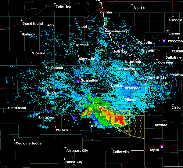 At 853 am cdt, a severe thunderstorm was located near colony, moving east at 25 mph. another severe thunderstorm was located 4 miles west of burlington, and was also moving east at 25 mph (radar indicated). Hazards include 60 mph wind gusts and quarter size hail. Hail damage to vehicles is expected. expect wind damage to roofs, siding and trees. Locations impacted include, burlington, colony, new strawn, gridley, westphalia, le roy and john redmond reservoir. At 853 am cdt, a severe thunderstorm was located near colony, moving east at 25 mph. another severe thunderstorm was located 4 miles west of burlington, and was also moving east at 25 mph (radar indicated). Hazards include 60 mph wind gusts and quarter size hail. Hail damage to vehicles is expected. expect wind damage to roofs, siding and trees. Locations impacted include, burlington, colony, new strawn, gridley, westphalia, le roy and john redmond reservoir.
|
| 7/14/2015 8:29 AM CDT |
 At 828 am cdt, a severe thunderstorm was located over le roy, moving east at 25 mph (law enforcement). Hazards include 60 mph wind gusts and quarter size hail. Hail damage to vehicles is expected. Expect wind damage to roofs, siding and trees. At 828 am cdt, a severe thunderstorm was located over le roy, moving east at 25 mph (law enforcement). Hazards include 60 mph wind gusts and quarter size hail. Hail damage to vehicles is expected. Expect wind damage to roofs, siding and trees.
|
| 7/10/2015 5:22 PM CDT |
 The severe thunderstorm warning for northeastern coffey county will expire at 530 pm cdt, the storms which prompted the warning have weakened below severe limits, and no longer pose an immediate threat to life or property. therefore the warning will be allowed to expire. however gusty winds and heavy rain are still possible with these thunderstorms. The severe thunderstorm warning for northeastern coffey county will expire at 530 pm cdt, the storms which prompted the warning have weakened below severe limits, and no longer pose an immediate threat to life or property. therefore the warning will be allowed to expire. however gusty winds and heavy rain are still possible with these thunderstorms.
|
| 7/10/2015 5:11 PM CDT |
 At 511 pm cdt, severe thunderstorms were located along a line extending from near waverly to near le roy, moving east at 30 mph (radar indicated). Hazards include 60 mph wind gusts and nickel size hail. Expect damage to roofs. siding and trees. Locations impacted include, burlington, waverly and new strawn. At 511 pm cdt, severe thunderstorms were located along a line extending from near waverly to near le roy, moving east at 30 mph (radar indicated). Hazards include 60 mph wind gusts and nickel size hail. Expect damage to roofs. siding and trees. Locations impacted include, burlington, waverly and new strawn.
|
| 7/10/2015 5:03 PM CDT |
 At 500 pm cdt, severe thunderstorms were located along a line extending from 5 miles south of beto junction to near le roy, moving east at 30 mph (law enforcement. lyon county sheriff reported minor roof damage on a house one mile east of hartford at 4:46 pm cdt). Hazards include 60 mph wind gusts and quarter size hail. Hail damage to vehicles is expected. expect wind damage to roofs, siding and trees. Locations impacted include, burlington, waverly, new strawn, gridley, le roy and john redmond reservoir. At 500 pm cdt, severe thunderstorms were located along a line extending from 5 miles south of beto junction to near le roy, moving east at 30 mph (law enforcement. lyon county sheriff reported minor roof damage on a house one mile east of hartford at 4:46 pm cdt). Hazards include 60 mph wind gusts and quarter size hail. Hail damage to vehicles is expected. expect wind damage to roofs, siding and trees. Locations impacted include, burlington, waverly, new strawn, gridley, le roy and john redmond reservoir.
|
| 7/10/2015 4:56 PM CDT |
 At 454 pm cdt, severe thunderstorms were located along a line extending from 5 miles north of new strawn to 6 miles east of gridley, moving east at 30 mph (online media. at 450 pm cdt...media reported power pole snapped and trees down 3 miles west southwest of hartford). Hazards include 60 mph wind gusts and quarter size hail. Hail damage to vehicles is expected. expect wind damage to roofs, siding and trees. Locations impacted include, burlington, waverly, new strawn, hartford, gridley, neosho rapids, le roy and john redmond reservoir. At 454 pm cdt, severe thunderstorms were located along a line extending from 5 miles north of new strawn to 6 miles east of gridley, moving east at 30 mph (online media. at 450 pm cdt...media reported power pole snapped and trees down 3 miles west southwest of hartford). Hazards include 60 mph wind gusts and quarter size hail. Hail damage to vehicles is expected. expect wind damage to roofs, siding and trees. Locations impacted include, burlington, waverly, new strawn, hartford, gridley, neosho rapids, le roy and john redmond reservoir.
|
| 7/10/2015 4:53 PM CDT |
 At 451 pm cdt, severe thunderstorms were located along a line extending from 6 miles southeast of lebo to near gridley, moving east at 30 mph (emergency management. at 5:45 pm cdt...emergency management reported wind gusts to 60 mph 5 miles south of hartford on the lyon and coffey county line). Hazards include 60 mph wind gusts and quarter size hail. Hail damage to vehicles is expected. expect wind damage to roofs, siding and trees. Locations impacted include, burlington, waverly, new strawn, hartford, gridley, neosho rapids, le roy and john redmond reservoir. At 451 pm cdt, severe thunderstorms were located along a line extending from 6 miles southeast of lebo to near gridley, moving east at 30 mph (emergency management. at 5:45 pm cdt...emergency management reported wind gusts to 60 mph 5 miles south of hartford on the lyon and coffey county line). Hazards include 60 mph wind gusts and quarter size hail. Hail damage to vehicles is expected. expect wind damage to roofs, siding and trees. Locations impacted include, burlington, waverly, new strawn, hartford, gridley, neosho rapids, le roy and john redmond reservoir.
|
| 7/10/2015 4:42 PM CDT |
 At 442 pm cdt, severe thunderstorms were located along a line extending from hartford to near gridley, moving east at 30 mph (radar indicated). Hazards include 60 mph wind gusts and quarter size hail. Hail damage to vehicles is expected. Expect wind damage to roofs, siding and trees. At 442 pm cdt, severe thunderstorms were located along a line extending from hartford to near gridley, moving east at 30 mph (radar indicated). Hazards include 60 mph wind gusts and quarter size hail. Hail damage to vehicles is expected. Expect wind damage to roofs, siding and trees.
|
| 6/7/2015 10:51 PM CDT | Report of 5 inch diameter tree branch broken off a maple tree. pea size hail also reporte in coffey county KS, 1 miles ESE of Burlington, KS |
| 5/16/2015 5:55 PM CDT | At 553 pm cdt, severe thunderstorms were located along a line extending from 6 miles northeast of admire to melvern lake to john redmond reservoir, and moving northeast at 55 mph (radar indicated). Hazards include 60 mph wind gusts. Expect damage to roofs. Siding and trees. |
| 5/16/2015 5:47 PM CDT | At 545 pm cdt, severe thunderstorms were located along a line extending from admire to lebo to gridley, and moving northeast at 55 mph (radar indicated). Hazards include 60 mph wind gusts and penny size hail. Expect damage to roofs. siding and trees. locations impacted include, burlington, john redmond reservoir, melvern lake, new strawn, olivet and beto junction. this includes the kansas turnpike between mile markers 132 and 146. this includes interstate 35 between mile markers 135 and 157. 0. 75in. |
| 5/16/2015 5:39 PM CDT | At 536 pm cdt, severe thunderstorms were located along a line extending from 6 miles south of admire to hartford to gridley, and moving northeast at 55 mph (trained weather spotters. winds to 60 mph were reported in emporia at about 535 pm). Hazards include 60 mph wind gusts and penny size hail. Expect damage to roofs. siding and trees. locations impacted include, burlington, gridley, reading, lebo, john redmond reservoir, new strawn, melvern lake, beto junction and olivet. this includes the kansas turnpike between mile markers 126 and 147. this includes interstate 35 between mile markers 128 and 157. 0. 75in. |
| 5/16/2015 5:13 PM CDT | At 509 pm cdt, severe thunderstorms were located along a line extending from 6 miles east of cottonwood falls to 7 miles northwest of hamilton to 11 miles southwest of hamilton, and moving northeast at 50 mph (radar indicated). Hazards include 60 mph wind gusts and penny size hail. Expect damage to roofs. Siding and trees. |
| 9/7/2012 2:04 PM CDT | Quarter sized hail reported 0.3 miles NW of Burlington, KS, also reported estimated 50 mph winds. |
| 9/7/2012 2:00 PM CDT | Lawn furniture blown off deck. small tree limbs snappe in coffey county KS, 0.6 miles SE of Burlington, KS |
| 9/7/2012 1:59 PM CDT | Numerous small tree limbs downed...pea sized hail...public report from wibw in coffey county KS, 0.3 miles NW of Burlington, KS |
| 9/7/2012 1:55 PM CDT | 6 inch diameter tree limbs down in town in coffey county KS, 0.3 miles NW of Burlington, KS |
| 1/1/0001 12:00 AM | At wolf creek power plant in coffey county KS, 3 miles SW of Burlington, KS |
| 1/1/0001 12:00 AM | At wolf creek power plant in coffey county KS, 3 miles SW of Burlington, KS |
| 1/1/0001 12:00 AM | Ping Pong Ball sized hail reported 8.8 miles SSW of Burlington, KS |
Hail Maps for Burlington, KS


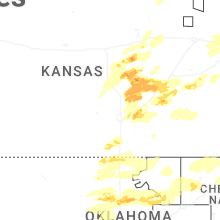
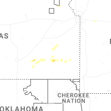

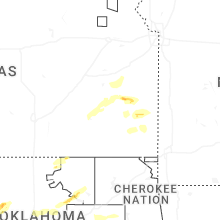
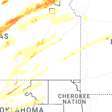
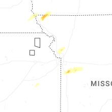


Connect with Interactive Hail Maps