

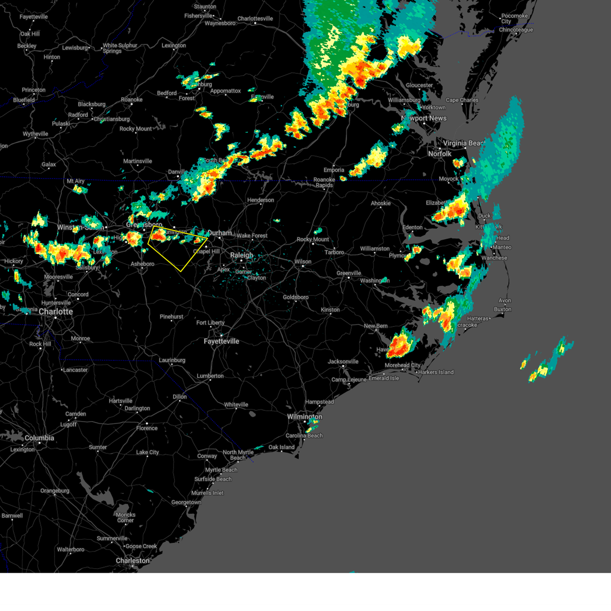
Hail Map for Burlington, NC
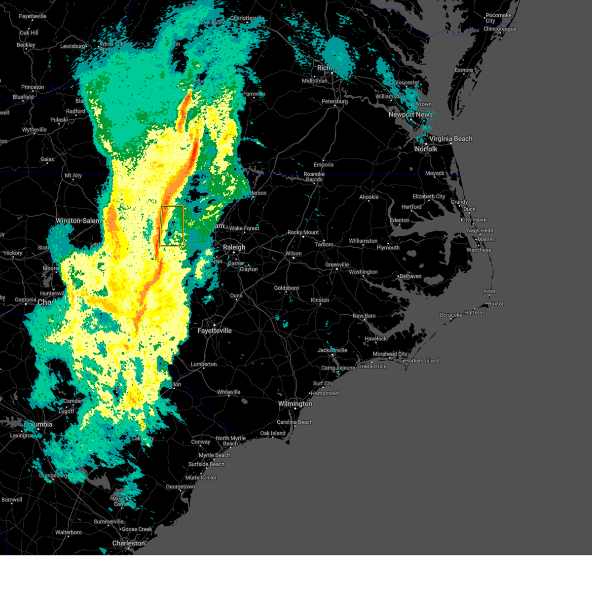
The Burlington, NC area has had 13 reports of on-the-ground hail by trained spotters, and has been under severe weather warnings 38 times during the past 12 months. Doppler radar has detected hail at or near Burlington, NC on 72 occasions, including 2 occasions during the past year.
| Name: | Burlington, NC |
| Where Located: | 50.9 miles WNW of Raleigh, NC |
| Map: | Google Map for Burlington, NC |
| Population: | 49963 |
| Housing Units: | 23414 |
| More Info: | Search Google for Burlington, NC |
1
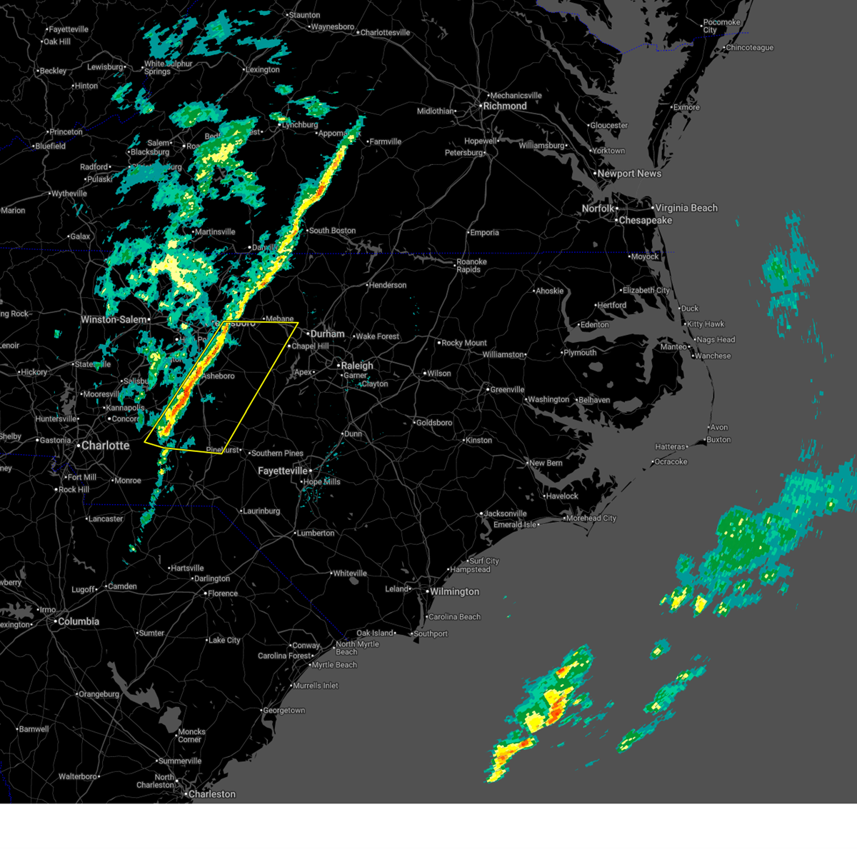
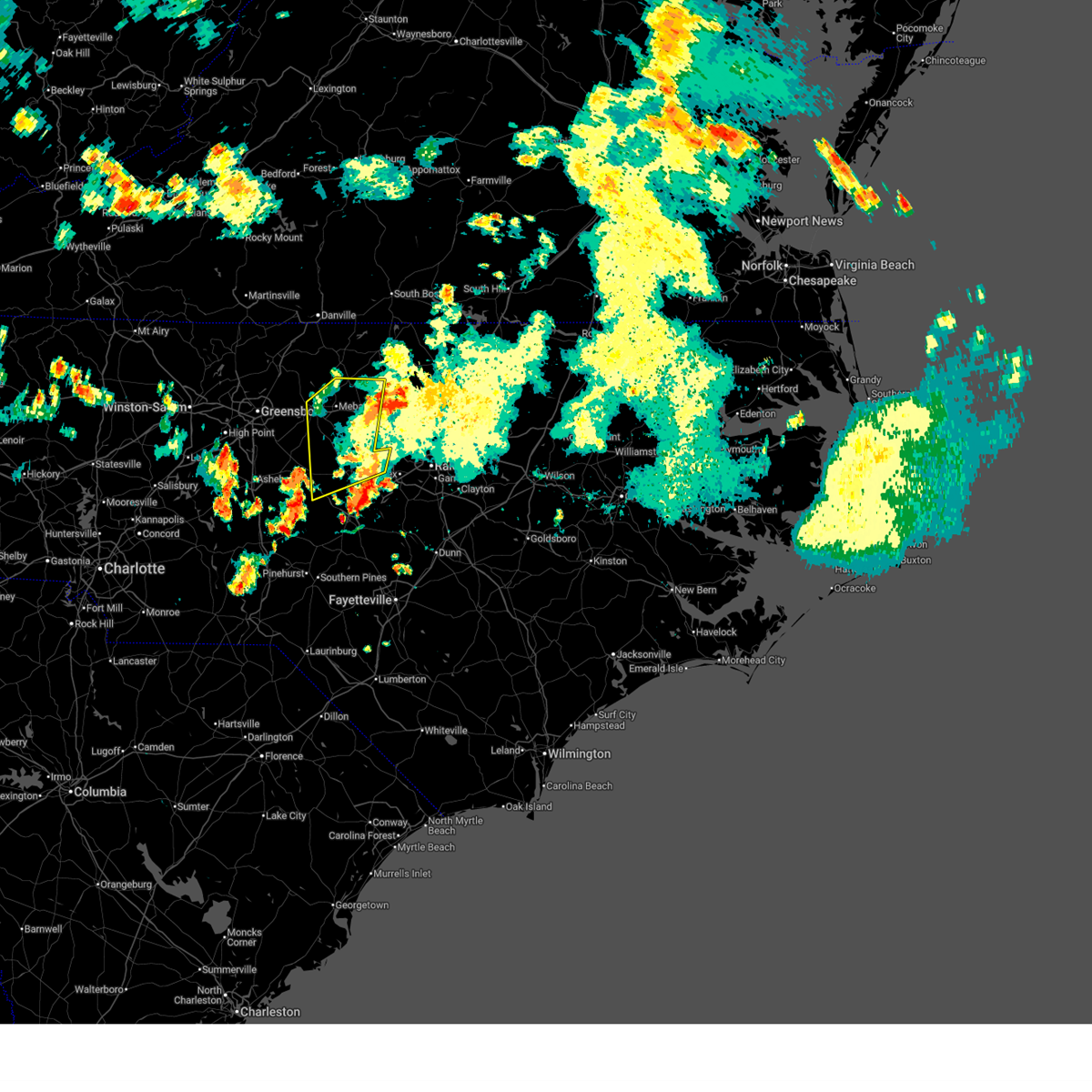
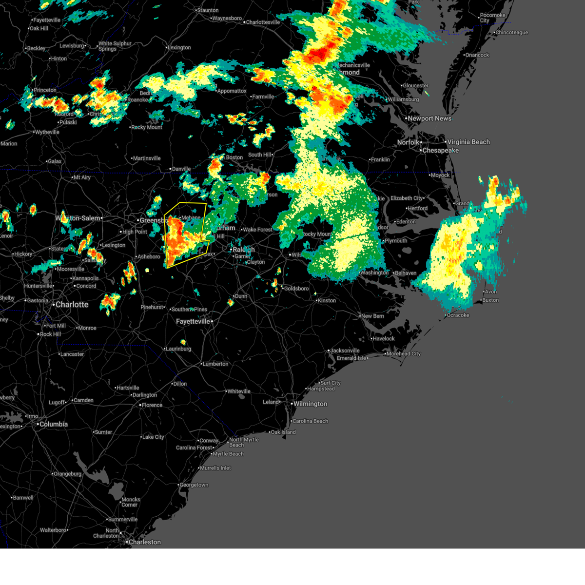
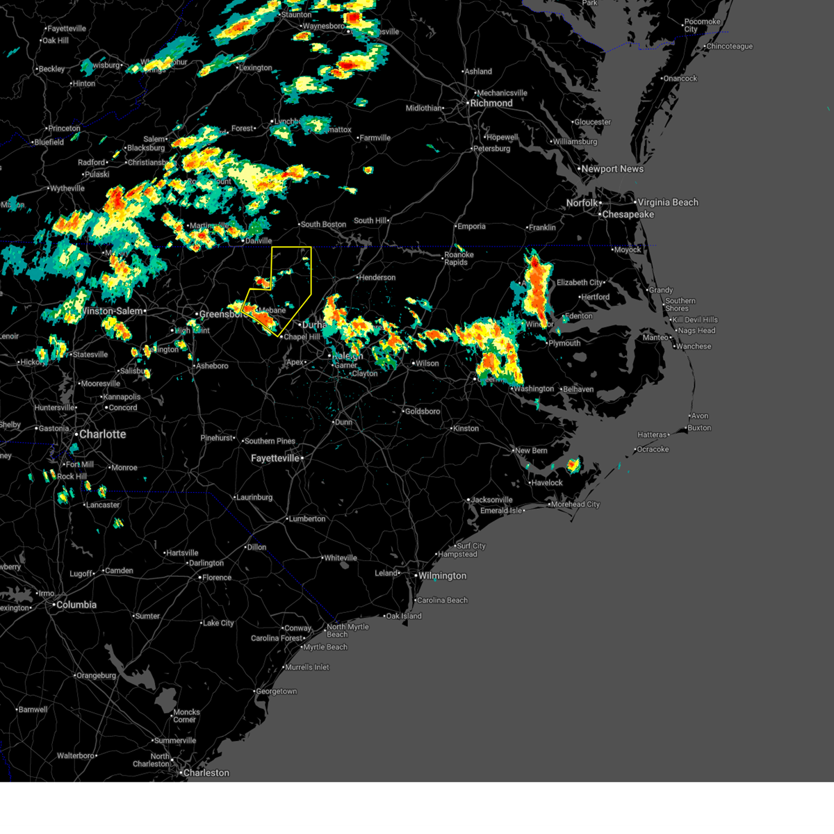
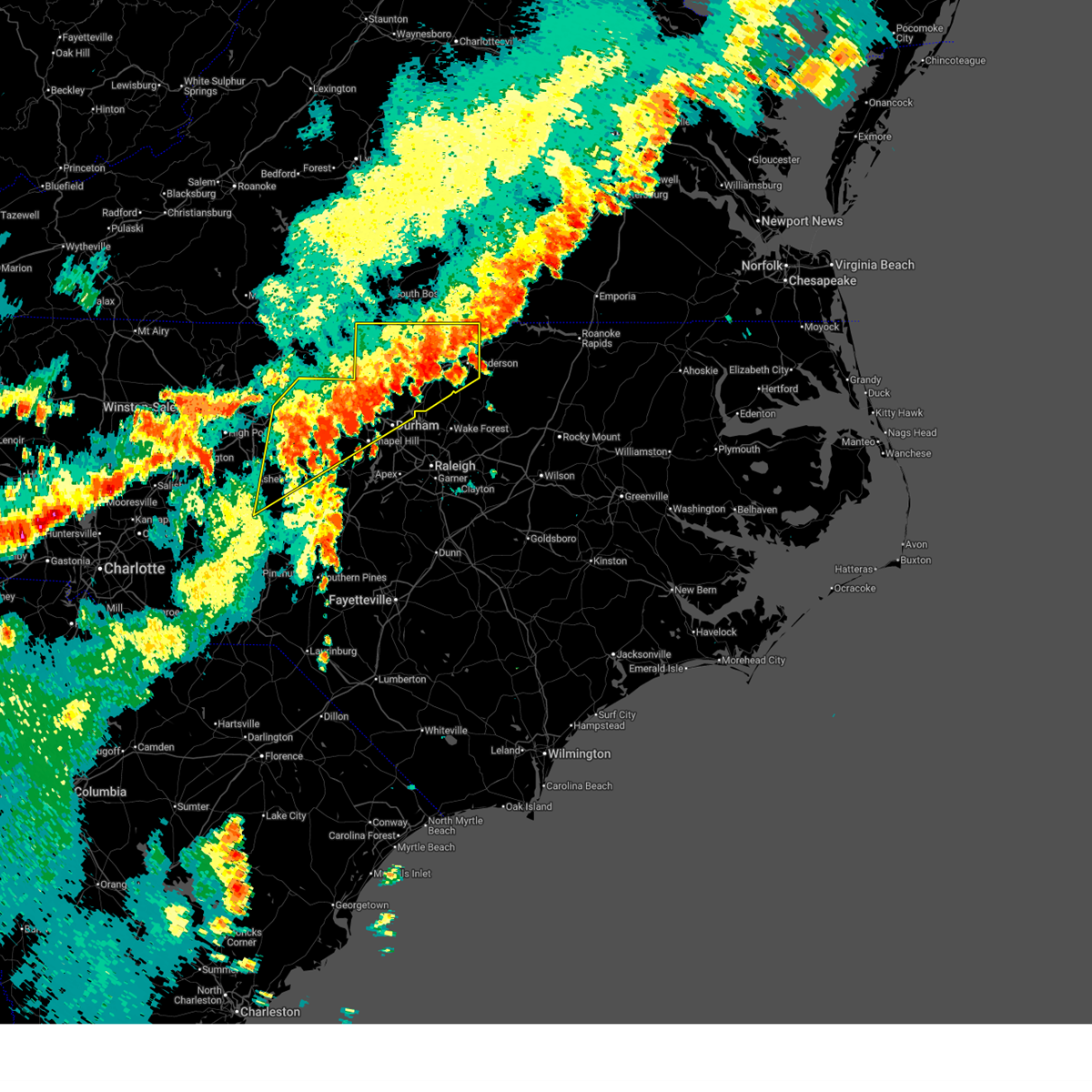
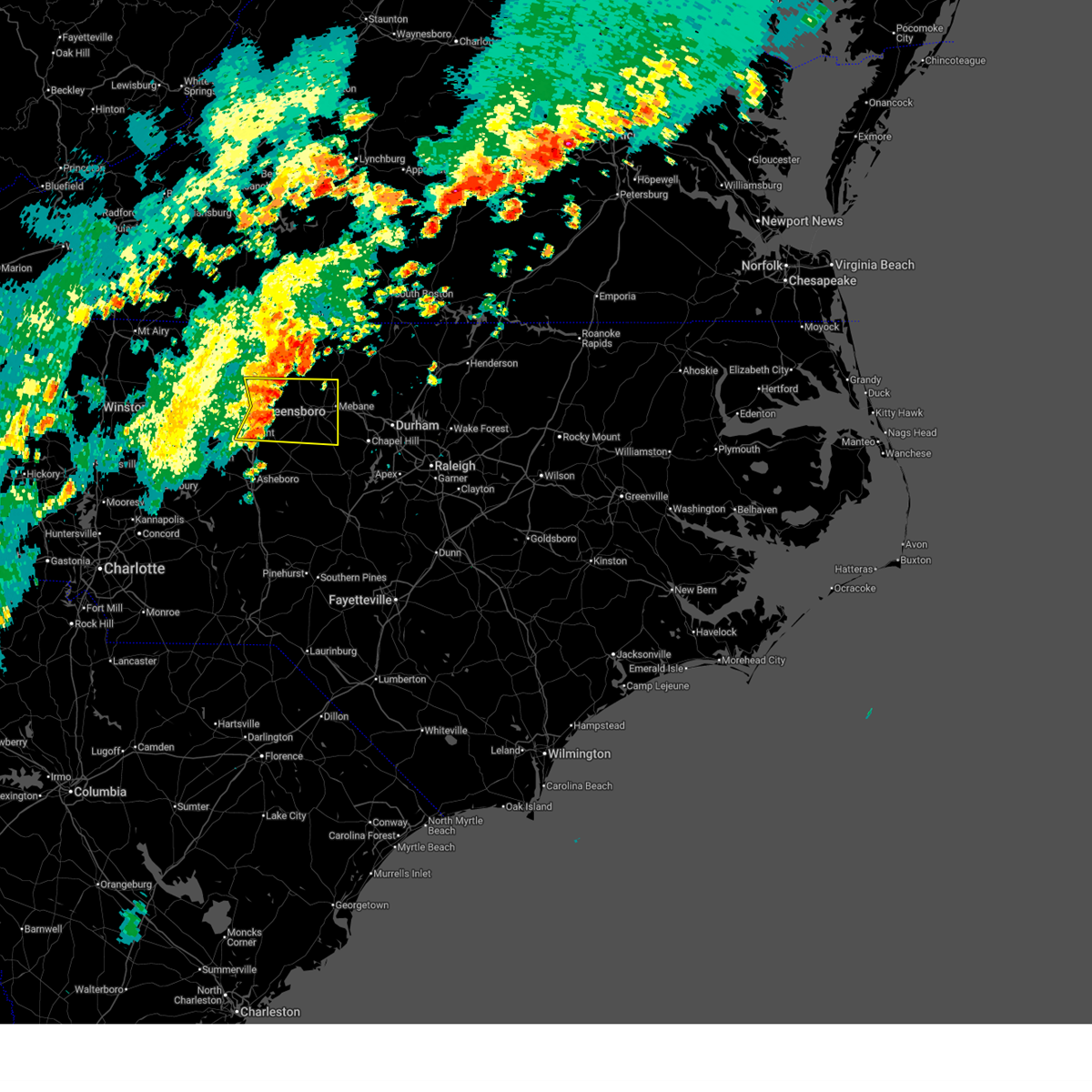
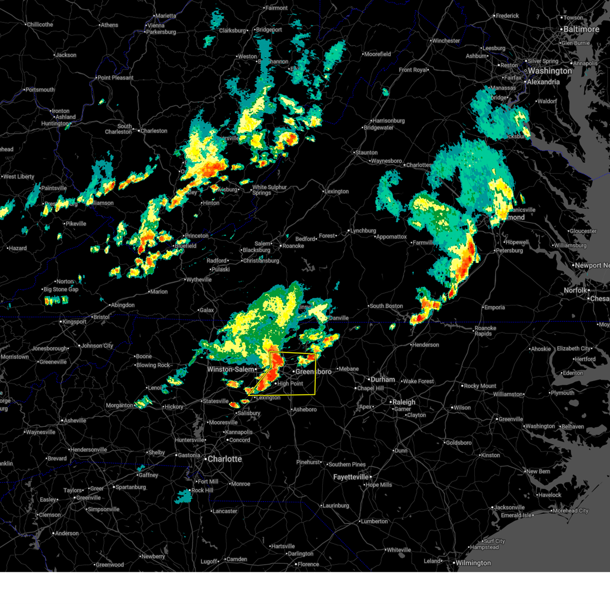
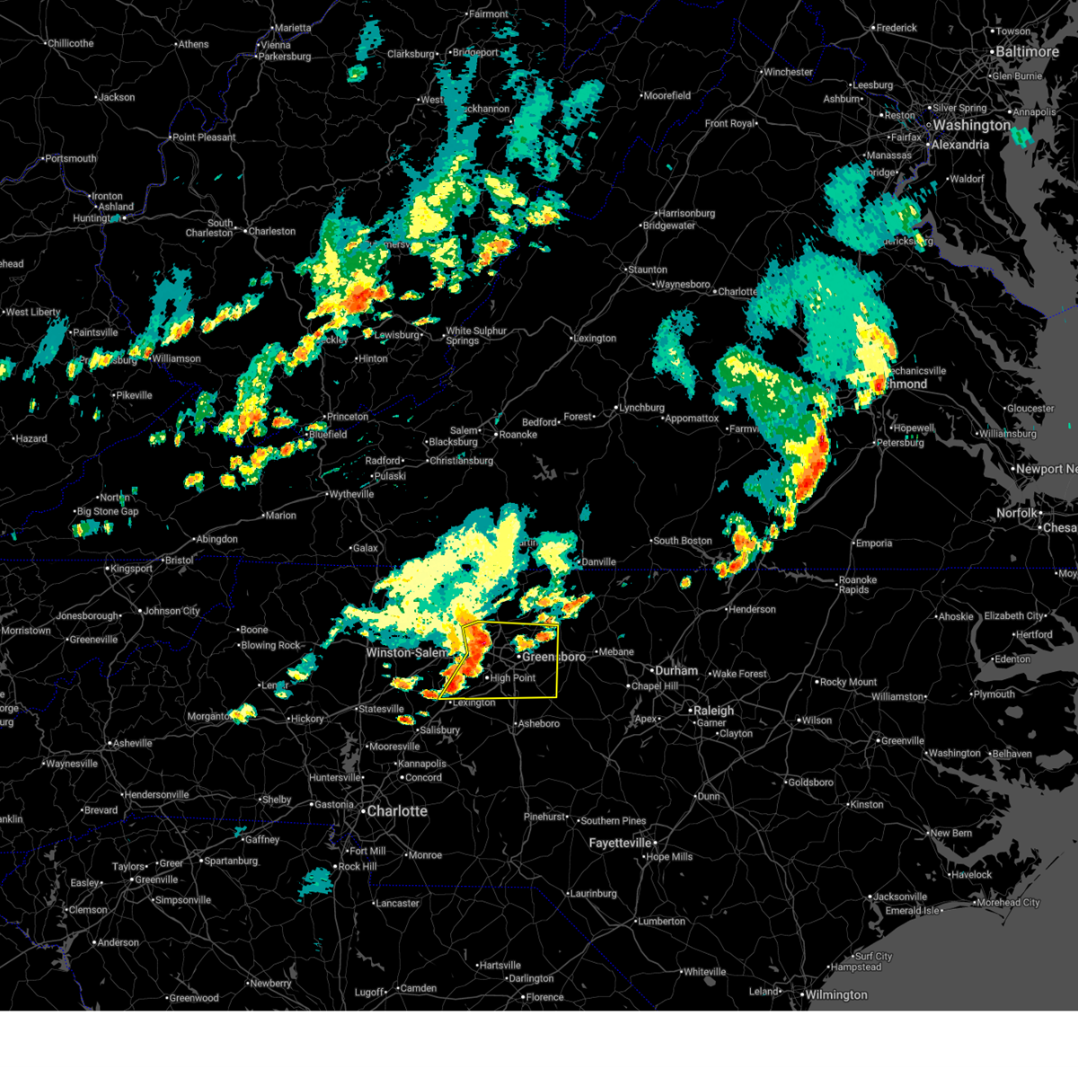
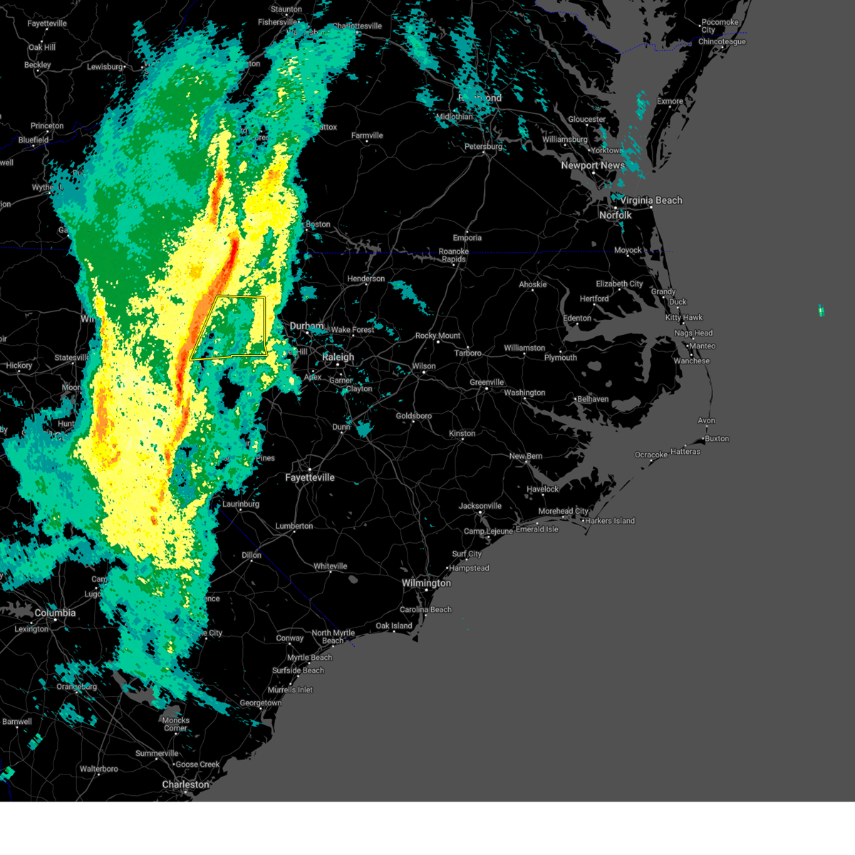
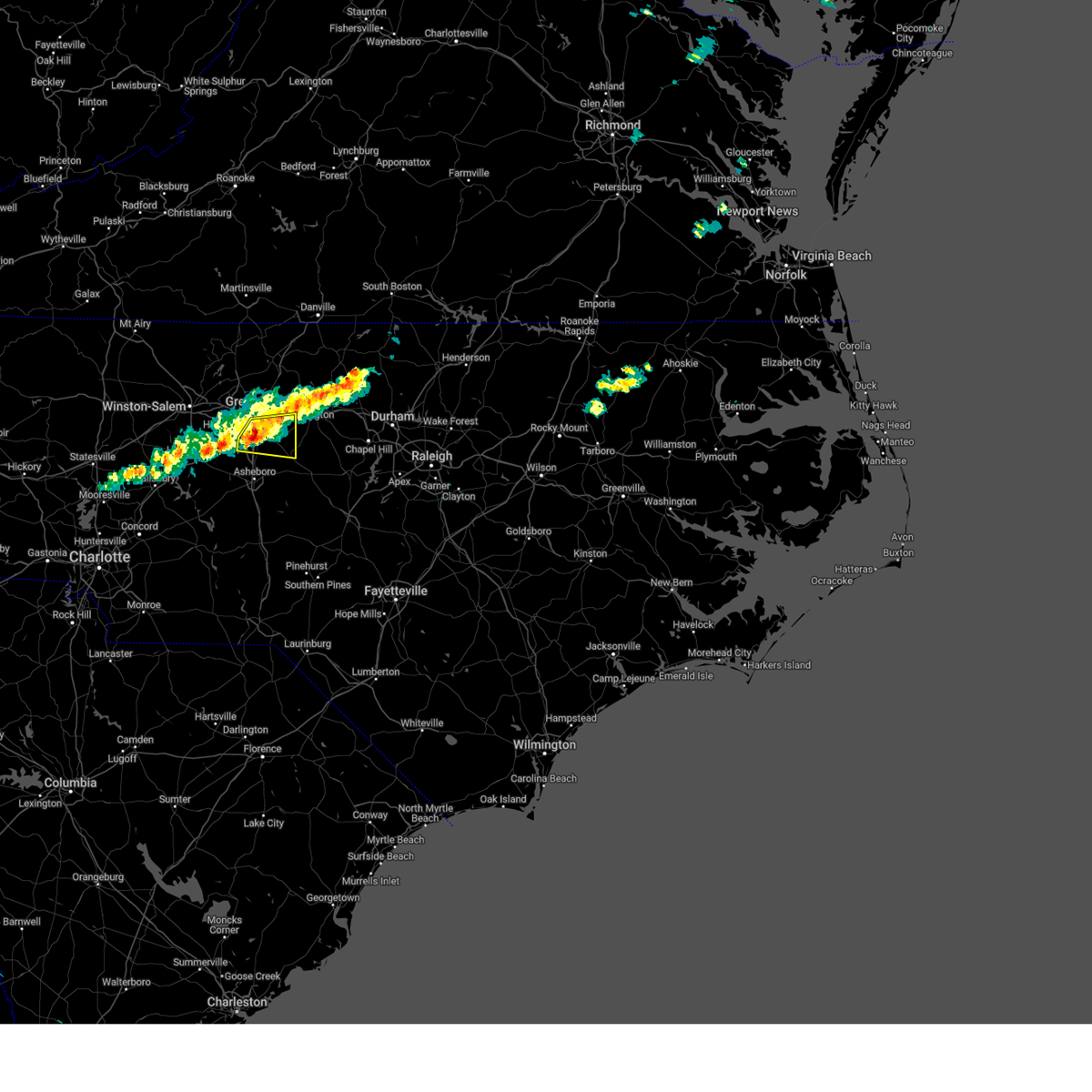
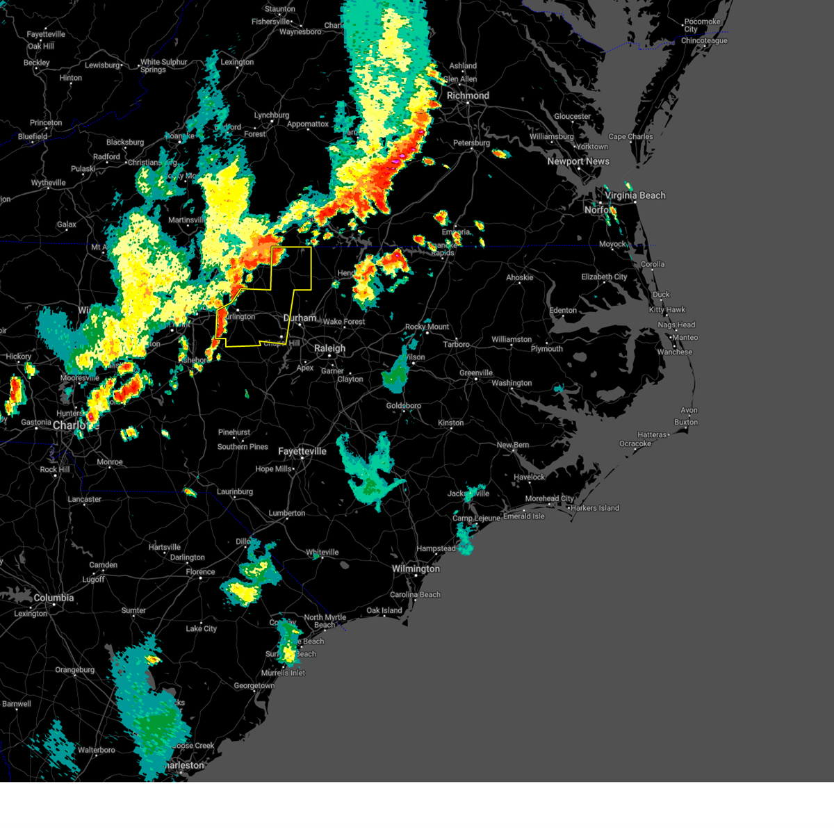
The Top Recent Hail Date for Burlington, NC is Wednesday, April 29, 2026 (24th out of 72)

Hail and Wind Damage Spotted near Burlington, NC
| Date / Time | Report Details |
|---|---|
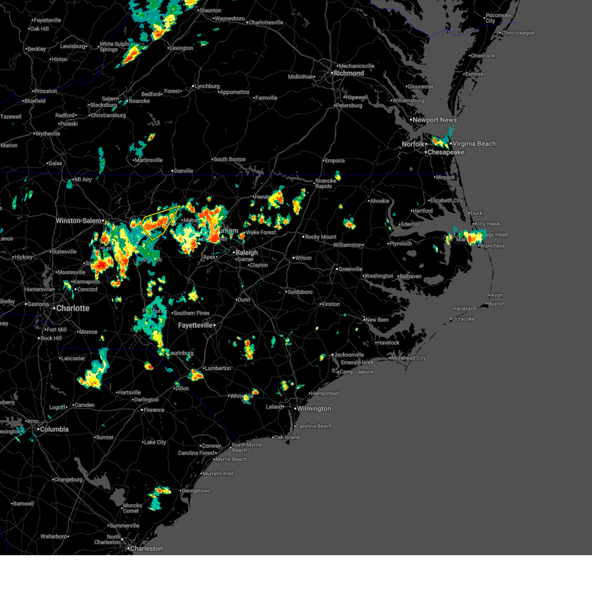
| 4/29/2026 10:06 PM EDT |
 Svrrah the national weather service in raleigh has issued a * severe thunderstorm warning for, northern alamance county in central north carolina, southern orange county in central north carolina, * until 1045 pm edt. * at 1005 pm edt, a severe thunderstorm was located over graham, moving southeast at 30 mph (radar indicated). Hazards include 60 mph wind gusts and quarter size hail. Hail damage to vehicles is expected. Expect wind damage to roofs, siding, and trees. Svrrah the national weather service in raleigh has issued a * severe thunderstorm warning for, northern alamance county in central north carolina, southern orange county in central north carolina, * until 1045 pm edt. * at 1005 pm edt, a severe thunderstorm was located over graham, moving southeast at 30 mph (radar indicated). Hazards include 60 mph wind gusts and quarter size hail. Hail damage to vehicles is expected. Expect wind damage to roofs, siding, and trees.
|
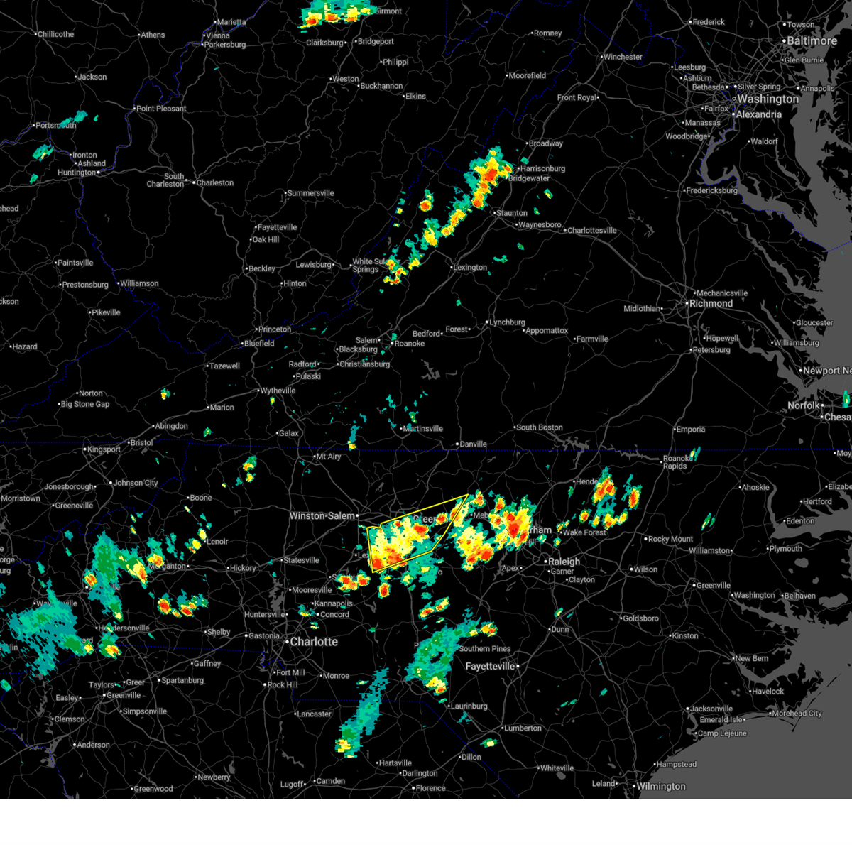
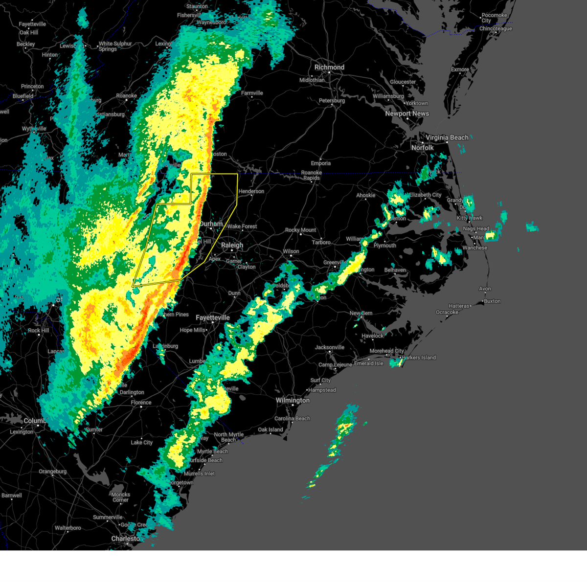
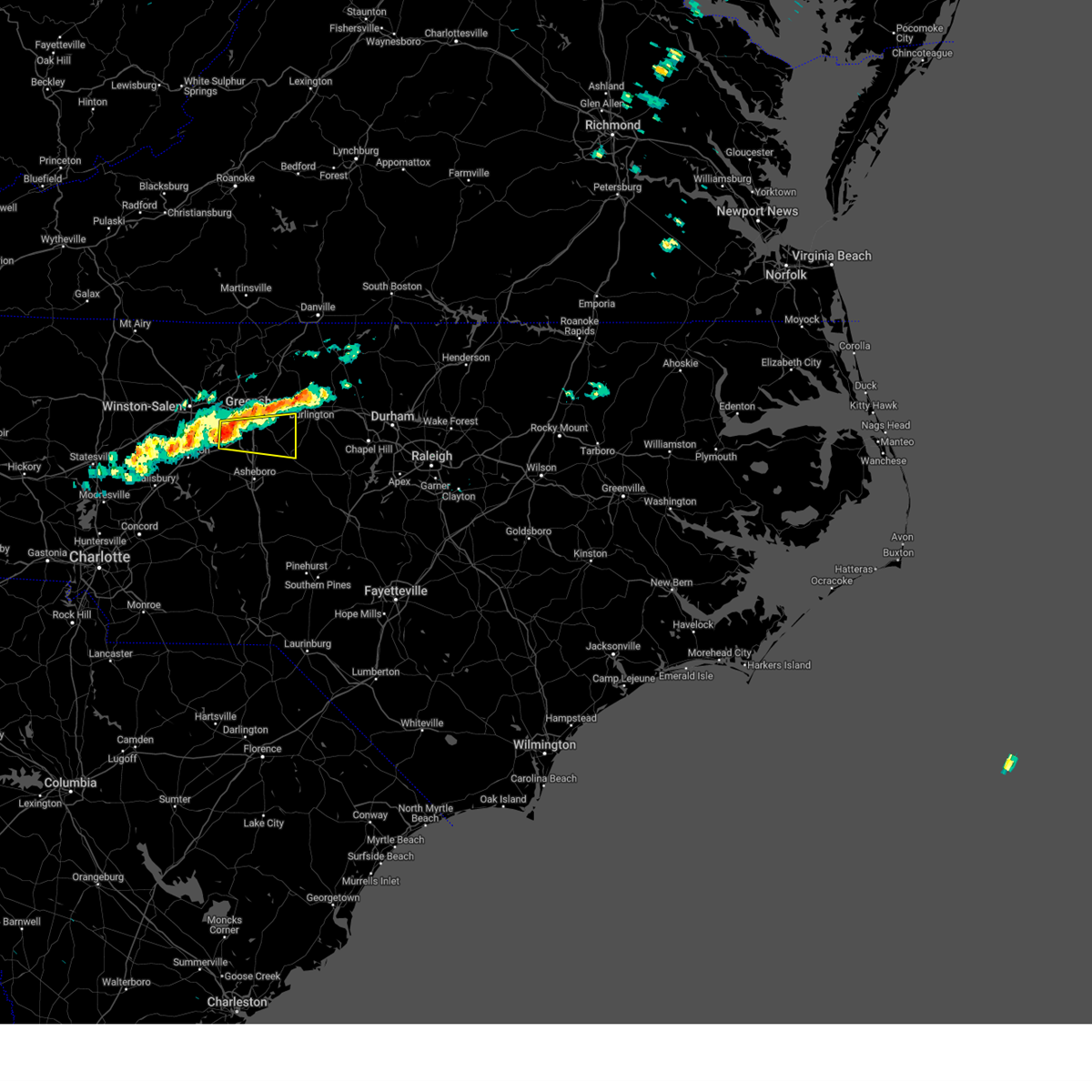
| 4/29/2026 9:55 PM EDT |
 At 955 pm edt, severe thunderstorms were located along a line extending from 6 miles northeast of burlington to near mcleansville, moving southeast at 35 mph (radar indicated). Hazards include 60 mph wind gusts and quarter size hail. Hail damage to vehicles is expected. expect wind damage to roofs, siding, and trees. locations impacted include, greensboro, burlington, graham, hillsborough, mebane, elon, mcleansville, gibsonville, haw river, and swepsonville. This includes interstate 40 between mile markers 132 and 161. At 955 pm edt, severe thunderstorms were located along a line extending from 6 miles northeast of burlington to near mcleansville, moving southeast at 35 mph (radar indicated). Hazards include 60 mph wind gusts and quarter size hail. Hail damage to vehicles is expected. expect wind damage to roofs, siding, and trees. locations impacted include, greensboro, burlington, graham, hillsborough, mebane, elon, mcleansville, gibsonville, haw river, and swepsonville. This includes interstate 40 between mile markers 132 and 161.
|
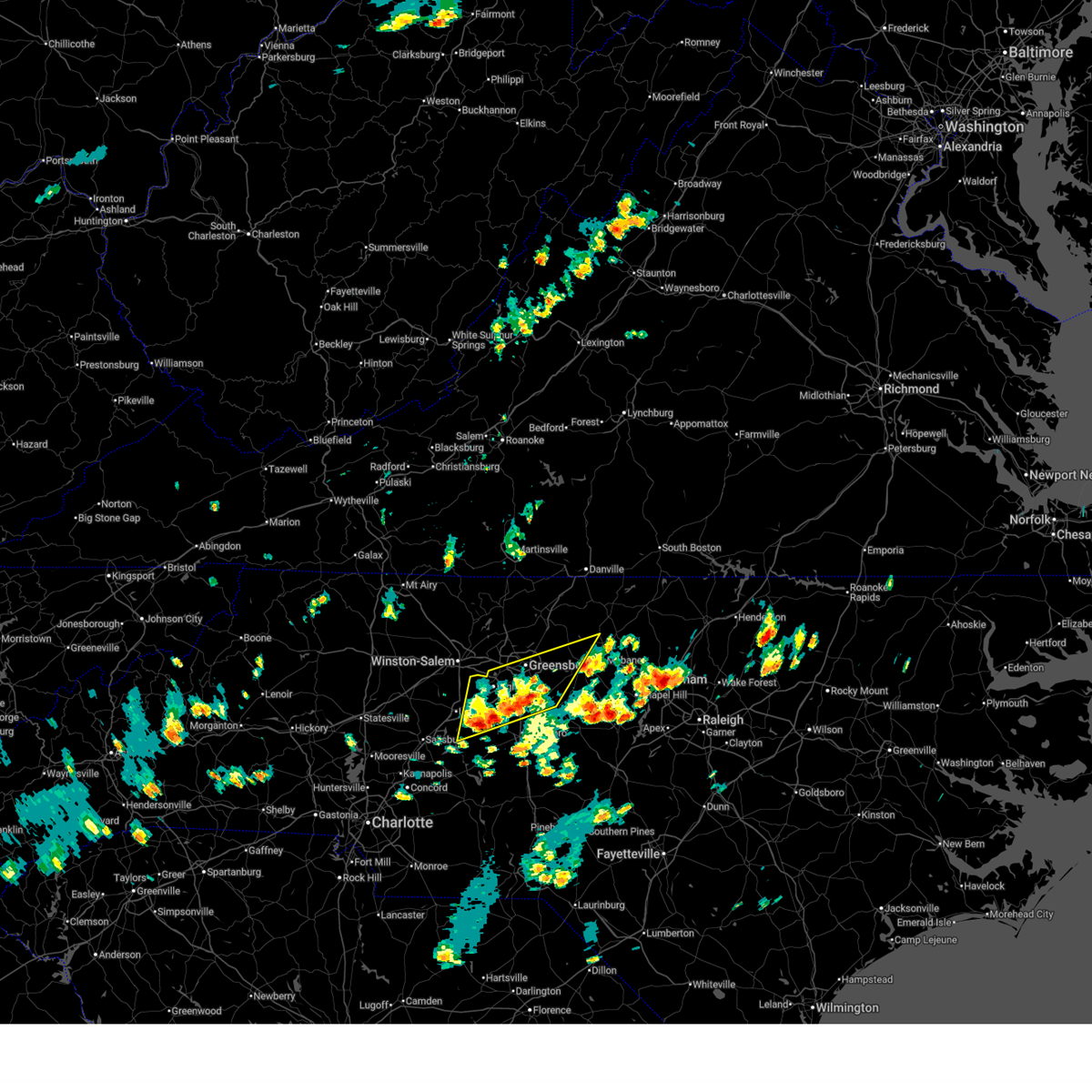
| 4/29/2026 9:43 PM EDT |
 At 943 pm edt, severe thunderstorms were located along a line extending from near camp springs to 7 miles southwest of monroeton, moving southeast at 35 mph (radar indicated). Hazards include 60 mph wind gusts and half dollar size hail. Hail damage to vehicles is expected. expect wind damage to roofs, siding, and trees. locations impacted include, greensboro, burlington, graham, hillsborough, mebane, elon, mcleansville, summerfield, gibsonville, and stokesdale. this includes the following highways, interstate 85 between mile markers 127 and 131. Interstate 40 between mile markers 132 and 161, and between mile markers 217 and 226. At 943 pm edt, severe thunderstorms were located along a line extending from near camp springs to 7 miles southwest of monroeton, moving southeast at 35 mph (radar indicated). Hazards include 60 mph wind gusts and half dollar size hail. Hail damage to vehicles is expected. expect wind damage to roofs, siding, and trees. locations impacted include, greensboro, burlington, graham, hillsborough, mebane, elon, mcleansville, summerfield, gibsonville, and stokesdale. this includes the following highways, interstate 85 between mile markers 127 and 131. Interstate 40 between mile markers 132 and 161, and between mile markers 217 and 226.
|
| 4/29/2026 9:29 PM EDT |
 Svrrah the national weather service in raleigh has issued a * severe thunderstorm warning for, northern alamance county in central north carolina, northern orange county in central north carolina, northern guilford county in central north carolina, * until 1015 pm edt. * at 929 pm edt, severe thunderstorms were located along a line extending from near reidsville to near ellisboro, moving southeast at 30 mph (radar indicated). Hazards include 60 mph wind gusts and quarter size hail. Hail damage to vehicles is expected. Expect wind damage to roofs, siding, and trees. Svrrah the national weather service in raleigh has issued a * severe thunderstorm warning for, northern alamance county in central north carolina, northern orange county in central north carolina, northern guilford county in central north carolina, * until 1015 pm edt. * at 929 pm edt, severe thunderstorms were located along a line extending from near reidsville to near ellisboro, moving southeast at 30 mph (radar indicated). Hazards include 60 mph wind gusts and quarter size hail. Hail damage to vehicles is expected. Expect wind damage to roofs, siding, and trees.
|
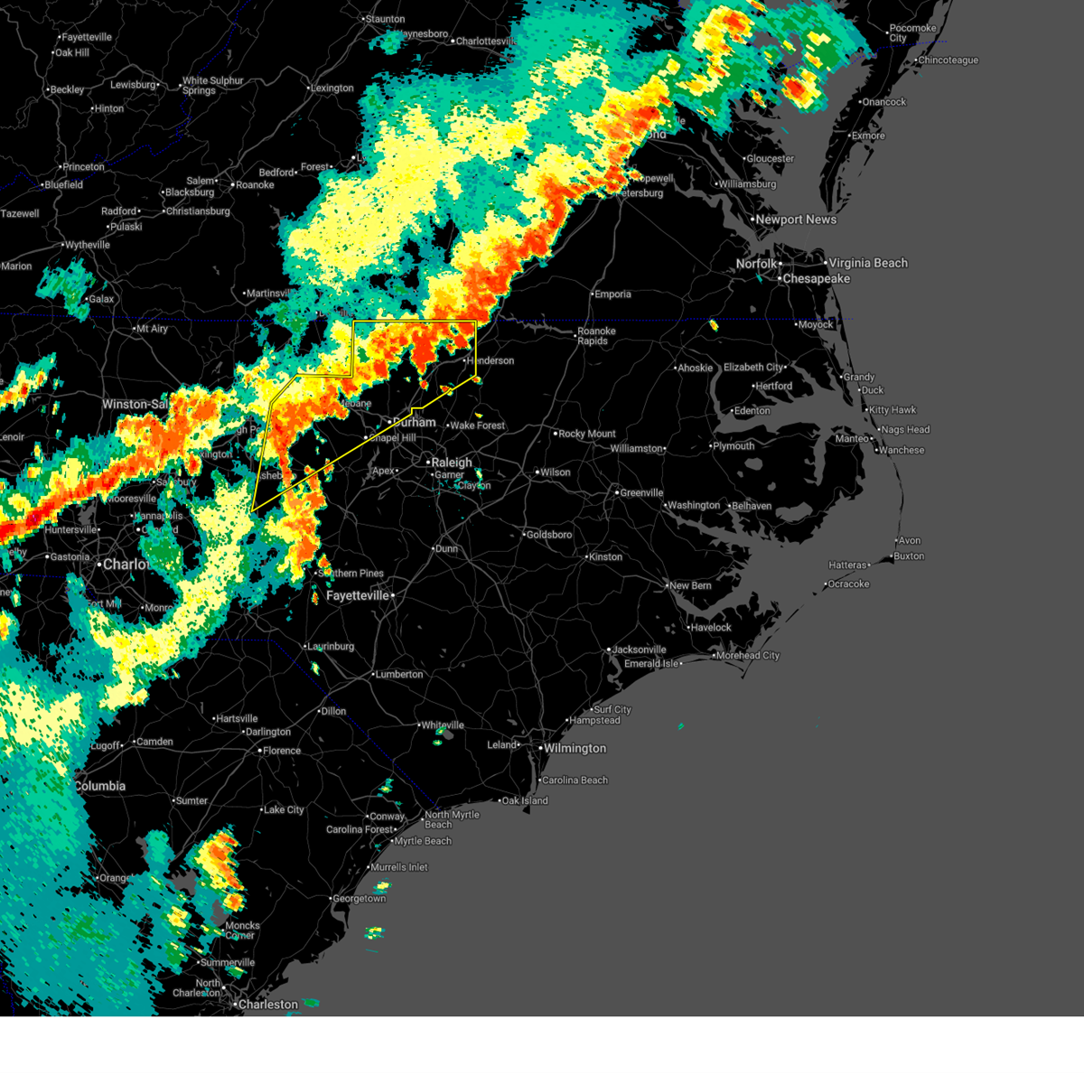
| 3/16/2026 6:09 PM EDT |
 the severe thunderstorm warning has been cancelled and is no longer in effect the severe thunderstorm warning has been cancelled and is no longer in effect
|
| 3/16/2026 6:09 PM EDT |
 At 606 pm edt, severe thunderstorms were located along a line extending from near camp springs to near goldston to 6 miles west of raeford, moving east at 50 mph (radar indicated. wind gusts between 50 and 60 mph have been measured along the length of the line of thunderstorms in the past hour). Hazards include 60 mph wind gusts. Expect damage to roofs, siding, and trees. locations impacted include, burlington, sanford, laurinburg, graham, southern pines, raeford, carthage, siler city, pinehurst, and aberdeen. this includes the following highways, interstate 40 between mile markers 141 and 150. Us 1 near mile marker 69. At 606 pm edt, severe thunderstorms were located along a line extending from near camp springs to near goldston to 6 miles west of raeford, moving east at 50 mph (radar indicated. wind gusts between 50 and 60 mph have been measured along the length of the line of thunderstorms in the past hour). Hazards include 60 mph wind gusts. Expect damage to roofs, siding, and trees. locations impacted include, burlington, sanford, laurinburg, graham, southern pines, raeford, carthage, siler city, pinehurst, and aberdeen. this includes the following highways, interstate 40 between mile markers 141 and 150. Us 1 near mile marker 69.
|
| 3/16/2026 6:05 PM EDT |
 Svrrah the national weather service in raleigh has issued a * severe thunderstorm warning for, eastern alamance county in central north carolina, harnett county in central north carolina, cumberland county in central north carolina, lee county in central north carolina, wake county in central north carolina, west central johnston county in central north carolina, hoke county in central north carolina, eastern moore county in central north carolina, person county in central north carolina, orange county in central north carolina, northwestern sampson county in central north carolina, western granville county in central north carolina, durham county in central north carolina, chatham county in central north carolina, * until 645 pm edt. * at 605 pm edt, severe thunderstorms were located along a line extending from near jericho to 10 miles northwest of pittsboro to 6 miles northwest of wakulla, moving east at 45 mph (radar indicated). Hazards include 60 mph wind gusts. expect damage to roofs, siding, and trees Svrrah the national weather service in raleigh has issued a * severe thunderstorm warning for, eastern alamance county in central north carolina, harnett county in central north carolina, cumberland county in central north carolina, lee county in central north carolina, wake county in central north carolina, west central johnston county in central north carolina, hoke county in central north carolina, eastern moore county in central north carolina, person county in central north carolina, orange county in central north carolina, northwestern sampson county in central north carolina, western granville county in central north carolina, durham county in central north carolina, chatham county in central north carolina, * until 645 pm edt. * at 605 pm edt, severe thunderstorms were located along a line extending from near jericho to 10 miles northwest of pittsboro to 6 miles northwest of wakulla, moving east at 45 mph (radar indicated). Hazards include 60 mph wind gusts. expect damage to roofs, siding, and trees
|
| 3/16/2026 5:51 PM EDT |
 At 549 pm edt, severe thunderstorms were located along a line extending from monticello to siler city to hoffman, moving northeast at 50 mph (radar indicated). Hazards include 60 mph wind gusts. Expect damage to roofs, siding, and trees. locations impacted include, burlington, sanford, laurinburg, graham, southern pines, raeford, carthage, siler city, pinehurst, and aberdeen. this includes the following highways, interstate 85 between mile markers 129 and 131. interstate 40 between mile markers 132 and 150, and between mile markers 225 and 226. Us 1 near mile marker 69. At 549 pm edt, severe thunderstorms were located along a line extending from monticello to siler city to hoffman, moving northeast at 50 mph (radar indicated). Hazards include 60 mph wind gusts. Expect damage to roofs, siding, and trees. locations impacted include, burlington, sanford, laurinburg, graham, southern pines, raeford, carthage, siler city, pinehurst, and aberdeen. this includes the following highways, interstate 85 between mile markers 129 and 131. interstate 40 between mile markers 132 and 150, and between mile markers 225 and 226. Us 1 near mile marker 69.
|
| 3/16/2026 5:51 PM EDT |
 the severe thunderstorm warning has been cancelled and is no longer in effect the severe thunderstorm warning has been cancelled and is no longer in effect
|
| 3/16/2026 5:23 PM EDT |
 Svrrah the national weather service in raleigh has issued a * severe thunderstorm warning for, alamance county in central north carolina, moore county in central north carolina, scotland county in central north carolina, eastern montgomery county in central north carolina, richmond county in central north carolina, randolph county in central north carolina, guilford county in central north carolina, western lee county in central north carolina, western hoke county in central north carolina, western chatham county in central north carolina, * until 615 pm edt. * at 523 pm edt, severe thunderstorms were located along a line extending from near walnut cove to near biscoe to 7 miles north of wallace, moving east at 50 mph (radar indicated). Hazards include 60 mph wind gusts. expect damage to roofs, siding, and trees Svrrah the national weather service in raleigh has issued a * severe thunderstorm warning for, alamance county in central north carolina, moore county in central north carolina, scotland county in central north carolina, eastern montgomery county in central north carolina, richmond county in central north carolina, randolph county in central north carolina, guilford county in central north carolina, western lee county in central north carolina, western hoke county in central north carolina, western chatham county in central north carolina, * until 615 pm edt. * at 523 pm edt, severe thunderstorms were located along a line extending from near walnut cove to near biscoe to 7 miles north of wallace, moving east at 50 mph (radar indicated). Hazards include 60 mph wind gusts. expect damage to roofs, siding, and trees
|
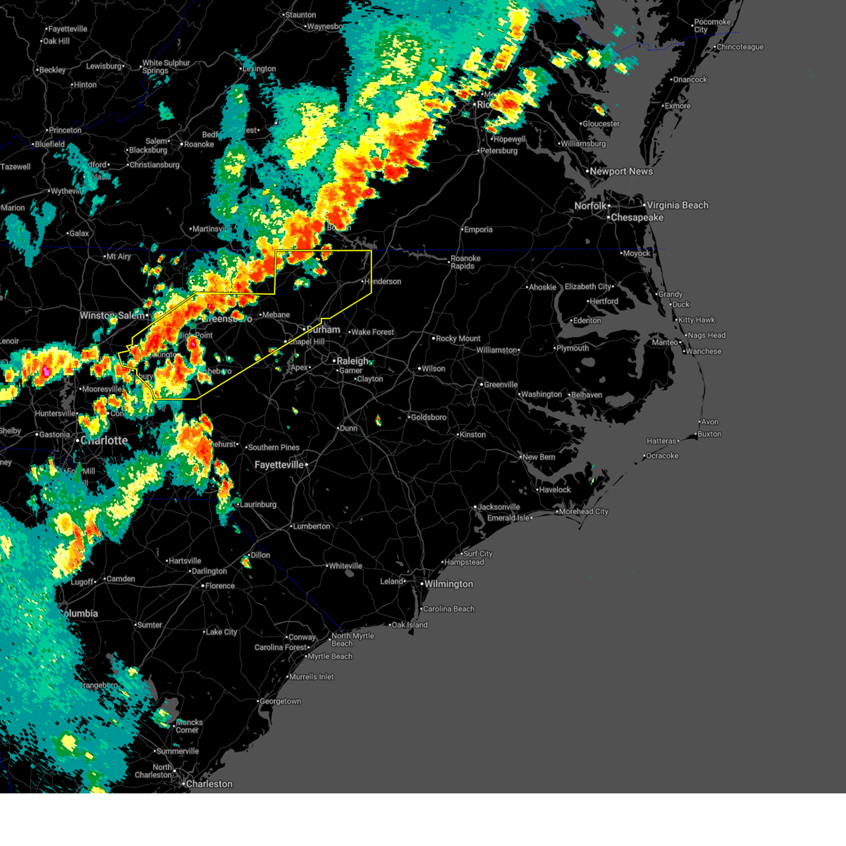
| 3/16/2026 11:28 AM EDT |
 The storms which prompted the warning have weakened below severe limits, and no longer pose an immediate threat to life or property. therefore, the warning will be allowed to expire. however, gusty winds to 50 mph are still possible with these thunderstorms. a tornado watch remains in effect until 200 pm edt for central north carolina. The storms which prompted the warning have weakened below severe limits, and no longer pose an immediate threat to life or property. therefore, the warning will be allowed to expire. however, gusty winds to 50 mph are still possible with these thunderstorms. a tornado watch remains in effect until 200 pm edt for central north carolina.
|
| 3/16/2026 10:55 AM EDT |
 Svrrah the national weather service in raleigh has issued a * severe thunderstorm warning for, alamance county in central north carolina, moore county in central north carolina, western orange county in central north carolina, montgomery county in central north carolina, eastern randolph county in central north carolina, southeastern guilford county in central north carolina, western lee county in central north carolina, chatham county in central north carolina, * until 1130 am edt. * at 1055 am edt, severe thunderstorms were located along a line extending from 7 miles southeast of greensboro to seagrove to 7 miles northeast of ansonville, moving east at 45 mph (radar indicated). Hazards include 60 mph wind gusts. expect damage to roofs, siding, and trees Svrrah the national weather service in raleigh has issued a * severe thunderstorm warning for, alamance county in central north carolina, moore county in central north carolina, western orange county in central north carolina, montgomery county in central north carolina, eastern randolph county in central north carolina, southeastern guilford county in central north carolina, western lee county in central north carolina, chatham county in central north carolina, * until 1130 am edt. * at 1055 am edt, severe thunderstorms were located along a line extending from 7 miles southeast of greensboro to seagrove to 7 miles northeast of ansonville, moving east at 45 mph (radar indicated). Hazards include 60 mph wind gusts. expect damage to roofs, siding, and trees
|
| 12/19/2025 5:54 AM EST |
 the severe thunderstorm warning has been cancelled and is no longer in effect the severe thunderstorm warning has been cancelled and is no longer in effect
|
| 12/19/2025 5:54 AM EST |
 At 553 am est, severe thunderstorms were located along a line extending from near graham to near seagrove to near troy, moving east at 45 mph (radar indicated). Hazards include 60 mph wind gusts. Expect damage to roofs, siding, and trees. locations impacted include, chapel hill, burlington, graham, hillsborough, troy, siler city, north carolina zoo, carrboro, mebane, and biscoe. this includes the following highways, interstate 85 between mile markers 163 and 170. interstate 40 between mile markers 144 and 155, between mile markers 160 and 162, and between mile markers 259 and 266. Interstate 73 between mile markers 42 and 65. At 553 am est, severe thunderstorms were located along a line extending from near graham to near seagrove to near troy, moving east at 45 mph (radar indicated). Hazards include 60 mph wind gusts. Expect damage to roofs, siding, and trees. locations impacted include, chapel hill, burlington, graham, hillsborough, troy, siler city, north carolina zoo, carrboro, mebane, and biscoe. this includes the following highways, interstate 85 between mile markers 163 and 170. interstate 40 between mile markers 144 and 155, between mile markers 160 and 162, and between mile markers 259 and 266. Interstate 73 between mile markers 42 and 65.
|
| 12/19/2025 5:41 AM EST |
 Svrrah the national weather service in raleigh has issued a * severe thunderstorm warning for, southern alamance county in central north carolina, northwestern moore county in central north carolina, southern orange county in central north carolina, montgomery county in central north carolina, randolph county in central north carolina, southeastern stanly county in central north carolina, southeastern guilford county in central north carolina, western chatham county in central north carolina, * until 630 am est. * at 539 am est, severe thunderstorms were located along a line extending from 6 miles southeast of mcleansville to 9 miles west of seagrove to 6 miles south of albemarle, moving east at 40 mph. the strongest winds are located between asheboro and troy (radar indicated). Hazards include 60 mph wind gusts. expect damage to roofs, siding, and trees Svrrah the national weather service in raleigh has issued a * severe thunderstorm warning for, southern alamance county in central north carolina, northwestern moore county in central north carolina, southern orange county in central north carolina, montgomery county in central north carolina, randolph county in central north carolina, southeastern stanly county in central north carolina, southeastern guilford county in central north carolina, western chatham county in central north carolina, * until 630 am est. * at 539 am est, severe thunderstorms were located along a line extending from 6 miles southeast of mcleansville to 9 miles west of seagrove to 6 miles south of albemarle, moving east at 40 mph. the strongest winds are located between asheboro and troy (radar indicated). Hazards include 60 mph wind gusts. expect damage to roofs, siding, and trees
|
| 8/1/2025 4:36 PM EDT | Multiple power outages reported in pleasant grove due to trees down on powerlines and transformers near jeffries cross r in alamance county NC, 10.9 miles SW of Burlington, NC |
| 7/19/2025 8:02 PM EDT |
 the severe thunderstorm warning has been cancelled and is no longer in effect the severe thunderstorm warning has been cancelled and is no longer in effect
|
| 7/19/2025 7:14 PM EDT |
 Svrrah the national weather service in raleigh has issued a * severe thunderstorm warning for, alamance county in central north carolina, orange county in central north carolina, northwestern chatham county in central north carolina, * until 815 pm edt. * at 713 pm edt, a severe thunderstorm was located 8 miles south of mebane, or 10 miles southeast of graham, moving northeast at 25 mph (radar indicated). Hazards include 60 mph wind gusts. expect damage to roofs, siding, and trees Svrrah the national weather service in raleigh has issued a * severe thunderstorm warning for, alamance county in central north carolina, orange county in central north carolina, northwestern chatham county in central north carolina, * until 815 pm edt. * at 713 pm edt, a severe thunderstorm was located 8 miles south of mebane, or 10 miles southeast of graham, moving northeast at 25 mph (radar indicated). Hazards include 60 mph wind gusts. expect damage to roofs, siding, and trees
|
| 7/19/2025 3:27 PM EDT |
 Svrrah the national weather service in raleigh has issued a * severe thunderstorm warning for, northeastern alamance county in central north carolina, person county in central north carolina, orange county in central north carolina, northwestern durham county in central north carolina, * until 430 pm edt. * at 327 pm edt, a severe thunderstorm was located near hillsborough, moving northeast at 40 mph (radar indicated). Hazards include 60 mph wind gusts. expect damage to roofs, siding, and trees Svrrah the national weather service in raleigh has issued a * severe thunderstorm warning for, northeastern alamance county in central north carolina, person county in central north carolina, orange county in central north carolina, northwestern durham county in central north carolina, * until 430 pm edt. * at 327 pm edt, a severe thunderstorm was located near hillsborough, moving northeast at 40 mph (radar indicated). Hazards include 60 mph wind gusts. expect damage to roofs, siding, and trees
|
| 7/9/2025 7:58 PM EDT |
 The storms which prompted the warning have weakened below severe limits, and no longer pose an immediate threat to life or property. therefore, the warning will be allowed to expire. however, strong gusty winds are still possible with these thunderstorms, and they will continue to be monitored for restrengthening. The storms which prompted the warning have weakened below severe limits, and no longer pose an immediate threat to life or property. therefore, the warning will be allowed to expire. however, strong gusty winds are still possible with these thunderstorms, and they will continue to be monitored for restrengthening.
|
| 7/9/2025 7:39 PM EDT |
 At 739 pm edt, severe thunderstorms were located along a line extending from 11 miles north of henderson to 9 miles northeast of randleman, moving east at 55 mph (radar indicated). Hazards include 60 mph wind gusts and penny size hail. Expect damage to roofs, siding, and trees. Locations impacted include, durham, chapel hill, burlington, henderson, graham, oxford, roxboro, hillsborough, creedmoor, and siler city. At 739 pm edt, severe thunderstorms were located along a line extending from 11 miles north of henderson to 9 miles northeast of randleman, moving east at 55 mph (radar indicated). Hazards include 60 mph wind gusts and penny size hail. Expect damage to roofs, siding, and trees. Locations impacted include, durham, chapel hill, burlington, henderson, graham, oxford, roxboro, hillsborough, creedmoor, and siler city.
|
| 7/9/2025 7:39 PM EDT |
 the severe thunderstorm warning has been cancelled and is no longer in effect the severe thunderstorm warning has been cancelled and is no longer in effect
|
| 7/9/2025 6:58 PM EDT |
 Svrrah the national weather service in raleigh has issued a * severe thunderstorm warning for, alamance county in central north carolina, southeastern forsyth county in central north carolina, person county in central north carolina, vance county in central north carolina, orange county in central north carolina, davidson county in central north carolina, granville county in central north carolina, randolph county in central north carolina, guilford county in central north carolina, durham county in central north carolina, northwestern chatham county in central north carolina, * until 800 pm edt. * at 658 pm edt, severe thunderstorms were located along a line extending from near virgilina to near linwood, moving southeast at 15 mph (radar indicated). Hazards include 60 mph wind gusts and penny size hail. expect damage to roofs, siding, and trees Svrrah the national weather service in raleigh has issued a * severe thunderstorm warning for, alamance county in central north carolina, southeastern forsyth county in central north carolina, person county in central north carolina, vance county in central north carolina, orange county in central north carolina, davidson county in central north carolina, granville county in central north carolina, randolph county in central north carolina, guilford county in central north carolina, durham county in central north carolina, northwestern chatham county in central north carolina, * until 800 pm edt. * at 658 pm edt, severe thunderstorms were located along a line extending from near virgilina to near linwood, moving southeast at 15 mph (radar indicated). Hazards include 60 mph wind gusts and penny size hail. expect damage to roofs, siding, and trees
|
| 7/6/2025 6:47 PM EDT |
 the tornado warning has been cancelled and is no longer in effect the tornado warning has been cancelled and is no longer in effect
|
| 7/6/2025 6:38 PM EDT |
 Torrah the national weather service in raleigh has issued a * tornado warning for, central alamance county in central north carolina, northwestern orange county in central north carolina, * until 715 pm edt. * at 638 pm edt, a severe thunderstorm capable of producing a tornado was located near mebane, or 8 miles northeast of graham, moving southwest at 10 mph (radar indicated rotation). Hazards include tornado. Flying debris will be dangerous to those caught without shelter. mobile homes will be damaged or destroyed. damage to roofs, windows, and vehicles will occur. tree damage is likely. this dangerous storm will be near, mebane around 645 pm edt. Other locations impacted by this tornadic thunderstorm include glen raven, haw river, swepsonville, saxapahaw, and gibsonville. Torrah the national weather service in raleigh has issued a * tornado warning for, central alamance county in central north carolina, northwestern orange county in central north carolina, * until 715 pm edt. * at 638 pm edt, a severe thunderstorm capable of producing a tornado was located near mebane, or 8 miles northeast of graham, moving southwest at 10 mph (radar indicated rotation). Hazards include tornado. Flying debris will be dangerous to those caught without shelter. mobile homes will be damaged or destroyed. damage to roofs, windows, and vehicles will occur. tree damage is likely. this dangerous storm will be near, mebane around 645 pm edt. Other locations impacted by this tornadic thunderstorm include glen raven, haw river, swepsonville, saxapahaw, and gibsonville.
|
| 7/6/2025 6:19 PM EDT |
 At 619 pm edt, a confirmed tornado was located over mebane, or 7 miles northeast of graham, moving southwest at 10 mph (radar confirmed tornado). Hazards include damaging tornado. Flying debris will be dangerous to those caught without shelter. mobile homes will be damaged or destroyed. damage to roofs, windows, and vehicles will occur. tree damage is likely. this tornado will be near, mebane around 625 pm edt. Other locations impacted by this tornadic thunderstorm include haw river and swepsonville. At 619 pm edt, a confirmed tornado was located over mebane, or 7 miles northeast of graham, moving southwest at 10 mph (radar confirmed tornado). Hazards include damaging tornado. Flying debris will be dangerous to those caught without shelter. mobile homes will be damaged or destroyed. damage to roofs, windows, and vehicles will occur. tree damage is likely. this tornado will be near, mebane around 625 pm edt. Other locations impacted by this tornadic thunderstorm include haw river and swepsonville.
|
| 7/6/2025 6:16 PM EDT |
 At 616 pm edt, a severe thunderstorm capable of producing a tornado was located over mebane, or 7 miles northeast of graham, moving west at 10 mph (radar indicated rotation). Hazards include tornado. Flying debris will be dangerous to those caught without shelter. mobile homes will be damaged or destroyed. damage to roofs, windows, and vehicles will occur. tree damage is likely. this dangerous storm will be near, graham and mebane around 620 pm edt. Other locations impacted by this tornadic thunderstorm include haw river and swepsonville. At 616 pm edt, a severe thunderstorm capable of producing a tornado was located over mebane, or 7 miles northeast of graham, moving west at 10 mph (radar indicated rotation). Hazards include tornado. Flying debris will be dangerous to those caught without shelter. mobile homes will be damaged or destroyed. damage to roofs, windows, and vehicles will occur. tree damage is likely. this dangerous storm will be near, graham and mebane around 620 pm edt. Other locations impacted by this tornadic thunderstorm include haw river and swepsonville.
|
| 7/6/2025 6:13 PM EDT |
 Torrah the national weather service in raleigh has issued a * tornado warning for, northeastern alamance county in central north carolina, northwestern orange county in central north carolina, * until 645 pm edt. * at 613 pm edt, a severe thunderstorm capable of producing a tornado was located near mebane, or 7 miles northwest of hillsborough, moving west at 5 mph (radar indicated rotation). Hazards include tornado. Flying debris will be dangerous to those caught without shelter. mobile homes will be damaged or destroyed. damage to roofs, windows, and vehicles will occur. tree damage is likely. this dangerous storm will be near, mebane around 620 pm edt. Other locations impacted by this tornadic thunderstorm include carr, efland, haw river, and swepsonville. Torrah the national weather service in raleigh has issued a * tornado warning for, northeastern alamance county in central north carolina, northwestern orange county in central north carolina, * until 645 pm edt. * at 613 pm edt, a severe thunderstorm capable of producing a tornado was located near mebane, or 7 miles northwest of hillsborough, moving west at 5 mph (radar indicated rotation). Hazards include tornado. Flying debris will be dangerous to those caught without shelter. mobile homes will be damaged or destroyed. damage to roofs, windows, and vehicles will occur. tree damage is likely. this dangerous storm will be near, mebane around 620 pm edt. Other locations impacted by this tornadic thunderstorm include carr, efland, haw river, and swepsonville.
|
| 7/1/2025 9:17 PM EDT |
 the severe thunderstorm warning has been cancelled and is no longer in effect the severe thunderstorm warning has been cancelled and is no longer in effect
|
| 7/1/2025 9:05 PM EDT |
 At 905 pm edt, a severe thunderstorm was located 7 miles west of elon, or nearing burlington, moving east at 35 mph (radar indicated). Hazards include 60 mph wind gusts. Expect damage to roofs, siding, and trees. Locations impacted include, burlington, graham, mebane, mcleansville, elon, gibsonville, pleasant garden, haw river, swepsonville, and alamance. At 905 pm edt, a severe thunderstorm was located 7 miles west of elon, or nearing burlington, moving east at 35 mph (radar indicated). Hazards include 60 mph wind gusts. Expect damage to roofs, siding, and trees. Locations impacted include, burlington, graham, mebane, mcleansville, elon, gibsonville, pleasant garden, haw river, swepsonville, and alamance.
|
| 7/1/2025 8:46 PM EDT |
 Svrrah the national weather service in raleigh has issued a * severe thunderstorm warning for, alamance county in central north carolina, eastern guilford county in central north carolina, * until 930 pm edt. * at 845 pm edt, a severe thunderstorm was located 7 miles southeast of greensboro, moving northeast at 30 mph (radar indicated). Hazards include 60 mph wind gusts. expect damage to roofs, siding, and trees Svrrah the national weather service in raleigh has issued a * severe thunderstorm warning for, alamance county in central north carolina, eastern guilford county in central north carolina, * until 930 pm edt. * at 845 pm edt, a severe thunderstorm was located 7 miles southeast of greensboro, moving northeast at 30 mph (radar indicated). Hazards include 60 mph wind gusts. expect damage to roofs, siding, and trees
|
| 7/1/2025 8:33 PM EDT |
 the severe thunderstorm warning has been cancelled and is no longer in effect the severe thunderstorm warning has been cancelled and is no longer in effect
|
| 7/1/2025 8:33 PM EDT |
 At 832 pm edt, a severe thunderstorm was located 5 miles north of greensboro, moving northeast at 35 mph (radar indicated). Hazards include 60 mph wind gusts. Expect damage to roofs, siding, and trees. Locations impacted include, greensboro, high point, randleman, mcleansville, archdale, summerfield, gibsonville, stokesdale, pleasant garden, and jamestown. At 832 pm edt, a severe thunderstorm was located 5 miles north of greensboro, moving northeast at 35 mph (radar indicated). Hazards include 60 mph wind gusts. Expect damage to roofs, siding, and trees. Locations impacted include, greensboro, high point, randleman, mcleansville, archdale, summerfield, gibsonville, stokesdale, pleasant garden, and jamestown.
|
| 7/1/2025 8:05 PM EDT |
 Svrrah the national weather service in raleigh has issued a * severe thunderstorm warning for, east central forsyth county in central north carolina, northeastern davidson county in central north carolina, northern randolph county in central north carolina, guilford county in central north carolina, * until 845 pm edt. * at 804 pm edt, a severe thunderstorm was located near the greensboro airport and near archdale, moving northeast at 25 mph (radar indicated). Hazards include 60 mph wind gusts. expect damage to roofs, siding, and trees Svrrah the national weather service in raleigh has issued a * severe thunderstorm warning for, east central forsyth county in central north carolina, northeastern davidson county in central north carolina, northern randolph county in central north carolina, guilford county in central north carolina, * until 845 pm edt. * at 804 pm edt, a severe thunderstorm was located near the greensboro airport and near archdale, moving northeast at 25 mph (radar indicated). Hazards include 60 mph wind gusts. expect damage to roofs, siding, and trees
|
| 6/28/2025 3:26 PM EDT |
 The storm which prompted the warning has weakened below severe limits, and no longer poses an immediate threat to life or property. therefore, the warning will be allowed to expire. however, gusty winds and heavy rain are still possible with this thunderstorm. The storm which prompted the warning has weakened below severe limits, and no longer poses an immediate threat to life or property. therefore, the warning will be allowed to expire. however, gusty winds and heavy rain are still possible with this thunderstorm.
|
| 6/28/2025 3:15 PM EDT |
 the severe thunderstorm warning has been cancelled and is no longer in effect the severe thunderstorm warning has been cancelled and is no longer in effect
|
| 6/28/2025 3:15 PM EDT |
 At 315 pm edt, a severe thunderstorm was located near mcleansville, or 10 miles east of greensboro, moving northeast at 10 mph (radar indicated). Hazards include 60 mph wind gusts. Expect damage to roofs, siding, and trees. Locations impacted include, greensboro, burlington, mcleansville, elon, gibsonville, alamance, lake guilford mackintosh marina, forest oaks, lake burlington, and lake cammack park & marina. At 315 pm edt, a severe thunderstorm was located near mcleansville, or 10 miles east of greensboro, moving northeast at 10 mph (radar indicated). Hazards include 60 mph wind gusts. Expect damage to roofs, siding, and trees. Locations impacted include, greensboro, burlington, mcleansville, elon, gibsonville, alamance, lake guilford mackintosh marina, forest oaks, lake burlington, and lake cammack park & marina.
|
| 6/28/2025 3:03 PM EDT |
 At 302 pm edt, a cluster of severe thunderstorms were located from elon to 8 miles south of thomasville, moving northeast at 15 mph (radar indicated). Hazards include 60 mph wind gusts. Expect damage to roofs, siding, and trees. Locations impacted include, greensboro, high point, burlington, randleman, thomasville, mcleansville, elon, archdale, trinity, and gibsonville. At 302 pm edt, a cluster of severe thunderstorms were located from elon to 8 miles south of thomasville, moving northeast at 15 mph (radar indicated). Hazards include 60 mph wind gusts. Expect damage to roofs, siding, and trees. Locations impacted include, greensboro, high point, burlington, randleman, thomasville, mcleansville, elon, archdale, trinity, and gibsonville.
|
| 6/28/2025 2:42 PM EDT |
 Svrrah the national weather service in raleigh has issued a * severe thunderstorm warning for, northwestern alamance county in central north carolina, northeastern davidson county in central north carolina, northern randolph county in central north carolina, southern guilford county in central north carolina, * until 330 pm edt. * at 242 pm edt, severe thunderstorms were located along a line extending from 8 miles northeast of randleman to 8 miles southeast of lexington, moving northeast at 15 mph (radar indicated). Hazards include 60 mph wind gusts. expect damage to roofs, siding, and trees Svrrah the national weather service in raleigh has issued a * severe thunderstorm warning for, northwestern alamance county in central north carolina, northeastern davidson county in central north carolina, northern randolph county in central north carolina, southern guilford county in central north carolina, * until 330 pm edt. * at 242 pm edt, severe thunderstorms were located along a line extending from 8 miles northeast of randleman to 8 miles southeast of lexington, moving northeast at 15 mph (radar indicated). Hazards include 60 mph wind gusts. expect damage to roofs, siding, and trees
|
| 6/19/2025 6:18 PM EDT | Several trees were blown down along friendship patterson mill rd... many between s nc hwy 62 and nc 4 in alamance county NC, 4.6 miles N of Burlington, NC |
| 6/19/2025 5:59 PM EDT |
 Svrrah the national weather service in raleigh has issued a * severe thunderstorm warning for, northern alamance county in central north carolina, southwestern person county in central north carolina, northern orange county in central north carolina, * until 645 pm edt. * at 559 pm edt, a severe thunderstorm was located 7 miles south of camp springs, moving east at 40 mph (radar indicated). Hazards include 60 mph wind gusts. expect damage to roofs, siding, and trees Svrrah the national weather service in raleigh has issued a * severe thunderstorm warning for, northern alamance county in central north carolina, southwestern person county in central north carolina, northern orange county in central north carolina, * until 645 pm edt. * at 559 pm edt, a severe thunderstorm was located 7 miles south of camp springs, moving east at 40 mph (radar indicated). Hazards include 60 mph wind gusts. expect damage to roofs, siding, and trees
|
| 6/19/2025 5:32 PM EDT |
 At 531 pm edt, a severe thunderstorm was located 7 miles northwest of greensboro, moving east at 40 mph (radar indicated). Hazards include 60 mph wind gusts. Expect damage to roofs, siding, and trees. Locations impacted include, greensboro, high point, lexington, thomasville, kernersville, mcleansville, archdale, summerfield, trinity and gibsonville. At 531 pm edt, a severe thunderstorm was located 7 miles northwest of greensboro, moving east at 40 mph (radar indicated). Hazards include 60 mph wind gusts. Expect damage to roofs, siding, and trees. Locations impacted include, greensboro, high point, lexington, thomasville, kernersville, mcleansville, archdale, summerfield, trinity and gibsonville.
|
| 6/19/2025 5:23 PM EDT |
 Svrrah the national weather service in raleigh has issued a * severe thunderstorm warning for, eastern forsyth county in central north carolina, northeastern davidson county in central north carolina, northern randolph county in central north carolina, guilford county in central north carolina, * until 615 pm edt. * at 522 pm edt, a severe thunderstorm was located near kernersville, or 11 miles northwest of greensboro, moving east at 40 mph (radar indicated). Hazards include 60 mph wind gusts. expect damage to roofs, siding, and trees Svrrah the national weather service in raleigh has issued a * severe thunderstorm warning for, eastern forsyth county in central north carolina, northeastern davidson county in central north carolina, northern randolph county in central north carolina, guilford county in central north carolina, * until 615 pm edt. * at 522 pm edt, a severe thunderstorm was located near kernersville, or 11 miles northwest of greensboro, moving east at 40 mph (radar indicated). Hazards include 60 mph wind gusts. expect damage to roofs, siding, and trees
|
| 3/5/2025 10:30 AM EST | Tree on a residence in 2400 block of mckinney st.... burlington... n in alamance county NC, 5.1 miles WSW of Burlington, NC |
| 3/5/2025 10:24 AM EST |
 The storms which prompted the warning have moved out most of alamance county. a new severe thunderstorm warning is in effect for extreme eastern alamance county. a tornado watch remains in effect until 100 pm est for central north carolina. The storms which prompted the warning have moved out most of alamance county. a new severe thunderstorm warning is in effect for extreme eastern alamance county. a tornado watch remains in effect until 100 pm est for central north carolina.
|
| 3/5/2025 10:11 AM EST | 60 mph thunderstorm wind gust at kbu in alamance county NC, 1.9 miles N of Burlington, NC |
| 3/5/2025 10:10 AM EST |
 At 1009 am est, severe thunderstorms were located along a line extending from near jericho to 9 miles northwest of siler city, moving east at 35 mph (radar indicated). Hazards include 60 mph wind gusts and penny size hail. Expect damage to roofs, siding, and trees. Locations impacted include, graham, snow camp, alamance, elon, lake burlington, sutphin, haw river, mebane, lake cammack park & marina, and altamahaw-ossipee. At 1009 am est, severe thunderstorms were located along a line extending from near jericho to 9 miles northwest of siler city, moving east at 35 mph (radar indicated). Hazards include 60 mph wind gusts and penny size hail. Expect damage to roofs, siding, and trees. Locations impacted include, graham, snow camp, alamance, elon, lake burlington, sutphin, haw river, mebane, lake cammack park & marina, and altamahaw-ossipee.
|
| 3/5/2025 10:10 AM EST |
 the severe thunderstorm warning has been cancelled and is no longer in effect the severe thunderstorm warning has been cancelled and is no longer in effect
|
| 3/5/2025 9:35 AM EST |
 Svrrah the national weather service in raleigh has issued a * severe thunderstorm warning for, alamance county in central north carolina, northeastern randolph county in central north carolina, eastern guilford county in central north carolina, * until 1030 am est. * at 935 am est, severe thunderstorms were located along a line extending from lawsonville to near randleman, moving northeast at 80 mph (radar indicated). Hazards include 60 mph wind gusts and penny size hail. expect damage to roofs, siding, and trees Svrrah the national weather service in raleigh has issued a * severe thunderstorm warning for, alamance county in central north carolina, northeastern randolph county in central north carolina, eastern guilford county in central north carolina, * until 1030 am est. * at 935 am est, severe thunderstorms were located along a line extending from lawsonville to near randleman, moving northeast at 80 mph (radar indicated). Hazards include 60 mph wind gusts and penny size hail. expect damage to roofs, siding, and trees
|
| 2/16/2025 8:34 AM EST |
 At 834 am est, severe thunderstorms were located along a line extending from near roxboro to chapel hill to near pittsboro, moving east at 75 mph (radar indicated). Hazards include 60 mph wind gusts. Expect damage to roofs, siding, and trees. Locations impacted include, pittsboro, graham, steeds, alamance, siler city, harpers crossroads, parkwood, bahama, altamahaw-ossipee, and staley. At 834 am est, severe thunderstorms were located along a line extending from near roxboro to chapel hill to near pittsboro, moving east at 75 mph (radar indicated). Hazards include 60 mph wind gusts. Expect damage to roofs, siding, and trees. Locations impacted include, pittsboro, graham, steeds, alamance, siler city, harpers crossroads, parkwood, bahama, altamahaw-ossipee, and staley.
|
| 2/16/2025 8:08 AM EST |
 Svrrah the national weather service in raleigh has issued a * severe thunderstorm warning for, alamance county in central north carolina, northwestern moore county in central north carolina, person county in central north carolina, orange county in central north carolina, granville county in central north carolina, northeastern montgomery county in central north carolina, eastern randolph county in central north carolina, eastern guilford county in central north carolina, northwestern lee county in central north carolina, northwestern wake county in central north carolina, durham county in central north carolina, chatham county in central north carolina, * until 900 am est. * at 808 am est, severe thunderstorms were located along a line extending from near camp springs to 10 miles east of randleman to near seagrove, moving northeast at 55 mph (radar indicated). Hazards include 60 mph wind gusts. expect damage to roofs, siding, and trees Svrrah the national weather service in raleigh has issued a * severe thunderstorm warning for, alamance county in central north carolina, northwestern moore county in central north carolina, person county in central north carolina, orange county in central north carolina, granville county in central north carolina, northeastern montgomery county in central north carolina, eastern randolph county in central north carolina, eastern guilford county in central north carolina, northwestern lee county in central north carolina, northwestern wake county in central north carolina, durham county in central north carolina, chatham county in central north carolina, * until 900 am est. * at 808 am est, severe thunderstorms were located along a line extending from near camp springs to 10 miles east of randleman to near seagrove, moving northeast at 55 mph (radar indicated). Hazards include 60 mph wind gusts. expect damage to roofs, siding, and trees
|
| 2/16/2025 7:30 AM EST |
 Svrrah the national weather service in raleigh has issued a * severe thunderstorm warning for, western alamance county in central north carolina, forsyth county in central north carolina, northwestern moore county in central north carolina, davidson county in central north carolina, northwestern montgomery county in central north carolina, randolph county in central north carolina, northern stanly county in central north carolina, guilford county in central north carolina, * until 815 am est. * at 729 am est, severe thunderstorms were located along a line extending from winston-salem to near lexington to near high rock lake, moving northeast at 80 mph (radar indicated). Hazards include 60 mph wind gusts. expect damage to roofs, siding, and trees Svrrah the national weather service in raleigh has issued a * severe thunderstorm warning for, western alamance county in central north carolina, forsyth county in central north carolina, northwestern moore county in central north carolina, davidson county in central north carolina, northwestern montgomery county in central north carolina, randolph county in central north carolina, northern stanly county in central north carolina, guilford county in central north carolina, * until 815 am est. * at 729 am est, severe thunderstorms were located along a line extending from winston-salem to near lexington to near high rock lake, moving northeast at 80 mph (radar indicated). Hazards include 60 mph wind gusts. expect damage to roofs, siding, and trees
|
| 12/31/2024 7:50 PM EST |
 At 749 pm est, a severe thunderstorm was located near randleman, moving east at 30 mph (radar indicated). Hazards include 60 mph wind gusts and half dollar size hail. Hail damage to vehicles is expected. expect wind damage to roofs, siding, and trees. Locations impacted include, greensboro, pleasant garden, liberty, climax, lake guilford mackintosh marina, forest oaks, and randleman regional reservior marina. At 749 pm est, a severe thunderstorm was located near randleman, moving east at 30 mph (radar indicated). Hazards include 60 mph wind gusts and half dollar size hail. Hail damage to vehicles is expected. expect wind damage to roofs, siding, and trees. Locations impacted include, greensboro, pleasant garden, liberty, climax, lake guilford mackintosh marina, forest oaks, and randleman regional reservior marina.
|
| 12/31/2024 7:29 PM EST |
 Svrrah the national weather service in raleigh has issued a * severe thunderstorm warning for, northern randolph county in central north carolina, southern guilford county in central north carolina, * until 815 pm est. * at 729 pm est, a severe thunderstorm was located over high point, moving east at 35 mph (radar indicated). Hazards include 60 mph wind gusts and half dollar size hail. Hail damage to vehicles is expected. Expect wind damage to roofs, siding, and trees. Svrrah the national weather service in raleigh has issued a * severe thunderstorm warning for, northern randolph county in central north carolina, southern guilford county in central north carolina, * until 815 pm est. * at 729 pm est, a severe thunderstorm was located over high point, moving east at 35 mph (radar indicated). Hazards include 60 mph wind gusts and half dollar size hail. Hail damage to vehicles is expected. Expect wind damage to roofs, siding, and trees.
|
| 8/19/2024 5:05 PM EDT |
 the severe thunderstorm warning has been cancelled and is no longer in effect the severe thunderstorm warning has been cancelled and is no longer in effect
|
| 8/19/2024 4:43 PM EDT |
 At 443 pm edt, a severe thunderstorm was located 10 miles southwest of elon, or 12 miles southwest of burlington, moving southeast at 20 mph (radar indicated). Hazards include 60 mph wind gusts and quarter size hail. Hail damage to vehicles is expected. expect wind damage to roofs, siding, and trees. Locations impacted include, graham, siler city, carrboro, liberty, swepsonville, alamance, staley, lake guilford mackintosh marina, snow camp, and sutphin. At 443 pm edt, a severe thunderstorm was located 10 miles southwest of elon, or 12 miles southwest of burlington, moving southeast at 20 mph (radar indicated). Hazards include 60 mph wind gusts and quarter size hail. Hail damage to vehicles is expected. expect wind damage to roofs, siding, and trees. Locations impacted include, graham, siler city, carrboro, liberty, swepsonville, alamance, staley, lake guilford mackintosh marina, snow camp, and sutphin.
|
| 8/19/2024 4:24 PM EDT |
 Svrrah the national weather service in raleigh has issued a * severe thunderstorm warning for, southern alamance county in central north carolina, southwestern orange county in central north carolina, northeastern randolph county in central north carolina, southeastern guilford county in central north carolina, northwestern chatham county in central north carolina, * until 515 pm edt. * at 424 pm edt, a severe thunderstorm was located 7 miles south of mcleansville, or 10 miles southwest of burlington, moving east at 35 mph (radar indicated). Hazards include 60 mph wind gusts and quarter size hail. Hail damage to vehicles is expected. Expect wind damage to roofs, siding, and trees. Svrrah the national weather service in raleigh has issued a * severe thunderstorm warning for, southern alamance county in central north carolina, southwestern orange county in central north carolina, northeastern randolph county in central north carolina, southeastern guilford county in central north carolina, northwestern chatham county in central north carolina, * until 515 pm edt. * at 424 pm edt, a severe thunderstorm was located 7 miles south of mcleansville, or 10 miles southwest of burlington, moving east at 35 mph (radar indicated). Hazards include 60 mph wind gusts and quarter size hail. Hail damage to vehicles is expected. Expect wind damage to roofs, siding, and trees.
|
| 8/3/2024 2:12 PM EDT |
 At 211 pm edt, a severe thunderstorm was located near mebane, or near graham, moving northeast at 30 mph (radar indicated). Hazards include 60 mph wind gusts and quarter size hail. Hail damage to vehicles is expected. expect wind damage to roofs, siding, and trees. Locations impacted include, burlington, graham, haw river, lake cammack park & marina, carr, union ridge, and lake burlington. At 211 pm edt, a severe thunderstorm was located near mebane, or near graham, moving northeast at 30 mph (radar indicated). Hazards include 60 mph wind gusts and quarter size hail. Hail damage to vehicles is expected. expect wind damage to roofs, siding, and trees. Locations impacted include, burlington, graham, haw river, lake cammack park & marina, carr, union ridge, and lake burlington.
|
| 8/3/2024 2:12 PM EDT |
 the severe thunderstorm warning has been cancelled and is no longer in effect the severe thunderstorm warning has been cancelled and is no longer in effect
|
| 8/3/2024 2:00 PM EDT | Quarter sized hail reported 1.5 miles W of Burlington, NC, relayed from wfmy. |
| 8/3/2024 1:49 PM EDT |
 Svrrah the national weather service in raleigh has issued a * severe thunderstorm warning for, northern alamance county in central north carolina, northwestern orange county in central north carolina, east central guilford county in central north carolina, * until 230 pm edt. * at 148 pm edt, a severe thunderstorm was located near elon, or near burlington, moving northeast at 25 mph (radar indicated). Hazards include 60 mph wind gusts and quarter size hail. Hail damage to vehicles is expected. Expect wind damage to roofs, siding, and trees. Svrrah the national weather service in raleigh has issued a * severe thunderstorm warning for, northern alamance county in central north carolina, northwestern orange county in central north carolina, east central guilford county in central north carolina, * until 230 pm edt. * at 148 pm edt, a severe thunderstorm was located near elon, or near burlington, moving northeast at 25 mph (radar indicated). Hazards include 60 mph wind gusts and quarter size hail. Hail damage to vehicles is expected. Expect wind damage to roofs, siding, and trees.
|
| 8/2/2024 7:01 PM EDT |
 The storm which prompted the warning has weakened below severe limits, and no longer poses an immediate threat to life or property. therefore, the warning has been allowed to expire. however, gusty winds and heavy rain are still possible with this thunderstorm. The storm which prompted the warning has weakened below severe limits, and no longer poses an immediate threat to life or property. therefore, the warning has been allowed to expire. however, gusty winds and heavy rain are still possible with this thunderstorm.
|
| 8/2/2024 6:45 PM EDT |
 At 643 pm edt, a line of severe thunderstorms extended from near burlington to near roxboro, moving northeast at 30 mph (radar indicated). Hazards include 60 mph wind gusts. Expect damage to roofs, siding, and trees. Locations impacted include, chapel hill, burlington, graham, roxboro, hillsborough, carrboro, mebane, concord, haw river, and swepsonville. At 643 pm edt, a line of severe thunderstorms extended from near burlington to near roxboro, moving northeast at 30 mph (radar indicated). Hazards include 60 mph wind gusts. Expect damage to roofs, siding, and trees. Locations impacted include, chapel hill, burlington, graham, roxboro, hillsborough, carrboro, mebane, concord, haw river, and swepsonville.
|
| 8/2/2024 6:45 PM EDT |
 the severe thunderstorm warning has been cancelled and is no longer in effect the severe thunderstorm warning has been cancelled and is no longer in effect
|
| 8/2/2024 6:20 PM EDT |
 Svrrah the national weather service in raleigh has issued a * severe thunderstorm warning for, alamance county in central north carolina, person county in central north carolina, orange county in central north carolina, southeastern guilford county in central north carolina, * until 700 pm edt. * at 618 pm edt, a line of severe thunderstorms across eastern guilford to person county around roxboro, moving east at 45 mph (radar indicated). Hazards include 60 mph wind gusts. expect damage to roofs, siding, and trees Svrrah the national weather service in raleigh has issued a * severe thunderstorm warning for, alamance county in central north carolina, person county in central north carolina, orange county in central north carolina, southeastern guilford county in central north carolina, * until 700 pm edt. * at 618 pm edt, a line of severe thunderstorms across eastern guilford to person county around roxboro, moving east at 45 mph (radar indicated). Hazards include 60 mph wind gusts. expect damage to roofs, siding, and trees
|
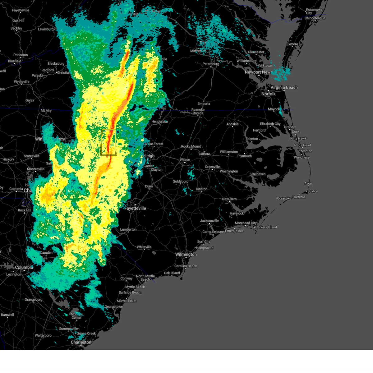
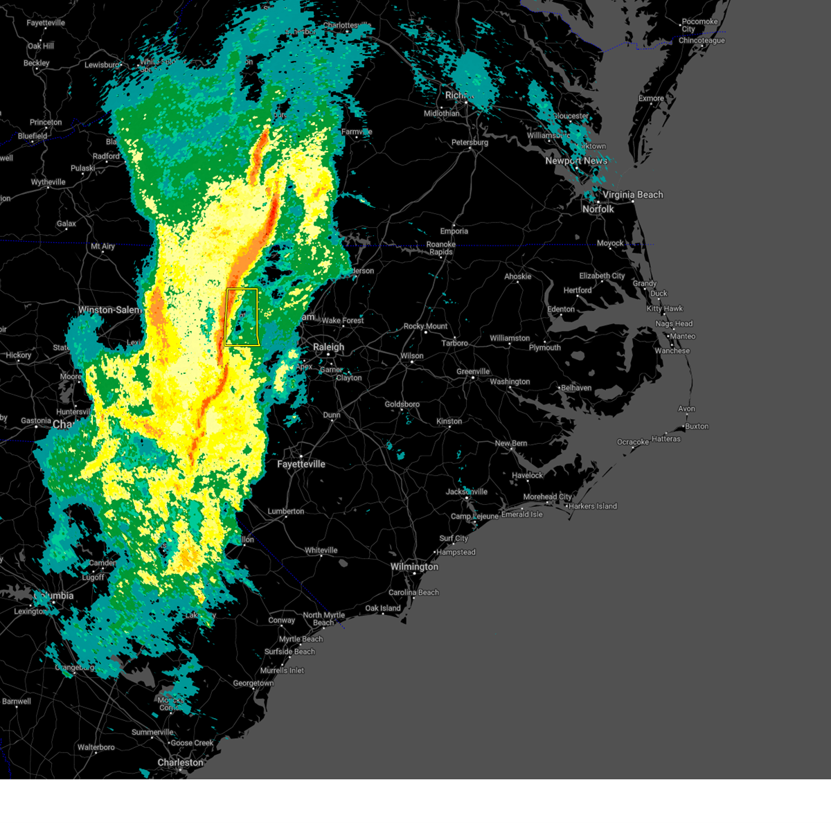
| 5/26/2024 10:48 PM EDT |
 At 1048 pm edt, severe thunderstorms were located along a line extending from near mebane to 8 miles east of pittsboro to near sanford, moving east at 45 mph (law enforcement). Hazards include 60 mph wind gusts. Expect damage to roofs, siding, and trees. Locations impacted include, raleigh, durham, cary, chapel hill, burlington, sanford, graham, hillsborough, pittsboro, and lillington. At 1048 pm edt, severe thunderstorms were located along a line extending from near mebane to 8 miles east of pittsboro to near sanford, moving east at 45 mph (law enforcement). Hazards include 60 mph wind gusts. Expect damage to roofs, siding, and trees. Locations impacted include, raleigh, durham, cary, chapel hill, burlington, sanford, graham, hillsborough, pittsboro, and lillington.
|
| 5/26/2024 10:32 PM EDT |
 Svrrah the national weather service in raleigh has issued a * severe thunderstorm warning for, southern alamance county in central north carolina, orange county in central north carolina, harnett county in central north carolina, lee county in central north carolina, wake county in central north carolina, western johnston county in central north carolina, durham county in central north carolina, chatham county in central north carolina, * until 1115 pm edt. * at 1032 pm edt, severe thunderstorms were located along a line extending from near elon to near pittsboro to 8 miles northeast of carthage, moving east at 45 mph (law enforcement. trees have been reported down in several locations in randolph county). Hazards include 60 mph wind gusts. expect damage to roofs, siding, and trees Svrrah the national weather service in raleigh has issued a * severe thunderstorm warning for, southern alamance county in central north carolina, orange county in central north carolina, harnett county in central north carolina, lee county in central north carolina, wake county in central north carolina, western johnston county in central north carolina, durham county in central north carolina, chatham county in central north carolina, * until 1115 pm edt. * at 1032 pm edt, severe thunderstorms were located along a line extending from near elon to near pittsboro to 8 miles northeast of carthage, moving east at 45 mph (law enforcement. trees have been reported down in several locations in randolph county). Hazards include 60 mph wind gusts. expect damage to roofs, siding, and trees
|
| 5/26/2024 10:29 PM EDT |
 At 1029 pm edt, severe thunderstorms were located along a line extending from near elon to near pittsboro to 7 miles north of carthage, moving east at 45 mph (radar indicated). Hazards include 60 mph wind gusts. Expect damage to roofs, siding, and trees. Locations impacted include, burlington, sanford, graham, pittsboro, siler city, carrboro, mebane, goldston, elon, and mcleansville. At 1029 pm edt, severe thunderstorms were located along a line extending from near elon to near pittsboro to 7 miles north of carthage, moving east at 45 mph (radar indicated). Hazards include 60 mph wind gusts. Expect damage to roofs, siding, and trees. Locations impacted include, burlington, sanford, graham, pittsboro, siler city, carrboro, mebane, goldston, elon, and mcleansville.
|
| 5/26/2024 10:16 PM EDT |
 At 1016 pm edt, severe thunderstorms were located along a line extending from near mcleansville to near siler city to 8 miles east of seagrove, moving east at 45 mph (radar indicated). Hazards include 60 mph wind gusts. Expect damage to roofs, siding, and trees. Locations impacted include, greensboro, burlington, sanford, asheboro, graham, pittsboro, siler city, north carolina zoo, carrboro, and mebane. At 1016 pm edt, severe thunderstorms were located along a line extending from near mcleansville to near siler city to 8 miles east of seagrove, moving east at 45 mph (radar indicated). Hazards include 60 mph wind gusts. Expect damage to roofs, siding, and trees. Locations impacted include, greensboro, burlington, sanford, asheboro, graham, pittsboro, siler city, north carolina zoo, carrboro, and mebane.
|
| 5/26/2024 10:13 PM EDT |
 The storm which prompted the warning has weakened below severe limits, and no longer poses an immediate threat to life or property. therefore, the warning will be allowed to expire. however, gusty winds are still possible with this thunderstorm. a severe thunderstorm watch remains in effect until 1100 pm edt for portions of central north carolina. remember, a severe thunderstorm warning still remains in effect for southern alamance and southwestern orange counties until 1045 pm edt. The storm which prompted the warning has weakened below severe limits, and no longer poses an immediate threat to life or property. therefore, the warning will be allowed to expire. however, gusty winds are still possible with this thunderstorm. a severe thunderstorm watch remains in effect until 1100 pm edt for portions of central north carolina. remember, a severe thunderstorm warning still remains in effect for southern alamance and southwestern orange counties until 1045 pm edt.
|
| 5/26/2024 9:57 PM EDT |
 Svrrah the national weather service in raleigh has issued a * severe thunderstorm warning for, alamance county in central north carolina, northwestern moore county in central north carolina, southwestern orange county in central north carolina, eastern randolph county in central north carolina, central guilford county in central north carolina, lee county in central north carolina, chatham county in central north carolina, * until 1045 pm edt. * at 956 pm edt, severe thunderstorms were located along a line extending from 6 miles east of kernersville to 6 miles east of randleman to 6 miles west of seagrove, moving east at 45 mph (radar indicated). Hazards include 60 mph wind gusts. expect damage to roofs, siding, and trees Svrrah the national weather service in raleigh has issued a * severe thunderstorm warning for, alamance county in central north carolina, northwestern moore county in central north carolina, southwestern orange county in central north carolina, eastern randolph county in central north carolina, central guilford county in central north carolina, lee county in central north carolina, chatham county in central north carolina, * until 1045 pm edt. * at 956 pm edt, severe thunderstorms were located along a line extending from 6 miles east of kernersville to 6 miles east of randleman to 6 miles west of seagrove, moving east at 45 mph (radar indicated). Hazards include 60 mph wind gusts. expect damage to roofs, siding, and trees
|
| 5/26/2024 9:49 PM EDT |
 the severe thunderstorm warning has been cancelled and is no longer in effect the severe thunderstorm warning has been cancelled and is no longer in effect
|
| 5/26/2024 9:49 PM EDT |
 At 948 pm edt, a severe thunderstorm was located over graham, moving east at 35 mph (radar indicated). Hazards include 60 mph wind gusts. Expect damage to roofs, siding, and trees. Locations impacted include, burlington, graham, hillsborough, mebane, elon, gibsonville, haw river, swepsonville, alamance, and carr. At 948 pm edt, a severe thunderstorm was located over graham, moving east at 35 mph (radar indicated). Hazards include 60 mph wind gusts. Expect damage to roofs, siding, and trees. Locations impacted include, burlington, graham, hillsborough, mebane, elon, gibsonville, haw river, swepsonville, alamance, and carr.
|
| 5/26/2024 9:23 PM EDT |
 Svrrah the national weather service in raleigh has issued a * severe thunderstorm warning for, alamance county in central north carolina, western orange county in central north carolina, eastern guilford county in central north carolina, * until 1015 pm edt. * at 923 pm edt, a severe thunderstorm was located over mcleansville, or 10 miles west of burlington, moving east at 30 mph (radar indicated). Hazards include 60 mph wind gusts and penny size hail. expect damage to roofs, siding, and trees Svrrah the national weather service in raleigh has issued a * severe thunderstorm warning for, alamance county in central north carolina, western orange county in central north carolina, eastern guilford county in central north carolina, * until 1015 pm edt. * at 923 pm edt, a severe thunderstorm was located over mcleansville, or 10 miles west of burlington, moving east at 30 mph (radar indicated). Hazards include 60 mph wind gusts and penny size hail. expect damage to roofs, siding, and trees
|
| 4/11/2024 9:22 PM EDT |
 At 922 pm edt, severe thunderstorms were located along a line extending from near bethany to 6 miles south of monroeton to near mcleansville, moving northeast at 50 mph (radar indicated). Hazards include 60 mph wind gusts. Expect damage to roofs, siding, and trees. Locations impacted include, greensboro, mcleansville, summerfield, gibsonville, haw river state park, lake guilford mackintosh marina, lake townsend marina, lake townsend, lake jeanette marina, and monticello. At 922 pm edt, severe thunderstorms were located along a line extending from near bethany to 6 miles south of monroeton to near mcleansville, moving northeast at 50 mph (radar indicated). Hazards include 60 mph wind gusts. Expect damage to roofs, siding, and trees. Locations impacted include, greensboro, mcleansville, summerfield, gibsonville, haw river state park, lake guilford mackintosh marina, lake townsend marina, lake townsend, lake jeanette marina, and monticello.
|
| 4/11/2024 9:14 PM EDT |
 the severe thunderstorm warning has been cancelled and is no longer in effect the severe thunderstorm warning has been cancelled and is no longer in effect
|
| 4/11/2024 9:14 PM EDT |
 At 914 pm edt, severe thunderstorms were located along a line extending from 6 miles southwest of bethany to 8 miles west of mcleansville to near greensboro, moving northeast at 45 mph (radar indicated). Hazards include 60 mph wind gusts. Expect damage to roofs, siding, and trees. Locations impacted include, greensboro, high point, mcleansville, summerfield, gibsonville, stokesdale, pleasant garden, jamestown, haw river state park, and lake guilford mackintosh marina. At 914 pm edt, severe thunderstorms were located along a line extending from 6 miles southwest of bethany to 8 miles west of mcleansville to near greensboro, moving northeast at 45 mph (radar indicated). Hazards include 60 mph wind gusts. Expect damage to roofs, siding, and trees. Locations impacted include, greensboro, high point, mcleansville, summerfield, gibsonville, stokesdale, pleasant garden, jamestown, haw river state park, and lake guilford mackintosh marina.
|
| 4/11/2024 9:07 PM EDT |
 At 906 pm edt, severe thunderstorms were located along a line extending from 7 miles south of ellisboro to near greensboro to 7 miles northeast of high point, moving northeast at 45 mph (radar indicated). Hazards include 60 mph wind gusts. Expect damage to roofs, siding, and trees. Locations impacted include, greensboro, high point, kernersville, mcleansville, summerfield, gibsonville, stokesdale, pleasant garden, jamestown, and haw river state park. At 906 pm edt, severe thunderstorms were located along a line extending from 7 miles south of ellisboro to near greensboro to 7 miles northeast of high point, moving northeast at 45 mph (radar indicated). Hazards include 60 mph wind gusts. Expect damage to roofs, siding, and trees. Locations impacted include, greensboro, high point, kernersville, mcleansville, summerfield, gibsonville, stokesdale, pleasant garden, jamestown, and haw river state park.
|
| 4/11/2024 9:07 PM EDT |
 the severe thunderstorm warning has been cancelled and is no longer in effect the severe thunderstorm warning has been cancelled and is no longer in effect
|
| 4/11/2024 8:51 PM EDT |
 Svrrah the national weather service in raleigh has issued a * severe thunderstorm warning for, southeastern forsyth county in central north carolina, northeastern davidson county in central north carolina, northwestern randolph county in central north carolina, guilford county in central north carolina, * until 930 pm edt. * at 851 pm edt, severe thunderstorms were located along a line extending from kernersville to near high point to near thomasville, moving northeast at 45 mph (radar indicated). Hazards include 60 mph wind gusts. expect damage to roofs, siding, and trees Svrrah the national weather service in raleigh has issued a * severe thunderstorm warning for, southeastern forsyth county in central north carolina, northeastern davidson county in central north carolina, northwestern randolph county in central north carolina, guilford county in central north carolina, * until 930 pm edt. * at 851 pm edt, severe thunderstorms were located along a line extending from kernersville to near high point to near thomasville, moving northeast at 45 mph (radar indicated). Hazards include 60 mph wind gusts. expect damage to roofs, siding, and trees
|
| 2/28/2024 5:53 PM EST |
 The storms which prompted the warning have weakened below severe limits, and no longer pose an immediate threat to life or property. therefore, the warning will be allowed to expire. The storms which prompted the warning have weakened below severe limits, and no longer pose an immediate threat to life or property. therefore, the warning will be allowed to expire.
|
| 2/28/2024 5:43 PM EST |
 At 543 pm est, severe thunderstorms were located along a line extending from 7 miles south of elon to 11 miles south of greensboro to 6 miles northwest of randleman to near lexington to linwood, moving east at 40 mph (radar indicated). Hazards include 60 mph wind gusts. Expect damage to roofs, siding, and trees. Locations impacted include, greensboro, high point, burlington, lexington, graham, randleman, thomasville, linwood, archdale, and trinity. At 543 pm est, severe thunderstorms were located along a line extending from 7 miles south of elon to 11 miles south of greensboro to 6 miles northwest of randleman to near lexington to linwood, moving east at 40 mph (radar indicated). Hazards include 60 mph wind gusts. Expect damage to roofs, siding, and trees. Locations impacted include, greensboro, high point, burlington, lexington, graham, randleman, thomasville, linwood, archdale, and trinity.
|
| 2/28/2024 5:32 PM EST |
 At 532 pm est, severe thunderstorms were located along a line extending from 7 miles north of elon to near mcleansville to 8 miles southeast of greensboro to near thomasville to near lexington, moving east at 55 mph (radar indicated). Hazards include 60 mph wind gusts. Expect damage to roofs, siding, and trees. Locations impacted include, greensboro, high point, burlington, lexington, graham, randleman, thomasville, mebane, elon, and linwood. At 532 pm est, severe thunderstorms were located along a line extending from 7 miles north of elon to near mcleansville to 8 miles southeast of greensboro to near thomasville to near lexington, moving east at 55 mph (radar indicated). Hazards include 60 mph wind gusts. Expect damage to roofs, siding, and trees. Locations impacted include, greensboro, high point, burlington, lexington, graham, randleman, thomasville, mebane, elon, and linwood.
|
| 2/28/2024 5:12 PM EST |
 Svrrah the national weather service in raleigh has issued a * severe thunderstorm warning for, alamance county in central north carolina, central davidson county in central north carolina, northern randolph county in central north carolina, guilford county in central north carolina, * until 600 pm est. * at 512 pm est, severe thunderstorms were located along a line extending from near monroeton to near greensboro to near high point to 7 miles north of lexington to 6 miles east of mocksville, moving east at 45 mph (radar indicated). Hazards include 60 mph wind gusts. expect damage to roofs, siding, and trees Svrrah the national weather service in raleigh has issued a * severe thunderstorm warning for, alamance county in central north carolina, central davidson county in central north carolina, northern randolph county in central north carolina, guilford county in central north carolina, * until 600 pm est. * at 512 pm est, severe thunderstorms were located along a line extending from near monroeton to near greensboro to near high point to 7 miles north of lexington to 6 miles east of mocksville, moving east at 45 mph (radar indicated). Hazards include 60 mph wind gusts. expect damage to roofs, siding, and trees
|
| 1/9/2024 4:42 PM EST |
 At 441 pm est, severe thunderstorms were located along a line extending from near semora to near baynes to 6 miles south of mebane, moving northeast at 70 mph (radar indicated). Hazards include 60 mph wind gusts. Expect damage to roofs, siding, and trees. Locations impacted include, burlington, graham, roxboro, hillsborough, mebane, rougemont, concord, haw river, swepsonville, and mayo reservoir. At 441 pm est, severe thunderstorms were located along a line extending from near semora to near baynes to 6 miles south of mebane, moving northeast at 70 mph (radar indicated). Hazards include 60 mph wind gusts. Expect damage to roofs, siding, and trees. Locations impacted include, burlington, graham, roxboro, hillsborough, mebane, rougemont, concord, haw river, swepsonville, and mayo reservoir.
|
| 1/9/2024 4:23 PM EST |
 At 423 pm est, severe thunderstorms were located along a line extending from jericho to 7 miles south of elon to near siler city, moving northeast at 70 mph (radar indicated). Hazards include 60 mph wind gusts. expect damage to roofs, siding, and trees At 423 pm est, severe thunderstorms were located along a line extending from jericho to 7 miles south of elon to near siler city, moving northeast at 70 mph (radar indicated). Hazards include 60 mph wind gusts. expect damage to roofs, siding, and trees
|
| 1/9/2024 3:50 PM EST |
 At 349 pm est, severe thunderstorms were located along a line extending from 9 miles south of bethany to near greensboro to 6 miles northwest of randleman, moving northeast at 60 mph (radar indicated). Hazards include 60 mph wind gusts. expect damage to roofs, siding, and trees At 349 pm est, severe thunderstorms were located along a line extending from 9 miles south of bethany to near greensboro to 6 miles northwest of randleman, moving northeast at 60 mph (radar indicated). Hazards include 60 mph wind gusts. expect damage to roofs, siding, and trees
|
| 1/9/2024 3:09 PM EST |
 At 308 pm est, severe thunderstorms were located along a line extending from near ringgold to near jericho to 9 miles south of elon, moving northeast at 40 mph (radar indicated). Hazards include 60 mph wind gusts. expect damage to roofs, siding, and trees At 308 pm est, severe thunderstorms were located along a line extending from near ringgold to near jericho to 9 miles south of elon, moving northeast at 40 mph (radar indicated). Hazards include 60 mph wind gusts. expect damage to roofs, siding, and trees
|
| 1/9/2024 2:31 PM EST |
 At 230 pm est, severe thunderstorms were located along a line extending from bethany to near greensboro to near high point, moving northeast at 45 mph (radar indicated). Hazards include 60 mph wind gusts. expect damage to roofs, siding, and trees At 230 pm est, severe thunderstorms were located along a line extending from bethany to near greensboro to near high point, moving northeast at 45 mph (radar indicated). Hazards include 60 mph wind gusts. expect damage to roofs, siding, and trees
|
| 10/20/2023 5:33 PM EDT |
 At 532 pm edt, a severe thunderstorm was located over greensboro, moving east at 25 mph (radar indicated). Hazards include 60 mph wind gusts and quarter size hail. Hail damage to vehicles is expected. Expect wind damage to roofs, siding, and trees. At 532 pm edt, a severe thunderstorm was located over greensboro, moving east at 25 mph (radar indicated). Hazards include 60 mph wind gusts and quarter size hail. Hail damage to vehicles is expected. Expect wind damage to roofs, siding, and trees.
|
| 8/15/2023 3:54 PM EDT |
 At 354 pm edt, a severe thunderstorm was located near carrboro, or 7 miles west of chapel hill, moving east at 55 mph (emergency management). Hazards include 70 mph wind gusts and half dollar size hail. Hail damage to vehicles is expected. expect considerable tree damage. wind damage is also likely to mobile homes, roofs, and outbuildings. locations impacted include, burlington, graham, mebane, haw river, swepsonville, alamance, snow camp, sutphin and saxapahaw. thunderstorm damage threat, considerable hail threat, radar indicated max hail size, 1. 25 in wind threat, radar indicated max wind gust, 70 mph. At 354 pm edt, a severe thunderstorm was located near carrboro, or 7 miles west of chapel hill, moving east at 55 mph (emergency management). Hazards include 70 mph wind gusts and half dollar size hail. Hail damage to vehicles is expected. expect considerable tree damage. wind damage is also likely to mobile homes, roofs, and outbuildings. locations impacted include, burlington, graham, mebane, haw river, swepsonville, alamance, snow camp, sutphin and saxapahaw. thunderstorm damage threat, considerable hail threat, radar indicated max hail size, 1. 25 in wind threat, radar indicated max wind gust, 70 mph.
|
| 8/15/2023 3:51 PM EDT |
 At 350 pm edt, a severe thunderstorm was located 10 miles west of carrboro, or 11 miles southeast of graham, moving east at 45 mph (emergency management). Hazards include 70 mph wind gusts and half dollar size hail. Hail damage to vehicles is expected. expect considerable tree damage. Wind damage is also likely to mobile homes, roofs, and outbuildings. At 350 pm edt, a severe thunderstorm was located 10 miles west of carrboro, or 11 miles southeast of graham, moving east at 45 mph (emergency management). Hazards include 70 mph wind gusts and half dollar size hail. Hail damage to vehicles is expected. expect considerable tree damage. Wind damage is also likely to mobile homes, roofs, and outbuildings.
|
| 8/15/2023 3:32 PM EDT |
 At 331 pm edt, a severe thunderstorm was located 8 miles south of elon, or 10 miles southwest of burlington, moving east at 40 mph. this is a destructive storm for hazard, 80 mph wind gusts and half dollar size hail (radar indicated). Flying debris will be dangerous to those caught without shelter. mobile homes will be heavily damaged. expect considerable damage to roofs, windows, and vehicles. extensive tree damage and power outages are likely. locations impacted include, liberty, staley, climax, lake guilford mackintosh marina and forest oaks. thunderstorm damage threat, destructive hail threat, radar indicated max hail size, 1. 25 in wind threat, radar indicated max wind gust, 80 mph. At 331 pm edt, a severe thunderstorm was located 8 miles south of elon, or 10 miles southwest of burlington, moving east at 40 mph. this is a destructive storm for hazard, 80 mph wind gusts and half dollar size hail (radar indicated). Flying debris will be dangerous to those caught without shelter. mobile homes will be heavily damaged. expect considerable damage to roofs, windows, and vehicles. extensive tree damage and power outages are likely. locations impacted include, liberty, staley, climax, lake guilford mackintosh marina and forest oaks. thunderstorm damage threat, destructive hail threat, radar indicated max hail size, 1. 25 in wind threat, radar indicated max wind gust, 80 mph.
|
| 8/15/2023 3:29 PM EDT |
 At 328 pm edt, a severe thunderstorm was located 11 miles south of elon, or 12 miles southwest of burlington, moving east at 55 mph (radar observed). Hazards include 80 mph wind gusts and ping pong ball size hail. Flying debris will be dangerous to those caught without shelter. mobile homes will be heavily damaged. expect considerable damage to roofs, windows, and vehicles. Extensive tree damage and power outages are likely. At 328 pm edt, a severe thunderstorm was located 11 miles south of elon, or 12 miles southwest of burlington, moving east at 55 mph (radar observed). Hazards include 80 mph wind gusts and ping pong ball size hail. Flying debris will be dangerous to those caught without shelter. mobile homes will be heavily damaged. expect considerable damage to roofs, windows, and vehicles. Extensive tree damage and power outages are likely.
|
| 8/15/2023 3:24 PM EDT |
 At 323 pm edt, a severe thunderstorm was located 10 miles south of mcleansville, or 12 miles southeast of greensboro, moving east at 60 mph (radar indicated). Hazards include 80 mph wind gusts and half dollar size hail. Flying debris will be dangerous to those caught without shelter. mobile homes will be heavily damaged. expect considerable damage to roofs, windows, and vehicles. extensive tree damage and power outages are likely. locations impacted include, greensboro, randleman, mcleansville, gibsonville, pleasant garden, liberty, ramseur, staley, climax and lake guilford mackintosh marina. thunderstorm damage threat, destructive hail threat, radar indicated max hail size, 1. 25 in wind threat, radar indicated max wind gust, 80 mph. At 323 pm edt, a severe thunderstorm was located 10 miles south of mcleansville, or 12 miles southeast of greensboro, moving east at 60 mph (radar indicated). Hazards include 80 mph wind gusts and half dollar size hail. Flying debris will be dangerous to those caught without shelter. mobile homes will be heavily damaged. expect considerable damage to roofs, windows, and vehicles. extensive tree damage and power outages are likely. locations impacted include, greensboro, randleman, mcleansville, gibsonville, pleasant garden, liberty, ramseur, staley, climax and lake guilford mackintosh marina. thunderstorm damage threat, destructive hail threat, radar indicated max hail size, 1. 25 in wind threat, radar indicated max wind gust, 80 mph.
|
| 8/15/2023 3:19 PM EDT |
 At 319 pm edt, a severe thunderstorm was located near greensboro, moving east at 40 mph (public). Hazards include 70 mph wind gusts. Expect considerable tree damage. damage is likely to mobile homes, roofs, and outbuildings. locations impacted include, greensboro, high point, randleman, mcleansville, archdale, gibsonville, pleasant garden, jamestown, liberty and ramseur. thunderstorm damage threat, considerable hail threat, observed max hail size, <. 75 in wind threat, radar indicated max wind gust, 70 mph. At 319 pm edt, a severe thunderstorm was located near greensboro, moving east at 40 mph (public). Hazards include 70 mph wind gusts. Expect considerable tree damage. damage is likely to mobile homes, roofs, and outbuildings. locations impacted include, greensboro, high point, randleman, mcleansville, archdale, gibsonville, pleasant garden, jamestown, liberty and ramseur. thunderstorm damage threat, considerable hail threat, observed max hail size, <. 75 in wind threat, radar indicated max wind gust, 70 mph.
|
| 8/15/2023 3:10 PM EDT |
 At 309 pm edt, a severe thunderstorm was located over high point, moving east at 40 mph (radar indicated). Hazards include ping pong ball size hail and 60 mph wind gusts. People and animals outdoors will be injured. expect hail damage to roofs, siding, windows, and vehicles. expect wind damage to roofs, siding, and trees. locations impacted include, greensboro, high point, randleman, mcleansville, archdale, summerfield, trinity, gibsonville, pleasant garden and jamestown. hail threat, observed max hail size, 1. 50 in wind threat, radar indicated max wind gust, 60 mph. At 309 pm edt, a severe thunderstorm was located over high point, moving east at 40 mph (radar indicated). Hazards include ping pong ball size hail and 60 mph wind gusts. People and animals outdoors will be injured. expect hail damage to roofs, siding, windows, and vehicles. expect wind damage to roofs, siding, and trees. locations impacted include, greensboro, high point, randleman, mcleansville, archdale, summerfield, trinity, gibsonville, pleasant garden and jamestown. hail threat, observed max hail size, 1. 50 in wind threat, radar indicated max wind gust, 60 mph.
|
| 8/15/2023 2:56 PM EDT |
 At 256 pm edt, a severe thunderstorm was located near thomasville, or 7 miles west of high point, moving east at 40 mph (radar indicated). Hazards include 60 mph wind gusts and half dollar size hail. Hail damage to vehicles is expected. Expect wind damage to roofs, siding, and trees. At 256 pm edt, a severe thunderstorm was located near thomasville, or 7 miles west of high point, moving east at 40 mph (radar indicated). Hazards include 60 mph wind gusts and half dollar size hail. Hail damage to vehicles is expected. Expect wind damage to roofs, siding, and trees.
|
| 8/7/2023 6:48 PM EDT |
 At 648 pm edt, severe thunderstorms were located along a line extending from near mebane to near goldston, moving east at 50 mph (radar indicated). Hazards include 70 mph wind gusts. Expect considerable tree damage. damage is likely to mobile homes, roofs, and outbuildings. Locations impacted include, chapel hill, burlington, sanford, graham, hillsborough, pittsboro, siler city, carrboro, mebane and goldston. At 648 pm edt, severe thunderstorms were located along a line extending from near mebane to near goldston, moving east at 50 mph (radar indicated). Hazards include 70 mph wind gusts. Expect considerable tree damage. damage is likely to mobile homes, roofs, and outbuildings. Locations impacted include, chapel hill, burlington, sanford, graham, hillsborough, pittsboro, siler city, carrboro, mebane and goldston.
|
| 8/7/2023 6:34 PM EDT |
 At 634 pm edt, severe thunderstorms were located along a line extending from graham to 12 miles southwest of goldston, moving east at 50 mph (radar indicated). Hazards include 70 mph wind gusts. Expect considerable tree damage. damage is likely to mobile homes, roofs, and outbuildings. Locations impacted include, chapel hill, burlington, sanford, graham, hillsborough, pittsboro, siler city, north carolina zoo, carrboro and mebane. At 634 pm edt, severe thunderstorms were located along a line extending from graham to 12 miles southwest of goldston, moving east at 50 mph (radar indicated). Hazards include 70 mph wind gusts. Expect considerable tree damage. damage is likely to mobile homes, roofs, and outbuildings. Locations impacted include, chapel hill, burlington, sanford, graham, hillsborough, pittsboro, siler city, north carolina zoo, carrboro and mebane.
|
| 8/7/2023 6:24 PM EDT |
 At 623 pm edt, severe thunderstorms were located along a line extending from near greensboro to 7 miles west of seagrove, moving east at 50 mph (radar indicated). Hazards include 70 mph wind gusts. Expect considerable tree damage. Damage is likely to mobile homes, roofs, and outbuildings. At 623 pm edt, severe thunderstorms were located along a line extending from near greensboro to 7 miles west of seagrove, moving east at 50 mph (radar indicated). Hazards include 70 mph wind gusts. Expect considerable tree damage. Damage is likely to mobile homes, roofs, and outbuildings.
|
| 8/7/2023 6:19 PM EDT |
 At 618 pm edt, severe thunderstorms were located along a line extending from near camp springs to 8 miles south of biscoe, moving east at 55 mph (radar indicated). Hazards include 70 mph wind gusts. Expect considerable tree damage. damage is likely to mobile homes, roofs, and outbuildings. Locations impacted include, greensboro, high point, asheboro, albemarle, randleman, troy, badin lake, north carolina zoo, biscoe and seagrove. At 618 pm edt, severe thunderstorms were located along a line extending from near camp springs to 8 miles south of biscoe, moving east at 55 mph (radar indicated). Hazards include 70 mph wind gusts. Expect considerable tree damage. damage is likely to mobile homes, roofs, and outbuildings. Locations impacted include, greensboro, high point, asheboro, albemarle, randleman, troy, badin lake, north carolina zoo, biscoe and seagrove.
|
| 8/7/2023 6:13 PM EDT |
 At 613 pm edt, severe thunderstorms were located along a line extending from monroeton to 6 miles south of troy, moving east at 50 mph (radar indicated). Hazards include 70 mph wind gusts. Expect considerable tree damage. damage is likely to mobile homes, roofs, and outbuildings. Locations impacted include, greensboro, high point, asheboro, albemarle, randleman, troy, badin lake, north carolina zoo, thomasville and kernersville. At 613 pm edt, severe thunderstorms were located along a line extending from monroeton to 6 miles south of troy, moving east at 50 mph (radar indicated). Hazards include 70 mph wind gusts. Expect considerable tree damage. damage is likely to mobile homes, roofs, and outbuildings. Locations impacted include, greensboro, high point, asheboro, albemarle, randleman, troy, badin lake, north carolina zoo, thomasville and kernersville.
|
| 8/7/2023 6:01 PM EDT |
 At 600 pm edt, severe thunderstorms were located along a line extending from near bethany to 9 miles southeast of albemarle, moving east at 60 mph (radar indicated). Hazards include 70 mph wind gusts. Expect considerable tree damage. damage is likely to mobile homes, roofs, and outbuildings. Locations impacted include, greensboro, winston-salem, high point, asheboro, lexington, albemarle, randleman, troy, badin lake and north carolina zoo. At 600 pm edt, severe thunderstorms were located along a line extending from near bethany to 9 miles southeast of albemarle, moving east at 60 mph (radar indicated). Hazards include 70 mph wind gusts. Expect considerable tree damage. damage is likely to mobile homes, roofs, and outbuildings. Locations impacted include, greensboro, winston-salem, high point, asheboro, lexington, albemarle, randleman, troy, badin lake and north carolina zoo.
|
| 8/7/2023 5:48 PM EDT |
 At 547 pm edt, severe thunderstorms were located along a line extending from near ellisboro to near plyler, moving east at 50 mph (radar indicated). Hazards include 60 mph wind gusts. Expect damage to roofs, siding, and trees. Locations impacted include, greensboro, winston-salem, high point, asheboro, lexington, albemarle, randleman, troy, badin lake and north carolina zoo. At 547 pm edt, severe thunderstorms were located along a line extending from near ellisboro to near plyler, moving east at 50 mph (radar indicated). Hazards include 60 mph wind gusts. Expect damage to roofs, siding, and trees. Locations impacted include, greensboro, winston-salem, high point, asheboro, lexington, albemarle, randleman, troy, badin lake and north carolina zoo.
|
| 8/7/2023 5:27 PM EDT |
 At 526 pm edt, severe thunderstorms were located along a line extending from germanton to near downtown concord, moving east at 50 mph (radar indicated). Hazards include 60 mph wind gusts. expect damage to roofs, siding, and trees At 526 pm edt, severe thunderstorms were located along a line extending from germanton to near downtown concord, moving east at 50 mph (radar indicated). Hazards include 60 mph wind gusts. expect damage to roofs, siding, and trees
|
| 8/6/2023 5:51 PM EDT |
 The severe thunderstorm warning for northwestern moore, northeastern montgomery, randolph and southern guilford counties will expire at 600 pm edt, the storms which prompted the warning have weakened below severe limits, and no longer pose an immediate threat to life or property. therefore, the warning will be allowed to expire. however gusty winds are still possible with these thunderstorms. The severe thunderstorm warning for northwestern moore, northeastern montgomery, randolph and southern guilford counties will expire at 600 pm edt, the storms which prompted the warning have weakened below severe limits, and no longer pose an immediate threat to life or property. therefore, the warning will be allowed to expire. however gusty winds are still possible with these thunderstorms.
|
| 8/6/2023 5:38 PM EDT |
 At 537 pm edt, severe thunderstorms were located along a line extending from near mcleansville to 7 miles northeast of north carolina zoo to 7 miles south of biscoe, moving east at 30 mph (radar indicated). Hazards include 60 mph wind gusts. Expect damage to roofs, siding, and trees. locations impacted include, greensboro, high point, asheboro, randleman, troy, north carolina zoo, biscoe, seagrove, mcleansville and gibsonville. hail threat, radar indicated max hail size, <. 75 in wind threat, radar indicated max wind gust, 60 mph. At 537 pm edt, severe thunderstorms were located along a line extending from near mcleansville to 7 miles northeast of north carolina zoo to 7 miles south of biscoe, moving east at 30 mph (radar indicated). Hazards include 60 mph wind gusts. Expect damage to roofs, siding, and trees. locations impacted include, greensboro, high point, asheboro, randleman, troy, north carolina zoo, biscoe, seagrove, mcleansville and gibsonville. hail threat, radar indicated max hail size, <. 75 in wind threat, radar indicated max wind gust, 60 mph.
|
| 8/6/2023 5:28 PM EDT |
 At 528 pm edt, severe thunderstorms were located along a line extending from near greensboro to near asheboro to 8 miles south of troy, moving east at 30 mph (radar indicated). Hazards include 60 mph wind gusts. Expect damage to roofs, siding, and trees. locations impacted include, greensboro, high point, asheboro, randleman, troy, north carolina zoo, biscoe, seagrove, mcleansville and archdale. hail threat, radar indicated max hail size, <. 75 in wind threat, radar indicated max wind gust, 60 mph. At 528 pm edt, severe thunderstorms were located along a line extending from near greensboro to near asheboro to 8 miles south of troy, moving east at 30 mph (radar indicated). Hazards include 60 mph wind gusts. Expect damage to roofs, siding, and trees. locations impacted include, greensboro, high point, asheboro, randleman, troy, north carolina zoo, biscoe, seagrove, mcleansville and archdale. hail threat, radar indicated max hail size, <. 75 in wind threat, radar indicated max wind gust, 60 mph.
|
| 8/6/2023 5:19 PM EDT |
 At 518 pm edt, severe thunderstorms were located along a line extending from near greensboro to asheboro to 8 miles south of troy, moving east at 35 mph (radar indicated). Hazards include 60 mph wind gusts. Expect damage to roofs, siding, and trees. locations impacted include, greensboro, high point, asheboro, randleman, troy, north carolina zoo, badin lake, thomasville, biscoe and seagrove. hail threat, radar indicated max hail size, <. 75 in wind threat, radar indicated max wind gust, 60 mph. At 518 pm edt, severe thunderstorms were located along a line extending from near greensboro to asheboro to 8 miles south of troy, moving east at 35 mph (radar indicated). Hazards include 60 mph wind gusts. Expect damage to roofs, siding, and trees. locations impacted include, greensboro, high point, asheboro, randleman, troy, north carolina zoo, badin lake, thomasville, biscoe and seagrove. hail threat, radar indicated max hail size, <. 75 in wind threat, radar indicated max wind gust, 60 mph.
|
| 8/6/2023 5:00 PM EDT |
 At 500 pm edt, severe thunderstorms were located along a line extending from near kernersville to 9 miles northeast of ansonville, moving east at 30 mph (radar indicated). Hazards include 60 mph wind gusts. expect damage to roofs, siding, and trees At 500 pm edt, severe thunderstorms were located along a line extending from near kernersville to 9 miles northeast of ansonville, moving east at 30 mph (radar indicated). Hazards include 60 mph wind gusts. expect damage to roofs, siding, and trees
|
| 7/29/2023 8:04 PM EDT |
 At 803 pm edt, severe thunderstorms were located along a line extending from near camp springs to near mcleansville, moving east at 25 mph (radar indicated). Hazards include 60 mph wind gusts and quarter size hail. Hail damage to vehicles is expected. expect wind damage to roofs, siding, and trees. locations impacted include, greensboro, burlington, mcleansville, gibsonville, lake cammack park & marina, altamahaw-ossipee, glen raven, union ridge, lake townsend marina and altamahaw. hail threat, radar indicated max hail size, 1. 00 in wind threat, radar indicated max wind gust, 60 mph. At 803 pm edt, severe thunderstorms were located along a line extending from near camp springs to near mcleansville, moving east at 25 mph (radar indicated). Hazards include 60 mph wind gusts and quarter size hail. Hail damage to vehicles is expected. expect wind damage to roofs, siding, and trees. locations impacted include, greensboro, burlington, mcleansville, gibsonville, lake cammack park & marina, altamahaw-ossipee, glen raven, union ridge, lake townsend marina and altamahaw. hail threat, radar indicated max hail size, 1. 00 in wind threat, radar indicated max wind gust, 60 mph.
|
| 7/29/2023 7:53 PM EDT |
 At 753 pm edt, severe thunderstorms were located along a line extending from near reidsville to 6 miles northwest of mcleansville, moving southeast at 25 mph (radar indicated). Hazards include 60 mph wind gusts and quarter size hail. Hail damage to vehicles is expected. expect wind damage to roofs, siding, and trees. locations impacted include, greensboro, burlington, mcleansville, gibsonville, haw river state park, lake jeanette marina, lake burlington, monticello, lake cammack park & marina and altamahaw-ossipee. hail threat, radar indicated max hail size, 1. 00 in wind threat, radar indicated max wind gust, 60 mph. At 753 pm edt, severe thunderstorms were located along a line extending from near reidsville to 6 miles northwest of mcleansville, moving southeast at 25 mph (radar indicated). Hazards include 60 mph wind gusts and quarter size hail. Hail damage to vehicles is expected. expect wind damage to roofs, siding, and trees. locations impacted include, greensboro, burlington, mcleansville, gibsonville, haw river state park, lake jeanette marina, lake burlington, monticello, lake cammack park & marina and altamahaw-ossipee. hail threat, radar indicated max hail size, 1. 00 in wind threat, radar indicated max wind gust, 60 mph.
|
| 7/29/2023 7:38 PM EDT |
 At 738 pm edt, severe thunderstorms were located along a line extending from reidsville to near monroeton, moving east at 20 mph (radar indicated). Hazards include 60 mph wind gusts and quarter size hail. Hail damage to vehicles is expected. expect wind damage to roofs, siding, and trees. locations impacted include, greensboro, burlington, mcleansville, summerfield, gibsonville, stokesdale, haw river state park, lake jeanette marina, lake burlington and monticello. hail threat, radar indicated max hail size, 1. 00 in wind threat, radar indicated max wind gust, 60 mph. At 738 pm edt, severe thunderstorms were located along a line extending from reidsville to near monroeton, moving east at 20 mph (radar indicated). Hazards include 60 mph wind gusts and quarter size hail. Hail damage to vehicles is expected. expect wind damage to roofs, siding, and trees. locations impacted include, greensboro, burlington, mcleansville, summerfield, gibsonville, stokesdale, haw river state park, lake jeanette marina, lake burlington and monticello. hail threat, radar indicated max hail size, 1. 00 in wind threat, radar indicated max wind gust, 60 mph.
|
| 7/29/2023 7:25 PM EDT |
 At 724 pm edt, severe thunderstorms were located along a line extending from wentworth to near bethany, moving southeast at 20 mph (radar indicated). Hazards include 60 mph wind gusts and quarter size hail. Hail damage to vehicles is expected. Expect wind damage to roofs, siding, and trees. At 724 pm edt, severe thunderstorms were located along a line extending from wentworth to near bethany, moving southeast at 20 mph (radar indicated). Hazards include 60 mph wind gusts and quarter size hail. Hail damage to vehicles is expected. Expect wind damage to roofs, siding, and trees.
|
| 7/9/2023 12:47 PM EDT |
 At 1246 pm edt, severe thunderstorms were located along a line extending from near virgilina to near carrboro to near siler city to near north carolina zoo, moving east at 45 mph (radar indicated). Hazards include 60 mph wind gusts and quarter size hail. Hail damage to vehicles is expected. expect wind damage to roofs, siding, and trees. locations impacted include, raleigh, durham, cary, chapel hill, burlington, asheboro, graham, oxford, roxboro and hillsborough. hail threat, radar indicated max hail size, 1. 00 in wind threat, radar indicated max wind gust, 60 mph. At 1246 pm edt, severe thunderstorms were located along a line extending from near virgilina to near carrboro to near siler city to near north carolina zoo, moving east at 45 mph (radar indicated). Hazards include 60 mph wind gusts and quarter size hail. Hail damage to vehicles is expected. expect wind damage to roofs, siding, and trees. locations impacted include, raleigh, durham, cary, chapel hill, burlington, asheboro, graham, oxford, roxboro and hillsborough. hail threat, radar indicated max hail size, 1. 00 in wind threat, radar indicated max wind gust, 60 mph.
|
| 7/9/2023 12:31 PM EDT |
 At 1229 pm edt, a cluster of severe thunderstorms were located along a line extending from person county to randolph county moving east at 40 mph (radar indicated). Hazards include 60 mph wind gusts and quarter size hail heavy rainf and minor flooding. Hail damage to vehicles is expected. Expect wind damage to roofs, siding, and trees. At 1229 pm edt, a cluster of severe thunderstorms were located along a line extending from person county to randolph county moving east at 40 mph (radar indicated). Hazards include 60 mph wind gusts and quarter size hail heavy rainf and minor flooding. Hail damage to vehicles is expected. Expect wind damage to roofs, siding, and trees.
|
| 7/9/2023 12:23 PM EDT | Tree reported down on edgewood drive and eden street in burlingto in alamance county NC, 1.8 miles WSW of Burlington, NC |
| 7/9/2023 12:13 PM EDT |
 At 1213 pm edt, a severe thunderstorm capable of producing a tornado was located over burlington, moving east at 35 mph (radar indicated rotation). Hazards include tornado. Flying debris will be dangerous to those caught without shelter. mobile homes will be damaged or destroyed. damage to roofs, windows, and vehicles will occur. tree damage is likely. This tornadic thunderstorm will remain over mainly rural areas of northern alamance county, including the following locations, lake cammack park & marina, altamahaw-ossipee, glen raven, union ridge and altamahaw. At 1213 pm edt, a severe thunderstorm capable of producing a tornado was located over burlington, moving east at 35 mph (radar indicated rotation). Hazards include tornado. Flying debris will be dangerous to those caught without shelter. mobile homes will be damaged or destroyed. damage to roofs, windows, and vehicles will occur. tree damage is likely. This tornadic thunderstorm will remain over mainly rural areas of northern alamance county, including the following locations, lake cammack park & marina, altamahaw-ossipee, glen raven, union ridge and altamahaw.
|
| 7/9/2023 12:04 PM EDT | Trees down on power lines resulting in power outages near us highway 70 and springwood church r in guilford county NC, 3.5 miles E of Burlington, NC |
| 7/9/2023 11:57 AM EDT |
 At 1157 am edt, a severe thunderstorm capable of producing a tornado was located near elon, or 7 miles northwest of burlington, moving east at 35 mph (radar indicated rotation). Hazards include tornado. Flying debris will be dangerous to those caught without shelter. mobile homes will be damaged or destroyed. damage to roofs, windows, and vehicles will occur. tree damage is likely. this dangerous storm will be near, burlington around 1210 pm edt. graham around 1215 pm edt. Other locations impacted by this tornadic thunderstorm include lake cammack park & marina, altamahaw-ossipee, glen raven, lake guilford mackintosh marina and union ridge. At 1157 am edt, a severe thunderstorm capable of producing a tornado was located near elon, or 7 miles northwest of burlington, moving east at 35 mph (radar indicated rotation). Hazards include tornado. Flying debris will be dangerous to those caught without shelter. mobile homes will be damaged or destroyed. damage to roofs, windows, and vehicles will occur. tree damage is likely. this dangerous storm will be near, burlington around 1210 pm edt. graham around 1215 pm edt. Other locations impacted by this tornadic thunderstorm include lake cammack park & marina, altamahaw-ossipee, glen raven, lake guilford mackintosh marina and union ridge.
|
| 7/9/2023 11:47 AM EDT |
 At 1147 am edt, severe thunderstorms were located along a line extending from near monroeton to near mcleansville to 8 miles east of high point to 8 miles south of thomasville to near spencer, moving east at 40 mph (radar indicated). Hazards include 60 mph wind gusts and quarter size hail. Hail damage to vehicles is expected. Expect wind damage to roofs, siding, and trees. At 1147 am edt, severe thunderstorms were located along a line extending from near monroeton to near mcleansville to 8 miles east of high point to 8 miles south of thomasville to near spencer, moving east at 40 mph (radar indicated). Hazards include 60 mph wind gusts and quarter size hail. Hail damage to vehicles is expected. Expect wind damage to roofs, siding, and trees.
|
| 7/6/2023 4:35 PM EDT |
 The severe thunderstorm warning for southwestern alamance, northeastern randolph, southeastern guilford and northwestern chatham counties will expire at 445 pm edt, the storm which prompted the warning has weakened below severe limits, and no longer poses an immediate threat to life or property. therefore, the warning will be allowed to expire. however gusty winds and heavy rain are still possible with this thunderstorm. The severe thunderstorm warning for southwestern alamance, northeastern randolph, southeastern guilford and northwestern chatham counties will expire at 445 pm edt, the storm which prompted the warning has weakened below severe limits, and no longer poses an immediate threat to life or property. therefore, the warning will be allowed to expire. however gusty winds and heavy rain are still possible with this thunderstorm.
|
| 7/6/2023 4:25 PM EDT |
 At 425 pm edt, a severe thunderstorm was located near elon, or 7 miles southwest of burlington, and is nearly stationary (radar indicated). Hazards include 60 mph wind gusts and penny size hail. Expect damage to roofs, siding, and trees. locations impacted include, burlington, liberty, alamance, staley, lake mackintosh marina, lake guilford mackintosh marina and snow camp. hail threat, radar indicated max hail size, 0. 75 in wind threat, radar indicated max wind gust, 60 mph. At 425 pm edt, a severe thunderstorm was located near elon, or 7 miles southwest of burlington, and is nearly stationary (radar indicated). Hazards include 60 mph wind gusts and penny size hail. Expect damage to roofs, siding, and trees. locations impacted include, burlington, liberty, alamance, staley, lake mackintosh marina, lake guilford mackintosh marina and snow camp. hail threat, radar indicated max hail size, 0. 75 in wind threat, radar indicated max wind gust, 60 mph.
|
| 7/6/2023 4:14 PM EDT |
 At 414 pm edt, a severe thunderstorm was located near elon, or near burlington, and is nearly stationary (radar indicated). Hazards include 60 mph wind gusts and nickel size hail. Expect damage to roofs, siding, and trees. locations impacted include, burlington, graham, elon, gibsonville, liberty, alamance, staley, lake mackintosh marina, lake guilford mackintosh marina and snow camp. hail threat, radar indicated max hail size, 0. 88 in wind threat, radar indicated max wind gust, 60 mph. At 414 pm edt, a severe thunderstorm was located near elon, or near burlington, and is nearly stationary (radar indicated). Hazards include 60 mph wind gusts and nickel size hail. Expect damage to roofs, siding, and trees. locations impacted include, burlington, graham, elon, gibsonville, liberty, alamance, staley, lake mackintosh marina, lake guilford mackintosh marina and snow camp. hail threat, radar indicated max hail size, 0. 88 in wind threat, radar indicated max wind gust, 60 mph.
|
| 7/6/2023 4:02 PM EDT | Fallen trees/limbs damaged power equipmen in alamance county NC, 2.7 miles NNE of Burlington, NC |
| 7/6/2023 4:01 PM EDT |
 At 401 pm edt, a severe thunderstorm was located near elon, or near burlington, and is nearly stationary (radar indicated). Hazards include 60 mph wind gusts and penny size hail. expect damage to roofs, siding, and trees At 401 pm edt, a severe thunderstorm was located near elon, or near burlington, and is nearly stationary (radar indicated). Hazards include 60 mph wind gusts and penny size hail. expect damage to roofs, siding, and trees
|
| 7/6/2023 3:40 PM EDT | Tree down on pond rd near alamance r in alamance county NC, 2.7 miles NNE of Burlington, NC |
| 7/1/2023 4:50 PM EDT | 1 tree down on r dean coleman roa in alamance county NC, 6.2 miles NNW of Burlington, NC |
| 7/1/2023 4:50 PM EDT | 1 tree down at friendship rock creek rd and boyd wright r in alamance county NC, 7.4 miles N of Burlington, NC |
| 7/1/2023 4:50 PM EDT |
 At 449 pm edt, severe thunderstorms were located along a line extending from prospect hill to near mebane to 8 miles south of elon, moving southeast at 25 mph (radar indicated). Hazards include 70 mph wind gusts and nickel size hail. Expect considerable tree damage. damage is likely to mobile homes, roofs, and outbuildings. locations impacted include, burlington, graham, hillsborough, mebane, elon, gibsonville, haw river, swepsonville, alamance and carr. thunderstorm damage threat, considerable hail threat, radar indicated max hail size, 0. 88 in wind threat, radar indicated max wind gust, 70 mph. At 449 pm edt, severe thunderstorms were located along a line extending from prospect hill to near mebane to 8 miles south of elon, moving southeast at 25 mph (radar indicated). Hazards include 70 mph wind gusts and nickel size hail. Expect considerable tree damage. damage is likely to mobile homes, roofs, and outbuildings. locations impacted include, burlington, graham, hillsborough, mebane, elon, gibsonville, haw river, swepsonville, alamance and carr. thunderstorm damage threat, considerable hail threat, radar indicated max hail size, 0. 88 in wind threat, radar indicated max wind gust, 70 mph.
|
| 7/1/2023 4:47 PM EDT | Multiple trees down on nc-4 in alamance county NC, 6.1 miles N of Burlington, NC |
| 7/1/2023 4:45 PM EDT | 1 tree down at dr pickett rd and friendship patterson mill r in alamance county NC, 5.3 miles N of Burlington, NC |
| 7/1/2023 4:43 PM EDT | Emergency manger reports numerous trees down across alamance... with one tree involving a car. no injuries were reported. time estimated by rada in alamance county NC, 3.3 miles NNE of Burlington, NC |
| 7/1/2023 4:40 PM EDT | 1 tree down on pond r in alamance county NC, 2.7 miles NNE of Burlington, NC |
| 7/1/2023 4:39 PM EDT |
 At 439 pm edt, severe thunderstorms were located along a line extending from near hightowers to near mebane to 7 miles southwest of elon, moving southeast at 25 mph (radar indicated). Hazards include 60 mph wind gusts and nickel size hail. Expect damage to roofs, siding, and trees. locations impacted include, burlington, graham, hillsborough, carrboro, mebane, mcleansville, elon, gibsonville, haw river and swepsonville. hail threat, radar indicated max hail size, 0. 88 in wind threat, radar indicated max wind gust, 60 mph. At 439 pm edt, severe thunderstorms were located along a line extending from near hightowers to near mebane to 7 miles southwest of elon, moving southeast at 25 mph (radar indicated). Hazards include 60 mph wind gusts and nickel size hail. Expect damage to roofs, siding, and trees. locations impacted include, burlington, graham, hillsborough, carrboro, mebane, mcleansville, elon, gibsonville, haw river and swepsonville. hail threat, radar indicated max hail size, 0. 88 in wind threat, radar indicated max wind gust, 60 mph.
|
| 7/1/2023 4:15 PM EDT |
 At 415 pm edt, severe thunderstorms were located along a line extending from yanceyville to 6 miles north of burlington to near mcleansville, moving southeast at 25 mph (radar indicated). Hazards include 60 mph wind gusts and nickel size hail. expect damage to roofs, siding, and trees At 415 pm edt, severe thunderstorms were located along a line extending from yanceyville to 6 miles north of burlington to near mcleansville, moving southeast at 25 mph (radar indicated). Hazards include 60 mph wind gusts and nickel size hail. expect damage to roofs, siding, and trees
|
| 5/16/2023 9:52 PM EDT |
 At 952 pm edt, a severe thunderstorm was located 7 miles southeast of graham, moving east at 40 mph (radar indicated). Hazards include 60 mph wind gusts. Expect damage to roofs, siding, and trees. locations impacted include, chapel hill, burlington, graham, hillsborough, carrboro, mebane, elon, gibsonville, haw river and swepsonville. hail threat, radar indicated max hail size, <. 75 in wind threat, radar indicated max wind gust, 60 mph. At 952 pm edt, a severe thunderstorm was located 7 miles southeast of graham, moving east at 40 mph (radar indicated). Hazards include 60 mph wind gusts. Expect damage to roofs, siding, and trees. locations impacted include, chapel hill, burlington, graham, hillsborough, carrboro, mebane, elon, gibsonville, haw river and swepsonville. hail threat, radar indicated max hail size, <. 75 in wind threat, radar indicated max wind gust, 60 mph.
|
| 5/16/2023 9:29 PM EDT |
 At 928 pm edt, a severe thunderstorm was located 8 miles southwest of elon, or 10 miles southwest of burlington, moving east at 45 mph (radar indicated). Hazards include 60 mph wind gusts. expect damage to roofs, siding, and trees At 928 pm edt, a severe thunderstorm was located 8 miles southwest of elon, or 10 miles southwest of burlington, moving east at 45 mph (radar indicated). Hazards include 60 mph wind gusts. expect damage to roofs, siding, and trees
|
| 5/16/2023 9:16 PM EDT |
 At 916 pm edt, a severe thunderstorm was located near mcleansville, or near greensboro, moving east at 45 mph (radar indicated). Hazards include 60 mph wind gusts. Expect damage to roofs, siding, and trees. locations impacted include, greensboro, mcleansville, gibsonville, pleasant garden, haw river state park, lake guilford mackintosh marina, forest oaks, lake townsend marina, lake townsend and lake jeanette marina. hail threat, radar indicated max hail size, <. 75 in wind threat, radar indicated max wind gust, 60 mph. At 916 pm edt, a severe thunderstorm was located near mcleansville, or near greensboro, moving east at 45 mph (radar indicated). Hazards include 60 mph wind gusts. Expect damage to roofs, siding, and trees. locations impacted include, greensboro, mcleansville, gibsonville, pleasant garden, haw river state park, lake guilford mackintosh marina, forest oaks, lake townsend marina, lake townsend and lake jeanette marina. hail threat, radar indicated max hail size, <. 75 in wind threat, radar indicated max wind gust, 60 mph.
|
| 5/16/2023 8:54 PM EDT |
 At 853 pm edt, a severe thunderstorm was located over kernersville, or 11 miles west of greensboro, moving east at 45 mph (radar indicated). Hazards include 60 mph wind gusts. expect damage to roofs, siding, and trees At 853 pm edt, a severe thunderstorm was located over kernersville, or 11 miles west of greensboro, moving east at 45 mph (radar indicated). Hazards include 60 mph wind gusts. expect damage to roofs, siding, and trees
|
| 4/28/2023 7:12 PM EDT |
 The severe thunderstorm warning for central guilford county will expire at 715 pm edt, the storm which prompted the warning has weakened below severe limits, and no longer poses an immediate threat to life or property. therefore, the warning will be allowed to expire. however small hail, gusty winds and heavy rain are still possible with this thunderstorm. to report severe weather, contact your nearest law enforcement agency. they will relay your report to the national weather service raleigh. The severe thunderstorm warning for central guilford county will expire at 715 pm edt, the storm which prompted the warning has weakened below severe limits, and no longer poses an immediate threat to life or property. therefore, the warning will be allowed to expire. however small hail, gusty winds and heavy rain are still possible with this thunderstorm. to report severe weather, contact your nearest law enforcement agency. they will relay your report to the national weather service raleigh.
|
| 4/28/2023 6:51 PM EDT |
 At 651 pm edt, a severe thunderstorm was located over greensboro, moving southeast at 25 mph (radar indicated). Hazards include 60 mph wind gusts and quarter size hail. Hail damage to vehicles is expected. expect wind damage to roofs, siding, and trees. locations impacted include, greensboro, high point, mcleansville, gibsonville, haw river state park, lake guilford mackintosh marina, lake townsend marina, lake townsend, lake jeanette marina and monticello. hail threat, radar indicated max hail size, 1. 00 in wind threat, radar indicated max wind gust, 60 mph. At 651 pm edt, a severe thunderstorm was located over greensboro, moving southeast at 25 mph (radar indicated). Hazards include 60 mph wind gusts and quarter size hail. Hail damage to vehicles is expected. expect wind damage to roofs, siding, and trees. locations impacted include, greensboro, high point, mcleansville, gibsonville, haw river state park, lake guilford mackintosh marina, lake townsend marina, lake townsend, lake jeanette marina and monticello. hail threat, radar indicated max hail size, 1. 00 in wind threat, radar indicated max wind gust, 60 mph.
|
| 4/28/2023 6:30 PM EDT |
 At 630 pm edt, a severe thunderstorm was located near kernersville, or 8 miles northwest of greensboro, moving east at 30 mph (radar indicated). Hazards include 60 mph wind gusts and quarter size hail. Hail damage to vehicles is expected. Expect wind damage to roofs, siding, and trees. At 630 pm edt, a severe thunderstorm was located near kernersville, or 8 miles northwest of greensboro, moving east at 30 mph (radar indicated). Hazards include 60 mph wind gusts and quarter size hail. Hail damage to vehicles is expected. Expect wind damage to roofs, siding, and trees.
|
| 4/22/2023 10:04 AM EDT |
 At 1004 am edt, severe thunderstorms were located along a line extending from near jericho to near graham to 7 miles west of siler city, moving northeast at 50 mph (radar indicated). Hazards include 60 mph wind gusts and quarter size hail. Hail damage to vehicles is expected. expect wind damage to roofs, siding, and trees. locations impacted include, burlington, graham, siler city, mebane, elon, gibsonville, liberty, haw river, ramseur and swepsonville. hail threat, radar indicated max hail size, 1. 00 in wind threat, radar indicated max wind gust, 60 mph. At 1004 am edt, severe thunderstorms were located along a line extending from near jericho to near graham to 7 miles west of siler city, moving northeast at 50 mph (radar indicated). Hazards include 60 mph wind gusts and quarter size hail. Hail damage to vehicles is expected. expect wind damage to roofs, siding, and trees. locations impacted include, burlington, graham, siler city, mebane, elon, gibsonville, liberty, haw river, ramseur and swepsonville. hail threat, radar indicated max hail size, 1. 00 in wind threat, radar indicated max wind gust, 60 mph.
|
| 4/22/2023 9:29 AM EDT |
 At 928 am edt, severe thunderstorms were located along a line extending from near monroeton to randleman to near biscoe, moving northeast at 60 mph (radar indicated). Hazards include 60 mph wind gusts and quarter size hail. Hail damage to vehicles is expected. Expect wind damage to roofs, siding, and trees. At 928 am edt, severe thunderstorms were located along a line extending from near monroeton to randleman to near biscoe, moving northeast at 60 mph (radar indicated). Hazards include 60 mph wind gusts and quarter size hail. Hail damage to vehicles is expected. Expect wind damage to roofs, siding, and trees.
|
| 1/12/2023 8:05 PM EST |
 At 805 pm est, severe thunderstorms were located along a line extending from leasburg to 12 miles northwest of siler city, moving east at 60 mph (radar indicated). Hazards include 60 mph wind gusts. Expect damage to roofs, siding, and trees. locations impacted include, burlington, graham, roxboro, hillsborough, mebane, concord, gibsonville, liberty, haw river and swepsonville. hail threat, radar indicated max hail size, <. 75 in wind threat, radar indicated max wind gust, 60 mph. At 805 pm est, severe thunderstorms were located along a line extending from leasburg to 12 miles northwest of siler city, moving east at 60 mph (radar indicated). Hazards include 60 mph wind gusts. Expect damage to roofs, siding, and trees. locations impacted include, burlington, graham, roxboro, hillsborough, mebane, concord, gibsonville, liberty, haw river and swepsonville. hail threat, radar indicated max hail size, <. 75 in wind threat, radar indicated max wind gust, 60 mph.
|
| 1/12/2023 7:50 PM EST |
 At 750 pm est, severe thunderstorms were located along a line extending from near jericho to near randleman, moving east at 60 mph (radar indicated). Hazards include 60 mph wind gusts. Expect damage to roofs, siding, and trees. locations impacted include, burlington, asheboro, graham, roxboro, hillsborough, randleman, mebane, elon, mcleansville and concord. hail threat, radar indicated max hail size, <. 75 in wind threat, radar indicated max wind gust, 60 mph. At 750 pm est, severe thunderstorms were located along a line extending from near jericho to near randleman, moving east at 60 mph (radar indicated). Hazards include 60 mph wind gusts. Expect damage to roofs, siding, and trees. locations impacted include, burlington, asheboro, graham, roxboro, hillsborough, randleman, mebane, elon, mcleansville and concord. hail threat, radar indicated max hail size, <. 75 in wind threat, radar indicated max wind gust, 60 mph.
|
| 1/12/2023 7:31 PM EST |
 At 730 pm est, severe thunderstorms were located along a line extending from near monroeton to 10 miles south of thomasville, moving east at 60 mph (radar indicated). Hazards include 60 mph wind gusts. expect damage to roofs, siding, and trees At 730 pm est, severe thunderstorms were located along a line extending from near monroeton to 10 miles south of thomasville, moving east at 60 mph (radar indicated). Hazards include 60 mph wind gusts. expect damage to roofs, siding, and trees
|
| 1/12/2023 7:18 PM EST |
 At 717 pm est, severe thunderstorms were located along a line extending from 7 miles southwest of bethany to high point to near high rock lake, moving east at 55 mph (radar indicated). Hazards include 60 mph wind gusts. Expect damage to roofs, siding, and trees. locations impacted include, greensboro, high point, randleman, thomasville, kernersville, mcleansville, archdale, summerfield, trinity and gibsonville. hail threat, radar indicated max hail size, <. 75 in wind threat, radar indicated max wind gust, 60 mph. At 717 pm est, severe thunderstorms were located along a line extending from 7 miles southwest of bethany to high point to near high rock lake, moving east at 55 mph (radar indicated). Hazards include 60 mph wind gusts. Expect damage to roofs, siding, and trees. locations impacted include, greensboro, high point, randleman, thomasville, kernersville, mcleansville, archdale, summerfield, trinity and gibsonville. hail threat, radar indicated max hail size, <. 75 in wind threat, radar indicated max wind gust, 60 mph.
|
| 1/12/2023 7:04 PM EST |
 At 704 pm est, severe thunderstorms were located along a line extending from near germanton to 8 miles northwest of thomasville to near high rock lake, moving northeast at 70 mph (radar indicated). Hazards include 60 mph wind gusts. Expect damage to roofs, siding, and trees. locations impacted include, greensboro, winston-salem, high point, lexington, randleman, thomasville, kernersville, linwood, mcleansville and archdale. hail threat, radar indicated max hail size, <. 75 in wind threat, radar indicated max wind gust, 60 mph. At 704 pm est, severe thunderstorms were located along a line extending from near germanton to 8 miles northwest of thomasville to near high rock lake, moving northeast at 70 mph (radar indicated). Hazards include 60 mph wind gusts. Expect damage to roofs, siding, and trees. locations impacted include, greensboro, winston-salem, high point, lexington, randleman, thomasville, kernersville, linwood, mcleansville and archdale. hail threat, radar indicated max hail size, <. 75 in wind threat, radar indicated max wind gust, 60 mph.
|
| 1/12/2023 6:49 PM EST |
 At 648 pm est, severe thunderstorms were located along a line extending from enon to 8 miles east of mocksville to china grove, moving northeast at 70 mph (radar indicated). Hazards include 60 mph wind gusts. expect damage to roofs, siding, and trees At 648 pm est, severe thunderstorms were located along a line extending from enon to 8 miles east of mocksville to china grove, moving northeast at 70 mph (radar indicated). Hazards include 60 mph wind gusts. expect damage to roofs, siding, and trees
|
| 11/11/2022 8:56 AM EST |
 The tornado warning for alamance county will expire at 900 am est, the storm which prompted the warning has weakened below severe limits, and no longer appears capable of producing a tornado. therefore, the warning will be allowed to expire. a tornado watch remains in effect until 300 pm est for central north carolina. to report severe weather, contact your nearest law enforcement agency. they will relay your report to the national weather service raleigh. The tornado warning for alamance county will expire at 900 am est, the storm which prompted the warning has weakened below severe limits, and no longer appears capable of producing a tornado. therefore, the warning will be allowed to expire. a tornado watch remains in effect until 300 pm est for central north carolina. to report severe weather, contact your nearest law enforcement agency. they will relay your report to the national weather service raleigh.
|
| 11/11/2022 8:45 AM EST |
 At 844 am est, a severe thunderstorm capable of producing a tornado was located near graham, moving north at 30 mph (radar indicated rotation). Hazards include tornado. Flying debris will be dangerous to those caught without shelter. mobile homes will be damaged or destroyed. damage to roofs, windows, and vehicles will occur. tree damage is likely. this dangerous storm will be near, graham, mebane and elon around 855 am est. burlington around 900 am est. Other locations impacted by this tornadic thunderstorm include lake cammack park & marina, altamahaw-ossipee, glen raven, lake mackintosh marina and union ridge. At 844 am est, a severe thunderstorm capable of producing a tornado was located near graham, moving north at 30 mph (radar indicated rotation). Hazards include tornado. Flying debris will be dangerous to those caught without shelter. mobile homes will be damaged or destroyed. damage to roofs, windows, and vehicles will occur. tree damage is likely. this dangerous storm will be near, graham, mebane and elon around 855 am est. burlington around 900 am est. Other locations impacted by this tornadic thunderstorm include lake cammack park & marina, altamahaw-ossipee, glen raven, lake mackintosh marina and union ridge.
|
| 11/11/2022 8:39 AM EST |
 At 839 am est, a severe thunderstorm capable of producing a tornado was located near graham, moving north at 25 mph (radar indicated rotation). Hazards include tornado. Flying debris will be dangerous to those caught without shelter. mobile homes will be damaged or destroyed. damage to roofs, windows, and vehicles will occur. tree damage is likely. this dangerous storm will be near, graham and elon around 855 am est. mebane around 900 am est. burlington around 905 am est. Other locations impacted by this tornadic thunderstorm include lake cammack park & marina, altamahaw-ossipee, glen raven, lake mackintosh marina and union ridge. At 839 am est, a severe thunderstorm capable of producing a tornado was located near graham, moving north at 25 mph (radar indicated rotation). Hazards include tornado. Flying debris will be dangerous to those caught without shelter. mobile homes will be damaged or destroyed. damage to roofs, windows, and vehicles will occur. tree damage is likely. this dangerous storm will be near, graham and elon around 855 am est. mebane around 900 am est. burlington around 905 am est. Other locations impacted by this tornadic thunderstorm include lake cammack park & marina, altamahaw-ossipee, glen raven, lake mackintosh marina and union ridge.
|
| 11/11/2022 8:27 AM EST |
 At 827 am est, a severe thunderstorm capable of producing a tornado was located 11 miles north of siler city, moving north at 50 mph (radar indicated rotation). Hazards include tornado. Flying debris will be dangerous to those caught without shelter. mobile homes will be damaged or destroyed. damage to roofs, windows, and vehicles will occur. tree damage is likely. this dangerous storm will be near, graham, mebane and elon around 845 am est. burlington around 850 am est. Other locations impacted by this tornadic thunderstorm include snow camp, alamance, lake burlington, sutphin and haw river. At 827 am est, a severe thunderstorm capable of producing a tornado was located 11 miles north of siler city, moving north at 50 mph (radar indicated rotation). Hazards include tornado. Flying debris will be dangerous to those caught without shelter. mobile homes will be damaged or destroyed. damage to roofs, windows, and vehicles will occur. tree damage is likely. this dangerous storm will be near, graham, mebane and elon around 845 am est. burlington around 850 am est. Other locations impacted by this tornadic thunderstorm include snow camp, alamance, lake burlington, sutphin and haw river.
|
| 7/25/2022 6:36 PM EDT |
 The severe thunderstorm warning for central alamance and orange counties will expire at 645 pm edt, the storm which prompted the warning has weakened below severe limits, and no longer poses an immediate threat to life or property. therefore, the warning will be allowed to expire. however heavy rain is still possible with this thunderstorm. The severe thunderstorm warning for central alamance and orange counties will expire at 645 pm edt, the storm which prompted the warning has weakened below severe limits, and no longer poses an immediate threat to life or property. therefore, the warning will be allowed to expire. however heavy rain is still possible with this thunderstorm.
|
| 7/25/2022 6:25 PM EDT |
 At 624 pm edt, a severe thunderstorm was located over mebane, or 8 miles northeast of graham, moving east at 45 mph (radar indicated). Hazards include 60 mph wind gusts. Expect damage to roofs, siding, and trees. locations impacted include, chapel hill, burlington, graham, hillsborough, carrboro, mebane, haw river, swepsonville, alamance and carr. hail threat, radar indicated max hail size, <. 75 in wind threat, radar indicated max wind gust, 60 mph. At 624 pm edt, a severe thunderstorm was located over mebane, or 8 miles northeast of graham, moving east at 45 mph (radar indicated). Hazards include 60 mph wind gusts. Expect damage to roofs, siding, and trees. locations impacted include, chapel hill, burlington, graham, hillsborough, carrboro, mebane, haw river, swepsonville, alamance and carr. hail threat, radar indicated max hail size, <. 75 in wind threat, radar indicated max wind gust, 60 mph.
|
| 7/25/2022 6:09 PM EDT |
 At 608 pm edt, a severe thunderstorm was located over burlington, moving east at 35 mph (radar indicated). Hazards include 60 mph wind gusts. Expect damage to roofs, siding, and trees. locations impacted include, chapel hill, burlington, graham, hillsborough, carrboro, mebane, elon, mcleansville, gibsonville and pleasant garden. hail threat, radar indicated max hail size, <. 75 in wind threat, radar indicated max wind gust, 60 mph. At 608 pm edt, a severe thunderstorm was located over burlington, moving east at 35 mph (radar indicated). Hazards include 60 mph wind gusts. Expect damage to roofs, siding, and trees. locations impacted include, chapel hill, burlington, graham, hillsborough, carrboro, mebane, elon, mcleansville, gibsonville and pleasant garden. hail threat, radar indicated max hail size, <. 75 in wind threat, radar indicated max wind gust, 60 mph.
|
| 7/25/2022 5:48 PM EDT |
 At 548 pm edt, a severe thunderstorm was located near mcleansville, or 8 miles southeast of greensboro, moving east at 45 mph (radar indicated). Hazards include 60 mph wind gusts. expect damage to roofs, siding, and trees At 548 pm edt, a severe thunderstorm was located near mcleansville, or 8 miles southeast of greensboro, moving east at 45 mph (radar indicated). Hazards include 60 mph wind gusts. expect damage to roofs, siding, and trees
|
| 7/21/2022 2:37 PM EDT | Tree down at e little john ln and durham st extensio in alamance county NC, 3.7 miles S of Burlington, NC |
| 7/21/2022 1:40 PM EDT |
 The severe thunderstorm warning for northwestern alamance, northwestern randolph and guilford counties will expire at 145 pm edt, the storms which prompted the warning have weakened below severe limits, and no longer pose an immediate threat to life or property. therefore, the warning will be allowed to expire. however gusty winds and heavy rain are still possible with these thunderstorms. a severe thunderstorm watch remains in effect until 800 pm edt for central north carolina. The severe thunderstorm warning for northwestern alamance, northwestern randolph and guilford counties will expire at 145 pm edt, the storms which prompted the warning have weakened below severe limits, and no longer pose an immediate threat to life or property. therefore, the warning will be allowed to expire. however gusty winds and heavy rain are still possible with these thunderstorms. a severe thunderstorm watch remains in effect until 800 pm edt for central north carolina.
|
| 7/21/2022 1:27 PM EDT |
 At 126 pm edt, severe thunderstorms were located along a line extending from monroeton to near mcleansville to 6 miles south of greensboro to 7 miles southeast of thomasville, moving east at 30 mph (radar indicated). Hazards include 60 mph wind gusts and nickel size hail. Expect damage to roofs, siding, and trees. locations impacted include, greensboro, high point, randleman, mcleansville, archdale, summerfield, trinity, gibsonville, pleasant garden and jamestown. hail threat, radar indicated max hail size, 0. 88 in wind threat, radar indicated max wind gust, 60 mph. At 126 pm edt, severe thunderstorms were located along a line extending from monroeton to near mcleansville to 6 miles south of greensboro to 7 miles southeast of thomasville, moving east at 30 mph (radar indicated). Hazards include 60 mph wind gusts and nickel size hail. Expect damage to roofs, siding, and trees. locations impacted include, greensboro, high point, randleman, mcleansville, archdale, summerfield, trinity, gibsonville, pleasant garden and jamestown. hail threat, radar indicated max hail size, 0. 88 in wind threat, radar indicated max wind gust, 60 mph.
|
| 7/21/2022 1:14 PM EDT |
 At 114 pm edt, severe thunderstorms were located along a line extending from near monroeton to near greensboro to near high point to 6 miles south of thomasville, moving northeast at 25 mph (radar indicated). Hazards include 60 mph wind gusts and nickel size hail. Expect damage to roofs, siding, and trees. locations impacted include, greensboro, high point, randleman, thomasville, mcleansville, archdale, summerfield, trinity, gibsonville and pleasant garden. hail threat, radar indicated max hail size, 0. 88 in wind threat, radar indicated max wind gust, 60 mph. At 114 pm edt, severe thunderstorms were located along a line extending from near monroeton to near greensboro to near high point to 6 miles south of thomasville, moving northeast at 25 mph (radar indicated). Hazards include 60 mph wind gusts and nickel size hail. Expect damage to roofs, siding, and trees. locations impacted include, greensboro, high point, randleman, thomasville, mcleansville, archdale, summerfield, trinity, gibsonville and pleasant garden. hail threat, radar indicated max hail size, 0. 88 in wind threat, radar indicated max wind gust, 60 mph.
|
| 7/21/2022 1:01 PM EDT |
 At 101 pm edt, severe thunderstorms were located along a line extending from 8 miles south of bethany to near greensboro to near high point to 8 miles southeast of lexington, moving northeast at 30 mph (radar indicated). Hazards include 60 mph wind gusts and nickel size hail. expect damage to roofs, siding, and trees At 101 pm edt, severe thunderstorms were located along a line extending from 8 miles south of bethany to near greensboro to near high point to 8 miles southeast of lexington, moving northeast at 30 mph (radar indicated). Hazards include 60 mph wind gusts and nickel size hail. expect damage to roofs, siding, and trees
|
| 7/16/2022 4:09 PM EDT |
 The severe thunderstorm warning for southern alamance and orange counties will expire at 415 pm edt, the storm which prompted the warning has weakened below severe limits, and no longer poses an immediate threat to life or property. therefore, the warning will be allowed to expire. however heavy rain is still possible with this thunderstorm. The severe thunderstorm warning for southern alamance and orange counties will expire at 415 pm edt, the storm which prompted the warning has weakened below severe limits, and no longer poses an immediate threat to life or property. therefore, the warning will be allowed to expire. however heavy rain is still possible with this thunderstorm.
|
| 7/16/2022 3:40 PM EDT |
 At 339 pm edt, a severe thunderstorm was located near graham, moving northeast at 25 mph (radar indicated). Hazards include 60 mph wind gusts and quarter size hail. Hail damage to vehicles is expected. expect wind damage to roofs, siding, and trees. locations impacted include, chapel hill, burlington, graham, hillsborough, carrboro, mebane, haw river, swepsonville, alamance and efland. hail threat, radar indicated max hail size, 1. 00 in wind threat, radar indicated max wind gust, 60 mph. At 339 pm edt, a severe thunderstorm was located near graham, moving northeast at 25 mph (radar indicated). Hazards include 60 mph wind gusts and quarter size hail. Hail damage to vehicles is expected. expect wind damage to roofs, siding, and trees. locations impacted include, chapel hill, burlington, graham, hillsborough, carrboro, mebane, haw river, swepsonville, alamance and efland. hail threat, radar indicated max hail size, 1. 00 in wind threat, radar indicated max wind gust, 60 mph.
|
| 7/16/2022 3:26 PM EDT |
 At 325 pm edt, a severe thunderstorm was located near graham, moving northeast at 25 mph (radar indicated). Hazards include 60 mph wind gusts and quarter size hail. Hail damage to vehicles is expected. Expect wind damage to roofs, siding, and trees. At 325 pm edt, a severe thunderstorm was located near graham, moving northeast at 25 mph (radar indicated). Hazards include 60 mph wind gusts and quarter size hail. Hail damage to vehicles is expected. Expect wind damage to roofs, siding, and trees.
|
| 7/5/2022 7:21 PM EDT |
 At 721 pm edt, severe thunderstorms were located along a line extending from near thomasville to 9 miles northeast of randleman to 9 miles southwest of graham, moving southeast at 20 mph (radar indicated). Hazards include 60 mph wind gusts. Expect damage to roofs, siding, and trees. locations impacted include, high point, burlington, graham, randleman, mebane, archdale, trinity, pleasant garden, liberty and swepsonville. hail threat, radar indicated max hail size, <. 75 in wind threat, radar indicated max wind gust, 60 mph. At 721 pm edt, severe thunderstorms were located along a line extending from near thomasville to 9 miles northeast of randleman to 9 miles southwest of graham, moving southeast at 20 mph (radar indicated). Hazards include 60 mph wind gusts. Expect damage to roofs, siding, and trees. locations impacted include, high point, burlington, graham, randleman, mebane, archdale, trinity, pleasant garden, liberty and swepsonville. hail threat, radar indicated max hail size, <. 75 in wind threat, radar indicated max wind gust, 60 mph.
|
| 7/5/2022 6:54 PM EDT |
 At 653 pm edt, severe thunderstorms were located along a line extending from 8 miles northwest of thomasville to near kernersville to near mcleansville, moving east at 35 mph (greensboro airport reported a wind gust of 64 mph!). Hazards include 60 mph wind gusts. Expect damage to roofs, siding, and trees. locations impacted include, greensboro, high point, burlington, graham, randleman, mebane, elon, mcleansville, archdale and trinity. hail threat, radar indicated max hail size, <. 75 in wind threat, observed max wind gust, 60 mph. At 653 pm edt, severe thunderstorms were located along a line extending from 8 miles northwest of thomasville to near kernersville to near mcleansville, moving east at 35 mph (greensboro airport reported a wind gust of 64 mph!). Hazards include 60 mph wind gusts. Expect damage to roofs, siding, and trees. locations impacted include, greensboro, high point, burlington, graham, randleman, mebane, elon, mcleansville, archdale and trinity. hail threat, radar indicated max hail size, <. 75 in wind threat, observed max wind gust, 60 mph.
|
| 7/5/2022 6:39 PM EDT |
 At 639 pm edt, severe thunderstorms were located along a line extending from near clemmons to near kernersville to greensboro, moving east at 30 mph (greensboro airport reported a wind gust of 61 mph). Hazards include 60 mph wind gusts. expect damage to roofs, siding, and trees At 639 pm edt, severe thunderstorms were located along a line extending from near clemmons to near kernersville to greensboro, moving east at 30 mph (greensboro airport reported a wind gust of 61 mph). Hazards include 60 mph wind gusts. expect damage to roofs, siding, and trees
|
| 7/5/2022 5:40 PM EDT |
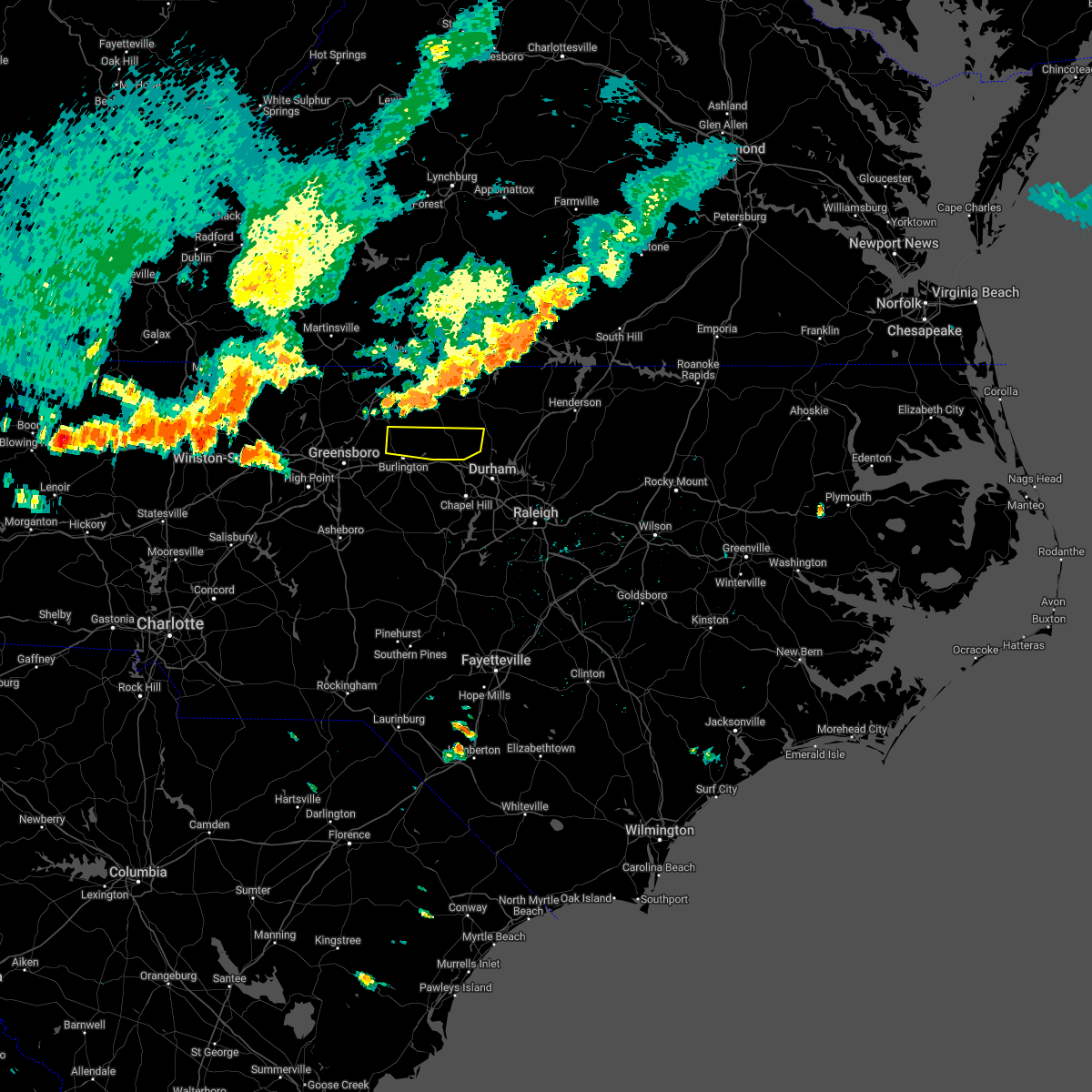 At 539 pm edt, a severe thunderstorm was located near yanceyville, moving southeast at 35 mph (radar indicated). Hazards include 60 mph wind gusts. expect damage to roofs, siding, and trees At 539 pm edt, a severe thunderstorm was located near yanceyville, moving southeast at 35 mph (radar indicated). Hazards include 60 mph wind gusts. expect damage to roofs, siding, and trees
|
| 6/17/2022 6:04 PM EDT |
 At 603 pm edt, severe thunderstorms were located along a line extending from 8 miles east of roxboro to 13 miles northeast of siler city to near rockwell, moving southeast at 30 mph (emergency management). Hazards include 70 mph wind gusts and quarter size hail. Hail damage to vehicles is expected. expect considerable tree damage. wind damage is also likely to mobile homes, roofs, and outbuildings. locations impacted include, durham, chapel hill, burlington, asheboro, albemarle, graham, oxford, roxboro, hillsborough and creedmoor. thunderstorm damage threat, considerable hail threat, radar indicated max hail size, 1. 00 in wind threat, radar indicated max wind gust, 70 mph. At 603 pm edt, severe thunderstorms were located along a line extending from 8 miles east of roxboro to 13 miles northeast of siler city to near rockwell, moving southeast at 30 mph (emergency management). Hazards include 70 mph wind gusts and quarter size hail. Hail damage to vehicles is expected. expect considerable tree damage. wind damage is also likely to mobile homes, roofs, and outbuildings. locations impacted include, durham, chapel hill, burlington, asheboro, albemarle, graham, oxford, roxboro, hillsborough and creedmoor. thunderstorm damage threat, considerable hail threat, radar indicated max hail size, 1. 00 in wind threat, radar indicated max wind gust, 70 mph.
|
| 6/17/2022 5:45 PM EDT |
 At 543 pm edt, severe thunderstorms were located along a line extending from near roxboro to 8 miles southwest of graham to near granite quarry, moving southeast at 30 mph (emergency management reported. at 5:40 pm, several trees were reported down near exit 157 of i-40 and i-85 in mebane). Hazards include 70 mph wind gusts and quarter size hail. Hail damage to vehicles is expected. expect considerable tree damage. wind damage is also likely to mobile homes, roofs, and outbuildings. locations impacted include, durham, high point, chapel hill, burlington, asheboro, lexington, albemarle, graham, oxford and roxboro. thunderstorm damage threat, considerable hail threat, radar indicated max hail size, 1. 00 in wind threat, radar indicated max wind gust, 70 mph. At 543 pm edt, severe thunderstorms were located along a line extending from near roxboro to 8 miles southwest of graham to near granite quarry, moving southeast at 30 mph (emergency management reported. at 5:40 pm, several trees were reported down near exit 157 of i-40 and i-85 in mebane). Hazards include 70 mph wind gusts and quarter size hail. Hail damage to vehicles is expected. expect considerable tree damage. wind damage is also likely to mobile homes, roofs, and outbuildings. locations impacted include, durham, high point, chapel hill, burlington, asheboro, lexington, albemarle, graham, oxford and roxboro. thunderstorm damage threat, considerable hail threat, radar indicated max hail size, 1. 00 in wind threat, radar indicated max wind gust, 70 mph.
|
| 6/17/2022 5:39 PM EDT |
 At 539 pm edt, severe thunderstorms were located along a line extending from near mebane to 12 miles northwest of siler city to 8 miles northwest of asheboro to near high rock lake, moving east at 40 mph (radar indicated). Hazards include 70 mph wind gusts and quarter size hail. Hail damage to vehicles is expected. expect considerable tree damage. wind damage is also likely to mobile homes, roofs, and outbuildings. locations impacted include, greensboro, high point, burlington, lexington, graham, randleman, thomasville, mebane, elon and linwood. thunderstorm damage threat, considerable hail threat, radar indicated max hail size, 1. 00 in wind threat, radar indicated max wind gust, 70 mph. At 539 pm edt, severe thunderstorms were located along a line extending from near mebane to 12 miles northwest of siler city to 8 miles northwest of asheboro to near high rock lake, moving east at 40 mph (radar indicated). Hazards include 70 mph wind gusts and quarter size hail. Hail damage to vehicles is expected. expect considerable tree damage. wind damage is also likely to mobile homes, roofs, and outbuildings. locations impacted include, greensboro, high point, burlington, lexington, graham, randleman, thomasville, mebane, elon and linwood. thunderstorm damage threat, considerable hail threat, radar indicated max hail size, 1. 00 in wind threat, radar indicated max wind gust, 70 mph.
|
| 6/17/2022 5:34 PM EDT |
 At 534 pm edt, severe thunderstorms were located along a line extending from near roxboro to 8 miles south of elon to near salisbury, moving southeast at 30 mph (radar indicated). Hazards include 70 mph wind gusts and quarter size hail. Hail damage to vehicles is expected. expect considerable tree damage. Wind damage is also likely to mobile homes, roofs, and outbuildings. At 534 pm edt, severe thunderstorms were located along a line extending from near roxboro to 8 miles south of elon to near salisbury, moving southeast at 30 mph (radar indicated). Hazards include 70 mph wind gusts and quarter size hail. Hail damage to vehicles is expected. expect considerable tree damage. Wind damage is also likely to mobile homes, roofs, and outbuildings.
|
| 6/17/2022 5:24 PM EDT |
 At 524 pm edt, severe thunderstorms were located along a line extending from near jericho to 11 miles south of mcleansville to near thomasville to near spencer, moving east at 40 mph (radar indicated). Hazards include 70 mph wind gusts and quarter size hail. Hail damage to vehicles is expected. expect considerable tree damage. wind damage is also likely to mobile homes, roofs, and outbuildings. locations impacted include, greensboro, high point, burlington, lexington, graham, randleman, thomasville, mebane, elon and linwood. thunderstorm damage threat, considerable hail threat, radar indicated max hail size, 1. 00 in wind threat, radar indicated max wind gust, 70 mph. At 524 pm edt, severe thunderstorms were located along a line extending from near jericho to 11 miles south of mcleansville to near thomasville to near spencer, moving east at 40 mph (radar indicated). Hazards include 70 mph wind gusts and quarter size hail. Hail damage to vehicles is expected. expect considerable tree damage. wind damage is also likely to mobile homes, roofs, and outbuildings. locations impacted include, greensboro, high point, burlington, lexington, graham, randleman, thomasville, mebane, elon and linwood. thunderstorm damage threat, considerable hail threat, radar indicated max hail size, 1. 00 in wind threat, radar indicated max wind gust, 70 mph.
|
| 6/17/2022 5:18 PM EDT |
 At 518 pm edt, severe thunderstorms were located along a line extending from near jericho to 10 miles southeast of greensboro to near thomasville to near cooleemee, moving east at 45 mph (radar indicated). Hazards include 70 mph wind gusts and quarter size hail. Hail damage to vehicles is expected. expect considerable tree damage. wind damage is also likely to mobile homes, roofs, and outbuildings. locations impacted include, greensboro, winston-salem, high point, burlington, lexington, graham, randleman, thomasville, kernersville and clemmons. thunderstorm damage threat, considerable hail threat, radar indicated max hail size, 1. 00 in wind threat, radar indicated max wind gust, 70 mph. At 518 pm edt, severe thunderstorms were located along a line extending from near jericho to 10 miles southeast of greensboro to near thomasville to near cooleemee, moving east at 45 mph (radar indicated). Hazards include 70 mph wind gusts and quarter size hail. Hail damage to vehicles is expected. expect considerable tree damage. wind damage is also likely to mobile homes, roofs, and outbuildings. locations impacted include, greensboro, winston-salem, high point, burlington, lexington, graham, randleman, thomasville, kernersville and clemmons. thunderstorm damage threat, considerable hail threat, radar indicated max hail size, 1. 00 in wind threat, radar indicated max wind gust, 70 mph.
|
| 6/17/2022 5:13 PM EDT | Tree on a residence off of pagetown roa in alamance county NC, 7.8 miles S of Burlington, NC |
| 6/17/2022 5:09 PM EDT |
 At 508 pm edt, severe thunderstorms were located along a line extending from camp springs to near greensboro to near thomasville to cooleemee, moving east at 50 mph (radar indicated. at 505 pm, numerous trees down were reported north of high point). Hazards include 60 mph wind gusts and quarter size hail. Hail damage to vehicles is expected. expect wind damage to roofs, siding, and trees. locations impacted include, greensboro, winston-salem, high point, burlington, lexington, graham, randleman, thomasville, kernersville and clemmons. hail threat, radar indicated max hail size, 1. 00 in wind threat, radar indicated max wind gust, 60 mph. At 508 pm edt, severe thunderstorms were located along a line extending from camp springs to near greensboro to near thomasville to cooleemee, moving east at 50 mph (radar indicated. at 505 pm, numerous trees down were reported north of high point). Hazards include 60 mph wind gusts and quarter size hail. Hail damage to vehicles is expected. expect wind damage to roofs, siding, and trees. locations impacted include, greensboro, winston-salem, high point, burlington, lexington, graham, randleman, thomasville, kernersville and clemmons. hail threat, radar indicated max hail size, 1. 00 in wind threat, radar indicated max wind gust, 60 mph.
|
| 6/17/2022 4:53 PM EDT |
 At 453 pm edt, severe thunderstorms were located along a line extending from reidsville to near greensboro to 6 miles southeast of clemmons to 8 miles southeast of harmony, moving southeast at 40 mph (radar indicated). Hazards include 60 mph wind gusts and quarter size hail. Hail damage to vehicles is expected. Expect wind damage to roofs, siding, and trees. At 453 pm edt, severe thunderstorms were located along a line extending from reidsville to near greensboro to 6 miles southeast of clemmons to 8 miles southeast of harmony, moving southeast at 40 mph (radar indicated). Hazards include 60 mph wind gusts and quarter size hail. Hail damage to vehicles is expected. Expect wind damage to roofs, siding, and trees.
|
| 6/16/2022 4:37 PM EDT |
 At 436 pm edt, severe thunderstorms were located along a line extending from near mebane to 9 miles north of siler city to randleman, moving east at 20 mph (radar indicated). Hazards include 60 mph wind gusts and quarter size hail. Hail damage to vehicles is expected. expect wind damage to roofs, siding, and trees. locations impacted include, high point, burlington, asheboro, graham, randleman, siler city, mebane, archdale, trinity and pleasant garden. hail threat, radar indicated max hail size, 1. 00 in wind threat, radar indicated max wind gust, 60 mph. At 436 pm edt, severe thunderstorms were located along a line extending from near mebane to 9 miles north of siler city to randleman, moving east at 20 mph (radar indicated). Hazards include 60 mph wind gusts and quarter size hail. Hail damage to vehicles is expected. expect wind damage to roofs, siding, and trees. locations impacted include, high point, burlington, asheboro, graham, randleman, siler city, mebane, archdale, trinity and pleasant garden. hail threat, radar indicated max hail size, 1. 00 in wind threat, radar indicated max wind gust, 60 mph.
|
| 6/16/2022 4:18 PM EDT |
 At 417 pm edt, severe thunderstorms were located along a line extending from near baynes to 9 miles south of mcleansville to near high point, moving southeast at 20 mph (radar indicated). Hazards include 70 mph wind gusts and nickel size hail. Expect considerable tree damage. Damage is likely to mobile homes, roofs, and outbuildings. At 417 pm edt, severe thunderstorms were located along a line extending from near baynes to 9 miles south of mcleansville to near high point, moving southeast at 20 mph (radar indicated). Hazards include 70 mph wind gusts and nickel size hail. Expect considerable tree damage. Damage is likely to mobile homes, roofs, and outbuildings.
|
| 6/16/2022 4:08 PM EDT |
 At 406 pm edt, severe thunderstorms were located along a line extending from hightowers to near high point, moving southeast at 20 mph. strongest winds will be from monticello, mcleansville, oak forest and pleasant garden (radar indicated). Hazards include 70 mph wind gusts and nickel size hail. Expect considerable tree damage. damage is likely to mobile homes, roofs, and outbuildings. locations impacted include, greensboro, high point, burlington, graham, mebane, elon, mcleansville, gibsonville, pleasant garden and jamestown. thunderstorm damage threat, considerable hail threat, radar indicated max hail size, 0. 88 in wind threat, radar indicated max wind gust, 70 mph. At 406 pm edt, severe thunderstorms were located along a line extending from hightowers to near high point, moving southeast at 20 mph. strongest winds will be from monticello, mcleansville, oak forest and pleasant garden (radar indicated). Hazards include 70 mph wind gusts and nickel size hail. Expect considerable tree damage. damage is likely to mobile homes, roofs, and outbuildings. locations impacted include, greensboro, high point, burlington, graham, mebane, elon, mcleansville, gibsonville, pleasant garden and jamestown. thunderstorm damage threat, considerable hail threat, radar indicated max hail size, 0. 88 in wind threat, radar indicated max wind gust, 70 mph.
|
| 6/16/2022 3:40 PM EDT |
 At 340 pm edt, severe thunderstorms were located along a line extending from yanceyville to near high point, moving southeast at 20 mph (radar indicated). Hazards include 60 mph wind gusts and nickel size hail. expect damage to roofs, siding, and trees At 340 pm edt, severe thunderstorms were located along a line extending from yanceyville to near high point, moving southeast at 20 mph (radar indicated). Hazards include 60 mph wind gusts and nickel size hail. expect damage to roofs, siding, and trees
|
| 6/8/2022 6:04 PM EDT |
 At 603 pm edt, a severe thunderstorm was located 9 miles south of graham, moving east at 25 mph (radar indicated). Hazards include 60 mph wind gusts. Expect damage to roofs, siding, and trees. locations impacted include, burlington, graham, mebane, haw river, swepsonville, alamance, snow camp, sutphin, cane creek reservoir and saxapahaw. hail threat, radar indicated max hail size, <. 75 in wind threat, radar indicated max wind gust, 60 mph. At 603 pm edt, a severe thunderstorm was located 9 miles south of graham, moving east at 25 mph (radar indicated). Hazards include 60 mph wind gusts. Expect damage to roofs, siding, and trees. locations impacted include, burlington, graham, mebane, haw river, swepsonville, alamance, snow camp, sutphin, cane creek reservoir and saxapahaw. hail threat, radar indicated max hail size, <. 75 in wind threat, radar indicated max wind gust, 60 mph.
|
| 6/8/2022 5:46 PM EDT |
 At 545 pm edt, a severe thunderstorm was located 12 miles east of randleman, moving northeast at 15 mph (radar indicated). Hazards include 60 mph wind gusts. expect damage to roofs, siding, and trees At 545 pm edt, a severe thunderstorm was located 12 miles east of randleman, moving northeast at 15 mph (radar indicated). Hazards include 60 mph wind gusts. expect damage to roofs, siding, and trees
|
| 6/2/2022 8:09 PM EDT |
 The severe thunderstorm warning for southwestern alamance county will expire at 815 pm edt, the storm which prompted the warning has weakened below severe limits, and no longer poses an immediate threat to life or property. therefore, the warning will be allowed to expire. The severe thunderstorm warning for southwestern alamance county will expire at 815 pm edt, the storm which prompted the warning has weakened below severe limits, and no longer poses an immediate threat to life or property. therefore, the warning will be allowed to expire.
|
| 6/2/2022 8:00 PM EDT |
 At 800 pm edt, a severe thunderstorm was located 10 miles south of elon, or 10 miles south of burlington, moving east at 15 mph (radar indicated). Hazards include 60 mph wind gusts and penny size hail. Expect damage to roofs, siding, and trees. locations impacted include, burlington, graham, alamance, lake mackintosh marina, snow camp and sutphin. hail threat, radar indicated max hail size, 0. 75 in wind threat, radar indicated max wind gust, 60 mph. At 800 pm edt, a severe thunderstorm was located 10 miles south of elon, or 10 miles south of burlington, moving east at 15 mph (radar indicated). Hazards include 60 mph wind gusts and penny size hail. Expect damage to roofs, siding, and trees. locations impacted include, burlington, graham, alamance, lake mackintosh marina, snow camp and sutphin. hail threat, radar indicated max hail size, 0. 75 in wind threat, radar indicated max wind gust, 60 mph.
|
| 6/2/2022 7:41 PM EDT |
 At 740 pm edt, a severe thunderstorm was located 11 miles northeast of randleman, moving east at 15 mph (radar indicated). Hazards include 60 mph wind gusts and penny size hail. expect damage to roofs, siding, and trees At 740 pm edt, a severe thunderstorm was located 11 miles northeast of randleman, moving east at 15 mph (radar indicated). Hazards include 60 mph wind gusts and penny size hail. expect damage to roofs, siding, and trees
|
| 5/27/2022 8:26 AM EDT |
 At 825 am edt, severe thunderstorms were located along a line extending from near jericho to 10 miles south of graham to near siler city, moving northeast at 30 mph (radar indicated). Hazards include 60 mph wind gusts. Expect damage to roofs, siding, and trees. Locations impacted include, burlington, graham, siler city, mebane, haw river, swepsonville, staley, snow camp, lake burlington and sutphin. At 825 am edt, severe thunderstorms were located along a line extending from near jericho to 10 miles south of graham to near siler city, moving northeast at 30 mph (radar indicated). Hazards include 60 mph wind gusts. Expect damage to roofs, siding, and trees. Locations impacted include, burlington, graham, siler city, mebane, haw river, swepsonville, staley, snow camp, lake burlington and sutphin.
|
| 5/27/2022 8:21 AM EDT |
 At 820 am edt, severe thunderstorms were located along a line extending from near jericho to near mebane to siler city, moving northeast at 40 mph (radar indicated). Hazards include 60 mph wind gusts. expect damage to roofs, siding, and trees At 820 am edt, severe thunderstorms were located along a line extending from near jericho to near mebane to siler city, moving northeast at 40 mph (radar indicated). Hazards include 60 mph wind gusts. expect damage to roofs, siding, and trees
|
| 5/27/2022 7:46 AM EDT |
 At 746 am edt, severe thunderstorms were located along a line extending from mcleansville to 9 miles east of randleman to north carolina zoo, moving northeast at 25 mph (radar indicated). Hazards include 60 mph wind gusts. expect damage to roofs, siding, and trees At 746 am edt, severe thunderstorms were located along a line extending from mcleansville to 9 miles east of randleman to north carolina zoo, moving northeast at 25 mph (radar indicated). Hazards include 60 mph wind gusts. expect damage to roofs, siding, and trees
|
| 5/23/2022 3:22 PM EDT |
 At 322 pm edt, a severe thunderstorm was located near mebane, or 7 miles southwest of prospect hill, moving northeast at 20 mph (radar indicated). Hazards include 60 mph wind gusts and quarter size hail. Hail damage to vehicles is expected. expect wind damage to roofs, siding, and trees. this severe storm will be near, hillsborough around 340 pm edt. Other locations impacted by this severe thunderstorm include lake cammack park & marina, carr, efland, bushy fork and union ridge. At 322 pm edt, a severe thunderstorm was located near mebane, or 7 miles southwest of prospect hill, moving northeast at 20 mph (radar indicated). Hazards include 60 mph wind gusts and quarter size hail. Hail damage to vehicles is expected. expect wind damage to roofs, siding, and trees. this severe storm will be near, hillsborough around 340 pm edt. Other locations impacted by this severe thunderstorm include lake cammack park & marina, carr, efland, bushy fork and union ridge.
|
| 5/23/2022 3:13 PM EDT |
 At 312 pm edt, a severe thunderstorm was located near mebane, or near graham, moving east at 20 mph (radar indicated). Hazards include 60 mph wind gusts and quarter size hail. Hail damage to vehicles is expected. expect wind damage to roofs, siding, and trees. this severe thunderstorm will be near, mebane around 315 pm edt. hillsborough around 340 pm edt. Other locations impacted by this severe thunderstorm include carr, efland, alamance, eno river state park and lake burlington. At 312 pm edt, a severe thunderstorm was located near mebane, or near graham, moving east at 20 mph (radar indicated). Hazards include 60 mph wind gusts and quarter size hail. Hail damage to vehicles is expected. expect wind damage to roofs, siding, and trees. this severe thunderstorm will be near, mebane around 315 pm edt. hillsborough around 340 pm edt. Other locations impacted by this severe thunderstorm include carr, efland, alamance, eno river state park and lake burlington.
|
| 5/19/2022 10:25 PM EDT |
 The severe thunderstorm warning for east central guilford county will expire at 1030 pm edt, the storm which prompted the warning has moved out of the area. therefore, the warning will be allowed to expire. however gusty winds are still possible with this thunderstorm. to report severe weather, contact your nearest law enforcement agency. they will relay your report to the national weather service raleigh. The severe thunderstorm warning for east central guilford county will expire at 1030 pm edt, the storm which prompted the warning has moved out of the area. therefore, the warning will be allowed to expire. however gusty winds are still possible with this thunderstorm. to report severe weather, contact your nearest law enforcement agency. they will relay your report to the national weather service raleigh.
|
| 5/19/2022 10:23 PM EDT |
 At 1023 pm edt, a severe thunderstorm was located near graham, moving southeast at 30 mph (radar indicated). Hazards include 60 mph wind gusts and quarter size hail. Hail damage to vehicles is expected. expect wind damage to roofs, siding, and trees. locations impacted include, burlington, graham, mebane, elon, gibsonville, haw river, swepsonville, alamance, carr and lake burlington. hail threat, radar indicated max hail size, 1. 00 in wind threat, radar indicated max wind gust, 60 mph. At 1023 pm edt, a severe thunderstorm was located near graham, moving southeast at 30 mph (radar indicated). Hazards include 60 mph wind gusts and quarter size hail. Hail damage to vehicles is expected. expect wind damage to roofs, siding, and trees. locations impacted include, burlington, graham, mebane, elon, gibsonville, haw river, swepsonville, alamance, carr and lake burlington. hail threat, radar indicated max hail size, 1. 00 in wind threat, radar indicated max wind gust, 60 mph.
|
| 5/19/2022 10:20 PM EDT |
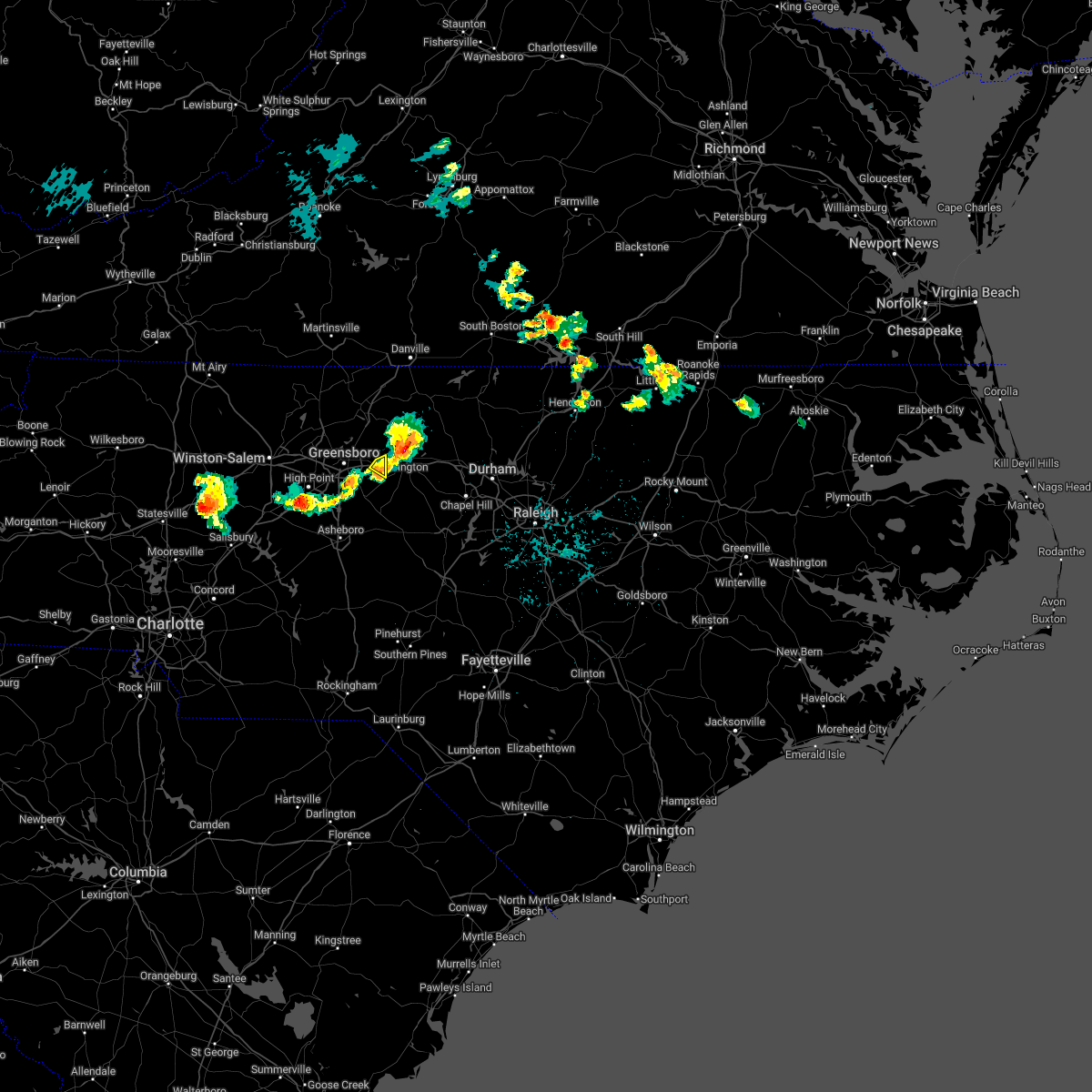 At 1020 pm edt, a severe thunderstorm was located near elon, or 7 miles southwest of burlington, moving east at 20 mph (radar indicated). Hazards include 60 mph wind gusts and penny size hail. Expect damage to roofs, siding, and trees. locations impacted include, gibsonville and lake guilford mackintosh marina. hail threat, radar indicated max hail size, 0. 75 in wind threat, radar indicated max wind gust, 60 mph. At 1020 pm edt, a severe thunderstorm was located near elon, or 7 miles southwest of burlington, moving east at 20 mph (radar indicated). Hazards include 60 mph wind gusts and penny size hail. Expect damage to roofs, siding, and trees. locations impacted include, gibsonville and lake guilford mackintosh marina. hail threat, radar indicated max hail size, 0. 75 in wind threat, radar indicated max wind gust, 60 mph.
|
| 5/19/2022 10:15 PM EDT | Several trees down in the city of burlingto in alamance county NC, 3.5 miles SW of Burlington, NC |
| 5/19/2022 10:13 PM EDT | Tree down on indian valley d in alamance county NC, 4.8 miles SSW of Burlington, NC |
| 5/19/2022 10:04 PM EDT |
 At 1004 pm edt, a severe thunderstorm was located 7 miles south of camp springs, moving east at 25 mph (radar indicated). Hazards include 60 mph wind gusts and penny size hail. expect damage to roofs, siding, and trees At 1004 pm edt, a severe thunderstorm was located 7 miles south of camp springs, moving east at 25 mph (radar indicated). Hazards include 60 mph wind gusts and penny size hail. expect damage to roofs, siding, and trees
|
| 5/19/2022 9:55 PM EDT |
 At 955 pm edt, a severe thunderstorm was located near monroeton, or 9 miles south of reidsville, moving southeast at 25 mph (radar indicated). Hazards include 60 mph wind gusts and penny size hail. Expect damage to roofs, siding, and trees. locations impacted include, greensboro, mcleansville, gibsonville, haw river state park, lake guilford mackintosh marina, lake townsend marina, lake townsend and monticello. hail threat, radar indicated max hail size, 0. 75 in wind threat, radar indicated max wind gust, 60 mph. At 955 pm edt, a severe thunderstorm was located near monroeton, or 9 miles south of reidsville, moving southeast at 25 mph (radar indicated). Hazards include 60 mph wind gusts and penny size hail. Expect damage to roofs, siding, and trees. locations impacted include, greensboro, mcleansville, gibsonville, haw river state park, lake guilford mackintosh marina, lake townsend marina, lake townsend and monticello. hail threat, radar indicated max hail size, 0. 75 in wind threat, radar indicated max wind gust, 60 mph.
|
| 5/19/2022 9:40 PM EDT |
 At 939 pm edt, a severe thunderstorm was located near bethany, or 11 miles north of greensboro, moving southeast at 25 mph (radar indicated). Hazards include 60 mph wind gusts and penny size hail. expect damage to roofs, siding, and trees At 939 pm edt, a severe thunderstorm was located near bethany, or 11 miles north of greensboro, moving southeast at 25 mph (radar indicated). Hazards include 60 mph wind gusts and penny size hail. expect damage to roofs, siding, and trees
|
| 5/6/2022 9:32 PM EDT |
 At 932 pm edt, a severe thunderstorm was located 7 miles southwest of camp springs, moving northeast at 45 mph (radar indicated). Hazards include 60 mph wind gusts and quarter size hail. Hail damage to vehicles is expected. expect wind damage to roofs, siding, and trees. locations impacted include, greensboro, burlington, mcleansville, elon, summerfield, gibsonville, haw river state park, lake jeanette marina, lake burlington and monticello. hail threat, radar indicated max hail size, 1. 00 in wind threat, radar indicated max wind gust, 60 mph. At 932 pm edt, a severe thunderstorm was located 7 miles southwest of camp springs, moving northeast at 45 mph (radar indicated). Hazards include 60 mph wind gusts and quarter size hail. Hail damage to vehicles is expected. expect wind damage to roofs, siding, and trees. locations impacted include, greensboro, burlington, mcleansville, elon, summerfield, gibsonville, haw river state park, lake jeanette marina, lake burlington and monticello. hail threat, radar indicated max hail size, 1. 00 in wind threat, radar indicated max wind gust, 60 mph.
|
| 5/6/2022 9:27 PM EDT |
 At 927 pm edt, a severe thunderstorm was located near mcleansville, or 11 miles northeast of greensboro, moving northeast at 50 mph (radar indicated). Hazards include 60 mph wind gusts and quarter size hail. Hail damage to vehicles is expected. expect wind damage to roofs, siding, and trees. locations impacted include, greensboro, burlington, mcleansville, elon, summerfield, gibsonville, pleasant garden, haw river state park, lake guilford mackintosh marina and forest oaks. hail threat, radar indicated max hail size, 1. 00 in wind threat, radar indicated max wind gust, 60 mph. At 927 pm edt, a severe thunderstorm was located near mcleansville, or 11 miles northeast of greensboro, moving northeast at 50 mph (radar indicated). Hazards include 60 mph wind gusts and quarter size hail. Hail damage to vehicles is expected. expect wind damage to roofs, siding, and trees. locations impacted include, greensboro, burlington, mcleansville, elon, summerfield, gibsonville, pleasant garden, haw river state park, lake guilford mackintosh marina and forest oaks. hail threat, radar indicated max hail size, 1. 00 in wind threat, radar indicated max wind gust, 60 mph.
|
| 5/6/2022 9:14 PM EDT |
 At 914 pm edt, a severe thunderstorm was located over greensboro, moving northeast at 45 mph (radar indicated). Hazards include 60 mph wind gusts and quarter size hail. Hail damage to vehicles is expected. Expect wind damage to roofs, siding, and trees. At 914 pm edt, a severe thunderstorm was located over greensboro, moving northeast at 45 mph (radar indicated). Hazards include 60 mph wind gusts and quarter size hail. Hail damage to vehicles is expected. Expect wind damage to roofs, siding, and trees.
|
| 5/6/2022 8:27 PM EDT |
 At 826 pm edt, a severe thunderstorm was located 8 miles south of graham, moving northeast at 50 mph (radar indicated). Hazards include 60 mph wind gusts and quarter size hail. Hail damage to vehicles is expected. expect wind damage to roofs, siding, and trees. Locations impacted include, burlington, graham, swepsonville, alamance, sutphin and saxapahaw. At 826 pm edt, a severe thunderstorm was located 8 miles south of graham, moving northeast at 50 mph (radar indicated). Hazards include 60 mph wind gusts and quarter size hail. Hail damage to vehicles is expected. expect wind damage to roofs, siding, and trees. Locations impacted include, burlington, graham, swepsonville, alamance, sutphin and saxapahaw.
|
| 5/6/2022 8:18 PM EDT |
 At 818 pm edt, a severe thunderstorm was located 11 miles north of siler city, moving northeast at 40 mph (radar indicated). Hazards include 60 mph wind gusts and quarter size hail. Hail damage to vehicles is expected. expect wind damage to roofs, siding, and trees. Locations impacted include, burlington, graham, gibsonville, swepsonville, alamance, lake mackintosh marina, snow camp, sutphin and saxapahaw. At 818 pm edt, a severe thunderstorm was located 11 miles north of siler city, moving northeast at 40 mph (radar indicated). Hazards include 60 mph wind gusts and quarter size hail. Hail damage to vehicles is expected. expect wind damage to roofs, siding, and trees. Locations impacted include, burlington, graham, gibsonville, swepsonville, alamance, lake mackintosh marina, snow camp, sutphin and saxapahaw.
|
| 5/6/2022 8:12 PM EDT |
 At 812 pm edt, a severe thunderstorm was located 11 miles northwest of siler city, moving northeast at 50 mph (radar indicated). Hazards include 60 mph wind gusts and quarter size hail. Hail damage to vehicles is expected. expect wind damage to roofs, siding, and trees. Locations impacted include, burlington, graham, gibsonville, liberty, ramseur, swepsonville, alamance, staley, lake guilford mackintosh marina and snow camp. At 812 pm edt, a severe thunderstorm was located 11 miles northwest of siler city, moving northeast at 50 mph (radar indicated). Hazards include 60 mph wind gusts and quarter size hail. Hail damage to vehicles is expected. expect wind damage to roofs, siding, and trees. Locations impacted include, burlington, graham, gibsonville, liberty, ramseur, swepsonville, alamance, staley, lake guilford mackintosh marina and snow camp.
|
| 5/6/2022 8:05 PM EDT |
 At 804 pm edt, a severe thunderstorm was located 7 miles east of randleman, moving northeast at 55 mph (radar indicated). Hazards include 60 mph wind gusts and quarter size hail. Hail damage to vehicles is expected. expect wind damage to roofs, siding, and trees. Locations impacted include, burlington, asheboro, graham, randleman, gibsonville, liberty, ramseur, franklinville, swepsonville and alamance. At 804 pm edt, a severe thunderstorm was located 7 miles east of randleman, moving northeast at 55 mph (radar indicated). Hazards include 60 mph wind gusts and quarter size hail. Hail damage to vehicles is expected. expect wind damage to roofs, siding, and trees. Locations impacted include, burlington, asheboro, graham, randleman, gibsonville, liberty, ramseur, franklinville, swepsonville and alamance.
|
| 5/6/2022 7:57 PM EDT |
 At 757 pm edt, a severe thunderstorm was located over asheboro, moving northeast at 50 mph (radar indicated). Hazards include 60 mph wind gusts and quarter size hail. Hail damage to vehicles is expected. Expect wind damage to roofs, siding, and trees. At 757 pm edt, a severe thunderstorm was located over asheboro, moving northeast at 50 mph (radar indicated). Hazards include 60 mph wind gusts and quarter size hail. Hail damage to vehicles is expected. Expect wind damage to roofs, siding, and trees.
|
| 5/6/2022 5:00 PM EDT | Tree down along highway 62s in anderson... n in caswell county NC, 15.1 miles SSW of Burlington, NC |
| 5/6/2022 4:39 PM EDT |
 At 439 pm edt, a severe thunderstorm was located over elon, or near burlington, moving northeast at 35 mph (radar indicated). Hazards include 60 mph wind gusts and quarter size hail. Hail damage to vehicles is expected. expect wind damage to roofs, siding, and trees. Locations impacted include, burlington, graham, elon, gibsonville, haw river, alamance, glen raven and altamahaw-ossipee. At 439 pm edt, a severe thunderstorm was located over elon, or near burlington, moving northeast at 35 mph (radar indicated). Hazards include 60 mph wind gusts and quarter size hail. Hail damage to vehicles is expected. expect wind damage to roofs, siding, and trees. Locations impacted include, burlington, graham, elon, gibsonville, haw river, alamance, glen raven and altamahaw-ossipee.
|
| 5/6/2022 4:35 PM EDT |
 At 434 pm edt, a severe thunderstorm was located over elon, or near burlington, moving northeast at 40 mph (radar indicated). Hazards include 60 mph wind gusts and quarter size hail. Hail damage to vehicles is expected. expect wind damage to roofs, siding, and trees. Locations impacted include, burlington, graham, mcleansville, elon, gibsonville, haw river, alamance, glen raven, lake mackintosh marina and lake guilford mackintosh marina. At 434 pm edt, a severe thunderstorm was located over elon, or near burlington, moving northeast at 40 mph (radar indicated). Hazards include 60 mph wind gusts and quarter size hail. Hail damage to vehicles is expected. expect wind damage to roofs, siding, and trees. Locations impacted include, burlington, graham, mcleansville, elon, gibsonville, haw river, alamance, glen raven, lake mackintosh marina and lake guilford mackintosh marina.
|
| 5/6/2022 4:29 PM EDT |
 At 429 pm edt, a severe thunderstorm was located over mcleansville, or 9 miles west of burlington, moving northeast at 40 mph (radar indicated). Hazards include 60 mph wind gusts and quarter size hail. Hail damage to vehicles is expected. expect wind damage to roofs, siding, and trees. Locations impacted include, greensboro, burlington, graham, mcleansville, elon, gibsonville, haw river, alamance, lake guilford mackintosh marina and monticello. At 429 pm edt, a severe thunderstorm was located over mcleansville, or 9 miles west of burlington, moving northeast at 40 mph (radar indicated). Hazards include 60 mph wind gusts and quarter size hail. Hail damage to vehicles is expected. expect wind damage to roofs, siding, and trees. Locations impacted include, greensboro, burlington, graham, mcleansville, elon, gibsonville, haw river, alamance, lake guilford mackintosh marina and monticello.
|
| 5/6/2022 4:25 PM EDT |
 At 425 pm edt, a severe thunderstorm was located near mcleansville, or 8 miles east of greensboro, moving northeast at 40 mph (radar indicated). Hazards include 60 mph wind gusts and quarter size hail. Hail damage to vehicles is expected. expect wind damage to roofs, siding, and trees. Locations impacted include, greensboro, burlington, graham, mcleansville, elon, gibsonville, haw river, alamance, lake guilford mackintosh marina and forest oaks. At 425 pm edt, a severe thunderstorm was located near mcleansville, or 8 miles east of greensboro, moving northeast at 40 mph (radar indicated). Hazards include 60 mph wind gusts and quarter size hail. Hail damage to vehicles is expected. expect wind damage to roofs, siding, and trees. Locations impacted include, greensboro, burlington, graham, mcleansville, elon, gibsonville, haw river, alamance, lake guilford mackintosh marina and forest oaks.
|
| 5/6/2022 4:19 PM EDT |
 At 419 pm edt, a severe thunderstorm was located near mcleansville, or near greensboro, moving northeast at 35 mph (radar indicated). Hazards include 60 mph wind gusts and quarter size hail. Hail damage to vehicles is expected. expect wind damage to roofs, siding, and trees. Locations impacted include, greensboro, burlington, graham, mcleansville, elon, gibsonville, pleasant garden, haw river, alamance and lake guilford mackintosh marina. At 419 pm edt, a severe thunderstorm was located near mcleansville, or near greensboro, moving northeast at 35 mph (radar indicated). Hazards include 60 mph wind gusts and quarter size hail. Hail damage to vehicles is expected. expect wind damage to roofs, siding, and trees. Locations impacted include, greensboro, burlington, graham, mcleansville, elon, gibsonville, pleasant garden, haw river, alamance and lake guilford mackintosh marina.
|
| 5/6/2022 4:13 PM EDT |
 At 412 pm edt, a severe thunderstorm was located near greensboro, moving northeast at 35 mph (radar indicated). Hazards include 60 mph wind gusts and quarter size hail. Hail damage to vehicles is expected. expect wind damage to roofs, siding, and trees. Locations impacted include, greensboro, burlington, graham, mcleansville, elon, gibsonville, pleasant garden, haw river, alamance and lake guilford mackintosh marina. At 412 pm edt, a severe thunderstorm was located near greensboro, moving northeast at 35 mph (radar indicated). Hazards include 60 mph wind gusts and quarter size hail. Hail damage to vehicles is expected. expect wind damage to roofs, siding, and trees. Locations impacted include, greensboro, burlington, graham, mcleansville, elon, gibsonville, pleasant garden, haw river, alamance and lake guilford mackintosh marina.
|
| 5/6/2022 4:04 PM EDT |
 At 404 pm edt, a severe thunderstorm was located near greensboro, moving northeast at 35 mph (radar indicated). Hazards include 60 mph wind gusts and quarter size hail. Hail damage to vehicles is expected. expect wind damage to roofs, siding, and trees. Locations impacted include, greensboro, high point, burlington, graham, mcleansville, elon, gibsonville, pleasant garden, jamestown and haw river. At 404 pm edt, a severe thunderstorm was located near greensboro, moving northeast at 35 mph (radar indicated). Hazards include 60 mph wind gusts and quarter size hail. Hail damage to vehicles is expected. expect wind damage to roofs, siding, and trees. Locations impacted include, greensboro, high point, burlington, graham, mcleansville, elon, gibsonville, pleasant garden, jamestown and haw river.
|
| 5/6/2022 3:55 PM EDT |
 At 354 pm edt, a severe thunderstorm was located near high point, moving northeast at 35 mph (radar indicated). Hazards include 60 mph wind gusts and quarter size hail. Hail damage to vehicles is expected. Expect wind damage to roofs, siding, and trees. At 354 pm edt, a severe thunderstorm was located near high point, moving northeast at 35 mph (radar indicated). Hazards include 60 mph wind gusts and quarter size hail. Hail damage to vehicles is expected. Expect wind damage to roofs, siding, and trees.
|
| 5/1/2022 4:52 PM EDT |
 At 452 pm edt, a severe thunderstorm was located near elon, or near burlington, moving northeast at 20 mph (radar indicated). Hazards include 60 mph wind gusts and quarter size hail. Hail damage to vehicles is expected. Expect wind damage to roofs, siding, and trees. At 452 pm edt, a severe thunderstorm was located near elon, or near burlington, moving northeast at 20 mph (radar indicated). Hazards include 60 mph wind gusts and quarter size hail. Hail damage to vehicles is expected. Expect wind damage to roofs, siding, and trees.
|
| 5/1/2022 4:42 PM EDT |
 At 441 pm edt, a severe thunderstorm was located over graham, moving northeast at 20 mph (radar indicated). Hazards include 60 mph wind gusts and quarter size hail. Hail damage to vehicles is expected. Expect wind damage to roofs, siding, and trees. At 441 pm edt, a severe thunderstorm was located over graham, moving northeast at 20 mph (radar indicated). Hazards include 60 mph wind gusts and quarter size hail. Hail damage to vehicles is expected. Expect wind damage to roofs, siding, and trees.
|
| 5/1/2022 4:11 PM EDT | Quarter sized hail reported 15.2 miles SW of Burlington, NC, reported through social media. time estimated from radar. |
| 5/1/2022 3:26 PM EDT |
 At 325 pm edt, severe thunderstorms were located along a line extending from near greensboro to 9 miles northeast of randleman to near asheboro, moving east at 30 mph (radar indicated). Hazards include 60 mph wind gusts and quarter size hail. Hail damage to vehicles is expected. expect wind damage to roofs, siding, and trees. locations impacted include, greensboro, high point, asheboro, lexington, randleman, north carolina zoo, thomasville, kernersville, linwood and mcleansville. hail threat, radar indicated max hail size, 1. 00 in wind threat, radar indicated max wind gust, 60 mph. At 325 pm edt, severe thunderstorms were located along a line extending from near greensboro to 9 miles northeast of randleman to near asheboro, moving east at 30 mph (radar indicated). Hazards include 60 mph wind gusts and quarter size hail. Hail damage to vehicles is expected. expect wind damage to roofs, siding, and trees. locations impacted include, greensboro, high point, asheboro, lexington, randleman, north carolina zoo, thomasville, kernersville, linwood and mcleansville. hail threat, radar indicated max hail size, 1. 00 in wind threat, radar indicated max wind gust, 60 mph.
|
| 5/1/2022 3:13 PM EDT |
 At 313 pm edt, severe thunderstorms were located along a line extending from greensboro to near randleman to near asheboro, moving east at 30 mph (radar indicated). Hazards include 60 mph wind gusts and quarter size hail. Hail damage to vehicles is expected. expect wind damage to roofs, siding, and trees. locations impacted include, greensboro, high point, asheboro, lexington, randleman, north carolina zoo, thomasville, kernersville, linwood and mcleansville. hail threat, radar indicated max hail size, 1. 00 in wind threat, radar indicated max wind gust, 60 mph. At 313 pm edt, severe thunderstorms were located along a line extending from greensboro to near randleman to near asheboro, moving east at 30 mph (radar indicated). Hazards include 60 mph wind gusts and quarter size hail. Hail damage to vehicles is expected. expect wind damage to roofs, siding, and trees. locations impacted include, greensboro, high point, asheboro, lexington, randleman, north carolina zoo, thomasville, kernersville, linwood and mcleansville. hail threat, radar indicated max hail size, 1. 00 in wind threat, radar indicated max wind gust, 60 mph.
|
| 5/1/2022 3:05 PM EDT |
 At 304 pm edt, severe thunderstorms were located along a line extending from near high point to 7 miles west of randleman to 9 miles west of asheboro, moving east at 35 mph (radar indicated). Hazards include 60 mph wind gusts and quarter size hail. Hail damage to vehicles is expected. expect wind damage to roofs, siding, and trees. locations impacted include, greensboro, high point, asheboro, lexington, randleman, north carolina zoo, thomasville, kernersville, linwood and mcleansville. hail threat, radar indicated max hail size, 1. 00 in wind threat, radar indicated max wind gust, 60 mph. At 304 pm edt, severe thunderstorms were located along a line extending from near high point to 7 miles west of randleman to 9 miles west of asheboro, moving east at 35 mph (radar indicated). Hazards include 60 mph wind gusts and quarter size hail. Hail damage to vehicles is expected. expect wind damage to roofs, siding, and trees. locations impacted include, greensboro, high point, asheboro, lexington, randleman, north carolina zoo, thomasville, kernersville, linwood and mcleansville. hail threat, radar indicated max hail size, 1. 00 in wind threat, radar indicated max wind gust, 60 mph.
|
| 5/1/2022 2:54 PM EDT |
 At 254 pm edt, severe thunderstorms were located along a line extending from near high point to 6 miles southeast of thomasville to 13 miles north of badin lake, moving northeast at 30 mph (radar indicated). Hazards include 60 mph wind gusts and quarter size hail. Hail damage to vehicles is expected. Expect wind damage to roofs, siding, and trees. At 254 pm edt, severe thunderstorms were located along a line extending from near high point to 6 miles southeast of thomasville to 13 miles north of badin lake, moving northeast at 30 mph (radar indicated). Hazards include 60 mph wind gusts and quarter size hail. Hail damage to vehicles is expected. Expect wind damage to roofs, siding, and trees.
|
| 4/26/2022 3:12 PM EDT |
 The severe thunderstorm warning for alamance, moore, western orange, east central anson, eastern montgomery, northern richmond, eastern randolph, southeastern guilford, west central lee and western chatham counties will expire at 315 pm edt, the storms which prompted the warning have moved east and new warnings have been issued to include areas farther east. therefore, the original warning will be allowed to expire. The severe thunderstorm warning for alamance, moore, western orange, east central anson, eastern montgomery, northern richmond, eastern randolph, southeastern guilford, west central lee and western chatham counties will expire at 315 pm edt, the storms which prompted the warning have moved east and new warnings have been issued to include areas farther east. therefore, the original warning will be allowed to expire.
|
| 4/26/2022 2:47 PM EDT | Large tree down across the road on gerringer mill road. time estimated by rada in alamance county NC, 5 miles S of Burlington, NC |
| 4/26/2022 2:44 PM EDT |
 At 243 pm edt, severe thunderstorms were located along a line extending from near burlington to 6 miles east of north carolina zoo to 11 miles southeast of biscoe, moving northeast at 35 mph (radar indicated). Hazards include 60 mph wind gusts and quarter size hail. Hail damage to vehicles is expected. expect wind damage to roofs, siding, and trees. these severe storms will be near, burlington and elon around 250 pm edt. graham around 250 pm edt. mebane around 255 pm edt. siler city and pinehurst around 300 pm edt. southern pines around 305 pm edt. carthage around 310 pm edt. other locations impacted by these severe thunderstorms include franklinville, snow camp, pinebluff, alamance and candor. hail threat, radar indicated max hail size, 1. 00 in wind threat, radar indicated max wind gust, 60 mph. At 243 pm edt, severe thunderstorms were located along a line extending from near burlington to 6 miles east of north carolina zoo to 11 miles southeast of biscoe, moving northeast at 35 mph (radar indicated). Hazards include 60 mph wind gusts and quarter size hail. Hail damage to vehicles is expected. expect wind damage to roofs, siding, and trees. these severe storms will be near, burlington and elon around 250 pm edt. graham around 250 pm edt. mebane around 255 pm edt. siler city and pinehurst around 300 pm edt. southern pines around 305 pm edt. carthage around 310 pm edt. other locations impacted by these severe thunderstorms include franklinville, snow camp, pinebluff, alamance and candor. hail threat, radar indicated max hail size, 1. 00 in wind threat, radar indicated max wind gust, 60 mph.
|
| 4/26/2022 2:40 PM EDT | Tree on a power pole near 5673 s nc highway 49. time estimated by rada in alamance county NC, 6.8 miles N of Burlington, NC |
| 4/26/2022 2:16 PM EDT |
 At 215 pm edt, severe thunderstorms were located along a line extending from 10 miles south of mcleansville to 6 miles west of seagrove to 9 miles east of ansonville, moving northeast at 35 mph (radar indicated). Hazards include 60 mph wind gusts and quarter size hail. Hail damage to vehicles is expected. expect wind damage to roofs, siding, and trees. severe thunderstorms will be near, seagrove around 225 pm edt. north carolina zoo and mcleansville around 230 pm edt. elon around 240 pm edt. burlington and graham around 250 pm edt. siler city, pinehurst and mebane around 300 pm edt. southern pines around 305 pm edt. hillsborough around 310 pm edt. carthage around 315 pm edt. other locations impacted by these severe thunderstorms include steeds, alamance, harpers crossroads, covington and pekin. hail threat, radar indicated max hail size, 1. 00 in wind threat, radar indicated max wind gust, 60 mph. At 215 pm edt, severe thunderstorms were located along a line extending from 10 miles south of mcleansville to 6 miles west of seagrove to 9 miles east of ansonville, moving northeast at 35 mph (radar indicated). Hazards include 60 mph wind gusts and quarter size hail. Hail damage to vehicles is expected. expect wind damage to roofs, siding, and trees. severe thunderstorms will be near, seagrove around 225 pm edt. north carolina zoo and mcleansville around 230 pm edt. elon around 240 pm edt. burlington and graham around 250 pm edt. siler city, pinehurst and mebane around 300 pm edt. southern pines around 305 pm edt. hillsborough around 310 pm edt. carthage around 315 pm edt. other locations impacted by these severe thunderstorms include steeds, alamance, harpers crossroads, covington and pekin. hail threat, radar indicated max hail size, 1. 00 in wind threat, radar indicated max wind gust, 60 mph.
|
| 12/11/2021 7:10 PM EST |
 The severe thunderstorm warning for southern alamance, orange, northeastern randolph, southeastern guilford and northwestern chatham counties will expire at 715 pm est, the storm which prompted the warning has weakened below severe limits, and has exited the warned area. therefore, the warning will be allowed to expire. to report severe weather, contact your nearest law enforcement agency. they will relay your report to the national weather service raleigh. The severe thunderstorm warning for southern alamance, orange, northeastern randolph, southeastern guilford and northwestern chatham counties will expire at 715 pm est, the storm which prompted the warning has weakened below severe limits, and has exited the warned area. therefore, the warning will be allowed to expire. to report severe weather, contact your nearest law enforcement agency. they will relay your report to the national weather service raleigh.
|
| 12/11/2021 6:44 PM EST |
 At 642 pm est, a severe thunderstorm was located near mebane, or 7 miles northeast of graham, moving east at 40 mph (radar indicated). Hazards include 60 mph wind gusts. expect damage to roofs, siding, and trees At 642 pm est, a severe thunderstorm was located near mebane, or 7 miles northeast of graham, moving east at 40 mph (radar indicated). Hazards include 60 mph wind gusts. expect damage to roofs, siding, and trees
|
| 12/11/2021 6:30 PM EST |
 At 630 pm est, a severe thunderstorm was located 11 miles north of siler city, moving east at 40 mph (radar indicated). Hazards include 60 mph wind gusts. expect damage to roofs, siding, and trees At 630 pm est, a severe thunderstorm was located 11 miles north of siler city, moving east at 40 mph (radar indicated). Hazards include 60 mph wind gusts. expect damage to roofs, siding, and trees
|
| 12/11/2021 6:23 PM EST |
 At 622 pm est, a severe thunderstorm was located near burlington, moving east at 50 mph (radar indicated). Hazards include 60 mph wind gusts. Expect damage to roofs, siding, and trees. locations impacted include, burlington, graham, mebane, elon, gibsonville, haw river, lake cammack park & marina, altamahaw-ossipee, glen raven and union ridge. hail threat, radar indicated max hail size, <. 75 in wind threat, radar indicated max wind gust, 60 mph. At 622 pm est, a severe thunderstorm was located near burlington, moving east at 50 mph (radar indicated). Hazards include 60 mph wind gusts. Expect damage to roofs, siding, and trees. locations impacted include, burlington, graham, mebane, elon, gibsonville, haw river, lake cammack park & marina, altamahaw-ossipee, glen raven and union ridge. hail threat, radar indicated max hail size, <. 75 in wind threat, radar indicated max wind gust, 60 mph.
|
| 12/11/2021 6:16 PM EST |
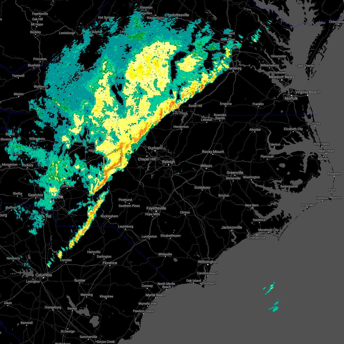 At 615 pm est, a severe thunderstorm was located 8 miles east of randleman, moving east at 50 mph (law enforcement). Hazards include 60 mph wind gusts. Expect damage to roofs, siding, and trees. locations impacted include, asheboro, randleman, pleasant garden, liberty, ramseur, franklinville, staley, climax, randleman regional reservior marina and forest oaks. hail threat, radar indicated max hail size, <. 75 in wind threat, radar indicated max wind gust, 60 mph. At 615 pm est, a severe thunderstorm was located 8 miles east of randleman, moving east at 50 mph (law enforcement). Hazards include 60 mph wind gusts. Expect damage to roofs, siding, and trees. locations impacted include, asheboro, randleman, pleasant garden, liberty, ramseur, franklinville, staley, climax, randleman regional reservior marina and forest oaks. hail threat, radar indicated max hail size, <. 75 in wind threat, radar indicated max wind gust, 60 mph.
|
| 12/11/2021 6:05 PM EST |
 At 604 pm est, a severe thunderstorm was located near mcleansville, or 10 miles northeast of greensboro, moving east at 45 mph (radar indicated). Hazards include 60 mph wind gusts. expect damage to roofs, siding, and trees At 604 pm est, a severe thunderstorm was located near mcleansville, or 10 miles northeast of greensboro, moving east at 45 mph (radar indicated). Hazards include 60 mph wind gusts. expect damage to roofs, siding, and trees
|
| 12/11/2021 5:54 PM EST |
 At 554 pm est, a severe thunderstorm was located 11 miles south of thomasville, or 12 miles southeast of lexington, moving northeast at 60 mph (radar indicated). Hazards include 60 mph wind gusts. expect damage to roofs, siding, and trees At 554 pm est, a severe thunderstorm was located 11 miles south of thomasville, or 12 miles southeast of lexington, moving northeast at 60 mph (radar indicated). Hazards include 60 mph wind gusts. expect damage to roofs, siding, and trees
|
| 10/25/2021 8:01 PM EDT |
 At 800 pm edt, a severe thunderstorm was located near mcleansville, or 9 miles west of burlington, moving east at 40 mph (radar indicated). Hazards include 60 mph wind gusts. Expect damage to roofs, siding, and trees. Locations impacted include, greensboro, high point, asheboro, randleman, mcleansville, archdale, trinity, gibsonville, pleasant garden and liberty. At 800 pm edt, a severe thunderstorm was located near mcleansville, or 9 miles west of burlington, moving east at 40 mph (radar indicated). Hazards include 60 mph wind gusts. Expect damage to roofs, siding, and trees. Locations impacted include, greensboro, high point, asheboro, randleman, mcleansville, archdale, trinity, gibsonville, pleasant garden and liberty.
|
| 10/25/2021 7:56 PM EDT |
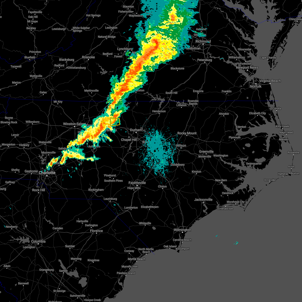 At 756 pm edt, a severe thunderstorm was located near baynes, or near jericho, moving east at 50 mph (radar indicated). Hazards include 60 mph wind gusts. Expect damage to roofs, siding, and trees. Locations impacted include, burlington, lake cammack park & marina, lake burlington and union ridge. At 756 pm edt, a severe thunderstorm was located near baynes, or near jericho, moving east at 50 mph (radar indicated). Hazards include 60 mph wind gusts. Expect damage to roofs, siding, and trees. Locations impacted include, burlington, lake cammack park & marina, lake burlington and union ridge.
|
| 10/25/2021 7:43 PM EDT |
 At 743 pm edt, a severe thunderstorm was located over greensboro, moving east at 40 mph (radar indicated). Hazards include 60 mph wind gusts. Expect damage to roofs, siding, and trees. Locations impacted include, greensboro, high point, asheboro, lexington, randleman, thomasville, mcleansville, linwood, archdale and trinity. At 743 pm edt, a severe thunderstorm was located over greensboro, moving east at 40 mph (radar indicated). Hazards include 60 mph wind gusts. Expect damage to roofs, siding, and trees. Locations impacted include, greensboro, high point, asheboro, lexington, randleman, thomasville, mcleansville, linwood, archdale and trinity.
|
| 10/25/2021 7:42 PM EDT |
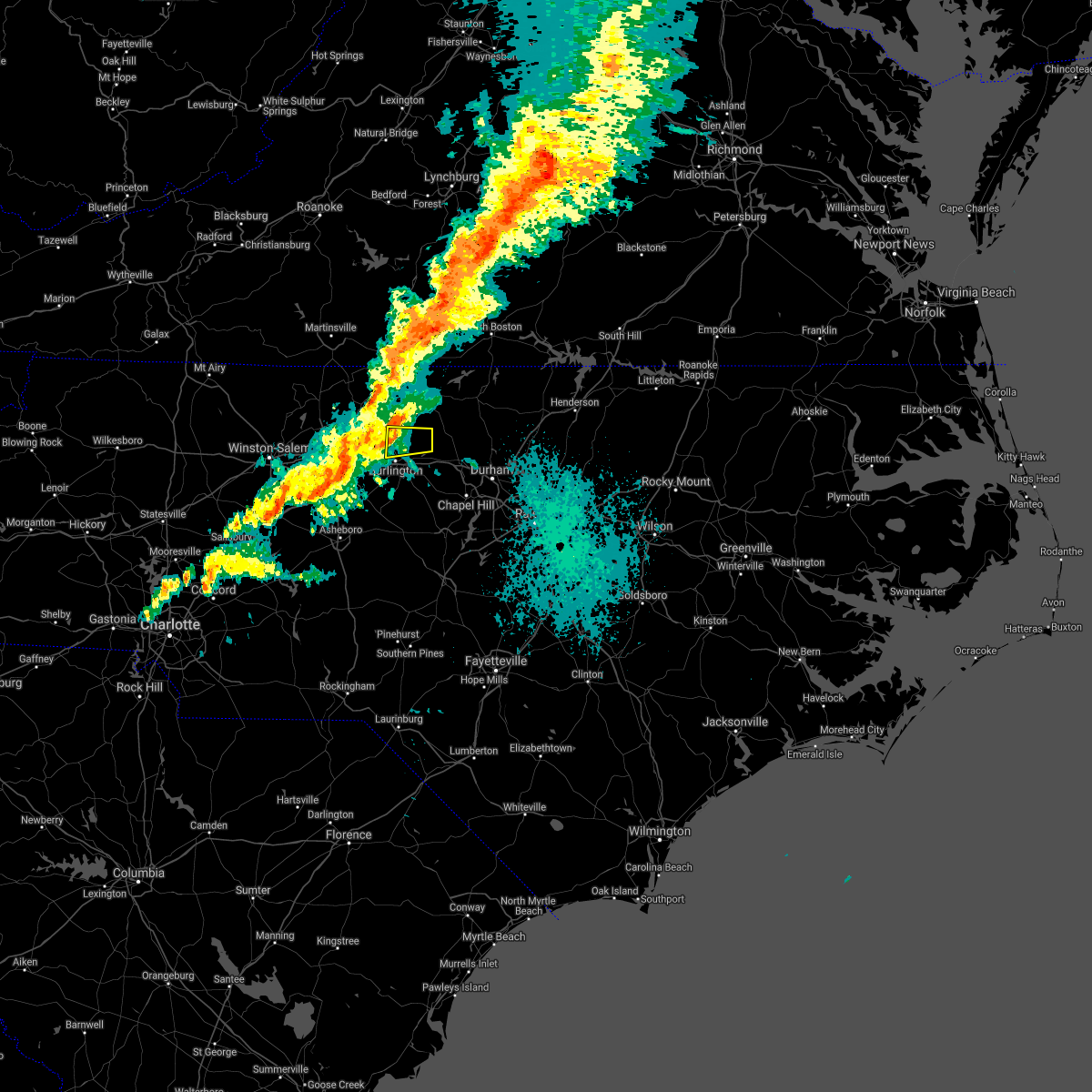 At 742 pm edt, a severe thunderstorm was located 7 miles north of elon, or 7 miles south of camp springs, moving east at 40 mph (radar indicated). Hazards include 60 mph wind gusts. expect damage to roofs, siding, and trees At 742 pm edt, a severe thunderstorm was located 7 miles north of elon, or 7 miles south of camp springs, moving east at 40 mph (radar indicated). Hazards include 60 mph wind gusts. expect damage to roofs, siding, and trees
|
| 10/25/2021 7:27 PM EDT |
 At 726 pm edt, a severe thunderstorm was located near kernersville, or near high point, moving east at 40 mph (radar indicated). Hazards include 60 mph wind gusts. expect damage to roofs, siding, and trees At 726 pm edt, a severe thunderstorm was located near kernersville, or near high point, moving east at 40 mph (radar indicated). Hazards include 60 mph wind gusts. expect damage to roofs, siding, and trees
|
| 8/14/2021 5:19 PM EDT |
 At 518 pm edt, a severe thunderstorm was located 7 miles southeast of graham, moving north at 10 mph (radar indicated). Hazards include 60 mph wind gusts and penny size hail. expect damage to roofs, siding, and trees At 518 pm edt, a severe thunderstorm was located 7 miles southeast of graham, moving north at 10 mph (radar indicated). Hazards include 60 mph wind gusts and penny size hail. expect damage to roofs, siding, and trees
|
| 8/1/2021 7:25 AM EDT |
 At 725 am edt, a severe thunderstorm was located near graham, moving east at 40 mph (radar indicated). Hazards include 60 mph wind gusts. Expect damage to roofs, siding, and trees. Locations impacted include, durham, chapel hill, burlington, graham, hillsborough, carrboro, mebane, haw river, swepsonville and efland. At 725 am edt, a severe thunderstorm was located near graham, moving east at 40 mph (radar indicated). Hazards include 60 mph wind gusts. Expect damage to roofs, siding, and trees. Locations impacted include, durham, chapel hill, burlington, graham, hillsborough, carrboro, mebane, haw river, swepsonville and efland.
|
| 8/1/2021 7:10 AM EDT |
 At 710 am edt, a severe thunderstorm was located near burlington, moving east at 40 mph (radar indicated). Hazards include 60 mph wind gusts. expect damage to roofs, siding, and trees At 710 am edt, a severe thunderstorm was located near burlington, moving east at 40 mph (radar indicated). Hazards include 60 mph wind gusts. expect damage to roofs, siding, and trees
|
| 7/17/2021 5:38 PM EDT |
 At 537 pm edt, a severe thunderstorm was located over jericho, moving northeast at 35 mph (radar indicated. at 455 pm, law enforcement reported several trees and power lines down in portions of guilford county). Hazards include 60 mph wind gusts and penny size hail. Expect damage to roofs, siding, and trees. Locations impacted include, burlington, graham, hillsborough, mebane, haw river, lake cammack park & marina, carr, altamahaw-ossipee, glen raven and union ridge. At 537 pm edt, a severe thunderstorm was located over jericho, moving northeast at 35 mph (radar indicated. at 455 pm, law enforcement reported several trees and power lines down in portions of guilford county). Hazards include 60 mph wind gusts and penny size hail. Expect damage to roofs, siding, and trees. Locations impacted include, burlington, graham, hillsborough, mebane, haw river, lake cammack park & marina, carr, altamahaw-ossipee, glen raven and union ridge.
|
| 7/17/2021 5:21 PM EDT |
 At 520 pm edt, a severe thunderstorm was located near camp springs, moving east at 35 mph (radar indicated). Hazards include 60 mph wind gusts and penny size hail. expect damage to roofs, siding, and trees At 520 pm edt, a severe thunderstorm was located near camp springs, moving east at 35 mph (radar indicated). Hazards include 60 mph wind gusts and penny size hail. expect damage to roofs, siding, and trees
|
| 7/17/2021 4:54 PM EDT |
 At 454 pm edt, a severe thunderstorm was located near greensboro, moving east at 25 mph (radar indicated). Hazards include 60 mph wind gusts and penny size hail. frequent deadly lightning. Expect damage to roofs, siding, and trees. Locations impacted include, greensboro, high point, mcleansville, summerfield, gibsonville, jamestown, haw river state park, lake guilford mackintosh marina, lake jeanette marina and monticello. At 454 pm edt, a severe thunderstorm was located near greensboro, moving east at 25 mph (radar indicated). Hazards include 60 mph wind gusts and penny size hail. frequent deadly lightning. Expect damage to roofs, siding, and trees. Locations impacted include, greensboro, high point, mcleansville, summerfield, gibsonville, jamestown, haw river state park, lake guilford mackintosh marina, lake jeanette marina and monticello.
|
| 7/17/2021 4:43 PM EDT |
 At 442 pm edt, a severe thunderstorm was located near high point, moving northeast at 30 mph (radar indicated). Hazards include 60 mph wind gusts and penny size hail. expect damage to roofs, siding, and trees At 442 pm edt, a severe thunderstorm was located near high point, moving northeast at 30 mph (radar indicated). Hazards include 60 mph wind gusts and penny size hail. expect damage to roofs, siding, and trees
|
| 5/29/2021 3:54 PM EDT |
 At 353 pm edt, a severe thunderstorm was located near elon, or near burlington, moving east at 25 mph (radar indicated). Hazards include 60 mph wind gusts and quarter size hail. Hail damage to vehicles is expected. expect wind damage to roofs, siding, and trees. Locations impacted include, burlington, graham, mebane, swepsonville, alamance, lake mackintosh marina and saxapahaw. At 353 pm edt, a severe thunderstorm was located near elon, or near burlington, moving east at 25 mph (radar indicated). Hazards include 60 mph wind gusts and quarter size hail. Hail damage to vehicles is expected. expect wind damage to roofs, siding, and trees. Locations impacted include, burlington, graham, mebane, swepsonville, alamance, lake mackintosh marina and saxapahaw.
|
| 5/29/2021 3:43 PM EDT |
 At 341 pm edt, a severe thunderstorm was located 8 miles southwest of elon, or 10 miles southwest of burlington, moving east at 40 mph. this storm has a history of producing quarter size hail (radar indicated). Hazards include 60 mph wind gusts and half dollar size hail. Hail damage to vehicles is expected. expect wind damage to roofs, siding, and trees. Locations impacted include, burlington, graham, mebane, elon, gibsonville, haw river, swepsonville, alamance, glen raven and lake mackintosh marina. At 341 pm edt, a severe thunderstorm was located 8 miles southwest of elon, or 10 miles southwest of burlington, moving east at 40 mph. this storm has a history of producing quarter size hail (radar indicated). Hazards include 60 mph wind gusts and half dollar size hail. Hail damage to vehicles is expected. expect wind damage to roofs, siding, and trees. Locations impacted include, burlington, graham, mebane, elon, gibsonville, haw river, swepsonville, alamance, glen raven and lake mackintosh marina.
|
| 5/29/2021 3:25 PM EDT |
 At 324 pm edt, a severe thunderstorm was located 8 miles south of greensboro, moving east at 25 mph (radar indicated). Hazards include ping pong ball size hail and 60 mph wind gusts. People and animals outdoors will be injured. expect hail damage to roofs, siding, windows, and vehicles. Expect wind damage to roofs, siding, and trees. At 324 pm edt, a severe thunderstorm was located 8 miles south of greensboro, moving east at 25 mph (radar indicated). Hazards include ping pong ball size hail and 60 mph wind gusts. People and animals outdoors will be injured. expect hail damage to roofs, siding, windows, and vehicles. Expect wind damage to roofs, siding, and trees.
|
| 5/29/2021 3:11 PM EDT |
 At 310 pm edt, a cluster of severe thunderstorms were located along a line extending from near high point to near greensboro, moving east at 15 mph (radar indicated). Hazards include 60 mph wind gusts. Expect damage to roofs, siding, and trees. Locations impacted include, greensboro, high point, burlington, graham, randleman, elon, mcleansville, archdale, trinity and gibsonville. At 310 pm edt, a cluster of severe thunderstorms were located along a line extending from near high point to near greensboro, moving east at 15 mph (radar indicated). Hazards include 60 mph wind gusts. Expect damage to roofs, siding, and trees. Locations impacted include, greensboro, high point, burlington, graham, randleman, elon, mcleansville, archdale, trinity and gibsonville.
|
| 5/29/2021 2:54 PM EDT |
 At 254 pm edt, severe thunderstorms were located along a line extending from near greensboro to near high point, moving east at 15 mph (radar indicated). Hazards include 60 mph wind gusts. Expect damage to roofs, siding, and trees. Locations impacted include, greensboro, high point, burlington, asheboro, graham, randleman, elon, mcleansville, archdale and summerfield. At 254 pm edt, severe thunderstorms were located along a line extending from near greensboro to near high point, moving east at 15 mph (radar indicated). Hazards include 60 mph wind gusts. Expect damage to roofs, siding, and trees. Locations impacted include, greensboro, high point, burlington, asheboro, graham, randleman, elon, mcleansville, archdale and summerfield.
|
| 5/29/2021 2:34 PM EDT |
 At 234 pm edt, a cluster of severe thunderstorms were located along a line extending from 6 miles west of greensboro to thomasville, moving east at 15 mph (radar indicated). Hazards include 60 mph wind gusts. expect damage to roofs, siding, and trees At 234 pm edt, a cluster of severe thunderstorms were located along a line extending from 6 miles west of greensboro to thomasville, moving east at 15 mph (radar indicated). Hazards include 60 mph wind gusts. expect damage to roofs, siding, and trees
|
| 5/10/2021 4:03 PM EDT |
 At 403 pm edt, a severe thunderstorm was located 8 miles southwest of mcleansville, or 8 miles southeast of greensboro, moving east at 30 mph (radar indicated). Hazards include 60 mph wind gusts and quarter size hail. Hail damage to vehicles is expected. expect wind damage to roofs, siding, and trees. Locations impacted include, burlington, graham, mcleansville, gibsonville, pleasant garden, liberty, swepsonville, alamance, staley and lake guilford mackintosh marina. At 403 pm edt, a severe thunderstorm was located 8 miles southwest of mcleansville, or 8 miles southeast of greensboro, moving east at 30 mph (radar indicated). Hazards include 60 mph wind gusts and quarter size hail. Hail damage to vehicles is expected. expect wind damage to roofs, siding, and trees. Locations impacted include, burlington, graham, mcleansville, gibsonville, pleasant garden, liberty, swepsonville, alamance, staley and lake guilford mackintosh marina.
|
| 5/10/2021 3:47 PM EDT |
 At 347 pm edt, a severe thunderstorm was located over greensboro, moving southeast at 35 mph. quarter size hail has been reported with this storm (radar indicated). Hazards include 60 mph wind gusts and quarter size hail. Hail damage to vehicles is expected. Expect wind damage to roofs, siding, and trees. At 347 pm edt, a severe thunderstorm was located over greensboro, moving southeast at 35 mph. quarter size hail has been reported with this storm (radar indicated). Hazards include 60 mph wind gusts and quarter size hail. Hail damage to vehicles is expected. Expect wind damage to roofs, siding, and trees.
|
| 5/4/2021 3:27 PM EDT |
 At 326 pm edt, a severe thunderstorm was located near monroeton, or 9 miles south of reidsville, moving east at 30 mph (radar indicated). Hazards include 60 mph wind gusts and nickel size hail. Expect damage to roofs, siding, and trees. Locations impacted include, burlington, mebane, mcleansville, gibsonville, haw river state park, lake burlington, monticello, lake cammack park & marina, altamahaw-ossipee and glen raven. At 326 pm edt, a severe thunderstorm was located near monroeton, or 9 miles south of reidsville, moving east at 30 mph (radar indicated). Hazards include 60 mph wind gusts and nickel size hail. Expect damage to roofs, siding, and trees. Locations impacted include, burlington, mebane, mcleansville, gibsonville, haw river state park, lake burlington, monticello, lake cammack park & marina, altamahaw-ossipee and glen raven.
|
| 5/4/2021 3:19 PM EDT |
 At 318 pm edt, a severe thunderstorm was located near monroeton, or 8 miles north of greensboro, moving east at 30 mph (radar indicated). Hazards include 60 mph wind gusts and penny size hail. expect damage to roofs, siding, and trees At 318 pm edt, a severe thunderstorm was located near monroeton, or 8 miles north of greensboro, moving east at 30 mph (radar indicated). Hazards include 60 mph wind gusts and penny size hail. expect damage to roofs, siding, and trees
|
| 3/27/2021 3:33 PM EDT |
 At 332 pm edt, a severe thunderstorm was located 7 miles south of graham, moving east at 40 mph (radar indicated). Hazards include 60 mph wind gusts and quarter size hail. Hail damage to vehicles is expected. expect wind damage to roofs, siding, and trees. Locations impacted include, burlington, graham, hillsborough, carrboro, mebane, haw river, swepsonville, alamance, efland and snow camp. At 332 pm edt, a severe thunderstorm was located 7 miles south of graham, moving east at 40 mph (radar indicated). Hazards include 60 mph wind gusts and quarter size hail. Hail damage to vehicles is expected. expect wind damage to roofs, siding, and trees. Locations impacted include, burlington, graham, hillsborough, carrboro, mebane, haw river, swepsonville, alamance, efland and snow camp.
|
| 3/27/2021 3:26 PM EDT |
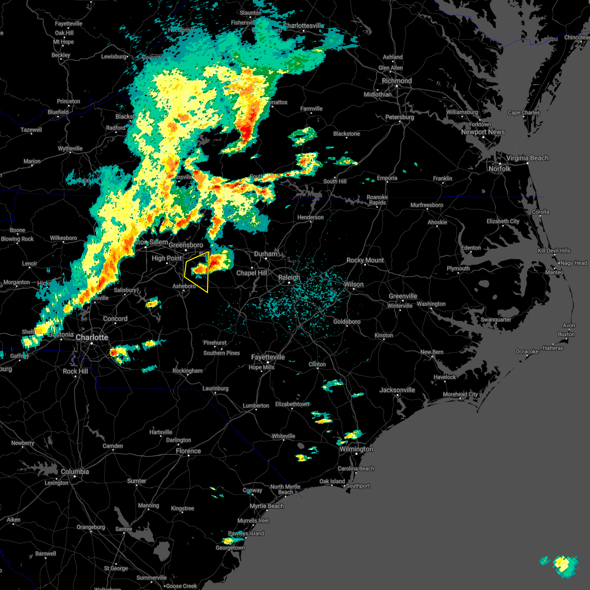 The severe thunderstorm warning for northeastern randolph and southeastern guilford counties will expire at 330 pm edt, the storm which prompted the warning has moved out of the area. therefore, the warning will be allowed to expire. a severe thunderstorm watch remains in effect until 800 pm edt for central north carolina. to report severe weather, contact your nearest law enforcement agency. they will relay your report to the national weather service raleigh. remember, a severe thunderstorm warning still remains in effect for northeast randolph county. The severe thunderstorm warning for northeastern randolph and southeastern guilford counties will expire at 330 pm edt, the storm which prompted the warning has moved out of the area. therefore, the warning will be allowed to expire. a severe thunderstorm watch remains in effect until 800 pm edt for central north carolina. to report severe weather, contact your nearest law enforcement agency. they will relay your report to the national weather service raleigh. remember, a severe thunderstorm warning still remains in effect for northeast randolph county.
|
| 3/27/2021 3:17 PM EDT |
 At 317 pm edt, a severe thunderstorm was located 11 miles south of elon, or 12 miles southwest of burlington, moving east at 40 mph. this storm has a history of producing quarter size hail (radar indicated). Hazards include 60 mph wind gusts and quarter size hail. Hail damage to vehicles is expected. Expect wind damage to roofs, siding, and trees. At 317 pm edt, a severe thunderstorm was located 11 miles south of elon, or 12 miles southwest of burlington, moving east at 40 mph. this storm has a history of producing quarter size hail (radar indicated). Hazards include 60 mph wind gusts and quarter size hail. Hail damage to vehicles is expected. Expect wind damage to roofs, siding, and trees.
|
| 3/27/2021 3:08 PM EDT |
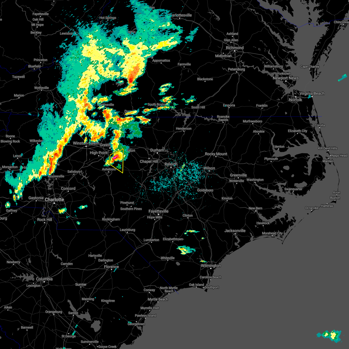 At 307 pm edt, a severe thunderstorm was located over climax or 9 miles northeast of randleman, moving east at 35 mph (radar indicated). Hazards include quarter to ping pong ball size hail and 60 mph wind gusts. People and animals outdoors will be injured. expect hail damage to roofs, siding, windows, and vehicles. expect wind damage to roofs, siding, and trees. Locations impacted include, randleman, pleasant garden, liberty, ramseur, staley, climax and forest oaks. At 307 pm edt, a severe thunderstorm was located over climax or 9 miles northeast of randleman, moving east at 35 mph (radar indicated). Hazards include quarter to ping pong ball size hail and 60 mph wind gusts. People and animals outdoors will be injured. expect hail damage to roofs, siding, windows, and vehicles. expect wind damage to roofs, siding, and trees. Locations impacted include, randleman, pleasant garden, liberty, ramseur, staley, climax and forest oaks.
|
| 3/27/2021 2:56 PM EDT |
 At 255 pm edt, a severe thunderstorm was located near randleman, moving east at 40 mph (radar indicated). Hazards include quarter to ping pong ball size hail and 60 mph wind gusts. People and animals outdoors will be injured. expect hail damage to roofs, siding, windows, and vehicles. expect wind damage to roofs, siding, and trees. Locations impacted include, greensboro, asheboro, randleman, pleasant garden, liberty, ramseur, franklinville, staley, climax and lake guilford mackintosh marina. At 255 pm edt, a severe thunderstorm was located near randleman, moving east at 40 mph (radar indicated). Hazards include quarter to ping pong ball size hail and 60 mph wind gusts. People and animals outdoors will be injured. expect hail damage to roofs, siding, windows, and vehicles. expect wind damage to roofs, siding, and trees. Locations impacted include, greensboro, asheboro, randleman, pleasant garden, liberty, ramseur, franklinville, staley, climax and lake guilford mackintosh marina.
|
| 3/27/2021 2:47 PM EDT |
 At 246 pm edt, a severe thunderstorm was located near high point, moving east at 45 mph (radar indicated). Hazards include 60 mph wind gusts and quarter size hail. Hail damage to vehicles is expected. expect wind damage to roofs, siding, and trees. Locations impacted include, greensboro, high point, asheboro, randleman, archdale, trinity, pleasant garden, jamestown, liberty and ramseur. At 246 pm edt, a severe thunderstorm was located near high point, moving east at 45 mph (radar indicated). Hazards include 60 mph wind gusts and quarter size hail. Hail damage to vehicles is expected. expect wind damage to roofs, siding, and trees. Locations impacted include, greensboro, high point, asheboro, randleman, archdale, trinity, pleasant garden, jamestown, liberty and ramseur.
|
| 3/27/2021 2:31 PM EDT |
 At 230 pm edt, a severe thunderstorm was located near thomasville, or 8 miles southwest of high point, moving east at 35 mph (radar indicated). Hazards include 60 mph wind gusts and quarter size hail. Hail damage to vehicles is expected. Expect wind damage to roofs, siding, and trees. At 230 pm edt, a severe thunderstorm was located near thomasville, or 8 miles southwest of high point, moving east at 35 mph (radar indicated). Hazards include 60 mph wind gusts and quarter size hail. Hail damage to vehicles is expected. Expect wind damage to roofs, siding, and trees.
|
| 3/25/2021 8:33 PM EDT |
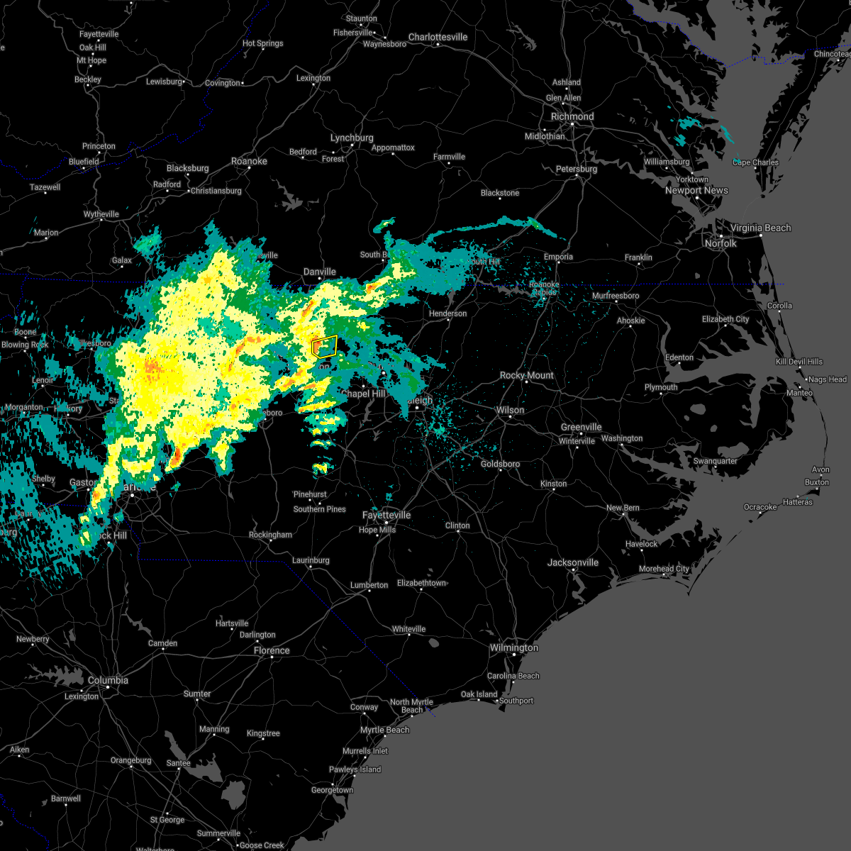 At 832 pm edt, a severe thunderstorm was located four miles north of burlington, moving east northeast at 25 mph (radar indicated). Hazards include 60 mph wind gusts. Expect damage to roofs, siding, and trees. Locations impacted include, burlington, mebane, haw river, lake cammack park & marina and lake burlington. At 832 pm edt, a severe thunderstorm was located four miles north of burlington, moving east northeast at 25 mph (radar indicated). Hazards include 60 mph wind gusts. Expect damage to roofs, siding, and trees. Locations impacted include, burlington, mebane, haw river, lake cammack park & marina and lake burlington.
|
| 3/25/2021 8:15 PM EDT |
 At 814 pm edt, a severe thunderstorm was located one mile northwest of elon, moving east northeast at 25 mph (radar indicated). Hazards include 60 mph wind gusts. Expect damage to roofs, siding, and trees. Locations impacted include, burlington, graham, mebane, elon, gibsonville, haw river, swepsonville, alamance, lake cammack park & marina and altamahaw-ossipee. At 814 pm edt, a severe thunderstorm was located one mile northwest of elon, moving east northeast at 25 mph (radar indicated). Hazards include 60 mph wind gusts. Expect damage to roofs, siding, and trees. Locations impacted include, burlington, graham, mebane, elon, gibsonville, haw river, swepsonville, alamance, lake cammack park & marina and altamahaw-ossipee.
|
| 3/25/2021 7:54 PM EDT |
 At 754 pm edt, a severe thunderstorm was located over mcleansville, or 9 miles east of greensboro, moving east at 25 mph (radar indicated). Hazards include 60 mph wind gusts. expect damage to roofs, siding, and trees At 754 pm edt, a severe thunderstorm was located over mcleansville, or 9 miles east of greensboro, moving east at 25 mph (radar indicated). Hazards include 60 mph wind gusts. expect damage to roofs, siding, and trees
|
| 3/18/2021 6:12 PM EDT |
 The severe thunderstorm warning for alamance, eastern randolph, southeastern guilford and northwestern chatham counties will expire at 615 pm edt, the storms which prompted the warning have weakened across randolph, guilford, and chatham counties. therefore, the warning will be allowed to expire. a severe thunderstorm warning still remains in effect for alamance county. a tornado watch remains in effect until 900 pm edt for central north carolina. The severe thunderstorm warning for alamance, eastern randolph, southeastern guilford and northwestern chatham counties will expire at 615 pm edt, the storms which prompted the warning have weakened across randolph, guilford, and chatham counties. therefore, the warning will be allowed to expire. a severe thunderstorm warning still remains in effect for alamance county. a tornado watch remains in effect until 900 pm edt for central north carolina.
|
| 3/18/2021 5:51 PM EDT |
 At 551 pm edt, a severe thunderstorm capable of producing a tornado was located over burlington, moving east at 40 mph (radar indicated rotation). Hazards include tornado and quarter size hail. Flying debris will be dangerous to those caught without shelter. mobile homes will be damaged or destroyed. damage to roofs, windows, and vehicles will occur. tree damage is likely. this dangerous storm will be near, mebane around 600 pm edt. Other locations impacted by this tornadic thunderstorm include lake cammack park & marina, lake burlington, glen raven, haw river and union ridge. At 551 pm edt, a severe thunderstorm capable of producing a tornado was located over burlington, moving east at 40 mph (radar indicated rotation). Hazards include tornado and quarter size hail. Flying debris will be dangerous to those caught without shelter. mobile homes will be damaged or destroyed. damage to roofs, windows, and vehicles will occur. tree damage is likely. this dangerous storm will be near, mebane around 600 pm edt. Other locations impacted by this tornadic thunderstorm include lake cammack park & marina, lake burlington, glen raven, haw river and union ridge.
|
| 3/18/2021 5:50 PM EDT | Overturned and damaged bus from thunderstorm winds reporte in alamance county NC, 1.8 miles E of Burlington, NC |
| 3/18/2021 5:44 PM EDT |
 At 544 pm edt, severe thunderstorms were located along a line extending from burlington to 6 miles southeast of randleman, moving northeast at 50 mph (radar indicated). Hazards include 60 mph wind gusts and quarter size hail. Hail damage to vehicles is expected. expect wind damage to roofs, siding, and trees. Locations impacted include, burlington, asheboro, graham, randleman, mebane, elon, mcleansville, gibsonville, pleasant garden and liberty. At 544 pm edt, severe thunderstorms were located along a line extending from burlington to 6 miles southeast of randleman, moving northeast at 50 mph (radar indicated). Hazards include 60 mph wind gusts and quarter size hail. Hail damage to vehicles is expected. expect wind damage to roofs, siding, and trees. Locations impacted include, burlington, asheboro, graham, randleman, mebane, elon, mcleansville, gibsonville, pleasant garden and liberty.
|
| 3/18/2021 5:43 PM EDT |
 At 543 pm edt, a severe thunderstorm capable of producing a tornado was located over elon, or over burlington, moving east at 40 mph (radar indicated rotation). Hazards include tornado and quarter size hail. Flying debris will be dangerous to those caught without shelter. mobile homes will be damaged or destroyed. damage to roofs, windows, and vehicles will occur. tree damage is likely. this dangerous storm will be near, graham around 555 pm edt. mebane around 600 pm edt. Other locations impacted by this tornadic thunderstorm include lake cammack park & marina, altamahaw-ossipee, glen raven, lake mackintosh marina and lake guilford mackintosh marina. At 543 pm edt, a severe thunderstorm capable of producing a tornado was located over elon, or over burlington, moving east at 40 mph (radar indicated rotation). Hazards include tornado and quarter size hail. Flying debris will be dangerous to those caught without shelter. mobile homes will be damaged or destroyed. damage to roofs, windows, and vehicles will occur. tree damage is likely. this dangerous storm will be near, graham around 555 pm edt. mebane around 600 pm edt. Other locations impacted by this tornadic thunderstorm include lake cammack park & marina, altamahaw-ossipee, glen raven, lake mackintosh marina and lake guilford mackintosh marina.
|
| 3/18/2021 5:40 PM EDT | Roofs off houses... multiple trees down along ethans wa in guilford county NC, 3.5 miles E of Burlington, NC |
| 3/18/2021 5:34 PM EDT |
 At 534 pm edt, a severe thunderstorm capable of producing a tornado was located near mcleansville, or 8 miles west of burlington, moving northeast at 35 mph (radar indicated rotation). Hazards include tornado. Flying debris will be dangerous to those caught without shelter. mobile homes will be damaged or destroyed. damage to roofs, windows, and vehicles will occur. tree damage is likely. this dangerous storm will be near, elon around 545 pm edt. burlington around 550 pm edt. graham around 555 pm edt. mebane around 600 pm edt. Other locations impacted by this tornadic thunderstorm include lake guilford mackintosh marina, forest oaks, alamance, lake burlington and haw river. At 534 pm edt, a severe thunderstorm capable of producing a tornado was located near mcleansville, or 8 miles west of burlington, moving northeast at 35 mph (radar indicated rotation). Hazards include tornado. Flying debris will be dangerous to those caught without shelter. mobile homes will be damaged or destroyed. damage to roofs, windows, and vehicles will occur. tree damage is likely. this dangerous storm will be near, elon around 545 pm edt. burlington around 550 pm edt. graham around 555 pm edt. mebane around 600 pm edt. Other locations impacted by this tornadic thunderstorm include lake guilford mackintosh marina, forest oaks, alamance, lake burlington and haw river.
|
| 3/18/2021 5:13 PM EDT |
 At 513 pm edt, severe thunderstorms were located along a line extending from near randleman to 11 miles east of high rock lake, moving northeast at 55 mph (radar indicated). Hazards include 60 mph wind gusts and quarter size hail. Hail damage to vehicles is expected. Expect wind damage to roofs, siding, and trees. At 513 pm edt, severe thunderstorms were located along a line extending from near randleman to 11 miles east of high rock lake, moving northeast at 55 mph (radar indicated). Hazards include 60 mph wind gusts and quarter size hail. Hail damage to vehicles is expected. Expect wind damage to roofs, siding, and trees.
|
| 10/29/2020 10:41 PM EDT |
 The tornado warning for northwestern alamance and east central guilford counties will expire at 1045 pm edt, the storm which prompted the warning has weakened below severe limits, and no longer appears capable of producing a tornado. therefore, the warning will be allowed to expire. however, this storm will be closely monitored for signs of restrengthening. The tornado warning for northwestern alamance and east central guilford counties will expire at 1045 pm edt, the storm which prompted the warning has weakened below severe limits, and no longer appears capable of producing a tornado. therefore, the warning will be allowed to expire. however, this storm will be closely monitored for signs of restrengthening.
|
| 10/29/2020 10:30 PM EDT |
 At 1030 pm edt, a severe squall line capable of producing both tornadoes and extensive straight line wind damage was located over elon, or near burlington, moving east at 40 mph (radar indicated rotation). Hazards include tornado. Flying debris will be dangerous to those caught without shelter. mobile homes will be damaged or destroyed. damage to roofs, windows, and vehicles will occur. tree damage is likely. these dangerous storms will be near, burlington around 1040 pm edt. graham around 1045 pm edt. Other locations impacted by this tornadic thunderstorm include altamahaw-ossipee, glen raven, lake mackintosh marina, lake guilford mackintosh marina and altamahaw. At 1030 pm edt, a severe squall line capable of producing both tornadoes and extensive straight line wind damage was located over elon, or near burlington, moving east at 40 mph (radar indicated rotation). Hazards include tornado. Flying debris will be dangerous to those caught without shelter. mobile homes will be damaged or destroyed. damage to roofs, windows, and vehicles will occur. tree damage is likely. these dangerous storms will be near, burlington around 1040 pm edt. graham around 1045 pm edt. Other locations impacted by this tornadic thunderstorm include altamahaw-ossipee, glen raven, lake mackintosh marina, lake guilford mackintosh marina and altamahaw.
|
| 10/29/2020 10:19 PM EDT |
 At 1018 pm edt, severe thunderstorms capable of producing both tornadoes and extensive straight line wind damage were located over mcleansville, or 8 miles east of greensboro, moving east at 35 mph (radar indicated rotation). Hazards include tornado. Flying debris will be dangerous to those caught without shelter. mobile homes will be damaged or destroyed. damage to roofs, windows, and vehicles will occur. tree damage is likely. these dangerous storms will be near, elon around 1035 pm edt. burlington and graham around 1045 pm edt. Other locations impacted by this tornadic thunderstorm include altamahaw-ossipee, glen raven, lake mackintosh marina, lake guilford mackintosh marina and altamahaw. At 1018 pm edt, severe thunderstorms capable of producing both tornadoes and extensive straight line wind damage were located over mcleansville, or 8 miles east of greensboro, moving east at 35 mph (radar indicated rotation). Hazards include tornado. Flying debris will be dangerous to those caught without shelter. mobile homes will be damaged or destroyed. damage to roofs, windows, and vehicles will occur. tree damage is likely. these dangerous storms will be near, elon around 1035 pm edt. burlington and graham around 1045 pm edt. Other locations impacted by this tornadic thunderstorm include altamahaw-ossipee, glen raven, lake mackintosh marina, lake guilford mackintosh marina and altamahaw.
|
| 9/29/2020 4:56 PM EDT |
 At 456 pm edt, a severe thunderstorm was located near greensboro, moving east at 30 mph (radar indicated). Hazards include 60 mph wind gusts and quarter size hail. Hail damage to vehicles is expected. Expect wind damage to roofs, siding, and trees. At 456 pm edt, a severe thunderstorm was located near greensboro, moving east at 30 mph (radar indicated). Hazards include 60 mph wind gusts and quarter size hail. Hail damage to vehicles is expected. Expect wind damage to roofs, siding, and trees.
|
| 8/31/2020 5:52 PM EDT |
 The severe thunderstorm warning for northern alamance and northeastern guilford counties will expire at 600 pm edt, the storm which prompted the warning has weakened below severe limits, and no longer poses an immediate threat to life or property. therefore, the warning will be allowed to expire. however, gusty winds and heavy rain are still possible with this thunderstorm as it crosses alamance county. The severe thunderstorm warning for northern alamance and northeastern guilford counties will expire at 600 pm edt, the storm which prompted the warning has weakened below severe limits, and no longer poses an immediate threat to life or property. therefore, the warning will be allowed to expire. however, gusty winds and heavy rain are still possible with this thunderstorm as it crosses alamance county.
|
| 8/31/2020 5:42 PM EDT |
 At 541 pm edt, a severe thunderstorm was located over mcleansville, or 9 miles west of burlington, moving east at 20 mph (radar indicated). Hazards include 60 mph wind gusts and penny size hail. Expect damage to roofs, siding, and trees. Locations impacted include, burlington, graham, mcleansville, elon, gibsonville, haw river, swepsonville, alamance, lake guilford mackintosh marina and lake cammack park & marina. At 541 pm edt, a severe thunderstorm was located over mcleansville, or 9 miles west of burlington, moving east at 20 mph (radar indicated). Hazards include 60 mph wind gusts and penny size hail. Expect damage to roofs, siding, and trees. Locations impacted include, burlington, graham, mcleansville, elon, gibsonville, haw river, swepsonville, alamance, lake guilford mackintosh marina and lake cammack park & marina.
|
| 8/31/2020 5:22 PM EDT |
 At 521 pm edt, a severe thunderstorm was located over mcleansville, or 8 miles east of greensboro, moving east at 30 mph (radar indicated). Hazards include 60 mph wind gusts and penny size hail. expect damage to roofs, siding, and trees At 521 pm edt, a severe thunderstorm was located over mcleansville, or 8 miles east of greensboro, moving east at 30 mph (radar indicated). Hazards include 60 mph wind gusts and penny size hail. expect damage to roofs, siding, and trees
|
| 7/23/2020 4:01 PM EDT |
 At 400 pm edt, a severe thunderstorm was located 8 miles south of greensboro, moving east at 30 mph (radar indicated). Hazards include 60 mph wind gusts. Expect damage to roofs, siding, and trees. Locations impacted include, greensboro, high point, burlington, graham, mebane, elon, mcleansville, gibsonville, pleasant garden and liberty. At 400 pm edt, a severe thunderstorm was located 8 miles south of greensboro, moving east at 30 mph (radar indicated). Hazards include 60 mph wind gusts. Expect damage to roofs, siding, and trees. Locations impacted include, greensboro, high point, burlington, graham, mebane, elon, mcleansville, gibsonville, pleasant garden and liberty.
|
| 7/23/2020 3:38 PM EDT |
 At 337 pm edt, a severe thunderstorm was located over mcleansville, or 8 miles east of greensboro, moving east at 30 mph. another thunderstorm capable of producing damaging winds is located over jamestown (radar indicated). Hazards include 60 mph wind gusts. Expect damage to roofs, siding, and trees. Locations impacted include, greensboro, high point, burlington, graham, mebane, elon, mcleansville, archdale, summerfield and gibsonville. At 337 pm edt, a severe thunderstorm was located over mcleansville, or 8 miles east of greensboro, moving east at 30 mph. another thunderstorm capable of producing damaging winds is located over jamestown (radar indicated). Hazards include 60 mph wind gusts. Expect damage to roofs, siding, and trees. Locations impacted include, greensboro, high point, burlington, graham, mebane, elon, mcleansville, archdale, summerfield and gibsonville.
|
| 7/23/2020 3:19 PM EDT |
 At 318 pm edt, a severe thunderstorm was located over greensboro, moving east at 30 mph (radar indicated). Hazards include 60 mph wind gusts. expect damage to roofs, siding, and trees At 318 pm edt, a severe thunderstorm was located over greensboro, moving east at 30 mph (radar indicated). Hazards include 60 mph wind gusts. expect damage to roofs, siding, and trees
|
| 7/20/2020 3:56 PM EDT |
 At 356 pm edt, a severe thunderstorm was located near mcleansville, or 8 miles east of greensboro, and is nearly stationary (radar indicated). Hazards include 60 mph wind gusts. Expect damage to roofs, siding, and trees. Locations impacted include, greensboro, mcleansville, pleasant garden, lake guilford mackintosh marina and forest oaks. At 356 pm edt, a severe thunderstorm was located near mcleansville, or 8 miles east of greensboro, and is nearly stationary (radar indicated). Hazards include 60 mph wind gusts. Expect damage to roofs, siding, and trees. Locations impacted include, greensboro, mcleansville, pleasant garden, lake guilford mackintosh marina and forest oaks.
|
| 7/20/2020 3:40 PM EDT |
 At 339 pm edt, a severe thunderstorm was located near mcleansville, or near greensboro, and is nearly stationary (radar indicated). Hazards include 60 mph wind gusts. expect damage to roofs, siding, and trees At 339 pm edt, a severe thunderstorm was located near mcleansville, or near greensboro, and is nearly stationary (radar indicated). Hazards include 60 mph wind gusts. expect damage to roofs, siding, and trees
|
| 7/17/2020 5:17 PM EDT |
 At 517 pm edt, a severe thunderstorm was located near graham, moving northeast at 10 mph (radar indicated). Hazards include 60 mph wind gusts and quarter size hail. Hail damage to vehicles is expected. expect wind damage to roofs, siding, and trees. Locations impacted include, burlington, graham, mebane, haw river, swepsonville, lake cammack park & marina, union ridge and lake burlington. At 517 pm edt, a severe thunderstorm was located near graham, moving northeast at 10 mph (radar indicated). Hazards include 60 mph wind gusts and quarter size hail. Hail damage to vehicles is expected. expect wind damage to roofs, siding, and trees. Locations impacted include, burlington, graham, mebane, haw river, swepsonville, lake cammack park & marina, union ridge and lake burlington.
|
| 7/17/2020 5:05 PM EDT |
 At 505 pm edt, a severe thunderstorm was located near burlington, moving northeast at 10 mph (radar indicated). Hazards include 60 mph wind gusts and quarter size hail. Hail damage to vehicles is expected. expect wind damage to roofs, siding, and trees. Locations impacted include, burlington, graham, mebane, elon, gibsonville, haw river, swepsonville, lake burlington, lake cammack park & marina and altamahaw-ossipee. At 505 pm edt, a severe thunderstorm was located near burlington, moving northeast at 10 mph (radar indicated). Hazards include 60 mph wind gusts and quarter size hail. Hail damage to vehicles is expected. expect wind damage to roofs, siding, and trees. Locations impacted include, burlington, graham, mebane, elon, gibsonville, haw river, swepsonville, lake burlington, lake cammack park & marina and altamahaw-ossipee.
|
| 7/17/2020 4:54 PM EDT |
 At 454 pm edt, a severe thunderstorm was located near burlington, moving north at 15 mph (radar indicated). Hazards include 60 mph wind gusts and quarter size hail. Hail damage to vehicles is expected. Expect wind damage to roofs, siding, and trees. At 454 pm edt, a severe thunderstorm was located near burlington, moving north at 15 mph (radar indicated). Hazards include 60 mph wind gusts and quarter size hail. Hail damage to vehicles is expected. Expect wind damage to roofs, siding, and trees.
|
| 6/28/2020 4:27 PM EDT | Corrects previous tstm wnd dmg report from 2 nnw glen raven. tree down on house... as well as multiple trees down in burlingto in alamance county NC, 4.3 miles S of Burlington, NC |
| 6/11/2020 6:21 PM EDT |
 The severe thunderstorm warning for northern alamance and northeastern guilford counties will expire at 630 pm edt, the storm which prompted the warning has weakened below severe limits, and no longer poses an immediate threat to life or property. therefore, the warning will be allowed to expire. however heavy rain is still possible with this thunderstorm. additional storms may develop through this evening. to report severe weather, contact your nearest law enforcement agency. they will relay your report to the national weather service raleigh. The severe thunderstorm warning for northern alamance and northeastern guilford counties will expire at 630 pm edt, the storm which prompted the warning has weakened below severe limits, and no longer poses an immediate threat to life or property. therefore, the warning will be allowed to expire. however heavy rain is still possible with this thunderstorm. additional storms may develop through this evening. to report severe weather, contact your nearest law enforcement agency. they will relay your report to the national weather service raleigh.
|
| 6/11/2020 5:58 PM EDT |
 At 558 pm edt, a severe thunderstorm was located near camp springs, moving northeast at 10 mph (radar indicated). Hazards include 60 mph wind gusts. Expect damage to roofs, siding, and trees. Locations impacted include, greensboro, burlington, graham, mcleansville, elon, gibsonville, haw river, alamance, lake guilford mackintosh marina and lake burlington. At 558 pm edt, a severe thunderstorm was located near camp springs, moving northeast at 10 mph (radar indicated). Hazards include 60 mph wind gusts. Expect damage to roofs, siding, and trees. Locations impacted include, greensboro, burlington, graham, mcleansville, elon, gibsonville, haw river, alamance, lake guilford mackintosh marina and lake burlington.
|
| 6/11/2020 5:42 PM EDT |
 At 541 pm edt, a severe thunderstorm was located near camp springs, moving northeast at 10 mph (radar indicated). Hazards include 60 mph wind gusts and nickel size hail. expect damage to roofs, siding, and trees At 541 pm edt, a severe thunderstorm was located near camp springs, moving northeast at 10 mph (radar indicated). Hazards include 60 mph wind gusts and nickel size hail. expect damage to roofs, siding, and trees
|
| 4/13/2020 6:55 AM EDT |
 At 655 am edt, severe thunderstorms were located along a line extending from 7 miles southwest of virgilina to 9 miles northeast of siler city, moving northeast at 45 mph (radar indicated). Hazards include 60 mph wind gusts. Expect damage to roofs, siding, and trees. Locations impacted include, raleigh, durham, chapel hill, burlington, asheboro, graham, oxford, roxboro, hillsborough and creedmoor. At 655 am edt, severe thunderstorms were located along a line extending from 7 miles southwest of virgilina to 9 miles northeast of siler city, moving northeast at 45 mph (radar indicated). Hazards include 60 mph wind gusts. Expect damage to roofs, siding, and trees. Locations impacted include, raleigh, durham, chapel hill, burlington, asheboro, graham, oxford, roxboro, hillsborough and creedmoor.
|
| 4/13/2020 6:25 AM EDT |
 At 624 am edt, a severe thunderstorm capable of producing a tornado was located near mebane, or near prospect hill, moving northeast at 60 mph (radar indicated rotation). Hazards include tornado. Flying debris will be dangerous to those caught without shelter. mobile homes will be damaged or destroyed. damage to roofs, windows, and vehicles will occur. tree damage is likely. This tornadic thunderstorm will remain over mainly rural areas of northeastern alamance and northern orange counties, including the following locations, lake cammack park & marina, carr, efland, union ridge and eno river state park. At 624 am edt, a severe thunderstorm capable of producing a tornado was located near mebane, or near prospect hill, moving northeast at 60 mph (radar indicated rotation). Hazards include tornado. Flying debris will be dangerous to those caught without shelter. mobile homes will be damaged or destroyed. damage to roofs, windows, and vehicles will occur. tree damage is likely. This tornadic thunderstorm will remain over mainly rural areas of northeastern alamance and northern orange counties, including the following locations, lake cammack park & marina, carr, efland, union ridge and eno river state park.
|
| 4/13/2020 6:19 AM EDT |
 At 619 am edt, severe thunderstorms were located along a line extending from milton to north carolina zoo, moving northeast at 60 mph (radar indicated). Hazards include 60 mph wind gusts. expect damage to roofs, siding, and trees At 619 am edt, severe thunderstorms were located along a line extending from milton to north carolina zoo, moving northeast at 60 mph (radar indicated). Hazards include 60 mph wind gusts. expect damage to roofs, siding, and trees
|
| 4/13/2020 6:10 AM EDT |
 At 610 am edt, a severe thunderstorm capable of producing a tornado was located near burlington, moving northeast at 60 mph (radar indicated rotation). Hazards include tornado. Flying debris will be dangerous to those caught without shelter. mobile homes will be damaged or destroyed. damage to roofs, windows, and vehicles will occur. tree damage is likely. this dangerous storm will be near, mebane around 620 am edt. Other locations impacted by this tornadic thunderstorm include carr, efland, eno river state park, alamance and haw river. At 610 am edt, a severe thunderstorm capable of producing a tornado was located near burlington, moving northeast at 60 mph (radar indicated rotation). Hazards include tornado. Flying debris will be dangerous to those caught without shelter. mobile homes will be damaged or destroyed. damage to roofs, windows, and vehicles will occur. tree damage is likely. this dangerous storm will be near, mebane around 620 am edt. Other locations impacted by this tornadic thunderstorm include carr, efland, eno river state park, alamance and haw river.
|
| 4/13/2020 5:59 AM EDT |
 At 559 am edt, severe thunderstorms were located along a line extending from 7 miles southwest of camp springs to near randleman to 8 miles west of seagrove, moving east at 45 mph (radar indicated). Hazards include 60 mph wind gusts. Expect damage to roofs, siding, and trees. Locations impacted include, greensboro, high point, burlington, asheboro, graham, randleman, siler city, north carolina zoo, thomasville and mebane. At 559 am edt, severe thunderstorms were located along a line extending from 7 miles southwest of camp springs to near randleman to 8 miles west of seagrove, moving east at 45 mph (radar indicated). Hazards include 60 mph wind gusts. Expect damage to roofs, siding, and trees. Locations impacted include, greensboro, high point, burlington, asheboro, graham, randleman, siler city, north carolina zoo, thomasville and mebane.
|
| 4/13/2020 5:28 AM EDT |
 At 527 am edt, severe thunderstorms were located along a line extending from 7 miles southwest of bethany to 11 miles east of high rock lake, moving northeast at 55 mph (radar indicated). Hazards include 60 mph wind gusts. expect damage to roofs, siding, and trees At 527 am edt, severe thunderstorms were located along a line extending from 7 miles southwest of bethany to 11 miles east of high rock lake, moving northeast at 55 mph (radar indicated). Hazards include 60 mph wind gusts. expect damage to roofs, siding, and trees
|
| 4/8/2020 7:24 PM EDT |
 The severe thunderstorm warning for alamance, person, orange, northwestern granville, eastern guilford and northwestern durham counties will expire at 730 pm edt, the storms which prompted the warning have moved out of the area. therefore, the warning will be allowed to expire. The severe thunderstorm warning for alamance, person, orange, northwestern granville, eastern guilford and northwestern durham counties will expire at 730 pm edt, the storms which prompted the warning have moved out of the area. therefore, the warning will be allowed to expire.
|
| 4/8/2020 6:54 PM EDT | 50 knot wind gust measured by the asos at the burlington-alamance regional airpor in alamance county NC, 1.9 miles N of Burlington, NC |
| 4/8/2020 6:39 PM EDT |
 At 638 pm edt, severe thunderstorms were located along a line extending from near semora to near jericho to near mcleansville, moving southeast at 35 mph (radar indicated). Hazards include 60 mph wind gusts and quarter size hail. Hail damage to vehicles is expected. Expect wind damage to roofs, siding, and trees. At 638 pm edt, severe thunderstorms were located along a line extending from near semora to near jericho to near mcleansville, moving southeast at 35 mph (radar indicated). Hazards include 60 mph wind gusts and quarter size hail. Hail damage to vehicles is expected. Expect wind damage to roofs, siding, and trees.
|
| 2/6/2020 12:45 PM EST | Numerous trees down across the count in alamance county NC, 1.5 miles W of Burlington, NC |
| 2/6/2020 12:27 PM EST |
 At 1227 pm est, severe thunderstorms were located along a line extending from near mcleansville to near asheboro to 9 miles west of seagrove, moving east at 55 mph (radar indicated). Hazards include 60 mph wind gusts. expect damage to roofs, siding, and trees At 1227 pm est, severe thunderstorms were located along a line extending from near mcleansville to near asheboro to 9 miles west of seagrove, moving east at 55 mph (radar indicated). Hazards include 60 mph wind gusts. expect damage to roofs, siding, and trees
|
| 2/6/2020 12:16 PM EST |
 At 1215 pm est, severe thunderstorms were located along a line extending from near greensboro to 12 miles southwest of asheboro to 6 miles north of badin lake, moving east at 75 mph (radar indicated). Hazards include 60 mph wind gusts. Expect damage to roofs, siding, and trees. Locations impacted include, greensboro, high point, asheboro, randleman, mcleansville, archdale, trinity, gibsonville, pleasant garden and jamestown. At 1215 pm est, severe thunderstorms were located along a line extending from near greensboro to 12 miles southwest of asheboro to 6 miles north of badin lake, moving east at 75 mph (radar indicated). Hazards include 60 mph wind gusts. Expect damage to roofs, siding, and trees. Locations impacted include, greensboro, high point, asheboro, randleman, mcleansville, archdale, trinity, gibsonville, pleasant garden and jamestown.
|
| 2/6/2020 11:46 AM EST |
 At 1145 am est, severe thunderstorms were located along a line extending from near bethany to near greensboro to near lexington, moving northeast at 55 mph (radar indicated). Hazards include 60 mph wind gusts. Expect damage to roofs, siding, and trees. Locations impacted include, greensboro, high point, asheboro, lexington, randleman, thomasville, mcleansville, archdale, summerfield and trinity. At 1145 am est, severe thunderstorms were located along a line extending from near bethany to near greensboro to near lexington, moving northeast at 55 mph (radar indicated). Hazards include 60 mph wind gusts. Expect damage to roofs, siding, and trees. Locations impacted include, greensboro, high point, asheboro, lexington, randleman, thomasville, mcleansville, archdale, summerfield and trinity.
|
| 2/6/2020 11:26 AM EST |
 At 1125 am est, severe thunderstorms were located along a line extending from near pine hall to 7 miles west of high point to linwood, moving northeast at 55 mph (radar indicated). Hazards include 60 mph wind gusts. expect damage to roofs, siding, and trees At 1125 am est, severe thunderstorms were located along a line extending from near pine hall to 7 miles west of high point to linwood, moving northeast at 55 mph (radar indicated). Hazards include 60 mph wind gusts. expect damage to roofs, siding, and trees
|
| 1/12/2020 12:00 AM EST | Tree reported down at intersection of nc highway 62 and baynes roa in caswell county NC, 15.1 miles SSW of Burlington, NC |
| 1/11/2020 11:40 PM EST |
 At 1140 pm est, severe thunderstorms were located along a line extending from near elmo to near hillsborough to near goldston, moving northeast at 70 mph (radar indicated). Hazards include 60 mph wind gusts. Expect damage to roofs, siding, and trees. Locations impacted include, durham, chapel hill, burlington, graham, roxboro, hillsborough, pittsboro, siler city, carrboro and mebane. At 1140 pm est, severe thunderstorms were located along a line extending from near elmo to near hillsborough to near goldston, moving northeast at 70 mph (radar indicated). Hazards include 60 mph wind gusts. Expect damage to roofs, siding, and trees. Locations impacted include, durham, chapel hill, burlington, graham, roxboro, hillsborough, pittsboro, siler city, carrboro and mebane.
|
| 1/11/2020 11:39 PM EST |
 The severe thunderstorm warning for eastern randolph and eastern guilford counties will expire at 1145 pm est, the storms which prompted the warning have moved out of the area. therefore, the warning will be allowed to expire. a severe thunderstorm watch remains in effect until 200 am est for central north carolina. to report severe weather, contact your nearest law enforcement agency. they will relay your report to the national weather service raleigh. The severe thunderstorm warning for eastern randolph and eastern guilford counties will expire at 1145 pm est, the storms which prompted the warning have moved out of the area. therefore, the warning will be allowed to expire. a severe thunderstorm watch remains in effect until 200 am est for central north carolina. to report severe weather, contact your nearest law enforcement agency. they will relay your report to the national weather service raleigh.
|
| 1/11/2020 11:31 PM EST |
 At 1131 pm est, severe thunderstorms were located along a line extending from 6 miles east of monroeton to 7 miles northwest of siler city to 8 miles southeast of biscoe, moving south at 15 mph (radar indicated). Hazards include 60 mph wind gusts. Expect damage to roofs, siding, and trees. Locations impacted include, mcleansville, gibsonville, liberty, ramseur, franklinville, staley, lake guilford mackintosh marina, forest oaks, monticello and coleridge. At 1131 pm est, severe thunderstorms were located along a line extending from 6 miles east of monroeton to 7 miles northwest of siler city to 8 miles southeast of biscoe, moving south at 15 mph (radar indicated). Hazards include 60 mph wind gusts. Expect damage to roofs, siding, and trees. Locations impacted include, mcleansville, gibsonville, liberty, ramseur, franklinville, staley, lake guilford mackintosh marina, forest oaks, monticello and coleridge.
|
| 1/11/2020 11:13 PM EST |
 At 1113 pm est, severe thunderstorms were located along a line extending from near reidsville to 12 miles northwest of siler city to near biscoe, moving northeast at 65 mph (radar indicated). Hazards include 60 mph wind gusts. Expect damage to roofs, siding, and trees. Locations impacted include, greensboro, high point, asheboro, randleman, north carolina zoo, thomasville, kernersville, seagrove, mcleansville and archdale. At 1113 pm est, severe thunderstorms were located along a line extending from near reidsville to 12 miles northwest of siler city to near biscoe, moving northeast at 65 mph (radar indicated). Hazards include 60 mph wind gusts. Expect damage to roofs, siding, and trees. Locations impacted include, greensboro, high point, asheboro, randleman, north carolina zoo, thomasville, kernersville, seagrove, mcleansville and archdale.
|
| 1/11/2020 11:11 PM EST |
 At 1111 pm est, severe thunderstorms were located along a line extending from mayfield to 11 miles south of mcleansville to near biscoe, moving northeast at 60 mph (radar indicated). Hazards include 60 mph wind gusts. expect damage to roofs, siding, and trees At 1111 pm est, severe thunderstorms were located along a line extending from mayfield to 11 miles south of mcleansville to near biscoe, moving northeast at 60 mph (radar indicated). Hazards include 60 mph wind gusts. expect damage to roofs, siding, and trees
|
| 1/11/2020 11:05 PM EST |
 At 1105 pm est, severe thunderstorms were located along a line extending from harrisons crossroads to near randleman to troy, moving northeast at 60 mph (radar indicated). Hazards include 60 mph wind gusts. Expect damage to roofs, siding, and trees. Locations impacted include, greensboro, winston-salem, high point, asheboro, lexington, randleman, north carolina zoo, thomasville, kernersville and seagrove. At 1105 pm est, severe thunderstorms were located along a line extending from harrisons crossroads to near randleman to troy, moving northeast at 60 mph (radar indicated). Hazards include 60 mph wind gusts. Expect damage to roofs, siding, and trees. Locations impacted include, greensboro, winston-salem, high point, asheboro, lexington, randleman, north carolina zoo, thomasville, kernersville and seagrove.
|
| 1/11/2020 10:41 PM EST |
 At 1041 pm est, severe thunderstorms were located along a line extending from eden to monroeton to near rockwell, moving northeast at 60 mph (radar indicated). Hazards include 60 mph wind gusts. expect damage to roofs, siding, and trees At 1041 pm est, severe thunderstorms were located along a line extending from eden to monroeton to near rockwell, moving northeast at 60 mph (radar indicated). Hazards include 60 mph wind gusts. expect damage to roofs, siding, and trees
|
| 10/31/2019 7:27 PM EDT |
 At 725 pm edt, severe thunderstorms were located along a line extending from near mebane to near biscoe, moving northeast at 55 mph (radar indicated). Hazards include 70 mph wind gusts. the primary location for this wind will be just west of swepsonville and saxapahaw. Expect considerable tree damage. damage is likely to mobile homes, roofs, and outbuildings. locations impacted include, burlington, asheboro, graham, rockingham, wadesboro, troy, siler city, north carolina zoo, mebane and hamlet. A tornado watch remains in effect until 1100 pm edt for central north carolina. At 725 pm edt, severe thunderstorms were located along a line extending from near mebane to near biscoe, moving northeast at 55 mph (radar indicated). Hazards include 70 mph wind gusts. the primary location for this wind will be just west of swepsonville and saxapahaw. Expect considerable tree damage. damage is likely to mobile homes, roofs, and outbuildings. locations impacted include, burlington, asheboro, graham, rockingham, wadesboro, troy, siler city, north carolina zoo, mebane and hamlet. A tornado watch remains in effect until 1100 pm edt for central north carolina.
|
| 10/31/2019 6:48 PM EDT |
 At 647 pm edt, severe thunderstorms were located along a line extending from near randleman to 7 miles west of ansonville, moving northeast at 50 mph (radar indicated). Hazards include 60 mph wind gusts. expect damage to roofs, siding, and trees At 647 pm edt, severe thunderstorms were located along a line extending from near randleman to 7 miles west of ansonville, moving northeast at 50 mph (radar indicated). Hazards include 60 mph wind gusts. expect damage to roofs, siding, and trees
|
| 10/31/2019 6:24 PM EDT |
 At 623 pm edt, a severe thunderstorm beginning to show signs of rotation was located near greensboro, moving northeast at 45 mph (radar indicated). Hazards include 60 mph wind gusts. Expect damage to roofs, siding, and trees. locations impacted include, greensboro, burlington, asheboro, graham, randleman, mebane, elon, mcleansville, summerfield and gibsonville. A tornado watch remains in effect until 1100 pm edt for central north carolina. At 623 pm edt, a severe thunderstorm beginning to show signs of rotation was located near greensboro, moving northeast at 45 mph (radar indicated). Hazards include 60 mph wind gusts. Expect damage to roofs, siding, and trees. locations impacted include, greensboro, burlington, asheboro, graham, randleman, mebane, elon, mcleansville, summerfield and gibsonville. A tornado watch remains in effect until 1100 pm edt for central north carolina.
|
| 10/31/2019 6:14 PM EDT |
 At 614 pm edt, a severe thunderstorm was located near greensboro, moving east at 45 mph (radar indicated). Hazards include 60 mph wind gusts. expect damage to roofs, siding, and trees At 614 pm edt, a severe thunderstorm was located near greensboro, moving east at 45 mph (radar indicated). Hazards include 60 mph wind gusts. expect damage to roofs, siding, and trees
|
| 8/22/2019 5:20 PM EDT |
 At 519 pm edt, severe thunderstorms were located along a line extending from near jericho to 7 miles south of mcleansville to near randleman to near lexington, moving east at 20 mph. while the overall intensity of the line of storms has weakened, wind gusts capable of sporadic tree damage are still likely (radar indicated). Hazards include 60 mph wind gusts. Expect damage to roofs, siding, and trees. Locations impacted include, high point, burlington, asheboro, graham, randleman, thomasville, mebane, elon, archdale and trinity. At 519 pm edt, severe thunderstorms were located along a line extending from near jericho to 7 miles south of mcleansville to near randleman to near lexington, moving east at 20 mph. while the overall intensity of the line of storms has weakened, wind gusts capable of sporadic tree damage are still likely (radar indicated). Hazards include 60 mph wind gusts. Expect damage to roofs, siding, and trees. Locations impacted include, high point, burlington, asheboro, graham, randleman, thomasville, mebane, elon, archdale and trinity.
|
| 8/22/2019 4:50 PM EDT |
 A severe thunderstorm warning remains in effect until 600 pm edt for alamance. northern davidson. northern randolph and southeastern guilford counties. At 450 pm edt, severe thunderstorms were located along a line extending from near monroeton to near greensboro to near thomasville to near lexington, moving east at 20 mph. A severe thunderstorm warning remains in effect until 600 pm edt for alamance. northern davidson. northern randolph and southeastern guilford counties. At 450 pm edt, severe thunderstorms were located along a line extending from near monroeton to near greensboro to near thomasville to near lexington, moving east at 20 mph.
|
| 8/22/2019 4:39 PM EDT |
 The national weather service in raleigh has issued a * severe thunderstorm warning for. alamance county in central north carolina. northern davidson county in central north carolina. northern randolph county in central north carolina. Southeastern guilford county in central north carolina. The national weather service in raleigh has issued a * severe thunderstorm warning for. alamance county in central north carolina. northern davidson county in central north carolina. northern randolph county in central north carolina. Southeastern guilford county in central north carolina.
|
| 8/21/2019 6:47 PM EDT |
 At 647 pm edt, severe thunderstorms were located along a line extending from 6 miles southeast of prospect hill to near elon to near randleman, moving east at 30 mph (law enforcement). Hazards include 60 mph wind gusts. Expect damage to roofs, siding, and trees. Locations impacted include, burlington, asheboro, graham, randleman, elon, gibsonville, haw river, lake cammack park & marina, glen raven and lake mackintosh marina. At 647 pm edt, severe thunderstorms were located along a line extending from 6 miles southeast of prospect hill to near elon to near randleman, moving east at 30 mph (law enforcement). Hazards include 60 mph wind gusts. Expect damage to roofs, siding, and trees. Locations impacted include, burlington, asheboro, graham, randleman, elon, gibsonville, haw river, lake cammack park & marina, glen raven and lake mackintosh marina.
|
| 8/21/2019 6:31 PM EDT | Tree down at university dr and s church s in alamance county NC, 3 miles E of Burlington, NC |
| 8/21/2019 6:29 PM EDT |
 The national weather service in raleigh has issued a * severe thunderstorm warning for. alamance county in central north carolina. orange county in central north carolina. northeastern randolph county in central north carolina. Southeastern guilford county in central north carolina. The national weather service in raleigh has issued a * severe thunderstorm warning for. alamance county in central north carolina. orange county in central north carolina. northeastern randolph county in central north carolina. Southeastern guilford county in central north carolina.
|
| 8/21/2019 6:26 PM EDT |
 At 625 pm edt, severe thunderstorms were located along a line extending from near prospect hill to near mcleansville to 7 miles east of thomasville, moving east at 50 mph (law enforcement). Hazards include 60 mph wind gusts. Expect damage to roofs, siding, and trees. Locations impacted include, greensboro, high point, burlington, asheboro, graham, randleman, thomasville, elon, mcleansville and archdale. At 625 pm edt, severe thunderstorms were located along a line extending from near prospect hill to near mcleansville to 7 miles east of thomasville, moving east at 50 mph (law enforcement). Hazards include 60 mph wind gusts. Expect damage to roofs, siding, and trees. Locations impacted include, greensboro, high point, burlington, asheboro, graham, randleman, thomasville, elon, mcleansville and archdale.
|
| 8/21/2019 6:07 PM EDT |
 At 607 pm edt, severe thunderstorms were located along a line extending from near jericho to 6 miles north of greensboro to near thomasville, moving east at 35 mph (law enforcement). Hazards include 60 mph wind gusts. Expect damage to roofs, siding, and trees. Locations impacted include, greensboro, high point, burlington, asheboro, graham, randleman, thomasville, elon, mcleansville and archdale. At 607 pm edt, severe thunderstorms were located along a line extending from near jericho to 6 miles north of greensboro to near thomasville, moving east at 35 mph (law enforcement). Hazards include 60 mph wind gusts. Expect damage to roofs, siding, and trees. Locations impacted include, greensboro, high point, burlington, asheboro, graham, randleman, thomasville, elon, mcleansville and archdale.
|
| 8/21/2019 5:43 PM EDT |
 The national weather service in raleigh has issued a * severe thunderstorm warning for. northern alamance county in central north carolina. east central davidson county in central north carolina. northern randolph county in central north carolina. Guilford county in central north carolina. The national weather service in raleigh has issued a * severe thunderstorm warning for. northern alamance county in central north carolina. east central davidson county in central north carolina. northern randolph county in central north carolina. Guilford county in central north carolina.
|
| 8/19/2019 5:33 PM EDT |
 At 533 pm edt, a severe thunderstorm was located near greensboro, moving west at 10 mph (radar indicated). Hazards include 60 mph wind gusts and quarter size hail. Hail damage to vehicles is expected. Expect wind damage to roofs, siding, and trees. At 533 pm edt, a severe thunderstorm was located near greensboro, moving west at 10 mph (radar indicated). Hazards include 60 mph wind gusts and quarter size hail. Hail damage to vehicles is expected. Expect wind damage to roofs, siding, and trees.
|
| 8/13/2019 5:08 PM EDT |
 At 508 pm edt, severe thunderstorms were located along a line extending from 8 miles south of elon to near high rock lake, moving southeast at 35 mph (law enforcement). Hazards include 60 mph wind gusts. Expect damage to roofs, siding, and trees. Locations impacted include, asheboro, randleman, north carolina zoo, seagrove, high rock lake, gibsonville, liberty, ramseur, denton and franklinville. At 508 pm edt, severe thunderstorms were located along a line extending from 8 miles south of elon to near high rock lake, moving southeast at 35 mph (law enforcement). Hazards include 60 mph wind gusts. Expect damage to roofs, siding, and trees. Locations impacted include, asheboro, randleman, north carolina zoo, seagrove, high rock lake, gibsonville, liberty, ramseur, denton and franklinville.
|
| 8/13/2019 4:55 PM EDT |
 At 454 pm edt, severe thunderstorms were located along a line extending from near mcleansville to near linwood, moving southeast at 35 mph (law enforcement). Hazards include 60 mph wind gusts and penny size hail. Expect damage to roofs, siding, and trees. Locations impacted include, greensboro, high point, asheboro, lexington, randleman, north carolina zoo, thomasville, seagrove, linwood and mcleansville. At 454 pm edt, severe thunderstorms were located along a line extending from near mcleansville to near linwood, moving southeast at 35 mph (law enforcement). Hazards include 60 mph wind gusts and penny size hail. Expect damage to roofs, siding, and trees. Locations impacted include, greensboro, high point, asheboro, lexington, randleman, north carolina zoo, thomasville, seagrove, linwood and mcleansville.
|
| 8/13/2019 4:35 PM EDT |
 At 433 pm edt, severe thunderstorms were located along a line extending from near greensboro to near lexington, moving southeast at 35 mph (law enforcement). Hazards include 60 mph wind gusts and penny size hail. expect minor damage to roofs, siding, and trees At 433 pm edt, severe thunderstorms were located along a line extending from near greensboro to near lexington, moving southeast at 35 mph (law enforcement). Hazards include 60 mph wind gusts and penny size hail. expect minor damage to roofs, siding, and trees
|
| 8/7/2019 1:06 PM EDT |
 At 106 pm edt, severe thunderstorms were located along a line extending from near prospect hill to near graham to near asheboro, moving east at 30 mph (radar indicated). Hazards include 60 mph wind gusts. Expect damage to roofs, siding, and trees. Locations impacted include, chapel hill, burlington, asheboro, graham, hillsborough, randleman, pittsboro, siler city, north carolina zoo and carrboro. At 106 pm edt, severe thunderstorms were located along a line extending from near prospect hill to near graham to near asheboro, moving east at 30 mph (radar indicated). Hazards include 60 mph wind gusts. Expect damage to roofs, siding, and trees. Locations impacted include, chapel hill, burlington, asheboro, graham, hillsborough, randleman, pittsboro, siler city, north carolina zoo and carrboro.
|
| 8/7/2019 12:45 PM EDT |
 At 1245 pm edt, severe thunderstorms were located along a line extending from near burlington to 11 miles southwest of asheboro, moving east at 20 mph (radar indicated). Hazards include 60 mph wind gusts. expect damage to roofs, siding, and trees At 1245 pm edt, severe thunderstorms were located along a line extending from near burlington to 11 miles southwest of asheboro, moving east at 20 mph (radar indicated). Hazards include 60 mph wind gusts. expect damage to roofs, siding, and trees
|
| 7/23/2019 1:27 PM EDT |
 The severe thunderstorm warning for southwestern alamance. randolph. guilford and western chatham counties will expire at 130 pm edt. the storms which prompted the warning have weakened below severe limits, and no longer pose an immediate threat to life or property. therefore the warning will be allowed to expire. However gusty winds. The severe thunderstorm warning for southwestern alamance. randolph. guilford and western chatham counties will expire at 130 pm edt. the storms which prompted the warning have weakened below severe limits, and no longer pose an immediate threat to life or property. therefore the warning will be allowed to expire. However gusty winds.
|
| 7/23/2019 1:15 PM EDT |
 A severe thunderstorm warning remains in effect until 130 pm edt for southwestern alamance. randolph. guilford and western chatham counties. At 115 pm edt, severe thunderstorms were located along a line extending from 7 miles southeast of high point to randleman to north carolina zoo, moving northeast at 35 mph. A severe thunderstorm warning remains in effect until 130 pm edt for southwestern alamance. randolph. guilford and western chatham counties. At 115 pm edt, severe thunderstorms were located along a line extending from 7 miles southeast of high point to randleman to north carolina zoo, moving northeast at 35 mph.
|
| 7/23/2019 1:02 PM EDT |
 A severe thunderstorm warning remains in effect until 130 pm edt for southwestern alamance. randolph. guilford and western chatham counties. At 102 pm edt, severe thunderstorms were located along a line extending from near thomasville to near asheboro to near seagrove, moving northeast at 35 mph. A severe thunderstorm warning remains in effect until 130 pm edt for southwestern alamance. randolph. guilford and western chatham counties. At 102 pm edt, severe thunderstorms were located along a line extending from near thomasville to near asheboro to near seagrove, moving northeast at 35 mph.
|
| 7/23/2019 12:54 PM EDT |
 The national weather service in raleigh has issued a * severe thunderstorm warning for. southwestern alamance county in central north carolina. northeastern davidson county in central north carolina. randolph county in central north carolina. Guilford county in central north carolina. The national weather service in raleigh has issued a * severe thunderstorm warning for. southwestern alamance county in central north carolina. northeastern davidson county in central north carolina. randolph county in central north carolina. Guilford county in central north carolina.
|
| 7/22/2019 6:01 PM EDT |
 At 601 pm edt, a severe thunderstorm was located 7 miles southwest of elon college, or 9 miles southwest of burlington, moving northeast at 35 mph (radar indicated). Hazards include 60 mph wind gusts. Expect damage to roofs, siding, and trees. Locations impacted include, burlington, graham, mcleansville, elon college, gibsonville, swepsonville, alamance, lake mackintosh marina, lake guilford mackintosh marina and forest oaks. At 601 pm edt, a severe thunderstorm was located 7 miles southwest of elon college, or 9 miles southwest of burlington, moving northeast at 35 mph (radar indicated). Hazards include 60 mph wind gusts. Expect damage to roofs, siding, and trees. Locations impacted include, burlington, graham, mcleansville, elon college, gibsonville, swepsonville, alamance, lake mackintosh marina, lake guilford mackintosh marina and forest oaks.
|
| 7/22/2019 5:52 PM EDT |
 At 552 pm edt, a severe thunderstorm was located 11 miles south of mcleansville, or 11 miles northeast of randleman, moving northeast at 40 mph (radar indicated). Hazards include 60 mph wind gusts. Expect damage to roofs, siding, and trees. Locations impacted include, burlington, graham, mcleansville, elon college, gibsonville, pleasant garden, swepsonville, alamance, climax and lake mackintosh marina. At 552 pm edt, a severe thunderstorm was located 11 miles south of mcleansville, or 11 miles northeast of randleman, moving northeast at 40 mph (radar indicated). Hazards include 60 mph wind gusts. Expect damage to roofs, siding, and trees. Locations impacted include, burlington, graham, mcleansville, elon college, gibsonville, pleasant garden, swepsonville, alamance, climax and lake mackintosh marina.
|
| 7/22/2019 5:30 PM EDT |
 At 530 pm edt, a severe thunderstorm was located near randleman, moving northeast at 35 mph (radar indicated). Hazards include 60 mph wind gusts. expect damage to roofs, siding, and trees At 530 pm edt, a severe thunderstorm was located near randleman, moving northeast at 35 mph (radar indicated). Hazards include 60 mph wind gusts. expect damage to roofs, siding, and trees
|
| 7/18/2019 7:26 PM EDT |
 The severe thunderstorm warning for northwestern alamance county will expire at 730 pm edt, the storm which prompted the warning has weakened below severe limits, and no longer poses an immediate threat to life or property. therefore the warning will be allowed to expire. The severe thunderstorm warning for northwestern alamance county will expire at 730 pm edt, the storm which prompted the warning has weakened below severe limits, and no longer poses an immediate threat to life or property. therefore the warning will be allowed to expire.
|
| 7/18/2019 7:12 PM EDT | Tree across harden rd. radar estimated tim in alamance county NC, 3.2 miles W of Burlington, NC |
| 7/18/2019 7:11 PM EDT |
 At 709 pm edt, a severe thunderstorm was located over burlington, moving east at 30 mph (radar indicated). Hazards include 60 mph wind gusts. Expect damage to roofs, siding, and trees. Locations impacted include, burlington, graham, elon college, gibsonville, haw river, alamance, lake burlington, lake cammack park & marina, altamahaw-ossipee and glen raven. At 709 pm edt, a severe thunderstorm was located over burlington, moving east at 30 mph (radar indicated). Hazards include 60 mph wind gusts. Expect damage to roofs, siding, and trees. Locations impacted include, burlington, graham, elon college, gibsonville, haw river, alamance, lake burlington, lake cammack park & marina, altamahaw-ossipee and glen raven.
|
| 7/18/2019 7:09 PM EDT | Tree down blocking two lanes of s mebane s in alamance county NC, 1.5 miles W of Burlington, NC |
| 7/18/2019 6:57 PM EDT |
 At 657 pm edt, a severe thunderstorm was located near mcleansville, or 10 miles southwest of camp springs, moving east at 25 mph (radar indicated). Hazards include 60 mph wind gusts. Expect damage to roofs, siding, and trees. Locations impacted include, burlington, graham, mcleansville, elon college, gibsonville, haw river, alamance, lake guilford mackintosh marina, lake burlington and monticello. At 657 pm edt, a severe thunderstorm was located near mcleansville, or 10 miles southwest of camp springs, moving east at 25 mph (radar indicated). Hazards include 60 mph wind gusts. Expect damage to roofs, siding, and trees. Locations impacted include, burlington, graham, mcleansville, elon college, gibsonville, haw river, alamance, lake guilford mackintosh marina, lake burlington and monticello.
|
| 7/18/2019 6:40 PM EDT |
 At 639 pm edt, a severe thunderstorm was located near monroeton, or 8 miles northeast of greensboro, moving east at 25 mph (radar indicated). Hazards include 60 mph wind gusts. expect damage to roofs, siding, and trees At 639 pm edt, a severe thunderstorm was located near monroeton, or 8 miles northeast of greensboro, moving east at 25 mph (radar indicated). Hazards include 60 mph wind gusts. expect damage to roofs, siding, and trees
|
| 6/20/2019 3:20 PM EDT | 5 power lines and 3 trees reported down in the burlington are in alamance county NC, 2.6 miles SW of Burlington, NC |
| 6/20/2019 3:14 PM EDT |
 At 313 pm edt, severe thunderstorms with a history of producing wind damage were located along a line extending from mebane through 8 miles east of randleman to 11 miles northeast of badin lake, moving east at 50 mph. this includes portions of jordan lake (radar indicated). Hazards include 70 mph wind gusts and quarter size hail. Hail damage to vehicles is expected. expect considerable tree damage. Wind damage is also likely to mobile homes, roofs, and outbuildings. At 313 pm edt, severe thunderstorms with a history of producing wind damage were located along a line extending from mebane through 8 miles east of randleman to 11 miles northeast of badin lake, moving east at 50 mph. this includes portions of jordan lake (radar indicated). Hazards include 70 mph wind gusts and quarter size hail. Hail damage to vehicles is expected. expect considerable tree damage. Wind damage is also likely to mobile homes, roofs, and outbuildings.
|
| 6/20/2019 3:09 PM EDT |
 At 309 pm edt, severe thunderstorms were located along a line extending from near virgilina to 11 miles northeast of rougemont to graham, moving east at 50 mph (emergency management report numerous trees and powerlines down across north central north carolina, especially portions of person county). Hazards include 70 mph wind gusts and quarter size hail. Hail damage to vehicles is expected. expect considerable tree damage. wind damage is also likely to mobile homes, roofs, and outbuildings. Locations impacted include, durham, chapel hill, burlington, graham, oxford, hillsborough, creedmoor, carrboro, mebane and butner. At 309 pm edt, severe thunderstorms were located along a line extending from near virgilina to 11 miles northeast of rougemont to graham, moving east at 50 mph (emergency management report numerous trees and powerlines down across north central north carolina, especially portions of person county). Hazards include 70 mph wind gusts and quarter size hail. Hail damage to vehicles is expected. expect considerable tree damage. wind damage is also likely to mobile homes, roofs, and outbuildings. Locations impacted include, durham, chapel hill, burlington, graham, oxford, hillsborough, creedmoor, carrboro, mebane and butner.
|
| 6/20/2019 3:03 PM EDT | Tree down on unoccupied vehicle and blocking roadway near the intersection of tucker st. and fix st. time estimated based on rada in alamance county NC, 2.1 miles W of Burlington, NC |
| 6/20/2019 3:02 PM EDT | Tree down blocking roadway in burlington near virginia ave. and north main street. time estimated based on rada in alamance county NC, 3.1 miles WSW of Burlington, NC |
| 6/20/2019 3:02 PM EDT | Corrects previous tstm wnd dmg report from 2 ne burlington. tree down blocking roadway in burlington near virginia ave. and north main street. time estimated based on r in alamance county NC, 3.1 miles WSW of Burlington, NC |
| 6/20/2019 3:01 PM EDT | Corrects previous tstm wnd dmg report from burlington. 5 power lines and 3 trees reported down in the burlington are in alamance county NC, 2.6 miles SW of Burlington, NC |
| 6/20/2019 2:50 PM EDT | Police and fire is responding to report of tree on house in the burlington are in alamance county NC, 2.2 miles SW of Burlington, NC |
| 6/20/2019 2:33 PM EDT |
 At 232 pm edt, severe thunderstorms were located along a line extending from near elmo to yanceyville to near high point, moving east at 45 mph (law enforcement). Hazards include 60 mph wind gusts, heavy rainfall, and quarter size hail. this storm has a history of producing wind damage across the western piedmont of nc. Hail damage to vehicles is expected. Expect wind damage to roofs, siding, and trees. At 232 pm edt, severe thunderstorms were located along a line extending from near elmo to yanceyville to near high point, moving east at 45 mph (law enforcement). Hazards include 60 mph wind gusts, heavy rainfall, and quarter size hail. this storm has a history of producing wind damage across the western piedmont of nc. Hail damage to vehicles is expected. Expect wind damage to roofs, siding, and trees.
|
| 6/20/2019 2:24 PM EDT |
 At 222 pm edt, a severe thunderstorm was located over greensboro, moving east at 50 mph (law enforcement reported numerous trees and powerlines down out of forsyth county). Hazards include 60 mph wind gusts and quarter size hail. Hail damage to vehicles is expected. expect wind damage to roofs, siding, and trees. Locations impacted include, greensboro, high point, mcleansville, summerfield, gibsonville, stokesdale, pleasant garden, jamestown, lake guilford mackintosh marina and forest oaks. At 222 pm edt, a severe thunderstorm was located over greensboro, moving east at 50 mph (law enforcement reported numerous trees and powerlines down out of forsyth county). Hazards include 60 mph wind gusts and quarter size hail. Hail damage to vehicles is expected. expect wind damage to roofs, siding, and trees. Locations impacted include, greensboro, high point, mcleansville, summerfield, gibsonville, stokesdale, pleasant garden, jamestown, lake guilford mackintosh marina and forest oaks.
|
| 6/20/2019 2:07 PM EDT |
 At 205 pm edt, a severe thunderstorm was located over kernersville, or 8 miles east of winston-salem, moving east at 45 mph. forsyth county 911 reported several trees and a few powrelines down across the city of winston-salem just before 2 pm (law enforcement). Hazards include 60 mph wind gusts and quarter size hail. Hail damage to vehicles is expected. expect wind damage to roofs, siding, and trees. Locations impacted include, greensboro, winston-salem, high point, kernersville, mcleansville, summerfield, gibsonville, stokesdale, walkertown and pleasant garden. At 205 pm edt, a severe thunderstorm was located over kernersville, or 8 miles east of winston-salem, moving east at 45 mph. forsyth county 911 reported several trees and a few powrelines down across the city of winston-salem just before 2 pm (law enforcement). Hazards include 60 mph wind gusts and quarter size hail. Hail damage to vehicles is expected. expect wind damage to roofs, siding, and trees. Locations impacted include, greensboro, winston-salem, high point, kernersville, mcleansville, summerfield, gibsonville, stokesdale, walkertown and pleasant garden.
|
| 6/20/2019 1:43 PM EDT |
 At 142 pm edt, a severe thunderstorm was located near king, or 7 miles northwest of winston-salem, moving east at 50 mph (radar indicated). Hazards include 60 mph wind gusts and quarter size hail. Hail damage to vehicles is expected. Expect wind damage to roofs, siding, and trees. At 142 pm edt, a severe thunderstorm was located near king, or 7 miles northwest of winston-salem, moving east at 50 mph (radar indicated). Hazards include 60 mph wind gusts and quarter size hail. Hail damage to vehicles is expected. Expect wind damage to roofs, siding, and trees.
|
| 5/31/2019 5:48 PM EDT |
 At 546 pm edt, a severe thunderstorm was located over graham, moving east at 35 mph (law enforcement in burlington reported 1 inch hail near the alamance regional medical center at 545 pm). Hazards include 60 mph wind gusts and quarter size hail. Hail damage to vehicles is expected. expect wind damage to roofs, siding, and trees. Locations impacted include, burlington, graham, hillsborough, mebane, elon college, gibsonville, haw river, swepsonville, alamance and efland. At 546 pm edt, a severe thunderstorm was located over graham, moving east at 35 mph (law enforcement in burlington reported 1 inch hail near the alamance regional medical center at 545 pm). Hazards include 60 mph wind gusts and quarter size hail. Hail damage to vehicles is expected. expect wind damage to roofs, siding, and trees. Locations impacted include, burlington, graham, hillsborough, mebane, elon college, gibsonville, haw river, swepsonville, alamance and efland.
|
| 5/31/2019 5:45 PM EDT | Quarter sized hail reported 4.4 miles WSW of Burlington, NC |
| 5/31/2019 5:40 PM EDT | Quarter sized hail reported 1.7 miles NE of Burlington, NC, patrol officer reported quarter size hail at the regional medical center. |
| 5/31/2019 5:31 PM EDT |
 At 530 pm edt, a severe thunderstorm was located over elon college, or near burlington, moving east at 40 mph (radar indicated). Hazards include 60 mph wind gusts and half dollar size hail. Hail damage to vehicles is expected. Expect wind damage to roofs, siding, and trees. At 530 pm edt, a severe thunderstorm was located over elon college, or near burlington, moving east at 40 mph (radar indicated). Hazards include 60 mph wind gusts and half dollar size hail. Hail damage to vehicles is expected. Expect wind damage to roofs, siding, and trees.
|
| 5/31/2019 5:22 PM EDT |
 At 521 pm edt, a severe thunderstorm capable of producing a tornado was located over mcleansville, or 9 miles west of burlington, moving east at 30 mph. a storm spotter at 5:15 pm edt observed a rotating wall cloud just north of i-85/40 near mile marker 132 (radar indicated rotation). Hazards include tornado and ping pong ball size hail. Flying debris will be dangerous to those caught without shelter. mobile homes will be damaged or destroyed. damage to roofs, windows, and vehicles will occur. tree damage is likely. Locations impacted include, burlington, graham, mcleansville, elon college, gibsonville, haw river, swepsonville, alamance, lake guilford mackintosh marina and lake burlington. At 521 pm edt, a severe thunderstorm capable of producing a tornado was located over mcleansville, or 9 miles west of burlington, moving east at 30 mph. a storm spotter at 5:15 pm edt observed a rotating wall cloud just north of i-85/40 near mile marker 132 (radar indicated rotation). Hazards include tornado and ping pong ball size hail. Flying debris will be dangerous to those caught without shelter. mobile homes will be damaged or destroyed. damage to roofs, windows, and vehicles will occur. tree damage is likely. Locations impacted include, burlington, graham, mcleansville, elon college, gibsonville, haw river, swepsonville, alamance, lake guilford mackintosh marina and lake burlington.
|
| 5/31/2019 5:09 PM EDT |
 At 509 pm edt, a severe thunderstorm capable of producing a tornado was located near mcleansville, or near greensboro, moving east at 30 mph (radar indicated rotation). Hazards include tornado and ping pong ball size hail. Flying debris will be dangerous to those caught without shelter. mobile homes will be damaged or destroyed. damage to roofs, windows, and vehicles will occur. Tree damage is likely. At 509 pm edt, a severe thunderstorm capable of producing a tornado was located near mcleansville, or near greensboro, moving east at 30 mph (radar indicated rotation). Hazards include tornado and ping pong ball size hail. Flying debris will be dangerous to those caught without shelter. mobile homes will be damaged or destroyed. damage to roofs, windows, and vehicles will occur. Tree damage is likely.
|
| 4/19/2019 4:39 PM EDT |
 At 438 pm edt, a severe thunderstorm was located 9 miles south of mcleansville, or 10 miles southeast of greensboro, moving northeast at 30 mph (radar indicated). Hazards include 60 mph wind gusts. Expect damage to roofs, siding, and trees. locations impacted include, greensboro, mcleansville, gibsonville, pleasant garden, haw river state park, lake guilford mackintosh marina, forest oaks, lake jeanette marina, monticello and climax. A tornado watch remains in effect until 800 pm edt for central north carolina. At 438 pm edt, a severe thunderstorm was located 9 miles south of mcleansville, or 10 miles southeast of greensboro, moving northeast at 30 mph (radar indicated). Hazards include 60 mph wind gusts. Expect damage to roofs, siding, and trees. locations impacted include, greensboro, mcleansville, gibsonville, pleasant garden, haw river state park, lake guilford mackintosh marina, forest oaks, lake jeanette marina, monticello and climax. A tornado watch remains in effect until 800 pm edt for central north carolina.
|
| 4/19/2019 4:18 PM EDT |
 At 417 pm edt, a severe thunderstorm was located over high point, moving northeast at 35 mph (radar indicated). Hazards include 60 mph wind gusts. expect damage to roofs, siding, and trees At 417 pm edt, a severe thunderstorm was located over high point, moving northeast at 35 mph (radar indicated). Hazards include 60 mph wind gusts. expect damage to roofs, siding, and trees
|
| 4/19/2019 3:47 PM EDT |
 At 347 pm edt, severe thunderstorms were located along a line extending from near hightowers to 7 miles west of carthage, moving northeast at 30 mph (radar indicated). Hazards include 60 mph wind gusts. expect damage to roofs, siding, and trees At 347 pm edt, severe thunderstorms were located along a line extending from near hightowers to 7 miles west of carthage, moving northeast at 30 mph (radar indicated). Hazards include 60 mph wind gusts. expect damage to roofs, siding, and trees
|
| 4/19/2019 3:43 PM EDT | Tree down on kerrs chapel roa in caswell county NC, 14.2 miles SSW of Burlington, NC |
| 4/19/2019 3:34 PM EDT |
 At 333 pm edt, a severe thunderstorm capable of producing a tornado was located over graham, moving northeast at 40 mph (radar indicated rotation). Hazards include tornado and quarter size hail. Flying debris will be dangerous to those caught without shelter. mobile homes will be damaged or destroyed. damage to roofs, windows, and vehicles will occur. tree damage is likely. Locations impacted include, burlington, graham, haw river, swepsonville, lake cammack park & marina, union ridge and lake burlington. At 333 pm edt, a severe thunderstorm capable of producing a tornado was located over graham, moving northeast at 40 mph (radar indicated rotation). Hazards include tornado and quarter size hail. Flying debris will be dangerous to those caught without shelter. mobile homes will be damaged or destroyed. damage to roofs, windows, and vehicles will occur. tree damage is likely. Locations impacted include, burlington, graham, haw river, swepsonville, lake cammack park & marina, union ridge and lake burlington.
|
| 4/19/2019 3:24 PM EDT |
 At 323 pm edt, a severe thunderstorm capable of producing a tornado was located near burlington, moving northeast at 45 mph (radar indicated rotation). Hazards include tornado and quarter size hail. Flying debris will be dangerous to those caught without shelter. mobile homes will be damaged or destroyed. damage to roofs, windows, and vehicles will occur. tree damage is likely. Locations impacted include, burlington, graham, elon college, gibsonville, haw river, swepsonville, alamance, lake burlington, lake cammack park & marina and altamahaw-ossipee. At 323 pm edt, a severe thunderstorm capable of producing a tornado was located near burlington, moving northeast at 45 mph (radar indicated rotation). Hazards include tornado and quarter size hail. Flying debris will be dangerous to those caught without shelter. mobile homes will be damaged or destroyed. damage to roofs, windows, and vehicles will occur. tree damage is likely. Locations impacted include, burlington, graham, elon college, gibsonville, haw river, swepsonville, alamance, lake burlington, lake cammack park & marina and altamahaw-ossipee.
|
| 4/19/2019 3:14 PM EDT |
 At 314 pm edt, a severe thunderstorm capable of producing a tornado was located 11 miles south of elon college, or 12 miles southwest of burlington, moving north at 40 mph (radar indicated rotation). Hazards include tornado and quarter size hail. Flying debris will be dangerous to those caught without shelter. mobile homes will be damaged or destroyed. damage to roofs, windows, and vehicles will occur. Tree damage is likely. At 314 pm edt, a severe thunderstorm capable of producing a tornado was located 11 miles south of elon college, or 12 miles southwest of burlington, moving north at 40 mph (radar indicated rotation). Hazards include tornado and quarter size hail. Flying debris will be dangerous to those caught without shelter. mobile homes will be damaged or destroyed. damage to roofs, windows, and vehicles will occur. Tree damage is likely.
|
| 4/19/2019 9:45 AM EDT |
 At 944 am edt, a severe thunderstorm capable of producing a tornado was located over mebane, or near graham, moving northeast at 30 mph (radar indicated rotation). Hazards include tornado. Flying debris will be dangerous to those caught without shelter. mobile homes will be damaged or destroyed. damage to roofs, windows, and vehicles will occur. Tree damage is likely. At 944 am edt, a severe thunderstorm capable of producing a tornado was located over mebane, or near graham, moving northeast at 30 mph (radar indicated rotation). Hazards include tornado. Flying debris will be dangerous to those caught without shelter. mobile homes will be damaged or destroyed. damage to roofs, windows, and vehicles will occur. Tree damage is likely.
|
| 4/12/2019 4:26 PM EDT |
 The severe thunderstorm warning for alamance county will expire at 430 pm edt, the storms which prompted the warning have moved out of the area. therefore the warning will be allowed to expire. however gusty winds and heavy rain are still possible with these thunderstorms. remember, a severe thunderstorm warning still remains in effect for eastern alamance and orange counties until 530pm edt. The severe thunderstorm warning for alamance county will expire at 430 pm edt, the storms which prompted the warning have moved out of the area. therefore the warning will be allowed to expire. however gusty winds and heavy rain are still possible with these thunderstorms. remember, a severe thunderstorm warning still remains in effect for eastern alamance and orange counties until 530pm edt.
|
| 4/12/2019 4:25 PM EDT |
 At 424 pm edt, a severe thunderstorm showing signs of broad rotation was located near graham, moving northeast at 25 mph (radar indicated). Hazards include 60 mph wind gusts, heavy rainfall, and nickel size hail. Expect damage to roofs, siding, and trees. This line of storms have a history of producing wind damage in the form of downed trees and powerlines. At 424 pm edt, a severe thunderstorm showing signs of broad rotation was located near graham, moving northeast at 25 mph (radar indicated). Hazards include 60 mph wind gusts, heavy rainfall, and nickel size hail. Expect damage to roofs, siding, and trees. This line of storms have a history of producing wind damage in the form of downed trees and powerlines.
|
| 4/12/2019 4:20 PM EDT |
 At 420 pm edt, severe thunderstorms were located along a line extending from near jericho to near graham to 8 miles south of burlington, moving northeast at 30 mph (emergency management). Hazards include 60 mph wind gusts and nickel size hail. Expect damage to roofs, siding, and trees. Locations impacted include, burlington, graham, mebane, haw river, swepsonville, alamance, lake cammack park & marina, glen raven, union ridge and lake burlington. At 420 pm edt, severe thunderstorms were located along a line extending from near jericho to near graham to 8 miles south of burlington, moving northeast at 30 mph (emergency management). Hazards include 60 mph wind gusts and nickel size hail. Expect damage to roofs, siding, and trees. Locations impacted include, burlington, graham, mebane, haw river, swepsonville, alamance, lake cammack park & marina, glen raven, union ridge and lake burlington.
|
| 4/12/2019 4:11 PM EDT |
 The severe thunderstorm warning for northeastern randolph and eastern guilford counties will expire at 415 pm edt, the storms which prompted the warning have moved out of the area. therefore the warning will be allowed to expire. however heavy rain is still possible with these thunderstorms. to report severe weather, contact your nearest law enforcement agency. they will relay your report to the national weather service raleigh. The severe thunderstorm warning for northeastern randolph and eastern guilford counties will expire at 415 pm edt, the storms which prompted the warning have moved out of the area. therefore the warning will be allowed to expire. however heavy rain is still possible with these thunderstorms. to report severe weather, contact your nearest law enforcement agency. they will relay your report to the national weather service raleigh.
|
| 4/12/2019 4:05 PM EDT | One tree down on beaver creek rd. time estimated by rada in alamance county NC, 4.8 miles NE of Burlington, NC |
| 4/12/2019 4:03 PM EDT |
 At 402 pm edt, severe thunderstorms showing signs of rotation were located along a line extending from 6 miles northeast of mcleansville through elon college to 13 miles southwest of burlington, moving northeast at 30 mph (emergency management). Hazards include 60 mph wind gusts and nickel size hail. Expect damage to roofs, siding, and trees. Locations impacted include, burlington, graham, mebane, elon college, gibsonville, haw river, swepsonville, alamance, lake burlington and lake cammack park & marina. At 402 pm edt, severe thunderstorms showing signs of rotation were located along a line extending from 6 miles northeast of mcleansville through elon college to 13 miles southwest of burlington, moving northeast at 30 mph (emergency management). Hazards include 60 mph wind gusts and nickel size hail. Expect damage to roofs, siding, and trees. Locations impacted include, burlington, graham, mebane, elon college, gibsonville, haw river, swepsonville, alamance, lake burlington and lake cammack park & marina.
|
| 4/12/2019 3:48 PM EDT |
 At 347 pm edt, severe thunderstorms with a history of producing wind damage and exhibiting weak rotation were located along a line extending from near mcleansville through 6 miles southwest of elon college to 8 miles east of randleman, moving northeast at 35 mph (emergency management). Hazards include 60 mph wind gusts, heavy rainfall, and nickel size hail. expect damage to roofs, siding, and trees At 347 pm edt, severe thunderstorms with a history of producing wind damage and exhibiting weak rotation were located along a line extending from near mcleansville through 6 miles southwest of elon college to 8 miles east of randleman, moving northeast at 35 mph (emergency management). Hazards include 60 mph wind gusts, heavy rainfall, and nickel size hail. expect damage to roofs, siding, and trees
|
| 4/12/2019 3:44 PM EDT |
 At 343 pm edt, severe thunderstorms showing weak signs of rotation were located along a line extending from 6 miles south of bethany to near mcleansville to 11 miles southwest of elon college, moving northeast at 35 mph (emergency management reports wind damage across northern randolph county). Hazards include 60 mph wind gusts and nickel size hail. Expect damage to roofs, siding, and trees. Locations impacted include, greensboro, asheboro, mcleansville, summerfield, gibsonville, pleasant garden, liberty, ramseur, franklinville and lake guilford mackintosh marina. At 343 pm edt, severe thunderstorms showing weak signs of rotation were located along a line extending from 6 miles south of bethany to near mcleansville to 11 miles southwest of elon college, moving northeast at 35 mph (emergency management reports wind damage across northern randolph county). Hazards include 60 mph wind gusts and nickel size hail. Expect damage to roofs, siding, and trees. Locations impacted include, greensboro, asheboro, mcleansville, summerfield, gibsonville, pleasant garden, liberty, ramseur, franklinville and lake guilford mackintosh marina.
|
| 4/12/2019 3:34 PM EDT |
 At 333 pm edt, severe thunderstorms were located along a line extending from 8 miles south of bethany through greensboro to 7 miles northeast of randleman, moving northeast at 45 mph (emergency management reports wind damage in the form of downed trees and powerlines across the city of high point). Hazards include 60 mph wind gusts, heavy rainfall, and nickel size hail. Expect damage to roofs, siding, and trees. Locations impacted include, greensboro, asheboro, randleman, mcleansville, summerfield, gibsonville, stokesdale, pleasant garden, liberty and ramseur. At 333 pm edt, severe thunderstorms were located along a line extending from 8 miles south of bethany through greensboro to 7 miles northeast of randleman, moving northeast at 45 mph (emergency management reports wind damage in the form of downed trees and powerlines across the city of high point). Hazards include 60 mph wind gusts, heavy rainfall, and nickel size hail. Expect damage to roofs, siding, and trees. Locations impacted include, greensboro, asheboro, randleman, mcleansville, summerfield, gibsonville, stokesdale, pleasant garden, liberty and ramseur.
|
| 4/12/2019 3:21 PM EDT |
 At 320 pm edt, severe thunderstorms were located along a line extending from 6 miles east of kernersville to 7 miles northwest of randleman to near asheboro, moving northeast at 35 mph (emergency management reports wind damage in the form of downed trees and powerlines across the city of high point). Hazards include 60 mph wind gusts and penny size hail. expect damage to roofs, siding, and trees At 320 pm edt, severe thunderstorms were located along a line extending from 6 miles east of kernersville to 7 miles northwest of randleman to near asheboro, moving northeast at 35 mph (emergency management reports wind damage in the form of downed trees and powerlines across the city of high point). Hazards include 60 mph wind gusts and penny size hail. expect damage to roofs, siding, and trees
|
| 4/8/2019 4:59 PM EDT |
 At 458 pm edt, severe thunderstorms were located along a line extending from alton to near prospect hill, moving northeast at 35 mph (law enforcement). Hazards include 60 mph wind gusts and quarter size hail. Hail damage to vehicles is expected. Expect wind damage to roofs, siding, and trees. At 458 pm edt, severe thunderstorms were located along a line extending from alton to near prospect hill, moving northeast at 35 mph (law enforcement). Hazards include 60 mph wind gusts and quarter size hail. Hail damage to vehicles is expected. Expect wind damage to roofs, siding, and trees.
|
| 10/11/2018 4:58 PM EDT |
 The severe thunderstorm warning for alamance. orange and chatham counties will expire at 500 pm edt. the gusty winds which prompted the warning have moved southeast out of the area. therefore the warning will be allowed to expire. however gusty winds are still possible over the next few hours. A tornado watch remains in effect until 900 pm edt for central north. The severe thunderstorm warning for alamance. orange and chatham counties will expire at 500 pm edt. the gusty winds which prompted the warning have moved southeast out of the area. therefore the warning will be allowed to expire. however gusty winds are still possible over the next few hours. A tornado watch remains in effect until 900 pm edt for central north.
|
| 10/11/2018 4:35 PM EDT |
 At 431 pm edt, a line of damaging winds mixing south along the western side of michael were located along a line extending from 6 miles west of rougemont through hillsborough to 9 miles west of carrboro to near siler city, moving east at 20 mph. extensive wind damage has been reported, and a short lived tornado spin up can`t be ruled out (radar indicated and emergency management reported). Hazards include 60 mph wind gusts. Expect damage to roofs, siding, and trees. locations impacted include, chapel hill, burlington, graham, hillsborough, pittsboro, siler city, carrboro, mebane, goldston and elon college. A tornado watch remains in effect until 900 pm edt for central north carolina. At 431 pm edt, a line of damaging winds mixing south along the western side of michael were located along a line extending from 6 miles west of rougemont through hillsborough to 9 miles west of carrboro to near siler city, moving east at 20 mph. extensive wind damage has been reported, and a short lived tornado spin up can`t be ruled out (radar indicated and emergency management reported). Hazards include 60 mph wind gusts. Expect damage to roofs, siding, and trees. locations impacted include, chapel hill, burlington, graham, hillsborough, pittsboro, siler city, carrboro, mebane, goldston and elon college. A tornado watch remains in effect until 900 pm edt for central north carolina.
|
| 10/11/2018 4:21 PM EDT |
 At 418 pm edt,a line of damaging winds mixing south along the western side of michael were located along a line extending from 7 miles west through 9 miles east of goldston to sanford to 8 miles east of southern pines, moving southeast at 50 mph. this line of winds has a history of producing structural damage. a quick and short lived spinup also can`t be ruled out (radar indicated and em reported damage within siler city). Hazards include 60 mph wind gusts. Expect damage to roofs, siding, and trees. locations impacted include, chapel hill, burlington, asheboro, graham, hillsborough, pittsboro, siler city, north carolina zoo, carrboro and mebane. A tornado watch remains in effect until 900 pm edt for central north carolina. At 418 pm edt,a line of damaging winds mixing south along the western side of michael were located along a line extending from 7 miles west through 9 miles east of goldston to sanford to 8 miles east of southern pines, moving southeast at 50 mph. this line of winds has a history of producing structural damage. a quick and short lived spinup also can`t be ruled out (radar indicated and em reported damage within siler city). Hazards include 60 mph wind gusts. Expect damage to roofs, siding, and trees. locations impacted include, chapel hill, burlington, asheboro, graham, hillsborough, pittsboro, siler city, north carolina zoo, carrboro and mebane. A tornado watch remains in effect until 900 pm edt for central north carolina.
|
| 10/11/2018 3:56 PM EDT |
 At 353 pm edt, a line of damaging winds mixing south along the western side of michael were located along a line extending from 6 miles north of burlington through 13 miles northwest of pittsboro to near siler city to near carthage, moving southeast at 50 mph. a quick and short lived tornado spinup also can`t be ruled out (radar indicated). Hazards include 60 mph wind gusts. expect damage to roofs, siding, and trees At 353 pm edt, a line of damaging winds mixing south along the western side of michael were located along a line extending from 6 miles north of burlington through 13 miles northwest of pittsboro to near siler city to near carthage, moving southeast at 50 mph. a quick and short lived tornado spinup also can`t be ruled out (radar indicated). Hazards include 60 mph wind gusts. expect damage to roofs, siding, and trees
|
| 9/27/2018 11:26 PM EDT |
 At 1126 pm edt, severe thunderstorms were located along a line extending from near mebane to near goldston to 6 miles west of hoffman, moving northeast at 35 mph (radar indicated). Hazards include 60 mph wind gusts. Expect damage to roofs, siding, and trees. Locations impacted include, burlington, asheboro, graham, rockingham, wadesboro, troy, carthage, siler city, north carolina zoo and pinehurst. At 1126 pm edt, severe thunderstorms were located along a line extending from near mebane to near goldston to 6 miles west of hoffman, moving northeast at 35 mph (radar indicated). Hazards include 60 mph wind gusts. Expect damage to roofs, siding, and trees. Locations impacted include, burlington, asheboro, graham, rockingham, wadesboro, troy, carthage, siler city, north carolina zoo and pinehurst.
|
| 9/27/2018 10:42 PM EDT |
 At 1041 pm edt, severe thunderstorms were located along a line extending from 7 miles northeast of randleman to troy to 6 miles north of chesterfield, moving northeast at 50 mph (radar indicated). Hazards include 60 mph wind gusts. expect damage to roofs, siding, and trees At 1041 pm edt, severe thunderstorms were located along a line extending from 7 miles northeast of randleman to troy to 6 miles north of chesterfield, moving northeast at 50 mph (radar indicated). Hazards include 60 mph wind gusts. expect damage to roofs, siding, and trees
|
| 9/26/2018 6:49 PM EDT |
 At 648 pm edt, a severe thunderstorm was located 11 miles south of graham, moving east at 30 mph (radar indicated). Hazards include 60 mph wind gusts. Expect damage to roofs, siding, and trees. Locations impacted include, burlington, asheboro, graham, siler city, north carolina zoo, mebane, seagrove, elon college, gibsonville and liberty. At 648 pm edt, a severe thunderstorm was located 11 miles south of graham, moving east at 30 mph (radar indicated). Hazards include 60 mph wind gusts. Expect damage to roofs, siding, and trees. Locations impacted include, burlington, asheboro, graham, siler city, north carolina zoo, mebane, seagrove, elon college, gibsonville and liberty.
|
| 9/26/2018 6:36 PM EDT |
 At 636 pm edt, a severe thunderstorm was located 12 miles north of siler city, moving east at 20 mph (radar indicated). Hazards include 60 mph wind gusts. Expect damage to roofs, siding, and trees. Locations impacted include, greensboro, burlington, asheboro, graham, randleman, siler city, north carolina zoo, mebane, seagrove and mcleansville. At 636 pm edt, a severe thunderstorm was located 12 miles north of siler city, moving east at 20 mph (radar indicated). Hazards include 60 mph wind gusts. Expect damage to roofs, siding, and trees. Locations impacted include, greensboro, burlington, asheboro, graham, randleman, siler city, north carolina zoo, mebane, seagrove and mcleansville.
|
| 9/26/2018 6:17 PM EDT |
 At 617 pm edt, a severe thunderstorm was located 9 miles northeast of randleman, moving east at 20 mph (radar indicated). Hazards include 60 mph wind gusts. expect damage to roofs, siding, and trees At 617 pm edt, a severe thunderstorm was located 9 miles northeast of randleman, moving east at 20 mph (radar indicated). Hazards include 60 mph wind gusts. expect damage to roofs, siding, and trees
|
| 9/1/2018 6:28 PM EDT |
 At 628 pm edt, severe thunderstorms were located along a line extending from near mcleansville to 7 miles east of randleman to near north carolina zoo, moving east at 5 mph (radar indicated). Hazards include 60 mph wind gusts. expect damage to roofs, siding, and trees At 628 pm edt, severe thunderstorms were located along a line extending from near mcleansville to 7 miles east of randleman to near north carolina zoo, moving east at 5 mph (radar indicated). Hazards include 60 mph wind gusts. expect damage to roofs, siding, and trees
|
| 9/1/2018 6:01 PM EDT |
 At 559 pm edt, severe thunderstorms were located along a line extending from near elon college to near burlington, moving east at 5 mph (radar indicated). Hazards include 60 mph wind gusts. Expect damage to roofs, siding, and trees. Locations impacted include, burlington, graham, mebane, elon college, gibsonville, haw river, swepsonville, alamance, lake burlington and lake cammack park & marina. At 559 pm edt, severe thunderstorms were located along a line extending from near elon college to near burlington, moving east at 5 mph (radar indicated). Hazards include 60 mph wind gusts. Expect damage to roofs, siding, and trees. Locations impacted include, burlington, graham, mebane, elon college, gibsonville, haw river, swepsonville, alamance, lake burlington and lake cammack park & marina.
|
| 9/1/2018 5:41 PM EDT |
 At 540 pm edt, severe thunderstorms were located along a line extending from near camp springs to 6 miles south of elon college, moving east at 10 mph (radar indicated). Hazards include 60 mph wind gusts. Expect damage to roofs, siding, and trees. Locations impacted include, greensboro, burlington, graham, mebane, mcleansville, elon college, gibsonville, haw river, swepsonville and alamance. At 540 pm edt, severe thunderstorms were located along a line extending from near camp springs to 6 miles south of elon college, moving east at 10 mph (radar indicated). Hazards include 60 mph wind gusts. Expect damage to roofs, siding, and trees. Locations impacted include, greensboro, burlington, graham, mebane, mcleansville, elon college, gibsonville, haw river, swepsonville and alamance.
|
| 9/1/2018 5:32 PM EDT | Tree down on gerringer mill r in alamance county NC, 5 miles S of Burlington, NC |
| 9/1/2018 5:15 PM EDT |
 At 514 pm edt, severe thunderstorms were located along a line extending from near camp springs to mcleansville, and are nearly stationary (radar indicated). Hazards include 60 mph wind gusts. expect damage to roofs, siding, and trees At 514 pm edt, severe thunderstorms were located along a line extending from near camp springs to mcleansville, and are nearly stationary (radar indicated). Hazards include 60 mph wind gusts. expect damage to roofs, siding, and trees
|
| 8/8/2018 5:21 PM EDT |
 At 519 pm edt, a severe thunderstorm was located over alamance, burlington and near graham, moving southeast at 15 mph (radar indicated). Hazards include 60 mph wind gusts. Expect damage to roofs, siding, and trees. Locations impacted include, burlington, graham, randleman, mebane, pleasant garden, liberty, haw river, ramseur, franklinville and swepsonville. At 519 pm edt, a severe thunderstorm was located over alamance, burlington and near graham, moving southeast at 15 mph (radar indicated). Hazards include 60 mph wind gusts. Expect damage to roofs, siding, and trees. Locations impacted include, burlington, graham, randleman, mebane, pleasant garden, liberty, haw river, ramseur, franklinville and swepsonville.
|
| 8/8/2018 4:55 PM EDT | Tree down on n oneal st at billingham dr in burlingto in alamance county NC, 1.3 miles SW of Burlington, NC |
| 8/8/2018 4:54 PM EDT |
 At 452 pm edt, a severe thunderstorm was located over elon college, or over burlington, moving east at 10 mph. another severe thunderstorm was located over forest oaks, moving east at 15 mph (radar indicated). Hazards include 60 mph wind gusts. expect damage to roofs, siding, and trees At 452 pm edt, a severe thunderstorm was located over elon college, or over burlington, moving east at 10 mph. another severe thunderstorm was located over forest oaks, moving east at 15 mph (radar indicated). Hazards include 60 mph wind gusts. expect damage to roofs, siding, and trees
|
| 8/7/2018 10:24 PM EDT |
 The severe thunderstorm warning for east central guilford county will expire at 1030 pm edt, the severe thunderstorm which prompted the warning has weakened and moved out of the warned area. therefore, the warning will be allowed to expire. the warning for far southeastern guilford county continues in effect around pleasant garden. The severe thunderstorm warning for east central guilford county will expire at 1030 pm edt, the severe thunderstorm which prompted the warning has weakened and moved out of the warned area. therefore, the warning will be allowed to expire. the warning for far southeastern guilford county continues in effect around pleasant garden.
|
| 8/7/2018 10:14 PM EDT |
 At 1012 pm edt, a severe thunderstorm was located 6 miles northeast of pleasant garden, moving east at 35 mph (radar indicated). Hazards include 60 mph wind gusts. Expect damage to trees. Locations impacted include, mcleansville, gibsonville and lake guilford mackintosh marina. At 1012 pm edt, a severe thunderstorm was located 6 miles northeast of pleasant garden, moving east at 35 mph (radar indicated). Hazards include 60 mph wind gusts. Expect damage to trees. Locations impacted include, mcleansville, gibsonville and lake guilford mackintosh marina.
|
| 8/7/2018 10:11 PM EDT |
 At 1009 pm edt, a severe thunderstorm was located over asheboro, moving east at 30 mph. another severe thunderstorm was located 4 miles west of randleman moving east at 30 mph (radar indicated). Hazards include 60 mph wind gusts. expect damage to trees At 1009 pm edt, a severe thunderstorm was located over asheboro, moving east at 30 mph. another severe thunderstorm was located 4 miles west of randleman moving east at 30 mph (radar indicated). Hazards include 60 mph wind gusts. expect damage to trees
|
| 8/7/2018 10:01 PM EDT |
 At 959 pm edt, a severe thunderstorm was located over mcleansville, or 9 miles west of burlington, moving east at 35 mph (radar indicated). Hazards include 60 mph wind gusts. Expect damage to roofs, siding, and trees. Locations impacted include, greensboro, mcleansville, gibsonville, lake jeanette marina and lake guilford mackintosh marina. At 959 pm edt, a severe thunderstorm was located over mcleansville, or 9 miles west of burlington, moving east at 35 mph (radar indicated). Hazards include 60 mph wind gusts. Expect damage to roofs, siding, and trees. Locations impacted include, greensboro, mcleansville, gibsonville, lake jeanette marina and lake guilford mackintosh marina.
|
| 8/7/2018 9:26 PM EDT |
 At 925 pm edt, a severe thunderstorm was located near germanton and rural hall, or 8 miles southwest of walnut cove, moving east at 40 mph (radar indicated). Hazards include 60 mph wind gusts. expect damage to trees At 925 pm edt, a severe thunderstorm was located near germanton and rural hall, or 8 miles southwest of walnut cove, moving east at 40 mph (radar indicated). Hazards include 60 mph wind gusts. expect damage to trees
|
| 8/7/2018 7:40 PM EDT | Multiple trees reported down in alamance county... south of i-40 and 8 in alamance county NC, 4 miles N of Burlington, NC |
| 8/7/2018 7:32 PM EDT |
 At 731 pm edt, a severe thunderstorm was located 9 miles southwest of elon college, or 11 miles southwest of burlington, moving southeast at 10 mph (radar indicated). Hazards include 60 mph wind gusts. expect damage to trees At 731 pm edt, a severe thunderstorm was located 9 miles southwest of elon college, or 11 miles southwest of burlington, moving southeast at 10 mph (radar indicated). Hazards include 60 mph wind gusts. expect damage to trees
|
| 7/22/2018 8:12 PM EDT |
 At 812 pm edt, severe thunderstorms were located along a line extending from near siler city to near mcleansville to 6 miles east of kernersville, moving northwest at 20 mph (radar indicated). Hazards include 60 mph wind gusts and penny size hail. Expect damage to roofs, siding, and trees. Locations impacted include, greensboro, high point, burlington, graham, siler city, kernersville, mcleansville, elon college, summerfield and gibsonville. At 812 pm edt, severe thunderstorms were located along a line extending from near siler city to near mcleansville to 6 miles east of kernersville, moving northwest at 20 mph (radar indicated). Hazards include 60 mph wind gusts and penny size hail. Expect damage to roofs, siding, and trees. Locations impacted include, greensboro, high point, burlington, graham, siler city, kernersville, mcleansville, elon college, summerfield and gibsonville.
|
| 7/22/2018 7:49 PM EDT |
 A severe thunderstorm warning remains in effect until 830 pm edt for alamance. northern randolph. guilford and northwestern chatham counties. At 749 pm edt, severe thunderstorms were located along a line extending from 9 miles west of carrboro to near siler city to near high point, moving northwest at 15 mph. A severe thunderstorm warning remains in effect until 830 pm edt for alamance. northern randolph. guilford and northwestern chatham counties. At 749 pm edt, severe thunderstorms were located along a line extending from 9 miles west of carrboro to near siler city to near high point, moving northwest at 15 mph.
|
| 7/22/2018 7:38 PM EDT |
 At 737 pm edt, severe thunderstorms were located along a line extending from near carrboro to siler city to near randleman, moving northwest at 15 mph (radar indicated). Hazards include 60 mph wind gusts and penny size hail. Expect damage to roofs, siding, and trees. Locations impacted include, greensboro, high point, burlington, asheboro, graham, hillsborough, randleman, siler city, carrboro and mebane. At 737 pm edt, severe thunderstorms were located along a line extending from near carrboro to siler city to near randleman, moving northwest at 15 mph (radar indicated). Hazards include 60 mph wind gusts and penny size hail. Expect damage to roofs, siding, and trees. Locations impacted include, greensboro, high point, burlington, asheboro, graham, hillsborough, randleman, siler city, carrboro and mebane.
|
| 7/22/2018 7:18 PM EDT |
 At 717 pm edt, severe thunderstorms were located along a line extending from 6 miles northeast of pittsboro to asheboro, moving northwest at 15 mph (radar indicated). Hazards include 60 mph wind gusts and quarter size hail. Hail damage to vehicles is expected. Expect wind damage to roofs, siding, and trees. At 717 pm edt, severe thunderstorms were located along a line extending from 6 miles northeast of pittsboro to asheboro, moving northwest at 15 mph (radar indicated). Hazards include 60 mph wind gusts and quarter size hail. Hail damage to vehicles is expected. Expect wind damage to roofs, siding, and trees.
|
| 7/17/2018 6:35 PM EDT |
 The severe thunderstorm warning for central alamance and orange counties will expire at 645 pm edt, the storms which prompted the warning have weakened below severe limits, and no longer pose an immediate threat to life or property. therefore the warning will be allowed to expire. however gusty winds and heavy rain are still possible with these thunderstorms. to report severe weather, contact your nearest law enforcement agency. they will relay your report to the national weather service raleigh. The severe thunderstorm warning for central alamance and orange counties will expire at 645 pm edt, the storms which prompted the warning have weakened below severe limits, and no longer pose an immediate threat to life or property. therefore the warning will be allowed to expire. however gusty winds and heavy rain are still possible with these thunderstorms. to report severe weather, contact your nearest law enforcement agency. they will relay your report to the national weather service raleigh.
|
| 7/17/2018 6:14 PM EDT |
 At 613 pm edt, severe thunderstorms were located along a line extending from near rougemont to near hillsborough to near graham, moving southeast at 25 mph (radar indicated). Hazards include 60 mph wind gusts. Expect damage to roofs, siding, and trees. Locations impacted include, chapel hill, burlington, graham, hillsborough, carrboro, mebane, haw river, swepsonville, alamance and efland. At 613 pm edt, severe thunderstorms were located along a line extending from near rougemont to near hillsborough to near graham, moving southeast at 25 mph (radar indicated). Hazards include 60 mph wind gusts. Expect damage to roofs, siding, and trees. Locations impacted include, chapel hill, burlington, graham, hillsborough, carrboro, mebane, haw river, swepsonville, alamance and efland.
|
| 7/17/2018 6:06 PM EDT |
 At 606 pm edt, severe thunderstorms were located along a line extending from 7 miles west of rougemont to near graham, moving southeast at 20 mph (radar indicated). Hazards include 60 mph wind gusts. Expect damage to roofs, siding, and trees. Locations impacted include, chapel hill, burlington, graham, hillsborough, carrboro, mebane, elon college, gibsonville, haw river and swepsonville. At 606 pm edt, severe thunderstorms were located along a line extending from 7 miles west of rougemont to near graham, moving southeast at 20 mph (radar indicated). Hazards include 60 mph wind gusts. Expect damage to roofs, siding, and trees. Locations impacted include, chapel hill, burlington, graham, hillsborough, carrboro, mebane, elon college, gibsonville, haw river and swepsonville.
|
| 7/17/2018 6:05 PM EDT | Tree down on nc highway 49 at green level church r in alamance county NC, 7.7 miles WSW of Burlington, NC |
| 7/17/2018 5:55 PM EDT | Tree down at dickey mill rd and barnett r in alamance county NC, 10.1 miles WSW of Burlington, NC |
| 7/17/2018 5:55 PM EDT | Tree down at dickey mill rd and barnett r in alamance county NC, 10.1 miles WSW of Burlington, NC |
| 7/17/2018 5:44 PM EDT |
 The national weather service in raleigh has issued a * severe thunderstorm warning for. central alamance county in central north carolina. orange county in central north carolina. Until 645 pm edt * at 544 pm edt, a severe thunderstorm was located near mebane, or 8. The national weather service in raleigh has issued a * severe thunderstorm warning for. central alamance county in central north carolina. orange county in central north carolina. Until 645 pm edt * at 544 pm edt, a severe thunderstorm was located near mebane, or 8.
|
| 7/6/2018 3:47 PM EDT |
 At 346 pm edt, severe thunderstorms were located along a line extending from near baynes to 7 miles southwest of jericho to near elon college, moving east at 10 mph (radar indicated). Hazards include 60 mph wind gusts and nickel size hail. Expect damage to roofs, siding, and trees. Locations impacted include, burlington, graham, mebane, elon college, gibsonville, haw river, swepsonville, alamance, lake burlington and lake cammack park & marina. At 346 pm edt, severe thunderstorms were located along a line extending from near baynes to 7 miles southwest of jericho to near elon college, moving east at 10 mph (radar indicated). Hazards include 60 mph wind gusts and nickel size hail. Expect damage to roofs, siding, and trees. Locations impacted include, burlington, graham, mebane, elon college, gibsonville, haw river, swepsonville, alamance, lake burlington and lake cammack park & marina.
|
| 7/6/2018 3:18 PM EDT |
 At 318 pm edt, severe thunderstorms were located along a line extending from 7 miles south of camp springs to mcleansville to 10 miles southeast of greensboro, and are nearly stationary (radar indicated). Hazards include 60 mph wind gusts and quarter size hail. Hail damage to vehicles is expected. Expect wind damage to roofs, siding, and trees. At 318 pm edt, severe thunderstorms were located along a line extending from 7 miles south of camp springs to mcleansville to 10 miles southeast of greensboro, and are nearly stationary (radar indicated). Hazards include 60 mph wind gusts and quarter size hail. Hail damage to vehicles is expected. Expect wind damage to roofs, siding, and trees.
|
| 6/25/2018 7:17 PM EDT |
 At 716 pm edt, a line of severe thunderstorms was moving southeast at 40 to 50 mph into the warning area (radar indicated). Hazards include 60 mph wind gusts. expect damage to trees and crops At 716 pm edt, a line of severe thunderstorms was moving southeast at 40 to 50 mph into the warning area (radar indicated). Hazards include 60 mph wind gusts. expect damage to trees and crops
|
| 5/21/2018 5:08 PM EDT | Thunderstorm winds downed a tree along stoney creek church roa in alamance county NC, 10.6 miles S of Burlington, NC |
| 4/15/2018 5:52 PM EDT |
 At 551 pm edt, severe thunderstorms were located along a line extending from near jericho to near goldston, moving east at 30 mph (radar indicated). Hazards include 60 mph wind gusts and quarter size hail. Hail damage to vehicles is expected. expect wind damage to roofs, siding, and trees. locations impacted include, chapel hill, burlington, graham, hillsborough, pittsboro, siler city, carrboro, mebane, goldston and elon college. A tornado watch remains in effect until 1100 pm edt for central north carolina. At 551 pm edt, severe thunderstorms were located along a line extending from near jericho to near goldston, moving east at 30 mph (radar indicated). Hazards include 60 mph wind gusts and quarter size hail. Hail damage to vehicles is expected. expect wind damage to roofs, siding, and trees. locations impacted include, chapel hill, burlington, graham, hillsborough, pittsboro, siler city, carrboro, mebane, goldston and elon college. A tornado watch remains in effect until 1100 pm edt for central north carolina.
|
| 4/15/2018 5:46 PM EDT | Numerous trees and power lines were reported down throughout the count in alamance county NC, 2.6 miles SW of Burlington, NC |
| 4/15/2018 5:25 PM EDT |
 At 524 pm edt, severe thunderstorms were located along a line extending from 7 miles southeast of monroeton to 11 miles east of seagrove, moving east at 30 mph (radar indicated). Hazards include 60 mph wind gusts and quarter size hail. Hail damage to vehicles is expected. Expect wind damage to roofs, siding, and trees. At 524 pm edt, severe thunderstorms were located along a line extending from 7 miles southeast of monroeton to 11 miles east of seagrove, moving east at 30 mph (radar indicated). Hazards include 60 mph wind gusts and quarter size hail. Hail damage to vehicles is expected. Expect wind damage to roofs, siding, and trees.
|
| 4/15/2018 5:06 PM EDT |
 At 505 pm edt, a severe thunderstorm was located near greensboro, moving north at 55 mph (radar indicated). Hazards include 70 mph wind gusts and quarter size hail. Hail damage to vehicles is expected. expect considerable tree damage. wind damage is also likely to mobile homes, roofs, and outbuildings. locations impacted include, greensboro, winston-salem, high point, asheboro, randleman, north carolina zoo, kernersville, seagrove, mcleansville and archdale. A tornado watch remains in effect until 1100 pm edt for central north carolina. At 505 pm edt, a severe thunderstorm was located near greensboro, moving north at 55 mph (radar indicated). Hazards include 70 mph wind gusts and quarter size hail. Hail damage to vehicles is expected. expect considerable tree damage. wind damage is also likely to mobile homes, roofs, and outbuildings. locations impacted include, greensboro, winston-salem, high point, asheboro, randleman, north carolina zoo, kernersville, seagrove, mcleansville and archdale. A tornado watch remains in effect until 1100 pm edt for central north carolina.
|
| 4/15/2018 4:35 PM EDT |
 At 434 pm edt, a severe thunderstorm was located 10 miles southeast of lexington, moving north at 55 mph (radar indicated). Hazards include 70 mph wind gusts and quarter size hail. Hail damage to vehicles is possible. expect considerable tree damage. Wind damage is also likely, especially to mobile homes, roofs, and outbuildings. At 434 pm edt, a severe thunderstorm was located 10 miles southeast of lexington, moving north at 55 mph (radar indicated). Hazards include 70 mph wind gusts and quarter size hail. Hail damage to vehicles is possible. expect considerable tree damage. Wind damage is also likely, especially to mobile homes, roofs, and outbuildings.
|
| 7/23/2017 5:58 PM EDT |
 At 557 pm edt, a severe thunderstorm was located over greensboro, moving northeast at 10 mph (radar indicated). Hazards include 60 mph wind gusts. Expect damage to roofs, siding, and trees. Locations impacted include, greensboro, mcleansville, gibsonville, pleasant garden, climax, lake guilford mackintosh marina and forest oaks. At 557 pm edt, a severe thunderstorm was located over greensboro, moving northeast at 10 mph (radar indicated). Hazards include 60 mph wind gusts. Expect damage to roofs, siding, and trees. Locations impacted include, greensboro, mcleansville, gibsonville, pleasant garden, climax, lake guilford mackintosh marina and forest oaks.
|
| 7/23/2017 5:26 PM EDT |
 At 526 pm edt, severe thunderstorms were located along a line extending from near durham to near pittsboro to 10 miles north of siler city, moving southeast at 5 mph (radar indicated). Hazards include 60 mph wind gusts and quarter size hail. Hail damage to vehicles is expected. Expect wind damage to roofs, siding, and trees. At 526 pm edt, severe thunderstorms were located along a line extending from near durham to near pittsboro to 10 miles north of siler city, moving southeast at 5 mph (radar indicated). Hazards include 60 mph wind gusts and quarter size hail. Hail damage to vehicles is expected. Expect wind damage to roofs, siding, and trees.
|
| 7/23/2017 5:25 PM EDT |
 At 525 pm edt, a severe thunderstorm was located 7 miles south of greensboro, and is nearly stationary (radar indicated). Hazards include 60 mph wind gusts and penny size hail. expect damage to roofs, siding, and trees At 525 pm edt, a severe thunderstorm was located 7 miles south of greensboro, and is nearly stationary (radar indicated). Hazards include 60 mph wind gusts and penny size hail. expect damage to roofs, siding, and trees
|
| 7/18/2017 5:52 PM EDT |
 The severe thunderstorm warning for southwestern alamance, northeastern randolph and eastern guilford counties will expire at 600 pm edt, the storm which prompted the warning has weakened below severe limits, and no longer poses an immediate threat to life or property. therefore the warning will be allowed to expire. however gusty winds and heavy rain are still possible with this thunderstorm. to report severe weather, contact your nearest law enforcement agency. they will relay your report to the national weather service raleigh. The severe thunderstorm warning for southwestern alamance, northeastern randolph and eastern guilford counties will expire at 600 pm edt, the storm which prompted the warning has weakened below severe limits, and no longer poses an immediate threat to life or property. therefore the warning will be allowed to expire. however gusty winds and heavy rain are still possible with this thunderstorm. to report severe weather, contact your nearest law enforcement agency. they will relay your report to the national weather service raleigh.
|
| 7/18/2017 5:29 PM EDT |
 At 528 pm edt, a severe thunderstorm was located 7 miles south of mcleansville, or 11 miles southwest of burlington, moving southwest at 10 mph (radar indicated). Hazards include 60 mph wind gusts and quarter size hail. Hail damage to vehicles is expected. expect wind damage to roofs, siding, and trees. Locations impacted include, greensboro, burlington, mcleansville, elon college, gibsonville, pleasant garden, liberty, alamance, lake guilford mackintosh marina and forest oaks. At 528 pm edt, a severe thunderstorm was located 7 miles south of mcleansville, or 11 miles southwest of burlington, moving southwest at 10 mph (radar indicated). Hazards include 60 mph wind gusts and quarter size hail. Hail damage to vehicles is expected. expect wind damage to roofs, siding, and trees. Locations impacted include, greensboro, burlington, mcleansville, elon college, gibsonville, pleasant garden, liberty, alamance, lake guilford mackintosh marina and forest oaks.
|
| 7/18/2017 5:16 PM EDT |
 At 516 pm edt, a severe thunderstorm was located near mcleansville, or 9 miles southwest of burlington, moving southwest at 10 mph (radar indicated). Hazards include 60 mph wind gusts and quarter size hail. Hail damage to vehicles is expected. Expect wind damage to roofs, siding, and trees. At 516 pm edt, a severe thunderstorm was located near mcleansville, or 9 miles southwest of burlington, moving southwest at 10 mph (radar indicated). Hazards include 60 mph wind gusts and quarter size hail. Hail damage to vehicles is expected. Expect wind damage to roofs, siding, and trees.
|
| 7/18/2017 4:59 PM EDT | Two trees down in pleasant grov in alamance county NC, 11.8 miles SW of Burlington, NC |
| 7/13/2017 6:23 PM EDT |
 At 623 pm edt, severe thunderstorms were located along a line extending from 8 miles southeast of prospect hill to near hillsborough to near mebane, moving east at 20 mph (radar indicated). Hazards include 60 mph wind gusts. Expect damage to roofs, siding, and trees. Locations impacted include, chapel hill, burlington, graham, hillsborough, carrboro, mebane, haw river, swepsonville, alamance and carr. At 623 pm edt, severe thunderstorms were located along a line extending from 8 miles southeast of prospect hill to near hillsborough to near mebane, moving east at 20 mph (radar indicated). Hazards include 60 mph wind gusts. Expect damage to roofs, siding, and trees. Locations impacted include, chapel hill, burlington, graham, hillsborough, carrboro, mebane, haw river, swepsonville, alamance and carr.
|
| 7/13/2017 6:10 PM EDT |
 At 610 pm edt, severe thunderstorms were located along a line extending from near prospect hill to near mebane to graham, moving east at 25 mph (radar indicated). Hazards include 60 mph wind gusts. Expect damage to roofs, siding, and trees. Locations impacted include, chapel hill, burlington, graham, hillsborough, carrboro, mebane, haw river, swepsonville, alamance and carr. At 610 pm edt, severe thunderstorms were located along a line extending from near prospect hill to near mebane to graham, moving east at 25 mph (radar indicated). Hazards include 60 mph wind gusts. Expect damage to roofs, siding, and trees. Locations impacted include, chapel hill, burlington, graham, hillsborough, carrboro, mebane, haw river, swepsonville, alamance and carr.
|
| 7/13/2017 6:04 PM EDT |
 At 546 pm edt, severe thunderstorms were located along a line extending from near mcleansville to near elon college to near jericho, moving east at 15 mph (radar indicated). Hazards include 60 mph wind gusts. Expect damage to roofs, siding, and trees. Locations impacted include, greensboro, burlington, graham, mebane, mcleansville, elon college, gibsonville, pleasant garden, haw river and swepsonville. At 546 pm edt, severe thunderstorms were located along a line extending from near mcleansville to near elon college to near jericho, moving east at 15 mph (radar indicated). Hazards include 60 mph wind gusts. Expect damage to roofs, siding, and trees. Locations impacted include, greensboro, burlington, graham, mebane, mcleansville, elon college, gibsonville, pleasant garden, haw river and swepsonville.
|
| 7/13/2017 5:59 PM EDT |
 At 558 pm edt, severe thunderstorms were located along a line extending from near baynes to near mebane, moving east at 10 mph (radar indicated). Hazards include 60 mph wind gusts. expect damage to roofs, siding, and trees At 558 pm edt, severe thunderstorms were located along a line extending from near baynes to near mebane, moving east at 10 mph (radar indicated). Hazards include 60 mph wind gusts. expect damage to roofs, siding, and trees
|
| 7/13/2017 5:46 PM EDT |
 At 546 pm edt, severe thunderstorms were located along a line extending from near mcleansville to near elon college to near jericho, moving east at 15 mph (radar indicated). Hazards include 60 mph wind gusts. Expect damage to roofs, siding, and trees. Locations impacted include, greensboro, burlington, graham, mebane, mcleansville, elon college, gibsonville, pleasant garden, haw river and swepsonville. At 546 pm edt, severe thunderstorms were located along a line extending from near mcleansville to near elon college to near jericho, moving east at 15 mph (radar indicated). Hazards include 60 mph wind gusts. Expect damage to roofs, siding, and trees. Locations impacted include, greensboro, burlington, graham, mebane, mcleansville, elon college, gibsonville, pleasant garden, haw river and swepsonville.
|
| 7/13/2017 5:19 PM EDT |
 At 518 pm edt, severe thunderstorms were located along a line extending from near mcleansville to 7 miles northwest of elon college to near camp springs, moving east at 15 mph (radar indicated). Hazards include 60 mph wind gusts. expect damage to roofs, siding, and trees At 518 pm edt, severe thunderstorms were located along a line extending from near mcleansville to 7 miles northwest of elon college to near camp springs, moving east at 15 mph (radar indicated). Hazards include 60 mph wind gusts. expect damage to roofs, siding, and trees
|
| 7/5/2017 8:48 PM EDT |
 At 847 pm edt, severe thunderstorms were located along a line extending from near baynes to near mebane, moving east at 20 mph (radar indicated). Hazards include 60 mph wind gusts. expect damage to roofs, siding, and trees At 847 pm edt, severe thunderstorms were located along a line extending from near baynes to near mebane, moving east at 20 mph (radar indicated). Hazards include 60 mph wind gusts. expect damage to roofs, siding, and trees
|
| 7/5/2017 8:35 PM EDT | Trees and power lines reported down on ridge rd. near lake cammack at 848 pm. time of occurrence of 835 pm estimated by rada in alamance county NC, 9.5 miles SSW of Burlington, NC |
| 7/5/2017 8:32 PM EDT | Tree reported down at 3547 union ridge rd at 839 pm. time of occurrence estimated by rada in alamance county NC, 7.4 miles SSW of Burlington, NC |
| 6/24/2017 2:17 AM EDT |
 At 217 am edt, severe thunderstorms were located along a line extending from near prospect hill to 11 miles south of graham to 8 miles east of albemarle, moving northeast at 60 mph (radar indicated). Hazards include 60 mph wind gusts. Expect damage to roofs, siding, and trees. Locations impacted include, burlington, asheboro, albemarle, graham, hillsborough, pittsboro, troy, carthage, siler city and north carolina zoo. At 217 am edt, severe thunderstorms were located along a line extending from near prospect hill to 11 miles south of graham to 8 miles east of albemarle, moving northeast at 60 mph (radar indicated). Hazards include 60 mph wind gusts. Expect damage to roofs, siding, and trees. Locations impacted include, burlington, asheboro, albemarle, graham, hillsborough, pittsboro, troy, carthage, siler city and north carolina zoo.
|
| 6/24/2017 2:03 AM EDT |
 At 202 am edt, severe thunderstorms were located along a line extending from 7 miles south of jericho to 9 miles northwest of siler city to 9 miles south of plyler, moving northeast at 60 mph (radar indicated). Hazards include 60 mph wind gusts. Expect damage to roofs, siding, and trees. Locations impacted include, burlington, asheboro, albemarle, graham, hillsborough, randleman, pittsboro, troy, carthage and siler city. At 202 am edt, severe thunderstorms were located along a line extending from 7 miles south of jericho to 9 miles northwest of siler city to 9 miles south of plyler, moving northeast at 60 mph (radar indicated). Hazards include 60 mph wind gusts. Expect damage to roofs, siding, and trees. Locations impacted include, burlington, asheboro, albemarle, graham, hillsborough, randleman, pittsboro, troy, carthage and siler city.
|
| 6/24/2017 1:46 AM EDT |
 At 146 am edt, severe thunderstorms were located along a line extending from near mcleansville to near asheboro to 9 miles south of plyler, moving northeast at 60 mph (radar indicated). Hazards include 60 mph wind gusts. expect damage to roofs, siding, and trees At 146 am edt, severe thunderstorms were located along a line extending from near mcleansville to near asheboro to 9 miles south of plyler, moving northeast at 60 mph (radar indicated). Hazards include 60 mph wind gusts. expect damage to roofs, siding, and trees
|
| 6/19/2017 12:15 AM EDT |
 At 1158 pm edt, a severe thunderstorm was located near greensboro, moving northeast at 35 mph (radar indicated). Hazards include 60 mph wind gusts. expect damage to roofs, siding, and trees At 1158 pm edt, a severe thunderstorm was located near greensboro, moving northeast at 35 mph (radar indicated). Hazards include 60 mph wind gusts. expect damage to roofs, siding, and trees
|
| 6/18/2017 11:59 PM EDT |
 At 1158 pm edt, a severe thunderstorm was located near greensboro, moving northeast at 35 mph (radar indicated). Hazards include 60 mph wind gusts. expect damage to roofs, siding, and trees At 1158 pm edt, a severe thunderstorm was located near greensboro, moving northeast at 35 mph (radar indicated). Hazards include 60 mph wind gusts. expect damage to roofs, siding, and trees
|
| 6/13/2017 5:25 PM EDT |
 The national weather service in raleigh has issued a * severe thunderstorm warning for. northwestern randolph county in central north carolina. southern guilford county in central north carolina. Until 630 pm edt * at 524 pm edt, a severe thunderstorm was located over high point,. The national weather service in raleigh has issued a * severe thunderstorm warning for. northwestern randolph county in central north carolina. southern guilford county in central north carolina. Until 630 pm edt * at 524 pm edt, a severe thunderstorm was located over high point,.
|
| 5/31/2017 7:49 PM EDT | Thunderstorm winds downed a few trees along stoney creek mountain roa in caswell county NC, 12.5 miles SSW of Burlington, NC |
| 5/31/2017 7:39 PM EDT |
 At 739 pm edt, a severe thunderstorm was located 7 miles northwest of elon college, or 8 miles southwest of camp springs, moving southeast at 35 mph (radar indicated). Hazards include 60 mph wind gusts and quarter size hail. Hail damage to vehicles is expected. expect wind damage to roofs, siding, and trees. Locations impacted include, burlington, graham, mebane, gibsonville, haw river, lake burlington, monticello, lake cammack park & marina, altamahaw-ossipee and glen raven. At 739 pm edt, a severe thunderstorm was located 7 miles northwest of elon college, or 8 miles southwest of camp springs, moving southeast at 35 mph (radar indicated). Hazards include 60 mph wind gusts and quarter size hail. Hail damage to vehicles is expected. expect wind damage to roofs, siding, and trees. Locations impacted include, burlington, graham, mebane, gibsonville, haw river, lake burlington, monticello, lake cammack park & marina, altamahaw-ossipee and glen raven.
|
| 5/31/2017 7:23 PM EDT |
 At 722 pm edt, a severe thunderstorm was located over monroeton, or near reidsville, moving southeast at 35 mph (radar indicated). Hazards include 70 mph wind gusts and half dollar size hail. Hail damage to vehicles is expected. expect considerable tree damage. Wind damage is also likely to mobile homes, roofs, and outbuildings. At 722 pm edt, a severe thunderstorm was located over monroeton, or near reidsville, moving southeast at 35 mph (radar indicated). Hazards include 70 mph wind gusts and half dollar size hail. Hail damage to vehicles is expected. expect considerable tree damage. Wind damage is also likely to mobile homes, roofs, and outbuildings.
|
| 5/19/2017 5:14 PM EDT |
 At 510 pm edt, severe thunderstorms were located along a line extending from near mebane to near graham, north of interstate 40/85, moving east at 10 mph. the most intense storm along the line was located between carr and efland. those in that area should prepare immediately for damaging wind gusts in excess of 60 mph (radar indicated). Hazards include 60 mph wind gusts and penny size hail. Expect damage to roofs, siding, and trees. Locations impacted include, burlington, graham, hillsborough, mebane, elon college, gibsonville, haw river, swepsonville, alamance and carr. At 510 pm edt, severe thunderstorms were located along a line extending from near mebane to near graham, north of interstate 40/85, moving east at 10 mph. the most intense storm along the line was located between carr and efland. those in that area should prepare immediately for damaging wind gusts in excess of 60 mph (radar indicated). Hazards include 60 mph wind gusts and penny size hail. Expect damage to roofs, siding, and trees. Locations impacted include, burlington, graham, hillsborough, mebane, elon college, gibsonville, haw river, swepsonville, alamance and carr.
|
| 5/19/2017 4:54 PM EDT |
 At 453 pm edt, a severe thunderstorm was located over mcleansville, moving east at 25 mph (radar indicated). Hazards include 60 mph wind gusts and quarter size hail. Hail damage to vehicles is possible. expect wind damage to roofs, siding, and trees. Locations impacted include, greensboro, mcleansville, gibsonville, pleasant garden, lake guilford mackintosh marina and forest oaks. At 453 pm edt, a severe thunderstorm was located over mcleansville, moving east at 25 mph (radar indicated). Hazards include 60 mph wind gusts and quarter size hail. Hail damage to vehicles is possible. expect wind damage to roofs, siding, and trees. Locations impacted include, greensboro, mcleansville, gibsonville, pleasant garden, lake guilford mackintosh marina and forest oaks.
|
| 5/19/2017 4:52 PM EDT |
 At 451 pm edt, severe thunderstorms were located along a line extending from baynes to near burlington to near elon college, moving east at 25 mph (radar indicated). Hazards include 60 mph wind gusts and quarter size hail. Hail damage to vehicles is possible. Expect wind damage to ees and possible damage to roofs and siding. At 451 pm edt, severe thunderstorms were located along a line extending from baynes to near burlington to near elon college, moving east at 25 mph (radar indicated). Hazards include 60 mph wind gusts and quarter size hail. Hail damage to vehicles is possible. Expect wind damage to ees and possible damage to roofs and siding.
|
| 5/19/2017 4:39 PM EDT |
 At 436 pm edt, severe thunderstorms were located along a line extending from mcleansville to near greensboro, moving east at 30 mph (radar indicated). Hazards include 60 mph wind gusts and quarter size hail. Hail damage to vehicles is possible. expect wind damage to trees and possible damage to roofs and siding. Locations impacted include, greensboro, high point, mcleansville, summerfield, gibsonville, stokesdale, pleasant garden, jamestown, lake guilford mackintosh marina and forest oaks. At 436 pm edt, severe thunderstorms were located along a line extending from mcleansville to near greensboro, moving east at 30 mph (radar indicated). Hazards include 60 mph wind gusts and quarter size hail. Hail damage to vehicles is possible. expect wind damage to trees and possible damage to roofs and siding. Locations impacted include, greensboro, high point, mcleansville, summerfield, gibsonville, stokesdale, pleasant garden, jamestown, lake guilford mackintosh marina and forest oaks.
|
| 5/19/2017 4:23 PM EDT |
 At 420 pm edt, severe thunderstorms were located along a line extending from near greensboro to near clemmons, moving east at 25 mph. the most intense storm along the line was located over northwestern guilford county, between stokesdale and piedmont triad airport, also moving east at about 25 mph. this storm will affect summerfield and lake townsend (radar indicated). Hazards include 60 mph wind gusts and penny size hail. Expect damage to roofs, siding, and trees. Locations impacted include, greensboro, winston-salem, high point, lexington, thomasville, kernersville, clemmons, mcleansville, summerfield and gibsonville. At 420 pm edt, severe thunderstorms were located along a line extending from near greensboro to near clemmons, moving east at 25 mph. the most intense storm along the line was located over northwestern guilford county, between stokesdale and piedmont triad airport, also moving east at about 25 mph. this storm will affect summerfield and lake townsend (radar indicated). Hazards include 60 mph wind gusts and penny size hail. Expect damage to roofs, siding, and trees. Locations impacted include, greensboro, winston-salem, high point, lexington, thomasville, kernersville, clemmons, mcleansville, summerfield and gibsonville.
|
| 5/19/2017 4:07 PM EDT |
 At 406 pm edt, severe thunderstorms were located along a line extending from 7 miles northwest of greensboro to near bermuda run, moving east at 25 mph (radar indicated). Hazards include 60 mph wind gusts and penny size hail. expect damage to roofs, siding, and trees At 406 pm edt, severe thunderstorms were located along a line extending from 7 miles northwest of greensboro to near bermuda run, moving east at 25 mph (radar indicated). Hazards include 60 mph wind gusts and penny size hail. expect damage to roofs, siding, and trees
|
| 5/5/2017 3:58 AM EDT |
 At 357 am edt, severe thunderstorms were located along a line extending from near baynes to 9 miles southwest of graham, moving northeast at 40 mph (radar indicated). Hazards include 60 mph wind gusts. Expect damage to roofs, siding, and trees. locations impacted include, burlington, graham, mebane, haw river, swepsonville, lake cammack park & marina, union ridge, snow camp, sutphin and saxapahaw. A tornado watch remains in effect until 900 am edt for central north carolina. At 357 am edt, severe thunderstorms were located along a line extending from near baynes to 9 miles southwest of graham, moving northeast at 40 mph (radar indicated). Hazards include 60 mph wind gusts. Expect damage to roofs, siding, and trees. locations impacted include, burlington, graham, mebane, haw river, swepsonville, lake cammack park & marina, union ridge, snow camp, sutphin and saxapahaw. A tornado watch remains in effect until 900 am edt for central north carolina.
|
| 5/5/2017 3:50 AM EDT | Tree down on durham street extension in alamance county NC, 3 miles S of Burlington, NC |
| 5/5/2017 3:37 AM EDT |
 At 337 am edt, severe thunderstorms were located along a line extending from near bethany to 6 miles southwest of camp springs to 8 miles southeast of mcleansville, moving northeast at 50 mph (radar indicated). Hazards include 60 mph wind gusts. Expect damage to roofs, siding, and trees. locations impacted include, mcleansville, gibsonville, liberty, ramseur, franklinville and lake guilford mackintosh marina. A tornado watch remains in effect until 900 am edt for central north carolina. At 337 am edt, severe thunderstorms were located along a line extending from near bethany to 6 miles southwest of camp springs to 8 miles southeast of mcleansville, moving northeast at 50 mph (radar indicated). Hazards include 60 mph wind gusts. Expect damage to roofs, siding, and trees. locations impacted include, mcleansville, gibsonville, liberty, ramseur, franklinville and lake guilford mackintosh marina. A tornado watch remains in effect until 900 am edt for central north carolina.
|
| 5/5/2017 3:32 AM EDT |
 At 331 am edt, severe thunderstorms were located along a line extending from near greensboro to 8 miles south of mcleansville to near asheboro, moving northeast at 50 mph (radar indicated). Hazards include 60 mph wind gusts. expect damage to roofs, siding, and trees At 331 am edt, severe thunderstorms were located along a line extending from near greensboro to 8 miles south of mcleansville to near asheboro, moving northeast at 50 mph (radar indicated). Hazards include 60 mph wind gusts. expect damage to roofs, siding, and trees
|
| 5/5/2017 3:21 AM EDT |
 At 307 am edt, severe thunderstorms were located along a line extending from 6 miles south of high point to 9 miles north of asheboro to near randleman, moving northeast at 50 mph (radar indicated). Hazards include 60 mph wind gusts. Expect damage to roofs, siding, and trees. locations impacted include, greensboro, high point, asheboro, randleman, north carolina zoo, mcleansville, archdale, summerfield, gibsonville and pleasant garden. A tornado watch remains in effect until 900 am edt for central north carolina. At 307 am edt, severe thunderstorms were located along a line extending from 6 miles south of high point to 9 miles north of asheboro to near randleman, moving northeast at 50 mph (radar indicated). Hazards include 60 mph wind gusts. Expect damage to roofs, siding, and trees. locations impacted include, greensboro, high point, asheboro, randleman, north carolina zoo, mcleansville, archdale, summerfield, gibsonville and pleasant garden. A tornado watch remains in effect until 900 am edt for central north carolina.
|
| 5/5/2017 3:08 AM EDT |
 At 307 am edt, severe thunderstorms were located along a line extending from 6 miles south of high point to 9 miles north of asheboro to near randleman, moving northeast at 50 mph (radar indicated). Hazards include 60 mph wind gusts. Expect damage to roofs, siding, and trees. locations impacted include, greensboro, high point, asheboro, randleman, north carolina zoo, mcleansville, archdale, summerfield, gibsonville and pleasant garden. A tornado watch remains in effect until 900 am edt for central north carolina. At 307 am edt, severe thunderstorms were located along a line extending from 6 miles south of high point to 9 miles north of asheboro to near randleman, moving northeast at 50 mph (radar indicated). Hazards include 60 mph wind gusts. Expect damage to roofs, siding, and trees. locations impacted include, greensboro, high point, asheboro, randleman, north carolina zoo, mcleansville, archdale, summerfield, gibsonville and pleasant garden. A tornado watch remains in effect until 900 am edt for central north carolina.
|
| 5/5/2017 2:42 AM EDT |
 At 242 am edt, severe thunderstorms were located along a line extending from 8 miles east of high rock lake to 6 miles northeast of badin lake, moving northeast at 50 mph (radar indicated). Hazards include 60 mph wind gusts. expect damage to roofs, siding, and trees At 242 am edt, severe thunderstorms were located along a line extending from 8 miles east of high rock lake to 6 miles northeast of badin lake, moving northeast at 50 mph (radar indicated). Hazards include 60 mph wind gusts. expect damage to roofs, siding, and trees
|
| 4/6/2017 6:00 AM EDT |
 At 559 am edt, a severe thunderstorm was located near elon college, or near burlington, moving northeast at 75 mph (radar indicated). Hazards include quarter size hail. Damage to vehicles is possible. Locations impacted include, burlington, graham, mcleansville, elon college, gibsonville, haw river, alamance, lake guilford mackintosh marina, lake burlington and lake cammack park & marina. At 559 am edt, a severe thunderstorm was located near elon college, or near burlington, moving northeast at 75 mph (radar indicated). Hazards include quarter size hail. Damage to vehicles is possible. Locations impacted include, burlington, graham, mcleansville, elon college, gibsonville, haw river, alamance, lake guilford mackintosh marina, lake burlington and lake cammack park & marina.
|
| 4/6/2017 5:49 AM EDT |
 At 548 am edt, a severe thunderstorm was located 8 miles south of mcleansville, or 11 miles southeast of greensboro, moving northeast at 65 mph (radar indicated). Hazards include quarter size hail. Damage to vehicles is possible. Locations impacted include, greensboro, burlington, graham, mcleansville, elon college, gibsonville, pleasant garden, haw river, alamance and lake guilford mackintosh marina. At 548 am edt, a severe thunderstorm was located 8 miles south of mcleansville, or 11 miles southeast of greensboro, moving northeast at 65 mph (radar indicated). Hazards include quarter size hail. Damage to vehicles is possible. Locations impacted include, greensboro, burlington, graham, mcleansville, elon college, gibsonville, pleasant garden, haw river, alamance and lake guilford mackintosh marina.
|
| 4/6/2017 5:40 AM EDT |
 At 540 am edt, a severe thunderstorm was located 7 miles northeast of randleman, moving northeast at 80 mph (radar indicated). Hazards include penny to quarter size hail. Damage to vehicles is possible. Locations impacted include, greensboro, burlington, asheboro, graham, randleman, north carolina zoo, mcleansville, elon college, gibsonville and pleasant garden. At 540 am edt, a severe thunderstorm was located 7 miles northeast of randleman, moving northeast at 80 mph (radar indicated). Hazards include penny to quarter size hail. Damage to vehicles is possible. Locations impacted include, greensboro, burlington, asheboro, graham, randleman, north carolina zoo, mcleansville, elon college, gibsonville and pleasant garden.
|
| 4/6/2017 5:26 AM EDT |
 At 526 am edt, a severe thunderstorm was located near asheboro, moving northeast at 85 mph (radar indicated). Hazards include penny to quarter size hail. damage to vehicles is possible At 526 am edt, a severe thunderstorm was located near asheboro, moving northeast at 85 mph (radar indicated). Hazards include penny to quarter size hail. damage to vehicles is possible
|
| 4/3/2017 6:25 PM EDT |
 The severe thunderstorm warning for alamance and western chatham counties will expire at 630 pm edt, the storms which prompted the warning have moved out of the area. therefore the warning will be allowed to expire. however gusty winds and heavy rain are still possible with these thunderstorms. a severe thunderstorm watch remains in effect until 1000 pm edt for central north carolina. to report severe weather, contact your nearest law enforcement agency. they will relay your report to the national weather service raleigh. remember, a severe thunderstorm warning still remains in effect for eastern chatham county until 700 pm. The severe thunderstorm warning for alamance and western chatham counties will expire at 630 pm edt, the storms which prompted the warning have moved out of the area. therefore the warning will be allowed to expire. however gusty winds and heavy rain are still possible with these thunderstorms. a severe thunderstorm watch remains in effect until 1000 pm edt for central north carolina. to report severe weather, contact your nearest law enforcement agency. they will relay your report to the national weather service raleigh. remember, a severe thunderstorm warning still remains in effect for eastern chatham county until 700 pm.
|
| 4/3/2017 6:01 PM EDT |
 At 600 pm edt, severe thunderstorms were located along a line extending from near camp springs to 10 miles south of siler city, moving east at 45 mph (radar indicated). Hazards include 60 mph wind gusts. Expect damage to roofs, siding, and trees. Locations impacted include, burlington, graham, siler city, mebane, goldston, elon college, gibsonville, haw river, swepsonville and alamance. At 600 pm edt, severe thunderstorms were located along a line extending from near camp springs to 10 miles south of siler city, moving east at 45 mph (radar indicated). Hazards include 60 mph wind gusts. Expect damage to roofs, siding, and trees. Locations impacted include, burlington, graham, siler city, mebane, goldston, elon college, gibsonville, haw river, swepsonville and alamance.
|
| 4/3/2017 5:44 PM EDT |
 At 544 pm edt, severe thunderstorms were located along a line extending from near mcleansville to near seagrove, moving east at 45 mph (radar indicated). Hazards include 60 mph wind gusts. expect damage to roofs, siding, and trees At 544 pm edt, severe thunderstorms were located along a line extending from near mcleansville to near seagrove, moving east at 45 mph (radar indicated). Hazards include 60 mph wind gusts. expect damage to roofs, siding, and trees
|
| 3/1/2017 7:05 PM EST |
 At 704 pm est, a severe thunderstorm was located 10 miles south of graham, moving east at 60 mph (radar indicated). Hazards include 60 mph wind gusts and half dollar size hail. Hail damage to vehicles is expected. expect wind damage to roofs, siding, and trees. Locations impacted include, chapel hill, burlington, graham, hillsborough, carrboro, mebane, haw river, swepsonville, alamance and staley. At 704 pm est, a severe thunderstorm was located 10 miles south of graham, moving east at 60 mph (radar indicated). Hazards include 60 mph wind gusts and half dollar size hail. Hail damage to vehicles is expected. expect wind damage to roofs, siding, and trees. Locations impacted include, chapel hill, burlington, graham, hillsborough, carrboro, mebane, haw river, swepsonville, alamance and staley.
|
| 3/1/2017 6:47 PM EST |
 At 646 pm est, a severe thunderstorm was located near randleman, moving east at 60 mph. this storm has a history of producing hail a little larger than quarters (radar indicated). Hazards include 60 mph wind gusts and half dollar size hail. Hail damage to vehicles is expected. Expect wind damage to roofs, siding, and trees. At 646 pm est, a severe thunderstorm was located near randleman, moving east at 60 mph. this storm has a history of producing hail a little larger than quarters (radar indicated). Hazards include 60 mph wind gusts and half dollar size hail. Hail damage to vehicles is expected. Expect wind damage to roofs, siding, and trees.
|
| 11/30/2016 7:51 PM EST |
 The severe thunderstorm warning for randolph, guilford and eastern forsyth counties will expire at 800 pm est, the storms which prompted the warning have weakened below severe limits, and have exited the warned area. therefore the warning will be allowed to expire. to report severe weather, contact your nearest law enforcement agency. they will relay your report to the national weather service raleigh. The severe thunderstorm warning for randolph, guilford and eastern forsyth counties will expire at 800 pm est, the storms which prompted the warning have weakened below severe limits, and have exited the warned area. therefore the warning will be allowed to expire. to report severe weather, contact your nearest law enforcement agency. they will relay your report to the national weather service raleigh.
|
| 11/30/2016 7:39 PM EST |
 At 738 pm est, severe thunderstorms were located along a line extending from near camp springs to near mcleansville to near high point, moving northeast at 45 mph (radar indicated). Hazards include 60 mph wind gusts. Expect damage to roofs. siding. and trees. Locations impacted include, greensboro, winston-salem, high point, asheboro, randleman, north carolina zoo, kernersville, seagrove, mcleansville and summerfield. At 738 pm est, severe thunderstorms were located along a line extending from near camp springs to near mcleansville to near high point, moving northeast at 45 mph (radar indicated). Hazards include 60 mph wind gusts. Expect damage to roofs. siding. and trees. Locations impacted include, greensboro, winston-salem, high point, asheboro, randleman, north carolina zoo, kernersville, seagrove, mcleansville and summerfield.
|
| 11/30/2016 7:22 PM EST |
 At 722 pm est, severe thunderstorms were located along a line extending from monroeton to near greensboro to 6 miles east of high rock lake, moving northeast at 40 mph (radar indicated). Hazards include 60 mph wind gusts. Expect damage to roofs. siding. and trees. Locations impacted include, greensboro, winston-salem, high point, asheboro, lexington, randleman, north carolina zoo, thomasville, kernersville and clemmons. At 722 pm est, severe thunderstorms were located along a line extending from monroeton to near greensboro to 6 miles east of high rock lake, moving northeast at 40 mph (radar indicated). Hazards include 60 mph wind gusts. Expect damage to roofs. siding. and trees. Locations impacted include, greensboro, winston-salem, high point, asheboro, lexington, randleman, north carolina zoo, thomasville, kernersville and clemmons.
|
| 11/30/2016 6:57 PM EST |
 At 656 pm est, severe thunderstorms were located along a line extending from near walnut cove to 8 miles northwest of thomasville to enochville, moving northeast at 35 mph (radar indicated). Hazards include 60 mph wind gusts. Expect damage to roofs. siding. And trees. At 656 pm est, severe thunderstorms were located along a line extending from near walnut cove to 8 miles northwest of thomasville to enochville, moving northeast at 35 mph (radar indicated). Hazards include 60 mph wind gusts. Expect damage to roofs. siding. And trees.
|
| 9/28/2016 6:29 PM EDT |
 At 629 pm edt, a severe thunderstorm was located over mebane, or 7 miles west of hillsborough, moving east at 45 mph (radar indicated). Hazards include ping pong ball size hail. People and animals outdoors will be injured. Expect damage to roofs, siding, windows, and vehicles. At 629 pm edt, a severe thunderstorm was located over mebane, or 7 miles west of hillsborough, moving east at 45 mph (radar indicated). Hazards include ping pong ball size hail. People and animals outdoors will be injured. Expect damage to roofs, siding, windows, and vehicles.
|
| 9/28/2016 6:10 PM EDT | Quarter sized hail reported 1.5 miles W of Burlington, NC, . |
| 9/28/2016 6:07 PM EDT |
 At 605 pm edt, a severe thunderstorm was located over burlington, moving east at 30 mph. another severe thunderstorm was located over saxapahaw, moving north at 30 mph (trained weather spotters). Hazards include ping pong ball size hail. People and animals outdoors will be injured. expect damage to roofs, siding, windows, and vehicles. locations impacted include, burlington, graham, mebane, elon college, gibsonville, haw river, swepsonville, alamance, lake mackintosh marina and union ridge. A severe thunderstorm watch remains in effect until 1000 pm edt for central north carolina. At 605 pm edt, a severe thunderstorm was located over burlington, moving east at 30 mph. another severe thunderstorm was located over saxapahaw, moving north at 30 mph (trained weather spotters). Hazards include ping pong ball size hail. People and animals outdoors will be injured. expect damage to roofs, siding, windows, and vehicles. locations impacted include, burlington, graham, mebane, elon college, gibsonville, haw river, swepsonville, alamance, lake mackintosh marina and union ridge. A severe thunderstorm watch remains in effect until 1000 pm edt for central north carolina.
|
| 9/28/2016 5:48 PM EDT |
 At 548 pm edt, a severe thunderstorm was located over elon college, or near burlington, moving northeastr at 35 mph (trained weather spotters). Hazards include golf ball size hail. People and animals outdoors will be injured. Expect damage to roofs, siding, windows, and vehicles. At 548 pm edt, a severe thunderstorm was located over elon college, or near burlington, moving northeastr at 35 mph (trained weather spotters). Hazards include golf ball size hail. People and animals outdoors will be injured. Expect damage to roofs, siding, windows, and vehicles.
|
| 9/28/2016 5:42 PM EDT |
 At 540 pm edt, a severe thunderstorm was located near elon college, or 8 miles west of burlington, moving east at 30 mph (trained weather spotters). Hazards include ping pong ball size hail and 60 mph wind gusts. People and animals outdoors will be injured. expect hail damage to roofs, siding, windows, and vehicles. expect wind damage to roofs, siding, and trees. locations impacted include, mcleansville, gibsonville, lake guilford mackintosh marina and forest oaks. A severe thunderstorm watch remains in effect until 1000 pm edt for central north carolina. At 540 pm edt, a severe thunderstorm was located near elon college, or 8 miles west of burlington, moving east at 30 mph (trained weather spotters). Hazards include ping pong ball size hail and 60 mph wind gusts. People and animals outdoors will be injured. expect hail damage to roofs, siding, windows, and vehicles. expect wind damage to roofs, siding, and trees. locations impacted include, mcleansville, gibsonville, lake guilford mackintosh marina and forest oaks. A severe thunderstorm watch remains in effect until 1000 pm edt for central north carolina.
|
| 9/28/2016 5:15 PM EDT |
 At 514 pm edt, a severe thunderstorm was located over greensboro, moving east at 40 mph (radar indicated). Hazards include half dollar size hail. Damage to vehicles is expected. locations impacted include, greensboro, mcleansville, summerfield, gibsonville, lake townsend marina, lake guilford mackintosh marina, lake brandt, lake townsend, lake jeanette marina and monticello. A severe thunderstorm watch remains in effect until 1000 pm edt for central north carolina. At 514 pm edt, a severe thunderstorm was located over greensboro, moving east at 40 mph (radar indicated). Hazards include half dollar size hail. Damage to vehicles is expected. locations impacted include, greensboro, mcleansville, summerfield, gibsonville, lake townsend marina, lake guilford mackintosh marina, lake brandt, lake townsend, lake jeanette marina and monticello. A severe thunderstorm watch remains in effect until 1000 pm edt for central north carolina.
|
| 9/28/2016 4:57 PM EDT |
 At 456 pm edt, a severe thunderstorm was located 5 miles north of high point, moving east at 45 mph (radar indicated). Hazards include quarter size hail. damage to vehicles is expected At 456 pm edt, a severe thunderstorm was located 5 miles north of high point, moving east at 45 mph (radar indicated). Hazards include quarter size hail. damage to vehicles is expected
|
| 8/27/2016 5:11 PM EDT |
 At 510 pm edt, a severe thunderstorm was located near greensboro, moving west at 20 mph (radar indicated). Hazards include 60 mph wind gusts. expect damage to trees At 510 pm edt, a severe thunderstorm was located near greensboro, moving west at 20 mph (radar indicated). Hazards include 60 mph wind gusts. expect damage to trees
|
| 7/27/2016 8:28 PM EDT |
 The severe thunderstorm warning for northern randolph, northern davidson, guilford and forsyth counties will expire at 830 pm edt, the storm which prompted the warning has weakened. while the warning will allowed to expire, small hail, gusty winds and heavy rain are still possible with the thunderstorm currently located across northwest davidson county. The severe thunderstorm warning for northern randolph, northern davidson, guilford and forsyth counties will expire at 830 pm edt, the storm which prompted the warning has weakened. while the warning will allowed to expire, small hail, gusty winds and heavy rain are still possible with the thunderstorm currently located across northwest davidson county.
|
| 7/27/2016 8:10 PM EDT |
 At 809 pm edt, a severe thunderstorm was located near enon, or 7 miles west of winston-salem, moving east at 40 mph (radar indicated). Hazards include 60 mph wind gusts and quarter size hail. Hail damage to vehicles is expected. expect wind damage to roofs, siding, and trees. Locations impacted include, greensboro, winston-salem, high point, thomasville, kernersville, clemmons, bermuda run, mcleansville, lewisville and archdale. At 809 pm edt, a severe thunderstorm was located near enon, or 7 miles west of winston-salem, moving east at 40 mph (radar indicated). Hazards include 60 mph wind gusts and quarter size hail. Hail damage to vehicles is expected. expect wind damage to roofs, siding, and trees. Locations impacted include, greensboro, winston-salem, high point, thomasville, kernersville, clemmons, bermuda run, mcleansville, lewisville and archdale.
|
| 7/27/2016 7:32 PM EDT |
 At 731 pm edt, severe thunderstorms were located along a line extending from near winston-salem to elon college, moving east at 35 mph (radar indicated). Hazards include 60 mph wind gusts and nickel size hail. Expect damage to roofs. siding. And trees. At 731 pm edt, severe thunderstorms were located along a line extending from near winston-salem to elon college, moving east at 35 mph (radar indicated). Hazards include 60 mph wind gusts and nickel size hail. Expect damage to roofs. siding. And trees.
|
| 7/27/2016 7:00 PM EDT |
 At 700 pm edt, severe thunderstorms were located along a line extending from near germanton to near mcleansville, moving east at 20 mph (radar indicated). Hazards include 60 mph wind gusts and quarter size hail. Hail damage to vehicles is expected. expect wind damage to roofs, siding, and trees. Locations impacted include, greensboro, winston-salem, kernersville, mcleansville, summerfield, gibsonville, stokesdale, walkertown, rural hall and lake townsend marina. At 700 pm edt, severe thunderstorms were located along a line extending from near germanton to near mcleansville, moving east at 20 mph (radar indicated). Hazards include 60 mph wind gusts and quarter size hail. Hail damage to vehicles is expected. expect wind damage to roofs, siding, and trees. Locations impacted include, greensboro, winston-salem, kernersville, mcleansville, summerfield, gibsonville, stokesdale, walkertown, rural hall and lake townsend marina.
|
| 7/27/2016 6:32 PM EDT |
 At 630 pm edt, a severe thunderstorm was located near belews lake, or 8 miles southeast of walnut cove, moving east at 10 mph (radar indicated). Hazards include 60 mph wind gusts and quarter size hail. Hail damage to vehicles is expected. Expect wind damage to roofs, siding, and trees. At 630 pm edt, a severe thunderstorm was located near belews lake, or 8 miles southeast of walnut cove, moving east at 10 mph (radar indicated). Hazards include 60 mph wind gusts and quarter size hail. Hail damage to vehicles is expected. Expect wind damage to roofs, siding, and trees.
|
| 7/16/2016 6:03 PM EDT |
 At 602 pm edt, a severe thunderstorm was located over greensboro, moving northeast at 20 mph (radar indicated). Hazards include 60 mph wind gusts. Expect damage to roofs. siding. And trees. At 602 pm edt, a severe thunderstorm was located over greensboro, moving northeast at 20 mph (radar indicated). Hazards include 60 mph wind gusts. Expect damage to roofs. siding. And trees.
|
| 7/15/2016 7:28 PM EDT | The severe thunderstorm warning for southwestern orange and southern alamance counties will expire at 730 pm edt, the storm which prompted the warning has weakened below severe limits, and no longer poses an immediate threat to life or property. therefore the warning will be allowed to expire. |
| 7/15/2016 7:14 PM EDT |
 At 713 pm edt, a severe thunderstorm was located 5 miles west of hillsborough, moving east at 35 mph (radar indicated). Hazards include 60 mph wind gusts. Expect damage to roofs. siding. and trees. Locations impacted include, burlington, graham, mebane, haw river, swepsonville, alamance, sutphin and saxapahaw. At 713 pm edt, a severe thunderstorm was located 5 miles west of hillsborough, moving east at 35 mph (radar indicated). Hazards include 60 mph wind gusts. Expect damage to roofs. siding. and trees. Locations impacted include, burlington, graham, mebane, haw river, swepsonville, alamance, sutphin and saxapahaw.
|
| 7/15/2016 6:45 PM EDT | Multiple trees and power lines down across burlingto in alamance county NC, 3.1 miles WSW of Burlington, NC |
| 7/15/2016 6:40 PM EDT |
 At 639 pm edt, a severe thunderstorm was located near graham, moving east at 50 mph (radar indicated). Hazards include 60 mph wind gusts. Expect damage to roofs. siding. and trees. Locations impacted include, burlington, graham, mebane, elon college, gibsonville, haw river, swepsonville, alamance, lake guilford mackintosh marina and lake mackintosh marina. At 639 pm edt, a severe thunderstorm was located near graham, moving east at 50 mph (radar indicated). Hazards include 60 mph wind gusts. Expect damage to roofs. siding. and trees. Locations impacted include, burlington, graham, mebane, elon college, gibsonville, haw river, swepsonville, alamance, lake guilford mackintosh marina and lake mackintosh marina.
|
| 7/15/2016 6:26 PM EDT |
 At 625 pm edt, a severe thunderstorm was located near elon univerity, or 10 miles west of burlington, moving east at 35 mph (radar indicated). Hazards include 60 mph wind gusts. Expect damage to roofs. siding. And trees. At 625 pm edt, a severe thunderstorm was located near elon univerity, or 10 miles west of burlington, moving east at 35 mph (radar indicated). Hazards include 60 mph wind gusts. Expect damage to roofs. siding. And trees.
|
| 7/8/2016 8:59 PM EDT |
 At 859 pm edt, a severe thunderstorm was located 9 miles south of mcleansville, or 12 miles southeast of greensboro, moving east at 45 mph (trained weather spotters). Hazards include 60 mph wind gusts. Expect damage to roofs. siding. And trees. At 859 pm edt, a severe thunderstorm was located 9 miles south of mcleansville, or 12 miles southeast of greensboro, moving east at 45 mph (trained weather spotters). Hazards include 60 mph wind gusts. Expect damage to roofs. siding. And trees.
|
| 7/8/2016 7:43 PM EDT |
 At 743 pm edt, severe thunderstorms were located along a line extending from clemmons to near greensboro, moving southeast at 25 mph (radar indicated). Hazards include 60 mph wind gusts and quarter size hail. Hail damage to vehicles is expected. Expect wind damage to roofs, siding, and trees. At 743 pm edt, severe thunderstorms were located along a line extending from clemmons to near greensboro, moving southeast at 25 mph (radar indicated). Hazards include 60 mph wind gusts and quarter size hail. Hail damage to vehicles is expected. Expect wind damage to roofs, siding, and trees.
|
| 7/8/2016 7:42 PM EDT |
 At 741 pm edt, severe thunderstorms were located along a line extending from near burlington to near durham, moving east at 65 mph (radar indicated). Hazards include 60 mph wind gusts and quarter size hail. Hail damage to vehicles is expected. Expect wind damage to roofs, siding, and trees. At 741 pm edt, severe thunderstorms were located along a line extending from near burlington to near durham, moving east at 65 mph (radar indicated). Hazards include 60 mph wind gusts and quarter size hail. Hail damage to vehicles is expected. Expect wind damage to roofs, siding, and trees.
|
| 7/8/2016 7:30 PM EDT |
 At 730 pm edt, severe thunderstorms were located along a line extending from near kernersville to near rougemont, moving south at 25 mph (radar indicated). Hazards include 60 mph wind gusts and quarter size hail. Hail damage to vehicles is expected. expect wind damage to roofs, siding, and trees. locations impacted include, greensboro, high point, chapel hill, burlington, graham, hillsborough, carrboro, mebane, mcleansville and elon college. A severe thunderstorm watch remains in effect until midnight edt for central north carolina. At 730 pm edt, severe thunderstorms were located along a line extending from near kernersville to near rougemont, moving south at 25 mph (radar indicated). Hazards include 60 mph wind gusts and quarter size hail. Hail damage to vehicles is expected. expect wind damage to roofs, siding, and trees. locations impacted include, greensboro, high point, chapel hill, burlington, graham, hillsborough, carrboro, mebane, mcleansville and elon college. A severe thunderstorm watch remains in effect until midnight edt for central north carolina.
|
| 7/8/2016 7:08 PM EDT |
 At 708 pm edt, severe thunderstorms were located along a line extending from near kernersville to near rougemont, moving south at 25 mph (radar indicated). Hazards include 60 mph wind gusts and quarter size hail. Hail damage to vehicles is expected. expect wind damage to roofs, siding, and trees. locations impacted include, greensboro, high point, chapel hill, burlington, graham, hillsborough, carrboro, mebane, mcleansville and elon college. A severe thunderstorm watch remains in effect until midnight edt for central north carolina. At 708 pm edt, severe thunderstorms were located along a line extending from near kernersville to near rougemont, moving south at 25 mph (radar indicated). Hazards include 60 mph wind gusts and quarter size hail. Hail damage to vehicles is expected. expect wind damage to roofs, siding, and trees. locations impacted include, greensboro, high point, chapel hill, burlington, graham, hillsborough, carrboro, mebane, mcleansville and elon college. A severe thunderstorm watch remains in effect until midnight edt for central north carolina.
|
| 7/8/2016 6:47 PM EDT |
 At 646 pm edt, severe thunderstorms were located along a line extending from walnut cove to near roxboro, moving south at 25 mph (radar indicated). Hazards include 60 mph wind gusts and quarter size hail. Hail damage to vehicles is expected. Expect wind damage to roofs, siding, and trees. At 646 pm edt, severe thunderstorms were located along a line extending from walnut cove to near roxboro, moving south at 25 mph (radar indicated). Hazards include 60 mph wind gusts and quarter size hail. Hail damage to vehicles is expected. Expect wind damage to roofs, siding, and trees.
|
| 7/7/2016 6:54 PM EDT | A severe thunderstorm warning remains in effect until 715 pm edt for alamance county. at 654 pm edt. a severe thunderstorm was located near graham. moving east at 30 mph. hazard. 60 mph wind gusts. source. Radar indicated. |
| 7/7/2016 6:40 PM EDT |
 At 640 pm edt, severe thunderstorms were located along a line extending from near elon college to 10 miles south of graham to near asheboro, moving east at 30 mph (radar indicated). Hazards include 60 mph wind gusts. Expect damage to roofs. siding. and trees. locations impacted include, burlington, asheboro, graham, siler city, mebane, elon college, mcleansville, gibsonville, liberty and haw river. A severe thunderstorm watch remains in effect until 1100 pm edt for central north carolina. At 640 pm edt, severe thunderstorms were located along a line extending from near elon college to 10 miles south of graham to near asheboro, moving east at 30 mph (radar indicated). Hazards include 60 mph wind gusts. Expect damage to roofs. siding. and trees. locations impacted include, burlington, asheboro, graham, siler city, mebane, elon college, mcleansville, gibsonville, liberty and haw river. A severe thunderstorm watch remains in effect until 1100 pm edt for central north carolina.
|
| 7/7/2016 6:30 PM EDT |
 At 629 pm edt, severe thunderstorms were located along a line extending from near mcleansville to 12 miles southwest of elon college to near randleman, moving east at 30 mph (radar indicated). Hazards include 60 mph wind gusts. Expect damage to roofs. siding. and trees. locations impacted include, greensboro, burlington, asheboro, graham, randleman, siler city, mebane, mcleansville, elon college and gibsonville. A severe thunderstorm watch remains in effect until 1100 pm edt for central north carolina. At 629 pm edt, severe thunderstorms were located along a line extending from near mcleansville to 12 miles southwest of elon college to near randleman, moving east at 30 mph (radar indicated). Hazards include 60 mph wind gusts. Expect damage to roofs. siding. and trees. locations impacted include, greensboro, burlington, asheboro, graham, randleman, siler city, mebane, mcleansville, elon college and gibsonville. A severe thunderstorm watch remains in effect until 1100 pm edt for central north carolina.
|
| 7/7/2016 6:17 PM EDT |
 At 617 pm edt, a severe thunderstorm was located near randleman, moving east at 25 mph (radar indicated). Hazards include 60 mph wind gusts and penny size hail. Expect damage to roofs. siding. And trees. At 617 pm edt, a severe thunderstorm was located near randleman, moving east at 25 mph (radar indicated). Hazards include 60 mph wind gusts and penny size hail. Expect damage to roofs. siding. And trees.
|
| 7/5/2016 4:53 PM EDT |
 At 453 pm edt, severe thunderstorms were located along a line extending from near winston-salem to 12 miles southeast of lexington to near albemarle, moving east at 45 mph (radar indicated). Hazards include 60 mph wind gusts. Expect damage to roofs. siding. And trees. At 453 pm edt, severe thunderstorms were located along a line extending from near winston-salem to 12 miles southeast of lexington to near albemarle, moving east at 45 mph (radar indicated). Hazards include 60 mph wind gusts. Expect damage to roofs. siding. And trees.
|
| 6/29/2016 6:17 PM EDT |
 At 616 pm edt, a severe thunderstorm was located near baynes, or near jericho, moving southeast at 30 mph (radar indicated). Hazards include 60 mph wind gusts and quarter size hail. Hail damage to vehicles is expected. expect wind damage to roofs, siding, and trees. Locations impacted include, burlington, graham, hillsborough, mebane, haw river, carr, lake burlington, union ridge, efland and lake cammack park & marina. At 616 pm edt, a severe thunderstorm was located near baynes, or near jericho, moving southeast at 30 mph (radar indicated). Hazards include 60 mph wind gusts and quarter size hail. Hail damage to vehicles is expected. expect wind damage to roofs, siding, and trees. Locations impacted include, burlington, graham, hillsborough, mebane, haw river, carr, lake burlington, union ridge, efland and lake cammack park & marina.
|
| 6/29/2016 6:14 PM EDT |
 At 613 pm edt, a severe thunderstorm was located 8 miles northwest of greensboro, moving southeast at 30 mph (radar indicated). Hazards include 60 mph wind gusts and quarter size hail. Hail damage to vehicles is expected. Expect wind damage to roofs, siding, and trees. At 613 pm edt, a severe thunderstorm was located 8 miles northwest of greensboro, moving southeast at 30 mph (radar indicated). Hazards include 60 mph wind gusts and quarter size hail. Hail damage to vehicles is expected. Expect wind damage to roofs, siding, and trees.
|
| 6/29/2016 6:11 PM EDT | Trees down near the intersection of union ridge road and jeffries cross roa in alamance county NC, 10.1 miles SSW of Burlington, NC |
| 6/29/2016 6:10 PM EDT | Trees down near the intersection of lowder rd and jefferies cross r in alamance county NC, 10.1 miles SSW of Burlington, NC |
| 6/29/2016 6:10 PM EDT | Trees down near the intersection of nc 62 and jefferies cross r in alamance county NC, 10.9 miles SW of Burlington, NC |
| 6/29/2016 6:08 PM EDT |
 At 607 pm edt, a severe thunderstorm was located near camp springs, moving southeast at 15 mph (radar indicated). Hazards include 60 mph wind gusts and quarter size hail. Hail damage to vehicles is expected. expect wind damage to roofs, siding, and trees. Locations impacted include, burlington, graham, hillsborough, mebane, gibsonville, haw river, swepsonville, union ridge, altamahaw and altamahaw-ossipee. At 607 pm edt, a severe thunderstorm was located near camp springs, moving southeast at 15 mph (radar indicated). Hazards include 60 mph wind gusts and quarter size hail. Hail damage to vehicles is expected. expect wind damage to roofs, siding, and trees. Locations impacted include, burlington, graham, hillsborough, mebane, gibsonville, haw river, swepsonville, union ridge, altamahaw and altamahaw-ossipee.
|
| 6/29/2016 6:01 PM EDT | Quarter sized hail reported 12.3 miles SSW of Burlington, NC |
| 6/29/2016 5:53 PM EDT |
 At 553 pm edt, a severe thunderstorm was located over camp springs, moving southeast at 20 mph (radar indicated). Hazards include 60 mph wind gusts and quarter size hail. Hail damage to vehicles is expected. Expect wind damage to roofs, siding, and trees. At 553 pm edt, a severe thunderstorm was located over camp springs, moving southeast at 20 mph (radar indicated). Hazards include 60 mph wind gusts and quarter size hail. Hail damage to vehicles is expected. Expect wind damage to roofs, siding, and trees.
|
| 6/24/2016 8:58 PM EDT |
 At 856 pm edt, a severe thunderstorm was located north of elon college, or northwest of burlington near glen raven, moving southeast at 25 mph (radar indicated). Hazards include 60 mph wind gusts and quarter size hail. Expect some wind damage to roofs. siding. and trees. Locations impacted include, burlington, graham, mebane, elon college, gibsonville, haw river, alamance, and altamahaw. At 856 pm edt, a severe thunderstorm was located north of elon college, or northwest of burlington near glen raven, moving southeast at 25 mph (radar indicated). Hazards include 60 mph wind gusts and quarter size hail. Expect some wind damage to roofs. siding. and trees. Locations impacted include, burlington, graham, mebane, elon college, gibsonville, haw river, alamance, and altamahaw.
|
| 6/24/2016 8:38 PM EDT |
 At 837 pm edt, a severe thunderstorm was located near camp springs, moving southeast at 20 mph (radar indicated). Hazards include 60 mph wind gusts and quarter size hail. Expect some wind damage to roofs. siding. And trees. At 837 pm edt, a severe thunderstorm was located near camp springs, moving southeast at 20 mph (radar indicated). Hazards include 60 mph wind gusts and quarter size hail. Expect some wind damage to roofs. siding. And trees.
|
| 6/23/2016 5:26 PM EDT |
 At 525 pm edt, a severe thunderstorm was located near graham, moving east at 20 mph (radar indicated). Hazards include 60 mph wind gusts and half dollar size hail. Hail damage to vehicles is expected. expect wind damage to roofs, siding, and trees. locations impacted include, burlington, graham, hillsborough, mebane, gibsonville, haw river, swepsonville, alamance, cane creek reservoir and sutphin. A severe thunderstorm watch remains in effect until 1100 pm edt for central north carolina. At 525 pm edt, a severe thunderstorm was located near graham, moving east at 20 mph (radar indicated). Hazards include 60 mph wind gusts and half dollar size hail. Hail damage to vehicles is expected. expect wind damage to roofs, siding, and trees. locations impacted include, burlington, graham, hillsborough, mebane, gibsonville, haw river, swepsonville, alamance, cane creek reservoir and sutphin. A severe thunderstorm watch remains in effect until 1100 pm edt for central north carolina.
|
| 6/23/2016 5:08 PM EDT |
 At 507 pm edt, a severe thunderstorm was located over graham, moving east at 30 mph (radar indicated). Hazards include 60 mph wind gusts and quarter size hail. Hail damage to vehicles is expected. Expect wind damage to roofs, siding, and trees. At 507 pm edt, a severe thunderstorm was located over graham, moving east at 30 mph (radar indicated). Hazards include 60 mph wind gusts and quarter size hail. Hail damage to vehicles is expected. Expect wind damage to roofs, siding, and trees.
|
| 6/23/2016 4:26 PM EDT |
 At 426 pm edt, a severe thunderstorm was located near graham, moving east at 30 mph (radar indicated). Hazards include 60 mph wind gusts and quarter size hail. hail damage to vehicles is possible as is damage to roofs, siding, and trees At 426 pm edt, a severe thunderstorm was located near graham, moving east at 30 mph (radar indicated). Hazards include 60 mph wind gusts and quarter size hail. hail damage to vehicles is possible as is damage to roofs, siding, and trees
|
| 5/22/2016 8:20 PM EDT | Quarter sized hail reported 3.3 miles WSW of Burlington, NC, quarter size hail |
| 5/12/2016 7:42 PM EDT |
 At 742 pm edt, a severe thunderstorm was located near camp springs, moving northeast at 20 mph (radar indicated). Hazards include 60 mph wind gusts. Expect damage to roofs. siding. and trees. Locations impacted include, burlington, mcleansville, gibsonville, altamahaw-ossipee, glen raven, lake burlington, union ridge, lake cammack park & marina, monticello and altamahaw. At 742 pm edt, a severe thunderstorm was located near camp springs, moving northeast at 20 mph (radar indicated). Hazards include 60 mph wind gusts. Expect damage to roofs. siding. and trees. Locations impacted include, burlington, mcleansville, gibsonville, altamahaw-ossipee, glen raven, lake burlington, union ridge, lake cammack park & marina, monticello and altamahaw.
|
| 5/12/2016 7:21 PM EDT |
 At 721 pm edt, a severe thunderstorm was located over mcleansville, or 9 miles west of burlington, moving north at 15 mph (radar indicated). Hazards include 60 mph wind gusts and nickel size hail. Expect damage to roofs. siding. and trees. Locations impacted include, burlington, mcleansville, elon college, gibsonville, alamance, lake guilford mackintosh marina, lake mackintosh marina, union ridge, monticello and altamahaw. At 721 pm edt, a severe thunderstorm was located over mcleansville, or 9 miles west of burlington, moving north at 15 mph (radar indicated). Hazards include 60 mph wind gusts and nickel size hail. Expect damage to roofs. siding. and trees. Locations impacted include, burlington, mcleansville, elon college, gibsonville, alamance, lake guilford mackintosh marina, lake mackintosh marina, union ridge, monticello and altamahaw.
|
| 5/12/2016 7:07 PM EDT |
 At 707 pm edt, a severe thunderstorm was located near mcleansville, or 11 miles east of greensboro, moving north at 20 mph (radar indicated). Hazards include 60 mph wind gusts and nickel size hail. Expect damage to roofs. siding. And trees. At 707 pm edt, a severe thunderstorm was located near mcleansville, or 11 miles east of greensboro, moving north at 20 mph (radar indicated). Hazards include 60 mph wind gusts and nickel size hail. Expect damage to roofs. siding. And trees.
|
| 5/3/2016 4:44 PM EDT |
 At 443 pm edt, a severe thunderstorm was located 11 miles north of siler city, moving east at 25 mph (radar indicated). Hazards include 60 mph wind gusts and quarter size hail. Hail damage to vehicles is expected. Expect wind damage to roofs, siding, and trees. At 443 pm edt, a severe thunderstorm was located 11 miles north of siler city, moving east at 25 mph (radar indicated). Hazards include 60 mph wind gusts and quarter size hail. Hail damage to vehicles is expected. Expect wind damage to roofs, siding, and trees.
|
| 5/3/2016 4:28 PM EDT |
 At 427 pm edt, a severe thunderstorm was located 9 miles northeast of randleman, moving east at 35 mph (radar indicated). Hazards include 60 mph wind gusts and quarter size hail. Hail damage to vehicles is expected. expect wind damage to roofs, siding, and trees. Locations impacted include, burlington, graham, siler city, mebane, mcleansville, elon college, gibsonville, pleasant garden, liberty and haw river. At 427 pm edt, a severe thunderstorm was located 9 miles northeast of randleman, moving east at 35 mph (radar indicated). Hazards include 60 mph wind gusts and quarter size hail. Hail damage to vehicles is expected. expect wind damage to roofs, siding, and trees. Locations impacted include, burlington, graham, siler city, mebane, mcleansville, elon college, gibsonville, pleasant garden, liberty and haw river.
|
| 5/3/2016 4:11 PM EDT |
 At 411 pm edt, a severe thunderstorm was located near randleman, moving east at 40 mph (radar indicated). Hazards include 60 mph wind gusts and quarter size hail. Hail damage to vehicles is expected. Expect wind damage to roofs, siding, and trees. At 411 pm edt, a severe thunderstorm was located near randleman, moving east at 40 mph (radar indicated). Hazards include 60 mph wind gusts and quarter size hail. Hail damage to vehicles is expected. Expect wind damage to roofs, siding, and trees.
|
| 5/2/2016 5:33 PM EDT |
 At 533 pm edt, a severe thunderstorm was located near baynes, or near jericho, moving northeast at 35 mph (radar indicated). Hazards include 60 mph wind gusts and quarter size hail. Hail damage to vehicles is expected. expect wind damage to roofs, siding, and trees. Locations impacted include, burlington, graham, mebane, haw river, altamahaw-ossipee, glen raven, lake burlington, union ridge, lake cammack park & marina and altamahaw. At 533 pm edt, a severe thunderstorm was located near baynes, or near jericho, moving northeast at 35 mph (radar indicated). Hazards include 60 mph wind gusts and quarter size hail. Hail damage to vehicles is expected. expect wind damage to roofs, siding, and trees. Locations impacted include, burlington, graham, mebane, haw river, altamahaw-ossipee, glen raven, lake burlington, union ridge, lake cammack park & marina and altamahaw.
|
| 5/2/2016 5:20 PM EDT |
 At 519 pm edt, severe thunderstorms were located along a line extending from near monroeton to near mebane, moving northeast at 45 mph (radar indicated). Hazards include 60 mph wind gusts and quarter size hail. Hail damage to vehicles is expected. expect wind damage to roofs, siding, and trees. Locations impacted include, greensboro, burlington, graham, mebane, mcleansville, elon college, gibsonville, haw river, swepsonville and alamance. At 519 pm edt, severe thunderstorms were located along a line extending from near monroeton to near mebane, moving northeast at 45 mph (radar indicated). Hazards include 60 mph wind gusts and quarter size hail. Hail damage to vehicles is expected. expect wind damage to roofs, siding, and trees. Locations impacted include, greensboro, burlington, graham, mebane, mcleansville, elon college, gibsonville, haw river, swepsonville and alamance.
|
| 5/2/2016 5:10 PM EDT |
 At 509 pm edt, severe thunderstorms were located along a line extending from 7 miles northwest of greensboro to near graham, moving northeast at 45 mph (radar indicated). Hazards include 60 mph wind gusts and quarter size hail. Hail damage to vehicles is expected. Expect wind damage to roofs, siding, and trees. At 509 pm edt, severe thunderstorms were located along a line extending from 7 miles northwest of greensboro to near graham, moving northeast at 45 mph (radar indicated). Hazards include 60 mph wind gusts and quarter size hail. Hail damage to vehicles is expected. Expect wind damage to roofs, siding, and trees.
|
| 5/2/2016 4:52 PM EDT |
 At 451 pm edt, severe thunderstorms were located along a line extending from winston-salem to 12 miles southwest of graham, moving northeast at 30 mph (radar indicated). Hazards include 60 mph wind gusts and quarter size hail. Hail damage to vehicles is expected. expect wind damage to roofs, siding, and trees. Locations impacted include, greensboro, winston-salem, high point, burlington, graham, kernersville, mcleansville, elon college, gibsonville and walkertown. At 451 pm edt, severe thunderstorms were located along a line extending from winston-salem to 12 miles southwest of graham, moving northeast at 30 mph (radar indicated). Hazards include 60 mph wind gusts and quarter size hail. Hail damage to vehicles is expected. expect wind damage to roofs, siding, and trees. Locations impacted include, greensboro, winston-salem, high point, burlington, graham, kernersville, mcleansville, elon college, gibsonville and walkertown.
|
| 5/2/2016 4:38 PM EDT |
 At 437 pm edt, severe thunderstorms were located along a line extending from clemmons to 9 miles northwest of siler city, moving northeast at 35 mph (radar indicated). Hazards include 60 mph wind gusts and quarter size hail. Hail damage to vehicles is expected. expect wind damage to roofs, siding, and trees. Locations impacted include, greensboro, winston-salem, high point, burlington, graham, randleman, thomasville, kernersville, clemmons and bermuda run. At 437 pm edt, severe thunderstorms were located along a line extending from clemmons to 9 miles northwest of siler city, moving northeast at 35 mph (radar indicated). Hazards include 60 mph wind gusts and quarter size hail. Hail damage to vehicles is expected. expect wind damage to roofs, siding, and trees. Locations impacted include, greensboro, winston-salem, high point, burlington, graham, randleman, thomasville, kernersville, clemmons and bermuda run.
|
| 5/2/2016 4:28 PM EDT |
 At 428 pm edt, severe thunderstorms were located along a line extending from near bermuda run to randleman, moving northeast at 45 mph (radar indicated). Hazards include 60 mph wind gusts and quarter size hail. Hail damage to vehicles is expected. Expect wind damage to roofs, siding, and trees. At 428 pm edt, severe thunderstorms were located along a line extending from near bermuda run to randleman, moving northeast at 45 mph (radar indicated). Hazards include 60 mph wind gusts and quarter size hail. Hail damage to vehicles is expected. Expect wind damage to roofs, siding, and trees.
|
| 4/28/2016 6:54 PM EDT |
 At 653 pm edt, a severe thunderstorm was located 12 miles west of carrboro, or 12 miles southeast of graham, moving east at 30 mph (radar indicated). Hazards include 60 mph wind gusts and quarter size hail. Hail damage to vehicles is expected. expect wind damage to roofs, siding, and trees. Locations impacted include, burlington, graham, swepsonville, alamance, sutphin, lake mackintosh marina, saxapahaw, efland, cane creek reservoir and snow camp. At 653 pm edt, a severe thunderstorm was located 12 miles west of carrboro, or 12 miles southeast of graham, moving east at 30 mph (radar indicated). Hazards include 60 mph wind gusts and quarter size hail. Hail damage to vehicles is expected. expect wind damage to roofs, siding, and trees. Locations impacted include, burlington, graham, swepsonville, alamance, sutphin, lake mackintosh marina, saxapahaw, efland, cane creek reservoir and snow camp.
|
| 4/28/2016 6:37 PM EDT |
 At 636 pm edt, a severe thunderstorm was located 7 miles southwest of graham, moving east at 25 mph (radar indicated). Hazards include 60 mph wind gusts and quarter size hail. Hail damage to vehicles is expected. expect wind damage to roofs, siding, and trees. Locations impacted include, burlington, graham, swepsonville, alamance, sutphin, lake mackintosh marina, saxapahaw, efland, cane creek reservoir and snow camp. At 636 pm edt, a severe thunderstorm was located 7 miles southwest of graham, moving east at 25 mph (radar indicated). Hazards include 60 mph wind gusts and quarter size hail. Hail damage to vehicles is expected. expect wind damage to roofs, siding, and trees. Locations impacted include, burlington, graham, swepsonville, alamance, sutphin, lake mackintosh marina, saxapahaw, efland, cane creek reservoir and snow camp.
|
| 4/28/2016 6:30 PM EDT | Ping Pong Ball sized hail reported 6.7 miles N of Burlington, NC, media relay report of 1.5 to 2.5 inch hail. |
| 4/28/2016 6:25 PM EDT |
 At 624 pm edt, a severe thunderstorm was located over burlington, moving east at 25 mph (radar indicated). Hazards include 60 mph wind gusts and quarter size hail. Hail damage to vehicles is expected. expect wind damage to roofs, siding, and trees. Locations impacted include, burlington, graham, mebane, mcleansville, elon college, gibsonville, haw river, swepsonville, alamance and lake guilford mackintosh marina. At 624 pm edt, a severe thunderstorm was located over burlington, moving east at 25 mph (radar indicated). Hazards include 60 mph wind gusts and quarter size hail. Hail damage to vehicles is expected. expect wind damage to roofs, siding, and trees. Locations impacted include, burlington, graham, mebane, mcleansville, elon college, gibsonville, haw river, swepsonville, alamance and lake guilford mackintosh marina.
|
| 4/28/2016 6:18 PM EDT |
 At 618 pm edt, a severe thunderstorm was located 8 miles south of elon college, or 9 miles southwest of burlington, moving east at 30 mph (radar indicated). Hazards include 60 mph wind gusts and quarter size hail. Hail damage to vehicles is expected. Expect wind damage to roofs, siding, and trees. At 618 pm edt, a severe thunderstorm was located 8 miles south of elon college, or 9 miles southwest of burlington, moving east at 30 mph (radar indicated). Hazards include 60 mph wind gusts and quarter size hail. Hail damage to vehicles is expected. Expect wind damage to roofs, siding, and trees.
|
| 4/28/2016 6:09 PM EDT |
 At 608 pm edt, a severe thunderstorm was located near elon college, or near burlington, moving east at 20 mph (radar indicated). Hazards include 60 mph wind gusts and quarter size hail. Hail damage to vehicles is expected. expect wind damage to roofs, siding, and trees. Locations impacted include, greensboro, burlington, graham, mebane, mcleansville, elon college, summerfield, gibsonville, stokesdale and haw river. At 608 pm edt, a severe thunderstorm was located near elon college, or near burlington, moving east at 20 mph (radar indicated). Hazards include 60 mph wind gusts and quarter size hail. Hail damage to vehicles is expected. expect wind damage to roofs, siding, and trees. Locations impacted include, greensboro, burlington, graham, mebane, mcleansville, elon college, summerfield, gibsonville, stokesdale and haw river.
|
| 4/28/2016 6:01 PM EDT |
 At 559 pm edt, a severe thunderstorm was located near elon college, or 8 miles northwest of burlington, moving east at 25 mph (radar indicated). Hazards include 60 mph wind gusts and quarter size hail. Hail damage to vehicles is expected. expect wind damage to roofs, siding, and trees. Locations impacted include, greensboro, high point, burlington, graham, mebane, mcleansville, elon college, summerfield, gibsonville and stokesdale. At 559 pm edt, a severe thunderstorm was located near elon college, or 8 miles northwest of burlington, moving east at 25 mph (radar indicated). Hazards include 60 mph wind gusts and quarter size hail. Hail damage to vehicles is expected. expect wind damage to roofs, siding, and trees. Locations impacted include, greensboro, high point, burlington, graham, mebane, mcleansville, elon college, summerfield, gibsonville and stokesdale.
|
| 4/28/2016 5:48 PM EDT |
 At 547 pm edt, a severe thunderstorm was located near mcleansville, or 10 miles northeast of greensboro, moving east at 30 mph (radar indicated). Hazards include 60 mph wind gusts and quarter size hail. Hail damage to vehicles is expected. expect wind damage to roofs, siding, and trees. Locations impacted include, greensboro, high point, burlington, graham, kernersville, mebane, mcleansville, elon college, summerfield and gibsonville. At 547 pm edt, a severe thunderstorm was located near mcleansville, or 10 miles northeast of greensboro, moving east at 30 mph (radar indicated). Hazards include 60 mph wind gusts and quarter size hail. Hail damage to vehicles is expected. expect wind damage to roofs, siding, and trees. Locations impacted include, greensboro, high point, burlington, graham, kernersville, mebane, mcleansville, elon college, summerfield and gibsonville.
|
| 4/28/2016 5:35 PM EDT |
 At 535 pm edt, severe thunderstorms were located along a line extending from near jericho to near monroeton to near kernersville, moving east at 25 mph (radar indicated). Hazards include 60 mph wind gusts and half dollar size hail. Hail damage to vehicles is expected. Expect wind damage to roofs, siding, and trees. At 535 pm edt, severe thunderstorms were located along a line extending from near jericho to near monroeton to near kernersville, moving east at 25 mph (radar indicated). Hazards include 60 mph wind gusts and half dollar size hail. Hail damage to vehicles is expected. Expect wind damage to roofs, siding, and trees.
|
| 4/28/2016 4:49 PM EDT |
 At 448 pm edt, a severe thunderstorm was located 11 miles south of graham, moving east at 30 mph (radar indicated). Hazards include 60 mph wind gusts and half dollar size hail. Hail damage to vehicles is expected. expect wind damage to roofs, siding, and trees. Locations impacted include, burlington, graham, mebane, swepsonville, saxapahaw and cane creek reservoir. At 448 pm edt, a severe thunderstorm was located 11 miles south of graham, moving east at 30 mph (radar indicated). Hazards include 60 mph wind gusts and half dollar size hail. Hail damage to vehicles is expected. expect wind damage to roofs, siding, and trees. Locations impacted include, burlington, graham, mebane, swepsonville, saxapahaw and cane creek reservoir.
|
| 4/28/2016 4:35 PM EDT |
 At 434 pm edt, a severe thunderstorm was located 8 miles southwest of graham, moving east at 25 mph (radar indicated). Hazards include 60 mph wind gusts and quarter size hail. Hail damage to vehicles is expected. expect wind damage to roofs, siding, and trees. Locations impacted include, burlington, graham, mebane, elon college, gibsonville, haw river, swepsonville, alamance, glen raven and lake mackintosh marina. At 434 pm edt, a severe thunderstorm was located 8 miles southwest of graham, moving east at 25 mph (radar indicated). Hazards include 60 mph wind gusts and quarter size hail. Hail damage to vehicles is expected. expect wind damage to roofs, siding, and trees. Locations impacted include, burlington, graham, mebane, elon college, gibsonville, haw river, swepsonville, alamance, glen raven and lake mackintosh marina.
|
| 4/28/2016 4:19 PM EDT |
 At 419 pm edt, a severe thunderstorm was located 9 miles south of mcleansville, or 12 miles southwest of burlington, moving northeast at 35 mph (radar indicated). Hazards include 60 mph wind gusts and quarter size hail. Hail damage to vehicles is expected. Expect wind damage to roofs, siding, and trees. At 419 pm edt, a severe thunderstorm was located 9 miles south of mcleansville, or 12 miles southwest of burlington, moving northeast at 35 mph (radar indicated). Hazards include 60 mph wind gusts and quarter size hail. Hail damage to vehicles is expected. Expect wind damage to roofs, siding, and trees.
|
| 2/24/2016 3:16 PM EST |
 At 313 pm est, doppler radar continued to indicate a line of discrete supercell thunderstorms capable of producing large damaging hail up to golf ball size and destructive winds in excess of 70 mph. these storms were located along a line extending from near altamahaw to alamance to coleridge, moving northeast at 55 mph. locations impacted include, burlington, graham, siler city, north carolina zoo, mebane, goldston, seagrove, mcleansville, elon college and gibsonville. not all locations within the line of storms will experience severe weather. instead, concentrated swaths of damaging winds and hail up to the size of golfballs will accompany the individual supercell thunderstorms. a tornado watch remains in effect until 700 pm est for central north carolina. At 313 pm est, doppler radar continued to indicate a line of discrete supercell thunderstorms capable of producing large damaging hail up to golf ball size and destructive winds in excess of 70 mph. these storms were located along a line extending from near altamahaw to alamance to coleridge, moving northeast at 55 mph. locations impacted include, burlington, graham, siler city, north carolina zoo, mebane, goldston, seagrove, mcleansville, elon college and gibsonville. not all locations within the line of storms will experience severe weather. instead, concentrated swaths of damaging winds and hail up to the size of golfballs will accompany the individual supercell thunderstorms. a tornado watch remains in effect until 700 pm est for central north carolina.
|
| 2/24/2016 2:44 PM EST |
 At 244 pm est, doppler radar indicated a line of severe thunderstorms capable of producing damaging winds in excess of 58 mph. these storms were located along a line extending from near reidsville to near seagrove, and moving east at 25 mph. At 244 pm est, doppler radar indicated a line of severe thunderstorms capable of producing damaging winds in excess of 58 mph. these storms were located along a line extending from near reidsville to near seagrove, and moving east at 25 mph.
|
| 2/24/2016 2:30 PM EST |
 At 230 pm est, local law enforcement reported a line of severe thunderstorms producing damaging winds in excess of 58 mph. these storms were located along a line extending from near monroeton to 7 miles southwest of seagrove, moving southeast at 30 mph. locations impacted include, greensboro, high point, asheboro, randleman, north carolina zoo, thomasville, kernersville, seagrove, mcleansville and archdale. a tornado watch remains in effect until 700 pm est for central north carolina. At 230 pm est, local law enforcement reported a line of severe thunderstorms producing damaging winds in excess of 58 mph. these storms were located along a line extending from near monroeton to 7 miles southwest of seagrove, moving southeast at 30 mph. locations impacted include, greensboro, high point, asheboro, randleman, north carolina zoo, thomasville, kernersville, seagrove, mcleansville and archdale. a tornado watch remains in effect until 700 pm est for central north carolina.
|
| 2/24/2016 1:59 PM EST |
 At 159 pm est, doppler radar indicated a line of severe thunderstorms capable of producing destructive winds in excess of 65 mph. these storms were located along a line extending from near bethany to 6 miles northeast of badin lake, and moving northeast at 40 mph. At 159 pm est, doppler radar indicated a line of severe thunderstorms capable of producing destructive winds in excess of 65 mph. these storms were located along a line extending from near bethany to 6 miles northeast of badin lake, and moving northeast at 40 mph.
|
| 12/23/2015 5:09 PM EST | The national weather service in raleigh has issued a * severe thunderstorm warning for. orange county in central north carolina. chatham county in central north carolina. northern moore county in central north carolina. Eastern alamance county in central north carolina. |
| 8/11/2015 6:10 PM EDT |
 The severe thunderstorm warning for southwestern person, northern orange and northern alamance counties will expire at 615 pm edt, the storm which prompted the warning has weakened below severe limits, and no longer poses an immediate threat to life or property. therefore the warning will be allowed to expire. however, a strong storm continues in western alamance county and another warning may be needed shortly. The severe thunderstorm warning for southwestern person, northern orange and northern alamance counties will expire at 615 pm edt, the storm which prompted the warning has weakened below severe limits, and no longer poses an immediate threat to life or property. therefore the warning will be allowed to expire. however, a strong storm continues in western alamance county and another warning may be needed shortly.
|
| 8/11/2015 5:35 PM EDT |
 At 532 pm edt, doppler radar continued to indicate a severe thunderstorm capable of producing destructive winds in excess of 70 mph. this storm was located near prospect hill, moving southeast at 35 mph. locations impacted include, burlington, graham, roxboro, hillsborough, mebane, elon college, gibsonville, haw river, swepsonville and alamance. At 532 pm edt, doppler radar continued to indicate a severe thunderstorm capable of producing destructive winds in excess of 70 mph. this storm was located near prospect hill, moving southeast at 35 mph. locations impacted include, burlington, graham, roxboro, hillsborough, mebane, elon college, gibsonville, haw river, swepsonville and alamance.
|
| 8/11/2015 5:16 PM EDT |
 At 515 pm edt, doppler radar indicated a severe thunderstorm capable of producing damaging winds in excess of 58 mph. this storm was located over jericho, and moving southeast at 25 mph. At 515 pm edt, doppler radar indicated a severe thunderstorm capable of producing damaging winds in excess of 58 mph. this storm was located over jericho, and moving southeast at 25 mph.
|
| 8/5/2015 10:30 PM EDT |
 At 1030 pm edt, doppler radar continued to indicate a severe thunderstorm capable of producing damaging winds to near 58 mph. this storm was located 7 miles south of elon college, or 7 miles southwest of burlington, moving northeast at 30 mph. locations impacted include, burlington, graham, mebane, mcleansville, elon college, gibsonville, liberty, haw river, swepsonville and alamance. At 1030 pm edt, doppler radar continued to indicate a severe thunderstorm capable of producing damaging winds to near 58 mph. this storm was located 7 miles south of elon college, or 7 miles southwest of burlington, moving northeast at 30 mph. locations impacted include, burlington, graham, mebane, mcleansville, elon college, gibsonville, liberty, haw river, swepsonville and alamance.
|
| 8/5/2015 10:12 PM EDT |
 The national weather service in raleigh has issued a * severe thunderstorm warning for. eastern guilford county in central north carolina. alamance county in central north carolina. northeastern randolph county in central north carolina. Until 1100 pm edt. The national weather service in raleigh has issued a * severe thunderstorm warning for. eastern guilford county in central north carolina. alamance county in central north carolina. northeastern randolph county in central north carolina. Until 1100 pm edt.
|
| 8/5/2015 10:12 PM EDT |
 At 1011 pm edt, doppler radar indicated a severe thunderstorm capable of producing damaging winds in excess of 58 mph. this storm was located 10 miles south of mcleansville, or 13 miles southwest of burlington, and moving northeast at 25 mph. At 1011 pm edt, doppler radar indicated a severe thunderstorm capable of producing damaging winds in excess of 58 mph. this storm was located 10 miles south of mcleansville, or 13 miles southwest of burlington, and moving northeast at 25 mph.
|
| 8/5/2015 9:51 PM EDT |
 At 949 pm edt, doppler radar continued to indicate a severe thunderstorm capable of producing damaging winds to near 60 mph. frequent lightning was also occurring. this storm was located from greensboro to pleasant garden, moving northeast at 40 mph. locations impacted include, greensboro, high point, mcleansville, gibsonville, pleasant garden, jamestown, forest oaks, lake guilford mackintosh marina, lake townsend marina and lake brandt. At 949 pm edt, doppler radar continued to indicate a severe thunderstorm capable of producing damaging winds to near 60 mph. frequent lightning was also occurring. this storm was located from greensboro to pleasant garden, moving northeast at 40 mph. locations impacted include, greensboro, high point, mcleansville, gibsonville, pleasant garden, jamestown, forest oaks, lake guilford mackintosh marina, lake townsend marina and lake brandt.
|
| 8/5/2015 9:32 PM EDT |
 At 930 pm edt, doppler radar indicated a severe thunderstorm capable of producing quarter size hail and damaging winds to near 60 mph. this storm was located near high point or 5 miles southwest of greensboro, and moving northeast at 35 mph. At 930 pm edt, doppler radar indicated a severe thunderstorm capable of producing quarter size hail and damaging winds to near 60 mph. this storm was located near high point or 5 miles southwest of greensboro, and moving northeast at 35 mph.
|
| 7/19/2015 5:05 PM EDT |
 At 504 pm edt, doppler radar continued to indicate a severe thunderstorm capable of producing damaging winds in excess of 58 mph. this storm was located 9 miles south of mcleansville, or 13 miles southwest of burlington, moving southeast at 15 mph. locations impacted include, liberty, swepsonville, alamance, staley, lake guilford mackintosh marina, lake mackintosh marina and forest oaks. At 504 pm edt, doppler radar continued to indicate a severe thunderstorm capable of producing damaging winds in excess of 58 mph. this storm was located 9 miles south of mcleansville, or 13 miles southwest of burlington, moving southeast at 15 mph. locations impacted include, liberty, swepsonville, alamance, staley, lake guilford mackintosh marina, lake mackintosh marina and forest oaks.
|
| 7/19/2015 4:45 PM EDT |
 At 445 pm edt, doppler radar indicated a severe thunderstorm capable of producing damaging winds in excess of 58 mph. this storm was located near mcleansville, or 8 miles southeast of greensboro, and moving southeast at 15 mph. At 445 pm edt, doppler radar indicated a severe thunderstorm capable of producing damaging winds in excess of 58 mph. this storm was located near mcleansville, or 8 miles southeast of greensboro, and moving southeast at 15 mph.
|
| 7/13/2015 9:48 PM EDT |
 At 948 pm edt, doppler radar continued to indicate a severe thunderstorm capable of producing damaging winds in excess of 58 mph. this storm was located near mebane, or near hillsborough, moving east at 40 mph. locations impacted include, chapel hill, burlington, graham, hillsborough, prospect hill, carrboro, mebane, haw river, swepsonville and alamance. At 948 pm edt, doppler radar continued to indicate a severe thunderstorm capable of producing damaging winds in excess of 58 mph. this storm was located near mebane, or near hillsborough, moving east at 40 mph. locations impacted include, chapel hill, burlington, graham, hillsborough, prospect hill, carrboro, mebane, haw river, swepsonville and alamance.
|
| 7/13/2015 9:18 PM EDT |
 At 914 pm edt, doppler radar indicated a line of severe thunderstorms producing widespread wind damage. the line of severe storms extended from greensboro and high point to yanceyville, moving east at 50 mph. wind gusts to 74 mph were reported earlier in greensboro. numerous trees and power lines have been downed. these storms will affect elon, burlington and snow camp before 930 pm. At 914 pm edt, doppler radar indicated a line of severe thunderstorms producing widespread wind damage. the line of severe storms extended from greensboro and high point to yanceyville, moving east at 50 mph. wind gusts to 74 mph were reported earlier in greensboro. numerous trees and power lines have been downed. these storms will affect elon, burlington and snow camp before 930 pm.
|
| 7/13/2015 9:06 PM EDT |
 At 905 pm edt, doppler radar continued to indicate a severe thunderstorm capable of producing damaging winds to 65 mph. there have been reports of numerous trees and power lines down across the triad region. the wind gusted to 74 mph at the piedmont triad airport with these storms. locations impacted include, greensboro, high point, burlington, graham, mebane, mcleansville, elon college, summerfield, gibsonville and pleasant garden. At 905 pm edt, doppler radar continued to indicate a severe thunderstorm capable of producing damaging winds to 65 mph. there have been reports of numerous trees and power lines down across the triad region. the wind gusted to 74 mph at the piedmont triad airport with these storms. locations impacted include, greensboro, high point, burlington, graham, mebane, mcleansville, elon college, summerfield, gibsonville and pleasant garden.
|
| 7/13/2015 8:40 PM EDT |
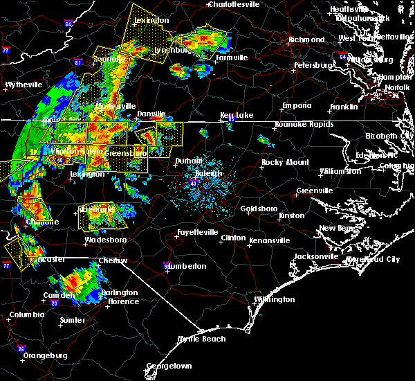 At 840 pm edt, doppler radar indicated a severe thunderstorm capable of producing quarter size hail and damaging winds in excess of 58 mph. this storm was located near baynes, or near jericho, and moving east at 30 mph. At 840 pm edt, doppler radar indicated a severe thunderstorm capable of producing quarter size hail and damaging winds in excess of 58 mph. this storm was located near baynes, or near jericho, and moving east at 30 mph.
|
| 7/13/2015 8:32 PM EDT |
 At 831 pm edt, doppler radar continued to indicate a severe thunderstorm capable of producing destructive winds to 70 mph. this storm was located over the pti airport or near greensboro, moving east at 30 mph. locations impacted include, greensboro, high point, burlington, graham, mebane, mcleansville, elon college, summerfield, gibsonville and stokesdale. At 831 pm edt, doppler radar continued to indicate a severe thunderstorm capable of producing destructive winds to 70 mph. this storm was located over the pti airport or near greensboro, moving east at 30 mph. locations impacted include, greensboro, high point, burlington, graham, mebane, mcleansville, elon college, summerfield, gibsonville and stokesdale.
|
| 7/13/2015 8:05 PM EDT |
 At 804 pm edt, doppler radar indicated a severe thunderstorm capable of producing quarter size hail and damaging winds in excess of 58 mph. this storm was located from gibsonville to near elon college, or 8 miles northwest of burlington, and moving east at 25 mph. an additional cluster of severe thunderstorms was 10 miles west of the pti airport moving into guilford county from the west. At 804 pm edt, doppler radar indicated a severe thunderstorm capable of producing quarter size hail and damaging winds in excess of 58 mph. this storm was located from gibsonville to near elon college, or 8 miles northwest of burlington, and moving east at 25 mph. an additional cluster of severe thunderstorms was 10 miles west of the pti airport moving into guilford county from the west.
|
| 7/8/2015 8:21 PM EDT |
 The severe thunderstorm warning for northwestern chatham and southwestern alamance counties will expire at 830 pm edt, the storm which prompted the warning has moved out of the area. therefore the warning will be allowed to expire. The severe thunderstorm warning for northwestern chatham and southwestern alamance counties will expire at 830 pm edt, the storm which prompted the warning has moved out of the area. therefore the warning will be allowed to expire.
|
| 7/8/2015 8:06 PM EDT |
 At 804 pm edt, a thunderstorm with damaging winds in excess of 58 mph was located 11 miles south of graham, moving east at 30 mph. locations impacted include, burlington, siler city, alamance, staley, hasty and lake mackintosh marina. At 804 pm edt, a thunderstorm with damaging winds in excess of 58 mph was located 11 miles south of graham, moving east at 30 mph. locations impacted include, burlington, siler city, alamance, staley, hasty and lake mackintosh marina.
|
| 7/8/2015 7:48 PM EDT |
 At 747 pm edt, doppler radar continued to indicate a severe thunderstorm capable of producing quarter size hail and damaging winds in excess of 58 mph. this storm was located 11 miles northwest of siler city, moving east at 30 mph. locations impacted include, burlington, siler city, liberty, ramseur, franklinville, alamance, staley, forest oaks, lake mackintosh marina and hasty. At 747 pm edt, doppler radar continued to indicate a severe thunderstorm capable of producing quarter size hail and damaging winds in excess of 58 mph. this storm was located 11 miles northwest of siler city, moving east at 30 mph. locations impacted include, burlington, siler city, liberty, ramseur, franklinville, alamance, staley, forest oaks, lake mackintosh marina and hasty.
|
| 7/8/2015 7:36 PM EDT |
 At 736 pm edt, doppler radar indicated a severe thunderstorm capable of producing quarter size hail and damaging winds in excess of 58 mph. this storm was located 8 miles northeast of randleman, and moving east at 30 mph. At 736 pm edt, doppler radar indicated a severe thunderstorm capable of producing quarter size hail and damaging winds in excess of 58 mph. this storm was located 8 miles northeast of randleman, and moving east at 30 mph.
|
| 7/1/2015 8:06 PM EDT |
 At 805 pm edt, doppler radar continued to indicate a broken line of severe thunderstorms capable of producing quarter size hail and damaging winds in excess of 58 mph. these storms were located along a line extending from 6 miles south of monroeton to 8 miles east of asheboro to 7 miles west of north carolina zoo, moving east at 20 mph. locations impacted include, greensboro, burlington, asheboro, graham, randleman, siler city, north carolina zoo, mebane, seagrove and mcleansville. At 805 pm edt, doppler radar continued to indicate a broken line of severe thunderstorms capable of producing quarter size hail and damaging winds in excess of 58 mph. these storms were located along a line extending from 6 miles south of monroeton to 8 miles east of asheboro to 7 miles west of north carolina zoo, moving east at 20 mph. locations impacted include, greensboro, burlington, asheboro, graham, randleman, siler city, north carolina zoo, mebane, seagrove and mcleansville.
|
| 7/1/2015 7:50 PM EDT |
 At 749 pm edt, doppler radar indicated a line of severe thunderstorms capable of producing quarter size hail and damaging winds in excess of 58 mph. these storms were located along a line extending from near greensboro to near randleman to 10 miles southwest of asheboro, and moving east at 25 mph. At 749 pm edt, doppler radar indicated a line of severe thunderstorms capable of producing quarter size hail and damaging winds in excess of 58 mph. these storms were located along a line extending from near greensboro to near randleman to 10 miles southwest of asheboro, and moving east at 25 mph.
|
| 6/30/2015 7:07 PM EDT |
 At 706 pm edt, doppler radar continued to indicate a severe thunderstorm capable of producing damaging winds in excess of 58 mph. this storm was located near pittsboro, moving northeast at 25 mph. locations impacted include, chapel hill, burlington, graham, hillsborough, carrboro, mebane, haw river, swepsonville, union ridge and cane creek reservoir. At 706 pm edt, doppler radar continued to indicate a severe thunderstorm capable of producing damaging winds in excess of 58 mph. this storm was located near pittsboro, moving northeast at 25 mph. locations impacted include, chapel hill, burlington, graham, hillsborough, carrboro, mebane, haw river, swepsonville, union ridge and cane creek reservoir.
|
| 6/30/2015 6:33 PM EDT |
 At 632 pm edt, doppler radar continued to indicate a severe thunderstorm capable of producing damaging winds in excess of 58 mph. this storm was located near jericho, moving northeast at 35 mph. locations impacted include, burlington, graham, mebane, elon college, gibsonville, haw river, alamance, lake mackintosh marina, union ridge and altamahaw. At 632 pm edt, doppler radar continued to indicate a severe thunderstorm capable of producing damaging winds in excess of 58 mph. this storm was located near jericho, moving northeast at 35 mph. locations impacted include, burlington, graham, mebane, elon college, gibsonville, haw river, alamance, lake mackintosh marina, union ridge and altamahaw.
|
| 6/30/2015 6:33 PM EDT |
 At 632 pm edt, doppler radar indicated a severe thunderstorm capable of producing damaging winds in excess of 58 mph. this storm was located near siler city, and moving northeast at 25 mph. At 632 pm edt, doppler radar indicated a severe thunderstorm capable of producing damaging winds in excess of 58 mph. this storm was located near siler city, and moving northeast at 25 mph.
|
| 6/30/2015 6:11 PM EDT |
 At 610 pm edt, doppler radar continued to indicate a line of severe thunderstorms capable of producing damaging winds in excess of 58 mph. these storms were located along a line extending from near monroeton to 7 miles south of burlington, moving northeast at 35 mph. these storms have a history of producing wind damage. locations impacted include, greensboro, burlington, graham, mebane, mcleansville, elon college, gibsonville, pleasant garden, haw river and swepsonville. At 610 pm edt, doppler radar continued to indicate a line of severe thunderstorms capable of producing damaging winds in excess of 58 mph. these storms were located along a line extending from near monroeton to 7 miles south of burlington, moving northeast at 35 mph. these storms have a history of producing wind damage. locations impacted include, greensboro, burlington, graham, mebane, mcleansville, elon college, gibsonville, pleasant garden, haw river and swepsonville.
|
| 6/30/2015 5:47 PM EDT |
 At 547 pm edt, doppler radar indicated a severe thunderstorm capable of producing damaging winds in excess of 58 mph. this storm was located near greensboro, and moving northeast at 40 mph. At 547 pm edt, doppler radar indicated a severe thunderstorm capable of producing damaging winds in excess of 58 mph. this storm was located near greensboro, and moving northeast at 40 mph.
|
| 6/25/2015 6:34 PM EDT |
 At 634 pm edt, doppler radar indicated a severe thunderstorm capable of producing quarter size hail and damaging winds in excess of 58 mph. this storm was located near baynes, or near jericho, and moving east at 25 mph. At 634 pm edt, doppler radar indicated a severe thunderstorm capable of producing quarter size hail and damaging winds in excess of 58 mph. this storm was located near baynes, or near jericho, and moving east at 25 mph.
|
| 6/20/2015 7:21 PM EDT |
 The severe thunderstorm warning for orange, northeastern guilford and alamance counties will expire at 730 pm edt, the storm which prompted the warning has moved out of the area. therefore the warning will be allowed to expire. The severe thunderstorm warning for orange, northeastern guilford and alamance counties will expire at 730 pm edt, the storm which prompted the warning has moved out of the area. therefore the warning will be allowed to expire.
|
| 6/20/2015 6:59 PM EDT |
 At 659 pm edt, doppler radar continued to indicate a severe thunderstorm capable of producing damaging winds in excess of 58 mph. this storm was located near prospect hill, moving northeast at 55 mph. locations impacted include, burlington, graham, hillsborough, mebane, elon college, gibsonville, haw river, swepsonville, union ridge and cane creek reservoir. At 659 pm edt, doppler radar continued to indicate a severe thunderstorm capable of producing damaging winds in excess of 58 mph. this storm was located near prospect hill, moving northeast at 55 mph. locations impacted include, burlington, graham, hillsborough, mebane, elon college, gibsonville, haw river, swepsonville, union ridge and cane creek reservoir.
|
| 6/20/2015 6:48 PM EDT |
 At 648 pm edt, doppler radar indicated a severe thunderstorm capable of producing damaging winds in excess of 58 mph. this storm was located over mebane, or near graham, and moving northeast at 60 mph. At 648 pm edt, doppler radar indicated a severe thunderstorm capable of producing damaging winds in excess of 58 mph. this storm was located over mebane, or near graham, and moving northeast at 60 mph.
|
| 5/27/2014 3:23 PM EDT | Tree down near short street in alamance county NC, 3.3 miles WSW of Burlington, NC |
| 1/30/2013 9:52 PM EST | Tree down at university drive and huffman mill road in alamance county NC, 1.9 miles ENE of Burlington, NC |
| 7/27/2012 5:50 PM EDT | Tree down in alamance county NC, 5.2 miles SW of Burlington, NC |
| 7/23/2012 5:30 PM EDT | Quarter sized hail reported 2.9 miles WNW of Burlington, NC, nssl shave program reports quarter size hail near burlington |
| 7/20/2012 5:25 PM EDT | Alamance co 911 received report of tree down on power lines at new jersey ave in bulingto in alamance county NC, 4.4 miles WSW of Burlington, NC |
| 3/24/2012 7:49 PM EDT | Half Dollar sized hail reported 1.5 miles W of Burlington, NC, half dollar size hail in burlington |
| 1/1/0001 12:00 AM | Tree down on house in alamance county NC, 2.9 miles WNW of Burlington, NC |
| 1/1/0001 12:00 AM | Power lines blown down in alamance county NC, 2.6 miles SW of Burlington, NC |
| 1/1/0001 12:00 AM | Quarter sized hail reported 14.1 miles SW of Burlington, NC, quarter inch hail |
| 1/1/0001 12:00 AM | Golf Ball sized hail reported 1.5 miles W of Burlington, NC, multiple reports of golf ball size hail in burlington |
| 1/1/0001 12:00 AM | Quarter sized hail reported 1.5 miles W of Burlington, NC |
Hail Maps for Burlington, NC
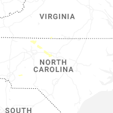
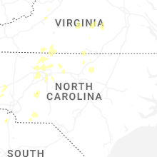


Connect with Interactive Hail Maps