

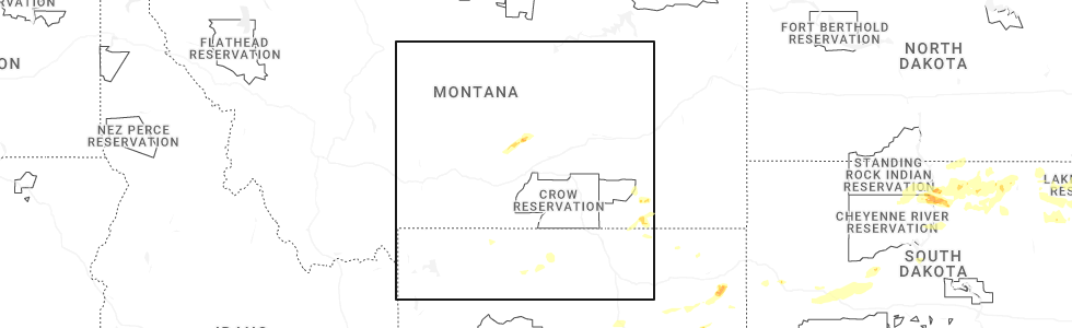
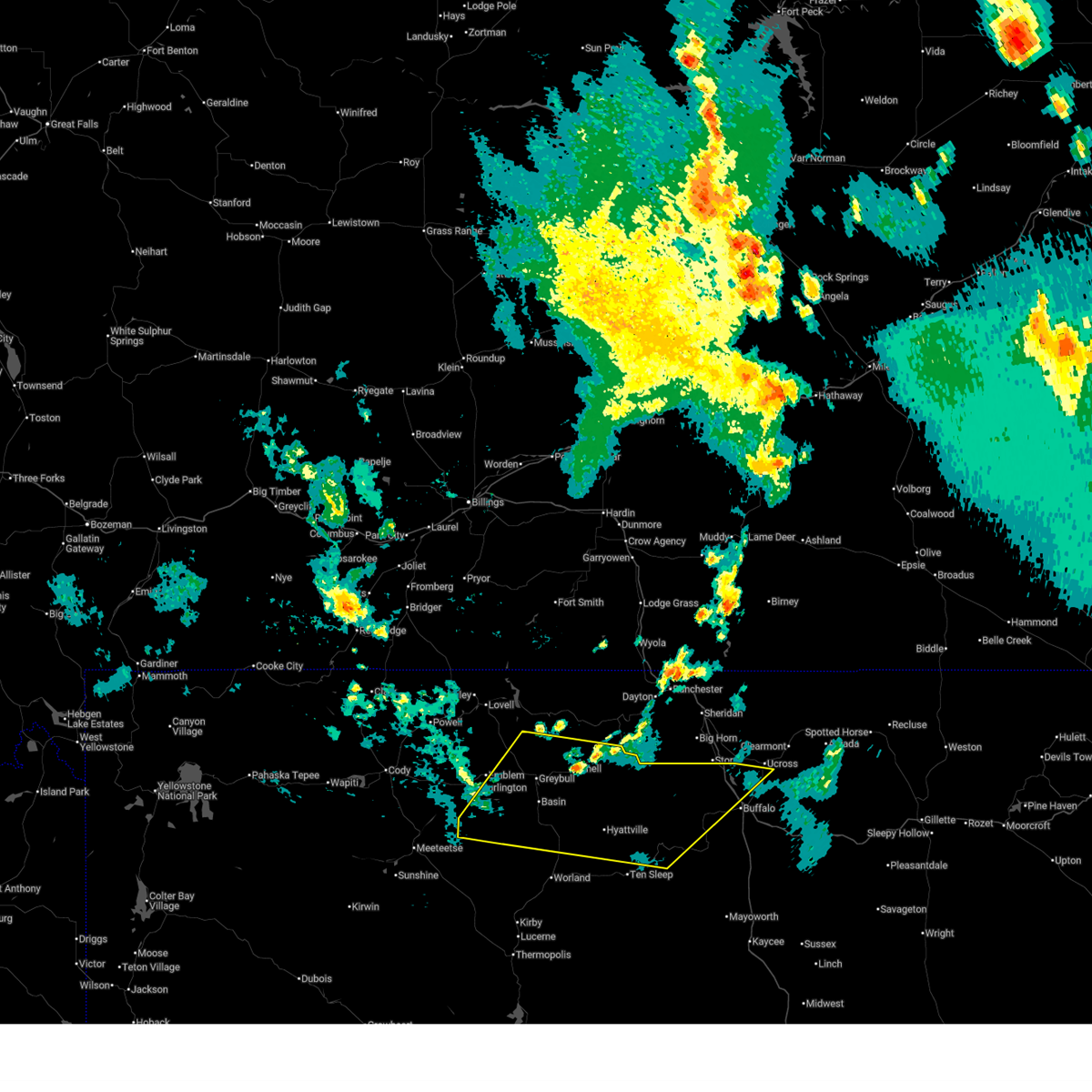
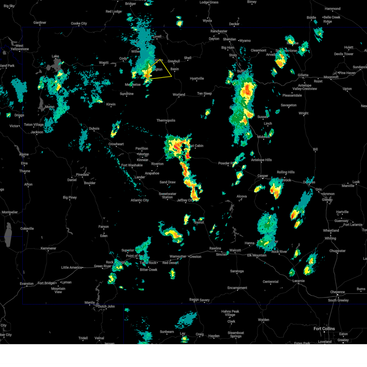
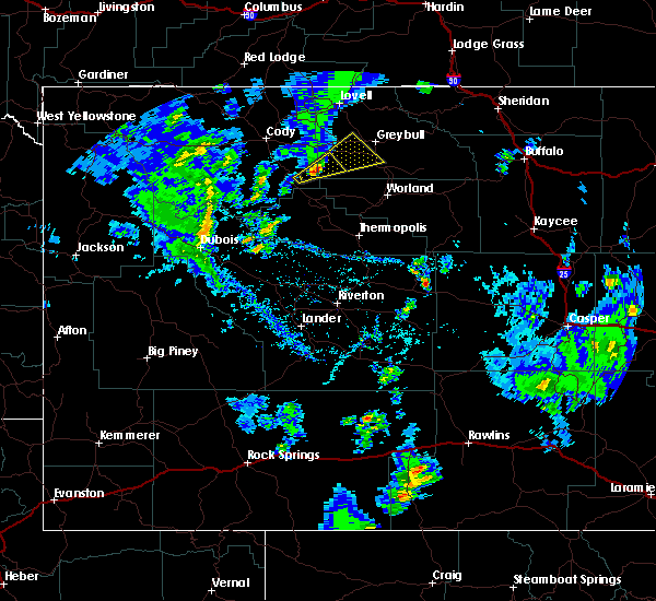
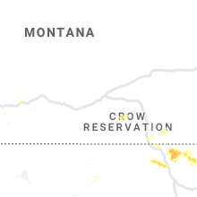
Hail Map for Burlington, WY
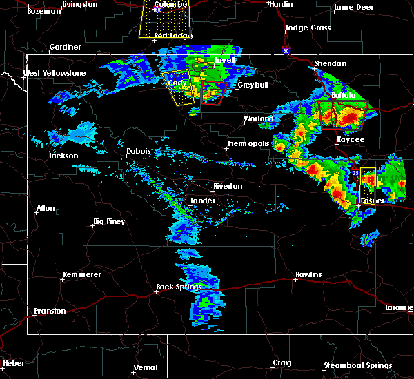
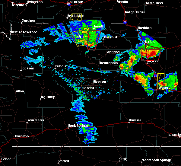
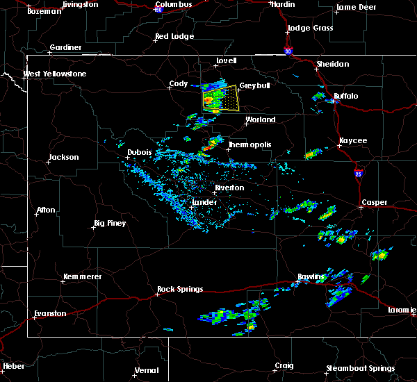
The Burlington, WY area has had 3 reports of on-the-ground hail by trained spotters, and has been under severe weather warnings 1 time during the past 12 months. Doppler radar has detected hail at or near Burlington, WY on 13 occasions, including 1 occasion during the past year.
| Name: | Burlington, WY |
| Where Located: | 92.3 miles S of Billings, MT |
| Map: | Google Map for Burlington, WY |
| Population: | 288 |
| Housing Units: | 95 |
| More Info: | Search Google for Burlington, WY |
0
The Top Recent Hail Date for Burlington, WY is Tuesday, July 7, 2026 (8th out of 13)
Hail and Wind Damage Spotted near Burlington, WY
| Date / Time | Report Details |
|---|---|
| 6/27/2026 5:55 PM MDT |
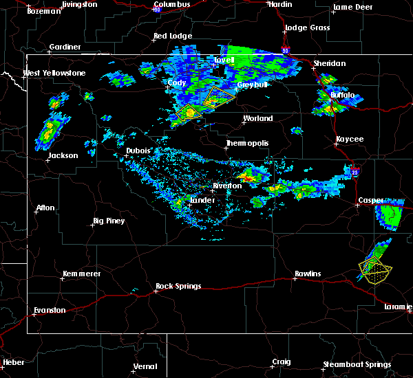
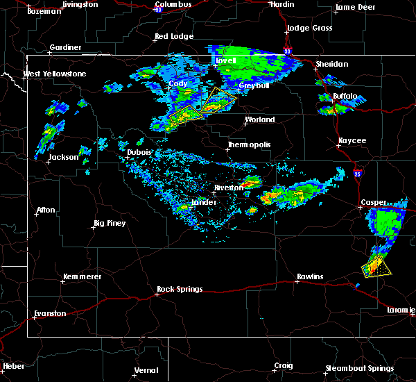
 Svrriw the national weather service in riverton has issued a * severe thunderstorm warning for, northwestern johnson county in north central wyoming, big horn county in central wyoming, northeastern washakie county in central wyoming, * until 630 pm mdt. * at 554 pm mdt, severe thunderstorms were located along a line extending from 15 miles east of meeteetse rim to near tensleep canyon, moving northeast at 60 mph (radar indicated. at 536pm, 66 mph was reported at worland airport). Hazards include 70 mph wind gusts. Expect considerable tree damage. damage is likely to mobile homes, roofs, and outbuildings. severe thunderstorms will be near, manderson, hyattville, and meadowlark lake around 600 pm mdt. basin, otto, paintrock canyon, and medicine lodge archaeological site around 605 pm mdt. other locations in the path of these severe thunderstorms include greybull, cloud peak, upper medicine lodge lake and shell. This includes interstate 90 between mile markers 42 and 55. Svrriw the national weather service in riverton has issued a * severe thunderstorm warning for, northwestern johnson county in north central wyoming, big horn county in central wyoming, northeastern washakie county in central wyoming, * until 630 pm mdt. * at 554 pm mdt, severe thunderstorms were located along a line extending from 15 miles east of meeteetse rim to near tensleep canyon, moving northeast at 60 mph (radar indicated. at 536pm, 66 mph was reported at worland airport). Hazards include 70 mph wind gusts. Expect considerable tree damage. damage is likely to mobile homes, roofs, and outbuildings. severe thunderstorms will be near, manderson, hyattville, and meadowlark lake around 600 pm mdt. basin, otto, paintrock canyon, and medicine lodge archaeological site around 605 pm mdt. other locations in the path of these severe thunderstorms include greybull, cloud peak, upper medicine lodge lake and shell. This includes interstate 90 between mile markers 42 and 55.
|
| 5/25/2023 3:15 PM MDT |
 At 314 pm mdt, a severe thunderstorm was located 14 miles southwest of otto, or 19 miles northeast of meeteetse, moving northeast at 20 mph (radar indicated. this storm previously produced up to two inch hail). Hazards include quarter size hail. damage to vehicles is expected At 314 pm mdt, a severe thunderstorm was located 14 miles southwest of otto, or 19 miles northeast of meeteetse, moving northeast at 20 mph (radar indicated. this storm previously produced up to two inch hail). Hazards include quarter size hail. damage to vehicles is expected
|
| 7/24/2022 10:07 PM MDT |
 The severe thunderstorm warning for western big horn and northeastern park counties will expire at 1015 pm mdt, the storms which prompted the warning have weakened below severe limits, and have exited the warned area. therefore, the warning will be allowed to expire. however gusty winds are still possible with these thunderstorms. to report severe weather, contact your nearest law enforcement agency. they will relay your report to the national weather service riverton. The severe thunderstorm warning for western big horn and northeastern park counties will expire at 1015 pm mdt, the storms which prompted the warning have weakened below severe limits, and have exited the warned area. therefore, the warning will be allowed to expire. however gusty winds are still possible with these thunderstorms. to report severe weather, contact your nearest law enforcement agency. they will relay your report to the national weather service riverton.
|
| 7/24/2022 9:22 PM MDT |
 At 920 pm mdt, severe thunderstorms were located along a line extending from 8 miles northwest of shell to 8 miles south of ralston, moving southeast at 40 mph (radar indicated). Hazards include 70 mph wind gusts. the powell airport at 835 pm measured a wind gust of 68 mph. Expect considerable tree damage. damage is likely to mobile homes, roofs, and outbuildings. some power outages are likely. locations impacted include, shell. thunderstorm damage threat, considerable hail threat, radar indicated max hail size, <. 75 in wind threat, observed max wind gust, 70 mph. At 920 pm mdt, severe thunderstorms were located along a line extending from 8 miles northwest of shell to 8 miles south of ralston, moving southeast at 40 mph (radar indicated). Hazards include 70 mph wind gusts. the powell airport at 835 pm measured a wind gust of 68 mph. Expect considerable tree damage. damage is likely to mobile homes, roofs, and outbuildings. some power outages are likely. locations impacted include, shell. thunderstorm damage threat, considerable hail threat, radar indicated max hail size, <. 75 in wind threat, observed max wind gust, 70 mph.
|
| 7/24/2022 8:48 PM MDT |
 At 846 pm mdt, severe thunderstorm outflow winds from montana are pushing into the northern bighorn basin. this outflow was progressing south and southeast around 40 mph (radar indicated). Hazards include 70 mph wind gusts. Expect considerable tree damage. damage is likely to mobile homes, roofs, and outbuildings. severe thunderstorms will be near, horseshoe bend, bighorn lake and crooked creek natural area around 850 pm mdt. other locations in the path of these severe thunderstorms include ralston, powell and shell. thunderstorm damage threat, considerable hail threat, radar indicated max hail size, <. 75 in wind threat, radar indicated max wind gust, 70 mph. At 846 pm mdt, severe thunderstorm outflow winds from montana are pushing into the northern bighorn basin. this outflow was progressing south and southeast around 40 mph (radar indicated). Hazards include 70 mph wind gusts. Expect considerable tree damage. damage is likely to mobile homes, roofs, and outbuildings. severe thunderstorms will be near, horseshoe bend, bighorn lake and crooked creek natural area around 850 pm mdt. other locations in the path of these severe thunderstorms include ralston, powell and shell. thunderstorm damage threat, considerable hail threat, radar indicated max hail size, <. 75 in wind threat, radar indicated max wind gust, 70 mph.
|
| 7/8/2019 2:27 PM MDT |
 At 227 pm mdt, a severe thunderstorm was located 14 miles southwest of otto, which is 20 miles northeast of meeteetse, moving northeast at 20 mph (radar indicated). Hazards include 60 mph wind gusts and nickel size hail. Expect damage to roofs, siding, and trees. this severe thunderstorm will be near, otto around 305 pm mdt. Other locations impacted by this severe thunderstorm include big horn county fairgrounds and burlington. At 227 pm mdt, a severe thunderstorm was located 14 miles southwest of otto, which is 20 miles northeast of meeteetse, moving northeast at 20 mph (radar indicated). Hazards include 60 mph wind gusts and nickel size hail. Expect damage to roofs, siding, and trees. this severe thunderstorm will be near, otto around 305 pm mdt. Other locations impacted by this severe thunderstorm include big horn county fairgrounds and burlington.
|
| 5/16/2019 7:53 PM MDT |
 At 752 pm mdt, severe thunderstorms were located along a line extending from near manderson to 6 miles southwest of basin to 13 miles southwest of otto, moving north at 40 mph (radar indicated). Hazards include 60 mph wind gusts and penny size hail. Expect damage to roofs, siding, and trees. these severe storms will be near, basin around 800 pm mdt. otto around 805 pm mdt. greybull around 815 pm mdt. Other locations impacted by these severe thunderstorms include greybull south big horn county airport, emblem, burlington and big horn county fairgrounds. At 752 pm mdt, severe thunderstorms were located along a line extending from near manderson to 6 miles southwest of basin to 13 miles southwest of otto, moving north at 40 mph (radar indicated). Hazards include 60 mph wind gusts and penny size hail. Expect damage to roofs, siding, and trees. these severe storms will be near, basin around 800 pm mdt. otto around 805 pm mdt. greybull around 815 pm mdt. Other locations impacted by these severe thunderstorms include greybull south big horn county airport, emblem, burlington and big horn county fairgrounds.
|
| 5/16/2019 7:39 PM MDT |
 The national weather service in riverton has issued a * severe thunderstorm warning for. southwestern big horn county in central wyoming. northwestern washakie county in central wyoming. until 815 pm mdt. At 737 pm mdt, severe thunderstorms were located along a line. The national weather service in riverton has issued a * severe thunderstorm warning for. southwestern big horn county in central wyoming. northwestern washakie county in central wyoming. until 815 pm mdt. At 737 pm mdt, severe thunderstorms were located along a line.
|
| 8/2/2018 3:18 PM MDT |
 At 317 pm mdt, a severe thunderstorm was located 8 miles north of otto, or 12 miles west of greybull, moving east southeast at 30 mph (radar indicated). Hazards include 70 mph wind gusts and penny size hail. Expect considerable tree damage. damage is likely to mobile homes, roofs, and outbuildings. this severe storm will be near, greybull around 340 pm mdt. basin and the bighorn county fair around 345 pm mdt. Other locations impacted by this severe thunderstorm include greybull south big horn county airport, greybull burlington northern santa fe railroad yard, midway golf course, burlington and emblem. At 317 pm mdt, a severe thunderstorm was located 8 miles north of otto, or 12 miles west of greybull, moving east southeast at 30 mph (radar indicated). Hazards include 70 mph wind gusts and penny size hail. Expect considerable tree damage. damage is likely to mobile homes, roofs, and outbuildings. this severe storm will be near, greybull around 340 pm mdt. basin and the bighorn county fair around 345 pm mdt. Other locations impacted by this severe thunderstorm include greybull south big horn county airport, greybull burlington northern santa fe railroad yard, midway golf course, burlington and emblem.
|
| 8/2/2018 3:02 PM MDT |
 At 301 pm mdt, a severe thunderstorm was located 15 miles south of garland, or 16 miles southeast of powell, moving east southeast at 30 mph (radar indicated). Hazards include 70 mph wind gusts and half inch to nickel size hail. Expect considerable tree damage. damage is likely to mobile homes, roofs, and outbuildings. this severe thunderstorm will be near, otto around 335 pm mdt. greybull and basin around 345 pm mdt. Other locations impacted by this severe thunderstorm include greybull south big horn county airport, greybull burlington northern santa fe railroad yard, midway golf course, burlington and emblem. At 301 pm mdt, a severe thunderstorm was located 15 miles south of garland, or 16 miles southeast of powell, moving east southeast at 30 mph (radar indicated). Hazards include 70 mph wind gusts and half inch to nickel size hail. Expect considerable tree damage. damage is likely to mobile homes, roofs, and outbuildings. this severe thunderstorm will be near, otto around 335 pm mdt. greybull and basin around 345 pm mdt. Other locations impacted by this severe thunderstorm include greybull south big horn county airport, greybull burlington northern santa fe railroad yard, midway golf course, burlington and emblem.
|
| 6/6/2018 5:04 PM MDT |
 At 503 pm mdt, a severe thunderstorm was located 11 miles southwest of otto, or 20 miles west of basin, moving northeast at 20 mph (radar indicated). Hazards include quarter size hail. Damage to vehicles is expected. this severe storm will be near, otto around 530 pm mdt. Other locations impacted by this severe thunderstorm include burlington. At 503 pm mdt, a severe thunderstorm was located 11 miles southwest of otto, or 20 miles west of basin, moving northeast at 20 mph (radar indicated). Hazards include quarter size hail. Damage to vehicles is expected. this severe storm will be near, otto around 530 pm mdt. Other locations impacted by this severe thunderstorm include burlington.
|
| 6/6/2018 4:49 PM MDT |
 The tornado warning has been allowed to expire for this storm. * at 447 pm mdt, a severe thunderstorm was located 16 miles southwest of otto, or 19 miles east of meeteetse, moving northeast at 25 mph (radar indicated). Hazards include quarter size hail. Damage to vehicles is expected. this severe thunderstorm will be near, otto around 530 pm mdt. Other locations impacted by this severe thunderstorm include burlington. The tornado warning has been allowed to expire for this storm. * at 447 pm mdt, a severe thunderstorm was located 16 miles southwest of otto, or 19 miles east of meeteetse, moving northeast at 25 mph (radar indicated). Hazards include quarter size hail. Damage to vehicles is expected. this severe thunderstorm will be near, otto around 530 pm mdt. Other locations impacted by this severe thunderstorm include burlington.
|
| 6/6/2018 3:32 PM MDT |
 At 332 pm mdt, a severe thunderstorm was located 16 miles northeast of meeteetse rim, or 19 miles east of cody, moving northeast at 20 mph (radar indicated). Hazards include 60 mph wind gusts and quarter size hail. Hail damage to vehicles is expected. expect wind damage to roofs, siding, and trees. Locations impacted include, burlington. At 332 pm mdt, a severe thunderstorm was located 16 miles northeast of meeteetse rim, or 19 miles east of cody, moving northeast at 20 mph (radar indicated). Hazards include 60 mph wind gusts and quarter size hail. Hail damage to vehicles is expected. expect wind damage to roofs, siding, and trees. Locations impacted include, burlington.
|
| 6/6/2018 3:18 PM MDT |
 At 317 pm mdt, a severe thunderstorm was located 11 miles northeast of meeteetse rim, or 15 miles southeast of cody, moving northeast at 20 mph (radar indicated). Hazards include 60 mph wind gusts and quarter size hail. Hail damage to vehicles is expected. expect wind damage to roofs, siding, and trees. This severe thunderstorm will remain over mainly rural areas of west central big horn and east central park counties, including the following locations, burlington. At 317 pm mdt, a severe thunderstorm was located 11 miles northeast of meeteetse rim, or 15 miles southeast of cody, moving northeast at 20 mph (radar indicated). Hazards include 60 mph wind gusts and quarter size hail. Hail damage to vehicles is expected. expect wind damage to roofs, siding, and trees. This severe thunderstorm will remain over mainly rural areas of west central big horn and east central park counties, including the following locations, burlington.
|
| 5/27/2018 6:13 PM MDT |
 At 612 pm mdt, severe thunderstorms were located along a line extending from near bald mountain to near byron to just north of meeteetse rim, moving north at 40 mph (automated weather station). Hazards include 60 to 70 mph wind gusts. Expect considerable tree damage. damage is likely to mobile homes, roofs, and outbuildings. locations impacted include lovell, big horn canyon recreation area, cody, meeteetse rim, garland, and powell. this line of strong wind has a history of producing wind damage to trees and power lines. An automated station along state highway 120 north of meeteetse measured a 66 mph wind gust around 600 pm. At 612 pm mdt, severe thunderstorms were located along a line extending from near bald mountain to near byron to just north of meeteetse rim, moving north at 40 mph (automated weather station). Hazards include 60 to 70 mph wind gusts. Expect considerable tree damage. damage is likely to mobile homes, roofs, and outbuildings. locations impacted include lovell, big horn canyon recreation area, cody, meeteetse rim, garland, and powell. this line of strong wind has a history of producing wind damage to trees and power lines. An automated station along state highway 120 north of meeteetse measured a 66 mph wind gust around 600 pm.
|
| 5/27/2018 6:06 PM MDT |
 At 604 pm mdt, severe thunderstorms were located along a line extending from near granite pass in the bighorn mountains to 12 miles south of lovell to near meeteetse, moving north at 40 mph (radar indicated). Hazards include 60 to 70 mph wind gusts. Expect considerable tree damage. damage is likely to mobile homes, roofs, and outbuildings. locations impacted include lovell, big horn canyon recreation area, cody, meeteetse rim, garland, and powell. This line of strong wind has a history of producing wind damage to trees and power lines. At 604 pm mdt, severe thunderstorms were located along a line extending from near granite pass in the bighorn mountains to 12 miles south of lovell to near meeteetse, moving north at 40 mph (radar indicated). Hazards include 60 to 70 mph wind gusts. Expect considerable tree damage. damage is likely to mobile homes, roofs, and outbuildings. locations impacted include lovell, big horn canyon recreation area, cody, meeteetse rim, garland, and powell. This line of strong wind has a history of producing wind damage to trees and power lines.
|
| 5/27/2018 5:43 PM MDT |
 At 541 pm mdt, severe thunderstorms were located along a line extending from near shell falls to emblem to near meeteetse rim, moving north at 40 mph (radar indicated). Hazards include 60 to 70 mph wind gusts. Expect considerable tree damage. damage is likely to mobile homes, roofs, and outbuildings. severe thunderstorms will be near, shell falls and shell canyon around 550 pm mdt. eastern cody and lovell around 615 pm mdt. bighorn lake around 625 pm mdt. Ralston and horseshoe bend around 630 pm mdt. At 541 pm mdt, severe thunderstorms were located along a line extending from near shell falls to emblem to near meeteetse rim, moving north at 40 mph (radar indicated). Hazards include 60 to 70 mph wind gusts. Expect considerable tree damage. damage is likely to mobile homes, roofs, and outbuildings. severe thunderstorms will be near, shell falls and shell canyon around 550 pm mdt. eastern cody and lovell around 615 pm mdt. bighorn lake around 625 pm mdt. Ralston and horseshoe bend around 630 pm mdt.
|
| 6/27/2017 7:55 AM MDT |
 The severe thunderstorm warning for hot springs, southwestern big horn, northwestern washakie and southeastern park counties will expire at 200 pm mdt, the storms which prompted the warning have weakened below severe limits, and no longer pose an immediate threat to life or property. therefore the warning will be allowed to expire. however strong winds gusts of 50 to 55 mph are still expected with these thunderstorms. The severe thunderstorm warning for hot springs, southwestern big horn, northwestern washakie and southeastern park counties will expire at 200 pm mdt, the storms which prompted the warning have weakened below severe limits, and no longer pose an immediate threat to life or property. therefore the warning will be allowed to expire. however strong winds gusts of 50 to 55 mph are still expected with these thunderstorms.
|
| 6/27/2017 7:33 AM MDT |
 At 131 pm mdt, severe thunderstorms were located along a line extending from 12 miles south of garland to near hamilton dome, moving east at 40 mph (radar indicated). Hazards include 60 mph wind gusts and half inch size hail. Expect damage to roofs, siding, and trees. these severe storms will be near, hamilton dome and legend rock state petroglyph site around 135 pm mdt. Thermopolis, lucerne, east thermopolis and hot springs state park around 200 pm mdt. At 131 pm mdt, severe thunderstorms were located along a line extending from 12 miles south of garland to near hamilton dome, moving east at 40 mph (radar indicated). Hazards include 60 mph wind gusts and half inch size hail. Expect damage to roofs, siding, and trees. these severe storms will be near, hamilton dome and legend rock state petroglyph site around 135 pm mdt. Thermopolis, lucerne, east thermopolis and hot springs state park around 200 pm mdt.
|
| 6/27/2017 7:19 AM MDT |
 At 118 pm mdt, severe thunderstorms were located along a line extending from 6 miles southeast of ralston to near anchor dam, moving east at 30 mph (radar indicated). Hazards include 60 mph wind gusts. Expect damage to roofs, siding, and trees. severe thunderstorms will be near, legend rock state petroglyph site around 135 pm mdt. Hamilton dome around 140 pm mdt. At 118 pm mdt, severe thunderstorms were located along a line extending from 6 miles southeast of ralston to near anchor dam, moving east at 30 mph (radar indicated). Hazards include 60 mph wind gusts. Expect damage to roofs, siding, and trees. severe thunderstorms will be near, legend rock state petroglyph site around 135 pm mdt. Hamilton dome around 140 pm mdt.
|
| 6/12/2017 6:32 PM MDT |
 At 630 pm mdt, a confirmed tornado was located 7 miles west of otto, which is 18 miles west of basin, moving north at 45 mph (weather spotters confirmed tornado). Hazards include damaging tornado and ping pong ball size hail. Flying debris will be dangerous to those caught without shelter. mobile homes will be damaged or destroyed. damage to roofs, windows, and vehicles will occur. tree damage is likely. this tornado will be near, otto around 635 pm mdt. Other locations impacted by this tornadic thunderstorm include emblem and burlington. At 630 pm mdt, a confirmed tornado was located 7 miles west of otto, which is 18 miles west of basin, moving north at 45 mph (weather spotters confirmed tornado). Hazards include damaging tornado and ping pong ball size hail. Flying debris will be dangerous to those caught without shelter. mobile homes will be damaged or destroyed. damage to roofs, windows, and vehicles will occur. tree damage is likely. this tornado will be near, otto around 635 pm mdt. Other locations impacted by this tornadic thunderstorm include emblem and burlington.
|
| 6/12/2017 6:19 PM MDT |
 At 618 pm mdt, a confirmed tornado was located 14 miles southwest of otto, which is 21 miles east of meeteetse, moving north at 45 mph (weather spotters confirmed tornado). Hazards include damaging tornado and ping pong ball size hail. Flying debris will be dangerous to those caught without shelter. mobile homes will be damaged or destroyed. damage to roofs, windows, and vehicles will occur. tree damage is likely. the tornado will be near, otto around 635 pm mdt. Other locations impacted by this tornadic thunderstorm include rocky mountain high school, emblem and burlington. At 618 pm mdt, a confirmed tornado was located 14 miles southwest of otto, which is 21 miles east of meeteetse, moving north at 45 mph (weather spotters confirmed tornado). Hazards include damaging tornado and ping pong ball size hail. Flying debris will be dangerous to those caught without shelter. mobile homes will be damaged or destroyed. damage to roofs, windows, and vehicles will occur. tree damage is likely. the tornado will be near, otto around 635 pm mdt. Other locations impacted by this tornadic thunderstorm include rocky mountain high school, emblem and burlington.
|
| 6/5/2017 2:31 PM MDT |
 At 231 pm mdt, a severe thunderstorm was located over otto, which is 10 miles west of basin, moving east at 30 mph (radar indicated). Hazards include 60 mph wind gusts and quarter size hail. Hail damage to vehicles is expected. expect wind damage to roofs, siding, and trees. This severe thunderstorm will remain over mainly rural areas of southwestern big horn county, including the following locations: burlington and greybull south big horn county airport. At 231 pm mdt, a severe thunderstorm was located over otto, which is 10 miles west of basin, moving east at 30 mph (radar indicated). Hazards include 60 mph wind gusts and quarter size hail. Hail damage to vehicles is expected. expect wind damage to roofs, siding, and trees. This severe thunderstorm will remain over mainly rural areas of southwestern big horn county, including the following locations: burlington and greybull south big horn county airport.
|
| 6/5/2017 2:14 PM MDT |
 At 214 pm mdt, a severe thunderstorm was located 9 miles west of otto, which is 20 miles west of basin, moving east at 20 mph (radar indicated). Hazards include 60 mph wind gusts and quarter size hail. Hail damage to vehicles is expected. expect wind damage to roofs, siding, and trees. this severe thunderstorm will be near, otto around 245 pm mdt. Other locations impacted by this severe thunderstorm include burlington and greybull south big horn county airport. At 214 pm mdt, a severe thunderstorm was located 9 miles west of otto, which is 20 miles west of basin, moving east at 20 mph (radar indicated). Hazards include 60 mph wind gusts and quarter size hail. Hail damage to vehicles is expected. expect wind damage to roofs, siding, and trees. this severe thunderstorm will be near, otto around 245 pm mdt. Other locations impacted by this severe thunderstorm include burlington and greybull south big horn county airport.
|
| 7/27/2015 3:53 PM MDT |
 At 353 pm mdt, a severe thunderstorm was located 8 miles north of otto, which is 11 miles west of greybull, moving northeast at 45 mph (radar indicated). Hazards include golf ball size hail and 70 mph wind gusts. golf ball sized hail has been reported with this storm. People and animals outdoors will be injured. expect hail damage to roofs, siding, windows and vehicles. expect considerable tree damage. wind damage is also likely to mobile homes, roofs and outbuildings. this severe storm will be near, greybull around 405 pm mdt. other locations impacted by this severe thunderstorm include burlington, basin south big horn county hospital, midway golf course, greybull south big horn county airport, greybull public schools, five springs campground, greybull burlington northern santa fe railroad yard, emblem, green oasis campground and greybull high school. At 353 pm mdt, a severe thunderstorm was located 8 miles north of otto, which is 11 miles west of greybull, moving northeast at 45 mph (radar indicated). Hazards include golf ball size hail and 70 mph wind gusts. golf ball sized hail has been reported with this storm. People and animals outdoors will be injured. expect hail damage to roofs, siding, windows and vehicles. expect considerable tree damage. wind damage is also likely to mobile homes, roofs and outbuildings. this severe storm will be near, greybull around 405 pm mdt. other locations impacted by this severe thunderstorm include burlington, basin south big horn county hospital, midway golf course, greybull south big horn county airport, greybull public schools, five springs campground, greybull burlington northern santa fe railroad yard, emblem, green oasis campground and greybull high school.
|
| 7/27/2015 3:50 PM MDT | Golf Ball sized hail reported 4.1 miles SSW of Burlington, WY |
| 7/27/2015 3:48 PM MDT |
 At 348 pm mdt, a severe thunderstorm was located 7 miles northwest of otto, which is 14 miles west of greybull, moving northeast at 45 mph (radar indicated). Hazards include 60 mph wind gusts and quarter size hail. Hail damage to vehicles is expected. expect wind damage to roofs, siding and trees. this severe thunderstorm will be near, greybull around 405 pm mdt. Other locations impacted by this severe thunderstorm include burlington, basin south big horn county hospital, midway golf course, greybull south big horn county airport, greybull public schools, five springs campground, greybull burlington northern santa fe railroad yard, emblem, green oasis campground and greybull high school. At 348 pm mdt, a severe thunderstorm was located 7 miles northwest of otto, which is 14 miles west of greybull, moving northeast at 45 mph (radar indicated). Hazards include 60 mph wind gusts and quarter size hail. Hail damage to vehicles is expected. expect wind damage to roofs, siding and trees. this severe thunderstorm will be near, greybull around 405 pm mdt. Other locations impacted by this severe thunderstorm include burlington, basin south big horn county hospital, midway golf course, greybull south big horn county airport, greybull public schools, five springs campground, greybull burlington northern santa fe railroad yard, emblem, green oasis campground and greybull high school.
|
| 7/27/2015 3:44 PM MDT | Quarter sized hail reported 0.2 miles SW of Burlington, WY |
| 6/12/2013 5:09 PM MDT | Quarter sized hail reported 0.2 miles SW of Burlington, WY |
Hail Maps for Burlington, WY


Connect with Interactive Hail Maps