

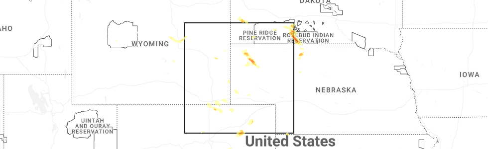
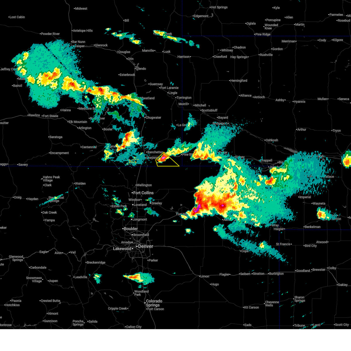
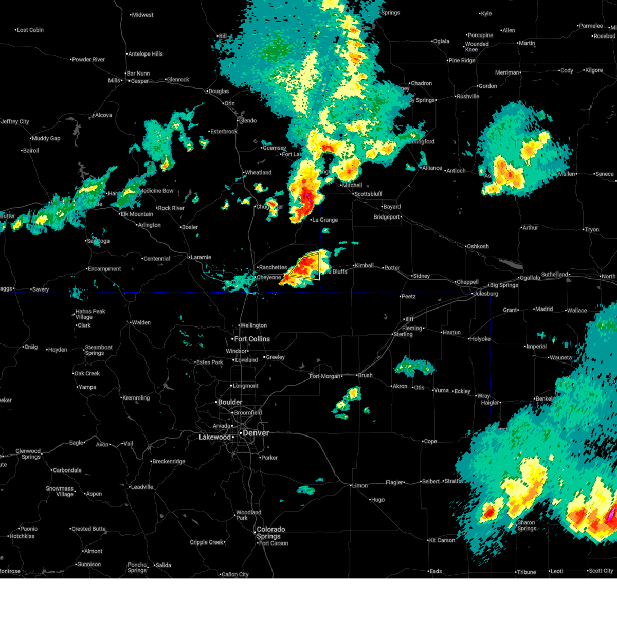
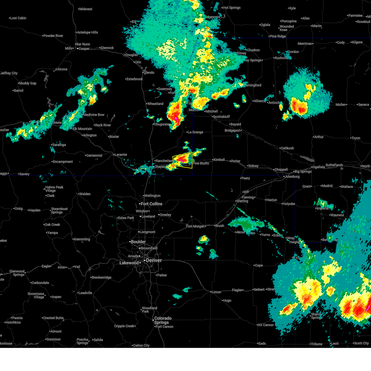
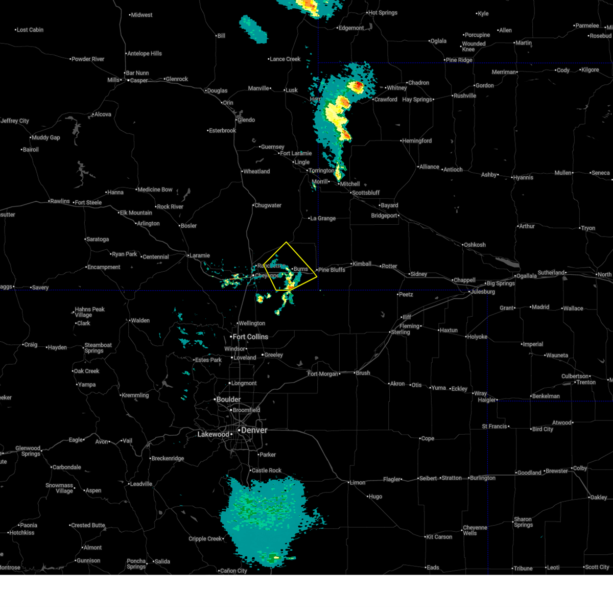
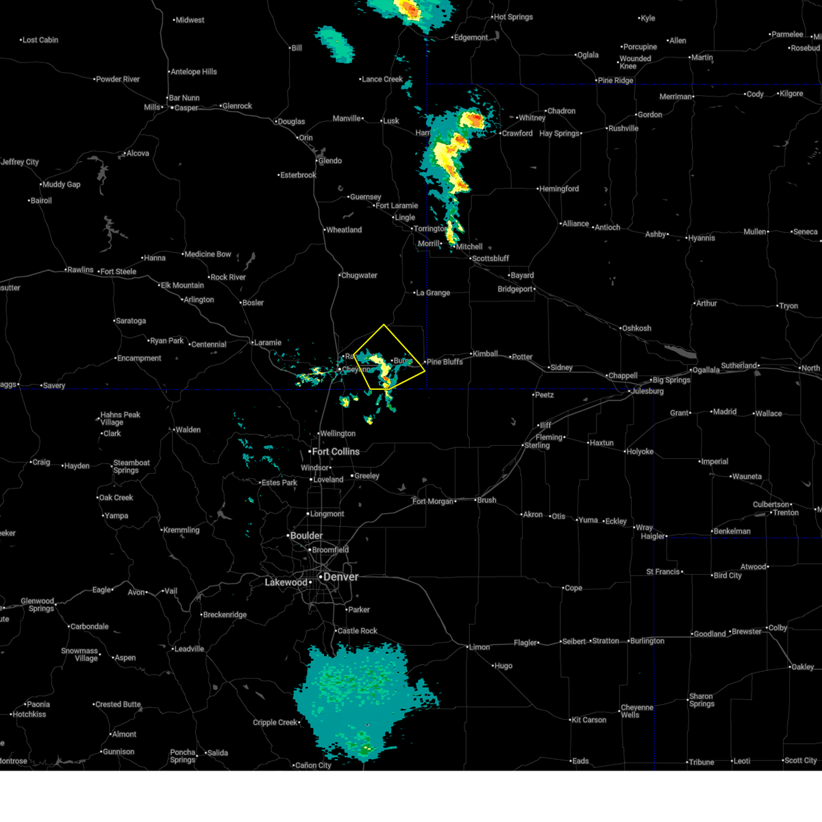
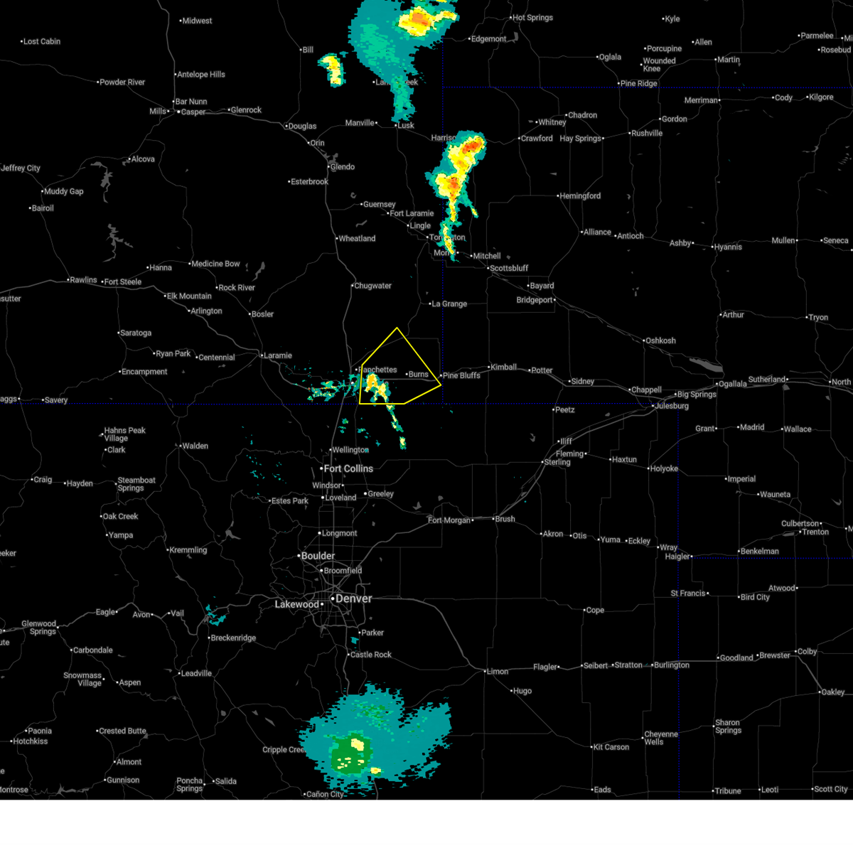
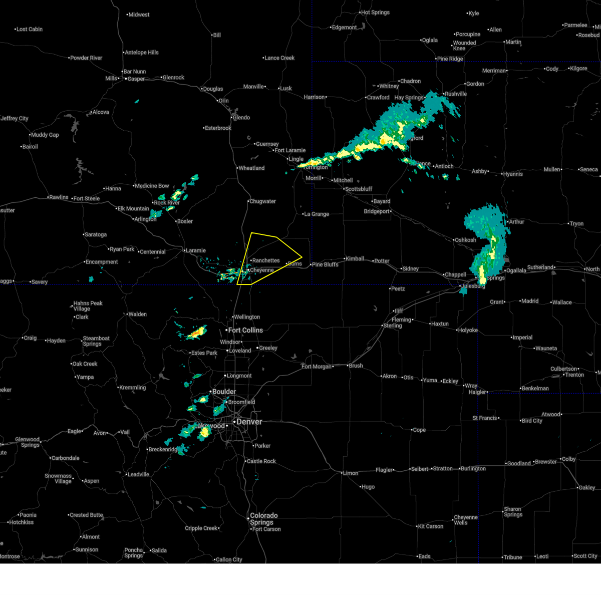
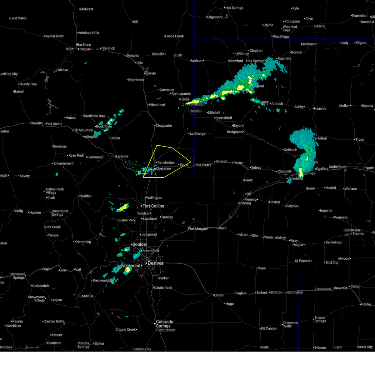
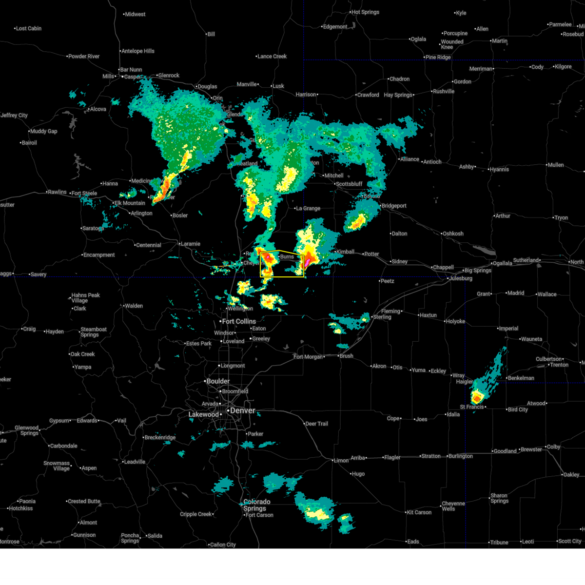
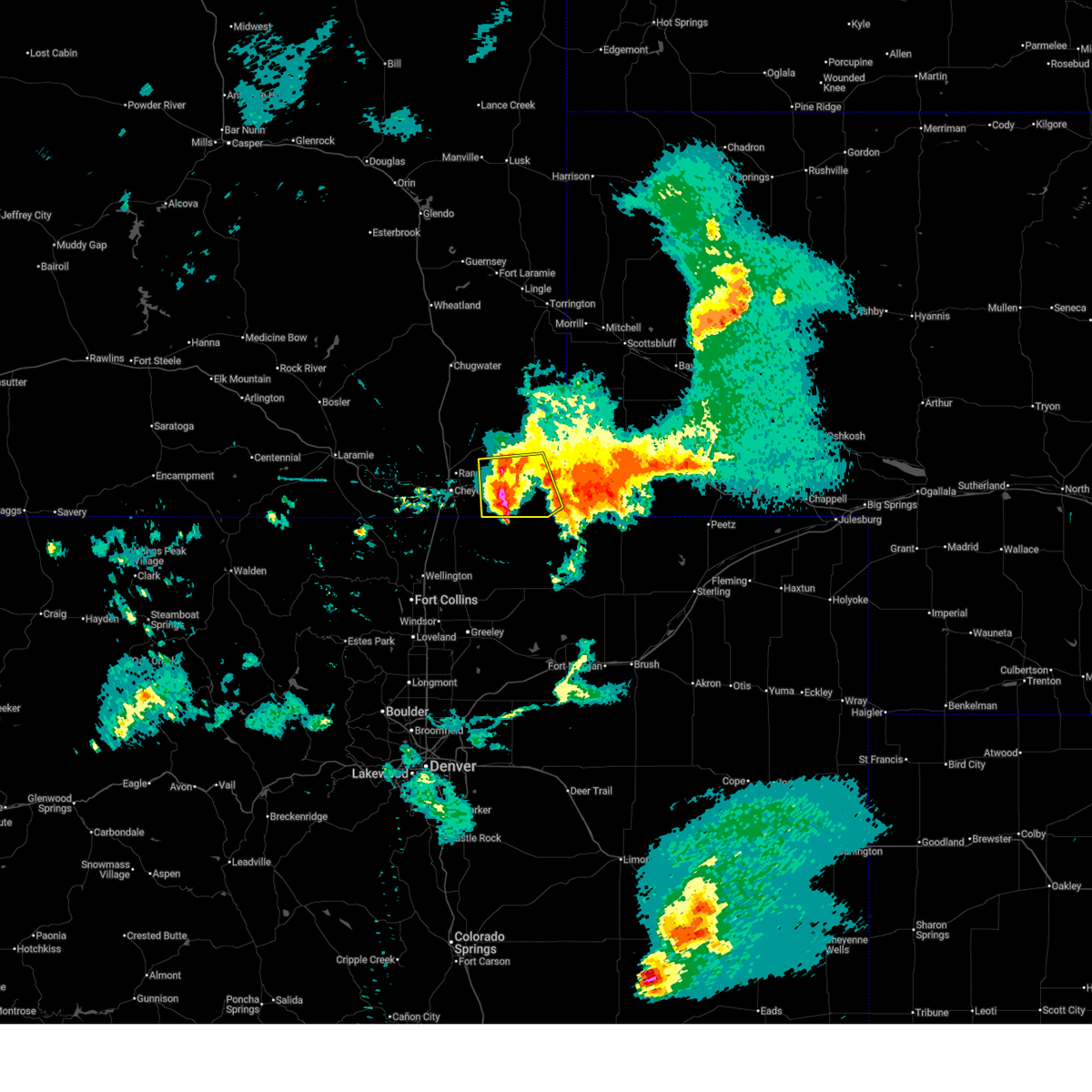
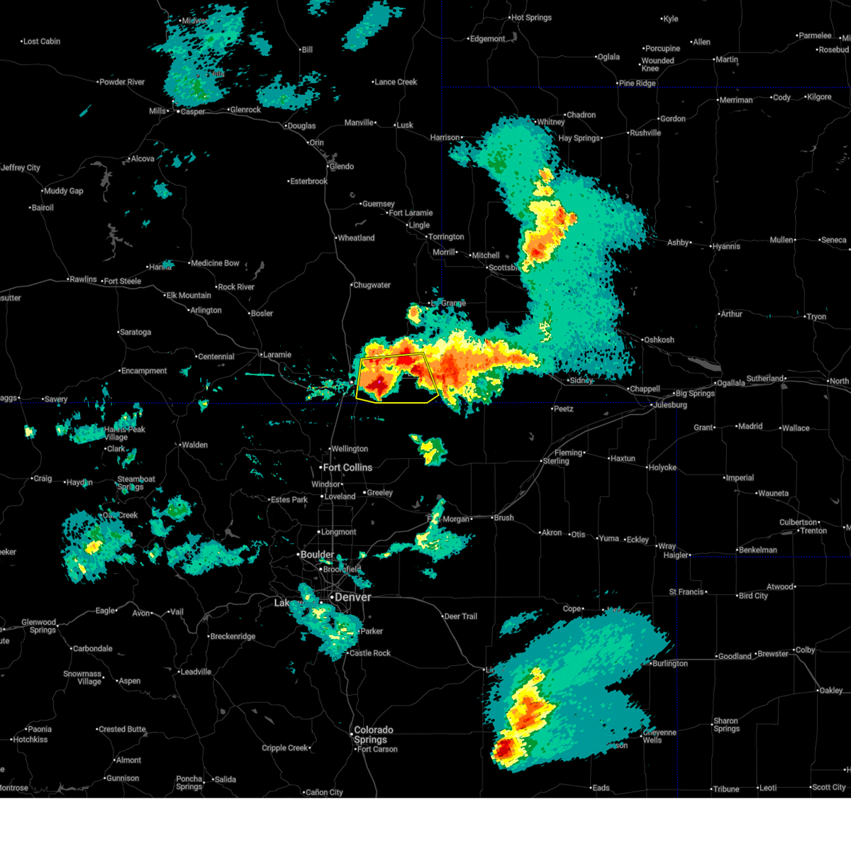
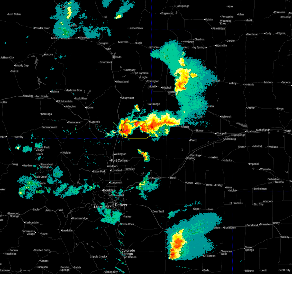
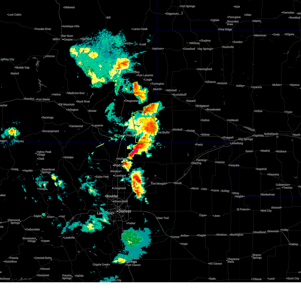
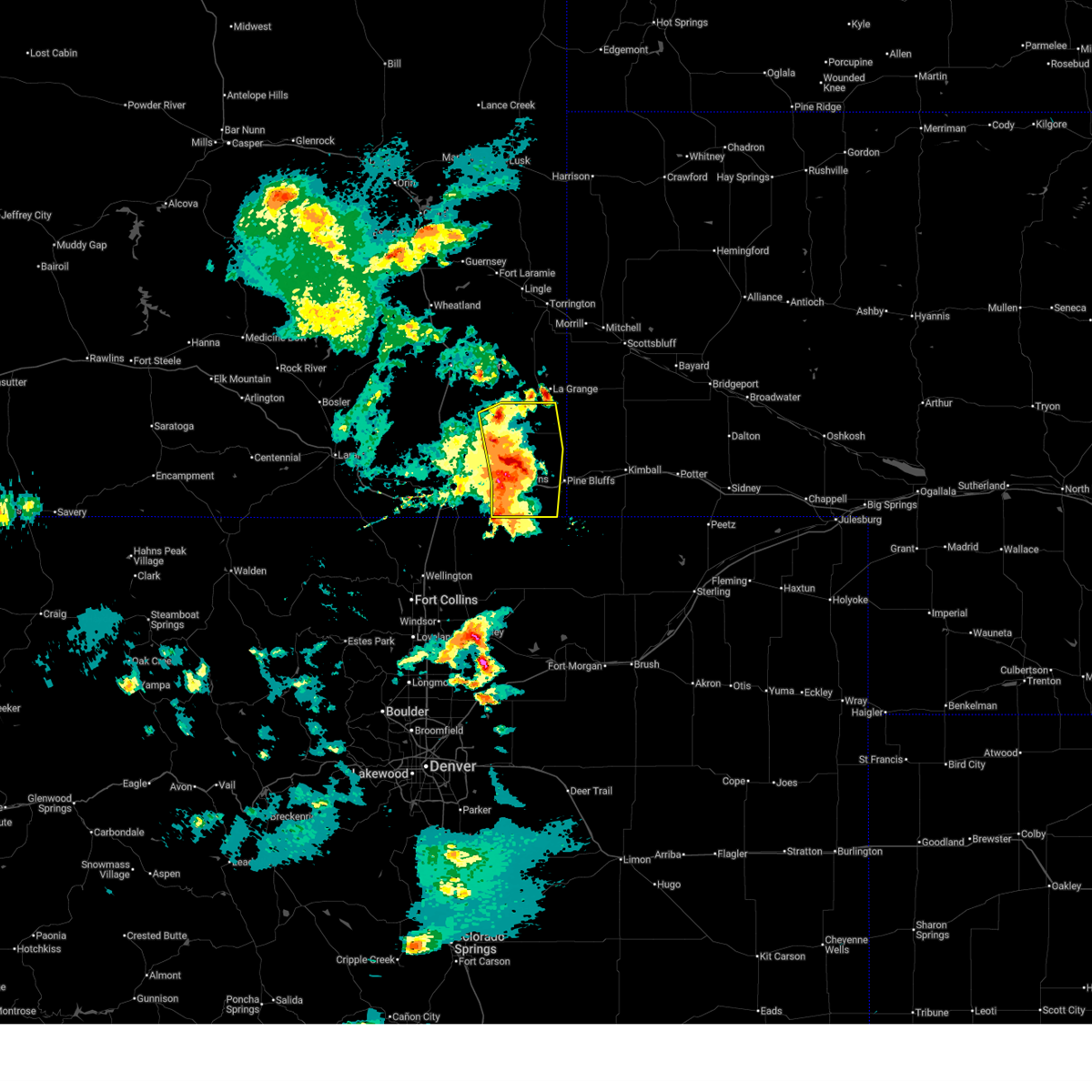
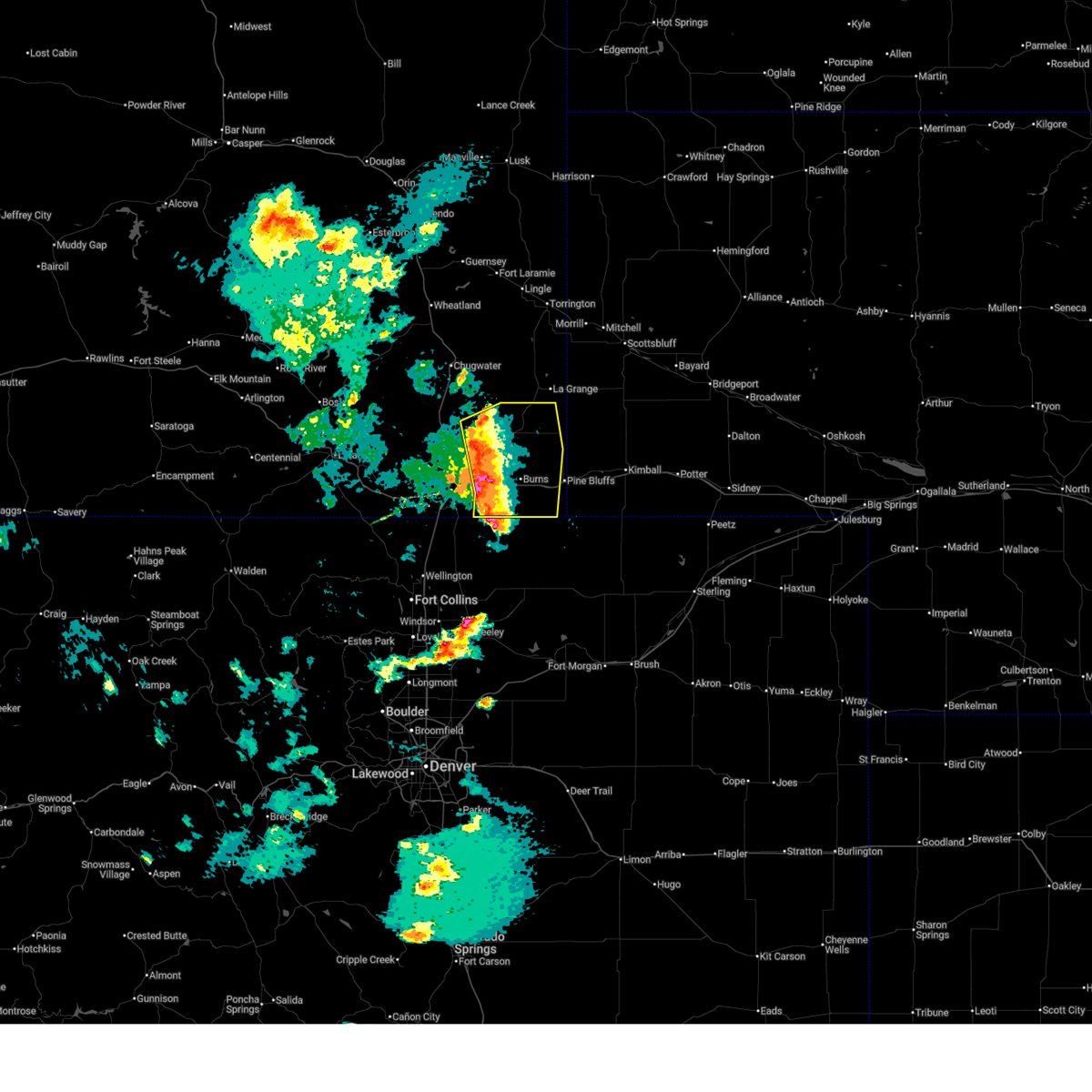
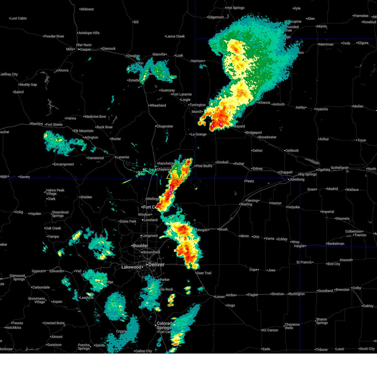
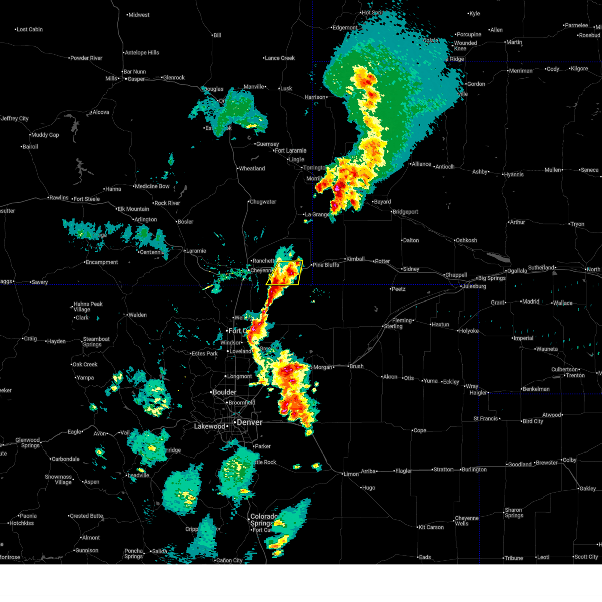
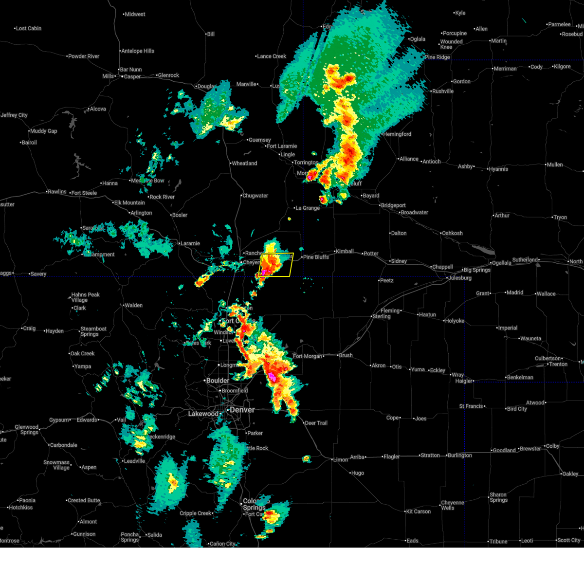
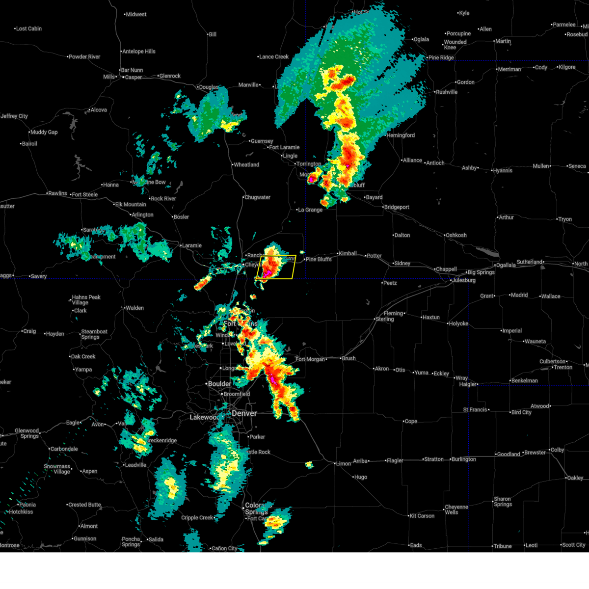
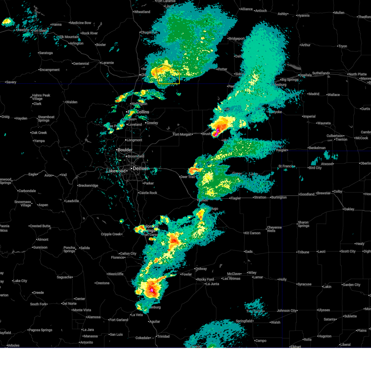
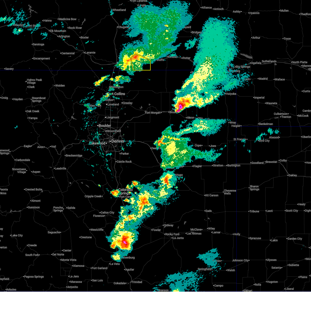
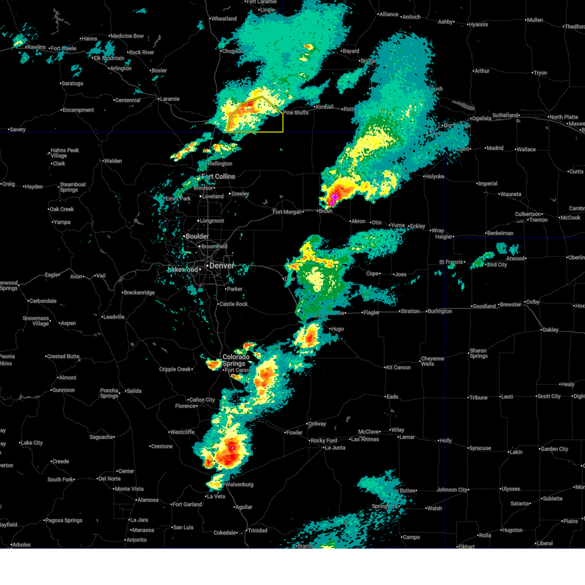
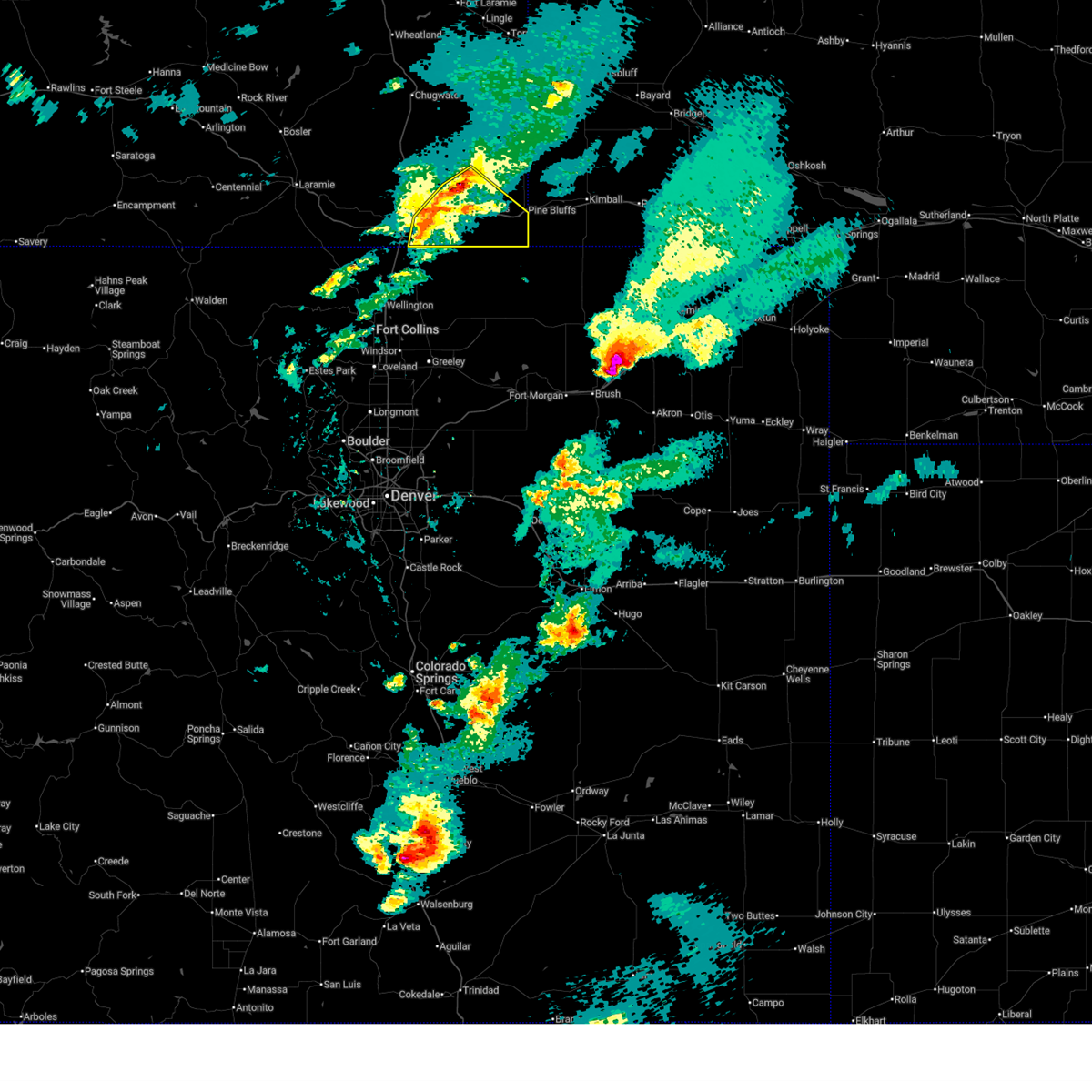
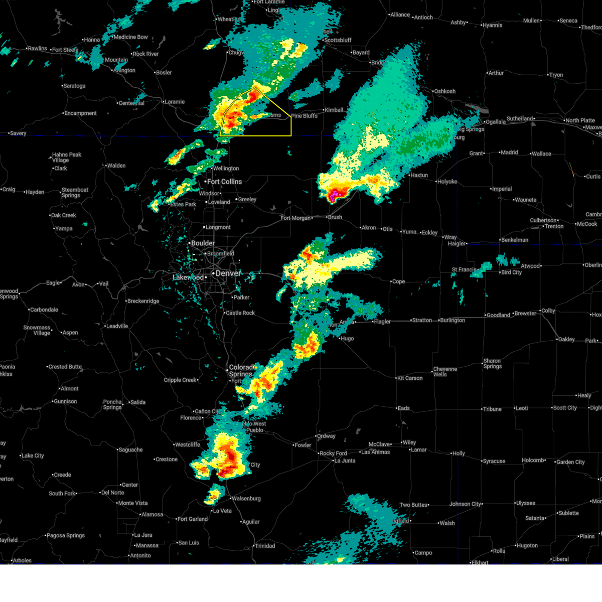
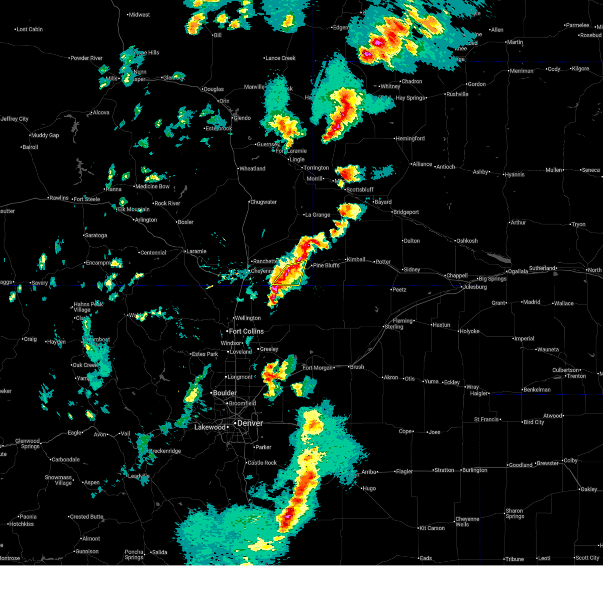
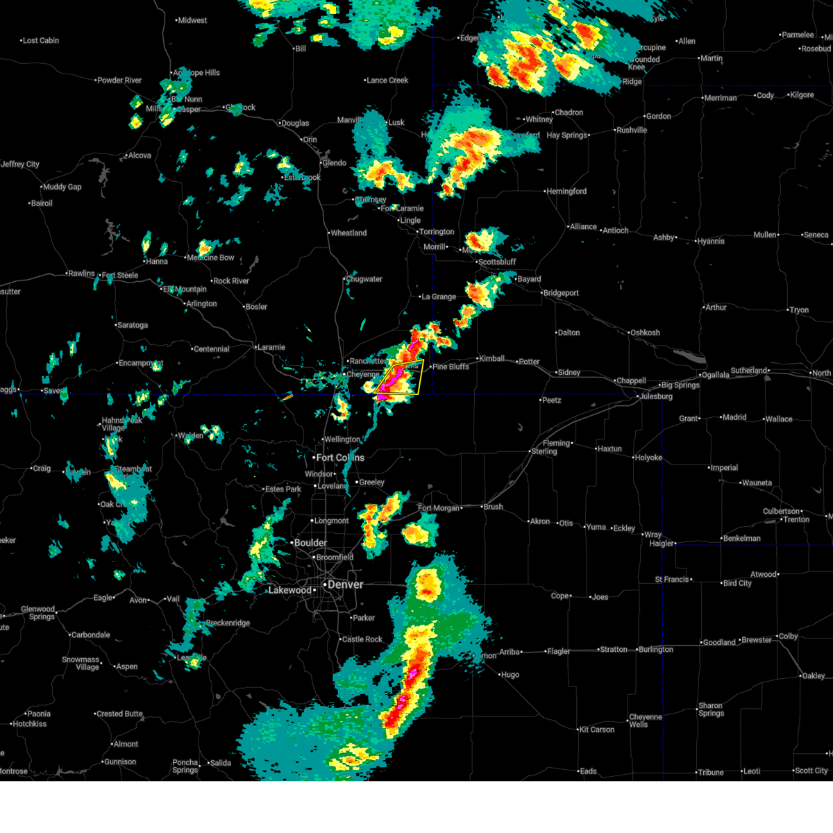
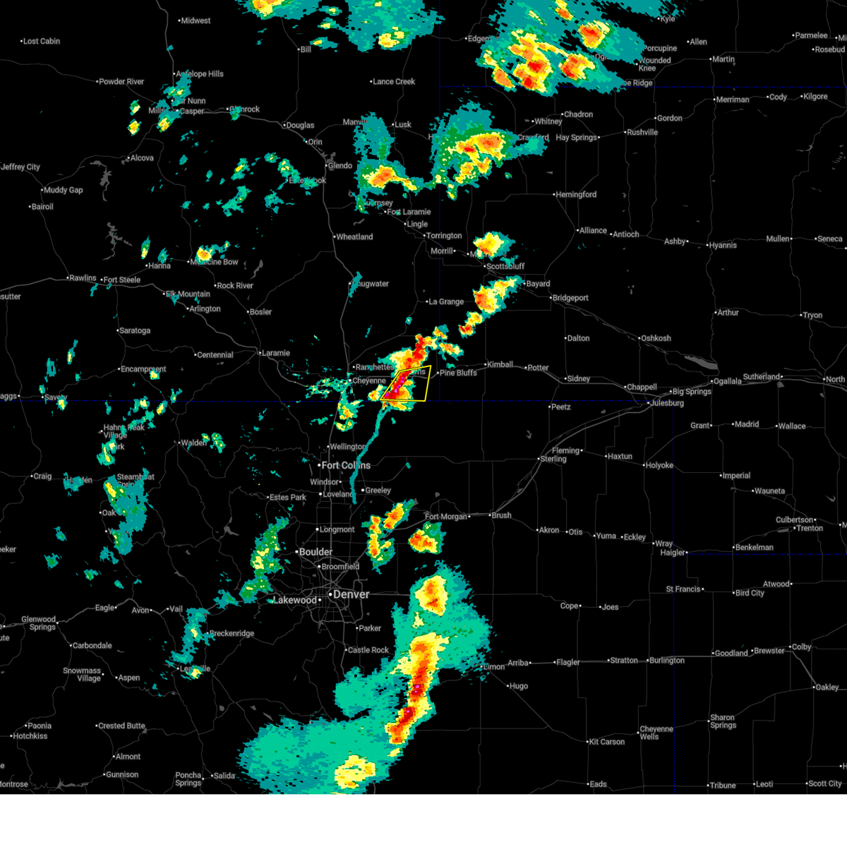
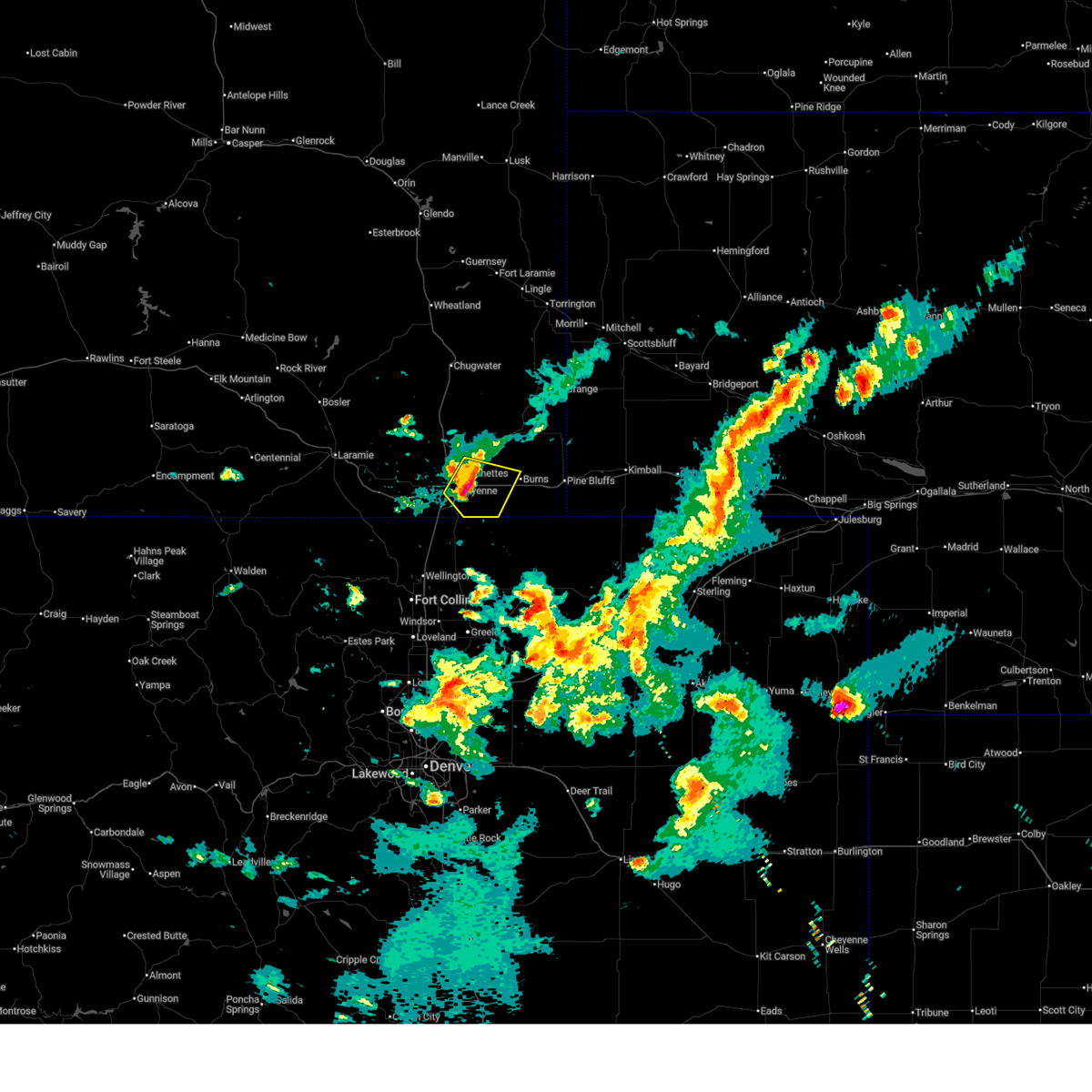
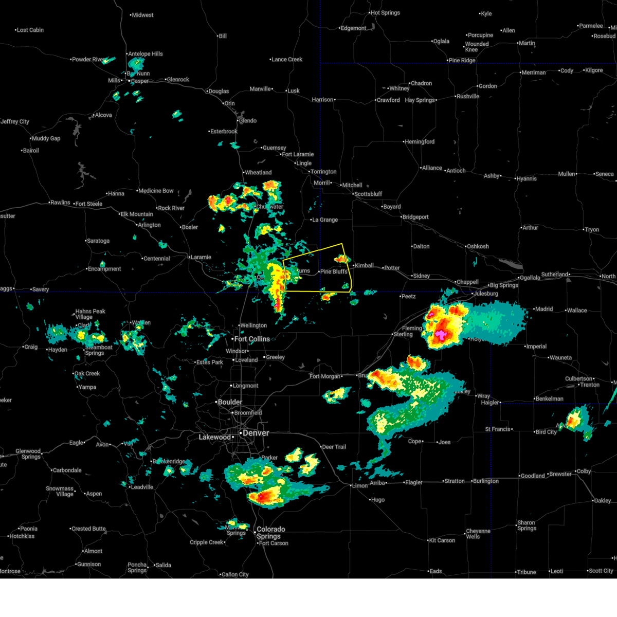
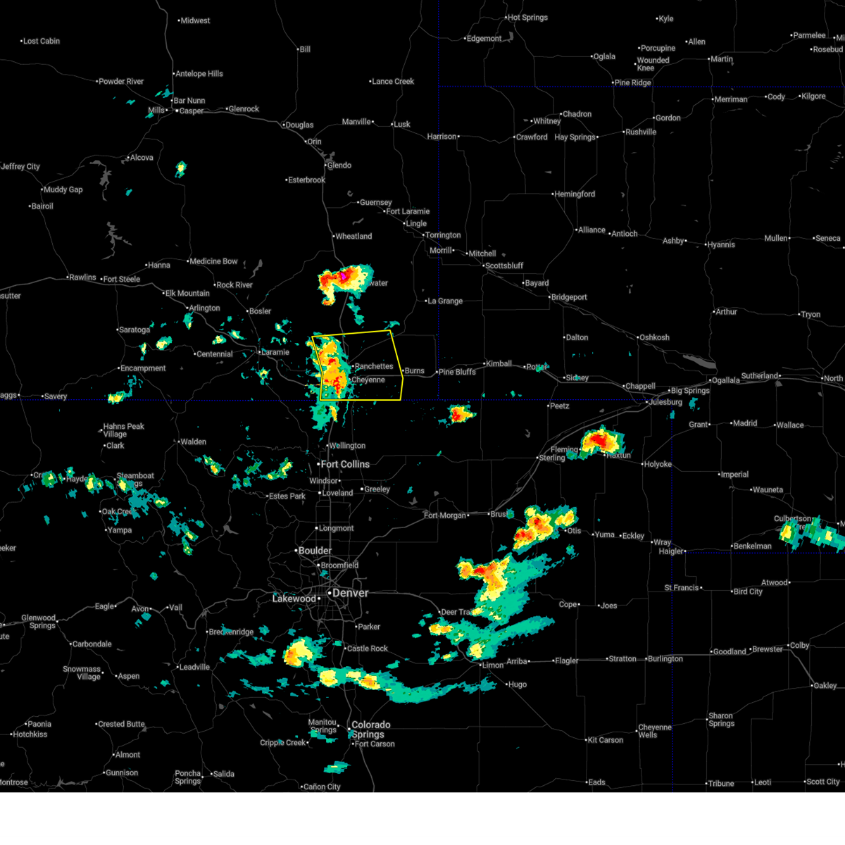
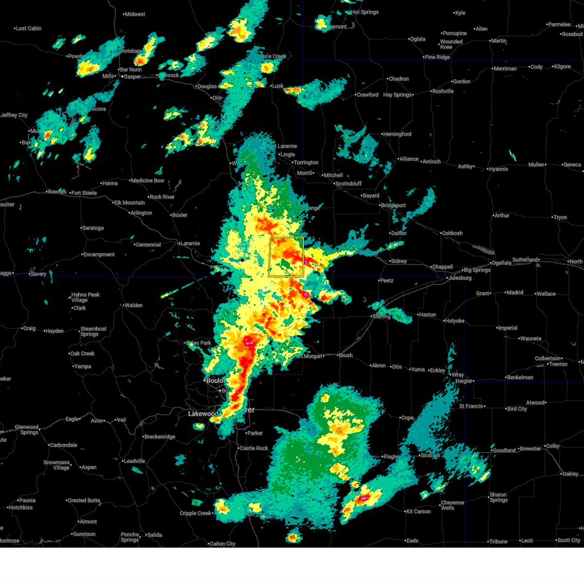
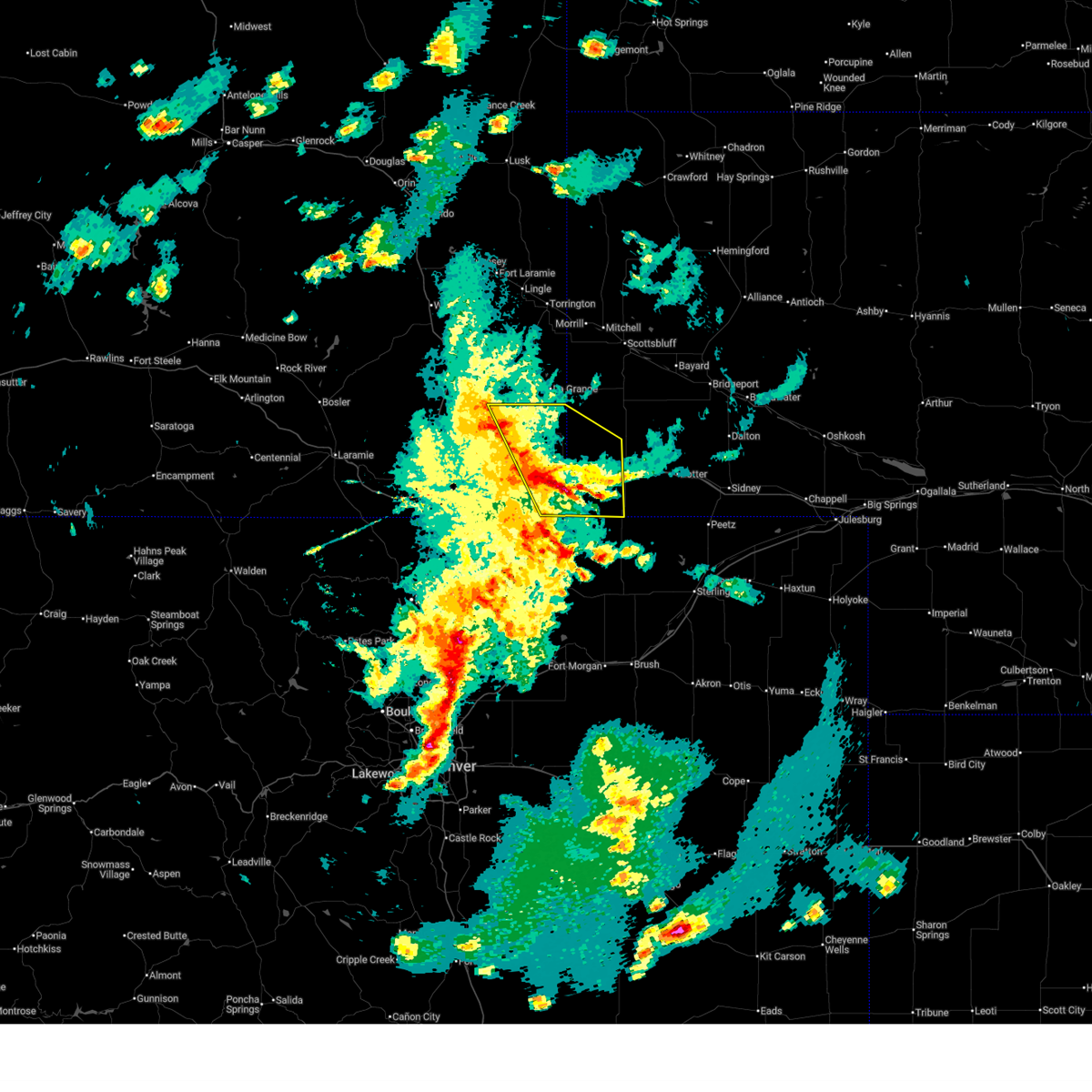
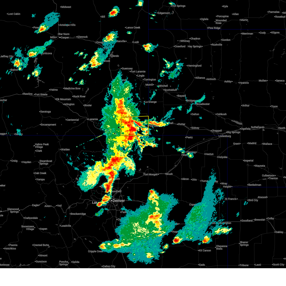
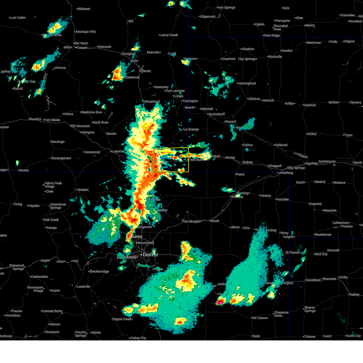
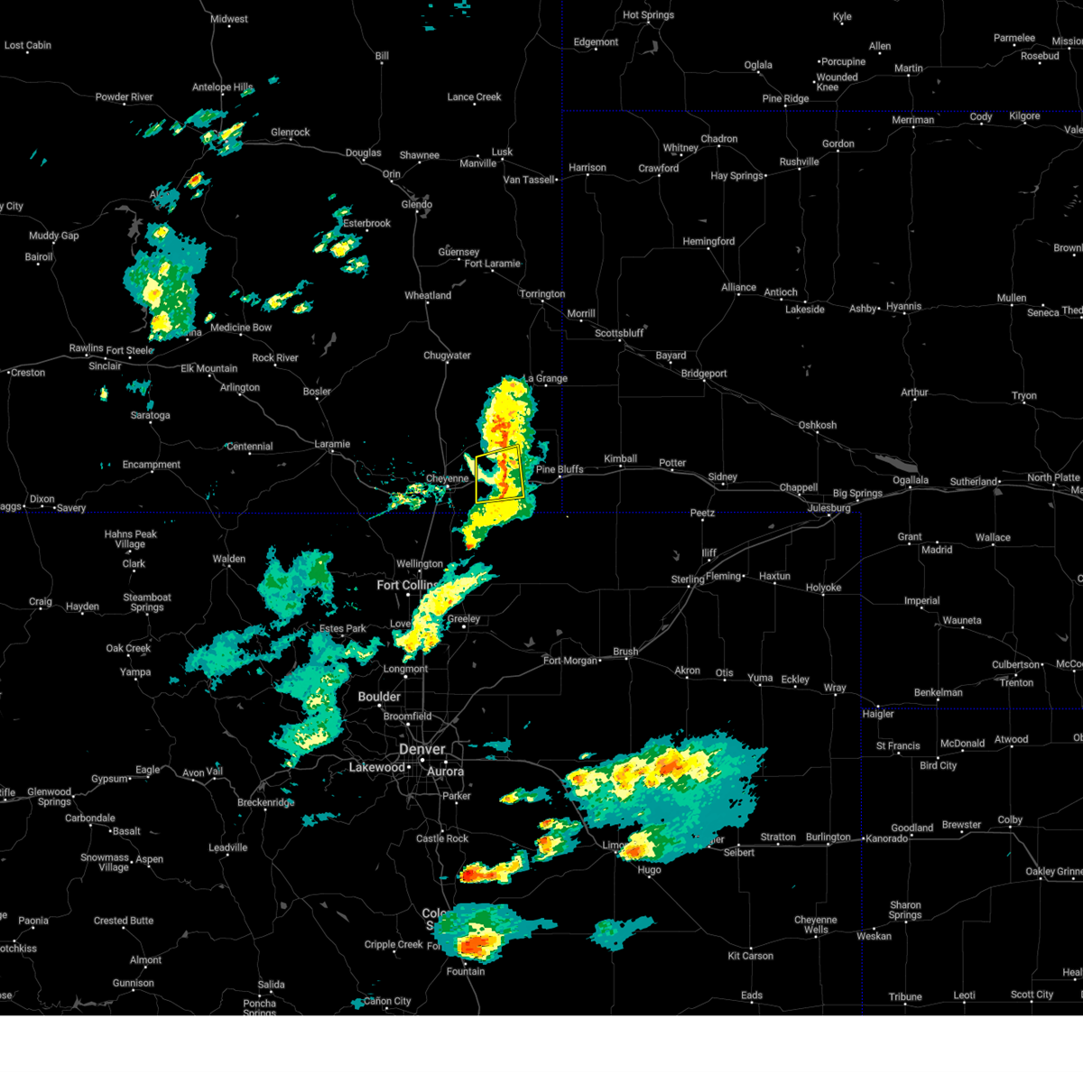
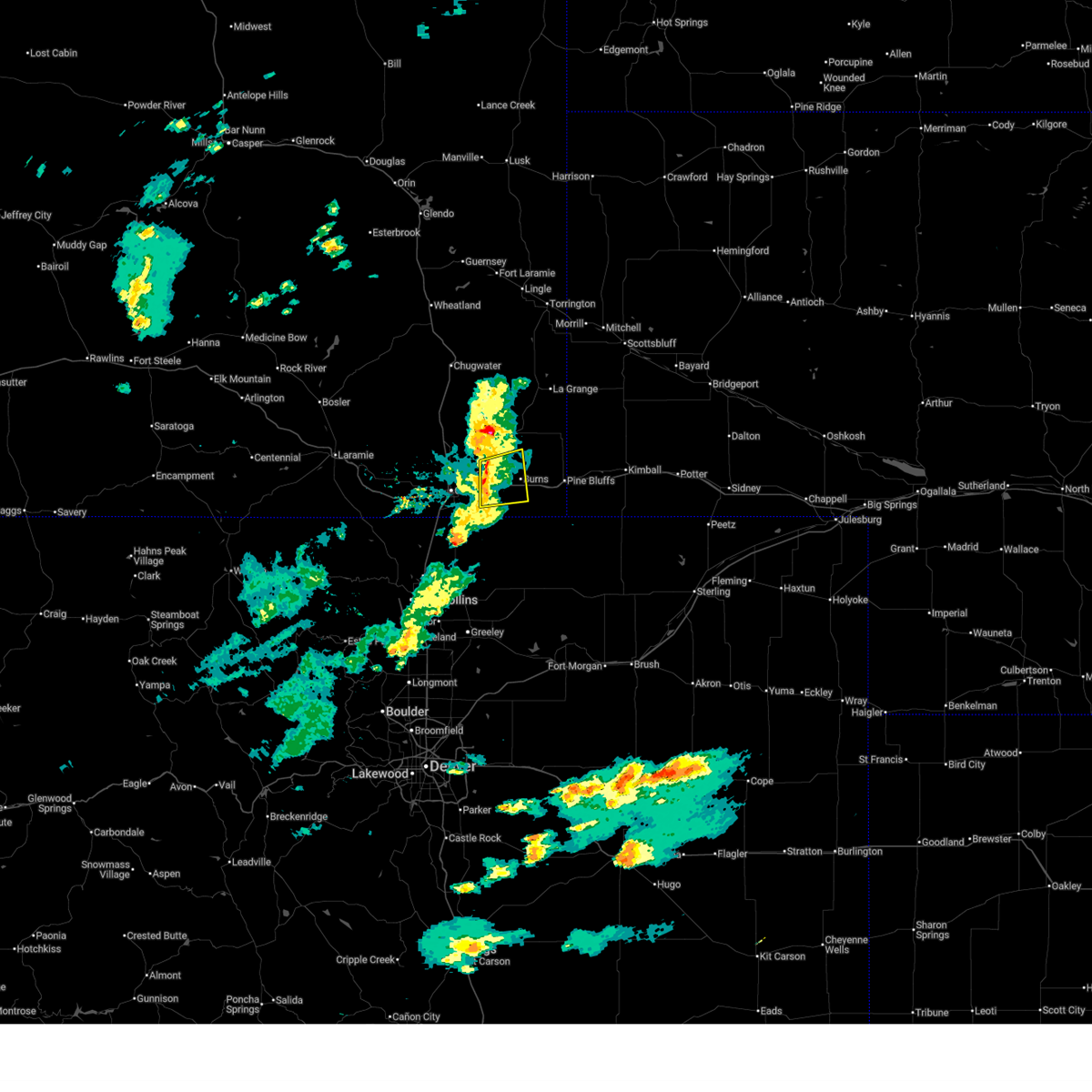
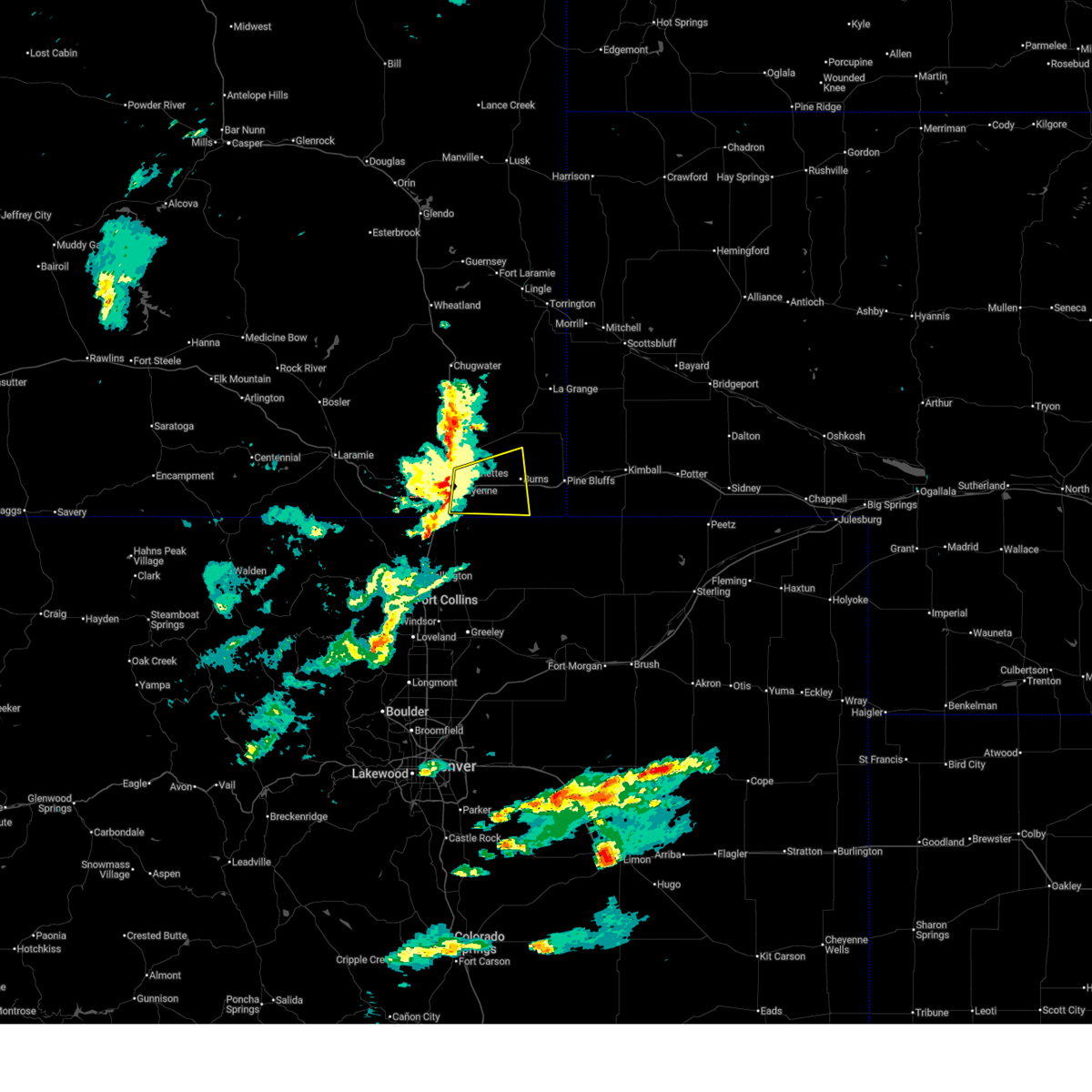
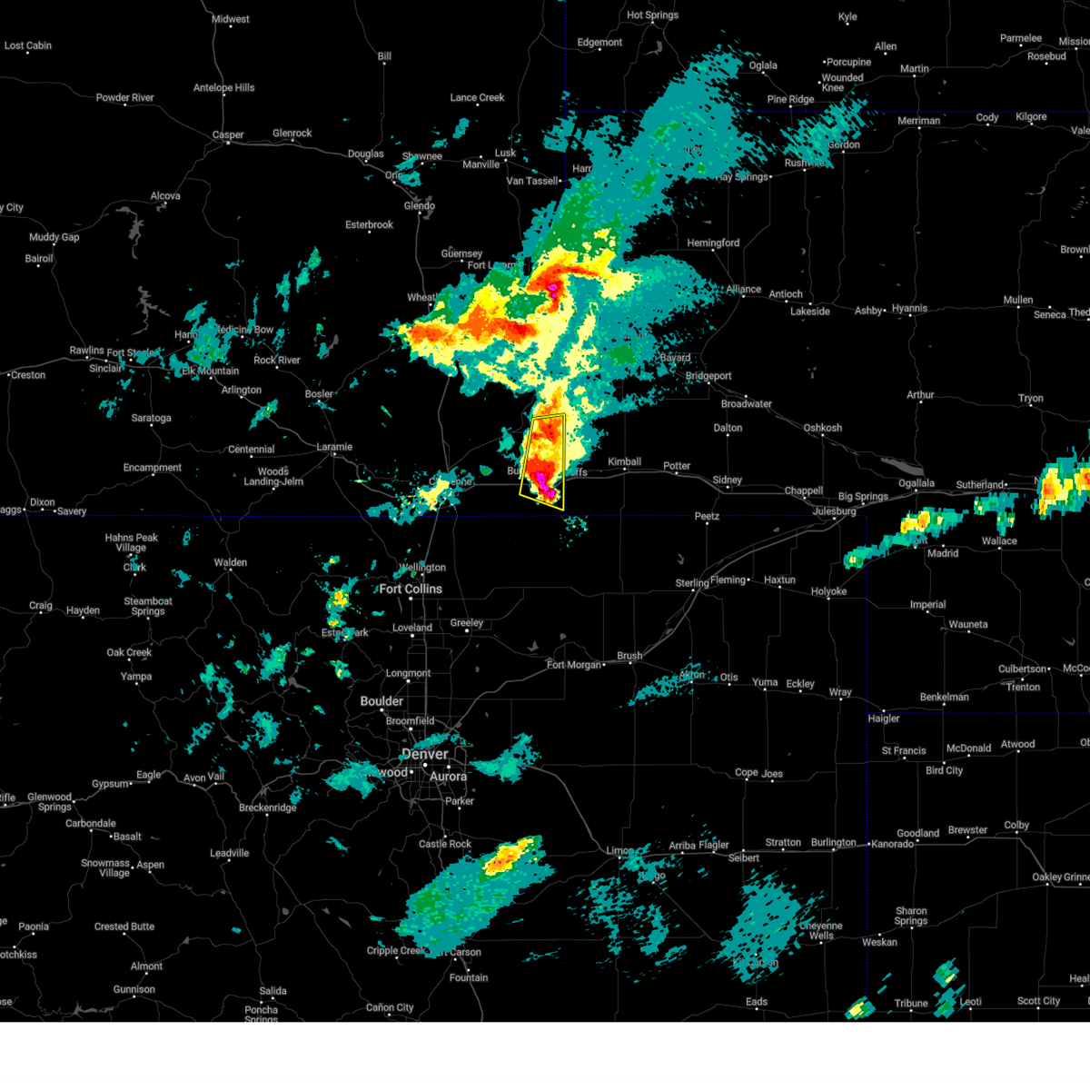
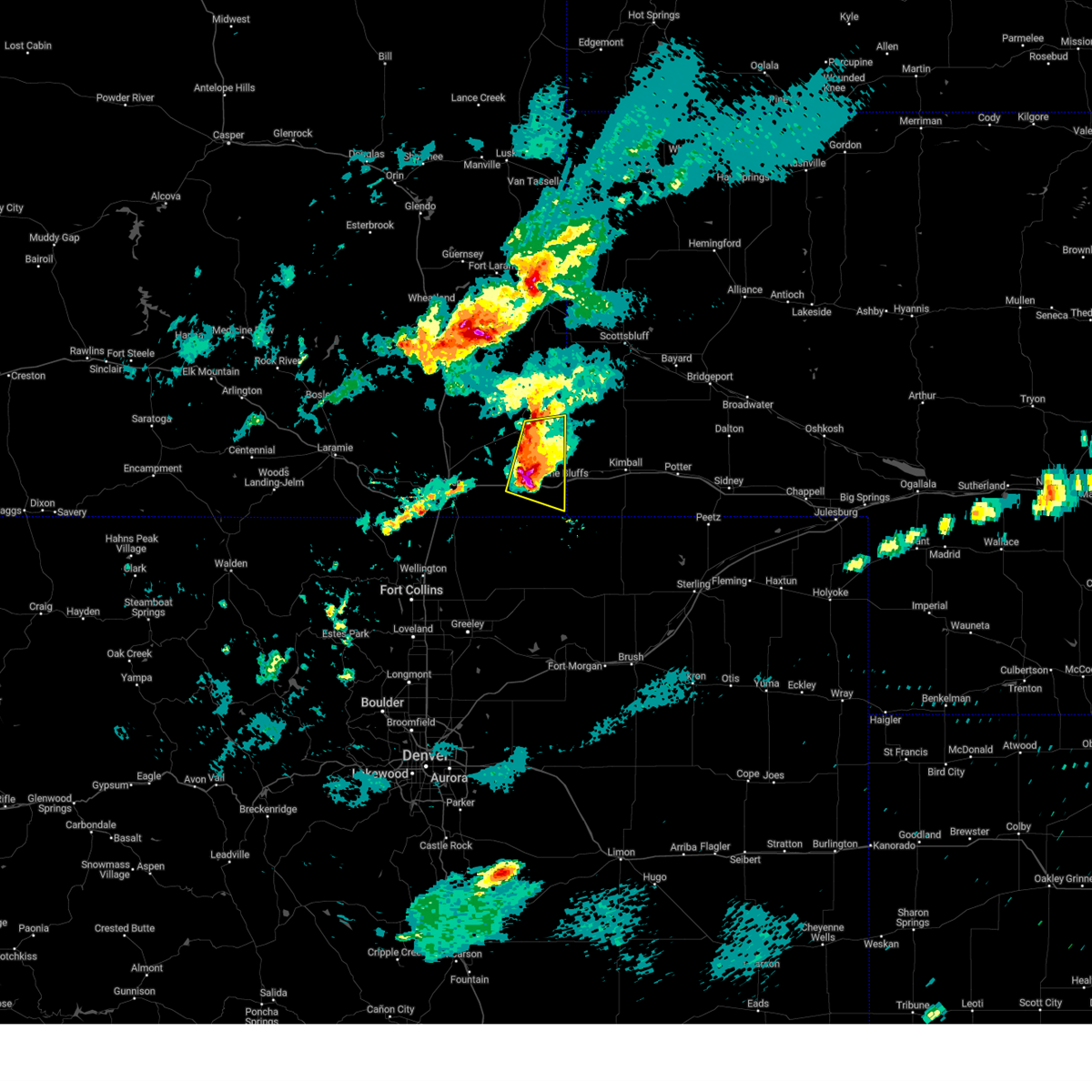
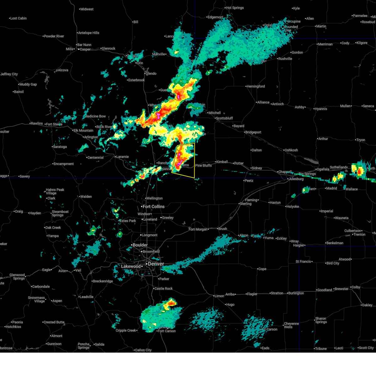
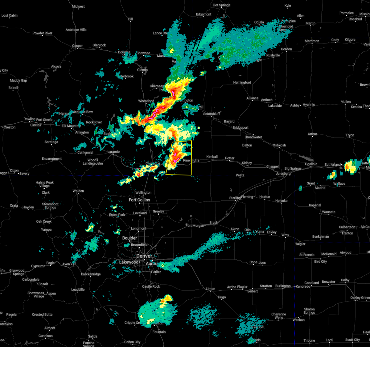
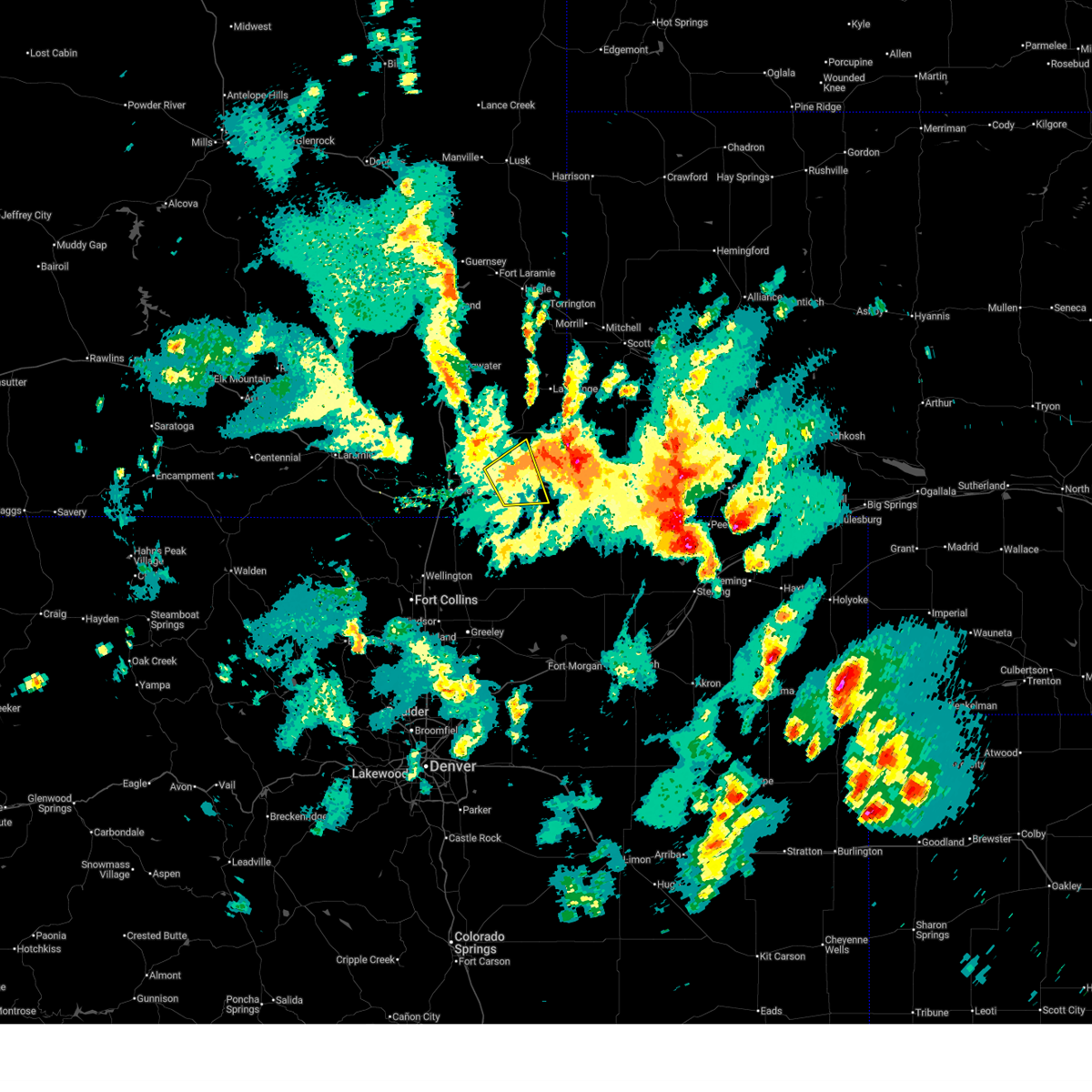
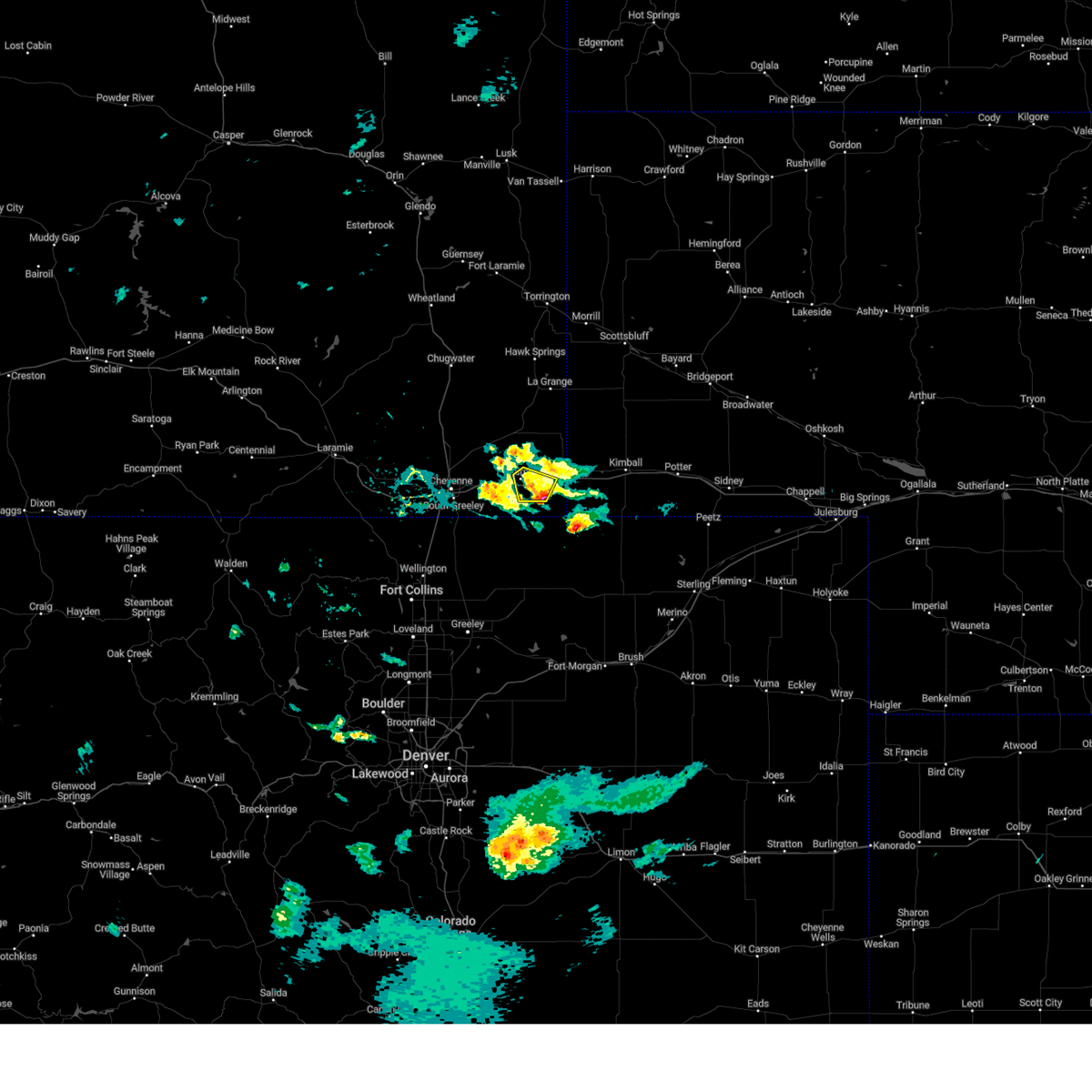
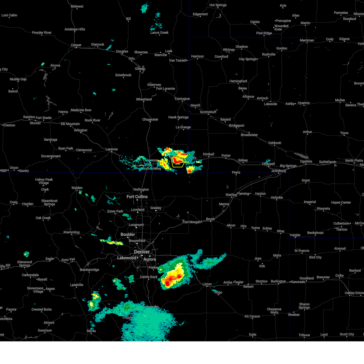
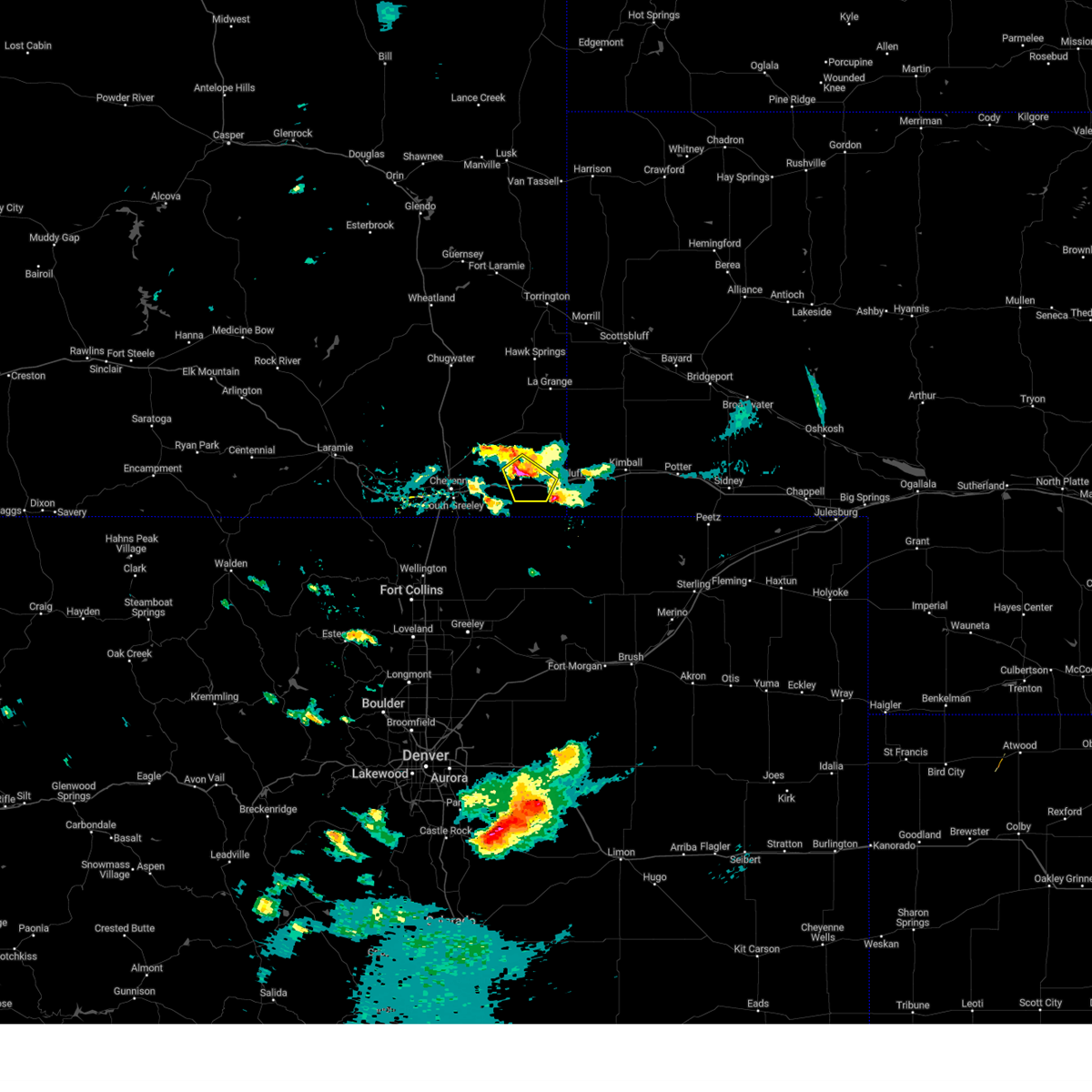
Hail Map for Burns, WY
The Burns, WY area has had 32 reports of on-the-ground hail by trained spotters, and has been under severe weather warnings 19 times during the past 12 months. Doppler radar has detected hail at or near Burns, WY on 109 occasions, including 6 occasions during the past year.
| Name: | Burns, WY |
| Where Located: | 58.4 miles SW of Scottsbluff, NE |
| Map: | Google Map for Burns, WY |
| Population: | 301 |
| Housing Units: | 138 |
| More Info: | Search Google for Burns, WY |
1
The Top Recent Hail Date for Burns, WY is Thursday, July 9, 2026 (30th out of 109)
Hail and Wind Damage Spotted near Burns, WY
| Date / Time | Report Details |
|---|---|
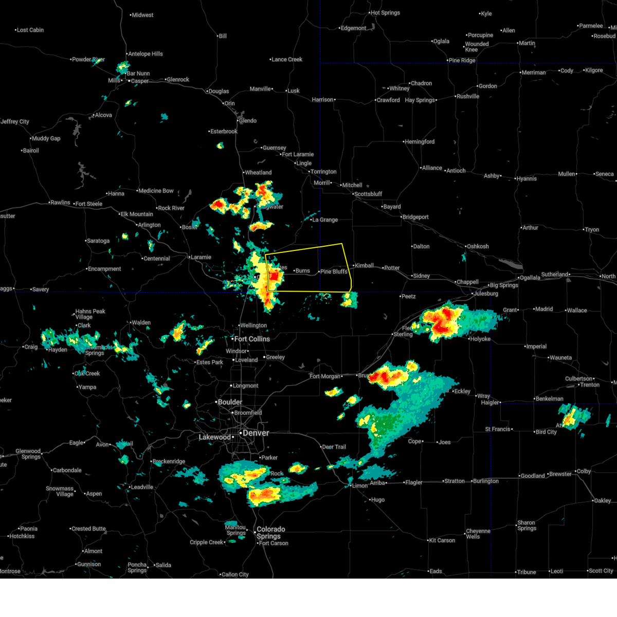
| 7/8/2026 4:46 PM MDT |
 At 446 pm mdt, a severe thunderstorm was located over pine bluffs municipal airport, or 25 miles west of kimball, moving southeast at 35 mph (radar indicated). Hazards include 60 mph wind gusts and quarter size hail. Hail damage to vehicles is expected. expect wind damage to roofs, siding, and trees. locations impacted include, pine bluffs, burns, egbert, and pine bluffs municipal airport. This includes interstate 80 in wyoming between mile markers 390 and 402. At 446 pm mdt, a severe thunderstorm was located over pine bluffs municipal airport, or 25 miles west of kimball, moving southeast at 35 mph (radar indicated). Hazards include 60 mph wind gusts and quarter size hail. Hail damage to vehicles is expected. expect wind damage to roofs, siding, and trees. locations impacted include, pine bluffs, burns, egbert, and pine bluffs municipal airport. This includes interstate 80 in wyoming between mile markers 390 and 402.
|
| 7/8/2026 4:35 PM MDT |
 At 435 pm mdt, a severe thunderstorm was located near egbert, or 27 miles east of cheyenne, moving southeast at 25 mph (radar indicated). Hazards include 60 mph wind gusts and quarter size hail. Hail damage to vehicles is expected. expect wind damage to roofs, siding, and trees. locations impacted include, pine bluffs, egbert, and pine bluffs municipal airport. This includes interstate 80 in wyoming between mile markers 390 and 402. At 435 pm mdt, a severe thunderstorm was located near egbert, or 27 miles east of cheyenne, moving southeast at 25 mph (radar indicated). Hazards include 60 mph wind gusts and quarter size hail. Hail damage to vehicles is expected. expect wind damage to roofs, siding, and trees. locations impacted include, pine bluffs, egbert, and pine bluffs municipal airport. This includes interstate 80 in wyoming between mile markers 390 and 402.
|
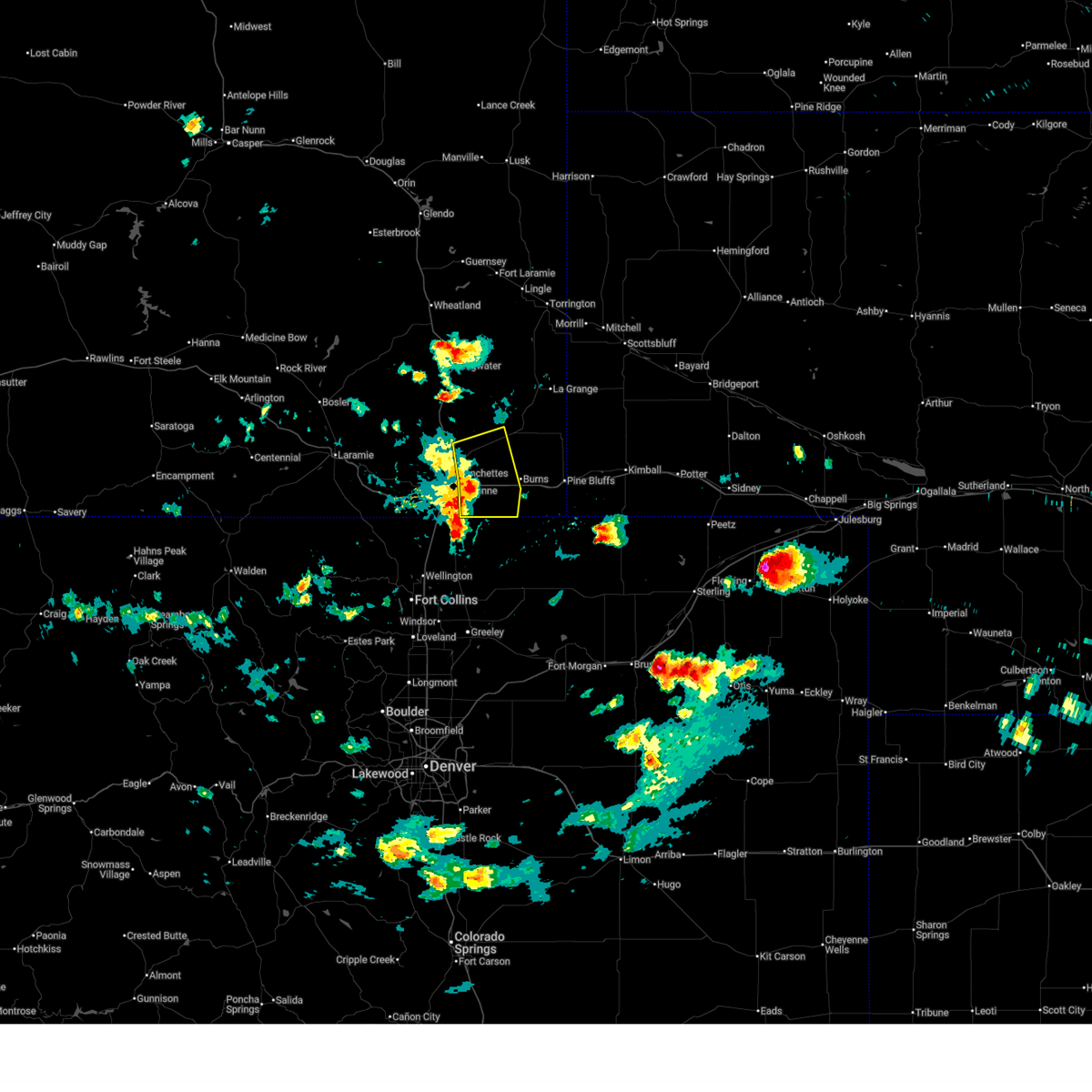
| 7/8/2026 4:19 PM MDT |
 Svrcys the national weather service in cheyenne has issued a * severe thunderstorm warning for, western kimball county in the panhandle of nebraska, east central laramie county in southeastern wyoming, * until 500 pm mdt. * at 419 pm mdt, a severe thunderstorm was located 7 miles northeast of hillsdale, or 23 miles northeast of cheyenne, moving southeast at 25 mph (radar indicated). Hazards include 60 mph wind gusts and half dollar size hail. Hail damage to vehicles is expected. Expect wind damage to roofs, siding, and trees. Svrcys the national weather service in cheyenne has issued a * severe thunderstorm warning for, western kimball county in the panhandle of nebraska, east central laramie county in southeastern wyoming, * until 500 pm mdt. * at 419 pm mdt, a severe thunderstorm was located 7 miles northeast of hillsdale, or 23 miles northeast of cheyenne, moving southeast at 25 mph (radar indicated). Hazards include 60 mph wind gusts and half dollar size hail. Hail damage to vehicles is expected. Expect wind damage to roofs, siding, and trees.
|
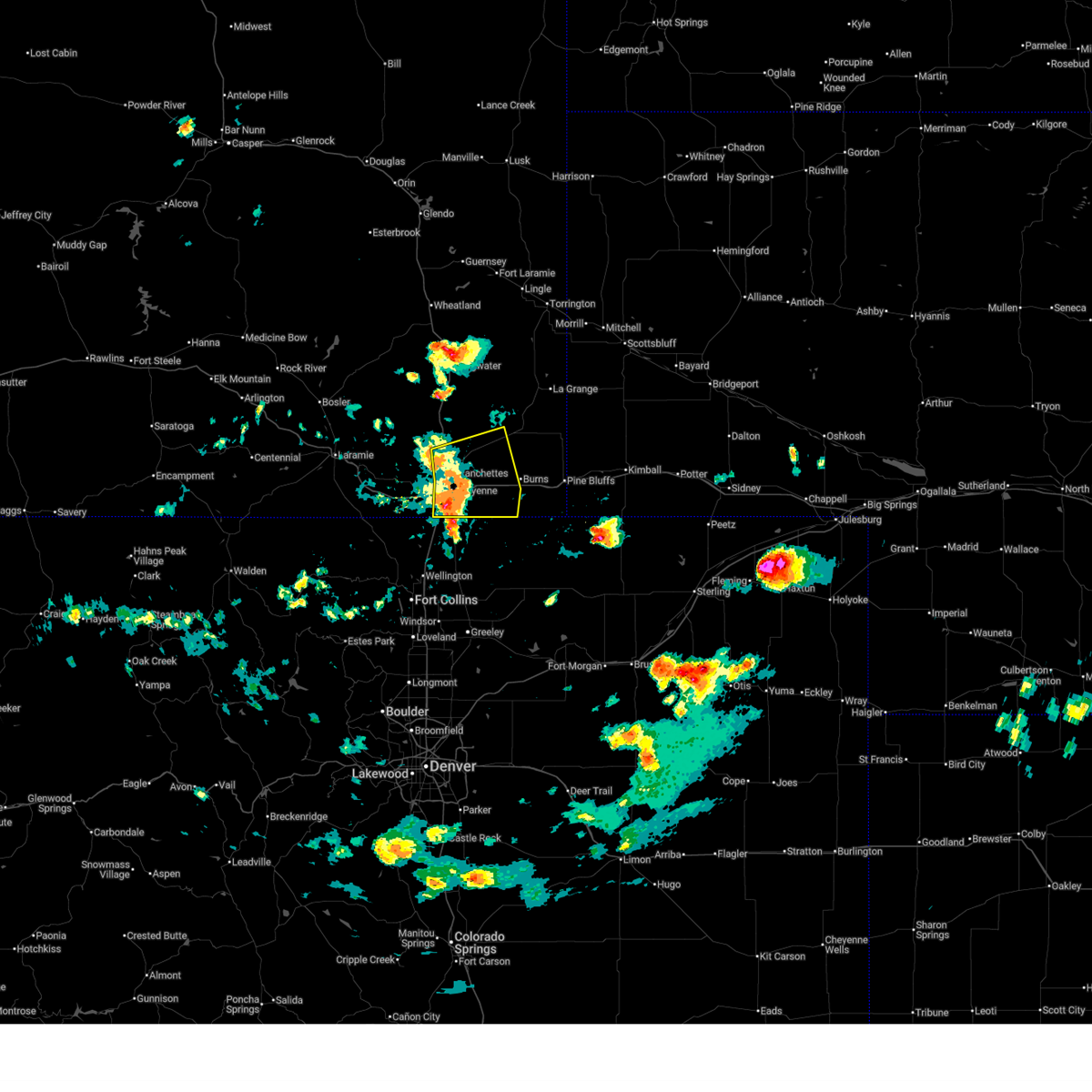
| 6/24/2026 8:37 PM MDT |
 At 837 pm mdt, a severe thunderstorm was located near burns, or 18 miles east of cheyenne, moving southeast at 20 mph (radar indicated). Hazards include 60 mph wind gusts and quarter size hail. Hail damage to vehicles is expected. expect wind damage to roofs, siding, and trees. locations impacted include, burns and carpenter. This includes interstate 80 in wyoming between mile markers 378 and 386. At 837 pm mdt, a severe thunderstorm was located near burns, or 18 miles east of cheyenne, moving southeast at 20 mph (radar indicated). Hazards include 60 mph wind gusts and quarter size hail. Hail damage to vehicles is expected. expect wind damage to roofs, siding, and trees. locations impacted include, burns and carpenter. This includes interstate 80 in wyoming between mile markers 378 and 386.
|
| 6/24/2026 8:23 PM MDT |
 Svrcys the national weather service in cheyenne has issued a * severe thunderstorm warning for, southeastern laramie county in southeastern wyoming, * until 915 pm mdt. * at 822 pm mdt, a severe thunderstorm was located near hillsdale, or 15 miles east of cheyenne, moving southeast at 20 mph (trained weather spotters. at 820 pm, quarter sized hail was reported along interstate 80). Hazards include 60 mph wind gusts and quarter size hail. Hail damage to vehicles is expected. Expect wind damage to roofs, siding, and trees. Svrcys the national weather service in cheyenne has issued a * severe thunderstorm warning for, southeastern laramie county in southeastern wyoming, * until 915 pm mdt. * at 822 pm mdt, a severe thunderstorm was located near hillsdale, or 15 miles east of cheyenne, moving southeast at 20 mph (trained weather spotters. at 820 pm, quarter sized hail was reported along interstate 80). Hazards include 60 mph wind gusts and quarter size hail. Hail damage to vehicles is expected. Expect wind damage to roofs, siding, and trees.
|
| 6/24/2026 8:22 PM MDT | Quarter sized hail reported 8.6 miles ENE of Burns, WY |
| 6/20/2026 7:02 PM MDT |
 At 702 pm mdt, a severe thunderstorm was located near egbert, or 27 miles west of kimball, moving east at 35 mph (radar indicated). Hazards include 60 mph wind gusts and half dollar size hail. Hail damage to vehicles is expected. expect wind damage to roofs, siding, and trees. locations impacted include, pine bluffs, burns, egbert, and pine bluffs municipal airport. This includes interstate 80 in wyoming between mile markers 384 and 402. At 702 pm mdt, a severe thunderstorm was located near egbert, or 27 miles west of kimball, moving east at 35 mph (radar indicated). Hazards include 60 mph wind gusts and half dollar size hail. Hail damage to vehicles is expected. expect wind damage to roofs, siding, and trees. locations impacted include, pine bluffs, burns, egbert, and pine bluffs municipal airport. This includes interstate 80 in wyoming between mile markers 384 and 402.
|
| 6/20/2026 6:40 PM MDT |
 Svrcys the national weather service in cheyenne has issued a * severe thunderstorm warning for, southeastern laramie county in southeastern wyoming, * until 715 pm mdt. * at 640 pm mdt, a severe thunderstorm was located over burns, or 23 miles east of cheyenne, moving east at 25 mph (radar indicated). Hazards include 60 mph wind gusts and half dollar size hail. Hail damage to vehicles is expected. Expect wind damage to roofs, siding, and trees. Svrcys the national weather service in cheyenne has issued a * severe thunderstorm warning for, southeastern laramie county in southeastern wyoming, * until 715 pm mdt. * at 640 pm mdt, a severe thunderstorm was located over burns, or 23 miles east of cheyenne, moving east at 25 mph (radar indicated). Hazards include 60 mph wind gusts and half dollar size hail. Hail damage to vehicles is expected. Expect wind damage to roofs, siding, and trees.
|
| 6/6/2026 9:35 PM MDT |
 The storm which prompted the warning has weakened below severe limits, and no longer poses an immediate threat to life or property. therefore, the warning will be allowed to expire. however, gusty winds are still possible with this thunderstorm. The storm which prompted the warning has weakened below severe limits, and no longer poses an immediate threat to life or property. therefore, the warning will be allowed to expire. however, gusty winds are still possible with this thunderstorm.
|
| 6/6/2026 9:28 PM MDT |
 At 928 pm mdt, a severe thunderstorm was located over hillsdale, or 19 miles east of cheyenne, moving northeast at 15 mph (radar indicated). Hazards include 60 mph wind gusts. Expect damage to roofs, siding, and trees. locations impacted include, burns, egbert, hillsdale, carpenter, pine bluffs municipal airport, and ranchettes. This includes interstate 80 in wyoming between mile markers 371 and 399. At 928 pm mdt, a severe thunderstorm was located over hillsdale, or 19 miles east of cheyenne, moving northeast at 15 mph (radar indicated). Hazards include 60 mph wind gusts. Expect damage to roofs, siding, and trees. locations impacted include, burns, egbert, hillsdale, carpenter, pine bluffs municipal airport, and ranchettes. This includes interstate 80 in wyoming between mile markers 371 and 399.
|
| 6/6/2026 9:07 PM MDT |
 Svrcys the national weather service in cheyenne has issued a * severe thunderstorm warning for, southeastern laramie county in southeastern wyoming, * until 945 pm mdt. * at 906 pm mdt, a severe thunderstorm was located near hillsdale, or 13 miles east of cheyenne, moving northeast at 15 mph (radar indicated). Hazards include 60 mph wind gusts. expect damage to roofs, siding, and trees Svrcys the national weather service in cheyenne has issued a * severe thunderstorm warning for, southeastern laramie county in southeastern wyoming, * until 945 pm mdt. * at 906 pm mdt, a severe thunderstorm was located near hillsdale, or 13 miles east of cheyenne, moving northeast at 15 mph (radar indicated). Hazards include 60 mph wind gusts. expect damage to roofs, siding, and trees
|
| 6/1/2026 3:56 PM MDT |
 At 356 pm mdt, a severe thunderstorm was located over cheyenne, moving northeast at 45 mph (radar indicated). Hazards include golf ball size hail and 60 mph wind gusts. People and animals outdoors will be injured. expect hail damage to roofs, siding, windows, and vehicles. expect wind damage to roofs, siding, and trees. locations impacted include, cheyenne, burns, laramie county fairgrounds at archer, hillsdale, fox farm-college, cheyenne regional airport, winchester hills, south greeley highway, ranchettes, warren afb, frontier park, north cheyenne, south cheyenne, bison crossing, grass hills, and cowboy ranch south. this includes the following highways, interstate 25 in wyoming between mile markers 1 and 21. Interstate 80 in wyoming between mile markers 357 and 383. At 356 pm mdt, a severe thunderstorm was located over cheyenne, moving northeast at 45 mph (radar indicated). Hazards include golf ball size hail and 60 mph wind gusts. People and animals outdoors will be injured. expect hail damage to roofs, siding, windows, and vehicles. expect wind damage to roofs, siding, and trees. locations impacted include, cheyenne, burns, laramie county fairgrounds at archer, hillsdale, fox farm-college, cheyenne regional airport, winchester hills, south greeley highway, ranchettes, warren afb, frontier park, north cheyenne, south cheyenne, bison crossing, grass hills, and cowboy ranch south. this includes the following highways, interstate 25 in wyoming between mile markers 1 and 21. Interstate 80 in wyoming between mile markers 357 and 383.
|
| 6/1/2026 3:45 PM MDT |
 Svrcys the national weather service in cheyenne has issued a * severe thunderstorm warning for, southeastern laramie county in southeastern wyoming, * until 430 pm mdt. * at 345 pm mdt, a severe thunderstorm was located over winchester hills, or near cheyenne, moving northeast at 45 mph (radar indicated). Hazards include 60 mph wind gusts and quarter size hail. Hail damage to vehicles is expected. Expect wind damage to roofs, siding, and trees. Svrcys the national weather service in cheyenne has issued a * severe thunderstorm warning for, southeastern laramie county in southeastern wyoming, * until 430 pm mdt. * at 345 pm mdt, a severe thunderstorm was located over winchester hills, or near cheyenne, moving northeast at 45 mph (radar indicated). Hazards include 60 mph wind gusts and quarter size hail. Hail damage to vehicles is expected. Expect wind damage to roofs, siding, and trees.
|
| 5/9/2026 4:56 PM MDT |
 Svrcys the national weather service in cheyenne has issued a * severe thunderstorm warning for, southeastern laramie county in southeastern wyoming, * until 530 pm mdt. * at 456 pm mdt, a severe thunderstorm was located 7 miles south of hillsdale, or 17 miles east of cheyenne, moving east at 40 mph (radar indicated). Hazards include 60 mph wind gusts and penny size hail. expect damage to roofs, siding, and trees Svrcys the national weather service in cheyenne has issued a * severe thunderstorm warning for, southeastern laramie county in southeastern wyoming, * until 530 pm mdt. * at 456 pm mdt, a severe thunderstorm was located 7 miles south of hillsdale, or 17 miles east of cheyenne, moving east at 40 mph (radar indicated). Hazards include 60 mph wind gusts and penny size hail. expect damage to roofs, siding, and trees
|
| 8/1/2025 6:41 PM MDT |
 At 641 pm mdt, a severe thunderstorm was located 7 miles south of hillsdale, or 15 miles east of cheyenne, moving east at 20 mph (radar indicated). Hazards include golf ball size hail and 60 mph wind gusts. People and animals outdoors will be injured. expect hail damage to roofs, siding, windows, and vehicles. expect wind damage to roofs, siding, and trees. Locations impacted include, burns, egbert, hillsdale, carpenter, and pine bluffs municipal airport. At 641 pm mdt, a severe thunderstorm was located 7 miles south of hillsdale, or 15 miles east of cheyenne, moving east at 20 mph (radar indicated). Hazards include golf ball size hail and 60 mph wind gusts. People and animals outdoors will be injured. expect hail damage to roofs, siding, windows, and vehicles. expect wind damage to roofs, siding, and trees. Locations impacted include, burns, egbert, hillsdale, carpenter, and pine bluffs municipal airport.
|
| 8/1/2025 6:24 PM MDT |
 At 624 pm mdt, a severe thunderstorm was located near laramie county fairgrounds at archer, or 9 miles east of cheyenne, moving east at 20 mph (radar indicated). Hazards include golf ball size hail and 60 mph wind gusts. People and animals outdoors will be injured. expect hail damage to roofs, siding, windows, and vehicles. expect wind damage to roofs, siding, and trees. Locations impacted include, cheyenne, burns, egbert, laramie county fairgrounds at archer, hillsdale, pine bluffs municipal airport, carpenter, ranchettes, cowboy ranch south, and grass hills. At 624 pm mdt, a severe thunderstorm was located near laramie county fairgrounds at archer, or 9 miles east of cheyenne, moving east at 20 mph (radar indicated). Hazards include golf ball size hail and 60 mph wind gusts. People and animals outdoors will be injured. expect hail damage to roofs, siding, windows, and vehicles. expect wind damage to roofs, siding, and trees. Locations impacted include, cheyenne, burns, egbert, laramie county fairgrounds at archer, hillsdale, pine bluffs municipal airport, carpenter, ranchettes, cowboy ranch south, and grass hills.
|
| 8/1/2025 6:15 PM MDT |
 Svrcys the national weather service in cheyenne has issued a * severe thunderstorm warning for, southeastern laramie county in southeastern wyoming, * until 700 pm mdt. * at 614 pm mdt, a severe thunderstorm was located over laramie county fairgrounds at archer, or near cheyenne, moving east at 20 mph. this is a destructive storm for southern and eastern laramie county (radar indicated). Hazards include baseball size hail and 60 mph wind gusts. People and animals outdoors will be severely injured. Expect shattered windows, extensive damage to roofs, siding, and vehicles. Svrcys the national weather service in cheyenne has issued a * severe thunderstorm warning for, southeastern laramie county in southeastern wyoming, * until 700 pm mdt. * at 614 pm mdt, a severe thunderstorm was located over laramie county fairgrounds at archer, or near cheyenne, moving east at 20 mph. this is a destructive storm for southern and eastern laramie county (radar indicated). Hazards include baseball size hail and 60 mph wind gusts. People and animals outdoors will be severely injured. Expect shattered windows, extensive damage to roofs, siding, and vehicles.
|
| 7/31/2025 5:26 PM MDT |
 The storms which prompted the warning have moved out of the area. therefore, the warning will be allowed to expire. however, gusty winds and heavy rain are still possible with these thunderstorms. a severe thunderstorm watch remains in effect until 900 pm mdt for southeastern wyoming. The storms which prompted the warning have moved out of the area. therefore, the warning will be allowed to expire. however, gusty winds and heavy rain are still possible with these thunderstorms. a severe thunderstorm watch remains in effect until 900 pm mdt for southeastern wyoming.
|
| 7/31/2025 5:05 PM MDT |
 At 505 pm mdt, severe thunderstorms were located along a line extending from near meriden rest area to 7 miles north of egbert to near carpenter, moving northeast at 30 mph (radar indicated). Hazards include 60 mph wind gusts and nickel size hail. Expect damage to roofs, siding, and trees. Locations impacted include, burns, albin, egbert, hillsdale, pine bluffs municipal airport, meriden rest area, gun barrel, and carpenter. At 505 pm mdt, severe thunderstorms were located along a line extending from near meriden rest area to 7 miles north of egbert to near carpenter, moving northeast at 30 mph (radar indicated). Hazards include 60 mph wind gusts and nickel size hail. Expect damage to roofs, siding, and trees. Locations impacted include, burns, albin, egbert, hillsdale, pine bluffs municipal airport, meriden rest area, gun barrel, and carpenter.
|
| 7/31/2025 4:41 PM MDT |
 Svrcys the national weather service in cheyenne has issued a * severe thunderstorm warning for, eastern laramie county in southeastern wyoming, * until 530 pm mdt. * at 440 pm mdt, severe thunderstorms were located along a line extending from 12 miles west of meriden rest area to hillsdale to 9 miles southwest of carpenter, moving northeast at 35 mph (radar indicated). Hazards include 60 mph wind gusts and nickel size hail. expect damage to roofs, siding, and trees Svrcys the national weather service in cheyenne has issued a * severe thunderstorm warning for, eastern laramie county in southeastern wyoming, * until 530 pm mdt. * at 440 pm mdt, severe thunderstorms were located along a line extending from 12 miles west of meriden rest area to hillsdale to 9 miles southwest of carpenter, moving northeast at 35 mph (radar indicated). Hazards include 60 mph wind gusts and nickel size hail. expect damage to roofs, siding, and trees
|
| 7/24/2025 5:32 PM MDT |
 the severe thunderstorm warning has been cancelled and is no longer in effect the severe thunderstorm warning has been cancelled and is no longer in effect
|
| 7/24/2025 5:18 PM MDT |
 At 518 pm mdt, a severe thunderstorm was located near carpenter, or 20 miles southeast of cheyenne, moving east at 10 mph (radar indicated). Hazards include 60 mph wind gusts and quarter size hail. Hail damage to vehicles is expected. expect wind damage to roofs, siding, and trees. Locations impacted include, burns, egbert, and carpenter. At 518 pm mdt, a severe thunderstorm was located near carpenter, or 20 miles southeast of cheyenne, moving east at 10 mph (radar indicated). Hazards include 60 mph wind gusts and quarter size hail. Hail damage to vehicles is expected. expect wind damage to roofs, siding, and trees. Locations impacted include, burns, egbert, and carpenter.
|
| 7/24/2025 5:02 PM MDT |
 At 502 pm mdt, a severe thunderstorm was located 8 miles west of carpenter, or 17 miles southeast of cheyenne, moving east at 10 mph (radar indicated). Hazards include 60 mph wind gusts and quarter size hail. Hail damage to vehicles is expected. expect wind damage to roofs, siding, and trees. Locations impacted include, burns, egbert, carpenter, and hillsdale. At 502 pm mdt, a severe thunderstorm was located 8 miles west of carpenter, or 17 miles southeast of cheyenne, moving east at 10 mph (radar indicated). Hazards include 60 mph wind gusts and quarter size hail. Hail damage to vehicles is expected. expect wind damage to roofs, siding, and trees. Locations impacted include, burns, egbert, carpenter, and hillsdale.
|
| 7/24/2025 4:54 PM MDT |
 Svrcys the national weather service in cheyenne has issued a * severe thunderstorm warning for, southeastern laramie county in southeastern wyoming, * until 545 pm mdt. * at 454 pm mdt, a severe thunderstorm was located 10 miles west of carpenter, or 16 miles southeast of cheyenne, moving east at 10 mph (radar indicated). Hazards include 60 mph wind gusts and quarter size hail. Hail damage to vehicles is expected. Expect wind damage to roofs, siding, and trees. Svrcys the national weather service in cheyenne has issued a * severe thunderstorm warning for, southeastern laramie county in southeastern wyoming, * until 545 pm mdt. * at 454 pm mdt, a severe thunderstorm was located 10 miles west of carpenter, or 16 miles southeast of cheyenne, moving east at 10 mph (radar indicated). Hazards include 60 mph wind gusts and quarter size hail. Hail damage to vehicles is expected. Expect wind damage to roofs, siding, and trees.
|
| 7/16/2025 6:14 PM MDT |
 The storm which prompted the warning has weakened below severe limits and no longer poses an immediate threat to life or property. therefore, the warning will be allowed to expire. however, gusty winds and heavy rain are still possible with this thunderstorm. a severe thunderstorm watch remains in effect until 1000 pm mdt for the panhandle of nebraska, and southeastern wyoming. The storm which prompted the warning has weakened below severe limits and no longer poses an immediate threat to life or property. therefore, the warning will be allowed to expire. however, gusty winds and heavy rain are still possible with this thunderstorm. a severe thunderstorm watch remains in effect until 1000 pm mdt for the panhandle of nebraska, and southeastern wyoming.
|
| 7/16/2025 5:55 PM MDT |
 At 554 pm mdt, a severe thunderstorm was located near burns, or 20 miles east of cheyenne, moving southeast at 25 mph (radar indicated). Hazards include 60 mph wind gusts. Expect damage to roofs, siding, and trees. Locations impacted include, pine bluffs, burns, egbert, hillsdale, pine bluffs municipal airport, and carpenter. At 554 pm mdt, a severe thunderstorm was located near burns, or 20 miles east of cheyenne, moving southeast at 25 mph (radar indicated). Hazards include 60 mph wind gusts. Expect damage to roofs, siding, and trees. Locations impacted include, pine bluffs, burns, egbert, hillsdale, pine bluffs municipal airport, and carpenter.
|
| 7/16/2025 5:50 PM MDT |
 At 550 pm mdt, severe thunderstorms were located along a line extending from 2 miles northwest of burns to 6 miles east of laramie county fairgrounds at archer to 7 miles east of bison crossing, moving southeast at 25 mph (radar indicated). Hazards include 60 mph wind gusts. Expect damage to roofs, siding, and trees. Locations impacted include, cheyenne, pine bluffs, burns, egbert, laramie county fairgrounds at archer, hillsdale, pine bluffs municipal airport, and carpenter. At 550 pm mdt, severe thunderstorms were located along a line extending from 2 miles northwest of burns to 6 miles east of laramie county fairgrounds at archer to 7 miles east of bison crossing, moving southeast at 25 mph (radar indicated). Hazards include 60 mph wind gusts. Expect damage to roofs, siding, and trees. Locations impacted include, cheyenne, pine bluffs, burns, egbert, laramie county fairgrounds at archer, hillsdale, pine bluffs municipal airport, and carpenter.
|
| 7/16/2025 5:37 PM MDT |
 At 536 pm mdt, severe thunderstorms were located along a line extending from 6 miles north of hillsdale to 2 miles northeast of laramie county fairgrounds at archer to 2 miles east of bison crossing, moving southeast at 30 mph (radar indicated). Hazards include 60 mph wind gusts and penny size hail. Expect damage to roofs, siding, and trees. Locations impacted include, cheyenne, pine bluffs, burns, egbert, laramie county fairgrounds at archer, hillsdale, fox farm-college, winchester hills, south greeley highway, pine bluffs municipal airport, south cheyenne, carpenter, bison crossing, cheyenne regional airport, ranchettes, grass hills, and cowboy ranch south. At 536 pm mdt, severe thunderstorms were located along a line extending from 6 miles north of hillsdale to 2 miles northeast of laramie county fairgrounds at archer to 2 miles east of bison crossing, moving southeast at 30 mph (radar indicated). Hazards include 60 mph wind gusts and penny size hail. Expect damage to roofs, siding, and trees. Locations impacted include, cheyenne, pine bluffs, burns, egbert, laramie county fairgrounds at archer, hillsdale, fox farm-college, winchester hills, south greeley highway, pine bluffs municipal airport, south cheyenne, carpenter, bison crossing, cheyenne regional airport, ranchettes, grass hills, and cowboy ranch south.
|
| 7/16/2025 5:27 PM MDT |
 At 527 pm mdt, severe thunderstorms were located along a line extending from 7 miles north of hillsdale to 3 miles north of laramie county fairgrounds at archer to near bison crossing, moving southeast at 40 mph (radar indicated). Hazards include 60 mph wind gusts and penny size hail. Expect damage to roofs, siding, and trees. Locations impacted include, cheyenne, pine bluffs, burns, egbert, laramie county fairgrounds at archer, hillsdale, fox farm-college, cheyenne regional airport, winchester hills, south greeley highway, ranchettes, warren afb, frontier park, pine bluffs municipal airport, north cheyenne, south cheyenne, carpenter, bison crossing, grass hills, and cowboy ranch south. At 527 pm mdt, severe thunderstorms were located along a line extending from 7 miles north of hillsdale to 3 miles north of laramie county fairgrounds at archer to near bison crossing, moving southeast at 40 mph (radar indicated). Hazards include 60 mph wind gusts and penny size hail. Expect damage to roofs, siding, and trees. Locations impacted include, cheyenne, pine bluffs, burns, egbert, laramie county fairgrounds at archer, hillsdale, fox farm-college, cheyenne regional airport, winchester hills, south greeley highway, ranchettes, warren afb, frontier park, pine bluffs municipal airport, north cheyenne, south cheyenne, carpenter, bison crossing, grass hills, and cowboy ranch south.
|
| 7/16/2025 5:09 PM MDT |
 Svrcys the national weather service in cheyenne has issued a * severe thunderstorm warning for, southern laramie county in southeastern wyoming, * until 615 pm mdt. * at 509 pm mdt, severe thunderstorms were located along a line extending from 12 miles west of gun barrel to 3 miles northwest of warren afb to near happy valley, moving southeast at 35 mph (radar indicated). Hazards include 60 mph wind gusts and quarter size hail. Hail damage to vehicles is expected. Expect wind damage to roofs, siding, and trees. Svrcys the national weather service in cheyenne has issued a * severe thunderstorm warning for, southern laramie county in southeastern wyoming, * until 615 pm mdt. * at 509 pm mdt, severe thunderstorms were located along a line extending from 12 miles west of gun barrel to 3 miles northwest of warren afb to near happy valley, moving southeast at 35 mph (radar indicated). Hazards include 60 mph wind gusts and quarter size hail. Hail damage to vehicles is expected. Expect wind damage to roofs, siding, and trees.
|
| 7/14/2025 4:49 PM MDT |
 At 449 pm mdt, a severe thunderstorm was located near carpenter, or 26 miles east of cheyenne, moving east at 20 mph (radar indicated). Hazards include 60 mph wind gusts and quarter size hail. Hail damage to vehicles is expected. expect wind damage to roofs, siding, and trees. Locations impacted include, burns, egbert, and carpenter. At 449 pm mdt, a severe thunderstorm was located near carpenter, or 26 miles east of cheyenne, moving east at 20 mph (radar indicated). Hazards include 60 mph wind gusts and quarter size hail. Hail damage to vehicles is expected. expect wind damage to roofs, siding, and trees. Locations impacted include, burns, egbert, and carpenter.
|
| 7/14/2025 4:41 PM MDT |
 At 441 pm mdt, a severe thunderstorm was located near carpenter, or 24 miles east of cheyenne, moving east at 20 mph (radar indicated). Hazards include ping pong ball size hail and 60 mph wind gusts. People and animals outdoors will be injured. expect hail damage to roofs, siding, windows, and vehicles. expect wind damage to roofs, siding, and trees. Locations impacted include, burns, egbert, and carpenter. At 441 pm mdt, a severe thunderstorm was located near carpenter, or 24 miles east of cheyenne, moving east at 20 mph (radar indicated). Hazards include ping pong ball size hail and 60 mph wind gusts. People and animals outdoors will be injured. expect hail damage to roofs, siding, windows, and vehicles. expect wind damage to roofs, siding, and trees. Locations impacted include, burns, egbert, and carpenter.
|
| 7/14/2025 4:33 PM MDT |
 Svrcys the national weather service in cheyenne has issued a * severe thunderstorm warning for, southeastern laramie county in southeastern wyoming, * until 500 pm mdt. * at 433 pm mdt, a severe thunderstorm was located near carpenter, or 21 miles east of cheyenne, moving east at 20 mph (radar indicated). Hazards include 60 mph wind gusts and quarter size hail. Hail damage to vehicles is expected. Expect wind damage to roofs, siding, and trees. Svrcys the national weather service in cheyenne has issued a * severe thunderstorm warning for, southeastern laramie county in southeastern wyoming, * until 500 pm mdt. * at 433 pm mdt, a severe thunderstorm was located near carpenter, or 21 miles east of cheyenne, moving east at 20 mph (radar indicated). Hazards include 60 mph wind gusts and quarter size hail. Hail damage to vehicles is expected. Expect wind damage to roofs, siding, and trees.
|
| 7/11/2025 7:21 PM MDT |
 Svrcys the national weather service in cheyenne has issued a * severe thunderstorm warning for, south central laramie county in southeastern wyoming, * until 745 pm mdt. * at 720 pm mdt, a severe thunderstorm was located near cheyenne, moving southeast at 35 mph (radar indicated). Hazards include ping pong ball size hail and 60 mph wind gusts. People and animals outdoors will be injured. expect hail damage to roofs, siding, windows, and vehicles. Expect wind damage to roofs, siding, and trees. Svrcys the national weather service in cheyenne has issued a * severe thunderstorm warning for, south central laramie county in southeastern wyoming, * until 745 pm mdt. * at 720 pm mdt, a severe thunderstorm was located near cheyenne, moving southeast at 35 mph (radar indicated). Hazards include ping pong ball size hail and 60 mph wind gusts. People and animals outdoors will be injured. expect hail damage to roofs, siding, windows, and vehicles. Expect wind damage to roofs, siding, and trees.
|
| 7/6/2025 4:16 PM MDT | Video from public on social media shows significant and sustained blowing dust from a thunderstorm. visibility was reduce in laramie county WY, 5.2 miles WNW of Burns, WY |
| 7/6/2025 4:10 PM MDT |
 At 410 pm mdt, severe thunderstorms were located along a line extending from 9 miles southeast of gun barrel to near egbert to near pine bluffs municipal airport to 7 miles east of carpenter to near hereford, moving east at 40 mph (radar indicated). Hazards include 60 mph wind gusts. Expect damage to roofs, siding, and trees. Locations impacted include, pine bluffs, burns, bushnell, egbert, oliver reservoir, pine bluffs municipal airport, panorama point, carpenter, hillsdale, and oliver reservoir campground. At 410 pm mdt, severe thunderstorms were located along a line extending from 9 miles southeast of gun barrel to near egbert to near pine bluffs municipal airport to 7 miles east of carpenter to near hereford, moving east at 40 mph (radar indicated). Hazards include 60 mph wind gusts. Expect damage to roofs, siding, and trees. Locations impacted include, pine bluffs, burns, bushnell, egbert, oliver reservoir, pine bluffs municipal airport, panorama point, carpenter, hillsdale, and oliver reservoir campground.
|
| 7/6/2025 4:05 PM MDT | Upr site near hillsdale gusted 65 mph with stor in laramie county WY, 5.4 miles E of Burns, WY |
| 7/6/2025 3:58 PM MDT | Cwop station fw7016 recorded 58 mph wind gust with stor in laramie county WY, 2.2 miles E of Burns, WY |
| 7/6/2025 3:53 PM MDT |
 Svrcys the national weather service in cheyenne has issued a * severe thunderstorm warning for, western kimball county in the panhandle of nebraska, southwestern banner county in the panhandle of nebraska, southeastern laramie county in southeastern wyoming, * until 445 pm mdt. * at 353 pm mdt, severe thunderstorms were located along a line extending from 10 miles southwest of gun barrel to near hillsdale to near burns to near carpenter to 7 miles west of hereford, moving east at 40 mph (radar indicated). Hazards include 60 mph wind gusts. expect damage to roofs, siding, and trees Svrcys the national weather service in cheyenne has issued a * severe thunderstorm warning for, western kimball county in the panhandle of nebraska, southwestern banner county in the panhandle of nebraska, southeastern laramie county in southeastern wyoming, * until 445 pm mdt. * at 353 pm mdt, severe thunderstorms were located along a line extending from 10 miles southwest of gun barrel to near hillsdale to near burns to near carpenter to 7 miles west of hereford, moving east at 40 mph (radar indicated). Hazards include 60 mph wind gusts. expect damage to roofs, siding, and trees
|
| 7/6/2025 3:42 PM MDT |
 At 341 pm mdt, severe thunderstorms were located along a line extending from 12 miles northeast of ranchettes to near hillsdale to 11 miles southeast of laramie county fairgrounds at archer, moving east at 35 mph (radar indicated). Hazards include 60 mph wind gusts. Expect damage to roofs, siding, and trees. Locations impacted include, cheyenne, burns, laramie county fairgrounds at archer, hillsdale, ranchettes, grass hills, and cowboy ranch south. At 341 pm mdt, severe thunderstorms were located along a line extending from 12 miles northeast of ranchettes to near hillsdale to 11 miles southeast of laramie county fairgrounds at archer, moving east at 35 mph (radar indicated). Hazards include 60 mph wind gusts. Expect damage to roofs, siding, and trees. Locations impacted include, cheyenne, burns, laramie county fairgrounds at archer, hillsdale, ranchettes, grass hills, and cowboy ranch south.
|
| 7/6/2025 3:31 PM MDT |
 At 331 pm mdt, severe thunderstorms were located along a line extending from 7 miles southeast of whitaker to laramie county fairgrounds at archer to 7 miles southeast of bison crossing, moving east at 30 mph (radar indicated). Hazards include 60 mph wind gusts. Expect damage to roofs, siding, and trees. Locations impacted include, cheyenne, burns, laramie county fairgrounds at archer, hillsdale, fox farm-college, cheyenne regional airport, winchester hills, south greeley highway, ranchettes, warren afb, frontier park, north cheyenne, south cheyenne, bison crossing, grass hills, and cowboy ranch south. At 331 pm mdt, severe thunderstorms were located along a line extending from 7 miles southeast of whitaker to laramie county fairgrounds at archer to 7 miles southeast of bison crossing, moving east at 30 mph (radar indicated). Hazards include 60 mph wind gusts. Expect damage to roofs, siding, and trees. Locations impacted include, cheyenne, burns, laramie county fairgrounds at archer, hillsdale, fox farm-college, cheyenne regional airport, winchester hills, south greeley highway, ranchettes, warren afb, frontier park, north cheyenne, south cheyenne, bison crossing, grass hills, and cowboy ranch south.
|
| 7/6/2025 3:16 PM MDT |
 Svrcys the national weather service in cheyenne has issued a * severe thunderstorm warning for, southwestern laramie county in southeastern wyoming, * until 400 pm mdt. * at 316 pm mdt, severe thunderstorms were located along a line extending from near whitaker to frontier park to near winchester hills, moving east at 30 mph (radar indicated). Hazards include 60 mph wind gusts. expect damage to roofs, siding, and trees Svrcys the national weather service in cheyenne has issued a * severe thunderstorm warning for, southwestern laramie county in southeastern wyoming, * until 400 pm mdt. * at 316 pm mdt, severe thunderstorms were located along a line extending from near whitaker to frontier park to near winchester hills, moving east at 30 mph (radar indicated). Hazards include 60 mph wind gusts. expect damage to roofs, siding, and trees
|
| 6/17/2025 2:16 PM MDT |
 At 216 pm mdt, severe thunderstorms were located along a line extending from 7 miles south of gun barrel to 7 miles south of pine bluffs municipal airport, moving east at 30 mph (radar indicated). Hazards include 60 mph wind gusts and quarter size hail. Hail damage to vehicles is expected. expect wind damage to roofs, siding, and trees. Locations impacted include, pine bluffs, burns, egbert, carpenter, pine bluffs municipal airport, and hillsdale. At 216 pm mdt, severe thunderstorms were located along a line extending from 7 miles south of gun barrel to 7 miles south of pine bluffs municipal airport, moving east at 30 mph (radar indicated). Hazards include 60 mph wind gusts and quarter size hail. Hail damage to vehicles is expected. expect wind damage to roofs, siding, and trees. Locations impacted include, pine bluffs, burns, egbert, carpenter, pine bluffs municipal airport, and hillsdale.
|
| 6/17/2025 2:11 PM MDT |
 Svrcys the national weather service in cheyenne has issued a * severe thunderstorm warning for, western kimball county in the panhandle of nebraska, southwestern banner county in the panhandle of nebraska, eastern laramie county in southeastern wyoming, * until 245 pm mdt. * at 211 pm mdt, severe thunderstorms were located along a line extending from near gun barrel to near pine bluffs, moving northeast at 20 mph (radar indicated). Hazards include 60 mph wind gusts and quarter size hail. Hail damage to vehicles is expected. Expect wind damage to roofs, siding, and trees. Svrcys the national weather service in cheyenne has issued a * severe thunderstorm warning for, western kimball county in the panhandle of nebraska, southwestern banner county in the panhandle of nebraska, eastern laramie county in southeastern wyoming, * until 245 pm mdt. * at 211 pm mdt, severe thunderstorms were located along a line extending from near gun barrel to near pine bluffs, moving northeast at 20 mph (radar indicated). Hazards include 60 mph wind gusts and quarter size hail. Hail damage to vehicles is expected. Expect wind damage to roofs, siding, and trees.
|
| 6/17/2025 1:57 PM MDT | Mesonet station up015 5.7 w burns (upr in laramie county WY, 5.4 miles E of Burns, WY |
| 6/17/2025 1:49 PM MDT |
 At 149 pm mdt, severe thunderstorms were located along a line extending from near hillsdale to 9 miles west of carpenter, moving east at 30 mph (radar indicated). Hazards include 60 mph wind gusts and quarter size hail. Hail damage to vehicles is expected. expect wind damage to roofs, siding, and trees. Locations impacted include, cheyenne, pine bluffs, burns, egbert, laramie county fairgrounds at archer, hillsdale, pine bluffs municipal airport, carpenter, ranchettes, grass hills, and cowboy ranch south. At 149 pm mdt, severe thunderstorms were located along a line extending from near hillsdale to 9 miles west of carpenter, moving east at 30 mph (radar indicated). Hazards include 60 mph wind gusts and quarter size hail. Hail damage to vehicles is expected. expect wind damage to roofs, siding, and trees. Locations impacted include, cheyenne, pine bluffs, burns, egbert, laramie county fairgrounds at archer, hillsdale, pine bluffs municipal airport, carpenter, ranchettes, grass hills, and cowboy ranch south.
|
| 6/17/2025 1:35 PM MDT |
 Svrcys the national weather service in cheyenne has issued a * severe thunderstorm warning for, southeastern laramie county in southeastern wyoming, * until 230 pm mdt. * at 135 pm mdt, severe thunderstorms were located along a line extending from 7 miles northeast of ranchettes to 8 miles south of laramie county fairgrounds at archer, moving east at 30 mph (radar indicated). Hazards include 60 mph wind gusts and penny size hail. expect damage to roofs, siding, and trees Svrcys the national weather service in cheyenne has issued a * severe thunderstorm warning for, southeastern laramie county in southeastern wyoming, * until 230 pm mdt. * at 135 pm mdt, severe thunderstorms were located along a line extending from 7 miles northeast of ranchettes to 8 miles south of laramie county fairgrounds at archer, moving east at 30 mph (radar indicated). Hazards include 60 mph wind gusts and penny size hail. expect damage to roofs, siding, and trees
|
| 6/6/2025 3:25 PM MDT |
 The storm which prompted the warning has weakened below severe limits, and no longer poses an immediate threat to life or property. therefore, the warning will be allowed to expire. however, gusty winds are still possible with this thunderstorm. The storm which prompted the warning has weakened below severe limits, and no longer poses an immediate threat to life or property. therefore, the warning will be allowed to expire. however, gusty winds are still possible with this thunderstorm.
|
| 6/6/2025 3:16 PM MDT |
 At 316 pm mdt, a severe thunderstorm was located over hillsdale, or 14 miles east of cheyenne, moving east at 40 mph (radar indicated). Hazards include 60 mph wind gusts and penny size hail. Expect damage to roofs, siding, and trees. Locations impacted include, burns and hillsdale. At 316 pm mdt, a severe thunderstorm was located over hillsdale, or 14 miles east of cheyenne, moving east at 40 mph (radar indicated). Hazards include 60 mph wind gusts and penny size hail. Expect damage to roofs, siding, and trees. Locations impacted include, burns and hillsdale.
|
| 6/6/2025 3:05 PM MDT |
 At 305 pm mdt, a severe thunderstorm was located over laramie county fairgrounds at archer, or 7 miles east of cheyenne, moving east at 40 mph (radar indicated). Hazards include 70 mph wind gusts and quarter size hail. Hail damage to vehicles is expected. expect considerable tree damage. wind damage is also likely to mobile homes, roofs, and outbuildings. Locations impacted include, cheyenne, burns, laramie county fairgrounds at archer, hillsdale, fox farm-college, winchester hills, south greeley highway, ranchettes, north cheyenne, south cheyenne, carpenter, bison crossing, cheyenne regional airport, grass hills, and cowboy ranch south. At 305 pm mdt, a severe thunderstorm was located over laramie county fairgrounds at archer, or 7 miles east of cheyenne, moving east at 40 mph (radar indicated). Hazards include 70 mph wind gusts and quarter size hail. Hail damage to vehicles is expected. expect considerable tree damage. wind damage is also likely to mobile homes, roofs, and outbuildings. Locations impacted include, cheyenne, burns, laramie county fairgrounds at archer, hillsdale, fox farm-college, winchester hills, south greeley highway, ranchettes, north cheyenne, south cheyenne, carpenter, bison crossing, cheyenne regional airport, grass hills, and cowboy ranch south.
|
| 6/6/2025 2:55 PM MDT |
 Svrcys the national weather service in cheyenne has issued a * severe thunderstorm warning for, south central laramie county in southeastern wyoming, * until 330 pm mdt. * at 255 pm mdt, a severe thunderstorm was located over cheyenne, moving east at 40 mph (radar indicated). Hazards include 70 mph wind gusts and quarter size hail. Hail damage to vehicles is expected. expect considerable tree damage. Wind damage is also likely to mobile homes, roofs, and outbuildings. Svrcys the national weather service in cheyenne has issued a * severe thunderstorm warning for, south central laramie county in southeastern wyoming, * until 330 pm mdt. * at 255 pm mdt, a severe thunderstorm was located over cheyenne, moving east at 40 mph (radar indicated). Hazards include 70 mph wind gusts and quarter size hail. Hail damage to vehicles is expected. expect considerable tree damage. Wind damage is also likely to mobile homes, roofs, and outbuildings.
|
| 6/2/2025 5:15 PM MDT | Half Dollar sized hail reported 0.4 miles SSE of Burns, WY, report from mping: half dollar (1.25 in.). |
| 6/2/2025 5:11 PM MDT |
 At 511 pm mdt, severe thunderstorms were located along a line extending from near albin to 6 miles southwest of pine bluffs municipal airport, moving east at 20 mph (radar indicated). Hazards include golf ball size hail and 60 mph wind gusts. People and animals outdoors will be injured. expect hail damage to roofs, siding, windows, and vehicles. expect wind damage to roofs, siding, and trees. Locations impacted include, pine bluffs, burns, albin, egbert, and pine bluffs municipal airport. At 511 pm mdt, severe thunderstorms were located along a line extending from near albin to 6 miles southwest of pine bluffs municipal airport, moving east at 20 mph (radar indicated). Hazards include golf ball size hail and 60 mph wind gusts. People and animals outdoors will be injured. expect hail damage to roofs, siding, windows, and vehicles. expect wind damage to roofs, siding, and trees. Locations impacted include, pine bluffs, burns, albin, egbert, and pine bluffs municipal airport.
|
| 6/2/2025 4:59 PM MDT |
 At 459 pm mdt, severe thunderstorms were located along a line extending from near albin to near carpenter, moving east at 25 mph (radar indicated). Hazards include golf ball size hail and 60 mph wind gusts. People and animals outdoors will be injured. expect hail damage to roofs, siding, windows, and vehicles. expect wind damage to roofs, siding, and trees. Locations impacted include, pine bluffs, burns, albin, egbert, and pine bluffs municipal airport. At 459 pm mdt, severe thunderstorms were located along a line extending from near albin to near carpenter, moving east at 25 mph (radar indicated). Hazards include golf ball size hail and 60 mph wind gusts. People and animals outdoors will be injured. expect hail damage to roofs, siding, windows, and vehicles. expect wind damage to roofs, siding, and trees. Locations impacted include, pine bluffs, burns, albin, egbert, and pine bluffs municipal airport.
|
| 6/2/2025 4:48 PM MDT | Half Dollar sized hail reported 0.4 miles SSE of Burns, WY, picture on social media showing half dollar size hail. |
| 6/2/2025 4:45 PM MDT |
 At 444 pm mdt, severe thunderstorms were located along a line extending from gun barrel to near carpenter, moving east at 25 mph (radar indicated). Hazards include golf ball size hail and 60 mph wind gusts. People and animals outdoors will be injured. expect hail damage to roofs, siding, windows, and vehicles. expect wind damage to roofs, siding, and trees. Locations impacted include, pine bluffs, burns, albin, egbert, pine bluffs municipal airport, gun barrel, and hillsdale. At 444 pm mdt, severe thunderstorms were located along a line extending from gun barrel to near carpenter, moving east at 25 mph (radar indicated). Hazards include golf ball size hail and 60 mph wind gusts. People and animals outdoors will be injured. expect hail damage to roofs, siding, windows, and vehicles. expect wind damage to roofs, siding, and trees. Locations impacted include, pine bluffs, burns, albin, egbert, pine bluffs municipal airport, gun barrel, and hillsdale.
|
| 6/2/2025 4:38 PM MDT |
 Svrcys the national weather service in cheyenne has issued a * severe thunderstorm warning for, southeastern laramie county in southeastern wyoming, * until 530 pm mdt. * at 438 pm mdt, severe thunderstorms were located along a line extending from gun barrel to near carpenter, moving east at 20 mph (radar indicated). Hazards include ping pong ball size hail and 60 mph wind gusts. People and animals outdoors will be injured. expect hail damage to roofs, siding, windows, and vehicles. Expect wind damage to roofs, siding, and trees. Svrcys the national weather service in cheyenne has issued a * severe thunderstorm warning for, southeastern laramie county in southeastern wyoming, * until 530 pm mdt. * at 438 pm mdt, severe thunderstorms were located along a line extending from gun barrel to near carpenter, moving east at 20 mph (radar indicated). Hazards include ping pong ball size hail and 60 mph wind gusts. People and animals outdoors will be injured. expect hail damage to roofs, siding, windows, and vehicles. Expect wind damage to roofs, siding, and trees.
|
| 5/18/2025 4:24 PM MDT |
 The storms which prompted the warning have weakened below severe limits, and have exited the warned area. therefore, the warning will be allowed to expire. The storms which prompted the warning have weakened below severe limits, and have exited the warned area. therefore, the warning will be allowed to expire.
|
| 5/18/2025 4:15 PM MDT |
 At 415 pm mdt, severe thunderstorms were located along a line extending from 10 miles west of gun barrel to near burns, moving northeast at 30 mph (radar indicated). Hazards include 60 mph wind gusts and nickel size hail. Expect damage to roofs, siding, and trees. Locations impacted include, burns, egbert, and hillsdale. At 415 pm mdt, severe thunderstorms were located along a line extending from 10 miles west of gun barrel to near burns, moving northeast at 30 mph (radar indicated). Hazards include 60 mph wind gusts and nickel size hail. Expect damage to roofs, siding, and trees. Locations impacted include, burns, egbert, and hillsdale.
|
| 5/18/2025 4:15 PM MDT |
 the severe thunderstorm warning has been cancelled and is no longer in effect the severe thunderstorm warning has been cancelled and is no longer in effect
|
| 5/18/2025 3:53 PM MDT |
 At 352 pm mdt, severe thunderstorms were located along a line extending from 9 miles southeast of whitaker to 7 miles southeast of laramie county fairgrounds at archer, moving northeast at 25 mph (radar indicated). Hazards include 60 mph wind gusts and quarter size hail. Hail damage to vehicles is expected. expect wind damage to roofs, siding, and trees. Locations impacted include, cheyenne, burns, egbert, laramie county fairgrounds at archer, hillsdale, ranchettes, gun barrel, and carpenter. At 352 pm mdt, severe thunderstorms were located along a line extending from 9 miles southeast of whitaker to 7 miles southeast of laramie county fairgrounds at archer, moving northeast at 25 mph (radar indicated). Hazards include 60 mph wind gusts and quarter size hail. Hail damage to vehicles is expected. expect wind damage to roofs, siding, and trees. Locations impacted include, cheyenne, burns, egbert, laramie county fairgrounds at archer, hillsdale, ranchettes, gun barrel, and carpenter.
|
| 5/18/2025 3:40 PM MDT |
 Svrcys the national weather service in cheyenne has issued a * severe thunderstorm warning for, south central goshen county in southeastern wyoming, central laramie county in southeastern wyoming, * until 430 pm mdt. * at 340 pm mdt, severe thunderstorms were located along a line extending from near whitaker to 8 miles south of laramie county fairgrounds at archer, moving northeast at 25 mph (radar indicated). Hazards include 60 mph wind gusts and quarter size hail. Hail damage to vehicles is expected. Expect wind damage to roofs, siding, and trees. Svrcys the national weather service in cheyenne has issued a * severe thunderstorm warning for, south central goshen county in southeastern wyoming, central laramie county in southeastern wyoming, * until 430 pm mdt. * at 340 pm mdt, severe thunderstorms were located along a line extending from near whitaker to 8 miles south of laramie county fairgrounds at archer, moving northeast at 25 mph (radar indicated). Hazards include 60 mph wind gusts and quarter size hail. Hail damage to vehicles is expected. Expect wind damage to roofs, siding, and trees.
|
| 8/14/2024 6:30 PM MDT | Awos station k1aw alph in laramie county WY, 10.4 miles SSW of Burns, WY |
| 8/6/2024 7:09 PM MDT |
 The storm which prompted the warning has weakened below severe limits, and has exited the warned area. therefore, the warning will be allowed to expire. to report severe weather, contact your nearest law enforcement agency. they will relay your report to the national weather service cheyenne. The storm which prompted the warning has weakened below severe limits, and has exited the warned area. therefore, the warning will be allowed to expire. to report severe weather, contact your nearest law enforcement agency. they will relay your report to the national weather service cheyenne.
|
| 8/6/2024 6:53 PM MDT |
 At 653 pm mdt, a severe thunderstorm was located over egbert, or 26 miles east of cheyenne, moving southeast at 15 mph (radar indicated). Hazards include 60 mph wind gusts and quarter size hail. Hail damage to vehicles is expected. expect wind damage to roofs, siding, and trees. Locations impacted include, burns, egbert, and pine bluffs municipal airport. At 653 pm mdt, a severe thunderstorm was located over egbert, or 26 miles east of cheyenne, moving southeast at 15 mph (radar indicated). Hazards include 60 mph wind gusts and quarter size hail. Hail damage to vehicles is expected. expect wind damage to roofs, siding, and trees. Locations impacted include, burns, egbert, and pine bluffs municipal airport.
|
| 8/6/2024 6:47 PM MDT | Trained spotter reports 1 inch diameter and larger tree branches blown off trees into the front yard. branches were alive and health in laramie county WY, 0.5 miles SW of Burns, WY |
| 8/6/2024 6:42 PM MDT | Report from mping: 1-inch tree limbs broken; shingles blown off. time estimated from rada in laramie county WY, 0.4 miles NNE of Burns, WY |
| 8/6/2024 6:40 PM MDT | Trained spotter reports 60mph winds in burn in laramie county WY, 0.4 miles NNE of Burns, WY |
| 8/6/2024 6:36 PM MDT |
 Svrcys the national weather service in cheyenne has issued a * severe thunderstorm warning for, southeastern laramie county in southeastern wyoming, * until 715 pm mdt. * at 635 pm mdt, a severe thunderstorm was located over burns, or 23 miles east of cheyenne, moving southeast at 15 mph (radar indicated). Hazards include 60 mph wind gusts and quarter size hail. Hail damage to vehicles is expected. Expect wind damage to roofs, siding, and trees. Svrcys the national weather service in cheyenne has issued a * severe thunderstorm warning for, southeastern laramie county in southeastern wyoming, * until 715 pm mdt. * at 635 pm mdt, a severe thunderstorm was located over burns, or 23 miles east of cheyenne, moving southeast at 15 mph (radar indicated). Hazards include 60 mph wind gusts and quarter size hail. Hail damage to vehicles is expected. Expect wind damage to roofs, siding, and trees.
|
| 7/20/2024 5:40 PM MDT |
 At 540 pm mdt, a severe thunderstorm was located over burns, or 22 miles east of cheyenne, moving southeast at 25 mph (radar indicated). Hazards include ping pong ball size hail and 60 mph wind gusts. People and animals outdoors will be injured. expect hail damage to roofs, siding, windows, and vehicles. expect wind damage to roofs, siding, and trees. Locations impacted include, burns, egbert, hillsdale, and carpenter. At 540 pm mdt, a severe thunderstorm was located over burns, or 22 miles east of cheyenne, moving southeast at 25 mph (radar indicated). Hazards include ping pong ball size hail and 60 mph wind gusts. People and animals outdoors will be injured. expect hail damage to roofs, siding, windows, and vehicles. expect wind damage to roofs, siding, and trees. Locations impacted include, burns, egbert, hillsdale, and carpenter.
|
| 7/20/2024 5:40 PM MDT |
 the severe thunderstorm warning has been cancelled and is no longer in effect the severe thunderstorm warning has been cancelled and is no longer in effect
|
| 7/20/2024 5:27 PM MDT |
 Svrcys the national weather service in cheyenne has issued a * severe thunderstorm warning for, southwestern kimball county in the panhandle of nebraska, southeastern laramie county in southeastern wyoming, * until 615 pm mdt. * at 527 pm mdt, a severe thunderstorm was located near hillsdale, or 21 miles northeast of cheyenne, moving southeast at 25 mph (radar indicated). Hazards include ping pong ball size hail and 60 mph wind gusts. People and animals outdoors will be injured. expect hail damage to roofs, siding, windows, and vehicles. Expect wind damage to roofs, siding, and trees. Svrcys the national weather service in cheyenne has issued a * severe thunderstorm warning for, southwestern kimball county in the panhandle of nebraska, southeastern laramie county in southeastern wyoming, * until 615 pm mdt. * at 527 pm mdt, a severe thunderstorm was located near hillsdale, or 21 miles northeast of cheyenne, moving southeast at 25 mph (radar indicated). Hazards include ping pong ball size hail and 60 mph wind gusts. People and animals outdoors will be injured. expect hail damage to roofs, siding, windows, and vehicles. Expect wind damage to roofs, siding, and trees.
|
| 6/30/2024 9:08 PM MDT |
 The storms which prompted the warning have weakened below severe limits, and have exited the warned area. therefore, the warning will be allowed to expire. The storms which prompted the warning have weakened below severe limits, and have exited the warned area. therefore, the warning will be allowed to expire.
|
| 6/30/2024 8:52 PM MDT |
 At 852 pm mdt, severe thunderstorms were located along a line extending from 11 miles west of burns to near hillsdale to near laramie county fairgrounds at archer to 6 miles east of bison crossing, moving southeast at 15 mph (trained weather spotters). Hazards include 60 mph wind gusts. Expect damage to roofs, siding, and trees. Locations impacted include, burns, hillsdale, and carpenter. At 852 pm mdt, severe thunderstorms were located along a line extending from 11 miles west of burns to near hillsdale to near laramie county fairgrounds at archer to 6 miles east of bison crossing, moving southeast at 15 mph (trained weather spotters). Hazards include 60 mph wind gusts. Expect damage to roofs, siding, and trees. Locations impacted include, burns, hillsdale, and carpenter.
|
| 6/30/2024 8:37 PM MDT |
 Svrcys the national weather service in cheyenne has issued a * severe thunderstorm warning for, southeastern laramie county in southeastern wyoming, * until 915 pm mdt. * at 837 pm mdt, severe thunderstorms were located along a line extending from 8 miles northwest of hillsdale to near laramie county fairgrounds at archer to near bison crossing, moving southeast at 15 mph (trained weather spotters reported 70 mph wind gusts throughout north and east cheyenne.). Hazards include 70 mph wind gusts and penny size hail. Expect considerable tree damage. Damage is likely to mobile homes, roofs, and outbuildings. Svrcys the national weather service in cheyenne has issued a * severe thunderstorm warning for, southeastern laramie county in southeastern wyoming, * until 915 pm mdt. * at 837 pm mdt, severe thunderstorms were located along a line extending from 8 miles northwest of hillsdale to near laramie county fairgrounds at archer to near bison crossing, moving southeast at 15 mph (trained weather spotters reported 70 mph wind gusts throughout north and east cheyenne.). Hazards include 70 mph wind gusts and penny size hail. Expect considerable tree damage. Damage is likely to mobile homes, roofs, and outbuildings.
|
| 6/10/2024 4:09 PM MDT |
 The storms which prompted the warning have weakened below severe limits, and have exited the warned area. therefore, the warning will be allowed to expire. however, gusty winds are still possible with these thunderstorms. a severe thunderstorm watch remains in effect until 800 pm mdt for the panhandle of nebraska, and southeastern wyoming. The storms which prompted the warning have weakened below severe limits, and have exited the warned area. therefore, the warning will be allowed to expire. however, gusty winds are still possible with these thunderstorms. a severe thunderstorm watch remains in effect until 800 pm mdt for the panhandle of nebraska, and southeastern wyoming.
|
| 6/10/2024 3:50 PM MDT |
 At 350 pm mdt, severe thunderstorms were located along a line extending from near burns to near carpenter to 6 miles west of hereford, moving east at 15 mph (radar indicated). Hazards include 60 mph wind gusts and quarter size hail. Hail damage to vehicles is expected. expect wind damage to roofs, siding, and trees. Locations impacted include, pine bluffs, burns, egbert, carpenter, and pine bluffs municipal airport. At 350 pm mdt, severe thunderstorms were located along a line extending from near burns to near carpenter to 6 miles west of hereford, moving east at 15 mph (radar indicated). Hazards include 60 mph wind gusts and quarter size hail. Hail damage to vehicles is expected. expect wind damage to roofs, siding, and trees. Locations impacted include, pine bluffs, burns, egbert, carpenter, and pine bluffs municipal airport.
|
| 6/10/2024 3:35 PM MDT |
 Svrcys the national weather service in cheyenne has issued a * severe thunderstorm warning for, southeastern laramie county in southeastern wyoming, * until 415 pm mdt. * at 334 pm mdt, severe thunderstorms were located along a line extending from near burns to 6 miles northwest of carpenter to 10 miles west of hereford, moving east at 15 mph (radar indicated). Hazards include 60 mph wind gusts and quarter size hail. Hail damage to vehicles is expected. Expect wind damage to roofs, siding, and trees. Svrcys the national weather service in cheyenne has issued a * severe thunderstorm warning for, southeastern laramie county in southeastern wyoming, * until 415 pm mdt. * at 334 pm mdt, severe thunderstorms were located along a line extending from near burns to 6 miles northwest of carpenter to 10 miles west of hereford, moving east at 15 mph (radar indicated). Hazards include 60 mph wind gusts and quarter size hail. Hail damage to vehicles is expected. Expect wind damage to roofs, siding, and trees.
|
| 6/8/2024 2:39 PM MDT |
 The storm which prompted the warning has weakened below severe limits, and no longer poses an immediate threat to life or property. therefore, the warning will be allowed to expire. however, small hail, gusty winds and heavy rain are still possible with this thunderstorm. a severe thunderstorm watch remains in effect until 700 pm mdt for southeastern wyoming. to report severe weather, contact your nearest law enforcement agency. they will relay your report to the national weather service cheyenne. The storm which prompted the warning has weakened below severe limits, and no longer poses an immediate threat to life or property. therefore, the warning will be allowed to expire. however, small hail, gusty winds and heavy rain are still possible with this thunderstorm. a severe thunderstorm watch remains in effect until 700 pm mdt for southeastern wyoming. to report severe weather, contact your nearest law enforcement agency. they will relay your report to the national weather service cheyenne.
|
| 6/8/2024 2:34 PM MDT |
 At 234 pm mdt, a severe thunderstorm was located near egbert, or 29 miles east of cheyenne, moving east at 20 mph (radar indicated). Hazards include 60 mph wind gusts and half dollar size hail. Hail damage to vehicles is expected. expect wind damage to roofs, siding, and trees. Locations impacted include, pine bluffs, burns, egbert, carpenter, and pine bluffs municipal airport. At 234 pm mdt, a severe thunderstorm was located near egbert, or 29 miles east of cheyenne, moving east at 20 mph (radar indicated). Hazards include 60 mph wind gusts and half dollar size hail. Hail damage to vehicles is expected. expect wind damage to roofs, siding, and trees. Locations impacted include, pine bluffs, burns, egbert, carpenter, and pine bluffs municipal airport.
|
| 6/8/2024 1:46 PM MDT |
 Svrcys the national weather service in cheyenne has issued a * severe thunderstorm warning for, southeastern laramie county in southeastern wyoming, * until 245 pm mdt. * at 146 pm mdt, a severe thunderstorm was located 7 miles southeast of laramie county fairgrounds at archer, or 14 miles east of cheyenne, moving east at 20 mph (radar indicated). Hazards include two inch hail and 60 mph wind gusts. People and animals outdoors will be injured. expect hail damage to roofs, siding, windows, and vehicles. Expect wind damage to roofs, siding, and trees. Svrcys the national weather service in cheyenne has issued a * severe thunderstorm warning for, southeastern laramie county in southeastern wyoming, * until 245 pm mdt. * at 146 pm mdt, a severe thunderstorm was located 7 miles southeast of laramie county fairgrounds at archer, or 14 miles east of cheyenne, moving east at 20 mph (radar indicated). Hazards include two inch hail and 60 mph wind gusts. People and animals outdoors will be injured. expect hail damage to roofs, siding, windows, and vehicles. Expect wind damage to roofs, siding, and trees.
|
| 6/8/2024 1:33 PM MDT |
 At 133 pm mdt, a severe thunderstorm was located over egbert, or 26 miles east of cheyenne, moving east at 25 mph (radar indicated). Hazards include two inch hail and 60 mph wind gusts. People and animals outdoors will be injured. expect hail damage to roofs, siding, windows, and vehicles. Locations impacted include, pine bluffs, burns, egbert, hillsdale, pine bluffs municipal airport, and carpenter. At 133 pm mdt, a severe thunderstorm was located over egbert, or 26 miles east of cheyenne, moving east at 25 mph (radar indicated). Hazards include two inch hail and 60 mph wind gusts. People and animals outdoors will be injured. expect hail damage to roofs, siding, windows, and vehicles. Locations impacted include, pine bluffs, burns, egbert, hillsdale, pine bluffs municipal airport, and carpenter.
|
| 6/8/2024 1:23 PM MDT |
 At 123 pm mdt, a severe thunderstorm was located over burns, or 22 miles east of cheyenne, moving east at 25 mph (radar indicated). Hazards include golf ball size hail and 60 mph wind gusts. People and animals outdoors will be injured. expect hail damage to roofs, siding, windows, and vehicles. expect wind damage to roofs, siding, and trees. Locations impacted include, pine bluffs, burns, egbert, hillsdale, pine bluffs municipal airport, and carpenter. At 123 pm mdt, a severe thunderstorm was located over burns, or 22 miles east of cheyenne, moving east at 25 mph (radar indicated). Hazards include golf ball size hail and 60 mph wind gusts. People and animals outdoors will be injured. expect hail damage to roofs, siding, windows, and vehicles. expect wind damage to roofs, siding, and trees. Locations impacted include, pine bluffs, burns, egbert, hillsdale, pine bluffs municipal airport, and carpenter.
|
| 6/8/2024 1:07 PM MDT |
 Svrcys the national weather service in cheyenne has issued a * severe thunderstorm warning for, southeastern laramie county in southeastern wyoming, * until 145 pm mdt. * at 107 pm mdt, a severe thunderstorm was located near hillsdale, or 15 miles east of cheyenne, moving east at 25 mph (radar indicated). Hazards include 60 mph wind gusts and quarter size hail. Hail damage to vehicles is expected. Expect wind damage to roofs, siding, and trees. Svrcys the national weather service in cheyenne has issued a * severe thunderstorm warning for, southeastern laramie county in southeastern wyoming, * until 145 pm mdt. * at 107 pm mdt, a severe thunderstorm was located near hillsdale, or 15 miles east of cheyenne, moving east at 25 mph (radar indicated). Hazards include 60 mph wind gusts and quarter size hail. Hail damage to vehicles is expected. Expect wind damage to roofs, siding, and trees.
|
| 8/4/2023 2:56 PM MDT |
 The severe thunderstorm warning for southeastern laramie county will expire at 300 pm mdt, the storm which prompted the warning has moved out of the area. therefore, the warning will be allowed to expire. to report severe weather, contact your nearest law enforcement agency. they will relay your report to the national weather service cheyenne. The severe thunderstorm warning for southeastern laramie county will expire at 300 pm mdt, the storm which prompted the warning has moved out of the area. therefore, the warning will be allowed to expire. to report severe weather, contact your nearest law enforcement agency. they will relay your report to the national weather service cheyenne.
|
| 8/4/2023 2:36 PM MDT |
 At 235 pm mdt, a severe thunderstorm was located near hillsdale, or 10 miles east of cheyenne, moving east at 55 mph (radar indicated). Hazards include 60 mph wind gusts and penny size hail. Expect damage to roofs, siding, and trees. locations impacted include, cheyenne, burns, hillsdale, carpenter, ranchettes and fox farm-college. this includes interstate 80 in wyoming between mile markers 364 and 389. hail threat, radar indicated max hail size, 0. 75 in wind threat, observed max wind gust, 60 mph. At 235 pm mdt, a severe thunderstorm was located near hillsdale, or 10 miles east of cheyenne, moving east at 55 mph (radar indicated). Hazards include 60 mph wind gusts and penny size hail. Expect damage to roofs, siding, and trees. locations impacted include, cheyenne, burns, hillsdale, carpenter, ranchettes and fox farm-college. this includes interstate 80 in wyoming between mile markers 364 and 389. hail threat, radar indicated max hail size, 0. 75 in wind threat, observed max wind gust, 60 mph.
|
| 8/4/2023 2:25 PM MDT |
 At 224 pm mdt, a severe thunderstorm was located over cheyenne, moving east at 55 mph (radar indicated). Hazards include 60 mph wind gusts and penny size hail. expect damage to roofs, siding, and trees At 224 pm mdt, a severe thunderstorm was located over cheyenne, moving east at 55 mph (radar indicated). Hazards include 60 mph wind gusts and penny size hail. expect damage to roofs, siding, and trees
|
| 8/2/2023 5:51 PM MDT |
 The severe thunderstorm warning for southeastern laramie county will expire at 600 pm mdt, the storm which prompted the warning has weakened below severe limits, and no longer poses an immediate threat to life or property. therefore, the warning will be allowed to expire. however gusty winds and heavy rain are still possible with this thunderstorm. to report severe weather, contact your nearest law enforcement agency. they will relay your report to the national weather service cheyenne. The severe thunderstorm warning for southeastern laramie county will expire at 600 pm mdt, the storm which prompted the warning has weakened below severe limits, and no longer poses an immediate threat to life or property. therefore, the warning will be allowed to expire. however gusty winds and heavy rain are still possible with this thunderstorm. to report severe weather, contact your nearest law enforcement agency. they will relay your report to the national weather service cheyenne.
|
| 8/2/2023 5:40 PM MDT |
 At 540 pm mdt, a severe thunderstorm was located over burns, or 22 miles east of cheyenne, moving east at 25 mph (radar indicated). Hazards include 60 mph wind gusts and penny size hail. Expect damage to roofs, siding, and trees. locations impacted include, burns, hillsdale and carpenter. this includes interstate 80 in wyoming between mile markers 376 and 391. hail threat, radar indicated max hail size, 0. 75 in wind threat, radar indicated max wind gust, 60 mph. At 540 pm mdt, a severe thunderstorm was located over burns, or 22 miles east of cheyenne, moving east at 25 mph (radar indicated). Hazards include 60 mph wind gusts and penny size hail. Expect damage to roofs, siding, and trees. locations impacted include, burns, hillsdale and carpenter. this includes interstate 80 in wyoming between mile markers 376 and 391. hail threat, radar indicated max hail size, 0. 75 in wind threat, radar indicated max wind gust, 60 mph.
|
| 8/2/2023 5:20 PM MDT |
 At 519 pm mdt, a severe thunderstorm was located near hillsdale, or 10 miles east of cheyenne, moving east at 25 mph (radar indicated). Hazards include 60 mph wind gusts and penny size hail. expect damage to roofs, siding, and trees At 519 pm mdt, a severe thunderstorm was located near hillsdale, or 10 miles east of cheyenne, moving east at 25 mph (radar indicated). Hazards include 60 mph wind gusts and penny size hail. expect damage to roofs, siding, and trees
|
| 8/1/2023 2:40 PM MDT |
 The severe thunderstorm warning for northwestern kimball, southeastern goshen and eastern laramie counties will expire at 245 pm mdt, the storms which prompted the warning have weakened below severe limits, and have exited the warned area. therefore, the warning will be allowed to expire. however gusty winds and heavy rain are still possible with these thunderstorms. The severe thunderstorm warning for northwestern kimball, southeastern goshen and eastern laramie counties will expire at 245 pm mdt, the storms which prompted the warning have weakened below severe limits, and have exited the warned area. therefore, the warning will be allowed to expire. however gusty winds and heavy rain are still possible with these thunderstorms.
|
| 8/1/2023 2:34 PM MDT |
 At 233 pm mdt, severe thunderstorms were located along a line extending from near la grange to 6 miles southwest of albin to near burns to 6 miles east of cheyenne, moving east at 15 mph (public reported quarter sized hail in cheyenne. a 63 mph wind gust was observed near gun barrel). Hazards include 60 mph wind gusts and quarter size hail. Hail damage to vehicles is expected. expect wind damage to roofs, siding, and trees. locations impacted include, cheyenne, la grange, burns, albin, south greeley, hillsdale, fox farm-college and south greeley high. this includes interstate 80 in wyoming between mile markers 362 and 396. hail threat, observed max hail size, 1. 00 in wind threat, observed max wind gust, 60 mph. At 233 pm mdt, severe thunderstorms were located along a line extending from near la grange to 6 miles southwest of albin to near burns to 6 miles east of cheyenne, moving east at 15 mph (public reported quarter sized hail in cheyenne. a 63 mph wind gust was observed near gun barrel). Hazards include 60 mph wind gusts and quarter size hail. Hail damage to vehicles is expected. expect wind damage to roofs, siding, and trees. locations impacted include, cheyenne, la grange, burns, albin, south greeley, hillsdale, fox farm-college and south greeley high. this includes interstate 80 in wyoming between mile markers 362 and 396. hail threat, observed max hail size, 1. 00 in wind threat, observed max wind gust, 60 mph.
|
| 8/1/2023 2:22 PM MDT |
 At 221 pm mdt, severe thunderstorms were located along a line extending from near la grange to 8 miles southeast of gun barrel to near burns to near south greeley, moving east at 15 mph (public reported quarter sized hail in cheyenne. a 63 mph wind gust was observed near gun barrel). Hazards include 60 mph wind gusts and quarter size hail. Hail damage to vehicles is expected. expect wind damage to roofs, siding, and trees. locations impacted include, cheyenne, la grange, burns, albin, south greeley, hillsdale, warren afb, frontier park, warren af base, meriden rest area, gun barrel, ranchettes, fox farm-college and south greeley high. this includes the following highways, interstate 25 in wyoming between mile markers 8 and 14. interstate 80 in wyoming between mile markers 358 and 396. hail threat, observed max hail size, 1. 00 in wind threat, observed max wind gust, 60 mph. At 221 pm mdt, severe thunderstorms were located along a line extending from near la grange to 8 miles southeast of gun barrel to near burns to near south greeley, moving east at 15 mph (public reported quarter sized hail in cheyenne. a 63 mph wind gust was observed near gun barrel). Hazards include 60 mph wind gusts and quarter size hail. Hail damage to vehicles is expected. expect wind damage to roofs, siding, and trees. locations impacted include, cheyenne, la grange, burns, albin, south greeley, hillsdale, warren afb, frontier park, warren af base, meriden rest area, gun barrel, ranchettes, fox farm-college and south greeley high. this includes the following highways, interstate 25 in wyoming between mile markers 8 and 14. interstate 80 in wyoming between mile markers 358 and 396. hail threat, observed max hail size, 1. 00 in wind threat, observed max wind gust, 60 mph.
|
| 8/1/2023 2:06 PM MDT |
 At 205 pm mdt, severe thunderstorms were located along a line extending from near meriden rest area to 6 miles south of gun barrel to hillsdale to south greeley, moving east at 20 mph (radar indicated). Hazards include 60 mph wind gusts and quarter size hail. Hail damage to vehicles is expected. Expect wind damage to roofs, siding, and trees. At 205 pm mdt, severe thunderstorms were located along a line extending from near meriden rest area to 6 miles south of gun barrel to hillsdale to south greeley, moving east at 20 mph (radar indicated). Hazards include 60 mph wind gusts and quarter size hail. Hail damage to vehicles is expected. Expect wind damage to roofs, siding, and trees.
|
| 7/4/2023 7:17 PM MDT |
 At 717 pm mdt, severe thunderstorms were located along a line extending from near hillsdale to near hereford, moving east at 30 mph (radar indicated. wind gusts to 57 mph were recorded at the cheyenne airport). Hazards include 60 mph wind gusts. Expect damage to roofs, siding, and trees. locations impacted include, burns, hillsdale and carpenter. this includes interstate 80 in wyoming between mile markers 371 and 397. hail threat, radar indicated max hail size, <. 75 in wind threat, radar indicated max wind gust, 60 mph. At 717 pm mdt, severe thunderstorms were located along a line extending from near hillsdale to near hereford, moving east at 30 mph (radar indicated. wind gusts to 57 mph were recorded at the cheyenne airport). Hazards include 60 mph wind gusts. Expect damage to roofs, siding, and trees. locations impacted include, burns, hillsdale and carpenter. this includes interstate 80 in wyoming between mile markers 371 and 397. hail threat, radar indicated max hail size, <. 75 in wind threat, radar indicated max wind gust, 60 mph.
|
| 7/4/2023 6:55 PM MDT |
 At 654 pm mdt, severe thunderstorms were located along a line extending from near warren af base to near cheyenne to 7 miles southeast of south greeley, moving northeast at 30 mph (radar indicated). Hazards include 60 mph wind gusts. expect damage to roofs, siding, and trees At 654 pm mdt, severe thunderstorms were located along a line extending from near warren af base to near cheyenne to 7 miles southeast of south greeley, moving northeast at 30 mph (radar indicated). Hazards include 60 mph wind gusts. expect damage to roofs, siding, and trees
|
| 6/28/2023 5:52 PM MDT |
 At 551 pm mdt, a severe thunderstorm was located near hillsdale, or 12 miles northeast of cheyenne, moving east at 10 mph (radar indicated). Hazards include 60 mph wind gusts and half dollar size hail. Hail damage to vehicles is expected. Expect wind damage to roofs, siding, and trees. At 551 pm mdt, a severe thunderstorm was located near hillsdale, or 12 miles northeast of cheyenne, moving east at 10 mph (radar indicated). Hazards include 60 mph wind gusts and half dollar size hail. Hail damage to vehicles is expected. Expect wind damage to roofs, siding, and trees.
|
| 6/26/2023 6:45 PM MDT | Quarter sized hail reported 13.3 miles SSE of Burns, WY |
| 6/21/2023 2:33 PM MDT |
 At 233 pm mdt, a severe thunderstorm was located near carpenter, or 22 miles east of cheyenne, moving northwest at 5 mph (radar indicated). Hazards include golf ball size hail and 60 mph wind gusts. People and animals outdoors will be injured. expect hail damage to roofs, siding, windows, and vehicles. expect wind damage to roofs, siding, and trees. locations impacted include, burns and carpenter. this includes interstate 80 in wyoming between mile markers 381 and 399. thunderstorm damage threat, considerable hail threat, radar indicated max hail size, 1. 75 in wind threat, radar indicated max wind gust, 60 mph. At 233 pm mdt, a severe thunderstorm was located near carpenter, or 22 miles east of cheyenne, moving northwest at 5 mph (radar indicated). Hazards include golf ball size hail and 60 mph wind gusts. People and animals outdoors will be injured. expect hail damage to roofs, siding, windows, and vehicles. expect wind damage to roofs, siding, and trees. locations impacted include, burns and carpenter. this includes interstate 80 in wyoming between mile markers 381 and 399. thunderstorm damage threat, considerable hail threat, radar indicated max hail size, 1. 75 in wind threat, radar indicated max wind gust, 60 mph.
|
| 6/21/2023 2:11 PM MDT |
 At 211 pm mdt, a severe thunderstorm was located over carpenter, or 24 miles east of cheyenne, moving northwest at 5 mph (radar indicated). Hazards include golf ball size hail and 60 mph wind gusts. People and animals outdoors will be injured. expect hail damage to roofs, siding, windows, and vehicles. Expect wind damage to roofs, siding, and trees. At 211 pm mdt, a severe thunderstorm was located over carpenter, or 24 miles east of cheyenne, moving northwest at 5 mph (radar indicated). Hazards include golf ball size hail and 60 mph wind gusts. People and animals outdoors will be injured. expect hail damage to roofs, siding, windows, and vehicles. Expect wind damage to roofs, siding, and trees.
|
| 5/31/2023 5:35 PM MDT |
 At 534 pm mdt, severe thunderstorms were located along a line extending from near buford to near hereford, moving northwest at 50 mph. winds over 60 mph have been reported ahead of these storms (trained weather spotters). Hazards include 60 mph wind gusts. Expect damage to roofs, siding, and trees. locations impacted include, cheyenne, burns, south greeley, hillsdale, federal, crystal lake reservoir, crystal lake campground, granite springs reservoir, ranchettes, granite springs campground, warren afb, frontier park, whitaker, north cheyenne, horse creek, warren af base, carpenter, fox farm-college and south greeley high. this includes the following highways, interstate 25 in wyoming between mile markers 1 and 32. interstate 80 in wyoming between mile markers 339 and 398. hail threat, radar indicated max hail size, <. 75 in wind threat, observed max wind gust, 60 mph. At 534 pm mdt, severe thunderstorms were located along a line extending from near buford to near hereford, moving northwest at 50 mph. winds over 60 mph have been reported ahead of these storms (trained weather spotters). Hazards include 60 mph wind gusts. Expect damage to roofs, siding, and trees. locations impacted include, cheyenne, burns, south greeley, hillsdale, federal, crystal lake reservoir, crystal lake campground, granite springs reservoir, ranchettes, granite springs campground, warren afb, frontier park, whitaker, north cheyenne, horse creek, warren af base, carpenter, fox farm-college and south greeley high. this includes the following highways, interstate 25 in wyoming between mile markers 1 and 32. interstate 80 in wyoming between mile markers 339 and 398. hail threat, radar indicated max hail size, <. 75 in wind threat, observed max wind gust, 60 mph.
|
| 5/31/2023 5:28 PM MDT |
 At 528 pm mdt, severe thunderstorms were located along a line extending from near buford to near hereford, moving northwest at 50 mph (radar indicated). Hazards include 60 mph wind gusts. expect damage to roofs, siding, and trees At 528 pm mdt, severe thunderstorms were located along a line extending from near buford to near hereford, moving northwest at 50 mph (radar indicated). Hazards include 60 mph wind gusts. expect damage to roofs, siding, and trees
|
| 5/27/2023 5:43 PM MDT |
 At 543 pm mdt, severe thunderstorms were located along a line extending from 8 miles southeast of gun barrel to near pine bluffs to near panorama point, moving northeast at 35 mph (radar indicated). Hazards include 70 mph wind gusts. Expect considerable tree damage. damage is likely to mobile homes, roofs, and outbuildings. locations impacted include, pine bluffs, burns, oliver campground, panorama point, oliver reservoir and bushnell. this includes the following highways, interstate 80 in wyoming between mile markers 386 and 402. Interstate 80 in nebraska between mile markers 1 and 15. At 543 pm mdt, severe thunderstorms were located along a line extending from 8 miles southeast of gun barrel to near pine bluffs to near panorama point, moving northeast at 35 mph (radar indicated). Hazards include 70 mph wind gusts. Expect considerable tree damage. damage is likely to mobile homes, roofs, and outbuildings. locations impacted include, pine bluffs, burns, oliver campground, panorama point, oliver reservoir and bushnell. this includes the following highways, interstate 80 in wyoming between mile markers 386 and 402. Interstate 80 in nebraska between mile markers 1 and 15.
|
| 5/27/2023 5:32 PM MDT |
 At 530 pm mdt, severe thunderstorms were located along a line extending from near hillsdale to near pine bluffs to near panorama point, moving northeast at 40 mph (radar indicated). Hazards include 60 mph wind gusts. expect damage to roofs, siding, and trees At 530 pm mdt, severe thunderstorms were located along a line extending from near hillsdale to near pine bluffs to near panorama point, moving northeast at 40 mph (radar indicated). Hazards include 60 mph wind gusts. expect damage to roofs, siding, and trees
|
| 5/27/2023 5:07 PM MDT |
 At 507 pm mdt, severe thunderstorms capable of producing tornadoes were located along a line extending from near hillsdale to 9 miles west of carpenter, moving northeast at 25 mph (radar indicated rotation). Hazards include tornado. Flying debris will be dangerous to those caught without shelter. mobile homes will be damaged or destroyed. damage to roofs, windows, and vehicles will occur. tree damage is likely. locations impacted include, burns and hillsdale. This includes interstate 80 in wyoming between mile markers 372 and 385. At 507 pm mdt, severe thunderstorms capable of producing tornadoes were located along a line extending from near hillsdale to 9 miles west of carpenter, moving northeast at 25 mph (radar indicated rotation). Hazards include tornado. Flying debris will be dangerous to those caught without shelter. mobile homes will be damaged or destroyed. damage to roofs, windows, and vehicles will occur. tree damage is likely. locations impacted include, burns and hillsdale. This includes interstate 80 in wyoming between mile markers 372 and 385.
|
| 5/27/2023 4:50 PM MDT |
 At 449 pm mdt, severe thunderstorms capable of producing a tornado were located along a line extending from 6 miles east of cheyenne to 9 miles southeast of south greeley, moving northeast at 30 mph (radar indicated rotation). Hazards include tornado and quarter size hail. Flying debris will be dangerous to those caught without shelter. mobile homes will be damaged or destroyed. damage to roofs, windows, and vehicles will occur. Tree damage is likely. At 449 pm mdt, severe thunderstorms capable of producing a tornado were located along a line extending from 6 miles east of cheyenne to 9 miles southeast of south greeley, moving northeast at 30 mph (radar indicated rotation). Hazards include tornado and quarter size hail. Flying debris will be dangerous to those caught without shelter. mobile homes will be damaged or destroyed. damage to roofs, windows, and vehicles will occur. Tree damage is likely.
|
| 5/26/2023 3:55 PM MDT |
 At 355 pm mdt, severe thunderstorms were located along a line extending from 8 miles northeast of whitaker to 13 miles southwest of hereford, moving northeast at 25 mph (radar indicated). Hazards include 60 mph wind gusts and quarter size hail. Hail damage to vehicles is expected. expect wind damage to roofs, siding, and trees. locations impacted include, cheyenne, burns, hillsdale, ranchettes, whitaker, north cheyenne and carpenter. this includes the following highways, interstate 25 in wyoming between mile markers 26 and 35. interstate 80 in wyoming between mile markers 365 and 390. hail threat, radar indicated max hail size, 1. 00 in wind threat, radar indicated max wind gust, 60 mph. At 355 pm mdt, severe thunderstorms were located along a line extending from 8 miles northeast of whitaker to 13 miles southwest of hereford, moving northeast at 25 mph (radar indicated). Hazards include 60 mph wind gusts and quarter size hail. Hail damage to vehicles is expected. expect wind damage to roofs, siding, and trees. locations impacted include, cheyenne, burns, hillsdale, ranchettes, whitaker, north cheyenne and carpenter. this includes the following highways, interstate 25 in wyoming between mile markers 26 and 35. interstate 80 in wyoming between mile markers 365 and 390. hail threat, radar indicated max hail size, 1. 00 in wind threat, radar indicated max wind gust, 60 mph.
|
| 5/26/2023 3:33 PM MDT |
 At 332 pm mdt, severe thunderstorms were located along a line extending from near whitaker to 10 miles north of purcell, moving northeast at 30 mph (radar indicated). Hazards include 60 mph wind gusts and quarter size hail. Hail damage to vehicles is expected. Expect wind damage to roofs, siding, and trees. At 332 pm mdt, severe thunderstorms were located along a line extending from near whitaker to 10 miles north of purcell, moving northeast at 30 mph (radar indicated). Hazards include 60 mph wind gusts and quarter size hail. Hail damage to vehicles is expected. Expect wind damage to roofs, siding, and trees.
|
| 7/27/2022 6:43 PM MDT | Golf Ball sized hail reported 7.8 miles SSW of Burns, WY, hail currently falling. some golfball sized hail. |
| 7/27/2022 6:39 PM MDT |
 At 639 pm mdt, a severe thunderstorm was located 7 miles northeast of burns, or 28 miles east of cheyenne, moving east at 20 mph (radar indicated). Hazards include golf ball size hail and 60 mph wind gusts. People and animals outdoors will be injured. expect hail damage to roofs, siding, windows, and vehicles. expect wind damage to roofs, siding, and trees. locations impacted include, pine bluffs and burns. this includes interstate 80 in wyoming between mile markers 398 and 401. thunderstorm damage threat, considerable hail threat, radar indicated max hail size, 1. 75 in wind threat, radar indicated max wind gust, 60 mph. At 639 pm mdt, a severe thunderstorm was located 7 miles northeast of burns, or 28 miles east of cheyenne, moving east at 20 mph (radar indicated). Hazards include golf ball size hail and 60 mph wind gusts. People and animals outdoors will be injured. expect hail damage to roofs, siding, windows, and vehicles. expect wind damage to roofs, siding, and trees. locations impacted include, pine bluffs and burns. this includes interstate 80 in wyoming between mile markers 398 and 401. thunderstorm damage threat, considerable hail threat, radar indicated max hail size, 1. 75 in wind threat, radar indicated max wind gust, 60 mph.
|
| 7/27/2022 6:28 PM MDT |
 At 628 pm mdt, a severe thunderstorm was located near burns, or 23 miles northeast of cheyenne, moving east at 15 mph (radar indicated). Hazards include 60 mph wind gusts and quarter size hail. Hail damage to vehicles is expected. Expect wind damage to roofs, siding, and trees. At 628 pm mdt, a severe thunderstorm was located near burns, or 23 miles northeast of cheyenne, moving east at 15 mph (radar indicated). Hazards include 60 mph wind gusts and quarter size hail. Hail damage to vehicles is expected. Expect wind damage to roofs, siding, and trees.
|
| 7/27/2022 6:25 PM MDT |
 The severe thunderstorm warning for southeastern laramie county will expire at 630 pm mdt, the storms which prompted the warning have weakened below severe limits, and no longer pose an immediate threat to life or property. therefore, the warning will be allowed to expire. however small hail, gusty winds and heavy rain are still possible with these thunderstorms. The severe thunderstorm warning for southeastern laramie county will expire at 630 pm mdt, the storms which prompted the warning have weakened below severe limits, and no longer pose an immediate threat to life or property. therefore, the warning will be allowed to expire. however small hail, gusty winds and heavy rain are still possible with these thunderstorms.
|
| 7/27/2022 6:18 PM MDT |
 At 617 pm mdt, severe thunderstorms were located along a line extending from near burns to 6 miles east of south greeley, moving southeast at 20 mph (radar indicated). Hazards include 60 mph wind gusts and quarter size hail. Hail damage to vehicles is expected. expect wind damage to roofs, siding, and trees. locations impacted include, cheyenne, burns, hillsdale, carpenter, ranchettes and fox farm-college. this includes interstate 80 in wyoming between mile markers 363 and 389. hail threat, radar indicated max hail size, 1. 00 in wind threat, radar indicated max wind gust, 60 mph. At 617 pm mdt, severe thunderstorms were located along a line extending from near burns to 6 miles east of south greeley, moving southeast at 20 mph (radar indicated). Hazards include 60 mph wind gusts and quarter size hail. Hail damage to vehicles is expected. expect wind damage to roofs, siding, and trees. locations impacted include, cheyenne, burns, hillsdale, carpenter, ranchettes and fox farm-college. this includes interstate 80 in wyoming between mile markers 363 and 389. hail threat, radar indicated max hail size, 1. 00 in wind threat, radar indicated max wind gust, 60 mph.
|
| 7/27/2022 6:02 PM MDT |
 At 602 pm mdt, severe thunderstorms were located along a line extending from near hillsdale to near south greeley, moving southeast at 30 mph (radar indicated). Hazards include 60 mph wind gusts and quarter size hail. Hail damage to vehicles is expected. expect wind damage to roofs, siding, and trees. locations impacted include, cheyenne, burns, hillsdale, carpenter, ranchettes and fox farm-college. this includes interstate 80 in wyoming between mile markers 363 and 389. hail threat, radar indicated max hail size, 1. 00 in wind threat, radar indicated max wind gust, 60 mph. At 602 pm mdt, severe thunderstorms were located along a line extending from near hillsdale to near south greeley, moving southeast at 30 mph (radar indicated). Hazards include 60 mph wind gusts and quarter size hail. Hail damage to vehicles is expected. expect wind damage to roofs, siding, and trees. locations impacted include, cheyenne, burns, hillsdale, carpenter, ranchettes and fox farm-college. this includes interstate 80 in wyoming between mile markers 363 and 389. hail threat, radar indicated max hail size, 1. 00 in wind threat, radar indicated max wind gust, 60 mph.
|
| 7/27/2022 5:46 PM MDT |
 At 546 pm mdt, severe thunderstorms were located along a line extending from near hillsdale to cheyenne, moving southeast at 30 mph (radar indicated). Hazards include 60 mph wind gusts and quarter size hail. Hail damage to vehicles is expected. Expect wind damage to roofs, siding, and trees. At 546 pm mdt, severe thunderstorms were located along a line extending from near hillsdale to cheyenne, moving southeast at 30 mph (radar indicated). Hazards include 60 mph wind gusts and quarter size hail. Hail damage to vehicles is expected. Expect wind damage to roofs, siding, and trees.
|
| 6/12/2022 3:56 PM MDT | Downed power pole at i-80 milepost 386 blocking traffi in laramie county WY, 2.4 miles N of Burns, WY |
| 6/12/2022 3:35 PM MDT |
 At 335 pm mdt, a severe thunderstorm was located near burns, or 25 miles east of cheyenne, moving east at 20 mph (radar indicated). Hazards include ping pong ball size hail and 60 mph wind gusts. People and animals outdoors will be injured. expect hail damage to roofs, siding, windows, and vehicles. Expect wind damage to roofs, siding, and trees. At 335 pm mdt, a severe thunderstorm was located near burns, or 25 miles east of cheyenne, moving east at 20 mph (radar indicated). Hazards include ping pong ball size hail and 60 mph wind gusts. People and animals outdoors will be injured. expect hail damage to roofs, siding, windows, and vehicles. Expect wind damage to roofs, siding, and trees.
|
| 9/3/2021 5:03 PM MDT |
 At 503 pm mdt, severe thunderstorms were located along a line extending from 10 miles northeast of hillsdale to near burns to 8 miles west of carpenter to 9 miles southeast of south greeley, moving east at 15 mph (radar indicated). Hazards include 60 mph wind gusts and quarter size hail. Hail damage to vehicles is expected. expect wind damage to roofs, siding, and trees. locations impacted include, pine bluffs, burns and carpenter. this includes interstate 80 in wyoming between mile markers 379 and 402. hail threat, radar indicated max hail size, 1. 00 in wind threat, radar indicated max wind gust, 60 mph. At 503 pm mdt, severe thunderstorms were located along a line extending from 10 miles northeast of hillsdale to near burns to 8 miles west of carpenter to 9 miles southeast of south greeley, moving east at 15 mph (radar indicated). Hazards include 60 mph wind gusts and quarter size hail. Hail damage to vehicles is expected. expect wind damage to roofs, siding, and trees. locations impacted include, pine bluffs, burns and carpenter. this includes interstate 80 in wyoming between mile markers 379 and 402. hail threat, radar indicated max hail size, 1. 00 in wind threat, radar indicated max wind gust, 60 mph.
|
| 9/3/2021 4:45 PM MDT |
 At 444 pm mdt, severe thunderstorms were located along a line extending from 7 miles north of burns to near hillsdale to 12 miles east of cheyenne to near south greeley, moving east at 15 mph (radar indicated). Hazards include 60 mph wind gusts and half dollar size hail. Hail damage to vehicles is expected. Expect wind damage to roofs, siding, and trees. At 444 pm mdt, severe thunderstorms were located along a line extending from 7 miles north of burns to near hillsdale to 12 miles east of cheyenne to near south greeley, moving east at 15 mph (radar indicated). Hazards include 60 mph wind gusts and half dollar size hail. Hail damage to vehicles is expected. Expect wind damage to roofs, siding, and trees.
|
| 7/9/2021 2:20 PM MDT |
 At 219 pm mdt, a severe thunderstorm was located near burns, or 25 miles east of cheyenne, moving east at 45 mph (radar indicated). Hazards include 60 mph wind gusts and quarter size hail. Hail damage to vehicles is expected. Expect wind damage to roofs, siding, and trees. At 219 pm mdt, a severe thunderstorm was located near burns, or 25 miles east of cheyenne, moving east at 45 mph (radar indicated). Hazards include 60 mph wind gusts and quarter size hail. Hail damage to vehicles is expected. Expect wind damage to roofs, siding, and trees.
|
| 6/18/2021 9:11 PM MDT |
 The severe thunderstorm warning for southeastern laramie county will expire at 915 pm mdt, the storm which prompted the warning has moved out of the area. therefore, the warning will be allowed to expire. however small hail and heavy rain are still possible with this thunderstorm. The severe thunderstorm warning for southeastern laramie county will expire at 915 pm mdt, the storm which prompted the warning has moved out of the area. therefore, the warning will be allowed to expire. however small hail and heavy rain are still possible with this thunderstorm.
|
| 6/18/2021 9:01 PM MDT |
 At 901 pm mdt, a severe thunderstorm was located over carpenter, or 24 miles east of cheyenne, moving east at 20 mph (radar indicated). Hazards include 60 mph wind gusts and quarter size hail. Hail damage to vehicles is expected. expect wind damage to roofs, siding, and trees. locations impacted include, carpenter. This includes interstate 80 in wyoming between mile markers 383 and 391. At 901 pm mdt, a severe thunderstorm was located over carpenter, or 24 miles east of cheyenne, moving east at 20 mph (radar indicated). Hazards include 60 mph wind gusts and quarter size hail. Hail damage to vehicles is expected. expect wind damage to roofs, siding, and trees. locations impacted include, carpenter. This includes interstate 80 in wyoming between mile markers 383 and 391.
|
| 6/18/2021 8:48 PM MDT |
 At 847 pm mdt, a severe thunderstorm was located near carpenter, or 19 miles east of cheyenne, moving east at 25 mph (radar indicated). Hazards include ping pong ball size hail and 60 mph wind gusts. People and animals outdoors will be injured. expect hail damage to roofs, siding, windows, and vehicles. expect wind damage to roofs, siding, and trees. locations impacted include, carpenter. This includes interstate 80 in wyoming between mile markers 379 and 391. At 847 pm mdt, a severe thunderstorm was located near carpenter, or 19 miles east of cheyenne, moving east at 25 mph (radar indicated). Hazards include ping pong ball size hail and 60 mph wind gusts. People and animals outdoors will be injured. expect hail damage to roofs, siding, windows, and vehicles. expect wind damage to roofs, siding, and trees. locations impacted include, carpenter. This includes interstate 80 in wyoming between mile markers 379 and 391.
|
| 6/18/2021 8:29 PM MDT |
 At 829 pm mdt, a severe thunderstorm was located 8 miles southwest of hillsdale, or 11 miles east of cheyenne, moving east at 20 mph (radar indicated). Hazards include golf ball size hail and 60 mph wind gusts. People and animals outdoors will be injured. expect hail damage to roofs, siding, windows, and vehicles. Expect wind damage to roofs, siding, and trees. At 829 pm mdt, a severe thunderstorm was located 8 miles southwest of hillsdale, or 11 miles east of cheyenne, moving east at 20 mph (radar indicated). Hazards include golf ball size hail and 60 mph wind gusts. People and animals outdoors will be injured. expect hail damage to roofs, siding, windows, and vehicles. Expect wind damage to roofs, siding, and trees.
|
| 6/18/2021 8:01 PM MDT |
 At 800 pm mdt, a severe thunderstorm was located near gun barrel, or 26 miles northeast of cheyenne, moving east at 25 mph (radar indicated). Hazards include 60 mph wind gusts and quarter size hail. Hail damage to vehicles is expected. expect wind damage to roofs, siding, and trees. Locations impacted include, burns, gun barrel and hillsdale. At 800 pm mdt, a severe thunderstorm was located near gun barrel, or 26 miles northeast of cheyenne, moving east at 25 mph (radar indicated). Hazards include 60 mph wind gusts and quarter size hail. Hail damage to vehicles is expected. expect wind damage to roofs, siding, and trees. Locations impacted include, burns, gun barrel and hillsdale.
|
| 6/18/2021 7:48 PM MDT |
 At 747 pm mdt, a severe thunderstorm was located 8 miles north of hillsdale, or 21 miles northeast of cheyenne, moving east at 20 mph. another severe thunderstorm was developing on the northern side of cheyenne mainly along and north of dell range (radar indicated). Hazards include ping pong ball size hail and 60 mph wind gusts. People and animals outdoors will be injured. expect hail damage to roofs, siding, windows, and vehicles. expect wind damage to roofs, siding, and trees. locations impacted include, cheyenne, burns, hillsdale, ranchettes, north cheyenne, gun barrel and warren afb. This includes interstate 25 in wyoming between mile markers 13 and 23. At 747 pm mdt, a severe thunderstorm was located 8 miles north of hillsdale, or 21 miles northeast of cheyenne, moving east at 20 mph. another severe thunderstorm was developing on the northern side of cheyenne mainly along and north of dell range (radar indicated). Hazards include ping pong ball size hail and 60 mph wind gusts. People and animals outdoors will be injured. expect hail damage to roofs, siding, windows, and vehicles. expect wind damage to roofs, siding, and trees. locations impacted include, cheyenne, burns, hillsdale, ranchettes, north cheyenne, gun barrel and warren afb. This includes interstate 25 in wyoming between mile markers 13 and 23.
|
| 6/18/2021 7:35 PM MDT |
 At 734 pm mdt, a severe thunderstorm was located 9 miles north of hillsdale, or 19 miles northeast of cheyenne, moving east at 25 mph. another possible severe thunderstorm was developing on the north side of cheyenne as well (radar indicated). Hazards include 60 mph wind gusts and quarter size hail. Hail damage to vehicles is expected. Expect wind damage to roofs, siding, and trees. At 734 pm mdt, a severe thunderstorm was located 9 miles north of hillsdale, or 19 miles northeast of cheyenne, moving east at 25 mph. another possible severe thunderstorm was developing on the north side of cheyenne as well (radar indicated). Hazards include 60 mph wind gusts and quarter size hail. Hail damage to vehicles is expected. Expect wind damage to roofs, siding, and trees.
|
| 6/13/2021 6:01 PM MDT |
 At 601 pm mdt, a severe thunderstorm was located 7 miles west of carpenter, or 17 miles southeast of cheyenne, and is nearly stationary (radar indicated). Hazards include half dollar size hail. Damage to vehicles is expected. this severe storm will be near, carpenter around 615 pm mdt. This includes interstate 80 in wyoming between mile markers 369 and 391. At 601 pm mdt, a severe thunderstorm was located 7 miles west of carpenter, or 17 miles southeast of cheyenne, and is nearly stationary (radar indicated). Hazards include half dollar size hail. Damage to vehicles is expected. this severe storm will be near, carpenter around 615 pm mdt. This includes interstate 80 in wyoming between mile markers 369 and 391.
|
| 6/13/2021 5:43 PM MDT |
 At 542 pm mdt, a severe thunderstorm was located 8 miles west of carpenter, or 16 miles southeast of cheyenne, and is nearly stationary (radar indicated). Hazards include half dollar size hail. Damage to vehicles is expected. this severe thunderstorm will be near, carpenter around 645 pm mdt. This includes interstate 80 in wyoming between mile markers 369 and 391. At 542 pm mdt, a severe thunderstorm was located 8 miles west of carpenter, or 16 miles southeast of cheyenne, and is nearly stationary (radar indicated). Hazards include half dollar size hail. Damage to vehicles is expected. this severe thunderstorm will be near, carpenter around 645 pm mdt. This includes interstate 80 in wyoming between mile markers 369 and 391.
|
| 6/8/2021 10:51 PM MDT |
 At 1050 pm mdt, severe thunderstorms were located along a line extending from near the intersection of highway 385 and 92 to 6 miles west of gurley to near dix to 7 miles south of oliver reservoir, moving east at 30 mph (radar indicated). Hazards include 60 mph wind gusts and quarter size hail. Hail damage to vehicles is expected. expect wind damage to roofs, siding, and trees. these severe storms will be near, the intersection of highway 385 and 92 and court house and jail rocks around 1055 pm mdt. dalton around 1100 pm mdt. kimball around 1105 pm mdt. brownson around 1125 pm mdt. other locations impacted by these severe thunderstorms include bushnell. this includes the following highways, interstate 80 in wyoming between mile markers 385 and 402. Interstate 80 in nebraska between mile markers 1 and 55. At 1050 pm mdt, severe thunderstorms were located along a line extending from near the intersection of highway 385 and 92 to 6 miles west of gurley to near dix to 7 miles south of oliver reservoir, moving east at 30 mph (radar indicated). Hazards include 60 mph wind gusts and quarter size hail. Hail damage to vehicles is expected. expect wind damage to roofs, siding, and trees. these severe storms will be near, the intersection of highway 385 and 92 and court house and jail rocks around 1055 pm mdt. dalton around 1100 pm mdt. kimball around 1105 pm mdt. brownson around 1125 pm mdt. other locations impacted by these severe thunderstorms include bushnell. this includes the following highways, interstate 80 in wyoming between mile markers 385 and 402. Interstate 80 in nebraska between mile markers 1 and 55.
|
| 6/8/2021 10:26 PM MDT |
 At 1025 pm mdt, severe thunderstorms were located along a line extending from near redington to 6 miles north of potter to kimball airport to near pine bluffs, moving east at 30 mph. a second severe thunderstorm was located near burns wyoming, also moving east at 30 mph (radar indicated). Hazards include 60 mph wind gusts and quarter size hail. Hail damage to vehicles is expected. Expect wind damage to roofs, siding, and trees. At 1025 pm mdt, severe thunderstorms were located along a line extending from near redington to 6 miles north of potter to kimball airport to near pine bluffs, moving east at 30 mph. a second severe thunderstorm was located near burns wyoming, also moving east at 30 mph (radar indicated). Hazards include 60 mph wind gusts and quarter size hail. Hail damage to vehicles is expected. Expect wind damage to roofs, siding, and trees.
|
| 5/23/2021 2:41 PM MDT |
 The severe thunderstorm warning for southeastern goshen and eastern laramie counties will expire at 245 pm mdt, the storm which prompted the warning has weakened below severe limits, and has exited the warned area. therefore, the warning will be allowed to expire. however heavy rain is still possible with this thunderstorm. a tornado watch remains in effect until 800 pm mdt for southeastern wyoming. The severe thunderstorm warning for southeastern goshen and eastern laramie counties will expire at 245 pm mdt, the storm which prompted the warning has weakened below severe limits, and has exited the warned area. therefore, the warning will be allowed to expire. however heavy rain is still possible with this thunderstorm. a tornado watch remains in effect until 800 pm mdt for southeastern wyoming.
|
| 5/23/2021 2:23 PM MDT |
 At 223 pm mdt, a severe thunderstorm was located near albin, or 31 miles northwest of kimball, moving north at 60 mph (radar indicated). Hazards include 60 mph wind gusts and quarter size hail. Hail damage to vehicles is expected. expect wind damage to roofs, siding, and trees. locations impacted include, la grange, burns, hillsdale, hawk springs campground, hawk springs recreation area, meriden rest area, gun barrel and carpenter. This includes interstate 80 in wyoming between mile markers 379 and 392. At 223 pm mdt, a severe thunderstorm was located near albin, or 31 miles northwest of kimball, moving north at 60 mph (radar indicated). Hazards include 60 mph wind gusts and quarter size hail. Hail damage to vehicles is expected. expect wind damage to roofs, siding, and trees. locations impacted include, la grange, burns, hillsdale, hawk springs campground, hawk springs recreation area, meriden rest area, gun barrel and carpenter. This includes interstate 80 in wyoming between mile markers 379 and 392.
|
| 5/23/2021 2:03 PM MDT |
 At 202 pm mdt, a severe thunderstorm was located over burns, or 22 miles east of cheyenne, moving north at 60 mph (radar indicated). Hazards include 60 mph wind gusts and quarter size hail. Hail damage to vehicles is expected. Expect wind damage to roofs, siding, and trees. At 202 pm mdt, a severe thunderstorm was located over burns, or 22 miles east of cheyenne, moving north at 60 mph (radar indicated). Hazards include 60 mph wind gusts and quarter size hail. Hail damage to vehicles is expected. Expect wind damage to roofs, siding, and trees.
|
| 7/21/2020 8:10 PM MDT |
 At 810 pm mdt, a severe thunderstorm was located near carpenter, or 24 miles east of cheyenne, moving southeast at 20 mph (radar indicated). Hazards include 60 mph wind gusts and half dollar size hail. Hail damage to vehicles is expected. expect wind damage to roofs, siding, and trees. locations impacted include, burns and carpenter. This includes interstate 80 in wyoming between mile markers 379 and 396. At 810 pm mdt, a severe thunderstorm was located near carpenter, or 24 miles east of cheyenne, moving southeast at 20 mph (radar indicated). Hazards include 60 mph wind gusts and half dollar size hail. Hail damage to vehicles is expected. expect wind damage to roofs, siding, and trees. locations impacted include, burns and carpenter. This includes interstate 80 in wyoming between mile markers 379 and 396.
|
| 7/21/2020 7:48 PM MDT | Quarter sized hail reported 7.1 miles NE of Burns, WY |
| 7/21/2020 7:40 PM MDT |
 At 740 pm mdt, a severe thunderstorm was located over hillsdale, or 18 miles east of cheyenne, moving southeast at 20 mph (radar indicated). Hazards include golf ball size hail and 60 mph wind gusts. People and animals outdoors will be injured. expect hail damage to roofs, siding, windows, and vehicles. Expect wind damage to roofs, siding, and trees. At 740 pm mdt, a severe thunderstorm was located over hillsdale, or 18 miles east of cheyenne, moving southeast at 20 mph (radar indicated). Hazards include golf ball size hail and 60 mph wind gusts. People and animals outdoors will be injured. expect hail damage to roofs, siding, windows, and vehicles. Expect wind damage to roofs, siding, and trees.
|
| 7/21/2020 7:03 PM MDT |
 The national weather service in cheyenne has issued a * severe thunderstorm warning for. central laramie county in southeastern wyoming. until 745 pm mdt. At 703 pm mdt, a severe thunderstorm was located 7 miles northwest of hillsdale, or 17 miles northeast of cheyenne, moving southeast. The national weather service in cheyenne has issued a * severe thunderstorm warning for. central laramie county in southeastern wyoming. until 745 pm mdt. At 703 pm mdt, a severe thunderstorm was located 7 miles northwest of hillsdale, or 17 miles northeast of cheyenne, moving southeast.
|
| 7/13/2020 5:09 PM MDT |
 The severe thunderstorm warning for western kimball, southwestern banner and eastern laramie counties will expire at 515 pm mdt, the storms which prompted the warning have weakened below severe limits, and no longer pose an immediate threat to life or property. therefore, the warning will be allowed to expire. The severe thunderstorm warning for western kimball, southwestern banner and eastern laramie counties will expire at 515 pm mdt, the storms which prompted the warning have weakened below severe limits, and no longer pose an immediate threat to life or property. therefore, the warning will be allowed to expire.
|
| 7/13/2020 4:44 PM MDT |
 At 444 pm mdt, severe thunderstorms were located along a line extending from near meriden rest area to 10 miles east of rockport, moving east at 45 mph (radar indicated). Hazards include 60 mph wind gusts and penny size hail. Expect damage to roofs, siding, and trees. these severe thunderstorms will remain over mainly rural areas of western kimball, southwestern banner and eastern laramie counties. this includes the following highways, interstate 80 in wyoming between mile markers 376 and 402. Interstate 80 in nebraska between mile markers 1 and 5. At 444 pm mdt, severe thunderstorms were located along a line extending from near meriden rest area to 10 miles east of rockport, moving east at 45 mph (radar indicated). Hazards include 60 mph wind gusts and penny size hail. Expect damage to roofs, siding, and trees. these severe thunderstorms will remain over mainly rural areas of western kimball, southwestern banner and eastern laramie counties. this includes the following highways, interstate 80 in wyoming between mile markers 376 and 402. Interstate 80 in nebraska between mile markers 1 and 5.
|
| 6/26/2020 4:22 PM MDT |
 At 421 pm mdt, a severe thunderstorm was located 7 miles southwest of hillsdale, or 13 miles east of cheyenne, moving southeast at 25 mph (radar indicated). Hazards include golf ball size hail and 60 mph wind gusts. People and animals outdoors will be injured. expect hail damage to roofs, siding, windows, and vehicles. expect wind damage to roofs, siding, and trees. this severe storm will be near, carpenter around 445 pm mdt. This includes interstate 80 in wyoming between mile markers 375 and 397. At 421 pm mdt, a severe thunderstorm was located 7 miles southwest of hillsdale, or 13 miles east of cheyenne, moving southeast at 25 mph (radar indicated). Hazards include golf ball size hail and 60 mph wind gusts. People and animals outdoors will be injured. expect hail damage to roofs, siding, windows, and vehicles. expect wind damage to roofs, siding, and trees. this severe storm will be near, carpenter around 445 pm mdt. This includes interstate 80 in wyoming between mile markers 375 and 397.
|
| 6/26/2020 4:07 PM MDT |
 At 407 pm mdt, a severe thunderstorm was located 8 miles east of cheyenne, moving east at 30 mph (radar indicated). Hazards include golf ball size hail and 60 mph wind gusts. People and animals outdoors will be injured. expect hail damage to roofs, siding, windows, and vehicles. expect wind damage to roofs, siding, and trees. this severe thunderstorm will be near, hillsdale around 420 pm mdt. burns around 435 pm mdt. carpenter around 440 pm mdt. This includes interstate 80 in wyoming between mile markers 367 and 397. At 407 pm mdt, a severe thunderstorm was located 8 miles east of cheyenne, moving east at 30 mph (radar indicated). Hazards include golf ball size hail and 60 mph wind gusts. People and animals outdoors will be injured. expect hail damage to roofs, siding, windows, and vehicles. expect wind damage to roofs, siding, and trees. this severe thunderstorm will be near, hillsdale around 420 pm mdt. burns around 435 pm mdt. carpenter around 440 pm mdt. This includes interstate 80 in wyoming between mile markers 367 and 397.
|
| 6/25/2020 4:06 PM MDT |
 The severe thunderstorm warning for southeastern laramie county will expire at 415 pm mdt, the storms which prompted the warning have weakened below severe limits, and no longer pose an immediate threat to life or property. therefore, the warning will be allowed to expire. however gusty winds and heavy rain are still possible with these thunderstorms. to report severe weather, contact your nearest law enforcement agency. they will relay your report to the national weather service cheyenne. The severe thunderstorm warning for southeastern laramie county will expire at 415 pm mdt, the storms which prompted the warning have weakened below severe limits, and no longer pose an immediate threat to life or property. therefore, the warning will be allowed to expire. however gusty winds and heavy rain are still possible with these thunderstorms. to report severe weather, contact your nearest law enforcement agency. they will relay your report to the national weather service cheyenne.
|
| 6/25/2020 3:39 PM MDT |
 At 338 pm mdt, severe thunderstorms were located along a line extending from 11 miles northeast of north cheyenne to near burns to carpenter, moving northeast at 15 to 20 mph (radar indicated). Hazards include 60 mph wind gusts and quarter size hail. Hail damage to vehicles is expected. Expect wind damage to roofs, siding, and trees. At 338 pm mdt, severe thunderstorms were located along a line extending from 11 miles northeast of north cheyenne to near burns to carpenter, moving northeast at 15 to 20 mph (radar indicated). Hazards include 60 mph wind gusts and quarter size hail. Hail damage to vehicles is expected. Expect wind damage to roofs, siding, and trees.
|
| 6/6/2020 4:56 PM MDT |
 At 455 pm mdt, severe thunderstorms were located along a line extending from near meriden rest area to near grover, moving northeast at 60 mph (radar indicated). Hazards include 70 mph wind gusts. Expect considerable tree damage. Damage is likely to mobile homes, roofs, and outbuildings. At 455 pm mdt, severe thunderstorms were located along a line extending from near meriden rest area to near grover, moving northeast at 60 mph (radar indicated). Hazards include 70 mph wind gusts. Expect considerable tree damage. Damage is likely to mobile homes, roofs, and outbuildings.
|
| 6/6/2020 4:27 PM MDT |
 At 425 pm mdt, a severe thunderstorm was located 7 miles west of hillsdale, or 10 miles northeast of cheyenne, moving northeast at 70 mph. at 420 pm mdt, trained spotters estimated 70 mph wind gusts on the east side of cheyenne (trained weather spotters). Hazards include 70 mph wind gusts. Expect considerable tree damage. damage is likely to mobile homes, roofs, and outbuildings. locations impacted include, cheyenne, burns, south greeley, hillsdale, ranchettes, warren afb, frontier park, north cheyenne, warren af base, fox farm-college and south greeley high. this includes the following highways, interstate 25 in wyoming between mile markers 1 and 22. Interstate 80 in wyoming between mile markers 356 and 387. At 425 pm mdt, a severe thunderstorm was located 7 miles west of hillsdale, or 10 miles northeast of cheyenne, moving northeast at 70 mph. at 420 pm mdt, trained spotters estimated 70 mph wind gusts on the east side of cheyenne (trained weather spotters). Hazards include 70 mph wind gusts. Expect considerable tree damage. damage is likely to mobile homes, roofs, and outbuildings. locations impacted include, cheyenne, burns, south greeley, hillsdale, ranchettes, warren afb, frontier park, north cheyenne, warren af base, fox farm-college and south greeley high. this includes the following highways, interstate 25 in wyoming between mile markers 1 and 22. Interstate 80 in wyoming between mile markers 356 and 387.
|
| 6/6/2020 4:08 PM MDT |
 At 407 pm mdt, a severe thunderstorm was located near wellington, or 16 miles northeast of fort collins, moving northeast at 50 mph (radar indicated). Hazards include 60 mph wind gusts. expect damage to roofs, siding, and trees At 407 pm mdt, a severe thunderstorm was located near wellington, or 16 miles northeast of fort collins, moving northeast at 50 mph (radar indicated). Hazards include 60 mph wind gusts. expect damage to roofs, siding, and trees
|
| 6/3/2020 5:07 PM MDT |
 At 506 pm mdt, a severe thunderstorm was located 8 miles south of hillsdale, or 15 miles east of cheyenne, moving east at 45 mph (radar indicated). Hazards include 60 mph wind gusts. Expect damage to roofs, siding, and trees. locations impacted include, burns and carpenter. This includes interstate 80 in wyoming between mile markers 370 and 396. At 506 pm mdt, a severe thunderstorm was located 8 miles south of hillsdale, or 15 miles east of cheyenne, moving east at 45 mph (radar indicated). Hazards include 60 mph wind gusts. Expect damage to roofs, siding, and trees. locations impacted include, burns and carpenter. This includes interstate 80 in wyoming between mile markers 370 and 396.
|
| 6/3/2020 4:42 PM MDT |
 At 442 pm mdt, a severe thunderstorm was located over south greeley, or near cheyenne, moving east at 45 mph (radar indicated). Hazards include 60 mph wind gusts. expect damage to roofs, siding, and trees At 442 pm mdt, a severe thunderstorm was located over south greeley, or near cheyenne, moving east at 45 mph (radar indicated). Hazards include 60 mph wind gusts. expect damage to roofs, siding, and trees
|
| 6/3/2020 3:40 PM MDT |
 At 340 pm mdt, a severe thunderstorm was located 7 miles east of burns, or 29 miles west of kimball, moving east at 40 mph (radar indicated). Hazards include 70 mph wind gusts and penny size hail. Expect considerable tree damage. Damage is likely to mobile homes, roofs, and outbuildings. At 340 pm mdt, a severe thunderstorm was located 7 miles east of burns, or 29 miles west of kimball, moving east at 40 mph (radar indicated). Hazards include 70 mph wind gusts and penny size hail. Expect considerable tree damage. Damage is likely to mobile homes, roofs, and outbuildings.
|
| 6/2/2020 5:17 PM MDT |
 At 516 pm mdt, severe thunderstorms were located along a line extending from 9 miles east of whitaker to 6 miles west of hillsdale, moving northeast at 15 mph (trained weather spotters). Hazards include 60 mph wind gusts and half dollar size hail. Hail damage to vehicles is expected. expect wind damage to roofs, siding, and trees. locations impacted include, cheyenne, burns, hillsdale and ranchettes. This includes interstate 80 in wyoming between mile markers 367 and 388. At 516 pm mdt, severe thunderstorms were located along a line extending from 9 miles east of whitaker to 6 miles west of hillsdale, moving northeast at 15 mph (trained weather spotters). Hazards include 60 mph wind gusts and half dollar size hail. Hail damage to vehicles is expected. expect wind damage to roofs, siding, and trees. locations impacted include, cheyenne, burns, hillsdale and ranchettes. This includes interstate 80 in wyoming between mile markers 367 and 388.
|
| 6/2/2020 4:58 PM MDT |
 At 458 pm mdt, severe thunderstorms were located along a line extending from 6 miles southeast of whitaker to near ranchettes, moving northeast at 20 mph (radar indicated). Hazards include 60 mph wind gusts and half dollar size hail. Hail damage to vehicles is expected. Expect wind damage to roofs, siding, and trees. At 458 pm mdt, severe thunderstorms were located along a line extending from 6 miles southeast of whitaker to near ranchettes, moving northeast at 20 mph (radar indicated). Hazards include 60 mph wind gusts and half dollar size hail. Hail damage to vehicles is expected. Expect wind damage to roofs, siding, and trees.
|
| 5/29/2020 9:40 PM MDT |
 The severe thunderstorm warning for southeastern laramie county will expire at 945 pm mdt, the storm which prompted the warning has weakened below severe limits, and no longer poses an immediate threat to life or property. therefore, the warning will be allowed to expire. however small hail and gusty winds up to 45 mph are still possible with this thunderstorm. The severe thunderstorm warning for southeastern laramie county will expire at 945 pm mdt, the storm which prompted the warning has weakened below severe limits, and no longer poses an immediate threat to life or property. therefore, the warning will be allowed to expire. however small hail and gusty winds up to 45 mph are still possible with this thunderstorm.
|
| 5/29/2020 9:02 PM MDT |
 At 902 pm mdt, a severe thunderstorm was located 8 miles north of hillsdale, or 19 miles northeast of cheyenne, moving southeast at 15 mph (radar indicated). Hazards include ping pong ball size hail and 60 mph wind gusts. People and animals outdoors will be injured. expect hail damage to roofs, siding, windows, and vehicles. Expect wind damage to roofs, siding, and trees. At 902 pm mdt, a severe thunderstorm was located 8 miles north of hillsdale, or 19 miles northeast of cheyenne, moving southeast at 15 mph (radar indicated). Hazards include ping pong ball size hail and 60 mph wind gusts. People and animals outdoors will be injured. expect hail damage to roofs, siding, windows, and vehicles. Expect wind damage to roofs, siding, and trees.
|
| 8/23/2019 5:23 PM MDT |
 The severe thunderstorm warning for southwestern goshen, central laramie and southeastern platte counties will expire at 530 pm mdt, the storms which prompted the warning have weakened below severe limits, and no longer pose an immediate threat to life or property. therefore, the warning will be allowed to expire. however gusty winds are still possible with these thunderstorms. a severe thunderstorm watch remains in effect until 1000 pm mdt for southeastern wyoming. The severe thunderstorm warning for southwestern goshen, central laramie and southeastern platte counties will expire at 530 pm mdt, the storms which prompted the warning have weakened below severe limits, and no longer pose an immediate threat to life or property. therefore, the warning will be allowed to expire. however gusty winds are still possible with these thunderstorms. a severe thunderstorm watch remains in effect until 1000 pm mdt for southeastern wyoming.
|
| 8/23/2019 5:09 PM MDT |
 At 506 pm mdt, severe thunderstorms were located along a line extending from 7 miles southeast of chugwater to 11 miles east of whitaker to 7 miles northeast of ranchettes to 7 miles southwest of hillsdale, moving northeast at 25 mph (trained weather spotters). Hazards include golf ball size hail and 60 mph wind gusts. People and animals outdoors will be injured. expect hail damage to roofs, siding, windows, and vehicles. expect wind damage to roofs, siding, and trees. locations impacted include, cheyenne, burns, chugwater, hillsdale, ranchettes, north cheyenne, whitaker and slater. this includes the following highways, interstate 25 in wyoming between mile markers 21 and 60. Interstate 80 in wyoming between mile markers 365 and 385. At 506 pm mdt, severe thunderstorms were located along a line extending from 7 miles southeast of chugwater to 11 miles east of whitaker to 7 miles northeast of ranchettes to 7 miles southwest of hillsdale, moving northeast at 25 mph (trained weather spotters). Hazards include golf ball size hail and 60 mph wind gusts. People and animals outdoors will be injured. expect hail damage to roofs, siding, windows, and vehicles. expect wind damage to roofs, siding, and trees. locations impacted include, cheyenne, burns, chugwater, hillsdale, ranchettes, north cheyenne, whitaker and slater. this includes the following highways, interstate 25 in wyoming between mile markers 21 and 60. Interstate 80 in wyoming between mile markers 365 and 385.
|
| 8/23/2019 5:00 PM MDT |
 At 453 pm mdt, severe thunderstorms were located along a line extending from 7 miles south of chugwater to 7 miles east of whitaker to near ranchettes to 7 miles southeast of cheyenne, moving northeast at 25 mph (radar indicated). Hazards include 60 mph wind gusts and quarter size hail. Hail damage to vehicles is expected. Expect wind damage to roofs, siding, and trees. At 453 pm mdt, severe thunderstorms were located along a line extending from 7 miles south of chugwater to 7 miles east of whitaker to near ranchettes to 7 miles southeast of cheyenne, moving northeast at 25 mph (radar indicated). Hazards include 60 mph wind gusts and quarter size hail. Hail damage to vehicles is expected. Expect wind damage to roofs, siding, and trees.
|
| 8/23/2019 4:54 PM MDT |
 At 453 pm mdt, severe thunderstorms were located along a line extending from 7 miles south of chugwater to 7 miles east of whitaker to near ranchettes to 7 miles southeast of cheyenne, moving northeast at 25 mph (radar indicated). Hazards include 60 mph wind gusts and quarter size hail. Hail damage to vehicles is expected. Expect wind damage to roofs, siding, and trees. At 453 pm mdt, severe thunderstorms were located along a line extending from 7 miles south of chugwater to 7 miles east of whitaker to near ranchettes to 7 miles southeast of cheyenne, moving northeast at 25 mph (radar indicated). Hazards include 60 mph wind gusts and quarter size hail. Hail damage to vehicles is expected. Expect wind damage to roofs, siding, and trees.
|
| 8/20/2019 11:09 PM MDT |
 At 1108 pm mdt, severe thunderstorms were located along a line extending from near box butte dam to 6 miles west of hillsdale, moving south at 15 mph. at 11 pm mdt, a trained spotter reported half dollar size hail in albin (trained weather spotters). Hazards include 70 mph wind gusts and half dollar size hail. Hail damage to vehicles is expected. expect considerable tree damage. wind damage is also likely to mobile homes, roofs, and outbuildings. locations impacted include, scottsbluff, alliance, kimball, gering, bridgeport, bayard, terrytown, pine bluffs, minatare, hemingford, burns, dix, albin, oliver campground, wildcat hills state recreation area, northport, angora, wildcat hills campground, box butte dam and oliver reservoir. this includes the following highways, interstate 80 in wyoming between mile markers 388 and 402. Interstate 80 in nebraska between mile markers 1 and 33. At 1108 pm mdt, severe thunderstorms were located along a line extending from near box butte dam to 6 miles west of hillsdale, moving south at 15 mph. at 11 pm mdt, a trained spotter reported half dollar size hail in albin (trained weather spotters). Hazards include 70 mph wind gusts and half dollar size hail. Hail damage to vehicles is expected. expect considerable tree damage. wind damage is also likely to mobile homes, roofs, and outbuildings. locations impacted include, scottsbluff, alliance, kimball, gering, bridgeport, bayard, terrytown, pine bluffs, minatare, hemingford, burns, dix, albin, oliver campground, wildcat hills state recreation area, northport, angora, wildcat hills campground, box butte dam and oliver reservoir. this includes the following highways, interstate 80 in wyoming between mile markers 388 and 402. Interstate 80 in nebraska between mile markers 1 and 33.
|
| 8/20/2019 11:00 PM MDT |
 At 1050 pm mdt, severe thunderstorms were located along a line extending from 7 miles north of box butte campground to 8 miles northwest of hillsdale, moving south at 15 mph (radar indicated). Hazards include 70 mph wind gusts and quarter size hail. Hail damage to vehicles is expected. expect considerable tree damage. Wind damage is also likely to mobile homes, roofs, and outbuildings. At 1050 pm mdt, severe thunderstorms were located along a line extending from 7 miles north of box butte campground to 8 miles northwest of hillsdale, moving south at 15 mph (radar indicated). Hazards include 70 mph wind gusts and quarter size hail. Hail damage to vehicles is expected. expect considerable tree damage. Wind damage is also likely to mobile homes, roofs, and outbuildings.
|
| 8/20/2019 11:00 PM MDT |
 At 1059 pm mdt, severe thunderstorms were located along a line extending from 6 miles north of box butte campground to 7 miles west of hillsdale, moving south at 15 mph. at 1044 pm mdt, the scottsbluff airport asos measured a gust to 73 mph (radar indicated). Hazards include 70 mph wind gusts and quarter size hail. Hail damage to vehicles is expected. expect considerable tree damage. wind damage is also likely to mobile homes, roofs, and outbuildings. locations impacted include, scottsbluff, alliance, kimball, gering, mitchell, bridgeport, bayard, terrytown, pine bluffs, minatare, hemingford, la grange, burns, dix, albin, oliver campground, wildcat hills state recreation area, northport, angora and wildcat hills campground. this includes the following highways, interstate 80 in wyoming between mile markers 387 and 402. Interstate 80 in nebraska between mile markers 1 and 33. At 1059 pm mdt, severe thunderstorms were located along a line extending from 6 miles north of box butte campground to 7 miles west of hillsdale, moving south at 15 mph. at 1044 pm mdt, the scottsbluff airport asos measured a gust to 73 mph (radar indicated). Hazards include 70 mph wind gusts and quarter size hail. Hail damage to vehicles is expected. expect considerable tree damage. wind damage is also likely to mobile homes, roofs, and outbuildings. locations impacted include, scottsbluff, alliance, kimball, gering, mitchell, bridgeport, bayard, terrytown, pine bluffs, minatare, hemingford, la grange, burns, dix, albin, oliver campground, wildcat hills state recreation area, northport, angora and wildcat hills campground. this includes the following highways, interstate 80 in wyoming between mile markers 387 and 402. Interstate 80 in nebraska between mile markers 1 and 33.
|
| 8/20/2019 10:50 PM MDT |
 The national weather service in cheyenne has issued a * severe thunderstorm warning for. box butte county in the panhandle of nebraska. scotts bluff county in the panhandle of nebraska. northwestern cheyenne county in the panhandle of nebraska. Kimball county in the panhandle of nebraska. The national weather service in cheyenne has issued a * severe thunderstorm warning for. box butte county in the panhandle of nebraska. scotts bluff county in the panhandle of nebraska. northwestern cheyenne county in the panhandle of nebraska. Kimball county in the panhandle of nebraska.
|
| 8/11/2019 3:50 PM MDT |
 The severe thunderstorm warning for southeastern laramie county will expire at 400 pm mdt, the storm which prompted the warning has weakened below severe limits, and no longer poses an immediate threat to life or property. therefore, the warning will be allowed to expire. a severe thunderstorm watch remains in effect until 800 pm mdt for southeastern wyoming. The severe thunderstorm warning for southeastern laramie county will expire at 400 pm mdt, the storm which prompted the warning has weakened below severe limits, and no longer poses an immediate threat to life or property. therefore, the warning will be allowed to expire. a severe thunderstorm watch remains in effect until 800 pm mdt for southeastern wyoming.
|
| 8/11/2019 3:39 PM MDT |
 At 339 pm mdt, a severe thunderstorm was located near carpenter, or 20 miles east of cheyenne, moving northeast at 20 mph (radar indicated). Hazards include 60 mph wind gusts and quarter size hail. Hail damage to vehicles is expected. expect wind damage to roofs, siding, and trees. locations impacted include, burns and carpenter. This includes interstate 80 in wyoming between mile markers 382 and 388. At 339 pm mdt, a severe thunderstorm was located near carpenter, or 20 miles east of cheyenne, moving northeast at 20 mph (radar indicated). Hazards include 60 mph wind gusts and quarter size hail. Hail damage to vehicles is expected. expect wind damage to roofs, siding, and trees. locations impacted include, burns and carpenter. This includes interstate 80 in wyoming between mile markers 382 and 388.
|
| 8/11/2019 3:28 PM MDT |
 The severe thunderstorm warning for northwestern kimball and east central laramie counties will expire at 330 pm mdt, the storm which prompted the warning has weakened below severe limits, and no longer poses an immediate threat to life or property. therefore, the warning will be allowed to expire. however small hail, gusty winds and heavy rain are still possible with this thunderstorm. a severe thunderstorm watch remains in effect until 800 pm mdt for the panhandle of nebraska, and southeastern wyoming. The severe thunderstorm warning for northwestern kimball and east central laramie counties will expire at 330 pm mdt, the storm which prompted the warning has weakened below severe limits, and no longer poses an immediate threat to life or property. therefore, the warning will be allowed to expire. however small hail, gusty winds and heavy rain are still possible with this thunderstorm. a severe thunderstorm watch remains in effect until 800 pm mdt for the panhandle of nebraska, and southeastern wyoming.
|
| 8/11/2019 3:16 PM MDT |
 At 315 pm mdt, a severe thunderstorm was located 12 miles west of carpenter, or 15 miles southeast of cheyenne, moving northeast at 20 mph (radar indicated). Hazards include ping pong ball size hail and 60 mph wind gusts. People and animals outdoors will be injured. expect hail damage to roofs, siding, windows, and vehicles. Expect wind damage to roofs, siding, and trees. At 315 pm mdt, a severe thunderstorm was located 12 miles west of carpenter, or 15 miles southeast of cheyenne, moving northeast at 20 mph (radar indicated). Hazards include ping pong ball size hail and 60 mph wind gusts. People and animals outdoors will be injured. expect hail damage to roofs, siding, windows, and vehicles. Expect wind damage to roofs, siding, and trees.
|
| 8/11/2019 3:13 PM MDT |
 At 312 pm mdt, a severe thunderstorm was located 8 miles southwest of albin, or 28 miles west of kimball, moving northeast at 25 mph. at 3:00 pm multiple spotters reported severe hail in and around hillsdale (trained weather spotters). Hazards include 60 mph wind gusts and quarter size hail. Hail damage to vehicles is expected. expect wind damage to roofs, siding, and trees. Locations impacted include, burns and hillsdale. At 312 pm mdt, a severe thunderstorm was located 8 miles southwest of albin, or 28 miles west of kimball, moving northeast at 25 mph. at 3:00 pm multiple spotters reported severe hail in and around hillsdale (trained weather spotters). Hazards include 60 mph wind gusts and quarter size hail. Hail damage to vehicles is expected. expect wind damage to roofs, siding, and trees. Locations impacted include, burns and hillsdale.
|
| 8/11/2019 2:57 PM MDT | Ping Pong Ball sized hail reported 5.4 miles ESE of Burns, WY, hail up to ping pong size. damaged skywindows at residential home... broken windshield... house gutters damaged |
| 8/11/2019 2:47 PM MDT |
 At 246 pm mdt, a severe thunderstorm was located near burns, or 22 miles east of cheyenne, moving northeast at 25 mph. this warning does not include the city of cheyenne (radar indicated). Hazards include 60 mph wind gusts and quarter size hail. Hail damage to vehicles is expected. Expect wind damage to roofs, siding, and trees. At 246 pm mdt, a severe thunderstorm was located near burns, or 22 miles east of cheyenne, moving northeast at 25 mph. this warning does not include the city of cheyenne (radar indicated). Hazards include 60 mph wind gusts and quarter size hail. Hail damage to vehicles is expected. Expect wind damage to roofs, siding, and trees.
|
| 7/6/2019 9:47 PM MDT |
 At 946 pm mdt, a severe thunderstorm was located 8 miles south of albin, or 26 miles west of kimball, moving east at 25 mph (trained weather spotters). Hazards include 70 mph wind gusts. Expect considerable tree damage. damage is likely to mobile homes, roofs, and outbuildings. locations impacted include, pine bluffs and albin. this includes the following highways, interstate 80 in wyoming near mile marker 402. Interstate 80 in nebraska between mile markers 1 and 3. At 946 pm mdt, a severe thunderstorm was located 8 miles south of albin, or 26 miles west of kimball, moving east at 25 mph (trained weather spotters). Hazards include 70 mph wind gusts. Expect considerable tree damage. damage is likely to mobile homes, roofs, and outbuildings. locations impacted include, pine bluffs and albin. this includes the following highways, interstate 80 in wyoming near mile marker 402. Interstate 80 in nebraska between mile markers 1 and 3.
|
| 7/6/2019 9:28 PM MDT |
 At 928 pm mdt, a severe thunderstorm was located 8 miles north of burns, or 27 miles northeast of cheyenne, moving east at 25 mph (trained weather spotters). Hazards include 60 mph wind gusts. expect damage to roofs, siding, and trees At 928 pm mdt, a severe thunderstorm was located 8 miles north of burns, or 27 miles northeast of cheyenne, moving east at 25 mph (trained weather spotters). Hazards include 60 mph wind gusts. expect damage to roofs, siding, and trees
|
| 7/6/2019 9:14 PM MDT |
 At 914 pm mdt, a severe thunderstorm was located over burns, or 21 miles east of cheyenne, moving east at 35 mph (radar indicated). Hazards include 60 mph wind gusts and half dollar size hail. Hail damage to vehicles is expected. expect wind damage to roofs, siding, and trees. locations impacted include, pine bluffs, burns and hillsdale. This includes interstate 80 in wyoming between mile markers 383 and 400. At 914 pm mdt, a severe thunderstorm was located over burns, or 21 miles east of cheyenne, moving east at 35 mph (radar indicated). Hazards include 60 mph wind gusts and half dollar size hail. Hail damage to vehicles is expected. expect wind damage to roofs, siding, and trees. locations impacted include, pine bluffs, burns and hillsdale. This includes interstate 80 in wyoming between mile markers 383 and 400.
|
| 7/6/2019 8:56 PM MDT |
 At 856 pm mdt, a severe thunderstorm was located near hillsdale, or 14 miles northeast of cheyenne, moving east at 35 mph (radar indicated). Hazards include 60 mph wind gusts and half dollar size hail. Hail damage to vehicles is expected. Expect wind damage to roofs, siding, and trees. At 856 pm mdt, a severe thunderstorm was located near hillsdale, or 14 miles northeast of cheyenne, moving east at 35 mph (radar indicated). Hazards include 60 mph wind gusts and half dollar size hail. Hail damage to vehicles is expected. Expect wind damage to roofs, siding, and trees.
|
| 7/6/2019 8:47 PM MDT |
 At 847 pm mdt, a severe thunderstorm was located near hillsdale, or 17 miles northeast of cheyenne, moving east at 35 mph (radar indicated). Hazards include 60 mph wind gusts and half dollar size hail. Hail damage to vehicles is expected. expect wind damage to roofs, siding, and trees. locations impacted include, burns, north cheyenne, hillsdale and ranchettes. this includes the following highways, interstate 25 in wyoming between mile markers 17 and 20. Interstate 80 in wyoming between mile markers 370 and 384. At 847 pm mdt, a severe thunderstorm was located near hillsdale, or 17 miles northeast of cheyenne, moving east at 35 mph (radar indicated). Hazards include 60 mph wind gusts and half dollar size hail. Hail damage to vehicles is expected. expect wind damage to roofs, siding, and trees. locations impacted include, burns, north cheyenne, hillsdale and ranchettes. this includes the following highways, interstate 25 in wyoming between mile markers 17 and 20. Interstate 80 in wyoming between mile markers 370 and 384.
|
| 7/6/2019 8:23 PM MDT |
 At 823 pm mdt, a severe thunderstorm was located 7 miles southeast of whitaker, or 14 miles north of cheyenne, moving east at 35 mph (radar indicated). Hazards include 60 mph wind gusts and half dollar size hail. Hail damage to vehicles is expected. Expect wind damage to roofs, siding, and trees. At 823 pm mdt, a severe thunderstorm was located 7 miles southeast of whitaker, or 14 miles north of cheyenne, moving east at 35 mph (radar indicated). Hazards include 60 mph wind gusts and half dollar size hail. Hail damage to vehicles is expected. Expect wind damage to roofs, siding, and trees.
|
| 6/2/2019 5:51 PM MDT |
 The severe thunderstorm warning for west central kimball and southeastern laramie counties will expire at 600 pm mdt, the severe thunderstorm which prompted the warning has weakened. therefore, the warning will be allowed to expire. heavy rain will continue with this storm. urban and small stream flooding is likely. a severe thunderstorm watch remains in effect until 800 pm mdt for southeastern wyoming. a severe thunderstorm watch also remains in effect until 1100 pm mdt for the panhandle of nebraska. The severe thunderstorm warning for west central kimball and southeastern laramie counties will expire at 600 pm mdt, the severe thunderstorm which prompted the warning has weakened. therefore, the warning will be allowed to expire. heavy rain will continue with this storm. urban and small stream flooding is likely. a severe thunderstorm watch remains in effect until 800 pm mdt for southeastern wyoming. a severe thunderstorm watch also remains in effect until 1100 pm mdt for the panhandle of nebraska.
|
| 6/2/2019 5:31 PM MDT |
 At 525 pm mdt, a severe thunderstorm was located over carpenter, or 27 miles east of cheyenne, moving northeast at 20 mph (radar indicated). Hazards include 60 mph wind gusts and quarter size hail. Hail damage to vehicles is expected. Expect wind damage to roofs, siding, and trees. At 525 pm mdt, a severe thunderstorm was located over carpenter, or 27 miles east of cheyenne, moving northeast at 20 mph (radar indicated). Hazards include 60 mph wind gusts and quarter size hail. Hail damage to vehicles is expected. Expect wind damage to roofs, siding, and trees.
|
| 5/27/2019 4:11 PM MDT |
 At 410 pm mdt, a severe thunderstorm was located near gun barrel, or 26 miles northeast of cheyenne, moving northeast at 30 mph (radar indicated). Hazards include ping pong ball size hail and 60 mph wind gusts. People and animals outdoors will be injured. expect hail damage to roofs, siding, windows, and vehicles. Expect wind damage to roofs, siding, and trees. At 410 pm mdt, a severe thunderstorm was located near gun barrel, or 26 miles northeast of cheyenne, moving northeast at 30 mph (radar indicated). Hazards include ping pong ball size hail and 60 mph wind gusts. People and animals outdoors will be injured. expect hail damage to roofs, siding, windows, and vehicles. Expect wind damage to roofs, siding, and trees.
|
| 5/27/2019 4:10 PM MDT | Quarter sized hail reported 0.5 miles SW of Burns, WY |
| 5/27/2019 4:04 PM MDT |
 At 404 pm mdt, severe thunderstorms were located along a line extending from near gun barrel to near burns, moving northeast at 25 mph (radar indicated). Hazards include golf ball size hail and 60 mph wind gusts. People and animals outdoors will be injured. expect hail damage to roofs, siding, windows, and vehicles. expect wind damage to roofs, siding, and trees. Locations impacted include, burns, gun barrel and hillsdale. At 404 pm mdt, severe thunderstorms were located along a line extending from near gun barrel to near burns, moving northeast at 25 mph (radar indicated). Hazards include golf ball size hail and 60 mph wind gusts. People and animals outdoors will be injured. expect hail damage to roofs, siding, windows, and vehicles. expect wind damage to roofs, siding, and trees. Locations impacted include, burns, gun barrel and hillsdale.
|
| 5/27/2019 4:03 PM MDT | Ping Pong Ball sized hail reported 2.8 miles SE of Burns, WY |
| 5/27/2019 3:46 PM MDT |
 At 346 pm mdt, severe thunderstorms were located along a line extending from 7 miles southwest of gun barrel to 9 miles southwest of hillsdale, moving northeast at 30 mph (radar indicated). Hazards include golf ball size hail and 60 mph wind gusts. People and animals outdoors will be injured. expect hail damage to roofs, siding, windows, and vehicles. expect wind damage to roofs, siding, and trees. locations impacted include, burns, hillsdale, gun barrel and ranchettes. This includes interstate 80 in wyoming between mile markers 366 and 389. At 346 pm mdt, severe thunderstorms were located along a line extending from 7 miles southwest of gun barrel to 9 miles southwest of hillsdale, moving northeast at 30 mph (radar indicated). Hazards include golf ball size hail and 60 mph wind gusts. People and animals outdoors will be injured. expect hail damage to roofs, siding, windows, and vehicles. expect wind damage to roofs, siding, and trees. locations impacted include, burns, hillsdale, gun barrel and ranchettes. This includes interstate 80 in wyoming between mile markers 366 and 389.
|
| 5/27/2019 3:27 PM MDT |
 At 326 pm mdt, severe thunderstorms were located along a line extending from 8 miles northwest of hillsdale to 7 miles southeast of south greeley, moving northeast at 30 mph (radar indicated). Hazards include 60 mph wind gusts and quarter size hail. Hail damage to vehicles is expected. Expect wind damage to roofs, siding, and trees. At 326 pm mdt, severe thunderstorms were located along a line extending from 8 miles northwest of hillsdale to 7 miles southeast of south greeley, moving northeast at 30 mph (radar indicated). Hazards include 60 mph wind gusts and quarter size hail. Hail damage to vehicles is expected. Expect wind damage to roofs, siding, and trees.
|
| 5/26/2019 2:25 AM MDT |
 At 224 am mdt, a severe thunderstorm was located over burns, or 22 miles east of cheyenne, moving northeast at 25 mph (radar indicated). Hazards include quarter size hail. Damage to vehicles is possible. locations impacted include, burns. This includes interstate 80 in wyoming between mile markers 379 and 398. At 224 am mdt, a severe thunderstorm was located over burns, or 22 miles east of cheyenne, moving northeast at 25 mph (radar indicated). Hazards include quarter size hail. Damage to vehicles is possible. locations impacted include, burns. This includes interstate 80 in wyoming between mile markers 379 and 398.
|
| 5/26/2019 2:01 AM MDT |
 At 200 am mdt, a severe thunderstorm was located 7 miles south of hillsdale, or 15 miles east of cheyenne, moving northeast at 25 mph (radar indicated). Hazards include half dollar size hail. damage to vehicles is possible At 200 am mdt, a severe thunderstorm was located 7 miles south of hillsdale, or 15 miles east of cheyenne, moving northeast at 25 mph (radar indicated). Hazards include half dollar size hail. damage to vehicles is possible
|
| 5/17/2019 2:49 PM MDT |
 At 243 pm mdt, a severe thunderstorm was located 7 miles southeast of burns, or 28 miles east of cheyenne, moving northeast at 25 mph (radar indicated). Hazards include 60 mph wind gusts and quarter size hail. Hail damage to vehicles is expected. expect wind damage to roofs, siding, and trees. locations impacted include, pine bluffs and burns. this includes the following highways, interstate 80 in wyoming between mile markers 385 and 402. Interstate 80 in nebraska between mile markers 1 and 6. At 243 pm mdt, a severe thunderstorm was located 7 miles southeast of burns, or 28 miles east of cheyenne, moving northeast at 25 mph (radar indicated). Hazards include 60 mph wind gusts and quarter size hail. Hail damage to vehicles is expected. expect wind damage to roofs, siding, and trees. locations impacted include, pine bluffs and burns. this includes the following highways, interstate 80 in wyoming between mile markers 385 and 402. Interstate 80 in nebraska between mile markers 1 and 6.
|
| 5/17/2019 2:49 PM MDT |
 At 247 pm mdt, trained spotters reported golf ball size hail just south of interstate 80 and southeast of burns. a severe thunderstorm was located 7 miles west of pine bluffs, or 28 miles west of kimball, moving northeast at 25 mph (trained weather spotters). Hazards include golf ball size hail and 60 mph wind gusts. People and animals outdoors will be injured. expect hail damage to roofs, siding, windows, and vehicles. expect wind damage to roofs, siding, and trees. locations impacted include, pine bluffs and burns. this includes the following highways, interstate 80 in wyoming between mile markers 385 and 402. Interstate 80 in nebraska between mile markers 1 and 6. At 247 pm mdt, trained spotters reported golf ball size hail just south of interstate 80 and southeast of burns. a severe thunderstorm was located 7 miles west of pine bluffs, or 28 miles west of kimball, moving northeast at 25 mph (trained weather spotters). Hazards include golf ball size hail and 60 mph wind gusts. People and animals outdoors will be injured. expect hail damage to roofs, siding, windows, and vehicles. expect wind damage to roofs, siding, and trees. locations impacted include, pine bluffs and burns. this includes the following highways, interstate 80 in wyoming between mile markers 385 and 402. Interstate 80 in nebraska between mile markers 1 and 6.
|
| 5/17/2019 2:43 PM MDT |
 At 243 pm mdt, a severe thunderstorm was located 7 miles southeast of burns, or 28 miles east of cheyenne, moving northeast at 25 mph (radar indicated). Hazards include 60 mph wind gusts and quarter size hail. Hail damage to vehicles is expected. expect wind damage to roofs, siding, and trees. locations impacted include, pine bluffs and burns. this includes the following highways, interstate 80 in wyoming between mile markers 385 and 402. Interstate 80 in nebraska between mile markers 1 and 6. At 243 pm mdt, a severe thunderstorm was located 7 miles southeast of burns, or 28 miles east of cheyenne, moving northeast at 25 mph (radar indicated). Hazards include 60 mph wind gusts and quarter size hail. Hail damage to vehicles is expected. expect wind damage to roofs, siding, and trees. locations impacted include, pine bluffs and burns. this includes the following highways, interstate 80 in wyoming between mile markers 385 and 402. Interstate 80 in nebraska between mile markers 1 and 6.
|
| 5/17/2019 2:38 PM MDT |
 At 238 pm mdt, a severe thunderstorm was located near burns, or 26 miles east of cheyenne, moving northeast at 25 mph (radar indicated). Hazards include 60 mph wind gusts and quarter size hail. Hail damage to vehicles is expected. Expect wind damage to roofs, siding, and trees. At 238 pm mdt, a severe thunderstorm was located near burns, or 26 miles east of cheyenne, moving northeast at 25 mph (radar indicated). Hazards include 60 mph wind gusts and quarter size hail. Hail damage to vehicles is expected. Expect wind damage to roofs, siding, and trees.
|
| 5/17/2019 2:33 PM MDT |
 At 233 pm mdt, a severe thunderstorm was located near burns, or 25 miles east of cheyenne, moving northeast at 30 mph (radar indicated). Hazards include 60 mph wind gusts and quarter size hail. Hail damage to vehicles is expected. expect wind damage to roofs, siding, and trees. locations impacted include, burns and carpenter. This includes interstate 80 in wyoming between mile markers 384 and 397. At 233 pm mdt, a severe thunderstorm was located near burns, or 25 miles east of cheyenne, moving northeast at 30 mph (radar indicated). Hazards include 60 mph wind gusts and quarter size hail. Hail damage to vehicles is expected. expect wind damage to roofs, siding, and trees. locations impacted include, burns and carpenter. This includes interstate 80 in wyoming between mile markers 384 and 397.
|
| 5/17/2019 2:23 PM MDT |
 At 222 pm mdt, a severe thunderstorm was located near carpenter, or 21 miles east of cheyenne, moving northeast at 30 mph (radar indicated). Hazards include 60 mph wind gusts and quarter size hail. Hail damage to vehicles is expected. expect wind damage to roofs, siding, and trees. locations impacted include, burns and carpenter. This includes interstate 80 in wyoming between mile markers 383 and 397. At 222 pm mdt, a severe thunderstorm was located near carpenter, or 21 miles east of cheyenne, moving northeast at 30 mph (radar indicated). Hazards include 60 mph wind gusts and quarter size hail. Hail damage to vehicles is expected. expect wind damage to roofs, siding, and trees. locations impacted include, burns and carpenter. This includes interstate 80 in wyoming between mile markers 383 and 397.
|
| 5/17/2019 2:15 PM MDT |
 At 215 pm mdt, a severe thunderstorm was located near carpenter, or 18 miles east of cheyenne, moving northeast at 30 mph (radar indicated). Hazards include 60 mph wind gusts and quarter size hail. Hail damage to vehicles is expected. expect wind damage to roofs, siding, and trees. locations impacted include, burns and carpenter. This includes interstate 80 in wyoming between mile markers 383 and 397. At 215 pm mdt, a severe thunderstorm was located near carpenter, or 18 miles east of cheyenne, moving northeast at 30 mph (radar indicated). Hazards include 60 mph wind gusts and quarter size hail. Hail damage to vehicles is expected. expect wind damage to roofs, siding, and trees. locations impacted include, burns and carpenter. This includes interstate 80 in wyoming between mile markers 383 and 397.
|
| 5/17/2019 2:08 PM MDT |
 At 208 pm mdt, a severe thunderstorm was located 8 miles west of carpenter, or 17 miles southeast of cheyenne, moving northeast at 30 mph (radar indicated). Hazards include 60 mph wind gusts and quarter size hail. Hail damage to vehicles is expected. Expect wind damage to roofs, siding, and trees. At 208 pm mdt, a severe thunderstorm was located 8 miles west of carpenter, or 17 miles southeast of cheyenne, moving northeast at 30 mph (radar indicated). Hazards include 60 mph wind gusts and quarter size hail. Hail damage to vehicles is expected. Expect wind damage to roofs, siding, and trees.
|
| 5/6/2019 4:51 PM MDT |
 The severe thunderstorm warning for southeastern laramie county will expire at 500 pm mdt, the storm which prompted the warning has weakened below severe limits, and no longer poses an immediate threat to life or property. therefore, the warning will be allowed to expire. The severe thunderstorm warning for southeastern laramie county will expire at 500 pm mdt, the storm which prompted the warning has weakened below severe limits, and no longer poses an immediate threat to life or property. therefore, the warning will be allowed to expire.
|
| 5/6/2019 4:45 PM MDT |
 At 445 pm mdt, a severe thunderstorm was located over hillsdale, or 15 miles east of cheyenne, moving southeast at 15 mph (radar indicated). Hazards include quarter size hail. Damage to vehicles is expected. locations impacted include, burns, hillsdale and carpenter. This includes interstate 80 in wyoming between mile markers 373 and 392. At 445 pm mdt, a severe thunderstorm was located over hillsdale, or 15 miles east of cheyenne, moving southeast at 15 mph (radar indicated). Hazards include quarter size hail. Damage to vehicles is expected. locations impacted include, burns, hillsdale and carpenter. This includes interstate 80 in wyoming between mile markers 373 and 392.
|
| 5/6/2019 4:38 PM MDT |
 The tornado warning for southeastern laramie county will expire at 445 pm mdt, the storm which prompted the warning has weakened below severe limits, and no longer appears capable of producing a tornado. therefore, the warning will be allowed to expire. however small hail is still possible with this thunderstorm. to report severe weather, contact your nearest law enforcement agency. they will relay your report to the national weather service cheyenne. remember, a severe thunderstorm warning still remains in effect for central laramie county. The tornado warning for southeastern laramie county will expire at 445 pm mdt, the storm which prompted the warning has weakened below severe limits, and no longer appears capable of producing a tornado. therefore, the warning will be allowed to expire. however small hail is still possible with this thunderstorm. to report severe weather, contact your nearest law enforcement agency. they will relay your report to the national weather service cheyenne. remember, a severe thunderstorm warning still remains in effect for central laramie county.
|
| 5/6/2019 4:37 PM MDT |
 At 437 pm mdt, a severe thunderstorm was located near hillsdale, or 13 miles east of cheyenne, moving southeast at 15 mph (radar indicated). Hazards include quarter size hail. damage to vehicles is expected At 437 pm mdt, a severe thunderstorm was located near hillsdale, or 13 miles east of cheyenne, moving southeast at 15 mph (radar indicated). Hazards include quarter size hail. damage to vehicles is expected
|
| 5/6/2019 4:33 PM MDT |
 At 432 pm mdt, a severe thunderstorm capable of producing a tornado was located near hillsdale, or 12 miles east of cheyenne, moving southeast at 15 mph (radar indicated rotation and public reported rotation). Hazards include tornado and quarter size hail. Flying debris will be dangerous to those caught without shelter. mobile homes will be damaged or destroyed. damage to roofs, windows, and vehicles will occur. tree damage is likely. this dangerous storm will be near, hillsdale around 445 pm mdt. This includes interstate 80 in wyoming between mile markers 372 and 389. At 432 pm mdt, a severe thunderstorm capable of producing a tornado was located near hillsdale, or 12 miles east of cheyenne, moving southeast at 15 mph (radar indicated rotation and public reported rotation). Hazards include tornado and quarter size hail. Flying debris will be dangerous to those caught without shelter. mobile homes will be damaged or destroyed. damage to roofs, windows, and vehicles will occur. tree damage is likely. this dangerous storm will be near, hillsdale around 445 pm mdt. This includes interstate 80 in wyoming between mile markers 372 and 389.
|
| 5/6/2019 4:23 PM MDT |
 At 422 pm mdt, a confirmed tornado was located near hillsdale, or 10 miles northeast of cheyenne, moving southeast at 15 mph (public confirmed tornado. at 4 pm, the public reported a tornado on the ground east of ranchettes). Hazards include damaging tornado and quarter size hail. Flying debris will be dangerous to those caught without shelter. mobile homes will be damaged or destroyed. damage to roofs, windows, and vehicles will occur. tree damage is likely. the tornado will be near, hillsdale around 445 pm mdt. This includes interstate 80 in wyoming between mile markers 371 and 389. At 422 pm mdt, a confirmed tornado was located near hillsdale, or 10 miles northeast of cheyenne, moving southeast at 15 mph (public confirmed tornado. at 4 pm, the public reported a tornado on the ground east of ranchettes). Hazards include damaging tornado and quarter size hail. Flying debris will be dangerous to those caught without shelter. mobile homes will be damaged or destroyed. damage to roofs, windows, and vehicles will occur. tree damage is likely. the tornado will be near, hillsdale around 445 pm mdt. This includes interstate 80 in wyoming between mile markers 371 and 389.
|
| 10/4/2018 2:36 PM MDT |
 At 235 pm mdt, severe thunderstorms were located along a line extending from 6 miles southwest of chugwater to near cheyenne, moving northeast at 45 mph (radar indicated). Hazards include 60 mph wind gusts. Expect damage to roofs, siding, and trees. these severe storms will be near, chugwater around 245 pm mdt. hillsdale around 255 pm mdt. burns around 300 pm mdt. other locations impacted by these severe thunderstorms include fox farm-college. this includes the following highways, interstate 25 in wyoming between mile markers 27 and 54. Interstate 80 in wyoming between mile markers 363 and 398. At 235 pm mdt, severe thunderstorms were located along a line extending from 6 miles southwest of chugwater to near cheyenne, moving northeast at 45 mph (radar indicated). Hazards include 60 mph wind gusts. Expect damage to roofs, siding, and trees. these severe storms will be near, chugwater around 245 pm mdt. hillsdale around 255 pm mdt. burns around 300 pm mdt. other locations impacted by these severe thunderstorms include fox farm-college. this includes the following highways, interstate 25 in wyoming between mile markers 27 and 54. Interstate 80 in wyoming between mile markers 363 and 398.
|
| 10/4/2018 2:08 PM MDT |
 At 208 pm mdt, severe thunderstorms were located along a line extending from near baldy peak to 7 miles east of virginia dale, moving northeast at 50 mph (radar indicated). Hazards include 60 mph wind gusts. Expect damage to roofs, siding, and trees. severe thunderstorms will be near, warren afb, warren af base, frontier park and south greeley around 235 pm mdt. north cheyenne and ranchettes around 240 pm mdt. gun barrel around 310 pm mdt. meriden rest area around 315 pm mdt. other locations impacted by these severe thunderstorms include fox farm-college and south greeley high. this includes the following highways, interstate 25 in wyoming between mile markers 3 and 54. Interstate 80 in wyoming between mile markers 356 and 398. At 208 pm mdt, severe thunderstorms were located along a line extending from near baldy peak to 7 miles east of virginia dale, moving northeast at 50 mph (radar indicated). Hazards include 60 mph wind gusts. Expect damage to roofs, siding, and trees. severe thunderstorms will be near, warren afb, warren af base, frontier park and south greeley around 235 pm mdt. north cheyenne and ranchettes around 240 pm mdt. gun barrel around 310 pm mdt. meriden rest area around 315 pm mdt. other locations impacted by these severe thunderstorms include fox farm-college and south greeley high. this includes the following highways, interstate 25 in wyoming between mile markers 3 and 54. Interstate 80 in wyoming between mile markers 356 and 398.
|
| 8/14/2018 3:33 PM MDT |
 At 333 pm mdt, a severe thunderstorm was located 7 miles east of cheyenne, moving east at 20 to 25 mph (radar indicated). Hazards include 60 mph wind gusts and penny size hail. expect damage to roofs, siding, and trees At 333 pm mdt, a severe thunderstorm was located 7 miles east of cheyenne, moving east at 20 to 25 mph (radar indicated). Hazards include 60 mph wind gusts and penny size hail. expect damage to roofs, siding, and trees
|
| 8/7/2018 5:08 PM MDT |
 The severe thunderstorm warning for southeastern laramie county will expire at 515 pm mdt, the storm which prompted the warning has weakened below severe limits, and no longer poses an immediate threat to life or property. therefore, the warning will be allowed to expire. however small hail and heavy rain are still possible with this thunderstorm. The severe thunderstorm warning for southeastern laramie county will expire at 515 pm mdt, the storm which prompted the warning has weakened below severe limits, and no longer poses an immediate threat to life or property. therefore, the warning will be allowed to expire. however small hail and heavy rain are still possible with this thunderstorm.
|
| 8/7/2018 4:50 PM MDT |
 At 449 pm mdt, a severe thunderstorm was located near hillsdale, or 12 miles east of cheyenne, moving east at 25 mph (radar indicated). Hazards include quarter size hail. damage to vehicles is expected At 449 pm mdt, a severe thunderstorm was located near hillsdale, or 12 miles east of cheyenne, moving east at 25 mph (radar indicated). Hazards include quarter size hail. damage to vehicles is expected
|
| 8/5/2018 1:49 PM MDT |
 At 149 pm mdt, a severe thunderstorm was located over hillsdale, or 15 miles east of cheyenne, moving east at 45 mph (radar indicated). Hazards include 60 mph wind gusts and nickel size hail. Expect damage to roofs, siding, and trees. this severe storm will be near, burns around 200 pm mdt. This includes interstate 80 in wyoming between mile markers 374 and 389. At 149 pm mdt, a severe thunderstorm was located over hillsdale, or 15 miles east of cheyenne, moving east at 45 mph (radar indicated). Hazards include 60 mph wind gusts and nickel size hail. Expect damage to roofs, siding, and trees. this severe storm will be near, burns around 200 pm mdt. This includes interstate 80 in wyoming between mile markers 374 and 389.
|
| 8/5/2018 1:30 PM MDT |
 At 130 pm mdt, a severe thunderstorm was located near north cheyenne, or 9 miles north of cheyenne, moving southeast at 45 mph (radar indicated). Hazards include 60 mph wind gusts and nickel size hail. Expect damage to roofs, siding, and trees. this severe thunderstorm will be near, hillsdale around 145 pm mdt. burns around 155 pm mdt. this includes the following highways, interstate 25 in wyoming between mile markers 16 and 19. Interstate 80 in wyoming between mile markers 370 and 389. At 130 pm mdt, a severe thunderstorm was located near north cheyenne, or 9 miles north of cheyenne, moving southeast at 45 mph (radar indicated). Hazards include 60 mph wind gusts and nickel size hail. Expect damage to roofs, siding, and trees. this severe thunderstorm will be near, hillsdale around 145 pm mdt. burns around 155 pm mdt. this includes the following highways, interstate 25 in wyoming between mile markers 16 and 19. Interstate 80 in wyoming between mile markers 370 and 389.
|
| 7/29/2018 4:55 PM MDT |
 The national weather service in cheyenne has issued a * severe thunderstorm warning for. eastern laramie county in southeastern wyoming. until 545 pm mdt. At 454 pm mdt, a severe thunderstorm was located 7 miles west of gun barrel, or 27 miles northeast of cheyenne, moving southeast at. The national weather service in cheyenne has issued a * severe thunderstorm warning for. eastern laramie county in southeastern wyoming. until 545 pm mdt. At 454 pm mdt, a severe thunderstorm was located 7 miles west of gun barrel, or 27 miles northeast of cheyenne, moving southeast at.
|
| 7/29/2018 3:20 PM MDT |
 At 320 pm mdt, a severe thunderstorm was located near burns, or 21 miles east of cheyenne, moving southeast at 35 mph (radar indicated). Hazards include golf ball size hail and 70 mph wind gusts. People and animals outdoors will be injured. expect hail damage to roofs, siding, windows, and vehicles. expect considerable tree damage. wind damage is also likely to mobile homes, roofs, and outbuildings. locations impacted include, burns and hillsdale. this includes interstate 80 in wyoming between mile markers 379 and 390. A tornado watch remains in effect until 900 pm mdt for southeastern wyoming. At 320 pm mdt, a severe thunderstorm was located near burns, or 21 miles east of cheyenne, moving southeast at 35 mph (radar indicated). Hazards include golf ball size hail and 70 mph wind gusts. People and animals outdoors will be injured. expect hail damage to roofs, siding, windows, and vehicles. expect considerable tree damage. wind damage is also likely to mobile homes, roofs, and outbuildings. locations impacted include, burns and hillsdale. this includes interstate 80 in wyoming between mile markers 379 and 390. A tornado watch remains in effect until 900 pm mdt for southeastern wyoming.
|
| 7/29/2018 2:53 PM MDT |
 At 252 pm mdt, a severe thunderstorm was located 12 miles west of gun barrel, or 23 miles northeast of cheyenne, moving southeast at 30 mph (radar indicated). Hazards include ping pong ball size hail and 60 mph wind gusts. People and animals outdoors will be injured. expect hail damage to roofs, siding, windows, and vehicles. Expect wind damage to roofs, siding, and trees. At 252 pm mdt, a severe thunderstorm was located 12 miles west of gun barrel, or 23 miles northeast of cheyenne, moving southeast at 30 mph (radar indicated). Hazards include ping pong ball size hail and 60 mph wind gusts. People and animals outdoors will be injured. expect hail damage to roofs, siding, windows, and vehicles. Expect wind damage to roofs, siding, and trees.
|
| 7/29/2018 2:28 PM MDT |
 At 228 pm mdt, a severe thunderstorm capable of producing a tornado was located near whitaker, or 15 miles northwest of cheyenne, moving southeast at 25 mph (radar indicated rotation). Hazards include tornado and hail up to two inches in diameter. Flying debris will be dangerous to those caught without shelter. mobile homes will be damaged or destroyed. damage to roofs, windows, and vehicles will occur. tree damage is likely. this dangerous storm will be near, north cheyenne around 255 pm mdt. frontier park, warren afb and warren af base around 300 pm mdt. ranchettes around 305 pm mdt. cheyenne and south greeley around 310 pm mdt. other locations impacted by this tornadic thunderstorm include fox farm-college and south greeley high. this includes the following highways, interstate 25 in wyoming between mile markers 2 and 36. Interstate 80 in wyoming between mile markers 352 and 386. At 228 pm mdt, a severe thunderstorm capable of producing a tornado was located near whitaker, or 15 miles northwest of cheyenne, moving southeast at 25 mph (radar indicated rotation). Hazards include tornado and hail up to two inches in diameter. Flying debris will be dangerous to those caught without shelter. mobile homes will be damaged or destroyed. damage to roofs, windows, and vehicles will occur. tree damage is likely. this dangerous storm will be near, north cheyenne around 255 pm mdt. frontier park, warren afb and warren af base around 300 pm mdt. ranchettes around 305 pm mdt. cheyenne and south greeley around 310 pm mdt. other locations impacted by this tornadic thunderstorm include fox farm-college and south greeley high. this includes the following highways, interstate 25 in wyoming between mile markers 2 and 36. Interstate 80 in wyoming between mile markers 352 and 386.
|
| 7/29/2018 2:26 PM MDT |
 At 225 pm mdt, a severe thunderstorm capable of producing a tornado was located 7 miles northeast of burns, or 29 miles west of kimball, moving southeast at 40 mph (radar indicated rotation). Hazards include tornado and hail up to two inches in diameter. Flying debris will be dangerous to those caught without shelter. mobile homes will be damaged or destroyed. damage to roofs, windows, and vehicles will occur. tree damage is likely. this dangerous storm will be near, pine bluffs around 235 pm mdt. panorama point around 255 pm mdt. this includes the following highways, interstate 80 in wyoming between mile markers 388 and 402. Interstate 80 in nebraska between mile markers 1 and 3. At 225 pm mdt, a severe thunderstorm capable of producing a tornado was located 7 miles northeast of burns, or 29 miles west of kimball, moving southeast at 40 mph (radar indicated rotation). Hazards include tornado and hail up to two inches in diameter. Flying debris will be dangerous to those caught without shelter. mobile homes will be damaged or destroyed. damage to roofs, windows, and vehicles will occur. tree damage is likely. this dangerous storm will be near, pine bluffs around 235 pm mdt. panorama point around 255 pm mdt. this includes the following highways, interstate 80 in wyoming between mile markers 388 and 402. Interstate 80 in nebraska between mile markers 1 and 3.
|
| 7/29/2018 2:16 PM MDT |
 At 216 pm mdt, a confirmed tornado was located near burns, or 28 miles east of cheyenne, moving southeast at 40 mph (emergency management confirmed tornado). Hazards include damaging tornado and ping pong ball size hail. Flying debris will be dangerous to those caught without shelter. mobile homes will be damaged or destroyed. damage to roofs, windows, and vehicles will occur. tree damage is likely. This tornadic thunderstorm will remain over mainly rural areas of northwestern kimball and east central laramie counties. At 216 pm mdt, a confirmed tornado was located near burns, or 28 miles east of cheyenne, moving southeast at 40 mph (emergency management confirmed tornado). Hazards include damaging tornado and ping pong ball size hail. Flying debris will be dangerous to those caught without shelter. mobile homes will be damaged or destroyed. damage to roofs, windows, and vehicles will occur. tree damage is likely. This tornadic thunderstorm will remain over mainly rural areas of northwestern kimball and east central laramie counties.
|
| 7/29/2018 1:57 PM MDT |
 At 156 pm mdt, a confirmed tornado was located over gun barrel, or 29 miles northeast of cheyenne, moving southeast at 40 mph (emergency management confirmed tornado near mile marker 45 of us highway 85). Hazards include damaging tornado and hail up to two inches in diameter. Flying debris will be dangerous to those caught without shelter. mobile homes will be damaged or destroyed. damage to roofs, windows, and vehicles will occur. tree damage is likely. The tornado will be near, burns around 220 pm mdt. At 156 pm mdt, a confirmed tornado was located over gun barrel, or 29 miles northeast of cheyenne, moving southeast at 40 mph (emergency management confirmed tornado near mile marker 45 of us highway 85). Hazards include damaging tornado and hail up to two inches in diameter. Flying debris will be dangerous to those caught without shelter. mobile homes will be damaged or destroyed. damage to roofs, windows, and vehicles will occur. tree damage is likely. The tornado will be near, burns around 220 pm mdt.
|
| 7/25/2018 4:24 PM MDT |
 At 423 pm mdt, a severe thunderstorm was located near south greeley, or 7 miles southeast of cheyenne, moving southeast at 30 mph (trained weather spotters. this storm has a history of producing quarter sized hail and wind gusts up to 70 mph). Hazards include 70 mph wind gusts and quarter size hail. Hail damage to vehicles is expected. expect considerable tree damage. Wind damage is also likely to mobile homes, roofs, and outbuildings. At 423 pm mdt, a severe thunderstorm was located near south greeley, or 7 miles southeast of cheyenne, moving southeast at 30 mph (trained weather spotters. this storm has a history of producing quarter sized hail and wind gusts up to 70 mph). Hazards include 70 mph wind gusts and quarter size hail. Hail damage to vehicles is expected. expect considerable tree damage. Wind damage is also likely to mobile homes, roofs, and outbuildings.
|
| 7/24/2018 6:06 PM MDT |
 The severe thunderstorm warning for southeastern laramie county will expire at 615 pm mdt, the storm which prompted the warning has weakened below severe limits, and no longer poses an immediate threat to life or property. therefore, the warning will be allowed to expire. however gusty winds are still possible with this thunderstorm. The severe thunderstorm warning for southeastern laramie county will expire at 615 pm mdt, the storm which prompted the warning has weakened below severe limits, and no longer poses an immediate threat to life or property. therefore, the warning will be allowed to expire. however gusty winds are still possible with this thunderstorm.
|
| 7/24/2018 5:53 PM MDT |
 At 552 pm mdt, a severe thunderstorm was located near burns, or 20 miles east of cheyenne, moving east at 20 mph (trained weather spotters). Hazards include 60 mph wind gusts and half dollar size hail. This storm is producing half dollar sized hail. hail damage to vehicles is expected. locations impacted include, burns, hillsdale and carpenter. This includes interstate 80 in wyoming between mile markers 376 and 398. At 552 pm mdt, a severe thunderstorm was located near burns, or 20 miles east of cheyenne, moving east at 20 mph (trained weather spotters). Hazards include 60 mph wind gusts and half dollar size hail. This storm is producing half dollar sized hail. hail damage to vehicles is expected. locations impacted include, burns, hillsdale and carpenter. This includes interstate 80 in wyoming between mile markers 376 and 398.
|
| 7/24/2018 5:41 PM MDT | Half Dollar sized hail reported 6.6 miles ENE of Burns, WY, reported by storm chaser along interstate 80 east of cheyenne |
| 7/24/2018 5:29 PM MDT |
 At 528 pm mdt, a severe thunderstorm was located near hillsdale, or 12 miles east of cheyenne, moving east at 20 mph (radar indicated). Hazards include 60 mph wind gusts and half dollar size hail. Hail damage to vehicles is expected. Expect wind damage to roofs, siding, and trees. At 528 pm mdt, a severe thunderstorm was located near hillsdale, or 12 miles east of cheyenne, moving east at 20 mph (radar indicated). Hazards include 60 mph wind gusts and half dollar size hail. Hail damage to vehicles is expected. Expect wind damage to roofs, siding, and trees.
|
| 7/17/2018 3:56 PM MDT |
 At 356 pm mdt, severe thunderstorms were located along a line extending from 7 miles west of meriden rest area to near hillsdale to 8 miles west of carpenter, moving east at 30 mph (radar indicated). Hazards include 60 mph wind gusts and penny size hail. Expect damage to roofs, siding, and trees. locations impacted include, burns, hillsdale, meriden rest area, gun barrel and carpenter. This includes interstate 80 in wyoming between mile markers 376 and 398. At 356 pm mdt, severe thunderstorms were located along a line extending from 7 miles west of meriden rest area to near hillsdale to 8 miles west of carpenter, moving east at 30 mph (radar indicated). Hazards include 60 mph wind gusts and penny size hail. Expect damage to roofs, siding, and trees. locations impacted include, burns, hillsdale, meriden rest area, gun barrel and carpenter. This includes interstate 80 in wyoming between mile markers 376 and 398.
|
| 7/17/2018 3:30 PM MDT |
 The national weather service in cheyenne has issued a * severe thunderstorm warning for. eastern laramie county in southeastern wyoming. until 415 pm mdt. At 329 pm mdt, severe thunderstorms were located along a line extending from 11 miles northeast of whitaker to 6 miles east of. The national weather service in cheyenne has issued a * severe thunderstorm warning for. eastern laramie county in southeastern wyoming. until 415 pm mdt. At 329 pm mdt, severe thunderstorms were located along a line extending from 11 miles northeast of whitaker to 6 miles east of.
|
| 6/19/2018 4:38 PM MDT |
 At 438 pm mdt, severe thunderstorms were located along a line extending from near albin to 10 miles northeast of burns to 7 miles northwest of pine bluffs to 6 miles west of carpenter, moving east at 25 mph (radar indicated). Hazards include 60 mph wind gusts and half dollar size hail. Hail damage to vehicles is expected. Expect wind damage to roofs, siding, and trees. At 438 pm mdt, severe thunderstorms were located along a line extending from near albin to 10 miles northeast of burns to 7 miles northwest of pine bluffs to 6 miles west of carpenter, moving east at 25 mph (radar indicated). Hazards include 60 mph wind gusts and half dollar size hail. Hail damage to vehicles is expected. Expect wind damage to roofs, siding, and trees.
|
| 6/19/2018 4:32 PM MDT |
 At 432 pm mdt, severe thunderstorms were located along a line extending from 10 miles south of la grange to near albin to 6 miles north of burns to near hillsdale to 7 miles east of cheyenne, moving east at 20 mph (radar indicated). Hazards include ping pong ball size hail and 60 mph wind gusts. People and animals outdoors will be injured. expect hail damage to roofs, siding, windows, and vehicles. expect wind damage to roofs, siding, and trees. locations impacted include, burns, albin and hillsdale. This includes interstate 80 in wyoming between mile markers 374 and 388. At 432 pm mdt, severe thunderstorms were located along a line extending from 10 miles south of la grange to near albin to 6 miles north of burns to near hillsdale to 7 miles east of cheyenne, moving east at 20 mph (radar indicated). Hazards include ping pong ball size hail and 60 mph wind gusts. People and animals outdoors will be injured. expect hail damage to roofs, siding, windows, and vehicles. expect wind damage to roofs, siding, and trees. locations impacted include, burns, albin and hillsdale. This includes interstate 80 in wyoming between mile markers 374 and 388.
|
| 6/19/2018 4:19 PM MDT |
 At 418 pm mdt, severe thunderstorms were located along a line extending from 6 miles east of meriden rest area to 6 miles east of gun barrel to 6 miles northeast of hillsdale to 8 miles east of ranchettes to near cheyenne, moving east at 20 mph (radar indicated). Hazards include golf ball size hail mainly between burns and gun barrel and 60 mph wind gusts. People and animals outdoors will be injured. expect hail damage to roofs, siding, windows, and vehicles. expect wind damage to roofs, siding, and trees. locations impacted include, cheyenne, burns, albin, hillsdale, gun barrel and ranchettes. This includes interstate 80 in wyoming between mile markers 366 and 389. At 418 pm mdt, severe thunderstorms were located along a line extending from 6 miles east of meriden rest area to 6 miles east of gun barrel to 6 miles northeast of hillsdale to 8 miles east of ranchettes to near cheyenne, moving east at 20 mph (radar indicated). Hazards include golf ball size hail mainly between burns and gun barrel and 60 mph wind gusts. People and animals outdoors will be injured. expect hail damage to roofs, siding, windows, and vehicles. expect wind damage to roofs, siding, and trees. locations impacted include, cheyenne, burns, albin, hillsdale, gun barrel and ranchettes. This includes interstate 80 in wyoming between mile markers 366 and 389.
|
| 6/19/2018 4:07 PM MDT |
 At 406 pm mdt, severe thunderstorms were located along a line extending from near meriden rest area to near gun barrel to 6 miles north of hillsdale to 6 miles east of ranchettes to cheyenne, moving east at 20 mph (radar indicated). Hazards include up to golf ball size hail and 60 mph wind gusts. People and animals outdoors will be injured. expect hail damage to roofs, siding, windows, and vehicles. Expect wind damage to roofs, siding, and trees. At 406 pm mdt, severe thunderstorms were located along a line extending from near meriden rest area to near gun barrel to 6 miles north of hillsdale to 6 miles east of ranchettes to cheyenne, moving east at 20 mph (radar indicated). Hazards include up to golf ball size hail and 60 mph wind gusts. People and animals outdoors will be injured. expect hail damage to roofs, siding, windows, and vehicles. Expect wind damage to roofs, siding, and trees.
|
| 6/19/2018 3:53 PM MDT |
 At 353 pm mdt, a severe thunderstorm was located 8 miles north of hillsdale, or 20 miles northeast of cheyenne, moving southeast at 20 mph (radar indicated). Hazards include tennis ball size hail and 60 mph wind gusts. People and animals outdoors will be injured. expect hail damage to roofs, siding, windows, and vehicles. expect wind damage to roofs, siding, and trees. locations impacted include, burns and hillsdale. This includes interstate 80 in wyoming near mile marker 385. At 353 pm mdt, a severe thunderstorm was located 8 miles north of hillsdale, or 20 miles northeast of cheyenne, moving southeast at 20 mph (radar indicated). Hazards include tennis ball size hail and 60 mph wind gusts. People and animals outdoors will be injured. expect hail damage to roofs, siding, windows, and vehicles. expect wind damage to roofs, siding, and trees. locations impacted include, burns and hillsdale. This includes interstate 80 in wyoming near mile marker 385.
|
| 6/19/2018 3:41 PM MDT |
 The national weather service in cheyenne has issued a * severe thunderstorm warning for. east central laramie county in southeastern wyoming. until 430 pm mdt. At 341 pm mdt, a severe thunderstorm was located 11 miles southwest of gun barrel, or 20 miles northeast of cheyenne, moving southeast. The national weather service in cheyenne has issued a * severe thunderstorm warning for. east central laramie county in southeastern wyoming. until 430 pm mdt. At 341 pm mdt, a severe thunderstorm was located 11 miles southwest of gun barrel, or 20 miles northeast of cheyenne, moving southeast.
|
| 6/15/2018 3:43 PM MDT |
 At 342 pm mdt, severe thunderstorms were located along a line extending from near hillsdale to near ranchettes, moving north at 25 mph (trained weather spotters. quarter sized hail was reported on the east side of cheyenne with this storm). Hazards include 60 mph wind gusts and quarter size hail. Hail damage to vehicles is expected. Expect wind damage to roofs, siding, and trees. At 342 pm mdt, severe thunderstorms were located along a line extending from near hillsdale to near ranchettes, moving north at 25 mph (trained weather spotters. quarter sized hail was reported on the east side of cheyenne with this storm). Hazards include 60 mph wind gusts and quarter size hail. Hail damage to vehicles is expected. Expect wind damage to roofs, siding, and trees.
|
| 6/15/2018 3:31 PM MDT |
 At 330 pm mdt, severe thunderstorms were located along a line extending from near hillsdale to near hereford, moving northeast at 35 mph. in addition, strong outflow winds were moving to the northwest away from the main line of storms (radar indicated). Hazards include ping pong ball size hail and 60 mph wind gusts. People and animals outdoors will be injured. expect hail damage to roofs, siding, windows, and vehicles. expect wind damage to roofs, siding, and trees. locations impacted include, cheyenne, burns, hillsdale, ranchettes, frontier park, north cheyenne, carpenter, south greeley, warren afb and fox farm-college. this includes the following highways, interstate 25 in wyoming between mile markers 11 and 26. Interstate 80 in wyoming between mile markers 361 and 399. At 330 pm mdt, severe thunderstorms were located along a line extending from near hillsdale to near hereford, moving northeast at 35 mph. in addition, strong outflow winds were moving to the northwest away from the main line of storms (radar indicated). Hazards include ping pong ball size hail and 60 mph wind gusts. People and animals outdoors will be injured. expect hail damage to roofs, siding, windows, and vehicles. expect wind damage to roofs, siding, and trees. locations impacted include, cheyenne, burns, hillsdale, ranchettes, frontier park, north cheyenne, carpenter, south greeley, warren afb and fox farm-college. this includes the following highways, interstate 25 in wyoming between mile markers 11 and 26. Interstate 80 in wyoming between mile markers 361 and 399.
|
| 6/15/2018 3:05 PM MDT |
 The national weather service in cheyenne has issued a * severe thunderstorm warning for. southeastern laramie county in southeastern wyoming. Until 345 pm mdt * at 304 pm mdt, a severe thunderstorm was located 10 miles west of carpenter, or 15 miles southeast of cheyenne, moving northeast at. The national weather service in cheyenne has issued a * severe thunderstorm warning for. southeastern laramie county in southeastern wyoming. Until 345 pm mdt * at 304 pm mdt, a severe thunderstorm was located 10 miles west of carpenter, or 15 miles southeast of cheyenne, moving northeast at.
|
| 6/6/2018 9:20 PM MDT |
 At 920 pm mdt, severe thunderstorms were located along a line extending from near potter to near burns, moving north at 20 mph (radar indicated). Hazards include ping pong ball size hail and 60 mph wind gusts. People and animals outdoors will be injured. expect hail damage to roofs, siding, windows, and vehicles. expect wind damage to roofs, siding, and trees. locations impacted include, kimball, pine bluffs, burns, dix, oliver campground, hillsdale, oliver reservoir, kimball airport, panorama point, carpenter and bushnell. this includes the following highways, interstate 80 in wyoming between mile markers 378 and 402. Interstate 80 in nebraska between mile markers 1 and 35. At 920 pm mdt, severe thunderstorms were located along a line extending from near potter to near burns, moving north at 20 mph (radar indicated). Hazards include ping pong ball size hail and 60 mph wind gusts. People and animals outdoors will be injured. expect hail damage to roofs, siding, windows, and vehicles. expect wind damage to roofs, siding, and trees. locations impacted include, kimball, pine bluffs, burns, dix, oliver campground, hillsdale, oliver reservoir, kimball airport, panorama point, carpenter and bushnell. this includes the following highways, interstate 80 in wyoming between mile markers 378 and 402. Interstate 80 in nebraska between mile markers 1 and 35.
|
| 6/6/2018 8:53 PM MDT |
 At 852 pm mdt, severe thunderstorms were located along a line extending from near potter to near carpenter, moving north at 20 mph (radar indicated). Hazards include ping pong ball size hail and 60 mph wind gusts. People and animals outdoors will be injured. expect hail damage to roofs, siding, windows, and vehicles. Expect wind damage to roofs, siding, and trees. At 852 pm mdt, severe thunderstorms were located along a line extending from near potter to near carpenter, moving north at 20 mph (radar indicated). Hazards include ping pong ball size hail and 60 mph wind gusts. People and animals outdoors will be injured. expect hail damage to roofs, siding, windows, and vehicles. Expect wind damage to roofs, siding, and trees.
|
| 6/6/2018 8:16 PM MDT |
 At 815 pm mdt, a severe thunderstorm was located 7 miles east of carpenter, or 30 miles southwest of kimball, moving north at 35 mph (radar indicated). Hazards include ping pong ball size hail and 60 mph wind gusts. People and animals outdoors will be injured. expect hail damage to roofs, siding, windows, and vehicles. Expect wind damage to roofs, siding, and trees. At 815 pm mdt, a severe thunderstorm was located 7 miles east of carpenter, or 30 miles southwest of kimball, moving north at 35 mph (radar indicated). Hazards include ping pong ball size hail and 60 mph wind gusts. People and animals outdoors will be injured. expect hail damage to roofs, siding, windows, and vehicles. Expect wind damage to roofs, siding, and trees.
|
| 8/15/2017 4:39 PM MDT |
 At 438 pm mdt, a severe thunderstorm was located near gun barrel, or 26 miles northeast of cheyenne, moving northeast at 35 mph (radar indicated). Hazards include 60 mph wind gusts and penny size hail. Expect damage to roofs, siding, and trees. this severe storm will be near, gun barrel around 445 pm mdt. This includes interstate 80 in wyoming between mile markers 376 and 401. At 438 pm mdt, a severe thunderstorm was located near gun barrel, or 26 miles northeast of cheyenne, moving northeast at 35 mph (radar indicated). Hazards include 60 mph wind gusts and penny size hail. Expect damage to roofs, siding, and trees. this severe storm will be near, gun barrel around 445 pm mdt. This includes interstate 80 in wyoming between mile markers 376 and 401.
|
| 8/15/2017 4:14 PM MDT |
 At 414 pm mdt, severe thunderstorms were located along a line extending from 9 miles west of gun barrel to 6 miles east of cheyenne to 12 miles northeast of rockport, moving northeast at 35 mph (radar indicated). Hazards include 60 mph wind gusts and quarter size hail. Hail damage to vehicles is expected. expect wind damage to roofs, siding, and trees. severe thunderstorms will be near, hillsdale and gun barrel around 430 pm mdt. carpenter around 435 pm mdt. burns around 440 pm mdt. pine bluffs around 505 pm mdt. This includes interstate 80 in wyoming between mile markers 366 and 401. At 414 pm mdt, severe thunderstorms were located along a line extending from 9 miles west of gun barrel to 6 miles east of cheyenne to 12 miles northeast of rockport, moving northeast at 35 mph (radar indicated). Hazards include 60 mph wind gusts and quarter size hail. Hail damage to vehicles is expected. expect wind damage to roofs, siding, and trees. severe thunderstorms will be near, hillsdale and gun barrel around 430 pm mdt. carpenter around 435 pm mdt. burns around 440 pm mdt. pine bluffs around 505 pm mdt. This includes interstate 80 in wyoming between mile markers 366 and 401.
|
| 8/5/2017 3:42 PM MDT |
 At 342 pm mdt, a severe thunderstorm was located near burns, or 20 miles east of cheyenne, moving east at 25 mph (radar indicated). Hazards include 60 mph wind gusts and quarter size hail. Hail damage to vehicles is expected. Expect wind damage to roofs, siding, and trees. At 342 pm mdt, a severe thunderstorm was located near burns, or 20 miles east of cheyenne, moving east at 25 mph (radar indicated). Hazards include 60 mph wind gusts and quarter size hail. Hail damage to vehicles is expected. Expect wind damage to roofs, siding, and trees.
|
| 8/5/2017 3:13 PM MDT |
 At 313 pm mdt, a severe thunderstorm was located 11 miles east of south greeley, or 11 miles southeast of cheyenne, moving northeast at 20 mph (radar indicated). Hazards include 60 mph wind gusts and quarter size hail. Hail damage to vehicles is expected. Expect wind damage to roofs, siding, and trees. At 313 pm mdt, a severe thunderstorm was located 11 miles east of south greeley, or 11 miles southeast of cheyenne, moving northeast at 20 mph (radar indicated). Hazards include 60 mph wind gusts and quarter size hail. Hail damage to vehicles is expected. Expect wind damage to roofs, siding, and trees.
|
| 6/27/2017 12:21 PM MDT |
 At 619 pm mdt, a severe thunderstorm was located 8 miles north of whitaker, or 26 miles north of cheyenne, moving northeast at 35 mph (radar indicated). Hazards include 60 mph wind gusts. Expect damage to roofs, siding, and trees. this severe thunderstorm will remain over mainly rural areas of southern goshen, laramie and southeastern platte counties, including the following locations: fox farm-college and south greeley high. the outflow boundary producing wind gusts up to 60 mph will pass through gun barrel at 620 pm, through albin at 635 pm. through burns at 625 pm. through pine bluffs at 635 pm. this includes the following highways, interstate 25 in wyoming between mile markers 1 and 59. Interstate 80 in wyoming between mile markers 349 and 401. At 619 pm mdt, a severe thunderstorm was located 8 miles north of whitaker, or 26 miles north of cheyenne, moving northeast at 35 mph (radar indicated). Hazards include 60 mph wind gusts. Expect damage to roofs, siding, and trees. this severe thunderstorm will remain over mainly rural areas of southern goshen, laramie and southeastern platte counties, including the following locations: fox farm-college and south greeley high. the outflow boundary producing wind gusts up to 60 mph will pass through gun barrel at 620 pm, through albin at 635 pm. through burns at 625 pm. through pine bluffs at 635 pm. this includes the following highways, interstate 25 in wyoming between mile markers 1 and 59. Interstate 80 in wyoming between mile markers 349 and 401.
|
| 6/27/2017 12:04 PM MDT |
 At 603 pm mdt, a severe thunderstorm was located near whitaker, or 20 miles north of cheyenne, moving east at 40 mph (radar indicated. at 602 pm mdt...a 60 mph wind gust was reported at the cheyenne airport). Hazards include 60 mph wind gusts. Expect damage to roofs, siding, and trees. this severe thunderstorm will be near, gun barrel around 650 pm mdt. meriden rest area around 655 pm mdt. other locations impacted by this severe thunderstorm include fox farm-college and south greeley high. this includes the following highways, interstate 25 in wyoming between mile markers 1 and 59. Interstate 80 in wyoming between mile markers 349 and 401. At 603 pm mdt, a severe thunderstorm was located near whitaker, or 20 miles north of cheyenne, moving east at 40 mph (radar indicated. at 602 pm mdt...a 60 mph wind gust was reported at the cheyenne airport). Hazards include 60 mph wind gusts. Expect damage to roofs, siding, and trees. this severe thunderstorm will be near, gun barrel around 650 pm mdt. meriden rest area around 655 pm mdt. other locations impacted by this severe thunderstorm include fox farm-college and south greeley high. this includes the following highways, interstate 25 in wyoming between mile markers 1 and 59. Interstate 80 in wyoming between mile markers 349 and 401.
|
| 6/12/2017 5:25 PM MDT |
 At 525 pm mdt, a severe thunderstorm capable of producing a tornado was located near hillsdale, or 19 miles northeast of cheyenne, moving north at 20 mph (radar indicated rotation). Hazards include tornado and ping pong ball size hail. Flying debris will be dangerous to those caught without shelter. mobile homes will be damaged or destroyed. damage to roofs, windows, and vehicles will occur. tree damage is likely. This tornadic thunderstorm will remain over mainly rural areas of east central laramie county. At 525 pm mdt, a severe thunderstorm capable of producing a tornado was located near hillsdale, or 19 miles northeast of cheyenne, moving north at 20 mph (radar indicated rotation). Hazards include tornado and ping pong ball size hail. Flying debris will be dangerous to those caught without shelter. mobile homes will be damaged or destroyed. damage to roofs, windows, and vehicles will occur. tree damage is likely. This tornadic thunderstorm will remain over mainly rural areas of east central laramie county.
|
| 6/12/2017 5:10 PM MDT |
 At 508 pm mdt, a confirmed large and extremely dangerous tornado was located near panorama point, or 26 miles southwest of kimball, moving north at 25 mph. a second tornado was confirmed north of carpenter, also moving north. this is particularly dangerous situation. take cover now! those around pine bluffs, especially to the southwest, should seek shelter now! (weather spotters confirmed tornado). Hazards include damaging tornado and baseball sized hail. You are in a life-threatening situation. flying debris may be deadly to those caught without shelter. mobile homes will be destroyed. considerable damage to homes, businesses, and vehicles is likely and complete destruction is possible. the tornado will be near, pine bluffs around 530 pm mdt. This includes interstate 80 in wyoming between mile markers 386 and 402. At 508 pm mdt, a confirmed large and extremely dangerous tornado was located near panorama point, or 26 miles southwest of kimball, moving north at 25 mph. a second tornado was confirmed north of carpenter, also moving north. this is particularly dangerous situation. take cover now! those around pine bluffs, especially to the southwest, should seek shelter now! (weather spotters confirmed tornado). Hazards include damaging tornado and baseball sized hail. You are in a life-threatening situation. flying debris may be deadly to those caught without shelter. mobile homes will be destroyed. considerable damage to homes, businesses, and vehicles is likely and complete destruction is possible. the tornado will be near, pine bluffs around 530 pm mdt. This includes interstate 80 in wyoming between mile markers 386 and 402.
|
| 6/12/2017 5:09 PM MDT |
 The national weather service in cheyenne has issued a * tornado warning for. southeastern laramie county in southeastern wyoming. Until 545 pm mdt * at 508 pm mdt, a severe thunderstorm capable of producing a tornado was located over hillsdale, or 16 miles east of cheyenne, moving. The national weather service in cheyenne has issued a * tornado warning for. southeastern laramie county in southeastern wyoming. Until 545 pm mdt * at 508 pm mdt, a severe thunderstorm capable of producing a tornado was located over hillsdale, or 16 miles east of cheyenne, moving.
|
| 6/12/2017 4:59 PM MDT |
 At 457 pm mdt, a confirmed large and extremely dangerous tornado was located near carpenter, or 26 miles east of cheyenne, moving north at 20 mph. this is particularly dangerous situation. take cover now! those on the east side of carpenter should seek shelter immediately! (weather spotters confirmed large wedge tornado). Hazards include damaging tornado. You are in a life-threatening situation. flying debris may be deadly to those caught without shelter. mobile homes will be destroyed. considerable damage to homes, businesses, and vehicles is likely and complete destruction is possible. the tornado will be near, carpenter now! burns around 530 pm mdt. This includes interstate 80 in wyoming between mile markers 386 and 402. At 457 pm mdt, a confirmed large and extremely dangerous tornado was located near carpenter, or 26 miles east of cheyenne, moving north at 20 mph. this is particularly dangerous situation. take cover now! those on the east side of carpenter should seek shelter immediately! (weather spotters confirmed large wedge tornado). Hazards include damaging tornado. You are in a life-threatening situation. flying debris may be deadly to those caught without shelter. mobile homes will be destroyed. considerable damage to homes, businesses, and vehicles is likely and complete destruction is possible. the tornado will be near, carpenter now! burns around 530 pm mdt. This includes interstate 80 in wyoming between mile markers 386 and 402.
|
| 6/12/2017 4:51 PM MDT |
 At 450 pm mdt, a confirmed tornado was located over hereford, or 28 miles southeast of cheyenne, moving north at 20 mph (public confirmed tornado). Hazards include damaging tornado and baseball size hail. Flying debris will be dangerous to those caught without shelter. mobile homes will be damaged or destroyed. damage to roofs, windows, and vehicles will occur. tree damage is likely. the tornado will be near, carpenter around 500 pm mdt. burns around 530 pm mdt. This includes interstate 80 in wyoming between mile markers 386 and 402. At 450 pm mdt, a confirmed tornado was located over hereford, or 28 miles southeast of cheyenne, moving north at 20 mph (public confirmed tornado). Hazards include damaging tornado and baseball size hail. Flying debris will be dangerous to those caught without shelter. mobile homes will be damaged or destroyed. damage to roofs, windows, and vehicles will occur. tree damage is likely. the tornado will be near, carpenter around 500 pm mdt. burns around 530 pm mdt. This includes interstate 80 in wyoming between mile markers 386 and 402.
|
| 6/12/2017 4:26 PM MDT |
 At 426 pm mdt, a severe thunderstorm was located 9 miles southwest of hillsdale, or 13 miles east of cheyenne, moving north at 40 mph (radar indicated). Hazards include golf ball size hail. People and animals outdoors will be injured. Expect damage to roofs, siding, windows, and vehicles. At 426 pm mdt, a severe thunderstorm was located 9 miles southwest of hillsdale, or 13 miles east of cheyenne, moving north at 40 mph (radar indicated). Hazards include golf ball size hail. People and animals outdoors will be injured. Expect damage to roofs, siding, windows, and vehicles.
|
| 8/26/2016 2:30 PM MDT |
 At 228 pm mdt, a severe thunderstorm was located over hillsdale, or 16 miles east of cheyenne, moving southeast at 30 mph (radar indicated. at 225 pm...nickel sized hail was reported 4 miles west of hillsdale with this storm). Hazards include quarter size hail. Damage to vehicles is expected. locations impacted include, burns, hillsdale and carpenter. This includes interstate 80 in wyoming between mile markers 373 and 395. At 228 pm mdt, a severe thunderstorm was located over hillsdale, or 16 miles east of cheyenne, moving southeast at 30 mph (radar indicated. at 225 pm...nickel sized hail was reported 4 miles west of hillsdale with this storm). Hazards include quarter size hail. Damage to vehicles is expected. locations impacted include, burns, hillsdale and carpenter. This includes interstate 80 in wyoming between mile markers 373 and 395.
|
| 8/26/2016 2:18 PM MDT |
 At 218 pm mdt, a severe thunderstorm was located over hillsdale, or 14 miles east of cheyenne, moving southeast at 30 mph (radar indicated). Hazards include quarter size hail. damage to vehicles is expected At 218 pm mdt, a severe thunderstorm was located over hillsdale, or 14 miles east of cheyenne, moving southeast at 30 mph (radar indicated). Hazards include quarter size hail. damage to vehicles is expected
|
| 7/29/2016 2:12 PM MDT |
 At 212 pm mdt, severe thunderstorms were located along a line extending from 7 miles east of horse creek to near ranchettes, moving east at 10 mph (radar indicated). Hazards include 60 mph wind gusts and quarter size hail. Hail damage to vehicles is expected. Expect wind damage to roofs, siding, and trees. At 212 pm mdt, severe thunderstorms were located along a line extending from 7 miles east of horse creek to near ranchettes, moving east at 10 mph (radar indicated). Hazards include 60 mph wind gusts and quarter size hail. Hail damage to vehicles is expected. Expect wind damage to roofs, siding, and trees.
|
| 7/27/2016 5:05 PM MDT | Quarter sized hail reported 4.7 miles NE of Burns, WY, six inch depth of hail. |
| 7/27/2016 5:00 PM MDT |
 At 458 pm mdt, a severe thunderstorm was located near burns, or 23 miles east of cheyenne, moving east at 15 mph (radar indicated). Hazards include golf ball size hail and 60 mph wind gusts. People and animals outdoors will be injured. expect hail damage to roofs, siding, windows, and vehicles. expect wind damage to roofs, siding, and trees. locations impacted include, burns and carpenter. This includes interstate 80 in wyoming between mile markers 384 and 393. At 458 pm mdt, a severe thunderstorm was located near burns, or 23 miles east of cheyenne, moving east at 15 mph (radar indicated). Hazards include golf ball size hail and 60 mph wind gusts. People and animals outdoors will be injured. expect hail damage to roofs, siding, windows, and vehicles. expect wind damage to roofs, siding, and trees. locations impacted include, burns and carpenter. This includes interstate 80 in wyoming between mile markers 384 and 393.
|
| 7/27/2016 4:46 PM MDT |
 At 445 pm mdt, a severe thunderstorm was located near burns, or 18 miles east of cheyenne, moving east at 15 mph (radar indicated. at 441 pm...quarter sized hail was reported along interstate 80 south of hillsdale). Hazards include 60 mph wind gusts and quarter size hail. Hail damage to vehicles is expected. expect wind damage to roofs, siding, and trees. locations impacted include, burns and carpenter. This includes interstate 80 in wyoming between mile markers 378 and 393. At 445 pm mdt, a severe thunderstorm was located near burns, or 18 miles east of cheyenne, moving east at 15 mph (radar indicated. at 441 pm...quarter sized hail was reported along interstate 80 south of hillsdale). Hazards include 60 mph wind gusts and quarter size hail. Hail damage to vehicles is expected. expect wind damage to roofs, siding, and trees. locations impacted include, burns and carpenter. This includes interstate 80 in wyoming between mile markers 378 and 393.
|
| 7/27/2016 4:41 PM MDT | Quarter sized hail reported 6.5 miles E of Burns, WY, along interstate 80. |
| 7/27/2016 4:38 PM MDT |
 At 437 pm mdt, a severe thunderstorm was located near hillsdale, or 15 miles east of cheyenne, moving east at 25 mph (radar indicated). Hazards include 60 mph wind gusts and quarter size hail. Hail damage to vehicles is expected. Expect wind damage to roofs, siding, and trees. At 437 pm mdt, a severe thunderstorm was located near hillsdale, or 15 miles east of cheyenne, moving east at 25 mph (radar indicated). Hazards include 60 mph wind gusts and quarter size hail. Hail damage to vehicles is expected. Expect wind damage to roofs, siding, and trees.
|
| 7/24/2016 3:00 PM MDT | Quarter sized hail reported 4.4 miles ENE of Burns, WY |
| 7/17/2016 4:58 PM MDT | The severe thunderstorm warning for southeastern laramie county will expire at 500 pm mdt. the storm which prompted the warning has weakened below severe limits. and no longer pose an immediate threat to life or property. therefore the warning will be allowed to expire. however small hail. Gusty winds and heavy rain are still possible with this. |
| 7/17/2016 4:39 PM MDT |
 At 438 pm mdt, a severe thunderstorm was located near carpenter, or 29 miles east of cheyenne, moving southeast at 30 mph. this is a very dangerous storm (radar indicated. at 403 pm mdt...two inch diameter hail was reported at burns in laramie county). Hazards include baseball size hail and 60 mph wind gusts. People and animals outdoors will be severely injured. expect shattered windows, extensive damage to roofs, siding, and vehicles. this severe thunderstorm will remain over mainly rural areas of southeastern laramie county. This includes interstate 80 in wyoming between mile markers 378 and 402. At 438 pm mdt, a severe thunderstorm was located near carpenter, or 29 miles east of cheyenne, moving southeast at 30 mph. this is a very dangerous storm (radar indicated. at 403 pm mdt...two inch diameter hail was reported at burns in laramie county). Hazards include baseball size hail and 60 mph wind gusts. People and animals outdoors will be severely injured. expect shattered windows, extensive damage to roofs, siding, and vehicles. this severe thunderstorm will remain over mainly rural areas of southeastern laramie county. This includes interstate 80 in wyoming between mile markers 378 and 402.
|
| 7/17/2016 4:31 PM MDT | Golf Ball sized hail reported 0.4 miles NNE of Burns, WY, mostly golf ball with some base ball sized. windows broken. |
| 7/17/2016 4:21 PM MDT |
 At 420 pm mdt, a severe thunderstorm was located over burns, or 21 miles east of cheyenne, moving southeast at 25 mph (radar indicated. at 401 pm mdt...hail of 1.5 inches in diameter was reported at hillsdale in laramie county). Hazards include two inch hail and 60 mph wind gusts. People and animals outdoors will be injured. expect hail damage to roofs, siding, windows, and vehicles. expect wind damage to roofs, siding, and trees. this severe storm will be near, carpenter around 435 pm mdt. This includes interstate 80 in wyoming between mile markers 374 and 402. At 420 pm mdt, a severe thunderstorm was located over burns, or 21 miles east of cheyenne, moving southeast at 25 mph (radar indicated. at 401 pm mdt...hail of 1.5 inches in diameter was reported at hillsdale in laramie county). Hazards include two inch hail and 60 mph wind gusts. People and animals outdoors will be injured. expect hail damage to roofs, siding, windows, and vehicles. expect wind damage to roofs, siding, and trees. this severe storm will be near, carpenter around 435 pm mdt. This includes interstate 80 in wyoming between mile markers 374 and 402.
|
| 7/17/2016 4:03 PM MDT | Hen Egg sized hail reported 0.4 miles NNE of Burns, WY |
| 7/17/2016 4:03 PM MDT | Hen Egg sized hail reported 2.8 miles SE of Burns, WY, 1.25 to 2 inch hail. 20 minute duration. damaged shingles. |
| 7/17/2016 3:56 PM MDT |
 At 356 pm mdt, a severe thunderstorm was located near hillsdale, or 14 miles northeast of cheyenne, moving southeast at 30 mph (radar indicated). Hazards include two inch hail and 60 mph wind gusts. People and animals outdoors will be injured. expect hail damage to roofs, siding, windows, and vehicles. expect wind damage to roofs, siding, and trees. this severe thunderstorm will be near, hillsdale around 405 pm mdt. burns around 415 pm mdt. carpenter around 430 pm mdt. This includes interstate 80 in wyoming between mile markers 374 and 402. At 356 pm mdt, a severe thunderstorm was located near hillsdale, or 14 miles northeast of cheyenne, moving southeast at 30 mph (radar indicated). Hazards include two inch hail and 60 mph wind gusts. People and animals outdoors will be injured. expect hail damage to roofs, siding, windows, and vehicles. expect wind damage to roofs, siding, and trees. this severe thunderstorm will be near, hillsdale around 405 pm mdt. burns around 415 pm mdt. carpenter around 430 pm mdt. This includes interstate 80 in wyoming between mile markers 374 and 402.
|
| 7/8/2016 4:40 PM MDT | The severe thunderstorm warning for southeastern laramie county will expire at 445 pm mdt, the storm which prompted the warning has weakened below severe limits and exited the warned area. therefore the warning will be allowed to expire. however gusty winds and heavy rain are still possible with this thunderstorm. to report severe weather, contact your nearest law enforcement agency. they will relay your report to the national weather service cheyenne. |
| 7/8/2016 4:19 PM MDT |
 At 419 pm mdt, a severe thunderstorm was located 8 miles southwest of hillsdale, or 9 miles east of cheyenne, moving east at 20 mph (radar indicated. this storm has a history of producing wind gusts up to 62 mph). Hazards include 60 mph wind gusts. Expect damage to roofs. siding. and trees. locations impacted include, cheyenne, burns, hillsdale, carpenter and ranchettes. This includes interstate 80 in wyoming between mile markers 368 and 388. At 419 pm mdt, a severe thunderstorm was located 8 miles southwest of hillsdale, or 9 miles east of cheyenne, moving east at 20 mph (radar indicated. this storm has a history of producing wind gusts up to 62 mph). Hazards include 60 mph wind gusts. Expect damage to roofs. siding. and trees. locations impacted include, cheyenne, burns, hillsdale, carpenter and ranchettes. This includes interstate 80 in wyoming between mile markers 368 and 388.
|
| 7/8/2016 3:58 PM MDT |
 At 357 pm mdt, a severe thunderstorm was located over cheyenne, moving east at 20 mph (trained weather spotters. wind gusts to 62 mph were observed at the cheyenne airport with this storm). Hazards include 60 mph wind gusts. Expect damage to roofs. siding. And trees. At 357 pm mdt, a severe thunderstorm was located over cheyenne, moving east at 20 mph (trained weather spotters. wind gusts to 62 mph were observed at the cheyenne airport with this storm). Hazards include 60 mph wind gusts. Expect damage to roofs. siding. And trees.
|
| 5/7/2016 4:52 PM MDT |
 At 452 pm mdt, a severe thunderstorm was located over burns, or 24 miles east of cheyenne, moving north at 40 mph (radar indicated). Hazards include 60 mph wind gusts and quarter size hail. Hail damage to vehicles is expected. expect wind damage to roofs, siding, and trees. this severe storm will be near, gun barrel around 515 pm mdt. This includes interstate 80 in wyoming between mile markers 375 and 402. At 452 pm mdt, a severe thunderstorm was located over burns, or 24 miles east of cheyenne, moving north at 40 mph (radar indicated). Hazards include 60 mph wind gusts and quarter size hail. Hail damage to vehicles is expected. expect wind damage to roofs, siding, and trees. this severe storm will be near, gun barrel around 515 pm mdt. This includes interstate 80 in wyoming between mile markers 375 and 402.
|
| 5/7/2016 4:33 PM MDT |
 At 433 pm mdt, a severe thunderstorm was located over carpenter, or 26 miles east of cheyenne, moving north at 30 mph (radar indicated). Hazards include 60 mph wind gusts and quarter size hail. Hail damage to vehicles is expected. expect wind damage to roofs, siding, and trees. this severe storm will be near, burns and hillsdale around 500 pm mdt. This includes interstate 80 in wyoming between mile markers 375 and 402. At 433 pm mdt, a severe thunderstorm was located over carpenter, or 26 miles east of cheyenne, moving north at 30 mph (radar indicated). Hazards include 60 mph wind gusts and quarter size hail. Hail damage to vehicles is expected. expect wind damage to roofs, siding, and trees. this severe storm will be near, burns and hillsdale around 500 pm mdt. This includes interstate 80 in wyoming between mile markers 375 and 402.
|
| 5/7/2016 4:16 PM MDT |
 At 416 pm mdt, a severe thunderstorm was located near hereford, or 30 miles southeast of cheyenne, moving north at 40 mph (radar indicated). Hazards include 60 mph wind gusts and quarter size hail. Hail damage to vehicles is expected. expect wind damage to roofs, siding, and trees. this severe thunderstorm will be near, carpenter around 430 pm mdt. burns around 445 pm mdt. hillsdale around 450 pm mdt. gun barrel around 510 pm mdt. This includes interstate 80 in wyoming between mile markers 375 and 402. At 416 pm mdt, a severe thunderstorm was located near hereford, or 30 miles southeast of cheyenne, moving north at 40 mph (radar indicated). Hazards include 60 mph wind gusts and quarter size hail. Hail damage to vehicles is expected. expect wind damage to roofs, siding, and trees. this severe thunderstorm will be near, carpenter around 430 pm mdt. burns around 445 pm mdt. hillsdale around 450 pm mdt. gun barrel around 510 pm mdt. This includes interstate 80 in wyoming between mile markers 375 and 402.
|
| 6/28/2015 4:46 PM MDT |
 At 446 pm mdt, a severe thunderstorm was located near carpenter, or 24 miles east of cheyenne, moving south at 15 mph (radar indicated). Hazards include quarter size hail and 60 mph wind gusts. Hail damage to vehicles is expected. expect wind damage to roofs, siding and trees. locations impacted include, burns and carpenter. This includes interstate 80 in wyoming between mile markers 383 and 393. At 446 pm mdt, a severe thunderstorm was located near carpenter, or 24 miles east of cheyenne, moving south at 15 mph (radar indicated). Hazards include quarter size hail and 60 mph wind gusts. Hail damage to vehicles is expected. expect wind damage to roofs, siding and trees. locations impacted include, burns and carpenter. This includes interstate 80 in wyoming between mile markers 383 and 393.
|
| 6/28/2015 4:21 PM MDT | Half Dollar sized hail reported 0.5 miles SW of Burns, WY, hail larger than quarter sized. |
| 6/28/2015 4:21 PM MDT |
 At 421 pm mdt, a severe thunderstorm was located over burns, or 23 miles east of cheyenne, moving south at 15 mph (radar indicated). Hazards include quarter size hail and 60 mph wind gusts. Hail damage to vehicles is expected. Expect wind damage to roofs, siding and trees. At 421 pm mdt, a severe thunderstorm was located over burns, or 23 miles east of cheyenne, moving south at 15 mph (radar indicated). Hazards include quarter size hail and 60 mph wind gusts. Hail damage to vehicles is expected. Expect wind damage to roofs, siding and trees.
|
| 6/25/2015 7:57 PM MDT | Quarter sized hail reported 11 miles ENE of Burns, WY |
| 6/25/2015 7:42 PM MDT |
 At 742 pm mdt, a severe thunderstorm was located near hillsdale, or 14 miles northeast of cheyenne, moving southeast at 20 mph (radar indicated). Hazards include ping pong ball size hail and 60 mph wind gusts. People and animals outdoors will be injured. expect hail damage to roofs, siding, windows and vehicles. Expect wind damage to roofs, siding and trees. At 742 pm mdt, a severe thunderstorm was located near hillsdale, or 14 miles northeast of cheyenne, moving southeast at 20 mph (radar indicated). Hazards include ping pong ball size hail and 60 mph wind gusts. People and animals outdoors will be injured. expect hail damage to roofs, siding, windows and vehicles. Expect wind damage to roofs, siding and trees.
|
| 6/24/2015 3:06 PM MDT |
 At 305 pm mdt, severe thunderstorms were located along a line extending from near ranchettes to near south greeley, moving east at 30 mph (radar indicated. hail up to penny size was reported around cheyenne with these storms). Hazards include quarter size hail. Damage to vehicles is expected. locations impacted include, cheyenne, hillsdale, south greeley, ranchettes, south greeley high and fox farm-college. This includes interstate 80 in wyoming between mile markers 362 and 384. At 305 pm mdt, severe thunderstorms were located along a line extending from near ranchettes to near south greeley, moving east at 30 mph (radar indicated. hail up to penny size was reported around cheyenne with these storms). Hazards include quarter size hail. Damage to vehicles is expected. locations impacted include, cheyenne, hillsdale, south greeley, ranchettes, south greeley high and fox farm-college. This includes interstate 80 in wyoming between mile markers 362 and 384.
|
| 6/24/2015 2:44 PM MDT |
 At 243 pm mdt, severe thunderstorms were located along a line extending from near warren af base to 6 miles north of natural fort, moving east at 30 mph (radar indicated). Hazards include quarter size hail. damage to vehicles is expected At 243 pm mdt, severe thunderstorms were located along a line extending from near warren af base to 6 miles north of natural fort, moving east at 30 mph (radar indicated). Hazards include quarter size hail. damage to vehicles is expected
|
| 6/16/2015 5:12 PM MDT | The severe thunderstorm warning for southeastern laramie county will expire at 515 pm mdt, the storm which prompted the warning has weakened below severe limits and exited the warned area. therefore the warning will be allowed to expire. however small hail and gusty winds are still possible with this thunderstorm. a severe thunderstorm watch remains in effect until 900 pm mdt for southeastern wyoming. |
| 6/16/2015 5:00 PM MDT |
 At 500 pm mdt, a severe thunderstorm was located over hillsdale, or 16 miles east of cheyenne, moving southeast at 30 mph (radar indicated). Hazards include quarter size hail and 60 mph wind gusts. Hail damage to vehicles is expected. expect wind damage to roofs, siding and trees. locations impacted include, burns and hillsdale. This includes interstate 80 in wyoming between mile markers 376 and 389. At 500 pm mdt, a severe thunderstorm was located over hillsdale, or 16 miles east of cheyenne, moving southeast at 30 mph (radar indicated). Hazards include quarter size hail and 60 mph wind gusts. Hail damage to vehicles is expected. expect wind damage to roofs, siding and trees. locations impacted include, burns and hillsdale. This includes interstate 80 in wyoming between mile markers 376 and 389.
|
| 6/16/2015 4:47 PM MDT |
 At 446 pm mdt, a severe thunderstorm was located near hillsdale, or 11 miles northeast of cheyenne, moving east at 25 mph (radar indicated). Hazards include quarter size hail and 60 mph wind gusts. Hail damage to vehicles is expected. expect wind damage to roofs, siding and trees. locations impacted include, burns and hillsdale. This includes interstate 80 in wyoming between mile markers 372 and 389. At 446 pm mdt, a severe thunderstorm was located near hillsdale, or 11 miles northeast of cheyenne, moving east at 25 mph (radar indicated). Hazards include quarter size hail and 60 mph wind gusts. Hail damage to vehicles is expected. expect wind damage to roofs, siding and trees. locations impacted include, burns and hillsdale. This includes interstate 80 in wyoming between mile markers 372 and 389.
|
| 6/16/2015 4:30 PM MDT |
 At 430 pm mdt, a severe thunderstorm was located near ranchettes, or 9 miles northeast of cheyenne, moving east at 35 mph (radar indicated). Hazards include quarter size hail and 60 mph wind gusts. Hail damage to vehicles is expected. Expect wind damage to roofs, siding and trees. At 430 pm mdt, a severe thunderstorm was located near ranchettes, or 9 miles northeast of cheyenne, moving east at 35 mph (radar indicated). Hazards include quarter size hail and 60 mph wind gusts. Hail damage to vehicles is expected. Expect wind damage to roofs, siding and trees.
|
| 6/14/2015 8:03 PM MDT |
 At 803 pm mdt, a severe thunderstorm was located near burns, or 26 miles east of cheyenne, moving southeast at 20 mph (trained weather spotters). Hazards include quarter size hail. Damage to vehicles is expected. this severe thunderstorm will remain over mainly rural areas of southeastern laramie county. This includes interstate 80 in wyoming between mile markers 386 and 402. At 803 pm mdt, a severe thunderstorm was located near burns, or 26 miles east of cheyenne, moving southeast at 20 mph (trained weather spotters). Hazards include quarter size hail. Damage to vehicles is expected. this severe thunderstorm will remain over mainly rural areas of southeastern laramie county. This includes interstate 80 in wyoming between mile markers 386 and 402.
|
| 6/14/2015 7:50 PM MDT |
 At 750 pm mdt, trained weather spotters reported a severe thunderstorm producing quarter size hail. this storm was located over burns, or 24 miles east of cheyenne, and moving southeast at 15 mph. * this severe thunderstorm will be near, pine bluffs around 815 pm mdt. this includes interstate 80 in wyoming between mile markers 384 and 402. this does not include the city of cheyenne. At 750 pm mdt, trained weather spotters reported a severe thunderstorm producing quarter size hail. this storm was located over burns, or 24 miles east of cheyenne, and moving southeast at 15 mph. * this severe thunderstorm will be near, pine bluffs around 815 pm mdt. this includes interstate 80 in wyoming between mile markers 384 and 402. this does not include the city of cheyenne.
|
| 6/14/2015 7:49 PM MDT | Quarter sized hail reported 0.4 miles NNE of Burns, WY |
| 6/3/2015 8:25 PM MDT | At 822 pm mdt, severe thunderstorms were located along a line extending from 6 miles southwest of natural fort to 7 miles southwest of hereford, moving north at 40 mph. the severe thundertorm warning includes the city of cheyenne (doppler radar indicated). Hazards include quarter size hail and 60 mph wind gusts. Hail damage to vehicles is expected. Expect wind damage to roofs, siding and trees. |
| 6/1/2015 5:02 PM MDT | At 502 pm mdt, a severe thunderstorm was located near carpenter, or 28 miles east of cheyenne, moving northeast at 10 mph (radar indicated). Hazards include quarter size hail. Damage to vehicles is expected. locations impacted include, burns and carpenter. This includes interstate 80 in wyoming between mile markers 386 and 397. |
| 6/1/2015 4:45 PM MDT | At 444 pm mdt, a severe thunderstorm was located near carpenter, or 24 miles east of cheyenne, moving northeast at 25 mph (radar indicated). Hazards include quarter size hail. damage to vehicles is expected |
| 5/7/2014 3:51 PM MDT | Golf Ball sized hail reported 0.4 miles NNE of Burns, WY |
| 7/10/2013 6:30 PM MDT | Storm damage reported in laramie county WY, 0.4 miles NNE of Burns, WY |
| 7/10/2013 6:30 PM MDT | Damaged solar light around property. could only find a few tops to the light in laramie county WY, 0.4 miles NNE of Burns, WY |
| 7/10/2013 6:30 PM MDT | Damaged solar lights around property. could only find a few tops to the light in laramie county WY, 0.4 miles NNE of Burns, WY |
| 7/10/2013 6:15 PM MDT | Quarter sized hail reported 11.1 miles SSW of Burns, WY, event duration 20 minutes. |
| 6/7/2012 7:33 PM MDT | Half Dollar sized hail reported 5.4 miles NE of Burns, WY |
| 6/7/2012 7:28 PM MDT | Golf Ball sized hail reported 3.3 miles NE of Burns, WY |
| 6/7/2012 7:15 PM MDT | Ping Pong Ball sized hail reported 2.4 miles S of Burns, WY |
| 6/7/2012 7:10 PM MDT | Quarter sized hail reported 2.4 miles S of Burns, WY |
| 6/6/2012 5:08 PM MDT | Quarter sized hail reported 4.7 miles NE of Burns, WY, one inch hail reported in hillsdale in laramie county. |
| 6/6/2012 4:39 PM MDT | Quarter sized hail reported 2.4 miles N of Burns, WY, observed along interstate 80 just south of burns |
| 1/1/0001 12:00 AM | Quarter sized hail reported 0.4 miles NNE of Burns, WY |
| 1/1/0001 12:00 AM | Quarter sized hail reported 12.8 miles S of Burns, WY |
| 1/1/0001 12:00 AM | Golf Ball sized hail reported 12.8 miles S of Burns, WY, near county roads 147 and 227. |
| 1/1/0001 12:00 AM | Quarter sized hail reported 0.4 miles NNE of Burns, WY, the average hail was nichel size. the largest was hail quarer size at 350 pm. |
| 1/1/0001 12:00 AM | Hen Egg sized hail reported 11 miles ENE of Burns, WY |
Hail Maps for Burns, WY
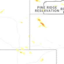
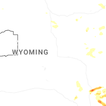
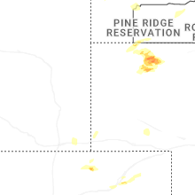
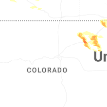
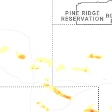
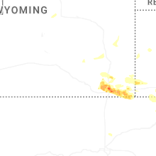
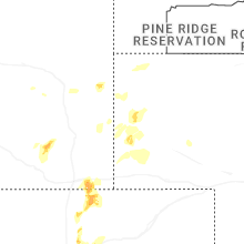
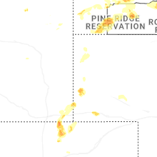

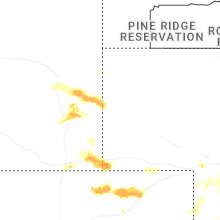


Connect with Interactive Hail Maps