

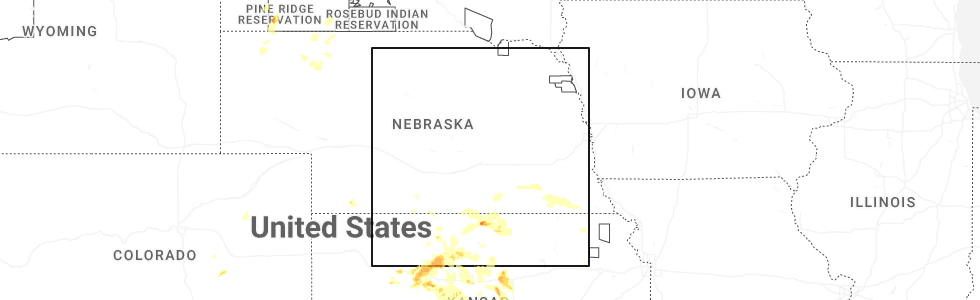
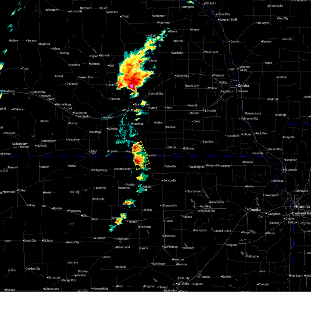
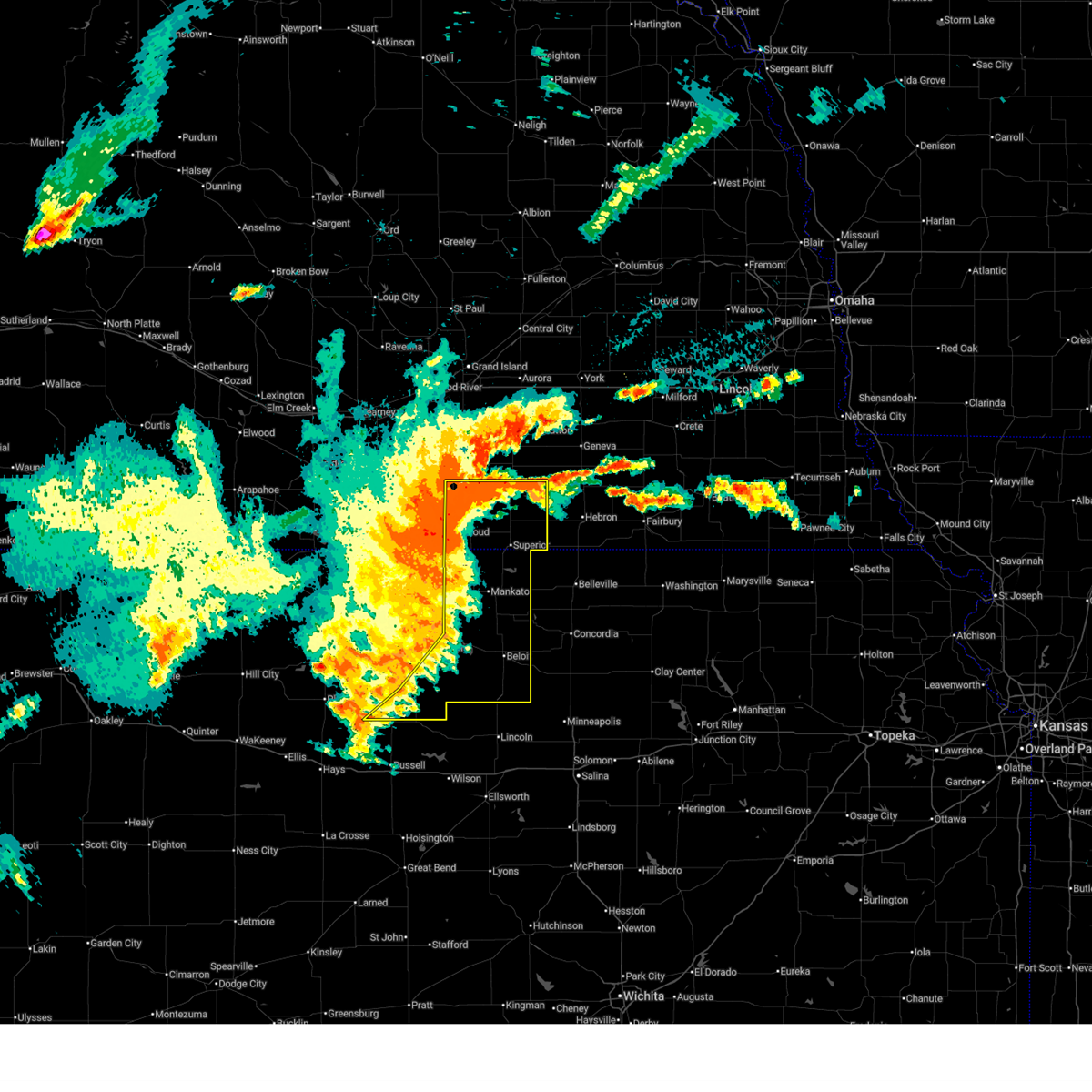
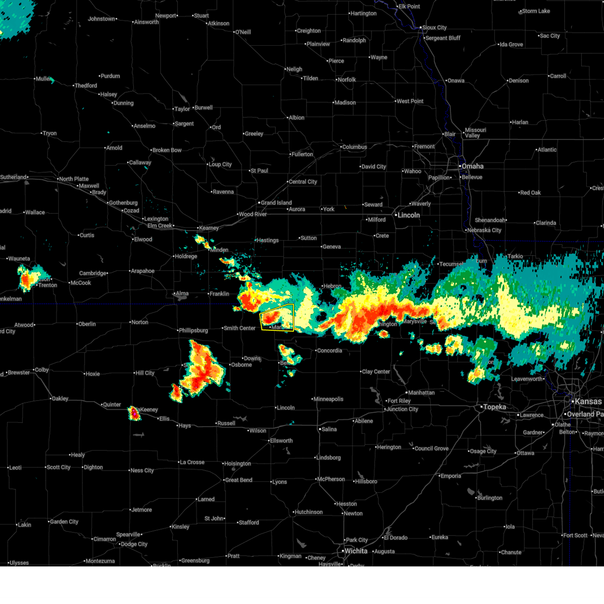
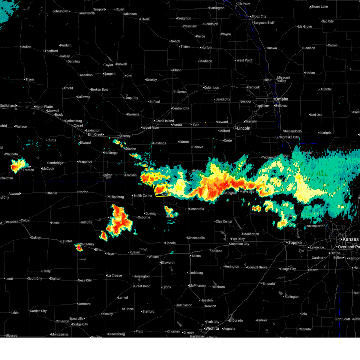
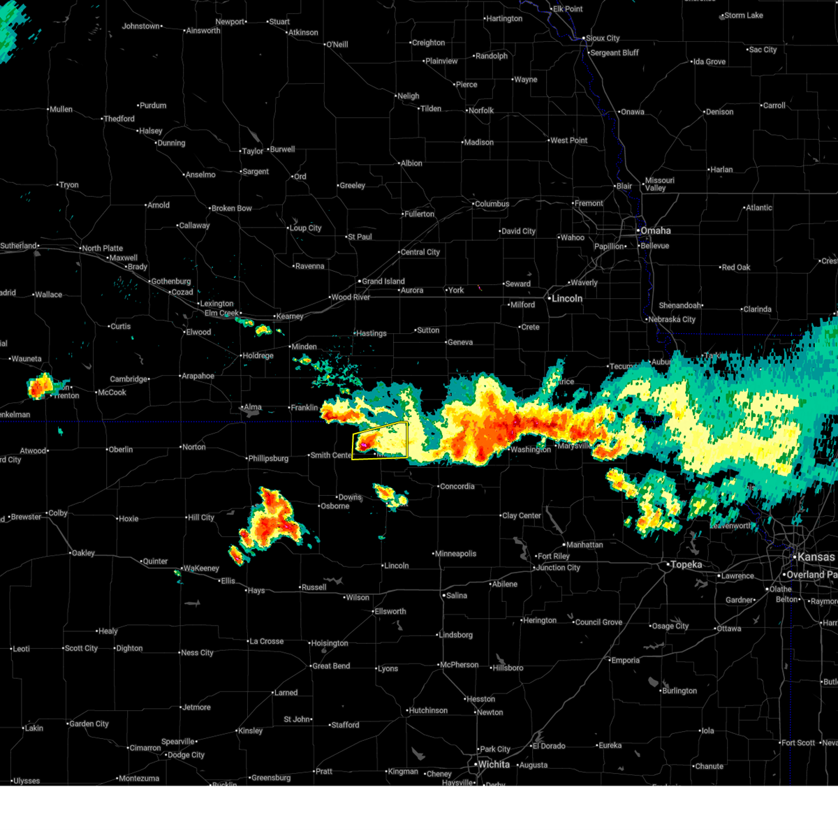
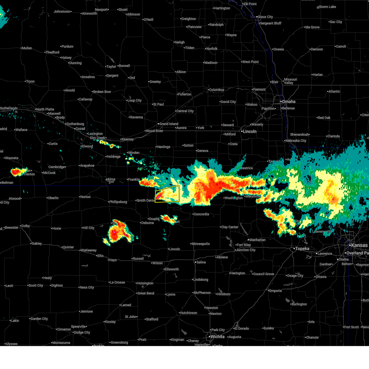
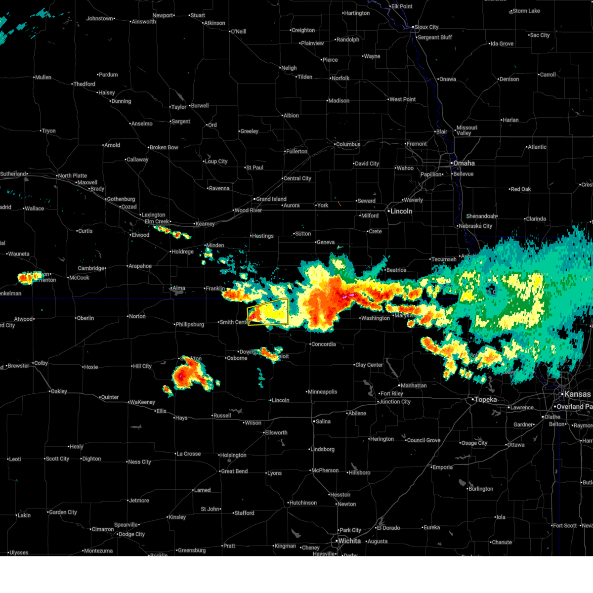
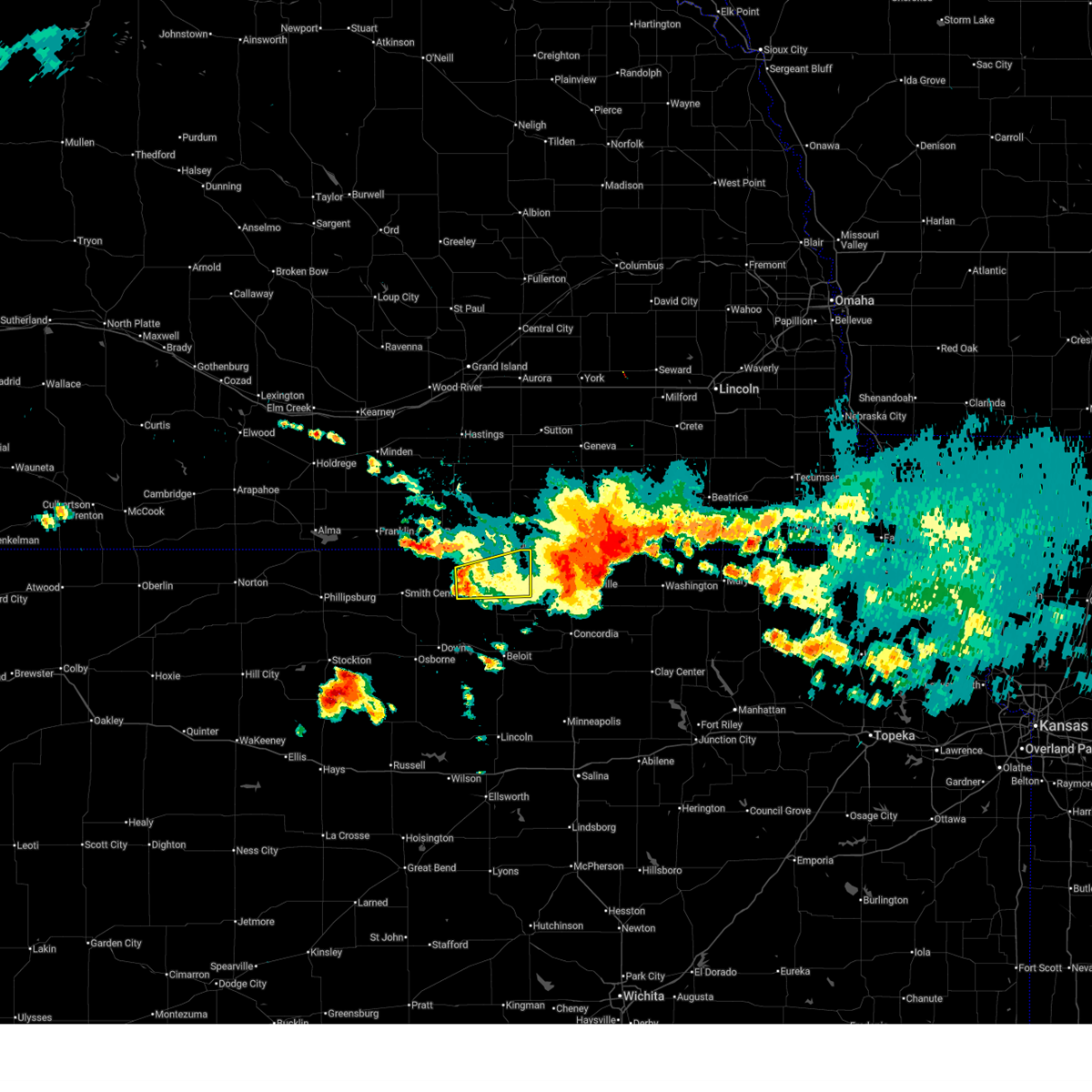
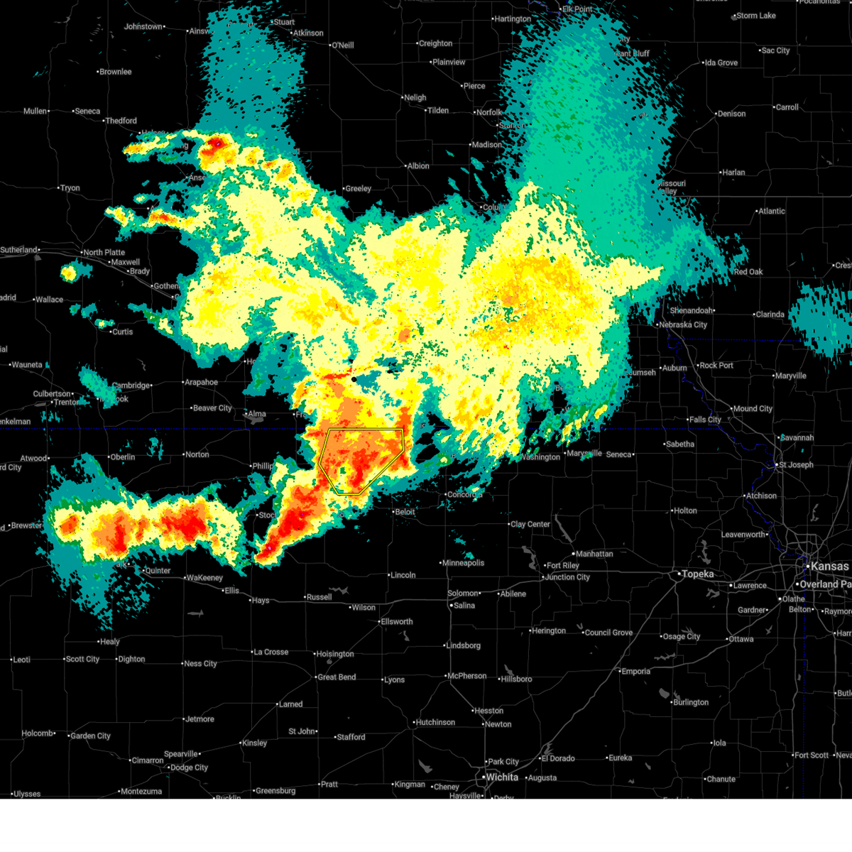
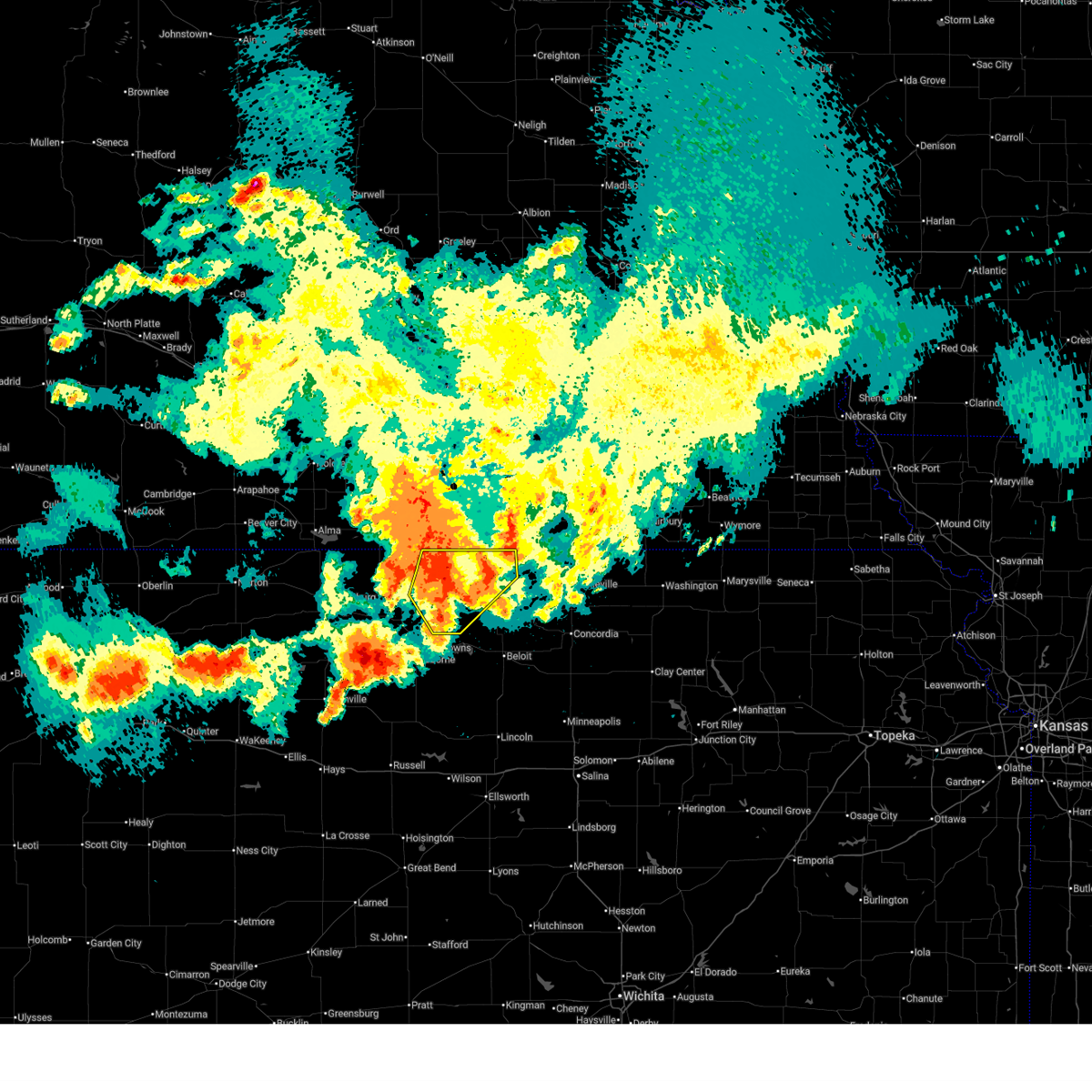
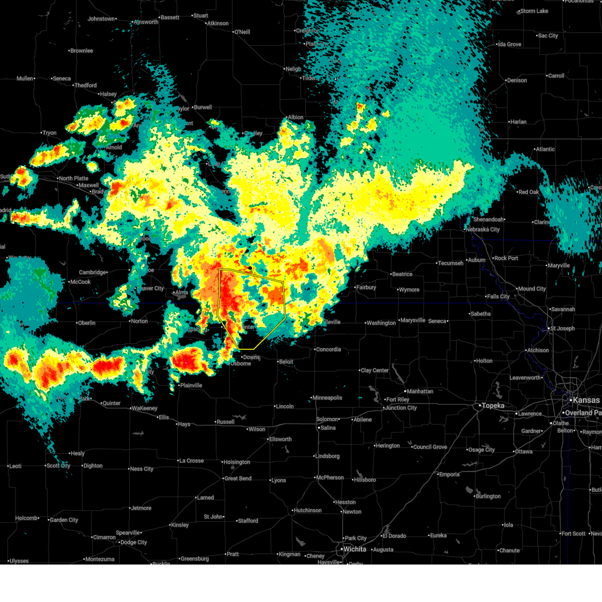
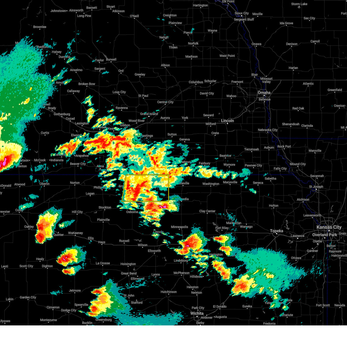
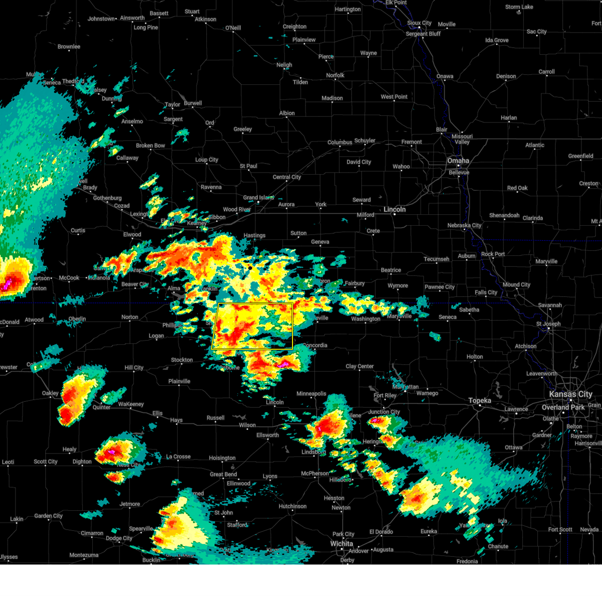
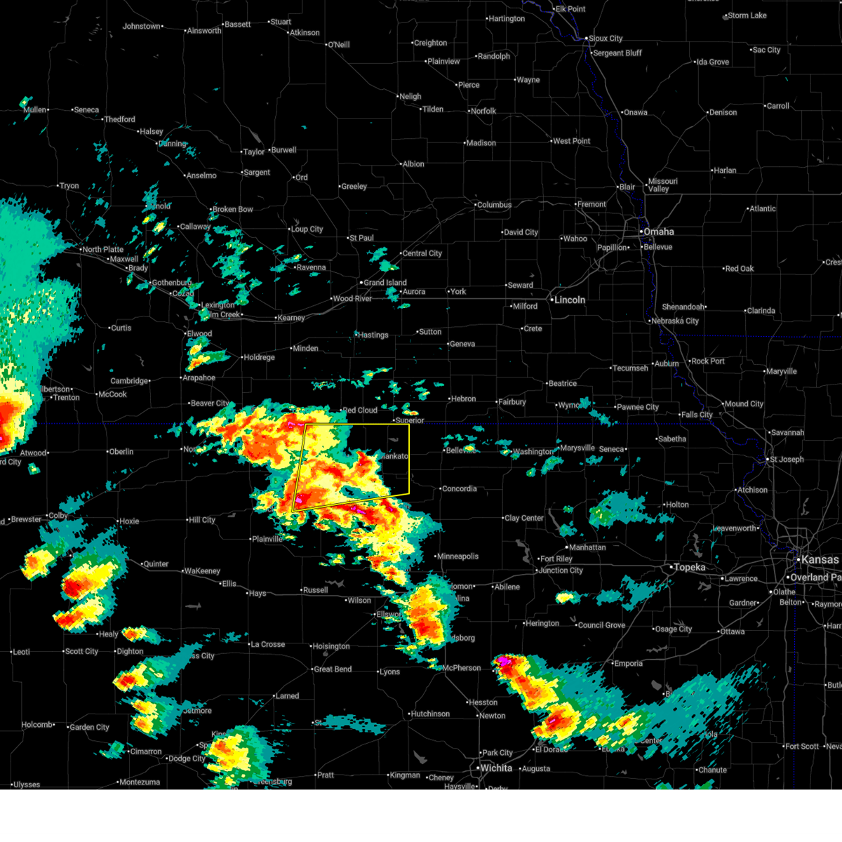
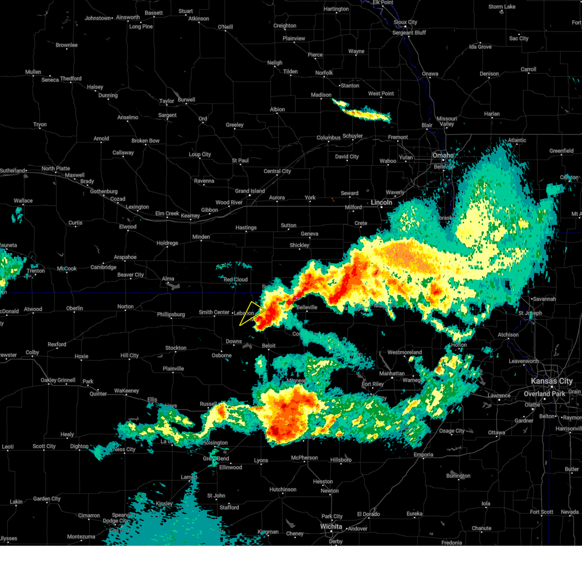
Hail Map for Burr Oak, KS
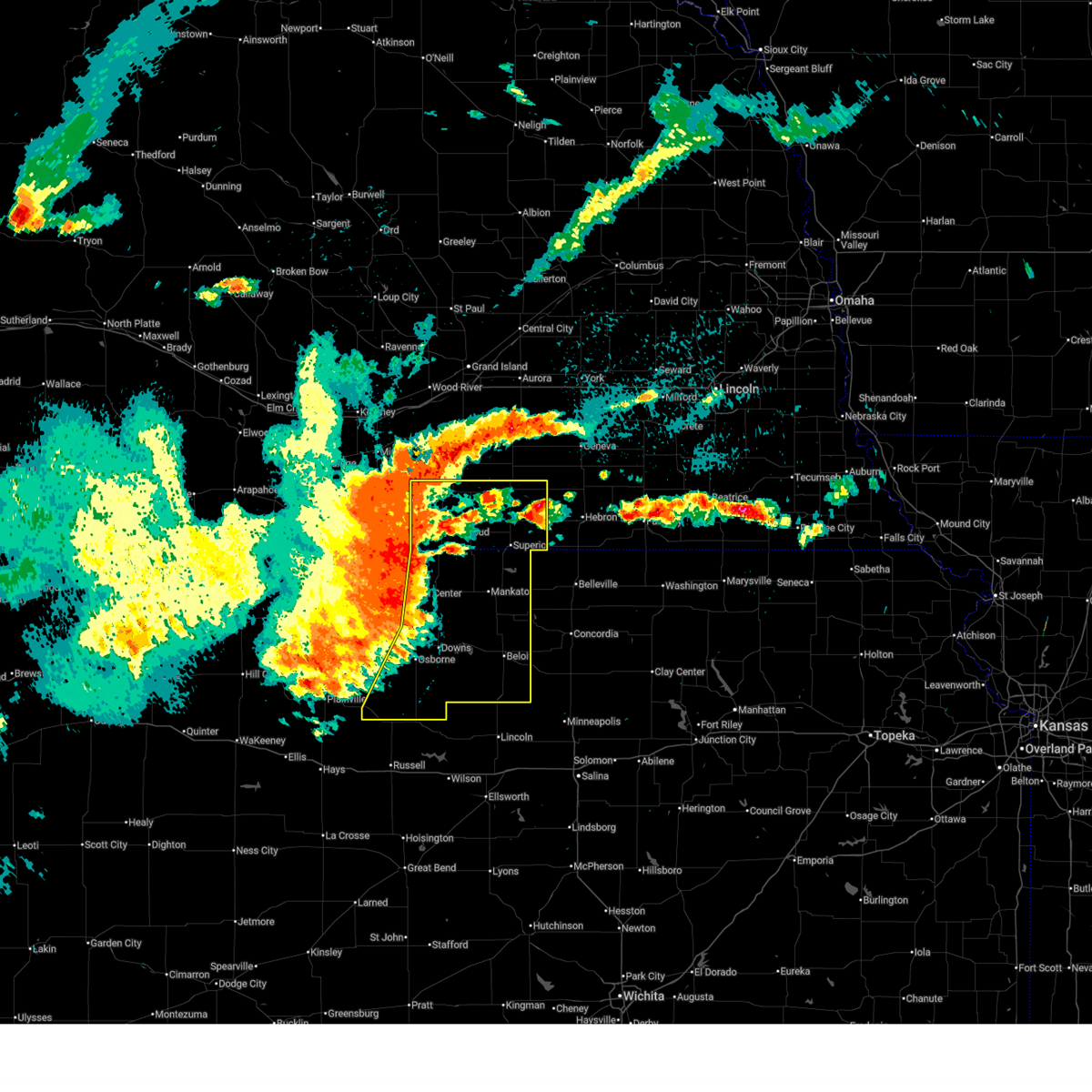
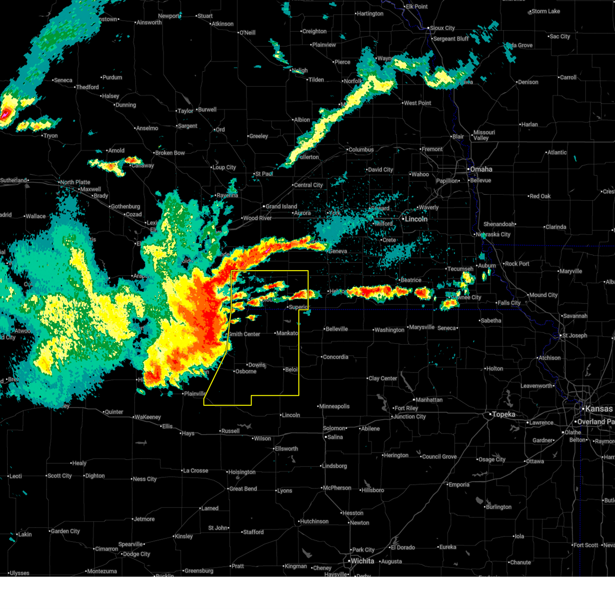
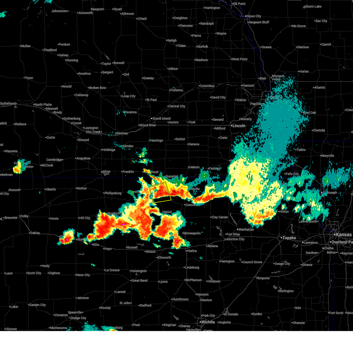
The Burr Oak, KS area has had 25 reports of on-the-ground hail by trained spotters, and has been under severe weather warnings 30 times during the past 12 months. Doppler radar has detected hail at or near Burr Oak, KS on 112 occasions, including 8 occasions during the past year.
| Name: | Burr Oak, KS |
| Where Located: | 72.9 miles S of Grand Island, NE |
| Map: | Google Map for Burr Oak, KS |
| Population: | 174 |
| Housing Units: | 144 |
| More Info: | Search Google for Burr Oak, KS |
2
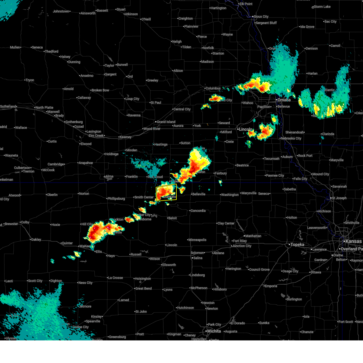
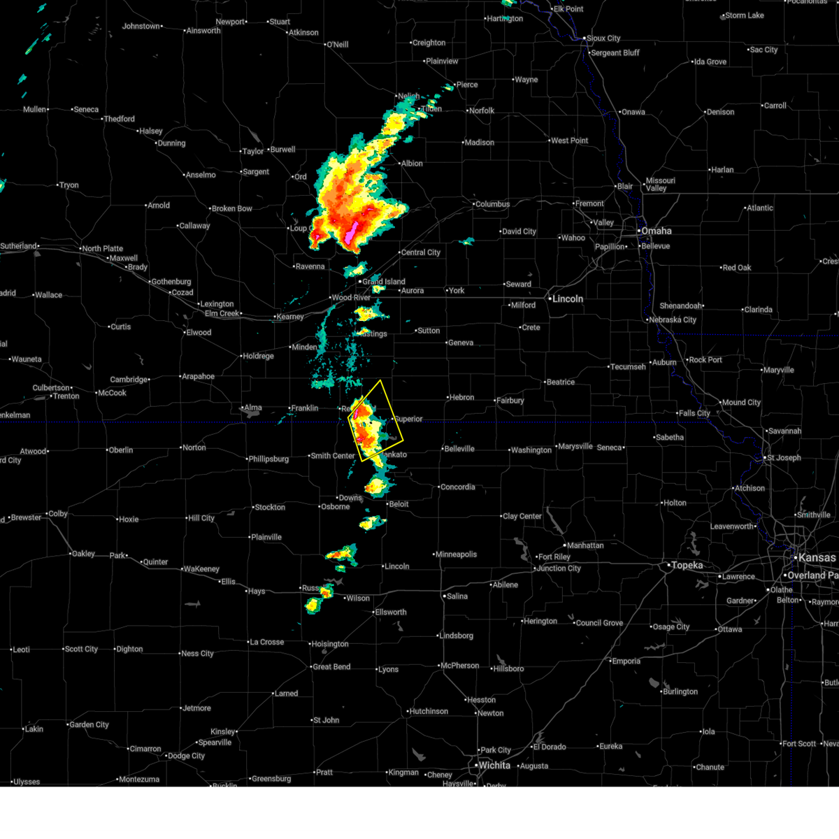
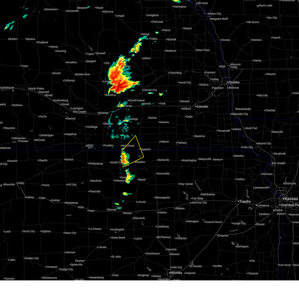
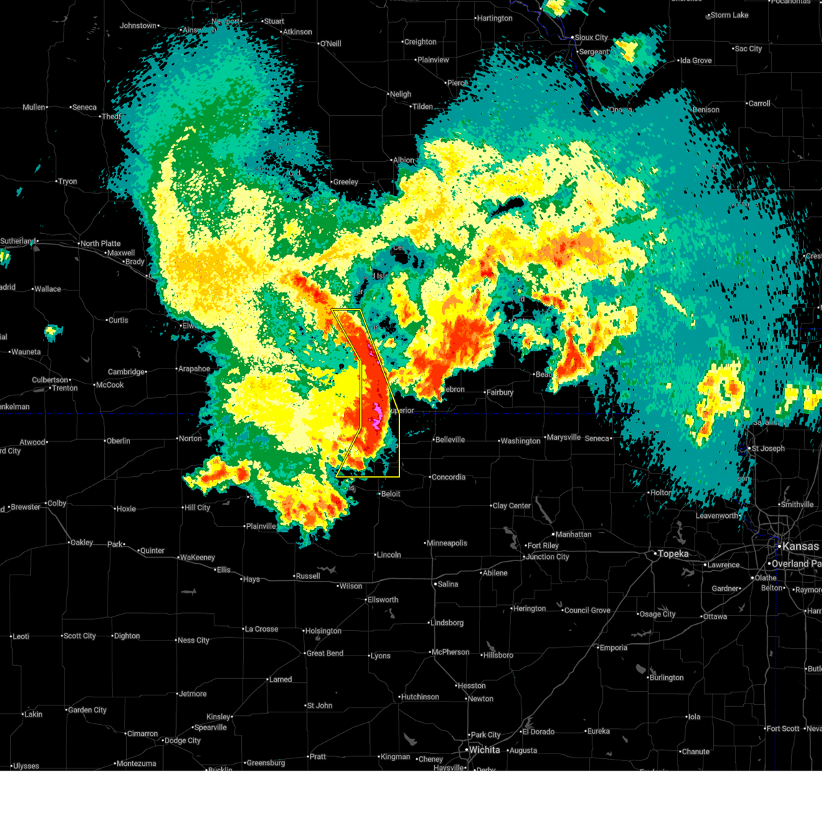
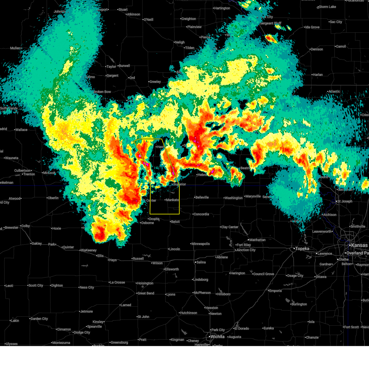
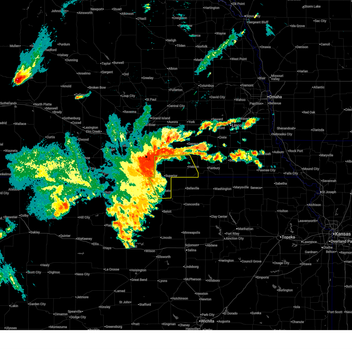
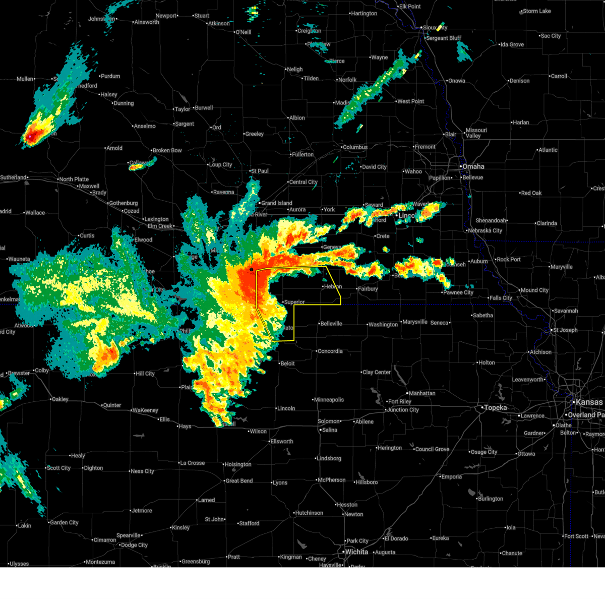
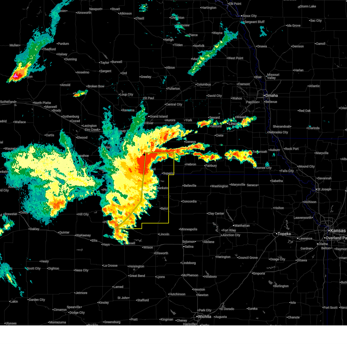
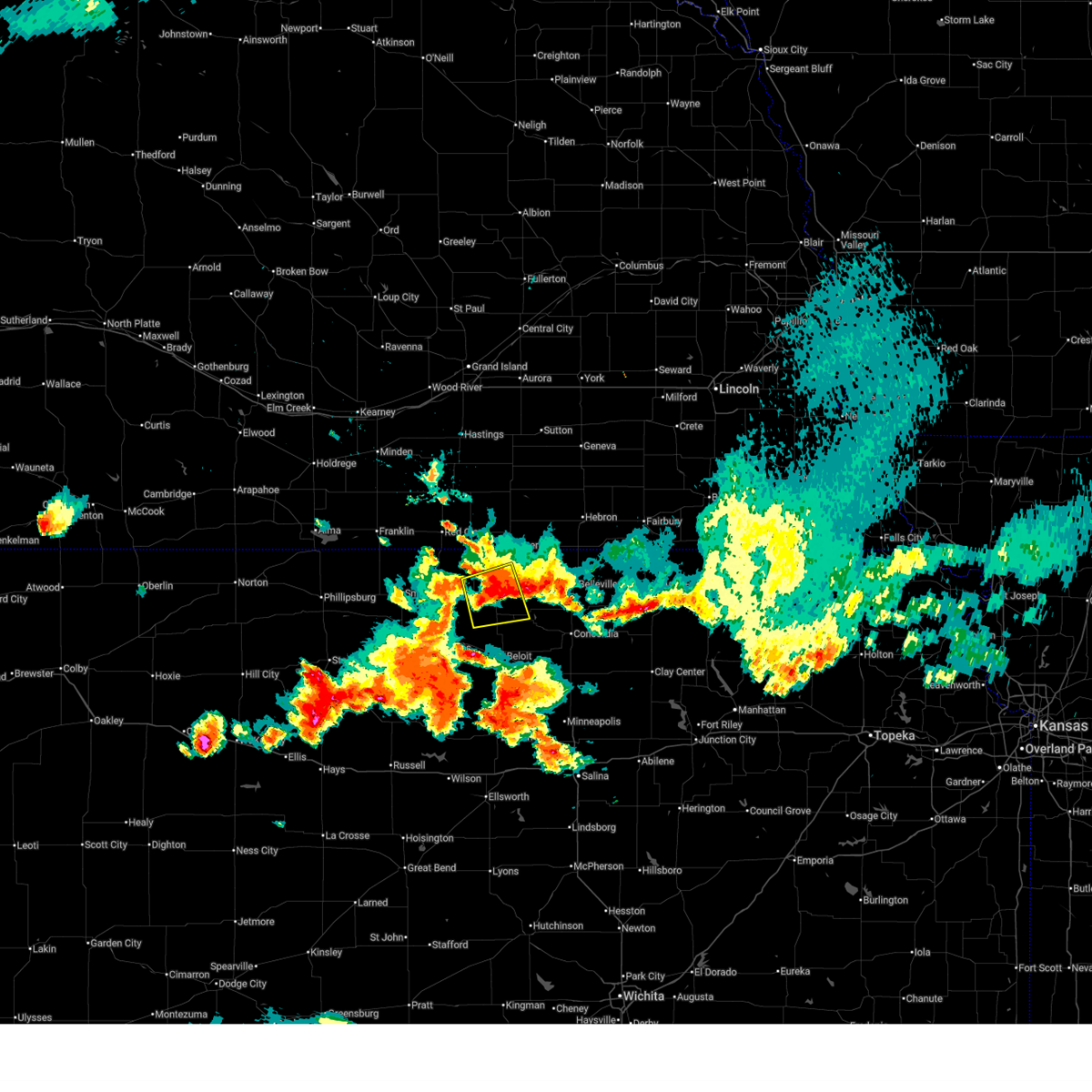
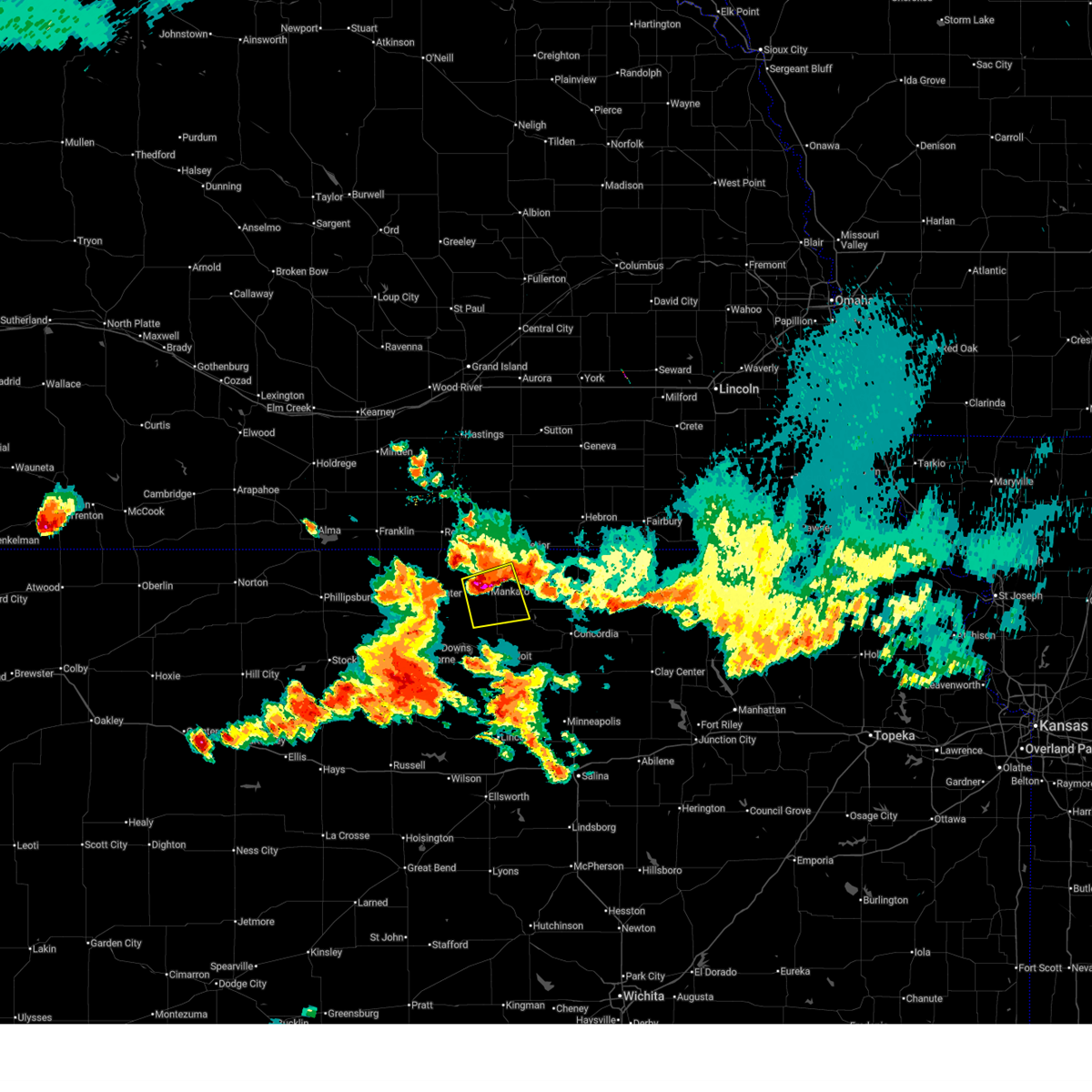
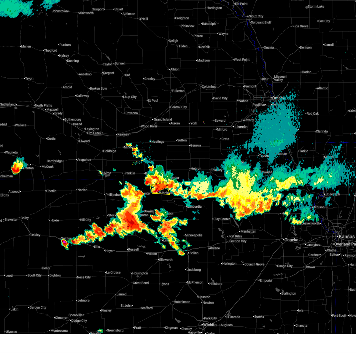
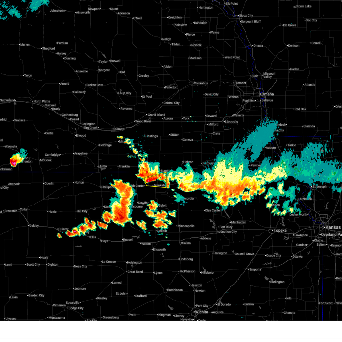
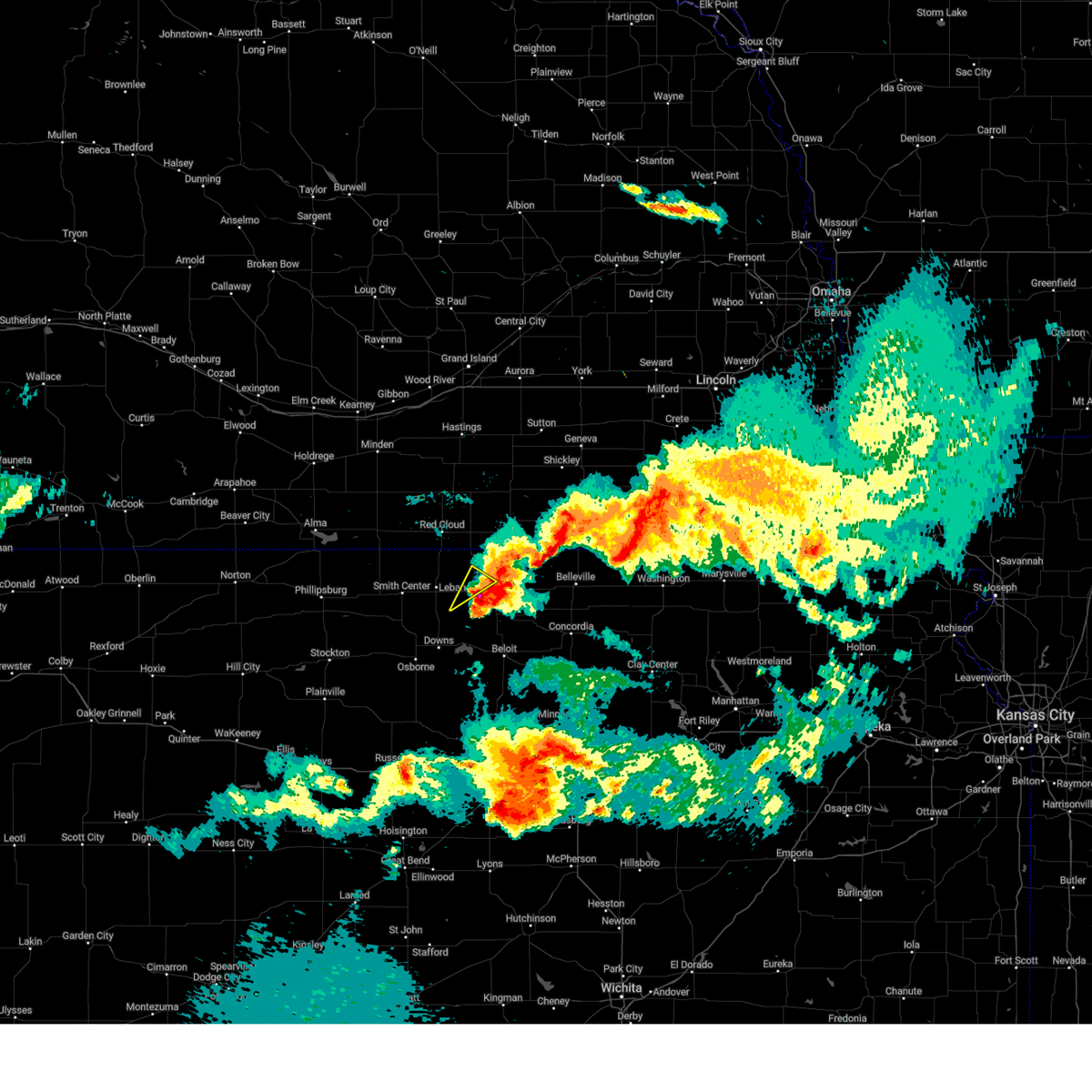
The Top Recent Hail Date for Burr Oak, KS is Monday, July 21, 2025 (10th out of 112)
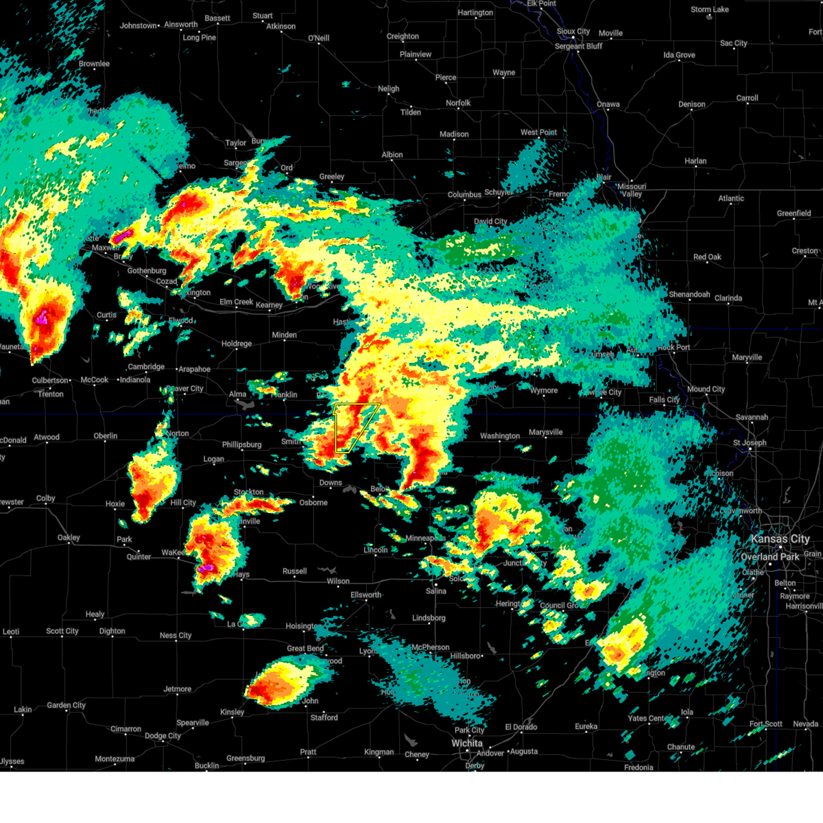
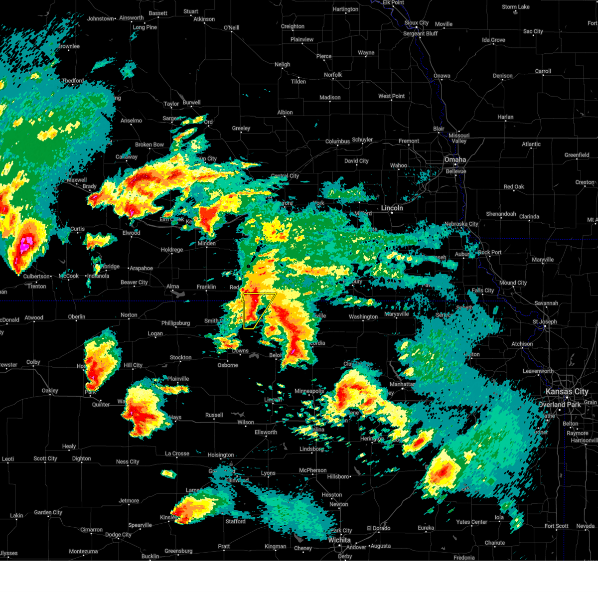
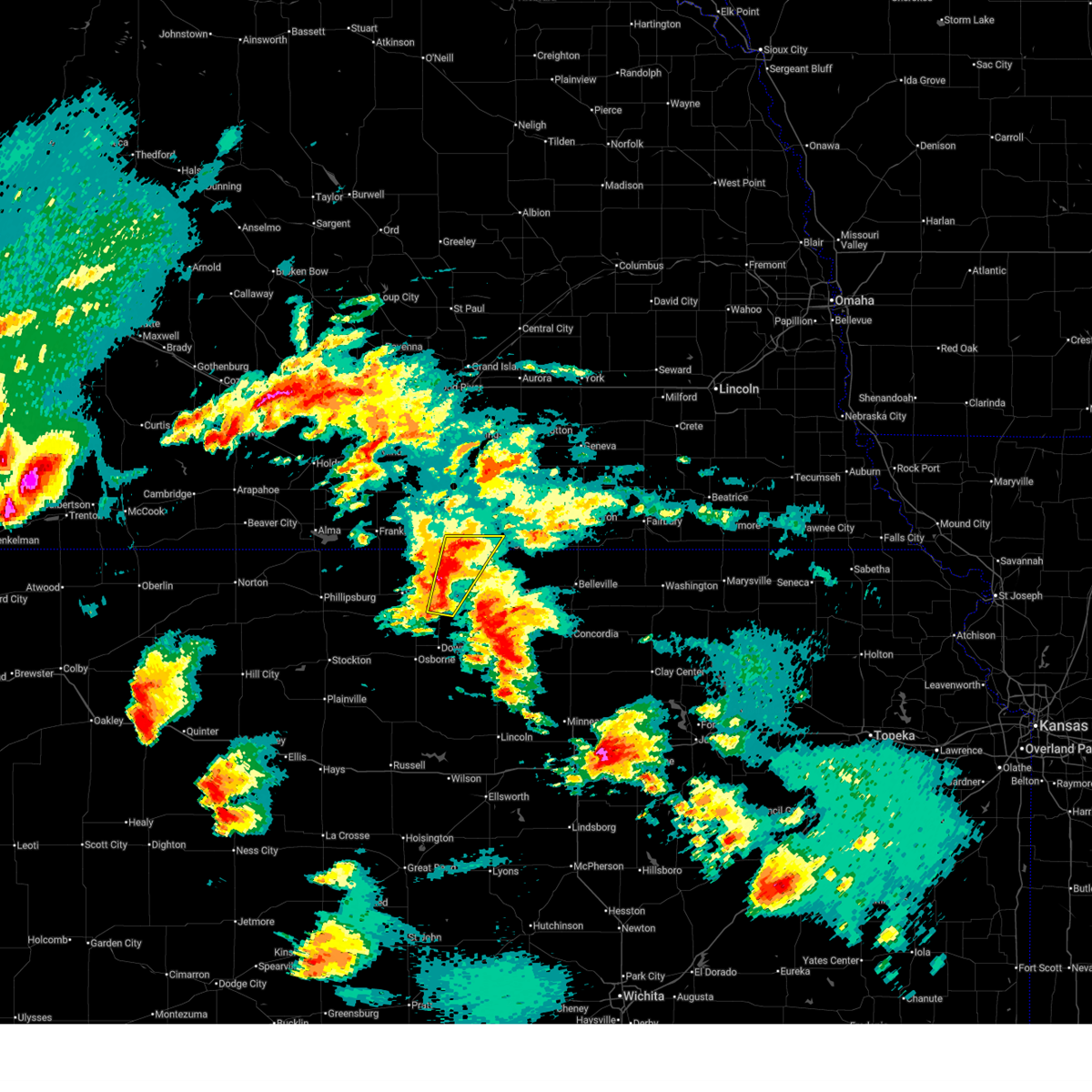
Hail and Wind Damage Spotted near Burr Oak, KS
| Date / Time | Report Details |
|---|---|
| 7/3/2026 6:35 PM CDT |
 Svrgid the national weather service in hastings has issued a * severe thunderstorm warning for, northeastern jewell county in north central kansas, * until 715 pm cdt. * at 634 pm cdt, a severe thunderstorm was located over mankato, or 25 miles north of beloit, moving east at 25 mph (radar indicated). Hazards include 60 mph wind gusts and quarter size hail. Hail damage to vehicles is expected. expect wind damage to roofs, siding, and trees. this severe thunderstorm will be near, mankato around 640 pm cdt. montrose around 645 pm cdt. Other locations in the path of this severe thunderstorm include formoso. Svrgid the national weather service in hastings has issued a * severe thunderstorm warning for, northeastern jewell county in north central kansas, * until 715 pm cdt. * at 634 pm cdt, a severe thunderstorm was located over mankato, or 25 miles north of beloit, moving east at 25 mph (radar indicated). Hazards include 60 mph wind gusts and quarter size hail. Hail damage to vehicles is expected. expect wind damage to roofs, siding, and trees. this severe thunderstorm will be near, mankato around 640 pm cdt. montrose around 645 pm cdt. Other locations in the path of this severe thunderstorm include formoso.
|
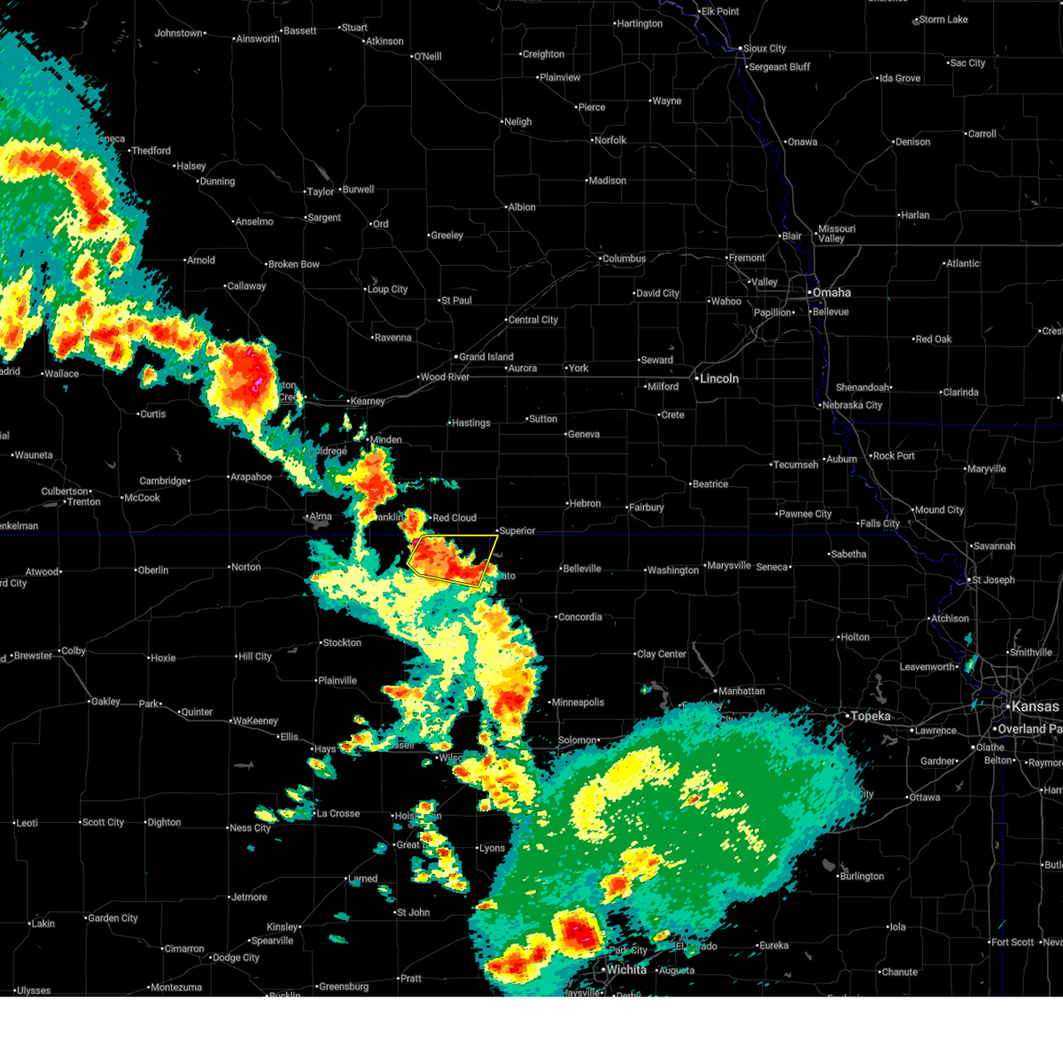
| 6/13/2026 3:45 PM CDT | Quarter sized hail reported 7 miles S of Burr Oak, KS, report received via facebook. |
| 5/30/2026 8:01 PM CDT |
 At 801 pm cdt, severe thunderstorms were located along a line extending from 9 miles north of lebanon to near esbon to near burr oak, moving northeast at 30 mph (radar indicated). Hazards include 60 mph wind gusts and quarter size hail. Hail damage to vehicles is expected. expect wind damage to roofs, siding, and trees. These severe storms will be near, burr oak around 805 pm cdt. At 801 pm cdt, severe thunderstorms were located along a line extending from 9 miles north of lebanon to near esbon to near burr oak, moving northeast at 30 mph (radar indicated). Hazards include 60 mph wind gusts and quarter size hail. Hail damage to vehicles is expected. expect wind damage to roofs, siding, and trees. These severe storms will be near, burr oak around 805 pm cdt.
|
| 5/30/2026 7:58 PM CDT |
 Svrgid the national weather service in hastings has issued a * severe thunderstorm warning for, northern jewell county in north central kansas, northeastern smith county in north central kansas, southwestern clay county in south central nebraska, eastern franklin county in south central nebraska, nuckolls county in south central nebraska, webster county in south central nebraska, adams county in south central nebraska, eastern kearney county in south central nebraska, * until 845 pm cdt. * at 758 pm cdt, severe thunderstorms were located along a line extending from near upland to near inavale to 7 miles north of esbon to near mankato, moving northeast at 45 mph (radar indicated). Hazards include 60 mph wind gusts and quarter size hail. Hail damage to vehicles is expected. expect wind damage to roofs, siding, and trees. severe thunderstorms will be near, red cloud, campbell, and norman around 805 pm cdt. superior, bladen, guide rock, cowles, webber, and bostwick around 810 pm cdt. holstein and heartwell around 815 pm cdt. Other locations in the path of these severe thunderstorms include blue hill, roseland, rosemont, kenesaw, nelson, lawrence, ayr, nora and oak. Svrgid the national weather service in hastings has issued a * severe thunderstorm warning for, northern jewell county in north central kansas, northeastern smith county in north central kansas, southwestern clay county in south central nebraska, eastern franklin county in south central nebraska, nuckolls county in south central nebraska, webster county in south central nebraska, adams county in south central nebraska, eastern kearney county in south central nebraska, * until 845 pm cdt. * at 758 pm cdt, severe thunderstorms were located along a line extending from near upland to near inavale to 7 miles north of esbon to near mankato, moving northeast at 45 mph (radar indicated). Hazards include 60 mph wind gusts and quarter size hail. Hail damage to vehicles is expected. expect wind damage to roofs, siding, and trees. severe thunderstorms will be near, red cloud, campbell, and norman around 805 pm cdt. superior, bladen, guide rock, cowles, webber, and bostwick around 810 pm cdt. holstein and heartwell around 815 pm cdt. Other locations in the path of these severe thunderstorms include blue hill, roseland, rosemont, kenesaw, nelson, lawrence, ayr, nora and oak.
|
| 5/30/2026 7:41 PM CDT |
 Svrgid the national weather service in hastings has issued a * severe thunderstorm warning for, northwestern jewell county in north central kansas, northeastern smith county in north central kansas, * until 815 pm cdt. * at 740 pm cdt, severe thunderstorms were located along a line extending from near lebanon to 6 miles southwest of esbon to near ionia, moving northeast at 30 mph (radar indicated). Hazards include 60 mph wind gusts and quarter size hail. Hail damage to vehicles is expected. expect wind damage to roofs, siding, and trees. severe thunderstorms will be near, lebanon and esbon around 745 pm cdt. Burr oak around 800 pm cdt. Svrgid the national weather service in hastings has issued a * severe thunderstorm warning for, northwestern jewell county in north central kansas, northeastern smith county in north central kansas, * until 815 pm cdt. * at 740 pm cdt, severe thunderstorms were located along a line extending from near lebanon to 6 miles southwest of esbon to near ionia, moving northeast at 30 mph (radar indicated). Hazards include 60 mph wind gusts and quarter size hail. Hail damage to vehicles is expected. expect wind damage to roofs, siding, and trees. severe thunderstorms will be near, lebanon and esbon around 745 pm cdt. Burr oak around 800 pm cdt.
|
| 5/17/2026 5:22 PM CDT |
 At 522 pm cdt, a severe thunderstorm was located near bostwick, or 31 miles west of belleville, moving northeast at 30 mph (radar indicated). Hazards include 60 mph wind gusts and half dollar size hail. Hail damage to vehicles is expected. expect wind damage to roofs, siding, and trees. This severe storm will be near, superior and bostwick around 530 pm cdt. At 522 pm cdt, a severe thunderstorm was located near bostwick, or 31 miles west of belleville, moving northeast at 30 mph (radar indicated). Hazards include 60 mph wind gusts and half dollar size hail. Hail damage to vehicles is expected. expect wind damage to roofs, siding, and trees. This severe storm will be near, superior and bostwick around 530 pm cdt.
|
| 5/17/2026 5:12 PM CDT |
 At 512 pm cdt, severe thunderstorms were located along a line extending from near guide rock to near burr oak, moving northeast at 35 mph (radar indicated). Hazards include 60 mph wind gusts and half dollar size hail. Hail damage to vehicles is expected. expect wind damage to roofs, siding, and trees. these severe storms will be near, guide rock and burr oak around 515 pm cdt. Bostwick around 525 pm cdt. At 512 pm cdt, severe thunderstorms were located along a line extending from near guide rock to near burr oak, moving northeast at 35 mph (radar indicated). Hazards include 60 mph wind gusts and half dollar size hail. Hail damage to vehicles is expected. expect wind damage to roofs, siding, and trees. these severe storms will be near, guide rock and burr oak around 515 pm cdt. Bostwick around 525 pm cdt.
|
| 5/17/2026 5:02 PM CDT |
 At 502 pm cdt, severe thunderstorms were located along a line extending from 7 miles southwest of guide rock to near esbon, moving northeast at 35 mph (radar indicated). Hazards include 60 mph wind gusts and half dollar size hail. Hail damage to vehicles is expected. expect wind damage to roofs, siding, and trees. these severe storms will be near, guide rock and burr oak around 505 pm cdt. Bostwick around 525 pm cdt. At 502 pm cdt, severe thunderstorms were located along a line extending from 7 miles southwest of guide rock to near esbon, moving northeast at 35 mph (radar indicated). Hazards include 60 mph wind gusts and half dollar size hail. Hail damage to vehicles is expected. expect wind damage to roofs, siding, and trees. these severe storms will be near, guide rock and burr oak around 505 pm cdt. Bostwick around 525 pm cdt.
|
| 5/16/2026 11:02 PM CDT |
 At 1101 pm cdt, severe thunderstorms were located along a line extending from near inland to near edgar to near hardy to near jewell, moving east at 40 mph (automated weather station. this line of storms has a history of producing measured wind gusts of 60 to 70 mph, strongest south of highway 6). Hazards include 70 mph wind gusts. Expect considerable tree damage. damage is likely to mobile homes, roofs, and outbuildings. Locations impacted include, hastings, superior, mankato, nelson, jewell, glenvil, lawrence, trumbull, inland, formoso, ionia, deweese, randall, webber, hansen, montrose, lovewell state park, and bostwick. At 1101 pm cdt, severe thunderstorms were located along a line extending from near inland to near edgar to near hardy to near jewell, moving east at 40 mph (automated weather station. this line of storms has a history of producing measured wind gusts of 60 to 70 mph, strongest south of highway 6). Hazards include 70 mph wind gusts. Expect considerable tree damage. damage is likely to mobile homes, roofs, and outbuildings. Locations impacted include, hastings, superior, mankato, nelson, jewell, glenvil, lawrence, trumbull, inland, formoso, ionia, deweese, randall, webber, hansen, montrose, lovewell state park, and bostwick.
|
| 5/16/2026 10:17 PM CDT |
 Svrgid the national weather service in hastings has issued a * severe thunderstorm warning for, jewell county in north central kansas, southwestern clay county in south central nebraska, western nuckolls county in south central nebraska, webster county in south central nebraska, adams county in south central nebraska, northeastern kearney county in south central nebraska, * until 1115 pm cdt. * at 1015 pm cdt, a long line of severe thunderstorms extends from near minden to blue hill to smith center, moving east at 45 mph (automated weather station). Hazards include 70 mph wind gusts. Expect considerable tree damage. Damage is likely to mobile homes, roofs, and outbuildings. Svrgid the national weather service in hastings has issued a * severe thunderstorm warning for, jewell county in north central kansas, southwestern clay county in south central nebraska, western nuckolls county in south central nebraska, webster county in south central nebraska, adams county in south central nebraska, northeastern kearney county in south central nebraska, * until 1115 pm cdt. * at 1015 pm cdt, a long line of severe thunderstorms extends from near minden to blue hill to smith center, moving east at 45 mph (automated weather station). Hazards include 70 mph wind gusts. Expect considerable tree damage. Damage is likely to mobile homes, roofs, and outbuildings.
|
| 8/10/2025 12:41 AM CDT |
 At 1240 am cdt, severe thunderstorms were located along a line extending from near nelson to hardy to near norway, moving east at 60 mph. these are destructive storms for eastern nuckolls and jewell counties (automated weather station). Hazards include 90 mph wind gusts and penny size hail. You are in a life-threatening situation. flying debris may be deadly to those caught without shelter. mobile homes will be heavily damaged or destroyed. homes and businesses will have substantial roof and window damage. expect extensive tree damage and power outages. these severe storms will be near, nelson, ruskin, byron, and nora around 1245 am cdt. chester and oak around 1250 am cdt. deshler around 1255 am cdt. hebron and hubbell around 100 am cdt. Belvidere around 110 am cdt. At 1240 am cdt, severe thunderstorms were located along a line extending from near nelson to hardy to near norway, moving east at 60 mph. these are destructive storms for eastern nuckolls and jewell counties (automated weather station). Hazards include 90 mph wind gusts and penny size hail. You are in a life-threatening situation. flying debris may be deadly to those caught without shelter. mobile homes will be heavily damaged or destroyed. homes and businesses will have substantial roof and window damage. expect extensive tree damage and power outages. these severe storms will be near, nelson, ruskin, byron, and nora around 1245 am cdt. chester and oak around 1250 am cdt. deshler around 1255 am cdt. hebron and hubbell around 100 am cdt. Belvidere around 110 am cdt.
|
| 8/10/2025 12:41 AM CDT |
 the severe thunderstorm warning has been cancelled and is no longer in effect the severe thunderstorm warning has been cancelled and is no longer in effect
|
| 8/10/2025 12:31 AM CDT |
 Svrgid the national weather service in hastings has issued a * severe thunderstorm warning for, eastern jewell county in north central kansas, eastern webster county in south central nebraska, nuckolls county in south central nebraska, thayer county in south central nebraska, * until 115 am cdt. * at 1230 am cdt, severe thunderstorms were located along a line extending from lawrence to superior to montrose, moving east at 35 mph. these are destructive storms for superior and surrounding areas (radar indicated). Hazards include 80 mph wind gusts and penny size hail. Flying debris will be dangerous to those caught without shelter. mobile homes will be heavily damaged. expect considerable damage to roofs, windows, and vehicles. extensive tree damage and power outages are likely. severe thunderstorms will be near, superior, nelson, hardy, formoso, webber, and lovewell state park around 1235 am cdt. nora around 1240 am cdt. ruskin around 1245 am cdt. byron and oak around 1250 am cdt. Other locations in the path of these severe thunderstorms include deshler, davenport and chester. Svrgid the national weather service in hastings has issued a * severe thunderstorm warning for, eastern jewell county in north central kansas, eastern webster county in south central nebraska, nuckolls county in south central nebraska, thayer county in south central nebraska, * until 115 am cdt. * at 1230 am cdt, severe thunderstorms were located along a line extending from lawrence to superior to montrose, moving east at 35 mph. these are destructive storms for superior and surrounding areas (radar indicated). Hazards include 80 mph wind gusts and penny size hail. Flying debris will be dangerous to those caught without shelter. mobile homes will be heavily damaged. expect considerable damage to roofs, windows, and vehicles. extensive tree damage and power outages are likely. severe thunderstorms will be near, superior, nelson, hardy, formoso, webber, and lovewell state park around 1235 am cdt. nora around 1240 am cdt. ruskin around 1245 am cdt. byron and oak around 1250 am cdt. Other locations in the path of these severe thunderstorms include deshler, davenport and chester.
|
| 8/10/2025 12:22 AM CDT |
 At 1222 am cdt, severe thunderstorms were located along a line extending from near lawrence to near glen elder to near lucas, moving east at 45 mph (radar indicated). Hazards include 70 mph wind gusts and quarter size hail. Hail damage to vehicles is expected. expect considerable tree damage. wind damage is also likely to mobile homes, roofs, and outbuildings. Locations impacted include, beloit, superior, downs, mankato, nelson, cawker city, glen elder, jewell, lawrence, davenport, guide rock, tipton, burr oak, hardy, ruskin, esbon, asherville, formoso, simpson, and ionia. At 1222 am cdt, severe thunderstorms were located along a line extending from near lawrence to near glen elder to near lucas, moving east at 45 mph (radar indicated). Hazards include 70 mph wind gusts and quarter size hail. Hail damage to vehicles is expected. expect considerable tree damage. wind damage is also likely to mobile homes, roofs, and outbuildings. Locations impacted include, beloit, superior, downs, mankato, nelson, cawker city, glen elder, jewell, lawrence, davenport, guide rock, tipton, burr oak, hardy, ruskin, esbon, asherville, formoso, simpson, and ionia.
|
| 8/10/2025 12:20 AM CDT | Davis weather statio in jewell county KS, 7.2 miles SW of Burr Oak, KS |
| 8/10/2025 12:17 AM CDT |
 At 1216 am cdt, severe thunderstorms were located along a line extending from near rosemont to near glen elder to lucas, moving east at 45 mph (automated weather stations reported wind gusts over 60 mph in parts of smith county). Hazards include 60 mph wind gusts and penny size hail. Expect damage to roofs, siding, and trees. Locations impacted include, beloit, superior, blue hill, downs, mankato, nelson, cawker city, glen elder, jewell, lawrence, davenport, guide rock, tipton, burr oak, hardy, ruskin, esbon, asherville, formoso, and simpson. At 1216 am cdt, severe thunderstorms were located along a line extending from near rosemont to near glen elder to lucas, moving east at 45 mph (automated weather stations reported wind gusts over 60 mph in parts of smith county). Hazards include 60 mph wind gusts and penny size hail. Expect damage to roofs, siding, and trees. Locations impacted include, beloit, superior, blue hill, downs, mankato, nelson, cawker city, glen elder, jewell, lawrence, davenport, guide rock, tipton, burr oak, hardy, ruskin, esbon, asherville, formoso, and simpson.
|
| 8/10/2025 12:17 AM CDT |
 the severe thunderstorm warning has been cancelled and is no longer in effect the severe thunderstorm warning has been cancelled and is no longer in effect
|
| 8/10/2025 12:00 AM CDT |
 At 1200 am cdt, severe thunderstorms were located along a line extending from 6 miles southwest of blue hill to near cawker city to luray, moving east at 45 mph (automated weather station reported 58 mph wind gusts in smith county). Hazards include 60 mph wind gusts and penny size hail. Expect damage to roofs, siding, and trees. Locations impacted include, beloit, superior, osborne, red cloud, blue hill, downs, mankato, nelson, cawker city, glen elder, jewell, campbell, natoma, lawrence, davenport, bladen, guide rock, lebanon, tipton, and burr oak. At 1200 am cdt, severe thunderstorms were located along a line extending from 6 miles southwest of blue hill to near cawker city to luray, moving east at 45 mph (automated weather station reported 58 mph wind gusts in smith county). Hazards include 60 mph wind gusts and penny size hail. Expect damage to roofs, siding, and trees. Locations impacted include, beloit, superior, osborne, red cloud, blue hill, downs, mankato, nelson, cawker city, glen elder, jewell, campbell, natoma, lawrence, davenport, bladen, guide rock, lebanon, tipton, and burr oak.
|
| 8/9/2025 11:44 PM CDT |
 Svrgid the national weather service in hastings has issued a * severe thunderstorm warning for, mitchell county in north central kansas, jewell county in north central kansas, eastern smith county in north central kansas, osborne county in north central kansas, webster county in south central nebraska, nuckolls county in south central nebraska, * until 1245 am cdt. * at 1144 pm cdt, severe thunderstorms were located along a line extending from near campbell to near portis to 8 miles southeast of natoma, moving east at 40 mph (radar indicated). Hazards include 70 mph wind gusts and quarter size hail. Hail damage to vehicles is expected. expect considerable tree damage. wind damage is also likely to mobile homes, roofs, and outbuildings. severe thunderstorms will be near, red cloud, downs, bladen, lebanon, and inavale around 1150 pm cdt. cawker city, esbon, and cowles around 1155 pm cdt. tipton and ionia around 1200 am cdt. Other locations in the path of these severe thunderstorms include glen elder, guide rock, burr oak, hunter, mankato, jewell, victor, bostwick, beloit, superior, nelson, randall and montrose. Svrgid the national weather service in hastings has issued a * severe thunderstorm warning for, mitchell county in north central kansas, jewell county in north central kansas, eastern smith county in north central kansas, osborne county in north central kansas, webster county in south central nebraska, nuckolls county in south central nebraska, * until 1245 am cdt. * at 1144 pm cdt, severe thunderstorms were located along a line extending from near campbell to near portis to 8 miles southeast of natoma, moving east at 40 mph (radar indicated). Hazards include 70 mph wind gusts and quarter size hail. Hail damage to vehicles is expected. expect considerable tree damage. wind damage is also likely to mobile homes, roofs, and outbuildings. severe thunderstorms will be near, red cloud, downs, bladen, lebanon, and inavale around 1150 pm cdt. cawker city, esbon, and cowles around 1155 pm cdt. tipton and ionia around 1200 am cdt. Other locations in the path of these severe thunderstorms include glen elder, guide rock, burr oak, hunter, mankato, jewell, victor, bostwick, beloit, superior, nelson, randall and montrose.
|
| 7/21/2025 6:25 PM CDT |
 The storm which prompted the warning has weakened below severe limits, and no longer poses an immediate threat to life or property. therefore, the warning will be allowed to expire. however, small hail, gusty winds and heavy rain are still possible with this thunderstorm. The storm which prompted the warning has weakened below severe limits, and no longer poses an immediate threat to life or property. therefore, the warning will be allowed to expire. however, small hail, gusty winds and heavy rain are still possible with this thunderstorm.
|
| 7/21/2025 6:15 PM CDT |
 At 615 pm cdt, a severe thunderstorm was located near mankato, or 19 miles north of beloit, moving southeast at 15 mph (radar indicated). Hazards include 60 mph wind gusts and quarter size hail. Hail damage to vehicles is expected. expect wind damage to roofs, siding, and trees. this severe storm will be near, jewell around 620 pm cdt. Randall around 635 pm cdt. At 615 pm cdt, a severe thunderstorm was located near mankato, or 19 miles north of beloit, moving southeast at 15 mph (radar indicated). Hazards include 60 mph wind gusts and quarter size hail. Hail damage to vehicles is expected. expect wind damage to roofs, siding, and trees. this severe storm will be near, jewell around 620 pm cdt. Randall around 635 pm cdt.
|
| 7/21/2025 5:51 PM CDT |
 Svrgid the national weather service in hastings has issued a * severe thunderstorm warning for, central jewell county in north central kansas, * until 630 pm cdt. * at 551 pm cdt, a severe thunderstorm was located near mankato, or 24 miles north of beloit, moving southeast at 15 mph. this warning replaces the previous warning in effect for central jewell county (radar indicated). Hazards include golf ball size hail and 60 mph wind gusts. People and animals outdoors will be injured. expect hail damage to roofs, siding, windows, and vehicles. expect wind damage to roofs, siding, and trees. This severe thunderstorm will be near, mankato around 555 pm cdt. Svrgid the national weather service in hastings has issued a * severe thunderstorm warning for, central jewell county in north central kansas, * until 630 pm cdt. * at 551 pm cdt, a severe thunderstorm was located near mankato, or 24 miles north of beloit, moving southeast at 15 mph. this warning replaces the previous warning in effect for central jewell county (radar indicated). Hazards include golf ball size hail and 60 mph wind gusts. People and animals outdoors will be injured. expect hail damage to roofs, siding, windows, and vehicles. expect wind damage to roofs, siding, and trees. This severe thunderstorm will be near, mankato around 555 pm cdt.
|
| 7/21/2025 5:48 PM CDT |
 At 548 pm cdt, a severe thunderstorm was located over mankato, or 25 miles north of beloit, moving southeast at 15 mph (radar indicated). Hazards include golf ball size hail and 60 mph wind gusts. People and animals outdoors will be injured. expect hail damage to roofs, siding, windows, and vehicles. expect wind damage to roofs, siding, and trees. Locations impacted include, mankato, burr oak, and montrose. At 548 pm cdt, a severe thunderstorm was located over mankato, or 25 miles north of beloit, moving southeast at 15 mph (radar indicated). Hazards include golf ball size hail and 60 mph wind gusts. People and animals outdoors will be injured. expect hail damage to roofs, siding, windows, and vehicles. expect wind damage to roofs, siding, and trees. Locations impacted include, mankato, burr oak, and montrose.
|
| 7/21/2025 5:45 PM CDT |
 At 545 pm cdt, a severe thunderstorm was located near mankato, or 26 miles north of beloit, moving southeast at 15 mph (radar indicated). Hazards include 60 mph wind gusts and half dollar size hail. Hail damage to vehicles is expected. expect wind damage to roofs, siding, and trees. Locations impacted include, mankato, burr oak, and montrose. At 545 pm cdt, a severe thunderstorm was located near mankato, or 26 miles north of beloit, moving southeast at 15 mph (radar indicated). Hazards include 60 mph wind gusts and half dollar size hail. Hail damage to vehicles is expected. expect wind damage to roofs, siding, and trees. Locations impacted include, mankato, burr oak, and montrose.
|
| 7/21/2025 5:28 PM CDT |
 Svrgid the national weather service in hastings has issued a * severe thunderstorm warning for, northern jewell county in north central kansas, * until 615 pm cdt. * at 528 pm cdt, a severe thunderstorm was located over burr oak, or 30 miles north of beloit, moving east at 20 mph (radar indicated). Hazards include 60 mph wind gusts and half dollar size hail. Hail damage to vehicles is expected. Expect wind damage to roofs, siding, and trees. Svrgid the national weather service in hastings has issued a * severe thunderstorm warning for, northern jewell county in north central kansas, * until 615 pm cdt. * at 528 pm cdt, a severe thunderstorm was located over burr oak, or 30 miles north of beloit, moving east at 20 mph (radar indicated). Hazards include 60 mph wind gusts and half dollar size hail. Hail damage to vehicles is expected. Expect wind damage to roofs, siding, and trees.
|
| 7/21/2025 5:00 PM CDT |
 the severe thunderstorm warning has been cancelled and is no longer in effect the severe thunderstorm warning has been cancelled and is no longer in effect
|
| 7/21/2025 4:44 PM CDT |
 Svrgid the national weather service in hastings has issued a * severe thunderstorm warning for, northeastern jewell county in north central kansas, * until 530 pm cdt. * at 443 pm cdt, a severe thunderstorm was located near mankato, or 26 miles north of beloit, moving east at 15 mph. this replaces the previous warning in effect for the area (radar indicated). Hazards include golf ball size hail and 60 mph wind gusts. People and animals outdoors will be injured. expect hail damage to roofs, siding, windows, and vehicles. expect wind damage to roofs, siding, and trees. This severe thunderstorm will remain over mainly rural areas of northeastern jewell county. Svrgid the national weather service in hastings has issued a * severe thunderstorm warning for, northeastern jewell county in north central kansas, * until 530 pm cdt. * at 443 pm cdt, a severe thunderstorm was located near mankato, or 26 miles north of beloit, moving east at 15 mph. this replaces the previous warning in effect for the area (radar indicated). Hazards include golf ball size hail and 60 mph wind gusts. People and animals outdoors will be injured. expect hail damage to roofs, siding, windows, and vehicles. expect wind damage to roofs, siding, and trees. This severe thunderstorm will remain over mainly rural areas of northeastern jewell county.
|
| 7/21/2025 4:37 PM CDT |
 At 437 pm cdt, a severe thunderstorm was located near mankato, or 26 miles north of beloit, moving east at 15 mph (radar indicated). Hazards include golf ball size hail and 60 mph wind gusts. People and animals outdoors will be injured. expect hail damage to roofs, siding, windows, and vehicles. expect wind damage to roofs, siding, and trees. This severe storm will be near, mankato around 440 pm cdt. At 437 pm cdt, a severe thunderstorm was located near mankato, or 26 miles north of beloit, moving east at 15 mph (radar indicated). Hazards include golf ball size hail and 60 mph wind gusts. People and animals outdoors will be injured. expect hail damage to roofs, siding, windows, and vehicles. expect wind damage to roofs, siding, and trees. This severe storm will be near, mankato around 440 pm cdt.
|
| 7/21/2025 4:26 PM CDT | Ping Pong Ball sized hail reported 0.1 miles SE of Burr Oak, KS |
| 7/21/2025 4:24 PM CDT |
 At 423 pm cdt, a severe thunderstorm was located near burr oak, or 26 miles northwest of beloit, moving east at 15 mph. this is a destructive storm for near burr oak (radar indicated). Hazards include baseball size hail and 60 mph wind gusts. People and animals outdoors will be severely injured. expect shattered windows, extensive damage to roofs, siding, and vehicles. This severe storm will be near, mankato and burr oak around 430 pm cdt. At 423 pm cdt, a severe thunderstorm was located near burr oak, or 26 miles northwest of beloit, moving east at 15 mph. this is a destructive storm for near burr oak (radar indicated). Hazards include baseball size hail and 60 mph wind gusts. People and animals outdoors will be severely injured. expect shattered windows, extensive damage to roofs, siding, and vehicles. This severe storm will be near, mankato and burr oak around 430 pm cdt.
|
| 7/21/2025 4:18 PM CDT |
 At 417 pm cdt, a severe thunderstorm was located near burr oak, or 27 miles northwest of beloit, moving east at 15 mph (radar indicated). Hazards include two inch hail and 60 mph wind gusts. People and animals outdoors will be injured. expect hail damage to roofs, siding, windows, and vehicles. expect wind damage to roofs, siding, and trees. this severe storm will be near, burr oak around 425 pm cdt. Mankato around 430 pm cdt. At 417 pm cdt, a severe thunderstorm was located near burr oak, or 27 miles northwest of beloit, moving east at 15 mph (radar indicated). Hazards include two inch hail and 60 mph wind gusts. People and animals outdoors will be injured. expect hail damage to roofs, siding, windows, and vehicles. expect wind damage to roofs, siding, and trees. this severe storm will be near, burr oak around 425 pm cdt. Mankato around 430 pm cdt.
|
| 7/21/2025 4:12 PM CDT |
 At 412 pm cdt, a severe thunderstorm was located over burr oak, or 28 miles northwest of beloit, moving east at 20 mph (radar indicated). Hazards include ping pong ball size hail and 60 mph wind gusts. People and animals outdoors will be injured. expect hail damage to roofs, siding, windows, and vehicles. expect wind damage to roofs, siding, and trees. this severe storm will be near, burr oak around 420 pm cdt. Mankato around 425 pm cdt. At 412 pm cdt, a severe thunderstorm was located over burr oak, or 28 miles northwest of beloit, moving east at 20 mph (radar indicated). Hazards include ping pong ball size hail and 60 mph wind gusts. People and animals outdoors will be injured. expect hail damage to roofs, siding, windows, and vehicles. expect wind damage to roofs, siding, and trees. this severe storm will be near, burr oak around 420 pm cdt. Mankato around 425 pm cdt.
|
| 7/21/2025 4:05 PM CDT |
 Svrgid the national weather service in hastings has issued a * severe thunderstorm warning for, northern jewell county in north central kansas, * until 445 pm cdt. * at 405 pm cdt, a severe thunderstorm was located over burr oak, or 27 miles northwest of beloit, moving east at 25 mph (radar indicated). Hazards include 60 mph wind gusts and quarter size hail. Hail damage to vehicles is expected. expect wind damage to roofs, siding, and trees. this severe thunderstorm will be near, mankato and burr oak around 410 pm cdt. Other locations in the path of this severe thunderstorm include lovewell state park and webber. Svrgid the national weather service in hastings has issued a * severe thunderstorm warning for, northern jewell county in north central kansas, * until 445 pm cdt. * at 405 pm cdt, a severe thunderstorm was located over burr oak, or 27 miles northwest of beloit, moving east at 25 mph (radar indicated). Hazards include 60 mph wind gusts and quarter size hail. Hail damage to vehicles is expected. expect wind damage to roofs, siding, and trees. this severe thunderstorm will be near, mankato and burr oak around 410 pm cdt. Other locations in the path of this severe thunderstorm include lovewell state park and webber.
|
| 6/17/2025 12:15 AM CDT |
 the severe thunderstorm warning has been cancelled and is no longer in effect the severe thunderstorm warning has been cancelled and is no longer in effect
|
| 6/17/2025 12:05 AM CDT |
 the severe thunderstorm warning has been cancelled and is no longer in effect the severe thunderstorm warning has been cancelled and is no longer in effect
|
| 6/17/2025 12:05 AM CDT |
 At 1203 am cdt, severe thunderstorms were located along a line extending from 7 miles northwest of burr oak to near esbon to near cawker city, moving southeast at 35 mph (radar indicated). Hazards include 60 mph wind gusts. Expect damage to roofs, siding, and trees. these severe storms will be near, burr oak and ionia around 1210 am cdt. Mankato around 1220 am cdt. At 1203 am cdt, severe thunderstorms were located along a line extending from 7 miles northwest of burr oak to near esbon to near cawker city, moving southeast at 35 mph (radar indicated). Hazards include 60 mph wind gusts. Expect damage to roofs, siding, and trees. these severe storms will be near, burr oak and ionia around 1210 am cdt. Mankato around 1220 am cdt.
|
| 6/16/2025 11:41 PM CDT |
 Svrgid the national weather service in hastings has issued a * severe thunderstorm warning for, jewell county in north central kansas, eastern smith county in north central kansas, webster county in south central nebraska, eastern franklin county in south central nebraska, southwestern nuckolls county in south central nebraska, * until 1230 am cdt. * at 1140 pm cdt, severe thunderstorms were located along a line extending from near campbell to riverton to 8 miles north of smith center, moving southeast at 30 mph (radar indicated). Hazards include 60 mph wind gusts and penny size hail. Expect damage to roofs, siding, and trees. severe thunderstorms will be near, campbell, riverton, and inavale around 1145 pm cdt. bellaire around 1155 pm cdt. red cloud and lebanon around 1200 am cdt. Other locations in the path of these severe thunderstorms include esbon and cowles. Svrgid the national weather service in hastings has issued a * severe thunderstorm warning for, jewell county in north central kansas, eastern smith county in north central kansas, webster county in south central nebraska, eastern franklin county in south central nebraska, southwestern nuckolls county in south central nebraska, * until 1230 am cdt. * at 1140 pm cdt, severe thunderstorms were located along a line extending from near campbell to riverton to 8 miles north of smith center, moving southeast at 30 mph (radar indicated). Hazards include 60 mph wind gusts and penny size hail. Expect damage to roofs, siding, and trees. severe thunderstorms will be near, campbell, riverton, and inavale around 1145 pm cdt. bellaire around 1155 pm cdt. red cloud and lebanon around 1200 am cdt. Other locations in the path of these severe thunderstorms include esbon and cowles.
|
| 5/18/2025 7:59 PM CDT |
 The storm which prompted the warning has weakened below severe limits, and no longer poses an immediate threat to life or property. therefore, the warning will be allowed to expire. however, small hail and gusty winds are still possible with this thunderstorm. a severe thunderstorm watch remains in effect until midnight cdt for north central kansas, and south central nebraska. The storm which prompted the warning has weakened below severe limits, and no longer poses an immediate threat to life or property. therefore, the warning will be allowed to expire. however, small hail and gusty winds are still possible with this thunderstorm. a severe thunderstorm watch remains in effect until midnight cdt for north central kansas, and south central nebraska.
|
| 5/18/2025 7:39 PM CDT |
 the severe thunderstorm warning has been cancelled and is no longer in effect the severe thunderstorm warning has been cancelled and is no longer in effect
|
| 5/18/2025 7:39 PM CDT |
 At 738 pm cdt, a severe thunderstorm was located near burr oak, or 33 miles northwest of beloit, moving northeast at 30 mph (radar indicated). Hazards include 60 mph wind gusts and half dollar size hail. Hail damage to vehicles is expected. expect wind damage to roofs, siding, and trees. this severe storm will be near, guide rock around 755 pm cdt. Bostwick around 805 pm cdt. At 738 pm cdt, a severe thunderstorm was located near burr oak, or 33 miles northwest of beloit, moving northeast at 30 mph (radar indicated). Hazards include 60 mph wind gusts and half dollar size hail. Hail damage to vehicles is expected. expect wind damage to roofs, siding, and trees. this severe storm will be near, guide rock around 755 pm cdt. Bostwick around 805 pm cdt.
|
| 5/18/2025 7:12 PM CDT |
 Svrgid the national weather service in hastings has issued a * severe thunderstorm warning for, northwestern jewell county in north central kansas, northeastern smith county in north central kansas, southeastern webster county in south central nebraska, southwestern nuckolls county in south central nebraska, * until 800 pm cdt. * at 712 pm cdt, a severe thunderstorm was located near esbon, or 27 miles northwest of beloit, moving northeast at 30 mph (radar indicated). Hazards include 60 mph wind gusts and half dollar size hail. Hail damage to vehicles is expected. expect wind damage to roofs, siding, and trees. this severe thunderstorm will be near, esbon around 715 pm cdt. Other locations in the path of this severe thunderstorm include burr oak. Svrgid the national weather service in hastings has issued a * severe thunderstorm warning for, northwestern jewell county in north central kansas, northeastern smith county in north central kansas, southeastern webster county in south central nebraska, southwestern nuckolls county in south central nebraska, * until 800 pm cdt. * at 712 pm cdt, a severe thunderstorm was located near esbon, or 27 miles northwest of beloit, moving northeast at 30 mph (radar indicated). Hazards include 60 mph wind gusts and half dollar size hail. Hail damage to vehicles is expected. expect wind damage to roofs, siding, and trees. this severe thunderstorm will be near, esbon around 715 pm cdt. Other locations in the path of this severe thunderstorm include burr oak.
|
| 5/18/2025 6:58 PM CDT |
 The storms which prompted the warning have weakened below severe limits, and no longer pose an immediate threat to life or property. therefore, the warning will be allowed to expire. however, small hail is still possible with these thunderstorms. a severe thunderstorm warning remins in effect for southern jewell county until 715 pm. a severe thunderstorm watch remains in effect until midnight cdt for north central kansas. The storms which prompted the warning have weakened below severe limits, and no longer pose an immediate threat to life or property. therefore, the warning will be allowed to expire. however, small hail is still possible with these thunderstorms. a severe thunderstorm warning remins in effect for southern jewell county until 715 pm. a severe thunderstorm watch remains in effect until midnight cdt for north central kansas.
|
| 5/18/2025 6:48 PM CDT |
 At 647 pm cdt, severe thunderstorms were located along a line extending from 8 miles south of riverton to near burr oak to near republic, moving east at 65 mph (radar indicated). Hazards include half dollar size hail. Damage to vehicles is expected. These severe storms will be near, burr oak, webber, and lovewell state park around 650 pm cdt. At 647 pm cdt, severe thunderstorms were located along a line extending from 8 miles south of riverton to near burr oak to near republic, moving east at 65 mph (radar indicated). Hazards include half dollar size hail. Damage to vehicles is expected. These severe storms will be near, burr oak, webber, and lovewell state park around 650 pm cdt.
|
| 5/18/2025 6:48 PM CDT |
 the severe thunderstorm warning has been cancelled and is no longer in effect the severe thunderstorm warning has been cancelled and is no longer in effect
|
| 5/18/2025 6:16 PM CDT |
 Svrgid the national weather service in hastings has issued a * severe thunderstorm warning for, northern mitchell county in north central kansas, jewell county in north central kansas, smith county in north central kansas, northern osborne county in north central kansas, * until 700 pm cdt. * at 616 pm cdt, severe thunderstorms were located along a line extending from 6 miles south of cedar to near cawker city to near beloit, moving north at 65 mph (radar indicated). Hazards include 60 mph wind gusts and half dollar size hail. Hail damage to vehicles is expected. expect wind damage to roofs, siding, and trees. severe thunderstorms will be near, gaylord, portis, randall, and harlan around 620 pm cdt. smith center, jewell, and ionia around 625 pm cdt. mankato, lebanon, esbon, formoso, bellaire, and montrose around 630 pm cdt. burr oak around 635 pm cdt. Other locations in the path of these severe thunderstorms include webber and lovewell state park. Svrgid the national weather service in hastings has issued a * severe thunderstorm warning for, northern mitchell county in north central kansas, jewell county in north central kansas, smith county in north central kansas, northern osborne county in north central kansas, * until 700 pm cdt. * at 616 pm cdt, severe thunderstorms were located along a line extending from 6 miles south of cedar to near cawker city to near beloit, moving north at 65 mph (radar indicated). Hazards include 60 mph wind gusts and half dollar size hail. Hail damage to vehicles is expected. expect wind damage to roofs, siding, and trees. severe thunderstorms will be near, gaylord, portis, randall, and harlan around 620 pm cdt. smith center, jewell, and ionia around 625 pm cdt. mankato, lebanon, esbon, formoso, bellaire, and montrose around 630 pm cdt. burr oak around 635 pm cdt. Other locations in the path of these severe thunderstorms include webber and lovewell state park.
|
| 7/19/2024 8:52 PM CDT |
 At 851 pm cdt, severe thunderstorms were located along a line extending from 7 miles southeast of red cloud to 9 miles south of inavale to near riverton, moving south at 20 mph (radar indicated). Hazards include 60 mph wind gusts and penny size hail. Expect damage to roofs, siding, and trees. Locations impacted include, smith center, lebanon, burr oak, esbon, riverton, and bellaire. At 851 pm cdt, severe thunderstorms were located along a line extending from 7 miles southeast of red cloud to 9 miles south of inavale to near riverton, moving south at 20 mph (radar indicated). Hazards include 60 mph wind gusts and penny size hail. Expect damage to roofs, siding, and trees. Locations impacted include, smith center, lebanon, burr oak, esbon, riverton, and bellaire.
|
| 7/19/2024 8:38 PM CDT |
 Svrgid the national weather service in hastings has issued a * severe thunderstorm warning for, northwestern jewell county in north central kansas, northeastern smith county in north central kansas, southeastern franklin county in south central nebraska, southern webster county in south central nebraska, * until 930 pm cdt. * at 838 pm cdt, severe thunderstorms were located along a line extending from near red cloud to near inavale to near riverton, moving south at 20 mph (radar indicated). Hazards include 60 mph wind gusts and penny size hail. expect damage to roofs, siding, and trees Svrgid the national weather service in hastings has issued a * severe thunderstorm warning for, northwestern jewell county in north central kansas, northeastern smith county in north central kansas, southeastern franklin county in south central nebraska, southern webster county in south central nebraska, * until 930 pm cdt. * at 838 pm cdt, severe thunderstorms were located along a line extending from near red cloud to near inavale to near riverton, moving south at 20 mph (radar indicated). Hazards include 60 mph wind gusts and penny size hail. expect damage to roofs, siding, and trees
|
| 6/7/2024 10:41 PM CDT |
 The storm which prompted the warning has weakened below severe limits, and has exited the warned area. therefore, the warning will be allowed to expire. The storm which prompted the warning has weakened below severe limits, and has exited the warned area. therefore, the warning will be allowed to expire.
|
| 6/7/2024 10:32 PM CDT |
 the severe thunderstorm warning has been cancelled and is no longer in effect the severe thunderstorm warning has been cancelled and is no longer in effect
|
| 6/7/2024 10:32 PM CDT |
 At 1032 pm cdt, a severe thunderstorm was located near mankato, or 25 miles north of beloit, moving southeast at 40 mph (automated weather station). Hazards include 60 mph wind gusts and quarter size hail. Hail damage to vehicles is expected. expect wind damage to roofs, siding, and trees. This severe thunderstorm will remain over mainly rural areas of northwestern jewell county. At 1032 pm cdt, a severe thunderstorm was located near mankato, or 25 miles north of beloit, moving southeast at 40 mph (automated weather station). Hazards include 60 mph wind gusts and quarter size hail. Hail damage to vehicles is expected. expect wind damage to roofs, siding, and trees. This severe thunderstorm will remain over mainly rural areas of northwestern jewell county.
|
| 6/7/2024 10:12 PM CDT |
 At 1011 pm cdt, a severe thunderstorm was located near esbon, or 36 miles northwest of beloit, moving southeast at 40 mph (automated weather station). Hazards include 60 mph wind gusts and quarter size hail. Hail damage to vehicles is expected. expect wind damage to roofs, siding, and trees. this severe storm will be near, esbon around 1015 pm cdt. Burr oak around 1020 pm cdt. At 1011 pm cdt, a severe thunderstorm was located near esbon, or 36 miles northwest of beloit, moving southeast at 40 mph (automated weather station). Hazards include 60 mph wind gusts and quarter size hail. Hail damage to vehicles is expected. expect wind damage to roofs, siding, and trees. this severe storm will be near, esbon around 1015 pm cdt. Burr oak around 1020 pm cdt.
|
| 6/7/2024 10:12 PM CDT |
 the severe thunderstorm warning has been cancelled and is no longer in effect the severe thunderstorm warning has been cancelled and is no longer in effect
|
| 6/7/2024 9:56 PM CDT |
 Svrgid the national weather service in hastings has issued a * severe thunderstorm warning for, northwestern jewell county in north central kansas, northeastern smith county in north central kansas, southwestern webster county in south central nebraska, * until 1045 pm cdt. * at 956 pm cdt, a severe thunderstorm was located 7 miles south of inavale, or 38 miles northeast of phillipsburg, moving southeast at 40 mph (radar indicated). Hazards include 60 mph wind gusts and quarter size hail. Hail damage to vehicles is expected. expect wind damage to roofs, siding, and trees. this severe thunderstorm will be near, esbon around 1015 pm cdt. Other locations in the path of this severe thunderstorm include burr oak. Svrgid the national weather service in hastings has issued a * severe thunderstorm warning for, northwestern jewell county in north central kansas, northeastern smith county in north central kansas, southwestern webster county in south central nebraska, * until 1045 pm cdt. * at 956 pm cdt, a severe thunderstorm was located 7 miles south of inavale, or 38 miles northeast of phillipsburg, moving southeast at 40 mph (radar indicated). Hazards include 60 mph wind gusts and quarter size hail. Hail damage to vehicles is expected. expect wind damage to roofs, siding, and trees. this severe thunderstorm will be near, esbon around 1015 pm cdt. Other locations in the path of this severe thunderstorm include burr oak.
|
| 5/24/2024 1:06 AM CDT |
 At 105 am cdt, severe thunderstorms were located along a line extending from near osceola to near lushton to davenport to 8 miles south of red cloud, moving east at 60 mph (radar indicated). Hazards include 70 mph wind gusts and quarter size hail. Hail damage to vehicles is expected. expect considerable tree damage. wind damage is also likely to mobile homes, roofs, and outbuildings. these severe storms will be near, york, geneva, fairmont, mccool junction, shickley, davenport, waco, benedict, ruskin, and carleton around 110 am cdt. superior, exeter, bruning, gresham, and belvidere around 115 am cdt. deshler, milligan, hardy, and ohiowa around 120 am cdt. hebron and webber around 125 am cdt. other locations impacted by these severe thunderstorms include thayer. This includes interstate 80 between mile markers 325 and 365. At 105 am cdt, severe thunderstorms were located along a line extending from near osceola to near lushton to davenport to 8 miles south of red cloud, moving east at 60 mph (radar indicated). Hazards include 70 mph wind gusts and quarter size hail. Hail damage to vehicles is expected. expect considerable tree damage. wind damage is also likely to mobile homes, roofs, and outbuildings. these severe storms will be near, york, geneva, fairmont, mccool junction, shickley, davenport, waco, benedict, ruskin, and carleton around 110 am cdt. superior, exeter, bruning, gresham, and belvidere around 115 am cdt. deshler, milligan, hardy, and ohiowa around 120 am cdt. hebron and webber around 125 am cdt. other locations impacted by these severe thunderstorms include thayer. This includes interstate 80 between mile markers 325 and 365.
|
| 5/24/2024 1:06 AM CDT |
 the severe thunderstorm warning has been cancelled and is no longer in effect the severe thunderstorm warning has been cancelled and is no longer in effect
|
| 5/24/2024 12:52 AM CDT |
 At 1251 am cdt, severe thunderstorms were located along a line extending from near hordville to near stockham to near nelson to 8 miles north of bellaire, moving east at 60 mph (radar indicated). Hazards include 70 mph wind gusts and quarter size hail. Hail damage to vehicles is expected. expect considerable tree damage. wind damage is also likely to mobile homes, roofs, and outbuildings. these severe storms will be near, sutton, henderson, edgar, nelson, hampton, bradshaw, guide rock, oak, ong, and saronville around 1255 am cdt. davenport, grafton, and lushton around 100 am cdt. york, mccool junction, shickley, benedict, carleton, and nora around 105 am cdt. geneva, fairmont, strang, and bostwick around 110 am cdt. exeter, bruning, waco, gresham, and ruskin around 115 am cdt. superior, milligan, and ohiowa around 120 am cdt. belvidere around 125 am cdt. other locations impacted by these severe thunderstorms include thayer. This includes interstate 80 between mile markers 293 and 365. At 1251 am cdt, severe thunderstorms were located along a line extending from near hordville to near stockham to near nelson to 8 miles north of bellaire, moving east at 60 mph (radar indicated). Hazards include 70 mph wind gusts and quarter size hail. Hail damage to vehicles is expected. expect considerable tree damage. wind damage is also likely to mobile homes, roofs, and outbuildings. these severe storms will be near, sutton, henderson, edgar, nelson, hampton, bradshaw, guide rock, oak, ong, and saronville around 1255 am cdt. davenport, grafton, and lushton around 100 am cdt. york, mccool junction, shickley, benedict, carleton, and nora around 105 am cdt. geneva, fairmont, strang, and bostwick around 110 am cdt. exeter, bruning, waco, gresham, and ruskin around 115 am cdt. superior, milligan, and ohiowa around 120 am cdt. belvidere around 125 am cdt. other locations impacted by these severe thunderstorms include thayer. This includes interstate 80 between mile markers 293 and 365.
|
| 5/24/2024 12:52 AM CDT |
 the severe thunderstorm warning has been cancelled and is no longer in effect the severe thunderstorm warning has been cancelled and is no longer in effect
|
| 5/24/2024 12:41 AM CDT |
 Svrgid the national weather service in hastings has issued a * severe thunderstorm warning for, northern jewell county in north central kansas, northern smith county in north central kansas, northeastern phillips county in north central kansas, webster county in south central nebraska, adams county in south central nebraska, hamilton county in south central nebraska, eastern buffalo county in south central nebraska, southern polk county in east central nebraska, hall county in south central nebraska, clay county in south central nebraska, franklin county in south central nebraska, nuckolls county in south central nebraska, eastern kearney county in south central nebraska, york county in east central nebraska, fillmore county in south central nebraska, thayer county in south central nebraska, southwestern merrick county in central nebraska, southern howard county in central nebraska, * until 115 am cdt. * at 1237 am cdt, severe thunderstorms were located along a line extending from near chapman to near trumbull to near lawrence to 6 miles north of kensington, moving east at 60 mph (radar indicated). Hazards include 70 mph wind gusts and quarter size hail. Hail damage to vehicles is expected. expect considerable tree damage. wind damage is also likely to mobile homes, roofs, and outbuildings. severe thunderstorms will be near, aurora, red cloud, harvard, fairfield, giltner, glenvil, lawrence, marquette, inland, and deweese around 1240 am cdt. clay center, nelson, and guide rock around 1245 am cdt. sutton, edgar, hampton, saronville, and stockham around 1250 am cdt. henderson, bradshaw, oak, and ong around 1255 am cdt. other locations in the path of these severe thunderstorms include davenport, benedict, grafton, lushton, nora, york, fairmont, mccool junction, shickley, carleton, bostwick, geneva and strang. This includes interstate 80 between mile markers 286 and 365. Svrgid the national weather service in hastings has issued a * severe thunderstorm warning for, northern jewell county in north central kansas, northern smith county in north central kansas, northeastern phillips county in north central kansas, webster county in south central nebraska, adams county in south central nebraska, hamilton county in south central nebraska, eastern buffalo county in south central nebraska, southern polk county in east central nebraska, hall county in south central nebraska, clay county in south central nebraska, franklin county in south central nebraska, nuckolls county in south central nebraska, eastern kearney county in south central nebraska, york county in east central nebraska, fillmore county in south central nebraska, thayer county in south central nebraska, southwestern merrick county in central nebraska, southern howard county in central nebraska, * until 115 am cdt. * at 1237 am cdt, severe thunderstorms were located along a line extending from near chapman to near trumbull to near lawrence to 6 miles north of kensington, moving east at 60 mph (radar indicated). Hazards include 70 mph wind gusts and quarter size hail. Hail damage to vehicles is expected. expect considerable tree damage. wind damage is also likely to mobile homes, roofs, and outbuildings. severe thunderstorms will be near, aurora, red cloud, harvard, fairfield, giltner, glenvil, lawrence, marquette, inland, and deweese around 1240 am cdt. clay center, nelson, and guide rock around 1245 am cdt. sutton, edgar, hampton, saronville, and stockham around 1250 am cdt. henderson, bradshaw, oak, and ong around 1255 am cdt. other locations in the path of these severe thunderstorms include davenport, benedict, grafton, lushton, nora, york, fairmont, mccool junction, shickley, carleton, bostwick, geneva and strang. This includes interstate 80 between mile markers 286 and 365.
|
| 5/6/2024 4:48 PM CDT |
 The storms which prompted the warning have weakened below severe limits, and have exited the warned area. therefore, the warning has been allowed to expire. however, small hail and gusty winds are still possible with these thunderstorms. a tornado watch remains in effect until 700 pm cdt for north central kansas, and south central nebraska. The storms which prompted the warning have weakened below severe limits, and have exited the warned area. therefore, the warning has been allowed to expire. however, small hail and gusty winds are still possible with these thunderstorms. a tornado watch remains in effect until 700 pm cdt for north central kansas, and south central nebraska.
|
| 5/6/2024 4:14 PM CDT |
 Svrgid the national weather service in hastings has issued a * severe thunderstorm warning for, northwestern jewell county in north central kansas, northeastern smith county in north central kansas, southwestern nuckolls county in south central nebraska, southeastern webster county in south central nebraska, * until 445 pm cdt. * at 413 pm cdt, severe thunderstorms were located along a line extending from 6 miles south of red cloud to near lebanon, moving northeast at 50 mph. this replaces the previous warning in effect for smith and jewell counties in kansas (radar indicated). Hazards include quarter size hail. Damage to vehicles is expected. severe thunderstorms will be near, guide rock and esbon around 420 pm cdt. Burr oak around 425 pm cdt. Svrgid the national weather service in hastings has issued a * severe thunderstorm warning for, northwestern jewell county in north central kansas, northeastern smith county in north central kansas, southwestern nuckolls county in south central nebraska, southeastern webster county in south central nebraska, * until 445 pm cdt. * at 413 pm cdt, severe thunderstorms were located along a line extending from 6 miles south of red cloud to near lebanon, moving northeast at 50 mph. this replaces the previous warning in effect for smith and jewell counties in kansas (radar indicated). Hazards include quarter size hail. Damage to vehicles is expected. severe thunderstorms will be near, guide rock and esbon around 420 pm cdt. Burr oak around 425 pm cdt.
|
| 5/2/2024 1:22 AM CDT |
 the severe thunderstorm warning has been cancelled and is no longer in effect the severe thunderstorm warning has been cancelled and is no longer in effect
|
| 5/2/2024 1:22 AM CDT |
 At 121 am cdt, severe thunderstorms were located along a line extending from near fairfield to ruskin to near formoso, moving east at 55 mph (automated weather station). Hazards include 60 mph wind gusts. Expect damage to roofs, siding, and trees. These severe storms will be near, deshler, edgar, davenport, formoso, byron, and oak around 125 am cdt. At 121 am cdt, severe thunderstorms were located along a line extending from near fairfield to ruskin to near formoso, moving east at 55 mph (automated weather station). Hazards include 60 mph wind gusts. Expect damage to roofs, siding, and trees. These severe storms will be near, deshler, edgar, davenport, formoso, byron, and oak around 125 am cdt.
|
| 5/2/2024 1:12 AM CDT |
 the severe thunderstorm warning has been cancelled and is no longer in effect the severe thunderstorm warning has been cancelled and is no longer in effect
|
| 5/2/2024 1:12 AM CDT |
 At 112 am cdt, severe thunderstorms were located along a line extending from near deweese to near nora to near jewell, moving east at 50 mph (public). Hazards include 60 mph wind gusts. Expect damage to roofs, siding, and trees. these severe storms will be near, fairfield, hardy, ruskin, formoso, deweese, oak, webber, nora, lovewell state park, and montrose around 115 am cdt. edgar around 120 am cdt. Deshler, davenport, and byron around 125 am cdt. At 112 am cdt, severe thunderstorms were located along a line extending from near deweese to near nora to near jewell, moving east at 50 mph (public). Hazards include 60 mph wind gusts. Expect damage to roofs, siding, and trees. these severe storms will be near, fairfield, hardy, ruskin, formoso, deweese, oak, webber, nora, lovewell state park, and montrose around 115 am cdt. edgar around 120 am cdt. Deshler, davenport, and byron around 125 am cdt.
|
| 5/2/2024 1:03 AM CDT |
 At 102 am cdt, severe thunderstorms were located along a line extending from near lawrence to near nora to near jewell, moving east at 55 mph (automated weather station). Hazards include 60 to 70 mph wind gusts and penny size hail. the most likely area for 70 mph gusts is along the nebraska, kansas state line. Expect considerable tree damage. damage is likely to mobile homes, roofs, and outbuildings. these severe storms will be near, hardy, ruskin, formoso, deweese, oak, randall, and nora around 110 am cdt. deshler, edgar, and byron around 115 am cdt. Davenport around 120 am cdt. At 102 am cdt, severe thunderstorms were located along a line extending from near lawrence to near nora to near jewell, moving east at 55 mph (automated weather station). Hazards include 60 to 70 mph wind gusts and penny size hail. the most likely area for 70 mph gusts is along the nebraska, kansas state line. Expect considerable tree damage. damage is likely to mobile homes, roofs, and outbuildings. these severe storms will be near, hardy, ruskin, formoso, deweese, oak, randall, and nora around 110 am cdt. deshler, edgar, and byron around 115 am cdt. Davenport around 120 am cdt.
|
| 5/2/2024 12:40 AM CDT |
 Svrgid the national weather service in hastings has issued a * severe thunderstorm warning for, jewell county in north central kansas, eastern smith county in north central kansas, southern clay county in south central nebraska, nuckolls county in south central nebraska, webster county in south central nebraska, southeastern adams county in south central nebraska, western thayer county in south central nebraska, * until 130 am cdt. * at 1240 am cdt, severe thunderstorms were located along a line extending from near bladen to near guide rock to 7 miles north of downs, moving east at 55 mph (automated weather station). Hazards include 70 mph wind gusts and penny size hail. Expect considerable tree damage. damage is likely to mobile homes, roofs, and outbuildings. severe thunderstorms will be near, blue hill, guide rock, burr oak, ionia, cowles, and bostwick around 1245 am cdt. superior, mankato, and rosemont around 1250 am cdt. lawrence around 1255 am cdt. nelson, jewell, deweese, webber, nora, lovewell state park, and montrose around 100 am cdt. Other locations in the path of these severe thunderstorms include hardy, ruskin, formoso, edgar, fairfield, oak, deshler, davenport and byron. Svrgid the national weather service in hastings has issued a * severe thunderstorm warning for, jewell county in north central kansas, eastern smith county in north central kansas, southern clay county in south central nebraska, nuckolls county in south central nebraska, webster county in south central nebraska, southeastern adams county in south central nebraska, western thayer county in south central nebraska, * until 130 am cdt. * at 1240 am cdt, severe thunderstorms were located along a line extending from near bladen to near guide rock to 7 miles north of downs, moving east at 55 mph (automated weather station). Hazards include 70 mph wind gusts and penny size hail. Expect considerable tree damage. damage is likely to mobile homes, roofs, and outbuildings. severe thunderstorms will be near, blue hill, guide rock, burr oak, ionia, cowles, and bostwick around 1245 am cdt. superior, mankato, and rosemont around 1250 am cdt. lawrence around 1255 am cdt. nelson, jewell, deweese, webber, nora, lovewell state park, and montrose around 100 am cdt. Other locations in the path of these severe thunderstorms include hardy, ruskin, formoso, edgar, fairfield, oak, deshler, davenport and byron.
|
| 5/2/2024 12:06 AM CDT |
 Svrgid the national weather service in hastings has issued a * severe thunderstorm warning for, western jewell county in north central kansas, smith county in north central kansas, southeastern phillips county in north central kansas, * until 1245 am cdt. * at 1206 am cdt, severe thunderstorms were located along a line extending from 10 miles north of kensington to near cedar to near woodston, moving east at 45 mph (automated weather station). Hazards include 70 mph wind gusts and nickel size hail. Expect considerable tree damage. damage is likely to mobile homes, roofs, and outbuildings. severe thunderstorms will be near, gaylord, athol, and cedar around 1210 am cdt. smith center around 1215 am cdt. harlan around 1220 am cdt. bellaire around 1225 am cdt. Other locations in the path of these severe thunderstorms include lebanon. Svrgid the national weather service in hastings has issued a * severe thunderstorm warning for, western jewell county in north central kansas, smith county in north central kansas, southeastern phillips county in north central kansas, * until 1245 am cdt. * at 1206 am cdt, severe thunderstorms were located along a line extending from 10 miles north of kensington to near cedar to near woodston, moving east at 45 mph (automated weather station). Hazards include 70 mph wind gusts and nickel size hail. Expect considerable tree damage. damage is likely to mobile homes, roofs, and outbuildings. severe thunderstorms will be near, gaylord, athol, and cedar around 1210 am cdt. smith center around 1215 am cdt. harlan around 1220 am cdt. bellaire around 1225 am cdt. Other locations in the path of these severe thunderstorms include lebanon.
|
| 4/16/2024 2:41 AM CDT |
 This warning has been replaced by a new severe thunderstorm warning in effect for parts of several additional counties until 315 am cdt. please refer to this newer warning for the latest information. a tornado watch remains in effect until 800 am cdt for south central nebraska. This warning has been replaced by a new severe thunderstorm warning in effect for parts of several additional counties until 315 am cdt. please refer to this newer warning for the latest information. a tornado watch remains in effect until 800 am cdt for south central nebraska.
|
| 4/16/2024 2:30 AM CDT |
 Svrgid the national weather service in hastings has issued a * severe thunderstorm warning for, jewell county in north central kansas, clay county in south central nebraska, northeastern franklin county in south central nebraska, nuckolls county in south central nebraska, webster county in south central nebraska, northeastern phelps county in south central nebraska, adams county in south central nebraska, kearney county in south central nebraska, southwestern hamilton county in south central nebraska, buffalo county in south central nebraska, western thayer county in south central nebraska, hall county in south central nebraska, * until 315 am cdt. * at 230 am cdt, severe thunderstorms were located along a line extending from near odessa to near bladen to mankato, moving northeast at 65 mph (radar indicated). Hazards include 60 mph wind gusts and penny size hail. Expect damage to roofs, siding, and trees. severe thunderstorms will be near, kearney, blue hill, roseland, guide rock, holstein, ayr, heartwell, norman, lovewell state park, and rosemont around 235 am cdt. superior, gibbon, kenesaw, juniata, lawrence, and webber around 240 am cdt. hastings, shelton, nelson, glenvil, hardy, deweese, prosser, and nora around 245 am cdt. wood river, edgar, fairfield, ruskin, inland, byron, oak, and hansen around 250 am cdt. other locations in the path of these severe thunderstorms include harvard, doniphan, clay center, deshler, trumbull, alda, giltner, davenport, ong and saronville. This includes interstate 80 between mile markers 257 and 317. Svrgid the national weather service in hastings has issued a * severe thunderstorm warning for, jewell county in north central kansas, clay county in south central nebraska, northeastern franklin county in south central nebraska, nuckolls county in south central nebraska, webster county in south central nebraska, northeastern phelps county in south central nebraska, adams county in south central nebraska, kearney county in south central nebraska, southwestern hamilton county in south central nebraska, buffalo county in south central nebraska, western thayer county in south central nebraska, hall county in south central nebraska, * until 315 am cdt. * at 230 am cdt, severe thunderstorms were located along a line extending from near odessa to near bladen to mankato, moving northeast at 65 mph (radar indicated). Hazards include 60 mph wind gusts and penny size hail. Expect damage to roofs, siding, and trees. severe thunderstorms will be near, kearney, blue hill, roseland, guide rock, holstein, ayr, heartwell, norman, lovewell state park, and rosemont around 235 am cdt. superior, gibbon, kenesaw, juniata, lawrence, and webber around 240 am cdt. hastings, shelton, nelson, glenvil, hardy, deweese, prosser, and nora around 245 am cdt. wood river, edgar, fairfield, ruskin, inland, byron, oak, and hansen around 250 am cdt. other locations in the path of these severe thunderstorms include harvard, doniphan, clay center, deshler, trumbull, alda, giltner, davenport, ong and saronville. This includes interstate 80 between mile markers 257 and 317.
|
| 4/16/2024 2:13 AM CDT |
 Svrgid the national weather service in hastings has issued a * severe thunderstorm warning for, western jewell county in north central kansas, eastern smith county in north central kansas, southwestern nuckolls county in south central nebraska, webster county in south central nebraska, southwestern adams county in south central nebraska, * until 245 am cdt. * at 213 am cdt, severe thunderstorms were located along a line extending from near franklin to near lebanon to 9 miles west of ionia, moving north at 50 mph (radar indicated). Hazards include 60 mph wind gusts and quarter size hail. Hail damage to vehicles is expected. expect wind damage to roofs, siding, and trees. severe thunderstorms will be near, red cloud, esbon, and inavale around 220 am cdt. cowles around 230 am cdt. Other locations in the path of these severe thunderstorms include bladen and guide rock. Svrgid the national weather service in hastings has issued a * severe thunderstorm warning for, western jewell county in north central kansas, eastern smith county in north central kansas, southwestern nuckolls county in south central nebraska, webster county in south central nebraska, southwestern adams county in south central nebraska, * until 245 am cdt. * at 213 am cdt, severe thunderstorms were located along a line extending from near franklin to near lebanon to 9 miles west of ionia, moving north at 50 mph (radar indicated). Hazards include 60 mph wind gusts and quarter size hail. Hail damage to vehicles is expected. expect wind damage to roofs, siding, and trees. severe thunderstorms will be near, red cloud, esbon, and inavale around 220 am cdt. cowles around 230 am cdt. Other locations in the path of these severe thunderstorms include bladen and guide rock.
|
| 4/6/2024 4:28 PM CDT |
 Svrgid the national weather service in hastings has issued a * severe thunderstorm warning for, northern jewell county in north central kansas, clay county in south central nebraska, nuckolls county in south central nebraska, webster county in south central nebraska, adams county in south central nebraska, hamilton county in south central nebraska, southwestern fillmore county in south central nebraska, western thayer county in south central nebraska, southwestern merrick county in central nebraska, southeastern howard county in central nebraska, hall county in south central nebraska, * until 515 pm cdt. * at 427 pm cdt, severe thunderstorms were located along a line extending from near wood river to near trumbull to hardy, moving north at 45 mph (radar indicated). Hazards include 70 mph wind gusts. Expect considerable tree damage. damage is likely to mobile homes, roofs, and outbuildings. severe thunderstorms will be near, grand island, doniphan, alda, edgar, fairfield, trumbull, ruskin, inland, oak, and nora around 435 pm cdt. harvard, clay center, and dannebrog around 440 pm cdt. giltner and phillips around 445 pm cdt. other locations in the path of these severe thunderstorms include st. paul, davenport, st. libory, ong, saronville, chapman, aurora, sutton and stockham. This includes interstate 80 between mile markers 298 and 338. Svrgid the national weather service in hastings has issued a * severe thunderstorm warning for, northern jewell county in north central kansas, clay county in south central nebraska, nuckolls county in south central nebraska, webster county in south central nebraska, adams county in south central nebraska, hamilton county in south central nebraska, southwestern fillmore county in south central nebraska, western thayer county in south central nebraska, southwestern merrick county in central nebraska, southeastern howard county in central nebraska, hall county in south central nebraska, * until 515 pm cdt. * at 427 pm cdt, severe thunderstorms were located along a line extending from near wood river to near trumbull to hardy, moving north at 45 mph (radar indicated). Hazards include 70 mph wind gusts. Expect considerable tree damage. damage is likely to mobile homes, roofs, and outbuildings. severe thunderstorms will be near, grand island, doniphan, alda, edgar, fairfield, trumbull, ruskin, inland, oak, and nora around 435 pm cdt. harvard, clay center, and dannebrog around 440 pm cdt. giltner and phillips around 445 pm cdt. other locations in the path of these severe thunderstorms include st. paul, davenport, st. libory, ong, saronville, chapman, aurora, sutton and stockham. This includes interstate 80 between mile markers 298 and 338.
|
| 4/6/2024 4:14 PM CDT |
 At 413 pm cdt, severe thunderstorms were located along a line extending from near kenesaw to near glenvil to near webber, moving north at 45 mph. the strongest portion of this line of storms is moving north along the nuckolls and webster county line (radar indicated). Hazards include 70 mph wind gusts. Expect considerable tree damage. damage is likely to mobile homes, roofs, and outbuildings. these severe storms will be near, hastings, superior, nelson, glenvil, deweese, and prosser around 420 pm cdt. fairfield, inland, and hansen around 425 pm cdt. trumbull and nora around 430 pm cdt. harvard and clay center around 435 pm cdt. Edgar and oak around 440 pm cdt. At 413 pm cdt, severe thunderstorms were located along a line extending from near kenesaw to near glenvil to near webber, moving north at 45 mph. the strongest portion of this line of storms is moving north along the nuckolls and webster county line (radar indicated). Hazards include 70 mph wind gusts. Expect considerable tree damage. damage is likely to mobile homes, roofs, and outbuildings. these severe storms will be near, hastings, superior, nelson, glenvil, deweese, and prosser around 420 pm cdt. fairfield, inland, and hansen around 425 pm cdt. trumbull and nora around 430 pm cdt. harvard and clay center around 435 pm cdt. Edgar and oak around 440 pm cdt.
|
| 4/6/2024 4:14 PM CDT |
 the severe thunderstorm warning has been cancelled and is no longer in effect the severe thunderstorm warning has been cancelled and is no longer in effect
|
| 4/6/2024 4:04 PM CDT |
 At 404 pm cdt, severe thunderstorms were located along a line extending from near kenesaw to near lawrence to near montrose, moving north at 45 mph (radar indicated). Hazards include 70 mph wind gusts. Expect considerable tree damage. damage is likely to mobile homes, roofs, and outbuildings. these severe storms will be near, hastings, superior, kenesaw, juniata, lawrence, prosser, webber, lovewell state park, and bostwick around 410 pm cdt. nelson, glenvil, and deweese around 415 pm cdt. fairfield, trumbull, inland, nora, and hansen around 425 pm cdt. Harvard and clay center around 435 pm cdt. At 404 pm cdt, severe thunderstorms were located along a line extending from near kenesaw to near lawrence to near montrose, moving north at 45 mph (radar indicated). Hazards include 70 mph wind gusts. Expect considerable tree damage. damage is likely to mobile homes, roofs, and outbuildings. these severe storms will be near, hastings, superior, kenesaw, juniata, lawrence, prosser, webber, lovewell state park, and bostwick around 410 pm cdt. nelson, glenvil, and deweese around 415 pm cdt. fairfield, trumbull, inland, nora, and hansen around 425 pm cdt. Harvard and clay center around 435 pm cdt.
|
| 4/6/2024 3:51 PM CDT |
 Svrgid the national weather service in hastings has issued a * severe thunderstorm warning for, mitchell county in north central kansas, jewell county in north central kansas, eastern smith county in north central kansas, clay county in south central nebraska, eastern franklin county in south central nebraska, nuckolls county in south central nebraska, webster county in south central nebraska, adams county in south central nebraska, southeastern kearney county in south central nebraska, * until 430 pm cdt. * at 351 pm cdt, severe thunderstorms were located along a line extending from near holstein to near rosemont to near jewell, moving north at 45 mph (radar indicated). Hazards include 70 mph wind gusts. Expect considerable tree damage. damage is likely to mobile homes, roofs, and outbuildings. severe thunderstorms will be near, blue hill, lawrence, roseland, holstein, montrose, rosemont, and bostwick around 355 pm cdt. ayr around 400 pm cdt. superior, kenesaw, juniata, webber, and lovewell state park around 405 pm cdt. hastings and prosser around 410 pm cdt. Other locations in the path of these severe thunderstorms include nelson, glenvil, deweese, fairfield, inland and hansen. Svrgid the national weather service in hastings has issued a * severe thunderstorm warning for, mitchell county in north central kansas, jewell county in north central kansas, eastern smith county in north central kansas, clay county in south central nebraska, eastern franklin county in south central nebraska, nuckolls county in south central nebraska, webster county in south central nebraska, adams county in south central nebraska, southeastern kearney county in south central nebraska, * until 430 pm cdt. * at 351 pm cdt, severe thunderstorms were located along a line extending from near holstein to near rosemont to near jewell, moving north at 45 mph (radar indicated). Hazards include 70 mph wind gusts. Expect considerable tree damage. damage is likely to mobile homes, roofs, and outbuildings. severe thunderstorms will be near, blue hill, lawrence, roseland, holstein, montrose, rosemont, and bostwick around 355 pm cdt. ayr around 400 pm cdt. superior, kenesaw, juniata, webber, and lovewell state park around 405 pm cdt. hastings and prosser around 410 pm cdt. Other locations in the path of these severe thunderstorms include nelson, glenvil, deweese, fairfield, inland and hansen.
|
| 4/6/2024 3:31 PM CDT |
 At 330 pm cdt, severe thunderstorms were located along a line extending from 7 miles northwest of riverton to near esbon to 6 miles west of beloit, moving north at 45 mph (radar indicated). Hazards include 70 mph wind gusts. Expect considerable tree damage. damage is likely to mobile homes, roofs, and outbuildings. these severe storms will be near, red cloud, burr oak, and inavale around 335 pm cdt. mankato, jewell, and campbell around 340 pm cdt. bladen, guide rock, and cowles around 345 pm cdt. montrose around 355 pm cdt. rosemont and bostwick around 400 pm cdt. Lawrence around 405 pm cdt. At 330 pm cdt, severe thunderstorms were located along a line extending from 7 miles northwest of riverton to near esbon to 6 miles west of beloit, moving north at 45 mph (radar indicated). Hazards include 70 mph wind gusts. Expect considerable tree damage. damage is likely to mobile homes, roofs, and outbuildings. these severe storms will be near, red cloud, burr oak, and inavale around 335 pm cdt. mankato, jewell, and campbell around 340 pm cdt. bladen, guide rock, and cowles around 345 pm cdt. montrose around 355 pm cdt. rosemont and bostwick around 400 pm cdt. Lawrence around 405 pm cdt.
|
| 4/6/2024 3:15 PM CDT |
 Svrgid the national weather service in hastings has issued a * severe thunderstorm warning for, mitchell county in north central kansas, jewell county in north central kansas, smith county in north central kansas, osborne county in north central kansas, eastern franklin county in south central nebraska, nuckolls county in south central nebraska, webster county in south central nebraska, * until 400 pm cdt. * at 315 pm cdt, severe thunderstorms were located along a line extending from 6 miles southeast of franklin to 6 miles west of ionia to victor, moving north at 45 mph (radar indicated). Hazards include 70 mph wind gusts. Expect considerable tree damage. damage is likely to mobile homes, roofs, and outbuildings. severe thunderstorms will be near, glen elder, lebanon, esbon, riverton, and ionia around 320 pm cdt. beloit, burr oak, and inavale around 330 pm cdt. red cloud and campbell around 335 pm cdt. Other locations in the path of these severe thunderstorms include mankato, jewell, bladen, guide rock and cowles. Svrgid the national weather service in hastings has issued a * severe thunderstorm warning for, mitchell county in north central kansas, jewell county in north central kansas, smith county in north central kansas, osborne county in north central kansas, eastern franklin county in south central nebraska, nuckolls county in south central nebraska, webster county in south central nebraska, * until 400 pm cdt. * at 315 pm cdt, severe thunderstorms were located along a line extending from 6 miles southeast of franklin to 6 miles west of ionia to victor, moving north at 45 mph (radar indicated). Hazards include 70 mph wind gusts. Expect considerable tree damage. damage is likely to mobile homes, roofs, and outbuildings. severe thunderstorms will be near, glen elder, lebanon, esbon, riverton, and ionia around 320 pm cdt. beloit, burr oak, and inavale around 330 pm cdt. red cloud and campbell around 335 pm cdt. Other locations in the path of these severe thunderstorms include mankato, jewell, bladen, guide rock and cowles.
|
| 10/3/2023 6:04 PM CDT |
 At 603 pm cdt, severe thunderstorms were located along a line extending from near cairo to near doniphan to near esbon, moving east at 55 mph (radar indicated). Hazards include 60 mph wind gusts and quarter size hail. Hail damage to vehicles is expected. expect wind damage to roofs, siding, and trees. these severe storms will be near, grand island, hastings, doniphan, guide rock, and burr oak around 610 pm cdt. This includes interstate 80 between mile markers 293 and 316. At 603 pm cdt, severe thunderstorms were located along a line extending from near cairo to near doniphan to near esbon, moving east at 55 mph (radar indicated). Hazards include 60 mph wind gusts and quarter size hail. Hail damage to vehicles is expected. expect wind damage to roofs, siding, and trees. these severe storms will be near, grand island, hastings, doniphan, guide rock, and burr oak around 610 pm cdt. This includes interstate 80 between mile markers 293 and 316.
|
| 10/3/2023 5:44 PM CDT |
 At 544 pm cdt, severe thunderstorms were located along a line extending from poole to near shelton to near bellaire, moving northeast at 50 mph (radar indicated). Hazards include ping pong ball size hail and 60 mph wind gusts. People and animals outdoors will be injured. expect hail damage to roofs, siding, windows, and vehicles. expect wind damage to roofs, siding, and trees. severe thunderstorms will be near, ravenna, wood river, shelton, kenesaw, bladen, holstein, and inavale around 550 pm cdt. red cloud, roseland, and prosser around 555 pm cdt. cairo and juniata around 600 pm cdt. other locations in the path of these severe thunderstorms include hastings, blue hill, alda, ayr and cowles. This includes interstate 80 between mile markers 275 and 316. At 544 pm cdt, severe thunderstorms were located along a line extending from poole to near shelton to near bellaire, moving northeast at 50 mph (radar indicated). Hazards include ping pong ball size hail and 60 mph wind gusts. People and animals outdoors will be injured. expect hail damage to roofs, siding, windows, and vehicles. expect wind damage to roofs, siding, and trees. severe thunderstorms will be near, ravenna, wood river, shelton, kenesaw, bladen, holstein, and inavale around 550 pm cdt. red cloud, roseland, and prosser around 555 pm cdt. cairo and juniata around 600 pm cdt. other locations in the path of these severe thunderstorms include hastings, blue hill, alda, ayr and cowles. This includes interstate 80 between mile markers 275 and 316.
|
| 8/5/2023 9:59 PM CDT |
 At 959 pm cdt, a severe thunderstorm was located over montrose, or 20 miles north of beloit, moving east at 45 mph (radar indicated). Hazards include 60 mph wind gusts and quarter size hail. Hail damage to vehicles is expected. expect wind damage to roofs, siding, and trees. this severe thunderstorm will remain over mainly rural areas of central jewell county. hail threat, radar indicated max hail size, 1. 00 in wind threat, radar indicated max wind gust, 60 mph. At 959 pm cdt, a severe thunderstorm was located over montrose, or 20 miles north of beloit, moving east at 45 mph (radar indicated). Hazards include 60 mph wind gusts and quarter size hail. Hail damage to vehicles is expected. expect wind damage to roofs, siding, and trees. this severe thunderstorm will remain over mainly rural areas of central jewell county. hail threat, radar indicated max hail size, 1. 00 in wind threat, radar indicated max wind gust, 60 mph.
|
| 8/5/2023 9:42 PM CDT |
 At 941 pm cdt, a severe thunderstorm was located near esbon, or 24 miles northwest of beloit, moving east at 40 mph (radar indicated). Hazards include 60 mph wind gusts and quarter size hail. Hail damage to vehicles is expected. expect wind damage to roofs, siding, and trees. this severe thunderstorm will be near, mankato around 950 pm cdt. jewell around 955 pm cdt. montrose around 1000 pm cdt. other locations in the path of this severe thunderstorm include formoso. hail threat, radar indicated max hail size, 1. 00 in wind threat, radar indicated max wind gust, 60 mph. At 941 pm cdt, a severe thunderstorm was located near esbon, or 24 miles northwest of beloit, moving east at 40 mph (radar indicated). Hazards include 60 mph wind gusts and quarter size hail. Hail damage to vehicles is expected. expect wind damage to roofs, siding, and trees. this severe thunderstorm will be near, mankato around 950 pm cdt. jewell around 955 pm cdt. montrose around 1000 pm cdt. other locations in the path of this severe thunderstorm include formoso. hail threat, radar indicated max hail size, 1. 00 in wind threat, radar indicated max wind gust, 60 mph.
|
| 7/29/2023 6:53 AM CDT |
 At 652 am cdt, severe thunderstorms were located along a line extending from 6 miles south of sutton to nelson to near burr oak, moving east at 45 mph (trained weather spotters). Hazards include 60 mph wind gusts and nickel size hail. Expect damage to roofs, siding, and trees. these severe storms will be near, nora around 700 am cdt. shickley and oak around 705 am cdt. geneva and ruskin around 710 am cdt. webber around 715 am cdt. hail threat, radar indicated max hail size, 0. 88 in wind threat, observed max wind gust, 60 mph. At 652 am cdt, severe thunderstorms were located along a line extending from 6 miles south of sutton to nelson to near burr oak, moving east at 45 mph (trained weather spotters). Hazards include 60 mph wind gusts and nickel size hail. Expect damage to roofs, siding, and trees. these severe storms will be near, nora around 700 am cdt. shickley and oak around 705 am cdt. geneva and ruskin around 710 am cdt. webber around 715 am cdt. hail threat, radar indicated max hail size, 0. 88 in wind threat, observed max wind gust, 60 mph.
|
| 7/29/2023 6:30 AM CDT |
 At 629 am cdt, severe thunderstorms were located along a line extending from near harvard to rosemont to near inavale, moving east at 55 mph (automated weather stations have measured wind gusts of 55 to 60 mph along this line of thunderstorms). Hazards include 60 mph wind gusts and nickel size hail. Expect damage to roofs, siding, and trees. these severe storms will be near, harvard and lawrence around 635 am cdt. clay center and saronville around 640 am cdt. sutton around 645 am cdt. nelson and burr oak around 650 am cdt. oak, ong and nora around 655 am cdt. geneva, mankato, shickley and ruskin around 700 am cdt. webber around 705 am cdt. hail threat, radar indicated max hail size, 0. 88 in wind threat, observed max wind gust, 60 mph. At 629 am cdt, severe thunderstorms were located along a line extending from near harvard to rosemont to near inavale, moving east at 55 mph (automated weather stations have measured wind gusts of 55 to 60 mph along this line of thunderstorms). Hazards include 60 mph wind gusts and nickel size hail. Expect damage to roofs, siding, and trees. these severe storms will be near, harvard and lawrence around 635 am cdt. clay center and saronville around 640 am cdt. sutton around 645 am cdt. nelson and burr oak around 650 am cdt. oak, ong and nora around 655 am cdt. geneva, mankato, shickley and ruskin around 700 am cdt. webber around 705 am cdt. hail threat, radar indicated max hail size, 0. 88 in wind threat, observed max wind gust, 60 mph.
|
| 7/29/2023 6:13 AM CDT |
 At 613 am cdt, severe thunderstorms were located along a line extending from hansen to near franklin, moving southeast at 45 mph (radar indicated). Hazards include 60 mph wind gusts. Expect damage to roofs, siding, and trees. severe thunderstorms will be near, hastings and trumbull around 620 am cdt. inland around 625 am cdt. inavale around 630 am cdt. other locations in the path of these severe thunderstorms include harvard, clay center, saronville, sutton and esbon. hail threat, radar indicated max hail size, <. 75 in wind threat, radar indicated max wind gust, 60 mph. At 613 am cdt, severe thunderstorms were located along a line extending from hansen to near franklin, moving southeast at 45 mph (radar indicated). Hazards include 60 mph wind gusts. Expect damage to roofs, siding, and trees. severe thunderstorms will be near, hastings and trumbull around 620 am cdt. inland around 625 am cdt. inavale around 630 am cdt. other locations in the path of these severe thunderstorms include harvard, clay center, saronville, sutton and esbon. hail threat, radar indicated max hail size, <. 75 in wind threat, radar indicated max wind gust, 60 mph.
|
| 7/28/2023 5:37 PM CDT | Hen Egg sized hail reported 0.4 miles W of Burr Oak, KS, fb report. |
| 7/28/2023 5:15 PM CDT |
 At 515 pm cdt, a severe thunderstorm was located near burr oak, or 33 miles west of belleville, moving southeast at 15 mph (radar indicated). Hazards include 60 mph wind gusts and quarter size hail. Hail damage to vehicles is expected. expect wind damage to roofs, siding, and trees. this severe thunderstorm will be near, burr oak around 520 pm cdt. other locations in the path of this severe thunderstorm include mankato and montrose. hail threat, radar indicated max hail size, 1. 00 in wind threat, radar indicated max wind gust, 60 mph. At 515 pm cdt, a severe thunderstorm was located near burr oak, or 33 miles west of belleville, moving southeast at 15 mph (radar indicated). Hazards include 60 mph wind gusts and quarter size hail. Hail damage to vehicles is expected. expect wind damage to roofs, siding, and trees. this severe thunderstorm will be near, burr oak around 520 pm cdt. other locations in the path of this severe thunderstorm include mankato and montrose. hail threat, radar indicated max hail size, 1. 00 in wind threat, radar indicated max wind gust, 60 mph.
|
| 7/10/2023 11:42 PM CDT |
 The severe thunderstorm warning for mitchell and jewell counties will expire at 1145 pm cdt, the storms which prompted the warning have weakened below severe limits, and no longer pose an immediate threat to life or property. therefore, the warning will be allowed to expire. however gusty winds are still possible with these thunderstorms. a severe thunderstorm watch remains in effect until 200 am cdt for north central kansas. The severe thunderstorm warning for mitchell and jewell counties will expire at 1145 pm cdt, the storms which prompted the warning have weakened below severe limits, and no longer pose an immediate threat to life or property. therefore, the warning will be allowed to expire. however gusty winds are still possible with these thunderstorms. a severe thunderstorm watch remains in effect until 200 am cdt for north central kansas.
|
| 7/10/2023 11:25 PM CDT |
 At 1124 pm cdt, severe thunderstorms were located along a line extending from near lovewell state park to 6 miles south of jewell to 6 miles south of victor, moving east at 30 mph (radar indicated). Hazards include 60 mph wind gusts. Expect damage to roofs, siding, and trees. these severe storms will be near, beloit, webber, lovewell state park and montrose around 1130 pm cdt. formoso around 1135 pm cdt. randall around 1140 pm cdt. scottsville around 1150 pm cdt. hail threat, radar indicated max hail size, <. 75 in wind threat, radar indicated max wind gust, 60 mph. At 1124 pm cdt, severe thunderstorms were located along a line extending from near lovewell state park to 6 miles south of jewell to 6 miles south of victor, moving east at 30 mph (radar indicated). Hazards include 60 mph wind gusts. Expect damage to roofs, siding, and trees. these severe storms will be near, beloit, webber, lovewell state park and montrose around 1130 pm cdt. formoso around 1135 pm cdt. randall around 1140 pm cdt. scottsville around 1150 pm cdt. hail threat, radar indicated max hail size, <. 75 in wind threat, radar indicated max wind gust, 60 mph.
|
| 7/10/2023 10:59 PM CDT |
 At 1059 pm cdt, severe thunderstorms were located along a line extending from near burr oak to near cawker city to 7 miles north of lucas, moving east at 30 mph (radar indicated). Hazards include 60 mph wind gusts. Expect damage to roofs, siding, and trees. severe thunderstorms will be near, burr oak and ionia around 1105 pm cdt. glen elder and hunter around 1110 pm cdt. mankato around 1115 pm cdt. other locations in the path of these severe thunderstorms include victor, jewell, montrose, beloit, webber, lovewell state park, formoso, randall and scottsville. hail threat, radar indicated max hail size, <. 75 in wind threat, radar indicated max wind gust, 60 mph. At 1059 pm cdt, severe thunderstorms were located along a line extending from near burr oak to near cawker city to 7 miles north of lucas, moving east at 30 mph (radar indicated). Hazards include 60 mph wind gusts. Expect damage to roofs, siding, and trees. severe thunderstorms will be near, burr oak and ionia around 1105 pm cdt. glen elder and hunter around 1110 pm cdt. mankato around 1115 pm cdt. other locations in the path of these severe thunderstorms include victor, jewell, montrose, beloit, webber, lovewell state park, formoso, randall and scottsville. hail threat, radar indicated max hail size, <. 75 in wind threat, radar indicated max wind gust, 60 mph.
|
| 6/29/2023 5:25 AM CDT |
 At 524 am cdt, severe thunderstorms were located along a line extending from near bostwick to near jewell, moving east at 45 mph (radar indicated). Hazards include ping pong ball size hail and 60 mph wind gusts. People and animals outdoors will be injured. expect hail damage to roofs, siding, windows, and vehicles. expect wind damage to roofs, siding, and trees. severe thunderstorms will be near, randall, webber and montrose around 535 am cdt. formoso around 540 am cdt. hail threat, radar indicated max hail size, 1. 50 in wind threat, radar indicated max wind gust, 60 mph. At 524 am cdt, severe thunderstorms were located along a line extending from near bostwick to near jewell, moving east at 45 mph (radar indicated). Hazards include ping pong ball size hail and 60 mph wind gusts. People and animals outdoors will be injured. expect hail damage to roofs, siding, windows, and vehicles. expect wind damage to roofs, siding, and trees. severe thunderstorms will be near, randall, webber and montrose around 535 am cdt. formoso around 540 am cdt. hail threat, radar indicated max hail size, 1. 50 in wind threat, radar indicated max wind gust, 60 mph.
|
| 6/29/2023 5:21 AM CDT |
 At 521 am cdt, a severe thunderstorm was located near mankato, or 23 miles northwest of beloit, moving east at 45 mph (radar indicated). Hazards include ping pong ball size hail and 60 mph wind gusts. People and animals outdoors will be injured. expect hail damage to roofs, siding, windows, and vehicles. expect wind damage to roofs, siding, and trees. this severe storm will be near, mankato around 530 am cdt. jewell around 535 am cdt. montrose around 540 am cdt. hail threat, radar indicated max hail size, 1. 50 in wind threat, radar indicated max wind gust, 60 mph. At 521 am cdt, a severe thunderstorm was located near mankato, or 23 miles northwest of beloit, moving east at 45 mph (radar indicated). Hazards include ping pong ball size hail and 60 mph wind gusts. People and animals outdoors will be injured. expect hail damage to roofs, siding, windows, and vehicles. expect wind damage to roofs, siding, and trees. this severe storm will be near, mankato around 530 am cdt. jewell around 535 am cdt. montrose around 540 am cdt. hail threat, radar indicated max hail size, 1. 50 in wind threat, radar indicated max wind gust, 60 mph.
|
| 6/29/2023 5:01 AM CDT |
 At 500 am cdt, a severe thunderstorm was located over lebanon, or 33 miles northwest of beloit, moving east at 45 mph (radar indicated). Hazards include ping pong ball size hail and 60 mph wind gusts. People and animals outdoors will be injured. expect hail damage to roofs, siding, windows, and vehicles. expect wind damage to roofs, siding, and trees. this severe storm will be near, esbon around 515 am cdt. burr oak and ionia around 520 am cdt. mankato around 530 am cdt. jewell around 535 am cdt. montrose around 540 am cdt. hail threat, radar indicated max hail size, 1. 50 in wind threat, radar indicated max wind gust, 60 mph. At 500 am cdt, a severe thunderstorm was located over lebanon, or 33 miles northwest of beloit, moving east at 45 mph (radar indicated). Hazards include ping pong ball size hail and 60 mph wind gusts. People and animals outdoors will be injured. expect hail damage to roofs, siding, windows, and vehicles. expect wind damage to roofs, siding, and trees. this severe storm will be near, esbon around 515 am cdt. burr oak and ionia around 520 am cdt. mankato around 530 am cdt. jewell around 535 am cdt. montrose around 540 am cdt. hail threat, radar indicated max hail size, 1. 50 in wind threat, radar indicated max wind gust, 60 mph.
|
| 6/29/2023 4:36 AM CDT |
 At 436 am cdt, a severe thunderstorm was located over athol, or 21 miles east of phillipsburg, moving east at 40 mph (radar indicated). Hazards include golf ball size hail and 60 mph wind gusts. People and animals outdoors will be injured. expect hail damage to roofs, siding, windows, and vehicles. expect wind damage to roofs, siding, and trees. this severe thunderstorm will be near, smith center around 445 am cdt. bellaire around 455 am cdt. other locations in the path of this severe thunderstorm include lebanon, esbon, burr oak, ionia, mankato, jewell and montrose. thunderstorm damage threat, considerable hail threat, radar indicated max hail size, 1. 75 in wind threat, radar indicated max wind gust, 60 mph. At 436 am cdt, a severe thunderstorm was located over athol, or 21 miles east of phillipsburg, moving east at 40 mph (radar indicated). Hazards include golf ball size hail and 60 mph wind gusts. People and animals outdoors will be injured. expect hail damage to roofs, siding, windows, and vehicles. expect wind damage to roofs, siding, and trees. this severe thunderstorm will be near, smith center around 445 am cdt. bellaire around 455 am cdt. other locations in the path of this severe thunderstorm include lebanon, esbon, burr oak, ionia, mankato, jewell and montrose. thunderstorm damage threat, considerable hail threat, radar indicated max hail size, 1. 75 in wind threat, radar indicated max wind gust, 60 mph.
|
| 5/9/2023 12:06 PM CDT |
 At 1206 pm cdt, severe thunderstorms were located along a line extending from near webber to near glen elder to near natoma, moving east at 30 mph (radar indicated). Hazards include golf ball size hail and 70 mph wind gusts. People and animals outdoors will be injured. expect hail damage to roofs, siding, windows, and vehicles. expect considerable tree damage. wind damage is also likely to mobile homes, roofs, and outbuildings. these severe storms will be near, cawker city, glen elder and webber around 1210 pm cdt. lovewell state park around 1215 pm cdt. formoso around 1220 pm cdt. Beloit around 1230 pm cdt. At 1206 pm cdt, severe thunderstorms were located along a line extending from near webber to near glen elder to near natoma, moving east at 30 mph (radar indicated). Hazards include golf ball size hail and 70 mph wind gusts. People and animals outdoors will be injured. expect hail damage to roofs, siding, windows, and vehicles. expect considerable tree damage. wind damage is also likely to mobile homes, roofs, and outbuildings. these severe storms will be near, cawker city, glen elder and webber around 1210 pm cdt. lovewell state park around 1215 pm cdt. formoso around 1220 pm cdt. Beloit around 1230 pm cdt.
|
| 5/9/2023 11:54 AM CDT |
 At 1154 am cdt, severe thunderstorms were located along a line extending from near burr oak to glen elder to natoma, moving east at 35 mph (trained weather spotters reported quarter size hail near codell and automated weather stations have reported wind gusts above 60 mph at multiple locations). Hazards include 70 mph wind gusts and half dollar size hail. Hail damage to vehicles is expected. expect considerable tree damage. wind damage is also likely to mobile homes, roofs, and outbuildings. severe thunderstorms will be near, glen elder and burr oak around 1200 pm cdt. beloit around 1210 pm cdt. Other locations in the path of these severe thunderstorms include asherville, webber, scottsville, simpson, lovewell state park, formoso and hunter. At 1154 am cdt, severe thunderstorms were located along a line extending from near burr oak to glen elder to natoma, moving east at 35 mph (trained weather spotters reported quarter size hail near codell and automated weather stations have reported wind gusts above 60 mph at multiple locations). Hazards include 70 mph wind gusts and half dollar size hail. Hail damage to vehicles is expected. expect considerable tree damage. wind damage is also likely to mobile homes, roofs, and outbuildings. severe thunderstorms will be near, glen elder and burr oak around 1200 pm cdt. beloit around 1210 pm cdt. Other locations in the path of these severe thunderstorms include asherville, webber, scottsville, simpson, lovewell state park, formoso and hunter.
|
| 5/9/2023 11:53 AM CDT |
 At 1153 am cdt, severe thunderstorms were located along a line extending from near burr oak to glen elder to natoma, moving east at 35 mph (law enforcement). Hazards include 70 mph wind gusts and half dollar size hail. Hail damage to vehicles is expected. expect considerable tree damage. wind damage is also likely to mobile homes, roofs, and outbuildings. severe thunderstorms will be near, glen elder and burr oak around 1200 pm cdt. beloit around 1210 pm cdt. Other locations in the path of these severe thunderstorms include asherville, webber, scottsville, lovewell state park, formoso and simpson. At 1153 am cdt, severe thunderstorms were located along a line extending from near burr oak to glen elder to natoma, moving east at 35 mph (law enforcement). Hazards include 70 mph wind gusts and half dollar size hail. Hail damage to vehicles is expected. expect considerable tree damage. wind damage is also likely to mobile homes, roofs, and outbuildings. severe thunderstorms will be near, glen elder and burr oak around 1200 pm cdt. beloit around 1210 pm cdt. Other locations in the path of these severe thunderstorms include asherville, webber, scottsville, lovewell state park, formoso and simpson.
|
| 5/9/2023 11:39 AM CDT |
 At 1139 am cdt, severe thunderstorms were located along a line extending from near burr oak to near downs to near plainville, moving east at 30 mph (radar indicated). Hazards include golf ball size hail and 70 mph wind gusts. People and animals outdoors will be injured. expect hail damage to roofs, siding, windows, and vehicles. expect considerable tree damage. wind damage is also likely to mobile homes, roofs, and outbuildings. these severe storms will be near, downs and burr oak around 1145 am cdt. cawker city around 1155 am cdt. glen elder, natoma, webber and lovewell state park around 1210 pm cdt. formoso around 1220 pm cdt. Beloit around 1230 pm cdt. At 1139 am cdt, severe thunderstorms were located along a line extending from near burr oak to near downs to near plainville, moving east at 30 mph (radar indicated). Hazards include golf ball size hail and 70 mph wind gusts. People and animals outdoors will be injured. expect hail damage to roofs, siding, windows, and vehicles. expect considerable tree damage. wind damage is also likely to mobile homes, roofs, and outbuildings. these severe storms will be near, downs and burr oak around 1145 am cdt. cawker city around 1155 am cdt. glen elder, natoma, webber and lovewell state park around 1210 pm cdt. formoso around 1220 pm cdt. Beloit around 1230 pm cdt.
|
| 5/9/2023 11:31 AM CDT |
 At 1130 am cdt, severe thunderstorms were located along a line extending from 7 miles northwest of burr oak to near portis to near zurich, moving east at 30 mph. these are destructive storms for north central kansas (automated weather station reported 80 mph winds at osborne). Hazards include 80 mph wind gusts and golf ball size hail. Flying debris will be dangerous to those caught without shelter. mobile homes will be heavily damaged. expect considerable damage to roofs, windows, and vehicles. extensive tree damage and power outages are likely. these severe storms will be near, portis around 1135 am cdt. burr oak around 1140 am cdt. downs around 1145 am cdt. cawker city and codell around 1155 am cdt. glen elder and webber around 1205 pm cdt. natoma and lovewell state park around 1210 pm cdt. formoso around 1215 pm cdt. Beloit around 1225 pm cdt. At 1130 am cdt, severe thunderstorms were located along a line extending from 7 miles northwest of burr oak to near portis to near zurich, moving east at 30 mph. these are destructive storms for north central kansas (automated weather station reported 80 mph winds at osborne). Hazards include 80 mph wind gusts and golf ball size hail. Flying debris will be dangerous to those caught without shelter. mobile homes will be heavily damaged. expect considerable damage to roofs, windows, and vehicles. extensive tree damage and power outages are likely. these severe storms will be near, portis around 1135 am cdt. burr oak around 1140 am cdt. downs around 1145 am cdt. cawker city and codell around 1155 am cdt. glen elder and webber around 1205 pm cdt. natoma and lovewell state park around 1210 pm cdt. formoso around 1215 pm cdt. Beloit around 1225 pm cdt.
|
| 5/9/2023 11:17 AM CDT |
 At 1117 am cdt, severe thunderstorms were located along a line extending from 7 miles south of red cloud to harlan to near zurich, moving east at 30 mph (radar indicated). Hazards include ping pong ball size hail and 60 mph wind gusts. People and animals outdoors will be injured. expect hail damage to roofs, siding, windows, and vehicles. expect wind damage to roofs, siding, and trees. severe thunderstorms will be near, harlan around 1120 am cdt. portis around 1125 am cdt. Other locations in the path of these severe thunderstorms include plainville, downs, burr oak, cawker city, codell, glen elder, natoma, webber, lovewell state park, beloit and formoso. At 1117 am cdt, severe thunderstorms were located along a line extending from 7 miles south of red cloud to harlan to near zurich, moving east at 30 mph (radar indicated). Hazards include ping pong ball size hail and 60 mph wind gusts. People and animals outdoors will be injured. expect hail damage to roofs, siding, windows, and vehicles. expect wind damage to roofs, siding, and trees. severe thunderstorms will be near, harlan around 1120 am cdt. portis around 1125 am cdt. Other locations in the path of these severe thunderstorms include plainville, downs, burr oak, cawker city, codell, glen elder, natoma, webber, lovewell state park, beloit and formoso.
|
| 5/7/2023 9:01 PM CDT |
 At 901 pm cdt, a severe thunderstorm was located near mankato, or 22 miles north of beloit, moving east at 40 mph (radar indicated). Hazards include 60 mph wind gusts and quarter size hail. Hail damage to vehicles is expected. expect wind damage to roofs, siding, and trees. this severe storm will be near, mankato around 905 pm cdt. montrose around 915 pm cdt. hail threat, radar indicated max hail size, 1. 00 in wind threat, radar indicated max wind gust, 60 mph. At 901 pm cdt, a severe thunderstorm was located near mankato, or 22 miles north of beloit, moving east at 40 mph (radar indicated). Hazards include 60 mph wind gusts and quarter size hail. Hail damage to vehicles is expected. expect wind damage to roofs, siding, and trees. this severe storm will be near, mankato around 905 pm cdt. montrose around 915 pm cdt. hail threat, radar indicated max hail size, 1. 00 in wind threat, radar indicated max wind gust, 60 mph.
|
| 5/7/2023 8:48 PM CDT |
 At 848 pm cdt, a severe thunderstorm was located near esbon, or 27 miles northwest of beloit, moving east at 40 mph (radar indicated). Hazards include 60 mph wind gusts and half dollar size hail. Hail damage to vehicles is expected. expect wind damage to roofs, siding, and trees. this severe storm will be near, burr oak around 900 pm cdt. mankato around 905 pm cdt. montrose around 915 pm cdt. hail threat, radar indicated max hail size, 1. 25 in wind threat, radar indicated max wind gust, 60 mph. At 848 pm cdt, a severe thunderstorm was located near esbon, or 27 miles northwest of beloit, moving east at 40 mph (radar indicated). Hazards include 60 mph wind gusts and half dollar size hail. Hail damage to vehicles is expected. expect wind damage to roofs, siding, and trees. this severe storm will be near, burr oak around 900 pm cdt. mankato around 905 pm cdt. montrose around 915 pm cdt. hail threat, radar indicated max hail size, 1. 25 in wind threat, radar indicated max wind gust, 60 mph.
|
| 5/7/2023 8:37 PM CDT |
 At 837 pm cdt, a severe thunderstorm was located near lebanon, or 33 miles northwest of beloit, moving east at 40 mph (radar indicated). Hazards include ping pong ball size hail and 60 mph wind gusts. People and animals outdoors will be injured. expect hail damage to roofs, siding, windows, and vehicles. expect wind damage to roofs, siding, and trees. this severe storm will be near, esbon around 850 pm cdt. burr oak around 900 pm cdt. mankato around 910 pm cdt. montrose around 915 pm cdt. hail threat, radar indicated max hail size, 1. 50 in wind threat, radar indicated max wind gust, 60 mph. At 837 pm cdt, a severe thunderstorm was located near lebanon, or 33 miles northwest of beloit, moving east at 40 mph (radar indicated). Hazards include ping pong ball size hail and 60 mph wind gusts. People and animals outdoors will be injured. expect hail damage to roofs, siding, windows, and vehicles. expect wind damage to roofs, siding, and trees. this severe storm will be near, esbon around 850 pm cdt. burr oak around 900 pm cdt. mankato around 910 pm cdt. montrose around 915 pm cdt. hail threat, radar indicated max hail size, 1. 50 in wind threat, radar indicated max wind gust, 60 mph.
|
| 5/7/2023 8:27 PM CDT |
 At 827 pm cdt, a severe thunderstorm was located over smith center, or 30 miles east of phillipsburg, moving east at 40 mph. this warning replaces the previous warning in effect for smith county (radar indicated). Hazards include ping pong ball size hail and 60 mph wind gusts. People and animals outdoors will be injured. expect hail damage to roofs, siding, windows, and vehicles. expect wind damage to roofs, siding, and trees. this severe thunderstorm will be near, bellaire around 835 pm cdt. lebanon around 840 pm cdt. other locations in the path of this severe thunderstorm include esbon, burr oak, mankato and montrose. hail threat, radar indicated max hail size, 1. 50 in wind threat, radar indicated max wind gust, 60 mph. At 827 pm cdt, a severe thunderstorm was located over smith center, or 30 miles east of phillipsburg, moving east at 40 mph. this warning replaces the previous warning in effect for smith county (radar indicated). Hazards include ping pong ball size hail and 60 mph wind gusts. People and animals outdoors will be injured. expect hail damage to roofs, siding, windows, and vehicles. expect wind damage to roofs, siding, and trees. this severe thunderstorm will be near, bellaire around 835 pm cdt. lebanon around 840 pm cdt. other locations in the path of this severe thunderstorm include esbon, burr oak, mankato and montrose. hail threat, radar indicated max hail size, 1. 50 in wind threat, radar indicated max wind gust, 60 mph.
|
| 5/5/2023 7:26 PM CDT |
 At 726 pm cdt, a severe thunderstorm was located near red cloud, or 42 miles south of hastings, moving east at 15 mph (radar indicated). Hazards include 60 mph wind gusts and quarter size hail. Hail damage to vehicles is expected. expect wind damage to roofs, siding, and trees. this severe storm will be near, red cloud around 730 pm cdt. burr oak around 815 pm cdt. hail threat, radar indicated max hail size, 1. 00 in wind threat, radar indicated max wind gust, 60 mph. At 726 pm cdt, a severe thunderstorm was located near red cloud, or 42 miles south of hastings, moving east at 15 mph (radar indicated). Hazards include 60 mph wind gusts and quarter size hail. Hail damage to vehicles is expected. expect wind damage to roofs, siding, and trees. this severe storm will be near, red cloud around 730 pm cdt. burr oak around 815 pm cdt. hail threat, radar indicated max hail size, 1. 00 in wind threat, radar indicated max wind gust, 60 mph.
|
| 5/5/2023 7:16 PM CDT |
 At 716 pm cdt, a severe thunderstorm was located near inavale, or 40 miles northeast of phillipsburg, moving east at 20 mph (radar indicated). Hazards include two inch hail and 60 mph wind gusts. People and animals outdoors will be injured. expect hail damage to roofs, siding, windows, and vehicles. expect wind damage to roofs, siding, and trees. this severe thunderstorm will be near, red cloud around 725 pm cdt. other locations in the path of this severe thunderstorm include burr oak. thunderstorm damage threat, considerable hail threat, radar indicated max hail size, 2. 00 in wind threat, radar indicated max wind gust, 60 mph. At 716 pm cdt, a severe thunderstorm was located near inavale, or 40 miles northeast of phillipsburg, moving east at 20 mph (radar indicated). Hazards include two inch hail and 60 mph wind gusts. People and animals outdoors will be injured. expect hail damage to roofs, siding, windows, and vehicles. expect wind damage to roofs, siding, and trees. this severe thunderstorm will be near, red cloud around 725 pm cdt. other locations in the path of this severe thunderstorm include burr oak. thunderstorm damage threat, considerable hail threat, radar indicated max hail size, 2. 00 in wind threat, radar indicated max wind gust, 60 mph.
|
| 4/20/2023 1:28 AM CDT |
 The severe thunderstorm warning for central jewell, southwestern nuckolls and southeastern webster counties will expire at 130 am cdt, the storms which prompted the warning have moved out of the area. therefore, the warning will be allowed to expire. a severe thunderstorm watch remains in effect until 700 am cdt for north central kansas, and south central nebraska. The severe thunderstorm warning for central jewell, southwestern nuckolls and southeastern webster counties will expire at 130 am cdt, the storms which prompted the warning have moved out of the area. therefore, the warning will be allowed to expire. a severe thunderstorm watch remains in effect until 700 am cdt for north central kansas, and south central nebraska.
|
| 4/20/2023 1:13 AM CDT |
 At 113 am cdt, severe thunderstorms were located along a line extending from 7 miles north of burr oak to near mankato to near jewell, moving east at 35 mph (radar indicated). Hazards include 60 mph wind gusts and half dollar size hail. Hail damage to vehicles is expected. expect wind damage to roofs, siding, and trees. These severe storms will be near, randall around 125 am cdt. At 113 am cdt, severe thunderstorms were located along a line extending from 7 miles north of burr oak to near mankato to near jewell, moving east at 35 mph (radar indicated). Hazards include 60 mph wind gusts and half dollar size hail. Hail damage to vehicles is expected. expect wind damage to roofs, siding, and trees. These severe storms will be near, randall around 125 am cdt.
|
| 4/20/2023 1:06 AM CDT |
 At 106 am cdt, severe thunderstorms were located along a line extending from 8 miles north of esbon to near glen elder, moving east at 25 mph (radar indicated). Hazards include 60 mph wind gusts and half dollar size hail. Hail damage to vehicles is expected. expect wind damage to roofs, siding, and trees. these severe storms will be near, burr oak around 120 am cdt. jewell around 125 am cdt. Randall around 140 am cdt. At 106 am cdt, severe thunderstorms were located along a line extending from 8 miles north of esbon to near glen elder, moving east at 25 mph (radar indicated). Hazards include 60 mph wind gusts and half dollar size hail. Hail damage to vehicles is expected. expect wind damage to roofs, siding, and trees. these severe storms will be near, burr oak around 120 am cdt. jewell around 125 am cdt. Randall around 140 am cdt.
|
| 4/20/2023 12:56 AM CDT |
 At 1256 am cdt, severe thunderstorms were located along a line extending from 8 miles northwest of esbon to near glen elder, moving east at 25 mph (radar indicated). Hazards include ping pong ball size hail and 60 mph wind gusts. People and animals outdoors will be injured. expect hail damage to roofs, siding, windows, and vehicles. expect wind damage to roofs, siding, and trees. these severe storms will be near, ionia around 100 am cdt. burr oak around 115 am cdt. guide rock around 120 am cdt. jewell around 125 am cdt. randall around 135 am cdt. Bostwick around 140 am cdt. At 1256 am cdt, severe thunderstorms were located along a line extending from 8 miles northwest of esbon to near glen elder, moving east at 25 mph (radar indicated). Hazards include ping pong ball size hail and 60 mph wind gusts. People and animals outdoors will be injured. expect hail damage to roofs, siding, windows, and vehicles. expect wind damage to roofs, siding, and trees. these severe storms will be near, ionia around 100 am cdt. burr oak around 115 am cdt. guide rock around 120 am cdt. jewell around 125 am cdt. randall around 135 am cdt. Bostwick around 140 am cdt.
|
| 4/20/2023 12:46 AM CDT |
 At 1246 am cdt, severe thunderstorms were located along a line extending from 7 miles north of lebanon to near cawker city, moving east at 25 mph (radar indicated). Hazards include 60 mph wind gusts and half dollar size hail. Hail damage to vehicles is expected. expect wind damage to roofs, siding, and trees. severe thunderstorms will be near, esbon and ionia around 100 am cdt. other locations in the path of these severe thunderstorms include burr oak, guide rock, jewell, randall and bostwick. hail threat, radar indicated max hail size, 1. 25 in wind threat, radar indicated max wind gust, 60 mph. At 1246 am cdt, severe thunderstorms were located along a line extending from 7 miles north of lebanon to near cawker city, moving east at 25 mph (radar indicated). Hazards include 60 mph wind gusts and half dollar size hail. Hail damage to vehicles is expected. expect wind damage to roofs, siding, and trees. severe thunderstorms will be near, esbon and ionia around 100 am cdt. other locations in the path of these severe thunderstorms include burr oak, guide rock, jewell, randall and bostwick. hail threat, radar indicated max hail size, 1. 25 in wind threat, radar indicated max wind gust, 60 mph.
|
| 2/26/2023 6:29 PM CST |
 At 629 pm cst, a severe thunderstorm was located near esbon, or 25 miles northwest of beloit, moving northeast at 60 mph (radar indicated). Hazards include 60 mph wind gusts and quarter size hail. Hail damage to vehicles is expected. expect wind damage to roofs, siding, and trees. this severe thunderstorm will be near, burr oak around 635 pm cst. other locations in the path of this severe thunderstorm include superior, bostwick, nelson, nora, oak and davenport. hail threat, radar indicated max hail size, 1. 00 in wind threat, radar indicated max wind gust, 60 mph. At 629 pm cst, a severe thunderstorm was located near esbon, or 25 miles northwest of beloit, moving northeast at 60 mph (radar indicated). Hazards include 60 mph wind gusts and quarter size hail. Hail damage to vehicles is expected. expect wind damage to roofs, siding, and trees. this severe thunderstorm will be near, burr oak around 635 pm cst. other locations in the path of this severe thunderstorm include superior, bostwick, nelson, nora, oak and davenport. hail threat, radar indicated max hail size, 1. 00 in wind threat, radar indicated max wind gust, 60 mph.
|
| 9/20/2022 8:27 PM CDT |
 At 827 pm cdt, severe thunderstorms were located along a line extending from 6 miles west of mankato to near ionia to near osborne, moving east at 20 mph (radar indicated). Hazards include 60 mph wind gusts. Expect damage to roofs, siding, and trees. these severe storms will be near, burr oak around 830 pm cdt. ionia around 835 pm cdt. mankato around 845 pm cdt. cawker city and jewell around 905 pm cdt. glen elder around 915 pm cdt. hail threat, radar indicated max hail size, <. 75 in wind threat, radar indicated max wind gust, 60 mph. At 827 pm cdt, severe thunderstorms were located along a line extending from 6 miles west of mankato to near ionia to near osborne, moving east at 20 mph (radar indicated). Hazards include 60 mph wind gusts. Expect damage to roofs, siding, and trees. these severe storms will be near, burr oak around 830 pm cdt. ionia around 835 pm cdt. mankato around 845 pm cdt. cawker city and jewell around 905 pm cdt. glen elder around 915 pm cdt. hail threat, radar indicated max hail size, <. 75 in wind threat, radar indicated max wind gust, 60 mph.
|
| 9/20/2022 8:13 PM CDT |
 At 812 pm cdt, severe thunderstorms were located along a line extending from near esbon to 6 miles west of ionia to near osborne, moving east at 20 mph (radar indicated). Hazards include 60 mph wind gusts. Expect damage to roofs, siding, and trees. these severe storms will be near, burr oak and esbon around 820 pm cdt. ionia around 830 pm cdt. mankato and glen elder around 840 pm cdt. cawker city and jewell around 900 pm cdt. hail threat, radar indicated max hail size, <. 75 in wind threat, radar indicated max wind gust, 60 mph. At 812 pm cdt, severe thunderstorms were located along a line extending from near esbon to 6 miles west of ionia to near osborne, moving east at 20 mph (radar indicated). Hazards include 60 mph wind gusts. Expect damage to roofs, siding, and trees. these severe storms will be near, burr oak and esbon around 820 pm cdt. ionia around 830 pm cdt. mankato and glen elder around 840 pm cdt. cawker city and jewell around 900 pm cdt. hail threat, radar indicated max hail size, <. 75 in wind threat, radar indicated max wind gust, 60 mph.
|
| 9/20/2022 7:55 PM CDT |
 At 755 pm cdt, severe thunderstorms were located along a line extending from near esbon to 10 miles northeast of portis to 6 miles south of cedar, moving east at 20 mph (radar indicated). Hazards include 60 mph wind gusts. Expect damage to roofs, siding, and trees. severe thunderstorms will be near, lebanon around 800 pm cdt. esbon around 805 pm cdt. gaylord around 815 pm cdt. other locations in the path of these severe thunderstorms include burr oak, ionia, harlan, mankato, glen elder, portis, downs and jewell. hail threat, radar indicated max hail size, <. 75 in wind threat, radar indicated max wind gust, 60 mph. At 755 pm cdt, severe thunderstorms were located along a line extending from near esbon to 10 miles northeast of portis to 6 miles south of cedar, moving east at 20 mph (radar indicated). Hazards include 60 mph wind gusts. Expect damage to roofs, siding, and trees. severe thunderstorms will be near, lebanon around 800 pm cdt. esbon around 805 pm cdt. gaylord around 815 pm cdt. other locations in the path of these severe thunderstorms include burr oak, ionia, harlan, mankato, glen elder, portis, downs and jewell. hail threat, radar indicated max hail size, <. 75 in wind threat, radar indicated max wind gust, 60 mph.
|
| 6/30/2022 7:09 PM CDT |
 The severe thunderstorm warning for northeastern jewell and southeastern nuckolls counties will expire at 715 pm cdt, the storms which prompted the warning have weakened below severe limits, and no longer pose an immediate threat to life or property. therefore, the warning will be allowed to expire. however gusty winds are still possible with these thunderstorms. The severe thunderstorm warning for northeastern jewell and southeastern nuckolls counties will expire at 715 pm cdt, the storms which prompted the warning have weakened below severe limits, and no longer pose an immediate threat to life or property. therefore, the warning will be allowed to expire. however gusty winds are still possible with these thunderstorms.
|
| 6/30/2022 7:01 PM CDT |
 At 700 pm cdt, severe thunderstorms were located along a line extending from near byron to near superior to near burr oak, moving east at 25 mph (radar indicated). Hazards include 60 mph wind gusts and penny size hail. Expect damage to roofs, siding, and trees. locations impacted include, hardy. hail threat, radar indicated max hail size, 0. 75 in wind threat, radar indicated max wind gust, 60 mph. At 700 pm cdt, severe thunderstorms were located along a line extending from near byron to near superior to near burr oak, moving east at 25 mph (radar indicated). Hazards include 60 mph wind gusts and penny size hail. Expect damage to roofs, siding, and trees. locations impacted include, hardy. hail threat, radar indicated max hail size, 0. 75 in wind threat, radar indicated max wind gust, 60 mph.
|
| 6/30/2022 6:52 PM CDT |
 At 651 pm cdt, severe thunderstorms were located along a line extending from near byron to near superior to near burr oak, moving east at 25 mph (radar indicated). Hazards include 60 mph wind gusts and penny size hail. Expect damage to roofs, siding, and trees. locations impacted include, superior, burr oak, hardy, webber and bostwick. hail threat, radar indicated max hail size, 0. 75 in wind threat, radar indicated max wind gust, 60 mph. At 651 pm cdt, severe thunderstorms were located along a line extending from near byron to near superior to near burr oak, moving east at 25 mph (radar indicated). Hazards include 60 mph wind gusts and penny size hail. Expect damage to roofs, siding, and trees. locations impacted include, superior, burr oak, hardy, webber and bostwick. hail threat, radar indicated max hail size, 0. 75 in wind threat, radar indicated max wind gust, 60 mph.
|
| 6/30/2022 6:43 PM CDT |
 At 642 pm cdt, severe thunderstorms were located along a line extending from near deshler to near superior to near esbon, moving east at 25 mph (radar indicated). Hazards include 60 mph wind gusts and quarter size hail. Hail damage to vehicles is expected. expect wind damage to roofs, siding, and trees. locations impacted include, superior, burr oak, hardy, and webber. hail threat, radar indicated max hail size, 1. 00 in wind threat, radar indicated max wind gust, 60 mph. At 642 pm cdt, severe thunderstorms were located along a line extending from near deshler to near superior to near esbon, moving east at 25 mph (radar indicated). Hazards include 60 mph wind gusts and quarter size hail. Hail damage to vehicles is expected. expect wind damage to roofs, siding, and trees. locations impacted include, superior, burr oak, hardy, and webber. hail threat, radar indicated max hail size, 1. 00 in wind threat, radar indicated max wind gust, 60 mph.
|
| 6/30/2022 6:34 PM CDT |
 At 632 pm cdt, severe thunderstorms were located along a line extending from near ruskin to near bostwick to 6 miles north of lebanon, moving east at 25 mph (radar indicated). Hazards include golf ball size hail and 60 mph wind gusts. People and animals outdoors will be injured. expect hail damage to roofs, siding, windows, and vehicles. expect wind damage to roofs, siding, and trees. locations impacted include, superior and bostwick with the largest hail expected over rural areas located between red cloud and lebanon. thunderstorm damage threat, considerable hail threat, radar indicated max hail size, 1. 75 in wind threat, radar indicated max wind gust, 60 mph. At 632 pm cdt, severe thunderstorms were located along a line extending from near ruskin to near bostwick to 6 miles north of lebanon, moving east at 25 mph (radar indicated). Hazards include golf ball size hail and 60 mph wind gusts. People and animals outdoors will be injured. expect hail damage to roofs, siding, windows, and vehicles. expect wind damage to roofs, siding, and trees. locations impacted include, superior and bostwick with the largest hail expected over rural areas located between red cloud and lebanon. thunderstorm damage threat, considerable hail threat, radar indicated max hail size, 1. 75 in wind threat, radar indicated max wind gust, 60 mph.
|
| 6/30/2022 6:24 PM CDT |
 At 623 pm cdt, severe thunderstorms were located along a line extending from near ruskin to near guide rock to 6 miles north of lebanon, moving east at 25 mph (radar indicated). Hazards include 60 mph wind gusts and quarter size hail. Hail damage to vehicles is expected. expect wind damage to roofs, siding, and trees. severe thunderstorms will be near, nora around 630 pm cdt. ruskin around 635 pm cdt. bostwick around 640 pm cdt. other locations in the path of these severe thunderstorms include deshler, superior, webber, burr oak and hardy. hail threat, radar indicated max hail size, 1. 00 in wind threat, radar indicated max wind gust, 60 mph. At 623 pm cdt, severe thunderstorms were located along a line extending from near ruskin to near guide rock to 6 miles north of lebanon, moving east at 25 mph (radar indicated). Hazards include 60 mph wind gusts and quarter size hail. Hail damage to vehicles is expected. expect wind damage to roofs, siding, and trees. severe thunderstorms will be near, nora around 630 pm cdt. ruskin around 635 pm cdt. bostwick around 640 pm cdt. other locations in the path of these severe thunderstorms include deshler, superior, webber, burr oak and hardy. hail threat, radar indicated max hail size, 1. 00 in wind threat, radar indicated max wind gust, 60 mph.
|
| 6/13/2022 12:12 AM CDT |
 At 1212 am cdt, a severe thunderstorm was located near montrose, or 19 miles north of beloit, moving east at 55 mph (public). Hazards include 60 mph wind gusts and half dollar size hail. Hail damage to vehicles is expected. expect wind damage to roofs, siding, and trees. this severe storm will be near, montrose around 1215 am cdt. formoso and lovewell state park around 1220 am cdt. hail threat, radar indicated max hail size, 1. 25 in wind threat, radar indicated max wind gust, 60 mph. At 1212 am cdt, a severe thunderstorm was located near montrose, or 19 miles north of beloit, moving east at 55 mph (public). Hazards include 60 mph wind gusts and half dollar size hail. Hail damage to vehicles is expected. expect wind damage to roofs, siding, and trees. this severe storm will be near, montrose around 1215 am cdt. formoso and lovewell state park around 1220 am cdt. hail threat, radar indicated max hail size, 1. 25 in wind threat, radar indicated max wind gust, 60 mph.
|
| 6/12/2022 11:54 PM CDT |
 At 1154 pm cdt, a severe thunderstorm was located near portis, or 29 miles west of beloit, moving east at 50 mph (radar indicated). Hazards include 60 mph wind gusts and half dollar size hail. Hail damage to vehicles is expected. expect wind damage to roofs, siding, and trees. this severe thunderstorm will be near, ionia around 1210 am cdt. other locations in the path of this severe thunderstorm include mankato, jewell, montrose, formoso and lovewell state park. hail threat, radar indicated max hail size, 1. 25 in wind threat, radar indicated max wind gust, 60 mph. At 1154 pm cdt, a severe thunderstorm was located near portis, or 29 miles west of beloit, moving east at 50 mph (radar indicated). Hazards include 60 mph wind gusts and half dollar size hail. Hail damage to vehicles is expected. expect wind damage to roofs, siding, and trees. this severe thunderstorm will be near, ionia around 1210 am cdt. other locations in the path of this severe thunderstorm include mankato, jewell, montrose, formoso and lovewell state park. hail threat, radar indicated max hail size, 1. 25 in wind threat, radar indicated max wind gust, 60 mph.
|
| 6/12/2022 11:50 PM CDT |
 At 1149 pm cdt, severe thunderstorms were located along a line extending from 7 miles southwest of guide rock to burr oak to near ionia, moving east at 45 mph (radar indicated). Hazards include 60 mph wind gusts and quarter size hail. Hail damage to vehicles is expected. expect wind damage to roofs, siding, and trees. these severe storms will be near, mankato around 1155 pm cdt. jewell around 1200 am cdt. randall and bostwick around 1205 am cdt. montrose around 1210 am cdt. superior around 1215 am cdt. hail threat, radar indicated max hail size, 1. 00 in wind threat, radar indicated max wind gust, 60 mph. At 1149 pm cdt, severe thunderstorms were located along a line extending from 7 miles southwest of guide rock to burr oak to near ionia, moving east at 45 mph (radar indicated). Hazards include 60 mph wind gusts and quarter size hail. Hail damage to vehicles is expected. expect wind damage to roofs, siding, and trees. these severe storms will be near, mankato around 1155 pm cdt. jewell around 1200 am cdt. randall and bostwick around 1205 am cdt. montrose around 1210 am cdt. superior around 1215 am cdt. hail threat, radar indicated max hail size, 1. 00 in wind threat, radar indicated max wind gust, 60 mph.
|
| 6/12/2022 11:39 PM CDT |
 At 1139 pm cdt, severe thunderstorms were located along a line extending from 8 miles north of lebanon to esbon to near cawker city, moving east at 50 mph (radar indicated). Hazards include ping pong ball size hail and 60 mph wind gusts. People and animals outdoors will be injured. expect hail damage to roofs, siding, windows, and vehicles. expect wind damage to roofs, siding, and trees. these severe storms will be near, glen elder, burr oak and ionia around 1150 pm cdt. mankato and guide rock around 1155 pm cdt. jewell and montrose around 1200 am cdt. bostwick around 1205 am cdt. superior and randall around 1210 am cdt. hail threat, radar indicated max hail size, 1. 50 in wind threat, radar indicated max wind gust, 60 mph. At 1139 pm cdt, severe thunderstorms were located along a line extending from 8 miles north of lebanon to esbon to near cawker city, moving east at 50 mph (radar indicated). Hazards include ping pong ball size hail and 60 mph wind gusts. People and animals outdoors will be injured. expect hail damage to roofs, siding, windows, and vehicles. expect wind damage to roofs, siding, and trees. these severe storms will be near, glen elder, burr oak and ionia around 1150 pm cdt. mankato and guide rock around 1155 pm cdt. jewell and montrose around 1200 am cdt. bostwick around 1205 am cdt. superior and randall around 1210 am cdt. hail threat, radar indicated max hail size, 1. 50 in wind threat, radar indicated max wind gust, 60 mph.
|
| 6/12/2022 11:24 PM CDT |
 At 1124 pm cdt, severe thunderstorms were located along a line extending from 9 miles southeast of franklin to bellaire to osborne, moving east at 55 mph (radar indicated). Hazards include 60 mph wind gusts and quarter size hail. Hail damage to vehicles is expected. expect wind damage to roofs, siding, and trees. severe thunderstorms will be near, lebanon around 1130 pm cdt. downs around 1135 pm cdt. cawker city and esbon around 1140 pm cdt. other locations in the path of these severe thunderstorms include glen elder, burr oak, mankato, beloit, guide rock, randall, bostwick and montrose. hail threat, radar indicated max hail size, 1. 00 in wind threat, radar indicated max wind gust, 60 mph. At 1124 pm cdt, severe thunderstorms were located along a line extending from 9 miles southeast of franklin to bellaire to osborne, moving east at 55 mph (radar indicated). Hazards include 60 mph wind gusts and quarter size hail. Hail damage to vehicles is expected. expect wind damage to roofs, siding, and trees. severe thunderstorms will be near, lebanon around 1130 pm cdt. downs around 1135 pm cdt. cawker city and esbon around 1140 pm cdt. other locations in the path of these severe thunderstorms include glen elder, burr oak, mankato, beloit, guide rock, randall, bostwick and montrose. hail threat, radar indicated max hail size, 1. 00 in wind threat, radar indicated max wind gust, 60 mph.
|
| 6/7/2022 10:04 PM CDT |
 At 1004 pm cdt, severe thunderstorms were located along a line extending from near lovewell state park to smith center, moving southeast at 50 mph (radar indicated). Hazards include 60 mph wind gusts and nickel size hail. Expect damage to roofs, siding, and trees. these severe storms will be near, montrose around 1010 pm cdt. formoso around 1015 pm cdt. hail threat, radar indicated max hail size, 0. 88 in wind threat, radar indicated max wind gust, 60 mph. At 1004 pm cdt, severe thunderstorms were located along a line extending from near lovewell state park to smith center, moving southeast at 50 mph (radar indicated). Hazards include 60 mph wind gusts and nickel size hail. Expect damage to roofs, siding, and trees. these severe storms will be near, montrose around 1010 pm cdt. formoso around 1015 pm cdt. hail threat, radar indicated max hail size, 0. 88 in wind threat, radar indicated max wind gust, 60 mph.
|
| 6/7/2022 9:44 PM CDT |
 At 944 pm cdt, severe thunderstorms were located along a line extending from near guide rock to 11 miles south of franklin, moving southeast at 50 mph (radar indicated). Hazards include 60 mph wind gusts and quarter size hail. Hail damage to vehicles is expected. expect wind damage to roofs, siding, and trees. severe thunderstorms will be near, smith center around 1000 pm cdt. other locations in the path of these severe thunderstorms include mankato, bellaire, formoso and montrose. hail threat, radar indicated max hail size, 1. 00 in wind threat, radar indicated max wind gust, 60 mph. At 944 pm cdt, severe thunderstorms were located along a line extending from near guide rock to 11 miles south of franklin, moving southeast at 50 mph (radar indicated). Hazards include 60 mph wind gusts and quarter size hail. Hail damage to vehicles is expected. expect wind damage to roofs, siding, and trees. severe thunderstorms will be near, smith center around 1000 pm cdt. other locations in the path of these severe thunderstorms include mankato, bellaire, formoso and montrose. hail threat, radar indicated max hail size, 1. 00 in wind threat, radar indicated max wind gust, 60 mph.
|
| 6/6/2022 9:43 PM CDT |
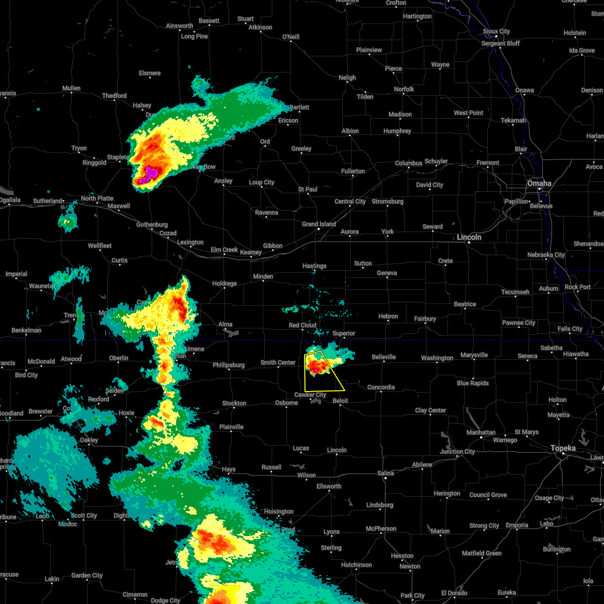 The severe thunderstorm warning for western jewell county will expire at 945 pm cdt, the storm which prompted the warning has weakened below severe limits, and no longer poses an immediate threat to life or property. therefore, the warning will be allowed to expire. however small hail, gusty winds and heavy rain are still possible with this thunderstorm. a severe thunderstorm watch remains in effect until midnight cdt for north central kansas. to report severe weather, contact your nearest law enforcement agency. they will relay your report to the national weather service hastings. The severe thunderstorm warning for western jewell county will expire at 945 pm cdt, the storm which prompted the warning has weakened below severe limits, and no longer poses an immediate threat to life or property. therefore, the warning will be allowed to expire. however small hail, gusty winds and heavy rain are still possible with this thunderstorm. a severe thunderstorm watch remains in effect until midnight cdt for north central kansas. to report severe weather, contact your nearest law enforcement agency. they will relay your report to the national weather service hastings.
|
| 6/6/2022 9:32 PM CDT |
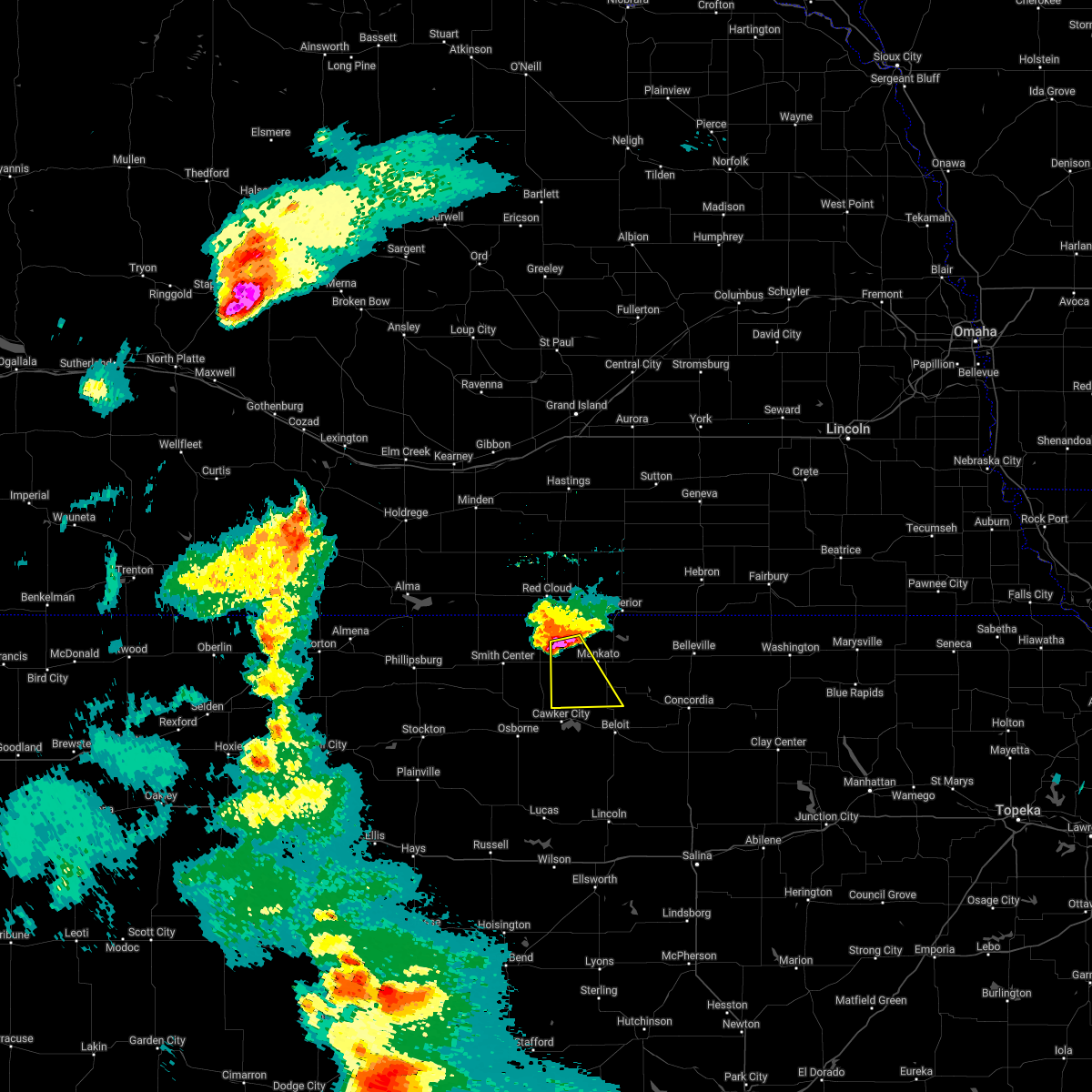 At 931 pm cdt, a severe thunderstorm was located near esbon, or 26 miles northwest of beloit, moving southeast at 50 mph (radar indicated). Hazards include 60 mph wind gusts and quarter size hail. Hail damage to vehicles is expected. expect wind damage to roofs, siding, and trees. locations impacted include, jewell, burr oak, esbon and ionia. hail threat, radar indicated max hail size, 1. 00 in wind threat, radar indicated max wind gust, 60 mph. At 931 pm cdt, a severe thunderstorm was located near esbon, or 26 miles northwest of beloit, moving southeast at 50 mph (radar indicated). Hazards include 60 mph wind gusts and quarter size hail. Hail damage to vehicles is expected. expect wind damage to roofs, siding, and trees. locations impacted include, jewell, burr oak, esbon and ionia. hail threat, radar indicated max hail size, 1. 00 in wind threat, radar indicated max wind gust, 60 mph.
|
| 6/6/2022 9:22 PM CDT |
 At 922 pm cdt, a severe thunderstorm was located near esbon, or 34 miles northwest of beloit, moving southeast at 50 mph (radar indicated). Hazards include 60 mph wind gusts and half dollar size hail. Hail damage to vehicles is expected. expect wind damage to roofs, siding, and trees. locations impacted include, jewell, lebanon, burr oak, esbon and ionia. hail threat, radar indicated max hail size, 1. 25 in wind threat, radar indicated max wind gust, 60 mph. At 922 pm cdt, a severe thunderstorm was located near esbon, or 34 miles northwest of beloit, moving southeast at 50 mph (radar indicated). Hazards include 60 mph wind gusts and half dollar size hail. Hail damage to vehicles is expected. expect wind damage to roofs, siding, and trees. locations impacted include, jewell, lebanon, burr oak, esbon and ionia. hail threat, radar indicated max hail size, 1. 25 in wind threat, radar indicated max wind gust, 60 mph.
|
| 6/6/2022 9:04 PM CDT |
 At 904 pm cdt, a severe thunderstorm was located near inavale, or 39 miles south of hastings, moving southeast at 50 mph (trained weather spotters. at 9 pm cdt, wind damage was reported in campbell, nebraska). Hazards include 70 mph wind gusts and ping pong ball size hail. People and animals outdoors will be injured. expect hail damage to roofs, siding, windows, and vehicles. expect considerable tree damage. Wind damage is also likely to mobile homes, roofs, and outbuildings. At 904 pm cdt, a severe thunderstorm was located near inavale, or 39 miles south of hastings, moving southeast at 50 mph (trained weather spotters. at 9 pm cdt, wind damage was reported in campbell, nebraska). Hazards include 70 mph wind gusts and ping pong ball size hail. People and animals outdoors will be injured. expect hail damage to roofs, siding, windows, and vehicles. expect considerable tree damage. Wind damage is also likely to mobile homes, roofs, and outbuildings.
|
| 5/12/2022 8:49 PM CDT |
 At 848 pm cdt, a severe thunderstorm was located over burr oak, or 29 miles north of beloit, moving northeast at 35 mph (radar indicated). Hazards include 60 mph wind gusts and quarter size hail. Hail damage to vehicles is expected. expect wind damage to roofs, siding, and trees. this severe storm will be near, webber and bostwick around 910 pm cdt. superior around 915 pm cdt. nelson and nora around 930 pm cdt. hail threat, radar indicated max hail size, 1. 00 in wind threat, radar indicated max wind gust, 60 mph. At 848 pm cdt, a severe thunderstorm was located over burr oak, or 29 miles north of beloit, moving northeast at 35 mph (radar indicated). Hazards include 60 mph wind gusts and quarter size hail. Hail damage to vehicles is expected. expect wind damage to roofs, siding, and trees. this severe storm will be near, webber and bostwick around 910 pm cdt. superior around 915 pm cdt. nelson and nora around 930 pm cdt. hail threat, radar indicated max hail size, 1. 00 in wind threat, radar indicated max wind gust, 60 mph.
|
| 5/12/2022 8:37 PM CDT |
 At 837 pm cdt, a severe thunderstorm was located near esbon, or 26 miles northwest of beloit, moving northeast at 50 mph (radar indicated). Hazards include ping pong ball size hail and 60 mph wind gusts. People and animals outdoors will be injured. expect hail damage to roofs, siding, windows, and vehicles. expect wind damage to roofs, siding, and trees. this severe thunderstorm will be near, mankato and burr oak around 845 pm cdt. other locations in the path of this severe thunderstorm include webber, bostwick, superior, nelson, ruskin, oak and nora. hail threat, radar indicated max hail size, 1. 50 in wind threat, radar indicated max wind gust, 60 mph. At 837 pm cdt, a severe thunderstorm was located near esbon, or 26 miles northwest of beloit, moving northeast at 50 mph (radar indicated). Hazards include ping pong ball size hail and 60 mph wind gusts. People and animals outdoors will be injured. expect hail damage to roofs, siding, windows, and vehicles. expect wind damage to roofs, siding, and trees. this severe thunderstorm will be near, mankato and burr oak around 845 pm cdt. other locations in the path of this severe thunderstorm include webber, bostwick, superior, nelson, ruskin, oak and nora. hail threat, radar indicated max hail size, 1. 50 in wind threat, radar indicated max wind gust, 60 mph.
|
| 5/12/2022 5:57 PM CDT |
 The severe thunderstorm warning for jewell and southern nuckolls counties will expire at 600 pm cdt, the storms which prompted the warning have moved out of the area. therefore, the warning will be allowed to expire. a severe thunderstorm watch remains in effect until 900 pm cdt for north central kansas, and south central nebraska. The severe thunderstorm warning for jewell and southern nuckolls counties will expire at 600 pm cdt, the storms which prompted the warning have moved out of the area. therefore, the warning will be allowed to expire. a severe thunderstorm watch remains in effect until 900 pm cdt for north central kansas, and south central nebraska.
|
| 5/12/2022 5:14 PM CDT |
 At 514 pm cdt, severe thunderstorms were located along a line extending from near nelson to 6 miles northeast of mankato to near glen elder, moving northeast at 45 mph (radar indicated). Hazards include ping pong ball size hail and 60 mph wind gusts. People and animals outdoors will be injured. expect hail damage to roofs, siding, windows, and vehicles. expect wind damage to roofs, siding, and trees. severe thunderstorms will be near, nelson, nora and lovewell state park around 520 pm cdt. webber around 525 pm cdt. superior around 530 pm cdt. other locations in the path of these severe thunderstorms include hardy, formoso and ruskin. hail threat, radar indicated max hail size, 1. 50 in wind threat, radar indicated max wind gust, 60 mph. At 514 pm cdt, severe thunderstorms were located along a line extending from near nelson to 6 miles northeast of mankato to near glen elder, moving northeast at 45 mph (radar indicated). Hazards include ping pong ball size hail and 60 mph wind gusts. People and animals outdoors will be injured. expect hail damage to roofs, siding, windows, and vehicles. expect wind damage to roofs, siding, and trees. severe thunderstorms will be near, nelson, nora and lovewell state park around 520 pm cdt. webber around 525 pm cdt. superior around 530 pm cdt. other locations in the path of these severe thunderstorms include hardy, formoso and ruskin. hail threat, radar indicated max hail size, 1. 50 in wind threat, radar indicated max wind gust, 60 mph.
|
| 5/12/2022 5:08 PM CDT |
 At 508 pm cdt, severe thunderstorms were located along a line extending from near oak to near webber to near formoso, moving northeast at 45 mph (radar indicated). Hazards include 60 mph wind gusts and quarter size hail. Hail damage to vehicles is expected. expect wind damage to roofs, siding, and trees. these severe thunderstorms will remain over mainly rural areas of jewell and southwestern nuckolls counties. hail threat, radar indicated max hail size, 1. 00 in wind threat, radar indicated max wind gust, 60 mph. At 508 pm cdt, severe thunderstorms were located along a line extending from near oak to near webber to near formoso, moving northeast at 45 mph (radar indicated). Hazards include 60 mph wind gusts and quarter size hail. Hail damage to vehicles is expected. expect wind damage to roofs, siding, and trees. these severe thunderstorms will remain over mainly rural areas of jewell and southwestern nuckolls counties. hail threat, radar indicated max hail size, 1. 00 in wind threat, radar indicated max wind gust, 60 mph.
|
| 5/12/2022 4:26 PM CDT |
 At 426 pm cdt, severe thunderstorms were located along a line extending from near guide rock to near esbon to near downs, moving northeast at 45 mph (radar indicated). Hazards include 70 mph wind gusts and ping pong ball size hail. People and animals outdoors will be injured. expect hail damage to roofs, siding, windows, and vehicles. expect considerable tree damage. wind damage is also likely to mobile homes, roofs, and outbuildings. severe thunderstorms will be near, guide rock around 435 pm cdt. burr oak, ionia and bostwick around 440 pm cdt. mankato around 445 pm cdt. other locations in the path of these severe thunderstorms include nelson, jewell, randall, webber, lovewell state park, montrose, formoso and hardy. thunderstorm damage threat, considerable hail threat, radar indicated max hail size, 1. 50 in wind threat, radar indicated max wind gust, 70 mph. At 426 pm cdt, severe thunderstorms were located along a line extending from near guide rock to near esbon to near downs, moving northeast at 45 mph (radar indicated). Hazards include 70 mph wind gusts and ping pong ball size hail. People and animals outdoors will be injured. expect hail damage to roofs, siding, windows, and vehicles. expect considerable tree damage. wind damage is also likely to mobile homes, roofs, and outbuildings. severe thunderstorms will be near, guide rock around 435 pm cdt. burr oak, ionia and bostwick around 440 pm cdt. mankato around 445 pm cdt. other locations in the path of these severe thunderstorms include nelson, jewell, randall, webber, lovewell state park, montrose, formoso and hardy. thunderstorm damage threat, considerable hail threat, radar indicated max hail size, 1. 50 in wind threat, radar indicated max wind gust, 70 mph.
|
| 4/29/2022 6:43 PM CDT |
 At 642 pm cdt, severe thunderstorms were located along a line extending from near bladen to esbon, moving northeast at 35 mph. this warning replaces the previous warning for this location (radar indicated). Hazards include ping pong ball size hail and 60 mph wind gusts. People and animals outdoors will be injured. expect hail damage to roofs, siding, windows, and vehicles. expect wind damage to roofs, siding, and trees. severe thunderstorms will be near, bladen around 650 pm cdt. burr oak around 655 pm cdt. rosemont around 700 pm cdt. other locations in the path of these severe thunderstorms include lawrence, superior, webber, bostwick and lovewell state park. hail threat, radar indicated max hail size, 1. 50 in wind threat, radar indicated max wind gust, 60 mph. At 642 pm cdt, severe thunderstorms were located along a line extending from near bladen to esbon, moving northeast at 35 mph. this warning replaces the previous warning for this location (radar indicated). Hazards include ping pong ball size hail and 60 mph wind gusts. People and animals outdoors will be injured. expect hail damage to roofs, siding, windows, and vehicles. expect wind damage to roofs, siding, and trees. severe thunderstorms will be near, bladen around 650 pm cdt. burr oak around 655 pm cdt. rosemont around 700 pm cdt. other locations in the path of these severe thunderstorms include lawrence, superior, webber, bostwick and lovewell state park. hail threat, radar indicated max hail size, 1. 50 in wind threat, radar indicated max wind gust, 60 mph.
|
| 12/15/2021 2:28 PM CST |
 The severe thunderstorm warning for mitchell and jewell counties will expire at 230 pm cst, the storms which prompted the warning have moved out of the area. therefore, the warning will be allowed to expire. however, non thunderstorm wind gusts of 60 to 70 mph are likely through the afternoon and early evening. a tornado watch remains in effect until 800 pm cst for north central kansas. to report severe weather, contact your nearest law enforcement agency. they will relay your report to the national weather service hastings. The severe thunderstorm warning for mitchell and jewell counties will expire at 230 pm cst, the storms which prompted the warning have moved out of the area. therefore, the warning will be allowed to expire. however, non thunderstorm wind gusts of 60 to 70 mph are likely through the afternoon and early evening. a tornado watch remains in effect until 800 pm cst for north central kansas. to report severe weather, contact your nearest law enforcement agency. they will relay your report to the national weather service hastings.
|
| 12/15/2021 1:52 PM CST |
 At 151 pm cst, severe thunderstorms were located along a line extending from 6 miles southwest of guide rock to near hunter, moving east at 55 mph (trained weather spotters). Hazards include 70 mph wind gusts. Expect considerable tree damage. damage is likely to mobile homes, roofs, and outbuildings. Locations impacted include, beloit, mankato, cawker city, glen elder, jewell, tipton, burr oak, esbon, asherville, formoso, simpson, ionia, randall, hunter, webber, scottsville, victor, lovewell state park and montrose. At 151 pm cst, severe thunderstorms were located along a line extending from 6 miles southwest of guide rock to near hunter, moving east at 55 mph (trained weather spotters). Hazards include 70 mph wind gusts. Expect considerable tree damage. damage is likely to mobile homes, roofs, and outbuildings. Locations impacted include, beloit, mankato, cawker city, glen elder, jewell, tipton, burr oak, esbon, asherville, formoso, simpson, ionia, randall, hunter, webber, scottsville, victor, lovewell state park and montrose.
|
| 12/15/2021 1:38 PM CST |
 At 138 pm cst, severe thunderstorms were located along a line extending from 6 miles south of inavale to 6 miles northeast of luray, moving east at 50 mph (trained weather spotters). Hazards include 70 mph wind gusts. Expect considerable tree damage. damage is likely to mobile homes, roofs, and outbuildings. Locations impacted include, beloit, smith center, osborne, downs, mankato, cawker city, glen elder, jewell, lebanon, tipton, burr oak, portis, esbon, asherville, formoso, simpson, ionia, randall, hunter and webber. At 138 pm cst, severe thunderstorms were located along a line extending from 6 miles south of inavale to 6 miles northeast of luray, moving east at 50 mph (trained weather spotters). Hazards include 70 mph wind gusts. Expect considerable tree damage. damage is likely to mobile homes, roofs, and outbuildings. Locations impacted include, beloit, smith center, osborne, downs, mankato, cawker city, glen elder, jewell, lebanon, tipton, burr oak, portis, esbon, asherville, formoso, simpson, ionia, randall, hunter and webber.
|
| 12/15/2021 1:24 PM CST |
 At 123 pm cst, severe thunderstorms were located along a line extending from 8 miles southwest of riverton to near luray, moving east at 55 mph (trained weather spotters). Hazards include 70 mph wind gusts. Expect considerable tree damage. Damage is likely to mobile homes, roofs, and outbuildings. At 123 pm cst, severe thunderstorms were located along a line extending from 8 miles southwest of riverton to near luray, moving east at 55 mph (trained weather spotters). Hazards include 70 mph wind gusts. Expect considerable tree damage. Damage is likely to mobile homes, roofs, and outbuildings.
|
| 8/22/2021 11:11 PM CDT |
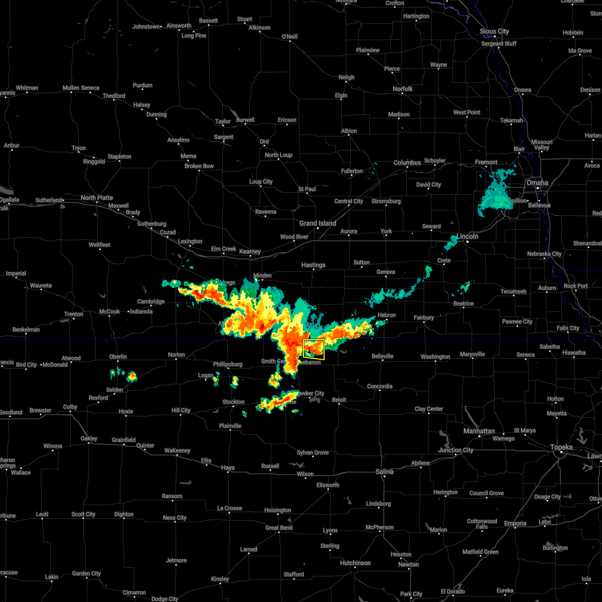 The severe thunderstorm warning for northwestern jewell county will expire at 1115 pm cdt, the storm which prompted the warning has weakened below severe limits, and no longer poses an immediate threat to life or property. therefore, the warning will be allowed to expire. The severe thunderstorm warning for northwestern jewell county will expire at 1115 pm cdt, the storm which prompted the warning has weakened below severe limits, and no longer poses an immediate threat to life or property. therefore, the warning will be allowed to expire.
|
| 8/22/2021 11:02 PM CDT |
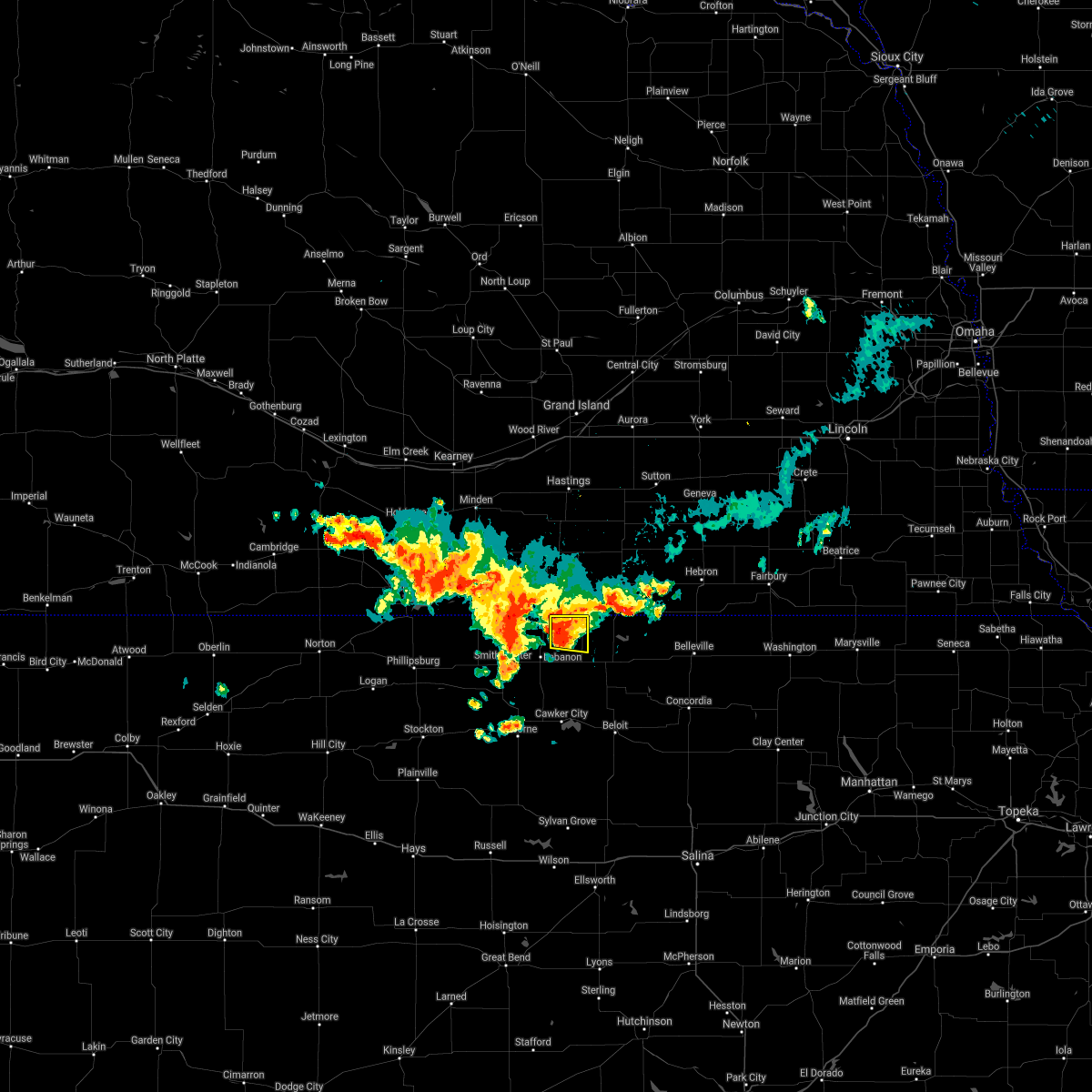 At 1102 pm cdt, a severe thunderstorm was located 7 miles northwest of burr oak, or 36 miles northwest of beloit, moving east at 20 mph (radar indicated). Hazards include 60 mph wind gusts and quarter size hail. Hail damage to vehicles is expected. expect wind damage to roofs, siding, and trees. this severe storm will be near, burr oak around 1120 pm cdt. hail threat, radar indicated max hail size, 1. 00 in wind threat, radar indicated max wind gust, 60 mph. At 1102 pm cdt, a severe thunderstorm was located 7 miles northwest of burr oak, or 36 miles northwest of beloit, moving east at 20 mph (radar indicated). Hazards include 60 mph wind gusts and quarter size hail. Hail damage to vehicles is expected. expect wind damage to roofs, siding, and trees. this severe storm will be near, burr oak around 1120 pm cdt. hail threat, radar indicated max hail size, 1. 00 in wind threat, radar indicated max wind gust, 60 mph.
|
| 8/22/2021 10:42 PM CDT |
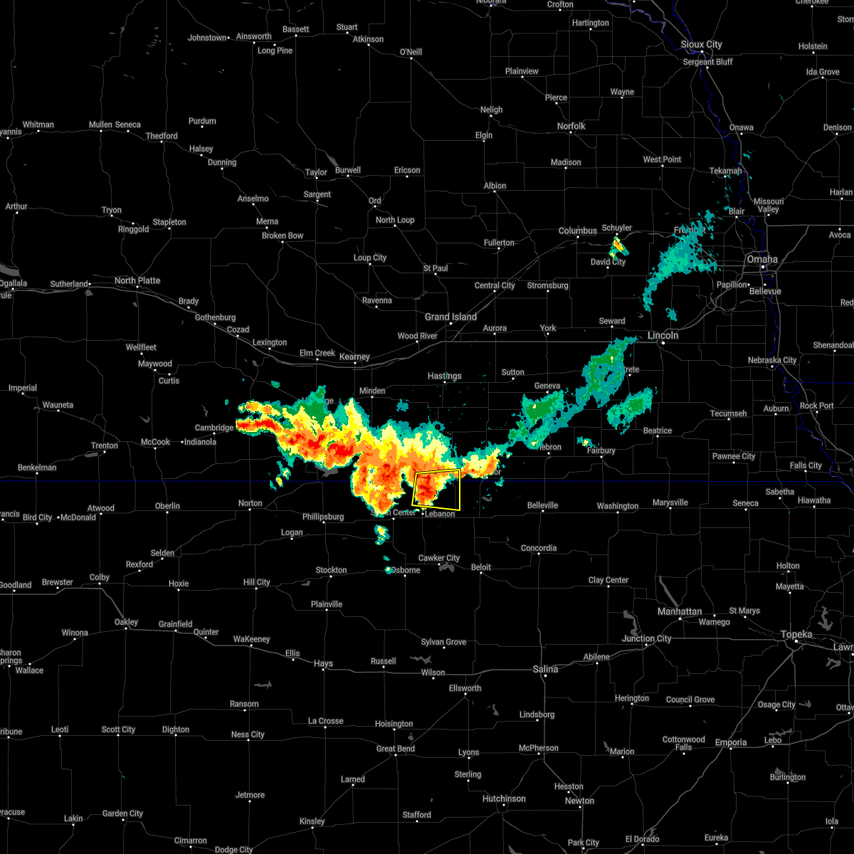 At 1041 pm cdt, a severe thunderstorm was located 7 miles south of red cloud, or 41 miles northwest of beloit, moving east at 30 mph (radar indicated). Hazards include 60 mph wind gusts and quarter size hail. Hail damage to vehicles is expected. expect wind damage to roofs, siding, and trees. this severe storm will be near, burr oak around 1110 pm cdt. hail threat, radar indicated max hail size, 1. 00 in wind threat, radar indicated max wind gust, 60 mph. At 1041 pm cdt, a severe thunderstorm was located 7 miles south of red cloud, or 41 miles northwest of beloit, moving east at 30 mph (radar indicated). Hazards include 60 mph wind gusts and quarter size hail. Hail damage to vehicles is expected. expect wind damage to roofs, siding, and trees. this severe storm will be near, burr oak around 1110 pm cdt. hail threat, radar indicated max hail size, 1. 00 in wind threat, radar indicated max wind gust, 60 mph.
|
| 8/22/2021 10:42 PM CDT |
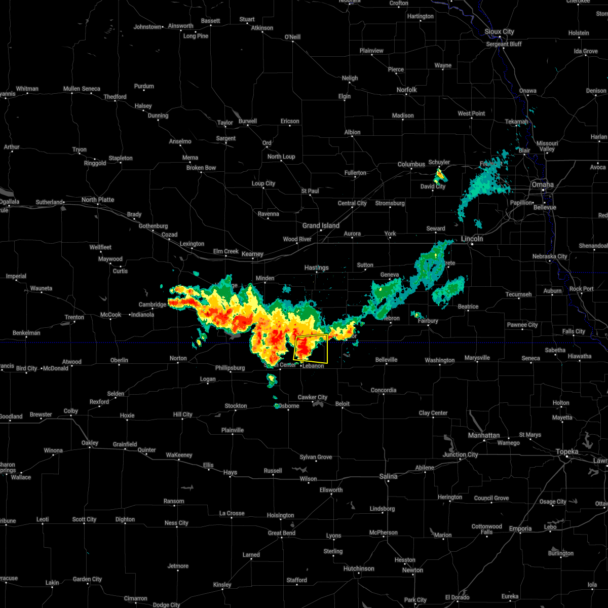 At 1041 pm cdt, a severe thunderstorm was located 7 miles south of red cloud, or 41 miles northwest of beloit, moving east at 30 mph (radar indicated). Hazards include 60 mph wind gusts and quarter size hail. Hail damage to vehicles is expected. expect wind damage to roofs, siding, and trees. this severe storm will be near, burr oak around 1110 pm cdt. hail threat, radar indicated max hail size, 1. 00 in wind threat, radar indicated max wind gust, 60 mph. At 1041 pm cdt, a severe thunderstorm was located 7 miles south of red cloud, or 41 miles northwest of beloit, moving east at 30 mph (radar indicated). Hazards include 60 mph wind gusts and quarter size hail. Hail damage to vehicles is expected. expect wind damage to roofs, siding, and trees. this severe storm will be near, burr oak around 1110 pm cdt. hail threat, radar indicated max hail size, 1. 00 in wind threat, radar indicated max wind gust, 60 mph.
|
| 8/22/2021 10:26 PM CDT |
 At 1026 pm cdt, a severe thunderstorm was located 7 miles south of inavale, or 37 miles northeast of phillipsburg, moving east at 25 mph (radar indicated). Hazards include 60 mph wind gusts and quarter size hail. Hail damage to vehicles is expected. expect wind damage to roofs, siding, and trees. this severe thunderstorm will be near, inavale around 1030 pm cdt. red cloud around 1045 pm cdt. other locations in the path of this severe thunderstorm include guide rock and burr oak. hail threat, radar indicated max hail size, 1. 00 in wind threat, radar indicated max wind gust, 60 mph. At 1026 pm cdt, a severe thunderstorm was located 7 miles south of inavale, or 37 miles northeast of phillipsburg, moving east at 25 mph (radar indicated). Hazards include 60 mph wind gusts and quarter size hail. Hail damage to vehicles is expected. expect wind damage to roofs, siding, and trees. this severe thunderstorm will be near, inavale around 1030 pm cdt. red cloud around 1045 pm cdt. other locations in the path of this severe thunderstorm include guide rock and burr oak. hail threat, radar indicated max hail size, 1. 00 in wind threat, radar indicated max wind gust, 60 mph.
|
| 8/22/2021 9:08 PM CDT |
 The severe thunderstorm warning for northern jewell, northeastern smith, western nuckolls and webster counties will expire at 915 pm cdt, the storm which prompted the warning has weakened below severe limits, and no longer poses an immediate threat to life or property. therefore, the warning will be allowed to expire. a severe thunderstorm watch remains in effect until 1000 pm cdt for north central kansas, and south central nebraska. The severe thunderstorm warning for northern jewell, northeastern smith, western nuckolls and webster counties will expire at 915 pm cdt, the storm which prompted the warning has weakened below severe limits, and no longer poses an immediate threat to life or property. therefore, the warning will be allowed to expire. a severe thunderstorm watch remains in effect until 1000 pm cdt for north central kansas, and south central nebraska.
|
| 8/22/2021 8:42 PM CDT |
 At 842 pm cdt, a severe thunderstorm was located 7 miles south of inavale, or 42 miles northeast of phillipsburg, moving east at 35 mph (radar indicated). Hazards include 60 mph wind gusts and quarter size hail. Hail damage to vehicles is expected. expect wind damage to roofs, siding, and trees. this severe storm will be near, red cloud around 850 pm cdt. guide rock around 905 pm cdt. bostwick around 920 pm cdt. superior around 930 pm cdt. hail threat, radar indicated max hail size, 1. 00 in wind threat, radar indicated max wind gust, 60 mph. At 842 pm cdt, a severe thunderstorm was located 7 miles south of inavale, or 42 miles northeast of phillipsburg, moving east at 35 mph (radar indicated). Hazards include 60 mph wind gusts and quarter size hail. Hail damage to vehicles is expected. expect wind damage to roofs, siding, and trees. this severe storm will be near, red cloud around 850 pm cdt. guide rock around 905 pm cdt. bostwick around 920 pm cdt. superior around 930 pm cdt. hail threat, radar indicated max hail size, 1. 00 in wind threat, radar indicated max wind gust, 60 mph.
|
| 8/22/2021 8:31 PM CDT |
 At 831 pm cdt, a severe thunderstorm was located 7 miles south of inavale, or 38 miles northeast of phillipsburg, moving east at 35 mph (radar indicated). Hazards include 60 mph wind gusts and quarter size hail. Hail damage to vehicles is expected. expect wind damage to roofs, siding, and trees. this severe thunderstorm will be near, red cloud around 845 pm cdt. other locations in the path of this severe thunderstorm include guide rock, burr oak, superior and bostwick. hail threat, radar indicated max hail size, 1. 00 in wind threat, radar indicated max wind gust, 60 mph. At 831 pm cdt, a severe thunderstorm was located 7 miles south of inavale, or 38 miles northeast of phillipsburg, moving east at 35 mph (radar indicated). Hazards include 60 mph wind gusts and quarter size hail. Hail damage to vehicles is expected. expect wind damage to roofs, siding, and trees. this severe thunderstorm will be near, red cloud around 845 pm cdt. other locations in the path of this severe thunderstorm include guide rock, burr oak, superior and bostwick. hail threat, radar indicated max hail size, 1. 00 in wind threat, radar indicated max wind gust, 60 mph.
|
| 8/7/2021 8:39 PM CDT |
 The severe thunderstorm warning for central jewell county will expire at 845 pm cdt, the storm which prompted the warning has moved out of the area. therefore, the warning will be allowed to expire. a severe thunderstorm watch remains in effect until 100 am cdt for north central kansas. The severe thunderstorm warning for central jewell county will expire at 845 pm cdt, the storm which prompted the warning has moved out of the area. therefore, the warning will be allowed to expire. a severe thunderstorm watch remains in effect until 100 am cdt for north central kansas.
|
| 8/7/2021 8:03 PM CDT |
 At 803 pm cdt, a severe thunderstorm was located near mankato, or 27 miles north of beloit, moving northeast at 35 mph (radar indicated). Hazards include 60 mph wind gusts and quarter size hail. Hail damage to vehicles is expected. expect wind damage to roofs, siding, and trees. this severe thunderstorm will be near, lovewell state park around 815 pm cdt. webber around 820 pm cdt. hail threat, radar indicated max hail size, 1. 00 in wind threat, radar indicated max wind gust, 60 mph. At 803 pm cdt, a severe thunderstorm was located near mankato, or 27 miles north of beloit, moving northeast at 35 mph (radar indicated). Hazards include 60 mph wind gusts and quarter size hail. Hail damage to vehicles is expected. expect wind damage to roofs, siding, and trees. this severe thunderstorm will be near, lovewell state park around 815 pm cdt. webber around 820 pm cdt. hail threat, radar indicated max hail size, 1. 00 in wind threat, radar indicated max wind gust, 60 mph.
|
| 8/7/2021 6:36 PM CDT |
 At 635 pm cdt, severe thunderstorms were located along a line extending from near lebanon to near portis, moving northeast at 30 mph (radar indicated). Hazards include 60 mph wind gusts and half dollar size hail. Hail damage to vehicles is expected. expect wind damage to roofs, siding, and trees. severe thunderstorms will be near, lebanon and bellaire around 640 pm cdt. other locations in the path of these severe thunderstorms include ionia. hail threat, radar indicated max hail size, 1. 25 in wind threat, radar indicated max wind gust, 60 mph. At 635 pm cdt, severe thunderstorms were located along a line extending from near lebanon to near portis, moving northeast at 30 mph (radar indicated). Hazards include 60 mph wind gusts and half dollar size hail. Hail damage to vehicles is expected. expect wind damage to roofs, siding, and trees. severe thunderstorms will be near, lebanon and bellaire around 640 pm cdt. other locations in the path of these severe thunderstorms include ionia. hail threat, radar indicated max hail size, 1. 25 in wind threat, radar indicated max wind gust, 60 mph.
|
| 7/9/2021 11:38 PM CDT |
 At 1138 pm cdt, severe thunderstorms were located along a line extending from hardy to 7 miles southeast of stockton, moving southeast at 55 mph (radar indicated). Hazards include 60 mph wind gusts and nickel size hail. Expect damage to roofs, siding, and trees. These severe thunderstorms will remain over mainly rural areas of mitchell, eastern rooks, jewell, southeastern smith and osborne counties. At 1138 pm cdt, severe thunderstorms were located along a line extending from hardy to 7 miles southeast of stockton, moving southeast at 55 mph (radar indicated). Hazards include 60 mph wind gusts and nickel size hail. Expect damage to roofs, siding, and trees. These severe thunderstorms will remain over mainly rural areas of mitchell, eastern rooks, jewell, southeastern smith and osborne counties.
|
| 7/9/2021 11:05 PM CDT |
 At 1104 pm cdt, severe thunderstorms were located along a line extending from near lawrence to 8 miles north of kensington, moving southeast at 60 mph (radar indicated). Hazards include 60 mph wind gusts and quarter size hail. Hail damage to vehicles is expected. expect wind damage to roofs, siding, and trees. severe thunderstorms will be near, smith center around 1120 pm cdt. Other locations in the path of these severe thunderstorms include gaylord, bellaire and harlan. At 1104 pm cdt, severe thunderstorms were located along a line extending from near lawrence to 8 miles north of kensington, moving southeast at 60 mph (radar indicated). Hazards include 60 mph wind gusts and quarter size hail. Hail damage to vehicles is expected. expect wind damage to roofs, siding, and trees. severe thunderstorms will be near, smith center around 1120 pm cdt. Other locations in the path of these severe thunderstorms include gaylord, bellaire and harlan.
|
| 6/19/2021 11:22 PM CDT |
 At 1121 pm cdt, severe thunderstorms were located along a line extending from near glenvil to near fairfield to near deweese to nora to near hardy, moving east at 50 mph (radar indicated). Hazards include 60 mph wind gusts. Expect damage to roofs, siding, and trees. these severe storms will be near, edgar, hardy, ruskin, oak and nora around 1125 pm cdt. Other locations in the path of these severe thunderstorms include hastings, clay center, davenport and ong. At 1121 pm cdt, severe thunderstorms were located along a line extending from near glenvil to near fairfield to near deweese to nora to near hardy, moving east at 50 mph (radar indicated). Hazards include 60 mph wind gusts. Expect damage to roofs, siding, and trees. these severe storms will be near, edgar, hardy, ruskin, oak and nora around 1125 pm cdt. Other locations in the path of these severe thunderstorms include hastings, clay center, davenport and ong.
|
| 6/19/2021 11:13 PM CDT |
 At 1112 pm cdt, severe thunderstorms were located along a line extending from near ayr to near lawrence to near nelson to near webber, moving east at 45 mph (radar indicated). Hazards include 70 mph wind gusts. Expect considerable tree damage. damage is likely to mobile homes, roofs, and outbuildings. these severe storms will be near, superior, nelson, webber and lovewell state park around 1120 pm cdt. Other locations in the path of these severe thunderstorms include hastings, fairfield, nora, edgar, hardy, ruskin, inland, oak, clay center, davenport and ong. At 1112 pm cdt, severe thunderstorms were located along a line extending from near ayr to near lawrence to near nelson to near webber, moving east at 45 mph (radar indicated). Hazards include 70 mph wind gusts. Expect considerable tree damage. damage is likely to mobile homes, roofs, and outbuildings. these severe storms will be near, superior, nelson, webber and lovewell state park around 1120 pm cdt. Other locations in the path of these severe thunderstorms include hastings, fairfield, nora, edgar, hardy, ruskin, inland, oak, clay center, davenport and ong.
|
| 6/19/2021 11:04 PM CDT |
 At 1103 pm cdt, severe thunderstorms were located along a line extending from near holstein to near blue hill to near rosemont to 6 miles northeast of guide rock to near burr oak, moving east at 45 mph (radar indicated). Hazards include 70 mph wind gusts. Expect considerable tree damage. damage is likely to mobile homes, roofs, and outbuildings. Locations impacted include, hastings, lawrence, bostwick, superior, nelson, deweese, lovewell state park, webber, nora, fairfield, edgar, hardy, ruskin, oak, glenvil, davenport, inland, clay center and ong. At 1103 pm cdt, severe thunderstorms were located along a line extending from near holstein to near blue hill to near rosemont to 6 miles northeast of guide rock to near burr oak, moving east at 45 mph (radar indicated). Hazards include 70 mph wind gusts. Expect considerable tree damage. damage is likely to mobile homes, roofs, and outbuildings. Locations impacted include, hastings, lawrence, bostwick, superior, nelson, deweese, lovewell state park, webber, nora, fairfield, edgar, hardy, ruskin, oak, glenvil, davenport, inland, clay center and ong.
|
| 6/19/2021 10:45 PM CDT |
 At 1044 pm cdt, severe thunderstorms were located along a line extending from near wilcox to near campbell to 6 miles northeast of inavale to 6 miles south of red cloud to 9 miles west of ionia, moving northeast at 55 mph. these are very dangerous storms (law enforcement. law enforcement reported widespread damage across phillips county. additionsly at 10:35pm 83 mph was reported at smith center, kansas airport). Hazards include 80 mph wind gusts. Flying debris will be dangerous to those caught without shelter. mobile homes will be heavily damaged. expect considerable damage to roofs, windows, and vehicles. extensive tree damage and power outages are likely. severe thunderstorms will be near, red cloud and cowles around 1050 pm cdt. bladen, guide rock and esbon around 1055 pm cdt. blue hill, upland and rosemont around 1100 pm cdt. Other locations in the path of these severe thunderstorms include mankato, lawrence, burr oak, ayr, bostwick, norman, montrose, nelson, holstein, formoso, heartwell, deweese, fairfield, glenvil, roseland, webber, nora, lovewell state park, kenesaw, edgar, inland and oak. At 1044 pm cdt, severe thunderstorms were located along a line extending from near wilcox to near campbell to 6 miles northeast of inavale to 6 miles south of red cloud to 9 miles west of ionia, moving northeast at 55 mph. these are very dangerous storms (law enforcement. law enforcement reported widespread damage across phillips county. additionsly at 10:35pm 83 mph was reported at smith center, kansas airport). Hazards include 80 mph wind gusts. Flying debris will be dangerous to those caught without shelter. mobile homes will be heavily damaged. expect considerable damage to roofs, windows, and vehicles. extensive tree damage and power outages are likely. severe thunderstorms will be near, red cloud and cowles around 1050 pm cdt. bladen, guide rock and esbon around 1055 pm cdt. blue hill, upland and rosemont around 1100 pm cdt. Other locations in the path of these severe thunderstorms include mankato, lawrence, burr oak, ayr, bostwick, norman, montrose, nelson, holstein, formoso, heartwell, deweese, fairfield, glenvil, roseland, webber, nora, lovewell state park, kenesaw, edgar, inland and oak.
|
| 6/19/2021 10:24 PM CDT |
 At 1023 pm cdt, severe thunderstorms were located along a line extending from bloomington to near franklin to 8 miles north of smith center, moving northeast at 65 mph. these are very dangerous storms (radar indicated). Hazards include 80 mph wind gusts. Flying debris will be dangerous to those caught without shelter. mobile homes will be heavily damaged. expect considerable damage to roofs, windows, and vehicles. extensive tree damage and power outages are likely. Locations impacted include, riverton, inavale, red cloud, campbell, cowles, bladen, guide rock and blue hill. At 1023 pm cdt, severe thunderstorms were located along a line extending from bloomington to near franklin to 8 miles north of smith center, moving northeast at 65 mph. these are very dangerous storms (radar indicated). Hazards include 80 mph wind gusts. Flying debris will be dangerous to those caught without shelter. mobile homes will be heavily damaged. expect considerable damage to roofs, windows, and vehicles. extensive tree damage and power outages are likely. Locations impacted include, riverton, inavale, red cloud, campbell, cowles, bladen, guide rock and blue hill.
|
| 6/19/2021 10:03 PM CDT |
 At 1003 pm cdt, severe thunderstorms were located along a line extending from near woodruff to 9 miles north of agra to kirwin, moving northeast at 65 mph. these are very dangerous storms (radar indicated). Hazards include 80 mph wind gusts and quarter size hail. Flying debris will be dangerous to those caught without shelter. mobile homes will be heavily damaged. expect considerable damage to roofs, windows, and vehicles. extensive tree damage and power outages are likely. severe thunderstorms will be near, cedar around 1010 pm cdt. naponee and athol around 1015 pm cdt. smith center and bloomington around 1020 pm cdt. Other locations in the path of these severe thunderstorms include franklin, riverton, bellaire, lebanon, inavale, red cloud, campbell, esbon, bladen, guide rock, burr oak and cowles. At 1003 pm cdt, severe thunderstorms were located along a line extending from near woodruff to 9 miles north of agra to kirwin, moving northeast at 65 mph. these are very dangerous storms (radar indicated). Hazards include 80 mph wind gusts and quarter size hail. Flying debris will be dangerous to those caught without shelter. mobile homes will be heavily damaged. expect considerable damage to roofs, windows, and vehicles. extensive tree damage and power outages are likely. severe thunderstorms will be near, cedar around 1010 pm cdt. naponee and athol around 1015 pm cdt. smith center and bloomington around 1020 pm cdt. Other locations in the path of these severe thunderstorms include franklin, riverton, bellaire, lebanon, inavale, red cloud, campbell, esbon, bladen, guide rock, burr oak and cowles.
|
| 5/8/2021 8:05 PM CDT |
 The severe thunderstorm warning for northwestern jewell and eastern smith counties will expire at 815 pm cdt, the storm which prompted the warning has weakened below severe limits, and has exited the warned area. therefore, the warning will be allowed to expire. a severe thunderstorm watch remains in effect until 900 pm cdt for north central kansas. The severe thunderstorm warning for northwestern jewell and eastern smith counties will expire at 815 pm cdt, the storm which prompted the warning has weakened below severe limits, and has exited the warned area. therefore, the warning will be allowed to expire. a severe thunderstorm watch remains in effect until 900 pm cdt for north central kansas.
|
| 5/8/2021 7:41 PM CDT |
 At 741 pm cdt, a severe thunderstorm was located near bellaire, or 34 miles east of phillipsburg, moving northeast at 30 mph (radar indicated). Hazards include golf ball size hail and 60 mph wind gusts. People and animals outdoors will be injured. expect hail damage to roofs, siding, windows, and vehicles. expect wind damage to roofs, siding, and trees. Locations impacted include, smith center, lebanon, burr oak, esbon and bellaire. At 741 pm cdt, a severe thunderstorm was located near bellaire, or 34 miles east of phillipsburg, moving northeast at 30 mph (radar indicated). Hazards include golf ball size hail and 60 mph wind gusts. People and animals outdoors will be injured. expect hail damage to roofs, siding, windows, and vehicles. expect wind damage to roofs, siding, and trees. Locations impacted include, smith center, lebanon, burr oak, esbon and bellaire.
|
| 5/8/2021 7:32 PM CDT |
 At 732 pm cdt, a severe thunderstorm was located over smith center, or 31 miles east of phillipsburg, moving northeast at 30 mph (radar indicated). Hazards include 60 mph wind gusts and quarter size hail. Hail damage to vehicles is expected. Expect wind damage to roofs, siding, and trees. At 732 pm cdt, a severe thunderstorm was located over smith center, or 31 miles east of phillipsburg, moving northeast at 30 mph (radar indicated). Hazards include 60 mph wind gusts and quarter size hail. Hail damage to vehicles is expected. Expect wind damage to roofs, siding, and trees.
|
| 5/2/2021 10:30 PM CDT |
 At 1030 pm cdt, severe thunderstorms were located along a line extending from near bladen to near lebanon to 8 miles south of natoma, moving east at 35 mph (radar indicated). Hazards include 60 mph wind gusts and penny size hail. expect damage to roofs, siding, and trees At 1030 pm cdt, severe thunderstorms were located along a line extending from near bladen to near lebanon to 8 miles south of natoma, moving east at 35 mph (radar indicated). Hazards include 60 mph wind gusts and penny size hail. expect damage to roofs, siding, and trees
|
| 4/6/2021 8:52 PM CDT |
 The severe thunderstorm warning for northern jewell county will expire at 900 pm cdt, the storm which prompted the warning has weakened below severe limits, and has exited the warned area. therefore, the warning will be allowed to expire. a severe thunderstorm watch remains in effect until 1100 pm cdt for north central kansas. The severe thunderstorm warning for northern jewell county will expire at 900 pm cdt, the storm which prompted the warning has weakened below severe limits, and has exited the warned area. therefore, the warning will be allowed to expire. a severe thunderstorm watch remains in effect until 1100 pm cdt for north central kansas.
|
| 4/6/2021 8:29 PM CDT |
 At 829 pm cdt, a severe thunderstorm was located over burr oak, or 30 miles north of beloit, moving northeast at 45 mph (radar indicated). Hazards include 60 mph wind gusts and quarter size hail. Hail damage to vehicles is expected. expect wind damage to roofs, siding, and trees. Locations impacted include, burr oak and webber. At 829 pm cdt, a severe thunderstorm was located over burr oak, or 30 miles north of beloit, moving northeast at 45 mph (radar indicated). Hazards include 60 mph wind gusts and quarter size hail. Hail damage to vehicles is expected. expect wind damage to roofs, siding, and trees. Locations impacted include, burr oak and webber.
|
| 4/6/2021 8:11 PM CDT |
 At 811 pm cdt, a severe thunderstorm was located near esbon, or 27 miles northwest of beloit, moving northeast at 45 mph (radar indicated). Hazards include 60 mph wind gusts and quarter size hail. Hail damage to vehicles is expected. Expect wind damage to roofs, siding, and trees. At 811 pm cdt, a severe thunderstorm was located near esbon, or 27 miles northwest of beloit, moving northeast at 45 mph (radar indicated). Hazards include 60 mph wind gusts and quarter size hail. Hail damage to vehicles is expected. Expect wind damage to roofs, siding, and trees.
|
| 8/16/2020 7:51 PM CDT |
 The severe thunderstorm warning for northwestern mitchell and jewell counties will expire at 800 pm cdt, the storms which prompted the warning have weakened below severe limits, and no longer pose an immediate threat to life or property. therefore, the warning will be allowed to expire. a severe thunderstorm watch remains in effect until 900 pm cdt for north central kansas. The severe thunderstorm warning for northwestern mitchell and jewell counties will expire at 800 pm cdt, the storms which prompted the warning have weakened below severe limits, and no longer pose an immediate threat to life or property. therefore, the warning will be allowed to expire. a severe thunderstorm watch remains in effect until 900 pm cdt for north central kansas.
|
| 8/16/2020 7:41 PM CDT |
 At 740 pm cdt, severe thunderstorms were located along a line extending from near burr oak to ionia to near downs, moving southeast at 35 mph (radar indicated). Hazards include 60 mph wind gusts and quarter size hail. Hail damage to vehicles is expected. expect wind damage to roofs, siding, and trees. Locations impacted include, mankato, cawker city, glen elder, jewell, burr oak, esbon, formoso, ionia, lovewell state park and montrose. At 740 pm cdt, severe thunderstorms were located along a line extending from near burr oak to ionia to near downs, moving southeast at 35 mph (radar indicated). Hazards include 60 mph wind gusts and quarter size hail. Hail damage to vehicles is expected. expect wind damage to roofs, siding, and trees. Locations impacted include, mankato, cawker city, glen elder, jewell, burr oak, esbon, formoso, ionia, lovewell state park and montrose.
|
| 8/16/2020 7:28 PM CDT |
 At 727 pm cdt, severe thunderstorms were located along a line extending from near burr oak to 6 miles south of esbon to near harlan, moving southeast at 35 mph (radar indicated). Hazards include 60 mph wind gusts and quarter size hail. Hail damage to vehicles is expected. Expect wind damage to roofs, siding, and trees. At 727 pm cdt, severe thunderstorms were located along a line extending from near burr oak to 6 miles south of esbon to near harlan, moving southeast at 35 mph (radar indicated). Hazards include 60 mph wind gusts and quarter size hail. Hail damage to vehicles is expected. Expect wind damage to roofs, siding, and trees.
|
| 8/16/2020 7:11 PM CDT |
 At 711 pm cdt, a severe thunderstorm was located 8 miles northwest of esbon, or 38 miles northwest of beloit, moving southeast at 35 mph (radar indicated). Hazards include 60 mph wind gusts and half dollar size hail. Hail damage to vehicles is expected. expect wind damage to roofs, siding, and trees. Locations impacted include, smith center, mankato, lebanon, burr oak, esbon and bellaire. At 711 pm cdt, a severe thunderstorm was located 8 miles northwest of esbon, or 38 miles northwest of beloit, moving southeast at 35 mph (radar indicated). Hazards include 60 mph wind gusts and half dollar size hail. Hail damage to vehicles is expected. expect wind damage to roofs, siding, and trees. Locations impacted include, smith center, mankato, lebanon, burr oak, esbon and bellaire.
|
| 8/16/2020 7:00 PM CDT |
 At 700 pm cdt, a severe thunderstorm was located 9 miles south of red cloud, or 42 miles east of phillipsburg, moving southeast at 40 mph (radar indicated). Hazards include 60 mph wind gusts and half dollar size hail. Hail damage to vehicles is expected. Expect wind damage to roofs, siding, and trees. At 700 pm cdt, a severe thunderstorm was located 9 miles south of red cloud, or 42 miles east of phillipsburg, moving southeast at 40 mph (radar indicated). Hazards include 60 mph wind gusts and half dollar size hail. Hail damage to vehicles is expected. Expect wind damage to roofs, siding, and trees.
|
| 8/14/2020 8:03 PM CDT |
 At 801 pm cdt, a severe thunderstorm was located near mankato, or 19 miles north of beloit, moving south at 30 mph. this is a very dangerous storm (radar indicated). Hazards include baseball size hail and 60 mph wind gusts. People and animals outdoors will be severely injured. expect shattered windows, extensive damage to roofs, siding, and vehicles. Locations impacted include, mankato, jewell, ionia, randall, and montrose. At 801 pm cdt, a severe thunderstorm was located near mankato, or 19 miles north of beloit, moving south at 30 mph. this is a very dangerous storm (radar indicated). Hazards include baseball size hail and 60 mph wind gusts. People and animals outdoors will be severely injured. expect shattered windows, extensive damage to roofs, siding, and vehicles. Locations impacted include, mankato, jewell, ionia, randall, and montrose.
|
| 8/14/2020 7:48 PM CDT |
 At 748 pm cdt, a severe thunderstorm capable of producing a tornado was located over mankato, or 22 miles north of beloit, moving south at 30 mph (radar indicated rotation). Hazards include tornado and golf ball size hail. Flying debris will be dangerous to those caught without shelter. mobile homes will be damaged or destroyed. damage to roofs, windows, and vehicles will occur. tree damage is likely. this dangerous storm will be near, jewell around 800 pm cdt. Ionia around 805 pm cdt. At 748 pm cdt, a severe thunderstorm capable of producing a tornado was located over mankato, or 22 miles north of beloit, moving south at 30 mph (radar indicated rotation). Hazards include tornado and golf ball size hail. Flying debris will be dangerous to those caught without shelter. mobile homes will be damaged or destroyed. damage to roofs, windows, and vehicles will occur. tree damage is likely. this dangerous storm will be near, jewell around 800 pm cdt. Ionia around 805 pm cdt.
|
| 8/14/2020 7:44 PM CDT |
 At 744 pm cdt, a severe thunderstorm was located near lovewell state park, or 25 miles west of belleville, moving south at 30 mph (radar indicated). Hazards include two inch hail and 60 mph wind gusts. People and animals outdoors will be injured. expect hail damage to roofs, siding, windows, and vehicles. Expect wind damage to roofs, siding, and trees. At 744 pm cdt, a severe thunderstorm was located near lovewell state park, or 25 miles west of belleville, moving south at 30 mph (radar indicated). Hazards include two inch hail and 60 mph wind gusts. People and animals outdoors will be injured. expect hail damage to roofs, siding, windows, and vehicles. Expect wind damage to roofs, siding, and trees.
|
| 8/14/2020 7:31 PM CDT |
 At 731 pm cdt, severe thunderstorms were located along a line extending from near ruskin to 9 miles northwest of esbon, moving south at 15 mph (radar indicated). Hazards include tennis ball size hail and 60 mph wind gusts. People and animals outdoors will be injured. expect hail damage to roofs, siding, windows, and vehicles. expect wind damage to roofs, siding, and trees. Locations impacted include, superior, burr oak, hardy, ruskin, esbon, webber, bostwick and lovewell state park. At 731 pm cdt, severe thunderstorms were located along a line extending from near ruskin to 9 miles northwest of esbon, moving south at 15 mph (radar indicated). Hazards include tennis ball size hail and 60 mph wind gusts. People and animals outdoors will be injured. expect hail damage to roofs, siding, windows, and vehicles. expect wind damage to roofs, siding, and trees. Locations impacted include, superior, burr oak, hardy, ruskin, esbon, webber, bostwick and lovewell state park.
|
| 8/14/2020 7:24 PM CDT |
 At 724 pm cdt, a severe thunderstorm capable of producing a tornado was located near bostwick, or 32 miles west of belleville, moving south at 30 mph (radar indicated rotation). Hazards include tornado and tennis ball size hail. Flying debris will be dangerous to those caught without shelter. mobile homes will be damaged or destroyed. damage to roofs, windows, and vehicles will occur. tree damage is likely. this dangerous storm will be near, burr oak around 735 pm cdt. mankato and montrose around 745 pm cdt. Jewell and ionia around 800 pm cdt. At 724 pm cdt, a severe thunderstorm capable of producing a tornado was located near bostwick, or 32 miles west of belleville, moving south at 30 mph (radar indicated rotation). Hazards include tornado and tennis ball size hail. Flying debris will be dangerous to those caught without shelter. mobile homes will be damaged or destroyed. damage to roofs, windows, and vehicles will occur. tree damage is likely. this dangerous storm will be near, burr oak around 735 pm cdt. mankato and montrose around 745 pm cdt. Jewell and ionia around 800 pm cdt.
|
| 8/14/2020 6:55 PM CDT |
 At 655 pm cdt, severe thunderstorms were located along a line extending from near oak to red cloud, moving south at 15 mph (radar indicated). Hazards include golf ball size hail and 60 mph wind gusts. People and animals outdoors will be injured. expect hail damage to roofs, siding, windows, and vehicles. Expect wind damage to roofs, siding, and trees. At 655 pm cdt, severe thunderstorms were located along a line extending from near oak to red cloud, moving south at 15 mph (radar indicated). Hazards include golf ball size hail and 60 mph wind gusts. People and animals outdoors will be injured. expect hail damage to roofs, siding, windows, and vehicles. Expect wind damage to roofs, siding, and trees.
|
| 7/10/2020 8:11 PM CDT |
 At 811 pm cdt, a severe thunderstorm was located 7 miles north of lebanon, or 38 miles northwest of beloit, moving southeast at 20 mph (radar indicated). Hazards include 60 mph wind gusts and quarter size hail. Hail damage to vehicles is expected. expect wind damage to roofs, siding, and trees. Locations impacted include, mankato, lebanon, burr oak and esbon. At 811 pm cdt, a severe thunderstorm was located 7 miles north of lebanon, or 38 miles northwest of beloit, moving southeast at 20 mph (radar indicated). Hazards include 60 mph wind gusts and quarter size hail. Hail damage to vehicles is expected. expect wind damage to roofs, siding, and trees. Locations impacted include, mankato, lebanon, burr oak and esbon.
|
| 7/10/2020 7:55 PM CDT |
 At 754 pm cdt, a severe thunderstorm was located 7 miles northwest of esbon, or 37 miles northwest of beloit, moving southeast at 40 mph (radar indicated). Hazards include 60 mph wind gusts and quarter size hail. Hail damage to vehicles is expected. expect wind damage to roofs, siding, and trees. Locations impacted include, red cloud, mankato, lebanon, burr oak, esbon, formoso, ionia, inavale and montrose. At 754 pm cdt, a severe thunderstorm was located 7 miles northwest of esbon, or 37 miles northwest of beloit, moving southeast at 40 mph (radar indicated). Hazards include 60 mph wind gusts and quarter size hail. Hail damage to vehicles is expected. expect wind damage to roofs, siding, and trees. Locations impacted include, red cloud, mankato, lebanon, burr oak, esbon, formoso, ionia, inavale and montrose.
|
| 7/10/2020 7:42 PM CDT |
 At 742 pm cdt, a severe thunderstorm was located near red cloud, or 41 miles south of hastings, moving southeast at 40 mph (radar indicated). Hazards include 60 mph wind gusts and quarter size hail. Hail damage to vehicles is expected. Expect wind damage to roofs, siding, and trees. At 742 pm cdt, a severe thunderstorm was located near red cloud, or 41 miles south of hastings, moving southeast at 40 mph (radar indicated). Hazards include 60 mph wind gusts and quarter size hail. Hail damage to vehicles is expected. Expect wind damage to roofs, siding, and trees.
|
| 7/10/2020 7:35 PM CDT |
 At 733 pm cdt, severe thunderstorms were located along a line extending from near cowles to near red cloud to near riverton, moving southeast at 45 mph (radar indicated). Hazards include 60 mph wind gusts and half dollar size hail. Hail damage to vehicles is expected. expect wind damage to roofs, siding, and trees. Locations impacted include, smith center, red cloud, guide rock, lebanon, burr oak, esbon, riverton, cowles, bostwick, bellaire, rosemont and inavale. At 733 pm cdt, severe thunderstorms were located along a line extending from near cowles to near red cloud to near riverton, moving southeast at 45 mph (radar indicated). Hazards include 60 mph wind gusts and half dollar size hail. Hail damage to vehicles is expected. expect wind damage to roofs, siding, and trees. Locations impacted include, smith center, red cloud, guide rock, lebanon, burr oak, esbon, riverton, cowles, bostwick, bellaire, rosemont and inavale.
|
| 7/10/2020 7:24 PM CDT |
 At 723 pm cdt, severe thunderstorms were located along a line extending from near blue hill to near red cloud to near riverton, moving southeast at 50 mph (radar indicated). Hazards include ping pong ball size hail and 60 mph wind gusts. People and animals outdoors will be injured. expect hail damage to roofs, siding, windows, and vehicles. expect wind damage to roofs, siding, and trees. Locations impacted include, smith center, red cloud, franklin, blue hill, campbell, lawrence, bladen, guide rock, lebanon, burr oak, esbon, riverton, cowles, rosemont, inavale, bostwick and bellaire. At 723 pm cdt, severe thunderstorms were located along a line extending from near blue hill to near red cloud to near riverton, moving southeast at 50 mph (radar indicated). Hazards include ping pong ball size hail and 60 mph wind gusts. People and animals outdoors will be injured. expect hail damage to roofs, siding, windows, and vehicles. expect wind damage to roofs, siding, and trees. Locations impacted include, smith center, red cloud, franklin, blue hill, campbell, lawrence, bladen, guide rock, lebanon, burr oak, esbon, riverton, cowles, rosemont, inavale, bostwick and bellaire.
|
| 7/10/2020 7:16 PM CDT |
 At 715 pm cdt, severe thunderstorms were located along a line extending from near bladen to near inavale to near franklin, moving southeast at 25 mph (radar indicated). Hazards include ping pong ball size hail and 60 mph wind gusts. People and animals outdoors will be injured. expect hail damage to roofs, siding, windows, and vehicles. expect wind damage to roofs, siding, and trees. Locations impacted include, smith center, red cloud, franklin, blue hill, campbell, lawrence, bladen, roseland, guide rock, lebanon, burr oak, upland, esbon, riverton, cowles, rosemont, inavale, bostwick and bellaire. At 715 pm cdt, severe thunderstorms were located along a line extending from near bladen to near inavale to near franklin, moving southeast at 25 mph (radar indicated). Hazards include ping pong ball size hail and 60 mph wind gusts. People and animals outdoors will be injured. expect hail damage to roofs, siding, windows, and vehicles. expect wind damage to roofs, siding, and trees. Locations impacted include, smith center, red cloud, franklin, blue hill, campbell, lawrence, bladen, roseland, guide rock, lebanon, burr oak, upland, esbon, riverton, cowles, rosemont, inavale, bostwick and bellaire.
|
| 7/10/2020 7:00 PM CDT |
 At 659 pm cdt, severe thunderstorms were located along a line extending from near roseland to 6 miles southeast of campbell to near franklin, moving southeast at 50 mph (radar indicated. in addition, at 646 pm cdt, quarter size hail was reported 5 miles east-northeast of minden). Hazards include ping pong ball size hail and 60 mph wind gusts. People and animals outdoors will be injured. expect hail damage to roofs, siding, windows, and vehicles. Expect wind damage to roofs, siding, and trees. At 659 pm cdt, severe thunderstorms were located along a line extending from near roseland to 6 miles southeast of campbell to near franklin, moving southeast at 50 mph (radar indicated. in addition, at 646 pm cdt, quarter size hail was reported 5 miles east-northeast of minden). Hazards include ping pong ball size hail and 60 mph wind gusts. People and animals outdoors will be injured. expect hail damage to roofs, siding, windows, and vehicles. Expect wind damage to roofs, siding, and trees.
|
| 7/9/2020 12:57 AM CDT |
 At 1243 am cdt, severe thunderstorms were located along a line extending from near jamestown to 8 miles north of victor to 10 miles northeast of natoma, moving southeast at 30 mph (radar indicated). Hazards include ping pong ball size hail and 60 mph wind gusts. People and animals outdoors will be injured. expect hail damage to roofs, siding, windows, and vehicles. expect wind damage to roofs, siding, and trees. Locations impacted include, beloit, smith center, osborne, downs, mankato, cawker city, glen elder, jewell, lebanon, tipton, burr oak, gaylord, portis, alton, esbon, asherville, formoso, simpson, ionia and randall. At 1243 am cdt, severe thunderstorms were located along a line extending from near jamestown to 8 miles north of victor to 10 miles northeast of natoma, moving southeast at 30 mph (radar indicated). Hazards include ping pong ball size hail and 60 mph wind gusts. People and animals outdoors will be injured. expect hail damage to roofs, siding, windows, and vehicles. expect wind damage to roofs, siding, and trees. Locations impacted include, beloit, smith center, osborne, downs, mankato, cawker city, glen elder, jewell, lebanon, tipton, burr oak, gaylord, portis, alton, esbon, asherville, formoso, simpson, ionia and randall.
|
| 7/9/2020 12:43 AM CDT |
 At 1243 am cdt, severe thunderstorms were located along a line extending from near jamestown to 8 miles north of victor to 10 miles northeast of natoma, moving southeast at 30 mph (radar indicated). Hazards include ping pong ball size hail and 60 mph wind gusts. People and animals outdoors will be injured. expect hail damage to roofs, siding, windows, and vehicles. expect wind damage to roofs, siding, and trees. Locations impacted include, beloit, smith center, osborne, downs, mankato, cawker city, glen elder, jewell, lebanon, tipton, burr oak, gaylord, portis, alton, esbon, asherville, formoso, simpson, ionia and randall. At 1243 am cdt, severe thunderstorms were located along a line extending from near jamestown to 8 miles north of victor to 10 miles northeast of natoma, moving southeast at 30 mph (radar indicated). Hazards include ping pong ball size hail and 60 mph wind gusts. People and animals outdoors will be injured. expect hail damage to roofs, siding, windows, and vehicles. expect wind damage to roofs, siding, and trees. Locations impacted include, beloit, smith center, osborne, downs, mankato, cawker city, glen elder, jewell, lebanon, tipton, burr oak, gaylord, portis, alton, esbon, asherville, formoso, simpson, ionia and randall.
|
| 7/9/2020 12:12 AM CDT |
 At 1212 am cdt, severe thunderstorms were located along a line extending from courtland to near cawker city to near alton, moving southeast at 30 mph (radar indicated). Hazards include 60 mph wind gusts and penny size hail. expect damage to roofs, siding, and trees At 1212 am cdt, severe thunderstorms were located along a line extending from courtland to near cawker city to near alton, moving southeast at 30 mph (radar indicated). Hazards include 60 mph wind gusts and penny size hail. expect damage to roofs, siding, and trees
|
| 7/9/2020 12:00 AM CDT | Storm damage reported in jewell county KS, 0.9 miles SSW of Burr Oak, KS |
| 7/8/2020 11:42 PM CDT |
 At 1141 pm cdt, severe thunderstorms were located along a line extending from near juniata to near guide rock to near lebanon to near athol, moving east at 40 mph (radar indicated). Hazards include 70 mph wind gusts and penny size hail. Expect considerable tree damage. damage is likely to mobile homes, roofs, and outbuildings. Locations impacted include, hastings, phillipsburg, smith center, red cloud, franklin, blue hill, kenesaw, juniata, logan, kensington, agra, bladen, roseland, guide rock, lebanon, holstein, burr oak, kirwin, prairie view and long island. At 1141 pm cdt, severe thunderstorms were located along a line extending from near juniata to near guide rock to near lebanon to near athol, moving east at 40 mph (radar indicated). Hazards include 70 mph wind gusts and penny size hail. Expect considerable tree damage. damage is likely to mobile homes, roofs, and outbuildings. Locations impacted include, hastings, phillipsburg, smith center, red cloud, franklin, blue hill, kenesaw, juniata, logan, kensington, agra, bladen, roseland, guide rock, lebanon, holstein, burr oak, kirwin, prairie view and long island.
|
| 7/8/2020 11:31 PM CDT |
 At 1130 pm cdt, severe thunderstorms were located along a line extending from near ayr to near guide rock to 7 miles northwest of lebanon, moving east at 55 mph (radar indicated). Hazards include 70 mph wind gusts and penny size hail. Expect considerable tree damage. Damage is likely to mobile homes, roofs, and outbuildings. At 1130 pm cdt, severe thunderstorms were located along a line extending from near ayr to near guide rock to 7 miles northwest of lebanon, moving east at 55 mph (radar indicated). Hazards include 70 mph wind gusts and penny size hail. Expect considerable tree damage. Damage is likely to mobile homes, roofs, and outbuildings.
|
| 7/8/2020 11:25 PM CDT |
 At 1124 pm cdt, severe thunderstorms were located along a line extending from near kenesaw to near red cloud to near bellaire to near agra, moving east at 60 mph (radar indicated). Hazards include 70 mph wind gusts and penny size hail. Expect considerable tree damage. damage is likely to mobile homes, roofs, and outbuildings. Locations impacted include, hastings, phillipsburg, minden, smith center, alma, red cloud, franklin, blue hill, kenesaw, juniata, logan, kensington, campbell, agra, bladen, roseland, guide rock, lebanon, holstein and burr oak. At 1124 pm cdt, severe thunderstorms were located along a line extending from near kenesaw to near red cloud to near bellaire to near agra, moving east at 60 mph (radar indicated). Hazards include 70 mph wind gusts and penny size hail. Expect considerable tree damage. damage is likely to mobile homes, roofs, and outbuildings. Locations impacted include, hastings, phillipsburg, minden, smith center, alma, red cloud, franklin, blue hill, kenesaw, juniata, logan, kensington, campbell, agra, bladen, roseland, guide rock, lebanon, holstein and burr oak.
|
| 7/8/2020 11:09 PM CDT |
 At 1109 pm cdt, severe thunderstorms were located along a line extending from 6 miles southeast of kearney to near riverton to 9 miles south of bloomington to near woodruff, moving east at 40 mph (radar indicated). Hazards include 70 mph wind gusts. Expect considerable tree damage. Damage is likely to mobile homes, roofs, and outbuildings. At 1109 pm cdt, severe thunderstorms were located along a line extending from 6 miles southeast of kearney to near riverton to 9 miles south of bloomington to near woodruff, moving east at 40 mph (radar indicated). Hazards include 70 mph wind gusts. Expect considerable tree damage. Damage is likely to mobile homes, roofs, and outbuildings.
|
| 7/2/2020 9:37 PM CDT |
 At 936 pm cdt, severe thunderstorms were located along a line extending from 8 miles south of inavale to near lebanon to near luray, moving east at 50 mph (trained weather spotters. at 904 pm cdt, a 61 mph wind gust was reported by an automated observation 5 miles northeast of alton). Hazards include 70 mph wind gusts. Expect considerable tree damage. damage is likely to mobile homes, roofs, and outbuildings. locations impacted include, smith center, osborne, downs, mankato, kensington, cawker city, glen elder, jewell, natoma, lebanon, tipton, burr oak, woodston, gaylord, portis, alton, esbon, ionia, hunter and athol. People attending waconda lake, and downs should seek safe shelter immediately!. At 936 pm cdt, severe thunderstorms were located along a line extending from 8 miles south of inavale to near lebanon to near luray, moving east at 50 mph (trained weather spotters. at 904 pm cdt, a 61 mph wind gust was reported by an automated observation 5 miles northeast of alton). Hazards include 70 mph wind gusts. Expect considerable tree damage. damage is likely to mobile homes, roofs, and outbuildings. locations impacted include, smith center, osborne, downs, mankato, kensington, cawker city, glen elder, jewell, natoma, lebanon, tipton, burr oak, woodston, gaylord, portis, alton, esbon, ionia, hunter and athol. People attending waconda lake, and downs should seek safe shelter immediately!.
|
| 7/2/2020 9:25 PM CDT |
 At 923 pm cdt, severe thunderstorms were located along a line extending from 7 miles southwest of riverton to near bellaire to 6 miles southeast of natoma, moving east at 50 mph (trained weather spotters and automated observations. 60 to 70 mph wind gusts were observed from phillipsburg to plainville with this line of thunderstorms). Hazards include 70 mph wind gusts. Expect considerable tree damage. damage is likely to mobile homes, roofs, and outbuildings. locations impacted include, plainville, smith center, osborne, stockton, downs, mankato, kensington, cawker city, glen elder, jewell, natoma, agra, lebanon, tipton, burr oak, kirwin, woodston, gaylord, portis and alton. People attending waconda lake, and downs should seek safe shelter immediately!. At 923 pm cdt, severe thunderstorms were located along a line extending from 7 miles southwest of riverton to near bellaire to 6 miles southeast of natoma, moving east at 50 mph (trained weather spotters and automated observations. 60 to 70 mph wind gusts were observed from phillipsburg to plainville with this line of thunderstorms). Hazards include 70 mph wind gusts. Expect considerable tree damage. damage is likely to mobile homes, roofs, and outbuildings. locations impacted include, plainville, smith center, osborne, stockton, downs, mankato, kensington, cawker city, glen elder, jewell, natoma, agra, lebanon, tipton, burr oak, kirwin, woodston, gaylord, portis and alton. People attending waconda lake, and downs should seek safe shelter immediately!.
|
| 7/2/2020 9:12 PM CDT |
 At 912 pm cdt, severe thunderstorms were located along a line extending from 8 miles north of bloomington to near athol to near codell, moving east at 50 mph (radar indicated). Hazards include 60 mph wind gusts. Expect damage to roofs, siding, and trees. locations impacted include, plainville, smith center, osborne, stockton, red cloud, franklin, blue hill, downs, mankato, kensington, cawker city, glen elder, jewell, campbell, natoma, agra, guide rock, lebanon, tipton and burr oak. People attending waconda lake, and downs should seek safe shelter immediately!. At 912 pm cdt, severe thunderstorms were located along a line extending from 8 miles north of bloomington to near athol to near codell, moving east at 50 mph (radar indicated). Hazards include 60 mph wind gusts. Expect damage to roofs, siding, and trees. locations impacted include, plainville, smith center, osborne, stockton, red cloud, franklin, blue hill, downs, mankato, kensington, cawker city, glen elder, jewell, campbell, natoma, agra, guide rock, lebanon, tipton and burr oak. People attending waconda lake, and downs should seek safe shelter immediately!.
|
| 7/2/2020 8:54 PM CDT |
 At 854 pm cdt, severe thunderstorms were located along a line extending from near funk to 6 miles north of athol to near natoma, moving east at 50 mph (radar indicated). Hazards include 60 mph wind gusts. expect damage to roofs, siding, and trees At 854 pm cdt, severe thunderstorms were located along a line extending from near funk to 6 miles north of athol to near natoma, moving east at 50 mph (radar indicated). Hazards include 60 mph wind gusts. expect damage to roofs, siding, and trees
|
| 6/21/2020 9:51 AM CDT |
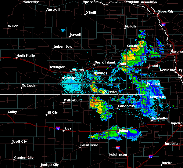 The severe thunderstorm warning for northwestern jewell county will expire at 1000 am cdt, the storm which prompted the warning has weakened below severe limits, and no longer poses an immediate threat to life or property. therefore, the warning will be allowed to expire. The severe thunderstorm warning for northwestern jewell county will expire at 1000 am cdt, the storm which prompted the warning has weakened below severe limits, and no longer poses an immediate threat to life or property. therefore, the warning will be allowed to expire.
|
| 6/21/2020 9:35 AM CDT |
 At 935 am cdt, a severe thunderstorm was located near esbon, or 27 miles northwest of beloit, moving northeast at 15 mph (radar indicated). Hazards include ping pong ball size hail and 60 mph wind gusts. People and animals outdoors will be injured. expect hail damage to roofs, siding, windows, and vehicles. expect wind damage to roofs, siding, and trees. Locations impacted include, burr oak and esbon. At 935 am cdt, a severe thunderstorm was located near esbon, or 27 miles northwest of beloit, moving northeast at 15 mph (radar indicated). Hazards include ping pong ball size hail and 60 mph wind gusts. People and animals outdoors will be injured. expect hail damage to roofs, siding, windows, and vehicles. expect wind damage to roofs, siding, and trees. Locations impacted include, burr oak and esbon.
|
| 6/21/2020 9:20 AM CDT |
 At 919 am cdt, a severe thunderstorm was located near esbon, or 28 miles northwest of beloit, moving east at 10 mph (radar indicated). Hazards include ping pong ball size hail and 60 mph wind gusts. People and animals outdoors will be injured. expect hail damage to roofs, siding, windows, and vehicles. expect wind damage to roofs, siding, and trees. Locations impacted include, burr oak and esbon. At 919 am cdt, a severe thunderstorm was located near esbon, or 28 miles northwest of beloit, moving east at 10 mph (radar indicated). Hazards include ping pong ball size hail and 60 mph wind gusts. People and animals outdoors will be injured. expect hail damage to roofs, siding, windows, and vehicles. expect wind damage to roofs, siding, and trees. Locations impacted include, burr oak and esbon.
|
| 6/21/2020 9:09 AM CDT |
 At 908 am cdt, a severe thunderstorm was located near lebanon, or 29 miles northwest of beloit, moving northeast at 15 mph (radar indicated). Hazards include quarter size hail. damage to vehicles is expected At 908 am cdt, a severe thunderstorm was located near lebanon, or 29 miles northwest of beloit, moving northeast at 15 mph (radar indicated). Hazards include quarter size hail. damage to vehicles is expected
|
| 6/3/2020 10:41 PM CDT |
 At 1040 pm cdt, a severe thunderstorm was located over mankato, or 23 miles north of beloit, moving east at 35 mph (radar indicated). Hazards include ping pong ball size hail and 60 mph wind gusts. People and animals outdoors will be injured. expect hail damage to roofs, siding, windows, and vehicles. expect wind damage to roofs, siding, and trees. Locations impacted include, mankato, jewell, burr oak, formoso, randall and montrose. At 1040 pm cdt, a severe thunderstorm was located over mankato, or 23 miles north of beloit, moving east at 35 mph (radar indicated). Hazards include ping pong ball size hail and 60 mph wind gusts. People and animals outdoors will be injured. expect hail damage to roofs, siding, windows, and vehicles. expect wind damage to roofs, siding, and trees. Locations impacted include, mankato, jewell, burr oak, formoso, randall and montrose.
|
| 6/3/2020 10:29 PM CDT |
 At 1029 pm cdt, a severe thunderstorm was located near burr oak, or 26 miles northwest of beloit, moving east at 35 mph (radar indicated). Hazards include ping pong ball size hail and 60 mph wind gusts. People and animals outdoors will be injured. expect hail damage to roofs, siding, windows, and vehicles. Expect wind damage to roofs, siding, and trees. At 1029 pm cdt, a severe thunderstorm was located near burr oak, or 26 miles northwest of beloit, moving east at 35 mph (radar indicated). Hazards include ping pong ball size hail and 60 mph wind gusts. People and animals outdoors will be injured. expect hail damage to roofs, siding, windows, and vehicles. Expect wind damage to roofs, siding, and trees.
|
| 6/3/2020 10:21 PM CDT |
 At 1021 pm cdt, a severe thunderstorm was located over esbon, or 30 miles northwest of beloit, moving east at 35 mph (radar indicated). Hazards include 60 mph wind gusts and quarter size hail. Hail damage to vehicles is expected. Expect wind damage to roofs, siding, and trees. At 1021 pm cdt, a severe thunderstorm was located over esbon, or 30 miles northwest of beloit, moving east at 35 mph (radar indicated). Hazards include 60 mph wind gusts and quarter size hail. Hail damage to vehicles is expected. Expect wind damage to roofs, siding, and trees.
|
| 5/4/2020 8:19 AM CDT |
 At 819 am cdt, severe thunderstorms were located along a line extending from 8 miles southeast of red cloud to near burr oak to ionia, moving east at 50 mph (radar indicated). Hazards include 60 mph wind gusts. Expect damage to roofs, siding, and trees. Locations impacted include, mankato, jewell, burr oak, esbon, formoso, ionia, randall, webber, lovewell state park and montrose. At 819 am cdt, severe thunderstorms were located along a line extending from 8 miles southeast of red cloud to near burr oak to ionia, moving east at 50 mph (radar indicated). Hazards include 60 mph wind gusts. Expect damage to roofs, siding, and trees. Locations impacted include, mankato, jewell, burr oak, esbon, formoso, ionia, randall, webber, lovewell state park and montrose.
|
| 5/4/2020 8:04 AM CDT |
 At 803 am cdt, severe thunderstorms were located along a line extending from 9 miles south of inavale to near lebanon to 6 miles northeast of portis, moving east at 50 mph (radar indicated). Hazards include 60 mph wind gusts. Expect damage to roofs, siding, and trees. Locations impacted include, mankato, jewell, lebanon, burr oak, esbon, formoso, ionia, randall, webber, bellaire, lovewell state park and montrose. At 803 am cdt, severe thunderstorms were located along a line extending from 9 miles south of inavale to near lebanon to 6 miles northeast of portis, moving east at 50 mph (radar indicated). Hazards include 60 mph wind gusts. Expect damage to roofs, siding, and trees. Locations impacted include, mankato, jewell, lebanon, burr oak, esbon, formoso, ionia, randall, webber, bellaire, lovewell state park and montrose.
|
| 5/4/2020 7:56 AM CDT |
 At 756 am cdt, severe thunderstorms were located along a line extending from 10 miles north of smith center to near bellaire to near harlan, moving northeast at 50 mph (radar indicated). Hazards include 60 mph wind gusts. expect damage to roofs, siding, and trees At 756 am cdt, severe thunderstorms were located along a line extending from 10 miles north of smith center to near bellaire to near harlan, moving northeast at 50 mph (radar indicated). Hazards include 60 mph wind gusts. expect damage to roofs, siding, and trees
|
| 8/29/2019 9:33 PM CDT |
 At 933 pm cdt, severe thunderstorms were located along a line extending from courtland to near jewell to cawker city, moving southeast at 30 mph (radar indicated). Hazards include 60 mph wind gusts and quarter size hail. Hail damage to vehicles is expected. expect wind damage to roofs, siding, and trees. Locations impacted include, beloit, downs, mankato, cawker city, glen elder, jewell, tipton, burr oak, esbon, asherville, formoso, simpson, ionia, randall, hunter, webber, scottsville, victor, lovewell state park and montrose. At 933 pm cdt, severe thunderstorms were located along a line extending from courtland to near jewell to cawker city, moving southeast at 30 mph (radar indicated). Hazards include 60 mph wind gusts and quarter size hail. Hail damage to vehicles is expected. expect wind damage to roofs, siding, and trees. Locations impacted include, beloit, downs, mankato, cawker city, glen elder, jewell, tipton, burr oak, esbon, asherville, formoso, simpson, ionia, randall, hunter, webber, scottsville, victor, lovewell state park and montrose.
|
| 8/29/2019 9:27 PM CDT |
 The severe thunderstorm warning for northern jewell, northeastern smith, southwestern nuckolls and southern webster counties will expire at 930 pm cdt, the storm which prompted the warning has moved out of the area. therefore, the warning will be allowed to expire. a severe thunderstorm warning remains in effect for mitchell, jewell, southeastern smith and northeastern osborne counties through 1000 pm cdt. a severe thunderstorm watch remains in effect until 1000 pm cdt for north central kansas, and south central nebraska. to report severe weather, contact your nearest law enforcement agency. they will relay your report to the national weather service hastings. The severe thunderstorm warning for northern jewell, northeastern smith, southwestern nuckolls and southern webster counties will expire at 930 pm cdt, the storm which prompted the warning has moved out of the area. therefore, the warning will be allowed to expire. a severe thunderstorm warning remains in effect for mitchell, jewell, southeastern smith and northeastern osborne counties through 1000 pm cdt. a severe thunderstorm watch remains in effect until 1000 pm cdt for north central kansas, and south central nebraska. to report severe weather, contact your nearest law enforcement agency. they will relay your report to the national weather service hastings.
|
| 8/29/2019 9:17 PM CDT |
 At 916 pm cdt, severe thunderstorms were located along a line extending from near lovewell state park to near ionia to 6 miles north of downs, moving southeast at 35 mph (radar indicated). Hazards include 70 mph wind gusts and quarter size hail. Hail damage to vehicles is expected. expect considerable tree damage. Wind damage is also likely to mobile homes, roofs, and outbuildings. At 916 pm cdt, severe thunderstorms were located along a line extending from near lovewell state park to near ionia to 6 miles north of downs, moving southeast at 35 mph (radar indicated). Hazards include 70 mph wind gusts and quarter size hail. Hail damage to vehicles is expected. expect considerable tree damage. Wind damage is also likely to mobile homes, roofs, and outbuildings.
|
| 8/29/2019 9:05 PM CDT | Wind gusts estimated to be 60 to 65 mp in jewell county KS, 0.9 miles SSW of Burr Oak, KS |
| 8/29/2019 9:03 PM CDT |
 At 903 pm cdt, a severe thunderstorm was located near burr oak, or 32 miles northwest of beloit, moving southeast at 20 mph (radar indicated). Hazards include 60 mph wind gusts and quarter size hail. Hail damage to vehicles is expected. expect wind damage to roofs, siding, and trees. Locations impacted include, red cloud, mankato, guide rock, lebanon, burr oak, esbon, cowles, webber, bostwick, inavale and lovewell state park. At 903 pm cdt, a severe thunderstorm was located near burr oak, or 32 miles northwest of beloit, moving southeast at 20 mph (radar indicated). Hazards include 60 mph wind gusts and quarter size hail. Hail damage to vehicles is expected. expect wind damage to roofs, siding, and trees. Locations impacted include, red cloud, mankato, guide rock, lebanon, burr oak, esbon, cowles, webber, bostwick, inavale and lovewell state park.
|
| 8/29/2019 8:42 PM CDT |
 At 842 pm cdt, a severe thunderstorm was located 8 miles south of red cloud, or 39 miles northwest of beloit, moving southeast at 20 mph (radar indicated). Hazards include 60 mph wind gusts and quarter size hail. Hail damage to vehicles is expected. Expect wind damage to roofs, siding, and trees. At 842 pm cdt, a severe thunderstorm was located 8 miles south of red cloud, or 39 miles northwest of beloit, moving southeast at 20 mph (radar indicated). Hazards include 60 mph wind gusts and quarter size hail. Hail damage to vehicles is expected. Expect wind damage to roofs, siding, and trees.
|
| 8/17/2019 2:26 AM CDT |
 The severe thunderstorm warning for jewell county will expire at 230 am cdt. the storm which prompted the warning has weakened below severe limits, and no longer poses an immediate threat to life or property. therefore, the warning will be allowed to expire. However small hail, gusty winds and heavy rain are still possible with this. The severe thunderstorm warning for jewell county will expire at 230 am cdt. the storm which prompted the warning has weakened below severe limits, and no longer poses an immediate threat to life or property. therefore, the warning will be allowed to expire. However small hail, gusty winds and heavy rain are still possible with this.
|
| 8/17/2019 2:16 AM CDT |
 At 216 am cdt, a severe thunderstorm was located near ionia, or 22 miles northwest of beloit, moving east at 30 mph (radar indicated). Hazards include 60 mph wind gusts and quarter size hail. Hail damage to vehicles is expected. expect wind damage to roofs, siding, and trees. Locations impacted include, mankato, jewell, burr oak, esbon, formoso, ionia, randall and montrose. At 216 am cdt, a severe thunderstorm was located near ionia, or 22 miles northwest of beloit, moving east at 30 mph (radar indicated). Hazards include 60 mph wind gusts and quarter size hail. Hail damage to vehicles is expected. expect wind damage to roofs, siding, and trees. Locations impacted include, mankato, jewell, burr oak, esbon, formoso, ionia, randall and montrose.
|
| 8/17/2019 2:06 AM CDT |
 At 206 am cdt, a severe thunderstorm was located over esbon, or 29 miles northwest of beloit, moving east at 30 mph (radar indicated). Hazards include 60 mph wind gusts and quarter size hail. Hail damage to vehicles is expected. expect wind damage to roofs, siding, and trees. Locations impacted include, mankato, jewell, lebanon, burr oak, esbon, formoso, ionia, randall, bellaire and montrose. At 206 am cdt, a severe thunderstorm was located over esbon, or 29 miles northwest of beloit, moving east at 30 mph (radar indicated). Hazards include 60 mph wind gusts and quarter size hail. Hail damage to vehicles is expected. expect wind damage to roofs, siding, and trees. Locations impacted include, mankato, jewell, lebanon, burr oak, esbon, formoso, ionia, randall, bellaire and montrose.
|
| 8/17/2019 1:48 AM CDT |
 The national weather service in hastings has issued a * severe thunderstorm warning for. jewell county in north central kansas. southeastern smith county in north central kansas. until 230 am cdt. At 148 am cdt, a severe thunderstorm was located over bellaire, or. The national weather service in hastings has issued a * severe thunderstorm warning for. jewell county in north central kansas. southeastern smith county in north central kansas. until 230 am cdt. At 148 am cdt, a severe thunderstorm was located over bellaire, or.
|
| 8/12/2019 12:16 AM CDT |
 At 1216 am cdt, severe thunderstorms were located along a line extending from near campbell to near cowles to 7 miles southwest of guide rock to near portis, moving east at 45 mph (radar indicated). Hazards include 70 mph wind gusts. Expect considerable tree damage. damage is likely to mobile homes, roofs, and outbuildings. Locations impacted include, phillipsburg, plainville, smith center, osborne, stockton, red cloud, franklin, blue hill, downs, kensington, hildreth, wilcox, campbell, natoma, palco, agra, bladen, guide rock, lebanon and holstein. At 1216 am cdt, severe thunderstorms were located along a line extending from near campbell to near cowles to 7 miles southwest of guide rock to near portis, moving east at 45 mph (radar indicated). Hazards include 70 mph wind gusts. Expect considerable tree damage. damage is likely to mobile homes, roofs, and outbuildings. Locations impacted include, phillipsburg, plainville, smith center, osborne, stockton, red cloud, franklin, blue hill, downs, kensington, hildreth, wilcox, campbell, natoma, palco, agra, bladen, guide rock, lebanon and holstein.
|
| 8/12/2019 12:06 AM CDT |
 At 1206 am cdt, severe thunderstorms were located along a line extending from near upland to near inavale to 8 miles south of red cloud to near portis, moving east at 45 mph (radar indicated). Hazards include 70 mph wind gusts. Expect considerable tree damage. damage is likely to mobile homes, roofs, and outbuildings. Locations impacted include, phillipsburg, plainville, smith center, osborne, stockton, alma, red cloud, franklin, blue hill, downs, oxford, logan, kensington, orleans, hildreth, wilcox, campbell, natoma, palco and agra. At 1206 am cdt, severe thunderstorms were located along a line extending from near upland to near inavale to 8 miles south of red cloud to near portis, moving east at 45 mph (radar indicated). Hazards include 70 mph wind gusts. Expect considerable tree damage. damage is likely to mobile homes, roofs, and outbuildings. Locations impacted include, phillipsburg, plainville, smith center, osborne, stockton, alma, red cloud, franklin, blue hill, downs, oxford, logan, kensington, orleans, hildreth, wilcox, campbell, natoma, palco and agra.
|
| 8/11/2019 11:43 PM CDT |
 At 1142 pm cdt, severe thunderstorms were located along a line extending from near wilcox to franklin to 9 miles northwest of smith center to woodston, moving east at 45 mph. this warning replaces the previous warning in effect for harlan, franklin, phillips, smith, rooks and osborne counties (radar indicated). Hazards include 70 mph wind gusts. Expect considerable tree damage. Damage is likely to mobile homes, roofs, and outbuildings. At 1142 pm cdt, severe thunderstorms were located along a line extending from near wilcox to franklin to 9 miles northwest of smith center to woodston, moving east at 45 mph. this warning replaces the previous warning in effect for harlan, franklin, phillips, smith, rooks and osborne counties (radar indicated). Hazards include 70 mph wind gusts. Expect considerable tree damage. Damage is likely to mobile homes, roofs, and outbuildings.
|
| 7/10/2019 5:06 AM CDT |
 At 505 am cdt, severe thunderstorms were located along a line extending from 7 miles southwest of fairbury to near chester to near hardy to near mankato, moving east at 55 mph (radar indicated). Hazards include 60 mph wind gusts and half dollar size hail. Hail damage to vehicles is expected. expect wind damage to roofs, siding, and trees. Locations impacted include, superior, hebron, mankato, deshler, nelson, davenport, chester, alexandria, burr oak, hardy, ruskin, formoso, carleton, byron, hubbell, oak, belvidere, gilead, webber and nora. At 505 am cdt, severe thunderstorms were located along a line extending from 7 miles southwest of fairbury to near chester to near hardy to near mankato, moving east at 55 mph (radar indicated). Hazards include 60 mph wind gusts and half dollar size hail. Hail damage to vehicles is expected. expect wind damage to roofs, siding, and trees. Locations impacted include, superior, hebron, mankato, deshler, nelson, davenport, chester, alexandria, burr oak, hardy, ruskin, formoso, carleton, byron, hubbell, oak, belvidere, gilead, webber and nora.
|
| 7/10/2019 4:58 AM CDT |
 At 457 am cdt, severe thunderstorms were located along a line extending from near gilead to near superior to near burr oak, moving east at 85 mph (radar indicated). Hazards include 60 mph wind gusts and half dollar size hail. Hail damage to vehicles is expected. Expect wind damage to roofs, siding, and trees. At 457 am cdt, severe thunderstorms were located along a line extending from near gilead to near superior to near burr oak, moving east at 85 mph (radar indicated). Hazards include 60 mph wind gusts and half dollar size hail. Hail damage to vehicles is expected. Expect wind damage to roofs, siding, and trees.
|
| 7/10/2019 4:47 AM CDT |
 At 446 am cdt, a severe thunderstorm was located over webber, or 22 miles west of belleville, moving east at 55 mph (radar indicated). Hazards include 60 mph wind gusts and quarter size hail. Hail damage to vehicles is expected. expect wind damage to roofs, siding, and trees. Locations impacted include, superior, burr oak, formoso, webber, lovewell state park and montrose. At 446 am cdt, a severe thunderstorm was located over webber, or 22 miles west of belleville, moving east at 55 mph (radar indicated). Hazards include 60 mph wind gusts and quarter size hail. Hail damage to vehicles is expected. expect wind damage to roofs, siding, and trees. Locations impacted include, superior, burr oak, formoso, webber, lovewell state park and montrose.
|
| 7/10/2019 4:45 AM CDT | Estimated wind gusts of 55 to 60 mp in jewell county KS, 0.1 miles SE of Burr Oak, KS |
| 7/10/2019 4:37 AM CDT |
 At 436 am cdt, a severe thunderstorm was located near burr oak, or 32 miles west of belleville, moving east at 55 mph (radar indicated). Hazards include 60 mph wind gusts and quarter size hail. Hail damage to vehicles is expected. expect wind damage to roofs, siding, and trees. Locations impacted include, superior, red cloud, burr oak, formoso, webber, lovewell state park and montrose. At 436 am cdt, a severe thunderstorm was located near burr oak, or 32 miles west of belleville, moving east at 55 mph (radar indicated). Hazards include 60 mph wind gusts and quarter size hail. Hail damage to vehicles is expected. expect wind damage to roofs, siding, and trees. Locations impacted include, superior, red cloud, burr oak, formoso, webber, lovewell state park and montrose.
|
| 7/10/2019 4:13 AM CDT |
 At 412 am cdt, a severe thunderstorm was located near inavale, or 40 miles northeast of phillipsburg, moving east at 50 mph (radar indicated). Hazards include ping pong ball size hail and 60 mph wind gusts. People and animals outdoors will be injured. expect hail damage to roofs, siding, windows, and vehicles. Expect wind damage to roofs, siding, and trees. At 412 am cdt, a severe thunderstorm was located near inavale, or 40 miles northeast of phillipsburg, moving east at 50 mph (radar indicated). Hazards include ping pong ball size hail and 60 mph wind gusts. People and animals outdoors will be injured. expect hail damage to roofs, siding, windows, and vehicles. Expect wind damage to roofs, siding, and trees.
|
| 6/25/2019 7:57 PM CDT |
 At 740 pm cdt, severe thunderstorms were located along a line extending from near courtland to near burr oak, moving south at 35 mph (radar indicated). Hazards include two inch hail and 60 mph wind gusts. People and animals outdoors will be injured. expect hail damage to roofs, siding, windows, and vehicles. Expect wind damage to roofs, siding, and trees. At 740 pm cdt, severe thunderstorms were located along a line extending from near courtland to near burr oak, moving south at 35 mph (radar indicated). Hazards include two inch hail and 60 mph wind gusts. People and animals outdoors will be injured. expect hail damage to roofs, siding, windows, and vehicles. Expect wind damage to roofs, siding, and trees.
|
| 6/25/2019 7:40 PM CDT |
 At 740 pm cdt, severe thunderstorms were located along a line extending from near courtland to near burr oak, moving south at 35 mph (radar indicated). Hazards include two inch hail and 60 mph wind gusts. People and animals outdoors will be injured. expect hail damage to roofs, siding, windows, and vehicles. Expect wind damage to roofs, siding, and trees. At 740 pm cdt, severe thunderstorms were located along a line extending from near courtland to near burr oak, moving south at 35 mph (radar indicated). Hazards include two inch hail and 60 mph wind gusts. People and animals outdoors will be injured. expect hail damage to roofs, siding, windows, and vehicles. Expect wind damage to roofs, siding, and trees.
|
| 6/25/2019 7:30 PM CDT |
 At 730 pm cdt, severe thunderstorms were located along a line extending from byron to near lovewell state park to burr oak, moving southeast at 40 mph (radar indicated). Hazards include two inch hail and 60 mph wind gusts. People and animals outdoors will be injured. expect hail damage to roofs, siding, windows, and vehicles. expect wind damage to roofs, siding, and trees. Locations impacted include, superior, mankato, jewell, chester, burr oak, hardy, ruskin, formoso, byron, randall, webber, lovewell state park, montrose and bostwick. At 730 pm cdt, severe thunderstorms were located along a line extending from byron to near lovewell state park to burr oak, moving southeast at 40 mph (radar indicated). Hazards include two inch hail and 60 mph wind gusts. People and animals outdoors will be injured. expect hail damage to roofs, siding, windows, and vehicles. expect wind damage to roofs, siding, and trees. Locations impacted include, superior, mankato, jewell, chester, burr oak, hardy, ruskin, formoso, byron, randall, webber, lovewell state park, montrose and bostwick.
|
| 6/25/2019 7:19 PM CDT |
 At 719 pm cdt, severe thunderstorms were located along a line extending from near byron to near webber to near burr oak, moving southeast at 40 mph (radar indicated). Hazards include two inch hail and 60 mph wind gusts. People and animals outdoors will be injured. expect hail damage to roofs, siding, windows, and vehicles. expect wind damage to roofs, siding, and trees. Locations impacted include, superior, mankato, jewell, chester, burr oak, hardy, ruskin, formoso, byron, randall, webber, lovewell state park, montrose and bostwick. At 719 pm cdt, severe thunderstorms were located along a line extending from near byron to near webber to near burr oak, moving southeast at 40 mph (radar indicated). Hazards include two inch hail and 60 mph wind gusts. People and animals outdoors will be injured. expect hail damage to roofs, siding, windows, and vehicles. expect wind damage to roofs, siding, and trees. Locations impacted include, superior, mankato, jewell, chester, burr oak, hardy, ruskin, formoso, byron, randall, webber, lovewell state park, montrose and bostwick.
|
| 6/25/2019 7:11 PM CDT |
 At 710 pm cdt, severe thunderstorms were located along a line extending from near ruskin to superior to near guide rock, moving southeast at 40 mph (radar indicated). Hazards include two inch hail and 60 mph wind gusts. People and animals outdoors will be injured. expect hail damage to roofs, siding, windows, and vehicles. Expect wind damage to roofs, siding, and trees. At 710 pm cdt, severe thunderstorms were located along a line extending from near ruskin to superior to near guide rock, moving southeast at 40 mph (radar indicated). Hazards include two inch hail and 60 mph wind gusts. People and animals outdoors will be injured. expect hail damage to roofs, siding, windows, and vehicles. Expect wind damage to roofs, siding, and trees.
|
| 6/25/2019 6:51 PM CDT |
 At 638 pm cdt, a severe thunderstorm was located near cowles, or 32 miles south of hastings, moving southeast at 25 mph (radar indicated). Hazards include golf ball size hail and 60 mph wind gusts. People and animals outdoors will be injured. expect hail damage to roofs, siding, windows, and vehicles. Expect wind damage to roofs, siding, and trees. At 638 pm cdt, a severe thunderstorm was located near cowles, or 32 miles south of hastings, moving southeast at 25 mph (radar indicated). Hazards include golf ball size hail and 60 mph wind gusts. People and animals outdoors will be injured. expect hail damage to roofs, siding, windows, and vehicles. Expect wind damage to roofs, siding, and trees.
|
| 6/25/2019 6:38 PM CDT |
 At 638 pm cdt, a severe thunderstorm was located near cowles, or 32 miles south of hastings, moving southeast at 25 mph (radar indicated). Hazards include golf ball size hail and 60 mph wind gusts. People and animals outdoors will be injured. expect hail damage to roofs, siding, windows, and vehicles. Expect wind damage to roofs, siding, and trees. At 638 pm cdt, a severe thunderstorm was located near cowles, or 32 miles south of hastings, moving southeast at 25 mph (radar indicated). Hazards include golf ball size hail and 60 mph wind gusts. People and animals outdoors will be injured. expect hail damage to roofs, siding, windows, and vehicles. Expect wind damage to roofs, siding, and trees.
|
| 6/21/2019 6:07 AM CDT |
 At 606 am cdt, severe thunderstorms were located along a line extending from near geneva to near deshler to near jewell, moving east at 50 mph (trained weather spotters). Hazards include 60 mph wind gusts and penny size hail. Expect damage to roofs, siding, and trees. Locations impacted include, geneva, superior, hebron, mankato, deshler, jewell, shickley, davenport, milligan, bruning, chester, alexandria, burr oak, hardy, ruskin, ohiowa, formoso, carleton, byron and hubbell. At 606 am cdt, severe thunderstorms were located along a line extending from near geneva to near deshler to near jewell, moving east at 50 mph (trained weather spotters). Hazards include 60 mph wind gusts and penny size hail. Expect damage to roofs, siding, and trees. Locations impacted include, geneva, superior, hebron, mankato, deshler, jewell, shickley, davenport, milligan, bruning, chester, alexandria, burr oak, hardy, ruskin, ohiowa, formoso, carleton, byron and hubbell.
|
| 6/21/2019 5:55 AM CDT |
 At 554 am cdt, severe thunderstorms were located along a line extending from near fairmont to near nora to near burr oak, moving east at 50 mph (trained weather spotter in burr oak kansas reported wind gusts up to 60 mph at 552 am cdt). Hazards include 60 mph wind gusts and penny size hail. Expect damage to roofs, siding, and trees. Locations impacted include, geneva, superior, hebron, sutton, mankato, deshler, exeter, fairmont, edgar, nelson, jewell, shickley, davenport, milligan, bruning, chester, guide rock, lebanon, alexandria and burr oak. At 554 am cdt, severe thunderstorms were located along a line extending from near fairmont to near nora to near burr oak, moving east at 50 mph (trained weather spotter in burr oak kansas reported wind gusts up to 60 mph at 552 am cdt). Hazards include 60 mph wind gusts and penny size hail. Expect damage to roofs, siding, and trees. Locations impacted include, geneva, superior, hebron, sutton, mankato, deshler, exeter, fairmont, edgar, nelson, jewell, shickley, davenport, milligan, bruning, chester, guide rock, lebanon, alexandria and burr oak.
|
| 6/21/2019 5:52 AM CDT | Storm damage reported in jewell county KS, 0.9 miles SSW of Burr Oak, KS |
| 6/21/2019 5:43 AM CDT |
 At 543 am cdt, severe thunderstorms were located along a line extending from near grafton to nelson to esbon, moving east at 50 mph (radar indicated). Hazards include 60 mph wind gusts. Expect damage to roofs, siding, and trees. Locations impacted include, geneva, superior, hebron, sutton, mankato, clay center, deshler, exeter, fairmont, edgar, nelson, jewell, fairfield, shickley, lawrence, davenport, milligan, bruning, chester and guide rock. At 543 am cdt, severe thunderstorms were located along a line extending from near grafton to nelson to esbon, moving east at 50 mph (radar indicated). Hazards include 60 mph wind gusts. Expect damage to roofs, siding, and trees. Locations impacted include, geneva, superior, hebron, sutton, mankato, clay center, deshler, exeter, fairmont, edgar, nelson, jewell, fairfield, shickley, lawrence, davenport, milligan, bruning, chester and guide rock.
|
| 6/21/2019 5:30 AM CDT |
 At 530 am cdt, severe thunderstorms were located along a line extending from near stockham to near lawrence to near lebanon, moving east at 50 mph (radar indicated). Hazards include 60 mph wind gusts. expect damage to roofs, siding, and trees At 530 am cdt, severe thunderstorms were located along a line extending from near stockham to near lawrence to near lebanon, moving east at 50 mph (radar indicated). Hazards include 60 mph wind gusts. expect damage to roofs, siding, and trees
|
| 5/28/2019 5:55 PM CDT |
 At 555 pm cdt, a severe thunderstorm capable of producing a tornado was located near glen elder, or 9 miles northwest of beloit, moving northeast at 40 mph (radar indicated rotation). Hazards include tornado and tennis ball size hail. Flying debris will be dangerous to those caught without shelter. mobile homes will be damaged or destroyed. damage to roofs, windows, and vehicles will occur. tree damage is likely. this dangerous storm will be near, jewell around 605 pm cdt. randall around 610 pm cdt. montrose around 615 pm cdt. Formoso around 625 pm cdt. At 555 pm cdt, a severe thunderstorm capable of producing a tornado was located near glen elder, or 9 miles northwest of beloit, moving northeast at 40 mph (radar indicated rotation). Hazards include tornado and tennis ball size hail. Flying debris will be dangerous to those caught without shelter. mobile homes will be damaged or destroyed. damage to roofs, windows, and vehicles will occur. tree damage is likely. this dangerous storm will be near, jewell around 605 pm cdt. randall around 610 pm cdt. montrose around 615 pm cdt. Formoso around 625 pm cdt.
|
| 5/27/2019 10:45 PM CDT |
 At 1044 pm cdt, severe thunderstorms were located along a line extending from near superior to near formoso to near ionia to 6 miles northeast of cawker city, moving east at 35 mph (radar indicated). Hazards include 60 mph wind gusts and quarter size hail. Hail damage to vehicles is expected. expect wind damage to roofs, siding, and trees. Locations impacted include, superior, mankato, jewell, burr oak, hardy, formoso, ionia, randall, webber, lovewell state park and montrose. At 1044 pm cdt, severe thunderstorms were located along a line extending from near superior to near formoso to near ionia to 6 miles northeast of cawker city, moving east at 35 mph (radar indicated). Hazards include 60 mph wind gusts and quarter size hail. Hail damage to vehicles is expected. expect wind damage to roofs, siding, and trees. Locations impacted include, superior, mankato, jewell, burr oak, hardy, formoso, ionia, randall, webber, lovewell state park and montrose.
|
| 5/27/2019 10:33 PM CDT |
 At 1033 pm cdt, severe thunderstorms were located along a line extending from bostwick to near montrose to ionia to near cawker city, moving east at 35 mph (radar indicated). Hazards include 60 mph wind gusts and quarter size hail. Hail damage to vehicles is expected. Expect wind damage to roofs, siding, and trees. At 1033 pm cdt, severe thunderstorms were located along a line extending from bostwick to near montrose to ionia to near cawker city, moving east at 35 mph (radar indicated). Hazards include 60 mph wind gusts and quarter size hail. Hail damage to vehicles is expected. Expect wind damage to roofs, siding, and trees.
|
| 5/27/2019 1:28 AM CDT |
 At 127 am cdt, severe thunderstorms were located along a line extending from near cawker city to 6 miles southwest of beloit to near barnard, moving northeast at 60 mph (radar indicated). Hazards include 60 mph wind gusts. expect damage to roofs, siding, and trees At 127 am cdt, severe thunderstorms were located along a line extending from near cawker city to 6 miles southwest of beloit to near barnard, moving northeast at 60 mph (radar indicated). Hazards include 60 mph wind gusts. expect damage to roofs, siding, and trees
|
| 4/21/2019 8:51 PM CDT |
 At 851 pm cdt, severe thunderstorms were located along a line extending from near red cloud to hunter, moving northeast at 35 mph (radar indicated). Hazards include 70 mph wind gusts and quarter size hail. Hail damage to vehicles is expected. expect considerable tree damage. Wind damage is also likely to mobile homes, roofs, and outbuildings. At 851 pm cdt, severe thunderstorms were located along a line extending from near red cloud to hunter, moving northeast at 35 mph (radar indicated). Hazards include 70 mph wind gusts and quarter size hail. Hail damage to vehicles is expected. expect considerable tree damage. Wind damage is also likely to mobile homes, roofs, and outbuildings.
|
| 4/21/2019 8:17 PM CDT |
 At 817 pm cdt, severe thunderstorms were located along a line extending from near harlan to near osborne to near luray, moving northeast at 50 mph (radar indicated). Hazards include 70 mph wind gusts and quarter size hail. Hail damage to vehicles is expected. expect considerable tree damage. Wind damage is also likely to mobile homes, roofs, and outbuildings. At 817 pm cdt, severe thunderstorms were located along a line extending from near harlan to near osborne to near luray, moving northeast at 50 mph (radar indicated). Hazards include 70 mph wind gusts and quarter size hail. Hail damage to vehicles is expected. expect considerable tree damage. Wind damage is also likely to mobile homes, roofs, and outbuildings.
|
| 3/28/2019 9:38 AM CDT |
 At 937 am cdt, severe thunderstorms were located along a line extending from near nora to near bostwick to 7 miles southwest of guide rock, moving east at 25 mph (radar indicated). Hazards include ping pong ball size hail and 60 mph wind gusts. People and animals outdoors will be injured. expect hail damage to roofs, siding, windows, and vehicles. expect wind damage to roofs, siding, and trees. Locations impacted include, superior, guide rock, burr oak, webber, nora, bostwick and lovewell state park. At 937 am cdt, severe thunderstorms were located along a line extending from near nora to near bostwick to 7 miles southwest of guide rock, moving east at 25 mph (radar indicated). Hazards include ping pong ball size hail and 60 mph wind gusts. People and animals outdoors will be injured. expect hail damage to roofs, siding, windows, and vehicles. expect wind damage to roofs, siding, and trees. Locations impacted include, superior, guide rock, burr oak, webber, nora, bostwick and lovewell state park.
|
| 3/28/2019 9:24 AM CDT |
 At 924 am cdt, severe thunderstorms were located along a line extending from near nora to near bostwick to 8 miles north of esbon, moving east at 30 mph (radar indicated). Hazards include ping pong ball size hail and 60 mph wind gusts. People and animals outdoors will be injured. expect hail damage to roofs, siding, windows, and vehicles. expect wind damage to roofs, siding, and trees. Locations impacted include, superior, red cloud, nelson, guide rock, burr oak, webber, nora, bostwick and lovewell state park. At 924 am cdt, severe thunderstorms were located along a line extending from near nora to near bostwick to 8 miles north of esbon, moving east at 30 mph (radar indicated). Hazards include ping pong ball size hail and 60 mph wind gusts. People and animals outdoors will be injured. expect hail damage to roofs, siding, windows, and vehicles. expect wind damage to roofs, siding, and trees. Locations impacted include, superior, red cloud, nelson, guide rock, burr oak, webber, nora, bostwick and lovewell state park.
|
| 3/28/2019 9:13 AM CDT |
 At 912 am cdt, severe thunderstorms were located along a line extending from near nelson to near red cloud to 9 miles north of bellaire, moving east at 25 mph (radar indicated). Hazards include 60 mph wind gusts and quarter size hail. Hail damage to vehicles is expected. expect wind damage to roofs, siding, and trees. Locations impacted include, superior, red cloud, nelson, guide rock, burr oak, cowles, webber, nora, bostwick, inavale and lovewell state park. At 912 am cdt, severe thunderstorms were located along a line extending from near nelson to near red cloud to 9 miles north of bellaire, moving east at 25 mph (radar indicated). Hazards include 60 mph wind gusts and quarter size hail. Hail damage to vehicles is expected. expect wind damage to roofs, siding, and trees. Locations impacted include, superior, red cloud, nelson, guide rock, burr oak, cowles, webber, nora, bostwick, inavale and lovewell state park.
|
| 3/28/2019 9:00 AM CDT |
 At 859 am cdt, severe thunderstorms were located along a line extending from near lawrence to near red cloud to 9 miles south of riverton, moving east at 25 mph (radar indicated). Hazards include 60 mph wind gusts and quarter size hail. Hail damage to vehicles is expected. Expect wind damage to roofs, siding, and trees. At 859 am cdt, severe thunderstorms were located along a line extending from near lawrence to near red cloud to 9 miles south of riverton, moving east at 25 mph (radar indicated). Hazards include 60 mph wind gusts and quarter size hail. Hail damage to vehicles is expected. Expect wind damage to roofs, siding, and trees.
|
| 9/1/2018 6:17 PM CDT |
 At 617 pm cdt, a severe thunderstorm was located near mankato, or 27 miles north of beloit, moving northeast at 25 mph (radar indicated). Hazards include 60 mph wind gusts and quarter size hail. Hail damage to vehicles is expected. expect wind damage to roofs, siding, and trees. Locations impacted include, mankato, burr oak, esbon, formoso, webber, lovewell state park and montrose. At 617 pm cdt, a severe thunderstorm was located near mankato, or 27 miles north of beloit, moving northeast at 25 mph (radar indicated). Hazards include 60 mph wind gusts and quarter size hail. Hail damage to vehicles is expected. expect wind damage to roofs, siding, and trees. Locations impacted include, mankato, burr oak, esbon, formoso, webber, lovewell state park and montrose.
|
| 9/1/2018 5:55 PM CDT |
 The national weather service in hastings has issued a * severe thunderstorm warning for. central jewell county in north central kansas. until 630 pm cdt. At 555 pm cdt, a severe thunderstorm was located near mankato, or 23 miles northwest of beloit, moving northeast at 25 mph. The national weather service in hastings has issued a * severe thunderstorm warning for. central jewell county in north central kansas. until 630 pm cdt. At 555 pm cdt, a severe thunderstorm was located near mankato, or 23 miles northwest of beloit, moving northeast at 25 mph.
|
| 7/30/2018 3:18 PM CDT |
 At 318 pm cdt, a severe thunderstorm was located near webber, or 26 miles west of belleville, moving southeast at 15 mph (radar indicated). Hazards include 60 mph wind gusts and quarter size hail. Hail damage to vehicles is expected. expect wind damage to roofs, siding, and trees. Locations impacted include, burr oak, webber and lovewell state park. At 318 pm cdt, a severe thunderstorm was located near webber, or 26 miles west of belleville, moving southeast at 15 mph (radar indicated). Hazards include 60 mph wind gusts and quarter size hail. Hail damage to vehicles is expected. expect wind damage to roofs, siding, and trees. Locations impacted include, burr oak, webber and lovewell state park.
|
| 7/30/2018 3:11 PM CDT |
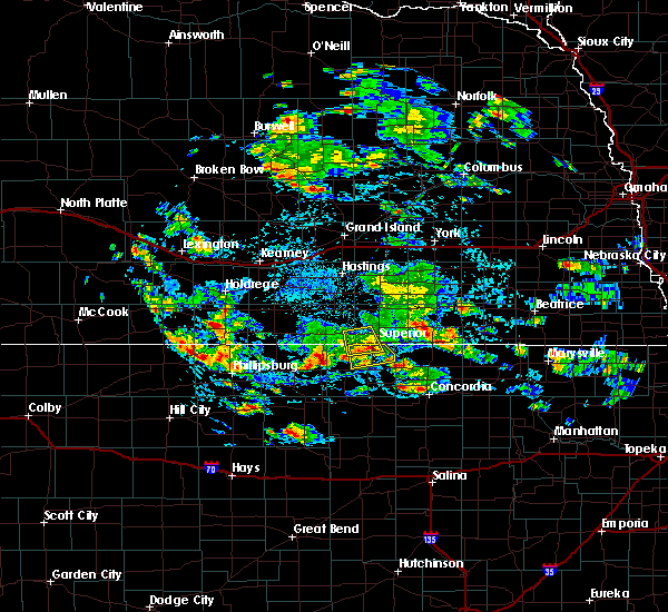 At 311 pm cdt, a severe thunderstorm was located near webber, or 27 miles west of belleville, moving southeast at 15 mph (radar indicated). Hazards include 60 mph wind gusts and half dollar size hail. Hail damage to vehicles is expected. Expect wind damage to roofs, siding, and trees. At 311 pm cdt, a severe thunderstorm was located near webber, or 27 miles west of belleville, moving southeast at 15 mph (radar indicated). Hazards include 60 mph wind gusts and half dollar size hail. Hail damage to vehicles is expected. Expect wind damage to roofs, siding, and trees.
|
| 7/19/2018 12:43 PM CDT |
 At 1243 pm cdt, a severe thunderstorm was located near ionia, or 25 miles northwest of beloit, moving east at 40 mph (radar indicated). Hazards include 60 mph wind gusts and quarter size hail. Hail damage to vehicles is expected. expect wind damage to roofs, siding, and trees. Locations impacted include, mankato, jewell, lebanon, esbon, ionia and montrose. At 1243 pm cdt, a severe thunderstorm was located near ionia, or 25 miles northwest of beloit, moving east at 40 mph (radar indicated). Hazards include 60 mph wind gusts and quarter size hail. Hail damage to vehicles is expected. expect wind damage to roofs, siding, and trees. Locations impacted include, mankato, jewell, lebanon, esbon, ionia and montrose.
|
| 7/19/2018 12:29 PM CDT |
 At 1228 pm cdt, a severe thunderstorm was located near bellaire, or 33 miles northwest of beloit, moving east at 40 mph (radar indicated). Hazards include 60 mph wind gusts and quarter size hail. Hail damage to vehicles is expected. Expect wind damage to roofs, siding, and trees. At 1228 pm cdt, a severe thunderstorm was located near bellaire, or 33 miles northwest of beloit, moving east at 40 mph (radar indicated). Hazards include 60 mph wind gusts and quarter size hail. Hail damage to vehicles is expected. Expect wind damage to roofs, siding, and trees.
|
| 6/19/2018 8:09 PM CDT |
 The severe thunderstorm warning for jewell county will expire at 815 pm cdt, the storm which prompted the warning has weakened below severe limits, and no longer poses an immediate threat to life or property. the strongest winds have moved into mitchell county. therefore, the warning will be allowed to expire. a severe thunderstorm watch remains in effect until 1100 pm cdt for north central kansas. The severe thunderstorm warning for jewell county will expire at 815 pm cdt, the storm which prompted the warning has weakened below severe limits, and no longer poses an immediate threat to life or property. the strongest winds have moved into mitchell county. therefore, the warning will be allowed to expire. a severe thunderstorm watch remains in effect until 1100 pm cdt for north central kansas.
|
| 6/19/2018 7:39 PM CDT |
 At 739 pm cdt, a severe thunderstorm was located over mankato, or 21 miles north of beloit, moving southeast at 35 mph (trained weather spotters and doppler weather radar). Hazards include 60 mph wind gusts. Expect damage to roofs, siding, and trees. this severe thunderstorm will be near, montrose around 745 pm cdt. jewell and formoso around 750 pm cdt. Randall around 800 pm cdt. At 739 pm cdt, a severe thunderstorm was located over mankato, or 21 miles north of beloit, moving southeast at 35 mph (trained weather spotters and doppler weather radar). Hazards include 60 mph wind gusts. Expect damage to roofs, siding, and trees. this severe thunderstorm will be near, montrose around 745 pm cdt. jewell and formoso around 750 pm cdt. Randall around 800 pm cdt.
|
| 6/19/2018 7:30 PM CDT | Storm damage reported in jewell county KS, 0.9 miles SSW of Burr Oak, KS |
| 6/19/2018 7:26 PM CDT |
 A severe thunderstorm warning remains in effect until 745 pm cdt for jewell county. at 725 pm cdt, a severe thunderstorm was located near burr oak, or 29 miles north of beloit, moving east at 35 mph. hazard. 60 mph wind gusts and nickel size hail. source. Radar indicated. A severe thunderstorm warning remains in effect until 745 pm cdt for jewell county. at 725 pm cdt, a severe thunderstorm was located near burr oak, or 29 miles north of beloit, moving east at 35 mph. hazard. 60 mph wind gusts and nickel size hail. source. Radar indicated.
|
| 6/19/2018 7:05 PM CDT |
 At 705 pm cdt, a severe thunderstorm was located 9 miles north of esbon, or 38 miles northwest of beloit, moving east at 35 mph (radar indicated). Hazards include ping pong ball size hail and 60 mph wind gusts. People and animals outdoors will be injured. expect hail damage to roofs, siding, windows, and vehicles. Expect wind damage to roofs, siding, and trees. At 705 pm cdt, a severe thunderstorm was located 9 miles north of esbon, or 38 miles northwest of beloit, moving east at 35 mph (radar indicated). Hazards include ping pong ball size hail and 60 mph wind gusts. People and animals outdoors will be injured. expect hail damage to roofs, siding, windows, and vehicles. Expect wind damage to roofs, siding, and trees.
|
| 6/18/2018 9:03 PM CDT |
 At 902 pm cdt, a severe thunderstorm was located north and west of burr oak, or 33 miles northwest of beloit, moving east at 15 mph (radar indicated). Hazards include 60 mph wind gusts and quarter size hail. Hail damage to vehicles is expected. expect wind damage to roofs, siding, and trees. This severe storm will be near, burr oak around 915 pm cdt. At 902 pm cdt, a severe thunderstorm was located north and west of burr oak, or 33 miles northwest of beloit, moving east at 15 mph (radar indicated). Hazards include 60 mph wind gusts and quarter size hail. Hail damage to vehicles is expected. expect wind damage to roofs, siding, and trees. This severe storm will be near, burr oak around 915 pm cdt.
|
| 6/18/2018 8:50 PM CDT |
 At 845 pm cdt, a severe thunderstorm was located near esbon, or 35 miles northwest of beloit, moving east at 15 mph (radar indicated). Hazards include 60 mph wind gusts. expect damage to roofs, siding, and trees At 845 pm cdt, a severe thunderstorm was located near esbon, or 35 miles northwest of beloit, moving east at 15 mph (radar indicated). Hazards include 60 mph wind gusts. expect damage to roofs, siding, and trees
|
| 6/18/2018 8:45 PM CDT |
 At 845 pm cdt, a severe thunderstorm was located near esbon, or 36 miles northwest of beloit moving east at 15 mph (radar indicated). Hazards include 60 mph wind gusts. Expect damage to roofs, siding, and trees. this severe thunderstorm will be near#commaorellipsis() esbon around 900 pm cdt. Burr oak around 915 pm cdt. At 845 pm cdt, a severe thunderstorm was located near esbon, or 36 miles northwest of beloit moving east at 15 mph (radar indicated). Hazards include 60 mph wind gusts. Expect damage to roofs, siding, and trees. this severe thunderstorm will be near#commaorellipsis() esbon around 900 pm cdt. Burr oak around 915 pm cdt.
|
| 6/9/2018 3:23 AM CDT |
 At 323 am cdt, severe thunderstorm outflow winds were located along a line extending from near bostwick to 7 miles north of smith center to near phillipsburg, moving south at 35 mph (radar indicated). Hazards include 60 mph wind gusts. Expect damage to roofs, siding, and trees. Locations impacted include, phillipsburg, smith center, kensington, agra, guide rock, lebanon, burr oak, esbon, glade, athol and bellaire. At 323 am cdt, severe thunderstorm outflow winds were located along a line extending from near bostwick to 7 miles north of smith center to near phillipsburg, moving south at 35 mph (radar indicated). Hazards include 60 mph wind gusts. Expect damage to roofs, siding, and trees. Locations impacted include, phillipsburg, smith center, kensington, agra, guide rock, lebanon, burr oak, esbon, glade, athol and bellaire.
|
| 6/9/2018 3:03 AM CDT |
 At 302 am cdt, severe thunderstorm outflow was located along a line extending from near lawrence to riverton to near harlan county dam, moving southeast at 30 mph (radar indicated. in addition, at 242 am cdt, an off duty nws employee estimated 60 mph winds two miles north of pauline in adams county). Hazards include 60 mph wind gusts. expect damage to roofs, siding, and trees At 302 am cdt, severe thunderstorm outflow was located along a line extending from near lawrence to riverton to near harlan county dam, moving southeast at 30 mph (radar indicated. in addition, at 242 am cdt, an off duty nws employee estimated 60 mph winds two miles north of pauline in adams county). Hazards include 60 mph wind gusts. expect damage to roofs, siding, and trees
|
| 5/29/2018 7:12 PM CDT |
 The severe thunderstorm warning for western jewell and southeastern smith counties will expire at 715 pm cdt, the storms which prompted the warning have weakened below severe limits, and no longer pose an immediate threat to life or property. therefore the warning will be allowed to expire. The severe thunderstorm warning for western jewell and southeastern smith counties will expire at 715 pm cdt, the storms which prompted the warning have weakened below severe limits, and no longer pose an immediate threat to life or property. therefore the warning will be allowed to expire.
|
| 5/29/2018 6:41 PM CDT |
 At 641 pm cdt, severe thunderstorms were located along a line extending from near harlan to 8 miles southeast of bellaire to near ionia, moving northeast at 40 mph (radar indicated). Hazards include quarter size hail. Damage to vehicles is expected. Locations impacted include, smith center, mankato, lebanon, burr oak, gaylord, esbon, ionia, harlan and bellaire. At 641 pm cdt, severe thunderstorms were located along a line extending from near harlan to 8 miles southeast of bellaire to near ionia, moving northeast at 40 mph (radar indicated). Hazards include quarter size hail. Damage to vehicles is expected. Locations impacted include, smith center, mankato, lebanon, burr oak, gaylord, esbon, ionia, harlan and bellaire.
|
| 5/29/2018 6:31 PM CDT |
 At 631 pm cdt, severe thunderstorms were located along a line extending from near gaylord to near harlan to 8 miles north of downs, moving northeast at 35 mph (radar indicated). Hazards include quarter size hail. damage to vehicles is expected At 631 pm cdt, severe thunderstorms were located along a line extending from near gaylord to near harlan to 8 miles north of downs, moving northeast at 35 mph (radar indicated). Hazards include quarter size hail. damage to vehicles is expected
|
| 5/1/2018 5:23 PM CDT |
 At 523 pm cdt, severe thunderstorms were located along a line extending from near nora to near formoso, moving northeast at 50 mph (radar indicated). Hazards include golf ball size hail and 70 mph wind gusts. People and animals outdoors will be injured. expect hail damage to roofs, siding, windows, and vehicles. expect considerable tree damage. wind damage is also likely to mobile homes, roofs, and outbuildings. locations impacted include, superior, mankato, burr oak, hardy, webber, bostwick, lovewell state park and montrose. A tornado watch remains in effect until 1000 pm cdt for north central kansas, and south central nebraska. At 523 pm cdt, severe thunderstorms were located along a line extending from near nora to near formoso, moving northeast at 50 mph (radar indicated). Hazards include golf ball size hail and 70 mph wind gusts. People and animals outdoors will be injured. expect hail damage to roofs, siding, windows, and vehicles. expect considerable tree damage. wind damage is also likely to mobile homes, roofs, and outbuildings. locations impacted include, superior, mankato, burr oak, hardy, webber, bostwick, lovewell state park and montrose. A tornado watch remains in effect until 1000 pm cdt for north central kansas, and south central nebraska.
|
| 5/1/2018 4:53 PM CDT |
 At 452 pm cdt, severe thunderstorms were located along a line extending from near bostwick to near downs, moving east at 30 mph (radar indicated). Hazards include golf ball size hail and 70 mph wind gusts. People and animals outdoors will be injured. expect hail damage to roofs, siding, windows, and vehicles. expect considerable tree damage. Wind damage is also likely to mobile homes, roofs, and outbuildings. At 452 pm cdt, severe thunderstorms were located along a line extending from near bostwick to near downs, moving east at 30 mph (radar indicated). Hazards include golf ball size hail and 70 mph wind gusts. People and animals outdoors will be injured. expect hail damage to roofs, siding, windows, and vehicles. expect considerable tree damage. Wind damage is also likely to mobile homes, roofs, and outbuildings.
|
| 5/1/2018 4:43 PM CDT |
 At 443 pm cdt, a severe thunderstorm capable of producing a tornado was located near burr oak, or 34 miles northwest of beloit, moving east at 30 mph (radar indicated rotation). Hazards include tornado and two inch hail. Flying debris will be dangerous to those caught without shelter. mobile homes will be damaged or destroyed. damage to roofs, windows, and vehicles will occur. tree damage is likely. This dangerous storm will be near, burr oak around 450 pm cdt. At 443 pm cdt, a severe thunderstorm capable of producing a tornado was located near burr oak, or 34 miles northwest of beloit, moving east at 30 mph (radar indicated rotation). Hazards include tornado and two inch hail. Flying debris will be dangerous to those caught without shelter. mobile homes will be damaged or destroyed. damage to roofs, windows, and vehicles will occur. tree damage is likely. This dangerous storm will be near, burr oak around 450 pm cdt.
|
| 5/1/2018 4:27 PM CDT |
 At 426 pm cdt, a severe thunderstorm capable of producing a tornado was located near lebanon, or 34 miles northwest of beloit, moving east at 30 mph. spotters have reported rotation between esbon and lebanon (radar indicated rotation). Hazards include tornado and hail up to two inches in diameter. Flying debris will be dangerous to those caught without shelter. mobile homes will be damaged or destroyed. damage to roofs, windows, and vehicles will occur. tree damage is likely. this dangerous storm will be near, esbon around 435 pm cdt. Burr oak around 445 pm cdt. At 426 pm cdt, a severe thunderstorm capable of producing a tornado was located near lebanon, or 34 miles northwest of beloit, moving east at 30 mph. spotters have reported rotation between esbon and lebanon (radar indicated rotation). Hazards include tornado and hail up to two inches in diameter. Flying debris will be dangerous to those caught without shelter. mobile homes will be damaged or destroyed. damage to roofs, windows, and vehicles will occur. tree damage is likely. this dangerous storm will be near, esbon around 435 pm cdt. Burr oak around 445 pm cdt.
|
| 5/1/2018 4:23 PM CDT |
 At 422 pm cdt, severe thunderstorms were located along a line extending from 6 miles southeast of red cloud nebraska to near harlan kansas, moving east at 40 mph (radar indicated). Hazards include golf ball size hail and 60 mph wind gusts. People and animals outdoors will be injured. expect hail damage to roofs, siding, windows, and vehicles. Expect wind damage to roofs, siding, and trees. At 422 pm cdt, severe thunderstorms were located along a line extending from 6 miles southeast of red cloud nebraska to near harlan kansas, moving east at 40 mph (radar indicated). Hazards include golf ball size hail and 60 mph wind gusts. People and animals outdoors will be injured. expect hail damage to roofs, siding, windows, and vehicles. Expect wind damage to roofs, siding, and trees.
|
| 5/1/2018 4:18 PM CDT |
 At 417 pm cdt, a severe thunderstorm capable of producing a tornado was located near lebanon, or 38 miles northwest of beloit, moving northeast at 35 mph (radar indicated rotation). Hazards include tornado and golf ball size hail. Flying debris will be dangerous to those caught without shelter. mobile homes will be damaged or destroyed. damage to roofs, windows, and vehicles will occur. tree damage is likely. This dangerous storm will be near, esbon around 425 pm cdt. At 417 pm cdt, a severe thunderstorm capable of producing a tornado was located near lebanon, or 38 miles northwest of beloit, moving northeast at 35 mph (radar indicated rotation). Hazards include tornado and golf ball size hail. Flying debris will be dangerous to those caught without shelter. mobile homes will be damaged or destroyed. damage to roofs, windows, and vehicles will occur. tree damage is likely. This dangerous storm will be near, esbon around 425 pm cdt.
|
| 5/1/2018 4:15 PM CDT |
 At 414 pm cdt, severe thunderstorms were located along a line extending from 9 miles south of red cloud nebraska to near harlan kansas, moving east at 45 mph (radar indicated). Hazards include golf ball size hail and 60 mph wind gusts. People and animals outdoors will be injured. expect hail damage to roofs, siding, windows, and vehicles. expect wind damage to roofs, siding, and trees. locations impacted include, smith center, red cloud, mankato, lebanon, burr oak, gaylord, esbon, ionia, cowles, harlan, bellaire and inavale. A tornado watch remains in effect until 1000 pm cdt for north central kansas, and south central nebraska. At 414 pm cdt, severe thunderstorms were located along a line extending from 9 miles south of red cloud nebraska to near harlan kansas, moving east at 45 mph (radar indicated). Hazards include golf ball size hail and 60 mph wind gusts. People and animals outdoors will be injured. expect hail damage to roofs, siding, windows, and vehicles. expect wind damage to roofs, siding, and trees. locations impacted include, smith center, red cloud, mankato, lebanon, burr oak, gaylord, esbon, ionia, cowles, harlan, bellaire and inavale. A tornado watch remains in effect until 1000 pm cdt for north central kansas, and south central nebraska.
|
| 5/1/2018 4:05 PM CDT |
 At 405 pm cdt, a severe thunderstorm capable of producing a tornado was located near bellaire, or 32 miles east of phillipsburg, moving northeast at 35 mph (radar indicated rotation). Hazards include tornado and golf ball size hail. Flying debris will be dangerous to those caught without shelter. mobile homes will be damaged or destroyed. damage to roofs, windows, and vehicles will occur. tree damage is likely. this dangerous storm will be near, lebanon around 415 pm cdt. Esbon around 430 pm cdt. At 405 pm cdt, a severe thunderstorm capable of producing a tornado was located near bellaire, or 32 miles east of phillipsburg, moving northeast at 35 mph (radar indicated rotation). Hazards include tornado and golf ball size hail. Flying debris will be dangerous to those caught without shelter. mobile homes will be damaged or destroyed. damage to roofs, windows, and vehicles will occur. tree damage is likely. this dangerous storm will be near, lebanon around 415 pm cdt. Esbon around 430 pm cdt.
|
| 5/1/2018 4:05 PM CDT |
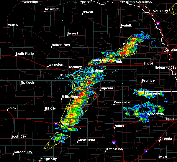 At 405 pm cdt, a severe thunderstorm capable of producing a tornado was located near bellaire, or 32 miles east of phillipsburg, moving northeast at 35 mph (radar indicated rotation). Hazards include tornado and golf ball size hail. Flying debris will be dangerous to those caught without shelter. mobile homes will be damaged or destroyed. damage to roofs, windows, and vehicles will occur. tree damage is likely. this dangerous storm will be near, lebanon around 415 pm cdt. Esbon around 430 pm cdt. At 405 pm cdt, a severe thunderstorm capable of producing a tornado was located near bellaire, or 32 miles east of phillipsburg, moving northeast at 35 mph (radar indicated rotation). Hazards include tornado and golf ball size hail. Flying debris will be dangerous to those caught without shelter. mobile homes will be damaged or destroyed. damage to roofs, windows, and vehicles will occur. tree damage is likely. this dangerous storm will be near, lebanon around 415 pm cdt. Esbon around 430 pm cdt.
|
| 5/1/2018 3:51 PM CDT |
 At 351 pm cdt, a severe thunderstorm was located over smith center, or 29 miles east of phillipsburg, moving east at 40 mph (radar indicated). Hazards include golf ball size hail and 60 mph wind gusts. People and animals outdoors will be injured. expect hail damage to roofs, siding, windows, and vehicles. Expect wind damage to roofs, siding, and trees. At 351 pm cdt, a severe thunderstorm was located over smith center, or 29 miles east of phillipsburg, moving east at 40 mph (radar indicated). Hazards include golf ball size hail and 60 mph wind gusts. People and animals outdoors will be injured. expect hail damage to roofs, siding, windows, and vehicles. Expect wind damage to roofs, siding, and trees.
|
| 3/23/2018 9:55 PM CDT |
 At 955 pm cdt, a severe thunderstorm was located over mankato, or 23 miles north of beloit, moving east at 45 mph (radar indicated). Hazards include 60 mph wind gusts and quarter size hail. Hail damage to vehicles is expected. expect wind damage to roofs, siding, and trees. Locations impacted include, mankato, burr oak, esbon, formoso, webber, lovewell state park and montrose. At 955 pm cdt, a severe thunderstorm was located over mankato, or 23 miles north of beloit, moving east at 45 mph (radar indicated). Hazards include 60 mph wind gusts and quarter size hail. Hail damage to vehicles is expected. expect wind damage to roofs, siding, and trees. Locations impacted include, mankato, burr oak, esbon, formoso, webber, lovewell state park and montrose.
|
| 3/23/2018 9:42 PM CDT |
 At 941 pm cdt, a severe thunderstorm was located over esbon, or 29 miles northwest of beloit, moving east at 50 mph. this warning replaces the previous warning in effect for smith county (radar indicated). Hazards include 60 mph wind gusts and half dollar size hail. Hail damage to vehicles is expected. Expect wind damage to roofs, siding, and trees. At 941 pm cdt, a severe thunderstorm was located over esbon, or 29 miles northwest of beloit, moving east at 50 mph. this warning replaces the previous warning in effect for smith county (radar indicated). Hazards include 60 mph wind gusts and half dollar size hail. Hail damage to vehicles is expected. Expect wind damage to roofs, siding, and trees.
|
| 10/6/2017 7:25 PM CDT |
 The severe thunderstorm warning for central jewell and northeastern smith counties will expire at 730 pm cdt, the storm which prompted the warning has moved out of the area. therefore the warning will be allowed to expire. to report severe weather, contact your nearest law enforcement agency. they will relay your report to the national weather service hastings. remember, a severe thunderstorm warning still remains in effect for northern jewell, southeastern webster and southern nuckolls counties until 815 pm cdt. The severe thunderstorm warning for central jewell and northeastern smith counties will expire at 730 pm cdt, the storm which prompted the warning has moved out of the area. therefore the warning will be allowed to expire. to report severe weather, contact your nearest law enforcement agency. they will relay your report to the national weather service hastings. remember, a severe thunderstorm warning still remains in effect for northern jewell, southeastern webster and southern nuckolls counties until 815 pm cdt.
|
| 10/6/2017 7:23 PM CDT |
 At 723 pm cdt, a severe thunderstorm was located near burr oak, or 32 miles west of belleville, moving northeast at 20 mph (radar indicated). Hazards include 60 mph wind gusts and quarter size hail. Hail damage to vehicles is expected. Expect wind damage to roofs, siding, and trees. At 723 pm cdt, a severe thunderstorm was located near burr oak, or 32 miles west of belleville, moving northeast at 20 mph (radar indicated). Hazards include 60 mph wind gusts and quarter size hail. Hail damage to vehicles is expected. Expect wind damage to roofs, siding, and trees.
|
| 10/6/2017 7:18 PM CDT |
 At 718 pm cdt, a severe thunderstorm was located over burr oak, or 31 miles north of beloit, moving northeast at 30 mph (radar indicated). Hazards include 60 mph wind gusts and quarter size hail. Hail damage to vehicles is expected. expect wind damage to roofs, siding, and trees. Locations impacted include, mankato, lebanon, burr oak, esbon, ionia and montrose. At 718 pm cdt, a severe thunderstorm was located over burr oak, or 31 miles north of beloit, moving northeast at 30 mph (radar indicated). Hazards include 60 mph wind gusts and quarter size hail. Hail damage to vehicles is expected. expect wind damage to roofs, siding, and trees. Locations impacted include, mankato, lebanon, burr oak, esbon, ionia and montrose.
|
| 10/6/2017 7:15 PM CDT | Quarter sized hail reported 0.4 miles W of Burr Oak, KS |
| 10/6/2017 7:02 PM CDT |
 At 701 pm cdt, a severe thunderstorm was located near esbon, or 24 miles northwest of beloit, moving northeast at 30 mph (radar indicated). Hazards include ping pong ball size hail and 60 mph wind gusts. People and animals outdoors will be injured. expect hail damage to roofs, siding, windows, and vehicles. expect wind damage to roofs, siding, and trees. Locations impacted include, mankato, lebanon, burr oak, esbon, ionia and montrose. At 701 pm cdt, a severe thunderstorm was located near esbon, or 24 miles northwest of beloit, moving northeast at 30 mph (radar indicated). Hazards include ping pong ball size hail and 60 mph wind gusts. People and animals outdoors will be injured. expect hail damage to roofs, siding, windows, and vehicles. expect wind damage to roofs, siding, and trees. Locations impacted include, mankato, lebanon, burr oak, esbon, ionia and montrose.
|
| 10/6/2017 6:49 PM CDT |
 At 649 pm cdt, a severe thunderstorm was located over ionia, or 21 miles northwest of beloit, moving northeast at 30 mph (radar indicated). Hazards include golf ball size hail and 60 mph wind gusts. People and animals outdoors will be injured. expect hail damage to roofs, siding, windows, and vehicles. expect wind damage to roofs, siding, and trees. Locations impacted include, mankato, lebanon, burr oak, esbon, ionia and montrose. At 649 pm cdt, a severe thunderstorm was located over ionia, or 21 miles northwest of beloit, moving northeast at 30 mph (radar indicated). Hazards include golf ball size hail and 60 mph wind gusts. People and animals outdoors will be injured. expect hail damage to roofs, siding, windows, and vehicles. expect wind damage to roofs, siding, and trees. Locations impacted include, mankato, lebanon, burr oak, esbon, ionia and montrose.
|
| 10/6/2017 6:38 PM CDT |
 At 638 pm cdt, a severe thunderstorm was located near ionia, or 20 miles northwest of beloit, moving northeast at 30 mph (radar indicated). Hazards include ping pong ball size hail and 60 mph wind gusts. People and animals outdoors will be injured. expect hail damage to roofs, siding, windows, and vehicles. Expect wind damage to roofs, siding, and trees. At 638 pm cdt, a severe thunderstorm was located near ionia, or 20 miles northwest of beloit, moving northeast at 30 mph (radar indicated). Hazards include ping pong ball size hail and 60 mph wind gusts. People and animals outdoors will be injured. expect hail damage to roofs, siding, windows, and vehicles. Expect wind damage to roofs, siding, and trees.
|
| 10/2/2017 7:17 PM CDT |
 At 717 pm cdt, a severe thunderstorm was located 7 miles north of mankato, or 28 miles west of belleville, moving northeast at 25 mph (radar indicated). Hazards include 60 mph wind gusts and quarter size hail. Hail damage to vehicles is expected. Expect wind damage to roofs, siding, and trees. At 717 pm cdt, a severe thunderstorm was located 7 miles north of mankato, or 28 miles west of belleville, moving northeast at 25 mph (radar indicated). Hazards include 60 mph wind gusts and quarter size hail. Hail damage to vehicles is expected. Expect wind damage to roofs, siding, and trees.
|
| 10/2/2017 7:00 PM CDT | 60 mph plus wind gusts lasted about 10 minutes from 7:00-7:10 pm. also measure 0.62" of rain in approximately 10 minute in jewell county KS, 0.9 miles SSW of Burr Oak, KS |
| 10/2/2017 6:57 PM CDT |
 At 657 pm cdt, a severe thunderstorm was located near esbon, or 26 miles northwest of beloit, moving northeast at 45 mph (radar indicated). Hazards include 60 mph wind gusts and quarter size hail. Hail damage to vehicles is expected. expect wind damage to roofs, siding, and trees. Locations impacted include, mankato, burr oak, esbon, ionia, webber and lovewell state park. At 657 pm cdt, a severe thunderstorm was located near esbon, or 26 miles northwest of beloit, moving northeast at 45 mph (radar indicated). Hazards include 60 mph wind gusts and quarter size hail. Hail damage to vehicles is expected. expect wind damage to roofs, siding, and trees. Locations impacted include, mankato, burr oak, esbon, ionia, webber and lovewell state park.
|
| 10/2/2017 6:37 PM CDT |
 At 636 pm cdt, a severe thunderstorm was located 8 miles north of downs, or 24 miles northwest of beloit, moving northeast at 45 mph (radar indicated). Hazards include 60 mph wind gusts and quarter size hail. Hail damage to vehicles is expected. Expect wind damage to roofs, siding, and trees. At 636 pm cdt, a severe thunderstorm was located 8 miles north of downs, or 24 miles northwest of beloit, moving northeast at 45 mph (radar indicated). Hazards include 60 mph wind gusts and quarter size hail. Hail damage to vehicles is expected. Expect wind damage to roofs, siding, and trees.
|
| 8/16/2017 4:27 AM CDT |
 At 426 am cdt, severe thunderstorms were located along a line extending from near guide rock to near burr oak to near cawker city to near osborne, moving east at 35 mph (combination of radar and mesonet data). Hazards include 60 to 65 mph wind gusts. expect damage to roofs, siding, and trees At 426 am cdt, severe thunderstorms were located along a line extending from near guide rock to near burr oak to near cawker city to near osborne, moving east at 35 mph (combination of radar and mesonet data). Hazards include 60 to 65 mph wind gusts. expect damage to roofs, siding, and trees
|
| 8/16/2017 4:16 AM CDT |
 At 415 am cdt, severe thunderstorms were located along a line extending from cowles to near esbon to near osborne to near natoma, moving east at 40 mph (mesonet observation recorded a 62 mph wind gust near lebanon kansas). Hazards include 60 mph wind gusts. Expect damage to roofs, siding, and trees. Locations impacted include, osborne, red cloud, blue hill, downs, cawker city, glen elder, natoma, bladen, guide rock, lebanon, tipton, burr oak, portis, esbon, ionia, cowles, harlan, rosemont, inavale and codell. At 415 am cdt, severe thunderstorms were located along a line extending from cowles to near esbon to near osborne to near natoma, moving east at 40 mph (mesonet observation recorded a 62 mph wind gust near lebanon kansas). Hazards include 60 mph wind gusts. Expect damage to roofs, siding, and trees. Locations impacted include, osborne, red cloud, blue hill, downs, cawker city, glen elder, natoma, bladen, guide rock, lebanon, tipton, burr oak, portis, esbon, ionia, cowles, harlan, rosemont, inavale and codell.
|
| 8/16/2017 3:38 AM CDT |
 At 337 am cdt, severe thunderstorms were located along a line extending from near upland to 11 miles south of franklin to near woodston to near zurich, moving east at 40 mph (radar indicated). Hazards include 60 to 65 mph wind gusts. expect damage to roofs, siding, and trees At 337 am cdt, severe thunderstorms were located along a line extending from near upland to 11 miles south of franklin to near woodston to near zurich, moving east at 40 mph (radar indicated). Hazards include 60 to 65 mph wind gusts. expect damage to roofs, siding, and trees
|
| 7/17/2017 8:53 PM CDT |
 At 852 pm cdt, severe thunderstorms were located along a line extending from rosemont to near burr oak, moving east at 25 mph (public. at 839 pm 50 mph wind gusts were reported by a weather station 3 miles southwest of cowles). Hazards include 60 mph wind gusts. Expect damage to roofs, siding, and trees. Locations impacted include, superior, red cloud, mankato, nelson, lawrence, bladen, guide rock, burr oak, esbon, cowles, webber, rosemont, montrose and bostwick. At 852 pm cdt, severe thunderstorms were located along a line extending from rosemont to near burr oak, moving east at 25 mph (public. at 839 pm 50 mph wind gusts were reported by a weather station 3 miles southwest of cowles). Hazards include 60 mph wind gusts. Expect damage to roofs, siding, and trees. Locations impacted include, superior, red cloud, mankato, nelson, lawrence, bladen, guide rock, burr oak, esbon, cowles, webber, rosemont, montrose and bostwick.
|
| 7/17/2017 8:36 PM CDT |
 At 836 pm cdt, severe thunderstorms were located along a line extending from near blue hill to near esbon, moving east at 20 mph (radar indicated). Hazards include 60 mph wind gusts. expect damage to roofs, siding, and trees At 836 pm cdt, severe thunderstorms were located along a line extending from near blue hill to near esbon, moving east at 20 mph (radar indicated). Hazards include 60 mph wind gusts. expect damage to roofs, siding, and trees
|
| 6/29/2017 12:58 AM CDT |
 The severe thunderstorm warning for jewell county will expire at 600 am cdt, the storms which prompted the warning have weakened below severe limits, and have exited the warned area. therefore the warning will be allowed to expire. a severe thunderstorm watch remains in effect until 1000 am cdt for north central kansas. The severe thunderstorm warning for jewell county will expire at 600 am cdt, the storms which prompted the warning have weakened below severe limits, and have exited the warned area. therefore the warning will be allowed to expire. a severe thunderstorm watch remains in effect until 1000 am cdt for north central kansas.
|
| 6/29/2017 12:28 AM CDT |
 At 528 am cdt, severe thunderstorms were located along a line extending from near esbon to near montrose to near jamestown, moving east at 60 mph (radar indicated). Hazards include 60 mph wind gusts and quarter size hail. Hail damage to vehicles is expected. Expect wind damage to roofs, siding, and trees. At 528 am cdt, severe thunderstorms were located along a line extending from near esbon to near montrose to near jamestown, moving east at 60 mph (radar indicated). Hazards include 60 mph wind gusts and quarter size hail. Hail damage to vehicles is expected. Expect wind damage to roofs, siding, and trees.
|
| 6/29/2017 12:03 AM CDT |
 At 502 am cdt, severe thunderstorms were located along a line extending from near gaylord to 7 miles south of bellaire to 6 miles north of downs, moving east at 45 mph (radar indicated). Hazards include 60 mph wind gusts and quarter size hail. Hail damage to vehicles is expected. Expect wind damage to roofs, siding, and trees. At 502 am cdt, severe thunderstorms were located along a line extending from near gaylord to 7 miles south of bellaire to 6 miles north of downs, moving east at 45 mph (radar indicated). Hazards include 60 mph wind gusts and quarter size hail. Hail damage to vehicles is expected. Expect wind damage to roofs, siding, and trees.
|
| 6/28/2017 9:22 PM CDT |
 At 221 am cdt, severe thunderstorms were located along a line extending from near byron to near hardy to near burr oak to near guide rock, moving southeast at 30 mph (radar indicated). Hazards include quarter size hail. Damage to vehicles is expected. Locations impacted include, superior, guide rock, burr oak, hardy, webber, bostwick and lovewell state park. At 221 am cdt, severe thunderstorms were located along a line extending from near byron to near hardy to near burr oak to near guide rock, moving southeast at 30 mph (radar indicated). Hazards include quarter size hail. Damage to vehicles is expected. Locations impacted include, superior, guide rock, burr oak, hardy, webber, bostwick and lovewell state park.
|
| 6/28/2017 8:55 PM CDT |
 At 155 am cdt, severe thunderstorms were located along a line extending from near hardy to bostwick to near guide rock to 7 miles south of inavale, moving east at 30 mph (radar indicated). Hazards include half dollar size hail. damage to vehicles is expected At 155 am cdt, severe thunderstorms were located along a line extending from near hardy to bostwick to near guide rock to 7 miles south of inavale, moving east at 30 mph (radar indicated). Hazards include half dollar size hail. damage to vehicles is expected
|
| 6/28/2017 5:53 PM CDT |
 At 1053 pm cdt, a severe thunderstorm was located over burr oak, or 29 miles north of beloit, moving northeast at 25 mph (radar indicated). Hazards include quarter size hail. damage to vehicles is expected At 1053 pm cdt, a severe thunderstorm was located over burr oak, or 29 miles north of beloit, moving northeast at 25 mph (radar indicated). Hazards include quarter size hail. damage to vehicles is expected
|
| 5/16/2017 5:40 PM CDT |
 At 540 pm cdt, a severe thunderstorm was located over superior, or 25 miles northwest of belleville, moving north at 30 mph (radar indicated). Hazards include 60 mph wind gusts and quarter size hail. Hail damage to vehicles is expected. expect wind damage to roofs, siding, and trees. Locations impacted include, burr oak. At 540 pm cdt, a severe thunderstorm was located over superior, or 25 miles northwest of belleville, moving north at 30 mph (radar indicated). Hazards include 60 mph wind gusts and quarter size hail. Hail damage to vehicles is expected. expect wind damage to roofs, siding, and trees. Locations impacted include, burr oak.
|
| 5/16/2017 5:39 PM CDT | Quarter sized hail reported 0.1 miles SE of Burr Oak, KS |
| 5/16/2017 5:39 PM CDT | Quarter sized hail reported 0.4 miles W of Burr Oak, KS, hail has increased in size to 1". ongoing. |
| 5/16/2017 5:10 PM CDT |
 At 510 pm cdt, a severe thunderstorm was located over montrose, or 22 miles north of beloit, moving north at 30 mph (radar indicated). Hazards include 60 mph wind gusts and half dollar size hail. Hail damage to vehicles is expected. Expect wind damage to roofs, siding, and trees. At 510 pm cdt, a severe thunderstorm was located over montrose, or 22 miles north of beloit, moving north at 30 mph (radar indicated). Hazards include 60 mph wind gusts and half dollar size hail. Hail damage to vehicles is expected. Expect wind damage to roofs, siding, and trees.
|
| 4/18/2017 10:44 PM CDT | Hen Egg sized hail reported 2.8 miles S of Burr Oak, KS, hail covered hwy 28 to a depth of 1 inch. |
| 4/18/2017 10:44 PM CDT | Tennis Ball sized hail reported 2.1 miles S of Burr Oak, KS, this measurement was taken about 45 min after the hail ended. |
| 4/18/2017 10:41 PM CDT | Golf Ball sized hail reported 2.1 miles S of Burr Oak, KS |
| 4/18/2017 10:33 PM CDT |
 At 1033 pm cdt, a severe thunderstorm was located near burr oak, or 33 miles north of beloit, and is nearly stationary (radar indicated). Hazards include 60 mph wind gusts and half dollar size hail. Hail damage to vehicles is expected. Expect wind damage to roofs, siding, and trees. At 1033 pm cdt, a severe thunderstorm was located near burr oak, or 33 miles north of beloit, and is nearly stationary (radar indicated). Hazards include 60 mph wind gusts and half dollar size hail. Hail damage to vehicles is expected. Expect wind damage to roofs, siding, and trees.
|
| 8/11/2016 5:34 PM CDT |
 At 533 pm cdt, a severe thunderstorm was located over cawker city, or 18 miles west of beloit, moving northeast at 30 mph (radar indicated). Hazards include 60 mph wind gusts and quarter size hail. Hail damage to vehicles is expected. Expect wind damage to roofs, siding, and trees. At 533 pm cdt, a severe thunderstorm was located over cawker city, or 18 miles west of beloit, moving northeast at 30 mph (radar indicated). Hazards include 60 mph wind gusts and quarter size hail. Hail damage to vehicles is expected. Expect wind damage to roofs, siding, and trees.
|
| 7/28/2016 5:38 PM CDT |
 At 538 pm cdt, severe thunderstorms were located along a line extending from 7 miles north of bellaire to near lebanon to near glen elder to tipton, moving east at 55 mph (radar indicated). Hazards include 70 mph wind gusts and quarter size hail. Hail damage to vehicles is expected. expect considerable tree damage. wind damage is also likely to mobile homes, roofs, and outbuildings. Locations impacted include, beloit, downs, mankato, cawker city, glen elder, jewell, lebanon, tipton, burr oak, esbon, asherville, formoso, simpson, ionia, randall, scottsville, webber, montrose and lovewell state park. At 538 pm cdt, severe thunderstorms were located along a line extending from 7 miles north of bellaire to near lebanon to near glen elder to tipton, moving east at 55 mph (radar indicated). Hazards include 70 mph wind gusts and quarter size hail. Hail damage to vehicles is expected. expect considerable tree damage. wind damage is also likely to mobile homes, roofs, and outbuildings. Locations impacted include, beloit, downs, mankato, cawker city, glen elder, jewell, lebanon, tipton, burr oak, esbon, asherville, formoso, simpson, ionia, randall, scottsville, webber, montrose and lovewell state park.
|
| 7/28/2016 5:14 PM CDT |
 At 514 pm cdt, severe thunderstorms were located along a line extending from near naponee to 10 miles north of athol to 8 miles south of bellaire to near alton, moving east at 55 mph (radar indicated). Hazards include 70 mph wind gusts and quarter size hail. Hail damage to vehicles is expected. expect considerable tree damage. Wind damage is also likely to mobile homes, roofs, and outbuildings. At 514 pm cdt, severe thunderstorms were located along a line extending from near naponee to 10 miles north of athol to 8 miles south of bellaire to near alton, moving east at 55 mph (radar indicated). Hazards include 70 mph wind gusts and quarter size hail. Hail damage to vehicles is expected. expect considerable tree damage. Wind damage is also likely to mobile homes, roofs, and outbuildings.
|
| 7/7/2016 12:51 AM CDT |
 At 1250 am cdt, severe thunderstorms were located along a line extending from near guide rock to near lebanon to near gaylord, moving southeast at 45 mph (radar indicated). Hazards include 60 mph wind gusts and quarter size hail. Hail damage to vehicles is expected. Expect wind damage to roofs, siding, and trees. At 1250 am cdt, severe thunderstorms were located along a line extending from near guide rock to near lebanon to near gaylord, moving southeast at 45 mph (radar indicated). Hazards include 60 mph wind gusts and quarter size hail. Hail damage to vehicles is expected. Expect wind damage to roofs, siding, and trees.
|
| 6/28/2016 2:25 AM CDT |
 At 224 am cdt, a severe thunderstorm was located near montrose, or 25 miles north of beloit, moving southeast at 30 mph (radar indicated). Hazards include ping pong ball size hail and 60 mph wind gusts. People and animals outdoors will be injured. expect hail damage to roofs, siding, windows, and vehicles. expect wind damage to roofs, siding, and trees. Locations impacted include, mankato, jewell, burr oak, formoso, randall, webber, montrose and lovewell state park. At 224 am cdt, a severe thunderstorm was located near montrose, or 25 miles north of beloit, moving southeast at 30 mph (radar indicated). Hazards include ping pong ball size hail and 60 mph wind gusts. People and animals outdoors will be injured. expect hail damage to roofs, siding, windows, and vehicles. expect wind damage to roofs, siding, and trees. Locations impacted include, mankato, jewell, burr oak, formoso, randall, webber, montrose and lovewell state park.
|
| 6/28/2016 2:05 AM CDT |
 At 204 am cdt, a severe thunderstorm was located near mankato, or 26 miles north of beloit, moving southeast at 45 mph (radar indicated). Hazards include ping pong ball size hail and 60 mph wind gusts. People and animals outdoors will be injured. expect hail damage to roofs, siding, windows, and vehicles. expect wind damage to roofs, siding, and trees. Locations impacted include, superior, mankato, jewell, burr oak, formoso, randall, webber, montrose, bostwick and lovewell state park. At 204 am cdt, a severe thunderstorm was located near mankato, or 26 miles north of beloit, moving southeast at 45 mph (radar indicated). Hazards include ping pong ball size hail and 60 mph wind gusts. People and animals outdoors will be injured. expect hail damage to roofs, siding, windows, and vehicles. expect wind damage to roofs, siding, and trees. Locations impacted include, superior, mankato, jewell, burr oak, formoso, randall, webber, montrose, bostwick and lovewell state park.
|
| 6/28/2016 1:49 AM CDT |
 At 149 am cdt, a severe thunderstorm was located near bostwick, or 37 miles north of beloit, moving southeast at 45 mph (radar indicated). Hazards include ping pong ball size hail and 60 mph wind gusts. People and animals outdoors will be injured. expect hail damage to roofs, siding, windows, and vehicles. Expect wind damage to roofs, siding, and trees. At 149 am cdt, a severe thunderstorm was located near bostwick, or 37 miles north of beloit, moving southeast at 45 mph (radar indicated). Hazards include ping pong ball size hail and 60 mph wind gusts. People and animals outdoors will be injured. expect hail damage to roofs, siding, windows, and vehicles. Expect wind damage to roofs, siding, and trees.
|
| 5/26/2016 4:33 PM CDT |
 At 432 pm cdt, a severe thunderstorm was located over esbon, or 31 miles northwest of beloit, moving north at 20 mph (radar indicated). Hazards include 60 mph wind gusts and quarter size hail. Hail damage to vehicles is expected. Expect wind damage to roofs, siding, and trees. At 432 pm cdt, a severe thunderstorm was located over esbon, or 31 miles northwest of beloit, moving north at 20 mph (radar indicated). Hazards include 60 mph wind gusts and quarter size hail. Hail damage to vehicles is expected. Expect wind damage to roofs, siding, and trees.
|
| 5/24/2016 12:00 AM CDT | The national weather service in hastings has issued a * severe thunderstorm warning for. northern jewell county in north central kansas. southeastern nuckolls county in south central nebraska. until 1245 am cdt * at 1200 am cdt. a severe thunderstorm was located over burr oak. Or. |
| 5/24/2016 12:00 AM CDT | The national weather service in hastings has issued a * severe thunderstorm warning for. northern jewell county in north central kansas. southeastern nuckolls county in south central nebraska. until 1245 am cdt * at 1200 am cdt. a severe thunderstorm was located over burr oak. Or. |
| 5/7/2016 11:58 PM CDT |
 At 1157 pm cdt, a severe thunderstorm was located over portis, or 32 miles west of beloit, moving northeast at 40 mph (radar indicated). Hazards include 60 mph wind gusts and half dollar size hail. Hail damage to vehicles is expected. Expect wind damage to roofs, siding, and trees. At 1157 pm cdt, a severe thunderstorm was located over portis, or 32 miles west of beloit, moving northeast at 40 mph (radar indicated). Hazards include 60 mph wind gusts and half dollar size hail. Hail damage to vehicles is expected. Expect wind damage to roofs, siding, and trees.
|
| 9/10/2015 6:48 PM CDT |
 At 646 pm cdt, a severe thunderstorm was located near burr oak, or 28 miles north of beloit, moving southeast at 30 mph. this is a very dangerous storm (storm chasers. at 643 pm cdt storm chases reported 80 mph winds and golfball size hail breaking windows. in burr oak). Hazards include 80 mph wind gusts and golf ball size hail. Flying debris will be dangerous to those caught without shelter. mobile homes will be heavily damaged. expect considerable damage to roofs, windows and vehicles. extensive tree damage and power outages are likely. Locations impacted include, mankato, burr oak, esbon, formoso, webber, montrose and lovewell state park. At 646 pm cdt, a severe thunderstorm was located near burr oak, or 28 miles north of beloit, moving southeast at 30 mph. this is a very dangerous storm (storm chasers. at 643 pm cdt storm chases reported 80 mph winds and golfball size hail breaking windows. in burr oak). Hazards include 80 mph wind gusts and golf ball size hail. Flying debris will be dangerous to those caught without shelter. mobile homes will be heavily damaged. expect considerable damage to roofs, windows and vehicles. extensive tree damage and power outages are likely. Locations impacted include, mankato, burr oak, esbon, formoso, webber, montrose and lovewell state park.
|
| 9/10/2015 6:43 PM CDT | Wind measured with davis instrument. golf ball size hail broke his windshiel in jewell county KS, 0.4 miles W of Burr Oak, KS |
| 9/10/2015 6:40 PM CDT |
 At 639 pm cdt, a severe thunderstorm was located over burr oak, or 27 miles north of beloit, moving southeast at 45 mph (radar indicated). Hazards include 60 mph wind gusts and half dollar size hail. Hail damage to vehicles is expected. expect wind damage to roofs, siding and trees. Locations impacted include, mankato, burr oak, esbon, formoso, webber, montrose and lovewell state park. At 639 pm cdt, a severe thunderstorm was located over burr oak, or 27 miles north of beloit, moving southeast at 45 mph (radar indicated). Hazards include 60 mph wind gusts and half dollar size hail. Hail damage to vehicles is expected. expect wind damage to roofs, siding and trees. Locations impacted include, mankato, burr oak, esbon, formoso, webber, montrose and lovewell state park.
|
| 9/10/2015 6:27 PM CDT |
 At 627 pm cdt, a severe thunderstorm was located near guide rock, or 40 miles south of hastings, moving southeast at 40 mph (radar indicated). Hazards include 60 mph wind gusts and nickel size hail. Expect damage to roofs. Siding and trees. At 627 pm cdt, a severe thunderstorm was located near guide rock, or 40 miles south of hastings, moving southeast at 40 mph (radar indicated). Hazards include 60 mph wind gusts and nickel size hail. Expect damage to roofs. Siding and trees.
|
| 8/22/2015 10:10 PM CDT |
 At 1005 pm cdt, a severe thunderstorm was located near smith center, or 31 miles east of phillipsburg, moving southeast at 25 mph (radar indicated). Hazards include 60 mph wind gusts and penny size hail. Expect damage to roofs. siding and trees. locations impacted include, smith center, mankato, lebanon, burr oak, esbon, ionia and bellaire. This storm has been showing signs of weakening, but severe thunderstorm wind gusts will still be possible with this storm. At 1005 pm cdt, a severe thunderstorm was located near smith center, or 31 miles east of phillipsburg, moving southeast at 25 mph (radar indicated). Hazards include 60 mph wind gusts and penny size hail. Expect damage to roofs. siding and trees. locations impacted include, smith center, mankato, lebanon, burr oak, esbon, ionia and bellaire. This storm has been showing signs of weakening, but severe thunderstorm wind gusts will still be possible with this storm.
|
| 8/22/2015 9:36 PM CDT |
 At 936 pm cdt, a severe thunderstorm was located near smith center, or 25 miles east of phillipsburg, moving east at 50 mph (radar indicated). Hazards include 60 mph wind gusts and quarter size hail. Hail damage to vehicles is expected. Expect wind damage to roofs, siding and trees. At 936 pm cdt, a severe thunderstorm was located near smith center, or 25 miles east of phillipsburg, moving east at 50 mph (radar indicated). Hazards include 60 mph wind gusts and quarter size hail. Hail damage to vehicles is expected. Expect wind damage to roofs, siding and trees.
|
| 8/8/2015 4:10 AM CDT |
 The severe thunderstorm warning for jewell county will expire at 415 am cdt, the storm which prompted the warning has weakened below severe limits and was exiting the warned area. therefore the warning will be allowed to expire. The severe thunderstorm warning for jewell county will expire at 415 am cdt, the storm which prompted the warning has weakened below severe limits and was exiting the warned area. therefore the warning will be allowed to expire.
|
| 8/8/2015 3:40 AM CDT |
 The national weather service in hastings has issued a * severe thunderstorm warning for. jewell county in north central kansas. until 415 am cdt * at 340 am cdt. a severe thunderstorm was located near mankato. or 22 miles northwest of beloit. Moving east at 40 mph. The national weather service in hastings has issued a * severe thunderstorm warning for. jewell county in north central kansas. until 415 am cdt * at 340 am cdt. a severe thunderstorm was located near mankato. or 22 miles northwest of beloit. Moving east at 40 mph.
|
| 6/10/2015 6:57 PM CDT |
 At 657 pm cdt, severe thunderstorms were located along a line extending from 7 miles south of hildreth to lebanon, moving northeast at 35 mph (radar indicated). Hazards include 60 mph wind gusts and quarter size hail. Hail damage to vehicles is expected. Expect wind damage to roofs, siding and trees. At 657 pm cdt, severe thunderstorms were located along a line extending from 7 miles south of hildreth to lebanon, moving northeast at 35 mph (radar indicated). Hazards include 60 mph wind gusts and quarter size hail. Hail damage to vehicles is expected. Expect wind damage to roofs, siding and trees.
|
| 6/3/2015 9:56 PM CDT | The severe thunderstorm warning for jewell county will expire at 1000 pm cdt, the storm which prompted the warning has weakened below severe limits, and no longer poses an immediate threat to life or property. therefore the warning will be allowed to expire. however small hail and gusty winds are still possible with this thunderstorm. a tornado watch remains in effect until 200 am cdt for north central kansas. |
| 6/3/2015 9:44 PM CDT | At 944 pm cdt, a severe thunderstorm was located near burr oak, or 30 miles north of beloit, moving northeast at 20 mph (radar indicated). Hazards include 60 mph wind gusts and quarter size hail. Hail damage to vehicles is expected. expect wind damage to roofs, siding and trees. locations impacted include, mankato, jewell, burr oak, esbon, formoso, ionia, randall, webber, lovewell state park and montrose. A tornado watch remains in effect until 200 am cdt for north central kansas. |
| 6/3/2015 9:21 PM CDT | At 921 pm cdt, a severe thunderstorm was located near mankato, or 23 miles northwest of beloit, moving northeast at 20 mph (radar indicated). Hazards include 60 mph wind gusts and quarter size hail. Hail damage to vehicles is expected. Expect wind damage to roofs, siding and trees. |
| 5/29/2015 8:27 PM CDT | The severe thunderstorm warning for jewell and mitchell counties will expire at 830 pm cdt, the storms which prompted the warning have moved out of the area. therefore the warning will be allowed to expire. |
| 5/29/2015 7:53 PM CDT | At 751 pm cdt, severe thunderstorms were located along a line extending from near esbon to near glen elder to 7 miles east of tipton, moving southeast at 45 mph (radar indicated). Hazards include 70 mph wind gusts and ping pong ball size hail. People and animals outdoors will be injured. expect hail damage to roofs, siding, windows and vehicles. expect considerable tree damage. wind damage is also likely to mobile homes, roofs and outbuildings. Locations impacted include, beloit, mankato, cawker city, glen elder, jewell, tipton, burr oak, esbon, asherville, formoso, simpson, ionia, randall, scottsville, webber, lovewell state park and montrose. |
| 5/29/2015 7:42 PM CDT | At 740 pm cdt, severe thunderstorms were located along a line extending from near esbon to near ionia to near tipton, moving east at 35 mph (radar indicated). Hazards include 70 mph wind gusts and ping pong ball size hail. People and animals outdoors will be injured. expect hail damage to roofs, siding, windows and vehicles. expect considerable tree damage. Wind damage is also likely to mobile homes, roofs and outbuildings. |
| 5/29/2015 7:22 PM CDT | At 720 pm cdt, severe thunderstorms were located along a line extending from 7 miles northwest of lebanon to 9 miles southeast of bellaire to near portis, moving east at 40 mph (radar indicated. at 705 pm cdt...golfball size hail was reported in smith center. strong winds had also caused power outages in town). Hazards include golf ball size hail and 70 mph wind gusts. People and animals outdoors will be injured. expect hail damage to roofs, siding, windows and vehicles. expect considerable tree damage. wind damage is also likely to mobile homes, roofs and outbuildings. Locations impacted include, smith center, osborne, downs, cawker city, lebanon, burr oak, gaylord, portis, esbon, ionia, harlan and bellaire. |
| 5/29/2015 7:07 PM CDT | At 707 pm cdt, severe thunderstorms were located along a line extending from 10 miles south of inavale to near bellaire to near harlan, moving east at 35 mph (radar indicated). Hazards include golf ball size hail and 70 mph wind gusts. People and animals outdoors will be injured. expect hail damage to roofs, siding, windows and vehicles. expect considerable tree damage. Wind damage is also likely to mobile homes, roofs and outbuildings. |
| 5/6/2015 9:57 PM CDT | Quarter sized hail reported 0.4 miles W of Burr Oak, KS |
| 5/6/2015 9:52 PM CDT | At 950 pm cdt, a severe thunderstorm was located near burr oak, or 34 miles northwest of beloit, moving northeast at 30 mph (radar indicated). Hazards include 60 mph wind gusts and quarter size hail. Hail damage to vehicles is expected. expect wind damage to roofs, siding and trees. locations impacted include, burr oak, esbon, webber and lovewell state park. a tornado warning also remain in efeect for central and northeastern jewell county until 1015 pm cdt. a tornado watch remains in effect until 200 am cdt for north central kansas. 1. 00in. |
| 5/6/2015 9:43 PM CDT | At 943 pm cdt, a severe thunderstorm capable of producing a tornado was located over burr oak, or 27 miles north of beloit, moving northeast at 25 mph (radar indicated rotation). Hazards include tornado and quarter size hail. Flying debris will be dangerous to those caught without shelter. mobile homes will be damaged or destroyed. damage to roofs, windows and vehicles will occur. tree damage is likely. this tornadic thunderstorm will remain over mainly rural areas of northeastern jewell county. Radar indicated. |
| 5/6/2015 9:35 PM CDT | At 935 pm cdt, severe thunderstorms were located along a line extending from near superior to near mankato to near esbon, moving east at 20 mph (radar indicated). Hazards include 60 mph wind gusts and quarter size hail. Hail damage to vehicles is expected. Expect wind damage to roofs, siding and trees. |
| 5/6/2015 8:07 PM CDT | At 806 pm cdt, a severe thunderstorm was located near burr oak, or 32 miles west of belleville, moving northeast at 35 mph (radar indicated. at 803 pm ping pong ball size hail was reported in burr oak). Hazards include ping pong ball size hail. People and animals outdoors will be injured. expect damage to roofs, siding, windows and vehicles. locations impacted include, burr oak. a tornado watch remains in effect until 900 pm cdt for north central kansas. 1. 50in. |
| 5/6/2015 8:03 PM CDT | Ping Pong Ball sized hail reported 0.4 miles W of Burr Oak, KS |
| 5/6/2015 7:57 PM CDT | At 756 pm cdt, a severe thunderstorm was located near burr oak, or 27 miles northwest of beloit, moving northeast at 35 mph (radar indicated). Hazards include quarter size hail. damage to vehicles is expected |
| 5/6/2015 7:02 PM CDT | At 702 pm cdt, a severe thunderstorm was located near burr oak, or 35 miles northwest of beloit, moving north at 25 mph (radar indicated). Hazards include quarter size hail. Damage to vehicles is expected. locations impacted include, burr oak and webber. a tornado watch remains in effect until 900 pm cdt for north central kansas. 1. 00in. |
| 5/6/2015 6:31 PM CDT | At 631 pm cdt, severe thunderstorms were located along a line extending from near esbon to 8 miles southeast of bellaire, moving north at 40 mph (radar indicated). Hazards include half dollar size hail. damage to vehicles is expected |
| 5/6/2015 6:20 PM CDT | At 619 pm cdt, a severe thunderstorm was located 8 miles west of ionia, or 26 miles northwest of beloit, moving northeast at 35 mph (radar indicated). Hazards include quarter size hail. Damage to vehicles is expected. locations impacted include, mankato, lebanon, burr oak, esbon and ionia. a tornado watch remains in effect until 900 pm cdt for north central kansas. 1. 00in. |
| 5/6/2015 6:05 PM CDT | At 605 pm cdt, severe thunderstorms were located along a line extending from 6 miles northwest of ionia to near portis, moving northeast at 40 mph (radar indicated). Hazards include quarter size hail. Damage to vehicles is expected. locations impacted include, downs, mankato, cawker city, lebanon, burr oak, esbon and ionia. a tornado watch remains in effect until 900 pm cdt for north central kansas. 1. 00in. |
| 5/6/2015 5:45 PM CDT | At 544 pm cdt, severe thunderstorms were located along a line extending from 8 miles northwest of cawker city to near downs, moving northeast at 40 mph (radar indicated). Hazards include quarter size hail. damage to vehicles is expected |
| 5/6/2015 5:08 PM CDT | At 508 pm cdt, a severe thunderstorm was located over ionia, or 17 miles northwest of beloit, moving northeast at 30 mph (radar indicated). Hazards include quarter size hail. Damage to vehicles is expected. locations impacted include, mankato, jewell, burr oak and ionia. a tornado watch remains in effect until 900 pm cdt for north central kansas. 1. 00in. |
| 5/6/2015 4:49 PM CDT | At 448 pm cdt, a severe thunderstorm was located near ionia, or 23 miles northwest of beloit, moving northeast at 35 mph (radar indicated). Hazards include quarter size hail. damage to vehicles is expected |
| 5/6/2015 4:28 PM CDT | The tornado warning for northwestern jewell county will expire at 430 pm cdt, the storm which prompted the warning has moved out of the area. therefore the warning will be allowed to expire. a tornado watch remains in effect until 900 pm cdt for north central kansas. remember, a tornado warning still remains in effect for portions of jewell county until 445 pm cdt. |
| 5/6/2015 4:19 PM CDT | At 418 pm cdt, a severe thunderstorm capable of producing a tornado was located near esbon, or 27 miles northwest of beloit, moving northeast at 30 mph (radar indicated rotation). Hazards include tornado and quarter size hail. Flying debris will be dangerous to those caught without shelter. mobile homes will be damaged or destroyed. damage to roofs, windows and vehicles will occur. tree damage is likely. this dangerous storm will be near, burr oak around 430 pm cdt. guide rock and bostwick around 445 pm cdt. Radar indicated. |
| 5/6/2015 4:19 PM CDT | At 418 pm cdt, a severe thunderstorm capable of producing a tornado was located near esbon, or 27 miles northwest of beloit, moving northeast at 30 mph (radar indicated rotation). Hazards include tornado and quarter size hail. Flying debris will be dangerous to those caught without shelter. mobile homes will be damaged or destroyed. damage to roofs, windows and vehicles will occur. tree damage is likely. this dangerous storm will be near, burr oak around 430 pm cdt. guide rock and bostwick around 445 pm cdt. Radar indicated. |
| 5/6/2015 4:15 PM CDT | At 414 pm cdt, a severe thunderstorm capable of producing a tornado was located over burr oak, or 28 miles northwest of beloit, moving northeast at 25 mph (radar indicated rotation). Hazards include tornado and quarter size hail. Flying debris will be dangerous to those caught without shelter. mobile homes will be damaged or destroyed. damage to roofs, windows and vehicles will occur. tree damage is likely. this dangerous storm will be near, burr oak around 420 pm cdt. Radar indicated. |
| 5/6/2015 4:04 PM CDT | At 404 pm cdt, a confirmed tornado was located near esbon, or 26 miles northwest of beloit, moving northeast at 25 mph (weather spotters confirmed tornado). Hazards include damaging tornado and quarter size hail. Flying debris will be dangerous to those caught without shelter. mobile homes will be damaged or destroyed. damage to roofs, windows and vehicles will occur. tree damage is likely. this tornado will be near, burr oak around 420 pm cdt. Observed. |
| 5/6/2015 3:58 PM CDT | At 357 pm cdt, a severe thunderstorm capable of producing a tornado was located near esbon, or 25 miles northwest of beloit, moving northeast at 25 mph (radar indicated rotation). Hazards include tornado and quarter size hail. Flying debris will be dangerous to those caught without shelter. mobile homes will be damaged or destroyed. damage to roofs, windows and vehicles will occur. tree damage is likely. this dangerous storm will be near, burr oak around 420 pm cdt. Radar indicated. |
| 5/6/2015 3:52 PM CDT | At 352 pm cdt, a severe thunderstorm was located near burr oak, or 27 miles northwest of beloit, moving northeast at 45 mph (radar indicated). Hazards include 60 mph wind gusts and quarter size hail. Hail damage to vehicles is expected. expect wind damage to roofs, siding and trees. locations impacted include, mankato, burr oak, esbon and ionia. a tornado watch remains in effect until 900 pm cdt for north central kansas. 1. 00in. |
| 5/6/2015 3:30 PM CDT | At 330 pm cdt, a severe thunderstorm was located near ionia, or 23 miles northwest of beloit, moving northeast at 45 mph (radar indicated). Hazards include 60 mph wind gusts and quarter size hail. Hail damage to vehicles is expected. Expect wind damage to roofs, siding and trees. |
| 5/3/2015 11:49 PM CDT | At 1148 pm cdt, severe thunderstorms were located along a line extending from near lebanon to mankato, and are nearly stationary (radar indicated). Hazards include quarter size hail. Damage to vehicles is expected. locations impacted include, mankato, jewell, lebanon, burr oak, esbon and ionia. 1. 00in. |
| 5/3/2015 11:17 PM CDT | At 1117 pm cdt, a severe thunderstorm was located near lebanon, or 30 miles northwest of beloit, moving east at 15 mph (radar indicated). Hazards include half dollar size hail. damage to vehicles is expected |
| 4/18/2015 5:49 PM CDT | At 549 pm cdt, a severe thunderstorm was located near burr oak, or 32 miles west of belleville, moving north at 15 mph (radar indicated). Hazards include 60 mph wind gusts and quarter size hail. Hail damage to vehicles is expected. expect wind damage to roofs, siding and trees. locations impacted include, mankato and burr oak. 1. 00in. |
| 4/18/2015 5:24 PM CDT | At 523 pm cdt, a severe thunderstorm was located near mankato, or 25 miles north of beloit, moving north at 15 mph (radar indicated). Hazards include 60 mph wind gusts and quarter size hail. Hail damage to vehicles is expected. Expect wind damage to roofs, siding and trees. |
| 4/12/2015 7:54 PM CDT | A severe thunderstorm warning remains in effect until 815 pm cdt for central jewell county. at 754 pm cdt. a severe thunderstorm was located over lovewell state park. or 20 miles west of belleville. moving east at 35 mph. hazard. 60 mph wind gusts and quarter size hail. source. Radar indicated. |
| 4/12/2015 7:39 PM CDT | Quarter sized hail reported 0.4 miles W of Burr Oak, KS, currently falling |
| 4/12/2015 7:23 PM CDT | The national weather service in hastings has issued a * severe thunderstorm warning for. central jewell county in north central kansas. until 815 pm cdt * at 723 pm cdt. a severe thunderstorm was located just west of burr oak. or 30 miles northwest of beloit. Moving east at 35. |
| 4/1/2015 9:36 PM CDT | The severe thunderstorm warning for northern jewell. southeastern webster and southern nuckolls counties will expire at 945 pm cdt. the storm which prompted the warning has weakened below severe limits. and no longer pose an immediate threat to life or property. therefore the warning will be allowed to expire. A severe thunderstorm watch remains in effect until 100 am cdt for. |
| 4/1/2015 9:36 PM CDT | The severe thunderstorm warning for northern jewell. southeastern webster and southern nuckolls counties will expire at 945 pm cdt. the storm which prompted the warning has weakened below severe limits. and no longer pose an immediate threat to life or property. therefore the warning will be allowed to expire. A severe thunderstorm watch remains in effect until 100 am cdt for. |
| 4/1/2015 8:09 PM CST | Half Dollar sized hail reported 4.9 miles S of Burr Oak, KS, via web report |
| 4/1/2015 9:09 PM CDT | The national weather service in hastings has issued a * severe thunderstorm warning for. northern jewell county in north central kansas. southeastern webster county in south central nebraska. southern nuckolls county in south central nebraska. Until 945 pm cdt. |
| 4/1/2015 9:09 PM CDT | The national weather service in hastings has issued a * severe thunderstorm warning for. northern jewell county in north central kansas. southeastern webster county in south central nebraska. southern nuckolls county in south central nebraska. Until 945 pm cdt. |
| 8/9/2014 8:50 PM CDT | Estimate 60 mph wind gusts peaking about 850 pm. 2 inch diameter branches down. estimated dime sized hail and very heavy rai in jewell county KS, 0.4 miles W of Burr Oak, KS |
| 6/1/2014 5:08 PM CDT | Vis dropped down to 1 block with heavy rain. est 60 mph winds in jewell county KS, 0.4 miles W of Burr Oak, KS |
| 5/11/2014 5:00 PM CDT | Half Dollar sized hail reported 4.8 miles ENE of Burr Oak, KS |
| 6/22/2013 8:33 AM CDT | Quarter sized hail reported 0.4 miles W of Burr Oak, KS, most of the hail was pea to dime but 1 stone was the size of a quarter. |
| 6/18/2013 5:02 PM CDT | Quarter sized hail reported 0.4 miles W of Burr Oak, KS |
| 5/27/2013 8:10 PM CDT | Hen Egg sized hail reported 0.4 miles W of Burr Oak, KS, measured 2.1 hail at 810 pm cdt. |
| 5/27/2013 8:02 PM CDT | Ping Pong Ball sized hail reported 0.4 miles W of Burr Oak, KS, ongoing. |
| 4/7/2013 7:15 PM CDT | Observer estimates 70 mph wind gusts ahead of storm with blowing dust and zero visibilit in jewell county KS, 0.8 miles NW of Burr Oak, KS |
| 10/13/2012 10:55 PM CDT | Quarter sized hail reported 0.4 miles W of Burr Oak, KS |
| 8/2/2012 1:05 AM CDT | Est 60 mph wind gust. 8 inch tree branch knocked down plus several other branche in jewell county KS, 0.9 miles SSW of Burr Oak, KS |
| 8/2/2012 1:05 AM CDT | Est 60 mph wind gust. 8 inch tree branch knock down plus several other branche in jewell county KS, 0.9 miles SSW of Burr Oak, KS |
| 8/2/2012 1:05 AM CDT | There were several small branches down. largest branch was 5 inches in diamete in jewell county KS, 0.4 miles W of Burr Oak, KS |
| 4/14/2012 8:55 PM CDT | Quarter sized hail reported 0.4 miles W of Burr Oak, KS |
| 3/30/2012 6:00 PM CDT | Golf Ball sized hail reported 8.4 miles S of Burr Oak, KS |
| 1/1/0001 12:00 AM | Quarter sized hail reported 0.4 miles W of Burr Oak, KS |
| 1/1/0001 12:00 AM | Storm damage reported in jewell county KS, 0.6 miles E of Burr Oak, KS |
| 1/1/0001 12:00 AM | Storm damage reported in jewell county KS, 0.4 miles W of Burr Oak, KS |
| 1/1/0001 12:00 AM | Quarter sized hail reported 7.1 miles ESE of Burr Oak, KS |
| 1/1/0001 12:00 AM | Half Dollar sized hail reported 7.1 miles ESE of Burr Oak, KS |
| 1/1/0001 12:00 AM | Quarter sized hail reported 7.1 miles ESE of Burr Oak, KS, mainly pea size with a few quarters. hail covered the ground. |
Hail Maps for Burr Oak, KS
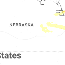
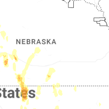
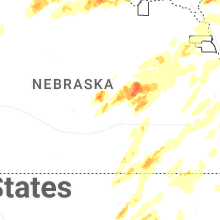

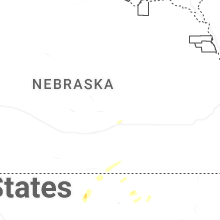
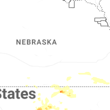
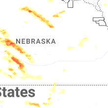

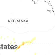


Connect with Interactive Hail Maps