

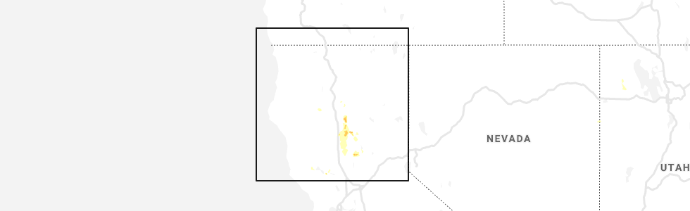
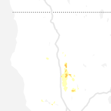
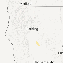
Hail Map for Butte Creek Canyon, CA
The Butte Creek Canyon, CA area has had 0 reports of on-the-ground hail by trained spotters, and has been under severe weather warnings 3 times during the past 12 months. Doppler radar has detected hail at or near Butte Creek Canyon, CA on 4 occasions.
| Name: | Butte Creek Canyon, CA |
| Where Located: | 67.9 miles SE of Redding, CA |
| Map: | Google Map for Butte Creek Canyon, CA |
| Population: | 1086 |
| Housing Units: | 522 |
| More Info: | Search Google for Butte Creek Canyon, CA |
5
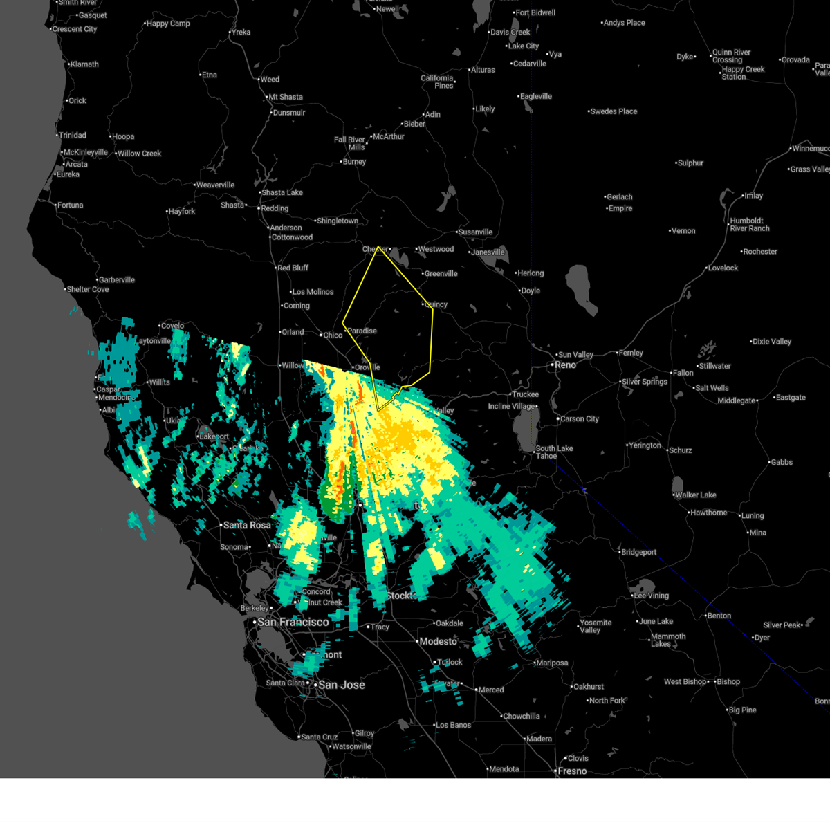
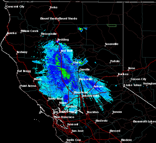
The Top Recent Hail Date for Butte Creek Canyon, CA is Thursday, May 30, 2019 (1st out of 4)
Hail and Wind Damage Spotted near Butte Creek Canyon, CA
| Date / Time | Report Details |
|---|---|
| 12/25/2025 5:43 AM PST |
 The storms which prompted the warning have moved out of the area. therefore, the warning will be allowed to expire. however gusty winds are still possible through the morning. The storms which prompted the warning have moved out of the area. therefore, the warning will be allowed to expire. however gusty winds are still possible through the morning.
|
| 12/25/2025 5:29 AM PST |
 At 529 am pst, severe thunderstorms were located along a line extending from 7 miles northwest of belden to near bucks lake to 6 miles southwest of american house, moving northeast at 60 mph (radar indicated). Hazards include 70 mph wind gusts. Expect considerable tree damage. damage is likely to mobile homes, roofs, and outbuildings. Locations impacted include, paradise, quincy, brush creek rs, pulga, east quincy, stirling city, hurleton, american house, storrie, stanfield hill, little grass valley, dobbins, brownsville, caribou, concow, challenge, twain, la porte, pike, and forbestown. At 529 am pst, severe thunderstorms were located along a line extending from 7 miles northwest of belden to near bucks lake to 6 miles southwest of american house, moving northeast at 60 mph (radar indicated). Hazards include 70 mph wind gusts. Expect considerable tree damage. damage is likely to mobile homes, roofs, and outbuildings. Locations impacted include, paradise, quincy, brush creek rs, pulga, east quincy, stirling city, hurleton, american house, storrie, stanfield hill, little grass valley, dobbins, brownsville, caribou, concow, challenge, twain, la porte, pike, and forbestown.
|
| 12/25/2025 5:08 AM PST |
 Svrsto the national weather service in sacramento has issued a * severe thunderstorm warning for, central plumas county in northern california, east central tehama county in northern california, eastern butte county in northern california, northeastern yuba county in central california, western sierra county in northern california, * until 545 am pst. * at 505 am pst, severe thunderstorms were located along a line extending from near lovelock to near brush creek rs to stanfield hill, moving northeast at 55 mph (radar indicated. observed wind gust of 78 mph at oroville municipal airport 453 am pst). Hazards include 70 mph wind gusts. Expect considerable tree damage. Damage is likely to mobile homes, roofs, and outbuildings. Svrsto the national weather service in sacramento has issued a * severe thunderstorm warning for, central plumas county in northern california, east central tehama county in northern california, eastern butte county in northern california, northeastern yuba county in central california, western sierra county in northern california, * until 545 am pst. * at 505 am pst, severe thunderstorms were located along a line extending from near lovelock to near brush creek rs to stanfield hill, moving northeast at 55 mph (radar indicated. observed wind gust of 78 mph at oroville municipal airport 453 am pst). Hazards include 70 mph wind gusts. Expect considerable tree damage. Damage is likely to mobile homes, roofs, and outbuildings.
|
| 3/6/2023 5:28 PM PST |
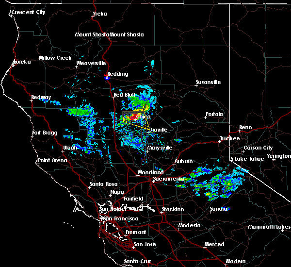
 The severe thunderstorm warning for west central butte county will expire at 530 pm pst, the storm which prompted the warning has moved out of the area. therefore, this warning will be allowed to expire. a new severe thunderstorm warning has been issued for an updated geographic area as the storm continues to move northeast. main threat with this storm will continue to be 1 inch hail. The severe thunderstorm warning for west central butte county will expire at 530 pm pst, the storm which prompted the warning has moved out of the area. therefore, this warning will be allowed to expire. a new severe thunderstorm warning has been issued for an updated geographic area as the storm continues to move northeast. main threat with this storm will continue to be 1 inch hail.
|
| 3/6/2023 5:26 PM PST |
 At 526 pm pst, a severe thunderstorm was located near chico, moving northeast at 10 mph (trained weather spotters). Hazards include quarter size hail. damage to vehicles is expected At 526 pm pst, a severe thunderstorm was located near chico, moving northeast at 10 mph (trained weather spotters). Hazards include quarter size hail. damage to vehicles is expected
|
| 3/6/2023 5:09 PM PST |
 At 508 pm pst, a severe thunderstorm was located over nord, or near chico, moving northeast at 15 mph (trained weather spotters). Hazards include quarter size hail. Damage to vehicles is expected. Locations impacted include, chico and nord. At 508 pm pst, a severe thunderstorm was located over nord, or near chico, moving northeast at 15 mph (trained weather spotters). Hazards include quarter size hail. Damage to vehicles is expected. Locations impacted include, chico and nord.
|
| 3/6/2023 4:42 PM PST |
 At 442 pm pst, a severe thunderstorm was located near ordbend, or 10 miles east of orland, moving northeast at 15 mph (trained weather spotters). Hazards include quarter size hail. damage to vehicles is expected At 442 pm pst, a severe thunderstorm was located near ordbend, or 10 miles east of orland, moving northeast at 15 mph (trained weather spotters). Hazards include quarter size hail. damage to vehicles is expected
|
| 5/24/2019 9:43 PM PDT |
 At 942 pm pdt, a severe thunderstorm was located over concow, or near pulga, moving south at 20 mph (radar indicated). Hazards include quarter size hail. damage to vehicles is expected At 942 pm pdt, a severe thunderstorm was located over concow, or near pulga, moving south at 20 mph (radar indicated). Hazards include quarter size hail. damage to vehicles is expected
|
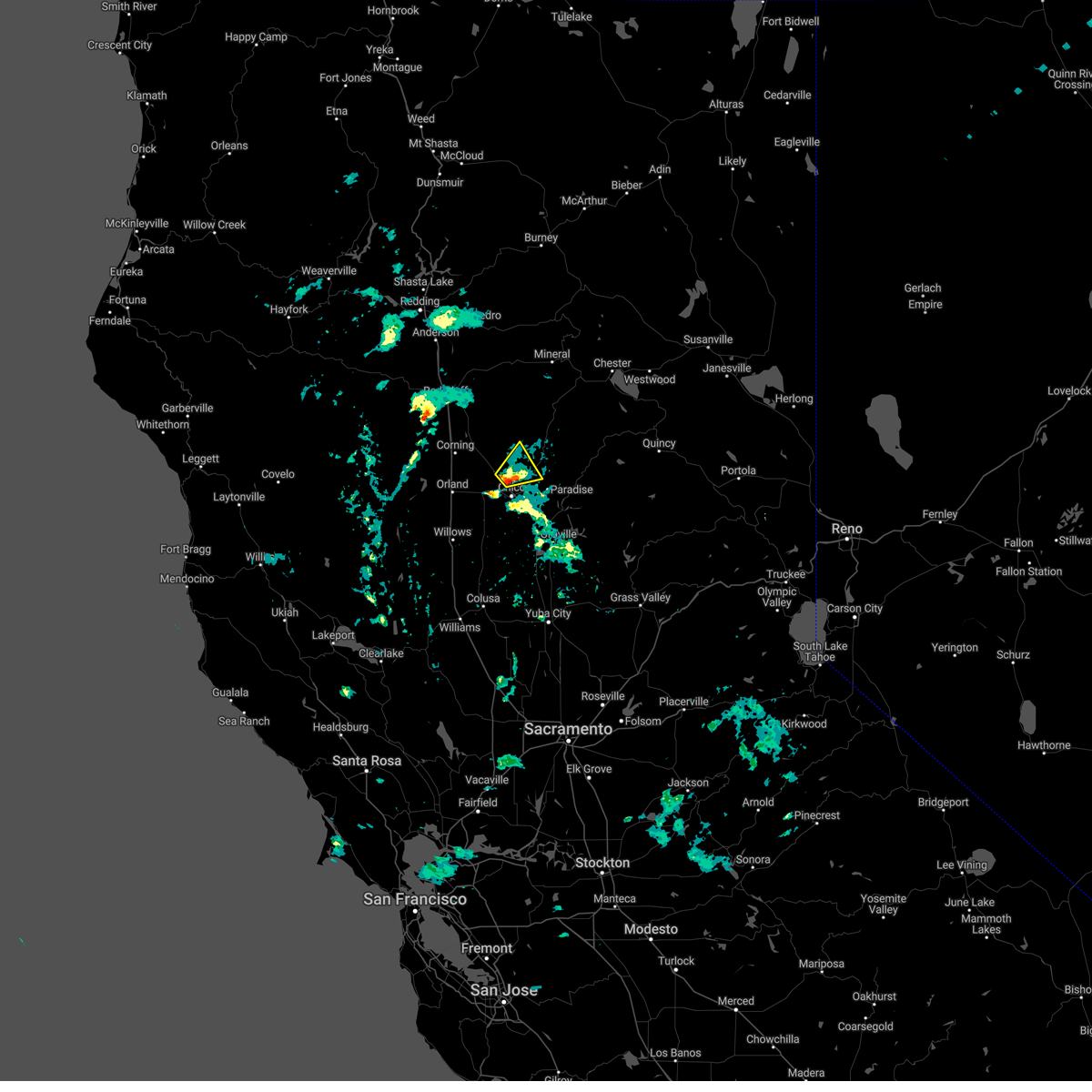
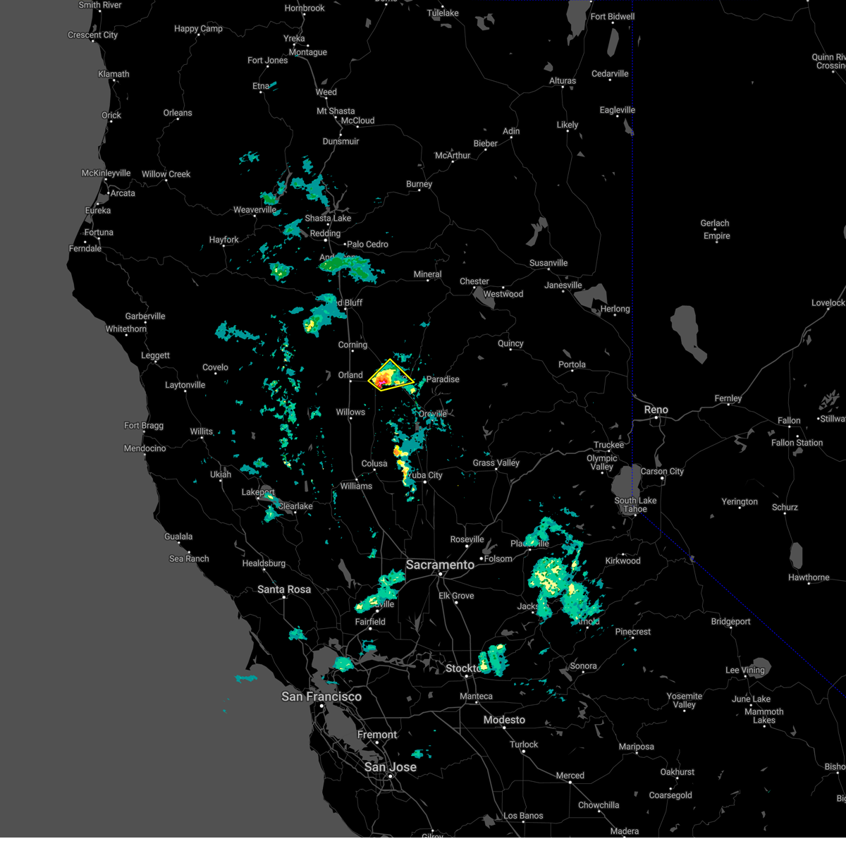
| 10/2/2016 4:46 PM PDT |
 At 440 pm pdt, doppler radar indicated a severe thunderstorm capable of producing quarter size or larger hail. this storm was located near chico, moving east-southeast at 20 mph. residents should prepare for large hail and heavy downpours. locations possibly impacted include, chico, paradise, de sabla powerhouse, forest ranch, richardson springs, nord, magalia, durham and hamilton city. At 440 pm pdt, doppler radar indicated a severe thunderstorm capable of producing quarter size or larger hail. this storm was located near chico, moving east-southeast at 20 mph. residents should prepare for large hail and heavy downpours. locations possibly impacted include, chico, paradise, de sabla powerhouse, forest ranch, richardson springs, nord, magalia, durham and hamilton city.
|
| 10/2/2016 4:28 PM PDT |
 At 425 pm pdt, doppler radar indicated a severe thunderstorm capable of producing quarter size hail and gusty outflow winds. this storm was located near nord, and moving east at 30 mph towards chico. At 425 pm pdt, doppler radar indicated a severe thunderstorm capable of producing quarter size hail and gusty outflow winds. this storm was located near nord, and moving east at 30 mph towards chico.
|
| 4/7/2015 4:31 PM PDT | A tornado warning remains in effect until 500 pm pdt for central butte county. at 428 pm pdt. national weather service doppler radar continued to indicate a tornado. this tornado was located 11 miles north of thermalito. or 9 miles southwest of paradise. Moving north at 15 mph. |
| 4/7/2015 4:00 PM PDT | The national weather service in sacramento has issued a * tornado warning for. central butte county in northern california. until 500 pm pdt * at 350 pm pdt. National weather service doppler radar indicated a severe thunderstorm capable of producing a tornado near. |
| 4/7/2015 3:54 PM PDT | The national weather service in sacramento has issued a * tornado warning for. central butte county in northern california. until 500 pm pdt * at 350 pm pdt. National weather service doppler radar indicated a severe thunderstorm capable of producing a tornado near. |
Hail Maps for Butte Creek Canyon, CA


Connect with Interactive Hail Maps