

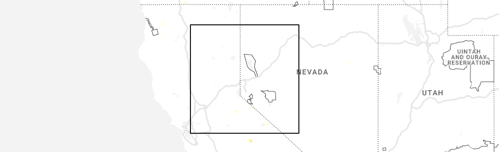
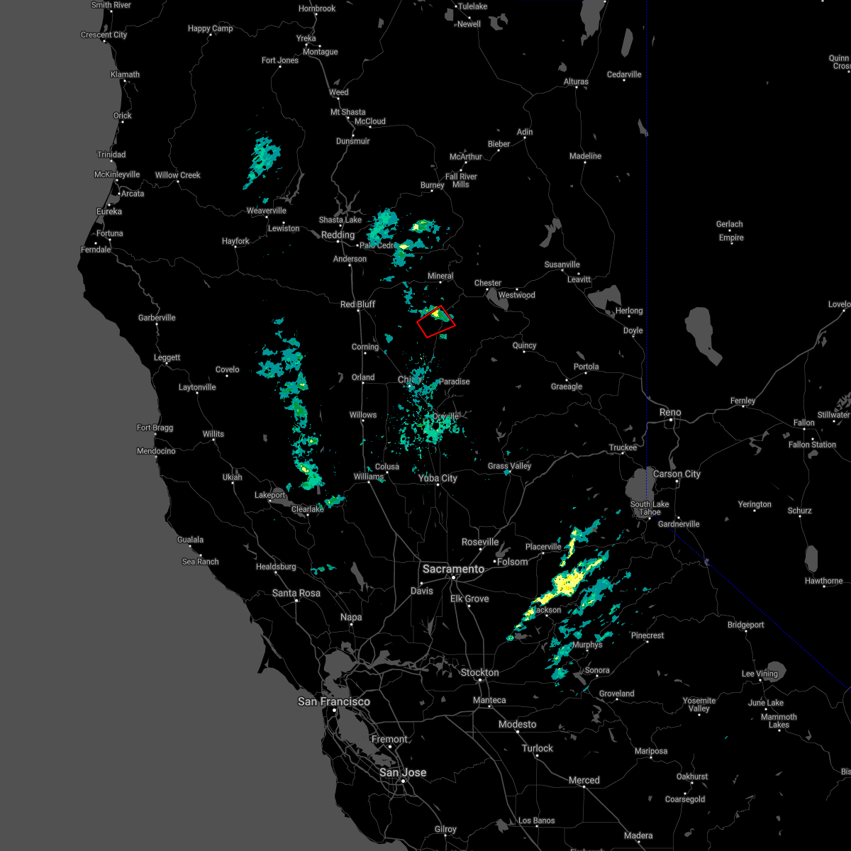
Hail Map for Butte Meadows, CA
The Butte Meadows, CA area has had 0 reports of on-the-ground hail by trained spotters, and has been under severe weather warnings 3 times during the past 12 months. Doppler radar has detected hail at or near Butte Meadows, CA on 1 occasion.
| Name: | Butte Meadows, CA |
| Where Located: | 57.1 miles SE of Redding, CA |
| Map: | Google Map for Butte Meadows, CA |
| Population: | 40 |
| Housing Units: | 242 |
| More Info: | Search Google for Butte Meadows, CA |
0
The Top Recent Hail Date for Butte Meadows, CA is Monday, June 5, 2023 (1st out of 1)
Hail and Wind Damage Spotted near Butte Meadows, CA
| Date / Time | Report Details |
|---|---|
| 5/3/2026 4:50 PM PDT |
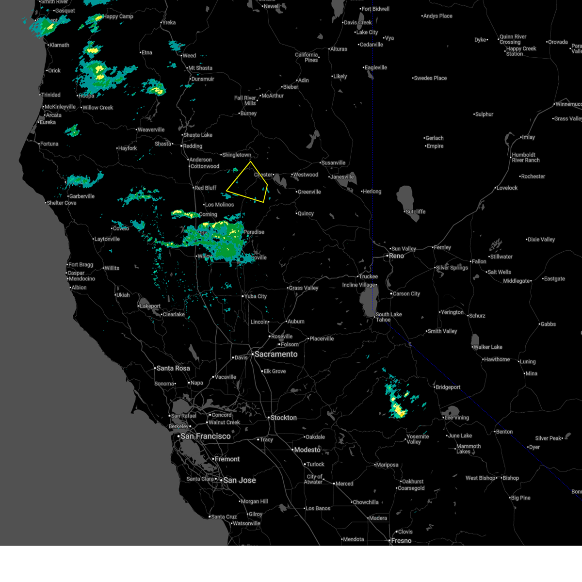 the severe thunderstorm warning has been cancelled and is no longer in effect the severe thunderstorm warning has been cancelled and is no longer in effect
|
| 5/3/2026 4:32 PM PDT |
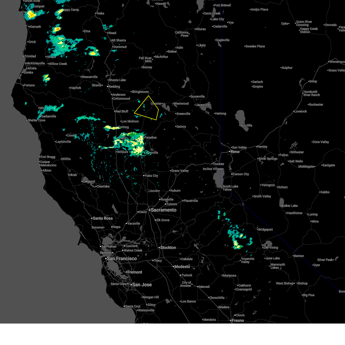 At 432 pm pdt, a severe thunderstorm was located 8 miles southeast of mineral, moving northwest at 35 mph (radar indicated). Hazards include half dollar size hail. Damage to vehicles is expected. Locations impacted include, mineral and mill creek. At 432 pm pdt, a severe thunderstorm was located 8 miles southeast of mineral, moving northwest at 35 mph (radar indicated). Hazards include half dollar size hail. Damage to vehicles is expected. Locations impacted include, mineral and mill creek.
|
| 5/3/2026 4:16 PM PDT |
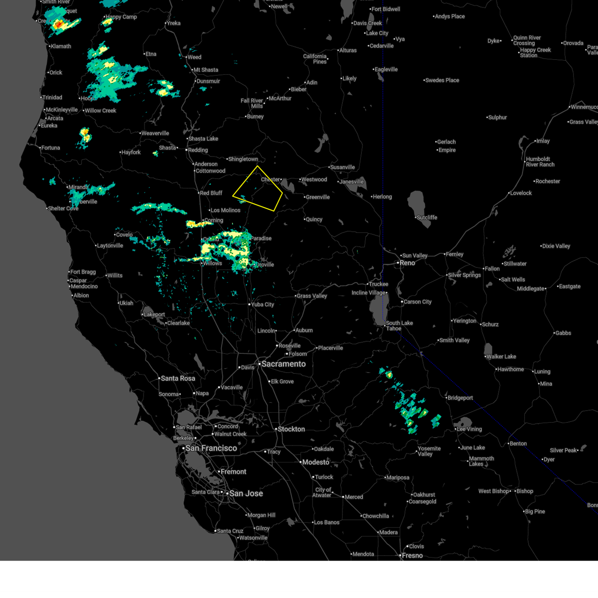 Svrsto the national weather service in sacramento has issued a * severe thunderstorm warning for, west central plumas county in northern california, northeastern tehama county in northern california, northern butte county in northern california, * until 500 pm pdt. * at 415 pm pdt, a severe thunderstorm was located 8 miles southwest of lake almanor west, or 10 miles southwest of chester, moving northwest at 30 mph (radar indicated). Hazards include quarter size hail. damage to vehicles is expected Svrsto the national weather service in sacramento has issued a * severe thunderstorm warning for, west central plumas county in northern california, northeastern tehama county in northern california, northern butte county in northern california, * until 500 pm pdt. * at 415 pm pdt, a severe thunderstorm was located 8 miles southwest of lake almanor west, or 10 miles southwest of chester, moving northwest at 30 mph (radar indicated). Hazards include quarter size hail. damage to vehicles is expected
|
| 1/4/2021 3:53 PM PST |
 The tornado warning for east central tehama and north central butte counties will expire at 400 pm pst, the storm which prompted the warning has weakened below severe limits, and no longer appears capable of producing a tornado. therefore, the warning will be allowed to expire. The tornado warning for east central tehama and north central butte counties will expire at 400 pm pst, the storm which prompted the warning has weakened below severe limits, and no longer appears capable of producing a tornado. therefore, the warning will be allowed to expire.
|
| 1/4/2021 3:35 PM PST |
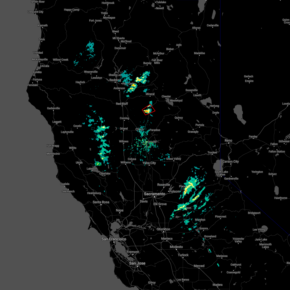 At 334 pm pst, a severe thunderstorm capable of producing a tornado was located 7 miles west of butte meadows, or 21 miles south of mineral, moving northeast at 20 mph (radar indicated rotation). Hazards include tornado. Flying debris will be dangerous to those caught without shelter. mobile homes will be damaged or destroyed. damage to roofs, windows, and vehicles will occur. tree damage is likely. this dangerous storm will be near, butte meadows around 350 pm pst. Mill creek around 355 pm pst. At 334 pm pst, a severe thunderstorm capable of producing a tornado was located 7 miles west of butte meadows, or 21 miles south of mineral, moving northeast at 20 mph (radar indicated rotation). Hazards include tornado. Flying debris will be dangerous to those caught without shelter. mobile homes will be damaged or destroyed. damage to roofs, windows, and vehicles will occur. tree damage is likely. this dangerous storm will be near, butte meadows around 350 pm pst. Mill creek around 355 pm pst.
|
Hail Maps for Butte Meadows, CA

Connect with Interactive Hail Maps