

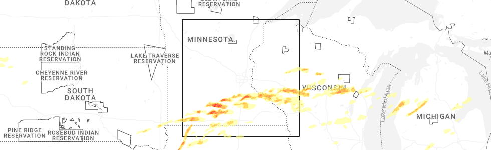
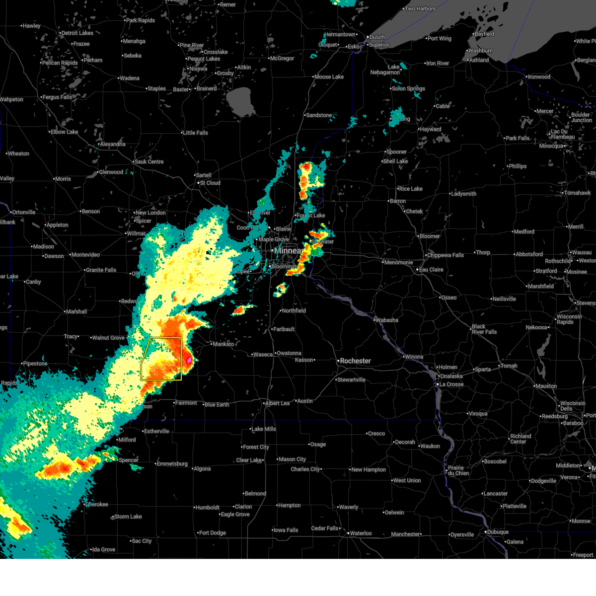
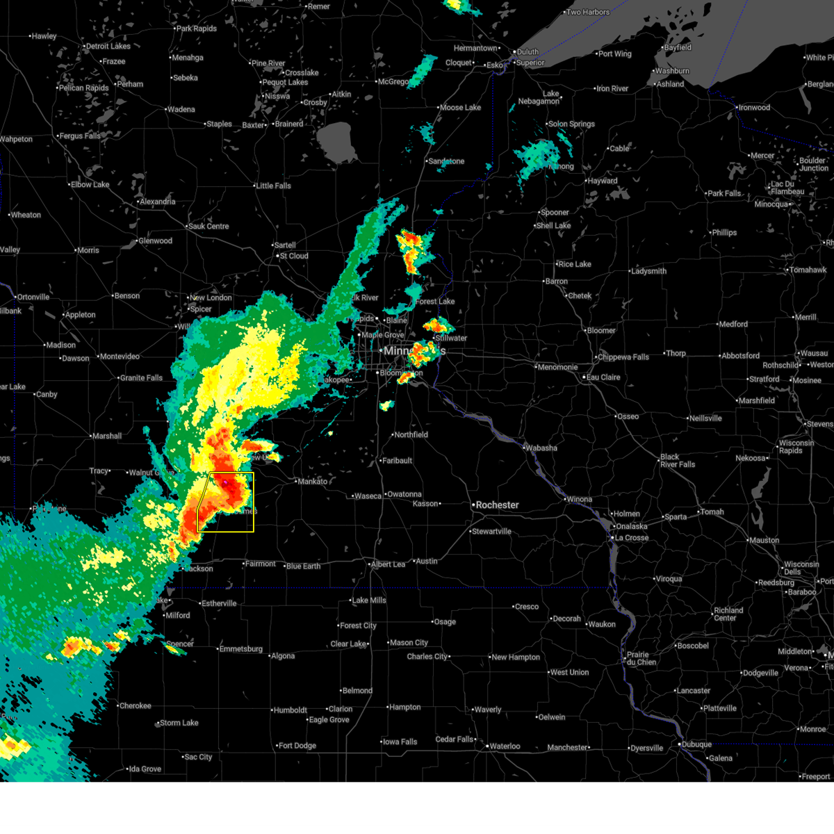
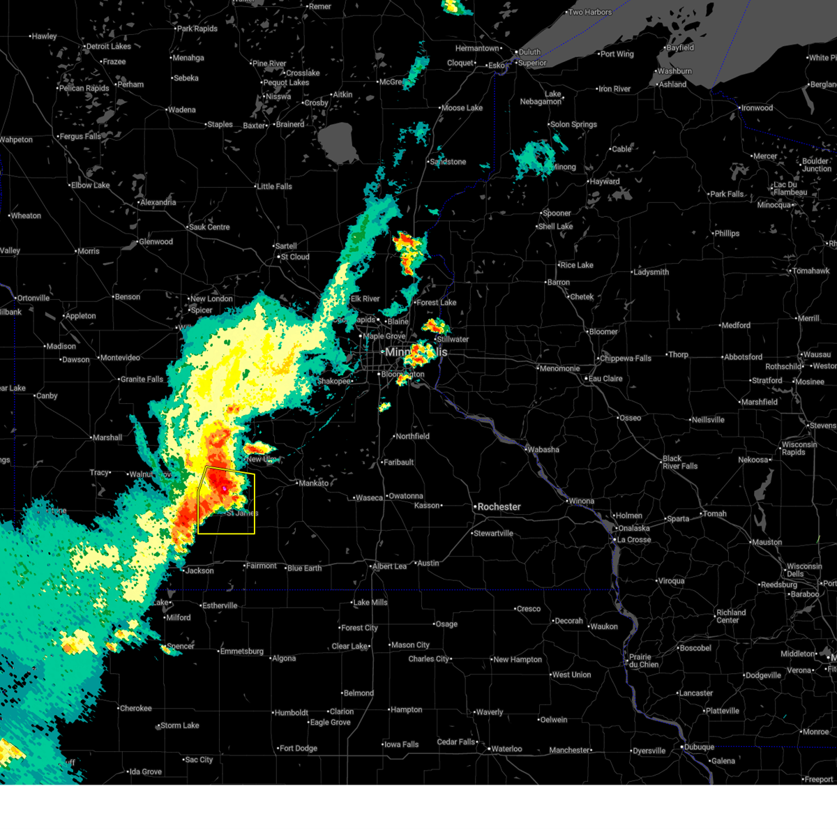
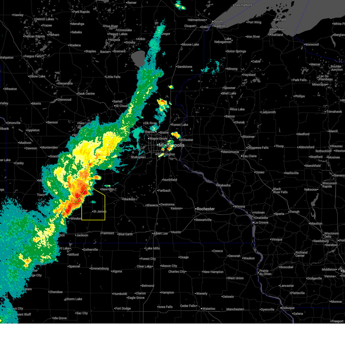
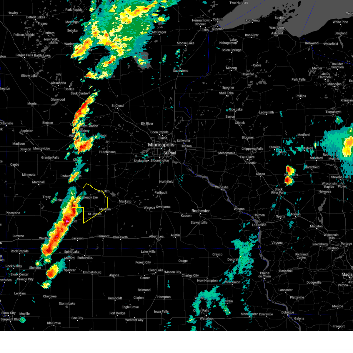
Hail Map for Butterfield, MN
The Butterfield, MN area has had 5 reports of on-the-ground hail by trained spotters, and has been under severe weather warnings 12 times during the past 12 months. Doppler radar has detected hail at or near Butterfield, MN on 61 occasions, including 5 occasions during the past year.
| Name: | Butterfield, MN |
| Where Located: | 82.6 miles SSE of Montevideo, MN |
| Map: | Google Map for Butterfield, MN |
| Population: | 586 |
| Housing Units: | 238 |
| More Info: | Search Google for Butterfield, MN |
3
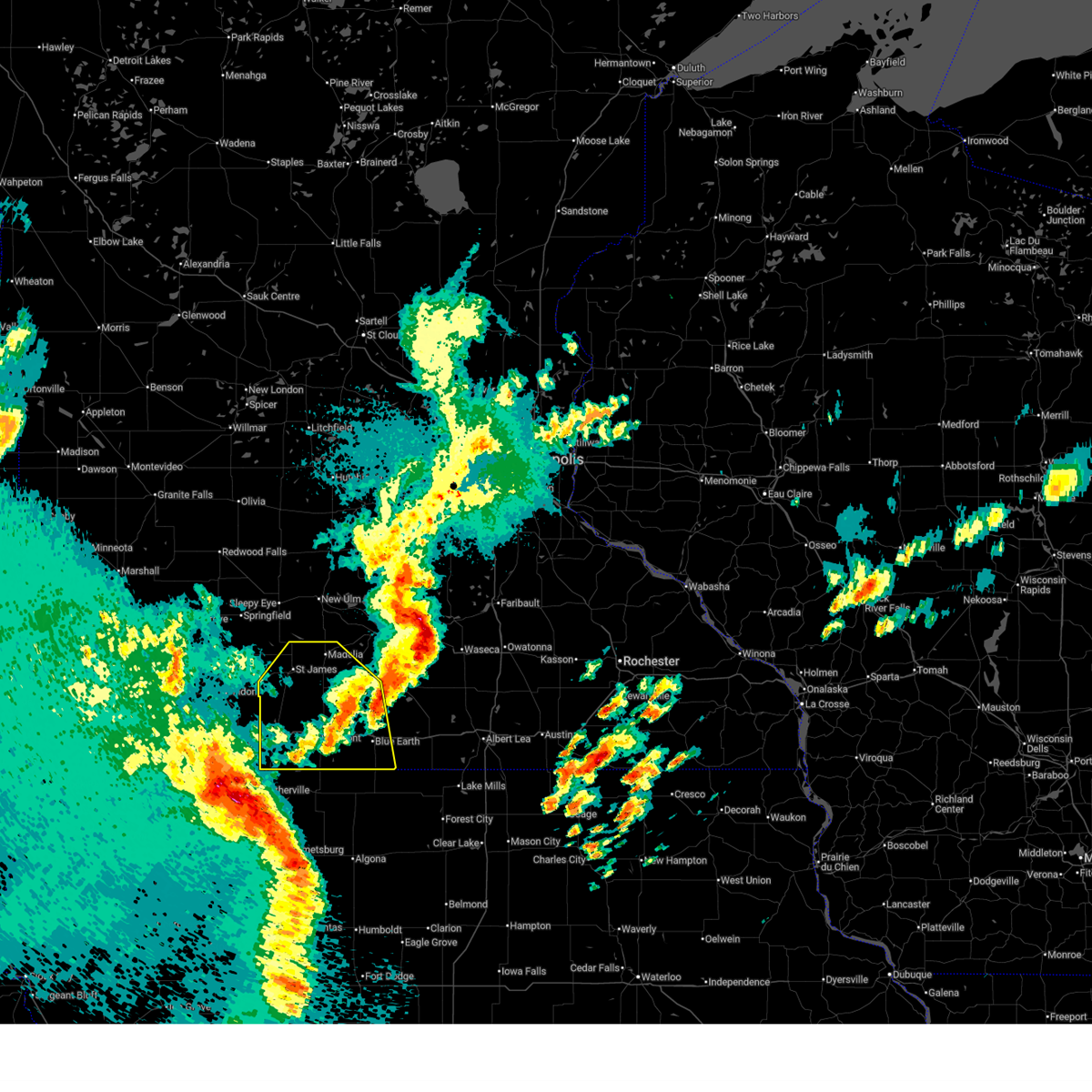
The Top Recent Hail Date for Butterfield, MN is Monday, April 13, 2026 (2nd out of 61)
Hail and Wind Damage Spotted near Butterfield, MN
| Date / Time | Report Details |
|---|---|
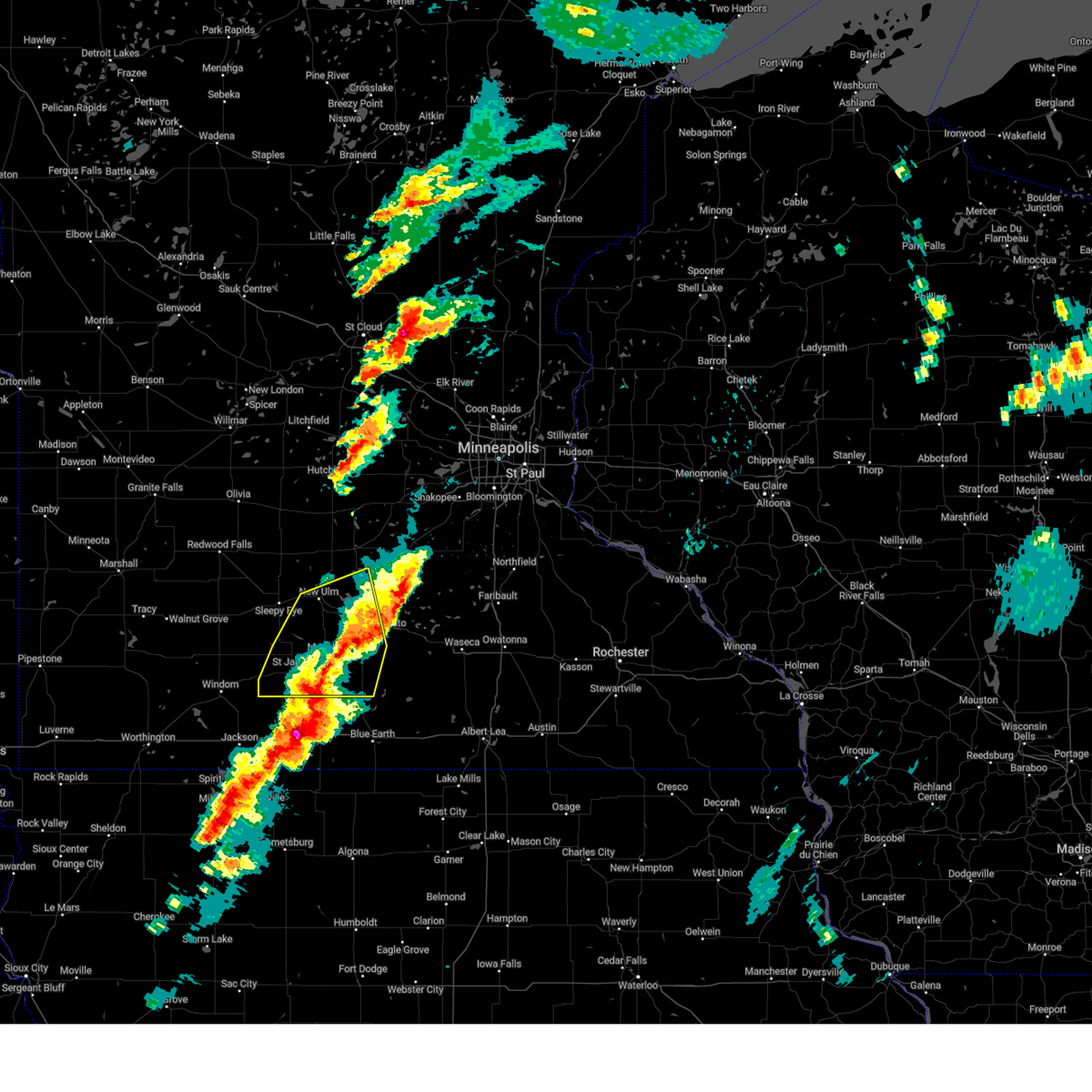
| 5/17/2026 9:19 PM CDT |
 Svrmpx the national weather service in the twin cities has issued a * severe thunderstorm warning for, southwestern blue earth county in south central minnesota, western faribault county in south central minnesota, martin county in south central minnesota, watonwan county in south central minnesota, * until 1015 pm cdt. * at 919 pm cdt, severe thunderstorms were located in northern iowa along a line from 15 miles west of sherburn to 26 miles south of ceylon, moving northeast at 60 mph (radar indicated). Hazards include 60 mph wind gusts and quarter size hail. Hail damage to vehicles is expected. Expect wind damage to roofs, siding, and trees. Svrmpx the national weather service in the twin cities has issued a * severe thunderstorm warning for, southwestern blue earth county in south central minnesota, western faribault county in south central minnesota, martin county in south central minnesota, watonwan county in south central minnesota, * until 1015 pm cdt. * at 919 pm cdt, severe thunderstorms were located in northern iowa along a line from 15 miles west of sherburn to 26 miles south of ceylon, moving northeast at 60 mph (radar indicated). Hazards include 60 mph wind gusts and quarter size hail. Hail damage to vehicles is expected. Expect wind damage to roofs, siding, and trees.
|
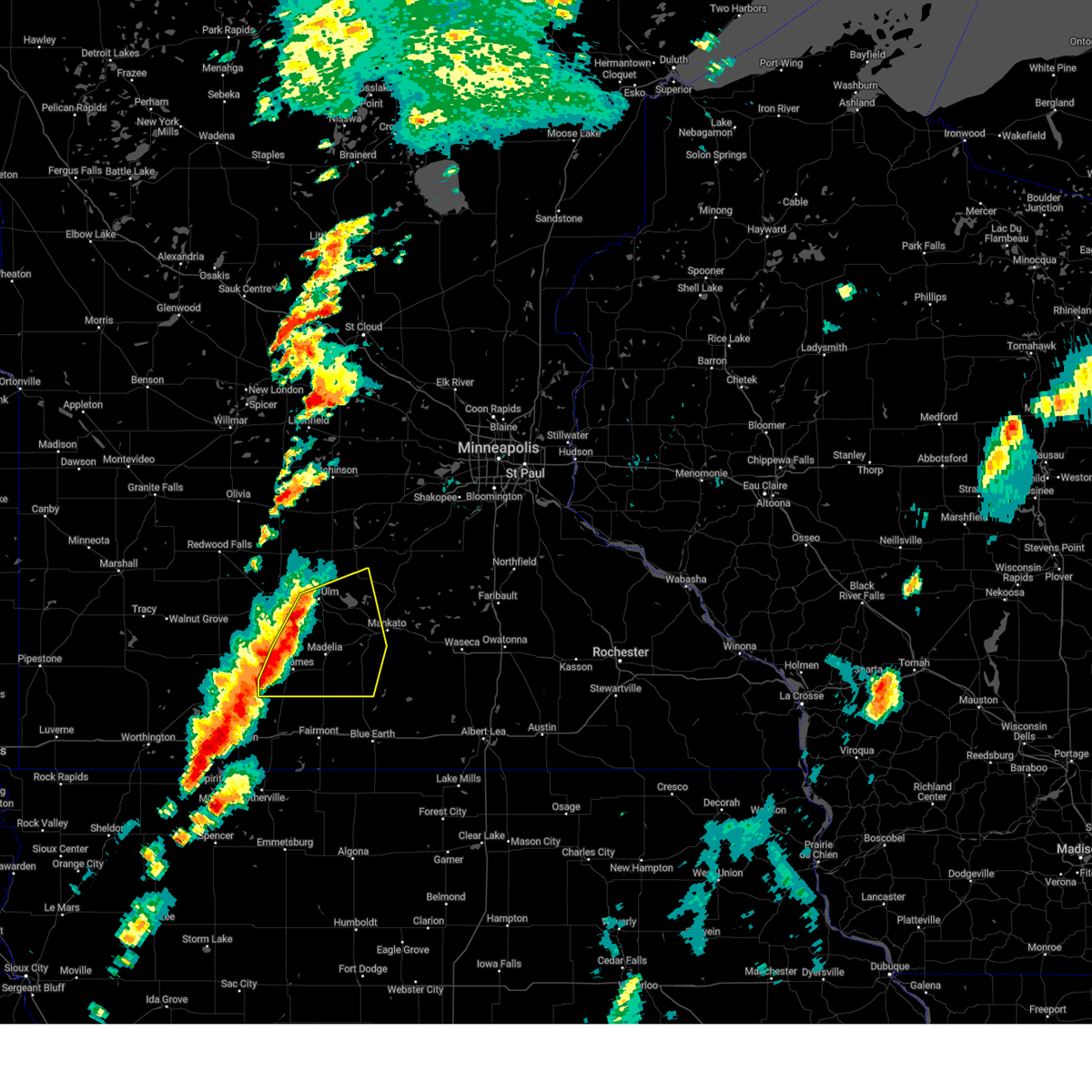
| 5/17/2026 7:59 PM CDT |
 At 759 pm cdt, severe thunderstorms were located along a line from over st. james to near fairmont (radar indicated). Hazards include ping pong ball size hail and 60 mph wind gusts. People and animals outdoors will be injured. expect hail damage to roofs, siding, windows, and vehicles. expect wind damage to roofs, siding, and trees. locations impacted include, trimont, butterfield, odin, foxlake, ormsby, welcome, echols, sveadahl, st. James, south branch, fairmont, st james airport, la salle, northrop, grogan, truman, lewisville and madelia. At 759 pm cdt, severe thunderstorms were located along a line from over st. james to near fairmont (radar indicated). Hazards include ping pong ball size hail and 60 mph wind gusts. People and animals outdoors will be injured. expect hail damage to roofs, siding, windows, and vehicles. expect wind damage to roofs, siding, and trees. locations impacted include, trimont, butterfield, odin, foxlake, ormsby, welcome, echols, sveadahl, st. James, south branch, fairmont, st james airport, la salle, northrop, grogan, truman, lewisville and madelia.
|
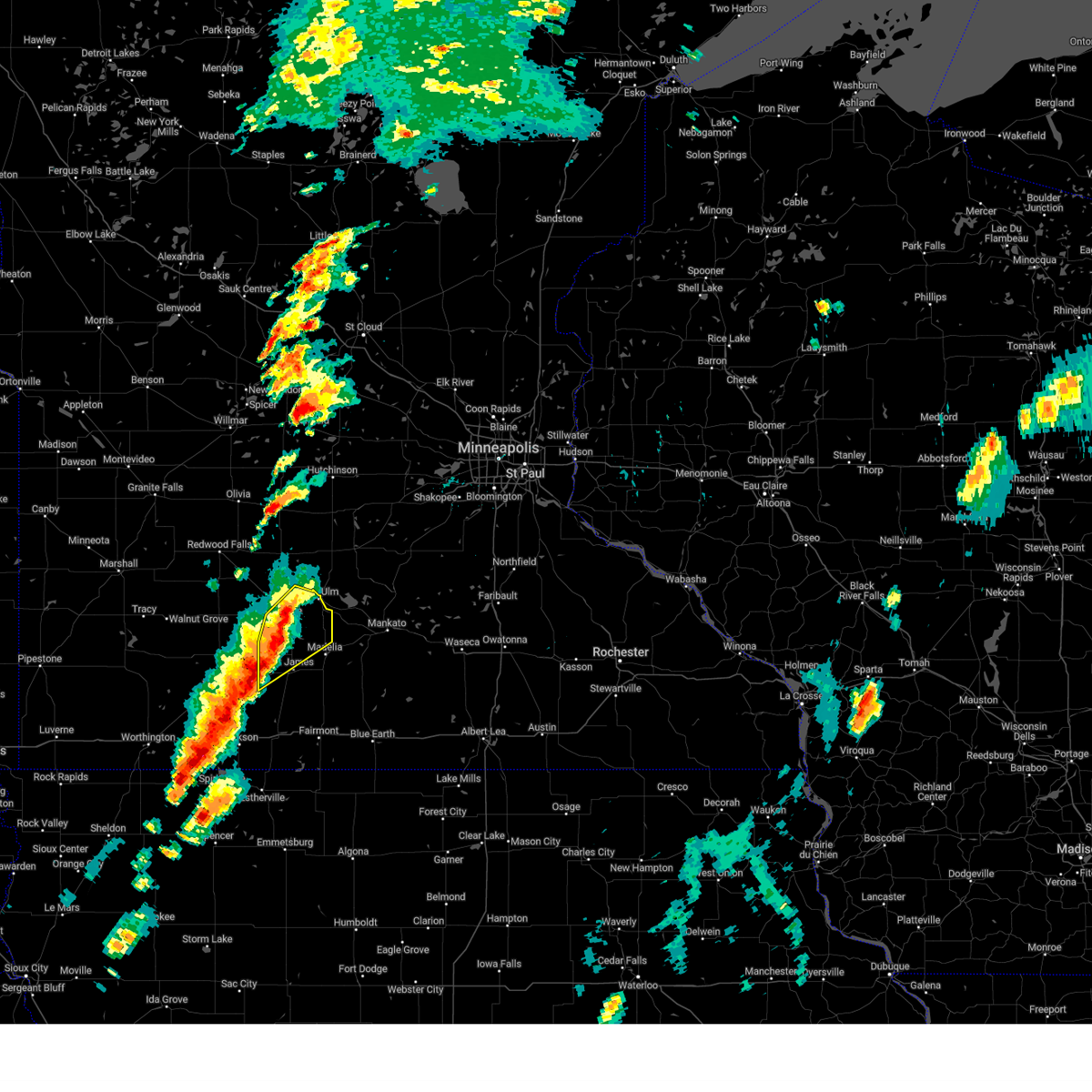
| 5/17/2026 7:32 PM CDT |
 Svrmpx the national weather service in the twin cities has issued a * severe thunderstorm warning for, northwestern martin county in south central minnesota, watonwan county in south central minnesota, * until 830 pm cdt. * at 732 pm cdt, severe thunderstorms were located along a line from 6 miles west of butterfield to 8 miles southwest of sherburn (radar indicated). Hazards include 60 mph wind gusts and quarter size hail. Hail damage to vehicles is expected. Expect wind damage to roofs, siding, and trees. Svrmpx the national weather service in the twin cities has issued a * severe thunderstorm warning for, northwestern martin county in south central minnesota, watonwan county in south central minnesota, * until 830 pm cdt. * at 732 pm cdt, severe thunderstorms were located along a line from 6 miles west of butterfield to 8 miles southwest of sherburn (radar indicated). Hazards include 60 mph wind gusts and quarter size hail. Hail damage to vehicles is expected. Expect wind damage to roofs, siding, and trees.
|
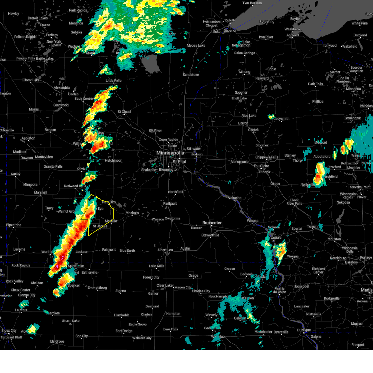
| 5/17/2026 7:11 PM CDT |
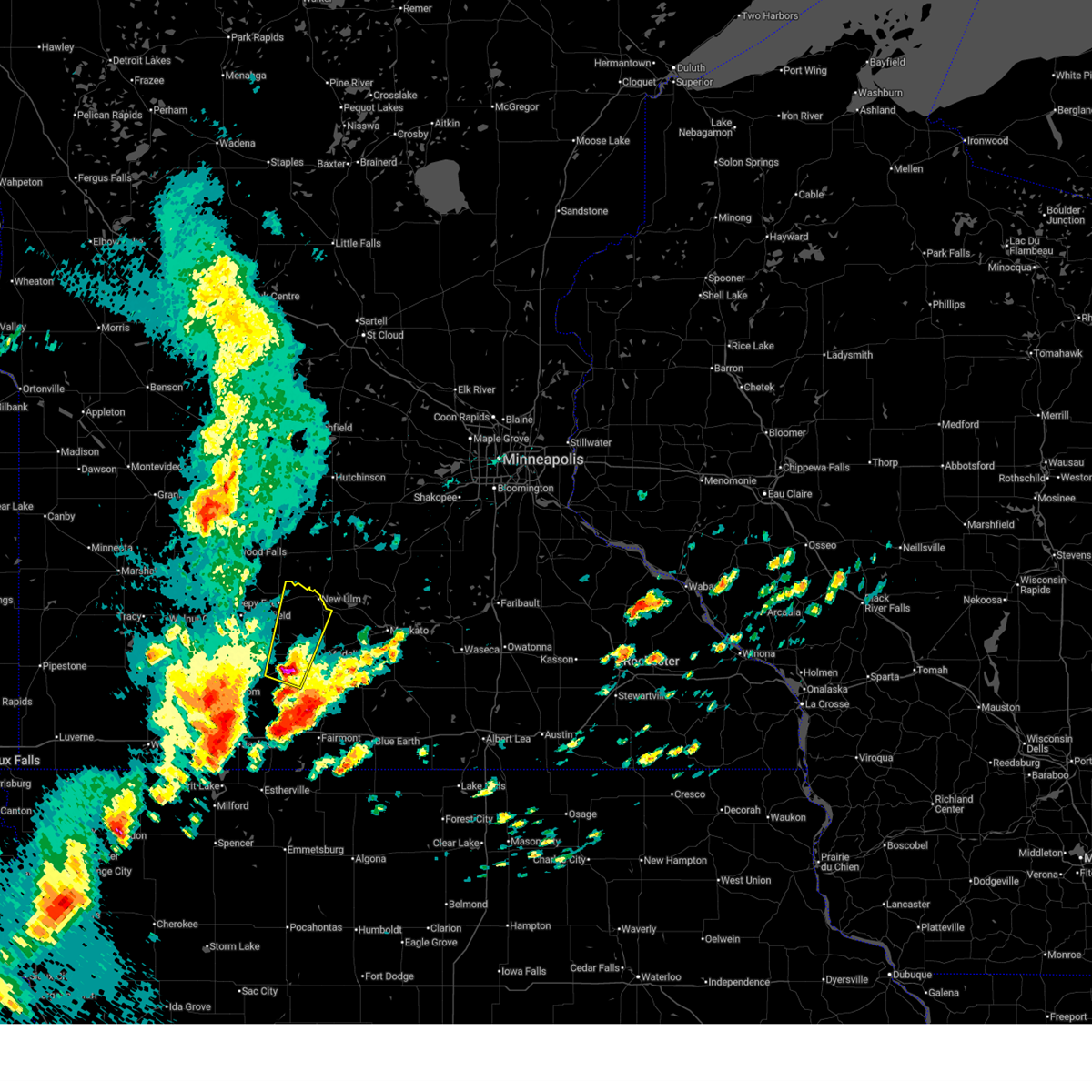 Svrmpx the national weather service in the twin cities has issued a * severe thunderstorm warning for, southeastern brown county in south central minnesota, western watonwan county in south central minnesota, * until 800 pm cdt. * at 711 pm cdt, a severe thunderstorm was located over st. james, or 25 miles southwest of new ulm, moving north at 35 mph (radar indicated). Hazards include 60 mph wind gusts and quarter size hail. Hail damage to vehicles is expected. Expect wind damage to roofs, siding, and trees. Svrmpx the national weather service in the twin cities has issued a * severe thunderstorm warning for, southeastern brown county in south central minnesota, western watonwan county in south central minnesota, * until 800 pm cdt. * at 711 pm cdt, a severe thunderstorm was located over st. james, or 25 miles southwest of new ulm, moving north at 35 mph (radar indicated). Hazards include 60 mph wind gusts and quarter size hail. Hail damage to vehicles is expected. Expect wind damage to roofs, siding, and trees.
|
| 4/13/2026 6:46 PM CDT |
 Svrmpx the national weather service in the twin cities has issued a * severe thunderstorm warning for, watonwan county in south central minnesota, * until 800 pm cdt. * at 646 pm cdt, a severe thunderstorm was located 6 miles southwest of butterfield, or 28 miles northwest of fairmont, moving east at 25 mph (radar indicated). Hazards include 60 mph wind gusts and quarter size hail. Hail damage to vehicles is expected. Expect wind damage to roofs, siding, and trees. Svrmpx the national weather service in the twin cities has issued a * severe thunderstorm warning for, watonwan county in south central minnesota, * until 800 pm cdt. * at 646 pm cdt, a severe thunderstorm was located 6 miles southwest of butterfield, or 28 miles northwest of fairmont, moving east at 25 mph (radar indicated). Hazards include 60 mph wind gusts and quarter size hail. Hail damage to vehicles is expected. Expect wind damage to roofs, siding, and trees.
|
| 8/17/2025 8:10 PM CDT |
 The storm which prompted the warning has weakened below severe limits, and no longer poses an immediate threat to life or property. therefore, the warning will be allowed to expire. however, gusty winds are still possible with this thunderstorm. The storm which prompted the warning has weakened below severe limits, and no longer poses an immediate threat to life or property. therefore, the warning will be allowed to expire. however, gusty winds are still possible with this thunderstorm.
|
| 8/17/2025 8:02 PM CDT |
 At 802 pm cdt, a severe thunderstorm was located 6 miles northeast of st. james, or 18 miles south of new ulm, moving east at 40 mph (radar indicated). Hazards include 60 mph wind gusts and small hail. Expect damage to roofs, siding, and trees. locations impacted include, st. James, madelia, butterfield, hanska, lewisville, south branch, darfur, odin, la salle, st james airport, grogan, echols and sveadahl. At 802 pm cdt, a severe thunderstorm was located 6 miles northeast of st. james, or 18 miles south of new ulm, moving east at 40 mph (radar indicated). Hazards include 60 mph wind gusts and small hail. Expect damage to roofs, siding, and trees. locations impacted include, st. James, madelia, butterfield, hanska, lewisville, south branch, darfur, odin, la salle, st james airport, grogan, echols and sveadahl.
|
| 8/17/2025 7:26 PM CDT |
 Svrmpx the national weather service in the twin cities has issued a * severe thunderstorm warning for, southeastern brown county in south central minnesota, watonwan county in south central minnesota, * until 815 pm cdt. * at 726 pm cdt, a severe thunderstorm was located 7 miles west of butterfield, or 32 miles northwest of fairmont, moving east at 30 mph (radar indicated). Hazards include 60 mph wind gusts and small hail. expect damage to roofs, siding, and trees Svrmpx the national weather service in the twin cities has issued a * severe thunderstorm warning for, southeastern brown county in south central minnesota, watonwan county in south central minnesota, * until 815 pm cdt. * at 726 pm cdt, a severe thunderstorm was located 7 miles west of butterfield, or 32 miles northwest of fairmont, moving east at 30 mph (radar indicated). Hazards include 60 mph wind gusts and small hail. expect damage to roofs, siding, and trees
|
| 7/7/2025 7:51 PM CDT |
 The storms which prompted the warning have moved out of the area. therefore, the warning has been allowed to expire. The storms which prompted the warning have moved out of the area. therefore, the warning has been allowed to expire.
|
| 7/7/2025 7:34 PM CDT |
 At 734 pm cdt, severe thunderstorms were located along a line from 6 miles south of courtland to near trimont, or along a line from 11 miles southeast of new ulm to 18 miles northwest of fairmont, moving southeast at 45 mph (radar indicated). Hazards include 60 mph wind gusts and quarter size hail. Hail damage to vehicles is expected. expect wind damage to roofs, siding, and trees. locations impacted include, st. James, madelia, butterfield, hanska, lewisville, south branch, odin, la salle, st james airport, grogan, echols and sveadahl. At 734 pm cdt, severe thunderstorms were located along a line from 6 miles south of courtland to near trimont, or along a line from 11 miles southeast of new ulm to 18 miles northwest of fairmont, moving southeast at 45 mph (radar indicated). Hazards include 60 mph wind gusts and quarter size hail. Hail damage to vehicles is expected. expect wind damage to roofs, siding, and trees. locations impacted include, st. James, madelia, butterfield, hanska, lewisville, south branch, odin, la salle, st james airport, grogan, echols and sveadahl.
|
| 7/7/2025 7:25 PM CDT |
 At 725 pm cdt, severe thunderstorms were located along a line from near new ulm to 12 miles southwest of butterfield, or along a line from near new ulm to 25 miles northwest of fairmont, moving southeast at 45 mph (radar indicated). Hazards include 60 mph wind gusts and small hail. Expect damage to roofs, siding, and trees. locations impacted include, st. James, madelia, butterfield, hanska, lewisville, south branch, darfur, odin, la salle, st james airport, grogan, sveadahl, echols and searles. At 725 pm cdt, severe thunderstorms were located along a line from near new ulm to 12 miles southwest of butterfield, or along a line from near new ulm to 25 miles northwest of fairmont, moving southeast at 45 mph (radar indicated). Hazards include 60 mph wind gusts and small hail. Expect damage to roofs, siding, and trees. locations impacted include, st. James, madelia, butterfield, hanska, lewisville, south branch, darfur, odin, la salle, st james airport, grogan, sveadahl, echols and searles.
|
| 7/7/2025 7:11 PM CDT |
 Svrmpx the national weather service in the twin cities has issued a * severe thunderstorm warning for, southeastern brown county in south central minnesota, watonwan county in south central minnesota, * until 745 pm cdt. * at 711 pm cdt, severe thunderstorms were located along a line from 6 miles northeast of sleepy eye to 18 miles southwest of comfrey, or along a line from 11 miles west of new ulm to 39 miles northwest of fairmont, moving southeast at 30 mph (radar indicated). Hazards include 60 mph wind gusts and small hail. expect damage to roofs, siding, and trees Svrmpx the national weather service in the twin cities has issued a * severe thunderstorm warning for, southeastern brown county in south central minnesota, watonwan county in south central minnesota, * until 745 pm cdt. * at 711 pm cdt, severe thunderstorms were located along a line from 6 miles northeast of sleepy eye to 18 miles southwest of comfrey, or along a line from 11 miles west of new ulm to 39 miles northwest of fairmont, moving southeast at 30 mph (radar indicated). Hazards include 60 mph wind gusts and small hail. expect damage to roofs, siding, and trees
|
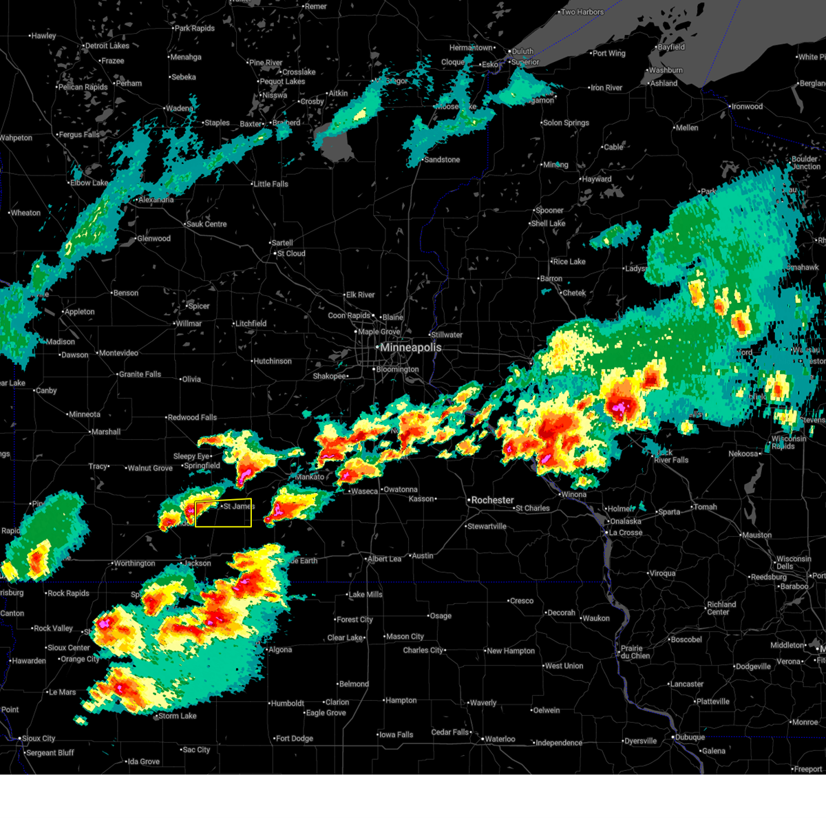
| 6/12/2025 5:21 PM CDT | Half Dollar sized hail reported 6.7 miles N of Butterfield, MN |
| 4/28/2025 4:29 PM CDT |
 The storms which prompted the warning have weakened below severe limits, and have exited the warned area. therefore, the warning will be allowed to expire. however, gusty winds are still possible with these thunderstorms. to report severe weather, contact your nearest law enforcement agency. they will send your report to the national weather service office. a tornado watch remains in effect until 800 pm cdt for a portion of south central minnesota. The storms which prompted the warning have weakened below severe limits, and have exited the warned area. therefore, the warning will be allowed to expire. however, gusty winds are still possible with these thunderstorms. to report severe weather, contact your nearest law enforcement agency. they will send your report to the national weather service office. a tornado watch remains in effect until 800 pm cdt for a portion of south central minnesota.
|
| 4/28/2025 3:45 PM CDT |
 Svrmpx the national weather service in the twin cities has issued a * severe thunderstorm warning for, western blue earth county in south central minnesota, southeastern brown county in south central minnesota, eastern nicollet county in south central minnesota, watonwan county in south central minnesota, * until 430 pm cdt. * at 345 pm cdt, severe thunderstorms were located along a line from near new ulm to 5 miles northwest of trimont, or along a line from near new ulm to 20 miles northwest of fairmont, moving east at 45 mph (radar indicated). Hazards include 60 mph wind gusts and quarter size hail. Hail damage to vehicles is expected. Expect wind damage to roofs, siding, and trees. Svrmpx the national weather service in the twin cities has issued a * severe thunderstorm warning for, western blue earth county in south central minnesota, southeastern brown county in south central minnesota, eastern nicollet county in south central minnesota, watonwan county in south central minnesota, * until 430 pm cdt. * at 345 pm cdt, severe thunderstorms were located along a line from near new ulm to 5 miles northwest of trimont, or along a line from near new ulm to 20 miles northwest of fairmont, moving east at 45 mph (radar indicated). Hazards include 60 mph wind gusts and quarter size hail. Hail damage to vehicles is expected. Expect wind damage to roofs, siding, and trees.
|
| 4/28/2025 3:35 PM CDT |
 At 335 pm cdt, a severe thunderstorm was located 6 miles northwest of new ulm, moving northeast at 60 mph (radar indicated). Hazards include 60 mph wind gusts and half dollar size hail. Hail damage to vehicles is expected. expect wind damage to roofs, siding, and trees. locations impacted include, new ulm, st. James, sleepy eye, butterfield, hanska, darfur, la salle, sveadahl, essig, searles, flandrau state park and new ulm airport. At 335 pm cdt, a severe thunderstorm was located 6 miles northwest of new ulm, moving northeast at 60 mph (radar indicated). Hazards include 60 mph wind gusts and half dollar size hail. Hail damage to vehicles is expected. expect wind damage to roofs, siding, and trees. locations impacted include, new ulm, st. James, sleepy eye, butterfield, hanska, darfur, la salle, sveadahl, essig, searles, flandrau state park and new ulm airport.
|
| 4/28/2025 3:22 PM CDT |
 At 322 pm cdt, a severe thunderstorm was located 5 miles southwest of sleepy eye, or 16 miles west of new ulm, moving northeast at 60 mph (radar indicated). Hazards include 60 mph wind gusts and half dollar size hail. Hail damage to vehicles is expected. expect wind damage to roofs, siding, and trees. locations impacted include, new ulm, st. James, sleepy eye, butterfield, hanska, comfrey, darfur, la salle, evan, cobden, sveadahl, essig, new ulm airport, flandrau state park and searles. At 322 pm cdt, a severe thunderstorm was located 5 miles southwest of sleepy eye, or 16 miles west of new ulm, moving northeast at 60 mph (radar indicated). Hazards include 60 mph wind gusts and half dollar size hail. Hail damage to vehicles is expected. expect wind damage to roofs, siding, and trees. locations impacted include, new ulm, st. James, sleepy eye, butterfield, hanska, comfrey, darfur, la salle, evan, cobden, sveadahl, essig, new ulm airport, flandrau state park and searles.
|
| 4/28/2025 3:09 PM CDT |
 Svrmpx the national weather service in the twin cities has issued a * severe thunderstorm warning for, brown county in south central minnesota, northern watonwan county in south central minnesota, * until 345 pm cdt. * at 309 pm cdt, a severe thunderstorm was located near comfrey, or 30 miles southwest of new ulm, moving northeast at 60 mph (radar indicated). Hazards include 60 mph wind gusts and half dollar size hail. Hail damage to vehicles is expected. Expect wind damage to roofs, siding, and trees. Svrmpx the national weather service in the twin cities has issued a * severe thunderstorm warning for, brown county in south central minnesota, northern watonwan county in south central minnesota, * until 345 pm cdt. * at 309 pm cdt, a severe thunderstorm was located near comfrey, or 30 miles southwest of new ulm, moving northeast at 60 mph (radar indicated). Hazards include 60 mph wind gusts and half dollar size hail. Hail damage to vehicles is expected. Expect wind damage to roofs, siding, and trees.
|
| 6/17/2024 3:39 AM CDT |
 At 339 am cdt, severe thunderstorms were located along a line extending from 5 miles southeast of butterfield to near welcome to near okamanpedan lake, moving east at 40 mph (radar indicated). Hazards include 60 mph wind gusts. Expect damage to roofs, siding, and trees. these severe storms will be near, fairmont, st. james, iowa lake, and okamanpedan lake around 345 am cdt. truman around 350 am cdt. lewisville around 355 am cdt. Other locations impacted by these severe thunderstorms include fairmont airport, dunnell, northrop, ormsby, st james airport, granada, echols, east chain, grogan, and imogene. At 339 am cdt, severe thunderstorms were located along a line extending from 5 miles southeast of butterfield to near welcome to near okamanpedan lake, moving east at 40 mph (radar indicated). Hazards include 60 mph wind gusts. Expect damage to roofs, siding, and trees. these severe storms will be near, fairmont, st. james, iowa lake, and okamanpedan lake around 345 am cdt. truman around 350 am cdt. lewisville around 355 am cdt. Other locations impacted by these severe thunderstorms include fairmont airport, dunnell, northrop, ormsby, st james airport, granada, echols, east chain, grogan, and imogene.
|
| 6/17/2024 3:18 AM CDT |
 Svrmpx the national weather service in the twin cities has issued a * severe thunderstorm warning for, martin county in south central minnesota, watonwan county in south central minnesota, * until 415 am cdt. * at 318 am cdt, severe thunderstorms were located along a line extending from near mountain lake to 5 miles east of jackson in jackson county to superior, moving east at 40 mph (radar indicated). Hazards include 60 mph wind gusts. Expect damage to roofs, siding, and trees. severe thunderstorms will be near, sherburn and trimont around 325 am cdt. welcome and butterfield around 330 am cdt. ceylon and okamanpedan lake around 335 am cdt. fairmont and st. james around 340 am cdt. iowa lake around 345 am cdt. truman and lewisville around 350 am cdt. other locations impacted by these severe thunderstorms include fairmont airport, dunnell, northrop, ormsby, st james airport, granada, echols, east chain, grogan, and imogene. This includes interstate 90 between mile markers 82 and 112. Svrmpx the national weather service in the twin cities has issued a * severe thunderstorm warning for, martin county in south central minnesota, watonwan county in south central minnesota, * until 415 am cdt. * at 318 am cdt, severe thunderstorms were located along a line extending from near mountain lake to 5 miles east of jackson in jackson county to superior, moving east at 40 mph (radar indicated). Hazards include 60 mph wind gusts. Expect damage to roofs, siding, and trees. severe thunderstorms will be near, sherburn and trimont around 325 am cdt. welcome and butterfield around 330 am cdt. ceylon and okamanpedan lake around 335 am cdt. fairmont and st. james around 340 am cdt. iowa lake around 345 am cdt. truman and lewisville around 350 am cdt. other locations impacted by these severe thunderstorms include fairmont airport, dunnell, northrop, ormsby, st james airport, granada, echols, east chain, grogan, and imogene. This includes interstate 90 between mile markers 82 and 112.
|
| 8/11/2023 5:31 PM CDT | Quarter sized hail reported 4.1 miles NW of Butterfield, MN, power also reported out in odin. |
| 8/11/2023 5:30 PM CDT |
 At 530 pm cdt, a severe thunderstorm was located near st. james, or 21 miles northwest of fairmont, moving east at 50 mph (radar indicated). Hazards include 60 mph wind gusts and half dollar size hail. Hail damage to vehicles is expected. expect wind damage to roofs, siding, and trees. this severe thunderstorm will be near, truman and lewisville around 545 pm cdt. hail threat, radar indicated max hail size, 1. 25 in wind threat, radar indicated max wind gust, 60 mph. At 530 pm cdt, a severe thunderstorm was located near st. james, or 21 miles northwest of fairmont, moving east at 50 mph (radar indicated). Hazards include 60 mph wind gusts and half dollar size hail. Hail damage to vehicles is expected. expect wind damage to roofs, siding, and trees. this severe thunderstorm will be near, truman and lewisville around 545 pm cdt. hail threat, radar indicated max hail size, 1. 25 in wind threat, radar indicated max wind gust, 60 mph.
|
| 7/5/2022 5:39 PM CDT |
 The severe thunderstorm warning for southwestern blue earth and watonwan counties will expire at 545 pm cdt, the storm which prompted the warning has moved out of the area. therefore, the warning will be allowed to expire. however heavy rain is still possible with this thunderstorm. a severe thunderstorm watch remains in effect until 1000 pm cdt for south central minnesota. The severe thunderstorm warning for southwestern blue earth and watonwan counties will expire at 545 pm cdt, the storm which prompted the warning has moved out of the area. therefore, the warning will be allowed to expire. however heavy rain is still possible with this thunderstorm. a severe thunderstorm watch remains in effect until 1000 pm cdt for south central minnesota.
|
| 7/5/2022 5:24 PM CDT |
 At 523 pm cdt, a severe thunderstorm was located over madelia, or 18 miles south of new ulm, moving east at 15 mph (radar indicated). Hazards include 60 mph wind gusts and quarter size hail. Hail damage to vehicles is expected. expect wind damage to roofs, siding, and trees. locations impacted include, st. james, lake crystal, madelia, butterfield, lewisville, south branch, ormsby, darfur, odin, la salle, sveadahl and st james airport. hail threat, radar indicated max hail size, 1. 00 in wind threat, radar indicated max wind gust, 60 mph. At 523 pm cdt, a severe thunderstorm was located over madelia, or 18 miles south of new ulm, moving east at 15 mph (radar indicated). Hazards include 60 mph wind gusts and quarter size hail. Hail damage to vehicles is expected. expect wind damage to roofs, siding, and trees. locations impacted include, st. james, lake crystal, madelia, butterfield, lewisville, south branch, ormsby, darfur, odin, la salle, sveadahl and st james airport. hail threat, radar indicated max hail size, 1. 00 in wind threat, radar indicated max wind gust, 60 mph.
|
| 7/5/2022 5:03 PM CDT |
 At 503 pm cdt, a severe thunderstorm was located near madelia, or 17 miles south of new ulm, moving east at 15 mph (radar indicated). Hazards include 60 mph wind gusts and half dollar size hail. Hail damage to vehicles is expected. Expect wind damage to roofs, siding, and trees. At 503 pm cdt, a severe thunderstorm was located near madelia, or 17 miles south of new ulm, moving east at 15 mph (radar indicated). Hazards include 60 mph wind gusts and half dollar size hail. Hail damage to vehicles is expected. Expect wind damage to roofs, siding, and trees.
|
| 5/30/2022 5:21 PM CDT |
 At 521 pm cdt, severe thunderstorms were located along a line extending from near morgan to 8 miles east of comfrey to 6 miles northwest of trimont, moving northeast at 70 mph (radar indicated). Hazards include 70 mph wind gusts and ping pong ball size hail. People and animals outdoors will be injured. expect hail damage to roofs, siding, windows, and vehicles. expect considerable tree damage. wind damage is also likely to mobile homes, roofs, and outbuildings. these severe storms will be near, morgan around 525 pm cdt. other locations in the path of these severe thunderstorms include sleepy eye, st. James, fairfax, hector, gibbon, buffalo lake, hanska, winthrop, new ulm and lafayette. At 521 pm cdt, severe thunderstorms were located along a line extending from near morgan to 8 miles east of comfrey to 6 miles northwest of trimont, moving northeast at 70 mph (radar indicated). Hazards include 70 mph wind gusts and ping pong ball size hail. People and animals outdoors will be injured. expect hail damage to roofs, siding, windows, and vehicles. expect considerable tree damage. wind damage is also likely to mobile homes, roofs, and outbuildings. these severe storms will be near, morgan around 525 pm cdt. other locations in the path of these severe thunderstorms include sleepy eye, st. James, fairfax, hector, gibbon, buffalo lake, hanska, winthrop, new ulm and lafayette.
|
| 5/30/2022 5:06 PM CDT |
 At 505 pm cdt, severe thunderstorms were located along a line extending from 7 miles northeast of jeffers to mountain lake to near jackson in jackson county, moving northeast at 70 mph (radar indicated). Hazards include 70 mph wind gusts and half dollar size hail. Hail damage to vehicles is expected. expect considerable tree damage. wind damage is also likely to mobile homes, roofs, and outbuildings. severe thunderstorms will be near, springfield and comfrey around 515 pm cdt. trimont around 520 pm cdt. sleepy eye and morgan around 525 pm cdt. other locations in the path of these severe thunderstorms include butterfield, franklin, new ulm, st. James, fairfax, lafayette, winthrop, hector, gibbon, buffalo lake and hanska. At 505 pm cdt, severe thunderstorms were located along a line extending from 7 miles northeast of jeffers to mountain lake to near jackson in jackson county, moving northeast at 70 mph (radar indicated). Hazards include 70 mph wind gusts and half dollar size hail. Hail damage to vehicles is expected. expect considerable tree damage. wind damage is also likely to mobile homes, roofs, and outbuildings. severe thunderstorms will be near, springfield and comfrey around 515 pm cdt. trimont around 520 pm cdt. sleepy eye and morgan around 525 pm cdt. other locations in the path of these severe thunderstorms include butterfield, franklin, new ulm, st. James, fairfax, lafayette, winthrop, hector, gibbon, buffalo lake and hanska.
|
| 5/30/2022 3:54 AM CDT |
 The severe thunderstorm warning for northern martin, southwestern brown and watonwan counties will expire at 400 am cdt, the storms which prompted the warning have weakened below severe limits, and no longer pose an immediate threat to life or property. therefore, the warning will be allowed to expire. however gusty winds are still possible with these thunderstorms. a severe thunderstorm watch remains in effect until 800 am cdt for south central and southwestern minnesota. The severe thunderstorm warning for northern martin, southwestern brown and watonwan counties will expire at 400 am cdt, the storms which prompted the warning have weakened below severe limits, and no longer pose an immediate threat to life or property. therefore, the warning will be allowed to expire. however gusty winds are still possible with these thunderstorms. a severe thunderstorm watch remains in effect until 800 am cdt for south central and southwestern minnesota.
|
| 5/30/2022 3:39 AM CDT |
 At 338 am cdt, severe thunderstorms were located along a line extending from 7 miles northeast of jeffers to 6 miles west of trimont, moving east at 70 mph (radar indicated). Hazards include 60 mph wind gusts. Expect damage to roofs, siding, and trees. locations impacted include, st. james, sleepy eye, springfield, truman, trimont, butterfield, comfrey, lewisville, south branch, ormsby, darfur and odin. hail threat, radar indicated max hail size, <. 75 in wind threat, radar indicated max wind gust, 60 mph. At 338 am cdt, severe thunderstorms were located along a line extending from 7 miles northeast of jeffers to 6 miles west of trimont, moving east at 70 mph (radar indicated). Hazards include 60 mph wind gusts. Expect damage to roofs, siding, and trees. locations impacted include, st. james, sleepy eye, springfield, truman, trimont, butterfield, comfrey, lewisville, south branch, ormsby, darfur and odin. hail threat, radar indicated max hail size, <. 75 in wind threat, radar indicated max wind gust, 60 mph.
|
| 5/30/2022 3:29 AM CDT |
 At 329 am cdt, severe thunderstorms were located along a line extending from 7 miles southwest of echo to near jackson in jackson county, moving northeast at 60 mph (radar indicated). Hazards include 60 mph wind gusts. Expect damage to roofs, siding, and trees. locations impacted include, redwood falls, st. James, sleepy eye, springfield, sherburn, truman, morgan, lamberton, trimont, wabasso, welcome and butterfield. At 329 am cdt, severe thunderstorms were located along a line extending from 7 miles southwest of echo to near jackson in jackson county, moving northeast at 60 mph (radar indicated). Hazards include 60 mph wind gusts. Expect damage to roofs, siding, and trees. locations impacted include, redwood falls, st. James, sleepy eye, springfield, sherburn, truman, morgan, lamberton, trimont, wabasso, welcome and butterfield.
|
| 5/30/2022 3:02 AM CDT |
 At 301 am cdt, severe thunderstorms were located along a line extending from near camden state park to round lake, moving northeast at 60 mph (radar indicated). Hazards include 70 mph wind gusts. Expect considerable tree damage. Damage is likely to mobile homes, roofs, and outbuildings. At 301 am cdt, severe thunderstorms were located along a line extending from near camden state park to round lake, moving northeast at 60 mph (radar indicated). Hazards include 70 mph wind gusts. Expect considerable tree damage. Damage is likely to mobile homes, roofs, and outbuildings.
|
| 5/12/2022 7:52 PM CDT |
 The severe thunderstorm warning for blue earth and watonwan counties will expire at 800 pm cdt, the storms which prompted the warning have weakened below severe limits, and no longer pose an immediate threat to life or property. therefore, the warning will be allowed to expire. however gusty winds are still possible with these thunderstorms. a tornado watch remains in effect until midnight cdt for south central minnesota. The severe thunderstorm warning for blue earth and watonwan counties will expire at 800 pm cdt, the storms which prompted the warning have weakened below severe limits, and no longer pose an immediate threat to life or property. therefore, the warning will be allowed to expire. however gusty winds are still possible with these thunderstorms. a tornado watch remains in effect until midnight cdt for south central minnesota.
|
| 5/12/2022 7:28 PM CDT |
 At 728 pm cdt, severe thunderstorms were located along a line extending from near lake crystal to near amboy, moving east at 45 mph (radar indicated). Hazards include 60 mph wind gusts. Expect damage to roofs, siding, and trees. these severe storms will be near, mankato around 740 pm cdt. mapleton and good thunder around 745 pm cdt. other locations impacted by these severe thunderstorms include sveadahl, skyline, grogan, mankato airport, st james airport, garden city, darfur, la salle, echols and judson. hail threat, radar indicated max hail size, <. 75 in wind threat, radar indicated max wind gust, 60 mph. At 728 pm cdt, severe thunderstorms were located along a line extending from near lake crystal to near amboy, moving east at 45 mph (radar indicated). Hazards include 60 mph wind gusts. Expect damage to roofs, siding, and trees. these severe storms will be near, mankato around 740 pm cdt. mapleton and good thunder around 745 pm cdt. other locations impacted by these severe thunderstorms include sveadahl, skyline, grogan, mankato airport, st james airport, garden city, darfur, la salle, echols and judson. hail threat, radar indicated max hail size, <. 75 in wind threat, radar indicated max wind gust, 60 mph.
|
| 5/12/2022 7:02 PM CDT |
 At 702 pm cdt, severe thunderstorms were located along a line extending from 5 miles west of hanska to ceylon, moving east at 40 mph (radar indicated). Hazards include 60 mph wind gusts. Expect damage to roofs, siding, and trees. severe thunderstorms will be near, fairmont around 710 pm cdt. courtland around 720 pm cdt. lake crystal around 730 pm cdt. elmore around 740 pm cdt. mankato around 745 pm cdt. frost around 750 pm cdt. hail threat, radar indicated max hail size, <. 75 in wind threat, radar indicated max wind gust, 60 mph. At 702 pm cdt, severe thunderstorms were located along a line extending from 5 miles west of hanska to ceylon, moving east at 40 mph (radar indicated). Hazards include 60 mph wind gusts. Expect damage to roofs, siding, and trees. severe thunderstorms will be near, fairmont around 710 pm cdt. courtland around 720 pm cdt. lake crystal around 730 pm cdt. elmore around 740 pm cdt. mankato around 745 pm cdt. frost around 750 pm cdt. hail threat, radar indicated max hail size, <. 75 in wind threat, radar indicated max wind gust, 60 mph.
|
| 5/12/2022 6:20 PM CDT |
 At 620 pm cdt, severe thunderstorms were located along a line extending from near echo to near storden to near spirit lake, moving northeast at 70 mph (radar indicated). Hazards include 70 mph wind gusts. Expect considerable tree damage. damage is likely to mobile homes, roofs, and outbuildings. these severe storms will be near, echo around 625 pm cdt. sacred heart around 630 pm cdt. renville and comfrey around 635 pm cdt. springfield around 640 pm cdt. sherburn around 645 pm cdt. sleepy eye and trimont around 650 pm cdt. truman around 700 pm cdt. lewisville around 705 pm cdt. thunderstorm damage threat, considerable hail threat, radar indicated max hail size, <. 75 in wind threat, radar indicated max wind gust, 70 mph. At 620 pm cdt, severe thunderstorms were located along a line extending from near echo to near storden to near spirit lake, moving northeast at 70 mph (radar indicated). Hazards include 70 mph wind gusts. Expect considerable tree damage. damage is likely to mobile homes, roofs, and outbuildings. these severe storms will be near, echo around 625 pm cdt. sacred heart around 630 pm cdt. renville and comfrey around 635 pm cdt. springfield around 640 pm cdt. sherburn around 645 pm cdt. sleepy eye and trimont around 650 pm cdt. truman around 700 pm cdt. lewisville around 705 pm cdt. thunderstorm damage threat, considerable hail threat, radar indicated max hail size, <. 75 in wind threat, radar indicated max wind gust, 70 mph.
|
| 5/12/2022 6:02 PM CDT |
 At 602 pm cdt, severe thunderstorms were located along a line extending from near camden state park to 5 miles south of fulda to 6 miles southeast of ocheyedan, moving northeast at 75 mph (radar indicated). Hazards include 70 mph wind gusts and quarter size hail. Hail damage to vehicles is expected. expect considerable tree damage. wind damage is also likely to mobile homes, roofs, and outbuildings. severe thunderstorms will be near, wood lake and echo around 625 pm cdt. springfield, sherburn, sacred heart and comfrey around 635 pm cdt. renville and trimont around 640 pm cdt. sleepy eye and olivia around 645 pm cdt. new ulm, truman and lewisville around 655 pm cdt. madelia around 700 pm cdt. thunderstorm damage threat, considerable hail threat, radar indicated max hail size, 1. 00 in wind threat, radar indicated max wind gust, 70 mph. At 602 pm cdt, severe thunderstorms were located along a line extending from near camden state park to 5 miles south of fulda to 6 miles southeast of ocheyedan, moving northeast at 75 mph (radar indicated). Hazards include 70 mph wind gusts and quarter size hail. Hail damage to vehicles is expected. expect considerable tree damage. wind damage is also likely to mobile homes, roofs, and outbuildings. severe thunderstorms will be near, wood lake and echo around 625 pm cdt. springfield, sherburn, sacred heart and comfrey around 635 pm cdt. renville and trimont around 640 pm cdt. sleepy eye and olivia around 645 pm cdt. new ulm, truman and lewisville around 655 pm cdt. madelia around 700 pm cdt. thunderstorm damage threat, considerable hail threat, radar indicated max hail size, 1. 00 in wind threat, radar indicated max wind gust, 70 mph.
|
| 5/11/2022 6:47 PM CDT |
 At 647 pm cdt, a severe thunderstorm was located near hanska, or 12 miles southwest of new ulm, moving northeast at 40 mph (radar indicated). Hazards include 70 mph wind gusts and quarter size hail. Hail damage to vehicles is expected. expect considerable tree damage. wind damage is also likely to mobile homes, roofs, and outbuildings. locations impacted include, new ulm, st. James, madelia, butterfield, hanska, lewisville, south branch, ormsby, darfur, odin, la salle and sveadahl. At 647 pm cdt, a severe thunderstorm was located near hanska, or 12 miles southwest of new ulm, moving northeast at 40 mph (radar indicated). Hazards include 70 mph wind gusts and quarter size hail. Hail damage to vehicles is expected. expect considerable tree damage. wind damage is also likely to mobile homes, roofs, and outbuildings. locations impacted include, new ulm, st. James, madelia, butterfield, hanska, lewisville, south branch, ormsby, darfur, odin, la salle and sveadahl.
|
| 5/11/2022 6:46 PM CDT |
 At 646 pm cdt, a severe thunderstorm capable of producing a tornado was located 6 miles southeast of sleepy eye, or 12 miles southwest of new ulm, moving northeast at 55 mph (radar indicated rotation). Hazards include tornado and quarter size hail. Flying debris will be dangerous to those caught without shelter. mobile homes will be damaged or destroyed. damage to roofs, windows, and vehicles will occur. tree damage is likely. locations impacted include, new ulm, st. James, sleepy eye, madelia, butterfield, hanska, darfur, la salle, sveadahl, essig, new ulm airport and st james airport. At 646 pm cdt, a severe thunderstorm capable of producing a tornado was located 6 miles southeast of sleepy eye, or 12 miles southwest of new ulm, moving northeast at 55 mph (radar indicated rotation). Hazards include tornado and quarter size hail. Flying debris will be dangerous to those caught without shelter. mobile homes will be damaged or destroyed. damage to roofs, windows, and vehicles will occur. tree damage is likely. locations impacted include, new ulm, st. James, sleepy eye, madelia, butterfield, hanska, darfur, la salle, sveadahl, essig, new ulm airport and st james airport.
|
| 5/11/2022 6:29 PM CDT |
 At 629 pm cdt, a severe thunderstorm capable of producing a tornado was located near comfrey, or 15 miles northeast of windom, moving northeast at 55 mph (radar indicated rotation). Hazards include tornado and quarter size hail. Flying debris will be dangerous to those caught without shelter. mobile homes will be damaged or destroyed. damage to roofs, windows, and vehicles will occur. Tree damage is likely. At 629 pm cdt, a severe thunderstorm capable of producing a tornado was located near comfrey, or 15 miles northeast of windom, moving northeast at 55 mph (radar indicated rotation). Hazards include tornado and quarter size hail. Flying debris will be dangerous to those caught without shelter. mobile homes will be damaged or destroyed. damage to roofs, windows, and vehicles will occur. Tree damage is likely.
|
| 5/11/2022 6:22 PM CDT |
 At 622 pm cdt, a severe thunderstorm was located near comfrey, or 16 miles northeast of windom, moving northeast at 40 mph (radar indicated). Hazards include 70 mph wind gusts and quarter size hail. Hail damage to vehicles is expected. expect considerable tree damage. wind damage is also likely to mobile homes, roofs, and outbuildings. Locations impacted include, hanska and new ulm. At 622 pm cdt, a severe thunderstorm was located near comfrey, or 16 miles northeast of windom, moving northeast at 40 mph (radar indicated). Hazards include 70 mph wind gusts and quarter size hail. Hail damage to vehicles is expected. expect considerable tree damage. wind damage is also likely to mobile homes, roofs, and outbuildings. Locations impacted include, hanska and new ulm.
|
| 5/11/2022 6:16 PM CDT |
 At 616 pm cdt, a severe thunderstorm was located near mountain lake, or 13 miles northeast of windom, moving northeast at 40 mph (radar indicated). Hazards include 60 mph wind gusts and quarter size hail. Hail damage to vehicles is expected. expect wind damage to roofs, siding, and trees. this severe thunderstorm will be near, butterfield around 620 pm cdt. comfrey around 625 pm cdt. Other locations in the path of this severe thunderstorm include hanska and new ulm. At 616 pm cdt, a severe thunderstorm was located near mountain lake, or 13 miles northeast of windom, moving northeast at 40 mph (radar indicated). Hazards include 60 mph wind gusts and quarter size hail. Hail damage to vehicles is expected. expect wind damage to roofs, siding, and trees. this severe thunderstorm will be near, butterfield around 620 pm cdt. comfrey around 625 pm cdt. Other locations in the path of this severe thunderstorm include hanska and new ulm.
|
| 4/12/2022 6:57 PM CDT |
 At 657 pm cdt, a severe thunderstorm was located 7 miles west of amboy, or 17 miles northeast of fairmont, moving north at 60 mph (radar indicated). Hazards include 60 mph wind gusts and quarter size hail. Hail damage to vehicles is expected. expect wind damage to roofs, siding, and trees. this severe thunderstorm will be near, vernon center around 705 pm cdt. lake crystal around 715 pm cdt. hail threat, radar indicated max hail size, 1. 00 in wind threat, radar indicated max wind gust, 60 mph. At 657 pm cdt, a severe thunderstorm was located 7 miles west of amboy, or 17 miles northeast of fairmont, moving north at 60 mph (radar indicated). Hazards include 60 mph wind gusts and quarter size hail. Hail damage to vehicles is expected. expect wind damage to roofs, siding, and trees. this severe thunderstorm will be near, vernon center around 705 pm cdt. lake crystal around 715 pm cdt. hail threat, radar indicated max hail size, 1. 00 in wind threat, radar indicated max wind gust, 60 mph.
|
| 8/28/2021 6:53 PM CDT |
 At 653 pm cdt, severe thunderstorms were located along a line extending from 5 miles north of madelia to near butterfield, moving east at 45 mph (radar indicated). Hazards include 60 mph wind gusts. Expect damage to roofs, siding, and trees. locations impacted include, st. james, lake crystal, madelia, mapleton, st. clair, butterfield, good thunder, amboy, vernon center, lewisville, garden city and south branch. hail threat, radar indicated max hail size, <. 75 in wind threat, observed max wind gust, 60 mph. At 653 pm cdt, severe thunderstorms were located along a line extending from 5 miles north of madelia to near butterfield, moving east at 45 mph (radar indicated). Hazards include 60 mph wind gusts. Expect damage to roofs, siding, and trees. locations impacted include, st. james, lake crystal, madelia, mapleton, st. clair, butterfield, good thunder, amboy, vernon center, lewisville, garden city and south branch. hail threat, radar indicated max hail size, <. 75 in wind threat, observed max wind gust, 60 mph.
|
| 8/28/2021 6:38 PM CDT |
 At 638 pm cdt, severe thunderstorms were located along a line extending from 7 miles west of hanska to near mountain lake, moving east at 55 mph (radar indicated). Hazards include 60 mph wind gusts. Expect damage to roofs, siding, and trees. locations impacted include, st. james, lewisville, madelia, vernon center, lake crystal, good thunder and st. clair. hail threat, radar indicated max hail size, <. 75 in wind threat, observed max wind gust, 60 mph. At 638 pm cdt, severe thunderstorms were located along a line extending from 7 miles west of hanska to near mountain lake, moving east at 55 mph (radar indicated). Hazards include 60 mph wind gusts. Expect damage to roofs, siding, and trees. locations impacted include, st. james, lewisville, madelia, vernon center, lake crystal, good thunder and st. clair. hail threat, radar indicated max hail size, <. 75 in wind threat, observed max wind gust, 60 mph.
|
| 8/28/2021 6:26 PM CDT |
 At 624 pm cdt, severe thunderstorms were located along a line extending from near comfrey to near kilen woods state park, moving east at 50 mph. at 615 pm cdt a 66 mph wind gust was observed near windom, mn (automated observation). Hazards include 70 mph wind gusts. Expect considerable tree damage. damage is likely to mobile homes, roofs, and outbuildings. severe thunderstorms will be near, butterfield around 630 pm cdt. st. james around 640 pm cdt. other locations in the path of these severe thunderstorms include trimont, madelia, lake crystal, truman, good thunder, winnebago, amboy, st. clair, easton and delavan. thunderstorm damage threat, considerable hail threat, radar indicated max hail size, <. 75 in wind threat, observed max wind gust, 70 mph. At 624 pm cdt, severe thunderstorms were located along a line extending from near comfrey to near kilen woods state park, moving east at 50 mph. at 615 pm cdt a 66 mph wind gust was observed near windom, mn (automated observation). Hazards include 70 mph wind gusts. Expect considerable tree damage. damage is likely to mobile homes, roofs, and outbuildings. severe thunderstorms will be near, butterfield around 630 pm cdt. st. james around 640 pm cdt. other locations in the path of these severe thunderstorms include trimont, madelia, lake crystal, truman, good thunder, winnebago, amboy, st. clair, easton and delavan. thunderstorm damage threat, considerable hail threat, radar indicated max hail size, <. 75 in wind threat, observed max wind gust, 70 mph.
|
| 9/6/2020 1:43 AM CDT |
 At 143 am cdt, a severe thunderstorm was located near st. james, or 21 miles northwest of fairmont, moving east at 40 mph (radar indicated). Hazards include ping pong ball size hail and 60 mph wind gusts. People and animals outdoors will be injured. expect hail damage to roofs, siding, windows, and vehicles. expect wind damage to roofs, siding, and trees. this severe storm will be near, truman and lewisville around 200 am cdt. vernon center around 215 am cdt. Other locations impacted by this severe thunderstorm include ormsby, st james airport, grogan, echols, south branch and odin. At 143 am cdt, a severe thunderstorm was located near st. james, or 21 miles northwest of fairmont, moving east at 40 mph (radar indicated). Hazards include ping pong ball size hail and 60 mph wind gusts. People and animals outdoors will be injured. expect hail damage to roofs, siding, windows, and vehicles. expect wind damage to roofs, siding, and trees. this severe storm will be near, truman and lewisville around 200 am cdt. vernon center around 215 am cdt. Other locations impacted by this severe thunderstorm include ormsby, st james airport, grogan, echols, south branch and odin.
|
| 9/6/2020 1:30 AM CDT |
 At 130 am cdt, a severe thunderstorm was located near butterfield, or 14 miles east of windom, moving east at 40 mph (radar indicated). Hazards include 60 mph wind gusts and half dollar size hail. Hail damage to vehicles is expected. expect wind damage to roofs, siding, and trees. this severe thunderstorm will be near, st. james around 145 am cdt. truman and lewisville around 200 am cdt. vernon center around 215 am cdt. Other locations impacted by this severe thunderstorm include ormsby, st james airport, grogan, echols, south branch and odin. At 130 am cdt, a severe thunderstorm was located near butterfield, or 14 miles east of windom, moving east at 40 mph (radar indicated). Hazards include 60 mph wind gusts and half dollar size hail. Hail damage to vehicles is expected. expect wind damage to roofs, siding, and trees. this severe thunderstorm will be near, st. james around 145 am cdt. truman and lewisville around 200 am cdt. vernon center around 215 am cdt. Other locations impacted by this severe thunderstorm include ormsby, st james airport, grogan, echols, south branch and odin.
|
| 7/11/2020 3:36 PM CDT |
 The severe thunderstorm warning for northwestern martin and southern watonwan counties will expire at 345 pm cdt, the storm which prompted the warning has moved out of the area. therefore, the warning will be allowed to expire. a severe thunderstorm watch remains in effect until 800 pm cdt for south central minnesota. The severe thunderstorm warning for northwestern martin and southern watonwan counties will expire at 345 pm cdt, the storm which prompted the warning has moved out of the area. therefore, the warning will be allowed to expire. a severe thunderstorm watch remains in effect until 800 pm cdt for south central minnesota.
|
| 7/11/2020 2:57 PM CDT |
 At 257 pm cdt, a severe thunderstorm was located over mountain lake, or 12 miles northeast of windom, moving southeast at 35 mph (radar indicated). Hazards include 60 mph wind gusts and quarter size hail. Hail damage to vehicles is expected. Expect wind damage to roofs, siding, and trees. At 257 pm cdt, a severe thunderstorm was located over mountain lake, or 12 miles northeast of windom, moving southeast at 35 mph (radar indicated). Hazards include 60 mph wind gusts and quarter size hail. Hail damage to vehicles is expected. Expect wind damage to roofs, siding, and trees.
|
| 9/24/2019 6:10 PM CDT |
 At 610 pm cdt, severe thunderstorms were located along a line extending from near courtland to hanska to near butterfield, moving east at 35 mph (radar indicated). Hazards include 60 mph wind gusts and quarter size hail. Hail damage to vehicles is expected. expect wind damage to roofs, siding, and trees. locations impacted include, st. James, lake crystal, madelia, courtland, butterfield, hanska, judson, darfur, odin, la salle, sveadahl and st james airport. At 610 pm cdt, severe thunderstorms were located along a line extending from near courtland to hanska to near butterfield, moving east at 35 mph (radar indicated). Hazards include 60 mph wind gusts and quarter size hail. Hail damage to vehicles is expected. expect wind damage to roofs, siding, and trees. locations impacted include, st. James, lake crystal, madelia, courtland, butterfield, hanska, judson, darfur, odin, la salle, sveadahl and st james airport.
|
| 9/24/2019 5:58 PM CDT |
 At 557 pm cdt, severe thunderstorms were located along a line extending from near hanska to 8 miles north of st. james to near mountain lake, moving east at 35 mph (radar indicated). Hazards include 60 mph wind gusts and half dollar size hail. Hail damage to vehicles is expected. Expect wind damage to roofs, siding, and trees. At 557 pm cdt, severe thunderstorms were located along a line extending from near hanska to 8 miles north of st. james to near mountain lake, moving east at 35 mph (radar indicated). Hazards include 60 mph wind gusts and half dollar size hail. Hail damage to vehicles is expected. Expect wind damage to roofs, siding, and trees.
|
| 8/17/2019 11:55 PM CDT |
 A severe thunderstorm warning remains in effect until 1215 am cdt for brown and watonwan counties. at 1155 pm cdt, severe thunderstorms were located along a line extending from near comfrey to 7 miles west of truman, moving east at 55 mph. hazard. 60 mph wind gusts and quarter size hail. A severe thunderstorm warning remains in effect until 1215 am cdt for brown and watonwan counties. at 1155 pm cdt, severe thunderstorms were located along a line extending from near comfrey to 7 miles west of truman, moving east at 55 mph. hazard. 60 mph wind gusts and quarter size hail.
|
| 8/17/2019 11:54 PM CDT | Large tree down that caused gas leak - delayed report... time estimated from rada in watonwan county MN, 0.3 miles SSW of Butterfield, MN |
| 8/17/2019 11:26 PM CDT |
 At 1125 pm cdt, severe thunderstorms were located along a line extending from near storden to near lakefield, moving northeast at 60 mph (public). Hazards include 60 mph wind gusts and quarter size hail. Hail damage to vehicles is expected. Expect wind damage to roofs, siding, and trees. At 1125 pm cdt, severe thunderstorms were located along a line extending from near storden to near lakefield, moving northeast at 60 mph (public). Hazards include 60 mph wind gusts and quarter size hail. Hail damage to vehicles is expected. Expect wind damage to roofs, siding, and trees.
|
| 7/20/2019 10:06 AM CDT |
 The severe thunderstorm warning for western martin, brown and watonwan counties will expire at 1015 am cdt, the storm which prompted the warning has moved out of the area. therefore, the warning will be allowed to expire. a severe thunderstorm watch remains in effect until 400 pm cdt for south central and southwestern minnesota. The severe thunderstorm warning for western martin, brown and watonwan counties will expire at 1015 am cdt, the storm which prompted the warning has moved out of the area. therefore, the warning will be allowed to expire. a severe thunderstorm watch remains in effect until 400 pm cdt for south central and southwestern minnesota.
|
| 7/20/2019 9:19 AM CDT |
 At 919 am cdt, severe thunderstorms was located near heron lake, or 8 miles west of windom, moving east at 45 mph. these storms have a history of producing wing gusts of 60 to 70 mph (radar indicated). Hazards include 60 mph wind gusts and penny size hail. expect damage to roofs, siding, and trees At 919 am cdt, severe thunderstorms was located near heron lake, or 8 miles west of windom, moving east at 45 mph. these storms have a history of producing wing gusts of 60 to 70 mph (radar indicated). Hazards include 60 mph wind gusts and penny size hail. expect damage to roofs, siding, and trees
|
| 7/1/2019 3:57 PM CDT |
 At 357 pm cdt, a severe thunderstorm was located near st. james, or 23 miles north of fairmont, moving east at 40 mph (radar indicated). Hazards include 60 mph wind gusts and quarter size hail. Hail damage to vehicles is expected. expect wind damage to roofs, siding, and trees. this severe storm will be near, lewisville around 405 pm cdt. madelia around 410 pm cdt. Other locations impacted by this severe thunderstorm include sveadahl, grogan, st james airport, la salle, echols, south branch and odin. At 357 pm cdt, a severe thunderstorm was located near st. james, or 23 miles north of fairmont, moving east at 40 mph (radar indicated). Hazards include 60 mph wind gusts and quarter size hail. Hail damage to vehicles is expected. expect wind damage to roofs, siding, and trees. this severe storm will be near, lewisville around 405 pm cdt. madelia around 410 pm cdt. Other locations impacted by this severe thunderstorm include sveadahl, grogan, st james airport, la salle, echols, south branch and odin.
|
| 7/1/2019 3:44 PM CDT |
 At 344 pm cdt, a severe thunderstorm was located near butterfield, or 20 miles east of windom, moving east at 35 mph (radar indicated). Hazards include 60 mph wind gusts and quarter size hail. Hail damage to vehicles is expected. expect wind damage to roofs, siding, and trees. this severe storm will be near, st. james around 350 pm cdt. madelia and lewisville around 410 pm cdt. Other locations impacted by this severe thunderstorm include sveadahl, grogan, st james airport, darfur, la salle, echols, south branch and odin. At 344 pm cdt, a severe thunderstorm was located near butterfield, or 20 miles east of windom, moving east at 35 mph (radar indicated). Hazards include 60 mph wind gusts and quarter size hail. Hail damage to vehicles is expected. expect wind damage to roofs, siding, and trees. this severe storm will be near, st. james around 350 pm cdt. madelia and lewisville around 410 pm cdt. Other locations impacted by this severe thunderstorm include sveadahl, grogan, st james airport, darfur, la salle, echols, south branch and odin.
|
| 7/1/2019 3:27 PM CDT |
 At 326 pm cdt, a severe thunderstorm was located over mountain lake, or 10 miles northeast of windom, moving east at 35 mph (radar indicated). Hazards include 60 mph wind gusts and quarter size hail. Hail damage to vehicles is expected. expect wind damage to roofs, siding, and trees. this severe thunderstorm will be near, butterfield around 340 pm cdt. st. james around 355 pm cdt. lewisville around 410 pm cdt. madelia around 415 pm cdt. Other locations impacted by this severe thunderstorm include sveadahl, grogan, st james airport, darfur, la salle, echols, south branch and odin. At 326 pm cdt, a severe thunderstorm was located over mountain lake, or 10 miles northeast of windom, moving east at 35 mph (radar indicated). Hazards include 60 mph wind gusts and quarter size hail. Hail damage to vehicles is expected. expect wind damage to roofs, siding, and trees. this severe thunderstorm will be near, butterfield around 340 pm cdt. st. james around 355 pm cdt. lewisville around 410 pm cdt. madelia around 415 pm cdt. Other locations impacted by this severe thunderstorm include sveadahl, grogan, st james airport, darfur, la salle, echols, south branch and odin.
|
| 6/27/2019 8:21 AM CDT |
 At 821 am cdt, a severe thunderstorm was located near sleepy eye, or 7 miles west of new ulm, moving northeast at 55 mph (radar indicated). Hazards include 60 mph wind gusts. Expect damage to roofs, siding, and trees. locations impacted include, new ulm, st. James, sleepy eye, madelia, springfield, morgan, butterfield, hanska, comfrey, lewisville, south branch and clements. At 821 am cdt, a severe thunderstorm was located near sleepy eye, or 7 miles west of new ulm, moving northeast at 55 mph (radar indicated). Hazards include 60 mph wind gusts. Expect damage to roofs, siding, and trees. locations impacted include, new ulm, st. James, sleepy eye, madelia, springfield, morgan, butterfield, hanska, comfrey, lewisville, south branch and clements.
|
| 6/27/2019 7:49 AM CDT |
 At 748 am cdt, a severe thunderstorm was located near jeffers, or 14 miles north of windom, moving northeast at 55 mph (radar indicated). Hazards include 60 mph wind gusts and quarter size hail. Hail damage to vehicles is expected. Expect wind damage to roofs, siding, and trees. At 748 am cdt, a severe thunderstorm was located near jeffers, or 14 miles north of windom, moving northeast at 55 mph (radar indicated). Hazards include 60 mph wind gusts and quarter size hail. Hail damage to vehicles is expected. Expect wind damage to roofs, siding, and trees.
|
| 8/27/2018 4:08 PM CDT |
 The severe thunderstorm warning for southwestern faribault, martin and watonwan counties will expire at 415 pm cdt, the storms which prompted the warning have moved out of the area. therefore, the warning will be allowed to expire. a severe thunderstorm watch remains in effect until 1000 pm cdt for south central minnesota. to report severe weather, contact your nearest law enforcement agency. they will relay your report to the national weather service the twin cities. The severe thunderstorm warning for southwestern faribault, martin and watonwan counties will expire at 415 pm cdt, the storms which prompted the warning have moved out of the area. therefore, the warning will be allowed to expire. a severe thunderstorm watch remains in effect until 1000 pm cdt for south central minnesota. to report severe weather, contact your nearest law enforcement agency. they will relay your report to the national weather service the twin cities.
|
| 8/27/2018 3:57 PM CDT |
 At 356 pm cdt, severe thunderstorms were located along a line extending from madelia to near winnebago, moving northeast at 55 mph (public). Hazards include 60 mph wind gusts and quarter size hail. Hail damage to vehicles is expected. expect wind damage to roofs, siding, and trees. These severe thunderstorms will remain over mainly rural areas of southwestern faribault, martin and watonwan counties, including the following locations, fairmont airport, huntley, northrop, ormsby, st james airport, granada, echols, east chain, grogan and imogene. At 356 pm cdt, severe thunderstorms were located along a line extending from madelia to near winnebago, moving northeast at 55 mph (public). Hazards include 60 mph wind gusts and quarter size hail. Hail damage to vehicles is expected. expect wind damage to roofs, siding, and trees. These severe thunderstorms will remain over mainly rural areas of southwestern faribault, martin and watonwan counties, including the following locations, fairmont airport, huntley, northrop, ormsby, st james airport, granada, echols, east chain, grogan and imogene.
|
| 8/27/2018 3:48 PM CDT |
 At 335 pm cdt, severe thunderstorms were located along a line extending from echols to near fairmont, moving northeast at 45 mph (radar indicated). Hazards include 60 mph wind gusts and quarter size hail. Hail damage to vehicles is expected. expect wind damage to roofs, siding, and trees. these severe storms will be near, lewisville around 345 pm cdt. madelia and winnebago around 355 pm cdt. Other locations impacted by these severe thunderstorms include fairmont airport, huntley, dunnell, northrop, ormsby, st james airport, granada, echols, east chain and grogan. At 335 pm cdt, severe thunderstorms were located along a line extending from echols to near fairmont, moving northeast at 45 mph (radar indicated). Hazards include 60 mph wind gusts and quarter size hail. Hail damage to vehicles is expected. expect wind damage to roofs, siding, and trees. these severe storms will be near, lewisville around 345 pm cdt. madelia and winnebago around 355 pm cdt. Other locations impacted by these severe thunderstorms include fairmont airport, huntley, dunnell, northrop, ormsby, st james airport, granada, echols, east chain and grogan.
|
| 8/27/2018 3:35 PM CDT |
 At 335 pm cdt, severe thunderstorms were located along a line extending from echols to near fairmont, moving northeast at 45 mph (radar indicated). Hazards include 60 mph wind gusts and quarter size hail. Hail damage to vehicles is expected. expect wind damage to roofs, siding, and trees. these severe storms will be near, lewisville around 345 pm cdt. madelia and winnebago around 355 pm cdt. Other locations impacted by these severe thunderstorms include fairmont airport, huntley, dunnell, northrop, ormsby, st james airport, granada, echols, east chain and grogan. At 335 pm cdt, severe thunderstorms were located along a line extending from echols to near fairmont, moving northeast at 45 mph (radar indicated). Hazards include 60 mph wind gusts and quarter size hail. Hail damage to vehicles is expected. expect wind damage to roofs, siding, and trees. these severe storms will be near, lewisville around 345 pm cdt. madelia and winnebago around 355 pm cdt. Other locations impacted by these severe thunderstorms include fairmont airport, huntley, dunnell, northrop, ormsby, st james airport, granada, echols, east chain and grogan.
|
| 8/27/2018 3:17 PM CDT |
 At 316 pm cdt, severe thunderstorms were located along a line extending from near bergen to near estherville municipal airport, moving northeast at 40 mph (radar indicated). Hazards include 60 mph wind gusts and quarter size hail. Hail damage to vehicles is expected. expect wind damage to roofs, siding, and trees. severe thunderstorms will be near, trimont and ceylon around 330 pm cdt. fairmont around 340 pm cdt. st. james around 350 pm cdt. lewisville around 400 pm cdt. blue earth, madelia and winnebago around 410 pm cdt. other locations impacted by these severe thunderstorms include fairmont airport, huntley, dunnell, northrop, ormsby, st james airport, granada, echols, east chain and grogan. this includes the following highways, interstate 90 between mile markers 82 and 119. u. s. Highway 169 between mile markers 1 and 9. At 316 pm cdt, severe thunderstorms were located along a line extending from near bergen to near estherville municipal airport, moving northeast at 40 mph (radar indicated). Hazards include 60 mph wind gusts and quarter size hail. Hail damage to vehicles is expected. expect wind damage to roofs, siding, and trees. severe thunderstorms will be near, trimont and ceylon around 330 pm cdt. fairmont around 340 pm cdt. st. james around 350 pm cdt. lewisville around 400 pm cdt. blue earth, madelia and winnebago around 410 pm cdt. other locations impacted by these severe thunderstorms include fairmont airport, huntley, dunnell, northrop, ormsby, st james airport, granada, echols, east chain and grogan. this includes the following highways, interstate 90 between mile markers 82 and 119. u. s. Highway 169 between mile markers 1 and 9.
|
| 8/5/2018 3:58 AM CDT |
 At 356 am cdt, a severe thunderstorm was located over south branch, or 19 miles north of fairmont, moving east at 45 mph (radar indicated). Hazards include 60 mph wind gusts and half dollar size hail. Hail damage to vehicles is expected. expect wind damage to roofs, siding, and trees. locations impacted include, st. James, madelia, truman, butterfield, hanska, comfrey, lewisville, south branch, ormsby, darfur, odin and la salle. At 356 am cdt, a severe thunderstorm was located over south branch, or 19 miles north of fairmont, moving east at 45 mph (radar indicated). Hazards include 60 mph wind gusts and half dollar size hail. Hail damage to vehicles is expected. expect wind damage to roofs, siding, and trees. locations impacted include, st. James, madelia, truman, butterfield, hanska, comfrey, lewisville, south branch, ormsby, darfur, odin and la salle.
|
| 8/5/2018 3:36 AM CDT |
 At 335 am cdt, a severe thunderstorm was located over butterfield, or 14 miles east of windom, moving east at 40 mph (radar indicated). Hazards include 60 mph wind gusts and half dollar size hail. Hail damage to vehicles is expected. Expect wind damage to roofs, siding, and trees. At 335 am cdt, a severe thunderstorm was located over butterfield, or 14 miles east of windom, moving east at 40 mph (radar indicated). Hazards include 60 mph wind gusts and half dollar size hail. Hail damage to vehicles is expected. Expect wind damage to roofs, siding, and trees.
|
| 7/25/2018 4:30 PM CDT | Ping Pong Ball sized hail reported 6.5 miles S of Butterfield, MN, relayed by wfo fsd. |
| 7/25/2018 4:30 PM CDT | Ping Pong Ball sized hail reported 4.4 miles S of Butterfield, MN, relayed by wfo fsd. |
| 7/25/2018 4:27 PM CDT |
 At 427 pm cdt, a severe thunderstorm was located over darfur, or 18 miles northeast of windom, moving southeast at 45 mph (radar indicated). Hazards include tennis ball size hail and 60 mph wind gusts. People and animals outdoors will be injured. expect hail damage to roofs, siding, windows, and vehicles. Expect wind damage to roofs, siding, and trees. At 427 pm cdt, a severe thunderstorm was located over darfur, or 18 miles northeast of windom, moving southeast at 45 mph (radar indicated). Hazards include tennis ball size hail and 60 mph wind gusts. People and animals outdoors will be injured. expect hail damage to roofs, siding, windows, and vehicles. Expect wind damage to roofs, siding, and trees.
|
| 6/6/2018 4:34 AM CDT |
 At 433 am cdt, severe thunderstorms were located along a line extending from near winthrop to near new ulm to near st. james, moving east at 50 mph (radar indicated). Hazards include 60 mph wind gusts and penny size hail. Expect damage to roofs, siding, and trees. severe thunderstorms will be near, gaylord around 440 am cdt. arlington and nicollet around 445 am cdt. lewisville around 450 am cdt. le sueur and henderson around 455 am cdt. mankato, st. peter and kasota around 500 am cdt. Other locations impacted by these severe thunderstorms include klossner, skyline, st thomas, rush river, lake jefferson, garden city, st henry and norseland. At 433 am cdt, severe thunderstorms were located along a line extending from near winthrop to near new ulm to near st. james, moving east at 50 mph (radar indicated). Hazards include 60 mph wind gusts and penny size hail. Expect damage to roofs, siding, and trees. severe thunderstorms will be near, gaylord around 440 am cdt. arlington and nicollet around 445 am cdt. lewisville around 450 am cdt. le sueur and henderson around 455 am cdt. mankato, st. peter and kasota around 500 am cdt. Other locations impacted by these severe thunderstorms include klossner, skyline, st thomas, rush river, lake jefferson, garden city, st henry and norseland.
|
| 8/18/2017 7:55 PM CDT |
 The severe thunderstorm warning for northwestern martin and western watonwan counties will expire at 800 pm cdt, the storm which prompted the warning has weakened below severe limits, and no longer poses an immediate threat to life or property. therefore the warning will be allowed to expire. a severe thunderstorm watch remains in effect until 100 am cdt for south central minnesota. The severe thunderstorm warning for northwestern martin and western watonwan counties will expire at 800 pm cdt, the storm which prompted the warning has weakened below severe limits, and no longer poses an immediate threat to life or property. therefore the warning will be allowed to expire. a severe thunderstorm watch remains in effect until 100 am cdt for south central minnesota.
|
| 8/18/2017 7:49 PM CDT |
 At 748 pm cdt, a severe thunderstorm was located over butterfield, or 19 miles east of windom, moving east at 45 mph (radar indicated). Hazards include 60 mph wind gusts and quarter size hail. Hail damage to vehicles is expected. expect wind damage to roofs, siding, and trees. This severe thunderstorm will remain over mainly rural areas of northwestern martin and western watonwan counties, including the following locations: sveadahl, odin and darfur. At 748 pm cdt, a severe thunderstorm was located over butterfield, or 19 miles east of windom, moving east at 45 mph (radar indicated). Hazards include 60 mph wind gusts and quarter size hail. Hail damage to vehicles is expected. expect wind damage to roofs, siding, and trees. This severe thunderstorm will remain over mainly rural areas of northwestern martin and western watonwan counties, including the following locations: sveadahl, odin and darfur.
|
| 8/18/2017 7:26 PM CDT |
 At 726 pm cdt, a severe thunderstorm was located over delft, or 9 miles north of windom, moving east at 45 mph (radar indicated). Hazards include 60 mph wind gusts and quarter size hail. Hail damage to vehicles is expected. expect wind damage to roofs, siding, and trees. this severe thunderstorm will be near, butterfield around 745 pm cdt. Other locations impacted by this severe thunderstorm include sveadahl, odin and darfur. At 726 pm cdt, a severe thunderstorm was located over delft, or 9 miles north of windom, moving east at 45 mph (radar indicated). Hazards include 60 mph wind gusts and quarter size hail. Hail damage to vehicles is expected. expect wind damage to roofs, siding, and trees. this severe thunderstorm will be near, butterfield around 745 pm cdt. Other locations impacted by this severe thunderstorm include sveadahl, odin and darfur.
|
| 7/20/2017 12:49 AM CDT |
 At 1248 am cdt, a severe thunderstorm was located over bergen, or 9 miles southeast of windom, moving southeast at 40 mph (radar indicated). Hazards include golf ball size hail and 60 mph wind gusts. People and animals outdoors will be injured. expect hail damage to roofs, siding, windows, and vehicles. expect wind damage to roofs, siding, and trees. locations impacted include, fairmont, sherburn, truman, trimont, welcome, butterfield, granada, east chain, south branch, northrop, ormsby and odin. an additional thunderstorm is located ahead of this severe storm, and will affect much of the same area. That storm could produce hail to nickel size and wind gusts to 40 mph. At 1248 am cdt, a severe thunderstorm was located over bergen, or 9 miles southeast of windom, moving southeast at 40 mph (radar indicated). Hazards include golf ball size hail and 60 mph wind gusts. People and animals outdoors will be injured. expect hail damage to roofs, siding, windows, and vehicles. expect wind damage to roofs, siding, and trees. locations impacted include, fairmont, sherburn, truman, trimont, welcome, butterfield, granada, east chain, south branch, northrop, ormsby and odin. an additional thunderstorm is located ahead of this severe storm, and will affect much of the same area. That storm could produce hail to nickel size and wind gusts to 40 mph.
|
| 7/20/2017 12:41 AM CDT |
 At 1240 am cdt, a severe thunderstorm was located near bergen, or near windom, moving southeast at 40 mph (radar indicated). Hazards include ping pong ball size hail and 60 mph wind gusts. People and animals outdoors will be injured. expect hail damage to roofs, siding, windows, and vehicles. expect wind damage to roofs, siding, and trees. this severe thunderstorm will be near, trimont around 105 am cdt. sherburn around 110 am cdt. welcome around 115 am cdt. fairmont around 125 am cdt. other locations impacted by this severe thunderstorm include fairmont airport, east chain, imogene, wilbert, foxlake, northrop, ormsby, granada, echols and south branch. This includes interstate 90 between mile markers 82 and 111. At 1240 am cdt, a severe thunderstorm was located near bergen, or near windom, moving southeast at 40 mph (radar indicated). Hazards include ping pong ball size hail and 60 mph wind gusts. People and animals outdoors will be injured. expect hail damage to roofs, siding, windows, and vehicles. expect wind damage to roofs, siding, and trees. this severe thunderstorm will be near, trimont around 105 am cdt. sherburn around 110 am cdt. welcome around 115 am cdt. fairmont around 125 am cdt. other locations impacted by this severe thunderstorm include fairmont airport, east chain, imogene, wilbert, foxlake, northrop, ormsby, granada, echols and south branch. This includes interstate 90 between mile markers 82 and 111.
|
| 7/19/2017 3:05 PM CDT |
 At 305 pm cdt, a severe thunderstorm was located over grogan, or 19 miles south of new ulm, moving east at 55 mph (radar indicated). Hazards include 60 mph wind gusts and quarter size hail. Hail damage to vehicles is expected. expect wind damage to roofs, siding, and trees. this severe storm will be near, madelia and lewisville around 310 pm cdt. Other locations impacted by this severe thunderstorm include sveadahl, grogan, st james airport, darfur, la salle, echols, south branch and odin. At 305 pm cdt, a severe thunderstorm was located over grogan, or 19 miles south of new ulm, moving east at 55 mph (radar indicated). Hazards include 60 mph wind gusts and quarter size hail. Hail damage to vehicles is expected. expect wind damage to roofs, siding, and trees. this severe storm will be near, madelia and lewisville around 310 pm cdt. Other locations impacted by this severe thunderstorm include sveadahl, grogan, st james airport, darfur, la salle, echols, south branch and odin.
|
| 7/19/2017 2:38 PM CDT |
 At 238 pm cdt, a severe thunderstorm was located near comfrey, or 18 miles north of windom, moving east at 55 mph (radar indicated). Hazards include 60 mph wind gusts and quarter size hail. Hail damage to vehicles is expected. expect wind damage to roofs, siding, and trees. this severe thunderstorm will be near, st. james around 300 pm cdt. madelia around 310 pm cdt. lewisville around 315 pm cdt. Other locations impacted by this severe thunderstorm include sveadahl, grogan, st james airport, darfur, la salle, echols, south branch and odin. At 238 pm cdt, a severe thunderstorm was located near comfrey, or 18 miles north of windom, moving east at 55 mph (radar indicated). Hazards include 60 mph wind gusts and quarter size hail. Hail damage to vehicles is expected. expect wind damage to roofs, siding, and trees. this severe thunderstorm will be near, st. james around 300 pm cdt. madelia around 310 pm cdt. lewisville around 315 pm cdt. Other locations impacted by this severe thunderstorm include sveadahl, grogan, st james airport, darfur, la salle, echols, south branch and odin.
|
| 6/12/2017 12:15 PM CDT |
 At 1215 pm cdt, severe thunderstorms were located along a line extending from near odin to near trimont to fairmont to near iowa lake, moving northeast at 40 mph (radar indicated). Hazards include 60 mph wind gusts and half dollar size hail. Hail damage to vehicles is expected. expect wind damage to roofs, siding, and trees. locations impacted include, fairmont, st. James, sherburn, truman, trimont, welcome, butterfield, ceylon, lewisville, iowa lake, okamanpedan lake and granada. At 1215 pm cdt, severe thunderstorms were located along a line extending from near odin to near trimont to fairmont to near iowa lake, moving northeast at 40 mph (radar indicated). Hazards include 60 mph wind gusts and half dollar size hail. Hail damage to vehicles is expected. expect wind damage to roofs, siding, and trees. locations impacted include, fairmont, st. James, sherburn, truman, trimont, welcome, butterfield, ceylon, lewisville, iowa lake, okamanpedan lake and granada.
|
| 6/12/2017 11:57 AM CDT |
 At 1156 am cdt, severe thunderstorms were located along a line extending from near alpha to ceylon to armstrong, moving north at 45 mph (radar indicated). Hazards include 60 mph wind gusts and quarter size hail. Hail damage to vehicles is expected. Expect wind damage to roofs, siding, and trees. At 1156 am cdt, severe thunderstorms were located along a line extending from near alpha to ceylon to armstrong, moving north at 45 mph (radar indicated). Hazards include 60 mph wind gusts and quarter size hail. Hail damage to vehicles is expected. Expect wind damage to roofs, siding, and trees.
|
| 3/6/2017 4:10 PM CST |
 At 410 pm cst, a severe thunderstorm was located over echols, or 20 miles east of windom, moving northeast at 50 mph (radar indicated). Hazards include 60 mph wind gusts and quarter size hail. Hail damage to vehicles is expected. expect wind damage to roofs, siding, and trees. this severe thunderstorm will be near, st. james around 415 pm cst. madelia around 430 pm cst. hanska around 435 pm cst. new ulm and courtland around 445 pm cst. other locations impacted by this severe thunderstorm include grogan, ormsby, searles, la salle, echols and odin. A tornado watch remains in effect until 1000 pm cst for south central minnesota. At 410 pm cst, a severe thunderstorm was located over echols, or 20 miles east of windom, moving northeast at 50 mph (radar indicated). Hazards include 60 mph wind gusts and quarter size hail. Hail damage to vehicles is expected. expect wind damage to roofs, siding, and trees. this severe thunderstorm will be near, st. james around 415 pm cst. madelia around 430 pm cst. hanska around 435 pm cst. new ulm and courtland around 445 pm cst. other locations impacted by this severe thunderstorm include grogan, ormsby, searles, la salle, echols and odin. A tornado watch remains in effect until 1000 pm cst for south central minnesota.
|
| 9/5/2016 2:43 AM CDT |
 At 243 am cdt, severe thunderstorms were located along a line extending from near sveadahl to near gruver, moving east at 50 mph (radar indicated). Hazards include 60 mph wind gusts. Expect damage to roofs. siding. and trees. these severe storms will be near, madelia around 300 am cdt. Other locations impacted by these severe thunderstorms include grogan, ormsby, foxlake, darfur, fairmont airport, st james airport, la salle, odin, imogene and wilbert. At 243 am cdt, severe thunderstorms were located along a line extending from near sveadahl to near gruver, moving east at 50 mph (radar indicated). Hazards include 60 mph wind gusts. Expect damage to roofs. siding. and trees. these severe storms will be near, madelia around 300 am cdt. Other locations impacted by these severe thunderstorms include grogan, ormsby, foxlake, darfur, fairmont airport, st james airport, la salle, odin, imogene and wilbert.
|
| 9/5/2016 2:22 AM CDT |
 The national weather service in the twin cities has issued a * severe thunderstorm warning for. watonwan county in south central minnesota. martin county in south central minnesota. until 315 am cdt * at 221 am cdt. Severe thunderstorms were located along a line. The national weather service in the twin cities has issued a * severe thunderstorm warning for. watonwan county in south central minnesota. martin county in south central minnesota. until 315 am cdt * at 221 am cdt. Severe thunderstorms were located along a line.
|
| 7/13/2016 8:15 AM CDT |
 At 814 am cdt, severe thunderstorms were located along a line extending from near sveadahl to near mountain lake, moving east at 35 mph (radar indicated). Hazards include 60 mph wind gusts and quarter size hail. Hail damage to vehicles is expected. expect wind damage to roofs, siding, and trees. these severe storms will be near, st. james around 835 am cdt. madelia around 840 am cdt. lewisville around 855 am cdt. Other locations impacted by these severe thunderstorms include grogan, echols, st james airport, sveadahl, la salle, odin and south branch. At 814 am cdt, severe thunderstorms were located along a line extending from near sveadahl to near mountain lake, moving east at 35 mph (radar indicated). Hazards include 60 mph wind gusts and quarter size hail. Hail damage to vehicles is expected. expect wind damage to roofs, siding, and trees. these severe storms will be near, st. james around 835 am cdt. madelia around 840 am cdt. lewisville around 855 am cdt. Other locations impacted by these severe thunderstorms include grogan, echols, st james airport, sveadahl, la salle, odin and south branch.
|
| 7/13/2016 8:10 AM CDT | Quarter sized hail reported 0.3 miles SSW of Butterfield, MN, . |
| 7/13/2016 7:54 AM CDT |
 At 754 am cdt, a severe thunderstorm was located near mountain lake, or 11 miles northeast of windom, moving east at 35 mph (radar indicated). Hazards include 60 mph wind gusts and quarter size hail. Hail damage to vehicles is expected. expect wind damage to roofs, siding, and trees. this severe thunderstorm will be near, butterfield around 810 am cdt. st. james around 825 am cdt. madelia and lewisville around 845 am cdt. Other locations impacted by this severe thunderstorm include grogan, echols, darfur, st james airport, sveadahl, la salle, odin and south branch. At 754 am cdt, a severe thunderstorm was located near mountain lake, or 11 miles northeast of windom, moving east at 35 mph (radar indicated). Hazards include 60 mph wind gusts and quarter size hail. Hail damage to vehicles is expected. expect wind damage to roofs, siding, and trees. this severe thunderstorm will be near, butterfield around 810 am cdt. st. james around 825 am cdt. madelia and lewisville around 845 am cdt. Other locations impacted by this severe thunderstorm include grogan, echols, darfur, st james airport, sveadahl, la salle, odin and south branch.
|
| 6/14/2016 3:25 PM CDT | Few trees dow in watonwan county MN, 6.9 miles SSE of Butterfield, MN |
| 5/26/2016 1:05 AM CDT |
 At 104 am cdt, severe thunderstorms were located along a line extending from near echols to 6 miles west of trimont to estherville, moving northeast at 50 mph (radar indicated. at 100 am...estherville iowa gusted to 77 mph and at 1252 am jackson minnesota gusted to 60 mph). Hazards include 60 mph wind gusts and penny size hail. Expect damage to roofs. siding. and trees. severe thunderstorms will be near, st. james and trimont around 110 am cdt. ceylon and okamanpedan lake around 120 am cdt. madelia around 125 am cdt. fairmont, truman and iowa lake around 130 am cdt. lewisville around 135 am cdt. other locations impacted by these severe thunderstorms include grogan, ormsby, foxlake, fairmont airport, st james airport, la salle, odin, imogene, wilbert and south branch. This includes interstate 90 between mile markers 82 and 112. At 104 am cdt, severe thunderstorms were located along a line extending from near echols to 6 miles west of trimont to estherville, moving northeast at 50 mph (radar indicated. at 100 am...estherville iowa gusted to 77 mph and at 1252 am jackson minnesota gusted to 60 mph). Hazards include 60 mph wind gusts and penny size hail. Expect damage to roofs. siding. and trees. severe thunderstorms will be near, st. james and trimont around 110 am cdt. ceylon and okamanpedan lake around 120 am cdt. madelia around 125 am cdt. fairmont, truman and iowa lake around 130 am cdt. lewisville around 135 am cdt. other locations impacted by these severe thunderstorms include grogan, ormsby, foxlake, fairmont airport, st james airport, la salle, odin, imogene, wilbert and south branch. This includes interstate 90 between mile markers 82 and 112.
|
| 6/22/2015 5:39 AM CDT |
 At 538 am cdt, severe thunderstorms were located along a line extending from near comfrey to near bergen to 6 miles north of superior, moving east at 80 mph (trained weather spotters). Hazards include 70 mph wind gusts and quarter size hail. Hail damage to vehicles is expected. expect considerable tree damage. wind damage is also likely to mobile homes, roofs and outbuildings. these severe storms will be near, trimont around 545 am cdt. ceylon around 550 am cdt. fairmont and truman around 555 am cdt. other locations impacted by these severe thunderstorms include grogan, ormsby, foxlake, darfur, fairmont airport, st james airport, la salle, odin, wilbert and south branch. This includes interstate 90 between mile markers 82 and 106. At 538 am cdt, severe thunderstorms were located along a line extending from near comfrey to near bergen to 6 miles north of superior, moving east at 80 mph (trained weather spotters). Hazards include 70 mph wind gusts and quarter size hail. Hail damage to vehicles is expected. expect considerable tree damage. wind damage is also likely to mobile homes, roofs and outbuildings. these severe storms will be near, trimont around 545 am cdt. ceylon around 550 am cdt. fairmont and truman around 555 am cdt. other locations impacted by these severe thunderstorms include grogan, ormsby, foxlake, darfur, fairmont airport, st james airport, la salle, odin, wilbert and south branch. This includes interstate 90 between mile markers 82 and 106.
|
| 6/22/2015 5:23 AM CDT |
 At 522 am cdt, severe thunderstorms were located along a line extending from near revere to heron lake to near round lake, moving east at 75 mph (trained weather spotters). Hazards include 70 mph wind gusts and quarter size hail. Hail damage to vehicles is expected. expect considerable tree damage. wind damage is also likely to mobile homes, roofs and outbuildings. severe thunderstorms will be near, trimont and butterfield around 545 am cdt. sherburn around 550 am cdt. welcome and ceylon around 555 am cdt. fairmont, truman and lewisville around 600 am cdt. other locations impacted by these severe thunderstorms include grogan, ormsby, foxlake, darfur, fairmont airport, st james airport, la salle, odin, wilbert and south branch. This includes interstate 90 between mile markers 82 and 106. At 522 am cdt, severe thunderstorms were located along a line extending from near revere to heron lake to near round lake, moving east at 75 mph (trained weather spotters). Hazards include 70 mph wind gusts and quarter size hail. Hail damage to vehicles is expected. expect considerable tree damage. wind damage is also likely to mobile homes, roofs and outbuildings. severe thunderstorms will be near, trimont and butterfield around 545 am cdt. sherburn around 550 am cdt. welcome and ceylon around 555 am cdt. fairmont, truman and lewisville around 600 am cdt. other locations impacted by these severe thunderstorms include grogan, ormsby, foxlake, darfur, fairmont airport, st james airport, la salle, odin, wilbert and south branch. This includes interstate 90 between mile markers 82 and 106.
|
| 6/20/2015 4:47 AM CDT |
 At 446 am cdt, severe thunderstorms were located along a line extending from st george to st. james, moving east at 60 mph (radar indicated). Hazards include 60 mph wind gusts. Expect damage to roofs. siding and trees. these severe storms will be near, lafayette and lewisville around 455 am cdt. madelia around 500 am cdt. Other locations impacted by these severe thunderstorms include new ulm airport, ormsby, grogan, klossner, darfur, essig, st james airport, la salle, odin and south branch. At 446 am cdt, severe thunderstorms were located along a line extending from st george to st. james, moving east at 60 mph (radar indicated). Hazards include 60 mph wind gusts. Expect damage to roofs. siding and trees. these severe storms will be near, lafayette and lewisville around 455 am cdt. madelia around 500 am cdt. Other locations impacted by these severe thunderstorms include new ulm airport, ormsby, grogan, klossner, darfur, essig, st james airport, la salle, odin and south branch.
|
| 6/20/2015 4:26 AM CDT |
 At 424 am cdt, severe thunderstorms were located along a line extending from near clements to bingham lake, moving east at 60 mph (radar indicated). Hazards include 60 mph wind gusts. Expect damage to roofs. siding and trees. severe thunderstorms will be near, butterfield around 435 am cdt. st. james around 445 am cdt. madelia, lafayette and lewisville around 455 am cdt. Other locations impacted by these severe thunderstorms include cobden, new ulm airport, ormsby, grogan, klossner, darfur, essig, st james airport, la salle and evan. At 424 am cdt, severe thunderstorms were located along a line extending from near clements to bingham lake, moving east at 60 mph (radar indicated). Hazards include 60 mph wind gusts. Expect damage to roofs. siding and trees. severe thunderstorms will be near, butterfield around 435 am cdt. st. james around 445 am cdt. madelia, lafayette and lewisville around 455 am cdt. Other locations impacted by these severe thunderstorms include cobden, new ulm airport, ormsby, grogan, klossner, darfur, essig, st james airport, la salle and evan.
|
Hail Maps for Butterfield, MN


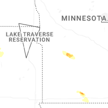
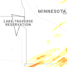


Connect with Interactive Hail Maps