

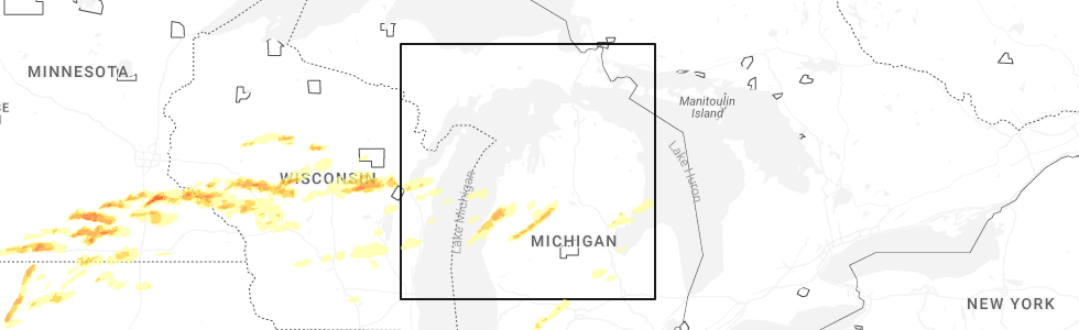
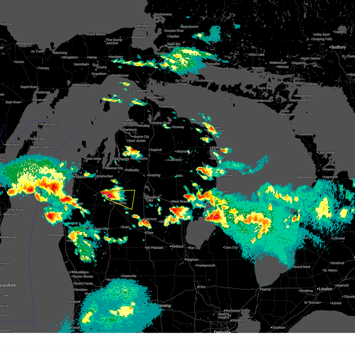
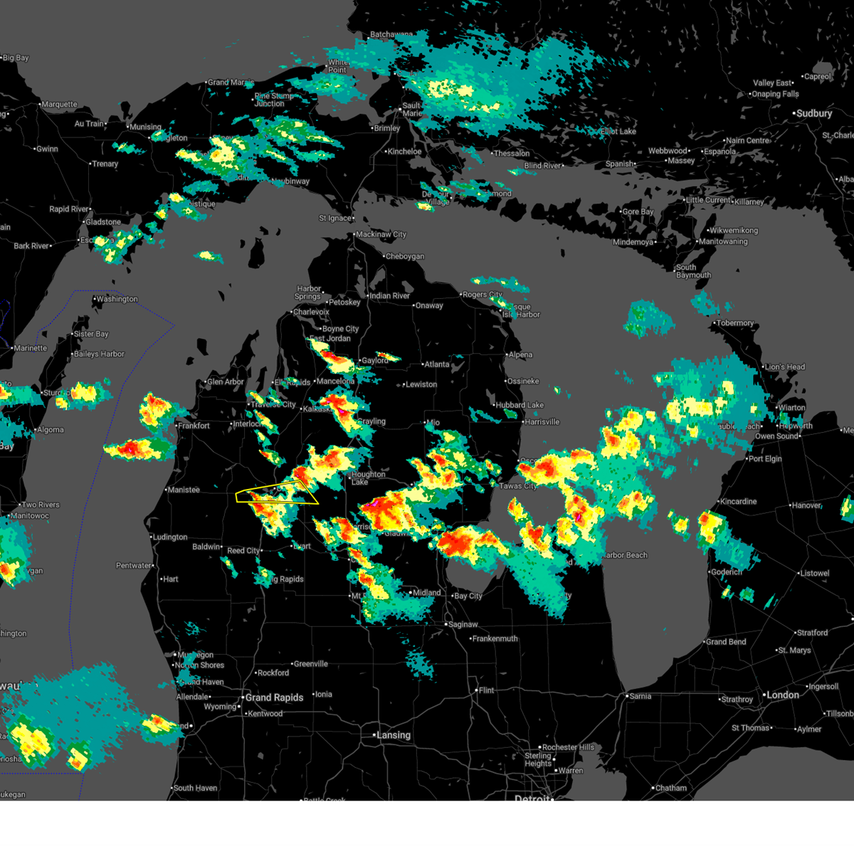
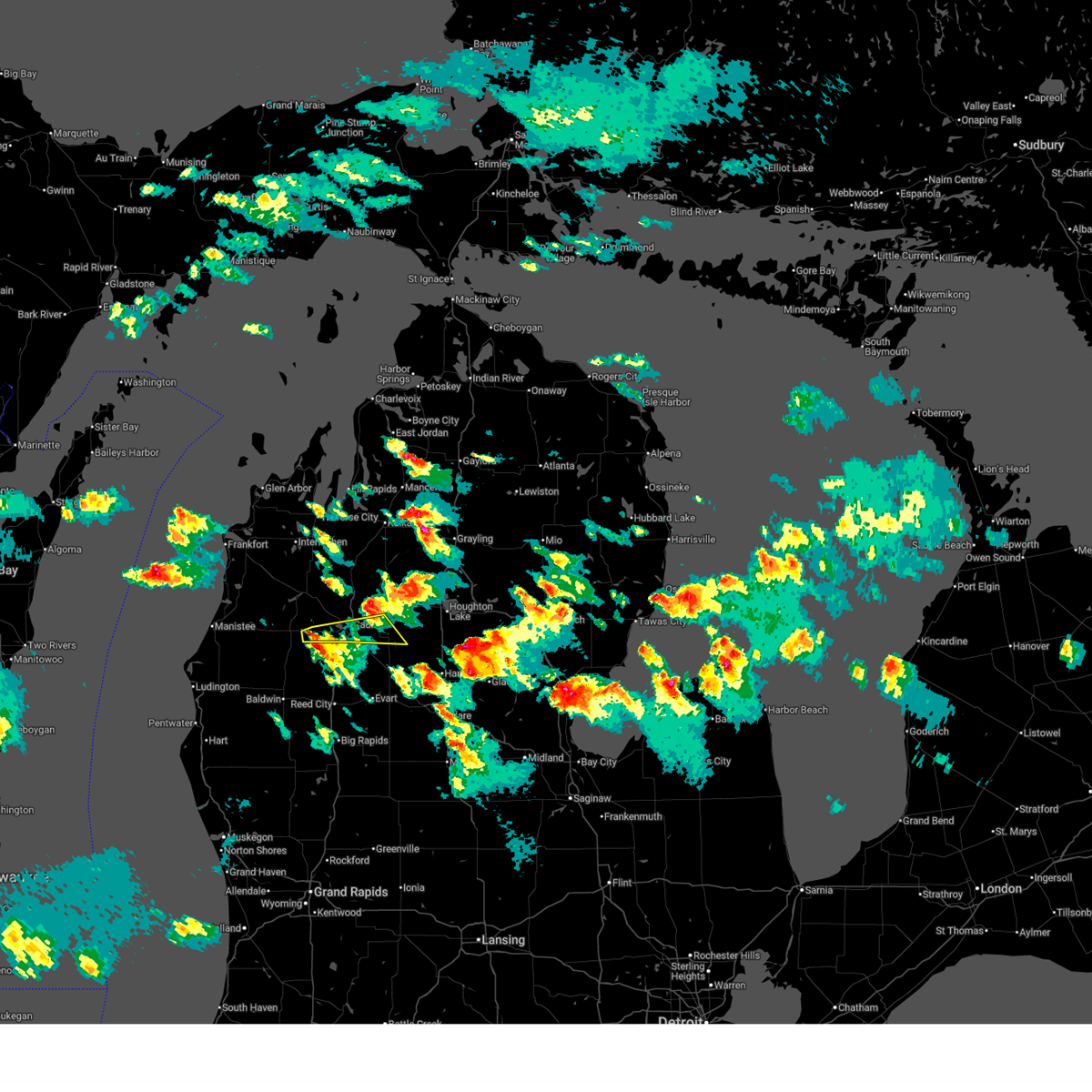
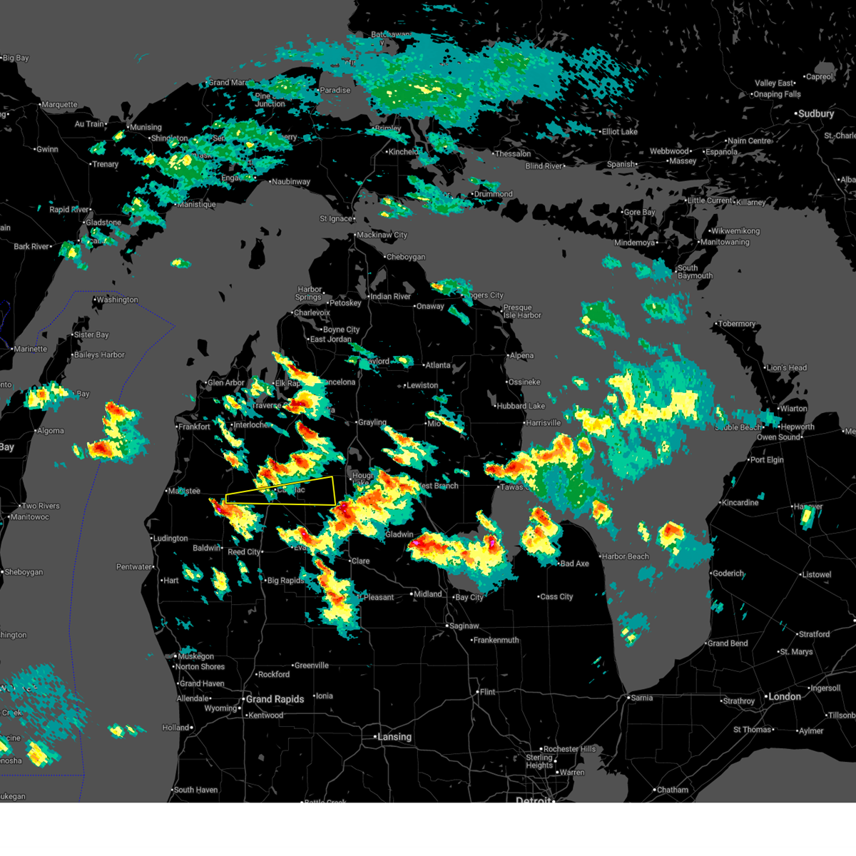
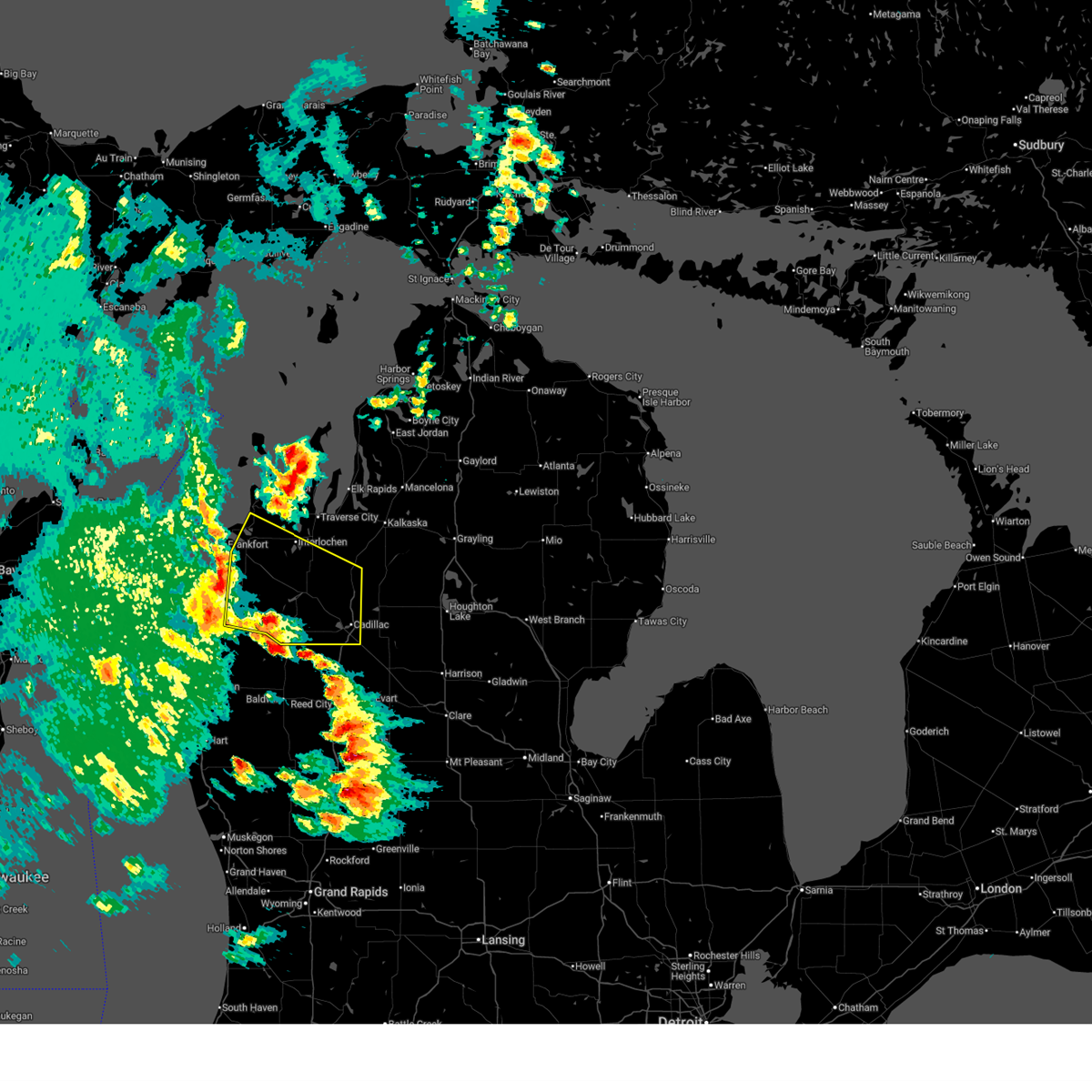
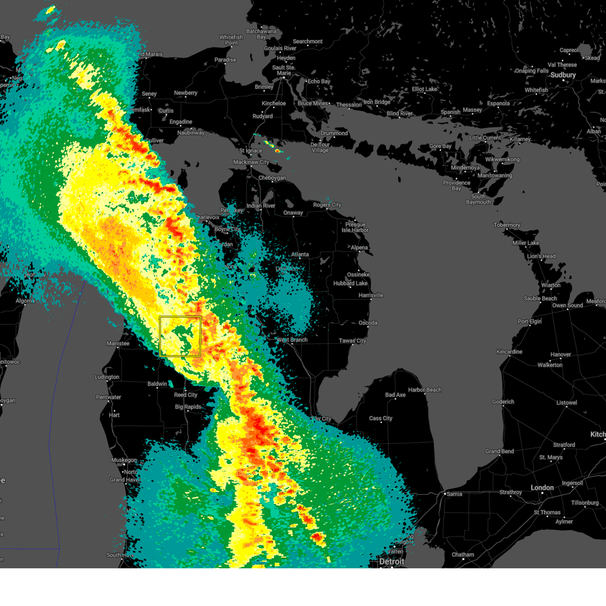
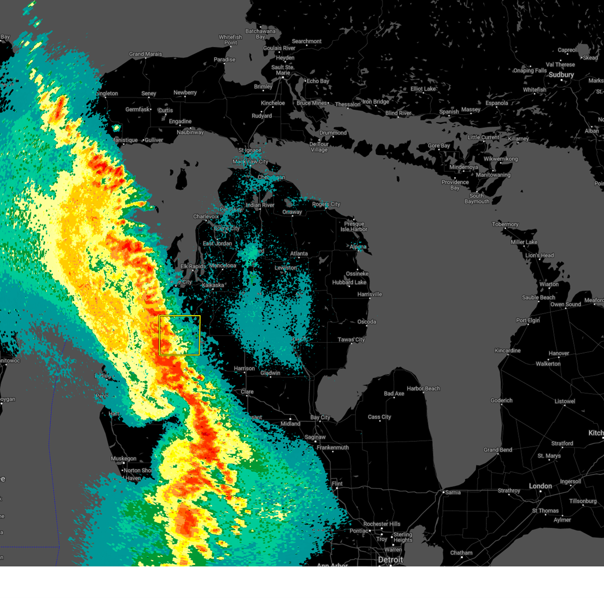
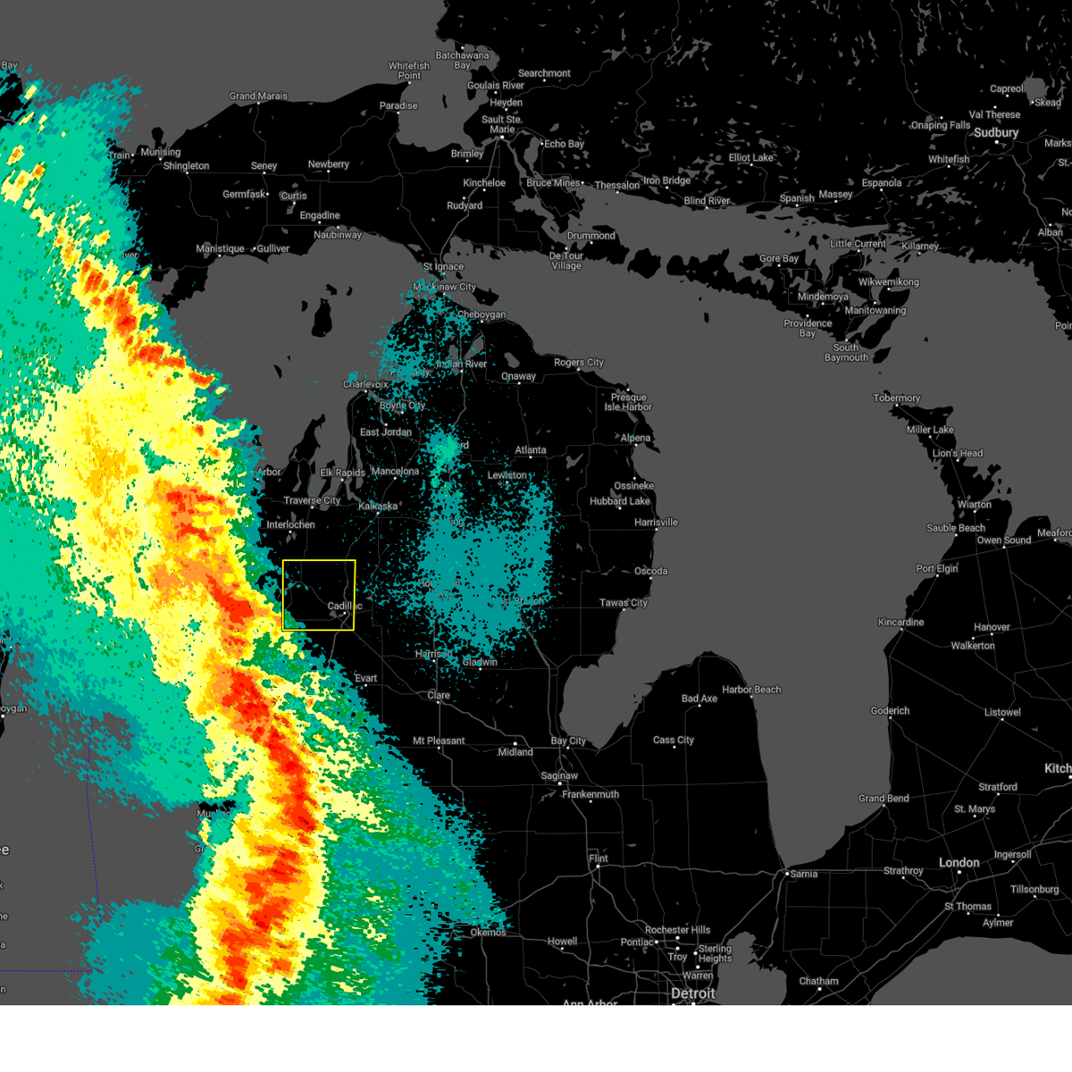
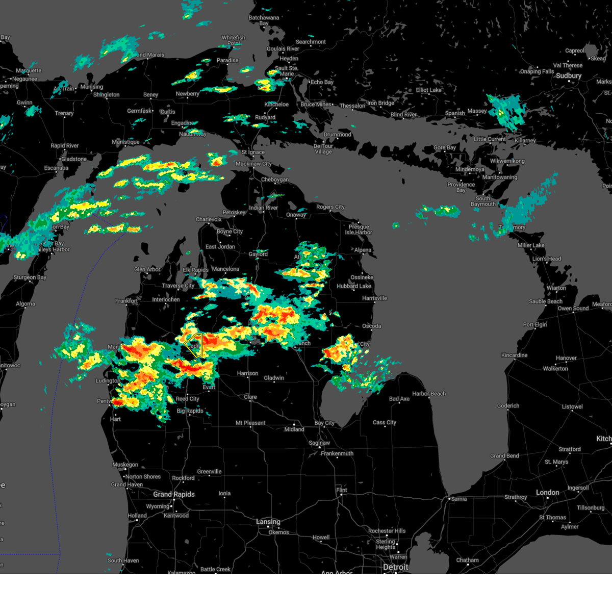
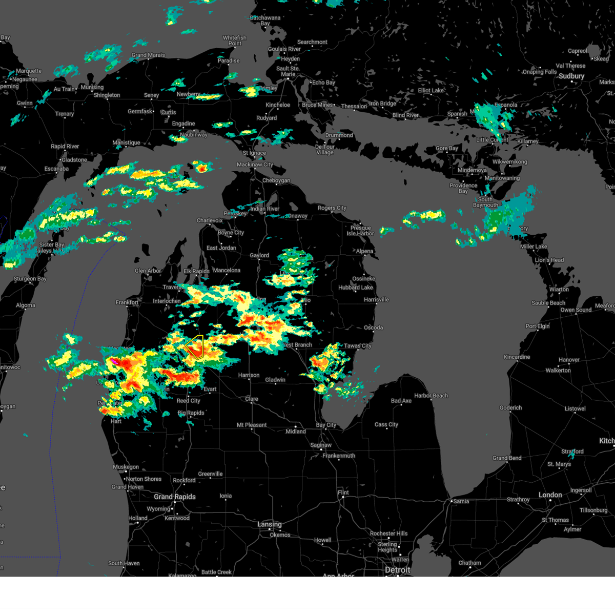
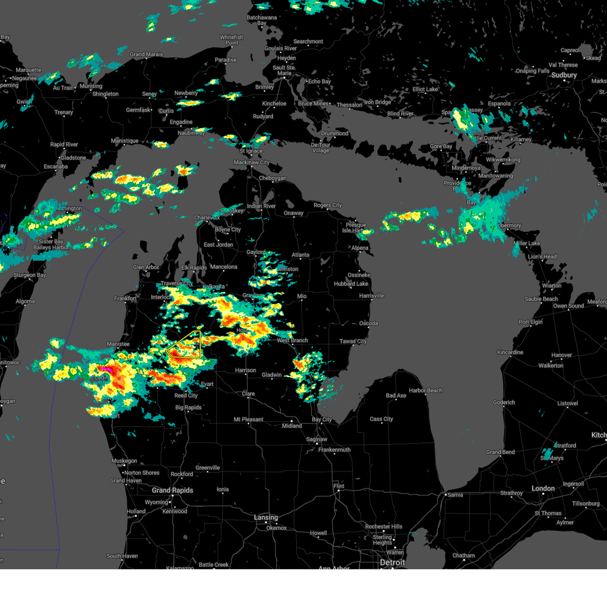
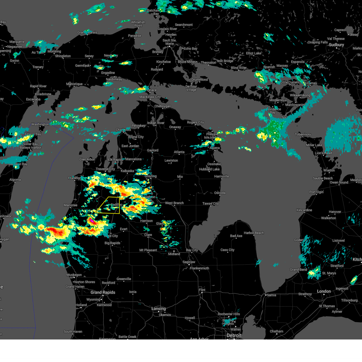
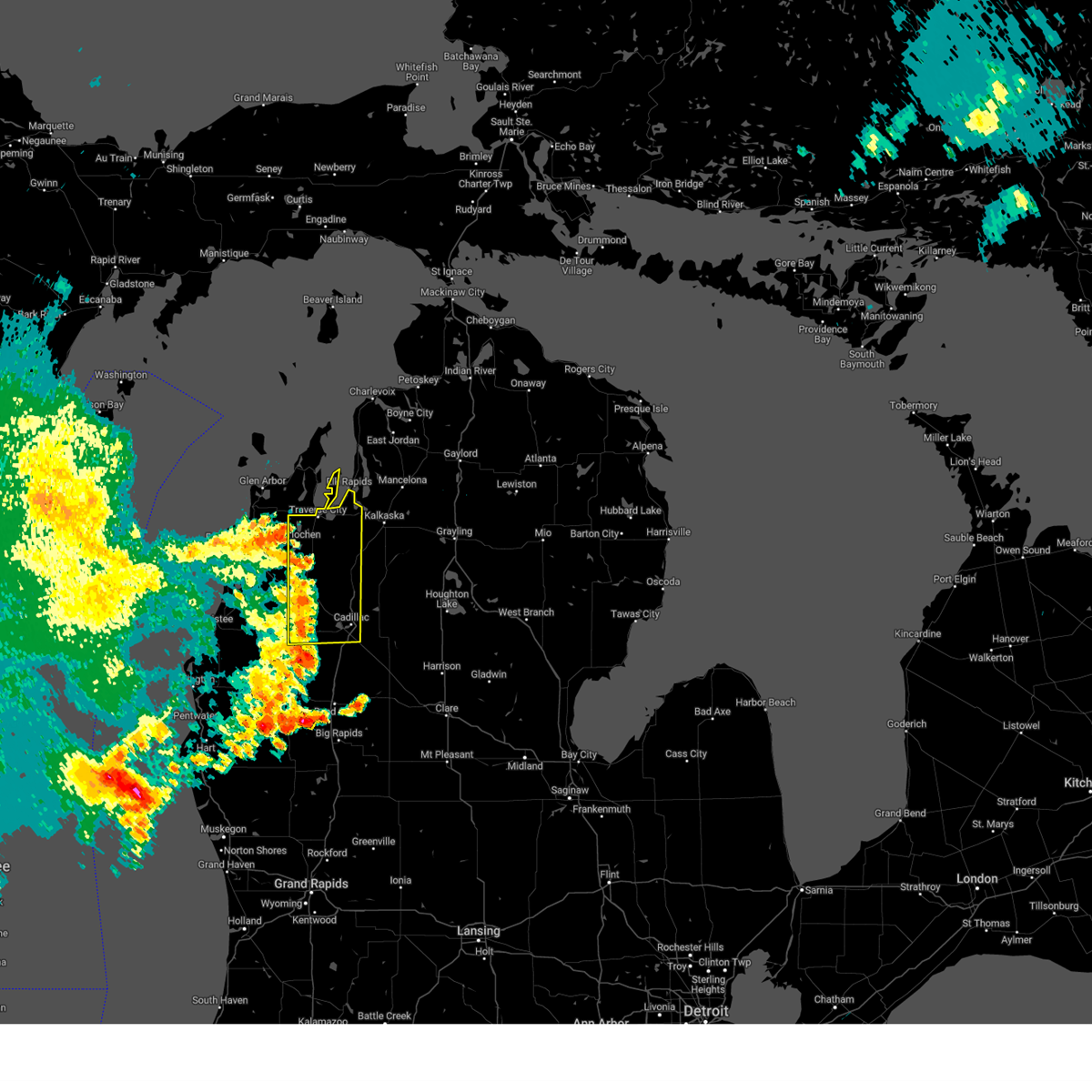
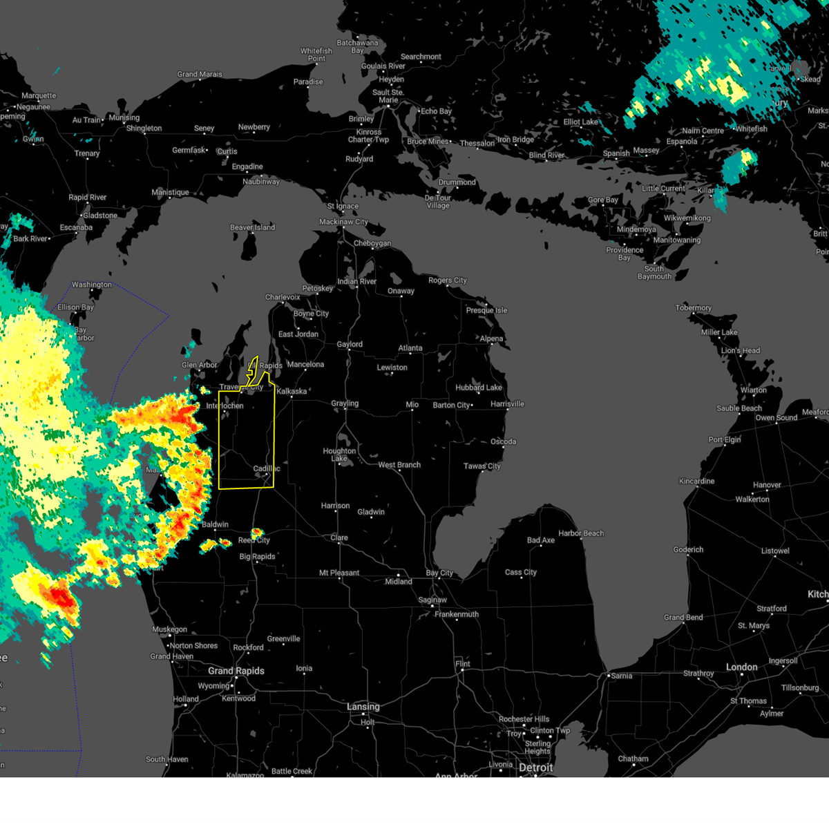
Hail Map for Cadillac, MI
The Cadillac, MI area has had 5 reports of on-the-ground hail by trained spotters, and has been under severe weather warnings 4 times during the past 12 months. Doppler radar has detected hail at or near Cadillac, MI on 29 occasions, including 2 occasions during the past year.
| Name: | Cadillac, MI |
| Where Located: | 36.5 miles SSE of Traverse City, MI |
| Map: | Google Map for Cadillac, MI |
| Population: | 10355 |
| Housing Units: | 4927 |
| More Info: | Search Google for Cadillac, MI |
2
The Top Recent Hail Date for Cadillac, MI is Monday, April 13, 2026 (10th out of 29)
Hail and Wind Damage Spotted near Cadillac, MI
| Date / Time | Report Details |
|---|---|
| 3/31/2026 1:43 AM EDT |
 Svrapx the national weather service in gaylord has issued a * severe thunderstorm warning for, east central wexford county in northern michigan, western missaukee county in northern michigan, * until 215 am edt. * at 142 am edt, a severe thunderstorm was located over meauwataka, or 9 miles northwest of cadillac, moving east at 40 mph. public reported ping pong sized hail, some larger, near mesick (public). Hazards include ping pong ball size hail. People and animals outdoors will be injured. expect damage to roofs, siding, windows, and vehicles. this severe thunderstorm will be near, cadillac and manton around 145 am edt. lake city and jennings around 150 am edt. morey around 155 am edt. Falmouth around 210 am edt. Svrapx the national weather service in gaylord has issued a * severe thunderstorm warning for, east central wexford county in northern michigan, western missaukee county in northern michigan, * until 215 am edt. * at 142 am edt, a severe thunderstorm was located over meauwataka, or 9 miles northwest of cadillac, moving east at 40 mph. public reported ping pong sized hail, some larger, near mesick (public). Hazards include ping pong ball size hail. People and animals outdoors will be injured. expect damage to roofs, siding, windows, and vehicles. this severe thunderstorm will be near, cadillac and manton around 145 am edt. lake city and jennings around 150 am edt. morey around 155 am edt. Falmouth around 210 am edt.
|
| 3/31/2026 12:17 AM EDT |
 the severe thunderstorm warning has been cancelled and is no longer in effect the severe thunderstorm warning has been cancelled and is no longer in effect
|
| 3/31/2026 12:11 AM EDT |
 At 1211 am edt, a severe thunderstorm was located near hoxeyville, or 10 miles southwest of cadillac, moving east at 50 mph (radar indicated). Hazards include quarter size hail. Damage to vehicles is expected. this severe storm will be near, cadillac and mitchell state park around 1215 am edt. lucas around 1220 am edt. Mcbain around 1225 am edt. At 1211 am edt, a severe thunderstorm was located near hoxeyville, or 10 miles southwest of cadillac, moving east at 50 mph (radar indicated). Hazards include quarter size hail. Damage to vehicles is expected. this severe storm will be near, cadillac and mitchell state park around 1215 am edt. lucas around 1220 am edt. Mcbain around 1225 am edt.
|
| 3/31/2026 12:02 AM EDT |
 Svrapx the national weather service in gaylord has issued a * severe thunderstorm warning for, southern wexford county in northern michigan, southern missaukee county in northern michigan, * until 1245 am edt. * at 1201 am edt, a severe thunderstorm was located near hoxeyville, or 16 miles north of baldwin, moving east at 50 mph (radar indicated). Hazards include 60 mph wind gusts and quarter size hail. Hail damage to vehicles is expected. expect wind damage to roofs, siding, and trees. this severe thunderstorm will be near, hoxeyville around 1205 am edt. cadillac and mitchell state park around 1215 am edt. lucas around 1220 am edt. mcbain around 1225 am edt. falmouth and vogel center around 1235 am edt. Other locations impacted by this severe thunderstorm include merritt. Svrapx the national weather service in gaylord has issued a * severe thunderstorm warning for, southern wexford county in northern michigan, southern missaukee county in northern michigan, * until 1245 am edt. * at 1201 am edt, a severe thunderstorm was located near hoxeyville, or 16 miles north of baldwin, moving east at 50 mph (radar indicated). Hazards include 60 mph wind gusts and quarter size hail. Hail damage to vehicles is expected. expect wind damage to roofs, siding, and trees. this severe thunderstorm will be near, hoxeyville around 1205 am edt. cadillac and mitchell state park around 1215 am edt. lucas around 1220 am edt. mcbain around 1225 am edt. falmouth and vogel center around 1235 am edt. Other locations impacted by this severe thunderstorm include merritt.
|
| 5/16/2025 8:20 PM EDT |
 Svrapx the national weather service in gaylord has issued a * severe thunderstorm warning for, benzie county in northern michigan, wexford county in northern michigan, southern grand traverse county in northern michigan, manistee county in northern michigan, * until 915 pm edt. * at 820 pm edt, severe thunderstorms were located along a line extending from near elberta to norwalk to near brethren to 10 miles east of luther, moving north at 40 mph (radar indicated). Hazards include 60 mph wind gusts and quarter size hail. Hail damage to vehicles is expected. expect wind damage to roofs, siding, and trees. severe thunderstorms will be near, beulah, harrietta, kaleva, mitchell state park, yuma, wildwood, honor, boon, bear lake, and cadillac around 825 pm edt. platte township, mesick, sherman, and copemish around 830 pm edt. meauwataka and thompsonville around 835 pm edt. buckley around 840 pm edt. manton, interlochen state park, and karlin around 845 pm edt. hannah, bendon, kingsley, and interlochen around 850 pm edt. Other locations impacted by these severe thunderstorms include wallin, blaine township, and pere marquette state forest. Svrapx the national weather service in gaylord has issued a * severe thunderstorm warning for, benzie county in northern michigan, wexford county in northern michigan, southern grand traverse county in northern michigan, manistee county in northern michigan, * until 915 pm edt. * at 820 pm edt, severe thunderstorms were located along a line extending from near elberta to norwalk to near brethren to 10 miles east of luther, moving north at 40 mph (radar indicated). Hazards include 60 mph wind gusts and quarter size hail. Hail damage to vehicles is expected. expect wind damage to roofs, siding, and trees. severe thunderstorms will be near, beulah, harrietta, kaleva, mitchell state park, yuma, wildwood, honor, boon, bear lake, and cadillac around 825 pm edt. platte township, mesick, sherman, and copemish around 830 pm edt. meauwataka and thompsonville around 835 pm edt. buckley around 840 pm edt. manton, interlochen state park, and karlin around 845 pm edt. hannah, bendon, kingsley, and interlochen around 850 pm edt. Other locations impacted by these severe thunderstorms include wallin, blaine township, and pere marquette state forest.
|
| 5/15/2025 11:37 PM EDT |
 The storms which prompted the warning have weakened below severe limits, and have exited the warned area. therefore, the warning has been allowed to expire. a tornado watch remains in effect until 300 am edt for northern michigan. The storms which prompted the warning have weakened below severe limits, and have exited the warned area. therefore, the warning has been allowed to expire. a tornado watch remains in effect until 300 am edt for northern michigan.
|
| 5/15/2025 10:56 PM EDT |
 At 1055 pm edt, severe thunderstorms were located along a line extending from karlin to near mesick to 8 miles south of mitchell state park, moving northeast at 35 mph (radar indicated). Hazards include 60 mph wind gusts and penny size hail. Expect damage to roofs, siding, and trees. these severe storms will be near, meauwataka, mitchell state park, cadillac, and buckley around 1100 pm edt. Manton around 1110 pm edt. At 1055 pm edt, severe thunderstorms were located along a line extending from karlin to near mesick to 8 miles south of mitchell state park, moving northeast at 35 mph (radar indicated). Hazards include 60 mph wind gusts and penny size hail. Expect damage to roofs, siding, and trees. these severe storms will be near, meauwataka, mitchell state park, cadillac, and buckley around 1100 pm edt. Manton around 1110 pm edt.
|
| 5/15/2025 10:24 PM EDT |
 Svrapx the national weather service in gaylord has issued a * severe thunderstorm warning for, wexford county in northern michigan, * until 1130 pm edt. * at 1023 pm edt, severe thunderstorms were located along a line extending from 9 miles west of empire to brethren to near baldwin, moving northeast at 45 mph (radar indicated). Hazards include 60 mph wind gusts and penny size hail. Expect damage to roofs, siding, and trees. severe thunderstorms will be near, harrietta, hoxeyville, mesick, and yuma around 1035 pm edt. sherman and buckley around 1040 pm edt. boon around 1045 pm edt. meauwataka around 1050 pm edt. mitchell state park and cadillac around 1055 pm edt. Manton around 1100 pm edt. Svrapx the national weather service in gaylord has issued a * severe thunderstorm warning for, wexford county in northern michigan, * until 1130 pm edt. * at 1023 pm edt, severe thunderstorms were located along a line extending from 9 miles west of empire to brethren to near baldwin, moving northeast at 45 mph (radar indicated). Hazards include 60 mph wind gusts and penny size hail. Expect damage to roofs, siding, and trees. severe thunderstorms will be near, harrietta, hoxeyville, mesick, and yuma around 1035 pm edt. sherman and buckley around 1040 pm edt. boon around 1045 pm edt. meauwataka around 1050 pm edt. mitchell state park and cadillac around 1055 pm edt. Manton around 1100 pm edt.
|
| 4/18/2025 10:38 PM EDT |
 the severe thunderstorm warning has been cancelled and is no longer in effect the severe thunderstorm warning has been cancelled and is no longer in effect
|
| 4/18/2025 10:31 PM EDT |
 At 1030 pm edt, a severe thunderstorm was located over cadillac, moving northeast at 55 mph (radar indicated). Hazards include 60 mph wind gusts and quarter size hail. Hail damage to vehicles is expected. expect wind damage to roofs, siding, and trees. This severe thunderstorm will remain over mainly rural areas of southeastern wexford county. At 1030 pm edt, a severe thunderstorm was located over cadillac, moving northeast at 55 mph (radar indicated). Hazards include 60 mph wind gusts and quarter size hail. Hail damage to vehicles is expected. expect wind damage to roofs, siding, and trees. This severe thunderstorm will remain over mainly rural areas of southeastern wexford county.
|
| 4/18/2025 10:20 PM EDT |
 At 1019 pm edt, a severe thunderstorm was located near hoxeyville, or 9 miles southwest of cadillac, moving northeast at 60 mph (radar indicated). Hazards include 60 mph wind gusts and quarter size hail. Hail damage to vehicles is expected. expect wind damage to roofs, siding, and trees. This severe storm will be near, mitchell state park, boon, and cadillac around 1025 pm edt. At 1019 pm edt, a severe thunderstorm was located near hoxeyville, or 9 miles southwest of cadillac, moving northeast at 60 mph (radar indicated). Hazards include 60 mph wind gusts and quarter size hail. Hail damage to vehicles is expected. expect wind damage to roofs, siding, and trees. This severe storm will be near, mitchell state park, boon, and cadillac around 1025 pm edt.
|
| 4/18/2025 10:10 PM EDT |
 Svrapx the national weather service in gaylord has issued a * severe thunderstorm warning for, southern wexford county in northern michigan, * until 1100 pm edt. * at 1010 pm edt, a severe thunderstorm was located near luther, or 13 miles north of baldwin, moving northeast at 55 mph (radar indicated). Hazards include 60 mph wind gusts and quarter size hail. Hail damage to vehicles is expected. expect wind damage to roofs, siding, and trees. this severe thunderstorm will be near, hoxeyville around 1015 pm edt. Mitchell state park, boon, and cadillac around 1020 pm edt. Svrapx the national weather service in gaylord has issued a * severe thunderstorm warning for, southern wexford county in northern michigan, * until 1100 pm edt. * at 1010 pm edt, a severe thunderstorm was located near luther, or 13 miles north of baldwin, moving northeast at 55 mph (radar indicated). Hazards include 60 mph wind gusts and quarter size hail. Hail damage to vehicles is expected. expect wind damage to roofs, siding, and trees. this severe thunderstorm will be near, hoxeyville around 1015 pm edt. Mitchell state park, boon, and cadillac around 1020 pm edt.
|
| 8/27/2024 2:41 PM EDT | Half a tree down on a hous in wexford county MI, 1 miles SW of Cadillac, MI |
| 8/27/2024 2:40 PM EDT | Hwy 115 closed due to large trees over road. widespread tree damage throughout wexford count in wexford county MI, 2.5 miles NNE of Cadillac, MI |
| 8/27/2024 2:39 PM EDT | Hwy 55 closed briefly due to large trees down over roadway in wexford county MI, 5.6 miles ENE of Cadillac, MI |
| 8/27/2024 2:23 PM EDT |
 At 222 pm edt, severe thunderstorms were located along a line extending from near traverse city to near buckley to near hoxeyville, moving east at 50 mph (radar indicated). Hazards include 60 mph wind gusts and penny size hail. Expect damage to roofs, siding, and trees. these severe storms will be near, traverse city, cadillac, kingsley, manton, spider lake, meauwataka, mitchell state park, and traverse city state park around 230 pm edt. fife lake and williamsburg around 235 pm edt. Other locations impacted by these severe thunderstorms include bates. At 222 pm edt, severe thunderstorms were located along a line extending from near traverse city to near buckley to near hoxeyville, moving east at 50 mph (radar indicated). Hazards include 60 mph wind gusts and penny size hail. Expect damage to roofs, siding, and trees. these severe storms will be near, traverse city, cadillac, kingsley, manton, spider lake, meauwataka, mitchell state park, and traverse city state park around 230 pm edt. fife lake and williamsburg around 235 pm edt. Other locations impacted by these severe thunderstorms include bates.
|
| 8/27/2024 2:03 PM EDT |
 Svrapx the national weather service in gaylord has issued a * severe thunderstorm warning for, wexford county in northern michigan, grand traverse county in northern michigan, * until 300 pm edt. * at 203 pm edt, severe thunderstorms were located along a line extending from platte township to near copemish to 6 miles southwest of dublin, moving east at 45 mph (radar indicated). Hazards include 60 mph wind gusts and penny size hail. Expect damage to roofs, siding, and trees. severe thunderstorms will be near, karlin around 210 pm edt. sherman, buckley, mesick, harrietta, hoxeyville, yuma, interlochen state park, and interlochen around 215 pm edt. traverse city, grawn, and hannah around 220 pm edt. kingsley, boon, meauwataka, and traverse city state park around 225 pm edt. spider lake around 230 pm edt. cadillac, manton, mitchell state park, and williamsburg around 235 pm edt. fife lake around 240 pm edt. Other locations impacted by these severe thunderstorms include bates. Svrapx the national weather service in gaylord has issued a * severe thunderstorm warning for, wexford county in northern michigan, grand traverse county in northern michigan, * until 300 pm edt. * at 203 pm edt, severe thunderstorms were located along a line extending from platte township to near copemish to 6 miles southwest of dublin, moving east at 45 mph (radar indicated). Hazards include 60 mph wind gusts and penny size hail. Expect damage to roofs, siding, and trees. severe thunderstorms will be near, karlin around 210 pm edt. sherman, buckley, mesick, harrietta, hoxeyville, yuma, interlochen state park, and interlochen around 215 pm edt. traverse city, grawn, and hannah around 220 pm edt. kingsley, boon, meauwataka, and traverse city state park around 225 pm edt. spider lake around 230 pm edt. cadillac, manton, mitchell state park, and williamsburg around 235 pm edt. fife lake around 240 pm edt. Other locations impacted by these severe thunderstorms include bates.
|
| 7/5/2024 4:40 PM EDT | Trees down over roadwa in wexford county MI, 3.8 miles W of Cadillac, MI |
| 7/5/2024 4:04 PM EDT | Multiple trees dow in wexford county MI, 0.2 miles ENE of Cadillac, MI |
| 7/22/2023 4:09 PM EDT |
 The severe thunderstorm warning for southeastern wexford county will expire at 415 pm edt, the storm which prompted the warning has weakened below severe limits, and no longer poses an immediate threat to life or property. therefore, the warning will be allowed to expire. however, small hail up to half an inch in diameter is still possible with this thunderstorm. The severe thunderstorm warning for southeastern wexford county will expire at 415 pm edt, the storm which prompted the warning has weakened below severe limits, and no longer poses an immediate threat to life or property. therefore, the warning will be allowed to expire. however, small hail up to half an inch in diameter is still possible with this thunderstorm.
|
| 7/22/2023 3:59 PM EDT |
 At 358 pm edt, a severe thunderstorm was located near mitchell state park, or near cadillac, moving east at 10 mph. at 3:51 pm, hail to the size of quaters was reported about 3 miles northeast of boon (public). Hazards include quarter size hail. Damage to vehicles is expected. locations impacted include, cadillac and mitchell state park. hail threat, observed max hail size, 1. 00 in wind threat, radar indicated max wind gust, <50 mph. At 358 pm edt, a severe thunderstorm was located near mitchell state park, or near cadillac, moving east at 10 mph. at 3:51 pm, hail to the size of quaters was reported about 3 miles northeast of boon (public). Hazards include quarter size hail. Damage to vehicles is expected. locations impacted include, cadillac and mitchell state park. hail threat, observed max hail size, 1. 00 in wind threat, radar indicated max wind gust, <50 mph.
|
| 7/22/2023 3:51 PM EDT | Quarter sized hail reported 7.8 miles ESE of Cadillac, MI, hail about the size of quarters falling on m-115 northwest of cadillac. |
| 7/22/2023 3:46 PM EDT |
 At 345 pm edt, a severe thunderstorm was located near boon, or near cadillac, moving southeast at 10 mph (radar indicated). Hazards include half dollar size hail. damage to vehicles is expected At 345 pm edt, a severe thunderstorm was located near boon, or near cadillac, moving southeast at 10 mph (radar indicated). Hazards include half dollar size hail. damage to vehicles is expected
|
| 8/3/2022 10:53 AM EDT |
 At 1052 am edt, a severe thunderstorm was located over lake city, moving east at 60 mph (radar indicated. at 1043 am, wexford county airport gusted to 55 mph). Hazards include 60 mph wind gusts and quarter size hail. Hail damage to vehicles is expected. expect wind damage to roofs, siding, and trees. this severe thunderstorm will remain over mainly rural areas of southeastern wexford and missaukee counties, including the following locations, merritt. hail threat, radar indicated max hail size, 1. 00 in wind threat, radar indicated max wind gust, 60 mph. At 1052 am edt, a severe thunderstorm was located over lake city, moving east at 60 mph (radar indicated. at 1043 am, wexford county airport gusted to 55 mph). Hazards include 60 mph wind gusts and quarter size hail. Hail damage to vehicles is expected. expect wind damage to roofs, siding, and trees. this severe thunderstorm will remain over mainly rural areas of southeastern wexford and missaukee counties, including the following locations, merritt. hail threat, radar indicated max hail size, 1. 00 in wind threat, radar indicated max wind gust, 60 mph.
|
| 8/3/2022 10:50 AM EDT | Quarter sized hail reported 4.3 miles W of Cadillac, MI, dime and quarter size hail east of cadillac in missaukee county. time estimated via radar. |
| 8/3/2022 10:45 AM EDT | Central dispatch reports trees and powerlines down across wexford county. time estimated by rada in wexford county MI, 0.8 miles W of Cadillac, MI |
| 8/3/2022 10:45 AM EDT |
 At 1045 am edt, a severe thunderstorm was located near cadillac, moving east at 55 mph (radar indicated). Hazards include 60 mph wind gusts and quarter size hail. Hail damage to vehicles is expected. expect wind damage to roofs, siding, and trees. this severe storm will be near, lake city and mcbain around 1050 am edt. other locations in the path of this severe thunderstorm include falmouth, vogel center and moddersville. hail threat, radar indicated max hail size, 1. 00 in wind threat, radar indicated max wind gust, 60 mph. At 1045 am edt, a severe thunderstorm was located near cadillac, moving east at 55 mph (radar indicated). Hazards include 60 mph wind gusts and quarter size hail. Hail damage to vehicles is expected. expect wind damage to roofs, siding, and trees. this severe storm will be near, lake city and mcbain around 1050 am edt. other locations in the path of this severe thunderstorm include falmouth, vogel center and moddersville. hail threat, radar indicated max hail size, 1. 00 in wind threat, radar indicated max wind gust, 60 mph.
|
| 8/3/2022 10:31 AM EDT |
 At 1031 am edt, a severe thunderstorm was located over boon, or 8 miles west of cadillac, moving east at 55 mph (radar indicated). Hazards include 60 mph wind gusts and penny size hail. Expect damage to roofs, siding, and trees. this severe thunderstorm will be near, meauwataka around 1035 am edt. cadillac and mitchell state park around 1040 am edt. mcbain, lucas and jennings around 1050 am edt. other locations in the path of this severe thunderstorm include lake city, falmouth, vogel center and moddersville. hail threat, radar indicated max hail size, 0. 75 in wind threat, radar indicated max wind gust, 60 mph. At 1031 am edt, a severe thunderstorm was located over boon, or 8 miles west of cadillac, moving east at 55 mph (radar indicated). Hazards include 60 mph wind gusts and penny size hail. Expect damage to roofs, siding, and trees. this severe thunderstorm will be near, meauwataka around 1035 am edt. cadillac and mitchell state park around 1040 am edt. mcbain, lucas and jennings around 1050 am edt. other locations in the path of this severe thunderstorm include lake city, falmouth, vogel center and moddersville. hail threat, radar indicated max hail size, 0. 75 in wind threat, radar indicated max wind gust, 60 mph.
|
| 9/7/2021 1:39 PM EDT |
 At 139 pm edt, a severe thunderstorm was located over cadillac, moving east at 50 mph (radar indicated). Hazards include 60 mph wind gusts and quarter size hail. Hail damage to vehicles is expected. expect wind damage to roofs, siding, and trees. this severe thunderstorm will remain over mainly rural areas of southeastern wexford county. hail threat, radar indicated max hail size, 1. 00 in wind threat, radar indicated max wind gust, 60 mph. At 139 pm edt, a severe thunderstorm was located over cadillac, moving east at 50 mph (radar indicated). Hazards include 60 mph wind gusts and quarter size hail. Hail damage to vehicles is expected. expect wind damage to roofs, siding, and trees. this severe thunderstorm will remain over mainly rural areas of southeastern wexford county. hail threat, radar indicated max hail size, 1. 00 in wind threat, radar indicated max wind gust, 60 mph.
|
| 9/7/2021 1:29 PM EDT |
 At 128 pm edt, a severe thunderstorm was located near boon, or 10 miles west of cadillac, moving northeast at 55 mph (radar indicated). Hazards include 60 mph wind gusts and quarter size hail. Hail damage to vehicles is expected. expect wind damage to roofs, siding, and trees. this severe thunderstorm will be near, cadillac and mitchell state park around 140 pm edt. hail threat, radar indicated max hail size, 1. 00 in wind threat, radar indicated max wind gust, 60 mph. At 128 pm edt, a severe thunderstorm was located near boon, or 10 miles west of cadillac, moving northeast at 55 mph (radar indicated). Hazards include 60 mph wind gusts and quarter size hail. Hail damage to vehicles is expected. expect wind damage to roofs, siding, and trees. this severe thunderstorm will be near, cadillac and mitchell state park around 140 pm edt. hail threat, radar indicated max hail size, 1. 00 in wind threat, radar indicated max wind gust, 60 mph.
|
| 9/7/2021 12:33 PM EDT | Quarter sized hail reported 0.8 miles W of Cadillac, MI |
| 9/7/2021 12:28 PM EDT |
 At 1228 pm edt, a severe thunderstorm was located near jennings, or near cadillac, moving east at 50 mph (trained weather spotters). Hazards include ping pong ball size hail and 60 mph wind gusts. People and animals outdoors will be injured. expect hail damage to roofs, siding, windows, and vehicles. expect wind damage to roofs, siding, and trees. this severe thunderstorm will be near, lake city and morey around 1235 pm edt. other locations in the path of this severe thunderstorm include moorestown, houghton lake, higgins lake and north higgins lake. hail threat, radar indicated max hail size, 1. 50 in wind threat, radar indicated max wind gust, 60 mph. At 1228 pm edt, a severe thunderstorm was located near jennings, or near cadillac, moving east at 50 mph (trained weather spotters). Hazards include ping pong ball size hail and 60 mph wind gusts. People and animals outdoors will be injured. expect hail damage to roofs, siding, windows, and vehicles. expect wind damage to roofs, siding, and trees. this severe thunderstorm will be near, lake city and morey around 1235 pm edt. other locations in the path of this severe thunderstorm include moorestown, houghton lake, higgins lake and north higgins lake. hail threat, radar indicated max hail size, 1. 50 in wind threat, radar indicated max wind gust, 60 mph.
|
| 9/7/2021 12:25 PM EDT | Hen Egg sized hail reported 0.8 miles W of Cadillac, MI |
| 9/7/2021 12:18 PM EDT |
 At 1216 pm edt, a strong thunderstorm was located near boon, or near cadillac, moving east at 50 mph (trained weather spotter). Hazards include ping pong ball size hail and 60 mph wind gusts. People and animals outdoors will be injured. expect hail damage to roofs, siding, windows, and vehicles. expect wind damage to roofs, siding, and trees. locations impacted include, mitchell state park, cadillac, lucas, jennings, lake city, mcbain, falmouth and vogel center. hail threat, radar indicated max hail size, 1. 50 in wind threat, radar indicated max wind gust, 60 mph. At 1216 pm edt, a strong thunderstorm was located near boon, or near cadillac, moving east at 50 mph (trained weather spotter). Hazards include ping pong ball size hail and 60 mph wind gusts. People and animals outdoors will be injured. expect hail damage to roofs, siding, windows, and vehicles. expect wind damage to roofs, siding, and trees. locations impacted include, mitchell state park, cadillac, lucas, jennings, lake city, mcbain, falmouth and vogel center. hail threat, radar indicated max hail size, 1. 50 in wind threat, radar indicated max wind gust, 60 mph.
|
| 9/7/2021 11:56 AM EDT |
 At 1156 am edt, severe thunderstorms were located along a line extending from near yuma to near dublin, moving east at 65 mph (trained spotter. at 1155 am edt, ping pong ball size hail was reported in wellston). Hazards include two inch hail and 60 mph wind gusts. People and animals outdoors will be injured. expect hail damage to roofs, siding, windows, and vehicles. expect wind damage to roofs, siding, and trees. severe thunderstorms will be near, mesick and yuma around 1200 pm edt. sherman, harrietta and hoxeyville around 1205 pm edt. boon and meauwataka around 1210 pm edt. cadillac, manton and mitchell state park around 1215 pm edt. other locations in the path of these severe thunderstorms include lake city, mcbain, jennings, morey, lucas, falmouth and vogel center. thunderstorm damage threat, considerable hail threat, radar indicated max hail size, 2. 00 in wind threat, radar indicated max wind gust, 60 mph. At 1156 am edt, severe thunderstorms were located along a line extending from near yuma to near dublin, moving east at 65 mph (trained spotter. at 1155 am edt, ping pong ball size hail was reported in wellston). Hazards include two inch hail and 60 mph wind gusts. People and animals outdoors will be injured. expect hail damage to roofs, siding, windows, and vehicles. expect wind damage to roofs, siding, and trees. severe thunderstorms will be near, mesick and yuma around 1200 pm edt. sherman, harrietta and hoxeyville around 1205 pm edt. boon and meauwataka around 1210 pm edt. cadillac, manton and mitchell state park around 1215 pm edt. other locations in the path of these severe thunderstorms include lake city, mcbain, jennings, morey, lucas, falmouth and vogel center. thunderstorm damage threat, considerable hail threat, radar indicated max hail size, 2. 00 in wind threat, radar indicated max wind gust, 60 mph.
|
| 9/7/2021 10:26 AM EDT |
 At 1026 am edt, a severe thunderstorm was located near cadillac, moving east at 55 mph (radar indicated). Hazards include 60 mph wind gusts and quarter size hail. Hail damage to vehicles is expected. expect wind damage to roofs, siding, and trees. this severe thunderstorm will be near, jennings around 1030 am edt. lake city and morey around 1035 am edt. falmouth around 1040 am edt. other locations in the path of this severe thunderstorm include moorestown. hail threat, radar indicated max hail size, 1. 00 in wind threat, radar indicated max wind gust, 60 mph. At 1026 am edt, a severe thunderstorm was located near cadillac, moving east at 55 mph (radar indicated). Hazards include 60 mph wind gusts and quarter size hail. Hail damage to vehicles is expected. expect wind damage to roofs, siding, and trees. this severe thunderstorm will be near, jennings around 1030 am edt. lake city and morey around 1035 am edt. falmouth around 1040 am edt. other locations in the path of this severe thunderstorm include moorestown. hail threat, radar indicated max hail size, 1. 00 in wind threat, radar indicated max wind gust, 60 mph.
|
| 9/7/2021 10:11 AM EDT |
 The severe thunderstorm warning for wexford, southeastern grand traverse, southern kalkaska and northwestern missaukee counties will expire at 1015 am edt, the storms which prompted the warning have weakened below severe limits, and no longer pose an immediate threat to life or property. therefore, the warning will be allowed to expire. however gusty winds are still possible with these thunderstorms. The severe thunderstorm warning for wexford, southeastern grand traverse, southern kalkaska and northwestern missaukee counties will expire at 1015 am edt, the storms which prompted the warning have weakened below severe limits, and no longer pose an immediate threat to life or property. therefore, the warning will be allowed to expire. however gusty winds are still possible with these thunderstorms.
|
| 9/7/2021 10:02 AM EDT |
 At 1001 am edt, severe thunderstorms were located along a line extending from near kalkaska to near sigma to near sharon to near meauwataka, moving east at 50 mph (radar indicated). Hazards include 60 mph wind gusts and penny size hail. Expect damage to roofs, siding, and trees. locations impacted include, cadillac, lake city, sharon, kingsley, manton, boon, fife lake, harrietta, meauwataka, jennings, south boardman, mitchell state park, morey, yuma and smithville. hail threat, radar indicated max hail size, 0. 75 in wind threat, radar indicated max wind gust, 60 mph. At 1001 am edt, severe thunderstorms were located along a line extending from near kalkaska to near sigma to near sharon to near meauwataka, moving east at 50 mph (radar indicated). Hazards include 60 mph wind gusts and penny size hail. Expect damage to roofs, siding, and trees. locations impacted include, cadillac, lake city, sharon, kingsley, manton, boon, fife lake, harrietta, meauwataka, jennings, south boardman, mitchell state park, morey, yuma and smithville. hail threat, radar indicated max hail size, 0. 75 in wind threat, radar indicated max wind gust, 60 mph.
|
| 9/7/2021 9:43 AM EDT |
 At 943 am edt, severe thunderstorms were located along a line extending from near spider lake to near fife lake to near kingsley to near yuma, moving east at 65 mph (radar indicated). Hazards include 60 mph wind gusts and quarter size hail. Hail damage to vehicles is expected. expect wind damage to roofs, siding, and trees. locations impacted include, fife lake, south boardman, cadillac, sharon, manton, jennings, lake city and morey. hail threat, radar indicated max hail size, 1. 00 in wind threat, radar indicated max wind gust, 60 mph. At 943 am edt, severe thunderstorms were located along a line extending from near spider lake to near fife lake to near kingsley to near yuma, moving east at 65 mph (radar indicated). Hazards include 60 mph wind gusts and quarter size hail. Hail damage to vehicles is expected. expect wind damage to roofs, siding, and trees. locations impacted include, fife lake, south boardman, cadillac, sharon, manton, jennings, lake city and morey. hail threat, radar indicated max hail size, 1. 00 in wind threat, radar indicated max wind gust, 60 mph.
|
| 9/7/2021 9:29 AM EDT |
 At 928 am edt, severe thunderstorms were located along a line extending from interlochen state park to near norwalk, moving east at 45 mph (radar indicated. at 913 em edt, penny size hail was reported 1 mile east of beulah). Hazards include 60 mph wind gusts and quarter size hail. Hail damage to vehicles is expected. expect wind damage to roofs, siding, and trees. severe thunderstorms will be near, grawn, interlochen, interlochen state park and karlin around 935 am edt. traverse city, buckley and hannah around 940 am edt. kingsley around 945 am edt. other locations in the path of these severe thunderstorms include yuma, spider lake, sherman, mesick, harrietta, boon, fife lake, south boardman, meauwataka, cadillac, sharon, mitchell state park and jennings. hail threat, radar indicated max hail size, 1. 00 in wind threat, radar indicated max wind gust, 60 mph. At 928 am edt, severe thunderstorms were located along a line extending from interlochen state park to near norwalk, moving east at 45 mph (radar indicated. at 913 em edt, penny size hail was reported 1 mile east of beulah). Hazards include 60 mph wind gusts and quarter size hail. Hail damage to vehicles is expected. expect wind damage to roofs, siding, and trees. severe thunderstorms will be near, grawn, interlochen, interlochen state park and karlin around 935 am edt. traverse city, buckley and hannah around 940 am edt. kingsley around 945 am edt. other locations in the path of these severe thunderstorms include yuma, spider lake, sherman, mesick, harrietta, boon, fife lake, south boardman, meauwataka, cadillac, sharon, mitchell state park and jennings. hail threat, radar indicated max hail size, 1. 00 in wind threat, radar indicated max wind gust, 60 mph.
|
| 8/29/2021 2:17 PM EDT | Delayed report. trees down in cadillac area. time estimated from rada in wexford county MI, 0.2 miles ENE of Cadillac, MI |
| 8/28/2021 4:53 AM EDT |
 At 452 am edt, severe thunderstorms were located along a line extending from near spider lake to near meauwataka to near mitchell state park, moving east at 50 mph (radar indicated). Hazards include 60 mph wind gusts. Expect damage to roofs, siding, and trees. locations impacted include, cadillac, lake city, kingsley, manton, buckley, boon, mcbain, fife lake, meauwataka, hannah, lucas, jennings, hoxeyville, south boardman, mitchell state park and morey. hail threat, radar indicated max hail size, <. 75 in wind threat, radar indicated max wind gust, 60 mph. At 452 am edt, severe thunderstorms were located along a line extending from near spider lake to near meauwataka to near mitchell state park, moving east at 50 mph (radar indicated). Hazards include 60 mph wind gusts. Expect damage to roofs, siding, and trees. locations impacted include, cadillac, lake city, kingsley, manton, buckley, boon, mcbain, fife lake, meauwataka, hannah, lucas, jennings, hoxeyville, south boardman, mitchell state park and morey. hail threat, radar indicated max hail size, <. 75 in wind threat, radar indicated max wind gust, 60 mph.
|
| 8/28/2021 4:42 AM EDT |
 At 441 am edt, severe thunderstorms were located along a line extending from grawn to near sherman to hoxeyville, moving east at 50 mph (radar indicated). Hazards include 60 mph wind gusts. Expect damage to roofs, siding, and trees. locations impacted include, hannah, kingsley, boon, meauwataka, manton, cadillac, mitchell state park, fife lake, jennings, lake city, mcbain, lucas, south boardman and morey. hail threat, radar indicated max hail size, <. 75 in wind threat, radar indicated max wind gust, 60 mph. At 441 am edt, severe thunderstorms were located along a line extending from grawn to near sherman to hoxeyville, moving east at 50 mph (radar indicated). Hazards include 60 mph wind gusts. Expect damage to roofs, siding, and trees. locations impacted include, hannah, kingsley, boon, meauwataka, manton, cadillac, mitchell state park, fife lake, jennings, lake city, mcbain, lucas, south boardman and morey. hail threat, radar indicated max hail size, <. 75 in wind threat, radar indicated max wind gust, 60 mph.
|
| 8/28/2021 4:15 AM EDT |
 At 414 am edt, severe thunderstorms were located along a line extending from beulah to kaleva to near free soil, moving east at 50 mph (radar indicated. at blacker airport in manistee a wind gust of 45 mph was observed). Hazards include 60 mph wind gusts. Expect damage to roofs, siding, and trees. severe thunderstorms will be near, thompsonville, copemish, dublin and wellston around 425 am edt. bendon around 430 am edt. other locations in the path of these severe thunderstorms include sherman, mesick, harrietta, interlochen state park, yuma, karlin, hoxeyville, boon, meauwataka, hannah, kingsley, manton, mitchell state park, cadillac, fife lake and jennings. hail threat, radar indicated max hail size, <. 75 in wind threat, radar indicated max wind gust, 60 mph. At 414 am edt, severe thunderstorms were located along a line extending from beulah to kaleva to near free soil, moving east at 50 mph (radar indicated. at blacker airport in manistee a wind gust of 45 mph was observed). Hazards include 60 mph wind gusts. Expect damage to roofs, siding, and trees. severe thunderstorms will be near, thompsonville, copemish, dublin and wellston around 425 am edt. bendon around 430 am edt. other locations in the path of these severe thunderstorms include sherman, mesick, harrietta, interlochen state park, yuma, karlin, hoxeyville, boon, meauwataka, hannah, kingsley, manton, mitchell state park, cadillac, fife lake and jennings. hail threat, radar indicated max hail size, <. 75 in wind threat, radar indicated max wind gust, 60 mph.
|
| 8/28/2021 1:31 AM EDT |
 At 130 am edt, severe thunderstorms were located along a line extending from spider lake to near hoxeyville, moving east at 30 mph (radar indicated). Hazards include 60 mph wind gusts. Expect damage to roofs, siding, and trees. locations impacted include, fife lake, boon, mitchell state park and cadillac. hail threat, radar indicated max hail size, <. 75 in wind threat, radar indicated max wind gust, 60 mph. At 130 am edt, severe thunderstorms were located along a line extending from spider lake to near hoxeyville, moving east at 30 mph (radar indicated). Hazards include 60 mph wind gusts. Expect damage to roofs, siding, and trees. locations impacted include, fife lake, boon, mitchell state park and cadillac. hail threat, radar indicated max hail size, <. 75 in wind threat, radar indicated max wind gust, 60 mph.
|
| 8/28/2021 12:49 AM EDT |
 At 1248 am edt, severe thunderstorms were located along a line extending from bendon to near free soil, moving east at 30 mph (radar indicated). Hazards include 60 mph wind gusts and quarter size hail. Hail damage to vehicles is expected. expect wind damage to roofs, siding, and trees. severe thunderstorms will be near, interlochen, interlochen state park, bendon and karlin around 1255 am edt. grawn around 105 am edt. other locations in the path of these severe thunderstorms include hannah, traverse city, kingsley, spider lake, hoxeyville and fife lake. hail threat, radar indicated max hail size, 1. 00 in wind threat, radar indicated max wind gust, 60 mph. At 1248 am edt, severe thunderstorms were located along a line extending from bendon to near free soil, moving east at 30 mph (radar indicated). Hazards include 60 mph wind gusts and quarter size hail. Hail damage to vehicles is expected. expect wind damage to roofs, siding, and trees. severe thunderstorms will be near, interlochen, interlochen state park, bendon and karlin around 1255 am edt. grawn around 105 am edt. other locations in the path of these severe thunderstorms include hannah, traverse city, kingsley, spider lake, hoxeyville and fife lake. hail threat, radar indicated max hail size, 1. 00 in wind threat, radar indicated max wind gust, 60 mph.
|
| 11/10/2020 7:22 PM EST |
 At 721 pm est, severe thunderstorms were located along a line extending from 12 miles northwest of ludington sp to near ludington, moving northeast at 60 mph (radar indicated). Hazards include 60 mph wind gusts. expect damage to roofs, siding, and trees At 721 pm est, severe thunderstorms were located along a line extending from 12 miles northwest of ludington sp to near ludington, moving northeast at 60 mph (radar indicated). Hazards include 60 mph wind gusts. expect damage to roofs, siding, and trees
|
| 5/26/2020 8:20 PM EDT |
 At 819 pm edt, a severe thunderstorm was located near yuma, or 13 miles south of thompsonville, moving north at 25 mph (radar indicated). Hazards include 60 mph wind gusts and quarter size hail. Hail damage to vehicles is expected. expect wind damage to roofs, siding, and trees. Locations impacted include, cadillac, thompsonville, sherman, buckley, boon, mesick, copemish, harrietta, meauwataka, yuma and mitchell state park. At 819 pm edt, a severe thunderstorm was located near yuma, or 13 miles south of thompsonville, moving north at 25 mph (radar indicated). Hazards include 60 mph wind gusts and quarter size hail. Hail damage to vehicles is expected. expect wind damage to roofs, siding, and trees. Locations impacted include, cadillac, thompsonville, sherman, buckley, boon, mesick, copemish, harrietta, meauwataka, yuma and mitchell state park.
|
| 5/26/2020 8:02 PM EDT |
 At 802 pm edt, doppler radar indicated a severe thunderstorm capable of producing quarter size hail and damaging winds in excess of 60 mph. this storm was located near wellston, or 19 miles west of cadillac, and moving north at 25 mph. At 802 pm edt, doppler radar indicated a severe thunderstorm capable of producing quarter size hail and damaging winds in excess of 60 mph. this storm was located near wellston, or 19 miles west of cadillac, and moving north at 25 mph.
|
| 4/7/2020 6:32 PM EDT |
 At 631 pm edt, a severe thunderstorm was located over harrietta, or 16 miles west of cadillac, moving southeast at 50 mph (radar indicated and spotter confirmed. this storm has produced hail up to quarter size in manistee county). Hazards include half dollar size hail. Damage to vehicles is expected. this severe storm will be near, boon and meauwataka around 640 pm edt. Cadillac and mitchell state park around 650 pm edt. At 631 pm edt, a severe thunderstorm was located over harrietta, or 16 miles west of cadillac, moving southeast at 50 mph (radar indicated and spotter confirmed. this storm has produced hail up to quarter size in manistee county). Hazards include half dollar size hail. Damage to vehicles is expected. this severe storm will be near, boon and meauwataka around 640 pm edt. Cadillac and mitchell state park around 650 pm edt.
|
| 4/7/2020 6:20 PM EDT |
 At 620 pm edt, a severe thunderstorm was located near kaleva, or 12 miles south of thompsonville, moving southeast at 50 mph (radar indicated). Hazards include half dollar size hail. Damage to vehicles is expected. this severe thunderstorm will be near, harrietta and yuma around 630 pm edt. hoxeyville around 635 pm edt. boon around 640 pm edt. Mitchell state park around 650 pm edt. At 620 pm edt, a severe thunderstorm was located near kaleva, or 12 miles south of thompsonville, moving southeast at 50 mph (radar indicated). Hazards include half dollar size hail. Damage to vehicles is expected. this severe thunderstorm will be near, harrietta and yuma around 630 pm edt. hoxeyville around 635 pm edt. boon around 640 pm edt. Mitchell state park around 650 pm edt.
|
| 4/7/2020 6:08 PM EDT | Quarter sized hail reported 0.8 miles W of Cadillac, MI |
| 4/7/2020 5:53 PM EDT |
 At 552 pm edt, severe thunderstorms were located along a line extending from meauwataka to near boon to near wellston, moving east at 60 mph (radar indicated). Hazards include 60 mph wind gusts and quarter size hail. Hail damage to vehicles is expected. expect wind damage to roofs, siding, and trees. These severe storms will be near, cadillac and mitchell state park around 600 pm edt. At 552 pm edt, severe thunderstorms were located along a line extending from meauwataka to near boon to near wellston, moving east at 60 mph (radar indicated). Hazards include 60 mph wind gusts and quarter size hail. Hail damage to vehicles is expected. expect wind damage to roofs, siding, and trees. These severe storms will be near, cadillac and mitchell state park around 600 pm edt.
|
| 4/7/2020 5:37 PM EDT |
 At 535 pm edt, severe thunderstorms were located along a line extending from near mesick to near brethren to near norwalk, moving east at 65 mph (radar indicated. hail up to three-quarters of an inch has been reported with this storm). Hazards include 60 mph wind gusts and quarter size hail. Hail damage to vehicles is expected. expect wind damage to roofs, siding, and trees. severe thunderstorms will be near, sherman, mesick and yuma around 540 pm edt. harrietta around 545 pm edt. boon and meauwataka around 550 pm edt. cadillac and manton around 555 pm edt. Mitchell state park around 605 pm edt. At 535 pm edt, severe thunderstorms were located along a line extending from near mesick to near brethren to near norwalk, moving east at 65 mph (radar indicated. hail up to three-quarters of an inch has been reported with this storm). Hazards include 60 mph wind gusts and quarter size hail. Hail damage to vehicles is expected. expect wind damage to roofs, siding, and trees. severe thunderstorms will be near, sherman, mesick and yuma around 540 pm edt. harrietta around 545 pm edt. boon and meauwataka around 550 pm edt. cadillac and manton around 555 pm edt. Mitchell state park around 605 pm edt.
|
| 7/20/2019 11:43 AM EDT |
 At 1143 am edt, a severe thunderstorm was located over kaleva, or 9 miles south of thompsonville, moving east at 40 mph (radar indicated). Hazards include 60 mph wind gusts and penny size hail. expect damage to roofs, siding, and trees At 1143 am edt, a severe thunderstorm was located over kaleva, or 9 miles south of thompsonville, moving east at 40 mph (radar indicated). Hazards include 60 mph wind gusts and penny size hail. expect damage to roofs, siding, and trees
|
| 7/20/2019 12:57 AM EDT |
 The severe thunderstorm warning for leelanau, benzie, wexford, grand traverse and manistee counties will expire at 100 am edt, the storms which prompted the warning have weakened below severe limits, and no longer pose an immediate threat to life or property. therefore, the warning will be allowed to expire. however gusty winds are still possible with these thunderstorms as they track into kalkaska and missaukee counties. a severe thunderstorm watch remains in effect until 600 am edt for northern michigan. The severe thunderstorm warning for leelanau, benzie, wexford, grand traverse and manistee counties will expire at 100 am edt, the storms which prompted the warning have weakened below severe limits, and no longer pose an immediate threat to life or property. therefore, the warning will be allowed to expire. however gusty winds are still possible with these thunderstorms as they track into kalkaska and missaukee counties. a severe thunderstorm watch remains in effect until 600 am edt for northern michigan.
|
| 7/20/2019 12:55 AM EDT | Trees dow in wexford county MI, 1.1 miles NW of Cadillac, MI |
| 7/20/2019 12:34 AM EDT |
 At 1232 am edt, severe thunderstorms were located along a line extending from 7 miles northwest of sleeping bear point to mesick to near dublin to near mears state park, moving east at 55 mph (radar indicated). Hazards include 70 mph wind gusts and penny size hail. Expect considerable tree damage. damage is likely to mobile homes, roofs, and outbuildings. several reports of downed trees have been reported across benzie county. wind gusts over 50 mph have also been reported with this line of thunderstorms. Locations impacted include, traverse city, cadillac, manistee, leland, elk rapids, frankfort, thompsonville, empire, beulah, grand traverse light, sleeping bear point, arcadia, bingham, kingsley, manton, sherman, glen arbor, buckley, boon and suttons bay. At 1232 am edt, severe thunderstorms were located along a line extending from 7 miles northwest of sleeping bear point to mesick to near dublin to near mears state park, moving east at 55 mph (radar indicated). Hazards include 70 mph wind gusts and penny size hail. Expect considerable tree damage. damage is likely to mobile homes, roofs, and outbuildings. several reports of downed trees have been reported across benzie county. wind gusts over 50 mph have also been reported with this line of thunderstorms. Locations impacted include, traverse city, cadillac, manistee, leland, elk rapids, frankfort, thompsonville, empire, beulah, grand traverse light, sleeping bear point, arcadia, bingham, kingsley, manton, sherman, glen arbor, buckley, boon and suttons bay.
|
| 7/20/2019 12:15 AM EDT |
 At 1214 am edt, severe thunderstorms were located along a line extending from 21 miles west of sleeping bear point to near copemish to near free soil to 12 miles southwest of ludington, moving east at 55 mph (radar indicated). Hazards include 70 mph wind gusts and penny size hail. Expect considerable tree damage. damage is likely to mobile homes, roofs, and outbuildings. at 1202 am, a 51 mph wind gust was reported in manistee. Locations impacted include, traverse city, cadillac, manistee, leland, elk rapids, frankfort, thompsonville, empire, beulah, grand traverse light, sleeping bear point, arcadia, bingham, kingsley, manton, sherman, glen arbor, buckley, boon and suttons bay. At 1214 am edt, severe thunderstorms were located along a line extending from 21 miles west of sleeping bear point to near copemish to near free soil to 12 miles southwest of ludington, moving east at 55 mph (radar indicated). Hazards include 70 mph wind gusts and penny size hail. Expect considerable tree damage. damage is likely to mobile homes, roofs, and outbuildings. at 1202 am, a 51 mph wind gust was reported in manistee. Locations impacted include, traverse city, cadillac, manistee, leland, elk rapids, frankfort, thompsonville, empire, beulah, grand traverse light, sleeping bear point, arcadia, bingham, kingsley, manton, sherman, glen arbor, buckley, boon and suttons bay.
|
| 7/19/2019 11:57 PM EDT |
 At 1156 pm edt, severe thunderstorms were located along a line extending from 18 miles southeast of newport state park to near arcadia to 7 miles west of manistee to 23 miles west of ludington state park, moving east at 50 mph (radar indicated). Hazards include 70 mph wind gusts and penny size hail. Expect considerable tree damage. damage is likely to mobile homes, roofs, and outbuildings. Locations impacted include, traverse city, cadillac, manistee, leland, elk rapids, frankfort, thompsonville, empire, beulah, grand traverse light, sleeping bear point, arcadia, bingham, kingsley, manton, sherman, glen arbor, buckley, boon and suttons bay. At 1156 pm edt, severe thunderstorms were located along a line extending from 18 miles southeast of newport state park to near arcadia to 7 miles west of manistee to 23 miles west of ludington state park, moving east at 50 mph (radar indicated). Hazards include 70 mph wind gusts and penny size hail. Expect considerable tree damage. damage is likely to mobile homes, roofs, and outbuildings. Locations impacted include, traverse city, cadillac, manistee, leland, elk rapids, frankfort, thompsonville, empire, beulah, grand traverse light, sleeping bear point, arcadia, bingham, kingsley, manton, sherman, glen arbor, buckley, boon and suttons bay.
|
| 7/19/2019 11:40 PM EDT |
 At 1139 pm edt, severe thunderstorms were located along a line extending from 7 miles southeast of newport state park to 16 miles west of frankfort to 20 miles west of manistee to 22 miles east of manitowoc, moving east at 55 mph (radar indicated). Hazards include 70 mph wind gusts. Expect considerable tree damage. Damage is likely to mobile homes, roofs, and outbuildings. At 1139 pm edt, severe thunderstorms were located along a line extending from 7 miles southeast of newport state park to 16 miles west of frankfort to 20 miles west of manistee to 22 miles east of manitowoc, moving east at 55 mph (radar indicated). Hazards include 70 mph wind gusts. Expect considerable tree damage. Damage is likely to mobile homes, roofs, and outbuildings.
|
| 5/31/2019 9:28 PM EDT |
 The severe thunderstorm warning for northern wexford county will expire at 930 pm edt, the storm which prompted the warning has moved out of the area. therefore, the warning will be allowed to expire. The severe thunderstorm warning for northern wexford county will expire at 930 pm edt, the storm which prompted the warning has moved out of the area. therefore, the warning will be allowed to expire.
|
| 5/31/2019 9:04 PM EDT |
 At 903 pm edt, a severe thunderstorm was located near meauwataka, or 11 miles northwest of cadillac, moving southeast at 30 mph (radar indicated). Hazards include 60 mph wind gusts and quarter size hail. Hail damage to vehicles is expected. expect wind damage to roofs, siding, and trees. Locations impacted include, cadillac, manton and meauwataka. At 903 pm edt, a severe thunderstorm was located near meauwataka, or 11 miles northwest of cadillac, moving southeast at 30 mph (radar indicated). Hazards include 60 mph wind gusts and quarter size hail. Hail damage to vehicles is expected. expect wind damage to roofs, siding, and trees. Locations impacted include, cadillac, manton and meauwataka.
|
| 5/31/2019 8:46 PM EDT |
 At 845 pm edt, a severe thunderstorm was located over buckley, or 14 miles east of thompsonville, moving east at 25 mph (radar indicated). Hazards include 60 mph wind gusts and quarter size hail. Hail damage to vehicles is expected. Expect wind damage to roofs, siding, and trees. At 845 pm edt, a severe thunderstorm was located over buckley, or 14 miles east of thompsonville, moving east at 25 mph (radar indicated). Hazards include 60 mph wind gusts and quarter size hail. Hail damage to vehicles is expected. Expect wind damage to roofs, siding, and trees.
|
| 5/31/2019 8:26 PM EDT |
 At 826 pm edt, severe thunderstorms were located along a line extending from bendon to near mesick, moving east at 25 mph (radar indicated). Hazards include 60 mph wind gusts and quarter size hail. Hail damage to vehicles is expected. expect wind damage to roofs, siding, and trees. Locations impacted include, cadillac, thompsonville, kingsley, manton, sherman, buckley, boon, fife lake, mesick, copemish, harrietta, meauwataka, hannah, karlin, mitchell state park, interlochen, yuma, bendon, interlochen state park and wallin. At 826 pm edt, severe thunderstorms were located along a line extending from bendon to near mesick, moving east at 25 mph (radar indicated). Hazards include 60 mph wind gusts and quarter size hail. Hail damage to vehicles is expected. expect wind damage to roofs, siding, and trees. Locations impacted include, cadillac, thompsonville, kingsley, manton, sherman, buckley, boon, fife lake, mesick, copemish, harrietta, meauwataka, hannah, karlin, mitchell state park, interlochen, yuma, bendon, interlochen state park and wallin.
|
| 5/31/2019 8:06 PM EDT |
 At 805 pm edt, severe thunderstorms were located along a line extending from near bendon to near brethren, moving southeast at 35 mph (radar indicated). Hazards include 60 mph wind gusts and quarter size hail. Hail damage to vehicles is expected. Expect wind damage to roofs, siding, and trees. At 805 pm edt, severe thunderstorms were located along a line extending from near bendon to near brethren, moving southeast at 35 mph (radar indicated). Hazards include 60 mph wind gusts and quarter size hail. Hail damage to vehicles is expected. Expect wind damage to roofs, siding, and trees.
|
| 8/28/2018 7:55 PM EDT | Awos station cad... cadillac - wexford count arp in wexford county MI, 2 miles S of Cadillac, MI |
| 8/28/2018 7:54 PM EDT |
 The severe thunderstorm warning for eastern wexford, southeastern grand traverse, southwestern kalkaska and missaukee counties will expire at 800 pm edt, the storms which prompted the warning have weakened. therefore, the warning will be allowed to expire. a severe thunderstorm watch remains in effect until 100 am edt for northern michigan. The severe thunderstorm warning for eastern wexford, southeastern grand traverse, southwestern kalkaska and missaukee counties will expire at 800 pm edt, the storms which prompted the warning have weakened. therefore, the warning will be allowed to expire. a severe thunderstorm watch remains in effect until 100 am edt for northern michigan.
|
| 8/28/2018 7:41 PM EDT |
 At 741 pm edt, severe thunderstorms were located along a line extending from near south boardman to near mitchell state park, moving east at 50 mph (radar indicated). Hazards include 60 mph wind gusts. Expect damage to roofs, siding, and trees. Locations impacted include, cadillac, lake city, manton, mcbain, fife lake, vogel center, lucas, jennings, mitchell state park, morey, falmouth, moorestown, meauwataka, stittsville and smithville. At 741 pm edt, severe thunderstorms were located along a line extending from near south boardman to near mitchell state park, moving east at 50 mph (radar indicated). Hazards include 60 mph wind gusts. Expect damage to roofs, siding, and trees. Locations impacted include, cadillac, lake city, manton, mcbain, fife lake, vogel center, lucas, jennings, mitchell state park, morey, falmouth, moorestown, meauwataka, stittsville and smithville.
|
| 8/28/2018 7:40 PM EDT | Multiple trees damaged... some blown across roa in wexford county MI, 3.1 miles ENE of Cadillac, MI |
| 8/28/2018 7:30 PM EDT | Reports of numerous trees and power lines down across the count in wexford county MI, 6.9 miles SE of Cadillac, MI |
| 8/28/2018 7:26 PM EDT |
 At 726 pm edt, severe thunderstorms were located along a line extending from near kingsley to near hoxeyville, moving east at 50 mph (radar indicated). Hazards include 60 mph wind gusts. expect damage to roofs, siding, and trees At 726 pm edt, severe thunderstorms were located along a line extending from near kingsley to near hoxeyville, moving east at 50 mph (radar indicated). Hazards include 60 mph wind gusts. expect damage to roofs, siding, and trees
|
| 8/28/2018 1:19 AM EDT |
 At 119 am edt, severe thunderstorms were located along a line extending from 6 miles northwest of fishermans island state park to greilickville to near norwalk, moving east at 60 mph (radar indicated. at 110 am, leland harbor reported a wind gust to 65 mph). Hazards include 70 mph wind gusts. Expect considerable tree damage. damage is likely to mobile homes, roofs, and outbuildings. Locations impacted include, traverse city, cadillac, kalkaska, elk rapids, mancelona, bellaire, lake city, ellsworth, antrim, sharon, kingsley, manton, torch lake, sherman, central lake, buckley, boon, mcbain, fife lake and mesick. At 119 am edt, severe thunderstorms were located along a line extending from 6 miles northwest of fishermans island state park to greilickville to near norwalk, moving east at 60 mph (radar indicated. at 110 am, leland harbor reported a wind gust to 65 mph). Hazards include 70 mph wind gusts. Expect considerable tree damage. damage is likely to mobile homes, roofs, and outbuildings. Locations impacted include, traverse city, cadillac, kalkaska, elk rapids, mancelona, bellaire, lake city, ellsworth, antrim, sharon, kingsley, manton, torch lake, sherman, central lake, buckley, boon, mcbain, fife lake and mesick.
|
| 8/28/2018 1:01 AM EDT |
 At 101 am edt, severe thunderstorms were located along a line extending from 14 miles northwest of grand traverse light to near empire to 9 miles west of manistee, moving east at 60 mph (radar indicated). Hazards include 70 mph wind gusts. Expect considerable tree damage. Damage is likely to mobile homes, roofs, and outbuildings. At 101 am edt, severe thunderstorms were located along a line extending from 14 miles northwest of grand traverse light to near empire to 9 miles west of manistee, moving east at 60 mph (radar indicated). Hazards include 70 mph wind gusts. Expect considerable tree damage. Damage is likely to mobile homes, roofs, and outbuildings.
|
| 7/1/2018 8:45 PM EDT | Numerous reports of full trees and large limbs down on power line in wexford county MI, 0.8 miles W of Cadillac, MI |
| 7/1/2018 8:26 PM EDT |
 At 825 pm edt, severe thunderstorms were located along a line extending from near south boardman to 6 miles northwest of manton to cadillac to 6 miles southwest of mitchell state park, moving northeast at 30 mph (radar indicated). Hazards include 60 mph wind gusts. Expect damage to roofs, siding, and trees. Locations impacted include, cadillac, kingsley, manton, sherman, buckley, boon, fife lake, mesick, harrietta, meauwataka, hannah, hoxeyville, mitchell state park, spider lake, williamsburg and bates. At 825 pm edt, severe thunderstorms were located along a line extending from near south boardman to 6 miles northwest of manton to cadillac to 6 miles southwest of mitchell state park, moving northeast at 30 mph (radar indicated). Hazards include 60 mph wind gusts. Expect damage to roofs, siding, and trees. Locations impacted include, cadillac, kingsley, manton, sherman, buckley, boon, fife lake, mesick, harrietta, meauwataka, hannah, hoxeyville, mitchell state park, spider lake, williamsburg and bates.
|
| 7/1/2018 8:25 PM EDT | Corrects previous tstm wnd dmg report from 1 ene cadillac. numerous reports of full trees and large limbs down on power line in wexford county MI, 0.8 miles W of Cadillac, MI |
| 7/1/2018 8:13 PM EDT |
 At 812 pm edt, severe thunderstorms were located along a line extending from near spider lake to near harrietta to 6 miles southwest of mitchell state park, moving northeast at 60 mph (radar indicated). Hazards include 60 mph wind gusts. Expect damage to roofs, siding, and trees. Locations impacted include, traverse city, cadillac, kingsley, manton, sherman, buckley, boon, fife lake, mesick, copemish, harrietta, wellston, meauwataka, hannah, dublin, hoxeyville, karlin, mitchell state park, spider lake and yuma. At 812 pm edt, severe thunderstorms were located along a line extending from near spider lake to near harrietta to 6 miles southwest of mitchell state park, moving northeast at 60 mph (radar indicated). Hazards include 60 mph wind gusts. Expect damage to roofs, siding, and trees. Locations impacted include, traverse city, cadillac, kingsley, manton, sherman, buckley, boon, fife lake, mesick, copemish, harrietta, wellston, meauwataka, hannah, dublin, hoxeyville, karlin, mitchell state park, spider lake and yuma.
|
| 7/1/2018 8:04 PM EDT |
 At 803 pm edt, severe thunderstorms were located along a line extending from alden to near yuma to hoxeyville, moving northeast at 35 mph (radar indicated). Hazards include 60 mph wind gusts. Expect damage to roofs, siding, and trees. Locations impacted include, traverse city, cadillac, kingsley, manton, sherman, buckley, boon, fife lake, mesick, copemish, harrietta, wellston, meauwataka, hannah, dublin, hoxeyville, karlin, mitchell state park, spider lake and yuma. At 803 pm edt, severe thunderstorms were located along a line extending from alden to near yuma to hoxeyville, moving northeast at 35 mph (radar indicated). Hazards include 60 mph wind gusts. Expect damage to roofs, siding, and trees. Locations impacted include, traverse city, cadillac, kingsley, manton, sherman, buckley, boon, fife lake, mesick, copemish, harrietta, wellston, meauwataka, hannah, dublin, hoxeyville, karlin, mitchell state park, spider lake and yuma.
|
| 7/1/2018 7:55 PM EDT |
 At 754 pm edt, severe thunderstorms were located along a line extending from copemish to near baldwin, moving northeast at 45 mph (radar indicated). Hazards include 60 mph wind gusts. expect damage to roofs, siding, and trees At 754 pm edt, severe thunderstorms were located along a line extending from copemish to near baldwin, moving northeast at 45 mph (radar indicated). Hazards include 60 mph wind gusts. expect damage to roofs, siding, and trees
|
| 7/13/2017 12:58 AM EDT |
 At 1257 am edt, a severe thunderstorm was located over cadillac, moving northeast at 40 mph (radar indicated). Hazards include 60 mph wind gusts and penny size hail. Expect damage to roofs, siding, and trees. Locations impacted include, cadillac, lake city, manton, mcbain, mitchell state park, morey, meauwataka, falmouth, lucas, jennings, merritt and stittsville. At 1257 am edt, a severe thunderstorm was located over cadillac, moving northeast at 40 mph (radar indicated). Hazards include 60 mph wind gusts and penny size hail. Expect damage to roofs, siding, and trees. Locations impacted include, cadillac, lake city, manton, mcbain, mitchell state park, morey, meauwataka, falmouth, lucas, jennings, merritt and stittsville.
|
| 7/13/2017 12:54 AM EDT | Tree down over boon rd. at m-11 in wexford county MI, 3.7 miles ESE of Cadillac, MI |
| 7/13/2017 12:48 AM EDT |
 At 1246 am edt, a severe thunderstorm was located near boon, or 6 miles west of near cadillac, moving northeast at 40 mph (radar indicated). Hazards include 60 mph wind gusts and quarter size hail. Hail damage to vehicles is expected. Expect wind damage to roofs, siding, and trees. At 1246 am edt, a severe thunderstorm was located near boon, or 6 miles west of near cadillac, moving northeast at 40 mph (radar indicated). Hazards include 60 mph wind gusts and quarter size hail. Hail damage to vehicles is expected. Expect wind damage to roofs, siding, and trees.
|
| 6/12/2017 10:34 PM EDT |
 At 1034 pm edt, severe thunderstorms were located along a line extending from 21 miles west of frankfort to 10 miles west of pierport to near manistee, moving east at 60 mph (radar indicated). Hazards include 60 mph wind gusts and nickel size hail. expect damage to roofs, siding, and trees At 1034 pm edt, severe thunderstorms were located along a line extending from 21 miles west of frankfort to 10 miles west of pierport to near manistee, moving east at 60 mph (radar indicated). Hazards include 60 mph wind gusts and nickel size hail. expect damage to roofs, siding, and trees
|
| 2/24/2017 3:40 PM EST |
 At 339 pm est, a severe thunderstorm was located over lucas, or 7 miles south of lake city, moving northeast at 55 mph (radar indicated). Hazards include quarter size hail. damage to vehicles is expected At 339 pm est, a severe thunderstorm was located over lucas, or 7 miles south of lake city, moving northeast at 55 mph (radar indicated). Hazards include quarter size hail. damage to vehicles is expected
|
| 7/27/2016 2:29 PM EDT | Reports of power lines down in several locations. time estimated by rada in wexford county MI, 4 miles SSE of Cadillac, MI |
| 7/21/2016 11:55 AM EDT |
 The severe thunderstorm warning for northern wexford and southeastern grand traverse counties will expire at noon edt, the storms which prompted the warning will exit the warned area and weaken. therefore, the warning will be allowed to expire. however gusty winds are still possible with these thunderstorms. a severe thunderstorm watch remains in effect until 500 pm edt for northern michigan. The severe thunderstorm warning for northern wexford and southeastern grand traverse counties will expire at noon edt, the storms which prompted the warning will exit the warned area and weaken. therefore, the warning will be allowed to expire. however gusty winds are still possible with these thunderstorms. a severe thunderstorm watch remains in effect until 500 pm edt for northern michigan.
|
| 7/21/2016 11:45 AM EDT |
 At 1145 am edt, severe thunderstorms were located along a line extending from rapid city to 6 miles north of manton to near hoxeyville, moving east at 40 mph (radar indicated). Hazards include 60 mph wind gusts. Expect damage to roofs. siding. and trees. Locations impacted include, cadillac, manton, boon, fife lake, harrietta, meauwataka and williamsburg. At 1145 am edt, severe thunderstorms were located along a line extending from rapid city to 6 miles north of manton to near hoxeyville, moving east at 40 mph (radar indicated). Hazards include 60 mph wind gusts. Expect damage to roofs. siding. and trees. Locations impacted include, cadillac, manton, boon, fife lake, harrietta, meauwataka and williamsburg.
|
| 7/21/2016 11:34 AM EDT |
 At 1134 am edt, severe thunderstorms were located along a line extending from near williamsburg to near buckley to near yuma, moving east at 40 mph (radar indicated). Hazards include 60 mph wind gusts. Expect damage to roofs. siding. and trees. Locations impacted include, cadillac, kingsley, manton, sherman, buckley, boon, fife lake, mesick, harrietta, meauwataka, spider lake, yuma, williamsburg, hannah and bates. At 1134 am edt, severe thunderstorms were located along a line extending from near williamsburg to near buckley to near yuma, moving east at 40 mph (radar indicated). Hazards include 60 mph wind gusts. Expect damage to roofs. siding. and trees. Locations impacted include, cadillac, kingsley, manton, sherman, buckley, boon, fife lake, mesick, harrietta, meauwataka, spider lake, yuma, williamsburg, hannah and bates.
|
| 7/21/2016 11:23 AM EDT |
 At 1123 am edt, severe thunderstorms were located along a line extending from near traverse city to near karlin to near mesick, moving east at 40 mph (radar indicated). Hazards include 60 mph wind gusts. Expect damage to roofs. siding. And trees. At 1123 am edt, severe thunderstorms were located along a line extending from near traverse city to near karlin to near mesick, moving east at 40 mph (radar indicated). Hazards include 60 mph wind gusts. Expect damage to roofs. siding. And trees.
|
| 6/20/2016 10:28 AM EDT |
 At 1027 am edt, a severe thunderstorm was located near cadillac, moving east at 55 mph. another strong thunderstorm was 6 miles east of hoxeyville, also moving rapidly east (radar indicated). Hazards include 60 mph wind gusts and quarter size hail. Hail damage to vehicles is expected. expect wind damage to roofs, siding, and trees. Locations impacted include, cadillac, manton, boon, meauwataka and mitchell state park. At 1027 am edt, a severe thunderstorm was located near cadillac, moving east at 55 mph. another strong thunderstorm was 6 miles east of hoxeyville, also moving rapidly east (radar indicated). Hazards include 60 mph wind gusts and quarter size hail. Hail damage to vehicles is expected. expect wind damage to roofs, siding, and trees. Locations impacted include, cadillac, manton, boon, meauwataka and mitchell state park.
|
| 6/20/2016 10:18 AM EDT |
 At 1017 am edt, a severe thunderstorm was located over boon, or 9 miles northwest of cadillac, moving east at 60 mph (radar indicated). Hazards include 60 mph wind gusts and quarter size hail. Hail damage to vehicles is expected. expect wind damage to roofs, siding, and trees. Locations impacted include, cadillac, manton, boon, harrietta, yuma, hoxeyville, mitchell state park and meauwataka. At 1017 am edt, a severe thunderstorm was located over boon, or 9 miles northwest of cadillac, moving east at 60 mph (radar indicated). Hazards include 60 mph wind gusts and quarter size hail. Hail damage to vehicles is expected. expect wind damage to roofs, siding, and trees. Locations impacted include, cadillac, manton, boon, harrietta, yuma, hoxeyville, mitchell state park and meauwataka.
|
| 6/20/2016 10:09 AM EDT |
 At 1008 am edt, a severe thunderstorm was located near yuma, or 16 miles southeast of thompsonville, moving east at 60 mph (radar indicated). Hazards include 60 mph wind gusts and quarter size hail. Hail damage to vehicles is expected. Expect wind damage to roofs, siding, and trees. At 1008 am edt, a severe thunderstorm was located near yuma, or 16 miles southeast of thompsonville, moving east at 60 mph (radar indicated). Hazards include 60 mph wind gusts and quarter size hail. Hail damage to vehicles is expected. Expect wind damage to roofs, siding, and trees.
|
| 8/2/2015 6:33 PM EDT |
 At 633 pm edt, severe thunderstorms were located along a line extending from near buckley to near hoxeyville to near fountain, moving east at 60 mph (radar indicated). Hazards include 60 mph wind gusts and quarter size hail. Hail damage to vehicles is expected. expect wind damage to roofs, siding and trees. Locations impacted include, cadillac, manton, sherman, buckley, boon, mesick, harrietta, yuma, hoxeyville, mitchell state park and meauwataka. At 633 pm edt, severe thunderstorms were located along a line extending from near buckley to near hoxeyville to near fountain, moving east at 60 mph (radar indicated). Hazards include 60 mph wind gusts and quarter size hail. Hail damage to vehicles is expected. expect wind damage to roofs, siding and trees. Locations impacted include, cadillac, manton, sherman, buckley, boon, mesick, harrietta, yuma, hoxeyville, mitchell state park and meauwataka.
|
| 8/2/2015 6:19 PM EDT |
 At 619 pm edt, severe thunderstorms were located along a line extending from near copemish to near wellston to near ludington, moving east at 60 mph (radar indicated). Hazards include 60 mph wind gusts and quarter size hail. Hail damage to vehicles is expected. Expect wind damage to roofs, siding and trees. At 619 pm edt, severe thunderstorms were located along a line extending from near copemish to near wellston to near ludington, moving east at 60 mph (radar indicated). Hazards include 60 mph wind gusts and quarter size hail. Hail damage to vehicles is expected. Expect wind damage to roofs, siding and trees.
|
| 8/2/2015 5:36 PM EDT |
 The severe thunderstorm warning for southern wexford county will expire at 545 pm edt, the storms which prompted the warning have moved out of the warned area. therefore the warning will be allowed to expire. a severe thunderstorm watch remains in effect until 1100 pm edt for northern michigan. The severe thunderstorm warning for southern wexford county will expire at 545 pm edt, the storms which prompted the warning have moved out of the warned area. therefore the warning will be allowed to expire. a severe thunderstorm watch remains in effect until 1100 pm edt for northern michigan.
|
| 8/2/2015 5:19 PM EDT |
 At 519 pm edt, severe thunderstorms were located along a line extending from near jennings to near yuma, moving southeast at 40 mph (radar indicated). Hazards include 70 mph wind gusts and quarter size hail. Hail damage to vehicles is expected. expect considerable tree damage. Wind damage is also likely to mobile homes, roofs and outbuildings. At 519 pm edt, severe thunderstorms were located along a line extending from near jennings to near yuma, moving southeast at 40 mph (radar indicated). Hazards include 70 mph wind gusts and quarter size hail. Hail damage to vehicles is expected. expect considerable tree damage. Wind damage is also likely to mobile homes, roofs and outbuildings.
|
| 8/2/2015 5:10 PM EDT | Reports of several trees down on wright and lake strees in cadilla in wexford county MI, 0.2 miles ENE of Cadillac, MI |
| 8/2/2015 4:44 PM EDT |
 At 440 pm edt, severe thunderstorms were located along a line extending from 18 miles northwest of sleeping bear point to 20 miles east of algoma, and are nearly stationary (radar indicated. at 426pm and later 60 mph winds were reported in leelanau and grand traverse counties). Hazards include 70 mph wind gusts and quarter size hail. Hail damage to vehicles is expected. expect considerable tree damage. wind damage is also likely to mobile homes, roofs and outbuildings. Locations impacted include, traverse city, cadillac, manistee, elk rapids, thompsonville, empire, beulah, sleeping bear point, bingham, kingsley, manton, sherman, glen arbor, buckley, boon, suttons bay, northport, eastlake, benzonia and kaleva. At 440 pm edt, severe thunderstorms were located along a line extending from 18 miles northwest of sleeping bear point to 20 miles east of algoma, and are nearly stationary (radar indicated. at 426pm and later 60 mph winds were reported in leelanau and grand traverse counties). Hazards include 70 mph wind gusts and quarter size hail. Hail damage to vehicles is expected. expect considerable tree damage. wind damage is also likely to mobile homes, roofs and outbuildings. Locations impacted include, traverse city, cadillac, manistee, elk rapids, thompsonville, empire, beulah, sleeping bear point, bingham, kingsley, manton, sherman, glen arbor, buckley, boon, suttons bay, northport, eastlake, benzonia and kaleva.
|
| 8/2/2015 4:16 PM EDT |
 At 416 pm edt, severe thunderstorms were located along a line extending from 18 miles northwest of sleeping bear point to 20 miles east of algoma, and are nearly stationary (radar indicated). Hazards include 70 mph wind gusts and penny size hail. Expect considerable tree damage. damage is likely to mobile homes, roofs and outbuildings. Locations impacted include, traverse city, cadillac, manistee, elk rapids, thompsonville, empire, beulah, sleeping bear point, bingham, kingsley, manton, sherman, glen arbor, buckley, boon, suttons bay, northport, eastlake, benzonia and kaleva. At 416 pm edt, severe thunderstorms were located along a line extending from 18 miles northwest of sleeping bear point to 20 miles east of algoma, and are nearly stationary (radar indicated). Hazards include 70 mph wind gusts and penny size hail. Expect considerable tree damage. damage is likely to mobile homes, roofs and outbuildings. Locations impacted include, traverse city, cadillac, manistee, elk rapids, thompsonville, empire, beulah, sleeping bear point, bingham, kingsley, manton, sherman, glen arbor, buckley, boon, suttons bay, northport, eastlake, benzonia and kaleva.
|
| 8/2/2015 3:57 PM EDT |
 At 356 pm edt, severe thunderstorms were located along a line extending from 18 miles northwest of sleeping bear point to 20 miles east of algoma, moving southeast at 45 mph (radar indicated). Hazards include 70 mph wind gusts and penny size hail. Expect considerable tree damage. Damage is likely to mobile homes, roofs and outbuildings. At 356 pm edt, severe thunderstorms were located along a line extending from 18 miles northwest of sleeping bear point to 20 miles east of algoma, moving southeast at 45 mph (radar indicated). Hazards include 70 mph wind gusts and penny size hail. Expect considerable tree damage. Damage is likely to mobile homes, roofs and outbuildings.
|
| 8/7/2013 3:50 AM EDT | Several trees reported down. time estimated by rada in wexford county MI, 4.3 miles N of Cadillac, MI |
| 7/25/2012 9:14 PM EDT | Trees down in selma townshi in wexford county MI, 3.8 miles SE of Cadillac, MI |
| 3/12/2012 4:15 PM EDT | Measured at the wexford county airpor in wexford county MI, 2 miles S of Cadillac, MI |
Hail Maps for Cadillac, MI
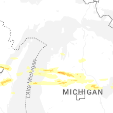


Connect with Interactive Hail Maps