

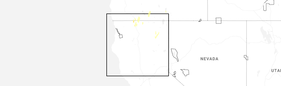
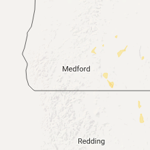
Hail Map for California Pines, CA
The California Pines, CA area has had 0 reports of on-the-ground hail by trained spotters, and has been under severe weather warnings 3 times during the past 12 months. Doppler radar has detected hail at or near California Pines, CA on 5 occasions, including 1 occasion during the past year.
| Name: | California Pines, CA |
| Where Located: | 56.6 miles SSW of Lakeview, OR |
| Map: | Google Map for California Pines, CA |
| Population: | 520 |
| Housing Units: | 276 |
| More Info: | Search Google for California Pines, CA |
0
The Top Recent Hail Date for California Pines, CA is Thursday, July 3, 2025 (5th out of 5)
Hail and Wind Damage Spotted near California Pines, CA
| Date / Time | Report Details |
|---|---|
| 7/29/2025 4:43 PM PDT |
 the severe thunderstorm warning has been cancelled and is no longer in effect the severe thunderstorm warning has been cancelled and is no longer in effect
|
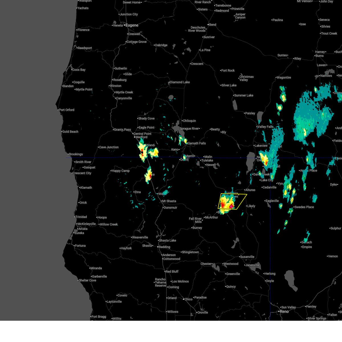
| 7/29/2025 4:06 PM PDT |
 Svrmfr the national weather service in medford has issued a * severe thunderstorm warning for, southeastern modoc county in northern california, * until 500 pm pdt. * at 406 pm pdt, a severe thunderstorm was located near soup spring campground, or 12 miles southeast of alturas, moving northwest at 20 mph (radar indicated). Hazards include 60 mph wind gusts and quarter size hail. Hail damage to vehicles is expected. Expect wind damage to roofs, siding, and trees. Svrmfr the national weather service in medford has issued a * severe thunderstorm warning for, southeastern modoc county in northern california, * until 500 pm pdt. * at 406 pm pdt, a severe thunderstorm was located near soup spring campground, or 12 miles southeast of alturas, moving northwest at 20 mph (radar indicated). Hazards include 60 mph wind gusts and quarter size hail. Hail damage to vehicles is expected. Expect wind damage to roofs, siding, and trees.
|
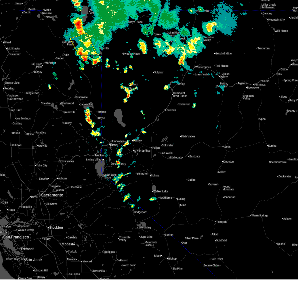
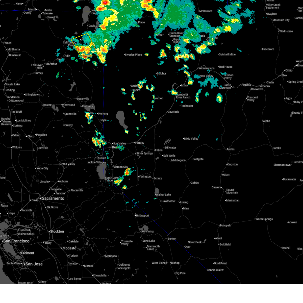
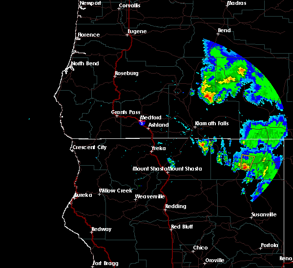
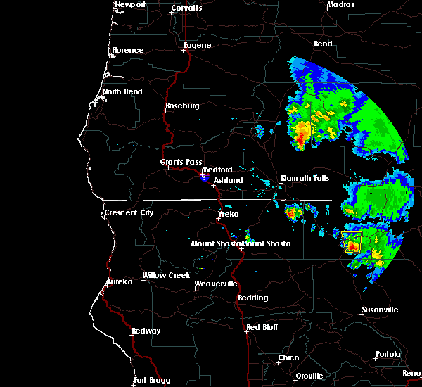
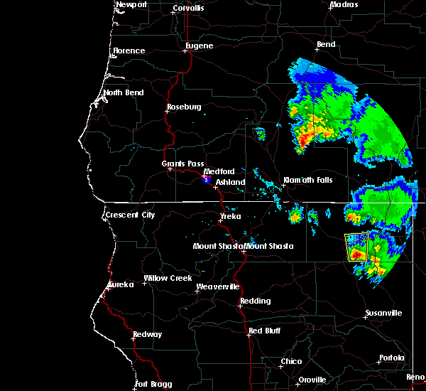
| 7/3/2025 4:43 PM PDT |
 Svrmfr the national weather service in medford has issued a * severe thunderstorm warning for, south central modoc county in northern california, * until 515 pm pdt. * at 443 pm pdt, a severe thunderstorm was located near lower rush creek campground, or 18 miles northeast of bieber, moving northeast at 25 mph (radar indicated). Hazards include 60 mph wind gusts and quarter size hail. Hail damage to vehicles is expected. Expect wind damage to roofs, siding, and trees. Svrmfr the national weather service in medford has issued a * severe thunderstorm warning for, south central modoc county in northern california, * until 515 pm pdt. * at 443 pm pdt, a severe thunderstorm was located near lower rush creek campground, or 18 miles northeast of bieber, moving northeast at 25 mph (radar indicated). Hazards include 60 mph wind gusts and quarter size hail. Hail damage to vehicles is expected. Expect wind damage to roofs, siding, and trees.
|
| 7/24/2017 5:51 PM PDT |
 At 550 pm pdt, a severe thunderstorm was located near canby, or 12 miles southwest of alturas, moving north at 20 mph (radar indicated). Hazards include 60 mph wind gusts and quarter size hail. Hail damage to vehicles is expected. expect wind damage to roofs, siding, and trees. this severe thunderstorm will remain over mainly rural areas of central modoc county. This includes, highway 299 in california between mile markers 24 and 35. At 550 pm pdt, a severe thunderstorm was located near canby, or 12 miles southwest of alturas, moving north at 20 mph (radar indicated). Hazards include 60 mph wind gusts and quarter size hail. Hail damage to vehicles is expected. expect wind damage to roofs, siding, and trees. this severe thunderstorm will remain over mainly rural areas of central modoc county. This includes, highway 299 in california between mile markers 24 and 35.
|
| 7/24/2017 5:36 PM PDT |
 At 534 pm pdt, a severe thunderstorm was located near lower rush creek campground, or 16 miles southwest of alturas, moving north at 20 mph (radar indicated). Hazards include 60 mph wind gusts and quarter size hail. Hail damage to vehicles is expected. Expect wind damage to roofs, siding, and trees. At 534 pm pdt, a severe thunderstorm was located near lower rush creek campground, or 16 miles southwest of alturas, moving north at 20 mph (radar indicated). Hazards include 60 mph wind gusts and quarter size hail. Hail damage to vehicles is expected. Expect wind damage to roofs, siding, and trees.
|
| 7/24/2017 5:23 PM PDT |
 At 522 pm pdt, a severe thunderstorm was located 7 miles east of lower rush creek campground, or 19 miles southwest of alturas, moving north at 20 mph (radar indicated). Hazards include 60 mph wind gusts and quarter size hail. Hail damage to vehicles is expected. Expect wind damage to roofs, siding, and trees. At 522 pm pdt, a severe thunderstorm was located 7 miles east of lower rush creek campground, or 19 miles southwest of alturas, moving north at 20 mph (radar indicated). Hazards include 60 mph wind gusts and quarter size hail. Hail damage to vehicles is expected. Expect wind damage to roofs, siding, and trees.
|
Hail Maps for California Pines, CA


Connect with Interactive Hail Maps