

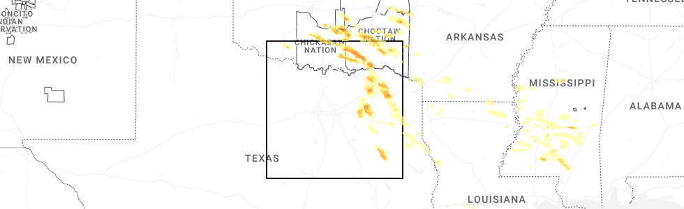
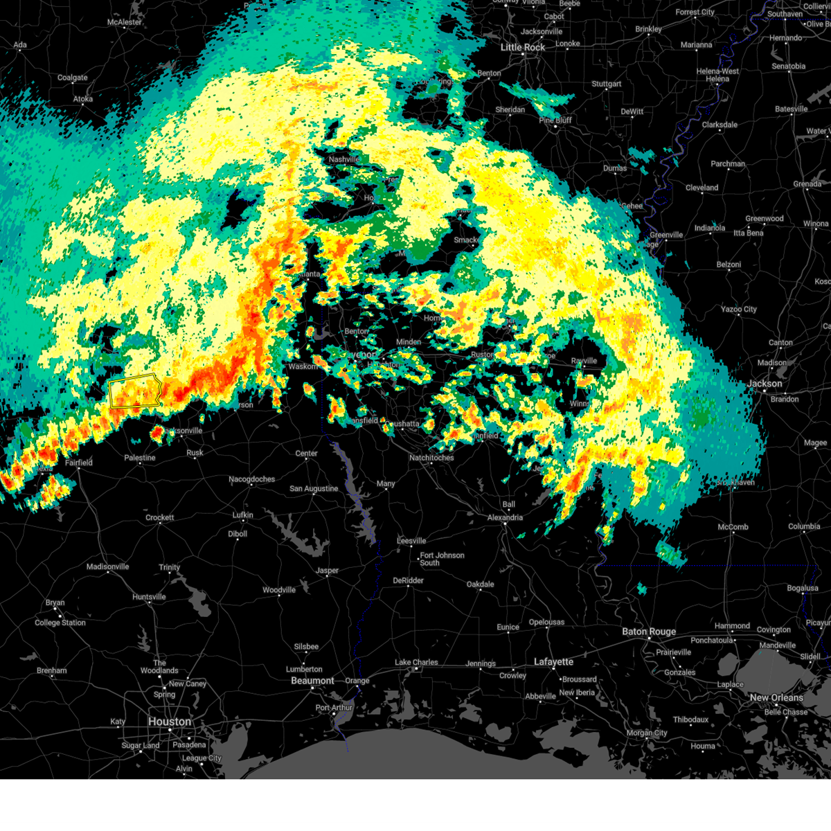
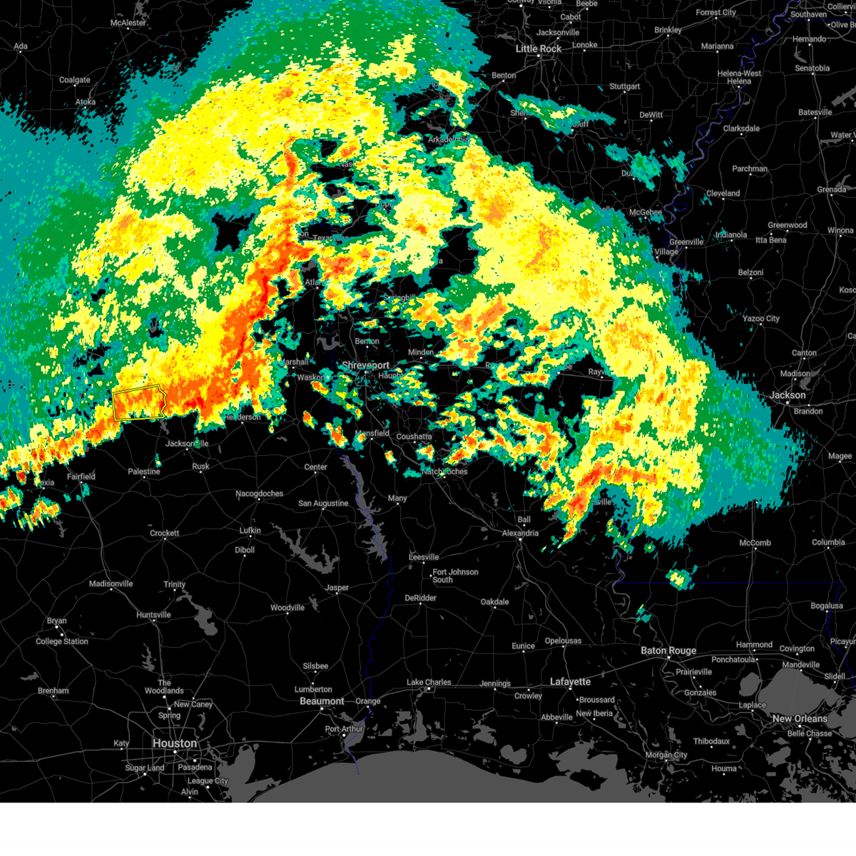
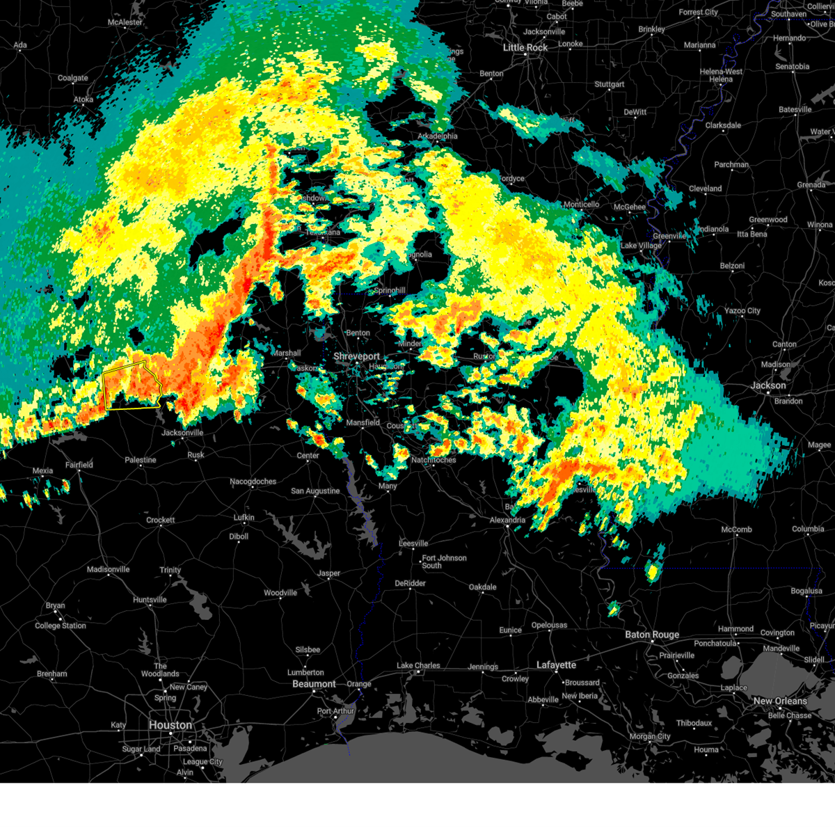
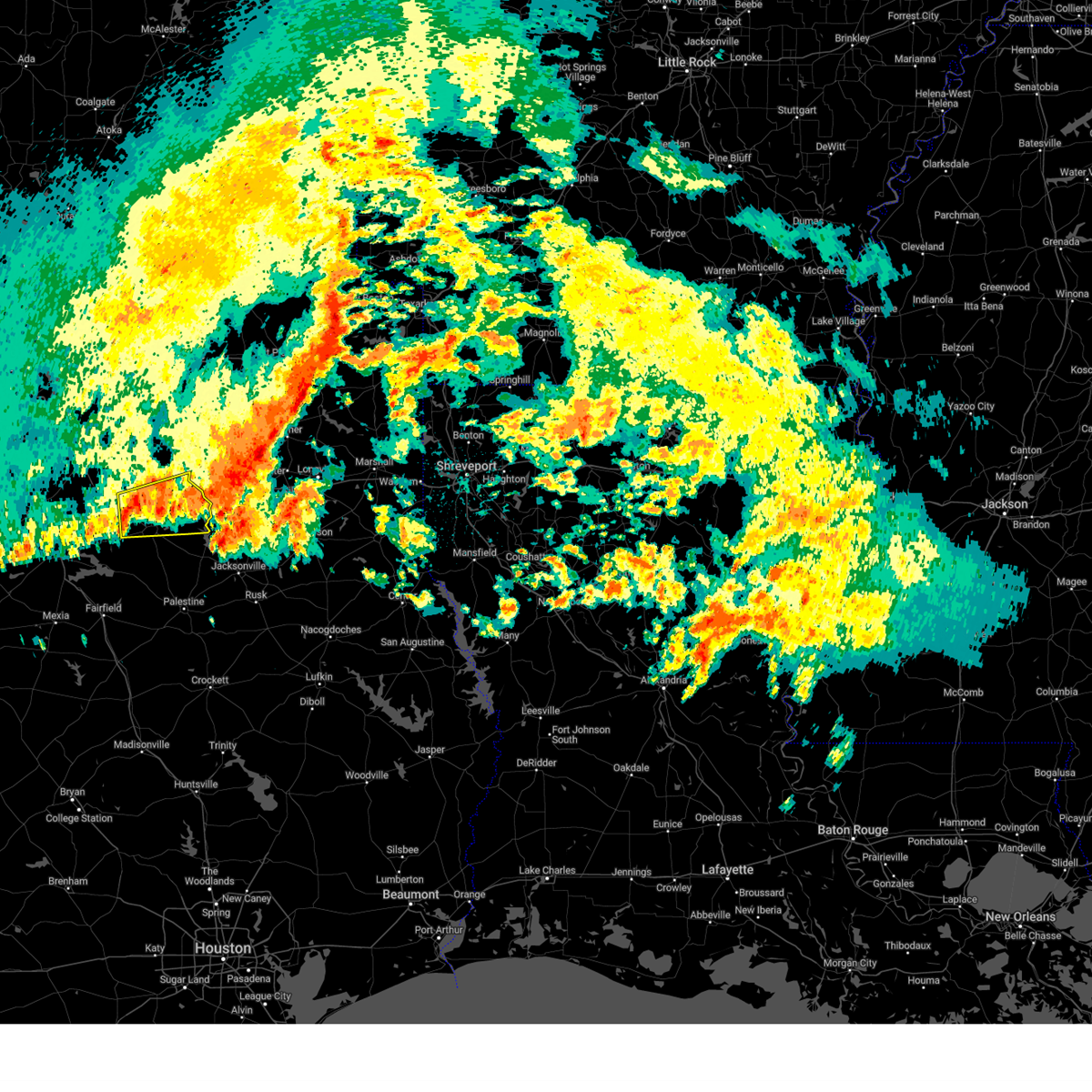
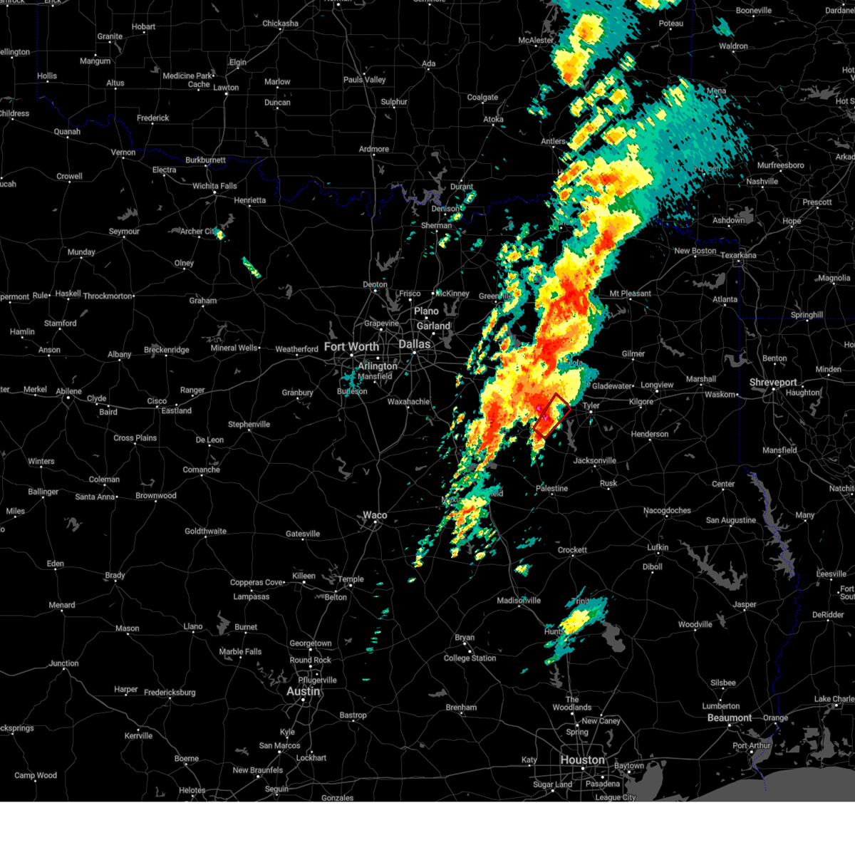
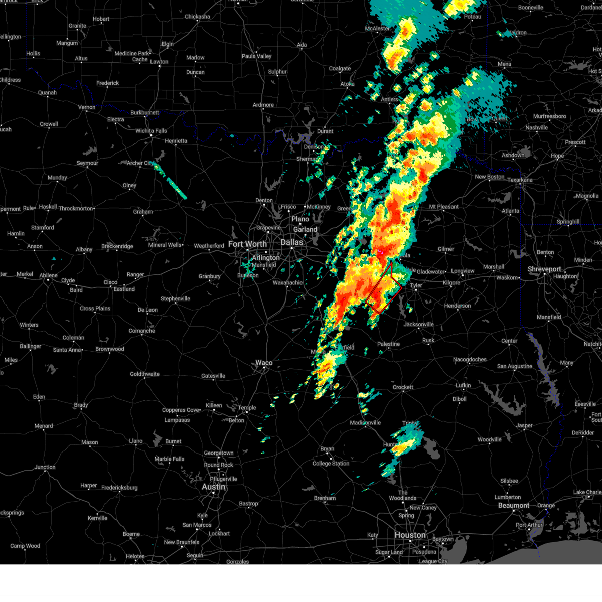
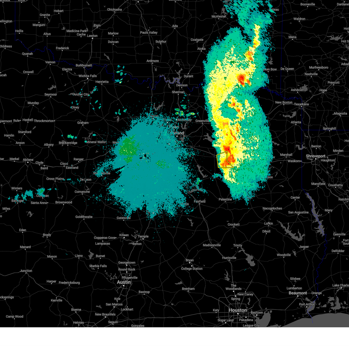
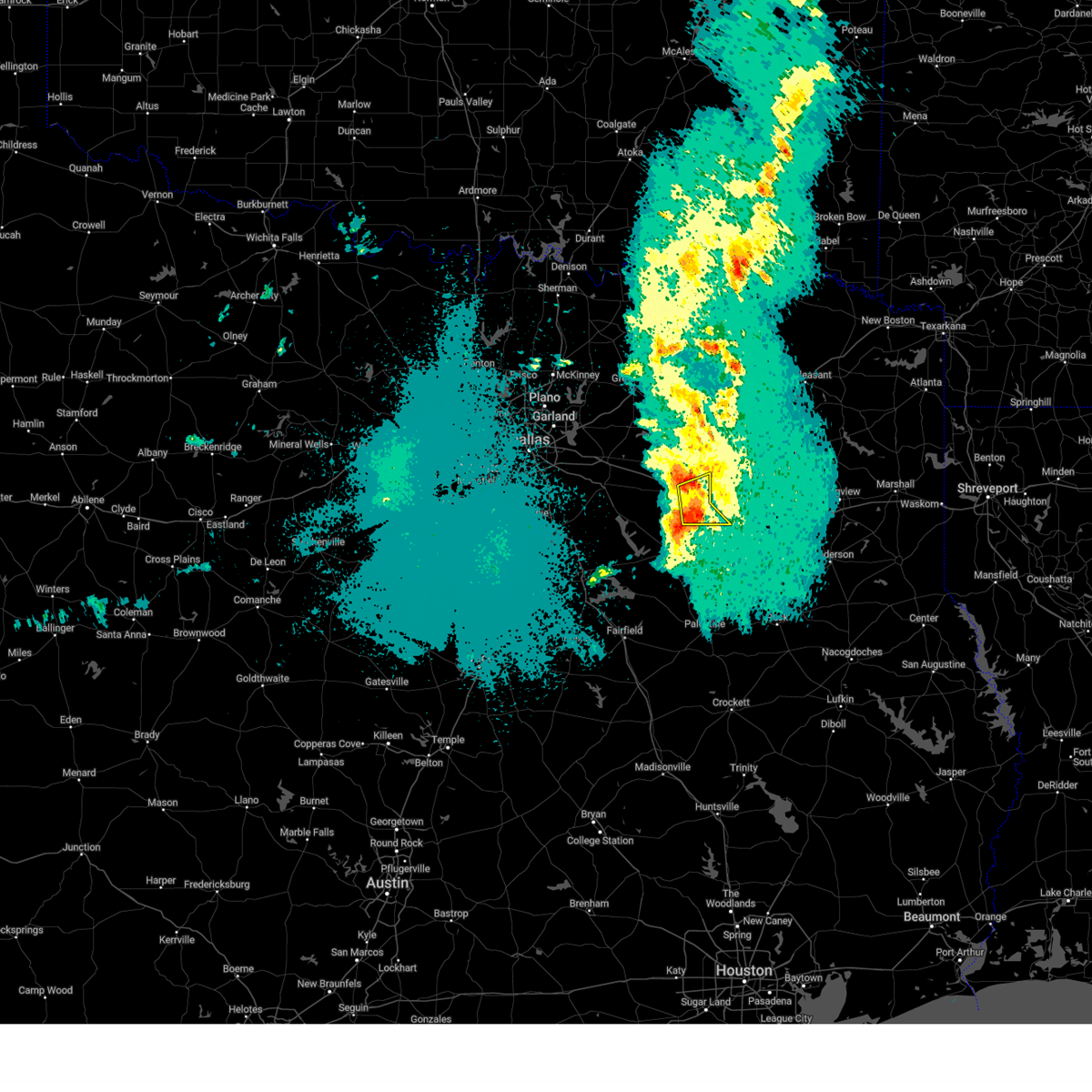
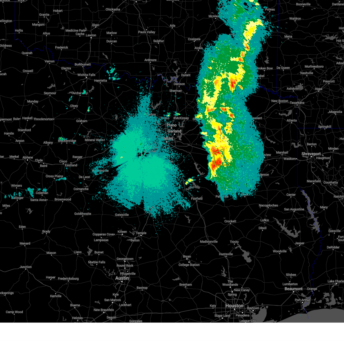
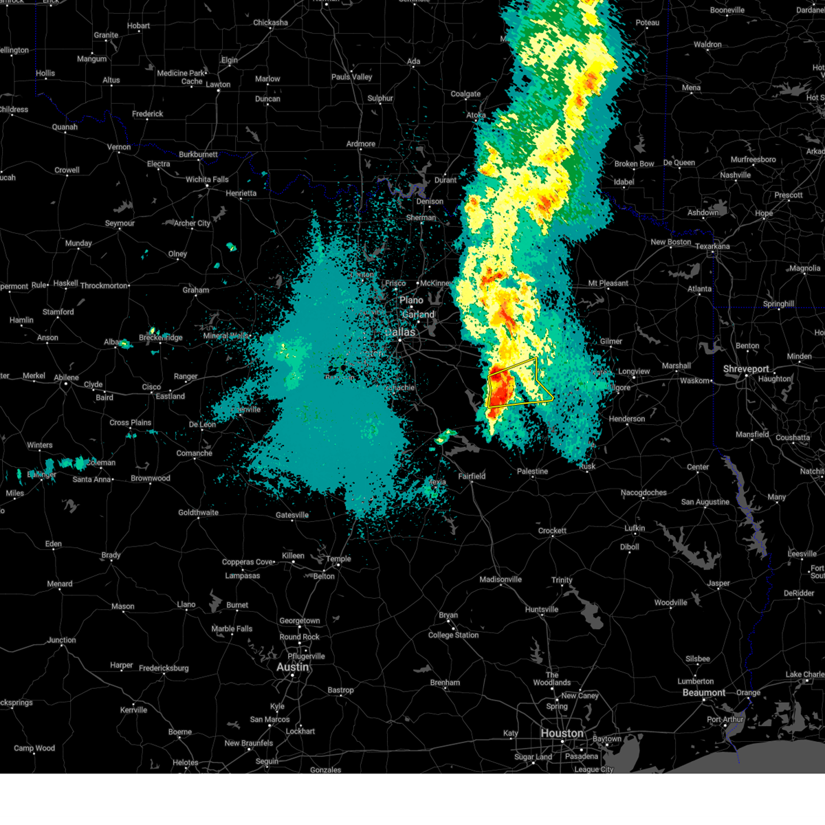
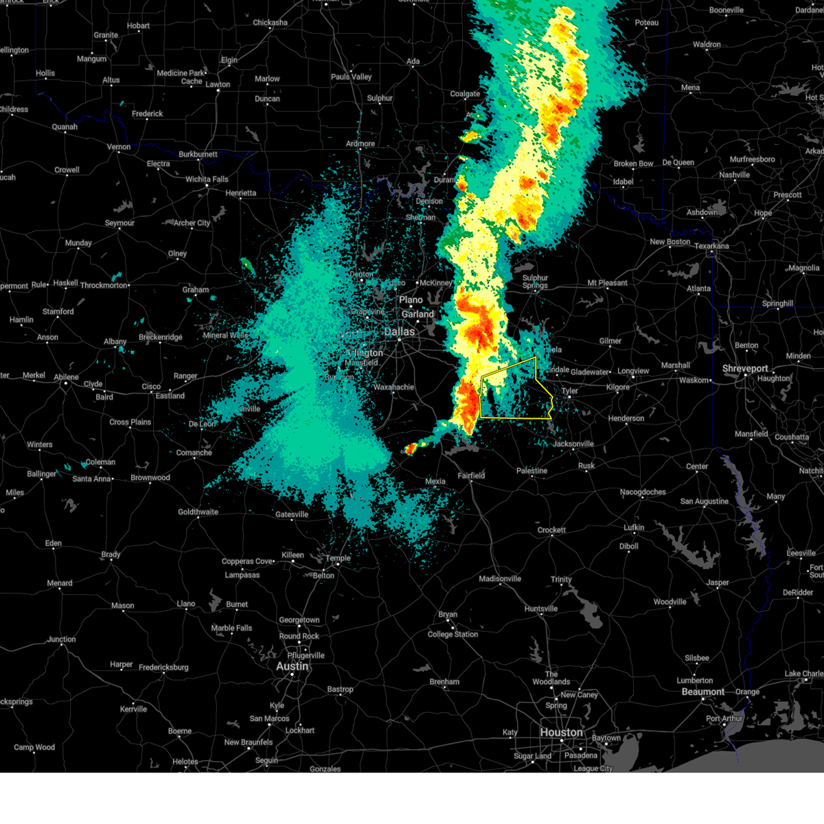
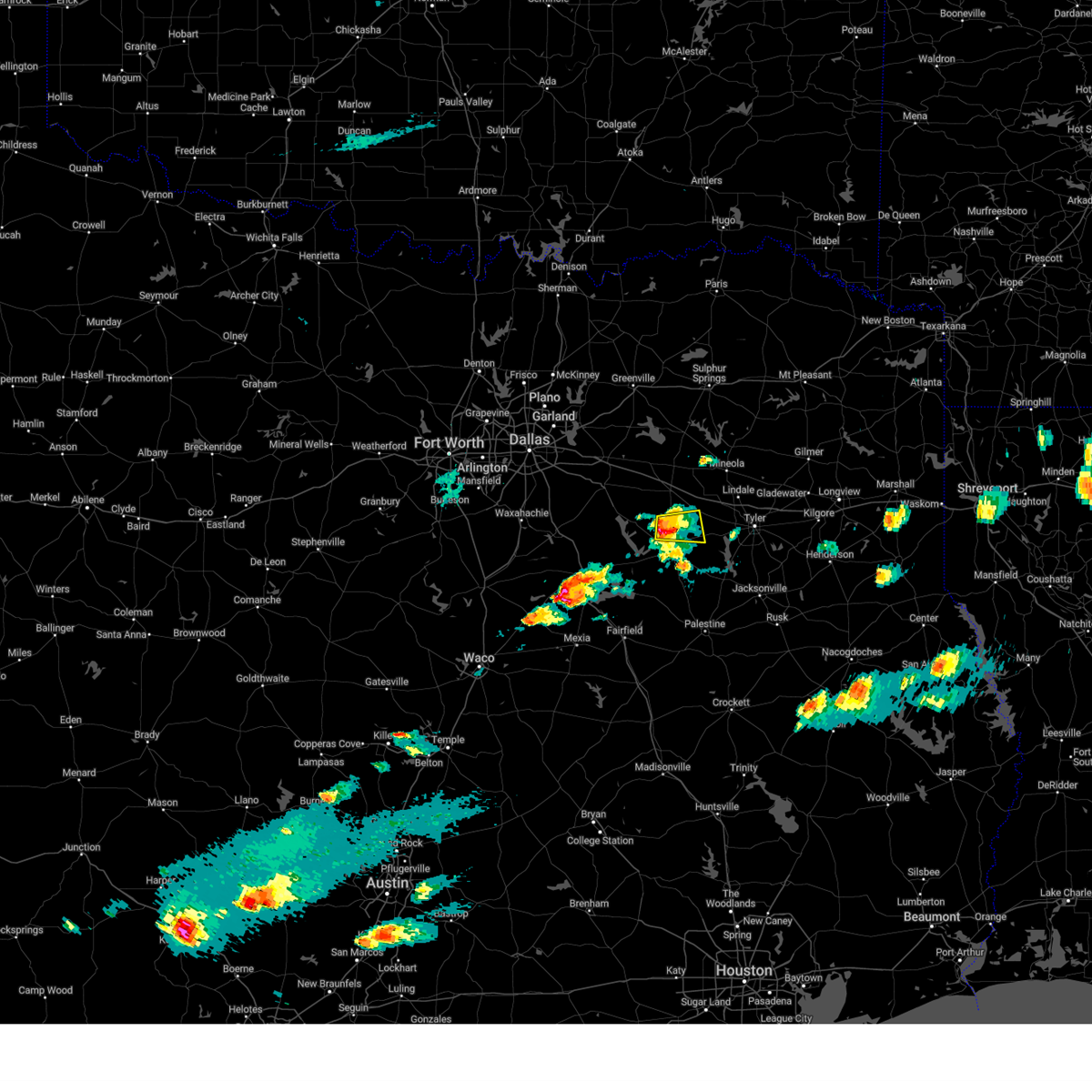
Hail Map for Callender Lake, TX
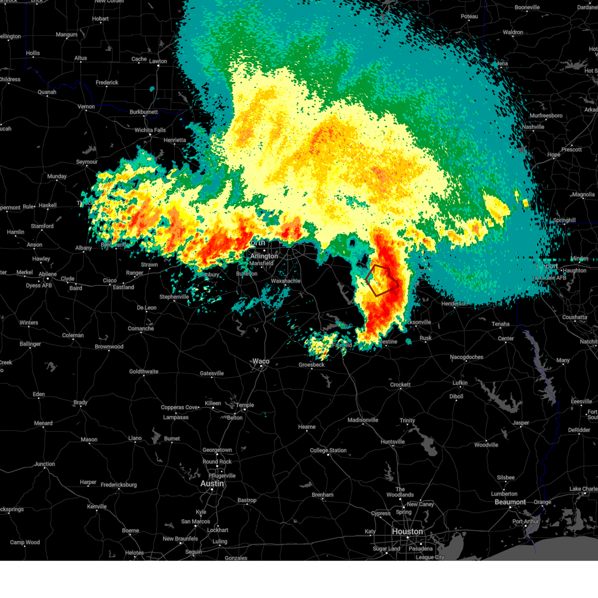
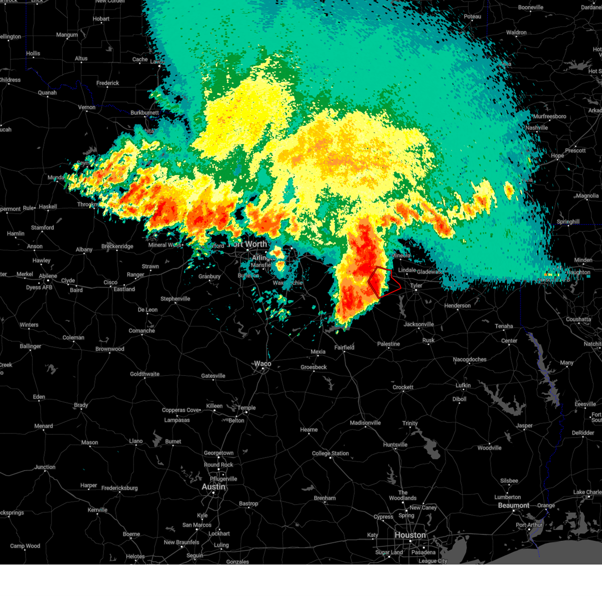
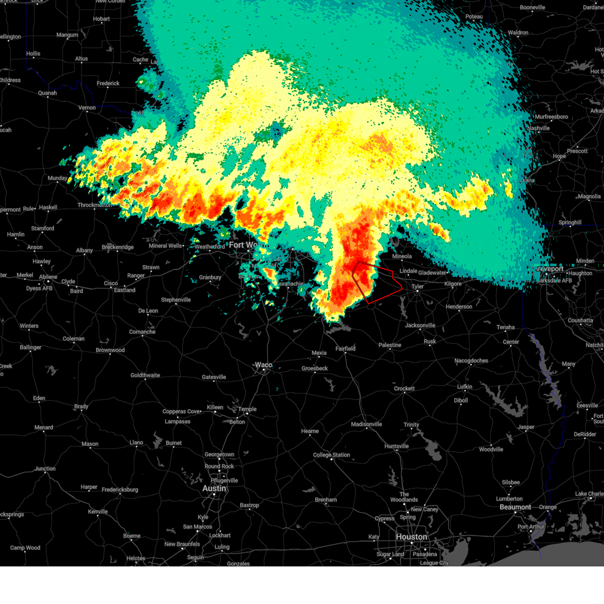
The Callender Lake, TX area has had 1 report of on-the-ground hail by trained spotters, and has been under severe weather warnings 9 times during the past 12 months. Doppler radar has detected hail at or near Callender Lake, TX on 76 occasions, including 7 occasions during the past year.
| Name: | Callender Lake, TX |
| Where Located: | 69.8 miles ESE of Dallas, TX |
| Map: | Google Map for Callender Lake, TX |
| Population: | 1039 |
| Housing Units: | 716 |
| More Info: | Search Google for Callender Lake, TX |
1
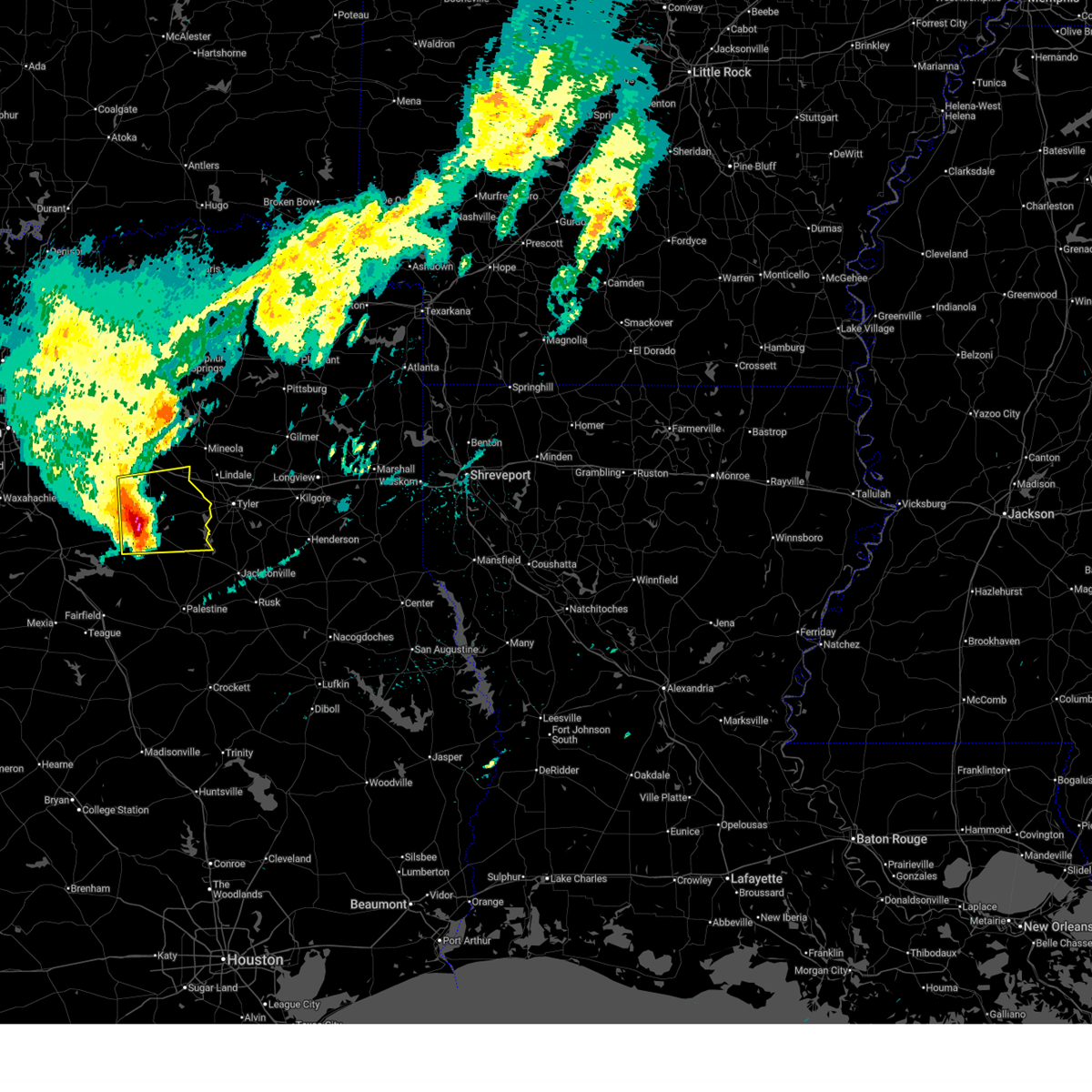
The Top Recent Hail Date for Callender Lake, TX is Friday, April 24, 2026 (13th out of 76)
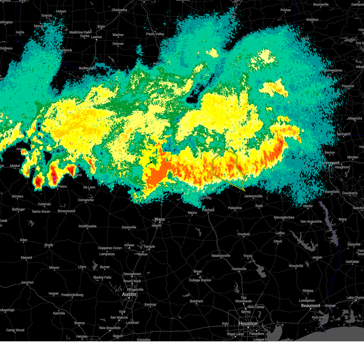
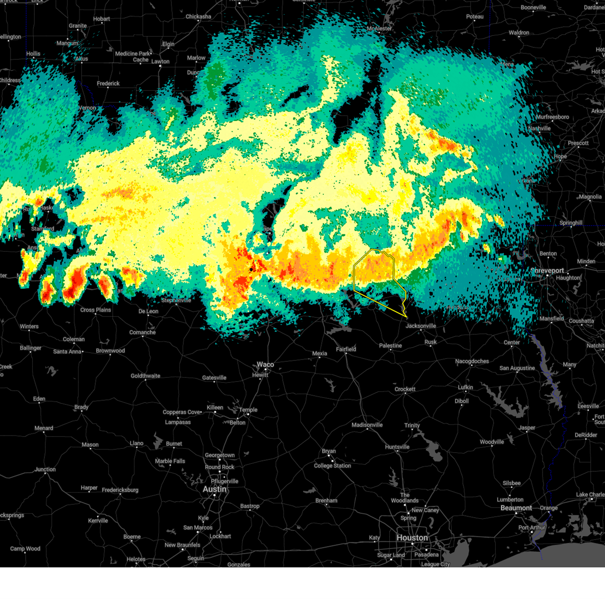
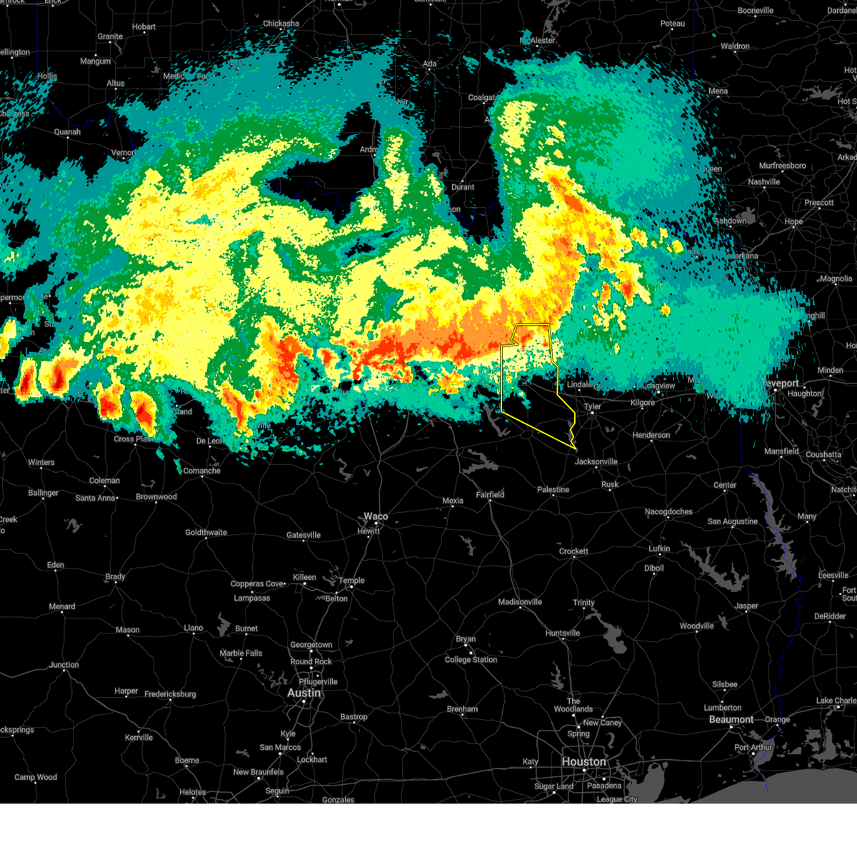
Hail and Wind Damage Spotted near Callender Lake, TX
| Date / Time | Report Details |
|---|---|
| 6/2/2026 2:45 PM CDT |
 At 244 pm cdt, a severe thunderstorm was located near edom, or 14 miles northwest of tyler, moving southwest at 5 mph (radar indicated). Hazards include 60 mph wind gusts and penny size hail. Expect damage to roofs, siding, and trees. Locations impacted include, van, edom, redland, ben wheeler, primrose, martins mill, and colfax. At 244 pm cdt, a severe thunderstorm was located near edom, or 14 miles northwest of tyler, moving southwest at 5 mph (radar indicated). Hazards include 60 mph wind gusts and penny size hail. Expect damage to roofs, siding, and trees. Locations impacted include, van, edom, redland, ben wheeler, primrose, martins mill, and colfax.
|
| 6/2/2026 2:45 PM CDT |
 the severe thunderstorm warning has been cancelled and is no longer in effect the severe thunderstorm warning has been cancelled and is no longer in effect
|
| 6/2/2026 2:22 PM CDT |
 Svrfwd the national weather service in fort worth has issued a * severe thunderstorm warning for, southeastern van zandt county in north central texas, northeastern henderson county in central texas, * until 315 pm cdt. * at 222 pm cdt, a severe thunderstorm was located near lindale, or 13 miles northwest of tyler, moving southwest at 5 mph (radar indicated). Hazards include 60 mph wind gusts and quarter size hail. Hail damage to vehicles is expected. Expect wind damage to roofs, siding, and trees. Svrfwd the national weather service in fort worth has issued a * severe thunderstorm warning for, southeastern van zandt county in north central texas, northeastern henderson county in central texas, * until 315 pm cdt. * at 222 pm cdt, a severe thunderstorm was located near lindale, or 13 miles northwest of tyler, moving southwest at 5 mph (radar indicated). Hazards include 60 mph wind gusts and quarter size hail. Hail damage to vehicles is expected. Expect wind damage to roofs, siding, and trees.
|
| 4/29/2026 4:22 PM CDT |
 At 422 pm cdt, a severe thunderstorm was located 9 miles east of athens, moving east at 40 mph (radar indicated). Hazards include golf ball size hail. People and animals outdoors will be injured. expect damage to roofs, siding, windows, and vehicles. Locations impacted include, chandler, brownsboro, berryville, lake palestine, murchison, coffee city, moore station, new york, and larue. At 422 pm cdt, a severe thunderstorm was located 9 miles east of athens, moving east at 40 mph (radar indicated). Hazards include golf ball size hail. People and animals outdoors will be injured. expect damage to roofs, siding, windows, and vehicles. Locations impacted include, chandler, brownsboro, berryville, lake palestine, murchison, coffee city, moore station, new york, and larue.
|
| 4/29/2026 4:03 PM CDT |
 the severe thunderstorm warning has been cancelled and is no longer in effect the severe thunderstorm warning has been cancelled and is no longer in effect
|
| 4/29/2026 3:49 PM CDT |
 At 349 pm cdt, a severe thunderstorm was located over purtis creek state park, or 8 miles east of gun barrel city, moving east at 30 mph (radar indicated). Hazards include quarter size hail. Damage to vehicles is possible. Locations impacted include, edom, purtis creek state park, ben wheeler, phalba, roddy, martins mill, and walton. At 349 pm cdt, a severe thunderstorm was located over purtis creek state park, or 8 miles east of gun barrel city, moving east at 30 mph (radar indicated). Hazards include quarter size hail. Damage to vehicles is possible. Locations impacted include, edom, purtis creek state park, ben wheeler, phalba, roddy, martins mill, and walton.
|
| 4/29/2026 3:24 PM CDT |
 Svrfwd the national weather service in fort worth has issued a * severe thunderstorm warning for, southeastern kaufman county in north central texas, southwestern van zandt county in north central texas, northern henderson county in central texas, * until 430 pm cdt. * at 323 pm cdt, a severe thunderstorm was located over seven points, or near gun barrel city, moving east at 30 mph (radar indicated). Hazards include quarter size hail. damage to vehicles is possible Svrfwd the national weather service in fort worth has issued a * severe thunderstorm warning for, southeastern kaufman county in north central texas, southwestern van zandt county in north central texas, northern henderson county in central texas, * until 430 pm cdt. * at 323 pm cdt, a severe thunderstorm was located over seven points, or near gun barrel city, moving east at 30 mph (radar indicated). Hazards include quarter size hail. damage to vehicles is possible
|
| 4/18/2026 10:04 AM CDT |
 At 1003 am cdt, a severe thunderstorm was located near brownsboro, or 10 miles east of athens, moving east at 65 mph (radar indicated). Hazards include 60 mph wind gusts and quarter size hail. Hail damage to vehicles is expected. expect wind damage to roofs, siding, and trees. this severe storm will be near, lake palestine around 1010 am cdt. Other locations impacted by this severe thunderstorm include new york, ben wheeler, moore station, jackson, walton, redland, larue, primrose, murchison, and tundra. At 1003 am cdt, a severe thunderstorm was located near brownsboro, or 10 miles east of athens, moving east at 65 mph (radar indicated). Hazards include 60 mph wind gusts and quarter size hail. Hail damage to vehicles is expected. expect wind damage to roofs, siding, and trees. this severe storm will be near, lake palestine around 1010 am cdt. Other locations impacted by this severe thunderstorm include new york, ben wheeler, moore station, jackson, walton, redland, larue, primrose, murchison, and tundra.
|
| 4/18/2026 9:53 AM CDT |
 Svrfwd the national weather service in fort worth has issued a * severe thunderstorm warning for, southern van zandt county in north central texas, henderson county in central texas, * until 1030 am cdt. * at 952 am cdt, a severe thunderstorm was located over athens, moving east at 65 mph (radar indicated). Hazards include 60 mph wind gusts and quarter size hail. Hail damage to vehicles is expected. expect wind damage to roofs, siding, and trees. this severe thunderstorm will be near, brownsboro around 1000 am cdt. lake palestine around 1005 am cdt. chandler around 1010 am cdt. other locations impacted by this severe thunderstorm include new york, ben wheeler, moore station, log cabin, whitton, crescent heights, phalba, roddy, jackson, and walton. This includes interstate 20 between mile markers 533 and 542. Svrfwd the national weather service in fort worth has issued a * severe thunderstorm warning for, southern van zandt county in north central texas, henderson county in central texas, * until 1030 am cdt. * at 952 am cdt, a severe thunderstorm was located over athens, moving east at 65 mph (radar indicated). Hazards include 60 mph wind gusts and quarter size hail. Hail damage to vehicles is expected. expect wind damage to roofs, siding, and trees. this severe thunderstorm will be near, brownsboro around 1000 am cdt. lake palestine around 1005 am cdt. chandler around 1010 am cdt. other locations impacted by this severe thunderstorm include new york, ben wheeler, moore station, log cabin, whitton, crescent heights, phalba, roddy, jackson, and walton. This includes interstate 20 between mile markers 533 and 542.
|
| 6/9/2025 1:02 AM CDT |
 Svrfwd the national weather service in fort worth has issued a * severe thunderstorm warning for, freestone county in central texas, southern kaufman county in north central texas, southern van zandt county in north central texas, northwestern leon county in central texas, henderson county in central texas, limestone county in central texas, southeastern hill county in central texas, anderson county in central texas, navarro county in north central texas, * until 215 am cdt. * at 102 am cdt, severe thunderstorms were located along a line extending from near kemp to near kerens to 8 miles northeast of wortham to 7 miles west of west, moving southeast at 45 mph (radar indicated). Hazards include 70 mph wind gusts and nickel size hail. Expect considerable tree damage. Damage is likely to mobile homes, roofs, and outbuildings. Svrfwd the national weather service in fort worth has issued a * severe thunderstorm warning for, freestone county in central texas, southern kaufman county in north central texas, southern van zandt county in north central texas, northwestern leon county in central texas, henderson county in central texas, limestone county in central texas, southeastern hill county in central texas, anderson county in central texas, navarro county in north central texas, * until 215 am cdt. * at 102 am cdt, severe thunderstorms were located along a line extending from near kemp to near kerens to 8 miles northeast of wortham to 7 miles west of west, moving southeast at 45 mph (radar indicated). Hazards include 70 mph wind gusts and nickel size hail. Expect considerable tree damage. Damage is likely to mobile homes, roofs, and outbuildings.
|
| 6/9/2025 12:10 AM CDT |
 The storm which prompted the warning has weakened below severe limits. therefore the warning will be allowed to expire. however gusty winds and heavy rain are still possible with this thunderstorm. a severe thunderstorm watch remains in effect until 400 am cdt for central and north central texas. remember, a severe thunderstorm warning still remains in effect for western henderson county until 12:30 am. The storm which prompted the warning has weakened below severe limits. therefore the warning will be allowed to expire. however gusty winds and heavy rain are still possible with this thunderstorm. a severe thunderstorm watch remains in effect until 400 am cdt for central and north central texas. remember, a severe thunderstorm warning still remains in effect for western henderson county until 12:30 am.
|
| 6/8/2025 11:47 PM CDT |
 At 1146 pm cdt, a severe thunderstorm was located over van, or 12 miles east of canton, moving southeast at 35 mph (radar indicated). Hazards include 65 mph wind gusts. Expect damage to roofs, siding, and trees. this severe storm will be near, edom around 1150 pm cdt. lake palestine and chandler around 1205 am cdt. Other locations impacted by this severe thunderstorm include ben wheeler, whitton, moore station, phalba, roddy, jackson, oakland, wise, walton, and myrtle springs. At 1146 pm cdt, a severe thunderstorm was located over van, or 12 miles east of canton, moving southeast at 35 mph (radar indicated). Hazards include 65 mph wind gusts. Expect damage to roofs, siding, and trees. this severe storm will be near, edom around 1150 pm cdt. lake palestine and chandler around 1205 am cdt. Other locations impacted by this severe thunderstorm include ben wheeler, whitton, moore station, phalba, roddy, jackson, oakland, wise, walton, and myrtle springs.
|
| 6/8/2025 11:47 PM CDT |
 the severe thunderstorm warning has been cancelled and is no longer in effect the severe thunderstorm warning has been cancelled and is no longer in effect
|
| 6/8/2025 11:01 PM CDT |
 Svrfwd the national weather service in fort worth has issued a * severe thunderstorm warning for, van zandt county in north central texas, northeastern henderson county in central texas, rains county in north central texas, * until 1215 am cdt. * at 1100 pm cdt, a severe thunderstorm was located over east tawakoni, or 11 miles northeast of wills point, moving southeast at 50 mph (radar indicated). Hazards include 70 mph wind gusts. Expect considerable tree damage. damage is likely to mobile homes, roofs, and outbuildings. this severe thunderstorm will be near, lake tawakoni around 1105 pm cdt. grand saline around 1115 pm cdt. other locations impacted by this severe thunderstorm include ben wheeler, whitton, moore station, alsa, phalba, roddy, jackson, oakland, wise, and walton. This includes interstate 20 between mile markers 513 and 542. Svrfwd the national weather service in fort worth has issued a * severe thunderstorm warning for, van zandt county in north central texas, northeastern henderson county in central texas, rains county in north central texas, * until 1215 am cdt. * at 1100 pm cdt, a severe thunderstorm was located over east tawakoni, or 11 miles northeast of wills point, moving southeast at 50 mph (radar indicated). Hazards include 70 mph wind gusts. Expect considerable tree damage. damage is likely to mobile homes, roofs, and outbuildings. this severe thunderstorm will be near, lake tawakoni around 1105 pm cdt. grand saline around 1115 pm cdt. other locations impacted by this severe thunderstorm include ben wheeler, whitton, moore station, alsa, phalba, roddy, jackson, oakland, wise, and walton. This includes interstate 20 between mile markers 513 and 542.
|
| 5/26/2025 6:03 AM CDT |
 the severe thunderstorm warning has been cancelled and is no longer in effect the severe thunderstorm warning has been cancelled and is no longer in effect
|
| 5/26/2025 5:43 AM CDT |
 At 542 am cdt, a severe thunderstorm was located 7 miles west of brownsboro, or 7 miles northeast of athens, moving east at 20 mph (radar indicated). Hazards include 60 mph wind gusts and quarter size hail. Hail damage to vehicles is expected. expect wind damage to roofs, siding, and trees. this severe storm will be near, brownsboro around 550 am cdt. lake palestine and chandler around 610 am cdt. Other locations impacted by this severe thunderstorm include murchison, redland, moore station, and walton. At 542 am cdt, a severe thunderstorm was located 7 miles west of brownsboro, or 7 miles northeast of athens, moving east at 20 mph (radar indicated). Hazards include 60 mph wind gusts and quarter size hail. Hail damage to vehicles is expected. expect wind damage to roofs, siding, and trees. this severe storm will be near, brownsboro around 550 am cdt. lake palestine and chandler around 610 am cdt. Other locations impacted by this severe thunderstorm include murchison, redland, moore station, and walton.
|
| 5/26/2025 5:34 AM CDT |
 At 534 am cdt, a severe thunderstorm was located near athens, moving east at 30 mph (radar indicated). Hazards include 60 mph wind gusts and quarter size hail. Hail damage to vehicles is expected. expect wind damage to roofs, siding, and trees. this severe storm will be near, brownsboro around 545 am cdt. lake palestine and chandler around 600 am cdt. Other locations impacted by this severe thunderstorm include redland, ben wheeler, primrose, moore station, murchison, martins mill, and walton. At 534 am cdt, a severe thunderstorm was located near athens, moving east at 30 mph (radar indicated). Hazards include 60 mph wind gusts and quarter size hail. Hail damage to vehicles is expected. expect wind damage to roofs, siding, and trees. this severe storm will be near, brownsboro around 545 am cdt. lake palestine and chandler around 600 am cdt. Other locations impacted by this severe thunderstorm include redland, ben wheeler, primrose, moore station, murchison, martins mill, and walton.
|
| 5/26/2025 5:17 AM CDT |
 Svrfwd the national weather service in fort worth has issued a * severe thunderstorm warning for, southern van zandt county in north central texas, northeastern henderson county in central texas, * until 615 am cdt. * at 516 am cdt, a severe thunderstorm was located near eustace, or 10 miles northwest of athens, moving east at 20 mph (radar indicated). Hazards include 60 mph wind gusts and quarter size hail. Hail damage to vehicles is expected. expect wind damage to roofs, siding, and trees. this severe thunderstorm will be near, edom around 600 am cdt. other locations impacted by this severe thunderstorm include ben wheeler, moore station, log cabin, crescent heights, phalba, roddy, walton, redland, primrose, and murchison. This includes interstate 20 between mile markers 539 and 542. Svrfwd the national weather service in fort worth has issued a * severe thunderstorm warning for, southern van zandt county in north central texas, northeastern henderson county in central texas, * until 615 am cdt. * at 516 am cdt, a severe thunderstorm was located near eustace, or 10 miles northwest of athens, moving east at 20 mph (radar indicated). Hazards include 60 mph wind gusts and quarter size hail. Hail damage to vehicles is expected. expect wind damage to roofs, siding, and trees. this severe thunderstorm will be near, edom around 600 am cdt. other locations impacted by this severe thunderstorm include ben wheeler, moore station, log cabin, crescent heights, phalba, roddy, walton, redland, primrose, and murchison. This includes interstate 20 between mile markers 539 and 542.
|
| 4/4/2025 3:32 PM CDT |
 At 332 pm cdt, a severe thunderstorm capable of producing a tornado was located near brownsboro, or 13 miles northeast of athens, moving northeast at 40 mph (radar indicated rotation). Hazards include tornado and quarter size hail. Flying debris will be dangerous to those caught without shelter. mobile homes will be damaged or destroyed. damage to roofs, windows, and vehicles will occur. tree damage is likely. this dangerous storm will be near, brownsboro and edom around 335 pm cdt. Other locations impacted by this tornadic thunderstorm include redland, primrose, and murchison. At 332 pm cdt, a severe thunderstorm capable of producing a tornado was located near brownsboro, or 13 miles northeast of athens, moving northeast at 40 mph (radar indicated rotation). Hazards include tornado and quarter size hail. Flying debris will be dangerous to those caught without shelter. mobile homes will be damaged or destroyed. damage to roofs, windows, and vehicles will occur. tree damage is likely. this dangerous storm will be near, brownsboro and edom around 335 pm cdt. Other locations impacted by this tornadic thunderstorm include redland, primrose, and murchison.
|
| 4/4/2025 3:19 PM CDT |
 Torfwd the national weather service in fort worth has issued a * tornado warning for, southeastern van zandt county in north central texas, northeastern henderson county in central texas, * until 400 pm cdt. * at 319 pm cdt, a severe thunderstorm capable of producing a tornado was located near athens, moving northeast at 45 mph (radar indicated rotation). Hazards include tornado and quarter size hail. Flying debris will be dangerous to those caught without shelter. mobile homes will be damaged or destroyed. damage to roofs, windows, and vehicles will occur. tree damage is likely. this dangerous storm will be near, edom around 330 pm cdt. other locations impacted by this tornadic thunderstorm include murchison, redland, ben wheeler, primrose, and pruitt. This includes interstate 20 between mile markers 538 and 542. Torfwd the national weather service in fort worth has issued a * tornado warning for, southeastern van zandt county in north central texas, northeastern henderson county in central texas, * until 400 pm cdt. * at 319 pm cdt, a severe thunderstorm capable of producing a tornado was located near athens, moving northeast at 45 mph (radar indicated rotation). Hazards include tornado and quarter size hail. Flying debris will be dangerous to those caught without shelter. mobile homes will be damaged or destroyed. damage to roofs, windows, and vehicles will occur. tree damage is likely. this dangerous storm will be near, edom around 330 pm cdt. other locations impacted by this tornadic thunderstorm include murchison, redland, ben wheeler, primrose, and pruitt. This includes interstate 20 between mile markers 538 and 542.
|
| 3/30/2025 2:05 AM CDT |
 The storms which prompted the warning have moved out of the area. therefore the warning will be allowed to expire. The storms which prompted the warning have moved out of the area. therefore the warning will be allowed to expire.
|
| 3/30/2025 1:54 AM CDT |
 the severe thunderstorm warning has been cancelled and is no longer in effect the severe thunderstorm warning has been cancelled and is no longer in effect
|
| 3/30/2025 1:54 AM CDT |
 At 153 am cdt, severe thunderstorms were located along a line extending from near grand saline to van to near edom, moving east at 45 mph (radar indicated). Hazards include 60 mph wind gusts and quarter size hail. Hail damage to vehicles is expected. expect wind damage to roofs, siding, and trees. these severe storms will be near, edom around 200 am cdt. Other locations impacted by these severe thunderstorms include redland, jones, ben wheeler, primrose, pruitt, oakland, and colfax. At 153 am cdt, severe thunderstorms were located along a line extending from near grand saline to van to near edom, moving east at 45 mph (radar indicated). Hazards include 60 mph wind gusts and quarter size hail. Hail damage to vehicles is expected. expect wind damage to roofs, siding, and trees. these severe storms will be near, edom around 200 am cdt. Other locations impacted by these severe thunderstorms include redland, jones, ben wheeler, primrose, pruitt, oakland, and colfax.
|
| 3/30/2025 1:41 AM CDT |
 At 141 am cdt, severe thunderstorms were located along a line extending from canton to 7 miles west of van to 9 miles north of athens, moving northeast at 60 mph (radar indicated). Hazards include 60 mph wind gusts and quarter size hail. Hail damage to vehicles is expected. expect wind damage to roofs, siding, and trees. these severe storms will be near, canton and van around 145 am cdt. edom around 150 am cdt. Other locations impacted by these severe thunderstorms include ben wheeler, whitton, phalba, jackson, oakland, walton, redland, jones, primrose, and pruitt. At 141 am cdt, severe thunderstorms were located along a line extending from canton to 7 miles west of van to 9 miles north of athens, moving northeast at 60 mph (radar indicated). Hazards include 60 mph wind gusts and quarter size hail. Hail damage to vehicles is expected. expect wind damage to roofs, siding, and trees. these severe storms will be near, canton and van around 145 am cdt. edom around 150 am cdt. Other locations impacted by these severe thunderstorms include ben wheeler, whitton, phalba, jackson, oakland, walton, redland, jones, primrose, and pruitt.
|
| 3/30/2025 1:18 AM CDT |
 Svrfwd the national weather service in fort worth has issued a * severe thunderstorm warning for, southern van zandt county in north central texas, northeastern henderson county in central texas, * until 215 am cdt. * at 118 am cdt, severe thunderstorms were located along a line extending from near kemp to near eustace to trinidad, moving east at 40 mph (radar indicated). Hazards include 60 mph wind gusts and quarter size hail. Hail damage to vehicles is expected. expect wind damage to roofs, siding, and trees. severe thunderstorms will be near, forest grove reservoir, purtis creek state park, eustace, malakoff, caney city, and cedar creek reservoir around 125 am cdt. athens around 130 am cdt. canton around 140 am cdt. edom around 150 am cdt. brownsboro and van around 155 am cdt. lake palestine around 205 am cdt. other locations impacted by these severe thunderstorms include ben wheeler, whitton, log cabin, phalba, roddy, jackson, oakland, walton, redland, and jones. This includes interstate 20 between mile markers 527 and 542. Svrfwd the national weather service in fort worth has issued a * severe thunderstorm warning for, southern van zandt county in north central texas, northeastern henderson county in central texas, * until 215 am cdt. * at 118 am cdt, severe thunderstorms were located along a line extending from near kemp to near eustace to trinidad, moving east at 40 mph (radar indicated). Hazards include 60 mph wind gusts and quarter size hail. Hail damage to vehicles is expected. expect wind damage to roofs, siding, and trees. severe thunderstorms will be near, forest grove reservoir, purtis creek state park, eustace, malakoff, caney city, and cedar creek reservoir around 125 am cdt. athens around 130 am cdt. canton around 140 am cdt. edom around 150 am cdt. brownsboro and van around 155 am cdt. lake palestine around 205 am cdt. other locations impacted by these severe thunderstorms include ben wheeler, whitton, log cabin, phalba, roddy, jackson, oakland, walton, redland, and jones. This includes interstate 20 between mile markers 527 and 542.
|
| 3/23/2025 8:06 PM CDT |
 Svrfwd the national weather service in fort worth has issued a * severe thunderstorm warning for, northeastern henderson county in central texas, * until 830 pm cdt. * at 806 pm cdt, a severe thunderstorm was located near brownsboro, or 11 miles northeast of athens, moving east at 30 mph (radar indicated). Hazards include 60 mph wind gusts and half dollar size hail. Hail damage to vehicles is expected. expect wind damage to roofs, siding, and trees. this severe thunderstorm will be near, brownsboro around 810 pm cdt. lake palestine around 815 pm cdt. chandler around 825 pm cdt. Other locations impacted by this severe thunderstorm include murchison, new york, larue, moore station, coffee city, and poynor. Svrfwd the national weather service in fort worth has issued a * severe thunderstorm warning for, northeastern henderson county in central texas, * until 830 pm cdt. * at 806 pm cdt, a severe thunderstorm was located near brownsboro, or 11 miles northeast of athens, moving east at 30 mph (radar indicated). Hazards include 60 mph wind gusts and half dollar size hail. Hail damage to vehicles is expected. expect wind damage to roofs, siding, and trees. this severe thunderstorm will be near, brownsboro around 810 pm cdt. lake palestine around 815 pm cdt. chandler around 825 pm cdt. Other locations impacted by this severe thunderstorm include murchison, new york, larue, moore station, coffee city, and poynor.
|
| 3/23/2025 7:42 PM CDT |
 At 742 pm cdt, a severe thunderstorm was located 7 miles north of athens, moving east at 20 mph (radar indicated). Hazards include 60 mph wind gusts and half dollar size hail. Hail damage to vehicles is expected. expect wind damage to roofs, siding, and trees. This severe thunderstorm will remain over mainly rural areas of south central van zandt and northeastern henderson counties, including the following locations, murchison, martins mill, and walton. At 742 pm cdt, a severe thunderstorm was located 7 miles north of athens, moving east at 20 mph (radar indicated). Hazards include 60 mph wind gusts and half dollar size hail. Hail damage to vehicles is expected. expect wind damage to roofs, siding, and trees. This severe thunderstorm will remain over mainly rural areas of south central van zandt and northeastern henderson counties, including the following locations, murchison, martins mill, and walton.
|
| 3/23/2025 7:17 PM CDT |
 Svrfwd the national weather service in fort worth has issued a * severe thunderstorm warning for, southwestern van zandt county in north central texas, northeastern henderson county in central texas, * until 815 pm cdt. * at 716 pm cdt, a severe thunderstorm was located over purtis creek state park, or near gun barrel city, moving east at 20 mph (radar indicated). Hazards include 60 mph wind gusts and half dollar size hail. Hail damage to vehicles is expected. expect wind damage to roofs, siding, and trees. this severe thunderstorm will be near, purtis creek state park and eustace around 720 pm cdt. other locations impacted by this severe thunderstorm include ben wheeler, murchison, phalba, roddy, jackson, oakland, tundra, martins mill, colfax, and walton. This includes interstate 20 between mile markers 529 and 536. Svrfwd the national weather service in fort worth has issued a * severe thunderstorm warning for, southwestern van zandt county in north central texas, northeastern henderson county in central texas, * until 815 pm cdt. * at 716 pm cdt, a severe thunderstorm was located over purtis creek state park, or near gun barrel city, moving east at 20 mph (radar indicated). Hazards include 60 mph wind gusts and half dollar size hail. Hail damage to vehicles is expected. expect wind damage to roofs, siding, and trees. this severe thunderstorm will be near, purtis creek state park and eustace around 720 pm cdt. other locations impacted by this severe thunderstorm include ben wheeler, murchison, phalba, roddy, jackson, oakland, tundra, martins mill, colfax, and walton. This includes interstate 20 between mile markers 529 and 536.
|
| 3/4/2025 7:43 AM CST |
 The storms which prompted the warning have moved out of the area. therefore the warning will be allowed to expire. a tornado watch remains in effect until 1100 am cst for central and north central texas. The storms which prompted the warning have moved out of the area. therefore the warning will be allowed to expire. a tornado watch remains in effect until 1100 am cst for central and north central texas.
|
| 3/4/2025 7:12 AM CST |
 the severe thunderstorm warning has been cancelled and is no longer in effect the severe thunderstorm warning has been cancelled and is no longer in effect
|
| 3/4/2025 7:12 AM CST |
 At 711 am cst, severe thunderstorms were located along a line extending from martins mill to athens, moving east at 50 mph (radar indicated). Hazards include 60 mph wind gusts and quarter size hail. Hail damage to vehicles is expected. expect wind damage to roofs, siding, and trees. these severe storms will be near, athens around 715 am cst. brownsboro, van, and edom around 720 am cst. lake palestine around 725 am cst. chandler around 730 am cst. Other locations impacted by these severe thunderstorms include new york, ben wheeler, whitton, moore station, log cabin, crescent heights, phalba, roddy, jackson, and walton. At 711 am cst, severe thunderstorms were located along a line extending from martins mill to athens, moving east at 50 mph (radar indicated). Hazards include 60 mph wind gusts and quarter size hail. Hail damage to vehicles is expected. expect wind damage to roofs, siding, and trees. these severe storms will be near, athens around 715 am cst. brownsboro, van, and edom around 720 am cst. lake palestine around 725 am cst. chandler around 730 am cst. Other locations impacted by these severe thunderstorms include new york, ben wheeler, whitton, moore station, log cabin, crescent heights, phalba, roddy, jackson, and walton.
|
| 3/4/2025 6:48 AM CST |
 Svrfwd the national weather service in fort worth has issued a * severe thunderstorm warning for, southeastern kaufman county in north central texas, southern van zandt county in north central texas, henderson county in central texas, northwestern anderson county in central texas, northeastern navarro county in north central texas, * until 745 am cst. * at 648 am cst, severe thunderstorms were located along a line extending from near mabank to enchanted oaks to near trinidad lake, moving east at 50 mph (radar indicated). Hazards include 65 mph wind gusts and quarter size hail. Hail damage to vehicles is expected. expect wind damage to roofs, siding, and trees. severe thunderstorms will be near, forest grove reservoir, athens, trinidad, purtis creek state park, eustace, malakoff, caney city, trinidad lake, and cedar creek reservoir around 655 am cst. coon creek lake around 705 am cst. brownsboro and edom around 715 am cst. lake palestine around 720 am cst. frankston and chandler around 725 am cst. berryville around 730 am cst. other locations impacted by these severe thunderstorms include ben wheeler, whitton, moore station, log cabin, tolosa, star harbor, roddy, jackson, payne springs, and poynor. This includes interstate 20 between mile markers 536 and 542. Svrfwd the national weather service in fort worth has issued a * severe thunderstorm warning for, southeastern kaufman county in north central texas, southern van zandt county in north central texas, henderson county in central texas, northwestern anderson county in central texas, northeastern navarro county in north central texas, * until 745 am cst. * at 648 am cst, severe thunderstorms were located along a line extending from near mabank to enchanted oaks to near trinidad lake, moving east at 50 mph (radar indicated). Hazards include 65 mph wind gusts and quarter size hail. Hail damage to vehicles is expected. expect wind damage to roofs, siding, and trees. severe thunderstorms will be near, forest grove reservoir, athens, trinidad, purtis creek state park, eustace, malakoff, caney city, trinidad lake, and cedar creek reservoir around 655 am cst. coon creek lake around 705 am cst. brownsboro and edom around 715 am cst. lake palestine around 720 am cst. frankston and chandler around 725 am cst. berryville around 730 am cst. other locations impacted by these severe thunderstorms include ben wheeler, whitton, moore station, log cabin, tolosa, star harbor, roddy, jackson, payne springs, and poynor. This includes interstate 20 between mile markers 536 and 542.
|
| 6/3/2024 7:50 PM CDT |
 The storms that prompted the warning have weakened below severe limits, and the warning has been allowed to expire on time. however, small hail, gusty winds, and heavy rain are still possible with the thunderstorms remaining within van zandt county. The storms that prompted the warning have weakened below severe limits, and the warning has been allowed to expire on time. however, small hail, gusty winds, and heavy rain are still possible with the thunderstorms remaining within van zandt county.
|
| 6/3/2024 7:02 PM CDT |
 At 701 pm cdt, a severe thunderstorm was located over purtis creek state park, or 10 miles east of gun barrel city, along the henderson/van zandt county line, moving northeast at 20 mph (radar indicated). Hazards include ping pong ball size hail and 65 mph wind gusts. People and animals outdoors will be injured. expect hail damage to roofs, siding, windows, and vehicles. expect wind damage to roofs, siding, and trees. this severe storm will be near, canton around 725 pm cdt. In addition, a thunderstorm cluster in the lake tawakoni area of van zandt county will be capable of damaging winds to 60 mph and nickel size hail. At 701 pm cdt, a severe thunderstorm was located over purtis creek state park, or 10 miles east of gun barrel city, along the henderson/van zandt county line, moving northeast at 20 mph (radar indicated). Hazards include ping pong ball size hail and 65 mph wind gusts. People and animals outdoors will be injured. expect hail damage to roofs, siding, windows, and vehicles. expect wind damage to roofs, siding, and trees. this severe storm will be near, canton around 725 pm cdt. In addition, a thunderstorm cluster in the lake tawakoni area of van zandt county will be capable of damaging winds to 60 mph and nickel size hail.
|
| 6/3/2024 6:44 PM CDT |
 Svrfwd the national weather service in fort worth has issued a * severe thunderstorm warning for, southeastern kaufman county in north central texas, van zandt county in north central texas, north central henderson county in central texas, * until 745 pm cdt. * at 643 pm cdt, a severe thunderstorm was located over eustace, or near gun barrel city, moving northeast at 20 mph (radar indicated). Hazards include ping pong ball size hail and 60 mph wind gusts. People and animals outdoors will be injured. expect hail damage to roofs, siding, windows, and vehicles. expect wind damage to roofs, siding, and trees. this severe thunderstorm will be near, gun barrel city, mabank, eustace, and purtis creek state park around 650 pm cdt. Canton around 725 pm cdt. Svrfwd the national weather service in fort worth has issued a * severe thunderstorm warning for, southeastern kaufman county in north central texas, van zandt county in north central texas, north central henderson county in central texas, * until 745 pm cdt. * at 643 pm cdt, a severe thunderstorm was located over eustace, or near gun barrel city, moving northeast at 20 mph (radar indicated). Hazards include ping pong ball size hail and 60 mph wind gusts. People and animals outdoors will be injured. expect hail damage to roofs, siding, windows, and vehicles. expect wind damage to roofs, siding, and trees. this severe thunderstorm will be near, gun barrel city, mabank, eustace, and purtis creek state park around 650 pm cdt. Canton around 725 pm cdt.
|
| 6/2/2024 8:28 PM CDT |
 the severe thunderstorm warning has been cancelled and is no longer in effect the severe thunderstorm warning has been cancelled and is no longer in effect
|
| 6/2/2024 8:06 PM CDT |
 Svrfwd the national weather service in fort worth has issued a * severe thunderstorm warning for, eastern henderson county in central texas, * until 900 pm cdt. * at 806 pm cdt, a severe thunderstorm was located 9 miles southeast of athens, moving east at 15 mph (radar indicated). Hazards include 60 mph wind gusts and quarter size hail. Hail damage to vehicles is expected. expect wind damage to roofs, siding, and trees. this severe thunderstorm will be near, lake palestine around 840 pm cdt. Berryville around 845 pm cdt. Svrfwd the national weather service in fort worth has issued a * severe thunderstorm warning for, eastern henderson county in central texas, * until 900 pm cdt. * at 806 pm cdt, a severe thunderstorm was located 9 miles southeast of athens, moving east at 15 mph (radar indicated). Hazards include 60 mph wind gusts and quarter size hail. Hail damage to vehicles is expected. expect wind damage to roofs, siding, and trees. this severe thunderstorm will be near, lake palestine around 840 pm cdt. Berryville around 845 pm cdt.
|
| 5/28/2024 8:28 AM CDT |
 The storm which prompted the warning has moved out of the area. therefore, the warning will be allowed to expire. however, gusty winds and heavy rain are still possible with this thunderstorm in henderson county. a severe thunderstorm watch remains in effect until 1100 am cdt for central and north central texas. The storm which prompted the warning has moved out of the area. therefore, the warning will be allowed to expire. however, gusty winds and heavy rain are still possible with this thunderstorm in henderson county. a severe thunderstorm watch remains in effect until 1100 am cdt for central and north central texas.
|
| 5/28/2024 8:14 AM CDT |
 The rotation associated with the storm that prompted the tornado warning has weakened, and no longer appears capable of producing a tornado. therefore the tornado warning will be allowed to expire. however small hail, gusty winds and heavy rain are still possible with this thunderstorm. a severe thunderstorm watch remains in effect until 1100 am cdt for central and north central texas. to report severe weather, contact your nearest law enforcement agency. they will relay your report to the national weather service fort worth. remember, a severe thunderstorm warning still remains in effect for henderson and van zandt counties until 830 am. The rotation associated with the storm that prompted the tornado warning has weakened, and no longer appears capable of producing a tornado. therefore the tornado warning will be allowed to expire. however small hail, gusty winds and heavy rain are still possible with this thunderstorm. a severe thunderstorm watch remains in effect until 1100 am cdt for central and north central texas. to report severe weather, contact your nearest law enforcement agency. they will relay your report to the national weather service fort worth. remember, a severe thunderstorm warning still remains in effect for henderson and van zandt counties until 830 am.
|
| 5/28/2024 7:46 AM CDT |
 the severe thunderstorm warning has been cancelled and is no longer in effect the severe thunderstorm warning has been cancelled and is no longer in effect
|
| 5/28/2024 7:46 AM CDT |
 At 745 am cdt, a severe thunderstorm was located 7 miles southwest of van, or 8 miles southeast of canton, moving southeast at 45 mph (radar indicated). Hazards include golf ball size hail and 70 mph wind gusts. People and animals outdoors will be injured. expect hail damage to roofs, siding, windows, and vehicles. expect considerable tree damage. wind damage is also likely to mobile homes, roofs, and outbuildings. this severe storm will be near, edom around 750 am cdt. chandler and lake palestine around 805 am cdt. Other locations impacted by this severe thunderstorm include ben wheeler, whitton, moore station, log cabin, bradford, bois d'arc, star harbor, roddy, jackson, and oakland. At 745 am cdt, a severe thunderstorm was located 7 miles southwest of van, or 8 miles southeast of canton, moving southeast at 45 mph (radar indicated). Hazards include golf ball size hail and 70 mph wind gusts. People and animals outdoors will be injured. expect hail damage to roofs, siding, windows, and vehicles. expect considerable tree damage. wind damage is also likely to mobile homes, roofs, and outbuildings. this severe storm will be near, edom around 750 am cdt. chandler and lake palestine around 805 am cdt. Other locations impacted by this severe thunderstorm include ben wheeler, whitton, moore station, log cabin, bradford, bois d'arc, star harbor, roddy, jackson, and oakland.
|
| 5/28/2024 7:44 AM CDT |
 At 744 am cdt, a severe thunderstorm capable of producing a tornado was located near van, or 11 miles southeast of canton, moving east at 40 mph (radar indicated rotation). Hazards include tornado and golf ball size hail. Flying debris will be dangerous to those caught without shelter. mobile homes will be damaged or destroyed. damage to roofs, windows, and vehicles will occur. tree damage is likely. this dangerous storm will be near, edom around 750 am cdt. Other locations impacted by this tornadic thunderstorm include redland, ben wheeler, primrose, oakland, martins mill, colfax, and murchison. At 744 am cdt, a severe thunderstorm capable of producing a tornado was located near van, or 11 miles southeast of canton, moving east at 40 mph (radar indicated rotation). Hazards include tornado and golf ball size hail. Flying debris will be dangerous to those caught without shelter. mobile homes will be damaged or destroyed. damage to roofs, windows, and vehicles will occur. tree damage is likely. this dangerous storm will be near, edom around 750 am cdt. Other locations impacted by this tornadic thunderstorm include redland, ben wheeler, primrose, oakland, martins mill, colfax, and murchison.
|
| 5/28/2024 7:40 AM CDT | Trained spotter reports trees around 18 inches in diameter uprooted along hwy 64 beginning in downtown ben wheeler (fm 858). tree damage continued for 3 miles east alon in van zandt county TX, 5.4 miles S of Callender Lake, TX |
| 5/28/2024 7:28 AM CDT |
 Torfwd the national weather service in fort worth has issued a * tornado warning for, southern van zandt county in north central texas, north central henderson county in central texas, * until 815 am cdt. * at 728 am cdt, a severe thunderstorm capable of producing a tornado was located near canton, moving southeast at 30 mph (radar indicated rotation). Hazards include tornado and golf ball size hail. Flying debris will be dangerous to those caught without shelter. mobile homes will be damaged or destroyed. damage to roofs, windows, and vehicles will occur. tree damage is likely. this dangerous storm will be near, canton around 735 am cdt. edom around 800 am cdt. other locations impacted by this tornadic thunderstorm include ben wheeler, whitton, phalba, jackson, oakland, wise, walton, myrtle springs, redland, and primrose. This includes interstate 20 between mile markers 516 and 542. Torfwd the national weather service in fort worth has issued a * tornado warning for, southern van zandt county in north central texas, north central henderson county in central texas, * until 815 am cdt. * at 728 am cdt, a severe thunderstorm capable of producing a tornado was located near canton, moving southeast at 30 mph (radar indicated rotation). Hazards include tornado and golf ball size hail. Flying debris will be dangerous to those caught without shelter. mobile homes will be damaged or destroyed. damage to roofs, windows, and vehicles will occur. tree damage is likely. this dangerous storm will be near, canton around 735 am cdt. edom around 800 am cdt. other locations impacted by this tornadic thunderstorm include ben wheeler, whitton, phalba, jackson, oakland, wise, walton, myrtle springs, redland, and primrose. This includes interstate 20 between mile markers 516 and 542.
|
| 5/28/2024 7:26 AM CDT |
 Svrfwd the national weather service in fort worth has issued a * severe thunderstorm warning for, south central hunt county in north central texas, eastern kaufman county in north central texas, van zandt county in north central texas, henderson county in central texas, rains county in north central texas, northern anderson county in central texas, northeastern navarro county in north central texas, * until 830 am cdt. * at 725 am cdt, a severe thunderstorm was located 8 miles west of canton, moving southeast at 45 mph (radar indicated). Hazards include golf ball size hail and 70 mph wind gusts. People and animals outdoors will be injured. expect hail damage to roofs, siding, windows, and vehicles. expect considerable tree damage. wind damage is also likely to mobile homes, roofs, and outbuildings. this severe thunderstorm will be near, canton around 730 am cdt. edom around 750 am cdt. chandler and lake palestine around 805 am cdt. other locations impacted by this severe thunderstorm include ben wheeler, bradford, ola, elmo, tolosa, jackson, oakland, poynor, redland, and cross roads. This includes interstate 20 between mile markers 502 and 542. Svrfwd the national weather service in fort worth has issued a * severe thunderstorm warning for, south central hunt county in north central texas, eastern kaufman county in north central texas, van zandt county in north central texas, henderson county in central texas, rains county in north central texas, northern anderson county in central texas, northeastern navarro county in north central texas, * until 830 am cdt. * at 725 am cdt, a severe thunderstorm was located 8 miles west of canton, moving southeast at 45 mph (radar indicated). Hazards include golf ball size hail and 70 mph wind gusts. People and animals outdoors will be injured. expect hail damage to roofs, siding, windows, and vehicles. expect considerable tree damage. wind damage is also likely to mobile homes, roofs, and outbuildings. this severe thunderstorm will be near, canton around 730 am cdt. edom around 750 am cdt. chandler and lake palestine around 805 am cdt. other locations impacted by this severe thunderstorm include ben wheeler, bradford, ola, elmo, tolosa, jackson, oakland, poynor, redland, and cross roads. This includes interstate 20 between mile markers 502 and 542.
|
| 5/24/2024 9:43 PM CDT |
 Svrfwd the national weather service in fort worth has issued a * severe thunderstorm warning for, southeastern van zandt county in north central texas, eastern henderson county in central texas, north central anderson county in central texas, * until 1030 pm cdt. * at 943 pm cdt, a severe thunderstorm was located near brownsboro, or 14 miles east of athens, moving east at 35 mph (radar indicated). Hazards include 60 mph wind gusts and half dollar size hail. Hail damage to vehicles is expected. expect wind damage to roofs, siding, and trees. this severe thunderstorm will be near, lake palestine around 950 pm cdt. Other locations impacted by this severe thunderstorm include redland, new york, larue, ben wheeler, moore station, primrose, murchison, martins mill, poynor, and coffee city. Svrfwd the national weather service in fort worth has issued a * severe thunderstorm warning for, southeastern van zandt county in north central texas, eastern henderson county in central texas, north central anderson county in central texas, * until 1030 pm cdt. * at 943 pm cdt, a severe thunderstorm was located near brownsboro, or 14 miles east of athens, moving east at 35 mph (radar indicated). Hazards include 60 mph wind gusts and half dollar size hail. Hail damage to vehicles is expected. expect wind damage to roofs, siding, and trees. this severe thunderstorm will be near, lake palestine around 950 pm cdt. Other locations impacted by this severe thunderstorm include redland, new york, larue, ben wheeler, moore station, primrose, murchison, martins mill, poynor, and coffee city.
|
| 5/24/2024 9:10 PM CDT |
 At 910 pm cdt, a severe thunderstorm was located 10 miles north of athens, moving southeast at 30 mph (radar indicated). Hazards include ping pong ball size hail and 60 mph wind gusts. People and animals outdoors will be injured. expect hail damage to roofs, siding, windows, and vehicles. expect wind damage to roofs, siding, and trees. this severe storm will be near, brownsboro around 920 pm cdt. lake palestine around 935 pm cdt. Other locations impacted by this severe thunderstorm include redland, new york, larue, moore station, crescent heights, murchison, tundra, walton, martins mill, and poynor. At 910 pm cdt, a severe thunderstorm was located 10 miles north of athens, moving southeast at 30 mph (radar indicated). Hazards include ping pong ball size hail and 60 mph wind gusts. People and animals outdoors will be injured. expect hail damage to roofs, siding, windows, and vehicles. expect wind damage to roofs, siding, and trees. this severe storm will be near, brownsboro around 920 pm cdt. lake palestine around 935 pm cdt. Other locations impacted by this severe thunderstorm include redland, new york, larue, moore station, crescent heights, murchison, tundra, walton, martins mill, and poynor.
|
| 5/24/2024 8:49 PM CDT |
 Torfwd the national weather service in fort worth has issued a * tornado warning for, southwestern van zandt county in north central texas, northeastern henderson county in central texas, * until 930 pm cdt. * at 849 pm cdt, a severe thunderstorm capable of producing a tornado was located near purtis creek state park, or 10 miles north of athens, moving southeast at 30 mph (radar indicated rotation). Hazards include tornado and ping pong ball size hail. Flying debris will be dangerous to those caught without shelter. mobile homes will be damaged or destroyed. damage to roofs, windows, and vehicles will occur. tree damage is likely. This tornadic thunderstorm will remain over mainly rural areas of southwestern van zandt and northeastern henderson counties, including the following locations, new york, larue, moore station, murchison, phalba, walton, martins mill, poynor, and coffee city. Torfwd the national weather service in fort worth has issued a * tornado warning for, southwestern van zandt county in north central texas, northeastern henderson county in central texas, * until 930 pm cdt. * at 849 pm cdt, a severe thunderstorm capable of producing a tornado was located near purtis creek state park, or 10 miles north of athens, moving southeast at 30 mph (radar indicated rotation). Hazards include tornado and ping pong ball size hail. Flying debris will be dangerous to those caught without shelter. mobile homes will be damaged or destroyed. damage to roofs, windows, and vehicles will occur. tree damage is likely. This tornadic thunderstorm will remain over mainly rural areas of southwestern van zandt and northeastern henderson counties, including the following locations, new york, larue, moore station, murchison, phalba, walton, martins mill, poynor, and coffee city.
|
| 5/24/2024 8:45 PM CDT |
 Svrfwd the national weather service in fort worth has issued a * severe thunderstorm warning for, southern van zandt county in north central texas, northeastern henderson county in central texas, * until 945 pm cdt. * at 845 pm cdt, a severe thunderstorm was located near purtis creek state park, or 11 miles northeast of gun barrel city, moving southeast at 30 mph (radar indicated). Hazards include ping pong ball size hail and 60 mph wind gusts. People and animals outdoors will be injured. expect hail damage to roofs, siding, windows, and vehicles. expect wind damage to roofs, siding, and trees. this severe thunderstorm will be near, purtis creek state park around 850 pm cdt. brownsboro around 920 pm cdt. lake palestine around 935 pm cdt. Other locations impacted by this severe thunderstorm include new york, whitton, moore station, log cabin, crescent heights, phalba, roddy, jackson, walton, and poynor. Svrfwd the national weather service in fort worth has issued a * severe thunderstorm warning for, southern van zandt county in north central texas, northeastern henderson county in central texas, * until 945 pm cdt. * at 845 pm cdt, a severe thunderstorm was located near purtis creek state park, or 11 miles northeast of gun barrel city, moving southeast at 30 mph (radar indicated). Hazards include ping pong ball size hail and 60 mph wind gusts. People and animals outdoors will be injured. expect hail damage to roofs, siding, windows, and vehicles. expect wind damage to roofs, siding, and trees. this severe thunderstorm will be near, purtis creek state park around 850 pm cdt. brownsboro around 920 pm cdt. lake palestine around 935 pm cdt. Other locations impacted by this severe thunderstorm include new york, whitton, moore station, log cabin, crescent heights, phalba, roddy, jackson, walton, and poynor.
|
| 5/24/2024 8:41 PM CDT |
 At 841 pm cdt, a severe thunderstorm was located near purtis creek state park, or 10 miles northeast of gun barrel city, moving southeast at 30 mph (radar indicated). Hazards include 60 mph wind gusts and half dollar size hail. Hail damage to vehicles is expected. expect wind damage to roofs, siding, and trees. Locations impacted include, canton, grand saline, mabank, van, kemp, fruitvale, edom, purtis creek state park, cedar creek reservoir, redland, myrtle springs, ben wheeler, whitton, ola, roddy, jackson, oakland, jones, primrose, and martins mill. At 841 pm cdt, a severe thunderstorm was located near purtis creek state park, or 10 miles northeast of gun barrel city, moving southeast at 30 mph (radar indicated). Hazards include 60 mph wind gusts and half dollar size hail. Hail damage to vehicles is expected. expect wind damage to roofs, siding, and trees. Locations impacted include, canton, grand saline, mabank, van, kemp, fruitvale, edom, purtis creek state park, cedar creek reservoir, redland, myrtle springs, ben wheeler, whitton, ola, roddy, jackson, oakland, jones, primrose, and martins mill.
|
| 5/24/2024 8:41 PM CDT |
 the severe thunderstorm warning has been cancelled and is no longer in effect the severe thunderstorm warning has been cancelled and is no longer in effect
|
| 5/24/2024 8:16 PM CDT |
 Svrfwd the national weather service in fort worth has issued a * severe thunderstorm warning for, kaufman county in north central texas, van zandt county in north central texas, southeastern rains county in north central texas, * until 915 pm cdt. * at 816 pm cdt, a severe thunderstorm was located near kemp, or 10 miles southeast of kaufman, moving southeast at 25 mph (radar indicated). Hazards include 60 mph wind gusts and half dollar size hail. Hail damage to vehicles is expected. expect wind damage to roofs, siding, and trees. this severe thunderstorm will remain over mainly rural areas of kaufman, van zandt and southeastern rains counties, including the following locations, ben wheeler, whitton, ola, elmo, tolosa, roddy, jackson, oakland, redland, and jones. This includes interstate 20 between mile markers 500 and 542. Svrfwd the national weather service in fort worth has issued a * severe thunderstorm warning for, kaufman county in north central texas, van zandt county in north central texas, southeastern rains county in north central texas, * until 915 pm cdt. * at 816 pm cdt, a severe thunderstorm was located near kemp, or 10 miles southeast of kaufman, moving southeast at 25 mph (radar indicated). Hazards include 60 mph wind gusts and half dollar size hail. Hail damage to vehicles is expected. expect wind damage to roofs, siding, and trees. this severe thunderstorm will remain over mainly rural areas of kaufman, van zandt and southeastern rains counties, including the following locations, ben wheeler, whitton, ola, elmo, tolosa, roddy, jackson, oakland, redland, and jones. This includes interstate 20 between mile markers 500 and 542.
|
| 4/26/2024 5:29 PM CDT |
 The storms which prompted the warning has weakened below severe limits. therefore the warning will be allowed to expire. gusty winds and heavy rain are still possible with these thunderstorms. a tornado watch remains in effect until 600 pm cdt for north central texas. The storms which prompted the warning has weakened below severe limits. therefore the warning will be allowed to expire. gusty winds and heavy rain are still possible with these thunderstorms. a tornado watch remains in effect until 600 pm cdt for north central texas.
|
| 4/26/2024 5:17 PM CDT |
 At 516 pm cdt, a cluster of severe thunderstorms was located from near wills point to cottonwood, moving east at 35 mph (radar indicated). Hazards include 60 mph wind gusts and penny size hail. Expect damage to roofs, siding, and trees. this severe storm will be near, canton around 525 pm cdt. edgewood around 535 pm cdt. fruitvale around 540 pm cdt. grand saline around 545 pm cdt. Other locations impacted by this severe thunderstorm include ben wheeler, whitton, ola, alsa, elmo, tolosa, roddy, jackson, oakland, and redland. At 516 pm cdt, a cluster of severe thunderstorms was located from near wills point to cottonwood, moving east at 35 mph (radar indicated). Hazards include 60 mph wind gusts and penny size hail. Expect damage to roofs, siding, and trees. this severe storm will be near, canton around 525 pm cdt. edgewood around 535 pm cdt. fruitvale around 540 pm cdt. grand saline around 545 pm cdt. Other locations impacted by this severe thunderstorm include ben wheeler, whitton, ola, alsa, elmo, tolosa, roddy, jackson, oakland, and redland.
|
| 4/26/2024 5:17 PM CDT |
 the severe thunderstorm warning has been cancelled and is no longer in effect the severe thunderstorm warning has been cancelled and is no longer in effect
|
| 4/26/2024 4:55 PM CDT |
 the severe thunderstorm warning has been cancelled and is no longer in effect the severe thunderstorm warning has been cancelled and is no longer in effect
|
| 4/26/2024 4:55 PM CDT |
 At 455 pm cdt, a cluster of severe thunderstorms was located from near canton to emory, moving northeast at 30 mph (radar indicated). Hazards include 70 mph wind gusts and penny size hail. Expect considerable tree damage. damage is likely to mobile homes, roofs, and outbuildings. this severe storm will be near, grand saline around 505 pm cdt. Other locations impacted by this severe thunderstorm include ben wheeler, whitton, ola, alsa, elmo, tolosa, roddy, jackson, oakland, and redland. At 455 pm cdt, a cluster of severe thunderstorms was located from near canton to emory, moving northeast at 30 mph (radar indicated). Hazards include 70 mph wind gusts and penny size hail. Expect considerable tree damage. damage is likely to mobile homes, roofs, and outbuildings. this severe storm will be near, grand saline around 505 pm cdt. Other locations impacted by this severe thunderstorm include ben wheeler, whitton, ola, alsa, elmo, tolosa, roddy, jackson, oakland, and redland.
|
| 4/26/2024 4:29 PM CDT |
 Svrfwd the national weather service in fort worth has issued a * severe thunderstorm warning for, southeastern hunt county in north central texas, kaufman county in north central texas, van zandt county in north central texas, northwestern henderson county in central texas, rains county in north central texas, * until 530 pm cdt. * at 428 pm cdt, a line of severe thunderstorms was located from near emory to gun barrel city, moving northeast at 30 mph (radar indicated). Hazards include 70 mph wind gusts and penny size hail. Expect considerable tree damage. damage is likely to mobile homes, roofs, and outbuildings. this severe thunderstorm will be near, canton around 450 pm cdt. grand saline around 520 pm cdt. other locations impacted by this severe thunderstorm include ben wheeler, whitton, ola, alsa, elmo, tolosa, roddy, jackson, oakland, and payne springs. This includes interstate 20 between mile markers 502 and 542. Svrfwd the national weather service in fort worth has issued a * severe thunderstorm warning for, southeastern hunt county in north central texas, kaufman county in north central texas, van zandt county in north central texas, northwestern henderson county in central texas, rains county in north central texas, * until 530 pm cdt. * at 428 pm cdt, a line of severe thunderstorms was located from near emory to gun barrel city, moving northeast at 30 mph (radar indicated). Hazards include 70 mph wind gusts and penny size hail. Expect considerable tree damage. damage is likely to mobile homes, roofs, and outbuildings. this severe thunderstorm will be near, canton around 450 pm cdt. grand saline around 520 pm cdt. other locations impacted by this severe thunderstorm include ben wheeler, whitton, ola, alsa, elmo, tolosa, roddy, jackson, oakland, and payne springs. This includes interstate 20 between mile markers 502 and 542.
|
| 4/9/2024 11:22 AM CDT |
 the severe thunderstorm warning has been cancelled and is no longer in effect the severe thunderstorm warning has been cancelled and is no longer in effect
|
| 4/9/2024 11:16 AM CDT |
 At 1116 am cdt, a severe thunderstorm was located near athens, moving northeast at 25 mph (radar indicated). Hazards include 60 mph wind gusts and quarter size hail. Hail damage to vehicles is expected. expect wind damage to roofs, siding, and trees. this severe storm will be near, brownsboro around 1130 am cdt. Other locations impacted by this severe thunderstorm include murchison and walton. At 1116 am cdt, a severe thunderstorm was located near athens, moving northeast at 25 mph (radar indicated). Hazards include 60 mph wind gusts and quarter size hail. Hail damage to vehicles is expected. expect wind damage to roofs, siding, and trees. this severe storm will be near, brownsboro around 1130 am cdt. Other locations impacted by this severe thunderstorm include murchison and walton.
|
| 4/9/2024 11:15 AM CDT |
 the tornado warning has been cancelled and is no longer in effect the tornado warning has been cancelled and is no longer in effect
|
| 4/9/2024 11:00 AM CDT |
 Torfwd the national weather service in fort worth has issued a * tornado warning for, southeastern van zandt county in north central texas, northeastern henderson county in central texas, * until 1145 am cdt. * at 1100 am cdt, a severe thunderstorm capable of producing a tornado was located near athens, moving east at 40 mph (radar indicated rotation). Hazards include tornado and quarter size hail. Flying debris will be dangerous to those caught without shelter. mobile homes will be damaged or destroyed. damage to roofs, windows, and vehicles will occur. tree damage is likely. this dangerous storm will be near, brownsboro around 1105 am cdt. edom around 1115 am cdt. chandler and lake palestine around 1120 am cdt. Other locations impacted by this tornadic thunderstorm include murchison and redland. Torfwd the national weather service in fort worth has issued a * tornado warning for, southeastern van zandt county in north central texas, northeastern henderson county in central texas, * until 1145 am cdt. * at 1100 am cdt, a severe thunderstorm capable of producing a tornado was located near athens, moving east at 40 mph (radar indicated rotation). Hazards include tornado and quarter size hail. Flying debris will be dangerous to those caught without shelter. mobile homes will be damaged or destroyed. damage to roofs, windows, and vehicles will occur. tree damage is likely. this dangerous storm will be near, brownsboro around 1105 am cdt. edom around 1115 am cdt. chandler and lake palestine around 1120 am cdt. Other locations impacted by this tornadic thunderstorm include murchison and redland.
|
| 3/5/2024 4:13 AM CST |
 Svrfwd the national weather service in fort worth has issued a * severe thunderstorm warning for, southern hunt county in north central texas, eastern kaufman county in north central texas, van zandt county in north central texas, southwestern hopkins county in north central texas, rains county in north central texas, * until 515 am cst. * at 412 am cst, a cluster of severe thunderstorms were located along a line extending from near hawk cove to 10 miles south of wills point, moving northeast at 15 mph (radar indicated). Hazards include quarter size hail. Damage to vehicles is possible. severe thunderstorms will be near, wills point, west tawakoni, quinlan, lake tawakoni state park, and lake tawakoni around 415 am cst. canton and east tawakoni around 430 am cst. edgewood around 440 am cst. point around 450 am cst. fruitvale around 455 am cst. other locations impacted by these severe thunderstorms include ben wheeler, whitton, ola, alsa, elmo, roddy, jackson, cash, oakland, and jones. this includes the following highways, interstate 20 between mile markers 504 and 542. Interstate 30 between mile markers 82 and 88, and between mile markers 108 and 122. Svrfwd the national weather service in fort worth has issued a * severe thunderstorm warning for, southern hunt county in north central texas, eastern kaufman county in north central texas, van zandt county in north central texas, southwestern hopkins county in north central texas, rains county in north central texas, * until 515 am cst. * at 412 am cst, a cluster of severe thunderstorms were located along a line extending from near hawk cove to 10 miles south of wills point, moving northeast at 15 mph (radar indicated). Hazards include quarter size hail. Damage to vehicles is possible. severe thunderstorms will be near, wills point, west tawakoni, quinlan, lake tawakoni state park, and lake tawakoni around 415 am cst. canton and east tawakoni around 430 am cst. edgewood around 440 am cst. point around 450 am cst. fruitvale around 455 am cst. other locations impacted by these severe thunderstorms include ben wheeler, whitton, ola, alsa, elmo, roddy, jackson, cash, oakland, and jones. this includes the following highways, interstate 20 between mile markers 504 and 542. Interstate 30 between mile markers 82 and 88, and between mile markers 108 and 122.
|
| 2/11/2024 6:55 AM CST |
 The severe thunderstorm warning for southeastern van zandt, eastern henderson and north central anderson counties will expire at 700 am cst, the storm which prompted the warning has moved out of the area. therefore the warning will be allowed to expire. a severe thunderstorm watch remains in effect until 1100 am cst for central and north central texas. The severe thunderstorm warning for southeastern van zandt, eastern henderson and north central anderson counties will expire at 700 am cst, the storm which prompted the warning has moved out of the area. therefore the warning will be allowed to expire. a severe thunderstorm watch remains in effect until 1100 am cst for central and north central texas.
|
| 2/11/2024 6:30 AM CST |
 At 630 am cst, a severe thunderstorm was located near brownsboro, moving east at 40 mph (radar indicated). Hazards include quarter size hail. Damage to vehicles is possible. this severe storm will be near, brownsboro and lake palestine around 635 am cst. chandler around 640 am cst. other locations impacted by this severe thunderstorm include redland, new york, larue, moore station, bradford, murchison, poynor, and coffee city. hail threat, radar indicated max hail size, 1. 00 in wind threat, radar indicated max wind gust, <50 mph. At 630 am cst, a severe thunderstorm was located near brownsboro, moving east at 40 mph (radar indicated). Hazards include quarter size hail. Damage to vehicles is possible. this severe storm will be near, brownsboro and lake palestine around 635 am cst. chandler around 640 am cst. other locations impacted by this severe thunderstorm include redland, new york, larue, moore station, bradford, murchison, poynor, and coffee city. hail threat, radar indicated max hail size, 1. 00 in wind threat, radar indicated max wind gust, <50 mph.
|
| 2/11/2024 6:11 AM CST |
 At 611 am cst, a severe thunderstorm was located near athens, moving east at 50 mph (radar indicated). Hazards include ping pong ball size hail. People and animals outdoors will be injured. expect damage to roofs, siding, windows, and vehicles. this severe storm will be near, brownsboro around 620 am cst. chandler and lake palestine around 630 am cst. other locations impacted by this severe thunderstorm include new york, moore station, log cabin, crescent heights, bradford, poynor, redland, larue, cross roads, and springfield. hail threat, radar indicated max hail size, 1. 50 in wind threat, radar indicated max wind gust, <50 mph. At 611 am cst, a severe thunderstorm was located near athens, moving east at 50 mph (radar indicated). Hazards include ping pong ball size hail. People and animals outdoors will be injured. expect damage to roofs, siding, windows, and vehicles. this severe storm will be near, brownsboro around 620 am cst. chandler and lake palestine around 630 am cst. other locations impacted by this severe thunderstorm include new york, moore station, log cabin, crescent heights, bradford, poynor, redland, larue, cross roads, and springfield. hail threat, radar indicated max hail size, 1. 50 in wind threat, radar indicated max wind gust, <50 mph.
|
| 2/11/2024 5:45 AM CST |
 At 544 am cst, a severe thunderstorm was located near trinidad lake, moving east at 45 mph. this storm has a history of producing golf ball size hail (radar indicated). Hazards include ping pong ball size hail. People and animals outdoors will be injured. expect damage to roofs, siding, windows, and vehicles. this severe thunderstorm will be near, trinidad and trinidad lake around 550 am cst. athens and coon creek lake around 605 am cst. lake palestine around 625 am cst. other locations impacted by this severe thunderstorm include new york, moore station, log cabin, crescent heights, brushy creek, bradford, bois d`arc, star harbor, walton, and blackfoot. hail threat, radar indicated max hail size, 1. 50 in wind threat, radar indicated max wind gust, <50 mph. At 544 am cst, a severe thunderstorm was located near trinidad lake, moving east at 45 mph. this storm has a history of producing golf ball size hail (radar indicated). Hazards include ping pong ball size hail. People and animals outdoors will be injured. expect damage to roofs, siding, windows, and vehicles. this severe thunderstorm will be near, trinidad and trinidad lake around 550 am cst. athens and coon creek lake around 605 am cst. lake palestine around 625 am cst. other locations impacted by this severe thunderstorm include new york, moore station, log cabin, crescent heights, brushy creek, bradford, bois d`arc, star harbor, walton, and blackfoot. hail threat, radar indicated max hail size, 1. 50 in wind threat, radar indicated max wind gust, <50 mph.
|
| 10/5/2023 12:19 AM CDT |
 At 1219 am cdt, severe thunderstorms were located along a line extending from near athens to cross roads, moving east at 30 mph (radar indicated). Hazards include 60 mph wind gusts. Expect damage to roofs, siding, and trees. locations impacted include, athens, malakoff, eustace, trinidad, caney city, coon creek lake, trinidad lake, forest grove reservoir, cedar creek reservoir, cross roads, log cabin, murchison, star harbor, crescent heights, bradford, bois d`arc, springfield and larue. hail threat, radar indicated max hail size, <. 75 in wind threat, radar indicated max wind gust, 60 mph. At 1219 am cdt, severe thunderstorms were located along a line extending from near athens to cross roads, moving east at 30 mph (radar indicated). Hazards include 60 mph wind gusts. Expect damage to roofs, siding, and trees. locations impacted include, athens, malakoff, eustace, trinidad, caney city, coon creek lake, trinidad lake, forest grove reservoir, cedar creek reservoir, cross roads, log cabin, murchison, star harbor, crescent heights, bradford, bois d`arc, springfield and larue. hail threat, radar indicated max hail size, <. 75 in wind threat, radar indicated max wind gust, 60 mph.
|
| 10/4/2023 11:56 PM CDT |
 At 1156 pm cdt, severe thunderstorms were located along a line extending from eustace to near trinidad lake, moving east at 30 mph (radar indicated). Hazards include 60 mph wind gusts and nickel size hail. Expect damage to roofs, siding, and trees. locations impacted include, athens, gun barrel city, mabank, malakoff, tool, kerens, seven points, eustace, trinidad, enchanted oaks, caney city, forest grove reservoir, purtis creek state park, flag lake, cedar creek reservoir, coon creek lake, trinidad lake, richland-chambers reservoir, cross roads and payne springs. hail threat, radar indicated max hail size, 0. 88 in wind threat, radar indicated max wind gust, 60 mph. At 1156 pm cdt, severe thunderstorms were located along a line extending from eustace to near trinidad lake, moving east at 30 mph (radar indicated). Hazards include 60 mph wind gusts and nickel size hail. Expect damage to roofs, siding, and trees. locations impacted include, athens, gun barrel city, mabank, malakoff, tool, kerens, seven points, eustace, trinidad, enchanted oaks, caney city, forest grove reservoir, purtis creek state park, flag lake, cedar creek reservoir, coon creek lake, trinidad lake, richland-chambers reservoir, cross roads and payne springs. hail threat, radar indicated max hail size, 0. 88 in wind threat, radar indicated max wind gust, 60 mph.
|
| 10/4/2023 11:30 PM CDT |
 At 1130 pm cdt, severe thunderstorms were located along a line extending from near seven points to near lake halbert, moving east at 30 mph (radar indicated). Hazards include 60 mph wind gusts and nickel size hail. expect damage to roofs, siding, and trees At 1130 pm cdt, severe thunderstorms were located along a line extending from near seven points to near lake halbert, moving east at 30 mph (radar indicated). Hazards include 60 mph wind gusts and nickel size hail. expect damage to roofs, siding, and trees
|
| 9/24/2023 10:36 PM CDT |
 At 1036 pm cdt, a severe thunderstorm was located over frankston, or 17 miles northwest of jacksonville, moving southeast at 30 mph (radar indicated). Hazards include 70 mph wind gusts and nickel size hail. Expect considerable tree damage. damage is likely to mobile homes, roofs, and outbuildings. locations impacted include, athens, chandler, frankston, brownsboro, berryville, edom, lake palestine, coon creek lake, brushy creek, murchison, poynor, coffee city, moore station, new york, larue, pert, todd city, and neches. thunderstorm damage threat, considerable hail threat, radar indicated max hail size, 0. 88 in wind threat, radar indicated max wind gust, 70 mph. At 1036 pm cdt, a severe thunderstorm was located over frankston, or 17 miles northwest of jacksonville, moving southeast at 30 mph (radar indicated). Hazards include 70 mph wind gusts and nickel size hail. Expect considerable tree damage. damage is likely to mobile homes, roofs, and outbuildings. locations impacted include, athens, chandler, frankston, brownsboro, berryville, edom, lake palestine, coon creek lake, brushy creek, murchison, poynor, coffee city, moore station, new york, larue, pert, todd city, and neches. thunderstorm damage threat, considerable hail threat, radar indicated max hail size, 0. 88 in wind threat, radar indicated max wind gust, 70 mph.
|
| 9/24/2023 10:17 PM CDT |
 At 1017 pm cdt, a severe thunderstorm was located near brownsboro, or 12 miles east of athens, moving southeast at 30 mph (radar indicated). Hazards include 65 mph wind gusts. expect damage to roofs, siding, and trees At 1017 pm cdt, a severe thunderstorm was located near brownsboro, or 12 miles east of athens, moving southeast at 30 mph (radar indicated). Hazards include 65 mph wind gusts. expect damage to roofs, siding, and trees
|
| 6/23/2023 6:41 PM CDT |
 At 641 pm cdt, a severe thunderstorm was located near edom, or 13 miles southeast of canton, moving southeast at 30 mph (radar indicated). Hazards include 65 mph wind gusts. Expect damage to roofs, siding, and trees. locations impacted include, canton, chandler, van, brownsboro, edom, lake palestine, redland, murchison, ben wheeler, oakland, walton, jones, primrose, pruitt, colfax, martins mill and tundra. hail threat, radar indicated max hail size, <. 75 in wind threat, radar indicated max wind gust, 65 mph. At 641 pm cdt, a severe thunderstorm was located near edom, or 13 miles southeast of canton, moving southeast at 30 mph (radar indicated). Hazards include 65 mph wind gusts. Expect damage to roofs, siding, and trees. locations impacted include, canton, chandler, van, brownsboro, edom, lake palestine, redland, murchison, ben wheeler, oakland, walton, jones, primrose, pruitt, colfax, martins mill and tundra. hail threat, radar indicated max hail size, <. 75 in wind threat, radar indicated max wind gust, 65 mph.
|
| 6/23/2023 6:25 PM CDT |
 At 625 pm cdt, a severe thunderstorm was located near canton, moving southeast at 30 mph (radar indicated). Hazards include 65 mph wind gusts. expect damage to roofs, siding, and trees At 625 pm cdt, a severe thunderstorm was located near canton, moving southeast at 30 mph (radar indicated). Hazards include 65 mph wind gusts. expect damage to roofs, siding, and trees
|
| 6/23/2023 5:27 PM CDT |
 The severe thunderstorm warning for eastern henderson county will expire at 530 pm cdt, the storm which prompted the warning has moved out of the area. therefore the warning will be allowed to expire. however small hail, gusty winds and heavy rain are still possible with this thunderstorm. a severe thunderstorm watch remains in effect until 1000 pm cdt for central and north central texas. The severe thunderstorm warning for eastern henderson county will expire at 530 pm cdt, the storm which prompted the warning has moved out of the area. therefore the warning will be allowed to expire. however small hail, gusty winds and heavy rain are still possible with this thunderstorm. a severe thunderstorm watch remains in effect until 1000 pm cdt for central and north central texas.
|
| 6/23/2023 4:52 PM CDT |
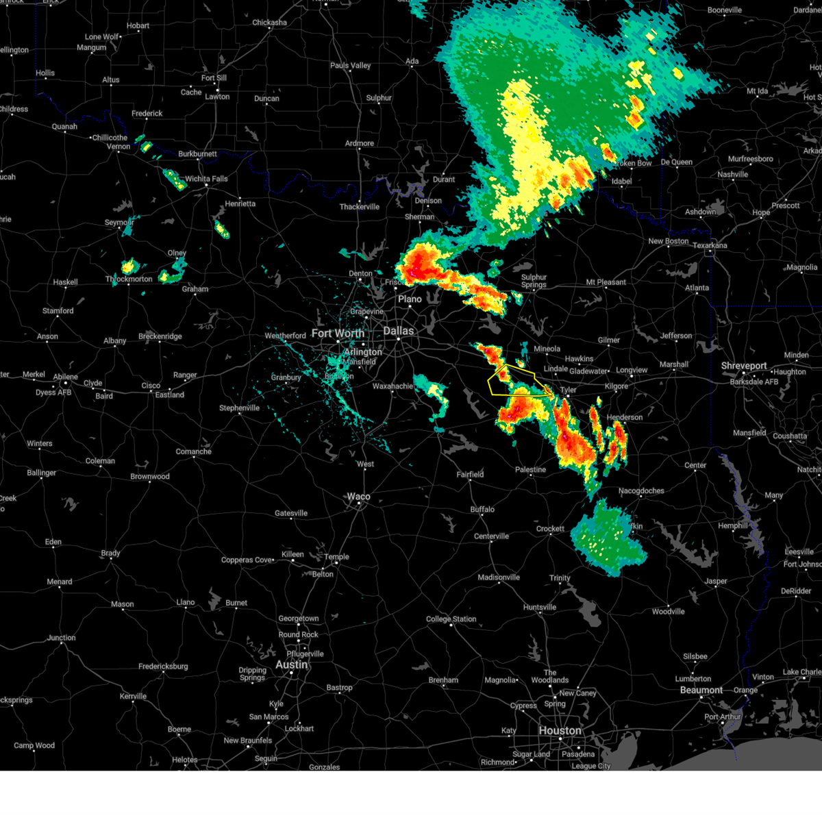 The severe thunderstorm warning for southern van zandt county will expire at 500 pm cdt, the storm which prompted the warning has weakened below severe limits. therefore the warning will be allowed to expire. however small hail, gusty winds and heavy rain are still possible with this thunderstorm. The severe thunderstorm warning for southern van zandt county will expire at 500 pm cdt, the storm which prompted the warning has weakened below severe limits. therefore the warning will be allowed to expire. however small hail, gusty winds and heavy rain are still possible with this thunderstorm.
|
| 6/23/2023 4:36 PM CDT |
 At 436 pm cdt, a severe thunderstorm was located 10 miles north of athens, moving southeast at 20 mph (radar indicated). Hazards include 60 mph wind gusts and nickel size hail. expect damage to roofs, siding, and trees At 436 pm cdt, a severe thunderstorm was located 10 miles north of athens, moving southeast at 20 mph (radar indicated). Hazards include 60 mph wind gusts and nickel size hail. expect damage to roofs, siding, and trees
|
| 6/23/2023 4:17 PM CDT |
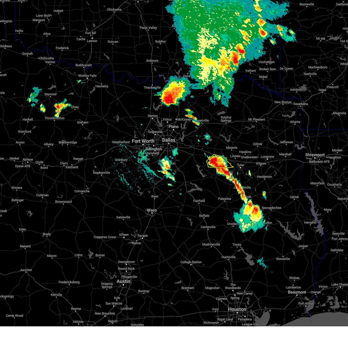 At 417 pm cdt, a severe thunderstorm was located near canton, moving southeast at 20 mph (radar indicated). Hazards include 60 mph wind gusts and quarter size hail. Hail damage to vehicles is expected. expect wind damage to roofs, siding, and trees. locations impacted include, canton, van, edom, redland, ben wheeler, phalba, jackson, walton, primrose, tundra, colfax, martins mill, whitton and oakland. hail threat, radar indicated max hail size, 1. 00 in wind threat, radar indicated max wind gust, 60 mph. At 417 pm cdt, a severe thunderstorm was located near canton, moving southeast at 20 mph (radar indicated). Hazards include 60 mph wind gusts and quarter size hail. Hail damage to vehicles is expected. expect wind damage to roofs, siding, and trees. locations impacted include, canton, van, edom, redland, ben wheeler, phalba, jackson, walton, primrose, tundra, colfax, martins mill, whitton and oakland. hail threat, radar indicated max hail size, 1. 00 in wind threat, radar indicated max wind gust, 60 mph.
|
| 6/23/2023 3:58 PM CDT |
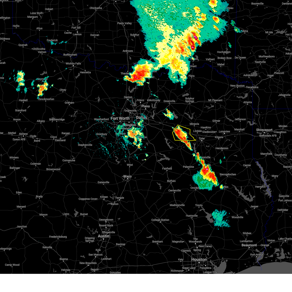 At 358 pm cdt, a severe thunderstorm was located over canton, moving southeast at 15 mph (radar indicated). Hazards include 60 mph wind gusts and quarter size hail. Hail damage to vehicles is expected. Expect wind damage to roofs, siding, and trees. At 358 pm cdt, a severe thunderstorm was located over canton, moving southeast at 15 mph (radar indicated). Hazards include 60 mph wind gusts and quarter size hail. Hail damage to vehicles is expected. Expect wind damage to roofs, siding, and trees.
|
| 6/16/2023 4:19 AM CDT |
 At 418 am cdt, a severe thunderstorm was located over moore station, moving southeast at 30 mph (radar indicated). Hazards include 70 mph wind gusts and quarter size hail. Hail damage to vehicles is expected. expect considerable tree damage. wind damage is also likely to mobile homes, roofs, and outbuildings. locations impacted include, athens, chandler, frankston, brownsboro, berryville, edom, lake palestine, redland, murchison, poynor, coffee city, moore station, new york, larue, primrose, todd city and pert. thunderstorm damage threat, considerable hail threat, radar indicated max hail size, 1. 00 in wind threat, radar indicated max wind gust, 70 mph. At 418 am cdt, a severe thunderstorm was located over moore station, moving southeast at 30 mph (radar indicated). Hazards include 70 mph wind gusts and quarter size hail. Hail damage to vehicles is expected. expect considerable tree damage. wind damage is also likely to mobile homes, roofs, and outbuildings. locations impacted include, athens, chandler, frankston, brownsboro, berryville, edom, lake palestine, redland, murchison, poynor, coffee city, moore station, new york, larue, primrose, todd city and pert. thunderstorm damage threat, considerable hail threat, radar indicated max hail size, 1. 00 in wind threat, radar indicated max wind gust, 70 mph.
|
| 6/16/2023 4:10 AM CDT |
 At 410 am cdt, a severe thunderstorm was located near lake palestine, moving southeast at 45 mph (radar indicated). Hazards include 65 mph wind gusts and quarter size hail. Hail damage to vehicles is expected. Expect wind damage to roofs, siding, and trees. At 410 am cdt, a severe thunderstorm was located near lake palestine, moving southeast at 45 mph (radar indicated). Hazards include 65 mph wind gusts and quarter size hail. Hail damage to vehicles is expected. Expect wind damage to roofs, siding, and trees.
|
| 6/16/2023 4:04 AM CDT |
 At 403 am cdt, severe thunderstorms were located along a line extending from near edom to near brownsboro, moving southeast at 45 mph. the strongest wind gusts will impact the brownsboro and chandler areas of northern henderson county (radar indicated). Hazards include 70 mph wind gusts and quarter size hail. Hail damage to vehicles is expected. expect considerable tree damage. wind damage is also likely to mobile homes, roofs, and outbuildings. locations impacted include, athens, gun barrel city, mabank, chandler, van, malakoff, tool, seven points, brownsboro, eustace, trinidad, edom, enchanted oaks, caney city, lake palestine, forest grove reservoir, purtis creek state park, flag lake, cedar creek reservoir and trinidad lake. thunderstorm damage threat, considerable hail threat, radar indicated max hail size, 1. 00 in wind threat, radar indicated max wind gust, 70 mph. At 403 am cdt, severe thunderstorms were located along a line extending from near edom to near brownsboro, moving southeast at 45 mph. the strongest wind gusts will impact the brownsboro and chandler areas of northern henderson county (radar indicated). Hazards include 70 mph wind gusts and quarter size hail. Hail damage to vehicles is expected. expect considerable tree damage. wind damage is also likely to mobile homes, roofs, and outbuildings. locations impacted include, athens, gun barrel city, mabank, chandler, van, malakoff, tool, seven points, brownsboro, eustace, trinidad, edom, enchanted oaks, caney city, lake palestine, forest grove reservoir, purtis creek state park, flag lake, cedar creek reservoir and trinidad lake. thunderstorm damage threat, considerable hail threat, radar indicated max hail size, 1. 00 in wind threat, radar indicated max wind gust, 70 mph.
|
| 6/16/2023 3:51 AM CDT |
 At 347 am cdt, severe thunderstorms were located along a line extending from near van to martins mill, moving southeast at 55 mph. the strongest wind gusts are expected along and south of highway 64 in southern van zandt and northern henderson county, mainly the ben wheeler, edom, redland, brownsboro, and chandler areas (radar indicated). Hazards include 70 mph wind gusts and quarter size hail. Hail damage to vehicles is expected. expect considerable tree damage. wind damage is also likely to mobile homes, roofs, and outbuildings. locations impacted include, athens, kaufman, gun barrel city, canton, mabank, chandler, van, malakoff, tool, combine, seven points, kemp, brownsboro, eustace, trinidad, edom, grays prairie, enchanted oaks, caney city and cottonwood. thunderstorm damage threat, considerable hail threat, radar indicated max hail size, 1. 00 in wind threat, radar indicated max wind gust, 70 mph. At 347 am cdt, severe thunderstorms were located along a line extending from near van to martins mill, moving southeast at 55 mph. the strongest wind gusts are expected along and south of highway 64 in southern van zandt and northern henderson county, mainly the ben wheeler, edom, redland, brownsboro, and chandler areas (radar indicated). Hazards include 70 mph wind gusts and quarter size hail. Hail damage to vehicles is expected. expect considerable tree damage. wind damage is also likely to mobile homes, roofs, and outbuildings. locations impacted include, athens, kaufman, gun barrel city, canton, mabank, chandler, van, malakoff, tool, combine, seven points, kemp, brownsboro, eustace, trinidad, edom, grays prairie, enchanted oaks, caney city and cottonwood. thunderstorm damage threat, considerable hail threat, radar indicated max hail size, 1. 00 in wind threat, radar indicated max wind gust, 70 mph.
|
| 6/16/2023 3:36 AM CDT |
 At 335 am cdt, severe thunderstorms were located along a line extending from near canton to near mabank to near cottonwood, moving southeast at 50 mph. the strongest wind gusts will be over eastern and central van zandt county (radar indicated). Hazards include 65 mph wind gusts and quarter size hail. Hail damage to vehicles is expected. expect wind damage to roofs, siding, and trees. locations impacted include, terrell, athens, kaufman, gun barrel city, canton, wills point, mabank, crandall, chandler, van, malakoff, tool, combine, talty, seven points, kemp, brownsboro, eustace, trinidad and edom. hail threat, radar indicated max hail size, 1. 00 in wind threat, observed max wind gust, 65 mph. At 335 am cdt, severe thunderstorms were located along a line extending from near canton to near mabank to near cottonwood, moving southeast at 50 mph. the strongest wind gusts will be over eastern and central van zandt county (radar indicated). Hazards include 65 mph wind gusts and quarter size hail. Hail damage to vehicles is expected. expect wind damage to roofs, siding, and trees. locations impacted include, terrell, athens, kaufman, gun barrel city, canton, wills point, mabank, crandall, chandler, van, malakoff, tool, combine, talty, seven points, kemp, brownsboro, eustace, trinidad and edom. hail threat, radar indicated max hail size, 1. 00 in wind threat, observed max wind gust, 65 mph.
|
| 6/16/2023 3:21 AM CDT |
 At 320 am cdt, severe thunderstorms were located along a line extending from near crandall to willis point, moving southeast at 40 mph. a 63 mph wind gust was observed at the terrell airport with this storm (radar indicated). Hazards include 60 mph wind gusts and quarter size hail. Hail damage to vehicles is expected. Expect wind damage to roofs, siding, and trees. At 320 am cdt, severe thunderstorms were located along a line extending from near crandall to willis point, moving southeast at 40 mph. a 63 mph wind gust was observed at the terrell airport with this storm (radar indicated). Hazards include 60 mph wind gusts and quarter size hail. Hail damage to vehicles is expected. Expect wind damage to roofs, siding, and trees.
|
| 6/16/2023 12:43 AM CDT |
 The severe thunderstorm warning for van zandt, northeastern henderson and rains counties will expire at 1245 am cdt, the storm which prompted the warning has moved out of the area. therefore the warning will be allowed to expire. a severe thunderstorm watch remains in effect until 400 am cdt for central and north central texas. The severe thunderstorm warning for van zandt, northeastern henderson and rains counties will expire at 1245 am cdt, the storm which prompted the warning has moved out of the area. therefore the warning will be allowed to expire. a severe thunderstorm watch remains in effect until 400 am cdt for central and north central texas.
|
| 6/15/2023 11:53 PM CDT |
 At 1152 pm cdt, a severe thunderstorm was located near edgewood, or near wills point, moving southeast at 40 mph (radar indicated). Hazards include 70 mph wind gusts and ping pong ball size hail. People and animals outdoors will be injured. expect hail damage to roofs, siding, windows, and vehicles. expect considerable tree damage. Wind damage is also likely to mobile homes, roofs, and outbuildings. At 1152 pm cdt, a severe thunderstorm was located near edgewood, or near wills point, moving southeast at 40 mph (radar indicated). Hazards include 70 mph wind gusts and ping pong ball size hail. People and animals outdoors will be injured. expect hail damage to roofs, siding, windows, and vehicles. expect considerable tree damage. Wind damage is also likely to mobile homes, roofs, and outbuildings.
|
| 6/14/2023 9:21 PM CDT |
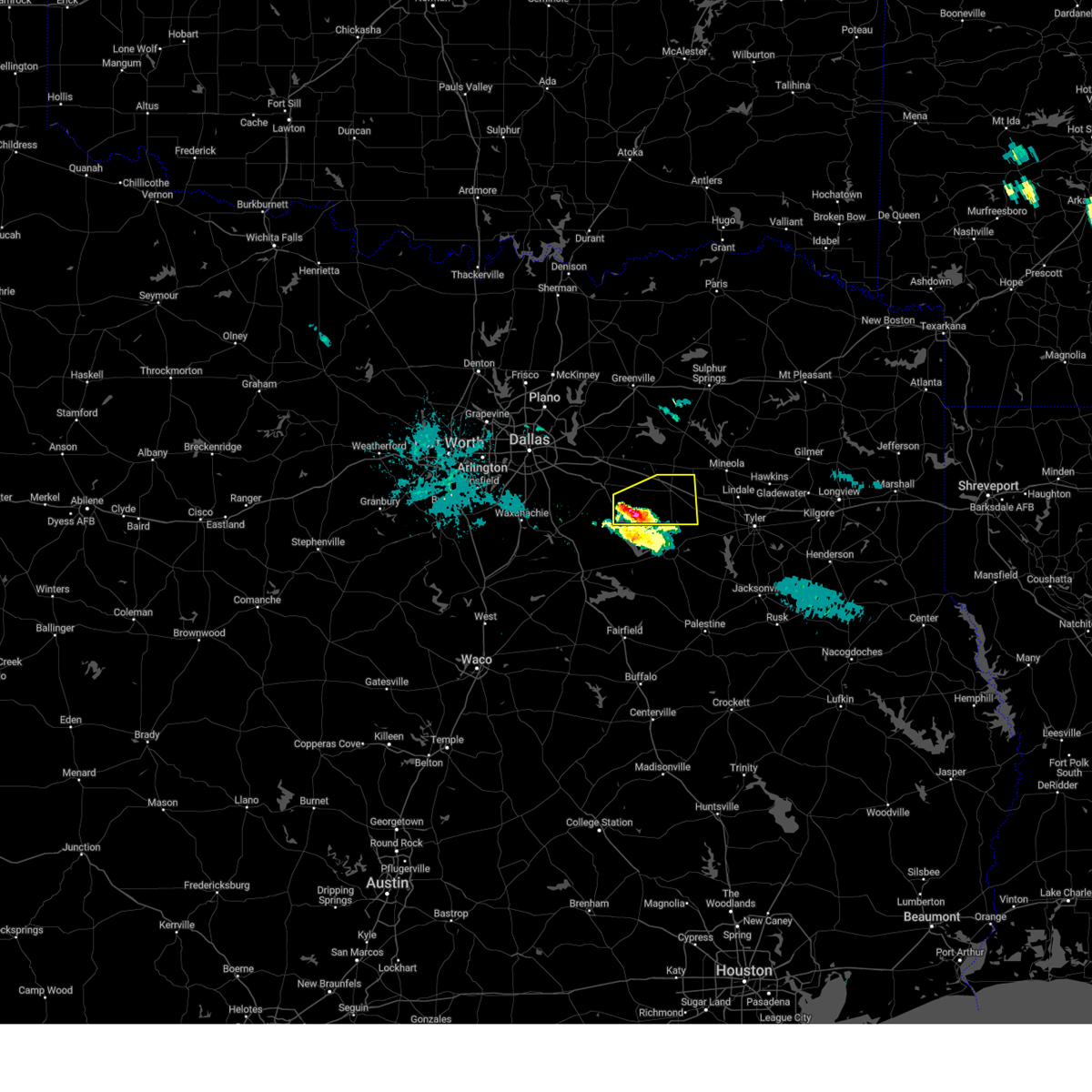 At 920 pm cdt, a severe thunderstorm was located near mabank, or near gun barrel city, moving east at 35 mph (radar indicated). Hazards include half dollar size hail. Damage to vehicles is possible. locations impacted include, canton, mabank, kemp, purtis creek state park, cedar creek reservoir, myrtle springs, ben wheeler, whitton, rand, becker, phalba, roddy, jackson, oakland, wise, walton, prairieville, tundra, colfax and martins mill. hail threat, radar indicated max hail size, 1. 25 in wind threat, radar indicated max wind gust, <50 mph. At 920 pm cdt, a severe thunderstorm was located near mabank, or near gun barrel city, moving east at 35 mph (radar indicated). Hazards include half dollar size hail. Damage to vehicles is possible. locations impacted include, canton, mabank, kemp, purtis creek state park, cedar creek reservoir, myrtle springs, ben wheeler, whitton, rand, becker, phalba, roddy, jackson, oakland, wise, walton, prairieville, tundra, colfax and martins mill. hail threat, radar indicated max hail size, 1. 25 in wind threat, radar indicated max wind gust, <50 mph.
|
| 6/14/2023 9:11 PM CDT |
 At 911 pm cdt, a severe thunderstorm was located over kemp, or 7 miles northwest of gun barrel city, moving east at 35 mph (radar indicated). Hazards include quarter size hail. damage to vehicles is possible At 911 pm cdt, a severe thunderstorm was located over kemp, or 7 miles northwest of gun barrel city, moving east at 35 mph (radar indicated). Hazards include quarter size hail. damage to vehicles is possible
|
| 6/13/2023 4:36 PM CDT |
 The severe thunderstorm warning for southeastern van zandt and northeastern henderson counties will expire at 445 pm cdt, the storm which prompted the warning has moved out of the area. therefore the warning will be allowed to expire. a severe thunderstorm watch remains in effect until 900 pm cdt for central and north central texas. The severe thunderstorm warning for southeastern van zandt and northeastern henderson counties will expire at 445 pm cdt, the storm which prompted the warning has moved out of the area. therefore the warning will be allowed to expire. a severe thunderstorm watch remains in effect until 900 pm cdt for central and north central texas.
|
| 6/13/2023 4:05 PM CDT |
 At 404 pm cdt, a severe thunderstorm was located 7 miles southeast of canton, moving east at 50 mph (radar indicated). Hazards include half dollar size hail. damage to vehicles is possible At 404 pm cdt, a severe thunderstorm was located 7 miles southeast of canton, moving east at 50 mph (radar indicated). Hazards include half dollar size hail. damage to vehicles is possible
|
| 5/4/2023 11:27 PM CDT |
 At 1126 pm cdt, severe thunderstorms were located along a line extending from edom to 8 miles southwest of montalba, moving east at 45 mph (radar indicated). Hazards include 60 mph wind gusts and penny size hail. Expect damage to roofs, siding, and trees. locations impacted include, palestine, athens, chandler, frankston, brownsboro, berryville, lake palestine, montalba, coon creek lake, brushy creek, murchison, poynor, coffee city, moore station, bradford, bois d`arc, bethel, tennessee colony, new york and blackfoot. hail threat, radar indicated max hail size, 0. 75 in wind threat, radar indicated max wind gust, 60 mph. At 1126 pm cdt, severe thunderstorms were located along a line extending from edom to 8 miles southwest of montalba, moving east at 45 mph (radar indicated). Hazards include 60 mph wind gusts and penny size hail. Expect damage to roofs, siding, and trees. locations impacted include, palestine, athens, chandler, frankston, brownsboro, berryville, lake palestine, montalba, coon creek lake, brushy creek, murchison, poynor, coffee city, moore station, bradford, bois d`arc, bethel, tennessee colony, new york and blackfoot. hail threat, radar indicated max hail size, 0. 75 in wind threat, radar indicated max wind gust, 60 mph.
|
| 5/4/2023 11:01 PM CDT |
 At 1101 pm cdt, severe thunderstorms were located along a line extending from 10 miles north of athens to 6 miles northwest of fairfield lake, moving east at 50 mph (radar indicated). Hazards include 60 mph wind gusts and quarter size hail. Hail damage to vehicles is expected. Expect wind damage to roofs, siding, and trees. At 1101 pm cdt, severe thunderstorms were located along a line extending from 10 miles north of athens to 6 miles northwest of fairfield lake, moving east at 50 mph (radar indicated). Hazards include 60 mph wind gusts and quarter size hail. Hail damage to vehicles is expected. Expect wind damage to roofs, siding, and trees.
|
| 4/20/2023 7:24 PM CDT |
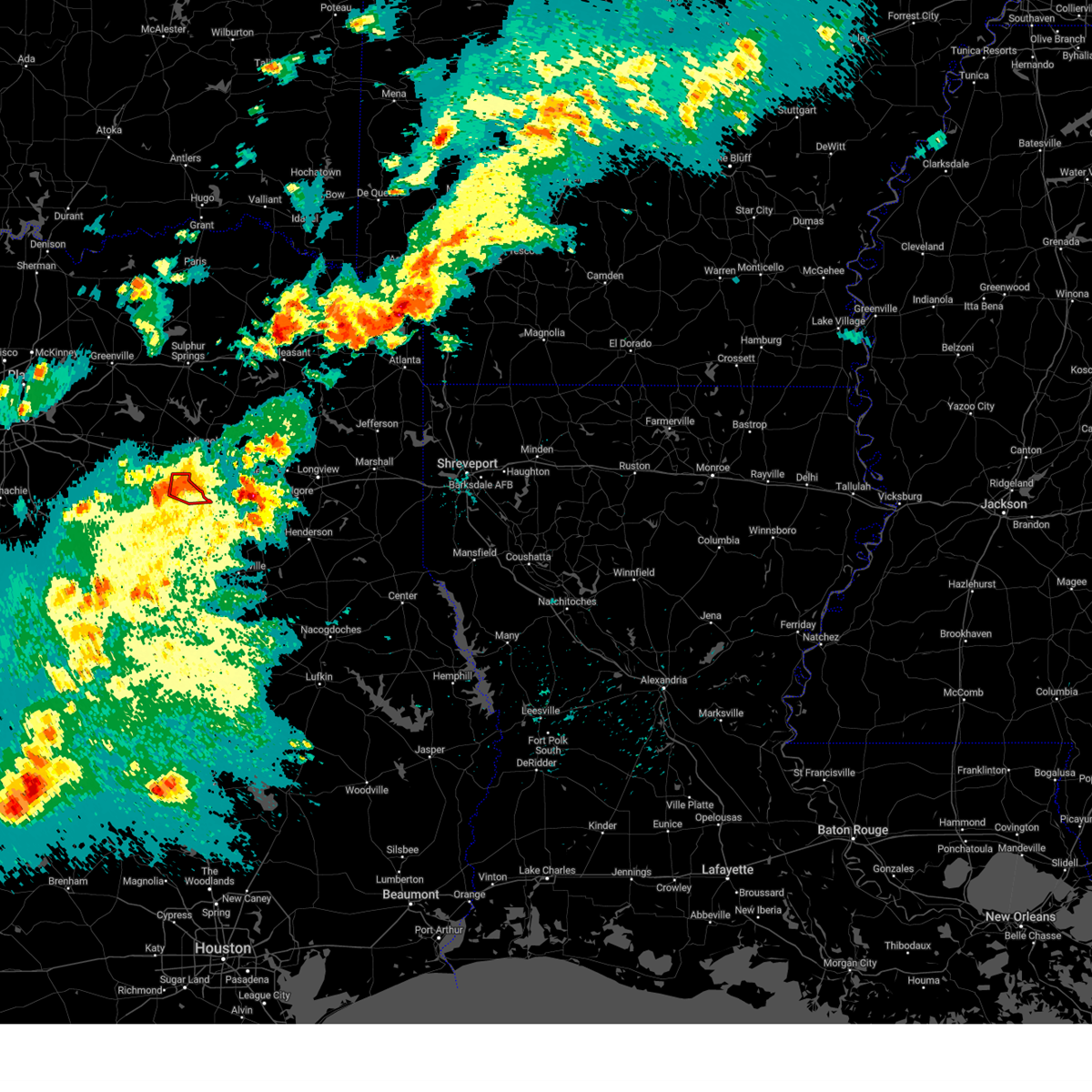 At 724 pm cdt, a severe thunderstorm capable of producing a tornado was located near edom, or 15 miles south of mineola, moving east at 30 mph (radar indicated rotation). Hazards include tornado and quarter size hail. Flying debris will be dangerous to those caught without shelter. mobile homes will be damaged or destroyed. damage to roofs, windows, and vehicles will occur. tree damage is likely. This tornadic thunderstorm will remain over mainly rural areas of southeastern van zandt county, including the following locations, redland, ben wheeler and primrose. At 724 pm cdt, a severe thunderstorm capable of producing a tornado was located near edom, or 15 miles south of mineola, moving east at 30 mph (radar indicated rotation). Hazards include tornado and quarter size hail. Flying debris will be dangerous to those caught without shelter. mobile homes will be damaged or destroyed. damage to roofs, windows, and vehicles will occur. tree damage is likely. This tornadic thunderstorm will remain over mainly rural areas of southeastern van zandt county, including the following locations, redland, ben wheeler and primrose.
|
| 4/20/2023 7:09 PM CDT |
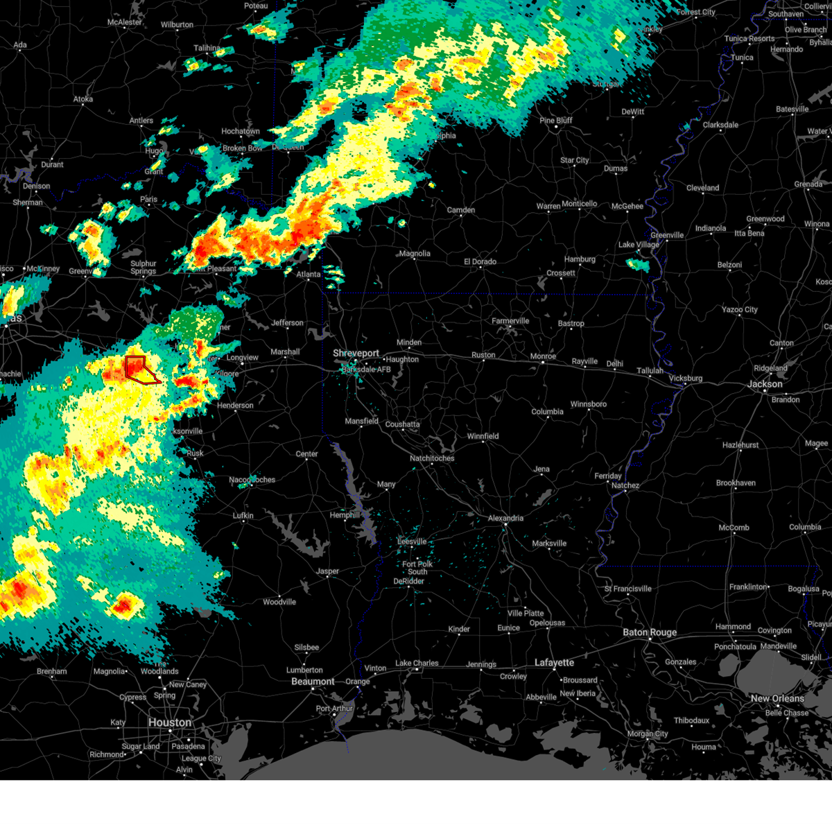 At 709 pm cdt, a severe thunderstorm capable of producing a tornado was located near van, or 12 miles southeast of canton, moving east at 30 mph (radar indicated rotation). Hazards include tornado and quarter size hail. Flying debris will be dangerous to those caught without shelter. mobile homes will be damaged or destroyed. damage to roofs, windows, and vehicles will occur. tree damage is likely. this dangerous storm will be near, edom around 720 pm cdt. Other locations impacted by this tornadic thunderstorm include redland, ben wheeler, primrose and colfax. At 709 pm cdt, a severe thunderstorm capable of producing a tornado was located near van, or 12 miles southeast of canton, moving east at 30 mph (radar indicated rotation). Hazards include tornado and quarter size hail. Flying debris will be dangerous to those caught without shelter. mobile homes will be damaged or destroyed. damage to roofs, windows, and vehicles will occur. tree damage is likely. this dangerous storm will be near, edom around 720 pm cdt. Other locations impacted by this tornadic thunderstorm include redland, ben wheeler, primrose and colfax.
|
| 4/20/2023 7:08 PM CDT |
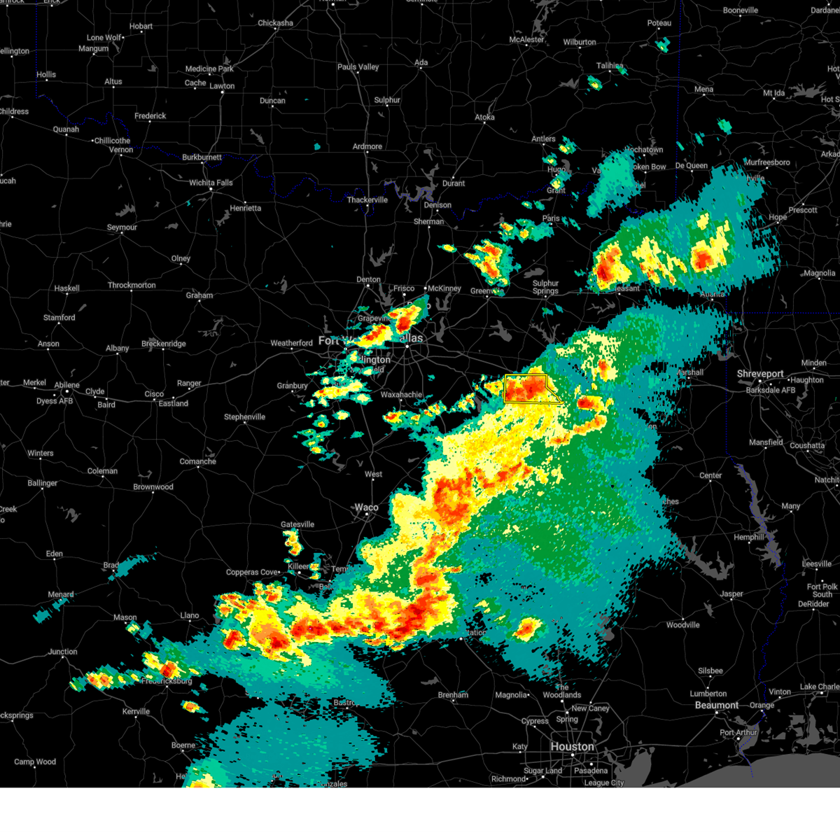 At 708 pm cdt, a severe thunderstorm was located 7 miles south of canton, moving east at 25 mph. the tornado warning in van zandt county remains in effect (radar indicated). Hazards include 60 mph wind gusts and quarter size hail. Hail damage to vehicles is expected. expect wind damage to roofs, siding, and trees. locations impacted include, canton, van, edom, redland, ben wheeler, primrose, pruitt, jackson, tundra, martins mill, colfax and oakland. hail threat, radar indicated max hail size, 1. 00 in wind threat, radar indicated max wind gust, 60 mph. At 708 pm cdt, a severe thunderstorm was located 7 miles south of canton, moving east at 25 mph. the tornado warning in van zandt county remains in effect (radar indicated). Hazards include 60 mph wind gusts and quarter size hail. Hail damage to vehicles is expected. expect wind damage to roofs, siding, and trees. locations impacted include, canton, van, edom, redland, ben wheeler, primrose, pruitt, jackson, tundra, martins mill, colfax and oakland. hail threat, radar indicated max hail size, 1. 00 in wind threat, radar indicated max wind gust, 60 mph.
|
| 4/20/2023 6:59 PM CDT |
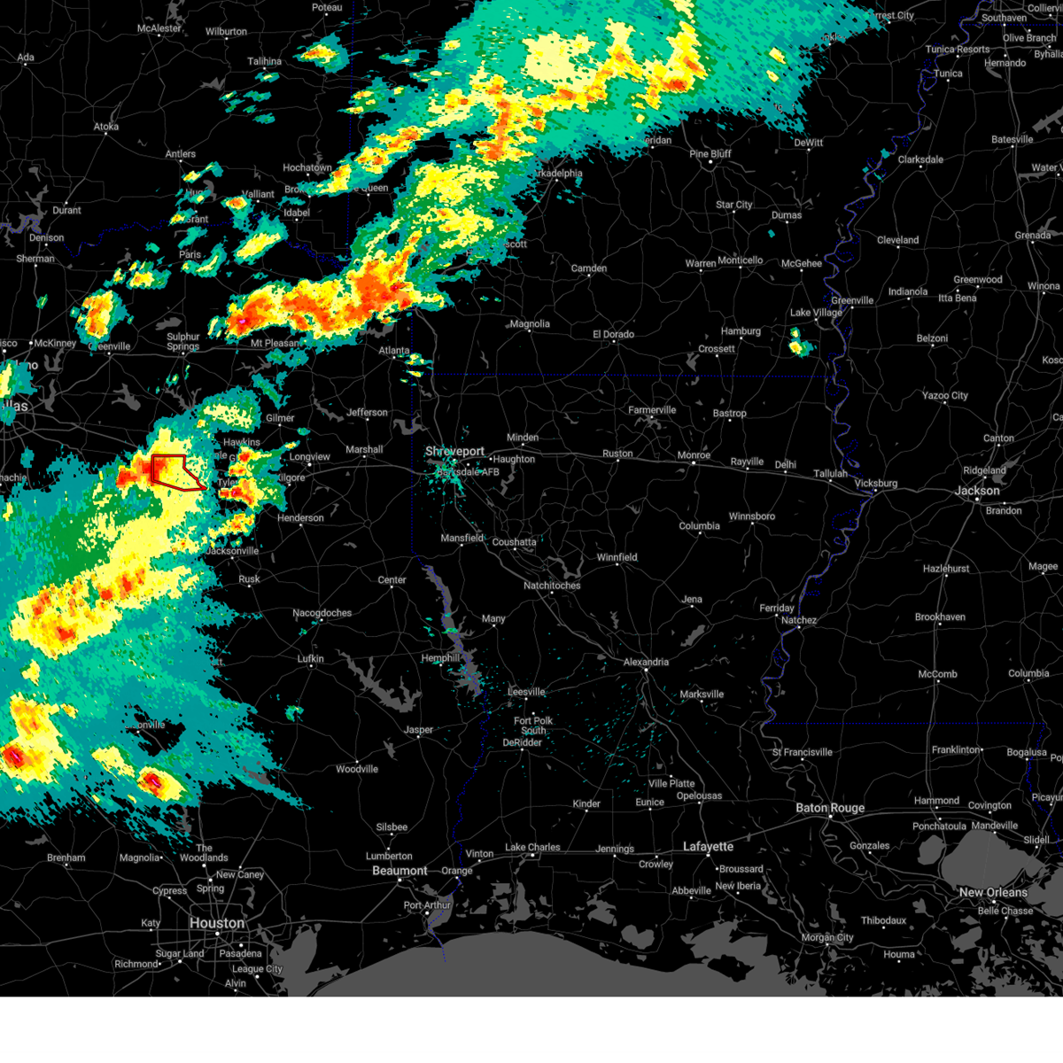 At 659 pm cdt, a severe thunderstorm capable of producing a tornado was located 8 miles southwest of van, or 8 miles southeast of canton, moving east at 25 mph (radar indicated rotation). Hazards include tornado and quarter size hail. Flying debris will be dangerous to those caught without shelter. mobile homes will be damaged or destroyed. damage to roofs, windows, and vehicles will occur. tree damage is likely. this dangerous storm will be near, van around 715 pm cdt. edom around 720 pm cdt. other locations impacted by this tornadic thunderstorm include redland, ben wheeler, primrose, martins mill and colfax. This includes interstate 20 between mile markers 531 and 542. At 659 pm cdt, a severe thunderstorm capable of producing a tornado was located 8 miles southwest of van, or 8 miles southeast of canton, moving east at 25 mph (radar indicated rotation). Hazards include tornado and quarter size hail. Flying debris will be dangerous to those caught without shelter. mobile homes will be damaged or destroyed. damage to roofs, windows, and vehicles will occur. tree damage is likely. this dangerous storm will be near, van around 715 pm cdt. edom around 720 pm cdt. other locations impacted by this tornadic thunderstorm include redland, ben wheeler, primrose, martins mill and colfax. This includes interstate 20 between mile markers 531 and 542.
|
| 4/20/2023 6:52 PM CDT |
 At 652 pm cdt, a severe thunderstorm was located near purtis creek state park, or 10 miles northeast of gun barrel city, moving east at 25 mph (radar indicated). Hazards include 60 mph wind gusts and quarter size hail. Hail damage to vehicles is expected. Expect wind damage to roofs, siding, and trees. At 652 pm cdt, a severe thunderstorm was located near purtis creek state park, or 10 miles northeast of gun barrel city, moving east at 25 mph (radar indicated). Hazards include 60 mph wind gusts and quarter size hail. Hail damage to vehicles is expected. Expect wind damage to roofs, siding, and trees.
|
| 4/20/2023 5:52 PM CDT |
 At 552 pm cdt, a severe thunderstorm was located 8 miles northeast of kemp, or 9 miles east of kaufman, moving southeast at 25 mph (radar indicated). Hazards include ping pong ball size hail and 60 mph wind gusts. People and animals outdoors will be injured. expect hail damage to roofs, siding, windows, and vehicles. Expect wind damage to roofs, siding, and trees. At 552 pm cdt, a severe thunderstorm was located 8 miles northeast of kemp, or 9 miles east of kaufman, moving southeast at 25 mph (radar indicated). Hazards include ping pong ball size hail and 60 mph wind gusts. People and animals outdoors will be injured. expect hail damage to roofs, siding, windows, and vehicles. Expect wind damage to roofs, siding, and trees.
|
| 3/16/2023 8:54 PM CDT |
 The tornado warning for southeastern van zandt and northeastern henderson counties will expire at 900 pm cdt, the storm which prompted the warning has moved out of the area. therefore the warning will be allowed to expire. however small hail and gusty winds are still possible with this thunderstorm. a tornado watch remains in effect until 100 am cdt for central and north central texas. The tornado warning for southeastern van zandt and northeastern henderson counties will expire at 900 pm cdt, the storm which prompted the warning has moved out of the area. therefore the warning will be allowed to expire. however small hail and gusty winds are still possible with this thunderstorm. a tornado watch remains in effect until 100 am cdt for central and north central texas.
|
| 3/16/2023 8:22 PM CDT |
 At 821 pm cdt, a severe thunderstorm capable of producing a tornado was located near brownsboro, or 11 miles northeast of athens, moving east at 40 mph (radar indicated rotation). Hazards include tornado and ping pong ball size hail. Flying debris will be dangerous to those caught without shelter. mobile homes will be damaged or destroyed. damage to roofs, windows, and vehicles will occur. tree damage is likely. this dangerous storm will be near, brownsboro and edom around 830 pm cdt. chandler and lake palestine around 845 pm cdt. Other locations impacted by this tornadic thunderstorm include murchison, redland and primrose. At 821 pm cdt, a severe thunderstorm capable of producing a tornado was located near brownsboro, or 11 miles northeast of athens, moving east at 40 mph (radar indicated rotation). Hazards include tornado and ping pong ball size hail. Flying debris will be dangerous to those caught without shelter. mobile homes will be damaged or destroyed. damage to roofs, windows, and vehicles will occur. tree damage is likely. this dangerous storm will be near, brownsboro and edom around 830 pm cdt. chandler and lake palestine around 845 pm cdt. Other locations impacted by this tornadic thunderstorm include murchison, redland and primrose.
|
| 3/16/2023 7:57 PM CDT |
 At 754 pm cdt, a severe thunderstorm was located near eustace, or 9 miles northwest of athens, moving east at 40 mph (radar indicated). Hazards include ping pong ball size hail and 65 mph wind gusts. People and animals outdoors will be injured. expect hail damage to roofs, siding, windows, and vehicles. expect wind damage to roofs, siding, and trees. Locations impacted include, athens, gun barrel city, chandler, brownsboro, eustace, berryville, edom, caney city, lake palestine, forest grove reservoir, purtis creek state park, cedar creek reservoir, redland, payne springs, log cabin, murchison, coffee city, moore station, ben wheeler and roddy. At 754 pm cdt, a severe thunderstorm was located near eustace, or 9 miles northwest of athens, moving east at 40 mph (radar indicated). Hazards include ping pong ball size hail and 65 mph wind gusts. People and animals outdoors will be injured. expect hail damage to roofs, siding, windows, and vehicles. expect wind damage to roofs, siding, and trees. Locations impacted include, athens, gun barrel city, chandler, brownsboro, eustace, berryville, edom, caney city, lake palestine, forest grove reservoir, purtis creek state park, cedar creek reservoir, redland, payne springs, log cabin, murchison, coffee city, moore station, ben wheeler and roddy.
|
| 3/16/2023 7:38 PM CDT |
 At 738 pm cdt, a severe thunderstorm was located over mabank, or over gun barrel city, moving east at 40 mph (radar indicated). Hazards include ping pong ball size hail and 65 mph wind gusts. People and animals outdoors will be injured. expect hail damage to roofs, siding, windows, and vehicles. Expect wind damage to roofs, siding, and trees. At 738 pm cdt, a severe thunderstorm was located over mabank, or over gun barrel city, moving east at 40 mph (radar indicated). Hazards include ping pong ball size hail and 65 mph wind gusts. People and animals outdoors will be injured. expect hail damage to roofs, siding, windows, and vehicles. Expect wind damage to roofs, siding, and trees.
|
| 3/2/2023 8:56 PM CST |
 At 855 pm cst, severe thunderstorms were located along a line extending from near edom to tennessee colony to dew, moving east at 45 mph (radar indicated). Hazards include 60 mph wind gusts. Expect damage to roofs, siding, and trees. locations impacted include, palestine, athens, gun barrel city, groesbeck, teague, fairfield, malakoff, eustace, edom, caney city, fairfield lake, forest grove reservoir, purtis creek state park, montalba, coon creek lake, fairfield lake state park, cedar creek reservoir, richland-chambers reservoir, cross roads and payne springs. hail threat, radar indicated max hail size, <. 75 in wind threat, radar indicated max wind gust, 60 mph. At 855 pm cst, severe thunderstorms were located along a line extending from near edom to tennessee colony to dew, moving east at 45 mph (radar indicated). Hazards include 60 mph wind gusts. Expect damage to roofs, siding, and trees. locations impacted include, palestine, athens, gun barrel city, groesbeck, teague, fairfield, malakoff, eustace, edom, caney city, fairfield lake, forest grove reservoir, purtis creek state park, montalba, coon creek lake, fairfield lake state park, cedar creek reservoir, richland-chambers reservoir, cross roads and payne springs. hail threat, radar indicated max hail size, <. 75 in wind threat, radar indicated max wind gust, 60 mph.
|
| 3/2/2023 8:44 PM CST |
 At 844 pm cst, severe thunderstorms were located along a line extending from athens to fairfield to teague, moving east at 55 mph (radar indicated). Hazards include 70 mph wind gusts. Expect considerable tree damage. damage is likely to mobile homes, roofs, and outbuildings. locations impacted include, palestine, athens, mexia, gun barrel city, groesbeck, teague, fairfield, mabank, malakoff, tool, wortham, eustace, trinidad, edom, enchanted oaks, caney city, fairfield lake, lake mexia, purtis creek state park and fort parker state park. thunderstorm damage threat, considerable hail threat, radar indicated max hail size, <. 75 in wind threat, radar indicated max wind gust, 70 mph. At 844 pm cst, severe thunderstorms were located along a line extending from athens to fairfield to teague, moving east at 55 mph (radar indicated). Hazards include 70 mph wind gusts. Expect considerable tree damage. damage is likely to mobile homes, roofs, and outbuildings. locations impacted include, palestine, athens, mexia, gun barrel city, groesbeck, teague, fairfield, mabank, malakoff, tool, wortham, eustace, trinidad, edom, enchanted oaks, caney city, fairfield lake, lake mexia, purtis creek state park and fort parker state park. thunderstorm damage threat, considerable hail threat, radar indicated max hail size, <. 75 in wind threat, radar indicated max wind gust, 70 mph.
|
| 3/2/2023 8:42 PM CST |
 The severe thunderstorm warning for southeastern kaufman, van zandt, hopkins and rains counties will expire at 845 pm cst, the storms which prompted the warning have moved out of the area. therefore the warning will be allowed to expire. however gusty winds are still possible. a tornado watch remains in effect until 1000 pm cst for north central texas. remember, a severe thunderstorm warning still remains in effect for southern van zandt county until 930 pm cst. The severe thunderstorm warning for southeastern kaufman, van zandt, hopkins and rains counties will expire at 845 pm cst, the storms which prompted the warning have moved out of the area. therefore the warning will be allowed to expire. however gusty winds are still possible. a tornado watch remains in effect until 1000 pm cst for north central texas. remember, a severe thunderstorm warning still remains in effect for southern van zandt county until 930 pm cst.
|
| 3/2/2023 8:29 PM CST |
 At 828 pm cst, severe thunderstorms were located along a line extending from sulfur bluf to como to canton, moving east at 50 mph (radar indicated). Hazards include 70 mph wind gusts. Expect considerable tree damage. damage is likely to mobile homes, roofs, and outbuildings. locations impacted include, sulphur springs, canton, wills point, grand saline, mabank, van, edgewood, emory, kemp, como, fruitvale, edom, purtis creek state park, lake sulphur springs, cooper lake state park, cooper lake, cedar creek reservoir, lake fork reservoir, redland and myrtle springs. thunderstorm damage threat, considerable hail threat, radar indicated max hail size, <. 75 in wind threat, radar indicated max wind gust, 70 mph. At 828 pm cst, severe thunderstorms were located along a line extending from sulfur bluf to como to canton, moving east at 50 mph (radar indicated). Hazards include 70 mph wind gusts. Expect considerable tree damage. damage is likely to mobile homes, roofs, and outbuildings. locations impacted include, sulphur springs, canton, wills point, grand saline, mabank, van, edgewood, emory, kemp, como, fruitvale, edom, purtis creek state park, lake sulphur springs, cooper lake state park, cooper lake, cedar creek reservoir, lake fork reservoir, redland and myrtle springs. thunderstorm damage threat, considerable hail threat, radar indicated max hail size, <. 75 in wind threat, radar indicated max wind gust, 70 mph.
|
| 3/2/2023 8:08 PM CST |
 At 808 pm cst, severe thunderstorms were located along a line extending from near kemp to fort parker state park, moving east at 30 mph (radar indicated). Hazards include 70 mph wind gusts and penny size hail. Expect considerable tree damage. Damage is likely to mobile homes, roofs, and outbuildings. At 808 pm cst, severe thunderstorms were located along a line extending from near kemp to fort parker state park, moving east at 30 mph (radar indicated). Hazards include 70 mph wind gusts and penny size hail. Expect considerable tree damage. Damage is likely to mobile homes, roofs, and outbuildings.
|
| 3/2/2023 8:04 PM CST |
 At 804 pm cst, severe thunderstorms were located along a line extending from near cooper lake state park to emory to mabank, moving east at 50 mph (radar indicated). Hazards include 70 mph wind gusts. Expect considerable tree damage. damage is likely to mobile homes, roofs, and outbuildings. locations impacted include, sulphur springs, canton, wills point, grand saline, mabank, van, edgewood, emory, kemp, east tawakoni, point, cumby, como, fruitvale, edom, purtis creek state park, lake sulphur springs, cooper lake state park, lake tawakoni and cooper lake. thunderstorm damage threat, considerable hail threat, radar indicated max hail size, <. 75 in wind threat, observed max wind gust, 70 mph. At 804 pm cst, severe thunderstorms were located along a line extending from near cooper lake state park to emory to mabank, moving east at 50 mph (radar indicated). Hazards include 70 mph wind gusts. Expect considerable tree damage. damage is likely to mobile homes, roofs, and outbuildings. locations impacted include, sulphur springs, canton, wills point, grand saline, mabank, van, edgewood, emory, kemp, east tawakoni, point, cumby, como, fruitvale, edom, purtis creek state park, lake sulphur springs, cooper lake state park, lake tawakoni and cooper lake. thunderstorm damage threat, considerable hail threat, radar indicated max hail size, <. 75 in wind threat, observed max wind gust, 70 mph.
|
| 3/2/2023 7:36 PM CST |
 At 735 pm cst, severe thunderstorms were located along a line extending from commerce to lake tawakoni to kemp, moving east at 50 mph (radar indicated). Hazards include 70 mph wind gusts. Expect considerable tree damage. Damage is likely to mobile homes, roofs, and outbuildings. At 735 pm cst, severe thunderstorms were located along a line extending from commerce to lake tawakoni to kemp, moving east at 50 mph (radar indicated). Hazards include 70 mph wind gusts. Expect considerable tree damage. Damage is likely to mobile homes, roofs, and outbuildings.
|
| 11/4/2022 6:22 PM CDT |
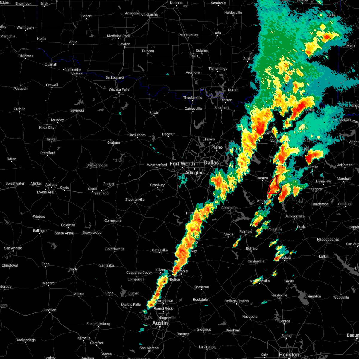 At 622 pm cdt, a severe thunderstorm capable of producing a tornado was located near van, or 13 miles southwest of mineola, moving northeast at 45 mph (radar indicated rotation). Hazards include tornado. Flying debris will be dangerous to those caught without shelter. mobile homes will be damaged or destroyed. damage to roofs, windows, and vehicles will occur. tree damage is likely. This tornadic thunderstorm will remain over mainly rural areas of southeastern van zandt county, including the following locations, ben wheeler, primrose, pruitt and colfax. At 622 pm cdt, a severe thunderstorm capable of producing a tornado was located near van, or 13 miles southwest of mineola, moving northeast at 45 mph (radar indicated rotation). Hazards include tornado. Flying debris will be dangerous to those caught without shelter. mobile homes will be damaged or destroyed. damage to roofs, windows, and vehicles will occur. tree damage is likely. This tornadic thunderstorm will remain over mainly rural areas of southeastern van zandt county, including the following locations, ben wheeler, primrose, pruitt and colfax.
|
| 11/4/2022 6:10 PM CDT |
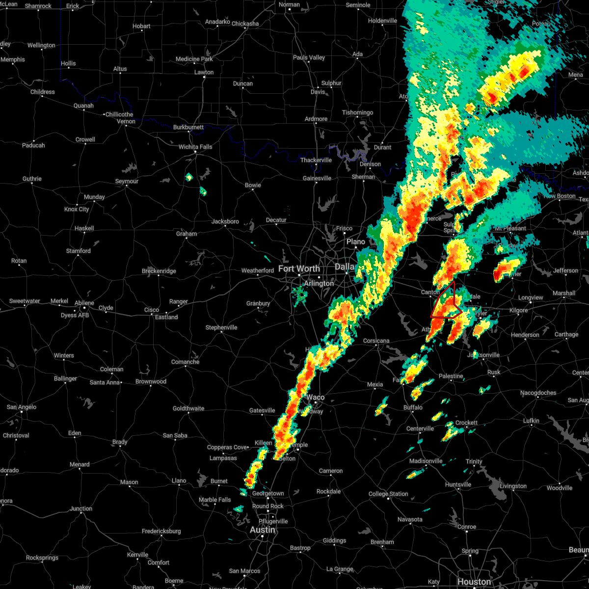 At 610 pm cdt, a severe thunderstorm capable of producing a tornado was located 7 miles west of edom, or 13 miles northeast of athens, moving northeast at 45 mph (radar indicated rotation). Hazards include tornado. Flying debris will be dangerous to those caught without shelter. mobile homes will be damaged or destroyed. damage to roofs, windows, and vehicles will occur. tree damage is likely. this dangerous storm will be near, edom around 615 pm cdt. van around 625 pm cdt. other locations impacted by this tornadic thunderstorm include jones, ben wheeler, primrose, pruitt, martins mill, colfax and walton. This includes interstate 20 between mile markers 532 and 542. At 610 pm cdt, a severe thunderstorm capable of producing a tornado was located 7 miles west of edom, or 13 miles northeast of athens, moving northeast at 45 mph (radar indicated rotation). Hazards include tornado. Flying debris will be dangerous to those caught without shelter. mobile homes will be damaged or destroyed. damage to roofs, windows, and vehicles will occur. tree damage is likely. this dangerous storm will be near, edom around 615 pm cdt. van around 625 pm cdt. other locations impacted by this tornadic thunderstorm include jones, ben wheeler, primrose, pruitt, martins mill, colfax and walton. This includes interstate 20 between mile markers 532 and 542.
|
| 5/15/2022 11:04 PM CDT |
 At 1104 pm cdt, severe thunderstorms were located along a line extending from near grand saline to 10 miles northeast of kemp, moving southeast at 65 mph (radar indicated). Hazards include 60 mph wind gusts and nickel size hail. Expect damage to roofs, siding, and trees. locations impacted include, dallas, garland, mesquite, rowlett, wylie, rockwall, balch springs, sachse, terrell, seagoville, forney, kaufman, hutchins, canton, wills point, royse city, heath, fate, sunnyvale and wilmer. hail threat, radar indicated max hail size, 0. 88 in wind threat, radar indicated max wind gust, 60 mph. At 1104 pm cdt, severe thunderstorms were located along a line extending from near grand saline to 10 miles northeast of kemp, moving southeast at 65 mph (radar indicated). Hazards include 60 mph wind gusts and nickel size hail. Expect damage to roofs, siding, and trees. locations impacted include, dallas, garland, mesquite, rowlett, wylie, rockwall, balch springs, sachse, terrell, seagoville, forney, kaufman, hutchins, canton, wills point, royse city, heath, fate, sunnyvale and wilmer. hail threat, radar indicated max hail size, 0. 88 in wind threat, radar indicated max wind gust, 60 mph.
|
| 5/15/2022 10:43 PM CDT |
 At 1043 pm cdt, severe thunderstorms were located along a line extending from near east tawakoni to 8 miles southeast of fate, moving southeast at 65 mph (radar indicated). Hazards include 65 mph wind gusts and nickel size hail. Expect damage to roofs, siding, and trees. locations impacted include, dallas, garland, mesquite, rowlett, wylie, rockwall, greenville, balch springs, sachse, terrell, seagoville, forney, commerce, kaufman, hutchins, canton, wills point, royse city, heath and princeton. hail threat, radar indicated max hail size, 0. 88 in wind threat, radar indicated max wind gust, 65 mph. At 1043 pm cdt, severe thunderstorms were located along a line extending from near east tawakoni to 8 miles southeast of fate, moving southeast at 65 mph (radar indicated). Hazards include 65 mph wind gusts and nickel size hail. Expect damage to roofs, siding, and trees. locations impacted include, dallas, garland, mesquite, rowlett, wylie, rockwall, greenville, balch springs, sachse, terrell, seagoville, forney, commerce, kaufman, hutchins, canton, wills point, royse city, heath and princeton. hail threat, radar indicated max hail size, 0. 88 in wind threat, radar indicated max wind gust, 65 mph.
|
| 5/15/2022 10:30 PM CDT |
 At 1029 pm cdt, severe thunderstorms were located along a line extending from 6 miles south of campbell to near royse city, moving southeast at 65 mph (radar indicated). Hazards include 60 mph wind gusts and nickel size hail. expect damage to roofs, siding, and trees At 1029 pm cdt, severe thunderstorms were located along a line extending from 6 miles south of campbell to near royse city, moving southeast at 65 mph (radar indicated). Hazards include 60 mph wind gusts and nickel size hail. expect damage to roofs, siding, and trees
|
| 5/5/2022 11:31 AM CDT |
 At 1130 am cdt, a severe thunderstorm was located 9 miles west of edom, or 11 miles northeast of athens, moving east at 35 mph (radar indicated). Hazards include 60 mph wind gusts and quarter size hail. Hail damage to vehicles is expected. Expect wind damage to roofs, siding, and trees. At 1130 am cdt, a severe thunderstorm was located 9 miles west of edom, or 11 miles northeast of athens, moving east at 35 mph (radar indicated). Hazards include 60 mph wind gusts and quarter size hail. Hail damage to vehicles is expected. Expect wind damage to roofs, siding, and trees.
|
| 5/5/2022 11:21 AM CDT |
 The severe thunderstorm warning for southeastern van zandt and northeastern henderson counties will expire at 1130 am cdt, the storm which prompted the warning has moved out of the area. therefore the warning will be allowed to expire. a tornado watch remains in effect until 600 pm cdt for central and north central texas. The severe thunderstorm warning for southeastern van zandt and northeastern henderson counties will expire at 1130 am cdt, the storm which prompted the warning has moved out of the area. therefore the warning will be allowed to expire. a tornado watch remains in effect until 600 pm cdt for central and north central texas.
|
| 5/5/2022 10:27 AM CDT |
 At 1027 am cdt, a severe thunderstorm was located near brownsboro, or 13 miles east of athens, moving northeast at 55 mph (radar indicated). Hazards include quarter size hail. damage to vehicles is possible At 1027 am cdt, a severe thunderstorm was located near brownsboro, or 13 miles east of athens, moving northeast at 55 mph (radar indicated). Hazards include quarter size hail. damage to vehicles is possible
|
| 4/13/2022 1:37 PM CDT |
 At 136 pm cdt, a severe thunderstorm was located 7 miles west of brownsboro, or 8 miles northeast of athens, moving east at 40 mph (trained weather spotters). Hazards include ping pong ball size hail and 60 mph wind gusts. People and animals outdoors will be injured. expect hail damage to roofs, siding, windows, and vehicles. expect wind damage to roofs, siding, and trees. locations impacted include, athens, chandler, brownsboro, coffee city, murchison and moore station. hail threat, observed max hail size, 1. 50 in wind threat, radar indicated max wind gust, 60 mph. At 136 pm cdt, a severe thunderstorm was located 7 miles west of brownsboro, or 8 miles northeast of athens, moving east at 40 mph (trained weather spotters). Hazards include ping pong ball size hail and 60 mph wind gusts. People and animals outdoors will be injured. expect hail damage to roofs, siding, windows, and vehicles. expect wind damage to roofs, siding, and trees. locations impacted include, athens, chandler, brownsboro, coffee city, murchison and moore station. hail threat, observed max hail size, 1. 50 in wind threat, radar indicated max wind gust, 60 mph.
|
| 4/13/2022 1:28 PM CDT |
 At 127 pm cdt, a severe thunderstorm was located over athens, moving east at 35 mph (trained weather spotters). Hazards include ping pong ball size hail and 60 mph wind gusts. People and animals outdoors will be injured. expect hail damage to roofs, siding, windows, and vehicles. expect wind damage to roofs, siding, and trees. locations impacted include, athens, chandler, van, malakoff, brownsboro, eustace, trinidad, edom, coffee city, caney city, log cabin, murchison, star harbor and moore station. hail threat, observed max hail size, 1. 50 in wind threat, radar indicated max wind gust, 60 mph. At 127 pm cdt, a severe thunderstorm was located over athens, moving east at 35 mph (trained weather spotters). Hazards include ping pong ball size hail and 60 mph wind gusts. People and animals outdoors will be injured. expect hail damage to roofs, siding, windows, and vehicles. expect wind damage to roofs, siding, and trees. locations impacted include, athens, chandler, van, malakoff, brownsboro, eustace, trinidad, edom, coffee city, caney city, log cabin, murchison, star harbor and moore station. hail threat, observed max hail size, 1. 50 in wind threat, radar indicated max wind gust, 60 mph.
|
| 4/13/2022 1:11 PM CDT |
 At 110 pm cdt, severe thunderstorms were located along a line extending from grand saline to trinidad, moving east at 50 mph (trained weather spotters). Hazards include 60 mph wind gusts and quarter size hail. Hail damage to vehicles is expected. expect wind damage to roofs, siding, and trees. locations impacted include, athens, gun barrel city, canton, grand saline, mabank, chandler, van, malakoff, tool, kerens, edgewood, brownsboro, eustace, trinidad, fruitvale, edom, enchanted oaks, coffee city, caney city and purtis creek state park. hail threat, observed max hail size, 1. 00 in wind threat, radar indicated max wind gust, 60 mph. At 110 pm cdt, severe thunderstorms were located along a line extending from grand saline to trinidad, moving east at 50 mph (trained weather spotters). Hazards include 60 mph wind gusts and quarter size hail. Hail damage to vehicles is expected. expect wind damage to roofs, siding, and trees. locations impacted include, athens, gun barrel city, canton, grand saline, mabank, chandler, van, malakoff, tool, kerens, edgewood, brownsboro, eustace, trinidad, fruitvale, edom, enchanted oaks, coffee city, caney city and purtis creek state park. hail threat, observed max hail size, 1. 00 in wind threat, radar indicated max wind gust, 60 mph.
|
| 4/13/2022 12:47 PM CDT |
 At 1246 pm cdt, severe thunderstorms were located along a line extending from near wills point to near corsicana, moving east at 35 mph (radar indicated). Hazards include 60 mph wind gusts and quarter size hail. Hail damage to vehicles is expected. Expect wind damage to roofs, siding, and trees. At 1246 pm cdt, severe thunderstorms were located along a line extending from near wills point to near corsicana, moving east at 35 mph (radar indicated). Hazards include 60 mph wind gusts and quarter size hail. Hail damage to vehicles is expected. Expect wind damage to roofs, siding, and trees.
|
| 4/12/2022 8:06 PM CDT |
 The severe thunderstorm warning for central van zandt, southern hopkins and rains counties will expire at 815 pm cdt, the storms which prompted the warning have moved out of the area. therefore the warning will be allowed to expire. a tornado watch remains in effect until 1100 pm cdt for north central texas. The severe thunderstorm warning for central van zandt, southern hopkins and rains counties will expire at 815 pm cdt, the storms which prompted the warning have moved out of the area. therefore the warning will be allowed to expire. a tornado watch remains in effect until 1100 pm cdt for north central texas.
|
| 4/12/2022 7:51 PM CDT |
 At 750 pm cdt, severe thunderstorms were located along a line extending from brownsboro to near frankston to palestine, moving east at 50 mph. this storm has a history of producing 65 mph winds and wind damage (trained weather spotters). Hazards include 65 mph wind gusts. Expect damage to roofs, siding, and trees. locations impacted include, athens, chandler, frankston, brownsboro, berryville, coffee city, murchison, poynor and moore station. hail threat, radar indicated max hail size, <. 75 in wind threat, radar indicated max wind gust, 65 mph. At 750 pm cdt, severe thunderstorms were located along a line extending from brownsboro to near frankston to palestine, moving east at 50 mph. this storm has a history of producing 65 mph winds and wind damage (trained weather spotters). Hazards include 65 mph wind gusts. Expect damage to roofs, siding, and trees. locations impacted include, athens, chandler, frankston, brownsboro, berryville, coffee city, murchison, poynor and moore station. hail threat, radar indicated max hail size, <. 75 in wind threat, radar indicated max wind gust, 65 mph.
|
| 4/12/2022 7:41 PM CDT |
 At 741 pm cdt, severe thunderstorms were located along a line extending from cumby to grand saline to martins mill, moving east at 40 mph (radar indicated). Hazards include 60 mph wind gusts. Expect damage to roofs, siding, and trees. locations impacted include, sulphur springs, canton, grand saline, van, emory, como, fruitvale and edom. hail threat, radar indicated max hail size, <. 75 in wind threat, radar indicated max wind gust, 60 mph. At 741 pm cdt, severe thunderstorms were located along a line extending from cumby to grand saline to martins mill, moving east at 40 mph (radar indicated). Hazards include 60 mph wind gusts. Expect damage to roofs, siding, and trees. locations impacted include, sulphur springs, canton, grand saline, van, emory, como, fruitvale and edom. hail threat, radar indicated max hail size, <. 75 in wind threat, radar indicated max wind gust, 60 mph.
|
| 4/12/2022 7:11 PM CDT |
 At 710 pm cdt, severe thunderstorms were located along a line extending from near hawk cove to near purtis creek state park, moving east at 55 mph (radar indicated). Hazards include 60 mph wind gusts. expect damage to roofs, siding, and trees At 710 pm cdt, severe thunderstorms were located along a line extending from near hawk cove to near purtis creek state park, moving east at 55 mph (radar indicated). Hazards include 60 mph wind gusts. expect damage to roofs, siding, and trees
|
| 4/5/2022 1:24 AM CDT |
 The severe thunderstorm warning for southeastern van zandt county will expire at 130 am cdt, the storm which prompted the warning has moved out of the area. therefore the warning will be allowed to expire. a tornado watch remains in effect until 200 am cdt for north central texas. The severe thunderstorm warning for southeastern van zandt county will expire at 130 am cdt, the storm which prompted the warning has moved out of the area. therefore the warning will be allowed to expire. a tornado watch remains in effect until 200 am cdt for north central texas.
|
| 4/5/2022 1:15 AM CDT |
 At 114 am cdt, a severe thunderstorm was located over brownsboro, or 13 miles east of athens, moving east at 45 mph (radar indicated). Hazards include 65 mph wind gusts and quarter size hail. Hail damage to vehicles is expected. expect wind damage to roofs, siding, and trees. locations impacted include, athens, chandler, malakoff, brownsboro, berryville, coffee city, murchison, poynor and moore station. hail threat, radar indicated max hail size, 1. 00 in wind threat, radar indicated max wind gust, 65 mph. At 114 am cdt, a severe thunderstorm was located over brownsboro, or 13 miles east of athens, moving east at 45 mph (radar indicated). Hazards include 65 mph wind gusts and quarter size hail. Hail damage to vehicles is expected. expect wind damage to roofs, siding, and trees. locations impacted include, athens, chandler, malakoff, brownsboro, berryville, coffee city, murchison, poynor and moore station. hail threat, radar indicated max hail size, 1. 00 in wind threat, radar indicated max wind gust, 65 mph.
|
| 4/5/2022 1:13 AM CDT |
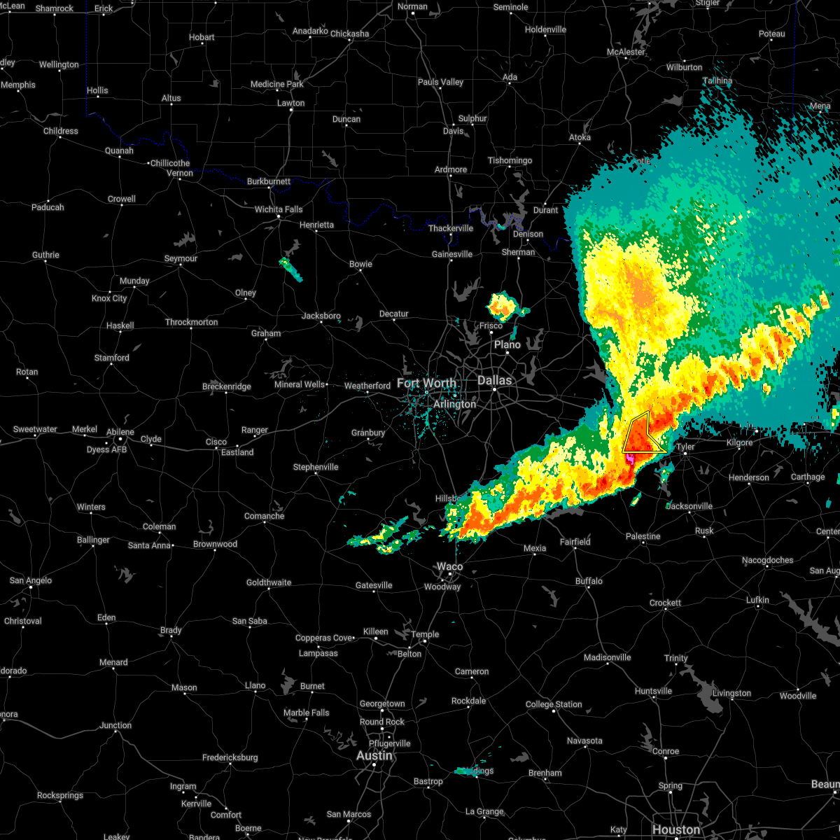 At 113 am cdt, a severe thunderstorm was located near edom, or 16 miles west of tyler, moving east at 40 mph (radar indicated). Hazards include 60 mph wind gusts. Expect damage to roofs, siding, and trees. Locations impacted include, van and edom. At 113 am cdt, a severe thunderstorm was located near edom, or 16 miles west of tyler, moving east at 40 mph (radar indicated). Hazards include 60 mph wind gusts. Expect damage to roofs, siding, and trees. Locations impacted include, van and edom.
|
| 4/5/2022 12:58 AM CDT |
 At 1257 am cdt, a severe thunderstorm was located 9 miles southeast of canton, moving east at 35 mph (radar indicated). Hazards include 60 mph wind gusts. expect damage to roofs, siding, and trees At 1257 am cdt, a severe thunderstorm was located 9 miles southeast of canton, moving east at 35 mph (radar indicated). Hazards include 60 mph wind gusts. expect damage to roofs, siding, and trees
|
| 3/21/2022 9:23 PM CDT |
 At 923 pm cdt, a severe thunderstorm capable of producing a tornado was located near brownsboro, or 13 miles northeast of athens, moving northeast at 50 mph (radar indicated rotation). Hazards include tornado and half dollar size hail. Flying debris will be dangerous to those caught without shelter. mobile homes will be damaged or destroyed. damage to roofs, windows, and vehicles will occur. tree damage is likely. this dangerous storm will be near, edom around 930 pm cdt. van around 940 pm cdt. This includes interstate 20 between mile markers 540 and 542. At 923 pm cdt, a severe thunderstorm capable of producing a tornado was located near brownsboro, or 13 miles northeast of athens, moving northeast at 50 mph (radar indicated rotation). Hazards include tornado and half dollar size hail. Flying debris will be dangerous to those caught without shelter. mobile homes will be damaged or destroyed. damage to roofs, windows, and vehicles will occur. tree damage is likely. this dangerous storm will be near, edom around 930 pm cdt. van around 940 pm cdt. This includes interstate 20 between mile markers 540 and 542.
|
| 3/21/2022 9:22 PM CDT |
 At 921 pm cdt, a severe thunderstorm was located over fruitvale, or 9 miles northeast of canton, moving northeast at 50 mph (radar indicated). Hazards include 60 mph wind gusts and penny size hail. Expect damage to roofs, siding, and trees. locations impacted include, canton, grand saline, van, edgewood, emory, fruitvale, edom and point. hail threat, radar indicated max hail size, 0. 75 in wind threat, radar indicated max wind gust, 60 mph. At 921 pm cdt, a severe thunderstorm was located over fruitvale, or 9 miles northeast of canton, moving northeast at 50 mph (radar indicated). Hazards include 60 mph wind gusts and penny size hail. Expect damage to roofs, siding, and trees. locations impacted include, canton, grand saline, van, edgewood, emory, fruitvale, edom and point. hail threat, radar indicated max hail size, 0. 75 in wind threat, radar indicated max wind gust, 60 mph.
|
| 3/21/2022 9:05 PM CDT |
 At 905 pm cdt, a severe thunderstorm was located 7 miles west of canton, moving northeast at 50 mph (radar indicated). Hazards include 60 mph wind gusts and penny size hail. expect damage to roofs, siding, and trees At 905 pm cdt, a severe thunderstorm was located 7 miles west of canton, moving northeast at 50 mph (radar indicated). Hazards include 60 mph wind gusts and penny size hail. expect damage to roofs, siding, and trees
|
| 3/14/2022 8:03 PM CDT |
 At 802 pm cdt, a severe thunderstorm was located 8 miles southwest of frankston, or 14 miles north of palestine, moving east at 40 mph (radar indicated). Hazards include 60 mph wind gusts and quarter size hail. Hail damage to vehicles is expected. expect wind damage to roofs, siding, and trees. locations impacted include, palestine, athens, chandler, frankston, brownsboro, berryville, edom, coffee city, murchison, poynor and moore station. hail threat, radar indicated max hail size, 1. 00 in wind threat, radar indicated max wind gust, 60 mph. At 802 pm cdt, a severe thunderstorm was located 8 miles southwest of frankston, or 14 miles north of palestine, moving east at 40 mph (radar indicated). Hazards include 60 mph wind gusts and quarter size hail. Hail damage to vehicles is expected. expect wind damage to roofs, siding, and trees. locations impacted include, palestine, athens, chandler, frankston, brownsboro, berryville, edom, coffee city, murchison, poynor and moore station. hail threat, radar indicated max hail size, 1. 00 in wind threat, radar indicated max wind gust, 60 mph.
|
| 3/14/2022 7:45 PM CDT |
 At 745 pm cdt, a severe thunderstorm was located 16 miles south of athens, moving east at 40 mph (radar indicated). Hazards include 60 mph wind gusts and quarter size hail. Hail damage to vehicles is expected. Expect wind damage to roofs, siding, and trees. At 745 pm cdt, a severe thunderstorm was located 16 miles south of athens, moving east at 40 mph (radar indicated). Hazards include 60 mph wind gusts and quarter size hail. Hail damage to vehicles is expected. Expect wind damage to roofs, siding, and trees.
|
| 3/14/2022 7:22 PM CDT |
 At 721 pm cdt, a severe thunderstorm was located 7 miles east of purtis creek state park, or 10 miles north of athens, moving east at 35 mph (radar indicated). Hazards include 60 mph wind gusts and quarter size hail. Hail damage to vehicles is expected. Expect wind damage to roofs, siding, and trees. At 721 pm cdt, a severe thunderstorm was located 7 miles east of purtis creek state park, or 10 miles north of athens, moving east at 35 mph (radar indicated). Hazards include 60 mph wind gusts and quarter size hail. Hail damage to vehicles is expected. Expect wind damage to roofs, siding, and trees.
|
| 10/10/2021 11:44 PM CDT |
 At 1143 pm cdt, severe thunderstorms were located along a line extending from canton to malakoff to mexia, moving east at 45 mph (radar indicated). Hazards include 60 mph wind gusts. Expect damage to roofs, siding, and trees. locations impacted include, athens, mexia, gun barrel city, canton, teague, fairfield, mabank, chandler, van, malakoff, tool, kerens, wortham, brownsboro, eustace, coolidge, trinidad, angus, edom and enchanted oaks. hail threat, radar indicated max hail size, <. 75 in wind threat, radar indicated max wind gust, 60 mph. At 1143 pm cdt, severe thunderstorms were located along a line extending from canton to malakoff to mexia, moving east at 45 mph (radar indicated). Hazards include 60 mph wind gusts. Expect damage to roofs, siding, and trees. locations impacted include, athens, mexia, gun barrel city, canton, teague, fairfield, mabank, chandler, van, malakoff, tool, kerens, wortham, brownsboro, eustace, coolidge, trinidad, angus, edom and enchanted oaks. hail threat, radar indicated max hail size, <. 75 in wind threat, radar indicated max wind gust, 60 mph.
|
| 10/10/2021 11:04 PM CDT |
 At 1103 pm cdt, severe thunderstorms were located along a line extending from near kaufman to 8 miles southwest of seven points to 8 miles north of mart, moving east at 45 mph (radar indicated). Hazards include 60 mph wind gusts and penny size hail. expect damage to roofs, siding, and trees At 1103 pm cdt, severe thunderstorms were located along a line extending from near kaufman to 8 miles southwest of seven points to 8 miles north of mart, moving east at 45 mph (radar indicated). Hazards include 60 mph wind gusts and penny size hail. expect damage to roofs, siding, and trees
|
| 8/17/2021 6:42 PM CDT |
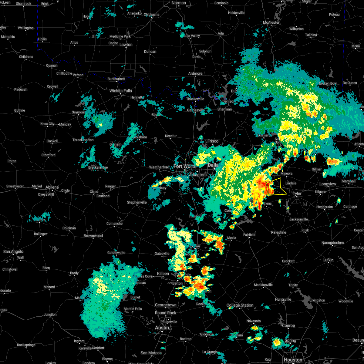 At 642 pm cdt, a severe thunderstorm was located 7 miles southwest of van, or 10 miles southeast of canton, moving east at 20 mph (radar indicated). Hazards include 60 mph wind gusts. expect damage to roofs, siding, and trees At 642 pm cdt, a severe thunderstorm was located 7 miles southwest of van, or 10 miles southeast of canton, moving east at 20 mph (radar indicated). Hazards include 60 mph wind gusts. expect damage to roofs, siding, and trees
|
| 5/4/2021 1:12 AM CDT |
 The severe thunderstorm warning for southeastern van zandt and northeastern henderson counties will expire at 115 am cdt, the storm which prompted the warning has moved out of the area. therefore the warning will be allowed to expire. a severe thunderstorm watch remains in effect until 300 am cdt for central and north central texas. The severe thunderstorm warning for southeastern van zandt and northeastern henderson counties will expire at 115 am cdt, the storm which prompted the warning has moved out of the area. therefore the warning will be allowed to expire. a severe thunderstorm watch remains in effect until 300 am cdt for central and north central texas.
|
| 5/4/2021 1:02 AM CDT |
 At 102 am cdt, a severe thunderstorm was located over edom, or 15 miles west of tyler, moving east at 50 mph (radar indicated). Hazards include 65 mph wind gusts and quarter size hail. Hail damage to vehicles is expected. expect wind damage to roofs, siding, and trees. Locations impacted include, chandler, brownsboro, edom and murchison. At 102 am cdt, a severe thunderstorm was located over edom, or 15 miles west of tyler, moving east at 50 mph (radar indicated). Hazards include 65 mph wind gusts and quarter size hail. Hail damage to vehicles is expected. expect wind damage to roofs, siding, and trees. Locations impacted include, chandler, brownsboro, edom and murchison.
|
| 5/4/2021 12:52 AM CDT |
 At 1252 am cdt, a severe thunderstorm was located 10 miles west of brownsboro, or 10 miles northeast of athens, moving east at 50 mph (radar indicated). Hazards include 65 mph wind gusts and quarter size hail. Hail damage to vehicles is expected. expect wind damage to roofs, siding, and trees. Locations impacted include, athens, chandler, brownsboro, edom, purtis creek state park and murchison. At 1252 am cdt, a severe thunderstorm was located 10 miles west of brownsboro, or 10 miles northeast of athens, moving east at 50 mph (radar indicated). Hazards include 65 mph wind gusts and quarter size hail. Hail damage to vehicles is expected. expect wind damage to roofs, siding, and trees. Locations impacted include, athens, chandler, brownsboro, edom, purtis creek state park and murchison.
|
| 5/4/2021 12:41 AM CDT |
 A severe thunderstorm warning remains in effect until 115 am cdt for southern van zandt and northeastern henderson counties. at 1241 am cdt, a severe thunderstorm was located near caney city, or near athens, moving east at 45 mph. hazard. 65 mph wind gusts and quarter size hail. source. Radar indicated. A severe thunderstorm warning remains in effect until 115 am cdt for southern van zandt and northeastern henderson counties. at 1241 am cdt, a severe thunderstorm was located near caney city, or near athens, moving east at 45 mph. hazard. 65 mph wind gusts and quarter size hail. source. Radar indicated.
|
| 5/4/2021 12:28 AM CDT |
 At 1228 am cdt, a severe thunderstorm was located over enchanted oaks, or near gun barrel city, moving east at 50 mph (radar indicated). Hazards include 60 mph wind gusts and penny size hail. Expect damage to roofs, siding, and trees. Locations impacted include, athens, gun barrel city, canton, mabank, chandler, van, malakoff, tool, seven points, kemp, brownsboro, eustace, trinidad, edom, grays prairie, enchanted oaks, caney city, purtis creek state park, payne springs and log cabin. At 1228 am cdt, a severe thunderstorm was located over enchanted oaks, or near gun barrel city, moving east at 50 mph (radar indicated). Hazards include 60 mph wind gusts and penny size hail. Expect damage to roofs, siding, and trees. Locations impacted include, athens, gun barrel city, canton, mabank, chandler, van, malakoff, tool, seven points, kemp, brownsboro, eustace, trinidad, edom, grays prairie, enchanted oaks, caney city, purtis creek state park, payne springs and log cabin.
|
| 5/4/2021 12:18 AM CDT |
 At 1217 am cdt, a cluster of severe thunderstorms was located from near kemp to kerens, moving east at 50 mph (radar indicated). Hazards include 60 mph wind gusts and penny size hail. expect damage to roofs, siding, and trees At 1217 am cdt, a cluster of severe thunderstorms was located from near kemp to kerens, moving east at 50 mph (radar indicated). Hazards include 60 mph wind gusts and penny size hail. expect damage to roofs, siding, and trees
|
| 5/3/2021 11:30 PM CDT |
 At 1129 pm cdt, a severe thunderstorm was located near canton, moving east at 45 mph (radar indicated). Hazards include 60 mph wind gusts and quarter size hail. Hail damage to vehicles is expected. expect wind damage to roofs, siding, and trees. Locations impacted include, canton, grand saline, van, edgewood, fruitvale, edom and purtis creek state park. At 1129 pm cdt, a severe thunderstorm was located near canton, moving east at 45 mph (radar indicated). Hazards include 60 mph wind gusts and quarter size hail. Hail damage to vehicles is expected. expect wind damage to roofs, siding, and trees. Locations impacted include, canton, grand saline, van, edgewood, fruitvale, edom and purtis creek state park.
|
| 5/3/2021 10:59 PM CDT |
 At 1059 pm cdt, a severe thunderstorm was located over gun barrel city, moving east at 45 mph (radar indicated). Hazards include 60 mph wind gusts and quarter size hail. Hail damage to vehicles is expected. Expect wind damage to roofs, siding, and trees. At 1059 pm cdt, a severe thunderstorm was located over gun barrel city, moving east at 45 mph (radar indicated). Hazards include 60 mph wind gusts and quarter size hail. Hail damage to vehicles is expected. Expect wind damage to roofs, siding, and trees.
|
| 5/3/2021 10:33 PM CDT |
 At 1032 pm cdt, severe thunderstorms were located along a line moving into canton, moving east at 45 mph (radar indicated). Hazards include 65 mph wind gusts and quarter size hail. Hail damage to vehicles is expected. Expect wind damage to roofs, siding, and trees. At 1032 pm cdt, severe thunderstorms were located along a line moving into canton, moving east at 45 mph (radar indicated). Hazards include 65 mph wind gusts and quarter size hail. Hail damage to vehicles is expected. Expect wind damage to roofs, siding, and trees.
|
| 4/10/2021 12:09 AM CDT |
 At 1208 am cdt, a line of severe thunderstorms was located from near van to malakoff, moving southeast at 40 mph (radar indicated). Hazards include 60 mph wind gusts and quarter size hail. Hail damage to vehicles is expected. expect wind damage to roofs, siding, and trees. Locations impacted include, athens, chandler, van, malakoff, brownsboro, eustace, berryville, trinidad, edom, enchanted oaks, coffee city, caney city, payne springs, log cabin, murchison, star harbor and moore station. At 1208 am cdt, a line of severe thunderstorms was located from near van to malakoff, moving southeast at 40 mph (radar indicated). Hazards include 60 mph wind gusts and quarter size hail. Hail damage to vehicles is expected. expect wind damage to roofs, siding, and trees. Locations impacted include, athens, chandler, van, malakoff, brownsboro, eustace, berryville, trinidad, edom, enchanted oaks, coffee city, caney city, payne springs, log cabin, murchison, star harbor and moore station.
|
| 4/9/2021 11:56 PM CDT |
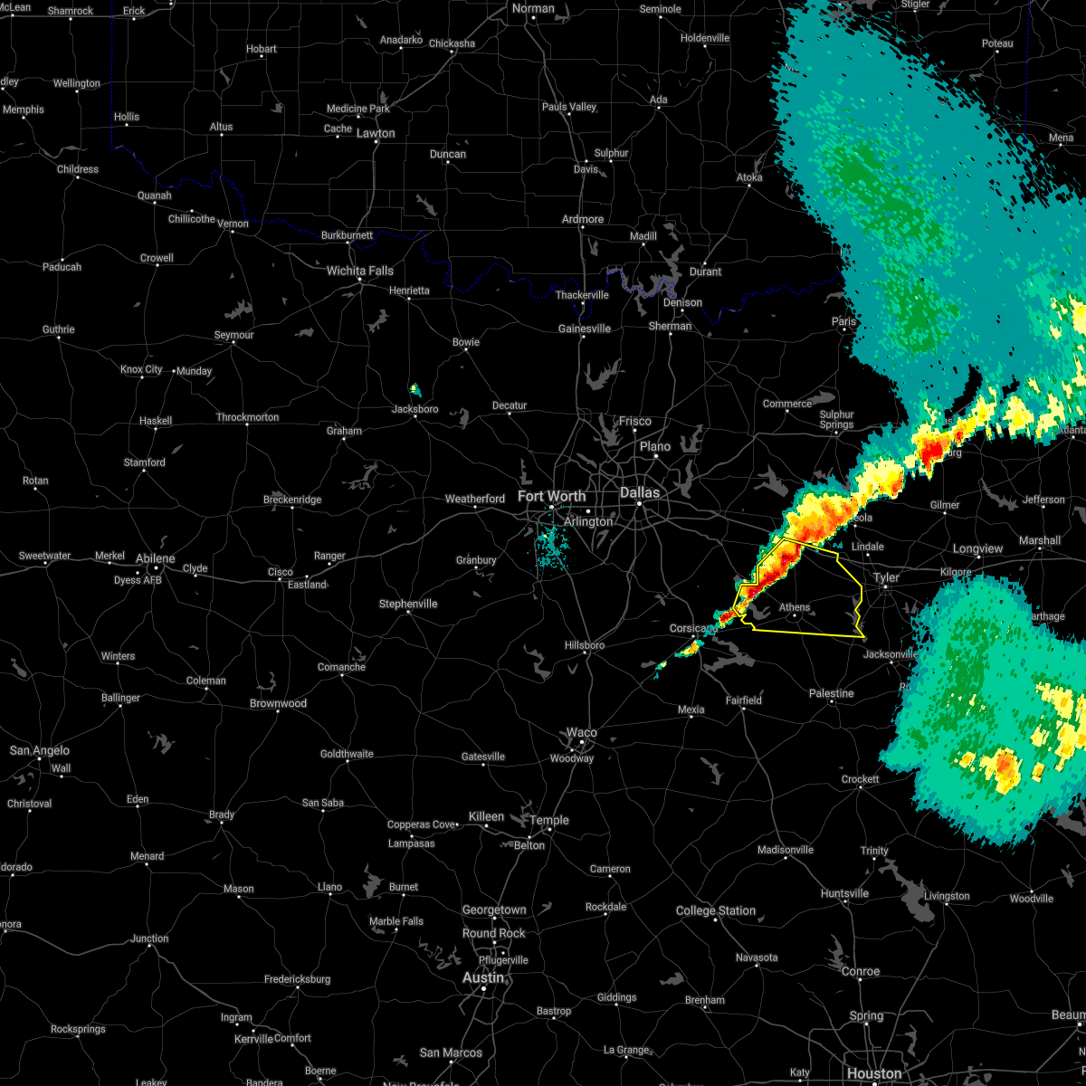 At 1155 pm cdt, a line of severe thunderstorms extends from near canton to gun barrel city, moving east at 40 mph (radar indicated). Hazards include 60 mph wind gusts and quarter size hail. Hail damage to vehicles is expected. expect wind damage to roofs, siding, and trees. Locations impacted include, athens, gun barrel city, canton, mabank, chandler, van, malakoff, tool, seven points, brownsboro, eustace, berryville, trinidad, edom, enchanted oaks, coffee city, caney city, purtis creek state park, payne springs and log cabin. At 1155 pm cdt, a line of severe thunderstorms extends from near canton to gun barrel city, moving east at 40 mph (radar indicated). Hazards include 60 mph wind gusts and quarter size hail. Hail damage to vehicles is expected. expect wind damage to roofs, siding, and trees. Locations impacted include, athens, gun barrel city, canton, mabank, chandler, van, malakoff, tool, seven points, brownsboro, eustace, berryville, trinidad, edom, enchanted oaks, coffee city, caney city, purtis creek state park, payne springs and log cabin.
|
| 4/9/2021 11:40 PM CDT |
 At 1139 pm cdt, a cluster of severe thunderstorms was located from near myrtle springs to mabank, moving east at 40 mph (radar indicated). Hazards include 60 mph wind gusts and quarter size hail. Hail damage to vehicles is expected. Expect wind damage to roofs, siding, and trees. At 1139 pm cdt, a cluster of severe thunderstorms was located from near myrtle springs to mabank, moving east at 40 mph (radar indicated). Hazards include 60 mph wind gusts and quarter size hail. Hail damage to vehicles is expected. Expect wind damage to roofs, siding, and trees.
|
| 4/9/2021 8:36 PM CDT |
 At 836 pm cdt, a severe thunderstorm was located near athens, moving east at 45 mph (radar indicated). Hazards include 60 mph wind gusts and quarter size hail. Hail damage to vehicles is expected. Expect wind damage to roofs, siding, and trees. At 836 pm cdt, a severe thunderstorm was located near athens, moving east at 45 mph (radar indicated). Hazards include 60 mph wind gusts and quarter size hail. Hail damage to vehicles is expected. Expect wind damage to roofs, siding, and trees.
|
| 4/9/2021 1:39 PM CDT |
 At 138 pm cdt, a severe thunderstorm was located near van, or 15 miles south of mineola, moving northeast at 35 mph (radar indicated). Hazards include quarter size hail. Damage to vehicles is possible. Locations impacted include, edom. At 138 pm cdt, a severe thunderstorm was located near van, or 15 miles south of mineola, moving northeast at 35 mph (radar indicated). Hazards include quarter size hail. Damage to vehicles is possible. Locations impacted include, edom.
|
| 4/9/2021 1:24 PM CDT |
 At 124 pm cdt, a severe thunderstorm was located near edom, or 13 miles northeast of athens, moving northeast at 40 mph (radar indicated). Hazards include quarter size hail. Damage to vehicles is possible. Locations impacted include, chandler, brownsboro, edom and murchison. At 124 pm cdt, a severe thunderstorm was located near edom, or 13 miles northeast of athens, moving northeast at 40 mph (radar indicated). Hazards include quarter size hail. Damage to vehicles is possible. Locations impacted include, chandler, brownsboro, edom and murchison.
|
| 4/9/2021 1:14 PM CDT |
 At 114 pm cdt, a severe thunderstorm was located 7 miles northeast of athens, moving northeast at 45 mph (radar indicated). Hazards include quarter size hail. damage to vehicles is possible At 114 pm cdt, a severe thunderstorm was located 7 miles northeast of athens, moving northeast at 45 mph (radar indicated). Hazards include quarter size hail. damage to vehicles is possible
|
| 3/17/2021 6:50 AM CDT |
 The severe thunderstorm warning for van zandt, hopkins, rains and east central delta counties will expire at 700 am cdt, the storms which prompted the warning are moving out of the area. therefore the warning will be allowed to expire. a severe thunderstorm watch remains in effect until 1000 am cdt for north central texas. The severe thunderstorm warning for van zandt, hopkins, rains and east central delta counties will expire at 700 am cdt, the storms which prompted the warning are moving out of the area. therefore the warning will be allowed to expire. a severe thunderstorm watch remains in effect until 1000 am cdt for north central texas.
|
| 3/17/2021 6:33 AM CDT |
 At 632 am cdt, severe thunderstorms were located along a line extending from near sulphur springs to near van, moving east at 50 mph (radar indicated). Hazards include 60 mph wind gusts and penny size hail. Expect damage to roofs, siding, and trees. Locations impacted include, sulphur springs, canton, grand saline, van, edgewood, emory, como, fruitvale and edom. At 632 am cdt, severe thunderstorms were located along a line extending from near sulphur springs to near van, moving east at 50 mph (radar indicated). Hazards include 60 mph wind gusts and penny size hail. Expect damage to roofs, siding, and trees. Locations impacted include, sulphur springs, canton, grand saline, van, edgewood, emory, como, fruitvale and edom.
|
| 3/17/2021 6:06 AM CDT |
 At 605 am cdt, severe thunderstorms were located along a line extending from greenville to canton, moving northeast at 55 mph (radar indicated). Hazards include 60 mph wind gusts and penny size hail. expect damage to roofs, siding, and trees At 605 am cdt, severe thunderstorms were located along a line extending from greenville to canton, moving northeast at 55 mph (radar indicated). Hazards include 60 mph wind gusts and penny size hail. expect damage to roofs, siding, and trees
|
| 5/22/2020 7:29 PM CDT |
 At 729 pm cdt, a severe thunderstorm was located over van, or 12 miles east of canton, moving north at 40 mph (radar indicated). Hazards include quarter size hail. damage to vehicles is possible At 729 pm cdt, a severe thunderstorm was located over van, or 12 miles east of canton, moving north at 40 mph (radar indicated). Hazards include quarter size hail. damage to vehicles is possible
|
| 4/29/2020 1:12 AM CDT |
 At 111 am cdt, severe thunderstorms were located along a line extending from bynum to oak valley to kerens to athens, moving southeast at 50 mph (radar indicated). Hazards include 70 mph wind gusts and quarter size hail. Hail damage to vehicles is expected. expect considerable tree damage. Wind damage is also likely to mobile homes, roofs, and outbuildings. At 111 am cdt, severe thunderstorms were located along a line extending from bynum to oak valley to kerens to athens, moving southeast at 50 mph (radar indicated). Hazards include 70 mph wind gusts and quarter size hail. Hail damage to vehicles is expected. expect considerable tree damage. Wind damage is also likely to mobile homes, roofs, and outbuildings.
|
| 4/28/2020 11:33 PM CDT |
 At 1132 pm cdt, severe thunderstorms were located along a line extending from near royse city to near heath to near mesquite, moving southeast at 45 mph (radar indicated). Hazards include 65 mph wind gusts and quarter size hail. Hail damage to vehicles is expected. Expect wind damage to roofs, siding, and trees. At 1132 pm cdt, severe thunderstorms were located along a line extending from near royse city to near heath to near mesquite, moving southeast at 45 mph (radar indicated). Hazards include 65 mph wind gusts and quarter size hail. Hail damage to vehicles is expected. Expect wind damage to roofs, siding, and trees.
|
| 4/12/2020 6:37 PM CDT |
 The severe thunderstorm warning for eastern van zandt and southeastern rains counties will expire at 645 pm cdt, the storm which prompted the warning has weakened below severe limits, and has exited the warned area. therefore, the warning will be allowed to expire. however gusty winds are still possible with this thunderstorm. a severe thunderstorm watch remains in effect until 800 pm cdt for north central texas. The severe thunderstorm warning for eastern van zandt and southeastern rains counties will expire at 645 pm cdt, the storm which prompted the warning has weakened below severe limits, and has exited the warned area. therefore, the warning will be allowed to expire. however gusty winds are still possible with this thunderstorm. a severe thunderstorm watch remains in effect until 800 pm cdt for north central texas.
|
| 4/12/2020 6:27 PM CDT |
 At 626 pm cdt, a severe thunderstorm was located over van, or 12 miles east of canton, moving east at 45 mph (radar indicated). Hazards include 60 mph wind gusts. Expect damage to roofs, siding, and trees. Locations impacted include, canton, grand saline, van, fruitvale and edom. At 626 pm cdt, a severe thunderstorm was located over van, or 12 miles east of canton, moving east at 45 mph (radar indicated). Hazards include 60 mph wind gusts. Expect damage to roofs, siding, and trees. Locations impacted include, canton, grand saline, van, fruitvale and edom.
|
| 4/12/2020 6:11 PM CDT |
 At 611 pm cdt, a cluster of severe thunderstorms were located near grand saline, or 7 miles northeast of canton, moving east at 50 mph (trained weather spotters). Hazards include 60 mph wind gusts. expect damage to roofs, siding, and trees At 611 pm cdt, a cluster of severe thunderstorms were located near grand saline, or 7 miles northeast of canton, moving east at 50 mph (trained weather spotters). Hazards include 60 mph wind gusts. expect damage to roofs, siding, and trees
|
| 10/11/2019 1:11 AM CDT |
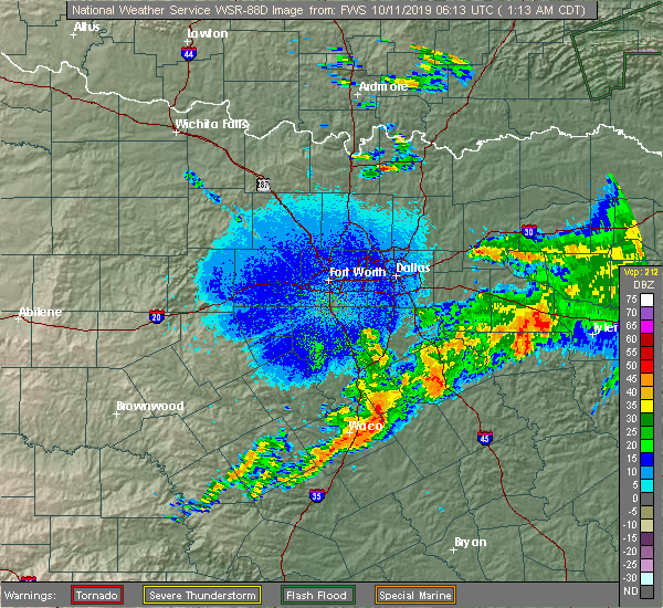 At 111 am cdt, a severe thunderstorm was located near edom, or 15 miles southeast of canton, moving east at 35 mph (radar indicated). Hazards include 65 mph wind gusts and quarter size hail. Hail damage to vehicles is expected. expect wind damage to roofs, siding, and trees. Locations impacted include, ben wheeler, primrose, van and edom. At 111 am cdt, a severe thunderstorm was located near edom, or 15 miles southeast of canton, moving east at 35 mph (radar indicated). Hazards include 65 mph wind gusts and quarter size hail. Hail damage to vehicles is expected. expect wind damage to roofs, siding, and trees. Locations impacted include, ben wheeler, primrose, van and edom.
|
| 10/11/2019 12:45 AM CDT |
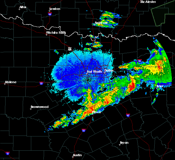 At 1244 am cdt, a severe thunderstorm was located near purtis creek state park, or 8 miles southwest of canton, moving east at 35 mph (radar indicated). Hazards include 65 mph wind gusts and quarter size hail. Hail damage to vehicles is expected. Expect wind damage to roofs, siding, and trees. At 1244 am cdt, a severe thunderstorm was located near purtis creek state park, or 8 miles southwest of canton, moving east at 35 mph (radar indicated). Hazards include 65 mph wind gusts and quarter size hail. Hail damage to vehicles is expected. Expect wind damage to roofs, siding, and trees.
|
| 6/16/2019 6:02 PM CDT |
 At 602 pm cdt, severe thunderstorms were located along a line extending from near edom to brownsboro to 10 miles west of coffee city, moving east at 30 mph (radar indicated). Hazards include 60 mph wind gusts. Expect damage to roofs, siding, and trees. these severe storms will be near, chandler, berryville and coffee city around 615 pm cdt. Other locations impacted by these severe thunderstorms include murchison, moore station and poynor. At 602 pm cdt, severe thunderstorms were located along a line extending from near edom to brownsboro to 10 miles west of coffee city, moving east at 30 mph (radar indicated). Hazards include 60 mph wind gusts. Expect damage to roofs, siding, and trees. these severe storms will be near, chandler, berryville and coffee city around 615 pm cdt. Other locations impacted by these severe thunderstorms include murchison, moore station and poynor.
|
| 6/16/2019 5:35 PM CDT |
 At 534 pm cdt, severe thunderstorms were located along a line extending from 6 miles west of van to 8 miles southeast of canton to 6 miles north of athens, moving east at 45 mph (radar indicated). Hazards include 60 mph wind gusts. Expect damage to roofs, siding, and trees. these severe storms will be near, van around 545 pm cdt. brownsboro and edom around 550 pm cdt. chandler around 600 pm cdt. Other locations impacted by these severe thunderstorms include murchison, moore station, log cabin, star harbor, payne springs and poynor. At 534 pm cdt, severe thunderstorms were located along a line extending from 6 miles west of van to 8 miles southeast of canton to 6 miles north of athens, moving east at 45 mph (radar indicated). Hazards include 60 mph wind gusts. Expect damage to roofs, siding, and trees. these severe storms will be near, van around 545 pm cdt. brownsboro and edom around 550 pm cdt. chandler around 600 pm cdt. Other locations impacted by these severe thunderstorms include murchison, moore station, log cabin, star harbor, payne springs and poynor.
|
| 6/16/2019 5:16 PM CDT |
 At 514 pm cdt, severe thunderstorms were located along a line extending from near wills point to caney city, moving east at 35 mph (radar indicated). Hazards include 65 mph wind gusts. Expect damage to roofs, siding, and trees. severe thunderstorms will be near, wills point and lake tawakoni state park around 520 pm cdt. edgewood around 530 pm cdt. fruitvale around 535 pm cdt. athens around 540 pm cdt. grand saline around 545 pm cdt. brownsboro and edom around 600 pm cdt. chandler around 615 pm cdt. this includes interstate 20 between mile markers 512 and 542. A wind gust to 70 mph was measured in gun barrel city in henderson county. At 514 pm cdt, severe thunderstorms were located along a line extending from near wills point to caney city, moving east at 35 mph (radar indicated). Hazards include 65 mph wind gusts. Expect damage to roofs, siding, and trees. severe thunderstorms will be near, wills point and lake tawakoni state park around 520 pm cdt. edgewood around 530 pm cdt. fruitvale around 535 pm cdt. athens around 540 pm cdt. grand saline around 545 pm cdt. brownsboro and edom around 600 pm cdt. chandler around 615 pm cdt. this includes interstate 20 between mile markers 512 and 542. A wind gust to 70 mph was measured in gun barrel city in henderson county.
|
| 5/18/2019 5:09 PM CDT |
 At 508 pm cdt, a severe thunderstorm was located near brownsboro, or 10 miles east of athens, moving northeast at 55 mph (radar indicated). Hazards include 70 mph wind gusts. Expect considerable tree damage. damage is likely to mobile homes, roofs, and outbuildings. locations impacted include, athens, chandler, frankston, brownsboro, berryville, edom, coffee city, murchison, poynor and moore station. A tornado watch remains in effect until 800 pm cdt for central texas. At 508 pm cdt, a severe thunderstorm was located near brownsboro, or 10 miles east of athens, moving northeast at 55 mph (radar indicated). Hazards include 70 mph wind gusts. Expect considerable tree damage. damage is likely to mobile homes, roofs, and outbuildings. locations impacted include, athens, chandler, frankston, brownsboro, berryville, edom, coffee city, murchison, poynor and moore station. A tornado watch remains in effect until 800 pm cdt for central texas.
|
| 5/18/2019 4:47 PM CDT |
 At 447 pm cdt, a severe thunderstorm was located 7 miles southwest of athens, moving northeast at 55 mph. this is a dangerous storm! (radar indicated). Hazards include 70 mph wind gusts. Expect considerable tree damage. damage is likely to mobile homes, roofs, and outbuildings. locations impacted include, athens, chandler, malakoff, frankston, brownsboro, berryville, trinidad, edom, coffee city, caney city, log cabin, murchison, star harbor, poynor and moore station. a tornado watch remains in effect until 500 pm cdt for central and north central texas. A tornado watch also remains in effect until 800 pm cdt for central texas. At 447 pm cdt, a severe thunderstorm was located 7 miles southwest of athens, moving northeast at 55 mph. this is a dangerous storm! (radar indicated). Hazards include 70 mph wind gusts. Expect considerable tree damage. damage is likely to mobile homes, roofs, and outbuildings. locations impacted include, athens, chandler, malakoff, frankston, brownsboro, berryville, trinidad, edom, coffee city, caney city, log cabin, murchison, star harbor, poynor and moore station. a tornado watch remains in effect until 500 pm cdt for central and north central texas. A tornado watch also remains in effect until 800 pm cdt for central texas.
|
| 5/18/2019 4:36 PM CDT |
 At 436 pm cdt, a severe thunderstorm was located 12 miles south of malakoff, or 15 miles southwest of athens, moving northeast at 55 mph (radar indicated). Hazards include 65 mph wind gusts. expect damage to roofs, siding, and trees At 436 pm cdt, a severe thunderstorm was located 12 miles south of malakoff, or 15 miles southwest of athens, moving northeast at 55 mph (radar indicated). Hazards include 65 mph wind gusts. expect damage to roofs, siding, and trees
|
| 5/18/2019 4:09 PM CDT |
 At 408 pm cdt, severe thunderstorms were located along a line extending from near edgewood to near canton to purtis creek state park, moving northeast at 55 mph. these storms have a history of producing wind damage (radar indicated). Hazards include 70 mph wind gusts and nickel size hail. Expect considerable tree damage. Damage is likely to mobile homes, roofs, and outbuildings. At 408 pm cdt, severe thunderstorms were located along a line extending from near edgewood to near canton to purtis creek state park, moving northeast at 55 mph. these storms have a history of producing wind damage (radar indicated). Hazards include 70 mph wind gusts and nickel size hail. Expect considerable tree damage. Damage is likely to mobile homes, roofs, and outbuildings.
|
| 4/13/2019 1:58 AM CDT |
 At 158 am cdt, a severe thunderstorm was located 7 miles west of brownsboro, or 8 miles northeast of athens, moving northeast at 25 mph (radar indicated). Hazards include quarter size hail. Damage to vehicles is possible. Locations impacted include, athens, chandler, brownsboro, edom and murchison. At 158 am cdt, a severe thunderstorm was located 7 miles west of brownsboro, or 8 miles northeast of athens, moving northeast at 25 mph (radar indicated). Hazards include quarter size hail. Damage to vehicles is possible. Locations impacted include, athens, chandler, brownsboro, edom and murchison.
|
| 4/13/2019 1:28 AM CDT |
 At 128 am cdt, a severe thunderstorm was located near athens, moving northeast at 20 mph (radar indicated). Hazards include quarter size hail. Damage to vehicles is possible. Locations impacted include, athens, chandler, malakoff, brownsboro, edom, caney city, log cabin, murchison and star harbor. At 128 am cdt, a severe thunderstorm was located near athens, moving northeast at 20 mph (radar indicated). Hazards include quarter size hail. Damage to vehicles is possible. Locations impacted include, athens, chandler, malakoff, brownsboro, edom, caney city, log cabin, murchison and star harbor.
|
| 4/13/2019 1:19 AM CDT |
 At 118 am cdt, a severe thunderstorm was located near malakoff, or 7 miles southwest of athens, moving northeast at 25 mph (radar indicated). Hazards include quarter size hail. damage to vehicles is possible At 118 am cdt, a severe thunderstorm was located near malakoff, or 7 miles southwest of athens, moving northeast at 25 mph (radar indicated). Hazards include quarter size hail. damage to vehicles is possible
|
| 3/25/2019 2:34 AM CDT |
 At 233 am cdt, a severe thunderstorm was located near caney city, or near athens, moving east at 65 mph (radar indicated). Hazards include 60 mph wind gusts and hail up to quarter size. Hail damage to vehicles is expected. expect wind damage to roofs, siding, and trees. Locations impacted include, athens, gun barrel city, mabank, chandler, malakoff, tool, seven points, brownsboro, eustace, berryville, trinidad, edom, enchanted oaks, coffee city, caney city, payne springs, log cabin, murchison, star harbor and poynor. At 233 am cdt, a severe thunderstorm was located near caney city, or near athens, moving east at 65 mph (radar indicated). Hazards include 60 mph wind gusts and hail up to quarter size. Hail damage to vehicles is expected. expect wind damage to roofs, siding, and trees. Locations impacted include, athens, gun barrel city, mabank, chandler, malakoff, tool, seven points, brownsboro, eustace, berryville, trinidad, edom, enchanted oaks, coffee city, caney city, payne springs, log cabin, murchison, star harbor and poynor.
|
| 3/25/2019 2:01 AM CDT |
 At 201 am cdt, severe thunderstorms were located along a line extending from near canton to near purtis creek state park to 6 miles east of alma, moving east at 50 mph (radar indicated). Hazards include 60 mph wind gusts and quarter size hail. Hail damage to vehicles is expected. Expect wind damage to roofs, siding, and trees. At 201 am cdt, severe thunderstorms were located along a line extending from near canton to near purtis creek state park to 6 miles east of alma, moving east at 50 mph (radar indicated). Hazards include 60 mph wind gusts and quarter size hail. Hail damage to vehicles is expected. Expect wind damage to roofs, siding, and trees.
|
| 3/14/2019 1:49 AM CDT |
 At 148 am cdt, a severe thunderstorm was located near van, or 10 miles southwest of mineola, moving east at 45 mph (radar indicated). Hazards include 60 mph wind gusts. Expect damage to roofs, siding, and trees. Locations impacted include, van and edom. At 148 am cdt, a severe thunderstorm was located near van, or 10 miles southwest of mineola, moving east at 45 mph (radar indicated). Hazards include 60 mph wind gusts. Expect damage to roofs, siding, and trees. Locations impacted include, van and edom.
|
| 3/14/2019 1:32 AM CDT |
 At 131 am cdt, a severe thunderstorm was located over canton, moving east at 45 mph (radar indicated). Hazards include 60 mph wind gusts. expect damage to roofs, siding, and trees At 131 am cdt, a severe thunderstorm was located over canton, moving east at 45 mph (radar indicated). Hazards include 60 mph wind gusts. expect damage to roofs, siding, and trees
|
| 3/13/2019 6:38 AM CDT |
 At 637 am cdt, severe thunderstorms were located along a line extending from north of paris to near sulphur springs to canton, moving east at 45 mph (radar indicated). Hazards include 60 mph wind gusts. Expect damage to roofs, siding, and trees. Locations impacted include, paris, sulphur springs, canton, grand saline, van, cooper, blossom, edgewood, emory, como, deport, fruitvale, edom, cooper lake park south sulphur, cooper lake park doctors creek, roxton, tira, toco and sun valley. At 637 am cdt, severe thunderstorms were located along a line extending from north of paris to near sulphur springs to canton, moving east at 45 mph (radar indicated). Hazards include 60 mph wind gusts. Expect damage to roofs, siding, and trees. Locations impacted include, paris, sulphur springs, canton, grand saline, van, cooper, blossom, edgewood, emory, como, deport, fruitvale, edom, cooper lake park south sulphur, cooper lake park doctors creek, roxton, tira, toco and sun valley.
|
| 3/13/2019 6:06 AM CDT |
 At 605 am cdt, severe thunderstorms were located along a line extending from the red river north of honey grove to commerce to kemp, moving east at 45 mph (radar indicated). Hazards include 60 mph wind gusts. expect damage to roofs, siding, and trees At 605 am cdt, severe thunderstorms were located along a line extending from the red river north of honey grove to commerce to kemp, moving east at 45 mph (radar indicated). Hazards include 60 mph wind gusts. expect damage to roofs, siding, and trees
|
| 3/9/2019 9:35 AM CST |
 At 934 am cst, a severe thunderstorm was located near brownsboro, or 10 miles northeast of athens, moving east at 50 mph (radar indicated). Hazards include 60 mph wind gusts and quarter size hail. Hail damage to vehicles is expected. expect wind damage to roofs, siding, and trees. Locations impacted include, athens, chandler, brownsboro, murchison and moore station. At 934 am cst, a severe thunderstorm was located near brownsboro, or 10 miles northeast of athens, moving east at 50 mph (radar indicated). Hazards include 60 mph wind gusts and quarter size hail. Hail damage to vehicles is expected. expect wind damage to roofs, siding, and trees. Locations impacted include, athens, chandler, brownsboro, murchison and moore station.
|
| 3/9/2019 9:24 AM CST |
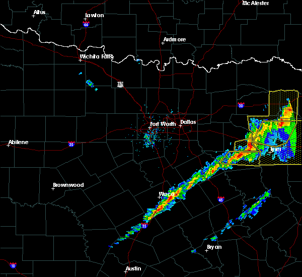 At 923 am cst, a severe thunderstorm was located 4 miles south of van, or 14 miles southeast of canton, moving east at 55 mph (radar indicated). Hazards include 60 mph wind gusts and penny size hail. Expect damage to roofs, siding, and trees. Locations impacted include, van and edom. At 923 am cst, a severe thunderstorm was located 4 miles south of van, or 14 miles southeast of canton, moving east at 55 mph (radar indicated). Hazards include 60 mph wind gusts and penny size hail. Expect damage to roofs, siding, and trees. Locations impacted include, van and edom.
|
| 3/9/2019 9:20 AM CST | Van zandt so reports numerous trees down from earlier storms near fm 773. time estimated based on rada in van zandt county TX, 5.7 miles SSE of Callender Lake, TX |
| 3/9/2019 9:14 AM CST |
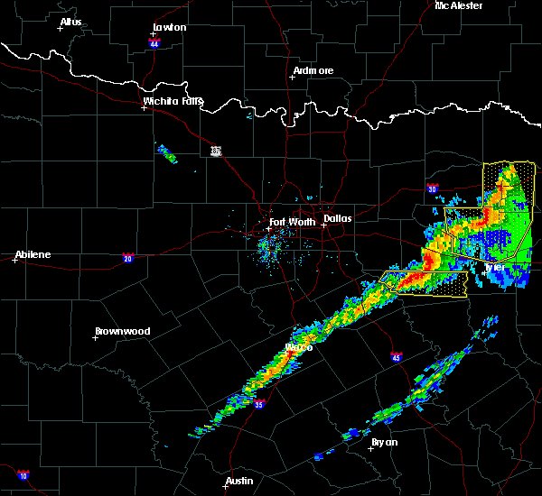 At 913 am cst, a severe thunderstorm was located 8 miles south of canton, moving east at 55 mph (radar indicated). Hazards include 60 mph wind gusts and penny size hail. expect damage to roofs, siding, and trees At 913 am cst, a severe thunderstorm was located 8 miles south of canton, moving east at 55 mph (radar indicated). Hazards include 60 mph wind gusts and penny size hail. expect damage to roofs, siding, and trees
|
| 10/14/2018 9:07 PM CDT |
 The severe thunderstorm warning for southeastern van zandt county will expire at 915 pm cdt, the storm which prompted the warning has moved out of the area. therefore the warning will be allowed to expire. a severe thunderstorm watch remains in effect until midnight cdt for north central texas. The severe thunderstorm warning for southeastern van zandt county will expire at 915 pm cdt, the storm which prompted the warning has moved out of the area. therefore the warning will be allowed to expire. a severe thunderstorm watch remains in effect until midnight cdt for north central texas.
|
| 10/14/2018 8:49 PM CDT |
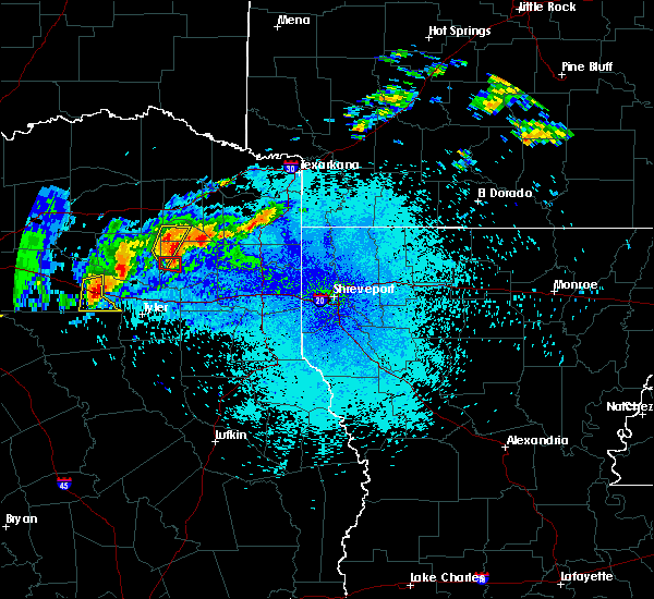 At 849 pm cdt, a severe thunderstorm was located over van, or 14 miles southwest of mineola, moving east at 30 mph (radar indicated). Hazards include 60 mph wind gusts and quarter size hail. Hail damage to vehicles is expected. expect wind damage to roofs, siding, and trees. Locations impacted include, van and edom. At 849 pm cdt, a severe thunderstorm was located over van, or 14 miles southwest of mineola, moving east at 30 mph (radar indicated). Hazards include 60 mph wind gusts and quarter size hail. Hail damage to vehicles is expected. expect wind damage to roofs, siding, and trees. Locations impacted include, van and edom.
|
| 10/14/2018 8:46 PM CDT |
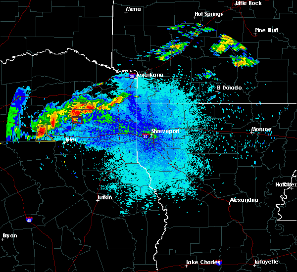 At 846 pm cdt, a severe thunderstorm was located over van, or 13 miles east of canton, moving east at 30 mph (radar indicated). Hazards include 60 mph wind gusts and quarter size hail. Hail damage to vehicles is expected. Expect wind damage to roofs, siding, and trees. At 846 pm cdt, a severe thunderstorm was located over van, or 13 miles east of canton, moving east at 30 mph (radar indicated). Hazards include 60 mph wind gusts and quarter size hail. Hail damage to vehicles is expected. Expect wind damage to roofs, siding, and trees.
|
| 4/13/2018 10:02 PM CDT |
 At 1002 pm cdt, severe thunderstorms were located along a line extending from near mineola to 6 miles south of lindale to near coffee city, moving northeast at 45 mph (radar indicated). Hazards include 65 mph wind gusts and quarter size hail. Hail damage to vehicles is expected. expect wind damage to roofs, siding, and trees. Locations impacted include, athens, canton, grand saline, chandler, van, edgewood, brownsboro, berryville, fruitvale, edom, coffee city, murchison, poynor and moore station. At 1002 pm cdt, severe thunderstorms were located along a line extending from near mineola to 6 miles south of lindale to near coffee city, moving northeast at 45 mph (radar indicated). Hazards include 65 mph wind gusts and quarter size hail. Hail damage to vehicles is expected. expect wind damage to roofs, siding, and trees. Locations impacted include, athens, canton, grand saline, chandler, van, edgewood, brownsboro, berryville, fruitvale, edom, coffee city, murchison, poynor and moore station.
|
| 4/13/2018 9:38 PM CDT |
 At 937 pm cdt, severe thunderstorms were located along a line extending from near canton to 6 miles west of brownsboro to 10 miles southeast of athens, moving northeast at 45 mph (radar indicated). Hazards include 65 mph wind gusts and quarter size hail. Hail damage to vehicles is expected. Expect wind damage to roofs, siding, and trees. At 937 pm cdt, severe thunderstorms were located along a line extending from near canton to 6 miles west of brownsboro to 10 miles southeast of athens, moving northeast at 45 mph (radar indicated). Hazards include 65 mph wind gusts and quarter size hail. Hail damage to vehicles is expected. Expect wind damage to roofs, siding, and trees.
|
| 8/12/2017 7:48 PM CDT |
 At 747 pm cdt, a severe thunderstorm was located 8 miles southeast of canton, moving east at 15 mph (radar indicated). Hazards include 60 mph wind gusts and penny size hail. expect damage to roofs, siding, and trees At 747 pm cdt, a severe thunderstorm was located 8 miles southeast of canton, moving east at 15 mph (radar indicated). Hazards include 60 mph wind gusts and penny size hail. expect damage to roofs, siding, and trees
|
| 8/12/2017 7:46 PM CDT |
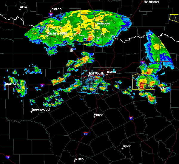 At 745 pm cdt, a severe thunderstorm capable of producing a tornado was located 7 miles southeast of canton, moving east at 15 mph. the circulation has weakened but still persists (radar indicated rotation). Hazards include tornado. Flying debris will be dangerous to those caught without shelter. mobile homes will be damaged or destroyed. damage to roofs, windows, and vehicles will occur. tree damage is likely. This tornadic thunderstorm will remain over mainly rural areas of south central van zandt county including the town of colfax. At 745 pm cdt, a severe thunderstorm capable of producing a tornado was located 7 miles southeast of canton, moving east at 15 mph. the circulation has weakened but still persists (radar indicated rotation). Hazards include tornado. Flying debris will be dangerous to those caught without shelter. mobile homes will be damaged or destroyed. damage to roofs, windows, and vehicles will occur. tree damage is likely. This tornadic thunderstorm will remain over mainly rural areas of south central van zandt county including the town of colfax.
|
| 8/12/2017 7:33 PM CDT |
 At 732 pm cdt, a severe thunderstorm capable of producing a tornado was located near canton, moving east at 20 mph (radar indicated rotation). Hazards include tornado and half dollar size hail. Flying debris will be dangerous to those caught without shelter. mobile homes will be damaged or destroyed. damage to roofs, windows, and vehicles will occur. tree damage is likely. This tornadic thunderstorm will pass very near canton and cross highway 19 and highway 64 southeast of canton. At 732 pm cdt, a severe thunderstorm capable of producing a tornado was located near canton, moving east at 20 mph (radar indicated rotation). Hazards include tornado and half dollar size hail. Flying debris will be dangerous to those caught without shelter. mobile homes will be damaged or destroyed. damage to roofs, windows, and vehicles will occur. tree damage is likely. This tornadic thunderstorm will pass very near canton and cross highway 19 and highway 64 southeast of canton.
|
| 8/12/2017 7:24 PM CDT |
 At 723 pm cdt, a severe thunderstorm capable of producing a tornado was located near canton, moving east at 15 mph. highway 19 and 198 just south of canton are in the path of the strongest circulation (radar indicated rotation). Hazards include tornado and half dollar size hail. Flying debris will be dangerous to those caught without shelter. mobile homes will be damaged or destroyed. damage to roofs, windows, and vehicles will occur. tree damage is likely. This dangerous storm will be near, canton around 730 pm cdt. At 723 pm cdt, a severe thunderstorm capable of producing a tornado was located near canton, moving east at 15 mph. highway 19 and 198 just south of canton are in the path of the strongest circulation (radar indicated rotation). Hazards include tornado and half dollar size hail. Flying debris will be dangerous to those caught without shelter. mobile homes will be damaged or destroyed. damage to roofs, windows, and vehicles will occur. tree damage is likely. This dangerous storm will be near, canton around 730 pm cdt.
|
| 8/12/2017 7:18 PM CDT |
 At 718 pm cdt, a severe thunderstorm capable of producing a tornado was located near canton, moving east at 15 mph (radar indicated rotation). Hazards include tornado and half dollar size hail. Flying debris will be dangerous to those caught without shelter. mobile homes will be damaged or destroyed. damage to roofs, windows, and vehicles will occur. tree damage is likely. this dangerous storm will be near, canton around 725 pm cdt. This includes interstate 20 between mile markers 524 and 538. At 718 pm cdt, a severe thunderstorm capable of producing a tornado was located near canton, moving east at 15 mph (radar indicated rotation). Hazards include tornado and half dollar size hail. Flying debris will be dangerous to those caught without shelter. mobile homes will be damaged or destroyed. damage to roofs, windows, and vehicles will occur. tree damage is likely. this dangerous storm will be near, canton around 725 pm cdt. This includes interstate 20 between mile markers 524 and 538.
|
| 8/12/2017 7:03 PM CDT |
 At 703 pm cdt, a severe thunderstorm was located near wills point, moving east at 25 mph (radar indicated). Hazards include 65 mph wind gusts and quarter size hail. Hail damage to vehicles is expected. expect wind damage to roofs, siding, and trees. this severe thunderstorm will be near, canton around 710 pm cdt. edgewood around 715 pm cdt. fruitvale around 725 pm cdt. grand saline around 735 pm cdt. van around 750 pm cdt. This includes interstate 20 between mile markers 513 and 542. At 703 pm cdt, a severe thunderstorm was located near wills point, moving east at 25 mph (radar indicated). Hazards include 65 mph wind gusts and quarter size hail. Hail damage to vehicles is expected. expect wind damage to roofs, siding, and trees. this severe thunderstorm will be near, canton around 710 pm cdt. edgewood around 715 pm cdt. fruitvale around 725 pm cdt. grand saline around 735 pm cdt. van around 750 pm cdt. This includes interstate 20 between mile markers 513 and 542.
|
| 5/28/2017 4:49 PM CDT |
 At 448 pm cdt, a severe thunderstorm was located near ben wheeler, or 9 miles southeast of canton, moving east at 30 mph (radar indicated). Hazards include quarter size hail. damage to vehicles is possible At 448 pm cdt, a severe thunderstorm was located near ben wheeler, or 9 miles southeast of canton, moving east at 30 mph (radar indicated). Hazards include quarter size hail. damage to vehicles is possible
|
| 5/3/2017 3:16 PM CDT |
 At 315 pm cdt, a severe thunderstorm with confirmed golf ball size hail was located over chandler, or 11 miles west of tyler, moving east at 45 mph (trained weather spotters). Hazards include golf ball size hail and 60 mph wind gusts. People and animals outdoors will be injured. expect hail damage to roofs, siding, windows, and vehicles. expect wind damage to roofs, siding, and trees. Locations impacted include, athens, chandler, brownsboro, edom, murchison and moore station. At 315 pm cdt, a severe thunderstorm with confirmed golf ball size hail was located over chandler, or 11 miles west of tyler, moving east at 45 mph (trained weather spotters). Hazards include golf ball size hail and 60 mph wind gusts. People and animals outdoors will be injured. expect hail damage to roofs, siding, windows, and vehicles. expect wind damage to roofs, siding, and trees. Locations impacted include, athens, chandler, brownsboro, edom, murchison and moore station.
|
| 5/3/2017 3:09 PM CDT |
 At 308 pm cdt, a severe thunderstorm was located over brownsboro, or 16 miles east of athens, moving east at 50 mph (radar indicated). Hazards include golf ball size hail and 60 mph wind gusts. People and animals outdoors will be injured. expect hail damage to roofs, siding, windows, and vehicles. expect wind damage to roofs, siding, and trees. Locations impacted include, athens, chandler, malakoff, brownsboro, eustace, edom, caney city, payne springs, log cabin, murchison, star harbor and moore station. At 308 pm cdt, a severe thunderstorm was located over brownsboro, or 16 miles east of athens, moving east at 50 mph (radar indicated). Hazards include golf ball size hail and 60 mph wind gusts. People and animals outdoors will be injured. expect hail damage to roofs, siding, windows, and vehicles. expect wind damage to roofs, siding, and trees. Locations impacted include, athens, chandler, malakoff, brownsboro, eustace, edom, caney city, payne springs, log cabin, murchison, star harbor and moore station.
|
| 5/3/2017 2:27 PM CDT |
 At 227 pm cdt, a severe thunderstorm was located near purtis creek state park, or near gun barrel city, moving east at 45 mph (radar indicated). Hazards include 60 mph wind gusts and quarter size hail. Hail damage to vehicles is expected. Expect wind damage to roofs, siding, and trees. At 227 pm cdt, a severe thunderstorm was located near purtis creek state park, or near gun barrel city, moving east at 45 mph (radar indicated). Hazards include 60 mph wind gusts and quarter size hail. Hail damage to vehicles is expected. Expect wind damage to roofs, siding, and trees.
|
| 4/29/2017 8:08 PM CDT |
 At 808 pm cdt, severe thunderstorms were located along a line extending from 10 miles east of emory to near golden to near van to 6 miles northwest of edom, moving east at 30 mph (radar indicated). Hazards include two inch hail and 70 mph wind gusts. People and animals outdoors will be injured. expect hail damage to roofs, siding, windows, and vehicles. expect considerable tree damage. wind damage is also likely to mobile homes, roofs, and outbuildings. locations impacted include, canton, grand saline, van, edgewood, emory, fruitvale, edom and point. A tornado watch remains in effect until 1000 pm cdt for north central texas. At 808 pm cdt, severe thunderstorms were located along a line extending from 10 miles east of emory to near golden to near van to 6 miles northwest of edom, moving east at 30 mph (radar indicated). Hazards include two inch hail and 70 mph wind gusts. People and animals outdoors will be injured. expect hail damage to roofs, siding, windows, and vehicles. expect considerable tree damage. wind damage is also likely to mobile homes, roofs, and outbuildings. locations impacted include, canton, grand saline, van, edgewood, emory, fruitvale, edom and point. A tornado watch remains in effect until 1000 pm cdt for north central texas.
|
| 4/29/2017 7:53 PM CDT |
 At 753 pm cdt, severe thunderstorms were located along a line extending from near emory to near grand saline to near van to 11 miles west of edom, moving east at 25 mph (radar indicated). Hazards include 70 mph wind gusts and half dollar size hail. Hail damage to vehicles is expected. expect considerable tree damage. wind damage is also likely to mobile homes, roofs, and outbuildings. locations impacted include, ben wheeler, canton, grand saline, van, edgewood, emory, fruitvale, edom and point. A tornado watch remains in effect until 1000 pm cdt for north central texas. At 753 pm cdt, severe thunderstorms were located along a line extending from near emory to near grand saline to near van to 11 miles west of edom, moving east at 25 mph (radar indicated). Hazards include 70 mph wind gusts and half dollar size hail. Hail damage to vehicles is expected. expect considerable tree damage. wind damage is also likely to mobile homes, roofs, and outbuildings. locations impacted include, ben wheeler, canton, grand saline, van, edgewood, emory, fruitvale, edom and point. A tornado watch remains in effect until 1000 pm cdt for north central texas.
|
| 4/29/2017 7:32 PM CDT |
 At 732 pm cdt, severe thunderstorms were located along a line extending from near emory to 6 miles south of fruitvale to canton to near purtis creek state park, moving east at 30 mph (radar indicated). Hazards include 70 mph wind gusts and half dollar size hail. Hail damage to vehicles is expected. expect considerable tree damage. Wind damage is also likely to mobile homes, roofs, and outbuildings. At 732 pm cdt, severe thunderstorms were located along a line extending from near emory to 6 miles south of fruitvale to canton to near purtis creek state park, moving east at 30 mph (radar indicated). Hazards include 70 mph wind gusts and half dollar size hail. Hail damage to vehicles is expected. expect considerable tree damage. Wind damage is also likely to mobile homes, roofs, and outbuildings.
|
| 4/29/2017 5:50 PM CDT | House collapsed on residents near fm1256 just outside of martins mill in van zandt county TX, 6.2 miles SE of Callender Lake, TX |
| 4/29/2017 5:50 PM CDT | House collapsed on residents near fm1256 just outside of martins mill in van zandt county TX, 6.2 miles SE of Callender Lake, TX |
| 4/26/2017 1:38 PM CDT |
 The severe thunderstorm warning for southeastern van zandt and northeastern henderson counties will expire at 145 pm cdt, the storm which prompted the warning has weakened below severe limits, and has exited the warned area. therefore, the warning will be allowed to expire. however small hail is still possible with other thunderstorms moving through the area. The severe thunderstorm warning for southeastern van zandt and northeastern henderson counties will expire at 145 pm cdt, the storm which prompted the warning has weakened below severe limits, and has exited the warned area. therefore, the warning will be allowed to expire. however small hail is still possible with other thunderstorms moving through the area.
|
| 4/26/2017 1:27 PM CDT |
 At 127 pm cdt, a severe thunderstorm was located over edom, or 15 miles west of tyler, moving east at 35 mph (radar indicated). Hazards include quarter size hail. Damage to vehicles is possible. Locations impacted include, athens, chandler, brownsboro, edom and murchison. At 127 pm cdt, a severe thunderstorm was located over edom, or 15 miles west of tyler, moving east at 35 mph (radar indicated). Hazards include quarter size hail. Damage to vehicles is possible. Locations impacted include, athens, chandler, brownsboro, edom and murchison.
|
| 4/26/2017 12:57 PM CDT |
 At 1257 pm cdt, a severe thunderstorm was located 7 miles north of athens, moving east at 35 mph (radar indicated). Hazards include quarter size hail. damage to vehicles is possible At 1257 pm cdt, a severe thunderstorm was located 7 miles north of athens, moving east at 35 mph (radar indicated). Hazards include quarter size hail. damage to vehicles is possible
|
| 4/2/2017 11:51 AM CDT |
 The severe thunderstorm warning for van zandt county will expire at noon cdt, the storm which prompted the warning has weakened below severe limits and is exiting the warned area. therefore the warning will be allowed to expire. a tornado watch remains in effect until 100 pm cdt for central and north central texas. The severe thunderstorm warning for van zandt county will expire at noon cdt, the storm which prompted the warning has weakened below severe limits and is exiting the warned area. therefore the warning will be allowed to expire. a tornado watch remains in effect until 100 pm cdt for central and north central texas.
|
| 4/2/2017 11:31 AM CDT | At 1129 am cdt, a severe thunderstorm was located 9 miles southeast of canton, moving north at 35 mph (radar indicated). Hazards include 60 mph wind gusts and quarter size hail. Hail damage to vehicles is expected. expect wind damage to roofs, siding, and trees. locations impacted include, canton, grand saline, van, edgewood, fruitvale and purtis creek state park. A tornado watch remains in effect until 100 pm cdt for central and north central texas. |
| 4/2/2017 11:18 AM CDT | At 1117 am cdt, a severe thunderstorm was located 8 miles north of athens, moving northeast at 35 mph (radar indicated). Hazards include 60 mph wind gusts and quarter size hail. Hail damage to vehicles is expected. expect wind damage to roofs, siding, and trees. this severe thunderstorm will be near, van around 1145 am cdt. fruitvale around 1155 am cdt. grand saline around 1200 pm cdt. other locations impacted by this severe thunderstorm include murchison and payne springs. this includes interstate 20 between mile markers 519 and 542. A tornado watch remains in effect until 100 pm cdt for central and north central texas. |
| 3/29/2017 3:54 AM CDT |
 The severe thunderstorm warning for hunt, eastern kaufman, van zandt and rains counties will expire at 400 am cdt, the storms which prompted the warning have moved out of the area. therefore the warning will be allowed to expire. however gusty winds are still possible with these thunderstorms. a severe thunderstorm watch remains in effect until 500 am cdt for north central texas. The severe thunderstorm warning for hunt, eastern kaufman, van zandt and rains counties will expire at 400 am cdt, the storms which prompted the warning have moved out of the area. therefore the warning will be allowed to expire. however gusty winds are still possible with these thunderstorms. a severe thunderstorm watch remains in effect until 500 am cdt for north central texas.
|
| 3/29/2017 3:16 AM CDT |
 At 316 am cdt, severe thunderstorms were located along a line extending from 8 miles north of farmersville to kemp, moving northeast at 60 mph (radar indicated). Hazards include 65 mph wind gusts and penny size hail. Expect damage to roofs, siding, and trees. severe thunderstorms will be near, celeste around 325 am cdt. wolfe city around 335 am cdt. canton around 340 am cdt. edgewood and fruitvale around 345 am cdt. grand saline around 350 am cdt. other locations impacted by these severe thunderstorms include neylandville, lone oak, point and josephine. this includes the following interstates, interstate 20 between mile markers 502 and 542. Interstate 30 between mile markers 80 and 109. At 316 am cdt, severe thunderstorms were located along a line extending from 8 miles north of farmersville to kemp, moving northeast at 60 mph (radar indicated). Hazards include 65 mph wind gusts and penny size hail. Expect damage to roofs, siding, and trees. severe thunderstorms will be near, celeste around 325 am cdt. wolfe city around 335 am cdt. canton around 340 am cdt. edgewood and fruitvale around 345 am cdt. grand saline around 350 am cdt. other locations impacted by these severe thunderstorms include neylandville, lone oak, point and josephine. this includes the following interstates, interstate 20 between mile markers 502 and 542. Interstate 30 between mile markers 80 and 109.
|
| 1/2/2017 6:47 AM CST |
 At 646 am cst, severe thunderstorms were located along a line extending from 6 miles south of wolfe city to 6 miles east of emory to near coffee city, moving northeast at 45 mph (radar indicated). Hazards include 60 mph wind gusts. Expect damage to roofs, siding, and trees. Locations impacted include, greenville, commerce, grand saline, chandler, van, wolfe city, emory, brownsboro, berryville, east tawakoni, celeste, campbell, fruitvale, edom, coffee city, point, lone oak, poynor, moore station and neylandville. At 646 am cst, severe thunderstorms were located along a line extending from 6 miles south of wolfe city to 6 miles east of emory to near coffee city, moving northeast at 45 mph (radar indicated). Hazards include 60 mph wind gusts. Expect damage to roofs, siding, and trees. Locations impacted include, greenville, commerce, grand saline, chandler, van, wolfe city, emory, brownsboro, berryville, east tawakoni, celeste, campbell, fruitvale, edom, coffee city, point, lone oak, poynor, moore station and neylandville.
|
| 1/2/2017 6:22 AM CST |
 At 621 am cst, severe thunderstorms were located along a line extending from near farmersville to near wills point to near athens, moving northeast at 50 mph (radar indicated). Hazards include 60 mph wind gusts. Expect damage to roofs, siding, and trees. Locations impacted include, greenville, athens, commerce, gun barrel city, canton, wills point, grand saline, mabank, chandler, van, malakoff, west tawakoni, edgewood, wolfe city, quinlan, caddo mills, emory, brownsboro, eustace and berryville. At 621 am cst, severe thunderstorms were located along a line extending from near farmersville to near wills point to near athens, moving northeast at 50 mph (radar indicated). Hazards include 60 mph wind gusts. Expect damage to roofs, siding, and trees. Locations impacted include, greenville, athens, commerce, gun barrel city, canton, wills point, grand saline, mabank, chandler, van, malakoff, west tawakoni, edgewood, wolfe city, quinlan, caddo mills, emory, brownsboro, eustace and berryville.
|
| 5/12/2016 1:26 AM CDT | The severe thunderstorm warning for van zandt and eastern kaufman counties will expire at 130 am cdt, the storm which prompted the warning has weakened below severe limits. therefore the warning will be allowed to expire. |
| 5/12/2016 12:37 AM CDT |
 At 1237 am cdt, a severe thunderstorm was located 9 miles east of kaufman, moving east at 40 mph (radar indicated). Hazards include 60 mph wind gusts and penny size hail. Expect damage to roofs. siding. and trees. this severe thunderstorm will be near, canton around 1255 am cdt. edgewood around 100 am cdt. fruitvale around 105 am cdt. grand saline around 115 am cdt. van around 120 am cdt. other locations impacted by this severe thunderstorm include oak ridge. This includes interstate 20 between mile markers 502 and 542. At 1237 am cdt, a severe thunderstorm was located 9 miles east of kaufman, moving east at 40 mph (radar indicated). Hazards include 60 mph wind gusts and penny size hail. Expect damage to roofs. siding. and trees. this severe thunderstorm will be near, canton around 1255 am cdt. edgewood around 100 am cdt. fruitvale around 105 am cdt. grand saline around 115 am cdt. van around 120 am cdt. other locations impacted by this severe thunderstorm include oak ridge. This includes interstate 20 between mile markers 502 and 542.
|
| 4/29/2016 5:51 PM CDT |
 The tornado warning for southeastern van zandt and northeastern henderson counties will expire at 600 pm cdt, the storm which prompted the warning has moved out of the area. therefore the warning will be allowed to expire. a tornado watch remains in effect until 1000 pm cdt for north central texas. The tornado warning for southeastern van zandt and northeastern henderson counties will expire at 600 pm cdt, the storm which prompted the warning has moved out of the area. therefore the warning will be allowed to expire. a tornado watch remains in effect until 1000 pm cdt for north central texas.
|
| 4/29/2016 5:24 PM CDT |
 At 523 pm cdt, a severe thunderstorm capable of producing a tornado was located over edom, or 17 miles west of tyler, moving northeast at 40 mph (radar indicated rotation). Hazards include tornado and baseball size hail. Flying debris will be dangerous to those caught without shelter. mobile homes will be damaged or destroyed. damage to roofs, windows, and vehicles will occur. tree damage is likely. This tornadic thunderstorm will remain over mainly rural areas of southeastern van zandt county but will impact edom and redland. At 523 pm cdt, a severe thunderstorm capable of producing a tornado was located over edom, or 17 miles west of tyler, moving northeast at 40 mph (radar indicated rotation). Hazards include tornado and baseball size hail. Flying debris will be dangerous to those caught without shelter. mobile homes will be damaged or destroyed. damage to roofs, windows, and vehicles will occur. tree damage is likely. This tornadic thunderstorm will remain over mainly rural areas of southeastern van zandt county but will impact edom and redland.
|
| 4/29/2016 5:22 PM CDT | Golf Ball sized hail reported 5.4 miles S of Callender Lake, TX, golfball size hail reported in ben wheeler |
| 4/29/2016 5:21 PM CDT |
 At 520 pm cdt, a severe thunderstorm capable of producing a tornado was located over edom, or 15 miles northeast of athens, moving northeast at 35 mph (radar indicated rotation). Hazards include tornado and baseball size hail. Flying debris will be dangerous to those caught without shelter. mobile homes will be damaged or destroyed. damage to roofs, windows, and vehicles will occur. tree damage is likely. this dangerous storm will be near, edom around 525 pm cdt. Chandler around 535 pm cdt. At 520 pm cdt, a severe thunderstorm capable of producing a tornado was located over edom, or 15 miles northeast of athens, moving northeast at 35 mph (radar indicated rotation). Hazards include tornado and baseball size hail. Flying debris will be dangerous to those caught without shelter. mobile homes will be damaged or destroyed. damage to roofs, windows, and vehicles will occur. tree damage is likely. this dangerous storm will be near, edom around 525 pm cdt. Chandler around 535 pm cdt.
|
| 4/29/2016 5:04 PM CDT |
 At 503 pm cdt, a severe thunderstorm capable of producing a tornado was located 9 miles northeast of athens, moving northeast at 45 mph (radar indicated rotation). Hazards include tornado and softball size hail. Flying debris will be dangerous to those caught without shelter. mobile homes will be damaged or destroyed. damage to roofs, windows, and vehicles will occur. tree damage is likely. this dangerous storm will be near, edom around 515 pm cdt. Van around 525 pm cdt. At 503 pm cdt, a severe thunderstorm capable of producing a tornado was located 9 miles northeast of athens, moving northeast at 45 mph (radar indicated rotation). Hazards include tornado and softball size hail. Flying debris will be dangerous to those caught without shelter. mobile homes will be damaged or destroyed. damage to roofs, windows, and vehicles will occur. tree damage is likely. this dangerous storm will be near, edom around 515 pm cdt. Van around 525 pm cdt.
|
| 4/29/2016 4:51 PM CDT |
 At 450 pm cdt, a severe thunderstorm was located near athens, moving northeast at 25 mph (radar indicated). Hazards include golf ball size hail and 70 mph wind gusts. People and animals outdoors will be injured. expect hail damage to roofs, siding, windows, and vehicles. expect considerable tree damage. wind damage is also likely to mobile homes, roofs, and outbuildings. this severe thunderstorm will be near, edom around 530 pm cdt. van around 545 pm cdt. other locations impacted by this severe thunderstorm include murchison, moore station and poynor. this includes interstate 20 between mile markers 531 and 542. A tornado watch remains in effect until 1000 pm cdt for north central texas. At 450 pm cdt, a severe thunderstorm was located near athens, moving northeast at 25 mph (radar indicated). Hazards include golf ball size hail and 70 mph wind gusts. People and animals outdoors will be injured. expect hail damage to roofs, siding, windows, and vehicles. expect considerable tree damage. wind damage is also likely to mobile homes, roofs, and outbuildings. this severe thunderstorm will be near, edom around 530 pm cdt. van around 545 pm cdt. other locations impacted by this severe thunderstorm include murchison, moore station and poynor. this includes interstate 20 between mile markers 531 and 542. A tornado watch remains in effect until 1000 pm cdt for north central texas.
|
| 4/29/2016 4:37 PM CDT |
 At 436 pm cdt, a severe thunderstorm was located over caney city, or 8 miles west of athens, moving east at 30 mph (radar indicated). Hazards include 60 mph wind gusts and quarter size hail. Hail damage to vehicles is expected. expect wind damage to roofs, siding, and trees. this severe storm will be near, athens around 500 pm cdt. other locations impacted by this severe thunderstorm include star harbor, log cabin, murchison and payne springs. A tornado watch remains in effect until 1000 pm cdt for north central texas. At 436 pm cdt, a severe thunderstorm was located over caney city, or 8 miles west of athens, moving east at 30 mph (radar indicated). Hazards include 60 mph wind gusts and quarter size hail. Hail damage to vehicles is expected. expect wind damage to roofs, siding, and trees. this severe storm will be near, athens around 500 pm cdt. other locations impacted by this severe thunderstorm include star harbor, log cabin, murchison and payne springs. A tornado watch remains in effect until 1000 pm cdt for north central texas.
|
| 4/29/2016 3:55 PM CDT |
 At 354 pm cdt, a severe thunderstorm was located near seven points, or 7 miles southwest of gun barrel city, moving northeast at 40 mph (radar indicated). Hazards include 60 mph wind gusts and quarter size hail. Hail damage to vehicles is expected. expect wind damage to roofs, siding, and trees. this severe thunderstorm will be near, tool around 400 pm cdt. gun barrel city, seven points and enchanted oaks around 405 pm cdt. mabank around 410 pm cdt. kemp around 415 pm cdt. canton around 440 pm cdt. wills point around 450 pm cdt. other locations impacted by this severe thunderstorm include log cabin, murchison, payne springs, goodlow, star harbor, oak ridge, oak grove and powell. this includes interstate 20 between mile markers 502 and 534. A tornado watch remains in effect until 1000 pm cdt for north central texas. At 354 pm cdt, a severe thunderstorm was located near seven points, or 7 miles southwest of gun barrel city, moving northeast at 40 mph (radar indicated). Hazards include 60 mph wind gusts and quarter size hail. Hail damage to vehicles is expected. expect wind damage to roofs, siding, and trees. this severe thunderstorm will be near, tool around 400 pm cdt. gun barrel city, seven points and enchanted oaks around 405 pm cdt. mabank around 410 pm cdt. kemp around 415 pm cdt. canton around 440 pm cdt. wills point around 450 pm cdt. other locations impacted by this severe thunderstorm include log cabin, murchison, payne springs, goodlow, star harbor, oak ridge, oak grove and powell. this includes interstate 20 between mile markers 502 and 534. A tornado watch remains in effect until 1000 pm cdt for north central texas.
|
| 4/27/2016 1:08 AM CDT |
 At 107 am cdt, severe thunderstorms were located along a line extending from near hainesville to near hoard to near brownsboro, moving east at 35 mph (radar indicated). Hazards include 60 mph wind gusts. Expect damage to roofs. siding. and trees. These severe thunderstorms will remain over mainly rural areas of southeastern van zandt and northeastern henderson counties, including the following locations: murchison. At 107 am cdt, severe thunderstorms were located along a line extending from near hainesville to near hoard to near brownsboro, moving east at 35 mph (radar indicated). Hazards include 60 mph wind gusts. Expect damage to roofs. siding. and trees. These severe thunderstorms will remain over mainly rural areas of southeastern van zandt and northeastern henderson counties, including the following locations: murchison.
|
| 4/27/2016 12:39 AM CDT |
 At 1239 am cdt, severe thunderstorms were located along a line extending from near grand saline to near van to 7 miles north of athens, moving east at 35 mph (radar indicated). Hazards include 65 mph wind gusts and quarter size hail. Hail damage to vehicles is expected. expect wind damage to roofs, siding, and trees. severe thunderstorms will be near, van around 1250 am cdt. brownsboro and edom around 100 am cdt. chandler around 115 am cdt. other locations impacted by these severe thunderstorms include murchison. This includes interstate 20 between mile markers 525 and 542. At 1239 am cdt, severe thunderstorms were located along a line extending from near grand saline to near van to 7 miles north of athens, moving east at 35 mph (radar indicated). Hazards include 65 mph wind gusts and quarter size hail. Hail damage to vehicles is expected. expect wind damage to roofs, siding, and trees. severe thunderstorms will be near, van around 1250 am cdt. brownsboro and edom around 100 am cdt. chandler around 115 am cdt. other locations impacted by these severe thunderstorms include murchison. This includes interstate 20 between mile markers 525 and 542.
|
| 4/11/2016 8:08 PM CDT |
 The severe thunderstorm warning for southeastern van zandt and northeastern henderson counties will expire at 815 pm cdt, the storm which prompted the warning has moved out of the area. therefore the warning will be allowed to expire. a severe thunderstorm watch remains in effect until 900 pm cdt for north central texas. The severe thunderstorm warning for southeastern van zandt and northeastern henderson counties will expire at 815 pm cdt, the storm which prompted the warning has moved out of the area. therefore the warning will be allowed to expire. a severe thunderstorm watch remains in effect until 900 pm cdt for north central texas.
|
| 4/11/2016 7:55 PM CDT |
 At 754 pm cdt, a severe thunderstorm was located near edom, or 13 miles west of tyler, moving east at 45 mph (radar indicated). Hazards include 60 mph wind gusts and quarter size hail. Hail damage to vehicles is expected. expect wind damage to roofs, siding, and trees. This severe thunderstorm will remain over mainly rural areas of southeastern van zandt and northeastern henderson counties, including the following locations: moore station and murchison. At 754 pm cdt, a severe thunderstorm was located near edom, or 13 miles west of tyler, moving east at 45 mph (radar indicated). Hazards include 60 mph wind gusts and quarter size hail. Hail damage to vehicles is expected. expect wind damage to roofs, siding, and trees. This severe thunderstorm will remain over mainly rural areas of southeastern van zandt and northeastern henderson counties, including the following locations: moore station and murchison.
|
| 4/11/2016 7:38 PM CDT |
 At 737 pm cdt, a severe thunderstorm was located 7 miles west of edom, or 13 miles southeast of canton, moving east at 30 mph (radar indicated). Hazards include 60 mph wind gusts and quarter size hail. Hail damage to vehicles is expected. expect wind damage to roofs, siding, and trees. this severe storm will be near, brownsboro and edom around 755 pm cdt. chandler around 810 pm cdt. Other locations impacted by this severe thunderstorm include murchison and moore station. At 737 pm cdt, a severe thunderstorm was located 7 miles west of edom, or 13 miles southeast of canton, moving east at 30 mph (radar indicated). Hazards include 60 mph wind gusts and quarter size hail. Hail damage to vehicles is expected. expect wind damage to roofs, siding, and trees. this severe storm will be near, brownsboro and edom around 755 pm cdt. chandler around 810 pm cdt. Other locations impacted by this severe thunderstorm include murchison and moore station.
|
| 4/11/2016 7:35 PM CDT |
 At 735 pm cdt, a severe thunderstorm was located 9 miles west of edom, or 11 miles southeast of canton, moving east at 60 mph (radar indicated). Hazards include 60 mph wind gusts and quarter size hail. Hail damage to vehicles is expected. expect wind damage to roofs, siding, and trees. this severe thunderstorm will be near, van and edom around 745 pm cdt. other locations impacted by this severe thunderstorm include murchison and moore station. This includes interstate 20 between mile markers 535 and 542. At 735 pm cdt, a severe thunderstorm was located 9 miles west of edom, or 11 miles southeast of canton, moving east at 60 mph (radar indicated). Hazards include 60 mph wind gusts and quarter size hail. Hail damage to vehicles is expected. expect wind damage to roofs, siding, and trees. this severe thunderstorm will be near, van and edom around 745 pm cdt. other locations impacted by this severe thunderstorm include murchison and moore station. This includes interstate 20 between mile markers 535 and 542.
|
| 3/30/2016 3:25 PM CDT |
 The severe thunderstorm warning for southeastern van zandt and northeastern henderson counties will expire at 330 pm cdt, the storm which prompted the warning has moved out of the area. therefore the warning will be allowed to expire. however gusty winds are still possible with this thunderstorm. The severe thunderstorm warning for southeastern van zandt and northeastern henderson counties will expire at 330 pm cdt, the storm which prompted the warning has moved out of the area. therefore the warning will be allowed to expire. however gusty winds are still possible with this thunderstorm.
|
| 3/30/2016 3:08 PM CDT |
 At 306 pm cdt, a severe thunderstorm was located near edom, or 16 miles west of tyler, moving northeast at 35 mph (radar indicated). Hazards include golf ball size hail and 60 mph wind gusts. People and animals outdoors will be injured. expect hail damage to roofs, siding, windows, and vehicles. expect wind damage to roofs, siding, and trees. This severe storm will be near, edom around 310 pm cdt. At 306 pm cdt, a severe thunderstorm was located near edom, or 16 miles west of tyler, moving northeast at 35 mph (radar indicated). Hazards include golf ball size hail and 60 mph wind gusts. People and animals outdoors will be injured. expect hail damage to roofs, siding, windows, and vehicles. expect wind damage to roofs, siding, and trees. This severe storm will be near, edom around 310 pm cdt.
|
| 3/30/2016 2:36 PM CDT |
 At 236 pm cdt, a severe thunderstorm was located 8 miles northeast of athens, moving northeast at 30 mph (radar indicated). Hazards include golf ball size hail and 60 mph wind gusts. People and animals outdoors will be injured. expect hail damage to roofs, siding, windows, and vehicles. expect wind damage to roofs, siding, and trees. this severe storm will be near, brownsboro and edom around 255 pm cdt. van around 305 pm cdt. Other locations impacted by this severe thunderstorm include murchison. At 236 pm cdt, a severe thunderstorm was located 8 miles northeast of athens, moving northeast at 30 mph (radar indicated). Hazards include golf ball size hail and 60 mph wind gusts. People and animals outdoors will be injured. expect hail damage to roofs, siding, windows, and vehicles. expect wind damage to roofs, siding, and trees. this severe storm will be near, brownsboro and edom around 255 pm cdt. van around 305 pm cdt. Other locations impacted by this severe thunderstorm include murchison.
|
| 3/30/2016 2:26 PM CDT |
 At 225 pm cdt, a severe thunderstorm was located 5 miles northwest of athens, moving northeast at 40 mph (radar indicated). Hazards include 60 mph wind gusts and quarter size hail. Hail damage to vehicles is expected. expect wind damage to roofs, siding, and trees. this severe thunderstorm will be near, van around 300 pm cdt. other locations impacted by this severe thunderstorm include murchison. This includes interstate 20 between mile markers 532 and 542. At 225 pm cdt, a severe thunderstorm was located 5 miles northwest of athens, moving northeast at 40 mph (radar indicated). Hazards include 60 mph wind gusts and quarter size hail. Hail damage to vehicles is expected. expect wind damage to roofs, siding, and trees. this severe thunderstorm will be near, van around 300 pm cdt. other locations impacted by this severe thunderstorm include murchison. This includes interstate 20 between mile markers 532 and 542.
|
| 3/24/2016 1:22 AM CDT |
 The severe thunderstorm warning for henderson county will expire at 130 am cdt, the storms which prompted the warning have weakened below severe limits, and have exited the warned area. therefore the warning will be allowed to expire. The severe thunderstorm warning for henderson county will expire at 130 am cdt, the storms which prompted the warning have weakened below severe limits, and have exited the warned area. therefore the warning will be allowed to expire.
|
| 3/24/2016 12:53 AM CDT |
 At 1253 am cdt, severe thunderstorms were located along a line extending from 8 miles west of edom to 9 miles south of trinidad, moving southeast at 40 mph (trained weather spotters). Hazards include 60 mph wind gusts. Expect damage to roofs. siding. And trees. At 1253 am cdt, severe thunderstorms were located along a line extending from 8 miles west of edom to 9 miles south of trinidad, moving southeast at 40 mph (trained weather spotters). Hazards include 60 mph wind gusts. Expect damage to roofs. siding. And trees.
|
| 3/8/2016 1:26 PM CST |
 The severe thunderstorm warning for southern van zandt county will expire at 130 pm cst, the severe thunderstorm which prompted the warning has moved out of the warned area therefore the warning will be allowed to expire. gusty winds are still possible with this storm continues to move east. a tornado watch remains in effect until 300 pm cst for north central texas. The severe thunderstorm warning for southern van zandt county will expire at 130 pm cst, the severe thunderstorm which prompted the warning has moved out of the warned area therefore the warning will be allowed to expire. gusty winds are still possible with this storm continues to move east. a tornado watch remains in effect until 300 pm cst for north central texas.
|
| 3/8/2016 1:25 PM CST | The tornado warning for southeastern van zandt county will expire at 130 pm cst, the storm which prompted the warning has moved out of the area. therefore the warning will be allowed to expire. gusty winds will remain possible as these storms continue east. a tornado watch remains in effect until 300 pm cst for north central texas. |
| 3/8/2016 1:09 PM CST |
 At 109 pm cst, a severe thunderstorm was located near van, or 10 miles southwest of mineola, moving northeast at 45 mph (radar indicated). Hazards include 70 mph wind gusts. Expect considerable tree damage. damage is likely to mobile homes, roofs, and outbuildings. this includes interstate 20 between mile markers 521 and 542. A tornado watch remains in effect until 300 pm cst for north central texas. At 109 pm cst, a severe thunderstorm was located near van, or 10 miles southwest of mineola, moving northeast at 45 mph (radar indicated). Hazards include 70 mph wind gusts. Expect considerable tree damage. damage is likely to mobile homes, roofs, and outbuildings. this includes interstate 20 between mile markers 521 and 542. A tornado watch remains in effect until 300 pm cst for north central texas.
|
| 3/8/2016 1:08 PM CST |
 At 108 pm cst, a severe thunderstorm capable of producing a tornado was located near van, or 8 miles southeast of canton, moving northeast at 55 mph (radar indicated rotation). Hazards include tornado. Flying debris will be dangerous to those caught without shelter. mobile homes will be damaged or destroyed. damage to roofs, windows, and vehicles will occur. tree damage is likely. this tornadic thunderstorm will remain over mainly rural areas of southeastern van zandt county. This includes interstate 20 between mile markers 532 and 542. At 108 pm cst, a severe thunderstorm capable of producing a tornado was located near van, or 8 miles southeast of canton, moving northeast at 55 mph (radar indicated rotation). Hazards include tornado. Flying debris will be dangerous to those caught without shelter. mobile homes will be damaged or destroyed. damage to roofs, windows, and vehicles will occur. tree damage is likely. this tornadic thunderstorm will remain over mainly rural areas of southeastern van zandt county. This includes interstate 20 between mile markers 532 and 542.
|
| 3/8/2016 12:52 PM CST |
 At 1252 pm cst, a severe thunderstorm capable of producing a tornado was located near purtis creek state park, or 10 miles north of athens, moving northeast at 40 mph (radar indicated rotation). Hazards include tornado. Flying debris will be dangerous to those caught without shelter. mobile homes will be damaged or destroyed. damage to roofs, windows, and vehicles will occur. tree damage is likely. this dangerous storm will be near, van around 120 pm cst. This includes interstate 20 between mile markers 532 and 542. At 1252 pm cst, a severe thunderstorm capable of producing a tornado was located near purtis creek state park, or 10 miles north of athens, moving northeast at 40 mph (radar indicated rotation). Hazards include tornado. Flying debris will be dangerous to those caught without shelter. mobile homes will be damaged or destroyed. damage to roofs, windows, and vehicles will occur. tree damage is likely. this dangerous storm will be near, van around 120 pm cst. This includes interstate 20 between mile markers 532 and 542.
|
| 3/8/2016 12:43 PM CST |
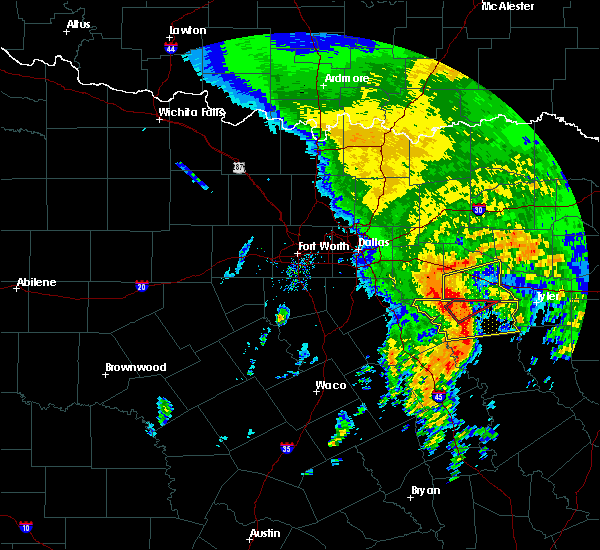 At 1242 pm cst, a severe thunderstorm was located 8 miles east of purtis creek state park, or 10 miles north of athens, moving northeast at 45 mph (radar indicated). Hazards include 70 mph wind gusts. Expect considerable tree damage. damage is likely to mobile homes, roofs, and outbuildings. this severe thunderstorm will be near, van around 105 pm cst. this includes interstate 20 between mile markers 521 and 542. A tornado watch remains in effect until 100 pm cst for north central texas. At 1242 pm cst, a severe thunderstorm was located 8 miles east of purtis creek state park, or 10 miles north of athens, moving northeast at 45 mph (radar indicated). Hazards include 70 mph wind gusts. Expect considerable tree damage. damage is likely to mobile homes, roofs, and outbuildings. this severe thunderstorm will be near, van around 105 pm cst. this includes interstate 20 between mile markers 521 and 542. A tornado watch remains in effect until 100 pm cst for north central texas.
|
| 5/27/2015 12:17 AM CDT | At 1217 am cdt, a severe thunderstorm was located 8 miles southwest of brownsboro, or near athens, moving southeast at 30 mph (radar indicated). Hazards include 60 mph wind gusts and penny size hail. Expect damage to roofs. siding and trees. Locations impacted include, athens, chandler, malakoff, brownsboro, berryville, trinidad, edom, coffee city, caney city, log cabin, murchison, star harbor, poynor and moore station. |
| 5/26/2015 11:58 PM CDT | At 1157 pm cdt, a line of severe thunderstorms extends from near van to murchison to malakoff, moving east at 30 mph (radar indicated). Hazards include 60 mph wind gusts and penny size hail. Expect damage to roofs. Siding and trees. |
| 5/25/2015 6:23 PM CDT | The severe thunderstorm warning for eastern henderson county will expire at 630 pm cdt, the storm which prompted the warning has weakened below severe limits and exited the warned area. therefore the warning will be allowed to expire. however gusty winds and heavy rain are still possible with this thunderstorm. a tornado watch remains in effect until 1000 pm cdt for north central texas. |
| 5/25/2015 6:13 PM CDT | At 612 pm cdt, a severe thunderstorm was located over brownsboro, or 15 miles east of athens, moving northeast at 50 mph (radar indicated). Hazards include 60 mph wind gusts and penny size hail. Expect damage to roofs. siding and trees. locations impacted include, athens, chandler, brownsboro, berryville, edom, coffee city, murchison, poynor and moore station. A tornado watch remains in effect until 1000 pm cdt for north central texas. |
| 5/25/2015 6:05 PM CDT | At 604 pm cdt, a severe thunderstorm was located near brownsboro, or 11 miles east of athens, moving northeast at 55 mph (radar indicated). Hazards include 60 mph wind gusts and penny size hail. Expect damage to roofs. siding and trees. locations impacted include, athens, chandler, brownsboro, berryville, edom, coffee city, murchison, poynor and moore station. A tornado watch remains in effect until 1000 pm cdt for north central texas. |
| 5/25/2015 5:52 PM CDT | At 551 pm cdt, a severe thunderstorm was located near athens, moving northeast at 55 mph (radar indicated). Hazards include 60 mph wind gusts and penny size hail. Expect damage to roofs. siding and trees. locations impacted include, athens, gun barrel city, chandler, malakoff, brownsboro, eustace, berryville, trinidad, edom, enchanted oaks, coffee city, caney city, payne springs, log cabin, murchison, star harbor, poynor and moore station. a tornado watch remains in effect until 600 pm cdt for north central texas. A tornado watch also remains in effect until 1000 pm cdt for north central texas. |
| 5/25/2015 5:41 PM CDT | At 540 pm cdt, a severe thunderstorm was located 7 miles south of athens, moving northeast at 55 mph (radar indicated). Hazards include 60 mph wind gusts. Expect damage to roofs. Siding and trees. |
| 5/25/2015 5:26 PM CDT | The severe thunderstorm warning for van zandt county will expire at 530 pm cdt, the strongest portions of the storms which prompted the warning have moved out of the area. therefore the warning will be allowed to expire. however gusty winds and heavy rain are still possible with these thunderstorms. a tornado watch remains in effect until 1000 pm cdt for north central texas. |
| 5/25/2015 5:14 PM CDT | At 513 pm cdt, severe thunderstorms were located along a line extending from 7 miles northwest of golden to 6 miles south of canton, moving east at 45 mph (radar indicated). Hazards include 60 mph wind gusts and penny size hail. Expect damage to roofs. siding and trees. locations impacted include, canton, grand saline, van, edgewood, fruitvale, edom and purtis creek state park. this includes interstate 20 between mile markers 517 and 542. A tornado watch remains in effect until 1000 pm cdt for north central texas. |
| 5/25/2015 4:57 PM CDT | At 457 pm cdt, severe thunderstorms were located along a line extending from near edgewood to near purtis creek state park, moving east at 50 mph (radar indicated). Hazards include 60 mph wind gusts and penny size hail. Expect damage to roofs. siding and trees. locations impacted include, canton, wills point, grand saline, van, edgewood, fruitvale, edom, lake tawakoni state park and purtis creek state park. this includes interstate 20 between mile markers 513 and 542. a tornado watch remains in effect until 600 pm cdt for north central texas. A tornado watch also remains in effect until 1000 pm cdt for north central texas. |
| 5/25/2015 4:11 PM CDT | At 410 pm cdt, severe thunderstorms were located along a line extending from near quinlan to near kemp, moving east at 45 mph (radar indicated). Hazards include 70 mph wind gusts and penny size hail. Expect considerable tree damage. Damage is likely to mobile homes, roofs and outbuildings. |
| 5/10/2015 10:34 PM CDT | At 1034 pm cdt, severe thunderstorms were located along a line extending from near van to near malakoff, moving northeast at 25 mph (radar indicated). Hazards include 60 mph wind gusts and quarter size hail. Hail damage to vehicles is expected. expect wind damage to roofs, siding and trees. this includes interstate 20 between mile markers 530 and 542. a tornado watch remains in effect until 1100 pm cdt for north central texas. 1. 00in. |
| 5/10/2015 10:28 PM CDT | At 1028 pm cdt, a severe thunderstorm capable of producing a tornado was located just south of van, or 13 miles southeast of canton, moving northeast at 25 mph (radar indicated rotation). Hazards include tornado and quarter size hail. Flying debris will be dangerous to those caught without shelter. mobile homes will be damaged or destroyed. damage to roofs, windows and vehicles will occur. tree damage is likely. this dangerous storm will be near, van around 1035 pm cdt. this includes interstate 20 between mile markers 531 and 542. Radar indicated. |
| 5/10/2015 10:09 PM CDT | The national weather service in fort worth has issued a * tornado warning for. southern van zandt county in north central texas. until 1045 pm cdt * at 1009 pm cdt. a severe thunderstorm capable of producing a tornado was located 9 miles east of purtis creek state park. Or 9. |
| 5/10/2015 9:54 PM CDT | At 954 pm cdt, severe thunderstorms were located along a line extending from near canton to 7 miles southeast of malakoff, moving northeast at 30 mph (radar indicated). Hazards include golf ball size hail and 60 mph wind gusts. People and animals outdoors will be injured. expect hail damage to roofs, siding, windows and vehicles. Expect wind damage to roofs, siding and trees. |
| 4/24/2015 8:13 PM CDT | At 813 pm cdt, a severe thunderstorm was located near van, or near canton, moving east at 40 mph (radar indicated). Hazards include 60 mph wind gusts and quarter size hail. Hail damage to vehicles is expected. Expect wind damage to roofs, siding and trees. |
| 4/24/2015 7:54 PM CDT | At 753 pm cdt, a severe thunderstorm was located near canton, moving east at 55 mph (radar indicated). Hazards include 60 mph wind gusts and quarter size hail. Hail damage to vehicles is expected. expect wind damage to roofs, siding and trees. locations impacted include, canton, wills point, grand saline, mabank, van, edgewood, fruitvale, edom, lake tawakoni state park and purtis creek state park. this includes interstate 20 between mile markers 512 and 542. a tornado watch remains in effect until 1000 pm cdt for north central texas. 1. 00in. |
| 4/24/2015 7:17 PM CDT | At 717 pm cdt, severe thunderstorms were located along a line extending from mesquite to near combine to near palmer, moving east at 55 mph (radar indicated). Hazards include ping pong ball size hail and 60 mph wind gusts. People and animals outdoors will be injured. expect hail damage to roofs, siding, windows and vehicles. Expect wind damage to roofs, siding and trees. |
| 4/18/2015 10:01 PM CDT | At 959 pm cdt, a severe thunderstorm was located near grand saline, or 11 miles northeast of canton, moving northeast at 35 mph (radar indicated). Hazards include 60 mph wind gusts. Expect damage to roofs. siding and trees. locations impacted include, canton, wills point, grand saline, van, edgewood, fruitvale, edom and lake tawakoni state park. this includes interstate 20 between mile markers 520 and 542. 75in. |
| 4/18/2015 9:25 PM CDT | At 925 pm cdt, a severe thunderstorm was located near athens, moving east at 40 mph (radar indicated). Hazards include 70 mph wind gusts and quarter size hail. Hail damage to vehicles is expected. expect considerable tree damage. Wind damage is also likely to mobile homes, roofs and outbuildings. |
| 4/18/2015 9:17 PM CDT | At 916 pm cdt, a severe thunderstorm was located over purtis creek state park, or 9 miles northeast of gun barrel city, moving east at 45 mph (trained weather spotters). Hazards include golf ball size hail and 60 mph wind gusts. People and animals outdoors will be injured. expect hail damage to roofs, siding, windows and vehicles. Expect wind damage to roofs, siding and trees. |
| 4/16/2015 7:20 PM CDT | At 643 pm cdt, a severe thunderstorm was located near van, or 8 miles southwest of mineola, moving east at 50 mph (radar indicated). Hazards include 70 mph wind gusts and penny size hail. Expect considerable tree damage. Damage is likely to mobile homes, roofs and outbuildings. |
| 4/16/2015 6:43 PM CDT | At 643 pm cdt, a severe thunderstorm was located near van, or 8 miles southwest of mineola, moving east at 50 mph (radar indicated). Hazards include 70 mph wind gusts and penny size hail. Expect considerable tree damage. Damage is likely to mobile homes, roofs and outbuildings. |
| 4/9/2015 5:14 PM CDT | A severe thunderstorm warning remains in effect until 600 pm cdt for northeastern henderson and southern van zandt counties. at 514 pm cdt. a severe thunderstorm was located 7 miles southwest of van. or 8 miles southeast of canton. moving northeast at 30 mph. hazard. ping pong ball size hail and 60 mph wind gusts. source. Radar indicated. |
| 4/9/2015 4:57 PM CDT | The national weather service in fort worth has issued a * severe thunderstorm warning for. northeastern henderson county in northeastern texas. southern van zandt county in northeastern texas. until 600 pm cdt * at 456 pm cdt. a severe thunderstorm was located near van. Or 15. |
Hail Maps for Callender Lake, TX
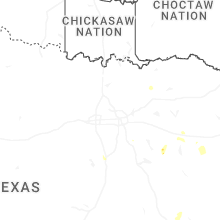
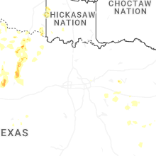
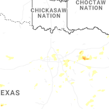
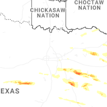
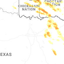
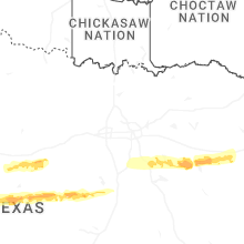
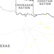
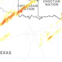
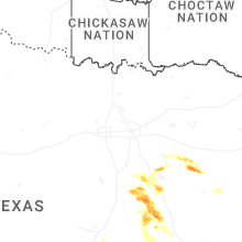
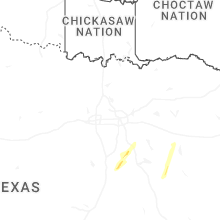


Connect with Interactive Hail Maps