

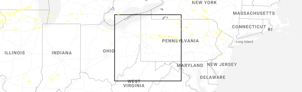
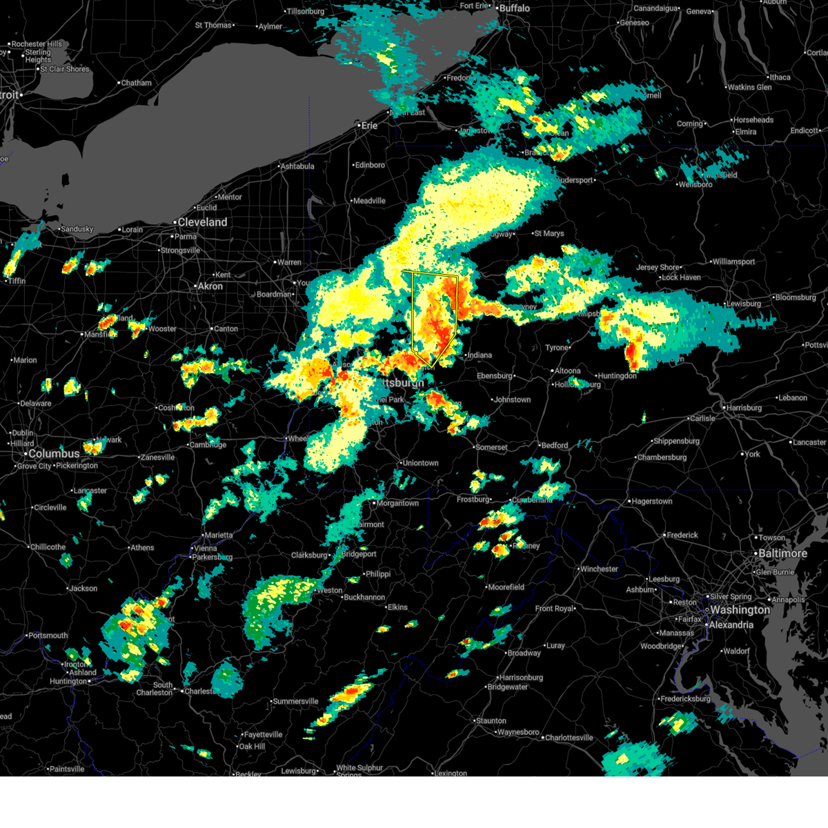
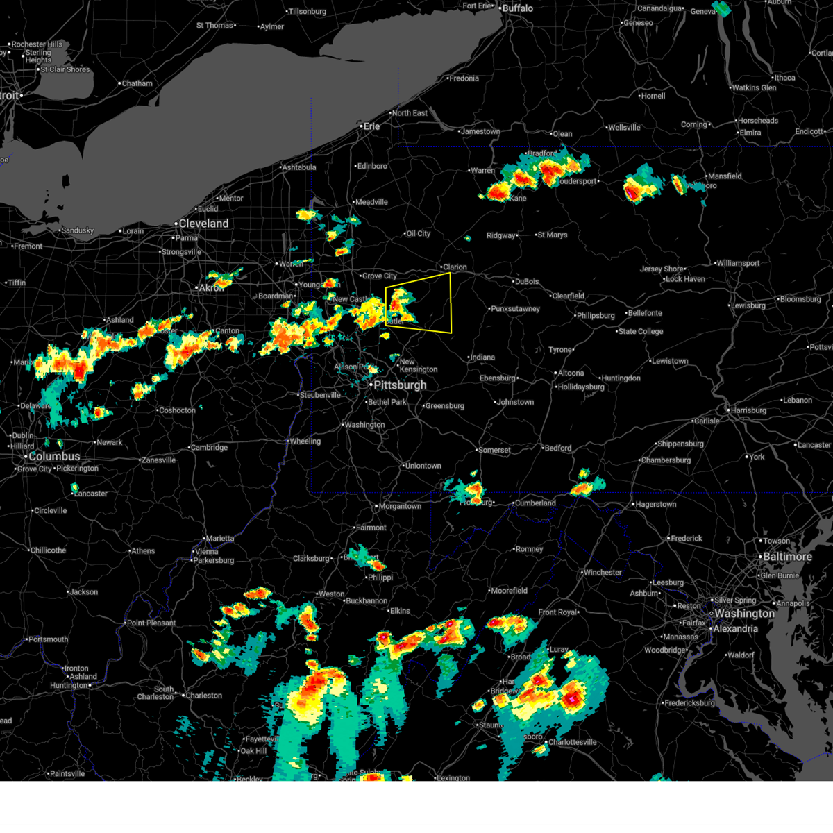
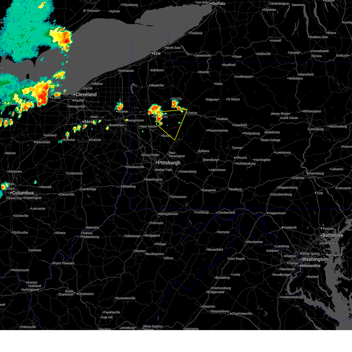
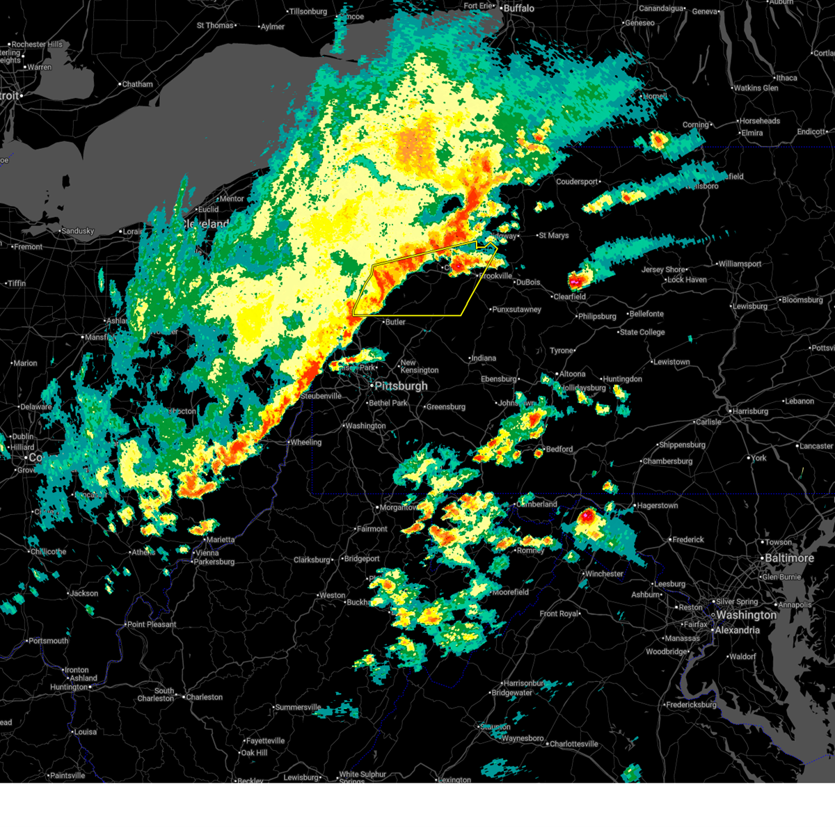
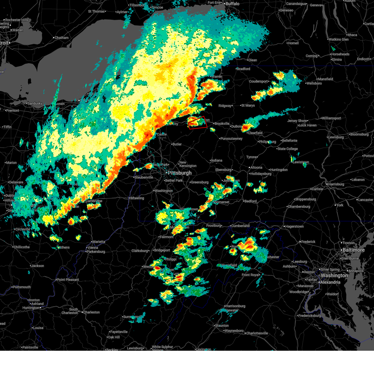
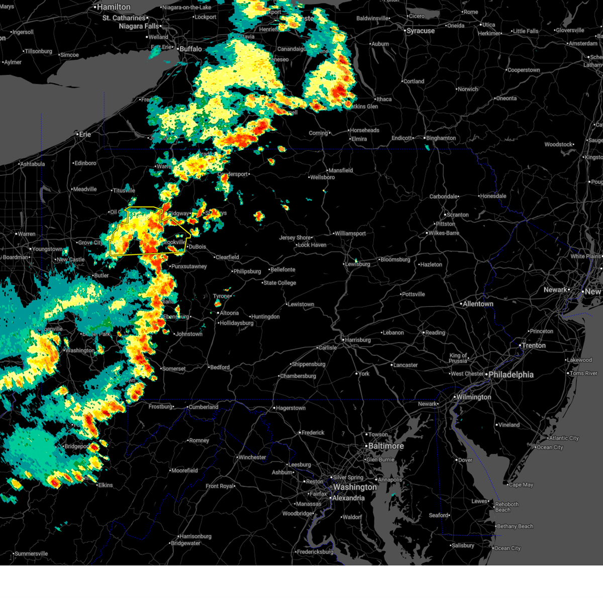
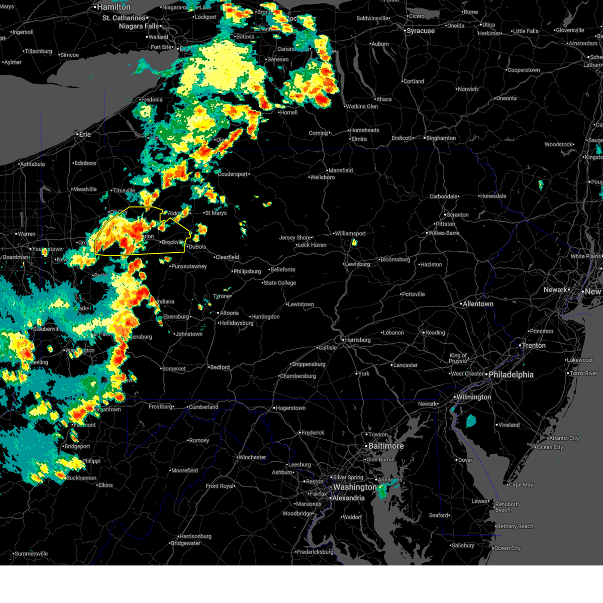
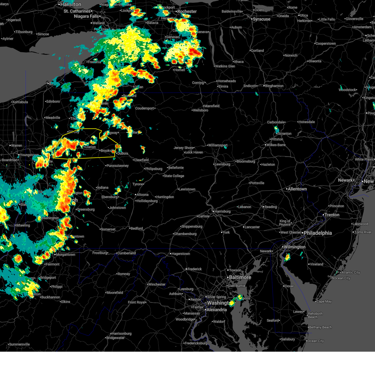
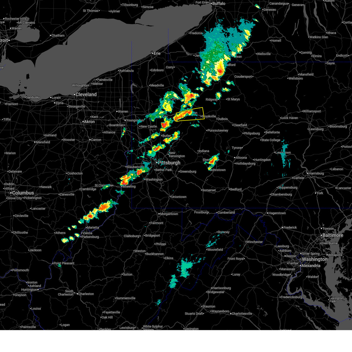
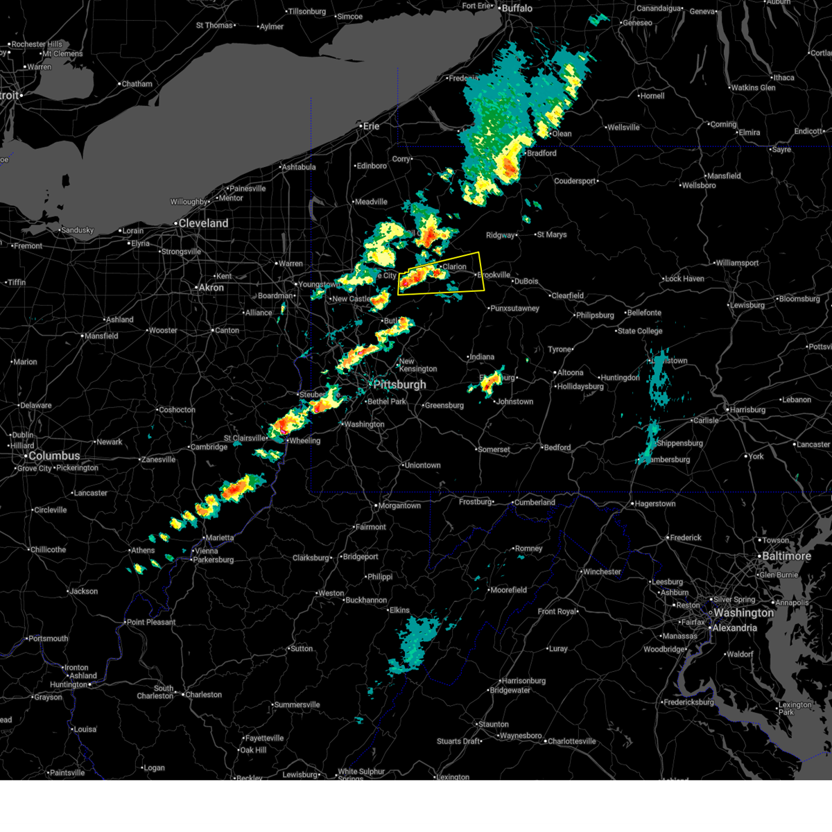
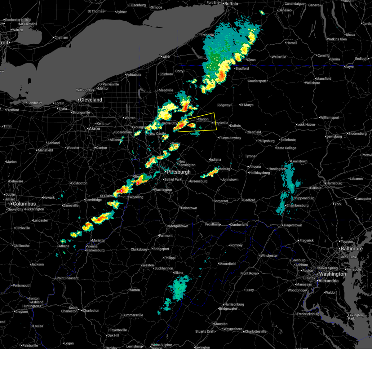
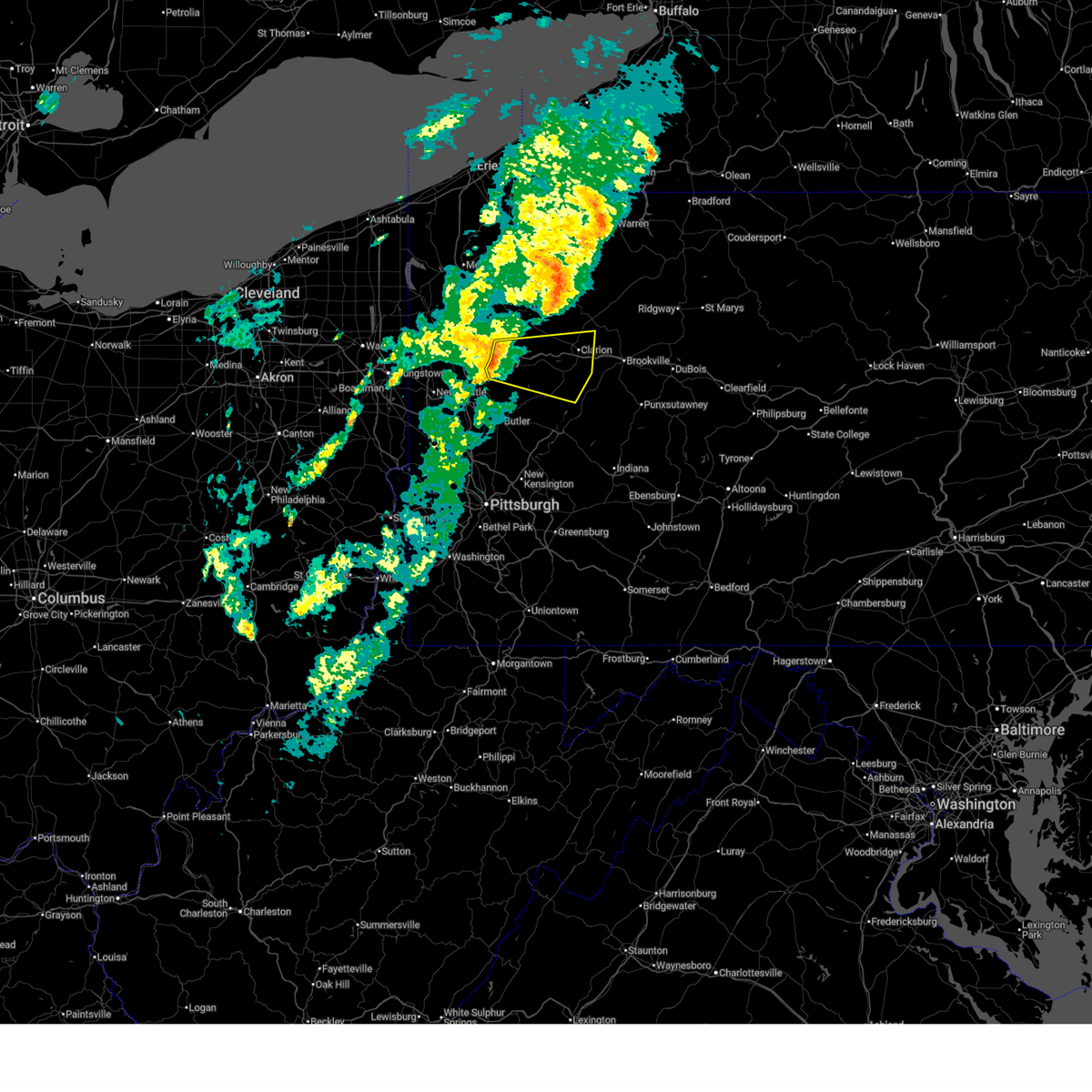
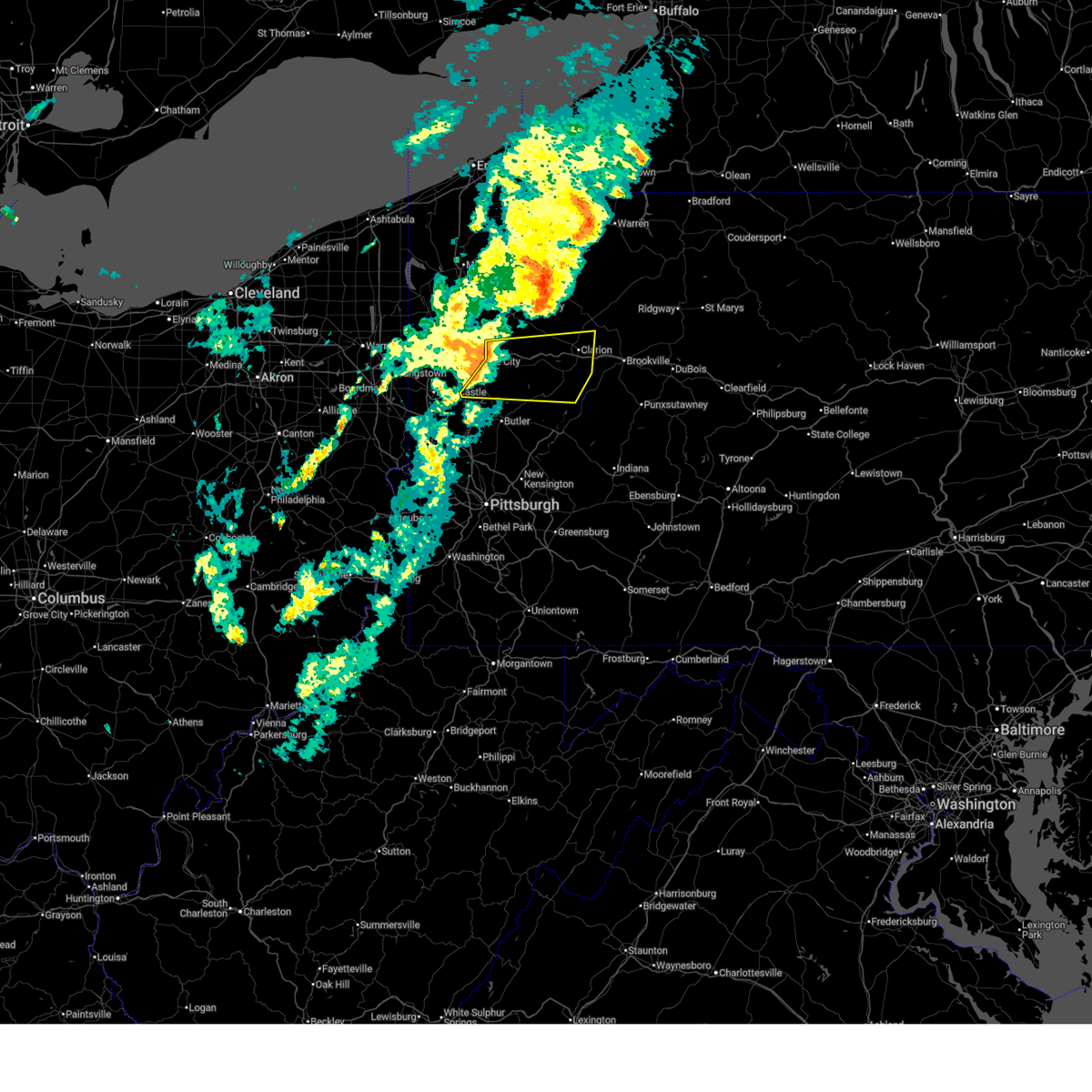
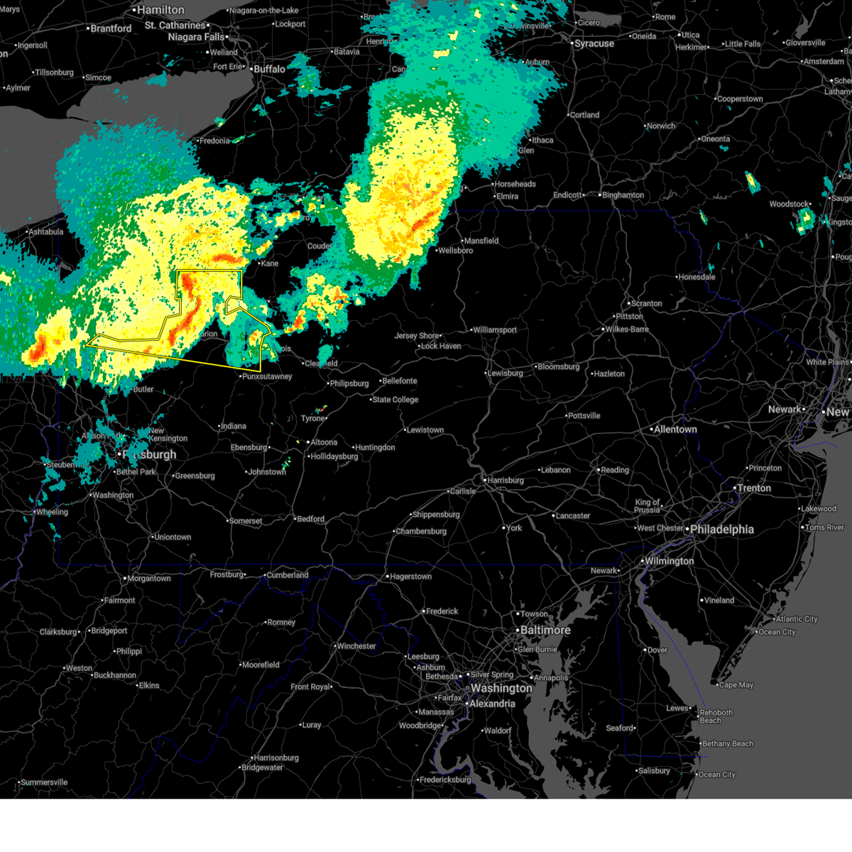
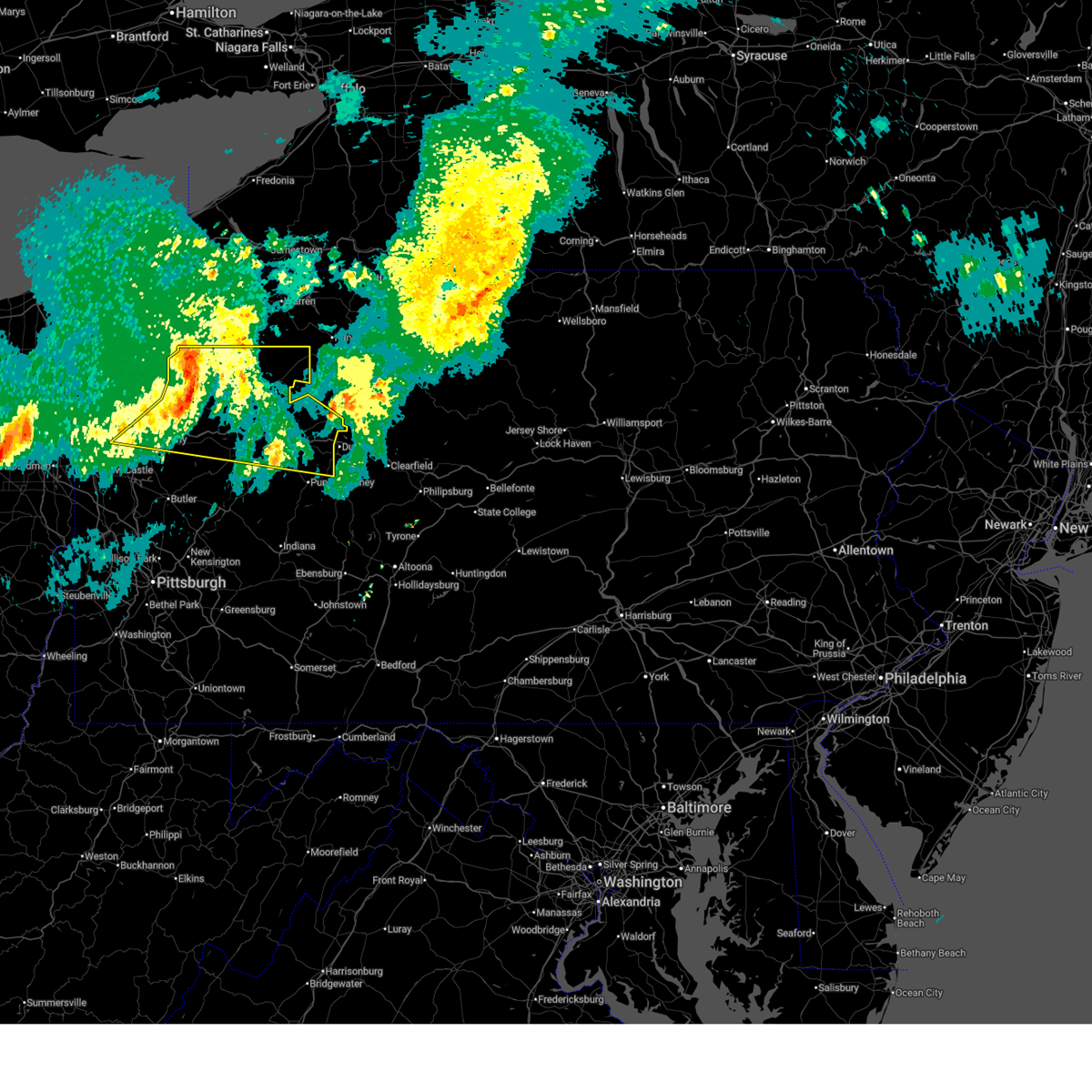
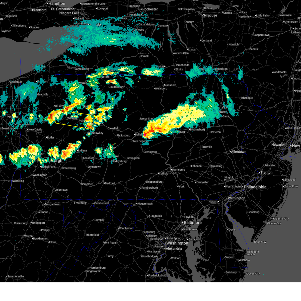
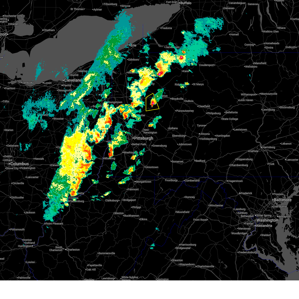
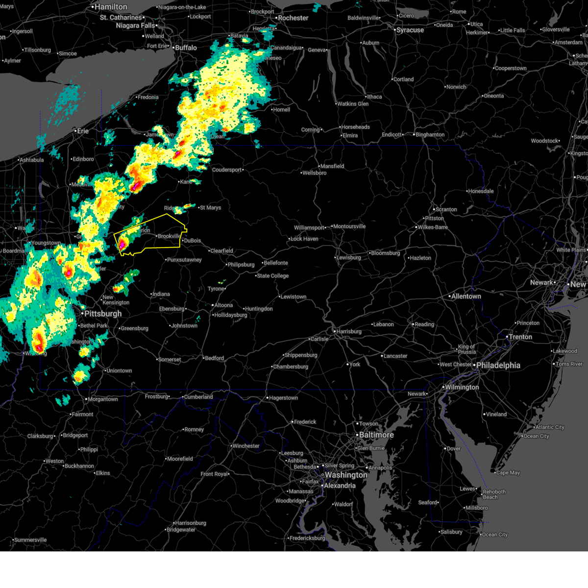
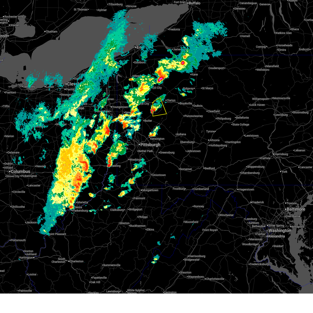
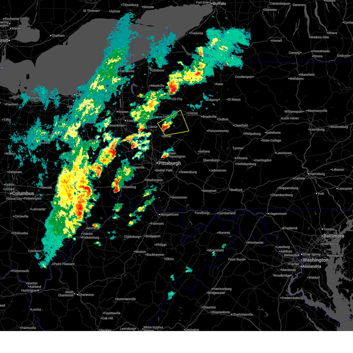
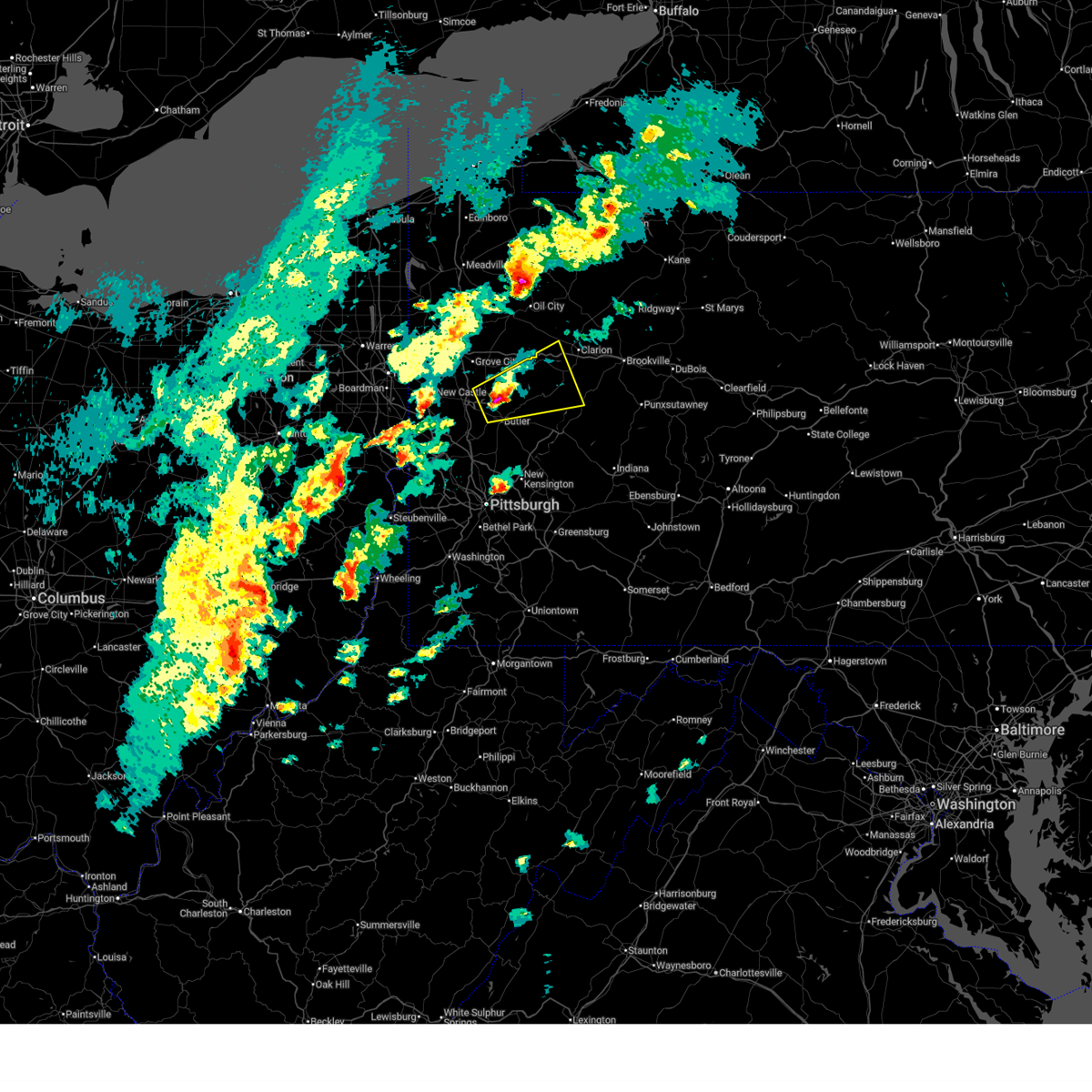
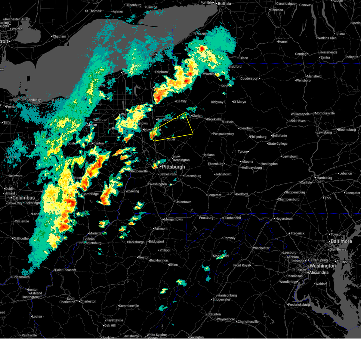
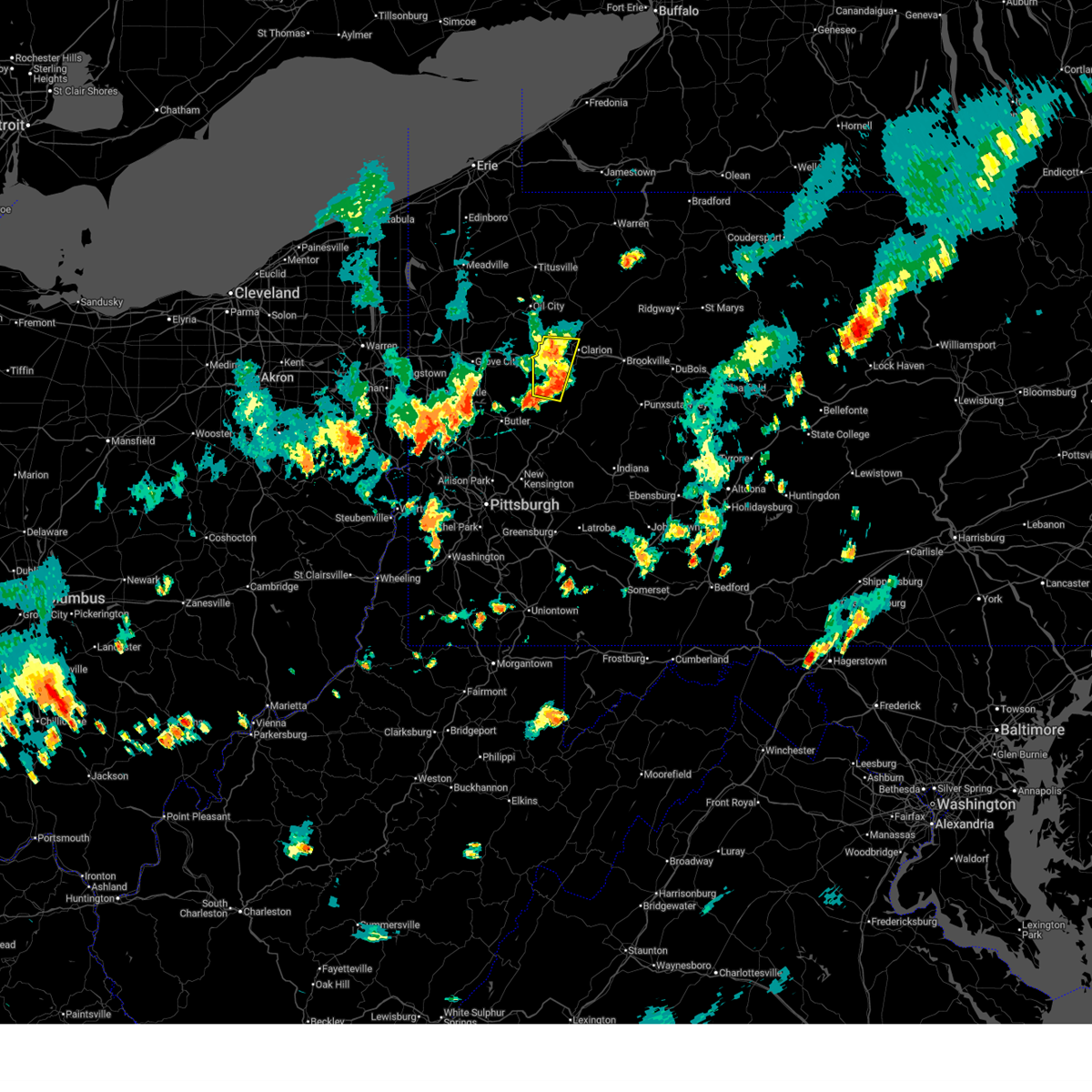
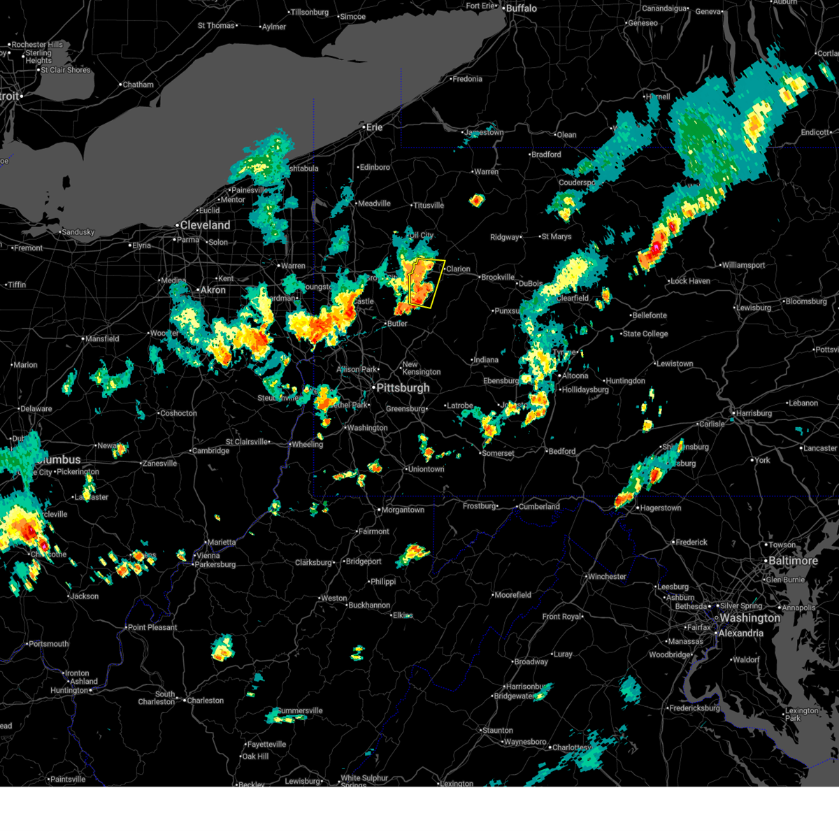
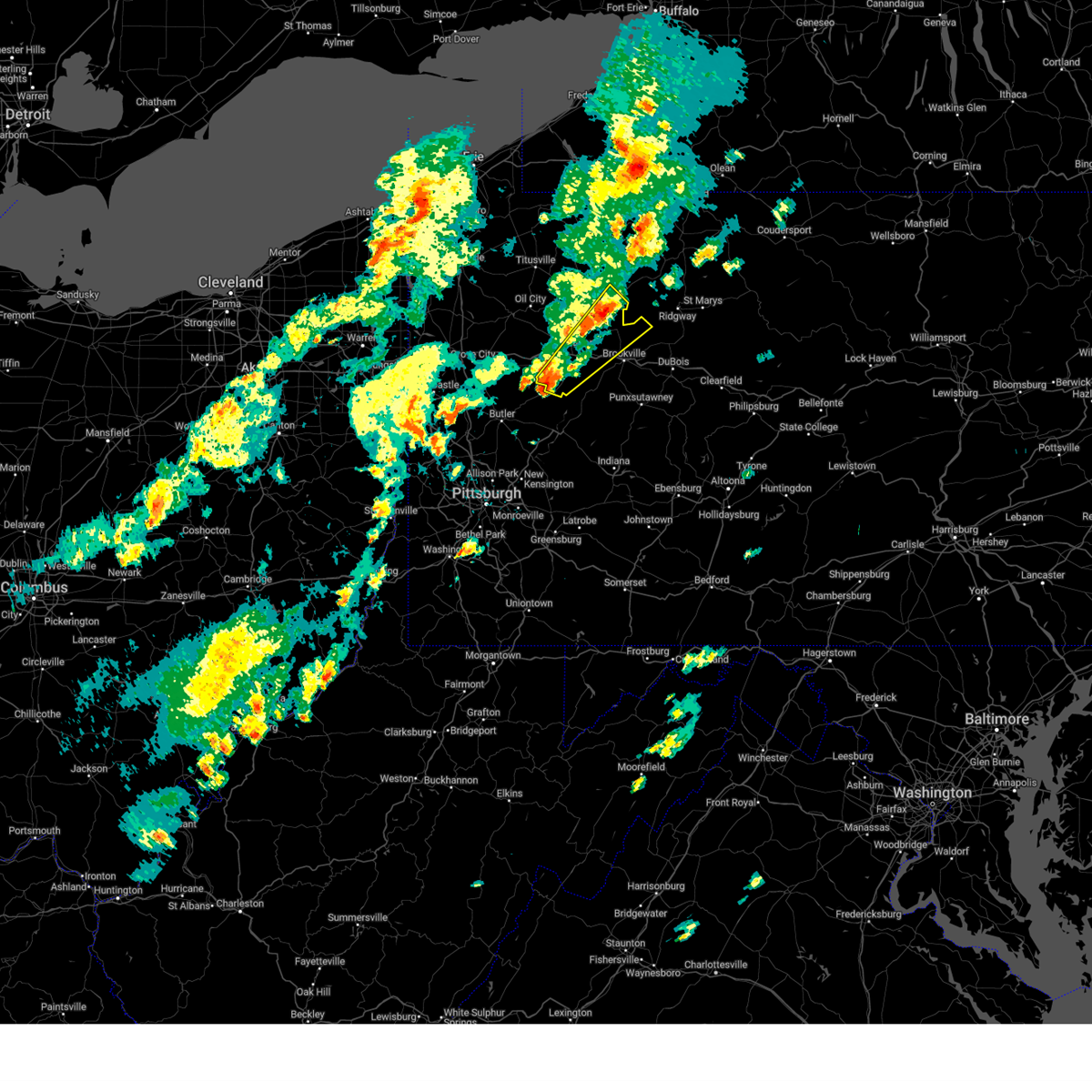
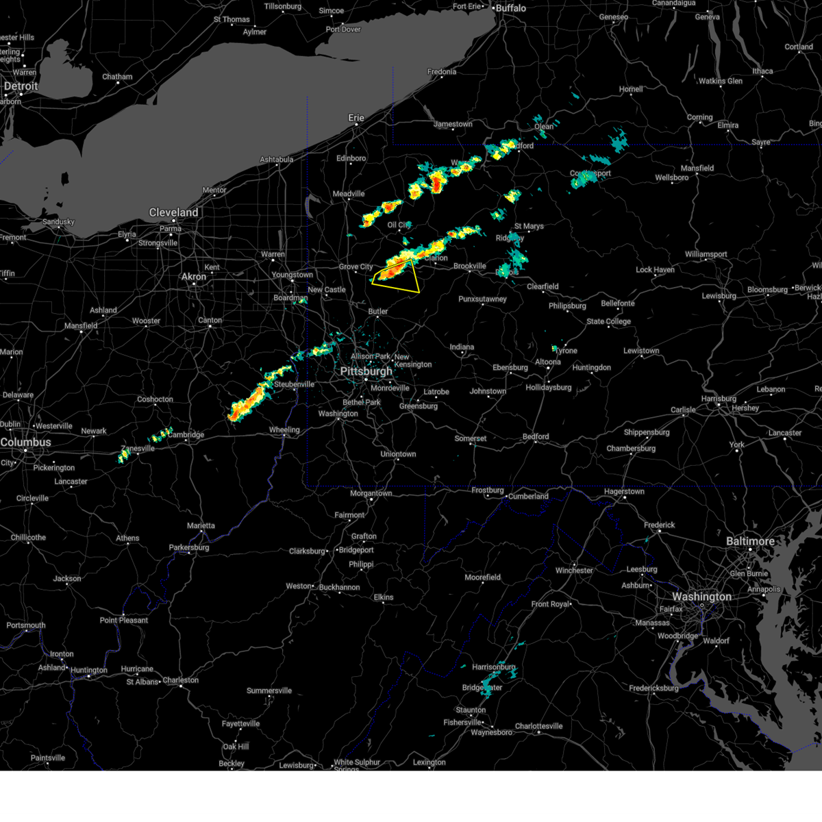
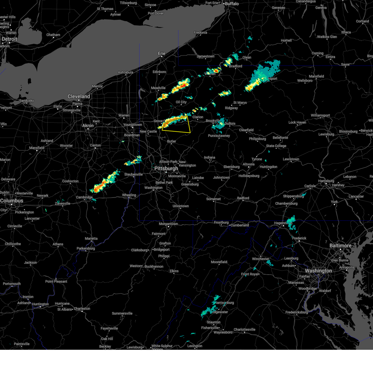
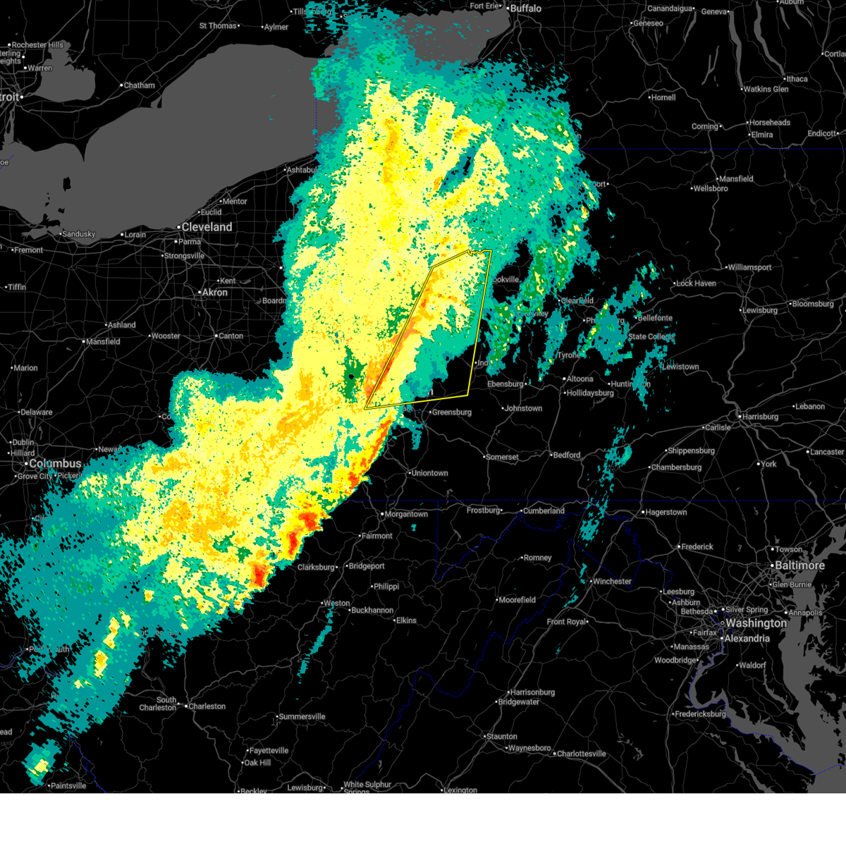
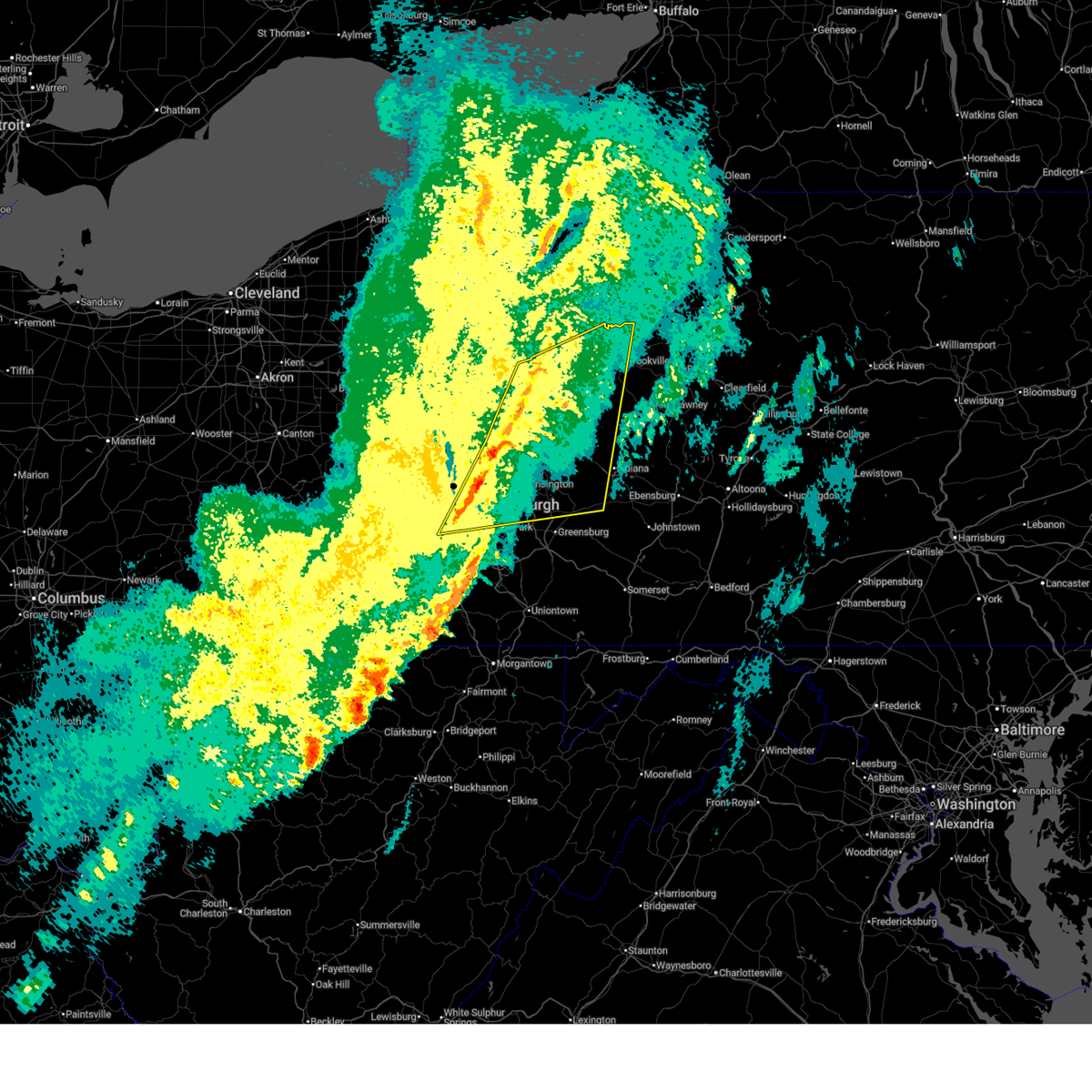
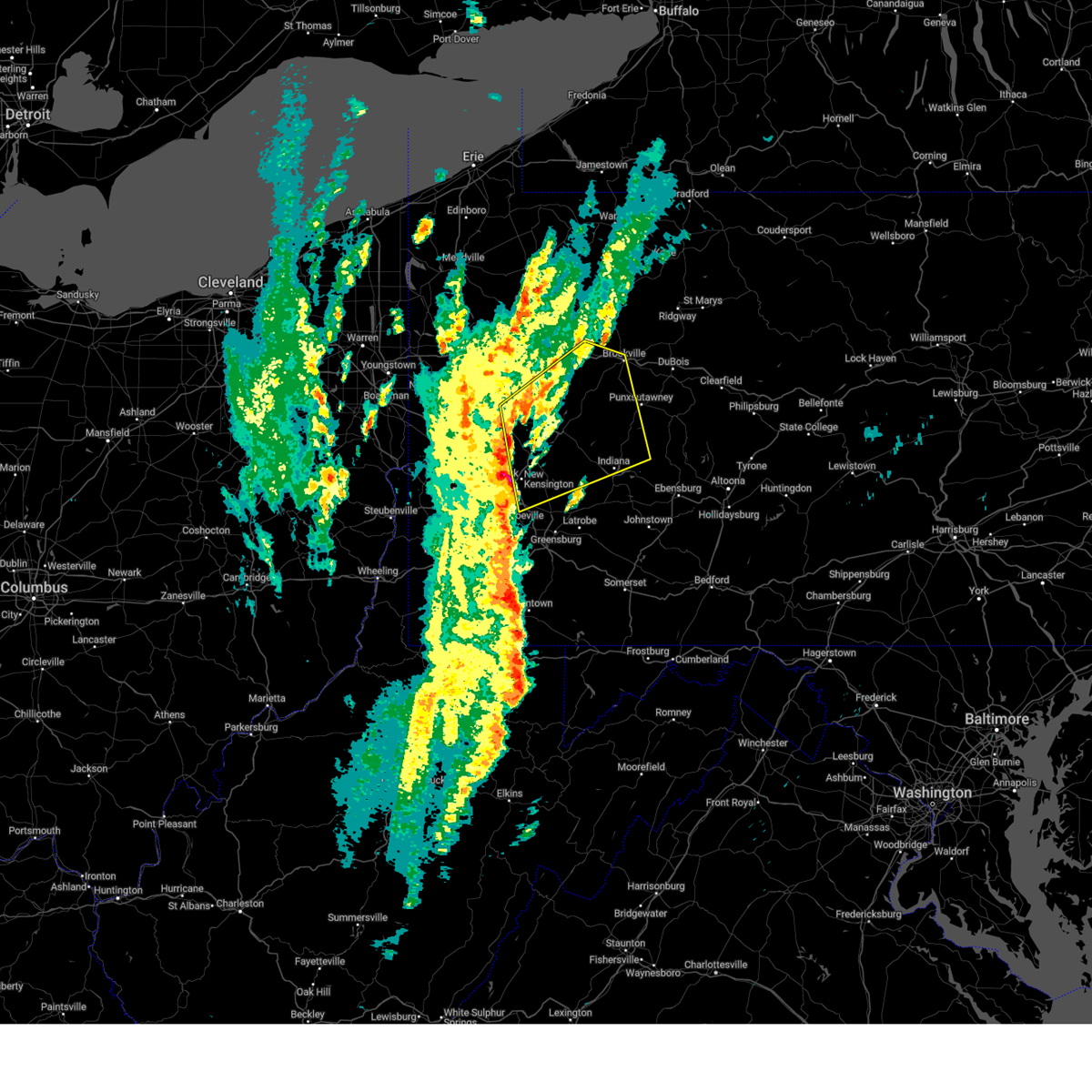
Hail Map for Callensburg, PA
The Callensburg, PA area has had 2 reports of on-the-ground hail by trained spotters, and has been under severe weather warnings 41 times during the past 12 months. Doppler radar has detected hail at or near Callensburg, PA on 30 occasions, including 3 occasions during the past year.
| Name: | Callensburg, PA |
| Where Located: | 52.7 miles NNE of Pittsburgh, PA |
| Map: | Google Map for Callensburg, PA |
| Population: | 207 |
| Housing Units: | 101 |
| More Info: | Search Google for Callensburg, PA |
2
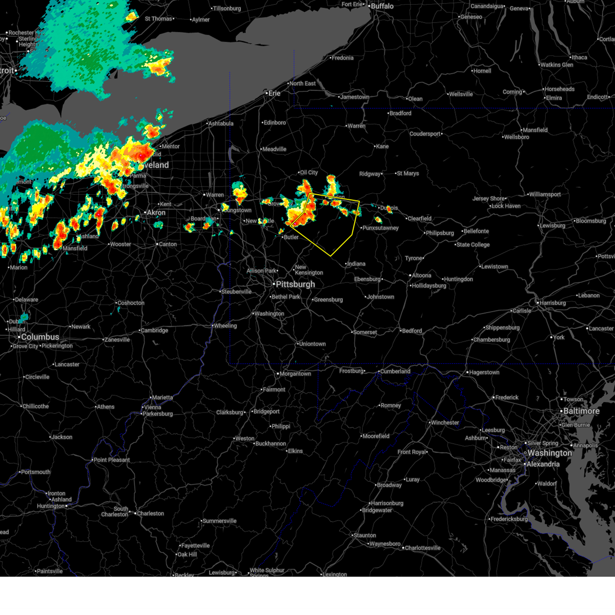
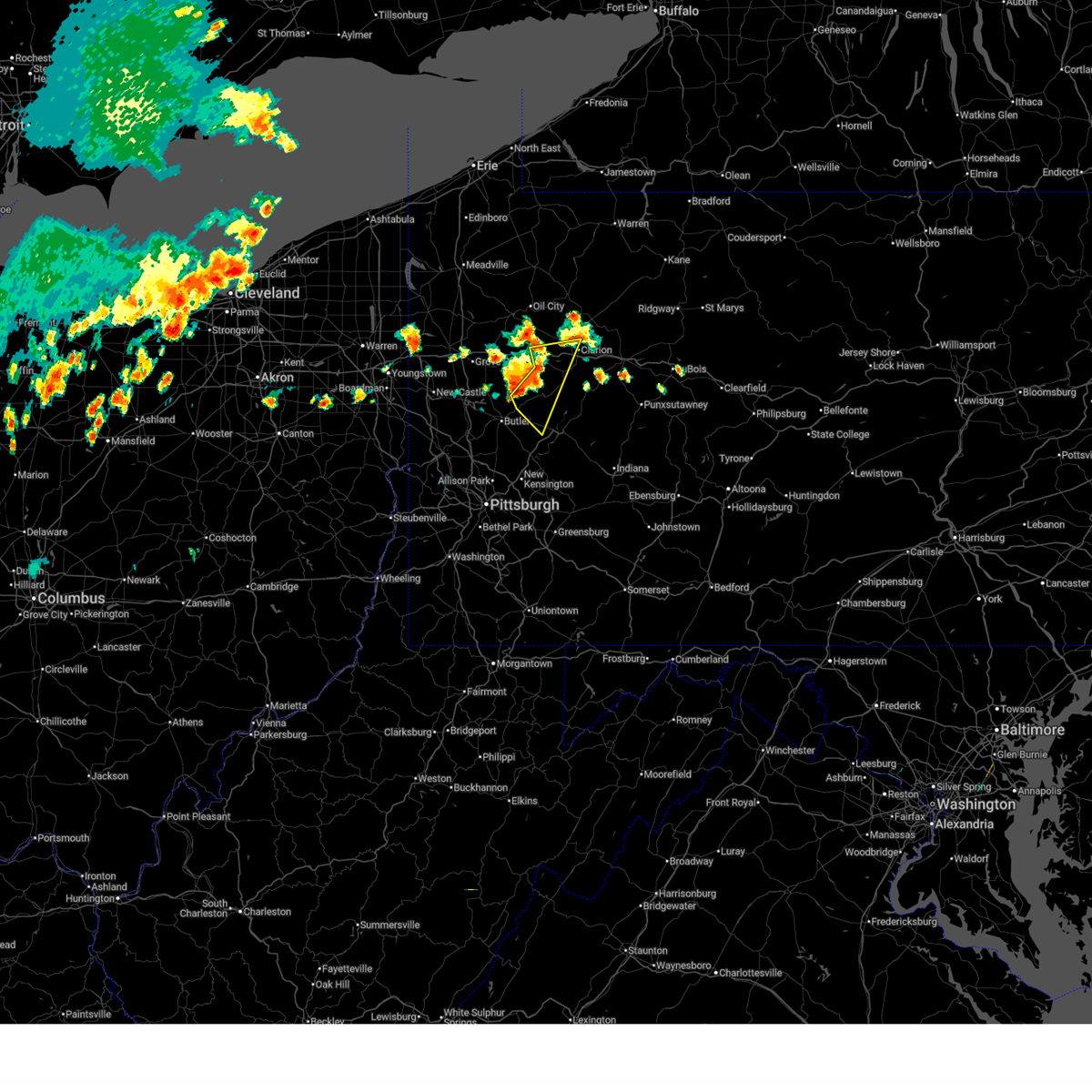
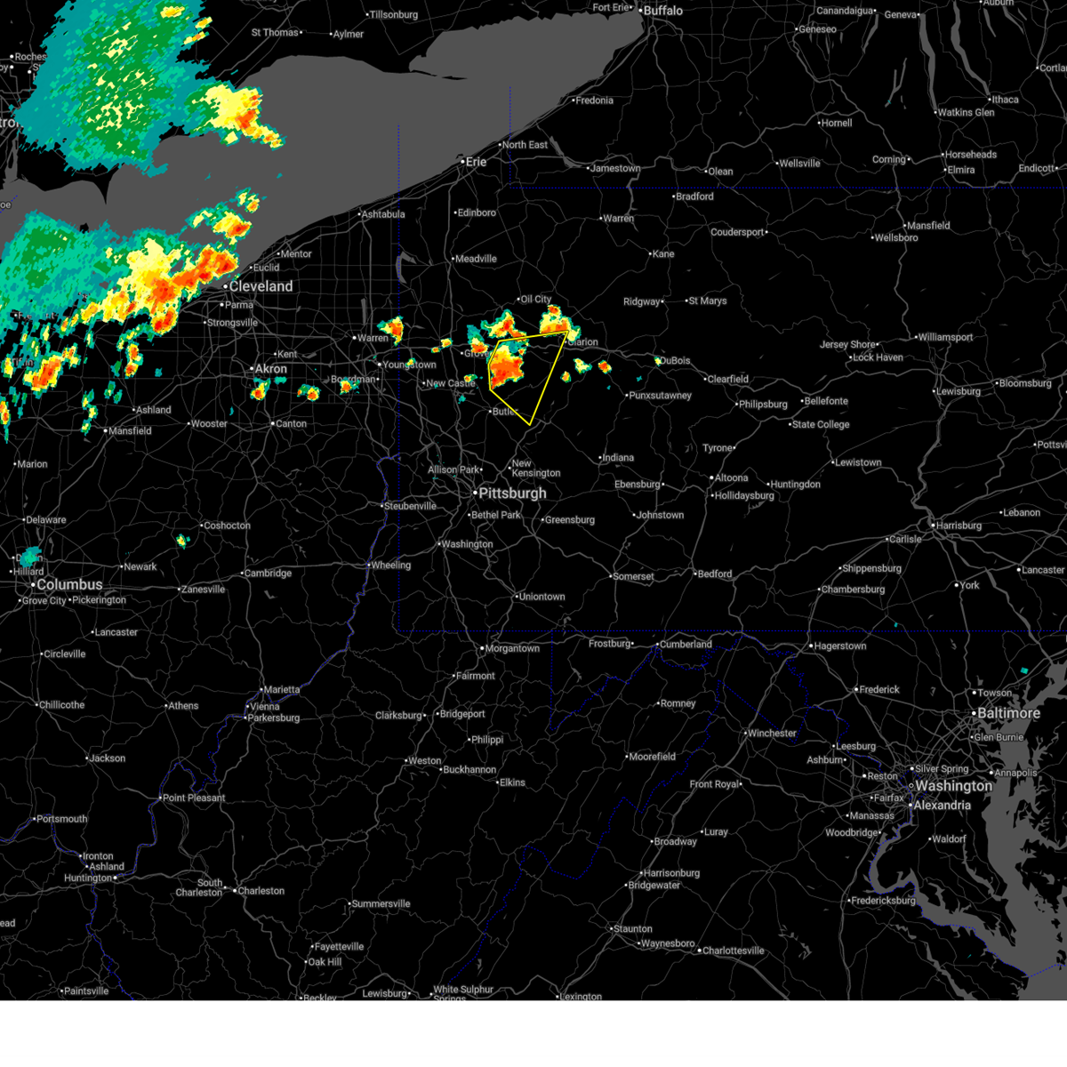
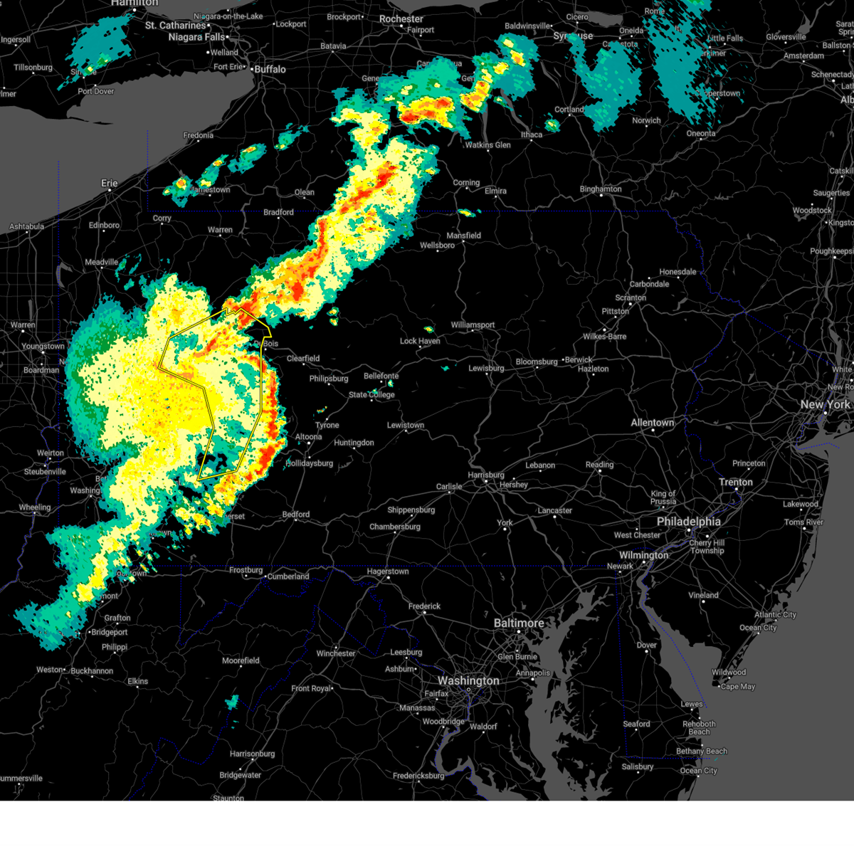
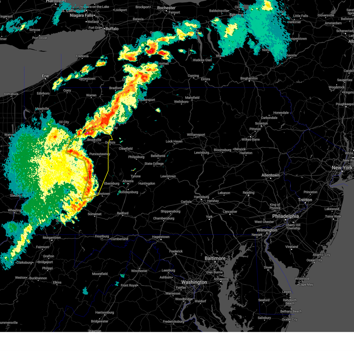
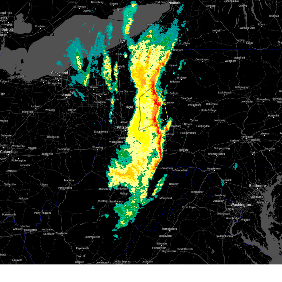
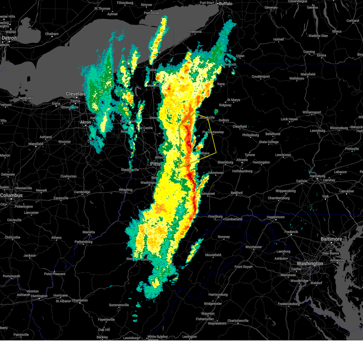
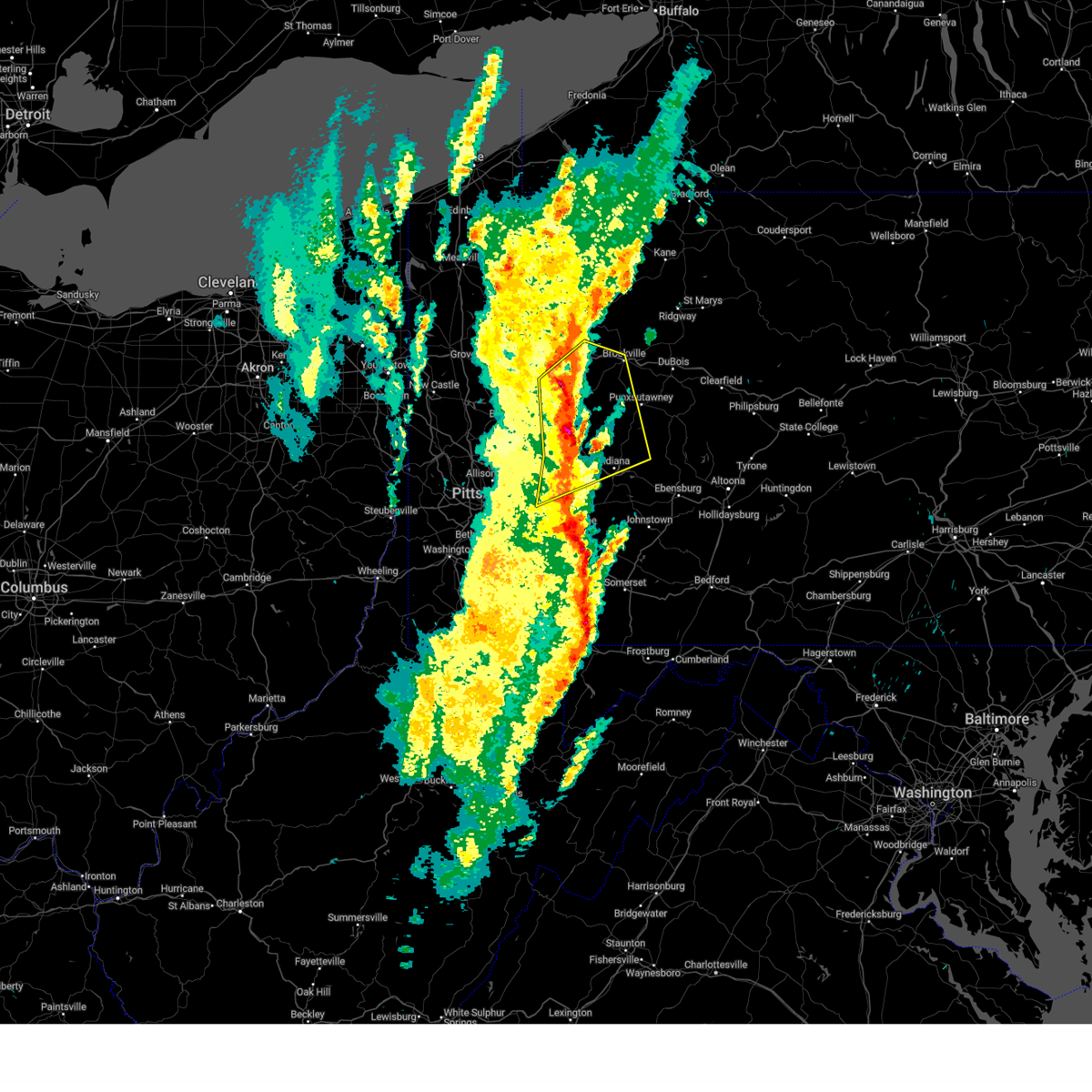
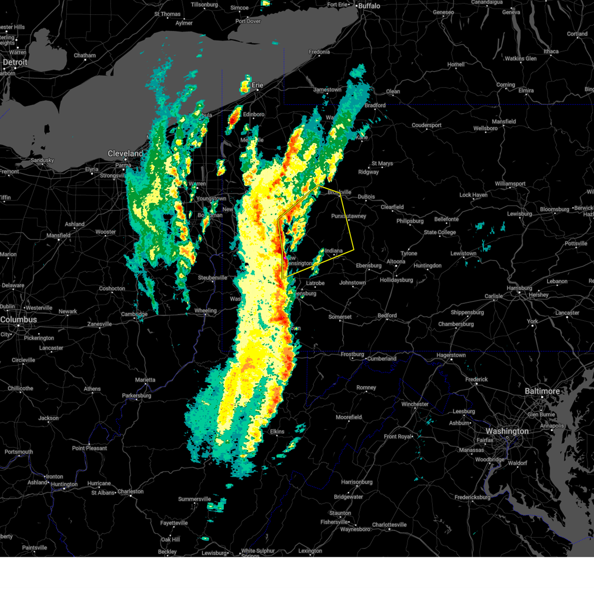
The Top Recent Hail Date for Callensburg, PA is Friday, July 3, 2026 (4th out of 30)
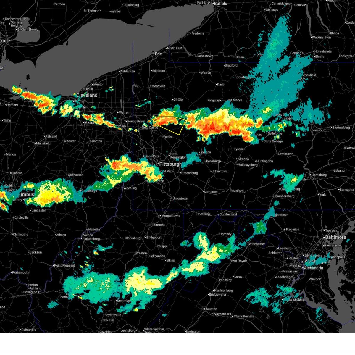
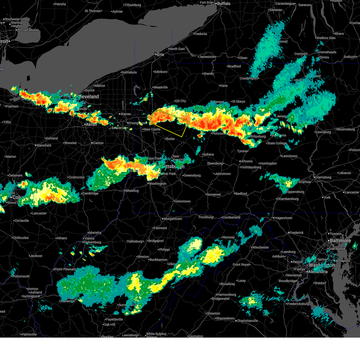
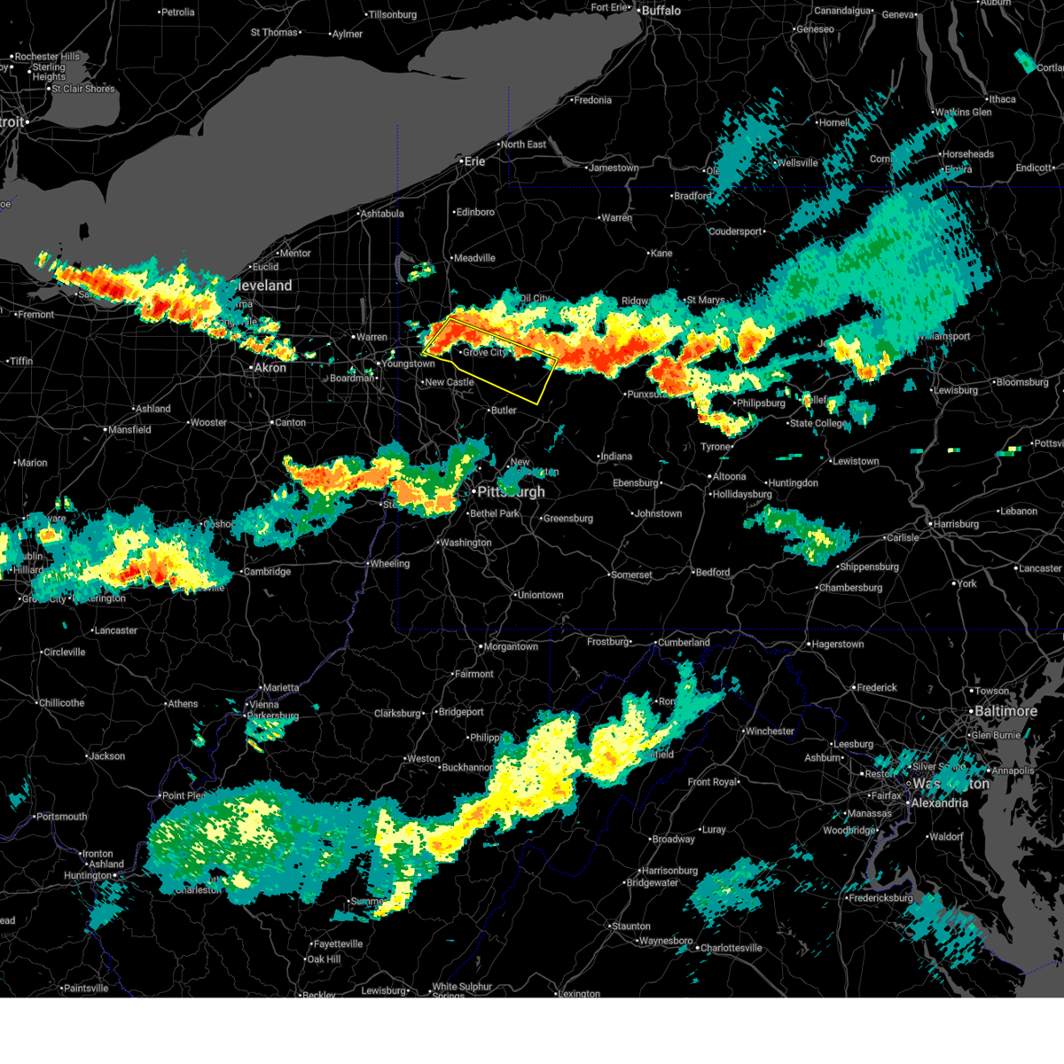
Hail and Wind Damage Spotted near Callensburg, PA
| Date / Time | Report Details |
|---|---|
| 7/18/2026 7:53 PM EDT |
 At 753 pm edt, a severe thunderstorm was located 13 miles northeast of shanor-northvue, or 15 miles west of rimersburg, moving southeast at 40 mph (radar indicated). Hazards include 60 mph wind gusts. Expect damage to roofs, siding, and trees. locations impacted include, rimersburg, slippery rock, chicora, east brady, harrisville, parker, sligo, bruin, st. Petersburg, eau claire, petrolia, karns city, callensburg, fairview, west sunbury, foxburg, cherry valley, hooker and boyers. At 753 pm edt, a severe thunderstorm was located 13 miles northeast of shanor-northvue, or 15 miles west of rimersburg, moving southeast at 40 mph (radar indicated). Hazards include 60 mph wind gusts. Expect damage to roofs, siding, and trees. locations impacted include, rimersburg, slippery rock, chicora, east brady, harrisville, parker, sligo, bruin, st. Petersburg, eau claire, petrolia, karns city, callensburg, fairview, west sunbury, foxburg, cherry valley, hooker and boyers.
|
| 7/18/2026 7:45 PM EDT |
 At 745 pm edt, a severe thunderstorm was located 9 miles east of slippery rock, or 11 miles east of grove city, moving southeast at 40 mph (radar indicated). Hazards include 60 mph wind gusts. Expect damage to roofs, siding, and trees. locations impacted include, grove city, rimersburg, slippery rock, chicora, east brady, harrisville, parker, sligo, emlenton, bruin, clintonville, st. Petersburg, eau claire, petrolia, karns city, barkeyville, callensburg, fairview and west sunbury. At 745 pm edt, a severe thunderstorm was located 9 miles east of slippery rock, or 11 miles east of grove city, moving southeast at 40 mph (radar indicated). Hazards include 60 mph wind gusts. Expect damage to roofs, siding, and trees. locations impacted include, grove city, rimersburg, slippery rock, chicora, east brady, harrisville, parker, sligo, emlenton, bruin, clintonville, st. Petersburg, eau claire, petrolia, karns city, barkeyville, callensburg, fairview and west sunbury.
|
| 7/18/2026 7:26 PM EDT |
 Svrpbz the national weather service in pittsburgh has issued a * severe thunderstorm warning for, southeastern mercer county in northwestern pennsylvania, southwestern venango county in northwestern pennsylvania, northwestern armstrong county in west central pennsylvania, northern butler county in west central pennsylvania, southwestern clarion county in west central pennsylvania, * until 815 pm edt. * at 726 pm edt, a severe thunderstorm was located near grove city, moving southeast at 50 mph (radar indicated). Hazards include 60 mph wind gusts. expect damage to roofs, siding, and trees Svrpbz the national weather service in pittsburgh has issued a * severe thunderstorm warning for, southeastern mercer county in northwestern pennsylvania, southwestern venango county in northwestern pennsylvania, northwestern armstrong county in west central pennsylvania, northern butler county in west central pennsylvania, southwestern clarion county in west central pennsylvania, * until 815 pm edt. * at 726 pm edt, a severe thunderstorm was located near grove city, moving southeast at 50 mph (radar indicated). Hazards include 60 mph wind gusts. expect damage to roofs, siding, and trees
|
| 7/5/2026 4:56 PM EDT |
 The storms which prompted the warning have weakened below severe limits, and no longer pose an immediate threat to life or property. therefore, the warning will be allowed to expire. however, gusty winds and heavy rain are still possible with these thunderstorms. The storms which prompted the warning have weakened below severe limits, and no longer pose an immediate threat to life or property. therefore, the warning will be allowed to expire. however, gusty winds and heavy rain are still possible with these thunderstorms.
|
| 7/5/2026 4:37 PM EDT |
 At 437 pm edt, severe thunderstorms were located along a line from near rimersburg to near vandergrift, moving east at 25 mph (radar indicated). Hazards include 60 mph wind gusts. Expect damage to roofs, siding, and trees. Locations impacted include, kittanning, rimersburg, ford city, new bethlehem, west kittanning, orchard hills, east brady, rural valley, sligo, dayton, west hills, limestone, hawthorn, manorville, ford cliff, elderton, applewold and callensburg. At 437 pm edt, severe thunderstorms were located along a line from near rimersburg to near vandergrift, moving east at 25 mph (radar indicated). Hazards include 60 mph wind gusts. Expect damage to roofs, siding, and trees. Locations impacted include, kittanning, rimersburg, ford city, new bethlehem, west kittanning, orchard hills, east brady, rural valley, sligo, dayton, west hills, limestone, hawthorn, manorville, ford cliff, elderton, applewold and callensburg.
|
| 7/5/2026 4:16 PM EDT |
 Svrpbz the national weather service in pittsburgh has issued a * severe thunderstorm warning for, northeastern allegheny county in southwestern pennsylvania, north central westmoreland county in southwestern pennsylvania, armstrong county in west central pennsylvania, eastern butler county in west central pennsylvania, southern clarion county in west central pennsylvania, * until 500 pm edt. * at 416 pm edt, severe thunderstorms were located along a line from 6 miles northwest of rimersburg to over tarentum, or along a line from 6 miles northwest of rimersburg to 10 miles west of vandergrift, moving east at 25 mph (radar indicated). Hazards include 60 mph wind gusts. expect damage to roofs, siding, and trees Svrpbz the national weather service in pittsburgh has issued a * severe thunderstorm warning for, northeastern allegheny county in southwestern pennsylvania, north central westmoreland county in southwestern pennsylvania, armstrong county in west central pennsylvania, eastern butler county in west central pennsylvania, southern clarion county in west central pennsylvania, * until 500 pm edt. * at 416 pm edt, severe thunderstorms were located along a line from 6 miles northwest of rimersburg to over tarentum, or along a line from 6 miles northwest of rimersburg to 10 miles west of vandergrift, moving east at 25 mph (radar indicated). Hazards include 60 mph wind gusts. expect damage to roofs, siding, and trees
|
| 7/4/2026 3:58 PM EDT |
 At 358 pm edt, a severe thunderstorm was located near rimersburg, moving east at 25 mph (radar indicated). Hazards include 60 mph wind gusts and small hail. Expect damage to roofs, siding, and trees. Locations impacted include, kittanning, rimersburg, new bethlehem, west kittanning, chicora, east brady, rural valley, parker, east butler, sligo, worthington, bruin, west hills, limestone, applewold, petrolia, karns city, callensburg, fairview and hooker. At 358 pm edt, a severe thunderstorm was located near rimersburg, moving east at 25 mph (radar indicated). Hazards include 60 mph wind gusts and small hail. Expect damage to roofs, siding, and trees. Locations impacted include, kittanning, rimersburg, new bethlehem, west kittanning, chicora, east brady, rural valley, parker, east butler, sligo, worthington, bruin, west hills, limestone, applewold, petrolia, karns city, callensburg, fairview and hooker.
|
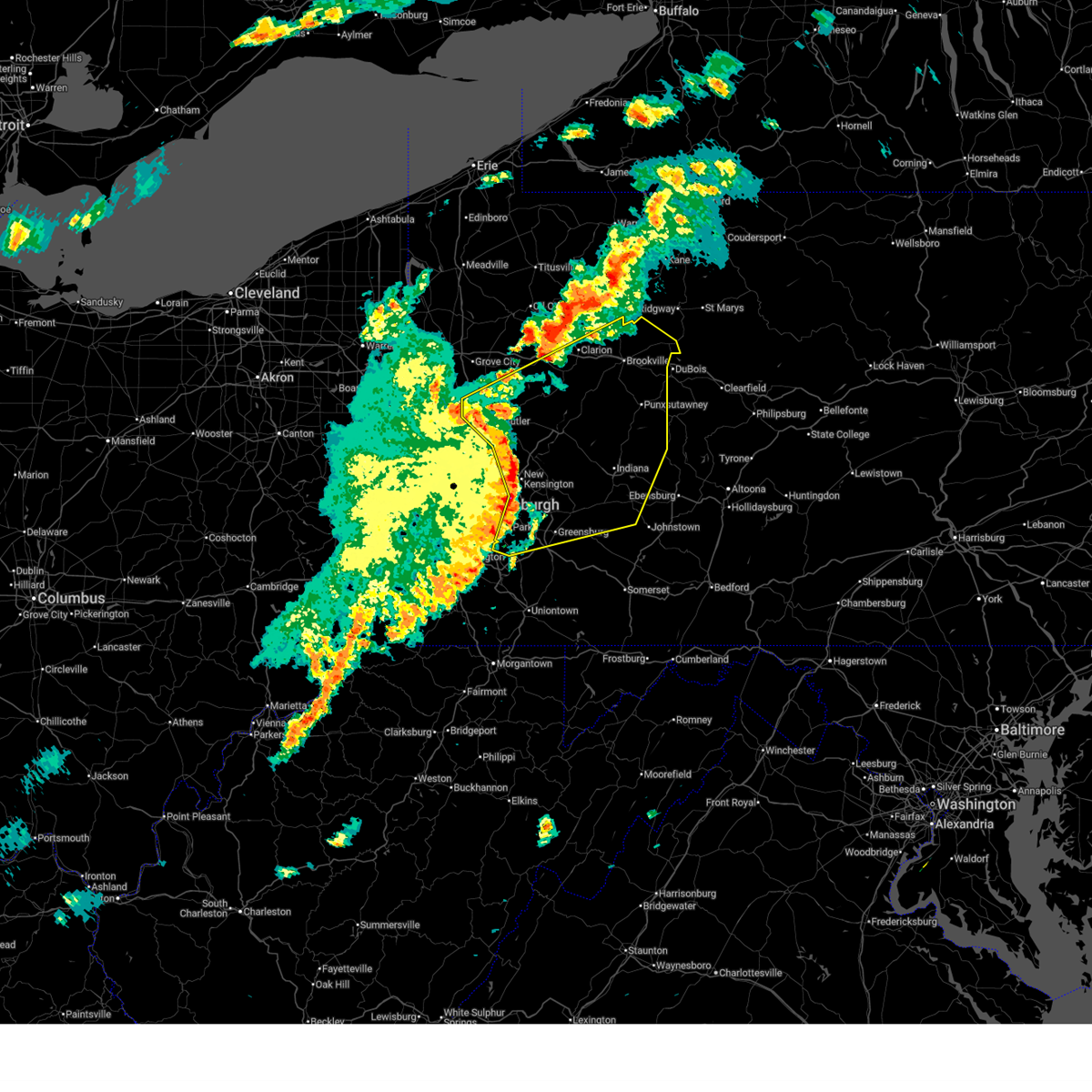
| 7/4/2026 3:27 PM EDT |
 Svrpbz the national weather service in pittsburgh has issued a * severe thunderstorm warning for, central armstrong county in west central pennsylvania, northeastern butler county in west central pennsylvania, southern clarion county in west central pennsylvania, * until 415 pm edt. * at 327 pm edt, a severe thunderstorm was located 9 miles northeast of shanor-northvue, or 11 miles northeast of butler, moving east at 25 mph (radar indicated). Hazards include 60 mph wind gusts and quarter size hail. Hail damage to vehicles is expected. Expect wind damage to roofs, siding, and trees. Svrpbz the national weather service in pittsburgh has issued a * severe thunderstorm warning for, central armstrong county in west central pennsylvania, northeastern butler county in west central pennsylvania, southern clarion county in west central pennsylvania, * until 415 pm edt. * at 327 pm edt, a severe thunderstorm was located 9 miles northeast of shanor-northvue, or 11 miles northeast of butler, moving east at 25 mph (radar indicated). Hazards include 60 mph wind gusts and quarter size hail. Hail damage to vehicles is expected. Expect wind damage to roofs, siding, and trees.
|
| 7/3/2026 8:37 PM EDT |
 Svrpbz the national weather service in pittsburgh has issued a * severe thunderstorm warning for, central armstrong county in west central pennsylvania, east central butler county in west central pennsylvania, southern clarion county in west central pennsylvania, north central indiana county in west central pennsylvania, southwestern jefferson pa county in west central pennsylvania, * until 915 pm edt. * at 837 pm edt, severe thunderstorms were located along a line from over knox to 9 miles northwest of west kittanning, or along a line from over knox to 9 miles northwest of kittanning, moving east at 30 mph (law enforcement reported). Hazards include 60 mph wind gusts. expect damage to roofs, siding, and trees Svrpbz the national weather service in pittsburgh has issued a * severe thunderstorm warning for, central armstrong county in west central pennsylvania, east central butler county in west central pennsylvania, southern clarion county in west central pennsylvania, north central indiana county in west central pennsylvania, southwestern jefferson pa county in west central pennsylvania, * until 915 pm edt. * at 837 pm edt, severe thunderstorms were located along a line from over knox to 9 miles northwest of west kittanning, or along a line from over knox to 9 miles northwest of kittanning, moving east at 30 mph (law enforcement reported). Hazards include 60 mph wind gusts. expect damage to roofs, siding, and trees
|
| 7/3/2026 8:32 PM EDT |
 At 832 pm edt, a severe thunderstorm was located near rimersburg, moving east at 45 mph (law enforcement reported). Hazards include 60 mph wind gusts. Expect damage to roofs, siding, and trees. locations impacted include, knox, rimersburg, chicora, east brady, parker, sligo, worthington, bruin, shippenville, st. Petersburg, petrolia, karns city, callensburg, fairview, foxburg and hooker. At 832 pm edt, a severe thunderstorm was located near rimersburg, moving east at 45 mph (law enforcement reported). Hazards include 60 mph wind gusts. Expect damage to roofs, siding, and trees. locations impacted include, knox, rimersburg, chicora, east brady, parker, sligo, worthington, bruin, shippenville, st. Petersburg, petrolia, karns city, callensburg, fairview, foxburg and hooker.
|
| 7/3/2026 8:18 PM EDT |
 At 818 pm edt, a severe thunderstorm was located 15 miles north of shanor-northvue, or 14 miles east of grove city, moving east at 25 mph (radar indicated). Hazards include 60 mph wind gusts. Expect damage to roofs, siding, and trees. locations impacted include, knox, rimersburg, chicora, east brady, parker, sligo, worthington, emlenton, bruin, shippenville, st. Petersburg, eau claire, petrolia, karns city, callensburg, fairview, west sunbury, foxburg, cherry valley and hooker. At 818 pm edt, a severe thunderstorm was located 15 miles north of shanor-northvue, or 14 miles east of grove city, moving east at 25 mph (radar indicated). Hazards include 60 mph wind gusts. Expect damage to roofs, siding, and trees. locations impacted include, knox, rimersburg, chicora, east brady, parker, sligo, worthington, emlenton, bruin, shippenville, st. Petersburg, eau claire, petrolia, karns city, callensburg, fairview, west sunbury, foxburg, cherry valley and hooker.
|
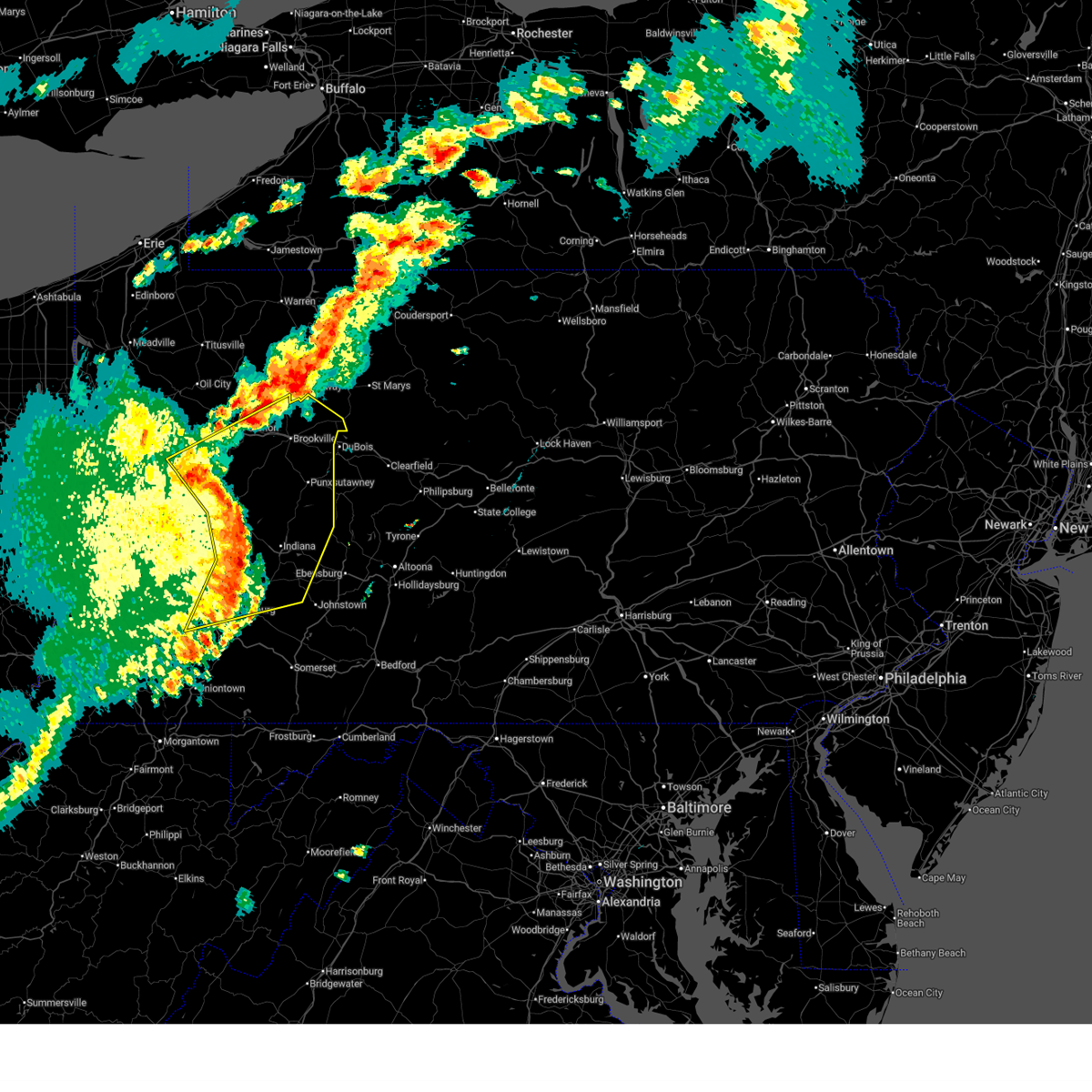
| 7/3/2026 8:00 PM EDT |
 Svrpbz the national weather service in pittsburgh has issued a * severe thunderstorm warning for, southwestern venango county in northwestern pennsylvania, northwestern armstrong county in west central pennsylvania, northeastern butler county in west central pennsylvania, southwestern clarion county in west central pennsylvania, * until 845 pm edt. * at 800 pm edt, a severe thunderstorm was located 6 miles northeast of slippery rock, or 8 miles east of grove city, moving east at 25 mph (radar indicated). Hazards include 60 mph wind gusts. expect damage to roofs, siding, and trees Svrpbz the national weather service in pittsburgh has issued a * severe thunderstorm warning for, southwestern venango county in northwestern pennsylvania, northwestern armstrong county in west central pennsylvania, northeastern butler county in west central pennsylvania, southwestern clarion county in west central pennsylvania, * until 845 pm edt. * at 800 pm edt, a severe thunderstorm was located 6 miles northeast of slippery rock, or 8 miles east of grove city, moving east at 25 mph (radar indicated). Hazards include 60 mph wind gusts. expect damage to roofs, siding, and trees
|
| 6/14/2026 6:23 PM EDT |
 At 623 pm edt, severe thunderstorms were located along a line from 8 miles north of brookville to 6 miles northwest of kittanning, moving east at 55 mph (radar indicated). Hazards include 60 mph wind gusts and small hail. Expect damage to roofs, siding, and trees. Locations impacted include, clarion, brookville, rimersburg, new bethlehem, chicora, east brady, sligo, strattanville, summerville, limestone, hawthorn, corsica, callensburg, sigel, timblin, fisher, worthville, distant, mahoning creek lake and templeton. At 623 pm edt, severe thunderstorms were located along a line from 8 miles north of brookville to 6 miles northwest of kittanning, moving east at 55 mph (radar indicated). Hazards include 60 mph wind gusts and small hail. Expect damage to roofs, siding, and trees. Locations impacted include, clarion, brookville, rimersburg, new bethlehem, chicora, east brady, sligo, strattanville, summerville, limestone, hawthorn, corsica, callensburg, sigel, timblin, fisher, worthville, distant, mahoning creek lake and templeton.
|
| 6/14/2026 6:07 PM EDT |
 At 607 pm edt, severe thunderstorms were located along a line from over clarion to over meadowood, or along a line from over clarion to over butler, moving east at 55 mph (radar indicated). Hazards include 60 mph wind gusts and small hail. Expect damage to roofs, siding, and trees. locations impacted include, clarion, brookville, knox, rimersburg, shanor-northvue, new bethlehem, chicora, east brady, parker, sligo, strattanville, summerville, bruin, limestone, hawthorn, shippenville, st. Petersburg, corsica, petrolia and karns city. At 607 pm edt, severe thunderstorms were located along a line from over clarion to over meadowood, or along a line from over clarion to over butler, moving east at 55 mph (radar indicated). Hazards include 60 mph wind gusts and small hail. Expect damage to roofs, siding, and trees. locations impacted include, clarion, brookville, knox, rimersburg, shanor-northvue, new bethlehem, chicora, east brady, parker, sligo, strattanville, summerville, bruin, limestone, hawthorn, shippenville, st. Petersburg, corsica, petrolia and karns city.
|
| 6/14/2026 5:57 PM EDT |
 At 557 pm edt, severe thunderstorms were located along a line from over knox to near evans city, or along a line from over knox to 7 miles west of butler, moving east at 55 mph (radar indicated). Hazards include 60 mph wind gusts and small hail. Expect damage to roofs, siding, and trees. locations impacted include, clarion, brookville, knox, rimersburg, shanor-northvue, new bethlehem, prospect, chicora, east brady, parker, sligo, emlenton, strattanville, summerville, bruin, clintonville, limestone, hawthorn, shippenville and st. Petersburg. At 557 pm edt, severe thunderstorms were located along a line from over knox to near evans city, or along a line from over knox to 7 miles west of butler, moving east at 55 mph (radar indicated). Hazards include 60 mph wind gusts and small hail. Expect damage to roofs, siding, and trees. locations impacted include, clarion, brookville, knox, rimersburg, shanor-northvue, new bethlehem, prospect, chicora, east brady, parker, sligo, emlenton, strattanville, summerville, bruin, clintonville, limestone, hawthorn, shippenville and st. Petersburg.
|
| 6/14/2026 5:51 PM EDT |
 Svrpbz the national weather service in pittsburgh has issued a * severe thunderstorm warning for, south central forest county in northwestern pennsylvania, southwestern venango county in northwestern pennsylvania, northern armstrong county in west central pennsylvania, northern butler county in west central pennsylvania, clarion county in west central pennsylvania, northwestern jefferson pa county in west central pennsylvania, * until 645 pm edt. * at 551 pm edt, severe thunderstorms were located along a line from 7 miles west of knox to over zelienople, or along a line from 7 miles west of knox to 8 miles north of cranberry, moving east at 55 mph (radar indicated). Hazards include 60 mph wind gusts and small hail. expect damage to roofs, siding, and trees Svrpbz the national weather service in pittsburgh has issued a * severe thunderstorm warning for, south central forest county in northwestern pennsylvania, southwestern venango county in northwestern pennsylvania, northern armstrong county in west central pennsylvania, northern butler county in west central pennsylvania, clarion county in west central pennsylvania, northwestern jefferson pa county in west central pennsylvania, * until 645 pm edt. * at 551 pm edt, severe thunderstorms were located along a line from 7 miles west of knox to over zelienople, or along a line from 7 miles west of knox to 8 miles north of cranberry, moving east at 55 mph (radar indicated). Hazards include 60 mph wind gusts and small hail. expect damage to roofs, siding, and trees
|
| 6/14/2026 5:32 PM EDT |
 Torpbz the national weather service in pittsburgh has issued a * tornado warning for, central clarion county in west central pennsylvania, * until 600 pm edt. * at 532 pm edt, a severe thunderstorm capable of producing a tornado was located 7 miles north of rimersburg, moving east at 30 mph (radar indicated rotation). Hazards include tornado. Flying debris will be dangerous to those caught without shelter. mobile homes will be damaged or destroyed. damage to roofs, windows and vehicles will occur. Tree damage is likely. Torpbz the national weather service in pittsburgh has issued a * tornado warning for, central clarion county in west central pennsylvania, * until 600 pm edt. * at 532 pm edt, a severe thunderstorm capable of producing a tornado was located 7 miles north of rimersburg, moving east at 30 mph (radar indicated rotation). Hazards include tornado. Flying debris will be dangerous to those caught without shelter. mobile homes will be damaged or destroyed. damage to roofs, windows and vehicles will occur. Tree damage is likely.
|
| 6/11/2026 4:30 PM EDT |
 At 430 pm edt, a severe thunderstorm was located over strattanville, clarion, fisher, leeper, cook forest state park, shippenville, fryburg, knox, clarington, sigel, and clear creek state park, moving east at 30 mph (radar indicated). Hazards include 60 mph wind gusts. Expect damage to roofs, siding, and trees. locations impacted include, clarion, brookville, marienville, knox, reynoldsville, brockway, falls creek, parker, sligo, strattanville, summerville, limestone, shippenville, st. Petersburg, corsica, callensburg, sigel and foxburg. At 430 pm edt, a severe thunderstorm was located over strattanville, clarion, fisher, leeper, cook forest state park, shippenville, fryburg, knox, clarington, sigel, and clear creek state park, moving east at 30 mph (radar indicated). Hazards include 60 mph wind gusts. Expect damage to roofs, siding, and trees. locations impacted include, clarion, brookville, marienville, knox, reynoldsville, brockway, falls creek, parker, sligo, strattanville, summerville, limestone, shippenville, st. Petersburg, corsica, callensburg, sigel and foxburg.
|
| 6/11/2026 4:10 PM EDT |
 At 410 pm edt, a severe thunderstorm was located over knox, shippenville, clarion, st. petersburg, foxburg, emlenton, and fisher, moving east at 30 mph (radar indicated). Hazards include 60 mph wind gusts. Expect damage to roofs, siding, and trees. locations impacted include, clarion, brookville, marienville, knox, reynoldsville, brockway, falls creek, parker, sligo, emlenton, strattanville, summerville, bruin, limestone, shippenville, st. Petersburg, corsica, eau claire and callensburg. At 410 pm edt, a severe thunderstorm was located over knox, shippenville, clarion, st. petersburg, foxburg, emlenton, and fisher, moving east at 30 mph (radar indicated). Hazards include 60 mph wind gusts. Expect damage to roofs, siding, and trees. locations impacted include, clarion, brookville, marienville, knox, reynoldsville, brockway, falls creek, parker, sligo, emlenton, strattanville, summerville, bruin, limestone, shippenville, st. Petersburg, corsica, eau claire and callensburg.
|
| 6/11/2026 3:55 PM EDT |
 Svrpbz the national weather service in pittsburgh has issued a * severe thunderstorm warning for, southern forest county in northwestern pennsylvania, southeastern venango county in northwestern pennsylvania, northern armstrong county in west central pennsylvania, northeastern butler county in west central pennsylvania, clarion county in west central pennsylvania, jefferson pa county in west central pennsylvania, * until 500 pm edt. * at 355 pm edt, a severe thunderstorm was located over st. petersburg, emlenton, foxburg, knox, cranberry township, cherry valley, eau claire, shippenville, and clintonville, moving east at 30 mph (radar indicated). Hazards include 60 mph wind gusts. expect damage to roofs, siding, and trees Svrpbz the national weather service in pittsburgh has issued a * severe thunderstorm warning for, southern forest county in northwestern pennsylvania, southeastern venango county in northwestern pennsylvania, northern armstrong county in west central pennsylvania, northeastern butler county in west central pennsylvania, clarion county in west central pennsylvania, jefferson pa county in west central pennsylvania, * until 500 pm edt. * at 355 pm edt, a severe thunderstorm was located over st. petersburg, emlenton, foxburg, knox, cranberry township, cherry valley, eau claire, shippenville, and clintonville, moving east at 30 mph (radar indicated). Hazards include 60 mph wind gusts. expect damage to roofs, siding, and trees
|
| 5/13/2026 2:34 PM EDT |
 the severe thunderstorm warning has been cancelled and is no longer in effect the severe thunderstorm warning has been cancelled and is no longer in effect
|
| 5/13/2026 2:34 PM EDT |
 At 234 pm edt, a severe thunderstorm was located 6 miles southwest of clarion, moving east at 35 mph (radar indicated). Hazards include 60 mph wind gusts and quarter size hail. Hail damage to vehicles is expected. expect wind damage to roofs, siding, and trees. Locations impacted include, clarion, brookville, sligo, strattanville, summerville, limestone, corsica, callensburg, sigel and fisher. At 234 pm edt, a severe thunderstorm was located 6 miles southwest of clarion, moving east at 35 mph (radar indicated). Hazards include 60 mph wind gusts and quarter size hail. Hail damage to vehicles is expected. expect wind damage to roofs, siding, and trees. Locations impacted include, clarion, brookville, sligo, strattanville, summerville, limestone, corsica, callensburg, sigel and fisher.
|
| 5/13/2026 2:22 PM EDT |
 At 222 pm edt, a severe thunderstorm was located 7 miles northwest of rimersburg, moving east at 35 mph (radar indicated). Hazards include 60 mph wind gusts and quarter size hail. Hail damage to vehicles is expected. expect wind damage to roofs, siding, and trees. locations impacted include, clarion, brookville, rimersburg, parker, sligo, strattanville, summerville, bruin, limestone, st. Petersburg, corsica, callensburg, sigel, foxburg, fisher and knox-dale. At 222 pm edt, a severe thunderstorm was located 7 miles northwest of rimersburg, moving east at 35 mph (radar indicated). Hazards include 60 mph wind gusts and quarter size hail. Hail damage to vehicles is expected. expect wind damage to roofs, siding, and trees. locations impacted include, clarion, brookville, rimersburg, parker, sligo, strattanville, summerville, bruin, limestone, st. Petersburg, corsica, callensburg, sigel, foxburg, fisher and knox-dale.
|
| 5/13/2026 2:13 PM EDT |
 Svrpbz the national weather service in pittsburgh has issued a * severe thunderstorm warning for, northern armstrong county in west central pennsylvania, northeastern butler county in west central pennsylvania, southern clarion county in west central pennsylvania, northwestern jefferson pa county in west central pennsylvania, * until 300 pm edt. * at 213 pm edt, a severe thunderstorm was located 11 miles southwest of knox, or 10 miles northwest of rimersburg, moving east at 35 mph (radar indicated). Hazards include 60 mph wind gusts and quarter size hail. Hail damage to vehicles is expected. Expect wind damage to roofs, siding, and trees. Svrpbz the national weather service in pittsburgh has issued a * severe thunderstorm warning for, northern armstrong county in west central pennsylvania, northeastern butler county in west central pennsylvania, southern clarion county in west central pennsylvania, northwestern jefferson pa county in west central pennsylvania, * until 300 pm edt. * at 213 pm edt, a severe thunderstorm was located 11 miles southwest of knox, or 10 miles northwest of rimersburg, moving east at 35 mph (radar indicated). Hazards include 60 mph wind gusts and quarter size hail. Hail damage to vehicles is expected. Expect wind damage to roofs, siding, and trees.
|
| 4/16/2026 4:56 PM EDT |
 At 456 pm edt, severe thunderstorms were located along a line from 11 miles southeast of franklin to 12 miles north of shanor-northvue, or along a line from 11 miles southeast of franklin to 13 miles east of grove city, moving east at 45 mph (radar indicated). Hazards include 60 mph wind gusts. Expect damage to roofs, siding, and trees. locations impacted include, clarion, knox, rimersburg, parker, sligo, emlenton, strattanville, bruin, clintonville, limestone, shippenville, st. Petersburg, eau claire, kennerdell, petrolia, callensburg, foxburg and cherry valley. At 456 pm edt, severe thunderstorms were located along a line from 11 miles southeast of franklin to 12 miles north of shanor-northvue, or along a line from 11 miles southeast of franklin to 13 miles east of grove city, moving east at 45 mph (radar indicated). Hazards include 60 mph wind gusts. Expect damage to roofs, siding, and trees. locations impacted include, clarion, knox, rimersburg, parker, sligo, emlenton, strattanville, bruin, clintonville, limestone, shippenville, st. Petersburg, eau claire, kennerdell, petrolia, callensburg, foxburg and cherry valley.
|
| 4/16/2026 4:45 PM EDT |
 Svrpbz the national weather service in pittsburgh has issued a * severe thunderstorm warning for, southwestern venango county in northwestern pennsylvania, northwestern armstrong county in west central pennsylvania, northern butler county in west central pennsylvania, clarion county in west central pennsylvania, * until 530 pm edt. * at 445 pm edt, severe thunderstorms were located along a line from 6 miles east of grove city to over slippery rock, or along a line from 6 miles east of grove city to 9 miles south of grove city, moving east at 45 mph (radar indicated). Hazards include 60 mph wind gusts. expect damage to roofs, siding, and trees Svrpbz the national weather service in pittsburgh has issued a * severe thunderstorm warning for, southwestern venango county in northwestern pennsylvania, northwestern armstrong county in west central pennsylvania, northern butler county in west central pennsylvania, clarion county in west central pennsylvania, * until 530 pm edt. * at 445 pm edt, severe thunderstorms were located along a line from 6 miles east of grove city to over slippery rock, or along a line from 6 miles east of grove city to 9 miles south of grove city, moving east at 45 mph (radar indicated). Hazards include 60 mph wind gusts. expect damage to roofs, siding, and trees
|
| 3/31/2026 9:19 PM EDT |
 At 919 pm edt, severe thunderstorms were located along a line from 11 miles northeast of tionesta to 12 miles west of rimersburg, or along a line from 13 miles northwest of marienville to 12 miles west of rimersburg, moving east at 60 mph (radar indicated). Hazards include 60 mph wind gusts. Expect damage to roofs, siding, and trees. locations impacted include, grove city, clarion, brookville, marienville, knox, reynoldsville, brockway, tionesta, sykesville, falls creek, harrisville, parker, sligo, emlenton, strattanville, summerville, limestone, hawthorn, shippenville and st. Petersburg. At 919 pm edt, severe thunderstorms were located along a line from 11 miles northeast of tionesta to 12 miles west of rimersburg, or along a line from 13 miles northwest of marienville to 12 miles west of rimersburg, moving east at 60 mph (radar indicated). Hazards include 60 mph wind gusts. Expect damage to roofs, siding, and trees. locations impacted include, grove city, clarion, brookville, marienville, knox, reynoldsville, brockway, tionesta, sykesville, falls creek, harrisville, parker, sligo, emlenton, strattanville, summerville, limestone, hawthorn, shippenville and st. Petersburg.
|
| 3/31/2026 9:19 PM EDT |
 the severe thunderstorm warning has been cancelled and is no longer in effect the severe thunderstorm warning has been cancelled and is no longer in effect
|
| 3/31/2026 8:57 PM EDT |
 Svrpbz the national weather service in pittsburgh has issued a * severe thunderstorm warning for, forest county in northwestern pennsylvania, southeastern mercer county in northwestern pennsylvania, venango county in northwestern pennsylvania, northern armstrong county in west central pennsylvania, northeastern butler county in west central pennsylvania, clarion county in west central pennsylvania, jefferson pa county in west central pennsylvania, * until 1015 pm edt. * at 857 pm edt, severe thunderstorms were located along a line from 15 miles north of oil city to over grove city, moving east at 55 mph (radar indicated). Hazards include 60 mph wind gusts. expect damage to roofs, siding, and trees Svrpbz the national weather service in pittsburgh has issued a * severe thunderstorm warning for, forest county in northwestern pennsylvania, southeastern mercer county in northwestern pennsylvania, venango county in northwestern pennsylvania, northern armstrong county in west central pennsylvania, northeastern butler county in west central pennsylvania, clarion county in west central pennsylvania, jefferson pa county in west central pennsylvania, * until 1015 pm edt. * at 857 pm edt, severe thunderstorms were located along a line from 15 miles north of oil city to over grove city, moving east at 55 mph (radar indicated). Hazards include 60 mph wind gusts. expect damage to roofs, siding, and trees
|
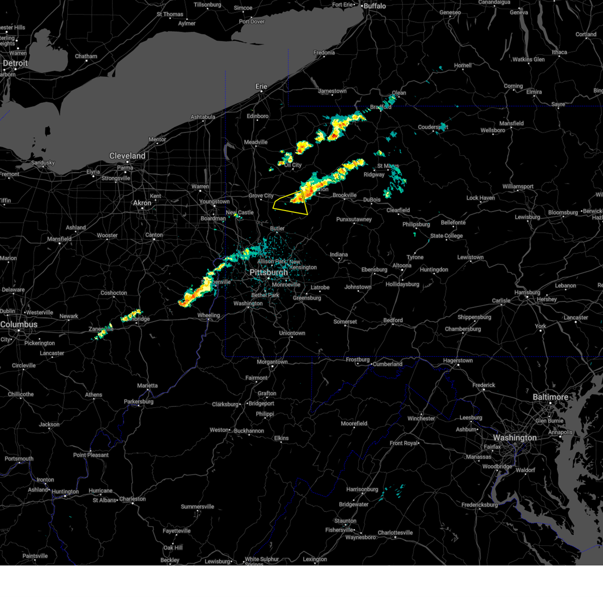
| 3/22/2026 4:44 PM EDT |
 Svrpbz the national weather service in pittsburgh has issued a * severe thunderstorm warning for, southeastern venango county in northwestern pennsylvania, clarion county in west central pennsylvania, central jefferson pa county in west central pennsylvania, * until 530 pm edt. * at 444 pm edt, a severe thunderstorm was located 9 miles west of knox, moving east at 70 mph (radar indicated). Hazards include 60 mph wind gusts and quarter size hail. Hail damage to vehicles is expected. Expect wind damage to roofs, siding, and trees. Svrpbz the national weather service in pittsburgh has issued a * severe thunderstorm warning for, southeastern venango county in northwestern pennsylvania, clarion county in west central pennsylvania, central jefferson pa county in west central pennsylvania, * until 530 pm edt. * at 444 pm edt, a severe thunderstorm was located 9 miles west of knox, moving east at 70 mph (radar indicated). Hazards include 60 mph wind gusts and quarter size hail. Hail damage to vehicles is expected. Expect wind damage to roofs, siding, and trees.
|
| 3/7/2026 3:41 PM EST |
 The severe thunderstorm warning that was previously in effect has been reissued for clarion county and is in effect until 430 pm est. please refer to that bulletin for the latest severe weather information. to report severe weather, contact your nearest law enforcement agency. they will send your report to the national weather service office. a tornado watch remains in effect until 800 pm est for a portion of west central pennsylvania. The severe thunderstorm warning that was previously in effect has been reissued for clarion county and is in effect until 430 pm est. please refer to that bulletin for the latest severe weather information. to report severe weather, contact your nearest law enforcement agency. they will send your report to the national weather service office. a tornado watch remains in effect until 800 pm est for a portion of west central pennsylvania.
|
| 3/7/2026 3:40 PM EST |
 Svrpbz the national weather service in pittsburgh has issued a * severe thunderstorm warning for, southern clarion county in west central pennsylvania, jefferson pa county in west central pennsylvania, * until 430 pm est. * at 340 pm est, a severe thunderstorm was located near rimersburg, moving east at 55 mph (radar indicated). Hazards include 60 mph wind gusts and quarter size hail. Hail damage to vehicles is expected. Expect wind damage to roofs, siding, and trees. Svrpbz the national weather service in pittsburgh has issued a * severe thunderstorm warning for, southern clarion county in west central pennsylvania, jefferson pa county in west central pennsylvania, * until 430 pm est. * at 340 pm est, a severe thunderstorm was located near rimersburg, moving east at 55 mph (radar indicated). Hazards include 60 mph wind gusts and quarter size hail. Hail damage to vehicles is expected. Expect wind damage to roofs, siding, and trees.
|
| 3/7/2026 3:32 PM EST |
 the severe thunderstorm warning has been cancelled and is no longer in effect the severe thunderstorm warning has been cancelled and is no longer in effect
|
| 3/7/2026 3:32 PM EST |
 At 332 pm est, a severe thunderstorm was located 7 miles west of rimersburg, moving east at 50 mph (public reported. tree damage across beaver and butler counties). Hazards include 60 mph wind gusts and quarter size hail. Hail damage to vehicles is expected. expect wind damage to roofs, siding, and trees. locations impacted include, knox, rimersburg, east brady, parker, sligo, st. Petersburg, callensburg and foxburg. At 332 pm est, a severe thunderstorm was located 7 miles west of rimersburg, moving east at 50 mph (public reported. tree damage across beaver and butler counties). Hazards include 60 mph wind gusts and quarter size hail. Hail damage to vehicles is expected. expect wind damage to roofs, siding, and trees. locations impacted include, knox, rimersburg, east brady, parker, sligo, st. Petersburg, callensburg and foxburg.
|
| 3/7/2026 3:21 PM EST |
 At 321 pm est, a severe thunderstorm was located 9 miles northeast of shanor-northvue, or 11 miles northeast of butler, moving east at 50 mph (public reported tree damage near harmony). Hazards include 60 mph wind gusts and small hail. Expect damage to roofs, siding, and trees. locations impacted include, knox, rimersburg, chicora, east brady, parker, east butler, sligo, bruin, st. Petersburg, eau claire, petrolia, karns city, callensburg, fairview, west sunbury, foxburg, hooker and distant. At 321 pm est, a severe thunderstorm was located 9 miles northeast of shanor-northvue, or 11 miles northeast of butler, moving east at 50 mph (public reported tree damage near harmony). Hazards include 60 mph wind gusts and small hail. Expect damage to roofs, siding, and trees. locations impacted include, knox, rimersburg, chicora, east brady, parker, east butler, sligo, bruin, st. Petersburg, eau claire, petrolia, karns city, callensburg, fairview, west sunbury, foxburg, hooker and distant.
|
| 3/7/2026 3:10 PM EST |
 At 310 pm est, a severe thunderstorm was located near shanor-northvue, or 7 miles northwest of butler, moving east at 50 mph (radar indicated). Hazards include 60 mph wind gusts and small hail. Expect damage to roofs, siding, and trees. locations impacted include, butler, knox, rimersburg, homeacre-lyndora, shanor-northvue, meridian, chicora, east brady, parker, east butler, sligo, bruin, st. Petersburg, west liberty, eau claire, petrolia, karns city, callensburg and fairview. At 310 pm est, a severe thunderstorm was located near shanor-northvue, or 7 miles northwest of butler, moving east at 50 mph (radar indicated). Hazards include 60 mph wind gusts and small hail. Expect damage to roofs, siding, and trees. locations impacted include, butler, knox, rimersburg, homeacre-lyndora, shanor-northvue, meridian, chicora, east brady, parker, east butler, sligo, bruin, st. Petersburg, west liberty, eau claire, petrolia, karns city, callensburg and fairview.
|
| 3/7/2026 3:02 PM EST |
 Svrpbz the national weather service in pittsburgh has issued a * severe thunderstorm warning for, northwestern armstrong county in west central pennsylvania, central butler county in west central pennsylvania, southwestern clarion county in west central pennsylvania, * until 345 pm est. * at 302 pm est, a severe thunderstorm was located 8 miles north of zelienople, or 11 miles west of butler, moving east at 50 mph (radar indicated). Hazards include 60 mph wind gusts and small hail. expect damage to roofs, siding, and trees Svrpbz the national weather service in pittsburgh has issued a * severe thunderstorm warning for, northwestern armstrong county in west central pennsylvania, central butler county in west central pennsylvania, southwestern clarion county in west central pennsylvania, * until 345 pm est. * at 302 pm est, a severe thunderstorm was located 8 miles north of zelienople, or 11 miles west of butler, moving east at 50 mph (radar indicated). Hazards include 60 mph wind gusts and small hail. expect damage to roofs, siding, and trees
|
| 11/15/2025 8:41 PM EST | the severe thunderstorm warning has been cancelled and is no longer in effect |
| 11/15/2025 8:21 PM EST | the severe thunderstorm warning has been cancelled and is no longer in effect |
| 11/15/2025 8:21 PM EST | At 821 pm est, a severe thunderstorm was located 10 miles south of franklin, moving east at 45 mph (radar indicated). Hazards include 60 mph wind gusts and small hail. Expect damage to roofs, siding, and trees. locations impacted include, clarion, knox, sligo, emlenton, strattanville, limestone, shippenville, st. Petersburg, kennerdell, callensburg and foxburg. |
| 11/15/2025 8:06 PM EST | Svrpbz the national weather service in pittsburgh has issued a * severe thunderstorm warning for, east central mercer county in northwestern pennsylvania, southwestern venango county in northwestern pennsylvania, northeastern butler county in west central pennsylvania, central clarion county in west central pennsylvania, * until 900 pm est. * at 806 pm est, a severe thunderstorm was located 10 miles northeast of grove city, moving east at 45 mph (radar indicated). Hazards include 60 mph wind gusts and small hail. expect damage to roofs, siding, and trees |
| 7/7/2025 6:10 PM EDT |
 The storm which prompted the warning has weakened below severe limits, and no longer poses an immediate threat to life or property. therefore, the warning will be allowed to expire. however, gusty winds are still possible with this thunderstorm. The storm which prompted the warning has weakened below severe limits, and no longer poses an immediate threat to life or property. therefore, the warning will be allowed to expire. however, gusty winds are still possible with this thunderstorm.
|
| 7/7/2025 6:03 PM EDT |
 the severe thunderstorm warning has been cancelled and is no longer in effect the severe thunderstorm warning has been cancelled and is no longer in effect
|
| 7/7/2025 6:03 PM EDT |
 At 603 pm edt, a severe thunderstorm was located near rimersburg, moving east at 25 mph (radar indicated). Hazards include 60 mph wind gusts. Expect damage to trees and power lines, resulting in some power outages. locations impacted include, knox, rimersburg, east brady, parker, sligo, emlenton, shippenville, st. Petersburg, callensburg, and foxburg. At 603 pm edt, a severe thunderstorm was located near rimersburg, moving east at 25 mph (radar indicated). Hazards include 60 mph wind gusts. Expect damage to trees and power lines, resulting in some power outages. locations impacted include, knox, rimersburg, east brady, parker, sligo, emlenton, shippenville, st. Petersburg, callensburg, and foxburg.
|
| 7/7/2025 5:51 PM EDT |
 the severe thunderstorm warning has been cancelled and is no longer in effect the severe thunderstorm warning has been cancelled and is no longer in effect
|
| 7/7/2025 5:51 PM EDT |
 At 550 pm edt, a severe thunderstorm was located 7 miles northwest of rimersburg, moving east at 25 mph (radar indicated). Hazards include 60 mph wind gusts. Expect damage to trees and power lines, resulting in some power outages. locations impacted include, knox, rimersburg, east brady, harrisville, parker, sligo, emlenton, bruin, shippenville, st. Petersburg, eau claire, petrolia, karns city, callensburg, fairview, foxburg, cherry valley, and boyers. At 550 pm edt, a severe thunderstorm was located 7 miles northwest of rimersburg, moving east at 25 mph (radar indicated). Hazards include 60 mph wind gusts. Expect damage to trees and power lines, resulting in some power outages. locations impacted include, knox, rimersburg, east brady, harrisville, parker, sligo, emlenton, bruin, shippenville, st. Petersburg, eau claire, petrolia, karns city, callensburg, fairview, foxburg, cherry valley, and boyers.
|
| 7/7/2025 5:26 PM EDT |
 Svrpbz the national weather service in pittsburgh has issued a * severe thunderstorm warning for, southwestern venango county in northwestern pennsylvania, northeastern butler county in west central pennsylvania, northwestern armstrong county in west central pennsylvania, southwestern clarion county in west central pennsylvania, * until 615 pm edt. * at 526 pm edt, a severe thunderstorm was located 14 miles east of slippery rock, or 14 miles southwest of knox, moving east at 25 mph (radar indicated). Hazards include 60 mph wind gusts. expect damage to trees and power lines, resulting in some power outages Svrpbz the national weather service in pittsburgh has issued a * severe thunderstorm warning for, southwestern venango county in northwestern pennsylvania, northeastern butler county in west central pennsylvania, northwestern armstrong county in west central pennsylvania, southwestern clarion county in west central pennsylvania, * until 615 pm edt. * at 526 pm edt, a severe thunderstorm was located 14 miles east of slippery rock, or 14 miles southwest of knox, moving east at 25 mph (radar indicated). Hazards include 60 mph wind gusts. expect damage to trees and power lines, resulting in some power outages
|
| 6/19/2025 12:14 AM EDT |
 the severe thunderstorm warning has been cancelled and is no longer in effect the severe thunderstorm warning has been cancelled and is no longer in effect
|
| 6/19/2025 12:14 AM EDT |
 At 1214 am edt, severe thunderstorms were located along a line from 9 miles west of marienville to over murrysville, or along a line from 9 miles west of marienville to 6 miles east of monroeville, moving east at 30 mph (law enforcement reported trees and wires down with this line of storms). Hazards include 60 mph wind gusts. Expect damage to roofs, siding, and trees. Locations impacted include, pittsburgh, penn hills, monroeville, indiana, punxsutawney, clarion, vandergrift, kittanning, brookville, marienville, homer city, apollo, knox, rimersburg, plum, murrysville, wilkinsburg, new kensington, lower burrell and harrison township. At 1214 am edt, severe thunderstorms were located along a line from 9 miles west of marienville to over murrysville, or along a line from 9 miles west of marienville to 6 miles east of monroeville, moving east at 30 mph (law enforcement reported trees and wires down with this line of storms). Hazards include 60 mph wind gusts. Expect damage to roofs, siding, and trees. Locations impacted include, pittsburgh, penn hills, monroeville, indiana, punxsutawney, clarion, vandergrift, kittanning, brookville, marienville, homer city, apollo, knox, rimersburg, plum, murrysville, wilkinsburg, new kensington, lower burrell and harrison township.
|
| 6/18/2025 11:59 PM EDT |
 The storms which prompted the warning have moved out of a portion of the area. a new severe thunderstorm warning has been issued for this line of storms to the east. The storms which prompted the warning have moved out of a portion of the area. a new severe thunderstorm warning has been issued for this line of storms to the east.
|
| 6/18/2025 11:57 PM EDT |
 Svrpbz the national weather service in pittsburgh has issued a * severe thunderstorm warning for, forest county in northwestern pennsylvania, eastern venango county in northwestern pennsylvania, northeastern allegheny county in southwestern pennsylvania, northern westmoreland county in southwestern pennsylvania, armstrong county in west central pennsylvania, eastern butler county in west central pennsylvania, clarion county in west central pennsylvania, indiana county in west central pennsylvania, jefferson pa county in west central pennsylvania, * until 115 am edt. * at 1157 pm edt, severe thunderstorms were located along a line from near tionesta to over penn hills, or along a line from 16 miles northeast of oil city to over penn hills, moving east at 30 mph (law enforcement reported trees and wires down with this line of storms). Hazards include 60 mph wind gusts. expect damage to roofs, siding, and trees Svrpbz the national weather service in pittsburgh has issued a * severe thunderstorm warning for, forest county in northwestern pennsylvania, eastern venango county in northwestern pennsylvania, northeastern allegheny county in southwestern pennsylvania, northern westmoreland county in southwestern pennsylvania, armstrong county in west central pennsylvania, eastern butler county in west central pennsylvania, clarion county in west central pennsylvania, indiana county in west central pennsylvania, jefferson pa county in west central pennsylvania, * until 115 am edt. * at 1157 pm edt, severe thunderstorms were located along a line from near tionesta to over penn hills, or along a line from 16 miles northeast of oil city to over penn hills, moving east at 30 mph (law enforcement reported trees and wires down with this line of storms). Hazards include 60 mph wind gusts. expect damage to roofs, siding, and trees
|
| 6/18/2025 11:42 PM EDT |
 the severe thunderstorm warning has been cancelled and is no longer in effect the severe thunderstorm warning has been cancelled and is no longer in effect
|
| 6/18/2025 11:42 PM EDT |
 At 1142 pm edt, severe thunderstorms were located along a line from over tionesta to over monongahela, or along a line from 11 miles east of oil city to 5 miles southeast of gastonville, moving east at 45 mph (law enforcement reported trees down with this line of storms). Hazards include 60 mph wind gusts. Expect damage to roofs, siding, and trees. Locations impacted include, pittsburgh, penn hills, mount lebanon, bethel park, ross township, mccandless township, monroeville, mcmurray, mckeesport, butler, franklin park, oil city, jeannette, canonsburg, franklin, clarion, vandergrift, kittanning, apollo and knox. At 1142 pm edt, severe thunderstorms were located along a line from over tionesta to over monongahela, or along a line from 11 miles east of oil city to 5 miles southeast of gastonville, moving east at 45 mph (law enforcement reported trees down with this line of storms). Hazards include 60 mph wind gusts. Expect damage to roofs, siding, and trees. Locations impacted include, pittsburgh, penn hills, mount lebanon, bethel park, ross township, mccandless township, monroeville, mcmurray, mckeesport, butler, franklin park, oil city, jeannette, canonsburg, franklin, clarion, vandergrift, kittanning, apollo and knox.
|
| 6/18/2025 11:29 PM EDT |
 the severe thunderstorm warning has been cancelled and is no longer in effect the severe thunderstorm warning has been cancelled and is no longer in effect
|
| 6/18/2025 11:29 PM EDT |
 At 1129 pm edt, severe thunderstorms were located along a line from near oil city to near canonsburg, moving east at 45 mph (law enforcement reported trees down with this line of storms). Hazards include 60 mph wind gusts. Expect damage to roofs, siding, and trees. Locations impacted include, pittsburgh, penn hills, mount lebanon, bethel park, ross township, mccandless township, monroeville, cranberry, moon township, new castle, mcmurray, mckeesport, butler, washington, franklin park, oil city, jeannette, aliquippa, canonsburg and grove city. At 1129 pm edt, severe thunderstorms were located along a line from near oil city to near canonsburg, moving east at 45 mph (law enforcement reported trees down with this line of storms). Hazards include 60 mph wind gusts. Expect damage to roofs, siding, and trees. Locations impacted include, pittsburgh, penn hills, mount lebanon, bethel park, ross township, mccandless township, monroeville, cranberry, moon township, new castle, mcmurray, mckeesport, butler, washington, franklin park, oil city, jeannette, aliquippa, canonsburg and grove city.
|
| 6/18/2025 11:16 PM EDT |
 At 1116 pm edt, severe thunderstorms were located along a line from near sugarcreek to over wolfdale, or along a line from 6 miles north of franklin to near washington, moving east at 45 mph (law enforcement reported trees down with this line of storms). Hazards include 60 mph wind gusts. Expect damage to roofs, siding, and trees. Locations impacted include, pittsburgh, penn hills, mount lebanon, bethel park, ross township, mccandless township, monroeville, cranberry, moon township, new castle, mcmurray, weirton, mckeesport, steubenville, butler, franklin park, oil city, jeannette, aliquippa and canonsburg. At 1116 pm edt, severe thunderstorms were located along a line from near sugarcreek to over wolfdale, or along a line from 6 miles north of franklin to near washington, moving east at 45 mph (law enforcement reported trees down with this line of storms). Hazards include 60 mph wind gusts. Expect damage to roofs, siding, and trees. Locations impacted include, pittsburgh, penn hills, mount lebanon, bethel park, ross township, mccandless township, monroeville, cranberry, moon township, new castle, mcmurray, weirton, mckeesport, steubenville, butler, franklin park, oil city, jeannette, aliquippa and canonsburg.
|
| 6/18/2025 11:16 PM EDT |
 the severe thunderstorm warning has been cancelled and is no longer in effect the severe thunderstorm warning has been cancelled and is no longer in effect
|
| 6/18/2025 10:54 PM EDT |
 Svrpbz the national weather service in pittsburgh has issued a * severe thunderstorm warning for, eastern columbiana county in east central ohio, eastern jefferson oh county in east central ohio, western forest county in northwestern pennsylvania, mercer county in northwestern pennsylvania, venango county in northwestern pennsylvania, allegheny county in southwestern pennsylvania, northern washington county in southwestern pennsylvania, northwestern westmoreland county in southwestern pennsylvania, western armstrong county in west central pennsylvania, butler county in west central pennsylvania, clarion county in west central pennsylvania, beaver county in western pennsylvania, lawrence county in western pennsylvania, brooke county in northern west virginia, hancock county in northern west virginia, * until midnight edt. * at 1054 pm edt, severe thunderstorms were located along a line from 11 miles northeast of greenville to near west liberty, or along a line from 18 miles west of franklin to near west liberty, moving east at 45 mph (law enforcement reported trees were reported down with this line of storms). Hazards include 60 mph wind gusts. expect damage to roofs, siding, and trees Svrpbz the national weather service in pittsburgh has issued a * severe thunderstorm warning for, eastern columbiana county in east central ohio, eastern jefferson oh county in east central ohio, western forest county in northwestern pennsylvania, mercer county in northwestern pennsylvania, venango county in northwestern pennsylvania, allegheny county in southwestern pennsylvania, northern washington county in southwestern pennsylvania, northwestern westmoreland county in southwestern pennsylvania, western armstrong county in west central pennsylvania, butler county in west central pennsylvania, clarion county in west central pennsylvania, beaver county in western pennsylvania, lawrence county in western pennsylvania, brooke county in northern west virginia, hancock county in northern west virginia, * until midnight edt. * at 1054 pm edt, severe thunderstorms were located along a line from 11 miles northeast of greenville to near west liberty, or along a line from 18 miles west of franklin to near west liberty, moving east at 45 mph (law enforcement reported trees were reported down with this line of storms). Hazards include 60 mph wind gusts. expect damage to roofs, siding, and trees
|
| 6/9/2025 5:07 PM EDT |
 At 507 pm edt, a severe thunderstorm was located 7 miles north of rimersburg, or 7 miles southwest of clarion, moving northeast at 40 mph (radar indicated). Hazards include 60 mph wind gusts and half dollar size hail. Hail damage to vehicles is expected. expect wind damage to roofs, siding, and trees. Locations impacted include, clarion, marienville, rimersburg, sligo, strattanville, limestone, shippenville, corsica, callensburg, sigel, fisher, leeper, cook forest state park, clarington and clear creek state park. At 507 pm edt, a severe thunderstorm was located 7 miles north of rimersburg, or 7 miles southwest of clarion, moving northeast at 40 mph (radar indicated). Hazards include 60 mph wind gusts and half dollar size hail. Hail damage to vehicles is expected. expect wind damage to roofs, siding, and trees. Locations impacted include, clarion, marienville, rimersburg, sligo, strattanville, limestone, shippenville, corsica, callensburg, sigel, fisher, leeper, cook forest state park, clarington and clear creek state park.
|
| 6/9/2025 4:58 PM EDT |
 Svrpbz the national weather service in pittsburgh has issued a * severe thunderstorm warning for, southeastern forest county in northwestern pennsylvania, clarion county in west central pennsylvania, northwestern jefferson pa county in west central pennsylvania, * until 545 pm edt. * at 458 pm edt, a severe thunderstorm was located near rimersburg, moving northeast at 40 mph (radar indicated). Hazards include 60 mph wind gusts and small hail. expect damage to roofs, siding, and trees Svrpbz the national weather service in pittsburgh has issued a * severe thunderstorm warning for, southeastern forest county in northwestern pennsylvania, clarion county in west central pennsylvania, northwestern jefferson pa county in west central pennsylvania, * until 545 pm edt. * at 458 pm edt, a severe thunderstorm was located near rimersburg, moving northeast at 40 mph (radar indicated). Hazards include 60 mph wind gusts and small hail. expect damage to roofs, siding, and trees
|
| 6/5/2025 5:05 PM EDT |
 At 505 pm edt, a severe thunderstorm was located 9 miles west of rimersburg, moving east at 25 mph (radar indicated). Hazards include 60 mph wind gusts. Expect damage to roofs, siding, and trees. Locations impacted include, rimersburg, east brady, parker, sligo, bruin, petrolia, karns city, callensburg, fairview and hooker. At 505 pm edt, a severe thunderstorm was located 9 miles west of rimersburg, moving east at 25 mph (radar indicated). Hazards include 60 mph wind gusts. Expect damage to roofs, siding, and trees. Locations impacted include, rimersburg, east brady, parker, sligo, bruin, petrolia, karns city, callensburg, fairview and hooker.
|
| 6/5/2025 4:45 PM EDT |
 Svrpbz the national weather service in pittsburgh has issued a * severe thunderstorm warning for, west central armstrong county in west central pennsylvania, northeastern butler county in west central pennsylvania, southwestern clarion county in west central pennsylvania, * until 530 pm edt. * at 445 pm edt, a severe thunderstorm was located 9 miles northeast of shanor-northvue, or 12 miles north of butler, moving east at 25 mph (radar indicated). Hazards include 60 mph wind gusts. expect damage to roofs, siding, and trees Svrpbz the national weather service in pittsburgh has issued a * severe thunderstorm warning for, west central armstrong county in west central pennsylvania, northeastern butler county in west central pennsylvania, southwestern clarion county in west central pennsylvania, * until 530 pm edt. * at 445 pm edt, a severe thunderstorm was located 9 miles northeast of shanor-northvue, or 12 miles north of butler, moving east at 25 mph (radar indicated). Hazards include 60 mph wind gusts. expect damage to roofs, siding, and trees
|
| 4/29/2025 6:10 PM EDT |
 The storms which prompted the warning have moved out of the area. therefore, the warning will be allowed to expire. however, gusty winds are still possible with these thunderstorms. a severe thunderstorm watch remains in effect until 1000 pm edt for southwestern, northwestern and west central pennsylvania. remember, a severe thunderstorm warning still remains in effect for jefferson and forest counties. The storms which prompted the warning have moved out of the area. therefore, the warning will be allowed to expire. however, gusty winds are still possible with these thunderstorms. a severe thunderstorm watch remains in effect until 1000 pm edt for southwestern, northwestern and west central pennsylvania. remember, a severe thunderstorm warning still remains in effect for jefferson and forest counties.
|
| 4/29/2025 5:52 PM EDT |
 the severe thunderstorm warning has been cancelled and is no longer in effect the severe thunderstorm warning has been cancelled and is no longer in effect
|
| 4/29/2025 5:52 PM EDT |
 At 551 pm edt, severe thunderstorms were located along a line extending from near rimersburg to 9 miles southeast of new bethlehem to near indiana to near blairsville, moving east at 70 mph. these are destructive storms for northern indiana and southern jefferson counties (radar indicated). Hazards include 80 mph wind gusts. Extensive tree damage and widespread power outages. mobile homes will be heavily damaged. expect considerable damage to roofs, windows and vehicles. Locations impacted include, indiana, punxsutawney, clarion, brookville, homer city, rimersburg, blairsville, reynoldsville, derry, brockway, new bethlehem, black lick, clymer, sykesville, falls creek, east brady, sligo, new florence, big run, and dayton. At 551 pm edt, severe thunderstorms were located along a line extending from near rimersburg to 9 miles southeast of new bethlehem to near indiana to near blairsville, moving east at 70 mph. these are destructive storms for northern indiana and southern jefferson counties (radar indicated). Hazards include 80 mph wind gusts. Extensive tree damage and widespread power outages. mobile homes will be heavily damaged. expect considerable damage to roofs, windows and vehicles. Locations impacted include, indiana, punxsutawney, clarion, brookville, homer city, rimersburg, blairsville, reynoldsville, derry, brockway, new bethlehem, black lick, clymer, sykesville, falls creek, east brady, sligo, new florence, big run, and dayton.
|
| 4/29/2025 5:42 PM EDT |
 At 540 pm edt, severe thunderstorms were located along a line extending from 10 miles southwest of knox to near rimersburg to 9 miles east of ford city to 6 miles northeast of delmont, moving northeast at 70 mph. these are destructive storms for armstrong, indiana, and jefferson counties (radar indicated). Hazards include 80 mph wind gusts. Extensive tree damage and widespread power outages. mobile homes will be heavily damaged. expect considerable damage to roofs, windows and vehicles. Locations impacted include, greensburg, indiana, jeannette, latrobe, punxsutawney, clarion, vandergrift, kittanning, brookville, homer city, apollo, rimersburg, murrysville, irwin, mcchesneytown-loyalhanna, blairsville, manor, youngwood, ford city, and reynoldsville. At 540 pm edt, severe thunderstorms were located along a line extending from 10 miles southwest of knox to near rimersburg to 9 miles east of ford city to 6 miles northeast of delmont, moving northeast at 70 mph. these are destructive storms for armstrong, indiana, and jefferson counties (radar indicated). Hazards include 80 mph wind gusts. Extensive tree damage and widespread power outages. mobile homes will be heavily damaged. expect considerable damage to roofs, windows and vehicles. Locations impacted include, greensburg, indiana, jeannette, latrobe, punxsutawney, clarion, vandergrift, kittanning, brookville, homer city, apollo, rimersburg, murrysville, irwin, mcchesneytown-loyalhanna, blairsville, manor, youngwood, ford city, and reynoldsville.
|
| 4/29/2025 5:42 PM EDT |
 the severe thunderstorm warning has been cancelled and is no longer in effect the severe thunderstorm warning has been cancelled and is no longer in effect
|
| 4/29/2025 5:21 PM EDT |
 Svrpbz the national weather service in pittsburgh has issued a * severe thunderstorm warning for, east central washington county in southwestern pennsylvania, southeastern lawrence county in western pennsylvania, butler county in west central pennsylvania, indiana county in west central pennsylvania, eastern allegheny county in southwestern pennsylvania, jefferson county in west central pennsylvania, westmoreland county in southwestern pennsylvania, armstrong county in west central pennsylvania, clarion county in west central pennsylvania, south central forest county in northwestern pennsylvania, * until 615 pm edt. * at 520 pm edt, severe thunderstorms were located along a line extending from 7 miles west of shanor-northvue to near meadowood to near new kensington to near clairton, moving northeast at 70 mph. these are destructive storms for butler, armstrong, and westmoreland counties (radar indicated). Hazards include 80 mph wind gusts. Extensive tree damage and widespread power outages. mobile homes will be heavily damaged. Expect considerable damage to roofs, windows and vehicles. Svrpbz the national weather service in pittsburgh has issued a * severe thunderstorm warning for, east central washington county in southwestern pennsylvania, southeastern lawrence county in western pennsylvania, butler county in west central pennsylvania, indiana county in west central pennsylvania, eastern allegheny county in southwestern pennsylvania, jefferson county in west central pennsylvania, westmoreland county in southwestern pennsylvania, armstrong county in west central pennsylvania, clarion county in west central pennsylvania, south central forest county in northwestern pennsylvania, * until 615 pm edt. * at 520 pm edt, severe thunderstorms were located along a line extending from 7 miles west of shanor-northvue to near meadowood to near new kensington to near clairton, moving northeast at 70 mph. these are destructive storms for butler, armstrong, and westmoreland counties (radar indicated). Hazards include 80 mph wind gusts. Extensive tree damage and widespread power outages. mobile homes will be heavily damaged. Expect considerable damage to roofs, windows and vehicles.
|
| 4/21/2025 9:29 PM EDT |
 the severe thunderstorm warning has been cancelled and is no longer in effect the severe thunderstorm warning has been cancelled and is no longer in effect
|
| 4/21/2025 9:09 PM EDT |
 At 909 pm edt, a severe thunderstorm was located 14 miles southwest of knox, moving east at 35 mph (radar indicated). Hazards include 60 mph wind gusts. Expect damage to roofs, siding, and trees. locations impacted include, parker, emlenton, bruin, st. Petersburg, eau claire, callensburg, foxburg, cherry valley and boyers. At 909 pm edt, a severe thunderstorm was located 14 miles southwest of knox, moving east at 35 mph (radar indicated). Hazards include 60 mph wind gusts. Expect damage to roofs, siding, and trees. locations impacted include, parker, emlenton, bruin, st. Petersburg, eau claire, callensburg, foxburg, cherry valley and boyers.
|
| 4/21/2025 8:50 PM EDT |
 Svrpbz the national weather service in pittsburgh has issued a * severe thunderstorm warning for, south central venango county in northwestern pennsylvania, northwestern armstrong county in west central pennsylvania, northern butler county in west central pennsylvania, southwestern clarion county in west central pennsylvania, * until 930 pm edt. * at 850 pm edt, a severe thunderstorm was located 5 miles northeast of slippery rock, or 6 miles southeast of grove city, moving east at 35 mph (radar indicated). Hazards include 60 mph wind gusts. expect damage to roofs, siding, and trees Svrpbz the national weather service in pittsburgh has issued a * severe thunderstorm warning for, south central venango county in northwestern pennsylvania, northwestern armstrong county in west central pennsylvania, northern butler county in west central pennsylvania, southwestern clarion county in west central pennsylvania, * until 930 pm edt. * at 850 pm edt, a severe thunderstorm was located 5 miles northeast of slippery rock, or 6 miles southeast of grove city, moving east at 35 mph (radar indicated). Hazards include 60 mph wind gusts. expect damage to roofs, siding, and trees
|
| 4/3/2025 4:47 AM EDT |
 the severe thunderstorm warning has been cancelled and is no longer in effect the severe thunderstorm warning has been cancelled and is no longer in effect
|
| 4/3/2025 4:47 AM EDT |
 At 447 am edt, severe thunderstorms were located along a line from 6 miles south of knox to over dormont, or along a line from 6 miles south of knox to over mount lebanon, moving northeast at 65 mph (radar indicated). Hazards include 60 mph wind gusts. Expect damage to roofs, siding, and trees. locations impacted include, pittsburgh, penn hills, mount lebanon, bethel park, monroeville, mckeesport, clarion, vandergrift, kittanning, brookville, apollo, rimersburg, shaler township, plum, west mifflin, north side pittsburgh, baldwin, upper st. Clair, murrysville and hampton township. At 447 am edt, severe thunderstorms were located along a line from 6 miles south of knox to over dormont, or along a line from 6 miles south of knox to over mount lebanon, moving northeast at 65 mph (radar indicated). Hazards include 60 mph wind gusts. Expect damage to roofs, siding, and trees. locations impacted include, pittsburgh, penn hills, mount lebanon, bethel park, monroeville, mckeesport, clarion, vandergrift, kittanning, brookville, apollo, rimersburg, shaler township, plum, west mifflin, north side pittsburgh, baldwin, upper st. Clair, murrysville and hampton township.
|
| 4/3/2025 4:37 AM EDT |
 Svrpbz the national weather service in pittsburgh has issued a * severe thunderstorm warning for, allegheny county in southwestern pennsylvania, north central washington county in southwestern pennsylvania, northwestern westmoreland county in southwestern pennsylvania, armstrong county in west central pennsylvania, eastern butler county in west central pennsylvania, clarion county in west central pennsylvania, western indiana county in west central pennsylvania, western jefferson pa county in west central pennsylvania, * until 515 am edt. * at 437 am edt, severe thunderstorms were located along a line from 15 miles northeast of shanor-northvue to over cecil-bishop, or along a line from 13 miles west of rimersburg to 6 miles north of canonsburg, moving northeast at 65 mph (radar indicated). Hazards include 60 mph wind gusts. expect damage to roofs, siding, and trees Svrpbz the national weather service in pittsburgh has issued a * severe thunderstorm warning for, allegheny county in southwestern pennsylvania, north central washington county in southwestern pennsylvania, northwestern westmoreland county in southwestern pennsylvania, armstrong county in west central pennsylvania, eastern butler county in west central pennsylvania, clarion county in west central pennsylvania, western indiana county in west central pennsylvania, western jefferson pa county in west central pennsylvania, * until 515 am edt. * at 437 am edt, severe thunderstorms were located along a line from 15 miles northeast of shanor-northvue to over cecil-bishop, or along a line from 13 miles west of rimersburg to 6 miles north of canonsburg, moving northeast at 65 mph (radar indicated). Hazards include 60 mph wind gusts. expect damage to roofs, siding, and trees
|
| 3/16/2025 1:36 PM EDT |
 The severe thunderstorm warning that was previously in effect has been reissued for indiana, clarion, armstrong, and jefferson pa counties and is in effect until 215 pm edt. please refer to that bulletin for the latest severe weather information. a tornado watch remains in effect until 400 pm edt for portions of southwest and west central pennsylvania. The severe thunderstorm warning that was previously in effect has been reissued for indiana, clarion, armstrong, and jefferson pa counties and is in effect until 215 pm edt. please refer to that bulletin for the latest severe weather information. a tornado watch remains in effect until 400 pm edt for portions of southwest and west central pennsylvania.
|
| 3/16/2025 1:20 PM EDT |
 At 120 pm edt, severe thunderstorms were located along a line from near knox to 10 miles east of kittanning, moving northeast at 55 mph (trained spotters reported. at 1254pm, a national weather service employee reported golf ball sized hail in lower burrell). Hazards include 70 mph wind gusts and ping pong ball size hail. People and animals outdoors will be injured. expect hail damage to roofs, siding, windows, and vehicles. expect considerable tree damage. wind damage is also likely to mobile homes, roofs, and outbuildings. this severe thunderstorm will be near, murrysville around 1255 pm edt. leechburg, vandergrift and apollo around 100 pm edt. ford city around 105 pm edt. kittanning and west kittanning around 110 pm edt. rimersburg around 115 pm edt. clarion around 120 pm edt. new bethlehem around 125 pm edt. Other locations impacted by the severe thunderstorm include west leechburg, worthington, hyde park, oklahoma, east vandergrift, north apollo, orchard hills, north washington, east brady and west hills. At 120 pm edt, severe thunderstorms were located along a line from near knox to 10 miles east of kittanning, moving northeast at 55 mph (trained spotters reported. at 1254pm, a national weather service employee reported golf ball sized hail in lower burrell). Hazards include 70 mph wind gusts and ping pong ball size hail. People and animals outdoors will be injured. expect hail damage to roofs, siding, windows, and vehicles. expect considerable tree damage. wind damage is also likely to mobile homes, roofs, and outbuildings. this severe thunderstorm will be near, murrysville around 1255 pm edt. leechburg, vandergrift and apollo around 100 pm edt. ford city around 105 pm edt. kittanning and west kittanning around 110 pm edt. rimersburg around 115 pm edt. clarion around 120 pm edt. new bethlehem around 125 pm edt. Other locations impacted by the severe thunderstorm include west leechburg, worthington, hyde park, oklahoma, east vandergrift, north apollo, orchard hills, north washington, east brady and west hills.
|
| 3/16/2025 1:20 PM EDT |
 the severe thunderstorm warning has been cancelled and is no longer in effect the severe thunderstorm warning has been cancelled and is no longer in effect
|
| 3/16/2025 1:03 PM EDT |
 At 103 pm edt, severe thunderstorms were located along a line from 10 miles west of rimersburg to over vandergrift, moving northeast at 55 mph (trained spotters reported. at 1255pm, a national weather service employee reported golf ball sized hail in lower burrell). Hazards include golf ball size hail and 70 mph wind gusts. People and animals outdoors will be injured. expect hail damage to roofs, siding, windows, and vehicles. expect considerable tree damage. wind damage is also likely to mobile homes, roofs, and outbuildings. Locations impacted include, penn hills, monroeville, indiana, punxsutawney, clarion, vandergrift, kittanning, brookville, apollo, rimersburg, plum, murrysville, new kensington, lower burrell, harrison township, arnold, tarentum, natrona heights, springdale and pitcairn. At 103 pm edt, severe thunderstorms were located along a line from 10 miles west of rimersburg to over vandergrift, moving northeast at 55 mph (trained spotters reported. at 1255pm, a national weather service employee reported golf ball sized hail in lower burrell). Hazards include golf ball size hail and 70 mph wind gusts. People and animals outdoors will be injured. expect hail damage to roofs, siding, windows, and vehicles. expect considerable tree damage. wind damage is also likely to mobile homes, roofs, and outbuildings. Locations impacted include, penn hills, monroeville, indiana, punxsutawney, clarion, vandergrift, kittanning, brookville, apollo, rimersburg, plum, murrysville, new kensington, lower burrell, harrison township, arnold, tarentum, natrona heights, springdale and pitcairn.
|
| 3/16/2025 12:48 PM EDT |
 Svrpbz the national weather service in pittsburgh has issued a * severe thunderstorm warning for, northeastern allegheny county in southwestern pennsylvania, northwestern westmoreland county in southwestern pennsylvania, armstrong county in west central pennsylvania, southeastern butler county in west central pennsylvania, southern clarion county in west central pennsylvania, northern indiana county in west central pennsylvania, southwestern jefferson pa county in west central pennsylvania, * until 145 pm edt. * at 1248 pm edt, severe thunderstorms were located along a line from over shanor-northvue to over plum, or along a line from near butler to near penn hills, moving northeast at 55 mph (radar indicated). Hazards include 70 mph wind gusts and quarter size hail. Hail damage to vehicles is expected. expect considerable tree damage. Wind damage is also likely to mobile homes, roofs, and outbuildings. Svrpbz the national weather service in pittsburgh has issued a * severe thunderstorm warning for, northeastern allegheny county in southwestern pennsylvania, northwestern westmoreland county in southwestern pennsylvania, armstrong county in west central pennsylvania, southeastern butler county in west central pennsylvania, southern clarion county in west central pennsylvania, northern indiana county in west central pennsylvania, southwestern jefferson pa county in west central pennsylvania, * until 145 pm edt. * at 1248 pm edt, severe thunderstorms were located along a line from over shanor-northvue to over plum, or along a line from near butler to near penn hills, moving northeast at 55 mph (radar indicated). Hazards include 70 mph wind gusts and quarter size hail. Hail damage to vehicles is expected. expect considerable tree damage. Wind damage is also likely to mobile homes, roofs, and outbuildings.
|
| 11/20/2024 5:38 PM EST |
 At 538 pm est, severe thunderstorms were located along a line from 13 miles north of tionesta to 10 miles east of kittanning, or along a line from 22 miles northeast of oil city to 10 miles east of kittanning, moving east at 40 mph (radar indicated). Hazards include 60 mph wind gusts. Expect damage to roofs, siding, and trees. Locations impacted include, punxsutawney, clarion, kittanning, brookville, marienville, knox, rimersburg, reynoldsville, brockway, new bethlehem, tionesta, sykesville, falls creek, rural valley, sligo, big run, dayton, strattanville, summerville and limestone. At 538 pm est, severe thunderstorms were located along a line from 13 miles north of tionesta to 10 miles east of kittanning, or along a line from 22 miles northeast of oil city to 10 miles east of kittanning, moving east at 40 mph (radar indicated). Hazards include 60 mph wind gusts. Expect damage to roofs, siding, and trees. Locations impacted include, punxsutawney, clarion, kittanning, brookville, marienville, knox, rimersburg, reynoldsville, brockway, new bethlehem, tionesta, sykesville, falls creek, rural valley, sligo, big run, dayton, strattanville, summerville and limestone.
|
| 11/20/2024 5:20 PM EST |
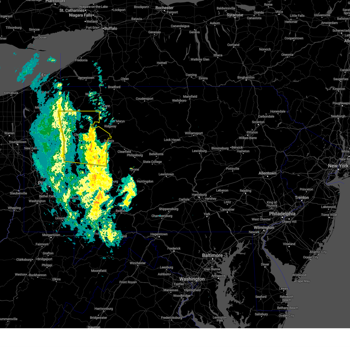 Svrpbz the national weather service in pittsburgh has issued a * severe thunderstorm warning for, forest county in northwestern pennsylvania, eastern venango county in northwestern pennsylvania, central armstrong county in west central pennsylvania, clarion county in west central pennsylvania, northeastern indiana county in west central pennsylvania, jefferson pa county in west central pennsylvania, * until 615 pm est. * at 520 pm est, severe thunderstorms were located along a line from 17 miles north of oil city to near ford city, or along a line from 17 miles north of oil city to near kittanning, moving east at 40 mph (radar indicated). Hazards include 60 mph wind gusts. expect damage to roofs, siding, and trees Svrpbz the national weather service in pittsburgh has issued a * severe thunderstorm warning for, forest county in northwestern pennsylvania, eastern venango county in northwestern pennsylvania, central armstrong county in west central pennsylvania, clarion county in west central pennsylvania, northeastern indiana county in west central pennsylvania, jefferson pa county in west central pennsylvania, * until 615 pm est. * at 520 pm est, severe thunderstorms were located along a line from 17 miles north of oil city to near ford city, or along a line from 17 miles north of oil city to near kittanning, moving east at 40 mph (radar indicated). Hazards include 60 mph wind gusts. expect damage to roofs, siding, and trees
|
| 10/6/2024 7:06 PM EDT |
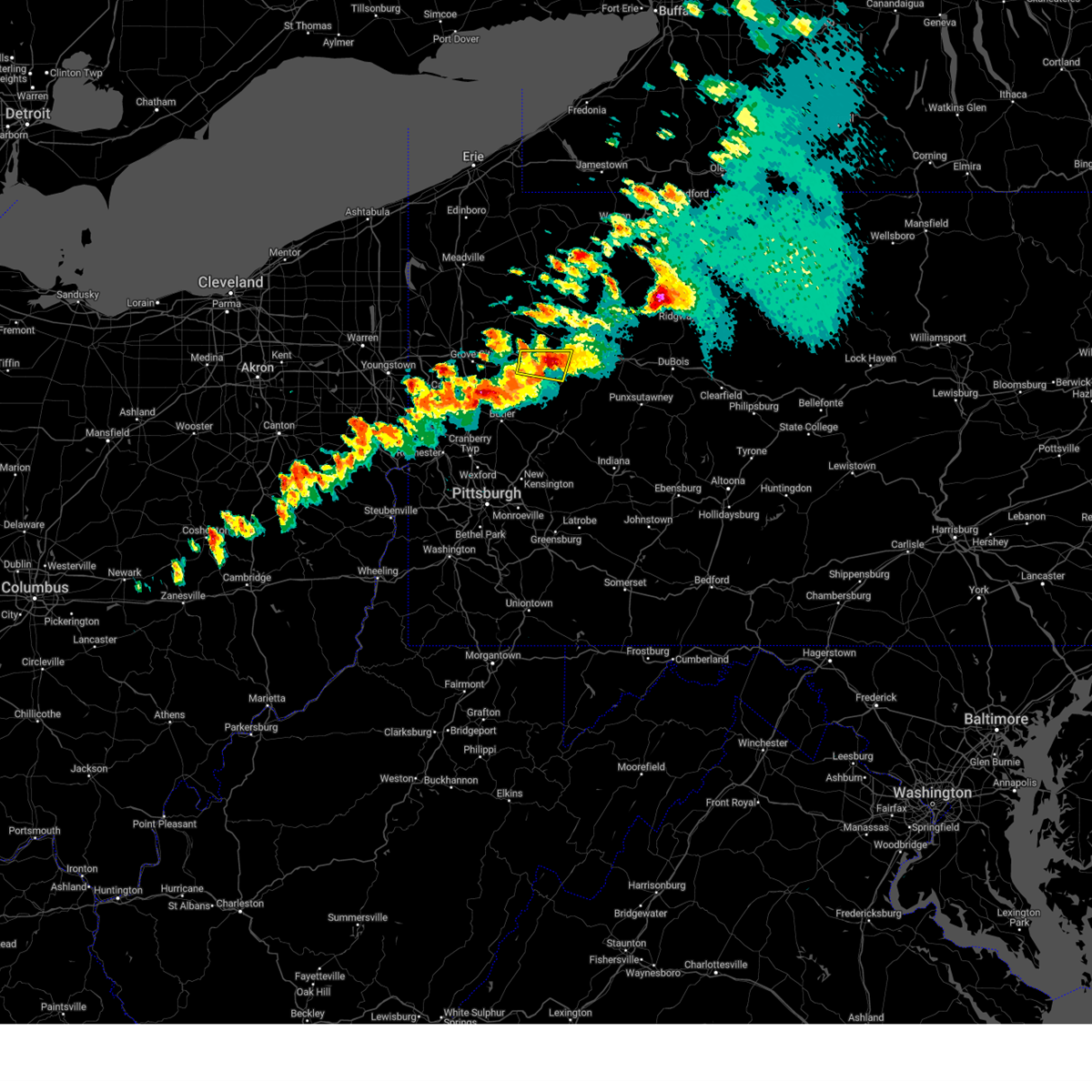 Severe thunderstorm warning for clarion and northern armstrong counties has been extended, the severe thunderstorm warning that was previously in effect has been reissued for clarion and far northern armstrong counties, and is in effect until 745 pm. please refer to that bulletin for the latest severe weather information. Severe thunderstorm warning for clarion and northern armstrong counties has been extended, the severe thunderstorm warning that was previously in effect has been reissued for clarion and far northern armstrong counties, and is in effect until 745 pm. please refer to that bulletin for the latest severe weather information.
|
| 10/6/2024 7:02 PM EDT |
 Svrpbz the national weather service in pittsburgh has issued a * severe thunderstorm warning for, central armstrong county in west central pennsylvania, southern clarion county in west central pennsylvania, * until 745 pm edt. * at 702 pm edt, a severe thunderstorm was located 8 miles northwest of rimersburg, moving east at 40 mph (radar indicated). Hazards include 60 mph wind gusts and quarter size hail. Hail damage to vehicles is expected. Expect wind damage to roofs, siding, and trees. Svrpbz the national weather service in pittsburgh has issued a * severe thunderstorm warning for, central armstrong county in west central pennsylvania, southern clarion county in west central pennsylvania, * until 745 pm edt. * at 702 pm edt, a severe thunderstorm was located 8 miles northwest of rimersburg, moving east at 40 mph (radar indicated). Hazards include 60 mph wind gusts and quarter size hail. Hail damage to vehicles is expected. Expect wind damage to roofs, siding, and trees.
|
| 10/6/2024 6:53 PM EDT |
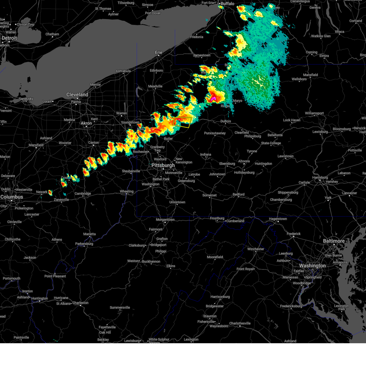 At 653 pm edt, a severe thunderstorm was located 11 miles southwest of knox, moving east at 35 mph (radar indicated). Hazards include 70 mph wind gusts and half dollar size hail. Hail damage to vehicles is expected. expect considerable tree damage. wind damage is also likely to mobile homes, roofs, and outbuildings. locations impacted include, parker, sligo, emlenton, st. Petersburg, eau claire, callensburg and foxburg. At 653 pm edt, a severe thunderstorm was located 11 miles southwest of knox, moving east at 35 mph (radar indicated). Hazards include 70 mph wind gusts and half dollar size hail. Hail damage to vehicles is expected. expect considerable tree damage. wind damage is also likely to mobile homes, roofs, and outbuildings. locations impacted include, parker, sligo, emlenton, st. Petersburg, eau claire, callensburg and foxburg.
|
| 10/6/2024 6:45 PM EDT |
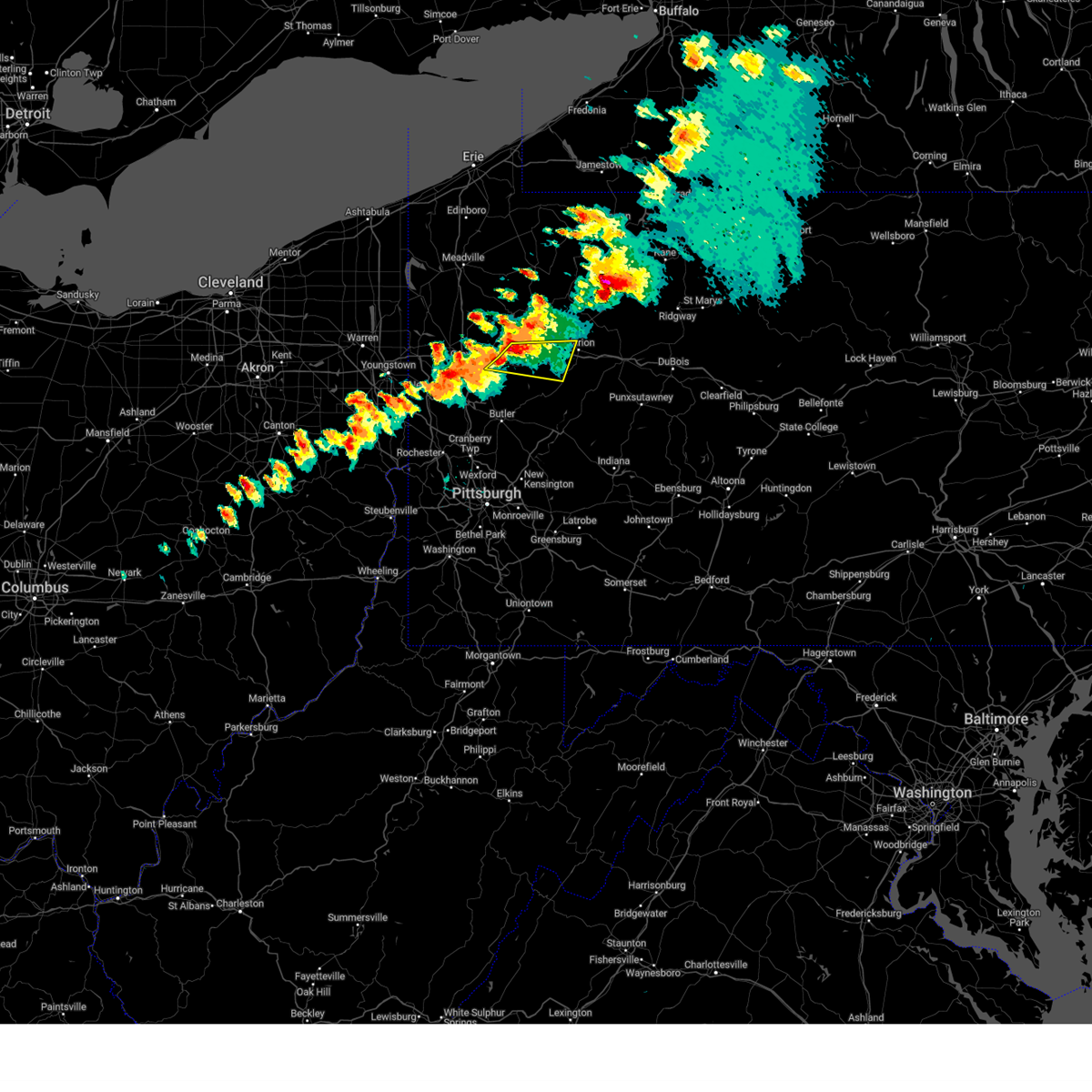 At 645 pm edt, a severe thunderstorm was located 16 miles south of franklin, or 14 miles west of knox, moving east at 40 mph (radar indicated). Hazards include 70 mph wind gusts and quarter size hail. Hail damage to vehicles is expected. expect considerable tree damage. wind damage is also likely to mobile homes, roofs, and outbuildings. locations impacted include, knox, parker, sligo, emlenton, clintonville, shippenville, st. Petersburg, eau claire, callensburg, foxburg, cherry valley and boyers. At 645 pm edt, a severe thunderstorm was located 16 miles south of franklin, or 14 miles west of knox, moving east at 40 mph (radar indicated). Hazards include 70 mph wind gusts and quarter size hail. Hail damage to vehicles is expected. expect considerable tree damage. wind damage is also likely to mobile homes, roofs, and outbuildings. locations impacted include, knox, parker, sligo, emlenton, clintonville, shippenville, st. Petersburg, eau claire, callensburg, foxburg, cherry valley and boyers.
|
| 10/6/2024 6:27 PM EDT |
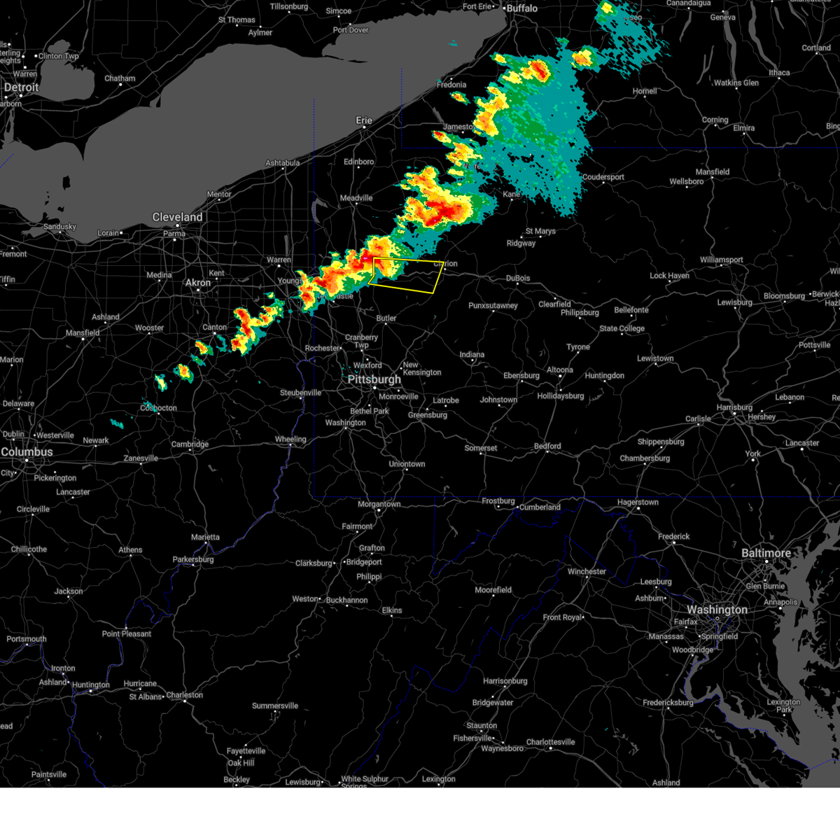 Svrpbz the national weather service in pittsburgh has issued a * severe thunderstorm warning for, southwestern venango county in northwestern pennsylvania, northwestern armstrong county in west central pennsylvania, northeastern butler county in west central pennsylvania, southwestern clarion county in west central pennsylvania, * until 700 pm edt. * at 627 pm edt, a severe thunderstorm was located 6 miles northeast of grove city, moving east at 50 mph (radar indicated). Hazards include 70 mph wind gusts and quarter size hail. Hail damage to vehicles is expected. expect considerable tree damage. Wind damage is also likely to mobile homes, roofs, and outbuildings. Svrpbz the national weather service in pittsburgh has issued a * severe thunderstorm warning for, southwestern venango county in northwestern pennsylvania, northwestern armstrong county in west central pennsylvania, northeastern butler county in west central pennsylvania, southwestern clarion county in west central pennsylvania, * until 700 pm edt. * at 627 pm edt, a severe thunderstorm was located 6 miles northeast of grove city, moving east at 50 mph (radar indicated). Hazards include 70 mph wind gusts and quarter size hail. Hail damage to vehicles is expected. expect considerable tree damage. Wind damage is also likely to mobile homes, roofs, and outbuildings.
|
| 8/17/2024 5:32 PM EDT |
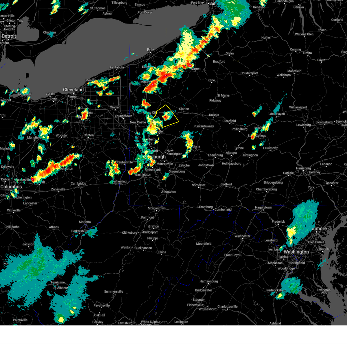 The storm which prompted the warning has weakened below severe limits, and no longer poses an immediate threat to life or property. therefore, the warning has been allowed to expire. to report severe weather, contact your nearest law enforcement agency. they will send your report to the national weather service office. The storm which prompted the warning has weakened below severe limits, and no longer poses an immediate threat to life or property. therefore, the warning has been allowed to expire. to report severe weather, contact your nearest law enforcement agency. they will send your report to the national weather service office.
|
| 8/17/2024 5:08 PM EDT |
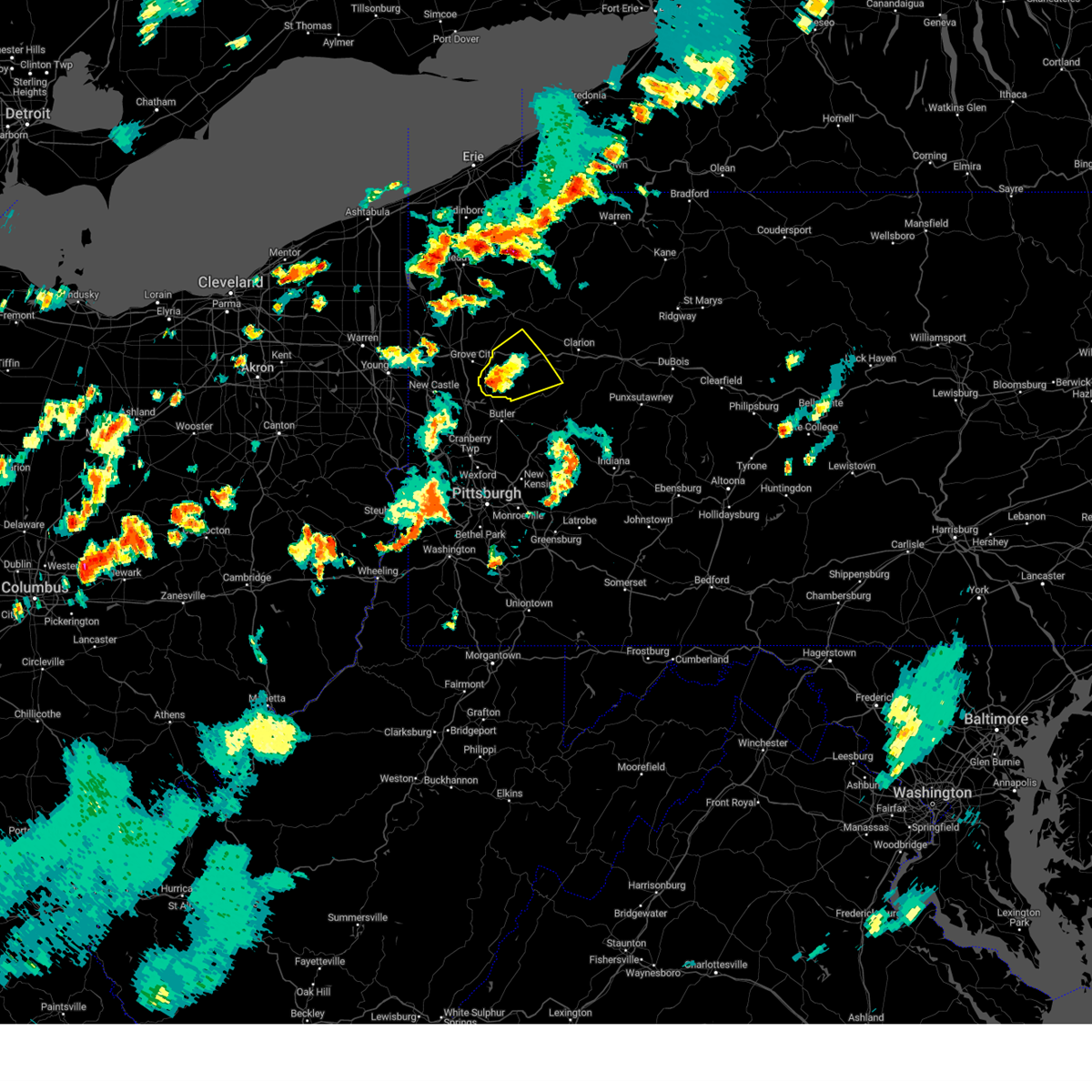 At 508 pm edt, a severe thunderstorm was located 10 miles east of slippery rock, or 12 miles east of grove city, moving northeast at 35 mph (radar indicated). Hazards include 60 mph wind gusts and small hail. Expect damage to roofs, siding, and trees. locations impacted include, rimersburg, slippery rock, harrisville, parker, emlenton, bruin, clintonville, st. Petersburg, eau claire, kennerdell, petrolia, karns city, callensburg, fairview, west sunbury, foxburg, cherry valley, hooker and boyers. At 508 pm edt, a severe thunderstorm was located 10 miles east of slippery rock, or 12 miles east of grove city, moving northeast at 35 mph (radar indicated). Hazards include 60 mph wind gusts and small hail. Expect damage to roofs, siding, and trees. locations impacted include, rimersburg, slippery rock, harrisville, parker, emlenton, bruin, clintonville, st. Petersburg, eau claire, kennerdell, petrolia, karns city, callensburg, fairview, west sunbury, foxburg, cherry valley, hooker and boyers.
|
| 8/17/2024 4:52 PM EDT |
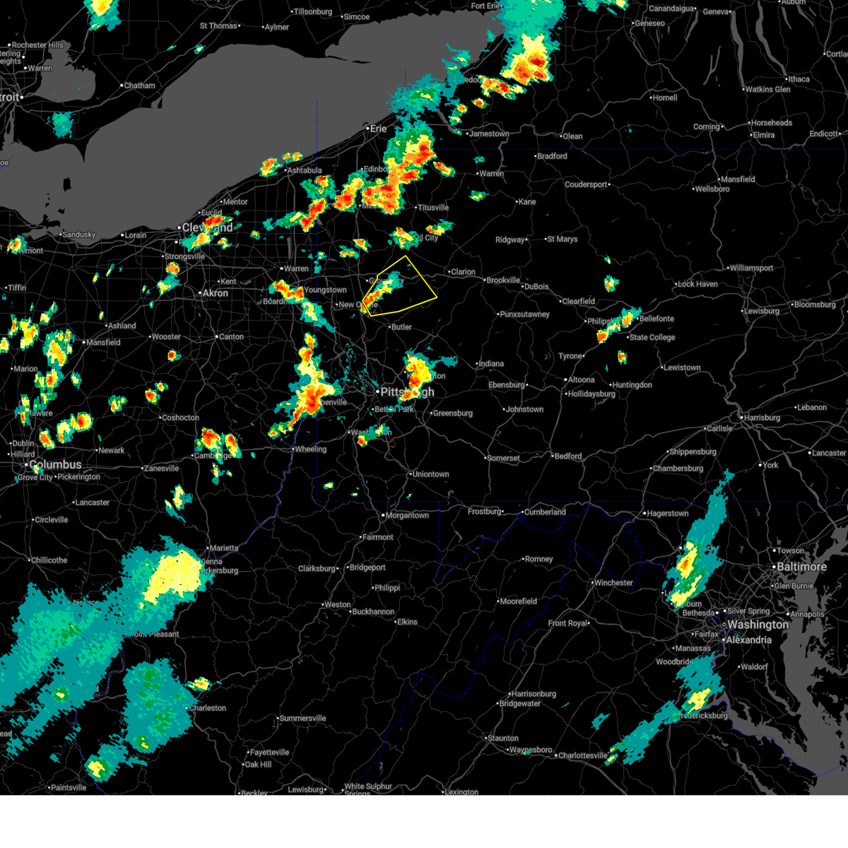 Svrpbz the national weather service in pittsburgh has issued a * severe thunderstorm warning for, southwestern venango county in northwestern pennsylvania, northwestern armstrong county in west central pennsylvania, northern butler county in west central pennsylvania, southwestern clarion county in west central pennsylvania, * until 530 pm edt. * at 452 pm edt, a severe thunderstorm was located over slippery rock, or 8 miles southeast of grove city, moving northeast at 35 mph (radar indicated). Hazards include 60 mph wind gusts and quarter size hail. Hail damage to vehicles is expected. Expect wind damage to roofs, siding, and trees. Svrpbz the national weather service in pittsburgh has issued a * severe thunderstorm warning for, southwestern venango county in northwestern pennsylvania, northwestern armstrong county in west central pennsylvania, northern butler county in west central pennsylvania, southwestern clarion county in west central pennsylvania, * until 530 pm edt. * at 452 pm edt, a severe thunderstorm was located over slippery rock, or 8 miles southeast of grove city, moving northeast at 35 mph (radar indicated). Hazards include 60 mph wind gusts and quarter size hail. Hail damage to vehicles is expected. Expect wind damage to roofs, siding, and trees.
|
| 8/6/2024 7:31 PM EDT |
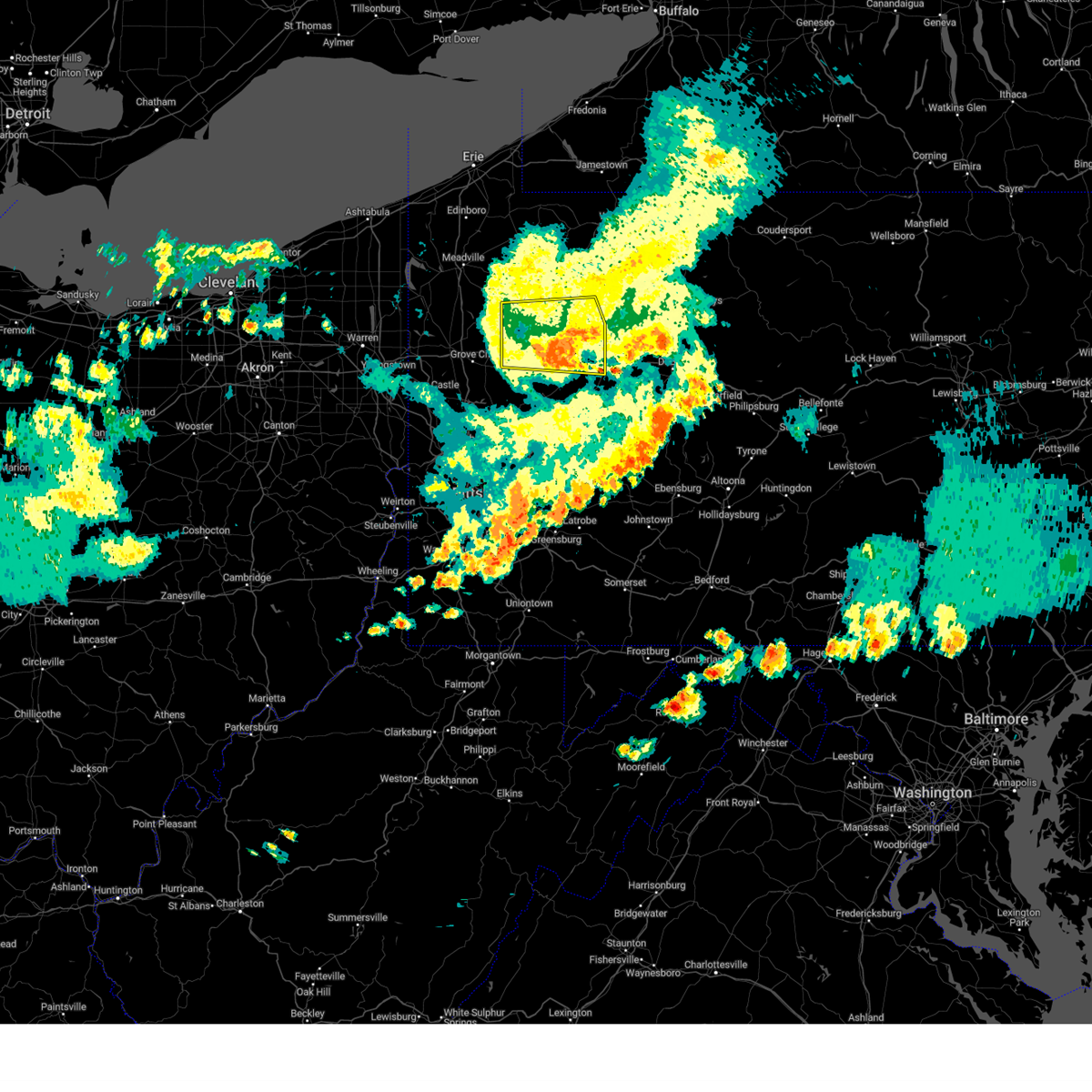 The storms which prompted the warning have weakened below severe limits, and no longer pose an immediate threat to life or property. therefore, the warning has been allowed to expire. however, gusty winds are still possible with these thunderstorms. to report severe weather, contact your nearest law enforcement agency. they will relay your report to the national weather service pittsburgh. The storms which prompted the warning have weakened below severe limits, and no longer pose an immediate threat to life or property. therefore, the warning has been allowed to expire. however, gusty winds are still possible with these thunderstorms. to report severe weather, contact your nearest law enforcement agency. they will relay your report to the national weather service pittsburgh.
|
| 8/6/2024 7:07 PM EDT |
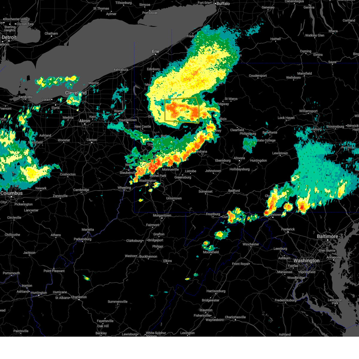 the severe thunderstorm warning has been cancelled and is no longer in effect the severe thunderstorm warning has been cancelled and is no longer in effect
|
| 8/6/2024 7:07 PM EDT |
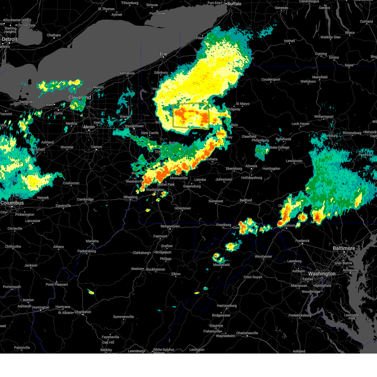 At 707 pm edt, severe thunderstorms were located along a line extending from near oil city to 10 miles southeast of franklin to 7 miles southwest of knox, moving east at 35 mph (law enforcement). Hazards include 60 mph wind gusts. Expect damage to trees and power lines, resulting in some power outages. locations impacted include, oil city, franklin, clarion, knox, sugarcreek, hasson heights, seneca, sligo, emlenton, strattanville, clintonville, limestone, shippenville, st. Petersburg, corsica, eau claire, kennerdell, callensburg, woodland heights, and foxburg. At 707 pm edt, severe thunderstorms were located along a line extending from near oil city to 10 miles southeast of franklin to 7 miles southwest of knox, moving east at 35 mph (law enforcement). Hazards include 60 mph wind gusts. Expect damage to trees and power lines, resulting in some power outages. locations impacted include, oil city, franklin, clarion, knox, sugarcreek, hasson heights, seneca, sligo, emlenton, strattanville, clintonville, limestone, shippenville, st. Petersburg, corsica, eau claire, kennerdell, callensburg, woodland heights, and foxburg.
|
| 8/6/2024 6:45 PM EDT |
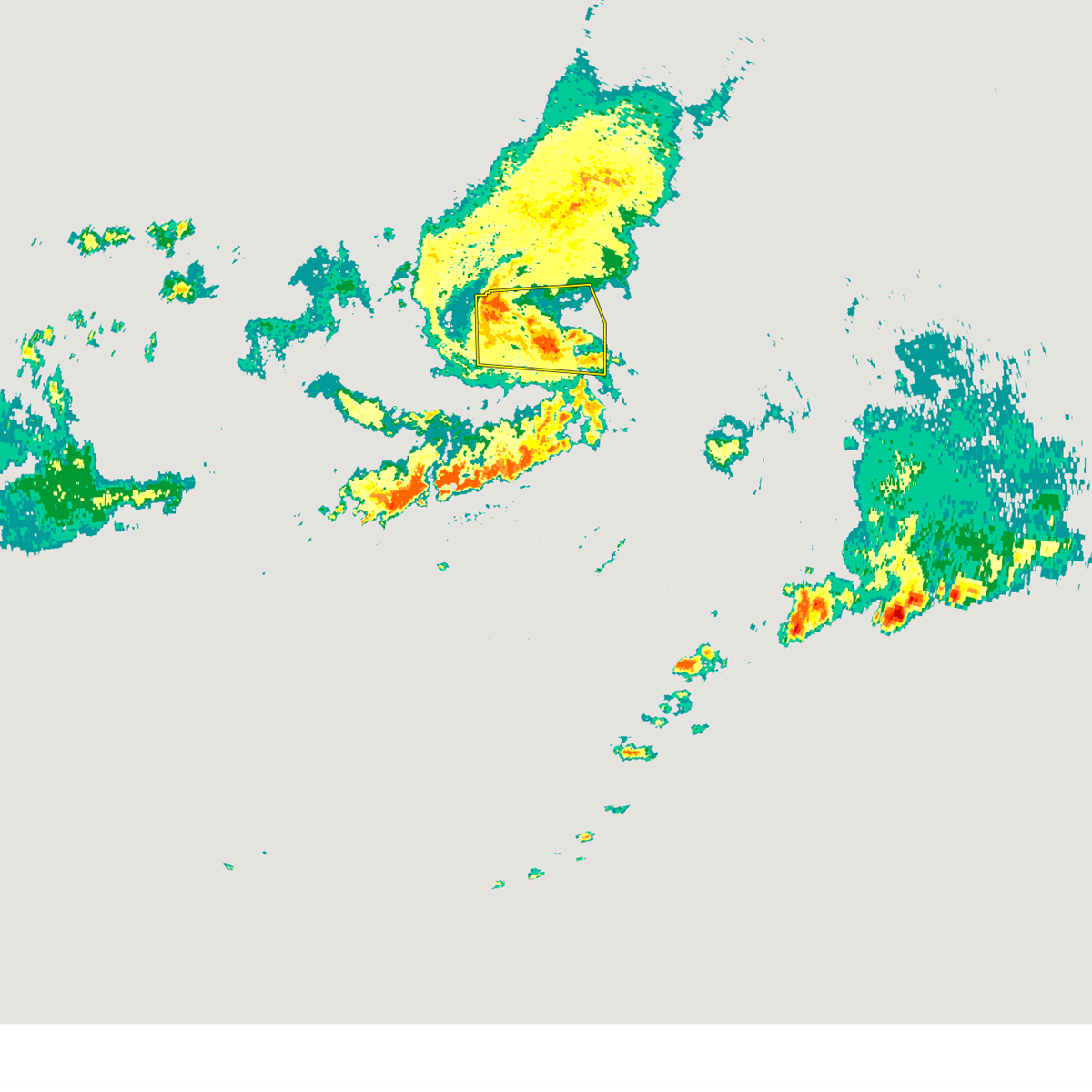 At 644 pm edt, severe thunderstorms were located along a line extending from near sugarcreek to 6 miles southwest of franklin to 11 miles east of grove city, moving east at 35 mph (law enforcement reported widespread wind damage across mercer county). Hazards include 70 mph wind gusts. Trees snapped and uprooted. power outages can be expected. locations impacted include, oil city, franklin, clarion, knox, sugarcreek, tionesta, hasson heights, seneca, harrisville, polk, sligo, emlenton, strattanville, rouseville, clintonville, limestone, shippenville, cooperstown, st. Petersburg, and corsica. At 644 pm edt, severe thunderstorms were located along a line extending from near sugarcreek to 6 miles southwest of franklin to 11 miles east of grove city, moving east at 35 mph (law enforcement reported widespread wind damage across mercer county). Hazards include 70 mph wind gusts. Trees snapped and uprooted. power outages can be expected. locations impacted include, oil city, franklin, clarion, knox, sugarcreek, tionesta, hasson heights, seneca, harrisville, polk, sligo, emlenton, strattanville, rouseville, clintonville, limestone, shippenville, cooperstown, st. Petersburg, and corsica.
|
| 8/6/2024 6:39 PM EDT |
 Svrpbz the national weather service in pittsburgh has issued a * severe thunderstorm warning for, southern venango county in northwestern pennsylvania, eastern butler county in west central pennsylvania, central indiana county in west central pennsylvania, northeastern allegheny county in southwestern pennsylvania, southwestern jefferson county in west central pennsylvania, northwestern westmoreland county in southwestern pennsylvania, armstrong county in west central pennsylvania, southern clarion county in west central pennsylvania, * until 745 pm edt. * at 639 pm edt, severe thunderstorms were located along a line extending from 7 miles southwest of knox to near freeport to natrona heights, moving east at 35 mph (radar indicated). Hazards include 60 mph wind gusts. expect damage to trees and power lines, resulting in some power outages Svrpbz the national weather service in pittsburgh has issued a * severe thunderstorm warning for, southern venango county in northwestern pennsylvania, eastern butler county in west central pennsylvania, central indiana county in west central pennsylvania, northeastern allegheny county in southwestern pennsylvania, southwestern jefferson county in west central pennsylvania, northwestern westmoreland county in southwestern pennsylvania, armstrong county in west central pennsylvania, southern clarion county in west central pennsylvania, * until 745 pm edt. * at 639 pm edt, severe thunderstorms were located along a line extending from 7 miles southwest of knox to near freeport to natrona heights, moving east at 35 mph (radar indicated). Hazards include 60 mph wind gusts. expect damage to trees and power lines, resulting in some power outages
|
| 8/6/2024 6:29 PM EDT |
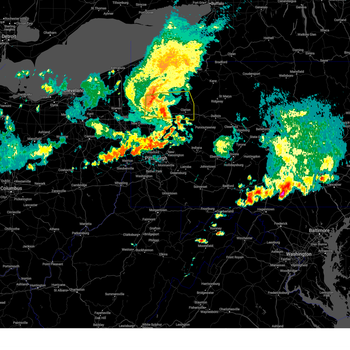 Svrpbz the national weather service in pittsburgh has issued a * severe thunderstorm warning for, eastern mercer county in northwestern pennsylvania, venango county in northwestern pennsylvania, northeastern butler county in west central pennsylvania, western jefferson county in west central pennsylvania, northwestern armstrong county in west central pennsylvania, clarion county in west central pennsylvania, southwestern forest county in northwestern pennsylvania, * until 730 pm edt. * at 628 pm edt, severe thunderstorms were located along a line extending from 10 miles west of franklin to grove city, moving east at 35 mph (law enforcement reported widespread wind damage across mercer county). Hazards include 70 mph wind gusts. Trees snapped and uprooted. Power outages can be expected. Svrpbz the national weather service in pittsburgh has issued a * severe thunderstorm warning for, eastern mercer county in northwestern pennsylvania, venango county in northwestern pennsylvania, northeastern butler county in west central pennsylvania, western jefferson county in west central pennsylvania, northwestern armstrong county in west central pennsylvania, clarion county in west central pennsylvania, southwestern forest county in northwestern pennsylvania, * until 730 pm edt. * at 628 pm edt, severe thunderstorms were located along a line extending from 10 miles west of franklin to grove city, moving east at 35 mph (law enforcement reported widespread wind damage across mercer county). Hazards include 70 mph wind gusts. Trees snapped and uprooted. Power outages can be expected.
|
| 8/6/2024 6:17 PM EDT |
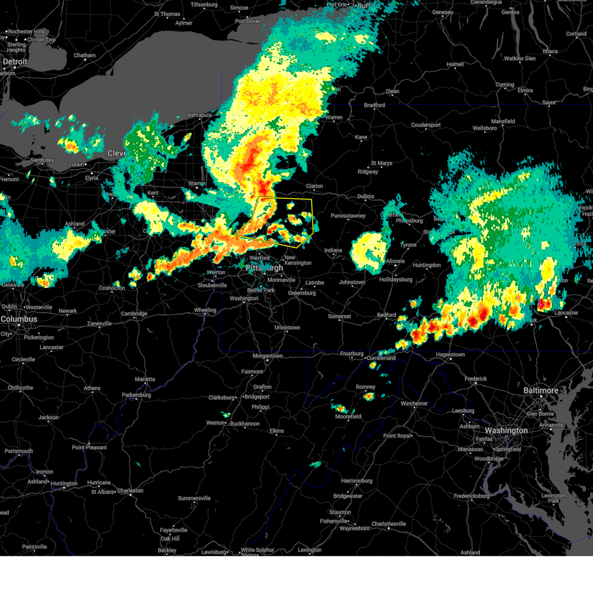 At 617 pm edt, severe thunderstorms were located along a line extending from 10 miles east of slippery rock to near shanor-northvue to near zelienople, moving east at 55 mph (radar indicated). Hazards include 60 mph wind gusts. Expect damage to trees and power lines, resulting in some power outages. Locations impacted include, butler, kittanning, rimersburg, ellwood city, homeacre-lyndora, shanor-northvue, meridian, zelienople, slippery rock, ford city, meadowood, oak hills, sarver, evans city, freeport, west kittanning, big beaver, saxonburg, nixon, and ellport. At 617 pm edt, severe thunderstorms were located along a line extending from 10 miles east of slippery rock to near shanor-northvue to near zelienople, moving east at 55 mph (radar indicated). Hazards include 60 mph wind gusts. Expect damage to trees and power lines, resulting in some power outages. Locations impacted include, butler, kittanning, rimersburg, ellwood city, homeacre-lyndora, shanor-northvue, meridian, zelienople, slippery rock, ford city, meadowood, oak hills, sarver, evans city, freeport, west kittanning, big beaver, saxonburg, nixon, and ellport.
|
| 8/6/2024 5:59 PM EDT |
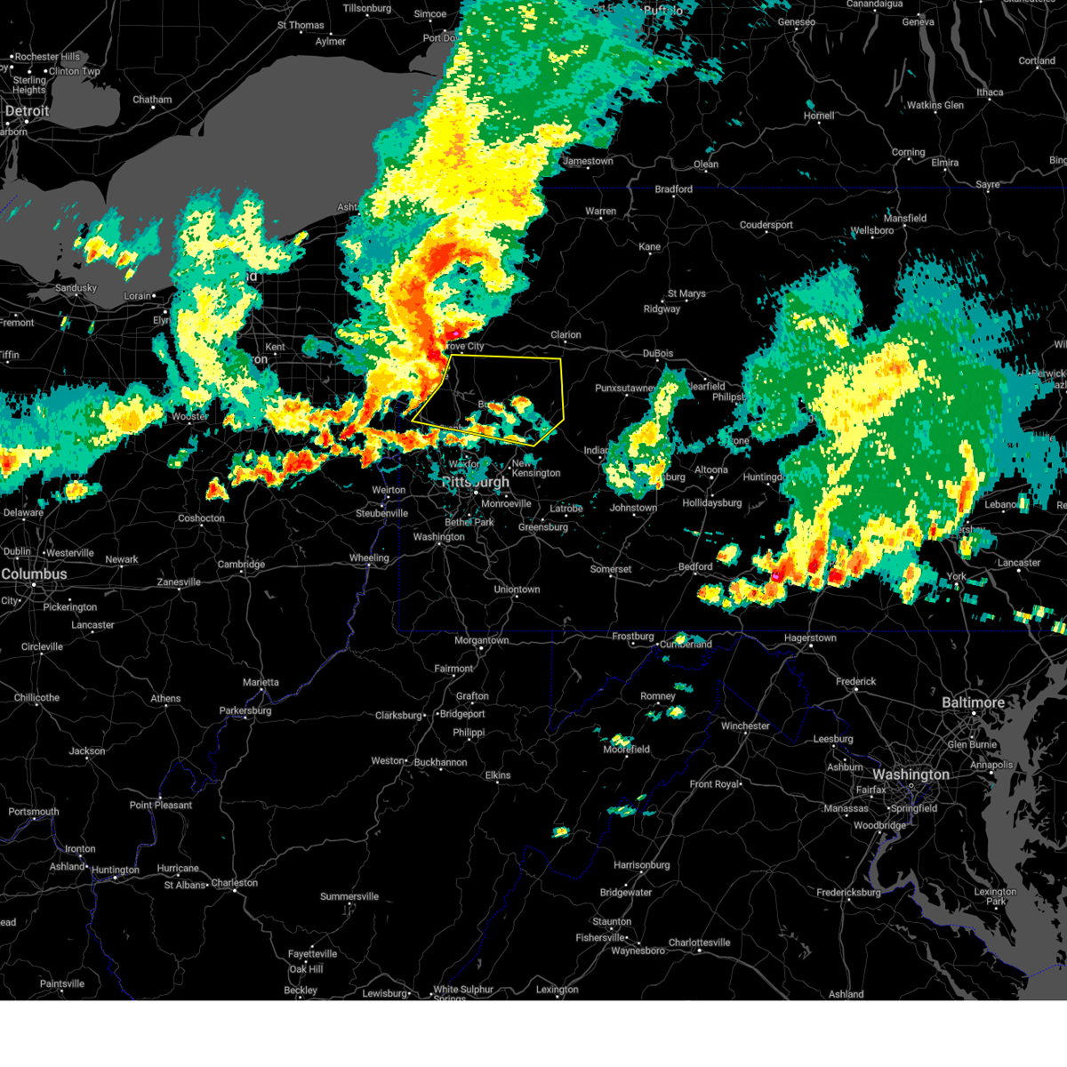 Svrpbz the national weather service in pittsburgh has issued a * severe thunderstorm warning for, southeastern mercer county in northwestern pennsylvania, northeastern beaver county in western pennsylvania, eastern lawrence county in western pennsylvania, butler county in west central pennsylvania, west central armstrong county in west central pennsylvania, southwestern clarion county in west central pennsylvania, * until 645 pm edt. * at 559 pm edt, severe thunderstorms were located along a line extending from near grove city to 8 miles east of new castle to near beaver falls, moving east at 55 mph (radar indicated). Hazards include 60 mph wind gusts. expect damage to trees and power lines, resulting in some power outages Svrpbz the national weather service in pittsburgh has issued a * severe thunderstorm warning for, southeastern mercer county in northwestern pennsylvania, northeastern beaver county in western pennsylvania, eastern lawrence county in western pennsylvania, butler county in west central pennsylvania, west central armstrong county in west central pennsylvania, southwestern clarion county in west central pennsylvania, * until 645 pm edt. * at 559 pm edt, severe thunderstorms were located along a line extending from near grove city to 8 miles east of new castle to near beaver falls, moving east at 55 mph (radar indicated). Hazards include 60 mph wind gusts. expect damage to trees and power lines, resulting in some power outages
|
| 8/6/2024 12:45 PM EDT |
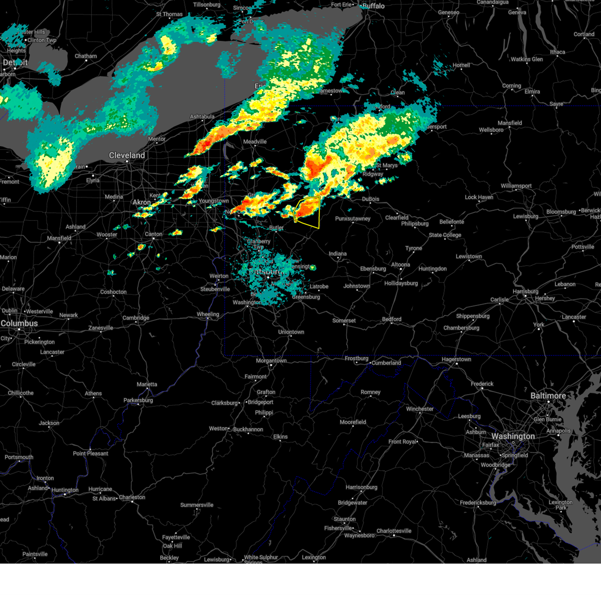 At 1244 pm edt, a severe thunderstorm was located near rimersburg, moving east at 30 mph (law enforcement). Hazards include two inch hail and 60 mph wind gusts. People and animals outdoors will be injured. expect hail damage to roofs, siding, windows, and vehicles. expect wind damage to trees and power lines, resulting in some power outages. Locations impacted include, rimersburg, east brady, sligo, callensburg, and templeton. At 1244 pm edt, a severe thunderstorm was located near rimersburg, moving east at 30 mph (law enforcement). Hazards include two inch hail and 60 mph wind gusts. People and animals outdoors will be injured. expect hail damage to roofs, siding, windows, and vehicles. expect wind damage to trees and power lines, resulting in some power outages. Locations impacted include, rimersburg, east brady, sligo, callensburg, and templeton.
|
| 8/6/2024 12:45 PM EDT |
 the severe thunderstorm warning has been cancelled and is no longer in effect the severe thunderstorm warning has been cancelled and is no longer in effect
|
| 8/6/2024 12:37 PM EDT |
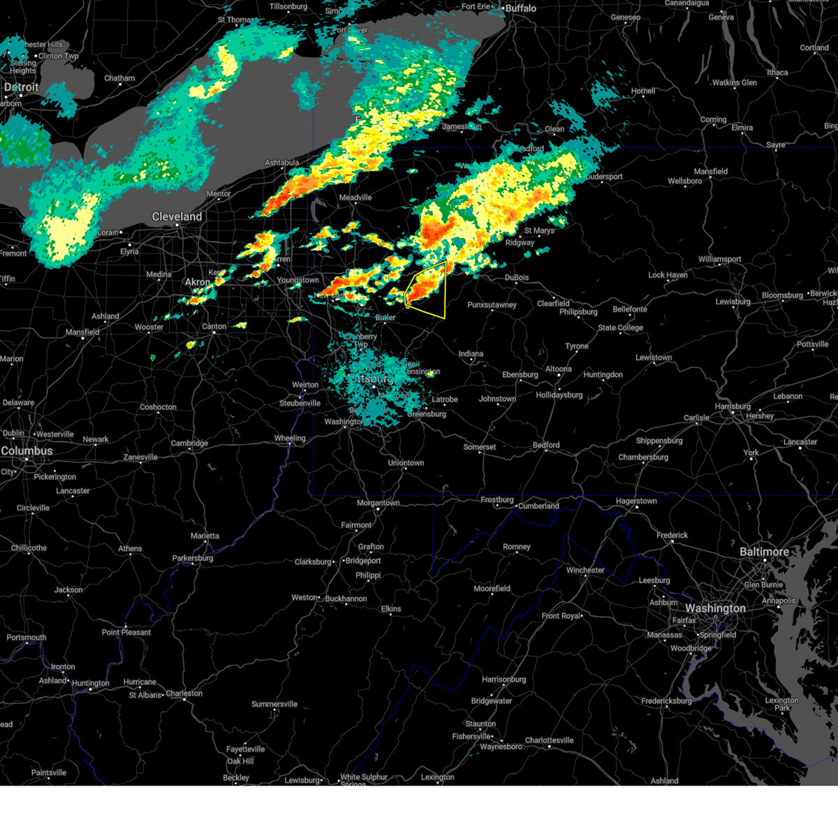 At 1237 pm edt, a severe thunderstorm was located near rimersburg, moving east at 30 mph (law enforcement). Hazards include ping pong ball size hail and 60 mph wind gusts. People and animals outdoors will be injured. expect hail damage to roofs, siding, windows, and vehicles. expect wind damage to trees and power lines, resulting in some power outages. Locations impacted include, clarion, rimersburg, east brady, parker, sligo, bruin, petrolia, karns city, callensburg, and templeton. At 1237 pm edt, a severe thunderstorm was located near rimersburg, moving east at 30 mph (law enforcement). Hazards include ping pong ball size hail and 60 mph wind gusts. People and animals outdoors will be injured. expect hail damage to roofs, siding, windows, and vehicles. expect wind damage to trees and power lines, resulting in some power outages. Locations impacted include, clarion, rimersburg, east brady, parker, sligo, bruin, petrolia, karns city, callensburg, and templeton.
|
| 8/6/2024 12:37 PM EDT |
 the severe thunderstorm warning has been cancelled and is no longer in effect the severe thunderstorm warning has been cancelled and is no longer in effect
|
| 8/6/2024 12:32 PM EDT |
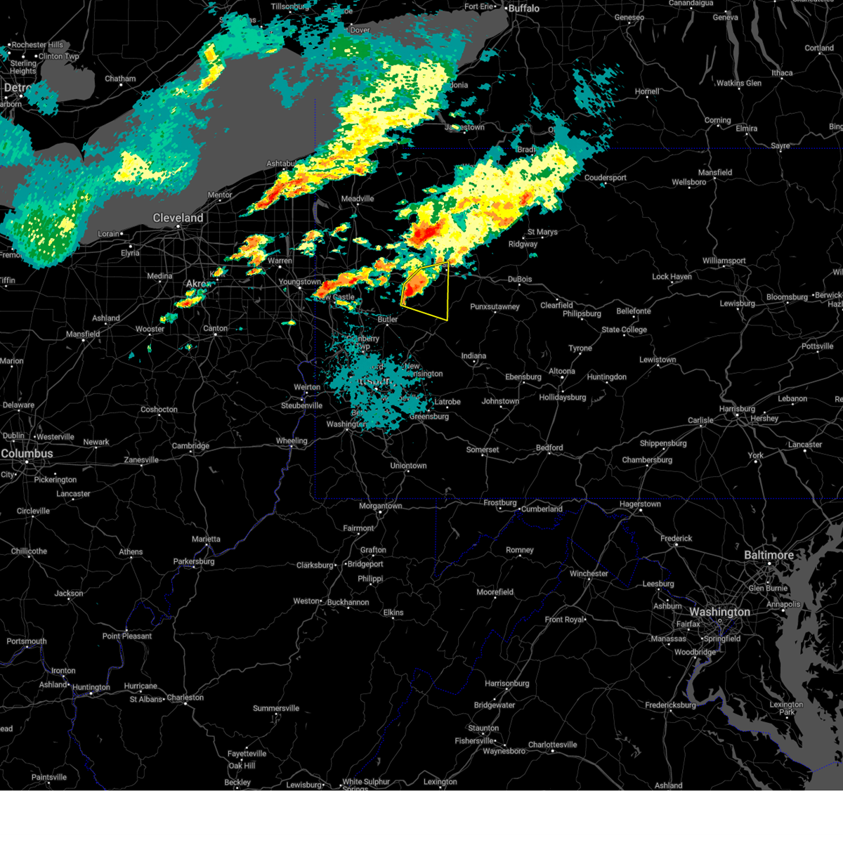 At 1232 pm edt, a severe thunderstorm was located 8 miles northwest of rimersburg, moving east at 30 mph (law enforcement). Hazards include 60 mph wind gusts and quarter size hail. Minor hail damage to vehicles is possible. expect wind damage to trees and power lines, resulting in some power outages. locations impacted include, clarion, knox, rimersburg, east brady, parker, sligo, bruin, shippenville, st. Petersburg, petrolia, karns city, callensburg, fairview, foxburg, and templeton. At 1232 pm edt, a severe thunderstorm was located 8 miles northwest of rimersburg, moving east at 30 mph (law enforcement). Hazards include 60 mph wind gusts and quarter size hail. Minor hail damage to vehicles is possible. expect wind damage to trees and power lines, resulting in some power outages. locations impacted include, clarion, knox, rimersburg, east brady, parker, sligo, bruin, shippenville, st. Petersburg, petrolia, karns city, callensburg, fairview, foxburg, and templeton.
|
| 8/6/2024 12:28 PM EDT |
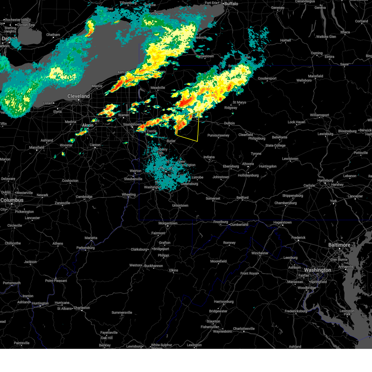 At 1228 pm edt, a severe thunderstorm was located 10 miles west of rimersburg, moving east at 30 mph (radar indicated). Hazards include 60 mph wind gusts and quarter size hail. Minor hail damage to vehicles is possible. expect wind damage to trees and power lines, resulting in some power outages. locations impacted include, clarion, knox, rimersburg, east brady, parker, sligo, emlenton, bruin, shippenville, st. Petersburg, petrolia, karns city, callensburg, fairview, foxburg, and templeton. At 1228 pm edt, a severe thunderstorm was located 10 miles west of rimersburg, moving east at 30 mph (radar indicated). Hazards include 60 mph wind gusts and quarter size hail. Minor hail damage to vehicles is possible. expect wind damage to trees and power lines, resulting in some power outages. locations impacted include, clarion, knox, rimersburg, east brady, parker, sligo, emlenton, bruin, shippenville, st. Petersburg, petrolia, karns city, callensburg, fairview, foxburg, and templeton.
|
| 8/6/2024 12:22 PM EDT |
 At 1222 pm edt, a severe thunderstorm was located 13 miles west of rimersburg, moving east at 30 mph (radar indicated). Hazards include 60 mph wind gusts and half dollar size hail. Minor hail damage to vehicles is possible. expect wind damage to trees and power lines, resulting in some power outages. locations impacted include, clarion, knox, rimersburg, east brady, parker, sligo, emlenton, bruin, shippenville, st. Petersburg, eau claire, petrolia, karns city, callensburg, fairview, foxburg, cherry valley, hooker, and templeton. At 1222 pm edt, a severe thunderstorm was located 13 miles west of rimersburg, moving east at 30 mph (radar indicated). Hazards include 60 mph wind gusts and half dollar size hail. Minor hail damage to vehicles is possible. expect wind damage to trees and power lines, resulting in some power outages. locations impacted include, clarion, knox, rimersburg, east brady, parker, sligo, emlenton, bruin, shippenville, st. Petersburg, eau claire, petrolia, karns city, callensburg, fairview, foxburg, cherry valley, hooker, and templeton.
|
| 8/6/2024 12:18 PM EDT |
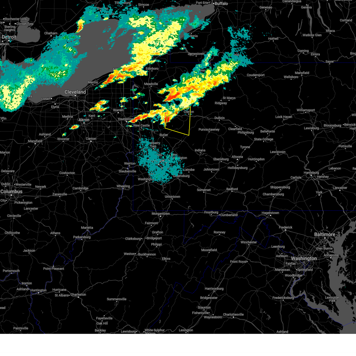 Svrpbz the national weather service in pittsburgh has issued a * severe thunderstorm warning for, south central venango county in northwestern pennsylvania, northeastern butler county in west central pennsylvania, northwestern armstrong county in west central pennsylvania, southwestern clarion county in west central pennsylvania, * until 100 pm edt. * at 1218 pm edt, a severe thunderstorm was located 14 miles east of slippery rock, or 15 miles west of rimersburg, moving east at 30 mph (radar indicated). Hazards include 60 mph wind gusts and penny size hail. expect damage to trees and power lines, resulting in some power outages Svrpbz the national weather service in pittsburgh has issued a * severe thunderstorm warning for, south central venango county in northwestern pennsylvania, northeastern butler county in west central pennsylvania, northwestern armstrong county in west central pennsylvania, southwestern clarion county in west central pennsylvania, * until 100 pm edt. * at 1218 pm edt, a severe thunderstorm was located 14 miles east of slippery rock, or 15 miles west of rimersburg, moving east at 30 mph (radar indicated). Hazards include 60 mph wind gusts and penny size hail. expect damage to trees and power lines, resulting in some power outages
|
| 6/17/2024 5:08 PM EDT |
 Svrpbz the national weather service in pittsburgh has issued a * severe thunderstorm warning for, central armstrong county in west central pennsylvania, clarion county in west central pennsylvania, * until 600 pm edt. * at 507 pm edt, a severe thunderstorm was located near rimersburg, moving northeast at 15 mph (radar indicated). Hazards include 60 mph wind gusts and penny size hail. expect damage to trees and power lines, resulting in some power outages Svrpbz the national weather service in pittsburgh has issued a * severe thunderstorm warning for, central armstrong county in west central pennsylvania, clarion county in west central pennsylvania, * until 600 pm edt. * at 507 pm edt, a severe thunderstorm was located near rimersburg, moving northeast at 15 mph (radar indicated). Hazards include 60 mph wind gusts and penny size hail. expect damage to trees and power lines, resulting in some power outages
|
| 5/26/2024 9:23 PM EDT |
 The storms which prompted the warning have weakened below severe limits, and no longer pose an immediate threat to life or property. therefore, the warning will be allowed to expire. however, gusty winds are still possible with these thunderstorms. a severe thunderstorm watch remains in effect until 1100 pm edt for northwestern and west central pennsylvania. The storms which prompted the warning have weakened below severe limits, and no longer pose an immediate threat to life or property. therefore, the warning will be allowed to expire. however, gusty winds are still possible with these thunderstorms. a severe thunderstorm watch remains in effect until 1100 pm edt for northwestern and west central pennsylvania.
|
| 5/26/2024 9:17 PM EDT |
 At 917 pm edt, severe thunderstorms were located along a line extending from 7 miles west of knox to 7 miles southwest of new bethlehem to 7 miles east of kittanning to 9 miles west of indiana, moving northeast at 30 mph (radar indicated). Hazards include 60 mph wind gusts. Expect damage to trees and power lines, resulting in some power outages. locations impacted include, knox, rimersburg, new bethlehem, seneca, rural valley, sligo, emlenton, st. Petersburg, elderton, plumville, kennerdell, callensburg, atwood, cranberry township, templeton, and distant. At 917 pm edt, severe thunderstorms were located along a line extending from 7 miles west of knox to 7 miles southwest of new bethlehem to 7 miles east of kittanning to 9 miles west of indiana, moving northeast at 30 mph (radar indicated). Hazards include 60 mph wind gusts. Expect damage to trees and power lines, resulting in some power outages. locations impacted include, knox, rimersburg, new bethlehem, seneca, rural valley, sligo, emlenton, st. Petersburg, elderton, plumville, kennerdell, callensburg, atwood, cranberry township, templeton, and distant.
|
| 5/26/2024 9:17 PM EDT |
 the severe thunderstorm warning has been cancelled and is no longer in effect the severe thunderstorm warning has been cancelled and is no longer in effect
|
| 5/26/2024 9:05 PM EDT |
 At 904 pm edt, severe thunderstorms were located along a line extending from 12 miles west of knox to near west kittanning to near kittanning to 7 miles east of apollo, moving northeast at 30 mph (radar indicated). Hazards include 60 mph wind gusts. Expect damage to trees and power lines, resulting in some power outages. locations impacted include, kittanning, knox, rimersburg, ford city, new bethlehem, west kittanning, seneca, east brady, rural valley, parker, sligo, emlenton, bruin, west hills, manorville, st. Petersburg, ford cliff, elderton, applewold, and plumville. At 904 pm edt, severe thunderstorms were located along a line extending from 12 miles west of knox to near west kittanning to near kittanning to 7 miles east of apollo, moving northeast at 30 mph (radar indicated). Hazards include 60 mph wind gusts. Expect damage to trees and power lines, resulting in some power outages. locations impacted include, kittanning, knox, rimersburg, ford city, new bethlehem, west kittanning, seneca, east brady, rural valley, parker, sligo, emlenton, bruin, west hills, manorville, st. Petersburg, ford cliff, elderton, applewold, and plumville.
|
| 5/26/2024 9:05 PM EDT |
 the severe thunderstorm warning has been cancelled and is no longer in effect the severe thunderstorm warning has been cancelled and is no longer in effect
|
| 5/26/2024 8:52 PM EDT |
 At 852 pm edt, severe thunderstorms were located along a line extending from 12 miles northeast of slippery rock to near west kittanning to near ford city to near apollo, moving northeast at 30 mph (radar indicated). Hazards include 60 mph wind gusts. Expect damage to trees and power lines, resulting in some power outages. Locations impacted include, vandergrift, kittanning, apollo, knox, rimersburg, ford city, leechburg, new bethlehem, west kittanning, north apollo, west leechburg, chicora, orchard hills, seneca, east brady, harrisville, rural valley, parker, oklahoma, and sligo. At 852 pm edt, severe thunderstorms were located along a line extending from 12 miles northeast of slippery rock to near west kittanning to near ford city to near apollo, moving northeast at 30 mph (radar indicated). Hazards include 60 mph wind gusts. Expect damage to trees and power lines, resulting in some power outages. Locations impacted include, vandergrift, kittanning, apollo, knox, rimersburg, ford city, leechburg, new bethlehem, west kittanning, north apollo, west leechburg, chicora, orchard hills, seneca, east brady, harrisville, rural valley, parker, oklahoma, and sligo.
|
| 5/26/2024 8:52 PM EDT |
 the severe thunderstorm warning has been cancelled and is no longer in effect the severe thunderstorm warning has been cancelled and is no longer in effect
|
| 5/26/2024 8:39 PM EDT |
 Svrpbz the national weather service in pittsburgh has issued a * severe thunderstorm warning for, southeastern venango county in northwestern pennsylvania, eastern butler county in west central pennsylvania, north central indiana county in west central pennsylvania, northeastern allegheny county in southwestern pennsylvania, northwestern westmoreland county in southwestern pennsylvania, armstrong county in west central pennsylvania, southwestern clarion county in west central pennsylvania, * until 930 pm edt. * at 838 pm edt, severe thunderstorms were located along a line extending from near slippery rock to near sarver to near freeport to near murrysville, moving northeast at 30 mph (radar indicated). Hazards include 60 mph wind gusts. expect damage to trees and power lines, resulting in some power outages Svrpbz the national weather service in pittsburgh has issued a * severe thunderstorm warning for, southeastern venango county in northwestern pennsylvania, eastern butler county in west central pennsylvania, north central indiana county in west central pennsylvania, northeastern allegheny county in southwestern pennsylvania, northwestern westmoreland county in southwestern pennsylvania, armstrong county in west central pennsylvania, southwestern clarion county in west central pennsylvania, * until 930 pm edt. * at 838 pm edt, severe thunderstorms were located along a line extending from near slippery rock to near sarver to near freeport to near murrysville, moving northeast at 30 mph (radar indicated). Hazards include 60 mph wind gusts. expect damage to trees and power lines, resulting in some power outages
|
| 5/25/2024 3:13 PM EDT |
 The storm which prompted the warning has weakened below severe limits, and has exited the warned area. therefore, the warning will be allowed to expire. to report severe weather, contact your nearest law enforcement agency. they will relay your report to the national weather service pittsburgh. The storm which prompted the warning has weakened below severe limits, and has exited the warned area. therefore, the warning will be allowed to expire. to report severe weather, contact your nearest law enforcement agency. they will relay your report to the national weather service pittsburgh.
|
| 5/25/2024 2:54 PM EDT |
 At 253 pm edt, a severe thunderstorm was located 11 miles west of rimersburg, moving northeast at 30 mph (radar indicated). Hazards include 60 mph wind gusts. Expect damage to trees and power lines, resulting in some power outages. Locations impacted include, butler, rimersburg, homeacre-lyndora, shanor-northvue, meadowood, chicora, east brady, parker, east butler, sligo, bruin, petrolia, karns city, callensburg, fairview, west sunbury, foxburg, and hooker. At 253 pm edt, a severe thunderstorm was located 11 miles west of rimersburg, moving northeast at 30 mph (radar indicated). Hazards include 60 mph wind gusts. Expect damage to trees and power lines, resulting in some power outages. Locations impacted include, butler, rimersburg, homeacre-lyndora, shanor-northvue, meadowood, chicora, east brady, parker, east butler, sligo, bruin, petrolia, karns city, callensburg, fairview, west sunbury, foxburg, and hooker.
|
| 5/25/2024 2:34 PM EDT |
 Svrpbz the national weather service in pittsburgh has issued a * severe thunderstorm warning for, northern butler county in west central pennsylvania, northwestern armstrong county in west central pennsylvania, southwestern clarion county in west central pennsylvania, * until 315 pm edt. * at 234 pm edt, a severe thunderstorm was located near shanor-northvue, or 7 miles north of butler, moving northeast at 30 mph (radar indicated). Hazards include 60 mph wind gusts and quarter size hail. Minor hail damage to vehicles is possible. Expect wind damage to trees and power lines, resulting in some power outages. Svrpbz the national weather service in pittsburgh has issued a * severe thunderstorm warning for, northern butler county in west central pennsylvania, northwestern armstrong county in west central pennsylvania, southwestern clarion county in west central pennsylvania, * until 315 pm edt. * at 234 pm edt, a severe thunderstorm was located near shanor-northvue, or 7 miles north of butler, moving northeast at 30 mph (radar indicated). Hazards include 60 mph wind gusts and quarter size hail. Minor hail damage to vehicles is possible. Expect wind damage to trees and power lines, resulting in some power outages.
|
| 4/17/2024 8:13 PM EDT |
 At 812 pm edt, severe thunderstorms were located along a line extending from 12 miles northwest of rimersburg to near kittanning to near ford city, moving northeast at 65 mph (trained weather spotters). Hazards include 70 mph wind gusts. Trees snapped and uprooted. power outages can be expected. locations impacted include, clarion, kittanning, brookville, knox, rimersburg, ford city, new bethlehem, west kittanning, east brady, rural valley, sligo, dayton, strattanville, summerville, limestone, west hills, hawthorn, shippenville, manorville, and ford cliff. These storms have a history of producing damaging wind. At 812 pm edt, severe thunderstorms were located along a line extending from 12 miles northwest of rimersburg to near kittanning to near ford city, moving northeast at 65 mph (trained weather spotters). Hazards include 70 mph wind gusts. Trees snapped and uprooted. power outages can be expected. locations impacted include, clarion, kittanning, brookville, knox, rimersburg, ford city, new bethlehem, west kittanning, east brady, rural valley, sligo, dayton, strattanville, summerville, limestone, west hills, hawthorn, shippenville, manorville, and ford cliff. These storms have a history of producing damaging wind.
|
| 4/17/2024 8:13 PM EDT |
 the severe thunderstorm warning has been cancelled and is no longer in effect the severe thunderstorm warning has been cancelled and is no longer in effect
|
| 4/17/2024 8:03 PM EDT |
 At 802 pm edt, severe thunderstorms were located along a line extending from 8 miles north of shanor-northvue to 6 miles northeast of sarver to natrona heights, moving northeast at 65 mph (trained weather spotters). Hazards include 70 mph wind gusts. Trees snapped and uprooted. power outages can be expected. locations impacted include, clarion, kittanning, brookville, knox, rimersburg, new kensington, lower burrell, harrison township, arnold, shanor-northvue, tarentum, natrona heights, brackenridge, ford city, sarver, freeport, new bethlehem, west kittanning, west leechburg, and chicora. These storms have a history of producing damaging wind. At 802 pm edt, severe thunderstorms were located along a line extending from 8 miles north of shanor-northvue to 6 miles northeast of sarver to natrona heights, moving northeast at 65 mph (trained weather spotters). Hazards include 70 mph wind gusts. Trees snapped and uprooted. power outages can be expected. locations impacted include, clarion, kittanning, brookville, knox, rimersburg, new kensington, lower burrell, harrison township, arnold, shanor-northvue, tarentum, natrona heights, brackenridge, ford city, sarver, freeport, new bethlehem, west kittanning, west leechburg, and chicora. These storms have a history of producing damaging wind.
|
| 4/17/2024 7:52 PM EDT |
 Svrpbz the national weather service in pittsburgh has issued a * severe thunderstorm warning for, southeastern venango county in northwestern pennsylvania, eastern butler county in west central pennsylvania, northwestern indiana county in west central pennsylvania, northeastern allegheny county in southwestern pennsylvania, western jefferson county in west central pennsylvania, northwestern westmoreland county in southwestern pennsylvania, armstrong county in west central pennsylvania, clarion county in west central pennsylvania, southwestern forest county in northwestern pennsylvania, * until 830 pm edt. * at 751 pm edt, severe thunderstorms were located along a line extending from near shanor-northvue to near sarver to fox chapel, moving northeast at 65 mph (trained weather spotters). Hazards include 70 mph wind gusts. Trees snapped and uprooted. Power outages can be expected. Svrpbz the national weather service in pittsburgh has issued a * severe thunderstorm warning for, southeastern venango county in northwestern pennsylvania, eastern butler county in west central pennsylvania, northwestern indiana county in west central pennsylvania, northeastern allegheny county in southwestern pennsylvania, western jefferson county in west central pennsylvania, northwestern westmoreland county in southwestern pennsylvania, armstrong county in west central pennsylvania, clarion county in west central pennsylvania, southwestern forest county in northwestern pennsylvania, * until 830 pm edt. * at 751 pm edt, severe thunderstorms were located along a line extending from near shanor-northvue to near sarver to fox chapel, moving northeast at 65 mph (trained weather spotters). Hazards include 70 mph wind gusts. Trees snapped and uprooted. Power outages can be expected.
|
| 4/17/2024 6:08 PM EDT |
 At 607 pm edt, a severe thunderstorm was located near rimersburg, moving northeast at 35 mph (radar indicated). Hazards include 60 mph wind gusts and nickel size hail. Expect damage to trees and power lines, resulting in some power outages. Locations impacted include, rimersburg, east brady, sligo, and callensburg. At 607 pm edt, a severe thunderstorm was located near rimersburg, moving northeast at 35 mph (radar indicated). Hazards include 60 mph wind gusts and nickel size hail. Expect damage to trees and power lines, resulting in some power outages. Locations impacted include, rimersburg, east brady, sligo, and callensburg.
|
| 4/17/2024 6:01 PM EDT |
 the severe thunderstorm warning has been cancelled and is no longer in effect the severe thunderstorm warning has been cancelled and is no longer in effect
|
| 4/17/2024 6:01 PM EDT |
 At 601 pm edt, a severe thunderstorm was located 8 miles southwest of rimersburg, moving northeast at 45 mph (radar indicated). Hazards include 60 mph wind gusts and nickel size hail. Expect damage to trees and power lines, resulting in some power outages. locations impacted include, rimersburg, east brady, parker, sligo, st. Petersburg, callensburg, and foxburg. At 601 pm edt, a severe thunderstorm was located 8 miles southwest of rimersburg, moving northeast at 45 mph (radar indicated). Hazards include 60 mph wind gusts and nickel size hail. Expect damage to trees and power lines, resulting in some power outages. locations impacted include, rimersburg, east brady, parker, sligo, st. Petersburg, callensburg, and foxburg.
|
| 4/17/2024 5:56 PM EDT |
 the severe thunderstorm warning has been cancelled and is no longer in effect the severe thunderstorm warning has been cancelled and is no longer in effect
|
| 4/17/2024 5:56 PM EDT |
 At 555 pm edt, a severe thunderstorm was located 9 miles northwest of kittanning, moving northeast at 40 mph (radar indicated). Hazards include 60 mph wind gusts and quarter size hail. Minor hail damage to vehicles is possible. expect wind damage to trees and power lines, resulting in some power outages. locations impacted include, rimersburg, chicora, east brady, parker, sligo, bruin, st. Petersburg, petrolia, karns city, callensburg, fairview, and foxburg. At 555 pm edt, a severe thunderstorm was located 9 miles northwest of kittanning, moving northeast at 40 mph (radar indicated). Hazards include 60 mph wind gusts and quarter size hail. Minor hail damage to vehicles is possible. expect wind damage to trees and power lines, resulting in some power outages. locations impacted include, rimersburg, chicora, east brady, parker, sligo, bruin, st. Petersburg, petrolia, karns city, callensburg, fairview, and foxburg.
|
| 4/17/2024 5:49 PM EDT |
 Svrpbz the national weather service in pittsburgh has issued a * severe thunderstorm warning for, southern venango county in northwestern pennsylvania, northeastern butler county in west central pennsylvania, northwestern armstrong county in west central pennsylvania, southwestern clarion county in west central pennsylvania, * until 615 pm edt. * at 549 pm edt, a severe thunderstorm was located 9 miles east of butler, moving north at 45 mph (radar indicated). Hazards include 60 mph wind gusts and quarter size hail. Minor hail damage to vehicles is possible. Expect wind damage to trees and power lines, resulting in some power outages. Svrpbz the national weather service in pittsburgh has issued a * severe thunderstorm warning for, southern venango county in northwestern pennsylvania, northeastern butler county in west central pennsylvania, northwestern armstrong county in west central pennsylvania, southwestern clarion county in west central pennsylvania, * until 615 pm edt. * at 549 pm edt, a severe thunderstorm was located 9 miles east of butler, moving north at 45 mph (radar indicated). Hazards include 60 mph wind gusts and quarter size hail. Minor hail damage to vehicles is possible. Expect wind damage to trees and power lines, resulting in some power outages.
|
| 4/14/2024 8:27 PM EDT |
 Svrpbz the national weather service in pittsburgh has issued a * severe thunderstorm warning for, southeastern butler county in west central pennsylvania, indiana county in west central pennsylvania, southern jefferson county in west central pennsylvania, northwestern westmoreland county in southwestern pennsylvania, armstrong county in west central pennsylvania, southern clarion county in west central pennsylvania, * until 915 pm edt. * at 827 pm edt, severe thunderstorms were located along a line extending from 7 miles southwest of brookville to near rimersburg, moving east at 70 mph (radar indicated). Hazards include 60 mph wind gusts and half dollar size hail. Minor hail damage to vehicles is possible. Expect wind damage to trees and power lines, resulting in some power outages. Svrpbz the national weather service in pittsburgh has issued a * severe thunderstorm warning for, southeastern butler county in west central pennsylvania, indiana county in west central pennsylvania, southern jefferson county in west central pennsylvania, northwestern westmoreland county in southwestern pennsylvania, armstrong county in west central pennsylvania, southern clarion county in west central pennsylvania, * until 915 pm edt. * at 827 pm edt, severe thunderstorms were located along a line extending from 7 miles southwest of brookville to near rimersburg, moving east at 70 mph (radar indicated). Hazards include 60 mph wind gusts and half dollar size hail. Minor hail damage to vehicles is possible. Expect wind damage to trees and power lines, resulting in some power outages.
|
| 4/14/2024 8:10 PM EDT |
 At 810 pm edt, a severe thunderstorm was located near brookville, moving east at 50 mph (radar indicated). Hazards include 60 mph wind gusts and quarter size hail. Minor hail damage to vehicles is possible. expect wind damage to trees and power lines, resulting in some power outages. Locations impacted include, clarion, brookville, reynoldsville, brockway, sykesville, falls creek, sligo, big run, strattanville, summerville, limestone, hawthorn, shippenville, corsica, callensburg, sigel, fisher, worthville, anita, and knox-dale. At 810 pm edt, a severe thunderstorm was located near brookville, moving east at 50 mph (radar indicated). Hazards include 60 mph wind gusts and quarter size hail. Minor hail damage to vehicles is possible. expect wind damage to trees and power lines, resulting in some power outages. Locations impacted include, clarion, brookville, reynoldsville, brockway, sykesville, falls creek, sligo, big run, strattanville, summerville, limestone, hawthorn, shippenville, corsica, callensburg, sigel, fisher, worthville, anita, and knox-dale.
|
| 4/14/2024 8:10 PM EDT |
 the severe thunderstorm warning has been cancelled and is no longer in effect the severe thunderstorm warning has been cancelled and is no longer in effect
|
| 4/14/2024 7:48 PM EDT |
 Svrpbz the national weather service in pittsburgh has issued a * severe thunderstorm warning for, southeastern venango county in northwestern pennsylvania, northeastern butler county in west central pennsylvania, jefferson county in west central pennsylvania, northern armstrong county in west central pennsylvania, clarion county in west central pennsylvania, * until 830 pm edt. * at 748 pm edt, a severe thunderstorm was located near clarion, moving east at 65 mph (radar indicated). Hazards include 60 mph wind gusts and quarter size hail. Minor hail damage to vehicles is possible. Expect wind damage to trees and power lines, resulting in some power outages. Svrpbz the national weather service in pittsburgh has issued a * severe thunderstorm warning for, southeastern venango county in northwestern pennsylvania, northeastern butler county in west central pennsylvania, jefferson county in west central pennsylvania, northern armstrong county in west central pennsylvania, clarion county in west central pennsylvania, * until 830 pm edt. * at 748 pm edt, a severe thunderstorm was located near clarion, moving east at 65 mph (radar indicated). Hazards include 60 mph wind gusts and quarter size hail. Minor hail damage to vehicles is possible. Expect wind damage to trees and power lines, resulting in some power outages.
|
| 4/14/2024 7:39 PM EDT |
 The storm which prompted the warning has weakened below severe limits, and no longer poses an immediate threat to life or property. therefore, the warning will be allowed to expire. however, small hail and gusty winds are still possible with this and other thunderstorms in the area. a severe thunderstorm watch remains in effect until 1100 pm edt for northwestern and west central pennsylvania. The storm which prompted the warning has weakened below severe limits, and no longer poses an immediate threat to life or property. therefore, the warning will be allowed to expire. however, small hail and gusty winds are still possible with this and other thunderstorms in the area. a severe thunderstorm watch remains in effect until 1100 pm edt for northwestern and west central pennsylvania.
|
| 4/14/2024 7:27 PM EDT |
 At 727 pm edt, a severe thunderstorm was located near new bethlehem, or 12 miles east of rimersburg, moving east at 50 mph. other thunderstorms in the warning area may also produce strong wind and hail (radar indicated). Hazards include 60 mph wind gusts and quarter size hail. Minor hail damage to vehicles is possible. expect wind damage to trees and power lines, resulting in some power outages. locations impacted include, punxsutawney, rimersburg, new bethlehem, parker, sligo, emlenton, summerville, bruin, limestone, hawthorn, st. Petersburg, eau claire, petrolia, callensburg, foxburg, timblin, worthville, cherry valley, boyers, and smicksburg. At 727 pm edt, a severe thunderstorm was located near new bethlehem, or 12 miles east of rimersburg, moving east at 50 mph. other thunderstorms in the warning area may also produce strong wind and hail (radar indicated). Hazards include 60 mph wind gusts and quarter size hail. Minor hail damage to vehicles is possible. expect wind damage to trees and power lines, resulting in some power outages. locations impacted include, punxsutawney, rimersburg, new bethlehem, parker, sligo, emlenton, summerville, bruin, limestone, hawthorn, st. Petersburg, eau claire, petrolia, callensburg, foxburg, timblin, worthville, cherry valley, boyers, and smicksburg.
|
| 4/14/2024 7:04 PM EDT |
 At 703 pm edt, a severe thunderstorm was located 7 miles northwest of rimersburg, moving east at 60 mph (radar indicated). Hazards include 60 mph wind gusts and quarter size hail. Minor hail damage to vehicles is possible. expect wind damage to trees and power lines, resulting in some power outages. locations impacted include, punxsutawney, rimersburg, new bethlehem, parker, sligo, emlenton, summerville, bruin, limestone, hawthorn, st. Petersburg, eau claire, petrolia, callensburg, foxburg, timblin, worthville, cherry valley, boyers, and smicksburg. At 703 pm edt, a severe thunderstorm was located 7 miles northwest of rimersburg, moving east at 60 mph (radar indicated). Hazards include 60 mph wind gusts and quarter size hail. Minor hail damage to vehicles is possible. expect wind damage to trees and power lines, resulting in some power outages. locations impacted include, punxsutawney, rimersburg, new bethlehem, parker, sligo, emlenton, summerville, bruin, limestone, hawthorn, st. Petersburg, eau claire, petrolia, callensburg, foxburg, timblin, worthville, cherry valley, boyers, and smicksburg.
|
| 4/14/2024 6:54 PM EDT |
 Svrpbz the national weather service in pittsburgh has issued a * severe thunderstorm warning for, south central venango county in northwestern pennsylvania, northeastern butler county in west central pennsylvania, north central indiana county in west central pennsylvania, southwestern jefferson county in west central pennsylvania, northern armstrong county in west central pennsylvania, southern clarion county in west central pennsylvania, * until 745 pm edt. * at 654 pm edt, a severe thunderstorm was located 14 miles east of slippery rock, or 15 miles southwest of knox, moving east at 55 mph (radar indicated). Hazards include 60 mph wind gusts and quarter size hail. Minor hail damage to vehicles is possible. Expect wind damage to trees and power lines, resulting in some power outages. Svrpbz the national weather service in pittsburgh has issued a * severe thunderstorm warning for, south central venango county in northwestern pennsylvania, northeastern butler county in west central pennsylvania, north central indiana county in west central pennsylvania, southwestern jefferson county in west central pennsylvania, northern armstrong county in west central pennsylvania, southern clarion county in west central pennsylvania, * until 745 pm edt. * at 654 pm edt, a severe thunderstorm was located 14 miles east of slippery rock, or 15 miles southwest of knox, moving east at 55 mph (radar indicated). Hazards include 60 mph wind gusts and quarter size hail. Minor hail damage to vehicles is possible. Expect wind damage to trees and power lines, resulting in some power outages.
|
| 4/14/2024 6:27 PM EDT |
 New severe thunderstorm warnings have been issued for portions of this warning area, so this originial warning is being allowed to expire. large hail, damaging wind, and frequent lightning are still expected with the ongoing storms. a severe thunderstorm watch remains in effect until 1100 pm edt for western, northwestern and west central pennsylvania. New severe thunderstorm warnings have been issued for portions of this warning area, so this originial warning is being allowed to expire. large hail, damaging wind, and frequent lightning are still expected with the ongoing storms. a severe thunderstorm watch remains in effect until 1100 pm edt for western, northwestern and west central pennsylvania.
|
| 4/14/2024 6:23 PM EDT |
 Svrpbz the national weather service in pittsburgh has issued a * severe thunderstorm warning for, northeastern butler county in west central pennsylvania, northeastern indiana county in west central pennsylvania, southern jefferson county in west central pennsylvania, central armstrong county in west central pennsylvania, southern clarion county in west central pennsylvania, * until 715 pm edt. * at 623 pm edt, severe thunderstorms were located along a line extending from 7 miles southwest of rockton to 7 miles northeast of shanor-northvue, moving southeast at 20 mph (radar indicated). Hazards include 60 mph wind gusts and quarter size hail. Minor hail damage to vehicles is possible. Expect wind damage to trees and power lines, resulting in some power outages. Svrpbz the national weather service in pittsburgh has issued a * severe thunderstorm warning for, northeastern butler county in west central pennsylvania, northeastern indiana county in west central pennsylvania, southern jefferson county in west central pennsylvania, central armstrong county in west central pennsylvania, southern clarion county in west central pennsylvania, * until 715 pm edt. * at 623 pm edt, severe thunderstorms were located along a line extending from 7 miles southwest of rockton to 7 miles northeast of shanor-northvue, moving southeast at 20 mph (radar indicated). Hazards include 60 mph wind gusts and quarter size hail. Minor hail damage to vehicles is possible. Expect wind damage to trees and power lines, resulting in some power outages.
|
| 4/14/2024 6:18 PM EDT |
 the severe thunderstorm warning has been cancelled and is no longer in effect the severe thunderstorm warning has been cancelled and is no longer in effect
|
| 4/14/2024 6:11 PM EDT |
 Svrpbz the national weather service in pittsburgh has issued a * severe thunderstorm warning for, southeastern mercer county in northwestern pennsylvania, southwestern venango county in northwestern pennsylvania, northeastern lawrence county in western pennsylvania, northern butler county in west central pennsylvania, northeastern indiana county in west central pennsylvania, jefferson county in west central pennsylvania, armstrong county in west central pennsylvania, southern clarion county in west central pennsylvania, * until 700 pm edt. * at 611 pm edt, severe thunderstorms were located along a line extending from near rockton to new castle northwest, moving southeast at 65 mph (radar indicated). Hazards include 60 mph wind gusts and quarter size hail. Minor hail damage to vehicles is possible. Expect wind damage to trees and power lines, resulting in some power outages. Svrpbz the national weather service in pittsburgh has issued a * severe thunderstorm warning for, southeastern mercer county in northwestern pennsylvania, southwestern venango county in northwestern pennsylvania, northeastern lawrence county in western pennsylvania, northern butler county in west central pennsylvania, northeastern indiana county in west central pennsylvania, jefferson county in west central pennsylvania, armstrong county in west central pennsylvania, southern clarion county in west central pennsylvania, * until 700 pm edt. * at 611 pm edt, severe thunderstorms were located along a line extending from near rockton to new castle northwest, moving southeast at 65 mph (radar indicated). Hazards include 60 mph wind gusts and quarter size hail. Minor hail damage to vehicles is possible. Expect wind damage to trees and power lines, resulting in some power outages.
|
| 4/14/2024 6:09 PM EDT |
 the severe thunderstorm warning has been cancelled and is no longer in effect the severe thunderstorm warning has been cancelled and is no longer in effect
|
| 4/14/2024 6:09 PM EDT |
 At 608 pm edt, severe thunderstorms were located along a line extending from penfield to near rimersburg to 7 miles east of new wilmington, moving east at 65 mph (radar indicated). Hazards include 65 mph wind gusts and half dollar size hail. Minor hail damage to vehicles is possible. expect wind damage to trees and power lines, resulting in some power outages. Locations impacted include, new castle, hermitage, sharon, grove city, clarion, brookville, knox, rimersburg, farrell, slippery rock, reynoldsville, new wilmington, oakwood, brockway, new bethlehem, new castle northwest, mercer, pulaski, sykesville, and falls creek. At 608 pm edt, severe thunderstorms were located along a line extending from penfield to near rimersburg to 7 miles east of new wilmington, moving east at 65 mph (radar indicated). Hazards include 65 mph wind gusts and half dollar size hail. Minor hail damage to vehicles is possible. expect wind damage to trees and power lines, resulting in some power outages. Locations impacted include, new castle, hermitage, sharon, grove city, clarion, brookville, knox, rimersburg, farrell, slippery rock, reynoldsville, new wilmington, oakwood, brockway, new bethlehem, new castle northwest, mercer, pulaski, sykesville, and falls creek.
|
| 4/14/2024 5:54 PM EDT |
 At 554 pm edt, severe thunderstorms were located along a line extending from near brockway to 13 miles southwest of knox to near new wilmington, moving east at 45 mph (radar indicated). Hazards include 65 mph wind gusts and half dollar size hail. Minor hail damage to vehicles is possible. expect wind damage to trees and power lines, resulting in some power outages. Locations impacted include, new castle, hermitage, sharon, grove city, clarion, sharpsville, brookville, knox, rimersburg, farrell, slippery rock, reynoldsville, new wilmington, oakwood, brockway, new bethlehem, new castle northwest, mercer, pulaski, and sykesville. At 554 pm edt, severe thunderstorms were located along a line extending from near brockway to 13 miles southwest of knox to near new wilmington, moving east at 45 mph (radar indicated). Hazards include 65 mph wind gusts and half dollar size hail. Minor hail damage to vehicles is possible. expect wind damage to trees and power lines, resulting in some power outages. Locations impacted include, new castle, hermitage, sharon, grove city, clarion, sharpsville, brookville, knox, rimersburg, farrell, slippery rock, reynoldsville, new wilmington, oakwood, brockway, new bethlehem, new castle northwest, mercer, pulaski, and sykesville.
|
| 4/14/2024 5:39 PM EDT |
 Svrpbz the national weather service in pittsburgh has issued a * severe thunderstorm warning for, southern mercer county in northwestern pennsylvania, southern venango county in northwestern pennsylvania, northern lawrence county in western pennsylvania, northern butler county in west central pennsylvania, jefferson county in west central pennsylvania, northern armstrong county in west central pennsylvania, clarion county in west central pennsylvania, south central forest county in northwestern pennsylvania, * until 630 pm edt. * at 539 pm edt, severe thunderstorms were located along a line extending from 8 miles west of portland mills to 12 miles south of franklin to hermitage, moving east at 65 mph (radar indicated). Hazards include 60 mph wind gusts and half dollar size hail. Minor hail damage to vehicles is possible. Expect wind damage to trees and power lines, resulting in some power outages. Svrpbz the national weather service in pittsburgh has issued a * severe thunderstorm warning for, southern mercer county in northwestern pennsylvania, southern venango county in northwestern pennsylvania, northern lawrence county in western pennsylvania, northern butler county in west central pennsylvania, jefferson county in west central pennsylvania, northern armstrong county in west central pennsylvania, clarion county in west central pennsylvania, south central forest county in northwestern pennsylvania, * until 630 pm edt. * at 539 pm edt, severe thunderstorms were located along a line extending from 8 miles west of portland mills to 12 miles south of franklin to hermitage, moving east at 65 mph (radar indicated). Hazards include 60 mph wind gusts and half dollar size hail. Minor hail damage to vehicles is possible. Expect wind damage to trees and power lines, resulting in some power outages.
|
| 8/25/2023 1:56 AM EDT |
 The severe thunderstorm warning for southeastern mercer, venango, northeastern lawrence, northern butler, northwestern jefferson, northwestern armstrong, clarion and forest counties will expire at 200 am edt, the storms which prompted the warning have moved out of the area. therefore, the warning will be allowed to expire. a severe thunderstorm watch remains in effect until 300 am edt for western and northwestern pennsylvania. The severe thunderstorm warning for southeastern mercer, venango, northeastern lawrence, northern butler, northwestern jefferson, northwestern armstrong, clarion and forest counties will expire at 200 am edt, the storms which prompted the warning have moved out of the area. therefore, the warning will be allowed to expire. a severe thunderstorm watch remains in effect until 300 am edt for western and northwestern pennsylvania.
|
| 8/25/2023 1:11 AM EDT |
 At 111 am edt, severe thunderstorms were located along a line extending from 7 miles southeast of guys mills to near grove city to near new castle, moving east at 55 mph (radar indicated). Hazards include 60 mph wind gusts. expect damage to trees and power lines, resulting in some power outages At 111 am edt, severe thunderstorms were located along a line extending from 7 miles southeast of guys mills to near grove city to near new castle, moving east at 55 mph (radar indicated). Hazards include 60 mph wind gusts. expect damage to trees and power lines, resulting in some power outages
|
| 7/26/2023 10:38 PM EDT |
 The severe thunderstorm warning for clarion county will expire at 1045 pm edt, the storm which prompted the warning has weakened below severe limits, and has exited the warned area. therefore, the warning will be allowed to expire. however gusty winds and heavy rain are still possible with this thunderstorm. The severe thunderstorm warning for clarion county will expire at 1045 pm edt, the storm which prompted the warning has weakened below severe limits, and has exited the warned area. therefore, the warning will be allowed to expire. however gusty winds and heavy rain are still possible with this thunderstorm.
|
| 7/26/2023 10:18 PM EDT |
 At 1017 pm edt, a severe thunderstorm was located near rimersburg, moving northeast at 50 mph (radar indicated). Hazards include 60 mph wind gusts and quarter size hail. Minor hail damage to vehicles is possible. expect wind damage to trees and power lines, resulting in some power outages. locations impacted include, clarion, knox, rimersburg, parker, sligo, emlenton, strattanville, limestone, shippenville, st. petersburg, corsica, callensburg, foxburg, fisher, and leeper. hail threat, radar indicated max hail size, 1. 00 in wind threat, radar indicated max wind gust, 60 mph. At 1017 pm edt, a severe thunderstorm was located near rimersburg, moving northeast at 50 mph (radar indicated). Hazards include 60 mph wind gusts and quarter size hail. Minor hail damage to vehicles is possible. expect wind damage to trees and power lines, resulting in some power outages. locations impacted include, clarion, knox, rimersburg, parker, sligo, emlenton, strattanville, limestone, shippenville, st. petersburg, corsica, callensburg, foxburg, fisher, and leeper. hail threat, radar indicated max hail size, 1. 00 in wind threat, radar indicated max wind gust, 60 mph.
|
| 7/26/2023 10:04 PM EDT |
 At 1004 pm edt, a severe thunderstorm was located 10 miles northwest of rimersburg, moving northeast at 30 mph (radar indicated). Hazards include 60 mph wind gusts and quarter size hail. Minor hail damage to vehicles is possible. Expect wind damage to trees and power lines, resulting in some power outages. At 1004 pm edt, a severe thunderstorm was located 10 miles northwest of rimersburg, moving northeast at 30 mph (radar indicated). Hazards include 60 mph wind gusts and quarter size hail. Minor hail damage to vehicles is possible. Expect wind damage to trees and power lines, resulting in some power outages.
|
| 7/26/2023 9:27 PM EDT |
 At 927 pm edt, a severe thunderstorm was located 12 miles southwest of knox, moving east at 20 mph (radar indicated). Hazards include 60 mph wind gusts and quarter size hail. Minor hail damage to vehicles is possible. expect wind damage to trees and power lines, resulting in some power outages. locations impacted include, knox, parker, sligo, emlenton, clintonville, shippenville, st. petersburg, eau claire, kennerdell, callensburg, barkeyville, foxburg, cherry valley, boyers, and cranberry township. hail threat, radar indicated max hail size, 1. 00 in wind threat, radar indicated max wind gust, 60 mph. At 927 pm edt, a severe thunderstorm was located 12 miles southwest of knox, moving east at 20 mph (radar indicated). Hazards include 60 mph wind gusts and quarter size hail. Minor hail damage to vehicles is possible. expect wind damage to trees and power lines, resulting in some power outages. locations impacted include, knox, parker, sligo, emlenton, clintonville, shippenville, st. petersburg, eau claire, kennerdell, callensburg, barkeyville, foxburg, cherry valley, boyers, and cranberry township. hail threat, radar indicated max hail size, 1. 00 in wind threat, radar indicated max wind gust, 60 mph.
|
| 7/26/2023 9:10 PM EDT |
 At 910 pm edt, a severe thunderstorm was located 9 miles northeast of slippery rock, or 10 miles east of grove city, moving east at 30 mph (radar indicated). Hazards include 60 mph wind gusts and quarter size hail. Minor hail damage to vehicles is possible. expect wind damage to trees and power lines, resulting in some power outages. locations impacted include, knox, parker, sligo, emlenton, clintonville, shippenville, st. petersburg, eau claire, kennerdell, callensburg, barkeyville, foxburg, cherry valley, boyers, and cranberry township. hail threat, radar indicated max hail size, 1. 00 in wind threat, radar indicated max wind gust, 60 mph. At 910 pm edt, a severe thunderstorm was located 9 miles northeast of slippery rock, or 10 miles east of grove city, moving east at 30 mph (radar indicated). Hazards include 60 mph wind gusts and quarter size hail. Minor hail damage to vehicles is possible. expect wind damage to trees and power lines, resulting in some power outages. locations impacted include, knox, parker, sligo, emlenton, clintonville, shippenville, st. petersburg, eau claire, kennerdell, callensburg, barkeyville, foxburg, cherry valley, boyers, and cranberry township. hail threat, radar indicated max hail size, 1. 00 in wind threat, radar indicated max wind gust, 60 mph.
|
| 7/26/2023 9:04 PM EDT |
 At 904 pm edt, a severe thunderstorm was located 7 miles northeast of slippery rock, or 8 miles east of grove city, moving east at 30 mph (radar indicated). Hazards include quarter size hail. minor damage to vehicles is possible At 904 pm edt, a severe thunderstorm was located 7 miles northeast of slippery rock, or 8 miles east of grove city, moving east at 30 mph (radar indicated). Hazards include quarter size hail. minor damage to vehicles is possible
|
| 7/20/2023 9:02 PM EDT |
 At 902 pm edt, severe thunderstorms were located along a line extending from medix run to 7 miles south of new bethlehem, moving southeast at 40 mph (law enforcement reported trees down). Hazards include 60 mph wind gusts. Expect damage to trees and power lines, resulting in some power outages. locations impacted include, punxsutawney, clarion, kittanning, brookville, marienville, knox, ford city, reynoldsville, brockway, new bethlehem, west kittanning, sykesville, falls creek, rural valley, sligo, big run, dayton, strattanville, summerville, and limestone. hail threat, radar indicated max hail size, <. 75 in wind threat, observed max wind gust, 60 mph. At 902 pm edt, severe thunderstorms were located along a line extending from medix run to 7 miles south of new bethlehem, moving southeast at 40 mph (law enforcement reported trees down). Hazards include 60 mph wind gusts. Expect damage to trees and power lines, resulting in some power outages. locations impacted include, punxsutawney, clarion, kittanning, brookville, marienville, knox, ford city, reynoldsville, brockway, new bethlehem, west kittanning, sykesville, falls creek, rural valley, sligo, big run, dayton, strattanville, summerville, and limestone. hail threat, radar indicated max hail size, <. 75 in wind threat, observed max wind gust, 60 mph.
|
| 7/20/2023 9:01 PM EDT |
 At 858 pm edt, severe thunderstorms were located along a line extending from 8 miles west of rimersburg to meadowood to ellwood city, moving southeast at 35 mph (law enforcement reported widespread trees down and power outages). Hazards include 70 mph wind gusts. Trees snapped and uprooted. power outages can be expected. locations impacted include, cranberry, new castle, hermitage, butler, beaver falls, grove city, monaca, east palestine, rimersburg, ellwood city, homeacre-lyndora, new brighton, shanor-northvue, beaver, meridian, zelienople, rochester, slippery rock, seven fields, and meadowood. thunderstorm damage threat, considerable hail threat, radar indicated max hail size, <. 75 in wind threat, observed max wind gust, 70 mph. At 858 pm edt, severe thunderstorms were located along a line extending from 8 miles west of rimersburg to meadowood to ellwood city, moving southeast at 35 mph (law enforcement reported widespread trees down and power outages). Hazards include 70 mph wind gusts. Trees snapped and uprooted. power outages can be expected. locations impacted include, cranberry, new castle, hermitage, butler, beaver falls, grove city, monaca, east palestine, rimersburg, ellwood city, homeacre-lyndora, new brighton, shanor-northvue, beaver, meridian, zelienople, rochester, slippery rock, seven fields, and meadowood. thunderstorm damage threat, considerable hail threat, radar indicated max hail size, <. 75 in wind threat, observed max wind gust, 70 mph.
|
| 7/20/2023 8:45 PM EDT |
 At 844 pm edt, severe thunderstorms were located along a line extending from near st. marys to near rimersburg, moving southeast at 40 mph (law enforcement reported trees down and power outages). Hazards include 60 mph wind gusts and penny size hail. Expect damage to trees and power lines, resulting in some power outages. locations impacted include, punxsutawney, clarion, kittanning, brookville, marienville, knox, ford city, reynoldsville, brockway, new bethlehem, west kittanning, sykesville, falls creek, rural valley, sligo, big run, dayton, strattanville, summerville, and limestone. hail threat, radar indicated max hail size, 0. 75 in wind threat, observed max wind gust, 60 mph. At 844 pm edt, severe thunderstorms were located along a line extending from near st. marys to near rimersburg, moving southeast at 40 mph (law enforcement reported trees down and power outages). Hazards include 60 mph wind gusts and penny size hail. Expect damage to trees and power lines, resulting in some power outages. locations impacted include, punxsutawney, clarion, kittanning, brookville, marienville, knox, ford city, reynoldsville, brockway, new bethlehem, west kittanning, sykesville, falls creek, rural valley, sligo, big run, dayton, strattanville, summerville, and limestone. hail threat, radar indicated max hail size, 0. 75 in wind threat, observed max wind gust, 60 mph.
|
| 7/20/2023 8:42 PM EDT |
 At 841 pm edt, severe thunderstorms were located along a line extending from 14 miles northeast of slippery rock to near shanor-northvue to near oakwood, moving southeast at 35 mph (radar indicated). Hazards include 70 mph wind gusts and penny size hail. Trees snapped and uprooted. power outages can be expected. locations impacted include, cranberry, new castle, hermitage, butler, beaver falls, grove city, monaca, east palestine, rimersburg, ellwood city, homeacre-lyndora, new brighton, shanor-northvue, beaver, meridian, zelienople, rochester, slippery rock, seven fields, and meadowood. thunderstorm damage threat, considerable hail threat, radar indicated max hail size, 0. 75 in wind threat, observed max wind gust, 70 mph. At 841 pm edt, severe thunderstorms were located along a line extending from 14 miles northeast of slippery rock to near shanor-northvue to near oakwood, moving southeast at 35 mph (radar indicated). Hazards include 70 mph wind gusts and penny size hail. Trees snapped and uprooted. power outages can be expected. locations impacted include, cranberry, new castle, hermitage, butler, beaver falls, grove city, monaca, east palestine, rimersburg, ellwood city, homeacre-lyndora, new brighton, shanor-northvue, beaver, meridian, zelienople, rochester, slippery rock, seven fields, and meadowood. thunderstorm damage threat, considerable hail threat, radar indicated max hail size, 0. 75 in wind threat, observed max wind gust, 70 mph.
|
| 7/20/2023 8:27 PM EDT |
 The severe thunderstorm warning for mercer, venango, lawrence, northern butler, northern jefferson, northwestern armstrong, clarion and forest counties will expire at 830 pm edt, the storms which prompted the warning have moved out of portions of the area. therefore, the warning will be allowed to expire. a new warning covers the new threat. a severe thunderstorm watch remains in effect until 300 am edt for east central ohio, and western, northwestern and west central pennsylvania. The severe thunderstorm warning for mercer, venango, lawrence, northern butler, northern jefferson, northwestern armstrong, clarion and forest counties will expire at 830 pm edt, the storms which prompted the warning have moved out of portions of the area. therefore, the warning will be allowed to expire. a new warning covers the new threat. a severe thunderstorm watch remains in effect until 300 am edt for east central ohio, and western, northwestern and west central pennsylvania.
|
| 7/20/2023 8:25 PM EDT |
 At 825 pm edt, severe thunderstorms were located along a line extending from johnsonburg to 7 miles northwest of rimersburg, moving southeast at 40 mph (radar indicated). Hazards include 60 mph wind gusts and penny size hail. expect damage to trees and power lines, resulting in some power outages At 825 pm edt, severe thunderstorms were located along a line extending from johnsonburg to 7 miles northwest of rimersburg, moving southeast at 40 mph (radar indicated). Hazards include 60 mph wind gusts and penny size hail. expect damage to trees and power lines, resulting in some power outages
|
| 7/20/2023 8:22 PM EDT |
 At 820 pm edt, severe thunderstorms were located along a line extending from 10 miles northeast of grove city to 6 miles west of slippery rock to campbell, moving southeast at 35 mph (radar indicated). Hazards include 70 mph wind gusts and quarter size hail. Minor hail damage to vehicles is possible. trees snapped and uprooted. Power outages can be expected. At 820 pm edt, severe thunderstorms were located along a line extending from 10 miles northeast of grove city to 6 miles west of slippery rock to campbell, moving southeast at 35 mph (radar indicated). Hazards include 70 mph wind gusts and quarter size hail. Minor hail damage to vehicles is possible. trees snapped and uprooted. Power outages can be expected.
|
| 7/20/2023 8:02 PM EDT |
 At 801 pm edt, severe thunderstorms were located along a line extending from near james city to 8 miles north of knox to near new wilmington, moving east at 60 mph (law enforcement reported trees down in mercer county). Hazards include 70 mph wind gusts and quarter size hail. Minor hail damage to vehicles is possible. trees snapped and uprooted. power outages can be expected. locations impacted include, new castle, hermitage, sharon, butler, oil city, grove city, franklin, clarion, sharpsville, brookville, marienville, knox, rimersburg, ellwood city, homeacre-lyndora, greenville, sugarcreek, farrell, shanor-northvue, and meridian. thunderstorm damage threat, considerable hail threat, radar indicated max hail size, 1. 00 in wind threat, radar indicated max wind gust, 70 mph. At 801 pm edt, severe thunderstorms were located along a line extending from near james city to 8 miles north of knox to near new wilmington, moving east at 60 mph (law enforcement reported trees down in mercer county). Hazards include 70 mph wind gusts and quarter size hail. Minor hail damage to vehicles is possible. trees snapped and uprooted. power outages can be expected. locations impacted include, new castle, hermitage, sharon, butler, oil city, grove city, franklin, clarion, sharpsville, brookville, marienville, knox, rimersburg, ellwood city, homeacre-lyndora, greenville, sugarcreek, farrell, shanor-northvue, and meridian. thunderstorm damage threat, considerable hail threat, radar indicated max hail size, 1. 00 in wind threat, radar indicated max wind gust, 70 mph.
|
| 7/20/2023 7:56 PM EDT |
 At 755 pm edt, severe thunderstorms were located along a line extending from near sheffield to 6 miles southeast of oil city to near farrell, moving east at 60 mph (radar indicated). Hazards include 70 mph wind gusts and quarter size hail. Minor hail damage to vehicles is possible. trees snapped and uprooted. power outages can be expected. locations impacted include, new castle, hermitage, sharon, butler, oil city, grove city, franklin, clarion, sharpsville, brookville, marienville, knox, rimersburg, ellwood city, homeacre-lyndora, greenville, sugarcreek, farrell, shanor-northvue, and meridian. thunderstorm damage threat, considerable hail threat, radar indicated max hail size, 1. 00 in wind threat, radar indicated max wind gust, 70 mph. At 755 pm edt, severe thunderstorms were located along a line extending from near sheffield to 6 miles southeast of oil city to near farrell, moving east at 60 mph (radar indicated). Hazards include 70 mph wind gusts and quarter size hail. Minor hail damage to vehicles is possible. trees snapped and uprooted. power outages can be expected. locations impacted include, new castle, hermitage, sharon, butler, oil city, grove city, franklin, clarion, sharpsville, brookville, marienville, knox, rimersburg, ellwood city, homeacre-lyndora, greenville, sugarcreek, farrell, shanor-northvue, and meridian. thunderstorm damage threat, considerable hail threat, radar indicated max hail size, 1. 00 in wind threat, radar indicated max wind gust, 70 mph.
|
| 7/20/2023 7:40 PM EDT |
 At 740 pm edt, severe thunderstorms were located along a line extending from near chapman state park to sugarcreek to vienna center, moving east at 60 mph (radar indicated). Hazards include 60 mph wind gusts and quarter size hail. Minor hail damage to vehicles is possible. Expect wind damage to trees and power lines, resulting in some power outages. At 740 pm edt, severe thunderstorms were located along a line extending from near chapman state park to sugarcreek to vienna center, moving east at 60 mph (radar indicated). Hazards include 60 mph wind gusts and quarter size hail. Minor hail damage to vehicles is possible. Expect wind damage to trees and power lines, resulting in some power outages.
|
| 4/1/2023 1:59 PM EDT |
 At 158 pm edt, severe thunderstorms were located along a line extending from oil city to plum, moving east at 65 mph (radar indicated). Hazards include 60 mph wind gusts. expect damage to trees and power lines, resulting in some power outages At 158 pm edt, severe thunderstorms were located along a line extending from oil city to plum, moving east at 65 mph (radar indicated). Hazards include 60 mph wind gusts. expect damage to trees and power lines, resulting in some power outages
|
| 6/22/2022 4:53 PM EDT |
 At 453 pm edt, a cluster of severe thunderstorms was centered near knox, moving southeast at 30 mph (radar indicated). Hazards include 60 mph wind gusts. expect damage to trees and power lines, resulting in some power outages At 453 pm edt, a cluster of severe thunderstorms was centered near knox, moving southeast at 30 mph (radar indicated). Hazards include 60 mph wind gusts. expect damage to trees and power lines, resulting in some power outages
|
| 6/16/2022 4:59 PM EDT |
 At 459 pm edt, a severe thunderstorm was located near new bethlehem, or near rimersburg, moving southeast at 45 mph (radar indicated). Hazards include ping pong ball size hail and 60 mph wind gusts. People and animals outdoors will be injured. expect hail damage to roofs, siding, windows, and vehicles. expect wind damage to trees and power lines, resulting in some power outages. locations impacted include, clarion, rimersburg, new bethlehem, east brady, parker, sligo, strattanville, bruin, limestone, hawthorn, corsica, and petrolia. hail threat, radar indicated max hail size, 1. 50 in wind threat, radar indicated max wind gust, 60 mph. At 459 pm edt, a severe thunderstorm was located near new bethlehem, or near rimersburg, moving southeast at 45 mph (radar indicated). Hazards include ping pong ball size hail and 60 mph wind gusts. People and animals outdoors will be injured. expect hail damage to roofs, siding, windows, and vehicles. expect wind damage to trees and power lines, resulting in some power outages. locations impacted include, clarion, rimersburg, new bethlehem, east brady, parker, sligo, strattanville, bruin, limestone, hawthorn, corsica, and petrolia. hail threat, radar indicated max hail size, 1. 50 in wind threat, radar indicated max wind gust, 60 mph.
|
| 6/16/2022 4:47 PM EDT |
 At 447 pm edt, a severe thunderstorm was located over rimersburg, moving southeast at 45 mph (radar indicated). Hazards include ping pong ball size hail and 60 mph wind gusts. People and animals outdoors will be injured. expect hail damage to roofs, siding, windows, and vehicles. expect wind damage to trees and power lines, resulting in some power outages. locations impacted include, clarion, knox, rimersburg, new bethlehem, east brady, parker, sligo, emlenton, strattanville, bruin, limestone, and hawthorn. hail threat, radar indicated max hail size, 1. 50 in wind threat, radar indicated max wind gust, 60 mph. At 447 pm edt, a severe thunderstorm was located over rimersburg, moving southeast at 45 mph (radar indicated). Hazards include ping pong ball size hail and 60 mph wind gusts. People and animals outdoors will be injured. expect hail damage to roofs, siding, windows, and vehicles. expect wind damage to trees and power lines, resulting in some power outages. locations impacted include, clarion, knox, rimersburg, new bethlehem, east brady, parker, sligo, emlenton, strattanville, bruin, limestone, and hawthorn. hail threat, radar indicated max hail size, 1. 50 in wind threat, radar indicated max wind gust, 60 mph.
|
| 6/16/2022 4:27 PM EDT |
 At 427 pm edt, a severe thunderstorm was located 14 miles northeast of slippery rock, or 14 miles east of grove city, moving southeast at 45 mph (radar indicated). Hazards include ping pong ball size hail and 60 mph wind gusts. People and animals outdoors will be injured. expect hail damage to roofs, siding, windows, and vehicles. Expect wind damage to trees and power lines, resulting in some power outages. At 427 pm edt, a severe thunderstorm was located 14 miles northeast of slippery rock, or 14 miles east of grove city, moving southeast at 45 mph (radar indicated). Hazards include ping pong ball size hail and 60 mph wind gusts. People and animals outdoors will be injured. expect hail damage to roofs, siding, windows, and vehicles. Expect wind damage to trees and power lines, resulting in some power outages.
|
| 6/16/2022 4:19 PM EDT |
 At 419 pm edt, a severe thunderstorm was located 8 miles south of franklin, moving east at 45 mph (radar indicated). Hazards include golf ball size hail and 60 mph wind gusts. People and animals outdoors will be injured. expect hail damage to roofs, siding, windows, and vehicles. expect wind damage to trees and power lines, resulting in some power outages. locations impacted include, franklin, knox, seneca, polk, emlenton, clintonville, st. petersburg, eau claire, kennerdell, barkeyville, callensburg, and foxburg. thunderstorm damage threat, considerable hail threat, observed max hail size, 1. 75 in wind threat, radar indicated max wind gust, 60 mph. At 419 pm edt, a severe thunderstorm was located 8 miles south of franklin, moving east at 45 mph (radar indicated). Hazards include golf ball size hail and 60 mph wind gusts. People and animals outdoors will be injured. expect hail damage to roofs, siding, windows, and vehicles. expect wind damage to trees and power lines, resulting in some power outages. locations impacted include, franklin, knox, seneca, polk, emlenton, clintonville, st. petersburg, eau claire, kennerdell, barkeyville, callensburg, and foxburg. thunderstorm damage threat, considerable hail threat, observed max hail size, 1. 75 in wind threat, radar indicated max wind gust, 60 mph.
|
| 6/16/2022 4:08 PM EDT |
 At 408 pm edt, a severe thunderstorm was located 9 miles north of grove city, moving east at 45 mph (radar indicated). Hazards include ping pong ball size hail and 60 mph wind gusts. People and animals outdoors will be injured. expect hail damage to roofs, siding, windows, and vehicles. expect wind damage to trees and power lines, resulting in some power outages. locations impacted include, franklin, knox, stoneboro, seneca, polk, sandy lake, emlenton, clintonville, st. petersburg, eau claire, kennerdell, and jackson center. hail threat, radar indicated max hail size, 1. 50 in wind threat, radar indicated max wind gust, 60 mph. At 408 pm edt, a severe thunderstorm was located 9 miles north of grove city, moving east at 45 mph (radar indicated). Hazards include ping pong ball size hail and 60 mph wind gusts. People and animals outdoors will be injured. expect hail damage to roofs, siding, windows, and vehicles. expect wind damage to trees and power lines, resulting in some power outages. locations impacted include, franklin, knox, stoneboro, seneca, polk, sandy lake, emlenton, clintonville, st. petersburg, eau claire, kennerdell, and jackson center. hail threat, radar indicated max hail size, 1. 50 in wind threat, radar indicated max wind gust, 60 mph.
|
| 6/16/2022 3:57 PM EDT |
 At 357 pm edt, a severe thunderstorm was located 10 miles northwest of grove city, moving east at 45 mph (radar indicated). Hazards include two inch hail and 60 mph wind gusts. People and animals outdoors will be injured. expect hail damage to roofs, siding, windows, and vehicles. Expect wind damage to trees and power lines, resulting in some power outages. At 357 pm edt, a severe thunderstorm was located 10 miles northwest of grove city, moving east at 45 mph (radar indicated). Hazards include two inch hail and 60 mph wind gusts. People and animals outdoors will be injured. expect hail damage to roofs, siding, windows, and vehicles. Expect wind damage to trees and power lines, resulting in some power outages.
|
| 6/1/2022 8:26 PM EDT |
 At 826 pm edt, a severe thunderstorm was located over new bethlehem, or 7 miles east of rimersburg, moving east at 40 mph (radar indicated). Hazards include 60 mph wind gusts. Expect damage to trees and power lines, resulting in some power outages. locations impacted include, clarion, kittanning, knox, rimersburg, new bethlehem, west kittanning, east brady, rural valley, parker, sligo, worthington, and dayton. hail threat, radar indicated max hail size, <. 75 in wind threat, radar indicated max wind gust, 60 mph. At 826 pm edt, a severe thunderstorm was located over new bethlehem, or 7 miles east of rimersburg, moving east at 40 mph (radar indicated). Hazards include 60 mph wind gusts. Expect damage to trees and power lines, resulting in some power outages. locations impacted include, clarion, kittanning, knox, rimersburg, new bethlehem, west kittanning, east brady, rural valley, parker, sligo, worthington, and dayton. hail threat, radar indicated max hail size, <. 75 in wind threat, radar indicated max wind gust, 60 mph.
|
| 6/1/2022 8:08 PM EDT |
 At 808 pm edt, a severe thunderstorm was located near rimersburg, moving east at 40 mph (radar indicated). Hazards include 60 mph wind gusts. expect damage to trees and power lines, resulting in some power outages At 808 pm edt, a severe thunderstorm was located near rimersburg, moving east at 40 mph (radar indicated). Hazards include 60 mph wind gusts. expect damage to trees and power lines, resulting in some power outages
|
| 6/1/2022 8:05 PM EDT |
 At 804 pm edt, a severe thunderstorm was located 9 miles west of rimersburg, moving east at 40 mph (radar indicated). Hazards include 60 mph wind gusts and quarter size hail. Minor hail damage to vehicles is possible. expect wind damage to trees and power lines, resulting in some power outages. locations impacted include, shanor-northvue, chicora, east brady, parker, east butler, worthington, emlenton, bruin, clintonville, st. petersburg, eau claire, and kennerdell. hail threat, radar indicated max hail size, 1. 00 in wind threat, radar indicated max wind gust, 60 mph. At 804 pm edt, a severe thunderstorm was located 9 miles west of rimersburg, moving east at 40 mph (radar indicated). Hazards include 60 mph wind gusts and quarter size hail. Minor hail damage to vehicles is possible. expect wind damage to trees and power lines, resulting in some power outages. locations impacted include, shanor-northvue, chicora, east brady, parker, east butler, worthington, emlenton, bruin, clintonville, st. petersburg, eau claire, and kennerdell. hail threat, radar indicated max hail size, 1. 00 in wind threat, radar indicated max wind gust, 60 mph.
|
| 6/1/2022 7:39 PM EDT |
 At 739 pm edt, a severe thunderstorm was located near slippery rock, or 7 miles southeast of grove city, moving east at 40 mph (radar indicated). Hazards include 60 mph wind gusts and quarter size hail. Minor hail damage to vehicles is possible. Expect wind damage to trees and power lines, resulting in some power outages. At 739 pm edt, a severe thunderstorm was located near slippery rock, or 7 miles southeast of grove city, moving east at 40 mph (radar indicated). Hazards include 60 mph wind gusts and quarter size hail. Minor hail damage to vehicles is possible. Expect wind damage to trees and power lines, resulting in some power outages.
|
| 5/21/2022 8:42 PM EDT |
 The severe thunderstorm warning for venango. northeastern butler. northwestern armstrong and western clarion counties will expire at 845 pm edt. the storms which prompted the warning have weakened below severe limits, and no longer pose an immediate threat to life or property. Therefore, the warning will be allowed to expire. The severe thunderstorm warning for venango. northeastern butler. northwestern armstrong and western clarion counties will expire at 845 pm edt. the storms which prompted the warning have weakened below severe limits, and no longer pose an immediate threat to life or property. Therefore, the warning will be allowed to expire.
|
| 5/21/2022 8:21 PM EDT |
 At 821 pm edt, severe thunderstorms were located along a line extending from 6 miles northwest of sugarcreek to 10 miles east of grove city, moving northeast at 45 mph (radar indicated). Hazards include 60 mph wind gusts and quarter size hail. Minor hail damage to vehicles is possible. Expect wind damage to trees and power lines, resulting in some power outages. At 821 pm edt, severe thunderstorms were located along a line extending from 6 miles northwest of sugarcreek to 10 miles east of grove city, moving northeast at 45 mph (radar indicated). Hazards include 60 mph wind gusts and quarter size hail. Minor hail damage to vehicles is possible. Expect wind damage to trees and power lines, resulting in some power outages.
|
| 8/12/2021 6:10 PM EDT |
 At 608 pm edt, a severe thunderstorm was located 8 miles west of knox, moving east at 30 mph (radar indicated). Hazards include 60 mph wind gusts. expect damage to trees and power lines, resulting in some power outages At 608 pm edt, a severe thunderstorm was located 8 miles west of knox, moving east at 30 mph (radar indicated). Hazards include 60 mph wind gusts. expect damage to trees and power lines, resulting in some power outages
|
| 7/16/2021 3:30 PM EDT |
 At 329 pm edt, severe thunderstorms were located along a line extending from 6 miles north of rimersburg to near kittanning, moving east at 30 mph (radar). Hazards include wind gusts to 60 mph. expect damage to trees and power lines, resulting in some power outages At 329 pm edt, severe thunderstorms were located along a line extending from 6 miles north of rimersburg to near kittanning, moving east at 30 mph (radar). Hazards include wind gusts to 60 mph. expect damage to trees and power lines, resulting in some power outages
|
| 7/16/2021 3:19 PM EDT |
 At 319 pm edt, severe thunderstorms were located along a line extending from 6 miles southwest of knox to near sarver, moving east at 40 mph (radar). Hazards include wind gusts to 60 mph. Expect damage to trees and power lines, resulting in some power outages. Locations impacted include, butler, kittanning, rimersburg, homeacre-lyndora, shanor-northvue, meridian, ford city, meadowood, oak hills, west kittanning, nixon, chicora,. At 319 pm edt, severe thunderstorms were located along a line extending from 6 miles southwest of knox to near sarver, moving east at 40 mph (radar). Hazards include wind gusts to 60 mph. Expect damage to trees and power lines, resulting in some power outages. Locations impacted include, butler, kittanning, rimersburg, homeacre-lyndora, shanor-northvue, meridian, ford city, meadowood, oak hills, west kittanning, nixon, chicora,.
|
| 7/16/2021 3:12 PM EDT |
 At 312 pm edt, severe thunderstorms were located along a line extending from 7 miles southwest of knox to near sarver, moving east at 45 mph (radar). Hazards include wind gusts to 60 mph. Expect damage to trees and power lines, resulting in some power outages. Locations impacted include, butler, kittanning, rimersburg, homeacre-lyndora, shanor-northvue, meridian, ford city, meadowood, oak hills, west kittanning, nixon, chicora,. At 312 pm edt, severe thunderstorms were located along a line extending from 7 miles southwest of knox to near sarver, moving east at 45 mph (radar). Hazards include wind gusts to 60 mph. Expect damage to trees and power lines, resulting in some power outages. Locations impacted include, butler, kittanning, rimersburg, homeacre-lyndora, shanor-northvue, meridian, ford city, meadowood, oak hills, west kittanning, nixon, chicora,.
|
| 7/16/2021 2:58 PM EDT |
 At 257 pm edt, severe thunderstorms were located along a line extending from 11 miles northeast of slippery rock to evans city, moving east at 45 mph (radar). Hazards include wind gusts to 60 mph. Expect damage to trees and power lines, resulting in some power outages. Locations impacted include, butler, kittanning, rimersburg, homeacre-lyndora, shanor-northvue, meridian, ford city, meadowood, oak hills, west kittanning, nixon, prospect,. At 257 pm edt, severe thunderstorms were located along a line extending from 11 miles northeast of slippery rock to evans city, moving east at 45 mph (radar). Hazards include wind gusts to 60 mph. Expect damage to trees and power lines, resulting in some power outages. Locations impacted include, butler, kittanning, rimersburg, homeacre-lyndora, shanor-northvue, meridian, ford city, meadowood, oak hills, west kittanning, nixon, prospect,.
|
| 7/16/2021 2:49 PM EDT |
 At 249 pm edt, severe thunderstorms were located along a line extending from near slippery rock to near zelienople, moving east at 55 mph (radar). Hazards include wind gusts to 60 mph. expect damage to trees and power lines, resulting in some power outages At 249 pm edt, severe thunderstorms were located along a line extending from near slippery rock to near zelienople, moving east at 55 mph (radar). Hazards include wind gusts to 60 mph. expect damage to trees and power lines, resulting in some power outages
|
| 7/13/2021 4:45 PM EDT |
 At 445 pm edt, a severe thunderstorm was located over clarion, moving northeast at 40 mph (radar). Hazards include wind gusts to 60 mph. Expect damage to trees and power lines, resulting in some power outages. locations impacted include, clarion, knox, rimersburg, parker, sligo, emlenton, strattanville, limestone, shippenville, st. Petersburg, callensburg, foxburg, this includes interstate 80 in pennsylvania between mile markers 43 and 68. At 445 pm edt, a severe thunderstorm was located over clarion, moving northeast at 40 mph (radar). Hazards include wind gusts to 60 mph. Expect damage to trees and power lines, resulting in some power outages. locations impacted include, clarion, knox, rimersburg, parker, sligo, emlenton, strattanville, limestone, shippenville, st. Petersburg, callensburg, foxburg, this includes interstate 80 in pennsylvania between mile markers 43 and 68.
|
| 7/13/2021 4:11 PM EDT |
 At 411 pm edt, a severe thunderstorm was located 11 miles southwest of rimersburg, moving northeast at 40 mph (radar). Hazards include wind gusts to 60 mph. expect damage to trees and power lines, resulting in some power outages At 411 pm edt, a severe thunderstorm was located 11 miles southwest of rimersburg, moving northeast at 40 mph (radar). Hazards include wind gusts to 60 mph. expect damage to trees and power lines, resulting in some power outages
|
| 7/12/2021 8:17 PM EDT |
 At 817 pm edt, a severe thunderstorm was located 11 miles southwest of knox, moving east at 25 mph (radar). Hazards include wind gusts to 60 mph. Expect damage to trees and power lines, resulting in some power outages. locations impacted include, knox, rimersburg, parker, sligo, emlenton, bruin, shippenville, st. Petersburg, eau claire, callensburg, foxburg, cherry valley, this includes interstate 80 in pennsylvania between mile markers 37 and 61. At 817 pm edt, a severe thunderstorm was located 11 miles southwest of knox, moving east at 25 mph (radar). Hazards include wind gusts to 60 mph. Expect damage to trees and power lines, resulting in some power outages. locations impacted include, knox, rimersburg, parker, sligo, emlenton, bruin, shippenville, st. Petersburg, eau claire, callensburg, foxburg, cherry valley, this includes interstate 80 in pennsylvania between mile markers 37 and 61.
|
| 7/12/2021 8:08 PM EDT |
 At 808 pm edt, a severe thunderstorm was located 14 miles west of rimersburg, moving east at 25 mph (radar). Hazards include wind gusts to 60 mph. Expect damage to trees and power lines, resulting in some power outages. locations impacted include, knox, rimersburg, parker, sligo, emlenton, bruin, shippenville, st. Petersburg, eau claire, callensburg, foxburg, cherry valley, this includes interstate 80 in pennsylvania between mile markers 36 and 61. At 808 pm edt, a severe thunderstorm was located 14 miles west of rimersburg, moving east at 25 mph (radar). Hazards include wind gusts to 60 mph. Expect damage to trees and power lines, resulting in some power outages. locations impacted include, knox, rimersburg, parker, sligo, emlenton, bruin, shippenville, st. Petersburg, eau claire, callensburg, foxburg, cherry valley, this includes interstate 80 in pennsylvania between mile markers 36 and 61.
|
| 7/12/2021 8:00 PM EDT |
 At 759 pm edt, a severe thunderstorm was located 11 miles east of slippery rock, or 14 miles east of grove city, moving east at 25 mph (radar). Hazards include wind gusts to 60 mph. expect damage to trees and power lines, resulting in some power outages At 759 pm edt, a severe thunderstorm was located 11 miles east of slippery rock, or 14 miles east of grove city, moving east at 25 mph (radar). Hazards include wind gusts to 60 mph. expect damage to trees and power lines, resulting in some power outages
|
| 7/7/2021 4:56 PM EDT |
 The severe thunderstorm warning for southern venango, northeastern butler, northwestern armstrong and southwestern clarion counties will expire at 500 pm edt, the storm which prompted the warning has weakened below severe limits, and no longer poses an immediate threat to life or property. therefore, the warning will be allowed to expire. however gusty winds and heavy rain are still possible with this thunderstorm. a severe thunderstorm watch remains in effect until 1100 pm edt for northwestern and west central pennsylvania. The severe thunderstorm warning for southern venango, northeastern butler, northwestern armstrong and southwestern clarion counties will expire at 500 pm edt, the storm which prompted the warning has weakened below severe limits, and no longer poses an immediate threat to life or property. therefore, the warning will be allowed to expire. however gusty winds and heavy rain are still possible with this thunderstorm. a severe thunderstorm watch remains in effect until 1100 pm edt for northwestern and west central pennsylvania.
|
| 7/7/2021 4:52 PM EDT |
 At 452 pm edt, a severe thunderstorm was located 8 miles southwest of rimersburg, moving northeast at 5 mph (radar). Hazards include wind gusts to 60 mph. Expect damage to trees and power lines, resulting in some power outages. locations impacted include, east brady, parker, sligo, emlenton, bruin, st. Petersburg, petrolia, callensburg, foxburg, this includes interstate 80 in pennsylvania between mile markers 43 and 47. At 452 pm edt, a severe thunderstorm was located 8 miles southwest of rimersburg, moving northeast at 5 mph (radar). Hazards include wind gusts to 60 mph. Expect damage to trees and power lines, resulting in some power outages. locations impacted include, east brady, parker, sligo, emlenton, bruin, st. Petersburg, petrolia, callensburg, foxburg, this includes interstate 80 in pennsylvania between mile markers 43 and 47.
|
| 7/7/2021 4:35 PM EDT |
 At 435 pm edt, a severe thunderstorm was located 10 miles southwest of rimersburg, moving northeast at 5 mph (radar). Hazards include wind gusts to 60 mph. expect damage to trees and power lines, resulting in some power outages At 435 pm edt, a severe thunderstorm was located 10 miles southwest of rimersburg, moving northeast at 5 mph (radar). Hazards include wind gusts to 60 mph. expect damage to trees and power lines, resulting in some power outages
|
| 11/15/2020 3:21 PM EST |
 The severe thunderstorm warning for eastern venango, eastern butler, northwestern armstrong, western clarion and northwestern forest counties will expire at 330 pm est, the storms which prompted the warning have moved out of the area. therefore, the warning will be allowed to expire. however gusty winds are still possible with these thunderstorms. a severe thunderstorm watch remains in effect until 400 pm est for northwestern and west central pennsylvania. a severe thunderstorm watch also remains in effect until 600 pm est for northwestern and west central pennsylvania. remember, a severe thunderstorm warning still remains in effect for forest, clarion, armstrong until 400 pm est. The severe thunderstorm warning for eastern venango, eastern butler, northwestern armstrong, western clarion and northwestern forest counties will expire at 330 pm est, the storms which prompted the warning have moved out of the area. therefore, the warning will be allowed to expire. however gusty winds are still possible with these thunderstorms. a severe thunderstorm watch remains in effect until 400 pm est for northwestern and west central pennsylvania. a severe thunderstorm watch also remains in effect until 600 pm est for northwestern and west central pennsylvania. remember, a severe thunderstorm warning still remains in effect for forest, clarion, armstrong until 400 pm est.
|
| 11/15/2020 3:13 PM EST |
 At 312 pm est, severe thunderstorms were located along a line extending from near tionesta to near ford city, moving east at 55 mph (law enforcement). Hazards include wind gusts to 60 mph. expect damage to trees and power lines, resulting in some power outages At 312 pm est, severe thunderstorms were located along a line extending from near tionesta to near ford city, moving east at 55 mph (law enforcement). Hazards include wind gusts to 60 mph. expect damage to trees and power lines, resulting in some power outages
|
| 11/15/2020 3:11 PM EST |
 At 311 pm est, severe thunderstorms were located along a line extending from near enterprise to near sarver, moving east at 45 mph (law enforcement). Hazards include wind gusts to 60 mph. Expect damage to trees and power lines, resulting in some power outages. Locations impacted include, butler, oil city, kittanning, knox, rimersburg, homeacre-lyndora, sugarcreek, ford city, meadowood, oak hills, sarver, west kittanning, this includes interstate 80 in pennsylvania between mile markers 38 and 58. At 311 pm est, severe thunderstorms were located along a line extending from near enterprise to near sarver, moving east at 45 mph (law enforcement). Hazards include wind gusts to 60 mph. Expect damage to trees and power lines, resulting in some power outages. Locations impacted include, butler, oil city, kittanning, knox, rimersburg, homeacre-lyndora, sugarcreek, ford city, meadowood, oak hills, sarver, west kittanning, this includes interstate 80 in pennsylvania between mile markers 38 and 58.
|
| 11/15/2020 2:53 PM EST |
 At 253 pm est, severe thunderstorms were located along a line extending from 6 miles southwest of titusville to 6 miles south of oak hills, moving east at 45 mph (law enforcement). Hazards include wind gusts to 60 mph. Expect damage to trees and power lines, resulting in some power outages. locations impacted include, butler, oil city, grove city, franklin, kittanning, knox, rimersburg, homeacre-lyndora, sugarcreek, shanor-northvue, meridian, zelienople, this includes the following highways, interstate 79 in pennsylvania between mile markers 86 and 109. Interstate 80 in pennsylvania between mile markers 22 and 58. At 253 pm est, severe thunderstorms were located along a line extending from 6 miles southwest of titusville to 6 miles south of oak hills, moving east at 45 mph (law enforcement). Hazards include wind gusts to 60 mph. Expect damage to trees and power lines, resulting in some power outages. locations impacted include, butler, oil city, grove city, franklin, kittanning, knox, rimersburg, homeacre-lyndora, sugarcreek, shanor-northvue, meridian, zelienople, this includes the following highways, interstate 79 in pennsylvania between mile markers 86 and 109. Interstate 80 in pennsylvania between mile markers 22 and 58.
|
| 11/15/2020 2:40 PM EST |
 At 239 pm est, severe thunderstorms were located along a line extending from 7 miles northwest of sugarcreek to mars, moving east at 45 mph (law enforcement). Hazards include wind gusts to 60 mph. expect damage to trees and power lines, resulting in some power outages At 239 pm est, severe thunderstorms were located along a line extending from 7 miles northwest of sugarcreek to mars, moving east at 45 mph (law enforcement). Hazards include wind gusts to 60 mph. expect damage to trees and power lines, resulting in some power outages
|
| 8/28/2020 10:11 AM EDT |
 At 1010 am edt, a severe thunderstorm was located near rimersburg, moving east at 40 mph (radar). Hazards include wind gusts to 60 mph. Expect damage to trees and power lines, resulting in some power outages. locations impacted include, clarion, knox, rimersburg, east brady, parker, sligo, bruin, limestone, shippenville, st. Petersburg, petrolia, karns city, this includes interstate 80 in pennsylvania between mile markers 48 and 65. At 1010 am edt, a severe thunderstorm was located near rimersburg, moving east at 40 mph (radar). Hazards include wind gusts to 60 mph. Expect damage to trees and power lines, resulting in some power outages. locations impacted include, clarion, knox, rimersburg, east brady, parker, sligo, bruin, limestone, shippenville, st. Petersburg, petrolia, karns city, this includes interstate 80 in pennsylvania between mile markers 48 and 65.
|
| 8/28/2020 9:57 AM EDT |
 At 956 am edt, a severe thunderstorm was located near knox, moving east at 45 mph (radar). Hazards include wind gusts to 60 mph. Expect damage to trees and power lines, resulting in some power outages. Locations impacted include, clarion, knox, rimersburg, slippery rock, chicora, seneca, east brady, harrisville, parker, sligo, emlenton, bruin, this includes interstate 80 in pennsylvania between mile markers 31 and 66. At 956 am edt, a severe thunderstorm was located near knox, moving east at 45 mph (radar). Hazards include wind gusts to 60 mph. Expect damage to trees and power lines, resulting in some power outages. Locations impacted include, clarion, knox, rimersburg, slippery rock, chicora, seneca, east brady, harrisville, parker, sligo, emlenton, bruin, this includes interstate 80 in pennsylvania between mile markers 31 and 66.
|
| 8/28/2020 9:40 AM EDT |
 At 940 am edt, a severe thunderstorm was located 13 miles south of franklin, moving east at 40 mph (radar). Hazards include wind gusts to 70 mph. Trees snapped and uprooted. Power outages can be expected. At 940 am edt, a severe thunderstorm was located 13 miles south of franklin, moving east at 40 mph (radar). Hazards include wind gusts to 70 mph. Trees snapped and uprooted. Power outages can be expected.
|
| 8/25/2020 1:56 PM EDT |
 The severe thunderstorm warning for southeastern mercer, southwestern venango, northern butler, northwestern armstrong and southwestern clarion counties will expire at 200 pm edt, the storms which prompted the warning have moved out of the area. therefore, the warning will be allowed to expire. however heavy rain is still possible with these thunderstorms. a severe thunderstorm watch remains in effect until 900 pm edt for western, northwestern and west central pennsylvania. remember, a severe thunderstorm warning still remains in effect for eastern butler, southern clarion and northern armstrong counties until 2:15 pm. The severe thunderstorm warning for southeastern mercer, southwestern venango, northern butler, northwestern armstrong and southwestern clarion counties will expire at 200 pm edt, the storms which prompted the warning have moved out of the area. therefore, the warning will be allowed to expire. however heavy rain is still possible with these thunderstorms. a severe thunderstorm watch remains in effect until 900 pm edt for western, northwestern and west central pennsylvania. remember, a severe thunderstorm warning still remains in effect for eastern butler, southern clarion and northern armstrong counties until 2:15 pm.
|
| 8/25/2020 1:41 PM EDT |
 At 141 pm edt, severe thunderstorms were located along a line extending from near new bethlehem to shanor-northvue, moving southeast at 35 mph (radar). Hazards include wind gusts to 60 mph and quarter-size hail. Minor hail damage to vehicles is possible. expect wind damage to trees and power lines, resulting in some power outages. locations impacted include, grove city, shanor-northvue, slippery rock, chicora, harrisville, parker, plain grove township, sligo, emlenton, bruin, clintonville, st. petersburg, this includes the following highways, interstate 79 in pennsylvania between mile markers 105 and 106, and between mile markers 111 and 116. Interstate 80 in pennsylvania between mile markers 21 and 47. At 141 pm edt, severe thunderstorms were located along a line extending from near new bethlehem to shanor-northvue, moving southeast at 35 mph (radar). Hazards include wind gusts to 60 mph and quarter-size hail. Minor hail damage to vehicles is possible. expect wind damage to trees and power lines, resulting in some power outages. locations impacted include, grove city, shanor-northvue, slippery rock, chicora, harrisville, parker, plain grove township, sligo, emlenton, bruin, clintonville, st. petersburg, this includes the following highways, interstate 79 in pennsylvania between mile markers 105 and 106, and between mile markers 111 and 116. Interstate 80 in pennsylvania between mile markers 21 and 47.
|
| 8/25/2020 1:36 PM EDT |
 At 136 pm edt, severe thunderstorms were located along a line extending from near meridian to near kittanning, moving south at 50 mph (radar). Hazards include wind gusts to 60 mph and quarter-size hail. Minor hail damage to vehicles is possible. Expect wind damage to trees and power lines, resulting in some power outages. At 136 pm edt, severe thunderstorms were located along a line extending from near meridian to near kittanning, moving south at 50 mph (radar). Hazards include wind gusts to 60 mph and quarter-size hail. Minor hail damage to vehicles is possible. Expect wind damage to trees and power lines, resulting in some power outages.
|
| 8/25/2020 1:12 PM EDT |
 At 112 pm edt, severe thunderstorms were located along a line extending from near rimersburg to 6 miles west of slippery rock, moving southeast at 35 mph (radar). Hazards include wind gusts to 60 mph and quarter-size hail. Minor hail damage to vehicles is possible. Expect wind damage to trees and power lines, resulting in some power outages. At 112 pm edt, severe thunderstorms were located along a line extending from near rimersburg to 6 miles west of slippery rock, moving southeast at 35 mph (radar). Hazards include wind gusts to 60 mph and quarter-size hail. Minor hail damage to vehicles is possible. Expect wind damage to trees and power lines, resulting in some power outages.
|
| 6/10/2020 10:23 PM EDT |
 At 1023 pm edt, severe thunderstorms were located along a line extending from 9 miles south of meadville to 11 miles east of grove city to 11 miles east of shanor-northvue, moving northeast at 55 mph (radar). Hazards include wind gusts to 60 mph and quarter-size hail. Minor hail damage to vehicles is possible. Expect wind damage to trees and power lines, resulting in some power outages. At 1023 pm edt, severe thunderstorms were located along a line extending from 9 miles south of meadville to 11 miles east of grove city to 11 miles east of shanor-northvue, moving northeast at 55 mph (radar). Hazards include wind gusts to 60 mph and quarter-size hail. Minor hail damage to vehicles is possible. Expect wind damage to trees and power lines, resulting in some power outages.
|
| 6/4/2020 5:11 PM EDT |
 At 510 pm edt, a severe thunderstorm was located near grove city, moving east at 30 mph (radar). Hazards include wind gusts to 60 mph. expect damage to trees and power lines, resulting in some power outages At 510 pm edt, a severe thunderstorm was located near grove city, moving east at 30 mph (radar). Hazards include wind gusts to 60 mph. expect damage to trees and power lines, resulting in some power outages
|
| 3/28/2020 12:22 PM EDT |
 At 1221 pm edt, a severe thunderstorm was located near shanor-northvue, or 8 miles north of butler, moving east at 60 mph (radar). Hazards include quarter-size hail. Minor damage to vehicles is possible. Locations impacted include, rimersburg, shanor-northvue, chicora, east brady, parker, bruin, petrolia, karns city, callensburg, fairview, west sunbury, hooker,. At 1221 pm edt, a severe thunderstorm was located near shanor-northvue, or 8 miles north of butler, moving east at 60 mph (radar). Hazards include quarter-size hail. Minor damage to vehicles is possible. Locations impacted include, rimersburg, shanor-northvue, chicora, east brady, parker, bruin, petrolia, karns city, callensburg, fairview, west sunbury, hooker,.
|
| 3/28/2020 12:15 PM EDT |
 At 1215 pm edt, a severe thunderstorm was located near shanor- northvue, or 8 miles northwest of butler, moving east at 50 mph (radar). Hazards include quarter-size hail. Minor damage to vehicles is possible. locations impacted include, rimersburg, shanor-northvue, slippery rock, prospect, chicora, east brady, parker, emlenton, bruin, st. petersburg, west liberty, eau claire, this includes the following highways, interstate 79 in pennsylvania between mile markers 95 and 98, between mile markers 100 and 101, and between mile markers 103 and 105. Interstate 80 in pennsylvania between mile markers 43 and 53. At 1215 pm edt, a severe thunderstorm was located near shanor- northvue, or 8 miles northwest of butler, moving east at 50 mph (radar). Hazards include quarter-size hail. Minor damage to vehicles is possible. locations impacted include, rimersburg, shanor-northvue, slippery rock, prospect, chicora, east brady, parker, emlenton, bruin, st. petersburg, west liberty, eau claire, this includes the following highways, interstate 79 in pennsylvania between mile markers 95 and 98, between mile markers 100 and 101, and between mile markers 103 and 105. Interstate 80 in pennsylvania between mile markers 43 and 53.
|
| 3/28/2020 12:06 PM EDT |
 At 1206 pm edt, a severe thunderstorm was located 8 miles northeast of ellwood city, or 10 miles southeast of new castle, moving east at 50 mph (radar). Hazards include quarter-size hail. minor damage to vehicles is possible At 1206 pm edt, a severe thunderstorm was located 8 miles northeast of ellwood city, or 10 miles southeast of new castle, moving east at 50 mph (radar). Hazards include quarter-size hail. minor damage to vehicles is possible
|
| 9/11/2019 5:45 PM EDT |
 At 545 pm edt, a severe thunderstorm was located 9 miles northwest of rimersburg, moving east at 20 mph (radar). Hazards include wind gusts to 60 mph. Damage to trees and power lines. locations impacted include, parker, sligo, emlenton, bruin, st. Petersburg, callensburg, foxburg, this includes interstate 80 in pennsylvania between mile markers 43 and 54. At 545 pm edt, a severe thunderstorm was located 9 miles northwest of rimersburg, moving east at 20 mph (radar). Hazards include wind gusts to 60 mph. Damage to trees and power lines. locations impacted include, parker, sligo, emlenton, bruin, st. Petersburg, callensburg, foxburg, this includes interstate 80 in pennsylvania between mile markers 43 and 54.
|
| 9/11/2019 5:35 PM EDT |
 At 535 pm edt, a severe thunderstorm was located near knox, moving east at 25 mph (radar). Hazards include wind gusts to 60 mph. damage to trees and power lines At 535 pm edt, a severe thunderstorm was located near knox, moving east at 25 mph (radar). Hazards include wind gusts to 60 mph. damage to trees and power lines
|
| 9/11/2019 5:31 PM EDT |
 At 510 pm edt, a severe thunderstorm was located 7 miles east of grove city, moving east at 20 mph (radar). Hazards include wind gusts to 60 mph. damage to trees and power lines At 510 pm edt, a severe thunderstorm was located 7 miles east of grove city, moving east at 20 mph (radar). Hazards include wind gusts to 60 mph. damage to trees and power lines
|
| 9/11/2019 5:10 PM EDT |
 At 510 pm edt, a severe thunderstorm was located 7 miles east of grove city, moving east at 20 mph (radar). Hazards include wind gusts to 60 mph. damage to trees and power lines At 510 pm edt, a severe thunderstorm was located 7 miles east of grove city, moving east at 20 mph (radar). Hazards include wind gusts to 60 mph. damage to trees and power lines
|
| 6/24/2019 8:21 PM EDT |
 The severe thunderstorm warning for southeastern venango, northeastern butler, northwestern armstrong and clarion counties will expire at 830 pm edt, the storms that prompted the warning have weakened below severe limits and no longer pose an immediate threat to life and property. therefore, the warning will be allowed to expire. however, additional rain could result in areas of minor flooding. a severe thunderstorm watch remains in effect until 1000 pm edt for northwestern and west central pennsylvania. The severe thunderstorm warning for southeastern venango, northeastern butler, northwestern armstrong and clarion counties will expire at 830 pm edt, the storms that prompted the warning have weakened below severe limits and no longer pose an immediate threat to life and property. therefore, the warning will be allowed to expire. however, additional rain could result in areas of minor flooding. a severe thunderstorm watch remains in effect until 1000 pm edt for northwestern and west central pennsylvania.
|
| 6/24/2019 7:44 PM EDT |
 At 744 pm edt, severe thunderstorms were located along a line extending from 7 miles east of slippery rock to 8 miles northwest of west kittanning, moving northeast at 40 mph (radar). Hazards include wind gusts to 60 mph. expect damage to trees and power lines, resulting in some power outages At 744 pm edt, severe thunderstorms were located along a line extending from 7 miles east of slippery rock to 8 miles northwest of west kittanning, moving northeast at 40 mph (radar). Hazards include wind gusts to 60 mph. expect damage to trees and power lines, resulting in some power outages
|
| 6/16/2019 6:24 PM EDT |
 At 623 pm edt, a severe thunderstorm capable of producing a tornado was located 9 miles northwest of rimersburg, moving east at 35 mph (radar indicated rotation). Hazards include tornado. Flying debris will be dangerous to those caught without shelter. mobile homes will be damaged or destroyed. damage to roofs, windows, and vehicles will occur. tree damage is likely. this dangerous storm will be near, rimersburg around 645 pm edt. Other locations impacted by this tornadic thunderstorm include sligo, callensburg and parker. At 623 pm edt, a severe thunderstorm capable of producing a tornado was located 9 miles northwest of rimersburg, moving east at 35 mph (radar indicated rotation). Hazards include tornado. Flying debris will be dangerous to those caught without shelter. mobile homes will be damaged or destroyed. damage to roofs, windows, and vehicles will occur. tree damage is likely. this dangerous storm will be near, rimersburg around 645 pm edt. Other locations impacted by this tornadic thunderstorm include sligo, callensburg and parker.
|
| 6/16/2019 6:14 PM EDT |
 At 614 pm edt, a severe thunderstorm capable of producing a tornado was located 12 miles southwest of knox, moving east at 35 mph (radar indicated rotation). Hazards include tornado. Flying debris will be dangerous to those caught without shelter. mobile homes will be damaged or destroyed. damage to roofs, windows, and vehicles will occur. tree damage is likely. this dangerous storm will be near, rimersburg around 645 pm edt. other locations impacted by this tornadic thunderstorm include foxburg, sligo, callensburg and parker. Please report severe weather by calling 412-262-1988, posting to the nws pittsburgh facebook page, or using twitter @nwspittsburgh. At 614 pm edt, a severe thunderstorm capable of producing a tornado was located 12 miles southwest of knox, moving east at 35 mph (radar indicated rotation). Hazards include tornado. Flying debris will be dangerous to those caught without shelter. mobile homes will be damaged or destroyed. damage to roofs, windows, and vehicles will occur. tree damage is likely. this dangerous storm will be near, rimersburg around 645 pm edt. other locations impacted by this tornadic thunderstorm include foxburg, sligo, callensburg and parker. Please report severe weather by calling 412-262-1988, posting to the nws pittsburgh facebook page, or using twitter @nwspittsburgh.
|
| 6/16/2019 5:39 PM EDT |
 At 539 pm edt, a severe thunderstorm capable of producing a tornado was located near knox, moving east at 30 mph (radar indicated rotation). Hazards include tornado. Flying debris will be dangerous to those caught without shelter. mobile homes will be damaged or destroyed. damage to roofs, windows, and vehicles will occur. tree damage is likely. locations impacted include, rimersburg, sligo, st. Petersburg, callensburg, this includes interstate 80 in pennsylvania between mile markers 47 and 60. At 539 pm edt, a severe thunderstorm capable of producing a tornado was located near knox, moving east at 30 mph (radar indicated rotation). Hazards include tornado. Flying debris will be dangerous to those caught without shelter. mobile homes will be damaged or destroyed. damage to roofs, windows, and vehicles will occur. tree damage is likely. locations impacted include, rimersburg, sligo, st. Petersburg, callensburg, this includes interstate 80 in pennsylvania between mile markers 47 and 60.
|
| 6/16/2019 5:34 PM EDT |
 At 534 pm edt, a severe thunderstorm capable of producing a tornado was located near knox, moving east at 30 mph (radar indicated rotation). Hazards include tornado. Flying debris will be dangerous to those caught without shelter. mobile homes will be damaged or destroyed. damage to roofs, windows, and vehicles will occur. tree damage is likely. this tornadic thunderstorm will remain over mainly rural areas of southeastern venango, northeastern butler, northwestern armstrong and southwestern clarion counties, including the following locations, sligo, callensburg, st. petersburg and emlenton. This includes interstate 80 in pennsylvania between mile markers 45 and 60. At 534 pm edt, a severe thunderstorm capable of producing a tornado was located near knox, moving east at 30 mph (radar indicated rotation). Hazards include tornado. Flying debris will be dangerous to those caught without shelter. mobile homes will be damaged or destroyed. damage to roofs, windows, and vehicles will occur. tree damage is likely. this tornadic thunderstorm will remain over mainly rural areas of southeastern venango, northeastern butler, northwestern armstrong and southwestern clarion counties, including the following locations, sligo, callensburg, st. petersburg and emlenton. This includes interstate 80 in pennsylvania between mile markers 45 and 60.
|
| 6/16/2019 5:20 PM EDT |
 At 520 pm edt, a severe thunderstorm capable of producing a tornado was located 11 miles west of knox, moving east at 25 mph (radar indicated rotation). Hazards include tornado. Flying debris will be dangerous to those caught without shelter. mobile homes will be damaged or destroyed. damage to roofs, windows, and vehicles will occur. tree damage is likely. this dangerous storm will be near, knox around 545 pm edt. other locations impacted by this tornadic thunderstorm include emlenton, foxburg, st. petersburg, shippenville, sligo, callensburg and cherry valley. this includes interstate 80 in pennsylvania between mile markers 39 and 61. Please report severe weather by calling 412-262-1988, posting to the nws pittsburgh facebook page, or using twitter @nwspittsburgh. At 520 pm edt, a severe thunderstorm capable of producing a tornado was located 11 miles west of knox, moving east at 25 mph (radar indicated rotation). Hazards include tornado. Flying debris will be dangerous to those caught without shelter. mobile homes will be damaged or destroyed. damage to roofs, windows, and vehicles will occur. tree damage is likely. this dangerous storm will be near, knox around 545 pm edt. other locations impacted by this tornadic thunderstorm include emlenton, foxburg, st. petersburg, shippenville, sligo, callensburg and cherry valley. this includes interstate 80 in pennsylvania between mile markers 39 and 61. Please report severe weather by calling 412-262-1988, posting to the nws pittsburgh facebook page, or using twitter @nwspittsburgh.
|
| 5/28/2019 3:15 PM EDT |
 At 315 pm edt, a severe thunderstorm was located 12 miles south of franklin, moving southeast at 35 mph (radar). Hazards include ping pong ball-size hail and wind gusts to 60 mph. People and animals outdoors will be injured. expect hail damage to roofs, siding, windows, and vehicles. expect wind damage to trees and power lines, resulting in some power outages. locations impacted include, knox, sligo, emlenton, st. petersburg, callensburg, foxburg, this includes interstate 80 in pennsylvania between mile markers 44 and 57. A tornado watch remains in effect until 1000 pm edt for northwestern and west central pennsylvania. At 315 pm edt, a severe thunderstorm was located 12 miles south of franklin, moving southeast at 35 mph (radar). Hazards include ping pong ball-size hail and wind gusts to 60 mph. People and animals outdoors will be injured. expect hail damage to roofs, siding, windows, and vehicles. expect wind damage to trees and power lines, resulting in some power outages. locations impacted include, knox, sligo, emlenton, st. petersburg, callensburg, foxburg, this includes interstate 80 in pennsylvania between mile markers 44 and 57. A tornado watch remains in effect until 1000 pm edt for northwestern and west central pennsylvania.
|
| 5/28/2019 3:04 PM EDT |
 At 304 pm edt, a severe thunderstorm was located 9 miles south of franklin, moving southeast at 35 mph (radar). Hazards include golf ball size-hail and wind gusts to 60 mph. People and animals outdoors will be injured. expect hail damage to roofs, siding, windows, and vehicles. expect wind damage to trees and power lines, resulting in some power outages. locations impacted include, knox, parker, sligo, emlenton, st. petersburg, kennerdell, callensburg, foxburg, cherry valley, this includes interstate 80 in pennsylvania between mile markers 37 and 57. A tornado watch remains in effect until 1000 pm edt for northwestern and west central pennsylvania. At 304 pm edt, a severe thunderstorm was located 9 miles south of franklin, moving southeast at 35 mph (radar). Hazards include golf ball size-hail and wind gusts to 60 mph. People and animals outdoors will be injured. expect hail damage to roofs, siding, windows, and vehicles. expect wind damage to trees and power lines, resulting in some power outages. locations impacted include, knox, parker, sligo, emlenton, st. petersburg, kennerdell, callensburg, foxburg, cherry valley, this includes interstate 80 in pennsylvania between mile markers 37 and 57. A tornado watch remains in effect until 1000 pm edt for northwestern and west central pennsylvania.
|
| 5/28/2019 2:54 PM EDT |
 At 253 pm edt, a severe thunderstorm was located 9 miles southwest of sugarcreek, or 9 miles southwest of franklin, moving southeast at 35 mph. this is a very dangerous storm (radar). Hazards include destructive, baseball-size hail and wind gusts to 70 mph. People and animals outdoors will be severely injured. Expect shattered windows, extensive damage to roofs, siding, and vehicles. At 253 pm edt, a severe thunderstorm was located 9 miles southwest of sugarcreek, or 9 miles southwest of franklin, moving southeast at 35 mph. this is a very dangerous storm (radar). Hazards include destructive, baseball-size hail and wind gusts to 70 mph. People and animals outdoors will be severely injured. Expect shattered windows, extensive damage to roofs, siding, and vehicles.
|
| 4/14/2019 8:05 PM EDT |
 At 805 pm edt, severe thunderstorms were located along a line extending from near knox to 11 miles northwest of west kittanning, moving east at 65 mph (radar). Hazards include wind gusts to 60 mph. Expect damage to trees and power lines, resulting in some power outages. locations impacted include, butler, clarion, knox, rimersburg, homeacre-lyndora, shanor-northvue, meadowood, oak hills, chicora, east brady, parker, east butler, this includes interstate 80 in pennsylvania between mile markers 35 and 36, and between mile markers 38 and 62. A tornado watch remains in effect until 300 am edt for northwestern and west central pennsylvania. At 805 pm edt, severe thunderstorms were located along a line extending from near knox to 11 miles northwest of west kittanning, moving east at 65 mph (radar). Hazards include wind gusts to 60 mph. Expect damage to trees and power lines, resulting in some power outages. locations impacted include, butler, clarion, knox, rimersburg, homeacre-lyndora, shanor-northvue, meadowood, oak hills, chicora, east brady, parker, east butler, this includes interstate 80 in pennsylvania between mile markers 35 and 36, and between mile markers 38 and 62. A tornado watch remains in effect until 300 am edt for northwestern and west central pennsylvania.
|
| 4/14/2019 7:56 PM EDT |
 At 756 pm edt, severe thunderstorms were located along a line extending from 12 miles west of knox to near shanor-northvue, moving east at 65 mph (radar). Hazards include wind gusts to 55 mph. Expect damage to trees and power lines, resulting in some power outages. locations impacted include, butler, clarion, rimersburg, homeacre-lyndora, shanor-northvue, meridian, meadowood, oak hills, chicora, east brady, parker, east butler, this includes interstate 80 in pennsylvania between mile markers 38 and 62. A tornado watch remains in effect until 300 am edt for northwestern and west central pennsylvania. At 756 pm edt, severe thunderstorms were located along a line extending from 12 miles west of knox to near shanor-northvue, moving east at 65 mph (radar). Hazards include wind gusts to 55 mph. Expect damage to trees and power lines, resulting in some power outages. locations impacted include, butler, clarion, rimersburg, homeacre-lyndora, shanor-northvue, meridian, meadowood, oak hills, chicora, east brady, parker, east butler, this includes interstate 80 in pennsylvania between mile markers 38 and 62. A tornado watch remains in effect until 300 am edt for northwestern and west central pennsylvania.
|
| 4/14/2019 7:45 PM EDT |
 At 745 pm edt, severe thunderstorms were located along a line extending from 6 miles east of grove city to near meridian, moving east at 65 mph (radar). Hazards include wind gusts to 60 mph. expect damage to trees and power lines, resulting in some power outages At 745 pm edt, severe thunderstorms were located along a line extending from 6 miles east of grove city to near meridian, moving east at 65 mph (radar). Hazards include wind gusts to 60 mph. expect damage to trees and power lines, resulting in some power outages
|
| 9/21/2018 7:47 PM EDT |
 At 746 pm edt, severe thunderstorms were located along a line extending from near tionesta to 12 miles west of rimersburg, moving east at 30 mph (radar). Hazards include wind gusts to 60 mph. Expect damage to trees and power lines, resulting in some power outages. Locations impacted include, clarion, knox, rimersburg, parker, sligo, strattanville, shippenville, callensburg, fisher, this includes interstate 80 in pennsylvania between mile markers 52 and 67. At 746 pm edt, severe thunderstorms were located along a line extending from near tionesta to 12 miles west of rimersburg, moving east at 30 mph (radar). Hazards include wind gusts to 60 mph. Expect damage to trees and power lines, resulting in some power outages. Locations impacted include, clarion, knox, rimersburg, parker, sligo, strattanville, shippenville, callensburg, fisher, this includes interstate 80 in pennsylvania between mile markers 52 and 67.
|
| 9/21/2018 7:35 PM EDT |
 A severe thunderstorm warning remains in effect until 800 pm edt for northeastern butler. northwestern jefferson. northwestern armstrong. clarion and southern forest counties. At 734 pm edt, severe thunderstorms were located along a line extending from near tionesta to 11 miles east of slippery rock, moving east at 30 mph. A severe thunderstorm warning remains in effect until 800 pm edt for northeastern butler. northwestern jefferson. northwestern armstrong. clarion and southern forest counties. At 734 pm edt, severe thunderstorms were located along a line extending from near tionesta to 11 miles east of slippery rock, moving east at 30 mph.
|
| 9/21/2018 7:25 PM EDT |
 A severe thunderstorm warning remains in effect until 800 pm edt for southeastern venango. northeastern butler. northwestern jefferson. northwestern armstrong. clarion and southern forest counties. At 725 pm edt, severe thunderstorms were located along a line extending from near tionesta to 8 miles east of slippery rock, moving. A severe thunderstorm warning remains in effect until 800 pm edt for southeastern venango. northeastern butler. northwestern jefferson. northwestern armstrong. clarion and southern forest counties. At 725 pm edt, severe thunderstorms were located along a line extending from near tionesta to 8 miles east of slippery rock, moving.
|
| 9/21/2018 7:14 PM EDT |
 The national weather service in pittsburgh has issued a * severe thunderstorm warning for. southeastern mercer county in northwestern pennsylvania. southeastern venango county in northwestern pennsylvania. northeastern butler county in west central pennsylvania. Northwestern jefferson county in west central pennsylvania. The national weather service in pittsburgh has issued a * severe thunderstorm warning for. southeastern mercer county in northwestern pennsylvania. southeastern venango county in northwestern pennsylvania. northeastern butler county in west central pennsylvania. Northwestern jefferson county in west central pennsylvania.
|
| 9/21/2018 6:57 PM EDT |
 At 657 pm edt, severe thunderstorms were located along a line extending from near tionesta to near grove city, moving east at 60 mph (radar). Hazards include wind gusts to 60 mph. Expect damage to trees and power lines, resulting in some power outages. locations impacted include, oil city, grove city, franklin, knox, sugarcreek, slippery rock, tionesta, hasson heights, seneca, harrisville, parker, polk, this includes the following highways, interstate 79 in pennsylvania between mile markers 109 and 121. Interstate 80 in pennsylvania between mile markers 15 and 56. At 657 pm edt, severe thunderstorms were located along a line extending from near tionesta to near grove city, moving east at 60 mph (radar). Hazards include wind gusts to 60 mph. Expect damage to trees and power lines, resulting in some power outages. locations impacted include, oil city, grove city, franklin, knox, sugarcreek, slippery rock, tionesta, hasson heights, seneca, harrisville, parker, polk, this includes the following highways, interstate 79 in pennsylvania between mile markers 109 and 121. Interstate 80 in pennsylvania between mile markers 15 and 56.
|
| 9/21/2018 6:48 PM EDT |
 A severe thunderstorm warning remains in effect until 715 pm edt for eastern mercer. venango. northeastern lawrence. northern butler. northwestern armstrong. western clarion and southwestern forest counties. At 648 pm edt, severe thunderstorms were located along a line extending from oil city to near grove city, moving east at 50 mph. A severe thunderstorm warning remains in effect until 715 pm edt for eastern mercer. venango. northeastern lawrence. northern butler. northwestern armstrong. western clarion and southwestern forest counties. At 648 pm edt, severe thunderstorms were located along a line extending from oil city to near grove city, moving east at 50 mph.
|
| 9/21/2018 6:32 PM EDT |
 At 631 pm edt, a line of thunderstorms were located along a line extending from sugarcreek to near new wilmington, moving east at 60 mph (radar). Hazards include wind gusts to 60 mph. expect damage to trees and power lines, resulting in some power outages At 631 pm edt, a line of thunderstorms were located along a line extending from sugarcreek to near new wilmington, moving east at 60 mph (radar). Hazards include wind gusts to 60 mph. expect damage to trees and power lines, resulting in some power outages
|
| 6/18/2018 10:51 PM EDT |
 At 1050 pm edt, severe thunderstorms were located along a line extending from near new bethlehem to near shanor-northvue, moving east at 35 mph (radar). Hazards include wind gusts to 60 mph. Expect damage to trees and power lines, resulting in some power outages. This includes interstate 79 in pennsylvania near mile marker 77. At 1050 pm edt, severe thunderstorms were located along a line extending from near new bethlehem to near shanor-northvue, moving east at 35 mph (radar). Hazards include wind gusts to 60 mph. Expect damage to trees and power lines, resulting in some power outages. This includes interstate 79 in pennsylvania near mile marker 77.
|
| 6/18/2018 10:39 PM EDT |
 At 1039 pm edt, severe thunderstorms were located along a line extending from 6 miles north of rimersburg to slippery rock, moving east at 35 mph (radar). Hazards include wind gusts to 60 mph. Expect damage to trees and power lines, resulting in some power outages. This includes interstate 79 in pennsylvania near mile marker 77. At 1039 pm edt, severe thunderstorms were located along a line extending from 6 miles north of rimersburg to slippery rock, moving east at 35 mph (radar). Hazards include wind gusts to 60 mph. Expect damage to trees and power lines, resulting in some power outages. This includes interstate 79 in pennsylvania near mile marker 77.
|
| 6/18/2018 10:30 PM EDT |
 At 1029 pm edt, severe thunderstorms were located along a line extending from near knox to near slippery rock, moving east at 50 mph (radar). Hazards include wind gusts to 60 mph. expect damage to trees and power lines, resulting in some power outages At 1029 pm edt, severe thunderstorms were located along a line extending from near knox to near slippery rock, moving east at 50 mph (radar). Hazards include wind gusts to 60 mph. expect damage to trees and power lines, resulting in some power outages
|
| 6/18/2018 3:19 PM EDT |
 At 318 pm edt, a severe thunderstorm was located near rimersburg, moving east at 45 mph (radar). Hazards include wind gusts to 60 mph. expect damage to trees and power lines, resulting in some power outages At 318 pm edt, a severe thunderstorm was located near rimersburg, moving east at 45 mph (radar). Hazards include wind gusts to 60 mph. expect damage to trees and power lines, resulting in some power outages
|
| 5/4/2018 4:45 PM EDT |
 At 445 pm edt, severe thunderstorms were located along a line extending from 6 miles northwest of knox to 14 miles southeast of franklin to 10 miles east of slippery rock, moving east at 45 mph (radar). Hazards include wind gusts to 60 mph. Expect damage to trees and power lines, resulting in some power outages. locations impacted include, knox, parker, emlenton, bruin, clintonville, shippenville, st. Petersburg, eau claire, kennerdell, callensburg, foxburg, cherry valley, this includes interstate 80 in pennsylvania between mile markers 34 and 59. At 445 pm edt, severe thunderstorms were located along a line extending from 6 miles northwest of knox to 14 miles southeast of franklin to 10 miles east of slippery rock, moving east at 45 mph (radar). Hazards include wind gusts to 60 mph. Expect damage to trees and power lines, resulting in some power outages. locations impacted include, knox, parker, emlenton, bruin, clintonville, shippenville, st. Petersburg, eau claire, kennerdell, callensburg, foxburg, cherry valley, this includes interstate 80 in pennsylvania between mile markers 34 and 59.
|
| 5/4/2018 4:26 PM EDT |
 At 425 pm edt, severe thunderstorms were located along a line extending from 6 miles north of grove city to near new wilmington to near new castle northwest, moving east at 75 mph (radar). Hazards include wind gusts to 60 mph. expect damage to trees and power lines, resulting in some power outages At 425 pm edt, severe thunderstorms were located along a line extending from 6 miles north of grove city to near new wilmington to near new castle northwest, moving east at 75 mph (radar). Hazards include wind gusts to 60 mph. expect damage to trees and power lines, resulting in some power outages
|
| 11/5/2017 8:10 PM EST |
 At 810 pm est, severe thunderstorms were located along a line extending from 11 miles southwest of chapman state park to near rimersburg, moving east at 50 mph (radar). Hazards include 60 mph wind gusts. Expect damage to trees and power lines, resulting in some power outages. Locations impacted include, clarion, knox, rimersburg, new bethlehem, tionesta, east brady, sligo, strattanville, limestone, hawthorn, shippenville, callensburg, this includes interstate 80 in pennsylvania between mile markers 49 and 72. At 810 pm est, severe thunderstorms were located along a line extending from 11 miles southwest of chapman state park to near rimersburg, moving east at 50 mph (radar). Hazards include 60 mph wind gusts. Expect damage to trees and power lines, resulting in some power outages. Locations impacted include, clarion, knox, rimersburg, new bethlehem, tionesta, east brady, sligo, strattanville, limestone, hawthorn, shippenville, callensburg, this includes interstate 80 in pennsylvania between mile markers 49 and 72.
|
| 11/5/2017 7:51 PM EST |
 At 750 pm est, severe thunderstorms were located along a line extending from near enterprise to 8 miles northeast of shanor-northvue, moving east at 50 mph (radar). Hazards include 60 mph wind gusts. Expect damage to trees and power lines, resulting in some power outages. Locations impacted include, oil city, franklin, clarion, knox, rimersburg, sugarcreek, new bethlehem, tionesta, hasson heights, seneca, east brady, parker, this includes interstate 80 in pennsylvania between mile markers 33 and 72. At 750 pm est, severe thunderstorms were located along a line extending from near enterprise to 8 miles northeast of shanor-northvue, moving east at 50 mph (radar). Hazards include 60 mph wind gusts. Expect damage to trees and power lines, resulting in some power outages. Locations impacted include, oil city, franklin, clarion, knox, rimersburg, sugarcreek, new bethlehem, tionesta, hasson heights, seneca, east brady, parker, this includes interstate 80 in pennsylvania between mile markers 33 and 72.
|
| 11/5/2017 7:26 PM EST |
 At 726 pm est, severe thunderstorms were located along a line extending from near guys mills to 7 miles west of slippery rock, moving east at 50 mph (radar). Hazards include 60 mph wind gusts. expect damage to trees and power lines, resulting in some power outages At 726 pm est, severe thunderstorms were located along a line extending from near guys mills to 7 miles west of slippery rock, moving east at 50 mph (radar). Hazards include 60 mph wind gusts. expect damage to trees and power lines, resulting in some power outages
|
| 8/22/2017 1:33 PM EDT |
 At 132 pm edt, a severe thunderstorm was located 7 miles east of butler, moving northeast at 30 mph (radar). Hazards include 60 mph wind gusts and quarter-size hail. Hail damage to vehicles. Damage to trees and power lines. At 132 pm edt, a severe thunderstorm was located 7 miles east of butler, moving northeast at 30 mph (radar). Hazards include 60 mph wind gusts and quarter-size hail. Hail damage to vehicles. Damage to trees and power lines.
|
| 8/4/2017 7:39 PM EDT |
 The severe thunderstorm warning for northwestern armstrong and southwestern clarion counties will expire at 745 pm edt, the storm that prompted the warning has moved out of the area. therefore, the warning will be allowed to expire. a severe thunderstorm watch remains in effect until 900 pm edt for northwestern and west central pennsylvania. The severe thunderstorm warning for northwestern armstrong and southwestern clarion counties will expire at 745 pm edt, the storm that prompted the warning has moved out of the area. therefore, the warning will be allowed to expire. a severe thunderstorm watch remains in effect until 900 pm edt for northwestern and west central pennsylvania.
|
| 8/4/2017 7:20 PM EDT |
 At 720 pm edt, a severe thunderstorm was located near knox, moving northeast at 45 mph (radar). Hazards include 60 mph wind gusts. Expect damage to trees and power lines, resulting in some power outages. locations impacted include, knox, sligo, shippenville, st. Petersburg, callensburg, this includes interstate 80 in pennsylvania between mile markers 46 and 61. At 720 pm edt, a severe thunderstorm was located near knox, moving northeast at 45 mph (radar). Hazards include 60 mph wind gusts. Expect damage to trees and power lines, resulting in some power outages. locations impacted include, knox, sligo, shippenville, st. Petersburg, callensburg, this includes interstate 80 in pennsylvania between mile markers 46 and 61.
|
| 8/4/2017 7:05 PM EDT |
 At 704 pm edt, a severe thunderstorm was located 8 miles north of shanor-northvue, or 11 miles north of butler, moving northeast at 45 mph (radar). Hazards include 60 mph wind gusts. Expect damage to trees and power lines, resulting in some power outages. locations impacted include, knox, rimersburg, chicora, east brady, parker, sligo, emlenton, bruin, shippenville, st. Petersburg, eau claire, petrolia, this includes interstate 80 in pennsylvania between mile markers 35 and 61. At 704 pm edt, a severe thunderstorm was located 8 miles north of shanor-northvue, or 11 miles north of butler, moving northeast at 45 mph (radar). Hazards include 60 mph wind gusts. Expect damage to trees and power lines, resulting in some power outages. locations impacted include, knox, rimersburg, chicora, east brady, parker, sligo, emlenton, bruin, shippenville, st. Petersburg, eau claire, petrolia, this includes interstate 80 in pennsylvania between mile markers 35 and 61.
|
| 8/4/2017 6:46 PM EDT |
 At 646 pm edt, a severe thunderstorm was located 8 miles south of slippery rock, or 12 miles northwest of butler, moving northeast at 40 mph (radar). Hazards include 60 mph wind gusts. expect damage to trees and power lines, resulting in some power outages At 646 pm edt, a severe thunderstorm was located 8 miles south of slippery rock, or 12 miles northwest of butler, moving northeast at 40 mph (radar). Hazards include 60 mph wind gusts. expect damage to trees and power lines, resulting in some power outages
|
| 6/18/2017 4:25 PM EDT |
 At 425 pm edt, severe thunderstorms were located along a line extending from 9 miles northwest of marienville to 8 miles east of butler, moving east at 15 mph (radar). Hazards include 60 mph wind gusts. Expect damage to trees and power lines, resulting in some power outages. Locations impacted include, butler, clarion, brookville, marienville, knox, rimersburg, homeacre-lyndora, shanor-northvue, meridian, new bethlehem, tionesta, chicora, this includes interstate 80 in pennsylvania between mile markers 40 and 85. At 425 pm edt, severe thunderstorms were located along a line extending from 9 miles northwest of marienville to 8 miles east of butler, moving east at 15 mph (radar). Hazards include 60 mph wind gusts. Expect damage to trees and power lines, resulting in some power outages. Locations impacted include, butler, clarion, brookville, marienville, knox, rimersburg, homeacre-lyndora, shanor-northvue, meridian, new bethlehem, tionesta, chicora, this includes interstate 80 in pennsylvania between mile markers 40 and 85.
|
| 6/18/2017 3:57 PM EDT |
 At 356 pm edt, severe thunderstorms were located along a line extending from 9 miles north of tionesta to shanor-northvue, moving east at 40 mph (radar). Hazards include 60 mph wind gusts. expect damage to trees and power lines, resulting in some power outages At 356 pm edt, severe thunderstorms were located along a line extending from 9 miles north of tionesta to shanor-northvue, moving east at 40 mph (radar). Hazards include 60 mph wind gusts. expect damage to trees and power lines, resulting in some power outages
|
| 5/1/2017 3:12 PM EDT |
 The tornado warning for southeastern venango, northeastern butler, northwestern armstrong and west central clarion counties will expire at 315 pm edt, the storm which prompted the warning has weakened below severe limits and no longer appears capable of producing a tornado. therefore, the warning will be allowed to expire. a tornado watch remains in effect until 700 pm edt for northwestern and west central pennsylvania. remember, a severe thunderstorm warning still remains in effect for clarion county. The tornado warning for southeastern venango, northeastern butler, northwestern armstrong and west central clarion counties will expire at 315 pm edt, the storm which prompted the warning has weakened below severe limits and no longer appears capable of producing a tornado. therefore, the warning will be allowed to expire. a tornado watch remains in effect until 700 pm edt for northwestern and west central pennsylvania. remember, a severe thunderstorm warning still remains in effect for clarion county.
|
| 5/1/2017 3:07 PM EDT |
 At 307 pm edt, severe thunderstorms were located along a line extending from 11 miles southwest of knox to 7 miles northwest of west kittanning to lower burrell to mckeesport, moving east at 40 mph (radar). Hazards include 70 mph wind gusts. Trees snapped and uprooted. power outages can be expected. locations impacted include, penn hills, monroeville, greensburg, mckeesport, jeannette, latrobe, vandergrift, kittanning, apollo, rimersburg, plum, west mifflin, this includes the following highways, pennsylvania turnpike between mile markers 47 and 71. interstate 80 in pennsylvania near mile marker 44. A tornado watch remains in effect until 700 pm edt for southwestern, northwestern and west central pennsylvania. At 307 pm edt, severe thunderstorms were located along a line extending from 11 miles southwest of knox to 7 miles northwest of west kittanning to lower burrell to mckeesport, moving east at 40 mph (radar). Hazards include 70 mph wind gusts. Trees snapped and uprooted. power outages can be expected. locations impacted include, penn hills, monroeville, greensburg, mckeesport, jeannette, latrobe, vandergrift, kittanning, apollo, rimersburg, plum, west mifflin, this includes the following highways, pennsylvania turnpike between mile markers 47 and 71. interstate 80 in pennsylvania near mile marker 44. A tornado watch remains in effect until 700 pm edt for southwestern, northwestern and west central pennsylvania.
|
| 5/1/2017 3:01 PM EDT |
 At 301 pm edt, a severe thunderstorm capable of producing a tornado was located 9 miles southwest of knox, moving northeast at 50 mph (radar indicated rotation). Hazards include tornado. Flying debris will be dangerous to those caught without shelter. mobile homes will be damaged or destroyed. damage to roofs, windows, and vehicles will occur. tree damage is likely. this dangerous storm will be near, knox around 315 pm edt. other locations impacted by this tornadic thunderstorm include emlenton, foxburg, parker, st. petersburg, shippenville, callensburg, sligo and eau claire. This includes interstate 80 in pennsylvania between mile markers 42 and 64. At 301 pm edt, a severe thunderstorm capable of producing a tornado was located 9 miles southwest of knox, moving northeast at 50 mph (radar indicated rotation). Hazards include tornado. Flying debris will be dangerous to those caught without shelter. mobile homes will be damaged or destroyed. damage to roofs, windows, and vehicles will occur. tree damage is likely. this dangerous storm will be near, knox around 315 pm edt. other locations impacted by this tornadic thunderstorm include emlenton, foxburg, parker, st. petersburg, shippenville, callensburg, sligo and eau claire. This includes interstate 80 in pennsylvania between mile markers 42 and 64.
|
| 5/1/2017 2:50 PM EDT |
 At 250 pm edt, a severe thunderstorm capable of producing a tornado was located 10 miles northeast of shanor-northvue, or 13 miles north of butler, moving northeast at 50 mph (radar indicated rotation). Hazards include tornado. Flying debris will be dangerous to those caught without shelter. mobile homes will be damaged or destroyed. damage to roofs, windows, and vehicles will occur. tree damage is likely. this dangerous storm will be near, knox around 315 pm edt. other locations impacted by this tornadic thunderstorm include emlenton, foxburg, eau claire, parker, st. petersburg, shippenville, callensburg, bruin, fairview and sligo. this includes interstate 80 in pennsylvania between mile markers 42 and 64. Please report severe weather by calling 412-262-1988, posting to the nws pittsburgh facebook page, or using twitter @nwspittsburgh. At 250 pm edt, a severe thunderstorm capable of producing a tornado was located 10 miles northeast of shanor-northvue, or 13 miles north of butler, moving northeast at 50 mph (radar indicated rotation). Hazards include tornado. Flying debris will be dangerous to those caught without shelter. mobile homes will be damaged or destroyed. damage to roofs, windows, and vehicles will occur. tree damage is likely. this dangerous storm will be near, knox around 315 pm edt. other locations impacted by this tornadic thunderstorm include emlenton, foxburg, eau claire, parker, st. petersburg, shippenville, callensburg, bruin, fairview and sligo. this includes interstate 80 in pennsylvania between mile markers 42 and 64. Please report severe weather by calling 412-262-1988, posting to the nws pittsburgh facebook page, or using twitter @nwspittsburgh.
|
| 5/1/2017 2:47 PM EDT |
 At 247 pm edt, severe thunderstorms were located along a line extending from 8 miles east of grove city to butler to near hampton township to upper st. clair, moving east at 35 mph (radar). Hazards include 70 mph wind gusts. Trees snapped and uprooted. Power outages can be expected. At 247 pm edt, severe thunderstorms were located along a line extending from 8 miles east of grove city to butler to near hampton township to upper st. clair, moving east at 35 mph (radar). Hazards include 70 mph wind gusts. Trees snapped and uprooted. Power outages can be expected.
|
| 4/20/2017 3:01 PM EDT |
 At 301 pm edt, a severe thunderstorm was located near rimersburg, moving northeast at 35 mph (radar). Hazards include ping pong ball-size hail and 60 mph wind gusts. People and animals outdoors will be injured. expect hail damage to roofs, siding, windows, and vehicles. expect wind damage to trees and power lines, resulting in some power outages. Locations impacted include, clarion, kittanning, rimersburg, new bethlehem, west kittanning, east brady, sligo, worthington, dayton, strattanville, limestone, west hills, this includes interstate 80 in pennsylvania between mile markers 60 and 66. At 301 pm edt, a severe thunderstorm was located near rimersburg, moving northeast at 35 mph (radar). Hazards include ping pong ball-size hail and 60 mph wind gusts. People and animals outdoors will be injured. expect hail damage to roofs, siding, windows, and vehicles. expect wind damage to trees and power lines, resulting in some power outages. Locations impacted include, clarion, kittanning, rimersburg, new bethlehem, west kittanning, east brady, sligo, worthington, dayton, strattanville, limestone, west hills, this includes interstate 80 in pennsylvania between mile markers 60 and 66.
|
| 4/20/2017 2:44 PM EDT |
 At 244 pm edt, a severe thunderstorm was located 7 miles northwest of west kittanning, or 7 miles northwest of kittanning, moving east at 35 mph (radar). Hazards include 60 mph wind gusts and quarter-size hail. Hail damage to vehicles is expected. expect wind damage to trees and power lines, resulting in some power outages. Locations impacted include, clarion, kittanning, rimersburg, new bethlehem, west kittanning, chicora, east brady, sligo, worthington, dayton, strattanville, limestone, this includes interstate 80 in pennsylvania between mile markers 59 and 66. At 244 pm edt, a severe thunderstorm was located 7 miles northwest of west kittanning, or 7 miles northwest of kittanning, moving east at 35 mph (radar). Hazards include 60 mph wind gusts and quarter-size hail. Hail damage to vehicles is expected. expect wind damage to trees and power lines, resulting in some power outages. Locations impacted include, clarion, kittanning, rimersburg, new bethlehem, west kittanning, chicora, east brady, sligo, worthington, dayton, strattanville, limestone, this includes interstate 80 in pennsylvania between mile markers 59 and 66.
|
| 4/20/2017 2:27 PM EDT |
 At 227 pm edt, a severe thunderstorm was located near meadowood, or near butler, moving northeast at 50 mph (radar). Hazards include 60 mph wind gusts and quarter-size hail. Hail damage to vehicles is expected. Expect wind damage to trees and power lines, resulting in some power outages. At 227 pm edt, a severe thunderstorm was located near meadowood, or near butler, moving northeast at 50 mph (radar). Hazards include 60 mph wind gusts and quarter-size hail. Hail damage to vehicles is expected. Expect wind damage to trees and power lines, resulting in some power outages.
|
| 1/12/2017 2:52 PM EST |
 At 252 pm est, a severe thunderstorm was located 10 miles north of brookville, moving east at 60 mph (radar indicated). Hazards include 60 mph wind gusts. Expect damage to trees and power lines, resulting in some power outages. locations impacted include, clarion, brookville, reynoldsville, brockway, falls creek, sligo, strattanville, summerville, limestone, corsica, callensburg and sigel. this includes interstate 80 in pennsylvania between mile markers 58 and 96. Please report severe weather by calling 412-262- 1988, posting to the nws pittsburgh facebook page, or using twitter @nwspittsburgh. At 252 pm est, a severe thunderstorm was located 10 miles north of brookville, moving east at 60 mph (radar indicated). Hazards include 60 mph wind gusts. Expect damage to trees and power lines, resulting in some power outages. locations impacted include, clarion, brookville, reynoldsville, brockway, falls creek, sligo, strattanville, summerville, limestone, corsica, callensburg and sigel. this includes interstate 80 in pennsylvania between mile markers 58 and 96. Please report severe weather by calling 412-262- 1988, posting to the nws pittsburgh facebook page, or using twitter @nwspittsburgh.
|
| 1/12/2017 2:24 PM EST |
 At 223 pm est, a severe thunderstorm was located near knox, moving east at 60 mph (radar indicated). Hazards include 60 mph wind gusts. expect damage to trees and power lines, resulting in some power outages At 223 pm est, a severe thunderstorm was located near knox, moving east at 60 mph (radar indicated). Hazards include 60 mph wind gusts. expect damage to trees and power lines, resulting in some power outages
|
| 9/17/2016 6:25 PM EDT |
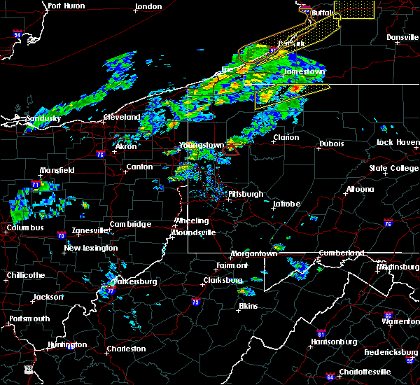 At 625 pm edt, a severe thunderstorm capable of producing a tornado was located 8 miles northeast of slippery rock, or 9 miles east of grove city, moving east at 30 mph (radar indicated rotation). Hazards include tornado. Flying debris will be dangerous to those caught without shelter. mobile homes will be damaged or destroyed. damage to roofs, windows, and vehicles will occur. tree damage is likely. this tornadic thunderstorm will remain over mainly rural areas of northwestern armstrong, south central venango, northeastern butler and west central clarion counties, including the following locations: emlenton, callensburg, st. petersburg, cherry valley, eau claire, foxburg, clintonville and parker. this includes interstate 80 in pennsylvania between mile markers 35 and 50. Please report severe weather by calling 4 1 2, 2 6 2, 1 9 8 8, posting to the nws pittsburgh facebook page, or using twitter @nwspittsburgh. At 625 pm edt, a severe thunderstorm capable of producing a tornado was located 8 miles northeast of slippery rock, or 9 miles east of grove city, moving east at 30 mph (radar indicated rotation). Hazards include tornado. Flying debris will be dangerous to those caught without shelter. mobile homes will be damaged or destroyed. damage to roofs, windows, and vehicles will occur. tree damage is likely. this tornadic thunderstorm will remain over mainly rural areas of northwestern armstrong, south central venango, northeastern butler and west central clarion counties, including the following locations: emlenton, callensburg, st. petersburg, cherry valley, eau claire, foxburg, clintonville and parker. this includes interstate 80 in pennsylvania between mile markers 35 and 50. Please report severe weather by calling 4 1 2, 2 6 2, 1 9 8 8, posting to the nws pittsburgh facebook page, or using twitter @nwspittsburgh.
|
| 9/8/2016 6:07 PM EDT |
 At 607 pm edt, severe thunderstorms were located along a line extending from 8 miles south of oil city to 11 miles southwest of knox to 6 miles northwest of shanor-northvue, moving east at 50 mph (radar indicated). Hazards include 60 mph wind gusts. Expect damage to trees and power lines. resulting in some power outages. locations impacted include, new castle, franklin, clarion, kittanning, knox, rimersburg, shanor-northvue, slippery rock, oakwood, prospect, chicora, seneca, east brady, harrisville, parker, polk, plain grove township, sligo, south new castle and emlenton. this includes the following highways, interstate 79 in pennsylvania between mile markers 97 and 109. interstate 80 in pennsylvania between mile markers 28 and 72. Please report severe weather by calling 4 1 2, 2 6 2, 1 9 8 8, posting to the nws pittsburgh facebook page, or using twitter @nwspittsburgh. At 607 pm edt, severe thunderstorms were located along a line extending from 8 miles south of oil city to 11 miles southwest of knox to 6 miles northwest of shanor-northvue, moving east at 50 mph (radar indicated). Hazards include 60 mph wind gusts. Expect damage to trees and power lines. resulting in some power outages. locations impacted include, new castle, franklin, clarion, kittanning, knox, rimersburg, shanor-northvue, slippery rock, oakwood, prospect, chicora, seneca, east brady, harrisville, parker, polk, plain grove township, sligo, south new castle and emlenton. this includes the following highways, interstate 79 in pennsylvania between mile markers 97 and 109. interstate 80 in pennsylvania between mile markers 28 and 72. Please report severe weather by calling 4 1 2, 2 6 2, 1 9 8 8, posting to the nws pittsburgh facebook page, or using twitter @nwspittsburgh.
|
| 9/8/2016 5:48 PM EDT |
 At 548 pm edt, severe thunderstorms were located along a line extending from 7 miles southwest of franklin to near grove city to near new castle, moving east at 50 mph (radar indicated). Hazards include 60 mph wind gusts. Expect damage to trees and power lines. Resulting in some power outages. At 548 pm edt, severe thunderstorms were located along a line extending from 7 miles southwest of franklin to near grove city to near new castle, moving east at 50 mph (radar indicated). Hazards include 60 mph wind gusts. Expect damage to trees and power lines. Resulting in some power outages.
|
| 7/24/2016 4:22 PM EDT |
 At 422 pm edt, severe thunderstorms were located along a line extending from near rimersburg to 7 miles west of new bethlehem to near kittanning to west kittanning, moving east at 40 mph (radar indicated). Hazards include 60 mph wind gusts. Expect damage to trees and power lines. Resulting in some power outages. At 422 pm edt, severe thunderstorms were located along a line extending from near rimersburg to 7 miles west of new bethlehem to near kittanning to west kittanning, moving east at 40 mph (radar indicated). Hazards include 60 mph wind gusts. Expect damage to trees and power lines. Resulting in some power outages.
|
| 7/24/2016 4:18 PM EDT |
 At 418 pm edt, severe thunderstorms were located along a line extending from 9 miles southwest of knox to 7 miles southwest of rimersburg, moving east at 45 mph (radar indicated). Hazards include 60 mph wind gusts. Expect damage to trees and power lines. resulting in some power outages. locations impacted include, rimersburg, east brady, parker, sligo, callensburg and foxburg. Please report severe weather by calling 4 1 2, 2 6 2, 1 9 8 8, posting to the nws pittsburgh facebook page, or using twitter @nwspittsburgh. At 418 pm edt, severe thunderstorms were located along a line extending from 9 miles southwest of knox to 7 miles southwest of rimersburg, moving east at 45 mph (radar indicated). Hazards include 60 mph wind gusts. Expect damage to trees and power lines. resulting in some power outages. locations impacted include, rimersburg, east brady, parker, sligo, callensburg and foxburg. Please report severe weather by calling 4 1 2, 2 6 2, 1 9 8 8, posting to the nws pittsburgh facebook page, or using twitter @nwspittsburgh.
|
| 7/24/2016 4:08 PM EDT |
 At 408 pm edt, severe thunderstorms were located along a line extending from 13 miles southwest of knox to 11 miles southwest of rimersburg, moving east at 45 mph (radar indicated). Hazards include 60 mph wind gusts. Expect damage to trees and power lines. resulting in some power outages. locations impacted include, rimersburg, chicora, east brady, parker, sligo, bruin, eau claire, petrolia, karns city, callensburg, fairview and foxburg. Please report severe weather by calling 4 1 2, 2 6 2, 1 9 8 8, posting to the nws pittsburgh facebook page, or using twitter @nwspittsburgh. At 408 pm edt, severe thunderstorms were located along a line extending from 13 miles southwest of knox to 11 miles southwest of rimersburg, moving east at 45 mph (radar indicated). Hazards include 60 mph wind gusts. Expect damage to trees and power lines. resulting in some power outages. locations impacted include, rimersburg, chicora, east brady, parker, sligo, bruin, eau claire, petrolia, karns city, callensburg, fairview and foxburg. Please report severe weather by calling 4 1 2, 2 6 2, 1 9 8 8, posting to the nws pittsburgh facebook page, or using twitter @nwspittsburgh.
|
| 7/24/2016 3:58 PM EDT |
 At 358 pm edt, severe thunderstorms were located along a line extending from 11 miles east of slippery rock to 6 miles east of shanor-northvue, moving east at 45 mph (radar indicated). Hazards include 60 mph wind gusts. Expect damage to trees and power lines. Resulting in some power outages. At 358 pm edt, severe thunderstorms were located along a line extending from 11 miles east of slippery rock to 6 miles east of shanor-northvue, moving east at 45 mph (radar indicated). Hazards include 60 mph wind gusts. Expect damage to trees and power lines. Resulting in some power outages.
|
| 9/4/2015 6:21 PM EDT |
 At 621 pm edt, a severe thunderstorm was located near rimersburg, moving northwest at 10 mph (radar indicated). Hazards include 60 mph wind gusts. expect damage to trees and some power outages locations impacted include, rimersburg, sligo and callensburg At 621 pm edt, a severe thunderstorm was located near rimersburg, moving northwest at 10 mph (radar indicated). Hazards include 60 mph wind gusts. expect damage to trees and some power outages locations impacted include, rimersburg, sligo and callensburg
|
| 9/4/2015 6:16 PM EDT |
 At 616 pm edt, a severe thunderstorm was located near rimersburg, moving northwest at 10 mph (radar indicated). Hazards include 60 mph wind gusts and quarter size hail. expect wind damage to trees and some power outages At 616 pm edt, a severe thunderstorm was located near rimersburg, moving northwest at 10 mph (radar indicated). Hazards include 60 mph wind gusts and quarter size hail. expect wind damage to trees and some power outages
|
| 8/3/2015 9:38 PM EDT |
 At 938 pm edt, a severe thunderstorm was located near rimersburg, moving northeast at 30 mph (trained weather spotters). Hazards include 60 mph wind gusts and quarter size hail. Hail damage to vehicles is expected. Expect wind damage to trees and some power outages. At 938 pm edt, a severe thunderstorm was located near rimersburg, moving northeast at 30 mph (trained weather spotters). Hazards include 60 mph wind gusts and quarter size hail. Hail damage to vehicles is expected. Expect wind damage to trees and some power outages.
|
| 8/3/2015 9:31 PM EDT |
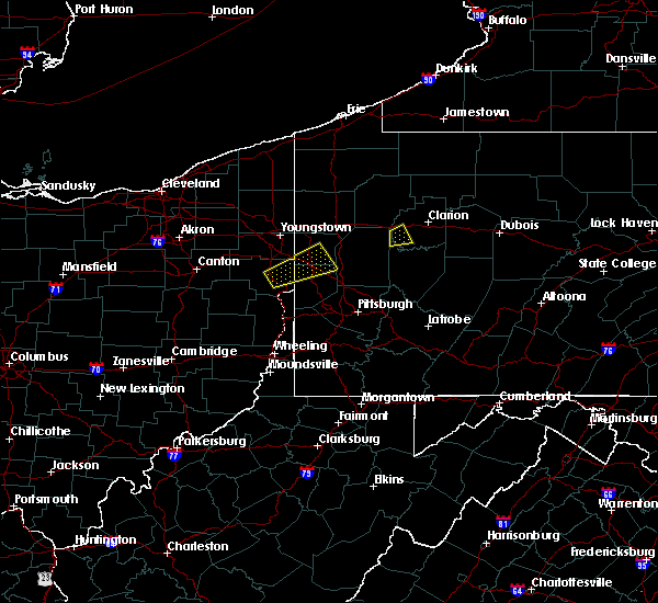 At 930 pm edt, a severe thunderstorm was located near rimersburg, moving northeast at 30 mph (trained weather spotters). Hazards include 60 mph wind gusts and quarter size hail. Hail damage to vehicles is expected. expect wind damage to trees and some power outages. locations impacted include, rimersburg, parker, st. Petersburg, callensburg and foxburg. At 930 pm edt, a severe thunderstorm was located near rimersburg, moving northeast at 30 mph (trained weather spotters). Hazards include 60 mph wind gusts and quarter size hail. Hail damage to vehicles is expected. expect wind damage to trees and some power outages. locations impacted include, rimersburg, parker, st. Petersburg, callensburg and foxburg.
|
| 8/3/2015 9:05 PM EDT |
 At 904 pm edt, a severe thunderstorm was located near shanor-northvue, or 7 miles north of butler, moving northeast at 20 mph (radar indicated). Hazards include 60 mph wind gusts and quarter size hail. Hail damage to vehicles is expected. Expect wind damage to trees and some power outages. At 904 pm edt, a severe thunderstorm was located near shanor-northvue, or 7 miles north of butler, moving northeast at 20 mph (radar indicated). Hazards include 60 mph wind gusts and quarter size hail. Hail damage to vehicles is expected. Expect wind damage to trees and some power outages.
|
| 7/9/2015 3:29 PM EDT |
 At 329 pm edt, a severe thunderstorm was located over rimersburg, moving east at 35 mph (radar indicated). Hazards include 60 mph wind gusts. expect damage to trees and some power outages At 329 pm edt, a severe thunderstorm was located over rimersburg, moving east at 35 mph (radar indicated). Hazards include 60 mph wind gusts. expect damage to trees and some power outages
|
| 7/9/2015 3:18 PM EDT |
 At 317 pm edt, a severe thunderstorm was located near rimersburg, moving east at 35 mph (radar indicated). Hazards include 60 mph wind gusts. Expect damage to trees and some power outages locations impacted include, clarion, knox, rimersburg, parker, sligo, emlenton, bruin, shippenville, st. petersburg, callensburg and foxburg. A tornado watch remains in effect until 900 pm edt for west central pennsylvania. At 317 pm edt, a severe thunderstorm was located near rimersburg, moving east at 35 mph (radar indicated). Hazards include 60 mph wind gusts. Expect damage to trees and some power outages locations impacted include, clarion, knox, rimersburg, parker, sligo, emlenton, bruin, shippenville, st. petersburg, callensburg and foxburg. A tornado watch remains in effect until 900 pm edt for west central pennsylvania.
|
| 7/9/2015 2:43 PM EDT |
 At 242 pm edt, a severe thunderstorm was located 9 miles east of grove city, moving east at 35 mph (radar indicated). Hazards include 60 mph wind gusts. expect damage to trees and some power outages At 242 pm edt, a severe thunderstorm was located 9 miles east of grove city, moving east at 35 mph (radar indicated). Hazards include 60 mph wind gusts. expect damage to trees and some power outages
|
| 6/14/2015 7:57 PM EDT | The severe thunderstorm warning for northwestern armstrong. south central venango and southwestern clarion counties will expire at 800 pm edt. the storms which prompted the warning have weakened below severe limits. and no longer pose an immediate threat to life or property. therefore the warning will be allowed to expire. However gusty winds. |
| 6/14/2015 7:40 PM EDT |
 A severe thunderstorm warning remains in effect until 800 pm edt for northwestern armstrong. south central venango and southwestern clarion counties. at 739 pm edt. severe thunderstorms were located along a line extending from 12 miles southwest of knox to 7 miles west of rimersburg to 7 miles northwest of kittanning. Moving east at 40. A severe thunderstorm warning remains in effect until 800 pm edt for northwestern armstrong. south central venango and southwestern clarion counties. at 739 pm edt. severe thunderstorms were located along a line extending from 12 miles southwest of knox to 7 miles west of rimersburg to 7 miles northwest of kittanning. Moving east at 40.
|
| 6/14/2015 7:11 PM EDT |
 At 711 pm edt, severe thunderstorms were located along a line extending from near grove city to near slippery rock to homeacre-lyndora, moving east at 40 mph (radar indicated). Hazards include 60 mph wind gusts. Expect damage to roofs. Siding and trees. At 711 pm edt, severe thunderstorms were located along a line extending from near grove city to near slippery rock to homeacre-lyndora, moving east at 40 mph (radar indicated). Hazards include 60 mph wind gusts. Expect damage to roofs. Siding and trees.
|
| 6/12/2015 6:05 PM EDT |
 At 605 pm edt, a severe thunderstorm was located near rimersburg, moving east at 40 mph (radar indicated). Hazards include 60 mph wind gusts and penny size hail. Expect damage to roofs. siding and trees. locations impacted include, clarion, knox, rimersburg, new bethlehem, east brady, parker, sligo, strattanville, limestone, shippenville, st. Petersburg, petrolia, karns city, callensburg and fryburg. At 605 pm edt, a severe thunderstorm was located near rimersburg, moving east at 40 mph (radar indicated). Hazards include 60 mph wind gusts and penny size hail. Expect damage to roofs. siding and trees. locations impacted include, clarion, knox, rimersburg, new bethlehem, east brady, parker, sligo, strattanville, limestone, shippenville, st. Petersburg, petrolia, karns city, callensburg and fryburg.
|
| 6/12/2015 5:49 PM EDT |
 At 545 pm edt, a severe thunderstorm was located 11 miles southwest of knox, moving east at 45 mph (radar indicated). Hazards include 60 mph wind gusts and penny size hail. Expect damage to roofs. Siding and trees. At 545 pm edt, a severe thunderstorm was located 11 miles southwest of knox, moving east at 45 mph (radar indicated). Hazards include 60 mph wind gusts and penny size hail. Expect damage to roofs. Siding and trees.
|
| 6/12/2015 5:45 PM EDT |
 At 545 pm edt, a severe thunderstorm was located 11 miles southwest of knox, moving east at 45 mph (radar indicated). Hazards include 60 mph wind gusts and penny size hail. Expect damage to roofs. Siding and trees. At 545 pm edt, a severe thunderstorm was located 11 miles southwest of knox, moving east at 45 mph (radar indicated). Hazards include 60 mph wind gusts and penny size hail. Expect damage to roofs. Siding and trees.
|
| 5/31/2015 1:36 PM EDT | At 135 pm edt, a severe thunderstorm was located 8 miles southwest of knox, moving northeast at 30 mph (radar indicated). Hazards include 60 mph wind gusts and quarter size hail. Hail damage to vehicles is expected. expect wind damage to roofs, siding and trees. locations impacted include, clarion, knox, parker, sligo, strattanville, shippenville, st. Petersburg, callensburg, foxburg and fryburg. |
| 5/31/2015 1:26 PM EDT | At 126 pm edt, a severe thunderstorm was located 11 miles west of rimersburg, moving northeast at 35 mph (radar indicated). Hazards include 60 mph wind gusts and quarter size hail. Hail damage to vehicles is expected. Expect wind damage to roofs, siding and trees. |
| 5/29/2015 5:17 PM EDT | At 517 pm edt, a severe thunderstorm was located near rimersburg, moving northeast at 20 mph (radar indicated). Hazards include 60 mph wind gusts and quarter size hail. Hail damage to vehicles is expected. expect wind damage to roofs, siding and trees. locations impacted include, knox, rimersburg, east brady, parker, sligo, limestone, shippenville, st. Petersburg, callensburg and foxburg. |
| 5/29/2015 5:07 PM EDT | At 507 pm edt, a severe thunderstorm was located 9 miles west of rimersburg, moving northeast at 20 mph (radar indicated). Hazards include 60 mph wind gusts and quarter size hail. Hail damage to vehicles is expected. Expect wind damage to roofs, siding and trees. |
| 5/10/2013 5:15 PM EDT | One tree down in clarion county PA, 0.3 miles S of Callensburg, PA |
| 6/3/2012 3:47 PM EDT | Quarter sized hail reported 0.3 miles S of Callensburg, PA, reported to media facebook page. photo shows hail covering ground. |
| 1/1/0001 12:00 AM | Quarter sized hail reported 3.3 miles ENE of Callensburg, PA |
| 1/1/0001 12:00 AM | Large trees blown dow in clarion county PA, 2.5 miles N of Callensburg, PA |
Hail Maps for Callensburg, PA
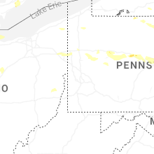
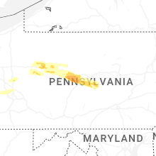
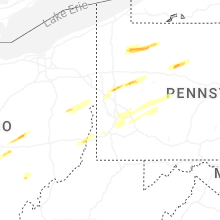
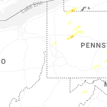


Connect with Interactive Hail Maps