

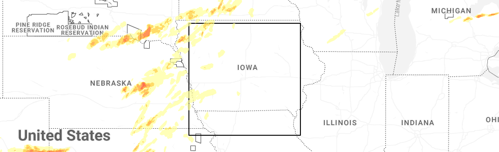
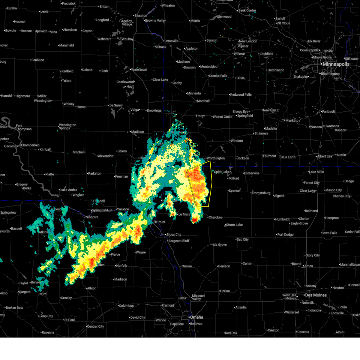
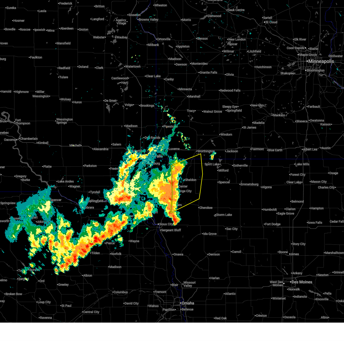
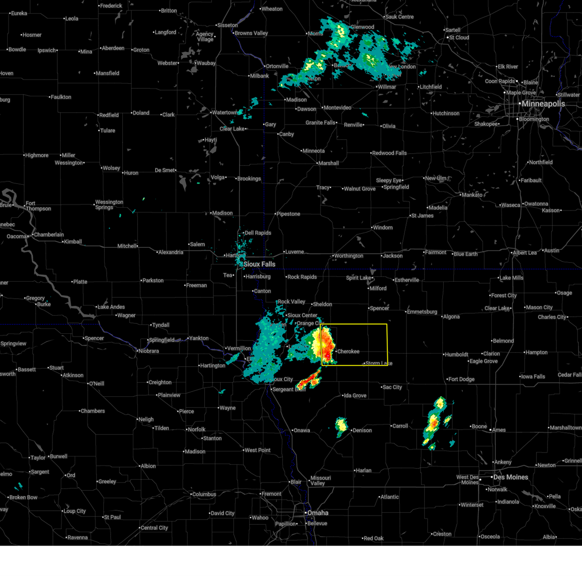
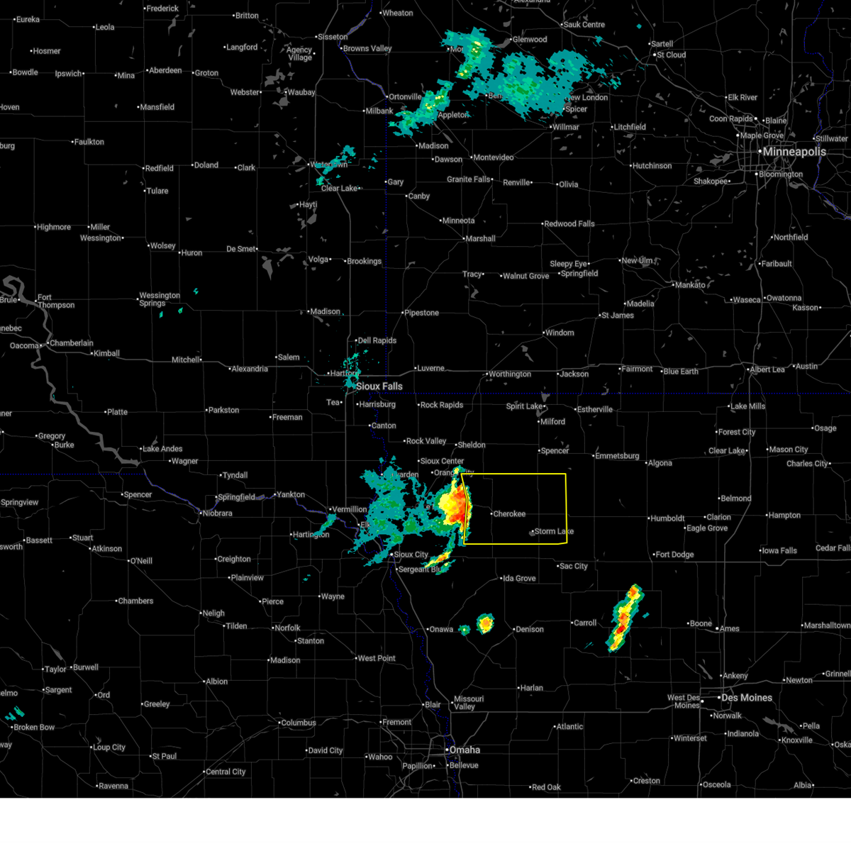
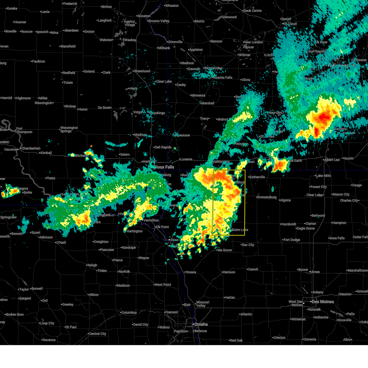
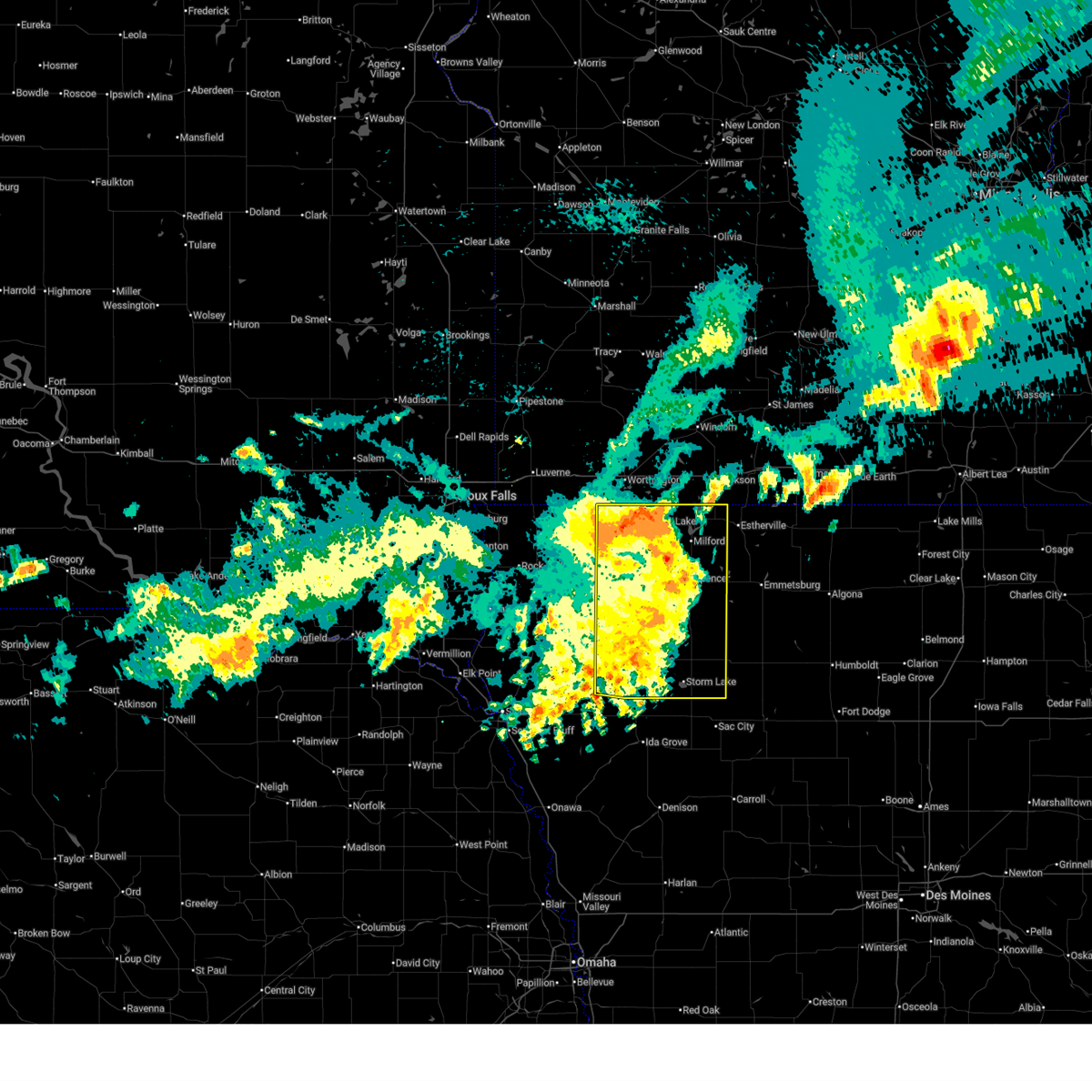
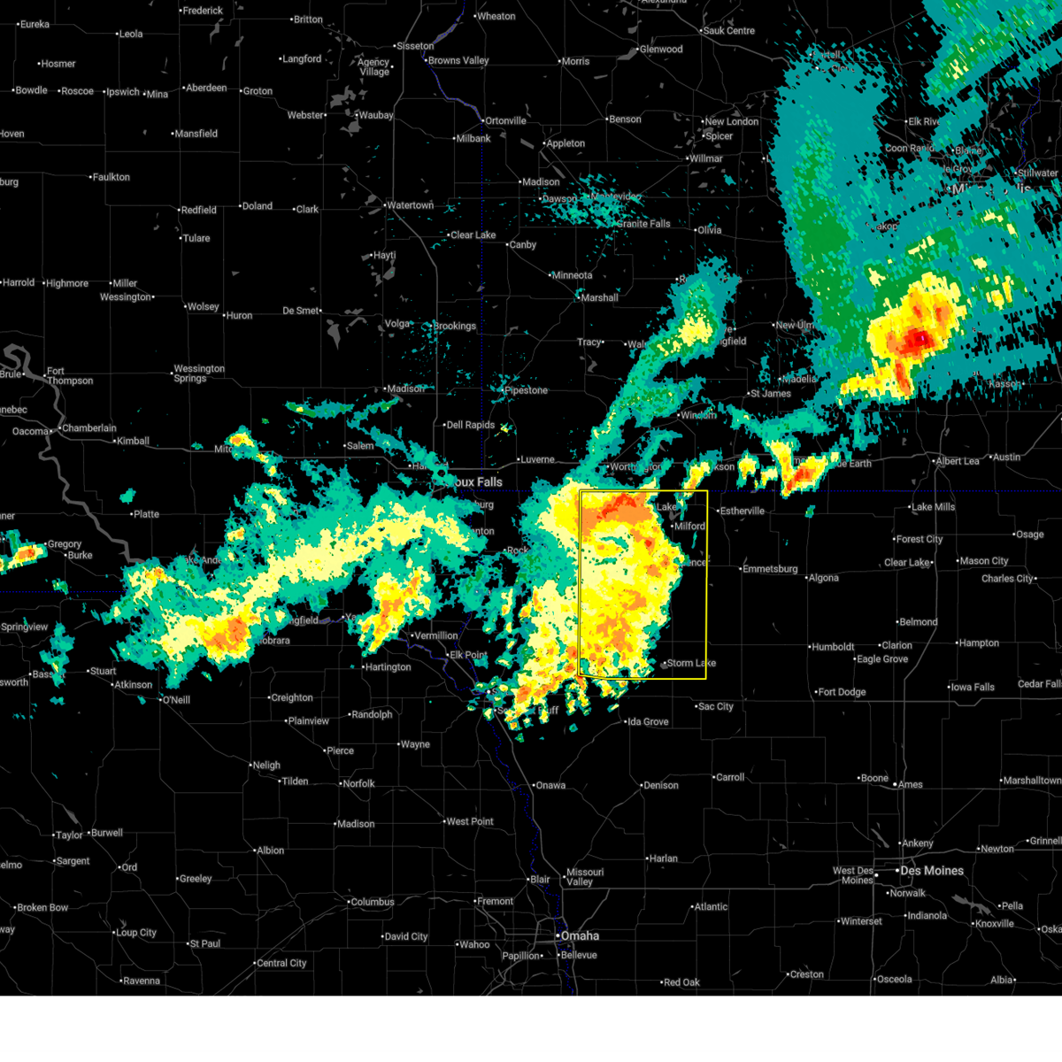
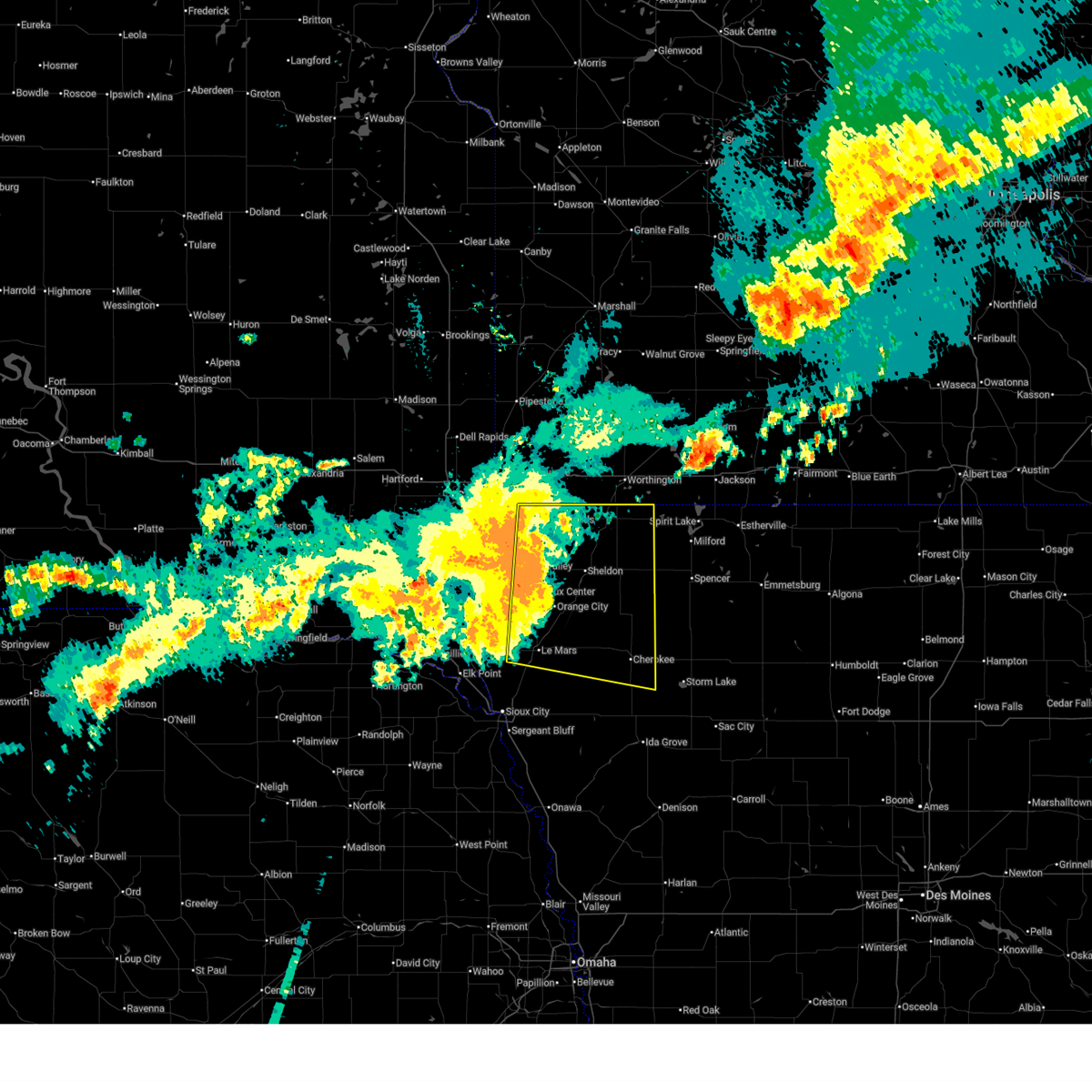
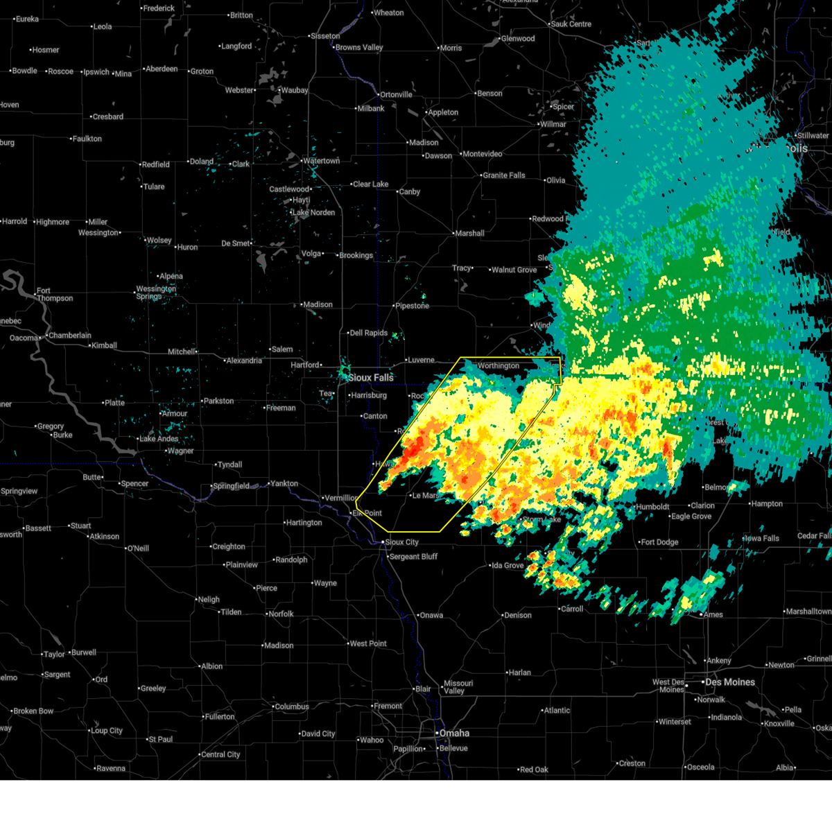
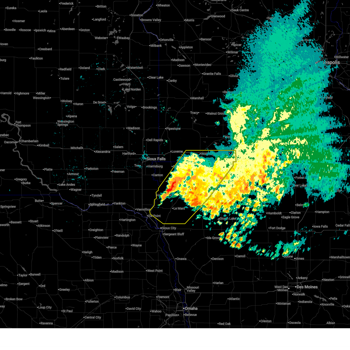
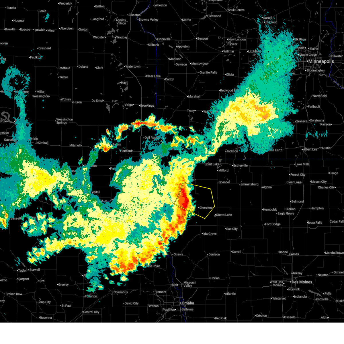
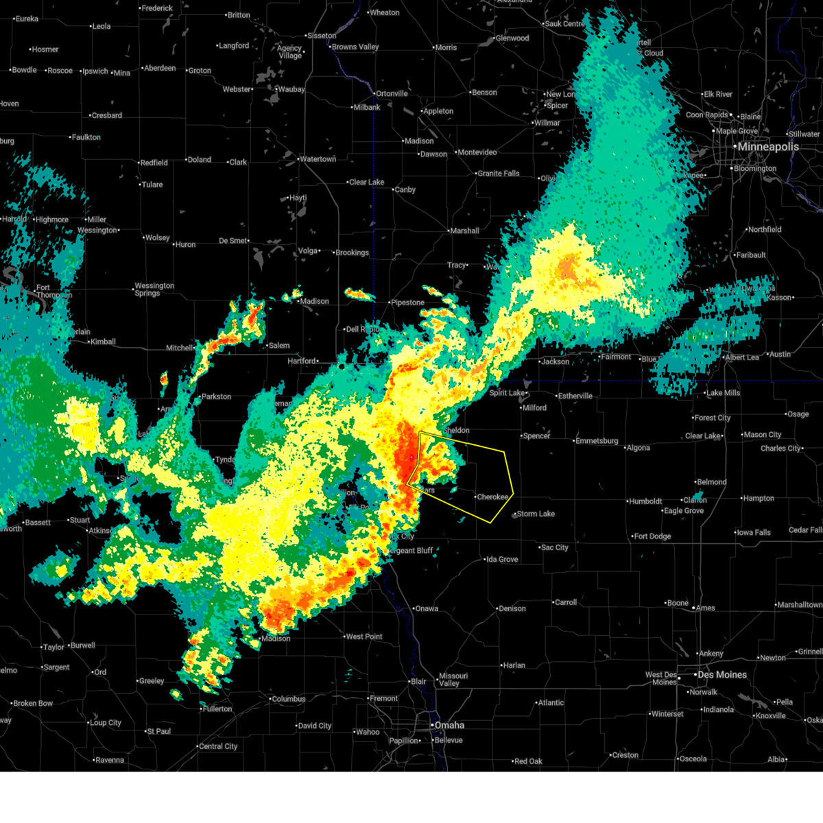
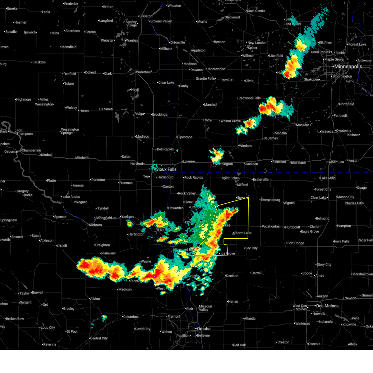
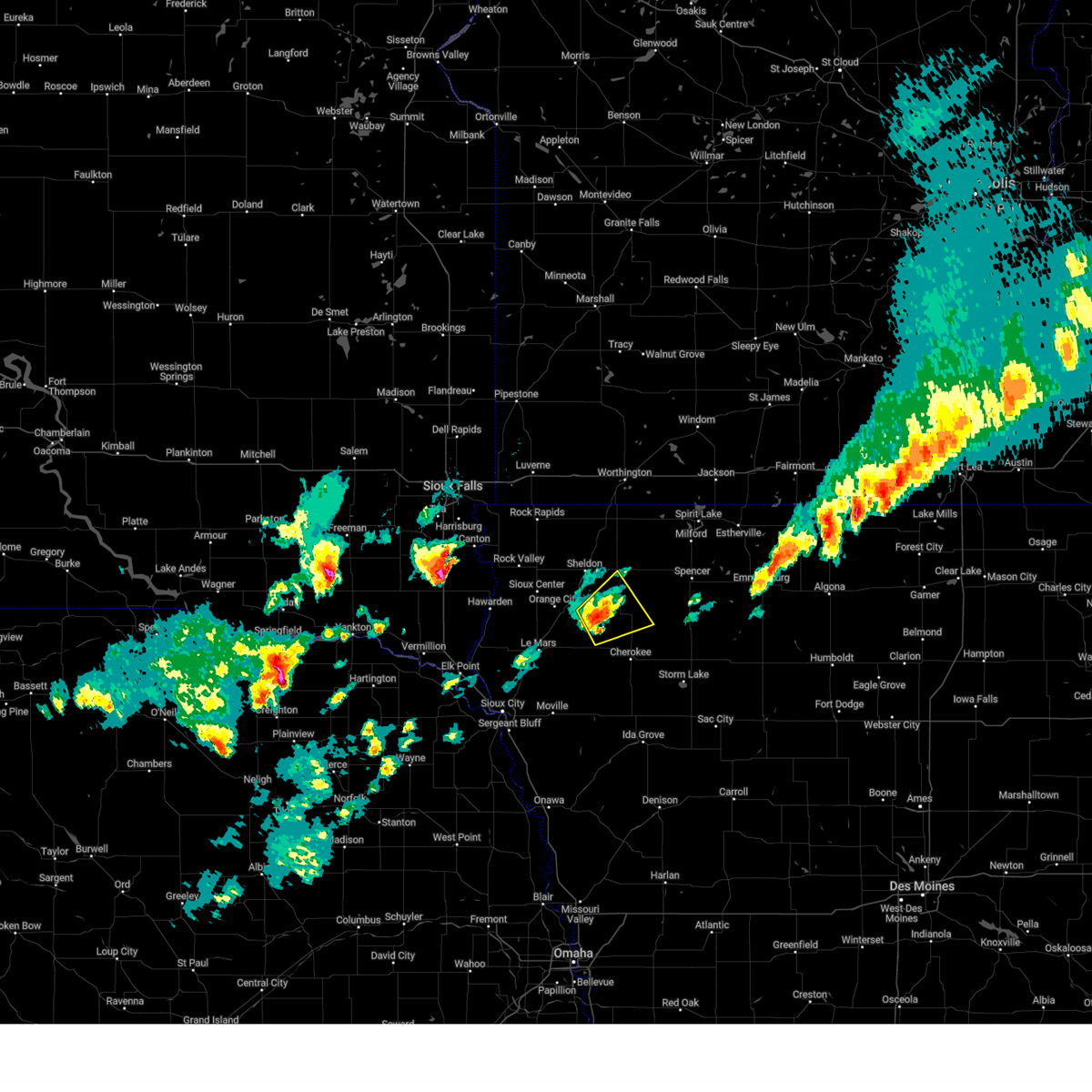
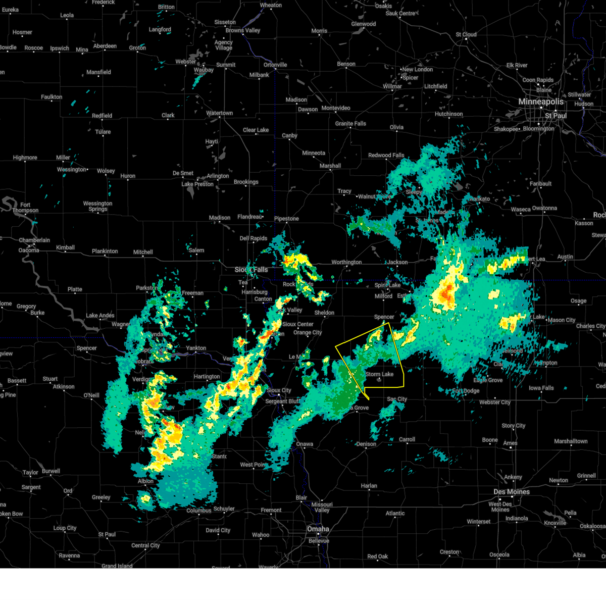
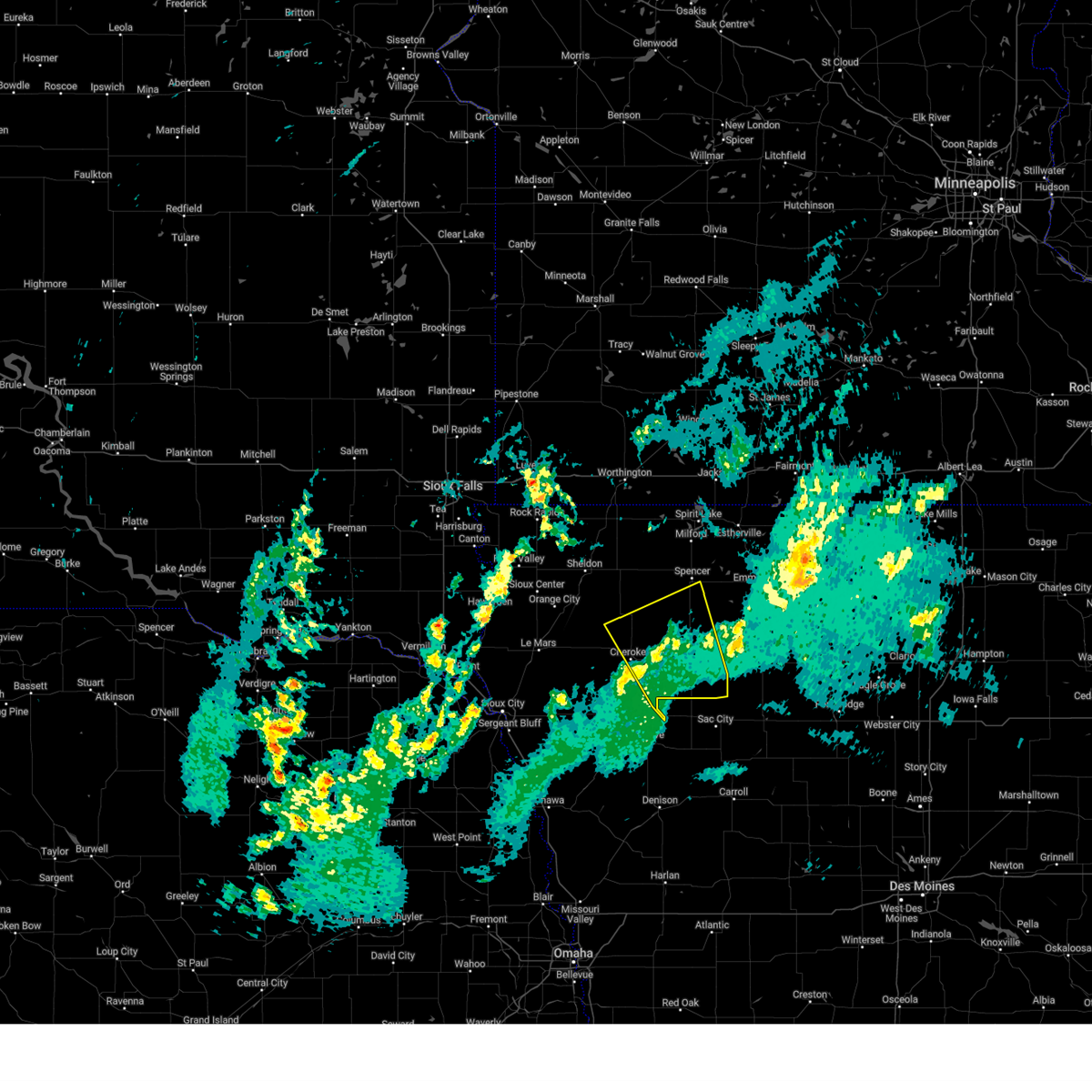
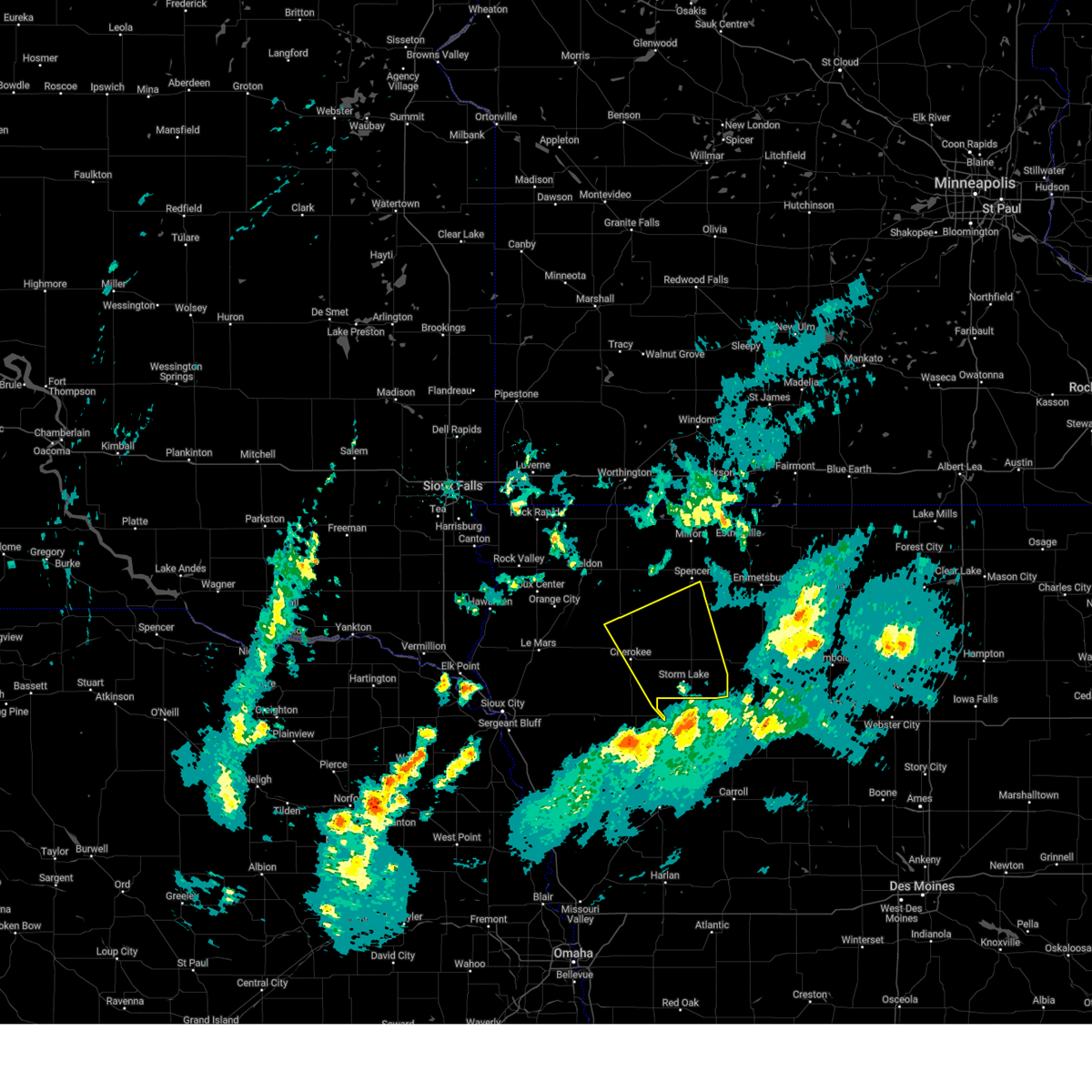
Hail Map for Calumet, IA
The Calumet, IA area has had 0 reports of on-the-ground hail by trained spotters, and has been under severe weather warnings 36 times during the past 12 months. Doppler radar has detected hail at or near Calumet, IA on 55 occasions, including 6 occasions during the past year.
| Name: | Calumet, IA |
| Where Located: | 27.2 miles NW of Storm Lake, IA |
| Map: | Google Map for Calumet, IA |
| Population: | 170 |
| Housing Units: | 86 |
| More Info: | Search Google for Calumet, IA |
3
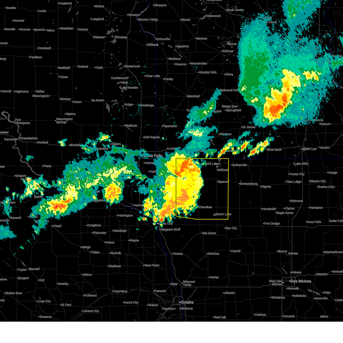
The Top Recent Hail Date for Calumet, IA is Sunday, May 17, 2026 (10th out of 55)
Hail and Wind Damage Spotted near Calumet, IA
| Date / Time | Report Details |
|---|---|
| 6/30/2026 2:15 AM CDT |
 At 214 am cdt, severe thunderstorms were located along a line extending from sibley to near sanborn to near paullina, moving northeast at 60 mph (public. at 210 am cdt, a 67 mph wind gust was reported by a personal weather station in ashton). Hazards include 70 mph wind gusts. Expect considerable tree damage. damage is likely to mobile homes, roofs, and outbuildings. These severe storms will be near, hartley and ocheyedan around 220 am cdt. At 214 am cdt, severe thunderstorms were located along a line extending from sibley to near sanborn to near paullina, moving northeast at 60 mph (public. at 210 am cdt, a 67 mph wind gust was reported by a personal weather station in ashton). Hazards include 70 mph wind gusts. Expect considerable tree damage. damage is likely to mobile homes, roofs, and outbuildings. These severe storms will be near, hartley and ocheyedan around 220 am cdt.
|
| 6/30/2026 1:54 AM CDT |
 Svrfsd the national weather service in sioux falls has issued a * severe thunderstorm warning for, northwestern cherokee county in northwestern iowa, southeastern lyon county in northwestern iowa, osceola county in northwestern iowa, eastern sioux county in northwestern iowa, northeastern plymouth county in northwestern iowa, o'brien county in northwestern iowa, southeastern nobles county in southwestern minnesota, * until 245 am cdt. * at 153 am cdt, severe thunderstorms were located along a line extending from near matlock to near hospers to near remsen, moving northeast at 40 mph (radar indicated). Hazards include 60 mph wind gusts. Expect damage to roofs, siding, and trees. severe thunderstorms will be near, sheldon, remsen, hospers, ashton, granville, and matlock around 200 am cdt. marcus and archer around 205 am cdt. sibley, sanborn, and paullina around 210 am cdt. Other locations in the path of these severe thunderstorms include primghar, melvin, hartley and ocheyedan. Svrfsd the national weather service in sioux falls has issued a * severe thunderstorm warning for, northwestern cherokee county in northwestern iowa, southeastern lyon county in northwestern iowa, osceola county in northwestern iowa, eastern sioux county in northwestern iowa, northeastern plymouth county in northwestern iowa, o'brien county in northwestern iowa, southeastern nobles county in southwestern minnesota, * until 245 am cdt. * at 153 am cdt, severe thunderstorms were located along a line extending from near matlock to near hospers to near remsen, moving northeast at 40 mph (radar indicated). Hazards include 60 mph wind gusts. Expect damage to roofs, siding, and trees. severe thunderstorms will be near, sheldon, remsen, hospers, ashton, granville, and matlock around 200 am cdt. marcus and archer around 205 am cdt. sibley, sanborn, and paullina around 210 am cdt. Other locations in the path of these severe thunderstorms include primghar, melvin, hartley and ocheyedan.
|
| 6/28/2026 5:37 AM CDT |
 At 535 am cdt, severe thunderstorms were located along a line extending from near fulda to near round lake to hull, moving east at 60 mph (radar indicated). Hazards include two inch hail and 60 mph wind gusts. the largest hail would be in northern sioux county from rock valley to hull to boyden. People and animals outdoors will be injured. expect hail damage to roofs, siding, windows, and vehicles. expect wind damage to roofs, siding, and trees. Locations impacted include, worthington, sibley, boyden, ocheyedan, brewster, ashton, round lake, matlock, sheldon, heron lake, harris and melvin. At 535 am cdt, severe thunderstorms were located along a line extending from near fulda to near round lake to hull, moving east at 60 mph (radar indicated). Hazards include two inch hail and 60 mph wind gusts. the largest hail would be in northern sioux county from rock valley to hull to boyden. People and animals outdoors will be injured. expect hail damage to roofs, siding, windows, and vehicles. expect wind damage to roofs, siding, and trees. Locations impacted include, worthington, sibley, boyden, ocheyedan, brewster, ashton, round lake, matlock, sheldon, heron lake, harris and melvin.
|
| 6/28/2026 5:37 AM CDT |
 the severe thunderstorm warning has been cancelled and is no longer in effect the severe thunderstorm warning has been cancelled and is no longer in effect
|
| 6/28/2026 5:00 AM CDT |
 Svrfsd the national weather service in sioux falls has issued a * severe thunderstorm warning for, lyon county in northwestern iowa, osceola county in northwestern iowa, sioux county in northwestern iowa, o'brien county in northwestern iowa, rock county in southwestern minnesota, western jackson county in southwestern minnesota, nobles county in southwestern minnesota, southern murray county in southwestern minnesota, southeastern pipestone county in southwestern minnesota, southwestern cottonwood county in southwestern minnesota, * until 600 am cdt. * at 459 am cdt, severe thunderstorms were located along a line extending from near edgerton to near rock rapids to alcester, moving east at 50 mph (radar indicated). Hazards include 70 mph wind gusts and nickel size hail. Expect considerable tree damage. damage is likely to mobile homes, roofs, and outbuildings. severe thunderstorms will be near, rock rapids, hawarden, rock valley, adrian, doon, ellsworth, leota, chandler, lismore, and alvord around 505 am cdt. george and wilmont around 510 am cdt. hull, little rock, and rushmore around 515 am cdt. Other locations in the path of these severe thunderstorms include sioux center, slayton, worthington, fulda, sibley, boyden, matlock, brewster, ashton, sheldon and round lake. Svrfsd the national weather service in sioux falls has issued a * severe thunderstorm warning for, lyon county in northwestern iowa, osceola county in northwestern iowa, sioux county in northwestern iowa, o'brien county in northwestern iowa, rock county in southwestern minnesota, western jackson county in southwestern minnesota, nobles county in southwestern minnesota, southern murray county in southwestern minnesota, southeastern pipestone county in southwestern minnesota, southwestern cottonwood county in southwestern minnesota, * until 600 am cdt. * at 459 am cdt, severe thunderstorms were located along a line extending from near edgerton to near rock rapids to alcester, moving east at 50 mph (radar indicated). Hazards include 70 mph wind gusts and nickel size hail. Expect considerable tree damage. damage is likely to mobile homes, roofs, and outbuildings. severe thunderstorms will be near, rock rapids, hawarden, rock valley, adrian, doon, ellsworth, leota, chandler, lismore, and alvord around 505 am cdt. george and wilmont around 510 am cdt. hull, little rock, and rushmore around 515 am cdt. Other locations in the path of these severe thunderstorms include sioux center, slayton, worthington, fulda, sibley, boyden, matlock, brewster, ashton, sheldon and round lake.
|
| 6/17/2026 6:17 PM CDT |
 At 616 pm cdt, severe thunderstorms were located along a line extending from spirit lake to peterson to 8 miles northeast of kingsley, moving east at 60 mph (radar indicated). Hazards include 60 mph wind gusts. Expect damage to roofs, siding, and trees. Locations impacted include, spencer in clay county, cherokee, spirit lake, milford, arnolds park, sioux rapids, terril, peterson, fostoria, linn grove, aurelia, quimby, washta, webb, lost island lake, alta, marathon, truesdale, storm lake, albert city, lakeside and newell. At 616 pm cdt, severe thunderstorms were located along a line extending from spirit lake to peterson to 8 miles northeast of kingsley, moving east at 60 mph (radar indicated). Hazards include 60 mph wind gusts. Expect damage to roofs, siding, and trees. Locations impacted include, spencer in clay county, cherokee, spirit lake, milford, arnolds park, sioux rapids, terril, peterson, fostoria, linn grove, aurelia, quimby, washta, webb, lost island lake, alta, marathon, truesdale, storm lake, albert city, lakeside and newell.
|
| 6/17/2026 5:54 PM CDT |
 Svrfsd the national weather service in sioux falls has issued a * severe thunderstorm warning for, cherokee county in northwestern iowa, osceola county in northwestern iowa, dickinson county in northwestern iowa, eastern sioux county in northwestern iowa, eastern plymouth county in northwestern iowa, buena vista county in northwestern iowa, clay county in northwestern iowa, o'brien county in northwestern iowa, * until 645 pm cdt. * at 554 pm cdt, severe thunderstorms were located along a line extending from near round lake to near paullina to near merrill, moving southeast at 65 mph (radar indicated). Hazards include 60 mph wind gusts. Expect damage to roofs, siding, and trees. severe thunderstorms will be near, le mars, hartley, remsen, marcus, lake park, paullina, primghar, merrill, sutherland, and ocheyedan around 600 pm cdt. everly, cleghorn, and larrabee around 605 pm cdt. spencer in clay county, cherokee, spirit lake, milford, kingsley, arnolds park, okoboji, royal, wahpeton, and peterson around 610 pm cdt. Other locations in the path of these severe thunderstorms include aurelia, sioux rapids, quimby, washta, linn grove, greenville, terril, webb, alta, marathon, truesdale, storm lake, albert city, lakeside and newell. Svrfsd the national weather service in sioux falls has issued a * severe thunderstorm warning for, cherokee county in northwestern iowa, osceola county in northwestern iowa, dickinson county in northwestern iowa, eastern sioux county in northwestern iowa, eastern plymouth county in northwestern iowa, buena vista county in northwestern iowa, clay county in northwestern iowa, o'brien county in northwestern iowa, * until 645 pm cdt. * at 554 pm cdt, severe thunderstorms were located along a line extending from near round lake to near paullina to near merrill, moving southeast at 65 mph (radar indicated). Hazards include 60 mph wind gusts. Expect damage to roofs, siding, and trees. severe thunderstorms will be near, le mars, hartley, remsen, marcus, lake park, paullina, primghar, merrill, sutherland, and ocheyedan around 600 pm cdt. everly, cleghorn, and larrabee around 605 pm cdt. spencer in clay county, cherokee, spirit lake, milford, kingsley, arnolds park, okoboji, royal, wahpeton, and peterson around 610 pm cdt. Other locations in the path of these severe thunderstorms include aurelia, sioux rapids, quimby, washta, linn grove, greenville, terril, webb, alta, marathon, truesdale, storm lake, albert city, lakeside and newell.
|
| 5/18/2026 5:48 PM CDT |
 Svrfsd the national weather service in sioux falls has issued a * severe thunderstorm warning for, northeastern cherokee county in northwestern iowa, northwestern buena vista county in northwestern iowa, southern clay county in northwestern iowa, southeastern o'brien county in northwestern iowa, * until 630 pm cdt. * at 548 pm cdt, a severe thunderstorm was located near quimby, or near cherokee, moving northeast at 45 mph (radar indicated). Hazards include golf ball size hail and 60 mph wind gusts. People and animals outdoors will be injured. expect hail damage to roofs, siding, windows, and vehicles. expect wind damage to roofs, siding, and trees. this severe thunderstorm will be near, cherokee, aurelia, and larrabee around 555 pm cdt. peterson around 605 pm cdt. Other locations in the path of this severe thunderstorm include sutherland, linn grove and royal. Svrfsd the national weather service in sioux falls has issued a * severe thunderstorm warning for, northeastern cherokee county in northwestern iowa, northwestern buena vista county in northwestern iowa, southern clay county in northwestern iowa, southeastern o'brien county in northwestern iowa, * until 630 pm cdt. * at 548 pm cdt, a severe thunderstorm was located near quimby, or near cherokee, moving northeast at 45 mph (radar indicated). Hazards include golf ball size hail and 60 mph wind gusts. People and animals outdoors will be injured. expect hail damage to roofs, siding, windows, and vehicles. expect wind damage to roofs, siding, and trees. this severe thunderstorm will be near, cherokee, aurelia, and larrabee around 555 pm cdt. peterson around 605 pm cdt. Other locations in the path of this severe thunderstorm include sutherland, linn grove and royal.
|
| 5/17/2026 8:43 PM CDT |
 the severe thunderstorm warning has been cancelled and is no longer in effect the severe thunderstorm warning has been cancelled and is no longer in effect
|
| 5/17/2026 8:43 PM CDT |
 At 840 pm cdt, severe thunderstorms were located along a line extending from near hartley to near sioux rapids to near truesdale, moving northeast at 65 mph (mesonet. at 829 pm cdt, a 62 mph wind gust was reported north of cleghorn). Hazards include 70 mph wind gusts and quarter size hail. Hail damage to vehicles is expected. expect considerable tree damage. wind damage is also likely to mobile homes, roofs, and outbuildings. Locations impacted include, spencer in clay county, albert city, everly, royal, marathon, webb, greenville, fostoria, milford, arnolds park, west okoboji, lost island lake, okoboji and terril. At 840 pm cdt, severe thunderstorms were located along a line extending from near hartley to near sioux rapids to near truesdale, moving northeast at 65 mph (mesonet. at 829 pm cdt, a 62 mph wind gust was reported north of cleghorn). Hazards include 70 mph wind gusts and quarter size hail. Hail damage to vehicles is expected. expect considerable tree damage. wind damage is also likely to mobile homes, roofs, and outbuildings. Locations impacted include, spencer in clay county, albert city, everly, royal, marathon, webb, greenville, fostoria, milford, arnolds park, west okoboji, lost island lake, okoboji and terril.
|
| 5/17/2026 8:26 PM CDT |
 Torfsd the national weather service in sioux falls has issued a * tornado warning for, northeastern cherokee county in northwestern iowa, northwestern buena vista county in northwestern iowa, southwestern clay county in northwestern iowa, southeastern o'brien county in northwestern iowa, * until 915 pm cdt. * at 826 pm cdt, severe thunderstorms capable of producing both tornadoes and extensive straight line wind damage were located near cleghorn, or 7 miles northwest of cherokee, moving northeast at 40 mph (radar indicated rotation). Hazards include tornado and quarter size hail. Flying debris will be dangerous to those caught without shelter. mobile homes will be damaged or destroyed. damage to roofs, windows, and vehicles will occur. tree damage is likely. these dangerous storms will be near, sutherland and larrabee around 830 pm cdt. peterson around 840 pm cdt. linn grove around 845 pm cdt. Other locations in the path of this tornadic thunderstorm include sioux rapids. Torfsd the national weather service in sioux falls has issued a * tornado warning for, northeastern cherokee county in northwestern iowa, northwestern buena vista county in northwestern iowa, southwestern clay county in northwestern iowa, southeastern o'brien county in northwestern iowa, * until 915 pm cdt. * at 826 pm cdt, severe thunderstorms capable of producing both tornadoes and extensive straight line wind damage were located near cleghorn, or 7 miles northwest of cherokee, moving northeast at 40 mph (radar indicated rotation). Hazards include tornado and quarter size hail. Flying debris will be dangerous to those caught without shelter. mobile homes will be damaged or destroyed. damage to roofs, windows, and vehicles will occur. tree damage is likely. these dangerous storms will be near, sutherland and larrabee around 830 pm cdt. peterson around 840 pm cdt. linn grove around 845 pm cdt. Other locations in the path of this tornadic thunderstorm include sioux rapids.
|
| 5/17/2026 8:21 PM CDT |
 Svrfsd the national weather service in sioux falls has issued a * severe thunderstorm warning for, cherokee county in northwestern iowa, northeastern woodbury county in west central iowa, southeastern osceola county in northwestern iowa, dickinson county in northwestern iowa, southeastern plymouth county in northwestern iowa, buena vista county in northwestern iowa, clay county in northwestern iowa, o'brien county in northwestern iowa, ida county in west central iowa, * until 915 pm cdt. * at 819 pm cdt, severe thunderstorms were located along a line extending from near paullina to near aurelia to near galva, moving northeast at 65 mph. these are destructive storms for quimby, cherokee, washta, and aurelia (mesonet. at 754 pm cdt, a 74 mph gust was reported via personal weather station west of correctionville, ia). Hazards include 80 mph wind gusts and quarter size hail. Flying debris will be dangerous to those caught without shelter. mobile homes will be heavily damaged. expect considerable damage to roofs, windows, and vehicles. extensive tree damage and power outages are likely. severe thunderstorms will be near, storm lake, alta, paullina, primghar, sutherland, and peterson around 825 pm cdt. lakeside, linn grove, and truesdale around 830 pm cdt. hartley, sioux rapids, and royal around 835 pm cdt. Other locations in the path of these severe thunderstorms include spencer in clay county, albert city, everly, marathon, webb, greenville, fostoria, milford, lost island lake, arnolds park, terril and west okoboji. Svrfsd the national weather service in sioux falls has issued a * severe thunderstorm warning for, cherokee county in northwestern iowa, northeastern woodbury county in west central iowa, southeastern osceola county in northwestern iowa, dickinson county in northwestern iowa, southeastern plymouth county in northwestern iowa, buena vista county in northwestern iowa, clay county in northwestern iowa, o'brien county in northwestern iowa, ida county in west central iowa, * until 915 pm cdt. * at 819 pm cdt, severe thunderstorms were located along a line extending from near paullina to near aurelia to near galva, moving northeast at 65 mph. these are destructive storms for quimby, cherokee, washta, and aurelia (mesonet. at 754 pm cdt, a 74 mph gust was reported via personal weather station west of correctionville, ia). Hazards include 80 mph wind gusts and quarter size hail. Flying debris will be dangerous to those caught without shelter. mobile homes will be heavily damaged. expect considerable damage to roofs, windows, and vehicles. extensive tree damage and power outages are likely. severe thunderstorms will be near, storm lake, alta, paullina, primghar, sutherland, and peterson around 825 pm cdt. lakeside, linn grove, and truesdale around 830 pm cdt. hartley, sioux rapids, and royal around 835 pm cdt. Other locations in the path of these severe thunderstorms include spencer in clay county, albert city, everly, marathon, webb, greenville, fostoria, milford, lost island lake, arnolds park, terril and west okoboji.
|
| 5/15/2026 7:04 PM CDT |
 At 704 pm cdt, a severe thunderstorm was located over sutherland, or 15 miles north of cherokee, moving east at 55 mph (radar indicated). Hazards include 60 mph wind gusts and quarter size hail. Hail damage to vehicles is expected. expect wind damage to roofs, siding, and trees. Locations impacted include, peterson. At 704 pm cdt, a severe thunderstorm was located over sutherland, or 15 miles north of cherokee, moving east at 55 mph (radar indicated). Hazards include 60 mph wind gusts and quarter size hail. Hail damage to vehicles is expected. expect wind damage to roofs, siding, and trees. Locations impacted include, peterson.
|
| 5/15/2026 6:47 PM CDT |
 Svrfsd the national weather service in sioux falls has issued a * severe thunderstorm warning for, southwestern clay county in northwestern iowa, southern o'brien county in northwestern iowa, * until 730 pm cdt. * at 647 pm cdt, a severe thunderstorm was located near paullina, or 16 miles east of orange city, moving east at 35 mph (radar indicated). Hazards include 60 mph wind gusts and half dollar size hail. Hail damage to vehicles is expected. expect wind damage to roofs, siding, and trees. this severe thunderstorm will be near, paullina around 650 pm cdt. sutherland around 655 pm cdt. Other locations in the path of this severe thunderstorm include peterson. Svrfsd the national weather service in sioux falls has issued a * severe thunderstorm warning for, southwestern clay county in northwestern iowa, southern o'brien county in northwestern iowa, * until 730 pm cdt. * at 647 pm cdt, a severe thunderstorm was located near paullina, or 16 miles east of orange city, moving east at 35 mph (radar indicated). Hazards include 60 mph wind gusts and half dollar size hail. Hail damage to vehicles is expected. expect wind damage to roofs, siding, and trees. this severe thunderstorm will be near, paullina around 650 pm cdt. sutherland around 655 pm cdt. Other locations in the path of this severe thunderstorm include peterson.
|
| 4/13/2026 6:53 PM CDT |
 Svrfsd the national weather service in sioux falls has issued a * severe thunderstorm warning for, northeastern cherokee county in northwestern iowa, southwestern clay county in northwestern iowa, southeastern o'brien county in northwestern iowa, * until 745 pm cdt. * at 653 pm cdt, a severe thunderstorm was located near larrabee, or 9 miles north of cherokee, moving northeast at 25 mph (radar indicated). Hazards include half dollar size hail. Damage to vehicles is expected. this severe thunderstorm will be near, sutherland and peterson around 700 pm cdt. Other locations in the path of this severe thunderstorm include royal. Svrfsd the national weather service in sioux falls has issued a * severe thunderstorm warning for, northeastern cherokee county in northwestern iowa, southwestern clay county in northwestern iowa, southeastern o'brien county in northwestern iowa, * until 745 pm cdt. * at 653 pm cdt, a severe thunderstorm was located near larrabee, or 9 miles north of cherokee, moving northeast at 25 mph (radar indicated). Hazards include half dollar size hail. Damage to vehicles is expected. this severe thunderstorm will be near, sutherland and peterson around 700 pm cdt. Other locations in the path of this severe thunderstorm include royal.
|
| 9/22/2025 7:59 PM CDT | The storm which prompted the warning has weakened below severe limits, and no longer poses an immediate threat to life or property. therefore, the warning will be allowed to expire. however, heavy rain is still possible with this thunderstorm. to report severe weather, contact your nearest law enforcement agency. they will relay your report to the national weather service sioux falls. |
| 9/22/2025 7:27 PM CDT | At 727 pm cdt, a severe thunderstorm was located near primghar, or 16 miles southeast of sheldon, moving southeast at 15 mph (radar indicated). Hazards include golf ball size hail and 60 mph wind gusts. People and animals outdoors will be injured. expect hail damage to roofs, siding, windows, and vehicles. expect wind damage to roofs, siding, and trees. Locations impacted include, paullina, primghar, sutherland, and calumet. |
| 9/22/2025 7:14 PM CDT | Svrfsd the national weather service in sioux falls has issued a * severe thunderstorm warning for, southwestern clay county in northwestern iowa, southern o'brien county in northwestern iowa, * until 800 pm cdt. * at 713 pm cdt, a severe thunderstorm was located near primghar, or 16 miles southeast of sheldon, moving southeast at 15 mph (radar indicated). Hazards include 60 mph wind gusts and quarter size hail. Hail damage to vehicles is expected. Expect wind damage to roofs, siding, and trees. |
| 9/22/2025 6:37 PM CDT | At 637 pm cdt, a severe thunderstorm was located near sutherland, or 18 miles southwest of spencer in clay county, moving southeast at 10 mph (radar indicated). Hazards include golf ball size hail and 60 mph wind gusts. People and animals outdoors will be injured. expect hail damage to roofs, siding, windows, and vehicles. expect wind damage to roofs, siding, and trees. Locations impacted include, sutherland, peterson, calumet, and rossie. |
| 9/22/2025 6:31 PM CDT | Svrfsd the national weather service in sioux falls has issued a * severe thunderstorm warning for, northeastern cherokee county in northwestern iowa, southwestern clay county in northwestern iowa, southeastern o'brien county in northwestern iowa, * until 715 pm cdt. * at 630 pm cdt, a severe thunderstorm was located near sutherland, or 18 miles southwest of spencer in clay county, moving southeast at 10 mph (radar indicated). Hazards include 60 mph wind gusts and quarter size hail. Hail damage to vehicles is expected. expect wind damage to roofs, siding, and trees. This severe thunderstorm will be near, sutherland around 635 pm cdt. |
| 8/15/2025 12:28 PM CDT |
 The storms which prompted the warning have weakened below severe limits, and no longer pose an immediate threat to life or property. therefore, the warning will be allowed to expire. however, heavy rain is still possible with these thunderstorms. to report severe weather, contact your nearest law enforcement agency. they will relay your report to the national weather service sioux falls. remember, a severe thunderstorm warning still remains in effect for portions of cherokee, buena vista, and ida counties through 1245 pm. The storms which prompted the warning have weakened below severe limits, and no longer pose an immediate threat to life or property. therefore, the warning will be allowed to expire. however, heavy rain is still possible with these thunderstorms. to report severe weather, contact your nearest law enforcement agency. they will relay your report to the national weather service sioux falls. remember, a severe thunderstorm warning still remains in effect for portions of cherokee, buena vista, and ida counties through 1245 pm.
|
| 8/15/2025 12:04 PM CDT |
 At 1204 pm cdt, severe thunderstorms were located along a line extending from near royal to near linn grove to near truesdale to near alta, moving east at 45 mph (radar indicated). Hazards include 60 mph wind gusts and quarter size hail. Hail damage to vehicles is expected. expect wind damage to roofs, siding, and trees. Locations impacted include, sioux rapids, webb, truesdale, albert city and marathon. At 1204 pm cdt, severe thunderstorms were located along a line extending from near royal to near linn grove to near truesdale to near alta, moving east at 45 mph (radar indicated). Hazards include 60 mph wind gusts and quarter size hail. Hail damage to vehicles is expected. expect wind damage to roofs, siding, and trees. Locations impacted include, sioux rapids, webb, truesdale, albert city and marathon.
|
| 8/15/2025 11:39 AM CDT |
 At 1139 am cdt, severe thunderstorms were located along a line extending from near paullina to larrabee to cherokee to near quimby, moving east at 45 mph (radar indicated). Hazards include 60 mph wind gusts and half dollar size hail. Hail damage to vehicles is expected. expect wind damage to roofs, siding, and trees. these severe storms will be near, cherokee, aurelia, and sutherland around 1145 am cdt. alta and peterson around 1150 am cdt. Other locations in the path of these severe thunderstorms include linn grove, storm lake, sioux rapids, truesdale, marathon, webb and albert city. At 1139 am cdt, severe thunderstorms were located along a line extending from near paullina to larrabee to cherokee to near quimby, moving east at 45 mph (radar indicated). Hazards include 60 mph wind gusts and half dollar size hail. Hail damage to vehicles is expected. expect wind damage to roofs, siding, and trees. these severe storms will be near, cherokee, aurelia, and sutherland around 1145 am cdt. alta and peterson around 1150 am cdt. Other locations in the path of these severe thunderstorms include linn grove, storm lake, sioux rapids, truesdale, marathon, webb and albert city.
|
| 8/15/2025 11:31 AM CDT |
 Svrfsd the national weather service in sioux falls has issued a * severe thunderstorm warning for, cherokee county in northwestern iowa, buena vista county in northwestern iowa, southern clay county in northwestern iowa, southern o'brien county in northwestern iowa, * until 1230 pm cdt. * at 1131 am cdt, severe thunderstorms were located along a line extending from near paullina to near cleghorn to near cherokee to quimby, moving east at 45 mph (radar indicated). Hazards include 60 mph wind gusts and half dollar size hail. Hail damage to vehicles is expected. expect wind damage to roofs, siding, and trees. severe thunderstorms will be near, cherokee, quimby, and larrabee around 1135 am cdt. aurelia and sutherland around 1140 am cdt. alta and peterson around 1150 am cdt. Other locations in the path of these severe thunderstorms include storm lake, linn grove, truesdale, sioux rapids, lakeside, newell, albert city, marathon and webb. Svrfsd the national weather service in sioux falls has issued a * severe thunderstorm warning for, cherokee county in northwestern iowa, buena vista county in northwestern iowa, southern clay county in northwestern iowa, southern o'brien county in northwestern iowa, * until 1230 pm cdt. * at 1131 am cdt, severe thunderstorms were located along a line extending from near paullina to near cleghorn to near cherokee to quimby, moving east at 45 mph (radar indicated). Hazards include 60 mph wind gusts and half dollar size hail. Hail damage to vehicles is expected. expect wind damage to roofs, siding, and trees. severe thunderstorms will be near, cherokee, quimby, and larrabee around 1135 am cdt. aurelia and sutherland around 1140 am cdt. alta and peterson around 1150 am cdt. Other locations in the path of these severe thunderstorms include storm lake, linn grove, truesdale, sioux rapids, lakeside, newell, albert city, marathon and webb.
|
| 7/28/2025 10:43 PM CDT |
 At 1042 pm cdt, severe thunderstorms were located along a line extending from near spirit lake to near terril to lost island lake to marathon to near truesdale, moving east at 60 mph (public. at 1035 pm, a 66 mph gust was reported in spencer, iowa!). Hazards include 70 mph wind gusts and penny size hail. Expect considerable tree damage. damage is likely to mobile homes, roofs, and outbuildings. Locations impacted include, spencer in clay county, storm lake, cherokee, spirit lake, milford, alta, hartley, arnolds park, lake park, aurelia, newell, okoboji, sioux rapids, albert city, sutherland, orleans, everly, lakeside, ocheyedan, and royal. At 1042 pm cdt, severe thunderstorms were located along a line extending from near spirit lake to near terril to lost island lake to marathon to near truesdale, moving east at 60 mph (public. at 1035 pm, a 66 mph gust was reported in spencer, iowa!). Hazards include 70 mph wind gusts and penny size hail. Expect considerable tree damage. damage is likely to mobile homes, roofs, and outbuildings. Locations impacted include, spencer in clay county, storm lake, cherokee, spirit lake, milford, alta, hartley, arnolds park, lake park, aurelia, newell, okoboji, sioux rapids, albert city, sutherland, orleans, everly, lakeside, ocheyedan, and royal.
|
| 7/28/2025 10:33 PM CDT |
 the severe thunderstorm warning has been cancelled and is no longer in effect the severe thunderstorm warning has been cancelled and is no longer in effect
|
| 7/28/2025 10:33 PM CDT |
 At 1033 pm cdt, severe thunderstorms were located along a line extending from near lake park to near milford to 6 miles east of spencer in clay county to near sioux rapids to near alta, moving east at 50 mph (radar indicated). Hazards include 70 mph wind gusts and penny size hail. Expect considerable tree damage. damage is likely to mobile homes, roofs, and outbuildings. Locations impacted include, storm lake, spirit lake, milford, arnolds park, okoboji, albert city, orleans, lakeside, terril, wahpeton, newell and superior. At 1033 pm cdt, severe thunderstorms were located along a line extending from near lake park to near milford to 6 miles east of spencer in clay county to near sioux rapids to near alta, moving east at 50 mph (radar indicated). Hazards include 70 mph wind gusts and penny size hail. Expect considerable tree damage. damage is likely to mobile homes, roofs, and outbuildings. Locations impacted include, storm lake, spirit lake, milford, arnolds park, okoboji, albert city, orleans, lakeside, terril, wahpeton, newell and superior.
|
| 7/28/2025 10:12 PM CDT |
 At 1010 pm cdt, severe thunderstorms were located along a line extending from near sibley to near ocheyedan to hartley to near larrabee to 6 miles west of cherokee, moving east at 60 mph. these are destructive storms for ocheyedan, to everly, to aurelia, iowa! (radar indicated). Hazards include 80 mph wind gusts and penny size hail. Flying debris will be dangerous to those caught without shelter. mobile homes will be heavily damaged. expect considerable damage to roofs, windows, and vehicles. extensive tree damage and power outages are likely. these severe storms will be near, cherokee, lake park, aurelia, everly, ocheyedan, royal, peterson, and harris around 1015 pm cdt. Other locations in the path of these severe thunderstorms include spencer in clay county, milford, wahpeton, west okoboji, fostoria, linn grove, greenville, spirit lake, alta, arnolds park, okoboji, sioux rapids, storm lake, orleans, terril, marathon, webb, truesdale, albert city and superior. At 1010 pm cdt, severe thunderstorms were located along a line extending from near sibley to near ocheyedan to hartley to near larrabee to 6 miles west of cherokee, moving east at 60 mph. these are destructive storms for ocheyedan, to everly, to aurelia, iowa! (radar indicated). Hazards include 80 mph wind gusts and penny size hail. Flying debris will be dangerous to those caught without shelter. mobile homes will be heavily damaged. expect considerable damage to roofs, windows, and vehicles. extensive tree damage and power outages are likely. these severe storms will be near, cherokee, lake park, aurelia, everly, ocheyedan, royal, peterson, and harris around 1015 pm cdt. Other locations in the path of these severe thunderstorms include spencer in clay county, milford, wahpeton, west okoboji, fostoria, linn grove, greenville, spirit lake, alta, arnolds park, okoboji, sioux rapids, storm lake, orleans, terril, marathon, webb, truesdale, albert city and superior.
|
| 7/28/2025 9:55 PM CDT |
 Svrfsd the national weather service in sioux falls has issued a * severe thunderstorm warning for, cherokee county in northwestern iowa, eastern lyon county in northwestern iowa, osceola county in northwestern iowa, dickinson county in northwestern iowa, eastern sioux county in northwestern iowa, eastern plymouth county in northwestern iowa, buena vista county in northwestern iowa, clay county in northwestern iowa, o'brien county in northwestern iowa, * until 1115 pm cdt. * at 954 pm cdt, severe thunderstorms were located along a line extending from near little rock to ashton to near archer to near marcus to 7 miles north of kingsley, moving east at 60 mph. these are destructive storms for sibley, to paulina, to cherokee, iowa! (radar indicated). Hazards include 80 mph wind gusts and penny size hail. Flying debris will be dangerous to those caught without shelter. mobile homes will be heavily damaged. expect considerable damage to roofs, windows, and vehicles. extensive tree damage and power outages are likely. severe thunderstorms will be near, sibley, sanborn, marcus, paullina, primghar, little rock, cleghorn, melvin, and larrabee around 1000 pm cdt. cherokee, hartley, sutherland, and ocheyedan around 1005 pm cdt. everly, peterson, and harris around 1010 pm cdt. Other locations in the path of these severe thunderstorms include lake park, aurelia, royal, linn grove, spencer in clay county, spirit lake, milford, arnolds park, okoboji, sioux rapids, wahpeton, west okoboji, fostoria, greenville, orleans, terril, webb, superior, truesdale and marathon. Svrfsd the national weather service in sioux falls has issued a * severe thunderstorm warning for, cherokee county in northwestern iowa, eastern lyon county in northwestern iowa, osceola county in northwestern iowa, dickinson county in northwestern iowa, eastern sioux county in northwestern iowa, eastern plymouth county in northwestern iowa, buena vista county in northwestern iowa, clay county in northwestern iowa, o'brien county in northwestern iowa, * until 1115 pm cdt. * at 954 pm cdt, severe thunderstorms were located along a line extending from near little rock to ashton to near archer to near marcus to 7 miles north of kingsley, moving east at 60 mph. these are destructive storms for sibley, to paulina, to cherokee, iowa! (radar indicated). Hazards include 80 mph wind gusts and penny size hail. Flying debris will be dangerous to those caught without shelter. mobile homes will be heavily damaged. expect considerable damage to roofs, windows, and vehicles. extensive tree damage and power outages are likely. severe thunderstorms will be near, sibley, sanborn, marcus, paullina, primghar, little rock, cleghorn, melvin, and larrabee around 1000 pm cdt. cherokee, hartley, sutherland, and ocheyedan around 1005 pm cdt. everly, peterson, and harris around 1010 pm cdt. Other locations in the path of these severe thunderstorms include lake park, aurelia, royal, linn grove, spencer in clay county, spirit lake, milford, arnolds park, okoboji, sioux rapids, wahpeton, west okoboji, fostoria, greenville, orleans, terril, webb, superior, truesdale and marathon.
|
| 7/28/2025 9:49 PM CDT |
 At 947 pm cdt, severe thunderstorms were located along a line extending from near little rock to near hospers to near archer to near marcus to near remsen, moving east at 65 mph. these are destructive storms for ashton, to granville, to marcus, iowa! (public. at 940 pm, a 92 mph gust was reported 1 mile northwest of orange city!). Hazards include 90 mph wind gusts and penny size hail. You are in a life-threatening situation. flying debris may be deadly to those caught without shelter. mobile homes will be heavily damaged or destroyed. homes and businesses will have substantial roof and window damage. expect extensive tree damage and power outages. Locations impacted include, le mars, sioux center, orange city, cherokee, sheldon, sibley, rock rapids, hull, hartley, remsen, sanborn, alton, marcus, george, paullina, aurelia, primghar, merrill, boyden, and hospers. At 947 pm cdt, severe thunderstorms were located along a line extending from near little rock to near hospers to near archer to near marcus to near remsen, moving east at 65 mph. these are destructive storms for ashton, to granville, to marcus, iowa! (public. at 940 pm, a 92 mph gust was reported 1 mile northwest of orange city!). Hazards include 90 mph wind gusts and penny size hail. You are in a life-threatening situation. flying debris may be deadly to those caught without shelter. mobile homes will be heavily damaged or destroyed. homes and businesses will have substantial roof and window damage. expect extensive tree damage and power outages. Locations impacted include, le mars, sioux center, orange city, cherokee, sheldon, sibley, rock rapids, hull, hartley, remsen, sanborn, alton, marcus, george, paullina, aurelia, primghar, merrill, boyden, and hospers.
|
| 7/28/2025 9:40 PM CDT |
 At 938 pm cdt, severe thunderstorms were located along a line extending from near ellsworth to near boyden to near hospers to near alton to near remsen, moving east at 60 mph. these are destructive storms for rock rapids, to hospers, to remsen, iowa! (public. at 930 pm, a 65 mph gust was in hawarden, iowa!). Hazards include 80 mph wind gusts and penny size hail. Flying debris will be dangerous to those caught without shelter. mobile homes will be heavily damaged. expect considerable damage to roofs, windows, and vehicles. extensive tree damage and power outages are likely. Locations impacted include, sheldon, sibley, marcus, paullina, hospers, little rock, ashton, granville, archer, matlock, sanborn, primghar, cleghorn, cherokee, sutherland, ocheyedan, melvin, larrabee, hartley, harris and aurelia. At 938 pm cdt, severe thunderstorms were located along a line extending from near ellsworth to near boyden to near hospers to near alton to near remsen, moving east at 60 mph. these are destructive storms for rock rapids, to hospers, to remsen, iowa! (public. at 930 pm, a 65 mph gust was in hawarden, iowa!). Hazards include 80 mph wind gusts and penny size hail. Flying debris will be dangerous to those caught without shelter. mobile homes will be heavily damaged. expect considerable damage to roofs, windows, and vehicles. extensive tree damage and power outages are likely. Locations impacted include, sheldon, sibley, marcus, paullina, hospers, little rock, ashton, granville, archer, matlock, sanborn, primghar, cleghorn, cherokee, sutherland, ocheyedan, melvin, larrabee, hartley, harris and aurelia.
|
| 7/28/2025 9:23 PM CDT |
 Svrfsd the national weather service in sioux falls has issued a * severe thunderstorm warning for, cherokee county in northwestern iowa, lyon county in northwestern iowa, osceola county in northwestern iowa, sioux county in northwestern iowa, northern plymouth county in northwestern iowa, o'brien county in northwestern iowa, * until 1000 pm cdt. * at 922 pm cdt, severe thunderstorms were located along a line extending from hills to near hudson to near sioux center to near craig to 9 miles northwest of merrill, moving east at 65 mph. these are destructive storms for lester, to sioux center, to le mars, iowa! (radar indicated). Hazards include 80 mph wind gusts and penny size hail. Flying debris will be dangerous to those caught without shelter. mobile homes will be heavily damaged. expect considerable damage to roofs, windows, and vehicles. extensive tree damage and power outages are likely. severe thunderstorms will be near, le mars, sioux center, orange city, rock rapids, rock valley, doon, lester, maurice, alvord, and craig around 925 pm cdt. hull and alton around 930 pm cdt. remsen, george, boyden, hospers, and granville around 935 pm cdt. sheldon, marcus, little rock, and matlock around 940 pm cdt. Other locations in the path of these severe thunderstorms include sibley, paullina, ashton, cleghorn, archer, sanborn, primghar, cherokee, sutherland, ocheyedan, melvin and larrabee. Svrfsd the national weather service in sioux falls has issued a * severe thunderstorm warning for, cherokee county in northwestern iowa, lyon county in northwestern iowa, osceola county in northwestern iowa, sioux county in northwestern iowa, northern plymouth county in northwestern iowa, o'brien county in northwestern iowa, * until 1000 pm cdt. * at 922 pm cdt, severe thunderstorms were located along a line extending from hills to near hudson to near sioux center to near craig to 9 miles northwest of merrill, moving east at 65 mph. these are destructive storms for lester, to sioux center, to le mars, iowa! (radar indicated). Hazards include 80 mph wind gusts and penny size hail. Flying debris will be dangerous to those caught without shelter. mobile homes will be heavily damaged. expect considerable damage to roofs, windows, and vehicles. extensive tree damage and power outages are likely. severe thunderstorms will be near, le mars, sioux center, orange city, rock rapids, rock valley, doon, lester, maurice, alvord, and craig around 925 pm cdt. hull and alton around 930 pm cdt. remsen, george, boyden, hospers, and granville around 935 pm cdt. sheldon, marcus, little rock, and matlock around 940 pm cdt. Other locations in the path of these severe thunderstorms include sibley, paullina, ashton, cleghorn, archer, sanborn, primghar, cherokee, sutherland, ocheyedan, melvin and larrabee.
|
| 7/28/2025 1:57 AM CDT |
 Svrfsd the national weather service in sioux falls has issued a * severe thunderstorm warning for, cherokee county in northwestern iowa, eastern sioux county in northwestern iowa, plymouth county in northwestern iowa, buena vista county in northwestern iowa, clay county in northwestern iowa, o'brien county in northwestern iowa, * until 245 am cdt. * at 157 am cdt, severe thunderstorms were located along a line extending from near hospers to near lost island lake, moving south at 35 mph (radar indicated). Hazards include 60 mph wind gusts and nickel size hail. Expect damage to roofs, siding, and trees. severe thunderstorms will be near, spencer in clay county, primghar, hospers, royal, archer, and greenville around 200 am cdt. paullina, sutherland, and granville around 205 am cdt. alton and webb around 210 am cdt. sioux rapids, peterson, and linn grove around 215 am cdt. Other locations in the path of these severe thunderstorms include marathon, larrabee, remsen, marcus, cleghorn, cherokee, albert city and truesdale. Svrfsd the national weather service in sioux falls has issued a * severe thunderstorm warning for, cherokee county in northwestern iowa, eastern sioux county in northwestern iowa, plymouth county in northwestern iowa, buena vista county in northwestern iowa, clay county in northwestern iowa, o'brien county in northwestern iowa, * until 245 am cdt. * at 157 am cdt, severe thunderstorms were located along a line extending from near hospers to near lost island lake, moving south at 35 mph (radar indicated). Hazards include 60 mph wind gusts and nickel size hail. Expect damage to roofs, siding, and trees. severe thunderstorms will be near, spencer in clay county, primghar, hospers, royal, archer, and greenville around 200 am cdt. paullina, sutherland, and granville around 205 am cdt. alton and webb around 210 am cdt. sioux rapids, peterson, and linn grove around 215 am cdt. Other locations in the path of these severe thunderstorms include marathon, larrabee, remsen, marcus, cleghorn, cherokee, albert city and truesdale.
|
| 7/28/2025 1:44 AM CDT |
 At 144 am cdt, severe thunderstorms were located along a line extending from near sibley to near jefferson, moving southeast at 25 mph (radar indicated). Hazards include 60 mph wind gusts and quarter size hail. Hail damage to vehicles is expected. expect wind damage to roofs, siding, and trees. Locations impacted include, le mars, orange city, sheldon, alton, hinton, merrill, hospers, ocheyedan, ashton, struble, granville, melvin, sanborn, archer, remsen, primghar, hartley and paullina. At 144 am cdt, severe thunderstorms were located along a line extending from near sibley to near jefferson, moving southeast at 25 mph (radar indicated). Hazards include 60 mph wind gusts and quarter size hail. Hail damage to vehicles is expected. expect wind damage to roofs, siding, and trees. Locations impacted include, le mars, orange city, sheldon, alton, hinton, merrill, hospers, ocheyedan, ashton, struble, granville, melvin, sanborn, archer, remsen, primghar, hartley and paullina.
|
| 7/28/2025 1:22 AM CDT |
 At 122 am cdt, severe thunderstorms were located along a line extending from near rushmore to near elk point, moving east at 25 mph (personal weather station reported a wind gust of 60 mph at 12:40 am cdt 2 south of orange city). Hazards include 60 mph wind gusts and quarter size hail. Hail damage to vehicles is expected. expect wind damage to roofs, siding, and trees. these severe storms will be near, sioux center, hull, akron, george, boyden, ireton, little rock, and craig around 125 am cdt. sibley, maurice, and matlock around 130 am cdt. ashton around 135 am cdt. Other locations in the path of these severe thunderstorms include worthington, orange city, sheldon, struble and alton. At 122 am cdt, severe thunderstorms were located along a line extending from near rushmore to near elk point, moving east at 25 mph (personal weather station reported a wind gust of 60 mph at 12:40 am cdt 2 south of orange city). Hazards include 60 mph wind gusts and quarter size hail. Hail damage to vehicles is expected. expect wind damage to roofs, siding, and trees. these severe storms will be near, sioux center, hull, akron, george, boyden, ireton, little rock, and craig around 125 am cdt. sibley, maurice, and matlock around 130 am cdt. ashton around 135 am cdt. Other locations in the path of these severe thunderstorms include worthington, orange city, sheldon, struble and alton.
|
| 7/28/2025 1:15 AM CDT |
 Svrfsd the national weather service in sioux falls has issued a * severe thunderstorm warning for, northwestern cherokee county in northwestern iowa, eastern lyon county in northwestern iowa, osceola county in northwestern iowa, dickinson county in northwestern iowa, sioux county in northwestern iowa, plymouth county in northwestern iowa, northwestern clay county in northwestern iowa, o'brien county in northwestern iowa, southern jackson county in southwestern minnesota, southern nobles county in southwestern minnesota, * until 200 am cdt. * at 114 am cdt, severe thunderstorms were located along a line extending from near rushmore to near elk point, moving southeast at 25 mph (radar indicated). Hazards include 60 mph wind gusts and quarter size hail. Hail damage to vehicles is expected. expect wind damage to roofs, siding, and trees. severe thunderstorms will be near, sioux center, hull, akron, george, ireton, and little rock around 120 am cdt. sibley, boyden, craig, and matlock around 125 am cdt. ashton and maurice around 130 am cdt. Other locations in the path of these severe thunderstorms include orange city, sheldon, struble, alton, le mars, merrill and hospers. Svrfsd the national weather service in sioux falls has issued a * severe thunderstorm warning for, northwestern cherokee county in northwestern iowa, eastern lyon county in northwestern iowa, osceola county in northwestern iowa, dickinson county in northwestern iowa, sioux county in northwestern iowa, plymouth county in northwestern iowa, northwestern clay county in northwestern iowa, o'brien county in northwestern iowa, southern jackson county in southwestern minnesota, southern nobles county in southwestern minnesota, * until 200 am cdt. * at 114 am cdt, severe thunderstorms were located along a line extending from near rushmore to near elk point, moving southeast at 25 mph (radar indicated). Hazards include 60 mph wind gusts and quarter size hail. Hail damage to vehicles is expected. expect wind damage to roofs, siding, and trees. severe thunderstorms will be near, sioux center, hull, akron, george, ireton, and little rock around 120 am cdt. sibley, boyden, craig, and matlock around 125 am cdt. ashton and maurice around 130 am cdt. Other locations in the path of these severe thunderstorms include orange city, sheldon, struble, alton, le mars, merrill and hospers.
|
| 6/29/2025 4:21 AM CDT |
 At 421 am cdt, severe thunderstorms were located along a line extending from near archer to near cleghorn to 8 miles south of marcus, moving east at 40 mph (radar indicated). Hazards include 60 mph wind gusts. Expect damage to roofs, siding, and trees. these severe storms will be near, cherokee, paullina, and larrabee around 425 am cdt. Other locations in the path of these severe thunderstorms include primghar, aurelia, sutherland and peterson. At 421 am cdt, severe thunderstorms were located along a line extending from near archer to near cleghorn to 8 miles south of marcus, moving east at 40 mph (radar indicated). Hazards include 60 mph wind gusts. Expect damage to roofs, siding, and trees. these severe storms will be near, cherokee, paullina, and larrabee around 425 am cdt. Other locations in the path of these severe thunderstorms include primghar, aurelia, sutherland and peterson.
|
| 6/29/2025 4:06 AM CDT |
 Svrfsd the national weather service in sioux falls has issued a * severe thunderstorm warning for, cherokee county in northwestern iowa, southeastern sioux county in northwestern iowa, northeastern plymouth county in northwestern iowa, northwestern buena vista county in northwestern iowa, southwestern clay county in northwestern iowa, southern o'brien county in northwestern iowa, * until 445 am cdt. * at 405 am cdt, severe thunderstorms were located along a line extending from near hospers to near granville to remsen, moving east at 40 mph (automated equipment. at 348 am cdt, a 64 mph wind gust was reported sioux county regional airport near maurice). Hazards include 60 mph wind gusts. Expect damage to roofs, siding, and trees. severe thunderstorms will be near, marcus, paullina, hospers, granville, and cleghorn around 410 am cdt. archer around 415 am cdt. primghar and larrabee around 420 am cdt. cherokee and sutherland around 425 am cdt. Other locations in the path of these severe thunderstorms include aurelia. Svrfsd the national weather service in sioux falls has issued a * severe thunderstorm warning for, cherokee county in northwestern iowa, southeastern sioux county in northwestern iowa, northeastern plymouth county in northwestern iowa, northwestern buena vista county in northwestern iowa, southwestern clay county in northwestern iowa, southern o'brien county in northwestern iowa, * until 445 am cdt. * at 405 am cdt, severe thunderstorms were located along a line extending from near hospers to near granville to remsen, moving east at 40 mph (automated equipment. at 348 am cdt, a 64 mph wind gust was reported sioux county regional airport near maurice). Hazards include 60 mph wind gusts. Expect damage to roofs, siding, and trees. severe thunderstorms will be near, marcus, paullina, hospers, granville, and cleghorn around 410 am cdt. archer around 415 am cdt. primghar and larrabee around 420 am cdt. cherokee and sutherland around 425 am cdt. Other locations in the path of these severe thunderstorms include aurelia.
|
| 6/16/2025 6:04 PM CDT |
 At 604 pm cdt, severe thunderstorms were located along a line extending from near sutherland to near aurelia to near cushing, moving east at 45 mph (emergency management). Hazards include 70 mph wind gusts and nickel size hail. Expect considerable tree damage. damage is likely to mobile homes, roofs, and outbuildings. Locations impacted include, storm lake, cherokee, ida grove, alta, holstein, aurelia, newell, correctionville, sioux rapids, battle creek, albert city, sutherland, lakeside, anthon, royal, galva, peterson, quimby, washta, and marathon. At 604 pm cdt, severe thunderstorms were located along a line extending from near sutherland to near aurelia to near cushing, moving east at 45 mph (emergency management). Hazards include 70 mph wind gusts and nickel size hail. Expect considerable tree damage. damage is likely to mobile homes, roofs, and outbuildings. Locations impacted include, storm lake, cherokee, ida grove, alta, holstein, aurelia, newell, correctionville, sioux rapids, battle creek, albert city, sutherland, lakeside, anthon, royal, galva, peterson, quimby, washta, and marathon.
|
| 6/16/2025 5:53 PM CDT |
 the severe thunderstorm warning has been cancelled and is no longer in effect the severe thunderstorm warning has been cancelled and is no longer in effect
|
| 6/16/2025 5:53 PM CDT |
 At 552 pm cdt, severe thunderstorms were located along a line extending from near sutherland to near quimby to near correctionville, moving east at 45 mph (emergency management). Hazards include 70 mph wind gusts and nickel size hail. Expect considerable tree damage. damage is likely to mobile homes, roofs, and outbuildings. Locations impacted include, cherokee, holstein, aurelia, sutherland, peterson, cushing, alta, galva, linn grove, storm lake, sioux rapids, truesdale and greenville. At 552 pm cdt, severe thunderstorms were located along a line extending from near sutherland to near quimby to near correctionville, moving east at 45 mph (emergency management). Hazards include 70 mph wind gusts and nickel size hail. Expect considerable tree damage. damage is likely to mobile homes, roofs, and outbuildings. Locations impacted include, cherokee, holstein, aurelia, sutherland, peterson, cushing, alta, galva, linn grove, storm lake, sioux rapids, truesdale and greenville.
|
| 6/16/2025 5:33 PM CDT |
 Svrfsd the national weather service in sioux falls has issued a * severe thunderstorm warning for, cherokee county in northwestern iowa, northeastern woodbury county in west central iowa, southeastern plymouth county in northwestern iowa, buena vista county in northwestern iowa, southern clay county in northwestern iowa, southern o'brien county in northwestern iowa, ida county in west central iowa, * until 615 pm cdt. * at 533 pm cdt, severe thunderstorms were located along a line extending from near marcus to 6 miles north of pierson to 6 miles west of anthon, moving east at 45 mph (emergency management reported trees down in pierson). Hazards include 70 mph wind gusts and nickel size hail. Expect considerable tree damage. damage is likely to mobile homes, roofs, and outbuildings. severe thunderstorms will be near, cherokee, paullina, correctionville, anthon, pierson, quimby, washta, and cleghorn around 540 pm cdt. sutherland, cushing, and larrabee around 545 pm cdt. Other locations in the path of these severe thunderstorms include holstein, aurelia, peterson, galva, alta and linn grove. Svrfsd the national weather service in sioux falls has issued a * severe thunderstorm warning for, cherokee county in northwestern iowa, northeastern woodbury county in west central iowa, southeastern plymouth county in northwestern iowa, buena vista county in northwestern iowa, southern clay county in northwestern iowa, southern o'brien county in northwestern iowa, ida county in west central iowa, * until 615 pm cdt. * at 533 pm cdt, severe thunderstorms were located along a line extending from near marcus to 6 miles north of pierson to 6 miles west of anthon, moving east at 45 mph (emergency management reported trees down in pierson). Hazards include 70 mph wind gusts and nickel size hail. Expect considerable tree damage. damage is likely to mobile homes, roofs, and outbuildings. severe thunderstorms will be near, cherokee, paullina, correctionville, anthon, pierson, quimby, washta, and cleghorn around 540 pm cdt. sutherland, cushing, and larrabee around 545 pm cdt. Other locations in the path of these severe thunderstorms include holstein, aurelia, peterson, galva, alta and linn grove.
|
| 4/28/2025 6:41 PM CDT |
 The storm which prompted the warning has weakened below severe limits, and no longer poses an immediate threat to life or property. therefore, the warning will be allowed to expire. however, heavy rain is still possible with this thunderstorm. a severe thunderstorm watch remains in effect until 1100 pm cdt for northwestern iowa. to report severe weather, contact your nearest law enforcement agency. they will relay your report to the national weather service sioux falls. The storm which prompted the warning has weakened below severe limits, and no longer poses an immediate threat to life or property. therefore, the warning will be allowed to expire. however, heavy rain is still possible with this thunderstorm. a severe thunderstorm watch remains in effect until 1100 pm cdt for northwestern iowa. to report severe weather, contact your nearest law enforcement agency. they will relay your report to the national weather service sioux falls.
|
| 4/28/2025 6:34 PM CDT |
 At 633 pm cdt, a severe thunderstorm was located over paullina, or 16 miles southeast of sheldon, moving northeast at 55 mph (trained weather spotters). Hazards include 60 mph wind gusts and half dollar size hail. Hail damage to vehicles is expected. expect wind damage to roofs, siding, and trees. This severe storm will be near, sutherland and primghar around 640 pm cdt. At 633 pm cdt, a severe thunderstorm was located over paullina, or 16 miles southeast of sheldon, moving northeast at 55 mph (trained weather spotters). Hazards include 60 mph wind gusts and half dollar size hail. Hail damage to vehicles is expected. expect wind damage to roofs, siding, and trees. This severe storm will be near, sutherland and primghar around 640 pm cdt.
|
| 4/28/2025 6:34 PM CDT |
 the severe thunderstorm warning has been cancelled and is no longer in effect the severe thunderstorm warning has been cancelled and is no longer in effect
|
| 4/28/2025 6:27 PM CDT |
 At 627 pm cdt, a severe thunderstorm was located near granville, or 13 miles southeast of orange city, moving northeast at 55 mph (trained weather spotters). Hazards include 60 mph wind gusts and half dollar size hail. Hail damage to vehicles is expected. expect wind damage to roofs, siding, and trees. this severe storm will be near, paullina and primghar around 635 pm cdt. Other locations in the path of this severe thunderstorm include sutherland. At 627 pm cdt, a severe thunderstorm was located near granville, or 13 miles southeast of orange city, moving northeast at 55 mph (trained weather spotters). Hazards include 60 mph wind gusts and half dollar size hail. Hail damage to vehicles is expected. expect wind damage to roofs, siding, and trees. this severe storm will be near, paullina and primghar around 635 pm cdt. Other locations in the path of this severe thunderstorm include sutherland.
|
| 4/28/2025 6:16 PM CDT |
 At 614 pm cdt, a severe thunderstorm was located over remsen, or 8 miles northeast of le mars, moving northeast at 55 mph (trained weather spotters. between 604 to 610 pm, a trained spotter reported quarter sized hail 1 mile southeast of le mars, ia). Hazards include 60 mph wind gusts and half dollar size hail. Hail damage to vehicles is expected. expect wind damage to roofs, siding, and trees. this severe storm will be near, granville and marcus around 620 pm cdt. paullina around 625 pm cdt. Other locations in the path of this severe thunderstorm include sutherland and primghar. At 614 pm cdt, a severe thunderstorm was located over remsen, or 8 miles northeast of le mars, moving northeast at 55 mph (trained weather spotters. between 604 to 610 pm, a trained spotter reported quarter sized hail 1 mile southeast of le mars, ia). Hazards include 60 mph wind gusts and half dollar size hail. Hail damage to vehicles is expected. expect wind damage to roofs, siding, and trees. this severe storm will be near, granville and marcus around 620 pm cdt. paullina around 625 pm cdt. Other locations in the path of this severe thunderstorm include sutherland and primghar.
|
| 4/28/2025 6:06 PM CDT |
 Svrfsd the national weather service in sioux falls has issued a * severe thunderstorm warning for, northwestern cherokee county in northwestern iowa, southeastern sioux county in northwestern iowa, northeastern plymouth county in northwestern iowa, southern o'brien county in northwestern iowa, * until 645 pm cdt. * at 605 pm cdt, a severe thunderstorm was located over le mars, moving northeast at 55 mph (radar indicated). Hazards include 60 mph wind gusts and half dollar size hail. Hail damage to vehicles is expected. expect wind damage to roofs, siding, and trees. this severe thunderstorm will be near, remsen and le mars around 610 pm cdt. granville and marcus around 620 pm cdt. Other locations in the path of this severe thunderstorm include paullina and primghar. Svrfsd the national weather service in sioux falls has issued a * severe thunderstorm warning for, northwestern cherokee county in northwestern iowa, southeastern sioux county in northwestern iowa, northeastern plymouth county in northwestern iowa, southern o'brien county in northwestern iowa, * until 645 pm cdt. * at 605 pm cdt, a severe thunderstorm was located over le mars, moving northeast at 55 mph (radar indicated). Hazards include 60 mph wind gusts and half dollar size hail. Hail damage to vehicles is expected. expect wind damage to roofs, siding, and trees. this severe thunderstorm will be near, remsen and le mars around 610 pm cdt. granville and marcus around 620 pm cdt. Other locations in the path of this severe thunderstorm include paullina and primghar.
|
| 3/14/2025 7:13 PM CDT |
 The storm which prompted the warning has weakened below severe limits, and no longer poses an immediate threat to life or property. therefore, the warning will be allowed to expire. a severe thunderstorm watch remains in effect until 100 am cdt for northwestern and west central iowa. The storm which prompted the warning has weakened below severe limits, and no longer poses an immediate threat to life or property. therefore, the warning will be allowed to expire. a severe thunderstorm watch remains in effect until 100 am cdt for northwestern and west central iowa.
|
| 3/14/2025 6:59 PM CDT |
 At 658 pm cdt, a severe thunderstorm was located near peterson, or 13 miles northeast of cherokee, moving northwest at 55 mph (radar indicated). Hazards include 60 mph wind gusts and quarter size hail. Hail damage to vehicles is expected. expect wind damage to roofs, siding, and trees. Locations impacted include, sutherland and peterson. At 658 pm cdt, a severe thunderstorm was located near peterson, or 13 miles northeast of cherokee, moving northwest at 55 mph (radar indicated). Hazards include 60 mph wind gusts and quarter size hail. Hail damage to vehicles is expected. expect wind damage to roofs, siding, and trees. Locations impacted include, sutherland and peterson.
|
| 3/14/2025 6:31 PM CDT |
 Svrfsd the national weather service in sioux falls has issued a * severe thunderstorm warning for, eastern cherokee county in northwestern iowa, buena vista county in northwestern iowa, southwestern clay county in northwestern iowa, southeastern o'brien county in northwestern iowa, northeastern ida county in west central iowa, * until 715 pm cdt. * at 630 pm cdt, a severe thunderstorm was located 7 miles southeast of lakeside, or 9 miles northwest of sac city, moving northwest at 50 mph (radar indicated). Hazards include 60 mph wind gusts. Expect damage to roofs, siding, and trees. this severe thunderstorm will be near, newell, alta, storm lake, and lakeside around 635 pm cdt. truesdale around 640 pm cdt. linn grove around 650 pm cdt. Other locations in the path of this severe thunderstorm include peterson, sutherland and royal. Svrfsd the national weather service in sioux falls has issued a * severe thunderstorm warning for, eastern cherokee county in northwestern iowa, buena vista county in northwestern iowa, southwestern clay county in northwestern iowa, southeastern o'brien county in northwestern iowa, northeastern ida county in west central iowa, * until 715 pm cdt. * at 630 pm cdt, a severe thunderstorm was located 7 miles southeast of lakeside, or 9 miles northwest of sac city, moving northwest at 50 mph (radar indicated). Hazards include 60 mph wind gusts. Expect damage to roofs, siding, and trees. this severe thunderstorm will be near, newell, alta, storm lake, and lakeside around 635 pm cdt. truesdale around 640 pm cdt. linn grove around 650 pm cdt. Other locations in the path of this severe thunderstorm include peterson, sutherland and royal.
|
| 5/20/2024 8:54 PM CDT |
 At 853 pm cdt, a severe thunderstorm was located over paullina, or 15 miles north of cherokee, moving northeast at 10 mph (radar indicated). Hazards include golf ball size hail and 60 mph wind gusts. People and animals outdoors will be injured. expect hail damage to roofs, siding, windows, and vehicles. expect wind damage to roofs, siding, and trees. This severe thunderstorm will remain over mainly rural areas of north central cherokee and southwestern o'brien counties, including the following locations, calumet. At 853 pm cdt, a severe thunderstorm was located over paullina, or 15 miles north of cherokee, moving northeast at 10 mph (radar indicated). Hazards include golf ball size hail and 60 mph wind gusts. People and animals outdoors will be injured. expect hail damage to roofs, siding, windows, and vehicles. expect wind damage to roofs, siding, and trees. This severe thunderstorm will remain over mainly rural areas of north central cherokee and southwestern o'brien counties, including the following locations, calumet.
|
| 5/20/2024 8:16 PM CDT |
 Svrfsd the national weather service in sioux falls has issued a * severe thunderstorm warning for, northwestern cherokee county in northwestern iowa, southwestern o'brien county in northwestern iowa, * until 900 pm cdt. * at 816 pm cdt, a severe thunderstorm was located near granville, or 14 miles southeast of orange city, moving northeast at 10 mph (radar indicated). Hazards include golf ball size hail and 60 mph wind gusts. People and animals outdoors will be injured. expect hail damage to roofs, siding, windows, and vehicles. expect wind damage to roofs, siding, and trees. This severe thunderstorm will be near, paullina around 820 pm cdt. Svrfsd the national weather service in sioux falls has issued a * severe thunderstorm warning for, northwestern cherokee county in northwestern iowa, southwestern o'brien county in northwestern iowa, * until 900 pm cdt. * at 816 pm cdt, a severe thunderstorm was located near granville, or 14 miles southeast of orange city, moving northeast at 10 mph (radar indicated). Hazards include golf ball size hail and 60 mph wind gusts. People and animals outdoors will be injured. expect hail damage to roofs, siding, windows, and vehicles. expect wind damage to roofs, siding, and trees. This severe thunderstorm will be near, paullina around 820 pm cdt.
|
| 5/8/2024 4:41 PM CDT |
 The storm which prompted the warning has weakened below severe limits, and no longer poses an immediate threat to life or property. therefore, the warning will be allowed to expire. The storm which prompted the warning has weakened below severe limits, and no longer poses an immediate threat to life or property. therefore, the warning will be allowed to expire.
|
| 5/8/2024 4:27 PM CDT |
 the severe thunderstorm warning has been cancelled and is no longer in effect the severe thunderstorm warning has been cancelled and is no longer in effect
|
| 5/8/2024 4:27 PM CDT |
 At 427 pm cdt, a severe thunderstorm was located near cleghorn, or 11 miles northwest of cherokee, moving northeast at 20 mph (radar indicated). Hazards include 60 mph wind gusts and quarter size hail. Hail damage to vehicles is expected. expect wind damage to roofs, siding, and trees. this severe storm will be near, paullina around 430 pm cdt. Other locations impacted by this severe thunderstorm include calumet. At 427 pm cdt, a severe thunderstorm was located near cleghorn, or 11 miles northwest of cherokee, moving northeast at 20 mph (radar indicated). Hazards include 60 mph wind gusts and quarter size hail. Hail damage to vehicles is expected. expect wind damage to roofs, siding, and trees. this severe storm will be near, paullina around 430 pm cdt. Other locations impacted by this severe thunderstorm include calumet.
|
| 5/8/2024 4:11 PM CDT |
 Svrfsd the national weather service in sioux falls has issued a * severe thunderstorm warning for, northwestern cherokee county in northwestern iowa, southeastern sioux county in northwestern iowa, northeastern plymouth county in northwestern iowa, southwestern o'brien county in northwestern iowa, * until 445 pm cdt. * at 411 pm cdt, a severe thunderstorm was located over marcus, or 14 miles northwest of cherokee, moving northeast at 30 mph (radar indicated). Hazards include 60 mph wind gusts and quarter size hail. Hail damage to vehicles is expected. expect wind damage to roofs, siding, and trees. This severe thunderstorm will be near, paullina around 415 pm cdt. Svrfsd the national weather service in sioux falls has issued a * severe thunderstorm warning for, northwestern cherokee county in northwestern iowa, southeastern sioux county in northwestern iowa, northeastern plymouth county in northwestern iowa, southwestern o'brien county in northwestern iowa, * until 445 pm cdt. * at 411 pm cdt, a severe thunderstorm was located over marcus, or 14 miles northwest of cherokee, moving northeast at 30 mph (radar indicated). Hazards include 60 mph wind gusts and quarter size hail. Hail damage to vehicles is expected. expect wind damage to roofs, siding, and trees. This severe thunderstorm will be near, paullina around 415 pm cdt.
|
| 4/26/2024 1:11 PM CDT |
 At 110 pm cdt, a severe thunderstorm was located over primghar, or 13 miles southeast of sheldon, moving north at 45 mph (trained weather spotters). Hazards include quarter size hail. at 1255 pm cdt quarter size hail was reported 5 miles south of paullina. Damage to vehicles is expected. This severe storm will be near, hartley, sanborn, primghar, and archer around 115 pm cdt. At 110 pm cdt, a severe thunderstorm was located over primghar, or 13 miles southeast of sheldon, moving north at 45 mph (trained weather spotters). Hazards include quarter size hail. at 1255 pm cdt quarter size hail was reported 5 miles south of paullina. Damage to vehicles is expected. This severe storm will be near, hartley, sanborn, primghar, and archer around 115 pm cdt.
|
| 4/26/2024 12:57 PM CDT |
 At 1256 pm cdt, a severe thunderstorm was located near paullina, or 12 miles northwest of cherokee, moving north at 45 mph (emergency management). Hazards include ping pong ball size hail. half dollar size hail was reported 5 miles west of quinby at 1230 pm cdt. People and animals outdoors will be injured. expect damage to roofs, siding, windows, and vehicles. this severe storm will be near, paullina and primghar around 100 pm cdt. sanborn and archer around 110 pm cdt. Other locations in the path of this severe thunderstorm include hartley. At 1256 pm cdt, a severe thunderstorm was located near paullina, or 12 miles northwest of cherokee, moving north at 45 mph (emergency management). Hazards include ping pong ball size hail. half dollar size hail was reported 5 miles west of quinby at 1230 pm cdt. People and animals outdoors will be injured. expect damage to roofs, siding, windows, and vehicles. this severe storm will be near, paullina and primghar around 100 pm cdt. sanborn and archer around 110 pm cdt. Other locations in the path of this severe thunderstorm include hartley.
|
| 4/26/2024 12:54 PM CDT |
 Svrfsd the national weather service in sioux falls has issued a * severe thunderstorm warning for, northwestern cherokee county in northwestern iowa, o'brien county in northwestern iowa, * until 130 pm cdt. * at 1253 pm cdt, a severe thunderstorm was located near cleghorn, or 11 miles northwest of cherokee, moving north at 45 mph (radar indicated). Hazards include ping pong ball size hail. People and animals outdoors will be injured. expect damage to roofs, siding, windows, and vehicles. this severe thunderstorm will be near, paullina and primghar around 100 pm cdt. sanborn and archer around 110 pm cdt. Other locations in the path of this severe thunderstorm include hartley. Svrfsd the national weather service in sioux falls has issued a * severe thunderstorm warning for, northwestern cherokee county in northwestern iowa, o'brien county in northwestern iowa, * until 130 pm cdt. * at 1253 pm cdt, a severe thunderstorm was located near cleghorn, or 11 miles northwest of cherokee, moving north at 45 mph (radar indicated). Hazards include ping pong ball size hail. People and animals outdoors will be injured. expect damage to roofs, siding, windows, and vehicles. this severe thunderstorm will be near, paullina and primghar around 100 pm cdt. sanborn and archer around 110 pm cdt. Other locations in the path of this severe thunderstorm include hartley.
|
| 8/11/2023 8:08 PM CDT |
 At 807 pm cdt, a severe thunderstorm was located near sutherland, or 13 miles north of cherokee, moving east at 45 mph (at 7:53 pm cdt trained spotters south of paulina reported 8 to 10 inch tree limbs down). Hazards include 60 mph wind gusts and quarter size hail. Hail damage to vehicles is expected. expect wind damage to roofs, siding, and trees. locations impacted include, peterson. hail threat, radar indicated max hail size, 1. 00 in wind threat, radar indicated max wind gust, 60 mph. At 807 pm cdt, a severe thunderstorm was located near sutherland, or 13 miles north of cherokee, moving east at 45 mph (at 7:53 pm cdt trained spotters south of paulina reported 8 to 10 inch tree limbs down). Hazards include 60 mph wind gusts and quarter size hail. Hail damage to vehicles is expected. expect wind damage to roofs, siding, and trees. locations impacted include, peterson. hail threat, radar indicated max hail size, 1. 00 in wind threat, radar indicated max wind gust, 60 mph.
|
| 8/11/2023 7:49 PM CDT |
 At 749 pm cdt, a severe thunderstorm was located near paullina, or 15 miles south of sheldon, moving east at 40 mph (radar indicated). Hazards include ping pong ball size hail and 60 mph wind gusts. People and animals outdoors will be injured. expect hail damage to roofs, siding, windows, and vehicles. expect wind damage to roofs, siding, and trees. this severe storm will be near, paullina and sutherland around 755 pm cdt. other locations in the path of this severe thunderstorm include peterson and royal. hail threat, radar indicated max hail size, 1. 50 in wind threat, radar indicated max wind gust, 60 mph. At 749 pm cdt, a severe thunderstorm was located near paullina, or 15 miles south of sheldon, moving east at 40 mph (radar indicated). Hazards include ping pong ball size hail and 60 mph wind gusts. People and animals outdoors will be injured. expect hail damage to roofs, siding, windows, and vehicles. expect wind damage to roofs, siding, and trees. this severe storm will be near, paullina and sutherland around 755 pm cdt. other locations in the path of this severe thunderstorm include peterson and royal. hail threat, radar indicated max hail size, 1. 50 in wind threat, radar indicated max wind gust, 60 mph.
|
| 8/11/2023 7:40 PM CDT |
 At 740 pm cdt, a severe thunderstorm was located over granville, or 11 miles east of orange city, moving east at 45 mph (radar indicated). Hazards include ping pong ball size hail and 60 mph wind gusts. People and animals outdoors will be injured. expect hail damage to roofs, siding, windows, and vehicles. expect wind damage to roofs, siding, and trees. this severe thunderstorm will be near, paullina around 745 pm cdt. primghar around 750 pm cdt. sutherland around 755 pm cdt. other locations in the path of this severe thunderstorm include royal and everly. hail threat, radar indicated max hail size, 1. 50 in wind threat, radar indicated max wind gust, 60 mph. At 740 pm cdt, a severe thunderstorm was located over granville, or 11 miles east of orange city, moving east at 45 mph (radar indicated). Hazards include ping pong ball size hail and 60 mph wind gusts. People and animals outdoors will be injured. expect hail damage to roofs, siding, windows, and vehicles. expect wind damage to roofs, siding, and trees. this severe thunderstorm will be near, paullina around 745 pm cdt. primghar around 750 pm cdt. sutherland around 755 pm cdt. other locations in the path of this severe thunderstorm include royal and everly. hail threat, radar indicated max hail size, 1. 50 in wind threat, radar indicated max wind gust, 60 mph.
|
| 8/10/2023 11:25 PM CDT |
 At 1125 pm cdt, a severe thunderstorm was located over remsen, or 10 miles northeast of le mars, moving east at 25 mph (radar indicated). Hazards include 60 mph wind gusts and quarter size hail. Hail damage to vehicles is expected. expect wind damage to roofs, siding, and trees. locations impacted include, remsen, marcus and cleghorn. hail threat, radar indicated max hail size, 1. 00 in wind threat, radar indicated max wind gust, 60 mph. At 1125 pm cdt, a severe thunderstorm was located over remsen, or 10 miles northeast of le mars, moving east at 25 mph (radar indicated). Hazards include 60 mph wind gusts and quarter size hail. Hail damage to vehicles is expected. expect wind damage to roofs, siding, and trees. locations impacted include, remsen, marcus and cleghorn. hail threat, radar indicated max hail size, 1. 00 in wind threat, radar indicated max wind gust, 60 mph.
|
| 8/10/2023 11:08 PM CDT |
 At 1108 pm cdt, a severe thunderstorm was located near struble, or near le mars, moving east at 25 mph (radar indicated). Hazards include 60 mph wind gusts and half dollar size hail. Hail damage to vehicles is expected. expect wind damage to roofs, siding, and trees. this severe thunderstorm will be near, remsen around 1115 pm cdt. marcus around 1125 pm cdt. other locations in the path of this severe thunderstorm include cleghorn. hail threat, radar indicated max hail size, 1. 25 in wind threat, radar indicated max wind gust, 60 mph. At 1108 pm cdt, a severe thunderstorm was located near struble, or near le mars, moving east at 25 mph (radar indicated). Hazards include 60 mph wind gusts and half dollar size hail. Hail damage to vehicles is expected. expect wind damage to roofs, siding, and trees. this severe thunderstorm will be near, remsen around 1115 pm cdt. marcus around 1125 pm cdt. other locations in the path of this severe thunderstorm include cleghorn. hail threat, radar indicated max hail size, 1. 25 in wind threat, radar indicated max wind gust, 60 mph.
|
| 8/5/2023 7:25 PM CDT |
 The severe thunderstorm warning for northwestern cherokee and southwestern o`brien counties will expire at 730 pm cdt, the storm which prompted the warning has weakened below severe limits, and no longer poses an immediate threat to life or property. therefore, the warning will be allowed to expire. however, heavy rain is occurring with this thunderstorm. a tornado watch remains in effect until 1000 pm cdt for northwestern iowa. remember, a severe thunderstorm warning still remains in effect for southern cherokee county until 815 pm cdt. The severe thunderstorm warning for northwestern cherokee and southwestern o`brien counties will expire at 730 pm cdt, the storm which prompted the warning has weakened below severe limits, and no longer poses an immediate threat to life or property. therefore, the warning will be allowed to expire. however, heavy rain is occurring with this thunderstorm. a tornado watch remains in effect until 1000 pm cdt for northwestern iowa. remember, a severe thunderstorm warning still remains in effect for southern cherokee county until 815 pm cdt.
|
| 8/5/2023 7:02 PM CDT |
 At 701 pm cdt, a severe thunderstorm was located near paullina, or 14 miles northwest of cherokee, moving east at 20 mph (radar indicated). Hazards include 60 mph wind gusts. Expect damage to roofs, siding, and trees. this severe storm will be near, larrabee around 705 pm cdt. other locations impacted by this severe thunderstorm include calumet. hail threat, radar indicated max hail size, <. 75 in wind threat, radar indicated max wind gust, 60 mph. At 701 pm cdt, a severe thunderstorm was located near paullina, or 14 miles northwest of cherokee, moving east at 20 mph (radar indicated). Hazards include 60 mph wind gusts. Expect damage to roofs, siding, and trees. this severe storm will be near, larrabee around 705 pm cdt. other locations impacted by this severe thunderstorm include calumet. hail threat, radar indicated max hail size, <. 75 in wind threat, radar indicated max wind gust, 60 mph.
|
| 8/5/2023 6:39 PM CDT |
 At 639 pm cdt, a severe thunderstorm was located near granville, or 12 miles east of orange city, moving east at 20 mph (radar indicated). Hazards include 60 mph wind gusts. Expect damage to roofs, siding, and trees. this severe thunderstorm will be near, paullina around 645 pm cdt. larrabee around 705 pm cdt. other locations impacted by this severe thunderstorm include calumet. hail threat, radar indicated max hail size, <. 75 in wind threat, radar indicated max wind gust, 60 mph. At 639 pm cdt, a severe thunderstorm was located near granville, or 12 miles east of orange city, moving east at 20 mph (radar indicated). Hazards include 60 mph wind gusts. Expect damage to roofs, siding, and trees. this severe thunderstorm will be near, paullina around 645 pm cdt. larrabee around 705 pm cdt. other locations impacted by this severe thunderstorm include calumet. hail threat, radar indicated max hail size, <. 75 in wind threat, radar indicated max wind gust, 60 mph.
|
| 7/12/2023 5:42 AM CDT |
 The severe thunderstorm warning for southeastern lyon, osceola, eastern sioux and o`brien counties will expire at 545 am cdt, the storms which prompted the warning have weakened below severe limits, and no longer pose an immediate threat to life or property. therefore, the warning will be allowed to expire. however gusty winds and heavy rain are still possible with these thunderstorms. a severe thunderstorm watch remains in effect until 800 am cdt for northwestern iowa. The severe thunderstorm warning for southeastern lyon, osceola, eastern sioux and o`brien counties will expire at 545 am cdt, the storms which prompted the warning have weakened below severe limits, and no longer pose an immediate threat to life or property. therefore, the warning will be allowed to expire. however gusty winds and heavy rain are still possible with these thunderstorms. a severe thunderstorm watch remains in effect until 800 am cdt for northwestern iowa.
|
| 7/12/2023 5:31 AM CDT |
 At 529 am cdt, severe thunderstorms were located along a line extending from near ocheyedan to near archer to near marcus, moving east at 45 mph (radar indicated). Hazards include 60 mph wind gusts. Expect damage to roofs, siding, and trees. locations impacted include, primghar, ocheyedan, melvin, harris, hartley and sutherland. hail threat, radar indicated max hail size, <. 75 in wind threat, radar indicated max wind gust, 60 mph. At 529 am cdt, severe thunderstorms were located along a line extending from near ocheyedan to near archer to near marcus, moving east at 45 mph (radar indicated). Hazards include 60 mph wind gusts. Expect damage to roofs, siding, and trees. locations impacted include, primghar, ocheyedan, melvin, harris, hartley and sutherland. hail threat, radar indicated max hail size, <. 75 in wind threat, radar indicated max wind gust, 60 mph.
|
| 7/12/2023 4:59 AM CDT |
 At 459 am cdt, severe thunderstorms were located along a line extending from near ellsworth to near hull to craig, moving east at 50 mph (radar indicated). Hazards include 60 mph wind gusts. Expect damage to roofs, siding, and trees. severe thunderstorms will be near, george and boyden around 505 am cdt. orange city, little rock and matlock around 510 am cdt. sheldon, sibley, alton and hospers around 515 am cdt. other locations in the path of these severe thunderstorms include ashton, granville, sanborn, archer, primghar, ocheyedan, melvin, paullina, harris and hartley. hail threat, radar indicated max hail size, <. 75 in wind threat, radar indicated max wind gust, 60 mph. At 459 am cdt, severe thunderstorms were located along a line extending from near ellsworth to near hull to craig, moving east at 50 mph (radar indicated). Hazards include 60 mph wind gusts. Expect damage to roofs, siding, and trees. severe thunderstorms will be near, george and boyden around 505 am cdt. orange city, little rock and matlock around 510 am cdt. sheldon, sibley, alton and hospers around 515 am cdt. other locations in the path of these severe thunderstorms include ashton, granville, sanborn, archer, primghar, ocheyedan, melvin, paullina, harris and hartley. hail threat, radar indicated max hail size, <. 75 in wind threat, radar indicated max wind gust, 60 mph.
|
| 4/19/2023 8:01 PM CDT |
 At 801 pm cdt, a severe thunderstorm was located over paullina, or 15 miles southeast of sheldon, moving north at 45 mph (radar indicated). Hazards include 60 mph wind gusts and half dollar size hail. Hail damage to vehicles is expected. expect wind damage to roofs, siding, and trees. this severe thunderstorm will be near, primghar around 810 pm cdt. hartley and sanborn around 820 pm cdt. other locations in the path of this severe thunderstorm include melvin and ocheyedan. hail threat, radar indicated max hail size, 1. 25 in wind threat, radar indicated max wind gust, 60 mph. At 801 pm cdt, a severe thunderstorm was located over paullina, or 15 miles southeast of sheldon, moving north at 45 mph (radar indicated). Hazards include 60 mph wind gusts and half dollar size hail. Hail damage to vehicles is expected. expect wind damage to roofs, siding, and trees. this severe thunderstorm will be near, primghar around 810 pm cdt. hartley and sanborn around 820 pm cdt. other locations in the path of this severe thunderstorm include melvin and ocheyedan. hail threat, radar indicated max hail size, 1. 25 in wind threat, radar indicated max wind gust, 60 mph.
|
| 8/18/2022 7:41 PM CDT |
 At 740 pm cdt, a cluster of severe thunderstorms was located near hartley, or 13 miles west of spencer in clay county, moving southeast at 40 mph. additional severe thunderstorms are located ahead of this cluster in eastern clay county (radar indicated). Hazards include ping pong ball size hail and 60 mph wind gusts. People and animals outdoors will be injured. expect hail damage to roofs, siding, windows, and vehicles. expect wind damage to roofs, siding, and trees. this severe thunderstorm will be near, everly around 745 pm cdt. fostoria around 750 pm cdt. spencer in clay county and royal around 755 pm cdt. peterson around 800 pm cdt. linn grove and greenville around 805 pm cdt. sioux rapids around 810 pm cdt. lost island lake around 815 pm cdt. webb around 820 pm cdt. other locations impacted by this severe thunderstorm include gillett grove, moneta, dickens, calumet and rossie. hail threat, radar indicated max hail size, 1. 50 in wind threat, radar indicated max wind gust, 60 mph. At 740 pm cdt, a cluster of severe thunderstorms was located near hartley, or 13 miles west of spencer in clay county, moving southeast at 40 mph. additional severe thunderstorms are located ahead of this cluster in eastern clay county (radar indicated). Hazards include ping pong ball size hail and 60 mph wind gusts. People and animals outdoors will be injured. expect hail damage to roofs, siding, windows, and vehicles. expect wind damage to roofs, siding, and trees. this severe thunderstorm will be near, everly around 745 pm cdt. fostoria around 750 pm cdt. spencer in clay county and royal around 755 pm cdt. peterson around 800 pm cdt. linn grove and greenville around 805 pm cdt. sioux rapids around 810 pm cdt. lost island lake around 815 pm cdt. webb around 820 pm cdt. other locations impacted by this severe thunderstorm include gillett grove, moneta, dickens, calumet and rossie. hail threat, radar indicated max hail size, 1. 50 in wind threat, radar indicated max wind gust, 60 mph.
|
| 7/5/2022 5:00 PM CDT |
 At 458 pm cdt, severe thunderstorms were located along a line extending from 6 miles east of wilmont to near ocheyedan to near paullina, moving east at 45 mph. these are destructive storms for beaver creek, garretson, and luverne (radar indicated. at 442 pm cdt, a 73 mph wind gust was reported 1 mile west of beaver creek). Hazards include 80 mph wind gusts and quarter size hail. Flying debris will be dangerous to those caught without shelter. mobile homes will be heavily damaged. expect considerable damage to roofs, windows, and vehicles. extensive tree damage and power outages are likely. these severe storms will be near, round lake and harris around 505 pm cdt. hartley around 510 pm cdt. brewster around 515 pm cdt. other locations impacted by these severe thunderstorms include kenneth, moneta, calumet, kinbrae, dundee, steen, magnolia and bigelow. thunderstorm damage threat, destructive hail threat, radar indicated max hail size, 1. 00 in wind threat, radar indicated max wind gust, 80 mph. At 458 pm cdt, severe thunderstorms were located along a line extending from 6 miles east of wilmont to near ocheyedan to near paullina, moving east at 45 mph. these are destructive storms for beaver creek, garretson, and luverne (radar indicated. at 442 pm cdt, a 73 mph wind gust was reported 1 mile west of beaver creek). Hazards include 80 mph wind gusts and quarter size hail. Flying debris will be dangerous to those caught without shelter. mobile homes will be heavily damaged. expect considerable damage to roofs, windows, and vehicles. extensive tree damage and power outages are likely. these severe storms will be near, round lake and harris around 505 pm cdt. hartley around 510 pm cdt. brewster around 515 pm cdt. other locations impacted by these severe thunderstorms include kenneth, moneta, calumet, kinbrae, dundee, steen, magnolia and bigelow. thunderstorm damage threat, destructive hail threat, radar indicated max hail size, 1. 00 in wind threat, radar indicated max wind gust, 80 mph.
|
| 7/5/2022 4:54 PM CDT |
 At 454 pm cdt, severe thunderstorms were located along a line extending from ocheyedan to near marcus to 7 miles south of remsen, moving east at 40 mph (radar indicated). Hazards include 60 mph wind gusts. Expect damage to roofs, siding, and trees. severe thunderstorms will be near, ocheyedan and harris around 500 pm cdt. lake park, sutherland and larrabee around 510 pm cdt. other locations in the path of these severe thunderstorms include quimby, okoboji, wahpeton, spencer in clay county, cherokee, spirit lake, milford, arnolds park, orleans, peterson, west okoboji, fostoria, aurelia, linn grove, terril, superior, alta, sioux rapids and greenville. hail threat, radar indicated max hail size, <. 75 in wind threat, radar indicated max wind gust, 60 mph. At 454 pm cdt, severe thunderstorms were located along a line extending from ocheyedan to near marcus to 7 miles south of remsen, moving east at 40 mph (radar indicated). Hazards include 60 mph wind gusts. Expect damage to roofs, siding, and trees. severe thunderstorms will be near, ocheyedan and harris around 500 pm cdt. lake park, sutherland and larrabee around 510 pm cdt. other locations in the path of these severe thunderstorms include quimby, okoboji, wahpeton, spencer in clay county, cherokee, spirit lake, milford, arnolds park, orleans, peterson, west okoboji, fostoria, aurelia, linn grove, terril, superior, alta, sioux rapids and greenville. hail threat, radar indicated max hail size, <. 75 in wind threat, radar indicated max wind gust, 60 mph.
|
| 7/5/2022 4:36 PM CDT |
 At 434 pm cdt, severe thunderstorms were located along a line extending from leota to near sibley to near hospers, moving east at 45 mph. these are destructive storms for sioux falls, brandon, and harrisburg (radar indicated). Hazards include 80 mph wind gusts and quarter size hail. at 433 pm, an 80 mph gust was reported at sioux falls airport. Flying debris will be dangerous to those caught without shelter. mobile homes will be heavily damaged. expect considerable damage to roofs, windows, and vehicles. extensive tree damage and power outages are likely. these severe storms will be near, sibley and ashton around 440 pm cdt. rushmore, melvin and archer around 450 pm cdt. sanborn, paullina, ocheyedan and round lake around 455 pm cdt. primghar and harris around 500 pm cdt. worthington around 505 pm cdt. hartley, sutherland and brewster around 510 pm cdt. other locations impacted by these severe thunderstorms include kenneth, moneta, calumet, kinbrae, dundee, steen, magnolia and bigelow. thunderstorm damage threat, destructive hail threat, radar indicated max hail size, 1. 00 in wind threat, radar indicated max wind gust, 80 mph. At 434 pm cdt, severe thunderstorms were located along a line extending from leota to near sibley to near hospers, moving east at 45 mph. these are destructive storms for sioux falls, brandon, and harrisburg (radar indicated). Hazards include 80 mph wind gusts and quarter size hail. at 433 pm, an 80 mph gust was reported at sioux falls airport. Flying debris will be dangerous to those caught without shelter. mobile homes will be heavily damaged. expect considerable damage to roofs, windows, and vehicles. extensive tree damage and power outages are likely. these severe storms will be near, sibley and ashton around 440 pm cdt. rushmore, melvin and archer around 450 pm cdt. sanborn, paullina, ocheyedan and round lake around 455 pm cdt. primghar and harris around 500 pm cdt. worthington around 505 pm cdt. hartley, sutherland and brewster around 510 pm cdt. other locations impacted by these severe thunderstorms include kenneth, moneta, calumet, kinbrae, dundee, steen, magnolia and bigelow. thunderstorm damage threat, destructive hail threat, radar indicated max hail size, 1. 00 in wind threat, radar indicated max wind gust, 80 mph.
|
| 7/5/2022 4:10 PM CDT |
 At 409 pm cdt, severe thunderstorms were located along a line extending from near jasper to near rock rapids to near hudson, moving east at 45 mph (radar indicated). Hazards include 70 mph wind gusts and quarter size hail. Hail damage to vehicles is expected. expect considerable tree damage. wind damage is also likely to mobile homes, roofs, and outbuildings. severe thunderstorms will be near, rock rapids, hull and doon around 415 pm cdt. george and ellsworth around 420 pm cdt. boyden, maurice and matlock around 425 pm cdt. orange city and little rock around 430 pm cdt. sheldon, sibley, alton, ashton and leota around 435 pm cdt. adrian, hospers and lismore around 440 pm cdt. sanborn, wilmont and granville around 445 pm cdt. ocheyedan, rushmore, melvin and archer around 450 pm cdt. other locations impacted by these severe thunderstorms include kenneth, moneta, calumet, kinbrae, dundee, steen, magnolia and bigelow. thunderstorm damage threat, considerable hail threat, radar indicated max hail size, 1. 00 in wind threat, radar indicated max wind gust, 70 mph. At 409 pm cdt, severe thunderstorms were located along a line extending from near jasper to near rock rapids to near hudson, moving east at 45 mph (radar indicated). Hazards include 70 mph wind gusts and quarter size hail. Hail damage to vehicles is expected. expect considerable tree damage. wind damage is also likely to mobile homes, roofs, and outbuildings. severe thunderstorms will be near, rock rapids, hull and doon around 415 pm cdt. george and ellsworth around 420 pm cdt. boyden, maurice and matlock around 425 pm cdt. orange city and little rock around 430 pm cdt. sheldon, sibley, alton, ashton and leota around 435 pm cdt. adrian, hospers and lismore around 440 pm cdt. sanborn, wilmont and granville around 445 pm cdt. ocheyedan, rushmore, melvin and archer around 450 pm cdt. other locations impacted by these severe thunderstorms include kenneth, moneta, calumet, kinbrae, dundee, steen, magnolia and bigelow. thunderstorm damage threat, considerable hail threat, radar indicated max hail size, 1. 00 in wind threat, radar indicated max wind gust, 70 mph.
|
| 6/15/2022 2:00 AM CDT |
 At 200 am cdt, a severe thunderstorm was located over sanborn, or 10 miles east of sheldon, moving northeast at 50 mph (radar indicated). Hazards include 60 mph wind gusts and quarter size hail. Hail damage to vehicles is expected. expect wind damage to roofs, siding, and trees. locations impacted include, hartley, melvin and ocheyedan. hail threat, radar indicated max hail size, 1. 00 in wind threat, radar indicated max wind gust, 60 mph. At 200 am cdt, a severe thunderstorm was located over sanborn, or 10 miles east of sheldon, moving northeast at 50 mph (radar indicated). Hazards include 60 mph wind gusts and quarter size hail. Hail damage to vehicles is expected. expect wind damage to roofs, siding, and trees. locations impacted include, hartley, melvin and ocheyedan. hail threat, radar indicated max hail size, 1. 00 in wind threat, radar indicated max wind gust, 60 mph.
|
| 6/15/2022 1:47 AM CDT |
 At 147 am cdt, a severe thunderstorm was located near hospers, or 7 miles south of sheldon, moving northeast at 50 mph (radar indicated). Hazards include 60 mph wind gusts and quarter size hail. Hail damage to vehicles is expected. expect wind damage to roofs, siding, and trees. this severe thunderstorm will be near, sheldon and paullina around 150 am cdt. archer around 155 am cdt. sanborn, primghar and sutherland around 200 am cdt. other locations in the path of this severe thunderstorm include hartley, melvin and ocheyedan. hail threat, radar indicated max hail size, 1. 00 in wind threat, radar indicated max wind gust, 60 mph. At 147 am cdt, a severe thunderstorm was located near hospers, or 7 miles south of sheldon, moving northeast at 50 mph (radar indicated). Hazards include 60 mph wind gusts and quarter size hail. Hail damage to vehicles is expected. expect wind damage to roofs, siding, and trees. this severe thunderstorm will be near, sheldon and paullina around 150 am cdt. archer around 155 am cdt. sanborn, primghar and sutherland around 200 am cdt. other locations in the path of this severe thunderstorm include hartley, melvin and ocheyedan. hail threat, radar indicated max hail size, 1. 00 in wind threat, radar indicated max wind gust, 60 mph.
|
| 5/30/2022 7:05 PM CDT |
 At 705 pm cdt, severe thunderstorms were located along a line extending from near worthington to near linn grove, moving east at 65 mph (radar indicated). Hazards include 60 mph wind gusts. Expect damage to roofs, siding, and trees. locations impacted include, greenville, webb, lake park, milford, lakefield, okoboji, wahpeton, west okoboji, spirit lake, arnolds park, orleans, kilen woods state park, jackson in jackson county and superior. hail threat, radar indicated max hail size, <. 75 in wind threat, radar indicated max wind gust, 60 mph. At 705 pm cdt, severe thunderstorms were located along a line extending from near worthington to near linn grove, moving east at 65 mph (radar indicated). Hazards include 60 mph wind gusts. Expect damage to roofs, siding, and trees. locations impacted include, greenville, webb, lake park, milford, lakefield, okoboji, wahpeton, west okoboji, spirit lake, arnolds park, orleans, kilen woods state park, jackson in jackson county and superior. hail threat, radar indicated max hail size, <. 75 in wind threat, radar indicated max wind gust, 60 mph.
|
| 5/30/2022 6:45 PM CDT |
 At 644 pm cdt, severe thunderstorms were located along a line extending from near ellsworth to near cleghorn, moving east at 65 mph (radar indicated). Hazards include 60 mph wind gusts. Expect damage to roofs, siding, and trees. severe thunderstorms will be near, paullina around 650 pm cdt. sutherland around 655 pm cdt. sibley and peterson around 700 pm cdt. other locations in the path of these severe thunderstorms include worthington, ocheyedan, brewster, round lake, greenville, lake park, harris, webb, milford, lakefield, okoboji, orleans, wahpeton, west okoboji, spirit lake, jackson in jackson county, arnolds park, superior and kilen woods state park. hail threat, radar indicated max hail size, <. 75 in wind threat, radar indicated max wind gust, 60 mph. At 644 pm cdt, severe thunderstorms were located along a line extending from near ellsworth to near cleghorn, moving east at 65 mph (radar indicated). Hazards include 60 mph wind gusts. Expect damage to roofs, siding, and trees. severe thunderstorms will be near, paullina around 650 pm cdt. sutherland around 655 pm cdt. sibley and peterson around 700 pm cdt. other locations in the path of these severe thunderstorms include worthington, ocheyedan, brewster, round lake, greenville, lake park, harris, webb, milford, lakefield, okoboji, orleans, wahpeton, west okoboji, spirit lake, jackson in jackson county, arnolds park, superior and kilen woods state park. hail threat, radar indicated max hail size, <. 75 in wind threat, radar indicated max wind gust, 60 mph.
|
| 5/30/2022 7:26 AM CDT |
 At 726 am cdt, a severe thunderstorm was located near everly, or near spencer in clay county, moving north at 60 mph (radar indicated). Hazards include 60 mph wind gusts and penny size hail. Expect damage to roofs, siding, and trees. this severe thunderstorm will be near, fostoria around 735 am cdt. milford, terril and west okoboji around 740 am cdt. arnolds park, lake park, okoboji, wahpeton and harris around 745 am cdt. spirit lake, orleans and superior around 750 am cdt. other locations impacted by this severe thunderstorm include gillett grove, moneta, dickens, calumet and rossie. hail threat, radar indicated max hail size, 0. 75 in wind threat, radar indicated max wind gust, 60 mph. At 726 am cdt, a severe thunderstorm was located near everly, or near spencer in clay county, moving north at 60 mph (radar indicated). Hazards include 60 mph wind gusts and penny size hail. Expect damage to roofs, siding, and trees. this severe thunderstorm will be near, fostoria around 735 am cdt. milford, terril and west okoboji around 740 am cdt. arnolds park, lake park, okoboji, wahpeton and harris around 745 am cdt. spirit lake, orleans and superior around 750 am cdt. other locations impacted by this severe thunderstorm include gillett grove, moneta, dickens, calumet and rossie. hail threat, radar indicated max hail size, 0. 75 in wind threat, radar indicated max wind gust, 60 mph.
|
| 5/30/2022 7:17 AM CDT |
 At 717 am cdt, a severe thunderstorm was located near peterson, or 16 miles southwest of spencer in clay county, moving north at 45 mph (radar indicated). Hazards include 60 mph wind gusts and nickel size hail. Expect damage to roofs, siding, and trees. this severe storm will be near, greenville around 725 am cdt. royal around 730 am cdt. hartley around 735 am cdt. everly around 740 am cdt. spencer in clay county around 745 am cdt. other locations impacted by this severe thunderstorm include moneta, dickens, calumet and rossie. hail threat, radar indicated max hail size, 0. 88 in wind threat, radar indicated max wind gust, 60 mph. At 717 am cdt, a severe thunderstorm was located near peterson, or 16 miles southwest of spencer in clay county, moving north at 45 mph (radar indicated). Hazards include 60 mph wind gusts and nickel size hail. Expect damage to roofs, siding, and trees. this severe storm will be near, greenville around 725 am cdt. royal around 730 am cdt. hartley around 735 am cdt. everly around 740 am cdt. spencer in clay county around 745 am cdt. other locations impacted by this severe thunderstorm include moneta, dickens, calumet and rossie. hail threat, radar indicated max hail size, 0. 88 in wind threat, radar indicated max wind gust, 60 mph.
|
| 5/30/2022 6:55 AM CDT |
 At 655 am cdt, a severe thunderstorm was located over aurelia, or near cherokee, moving north at 40 mph (radar indicated). Hazards include 60 mph wind gusts and nickel size hail. Expect damage to roofs, siding, and trees. this severe thunderstorm will be near, larrabee around 705 am cdt. sioux rapids, sutherland, peterson and linn grove around 715 am cdt. spencer in clay county, hartley, everly, royal and greenville around 730 am cdt. other locations impacted by this severe thunderstorm include moneta, dickens, calumet, rossie and rembrandt. hail threat, radar indicated max hail size, 0. 88 in wind threat, radar indicated max wind gust, 60 mph. At 655 am cdt, a severe thunderstorm was located over aurelia, or near cherokee, moving north at 40 mph (radar indicated). Hazards include 60 mph wind gusts and nickel size hail. Expect damage to roofs, siding, and trees. this severe thunderstorm will be near, larrabee around 705 am cdt. sioux rapids, sutherland, peterson and linn grove around 715 am cdt. spencer in clay county, hartley, everly, royal and greenville around 730 am cdt. other locations impacted by this severe thunderstorm include moneta, dickens, calumet, rossie and rembrandt. hail threat, radar indicated max hail size, 0. 88 in wind threat, radar indicated max wind gust, 60 mph.
|
| 5/12/2022 7:35 PM CDT |
 At 734 pm cdt, severe thunderstorms were located along a line extending from near hawarden to holstein, moving northeast at 45 mph (radar indicated). Hazards include 70 mph wind gusts and half dollar size hail. Hail damage to vehicles is expected. expect considerable tree damage. wind damage is also likely to mobile homes, roofs, and outbuildings. severe thunderstorms will be near, quimby and washta around 740 pm cdt. sioux center and orange city around 750 pm cdt. other locations in the path of these severe thunderstorms include cherokee, aurelia, hull, alta, boyden, hospers, matlock, sheldon and peterson. thunderstorm damage threat, considerable hail threat, radar indicated max hail size, 1. 25 in wind threat, radar indicated max wind gust, 70 mph. At 734 pm cdt, severe thunderstorms were located along a line extending from near hawarden to holstein, moving northeast at 45 mph (radar indicated). Hazards include 70 mph wind gusts and half dollar size hail. Hail damage to vehicles is expected. expect considerable tree damage. wind damage is also likely to mobile homes, roofs, and outbuildings. severe thunderstorms will be near, quimby and washta around 740 pm cdt. sioux center and orange city around 750 pm cdt. other locations in the path of these severe thunderstorms include cherokee, aurelia, hull, alta, boyden, hospers, matlock, sheldon and peterson. thunderstorm damage threat, considerable hail threat, radar indicated max hail size, 1. 25 in wind threat, radar indicated max wind gust, 70 mph.
|
| 5/12/2022 5:51 PM CDT |
 At 549 pm cdt, severe thunderstorms were located along a line extending from near rushmore to near melvin to near sutherland, moving east at 60 mph (radar indicated). Hazards include 70 mph wind gusts. Expect considerable tree damage. damage is likely to mobile homes, roofs, and outbuildings. severe thunderstorms will be near, fulda, round lake, peterson and harris around 600 pm cdt. lake park, everly, brewster, royal and linn grove around 605 pm cdt. milford, okoboji, sioux rapids, wahpeton, west okoboji, fostoria and greenville around 610 pm cdt. spencer in clay county, spirit lake, arnolds park, heron lake, orleans and webb around 615 pm cdt. lakefield and terril around 620 pm cdt. windom, jackson in jackson county, superior and kilen woods state park around 625 pm cdt. mountain lake, bergen and bingham lake around 630 pm cdt. other locations impacted by these severe thunderstorms include moneta, delft, dickens, calumet, rossie, alpha, kinbrae, wilder, gillett grove and dundee. thunderstorm damage threat, considerable hail threat, radar indicated max hail size, <. 75 in wind threat, radar indicated max wind gust, 70 mph. At 549 pm cdt, severe thunderstorms were located along a line extending from near rushmore to near melvin to near sutherland, moving east at 60 mph (radar indicated). Hazards include 70 mph wind gusts. Expect considerable tree damage. damage is likely to mobile homes, roofs, and outbuildings. severe thunderstorms will be near, fulda, round lake, peterson and harris around 600 pm cdt. lake park, everly, brewster, royal and linn grove around 605 pm cdt. milford, okoboji, sioux rapids, wahpeton, west okoboji, fostoria and greenville around 610 pm cdt. spencer in clay county, spirit lake, arnolds park, heron lake, orleans and webb around 615 pm cdt. lakefield and terril around 620 pm cdt. windom, jackson in jackson county, superior and kilen woods state park around 625 pm cdt. mountain lake, bergen and bingham lake around 630 pm cdt. other locations impacted by these severe thunderstorms include moneta, delft, dickens, calumet, rossie, alpha, kinbrae, wilder, gillett grove and dundee. thunderstorm damage threat, considerable hail threat, radar indicated max hail size, <. 75 in wind threat, radar indicated max wind gust, 70 mph.
|
| 5/12/2022 5:22 PM CDT |
 At 522 pm cdt, severe thunderstorms were located along a line extending from near lester to hospers to kingsley, moving northeast at 70 mph (radar indicated). Hazards include 70 mph wind gusts. Expect considerable tree damage. damage is likely to mobile homes, roofs, and outbuildings. severe thunderstorms will be near, rock rapids, paullina, boyden, hospers and granville around 525 pm cdt. sheldon, remsen, ellsworth, archer and matlock around 530 pm cdt. sanborn, marcus, primghar, little rock and ashton around 535 pm cdt. sibley, hartley, adrian, cleghorn and melvin around 540 pm cdt. cherokee, everly, rushmore, lismore and larrabee around 545 pm cdt. worthington, ocheyedan and wilmont around 550 pm cdt. sutherland, round lake, peterson and harris around 555 pm cdt. spirit lake, milford, arnolds park, lake park, okoboji, brewster, royal, wahpeton, west okoboji and linn grove around 600 pm cdt. other locations impacted by these severe thunderstorms include oyens, moneta, brunsville, calumet, rossie, kinbrae, dundee, steen, magnolia and bigelow. thunderstorm damage threat, considerable hail threat, radar indicated max hail size, <. 75 in wind threat, radar indicated max wind gust, 70 mph. At 522 pm cdt, severe thunderstorms were located along a line extending from near lester to hospers to kingsley, moving northeast at 70 mph (radar indicated). Hazards include 70 mph wind gusts. Expect considerable tree damage. damage is likely to mobile homes, roofs, and outbuildings. severe thunderstorms will be near, rock rapids, paullina, boyden, hospers and granville around 525 pm cdt. sheldon, remsen, ellsworth, archer and matlock around 530 pm cdt. sanborn, marcus, primghar, little rock and ashton around 535 pm cdt. sibley, hartley, adrian, cleghorn and melvin around 540 pm cdt. cherokee, everly, rushmore, lismore and larrabee around 545 pm cdt. worthington, ocheyedan and wilmont around 550 pm cdt. sutherland, round lake, peterson and harris around 555 pm cdt. spirit lake, milford, arnolds park, lake park, okoboji, brewster, royal, wahpeton, west okoboji and linn grove around 600 pm cdt. other locations impacted by these severe thunderstorms include oyens, moneta, brunsville, calumet, rossie, kinbrae, dundee, steen, magnolia and bigelow. thunderstorm damage threat, considerable hail threat, radar indicated max hail size, <. 75 in wind threat, radar indicated max wind gust, 70 mph.
|
| 5/12/2022 4:53 PM CDT |
 At 452 pm cdt, severe thunderstorms were located along a line extending from near beresford to 6 miles west of craig to near sioux city, moving northeast at 70 mph. these are destructive storms for le mars, rock rapids, sioux center, sibley and surrounding areas (radar indicated). Hazards include 80 mph wind gusts. Flying debris will be dangerous to those caught without shelter. mobile homes will be heavily damaged. expect considerable damage to roofs, windows, and vehicles. extensive tree damage and power outages are likely. severe thunderstorms will be near, hawarden and craig around 455 pm cdt. le mars, hinton, ireton, struble and newton hills state park around 500 pm cdt. merrill, hudson, maurice and fairview around 505 pm cdt. sioux center, orange city, rock valley, kingsley, alton and inwood around 510 pm cdt. hull, remsen, boyden, doon, granville, lester and alvord around 515 pm cdt. rock rapids, hospers and matlock around 520 pm cdt. sheldon, marcus, george, paullina, cleghorn and archer around 525 pm cdt. cherokee, sibley, hartley, sanborn, aurelia, primghar, sutherland, ellsworth, little rock and ashton around 530 pm cdt. Other locations impacted by these severe thunderstorms include oyens, brunsville, calumet, steen, chatsworth, magnolia, meriden and westfield. At 452 pm cdt, severe thunderstorms were located along a line extending from near beresford to 6 miles west of craig to near sioux city, moving northeast at 70 mph. these are destructive storms for le mars, rock rapids, sioux center, sibley and surrounding areas (radar indicated). Hazards include 80 mph wind gusts. Flying debris will be dangerous to those caught without shelter. mobile homes will be heavily damaged. expect considerable damage to roofs, windows, and vehicles. extensive tree damage and power outages are likely. severe thunderstorms will be near, hawarden and craig around 455 pm cdt. le mars, hinton, ireton, struble and newton hills state park around 500 pm cdt. merrill, hudson, maurice and fairview around 505 pm cdt. sioux center, orange city, rock valley, kingsley, alton and inwood around 510 pm cdt. hull, remsen, boyden, doon, granville, lester and alvord around 515 pm cdt. rock rapids, hospers and matlock around 520 pm cdt. sheldon, marcus, george, paullina, cleghorn and archer around 525 pm cdt. cherokee, sibley, hartley, sanborn, aurelia, primghar, sutherland, ellsworth, little rock and ashton around 530 pm cdt. Other locations impacted by these severe thunderstorms include oyens, brunsville, calumet, steen, chatsworth, magnolia, meriden and westfield.
|
| 12/15/2021 5:25 PM CST |
 The severe thunderstorm warning for sioux and o`brien counties will expire at 530 pm cst, the storms which prompted the warning have weakened below severe limits, and no longer pose an immediate threat to life or property. therefore, the warning will be allowed to expire. however gusty winds are still possible with these thunderstorms. a tornado watch remains in effect until 800 pm cst for northwestern iowa. The severe thunderstorm warning for sioux and o`brien counties will expire at 530 pm cst, the storms which prompted the warning have weakened below severe limits, and no longer pose an immediate threat to life or property. therefore, the warning will be allowed to expire. however gusty winds are still possible with these thunderstorms. a tornado watch remains in effect until 800 pm cst for northwestern iowa.
|
| 12/15/2021 5:00 PM CST |
 At 459 pm cst, a severe squall line capable of producing both tornadoes and extensive straight line wind damage was located over larrabee, or 8 miles north of cherokee, moving northeast at 75 mph (radar indicated rotation). Hazards include tornado. Flying debris will be dangerous to those caught without shelter. mobile homes will be damaged or destroyed. damage to roofs, windows, and vehicles will occur. tree damage is likely. these dangerous storms will be near, sutherland around 505 pm cst. Other locations impacted by this tornadic thunderstorm include calumet and meriden. At 459 pm cst, a severe squall line capable of producing both tornadoes and extensive straight line wind damage was located over larrabee, or 8 miles north of cherokee, moving northeast at 75 mph (radar indicated rotation). Hazards include tornado. Flying debris will be dangerous to those caught without shelter. mobile homes will be damaged or destroyed. damage to roofs, windows, and vehicles will occur. tree damage is likely. these dangerous storms will be near, sutherland around 505 pm cst. Other locations impacted by this tornadic thunderstorm include calumet and meriden.
|
| 9/17/2021 1:57 AM CDT |
 At 146 am cdt, severe thunderstorms were located along a line extending from near kingsley to near cleghorn to near primghar, moving east at 50 mph (radar indicated). Hazards include 60 mph wind gusts. Expect damage to roofs, siding, and trees. locations impacted include, primghar, cherokee, larrabee, aurelia, everly, royal, peterson, washta, spencer in clay county, quimby, linn grove and holstein. hail threat, radar indicated max hail size, <. 75 in wind threat, radar indicated max wind gust, 60 mph. At 146 am cdt, severe thunderstorms were located along a line extending from near kingsley to near cleghorn to near primghar, moving east at 50 mph (radar indicated). Hazards include 60 mph wind gusts. Expect damage to roofs, siding, and trees. locations impacted include, primghar, cherokee, larrabee, aurelia, everly, royal, peterson, washta, spencer in clay county, quimby, linn grove and holstein. hail threat, radar indicated max hail size, <. 75 in wind threat, radar indicated max wind gust, 60 mph.
|
| 9/17/2021 1:47 AM CDT |
 At 146 am cdt, severe thunderstorms were located along a line extending from near kingsley to near cleghorn to near primghar, moving east at 50 mph (radar indicated). Hazards include 60 mph wind gusts. Expect damage to roofs, siding, and trees. locations impacted include, primghar, cherokee, larrabee, aurelia, everly, royal, peterson, washta, spencer in clay county, quimby, linn grove and holstein. hail threat, radar indicated max hail size, <. 75 in wind threat, radar indicated max wind gust, 60 mph. At 146 am cdt, severe thunderstorms were located along a line extending from near kingsley to near cleghorn to near primghar, moving east at 50 mph (radar indicated). Hazards include 60 mph wind gusts. Expect damage to roofs, siding, and trees. locations impacted include, primghar, cherokee, larrabee, aurelia, everly, royal, peterson, washta, spencer in clay county, quimby, linn grove and holstein. hail threat, radar indicated max hail size, <. 75 in wind threat, radar indicated max wind gust, 60 mph.
|
| 9/17/2021 1:11 AM CDT |
 At 110 am cdt, severe thunderstorms were located along a line extending from north sioux city to le mars to 6 miles northeast of sioux center, moving east at 60 mph (radar indicated). Hazards include 60 mph wind gusts. Expect damage to roofs, siding, and trees. severe thunderstorms will be near, orange city around 115 am cdt. remsen and hospers around 120 am cdt. hinton and archer around 125 am cdt. marcus around 130 am cdt. other locations in the path of these severe thunderstorms include primghar, cleghorn, cherokee, kingsley, larrabee, pierson, aurelia, everly, royal and washta. hail threat, radar indicated max hail size, <. 75 in wind threat, radar indicated max wind gust, 60 mph. At 110 am cdt, severe thunderstorms were located along a line extending from north sioux city to le mars to 6 miles northeast of sioux center, moving east at 60 mph (radar indicated). Hazards include 60 mph wind gusts. Expect damage to roofs, siding, and trees. severe thunderstorms will be near, orange city around 115 am cdt. remsen and hospers around 120 am cdt. hinton and archer around 125 am cdt. marcus around 130 am cdt. other locations in the path of these severe thunderstorms include primghar, cleghorn, cherokee, kingsley, larrabee, pierson, aurelia, everly, royal and washta. hail threat, radar indicated max hail size, <. 75 in wind threat, radar indicated max wind gust, 60 mph.
|
| 8/27/2021 1:52 AM CDT |
 At 152 am cdt, severe thunderstorms were located along a line extending from near ocheyedan to near sanborn to near paullina, moving east at 45 mph (radar indicated). Hazards include 60 mph wind gusts. Expect damage to roofs, siding, and trees. severe thunderstorms will be near, hartley and ocheyedan around 200 am cdt. round lake and harris around 205 am cdt. everly around 210 am cdt. other locations in the path of these severe thunderstorms include lake park, peterson, spencer in clay county, okoboji, royal, wahpeton, fostoria, linn grove, spirit lake, sioux rapids, orleans, greenville, terril, webb and superior. hail threat, radar indicated max hail size, <. 75 in wind threat, radar indicated max wind gust, 60 mph. At 152 am cdt, severe thunderstorms were located along a line extending from near ocheyedan to near sanborn to near paullina, moving east at 45 mph (radar indicated). Hazards include 60 mph wind gusts. Expect damage to roofs, siding, and trees. severe thunderstorms will be near, hartley and ocheyedan around 200 am cdt. round lake and harris around 205 am cdt. everly around 210 am cdt. other locations in the path of these severe thunderstorms include lake park, peterson, spencer in clay county, okoboji, royal, wahpeton, fostoria, linn grove, spirit lake, sioux rapids, orleans, greenville, terril, webb and superior. hail threat, radar indicated max hail size, <. 75 in wind threat, radar indicated max wind gust, 60 mph.
|
| 6/16/2021 8:38 PM CDT |
 At 838 pm cdt, a severe thunderstorm was located near linn grove, or 14 miles north of storm lake, moving southeast at 50 mph (radar indicated). Hazards include 60 mph wind gusts and quarter size hail. Hail damage to vehicles is expected. expect wind damage to roofs, siding, and trees. this severe thunderstorm will be near, alta and truesdale around 850 pm cdt. storm lake and lakeside around 855 pm cdt. newell around 900 pm cdt. Other locations impacted by this severe thunderstorm include calumet and rembrandt. At 838 pm cdt, a severe thunderstorm was located near linn grove, or 14 miles north of storm lake, moving southeast at 50 mph (radar indicated). Hazards include 60 mph wind gusts and quarter size hail. Hail damage to vehicles is expected. expect wind damage to roofs, siding, and trees. this severe thunderstorm will be near, alta and truesdale around 850 pm cdt. storm lake and lakeside around 855 pm cdt. newell around 900 pm cdt. Other locations impacted by this severe thunderstorm include calumet and rembrandt.
|
| 10/11/2020 7:20 PM CDT |
 At 720 pm cdt, a severe thunderstorm was located near remsen, or near le mars, moving northeast at 50 mph (radar indicated). Hazards include 60 mph wind gusts. Expect damage to roofs, siding, and trees. this severe thunderstorm will be near, marcus and granville around 735 pm cdt. paullina around 745 pm cdt. primghar and sutherland around 755 pm cdt. Other locations impacted by this severe thunderstorm include calumet, oyens and meriden. At 720 pm cdt, a severe thunderstorm was located near remsen, or near le mars, moving northeast at 50 mph (radar indicated). Hazards include 60 mph wind gusts. Expect damage to roofs, siding, and trees. this severe thunderstorm will be near, marcus and granville around 735 pm cdt. paullina around 745 pm cdt. primghar and sutherland around 755 pm cdt. Other locations impacted by this severe thunderstorm include calumet, oyens and meriden.
|
| 6/9/2020 7:52 PM CDT |
 At 751 pm cdt, severe thunderstorms were located along a line extending from near ocheyedan to near hartley to near larrabee, moving east at 35 mph (radar indicated). Hazards include 70 mph wind gusts. Expect considerable tree damage. damage is likely to mobile homes, roofs, and outbuildings. severe thunderstorms will be near, everly around 800 pm cdt. royal, peterson and harris around 805 pm cdt. spencer in clay county, lake park, fostoria and linn grove around 815 pm cdt. sioux rapids around 820 pm cdt. spirit lake, milford, arnolds park, okoboji, orleans, wahpeton, west okoboji, marathon, webb and lost island lake around 830 pm cdt. Other locations impacted by these severe thunderstorms include gillett grove, moneta, dickens, calumet and rossie. At 751 pm cdt, severe thunderstorms were located along a line extending from near ocheyedan to near hartley to near larrabee, moving east at 35 mph (radar indicated). Hazards include 70 mph wind gusts. Expect considerable tree damage. damage is likely to mobile homes, roofs, and outbuildings. severe thunderstorms will be near, everly around 800 pm cdt. royal, peterson and harris around 805 pm cdt. spencer in clay county, lake park, fostoria and linn grove around 815 pm cdt. sioux rapids around 820 pm cdt. spirit lake, milford, arnolds park, okoboji, orleans, wahpeton, west okoboji, marathon, webb and lost island lake around 830 pm cdt. Other locations impacted by these severe thunderstorms include gillett grove, moneta, dickens, calumet and rossie.
|
| 9/11/2019 2:27 AM CDT |
 The severe thunderstorm warning for cherokee, western buena vista, western clay and o`brien counties will expire at 230 am cdt, the storms which prompted the warning have weakened below severe limits, and no longer pose an immediate threat to life or property. therefore, the warning will be allowed to expire. however heavy rain is still possible with these thunderstorms. a severe thunderstorm watch remains in effect until 400 am cdt for northwestern and west central iowa. The severe thunderstorm warning for cherokee, western buena vista, western clay and o`brien counties will expire at 230 am cdt, the storms which prompted the warning have weakened below severe limits, and no longer pose an immediate threat to life or property. therefore, the warning will be allowed to expire. however heavy rain is still possible with these thunderstorms. a severe thunderstorm watch remains in effect until 400 am cdt for northwestern and west central iowa.
|
| 9/11/2019 2:18 AM CDT |
 At 217 am cdt, severe thunderstorms were located along a line extending from royal to near quimby, moving east at 45 mph (radar indicated). Hazards include 60 mph wind gusts and nickel size hail. Expect damage to roofs, siding, and trees. these severe storms will be near, royal around 220 am cdt. greenville around 225 am cdt. Other locations impacted by these severe thunderstorms include moneta, calumet, rossie and meriden. At 217 am cdt, severe thunderstorms were located along a line extending from royal to near quimby, moving east at 45 mph (radar indicated). Hazards include 60 mph wind gusts and nickel size hail. Expect damage to roofs, siding, and trees. these severe storms will be near, royal around 220 am cdt. greenville around 225 am cdt. Other locations impacted by these severe thunderstorms include moneta, calumet, rossie and meriden.
|
| 9/11/2019 1:53 AM CDT |
 At 152 am cdt, severe thunderstorms were located along a line extending from near primghar to 7 miles northeast of kingsley, moving east at 45 mph (radar indicated). Hazards include 60 mph wind gusts and nickel size hail. Expect damage to roofs, siding, and trees. these severe storms will be near, hartley around 200 am cdt. everly and quimby around 210 am cdt. royal around 215 am cdt. greenville around 225 am cdt. Other locations impacted by these severe thunderstorms include oyens, moneta, calumet, rossie and meriden. At 152 am cdt, severe thunderstorms were located along a line extending from near primghar to 7 miles northeast of kingsley, moving east at 45 mph (radar indicated). Hazards include 60 mph wind gusts and nickel size hail. Expect damage to roofs, siding, and trees. these severe storms will be near, hartley around 200 am cdt. everly and quimby around 210 am cdt. royal around 215 am cdt. greenville around 225 am cdt. Other locations impacted by these severe thunderstorms include oyens, moneta, calumet, rossie and meriden.
|
| 9/11/2019 1:25 AM CDT |
 At 125 am cdt, severe thunderstorms were located along a line extending from near boyden to merrill, moving east at 45 mph (radar indicated). Hazards include 60 mph wind gusts and nickel size hail. Expect damage to roofs, siding, and trees. severe thunderstorms will be near, hospers and matlock around 130 am cdt. sheldon around 135 am cdt. archer around 140 am cdt. kingsley, sanborn and paullina around 145 am cdt. primghar around 150 am cdt. sutherland and washta around 200 am cdt. quimby around 205 am cdt. royal and peterson around 210 am cdt. Other locations impacted by these severe thunderstorms include oyens, moneta, brunsville, calumet, rossie and meriden. At 125 am cdt, severe thunderstorms were located along a line extending from near boyden to merrill, moving east at 45 mph (radar indicated). Hazards include 60 mph wind gusts and nickel size hail. Expect damage to roofs, siding, and trees. severe thunderstorms will be near, hospers and matlock around 130 am cdt. sheldon around 135 am cdt. archer around 140 am cdt. kingsley, sanborn and paullina around 145 am cdt. primghar around 150 am cdt. sutherland and washta around 200 am cdt. quimby around 205 am cdt. royal and peterson around 210 am cdt. Other locations impacted by these severe thunderstorms include oyens, moneta, brunsville, calumet, rossie and meriden.
|
| 8/20/2019 2:38 AM CDT |
 The severe thunderstorm warning for northern cherokee, southeastern sioux, northeastern plymouth and southern o`brien counties will expire at 245 am cdt, the storm which prompted the warning has moved out of the area. therefore, the warning will be allowed to expire. however small hail to nickel size, 50 mph winds, and heavy rain are still possible with this thunderstorm. a severe thunderstorm watch remains in effect until 700 am cdt for northwestern iowa. to report severe weather, contact your nearest law enforcement agency. they will relay your report to the national weather service sioux falls. The severe thunderstorm warning for northern cherokee, southeastern sioux, northeastern plymouth and southern o`brien counties will expire at 245 am cdt, the storm which prompted the warning has moved out of the area. therefore, the warning will be allowed to expire. however small hail to nickel size, 50 mph winds, and heavy rain are still possible with this thunderstorm. a severe thunderstorm watch remains in effect until 700 am cdt for northwestern iowa. to report severe weather, contact your nearest law enforcement agency. they will relay your report to the national weather service sioux falls.
|
| 8/20/2019 2:26 AM CDT |
 A severe thunderstorm warning remains in effect until 245 am cdt for northern cherokee. southeastern sioux. northeastern plymouth and southern o`brien counties. at 226 am cdt, a severe thunderstorm was located over marcus, or 13 miles northwest of cherokee, moving east at 30 mph. hazard. 60 mph wind gusts and quarter size hail. A severe thunderstorm warning remains in effect until 245 am cdt for northern cherokee. southeastern sioux. northeastern plymouth and southern o`brien counties. at 226 am cdt, a severe thunderstorm was located over marcus, or 13 miles northwest of cherokee, moving east at 30 mph. hazard. 60 mph wind gusts and quarter size hail.
|
| 8/20/2019 2:01 AM CDT |
 The national weather service in sioux falls has issued a * severe thunderstorm warning for. northern cherokee county in northwestern iowa. southeastern sioux county in northwestern iowa. northeastern plymouth county in northwestern iowa. Southern o`brien county in northwestern iowa. The national weather service in sioux falls has issued a * severe thunderstorm warning for. northern cherokee county in northwestern iowa. southeastern sioux county in northwestern iowa. northeastern plymouth county in northwestern iowa. Southern o`brien county in northwestern iowa.
|
| 7/20/2019 10:11 AM CDT |
 The severe thunderstorm warning for northeastern cherokee, buena vista, southern clay and southeastern o`brien counties will expire at 1015 am cdt, the storm which prompted the warning has weakened below severe limits, and no longer poses an immediate threat to life or property. therefore, the warning will be allowed to expire. however gusty winds and heavy rain are still possible with this thunderstorm. a severe thunderstorm watch remains in effect until 1100 am cdt for northwestern iowa. The severe thunderstorm warning for northeastern cherokee, buena vista, southern clay and southeastern o`brien counties will expire at 1015 am cdt, the storm which prompted the warning has weakened below severe limits, and no longer poses an immediate threat to life or property. therefore, the warning will be allowed to expire. however gusty winds and heavy rain are still possible with this thunderstorm. a severe thunderstorm watch remains in effect until 1100 am cdt for northwestern iowa.
|
| 7/20/2019 9:58 AM CDT |
 A severe thunderstorm warning remains in effect until 1015 am cdt for northeastern cherokee. buena vista. southern clay and southeastern o`brien counties. at 958 am cdt, a severe thunderstorm was located near aurelia, or 7 miles east of cherokee, moving east at 45 mph. hazard. 60 mph wind gusts. A severe thunderstorm warning remains in effect until 1015 am cdt for northeastern cherokee. buena vista. southern clay and southeastern o`brien counties. at 958 am cdt, a severe thunderstorm was located near aurelia, or 7 miles east of cherokee, moving east at 45 mph. hazard. 60 mph wind gusts.
|
| 7/20/2019 9:40 AM CDT |
 At 940 am cdt, severe thunderstorms were located along a line extending from near bergen to near sutherland, moving east at 60 mph (radar indicated). Hazards include 60 mph wind gusts. Expect damage to roofs, siding, and trees. severe thunderstorms will be near, sioux rapids and greenville around 955 am cdt. webb around 1000 am cdt. Other locations impacted by these severe thunderstorms include alpha, gillett grove, moneta, dickens, calumet and rossie. At 940 am cdt, severe thunderstorms were located along a line extending from near bergen to near sutherland, moving east at 60 mph (radar indicated). Hazards include 60 mph wind gusts. Expect damage to roofs, siding, and trees. severe thunderstorms will be near, sioux rapids and greenville around 955 am cdt. webb around 1000 am cdt. Other locations impacted by these severe thunderstorms include alpha, gillett grove, moneta, dickens, calumet and rossie.
|
| 7/20/2019 9:37 AM CDT |
 At 937 am cdt, a severe thunderstorm was located over cleghorn, or 10 miles northwest of cherokee, moving east at 45 mph (radar indicated). Hazards include 60 mph wind gusts. Expect damage to roofs, siding, and trees. this severe thunderstorm will be near, cherokee and larrabee around 950 am cdt. aurelia around 1000 am cdt. alta around 1010 am cdt. storm lake, lakeside and truesdale around 1015 am cdt. Other locations impacted by this severe thunderstorm include calumet, meriden and rembrandt. At 937 am cdt, a severe thunderstorm was located over cleghorn, or 10 miles northwest of cherokee, moving east at 45 mph (radar indicated). Hazards include 60 mph wind gusts. Expect damage to roofs, siding, and trees. this severe thunderstorm will be near, cherokee and larrabee around 950 am cdt. aurelia around 1000 am cdt. alta around 1010 am cdt. storm lake, lakeside and truesdale around 1015 am cdt. Other locations impacted by this severe thunderstorm include calumet, meriden and rembrandt.
|
| 7/20/2019 9:30 AM CDT |
 At 930 am cdt, severe thunderstorms were located along a line extending from near lakefield to near harris to near paullina, moving east at 50 mph (radar indicated). Hazards include 60 mph wind gusts. Expect damage to roofs, siding, and trees. these severe storms will be near, lakefield and lake park around 935 am cdt. bergen and kilen woods state park around 940 am cdt. spirit lake, jackson in jackson county, milford, arnolds park, okoboji, sutherland, orleans, wahpeton and west okoboji around 945 am cdt. Other locations impacted by these severe thunderstorms include alpha, moneta, okabena, calumet, rossie and wilder. At 930 am cdt, severe thunderstorms were located along a line extending from near lakefield to near harris to near paullina, moving east at 50 mph (radar indicated). Hazards include 60 mph wind gusts. Expect damage to roofs, siding, and trees. these severe storms will be near, lakefield and lake park around 935 am cdt. bergen and kilen woods state park around 940 am cdt. spirit lake, jackson in jackson county, milford, arnolds park, okoboji, sutherland, orleans, wahpeton and west okoboji around 945 am cdt. Other locations impacted by these severe thunderstorms include alpha, moneta, okabena, calumet, rossie and wilder.
|
| 7/20/2019 9:10 AM CDT |
 At 909 am cdt, severe thunderstorms were located along a line extending from near fulda to near sibley to near sioux center, moving east at 45 mph (radar indicated. at 900 am cdt automated equipment at rushmore minnesota reported a wind gust of 65 mph). Hazards include 60 mph wind gusts. Expect damage to roofs, siding, and trees. these severe storms will be near, sibley around 915 am cdt. ocheyedan and brewster around 920 am cdt. heron lake and round lake around 925 am cdt. hospers, granville and harris around 930 am cdt. lake park around 935 am cdt. archer around 940 am cdt. spirit lake, milford, arnolds park, paullina, bergen, primghar, okoboji, orleans, wahpeton and west okoboji around 945 am cdt. Other locations impacted by these severe thunderstorms include moneta, calumet, rossie, alpha, kinbrae, okabena, bigelow and wilder. At 909 am cdt, severe thunderstorms were located along a line extending from near fulda to near sibley to near sioux center, moving east at 45 mph (radar indicated. at 900 am cdt automated equipment at rushmore minnesota reported a wind gust of 65 mph). Hazards include 60 mph wind gusts. Expect damage to roofs, siding, and trees. these severe storms will be near, sibley around 915 am cdt. ocheyedan and brewster around 920 am cdt. heron lake and round lake around 925 am cdt. hospers, granville and harris around 930 am cdt. lake park around 935 am cdt. archer around 940 am cdt. spirit lake, milford, arnolds park, paullina, bergen, primghar, okoboji, orleans, wahpeton and west okoboji around 945 am cdt. Other locations impacted by these severe thunderstorms include moneta, calumet, rossie, alpha, kinbrae, okabena, bigelow and wilder.
|
| 7/20/2019 9:02 AM CDT |
 At 902 am cdt, severe thunderstorms were located along a line extending from near fulda to near little rock to near ireton, moving east at 45 mph (radar indicated). Hazards include 60 mph wind gusts. Expect damage to roofs, siding, and trees. severe thunderstorms will be near, sibley and little rock around 905 am cdt. orange city, ocheyedan and brewster around 920 am cdt. alton, heron lake and round lake around 925 am cdt. hospers, granville and harris around 930 am cdt. lake park around 935 am cdt. lakefield around 940 am cdt. spirit lake, jackson in jackson county, milford, arnolds park, paullina, bergen, okoboji, orleans, wahpeton and west okoboji around 945 am cdt. Other locations impacted by these severe thunderstorms include moneta, calumet, rossie, alpha, kinbrae, okabena, bigelow and wilder. At 902 am cdt, severe thunderstorms were located along a line extending from near fulda to near little rock to near ireton, moving east at 45 mph (radar indicated). Hazards include 60 mph wind gusts. Expect damage to roofs, siding, and trees. severe thunderstorms will be near, sibley and little rock around 905 am cdt. orange city, ocheyedan and brewster around 920 am cdt. alton, heron lake and round lake around 925 am cdt. hospers, granville and harris around 930 am cdt. lake park around 935 am cdt. lakefield around 940 am cdt. spirit lake, jackson in jackson county, milford, arnolds park, paullina, bergen, okoboji, orleans, wahpeton and west okoboji around 945 am cdt. Other locations impacted by these severe thunderstorms include moneta, calumet, rossie, alpha, kinbrae, okabena, bigelow and wilder.
|
| 7/17/2019 8:05 AM CDT |
 At 805 am cdt, severe thunderstorms were located along a line extending from sibley to near hartley to near sutherland, moving east at 45 mph (radar indicated). Hazards include 60 mph wind gusts. Expect damage to roofs, siding, and trees. these severe storms will be near, hartley around 810 am cdt. everly and ocheyedan around 815 am cdt. Other locations impacted by these severe thunderstorms include calumet and moneta. At 805 am cdt, severe thunderstorms were located along a line extending from sibley to near hartley to near sutherland, moving east at 45 mph (radar indicated). Hazards include 60 mph wind gusts. Expect damage to roofs, siding, and trees. these severe storms will be near, hartley around 810 am cdt. everly and ocheyedan around 815 am cdt. Other locations impacted by these severe thunderstorms include calumet and moneta.
|
| 7/17/2019 7:27 AM CDT |
 At 726 am cdt, severe thunderstorms were located along a line extending from near doon to near orange city to near merrill, moving east at 50 mph (radar indicated). Hazards include 70 mph wind gusts. Expect considerable tree damage. damage is likely to mobile homes, roofs, and outbuildings. severe thunderstorms will be near, george and hospers around 735 am cdt. boyden, granville and matlock around 740 am cdt. sheldon, paullina and ashton around 750 am cdt. primghar and archer around 755 am cdt. sanborn, sutherland and melvin around 800 am cdt. hartley around 810 am cdt. everly and royal around 815 am cdt. Other locations impacted by these severe thunderstorms include calumet and moneta. At 726 am cdt, severe thunderstorms were located along a line extending from near doon to near orange city to near merrill, moving east at 50 mph (radar indicated). Hazards include 70 mph wind gusts. Expect considerable tree damage. damage is likely to mobile homes, roofs, and outbuildings. severe thunderstorms will be near, george and hospers around 735 am cdt. boyden, granville and matlock around 740 am cdt. sheldon, paullina and ashton around 750 am cdt. primghar and archer around 755 am cdt. sanborn, sutherland and melvin around 800 am cdt. hartley around 810 am cdt. everly and royal around 815 am cdt. Other locations impacted by these severe thunderstorms include calumet and moneta.
|
| 6/15/2019 1:53 PM CDT |
 The severe thunderstorm warning for northern cherokee, northeastern plymouth and southwestern o`brien counties will expire at 200 pm cdt, the storm which prompted the warning has weakened below severe limits, and no longer poses an immediate threat to life or property. therefore, the warning will be allowed to expire. however small hail up to nickel size and gusty winds to 50 mph are still possible with this thunderstorm. a severe thunderstorm watch remains in effect until 900 pm cdt for northwestern iowa. to report severe weather, contact your nearest law enforcement agency. they will relay your report to the national weather service sioux falls. The severe thunderstorm warning for northern cherokee, northeastern plymouth and southwestern o`brien counties will expire at 200 pm cdt, the storm which prompted the warning has weakened below severe limits, and no longer poses an immediate threat to life or property. therefore, the warning will be allowed to expire. however small hail up to nickel size and gusty winds to 50 mph are still possible with this thunderstorm. a severe thunderstorm watch remains in effect until 900 pm cdt for northwestern iowa. to report severe weather, contact your nearest law enforcement agency. they will relay your report to the national weather service sioux falls.
|
| 6/15/2019 1:34 PM CDT |
 At 134 pm cdt, a severe thunderstorm was located near marcus, or 14 miles southeast of orange city, moving northeast at 20 mph (radar indicated). Hazards include 60 mph wind gusts and quarter size hail. Hail damage to vehicles is expected. expect wind damage to roofs, siding, and trees. this severe storm will be near, cleghorn around 145 pm cdt. paullina around 200 pm cdt. Other locations impacted by this severe thunderstorm include calumet and meriden. At 134 pm cdt, a severe thunderstorm was located near marcus, or 14 miles southeast of orange city, moving northeast at 20 mph (radar indicated). Hazards include 60 mph wind gusts and quarter size hail. Hail damage to vehicles is expected. expect wind damage to roofs, siding, and trees. this severe storm will be near, cleghorn around 145 pm cdt. paullina around 200 pm cdt. Other locations impacted by this severe thunderstorm include calumet and meriden.
|
| 6/15/2019 1:21 PM CDT |
 At 121 pm cdt, a severe thunderstorm was located near remsen, or 13 miles southeast of orange city, moving northeast at 20 mph (radar indicated). Hazards include 60 mph wind gusts and quarter size hail. Hail damage to vehicles is expected. expect wind damage to roofs, siding, and trees. this severe thunderstorm will be near, marcus around 135 pm cdt. cleghorn around 145 pm cdt. paullina around 200 pm cdt. Other locations impacted by this severe thunderstorm include calumet and meriden. At 121 pm cdt, a severe thunderstorm was located near remsen, or 13 miles southeast of orange city, moving northeast at 20 mph (radar indicated). Hazards include 60 mph wind gusts and quarter size hail. Hail damage to vehicles is expected. expect wind damage to roofs, siding, and trees. this severe thunderstorm will be near, marcus around 135 pm cdt. cleghorn around 145 pm cdt. paullina around 200 pm cdt. Other locations impacted by this severe thunderstorm include calumet and meriden.
|
| 8/5/2018 3:06 AM CDT |
 At 306 am cdt, severe thunderstorms were located along a line extending from near sheldon to 6 miles south of alton to 7 miles east of elk point, moving east at 60 mph. these are very dangerous storms (radar indicated). Hazards include 80 mph wind gusts and quarter size hail. Flying debris will be dangerous to those caught without shelter. mobile homes will be heavily damaged. expect considerable damage to roofs, windows, and vehicles. extensive tree damage and power outages are likely. severe thunderstorms will be near, sheldon and remsen around 310 am cdt. sanborn and archer around 315 am cdt. marcus, paullina, hinton and primghar around 320 am cdt. cleghorn around 325 am cdt. sutherland and larrabee around 330 am cdt. cherokee and kingsley around 335 am cdt. aurelia around 340 am cdt. washta around 345 am cdt. Other locations impacted by these severe thunderstorms include calumet, moneta and meriden. At 306 am cdt, severe thunderstorms were located along a line extending from near sheldon to 6 miles south of alton to 7 miles east of elk point, moving east at 60 mph. these are very dangerous storms (radar indicated). Hazards include 80 mph wind gusts and quarter size hail. Flying debris will be dangerous to those caught without shelter. mobile homes will be heavily damaged. expect considerable damage to roofs, windows, and vehicles. extensive tree damage and power outages are likely. severe thunderstorms will be near, sheldon and remsen around 310 am cdt. sanborn and archer around 315 am cdt. marcus, paullina, hinton and primghar around 320 am cdt. cleghorn around 325 am cdt. sutherland and larrabee around 330 am cdt. cherokee and kingsley around 335 am cdt. aurelia around 340 am cdt. washta around 345 am cdt. Other locations impacted by these severe thunderstorms include calumet, moneta and meriden.
|
| 7/4/2018 6:21 PM CDT |
 At 621 pm cdt, a severe thunderstorm was located over larrabee, or 9 miles north of cherokee, moving northeast at 30 mph (trained weather spotters. at 610 pm, trained spotters reported tree branches down 4 miles west of larrabee). Hazards include 60 mph wind gusts and quarter size hail. Hail damage to vehicles is expected. expect wind damage to roofs, siding, and trees. this severe thunderstorm will be near, sutherland around 635 pm cdt. peterson around 640 pm cdt. royal around 645 pm cdt. Other locations impacted by this severe thunderstorm include calumet, rossie and meriden. At 621 pm cdt, a severe thunderstorm was located over larrabee, or 9 miles north of cherokee, moving northeast at 30 mph (trained weather spotters. at 610 pm, trained spotters reported tree branches down 4 miles west of larrabee). Hazards include 60 mph wind gusts and quarter size hail. Hail damage to vehicles is expected. expect wind damage to roofs, siding, and trees. this severe thunderstorm will be near, sutherland around 635 pm cdt. peterson around 640 pm cdt. royal around 645 pm cdt. Other locations impacted by this severe thunderstorm include calumet, rossie and meriden.
|
| 7/4/2018 6:17 PM CDT |
 At 616 pm cdt, a severe thunderstorm was located over larrabee, or 8 miles north of cherokee, moving northeast at 30 mph (trained weather spotters. at 610 pm, trained spotters reported tree branches 1 mile west of larrabee). Hazards include 60 mph wind gusts and quarter size hail. Hail damage to vehicles is expected. expect wind damage to roofs, siding, and trees. this severe thunderstorm will be near, sutherland around 630 pm cdt. peterson around 640 pm cdt. royal around 645 pm cdt. Other locations impacted by this severe thunderstorm include calumet, rossie and meriden. At 616 pm cdt, a severe thunderstorm was located over larrabee, or 8 miles north of cherokee, moving northeast at 30 mph (trained weather spotters. at 610 pm, trained spotters reported tree branches 1 mile west of larrabee). Hazards include 60 mph wind gusts and quarter size hail. Hail damage to vehicles is expected. expect wind damage to roofs, siding, and trees. this severe thunderstorm will be near, sutherland around 630 pm cdt. peterson around 640 pm cdt. royal around 645 pm cdt. Other locations impacted by this severe thunderstorm include calumet, rossie and meriden.
|
| 7/4/2018 5:57 PM CDT |
 At 556 pm cdt, a severe thunderstorm was located near paullina, or 15 miles east of orange city, moving east at 30 mph (radar indicated). Hazards include 60 mph wind gusts and quarter size hail. Hail damage to vehicles is expected. expect wind damage to roofs, siding, and trees. this severe storm will be near, paullina around 605 pm cdt. larrabee around 615 pm cdt. Other locations impacted by this severe thunderstorm include calumet and meriden. At 556 pm cdt, a severe thunderstorm was located near paullina, or 15 miles east of orange city, moving east at 30 mph (radar indicated). Hazards include 60 mph wind gusts and quarter size hail. Hail damage to vehicles is expected. expect wind damage to roofs, siding, and trees. this severe storm will be near, paullina around 605 pm cdt. larrabee around 615 pm cdt. Other locations impacted by this severe thunderstorm include calumet and meriden.
|
| 7/4/2018 5:35 PM CDT |
 At 534 pm cdt, a severe thunderstorm was located near remsen, or 9 miles south of orange city, moving east at 30 mph (radar indicated). Hazards include 60 mph wind gusts and quarter size hail. Hail damage to vehicles is expected. expect wind damage to roofs, siding, and trees. this severe thunderstorm will be near, marcus and granville around 550 pm cdt. paullina around 605 pm cdt. larrabee around 615 pm cdt. Other locations impacted by this severe thunderstorm include calumet, oyens and meriden. At 534 pm cdt, a severe thunderstorm was located near remsen, or 9 miles south of orange city, moving east at 30 mph (radar indicated). Hazards include 60 mph wind gusts and quarter size hail. Hail damage to vehicles is expected. expect wind damage to roofs, siding, and trees. this severe thunderstorm will be near, marcus and granville around 550 pm cdt. paullina around 605 pm cdt. larrabee around 615 pm cdt. Other locations impacted by this severe thunderstorm include calumet, oyens and meriden.
|
| 10/2/2017 6:58 PM CDT |
 At 657 pm cdt, a severe thunderstorm was located near larrabee, or 9 miles northeast of cherokee, moving northeast at 45 mph (radar indicated). Hazards include 60 mph wind gusts and quarter size hail. Hail damage to vehicles is expected. expect wind damage to roofs, siding, and trees. this severe storm will be near, peterson around 705 pm cdt. linn grove around 710 pm cdt. royal around 715 pm cdt. Other locations impacted by this severe thunderstorm include calumet, rossie and rembrandt. At 657 pm cdt, a severe thunderstorm was located near larrabee, or 9 miles northeast of cherokee, moving northeast at 45 mph (radar indicated). Hazards include 60 mph wind gusts and quarter size hail. Hail damage to vehicles is expected. expect wind damage to roofs, siding, and trees. this severe storm will be near, peterson around 705 pm cdt. linn grove around 710 pm cdt. royal around 715 pm cdt. Other locations impacted by this severe thunderstorm include calumet, rossie and rembrandt.
|
| 10/2/2017 6:41 PM CDT |
 At 641 pm cdt, a severe thunderstorm was located near cherokee, moving northeast at 45 mph (radar indicated). Hazards include 60 mph wind gusts and quarter size hail. Hail damage to vehicles is expected. expect wind damage to roofs, siding, and trees. this severe thunderstorm will be near, cherokee around 645 pm cdt. aurelia around 650 pm cdt. larrabee around 655 pm cdt. peterson around 705 pm cdt. linn grove around 710 pm cdt. sioux rapids and royal around 715 pm cdt. Other locations impacted by this severe thunderstorm include calumet, rossie, meriden and rembrandt. At 641 pm cdt, a severe thunderstorm was located near cherokee, moving northeast at 45 mph (radar indicated). Hazards include 60 mph wind gusts and quarter size hail. Hail damage to vehicles is expected. expect wind damage to roofs, siding, and trees. this severe thunderstorm will be near, cherokee around 645 pm cdt. aurelia around 650 pm cdt. larrabee around 655 pm cdt. peterson around 705 pm cdt. linn grove around 710 pm cdt. sioux rapids and royal around 715 pm cdt. Other locations impacted by this severe thunderstorm include calumet, rossie, meriden and rembrandt.
|
| 8/18/2017 9:06 PM CDT |
 At 906 pm cdt, a severe thunderstorm capable of producing a tornado was located over sutherland, or 12 miles north of cherokee, moving southeast at 30 mph (radar indicated rotation). Hazards include tornado and ping pong ball size hail. Flying debris will be dangerous to those caught without shelter. mobile homes will be damaged or destroyed. damage to roofs, windows, and vehicles will occur. tree damage is likely. this dangerous storm will be near, peterson around 920 pm cdt. Other locations impacted by this tornadic thunderstorm include calumet. At 906 pm cdt, a severe thunderstorm capable of producing a tornado was located over sutherland, or 12 miles north of cherokee, moving southeast at 30 mph (radar indicated rotation). Hazards include tornado and ping pong ball size hail. Flying debris will be dangerous to those caught without shelter. mobile homes will be damaged or destroyed. damage to roofs, windows, and vehicles will occur. tree damage is likely. this dangerous storm will be near, peterson around 920 pm cdt. Other locations impacted by this tornadic thunderstorm include calumet.
|
| 8/18/2017 8:54 PM CDT |
 At 854 pm cdt, a severe thunderstorm capable of producing a tornado was located over sutherland, or 17 miles north of cherokee, moving southeast at 30 mph (radar indicated rotation). Hazards include tornado and ping pong ball size hail. Flying debris will be dangerous to those caught without shelter. mobile homes will be damaged or destroyed. damage to roofs, windows, and vehicles will occur. tree damage is likely. this dangerous storm will be near, peterson around 915 pm cdt. linn grove around 920 pm cdt. Other locations impacted by this tornadic thunderstorm include calumet. At 854 pm cdt, a severe thunderstorm capable of producing a tornado was located over sutherland, or 17 miles north of cherokee, moving southeast at 30 mph (radar indicated rotation). Hazards include tornado and ping pong ball size hail. Flying debris will be dangerous to those caught without shelter. mobile homes will be damaged or destroyed. damage to roofs, windows, and vehicles will occur. tree damage is likely. this dangerous storm will be near, peterson around 915 pm cdt. linn grove around 920 pm cdt. Other locations impacted by this tornadic thunderstorm include calumet.
|
| 8/18/2017 8:37 PM CDT |
 At 837 pm cdt, a severe thunderstorm capable of producing a tornado was located over primghar, or 13 miles east of sheldon, moving southeast at 25 mph (radar indicated rotation). Hazards include tornado and hail up to two inches in diameter. Flying debris will be dangerous to those caught without shelter. mobile homes will be damaged or destroyed. damage to roofs, windows, and vehicles will occur. tree damage is likely. this dangerous storm will be near, sutherland around 900 pm cdt. Other locations impacted by this tornadic thunderstorm include calumet. At 837 pm cdt, a severe thunderstorm capable of producing a tornado was located over primghar, or 13 miles east of sheldon, moving southeast at 25 mph (radar indicated rotation). Hazards include tornado and hail up to two inches in diameter. Flying debris will be dangerous to those caught without shelter. mobile homes will be damaged or destroyed. damage to roofs, windows, and vehicles will occur. tree damage is likely. this dangerous storm will be near, sutherland around 900 pm cdt. Other locations impacted by this tornadic thunderstorm include calumet.
|
| 6/13/2017 10:29 PM CDT |
 At 1028 pm cdt, severe thunderstorms were located along a line extending from near hartley to near sioux rapids to near odebolt, moving northeast at 45 mph (radar indicated). Hazards include 70 mph wind gusts and penny size hail. Expect considerable tree damage. damage is likely to mobile homes, roofs, and outbuildings. these severe storms will be near, sioux rapids and albert city around 1035 pm cdt. marathon and webb around 1040 pm cdt. fostoria around 1045 pm cdt. milford, wahpeton and west okoboji around 1050 pm cdt. arnolds park and okoboji around 1055 pm cdt. spirit lake, orleans, terril and superior around 1100 pm cdt. other locations impacted by these severe thunderstorms include moneta, dickens, calumet, rossie, gillett grove, meriden and rembrandt. locations from the iowa great lakes south through spencer may see the strong winds with little lightning or rain as the strong winds have surged ahead of the main area of storms. A tornado watch remains in effect until 200 am cdt for northwestern and west central iowa. At 1028 pm cdt, severe thunderstorms were located along a line extending from near hartley to near sioux rapids to near odebolt, moving northeast at 45 mph (radar indicated). Hazards include 70 mph wind gusts and penny size hail. Expect considerable tree damage. damage is likely to mobile homes, roofs, and outbuildings. these severe storms will be near, sioux rapids and albert city around 1035 pm cdt. marathon and webb around 1040 pm cdt. fostoria around 1045 pm cdt. milford, wahpeton and west okoboji around 1050 pm cdt. arnolds park and okoboji around 1055 pm cdt. spirit lake, orleans, terril and superior around 1100 pm cdt. other locations impacted by these severe thunderstorms include moneta, dickens, calumet, rossie, gillett grove, meriden and rembrandt. locations from the iowa great lakes south through spencer may see the strong winds with little lightning or rain as the strong winds have surged ahead of the main area of storms. A tornado watch remains in effect until 200 am cdt for northwestern and west central iowa.
|
| 6/13/2017 10:15 PM CDT |
 At 1015 pm cdt, severe thunderstorms were located along a line extending from near sanborn to 6 miles northeast of aurelia to near arthur, moving east at 50 mph (radar indicated). Hazards include 70 mph wind gusts and penny size hail. Expect considerable tree damage. damage is likely to mobile homes, roofs, and outbuildings. severe thunderstorms will be near, linn grove and truesdale around 1025 pm cdt. sioux rapids around 1030 pm cdt. everly around 1035 pm cdt. albert city and marathon around 1040 pm cdt. spencer in clay county and fostoria around 1045 pm cdt. terril and lost island lake around 1100 pm cdt. other locations impacted by these severe thunderstorms include moneta, dickens, calumet, rossie, gillett grove, meriden and rembrandt. A tornado watch remains in effect until 200 am cdt for northwestern and west central iowa. At 1015 pm cdt, severe thunderstorms were located along a line extending from near sanborn to 6 miles northeast of aurelia to near arthur, moving east at 50 mph (radar indicated). Hazards include 70 mph wind gusts and penny size hail. Expect considerable tree damage. damage is likely to mobile homes, roofs, and outbuildings. severe thunderstorms will be near, linn grove and truesdale around 1025 pm cdt. sioux rapids around 1030 pm cdt. everly around 1035 pm cdt. albert city and marathon around 1040 pm cdt. spencer in clay county and fostoria around 1045 pm cdt. terril and lost island lake around 1100 pm cdt. other locations impacted by these severe thunderstorms include moneta, dickens, calumet, rossie, gillett grove, meriden and rembrandt. A tornado watch remains in effect until 200 am cdt for northwestern and west central iowa.
|
| 3/23/2017 11:32 AM CDT |
 At 1131 am cdt, a severe thunderstorm was located over paullina, or 15 miles south of sheldon, moving east at 55 mph (radar indicated). Hazards include half dollar size hail. Damage to vehicles is expected. this severe storm will be near, primghar around 1140 am cdt. sutherland around 1145 am cdt. Other locations impacted by this severe thunderstorm include calumet and moneta. At 1131 am cdt, a severe thunderstorm was located over paullina, or 15 miles south of sheldon, moving east at 55 mph (radar indicated). Hazards include half dollar size hail. Damage to vehicles is expected. this severe storm will be near, primghar around 1140 am cdt. sutherland around 1145 am cdt. Other locations impacted by this severe thunderstorm include calumet and moneta.
|
| 3/23/2017 11:19 AM CDT |
 At 1119 am cdt, a severe thunderstorm was located over granville, or 7 miles east of orange city, moving east at 60 mph (radar indicated). Hazards include 60 mph wind gusts and half dollar size hail. Hail damage to vehicles is expected. expect wind damage to roofs, siding, and trees. this severe thunderstorm will be near, paullina and archer around 1130 am cdt. primghar around 1135 am cdt. sutherland around 1140 am cdt. Other locations impacted by this severe thunderstorm include calumet and moneta. At 1119 am cdt, a severe thunderstorm was located over granville, or 7 miles east of orange city, moving east at 60 mph (radar indicated). Hazards include 60 mph wind gusts and half dollar size hail. Hail damage to vehicles is expected. expect wind damage to roofs, siding, and trees. this severe thunderstorm will be near, paullina and archer around 1130 am cdt. primghar around 1135 am cdt. sutherland around 1140 am cdt. Other locations impacted by this severe thunderstorm include calumet and moneta.
|
| 7/7/2016 12:25 AM CDT |
 The severe thunderstorm warning for o`brien, cherokee, clay and buena vista counties will expire at 1230 am cdt, the storms which prompted the warning have weakened below severe limits, and no longer pose an immediate threat to life or property. therefore, the warning will be allowed to expire. however gusty winds are still possible with these thunderstorms. a severe thunderstorm watch remains in effect until 200 am cdt for northwestern iowa. The severe thunderstorm warning for o`brien, cherokee, clay and buena vista counties will expire at 1230 am cdt, the storms which prompted the warning have weakened below severe limits, and no longer pose an immediate threat to life or property. therefore, the warning will be allowed to expire. however gusty winds are still possible with these thunderstorms. a severe thunderstorm watch remains in effect until 200 am cdt for northwestern iowa.
|
| 7/7/2016 12:15 AM CDT |
 At 1215 am cdt, severe thunderstorms were located along a line extending from near sutherland to near galva, moving east at 45 mph (radar indicated). Hazards include 70 mph wind gusts. Expect considerable tree damage. damage is likely to mobile homes, roofs, and outbuildings. these severe storms will be near, peterson around 1225 am cdt. lakeside, royal, linn grove and greenville around 1230 am cdt. Other locations impacted by these severe thunderstorms include rossie, gillett grove, calumet, dickens, meriden, rembrandt and moneta. At 1215 am cdt, severe thunderstorms were located along a line extending from near sutherland to near galva, moving east at 45 mph (radar indicated). Hazards include 70 mph wind gusts. Expect considerable tree damage. damage is likely to mobile homes, roofs, and outbuildings. these severe storms will be near, peterson around 1225 am cdt. lakeside, royal, linn grove and greenville around 1230 am cdt. Other locations impacted by these severe thunderstorms include rossie, gillett grove, calumet, dickens, meriden, rembrandt and moneta.
|
| 7/6/2016 11:52 PM CDT |
 At 1151 pm cdt, severe thunderstorms were located along a line extending from near granville to near washta, moving east at 45 mph (radar indicated). Hazards include 70 mph wind gusts. Expect considerable tree damage. damage is likely to mobile homes, roofs, and outbuildings. severe thunderstorms will be near, washta around 1155 pm cdt. paullina and quimby around 1200 am cdt. primghar around 1205 am cdt. sutherland around 1215 am cdt. peterson around 1225 am cdt. lakeside, royal, linn grove and greenville around 1230 am cdt. Other locations impacted by these severe thunderstorms include rossie, gillett grove, calumet, dickens, meriden, rembrandt and moneta. At 1151 pm cdt, severe thunderstorms were located along a line extending from near granville to near washta, moving east at 45 mph (radar indicated). Hazards include 70 mph wind gusts. Expect considerable tree damage. damage is likely to mobile homes, roofs, and outbuildings. severe thunderstorms will be near, washta around 1155 pm cdt. paullina and quimby around 1200 am cdt. primghar around 1205 am cdt. sutherland around 1215 am cdt. peterson around 1225 am cdt. lakeside, royal, linn grove and greenville around 1230 am cdt. Other locations impacted by these severe thunderstorms include rossie, gillett grove, calumet, dickens, meriden, rembrandt and moneta.
|
| 6/17/2016 8:44 PM CDT |
 At 842 pm cdt, severe thunderstorms were located along a line extending from 6 miles south of worthing to near granville, moving south at 20 mph (trained weather spotters. widespread spotter and public reports of 50 mph with occasional gusts to 60 mph). Hazards include prolonged 60 mph wind gusts and penny size hail. Expect damage to roofs. siding. and trees. Locations impacted include, spencer in clay county, sioux center, orange city, sheldon, canton, sibley, rock rapids, rock valley, milford, hull, hartley, sanborn, alton, arnolds park, george, paullina, primghar, larchwood, inwood and okoboji. At 842 pm cdt, severe thunderstorms were located along a line extending from 6 miles south of worthing to near granville, moving south at 20 mph (trained weather spotters. widespread spotter and public reports of 50 mph with occasional gusts to 60 mph). Hazards include prolonged 60 mph wind gusts and penny size hail. Expect damage to roofs. siding. and trees. Locations impacted include, spencer in clay county, sioux center, orange city, sheldon, canton, sibley, rock rapids, rock valley, milford, hull, hartley, sanborn, alton, arnolds park, george, paullina, primghar, larchwood, inwood and okoboji.
|
| 6/17/2016 8:18 PM CDT |
 At 818 pm cdt, severe thunderstorms were located along a line extending from near worthing to near hospers, moving south at 20 mph (trained weather spotters). Hazards include prolonged 60 mph wind gusts and penny size hail. Expect damage to roofs. siding. And trees. At 818 pm cdt, severe thunderstorms were located along a line extending from near worthing to near hospers, moving south at 20 mph (trained weather spotters). Hazards include prolonged 60 mph wind gusts and penny size hail. Expect damage to roofs. siding. And trees.
|
| 6/10/2016 10:44 PM CDT |
 At 1043 pm cdt, a severe thunderstorm was located over archer, or 7 miles southeast of sheldon, moving southeast at 20 mph. other cells extend eastward across central o brien county which are at the moment weaker (radar indicated). Hazards include 60 mph wind gusts and half dollar size hail. Hail damage to vehicles is expected. expect wind damage to roofs, siding, and trees. this severe thunderstorm will be near, primghar around 1100 pm cdt. paullina around 1105 pm cdt. Other locations impacted by this severe thunderstorm include calumet. At 1043 pm cdt, a severe thunderstorm was located over archer, or 7 miles southeast of sheldon, moving southeast at 20 mph. other cells extend eastward across central o brien county which are at the moment weaker (radar indicated). Hazards include 60 mph wind gusts and half dollar size hail. Hail damage to vehicles is expected. expect wind damage to roofs, siding, and trees. this severe thunderstorm will be near, primghar around 1100 pm cdt. paullina around 1105 pm cdt. Other locations impacted by this severe thunderstorm include calumet.
|
| 4/24/2016 5:50 PM CDT |
 At 547 pm cdt, a severe thunderstorm was located near peterson, or 12 miles northeast of cherokee, and is nearly stationary. a strong circulation center exist on this area, which is capable of producing 70 to 80 mph wind speeds as it tracks toward linn grove. be very vigilant southwest of linn grove for very strong wind potential. this is a very dangerous storm (radar indicated). Hazards include 70 to 80 mph wind gusts and quarter size hail. Flying debris will be dangerous to those caught without shelter. mobile homes will be damaged. expect damage to roofs, windows, and vehicles. extensive tree damage and power outages could occur. this severe storm will be near, royal and greenville around 600 pm cdt. Other locations impacted by this severe thunderstorm include rossie, meriden, rembrandt, moneta and calumet. At 547 pm cdt, a severe thunderstorm was located near peterson, or 12 miles northeast of cherokee, and is nearly stationary. a strong circulation center exist on this area, which is capable of producing 70 to 80 mph wind speeds as it tracks toward linn grove. be very vigilant southwest of linn grove for very strong wind potential. this is a very dangerous storm (radar indicated). Hazards include 70 to 80 mph wind gusts and quarter size hail. Flying debris will be dangerous to those caught without shelter. mobile homes will be damaged. expect damage to roofs, windows, and vehicles. extensive tree damage and power outages could occur. this severe storm will be near, royal and greenville around 600 pm cdt. Other locations impacted by this severe thunderstorm include rossie, meriden, rembrandt, moneta and calumet.
|
| 4/24/2016 5:27 PM CDT |
 At 527 pm cdt, a severe thunderstorm was located over cherokee, moving northeast at 45 mph. at 523 pm, quarter sized hail was reported by law enforcement, 2 miles south of cherokee (radar indicated). Hazards include 60 mph wind gusts and half dollar size hail. Hail damage to vehicles is expected. expect wind damage to roofs, siding, and trees. this severe thunderstorm will be near, aurelia around 530 pm cdt. larrabee around 535 pm cdt. peterson and linn grove around 550 pm cdt. royal and greenville around 600 pm cdt. Other locations impacted by this severe thunderstorm include rossie, meriden, rembrandt, moneta and calumet. At 527 pm cdt, a severe thunderstorm was located over cherokee, moving northeast at 45 mph. at 523 pm, quarter sized hail was reported by law enforcement, 2 miles south of cherokee (radar indicated). Hazards include 60 mph wind gusts and half dollar size hail. Hail damage to vehicles is expected. expect wind damage to roofs, siding, and trees. this severe thunderstorm will be near, aurelia around 530 pm cdt. larrabee around 535 pm cdt. peterson and linn grove around 550 pm cdt. royal and greenville around 600 pm cdt. Other locations impacted by this severe thunderstorm include rossie, meriden, rembrandt, moneta and calumet.
|
| 10/23/2015 6:42 PM CDT |
 At 641 pm cdt, a confirmed tornado was located over sutherland, or 12 miles north of cherokee, moving northeast at 25 mph (law enforcement confirmed tornado). Hazards include damaging tornado. Flying debris will be dangerous to those caught without shelter. mobile homes will be damaged or destroyed. damage to roofs, windows and vehicles will occur. tree damage is likely. the tornado will be near, sutherland around 650 pm cdt. at 639 pm cdt, damage to a home was reported to a home about 2 miles north of larrabee. Other locations impacted by this tornadic thunderstorm include calumet. At 641 pm cdt, a confirmed tornado was located over sutherland, or 12 miles north of cherokee, moving northeast at 25 mph (law enforcement confirmed tornado). Hazards include damaging tornado. Flying debris will be dangerous to those caught without shelter. mobile homes will be damaged or destroyed. damage to roofs, windows and vehicles will occur. tree damage is likely. the tornado will be near, sutherland around 650 pm cdt. at 639 pm cdt, damage to a home was reported to a home about 2 miles north of larrabee. Other locations impacted by this tornadic thunderstorm include calumet.
|
| 10/23/2015 6:29 PM CDT |
 At 627 pm cdt, a confirmed tornado was located over larrabee, or 9 miles north of cherokee, moving northeast at 25 mph (law enforcement confirmed tornado). Hazards include damaging tornado. Flying debris will be dangerous to those caught without shelter. mobile homes will be damaged or destroyed. damage to roofs, windows and vehicles will occur. tree damage is likely. this tornado will be near, sutherland around 645 pm cdt. at 626 pm cdt, a tornado was reported 2 miles southwest of larrabee. Other locations impacted by this tornadic thunderstorm include calumet. At 627 pm cdt, a confirmed tornado was located over larrabee, or 9 miles north of cherokee, moving northeast at 25 mph (law enforcement confirmed tornado). Hazards include damaging tornado. Flying debris will be dangerous to those caught without shelter. mobile homes will be damaged or destroyed. damage to roofs, windows and vehicles will occur. tree damage is likely. this tornado will be near, sutherland around 645 pm cdt. at 626 pm cdt, a tornado was reported 2 miles southwest of larrabee. Other locations impacted by this tornadic thunderstorm include calumet.
|
| 10/23/2015 6:16 PM CDT |
 At 616 pm cdt, a severe thunderstorm capable of producing a tornado was located over larrabee, or near cherokee, moving northeast at 25 mph (radar indicated rotation). Hazards include tornado. Flying debris will be dangerous to those caught without shelter. mobile homes will be damaged or destroyed. damage to roofs, windows and vehicles will occur. tree damage is likely. this dangerous storm will be near, larrabee around 625 pm cdt. sutherland around 640 pm cdt. Other locations impacted by this tornadic thunderstorm include calumet. At 616 pm cdt, a severe thunderstorm capable of producing a tornado was located over larrabee, or near cherokee, moving northeast at 25 mph (radar indicated rotation). Hazards include tornado. Flying debris will be dangerous to those caught without shelter. mobile homes will be damaged or destroyed. damage to roofs, windows and vehicles will occur. tree damage is likely. this dangerous storm will be near, larrabee around 625 pm cdt. sutherland around 640 pm cdt. Other locations impacted by this tornadic thunderstorm include calumet.
|
| 6/22/2015 6:29 AM CDT |
 At 628 am cdt, severe thunderstorms were located along a line extending from near emmetsburg to storm lake, moving east at 75 mph (radar indicated). Hazards include 70 mph wind gusts. Expect considerable tree damage. damage is likely to mobile homes, roofs and outbuildings. These severe thunderstorms will remain over mainly rural areas of buena vista, southern clay, northeastern woodbury, cherokee, eastern plymouth, southern o`brien and northern ida counties, including the following locations, rossie, gillett grove, meriden, rembrandt and calumet. At 628 am cdt, severe thunderstorms were located along a line extending from near emmetsburg to storm lake, moving east at 75 mph (radar indicated). Hazards include 70 mph wind gusts. Expect considerable tree damage. damage is likely to mobile homes, roofs and outbuildings. These severe thunderstorms will remain over mainly rural areas of buena vista, southern clay, northeastern woodbury, cherokee, eastern plymouth, southern o`brien and northern ida counties, including the following locations, rossie, gillett grove, meriden, rembrandt and calumet.
|
| 6/22/2015 6:21 AM CDT |
 At 621 am cdt, severe thunderstorms were located along a line extending from near emmetsburg to near alta, moving east at 75 mph (radar indicated). Hazards include 70 mph wind gusts. Expect considerable tree damage. damage is likely to mobile homes, roofs and outbuildings. These severe thunderstorms will remain over mainly rural areas of buena vista, southern clay, northeastern woodbury, cherokee, eastern plymouth, southern o`brien and northern ida counties, including the following locations, rossie, gillett grove, meriden, rembrandt and calumet. At 621 am cdt, severe thunderstorms were located along a line extending from near emmetsburg to near alta, moving east at 75 mph (radar indicated). Hazards include 70 mph wind gusts. Expect considerable tree damage. damage is likely to mobile homes, roofs and outbuildings. These severe thunderstorms will remain over mainly rural areas of buena vista, southern clay, northeastern woodbury, cherokee, eastern plymouth, southern o`brien and northern ida counties, including the following locations, rossie, gillett grove, meriden, rembrandt and calumet.
|
| 6/22/2015 6:13 AM CDT |
 At 613 am cdt, severe thunderstorms were located along a line extending from near silver lake to near quimby, moving east at 90 mph (radar indicated). Hazards include 60 mph wind gusts. Expect damage to roofs. siding and trees. these severe storms will be near, storm lake, lakeside and truesdale around 625 am cdt. newell around 630 am cdt. other locations impacted by these severe thunderstorms include rossie, gillett grove, meriden, rembrandt and calumet. Trained weaker spotters have reported tree damage in cleghorn. At 613 am cdt, severe thunderstorms were located along a line extending from near silver lake to near quimby, moving east at 90 mph (radar indicated). Hazards include 60 mph wind gusts. Expect damage to roofs. siding and trees. these severe storms will be near, storm lake, lakeside and truesdale around 625 am cdt. newell around 630 am cdt. other locations impacted by these severe thunderstorms include rossie, gillett grove, meriden, rembrandt and calumet. Trained weaker spotters have reported tree damage in cleghorn.
|
| 6/22/2015 5:52 AM CDT |
 At 551 am cdt, severe thunderstorms were located along a line extending from near primghar to 6 miles east of hinton, moving east at 75 mph (radar indicated). Hazards include 60 mph wind gusts. Expect damage to roofs. siding and trees. severe thunderstorms will be near, sutherland around 555 am cdt. royal and pierson around 605 am cdt. washta and greenville around 610 am cdt. quimby and webb around 615 am cdt. holstein around 620 am cdt. galva around 625 am cdt. lakeside around 630 am cdt. newell around 640 am cdt. Other locations impacted by these severe thunderstorms include rossie, gillett grove, meriden, rembrandt and calumet. At 551 am cdt, severe thunderstorms were located along a line extending from near primghar to 6 miles east of hinton, moving east at 75 mph (radar indicated). Hazards include 60 mph wind gusts. Expect damage to roofs. siding and trees. severe thunderstorms will be near, sutherland around 555 am cdt. royal and pierson around 605 am cdt. washta and greenville around 610 am cdt. quimby and webb around 615 am cdt. holstein around 620 am cdt. galva around 625 am cdt. lakeside around 630 am cdt. newell around 640 am cdt. Other locations impacted by these severe thunderstorms include rossie, gillett grove, meriden, rembrandt and calumet.
|
| 1/1/0001 12:00 AM | Damage to a garage and branches down in o'brien county IA, 0.4 miles N of Calumet, IA |
Hail Maps for Calumet, IA
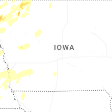
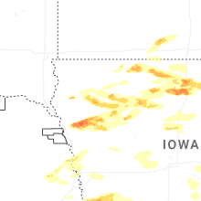
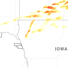
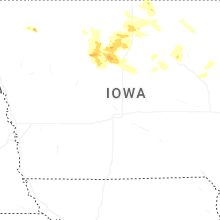
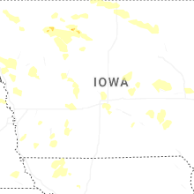
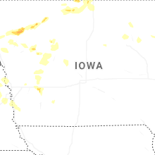


Connect with Interactive Hail Maps