

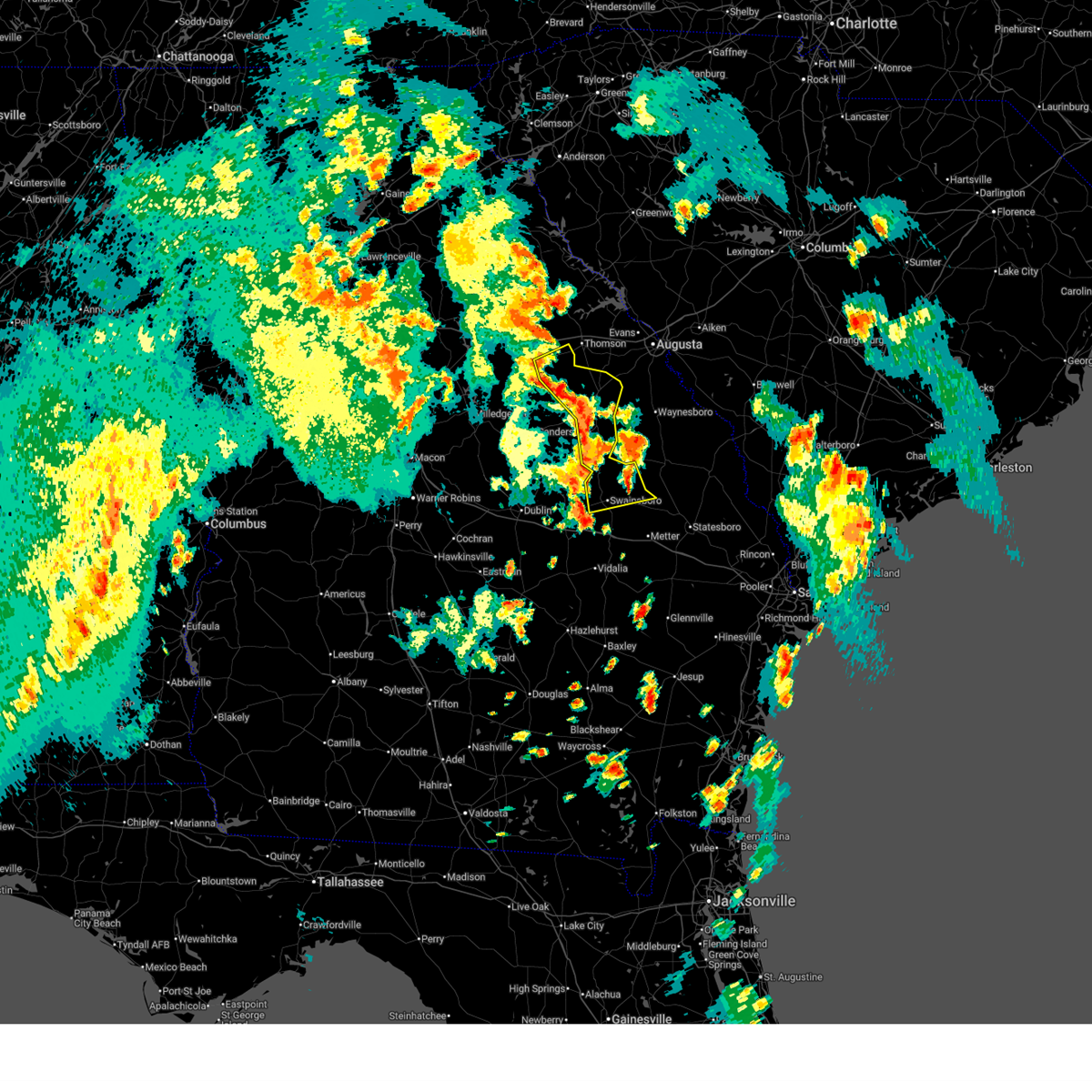
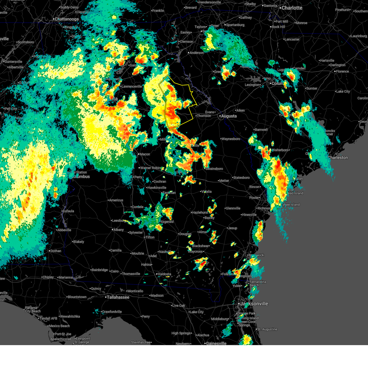
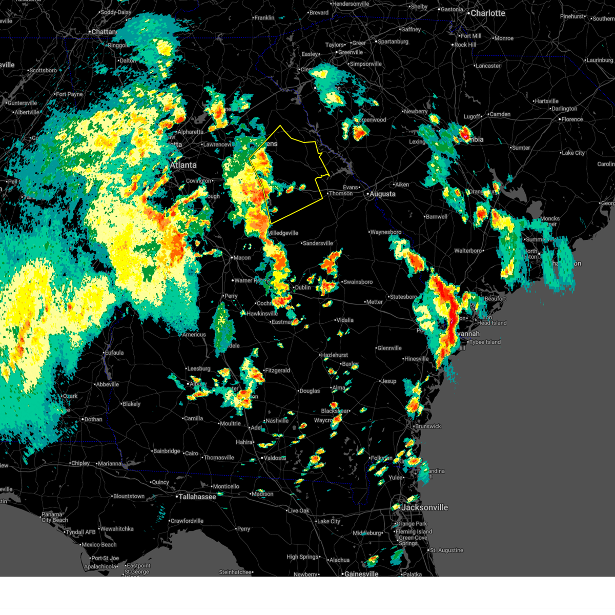
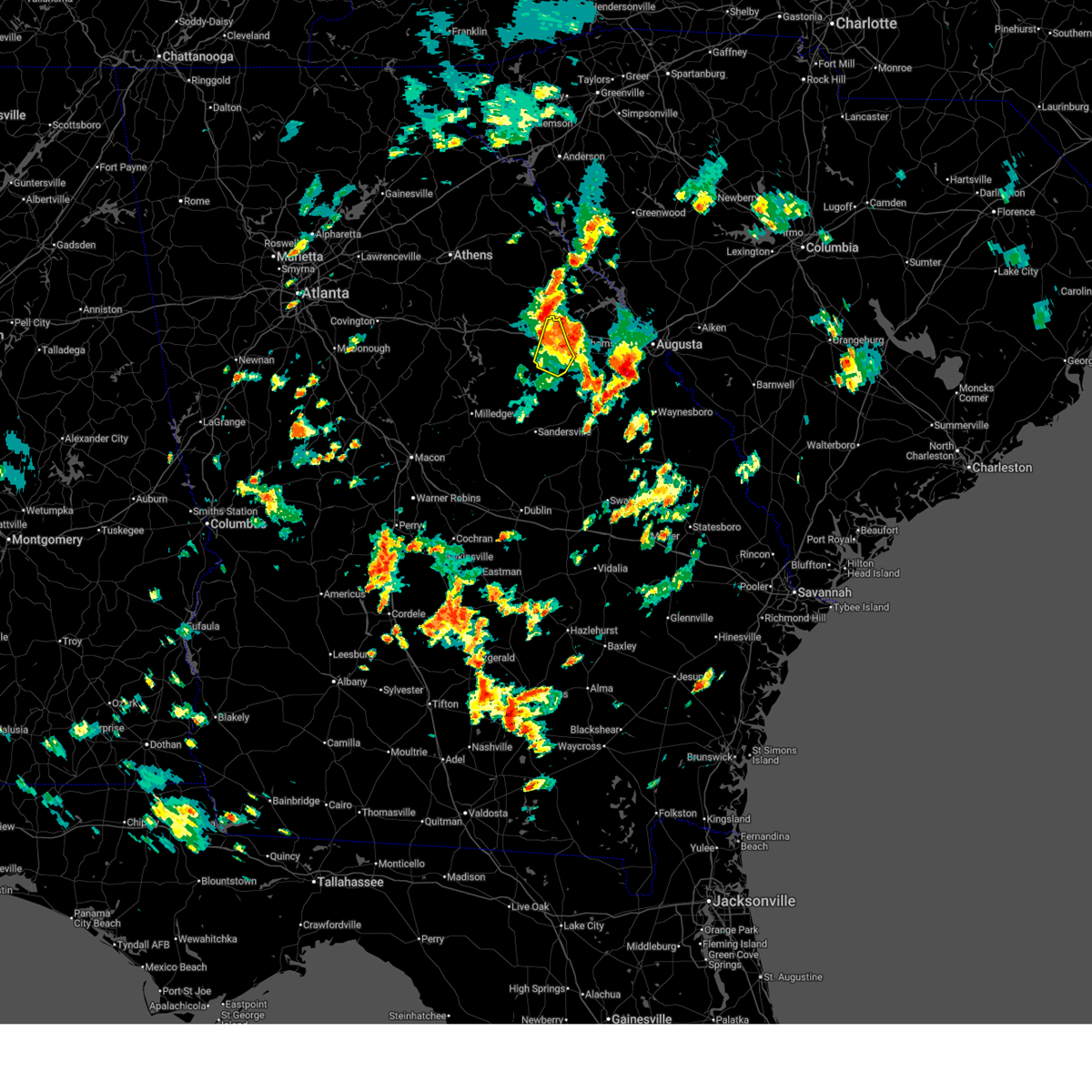
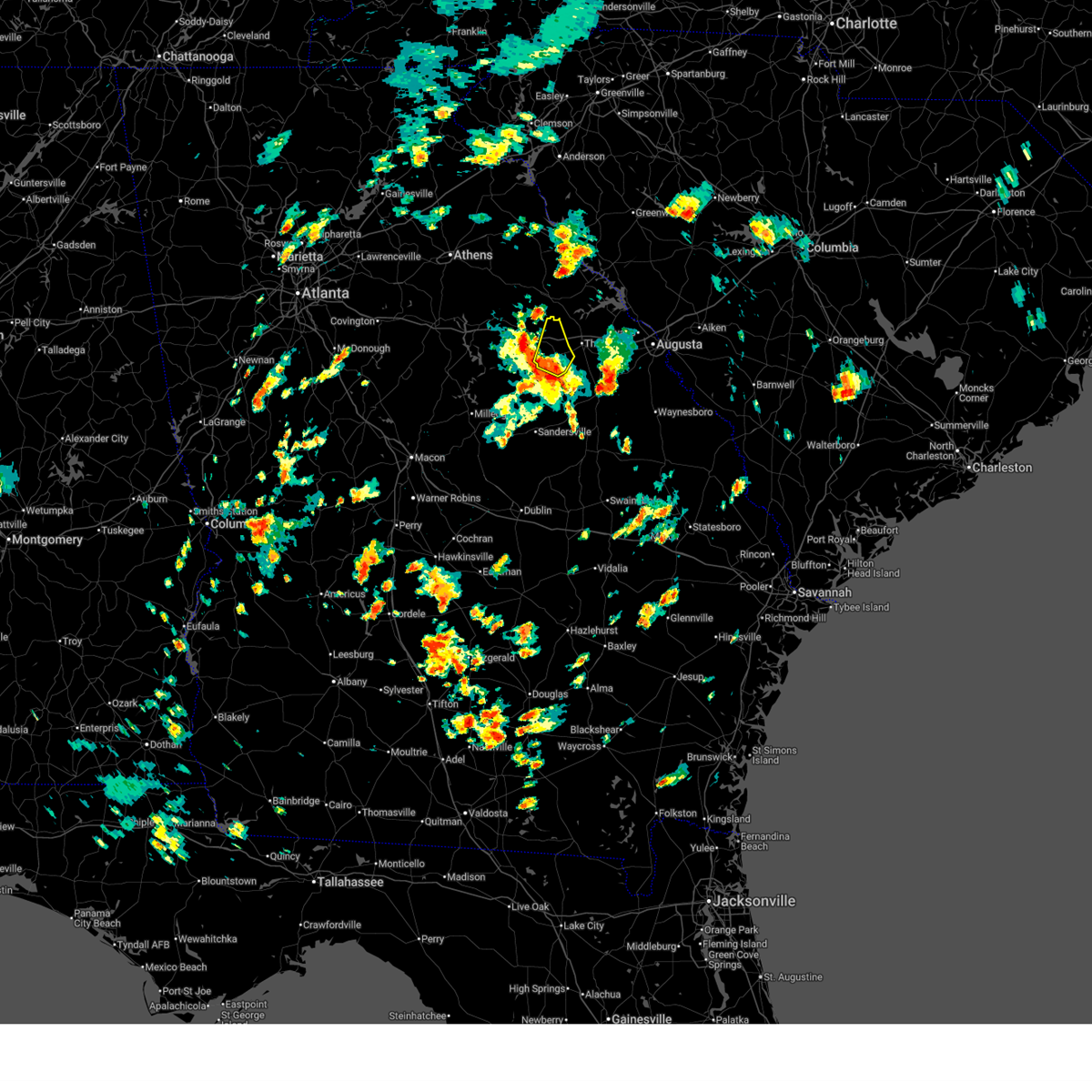
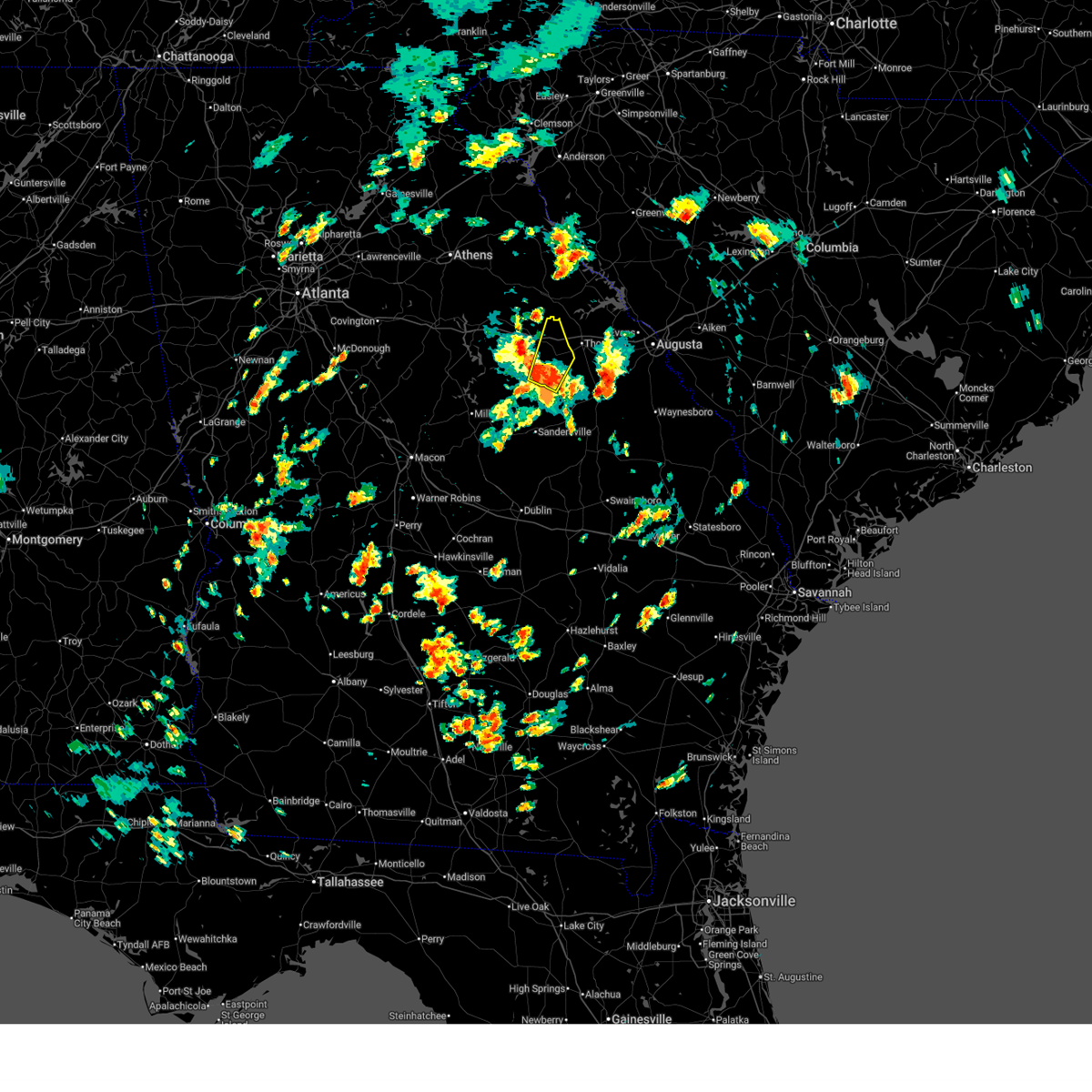
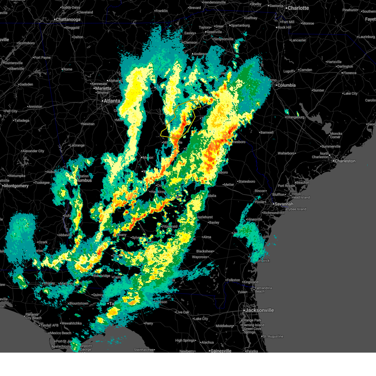
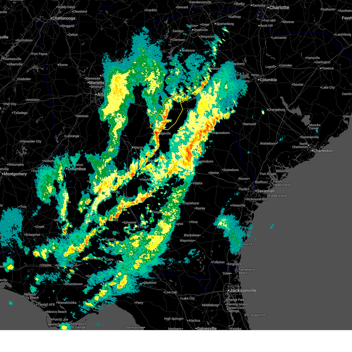
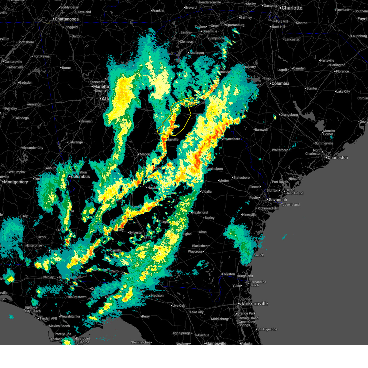
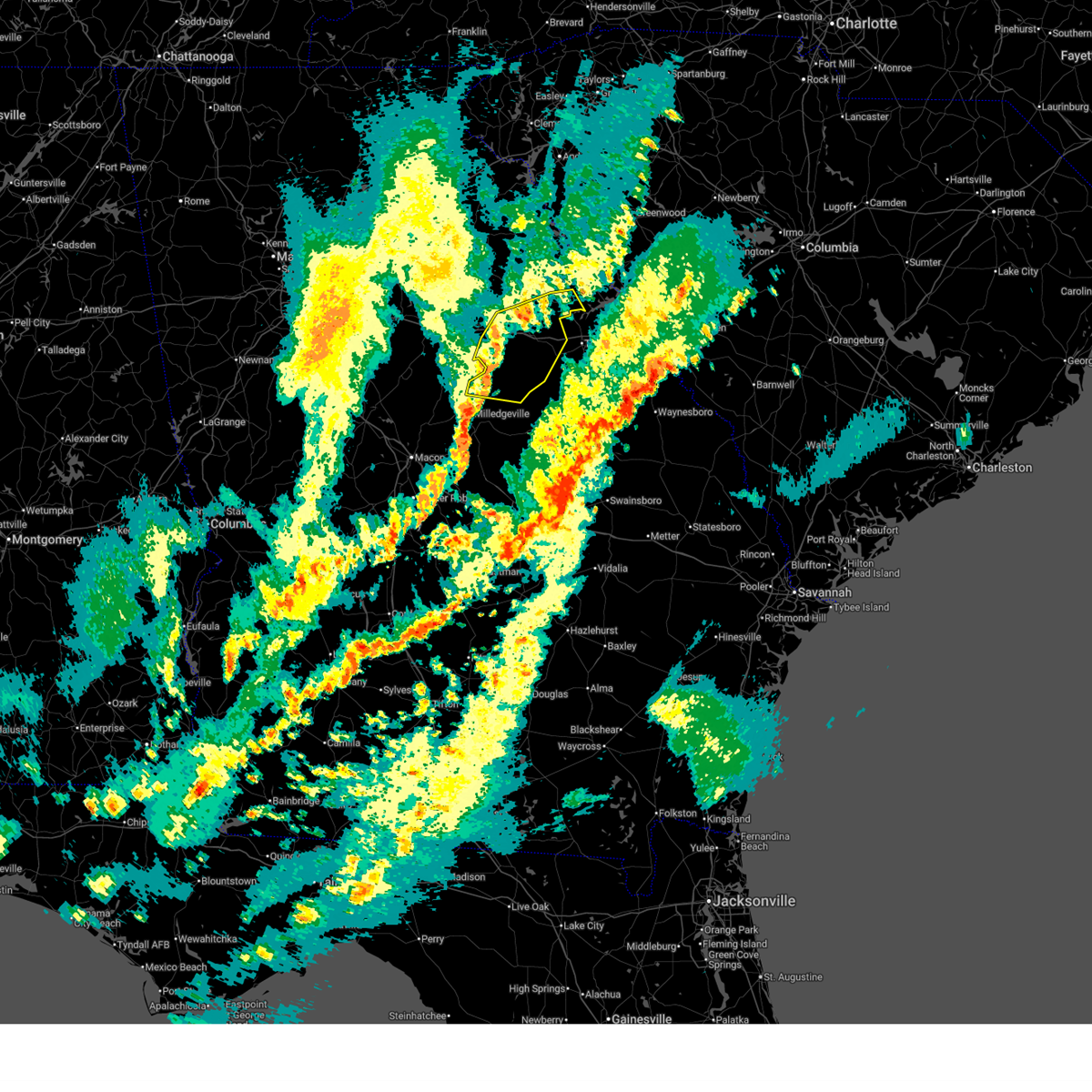
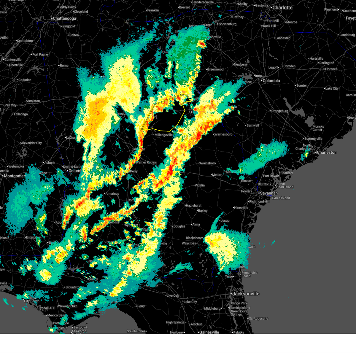
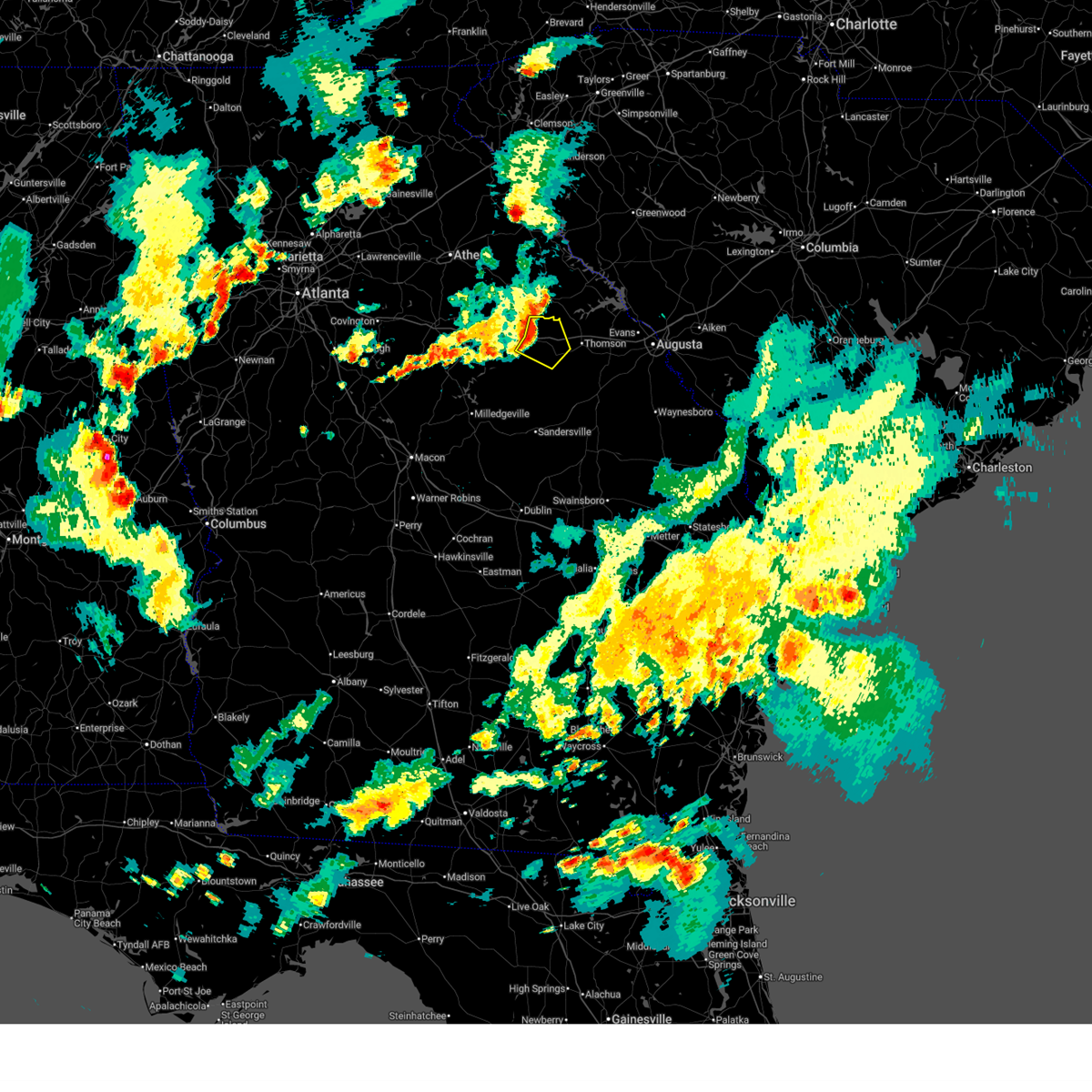
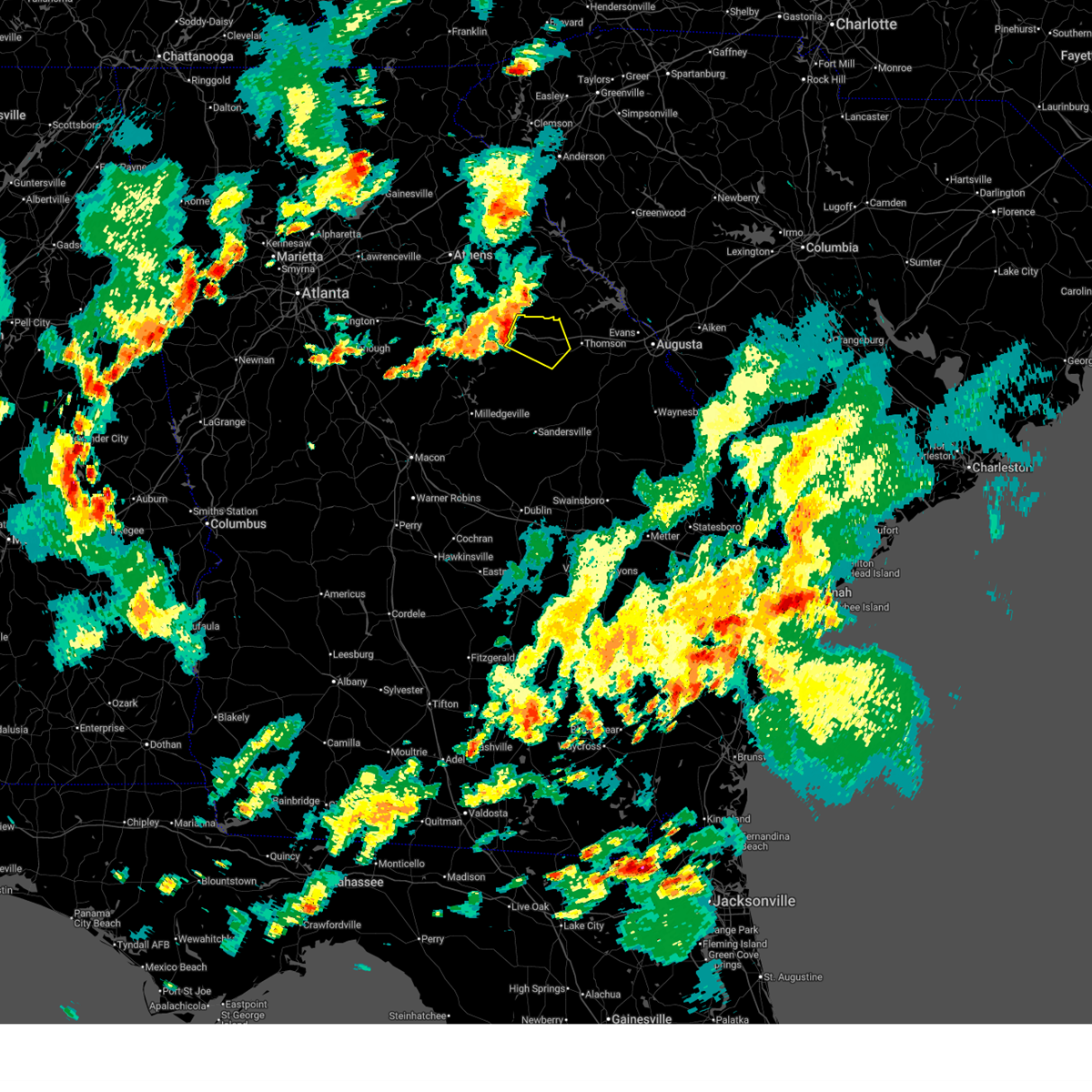
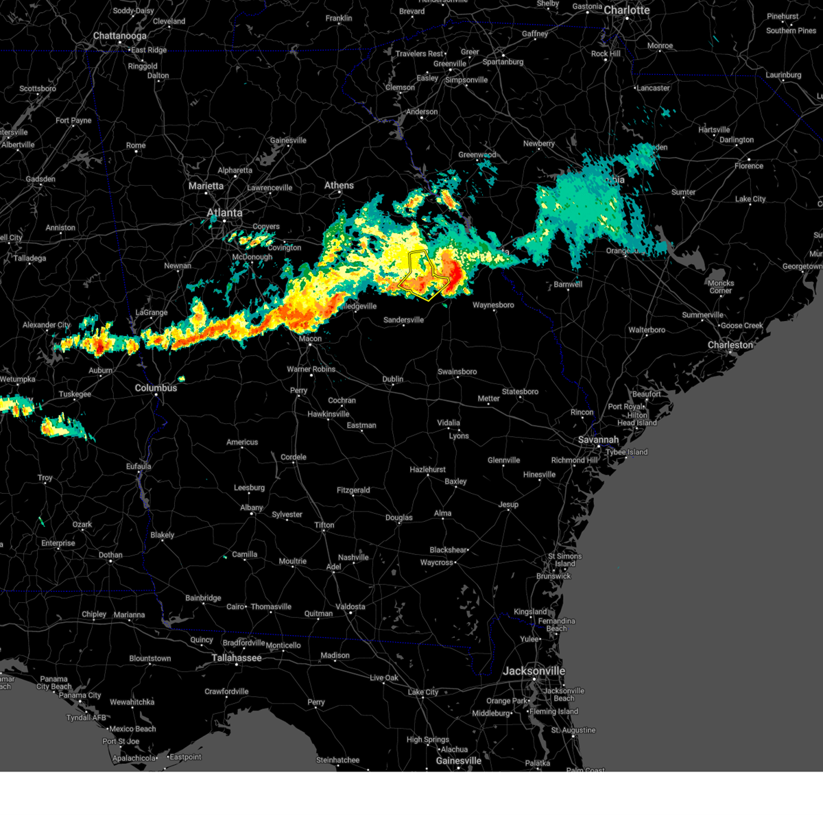
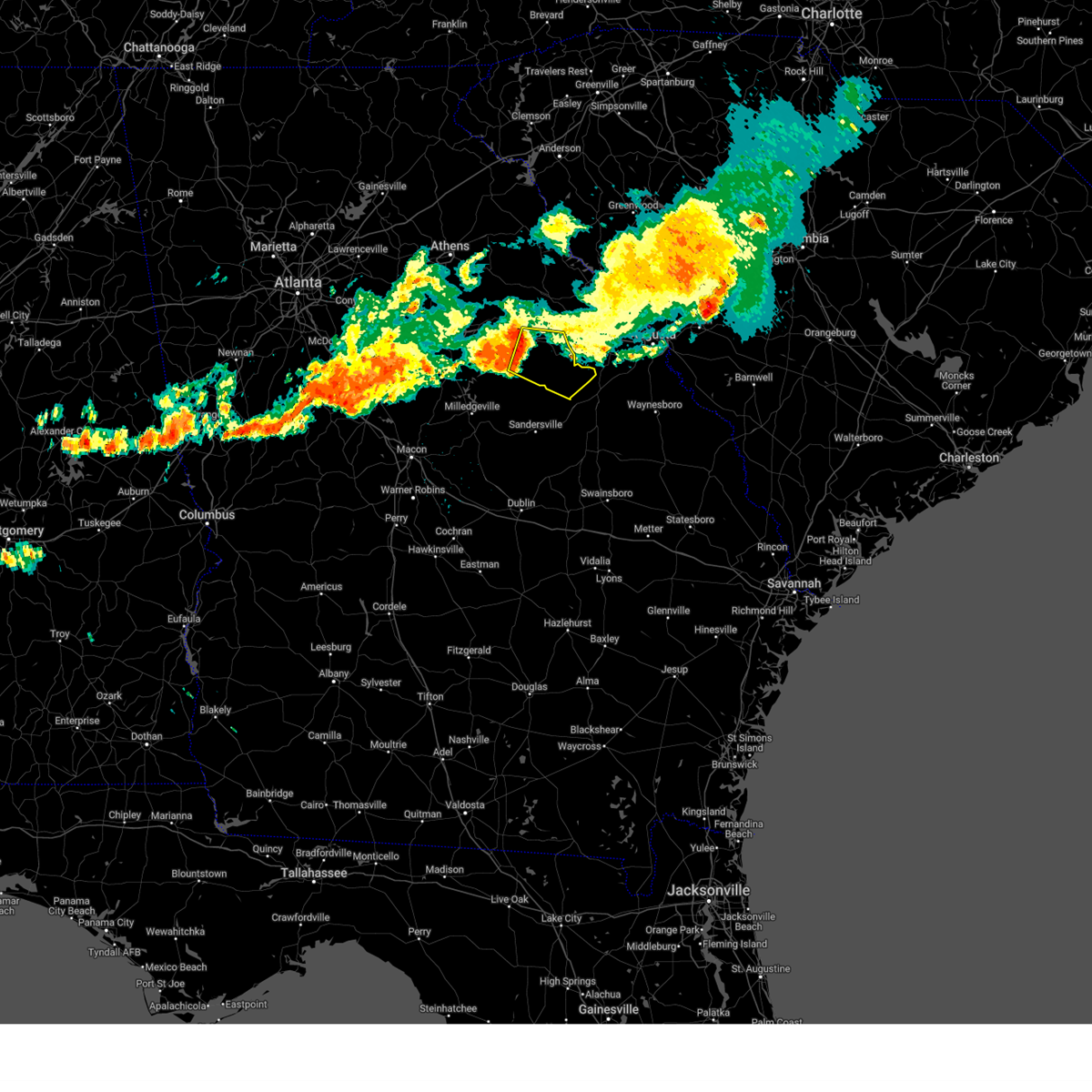
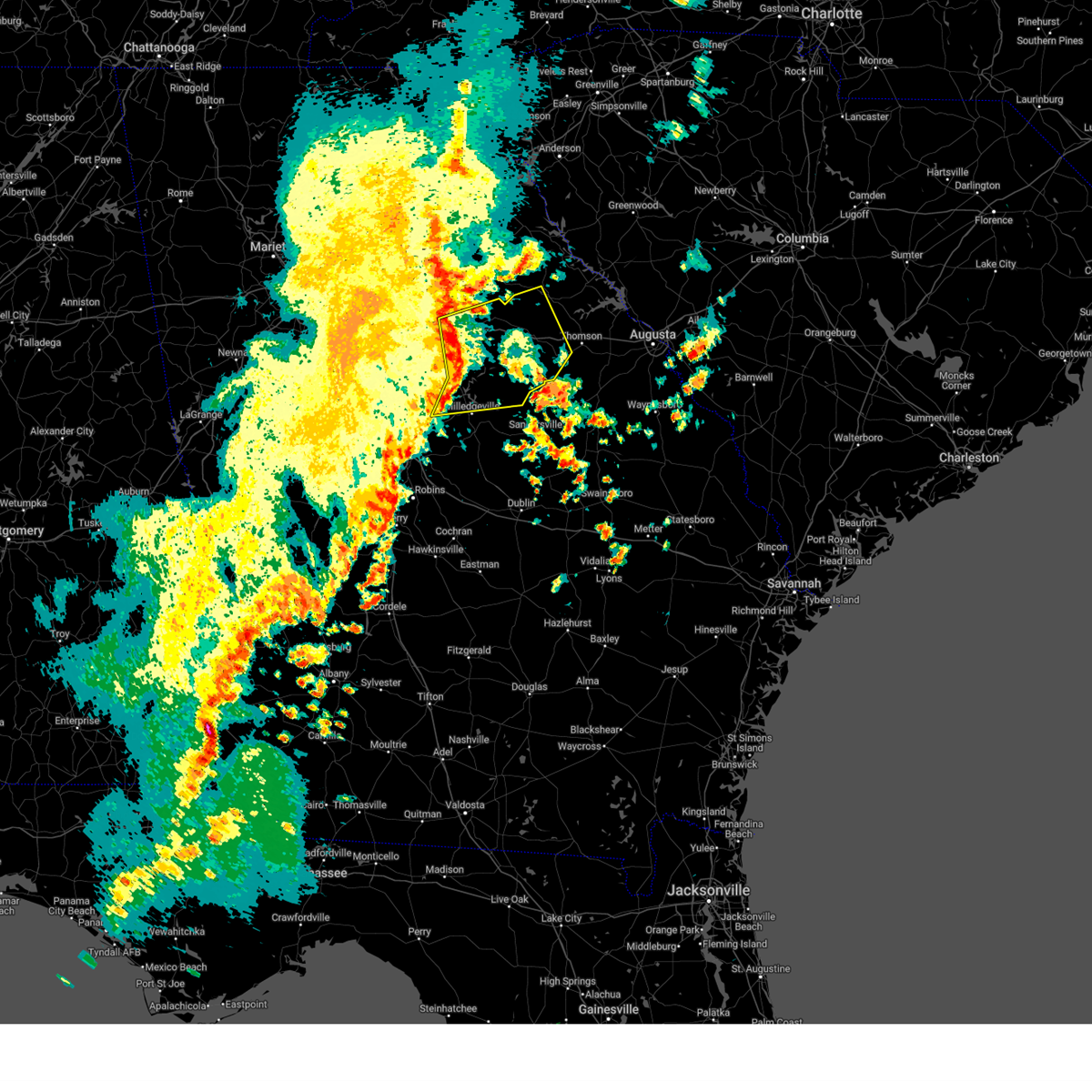
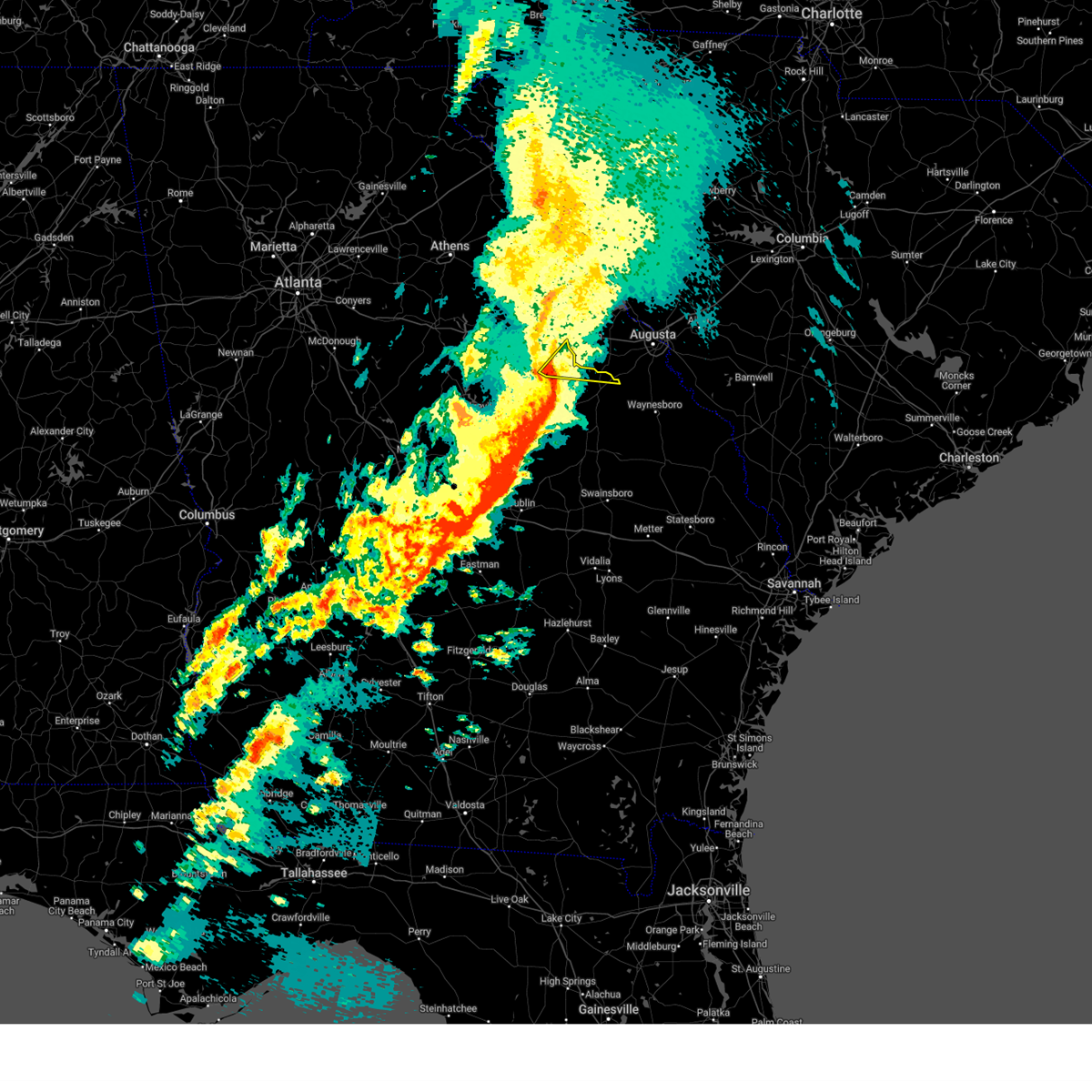
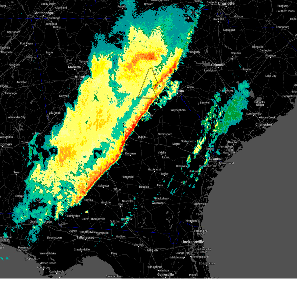
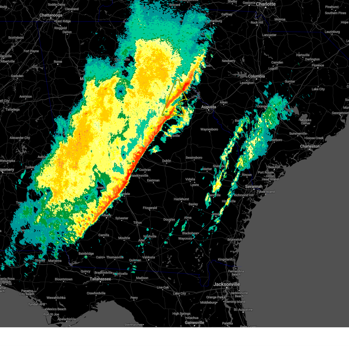
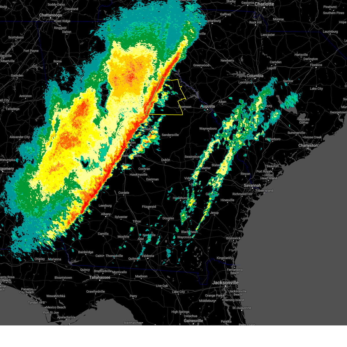
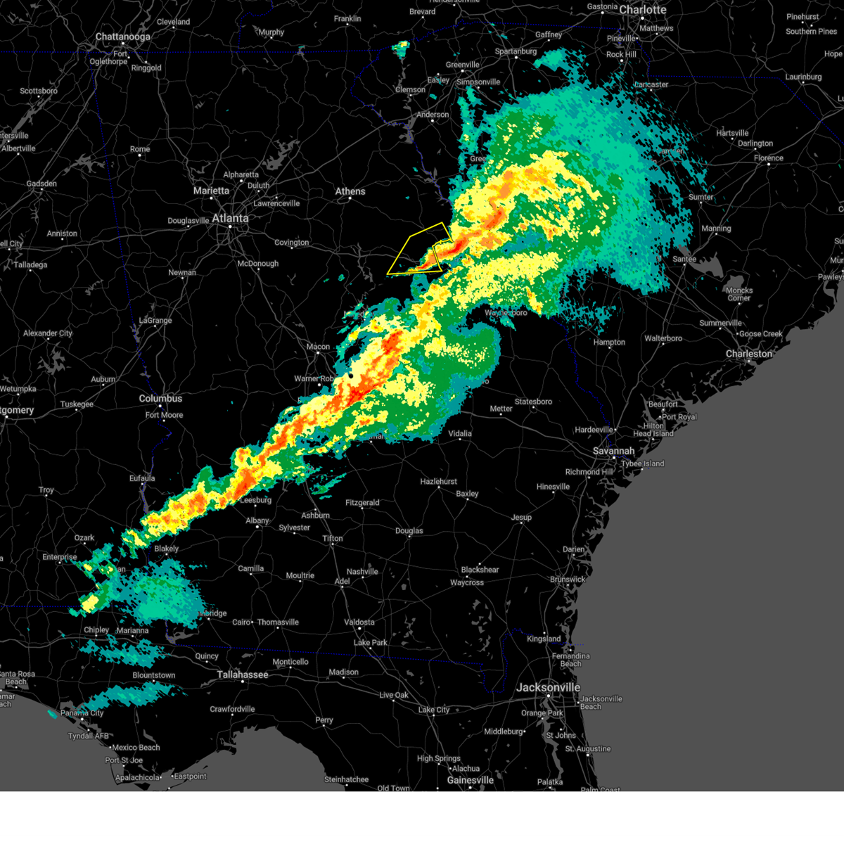
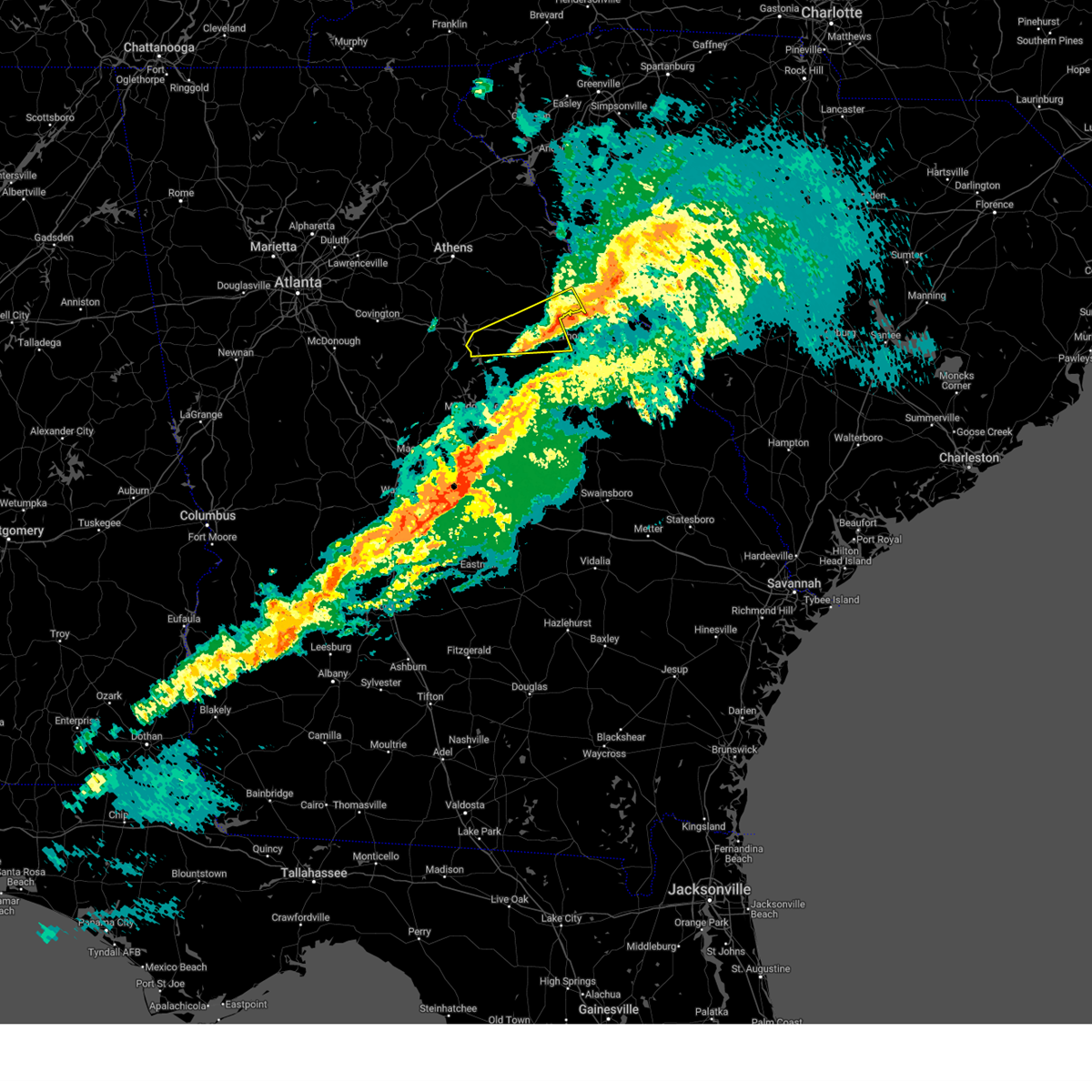
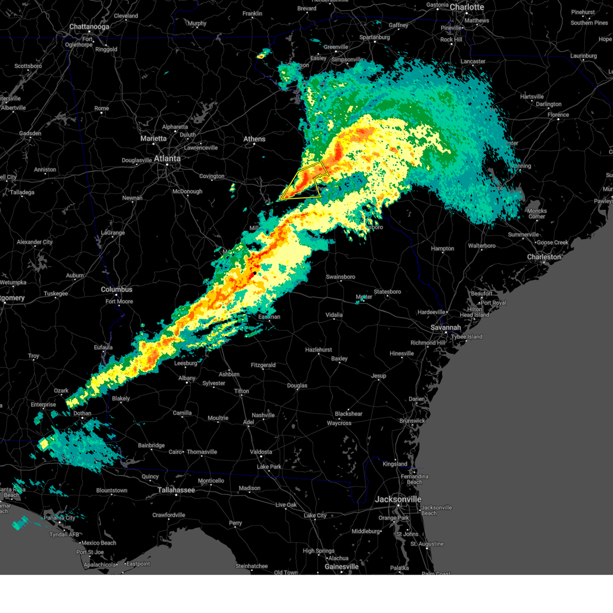
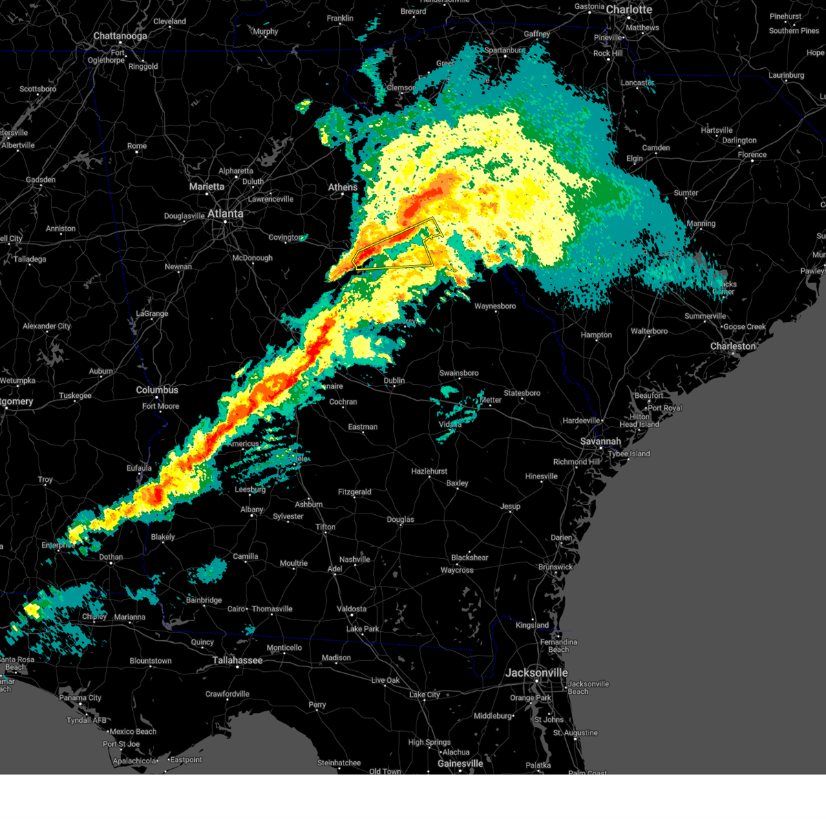
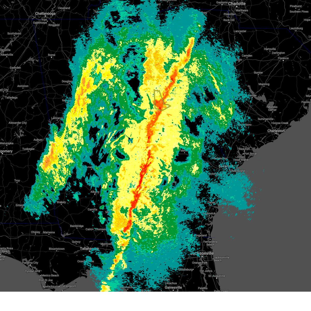
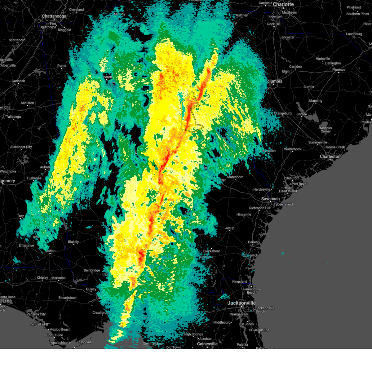
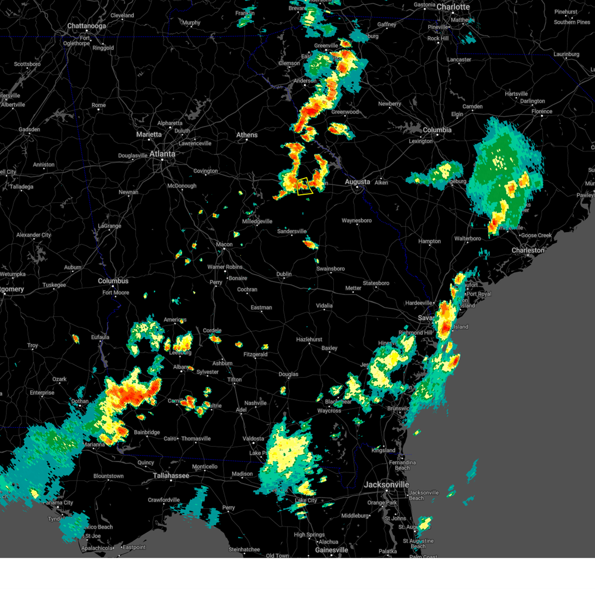
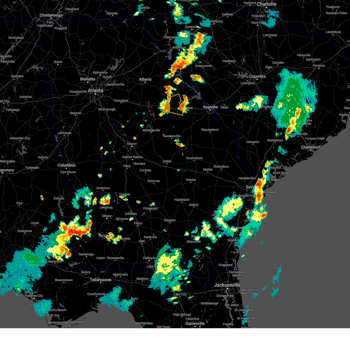
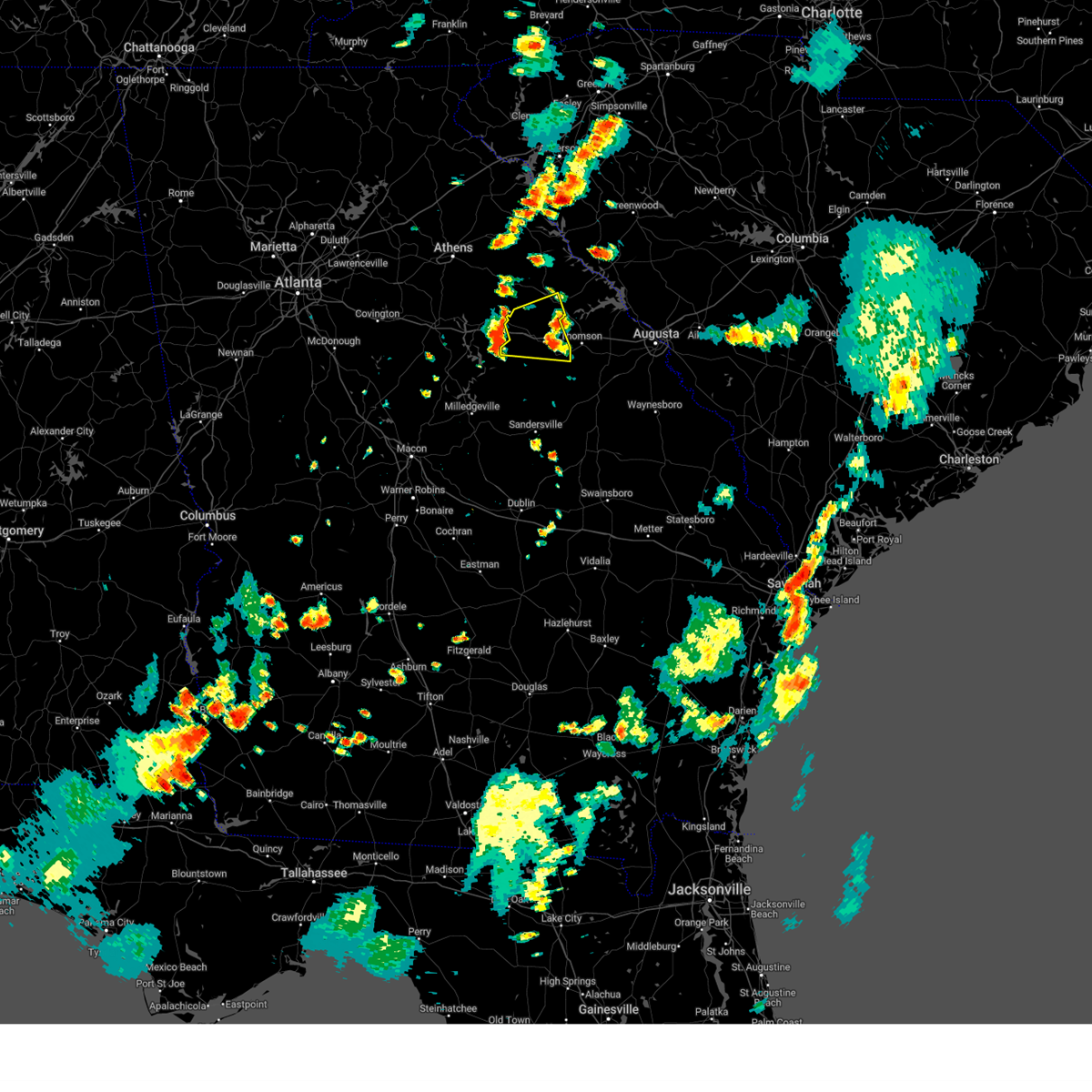
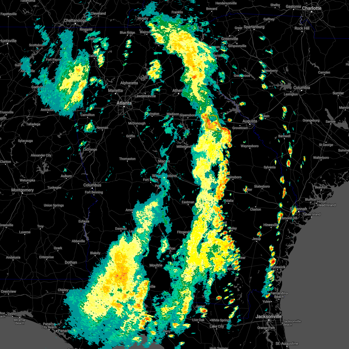
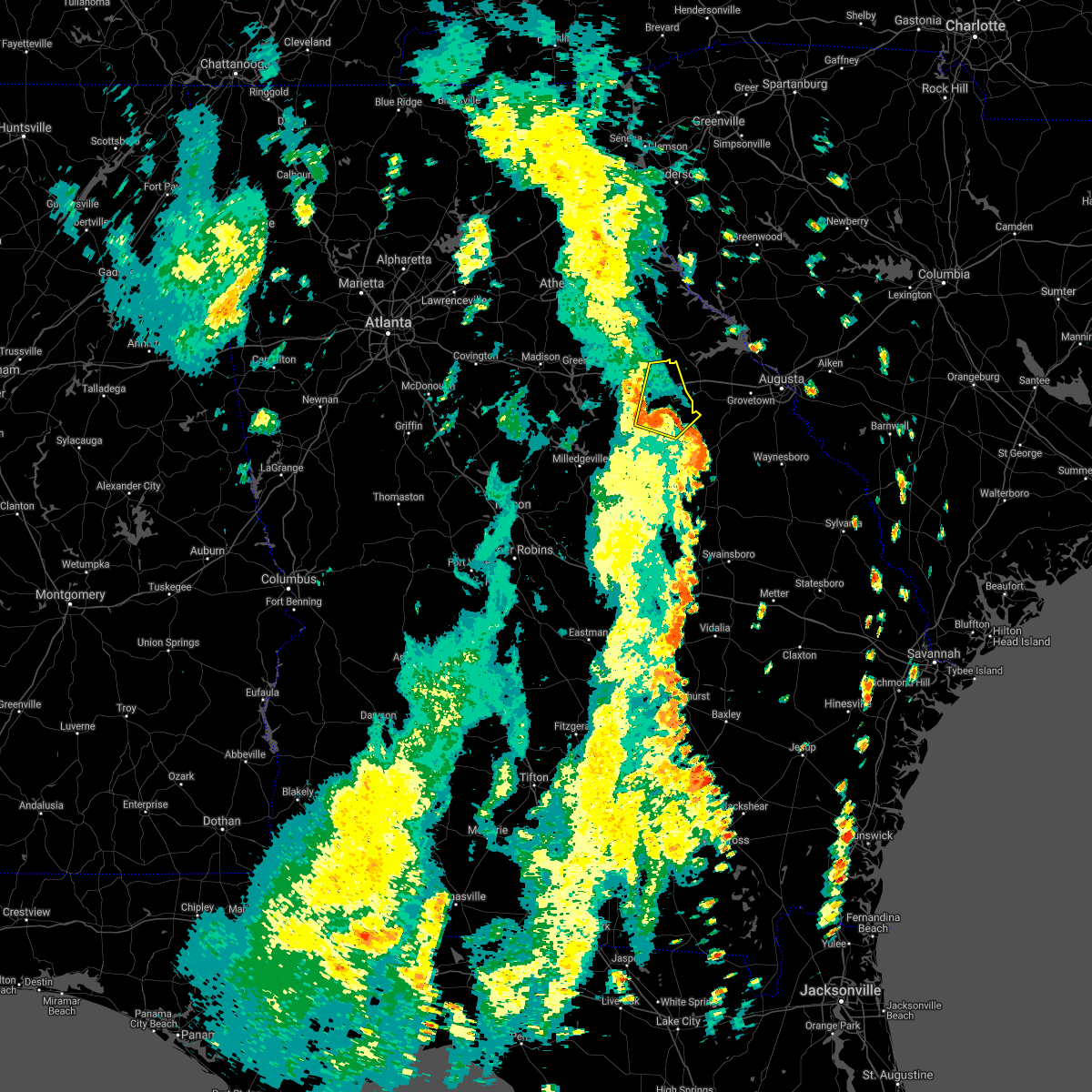
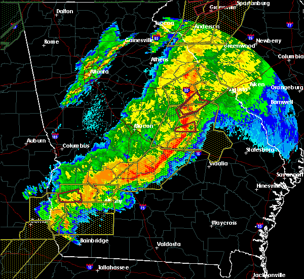
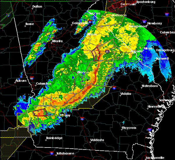
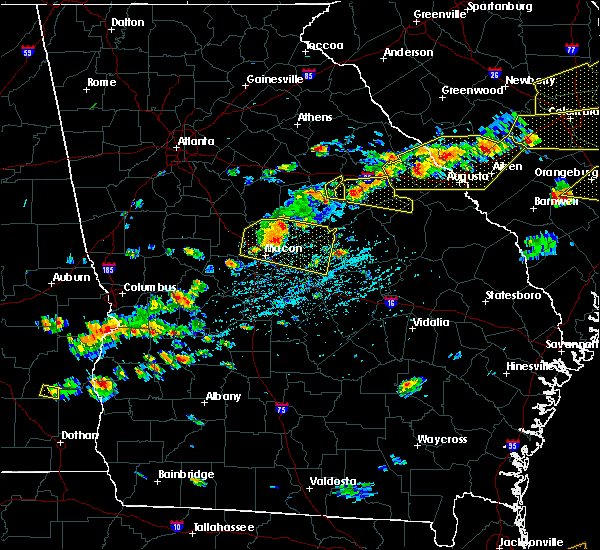
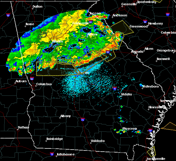
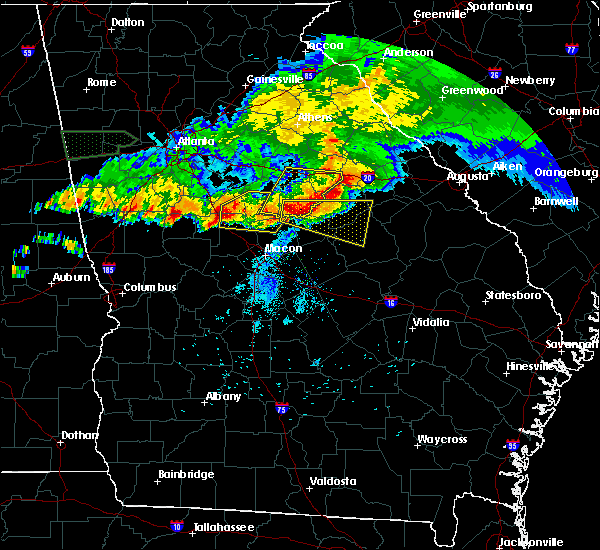
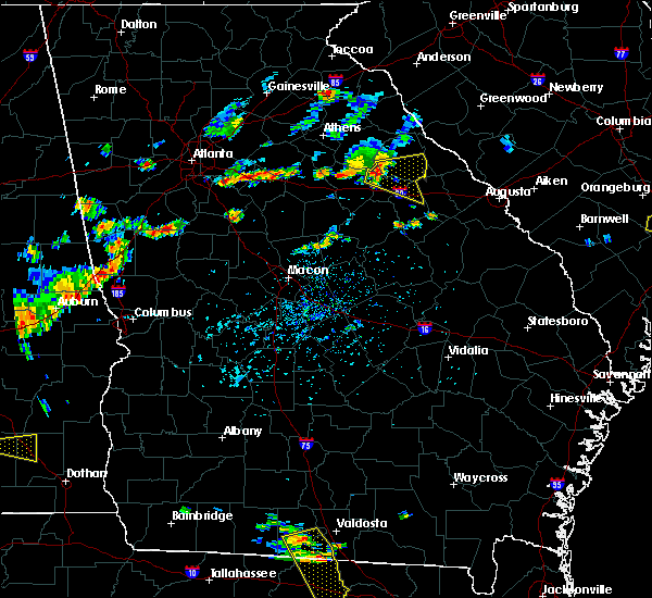
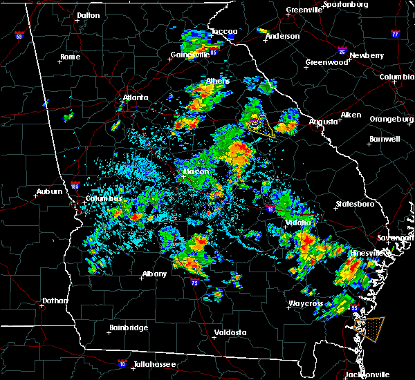
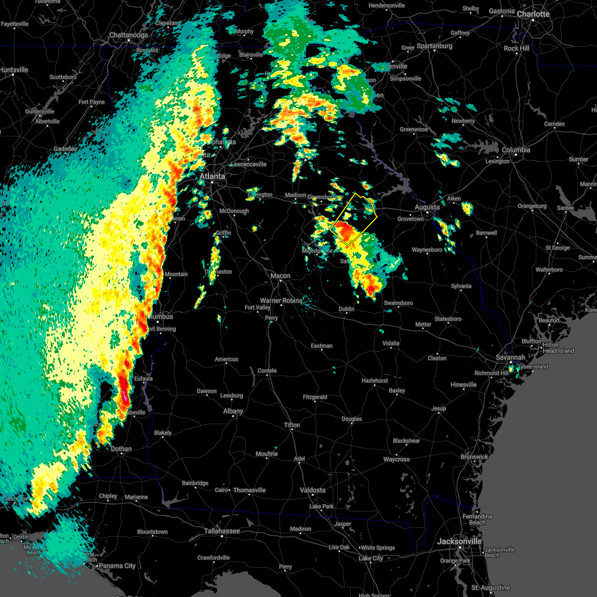
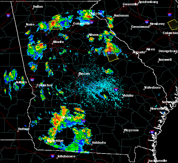
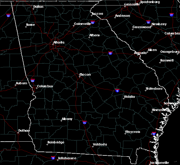
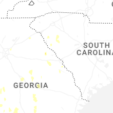
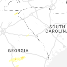
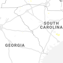
Hail Map for Camak, GA
The Camak, GA area has had 0 reports of on-the-ground hail by trained spotters, and has been under severe weather warnings 13 times during the past 12 months. Doppler radar has detected hail at or near Camak, GA on 39 occasions, including 1 occasion during the past year.
| Name: | Camak, GA |
| Where Located: | 38.9 miles W of Augusta, GA |
| Map: | Google Map for Camak, GA |
| Population: | 138 |
| Housing Units: | 86 |
| More Info: | Search Google for Camak, GA |
0
The Top Recent Hail Date for Camak, GA is Friday, May 22, 2026 (26th out of 39)

Hail and Wind Damage Spotted near Camak, GA
| Date / Time | Report Details |
|---|---|
| 6/18/2026 5:10 PM EDT |
 Svrffc the national weather service in peachtree city has issued a * severe thunderstorm warning for, northeastern emanuel county in east central georgia, southern warren county in east central georgia, glascock county in east central georgia, jefferson county in east central georgia, * until 545 pm edt. * at 509 pm edt, severe thunderstorms were located along a line extending from near jewell to near grange to near norristown junction, moving east at 35 mph (radar indicated). Hazards include 60 mph wind gusts. expect damage to roofs, siding, and trees Svrffc the national weather service in peachtree city has issued a * severe thunderstorm warning for, northeastern emanuel county in east central georgia, southern warren county in east central georgia, glascock county in east central georgia, jefferson county in east central georgia, * until 545 pm edt. * at 509 pm edt, severe thunderstorms were located along a line extending from near jewell to near grange to near norristown junction, moving east at 35 mph (radar indicated). Hazards include 60 mph wind gusts. expect damage to roofs, siding, and trees
|
| 6/18/2026 5:00 PM EDT |
 At 459 pm edt, severe thunderstorms were located along a line extending from near vesta to near powelton, moving northeast at 40 mph (radar indicated). Hazards include 60 mph wind gusts. Expect damage to roofs, siding, and trees. Locations impacted include, washington, warrenton, sparta, crawfordville, lexington, union point, comer, crawford, tignall, woodville, white plains, siloam, carlton, norwood, rayle, sharon, camak, springfield, holliday park, and powelton. At 459 pm edt, severe thunderstorms were located along a line extending from near vesta to near powelton, moving northeast at 40 mph (radar indicated). Hazards include 60 mph wind gusts. Expect damage to roofs, siding, and trees. Locations impacted include, washington, warrenton, sparta, crawfordville, lexington, union point, comer, crawford, tignall, woodville, white plains, siloam, carlton, norwood, rayle, sharon, camak, springfield, holliday park, and powelton.
|
| 6/18/2026 5:00 PM EDT |
 the severe thunderstorm warning has been cancelled and is no longer in effect the severe thunderstorm warning has been cancelled and is no longer in effect
|
| 6/18/2026 4:24 PM EDT |
 Svrffc the national weather service in peachtree city has issued a * severe thunderstorm warning for, southeastern oconee county in northeastern georgia, warren county in east central georgia, east central putnam county in central georgia, northern hancock county in east central georgia, southeastern clarke county in northeastern georgia, greene county in east central georgia, taliaferro county in east central georgia, wilkes county in east central georgia, oglethorpe county in northeastern georgia, southeastern madison county in northeastern georgia, * until 530 pm edt. * at 424 pm edt, severe thunderstorms were located along a line extending from near wrayswood to near oconee springs park, moving northeast at 35 mph (radar indicated). Hazards include 60 mph wind gusts. expect damage to roofs, siding, and trees Svrffc the national weather service in peachtree city has issued a * severe thunderstorm warning for, southeastern oconee county in northeastern georgia, warren county in east central georgia, east central putnam county in central georgia, northern hancock county in east central georgia, southeastern clarke county in northeastern georgia, greene county in east central georgia, taliaferro county in east central georgia, wilkes county in east central georgia, oglethorpe county in northeastern georgia, southeastern madison county in northeastern georgia, * until 530 pm edt. * at 424 pm edt, severe thunderstorms were located along a line extending from near wrayswood to near oconee springs park, moving northeast at 35 mph (radar indicated). Hazards include 60 mph wind gusts. expect damage to roofs, siding, and trees
|
| 5/23/2026 2:28 PM EDT |
 The storm which prompted the warning has moved out of the area. therefore, the warning will be allowed to expire. The storm which prompted the warning has moved out of the area. therefore, the warning will be allowed to expire.
|
| 5/23/2026 2:00 PM EDT |
 At 200 pm edt, a severe thunderstorm was located over warrenton, moving north at 30 mph (radar indicated). Hazards include 60 mph wind gusts and penny size hail. Expect damage to roofs, siding, and trees. Locations impacted include, warrenton, norwood, camak, cadley, beall springs, mesena, and mayfield. At 200 pm edt, a severe thunderstorm was located over warrenton, moving north at 30 mph (radar indicated). Hazards include 60 mph wind gusts and penny size hail. Expect damage to roofs, siding, and trees. Locations impacted include, warrenton, norwood, camak, cadley, beall springs, mesena, and mayfield.
|
| 5/23/2026 1:50 PM EDT |
 Svrffc the national weather service in peachtree city has issued a * severe thunderstorm warning for, warren county in east central georgia, east central hancock county in east central georgia, northwestern glascock county in east central georgia, east central taliaferro county in east central georgia, * until 230 pm edt. * at 150 pm edt, a severe thunderstorm was located over beall springs, or 7 miles southwest of warrenton, moving northeast at 30 mph (radar indicated). Hazards include 60 mph wind gusts and penny size hail. expect damage to roofs, siding, and trees Svrffc the national weather service in peachtree city has issued a * severe thunderstorm warning for, warren county in east central georgia, east central hancock county in east central georgia, northwestern glascock county in east central georgia, east central taliaferro county in east central georgia, * until 230 pm edt. * at 150 pm edt, a severe thunderstorm was located over beall springs, or 7 miles southwest of warrenton, moving northeast at 30 mph (radar indicated). Hazards include 60 mph wind gusts and penny size hail. expect damage to roofs, siding, and trees
|
| 3/16/2026 9:02 AM EDT |
 The storms which prompted the warning have weakened below severe limits, and have exited the warned area. therefore, the warning has been allowed to expire. a tornado watch remains in effect until 1000 am edt for central and east central georgia. a tornado watch also remains in effect until 200 pm edt for east central georgia. to report severe weather, contact your nearest law enforcement agency. they will relay your report to the national weather service peachtree city. The storms which prompted the warning have weakened below severe limits, and have exited the warned area. therefore, the warning has been allowed to expire. a tornado watch remains in effect until 1000 am edt for central and east central georgia. a tornado watch also remains in effect until 200 pm edt for east central georgia. to report severe weather, contact your nearest law enforcement agency. they will relay your report to the national weather service peachtree city.
|
| 3/16/2026 8:45 AM EDT |
 the severe thunderstorm warning has been cancelled and is no longer in effect the severe thunderstorm warning has been cancelled and is no longer in effect
|
| 3/16/2026 8:45 AM EDT |
 At 845 am edt, severe thunderstorms were located along a line extending from double branches to near raytown to near devereux, moving east at 45 mph (radar indicated). Hazards include 60 mph wind gusts. Expect damage to roofs, siding, and trees. Locations impacted include, washington, warrenton, sparta, crawfordville, norwood, sharon, camak, springfield, holliday park, powelton, shoulderbone, lyneville, ficklin, cadley, lundberg, robinson, devereux, jewell, mayfield, and aonia. At 845 am edt, severe thunderstorms were located along a line extending from double branches to near raytown to near devereux, moving east at 45 mph (radar indicated). Hazards include 60 mph wind gusts. Expect damage to roofs, siding, and trees. Locations impacted include, washington, warrenton, sparta, crawfordville, norwood, sharon, camak, springfield, holliday park, powelton, shoulderbone, lyneville, ficklin, cadley, lundberg, robinson, devereux, jewell, mayfield, and aonia.
|
| 3/16/2026 8:35 AM EDT |
 At 834 am edt, severe thunderstorms were located along a line extending from near loce to alexander stephens park to near oconee springs park, moving east at 45 mph (radar indicated). Hazards include 60 mph wind gusts. Expect damage to roofs, siding, and trees. Locations impacted include, washington, warrenton, sparta, crawfordville, union point, white plains, siloam, norwood, sharon, camak, liberty, springfield, veazey, holliday park, powelton, shoulderbone, lyneville, ficklin, cadley, and lundberg. At 834 am edt, severe thunderstorms were located along a line extending from near loce to alexander stephens park to near oconee springs park, moving east at 45 mph (radar indicated). Hazards include 60 mph wind gusts. Expect damage to roofs, siding, and trees. Locations impacted include, washington, warrenton, sparta, crawfordville, union point, white plains, siloam, norwood, sharon, camak, liberty, springfield, veazey, holliday park, powelton, shoulderbone, lyneville, ficklin, cadley, and lundberg.
|
| 3/16/2026 8:35 AM EDT |
 the severe thunderstorm warning has been cancelled and is no longer in effect the severe thunderstorm warning has been cancelled and is no longer in effect
|
| 3/16/2026 8:18 AM EDT |
 Svrffc the national weather service in peachtree city has issued a * severe thunderstorm warning for, warren county in east central georgia, central putnam county in central georgia, hancock county in east central georgia, central greene county in east central georgia, taliaferro county in east central georgia, southern wilkes county in east central georgia, * until 900 am edt. * at 818 am edt, severe thunderstorms were located along a line extending from washington to near veazey to near resseaus crossroads, moving east at 45 mph (radar indicated). Hazards include 60 mph wind gusts. expect damage to roofs, siding, and trees Svrffc the national weather service in peachtree city has issued a * severe thunderstorm warning for, warren county in east central georgia, central putnam county in central georgia, hancock county in east central georgia, central greene county in east central georgia, taliaferro county in east central georgia, southern wilkes county in east central georgia, * until 900 am edt. * at 818 am edt, severe thunderstorms were located along a line extending from washington to near veazey to near resseaus crossroads, moving east at 45 mph (radar indicated). Hazards include 60 mph wind gusts. expect damage to roofs, siding, and trees
|
| 6/14/2025 7:02 PM EDT |
 At 701 pm edt, a severe thunderstorm was located over barnett, or near crawfordville, moving east at 25 mph (radar indicated). Hazards include 60 mph wind gusts and dime size hail. Expect damage to roofs, siding, and trees. Locations impacted include, warrenton, norwood, sharon, camak, powelton, cadley, barnett, mesena, raytown, and sandy cross. At 701 pm edt, a severe thunderstorm was located over barnett, or near crawfordville, moving east at 25 mph (radar indicated). Hazards include 60 mph wind gusts and dime size hail. Expect damage to roofs, siding, and trees. Locations impacted include, warrenton, norwood, sharon, camak, powelton, cadley, barnett, mesena, raytown, and sandy cross.
|
| 6/14/2025 6:40 PM EDT |
 Svrffc the national weather service in peachtree city has issued a * severe thunderstorm warning for, western warren county in east central georgia, northeastern hancock county in east central georgia, taliaferro county in east central georgia, * until 730 pm edt. * at 639 pm edt, a severe thunderstorm was located near crawfordville, moving east at 25 mph (radar indicated). Hazards include 60 mph wind gusts and dime size hail. expect damage to roofs, siding, and trees Svrffc the national weather service in peachtree city has issued a * severe thunderstorm warning for, western warren county in east central georgia, northeastern hancock county in east central georgia, taliaferro county in east central georgia, * until 730 pm edt. * at 639 pm edt, a severe thunderstorm was located near crawfordville, moving east at 25 mph (radar indicated). Hazards include 60 mph wind gusts and dime size hail. expect damage to roofs, siding, and trees
|
| 5/21/2025 4:53 AM EDT |
 The storm which prompted the warning has moved out of the area. therefore, the warning will be allowed to expire. The storm which prompted the warning has moved out of the area. therefore, the warning will be allowed to expire.
|
| 5/21/2025 4:40 AM EDT |
 At 439 am edt, a severe thunderstorm was located over autney, or 9 miles northeast of gibson, moving east at 55 mph (radar indicated). Hazards include 60 mph wind gusts. Expect damage to roofs, siding, and trees. Locations impacted include, warrenton, gibson, norwood, mitchell, camak, shoals, jewell, beall springs, reese, mesena, and bastonville. At 439 am edt, a severe thunderstorm was located over autney, or 9 miles northeast of gibson, moving east at 55 mph (radar indicated). Hazards include 60 mph wind gusts. Expect damage to roofs, siding, and trees. Locations impacted include, warrenton, gibson, norwood, mitchell, camak, shoals, jewell, beall springs, reese, mesena, and bastonville.
|
| 5/21/2025 4:40 AM EDT |
 the severe thunderstorm warning has been cancelled and is no longer in effect the severe thunderstorm warning has been cancelled and is no longer in effect
|
| 5/21/2025 4:20 AM EDT |
 Svrffc the national weather service in peachtree city has issued a * severe thunderstorm warning for, warren county in east central georgia, northeastern hancock county in east central georgia, glascock county in east central georgia, southeastern taliaferro county in east central georgia, * until 500 am edt. * at 420 am edt, a severe thunderstorm was located over mayfield, or near warrenton, moving east at 55 mph (radar indicated). Hazards include 60 mph wind gusts. expect damage to roofs, siding, and trees Svrffc the national weather service in peachtree city has issued a * severe thunderstorm warning for, warren county in east central georgia, northeastern hancock county in east central georgia, glascock county in east central georgia, southeastern taliaferro county in east central georgia, * until 500 am edt. * at 420 am edt, a severe thunderstorm was located over mayfield, or near warrenton, moving east at 55 mph (radar indicated). Hazards include 60 mph wind gusts. expect damage to roofs, siding, and trees
|
| 3/31/2025 2:55 PM EDT |
 The storms which prompted the warning have moved out of the area. therefore, the warning will be allowed to expire. a severe thunderstorm watch remains in effect until 700 pm edt for east central georgia. The storms which prompted the warning have moved out of the area. therefore, the warning will be allowed to expire. a severe thunderstorm watch remains in effect until 700 pm edt for east central georgia.
|
| 3/31/2025 2:47 PM EDT |
 the severe thunderstorm warning has been cancelled and is no longer in effect the severe thunderstorm warning has been cancelled and is no longer in effect
|
| 3/31/2025 2:47 PM EDT |
 At 247 pm edt, severe thunderstorms were located along a line extending from near celeste to near mayfield to near hamburg state park, moving east at 55 mph (radar indicated). Hazards include 60 mph wind gusts. Expect damage to roofs, siding, and trees. Locations impacted include, ficklin, cadley, crawfordville, lundberg, sparta, jewell, camak, beulah, warrenton, beall springs, mayfield, sharon, washington, powelton, norwood, barnett, springfield, lyneville, raytown, and alexander stephens park. At 247 pm edt, severe thunderstorms were located along a line extending from near celeste to near mayfield to near hamburg state park, moving east at 55 mph (radar indicated). Hazards include 60 mph wind gusts. Expect damage to roofs, siding, and trees. Locations impacted include, ficklin, cadley, crawfordville, lundberg, sparta, jewell, camak, beulah, warrenton, beall springs, mayfield, sharon, washington, powelton, norwood, barnett, springfield, lyneville, raytown, and alexander stephens park.
|
| 3/31/2025 2:35 PM EDT |
 At 234 pm edt, severe thunderstorms were located along a line extending from near philomath to near springfield to beulah, moving east at 55 mph (radar indicated). Hazards include 60 mph wind gusts. Expect damage to roofs, siding, and trees. Locations impacted include, shoals, camak, beulah, warrenton, sharon, washington, powelton, norwood, shoulderbone, lyneville, carters grove, ficklin, cadley, crawfordville, lundberg, sparta, robinson, devereux, jewell, and beall springs. At 234 pm edt, severe thunderstorms were located along a line extending from near philomath to near springfield to beulah, moving east at 55 mph (radar indicated). Hazards include 60 mph wind gusts. Expect damage to roofs, siding, and trees. Locations impacted include, shoals, camak, beulah, warrenton, sharon, washington, powelton, norwood, shoulderbone, lyneville, carters grove, ficklin, cadley, crawfordville, lundberg, sparta, robinson, devereux, jewell, and beall springs.
|
| 3/31/2025 2:35 PM EDT |
 the severe thunderstorm warning has been cancelled and is no longer in effect the severe thunderstorm warning has been cancelled and is no longer in effect
|
| 3/31/2025 2:09 PM EDT |
 Svrffc the national weather service in peachtree city has issued a * severe thunderstorm warning for, northern baldwin county in central georgia, warren county in east central georgia, southeastern morgan county in north central georgia, putnam county in central georgia, hancock county in east central georgia, greene county in east central georgia, taliaferro county in east central georgia, southwestern wilkes county in east central georgia, northeastern jones county in central georgia, * until 300 pm edt. * at 209 pm edt, severe thunderstorms were located along a line extending from near madison to near warfield to near blountsville, moving east at 55 mph (radar indicated). Hazards include 60 mph wind gusts. expect damage to roofs, siding, and trees Svrffc the national weather service in peachtree city has issued a * severe thunderstorm warning for, northern baldwin county in central georgia, warren county in east central georgia, southeastern morgan county in north central georgia, putnam county in central georgia, hancock county in east central georgia, greene county in east central georgia, taliaferro county in east central georgia, southwestern wilkes county in east central georgia, northeastern jones county in central georgia, * until 300 pm edt. * at 209 pm edt, severe thunderstorms were located along a line extending from near madison to near warfield to near blountsville, moving east at 55 mph (radar indicated). Hazards include 60 mph wind gusts. expect damage to roofs, siding, and trees
|
| 3/16/2025 4:56 AM EDT |
 Svrffc the national weather service in peachtree city has issued a * severe thunderstorm warning for, southern warren county in east central georgia, northeastern glascock county in east central georgia, northeastern jefferson county in east central georgia, * until 545 am edt. * at 456 am edt, a severe thunderstorm was located near warrenton, moving northeast at 55 mph (radar indicated). Hazards include 60 mph wind gusts. expect damage to roofs, siding, and trees Svrffc the national weather service in peachtree city has issued a * severe thunderstorm warning for, southern warren county in east central georgia, northeastern glascock county in east central georgia, northeastern jefferson county in east central georgia, * until 545 am edt. * at 456 am edt, a severe thunderstorm was located near warrenton, moving northeast at 55 mph (radar indicated). Hazards include 60 mph wind gusts. expect damage to roofs, siding, and trees
|
| 2/16/2025 6:40 AM EST |
 The storms which prompted the warning have moved out of the area. therefore, the warning will be allowed to expire. a tornado watch remains in effect until 900 am est for east central georgia. The storms which prompted the warning have moved out of the area. therefore, the warning will be allowed to expire. a tornado watch remains in effect until 900 am est for east central georgia.
|
| 2/16/2025 6:26 AM EST |
 the severe thunderstorm warning has been cancelled and is no longer in effect the severe thunderstorm warning has been cancelled and is no longer in effect
|
| 2/16/2025 6:26 AM EST |
 At 625 am est, severe thunderstorms were located along a line extending from near bradley to warrenton, moving east at 65 mph (radar indicated). Hazards include 60 mph wind gusts. Expect damage to roofs, siding, and trees. Locations impacted include, washington, warrenton, crawfordville, tignall, norwood, sharon, camak, springfield, delhi, holliday park, powelton, danburg, mesena, ficklin, cadley, lundberg, metasville, floral hill, aonia, and barnett. At 625 am est, severe thunderstorms were located along a line extending from near bradley to warrenton, moving east at 65 mph (radar indicated). Hazards include 60 mph wind gusts. Expect damage to roofs, siding, and trees. Locations impacted include, washington, warrenton, crawfordville, tignall, norwood, sharon, camak, springfield, delhi, holliday park, powelton, danburg, mesena, ficklin, cadley, lundberg, metasville, floral hill, aonia, and barnett.
|
| 2/16/2025 5:53 AM EST |
 Svrffc the national weather service in peachtree city has issued a * severe thunderstorm warning for, warren county in east central georgia, northeastern putnam county in central georgia, northeastern hancock county in east central georgia, greene county in east central georgia, taliaferro county in east central georgia, wilkes county in east central georgia, central oglethorpe county in northeastern georgia, * until 645 am est. * at 552 am est, severe thunderstorms were located along a line extending from elberton to phoenix, moving east at 65 mph (radar indicated). Hazards include 60 mph wind gusts. expect damage to roofs, siding, and trees Svrffc the national weather service in peachtree city has issued a * severe thunderstorm warning for, warren county in east central georgia, northeastern putnam county in central georgia, northeastern hancock county in east central georgia, greene county in east central georgia, taliaferro county in east central georgia, wilkes county in east central georgia, central oglethorpe county in northeastern georgia, * until 645 am est. * at 552 am est, severe thunderstorms were located along a line extending from elberton to phoenix, moving east at 65 mph (radar indicated). Hazards include 60 mph wind gusts. expect damage to roofs, siding, and trees
|
| 4/3/2024 4:29 AM EDT |
 the severe thunderstorm warning has been cancelled and is no longer in effect the severe thunderstorm warning has been cancelled and is no longer in effect
|
| 4/3/2024 4:13 AM EDT |
 the severe thunderstorm warning has been cancelled and is no longer in effect the severe thunderstorm warning has been cancelled and is no longer in effect
|
| 4/3/2024 4:11 AM EDT |
 Svrffc the national weather service in peachtree city has issued a * severe thunderstorm warning for, northwestern warren county in east central georgia, north central hancock county in east central georgia, taliaferro county in east central georgia, southeastern wilkes county in east central georgia, * until 500 am edt. * at 411 am edt, a severe thunderstorm was located over aonia, or near washington, moving northeast at 65 mph (radar indicated). Hazards include 60 mph wind gusts. expect damage to roofs, siding, and trees Svrffc the national weather service in peachtree city has issued a * severe thunderstorm warning for, northwestern warren county in east central georgia, north central hancock county in east central georgia, taliaferro county in east central georgia, southeastern wilkes county in east central georgia, * until 500 am edt. * at 411 am edt, a severe thunderstorm was located over aonia, or near washington, moving northeast at 65 mph (radar indicated). Hazards include 60 mph wind gusts. expect damage to roofs, siding, and trees
|
| 4/3/2024 3:39 AM EDT |
 Svrffc the national weather service in peachtree city has issued a * severe thunderstorm warning for, northwestern warren county in east central georgia, north central hancock county in east central georgia, southeastern greene county in east central georgia, taliaferro county in east central georgia, southeastern wilkes county in east central georgia, * until 430 am edt. * at 339 am edt, a severe thunderstorm was located near reynolds at lake oconee, or 7 miles south of greensboro, moving northeast at 65 mph (radar indicated). Hazards include 60 mph wind gusts. expect damage to roofs, siding, and trees Svrffc the national weather service in peachtree city has issued a * severe thunderstorm warning for, northwestern warren county in east central georgia, north central hancock county in east central georgia, southeastern greene county in east central georgia, taliaferro county in east central georgia, southeastern wilkes county in east central georgia, * until 430 am edt. * at 339 am edt, a severe thunderstorm was located near reynolds at lake oconee, or 7 miles south of greensboro, moving northeast at 65 mph (radar indicated). Hazards include 60 mph wind gusts. expect damage to roofs, siding, and trees
|
| 2/28/2024 5:01 PM EST |
 Svrffc the national weather service in peachtree city has issued a * severe thunderstorm warning for, northwestern warren county in east central georgia, east central greene county in east central georgia, taliaferro county in east central georgia, wilkes county in east central georgia, * until 545 pm est. * at 501 pm est, severe thunderstorms were located along a line extending from chennault to near carters grove to near greensboro, moving east at 50 mph (radar indicated). Hazards include 60 mph wind gusts. expect damage to roofs, siding, and trees Svrffc the national weather service in peachtree city has issued a * severe thunderstorm warning for, northwestern warren county in east central georgia, east central greene county in east central georgia, taliaferro county in east central georgia, wilkes county in east central georgia, * until 545 pm est. * at 501 pm est, severe thunderstorms were located along a line extending from chennault to near carters grove to near greensboro, moving east at 50 mph (radar indicated). Hazards include 60 mph wind gusts. expect damage to roofs, siding, and trees
|
| 1/9/2024 12:15 PM EST |
 At 1214 pm est, severe thunderstorms were located along a line extending from bradley to dearing, moving east at 45 mph (radar indicated). Hazards include 60 mph wind gusts. Expect damage to roofs, siding, and trees. locations impacted include, warrenton, gibson, norwood, camak, cadley, beall springs, reese, mesena, raytown, and bastonville. hail threat, radar indicated max hail size, <. 75 in wind threat, radar indicated max wind gust, 60 mph. At 1214 pm est, severe thunderstorms were located along a line extending from bradley to dearing, moving east at 45 mph (radar indicated). Hazards include 60 mph wind gusts. Expect damage to roofs, siding, and trees. locations impacted include, warrenton, gibson, norwood, camak, cadley, beall springs, reese, mesena, raytown, and bastonville. hail threat, radar indicated max hail size, <. 75 in wind threat, radar indicated max wind gust, 60 mph.
|
| 1/9/2024 11:48 AM EST |
 At 1148 am est, severe thunderstorms were located along a line extending from near hester`s ferry campground to near beall springs, moving northeast at 45 mph (radar indicated). Hazards include 60 mph wind gusts. expect damage to roofs, siding, and trees At 1148 am est, severe thunderstorms were located along a line extending from near hester`s ferry campground to near beall springs, moving northeast at 45 mph (radar indicated). Hazards include 60 mph wind gusts. expect damage to roofs, siding, and trees
|
| 8/7/2023 7:01 PM EDT |
 At 701 pm edt, severe thunderstorms were located along a line extending from near point peter to near daniel springs to near plant harlee branch, moving east at 45 mph (radar indicated). Hazards include 60 mph wind gusts and penny size hail. expect damage to roofs, siding, and trees At 701 pm edt, severe thunderstorms were located along a line extending from near point peter to near daniel springs to near plant harlee branch, moving east at 45 mph (radar indicated). Hazards include 60 mph wind gusts and penny size hail. expect damage to roofs, siding, and trees
|
| 8/3/2023 6:09 PM EDT |
 At 609 pm edt, severe thunderstorms were located along a line extending from near powelton to devereux to mcelheneys crossroads, moving southeast at 30 mph (radar indicated). Hazards include 60 mph wind gusts and half dollar size hail. Hail damage to vehicles is expected. Expect wind damage to roofs, siding, and trees. At 609 pm edt, severe thunderstorms were located along a line extending from near powelton to devereux to mcelheneys crossroads, moving southeast at 30 mph (radar indicated). Hazards include 60 mph wind gusts and half dollar size hail. Hail damage to vehicles is expected. Expect wind damage to roofs, siding, and trees.
|
| 7/20/2023 8:08 PM EDT |
 At 808 pm edt, severe thunderstorms were located along a line extending from cherokee boat ramp to near culverton, moving east at 45 mph (radar indicated). Hazards include 60 mph wind gusts. Expect damage to roofs, siding, and trees. locations impacted include, sandersville, warrenton, sparta, gibson, norwood, mitchell, camak, edge hill, edgehill, springfield, hamburg state park, shoals, powelton, agricola, mesena, shoulderbone, bastonville, cadley, jewell and warthen. hail threat, radar indicated max hail size, <. 75 in wind threat, radar indicated max wind gust, 60 mph. At 808 pm edt, severe thunderstorms were located along a line extending from cherokee boat ramp to near culverton, moving east at 45 mph (radar indicated). Hazards include 60 mph wind gusts. Expect damage to roofs, siding, and trees. locations impacted include, sandersville, warrenton, sparta, gibson, norwood, mitchell, camak, edge hill, edgehill, springfield, hamburg state park, shoals, powelton, agricola, mesena, shoulderbone, bastonville, cadley, jewell and warthen. hail threat, radar indicated max hail size, <. 75 in wind threat, radar indicated max wind gust, 60 mph.
|
| 7/20/2023 8:00 PM EDT | 5 trees down on roadways in cama in warren county GA, 0.5 miles SSE of Camak, GA |
| 7/20/2023 7:43 PM EDT |
 At 743 pm edt, severe thunderstorms were located along a line extending from curry hill to near liberty, moving southeast at 45 mph (radar indicated). Hazards include 60 mph wind gusts. expect damage to roofs, siding, and trees At 743 pm edt, severe thunderstorms were located along a line extending from curry hill to near liberty, moving southeast at 45 mph (radar indicated). Hazards include 60 mph wind gusts. expect damage to roofs, siding, and trees
|
| 7/20/2023 6:46 PM EDT |
 At 646 pm edt, severe thunderstorms were located along a line extending from near carlton to conyers, moving southeast at 50 mph (radar indicated). Hazards include 60 mph wind gusts and nickel size hail. expect damage to roofs, siding, and trees At 646 pm edt, severe thunderstorms were located along a line extending from near carlton to conyers, moving southeast at 50 mph (radar indicated). Hazards include 60 mph wind gusts and nickel size hail. expect damage to roofs, siding, and trees
|
| 7/15/2023 6:52 PM EDT |
 At 651 pm edt, a severe thunderstorm was located over camak, or near warrenton, moving east at 20 mph (radar indicated). Hazards include 60 mph wind gusts and penny size hail. expect damage to roofs, siding, and trees At 651 pm edt, a severe thunderstorm was located over camak, or near warrenton, moving east at 20 mph (radar indicated). Hazards include 60 mph wind gusts and penny size hail. expect damage to roofs, siding, and trees
|
| 7/15/2023 6:38 PM EDT |
 At 637 pm edt, a severe thunderstorm was located near mesena, or near thomson. another severe thunderstorm was centered just east of crawfordville. both storms were moving east at 15 mph (radar indicated). Hazards include 60 mph wind gusts. Expect damage to roofs, siding, and trees. locations impacted include, washington, warrenton, crawfordville, norwood, sharon, camak, ficklin, cadley, lundberg, barnett, rocky creek fire dept. mesena, raytown, alexander stephens park and sandy cross. hail threat, radar indicated max hail size, <. 75 in wind threat, radar indicated max wind gust, 60 mph. At 637 pm edt, a severe thunderstorm was located near mesena, or near thomson. another severe thunderstorm was centered just east of crawfordville. both storms were moving east at 15 mph (radar indicated). Hazards include 60 mph wind gusts. Expect damage to roofs, siding, and trees. locations impacted include, washington, warrenton, crawfordville, norwood, sharon, camak, ficklin, cadley, lundberg, barnett, rocky creek fire dept. mesena, raytown, alexander stephens park and sandy cross. hail threat, radar indicated max hail size, <. 75 in wind threat, radar indicated max wind gust, 60 mph.
|
| 7/15/2023 6:24 PM EDT |
 At 623 pm edt, severe thunderstorms were located along a line extending from robinson to near white plains to near springfield, moving east at 30 mph (radar indicated). Hazards include 60 mph wind gusts. expect damage to roofs, siding, and trees At 623 pm edt, severe thunderstorms were located along a line extending from robinson to near white plains to near springfield, moving east at 30 mph (radar indicated). Hazards include 60 mph wind gusts. expect damage to roofs, siding, and trees
|
| 3/26/2023 11:33 PM EDT |
 At 1133 pm edt, severe thunderstorms were located along a line extending from holliday park to near ansley mill to near arties pond public fishing area, moving east at 40 mph (radar indicated). Hazards include 60 mph wind gusts and nickel size hail. Expect damage to roofs, siding, and trees. locations impacted include, warrenton, norwood, camak, cadley, beall springs, reese, mesena and bastonville. hail threat, radar indicated max hail size, 0. 88 in wind threat, radar indicated max wind gust, 60 mph. At 1133 pm edt, severe thunderstorms were located along a line extending from holliday park to near ansley mill to near arties pond public fishing area, moving east at 40 mph (radar indicated). Hazards include 60 mph wind gusts and nickel size hail. Expect damage to roofs, siding, and trees. locations impacted include, warrenton, norwood, camak, cadley, beall springs, reese, mesena and bastonville. hail threat, radar indicated max hail size, 0. 88 in wind threat, radar indicated max wind gust, 60 mph.
|
| 3/26/2023 11:05 PM EDT |
 At 1105 pm edt, severe thunderstorms were located along a line extending from sharon to norwood to beall springs, moving east at 40 mph (radar indicated). Hazards include 60 mph wind gusts and nickel size hail. expect damage to roofs, siding, and trees At 1105 pm edt, severe thunderstorms were located along a line extending from sharon to norwood to beall springs, moving east at 40 mph (radar indicated). Hazards include 60 mph wind gusts and nickel size hail. expect damage to roofs, siding, and trees
|
| 3/26/2023 8:52 AM EDT |
 The severe thunderstorm warning for southeastern warren and northern glascock counties will expire at 900 am edt, the storm which prompted the warning has weakened below severe limits or has exited the warned area. therefore, the warning will be allowed to expire. however heavy rain is still possible. a tornado watch remains in effect until 100 pm edt for east central georgia. a severe thunderstorm watch remains in effect until 100 pm edt for east central georgia. The severe thunderstorm warning for southeastern warren and northern glascock counties will expire at 900 am edt, the storm which prompted the warning has weakened below severe limits or has exited the warned area. therefore, the warning will be allowed to expire. however heavy rain is still possible. a tornado watch remains in effect until 100 pm edt for east central georgia. a severe thunderstorm watch remains in effect until 100 pm edt for east central georgia.
|
| 3/26/2023 8:35 AM EDT |
 At 834 am edt, a severe thunderstorm was located over beall springs, or near warrenton, moving east at 40 mph (radar indicated). Hazards include 60 mph wind gusts and quarter size hail. Hail damage to vehicles is expected. expect wind damage to roofs, siding, and trees. Locations impacted include, warrenton, camak, shoals, jewell, beall springs, reese, bastonville and mesena. At 834 am edt, a severe thunderstorm was located over beall springs, or near warrenton, moving east at 40 mph (radar indicated). Hazards include 60 mph wind gusts and quarter size hail. Hail damage to vehicles is expected. expect wind damage to roofs, siding, and trees. Locations impacted include, warrenton, camak, shoals, jewell, beall springs, reese, bastonville and mesena.
|
| 3/26/2023 8:15 AM EDT |
 At 814 am edt, severe thunderstorms were located along a line extending from mesena to beall springs to near sparta, moving east at 25 mph (radar indicated). Hazards include 60 mph wind gusts and half dollar size hail. Hail damage to vehicles is expected. Expect wind damage to roofs, siding, and trees. At 814 am edt, severe thunderstorms were located along a line extending from mesena to beall springs to near sparta, moving east at 25 mph (radar indicated). Hazards include 60 mph wind gusts and half dollar size hail. Hail damage to vehicles is expected. Expect wind damage to roofs, siding, and trees.
|
| 1/12/2023 6:10 PM EST |
 At 609 pm est, severe thunderstorms were located along a line extending from cadley to mesena to shoals, moving east at 45 mph (radar indicated). Hazards include 60 mph wind gusts. Expect damage to roofs, siding, and trees. Locations impacted include, warrenton, gibson, mitchell, camak, cadley, shoals, agricola, beall springs, reese and bastonville. At 609 pm est, severe thunderstorms were located along a line extending from cadley to mesena to shoals, moving east at 45 mph (radar indicated). Hazards include 60 mph wind gusts. Expect damage to roofs, siding, and trees. Locations impacted include, warrenton, gibson, mitchell, camak, cadley, shoals, agricola, beall springs, reese and bastonville.
|
| 1/12/2023 5:45 PM EST |
 At 544 pm est, severe thunderstorms were located along a line extending from near rayle to springfield to near sparta, moving east at 45 mph (radar indicated). Hazards include 60 mph wind gusts. expect damage to roofs, siding, and trees At 544 pm est, severe thunderstorms were located along a line extending from near rayle to springfield to near sparta, moving east at 45 mph (radar indicated). Hazards include 60 mph wind gusts. expect damage to roofs, siding, and trees
|
| 1/12/2023 4:24 PM EST |
 At 423 pm est, a severe thunderstorm capable of producing a tornado was located near norwood, or near warrenton, moving northeast at 35 mph (radar indicated rotation). Hazards include tornado. Flying debris will be dangerous to those caught without shelter. mobile homes will be damaged or destroyed. damage to roofs, windows, and vehicles will occur. tree damage is likely. Locations impacted include, warrenton, norwood, camak, cadley and mesena. At 423 pm est, a severe thunderstorm capable of producing a tornado was located near norwood, or near warrenton, moving northeast at 35 mph (radar indicated rotation). Hazards include tornado. Flying debris will be dangerous to those caught without shelter. mobile homes will be damaged or destroyed. damage to roofs, windows, and vehicles will occur. tree damage is likely. Locations impacted include, warrenton, norwood, camak, cadley and mesena.
|
| 1/12/2023 4:16 PM EST |
 At 415 pm est, a severe thunderstorm capable of producing a tornado was located over mayfield, or 8 miles west of warrenton, moving northeast at 40 mph (radar indicated rotation). Hazards include tornado. Flying debris will be dangerous to those caught without shelter. mobile homes will be damaged or destroyed. damage to roofs, windows, and vehicles will occur. Tree damage is likely. At 415 pm est, a severe thunderstorm capable of producing a tornado was located over mayfield, or 8 miles west of warrenton, moving northeast at 40 mph (radar indicated rotation). Hazards include tornado. Flying debris will be dangerous to those caught without shelter. mobile homes will be damaged or destroyed. damage to roofs, windows, and vehicles will occur. Tree damage is likely.
|
| 1/12/2023 4:15 PM EST |
 At 415 pm est, a severe thunderstorm capable of producing a tornado was located over mayfield, or 9 miles west of warrenton, moving northeast at 35 mph (radar indicated rotation). Hazards include tornado. Flying debris will be dangerous to those caught without shelter. mobile homes will be damaged or destroyed. damage to roofs, windows, and vehicles will occur. Tree damage is likely. At 415 pm est, a severe thunderstorm capable of producing a tornado was located over mayfield, or 9 miles west of warrenton, moving northeast at 35 mph (radar indicated rotation). Hazards include tornado. Flying debris will be dangerous to those caught without shelter. mobile homes will be damaged or destroyed. damage to roofs, windows, and vehicles will occur. Tree damage is likely.
|
| 5/26/2022 3:52 PM EDT |
 At 351 pm edt, a severe thunderstorm was located over hamburg state park, or 9 miles west of gibson, moving northeast at 45 mph (emergency management). Hazards include 60 mph wind gusts. expect damage to roofs, siding, and trees At 351 pm edt, a severe thunderstorm was located over hamburg state park, or 9 miles west of gibson, moving northeast at 45 mph (emergency management). Hazards include 60 mph wind gusts. expect damage to roofs, siding, and trees
|
| 8/31/2021 2:22 PM EDT |
 The severe thunderstorm warning for northwestern warren and southeastern taliaferro counties will expire at 230 pm edt, the storm which prompted the warning has moved out of the area. therefore, the warning will be allowed to expire. however gusty winds and heavy rain are still possible through 245 pm. The severe thunderstorm warning for northwestern warren and southeastern taliaferro counties will expire at 230 pm edt, the storm which prompted the warning has moved out of the area. therefore, the warning will be allowed to expire. however gusty winds and heavy rain are still possible through 245 pm.
|
| 8/31/2021 2:10 PM EDT |
 At 209 pm edt, a severe thunderstorm was located over mesena, or near thomson, moving east at 60 mph (radar indicated). Hazards include 60 mph wind gusts. Expect damage to roofs, siding, and trees. Locations impacted include, warrenton, norwood, sharon, camak, cadley, barnett, mesena and raytown. At 209 pm edt, a severe thunderstorm was located over mesena, or near thomson, moving east at 60 mph (radar indicated). Hazards include 60 mph wind gusts. Expect damage to roofs, siding, and trees. Locations impacted include, warrenton, norwood, sharon, camak, cadley, barnett, mesena and raytown.
|
| 8/31/2021 1:54 PM EDT |
 At 153 pm edt, a severe thunderstorm was located over jewell, or 7 miles southwest of warrenton, moving northeast at 55 mph (radar indicated). Hazards include 60 mph wind gusts. expect damage to roofs, siding, and trees At 153 pm edt, a severe thunderstorm was located over jewell, or 7 miles southwest of warrenton, moving northeast at 55 mph (radar indicated). Hazards include 60 mph wind gusts. expect damage to roofs, siding, and trees
|
| 5/3/2021 5:18 PM EDT |
 At 517 pm edt, a severe thunderstorm was located over reese, or near warrenton, moving northeast at 45 mph (radar indicated). Hazards include ping pong ball size hail and 60 mph wind gusts. People and animals outdoors will be injured. expect hail damage to roofs, siding, windows, and vehicles. expect wind damage to roofs, siding, and trees. Locations impacted include, warrenton, gibson, camak, bastonville, beall springs and reese. At 517 pm edt, a severe thunderstorm was located over reese, or near warrenton, moving northeast at 45 mph (radar indicated). Hazards include ping pong ball size hail and 60 mph wind gusts. People and animals outdoors will be injured. expect hail damage to roofs, siding, windows, and vehicles. expect wind damage to roofs, siding, and trees. Locations impacted include, warrenton, gibson, camak, bastonville, beall springs and reese.
|
| 5/3/2021 4:55 PM EDT |
 At 454 pm edt, a severe thunderstorm was located near hamburg state park, or 7 miles southeast of sparta, moving northeast at 45 mph (radar indicated). Hazards include ping pong ball size hail and 60 mph wind gusts. People and animals outdoors will be injured. expect hail damage to roofs, siding, windows, and vehicles. Expect wind damage to roofs, siding, and trees. At 454 pm edt, a severe thunderstorm was located near hamburg state park, or 7 miles southeast of sparta, moving northeast at 45 mph (radar indicated). Hazards include ping pong ball size hail and 60 mph wind gusts. People and animals outdoors will be injured. expect hail damage to roofs, siding, windows, and vehicles. Expect wind damage to roofs, siding, and trees.
|
| 8/9/2020 8:00 PM EDT |
 At 800 pm edt, a severe thunderstorm was located over barnett, and is nearly stationary (radar indicated). Hazards include 60 mph wind gusts and quarter size hail. Hail damage to vehicles is expected. Expect wind damage to roofs, siding, and trees. At 800 pm edt, a severe thunderstorm was located over barnett, and is nearly stationary (radar indicated). Hazards include 60 mph wind gusts and quarter size hail. Hail damage to vehicles is expected. Expect wind damage to roofs, siding, and trees.
|
| 4/13/2020 4:17 AM EDT |
 At 417 am edt, severe thunderstorms were located along a line extending from washington to near rocky creek fire dept. to beall springs, moving northeast at 55 mph (radar indicated). Hazards include 60 mph wind gusts. Expect damage to roofs, siding, and trees. locations impacted include, washington, warrenton, norwood, camak, cadley, beall springs, metasville, floral hill, holliday park, aonia, danburg, rocky creek fire dept. Reese, mesena and bastonville. At 417 am edt, severe thunderstorms were located along a line extending from washington to near rocky creek fire dept. to beall springs, moving northeast at 55 mph (radar indicated). Hazards include 60 mph wind gusts. Expect damage to roofs, siding, and trees. locations impacted include, washington, warrenton, norwood, camak, cadley, beall springs, metasville, floral hill, holliday park, aonia, danburg, rocky creek fire dept. Reese, mesena and bastonville.
|
| 4/13/2020 3:50 AM EDT |
 At 350 am edt, severe thunderstorms were located along a line extending from near siloam to near white plains to devereux, moving northeast at 55 mph (radar indicated). Hazards include 60 mph wind gusts. expect damage to roofs, siding, and trees At 350 am edt, severe thunderstorms were located along a line extending from near siloam to near white plains to devereux, moving northeast at 55 mph (radar indicated). Hazards include 60 mph wind gusts. expect damage to roofs, siding, and trees
|
| 1/11/2020 8:49 PM EST |
 At 849 pm est, a severe thunderstorm was located near bastonville, or near gibson, moving northeast at 60 mph (radar indicated). Hazards include 60 mph wind gusts. Expect damage to roofs, siding, and trees. Locations impacted include, sandersville, warrenton, gibson, wrens, stapleton, avera, norwood, mitchell, camak, edge hill, edgehill, hamburg state park, shoals, downs, grange, agricola, stellaville, mesena, bastonville and cadley. At 849 pm est, a severe thunderstorm was located near bastonville, or near gibson, moving northeast at 60 mph (radar indicated). Hazards include 60 mph wind gusts. Expect damage to roofs, siding, and trees. Locations impacted include, sandersville, warrenton, gibson, wrens, stapleton, avera, norwood, mitchell, camak, edge hill, edgehill, hamburg state park, shoals, downs, grange, agricola, stellaville, mesena, bastonville and cadley.
|
| 1/11/2020 8:20 PM EST |
 At 820 pm est, a severe thunderstorm was located over linton, or 12 miles northwest of sandersville, moving northeast at 55 mph (radar indicated). Hazards include 60 mph wind gusts. expect damage to roofs, siding, and trees At 820 pm est, a severe thunderstorm was located over linton, or 12 miles northwest of sandersville, moving northeast at 55 mph (radar indicated). Hazards include 60 mph wind gusts. expect damage to roofs, siding, and trees
|
| 6/22/2019 4:56 PM EDT |
 At 455 pm edt, a severe thunderstorm was located near phoenix, or near eatonton, moving southeast at 25 mph (radar indicated). Hazards include 60 mph wind gusts and quarter size hail. Hail damage to vehicles is expected. Expect wind damage to roofs, siding, and trees. At 455 pm edt, a severe thunderstorm was located near phoenix, or near eatonton, moving southeast at 25 mph (radar indicated). Hazards include 60 mph wind gusts and quarter size hail. Hail damage to vehicles is expected. Expect wind damage to roofs, siding, and trees.
|
| 6/20/2019 4:24 PM EDT |
 At 424 pm edt, a severe thunderstorm was located over mayfield, or 10 miles west of warrenton, moving east at 45 mph (radar indicated). Hazards include 60 mph wind gusts and penny size hail. Expect damage to roofs, siding, and trees. Locations impacted include, warrenton, stapleton, norwood, camak, springfield, jewell, beall springs, mayfield, powelton, reese, mesena, bastonville and culverton. At 424 pm edt, a severe thunderstorm was located over mayfield, or 10 miles west of warrenton, moving east at 45 mph (radar indicated). Hazards include 60 mph wind gusts and penny size hail. Expect damage to roofs, siding, and trees. Locations impacted include, warrenton, stapleton, norwood, camak, springfield, jewell, beall springs, mayfield, powelton, reese, mesena, bastonville and culverton.
|
| 6/20/2019 4:17 PM EDT |
 At 417 pm edt, a severe thunderstorm was located over springfield, or 8 miles north of sparta, moving east at 45 mph (radar indicated). Hazards include 60 mph wind gusts and nickel size hail. expect damage to roofs, siding, and trees At 417 pm edt, a severe thunderstorm was located over springfield, or 8 miles north of sparta, moving east at 45 mph (radar indicated). Hazards include 60 mph wind gusts and nickel size hail. expect damage to roofs, siding, and trees
|
| 6/1/2018 5:35 PM EDT |
 At 534 pm edt, severe thunderstorms were located along a line extending from holliday park to near white plains, moving east at 30 mph (radar indicated). Hazards include 60 mph wind gusts and penny size hail. expect damage to roofs, siding, and trees At 534 pm edt, severe thunderstorms were located along a line extending from holliday park to near white plains, moving east at 30 mph (radar indicated). Hazards include 60 mph wind gusts and penny size hail. expect damage to roofs, siding, and trees
|
| 6/1/2018 5:14 PM EDT |
 At 513 pm edt, severe thunderstorms with very heavy rainfall were located along a line extending from near danburg to rocky creek fire department to near white plains, moving east at 35 mph (radar indicated). Hazards include 60 mph wind gusts and penny size hail. Expect damage to roofs, siding, and trees. Locations impacted include, washington, greensboro, warrenton, crawfordville, union point, tignall, woodville, white plains, siloam, norwood, rayle, sharon, camak, springfield, delhi, veazey, holliday park, powelton, newtown and danburg. At 513 pm edt, severe thunderstorms with very heavy rainfall were located along a line extending from near danburg to rocky creek fire department to near white plains, moving east at 35 mph (radar indicated). Hazards include 60 mph wind gusts and penny size hail. Expect damage to roofs, siding, and trees. Locations impacted include, washington, greensboro, warrenton, crawfordville, union point, tignall, woodville, white plains, siloam, norwood, rayle, sharon, camak, springfield, delhi, veazey, holliday park, powelton, newtown and danburg.
|
| 6/1/2018 5:01 PM EDT |
 At 501 pm edt, severe thunderstorms were located along a line extending from near vesta to near parks mill, moving east at 30 mph (radar indicated). Hazards include 60 mph wind gusts and penny size hail. expect damage to roofs, siding, and trees At 501 pm edt, severe thunderstorms were located along a line extending from near vesta to near parks mill, moving east at 30 mph (radar indicated). Hazards include 60 mph wind gusts and penny size hail. expect damage to roofs, siding, and trees
|
| 3/20/2018 1:14 AM EDT |
 At 114 am edt, a severe thunderstorm was located over springfield, or 9 miles north of sparta, moving east at 55 mph (radar indicated). Hazards include 60 mph wind gusts and nickel size hail. expect damage to roofs, siding, and trees At 114 am edt, a severe thunderstorm was located over springfield, or 9 miles north of sparta, moving east at 55 mph (radar indicated). Hazards include 60 mph wind gusts and nickel size hail. expect damage to roofs, siding, and trees
|
| 7/23/2017 9:56 PM EDT |
 The national weather service in peachtree city has issued a * severe thunderstorm warning for. warren county in east central georgia. northeastern glascock county in east central georgia. Until 1045 pm edt * at 956 pm edt, a severe thunderstorm was located over norwood, or. The national weather service in peachtree city has issued a * severe thunderstorm warning for. warren county in east central georgia. northeastern glascock county in east central georgia. Until 1045 pm edt * at 956 pm edt, a severe thunderstorm was located over norwood, or.
|
| 7/23/2017 9:45 PM EDT |
 At 945 pm edt, a severe thunderstorm was located over crawfordville, moving southeast at 20 mph (radar indicated). Hazards include 60 mph wind gusts and penny size hail. Expect damage to roofs, siding, and trees. Locations impacted include, warrenton, crawfordville, norwood, sharon, camak, cadley, robinson, mayfield, powelton, barnett, lyneville, raytown, alexander stephens park and sandy cross. At 945 pm edt, a severe thunderstorm was located over crawfordville, moving southeast at 20 mph (radar indicated). Hazards include 60 mph wind gusts and penny size hail. Expect damage to roofs, siding, and trees. Locations impacted include, warrenton, crawfordville, norwood, sharon, camak, cadley, robinson, mayfield, powelton, barnett, lyneville, raytown, alexander stephens park and sandy cross.
|
| 7/23/2017 9:21 PM EDT |
 At 921 pm edt, a severe thunderstorm was located over robinson, or near crawfordville, moving southeast at 20 mph (radar indicated). Hazards include 60 mph wind gusts and penny size hail. expect damage to roofs, siding, and trees At 921 pm edt, a severe thunderstorm was located over robinson, or near crawfordville, moving southeast at 20 mph (radar indicated). Hazards include 60 mph wind gusts and penny size hail. expect damage to roofs, siding, and trees
|
| 7/7/2017 5:46 PM EDT |
 A severe thunderstorm warning remains in effect until 615 pm edt for northwestern warren. central taliaferro and southern wilkes counties. at 545 pm edt, a severe thunderstorm was located over sandy cross, or near crawfordville, moving east at 20 mph. hazard. 60 mph wind gusts and quarter size hail. A severe thunderstorm warning remains in effect until 615 pm edt for northwestern warren. central taliaferro and southern wilkes counties. at 545 pm edt, a severe thunderstorm was located over sandy cross, or near crawfordville, moving east at 20 mph. hazard. 60 mph wind gusts and quarter size hail.
|
| 7/7/2017 5:32 PM EDT |
 At 531 pm edt, a severe thunderstorm was located over daniel springs, or 8 miles north of crawfordville, moving east at 20 mph (radar indicated). Hazards include 60 mph wind gusts and quarter size hail. Hail damage to vehicles is expected. Expect wind damage to roofs, siding, and trees. At 531 pm edt, a severe thunderstorm was located over daniel springs, or 8 miles north of crawfordville, moving east at 20 mph (radar indicated). Hazards include 60 mph wind gusts and quarter size hail. Hail damage to vehicles is expected. Expect wind damage to roofs, siding, and trees.
|
| 7/2/2017 3:28 PM EDT |
 At 328 pm edt, a severe thunderstorm was located near barnett, or 8 miles northwest of warrenton, moving east at 15 mph (radar indicated). Hazards include 60 mph wind gusts and quarter size hail. Hail damage to vehicles is expected. Expect wind damage to roofs, siding, and trees. At 328 pm edt, a severe thunderstorm was located near barnett, or 8 miles northwest of warrenton, moving east at 15 mph (radar indicated). Hazards include 60 mph wind gusts and quarter size hail. Hail damage to vehicles is expected. Expect wind damage to roofs, siding, and trees.
|
| 4/3/2017 2:50 PM EDT |
 At 250 pm edt, severe thunderstorms were located along a line extending from rice town to rocky creek fire dept. to near warthen, moving east at 50 mph (radar indicated). Hazards include 60 mph wind gusts and penny size hail. expect damage to roofs, siding, and trees At 250 pm edt, severe thunderstorms were located along a line extending from rice town to rocky creek fire dept. to near warthen, moving east at 50 mph (radar indicated). Hazards include 60 mph wind gusts and penny size hail. expect damage to roofs, siding, and trees
|
| 4/3/2017 11:38 AM EDT |
 At 1138 am edt, a severe thunderstorm was located over barnett, or near crawfordville, moving northeast at 55 mph (radar indicated). Hazards include 60 mph wind gusts and penny size hail. Expect damage to roofs, siding, and trees. Locations impacted include, warrenton, crawfordville, norwood, sharon, camak, springfield, cadley, jewell, beall springs, mayfield, powelton, barnett, mesena, raytown and sandy cross. At 1138 am edt, a severe thunderstorm was located over barnett, or near crawfordville, moving northeast at 55 mph (radar indicated). Hazards include 60 mph wind gusts and penny size hail. Expect damage to roofs, siding, and trees. Locations impacted include, warrenton, crawfordville, norwood, sharon, camak, springfield, cadley, jewell, beall springs, mayfield, powelton, barnett, mesena, raytown and sandy cross.
|
| 4/3/2017 11:23 AM EDT |
 At 1123 am edt, a severe thunderstorm was located over culverton, or near sparta, moving northeast at 55 mph (radar indicated). Hazards include 60 mph wind gusts and penny size hail. expect damage to roofs, siding, and trees At 1123 am edt, a severe thunderstorm was located over culverton, or near sparta, moving northeast at 55 mph (radar indicated). Hazards include 60 mph wind gusts and penny size hail. expect damage to roofs, siding, and trees
|
| 3/21/2017 10:18 PM EDT |
 At 1018 pm edt, severe thunderstorms were located extending from near cadley to near hamburg state park to linton, moving southeast at 60 mph (radar indicated). Hazards include 60 mph wind gusts and quarter size hail. Hail damage to vehicles is expected. expect wind damage to roofs, siding, and trees. Locations impacted include, warrenton, sparta, norwood, mitchell, camak, phoenix, springfield, hamburg state park, cadley, shoals, devereux, jewell, beulah, beall springs, mayfield, oconee springs park, rockville, powelton, barnett and agricola. At 1018 pm edt, severe thunderstorms were located extending from near cadley to near hamburg state park to linton, moving southeast at 60 mph (radar indicated). Hazards include 60 mph wind gusts and quarter size hail. Hail damage to vehicles is expected. expect wind damage to roofs, siding, and trees. Locations impacted include, warrenton, sparta, norwood, mitchell, camak, phoenix, springfield, hamburg state park, cadley, shoals, devereux, jewell, beulah, beall springs, mayfield, oconee springs park, rockville, powelton, barnett and agricola.
|
| 3/21/2017 9:45 PM EDT |
 At 944 pm edt, severe thunderstorms were located extending from near vesta to near union point to near buckhead to newborn, moving southeast at 55 mph (radar indicated, plus numerous reports of downed trees and powerlines across north georgia). Hazards include 60 mph wind gusts and quarter size hail. Hail damage to vehicles is expected. Expect wind damage to roofs, siding, and trees. At 944 pm edt, severe thunderstorms were located extending from near vesta to near union point to near buckhead to newborn, moving southeast at 55 mph (radar indicated, plus numerous reports of downed trees and powerlines across north georgia). Hazards include 60 mph wind gusts and quarter size hail. Hail damage to vehicles is expected. Expect wind damage to roofs, siding, and trees.
|
| 11/30/2016 4:48 PM EST |
 At 448 pm est, a severe thunderstorm was located near shoulderbone, or near sparta, moving northeast at 50 mph (radar indicated). Hazards include 60 mph wind gusts. Expect damage to roofs. siding. And trees. At 448 pm est, a severe thunderstorm was located near shoulderbone, or near sparta, moving northeast at 50 mph (radar indicated). Hazards include 60 mph wind gusts. Expect damage to roofs. siding. And trees.
|
| 7/21/2016 3:44 PM EDT |
 At 343 pm edt, a severe thunderstorm was located near sharon, or 9 miles east of crawfordville, moving southeast at 10 mph (radar indicated). Hazards include 60 mph wind gusts and quarter size hail. Hail damage to vehicles is expected. expect wind damage to roofs, siding, and trees. other locations in the warning include but are not limited to warrenton, crawfordville, norwood, sharon, camak, lundberg, alexander stephens park, raytown, jewell, barnett, reese, mesena, beall springs, sandy cross, rocky creek fire dept,. Cadley, ficklin and mayfield. At 343 pm edt, a severe thunderstorm was located near sharon, or 9 miles east of crawfordville, moving southeast at 10 mph (radar indicated). Hazards include 60 mph wind gusts and quarter size hail. Hail damage to vehicles is expected. expect wind damage to roofs, siding, and trees. other locations in the warning include but are not limited to warrenton, crawfordville, norwood, sharon, camak, lundberg, alexander stephens park, raytown, jewell, barnett, reese, mesena, beall springs, sandy cross, rocky creek fire dept,. Cadley, ficklin and mayfield.
|
| 7/8/2016 11:55 PM EDT |
 The severe thunderstorm warning for warren county will expire at midnight edt, the storm which prompted the warning has moved out of the area. therefore the warning will be allowed to expire. The severe thunderstorm warning for warren county will expire at midnight edt, the storm which prompted the warning has moved out of the area. therefore the warning will be allowed to expire.
|
| 7/8/2016 11:27 PM EDT |
 At 1126 pm edt, a severe thunderstorm was located over camak, or near warrenton, moving southeast at 30 mph (radar indicated). Hazards include 60 mph wind gusts and quarter size hail. Hail damage to vehicles is expected. expect wind damage to roofs, siding, and trees. Other locations in the warning include but are not limited to warrenton, norwood, camak, reese, mesena, beall springs, barnett and cadley. At 1126 pm edt, a severe thunderstorm was located over camak, or near warrenton, moving southeast at 30 mph (radar indicated). Hazards include 60 mph wind gusts and quarter size hail. Hail damage to vehicles is expected. expect wind damage to roofs, siding, and trees. Other locations in the warning include but are not limited to warrenton, norwood, camak, reese, mesena, beall springs, barnett and cadley.
|
| 7/8/2016 11:14 PM EDT |
 At 1113 pm edt, a severe thunderstorm was located near sharon, or 9 miles east of crawfordville, moving southeast at 20 mph (radar indicated). Hazards include 60 mph wind gusts and quarter size hail. Hail damage to vehicles is expected. expect wind damage to roofs, siding, and trees. Other locations in the warning include but are not limited to warrenton, norwood, sharon, camak, reese, mesena, beall springs, raytown, barnett and cadley. At 1113 pm edt, a severe thunderstorm was located near sharon, or 9 miles east of crawfordville, moving southeast at 20 mph (radar indicated). Hazards include 60 mph wind gusts and quarter size hail. Hail damage to vehicles is expected. expect wind damage to roofs, siding, and trees. Other locations in the warning include but are not limited to warrenton, norwood, sharon, camak, reese, mesena, beall springs, raytown, barnett and cadley.
|
| 7/6/2016 2:57 PM EDT |
 The severe thunderstorm warning for southeastern wilkes, northwestern warren and east central taliaferro counties will expire at 300 pm edt, the storms which prompted the warning have weakened below severe limits, however occasional lightning and wind gusts to 50 mph are still possible with these thunderstorms. a severe thunderstorm watch remains in effect until 900 pm edt for east central georgia. The severe thunderstorm warning for southeastern wilkes, northwestern warren and east central taliaferro counties will expire at 300 pm edt, the storms which prompted the warning have weakened below severe limits, however occasional lightning and wind gusts to 50 mph are still possible with these thunderstorms. a severe thunderstorm watch remains in effect until 900 pm edt for east central georgia.
|
| 7/6/2016 2:38 PM EDT |
 At 237 pm edt, severe thunderstorms were located along a line extending from near washington to near norwood, moving east at 30 mph (radar indicated). Hazards include 60 mph wind gusts. Expect damage to roofs. siding. and trees. other locations in the warning include but are not limited to norwood, sharon, camak, mesena, holliday park, lundberg, aonia, raytown, rocky creek fire dept,. Cadley and ficklin. At 237 pm edt, severe thunderstorms were located along a line extending from near washington to near norwood, moving east at 30 mph (radar indicated). Hazards include 60 mph wind gusts. Expect damage to roofs. siding. and trees. other locations in the warning include but are not limited to norwood, sharon, camak, mesena, holliday park, lundberg, aonia, raytown, rocky creek fire dept,. Cadley and ficklin.
|
| 6/9/2015 3:22 PM EDT |
 At 322 pm edt, a severe thunderstorm was located near sharon, or 8 miles northwest of warrenton, moving east at 20 mph (radar indicated). Hazards include 60 mph wind gusts and quarter size hail. Hail damage to vehicles is expected. expect wind damage to roofs, siding and trees. Other locations in the warning include but are not limited to warrenton, norwood, sharon, camak, mesena, raytown, barnett and cadley. At 322 pm edt, a severe thunderstorm was located near sharon, or 8 miles northwest of warrenton, moving east at 20 mph (radar indicated). Hazards include 60 mph wind gusts and quarter size hail. Hail damage to vehicles is expected. expect wind damage to roofs, siding and trees. Other locations in the warning include but are not limited to warrenton, norwood, sharon, camak, mesena, raytown, barnett and cadley.
|
| 1/1/0001 12:00 AM | A few trees down in cama in warren county GA, 0.3 miles NNE of Camak, GA |
| 1/1/0001 12:00 AM | One tree down in cama in warren county GA, 0.3 miles NNE of Camak, GA |
Hail Maps for Camak, GA


Connect with Interactive Hail Maps