

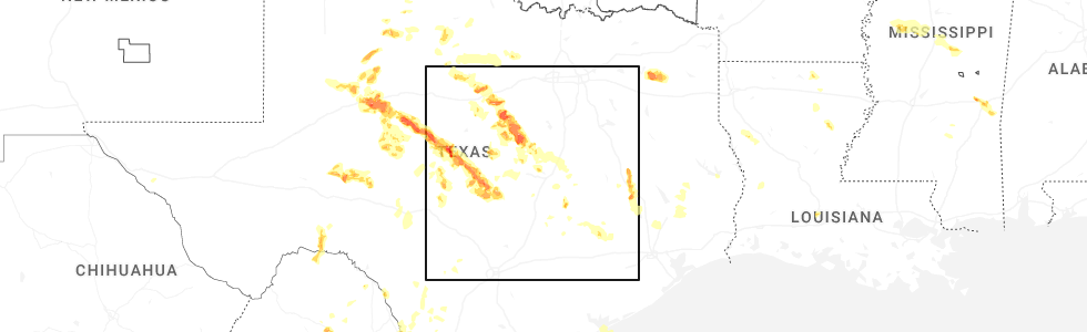
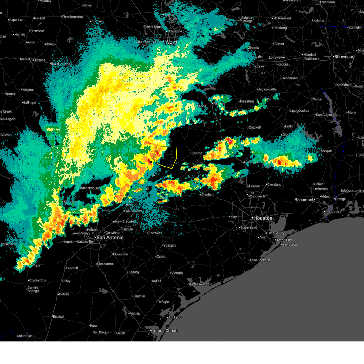
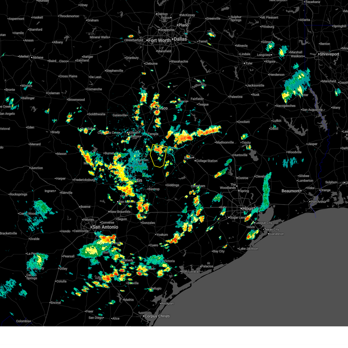
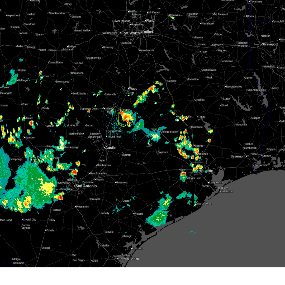
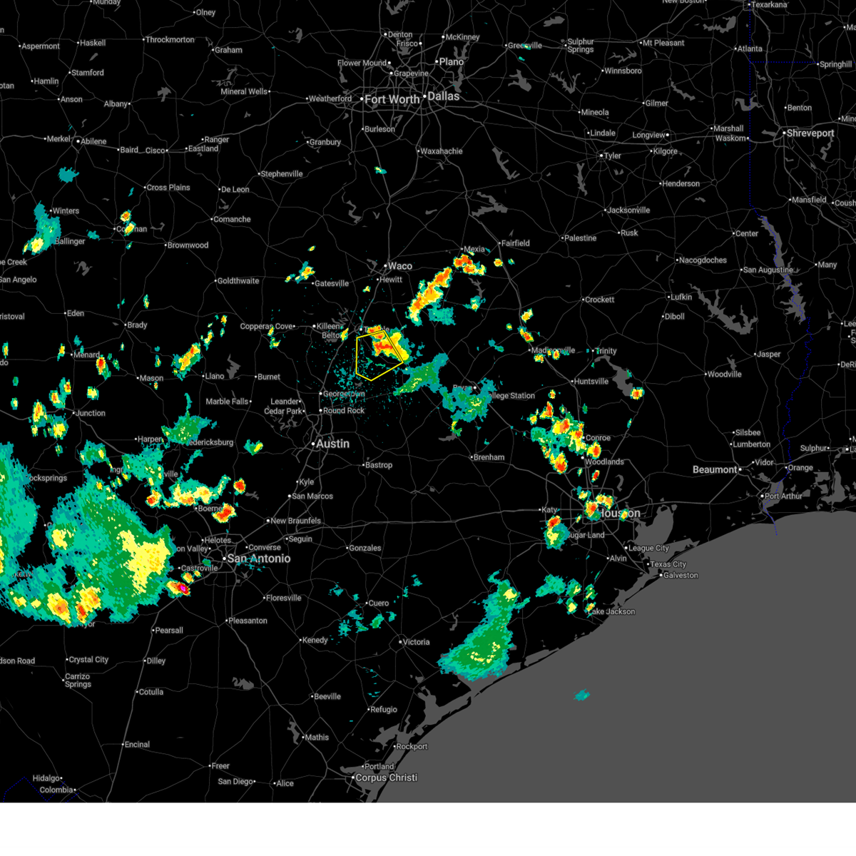
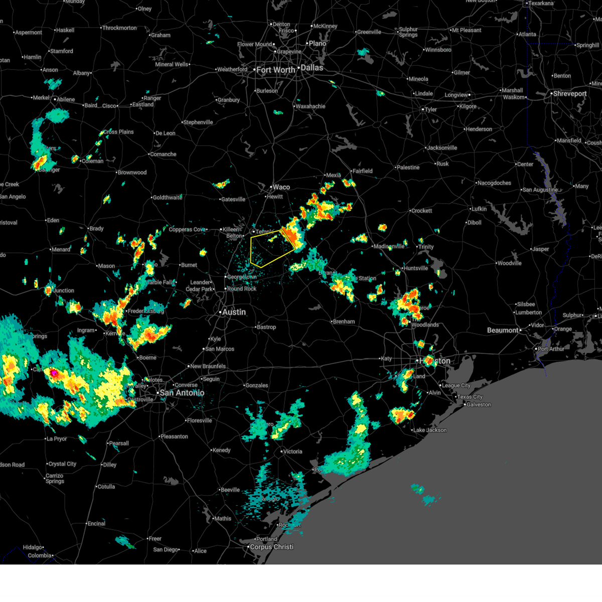
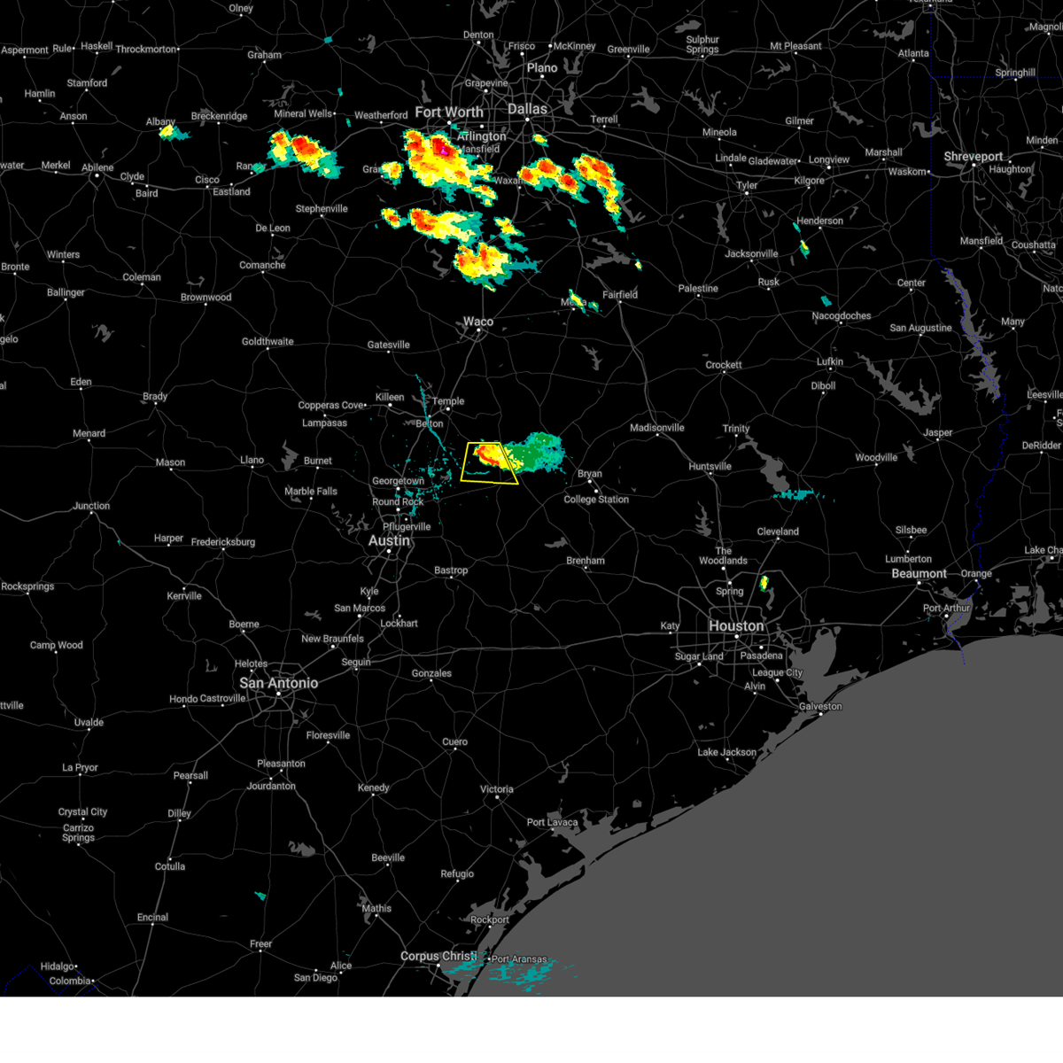
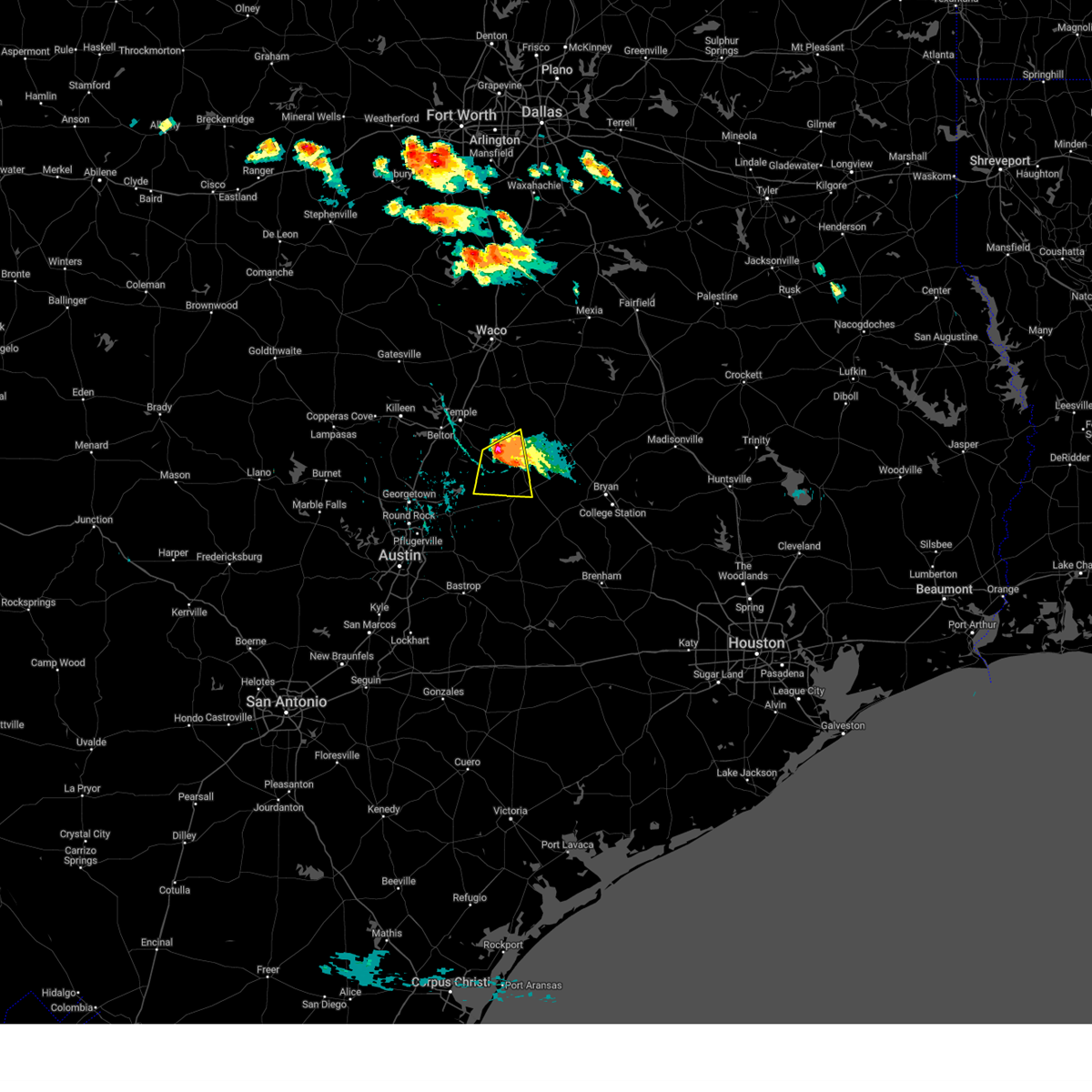
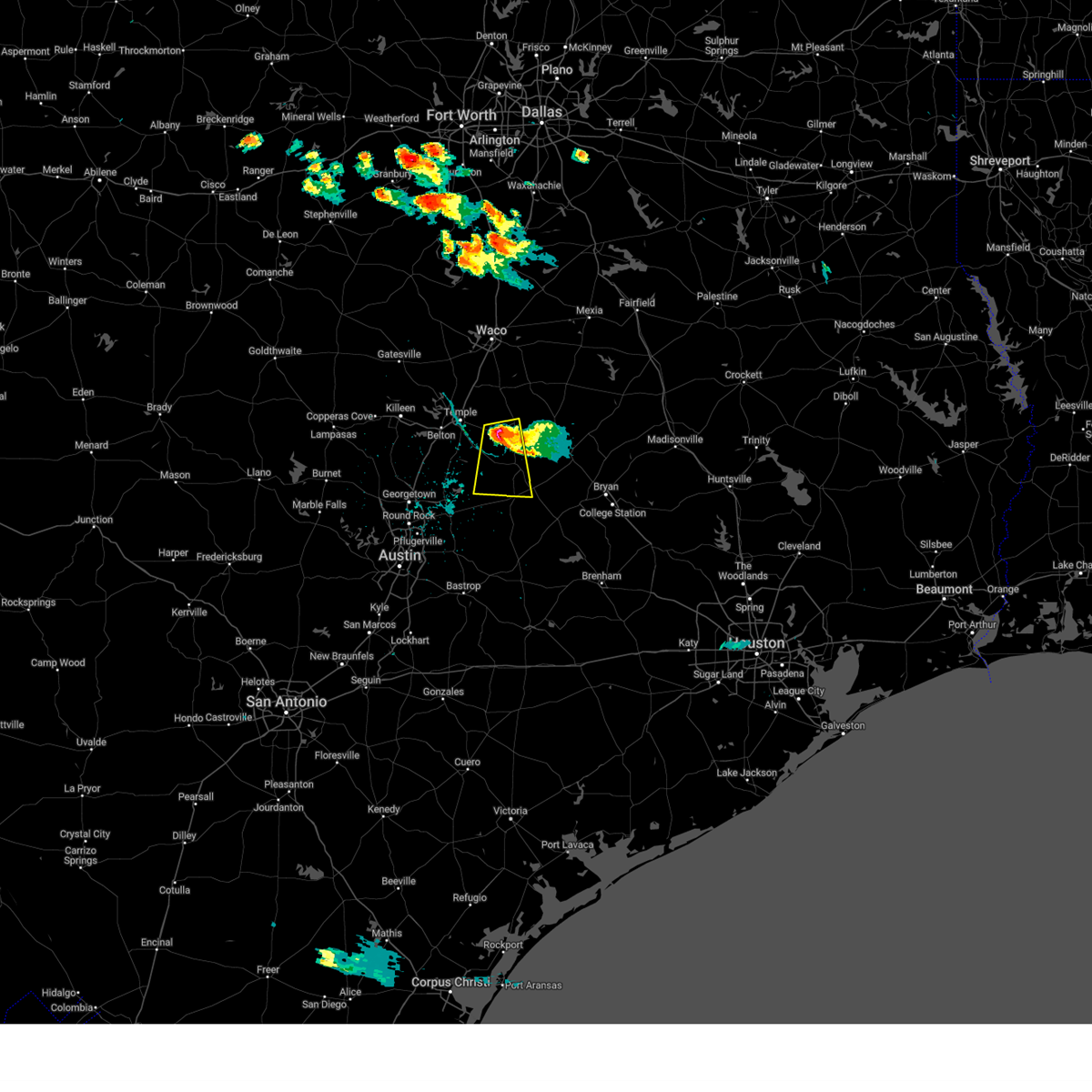
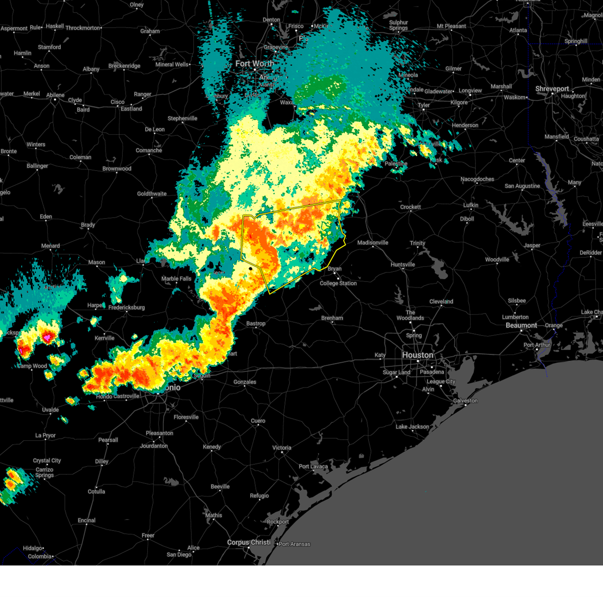
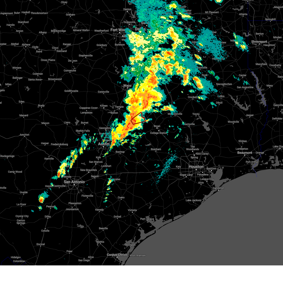
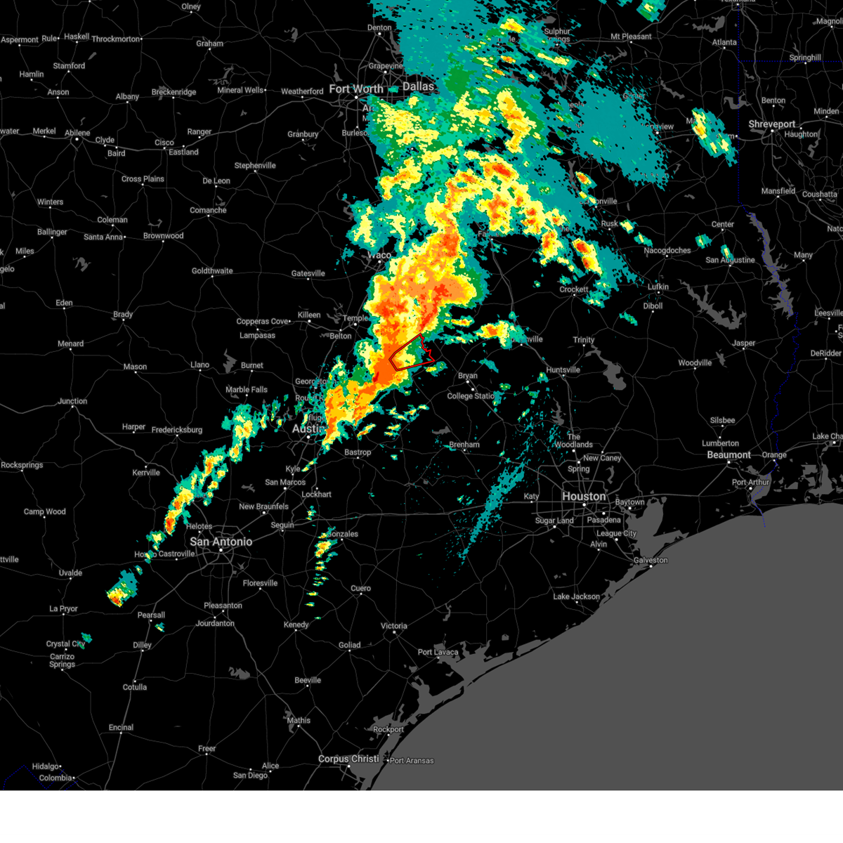
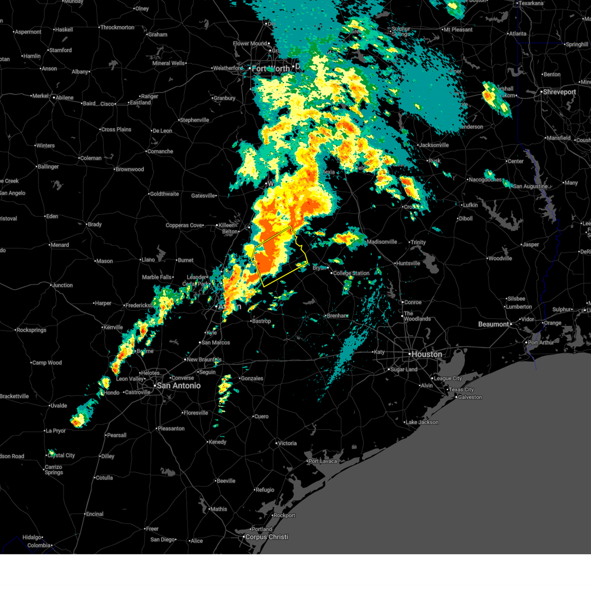
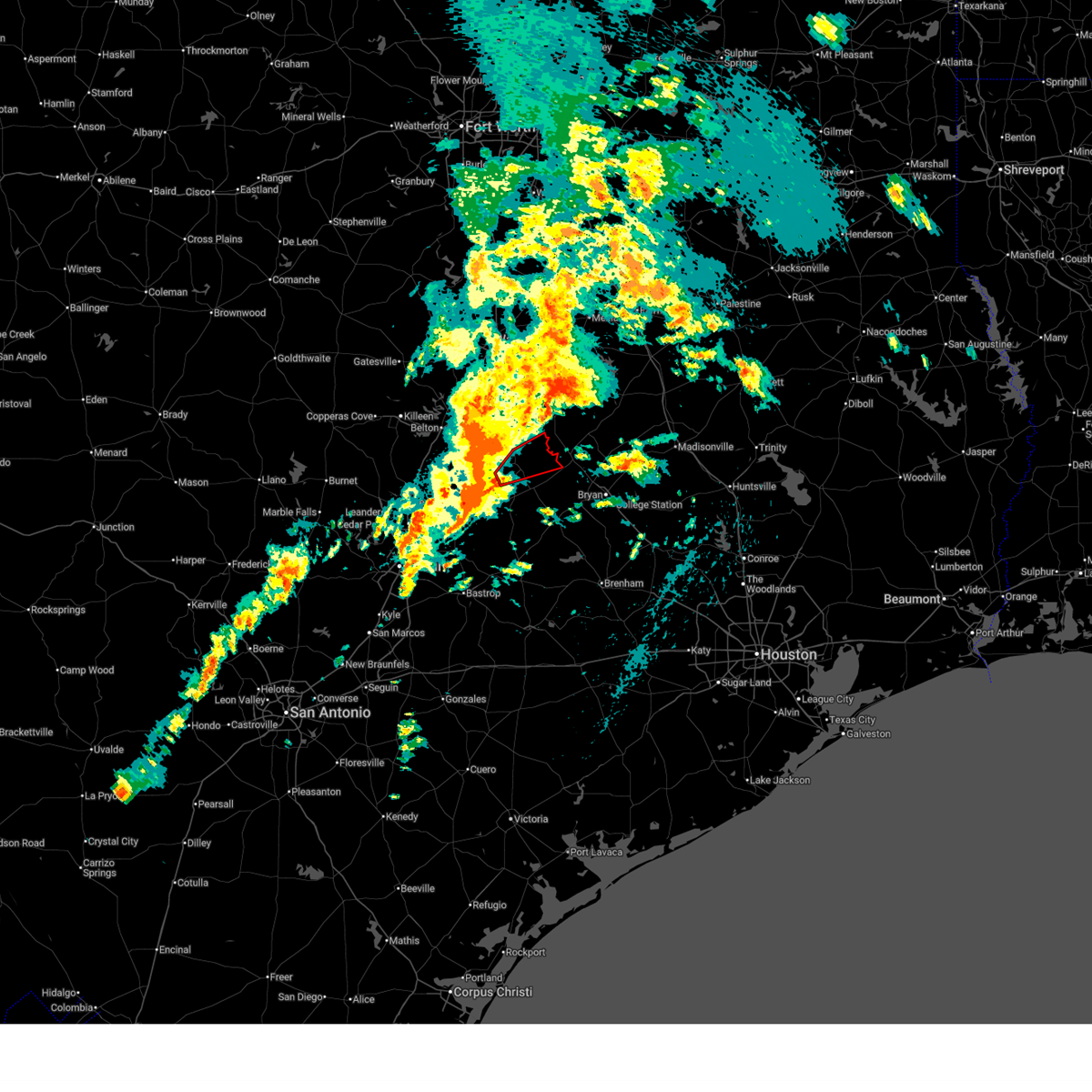
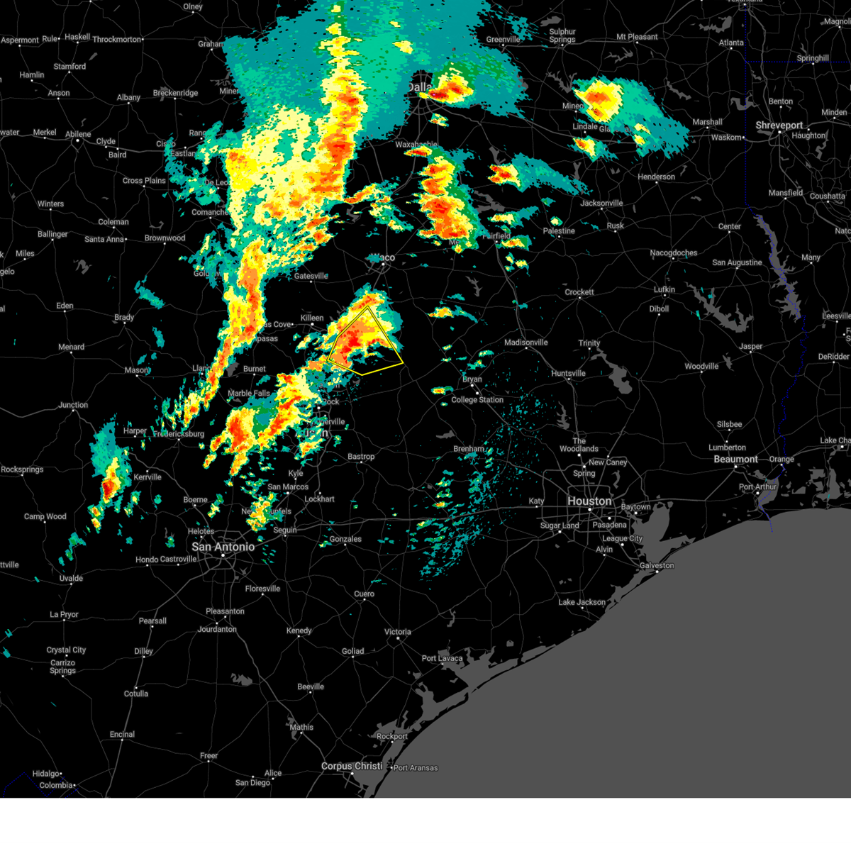
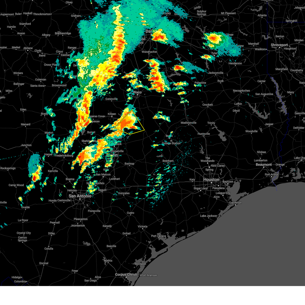
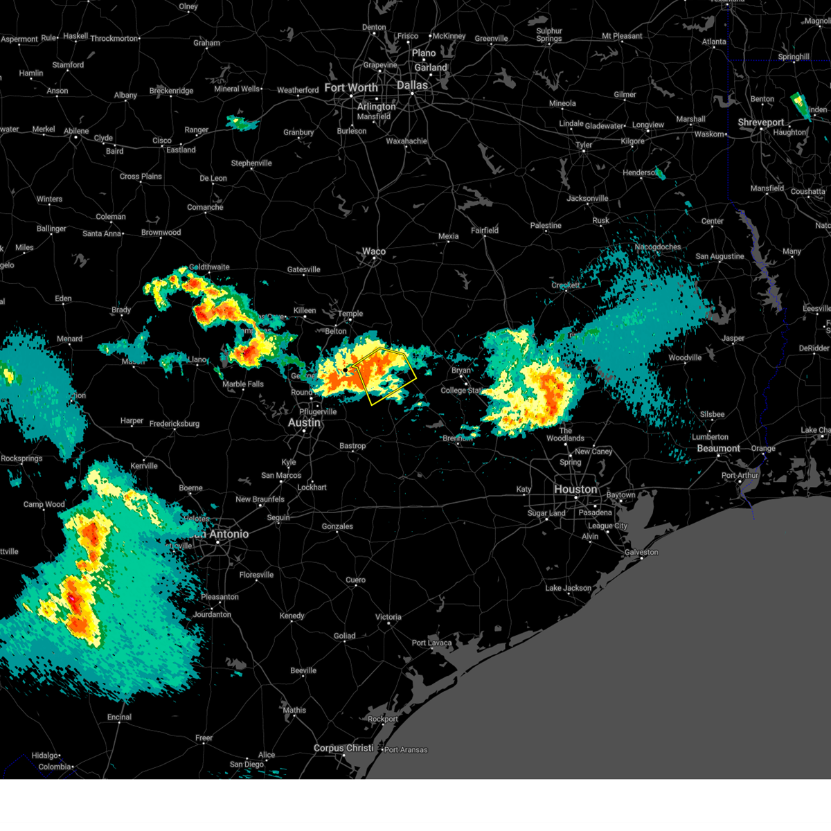
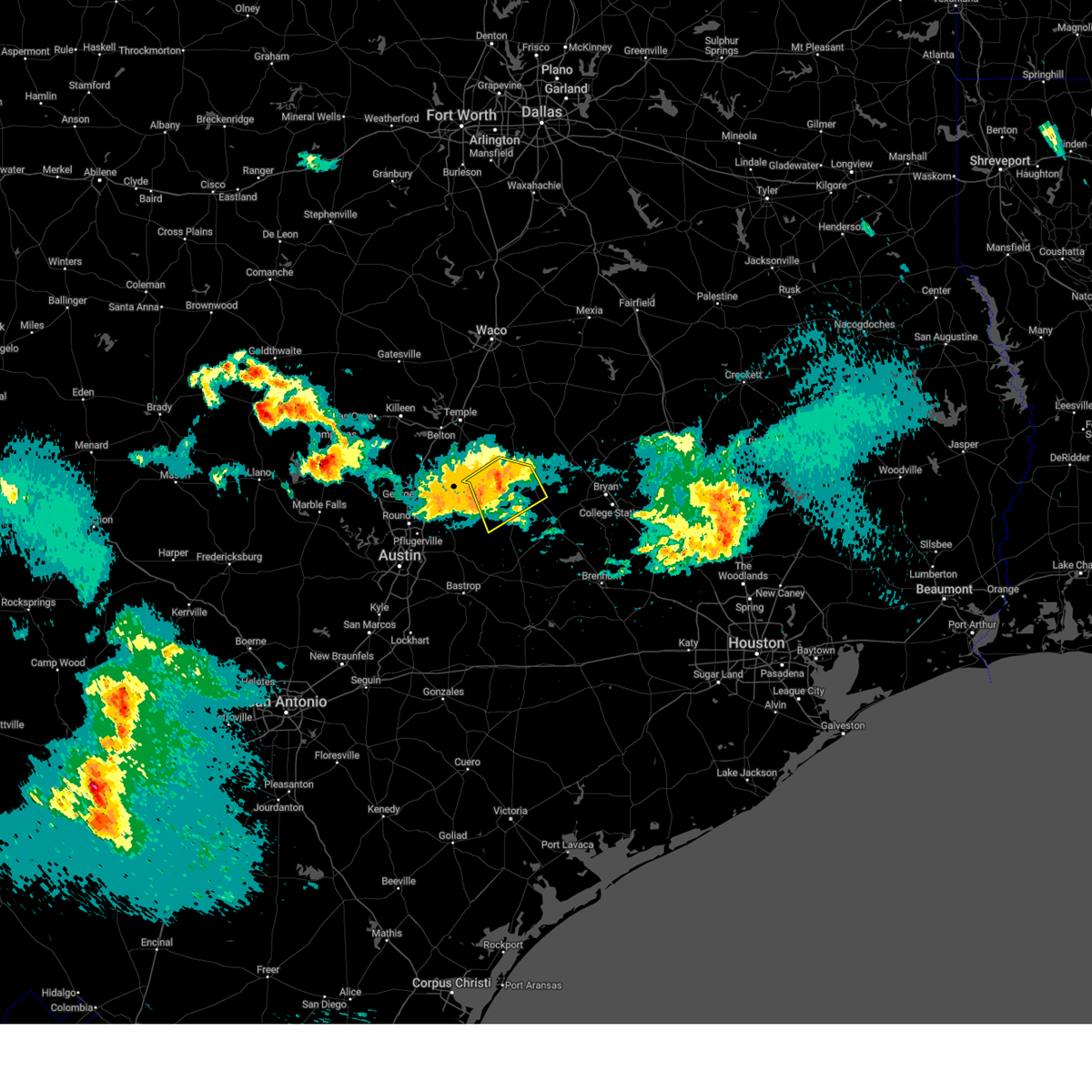
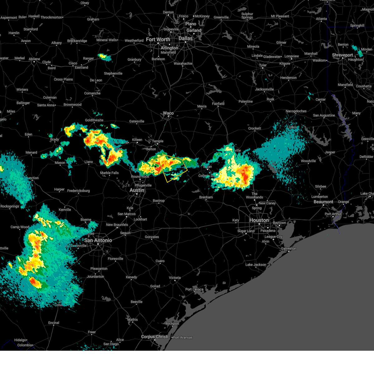
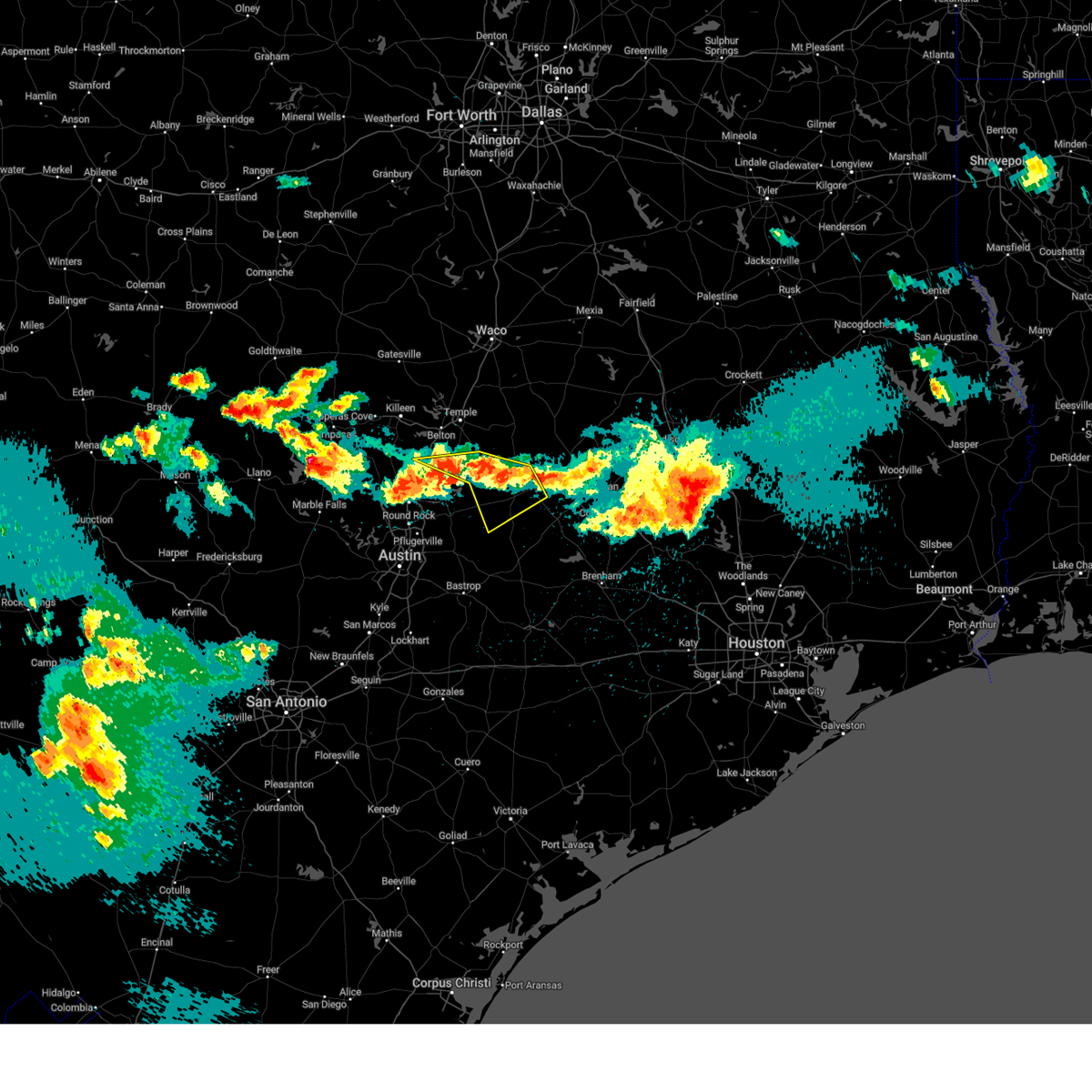
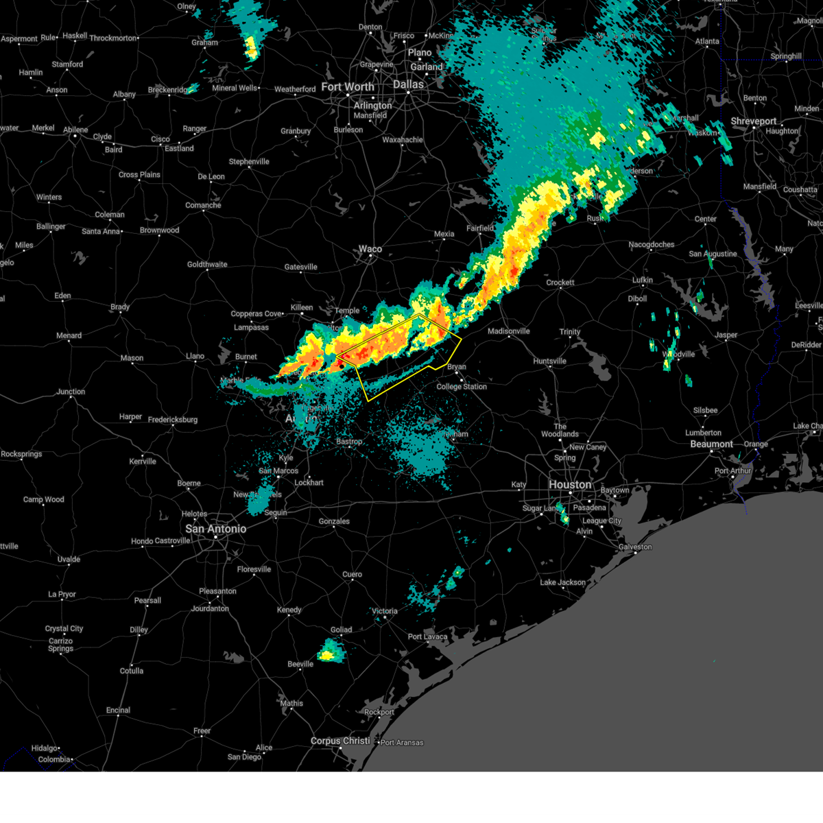
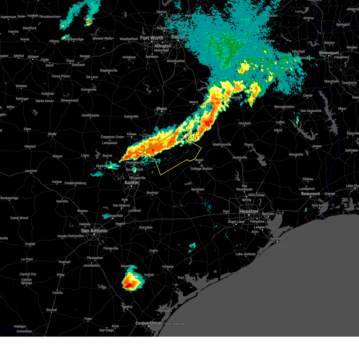
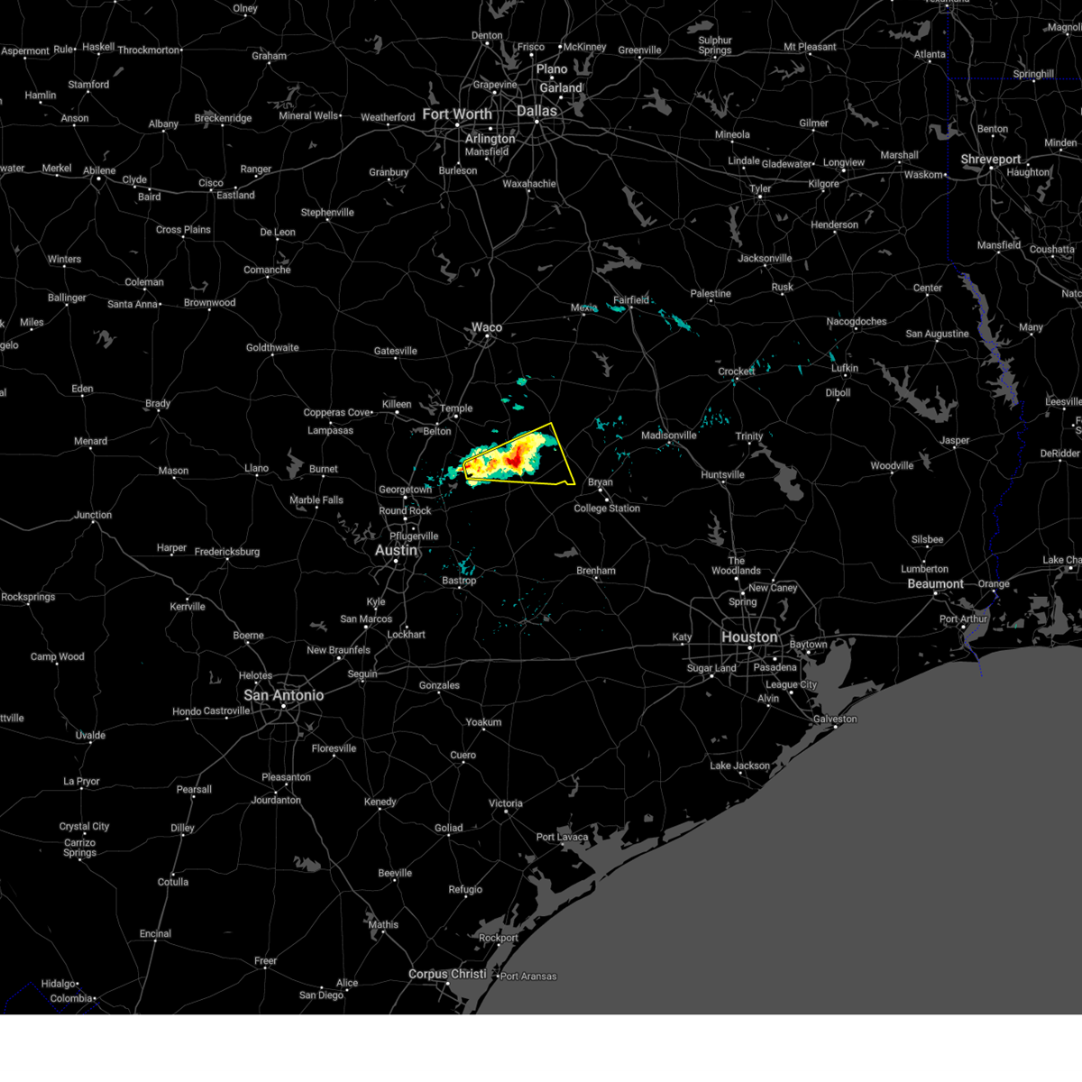
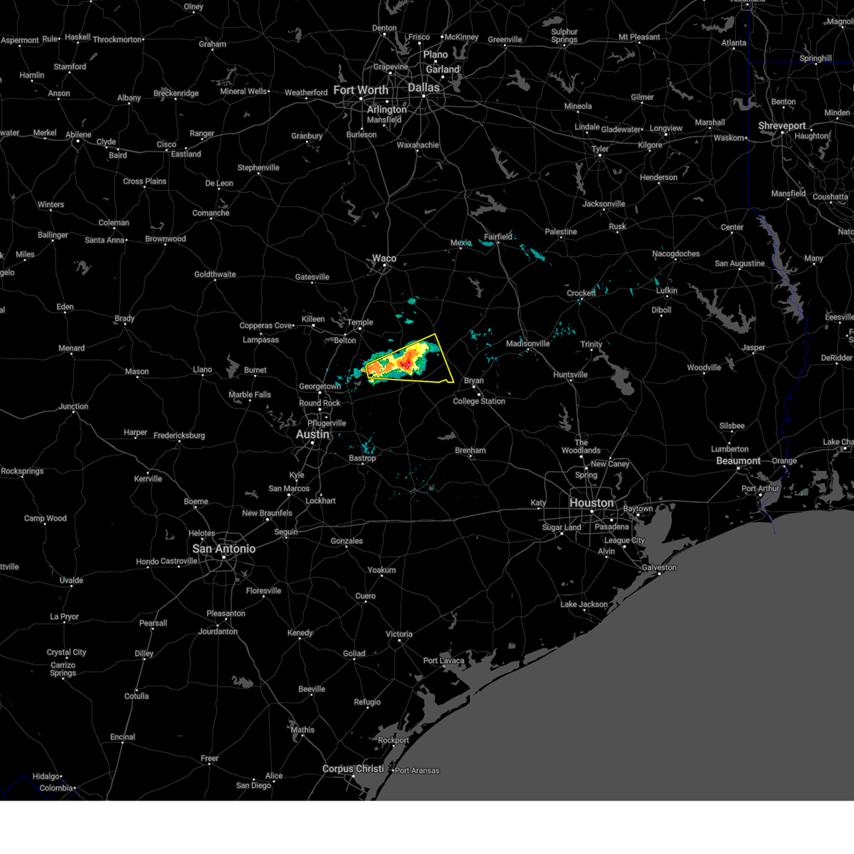
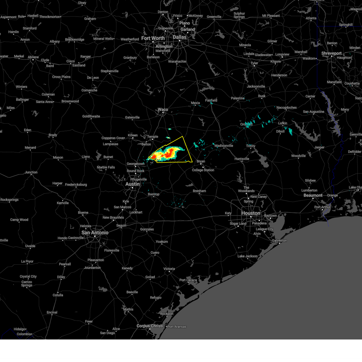
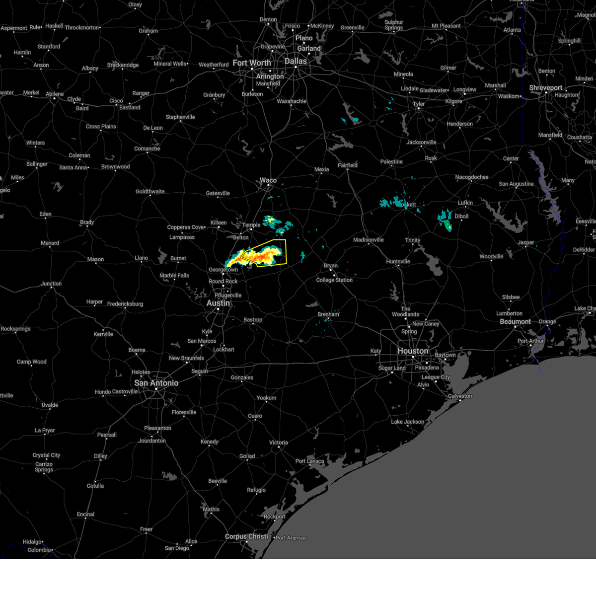
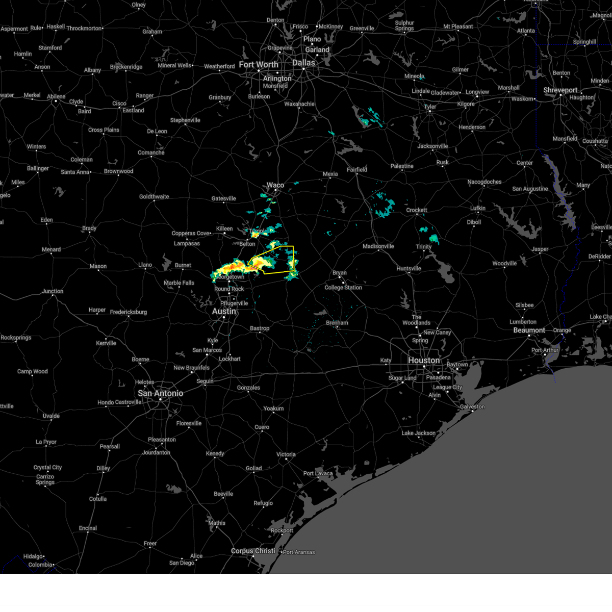
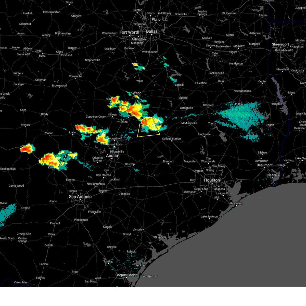
Hail Map for Cameron, TX
The Cameron, TX area has had 6 reports of on-the-ground hail by trained spotters, and has been under severe weather warnings 12 times during the past 12 months. Doppler radar has detected hail at or near Cameron, TX on 48 occasions, including 2 occasions during the past year.
| Name: | Cameron, TX |
| Where Located: | 47.9 miles ESE of Killeen, TX |
| Map: | Google Map for Cameron, TX |
| Population: | 5552 |
| Housing Units: | 2360 |
| More Info: | Search Google for Cameron, TX |
0
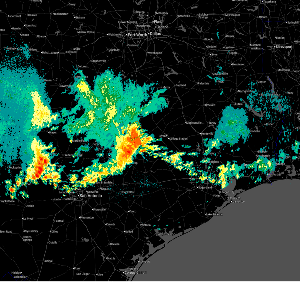
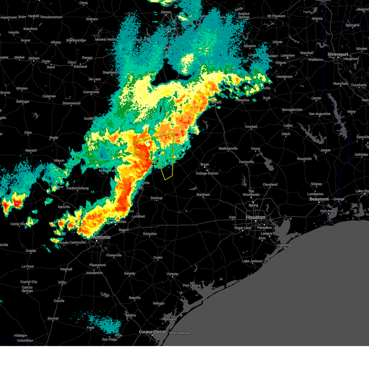
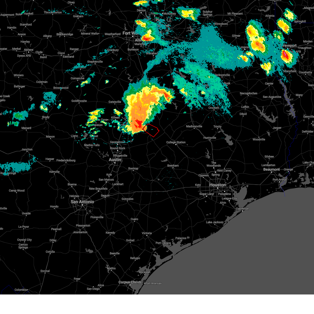
The Top Recent Hail Date for Cameron, TX is Sunday, May 10, 2026 (25th out of 48)
Hail and Wind Damage Spotted near Cameron, TX
| Date / Time | Report Details |
|---|---|
| 5/23/2026 4:03 AM CDT | Svrfwd the national weather service in fort worth has issued a * severe thunderstorm warning for, southern robertson county in central texas, northeastern milam county in central texas, * until 500 am cdt. * at 403 am cdt, a severe thunderstorm was located 10 miles northeast of rockdale, moving east at 25 mph (radar indicated). Hazards include 60 mph wind gusts and half dollar size hail. Hail damage to vehicles is expected. expect wind damage to roofs, siding, and trees. This severe thunderstorm will remain over mainly rural areas of southern robertson and northeastern milam counties, including the following locations, hanover, maysfield, hoyte, crossroads, benchley, milano, new baden, jones prairie, elevation, and wheelock. |
| 5/19/2026 10:27 PM CDT |
 The storm which prompted the warning has moved out of the area. therefore the warning will be allowed to expire. however, heavy rainfall is still possible. a severe thunderstorm warning remains in effect for southern milam county until 1045 pm. a severe thunderstorm watch remains in effect until 100 am cdt for central texas. The storm which prompted the warning has moved out of the area. therefore the warning will be allowed to expire. however, heavy rainfall is still possible. a severe thunderstorm warning remains in effect for southern milam county until 1045 pm. a severe thunderstorm watch remains in effect until 100 am cdt for central texas.
|
| 5/19/2026 9:57 PM CDT |
 At 956 pm cdt, a severe thunderstorm was located 7 miles north of thorndale, or 10 miles northwest of rockdale, moving southeast at 15 mph (radar indicated). Hazards include 65 mph wind gusts and quarter size hail. Hail damage to vehicles is expected. expect wind damage to roofs, siding, and trees. This severe thunderstorm will remain over mainly rural areas of northwestern milam county, including the following locations, minerva, val verde, san gabriel, sharp, yarrelton, pettibone, and davilla. At 956 pm cdt, a severe thunderstorm was located 7 miles north of thorndale, or 10 miles northwest of rockdale, moving southeast at 15 mph (radar indicated). Hazards include 65 mph wind gusts and quarter size hail. Hail damage to vehicles is expected. expect wind damage to roofs, siding, and trees. This severe thunderstorm will remain over mainly rural areas of northwestern milam county, including the following locations, minerva, val verde, san gabriel, sharp, yarrelton, pettibone, and davilla.
|
| 5/19/2026 9:19 PM CDT |
 Svrfwd the national weather service in fort worth has issued a * severe thunderstorm warning for, northwestern milam county in central texas, southeastern bell county in central texas, * until 1030 pm cdt. * at 919 pm cdt, a severe thunderstorm was located near rogers, or 12 miles west of cameron, moving south at 10 mph (radar indicated). Hazards include 65 mph wind gusts and quarter size hail. Hail damage to vehicles is expected. expect wind damage to roofs, siding, and trees. this severe thunderstorm will be near, rogers and buckholts around 925 pm cdt. Other locations impacted by this severe thunderstorm include minerva, edgeworth, val verde, leedale, san gabriel, cyclone, sharp, yarrelton, sparks, and pettibone. Svrfwd the national weather service in fort worth has issued a * severe thunderstorm warning for, northwestern milam county in central texas, southeastern bell county in central texas, * until 1030 pm cdt. * at 919 pm cdt, a severe thunderstorm was located near rogers, or 12 miles west of cameron, moving south at 10 mph (radar indicated). Hazards include 65 mph wind gusts and quarter size hail. Hail damage to vehicles is expected. expect wind damage to roofs, siding, and trees. this severe thunderstorm will be near, rogers and buckholts around 925 pm cdt. Other locations impacted by this severe thunderstorm include minerva, edgeworth, val verde, leedale, san gabriel, cyclone, sharp, yarrelton, sparks, and pettibone.
|
| 5/10/2026 9:39 PM CDT |
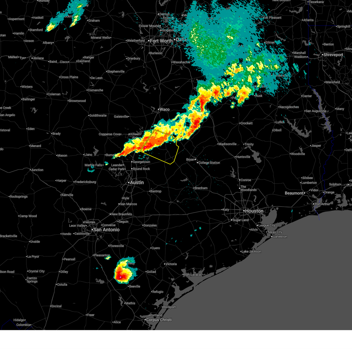
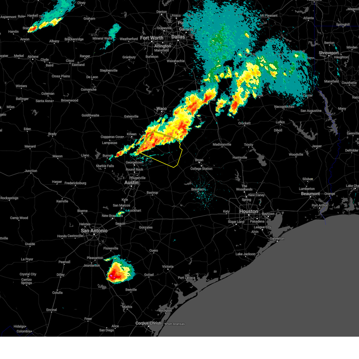
 Svrfwd the national weather service in fort worth has issued a * severe thunderstorm warning for, northwestern milam county in central texas, southeastern bell county in central texas, * until 1045 pm cdt. * at 939 pm cdt, severe thunderstorms were located along a line extending from 7 miles northeast of rogers to near buckholts to near granger dam, moving east at 20 mph (radar indicated). Hazards include 60 mph wind gusts and quarter size hail. Hail damage to vehicles is expected. Expect wind damage to roofs, siding, and trees. Svrfwd the national weather service in fort worth has issued a * severe thunderstorm warning for, northwestern milam county in central texas, southeastern bell county in central texas, * until 1045 pm cdt. * at 939 pm cdt, severe thunderstorms were located along a line extending from 7 miles northeast of rogers to near buckholts to near granger dam, moving east at 20 mph (radar indicated). Hazards include 60 mph wind gusts and quarter size hail. Hail damage to vehicles is expected. Expect wind damage to roofs, siding, and trees.
|
| 8/21/2025 2:58 PM CDT |
 Svrfwd the national weather service in fort worth has issued a * severe thunderstorm warning for, southwestern milam county in central texas, * until 400 pm cdt. * at 258 pm cdt, a severe thunderstorm was located 7 miles north of rockdale, moving south at 10 mph (radar indicated). Hazards include 60 mph wind gusts and penny size hail. expect damage to roofs, siding, and trees Svrfwd the national weather service in fort worth has issued a * severe thunderstorm warning for, southwestern milam county in central texas, * until 400 pm cdt. * at 258 pm cdt, a severe thunderstorm was located 7 miles north of rockdale, moving south at 10 mph (radar indicated). Hazards include 60 mph wind gusts and penny size hail. expect damage to roofs, siding, and trees
|
| 8/19/2025 4:44 PM CDT |
 The storms which prompted the warning have weakened below severe limits. therefore the warning will be allowed to expire. however gusty downburst winds near 50 mph are still possible with these thunderstorms. The storms which prompted the warning have weakened below severe limits. therefore the warning will be allowed to expire. however gusty downburst winds near 50 mph are still possible with these thunderstorms.
|
| 8/19/2025 4:22 PM CDT |
 the severe thunderstorm warning has been cancelled and is no longer in effect the severe thunderstorm warning has been cancelled and is no longer in effect
|
| 8/19/2025 4:22 PM CDT |
 At 420 pm cdt, a severe thunderstorm was located near buckholts, or 9 miles northwest of cameron, moving southwest at 20 mph (radar indicated). Hazards include 65 mph wind gusts. Expect damage to roofs, siding, and trees. this severe storm will be near, rogers around 430 pm cdt. Other locations impacted by this severe thunderstorm include cyclone, heidenheimer, yarrelton, pettibone, sparks, davilla, edgeworth, val verde, leedale, and airville. At 420 pm cdt, a severe thunderstorm was located near buckholts, or 9 miles northwest of cameron, moving southwest at 20 mph (radar indicated). Hazards include 65 mph wind gusts. Expect damage to roofs, siding, and trees. this severe storm will be near, rogers around 430 pm cdt. Other locations impacted by this severe thunderstorm include cyclone, heidenheimer, yarrelton, pettibone, sparks, davilla, edgeworth, val verde, leedale, and airville.
|
| 8/19/2025 4:00 PM CDT |
 Svrfwd the national weather service in fort worth has issued a * severe thunderstorm warning for, northwestern milam county in central texas, southeastern bell county in central texas, south central falls county in central texas, * until 445 pm cdt. * at 359 pm cdt, a severe thunderstorm was located near rosebud, or 8 miles north of cameron, moving southwest at 20 mph (radar indicated). Hazards include 65 mph wind gusts. Expect damage to roofs, siding, and trees. this severe thunderstorm will be near, buckholts around 420 pm cdt. rogers around 430 pm cdt. Other locations impacted by this severe thunderstorm include barclay, ben arnold, cyclone, heidenheimer, wilson, yarrelton, pettibone, sparks, davilla, and silver city. Svrfwd the national weather service in fort worth has issued a * severe thunderstorm warning for, northwestern milam county in central texas, southeastern bell county in central texas, south central falls county in central texas, * until 445 pm cdt. * at 359 pm cdt, a severe thunderstorm was located near rosebud, or 8 miles north of cameron, moving southwest at 20 mph (radar indicated). Hazards include 65 mph wind gusts. Expect damage to roofs, siding, and trees. this severe thunderstorm will be near, buckholts around 420 pm cdt. rogers around 430 pm cdt. Other locations impacted by this severe thunderstorm include barclay, ben arnold, cyclone, heidenheimer, wilson, yarrelton, pettibone, sparks, davilla, and silver city.
|
| 8/2/2025 4:21 PM CDT |
 the severe thunderstorm warning has been cancelled and is no longer in effect the severe thunderstorm warning has been cancelled and is no longer in effect
|
| 8/2/2025 3:38 PM CDT |
 Svrfwd the national weather service in fort worth has issued a * severe thunderstorm warning for, central milam county in central texas, southeastern bell county in central texas, * until 445 pm cdt. * at 337 pm cdt, severe thunderstorms were located along a line extending from near buckholts to near rockdale to near tanglewood, moving east at 10 mph. a second thunderstorm capable of producing severe winds was located 1 mile east of little river-academy, moving southeast at 20 mph (radar indicated). Hazards include 60 mph wind gusts and nickel size hail. Expect damage to roofs, siding, and trees. severe thunderstorms will be near, rockdale, buckholts, and alcoa lake around 345 pm cdt. Other locations impacted by these severe thunderstorms include minerva, ben arnold, cyclone, sharp, hoyte, yarrelton, pettibone, milano, silver city, and edgeworth. Svrfwd the national weather service in fort worth has issued a * severe thunderstorm warning for, central milam county in central texas, southeastern bell county in central texas, * until 445 pm cdt. * at 337 pm cdt, severe thunderstorms were located along a line extending from near buckholts to near rockdale to near tanglewood, moving east at 10 mph. a second thunderstorm capable of producing severe winds was located 1 mile east of little river-academy, moving southeast at 20 mph (radar indicated). Hazards include 60 mph wind gusts and nickel size hail. Expect damage to roofs, siding, and trees. severe thunderstorms will be near, rockdale, buckholts, and alcoa lake around 345 pm cdt. Other locations impacted by these severe thunderstorms include minerva, ben arnold, cyclone, sharp, hoyte, yarrelton, pettibone, milano, silver city, and edgeworth.
|
| 6/1/2025 7:11 PM CDT |
 The storm which prompted the warning has weakened below severe limits. therefore the warning will be allowed to expire. however small hail and gusty winds are still possible with this thunderstorm. a severe thunderstorm watch remains in effect until 1000 pm cdt for central texas. The storm which prompted the warning has weakened below severe limits. therefore the warning will be allowed to expire. however small hail and gusty winds are still possible with this thunderstorm. a severe thunderstorm watch remains in effect until 1000 pm cdt for central texas.
|
| 6/1/2025 6:56 PM CDT |
 At 655 pm cdt, a severe thunderstorm was located near buckholts, or 8 miles southwest of cameron, moving south at 20 mph (radar indicated). Hazards include 60 mph wind gusts and quarter size hail. Hail damage to vehicles is expected. expect wind damage to roofs, siding, and trees. This severe thunderstorm will remain over mainly rural areas of west central milam county, including the following locations, minerva, sharp, pettibone, and san gabriel. At 655 pm cdt, a severe thunderstorm was located near buckholts, or 8 miles southwest of cameron, moving south at 20 mph (radar indicated). Hazards include 60 mph wind gusts and quarter size hail. Hail damage to vehicles is expected. expect wind damage to roofs, siding, and trees. This severe thunderstorm will remain over mainly rural areas of west central milam county, including the following locations, minerva, sharp, pettibone, and san gabriel.
|
| 6/1/2025 6:33 PM CDT |
 the severe thunderstorm warning has been cancelled and is no longer in effect the severe thunderstorm warning has been cancelled and is no longer in effect
|
| 6/1/2025 6:33 PM CDT |
 At 632 pm cdt, a severe thunderstorm was located near buckholts, or near cameron, moving south at 20 mph (radar indicated). Hazards include 60 mph wind gusts and quarter size hail. Hail damage to vehicles is expected. expect wind damage to roofs, siding, and trees. this severe storm will be near, cameron and buckholts around 640 pm cdt. rockdale around 710 pm cdt. Other locations impacted by this severe thunderstorm include minerva, silver city, ben arnold, san gabriel, burlington, sharp, yarrelton, hoyte, pettibone, and milano. At 632 pm cdt, a severe thunderstorm was located near buckholts, or near cameron, moving south at 20 mph (radar indicated). Hazards include 60 mph wind gusts and quarter size hail. Hail damage to vehicles is expected. expect wind damage to roofs, siding, and trees. this severe storm will be near, cameron and buckholts around 640 pm cdt. rockdale around 710 pm cdt. Other locations impacted by this severe thunderstorm include minerva, silver city, ben arnold, san gabriel, burlington, sharp, yarrelton, hoyte, pettibone, and milano.
|
| 6/1/2025 6:17 PM CDT |
 Svrfwd the national weather service in fort worth has issued a * severe thunderstorm warning for, central milam county in central texas, east central bell county in central texas, south central falls county in central texas, * until 715 pm cdt. * at 617 pm cdt, a severe thunderstorm was located 8 miles southwest of rosebud, or 10 miles northwest of cameron, moving south at 20 mph (radar indicated). Hazards include 60 mph wind gusts and quarter size hail. Hail damage to vehicles is expected. expect wind damage to roofs, siding, and trees. this severe thunderstorm will be near, buckholts around 630 pm cdt. cameron around 635 pm cdt. Other locations impacted by this severe thunderstorm include minerva, barclay, ben arnold, san gabriel, cyclone, wilson, sharp, yarrelton, hoyte, and pettibone. Svrfwd the national weather service in fort worth has issued a * severe thunderstorm warning for, central milam county in central texas, east central bell county in central texas, south central falls county in central texas, * until 715 pm cdt. * at 617 pm cdt, a severe thunderstorm was located 8 miles southwest of rosebud, or 10 miles northwest of cameron, moving south at 20 mph (radar indicated). Hazards include 60 mph wind gusts and quarter size hail. Hail damage to vehicles is expected. expect wind damage to roofs, siding, and trees. this severe thunderstorm will be near, buckholts around 630 pm cdt. cameron around 635 pm cdt. Other locations impacted by this severe thunderstorm include minerva, barclay, ben arnold, san gabriel, cyclone, wilson, sharp, yarrelton, hoyte, and pettibone.
|
| 5/26/2025 9:26 PM CDT |
 Svrfwd the national weather service in fort worth has issued a * severe thunderstorm warning for, robertson county in central texas, milam county in central texas, eastern bell county in central texas, southeastern limestone county in central texas, falls county in central texas, * until 1015 pm cdt. * at 925 pm cdt, a severe thunderstorm was located near cameron, moving east at 55 mph (trained weather spotters). Hazards include 70 mph wind gusts and quarter size hail. Hail damage to vehicles is expected. expect considerable tree damage. wind damage is also likely to mobile homes, roofs, and outbuildings. this severe thunderstorm will be near, cameron around 930 pm cdt. calvert and hearne around 945 pm cdt. other locations impacted by this severe thunderstorm include barclay, moffat, sharp, yarrelton, hoyte, pettibone, reagan, new baden, davilla, and elevation. This includes interstate 35 between mile markers 290 and 313. Svrfwd the national weather service in fort worth has issued a * severe thunderstorm warning for, robertson county in central texas, milam county in central texas, eastern bell county in central texas, southeastern limestone county in central texas, falls county in central texas, * until 1015 pm cdt. * at 925 pm cdt, a severe thunderstorm was located near cameron, moving east at 55 mph (trained weather spotters). Hazards include 70 mph wind gusts and quarter size hail. Hail damage to vehicles is expected. expect considerable tree damage. wind damage is also likely to mobile homes, roofs, and outbuildings. this severe thunderstorm will be near, cameron around 930 pm cdt. calvert and hearne around 945 pm cdt. other locations impacted by this severe thunderstorm include barclay, moffat, sharp, yarrelton, hoyte, pettibone, reagan, new baden, davilla, and elevation. This includes interstate 35 between mile markers 290 and 313.
|
| 5/26/2025 9:02 PM CDT |
 At 901 pm cdt, a severe thunderstorm was located near holland, or 13 miles northeast of granger, moving east at 50 mph. this is a destructive storm for southern bell and milam counties (trained weather spotters). Hazards include 80 mph wind gusts and quarter size hail. Flying debris will be dangerous to those caught without shelter. mobile homes will be heavily damaged. expect considerable damage to roofs, windows, and vehicles. extensive tree damage and power outages are likely. this severe storm will be near, rogers around 905 pm cdt. buckholts around 910 pm cdt. cameron around 925 pm cdt. Other locations impacted by this severe thunderstorm include barclay, cedar valley, sharp, yarrelton, pettibone, prairie dell, davilla, woodland, oenaville, and terrys chapel. At 901 pm cdt, a severe thunderstorm was located near holland, or 13 miles northeast of granger, moving east at 50 mph. this is a destructive storm for southern bell and milam counties (trained weather spotters). Hazards include 80 mph wind gusts and quarter size hail. Flying debris will be dangerous to those caught without shelter. mobile homes will be heavily damaged. expect considerable damage to roofs, windows, and vehicles. extensive tree damage and power outages are likely. this severe storm will be near, rogers around 905 pm cdt. buckholts around 910 pm cdt. cameron around 925 pm cdt. Other locations impacted by this severe thunderstorm include barclay, cedar valley, sharp, yarrelton, pettibone, prairie dell, davilla, woodland, oenaville, and terrys chapel.
|
| 5/26/2025 8:51 PM CDT |
 Torfwd the national weather service in fort worth has issued a * tornado warning for, west central milam county in central texas, southeastern bell county in central texas, * until 930 pm cdt. * at 851 pm cdt, a severe thunderstorm capable of producing a tornado was located over bartlett, or near granger, moving east at 45 mph (radar indicated rotation). Hazards include tornado and quarter size hail. Flying debris will be dangerous to those caught without shelter. mobile homes will be damaged or destroyed. damage to roofs, windows, and vehicles will occur. tree damage is likely. this dangerous storm will be near, bartlett and holland around 855 pm cdt. buckholts around 915 pm cdt. cameron around 925 pm cdt. Other locations impacted by this tornadic thunderstorm include sharp, val verde, pettibone, and davilla. Torfwd the national weather service in fort worth has issued a * tornado warning for, west central milam county in central texas, southeastern bell county in central texas, * until 930 pm cdt. * at 851 pm cdt, a severe thunderstorm capable of producing a tornado was located over bartlett, or near granger, moving east at 45 mph (radar indicated rotation). Hazards include tornado and quarter size hail. Flying debris will be dangerous to those caught without shelter. mobile homes will be damaged or destroyed. damage to roofs, windows, and vehicles will occur. tree damage is likely. this dangerous storm will be near, bartlett and holland around 855 pm cdt. buckholts around 915 pm cdt. cameron around 925 pm cdt. Other locations impacted by this tornadic thunderstorm include sharp, val verde, pettibone, and davilla.
|
| 5/26/2025 8:38 PM CDT |
 Svrfwd the national weather service in fort worth has issued a * severe thunderstorm warning for, western milam county in central texas, bell county in central texas, southwestern falls county in central texas, * until 930 pm cdt. * at 836 pm cdt, a severe thunderstorm was located near stillhouse hollow lake, or near harker heights, moving east at 40 mph (radar indicated). Hazards include 70 mph wind gusts and quarter size hail. Hail damage to vehicles is expected. expect considerable tree damage. wind damage is also likely to mobile homes, roofs, and outbuildings. this severe thunderstorm will be near, stillhouse hollow lake, harker heights, and salado around 840 pm cdt. belton around 850 pm cdt. little river-academy around 855 pm cdt. rogers around 910 pm cdt. other locations impacted by this severe thunderstorm include barclay, cedar valley, sharp, yarrelton, pettibone, prairie dell, davilla, woodland, oenaville, and terrys chapel. This includes interstate 35 between mile markers 278 and 306. Svrfwd the national weather service in fort worth has issued a * severe thunderstorm warning for, western milam county in central texas, bell county in central texas, southwestern falls county in central texas, * until 930 pm cdt. * at 836 pm cdt, a severe thunderstorm was located near stillhouse hollow lake, or near harker heights, moving east at 40 mph (radar indicated). Hazards include 70 mph wind gusts and quarter size hail. Hail damage to vehicles is expected. expect considerable tree damage. wind damage is also likely to mobile homes, roofs, and outbuildings. this severe thunderstorm will be near, stillhouse hollow lake, harker heights, and salado around 840 pm cdt. belton around 850 pm cdt. little river-academy around 855 pm cdt. rogers around 910 pm cdt. other locations impacted by this severe thunderstorm include barclay, cedar valley, sharp, yarrelton, pettibone, prairie dell, davilla, woodland, oenaville, and terrys chapel. This includes interstate 35 between mile markers 278 and 306.
|
| 5/6/2025 12:38 PM CDT |
 The storm which prompted the warning has moved out of the area. therefore the warning will be allowed to expire. a tornado watch remains in effect until 400 pm cdt for central texas. to report severe weather, contact your nearest law enforcement agency. they will relay your report to the national weather service fort worth. The storm which prompted the warning has moved out of the area. therefore the warning will be allowed to expire. a tornado watch remains in effect until 400 pm cdt for central texas. to report severe weather, contact your nearest law enforcement agency. they will relay your report to the national weather service fort worth.
|
| 5/6/2025 12:16 PM CDT |
 At 1215 pm cdt, a confirmed tornado was located near cameron, moving northeast at 40 mph (law enforcement confirmed tornado. at 1214 pm cdt...a tornado was reported on fm 1600 by the milam county sheriff office). Hazards include damaging tornado and half dollar size hail. Flying debris will be dangerous to those caught without shelter. mobile homes will be damaged or destroyed. damage to roofs, windows, and vehicles will occur. tree damage is likely. Locations impacted include, hanover, jones prairie, silver city, maysfield, hoyte, branchville, crossroads, cameron, and minerva. At 1215 pm cdt, a confirmed tornado was located near cameron, moving northeast at 40 mph (law enforcement confirmed tornado. at 1214 pm cdt...a tornado was reported on fm 1600 by the milam county sheriff office). Hazards include damaging tornado and half dollar size hail. Flying debris will be dangerous to those caught without shelter. mobile homes will be damaged or destroyed. damage to roofs, windows, and vehicles will occur. tree damage is likely. Locations impacted include, hanover, jones prairie, silver city, maysfield, hoyte, branchville, crossroads, cameron, and minerva.
|
| 5/6/2025 12:13 PM CDT |
 At 1212 pm cdt, a severe thunderstorm capable of producing a tornado was located over cameron, moving northeast at 40 mph (radar indicated rotation). Hazards include tornado and half dollar size hail. Flying debris will be dangerous to those caught without shelter. mobile homes will be damaged or destroyed. damage to roofs, windows, and vehicles will occur. tree damage is likely. This tornadic thunderstorm will remain over mainly rural areas of northeastern milam county, including the following locations, hanover, jones prairie, silver city, maysfield, hoyte, branchville, crossroads, and minerva. At 1212 pm cdt, a severe thunderstorm capable of producing a tornado was located over cameron, moving northeast at 40 mph (radar indicated rotation). Hazards include tornado and half dollar size hail. Flying debris will be dangerous to those caught without shelter. mobile homes will be damaged or destroyed. damage to roofs, windows, and vehicles will occur. tree damage is likely. This tornadic thunderstorm will remain over mainly rural areas of northeastern milam county, including the following locations, hanover, jones prairie, silver city, maysfield, hoyte, branchville, crossroads, and minerva.
|
| 5/6/2025 12:07 PM CDT |
 At 1206 pm cdt, a severe thunderstorm was located near buckholts, or near cameron, moving northeast at 35 mph (radar indicated). Hazards include 70 mph wind gusts and half dollar size hail. Hail damage to vehicles is expected. expect considerable tree damage. wind damage is also likely to mobile homes, roofs, and outbuildings. this severe storm will be near, cameron around 1210 pm cdt. Other locations impacted by this severe thunderstorm include minerva, hanover, ben arnold, san gabriel, baileyville, sharp, maysfield, yarrelton, hoyte, and crossroads. At 1206 pm cdt, a severe thunderstorm was located near buckholts, or near cameron, moving northeast at 35 mph (radar indicated). Hazards include 70 mph wind gusts and half dollar size hail. Hail damage to vehicles is expected. expect considerable tree damage. wind damage is also likely to mobile homes, roofs, and outbuildings. this severe storm will be near, cameron around 1210 pm cdt. Other locations impacted by this severe thunderstorm include minerva, hanover, ben arnold, san gabriel, baileyville, sharp, maysfield, yarrelton, hoyte, and crossroads.
|
| 5/6/2025 12:04 PM CDT |
 Torfwd the national weather service in fort worth has issued a * tornado warning for, central milam county in central texas, * until 1245 pm cdt. * at 1204 pm cdt, a severe thunderstorm capable of producing a tornado was located near cameron, moving northeast at 40 mph (radar indicated rotation). Hazards include tornado. Flying debris will be dangerous to those caught without shelter. mobile homes will be damaged or destroyed. damage to roofs, windows, and vehicles will occur. tree damage is likely. this dangerous storm will be near, cameron around 1210 pm cdt. Other locations impacted by this tornadic thunderstorm include minerva, hanover, jones prairie, silver city, maysfield, hoyte, branchville, and crossroads. Torfwd the national weather service in fort worth has issued a * tornado warning for, central milam county in central texas, * until 1245 pm cdt. * at 1204 pm cdt, a severe thunderstorm capable of producing a tornado was located near cameron, moving northeast at 40 mph (radar indicated rotation). Hazards include tornado. Flying debris will be dangerous to those caught without shelter. mobile homes will be damaged or destroyed. damage to roofs, windows, and vehicles will occur. tree damage is likely. this dangerous storm will be near, cameron around 1210 pm cdt. Other locations impacted by this tornadic thunderstorm include minerva, hanover, jones prairie, silver city, maysfield, hoyte, branchville, and crossroads.
|
| 5/6/2025 11:45 AM CDT |
 Svrfwd the national weather service in fort worth has issued a * severe thunderstorm warning for, milam county in central texas, * until 1245 pm cdt. * at 1145 am cdt, a severe thunderstorm was located near granger dam, or 10 miles east of granger, moving northeast at 35 mph (radar indicated). Hazards include 65 mph wind gusts and quarter size hail. Hail damage to vehicles is expected. expect wind damage to roofs, siding, and trees. this severe thunderstorm will be near, buckholts around 1200 pm cdt. cameron around 1210 pm cdt. Other locations impacted by this severe thunderstorm include minerva, hanover, ben arnold, san gabriel, baileyville, sharp, maysfield, yarrelton, hoyte, and crossroads. Svrfwd the national weather service in fort worth has issued a * severe thunderstorm warning for, milam county in central texas, * until 1245 pm cdt. * at 1145 am cdt, a severe thunderstorm was located near granger dam, or 10 miles east of granger, moving northeast at 35 mph (radar indicated). Hazards include 65 mph wind gusts and quarter size hail. Hail damage to vehicles is expected. expect wind damage to roofs, siding, and trees. this severe thunderstorm will be near, buckholts around 1200 pm cdt. cameron around 1210 pm cdt. Other locations impacted by this severe thunderstorm include minerva, hanover, ben arnold, san gabriel, baileyville, sharp, maysfield, yarrelton, hoyte, and crossroads.
|
| 5/6/2025 10:23 AM CDT |
 At 1023 am cdt, a severe thunderstorm was located near holland, or 13 miles southeast of belton, moving northeast at 35 mph (radar indicated). Hazards include 60 mph wind gusts and quarter size hail. Hail damage to vehicles is expected. expect wind damage to roofs, siding, and trees. this severe storm will be near, little river-academy and rogers around 1030 am cdt. Other locations impacted by this severe thunderstorm include cyclone, heidenheimer, yarrelton, pettibone, sparks, prairie dell, davilla, oenaville, edgeworth, and val verde. At 1023 am cdt, a severe thunderstorm was located near holland, or 13 miles southeast of belton, moving northeast at 35 mph (radar indicated). Hazards include 60 mph wind gusts and quarter size hail. Hail damage to vehicles is expected. expect wind damage to roofs, siding, and trees. this severe storm will be near, little river-academy and rogers around 1030 am cdt. Other locations impacted by this severe thunderstorm include cyclone, heidenheimer, yarrelton, pettibone, sparks, prairie dell, davilla, oenaville, edgeworth, and val verde.
|
| 5/6/2025 10:12 AM CDT |
 Svrfwd the national weather service in fort worth has issued a * severe thunderstorm warning for, northwestern milam county in central texas, eastern bell county in central texas, * until 1100 am cdt. * at 1012 am cdt, a severe thunderstorm was located over holland, or 11 miles southeast of belton, moving northeast at 40 mph (radar indicated). Hazards include 60 mph wind gusts and quarter size hail. Hail damage to vehicles is expected. expect wind damage to roofs, siding, and trees. this severe thunderstorm will be near, little river-academy around 1015 am cdt. other locations impacted by this severe thunderstorm include cyclone, heidenheimer, yarrelton, pettibone, sparks, prairie dell, davilla, oenaville, edgeworth, and val verde. This includes interstate 35 between mile markers 277 and 308. Svrfwd the national weather service in fort worth has issued a * severe thunderstorm warning for, northwestern milam county in central texas, eastern bell county in central texas, * until 1100 am cdt. * at 1012 am cdt, a severe thunderstorm was located over holland, or 11 miles southeast of belton, moving northeast at 40 mph (radar indicated). Hazards include 60 mph wind gusts and quarter size hail. Hail damage to vehicles is expected. expect wind damage to roofs, siding, and trees. this severe thunderstorm will be near, little river-academy around 1015 am cdt. other locations impacted by this severe thunderstorm include cyclone, heidenheimer, yarrelton, pettibone, sparks, prairie dell, davilla, oenaville, edgeworth, and val verde. This includes interstate 35 between mile markers 277 and 308.
|
| 5/1/2025 8:12 PM CDT |
 the severe thunderstorm warning has been cancelled and is no longer in effect the severe thunderstorm warning has been cancelled and is no longer in effect
|
| 5/1/2025 8:12 PM CDT |
 At 812 pm cdt, severe thunderstorms were located along a line extending from thorndale to cameron, moving southeast at 20 mph (radar indicated). Hazards include 65 mph wind gusts and quarter size hail. Hail damage to vehicles is expected. expect wind damage to roofs, siding, and trees. Locations impacted include, minerva, san gabriel, sharp, hoyte, thorndale, pettibone, cameron, milano, rockdale, elevation, praesel, alcoa lake, and buckholts. At 812 pm cdt, severe thunderstorms were located along a line extending from thorndale to cameron, moving southeast at 20 mph (radar indicated). Hazards include 65 mph wind gusts and quarter size hail. Hail damage to vehicles is expected. expect wind damage to roofs, siding, and trees. Locations impacted include, minerva, san gabriel, sharp, hoyte, thorndale, pettibone, cameron, milano, rockdale, elevation, praesel, alcoa lake, and buckholts.
|
| 5/1/2025 7:58 PM CDT |
 At 757 pm cdt, severe thunderstorms were located along a line extending from granger dam to cameron, moving southeast at 10 mph (radar indicated). Hazards include 65 mph wind gusts and quarter size hail. Hail damage to vehicles is expected. expect wind damage to roofs, siding, and trees. Locations impacted include, minerva, san gabriel, sharp, hoyte, thorndale, pettibone, cameron, milano, rockdale, davilla, buckholts, elevation, val verde, praesel, alcoa lake, bartlett, and rogers. At 757 pm cdt, severe thunderstorms were located along a line extending from granger dam to cameron, moving southeast at 10 mph (radar indicated). Hazards include 65 mph wind gusts and quarter size hail. Hail damage to vehicles is expected. expect wind damage to roofs, siding, and trees. Locations impacted include, minerva, san gabriel, sharp, hoyte, thorndale, pettibone, cameron, milano, rockdale, davilla, buckholts, elevation, val verde, praesel, alcoa lake, bartlett, and rogers.
|
| 5/1/2025 7:32 PM CDT |
 Svrfwd the national weather service in fort worth has issued a * severe thunderstorm warning for, southern milam county in central texas, southeastern bell county in central texas, * until 845 pm cdt. * at 731 pm cdt, severe thunderstorms were located along a line extending from bartlett to 12 miles southwest of hearne, moving southeast at 10 mph (radar indicated). Hazards include 60 mph wind gusts and half dollar size hail. Hail damage to vehicles is expected. expect wind damage to roofs, siding, and trees. these severe thunderstorms will remain over mainly rural areas of southern milam and southeastern bell counties, including the following locations, minerva, elevation, val verde, san gabriel, praesel, sharp, hoyte, pettibone, prairie dell, and milano. This includes interstate 35 between mile markers 278 and 279. Svrfwd the national weather service in fort worth has issued a * severe thunderstorm warning for, southern milam county in central texas, southeastern bell county in central texas, * until 845 pm cdt. * at 731 pm cdt, severe thunderstorms were located along a line extending from bartlett to 12 miles southwest of hearne, moving southeast at 10 mph (radar indicated). Hazards include 60 mph wind gusts and half dollar size hail. Hail damage to vehicles is expected. expect wind damage to roofs, siding, and trees. these severe thunderstorms will remain over mainly rural areas of southern milam and southeastern bell counties, including the following locations, minerva, elevation, val verde, san gabriel, praesel, sharp, hoyte, pettibone, prairie dell, and milano. This includes interstate 35 between mile markers 278 and 279.
|
| 4/30/2025 9:13 PM CDT |
 the severe thunderstorm warning has been cancelled and is no longer in effect the severe thunderstorm warning has been cancelled and is no longer in effect
|
| 4/30/2025 9:13 PM CDT |
 At 913 pm cdt, a severe thunderstorm was located near cameron, moving east at 20 mph (radar indicated). Hazards include 60 mph wind gusts and quarter size hail. Hail damage to vehicles is expected. expect wind damage to roofs, siding, and trees. This severe thunderstorm will remain over mainly rural areas of southern robertson, milam and south central bell counties, including the following locations, minerva, hanover, ben arnold, san gabriel, baileyville, sharp, maysfield, yarrelton, hoyte, and crossroads. At 913 pm cdt, a severe thunderstorm was located near cameron, moving east at 20 mph (radar indicated). Hazards include 60 mph wind gusts and quarter size hail. Hail damage to vehicles is expected. expect wind damage to roofs, siding, and trees. This severe thunderstorm will remain over mainly rural areas of southern robertson, milam and south central bell counties, including the following locations, minerva, hanover, ben arnold, san gabriel, baileyville, sharp, maysfield, yarrelton, hoyte, and crossroads.
|
| 4/30/2025 8:41 PM CDT |
 Svrfwd the national weather service in fort worth has issued a * severe thunderstorm warning for, southern robertson county in central texas, milam county in central texas, southeastern bell county in central texas, south central falls county in central texas, * until 945 pm cdt. * at 840 pm cdt, a severe thunderstorm was located near buckholts, or 8 miles northwest of cameron, moving east at 20 mph (radar indicated). Hazards include 60 mph wind gusts and quarter size hail. Hail damage to vehicles is expected. expect wind damage to roofs, siding, and trees. this severe thunderstorm will be near, cameron around 850 pm cdt. Other locations impacted by this severe thunderstorm include hanover, ben arnold, baileyville, sharp, yarrelton, hoyte, crossroads, pettibone, davilla, and elevation. Svrfwd the national weather service in fort worth has issued a * severe thunderstorm warning for, southern robertson county in central texas, milam county in central texas, southeastern bell county in central texas, south central falls county in central texas, * until 945 pm cdt. * at 840 pm cdt, a severe thunderstorm was located near buckholts, or 8 miles northwest of cameron, moving east at 20 mph (radar indicated). Hazards include 60 mph wind gusts and quarter size hail. Hail damage to vehicles is expected. expect wind damage to roofs, siding, and trees. this severe thunderstorm will be near, cameron around 850 pm cdt. Other locations impacted by this severe thunderstorm include hanover, ben arnold, baileyville, sharp, yarrelton, hoyte, crossroads, pettibone, davilla, and elevation.
|
| 4/30/2025 8:24 PM CDT |
 At 823 pm cdt, a severe thunderstorm was located near buckholts, or 8 miles northwest of cameron, moving east at 20 mph (radar indicated). Hazards include 60 mph wind gusts and half dollar size hail. Hail damage to vehicles is expected. expect wind damage to roofs, siding, and trees. this severe storm will be near, cameron around 830 pm cdt. Other locations impacted by this severe thunderstorm include hanover, barclay, ben arnold, baileyville, sharp, yarrelton, hoyte, crossroads, pettibone, and davilla. At 823 pm cdt, a severe thunderstorm was located near buckholts, or 8 miles northwest of cameron, moving east at 20 mph (radar indicated). Hazards include 60 mph wind gusts and half dollar size hail. Hail damage to vehicles is expected. expect wind damage to roofs, siding, and trees. this severe storm will be near, cameron around 830 pm cdt. Other locations impacted by this severe thunderstorm include hanover, barclay, ben arnold, baileyville, sharp, yarrelton, hoyte, crossroads, pettibone, and davilla.
|
| 4/30/2025 7:51 PM CDT |
 Svrfwd the national weather service in fort worth has issued a * severe thunderstorm warning for, milam county in central texas, eastern bell county in central texas, southwestern falls county in central texas, * until 845 pm cdt. * at 750 pm cdt, a severe thunderstorm was located near little river-academy, or 9 miles southeast of temple, moving east at 20 mph (radar indicated). Hazards include ping pong ball size hail and 60 mph wind gusts. People and animals outdoors will be injured. expect hail damage to roofs, siding, windows, and vehicles. expect wind damage to roofs, siding, and trees. this severe thunderstorm will be near, rogers around 755 pm cdt. buckholts around 820 pm cdt. cameron around 835 pm cdt. other locations impacted by this severe thunderstorm include hanover, barclay, ben arnold, baileyville, sharp, yarrelton, hoyte, crossroads, pettibone, and prairie dell. This includes interstate 35 between mile markers 277 and 291, and between mile markers 293 and 308. Svrfwd the national weather service in fort worth has issued a * severe thunderstorm warning for, milam county in central texas, eastern bell county in central texas, southwestern falls county in central texas, * until 845 pm cdt. * at 750 pm cdt, a severe thunderstorm was located near little river-academy, or 9 miles southeast of temple, moving east at 20 mph (radar indicated). Hazards include ping pong ball size hail and 60 mph wind gusts. People and animals outdoors will be injured. expect hail damage to roofs, siding, windows, and vehicles. expect wind damage to roofs, siding, and trees. this severe thunderstorm will be near, rogers around 755 pm cdt. buckholts around 820 pm cdt. cameron around 835 pm cdt. other locations impacted by this severe thunderstorm include hanover, barclay, ben arnold, baileyville, sharp, yarrelton, hoyte, crossroads, pettibone, and prairie dell. This includes interstate 35 between mile markers 277 and 291, and between mile markers 293 and 308.
|
| 3/30/2025 1:04 PM CDT |
 the severe thunderstorm warning has been cancelled and is no longer in effect the severe thunderstorm warning has been cancelled and is no longer in effect
|
| 3/30/2025 12:51 PM CDT |
 At 1251 pm cdt, a severe thunderstorm was located 8 miles southwest of calvert, or 11 miles west of hearne, moving east at 30 mph (radar indicated). Hazards include quarter size hail. Damage to vehicles is possible. Locations impacted include, hanover, jones prairie, silver city, maysfield, hoyte, branchville, crossroads, calvert, gause, and cameron. At 1251 pm cdt, a severe thunderstorm was located 8 miles southwest of calvert, or 11 miles west of hearne, moving east at 30 mph (radar indicated). Hazards include quarter size hail. Damage to vehicles is possible. Locations impacted include, hanover, jones prairie, silver city, maysfield, hoyte, branchville, crossroads, calvert, gause, and cameron.
|
| 3/30/2025 12:42 PM CDT |
 At 1241 pm cdt, a severe thunderstorm was located near cameron, moving east at 30 mph (radar indicated). Hazards include 60 mph wind gusts and quarter size hail. Hail damage to vehicles is expected. expect wind damage to roofs, siding, and trees. Locations impacted include, minerva, hanover, sharp, maysfield, hoyte, crossroads, pettibone, cameron, calvert, davilla, jones prairie, silver city, buckholts, val verde, mumford, branchville, and gause. At 1241 pm cdt, a severe thunderstorm was located near cameron, moving east at 30 mph (radar indicated). Hazards include 60 mph wind gusts and quarter size hail. Hail damage to vehicles is expected. expect wind damage to roofs, siding, and trees. Locations impacted include, minerva, hanover, sharp, maysfield, hoyte, crossroads, pettibone, cameron, calvert, davilla, jones prairie, silver city, buckholts, val verde, mumford, branchville, and gause.
|
| 3/30/2025 12:42 PM CDT |
 the severe thunderstorm warning has been cancelled and is no longer in effect the severe thunderstorm warning has been cancelled and is no longer in effect
|
| 3/30/2025 12:28 PM CDT |
 Svrfwd the national weather service in fort worth has issued a * severe thunderstorm warning for, southwestern robertson county in central texas, milam county in central texas, southeastern bell county in central texas, * until 115 pm cdt. * at 1227 pm cdt, a severe thunderstorm was located over cameron, moving east at 30 mph (radar indicated). Hazards include 60 mph wind gusts and quarter size hail. Hail damage to vehicles is expected. expect wind damage to roofs, siding, and trees. This severe thunderstorm will remain over mainly rural areas of southwestern robertson, milam and southeastern bell counties, including the following locations, minerva, hanover, ben arnold, baileyville, sharp, maysfield, yarrelton, hoyte, crossroads, and pettibone. Svrfwd the national weather service in fort worth has issued a * severe thunderstorm warning for, southwestern robertson county in central texas, milam county in central texas, southeastern bell county in central texas, * until 115 pm cdt. * at 1227 pm cdt, a severe thunderstorm was located over cameron, moving east at 30 mph (radar indicated). Hazards include 60 mph wind gusts and quarter size hail. Hail damage to vehicles is expected. expect wind damage to roofs, siding, and trees. This severe thunderstorm will remain over mainly rural areas of southwestern robertson, milam and southeastern bell counties, including the following locations, minerva, hanover, ben arnold, baileyville, sharp, maysfield, yarrelton, hoyte, crossroads, and pettibone.
|
| 3/30/2025 12:04 PM CDT |
 At 1204 pm cdt, a severe thunderstorm was located near buckholts, or 9 miles west of cameron, moving east at 30 mph (radar indicated). Hazards include 60 mph wind gusts and half dollar size hail. Hail damage to vehicles is expected. expect wind damage to roofs, siding, and trees. Locations impacted include, minerva, ben arnold, rogers, sharp, yarrelton, hoyte, pettibone, cameron, davilla, silver city, buckholts, edgeworth, val verde, and bartlett. At 1204 pm cdt, a severe thunderstorm was located near buckholts, or 9 miles west of cameron, moving east at 30 mph (radar indicated). Hazards include 60 mph wind gusts and half dollar size hail. Hail damage to vehicles is expected. expect wind damage to roofs, siding, and trees. Locations impacted include, minerva, ben arnold, rogers, sharp, yarrelton, hoyte, pettibone, cameron, davilla, silver city, buckholts, edgeworth, val verde, and bartlett.
|
| 3/30/2025 11:47 AM CDT |
 Svrfwd the national weather service in fort worth has issued a * severe thunderstorm warning for, northwestern milam county in central texas, southeastern bell county in central texas, * until 1230 pm cdt. * at 1146 am cdt, a severe thunderstorm was located 7 miles north of granger dam, or 10 miles northeast of granger, moving east at 30 mph (radar indicated). Hazards include 60 mph wind gusts and half dollar size hail. Hail damage to vehicles is expected. expect wind damage to roofs, siding, and trees. this severe thunderstorm will be near, buckholts around 1200 pm cdt. cameron around 1215 pm cdt. Other locations impacted by this severe thunderstorm include minerva, silver city, edgeworth, val verde, ben arnold, sharp, yarrelton, hoyte, pettibone, and davilla. Svrfwd the national weather service in fort worth has issued a * severe thunderstorm warning for, northwestern milam county in central texas, southeastern bell county in central texas, * until 1230 pm cdt. * at 1146 am cdt, a severe thunderstorm was located 7 miles north of granger dam, or 10 miles northeast of granger, moving east at 30 mph (radar indicated). Hazards include 60 mph wind gusts and half dollar size hail. Hail damage to vehicles is expected. expect wind damage to roofs, siding, and trees. this severe thunderstorm will be near, buckholts around 1200 pm cdt. cameron around 1215 pm cdt. Other locations impacted by this severe thunderstorm include minerva, silver city, edgeworth, val verde, ben arnold, sharp, yarrelton, hoyte, pettibone, and davilla.
|
| 5/31/2024 4:24 AM CDT |
 Svrfwd the national weather service in fort worth has issued a * severe thunderstorm warning for, southern freestone county in central texas, robertson county in central texas, milam county in central texas, leon county in central texas, central limestone county in central texas, * until 515 am cdt. * at 423 am cdt, severe thunderstorms were located along a line extending from near lake mexia to near twin oak reservoir to buckholts, moving east at 60 mph (radar indicated). Hazards include 60 mph wind gusts and penny size hail. Expect damage to roofs, siding, and trees. severe thunderstorms will be near, mexia, cameron, groesbeck, calvert, fort parker state park, lake limestone, and twin oak reservoir around 430 am cdt. franklin around 435 am cdt. hearne, teague, and camp creek lake around 440 am cdt. buffalo around 450 am cdt. centerville and fort boggy state park around 455 am cdt. other locations impacted by these severe thunderstorms include hoyte, pettibone, donie, new baden, redland, elevation, oletha, corinth, pleasant springs, and lanely. This includes interstate 45 between mile markers 151 and 194. Svrfwd the national weather service in fort worth has issued a * severe thunderstorm warning for, southern freestone county in central texas, robertson county in central texas, milam county in central texas, leon county in central texas, central limestone county in central texas, * until 515 am cdt. * at 423 am cdt, severe thunderstorms were located along a line extending from near lake mexia to near twin oak reservoir to buckholts, moving east at 60 mph (radar indicated). Hazards include 60 mph wind gusts and penny size hail. Expect damage to roofs, siding, and trees. severe thunderstorms will be near, mexia, cameron, groesbeck, calvert, fort parker state park, lake limestone, and twin oak reservoir around 430 am cdt. franklin around 435 am cdt. hearne, teague, and camp creek lake around 440 am cdt. buffalo around 450 am cdt. centerville and fort boggy state park around 455 am cdt. other locations impacted by these severe thunderstorms include hoyte, pettibone, donie, new baden, redland, elevation, oletha, corinth, pleasant springs, and lanely. This includes interstate 45 between mile markers 151 and 194.
|
| 5/31/2024 4:00 AM CDT |
 At 359 am cdt, severe thunderstorms were located along a line extending from 10 miles northeast of tradinghouse creek reservoir to 8 miles south of marlin to near salado, moving southeast at 55 mph (radar indicated). Hazards include 60 mph wind gusts and penny size hail. Expect damage to roofs, siding, and trees. these severe storms will be near, marlin, bartlett, mart, rosebud, rogers, and holland around 405 am cdt. bremond and buckholts around 410 am cdt. cameron, lake mexia, and fort parker state park around 415 am cdt. groesbeck, calvert, and twin oak reservoir around 420 am cdt. lake limestone around 425 am cdt. Other locations impacted by these severe thunderstorms include barclay, mooreville, sharp, yarrelton, pettibone, reagan, davilla, perry, highbank, and val verde. At 359 am cdt, severe thunderstorms were located along a line extending from 10 miles northeast of tradinghouse creek reservoir to 8 miles south of marlin to near salado, moving southeast at 55 mph (radar indicated). Hazards include 60 mph wind gusts and penny size hail. Expect damage to roofs, siding, and trees. these severe storms will be near, marlin, bartlett, mart, rosebud, rogers, and holland around 405 am cdt. bremond and buckholts around 410 am cdt. cameron, lake mexia, and fort parker state park around 415 am cdt. groesbeck, calvert, and twin oak reservoir around 420 am cdt. lake limestone around 425 am cdt. Other locations impacted by these severe thunderstorms include barclay, mooreville, sharp, yarrelton, pettibone, reagan, davilla, perry, highbank, and val verde.
|
| 5/31/2024 4:00 AM CDT |
 the severe thunderstorm warning has been cancelled and is no longer in effect the severe thunderstorm warning has been cancelled and is no longer in effect
|
| 5/31/2024 3:28 AM CDT |
 Svrfwd the national weather service in fort worth has issued a * severe thunderstorm warning for, mclennan county in central texas, northern robertson county in central texas, northern milam county in central texas, southeastern bosque county in central texas, bell county in central texas, limestone county in central texas, falls county in central texas, * until 430 am cdt. * at 327 am cdt, severe thunderstorms were located along a line extending from near laguna park to near mcgregor to fort cavazos, moving east at 60 mph (radar indicated). Hazards include 60 mph wind gusts and nickel size hail. Expect damage to roofs, siding, and trees. severe thunderstorms will be near, killeen, waco, temple, harker heights, belton, hewitt, robinson, bellmead, woodway, and lacy-lakeview around 335 am cdt. west, stillhouse hollow lake, and northcrest around 340 am cdt. riesel, hallsburg, tradinghouse creek reservoir, and lake creek lake around 345 am cdt. marlin, little river-academy, and lott around 350 am cdt. mart around 355 am cdt. rosebud around 400 am cdt. coolidge and lake mexia around 405 am cdt. groesbeck, bremond, and fort parker state park around 410 am cdt. other locations impacted by these severe thunderstorms include barclay, rock creek, moffat, mooreville, sharp, yarrelton, pettibone, reagan, davilla, and meadow grove. This includes interstate 35 between mile markers 278 and 354. Svrfwd the national weather service in fort worth has issued a * severe thunderstorm warning for, mclennan county in central texas, northern robertson county in central texas, northern milam county in central texas, southeastern bosque county in central texas, bell county in central texas, limestone county in central texas, falls county in central texas, * until 430 am cdt. * at 327 am cdt, severe thunderstorms were located along a line extending from near laguna park to near mcgregor to fort cavazos, moving east at 60 mph (radar indicated). Hazards include 60 mph wind gusts and nickel size hail. Expect damage to roofs, siding, and trees. severe thunderstorms will be near, killeen, waco, temple, harker heights, belton, hewitt, robinson, bellmead, woodway, and lacy-lakeview around 335 am cdt. west, stillhouse hollow lake, and northcrest around 340 am cdt. riesel, hallsburg, tradinghouse creek reservoir, and lake creek lake around 345 am cdt. marlin, little river-academy, and lott around 350 am cdt. mart around 355 am cdt. rosebud around 400 am cdt. coolidge and lake mexia around 405 am cdt. groesbeck, bremond, and fort parker state park around 410 am cdt. other locations impacted by these severe thunderstorms include barclay, rock creek, moffat, mooreville, sharp, yarrelton, pettibone, reagan, davilla, and meadow grove. This includes interstate 35 between mile markers 278 and 354.
|
| 5/22/2024 7:20 PM CDT |
 At 719 pm cdt, a severe thunderstorm was located 8 miles west of calvert, or 13 miles northeast of cameron, moving east at 45 mph (radar indicated). Hazards include 70 mph wind gusts and half dollar size hail. Hail damage to vehicles is expected. expect considerable tree damage. wind damage is also likely to mobile homes, roofs, and outbuildings. Locations impacted include, cameron, rosebud, buckholts, wilson, yarrelton, crossroads, silver city, hoyte, jones prairie, hanover, ben arnold, baileyville, maysfield, pettibone, burlington, branchville, gause, wilderville, and minerva. At 719 pm cdt, a severe thunderstorm was located 8 miles west of calvert, or 13 miles northeast of cameron, moving east at 45 mph (radar indicated). Hazards include 70 mph wind gusts and half dollar size hail. Hail damage to vehicles is expected. expect considerable tree damage. wind damage is also likely to mobile homes, roofs, and outbuildings. Locations impacted include, cameron, rosebud, buckholts, wilson, yarrelton, crossroads, silver city, hoyte, jones prairie, hanover, ben arnold, baileyville, maysfield, pettibone, burlington, branchville, gause, wilderville, and minerva.
|
| 5/22/2024 7:20 PM CDT |
 the severe thunderstorm warning has been cancelled and is no longer in effect the severe thunderstorm warning has been cancelled and is no longer in effect
|
| 5/22/2024 7:04 PM CDT | 60 mph reported in camero in milam county TX, 0.3 miles S of Cameron, TX |
| 5/22/2024 7:02 PM CDT |
 At 701 pm cdt, a severe thunderstorm capable of producing a tornado was located near cameron, moving southeast at 50 mph (radar indicated rotation). Hazards include tornado and half dollar size hail. Flying debris will be dangerous to those caught without shelter. mobile homes will be damaged or destroyed. damage to roofs, windows, and vehicles will occur. tree damage is likely. This tornadic thunderstorm will remain over mainly rural areas of northeastern milam county, including the following locations, jones prairie, silver city, ben arnold, burlington, maysfield, yarrelton, branchville, and crossroads. At 701 pm cdt, a severe thunderstorm capable of producing a tornado was located near cameron, moving southeast at 50 mph (radar indicated rotation). Hazards include tornado and half dollar size hail. Flying debris will be dangerous to those caught without shelter. mobile homes will be damaged or destroyed. damage to roofs, windows, and vehicles will occur. tree damage is likely. This tornadic thunderstorm will remain over mainly rural areas of northeastern milam county, including the following locations, jones prairie, silver city, ben arnold, burlington, maysfield, yarrelton, branchville, and crossroads.
|
| 5/22/2024 7:02 PM CDT |
 the tornado warning has been cancelled and is no longer in effect the tornado warning has been cancelled and is no longer in effect
|
| 5/22/2024 6:51 PM CDT |
 Svrfwd the national weather service in fort worth has issued a * severe thunderstorm warning for, milam county in central texas, eastern bell county in central texas, southwestern falls county in central texas, * until 745 pm cdt. * at 651 pm cdt, a severe thunderstorm was located 8 miles north of rogers, or 9 miles east of temple, moving southeast at 40 mph (radar indicated). Hazards include 70 mph wind gusts and half dollar size hail. Hail damage to vehicles is expected. expect considerable tree damage. wind damage is also likely to mobile homes, roofs, and outbuildings. this severe thunderstorm will remain over mainly rural areas of milam, eastern bell and southwestern falls counties, including the following locations, hanover, barclay, ben arnold, baileyville, sharp, yarrelton, hoyte, crossroads, pettibone, and davilla. This includes interstate 35 between mile markers 295 and 310. Svrfwd the national weather service in fort worth has issued a * severe thunderstorm warning for, milam county in central texas, eastern bell county in central texas, southwestern falls county in central texas, * until 745 pm cdt. * at 651 pm cdt, a severe thunderstorm was located 8 miles north of rogers, or 9 miles east of temple, moving southeast at 40 mph (radar indicated). Hazards include 70 mph wind gusts and half dollar size hail. Hail damage to vehicles is expected. expect considerable tree damage. wind damage is also likely to mobile homes, roofs, and outbuildings. this severe thunderstorm will remain over mainly rural areas of milam, eastern bell and southwestern falls counties, including the following locations, hanover, barclay, ben arnold, baileyville, sharp, yarrelton, hoyte, crossroads, pettibone, and davilla. This includes interstate 35 between mile markers 295 and 310.
|
| 5/22/2024 6:46 PM CDT |
 Torfwd the national weather service in fort worth has issued a * tornado warning for, central milam county in central texas, east central bell county in central texas, south central falls county in central texas, * until 715 pm cdt. * at 645 pm cdt, a severe thunderstorm capable of producing a tornado was located near rogers, or 12 miles northwest of cameron, moving southeast at 50 mph (radar indicated rotation). Hazards include tornado and ping pong ball size hail. Flying debris will be dangerous to those caught without shelter. mobile homes will be damaged or destroyed. damage to roofs, windows, and vehicles will occur. tree damage is likely. this dangerous storm will be near, cameron around 655 pm cdt. Other locations impacted by this tornadic thunderstorm include minerva, hanover, barclay, ben arnold, cyclone, wilson, sharp, maysfield, yarrelton, and hoyte. Torfwd the national weather service in fort worth has issued a * tornado warning for, central milam county in central texas, east central bell county in central texas, south central falls county in central texas, * until 715 pm cdt. * at 645 pm cdt, a severe thunderstorm capable of producing a tornado was located near rogers, or 12 miles northwest of cameron, moving southeast at 50 mph (radar indicated rotation). Hazards include tornado and ping pong ball size hail. Flying debris will be dangerous to those caught without shelter. mobile homes will be damaged or destroyed. damage to roofs, windows, and vehicles will occur. tree damage is likely. this dangerous storm will be near, cameron around 655 pm cdt. Other locations impacted by this tornadic thunderstorm include minerva, hanover, barclay, ben arnold, cyclone, wilson, sharp, maysfield, yarrelton, and hoyte.
|
| 5/12/2024 9:53 AM CDT |
 Svrfwd the national weather service in fort worth has issued a * severe thunderstorm warning for, robertson county in central texas, northeastern milam county in central texas, * until 1100 am cdt. * at 953 am cdt, a severe thunderstorm was located 7 miles southeast of rosebud, or 10 miles northeast of cameron, moving east at 45 mph (radar indicated). Hazards include 60 mph wind gusts and quarter size hail. Hail damage to vehicles is expected. expect wind damage to roofs, siding, and trees. this severe thunderstorm will be near, calvert around 1005 am cdt. franklin around 1020 am cdt. Other locations impacted by this severe thunderstorm include ben arnold, baileyville, maysfield, easterly, crossroads, new baden, bald prairie, jones prairie, silver city, and burlington. Svrfwd the national weather service in fort worth has issued a * severe thunderstorm warning for, robertson county in central texas, northeastern milam county in central texas, * until 1100 am cdt. * at 953 am cdt, a severe thunderstorm was located 7 miles southeast of rosebud, or 10 miles northeast of cameron, moving east at 45 mph (radar indicated). Hazards include 60 mph wind gusts and quarter size hail. Hail damage to vehicles is expected. expect wind damage to roofs, siding, and trees. this severe thunderstorm will be near, calvert around 1005 am cdt. franklin around 1020 am cdt. Other locations impacted by this severe thunderstorm include ben arnold, baileyville, maysfield, easterly, crossroads, new baden, bald prairie, jones prairie, silver city, and burlington.
|
| 5/9/2024 7:25 PM CDT |
 Svrfwd the national weather service in fort worth has issued a * severe thunderstorm warning for, northern milam county in central texas, east central bell county in central texas, southwestern falls county in central texas, * until 830 pm cdt. * at 725 pm cdt, a severe thunderstorm was located 8 miles southeast of troy, or 10 miles east of temple, moving southeast at 35 mph (radar indicated). Hazards include 60 mph wind gusts and quarter size hail. Hail damage to vehicles is expected. expect wind damage to roofs, siding, and trees. this severe thunderstorm will be near, cameron around 755 pm cdt. Other locations impacted by this severe thunderstorm include barclay, ben arnold, baileyville, yarrelton, hoyte, crossroads, pettibone, terrys chapel, pleasant grove, and leedale. Svrfwd the national weather service in fort worth has issued a * severe thunderstorm warning for, northern milam county in central texas, east central bell county in central texas, southwestern falls county in central texas, * until 830 pm cdt. * at 725 pm cdt, a severe thunderstorm was located 8 miles southeast of troy, or 10 miles east of temple, moving southeast at 35 mph (radar indicated). Hazards include 60 mph wind gusts and quarter size hail. Hail damage to vehicles is expected. expect wind damage to roofs, siding, and trees. this severe thunderstorm will be near, cameron around 755 pm cdt. Other locations impacted by this severe thunderstorm include barclay, ben arnold, baileyville, yarrelton, hoyte, crossroads, pettibone, terrys chapel, pleasant grove, and leedale.
|
| 4/28/2024 2:32 PM CDT |
 Svrfwd the national weather service in fort worth has issued a * severe thunderstorm warning for, northwestern milam county in central texas, northeastern bell county in central texas, falls county in central texas, * until 330 pm cdt. * at 232 pm cdt, a severe thunderstorm was located near rosebud, or 10 miles northwest of cameron, moving northeast at 40 mph (radar indicated). Hazards include 60 mph wind gusts and half dollar size hail. Hail damage to vehicles is expected. expect wind damage to roofs, siding, and trees. this severe thunderstorm will be near, rosebud around 235 pm cdt. Other locations impacted by this severe thunderstorm include barclay, ben arnold, baileyville, mooreville, yarrelton, pettibone, reagan, oenaville, perry, and terrys chapel. Svrfwd the national weather service in fort worth has issued a * severe thunderstorm warning for, northwestern milam county in central texas, northeastern bell county in central texas, falls county in central texas, * until 330 pm cdt. * at 232 pm cdt, a severe thunderstorm was located near rosebud, or 10 miles northwest of cameron, moving northeast at 40 mph (radar indicated). Hazards include 60 mph wind gusts and half dollar size hail. Hail damage to vehicles is expected. expect wind damage to roofs, siding, and trees. this severe thunderstorm will be near, rosebud around 235 pm cdt. Other locations impacted by this severe thunderstorm include barclay, ben arnold, baileyville, mooreville, yarrelton, pettibone, reagan, oenaville, perry, and terrys chapel.
|
| 4/28/2024 9:34 AM CDT |
 Svrfwd the national weather service in fort worth has issued a * severe thunderstorm warning for, central milam county in central texas, * until 1000 am cdt. * at 934 am cdt, a severe thunderstorm was located 7 miles northeast of rockdale, moving northeast at 45 mph (radar indicated). Hazards include 65 mph wind gusts. Expect damage to roofs, siding, and trees. This severe thunderstorm will remain over mainly rural areas of central milam county, including the following locations, minerva, hanover, elevation, praesel, maysfield, hoyte, branchville, gause, and milano. Svrfwd the national weather service in fort worth has issued a * severe thunderstorm warning for, central milam county in central texas, * until 1000 am cdt. * at 934 am cdt, a severe thunderstorm was located 7 miles northeast of rockdale, moving northeast at 45 mph (radar indicated). Hazards include 65 mph wind gusts. Expect damage to roofs, siding, and trees. This severe thunderstorm will remain over mainly rural areas of central milam county, including the following locations, minerva, hanover, elevation, praesel, maysfield, hoyte, branchville, gause, and milano.
|
| 4/9/2024 9:50 PM CDT |
 The storm which prompted the warning has weakened below severe limits. therefore the warning will be allowed to expire. however small hail and heavy rain are still possible with this thunderstorm. a severe thunderstorm watch remains in effect until 1100 pm cdt for central texas. The storm which prompted the warning has weakened below severe limits. therefore the warning will be allowed to expire. however small hail and heavy rain are still possible with this thunderstorm. a severe thunderstorm watch remains in effect until 1100 pm cdt for central texas.
|
| 4/9/2024 9:36 PM CDT |
 At 936 pm cdt, a severe thunderstorm was located 7 miles northeast of rogers, or 13 miles northwest of cameron, moving northeast at 20 mph (radar indicated). Hazards include 60 mph wind gusts and quarter size hail. Hail damage to vehicles is expected. expect wind damage to roofs, siding, and trees. this severe storm will be near, rosebud around 955 pm cdt. Other locations impacted by this severe thunderstorm include barclay, ben arnold, cyclone, wilson, yarrelton, edgeworth, terrys chapel, leedale, burlington, and airville. At 936 pm cdt, a severe thunderstorm was located 7 miles northeast of rogers, or 13 miles northwest of cameron, moving northeast at 20 mph (radar indicated). Hazards include 60 mph wind gusts and quarter size hail. Hail damage to vehicles is expected. expect wind damage to roofs, siding, and trees. this severe storm will be near, rosebud around 955 pm cdt. Other locations impacted by this severe thunderstorm include barclay, ben arnold, cyclone, wilson, yarrelton, edgeworth, terrys chapel, leedale, burlington, and airville.
|
| 4/9/2024 8:56 PM CDT |
 Svrfwd the national weather service in fort worth has issued a * severe thunderstorm warning for, northwestern milam county in central texas, southeastern bell county in central texas, southwestern falls county in central texas, * until 1000 pm cdt. * at 856 pm cdt, a severe thunderstorm was located near holland, or 12 miles southeast of belton, moving east at 20 mph (radar indicated). Hazards include golf ball size hail and 60 mph wind gusts. People and animals outdoors will be injured. expect hail damage to roofs, siding, windows, and vehicles. expect wind damage to roofs, siding, and trees. this severe thunderstorm will be near, little river-academy around 900 pm cdt. rogers around 905 pm cdt. buckholts around 925 pm cdt. Other locations impacted by this severe thunderstorm include barclay, ben arnold, cyclone, heidenheimer, wilson, sharp, yarrelton, pettibone, sparks, and davilla. Svrfwd the national weather service in fort worth has issued a * severe thunderstorm warning for, northwestern milam county in central texas, southeastern bell county in central texas, southwestern falls county in central texas, * until 1000 pm cdt. * at 856 pm cdt, a severe thunderstorm was located near holland, or 12 miles southeast of belton, moving east at 20 mph (radar indicated). Hazards include golf ball size hail and 60 mph wind gusts. People and animals outdoors will be injured. expect hail damage to roofs, siding, windows, and vehicles. expect wind damage to roofs, siding, and trees. this severe thunderstorm will be near, little river-academy around 900 pm cdt. rogers around 905 pm cdt. buckholts around 925 pm cdt. Other locations impacted by this severe thunderstorm include barclay, ben arnold, cyclone, heidenheimer, wilson, sharp, yarrelton, pettibone, sparks, and davilla.
|
| 9/24/2023 8:31 PM CDT |
 At 831 pm cdt, a severe thunderstorm was located near rogers, or 13 miles west of cameron, moving south at 25 mph (radar indicated). Hazards include 70 mph wind gusts and quarter size hail. Hail damage to vehicles is expected. expect considerable tree damage. wind damage is also likely to mobile homes, roofs, and outbuildings. locations impacted include, temple, belton, cameron, bartlett, little river-academy, rogers, holland, buckholts, sparks, wilson, yarrelton, silver city, leedale, edgeworth, barclay, ben arnold, pettibone, davilla, terrys chapel, and val verde. thunderstorm damage threat, considerable hail threat, radar indicated max hail size, 1. 00 in wind threat, radar indicated max wind gust, 70 mph. At 831 pm cdt, a severe thunderstorm was located near rogers, or 13 miles west of cameron, moving south at 25 mph (radar indicated). Hazards include 70 mph wind gusts and quarter size hail. Hail damage to vehicles is expected. expect considerable tree damage. wind damage is also likely to mobile homes, roofs, and outbuildings. locations impacted include, temple, belton, cameron, bartlett, little river-academy, rogers, holland, buckholts, sparks, wilson, yarrelton, silver city, leedale, edgeworth, barclay, ben arnold, pettibone, davilla, terrys chapel, and val verde. thunderstorm damage threat, considerable hail threat, radar indicated max hail size, 1. 00 in wind threat, radar indicated max wind gust, 70 mph.
|
| 9/24/2023 7:41 PM CDT |
 At 741 pm cdt, a severe thunderstorm was located near troy, or near temple, moving south at 25 mph (radar indicated). Hazards include 65 mph wind gusts and quarter size hail. Hail damage to vehicles is expected. Expect wind damage to roofs, siding, and trees. At 741 pm cdt, a severe thunderstorm was located near troy, or near temple, moving south at 25 mph (radar indicated). Hazards include 65 mph wind gusts and quarter size hail. Hail damage to vehicles is expected. Expect wind damage to roofs, siding, and trees.
|
| 6/16/2023 9:06 PM CDT |
 At 905 pm cdt, a severe thunderstorm was located near rosebud, or 9 miles north of cameron, moving south at 10 mph (trained weather spotters). Hazards include golf ball size hail and 65 mph wind gusts. People and animals outdoors will be injured. expect hail damage to roofs, siding, windows, and vehicles. expect wind damage to roofs, siding, and trees. locations impacted include, cameron, yarrelton, crossroads, silver city, hoyte, jones prairie, hanover, minerva, ben arnold, baileyville, maysfield, pettibone, burlington, branchville and gause. thunderstorm damage threat, considerable hail threat, radar indicated max hail size, 1. 75 in wind threat, radar indicated max wind gust, 65 mph. At 905 pm cdt, a severe thunderstorm was located near rosebud, or 9 miles north of cameron, moving south at 10 mph (trained weather spotters). Hazards include golf ball size hail and 65 mph wind gusts. People and animals outdoors will be injured. expect hail damage to roofs, siding, windows, and vehicles. expect wind damage to roofs, siding, and trees. locations impacted include, cameron, yarrelton, crossroads, silver city, hoyte, jones prairie, hanover, minerva, ben arnold, baileyville, maysfield, pettibone, burlington, branchville and gause. thunderstorm damage threat, considerable hail threat, radar indicated max hail size, 1. 75 in wind threat, radar indicated max wind gust, 65 mph.
|
| 6/16/2023 8:44 PM CDT |
 At 844 pm cdt, a severe thunderstorm was located near rosebud, or 10 miles north of cameron, moving south at 20 mph (trained weather spotters). Hazards include golf ball size hail and 65 mph wind gusts. People and animals outdoors will be injured. expect hail damage to roofs, siding, windows, and vehicles. expect wind damage to roofs, siding, and trees. locations impacted include, cameron, rosebud, rogers, calvert, buckholts, wilson, yarrelton, crossroads, silver city, hoyte, jones prairie, leedale, edgeworth, hanover, barclay, ben arnold, baileyville, sharp, pettibone and davilla. thunderstorm damage threat, considerable hail threat, radar indicated max hail size, 1. 75 in wind threat, radar indicated max wind gust, 65 mph. At 844 pm cdt, a severe thunderstorm was located near rosebud, or 10 miles north of cameron, moving south at 20 mph (trained weather spotters). Hazards include golf ball size hail and 65 mph wind gusts. People and animals outdoors will be injured. expect hail damage to roofs, siding, windows, and vehicles. expect wind damage to roofs, siding, and trees. locations impacted include, cameron, rosebud, rogers, calvert, buckholts, wilson, yarrelton, crossroads, silver city, hoyte, jones prairie, leedale, edgeworth, hanover, barclay, ben arnold, baileyville, sharp, pettibone and davilla. thunderstorm damage threat, considerable hail threat, radar indicated max hail size, 1. 75 in wind threat, radar indicated max wind gust, 65 mph.
|
| 6/16/2023 8:24 PM CDT |
 At 823 pm cdt, a severe thunderstorm was located near rosebud, or 16 miles southwest of marlin, moving south at 25 mph (trained weather spotters). Hazards include tennis ball size hail and 65 mph wind gusts. People and animals outdoors will be injured. expect hail damage to roofs, siding, windows, and vehicles. Expect wind damage to roofs, siding, and trees. At 823 pm cdt, a severe thunderstorm was located near rosebud, or 16 miles southwest of marlin, moving south at 25 mph (trained weather spotters). Hazards include tennis ball size hail and 65 mph wind gusts. People and animals outdoors will be injured. expect hail damage to roofs, siding, windows, and vehicles. Expect wind damage to roofs, siding, and trees.
|
| 6/10/2023 10:11 PM CDT |
 The severe thunderstorm warning for central milam county will expire at 1015 pm cdt, the storm which prompted the warning has moved out of the area. therefore the warning will be allowed to expire. however gusty winds and heavy rain are still possible with this thunderstorm. The severe thunderstorm warning for central milam county will expire at 1015 pm cdt, the storm which prompted the warning has moved out of the area. therefore the warning will be allowed to expire. however gusty winds and heavy rain are still possible with this thunderstorm.
|
| 6/10/2023 9:42 PM CDT |
 At 942 pm cdt, a severe thunderstorm was located near cameron, moving east at 25 mph (radar indicated). Hazards include 60 mph wind gusts and quarter size hail. Hail damage to vehicles is expected. expect wind damage to roofs, siding, and trees. locations impacted include, cameron, milano, hoyte, elevation, minerva and maysfield. hail threat, radar indicated max hail size, 1. 00 in wind threat, radar indicated max wind gust, 60 mph. At 942 pm cdt, a severe thunderstorm was located near cameron, moving east at 25 mph (radar indicated). Hazards include 60 mph wind gusts and quarter size hail. Hail damage to vehicles is expected. expect wind damage to roofs, siding, and trees. locations impacted include, cameron, milano, hoyte, elevation, minerva and maysfield. hail threat, radar indicated max hail size, 1. 00 in wind threat, radar indicated max wind gust, 60 mph.
|
| 6/10/2023 9:30 PM CDT |
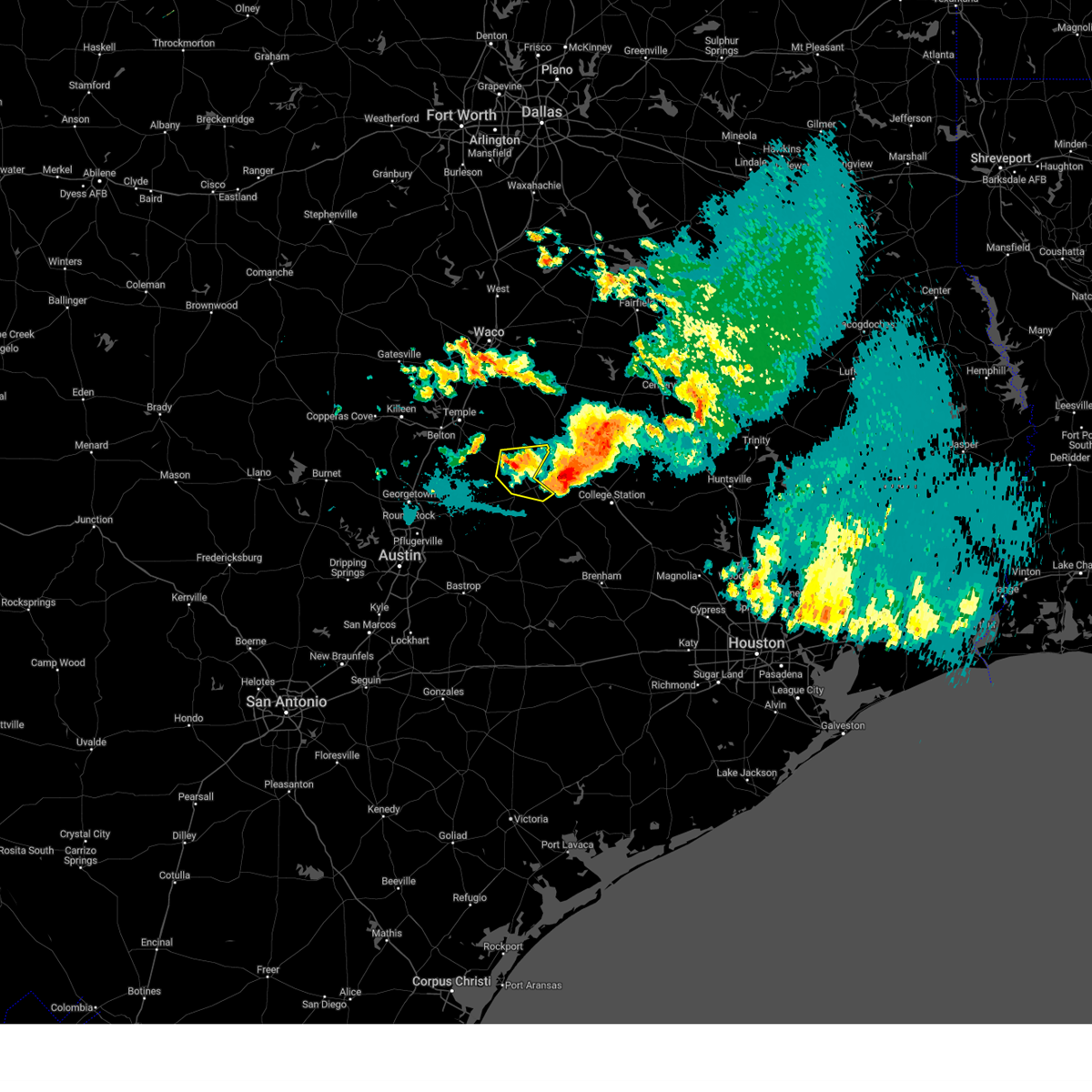 At 929 pm cdt, a severe thunderstorm was located over cameron, moving east at 25 mph (radar indicated). Hazards include 60 mph wind gusts and quarter size hail. Hail damage to vehicles is expected. Expect wind damage to roofs, siding, and trees. At 929 pm cdt, a severe thunderstorm was located over cameron, moving east at 25 mph (radar indicated). Hazards include 60 mph wind gusts and quarter size hail. Hail damage to vehicles is expected. Expect wind damage to roofs, siding, and trees.
|
| 6/10/2023 9:00 PM CDT |
 At 900 pm cdt, severe thunderstorms were located along a line extending from 6 miles northwest of twin oak reservoir to 9 miles west of calvert to 7 miles north of granger dam, moving southeast at 40 mph (radar indicated). Hazards include 70 mph wind gusts and ping pong ball size hail. People and animals outdoors will be injured. expect hail damage to roofs, siding, windows, and vehicles. expect considerable tree damage. wind damage is also likely to mobile homes, roofs, and outbuildings. locations impacted include, cameron, hearne, franklin, calvert, bremond, twin oak reservoir, camp creek lake, hilltop lakes, normangee, crossroads, silver city, jones prairie, hanover, ben arnold, baileyville, reagan, new baden, highbank, wheelock and burlington. thunderstorm damage threat, considerable hail threat, radar indicated max hail size, 1. 50 in wind threat, radar indicated max wind gust, 70 mph. At 900 pm cdt, severe thunderstorms were located along a line extending from 6 miles northwest of twin oak reservoir to 9 miles west of calvert to 7 miles north of granger dam, moving southeast at 40 mph (radar indicated). Hazards include 70 mph wind gusts and ping pong ball size hail. People and animals outdoors will be injured. expect hail damage to roofs, siding, windows, and vehicles. expect considerable tree damage. wind damage is also likely to mobile homes, roofs, and outbuildings. locations impacted include, cameron, hearne, franklin, calvert, bremond, twin oak reservoir, camp creek lake, hilltop lakes, normangee, crossroads, silver city, jones prairie, hanover, ben arnold, baileyville, reagan, new baden, highbank, wheelock and burlington. thunderstorm damage threat, considerable hail threat, radar indicated max hail size, 1. 50 in wind threat, radar indicated max wind gust, 70 mph.
|
| 6/10/2023 8:51 PM CDT |
 At 851 pm cdt, severe thunderstorms were located along a line extending from 7 miles west of buffalo to near twin oak reservoir to 8 miles southeast of rosebud, moving southeast at 35 mph (radar indicated). Hazards include 70 mph wind gusts and ping pong ball size hail. People and animals outdoors will be injured. expect hail damage to roofs, siding, windows, and vehicles. expect considerable tree damage. wind damage is also likely to mobile homes, roofs, and outbuildings. locations impacted include, cameron, hearne, buffalo, franklin, rosebud, calvert, bremond, centerville, twin oak reservoir, fort boggy state park, camp creek lake, lake limestone, corinth, jewett, hilltop lakes, redland, normangee, thornton, wilson and kosse. thunderstorm damage threat, considerable hail threat, radar indicated max hail size, 1. 50 in wind threat, radar indicated max wind gust, 70 mph. At 851 pm cdt, severe thunderstorms were located along a line extending from 7 miles west of buffalo to near twin oak reservoir to 8 miles southeast of rosebud, moving southeast at 35 mph (radar indicated). Hazards include 70 mph wind gusts and ping pong ball size hail. People and animals outdoors will be injured. expect hail damage to roofs, siding, windows, and vehicles. expect considerable tree damage. wind damage is also likely to mobile homes, roofs, and outbuildings. locations impacted include, cameron, hearne, buffalo, franklin, rosebud, calvert, bremond, centerville, twin oak reservoir, fort boggy state park, camp creek lake, lake limestone, corinth, jewett, hilltop lakes, redland, normangee, thornton, wilson and kosse. thunderstorm damage threat, considerable hail threat, radar indicated max hail size, 1. 50 in wind threat, radar indicated max wind gust, 70 mph.
|
| 6/10/2023 8:23 PM CDT |
 At 823 pm cdt, severe thunderstorms were located along a line extending from 7 miles east of groesbeck to 6 miles north of bremond to 9 miles west of rosebud, moving southeast at 35 mph (radar indicated). Hazards include 70 mph wind gusts and quarter size hail. Hail damage to vehicles is expected. expect considerable tree damage. wind damage is also likely to mobile homes, roofs, and outbuildings. locations impacted include, cameron, hearne, buffalo, franklin, rosebud, calvert, bremond, centerville, twin oak reservoir, fort boggy state park, camp creek lake, lake limestone, corinth, jewett, hilltop lakes, redland, normangee, thornton, wilson and kosse. thunderstorm damage threat, considerable hail threat, radar indicated max hail size, 1. 00 in wind threat, radar indicated max wind gust, 70 mph. At 823 pm cdt, severe thunderstorms were located along a line extending from 7 miles east of groesbeck to 6 miles north of bremond to 9 miles west of rosebud, moving southeast at 35 mph (radar indicated). Hazards include 70 mph wind gusts and quarter size hail. Hail damage to vehicles is expected. expect considerable tree damage. wind damage is also likely to mobile homes, roofs, and outbuildings. locations impacted include, cameron, hearne, buffalo, franklin, rosebud, calvert, bremond, centerville, twin oak reservoir, fort boggy state park, camp creek lake, lake limestone, corinth, jewett, hilltop lakes, redland, normangee, thornton, wilson and kosse. thunderstorm damage threat, considerable hail threat, radar indicated max hail size, 1. 00 in wind threat, radar indicated max wind gust, 70 mph.
|
| 6/10/2023 8:19 PM CDT |
 At 819 pm cdt, severe thunderstorms were located along a line extending from 7 miles east of groesbeck to 6 miles north of bremond to 8 miles west of rosebud, moving southeast at 35 mph (radar indicated). Hazards include 60 mph wind gusts and quarter size hail. Hail damage to vehicles is expected. Expect wind damage to roofs, siding, and trees. At 819 pm cdt, severe thunderstorms were located along a line extending from 7 miles east of groesbeck to 6 miles north of bremond to 8 miles west of rosebud, moving southeast at 35 mph (radar indicated). Hazards include 60 mph wind gusts and quarter size hail. Hail damage to vehicles is expected. Expect wind damage to roofs, siding, and trees.
|
| 5/5/2023 10:43 PM CDT |
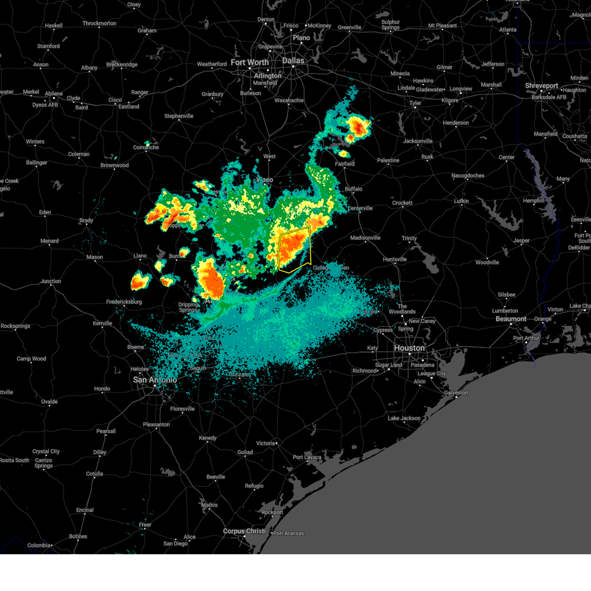 At 1043 pm cdt, a severe thunderstorm was located over hearne, moving east at 30 mph (radar indicated). Hazards include 60 mph wind gusts. Expect damage to roofs, siding, and trees. locations impacted include, cameron, hearne, calvert, milano, crossroads, silver city, hoyte, jones prairie, elevation, hanover, maysfield, branchville, gause, baileyville and minerva. hail threat, radar indicated max hail size, <. 75 in wind threat, radar indicated max wind gust, 60 mph. At 1043 pm cdt, a severe thunderstorm was located over hearne, moving east at 30 mph (radar indicated). Hazards include 60 mph wind gusts. Expect damage to roofs, siding, and trees. locations impacted include, cameron, hearne, calvert, milano, crossroads, silver city, hoyte, jones prairie, elevation, hanover, maysfield, branchville, gause, baileyville and minerva. hail threat, radar indicated max hail size, <. 75 in wind threat, radar indicated max wind gust, 60 mph.
|
| 5/5/2023 10:17 PM CDT |
 At 1016 pm cdt, a severe thunderstorm was located over cameron, moving east at 30 mph (radar indicated). Hazards include 60 mph wind gusts. expect damage to roofs, siding, and trees At 1016 pm cdt, a severe thunderstorm was located over cameron, moving east at 30 mph (radar indicated). Hazards include 60 mph wind gusts. expect damage to roofs, siding, and trees
|
| 5/5/2023 10:16 PM CDT | T35 (cameron) awos 40g52k in milam county TX, 1.8 miles SSW of Cameron, TX |
| 4/28/2023 5:09 PM CDT |
 At 508 pm cdt, severe thunderstorms were located along a line extending from near cameron to near thorndale, moving southeast at 30 mph (radar indicated). Hazards include 60 mph wind gusts and quarter size hail. Hail damage to vehicles is expected. Expect wind damage to roofs, siding, and trees. At 508 pm cdt, severe thunderstorms were located along a line extending from near cameron to near thorndale, moving southeast at 30 mph (radar indicated). Hazards include 60 mph wind gusts and quarter size hail. Hail damage to vehicles is expected. Expect wind damage to roofs, siding, and trees.
|
| 4/28/2023 4:36 PM CDT |
 At 436 pm cdt, severe thunderstorms were located along a line extending from 6 miles west of rosebud to near jarrell, moving southeast at 40 mph (trained weather spotters). Hazards include golf ball size hail and 60 mph wind gusts. People and animals outdoors will be injured. expect hail damage to roofs, siding, windows, and vehicles. expect wind damage to roofs, siding, and trees. locations impacted include, temple, rockdale, cameron, bartlett, salado, little river-academy, rosebud, thorndale, rogers, holland, lott, buckholts, alcoa lake, sparks, wilson, milano, yarrelton, crossroads, silver city and hoyte. thunderstorm damage threat, considerable hail threat, radar indicated max hail size, 1. 75 in wind threat, radar indicated max wind gust, 60 mph. At 436 pm cdt, severe thunderstorms were located along a line extending from 6 miles west of rosebud to near jarrell, moving southeast at 40 mph (trained weather spotters). Hazards include golf ball size hail and 60 mph wind gusts. People and animals outdoors will be injured. expect hail damage to roofs, siding, windows, and vehicles. expect wind damage to roofs, siding, and trees. locations impacted include, temple, rockdale, cameron, bartlett, salado, little river-academy, rosebud, thorndale, rogers, holland, lott, buckholts, alcoa lake, sparks, wilson, milano, yarrelton, crossroads, silver city and hoyte. thunderstorm damage threat, considerable hail threat, radar indicated max hail size, 1. 75 in wind threat, radar indicated max wind gust, 60 mph.
|
| 4/28/2023 4:12 PM CDT |
 At 411 pm cdt, severe thunderstorms were located along a line extending from lott to near rogers to near jarrell, moving southeast at 55 mph (radar indicated). Hazards include 60 mph wind gusts and quarter size hail. Hail damage to vehicles is expected. Expect wind damage to roofs, siding, and trees. At 411 pm cdt, severe thunderstorms were located along a line extending from lott to near rogers to near jarrell, moving southeast at 55 mph (radar indicated). Hazards include 60 mph wind gusts and quarter size hail. Hail damage to vehicles is expected. Expect wind damage to roofs, siding, and trees.
|
| 4/26/2023 9:41 PM CDT |
 The severe thunderstorm warning for northwestern milam, eastern bell and southwestern falls counties will expire at 945 pm cdt, the storm which prompted the warning has weakened below severe limits. therefore the warning will be allowed to expire. however gusty winds and heavy rain are still possible with this thunderstorm. a tornado watch remains in effect until 1000 pm cdt for central texas. The severe thunderstorm warning for northwestern milam, eastern bell and southwestern falls counties will expire at 945 pm cdt, the storm which prompted the warning has weakened below severe limits. therefore the warning will be allowed to expire. however gusty winds and heavy rain are still possible with this thunderstorm. a tornado watch remains in effect until 1000 pm cdt for central texas.
|
| 4/26/2023 9:04 PM CDT |
 At 904 pm cdt, a cluster of severe thunderstorms was located 8 miles southeast of troy to near lott, moving east at 30 mph (radar indicated). Hazards include golf ball size hail and 60 mph wind gusts. People and animals outdoors will be injured. expect hail damage to roofs, siding, windows, and vehicles. expect wind damage to roofs, siding, and trees. locations impacted include, temple, cameron, little river-academy, troy, rosebud, rogers, lott, golinda, buckholts, chilton, wilson, yarrelton, silver city, jones prairie, leedale, edgeworth, barclay, ben arnold, baileyville and mooreville. thunderstorm damage threat, considerable hail threat, radar indicated max hail size, 1. 75 in wind threat, radar indicated max wind gust, 60 mph. At 904 pm cdt, a cluster of severe thunderstorms was located 8 miles southeast of troy to near lott, moving east at 30 mph (radar indicated). Hazards include golf ball size hail and 60 mph wind gusts. People and animals outdoors will be injured. expect hail damage to roofs, siding, windows, and vehicles. expect wind damage to roofs, siding, and trees. locations impacted include, temple, cameron, little river-academy, troy, rosebud, rogers, lott, golinda, buckholts, chilton, wilson, yarrelton, silver city, jones prairie, leedale, edgeworth, barclay, ben arnold, baileyville and mooreville. thunderstorm damage threat, considerable hail threat, radar indicated max hail size, 1. 75 in wind threat, radar indicated max wind gust, 60 mph.
|
| 4/26/2023 8:45 PM CDT |
 At 845 pm cdt, a severe thunderstorm was located near belton, moving southeast at 30 mph (radar indicated). Hazards include two inch hail and 60 mph wind gusts. People and animals outdoors will be injured. expect hail damage to roofs, siding, windows, and vehicles. Expect wind damage to roofs, siding, and trees. At 845 pm cdt, a severe thunderstorm was located near belton, moving southeast at 30 mph (radar indicated). Hazards include two inch hail and 60 mph wind gusts. People and animals outdoors will be injured. expect hail damage to roofs, siding, windows, and vehicles. Expect wind damage to roofs, siding, and trees.
|
| 4/20/2023 6:56 PM CDT |
 At 655 pm cdt, severe thunderstorms were located from bremond to hearne, moving east at 25 mph (radar indicated). Hazards include 60 mph wind gusts and quarter size hail. Hail damage to vehicles is expected. expect wind damage to roofs, siding, and trees. locations impacted include, cameron, hearne, franklin, calvert, bremond, twin oak reservoir, camp creek lake, lake limestone, crossroads, silver city, jones prairie, ben arnold, baileyville, maysfield, seale, easterly, new baden, bald prairie, wheelock and burlington. hail threat, radar indicated max hail size, 1. 00 in wind threat, radar indicated max wind gust, 60 mph. At 655 pm cdt, severe thunderstorms were located from bremond to hearne, moving east at 25 mph (radar indicated). Hazards include 60 mph wind gusts and quarter size hail. Hail damage to vehicles is expected. expect wind damage to roofs, siding, and trees. locations impacted include, cameron, hearne, franklin, calvert, bremond, twin oak reservoir, camp creek lake, lake limestone, crossroads, silver city, jones prairie, ben arnold, baileyville, maysfield, seale, easterly, new baden, bald prairie, wheelock and burlington. hail threat, radar indicated max hail size, 1. 00 in wind threat, radar indicated max wind gust, 60 mph.
|
| 4/20/2023 6:30 PM CDT |
 At 629 pm cdt, severe thunderstorms were located along a line extending from otto to reagan to ben arnold, moving east at 20 mph (radar indicated). Hazards include 60 mph wind gusts and quarter size hail. Hail damage to vehicles is expected. expect wind damage to roofs, siding, and trees. locations impacted include, marlin, cameron, hearne, groesbeck, franklin, rosebud, calvert, bremond, lake limestone, twin oak reservoir, camp creek lake, fort parker state park, thornton, kosse, crossroads, silver city, jones prairie, ben arnold, baileyville and fallon. hail threat, radar indicated max hail size, 1. 00 in wind threat, radar indicated max wind gust, 60 mph. At 629 pm cdt, severe thunderstorms were located along a line extending from otto to reagan to ben arnold, moving east at 20 mph (radar indicated). Hazards include 60 mph wind gusts and quarter size hail. Hail damage to vehicles is expected. expect wind damage to roofs, siding, and trees. locations impacted include, marlin, cameron, hearne, groesbeck, franklin, rosebud, calvert, bremond, lake limestone, twin oak reservoir, camp creek lake, fort parker state park, thornton, kosse, crossroads, silver city, jones prairie, ben arnold, baileyville and fallon. hail threat, radar indicated max hail size, 1. 00 in wind threat, radar indicated max wind gust, 60 mph.
|
| 4/20/2023 6:19 PM CDT |
 At 618 pm cdt, severe thunderstorms were located along a line extending from near jarrell to buckholts, moving southeast at 20 mph (radar indicated). Hazards include 60 mph wind gusts and half dollar size hail. Hail damage to vehicles is expected. Expect wind damage to roofs, siding, and trees. At 618 pm cdt, severe thunderstorms were located along a line extending from near jarrell to buckholts, moving southeast at 20 mph (radar indicated). Hazards include 60 mph wind gusts and half dollar size hail. Hail damage to vehicles is expected. Expect wind damage to roofs, siding, and trees.
|
| 4/20/2023 6:12 PM CDT |
 At 611 pm cdt, severe thunderstorms were located along a line extending from marlin to cameron, moving east at 25 mph (radar indicated). Hazards include ping pong ball size hail and 60 mph wind gusts. People and animals outdoors will be injured. Expect damage to roofs, siding, windows, and vehicles. At 611 pm cdt, severe thunderstorms were located along a line extending from marlin to cameron, moving east at 25 mph (radar indicated). Hazards include ping pong ball size hail and 60 mph wind gusts. People and animals outdoors will be injured. Expect damage to roofs, siding, windows, and vehicles.
|
| 4/2/2023 9:00 PM CDT |
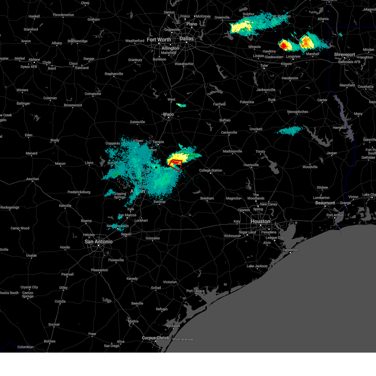 At 900 pm cdt, a severe thunderstorm capable of producing a tornado was located near rockdale, moving southeast at 30 mph (radar indicated rotation). Hazards include tornado and quarter size hail. Flying debris will be dangerous to those caught without shelter. mobile homes will be damaged or destroyed. damage to roofs, windows, and vehicles will occur. tree damage is likely. Locations impacted include, hoyte and minerva. At 900 pm cdt, a severe thunderstorm capable of producing a tornado was located near rockdale, moving southeast at 30 mph (radar indicated rotation). Hazards include tornado and quarter size hail. Flying debris will be dangerous to those caught without shelter. mobile homes will be damaged or destroyed. damage to roofs, windows, and vehicles will occur. tree damage is likely. Locations impacted include, hoyte and minerva.
|
| 4/2/2023 8:46 PM CDT |
 At 845 pm cdt, a severe thunderstorm capable of producing a tornado was located near buckholts, or 8 miles west of cameron, moving southeast at 30 mph (radar indicated rotation). Hazards include tornado and quarter size hail. Flying debris will be dangerous to those caught without shelter. mobile homes will be damaged or destroyed. damage to roofs, windows, and vehicles will occur. tree damage is likely. This tornadic thunderstorm will remain over mainly rural areas of central milam county, including the following locations, pettibone, minerva and hoyte. At 845 pm cdt, a severe thunderstorm capable of producing a tornado was located near buckholts, or 8 miles west of cameron, moving southeast at 30 mph (radar indicated rotation). Hazards include tornado and quarter size hail. Flying debris will be dangerous to those caught without shelter. mobile homes will be damaged or destroyed. damage to roofs, windows, and vehicles will occur. tree damage is likely. This tornadic thunderstorm will remain over mainly rural areas of central milam county, including the following locations, pettibone, minerva and hoyte.
|
| 4/2/2023 8:30 PM CDT |
 At 830 pm cdt, a severe thunderstorm capable of producing a tornado was located near rogers, or 14 miles west of cameron, moving east at 25 mph (radar indicated rotation). Hazards include tornado and quarter size hail. Flying debris will be dangerous to those caught without shelter. mobile homes will be damaged or destroyed. damage to roofs, windows, and vehicles will occur. tree damage is likely. this dangerous storm will be near, buckholts around 840 pm cdt. cameron around 900 pm cdt. Other locations impacted by this tornadic thunderstorm include minerva, silver city, hoyte, val verde and pettibone. At 830 pm cdt, a severe thunderstorm capable of producing a tornado was located near rogers, or 14 miles west of cameron, moving east at 25 mph (radar indicated rotation). Hazards include tornado and quarter size hail. Flying debris will be dangerous to those caught without shelter. mobile homes will be damaged or destroyed. damage to roofs, windows, and vehicles will occur. tree damage is likely. this dangerous storm will be near, buckholts around 840 pm cdt. cameron around 900 pm cdt. Other locations impacted by this tornadic thunderstorm include minerva, silver city, hoyte, val verde and pettibone.
|
| 3/16/2023 9:31 PM CDT |
 At 930 pm cdt, a severe thunderstorm was located 7 miles north of thorndale, or 11 miles northwest of rockdale, moving east at 40 mph (radar indicated). Hazards include 60 mph wind gusts and quarter size hail. Hail damage to vehicles is expected. Expect wind damage to roofs, siding, and trees. At 930 pm cdt, a severe thunderstorm was located 7 miles north of thorndale, or 11 miles northwest of rockdale, moving east at 40 mph (radar indicated). Hazards include 60 mph wind gusts and quarter size hail. Hail damage to vehicles is expected. Expect wind damage to roofs, siding, and trees.
|
| 3/16/2023 8:52 PM CDT |
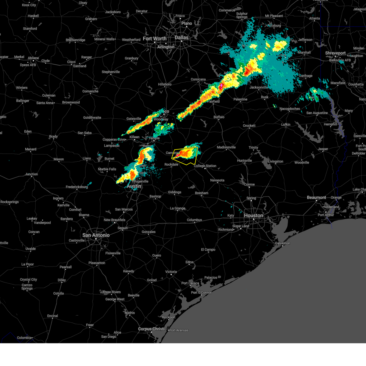 At 852 pm cdt, a severe thunderstorm was located near cameron, moving east at 20 mph (radar indicated). Hazards include 60 mph wind gusts and half dollar size hail. Hail damage to vehicles is expected. expect wind damage to roofs, siding, and trees. locations impacted include, cameron, hearne, calvert, crossroads, silver city, hoyte, jones prairie, hanover, mumford, maysfield, branchville and gause. hail threat, radar indicated max hail size, 1. 25 in wind threat, radar indicated max wind gust, 60 mph. At 852 pm cdt, a severe thunderstorm was located near cameron, moving east at 20 mph (radar indicated). Hazards include 60 mph wind gusts and half dollar size hail. Hail damage to vehicles is expected. expect wind damage to roofs, siding, and trees. locations impacted include, cameron, hearne, calvert, crossroads, silver city, hoyte, jones prairie, hanover, mumford, maysfield, branchville and gause. hail threat, radar indicated max hail size, 1. 25 in wind threat, radar indicated max wind gust, 60 mph.
|
| 3/16/2023 8:31 PM CDT |
 At 831 pm cdt, a severe thunderstorm was located near cameron, moving east at 20 mph (radar indicated). Hazards include 60 mph wind gusts and half dollar size hail. Hail damage to vehicles is expected. Expect wind damage to roofs, siding, and trees. At 831 pm cdt, a severe thunderstorm was located near cameron, moving east at 20 mph (radar indicated). Hazards include 60 mph wind gusts and half dollar size hail. Hail damage to vehicles is expected. Expect wind damage to roofs, siding, and trees.
|
| 3/16/2023 8:11 PM CDT |
 The severe thunderstorm warning for northwestern milam, southeastern bell and south central falls counties will expire at 815 pm cdt, the storm which prompted the warning has weakened below severe limits. therefore the warning will be allowed to expire. however small hail, gusty winds and heavy rain are still possible with this thunderstorm. a tornado watch remains in effect until 100 am cdt for central texas. The severe thunderstorm warning for northwestern milam, southeastern bell and south central falls counties will expire at 815 pm cdt, the storm which prompted the warning has weakened below severe limits. therefore the warning will be allowed to expire. however small hail, gusty winds and heavy rain are still possible with this thunderstorm. a tornado watch remains in effect until 100 am cdt for central texas.
|
| 3/16/2023 7:21 PM CDT |
 At 721 pm cdt, a severe thunderstorm was located near little river-academy, or near temple, moving east at 20 mph (radar indicated). Hazards include 60 mph wind gusts and quarter size hail. Hail damage to vehicles is expected. Expect wind damage to roofs, siding, and trees. At 721 pm cdt, a severe thunderstorm was located near little river-academy, or near temple, moving east at 20 mph (radar indicated). Hazards include 60 mph wind gusts and quarter size hail. Hail damage to vehicles is expected. Expect wind damage to roofs, siding, and trees.
|
| 3/2/2023 8:30 PM CST |
 At 830 pm cst, severe thunderstorms were located along a line extending from groesbeck to near tanglewood, moving east at 35 mph (radar indicated). Hazards include 60 mph wind gusts and penny size hail. Expect damage to roofs, siding, and trees. Locations impacted include, marlin, rockdale, cameron, hearne, groesbeck, teague, mart, franklin, rosebud, thorndale, calvert, bremond, buckholts, alcoa lake, twin oak reservoir, fort parker state park, lake limestone, thornton, wilson and kosse. At 830 pm cst, severe thunderstorms were located along a line extending from groesbeck to near tanglewood, moving east at 35 mph (radar indicated). Hazards include 60 mph wind gusts and penny size hail. Expect damage to roofs, siding, and trees. Locations impacted include, marlin, rockdale, cameron, hearne, groesbeck, teague, mart, franklin, rosebud, thorndale, calvert, bremond, buckholts, alcoa lake, twin oak reservoir, fort parker state park, lake limestone, thornton, wilson and kosse.
|
| 3/2/2023 8:25 PM CST |
 The tornado warning for central milam county will expire at 830 pm cst, the rotation associated with the storm that prompted the tornado warning has weakened, and no longer appears capable of producing a tornado. therefore the tornado warning will be allowed to expire. however gusty winds are still possible with this thunderstorm. a tornado watch remains in effect until 1000 pm cst for central texas. remember, a severe thunderstorm warning still remains in effect for milam county until 845 pm. The tornado warning for central milam county will expire at 830 pm cst, the rotation associated with the storm that prompted the tornado warning has weakened, and no longer appears capable of producing a tornado. therefore the tornado warning will be allowed to expire. however gusty winds are still possible with this thunderstorm. a tornado watch remains in effect until 1000 pm cst for central texas. remember, a severe thunderstorm warning still remains in effect for milam county until 845 pm.
|
| 3/2/2023 8:20 PM CST | Tree damage at hwy 77 and co. rd. 232lp. oak trees snapped and multiple 6 inch limbs broke along hwy 7 in milam county TX, 6.6 miles N of Cameron, TX |
| 3/2/2023 7:55 PM CST |
 At 755 pm cst, a severe thunderstorm capable of producing a tornado was located 8 miles southwest of buckholts, or 12 miles northwest of rockdale, moving east at 60 mph (radar indicated rotation). Hazards include tornado. Flying debris will be dangerous to those caught without shelter. mobile homes will be damaged or destroyed. damage to roofs, windows, and vehicles will occur. tree damage is likely. this dangerous storm will be near, buckholts around 800 pm cst. cameron around 810 pm cst. Other locations impacted by this tornadic thunderstorm include hanover, minerva, jones prairie, silver city, val verde, san gabriel, sharp, maysfield, hoyte and gause. At 755 pm cst, a severe thunderstorm capable of producing a tornado was located 8 miles southwest of buckholts, or 12 miles northwest of rockdale, moving east at 60 mph (radar indicated rotation). Hazards include tornado. Flying debris will be dangerous to those caught without shelter. mobile homes will be damaged or destroyed. damage to roofs, windows, and vehicles will occur. tree damage is likely. this dangerous storm will be near, buckholts around 800 pm cst. cameron around 810 pm cst. Other locations impacted by this tornadic thunderstorm include hanover, minerva, jones prairie, silver city, val verde, san gabriel, sharp, maysfield, hoyte and gause.
|
| 3/2/2023 7:37 PM CST |
 At 737 pm cst, severe thunderstorms were located along a line extending from near bellmead to near coupland, moving east at 35 mph (radar indicated). Hazards include 60 mph wind gusts and penny size hail. expect damage to roofs, siding, and trees At 737 pm cst, severe thunderstorms were located along a line extending from near bellmead to near coupland, moving east at 35 mph (radar indicated). Hazards include 60 mph wind gusts and penny size hail. expect damage to roofs, siding, and trees
|
| 10/24/2022 9:59 PM CDT |
 At 958 pm cdt, severe thunderstorms were located along a line extending from 7 miles west of lake limestone to near franklin to 9 miles southwest of hearne, moving east at 40 mph (radar indicated). Hazards include 60 mph wind gusts and quarter size hail. Hail damage to vehicles is expected. expect wind damage to roofs, siding, and trees. locations impacted include, rockdale, cameron, hearne, groesbeck, franklin, thorndale, calvert, bremond, alcoa lake, lake limestone, twin oak reservoir, camp creek lake, fort parker state park, thornton, kosse, milano, crossroads, silver city, hoyte and jones prairie. hail threat, radar indicated max hail size, 1. 00 in wind threat, radar indicated max wind gust, 60 mph. At 958 pm cdt, severe thunderstorms were located along a line extending from 7 miles west of lake limestone to near franklin to 9 miles southwest of hearne, moving east at 40 mph (radar indicated). Hazards include 60 mph wind gusts and quarter size hail. Hail damage to vehicles is expected. expect wind damage to roofs, siding, and trees. locations impacted include, rockdale, cameron, hearne, groesbeck, franklin, thorndale, calvert, bremond, alcoa lake, lake limestone, twin oak reservoir, camp creek lake, fort parker state park, thornton, kosse, milano, crossroads, silver city, hoyte and jones prairie. hail threat, radar indicated max hail size, 1. 00 in wind threat, radar indicated max wind gust, 60 mph.
|
| 10/24/2022 9:24 PM CDT |
 At 923 pm cdt, severe thunderstorms were located along a line extending from near marlin to rosebud to 9 miles south of buckholts, moving east at 45 mph (radar indicated). Hazards include ping pong ball size hail and 60 mph wind gusts. People and animals outdoors will be injured. expect hail damage to roofs, siding, windows, and vehicles. Expect wind damage to roofs, siding, and trees. At 923 pm cdt, severe thunderstorms were located along a line extending from near marlin to rosebud to 9 miles south of buckholts, moving east at 45 mph (radar indicated). Hazards include ping pong ball size hail and 60 mph wind gusts. People and animals outdoors will be injured. expect hail damage to roofs, siding, windows, and vehicles. Expect wind damage to roofs, siding, and trees.
|
| 10/24/2022 8:46 PM CDT |
 At 845 pm cdt, a severe thunderstorm was located over belton lake, or near belton, moving east at 40 mph (radar indicated). Hazards include ping pong ball size hail and 60 mph wind gusts. People and animals outdoors will be injured. expect hail damage to roofs, siding, windows, and vehicles. Expect wind damage to roofs, siding, and trees. At 845 pm cdt, a severe thunderstorm was located over belton lake, or near belton, moving east at 40 mph (radar indicated). Hazards include ping pong ball size hail and 60 mph wind gusts. People and animals outdoors will be injured. expect hail damage to roofs, siding, windows, and vehicles. Expect wind damage to roofs, siding, and trees.
|
| 9/7/2022 4:57 PM CDT |
 At 457 pm cdt, a severe thunderstorm was located near cameron, moving southwest at 25 mph (radar indicated). Hazards include 60 mph wind gusts and quarter size hail. Hail damage to vehicles is expected. Expect wind damage to roofs, siding, and trees. At 457 pm cdt, a severe thunderstorm was located near cameron, moving southwest at 25 mph (radar indicated). Hazards include 60 mph wind gusts and quarter size hail. Hail damage to vehicles is expected. Expect wind damage to roofs, siding, and trees.
|
| 4/12/2022 8:54 PM CDT |
 At 853 pm cdt, a severe thunderstorm was located 8 miles southeast of rosebud. another severe thunderstorm was located near franklin. both storms are moving east at 35 mph. at 850 pm cdt, half dollar size hail was reported near rosebud (trained weather spotters). Hazards include golf ball size hail and 65 mph wind gusts. People and animals outdoors will be injured. expect hail damage to roofs, siding, windows, and vehicles. expect wind damage to roofs, siding, and trees. locations impacted include, cameron, hearne, franklin, calvert, bremond and kosse. thunderstorm damage threat, considerable hail threat, observed max hail size, 1. 75 in wind threat, radar indicated max wind gust, 65 mph. At 853 pm cdt, a severe thunderstorm was located 8 miles southeast of rosebud. another severe thunderstorm was located near franklin. both storms are moving east at 35 mph. at 850 pm cdt, half dollar size hail was reported near rosebud (trained weather spotters). Hazards include golf ball size hail and 65 mph wind gusts. People and animals outdoors will be injured. expect hail damage to roofs, siding, windows, and vehicles. expect wind damage to roofs, siding, and trees. locations impacted include, cameron, hearne, franklin, calvert, bremond and kosse. thunderstorm damage threat, considerable hail threat, observed max hail size, 1. 75 in wind threat, radar indicated max wind gust, 65 mph.
|
| 4/12/2022 8:43 PM CDT | Quarter sized hail reported 5.9 miles S of Cameron, TX, quarter size hail 5 miles north of cameron via spotternetwork. |
| 4/12/2022 8:41 PM CDT |
 At 841 pm cdt, a severe thunderstorm was located near rosebud. another severe thunderstorm was located near franklin. both storms are moving east at 35 mph (radar indicated). Hazards include golf ball size hail and 65 mph wind gusts. People and animals outdoors will be injured. expect hail damage to roofs, siding, windows, and vehicles. Expect wind damage to roofs, siding, and trees. At 841 pm cdt, a severe thunderstorm was located near rosebud. another severe thunderstorm was located near franklin. both storms are moving east at 35 mph (radar indicated). Hazards include golf ball size hail and 65 mph wind gusts. People and animals outdoors will be injured. expect hail damage to roofs, siding, windows, and vehicles. Expect wind damage to roofs, siding, and trees.
|
| 4/12/2022 7:48 PM CDT |
 At 748 pm cdt, a severe thunderstorm was located near rosebud, or 12 miles northwest of cameron, moving east at 30 mph (radar indicated). Hazards include golf ball size hail and 60 mph wind gusts. People and animals outdoors will be injured. expect hail damage to roofs, siding, windows, and vehicles. Expect wind damage to roofs, siding, and trees. At 748 pm cdt, a severe thunderstorm was located near rosebud, or 12 miles northwest of cameron, moving east at 30 mph (radar indicated). Hazards include golf ball size hail and 60 mph wind gusts. People and animals outdoors will be injured. expect hail damage to roofs, siding, windows, and vehicles. Expect wind damage to roofs, siding, and trees.
|
| 3/14/2022 7:42 PM CDT |
 At 740 pm cdt, a line of severe thunderstorms was located just north of cameron to west of buffalo, or 18 miles southeast of marlin, moving east at 40 mph (radar indicated). Hazards include 60 mph wind gusts and quarter size hail. Hail damage to vehicles is expected. Expect wind damage to roofs, siding, and trees. At 740 pm cdt, a line of severe thunderstorms was located just north of cameron to west of buffalo, or 18 miles southeast of marlin, moving east at 40 mph (radar indicated). Hazards include 60 mph wind gusts and quarter size hail. Hail damage to vehicles is expected. Expect wind damage to roofs, siding, and trees.
|
| 4/8/2021 8:24 PM CDT |
 At 823 pm cdt, a severe thunderstorm was located near calvert, or 10 miles west of hearne, moving southeast at 40 mph. this storm has a history of producing large hail (trained weather spotters). Hazards include 65 mph wind gusts and half dollar size hail. Hail damage to vehicles is expected. expect wind damage to roofs, siding, and trees. Locations impacted include, cameron, hearne, calvert and milano. At 823 pm cdt, a severe thunderstorm was located near calvert, or 10 miles west of hearne, moving southeast at 40 mph. this storm has a history of producing large hail (trained weather spotters). Hazards include 65 mph wind gusts and half dollar size hail. Hail damage to vehicles is expected. expect wind damage to roofs, siding, and trees. Locations impacted include, cameron, hearne, calvert and milano.
|
| 4/8/2021 8:10 PM CDT |
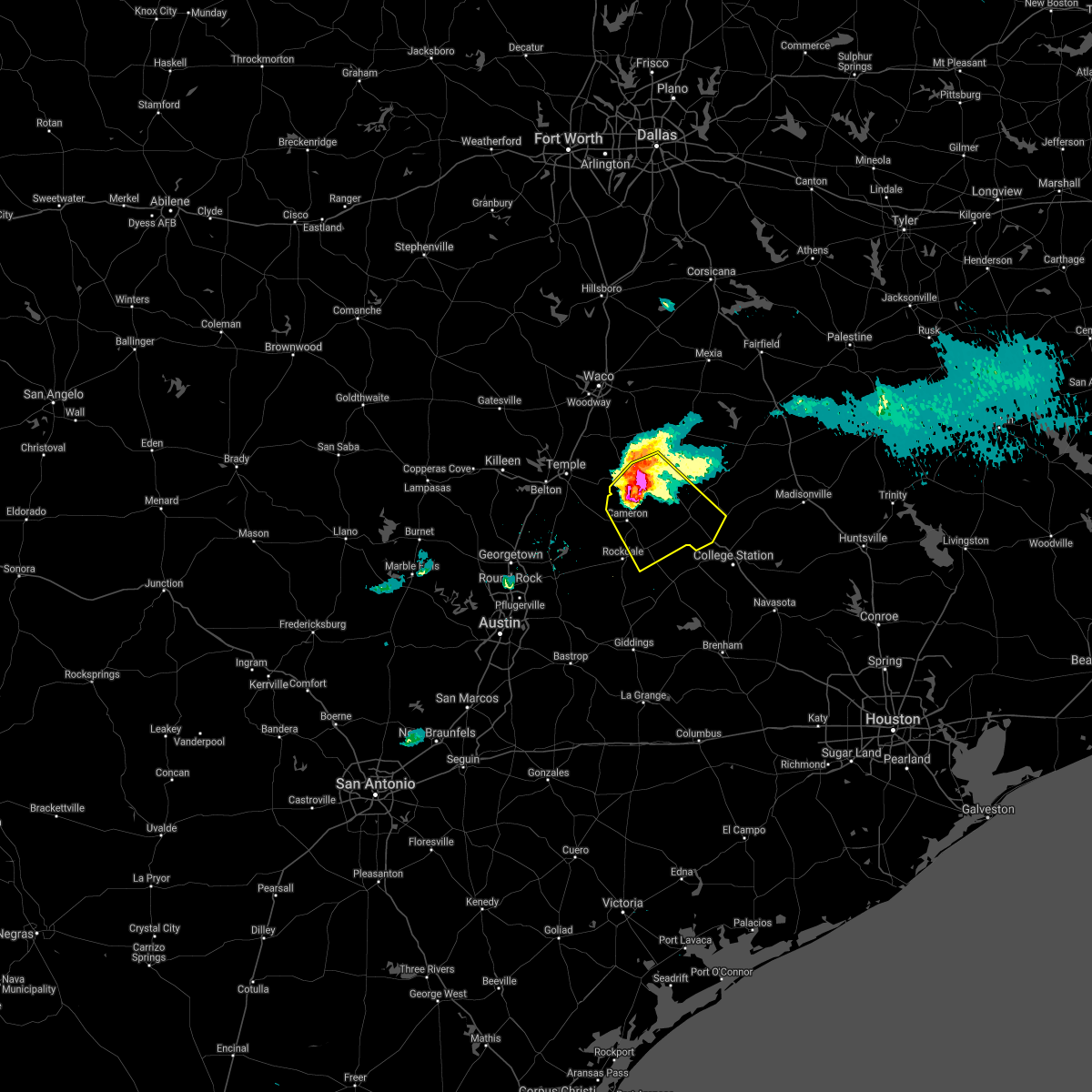 At 810 pm cdt, a severe thunderstorm was located near rosebud, or 13 miles north of cameron, moving southeast at 35 mph. this storm is producing large hail that is covering the ground and has a history of producing wind damage (trained weather spotters). Hazards include two inch hail and 65 mph wind gusts. People and animals outdoors will be injured. expect hail damage to roofs, siding, windows, and vehicles. expect wind damage to roofs, siding, and trees. Locations impacted include, cameron, hearne, rosebud, calvert and milano. At 810 pm cdt, a severe thunderstorm was located near rosebud, or 13 miles north of cameron, moving southeast at 35 mph. this storm is producing large hail that is covering the ground and has a history of producing wind damage (trained weather spotters). Hazards include two inch hail and 65 mph wind gusts. People and animals outdoors will be injured. expect hail damage to roofs, siding, windows, and vehicles. expect wind damage to roofs, siding, and trees. Locations impacted include, cameron, hearne, rosebud, calvert and milano.
|
| 4/8/2021 7:57 PM CDT |
 At 757 pm cdt, a severe thunderstorm was located near rosebud, or 12 miles south of marlin, moving southeast at 35 mph (trained weather spotters). Hazards include golf ball size hail and 65 mph wind gusts. People and animals outdoors will be injured. expect hail damage to roofs, siding, windows, and vehicles. Expect wind damage to roofs, siding, and trees. At 757 pm cdt, a severe thunderstorm was located near rosebud, or 12 miles south of marlin, moving southeast at 35 mph (trained weather spotters). Hazards include golf ball size hail and 65 mph wind gusts. People and animals outdoors will be injured. expect hail damage to roofs, siding, windows, and vehicles. Expect wind damage to roofs, siding, and trees.
|
| 3/22/2021 11:53 PM CDT |
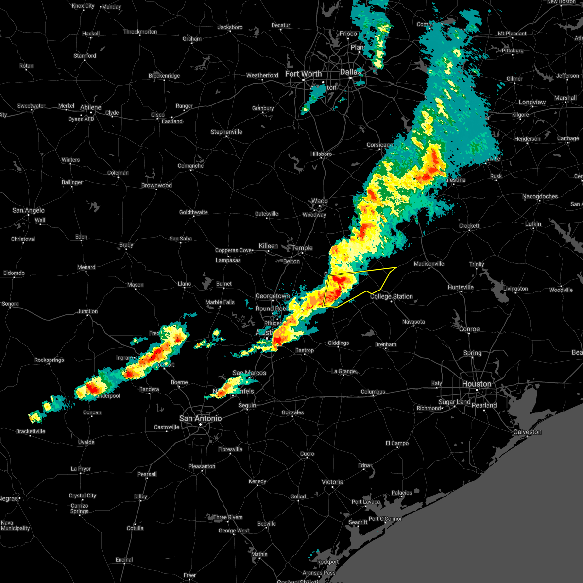 The national weather service in fort worth has issued a * severe thunderstorm warning for. southern robertson county in central texas. central milam county in central texas. until 100 am cdt. At 1151 pm cdt, a severe thunderstorm was located near rockdale,. The national weather service in fort worth has issued a * severe thunderstorm warning for. southern robertson county in central texas. central milam county in central texas. until 100 am cdt. At 1151 pm cdt, a severe thunderstorm was located near rockdale,.
|
| 3/22/2021 11:42 PM CDT |
 At 1140 pm cdt, a severe thunderstorm was located over central milam county, moving east at 35 mph. 65 mph wind gusts are possible over rockdale, minerva, and milano with this storm (radar indicated). Hazards include 65 mph wind gusts and quarter size hail. Hail damage to vehicles is expected. expect wind damage to roofs, siding, and trees. Locations impacted include, rockdale, cameron, thorndale, buckholts and milano. At 1140 pm cdt, a severe thunderstorm was located over central milam county, moving east at 35 mph. 65 mph wind gusts are possible over rockdale, minerva, and milano with this storm (radar indicated). Hazards include 65 mph wind gusts and quarter size hail. Hail damage to vehicles is expected. expect wind damage to roofs, siding, and trees. Locations impacted include, rockdale, cameron, thorndale, buckholts and milano.
|
| 3/22/2021 11:31 PM CDT |
 At 1129 pm cdt, a severe thunderstorm was located 10 miles southeast of cameron, moving east at 35 mph (radar indicated). Hazards include 65 mph wind gusts and half dollar size hail. Hail damage to vehicles is expected. expect wind damage to roofs, siding, and trees. Locations impacted include, sharp, minerva, rockdale, cameron, thorndale, buckholts and milano. At 1129 pm cdt, a severe thunderstorm was located 10 miles southeast of cameron, moving east at 35 mph (radar indicated). Hazards include 65 mph wind gusts and half dollar size hail. Hail damage to vehicles is expected. expect wind damage to roofs, siding, and trees. Locations impacted include, sharp, minerva, rockdale, cameron, thorndale, buckholts and milano.
|
| 3/22/2021 11:16 PM CDT |
 At 1115 pm cdt, a severe thunderstorm was located over granger dam, or 9 miles east of granger, moving east at 35 mph (radar indicated). Hazards include 65 mph wind gusts and half dollar size hail. Hail damage to vehicles is expected. expect wind damage to roofs, siding, and trees. Locations impacted include, sharp, davilla, minerva, rockdale, cameron, thorndale, buckholts and milano. At 1115 pm cdt, a severe thunderstorm was located over granger dam, or 9 miles east of granger, moving east at 35 mph (radar indicated). Hazards include 65 mph wind gusts and half dollar size hail. Hail damage to vehicles is expected. expect wind damage to roofs, siding, and trees. Locations impacted include, sharp, davilla, minerva, rockdale, cameron, thorndale, buckholts and milano.
|
| 3/22/2021 10:53 PM CDT |
 At 1052 pm cdt, a severe thunderstorm was located near granger, moving east at 35 mph (radar indicated). Hazards include 60 mph wind gusts and half dollar size hail. Hail damage to vehicles is expected. Expect wind damage to roofs, siding, and trees. At 1052 pm cdt, a severe thunderstorm was located near granger, moving east at 35 mph (radar indicated). Hazards include 60 mph wind gusts and half dollar size hail. Hail damage to vehicles is expected. Expect wind damage to roofs, siding, and trees.
|
| 5/27/2020 7:22 PM CDT |
 At 721 pm cdt, severe thunderstorms were located along a line extending from cameron to rockdale to thorndale, moving southeast at 45 mph (radar indicated). Hazards include 60 mph wind gusts. Expect damage to roofs, siding, and trees. Locations impacted include, rockdale, cameron, thorndale and milano. At 721 pm cdt, severe thunderstorms were located along a line extending from cameron to rockdale to thorndale, moving southeast at 45 mph (radar indicated). Hazards include 60 mph wind gusts. Expect damage to roofs, siding, and trees. Locations impacted include, rockdale, cameron, thorndale and milano.
|
| 5/27/2020 7:08 PM CDT |
 At 707 pm cdt, severe thunderstorms were located along a line extending from rogers to granger, moving southeast at 40 mph (radar indicated). Hazards include 60 mph wind gusts and quarter size hail. Hail damage to vehicles is expected. expect wind damage to roofs, siding, and trees. Locations impacted include, rockdale, cameron, bartlett, thorndale, rogers, holland, buckholts and milano. At 707 pm cdt, severe thunderstorms were located along a line extending from rogers to granger, moving southeast at 40 mph (radar indicated). Hazards include 60 mph wind gusts and quarter size hail. Hail damage to vehicles is expected. expect wind damage to roofs, siding, and trees. Locations impacted include, rockdale, cameron, bartlett, thorndale, rogers, holland, buckholts and milano.
|
| 5/27/2020 6:50 PM CDT |
 At 649 pm cdt, severe thunderstorms were located along a line extending from little river-academy to holland to jarrell, moving southeast at 35 mph (radar indicated). Hazards include 60 mph wind gusts and quarter size hail. Hail damage to vehicles is expected. Expect wind damage to roofs, siding, and trees. At 649 pm cdt, severe thunderstorms were located along a line extending from little river-academy to holland to jarrell, moving southeast at 35 mph (radar indicated). Hazards include 60 mph wind gusts and quarter size hail. Hail damage to vehicles is expected. Expect wind damage to roofs, siding, and trees.
|
| 5/27/2020 2:06 PM CDT |
 At 205 pm cdt, a severe thunderstorm was located 12 miles southwest of hearne, moving southeast at 40 mph (off duty nws employee reported 70 mph winds near bremond). Hazards include golf ball size hail and 70 mph wind gusts. People and animals outdoors will be injured. expect hail damage to roofs, siding, windows, and vehicles. expect considerable tree damage. wind damage is also likely to mobile homes, roofs, and outbuildings. Locations impacted include, mumford, rockdale, cameron, hearne, buckholts and milano. At 205 pm cdt, a severe thunderstorm was located 12 miles southwest of hearne, moving southeast at 40 mph (off duty nws employee reported 70 mph winds near bremond). Hazards include golf ball size hail and 70 mph wind gusts. People and animals outdoors will be injured. expect hail damage to roofs, siding, windows, and vehicles. expect considerable tree damage. wind damage is also likely to mobile homes, roofs, and outbuildings. Locations impacted include, mumford, rockdale, cameron, hearne, buckholts and milano.
|
| 5/27/2020 1:55 PM CDT | Large... hollow tree snapped approx 3-4 feet above the base. reported via twitter... time estimated via rada in milam county TX, 1.8 miles SSW of Cameron, TX |
| 5/27/2020 1:43 PM CDT |
 At 142 pm cdt, a severe thunderstorm was located near ben arnold, moving southeast at 40 mph (public reported golf ball size hail near rosebud). Hazards include golf ball size hail and 65 mph wind gusts. People and animals outdoors will be injured. expect hail damage to roofs, siding, windows, and vehicles. expect wind damage to roofs, siding, and trees. Locations impacted include, ben arnold, burlington, rockdale, cameron, hearne, buckholts and milano. At 142 pm cdt, a severe thunderstorm was located near ben arnold, moving southeast at 40 mph (public reported golf ball size hail near rosebud). Hazards include golf ball size hail and 65 mph wind gusts. People and animals outdoors will be injured. expect hail damage to roofs, siding, windows, and vehicles. expect wind damage to roofs, siding, and trees. Locations impacted include, ben arnold, burlington, rockdale, cameron, hearne, buckholts and milano.
|
| 5/27/2020 1:32 PM CDT |
 At 132 pm cdt, a severe thunderstorm was located near rosebud, or 10 miles north of cameron, moving southeast at 40 mph (radar indicated). Hazards include 60 mph wind gusts and quarter size hail. Hail damage to vehicles is expected. Expect wind damage to roofs, siding, and trees. At 132 pm cdt, a severe thunderstorm was located near rosebud, or 10 miles north of cameron, moving southeast at 40 mph (radar indicated). Hazards include 60 mph wind gusts and quarter size hail. Hail damage to vehicles is expected. Expect wind damage to roofs, siding, and trees.
|
| 4/29/2020 4:51 AM CDT |
 The severe thunderstorm warning for milam county will expire at 500 am cdt, the storms which prompted the warning have moved out of the area. therefore the warning will be allowed to expire. a severe thunderstorm watch remains in effect until 600 am cdt for central texas. The severe thunderstorm warning for milam county will expire at 500 am cdt, the storms which prompted the warning have moved out of the area. therefore the warning will be allowed to expire. a severe thunderstorm watch remains in effect until 600 am cdt for central texas.
|
| 4/29/2020 4:39 AM CDT |
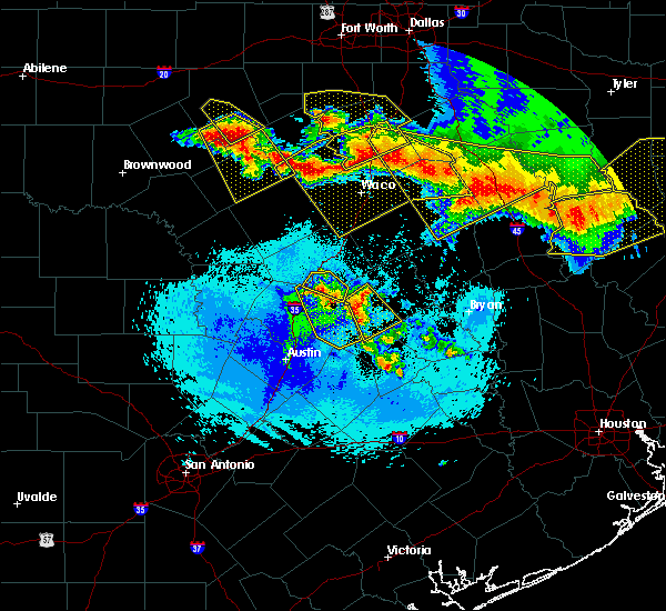 At 439 am cdt, severe thunderstorms were located along a line extending from hearne to thorndale, moving southeast at 55 mph (radar indicated). Hazards include 60 mph wind gusts and quarter size hail. Hail damage to vehicles is expected. expect wind damage to roofs, siding, and trees. Locations impacted include, rockdale, cameron, thorndale and milano. At 439 am cdt, severe thunderstorms were located along a line extending from hearne to thorndale, moving southeast at 55 mph (radar indicated). Hazards include 60 mph wind gusts and quarter size hail. Hail damage to vehicles is expected. expect wind damage to roofs, siding, and trees. Locations impacted include, rockdale, cameron, thorndale and milano.
|
| 4/29/2020 4:31 AM CDT |
 At 430 am cdt, severe thunderstorms were located along a line extending from calvert to milano to near thorndale, moving south at 40 mph (radar indicated). Hazards include 65 mph wind gusts and half dollar size hail. Hail damage to vehicles is expected. expect wind damage to roofs, siding, and trees. Locations impacted include, rockdale, cameron, bartlett, thorndale, holland, buckholts and milano. At 430 am cdt, severe thunderstorms were located along a line extending from calvert to milano to near thorndale, moving south at 40 mph (radar indicated). Hazards include 65 mph wind gusts and half dollar size hail. Hail damage to vehicles is expected. expect wind damage to roofs, siding, and trees. Locations impacted include, rockdale, cameron, bartlett, thorndale, holland, buckholts and milano.
|
| 4/29/2020 3:55 AM CDT |
 At 355 am cdt, severe thunderstorms were located along a line extending from salado to rovers to rosebud, moving southeast at 55 mph (radar indicated). Hazards include 65 mph wind gusts and half dollar size hail. Hail damage to vehicles is expected. Expect wind damage to roofs, siding, and trees. At 355 am cdt, severe thunderstorms were located along a line extending from salado to rovers to rosebud, moving southeast at 55 mph (radar indicated). Hazards include 65 mph wind gusts and half dollar size hail. Hail damage to vehicles is expected. Expect wind damage to roofs, siding, and trees.
|
| 4/22/2020 10:54 AM CDT |
 At 1053 am cdt, a severe thunderstorm was located near rosebud, or 14 miles north of cameron, moving northeast at 40 mph (radar indicated). Hazards include quarter size hail. Damage to vehicles is possible. Locations impacted include, cameron, franklin, rosebud, calvert, bremond and buckholts. At 1053 am cdt, a severe thunderstorm was located near rosebud, or 14 miles north of cameron, moving northeast at 40 mph (radar indicated). Hazards include quarter size hail. Damage to vehicles is possible. Locations impacted include, cameron, franklin, rosebud, calvert, bremond and buckholts.
|
| 4/22/2020 10:32 AM CDT |
 At 1031 am cdt, a severe thunderstorm was located 7 miles east of rogers, or 9 miles northwest of cameron, moving northeast at 35 mph (radar indicated). Hazards include quarter size hail. damage to vehicles is possible At 1031 am cdt, a severe thunderstorm was located 7 miles east of rogers, or 9 miles northwest of cameron, moving northeast at 35 mph (radar indicated). Hazards include quarter size hail. damage to vehicles is possible
|
| 4/9/2020 3:57 PM CDT |
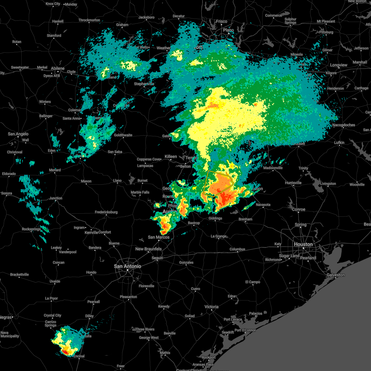 The severe thunderstorm warning for central milam county will expire at 400 pm cdt, the storm which prompted the warning has weakened below severe limits. therefore the warning will be allowed to expire. however gusty winds and heavy rainfall are still possible with this thunderstorm. a severe thunderstorm watch remains in effect until 1000 pm cdt for central texas. The severe thunderstorm warning for central milam county will expire at 400 pm cdt, the storm which prompted the warning has weakened below severe limits. therefore the warning will be allowed to expire. however gusty winds and heavy rainfall are still possible with this thunderstorm. a severe thunderstorm watch remains in effect until 1000 pm cdt for central texas.
|
| 4/9/2020 3:40 PM CDT |
 At 340 pm cdt, a severe thunderstorm was located 8 miles southeast of cameron, moving east at 45 mph (radar indicated). Hazards include 60 mph wind gusts and penny size hail. Expect damage to roofs, siding, and trees. Locations impacted include, rockdale, cameron and milano. At 340 pm cdt, a severe thunderstorm was located 8 miles southeast of cameron, moving east at 45 mph (radar indicated). Hazards include 60 mph wind gusts and penny size hail. Expect damage to roofs, siding, and trees. Locations impacted include, rockdale, cameron and milano.
|
| 4/9/2020 3:36 PM CDT | Power lines down in camero in milam county TX, 0.7 miles WSW of Cameron, TX |
| 4/9/2020 3:22 PM CDT |
 At 322 pm cdt, a severe thunderstorm was located 9 miles northwest of rockdale, moving east at 45 mph (radar indicated). Hazards include 65 mph wind gusts and penny size hail. Expect damage to roofs, siding, and trees. Locations impacted include, rockdale, cameron, buckholts and milano. At 322 pm cdt, a severe thunderstorm was located 9 miles northwest of rockdale, moving east at 45 mph (radar indicated). Hazards include 65 mph wind gusts and penny size hail. Expect damage to roofs, siding, and trees. Locations impacted include, rockdale, cameron, buckholts and milano.
|
| 4/9/2020 3:03 PM CDT |
 At 302 pm cdt, a severe thunderstorm was located near granger dam, or near granger, moving east at 40 mph (radar indicated). Hazards include 70 mph wind gusts and penny size hail. Expect considerable tree damage. Damage is likely to mobile homes, roofs, and outbuildings. At 302 pm cdt, a severe thunderstorm was located near granger dam, or near granger, moving east at 40 mph (radar indicated). Hazards include 70 mph wind gusts and penny size hail. Expect considerable tree damage. Damage is likely to mobile homes, roofs, and outbuildings.
|
| 3/4/2020 8:11 AM CST |
 At 811 am cst, a severe thunderstorm was located near rockdale, moving east at 40 mph (radar indicated). Hazards include 60 mph wind gusts and penny size hail. Expect damage to roofs, siding, and trees. Locations impacted include, rockdale, cameron and milano. At 811 am cst, a severe thunderstorm was located near rockdale, moving east at 40 mph (radar indicated). Hazards include 60 mph wind gusts and penny size hail. Expect damage to roofs, siding, and trees. Locations impacted include, rockdale, cameron and milano.
|
| 3/4/2020 7:47 AM CST |
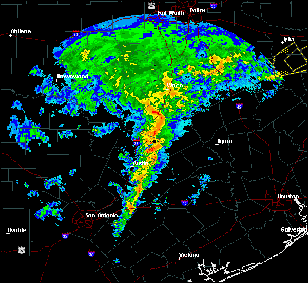 At 747 am cst, a severe thunderstorm was located over thorndale, or 9 miles west of rockdale, moving east at 40 mph (radar indicated). Hazards include 60 mph wind gusts and penny size hail. expect damage to roofs, siding, and trees At 747 am cst, a severe thunderstorm was located over thorndale, or 9 miles west of rockdale, moving east at 40 mph (radar indicated). Hazards include 60 mph wind gusts and penny size hail. expect damage to roofs, siding, and trees
|
| 6/16/2019 8:58 PM CDT |
 At 855 pm cdt, a severe thunderstorm was located 10 miles southeast of cameron, moving east at 35 mph (radar indicated). Hazards include 60 mph wind gusts and quarter size hail. Hail damage to vehicles is expected. expect wind damage to roofs, siding, and trees. the rockdale police department estimated 60 mph winds with this storm in the city of rockdale. The severe thunderstorm will remain over mainly rural areas of southern milam county, including milano and buckholts, but additional strong thunderstorms will impact other portions of the county with gusty winds and small hail. At 855 pm cdt, a severe thunderstorm was located 10 miles southeast of cameron, moving east at 35 mph (radar indicated). Hazards include 60 mph wind gusts and quarter size hail. Hail damage to vehicles is expected. expect wind damage to roofs, siding, and trees. the rockdale police department estimated 60 mph winds with this storm in the city of rockdale. The severe thunderstorm will remain over mainly rural areas of southern milam county, including milano and buckholts, but additional strong thunderstorms will impact other portions of the county with gusty winds and small hail.
|
| 6/16/2019 8:16 PM CDT |
 At 815 pm cdt, a severe thunderstorm was located near jarrell, or 13 miles northwest of granger, moving east at 20 mph (radar indicated). Hazards include 60 mph wind gusts and half dollar size hail. Hail damage to vehicles is expected. expect wind damage to roofs, siding, and trees. this severe thunderstorm will be near, bartlett around 835 pm cdt. holland around 840 pm cdt. little river-academy around 905 pm cdt. rogers around 915 pm cdt. this includes interstate 35 between mile markers 277 and 287. Spotters have reported quarter size hail along i-35 in southern bell county near the williamson county line. At 815 pm cdt, a severe thunderstorm was located near jarrell, or 13 miles northwest of granger, moving east at 20 mph (radar indicated). Hazards include 60 mph wind gusts and half dollar size hail. Hail damage to vehicles is expected. expect wind damage to roofs, siding, and trees. this severe thunderstorm will be near, bartlett around 835 pm cdt. holland around 840 pm cdt. little river-academy around 905 pm cdt. rogers around 915 pm cdt. this includes interstate 35 between mile markers 277 and 287. Spotters have reported quarter size hail along i-35 in southern bell county near the williamson county line.
|
| 5/8/2019 1:07 PM CDT |
 At 107 pm cdt, a severe thunderstorm was located 9 miles southeast of rosebud, or 9 miles northeast of cameron, moving east at 40 mph (radar indicated). Hazards include 60 mph wind gusts. expect damage to roofs, siding, and trees At 107 pm cdt, a severe thunderstorm was located 9 miles southeast of rosebud, or 9 miles northeast of cameron, moving east at 40 mph (radar indicated). Hazards include 60 mph wind gusts. expect damage to roofs, siding, and trees
|
| 4/24/2019 4:46 PM CDT |
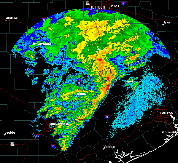 At 446 pm cdt, a severe thunderstorm was located 13 miles east of rockdale, moving northeast at 35 mph (radar indicated). Hazards include 60 mph wind gusts and penny size hail. Expect damage to roofs, siding, and trees. Locations impacted include, cameron and milano. At 446 pm cdt, a severe thunderstorm was located 13 miles east of rockdale, moving northeast at 35 mph (radar indicated). Hazards include 60 mph wind gusts and penny size hail. Expect damage to roofs, siding, and trees. Locations impacted include, cameron and milano.
|
| 4/24/2019 4:28 PM CDT |
 At 428 pm cdt, a severe thunderstorm was located over rockdale, moving east at 30 mph (radar indicated). Hazards include 60 mph wind gusts and penny size hail. Expect damage to roofs, siding, and trees. Locations impacted include, rockdale, cameron, buckholts and milano. At 428 pm cdt, a severe thunderstorm was located over rockdale, moving east at 30 mph (radar indicated). Hazards include 60 mph wind gusts and penny size hail. Expect damage to roofs, siding, and trees. Locations impacted include, rockdale, cameron, buckholts and milano.
|
| 4/24/2019 4:10 PM CDT |
 At 409 pm cdt, a severe thunderstorm was located near thorndale, or 9 miles west of rockdale, moving northeast at 30 mph (radar indicated). Hazards include 60 mph wind gusts. expect damage to roofs, siding, and trees At 409 pm cdt, a severe thunderstorm was located near thorndale, or 9 miles west of rockdale, moving northeast at 30 mph (radar indicated). Hazards include 60 mph wind gusts. expect damage to roofs, siding, and trees
|
| 4/18/2019 12:26 AM CDT |
 At 1226 am cdt, a severe thunderstorm was located 8 miles north of thorndale, or 9 miles northwest of rockdale, moving east at 55 mph (radar indicated). Hazards include 70 mph wind gusts. Expect considerable tree damage. Damage is likely to mobile homes, roofs, and outbuildings. At 1226 am cdt, a severe thunderstorm was located 8 miles north of thorndale, or 9 miles northwest of rockdale, moving east at 55 mph (radar indicated). Hazards include 70 mph wind gusts. Expect considerable tree damage. Damage is likely to mobile homes, roofs, and outbuildings.
|
| 4/13/2019 10:04 AM CDT |
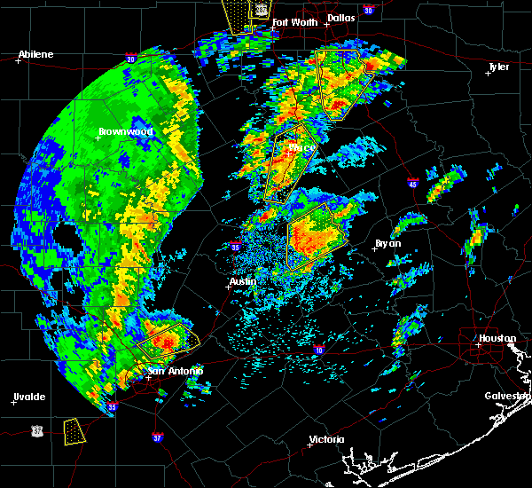 At 1004 am cdt, a severe thunderstorm was located near rockdale, moving northeast at 25 mph (radar indicated). Hazards include 60 mph wind gusts and quarter size hail. Hail damage to vehicles is expected. expect wind damage to roofs, siding, and trees. Locations impacted include, rockdale, cameron, buckholts and milano. At 1004 am cdt, a severe thunderstorm was located near rockdale, moving northeast at 25 mph (radar indicated). Hazards include 60 mph wind gusts and quarter size hail. Hail damage to vehicles is expected. expect wind damage to roofs, siding, and trees. Locations impacted include, rockdale, cameron, buckholts and milano.
|
| 4/13/2019 9:43 AM CDT |
 At 942 am cdt, a severe thunderstorm was located near thorndale, or 10 miles southwest of rockdale, moving northeast at 35 mph (radar indicated). Hazards include 60 mph wind gusts and quarter size hail. Hail damage to vehicles is expected. Expect wind damage to roofs, siding, and trees. At 942 am cdt, a severe thunderstorm was located near thorndale, or 10 miles southwest of rockdale, moving northeast at 35 mph (radar indicated). Hazards include 60 mph wind gusts and quarter size hail. Hail damage to vehicles is expected. Expect wind damage to roofs, siding, and trees.
|
| 4/7/2019 9:13 AM CDT |
 At 912 am cdt, a severe thunderstorm was located 7 miles southeast of rogers, or 8 miles west of cameron, moving north at 30 mph (radar indicated). Hazards include 60 mph wind gusts and quarter size hail. Hail damage to vehicles is expected. expect wind damage to roofs, siding, and trees. Locations impacted include, temple, cameron, little river-academy, rosebud, rogers, holland and buckholts. At 912 am cdt, a severe thunderstorm was located 7 miles southeast of rogers, or 8 miles west of cameron, moving north at 30 mph (radar indicated). Hazards include 60 mph wind gusts and quarter size hail. Hail damage to vehicles is expected. expect wind damage to roofs, siding, and trees. Locations impacted include, temple, cameron, little river-academy, rosebud, rogers, holland and buckholts.
|
| 4/7/2019 9:04 AM CDT |
 At 904 am cdt, a severe thunderstorm was located 10 miles southeast of rogers, or 10 miles west of cameron, moving north at 25 mph (radar indicated). Hazards include quarter size hail. damage to vehicles is possible At 904 am cdt, a severe thunderstorm was located 10 miles southeast of rogers, or 10 miles west of cameron, moving north at 25 mph (radar indicated). Hazards include quarter size hail. damage to vehicles is possible
|
| 4/6/2019 3:05 PM CDT |
 At 304 pm cdt, a severe thunderstorm with a history of producing tornadoes was located near cameron, moving northeast at 25 mph (radar indicated rotation). Hazards include tornado. Flying debris will be dangerous to those caught without shelter. mobile homes will be damaged or destroyed. damage to roofs, windows, and vehicles will occur. tree damage is likely. This tornado will remain over mainly rural areas of northeastern milam county. At 304 pm cdt, a severe thunderstorm with a history of producing tornadoes was located near cameron, moving northeast at 25 mph (radar indicated rotation). Hazards include tornado. Flying debris will be dangerous to those caught without shelter. mobile homes will be damaged or destroyed. damage to roofs, windows, and vehicles will occur. tree damage is likely. This tornado will remain over mainly rural areas of northeastern milam county.
|
| 4/6/2019 2:55 PM CDT |
 At 254 pm cdt, a severe thunderstorm capable of producing a tornado was located to the northwest of cameron, moving northeast at 20 mph (radar indicated rotation). Hazards include tornado. Flying debris will be dangerous to those caught without shelter. mobile homes will be damaged or destroyed. damage to roofs, windows, and vehicles will occur. tree damage is likely. This tornadic thunderstorm will remain over mainly rural areas of north central milam county. At 254 pm cdt, a severe thunderstorm capable of producing a tornado was located to the northwest of cameron, moving northeast at 20 mph (radar indicated rotation). Hazards include tornado. Flying debris will be dangerous to those caught without shelter. mobile homes will be damaged or destroyed. damage to roofs, windows, and vehicles will occur. tree damage is likely. This tornadic thunderstorm will remain over mainly rural areas of north central milam county.
|
| 4/6/2019 2:37 PM CDT |
 At 236 pm cdt, a severe thunderstorm with a history of producing a tornado was located 7 miles southwest of cameron, moving northeast at 20 mph (radar indicated rotation). Hazards include tornado. Flying debris will be dangerous to those caught without shelter. mobile homes will be damaged or destroyed. damage to roofs, windows, and vehicles will occur. tree damage is likely. this tornado will be near, cameron around 300 pm cdt. Other locations impacted by this tornado include buckholts. At 236 pm cdt, a severe thunderstorm with a history of producing a tornado was located 7 miles southwest of cameron, moving northeast at 20 mph (radar indicated rotation). Hazards include tornado. Flying debris will be dangerous to those caught without shelter. mobile homes will be damaged or destroyed. damage to roofs, windows, and vehicles will occur. tree damage is likely. this tornado will be near, cameron around 300 pm cdt. Other locations impacted by this tornado include buckholts.
|
| 4/6/2019 2:25 PM CDT |
 At 224 pm cdt, a severe thunderstorm capable of producing a tornado was located 10 miles north of thorndale, or 10 miles northwest of rockdale, moving northeast at 25 mph. this storm has a history of producing a tornado (radar indicated rotation). Hazards include tornado. Flying debris will be dangerous to those caught without shelter. mobile homes will be damaged or destroyed. damage to roofs, windows, and vehicles will occur. tree damage is likely. Locations impacted include, cameron and buckholts. At 224 pm cdt, a severe thunderstorm capable of producing a tornado was located 10 miles north of thorndale, or 10 miles northwest of rockdale, moving northeast at 25 mph. this storm has a history of producing a tornado (radar indicated rotation). Hazards include tornado. Flying debris will be dangerous to those caught without shelter. mobile homes will be damaged or destroyed. damage to roofs, windows, and vehicles will occur. tree damage is likely. Locations impacted include, cameron and buckholts.
|
| 4/6/2019 2:16 PM CDT |
 At 216 pm cdt, a radar-confirmed tornado was located north of thorndale, or 11 miles west of rockdale, moving north at 10 mph (radar confirmed tornado). Hazards include damaging tornado. Flying debris will be dangerous to those caught without shelter. mobile homes will be damaged or destroyed. damage to roofs, windows, and vehicles will occur. tree damage is likely. This tornadic thunderstorm will remain over mainly rural areas of west central milam county, including the following locations, buckholts. At 216 pm cdt, a radar-confirmed tornado was located north of thorndale, or 11 miles west of rockdale, moving north at 10 mph (radar confirmed tornado). Hazards include damaging tornado. Flying debris will be dangerous to those caught without shelter. mobile homes will be damaged or destroyed. damage to roofs, windows, and vehicles will occur. tree damage is likely. This tornadic thunderstorm will remain over mainly rural areas of west central milam county, including the following locations, buckholts.
|
| 4/6/2019 2:06 PM CDT |
 At 205 pm cdt, a severe thunderstorm capable of producing a tornado was located north of thorndale, or 10 miles west of rockdale, moving northeast at 30 mph (radar indicated rotation). Hazards include tornado. Flying debris will be dangerous to those caught without shelter. mobile homes will be damaged or destroyed. damage to roofs, windows, and vehicles will occur. tree damage is likely. this dangerous storm will be near, cameron around 245 pm cdt. Other locations impacted by this tornadic thunderstorm include buckholts. At 205 pm cdt, a severe thunderstorm capable of producing a tornado was located north of thorndale, or 10 miles west of rockdale, moving northeast at 30 mph (radar indicated rotation). Hazards include tornado. Flying debris will be dangerous to those caught without shelter. mobile homes will be damaged or destroyed. damage to roofs, windows, and vehicles will occur. tree damage is likely. this dangerous storm will be near, cameron around 245 pm cdt. Other locations impacted by this tornadic thunderstorm include buckholts.
|
| 4/6/2019 1:58 PM CDT |
 At 157 pm cdt, a severe thunderstorm was located near thorndale, or 12 miles west of rockdale, moving northeast at 30 mph (radar indicated). Hazards include 60 mph wind gusts and nickel size hail. expect damage to roofs, siding, and trees At 157 pm cdt, a severe thunderstorm was located near thorndale, or 12 miles west of rockdale, moving northeast at 30 mph (radar indicated). Hazards include 60 mph wind gusts and nickel size hail. expect damage to roofs, siding, and trees
|
| 4/6/2019 12:34 PM CDT |
 At 1234 pm cdt, a severe thunderstorm was located 8 miles northwest of cameron, moving northeast at 35 mph (radar indicated). Hazards include 60 mph wind gusts and quarter size hail. Hail damage to vehicles is expected. Expect wind damage to roofs, siding, and trees. At 1234 pm cdt, a severe thunderstorm was located 8 miles northwest of cameron, moving northeast at 35 mph (radar indicated). Hazards include 60 mph wind gusts and quarter size hail. Hail damage to vehicles is expected. Expect wind damage to roofs, siding, and trees.
|
| 12/26/2018 11:10 PM CST |
 At 1110 pm cst, a severe thunderstorm was located near rockdale, moving east at 40 mph toward milano (radar indicated). Hazards include 65 mph wind gusts. Expect damage to roofs, siding, and trees. locations impacted include, rockdale, cameron, thorndale, buckholts and milano. A tornado watch remains in effect until 400 am cst for central texas. At 1110 pm cst, a severe thunderstorm was located near rockdale, moving east at 40 mph toward milano (radar indicated). Hazards include 65 mph wind gusts. Expect damage to roofs, siding, and trees. locations impacted include, rockdale, cameron, thorndale, buckholts and milano. A tornado watch remains in effect until 400 am cst for central texas.
|
| 12/26/2018 10:50 PM CST |
 At 1049 pm cst, a severe thunderstorm was located 9 miles north of thorndale, or 11 miles northwest of rockdale, moving east at 35 mph (radar indicated). Hazards include 60 mph wind gusts and quarter size hail. Hail damage to vehicles is expected. Expect wind damage to roofs, siding, and trees. At 1049 pm cst, a severe thunderstorm was located 9 miles north of thorndale, or 11 miles northwest of rockdale, moving east at 35 mph (radar indicated). Hazards include 60 mph wind gusts and quarter size hail. Hail damage to vehicles is expected. Expect wind damage to roofs, siding, and trees.
|
| 4/6/2018 11:15 PM CDT |
 At 1114 pm cdt, severe thunderstorms were located along a line extending from 9 miles southeast of rosebud to 8 miles southeast of rogers, moving southeast at 35 mph (radar indicated). Hazards include 60 mph wind gusts and quarter size hail. Hail damage to vehicles is expected. expect wind damage to roofs, siding, and trees. Locations impacted include, cameron and buckholts. At 1114 pm cdt, severe thunderstorms were located along a line extending from 9 miles southeast of rosebud to 8 miles southeast of rogers, moving southeast at 35 mph (radar indicated). Hazards include 60 mph wind gusts and quarter size hail. Hail damage to vehicles is expected. expect wind damage to roofs, siding, and trees. Locations impacted include, cameron and buckholts.
|
| 4/6/2018 10:55 PM CDT |
 At 1039 pm cdt, severe thunderstorms were located along a line extending from 9 miles southwest of lott to near belton, moving east at 35 mph (radar indicated). Hazards include ping pong ball size hail and 60 mph wind gusts. People and animals outdoors will be injured. expect hail damage to roofs, siding, windows, and vehicles. expect wind damage to roofs, siding, and trees. Locations impacted include, temple, belton, cameron, salado, little river-academy, troy, rosebud, rogers, holland and buckholts. At 1039 pm cdt, severe thunderstorms were located along a line extending from 9 miles southwest of lott to near belton, moving east at 35 mph (radar indicated). Hazards include ping pong ball size hail and 60 mph wind gusts. People and animals outdoors will be injured. expect hail damage to roofs, siding, windows, and vehicles. expect wind damage to roofs, siding, and trees. Locations impacted include, temple, belton, cameron, salado, little river-academy, troy, rosebud, rogers, holland and buckholts.
|
| 4/6/2018 10:40 PM CDT |
 At 1039 pm cdt, severe thunderstorms were located along a line extending from 9 miles southwest of lott to near belton, moving east at 35 mph (radar indicated). Hazards include ping pong ball size hail and 60 mph wind gusts. People and animals outdoors will be injured. expect hail damage to roofs, siding, windows, and vehicles. expect wind damage to roofs, siding, and trees. Locations impacted include, temple, belton, cameron, salado, little river-academy, troy, rosebud, rogers, holland and buckholts. At 1039 pm cdt, severe thunderstorms were located along a line extending from 9 miles southwest of lott to near belton, moving east at 35 mph (radar indicated). Hazards include ping pong ball size hail and 60 mph wind gusts. People and animals outdoors will be injured. expect hail damage to roofs, siding, windows, and vehicles. expect wind damage to roofs, siding, and trees. Locations impacted include, temple, belton, cameron, salado, little river-academy, troy, rosebud, rogers, holland and buckholts.
|
| 4/6/2018 10:33 PM CDT |
 At 1033 pm cdt, severe thunderstorms were located along a line extending from 7 miles southeast of troy to near salado, moving southeast at 35 mph (radar indicated). Hazards include quarter size hail. damage to vehicles is possible At 1033 pm cdt, severe thunderstorms were located along a line extending from 7 miles southeast of troy to near salado, moving southeast at 35 mph (radar indicated). Hazards include quarter size hail. damage to vehicles is possible
|
| 3/18/2018 4:03 PM CDT |
 At 402 pm cdt, a severe thunderstorm was located near rockdale, moving northeast at 50 mph (radar indicated). Hazards include 60 mph wind gusts and half dollar size hail. Hail damage to vehicles is expected. Expect wind damage to roofs, siding, and trees. At 402 pm cdt, a severe thunderstorm was located near rockdale, moving northeast at 50 mph (radar indicated). Hazards include 60 mph wind gusts and half dollar size hail. Hail damage to vehicles is expected. Expect wind damage to roofs, siding, and trees.
|
| 3/17/2018 8:00 PM CDT |
 At 759 pm cdt, a severe thunderstorm was located near florence, or 13 miles southwest of harker heights, moving east at 40 mph (radar indicated). Hazards include 60 mph wind gusts and half dollar size hail. Hail damage to vehicles is expected. Expect wind damage to roofs, siding, and trees. At 759 pm cdt, a severe thunderstorm was located near florence, or 13 miles southwest of harker heights, moving east at 40 mph (radar indicated). Hazards include 60 mph wind gusts and half dollar size hail. Hail damage to vehicles is expected. Expect wind damage to roofs, siding, and trees.
|
| 5/28/2017 7:08 PM CDT |
 At 707 pm cdt, a severe thunderstorm was located over hearne, moving southeast at 15 mph (radar indicated). Hazards include 65 mph wind gusts and half dollar size hail. Hail damage to vehicles is expected. expect wind damage to roofs, siding, and trees. Locations impacted include, cameron, hearne, franklin, calvert, bremond and milano. At 707 pm cdt, a severe thunderstorm was located over hearne, moving southeast at 15 mph (radar indicated). Hazards include 65 mph wind gusts and half dollar size hail. Hail damage to vehicles is expected. expect wind damage to roofs, siding, and trees. Locations impacted include, cameron, hearne, franklin, calvert, bremond and milano.
|
| 5/28/2017 6:23 PM CDT |
 The national weather service in fort worth has issued a * severe thunderstorm warning for. robertson county in central texas. eastern milam county in central texas. until 745 pm cdt. At 622 pm cdt, a severe thunderstorm was located near calvert, or. The national weather service in fort worth has issued a * severe thunderstorm warning for. robertson county in central texas. eastern milam county in central texas. until 745 pm cdt. At 622 pm cdt, a severe thunderstorm was located near calvert, or.
|
| 4/10/2017 3:37 PM CDT |
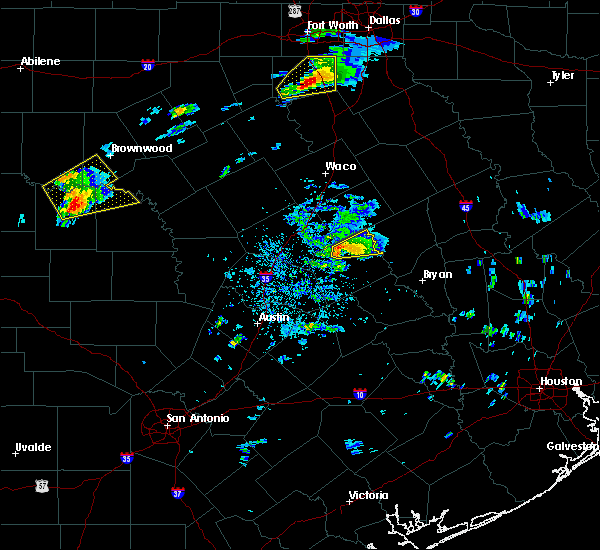 At 337 pm cdt, a severe thunderstorm was located near cameron, moving northeast at 15 mph (radar indicated). Hazards include 60 mph wind gusts and quarter size hail. Hail damage to vehicles is expected. expect wind damage to roofs, siding, and trees. Locations impacted include, cameron. At 337 pm cdt, a severe thunderstorm was located near cameron, moving northeast at 15 mph (radar indicated). Hazards include 60 mph wind gusts and quarter size hail. Hail damage to vehicles is expected. expect wind damage to roofs, siding, and trees. Locations impacted include, cameron.
|
| 4/10/2017 3:09 PM CDT |
 At 309 pm cdt, a severe thunderstorm was located 7 miles southeast of rogers, or 9 miles west of cameron, moving northeast at 20 mph (radar indicated). Hazards include 60 mph wind gusts and quarter size hail. Hail damage to vehicles is expected. Expect wind damage to roofs, siding, and trees. At 309 pm cdt, a severe thunderstorm was located 7 miles southeast of rogers, or 9 miles west of cameron, moving northeast at 20 mph (radar indicated). Hazards include 60 mph wind gusts and quarter size hail. Hail damage to vehicles is expected. Expect wind damage to roofs, siding, and trees.
|
| 4/2/2017 11:02 AM CDT | Large tree down in milam county TX, 1.8 miles SSW of Cameron, TX |
| 4/2/2017 10:56 AM CDT | The severe thunderstorm warning for western milam and bell counties will expire at 1100 am cdt, the storms which prompted the warning have moved out of the area. therefore the warning will be allowed to expire. a tornado watch remains in effect until 100 pm cdt for central texas. |
| 4/2/2017 10:41 AM CDT | At 1040 am cdt, severe thunderstorms were located along a line extending from near troy to near cameron to 6 miles northeast of tanglewood, moving northeast at 55 mph (radar indicated). Hazards include 60 mph wind gusts and nickel size hail. expect damage to roofs, siding, and trees |
| 4/2/2017 9:58 AM CDT | At 957 am cdt, severe thunderstorms were located along a line extending from near kempner to near elgin, moving northeast at 45 mph (radar indicated). Hazards include 65 mph wind gusts. expect damage to roofs, siding, and trees |
| 3/29/2017 3:02 AM CDT |
 At 301 am cdt, a severe thunderstorm was located near cameron, moving east at 40 mph (cameron airport reported 70 mph around 3 am). Hazards include 70 mph wind gusts. Expect considerable tree damage. damage is likely to mobile homes, roofs, and outbuildings. Locations impacted include, cameron, milano, calvert and hearne. At 301 am cdt, a severe thunderstorm was located near cameron, moving east at 40 mph (cameron airport reported 70 mph around 3 am). Hazards include 70 mph wind gusts. Expect considerable tree damage. damage is likely to mobile homes, roofs, and outbuildings. Locations impacted include, cameron, milano, calvert and hearne.
|
| 3/29/2017 2:59 AM CDT | 70 mph wind gusts at cameron in milam county TX, 0.7 miles WNW of Cameron, TX |
| 3/29/2017 2:50 AM CDT |
 At 249 am cdt, a severe thunderstorm was located near rockdale, moving east at 40 mph (radar indicated). Hazards include 65 mph wind gusts. Expect damage to roofs, siding, and trees. this severe thunderstorm will be near, hearne around 335 am cdt. Other locations impacted by this severe thunderstorm include milano and buckholts. At 249 am cdt, a severe thunderstorm was located near rockdale, moving east at 40 mph (radar indicated). Hazards include 65 mph wind gusts. Expect damage to roofs, siding, and trees. this severe thunderstorm will be near, hearne around 335 am cdt. Other locations impacted by this severe thunderstorm include milano and buckholts.
|
| 3/27/2017 12:13 AM CDT |
 At 1212 am cdt, severe thunderstorms were located along a line extending from 6 miles northeast of rosebud to 8 miles north of cameron to near little river-academy, moving southeast at 25 mph (radar indicated). Hazards include 60 mph wind gusts and quarter size hail. Hail damage to vehicles is expected. expect wind damage to roofs, siding, and trees. these severe storms will be near, rosebud around 1220 am cdt. cameron around 1225 am cdt. Other locations impacted by these severe thunderstorms include buckholts. At 1212 am cdt, severe thunderstorms were located along a line extending from 6 miles northeast of rosebud to 8 miles north of cameron to near little river-academy, moving southeast at 25 mph (radar indicated). Hazards include 60 mph wind gusts and quarter size hail. Hail damage to vehicles is expected. expect wind damage to roofs, siding, and trees. these severe storms will be near, rosebud around 1220 am cdt. cameron around 1225 am cdt. Other locations impacted by these severe thunderstorms include buckholts.
|
| 3/26/2017 11:29 PM CDT |
 At 1128 pm cdt, severe thunderstorms were located along a line extending from near bruceville-eddy to near temple to near nolanville, moving southeast at 20 mph (public report of quarter size hail in belton at 11:22 p.m). Hazards include 60 mph wind gusts and quarter size hail. Hail damage to vehicles is expected. Expect wind damage to roofs, siding, and trees. At 1128 pm cdt, severe thunderstorms were located along a line extending from near bruceville-eddy to near temple to near nolanville, moving southeast at 20 mph (public report of quarter size hail in belton at 11:22 p.m). Hazards include 60 mph wind gusts and quarter size hail. Hail damage to vehicles is expected. Expect wind damage to roofs, siding, and trees.
|
| 2/20/2017 1:07 AM CST |
 At 105 am cst, a severe thunderstorm was located 11 miles east of milano, moving northeast at 40 mph. this is a very dangerous storm (radar indicated). Hazards include 80 mph wind gusts. Flying debris will be dangerous to those caught without shelter. mobile homes will be heavily damaged. expect considerable damage to roofs, windows, and vehicles. extensive tree damage and power outages are likely. Locations impacted include, cameron, ben arnold, clarkson, belmena, maysfield and milano. At 105 am cst, a severe thunderstorm was located 11 miles east of milano, moving northeast at 40 mph. this is a very dangerous storm (radar indicated). Hazards include 80 mph wind gusts. Flying debris will be dangerous to those caught without shelter. mobile homes will be heavily damaged. expect considerable damage to roofs, windows, and vehicles. extensive tree damage and power outages are likely. Locations impacted include, cameron, ben arnold, clarkson, belmena, maysfield and milano.
|
| 2/20/2017 12:57 AM CST |
 At 1256 am cst, a severe thunderstorm was located 7 miles southeast of cameron and milano, moving northeast at 55 mph. this is a very dangerous storm (radar indicated). Hazards include 80 mph wind gusts. Flying debris will be dangerous to those caught without shelter. mobile homes will be heavily damaged. expect considerable damage to roofs, windows, and vehicles. extensive tree damage and power outages are likely. Locations impacted include, rockdale, cameron, thorndale, buckholts and milano. At 1256 am cst, a severe thunderstorm was located 7 miles southeast of cameron and milano, moving northeast at 55 mph. this is a very dangerous storm (radar indicated). Hazards include 80 mph wind gusts. Flying debris will be dangerous to those caught without shelter. mobile homes will be heavily damaged. expect considerable damage to roofs, windows, and vehicles. extensive tree damage and power outages are likely. Locations impacted include, rockdale, cameron, thorndale, buckholts and milano.
|
| 2/20/2017 12:52 AM CST |
 At 1252 am cst, a severe thunderstorm was located near rockdale, moving northeast at 50 mph. this is a very dangerous storm (radar indicated). Hazards include 80 mph wind gusts. Flying debris will be dangerous to those caught without shelter. mobile homes will be heavily damaged. expect considerable damage to roofs, windows, and vehicles. extensive tree damage and power outages are likely. This severe thunderstorm will remain over mainly rural areas of milam county, including the following locations: milano and buckholts. At 1252 am cst, a severe thunderstorm was located near rockdale, moving northeast at 50 mph. this is a very dangerous storm (radar indicated). Hazards include 80 mph wind gusts. Flying debris will be dangerous to those caught without shelter. mobile homes will be heavily damaged. expect considerable damage to roofs, windows, and vehicles. extensive tree damage and power outages are likely. This severe thunderstorm will remain over mainly rural areas of milam county, including the following locations: milano and buckholts.
|
| 6/28/2016 2:50 PM CDT |
 At 250 pm cdt, a severe thunderstorm was located over rosebud, or 13 miles north of cameron, moving south at 10 mph (radar indicated). Hazards include 60 mph wind gusts and quarter size hail. Hail damage to vehicles is expected. expect wind damage to roofs, siding, and trees. This severe thunderstorm will be near, cameron around 345 pm cdt. At 250 pm cdt, a severe thunderstorm was located over rosebud, or 13 miles north of cameron, moving south at 10 mph (radar indicated). Hazards include 60 mph wind gusts and quarter size hail. Hail damage to vehicles is expected. expect wind damage to roofs, siding, and trees. This severe thunderstorm will be near, cameron around 345 pm cdt.
|
| 5/2/2016 1:51 AM CDT |
 At 148 am cdt, a severe thunderstorm was located near cameron, moving north at 25 mph (radar indicated). Hazards include half dollar size hail. Damage to vehicles is possible. This severe thunderstorm will be near, ben arnold around 225 am cdt. At 148 am cdt, a severe thunderstorm was located near cameron, moving north at 25 mph (radar indicated). Hazards include half dollar size hail. Damage to vehicles is possible. This severe thunderstorm will be near, ben arnold around 225 am cdt.
|
| 12/13/2015 3:11 AM CST |
 At 311 am cst, a severe thunderstorm was located near rockdale, moving east at 45 mph (radar indicated). Hazards include 60 mph wind gusts. Expect damage to roofs. Siding and trees. At 311 am cst, a severe thunderstorm was located near rockdale, moving east at 45 mph (radar indicated). Hazards include 60 mph wind gusts. Expect damage to roofs. Siding and trees.
|
| 10/30/2015 12:16 PM CDT |
 At 1215 pm cdt, a severe thunderstorm was located near rockdale, moving northeast at 40 mph (radar indicated). Hazards include 60 to 70 mph wind gusts. Expect considerable tree damage. Damage is likely to mobile homes, roofs and outbuildings. At 1215 pm cdt, a severe thunderstorm was located near rockdale, moving northeast at 40 mph (radar indicated). Hazards include 60 to 70 mph wind gusts. Expect considerable tree damage. Damage is likely to mobile homes, roofs and outbuildings.
|
| 5/25/2015 4:09 PM CDT | At 408 pm cdt, severe thunderstorms were located along a line extending from 9 miles southwest of rosebud to near cameron to rockdale, moving east at 50 mph (radar indicated). Hazards include 70 mph wind gusts. Expect considerable tree damage. Damage is likely to mobile homes, roofs and outbuildings. |
| 5/25/2015 4:03 PM CDT | At 402 pm cdt, a confirmed large and extremely dangerous tornado was located near cameron, moving northeast at 40 mph. this is a particularly dangerous situation (radar confirmed tornado). Hazards include damaging tornado. You are in a life threatening situation. flying debris may be deadly to those caught without shelter. mobile homes will be destroyed. considerable damage to homes, businesses and vehicles is likely and complete destruction is possible. the tornado will be near, highway 190 between buckholts and cameron near the town of pettibone at 405 pm cdt. Splawn on highway 77 at 410 pm cdt. |
| 5/25/2015 3:59 PM CDT | At 358 pm cdt, a severe thunderstorm capable of producing a tornado was located near cameron, moving northeast at 40 mph (radar indicated rotation). Hazards include tornado and quarter size hail. Flying debris will be dangerous to those caught without shelter. mobile homes will be damaged or destroyed. damage to roofs, windows and vehicles will occur. tree damage is likely. this dangerous storm will be near, cameron around 405 pm cdt. Other locations impacted by this tornadic thunderstorm include buckholts. |
| 5/25/2015 3:57 PM CDT | At 357 pm cdt, a severe thunderstorm was located near cameron, moving east at 40 mph (radar indicated). Hazards include 70 mph wind gusts and quarter size hail. Hail damage to vehicles is expected. expect considerable tree damage. wind damage is also likely to mobile homes, roofs and outbuildings. locations impacted include, rockdale, cameron, buckholts and milano. A tornado watch remains in effect until 600 pm cdt for central texas. |
| 5/25/2015 3:28 PM CDT | At 327 pm cdt, a severe thunderstorm was located near granger dam, or 9 miles east of granger, moving east at 30 mph (radar indicated). Hazards include 60 mph wind gusts and quarter size hail. Hail damage to vehicles is expected. Expect wind damage to roofs, siding and trees. |
| 5/23/2015 11:00 PM CDT | At 1059 pm cdt, severe thunderstorms were located along a line extending from near killeen to temple to milano, moving northeast at 45 mph (radar indicated). Hazards include 60 mph wind gusts. Expect damage to roofs. siding and trees. locations impacted include, killeen, temple, copperas cove, harker heights, belton, rockdale, cameron, fort hood, nolanville, morgan`s point resort, salado, little river-academy, troy, rogers, buckholts and milano. A tornado watch remains in effect until 400 am cdt for central texas. |
| 5/23/2015 10:44 PM CDT | At 1044 pm cdt, severe thunderstorms were located along a line extending from near killeen to little river-academy to west of cameron to near rockdale, moving north at 45 mph. some low level rotation has been observed in this line of storms (radar indicated). Hazards include 60 mph wind gusts. Expect damage to roofs. siding and trees. locations impacted include, killeen, temple, copperas cove, harker heights, belton, rockdale, cameron, fort hood, nolanville, morgan`s point resort, salado, little river-academy, troy, thorndale, rogers, holland, buckholts and milano. A tornado watch remains in effect until 400 am cdt for central texas. |
| 5/23/2015 10:15 PM CDT | At 1013 pm cdt, severe thunderstorms were located along a line extending from near florence to granger to near fedor, moving northeast at 45 mph (radar indicated). Hazards include 65 mph wind gusts. Expect damage to roofs. Siding and trees. |
| 3/28/2014 4:15 PM CDT | Windows blown out of one side of a house in milam county TX, 7.9 miles S of Cameron, TX |
| 3/28/2014 4:15 PM CDT | Quarter sized hail reported 7.9 miles S of Cameron, TX |
| 10/26/2013 11:35 PM CDT | Ping Pong Ball sized hail reported 0.7 miles WNW of Cameron, TX, sheriffs office reported ping pong size |
| 5/9/2013 3:09 PM CDT | Trees damamaged by thunderstorms winds northeast of cameron...delayed report in milam county TX, 3 miles SW of Cameron, TX |
| 6/12/2012 5:51 PM CDT | 50 kt wind gust reported by kt35 awos north of cameron in milam county TX, 1.2 miles SSW of Cameron, TX |
| 6/12/2012 5:00 PM CDT | Powerlines and trees blown in milam county TX, 0.7 miles WNW of Cameron, TX |
| 3/20/2012 1:59 AM CDT | Large tree limbs were blown down and blocked the roadway at the intersection of fm 1600 and cr 21 in milam county TX, 1.9 miles NNE of Cameron, TX |
| 1/1/0001 12:00 AM | Quarter sized hail reported 5.2 miles SW of Cameron, TX, quarter size hail northeast of cameron. |
| 1/1/0001 12:00 AM | Tennis Ball sized hail reported 3.8 miles S of Cameron, TX, tennis ball hail reported near intersection of fm485 at us77...4 miles north of cameron. |
| 1/1/0001 12:00 AM | Grapefruit sized hail reported 4.5 miles S of Cameron, TX |
Hail Maps for Cameron, TX
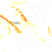
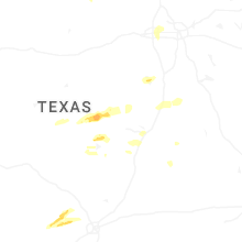
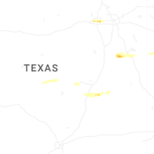


Connect with Interactive Hail Maps