

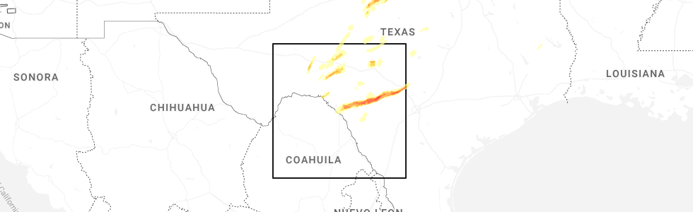
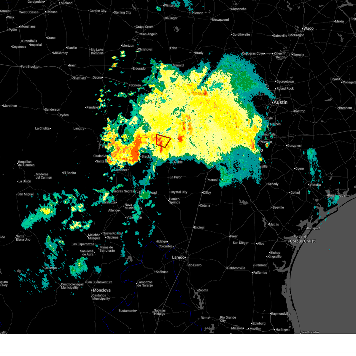
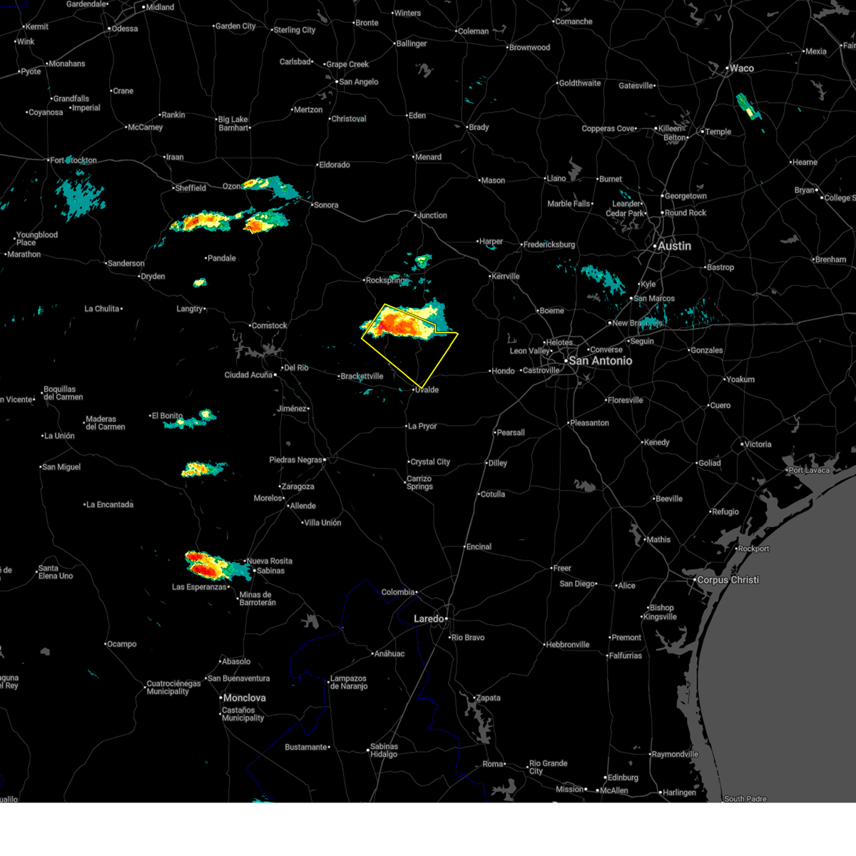
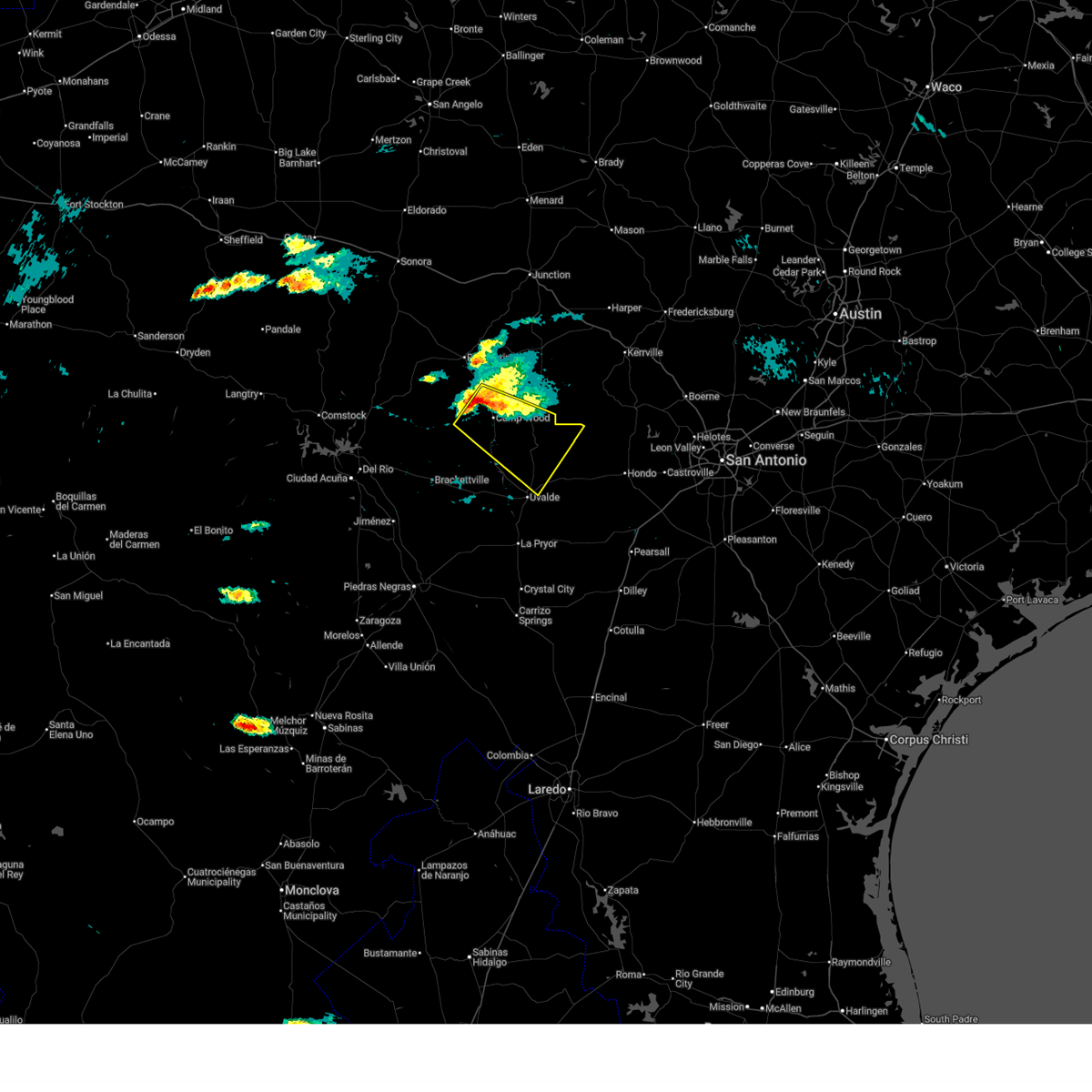
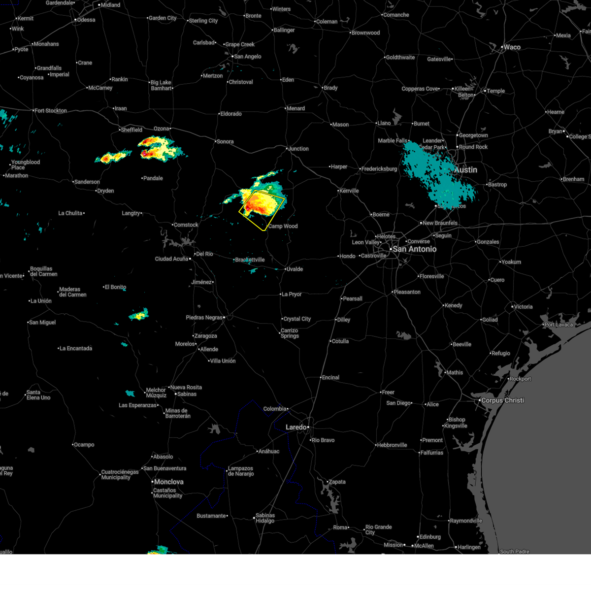
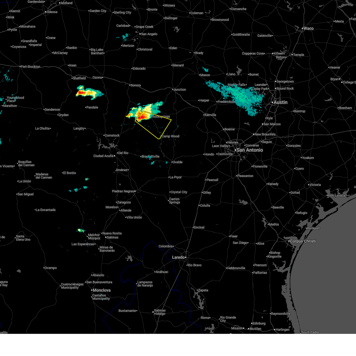
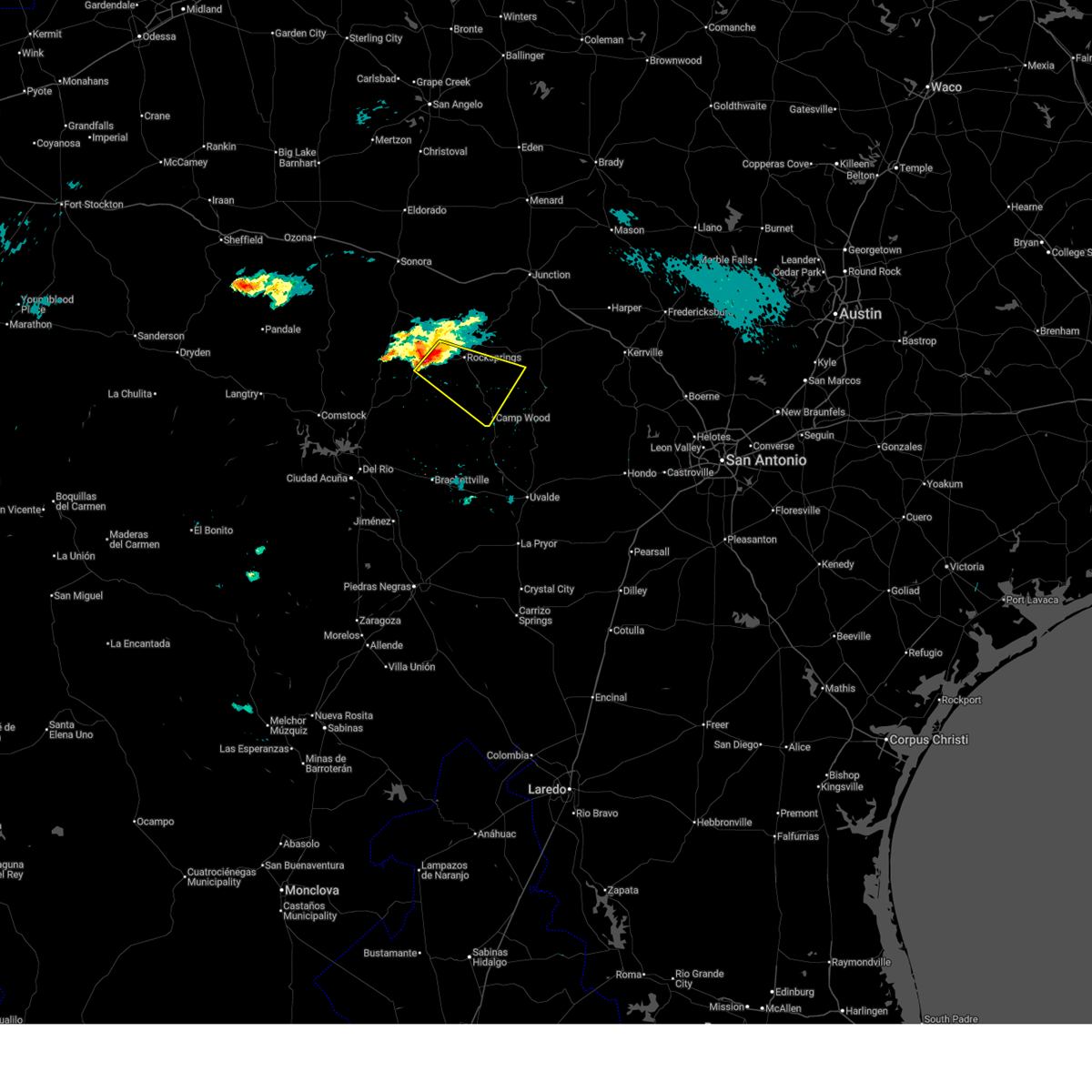
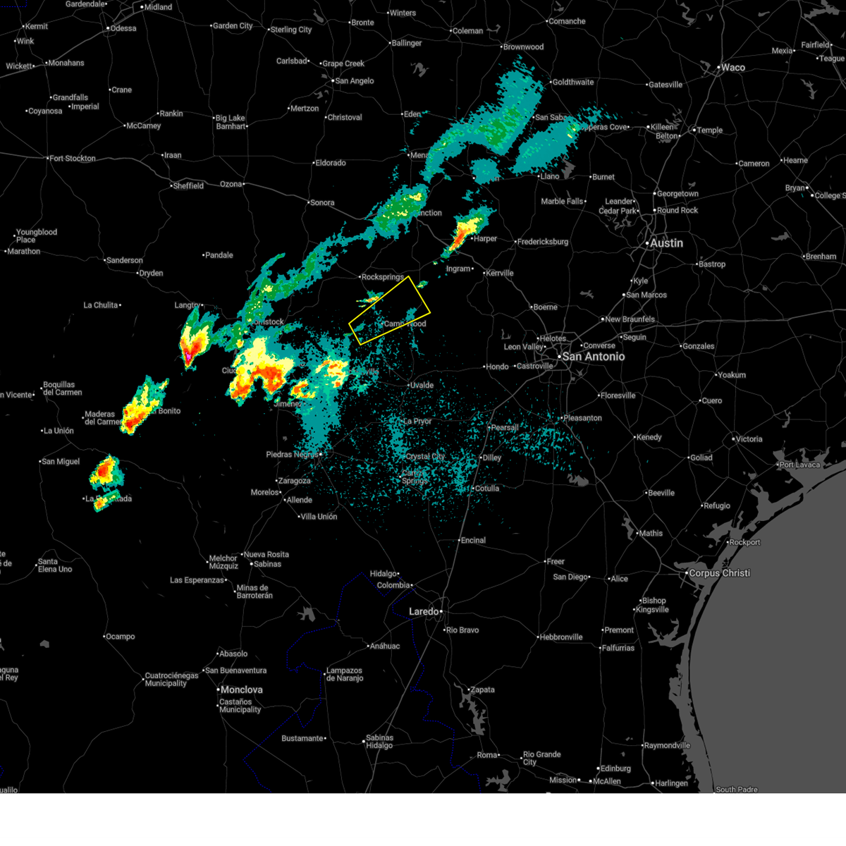
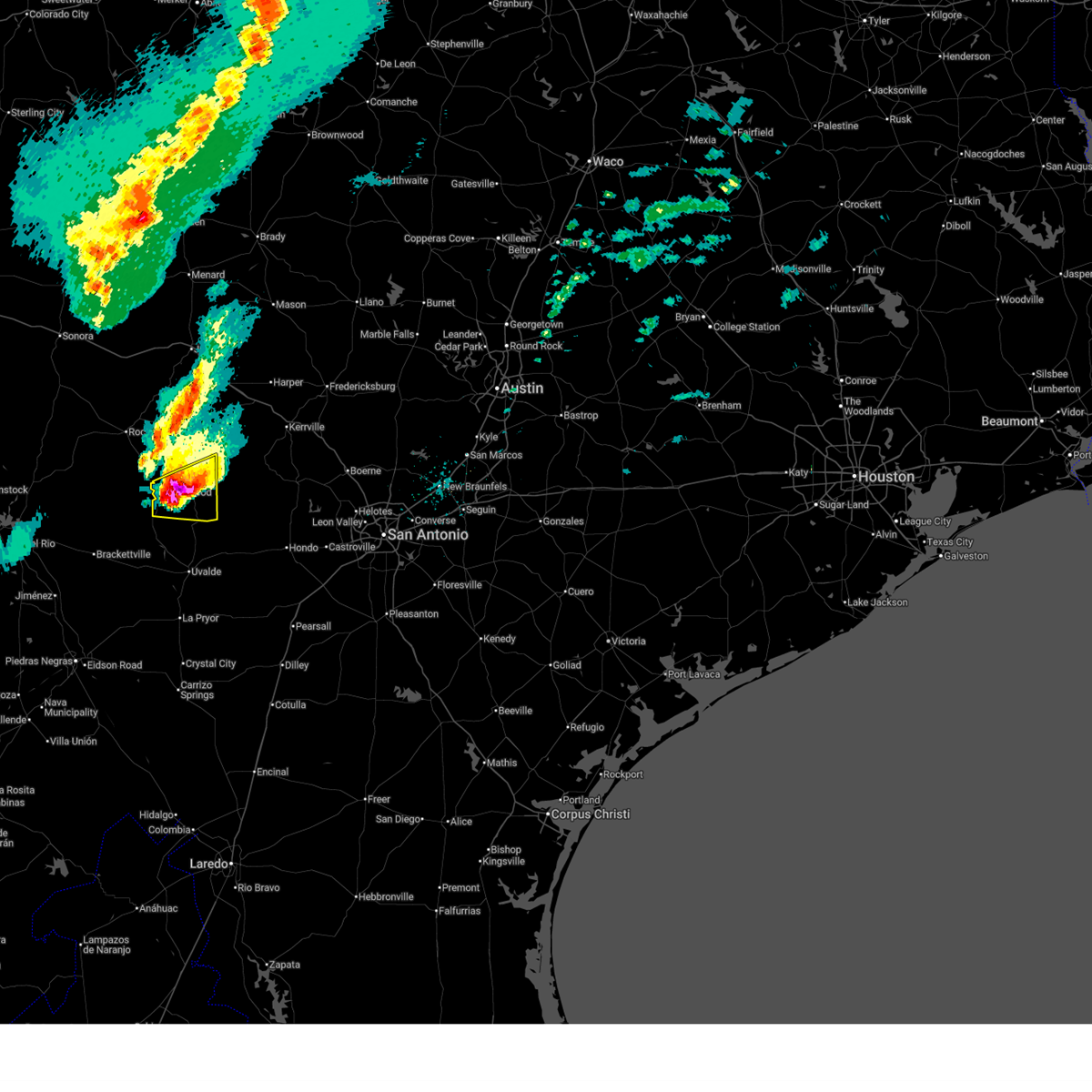
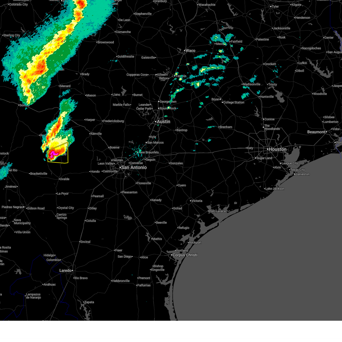
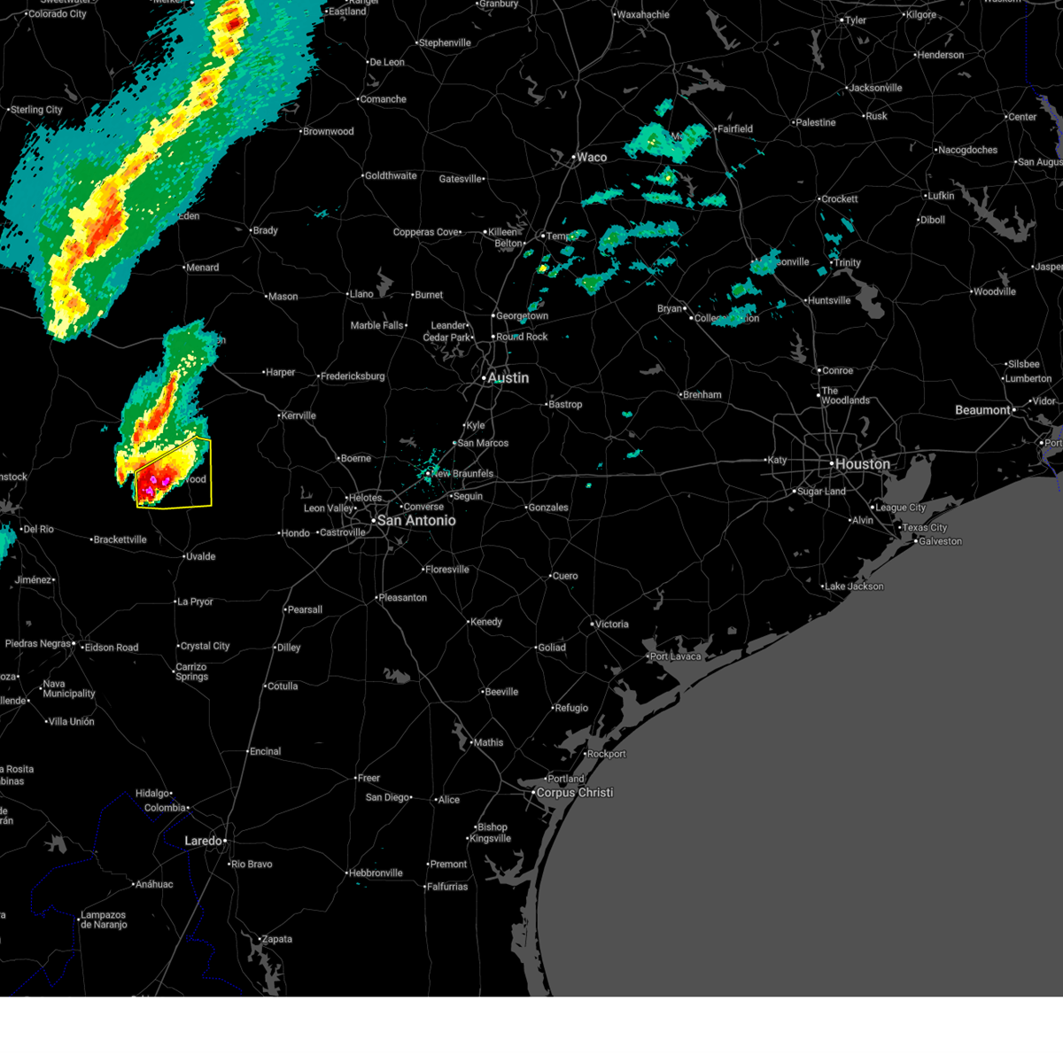
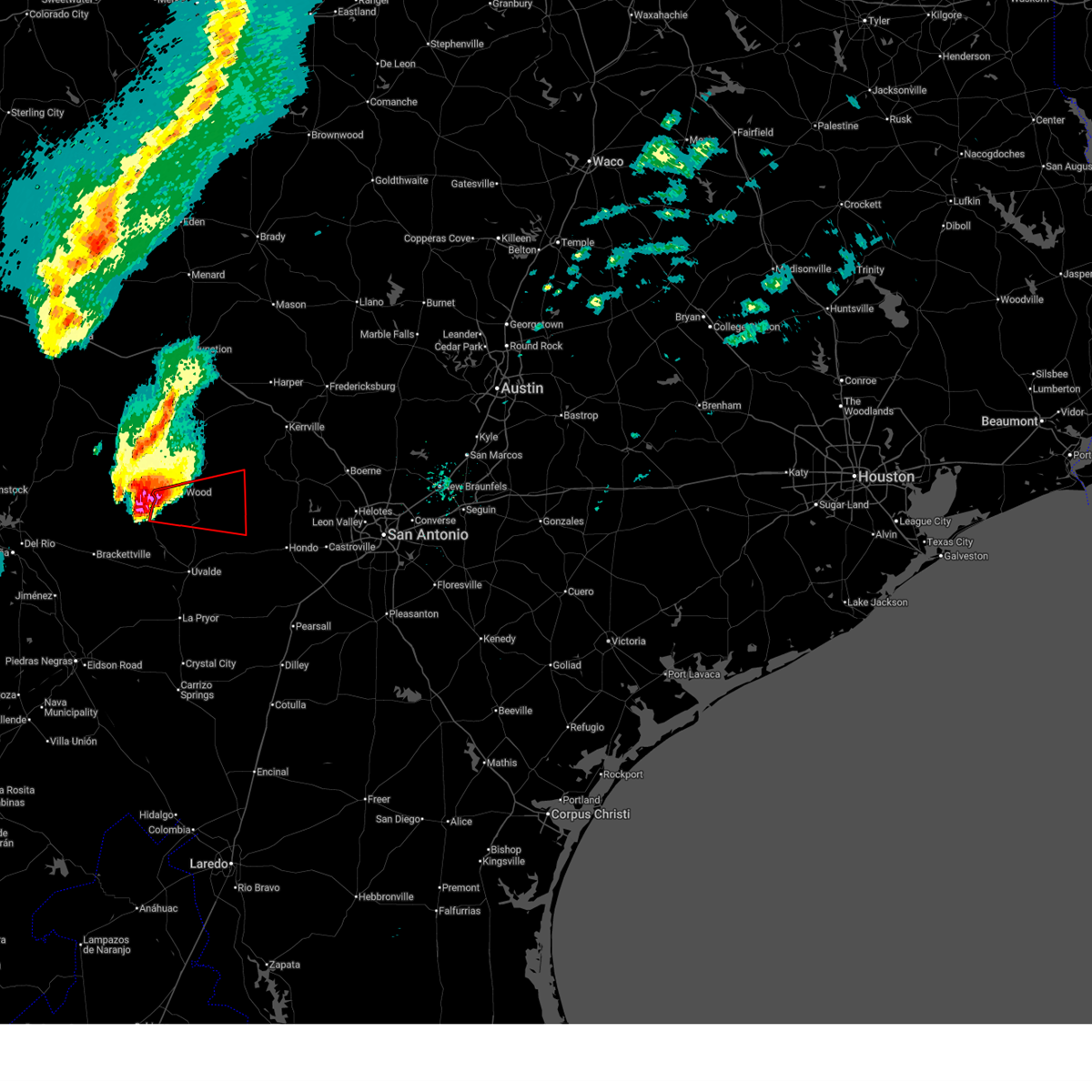
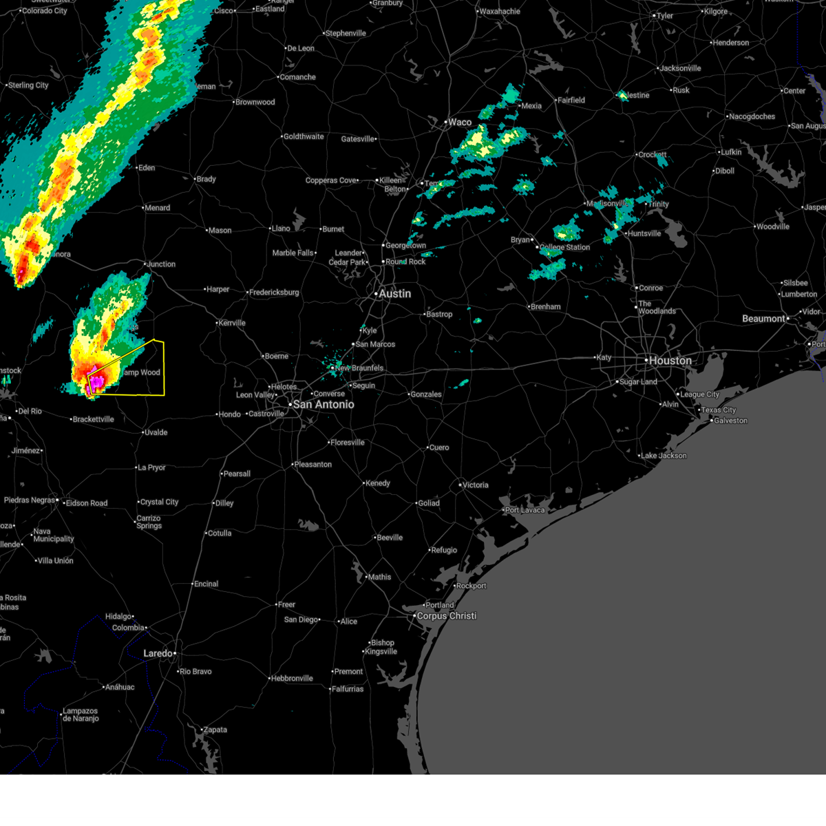
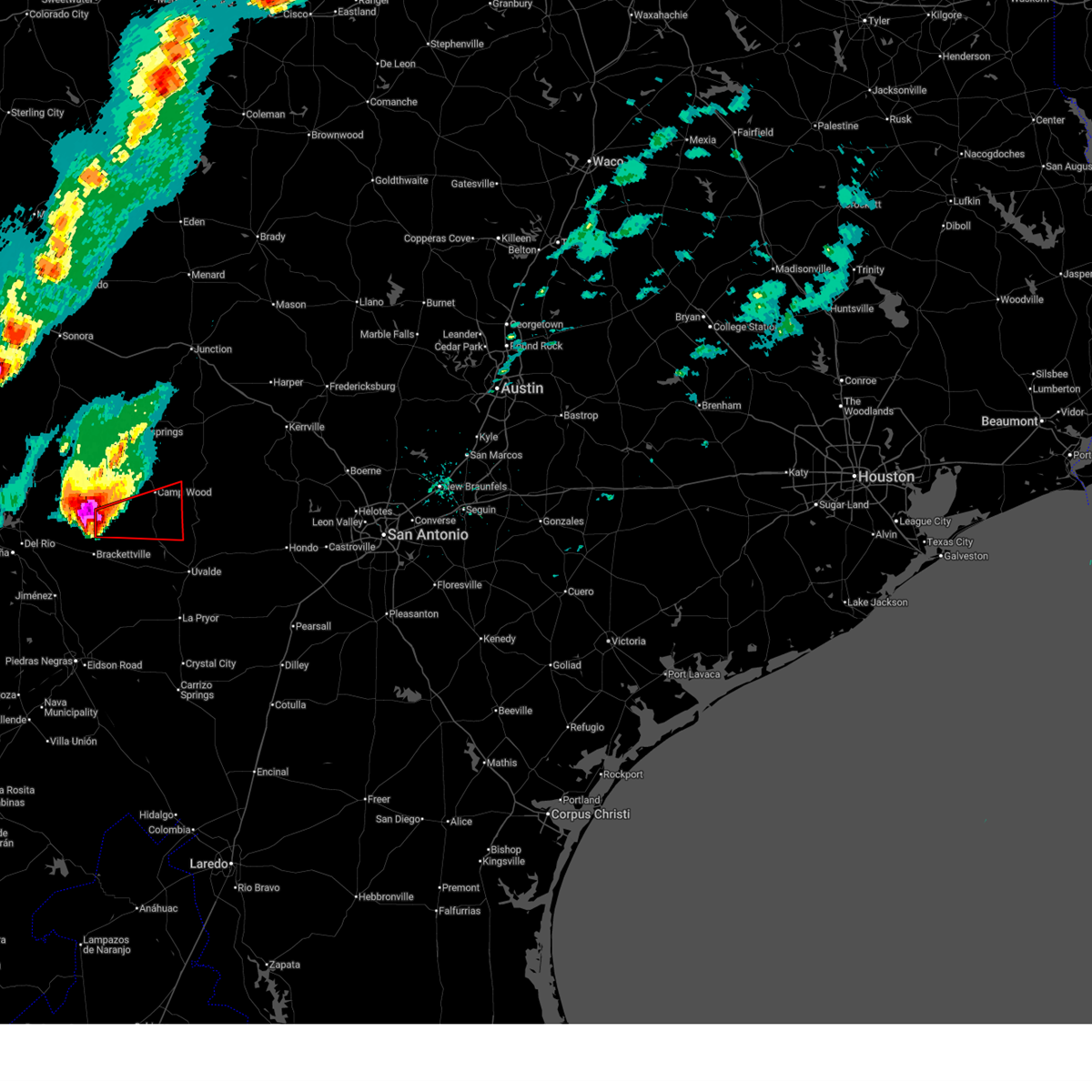
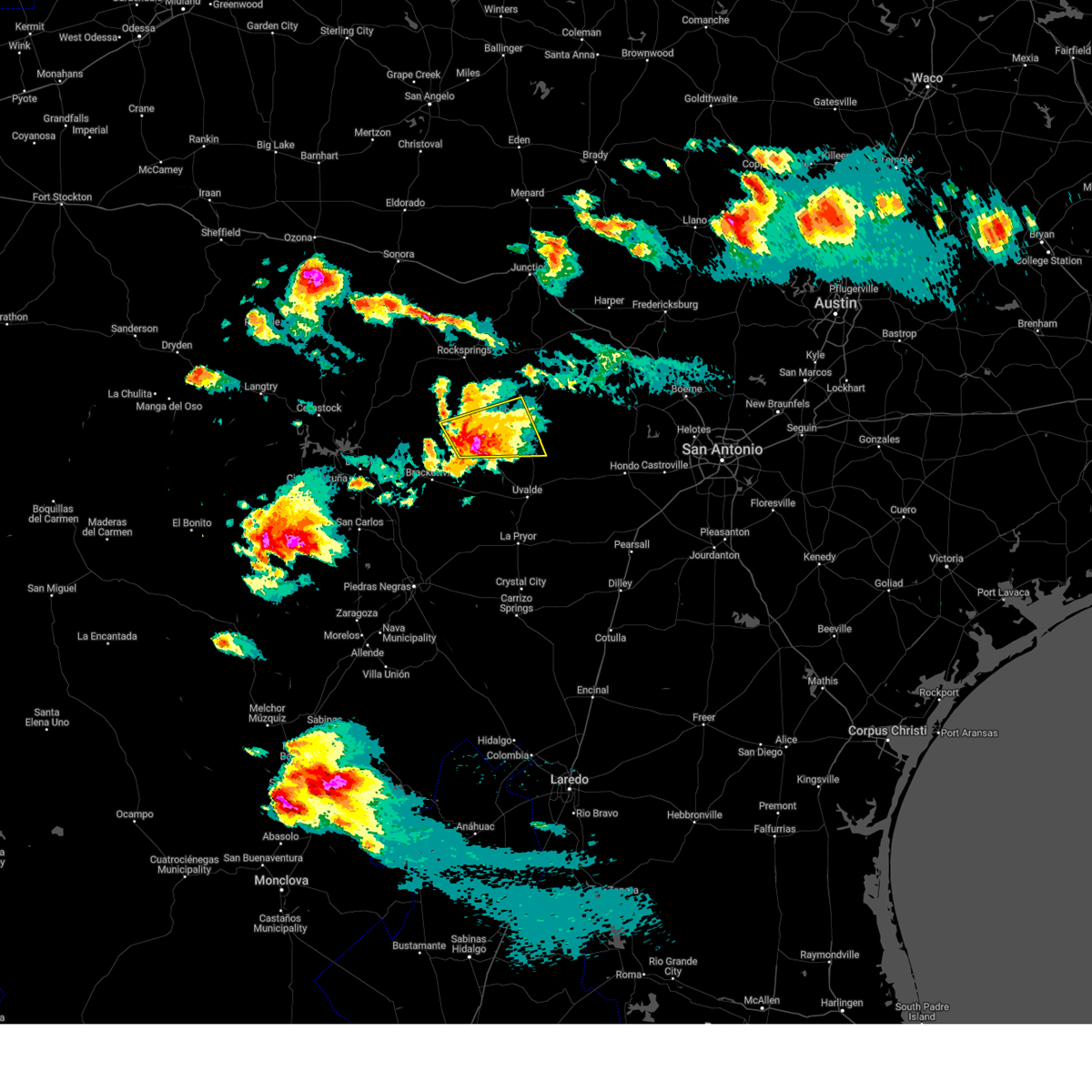
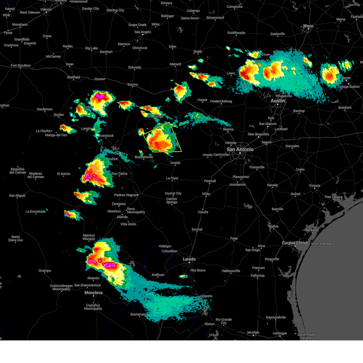
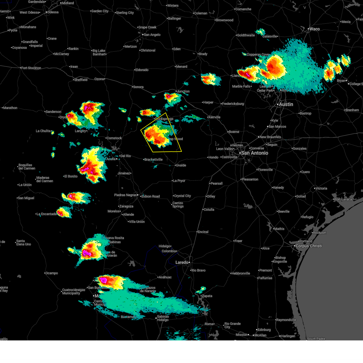
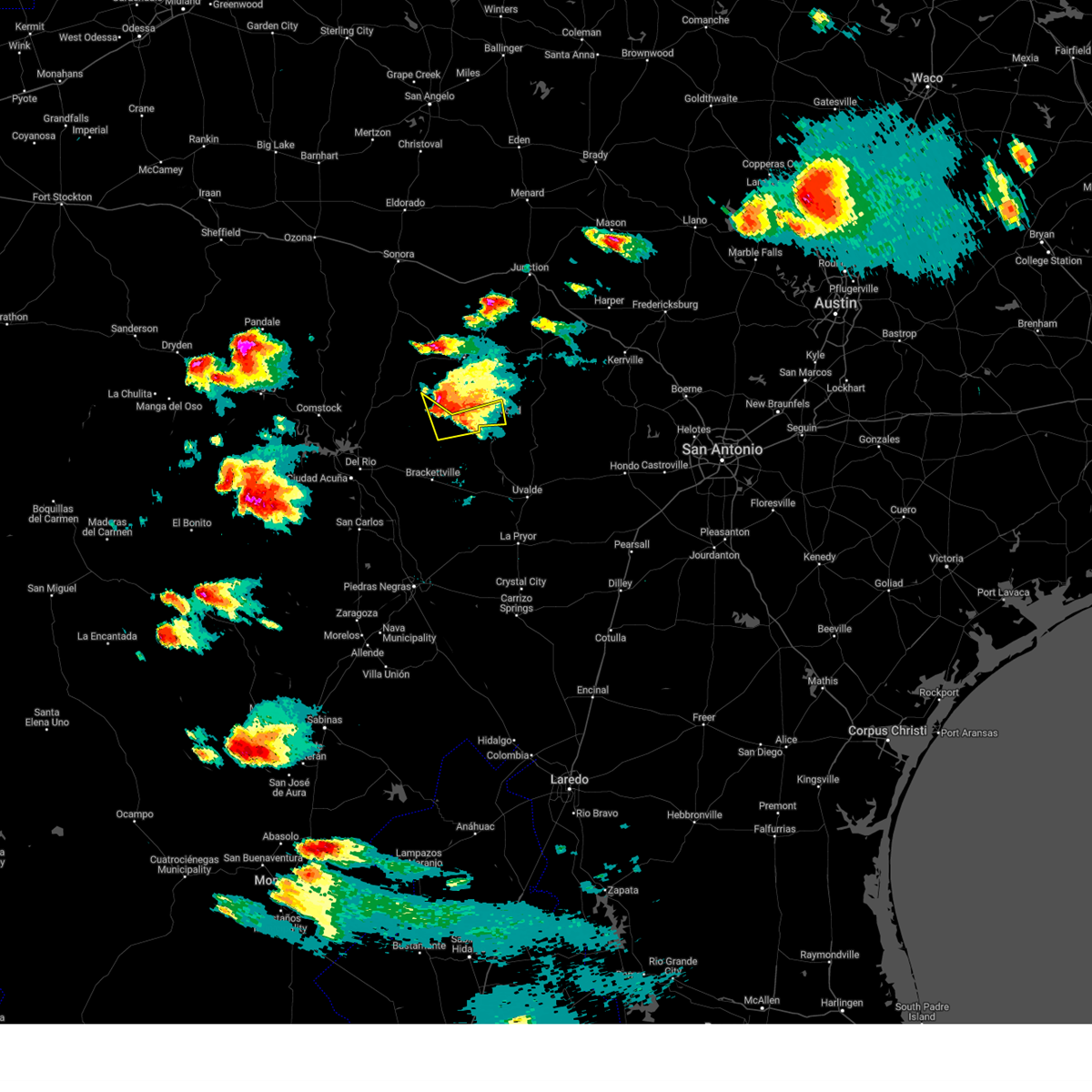
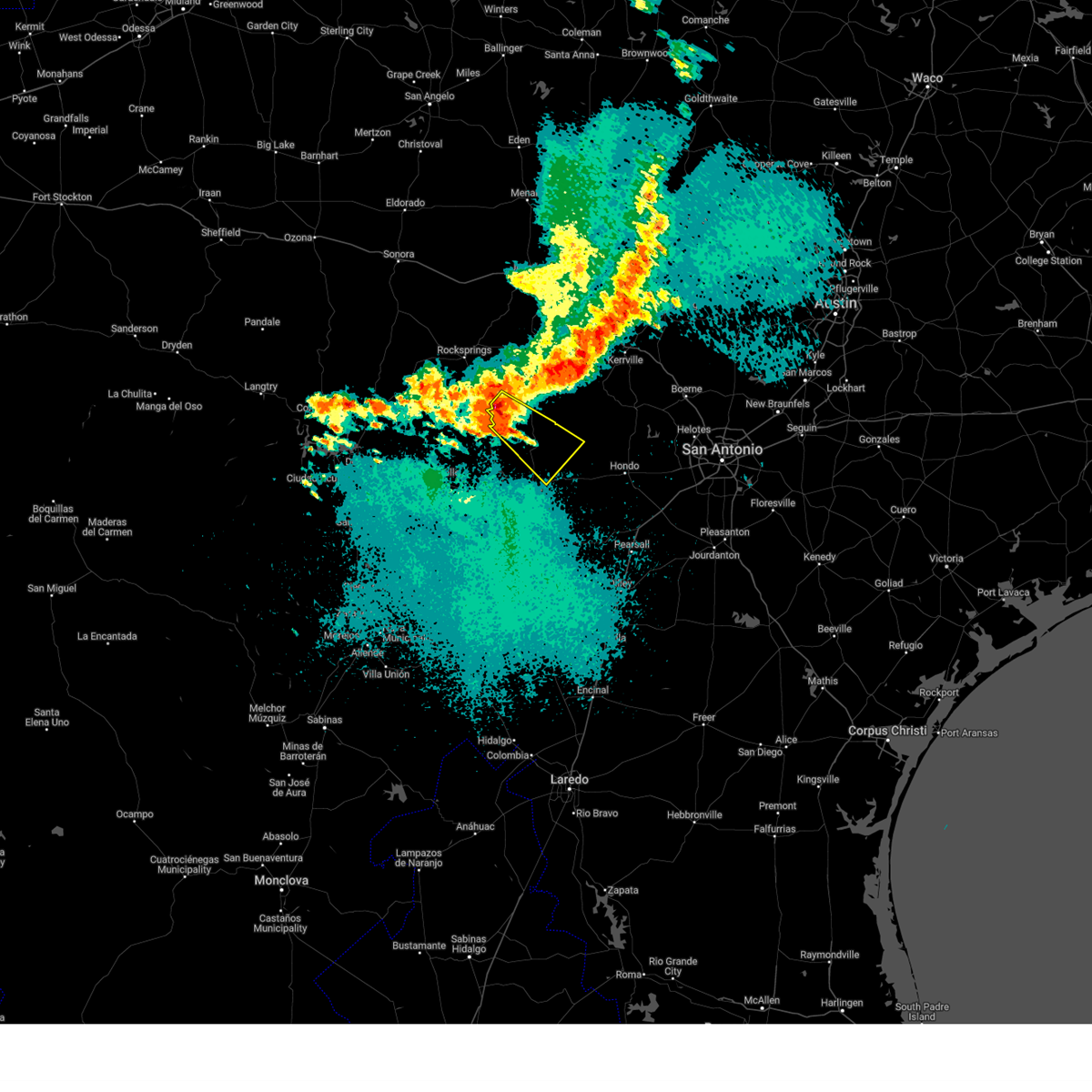
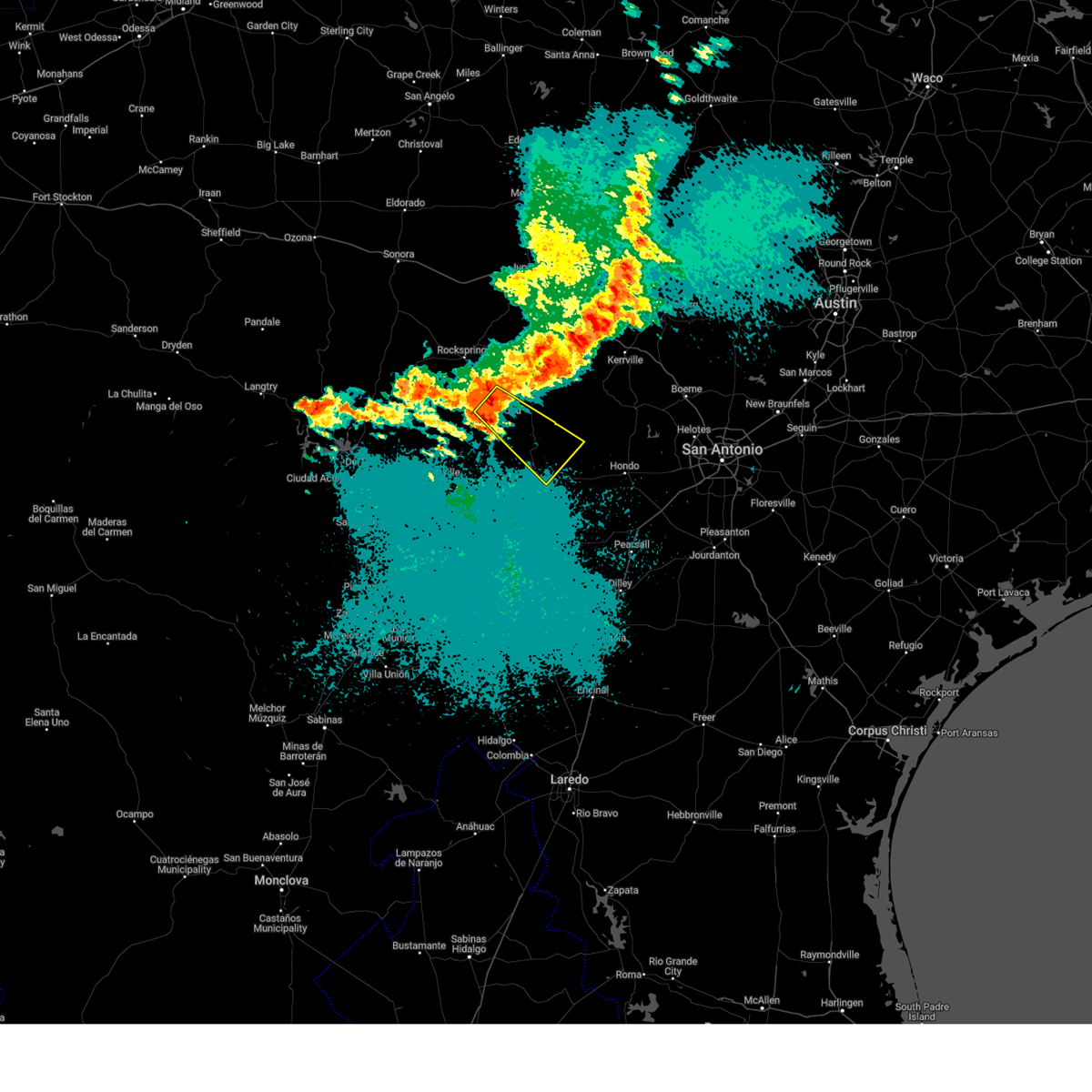
Hail Map for Camp Wood, TX
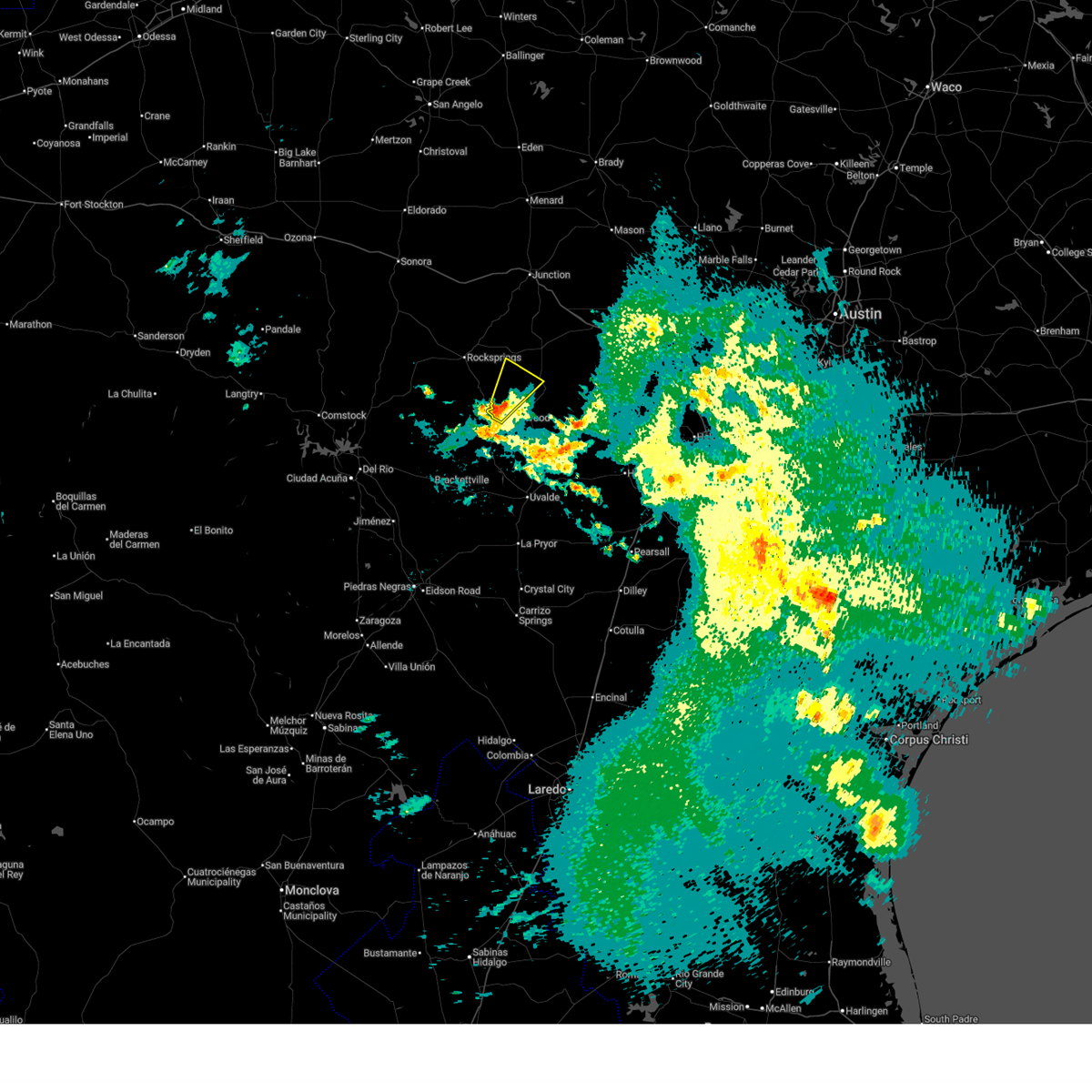
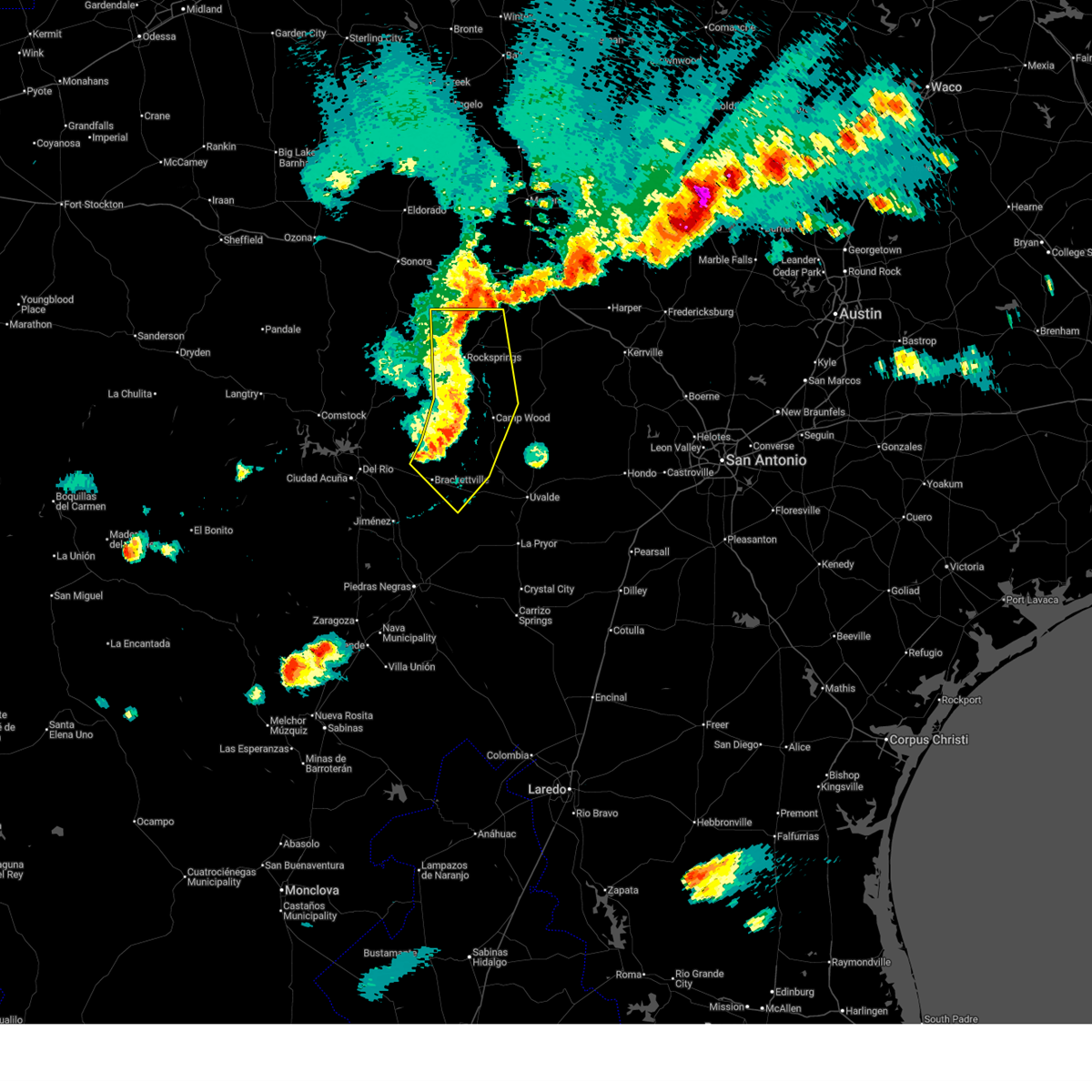
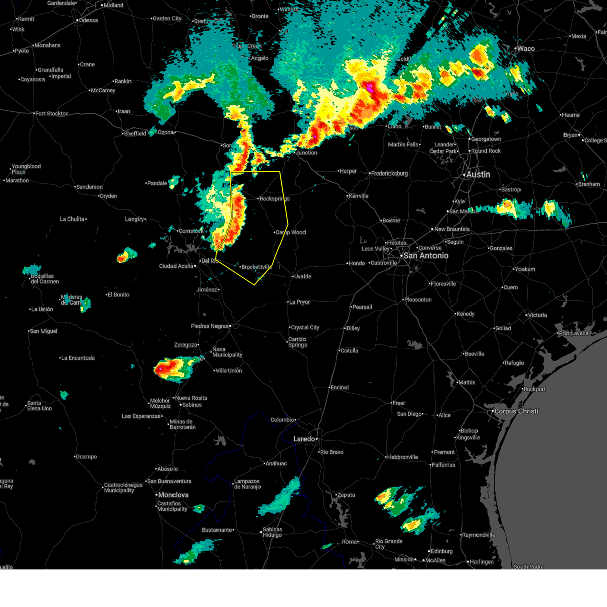
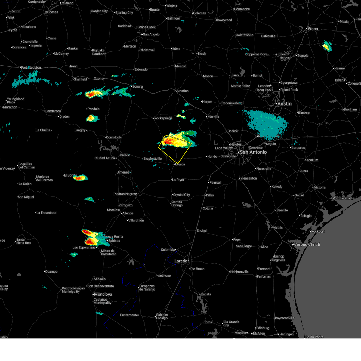
The Camp Wood, TX area has had 25 reports of on-the-ground hail by trained spotters, and has been under severe weather warnings 33 times during the past 12 months. Doppler radar has detected hail at or near Camp Wood, TX on 60 occasions, including 5 occasions during the past year.
| Name: | Camp Wood, TX |
| Where Located: | 57.3 miles ENE of Del Rio, TX |
| Map: | Google Map for Camp Wood, TX |
| Population: | 706 |
| Housing Units: | 365 |
| More Info: | Search Google for Camp Wood, TX |
5
The Top Recent Hail Date for Camp Wood, TX is Tuesday, March 10, 2026 (1st out of 60)
Hail and Wind Damage Spotted near Camp Wood, TX
| Date / Time | Report Details |
|---|---|
| 7/16/2026 6:50 AM CDT |
 At 650 am cdt, a severe thunderstorm capable of producing a tornado was located near camp wood, or 10 miles west of leakey, moving north at 15 mph (radar indicated rotation). Hazards include tornado. Flying debris will be dangerous to those caught without shelter. mobile homes will be damaged or destroyed. damage to roofs, windows, and vehicles will occur. tree damage is likely. Locations impacted include, camp wood. At 650 am cdt, a severe thunderstorm capable of producing a tornado was located near camp wood, or 10 miles west of leakey, moving north at 15 mph (radar indicated rotation). Hazards include tornado. Flying debris will be dangerous to those caught without shelter. mobile homes will be damaged or destroyed. damage to roofs, windows, and vehicles will occur. tree damage is likely. Locations impacted include, camp wood.
|
| 7/16/2026 6:41 AM CDT |
 At 641 am cdt, a severe thunderstorm capable of producing a tornado was located near camp wood, or 12 miles southwest of leakey, moving north at 15 mph (radar indicated rotation). Hazards include tornado. Flying debris will be dangerous to those caught without shelter. mobile homes will be damaged or destroyed. damage to roofs, windows, and vehicles will occur. tree damage is likely. Locations impacted include, camp wood. At 641 am cdt, a severe thunderstorm capable of producing a tornado was located near camp wood, or 12 miles southwest of leakey, moving north at 15 mph (radar indicated rotation). Hazards include tornado. Flying debris will be dangerous to those caught without shelter. mobile homes will be damaged or destroyed. damage to roofs, windows, and vehicles will occur. tree damage is likely. Locations impacted include, camp wood.
|
| 7/16/2026 6:28 AM CDT |
 Torewx the national weather service in austin san antonio has issued a * tornado warning for, northwestern uvalde county in south central texas, southwestern real county in south central texas, * until 700 am cdt. * at 628 am cdt, a severe thunderstorm capable of producing a tornado was located near montell, or 15 miles southwest of leakey, moving north at 15 mph (radar indicated rotation). Hazards include tornado. Flying debris will be dangerous to those caught without shelter. mobile homes will be damaged or destroyed. damage to roofs, windows, and vehicles will occur. tree damage is likely. This tornadic thunderstorm will remain over mainly rural areas of northwestern uvalde and southwestern real counties. Torewx the national weather service in austin san antonio has issued a * tornado warning for, northwestern uvalde county in south central texas, southwestern real county in south central texas, * until 700 am cdt. * at 628 am cdt, a severe thunderstorm capable of producing a tornado was located near montell, or 15 miles southwest of leakey, moving north at 15 mph (radar indicated rotation). Hazards include tornado. Flying debris will be dangerous to those caught without shelter. mobile homes will be damaged or destroyed. damage to roofs, windows, and vehicles will occur. tree damage is likely. This tornadic thunderstorm will remain over mainly rural areas of northwestern uvalde and southwestern real counties.
|
| 7/16/2026 5:55 AM CDT |
 At 554 am cdt, a severe thunderstorm capable of producing a tornado was located over montell, or 18 miles southwest of leakey, moving north at 15 mph (radar indicated rotation). Hazards include tornado. Flying debris will be dangerous to those caught without shelter. mobile homes will be damaged or destroyed. damage to roofs, windows, and vehicles will occur. tree damage is likely. This dangerous storm will be near, camp wood around 615 am cdt. At 554 am cdt, a severe thunderstorm capable of producing a tornado was located over montell, or 18 miles southwest of leakey, moving north at 15 mph (radar indicated rotation). Hazards include tornado. Flying debris will be dangerous to those caught without shelter. mobile homes will be damaged or destroyed. damage to roofs, windows, and vehicles will occur. tree damage is likely. This dangerous storm will be near, camp wood around 615 am cdt.
|
| 7/16/2026 5:38 AM CDT |
 Torewx the national weather service in austin san antonio has issued a * tornado warning for, northwestern uvalde county in south central texas, south central edwards county in south central texas, southwestern real county in south central texas, * until 630 am cdt. * at 538 am cdt, a severe thunderstorm capable of producing a tornado was located over montell, or 22 miles southwest of leakey, moving north at 15 mph (radar indicated rotation). Hazards include tornado. Flying debris will be dangerous to those caught without shelter. mobile homes will be damaged or destroyed. damage to roofs, windows, and vehicles will occur. tree damage is likely. this dangerous storm will be near, montell around 545 am cdt. Camp wood around 615 am cdt. Torewx the national weather service in austin san antonio has issued a * tornado warning for, northwestern uvalde county in south central texas, south central edwards county in south central texas, southwestern real county in south central texas, * until 630 am cdt. * at 538 am cdt, a severe thunderstorm capable of producing a tornado was located over montell, or 22 miles southwest of leakey, moving north at 15 mph (radar indicated rotation). Hazards include tornado. Flying debris will be dangerous to those caught without shelter. mobile homes will be damaged or destroyed. damage to roofs, windows, and vehicles will occur. tree damage is likely. this dangerous storm will be near, montell around 545 am cdt. Camp wood around 615 am cdt.
|
| 7/16/2026 5:12 AM CDT |
 At 512 am cdt, a severe thunderstorm capable of producing a tornado was located near reagan wells, or 18 miles southwest of leakey, moving north at 15 mph (radar indicated rotation). Hazards include tornado. Flying debris will be dangerous to those caught without shelter. mobile homes will be damaged or destroyed. damage to roofs, windows, and vehicles will occur. tree damage is likely. This dangerous storm will be near, reagan wells around 520 am cdt. At 512 am cdt, a severe thunderstorm capable of producing a tornado was located near reagan wells, or 18 miles southwest of leakey, moving north at 15 mph (radar indicated rotation). Hazards include tornado. Flying debris will be dangerous to those caught without shelter. mobile homes will be damaged or destroyed. damage to roofs, windows, and vehicles will occur. tree damage is likely. This dangerous storm will be near, reagan wells around 520 am cdt.
|
| 7/16/2026 5:04 AM CDT |
 Torewx the national weather service in austin san antonio has issued a * tornado warning for, northwestern uvalde county in south central texas, southwestern real county in south central texas, * until 545 am cdt. * at 504 am cdt, a severe thunderstorm capable of producing a tornado was located near laguna, or 19 miles northwest of uvalde, moving north at 15 mph (radar indicated rotation). Hazards include tornado. Flying debris will be dangerous to those caught without shelter. mobile homes will be damaged or destroyed. damage to roofs, windows, and vehicles will occur. tree damage is likely. This dangerous storm will be near, reagan wells around 520 am cdt. Torewx the national weather service in austin san antonio has issued a * tornado warning for, northwestern uvalde county in south central texas, southwestern real county in south central texas, * until 545 am cdt. * at 504 am cdt, a severe thunderstorm capable of producing a tornado was located near laguna, or 19 miles northwest of uvalde, moving north at 15 mph (radar indicated rotation). Hazards include tornado. Flying debris will be dangerous to those caught without shelter. mobile homes will be damaged or destroyed. damage to roofs, windows, and vehicles will occur. tree damage is likely. This dangerous storm will be near, reagan wells around 520 am cdt.
|
| 5/26/2026 3:36 PM CDT |
 Svrewx the national weather service in austin san antonio has issued a * severe thunderstorm warning for, eastern edwards county in south central texas, real county in south central texas, * until 415 pm cdt. * at 336 pm cdt, a severe thunderstorm was located over vance, or 13 miles northwest of leakey, moving north at 25 mph (radar indicated). Hazards include 60 mph wind gusts and quarter size hail. Hail damage to vehicles is expected. Expect wind damage to roofs, siding, and trees. Svrewx the national weather service in austin san antonio has issued a * severe thunderstorm warning for, eastern edwards county in south central texas, real county in south central texas, * until 415 pm cdt. * at 336 pm cdt, a severe thunderstorm was located over vance, or 13 miles northwest of leakey, moving north at 25 mph (radar indicated). Hazards include 60 mph wind gusts and quarter size hail. Hail damage to vehicles is expected. Expect wind damage to roofs, siding, and trees.
|
| 5/21/2026 5:18 AM CDT |
 Svrewx the national weather service in austin san antonio has issued a * severe thunderstorm warning for, northwestern real county in south central texas, * until 600 am cdt. * at 518 am cdt, a severe thunderstorm was located near barksdale, or 12 miles west of leakey, moving northeast at 15 mph (radar indicated). Hazards include half dollar size hail. damage to vehicles is expected Svrewx the national weather service in austin san antonio has issued a * severe thunderstorm warning for, northwestern real county in south central texas, * until 600 am cdt. * at 518 am cdt, a severe thunderstorm was located near barksdale, or 12 miles west of leakey, moving northeast at 15 mph (radar indicated). Hazards include half dollar size hail. damage to vehicles is expected
|
| 5/10/2026 8:13 PM CDT |
 At 812 pm cdt, severe thunderstorms were located along a line extending from 17 miles southwest of roosevelt to 9 miles west of vance to 12 miles west of montell to near alamo village, moving east at 30 mph (radar indicated). Hazards include 60 mph wind gusts and quarter size hail. Hail damage to vehicles is expected. expect wind damage to roofs, siding, and trees. Locations impacted include, brackettville, rocksprings, camp wood, laguna, barksdale, vance, montell, anacacho, alamo village, cline, kickapoo cavern state park, turkey mountain, devil's sinkhole state natural area, and fort clark springs. At 812 pm cdt, severe thunderstorms were located along a line extending from 17 miles southwest of roosevelt to 9 miles west of vance to 12 miles west of montell to near alamo village, moving east at 30 mph (radar indicated). Hazards include 60 mph wind gusts and quarter size hail. Hail damage to vehicles is expected. expect wind damage to roofs, siding, and trees. Locations impacted include, brackettville, rocksprings, camp wood, laguna, barksdale, vance, montell, anacacho, alamo village, cline, kickapoo cavern state park, turkey mountain, devil's sinkhole state natural area, and fort clark springs.
|
| 5/10/2026 7:45 PM CDT |
 Svrewx the national weather service in austin san antonio has issued a * severe thunderstorm warning for, kinney county in south central texas, northwestern uvalde county in south central texas, edwards county in south central texas, western real county in south central texas, * until 845 pm cdt. * at 744 pm cdt, severe thunderstorms were located along a line extending from 25 miles southwest of roosevelt to 16 miles southwest of rocksprings to 14 miles northwest of alamo village to near amanda, moving east at 25 mph (radar indicated). Hazards include 60 mph wind gusts and quarter size hail. Hail damage to vehicles is expected. Expect wind damage to roofs, siding, and trees. Svrewx the national weather service in austin san antonio has issued a * severe thunderstorm warning for, kinney county in south central texas, northwestern uvalde county in south central texas, edwards county in south central texas, western real county in south central texas, * until 845 pm cdt. * at 744 pm cdt, severe thunderstorms were located along a line extending from 25 miles southwest of roosevelt to 16 miles southwest of rocksprings to 14 miles northwest of alamo village to near amanda, moving east at 25 mph (radar indicated). Hazards include 60 mph wind gusts and quarter size hail. Hail damage to vehicles is expected. Expect wind damage to roofs, siding, and trees.
|
| 4/29/2026 7:28 PM CDT | Baseball sized hail reported 2 miles N of Camp Wood, TX, picture on x of baseball size hail. |
| 4/29/2026 7:20 PM CDT |
 At 715 pm cdt, a severe thunderstorm was located near montell, or 16 miles southwest of leakey, moving southeast at 25 mph. this is a destructive storm for reagan wells (public. at 708pm, baseball size hail was reported 3 miles south of camp wood). Hazards include baseball size hail and 60 mph wind gusts. People and animals outdoors will be severely injured. expect shattered windows, extensive damage to roofs, siding, and vehicles. Locations impacted include, camp wood, montell, garner state park, rio frio, reagan wells, concan, and knippa. At 715 pm cdt, a severe thunderstorm was located near montell, or 16 miles southwest of leakey, moving southeast at 25 mph. this is a destructive storm for reagan wells (public. at 708pm, baseball size hail was reported 3 miles south of camp wood). Hazards include baseball size hail and 60 mph wind gusts. People and animals outdoors will be severely injured. expect shattered windows, extensive damage to roofs, siding, and vehicles. Locations impacted include, camp wood, montell, garner state park, rio frio, reagan wells, concan, and knippa.
|
| 4/29/2026 7:08 PM CDT | Tea Cup sized hail reported 3.4 miles N of Camp Wood, TX, video received of 3 to 3.5 inch diameter measured hail. |
| 4/29/2026 7:08 PM CDT | Baseball sized hail reported 3.4 miles N of Camp Wood, TX |
| 4/29/2026 7:03 PM CDT | Softball sized hail reported 2 miles N of Camp Wood, TX, picture on x. time estimated from radar. |
| 4/29/2026 7:01 PM CDT | Hen Egg sized hail reported 2.7 miles N of Camp Wood, TX, report from mping hen egg (2.00 in.). |
| 4/29/2026 6:57 PM CDT |
 At 655 pm cdt, a severe thunderstorm was located near reagan wells, or 9 miles southwest of leakey, moving southeast at 40 mph. this is a destructive storm for camp wood! (public. at 6:51pm, 2 inch hail was reported near camp wood). Hazards include baseball size hail and 60 mph wind gusts. People and animals outdoors will be severely injured. expect shattered windows, extensive damage to roofs, siding, and vehicles. Locations impacted include, leakey, camp wood, montell, barksdale, garner state park, rio frio, reagan wells, concan, utopia, vance, and knippa. At 655 pm cdt, a severe thunderstorm was located near reagan wells, or 9 miles southwest of leakey, moving southeast at 40 mph. this is a destructive storm for camp wood! (public. at 6:51pm, 2 inch hail was reported near camp wood). Hazards include baseball size hail and 60 mph wind gusts. People and animals outdoors will be severely injured. expect shattered windows, extensive damage to roofs, siding, and vehicles. Locations impacted include, leakey, camp wood, montell, barksdale, garner state park, rio frio, reagan wells, concan, utopia, vance, and knippa.
|
| 4/29/2026 6:52 PM CDT | Hen Egg sized hail reported 4.7 miles SSE of Camp Wood, TX, report from mping hen egg (2.00 in.). |
| 4/29/2026 6:51 PM CDT | Hen Egg sized hail reported 1.5 miles SSE of Camp Wood, TX, report from mping hen egg (2.00 in.). |
| 4/29/2026 6:39 PM CDT | Quarter sized hail reported 10.5 miles SSE of Camp Wood, TX, report from mping quarter (1.00 in.). |
| 4/29/2026 6:37 PM CDT |
 Svrewx the national weather service in austin san antonio has issued a * severe thunderstorm warning for, northeastern kinney county in south central texas, northern uvalde county in south central texas, south central edwards county in south central texas, southern real county in south central texas, * until 730 pm cdt. * at 636 pm cdt, a severe thunderstorm was located over barksdale, or 18 miles west of leakey, moving southeast at 40 mph (radar indicated). Hazards include two inch hail and 60 mph wind gusts. People and animals outdoors will be injured. expect hail damage to roofs, siding, windows, and vehicles. Expect wind damage to roofs, siding, and trees. Svrewx the national weather service in austin san antonio has issued a * severe thunderstorm warning for, northeastern kinney county in south central texas, northern uvalde county in south central texas, south central edwards county in south central texas, southern real county in south central texas, * until 730 pm cdt. * at 636 pm cdt, a severe thunderstorm was located over barksdale, or 18 miles west of leakey, moving southeast at 40 mph (radar indicated). Hazards include two inch hail and 60 mph wind gusts. People and animals outdoors will be injured. expect hail damage to roofs, siding, windows, and vehicles. Expect wind damage to roofs, siding, and trees.
|
| 4/29/2026 6:21 PM CDT |
 At 620 pm cdt, a severe thunderstorm was located 8 miles south of rocksprings, moving southeast at 25 mph (radar indicated). Hazards include ping pong ball size hail and 60 mph wind gusts. People and animals outdoors will be injured. expect hail damage to roofs, siding, windows, and vehicles. expect wind damage to roofs, siding, and trees. Locations impacted include, camp wood, vance, barksdale, and devil's sinkhole state natural area. At 620 pm cdt, a severe thunderstorm was located 8 miles south of rocksprings, moving southeast at 25 mph (radar indicated). Hazards include ping pong ball size hail and 60 mph wind gusts. People and animals outdoors will be injured. expect hail damage to roofs, siding, windows, and vehicles. expect wind damage to roofs, siding, and trees. Locations impacted include, camp wood, vance, barksdale, and devil's sinkhole state natural area.
|
| 4/29/2026 5:55 PM CDT |
 At 554 pm cdt, a severe thunderstorm was located 9 miles west of rocksprings, and is nearly stationary (radar indicated). Hazards include tennis ball size hail and 60 mph wind gusts. People and animals outdoors will be injured. expect hail damage to roofs, siding, windows, and vehicles. expect wind damage to roofs, siding, and trees. Locations impacted include, rocksprings, camp wood, vance, barksdale, and devil's sinkhole state natural area. At 554 pm cdt, a severe thunderstorm was located 9 miles west of rocksprings, and is nearly stationary (radar indicated). Hazards include tennis ball size hail and 60 mph wind gusts. People and animals outdoors will be injured. expect hail damage to roofs, siding, windows, and vehicles. expect wind damage to roofs, siding, and trees. Locations impacted include, rocksprings, camp wood, vance, barksdale, and devil's sinkhole state natural area.
|
| 4/29/2026 5:46 PM CDT |
 Svrewx the national weather service in austin san antonio has issued a * severe thunderstorm warning for, central edwards county in south central texas, western real county in south central texas, * until 645 pm cdt. * at 546 pm cdt, a severe thunderstorm was located 11 miles west of rocksprings, moving southeast at 25 mph (radar indicated). Hazards include 60 mph wind gusts and quarter size hail. Hail damage to vehicles is expected. Expect wind damage to roofs, siding, and trees. Svrewx the national weather service in austin san antonio has issued a * severe thunderstorm warning for, central edwards county in south central texas, western real county in south central texas, * until 645 pm cdt. * at 546 pm cdt, a severe thunderstorm was located 11 miles west of rocksprings, moving southeast at 25 mph (radar indicated). Hazards include 60 mph wind gusts and quarter size hail. Hail damage to vehicles is expected. Expect wind damage to roofs, siding, and trees.
|
| 4/15/2026 1:22 AM CDT |
 The storm which prompted the warning has weakened below severe limits, and no longer poses an immediate threat to life or property. therefore, the warning will be allowed to expire. however small hail, gusty winds and heavy rain are still possible with this thunderstorm. The storm which prompted the warning has weakened below severe limits, and no longer poses an immediate threat to life or property. therefore, the warning will be allowed to expire. however small hail, gusty winds and heavy rain are still possible with this thunderstorm.
|
| 4/15/2026 1:18 AM CDT |
 At 118 am cdt, a severe thunderstorm was located near tuff, or near leakey, moving northeast at 35 mph (radar indicated). Hazards include 60 mph wind gusts and quarter size hail. Hail damage to vehicles is expected. expect wind damage to roofs, siding, and trees. Locations impacted include, leakey, camp wood, vance, barksdale, tuff, and prade ranch. At 118 am cdt, a severe thunderstorm was located near tuff, or near leakey, moving northeast at 35 mph (radar indicated). Hazards include 60 mph wind gusts and quarter size hail. Hail damage to vehicles is expected. expect wind damage to roofs, siding, and trees. Locations impacted include, leakey, camp wood, vance, barksdale, tuff, and prade ranch.
|
| 4/15/2026 1:08 AM CDT |
 At 108 am cdt, a severe thunderstorm was located 7 miles west of tuff, or 8 miles west of leakey, moving northeast at 35 mph (radar indicated). Hazards include ping pong ball size hail and 60 mph wind gusts. People and animals outdoors will be injured. expect hail damage to roofs, siding, windows, and vehicles. expect wind damage to roofs, siding, and trees. Locations impacted include, leakey, camp wood, vance, barksdale, tuff, and prade ranch. At 108 am cdt, a severe thunderstorm was located 7 miles west of tuff, or 8 miles west of leakey, moving northeast at 35 mph (radar indicated). Hazards include ping pong ball size hail and 60 mph wind gusts. People and animals outdoors will be injured. expect hail damage to roofs, siding, windows, and vehicles. expect wind damage to roofs, siding, and trees. Locations impacted include, leakey, camp wood, vance, barksdale, tuff, and prade ranch.
|
| 4/15/2026 12:57 AM CDT |
 At 1255 am cdt, a severe thunderstorm was located over barksdale, or 14 miles west of leakey, moving northeast at 30 mph (radar indicated). Hazards include 60 mph wind gusts and quarter size hail. Hail damage to vehicles is expected. expect wind damage to roofs, siding, and trees. Locations impacted include, leakey, camp wood, vance, barksdale, tuff, and prade ranch. At 1255 am cdt, a severe thunderstorm was located over barksdale, or 14 miles west of leakey, moving northeast at 30 mph (radar indicated). Hazards include 60 mph wind gusts and quarter size hail. Hail damage to vehicles is expected. expect wind damage to roofs, siding, and trees. Locations impacted include, leakey, camp wood, vance, barksdale, tuff, and prade ranch.
|
| 4/15/2026 12:34 AM CDT |
 Svrewx the national weather service in austin san antonio has issued a * severe thunderstorm warning for, northeastern kinney county in south central texas, northwestern uvalde county in south central texas, south central edwards county in south central texas, real county in south central texas, * until 130 am cdt. * at 1234 am cdt, a severe thunderstorm was located 9 miles west of camp wood, or 25 miles west of leakey, moving northeast at 35 mph (radar indicated). Hazards include 60 mph wind gusts and quarter size hail. Hail damage to vehicles is expected. Expect wind damage to roofs, siding, and trees. Svrewx the national weather service in austin san antonio has issued a * severe thunderstorm warning for, northeastern kinney county in south central texas, northwestern uvalde county in south central texas, south central edwards county in south central texas, real county in south central texas, * until 130 am cdt. * at 1234 am cdt, a severe thunderstorm was located 9 miles west of camp wood, or 25 miles west of leakey, moving northeast at 35 mph (radar indicated). Hazards include 60 mph wind gusts and quarter size hail. Hail damage to vehicles is expected. Expect wind damage to roofs, siding, and trees.
|
| 3/10/2026 6:50 PM CDT |
 At 649 pm cdt, a severe thunderstorm was located near camp wood, or 10 miles west of leakey, moving east at 35 mph (trained weather spotters. egg sized hail was reported near camp wood). Hazards include two inch hail and 70 mph wind gusts. People and animals outdoors will be injured. expect hail damage to roofs, siding, windows, and vehicles. expect considerable tree damage. wind damage is also likely to mobile homes, roofs, and outbuildings. Locations impacted include, leakey, camp wood, montell, garner state park, tuff, rio frio, reagan wells, concan, barksdale, and lost maples state natural area. At 649 pm cdt, a severe thunderstorm was located near camp wood, or 10 miles west of leakey, moving east at 35 mph (trained weather spotters. egg sized hail was reported near camp wood). Hazards include two inch hail and 70 mph wind gusts. People and animals outdoors will be injured. expect hail damage to roofs, siding, windows, and vehicles. expect considerable tree damage. wind damage is also likely to mobile homes, roofs, and outbuildings. Locations impacted include, leakey, camp wood, montell, garner state park, tuff, rio frio, reagan wells, concan, barksdale, and lost maples state natural area.
|
| 3/10/2026 6:46 PM CDT |
 the severe thunderstorm warning has been cancelled and is no longer in effect the severe thunderstorm warning has been cancelled and is no longer in effect
|
| 3/10/2026 6:46 PM CDT |
 At 646 pm cdt, a severe thunderstorm was located near camp wood, or 12 miles west of leakey, moving east at 35 mph (radar indicated). Hazards include golf ball size hail and 70 mph wind gusts. People and animals outdoors will be injured. expect hail damage to roofs, siding, windows, and vehicles. expect considerable tree damage. wind damage is also likely to mobile homes, roofs, and outbuildings. Locations impacted include, leakey, camp wood, montell, garner state park, tuff, rio frio, reagan wells, concan, barksdale, and lost maples state natural area. At 646 pm cdt, a severe thunderstorm was located near camp wood, or 12 miles west of leakey, moving east at 35 mph (radar indicated). Hazards include golf ball size hail and 70 mph wind gusts. People and animals outdoors will be injured. expect hail damage to roofs, siding, windows, and vehicles. expect considerable tree damage. wind damage is also likely to mobile homes, roofs, and outbuildings. Locations impacted include, leakey, camp wood, montell, garner state park, tuff, rio frio, reagan wells, concan, barksdale, and lost maples state natural area.
|
| 3/10/2026 6:45 PM CDT | Softball sized hail reported 2 miles N of Camp Wood, TX, grapefruit sized hail reported. |
| 3/10/2026 6:40 PM CDT | Hen Egg sized hail reported 0.2 miles WSW of Camp Wood, TX, picture received of approximately 2 inch diameter hail. |
| 3/10/2026 6:38 PM CDT |
 the severe thunderstorm warning has been cancelled and is no longer in effect the severe thunderstorm warning has been cancelled and is no longer in effect
|
| 3/10/2026 6:38 PM CDT |
 At 638 pm cdt, a severe thunderstorm was located over camp wood, or 17 miles west of leakey, moving east at 30 mph (radar indicated). Hazards include tennis ball size hail and 70 mph wind gusts. People and animals outdoors will be injured. expect hail damage to roofs, siding, windows, and vehicles. expect considerable tree damage. wind damage is also likely to mobile homes, roofs, and outbuildings. Locations impacted include, leakey, camp wood, montell, barksdale, garner state park, tuff, rio frio, reagan wells, concan, and lost maples state natural area. At 638 pm cdt, a severe thunderstorm was located over camp wood, or 17 miles west of leakey, moving east at 30 mph (radar indicated). Hazards include tennis ball size hail and 70 mph wind gusts. People and animals outdoors will be injured. expect hail damage to roofs, siding, windows, and vehicles. expect considerable tree damage. wind damage is also likely to mobile homes, roofs, and outbuildings. Locations impacted include, leakey, camp wood, montell, barksdale, garner state park, tuff, rio frio, reagan wells, concan, and lost maples state natural area.
|
| 3/10/2026 6:34 PM CDT |
 Torewx the national weather service in austin san antonio has issued a * tornado warning for, southwestern bandera county in south central texas, northern uvalde county in south central texas, southern real county in south central texas, * until 715 pm cdt. * at 633 pm cdt, a severe thunderstorm capable of producing a tornado was located over montell, or 19 miles southwest of leakey, moving east at 40 mph (radar indicated rotation). Hazards include tornado and tennis ball size hail. Flying debris will be dangerous to those caught without shelter. mobile homes will be damaged or destroyed. damage to roofs, windows, and vehicles will occur. tree damage is likely. this dangerous storm will be near, reagan wells around 645 pm cdt. garner state park around 655 pm cdt. Rio frio around 700 pm cdt. Torewx the national weather service in austin san antonio has issued a * tornado warning for, southwestern bandera county in south central texas, northern uvalde county in south central texas, southern real county in south central texas, * until 715 pm cdt. * at 633 pm cdt, a severe thunderstorm capable of producing a tornado was located over montell, or 19 miles southwest of leakey, moving east at 40 mph (radar indicated rotation). Hazards include tornado and tennis ball size hail. Flying debris will be dangerous to those caught without shelter. mobile homes will be damaged or destroyed. damage to roofs, windows, and vehicles will occur. tree damage is likely. this dangerous storm will be near, reagan wells around 645 pm cdt. garner state park around 655 pm cdt. Rio frio around 700 pm cdt.
|
| 3/10/2026 6:21 PM CDT |
 At 620 pm cdt, a severe thunderstorm capable of producing a tornado was located 9 miles west of montell, or 20 miles northeast of brackettville, moving east at 40 mph (radar indicated rotation). Hazards include tornado and tennis ball size hail. Flying debris will be dangerous to those caught without shelter. mobile homes will be damaged or destroyed. damage to roofs, windows, and vehicles will occur. tree damage is likely. this dangerous storm will be near, montell around 630 pm cdt. Reagan wells around 650 pm cdt. At 620 pm cdt, a severe thunderstorm capable of producing a tornado was located 9 miles west of montell, or 20 miles northeast of brackettville, moving east at 40 mph (radar indicated rotation). Hazards include tornado and tennis ball size hail. Flying debris will be dangerous to those caught without shelter. mobile homes will be damaged or destroyed. damage to roofs, windows, and vehicles will occur. tree damage is likely. this dangerous storm will be near, montell around 630 pm cdt. Reagan wells around 650 pm cdt.
|
| 3/10/2026 6:19 PM CDT |
 Svrewx the national weather service in austin san antonio has issued a * severe thunderstorm warning for, northeastern kinney county in south central texas, northwestern uvalde county in south central texas, south central edwards county in south central texas, southern real county in south central texas, * until 715 pm cdt. * at 619 pm cdt, a severe thunderstorm was located 10 miles southwest of camp wood, or 24 miles northeast of brackettville, moving east at 35 mph (radar indicated). Hazards include tennis ball size hail and 70 mph wind gusts. People and animals outdoors will be injured. expect hail damage to roofs, siding, windows, and vehicles. expect considerable tree damage. Wind damage is also likely to mobile homes, roofs, and outbuildings. Svrewx the national weather service in austin san antonio has issued a * severe thunderstorm warning for, northeastern kinney county in south central texas, northwestern uvalde county in south central texas, south central edwards county in south central texas, southern real county in south central texas, * until 715 pm cdt. * at 619 pm cdt, a severe thunderstorm was located 10 miles southwest of camp wood, or 24 miles northeast of brackettville, moving east at 35 mph (radar indicated). Hazards include tennis ball size hail and 70 mph wind gusts. People and animals outdoors will be injured. expect hail damage to roofs, siding, windows, and vehicles. expect considerable tree damage. Wind damage is also likely to mobile homes, roofs, and outbuildings.
|
| 3/10/2026 6:05 PM CDT |
 Torewx the national weather service in austin san antonio has issued a * tornado warning for, northeastern kinney county in south central texas, northwestern uvalde county in south central texas, southeastern edwards county in south central texas, southwestern real county in south central texas, * until 645 pm cdt. * at 605 pm cdt, a severe thunderstorm capable of producing a tornado was located near alamo village, or 13 miles north of brackettville, moving east at 30 mph (radar indicated rotation). Hazards include tornado and tennis ball size hail. Flying debris will be dangerous to those caught without shelter. mobile homes will be damaged or destroyed. damage to roofs, windows, and vehicles will occur. tree damage is likely. This dangerous storm will be near, montell around 635 pm cdt. Torewx the national weather service in austin san antonio has issued a * tornado warning for, northeastern kinney county in south central texas, northwestern uvalde county in south central texas, southeastern edwards county in south central texas, southwestern real county in south central texas, * until 645 pm cdt. * at 605 pm cdt, a severe thunderstorm capable of producing a tornado was located near alamo village, or 13 miles north of brackettville, moving east at 30 mph (radar indicated rotation). Hazards include tornado and tennis ball size hail. Flying debris will be dangerous to those caught without shelter. mobile homes will be damaged or destroyed. damage to roofs, windows, and vehicles will occur. tree damage is likely. This dangerous storm will be near, montell around 635 pm cdt.
|
| 10/24/2025 10:04 PM CDT | At 1004 pm cdt, severe thunderstorms were located along a line extending from 11 miles southwest of telegraph to 8 miles west of barksdale to near amanda, moving east at 45 mph (radar indicated). Hazards include 70 mph wind gusts and penny size hail. Expect considerable tree damage. damage is likely to mobile homes, roofs, and outbuildings. Locations impacted include, del rio, brackettville, rocksprings, leakey, spofford, camp wood, lake view, laguna, barksdale, tuff, concan, vance, laughlin afb, cline, anacacho, reagan wells, alamo village, cienegas terrace, amistad village, and blewett. |
| 10/24/2025 9:31 PM CDT | Svrewx the national weather service in austin san antonio has issued a * severe thunderstorm warning for, northwestern kerr county in south central texas, kinney county in south central texas, western uvalde county in south central texas, edwards county in south central texas, southeastern val verde county in south central texas, real county in south central texas, * until 1030 pm cdt. * at 931 pm cdt, severe thunderstorms were located along a line extending from 22 miles southeast of sonora to 6 miles southeast of carta valley to 7 miles southwest of amistad village, moving east at 45 mph (radar indicated). Hazards include 70 mph wind gusts and penny size hail. Expect considerable tree damage. Damage is likely to mobile homes, roofs, and outbuildings. |
| 5/1/2025 6:26 PM CDT |
 At 625 pm cdt, a severe thunderstorm was located 12 miles west of barksdale, or 17 miles south of rocksprings, and is nearly stationary. this is a destructive storm for areas east of brackettville (radar indicated). Hazards include softball size hail and 70 mph wind gusts. People and animals outdoors will be severely injured. expect shattered windows, extensive damage to roofs, siding, and vehicles. Locations impacted include, camp wood, reagan wells, concan, montell, barksdale, and garner state park. At 625 pm cdt, a severe thunderstorm was located 12 miles west of barksdale, or 17 miles south of rocksprings, and is nearly stationary. this is a destructive storm for areas east of brackettville (radar indicated). Hazards include softball size hail and 70 mph wind gusts. People and animals outdoors will be severely injured. expect shattered windows, extensive damage to roofs, siding, and vehicles. Locations impacted include, camp wood, reagan wells, concan, montell, barksdale, and garner state park.
|
| 5/1/2025 6:08 PM CDT |
 At 607 pm cdt, a severe thunderstorm was located 13 miles west of barksdale, or 18 miles south of rocksprings, and is nearly stationary (radar indicated). Hazards include ping pong ball size hail and 60 mph wind gusts. People and animals outdoors will be injured. expect hail damage to roofs, siding, windows, and vehicles. expect wind damage to roofs, siding, and trees. Locations impacted include, camp wood, montell, barksdale, garner state park, reagan wells, concan, and vance. At 607 pm cdt, a severe thunderstorm was located 13 miles west of barksdale, or 18 miles south of rocksprings, and is nearly stationary (radar indicated). Hazards include ping pong ball size hail and 60 mph wind gusts. People and animals outdoors will be injured. expect hail damage to roofs, siding, windows, and vehicles. expect wind damage to roofs, siding, and trees. Locations impacted include, camp wood, montell, barksdale, garner state park, reagan wells, concan, and vance.
|
| 5/1/2025 5:40 PM CDT |
 Svrewx the national weather service in austin san antonio has issued a * severe thunderstorm warning for, northeastern kinney county in south central texas, northwestern uvalde county in south central texas, southeastern edwards county in south central texas, western real county in south central texas, * until 645 pm cdt. * at 540 pm cdt, a severe thunderstorm was located 15 miles west of barksdale, or 18 miles south of rocksprings, and is nearly stationary (radar indicated). Hazards include 60 mph wind gusts and half dollar size hail. Hail damage to vehicles is expected. Expect wind damage to roofs, siding, and trees. Svrewx the national weather service in austin san antonio has issued a * severe thunderstorm warning for, northeastern kinney county in south central texas, northwestern uvalde county in south central texas, southeastern edwards county in south central texas, western real county in south central texas, * until 645 pm cdt. * at 540 pm cdt, a severe thunderstorm was located 15 miles west of barksdale, or 18 miles south of rocksprings, and is nearly stationary (radar indicated). Hazards include 60 mph wind gusts and half dollar size hail. Hail damage to vehicles is expected. Expect wind damage to roofs, siding, and trees.
|
| 5/1/2025 5:19 PM CDT |
 Svrewx the national weather service in austin san antonio has issued a * severe thunderstorm warning for, northeastern kinney county in south central texas, south central edwards county in south central texas, southwestern real county in south central texas, * until 545 pm cdt. * at 519 pm cdt, a severe thunderstorm was located 19 miles east of carta valley, or 19 miles southwest of rocksprings, moving east at 5 mph (radar indicated). Hazards include 60 mph wind gusts and half dollar size hail. Hail damage to vehicles is expected. Expect wind damage to roofs, siding, and trees. Svrewx the national weather service in austin san antonio has issued a * severe thunderstorm warning for, northeastern kinney county in south central texas, south central edwards county in south central texas, southwestern real county in south central texas, * until 545 pm cdt. * at 519 pm cdt, a severe thunderstorm was located 19 miles east of carta valley, or 19 miles southwest of rocksprings, moving east at 5 mph (radar indicated). Hazards include 60 mph wind gusts and half dollar size hail. Hail damage to vehicles is expected. Expect wind damage to roofs, siding, and trees.
|
| 4/23/2025 1:06 AM CDT |
 the severe thunderstorm warning has been cancelled and is no longer in effect the severe thunderstorm warning has been cancelled and is no longer in effect
|
| 4/23/2025 1:06 AM CDT |
 At 105 am cdt, a severe thunderstorm was located near camp wood, or 9 miles west of leakey, moving southeast at 35 mph (radar indicated). Hazards include 60 mph wind gusts and half dollar size hail. Hail damage to vehicles is expected. expect wind damage to roofs, siding, and trees. Locations impacted include, knippa, camp wood, garner state park, rio frio, reagan wells, concan, and leakey. At 105 am cdt, a severe thunderstorm was located near camp wood, or 9 miles west of leakey, moving southeast at 35 mph (radar indicated). Hazards include 60 mph wind gusts and half dollar size hail. Hail damage to vehicles is expected. expect wind damage to roofs, siding, and trees. Locations impacted include, knippa, camp wood, garner state park, rio frio, reagan wells, concan, and leakey.
|
| 4/23/2025 12:55 AM CDT |
 Svrewx the national weather service in austin san antonio has issued a * severe thunderstorm warning for, northeastern uvalde county in south central texas, south central edwards county in south central texas, southern real county in south central texas, * until 200 am cdt. * at 1255 am cdt, a severe thunderstorm was located over barksdale, or 13 miles west of leakey, moving southeast at 35 mph (radar indicated). Hazards include 60 mph wind gusts and half dollar size hail. Hail damage to vehicles is expected. Expect wind damage to roofs, siding, and trees. Svrewx the national weather service in austin san antonio has issued a * severe thunderstorm warning for, northeastern uvalde county in south central texas, south central edwards county in south central texas, southern real county in south central texas, * until 200 am cdt. * at 1255 am cdt, a severe thunderstorm was located over barksdale, or 13 miles west of leakey, moving southeast at 35 mph (radar indicated). Hazards include 60 mph wind gusts and half dollar size hail. Hail damage to vehicles is expected. Expect wind damage to roofs, siding, and trees.
|
| 5/27/2024 5:34 PM CDT |
 the severe thunderstorm warning has been cancelled and is no longer in effect the severe thunderstorm warning has been cancelled and is no longer in effect
|
| 5/27/2024 5:27 PM CDT |
 the severe thunderstorm warning has been cancelled and is no longer in effect the severe thunderstorm warning has been cancelled and is no longer in effect
|
| 5/27/2024 5:27 PM CDT |
 At 527 pm cdt, a severe thunderstorm was located near vance, or 11 miles west of leakey, moving east at 15 mph (radar indicated). Hazards include 60 mph wind gusts and half dollar size hail. Hail damage to vehicles is expected. expect wind damage to roofs, siding, and trees. Locations impacted include, leakey, camp wood, vance, and tuff. At 527 pm cdt, a severe thunderstorm was located near vance, or 11 miles west of leakey, moving east at 15 mph (radar indicated). Hazards include 60 mph wind gusts and half dollar size hail. Hail damage to vehicles is expected. expect wind damage to roofs, siding, and trees. Locations impacted include, leakey, camp wood, vance, and tuff.
|
| 5/27/2024 5:10 PM CDT |
 At 510 pm cdt, a severe thunderstorm was located over barksdale, or 15 miles west of leakey, moving east at 15 mph (radar indicated). Hazards include 60 mph wind gusts and half dollar size hail. Hail damage to vehicles is expected. expect wind damage to roofs, siding, and trees. Locations impacted include, leakey, camp wood, vance, barksdale, and tuff. At 510 pm cdt, a severe thunderstorm was located over barksdale, or 15 miles west of leakey, moving east at 15 mph (radar indicated). Hazards include 60 mph wind gusts and half dollar size hail. Hail damage to vehicles is expected. expect wind damage to roofs, siding, and trees. Locations impacted include, leakey, camp wood, vance, barksdale, and tuff.
|
| 5/27/2024 4:48 PM CDT |
 Svrewx the national weather service in austin san antonio has issued a * severe thunderstorm warning for, south central edwards county in south central texas, southwestern real county in south central texas, * until 545 pm cdt. * at 448 pm cdt, a severe thunderstorm was located near barksdale, or 20 miles west of leakey, moving east at 15 mph (radar indicated). Hazards include 60 mph wind gusts and half dollar size hail. Hail damage to vehicles is expected. Expect wind damage to roofs, siding, and trees. Svrewx the national weather service in austin san antonio has issued a * severe thunderstorm warning for, south central edwards county in south central texas, southwestern real county in south central texas, * until 545 pm cdt. * at 448 pm cdt, a severe thunderstorm was located near barksdale, or 20 miles west of leakey, moving east at 15 mph (radar indicated). Hazards include 60 mph wind gusts and half dollar size hail. Hail damage to vehicles is expected. Expect wind damage to roofs, siding, and trees.
|
| 4/20/2024 7:01 PM CDT | Quarter sized hail reported 3.4 miles SW of Camp Wood, TX, broadcast media relayed a photo of at least quarter sized hail near camp wood. |
| 4/20/2024 7:01 PM CDT |
 Svrewx the national weather service in austin san antonio has issued a * severe thunderstorm warning for, west central bandera county in south central texas, northeastern uvalde county in south central texas, southern real county in south central texas, * until 800 pm cdt. * at 701 pm cdt, a severe thunderstorm was located over camp wood, or 13 miles west of leakey, moving east at 30 mph (radar indicated). Hazards include quarter size hail. damage to vehicles is expected Svrewx the national weather service in austin san antonio has issued a * severe thunderstorm warning for, west central bandera county in south central texas, northeastern uvalde county in south central texas, southern real county in south central texas, * until 800 pm cdt. * at 701 pm cdt, a severe thunderstorm was located over camp wood, or 13 miles west of leakey, moving east at 30 mph (radar indicated). Hazards include quarter size hail. damage to vehicles is expected
|
| 6/21/2023 5:55 PM CDT |
 At 555 pm cdt, severe thunderstorms were located along a line extending from near rio frio to near camp wood to 10 miles west of barksdale, moving south at 35 mph (radar indicated). Hazards include 60 mph wind gusts and nickel size hail. expect damage to roofs, siding, and trees At 555 pm cdt, severe thunderstorms were located along a line extending from near rio frio to near camp wood to 10 miles west of barksdale, moving south at 35 mph (radar indicated). Hazards include 60 mph wind gusts and nickel size hail. expect damage to roofs, siding, and trees
|
| 6/2/2023 10:28 PM CDT |
 At 1027 pm cdt, severe thunderstorms were located along a line extending from near camp wood to near cline to near spofford to 20 miles west of quemado, moving south at 30 mph (public reported large hail near bracketville at 1020 pm). Hazards include two inch hail and 70 mph wind gusts. People and animals outdoors will be injured. expect hail damage to roofs, siding, windows, and vehicles. expect considerable tree damage. wind damage is also likely to mobile homes, roofs, and outbuildings. locations impacted include, brackettville, spofford, quemado, camp wood, laguna, blewett, paloma, barksdale, darling, montell, dabney, cline, anacacho, reagan wells, radar base, alamo village, normandy, laughlin afb aux field, turkey mountain and fort clark springs. thunderstorm damage threat, considerable hail threat, observed max hail size, 2. 00 in wind threat, radar indicated max wind gust, 70 mph. At 1027 pm cdt, severe thunderstorms were located along a line extending from near camp wood to near cline to near spofford to 20 miles west of quemado, moving south at 30 mph (public reported large hail near bracketville at 1020 pm). Hazards include two inch hail and 70 mph wind gusts. People and animals outdoors will be injured. expect hail damage to roofs, siding, windows, and vehicles. expect considerable tree damage. wind damage is also likely to mobile homes, roofs, and outbuildings. locations impacted include, brackettville, spofford, quemado, camp wood, laguna, blewett, paloma, barksdale, darling, montell, dabney, cline, anacacho, reagan wells, radar base, alamo village, normandy, laughlin afb aux field, turkey mountain and fort clark springs. thunderstorm damage threat, considerable hail threat, observed max hail size, 2. 00 in wind threat, radar indicated max wind gust, 70 mph.
|
| 6/2/2023 10:17 PM CDT |
 At 1016 pm cdt, severe thunderstorms were located along a line extending from near camp wood to near cline to near spofford to 20 miles west of quemado, moving south at 30 mph (radar indicated). Hazards include golf ball size hail and 70 mph wind gusts. People and animals outdoors will be injured. expect hail damage to roofs, siding, windows, and vehicles. expect considerable tree damage. wind damage is also likely to mobile homes, roofs, and outbuildings. these severe storms will be near, spofford around 1020 pm cdt. cline around 1025 pm cdt. darling and reagan wells around 1035 pm cdt. dabney, blewett and laguna around 1040 pm cdt. paloma around 1050 pm cdt. other locations impacted by these severe thunderstorms include turkey mountain, fort clark springs, escondido estates, laughlin afb aux field and kickapoo cavern state park. thunderstorm damage threat, considerable hail threat, radar indicated max hail size, 1. 75 in wind threat, radar indicated max wind gust, 70 mph. At 1016 pm cdt, severe thunderstorms were located along a line extending from near camp wood to near cline to near spofford to 20 miles west of quemado, moving south at 30 mph (radar indicated). Hazards include golf ball size hail and 70 mph wind gusts. People and animals outdoors will be injured. expect hail damage to roofs, siding, windows, and vehicles. expect considerable tree damage. wind damage is also likely to mobile homes, roofs, and outbuildings. these severe storms will be near, spofford around 1020 pm cdt. cline around 1025 pm cdt. darling and reagan wells around 1035 pm cdt. dabney, blewett and laguna around 1040 pm cdt. paloma around 1050 pm cdt. other locations impacted by these severe thunderstorms include turkey mountain, fort clark springs, escondido estates, laughlin afb aux field and kickapoo cavern state park. thunderstorm damage threat, considerable hail threat, radar indicated max hail size, 1. 75 in wind threat, radar indicated max wind gust, 70 mph.
|
| 6/2/2023 10:04 PM CDT |
 At 1003 pm cdt, severe thunderstorms were located along a line extending from barksdale to 11 miles east of alamo village to near spofford to 15 miles south of cienegas terrace, moving south at 30 mph (radar indicated). Hazards include 70 mph wind gusts and half dollar size hail. Hail damage to vehicles is expected. expect considerable tree damage. wind damage is also likely to mobile homes, roofs, and outbuildings. severe thunderstorms will be near, spofford around 1010 pm cdt. anacacho around 1015 pm cdt. cline around 1025 pm cdt. montell around 1030 pm cdt. darling and reagan wells around 1035 pm cdt. dabney and blewett around 1040 pm cdt. laguna around 1045 pm cdt. paloma around 1050 pm cdt. other locations impacted by these severe thunderstorms include turkey mountain, fort clark springs, escondido estates, laughlin afb aux field and kickapoo cavern state park. thunderstorm damage threat, considerable hail threat, radar indicated max hail size, 1. 25 in wind threat, radar indicated max wind gust, 70 mph. At 1003 pm cdt, severe thunderstorms were located along a line extending from barksdale to 11 miles east of alamo village to near spofford to 15 miles south of cienegas terrace, moving south at 30 mph (radar indicated). Hazards include 70 mph wind gusts and half dollar size hail. Hail damage to vehicles is expected. expect considerable tree damage. wind damage is also likely to mobile homes, roofs, and outbuildings. severe thunderstorms will be near, spofford around 1010 pm cdt. anacacho around 1015 pm cdt. cline around 1025 pm cdt. montell around 1030 pm cdt. darling and reagan wells around 1035 pm cdt. dabney and blewett around 1040 pm cdt. laguna around 1045 pm cdt. paloma around 1050 pm cdt. other locations impacted by these severe thunderstorms include turkey mountain, fort clark springs, escondido estates, laughlin afb aux field and kickapoo cavern state park. thunderstorm damage threat, considerable hail threat, radar indicated max hail size, 1. 25 in wind threat, radar indicated max wind gust, 70 mph.
|
| 5/20/2023 1:14 AM CDT |
 At 113 am cdt, a severe thunderstorm was located over camp wood, or 13 miles west of leakey, moving southeast at 20 mph (radar indicated). Hazards include 60 mph wind gusts and quarter size hail. Hail damage to vehicles is expected. expect wind damage to roofs, siding, and trees. locations impacted include, camp wood, reagan wells, rio frio and garner state park. hail threat, radar indicated max hail size, 1. 00 in wind threat, radar indicated max wind gust, 60 mph. At 113 am cdt, a severe thunderstorm was located over camp wood, or 13 miles west of leakey, moving southeast at 20 mph (radar indicated). Hazards include 60 mph wind gusts and quarter size hail. Hail damage to vehicles is expected. expect wind damage to roofs, siding, and trees. locations impacted include, camp wood, reagan wells, rio frio and garner state park. hail threat, radar indicated max hail size, 1. 00 in wind threat, radar indicated max wind gust, 60 mph.
|
| 5/20/2023 12:42 AM CDT |
 At 1242 am cdt, a severe thunderstorm was located near barksdale, or 19 miles south of rocksprings, moving southeast at 25 mph (radar indicated). Hazards include 60 mph wind gusts and quarter size hail. Hail damage to vehicles is expected. Expect wind damage to roofs, siding, and trees. At 1242 am cdt, a severe thunderstorm was located near barksdale, or 19 miles south of rocksprings, moving southeast at 25 mph (radar indicated). Hazards include 60 mph wind gusts and quarter size hail. Hail damage to vehicles is expected. Expect wind damage to roofs, siding, and trees.
|
| 5/12/2023 8:50 PM CDT |
 At 850 pm cdt, severe thunderstorms were located along a line extending from 16 miles west of kerr wildlife management area to 6 miles east of leakey to uvalde, moving east at 35 mph (radar indicated). Hazards include 60 mph wind gusts and penny size hail. Expect damage to roofs, siding, and trees. locations impacted include, uvalde, leakey, vanderpool, sabinal, camp wood, laguna, knippa, blewett, barksdale, tuff, rio frio, concan, vance, uvalde estates, montell, dabney, cline, garner state park, reagan wells and utopia. hail threat, radar indicated max hail size, 0. 75 in wind threat, radar indicated max wind gust, 60 mph. At 850 pm cdt, severe thunderstorms were located along a line extending from 16 miles west of kerr wildlife management area to 6 miles east of leakey to uvalde, moving east at 35 mph (radar indicated). Hazards include 60 mph wind gusts and penny size hail. Expect damage to roofs, siding, and trees. locations impacted include, uvalde, leakey, vanderpool, sabinal, camp wood, laguna, knippa, blewett, barksdale, tuff, rio frio, concan, vance, uvalde estates, montell, dabney, cline, garner state park, reagan wells and utopia. hail threat, radar indicated max hail size, 0. 75 in wind threat, radar indicated max wind gust, 60 mph.
|
| 5/12/2023 8:17 PM CDT |
 At 817 pm cdt, severe thunderstorms were located along a line extending from 8 miles east of rocksprings to near camp wood to near blewett, moving east at 35 mph (radar indicated). Hazards include 70 mph wind gusts and penny size hail. Expect considerable tree damage. Damage is likely to mobile homes, roofs, and outbuildings. At 817 pm cdt, severe thunderstorms were located along a line extending from 8 miles east of rocksprings to near camp wood to near blewett, moving east at 35 mph (radar indicated). Hazards include 70 mph wind gusts and penny size hail. Expect considerable tree damage. Damage is likely to mobile homes, roofs, and outbuildings.
|
| 5/12/2023 7:59 PM CDT |
 At 758 pm cdt, severe thunderstorms were located along a line extending from 15 miles west of barksdale to 7 miles northwest of montell to near cline, moving northeast at 35 mph (radar indicated). Hazards include 70 mph wind gusts and penny size hail. Expect considerable tree damage. damage is likely to mobile homes, roofs, and outbuildings. locations impacted include, leakey, camp wood, laguna, montell, barksdale, garner state park, reagan wells, alamo village, vance, turkey mountain and kickapoo cavern state park. thunderstorm damage threat, considerable hail threat, radar indicated max hail size, 0. 75 in wind threat, radar indicated max wind gust, 70 mph. At 758 pm cdt, severe thunderstorms were located along a line extending from 15 miles west of barksdale to 7 miles northwest of montell to near cline, moving northeast at 35 mph (radar indicated). Hazards include 70 mph wind gusts and penny size hail. Expect considerable tree damage. damage is likely to mobile homes, roofs, and outbuildings. locations impacted include, leakey, camp wood, laguna, montell, barksdale, garner state park, reagan wells, alamo village, vance, turkey mountain and kickapoo cavern state park. thunderstorm damage threat, considerable hail threat, radar indicated max hail size, 0. 75 in wind threat, radar indicated max wind gust, 70 mph.
|
| 5/12/2023 7:30 PM CDT |
 At 729 pm cdt, severe thunderstorms were located along a line extending from 14 miles southeast of carta valley to near alamo village to 6 miles north of anacacho, moving northeast at 35 mph (radar indicated). Hazards include 70 mph wind gusts and penny size hail. Expect considerable tree damage. Damage is likely to mobile homes, roofs, and outbuildings. At 729 pm cdt, severe thunderstorms were located along a line extending from 14 miles southeast of carta valley to near alamo village to 6 miles north of anacacho, moving northeast at 35 mph (radar indicated). Hazards include 70 mph wind gusts and penny size hail. Expect considerable tree damage. Damage is likely to mobile homes, roofs, and outbuildings.
|
| 5/9/2023 12:42 AM CDT |
 The severe thunderstorm warning for south central edwards and southern real counties will expire at 1245 am cdt, the storm which prompted the warning has weakened below severe limits, and no longer poses an immediate threat to life or property. therefore, the warning will be allowed to expire. The severe thunderstorm warning for south central edwards and southern real counties will expire at 1245 am cdt, the storm which prompted the warning has weakened below severe limits, and no longer poses an immediate threat to life or property. therefore, the warning will be allowed to expire.
|
| 5/9/2023 12:24 AM CDT |
 At 1223 am cdt, a severe thunderstorm was located near vance, or 10 miles west of leakey, moving west at 15 mph (radar indicated). Hazards include quarter size hail. Damage to vehicles is expected. locations impacted include, leakey, camp wood, vance, barksdale, tuff and rio frio. hail threat, radar indicated max hail size, 1. 00 in wind threat, radar indicated max wind gust, <50 mph. At 1223 am cdt, a severe thunderstorm was located near vance, or 10 miles west of leakey, moving west at 15 mph (radar indicated). Hazards include quarter size hail. Damage to vehicles is expected. locations impacted include, leakey, camp wood, vance, barksdale, tuff and rio frio. hail threat, radar indicated max hail size, 1. 00 in wind threat, radar indicated max wind gust, <50 mph.
|
| 5/8/2023 11:51 PM CDT |
 At 1150 pm cdt, a severe thunderstorm was located over tuff, or over leakey, moving west at 20 mph (radar indicated). Hazards include quarter size hail. damage to vehicles is expected At 1150 pm cdt, a severe thunderstorm was located over tuff, or over leakey, moving west at 20 mph (radar indicated). Hazards include quarter size hail. damage to vehicles is expected
|
| 7/14/2022 7:00 PM CDT |
 At 659 pm cdt, a severe thunderstorm was located 10 miles northwest of montell, or 24 miles northeast of brackettville, moving south at 30 mph (radar indicated). Hazards include 60 mph wind gusts. Expect damage to roofs, siding, and trees. locations impacted include, brackettville, camp wood, laguna, montell, barksdale, alamo village, turkey mountain, fort clark springs and kickapoo cavern state park. hail threat, radar indicated max hail size, <. 75 in wind threat, radar indicated max wind gust, 60 mph. At 659 pm cdt, a severe thunderstorm was located 10 miles northwest of montell, or 24 miles northeast of brackettville, moving south at 30 mph (radar indicated). Hazards include 60 mph wind gusts. Expect damage to roofs, siding, and trees. locations impacted include, brackettville, camp wood, laguna, montell, barksdale, alamo village, turkey mountain, fort clark springs and kickapoo cavern state park. hail threat, radar indicated max hail size, <. 75 in wind threat, radar indicated max wind gust, 60 mph.
|
| 7/14/2022 6:28 PM CDT |
 At 628 pm cdt, a severe thunderstorm was located 12 miles south of rocksprings, moving south at 35 mph (radar indicated). Hazards include 60 mph wind gusts. expect damage to roofs, siding, and trees At 628 pm cdt, a severe thunderstorm was located 12 miles south of rocksprings, moving south at 35 mph (radar indicated). Hazards include 60 mph wind gusts. expect damage to roofs, siding, and trees
|
| 5/24/2022 11:17 PM CDT |
 At 1117 pm cdt, severe thunderstorms were located along a line extending from reagan wells to 8 miles northeast of amanda, moving southeast at 45 mph (radar indicated). Hazards include 60 mph wind gusts and half dollar size hail. Hail damage to vehicles is expected. expect wind damage to roofs, siding, and trees. locations impacted include, del rio, uvalde, brackettville, spofford, camp wood, laguna, barksdale, concan, laughlin afb, uvalde estates, dabney, cline, anacacho, reagan wells, alamo village, knippa, blewett, rio frio, amanda and montell. hail threat, radar indicated max hail size, 1. 25 in wind threat, radar indicated max wind gust, 60 mph. At 1117 pm cdt, severe thunderstorms were located along a line extending from reagan wells to 8 miles northeast of amanda, moving southeast at 45 mph (radar indicated). Hazards include 60 mph wind gusts and half dollar size hail. Hail damage to vehicles is expected. expect wind damage to roofs, siding, and trees. locations impacted include, del rio, uvalde, brackettville, spofford, camp wood, laguna, barksdale, concan, laughlin afb, uvalde estates, dabney, cline, anacacho, reagan wells, alamo village, knippa, blewett, rio frio, amanda and montell. hail threat, radar indicated max hail size, 1. 25 in wind threat, radar indicated max wind gust, 60 mph.
|
| 5/24/2022 10:55 PM CDT |
 At 1055 pm cdt, severe thunderstorms were located along a line extending from near camp wood to 12 miles northeast of long point, moving southeast at 45 mph (radar indicated). Hazards include 60 mph wind gusts and half dollar size hail. Hail damage to vehicles is expected. Expect wind damage to roofs, siding, and trees. At 1055 pm cdt, severe thunderstorms were located along a line extending from near camp wood to 12 miles northeast of long point, moving southeast at 45 mph (radar indicated). Hazards include 60 mph wind gusts and half dollar size hail. Hail damage to vehicles is expected. Expect wind damage to roofs, siding, and trees.
|
| 4/30/2022 7:51 PM CDT |
 At 751 pm cdt, a severe thunderstorm was located over camp wood, or 15 miles west of leakey, moving east at 15 mph (radar indicated). Hazards include 60 mph wind gusts and quarter size hail. Hail damage to vehicles is expected. expect wind damage to roofs, siding, and trees. locations impacted include, camp wood and barksdale. hail threat, radar indicated max hail size, 1. 00 in wind threat, radar indicated max wind gust, 60 mph. At 751 pm cdt, a severe thunderstorm was located over camp wood, or 15 miles west of leakey, moving east at 15 mph (radar indicated). Hazards include 60 mph wind gusts and quarter size hail. Hail damage to vehicles is expected. expect wind damage to roofs, siding, and trees. locations impacted include, camp wood and barksdale. hail threat, radar indicated max hail size, 1. 00 in wind threat, radar indicated max wind gust, 60 mph.
|
| 4/30/2022 7:30 PM CDT |
 At 729 pm cdt, a severe thunderstorm was located over barksdale, or 16 miles west of leakey, and is nearly stationary (radar indicated). Hazards include 60 mph wind gusts and quarter size hail. Hail damage to vehicles is expected. Expect wind damage to roofs, siding, and trees. At 729 pm cdt, a severe thunderstorm was located over barksdale, or 16 miles west of leakey, and is nearly stationary (radar indicated). Hazards include 60 mph wind gusts and quarter size hail. Hail damage to vehicles is expected. Expect wind damage to roofs, siding, and trees.
|
| 10/13/2021 5:07 PM CDT |
 At 506 pm cdt, severe thunderstorms were located along a line extending from tuff to near rio frio to near concan, moving northeast at 45 mph (radar indicated). Hazards include 60 mph wind gusts. Expect damage to roofs, siding, and trees. locations impacted include, uvalde, leakey, vanderpool, sabinal, camp wood, knippa, tuff, rio frio, concan, garner state park, reagan wells, utopia, lost maples state natural area and uvalde estates. hail threat, radar indicated max hail size, <. 75 in wind threat, radar indicated max wind gust, 60 mph. At 506 pm cdt, severe thunderstorms were located along a line extending from tuff to near rio frio to near concan, moving northeast at 45 mph (radar indicated). Hazards include 60 mph wind gusts. Expect damage to roofs, siding, and trees. locations impacted include, uvalde, leakey, vanderpool, sabinal, camp wood, knippa, tuff, rio frio, concan, garner state park, reagan wells, utopia, lost maples state natural area and uvalde estates. hail threat, radar indicated max hail size, <. 75 in wind threat, radar indicated max wind gust, 60 mph.
|
| 10/13/2021 4:48 PM CDT |
 At 448 pm cdt, severe thunderstorms were located along a line extending from 6 miles northwest of reagan wells to 6 miles southwest of concan to near uvalde estates, moving northeast at 40 mph (radar indicated). Hazards include 60 mph wind gusts. expect damage to roofs, siding, and trees At 448 pm cdt, severe thunderstorms were located along a line extending from 6 miles northwest of reagan wells to 6 miles southwest of concan to near uvalde estates, moving northeast at 40 mph (radar indicated). Hazards include 60 mph wind gusts. expect damage to roofs, siding, and trees
|
| 5/29/2021 4:17 AM CDT |
 At 417 am cdt, severe thunderstorms were located along a line extending from 10 miles north of vance to 12 miles west of barksdale to 15 miles north of alamo village, moving southeast at 40 mph (radar indicated). Hazards include 60 mph wind gusts and quarter size hail. Hail damage to vehicles is expected. expect wind damage to roofs, siding, and trees. Locations impacted include, camp wood, vance, barksdale, devil`s sinkhole state natural area and kickapoo cavern state park. At 417 am cdt, severe thunderstorms were located along a line extending from 10 miles north of vance to 12 miles west of barksdale to 15 miles north of alamo village, moving southeast at 40 mph (radar indicated). Hazards include 60 mph wind gusts and quarter size hail. Hail damage to vehicles is expected. expect wind damage to roofs, siding, and trees. Locations impacted include, camp wood, vance, barksdale, devil`s sinkhole state natural area and kickapoo cavern state park.
|
| 5/29/2021 4:03 AM CDT |
 At 403 am cdt, severe thunderstorms were located along a line extending from 8 miles northeast of rocksprings to 17 miles west of barksdale to 9 miles east of carta valley, moving southeast at 40 mph (radar indicated). Hazards include 60 mph wind gusts and quarter size hail. Hail damage to vehicles is expected. expect wind damage to roofs, siding, and trees. Locations impacted include, rocksprings, camp wood, vance, barksdale, devil`s sinkhole state natural area and kickapoo cavern state park. At 403 am cdt, severe thunderstorms were located along a line extending from 8 miles northeast of rocksprings to 17 miles west of barksdale to 9 miles east of carta valley, moving southeast at 40 mph (radar indicated). Hazards include 60 mph wind gusts and quarter size hail. Hail damage to vehicles is expected. expect wind damage to roofs, siding, and trees. Locations impacted include, rocksprings, camp wood, vance, barksdale, devil`s sinkhole state natural area and kickapoo cavern state park.
|
| 5/29/2021 3:46 AM CDT |
 At 346 am cdt, severe thunderstorms were located along a line extending from 14 miles north of rocksprings to 20 miles east of loma alta to 6 miles northeast of carta valley, moving southeast at 45 mph (radar indicated). Hazards include 70 mph wind gusts and quarter size hail. Hail damage to vehicles is expected. expect considerable tree damage. wind damage is also likely to mobile homes, roofs, and outbuildings. Locations impacted include, rocksprings, camp wood, vance, barksdale, devil`s sinkhole state natural area and kickapoo cavern state park. At 346 am cdt, severe thunderstorms were located along a line extending from 14 miles north of rocksprings to 20 miles east of loma alta to 6 miles northeast of carta valley, moving southeast at 45 mph (radar indicated). Hazards include 70 mph wind gusts and quarter size hail. Hail damage to vehicles is expected. expect considerable tree damage. wind damage is also likely to mobile homes, roofs, and outbuildings. Locations impacted include, rocksprings, camp wood, vance, barksdale, devil`s sinkhole state natural area and kickapoo cavern state park.
|
| 5/29/2021 3:28 AM CDT |
 At 328 am cdt, severe thunderstorms were located along a line extending from 21 miles northwest of rocksprings to 10 miles north of loma alta, moving southeast at 45 mph (radar indicated). Hazards include 70 mph wind gusts and quarter size hail. Hail damage to vehicles is expected. expect considerable tree damage. wind damage is also likely to mobile homes, roofs, and outbuildings. Locations impacted include, rocksprings, camp wood, barksdale, vance, devil`s sinkhole state natural area, us-277 near the sutton- edwards county line and kickapoo cavern state park. At 328 am cdt, severe thunderstorms were located along a line extending from 21 miles northwest of rocksprings to 10 miles north of loma alta, moving southeast at 45 mph (radar indicated). Hazards include 70 mph wind gusts and quarter size hail. Hail damage to vehicles is expected. expect considerable tree damage. wind damage is also likely to mobile homes, roofs, and outbuildings. Locations impacted include, rocksprings, camp wood, barksdale, vance, devil`s sinkhole state natural area, us-277 near the sutton- edwards county line and kickapoo cavern state park.
|
| 5/29/2021 3:20 AM CDT |
 At 319 am cdt, severe thunderstorms were located along a line extending from 18 miles southeast of sonora to 16 miles north of loma alta, moving southeast at 40 mph (radar indicated). Hazards include 60 mph wind gusts and quarter size hail. Hail damage to vehicles is expected. Expect wind damage to roofs, siding, and trees. At 319 am cdt, severe thunderstorms were located along a line extending from 18 miles southeast of sonora to 16 miles north of loma alta, moving southeast at 40 mph (radar indicated). Hazards include 60 mph wind gusts and quarter size hail. Hail damage to vehicles is expected. Expect wind damage to roofs, siding, and trees.
|
| 5/28/2021 8:04 PM CDT |
 At 803 pm cdt, severe thunderstorms were located along a line extending from near camp verde to near hunt to near lost maples state natural area to 10 miles north of tuff to 8 miles northeast of vance, moving southeast at 30 mph (radar indicated). Hazards include 70 mph wind gusts and ping pong ball size hail. People and animals outdoors will be injured. expect hail damage to roofs, siding, windows, and vehicles. expect considerable tree damage. wind damage is also likely to mobile homes, roofs, and outbuildings. Locations impacted include, medina, kerrville, bandera, leakey, vanderpool, tarpley, ingram, hunt, camp wood, camp verde, barksdale, tuff, bandera falls, tivydale, kerrville-schreiner park, vance, kerr wildlife management area, waltonia, pipe creek and center point. At 803 pm cdt, severe thunderstorms were located along a line extending from near camp verde to near hunt to near lost maples state natural area to 10 miles north of tuff to 8 miles northeast of vance, moving southeast at 30 mph (radar indicated). Hazards include 70 mph wind gusts and ping pong ball size hail. People and animals outdoors will be injured. expect hail damage to roofs, siding, windows, and vehicles. expect considerable tree damage. wind damage is also likely to mobile homes, roofs, and outbuildings. Locations impacted include, medina, kerrville, bandera, leakey, vanderpool, tarpley, ingram, hunt, camp wood, camp verde, barksdale, tuff, bandera falls, tivydale, kerrville-schreiner park, vance, kerr wildlife management area, waltonia, pipe creek and center point.
|
| 5/28/2021 7:49 PM CDT |
 At 749 pm cdt, severe thunderstorms were located along a line extending from near kerrville-schreiner park to kerr wildlife management area to 12 miles north of tuff to 9 miles north of vance, moving southeast at 20 mph (radar indicated). Hazards include ping pong ball size hail and 60 mph wind gusts. People and animals outdoors will be injured. expect hail damage to roofs, siding, windows, and vehicles. Expect wind damage to roofs, siding, and trees. At 749 pm cdt, severe thunderstorms were located along a line extending from near kerrville-schreiner park to kerr wildlife management area to 12 miles north of tuff to 9 miles north of vance, moving southeast at 20 mph (radar indicated). Hazards include ping pong ball size hail and 60 mph wind gusts. People and animals outdoors will be injured. expect hail damage to roofs, siding, windows, and vehicles. Expect wind damage to roofs, siding, and trees.
|
| 5/10/2021 8:58 PM CDT |
 At 858 pm cdt, severe thunderstorms were located along a line extending from 6 miles northwest of laguna to near uvalde, moving northeast at 55 mph (radar indicated). Hazards include 60 mph wind gusts and nickel size hail. expect damage to roofs, siding, and trees At 858 pm cdt, severe thunderstorms were located along a line extending from 6 miles northwest of laguna to near uvalde, moving northeast at 55 mph (radar indicated). Hazards include 60 mph wind gusts and nickel size hail. expect damage to roofs, siding, and trees
|
| 5/10/2021 8:43 PM CDT |
 A severe thunderstorm warning remains in effect until 900 pm cdt for eastern kinney. uvalde. northwestern zavala. south central edwards and southern real counties. At 842 pm cdt, severe thunderstorms were located along a line extending from 11 miles northwest of cline to uvalde, moving northeast at 45 mph. A severe thunderstorm warning remains in effect until 900 pm cdt for eastern kinney. uvalde. northwestern zavala. south central edwards and southern real counties. At 842 pm cdt, severe thunderstorms were located along a line extending from 11 miles northwest of cline to uvalde, moving northeast at 45 mph.
|
| 5/10/2021 8:06 PM CDT |
 At 806 pm cdt, severe thunderstorms were located along a line extending from near darling to 14 miles northwest of cometa, moving northeast at 50 mph (radar indicated). Hazards include 60 mph wind gusts and quarter size hail. Hail damage to vehicles is expected. Expect wind damage to roofs, siding, and trees. At 806 pm cdt, severe thunderstorms were located along a line extending from near darling to 14 miles northwest of cometa, moving northeast at 50 mph (radar indicated). Hazards include 60 mph wind gusts and quarter size hail. Hail damage to vehicles is expected. Expect wind damage to roofs, siding, and trees.
|
| 4/28/2021 11:10 PM CDT |
 The severe thunderstorm warning for northwestern bandera, west central kerr, northeastern kinney, northwestern uvalde, southeastern edwards and real counties will expire at 1115 pm cdt, the storms which prompted the warning have weakened below severe limits, and no longer pose an immediate threat to life or property. therefore, the warning will be allowed to expire. a tornado watch remains in effect until 500 am cdt for south central texas. remember, a severe thunderstorm warning still remains in effect for storms at the north and south end of this expired warning area. The severe thunderstorm warning for northwestern bandera, west central kerr, northeastern kinney, northwestern uvalde, southeastern edwards and real counties will expire at 1115 pm cdt, the storms which prompted the warning have weakened below severe limits, and no longer pose an immediate threat to life or property. therefore, the warning will be allowed to expire. a tornado watch remains in effect until 500 am cdt for south central texas. remember, a severe thunderstorm warning still remains in effect for storms at the north and south end of this expired warning area.
|
| 4/28/2021 10:39 PM CDT |
 At 1039 pm cdt, severe thunderstorms were located along a line extending from 11 miles west of kerr wildlife management area to 7 miles northeast of alamo village, moving east at 35 mph (radar indicated). Hazards include 60 mph wind gusts and quarter size hail. Hail damage to vehicles is expected. expect wind damage to roofs, siding, and trees. Locations impacted include, leakey, ingram, hunt, camp wood, laguna, barksdale, tuff, rio frio, vance, kerr wildlife management area, waltonia, montell, garner state park, reagan wells, lost maples state natural area and prade ranch. At 1039 pm cdt, severe thunderstorms were located along a line extending from 11 miles west of kerr wildlife management area to 7 miles northeast of alamo village, moving east at 35 mph (radar indicated). Hazards include 60 mph wind gusts and quarter size hail. Hail damage to vehicles is expected. expect wind damage to roofs, siding, and trees. Locations impacted include, leakey, ingram, hunt, camp wood, laguna, barksdale, tuff, rio frio, vance, kerr wildlife management area, waltonia, montell, garner state park, reagan wells, lost maples state natural area and prade ranch.
|
| 4/28/2021 10:12 PM CDT |
 At 1012 pm cdt, severe thunderstorms were located along a line extending from 16 miles east of rocksprings to 8 miles west of alamo village, moving east at 35 mph (radar indicated). Hazards include 60 mph wind gusts and quarter size hail. Hail damage to vehicles is expected. Expect wind damage to roofs, siding, and trees. At 1012 pm cdt, severe thunderstorms were located along a line extending from 16 miles east of rocksprings to 8 miles west of alamo village, moving east at 35 mph (radar indicated). Hazards include 60 mph wind gusts and quarter size hail. Hail damage to vehicles is expected. Expect wind damage to roofs, siding, and trees.
|
| 4/28/2021 7:45 PM CDT |
 At 745 pm cdt, a severe thunderstorm was located near alamo village, or 7 miles northeast of brackettville, moving east at 45 mph (radar indicated). Hazards include ping pong ball size hail and 60 mph wind gusts. People and animals outdoors will be injured. expect hail damage to roofs, siding, windows, and vehicles. expect wind damage to roofs, siding, and trees. Locations impacted include, camp wood, laguna, reagan wells, montell, cline and turkey mountain. At 745 pm cdt, a severe thunderstorm was located near alamo village, or 7 miles northeast of brackettville, moving east at 45 mph (radar indicated). Hazards include ping pong ball size hail and 60 mph wind gusts. People and animals outdoors will be injured. expect hail damage to roofs, siding, windows, and vehicles. expect wind damage to roofs, siding, and trees. Locations impacted include, camp wood, laguna, reagan wells, montell, cline and turkey mountain.
|
| 4/28/2021 7:29 PM CDT |
 At 729 pm cdt, a severe thunderstorm was located near standart, or 7 miles west of brackettville, moving east at 45 mph (radar indicated). Hazards include two inch hail and 60 mph wind gusts. People and animals outdoors will be injured. expect hail damage to roofs, siding, windows, and vehicles. Expect wind damage to roofs, siding, and trees. At 729 pm cdt, a severe thunderstorm was located near standart, or 7 miles west of brackettville, moving east at 45 mph (radar indicated). Hazards include two inch hail and 60 mph wind gusts. People and animals outdoors will be injured. expect hail damage to roofs, siding, windows, and vehicles. Expect wind damage to roofs, siding, and trees.
|
| 3/25/2021 1:30 AM CDT |
 At 130 am cdt, a severe thunderstorm was located near montell, or 15 miles southwest of leakey, moving east at 40 mph (public). Hazards include 60 mph wind gusts and quarter size hail. Hail damage to vehicles is expected. expect wind damage to roofs, siding, and trees. Locations impacted include, leakey, vanderpool, camp wood, laguna, tuff, rio frio, concan, vance, montell, cline, garner state park, reagan wells, utopia and lost maples state natural area. At 130 am cdt, a severe thunderstorm was located near montell, or 15 miles southwest of leakey, moving east at 40 mph (public). Hazards include 60 mph wind gusts and quarter size hail. Hail damage to vehicles is expected. expect wind damage to roofs, siding, and trees. Locations impacted include, leakey, vanderpool, camp wood, laguna, tuff, rio frio, concan, vance, montell, cline, garner state park, reagan wells, utopia and lost maples state natural area.
|
| 3/25/2021 1:15 AM CDT |
 At 115 am cdt, a severe thunderstorm was located near montell, or 23 miles northeast of brackettville, moving east at 40 mph (radar indicated). Hazards include 60 mph wind gusts and quarter size hail. Hail damage to vehicles is expected. expect wind damage to roofs, siding, and trees. Locations impacted include, brackettville, leakey, vanderpool, camp wood, laguna, barksdale, tuff, rio frio, concan, vance, montell, cline, garner state park, reagan wells, utopia, alamo village, lost maples state natural area, turkey mountain and fort clark springs. At 115 am cdt, a severe thunderstorm was located near montell, or 23 miles northeast of brackettville, moving east at 40 mph (radar indicated). Hazards include 60 mph wind gusts and quarter size hail. Hail damage to vehicles is expected. expect wind damage to roofs, siding, and trees. Locations impacted include, brackettville, leakey, vanderpool, camp wood, laguna, barksdale, tuff, rio frio, concan, vance, montell, cline, garner state park, reagan wells, utopia, alamo village, lost maples state natural area, turkey mountain and fort clark springs.
|
| 3/25/2021 12:54 AM CDT |
 At 1253 am cdt, a severe thunderstorm was located near alamo village, or 11 miles northeast of brackettville, moving east at 40 mph (radar indicated). Hazards include 60 mph wind gusts and quarter size hail. Hail damage to vehicles is expected. expect wind damage to roofs, siding, and trees. Locations impacted include, brackettville, leakey, vanderpool, camp wood, laguna, barksdale, tuff, rio frio, concan, vance, montell, cline, garner state park, reagan wells, standart, utopia, alamo village, lost maples state natural area, kickapoo cavern state park and turkey mountain. At 1253 am cdt, a severe thunderstorm was located near alamo village, or 11 miles northeast of brackettville, moving east at 40 mph (radar indicated). Hazards include 60 mph wind gusts and quarter size hail. Hail damage to vehicles is expected. expect wind damage to roofs, siding, and trees. Locations impacted include, brackettville, leakey, vanderpool, camp wood, laguna, barksdale, tuff, rio frio, concan, vance, montell, cline, garner state park, reagan wells, standart, utopia, alamo village, lost maples state natural area, kickapoo cavern state park and turkey mountain.
|
| 3/25/2021 12:44 AM CDT |
 At 1243 am cdt, a severe thunderstorm was located near barksdale, or 21 miles west of leakey, moving east at 40 mph (radar indicated). Hazards include 60 mph wind gusts and quarter size hail. Hail damage to vehicles is expected. Expect wind damage to roofs, siding, and trees. At 1243 am cdt, a severe thunderstorm was located near barksdale, or 21 miles west of leakey, moving east at 40 mph (radar indicated). Hazards include 60 mph wind gusts and quarter size hail. Hail damage to vehicles is expected. Expect wind damage to roofs, siding, and trees.
|
| 3/25/2021 12:36 AM CDT |
 At 1236 am cdt, a severe thunderstorm was located 9 miles west of kerr wildlife management area, or 26 miles south of junction, moving east at 40 mph (radar indicated). Hazards include 60 mph wind gusts and quarter size hail. Hail damage to vehicles is expected. expect wind damage to roofs, siding, and trees. Locations impacted include, camp wood, vance, barksdale, us-83 near the kerr- kimble county line and prade ranch. At 1236 am cdt, a severe thunderstorm was located 9 miles west of kerr wildlife management area, or 26 miles south of junction, moving east at 40 mph (radar indicated). Hazards include 60 mph wind gusts and quarter size hail. Hail damage to vehicles is expected. expect wind damage to roofs, siding, and trees. Locations impacted include, camp wood, vance, barksdale, us-83 near the kerr- kimble county line and prade ranch.
|
| 3/25/2021 12:19 AM CDT |
 At 1219 am cdt, a severe thunderstorm was located 17 miles south of telegraph, or 21 miles east of rocksprings, moving east at 30 mph (radar indicated). Hazards include 60 mph wind gusts and quarter size hail. Hail damage to vehicles is expected. expect wind damage to roofs, siding, and trees. Locations impacted include, camp wood, vance, barksdale, devil`s sinkhole state natural area, us- 83 near the kerr-kimble county line and prade ranch. At 1219 am cdt, a severe thunderstorm was located 17 miles south of telegraph, or 21 miles east of rocksprings, moving east at 30 mph (radar indicated). Hazards include 60 mph wind gusts and quarter size hail. Hail damage to vehicles is expected. expect wind damage to roofs, siding, and trees. Locations impacted include, camp wood, vance, barksdale, devil`s sinkhole state natural area, us- 83 near the kerr-kimble county line and prade ranch.
|
| 3/24/2021 11:59 PM CDT |
 The national weather service in austin san antonio has issued a * severe thunderstorm warning for. northwestern kerr county in south central texas. central edwards county in south central texas. real county in south central texas. Until 1245 am cdt. The national weather service in austin san antonio has issued a * severe thunderstorm warning for. northwestern kerr county in south central texas. central edwards county in south central texas. real county in south central texas. Until 1245 am cdt.
|
| 3/22/2021 11:31 PM CDT |
 At 1131 pm cdt, a severe thunderstorm was located near vance, or 12 miles northwest of leakey, moving southeast at 35 mph (radar indicated). Hazards include 60 mph wind gusts and half dollar size hail. Hail damage to vehicles is expected. Expect wind damage to roofs, siding, and trees. At 1131 pm cdt, a severe thunderstorm was located near vance, or 12 miles northwest of leakey, moving southeast at 35 mph (radar indicated). Hazards include 60 mph wind gusts and half dollar size hail. Hail damage to vehicles is expected. Expect wind damage to roofs, siding, and trees.
|
| 5/28/2020 4:39 PM CDT |
 At 438 pm cdt, a severe thunderstorm was located near camp wood, or 19 miles southwest of leakey, moving south at 20 mph (radar indicated). Hazards include tennis ball size hail and 60 mph wind gusts. People and animals outdoors will be injured. expect hail damage to roofs, siding, windows, and vehicles. expect wind damage to roofs, siding, and trees. Locations impacted include, camp wood and montell. At 438 pm cdt, a severe thunderstorm was located near camp wood, or 19 miles southwest of leakey, moving south at 20 mph (radar indicated). Hazards include tennis ball size hail and 60 mph wind gusts. People and animals outdoors will be injured. expect hail damage to roofs, siding, windows, and vehicles. expect wind damage to roofs, siding, and trees. Locations impacted include, camp wood and montell.
|
| 5/28/2020 4:29 PM CDT |
 At 429 pm cdt, a severe thunderstorm was located near camp wood, or 18 miles west of leakey, moving south at 20 mph (radar indicated). Hazards include golf ball size hail and 60 mph wind gusts. People and animals outdoors will be injured. expect hail damage to roofs, siding, windows, and vehicles. expect wind damage to roofs, siding, and trees. Locations impacted include, camp wood and montell. At 429 pm cdt, a severe thunderstorm was located near camp wood, or 18 miles west of leakey, moving south at 20 mph (radar indicated). Hazards include golf ball size hail and 60 mph wind gusts. People and animals outdoors will be injured. expect hail damage to roofs, siding, windows, and vehicles. expect wind damage to roofs, siding, and trees. Locations impacted include, camp wood and montell.
|
| 5/28/2020 4:22 PM CDT |
 At 422 pm cdt, a severe thunderstorm was located over camp wood, or 18 miles west of leakey, moving south at 20 mph (radar indicated). Hazards include 60 mph wind gusts and quarter size hail. Hail damage to vehicles is expected. Expect wind damage to roofs, siding, and trees. At 422 pm cdt, a severe thunderstorm was located over camp wood, or 18 miles west of leakey, moving south at 20 mph (radar indicated). Hazards include 60 mph wind gusts and quarter size hail. Hail damage to vehicles is expected. Expect wind damage to roofs, siding, and trees.
|
| 5/28/2020 12:27 AM CDT | Golf Ball sized hail reported 4.3 miles SW of Camp Wood, TX, viewer report of golf ball sized hail near camp wood. |
| 5/28/2020 12:14 AM CDT |
 At 1214 am cdt, a severe thunderstorm was located near vance, or 13 miles west of leakey, moving south at 20 mph (radar indicated). Hazards include quarter size hail. damage to vehicles is expected At 1214 am cdt, a severe thunderstorm was located near vance, or 13 miles west of leakey, moving south at 20 mph (radar indicated). Hazards include quarter size hail. damage to vehicles is expected
|
| 5/27/2020 11:46 PM CDT |
 At 1145 pm cdt, a severe thunderstorm was located near vance, or 16 miles southeast of rocksprings, moving south at 30 mph (radar indicated). Hazards include 60 mph wind gusts and quarter size hail. Hail damage to vehicles is expected. expect wind damage to roofs, siding, and trees. Locations impacted include, leakey, camp wood, vance, barksdale and tuff. At 1145 pm cdt, a severe thunderstorm was located near vance, or 16 miles southeast of rocksprings, moving south at 30 mph (radar indicated). Hazards include 60 mph wind gusts and quarter size hail. Hail damage to vehicles is expected. expect wind damage to roofs, siding, and trees. Locations impacted include, leakey, camp wood, vance, barksdale and tuff.
|
| 5/27/2020 11:14 PM CDT |
 At 1113 pm cdt, a severe thunderstorm was located 10 miles northeast of rocksprings, moving southeast at 25 mph (radar indicated). Hazards include 60 mph wind gusts and quarter size hail. Hail damage to vehicles is expected. Expect wind damage to roofs, siding, and trees. At 1113 pm cdt, a severe thunderstorm was located 10 miles northeast of rocksprings, moving southeast at 25 mph (radar indicated). Hazards include 60 mph wind gusts and quarter size hail. Hail damage to vehicles is expected. Expect wind damage to roofs, siding, and trees.
|
| 5/15/2020 8:43 PM CDT |
 At 842 pm cdt, a severe thunderstorm was located near lost maples state natural area, or 9 miles northwest of vanderpool, moving east at 40 mph (radar indicated). Hazards include 60 mph wind gusts and nickel size hail. Expect damage to roofs, siding, and trees. Locations impacted include, leakey, vanderpool, camp wood, tuff, garner state park, rio frio, utopia, lost maples state natural area, vance, kerr wildlife management area, and prade ranch. At 842 pm cdt, a severe thunderstorm was located near lost maples state natural area, or 9 miles northwest of vanderpool, moving east at 40 mph (radar indicated). Hazards include 60 mph wind gusts and nickel size hail. Expect damage to roofs, siding, and trees. Locations impacted include, leakey, vanderpool, camp wood, tuff, garner state park, rio frio, utopia, lost maples state natural area, vance, kerr wildlife management area, and prade ranch.
|
| 5/15/2020 8:13 PM CDT |
 At 813 pm cdt, a severe thunderstorm was located near vance, or 16 miles northwest of leakey, moving east at 40 mph (radar indicated). Hazards include 60 mph wind gusts and nickel size hail. expect damage to roofs, siding, and trees At 813 pm cdt, a severe thunderstorm was located near vance, or 16 miles northwest of leakey, moving east at 40 mph (radar indicated). Hazards include 60 mph wind gusts and nickel size hail. expect damage to roofs, siding, and trees
|
| 4/12/2020 2:29 AM CDT |
 The national weather service in austin san antonio has issued a * severe thunderstorm warning for. southeastern edwards county in south central texas. central real county in south central texas. until 330 am cdt. At 229 am cdt, a severe thunderstorm was located near barksdale, or. The national weather service in austin san antonio has issued a * severe thunderstorm warning for. southeastern edwards county in south central texas. central real county in south central texas. until 330 am cdt. At 229 am cdt, a severe thunderstorm was located near barksdale, or.
|
| 3/4/2020 3:13 AM CST |
 At 312 am cst, severe thunderstorms were located along a line extending from 13 miles east of rocksprings to 6 miles southeast of vance to near cline to near dabney, moving east at 40 mph (radar indicated). Hazards include 60 mph wind gusts and penny size hail. expect damage to roofs, siding, and trees At 312 am cst, severe thunderstorms were located along a line extending from 13 miles east of rocksprings to 6 miles southeast of vance to near cline to near dabney, moving east at 40 mph (radar indicated). Hazards include 60 mph wind gusts and penny size hail. expect damage to roofs, siding, and trees
|
| 3/4/2020 2:58 AM CST |
 At 257 am cst, severe thunderstorms were located along a line extending from near rocksprings to near vance to 8 miles west of camp wood, moving east at 40 mph (radar indicated). Hazards include 60 mph wind gusts. Expect damage to roofs, siding, and trees. Locations impacted include, rocksprings, camp wood, vance, barksdale and devil`s sinkhole state natural area. At 257 am cst, severe thunderstorms were located along a line extending from near rocksprings to near vance to 8 miles west of camp wood, moving east at 40 mph (radar indicated). Hazards include 60 mph wind gusts. Expect damage to roofs, siding, and trees. Locations impacted include, rocksprings, camp wood, vance, barksdale and devil`s sinkhole state natural area.
|
| 3/4/2020 2:32 AM CST |
 At 232 am cst, severe thunderstorms were located along a line extending from 12 miles west of rocksprings to 20 miles west of vance to 14 miles north of alamo village, moving east at 35 mph (radar indicated). Hazards include 60 mph wind gusts and quarter size hail. Hail damage to vehicles is expected. Expect wind damage to roofs, siding, and trees. At 232 am cst, severe thunderstorms were located along a line extending from 12 miles west of rocksprings to 20 miles west of vance to 14 miles north of alamo village, moving east at 35 mph (radar indicated). Hazards include 60 mph wind gusts and quarter size hail. Hail damage to vehicles is expected. Expect wind damage to roofs, siding, and trees.
|
| 6/9/2019 9:01 PM CDT |
 At 901 pm cdt, severe thunderstorms were located along a line extending from near fair oaks ranch to medina to 13 miles north of vance, moving south at 15 mph (radar indicated). Hazards include 60 mph wind gusts and quarter size hail. Hail damage to vehicles is expected. expect wind damage to roofs, siding, and trees. Locations impacted include, san antonio, medina, boerne, hondo, castroville, bandera, leakey, stinson municipal airport, tarpley, san antonio int airport, vanderpool, leon valley, helotes, fair oaks ranch, alamo heights, terrell hills, shavano park, hollywood park, cross mountain and lytle. At 901 pm cdt, severe thunderstorms were located along a line extending from near fair oaks ranch to medina to 13 miles north of vance, moving south at 15 mph (radar indicated). Hazards include 60 mph wind gusts and quarter size hail. Hail damage to vehicles is expected. expect wind damage to roofs, siding, and trees. Locations impacted include, san antonio, medina, boerne, hondo, castroville, bandera, leakey, stinson municipal airport, tarpley, san antonio int airport, vanderpool, leon valley, helotes, fair oaks ranch, alamo heights, terrell hills, shavano park, hollywood park, cross mountain and lytle.
|
| 6/9/2019 8:35 PM CDT |
 At 835 pm cdt, severe thunderstorms were located along a line extending from fair oaks ranch to medina to 15 miles north of vance, moving southwest at 40 mph (radar indicated). Hazards include 60 mph wind gusts and quarter size hail. Hail damage to vehicles is expected. Expect wind damage to roofs, siding, and trees. At 835 pm cdt, severe thunderstorms were located along a line extending from fair oaks ranch to medina to 15 miles north of vance, moving southwest at 40 mph (radar indicated). Hazards include 60 mph wind gusts and quarter size hail. Hail damage to vehicles is expected. Expect wind damage to roofs, siding, and trees.
|
| 5/9/2019 4:34 PM CDT | Half Dollar sized hail reported 0.2 miles WSW of Camp Wood, TX |
| 5/9/2019 4:25 PM CDT | Golf Ball sized hail reported 0.2 miles WSW of Camp Wood, TX |
| 5/9/2019 4:12 PM CDT |
 At 339 pm cdt, a severe thunderstorm was located 11 miles west of barksdale, or 21 miles south of rocksprings, moving east at 30 mph (radar indicated). Hazards include tennis ball size hail and 70 mph wind gusts. People and animals outdoors will be injured. expect hail damage to roofs, siding, windows, and vehicles. expect considerable tree damage. Wind damage is also likely to mobile homes, roofs, and outbuildings. At 339 pm cdt, a severe thunderstorm was located 11 miles west of barksdale, or 21 miles south of rocksprings, moving east at 30 mph (radar indicated). Hazards include tennis ball size hail and 70 mph wind gusts. People and animals outdoors will be injured. expect hail damage to roofs, siding, windows, and vehicles. expect considerable tree damage. Wind damage is also likely to mobile homes, roofs, and outbuildings.
|
| 5/9/2019 3:40 PM CDT |
 The national weather service in austin san antonio has issued a * severe thunderstorm warning for. northeastern kinney county in south central texas. northwestern uvalde county in south central texas. south central edwards county in south central texas. Southern real county in south central texas. The national weather service in austin san antonio has issued a * severe thunderstorm warning for. northeastern kinney county in south central texas. northwestern uvalde county in south central texas. south central edwards county in south central texas. Southern real county in south central texas.
|
| 4/17/2019 10:18 PM CDT |
 At 1018 pm cdt, severe thunderstorms were located along a line extending from vance to 10 miles east of alamo village to near standart to 8 miles north of quemado, moving east at 20 mph (radar indicated). Hazards include 70 mph wind gusts and quarter size hail. Hail damage to vehicles is expected. expect considerable tree damage. wind damage is also likely to mobile homes, roofs, and outbuildings. Locations impacted include, brackettville, leakey, spofford, quemado, camp wood, laguna, barksdale, tuff, vance, darling, dabney, cline, anacacho, reagan wells, alamo village, paloma, rio frio, amanda, montell and garner state park. At 1018 pm cdt, severe thunderstorms were located along a line extending from vance to 10 miles east of alamo village to near standart to 8 miles north of quemado, moving east at 20 mph (radar indicated). Hazards include 70 mph wind gusts and quarter size hail. Hail damage to vehicles is expected. expect considerable tree damage. wind damage is also likely to mobile homes, roofs, and outbuildings. Locations impacted include, brackettville, leakey, spofford, quemado, camp wood, laguna, barksdale, tuff, vance, darling, dabney, cline, anacacho, reagan wells, alamo village, paloma, rio frio, amanda, montell and garner state park.
|
| 4/17/2019 9:55 PM CDT |
 At 954 pm cdt, severe thunderstorms were located along a line extending from 11 miles west of barksdale to 17 miles north of brackettville to 7 miles northwest of alamo village to 16 miles northwest of quemado, moving east at 25 mph (radar indicated). Hazards include 70 mph wind gusts and quarter size hail. Hail damage to vehicles is expected. expect considerable tree damage. Wind damage is also likely to mobile homes, roofs, and outbuildings. At 954 pm cdt, severe thunderstorms were located along a line extending from 11 miles west of barksdale to 17 miles north of brackettville to 7 miles northwest of alamo village to 16 miles northwest of quemado, moving east at 25 mph (radar indicated). Hazards include 70 mph wind gusts and quarter size hail. Hail damage to vehicles is expected. expect considerable tree damage. Wind damage is also likely to mobile homes, roofs, and outbuildings.
|
| 4/7/2019 4:32 AM CDT |
 At 432 am cdt, severe thunderstorms were located along a line extending from montell to 11 miles northwest of frio town, moving northeast at 50 mph (radar indicated). Hazards include 60 mph wind gusts and nickel size hail. expect damage to roofs, siding, and trees At 432 am cdt, severe thunderstorms were located along a line extending from montell to 11 miles northwest of frio town, moving northeast at 50 mph (radar indicated). Hazards include 60 mph wind gusts and nickel size hail. expect damage to roofs, siding, and trees
|
| 12/26/2018 8:53 PM CST |
 At 852 pm cst, severe thunderstorms were located along a line extending from near harper to laguna, moving northeast at 40 mph (radar indicated). Hazards include 60 mph wind gusts and quarter size hail. Hail damage to vehicles is expected. expect wind damage to roofs, siding, and trees. locations impacted include, leakey, vanderpool, hunt, camp wood, laguna, tuff, rio frio, waltonia, kerr wildlife management area, mountain home, montell, cline, garner state park, reagan wells and lost maples state natural area. A tornado watch remains in effect until 200 am cst for south central texas. At 852 pm cst, severe thunderstorms were located along a line extending from near harper to laguna, moving northeast at 40 mph (radar indicated). Hazards include 60 mph wind gusts and quarter size hail. Hail damage to vehicles is expected. expect wind damage to roofs, siding, and trees. locations impacted include, leakey, vanderpool, hunt, camp wood, laguna, tuff, rio frio, waltonia, kerr wildlife management area, mountain home, montell, cline, garner state park, reagan wells and lost maples state natural area. A tornado watch remains in effect until 200 am cst for south central texas.
|
| 12/26/2018 8:33 PM CST |
 At 832 pm cst, severe thunderstorms were located along a line extending from near mountain home to 7 miles northwest of cline, moving northeast at 40 mph. these storms have a history of producing hail up to the size of half dollars (radar indicated). Hazards include 60 mph wind gusts and quarter size hail. Hail damage to vehicles is expected. expect wind damage to roofs, siding, and trees. locations impacted include, leakey, vanderpool, hunt, camp wood, laguna, blewett, barksdale, tuff, rio frio, vance, waltonia, kerr wildlife management area, mountain home, montell, dabney, cline, garner state park, anacacho, reagan wells and alamo village. A tornado watch remains in effect until 200 am cst for south central texas. At 832 pm cst, severe thunderstorms were located along a line extending from near mountain home to 7 miles northwest of cline, moving northeast at 40 mph. these storms have a history of producing hail up to the size of half dollars (radar indicated). Hazards include 60 mph wind gusts and quarter size hail. Hail damage to vehicles is expected. expect wind damage to roofs, siding, and trees. locations impacted include, leakey, vanderpool, hunt, camp wood, laguna, blewett, barksdale, tuff, rio frio, vance, waltonia, kerr wildlife management area, mountain home, montell, dabney, cline, garner state park, anacacho, reagan wells and alamo village. A tornado watch remains in effect until 200 am cst for south central texas.
|
| 12/26/2018 8:31 PM CST | Golf Ball sized hail reported 0.2 miles WSW of Camp Wood, TX, more pictures of quarter to golf ball sized hail found on twitter. time estimated via radar. |
| 12/26/2018 8:16 PM CST |
 At 815 pm cst, severe thunderstorms were located along a line extending from near kerr wildlife management area to near brackettville, moving northeast at 60 mph. within, the line of storms, the strongest cells were located over brackettville and 5 miles southwest of barksdale at 815 pm (radar indicated). Hazards include 60 mph wind gusts and quarter size hail. Hail damage to vehicles is expected. expect wind damage to roofs, siding, and trees. locations impacted include, brackettville, leakey, spofford, vanderpool, hunt, camp wood, laguna, barksdale, tuff, vance, waltonia, kerr wildlife management area, dabney, cline, anacacho, reagan wells, alamo village, blewett, rio frio and mountain home. A tornado watch remains in effect until 200 am cst for south central texas. At 815 pm cst, severe thunderstorms were located along a line extending from near kerr wildlife management area to near brackettville, moving northeast at 60 mph. within, the line of storms, the strongest cells were located over brackettville and 5 miles southwest of barksdale at 815 pm (radar indicated). Hazards include 60 mph wind gusts and quarter size hail. Hail damage to vehicles is expected. expect wind damage to roofs, siding, and trees. locations impacted include, brackettville, leakey, spofford, vanderpool, hunt, camp wood, laguna, barksdale, tuff, vance, waltonia, kerr wildlife management area, dabney, cline, anacacho, reagan wells, alamo village, blewett, rio frio and mountain home. A tornado watch remains in effect until 200 am cst for south central texas.
|
| 12/26/2018 8:01 PM CST |
 At 801 pm cst, severe thunderstorms were located along a line extending from 7 miles northwest of barksdale to 8 miles west of spofford, moving northeast at 35 mph (radar indicated). Hazards include 60 mph wind gusts and quarter size hail. Hail damage to vehicles is expected. Expect wind damage to roofs, siding, and trees. At 801 pm cst, severe thunderstorms were located along a line extending from 7 miles northwest of barksdale to 8 miles west of spofford, moving northeast at 35 mph (radar indicated). Hazards include 60 mph wind gusts and quarter size hail. Hail damage to vehicles is expected. Expect wind damage to roofs, siding, and trees.
|
| 10/7/2018 10:57 PM CDT |
 The tornado warning for northwestern uvalde, southeastern edwards and southwestern real counties will expire at 1100 pm cdt, the storm which prompted the warning has weakened below severe limits, and no longer appears capable of producing a tornado. therefore, the warning will be allowed to expire. however heavy rain is still possible with this thunderstorm. The tornado warning for northwestern uvalde, southeastern edwards and southwestern real counties will expire at 1100 pm cdt, the storm which prompted the warning has weakened below severe limits, and no longer appears capable of producing a tornado. therefore, the warning will be allowed to expire. however heavy rain is still possible with this thunderstorm.
|
| 10/7/2018 10:27 PM CDT |
 At 1026 pm cdt, a severe thunderstorm capable of producing a tornado was located over montell, or 17 miles southwest of leakey, moving north at 10 mph (radar indicated rotation). Hazards include tornado. Flying debris will be dangerous to those caught without shelter. mobile homes will be damaged or destroyed. damage to roofs, windows, and vehicles will occur. Tree damage is likely. At 1026 pm cdt, a severe thunderstorm capable of producing a tornado was located over montell, or 17 miles southwest of leakey, moving north at 10 mph (radar indicated rotation). Hazards include tornado. Flying debris will be dangerous to those caught without shelter. mobile homes will be damaged or destroyed. damage to roofs, windows, and vehicles will occur. Tree damage is likely.
|
| 5/4/2018 11:18 AM CDT | Large tree and tree limbs blown dow in real county TX, 12 miles SW of Camp Wood, TX |
| 5/4/2018 6:40 AM CDT |
 At 639 am cdt, severe thunderstorms were located along a line extending from 14 miles east of rocksprings to vance to 7 miles west of camp wood, moving east at 45 mph (radar indicated). Hazards include 70 mph wind gusts and penny size hail. Expect considerable tree damage. Damage is likely to mobile homes, roofs, and outbuildings. At 639 am cdt, severe thunderstorms were located along a line extending from 14 miles east of rocksprings to vance to 7 miles west of camp wood, moving east at 45 mph (radar indicated). Hazards include 70 mph wind gusts and penny size hail. Expect considerable tree damage. Damage is likely to mobile homes, roofs, and outbuildings.
|
| 4/25/2018 1:35 PM CDT |
 At 135 pm cdt, a severe thunderstorm was located near camp wood, or 19 miles west of leakey, moving east at 20 mph (radar indicated). Hazards include 60 mph wind gusts and quarter size hail. Hail damage to vehicles is expected. Expect wind damage to roofs, siding, and trees. At 135 pm cdt, a severe thunderstorm was located near camp wood, or 19 miles west of leakey, moving east at 20 mph (radar indicated). Hazards include 60 mph wind gusts and quarter size hail. Hail damage to vehicles is expected. Expect wind damage to roofs, siding, and trees.
|
| 5/28/2017 4:41 PM CDT |
 At 441 pm cdt, a severe thunderstorm was located 7 miles east of vance, or 9 miles northwest of leakey, moving northeast at 10 mph (radar indicated). Hazards include two inch hail and 60 mph wind gusts. People and animals outdoors will be injured. expect hail damage to roofs, siding, windows, and vehicles. expect wind damage to roofs, siding, and trees. Locations impacted include, leakey, camp wood, tuff, barksdale, rio frio, vance, prade ranch and devils sinkhole state natural area. At 441 pm cdt, a severe thunderstorm was located 7 miles east of vance, or 9 miles northwest of leakey, moving northeast at 10 mph (radar indicated). Hazards include two inch hail and 60 mph wind gusts. People and animals outdoors will be injured. expect hail damage to roofs, siding, windows, and vehicles. expect wind damage to roofs, siding, and trees. Locations impacted include, leakey, camp wood, tuff, barksdale, rio frio, vance, prade ranch and devils sinkhole state natural area.
|
| 5/28/2017 4:30 PM CDT | Ping Pong Ball sized hail reported 7 miles SW of Camp Wood, TX |
| 5/28/2017 4:12 PM CDT |
 At 412 pm cdt, a severe thunderstorm was located near tuff, or 8 miles northwest of leakey, moving east at 10 mph (radar indicated). Hazards include ping pong ball size hail and 60 mph wind gusts. People and animals outdoors will be injured. expect hail damage to roofs, siding, windows, and vehicles. Expect wind damage to roofs, siding, and trees. At 412 pm cdt, a severe thunderstorm was located near tuff, or 8 miles northwest of leakey, moving east at 10 mph (radar indicated). Hazards include ping pong ball size hail and 60 mph wind gusts. People and animals outdoors will be injured. expect hail damage to roofs, siding, windows, and vehicles. Expect wind damage to roofs, siding, and trees.
|
| 5/28/2017 3:42 PM CDT |
 At 342 pm cdt, a severe thunderstorm was located 8 miles northeast of vance, or 15 miles northwest of leakey, moving east at 10 mph (radar indicated). Hazards include golf ball size hail and 60 mph wind gusts. People and animals outdoors will be injured. expect hail damage to roofs, siding, windows, and vehicles. expect wind damage to roofs, siding, and trees. Locations impacted include, leakey, camp wood, tuff, barksdale, rio frio, vance, prade ranch and devils sinkhole state natural area. At 342 pm cdt, a severe thunderstorm was located 8 miles northeast of vance, or 15 miles northwest of leakey, moving east at 10 mph (radar indicated). Hazards include golf ball size hail and 60 mph wind gusts. People and animals outdoors will be injured. expect hail damage to roofs, siding, windows, and vehicles. expect wind damage to roofs, siding, and trees. Locations impacted include, leakey, camp wood, tuff, barksdale, rio frio, vance, prade ranch and devils sinkhole state natural area.
|
| 5/28/2017 3:20 PM CDT |
 At 320 pm cdt, a severe thunderstorm was located 8 miles north of vance, or 15 miles southeast of rocksprings, and is nearly stationary (radar indicated). Hazards include ping pong ball size hail and 60 mph wind gusts. People and animals outdoors will be injured. expect hail damage to roofs, siding, windows, and vehicles. expect wind damage to roofs, siding, and trees. Locations impacted include, leakey, camp wood, tuff, barksdale, rio frio, vance, prade ranch and devils sinkhole state natural area. At 320 pm cdt, a severe thunderstorm was located 8 miles north of vance, or 15 miles southeast of rocksprings, and is nearly stationary (radar indicated). Hazards include ping pong ball size hail and 60 mph wind gusts. People and animals outdoors will be injured. expect hail damage to roofs, siding, windows, and vehicles. expect wind damage to roofs, siding, and trees. Locations impacted include, leakey, camp wood, tuff, barksdale, rio frio, vance, prade ranch and devils sinkhole state natural area.
|
| 5/28/2017 2:53 PM CDT |
 At 253 pm cdt, a severe thunderstorm was located 7 miles north of vance, or 14 miles southeast of rocksprings, and is nearly stationary (radar indicated). Hazards include 60 mph wind gusts and half dollar size hail. Hail damage to vehicles is expected. Expect wind damage to roofs, siding, and trees. At 253 pm cdt, a severe thunderstorm was located 7 miles north of vance, or 14 miles southeast of rocksprings, and is nearly stationary (radar indicated). Hazards include 60 mph wind gusts and half dollar size hail. Hail damage to vehicles is expected. Expect wind damage to roofs, siding, and trees.
|
| 5/20/2017 7:27 AM CDT |
 At 727 am cdt, a severe thunderstorm was located 8 miles southwest of barksdale, or 23 miles west of leakey, moving southeast at 20 mph (radar indicated). Hazards include 60 mph wind gusts and half dollar size hail. Hail damage to vehicles is expected. Expect wind damage to roofs, siding, and trees. At 727 am cdt, a severe thunderstorm was located 8 miles southwest of barksdale, or 23 miles west of leakey, moving southeast at 20 mph (radar indicated). Hazards include 60 mph wind gusts and half dollar size hail. Hail damage to vehicles is expected. Expect wind damage to roofs, siding, and trees.
|
| 4/2/2017 4:28 AM CDT |
 At 428 am cdt, a severe thunderstorm was located over rocksprings, moving northeast at 20 mph (radar indicated). Hazards include 60 mph wind gusts and quarter size hail. Hail damage to vehicles is expected. expect wind damage to roofs, siding, and trees. locations impacted include, rocksprings, leakey, camp wood, tuff, barksdale, vance, prade ranch and devils sinkhole state natural area. A tornado watch remains in effect until 600 am cdt for south central texas. At 428 am cdt, a severe thunderstorm was located over rocksprings, moving northeast at 20 mph (radar indicated). Hazards include 60 mph wind gusts and quarter size hail. Hail damage to vehicles is expected. expect wind damage to roofs, siding, and trees. locations impacted include, rocksprings, leakey, camp wood, tuff, barksdale, vance, prade ranch and devils sinkhole state natural area. A tornado watch remains in effect until 600 am cdt for south central texas.
|
| 4/2/2017 4:04 AM CDT |
 At 403 am cdt, a severe thunderstorm was located 8 miles south of rocksprings, moving northeast at 20 mph (radar indicated). Hazards include 60 mph wind gusts and quarter size hail. Hail damage to vehicles is expected. Expect wind damage to roofs, siding, and trees. At 403 am cdt, a severe thunderstorm was located 8 miles south of rocksprings, moving northeast at 20 mph (radar indicated). Hazards include 60 mph wind gusts and quarter size hail. Hail damage to vehicles is expected. Expect wind damage to roofs, siding, and trees.
|
| 4/2/2017 4:00 AM CDT | Quarter sized hail reported 7 miles SW of Camp Wood, TX |
| 3/28/2017 11:32 PM CDT |
 At 1132 pm cdt, severe thunderstorms were located along a line extending from near saline to 10 miles north of kerr wildlife management area to near camp wood, moving east at 25 mph (radar indicated). Hazards include 60 mph wind gusts and nickel size hail. expect damage to roofs, siding, and trees At 1132 pm cdt, severe thunderstorms were located along a line extending from near saline to 10 miles north of kerr wildlife management area to near camp wood, moving east at 25 mph (radar indicated). Hazards include 60 mph wind gusts and nickel size hail. expect damage to roofs, siding, and trees
|
| 1/15/2017 6:46 PM CST | Ping Pong Ball sized hail reported 7.4 miles SW of Camp Wood, TX |
| 1/15/2017 6:24 PM CST |
 At 623 pm cst, a severe thunderstorm was located near vance, or 17 miles west of leakey, moving east at 40 mph (trained weather spotters). Hazards include two inch hail and 60 mph wind gusts. People and animals outdoors will be injured. expect hail damage to roofs, siding, windows, and vehicles. Expect wind damage to roofs, siding, and trees. At 623 pm cst, a severe thunderstorm was located near vance, or 17 miles west of leakey, moving east at 40 mph (trained weather spotters). Hazards include two inch hail and 60 mph wind gusts. People and animals outdoors will be injured. expect hail damage to roofs, siding, windows, and vehicles. Expect wind damage to roofs, siding, and trees.
|
| 5/29/2016 12:11 AM CDT |
 At 1210 am cdt, severe thunderstorms were located along a line extending from welfare to bandera falls to near utopia to 7 miles west of montell, moving south at 15 mph. this incluses garner state park where ongoing camping is high for the holiday weekend (radar indicated). Hazards include 60 mph wind gusts and quarter size hail. Hail damage to vehicles is expected. expect wind damage to roofs, siding, and trees. Locations impacted include, medina, kerrville, boerne, comfort, bandera, leakey, vanderpool, tarpley, camp wood, montell, lost maples state park, waring, concan, pipe creek, walnut grove, utopia, welfare, sisterdale, bandera falls and mico. At 1210 am cdt, severe thunderstorms were located along a line extending from welfare to bandera falls to near utopia to 7 miles west of montell, moving south at 15 mph. this incluses garner state park where ongoing camping is high for the holiday weekend (radar indicated). Hazards include 60 mph wind gusts and quarter size hail. Hail damage to vehicles is expected. expect wind damage to roofs, siding, and trees. Locations impacted include, medina, kerrville, boerne, comfort, bandera, leakey, vanderpool, tarpley, camp wood, montell, lost maples state park, waring, concan, pipe creek, walnut grove, utopia, welfare, sisterdale, bandera falls and mico.
|
| 5/28/2016 11:59 PM CDT |
 At 1158 pm cdt, severe thunderstorms were located along a line extending from comfort to pipe creek to near utopia to 7 miles west of montell, moving south to south-southeast at 15 mph (radar indicated). Hazards include 60 mph wind gusts and quarter size hail. Hail damage to vehicles is expected. Expect wind damage to roofs, siding, and trees. At 1158 pm cdt, severe thunderstorms were located along a line extending from comfort to pipe creek to near utopia to 7 miles west of montell, moving south to south-southeast at 15 mph (radar indicated). Hazards include 60 mph wind gusts and quarter size hail. Hail damage to vehicles is expected. Expect wind damage to roofs, siding, and trees.
|
| 5/28/2016 11:27 PM CDT |
 At 1127 pm cdt, a severe thunderstorm was located near camp wood, or 10 miles west of leakey, moving northeast at 20 mph (radar indicated). Hazards include 60 mph wind gusts and quarter size hail. Hail damage to vehicles is expected. Expect wind damage to roofs, siding, and trees. At 1127 pm cdt, a severe thunderstorm was located near camp wood, or 10 miles west of leakey, moving northeast at 20 mph (radar indicated). Hazards include 60 mph wind gusts and quarter size hail. Hail damage to vehicles is expected. Expect wind damage to roofs, siding, and trees.
|
| 5/28/2016 11:22 PM CDT |
 At 1122 pm cdt, a severe thunderstorm was located near camp wood, or 10 miles west of leakey, moving northeast at 20 mph (radar indicated). Hazards include 60 mph wind gusts and quarter size hail. Hail damage to vehicles is expected. expect wind damage to roofs, siding, and trees. Locations impacted include, leakey, camp wood, vance, rio frio, tuff, barksdale and prade ranch. At 1122 pm cdt, a severe thunderstorm was located near camp wood, or 10 miles west of leakey, moving northeast at 20 mph (radar indicated). Hazards include 60 mph wind gusts and quarter size hail. Hail damage to vehicles is expected. expect wind damage to roofs, siding, and trees. Locations impacted include, leakey, camp wood, vance, rio frio, tuff, barksdale and prade ranch.
|
| 5/28/2016 10:52 PM CDT |
 At 1052 pm cdt, a severe thunderstorm was located near vance, or 11 miles west of leakey, moving east at 15 mph (radar indicated). Hazards include 60 mph wind gusts and quarter size hail. Hail damage to vehicles is expected. Expect wind damage to roofs, siding, and trees. At 1052 pm cdt, a severe thunderstorm was located near vance, or 11 miles west of leakey, moving east at 15 mph (radar indicated). Hazards include 60 mph wind gusts and quarter size hail. Hail damage to vehicles is expected. Expect wind damage to roofs, siding, and trees.
|
| 5/26/2016 8:16 PM CDT |
 At 815 pm cdt, a severe thunderstorm was located 12 miles southwest of rocksprings, moving east at 50 mph (radar indicated). Hazards include tennis ball size hail and 60 mph wind gusts. People and animals outdoors will be injured. expect hail damage to roofs, siding, windows, and vehicles. expect wind damage to roofs, siding, and trees. Locations impacted include, rocksprings, camp wood, vance, carta valley, barksdale, devils sinkhole state natural area and kickapoo cavern state park. At 815 pm cdt, a severe thunderstorm was located 12 miles southwest of rocksprings, moving east at 50 mph (radar indicated). Hazards include tennis ball size hail and 60 mph wind gusts. People and animals outdoors will be injured. expect hail damage to roofs, siding, windows, and vehicles. expect wind damage to roofs, siding, and trees. Locations impacted include, rocksprings, camp wood, vance, carta valley, barksdale, devils sinkhole state natural area and kickapoo cavern state park.
|
| 5/26/2016 8:03 PM CDT |
 At 801 pm cdt, a severe thunderstorm was located 11 miles east of carta valley, or 18 miles southeast of loma alta, moving east at 50 mph. a new storm is developing just to the south of the main storm. this storm could produce the largest hail and will move through the northwest corner of kinney county over the next 15 to 30 minutes (radar indicated). Hazards include tennis ball size hail and 70 mph wind gusts. People and animals outdoors will be injured. expect hail damage to roofs, siding, windows, and vehicles. expect considerable tree damage. wind damage is also likely to mobile homes, roofs, and outbuildings. Locations impacted include, rocksprings, loma alta, camp wood, vance, carta valley, barksdale, devils sinkhole state natural area and kickapoo cavern state park. At 801 pm cdt, a severe thunderstorm was located 11 miles east of carta valley, or 18 miles southeast of loma alta, moving east at 50 mph. a new storm is developing just to the south of the main storm. this storm could produce the largest hail and will move through the northwest corner of kinney county over the next 15 to 30 minutes (radar indicated). Hazards include tennis ball size hail and 70 mph wind gusts. People and animals outdoors will be injured. expect hail damage to roofs, siding, windows, and vehicles. expect considerable tree damage. wind damage is also likely to mobile homes, roofs, and outbuildings. Locations impacted include, rocksprings, loma alta, camp wood, vance, carta valley, barksdale, devils sinkhole state natural area and kickapoo cavern state park.
|
| 5/26/2016 7:44 PM CDT |
 At 743 pm cdt, a severe thunderstorm was located near carta valley, or 14 miles south of loma alta, moving east at 50 mph (radar indicated). Hazards include 70 mph wind gusts and ping pong ball size hail. People and animals outdoors will be injured. expect hail damage to roofs, siding, windows, and vehicles. expect considerable tree damage. Wind damage is also likely to mobile homes, roofs, and outbuildings. At 743 pm cdt, a severe thunderstorm was located near carta valley, or 14 miles south of loma alta, moving east at 50 mph (radar indicated). Hazards include 70 mph wind gusts and ping pong ball size hail. People and animals outdoors will be injured. expect hail damage to roofs, siding, windows, and vehicles. expect considerable tree damage. Wind damage is also likely to mobile homes, roofs, and outbuildings.
|
| 4/1/2016 2:07 AM CDT |
 At 207 am cdt, severe thunderstorms were located along a line extending from 7 miles northwest of montell to near alamo village, moving northeast at 40 mph (radar indicated). Hazards include quarter size hail. Damage to vehicles is expected. Locations impacted include, brackettville, camp wood, alamo village, standart, vance, amanda, montell, tuff, barksdale, kickapoo cavern state park and turkey mountain. At 207 am cdt, severe thunderstorms were located along a line extending from 7 miles northwest of montell to near alamo village, moving northeast at 40 mph (radar indicated). Hazards include quarter size hail. Damage to vehicles is expected. Locations impacted include, brackettville, camp wood, alamo village, standart, vance, amanda, montell, tuff, barksdale, kickapoo cavern state park and turkey mountain.
|
| 4/1/2016 1:45 AM CDT |
 At 144 am cdt, severe thunderstorms were located along a line extending from near alamo village to near standart, moving north at 30 mph (radar indicated). Hazards include quarter size hail. damage to vehicles is expected At 144 am cdt, severe thunderstorms were located along a line extending from near alamo village to near standart, moving north at 30 mph (radar indicated). Hazards include quarter size hail. damage to vehicles is expected
|
| 3/18/2016 7:00 PM CDT | Quarter sized hail reported 7.4 miles SW of Camp Wood, TX, hail left dents in car |
| 3/18/2016 6:56 PM CDT |
 At 655 pm cdt, severe thunderstorms were located along a line extending from near vance to near tarpley to near pipe creek, moving south at 10 mph (radar indicated). Hazards include 60 mph wind gusts and quarter size hail. Hail damage to vehicles is expected. expect wind damage to roofs, siding, and trees. Locations impacted include, medina, kerrville, bandera, leakey, vanderpool, hunt, ingram, camp wood, waltonia, kerr wildlife management area, vance, lost maples state park, tuff, kerrville state park, barksdale, pipe creek, cypress creek, center point, bandera falls and camp verde. At 655 pm cdt, severe thunderstorms were located along a line extending from near vance to near tarpley to near pipe creek, moving south at 10 mph (radar indicated). Hazards include 60 mph wind gusts and quarter size hail. Hail damage to vehicles is expected. expect wind damage to roofs, siding, and trees. Locations impacted include, medina, kerrville, bandera, leakey, vanderpool, hunt, ingram, camp wood, waltonia, kerr wildlife management area, vance, lost maples state park, tuff, kerrville state park, barksdale, pipe creek, cypress creek, center point, bandera falls and camp verde.
|
| 3/18/2016 6:13 PM CDT |
 At 612 pm cdt, severe thunderstorms were located along a line extending from vance to near pipe creek, moving south at 10 mph. these storms have a history of quarter to ping pong ball sized hail over the last two hours (radar indicated). Hazards include 60 mph wind gusts and half dollar size hail. Hail damage to vehicles is expected. Expect wind damage to roofs, siding, and trees. At 612 pm cdt, severe thunderstorms were located along a line extending from vance to near pipe creek, moving south at 10 mph. these storms have a history of quarter to ping pong ball sized hail over the last two hours (radar indicated). Hazards include 60 mph wind gusts and half dollar size hail. Hail damage to vehicles is expected. Expect wind damage to roofs, siding, and trees.
|
| 3/8/2016 8:12 PM CST |
 At 811 pm cst, a severe thunderstorm was located 13 miles west of kerr wildlife management area, or 23 miles north of leakey, moving north at 20 to 25 mph. in addition, there are multiple storms developing in south real county as well as eastern edwards county that could also produce quarter to half dollar sized hail (radar indicated). Hazards include 60 mph wind gusts and half dollar size hail. Hail damage to vehicles is expected. Expect wind damage to roofs, siding, and trees. At 811 pm cst, a severe thunderstorm was located 13 miles west of kerr wildlife management area, or 23 miles north of leakey, moving north at 20 to 25 mph. in addition, there are multiple storms developing in south real county as well as eastern edwards county that could also produce quarter to half dollar sized hail (radar indicated). Hazards include 60 mph wind gusts and half dollar size hail. Hail damage to vehicles is expected. Expect wind damage to roofs, siding, and trees.
|
| 12/12/2015 11:49 PM CST |
 At 1149 pm cst, severe thunderstorms were located along a line extending from 17 miles south of telegraph to 6 miles west of leakey to 7 miles northeast of blewett, moving east at 35 mph (radar indicated). Hazards include 60 mph wind gusts and nickel size hail. Expect damage to roofs. siding and trees. Locations impacted include, leakey, camp wood, laguna, concan, garner state park, vance, montell, rio frio, reagan wells, tuff, barksdale, cline and prade ranch. At 1149 pm cst, severe thunderstorms were located along a line extending from 17 miles south of telegraph to 6 miles west of leakey to 7 miles northeast of blewett, moving east at 35 mph (radar indicated). Hazards include 60 mph wind gusts and nickel size hail. Expect damage to roofs. siding and trees. Locations impacted include, leakey, camp wood, laguna, concan, garner state park, vance, montell, rio frio, reagan wells, tuff, barksdale, cline and prade ranch.
|
| 12/12/2015 11:38 PM CST |
 At 1134 pm cst, severe thunderstorms were located along a line extending from 16 miles east of rocksprings to barksdale to near cline, moving east at 25 mph (radar indicated). Hazards include 60 mph wind gusts. Expect damage to roofs. siding and trees. Locations impacted include, leakey, camp wood, laguna, concan, garner state park, vance, montell, rio frio, reagan wells, tuff, barksdale, cline and prade ranch. At 1134 pm cst, severe thunderstorms were located along a line extending from 16 miles east of rocksprings to barksdale to near cline, moving east at 25 mph (radar indicated). Hazards include 60 mph wind gusts. Expect damage to roofs. siding and trees. Locations impacted include, leakey, camp wood, laguna, concan, garner state park, vance, montell, rio frio, reagan wells, tuff, barksdale, cline and prade ranch.
|
| 12/12/2015 10:59 PM CST |
 At 1059 pm cst, severe thunderstorms were located along a line extending from 16 miles north of rocksprings to 13 miles west of vance to near brackettville, moving east at 35 mph (radar indicated). Hazards include 60 mph wind gusts. Expect damage to roofs. Siding and trees. At 1059 pm cst, severe thunderstorms were located along a line extending from 16 miles north of rocksprings to 13 miles west of vance to near brackettville, moving east at 35 mph (radar indicated). Hazards include 60 mph wind gusts. Expect damage to roofs. Siding and trees.
|
| 10/30/2015 11:56 PM CDT |
 At 1155 pm cdt, severe thunderstorms were located along a line extending from telegraph to 15 miles south of south llano river state park to 18 miles west of kerr wildlife management area to 10 miles northeast of vance to camp wood, moving east at 40 mph (radar indicated). Hazards include 60 mph wind gusts. Expect damage to roofs. siding and trees. Locations impacted include, leakey, vanderpool, hunt, camp wood, kerr wildlife management area, vance, lost maples state park, mountain home, tuff, barksdale, prade ranch and devils sinkhole state natural area. At 1155 pm cdt, severe thunderstorms were located along a line extending from telegraph to 15 miles south of south llano river state park to 18 miles west of kerr wildlife management area to 10 miles northeast of vance to camp wood, moving east at 40 mph (radar indicated). Hazards include 60 mph wind gusts. Expect damage to roofs. siding and trees. Locations impacted include, leakey, vanderpool, hunt, camp wood, kerr wildlife management area, vance, lost maples state park, mountain home, tuff, barksdale, prade ranch and devils sinkhole state natural area.
|
| 10/30/2015 11:39 PM CDT |
 At 1138 pm cdt, severe thunderstorms were located along a line extending from 10 miles west of telegraph to 16 miles northeast of rocksprings to vance to near barksdale, moving east at 40 mph (radar indicated). Hazards include 60 mph wind gusts and penny size hail. Expect damage to roofs. siding and trees. Locations impacted include, rocksprings, leakey, vanderpool, hunt, camp wood, kerr wildlife management area, vance, lost maples state park, tuff, mountain home, barksdale, rio frio, prade ranch and devils sinkhole state natural area. At 1138 pm cdt, severe thunderstorms were located along a line extending from 10 miles west of telegraph to 16 miles northeast of rocksprings to vance to near barksdale, moving east at 40 mph (radar indicated). Hazards include 60 mph wind gusts and penny size hail. Expect damage to roofs. siding and trees. Locations impacted include, rocksprings, leakey, vanderpool, hunt, camp wood, kerr wildlife management area, vance, lost maples state park, tuff, mountain home, barksdale, rio frio, prade ranch and devils sinkhole state natural area.
|
| 10/30/2015 11:13 PM CDT |
 At 1112 pm cdt, severe thunderstorms were located along a line extending from 23 miles southwest of roosevelt to near rocksprings to 16 miles west of barksdale to 16 miles north of alamo village, moving east at 45 mph (radar indicated). Hazards include 70 mph wind gusts and penny size hail. Expect considerable tree damage. Damage is likely to mobile homes, roofs and outbuildings. At 1112 pm cdt, severe thunderstorms were located along a line extending from 23 miles southwest of roosevelt to near rocksprings to 16 miles west of barksdale to 16 miles north of alamo village, moving east at 45 mph (radar indicated). Hazards include 70 mph wind gusts and penny size hail. Expect considerable tree damage. Damage is likely to mobile homes, roofs and outbuildings.
|
| 10/30/2015 9:00 PM CDT |
 At 856 pm cdt, a severe thunderstorm was located near camp wood, or 8 miles west of leakey, moving east at 25 mph (radar indicated). Hazards include 60 mph wind gusts and quarter size hail. Hail damage to vehicles is expected. expect wind damage to roofs, siding and trees. Locations impacted include, camp wood, montell, laguna, reagan wells, barksdale and vance. At 856 pm cdt, a severe thunderstorm was located near camp wood, or 8 miles west of leakey, moving east at 25 mph (radar indicated). Hazards include 60 mph wind gusts and quarter size hail. Hail damage to vehicles is expected. expect wind damage to roofs, siding and trees. Locations impacted include, camp wood, montell, laguna, reagan wells, barksdale and vance.
|
| 10/30/2015 8:33 PM CDT |
 At 832 pm cdt, a severe thunderstorm was located over camp wood, or 18 miles west of leakey, moving east at 30 mph (radar indicated). Hazards include 70 mph wind gusts and nickel size hail. Expect considerable tree damage. Damage is likely to mobile homes, roofs and outbuildings. At 832 pm cdt, a severe thunderstorm was located over camp wood, or 18 miles west of leakey, moving east at 30 mph (radar indicated). Hazards include 70 mph wind gusts and nickel size hail. Expect considerable tree damage. Damage is likely to mobile homes, roofs and outbuildings.
|
| 10/30/2015 7:58 PM CDT |
 At 756 pm cdt, a severe thunderstorm was located 15 miles north of alamo village, or 21 miles north of brackettville, moving east at 30 mph. this storm will generally move east along the edwards and kinney county line and then the real and uvalde county line. this is a very dangerous storm (radar indicated). Hazards include 80 mph wind gusts and quarter size hail. Flying debris will be dangerous to those caught without shelter. mobile homes will be heavily damaged. expect considerable damage to roofs, windows and vehicles. Extensive tree damage and power outages are likely. At 756 pm cdt, a severe thunderstorm was located 15 miles north of alamo village, or 21 miles north of brackettville, moving east at 30 mph. this storm will generally move east along the edwards and kinney county line and then the real and uvalde county line. this is a very dangerous storm (radar indicated). Hazards include 80 mph wind gusts and quarter size hail. Flying debris will be dangerous to those caught without shelter. mobile homes will be heavily damaged. expect considerable damage to roofs, windows and vehicles. Extensive tree damage and power outages are likely.
|
| 5/30/2015 1:28 PM CDT | At 128 pm cdt, severe thunderstorms were located along a line extending from 18 miles north of alamo village to near spofford, moving east at 20 mph (radar indicated). Hazards include 60 mph wind gusts and penny size hail. Expect damage to roofs. Siding and trees. |
| 5/28/2015 11:05 PM CDT | At 1104 pm cdt, severe thunderstorms were located along a line extending from 7 miles northwest of lost maples state park to near barksdale to 15 miles north of alamo village to 11 miles northeast of lake view to near box canyon-amistad, moving southeast at 40 mph (radar indicated). Hazards include 60 mph wind gusts and penny size hail. Expect damage to roofs. siding and trees. Locations impacted include, del rio, brackettville, leakey, langtry, loma alta, comstock, camp wood, laguna, montell, alamo village, concan, standart, lake view, amanda, val verde park, seminole canyon state park, box canyon-amistad, osman, garner state park and vance. |
| 5/28/2015 10:35 PM CDT | At 1035 pm cdt, severe thunderstorms were located along a line extending from 10 miles northwest of lost maples state park to near vance to 20 miles north of alamo village to 12 miles southwest of carta valley to near comstock, moving southeast at 40 mph (radar indicated). Hazards include 60 mph wind gusts and penny size hail. Expect damage to roofs. siding and trees. Locations impacted include, del rio, brackettville, leakey, langtry, loma alta, comstock, juno, camp wood, laguna, montell, alamo village, concan, standart, lake view, amanda, pumpville, val verde park, seminole canyon state park, box canyon-amistad and osman. |
| 5/28/2015 9:57 PM CDT | At 954 pm cdt, severe thunderstorms were located along a line extending from near telegraph to 7 miles northwest of rocksprings to near flour mills to 14 miles south of juno to 11 miles north of shumla, moving southeast at 40 mph. * the strongest winds near 70 mph will be in northwest val verde and crossing into west, southwest and south central edwards county over the next half hour. these strong winds will likely be in northern uvalde and kinney country within the next hour (radar indicated). Hazards include 70 mph wind gusts and nickel size hail. Expect considerable tree damage. Damage is likely to mobile homes, roofs and outbuildings. |
| 5/11/2015 6:24 AM CDT | At 624 am cdt, a severe thunderstorm was located near rio frio, or 7 miles south of leakey, moving east at 20 mph (radar indicated). Hazards include 60 mph wind gusts and quarter size hail. Hail damage to vehicles is expected. expect wind damage to roofs, siding and trees. locations impacted include, leakey, camp wood, concan, garner state park, rio frio, reagan wells and tuff. 1. 00in. |
| 5/11/2015 5:55 AM CDT | At 555 am cdt, a severe thunderstorm was located near camp wood, or 13 miles southwest of leakey, moving east at 25 mph (radar indicated). Hazards include 60 mph wind gusts and quarter size hail. Hail damage to vehicles is expected. Expect wind damage to roofs, siding and trees. |
| 5/11/2015 5:52 AM CDT | At 551 am cdt, a severe thunderstorm was located over camp wood, or 14 miles west of leakey, moving east at 25 mph (radar indicated). Hazards include 60 mph wind gusts and quarter size hail. Hail damage to vehicles is expected. expect wind damage to roofs, siding and trees. locations impacted include, leakey, camp wood, concan, garner state park, vance, montell, rio frio, reagan wells and tuff. 1. 00in. |
| 5/11/2015 5:38 AM CDT | At 537 am cdt, a severe thunderstorm was located over barksdale, or 16 miles west of leakey, moving southeast at 15 to 20 mph (radar indicated). Hazards include 60 mph wind gusts and half dollar size hail. Hail damage to vehicles is expected. expect wind damage to roofs, siding and trees. locations impacted include, leakey, camp wood, concan, garner state park, vance, montell, rio frio, reagan wells, tuff and barksdale. 1. 25in. |
| 5/11/2015 5:07 AM CDT | At 507 am cdt, a severe thunderstorm was located near barksdale, or 19 miles west of leakey, moving east at 35 mph (radar indicated). Hazards include ping pong ball size hail and 60 mph wind gusts. People and animals outdoors will be injured. expect hail damage to roofs, siding, windows and vehicles. Expect wind damage to roofs, siding and trees. |
| 4/26/2015 11:40 PM CDT | At 1139 pm cdt, severe thunderstorms were located along a line extending from 7 miles northwest of tuff to 7 miles northwest of darling, moving southeast at 60 mph (radar indicated). Hazards include 70 mph wind gusts and quarter size hail. Hail damage to vehicles is expected. expect considerable tree damage. Wind damage is also likely to mobile homes, roofs and outbuildings. |
| 4/26/2015 11:10 PM CDT | At 1109 pm cdt, severe thunderstorms were located along a line extending from 10 miles northwest of kerr wildlife management area to 12 miles south of rocksprings to 11 miles southeast of carta valley, moving east at 45 mph (radar indicated). Hazards include 70 mph wind gusts and quarter size hail. Hail damage to vehicles is expected. expect considerable tree damage. wind damage is also likely to mobile homes, roofs and outbuildings. locations impacted include, rocksprings, camp wood, vance, carta valley, barksdale, prade ranch and devils sinkhole state natural area. 1. 00in. |
| 4/26/2015 10:40 PM CDT | At 1039 pm cdt, severe thunderstorms were located along a line extending from 13 miles west of telegraph to 9 miles east of carta valley to 9 miles northeast of comstock, moving east at 50 mph (radar indicated). Hazards include 70 mph wind gusts and quarter size hail. Hail damage to vehicles is expected. expect considerable tree damage. Wind damage is also likely to mobile homes, roofs and outbuildings. |
| 4/17/2015 1:48 PM CDT | At 147 pm cdt, a severe thunderstorm was located over leakey, moving east at 20 mph (radar indicated). Hazards include 60 mph wind gusts. Expect damage to roofs. siding and trees. locations impacted include, leakey, camp wood, concan, garner state park, rio frio, reagan wells and tuff. 75in. |
| 4/17/2015 1:28 PM CDT | At 127 pm cdt, a severe thunderstorm was located 7 miles west of leakey, moving southeast at 20 mph (radar indicated). Hazards include 60 mph wind gusts and quarter size hail. Hail damage to vehicles is expected. Expect wind damage to roofs, siding and trees. |
| 5/9/2014 9:30 AM CDT | Quarter sized hail reported 0.2 miles WSW of Camp Wood, TX, hail coming down hard and fast |
| 5/9/2014 9:30 AM CDT | Thunderstorm wind gusts blowing from 50 to 60 mph in real county TX, 0.2 miles WSW of Camp Wood, TX |
| 5/9/2014 9:18 AM CDT | Quarter sized hail reported 7.4 miles ESE of Camp Wood, TX, hail covering the ground |
| 6/9/2013 7:00 PM CDT | Delayed report...strong thunderstorm winds took down several trees and damaged the roof of a mobile hom in uvalde county TX, 13.2 miles NW of Camp Wood, TX |
| 4/27/2013 8:00 PM CDT | Half Dollar sized hail reported 4.7 miles SSE of Camp Wood, TX |
| 4/27/2013 7:55 PM CDT | Quarter sized hail reported 3.3 miles SSE of Camp Wood, TX |
| 1/1/0001 12:00 AM | Tennis Ball sized hail reported 8.8 miles SW of Camp Wood, TX, average stone size 1.75 |
| 1/1/0001 12:00 AM | Tennis Ball sized hail reported 8.8 miles SW of Camp Wood, TX, average stone size 1.75 |
Hail Maps for Camp Wood, TX
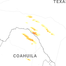
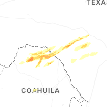
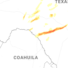
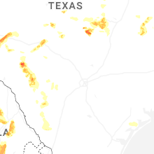
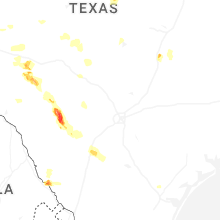
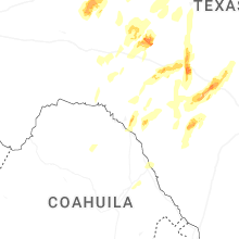


Connect with Interactive Hail Maps