

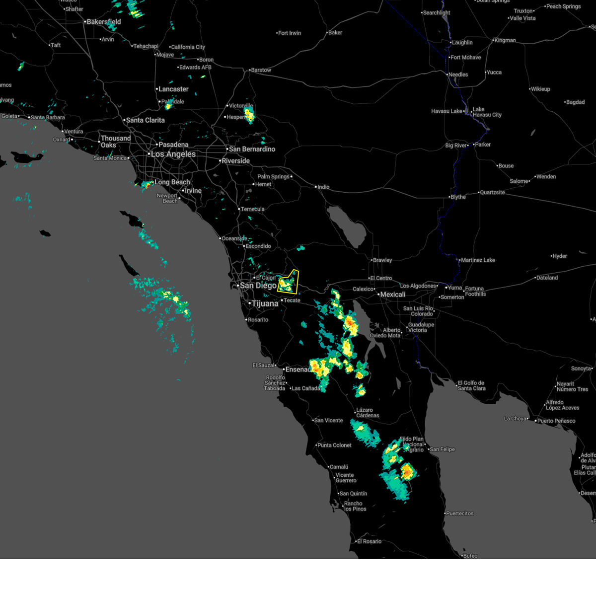
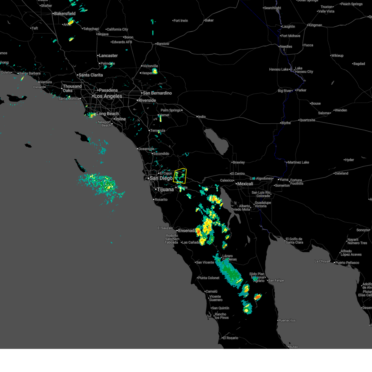
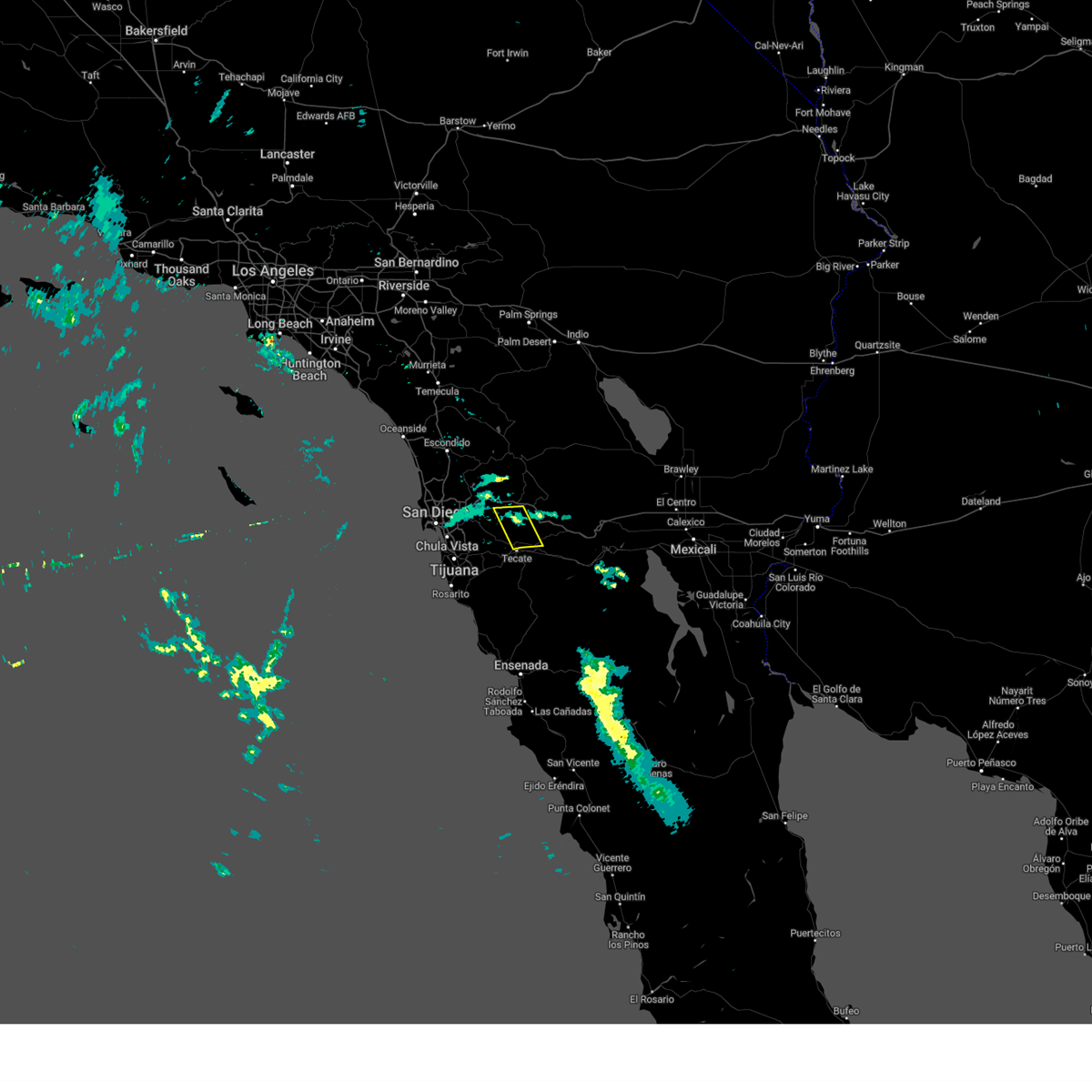
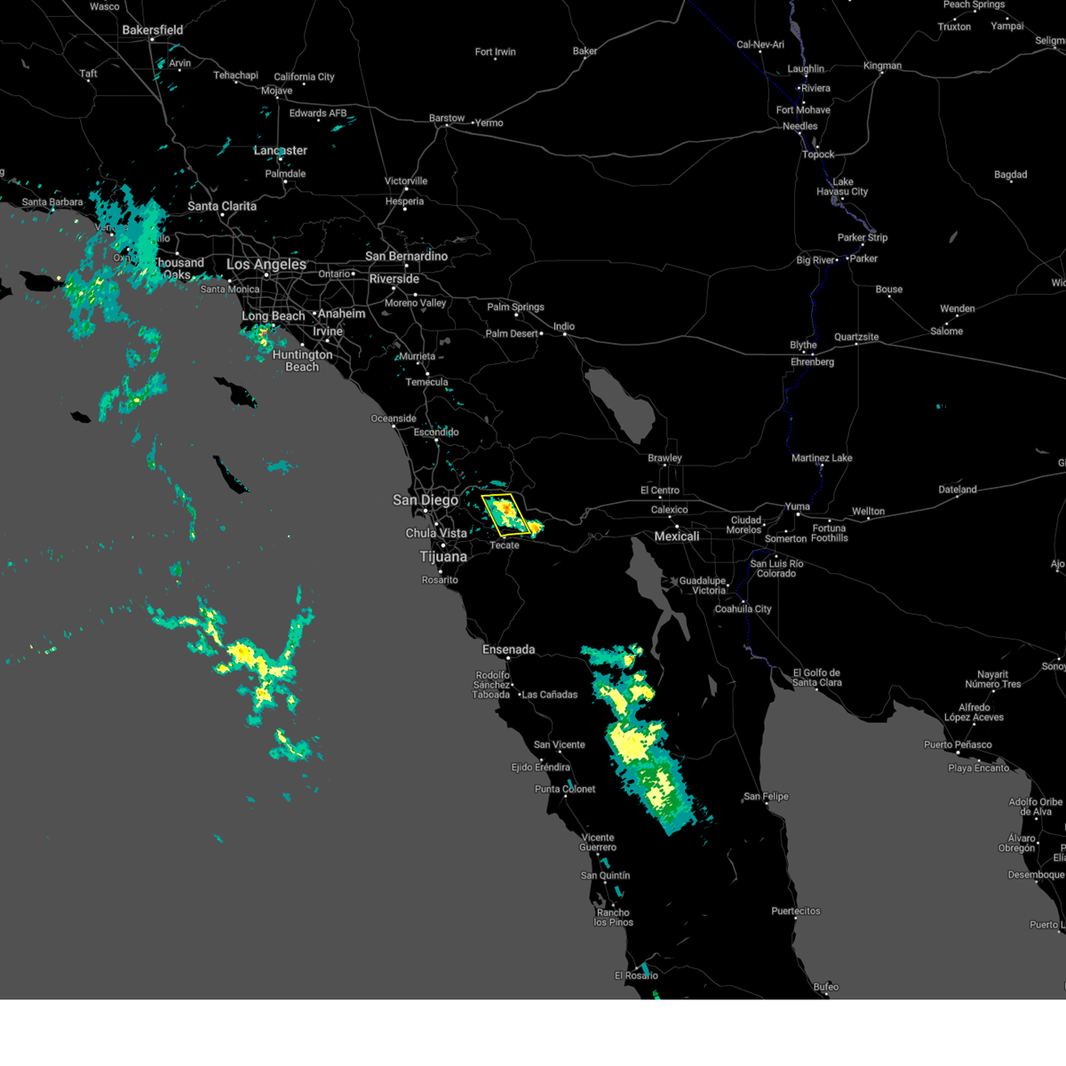
Hail Map for Campo, CA
The Campo, CA area has had 1 report of on-the-ground hail by trained spotters, and has been under severe weather warnings 3 times during the past 12 months. Doppler radar has detected hail at or near Campo, CA on 12 occasions.
| Name: | Campo, CA |
| Where Located: | 39.7 miles E of San Diego, CA |
| Map: | Google Map for Campo, CA |
| Population: | 2684 |
| Housing Units: | 1105 |
| More Info: | Search Google for Campo, CA |
5
The Top Recent Hail Date for Campo, CA is Friday, August 1, 2014 (1st out of 12)

Hail and Wind Damage Spotted near Campo, CA
| Date / Time | Report Details |
|---|---|
| 8/25/2025 2:29 PM PDT |
 the severe thunderstorm warning has been cancelled and is no longer in effect the severe thunderstorm warning has been cancelled and is no longer in effect
|
| 8/25/2025 1:57 PM PDT |
 At 156 pm pdt, a severe thunderstorm was located near pine valley, or near i-8 between pine valley and boulevard, moving south at 5 mph (radar indicated). Hazards include 60 mph wind gusts and nickel size hail. weather station reported a 62 mph wind gust near pine valley. Expect damage to roofs, siding, and trees. Locations impacted include, southern mount laguna, i-8 between pine valley and boulevard, lake morena, campo, pine valley, potrero, barrett lake, dulzura, and campo indian reservation. At 156 pm pdt, a severe thunderstorm was located near pine valley, or near i-8 between pine valley and boulevard, moving south at 5 mph (radar indicated). Hazards include 60 mph wind gusts and nickel size hail. weather station reported a 62 mph wind gust near pine valley. Expect damage to roofs, siding, and trees. Locations impacted include, southern mount laguna, i-8 between pine valley and boulevard, lake morena, campo, pine valley, potrero, barrett lake, dulzura, and campo indian reservation.
|
| 8/25/2025 1:39 PM PDT |
 Svrsgx the national weather service in san diego has issued a * severe thunderstorm warning for, southeastern san diego county in southwestern california, * until 245 pm pdt. * at 139 pm pdt, a severe thunderstorm was located over pine valley, or near mount laguna, moving south at 5 mph (radar indicated). Hazards include 60 mph wind gusts and nickel size hail. expect damage to roofs, siding, and trees Svrsgx the national weather service in san diego has issued a * severe thunderstorm warning for, southeastern san diego county in southwestern california, * until 245 pm pdt. * at 139 pm pdt, a severe thunderstorm was located over pine valley, or near mount laguna, moving south at 5 mph (radar indicated). Hazards include 60 mph wind gusts and nickel size hail. expect damage to roofs, siding, and trees
|
| 8/1/2024 5:25 PM PDT |
 The storm that was generated south of i-8 near the us, mexico border which prompted the warning has weakened below severe limits, and no longer poses an immediate threat to life or property. therefore, the warning will be allowed to expire. remember, a severe thunderstorm warning still remains in effect for a thunderstorm located near san diego country estates, about 10 miles southeast of ramona. The storm that was generated south of i-8 near the us, mexico border which prompted the warning has weakened below severe limits, and no longer poses an immediate threat to life or property. therefore, the warning will be allowed to expire. remember, a severe thunderstorm warning still remains in effect for a thunderstorm located near san diego country estates, about 10 miles southeast of ramona.
|
| 8/1/2024 4:33 PM PDT |
 Svrsgx the national weather service in san diego has issued a * severe thunderstorm warning for, south central san diego county in southwestern california, * until 530 pm pdt. * at 432 pm pdt, a severe thunderstorm was located near lake morena, or near i-8 between pine valley and boulevard, and is nearly stationary (radar indicated). Hazards include 60 mph wind gusts, small hail, and frequent lightning. expect damage to roofs, siding, and trees Svrsgx the national weather service in san diego has issued a * severe thunderstorm warning for, south central san diego county in southwestern california, * until 530 pm pdt. * at 432 pm pdt, a severe thunderstorm was located near lake morena, or near i-8 between pine valley and boulevard, and is nearly stationary (radar indicated). Hazards include 60 mph wind gusts, small hail, and frequent lightning. expect damage to roofs, siding, and trees
|
| 7/23/2024 2:29 PM PDT |
 Svrsgx the national weather service in san diego has issued a * severe thunderstorm warning for, southeastern san diego county in southwestern california, * until 330 pm pdt. * at 229 pm pdt, a severe thunderstorm was located near i-8 between pine valley and boulevard, and is nearly stationary (radar indicated). Hazards include 60 mph wind gusts and quarter size hail. Hail damage to vehicles is expected. Expect wind damage to roofs, siding, and trees. Svrsgx the national weather service in san diego has issued a * severe thunderstorm warning for, southeastern san diego county in southwestern california, * until 330 pm pdt. * at 229 pm pdt, a severe thunderstorm was located near i-8 between pine valley and boulevard, and is nearly stationary (radar indicated). Hazards include 60 mph wind gusts and quarter size hail. Hail damage to vehicles is expected. Expect wind damage to roofs, siding, and trees.
|
| 8/16/2023 2:54 PM PDT |
 The severe thunderstorm warning for south central san diego county will expire at 300 pm pdt, the storm which prompted the warning has weakened below severe limits, and no longer poses an immediate threat to life or property. therefore, the warning will be allowed to expire. The severe thunderstorm warning for south central san diego county will expire at 300 pm pdt, the storm which prompted the warning has weakened below severe limits, and no longer poses an immediate threat to life or property. therefore, the warning will be allowed to expire.
|
| 8/16/2023 2:47 PM PDT |
 At 247 pm pdt, a severe thunderstorm was located 8 miles southeast of alpine, moving northwest at 5 mph (radar indicated). Hazards include 60 mph wind gusts and quarter size hail. Hail damage to vehicles is expected. expect wind damage to roofs, siding, and trees. locations impacted include, alpine, lake morena, potrero, descanso, campo, skye valley, japatul valley, barrett lake, guatay, dulzura, and jamul. hail threat, radar indicated max hail size, 1. 00 in wind threat, radar indicated max wind gust, 60 mph. At 247 pm pdt, a severe thunderstorm was located 8 miles southeast of alpine, moving northwest at 5 mph (radar indicated). Hazards include 60 mph wind gusts and quarter size hail. Hail damage to vehicles is expected. expect wind damage to roofs, siding, and trees. locations impacted include, alpine, lake morena, potrero, descanso, campo, skye valley, japatul valley, barrett lake, guatay, dulzura, and jamul. hail threat, radar indicated max hail size, 1. 00 in wind threat, radar indicated max wind gust, 60 mph.
|
| 8/16/2023 2:25 PM PDT |
 At 225 pm pdt, a severe thunderstorm was located 7 miles west of lake morena, or 8 miles west of i-8 between pine valley and boulevard, moving northwest at 5 mph (radar indicated). Hazards include 60 mph wind gusts and quarter size hail. Hail damage to vehicles is expected. Expect wind damage to roofs, siding, and trees. At 225 pm pdt, a severe thunderstorm was located 7 miles west of lake morena, or 8 miles west of i-8 between pine valley and boulevard, moving northwest at 5 mph (radar indicated). Hazards include 60 mph wind gusts and quarter size hail. Hail damage to vehicles is expected. Expect wind damage to roofs, siding, and trees.
|
| 8/16/2023 2:15 PM PDT |
 At 215 pm pdt, a severe thunderstorm was located near pine valley, or 7 miles west of i-8 between pine valley and boulevard, moving north at 5 mph (radar indicated). Hazards include 60 mph wind gusts and quarter size hail. Hail damage to vehicles is expected. expect wind damage to roofs, siding, and trees. locations impacted include, alpine, i-8 between pine valley and boulevard, mount laguna, pine valley, lake morena, descanso, potrero, campo, viejas indian reservation, japatul valley, guatay, barrett lake, and skye valley. hail threat, radar indicated max hail size, 1. 00 in wind threat, radar indicated max wind gust, 60 mph. At 215 pm pdt, a severe thunderstorm was located near pine valley, or 7 miles west of i-8 between pine valley and boulevard, moving north at 5 mph (radar indicated). Hazards include 60 mph wind gusts and quarter size hail. Hail damage to vehicles is expected. expect wind damage to roofs, siding, and trees. locations impacted include, alpine, i-8 between pine valley and boulevard, mount laguna, pine valley, lake morena, descanso, potrero, campo, viejas indian reservation, japatul valley, guatay, barrett lake, and skye valley. hail threat, radar indicated max hail size, 1. 00 in wind threat, radar indicated max wind gust, 60 mph.
|
| 8/16/2023 2:02 PM PDT |
 At 202 pm pdt, a severe thunderstorm was located near lake morena, or near i-8 between pine valley and boulevard, moving north at 5 mph (radar indicated). Hazards include 60 mph wind gusts and quarter size hail. Hail damage to vehicles is expected. Expect wind damage to roofs, siding, and trees. At 202 pm pdt, a severe thunderstorm was located near lake morena, or near i-8 between pine valley and boulevard, moving north at 5 mph (radar indicated). Hazards include 60 mph wind gusts and quarter size hail. Hail damage to vehicles is expected. Expect wind damage to roofs, siding, and trees.
|
| 8/24/2022 2:20 PM PDT | The severe thunderstorm warning for southeastern san diego county will expire at 230 pm pdt, the storm which prompted the warning has weakened below severe limits, and no longer poses an immediate threat to life or property. therefore, the warning will be allowed to expire. |
| 8/24/2022 1:27 PM PDT | At 127 pm pdt, a severe thunderstorm was located near i-8 between pine valley and boulevard, and is nearly stationary (radar indicated). Hazards include 60 mph wind gusts and quarter size hail. Hail damage to vehicles is expected. Expect wind damage to roofs, siding, and trees. |
| 8/13/2022 1:24 PM PDT |
 At 122 pm pdt, a severe thunderstorm was located over potrero, or 9 miles southwest of i-8 between pine valley and boulevard, moving southwest at 5 mph. thunderstorms are weakening (radar indicated. sdge weather station at hauser mountain had gust 68 mph). Hazards include 60 mph wind gusts and nickel size hail. Expect damage to roofs, siding, and trees. locations impacted include, i-8 between pine valley and boulevard, lake morena, potrero, campo, tecate, la posta indian reservation, campo indian reservation, manzanita indian reservation and barrett lake. hail threat, radar indicated max hail size, 0. 88 in wind threat, radar indicated max wind gust, 60 mph. At 122 pm pdt, a severe thunderstorm was located over potrero, or 9 miles southwest of i-8 between pine valley and boulevard, moving southwest at 5 mph. thunderstorms are weakening (radar indicated. sdge weather station at hauser mountain had gust 68 mph). Hazards include 60 mph wind gusts and nickel size hail. Expect damage to roofs, siding, and trees. locations impacted include, i-8 between pine valley and boulevard, lake morena, potrero, campo, tecate, la posta indian reservation, campo indian reservation, manzanita indian reservation and barrett lake. hail threat, radar indicated max hail size, 0. 88 in wind threat, radar indicated max wind gust, 60 mph.
|
| 8/13/2022 12:50 PM PDT | Mesonet station hausd hauser mountai in san diego county CA, 4.4 miles E of Campo, CA |
| 8/13/2022 12:47 PM PDT |
 At 1246 pm pdt, a severe thunderstorm was located near lake morena, or near i-8 between pine valley and boulevard, moving southwest at 5 mph (radar indicated an intense thunderstorm with heavy rain and hail). Hazards include 60 mph wind gusts and nickel size hail. possible damage to roofs, siding, and trees At 1246 pm pdt, a severe thunderstorm was located near lake morena, or near i-8 between pine valley and boulevard, moving southwest at 5 mph (radar indicated an intense thunderstorm with heavy rain and hail). Hazards include 60 mph wind gusts and nickel size hail. possible damage to roofs, siding, and trees
|
| 9/24/2021 3:41 PM PDT |
 The severe thunderstorm warning for south central san diego county will expire at 345 pm pdt, the severe thunderstorm which prompted the warning has moved west to southwestern san diego county. therefore, the severe thunderstorm warning will expire in south central san diego county. The severe thunderstorm warning for south central san diego county will expire at 345 pm pdt, the severe thunderstorm which prompted the warning has moved west to southwestern san diego county. therefore, the severe thunderstorm warning will expire in south central san diego county.
|
| 9/24/2021 2:41 PM PDT |
 At 238 pm pdt, a line of severe thunderstorms extended from alpine to potrero, moving west at 25 mph (radar indicated). Hazards include 60 mph wind gusts and quarter size hail. Hail damage to vehicles is expected. Expect wind damage to roofs, siding, and trees. At 238 pm pdt, a line of severe thunderstorms extended from alpine to potrero, moving west at 25 mph (radar indicated). Hazards include 60 mph wind gusts and quarter size hail. Hail damage to vehicles is expected. Expect wind damage to roofs, siding, and trees.
|
| 8/22/2020 2:55 PM PDT |
 At 255 pm pdt, a severe thunderstorm was located over pine valley, or near mount laguna, moving northwest at 10 mph (radar indicated). Hazards include 60 mph wind gusts and quarter size hail. Hail damage to vehicles is expected. expect wind damage to roofs, siding, and trees. Locations impacted include, hwy 78 between banner and s2, i-8 between pine valley and boulevard, mount laguna, cuyamaca rancho state park, julian, hwy 78 between s2 and borrego springs rd, hwy s2 between shelter valley and agua caliente, lake cuyamaca, pine valley and hwy s1 between lake cuyamaca and mount laguna. At 255 pm pdt, a severe thunderstorm was located over pine valley, or near mount laguna, moving northwest at 10 mph (radar indicated). Hazards include 60 mph wind gusts and quarter size hail. Hail damage to vehicles is expected. expect wind damage to roofs, siding, and trees. Locations impacted include, hwy 78 between banner and s2, i-8 between pine valley and boulevard, mount laguna, cuyamaca rancho state park, julian, hwy 78 between s2 and borrego springs rd, hwy s2 between shelter valley and agua caliente, lake cuyamaca, pine valley and hwy s1 between lake cuyamaca and mount laguna.
|
| 8/22/2020 2:21 PM PDT |
 At 220 pm pdt, a severe thunderstorm was located near i-8 between pine valley and boulevard, moving northwest at 20 mph (radar indicated). Hazards include 60 mph wind gusts and quarter size hail. Hail damage to vehicles is expected. Expect wind damage to roofs, siding, and trees. At 220 pm pdt, a severe thunderstorm was located near i-8 between pine valley and boulevard, moving northwest at 20 mph (radar indicated). Hazards include 60 mph wind gusts and quarter size hail. Hail damage to vehicles is expected. Expect wind damage to roofs, siding, and trees.
|
| 9/26/2019 4:53 PM PDT |
 The severe thunderstorm warning for southeastern san diego county will expire at 500 pm pdt, the severe thunderstorm which prompted the warning has weakened, therefore, the warning will be allowed to expire. The severe thunderstorm warning for southeastern san diego county will expire at 500 pm pdt, the severe thunderstorm which prompted the warning has weakened, therefore, the warning will be allowed to expire.
|
| 9/26/2019 4:28 PM PDT |
 At 419 pm pdt, a severe thunderstorm was located east of mount laguna near canebrake, moving south at about 20 mph (radar indicated). Hazards include 70 mph wind gusts and penny size hail. Expect considerable tree damage. damage is likely to mobile homes, roofs, and outbuildings. Locations impacted include, i-8 between pine valley and boulevard, i-8 between boulevard and imperial county line, hwy 78 between s2 and borrego springs rd, mount laguna, hwy 78 between banner and s2, hwy s2 between shelter valley and agua caliente, hwy s2 vallecito creek rd, ocotillo wells, hwy s2 between canebrake and imperial county line and hwy s2 between agua caliente and canebrake. At 419 pm pdt, a severe thunderstorm was located east of mount laguna near canebrake, moving south at about 20 mph (radar indicated). Hazards include 70 mph wind gusts and penny size hail. Expect considerable tree damage. damage is likely to mobile homes, roofs, and outbuildings. Locations impacted include, i-8 between pine valley and boulevard, i-8 between boulevard and imperial county line, hwy 78 between s2 and borrego springs rd, mount laguna, hwy 78 between banner and s2, hwy s2 between shelter valley and agua caliente, hwy s2 vallecito creek rd, ocotillo wells, hwy s2 between canebrake and imperial county line and hwy s2 between agua caliente and canebrake.
|
| 9/26/2019 3:58 PM PDT |
 At 355 pm pdt, a severe thunderstorm was located over ocotillo wells, or near hwy 78 between borrego springs rd and ocotillo wells, moving south at about 20 mph (radar indicated). Hazards include 70 mph wind gusts and penny size hail. Expect considerable tree damage. Damage is likely to mobile homes, roofs, and outbuildings. At 355 pm pdt, a severe thunderstorm was located over ocotillo wells, or near hwy 78 between borrego springs rd and ocotillo wells, moving south at about 20 mph (radar indicated). Hazards include 70 mph wind gusts and penny size hail. Expect considerable tree damage. Damage is likely to mobile homes, roofs, and outbuildings.
|
| 9/4/2019 1:52 PM PDT |
 At 150 pm pdt, a severe thunderstorm was located near pine valley, or 7 miles south of cuyamaca rancho state park, moving northwest at 15 mph (radar indicated). Hazards include 60 mph wind gusts and penny size hail. Expect damage to roofs, siding, and trees. Locations impacted include, alpine, mount laguna, cuyamaca rancho state park, i-8 between pine valley and boulevard, lake cuyamaca, pine valley, hwy s1 between lake cuyamaca and mount laguna, lake morena, descanso and hwy 79 between julian and lake cuyamaca. At 150 pm pdt, a severe thunderstorm was located near pine valley, or 7 miles south of cuyamaca rancho state park, moving northwest at 15 mph (radar indicated). Hazards include 60 mph wind gusts and penny size hail. Expect damage to roofs, siding, and trees. Locations impacted include, alpine, mount laguna, cuyamaca rancho state park, i-8 between pine valley and boulevard, lake cuyamaca, pine valley, hwy s1 between lake cuyamaca and mount laguna, lake morena, descanso and hwy 79 between julian and lake cuyamaca.
|
| 9/4/2019 1:31 PM PDT |
 The national weather service in san diego has issued a * severe thunderstorm warning for. southeastern san diego county in southwestern california. until 230 pm pdt. At 130 pm pdt, a severe thunderstorm was located near pine valley, or near i-8 between pine valley and boulevard, moving northwest at. The national weather service in san diego has issued a * severe thunderstorm warning for. southeastern san diego county in southwestern california. until 230 pm pdt. At 130 pm pdt, a severe thunderstorm was located near pine valley, or near i-8 between pine valley and boulevard, moving northwest at.
|
| 7/24/2019 12:47 PM PDT |
 At 1247 pm pdt, a severe thunderstorm was located over potrero, or 7 miles southwest of i-8 between pine valley and boulevard, moving northwest at 5 mph (radar indicated). Hazards include 60 mph wind gusts and penny size hail. expect damage to roofs, siding, and trees At 1247 pm pdt, a severe thunderstorm was located over potrero, or 7 miles southwest of i-8 between pine valley and boulevard, moving northwest at 5 mph (radar indicated). Hazards include 60 mph wind gusts and penny size hail. expect damage to roofs, siding, and trees
|
| 8/15/2018 3:54 PM PDT |
 At 347 pm pdt, a severe thunderstorm was located just south of pine valley extending to near campo, and was moving east at about 5 mph (radar indicated). Hazards include 60 mph wind gusts. Expect damage to roofs, siding, and trees. Locations impacted include, i-8 between pine valley and boulevard, i-8 between boulevard and imperial county line, campo, hwy s2 between canebrake and imperial county line, boulevard, lake morena, tierra del sol, campo indian reservation, la posta indian reservation, live oak springs, jacumba and manzanita indian reservation. At 347 pm pdt, a severe thunderstorm was located just south of pine valley extending to near campo, and was moving east at about 5 mph (radar indicated). Hazards include 60 mph wind gusts. Expect damage to roofs, siding, and trees. Locations impacted include, i-8 between pine valley and boulevard, i-8 between boulevard and imperial county line, campo, hwy s2 between canebrake and imperial county line, boulevard, lake morena, tierra del sol, campo indian reservation, la posta indian reservation, live oak springs, jacumba and manzanita indian reservation.
|
| 8/15/2018 3:30 PM PDT |
 At 324 pm pdt, a severe thunderstorm was located near boulevard, or 7 miles northwest of i-8 between boulevard and imperial county line moving southeast at about 5 mph (radar indicated). Hazards include 60 mph wind gusts. expect damage to roofs, siding, and trees At 324 pm pdt, a severe thunderstorm was located near boulevard, or 7 miles northwest of i-8 between boulevard and imperial county line moving southeast at about 5 mph (radar indicated). Hazards include 60 mph wind gusts. expect damage to roofs, siding, and trees
|
| 8/15/2018 2:33 PM PDT |
 At 222 pm pdt, a severe thunderstorm stretched from near julian to the pine valley area, and the storm was nearly stationary (radar indicated). Hazards include 60 mph wind gusts. Expect damage to roofs, siding, and trees. Locations impacted include, alpine, highway 78 between banner and s2, i-8 between pine valley and boulevard, mount laguna, cuyamaca rancho state park, julian, highway 78 between s2 and borrego springs rd, highway s2 between shelter valley and agua caliente, ranchita, lake morena, lake cuyamaca, pine valley, highway s1 between lake cuyamaca and mount laguna, highway 79 between julian and lake cuyamaca, descanso, highway s2 between highway 79 and highway 78, highway 78 between ramona and santa ysabel, san diego country estates, potrero and highway s22 between ranchita and borrego springs. At 222 pm pdt, a severe thunderstorm stretched from near julian to the pine valley area, and the storm was nearly stationary (radar indicated). Hazards include 60 mph wind gusts. Expect damage to roofs, siding, and trees. Locations impacted include, alpine, highway 78 between banner and s2, i-8 between pine valley and boulevard, mount laguna, cuyamaca rancho state park, julian, highway 78 between s2 and borrego springs rd, highway s2 between shelter valley and agua caliente, ranchita, lake morena, lake cuyamaca, pine valley, highway s1 between lake cuyamaca and mount laguna, highway 79 between julian and lake cuyamaca, descanso, highway s2 between highway 79 and highway 78, highway 78 between ramona and santa ysabel, san diego country estates, potrero and highway s22 between ranchita and borrego springs.
|
| 8/15/2018 1:59 PM PDT |
 At 157 pm pdt, a severe thunderstorm was located near hwy 78 between s2 and borrego springs rd, and nearly stationary (radar indicated). Hazards include 60 mph wind gusts. expect damage to roofs, siding, and trees At 157 pm pdt, a severe thunderstorm was located near hwy 78 between s2 and borrego springs rd, and nearly stationary (radar indicated). Hazards include 60 mph wind gusts. expect damage to roofs, siding, and trees
|
| 7/11/2018 1:55 PM PDT |
 At 144 pm pdt, severe thunderstorms are expected to develop in the warned area. at 144 pm the strongest thunderstorm was located just northwest of pine valley, moving slowly north, with other thunderstorms developing that may become severe (radar indicated). Hazards include 60 mph wind gusts. Expect damage to roofs, siding, and trees. Locations that may be impacted include, el cajon, alpine, i-8 between pine valley and boulevard, mount laguna, cuyamaca rancho state park, lake morena, potrero, pine valley, campo, descanso, southwestern boulevard, hwy s1 between lake cuyamaca and mount laguna, lakeside, skye valley, la posta indian reservation, barrett lake, harbison canyon, campo indian reservation, flinn springs and viejas indian reservation. At 144 pm pdt, severe thunderstorms are expected to develop in the warned area. at 144 pm the strongest thunderstorm was located just northwest of pine valley, moving slowly north, with other thunderstorms developing that may become severe (radar indicated). Hazards include 60 mph wind gusts. Expect damage to roofs, siding, and trees. Locations that may be impacted include, el cajon, alpine, i-8 between pine valley and boulevard, mount laguna, cuyamaca rancho state park, lake morena, potrero, pine valley, campo, descanso, southwestern boulevard, hwy s1 between lake cuyamaca and mount laguna, lakeside, skye valley, la posta indian reservation, barrett lake, harbison canyon, campo indian reservation, flinn springs and viejas indian reservation.
|
| 7/11/2018 12:47 PM PDT |
 At 1244 pm pdt, a severe thunderstorm was located near i-8 between boulevard and imperial county line, moving slowly northwest (radar indicated). Hazards include 60 mph wind gusts. expect damage to roofs, siding, and trees At 1244 pm pdt, a severe thunderstorm was located near i-8 between boulevard and imperial county line, moving slowly northwest (radar indicated). Hazards include 60 mph wind gusts. expect damage to roofs, siding, and trees
|
| 8/2/2017 4:39 PM PDT |
 The severe thunderstorm warning for southeastern san diego county will expire at 445 pm pdt, the storm which prompted the warning has weakened below severe limits, and no longer poses an immediate threat to life or property. therefore the warning will be allowed to expire. The severe thunderstorm warning for southeastern san diego county will expire at 445 pm pdt, the storm which prompted the warning has weakened below severe limits, and no longer poses an immediate threat to life or property. therefore the warning will be allowed to expire.
|
| 8/2/2017 4:26 PM PDT |
 At 424 pm pdt, a severe thunderstorm was located near i-8 between pine valley and boulevard, and was nearly stationary (radar indicated). Hazards include 60 mph wind gusts and penny size hail. Damage possible to cars, power lines and trees. Locations impacted include, i-8 between pine valley and boulevard, boulevard, lake morena, pine valley, campo, campo indian reservation, la posta indian reservation, live oak springs and manzanita indian reservation. At 424 pm pdt, a severe thunderstorm was located near i-8 between pine valley and boulevard, and was nearly stationary (radar indicated). Hazards include 60 mph wind gusts and penny size hail. Damage possible to cars, power lines and trees. Locations impacted include, i-8 between pine valley and boulevard, boulevard, lake morena, pine valley, campo, campo indian reservation, la posta indian reservation, live oak springs and manzanita indian reservation.
|
| 8/2/2017 3:59 PM PDT |
 At 358 pm pdt, a severe thunderstorm was located over i-8 between pine valley and boulevard, moving south at 5 mph (radar indicated). Hazards include 60 mph wind gusts and nickel size hail. expect damage to power lines, cars and trees At 358 pm pdt, a severe thunderstorm was located over i-8 between pine valley and boulevard, moving south at 5 mph (radar indicated). Hazards include 60 mph wind gusts and nickel size hail. expect damage to power lines, cars and trees
|
| 3/7/2016 9:24 AM PST |
 The severe thunderstorm warning for central san diego county will expire at 930 am pst, the line of severe thunderstorms which prompted the warning has weakened and moved east. therefore the warning will be allowed to expire at 930 am. The severe thunderstorm warning for central san diego county will expire at 930 am pst, the line of severe thunderstorms which prompted the warning has weakened and moved east. therefore the warning will be allowed to expire at 930 am.
|
| 3/7/2016 8:46 AM PST |
 At 845 am pst, doppler radar continued indicated a line of severe thunderstorms capable of producing damaging winds of 45 to 60 mph moving through the san diego county valley and coastal areas. this line of storms was moving east at 35 mph. locations impacted include, san diego, chula vista, el cajon, encinitas, national city, escondido, la mesa, poway, imperial beach and ramona. At 845 am pst, doppler radar continued indicated a line of severe thunderstorms capable of producing damaging winds of 45 to 60 mph moving through the san diego county valley and coastal areas. this line of storms was moving east at 35 mph. locations impacted include, san diego, chula vista, el cajon, encinitas, national city, escondido, la mesa, poway, imperial beach and ramona.
|
| 3/7/2016 8:06 AM PST |
 At 805 am pst, doppler radar indicated a line of severe thunderstorms capable of producing damaging wind gusts of 45 to 60 mph approaching the san diego county coast. this line of storms was located near del mar, and moving east at 35 mph. * locations impacted include but are not limited to, san diego, chula vista, carlsbad, el cajon, encinitas, national city, escondido, la mesa, poway, imperial beach and ramona. At 805 am pst, doppler radar indicated a line of severe thunderstorms capable of producing damaging wind gusts of 45 to 60 mph approaching the san diego county coast. this line of storms was located near del mar, and moving east at 35 mph. * locations impacted include but are not limited to, san diego, chula vista, carlsbad, el cajon, encinitas, national city, escondido, la mesa, poway, imperial beach and ramona.
|
| 1/31/2016 4:40 PM PST |
 The severe thunderstorm warning for eastern san diego county will expire at 445 pm pst, the line of storms which prompted the warning have weakened below severe limits, and exited the warned area. therefore the warning will be allowed to expire. however gusty winds are still possible with these thunderstorms. The severe thunderstorm warning for eastern san diego county will expire at 445 pm pst, the line of storms which prompted the warning have weakened below severe limits, and exited the warned area. therefore the warning will be allowed to expire. however gusty winds are still possible with these thunderstorms.
|
| 1/31/2016 4:14 PM PST |
 At 411 pm pst, doppler radar indicated a line of severe thunderstorms capable of producing damaging winds in excess of 60 mph. these storms have moved east of the mountain ridge. in addition, several cases of wind damage have been reported. locations impacted include, ramona, alpine, san diego country, jamul, harbison canyon, borrego springs, julian and pine valley. At 411 pm pst, doppler radar indicated a line of severe thunderstorms capable of producing damaging winds in excess of 60 mph. these storms have moved east of the mountain ridge. in addition, several cases of wind damage have been reported. locations impacted include, ramona, alpine, san diego country, jamul, harbison canyon, borrego springs, julian and pine valley.
|
| 1/31/2016 3:22 PM PST |
 At 321 pm pst, doppler radar indicated a line of severe thunderstorms capable of producing damaging winds in excess of 60 mph. these storms were located along a line extending from 18 miles northeast of ramona to 12 miles southeast of bonita, and moving east at 40 mph. At 321 pm pst, doppler radar indicated a line of severe thunderstorms capable of producing damaging winds in excess of 60 mph. these storms were located along a line extending from 18 miles northeast of ramona to 12 miles southeast of bonita, and moving east at 40 mph.
|
| 7/29/2015 6:12 PM PDT | The severe thunderstorm warning for southeastern san diego county will expire at 615 pm pdt, the storm which prompted the warning has weakened below severe limits, and no longer poses an immediate threat to life or property. therefore, the warning will be allowed to expire. however, heavy rain is still possible with thunderstorms in the area. |
| 7/29/2015 5:59 PM PDT |
 At 548 pm pdt, doppler radar indicated a severe thunderstorm capable of producing damaging winds in excess of 60 mph. this storm was nearly stationary along interstate 8 between alpine and pine valley. penny size hail may also accompany the damaging winds. At 548 pm pdt, doppler radar indicated a severe thunderstorm capable of producing damaging winds in excess of 60 mph. this storm was nearly stationary along interstate 8 between alpine and pine valley. penny size hail may also accompany the damaging winds.
|
| 7/29/2015 5:23 PM PDT |
 At 523 pm pdt, doppler radar indicated a severe thunderstorm capable of producing damaging winds in excess of 60 mph. this storm was located 8 miles northwest of portrero, or 8 miles southeast of alpine, and moving northwest at 15 mph. penny size hail may also accompany the damaging winds. At 523 pm pdt, doppler radar indicated a severe thunderstorm capable of producing damaging winds in excess of 60 mph. this storm was located 8 miles northwest of portrero, or 8 miles southeast of alpine, and moving northwest at 15 mph. penny size hail may also accompany the damaging winds.
|
| 8/12/2014 12:40 PM PDT | Spotter reported power outages in the city of campo... with a wind gust of 45 mph reported at the shockey truck trail mesonet and 39 mph at czz in san diego county CA, 2.8 miles NNW of Campo, CA |
| 9/6/2013 1:30 PM PDT | Quarter sized hail reported 2.6 miles SE of Campo, CA, pea to quarter sized hail reported on facebook |
| 1/1/0001 12:00 AM | Sdge cmcsd in san diego county CA, 0.9 miles E of Campo, CA |
| 1/1/0001 12:00 AM | Several large tree branches fell onto property. power was lost soon afte in san diego county CA, 2.8 miles NNW of Campo, CA |
| 1/1/0001 12:00 AM | Several large tree branches fell onto propert in san diego county CA, 2.8 miles NNW of Campo, CA |
| 1/1/0001 12:00 AM | 5 power poles snapped on buckman springs road near highway 9 in san diego county CA, 2.3 miles SSW of Campo, CA |
| 1/1/0001 12:00 AM | Campo asos recorded a wind gust of 61 mph at 252 p in san diego county CA, 2.8 miles NNW of Campo, CA |
| 1/1/0001 12:00 AM | Campo asos in san diego county CA, 2.8 miles NNW of Campo, CA |
Hail Maps for Campo, CA


Connect with Interactive Hail Maps