

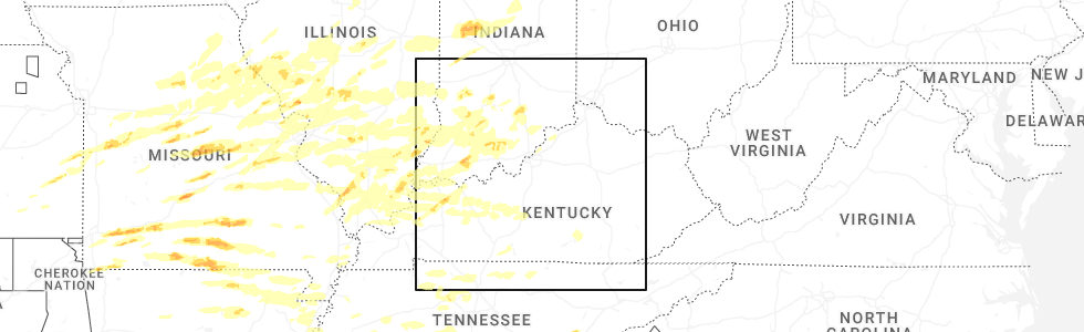
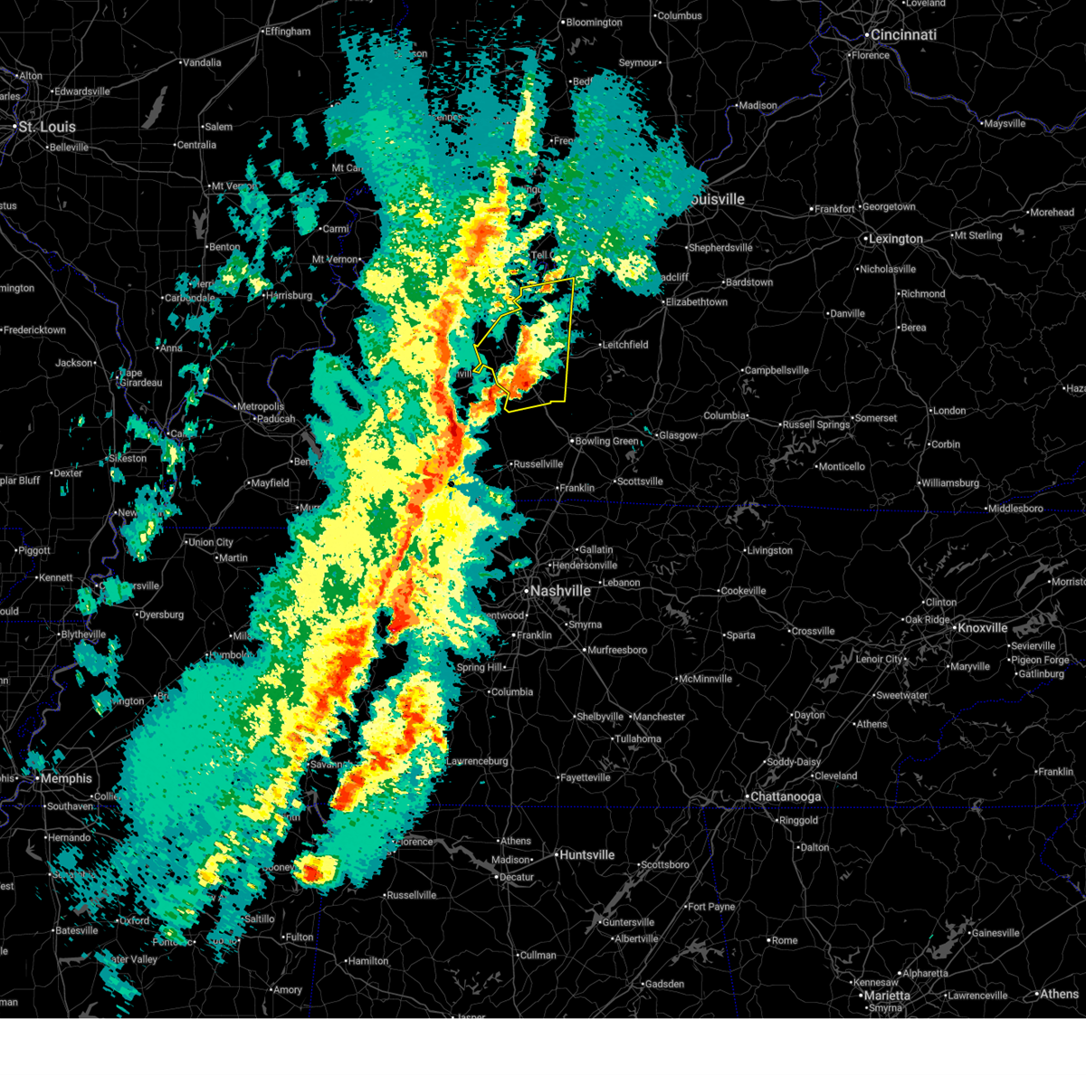
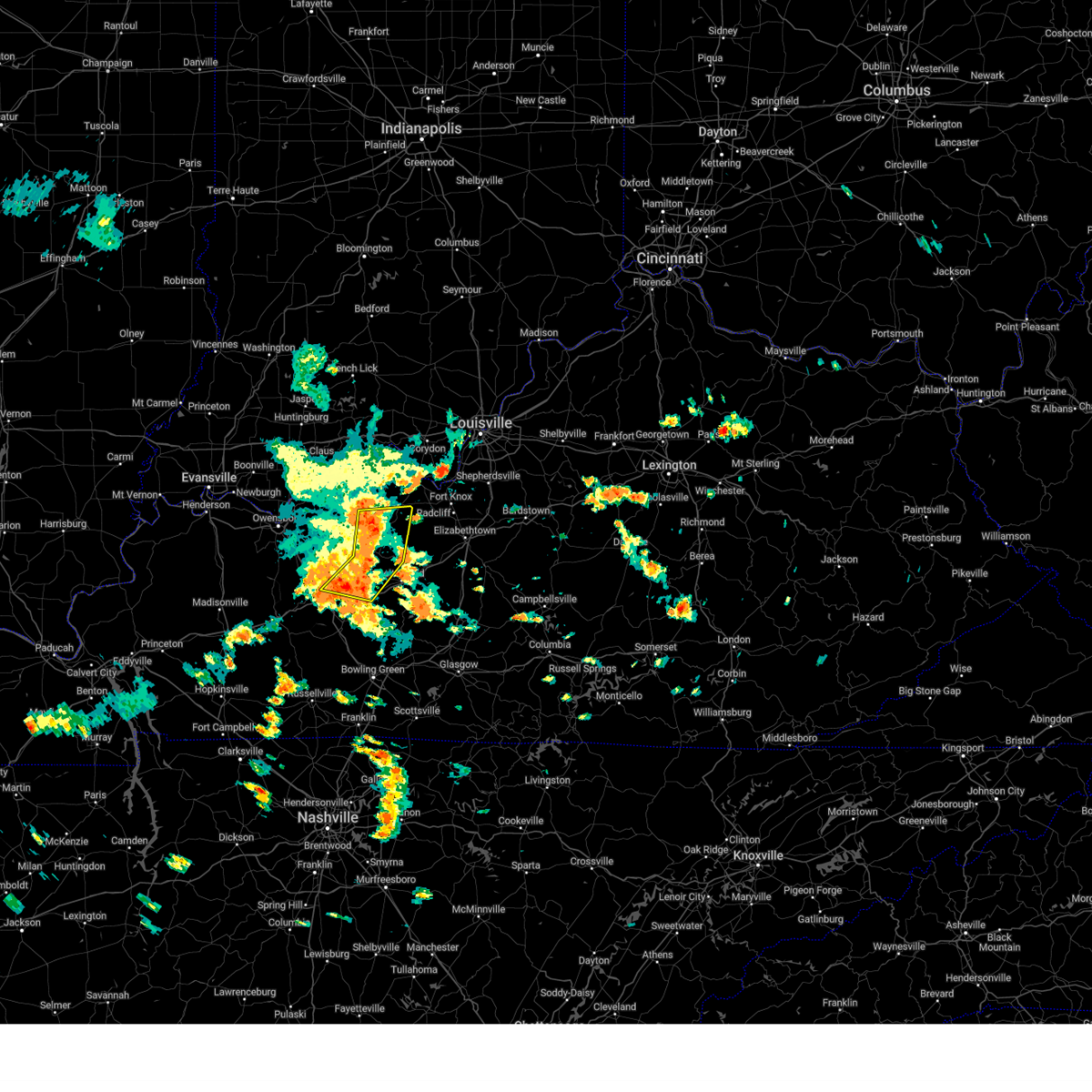
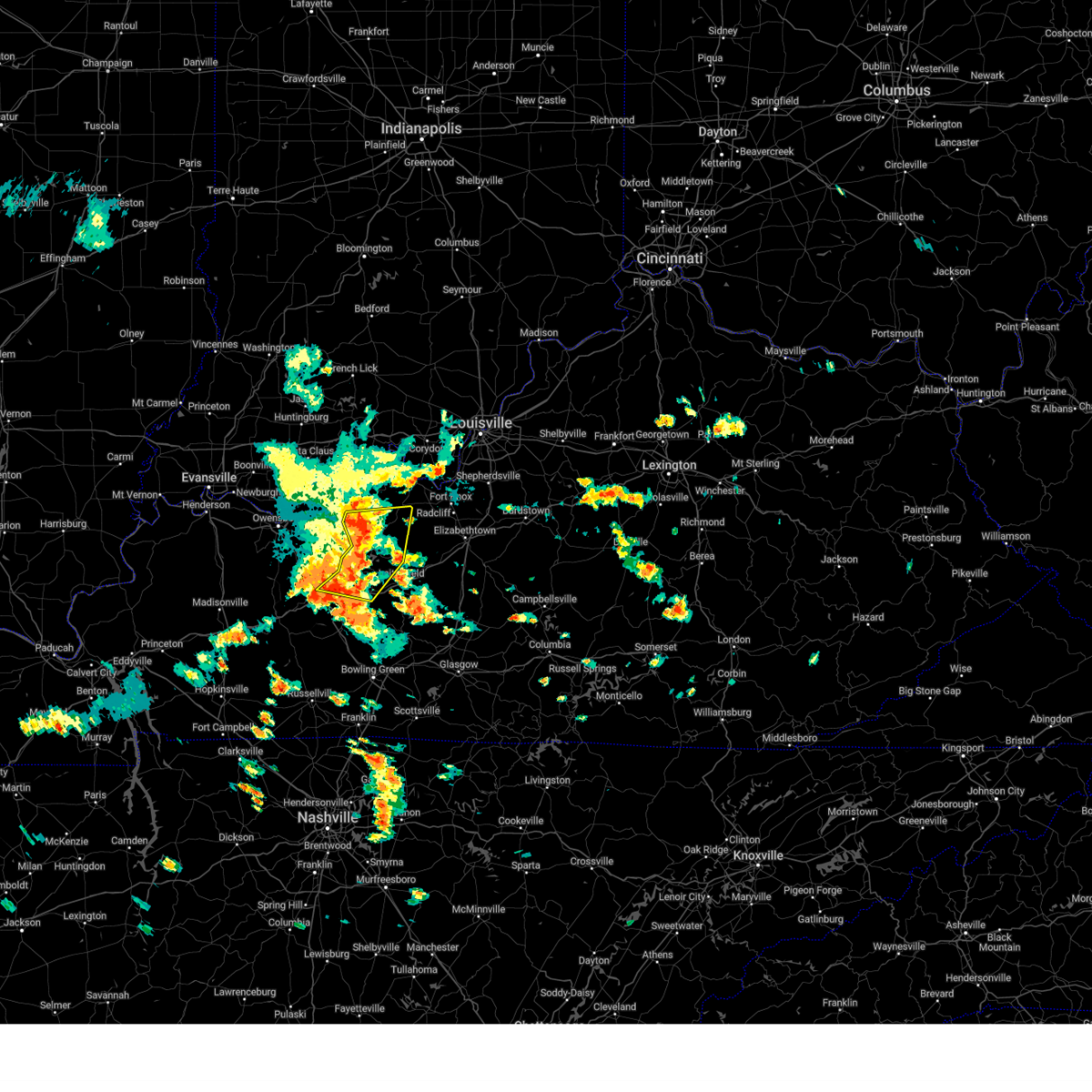
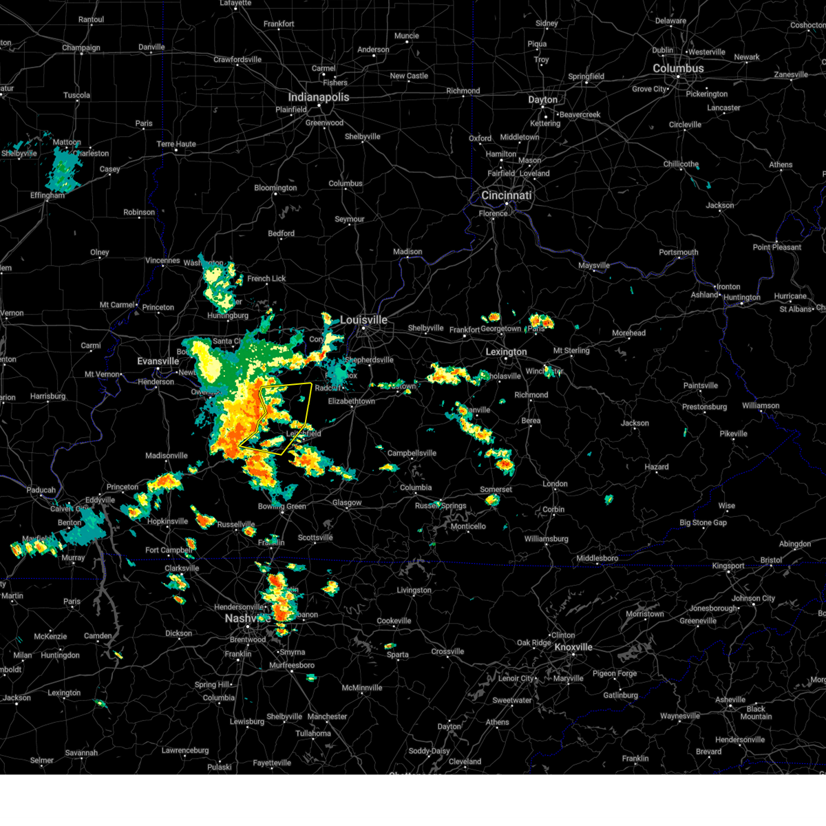
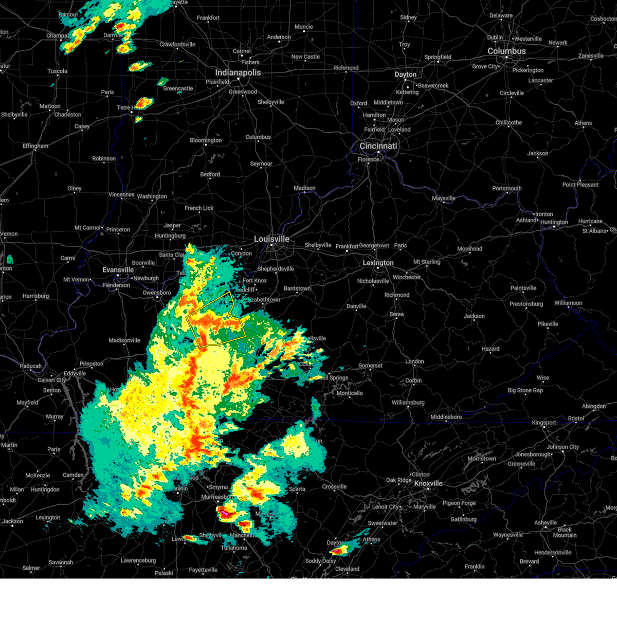
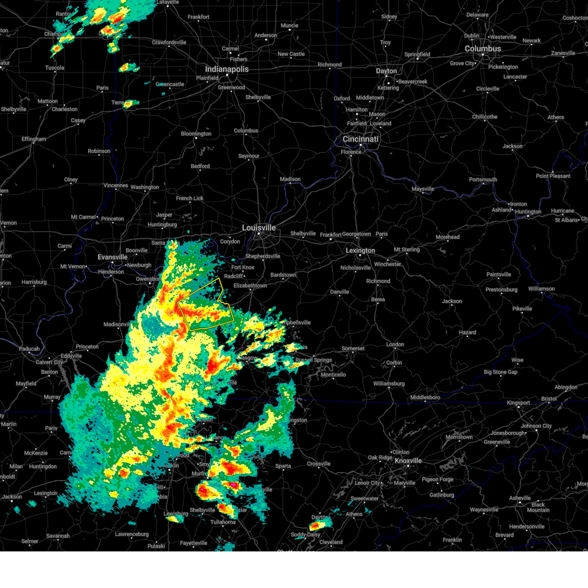
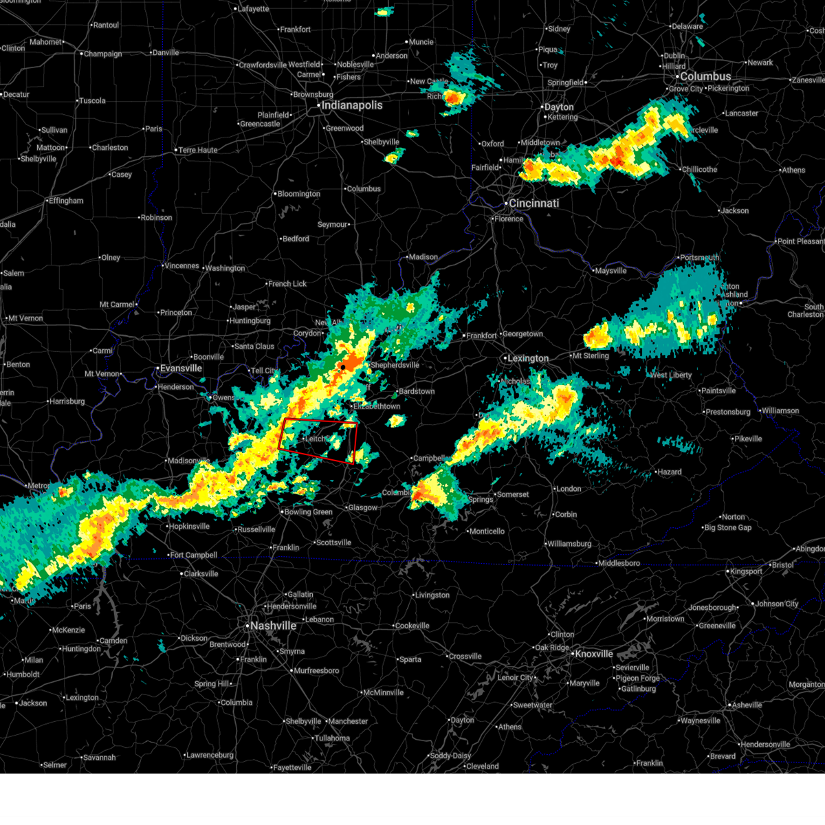
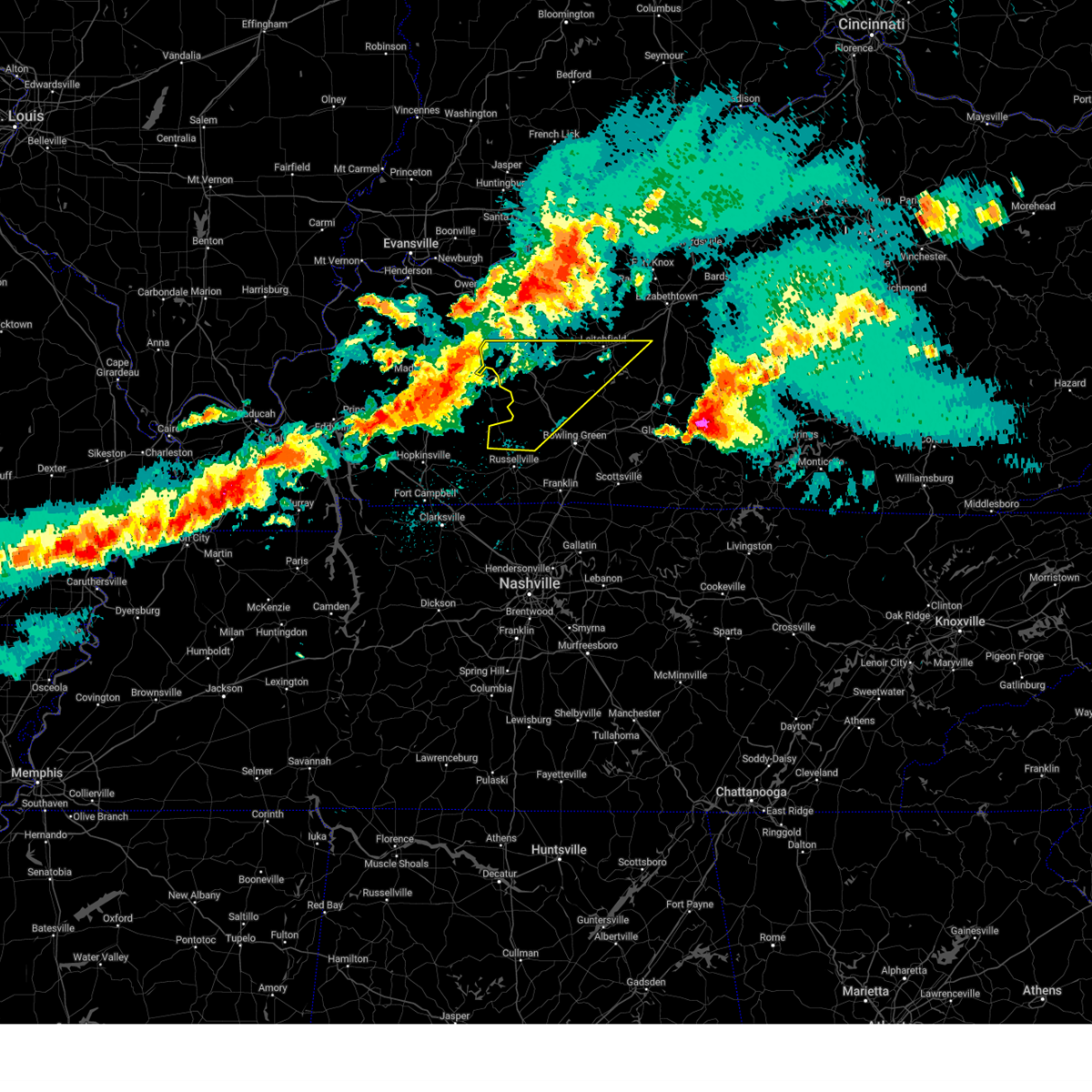
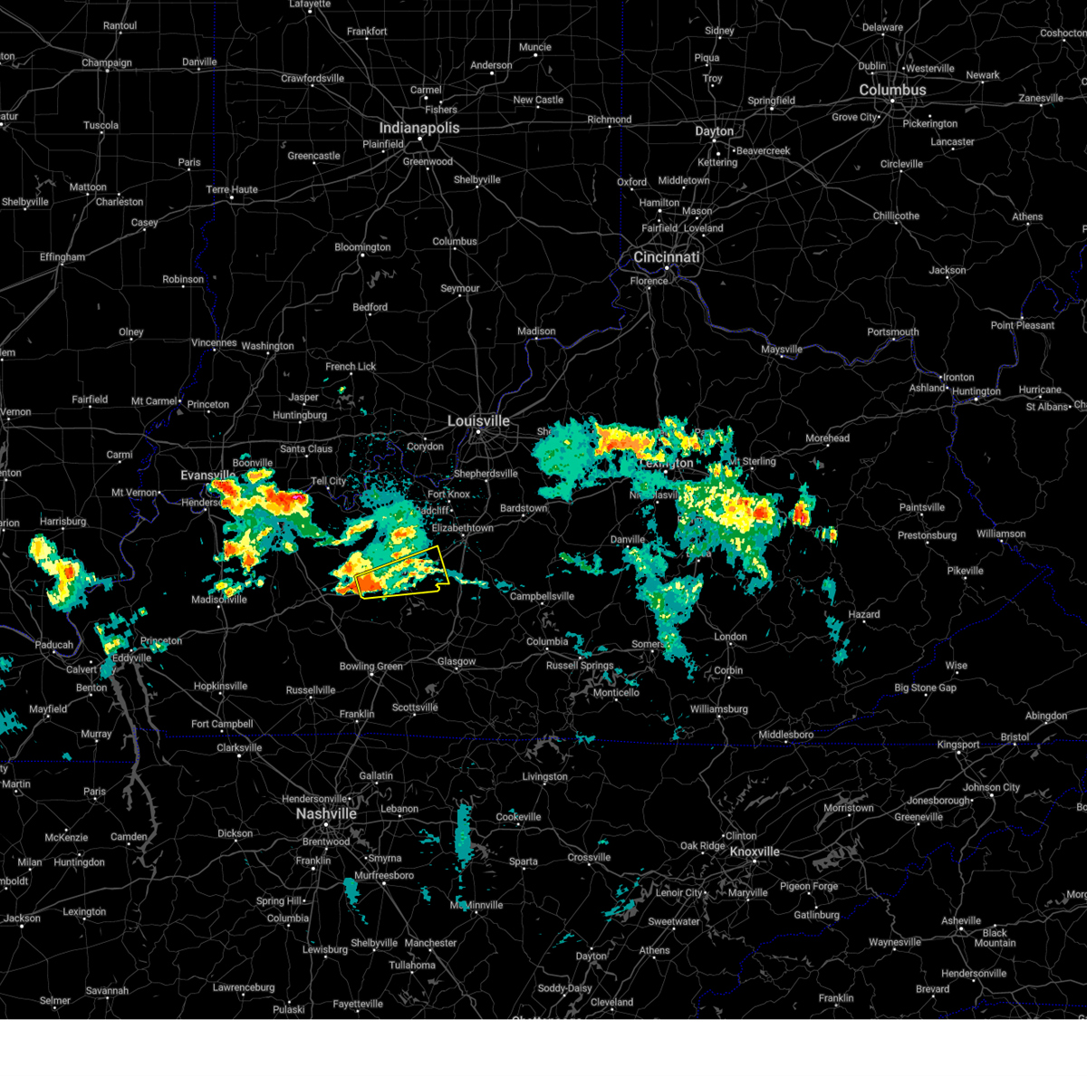
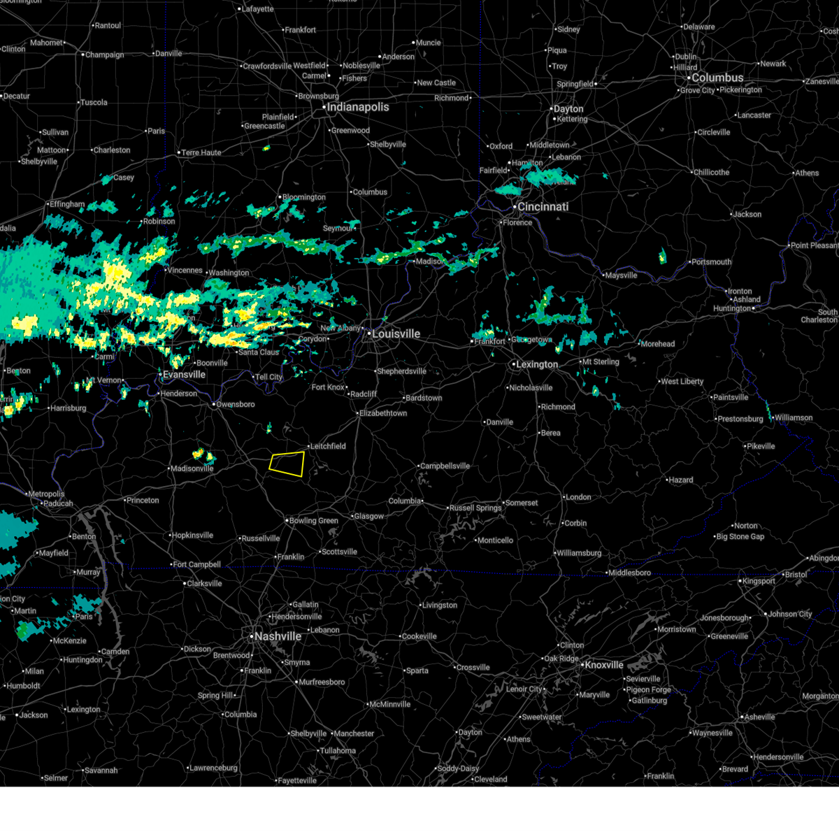
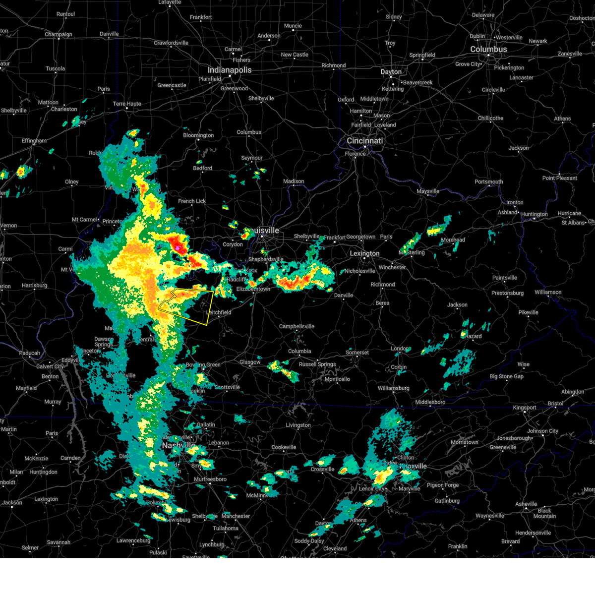
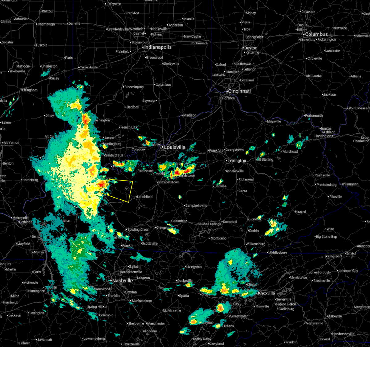
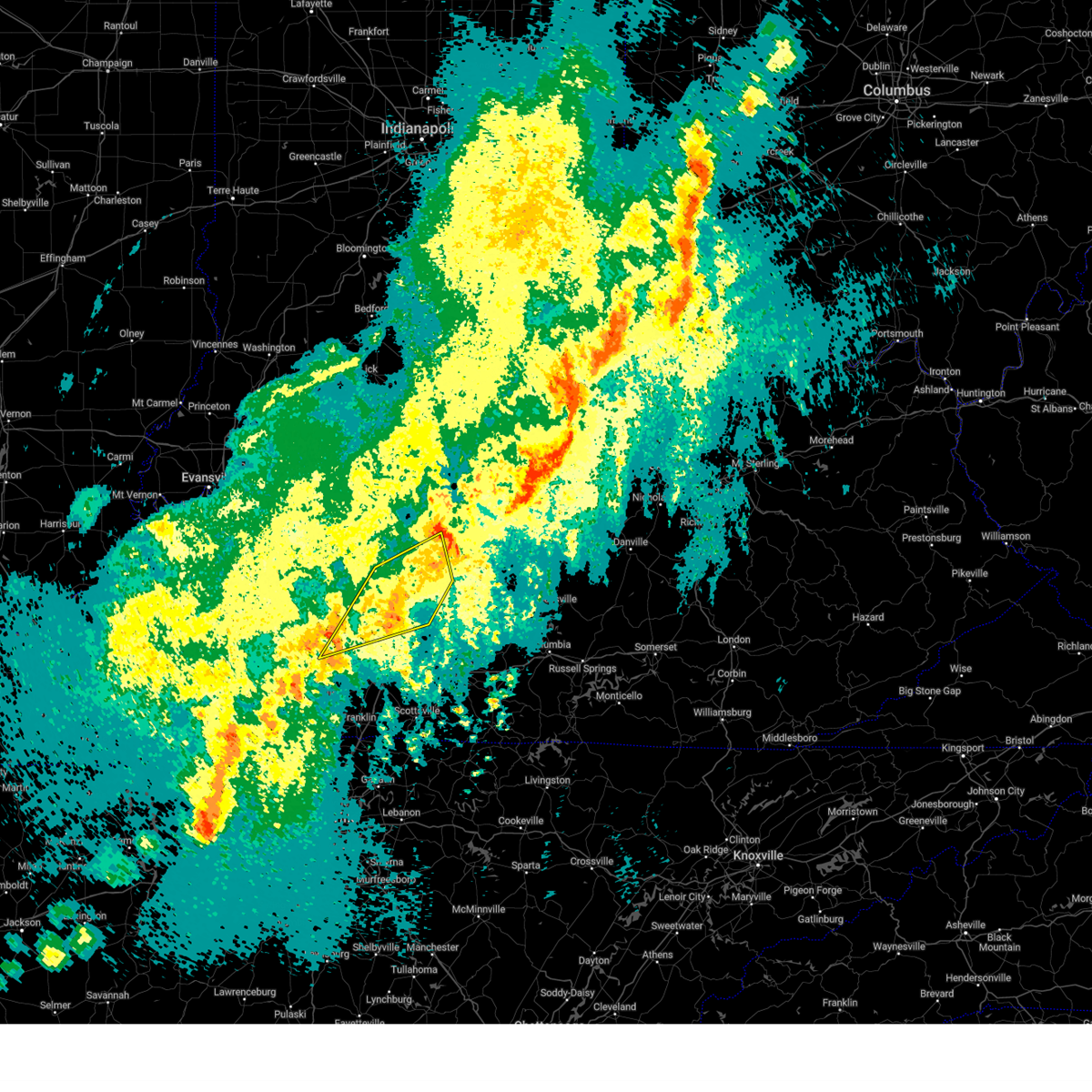
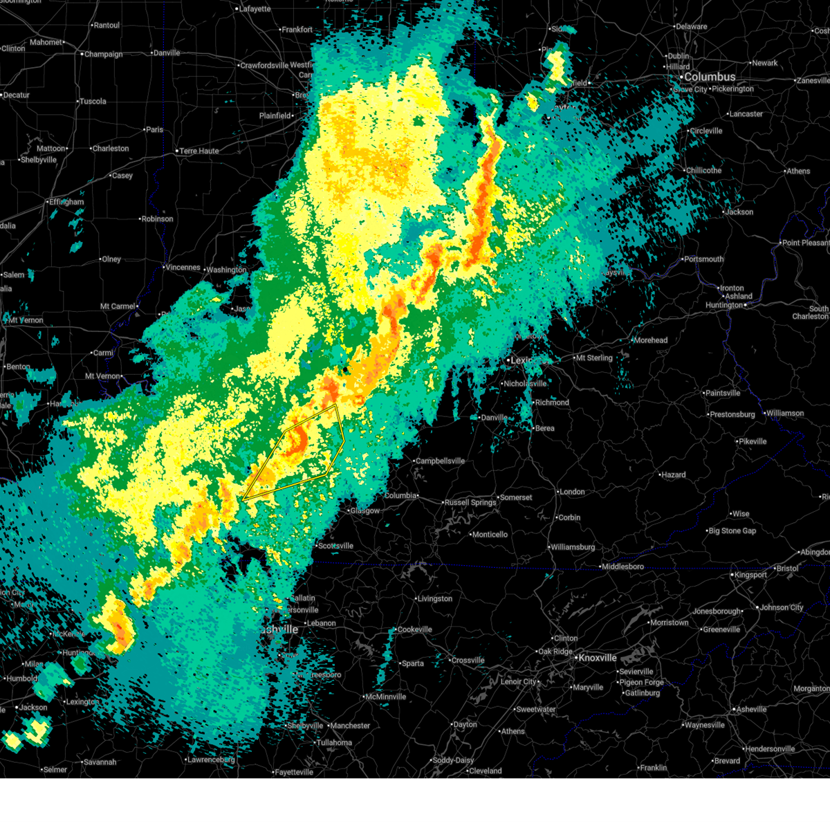
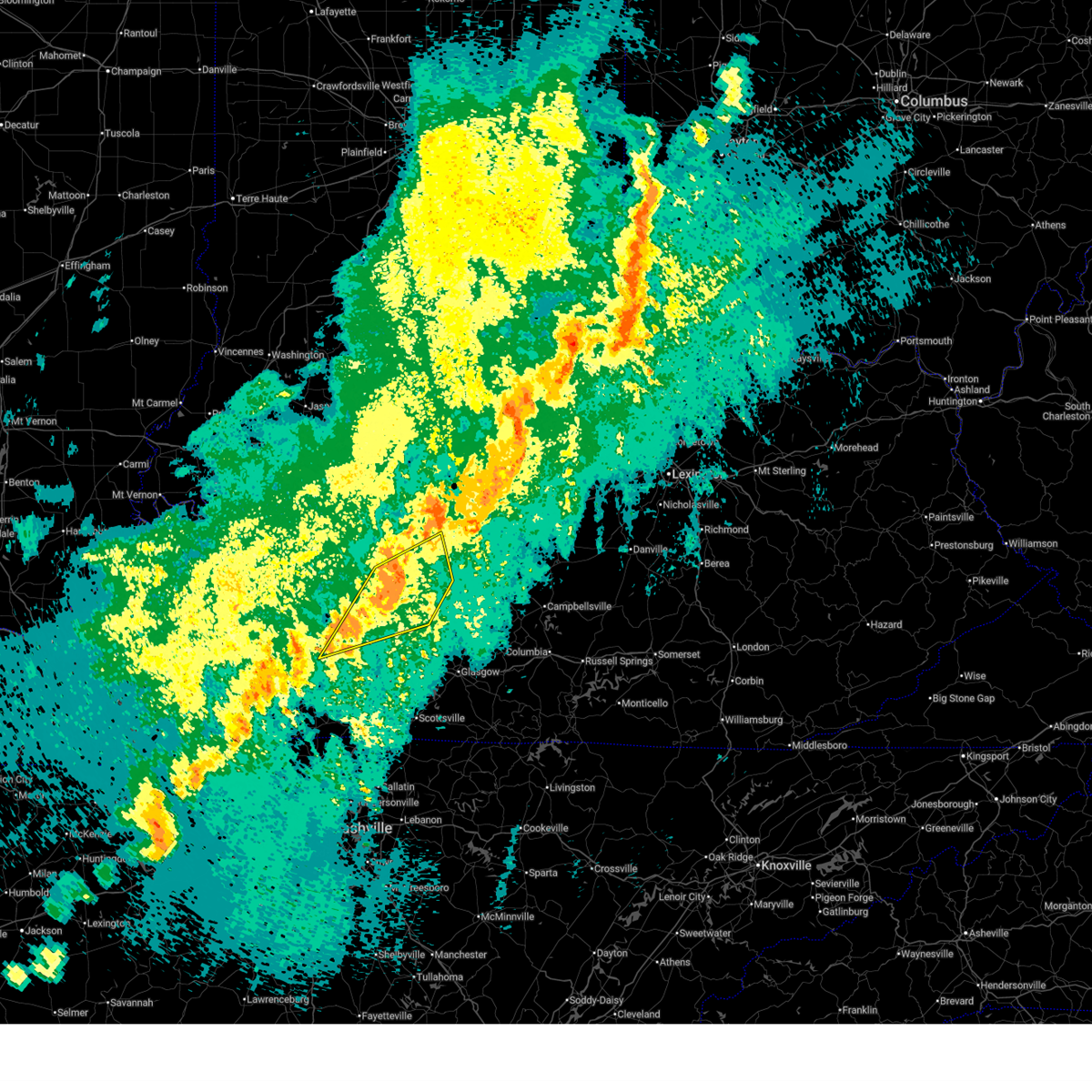
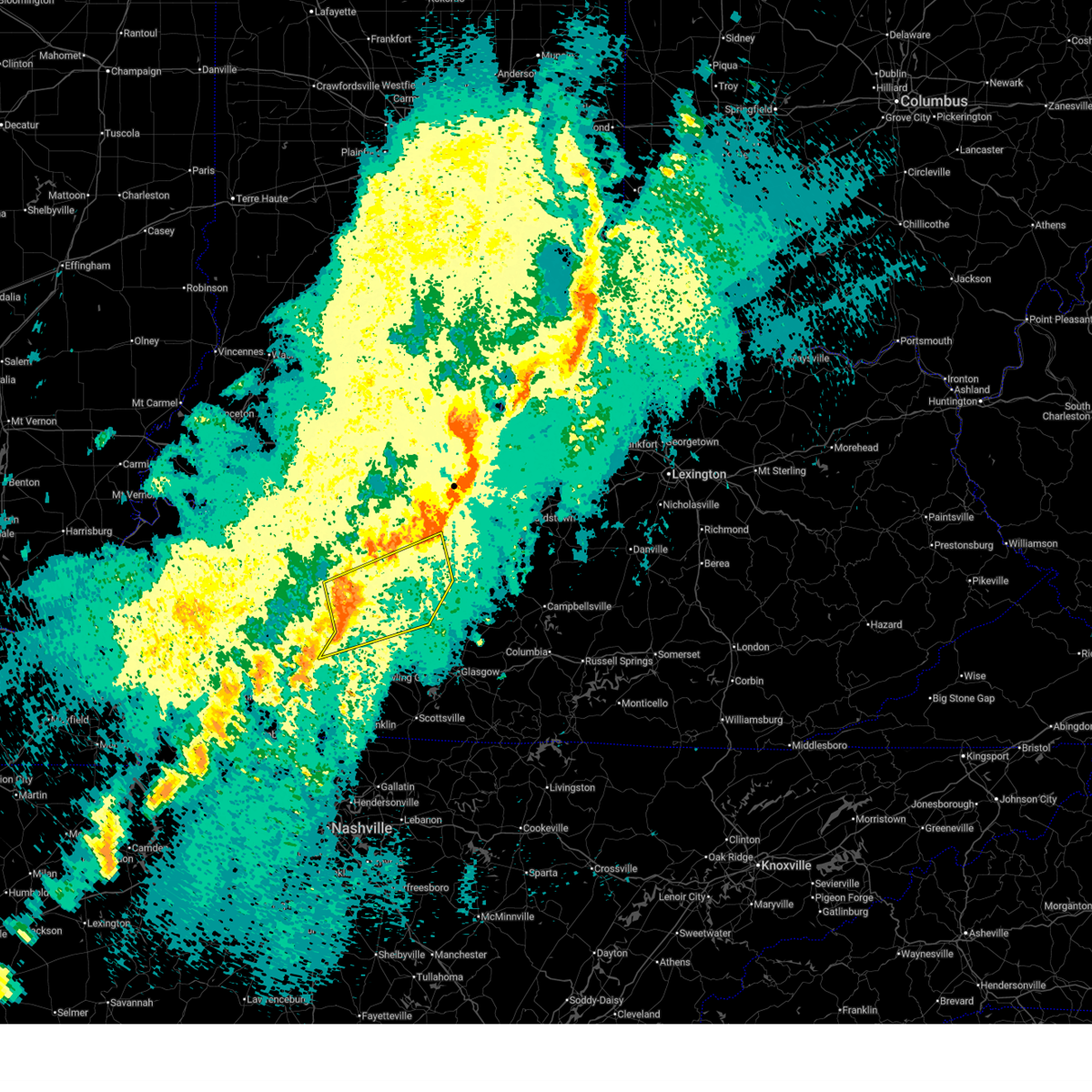
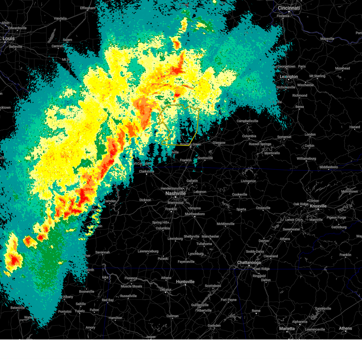
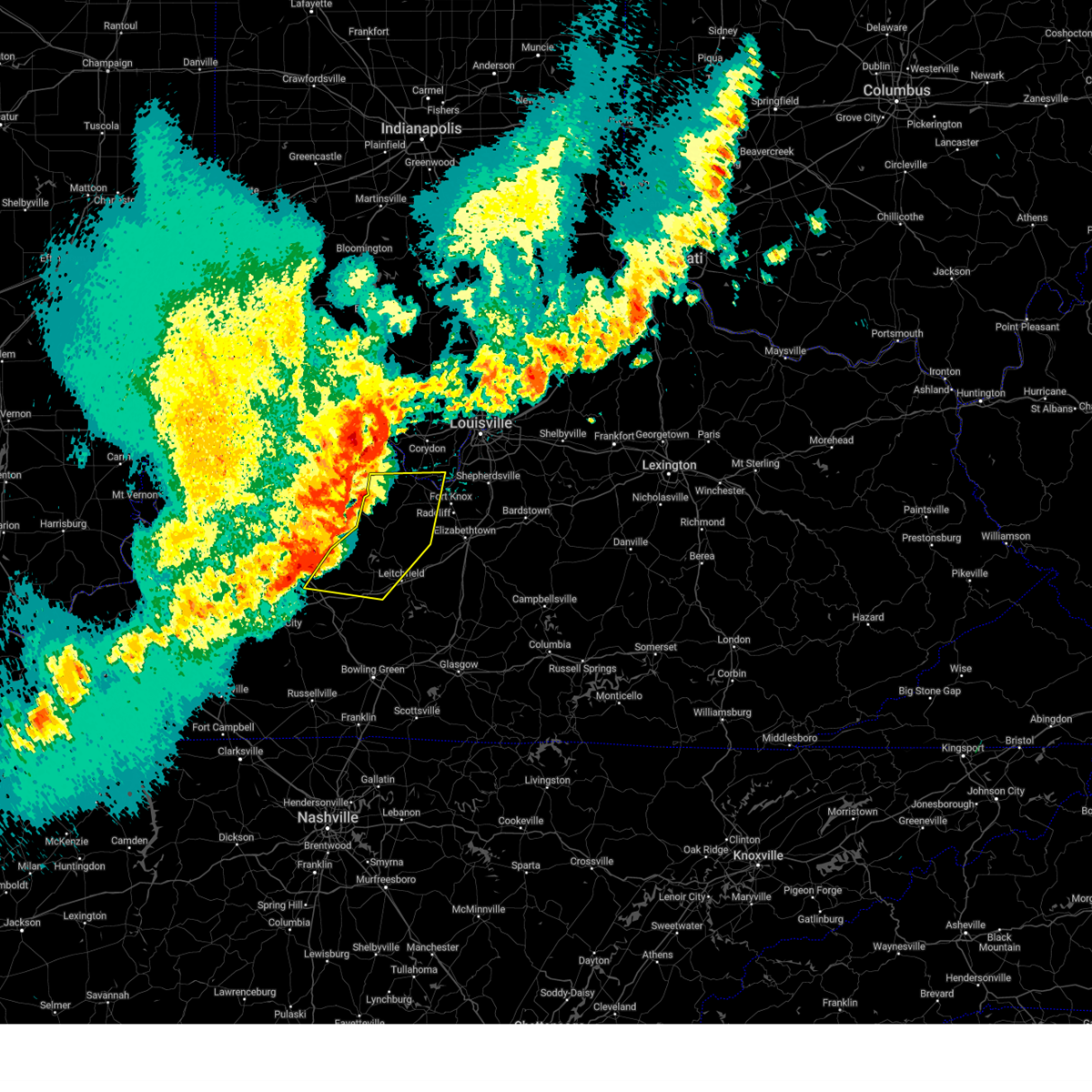
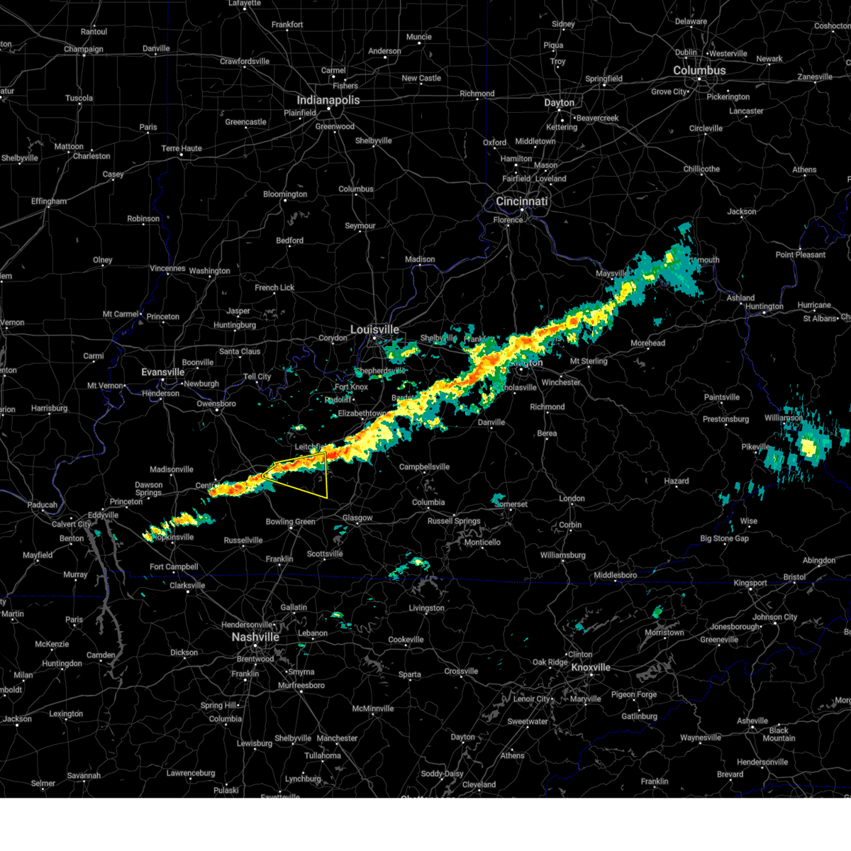
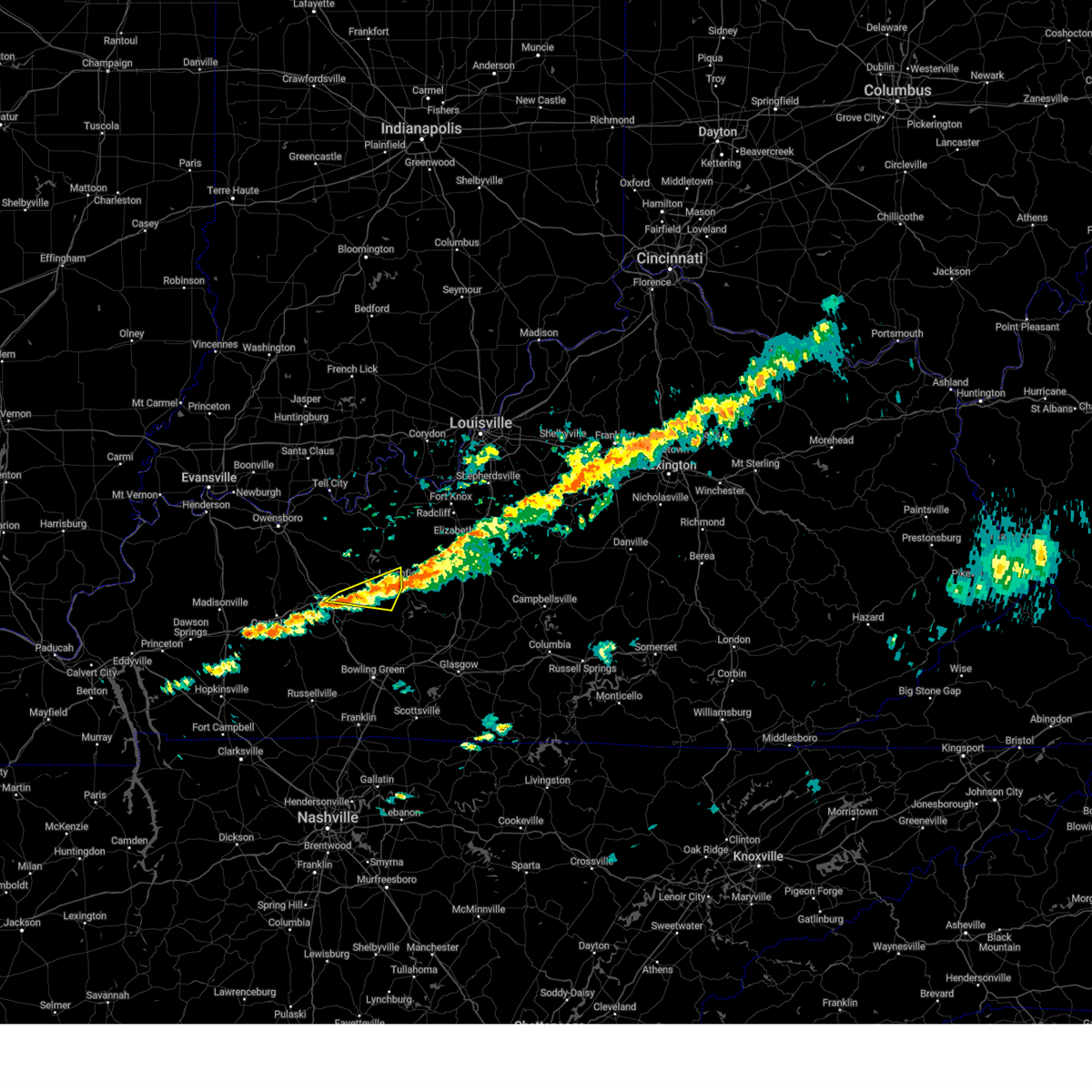
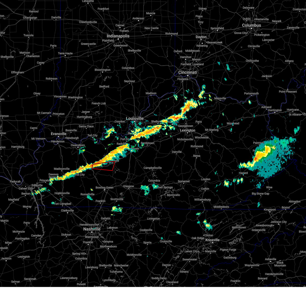
Hail Map for Caneyville, KY
The Caneyville, KY area has had 8 reports of on-the-ground hail by trained spotters, and has been under severe weather warnings 10 times during the past 12 months. Doppler radar has detected hail at or near Caneyville, KY on 47 occasions, including 1 occasion during the past year.
| Name: | Caneyville, KY |
| Where Located: | 57.3 miles SW of Louisville, KY |
| Map: | Google Map for Caneyville, KY |
| Population: | 608 |
| Housing Units: | 301 |
| More Info: | Search Google for Caneyville, KY |
1
The Top Recent Hail Date for Caneyville, KY is Monday, April 27, 2026 (16th out of 47)
Hail and Wind Damage Spotted near Caneyville, KY
| Date / Time | Report Details |
|---|---|
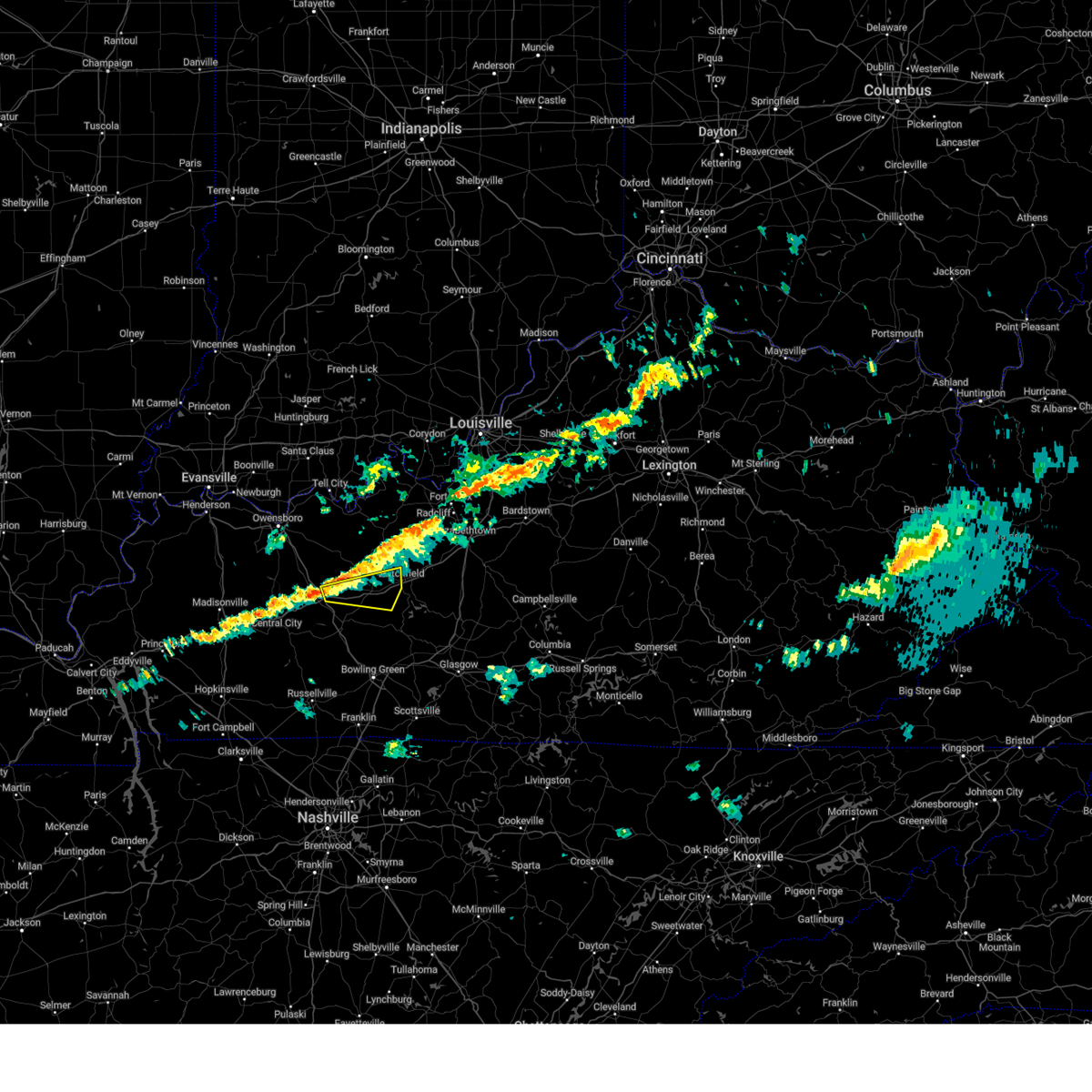
| 4/28/2026 1:09 AM CDT |
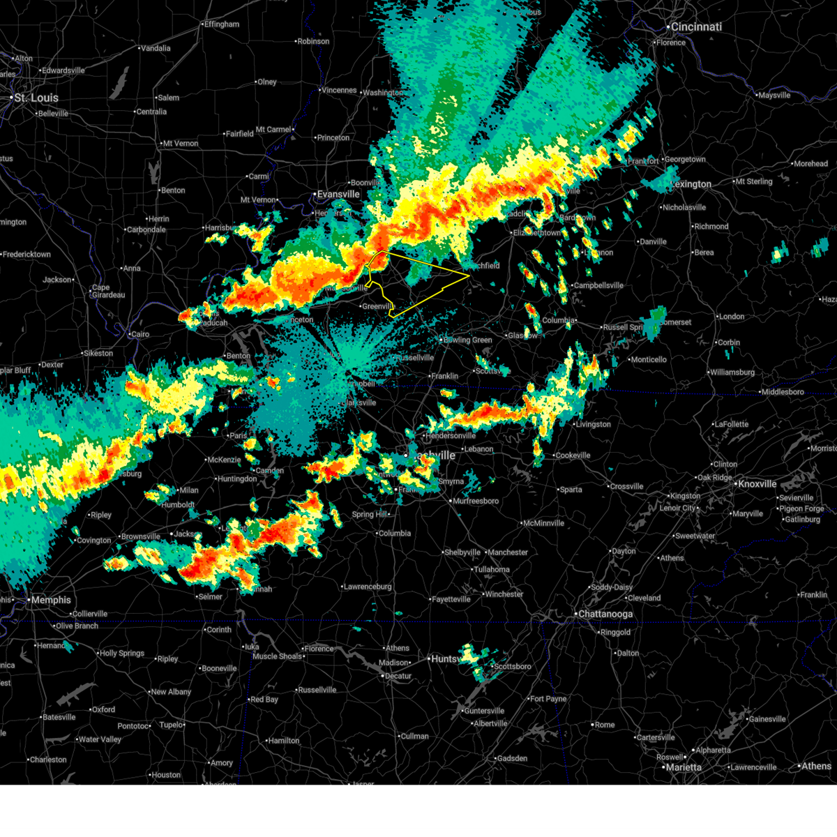
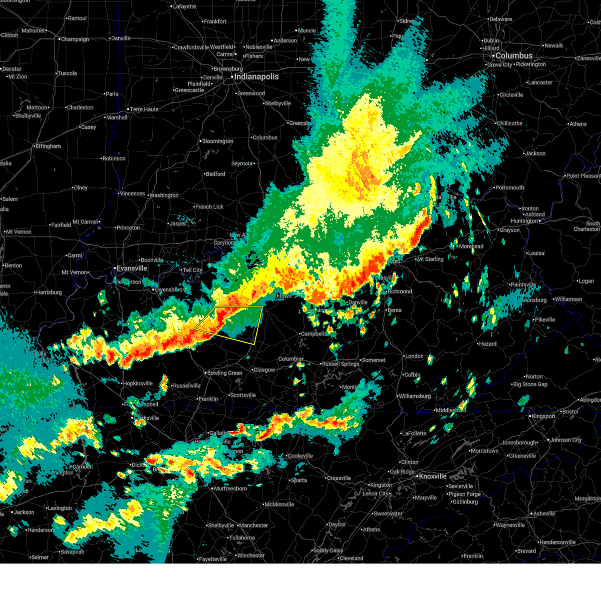 At 209 am edt/109 am cdt/, a severe thunderstorm was located over leitchfield, moving east at 50 mph (radar indicated). Hazards include 60 mph wind gusts and quarter size hail. Hail damage to vehicles is expected. expect wind damage to roofs, siding, and trees. Locations impacted include, leitchfield, munfordville, clarkson, upton, caneyville, sonora, bonnieville, rock creek, eastview, and cub run. At 209 am edt/109 am cdt/, a severe thunderstorm was located over leitchfield, moving east at 50 mph (radar indicated). Hazards include 60 mph wind gusts and quarter size hail. Hail damage to vehicles is expected. expect wind damage to roofs, siding, and trees. Locations impacted include, leitchfield, munfordville, clarkson, upton, caneyville, sonora, bonnieville, rock creek, eastview, and cub run.
|
| 4/28/2026 12:59 AM CDT |
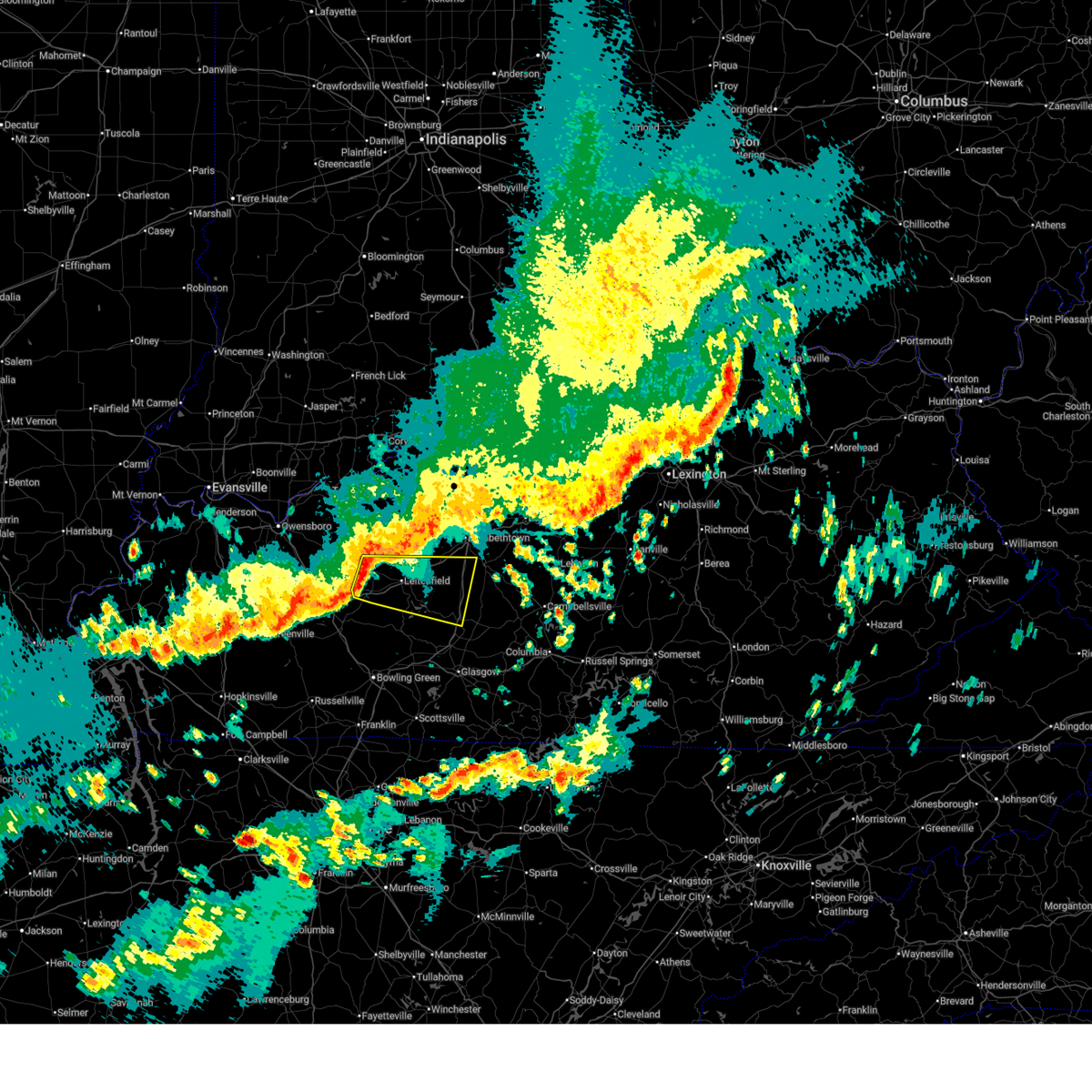 Svrlmk the national weather service in louisville has issued a * severe thunderstorm warning for, southwestern larue county in central kentucky, northwestern hart county in central kentucky, grayson county in central kentucky, south central breckinridge county in central kentucky, southern hardin county in central kentucky, northeastern edmonson county in south central kentucky, * until 245 am edt/145 am cdt/. * at 159 am edt/1259 am cdt/, a severe thunderstorm was located 10 miles west of leitchfield, moving east at 50 mph (radar indicated). Hazards include 60 mph wind gusts. expect damage to roofs, siding, and trees Svrlmk the national weather service in louisville has issued a * severe thunderstorm warning for, southwestern larue county in central kentucky, northwestern hart county in central kentucky, grayson county in central kentucky, south central breckinridge county in central kentucky, southern hardin county in central kentucky, northeastern edmonson county in south central kentucky, * until 245 am edt/145 am cdt/. * at 159 am edt/1259 am cdt/, a severe thunderstorm was located 10 miles west of leitchfield, moving east at 50 mph (radar indicated). Hazards include 60 mph wind gusts. expect damage to roofs, siding, and trees
|
| 4/28/2026 12:56 AM CDT |
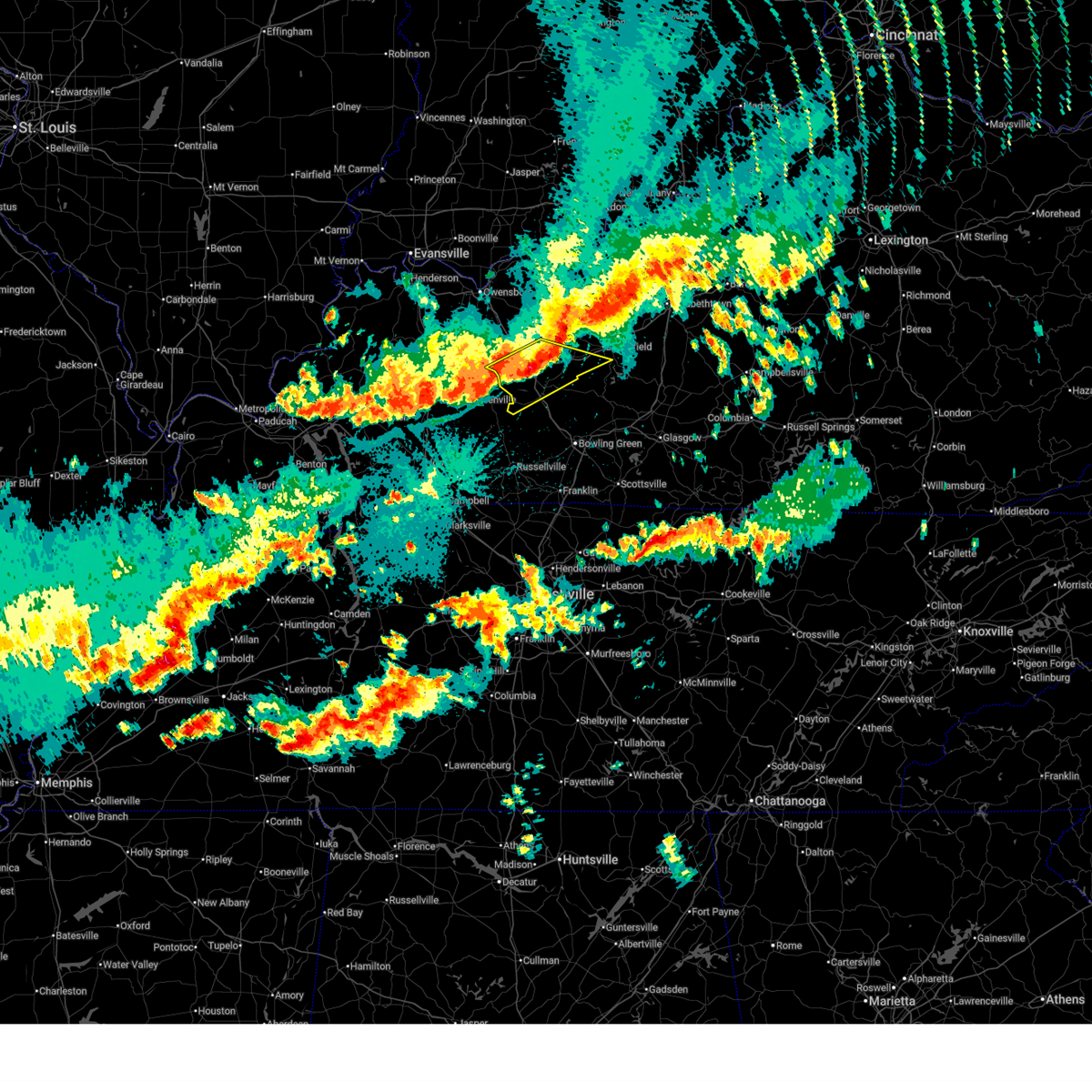 At 1256 am cdt, severe thunderstorms were located along a line extending from 6 miles north of morgantown to crofton, moving southeast at 40 mph (radar indicated). Hazards include 60 mph wind gusts. Expect damage to roofs, siding, and trees. Locations impacted include, hartford, morgantown, casey, lee, beaver dam, caneyville, mchenry, rockport, rochester, and steff. At 1256 am cdt, severe thunderstorms were located along a line extending from 6 miles north of morgantown to crofton, moving southeast at 40 mph (radar indicated). Hazards include 60 mph wind gusts. Expect damage to roofs, siding, and trees. Locations impacted include, hartford, morgantown, casey, lee, beaver dam, caneyville, mchenry, rockport, rochester, and steff.
|
| 4/28/2026 12:28 AM CDT |
 Svrlmk the national weather service in louisville has issued a * severe thunderstorm warning for, northern butler county in south central kentucky, southwestern grayson county in central kentucky, ohio county in central kentucky, * until 115 am cdt. * at 1228 am cdt, severe thunderstorms were located along a line extending from 6 miles west of hartford to near dawson springs, moving southeast at 40 mph (radar indicated). Hazards include 60 mph wind gusts. expect damage to roofs, siding, and trees Svrlmk the national weather service in louisville has issued a * severe thunderstorm warning for, northern butler county in south central kentucky, southwestern grayson county in central kentucky, ohio county in central kentucky, * until 115 am cdt. * at 1228 am cdt, severe thunderstorms were located along a line extending from 6 miles west of hartford to near dawson springs, moving southeast at 40 mph (radar indicated). Hazards include 60 mph wind gusts. expect damage to roofs, siding, and trees
|
| 3/15/2026 10:18 PM CDT |
 The storms which prompted the warning have moved out of the area. therefore, the warning has been allowed to expire. a tornado watch remains in effect until 200 am cdt for central and south central kentucky. The storms which prompted the warning have moved out of the area. therefore, the warning has been allowed to expire. a tornado watch remains in effect until 200 am cdt for central and south central kentucky.
|
| 3/15/2026 10:11 PM CDT |
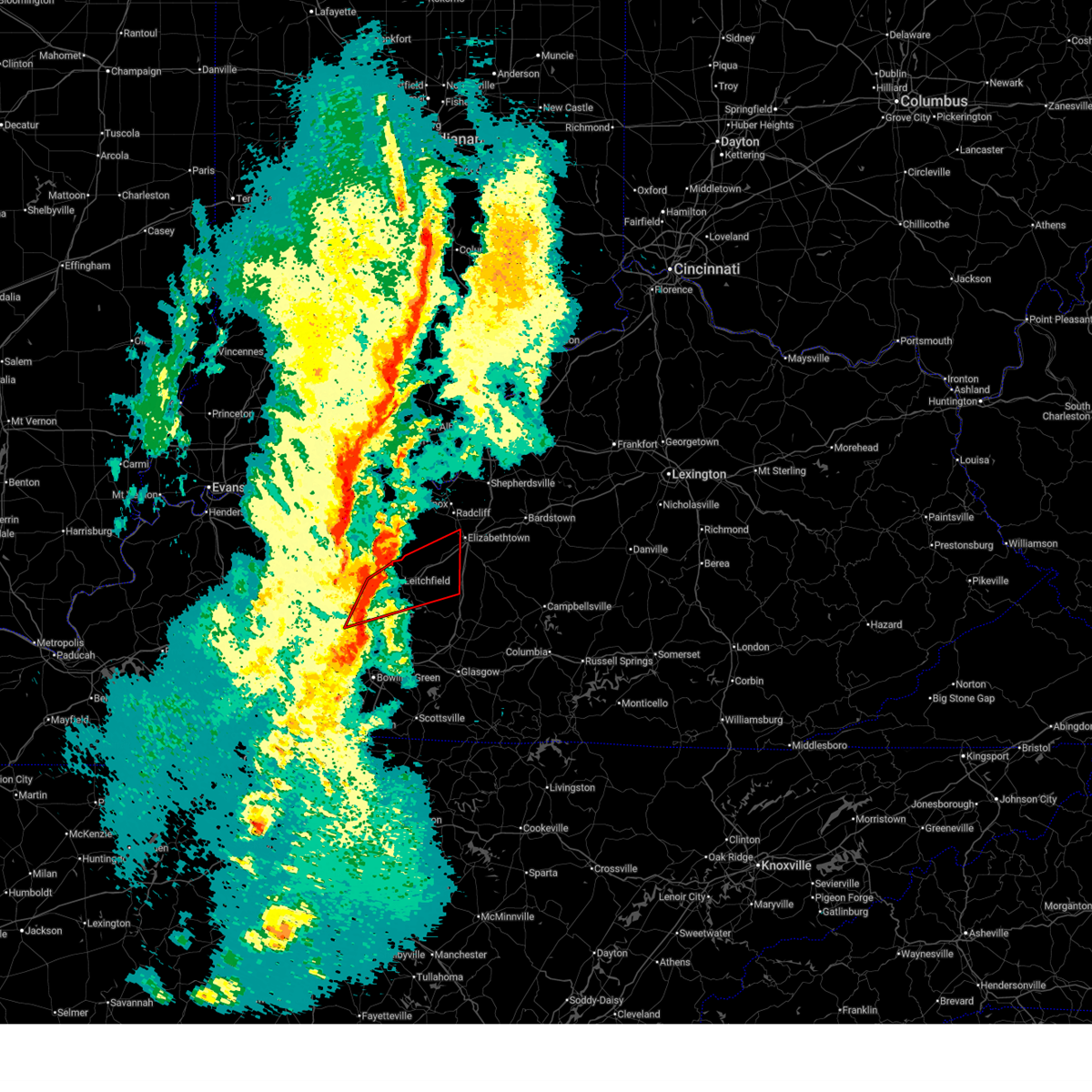 At 1111 pm edt/1011 pm cdt/, a severe thunderstorm capable of producing a tornado was located near leitchfield, moving northeast at 75 mph (radar indicated rotation). Hazards include tornado. Flying debris will be dangerous to those caught without shelter. mobile homes will be damaged or destroyed. damage to roofs, windows, and vehicles will occur. tree damage is likely. this dangerous storm will be near, leitchfield around 1015 pm cdt. elizabethtown around 1130 pm edt. Other locations impacted by this tornadic thunderstorm include rock creek, saint paul, eastview, caneyville, broad ford, do stop, peonia, sadler, solway, and glendale. At 1111 pm edt/1011 pm cdt/, a severe thunderstorm capable of producing a tornado was located near leitchfield, moving northeast at 75 mph (radar indicated rotation). Hazards include tornado. Flying debris will be dangerous to those caught without shelter. mobile homes will be damaged or destroyed. damage to roofs, windows, and vehicles will occur. tree damage is likely. this dangerous storm will be near, leitchfield around 1015 pm cdt. elizabethtown around 1130 pm edt. Other locations impacted by this tornadic thunderstorm include rock creek, saint paul, eastview, caneyville, broad ford, do stop, peonia, sadler, solway, and glendale.
|
| 3/15/2026 10:11 PM CDT |
 the tornado warning has been cancelled and is no longer in effect the tornado warning has been cancelled and is no longer in effect
|
| 3/15/2026 10:01 PM CDT |
 At 1101 pm edt/1001 pm cdt/, a severe thunderstorm capable of producing a tornado was located 14 miles west of leitchfield, moving northeast at 60 mph (radar indicated rotation). Hazards include tornado. Flying debris will be dangerous to those caught without shelter. mobile homes will be damaged or destroyed. damage to roofs, windows, and vehicles will occur. tree damage is likely. this dangerous storm will be near, leitchfield around 1010 pm cdt. elizabethtown around 1135 pm edt. Other locations impacted by this tornadic thunderstorm include steff, rock creek, saint paul, eastview, caneyville, broad ford, do stop, peonia, sadler, and neafus. At 1101 pm edt/1001 pm cdt/, a severe thunderstorm capable of producing a tornado was located 14 miles west of leitchfield, moving northeast at 60 mph (radar indicated rotation). Hazards include tornado. Flying debris will be dangerous to those caught without shelter. mobile homes will be damaged or destroyed. damage to roofs, windows, and vehicles will occur. tree damage is likely. this dangerous storm will be near, leitchfield around 1010 pm cdt. elizabethtown around 1135 pm edt. Other locations impacted by this tornadic thunderstorm include steff, rock creek, saint paul, eastview, caneyville, broad ford, do stop, peonia, sadler, and neafus.
|
| 3/15/2026 9:53 PM CDT |
 Torlmk the national weather service in louisville has issued a * tornado warning for, northwestern hart county in central kentucky, northern butler county in south central kentucky, grayson county in central kentucky, southwestern hardin county in central kentucky, southeastern ohio county in central kentucky, northwestern edmonson county in south central kentucky, * until 1145 pm edt/1045 pm cdt/. * at 1053 pm edt/953 pm cdt/, a severe thunderstorm capable of producing a tornado was located near morgantown, moving northeast at 75 mph (radar indicated rotation). Hazards include tornado. Flying debris will be dangerous to those caught without shelter. mobile homes will be damaged or destroyed. damage to roofs, windows, and vehicles will occur. tree damage is likely. this dangerous storm will be near, leitchfield around 1010 pm cdt. elizabethtown around 1130 pm edt. Other locations impacted by this tornadic thunderstorm include steff, mining city, broad ford, do stop, neafus, gilstrap, sunfish, glendale, iberia, and lone star. Torlmk the national weather service in louisville has issued a * tornado warning for, northwestern hart county in central kentucky, northern butler county in south central kentucky, grayson county in central kentucky, southwestern hardin county in central kentucky, southeastern ohio county in central kentucky, northwestern edmonson county in south central kentucky, * until 1145 pm edt/1045 pm cdt/. * at 1053 pm edt/953 pm cdt/, a severe thunderstorm capable of producing a tornado was located near morgantown, moving northeast at 75 mph (radar indicated rotation). Hazards include tornado. Flying debris will be dangerous to those caught without shelter. mobile homes will be damaged or destroyed. damage to roofs, windows, and vehicles will occur. tree damage is likely. this dangerous storm will be near, leitchfield around 1010 pm cdt. elizabethtown around 1130 pm edt. Other locations impacted by this tornadic thunderstorm include steff, mining city, broad ford, do stop, neafus, gilstrap, sunfish, glendale, iberia, and lone star.
|
| 3/15/2026 9:42 PM CDT |
 Svrlmk the national weather service in louisville has issued a * severe thunderstorm warning for, southeastern hancock county in central kentucky, butler county in south central kentucky, western grayson county in central kentucky, southwestern breckinridge county in central kentucky, ohio county in central kentucky, * until 1015 pm cdt. * at 942 pm cdt, severe thunderstorms were located along a line extending from near stanley to near livermore to near greenville, moving east at 65 mph (radar indicated). Hazards include 60 mph wind gusts. expect damage to roofs, siding, and trees Svrlmk the national weather service in louisville has issued a * severe thunderstorm warning for, southeastern hancock county in central kentucky, butler county in south central kentucky, western grayson county in central kentucky, southwestern breckinridge county in central kentucky, ohio county in central kentucky, * until 1015 pm cdt. * at 942 pm cdt, severe thunderstorms were located along a line extending from near stanley to near livermore to near greenville, moving east at 65 mph (radar indicated). Hazards include 60 mph wind gusts. expect damage to roofs, siding, and trees
|
| 6/27/2025 5:20 PM CDT | Tree down on yeaman olaton road and free zion road near yeama in grayson county KY, 8 miles SE of Caneyville, KY |
| 6/6/2025 11:28 AM CDT |
 At 1128 am cdt, severe thunderstorms were located along a line extending from near hardinsburg to 15 miles northwest of leitchfield to 16 miles east of hartford, moving east at 45 mph (radar indicated). Hazards include 70 mph wind gusts and penny size hail. Expect considerable tree damage. damage is likely to mobile homes, roofs, and outbuildings. Locations impacted include, hardinsburg, caneyville, concord, mcquady, steff, se ree, shreve, buras, do stop, and neafus. At 1128 am cdt, severe thunderstorms were located along a line extending from near hardinsburg to 15 miles northwest of leitchfield to 16 miles east of hartford, moving east at 45 mph (radar indicated). Hazards include 70 mph wind gusts and penny size hail. Expect considerable tree damage. damage is likely to mobile homes, roofs, and outbuildings. Locations impacted include, hardinsburg, caneyville, concord, mcquady, steff, se ree, shreve, buras, do stop, and neafus.
|
| 6/6/2025 11:23 AM CDT |
 At 1122 am cdt, severe thunderstorms were located along a line extending from near hardinsburg to 16 miles east of whitesville to 10 miles east of hartford, moving east at 40 mph (radar indicated). Hazards include 60 mph wind gusts and penny size hail. Expect damage to roofs, siding, and trees. Locations impacted include, hardinsburg, cloverport, caneyville, concord, mcquady, steff, se ree, shreve, buras, and do stop. At 1122 am cdt, severe thunderstorms were located along a line extending from near hardinsburg to 16 miles east of whitesville to 10 miles east of hartford, moving east at 40 mph (radar indicated). Hazards include 60 mph wind gusts and penny size hail. Expect damage to roofs, siding, and trees. Locations impacted include, hardinsburg, cloverport, caneyville, concord, mcquady, steff, se ree, shreve, buras, and do stop.
|
| 6/6/2025 11:13 AM CDT |
 Svrlmk the national weather service in louisville has issued a * severe thunderstorm warning for, western grayson county in central kentucky, breckinridge county in central kentucky, east central ohio county in central kentucky, * until 1145 am cdt. * at 1112 am cdt, severe thunderstorms were located along a line extending from 8 miles southeast of hawesville to 10 miles southeast of whitesville to near hartford, moving east at 40 mph (radar indicated). Hazards include 60 mph wind gusts and penny size hail. expect damage to roofs, siding, and trees Svrlmk the national weather service in louisville has issued a * severe thunderstorm warning for, western grayson county in central kentucky, breckinridge county in central kentucky, east central ohio county in central kentucky, * until 1145 am cdt. * at 1112 am cdt, severe thunderstorms were located along a line extending from 8 miles southeast of hawesville to 10 miles southeast of whitesville to near hartford, moving east at 40 mph (radar indicated). Hazards include 60 mph wind gusts and penny size hail. expect damage to roofs, siding, and trees
|
| 5/20/2025 6:00 PM CDT |
 the severe thunderstorm warning has been cancelled and is no longer in effect the severe thunderstorm warning has been cancelled and is no longer in effect
|
| 5/20/2025 5:49 PM CDT | Tree down in caneyville. time estimated from rada in grayson county KY, 0.7 miles N of Caneyville, KY |
| 5/20/2025 5:46 PM CDT |
 Svrlmk the national weather service in louisville has issued a * severe thunderstorm warning for, northeastern butler county in south central kentucky, grayson county in central kentucky, southern breckinridge county in central kentucky, east central ohio county in central kentucky, * until 630 pm cdt. * at 546 pm cdt, severe thunderstorms were located along a line extending from 7 miles northeast of hartford to near morgantown, moving east at 40 mph (radar indicated). Hazards include 60 mph wind gusts. expect damage to roofs, siding, and trees Svrlmk the national weather service in louisville has issued a * severe thunderstorm warning for, northeastern butler county in south central kentucky, grayson county in central kentucky, southern breckinridge county in central kentucky, east central ohio county in central kentucky, * until 630 pm cdt. * at 546 pm cdt, severe thunderstorms were located along a line extending from 7 miles northeast of hartford to near morgantown, moving east at 40 mph (radar indicated). Hazards include 60 mph wind gusts. expect damage to roofs, siding, and trees
|
| 5/16/2025 9:12 PM CDT |
 Torlmk the national weather service in louisville has issued a * tornado warning for, southwestern larue county in central kentucky, northwestern hart county in central kentucky, grayson county in central kentucky, south central breckinridge county in central kentucky, southwestern hardin county in central kentucky, * until 1045 pm edt/945 pm cdt/. * at 1012 pm edt/912 pm cdt/, a severe thunderstorm capable of producing a tornado was located near leitchfield, moving east at 60 mph (radar indicated rotation). Hazards include tornado. Flying debris will be dangerous to those caught without shelter. mobile homes will be damaged or destroyed. damage to roofs, windows, and vehicles will occur. tree damage is likely. this dangerous storm will be near, leitchfield around 920 pm cdt. Other locations impacted by this tornadic thunderstorm include rock creek, saint paul, eastview, caneyville, broad ford, peonia, black rock, tar hill, duff, and lacon. Torlmk the national weather service in louisville has issued a * tornado warning for, southwestern larue county in central kentucky, northwestern hart county in central kentucky, grayson county in central kentucky, south central breckinridge county in central kentucky, southwestern hardin county in central kentucky, * until 1045 pm edt/945 pm cdt/. * at 1012 pm edt/912 pm cdt/, a severe thunderstorm capable of producing a tornado was located near leitchfield, moving east at 60 mph (radar indicated rotation). Hazards include tornado. Flying debris will be dangerous to those caught without shelter. mobile homes will be damaged or destroyed. damage to roofs, windows, and vehicles will occur. tree damage is likely. this dangerous storm will be near, leitchfield around 920 pm cdt. Other locations impacted by this tornadic thunderstorm include rock creek, saint paul, eastview, caneyville, broad ford, peonia, black rock, tar hill, duff, and lacon.
|
| 5/16/2025 8:41 PM CDT |
 Svrlmk the national weather service in louisville has issued a * severe thunderstorm warning for, northern logan county in south central kentucky, butler county in south central kentucky, grayson county in central kentucky, northwestern warren county in south central kentucky, southern hardin county in central kentucky, southern ohio county in central kentucky, northwestern edmonson county in south central kentucky, * until 1030 pm edt/930 pm cdt/. * at 940 pm edt/840 pm cdt/, a severe thunderstorm was located over powderly, moving east at 60 mph (radar indicated). Hazards include 70 mph wind gusts and quarter size hail. Hail damage to vehicles is expected. expect considerable tree damage. Wind damage is also likely to mobile homes, roofs, and outbuildings. Svrlmk the national weather service in louisville has issued a * severe thunderstorm warning for, northern logan county in south central kentucky, butler county in south central kentucky, grayson county in central kentucky, northwestern warren county in south central kentucky, southern hardin county in central kentucky, southern ohio county in central kentucky, northwestern edmonson county in south central kentucky, * until 1030 pm edt/930 pm cdt/. * at 940 pm edt/840 pm cdt/, a severe thunderstorm was located over powderly, moving east at 60 mph (radar indicated). Hazards include 70 mph wind gusts and quarter size hail. Hail damage to vehicles is expected. expect considerable tree damage. Wind damage is also likely to mobile homes, roofs, and outbuildings.
|
| 5/16/2025 5:12 AM CDT |
 Svrlmk the national weather service in louisville has issued a * severe thunderstorm warning for, grayson county in central kentucky, southwestern hardin county in central kentucky, * until 645 am edt/545 am cdt/. * at 611 am edt/511 am cdt/, a severe thunderstorm was located 10 miles west of leitchfield, moving east at 55 mph (radar indicated). Hazards include quarter size hail. damage to vehicles is expected Svrlmk the national weather service in louisville has issued a * severe thunderstorm warning for, grayson county in central kentucky, southwestern hardin county in central kentucky, * until 645 am edt/545 am cdt/. * at 611 am edt/511 am cdt/, a severe thunderstorm was located 10 miles west of leitchfield, moving east at 55 mph (radar indicated). Hazards include quarter size hail. damage to vehicles is expected
|
| 5/8/2025 2:08 PM CDT |
 The storm which prompted the warning has moved out of the area. therefore, the warning will be allowed to expire. however, a severe thunderstorm warning remains in effect for portions of grayson and edmonson county until 230 pm cdt. a severe thunderstorm watch remains in effect until 800 pm cdt for south central and central kentucky. The storm which prompted the warning has moved out of the area. therefore, the warning will be allowed to expire. however, a severe thunderstorm warning remains in effect for portions of grayson and edmonson county until 230 pm cdt. a severe thunderstorm watch remains in effect until 800 pm cdt for south central and central kentucky.
|
| 5/8/2025 1:45 PM CDT |
 The storm which prompted the warning has moved out of the area. therefore, the warning will be allowed to expire. a severe thunderstorm watch remains in effect until 800 pm cdt for south central and central kentucky. remember, a severe thunderstorm warning still remains in effect for portions of butler, grayson, and edmonson county until 215 pm cdt. The storm which prompted the warning has moved out of the area. therefore, the warning will be allowed to expire. a severe thunderstorm watch remains in effect until 800 pm cdt for south central and central kentucky. remember, a severe thunderstorm warning still remains in effect for portions of butler, grayson, and edmonson county until 215 pm cdt.
|
| 5/8/2025 1:40 PM CDT |
 Svrlmk the national weather service in louisville has issued a * severe thunderstorm warning for, northeastern butler county in south central kentucky, southwestern grayson county in central kentucky, northwestern edmonson county in south central kentucky, * until 215 pm cdt. * at 139 pm cdt, a severe thunderstorm was located 5 miles southwest of caneyville, moving east at 25 mph (radar indicated). Hazards include 60 mph wind gusts and quarter size hail. Hail damage to vehicles is expected. Expect wind damage to roofs, siding, and trees. Svrlmk the national weather service in louisville has issued a * severe thunderstorm warning for, northeastern butler county in south central kentucky, southwestern grayson county in central kentucky, northwestern edmonson county in south central kentucky, * until 215 pm cdt. * at 139 pm cdt, a severe thunderstorm was located 5 miles southwest of caneyville, moving east at 25 mph (radar indicated). Hazards include 60 mph wind gusts and quarter size hail. Hail damage to vehicles is expected. Expect wind damage to roofs, siding, and trees.
|
| 5/8/2025 1:32 PM CDT |
 At 132 pm cdt, a severe thunderstorm was located 10 miles north of morgantown, moving east at 20 mph (radar indicated). Hazards include 60 mph wind gusts and quarter size hail. Hail damage to vehicles is expected. expect wind damage to roofs, siding, and trees. Locations impacted include, casey, lee, caneyville, dogwalk, banock, grancer, tilford, do stop, neafus, and welchs creek. At 132 pm cdt, a severe thunderstorm was located 10 miles north of morgantown, moving east at 20 mph (radar indicated). Hazards include 60 mph wind gusts and quarter size hail. Hail damage to vehicles is expected. expect wind damage to roofs, siding, and trees. Locations impacted include, casey, lee, caneyville, dogwalk, banock, grancer, tilford, do stop, neafus, and welchs creek.
|
| 5/8/2025 1:21 PM CDT |
 Svrlmk the national weather service in louisville has issued a * severe thunderstorm warning for, northeastern butler county in south central kentucky, southwestern grayson county in central kentucky, east central ohio county in central kentucky, * until 145 pm cdt. * at 121 pm cdt, a severe thunderstorm was located 9 miles southeast of hartford, moving east at 15 mph (radar indicated). Hazards include 60 mph wind gusts and quarter size hail. Hail damage to vehicles is expected. Expect wind damage to roofs, siding, and trees. Svrlmk the national weather service in louisville has issued a * severe thunderstorm warning for, northeastern butler county in south central kentucky, southwestern grayson county in central kentucky, east central ohio county in central kentucky, * until 145 pm cdt. * at 121 pm cdt, a severe thunderstorm was located 9 miles southeast of hartford, moving east at 15 mph (radar indicated). Hazards include 60 mph wind gusts and quarter size hail. Hail damage to vehicles is expected. Expect wind damage to roofs, siding, and trees.
|
| 4/10/2025 4:54 PM CDT |
 The storm which prompted the warning has weakened below severe limits, and no longer poses an immediate threat to life or property. therefore, the warning will be allowed to expire. however, gusty winds are still possible with this thunderstorm. a severe thunderstorm watch remains in effect until 900 pm cdt for central kentucky. remember, a severe thunderstorm warning still remains in effect for portions of hancock and breckinridge counties until 515 pm cdt. The storm which prompted the warning has weakened below severe limits, and no longer poses an immediate threat to life or property. therefore, the warning will be allowed to expire. however, gusty winds are still possible with this thunderstorm. a severe thunderstorm watch remains in effect until 900 pm cdt for central kentucky. remember, a severe thunderstorm warning still remains in effect for portions of hancock and breckinridge counties until 515 pm cdt.
|
| 4/10/2025 4:27 PM CDT |
 Svrlmk the national weather service in louisville has issued a * severe thunderstorm warning for, southeastern hancock county in central kentucky, northwestern grayson county in central kentucky, southwestern breckinridge county in central kentucky, northern ohio county in central kentucky, * until 500 pm cdt. * at 426 pm cdt, a severe thunderstorm was located near whitesville, moving east at 45 mph (radar indicated). Hazards include 60 mph wind gusts and quarter size hail. Hail damage to vehicles is expected. Expect wind damage to roofs, siding, and trees. Svrlmk the national weather service in louisville has issued a * severe thunderstorm warning for, southeastern hancock county in central kentucky, northwestern grayson county in central kentucky, southwestern breckinridge county in central kentucky, northern ohio county in central kentucky, * until 500 pm cdt. * at 426 pm cdt, a severe thunderstorm was located near whitesville, moving east at 45 mph (radar indicated). Hazards include 60 mph wind gusts and quarter size hail. Hail damage to vehicles is expected. Expect wind damage to roofs, siding, and trees.
|
| 4/3/2025 12:00 AM CDT |
 The storms which prompted the warning have moved out of the area. therefore, the warning has been allowed to expire. a tornado watch remains in effect until 200 am edt/100 am cdt/ for central kentucky. a tornado watch also remains in effect until 700 am edt/600 am cdt/ for south central and central kentucky. The storms which prompted the warning have moved out of the area. therefore, the warning has been allowed to expire. a tornado watch remains in effect until 200 am edt/100 am cdt/ for central kentucky. a tornado watch also remains in effect until 700 am edt/600 am cdt/ for south central and central kentucky.
|
| 4/2/2025 11:37 PM CDT |
 At 1236 am edt/1136 pm cdt/, severe thunderstorms were located along a line extending from 13 miles west of leitchfield to 13 miles northwest of brownsville to 10 miles east of morgantown, moving northeast at 60 mph (radar indicated). Hazards include 60 mph wind gusts and penny size hail. Expect damage to roofs, siding, and trees. Locations impacted include, leitchfield, morgantown, casey, lee, clarkson, caneyville, woodbury, leetown, broad ford, and do stop. At 1236 am edt/1136 pm cdt/, severe thunderstorms were located along a line extending from 13 miles west of leitchfield to 13 miles northwest of brownsville to 10 miles east of morgantown, moving northeast at 60 mph (radar indicated). Hazards include 60 mph wind gusts and penny size hail. Expect damage to roofs, siding, and trees. Locations impacted include, leitchfield, morgantown, casey, lee, clarkson, caneyville, woodbury, leetown, broad ford, and do stop.
|
| 4/2/2025 11:37 PM CDT |
 the severe thunderstorm warning has been cancelled and is no longer in effect the severe thunderstorm warning has been cancelled and is no longer in effect
|
| 4/2/2025 11:20 PM CDT |
 Svrlmk the national weather service in louisville has issued a * severe thunderstorm warning for, northwestern hart county in central kentucky, butler county in south central kentucky, grayson county in central kentucky, northwestern warren county in south central kentucky, southeastern breckinridge county in central kentucky, southwestern hardin county in central kentucky, southeastern ohio county in central kentucky, northern edmonson county in south central kentucky, * until 100 am edt/midnight cdt/. * at 1219 am edt/1119 pm cdt/, severe thunderstorms were located along a line extending from 7 miles east of hartford to morgantown to 14 miles east of dunmor, moving northeast at 55 mph (radar indicated). Hazards include 60 mph wind gusts and penny size hail. expect damage to roofs, siding, and trees Svrlmk the national weather service in louisville has issued a * severe thunderstorm warning for, northwestern hart county in central kentucky, butler county in south central kentucky, grayson county in central kentucky, northwestern warren county in south central kentucky, southeastern breckinridge county in central kentucky, southwestern hardin county in central kentucky, southeastern ohio county in central kentucky, northern edmonson county in south central kentucky, * until 100 am edt/midnight cdt/. * at 1219 am edt/1119 pm cdt/, severe thunderstorms were located along a line extending from 7 miles east of hartford to morgantown to 14 miles east of dunmor, moving northeast at 55 mph (radar indicated). Hazards include 60 mph wind gusts and penny size hail. expect damage to roofs, siding, and trees
|
| 4/2/2025 9:53 PM CDT |
 Svrlmk the national weather service in louisville has issued a * severe thunderstorm warning for, northern logan county in south central kentucky, butler county in south central kentucky, western grayson county in central kentucky, northwestern warren county in south central kentucky, ohio county in central kentucky, northwestern edmonson county in south central kentucky, * until 1100 pm cdt. * at 952 pm cdt, severe thunderstorms were located along a line extending from near calhoun to near crofton, moving east at 45 mph (radar indicated). Hazards include 60 mph wind gusts. expect damage to roofs, siding, and trees Svrlmk the national weather service in louisville has issued a * severe thunderstorm warning for, northern logan county in south central kentucky, butler county in south central kentucky, western grayson county in central kentucky, northwestern warren county in south central kentucky, ohio county in central kentucky, northwestern edmonson county in south central kentucky, * until 1100 pm cdt. * at 952 pm cdt, severe thunderstorms were located along a line extending from near calhoun to near crofton, moving east at 45 mph (radar indicated). Hazards include 60 mph wind gusts. expect damage to roofs, siding, and trees
|
| 3/30/2025 8:09 PM CDT |
 Svrlmk the national weather service in louisville has issued a * severe thunderstorm warning for, south central harrison county in south central indiana, meade county in central kentucky, southeastern hancock county in central kentucky, western grayson county in central kentucky, breckinridge county in central kentucky, west central hardin county in central kentucky, northeastern ohio county in central kentucky, * until 945 pm edt/845 pm cdt/. * at 908 pm edt/808 pm cdt/, severe thunderstorms were located along a line extending from 15 miles southwest of carefree town to 8 miles west of hardinsburg to hartford, moving east at 55 mph (radar indicated). Hazards include 60 mph wind gusts and quarter size hail. Hail damage to vehicles is expected. Expect wind damage to roofs, siding, and trees. Svrlmk the national weather service in louisville has issued a * severe thunderstorm warning for, south central harrison county in south central indiana, meade county in central kentucky, southeastern hancock county in central kentucky, western grayson county in central kentucky, breckinridge county in central kentucky, west central hardin county in central kentucky, northeastern ohio county in central kentucky, * until 945 pm edt/845 pm cdt/. * at 908 pm edt/808 pm cdt/, severe thunderstorms were located along a line extending from 15 miles southwest of carefree town to 8 miles west of hardinsburg to hartford, moving east at 55 mph (radar indicated). Hazards include 60 mph wind gusts and quarter size hail. Hail damage to vehicles is expected. Expect wind damage to roofs, siding, and trees.
|
| 2/6/2025 4:40 AM CST |
 At 439 am cst, a severe thunderstorm was located 13 miles northeast of morgantown, moving east at 50 mph (radar indicated). Hazards include 60 mph wind gusts and quarter size hail. Hail damage to vehicles is expected. expect wind damage to roofs, siding, and trees. Locations impacted include, leitchfield, brownsville, casey, lee, caneyville, windyville, roundhill, black gold, broadway, and brooklyn. At 439 am cst, a severe thunderstorm was located 13 miles northeast of morgantown, moving east at 50 mph (radar indicated). Hazards include 60 mph wind gusts and quarter size hail. Hail damage to vehicles is expected. expect wind damage to roofs, siding, and trees. Locations impacted include, leitchfield, brownsville, casey, lee, caneyville, windyville, roundhill, black gold, broadway, and brooklyn.
|
| 2/6/2025 4:40 AM CST |
 the severe thunderstorm warning has been cancelled and is no longer in effect the severe thunderstorm warning has been cancelled and is no longer in effect
|
| 2/6/2025 4:33 AM CST |
 The storm which prompted the warning has moved out of the area. therefore, the warning has been allowed to expire. remember, a tornado warning still remains in effect for southeastern grayson county until 500 am cst. The storm which prompted the warning has moved out of the area. therefore, the warning has been allowed to expire. remember, a tornado warning still remains in effect for southeastern grayson county until 500 am cst.
|
| 2/6/2025 4:31 AM CST |
 Svrlmk the national weather service in louisville has issued a * severe thunderstorm warning for, northeastern butler county in south central kentucky, southwestern grayson county in central kentucky, east central ohio county in central kentucky, northwestern edmonson county in south central kentucky, * until 500 am cst. * at 431 am cst, a severe thunderstorm was located 9 miles northeast of morgantown, moving east at 50 mph (radar indicated). Hazards include 60 mph wind gusts and quarter size hail. Hail damage to vehicles is expected. Expect wind damage to roofs, siding, and trees. Svrlmk the national weather service in louisville has issued a * severe thunderstorm warning for, northeastern butler county in south central kentucky, southwestern grayson county in central kentucky, east central ohio county in central kentucky, northwestern edmonson county in south central kentucky, * until 500 am cst. * at 431 am cst, a severe thunderstorm was located 9 miles northeast of morgantown, moving east at 50 mph (radar indicated). Hazards include 60 mph wind gusts and quarter size hail. Hail damage to vehicles is expected. Expect wind damage to roofs, siding, and trees.
|
| 2/6/2025 4:28 AM CST |
 The storm which prompted the warning has weakened below severe limits, and no longer poses an immediate threat to life or property. therefore, the warning will be allowed to expire. however, gusty winds and heavy rain are still possible with this thunderstorm. to report severe weather, contact your nearest law enforcement agency. they will relay your report to the national weather service louisville. The storm which prompted the warning has weakened below severe limits, and no longer poses an immediate threat to life or property. therefore, the warning will be allowed to expire. however, gusty winds and heavy rain are still possible with this thunderstorm. to report severe weather, contact your nearest law enforcement agency. they will relay your report to the national weather service louisville.
|
| 2/6/2025 4:22 AM CST |
 At 422 am cst, a severe thunderstorm was located 8 miles west of leitchfield, moving east at 50 mph (radar indicated). Hazards include 60 mph wind gusts. Expect damage to roofs, siding, and trees. Locations impacted include, leitchfield, caneyville, steff, post, windy hill, tilford, south, do stop, neafus, and peth. At 422 am cst, a severe thunderstorm was located 8 miles west of leitchfield, moving east at 50 mph (radar indicated). Hazards include 60 mph wind gusts. Expect damage to roofs, siding, and trees. Locations impacted include, leitchfield, caneyville, steff, post, windy hill, tilford, south, do stop, neafus, and peth.
|
| 2/6/2025 4:20 AM CST |
 At 420 am cst, a severe thunderstorm capable of producing a tornado was located 8 miles southwest of leitchfield, moving east at 50 mph (radar indicated rotation). Hazards include tornado and quarter size hail. Flying debris will be dangerous to those caught without shelter. mobile homes will be damaged or destroyed. damage to roofs, windows, and vehicles will occur. tree damage is likely. Locations impacted include, leitchfield, caneyville, millwood, peth, shrewsbury, and black rock. At 420 am cst, a severe thunderstorm capable of producing a tornado was located 8 miles southwest of leitchfield, moving east at 50 mph (radar indicated rotation). Hazards include tornado and quarter size hail. Flying debris will be dangerous to those caught without shelter. mobile homes will be damaged or destroyed. damage to roofs, windows, and vehicles will occur. tree damage is likely. Locations impacted include, leitchfield, caneyville, millwood, peth, shrewsbury, and black rock.
|
| 2/6/2025 4:12 AM CST |
 the tornado warning has been cancelled and is no longer in effect the tornado warning has been cancelled and is no longer in effect
|
| 2/6/2025 4:12 AM CST |
 At 411 am cst, a severe thunderstorm capable of producing a tornado was located 15 miles west of leitchfield, moving east at 50 mph (radar indicated rotation). Hazards include tornado and quarter size hail. Flying debris will be dangerous to those caught without shelter. mobile homes will be damaged or destroyed. damage to roofs, windows, and vehicles will occur. tree damage is likely. Locations impacted include, leitchfield, caneyville, ready, steff, millwood, shrewsbury, do stop, sadler, peth, and black rock. At 411 am cst, a severe thunderstorm capable of producing a tornado was located 15 miles west of leitchfield, moving east at 50 mph (radar indicated rotation). Hazards include tornado and quarter size hail. Flying debris will be dangerous to those caught without shelter. mobile homes will be damaged or destroyed. damage to roofs, windows, and vehicles will occur. tree damage is likely. Locations impacted include, leitchfield, caneyville, ready, steff, millwood, shrewsbury, do stop, sadler, peth, and black rock.
|
| 2/6/2025 4:03 AM CST |
 Torlmk the national weather service in louisville has issued a * tornado warning for, north central butler county in south central kentucky, southwestern grayson county in central kentucky, east central ohio county in central kentucky, * until 430 am cst. * at 403 am cst, a severe thunderstorm capable of producing a tornado was located 11 miles east of hartford, moving east at 50 mph (radar indicated rotation). Hazards include tornado. Flying debris will be dangerous to those caught without shelter. mobile homes will be damaged or destroyed. damage to roofs, windows, and vehicles will occur. tree damage is likely. This tornadic thunderstorm will remain over mainly rural areas of north central butler, southwestern grayson and east central ohio counties, including the following locations, horse branch, steff, mount pleasant, post, windy hill, tilford, caneyville, do stop, sadler, and neafus. Torlmk the national weather service in louisville has issued a * tornado warning for, north central butler county in south central kentucky, southwestern grayson county in central kentucky, east central ohio county in central kentucky, * until 430 am cst. * at 403 am cst, a severe thunderstorm capable of producing a tornado was located 11 miles east of hartford, moving east at 50 mph (radar indicated rotation). Hazards include tornado. Flying debris will be dangerous to those caught without shelter. mobile homes will be damaged or destroyed. damage to roofs, windows, and vehicles will occur. tree damage is likely. This tornadic thunderstorm will remain over mainly rural areas of north central butler, southwestern grayson and east central ohio counties, including the following locations, horse branch, steff, mount pleasant, post, windy hill, tilford, caneyville, do stop, sadler, and neafus.
|
| 2/6/2025 3:58 AM CST |
 Svrlmk the national weather service in louisville has issued a * severe thunderstorm warning for, northeastern butler county in south central kentucky, southwestern grayson county in central kentucky, east central ohio county in central kentucky, * until 430 am cst. * at 357 am cst, a severe thunderstorm was located 7 miles southeast of hartford, moving east at 50 mph (radar indicated). Hazards include 60 mph wind gusts. expect damage to roofs, siding, and trees Svrlmk the national weather service in louisville has issued a * severe thunderstorm warning for, northeastern butler county in south central kentucky, southwestern grayson county in central kentucky, east central ohio county in central kentucky, * until 430 am cst. * at 357 am cst, a severe thunderstorm was located 7 miles southeast of hartford, moving east at 50 mph (radar indicated). Hazards include 60 mph wind gusts. expect damage to roofs, siding, and trees
|
| 7/30/2024 12:50 PM CDT | 2 trees dow in grayson county KY, 0.7 miles N of Caneyville, KY |
| 7/30/2024 12:49 PM CDT |
 Svrlmk the national weather service in louisville has issued a * severe thunderstorm warning for, southwestern larue county in central kentucky, northwestern hart county in central kentucky, grayson county in central kentucky, southern hardin county in central kentucky, northeastern edmonson county in south central kentucky, * until 215 pm edt/115 pm cdt/. * at 149 pm edt/1249 pm cdt/, severe thunderstorms were located along a line extending from 9 miles west of elizabethtown to near leitchfield to 20 miles northwest of brownsville, moving southeast at 50 mph (radar indicated). Hazards include 60 mph wind gusts and quarter size hail. Hail damage to vehicles is expected. Expect wind damage to roofs, siding, and trees. Svrlmk the national weather service in louisville has issued a * severe thunderstorm warning for, southwestern larue county in central kentucky, northwestern hart county in central kentucky, grayson county in central kentucky, southern hardin county in central kentucky, northeastern edmonson county in south central kentucky, * until 215 pm edt/115 pm cdt/. * at 149 pm edt/1249 pm cdt/, severe thunderstorms were located along a line extending from 9 miles west of elizabethtown to near leitchfield to 20 miles northwest of brownsville, moving southeast at 50 mph (radar indicated). Hazards include 60 mph wind gusts and quarter size hail. Hail damage to vehicles is expected. Expect wind damage to roofs, siding, and trees.
|
| 5/26/2024 9:51 AM CDT |
 At 950 am cdt, a severe thunderstorm was located 9 miles southeast of hartford, moving east at 45 mph (radar indicated). Hazards include 60 mph wind gusts. Expect damage to roofs, siding, and trees. Locations impacted include, bowling green, hartford, morgantown, plum springs, casey, lee, beaver dam, caneyville, mchenry, and rochester. At 950 am cdt, a severe thunderstorm was located 9 miles southeast of hartford, moving east at 45 mph (radar indicated). Hazards include 60 mph wind gusts. Expect damage to roofs, siding, and trees. Locations impacted include, bowling green, hartford, morgantown, plum springs, casey, lee, beaver dam, caneyville, mchenry, and rochester.
|
| 5/26/2024 9:32 AM CDT |
 At 931 am cdt, a severe thunderstorm was located near central city, moving east at 45 mph (radar indicated). Hazards include 70 mph wind gusts. Expect considerable tree damage. damage is likely to mobile homes, roofs, and outbuildings. Locations impacted include, bowling green, hartford, morgantown, plum springs, casey, lee, beaver dam, caneyville, centertown, and mchenry. At 931 am cdt, a severe thunderstorm was located near central city, moving east at 45 mph (radar indicated). Hazards include 70 mph wind gusts. Expect considerable tree damage. damage is likely to mobile homes, roofs, and outbuildings. Locations impacted include, bowling green, hartford, morgantown, plum springs, casey, lee, beaver dam, caneyville, centertown, and mchenry.
|
| 5/26/2024 9:18 AM CDT |
 Svrlmk the national weather service in louisville has issued a * severe thunderstorm warning for, northeastern logan county in south central kentucky, butler county in south central kentucky, western grayson county in central kentucky, northwestern warren county in south central kentucky, south central breckinridge county in central kentucky, ohio county in central kentucky, northwestern edmonson county in south central kentucky, * until 1015 am cdt. * at 917 am cdt, a severe thunderstorm was located near weir, moving east at 45 mph (radar indicated). Hazards include 70 mph wind gusts. Expect considerable tree damage. Damage is likely to mobile homes, roofs, and outbuildings. Svrlmk the national weather service in louisville has issued a * severe thunderstorm warning for, northeastern logan county in south central kentucky, butler county in south central kentucky, western grayson county in central kentucky, northwestern warren county in south central kentucky, south central breckinridge county in central kentucky, ohio county in central kentucky, northwestern edmonson county in south central kentucky, * until 1015 am cdt. * at 917 am cdt, a severe thunderstorm was located near weir, moving east at 45 mph (radar indicated). Hazards include 70 mph wind gusts. Expect considerable tree damage. Damage is likely to mobile homes, roofs, and outbuildings.
|
| 5/8/2024 6:53 PM CDT |
 Svrlmk the national weather service in louisville has issued a * severe thunderstorm warning for, northeastern butler county in south central kentucky, southwestern grayson county in central kentucky, southeastern ohio county in central kentucky, northwestern edmonson county in south central kentucky, * until 745 pm cdt. * at 653 pm cdt, a severe thunderstorm was located 9 miles north of morgantown, moving east at 35 mph (radar indicated). Hazards include 60 mph wind gusts and quarter size hail. Hail damage to vehicles is expected. Expect wind damage to roofs, siding, and trees. Svrlmk the national weather service in louisville has issued a * severe thunderstorm warning for, northeastern butler county in south central kentucky, southwestern grayson county in central kentucky, southeastern ohio county in central kentucky, northwestern edmonson county in south central kentucky, * until 745 pm cdt. * at 653 pm cdt, a severe thunderstorm was located 9 miles north of morgantown, moving east at 35 mph (radar indicated). Hazards include 60 mph wind gusts and quarter size hail. Hail damage to vehicles is expected. Expect wind damage to roofs, siding, and trees.
|
| 4/2/2024 5:55 PM CDT |
 The storm which prompted the warning has weakened below severe limits, and no longer poses an immediate threat to life or property. therefore, the warning will be allowed to expire. however, gusty winds and heavy rain are still possible with this thunderstorm. a tornado watch remains in effect until 900 pm cdt for central and south central kentucky. The storm which prompted the warning has weakened below severe limits, and no longer poses an immediate threat to life or property. therefore, the warning will be allowed to expire. however, gusty winds and heavy rain are still possible with this thunderstorm. a tornado watch remains in effect until 900 pm cdt for central and south central kentucky.
|
| 4/2/2024 5:36 PM CDT |
 Svrlmk the national weather service in louisville has issued a * severe thunderstorm warning for, western grayson county in central kentucky, southwestern breckinridge county in central kentucky, northeastern ohio county in central kentucky, * until 600 pm cdt. * at 536 pm cdt, a severe thunderstorm was located over hartford, moving east at 55 mph (radar indicated). Hazards include 60 mph wind gusts and quarter size hail. Hail damage to vehicles is expected. Expect wind damage to roofs, siding, and trees. Svrlmk the national weather service in louisville has issued a * severe thunderstorm warning for, western grayson county in central kentucky, southwestern breckinridge county in central kentucky, northeastern ohio county in central kentucky, * until 600 pm cdt. * at 536 pm cdt, a severe thunderstorm was located over hartford, moving east at 55 mph (radar indicated). Hazards include 60 mph wind gusts and quarter size hail. Hail damage to vehicles is expected. Expect wind damage to roofs, siding, and trees.
|
| 3/6/2024 10:06 AM EST |
 Torlmk the national weather service in louisville has issued a * this is a test message. tornado warning for, meade county in central kentucky, larue county in central kentucky, jessamine county in central kentucky, nicholas county in central kentucky, adair county in south central kentucky, bourbon county in central kentucky, warren county in south central kentucky, cumberland county in south central kentucky, henry county in central kentucky, russell county in south central kentucky, taylor county in central kentucky, jefferson county in central kentucky, hardin county in central kentucky, spencer county in central kentucky, scott county in central kentucky, hancock county in central kentucky, trimble county in central kentucky, monroe county in south central kentucky, metcalfe county in south central kentucky, shelby county in central kentucky, logan county in south central kentucky, nelson county in central kentucky, anderson county in central kentucky, clark county in central kentucky, marion county in central kentucky, simpson county in south central kentucky, grayson county in central kentucky, casey county in central kentucky, franklin county in central kentucky, edmonson county in south central kentucky, lincoln county in central kentucky, woodford county in central kentucky, butler county in south central kentucky, madison county in central kentucky, barren county in south central kentucky, ohio county in central kentucky, oldham county in central kentucky, garrard county in central kentucky, hart county in central kentucky, bullitt county in central kentucky, harrison county in central kentucky, mercer county in central kentucky, clinton county in south central kentucky, green county in central kentucky, allen county in south central kentucky, washington county in central kentucky, boyle county in central kentucky, breckinridge county in central kentucky, fayette county in central kentucky, * this is a test message. until 1030 am est/930 am cst/. * this is a test message. Torlmk the national weather service in louisville has issued a * this is a test message. tornado warning for, meade county in central kentucky, larue county in central kentucky, jessamine county in central kentucky, nicholas county in central kentucky, adair county in south central kentucky, bourbon county in central kentucky, warren county in south central kentucky, cumberland county in south central kentucky, henry county in central kentucky, russell county in south central kentucky, taylor county in central kentucky, jefferson county in central kentucky, hardin county in central kentucky, spencer county in central kentucky, scott county in central kentucky, hancock county in central kentucky, trimble county in central kentucky, monroe county in south central kentucky, metcalfe county in south central kentucky, shelby county in central kentucky, logan county in south central kentucky, nelson county in central kentucky, anderson county in central kentucky, clark county in central kentucky, marion county in central kentucky, simpson county in south central kentucky, grayson county in central kentucky, casey county in central kentucky, franklin county in central kentucky, edmonson county in south central kentucky, lincoln county in central kentucky, woodford county in central kentucky, butler county in south central kentucky, madison county in central kentucky, barren county in south central kentucky, ohio county in central kentucky, oldham county in central kentucky, garrard county in central kentucky, hart county in central kentucky, bullitt county in central kentucky, harrison county in central kentucky, mercer county in central kentucky, clinton county in south central kentucky, green county in central kentucky, allen county in south central kentucky, washington county in central kentucky, boyle county in central kentucky, breckinridge county in central kentucky, fayette county in central kentucky, * this is a test message. until 1030 am est/930 am cst/. * this is a test message.
|
| 7/24/2023 5:40 PM CDT |
 The severe thunderstorm warning for western grayson and southwestern breckinridge counties will expire at 545 pm cdt, the storm which prompted the warning has weakened below severe limits, and no longer poses an immediate threat to life or property. therefore, the warning will be allowed to expire. however, small hail and gusty winds are still possible with this thunderstorm. a severe thunderstorm watch remains in effect until 900 pm cdt for central and south central kentucky. The severe thunderstorm warning for western grayson and southwestern breckinridge counties will expire at 545 pm cdt, the storm which prompted the warning has weakened below severe limits, and no longer poses an immediate threat to life or property. therefore, the warning will be allowed to expire. however, small hail and gusty winds are still possible with this thunderstorm. a severe thunderstorm watch remains in effect until 900 pm cdt for central and south central kentucky.
|
| 7/24/2023 5:25 PM CDT |
 At 525 pm cdt, a severe thunderstorm was located 14 miles west of leitchfield, moving east at 20 mph (radar indicated). Hazards include 60 mph wind gusts. Expect damage to roofs, siding, and trees. locations impacted include, caneyville, concord, steff, tousey, do stop, pine knob, duff, vanzant, fisher and dempster. hail threat, radar indicated max hail size, <. 75 in wind threat, radar indicated max wind gust, 60 mph. At 525 pm cdt, a severe thunderstorm was located 14 miles west of leitchfield, moving east at 20 mph (radar indicated). Hazards include 60 mph wind gusts. Expect damage to roofs, siding, and trees. locations impacted include, caneyville, concord, steff, tousey, do stop, pine knob, duff, vanzant, fisher and dempster. hail threat, radar indicated max hail size, <. 75 in wind threat, radar indicated max wind gust, 60 mph.
|
| 7/24/2023 5:08 PM CDT |
 At 508 pm cdt, a severe thunderstorm was located 14 miles east of hartford, moving east at 20 mph (radar indicated). Hazards include 60 mph wind gusts and penny size hail. expect damage to roofs, siding, and trees At 508 pm cdt, a severe thunderstorm was located 14 miles east of hartford, moving east at 20 mph (radar indicated). Hazards include 60 mph wind gusts and penny size hail. expect damage to roofs, siding, and trees
|
| 6/29/2023 3:42 PM CDT |
 At 442 pm edt/342 pm cdt/, severe thunderstorms were located along a line extending from 8 miles southwest of valley station to near hardinsburg to near whitesville, moving southeast at 55 mph (radar indicated). Hazards include 60 mph wind gusts. expect damage to roofs, siding, and trees At 442 pm edt/342 pm cdt/, severe thunderstorms were located along a line extending from 8 miles southwest of valley station to near hardinsburg to near whitesville, moving southeast at 55 mph (radar indicated). Hazards include 60 mph wind gusts. expect damage to roofs, siding, and trees
|
| 6/29/2023 10:30 AM CDT | Trees down along hwy 62 in caneyvill in grayson county KY, 0.7 miles N of Caneyville, KY |
| 6/29/2023 10:25 AM CDT | Tree down over hwy-62 near caneyvill in grayson county KY, 2.7 miles E of Caneyville, KY |
| 6/29/2023 10:13 AM CDT |
 At 1011 am cdt, a severe thunderstorm was located near hartford, moving south at 35 mph (radar indicated). Hazards include 60 mph wind gusts and quarter size hail. Hail damage to vehicles is expected. Expect wind damage to roofs, siding, and trees. At 1011 am cdt, a severe thunderstorm was located near hartford, moving south at 35 mph (radar indicated). Hazards include 60 mph wind gusts and quarter size hail. Hail damage to vehicles is expected. Expect wind damage to roofs, siding, and trees.
|
| 6/25/2023 10:27 PM CDT | Quarter sized hail reported 0 miles SSW of Caneyville, KY |
| 6/25/2023 10:20 PM CDT | Half Dollar sized hail reported 7.1 miles E of Caneyville, KY |
| 6/25/2023 10:04 PM CDT |
 At 1004 pm cdt, severe thunderstorms were located along a line extending from 8 miles northeast of hartford to 12 miles southwest of leitchfield, moving southeast at 40 mph (radar indicated). Hazards include two inch hail and 70 mph wind gusts. People and animals outdoors will be injured. expect hail damage to roofs, siding, windows, and vehicles. expect considerable tree damage. wind damage is also likely to mobile homes, roofs, and outbuildings. locations impacted include, caneyville, horse branch, steff, tousey, windy hill, do stop, neafus, nash, pine knob and sunfish. thunderstorm damage threat, considerable hail threat, radar indicated max hail size, 2. 00 in wind threat, radar indicated max wind gust, 70 mph. At 1004 pm cdt, severe thunderstorms were located along a line extending from 8 miles northeast of hartford to 12 miles southwest of leitchfield, moving southeast at 40 mph (radar indicated). Hazards include two inch hail and 70 mph wind gusts. People and animals outdoors will be injured. expect hail damage to roofs, siding, windows, and vehicles. expect considerable tree damage. wind damage is also likely to mobile homes, roofs, and outbuildings. locations impacted include, caneyville, horse branch, steff, tousey, windy hill, do stop, neafus, nash, pine knob and sunfish. thunderstorm damage threat, considerable hail threat, radar indicated max hail size, 2. 00 in wind threat, radar indicated max wind gust, 70 mph.
|
| 6/25/2023 10:00 PM CDT |
 At 1000 pm cdt, severe thunderstorms were located along a line extending from 8 miles northeast of hartford to 13 miles west of leitchfield, moving southeast at 40 mph (radar indicated). Hazards include ping pong ball size hail and 60 mph wind gusts. People and animals outdoors will be injured. expect hail damage to roofs, siding, windows, and vehicles. Expect wind damage to roofs, siding, and trees. At 1000 pm cdt, severe thunderstorms were located along a line extending from 8 miles northeast of hartford to 13 miles west of leitchfield, moving southeast at 40 mph (radar indicated). Hazards include ping pong ball size hail and 60 mph wind gusts. People and animals outdoors will be injured. expect hail damage to roofs, siding, windows, and vehicles. Expect wind damage to roofs, siding, and trees.
|
| 4/5/2023 3:29 PM CDT |
 At 429 pm edt/329 pm cdt/, severe thunderstorms were located along a line extending from 8 miles northwest of leitchfield to 9 miles northwest of cross plains, moving east at 65 mph (radar indicated). Hazards include 60 mph wind gusts. Expect damage to roofs, siding, and trees. severe thunderstorms will be near, leitchfield around 335 pm cdt. hail threat, radar indicated max hail size, <. 75 in wind threat, radar indicated max wind gust, 60 mph. At 429 pm edt/329 pm cdt/, severe thunderstorms were located along a line extending from 8 miles northwest of leitchfield to 9 miles northwest of cross plains, moving east at 65 mph (radar indicated). Hazards include 60 mph wind gusts. Expect damage to roofs, siding, and trees. severe thunderstorms will be near, leitchfield around 335 pm cdt. hail threat, radar indicated max hail size, <. 75 in wind threat, radar indicated max wind gust, 60 mph.
|
| 4/5/2023 3:22 PM CDT |
 At 322 pm cdt, severe thunderstorms were located along a line extending from 16 miles west of leitchfield to 6 miles east of guthrie, moving east at 60 mph (radar indicated). Hazards include 60 mph wind gusts. Expect damage to roofs, siding, and trees. these severe thunderstorms will remain over mainly rural areas of logan, butler, western grayson, northwestern warren and ohio counties, including the following locations, steff, mining city, ralph, leetown, do stop, neafus, gilstrap, cave springs, ellmitch and keysburg. hail threat, radar indicated max hail size, <. 75 in wind threat, radar indicated max wind gust, 60 mph. At 322 pm cdt, severe thunderstorms were located along a line extending from 16 miles west of leitchfield to 6 miles east of guthrie, moving east at 60 mph (radar indicated). Hazards include 60 mph wind gusts. Expect damage to roofs, siding, and trees. these severe thunderstorms will remain over mainly rural areas of logan, butler, western grayson, northwestern warren and ohio counties, including the following locations, steff, mining city, ralph, leetown, do stop, neafus, gilstrap, cave springs, ellmitch and keysburg. hail threat, radar indicated max hail size, <. 75 in wind threat, radar indicated max wind gust, 60 mph.
|
| 4/5/2023 2:56 PM CDT |
 At 256 pm cdt, severe thunderstorms were located along a line extending from near livermore to near fort campbell north, moving east at 60 mph (radar indicated). Hazards include 60 mph wind gusts. Expect damage to roofs, siding, and trees. severe thunderstorms will be near, hartford around 305 pm cdt. hail threat, radar indicated max hail size, <. 75 in wind threat, radar indicated max wind gust, 60 mph. At 256 pm cdt, severe thunderstorms were located along a line extending from near livermore to near fort campbell north, moving east at 60 mph (radar indicated). Hazards include 60 mph wind gusts. Expect damage to roofs, siding, and trees. severe thunderstorms will be near, hartford around 305 pm cdt. hail threat, radar indicated max hail size, <. 75 in wind threat, radar indicated max wind gust, 60 mph.
|
| 3/3/2023 1:13 PM CST |
 At 213 pm est/113 pm cst/, severe thunderstorms were located along a line extending from tell city to 9 miles southwest of leitchfield, moving northeast at 70 mph (radar indicated). Hazards include 70 mph wind gusts. Expect considerable tree damage. damage is likely to mobile homes, roofs, and outbuildings. Locations impacted include, tell city, leitchfield, hardinsburg, hawesville, webster, cannelton, irvington, cloverport, clarkson and leopold. At 213 pm est/113 pm cst/, severe thunderstorms were located along a line extending from tell city to 9 miles southwest of leitchfield, moving northeast at 70 mph (radar indicated). Hazards include 70 mph wind gusts. Expect considerable tree damage. damage is likely to mobile homes, roofs, and outbuildings. Locations impacted include, tell city, leitchfield, hardinsburg, hawesville, webster, cannelton, irvington, cloverport, clarkson and leopold.
|
| 3/3/2023 1:02 PM CST |
 At 201 pm est/101 pm cst/, severe thunderstorms were located along a line extending from near hawesville to 6 miles east of morgantown, moving northeast at 75 mph. these are destructive storms! (radar indicated). Hazards include 80 mph wind gusts. Flying debris will be dangerous to those caught without shelter. mobile homes will be heavily damaged. expect considerable damage to roofs, windows, and vehicles. extensive tree damage and power outages are likely. Locations impacted include, tell city, hawesville and leitchfield. At 201 pm est/101 pm cst/, severe thunderstorms were located along a line extending from near hawesville to 6 miles east of morgantown, moving northeast at 75 mph. these are destructive storms! (radar indicated). Hazards include 80 mph wind gusts. Flying debris will be dangerous to those caught without shelter. mobile homes will be heavily damaged. expect considerable damage to roofs, windows, and vehicles. extensive tree damage and power outages are likely. Locations impacted include, tell city, hawesville and leitchfield.
|
| 3/3/2023 12:40 PM CST |
 At 140 pm est/1240 pm cst/, severe thunderstorms were located along a line extending from 6 miles north of livermore to near russellville, moving northeast at 80 mph. these are destructive storms! (radar indicated). Hazards include 80 mph wind gusts. Flying debris will be dangerous to those caught without shelter. mobile homes will be heavily damaged. expect considerable damage to roofs, windows, and vehicles. extensive tree damage and power outages are likely. severe thunderstorms will be near, morgantown and hawesville around 100 pm cst. other locations in the path of these severe thunderstorms include tell city and leitchfield. thunderstorm damage threat, destructive hail threat, radar indicated max hail size, <. 75 in wind threat, radar indicated max wind gust, 80 mph. At 140 pm est/1240 pm cst/, severe thunderstorms were located along a line extending from 6 miles north of livermore to near russellville, moving northeast at 80 mph. these are destructive storms! (radar indicated). Hazards include 80 mph wind gusts. Flying debris will be dangerous to those caught without shelter. mobile homes will be heavily damaged. expect considerable damage to roofs, windows, and vehicles. extensive tree damage and power outages are likely. severe thunderstorms will be near, morgantown and hawesville around 100 pm cst. other locations in the path of these severe thunderstorms include tell city and leitchfield. thunderstorm damage threat, destructive hail threat, radar indicated max hail size, <. 75 in wind threat, radar indicated max wind gust, 80 mph.
|
| 1/12/2023 6:24 AM CST |
 At 624 am cst, a severe thunderstorm was located 10 miles west of leitchfield, moving northeast at 70 mph (radar indicated). Hazards include 60 mph wind gusts and quarter size hail. Hail damage to vehicles is expected. expect wind damage to roofs, siding, and trees. locations impacted include, leitchfield. hail threat, radar indicated max hail size, 1. 00 in wind threat, radar indicated max wind gust, 60 mph. At 624 am cst, a severe thunderstorm was located 10 miles west of leitchfield, moving northeast at 70 mph (radar indicated). Hazards include 60 mph wind gusts and quarter size hail. Hail damage to vehicles is expected. expect wind damage to roofs, siding, and trees. locations impacted include, leitchfield. hail threat, radar indicated max hail size, 1. 00 in wind threat, radar indicated max wind gust, 60 mph.
|
| 1/12/2023 6:05 AM CST |
 At 605 am cst, a severe thunderstorm was located 8 miles northwest of morgantown, moving east at 70 mph (radar indicated). Hazards include 60 mph wind gusts and quarter size hail. Hail damage to vehicles is expected. expect wind damage to roofs, siding, and trees. this severe thunderstorm will be near, morgantown around 610 am cst. other locations in the path of this severe thunderstorm include leitchfield. hail threat, radar indicated max hail size, 1. 00 in wind threat, radar indicated max wind gust, 60 mph. At 605 am cst, a severe thunderstorm was located 8 miles northwest of morgantown, moving east at 70 mph (radar indicated). Hazards include 60 mph wind gusts and quarter size hail. Hail damage to vehicles is expected. expect wind damage to roofs, siding, and trees. this severe thunderstorm will be near, morgantown around 610 am cst. other locations in the path of this severe thunderstorm include leitchfield. hail threat, radar indicated max hail size, 1. 00 in wind threat, radar indicated max wind gust, 60 mph.
|
| 4/13/2022 6:52 PM CDT |
 The tornado warning for north central butler, western grayson and east central ohio counties will expire at 700 pm cdt, the storm which prompted the warning has moved out of the area. therefore, the warning will be allowed to expire. a tornado watch remains in effect until 1000 pm cdt for central and south central kentucky. remember, a tornado warning still remains in effect for eastern grayson county until 715 pm cdt. The tornado warning for north central butler, western grayson and east central ohio counties will expire at 700 pm cdt, the storm which prompted the warning has moved out of the area. therefore, the warning will be allowed to expire. a tornado watch remains in effect until 1000 pm cdt for central and south central kentucky. remember, a tornado warning still remains in effect for eastern grayson county until 715 pm cdt.
|
| 4/13/2022 6:41 PM CDT |
 At 741 pm edt/641 pm cdt/, a severe thunderstorm capable of producing a tornado was located 9 miles southwest of leitchfield, moving east at 45 mph (radar indicated rotation). Hazards include tornado. Flying debris will be dangerous to those caught without shelter. mobile homes will be damaged or destroyed. damage to roofs, windows, and vehicles will occur. tree damage is likely. This tornadic thunderstorm will remain over mainly rural areas of northwestern hart, northeastern butler, southern grayson, south central hardin and northwestern edmonson counties, including the following locations, rock creek, caneyville, broad ford, peonia, sadler, sunfish, black rock, lacon, priceville and millerstown. At 741 pm edt/641 pm cdt/, a severe thunderstorm capable of producing a tornado was located 9 miles southwest of leitchfield, moving east at 45 mph (radar indicated rotation). Hazards include tornado. Flying debris will be dangerous to those caught without shelter. mobile homes will be damaged or destroyed. damage to roofs, windows, and vehicles will occur. tree damage is likely. This tornadic thunderstorm will remain over mainly rural areas of northwestern hart, northeastern butler, southern grayson, south central hardin and northwestern edmonson counties, including the following locations, rock creek, caneyville, broad ford, peonia, sadler, sunfish, black rock, lacon, priceville and millerstown.
|
| 4/13/2022 6:37 PM CDT |
 At 737 pm edt/637 pm cdt/, severe thunderstorms were located along a line extending from 8 miles southeast of hawesville to 10 miles southeast of morgantown, moving northeast at 60 mph (radar indicated). Hazards include 70 mph wind gusts and quarter size hail. Hail damage to vehicles is expected. expect considerable tree damage. wind damage is also likely to mobile homes, roofs, and outbuildings. Locations impacted include, bowling green, leitchfield, morgantown, hardinsburg, brownsville, plum springs, mount victor, crestmoor, casey and webster. At 737 pm edt/637 pm cdt/, severe thunderstorms were located along a line extending from 8 miles southeast of hawesville to 10 miles southeast of morgantown, moving northeast at 60 mph (radar indicated). Hazards include 70 mph wind gusts and quarter size hail. Hail damage to vehicles is expected. expect considerable tree damage. wind damage is also likely to mobile homes, roofs, and outbuildings. Locations impacted include, bowling green, leitchfield, morgantown, hardinsburg, brownsville, plum springs, mount victor, crestmoor, casey and webster.
|
| 4/13/2022 6:34 PM CDT |
 At 634 pm cdt, a severe thunderstorm capable of producing a tornado was located 15 miles east of hartford, moving east at 50 mph (radar indicated rotation). Hazards include tornado. Flying debris will be dangerous to those caught without shelter. mobile homes will be damaged or destroyed. damage to roofs, windows, and vehicles will occur. tree damage is likely. Locations impacted include, caneyville, concord, horse branch, steff, tousey, windy hill, do stop, neafus, pine knob and black rock. At 634 pm cdt, a severe thunderstorm capable of producing a tornado was located 15 miles east of hartford, moving east at 50 mph (radar indicated rotation). Hazards include tornado. Flying debris will be dangerous to those caught without shelter. mobile homes will be damaged or destroyed. damage to roofs, windows, and vehicles will occur. tree damage is likely. Locations impacted include, caneyville, concord, horse branch, steff, tousey, windy hill, do stop, neafus, pine knob and black rock.
|
| 4/13/2022 6:31 PM CDT |
 At 730 pm edt/630 pm cdt/, severe thunderstorms were located along a line extending from 8 miles southeast of hawesville to 10 miles northwest of crestmoor, moving northeast at 60 mph (radar indicated). Hazards include 70 mph wind gusts and penny size hail. Expect considerable tree damage. Damage is likely to mobile homes, roofs, and outbuildings. At 730 pm edt/630 pm cdt/, severe thunderstorms were located along a line extending from 8 miles southeast of hawesville to 10 miles northwest of crestmoor, moving northeast at 60 mph (radar indicated). Hazards include 70 mph wind gusts and penny size hail. Expect considerable tree damage. Damage is likely to mobile homes, roofs, and outbuildings.
|
| 4/13/2022 6:26 PM CDT |
 At 626 pm cdt, a severe thunderstorm capable of producing a tornado was located 9 miles east of hartford, moving northeast at 60 mph (radar indicated rotation). Hazards include tornado. Flying debris will be dangerous to those caught without shelter. mobile homes will be damaged or destroyed. damage to roofs, windows, and vehicles will occur. tree damage is likely. This tornadic thunderstorm will remain over mainly rural areas of north central butler, western grayson and east central ohio counties, including the following locations, horse branch, steff, tousey, windy hill, caneyville, flint springs, do stop, neafus, pine knob and black rock. At 626 pm cdt, a severe thunderstorm capable of producing a tornado was located 9 miles east of hartford, moving northeast at 60 mph (radar indicated rotation). Hazards include tornado. Flying debris will be dangerous to those caught without shelter. mobile homes will be damaged or destroyed. damage to roofs, windows, and vehicles will occur. tree damage is likely. This tornadic thunderstorm will remain over mainly rural areas of north central butler, western grayson and east central ohio counties, including the following locations, horse branch, steff, tousey, windy hill, caneyville, flint springs, do stop, neafus, pine knob and black rock.
|
| 4/13/2022 5:49 PM CDT |
 At 548 pm cdt, severe thunderstorms were located along a line extending from 6 miles northwest of central city to near weir, moving northeast at 60 mph (radar indicated). Hazards include 70 mph wind gusts and penny size hail. Expect considerable tree damage. damage is likely to mobile homes, roofs, and outbuildings. Severe thunderstorms will be near, hartford around 605 pm cdt. At 548 pm cdt, severe thunderstorms were located along a line extending from 6 miles northwest of central city to near weir, moving northeast at 60 mph (radar indicated). Hazards include 70 mph wind gusts and penny size hail. Expect considerable tree damage. damage is likely to mobile homes, roofs, and outbuildings. Severe thunderstorms will be near, hartford around 605 pm cdt.
|
| 3/18/2022 8:49 PM CDT |
 At 849 pm cdt, a severe thunderstorm was located 11 miles west of leitchfield, moving east at 40 mph (radar indicated). Hazards include 60 mph wind gusts. Expect damage to roofs, siding, and trees. Locations impacted include, caneyville, concord, indian valley, hites falls, steff, shreve, post, tousey, falling branch and axtel. At 849 pm cdt, a severe thunderstorm was located 11 miles west of leitchfield, moving east at 40 mph (radar indicated). Hazards include 60 mph wind gusts. Expect damage to roofs, siding, and trees. Locations impacted include, caneyville, concord, indian valley, hites falls, steff, shreve, post, tousey, falling branch and axtel.
|
| 3/18/2022 8:33 PM CDT |
 At 833 pm cdt, a severe thunderstorm was located 13 miles east of hartford, moving east at 40 mph (radar indicated). Hazards include 60 mph wind gusts. Expect damage to roofs, siding, and trees. Locations impacted include, caneyville, concord, horse branch, steff, shreve, tousey, windy hill, do stop, pine knob and dogwalk. At 833 pm cdt, a severe thunderstorm was located 13 miles east of hartford, moving east at 40 mph (radar indicated). Hazards include 60 mph wind gusts. Expect damage to roofs, siding, and trees. Locations impacted include, caneyville, concord, horse branch, steff, shreve, tousey, windy hill, do stop, pine knob and dogwalk.
|
| 3/18/2022 8:27 PM CDT |
 At 826 pm cdt, a severe thunderstorm was located 8 miles east of hartford, moving east at 40 mph (radar indicated). Hazards include 60 mph wind gusts. Expect damage to roofs, siding, and trees. this severe thunderstorm will remain over mainly rural areas of western grayson, southwestern breckinridge and east central ohio counties, including the following locations, horse branch, steff, shreve, tousey, windy hill, caneyville, do stop, pine knob, dogwalk and jingo. hail threat, radar indicated max hail size, <. 75 in wind threat, radar indicated max wind gust, 60 mph. At 826 pm cdt, a severe thunderstorm was located 8 miles east of hartford, moving east at 40 mph (radar indicated). Hazards include 60 mph wind gusts. Expect damage to roofs, siding, and trees. this severe thunderstorm will remain over mainly rural areas of western grayson, southwestern breckinridge and east central ohio counties, including the following locations, horse branch, steff, shreve, tousey, windy hill, caneyville, do stop, pine knob, dogwalk and jingo. hail threat, radar indicated max hail size, <. 75 in wind threat, radar indicated max wind gust, 60 mph.
|
| 3/25/2021 8:41 PM CDT |
 The tornado warning for north central butler, southwestern grayson and southeastern ohio counties will expire at 845 pm cdt, the storm which prompted the warning has weakened below severe limits, and no longer appears capable of producing a tornado. therefore, the warning will be allowed to expire. however gusty winds are still possible tonight. a tornado watch remains in effect until 1100 pm cdt for south central and central kentucky. The tornado warning for north central butler, southwestern grayson and southeastern ohio counties will expire at 845 pm cdt, the storm which prompted the warning has weakened below severe limits, and no longer appears capable of producing a tornado. therefore, the warning will be allowed to expire. however gusty winds are still possible tonight. a tornado watch remains in effect until 1100 pm cdt for south central and central kentucky.
|
| 3/25/2021 8:36 PM CDT |
 At 836 pm cdt, a severe thunderstorm capable of producing a tornado was located 10 miles north of morgantown, moving northeast at 55 mph (radar indicated rotation). Hazards include tornado. Flying debris will be dangerous to those caught without shelter. mobile homes will be damaged or destroyed. damage to roofs, windows, and vehicles will occur. tree damage is likely. Locations impacted include, casey, caneyville, banock, steff, tousey, windy hill, tilford, flint springs, do stop and neafus. At 836 pm cdt, a severe thunderstorm capable of producing a tornado was located 10 miles north of morgantown, moving northeast at 55 mph (radar indicated rotation). Hazards include tornado. Flying debris will be dangerous to those caught without shelter. mobile homes will be damaged or destroyed. damage to roofs, windows, and vehicles will occur. tree damage is likely. Locations impacted include, casey, caneyville, banock, steff, tousey, windy hill, tilford, flint springs, do stop and neafus.
|
| 3/25/2021 8:21 PM CDT |
 At 820 pm cdt, a severe thunderstorm capable of producing a tornado was located 10 miles south of hartford, moving northeast at 50 mph (radar indicated rotation). Hazards include tornado. Flying debris will be dangerous to those caught without shelter. mobile homes will be damaged or destroyed. damage to roofs, windows, and vehicles will occur. tree damage is likely. Locations impacted include, hartford, casey, beaver dam, caneyville, mchenry, rockport, rochester, horse branch, steff and shreve. At 820 pm cdt, a severe thunderstorm capable of producing a tornado was located 10 miles south of hartford, moving northeast at 50 mph (radar indicated rotation). Hazards include tornado. Flying debris will be dangerous to those caught without shelter. mobile homes will be damaged or destroyed. damage to roofs, windows, and vehicles will occur. tree damage is likely. Locations impacted include, hartford, casey, beaver dam, caneyville, mchenry, rockport, rochester, horse branch, steff and shreve.
|
| 3/25/2021 8:08 PM CDT |
 At 808 pm cdt, a severe thunderstorm capable of producing a tornado was located 7 miles east of central city, moving northeast at 65 mph (radar indicated rotation). Hazards include tornado. Flying debris will be dangerous to those caught without shelter. mobile homes will be damaged or destroyed. damage to roofs, windows, and vehicles will occur. Tree damage is likely. At 808 pm cdt, a severe thunderstorm capable of producing a tornado was located 7 miles east of central city, moving northeast at 65 mph (radar indicated rotation). Hazards include tornado. Flying debris will be dangerous to those caught without shelter. mobile homes will be damaged or destroyed. damage to roofs, windows, and vehicles will occur. Tree damage is likely.
|
| 7/6/2020 6:50 PM CDT |
 At 650 pm cdt, a severe thunderstorm was located near leitchfield, moving southwest at 10 mph (radar indicated). Hazards include 60 mph wind gusts and quarter size hail. Hail damage to vehicles is expected. Expect wind damage to roofs, siding, and trees. At 650 pm cdt, a severe thunderstorm was located near leitchfield, moving southwest at 10 mph (radar indicated). Hazards include 60 mph wind gusts and quarter size hail. Hail damage to vehicles is expected. Expect wind damage to roofs, siding, and trees.
|
| 3/28/2020 9:19 PM CDT |
 At 919 pm cdt, a severe thunderstorm was located near leitchfield, moving northeast at 60 mph (radar indicated). Hazards include 60 mph wind gusts and quarter size hail. Hail damage to vehicles is expected. expect wind damage to roofs, siding, and trees. Locations impacted include, leitchfield, casey, lee, caneyville, broadway, brooklyn, do stop, peonia, sadler and neafus. At 919 pm cdt, a severe thunderstorm was located near leitchfield, moving northeast at 60 mph (radar indicated). Hazards include 60 mph wind gusts and quarter size hail. Hail damage to vehicles is expected. expect wind damage to roofs, siding, and trees. Locations impacted include, leitchfield, casey, lee, caneyville, broadway, brooklyn, do stop, peonia, sadler and neafus.
|
| 3/28/2020 9:01 PM CDT |
 At 901 pm cdt, a severe thunderstorm was located near morgantown, moving northeast at 60 mph (radar indicated). Hazards include 60 mph wind gusts and quarter size hail. Hail damage to vehicles is expected. Expect wind damage to roofs, siding, and trees. At 901 pm cdt, a severe thunderstorm was located near morgantown, moving northeast at 60 mph (radar indicated). Hazards include 60 mph wind gusts and quarter size hail. Hail damage to vehicles is expected. Expect wind damage to roofs, siding, and trees.
|
| 1/11/2020 9:17 AM CST |
 At 916 am cst, severe thunderstorms were located along a line extending from 10 miles southwest of leitchfield to near brownsville, moving northeast at 50 mph (radar indicated). Hazards include 60 mph wind gusts. expect damage to roofs, siding, and trees At 916 am cst, severe thunderstorms were located along a line extending from 10 miles southwest of leitchfield to near brownsville, moving northeast at 50 mph (radar indicated). Hazards include 60 mph wind gusts. expect damage to roofs, siding, and trees
|
| 6/30/2019 8:22 PM CDT |
 At 820 pm cdt, the leading edge of an area of strong, gusty winds was from 7 miles north of hartford to 16 miles north of morgantown to near leitchfield, moving south at 35 mph (radar indicated). Hazards include 60 mph wind gusts. expect damage to roofs, siding, and trees At 820 pm cdt, the leading edge of an area of strong, gusty winds was from 7 miles north of hartford to 16 miles north of morgantown to near leitchfield, moving south at 35 mph (radar indicated). Hazards include 60 mph wind gusts. expect damage to roofs, siding, and trees
|
| 6/30/2019 7:56 PM CDT |
 At 855 pm edt/755 pm cdt/, gusty winds head of a line of thunderstorms were from 16 miles north of leitchfield to near hardinsburg to near knottsville, moving southeast at 50 mph (radar indicated). Hazards include 60 mph wind gusts. expect damage to roofs, siding, and trees At 855 pm edt/755 pm cdt/, gusty winds head of a line of thunderstorms were from 16 miles north of leitchfield to near hardinsburg to near knottsville, moving southeast at 50 mph (radar indicated). Hazards include 60 mph wind gusts. expect damage to roofs, siding, and trees
|
| 6/23/2019 7:23 PM CDT |
 The severe thunderstorm warning for southern perry, central meade, eastern hancock, grayson, west central hardin and breckinridge counties will expire at 830 pm edt/730 pm cdt/, the storms which prompted the warning have weakened below severe limits, and no longer pose an immediate threat to life or property. therefore, the warning will be allowed to expire. however gusty winds and heavy rain are still possible with these thunderstorms. report severe weather to local law enforcement, post your report to the national weather service louisville facebook page, or tweet your report using hashtag l, m, k, spotter. The severe thunderstorm warning for southern perry, central meade, eastern hancock, grayson, west central hardin and breckinridge counties will expire at 830 pm edt/730 pm cdt/, the storms which prompted the warning have weakened below severe limits, and no longer pose an immediate threat to life or property. therefore, the warning will be allowed to expire. however gusty winds and heavy rain are still possible with these thunderstorms. report severe weather to local law enforcement, post your report to the national weather service louisville facebook page, or tweet your report using hashtag l, m, k, spotter.
|
| 6/23/2019 6:53 PM CDT |
 At 753 pm edt/653 pm cdt/, severe thunderstorms were located along a line extending from near knottsville to 6 miles east of whitesville to 10 miles east of hartford to 9 miles northwest of morgantown, moving northeast at 55 mph (radar indicated). Hazards include 60 mph wind gusts. expect damage to roofs, siding, and trees At 753 pm edt/653 pm cdt/, severe thunderstorms were located along a line extending from near knottsville to 6 miles east of whitesville to 10 miles east of hartford to 9 miles northwest of morgantown, moving northeast at 55 mph (radar indicated). Hazards include 60 mph wind gusts. expect damage to roofs, siding, and trees
|
| 6/23/2019 2:49 PM CDT |
 At 249 pm cdt, a severe thunderstorm was located 11 miles northeast of morgantown, moving northeast at 25 mph (radar indicated). Hazards include 60 mph wind gusts and quarter size hail. Hail damage to vehicles is expected. Expect wind damage to roofs, siding, and trees. At 249 pm cdt, a severe thunderstorm was located 11 miles northeast of morgantown, moving northeast at 25 mph (radar indicated). Hazards include 60 mph wind gusts and quarter size hail. Hail damage to vehicles is expected. Expect wind damage to roofs, siding, and trees.
|
| 6/21/2019 6:42 PM CDT |
 At 642 pm cdt, a severe thunderstorm was located 8 miles north of morgantown, moving east at 40 mph (radar indicated). Hazards include 60 mph wind gusts and quarter size hail. Hail damage to vehicles is expected. expect wind damage to roofs, siding, and trees. Locations impacted include, casey, lee, caneyville, monford, steff, aberdeen, tousey, windy hill, eden and flint springs. At 642 pm cdt, a severe thunderstorm was located 8 miles north of morgantown, moving east at 40 mph (radar indicated). Hazards include 60 mph wind gusts and quarter size hail. Hail damage to vehicles is expected. expect wind damage to roofs, siding, and trees. Locations impacted include, casey, lee, caneyville, monford, steff, aberdeen, tousey, windy hill, eden and flint springs.
|
| 6/21/2019 6:32 PM CDT |
 At 632 pm cdt, a severe thunderstorm was located 8 miles northwest of morgantown, moving east at 40 mph (radar indicated). Hazards include 60 mph wind gusts and penny size hail. expect damage to roofs, siding, and trees At 632 pm cdt, a severe thunderstorm was located 8 miles northwest of morgantown, moving east at 40 mph (radar indicated). Hazards include 60 mph wind gusts and penny size hail. expect damage to roofs, siding, and trees
|
| 6/21/2019 5:58 PM CDT |
 At 658 pm edt/558 pm cdt/, severe thunderstorms were located along a line extending from near brandenburg to 10 miles southwest of hardinsburg, moving east at 45 mph (radar indicated). Hazards include 60 mph wind gusts. expect damage to roofs, siding, and trees At 658 pm edt/558 pm cdt/, severe thunderstorms were located along a line extending from near brandenburg to 10 miles southwest of hardinsburg, moving east at 45 mph (radar indicated). Hazards include 60 mph wind gusts. expect damage to roofs, siding, and trees
|
| 7/20/2018 11:22 PM CDT |
 The severe thunderstorm warning for central grayson, southwestern hardin and south central breckinridge counties will expire at 1230 am edt/1130 pm cdt/, the storms which prompted the warning have weakened below severe limits, and no longer pose an immediate threat to life or property. therefore, the warning will be allowed to expire. however gusty winds and heavy rain are still possible with these thunderstorms. a tornado watch remains in effect until 300 am edt/200 am cdt/ for central kentucky. report severe weather to local law enforcement, post your report to the national weather service louisville facebook page, or tweet your report using hashtag l, m, k, spotter. The severe thunderstorm warning for central grayson, southwestern hardin and south central breckinridge counties will expire at 1230 am edt/1130 pm cdt/, the storms which prompted the warning have weakened below severe limits, and no longer pose an immediate threat to life or property. therefore, the warning will be allowed to expire. however gusty winds and heavy rain are still possible with these thunderstorms. a tornado watch remains in effect until 300 am edt/200 am cdt/ for central kentucky. report severe weather to local law enforcement, post your report to the national weather service louisville facebook page, or tweet your report using hashtag l, m, k, spotter.
|
| 7/20/2018 10:55 PM CDT |
 At 1155 pm edt/1055 pm cdt/, severe thunderstorms were located along a line extending from 10 miles north of leitchfield to 13 miles southwest of hardinsburg, moving east at 45 mph (radar indicated). Hazards include 60 mph wind gusts and quarter size hail. Hail damage to vehicles is expected. Expect wind damage to roofs, siding, and trees. At 1155 pm edt/1055 pm cdt/, severe thunderstorms were located along a line extending from 10 miles north of leitchfield to 13 miles southwest of hardinsburg, moving east at 45 mph (radar indicated). Hazards include 60 mph wind gusts and quarter size hail. Hail damage to vehicles is expected. Expect wind damage to roofs, siding, and trees.
|
| 6/26/2018 7:46 PM CDT |
 At 746 pm cdt, severe thunderstorms were located along a line extending from near grandview to 11 miles east of whitesville to 10 miles south of hartford, moving east at 45 mph (radar indicated). Hazards include 60 mph wind gusts. expect damage to roofs, siding, and trees At 746 pm cdt, severe thunderstorms were located along a line extending from near grandview to 11 miles east of whitesville to 10 miles south of hartford, moving east at 45 mph (radar indicated). Hazards include 60 mph wind gusts. expect damage to roofs, siding, and trees
|
| 6/26/2018 11:56 AM CDT |
 The severe thunderstorm warning for southeastern perry, northwestern grayson and western breckinridge counties will expire at noon cdt, the storms which prompted the warning have moved out of the area. therefore the warning will be allowed to expire. a severe thunderstorm watch remains in effect until 300 pm cdt for south central indiana, and central kentucky. report severe weather to local law enforcement, post your report to the national weather service louisville facebook page, or tweet your report using hashtag l, m, k, spotter. The severe thunderstorm warning for southeastern perry, northwestern grayson and western breckinridge counties will expire at noon cdt, the storms which prompted the warning have moved out of the area. therefore the warning will be allowed to expire. a severe thunderstorm watch remains in effect until 300 pm cdt for south central indiana, and central kentucky. report severe weather to local law enforcement, post your report to the national weather service louisville facebook page, or tweet your report using hashtag l, m, k, spotter.
|
| 6/26/2018 11:49 AM CDT |
 At 1149 am cdt, severe thunderstorms were located along a line extending from 9 miles east of tell city to near hardinsburg to 13 miles southwest of leitchfield, moving east at 55 mph (radar indicated). Hazards include 60 mph wind gusts. Expect damage to roofs, siding, and trees. Locations impacted include, hardinsburg, cloverport, caneyville, concord, mcquady, steff, westview, tousey, do stop and tobinsport. At 1149 am cdt, severe thunderstorms were located along a line extending from 9 miles east of tell city to near hardinsburg to 13 miles southwest of leitchfield, moving east at 55 mph (radar indicated). Hazards include 60 mph wind gusts. Expect damage to roofs, siding, and trees. Locations impacted include, hardinsburg, cloverport, caneyville, concord, mcquady, steff, westview, tousey, do stop and tobinsport.
|
| 6/26/2018 11:29 AM CDT |
 At 1129 am cdt, severe thunderstorms were located along a line extending from near grandview to near whitesville to 10 miles southeast of hartford, moving east at 55 mph (radar indicated). Hazards include 60 mph wind gusts. expect damage to roofs, siding, and trees At 1129 am cdt, severe thunderstorms were located along a line extending from near grandview to near whitesville to 10 miles southeast of hartford, moving east at 55 mph (radar indicated). Hazards include 60 mph wind gusts. expect damage to roofs, siding, and trees
|
| 4/3/2018 8:41 PM CDT |
 At 941 pm edt/841 pm cdt/, a severe thunderstorm was located 12 miles west of leitchfield, moving east at 65 mph (radar indicated). Hazards include 60 mph wind gusts. expect damage to roofs, siding, and trees At 941 pm edt/841 pm cdt/, a severe thunderstorm was located 12 miles west of leitchfield, moving east at 65 mph (radar indicated). Hazards include 60 mph wind gusts. expect damage to roofs, siding, and trees
|
| 4/3/2018 6:33 PM CDT |
 At 632 pm cdt, a severe thunderstorm was located 16 miles west of leitchfield, moving east at 50 mph (radar indicated). Hazards include golf ball size hail and 70 mph wind gusts. People and animals outdoors will be injured. expect hail damage to roofs, siding, windows, and vehicles. expect considerable tree damage. wind damage is also likely to mobile homes, roofs, and outbuildings. locations impacted include, leitchfield, clarkson, caneyville, concord, steff, tousey, do stop, neafus, pine knob and black rock. A tornado watch remains in effect until midnight cdt for central and south central kentucky. At 632 pm cdt, a severe thunderstorm was located 16 miles west of leitchfield, moving east at 50 mph (radar indicated). Hazards include golf ball size hail and 70 mph wind gusts. People and animals outdoors will be injured. expect hail damage to roofs, siding, windows, and vehicles. expect considerable tree damage. wind damage is also likely to mobile homes, roofs, and outbuildings. locations impacted include, leitchfield, clarkson, caneyville, concord, steff, tousey, do stop, neafus, pine knob and black rock. A tornado watch remains in effect until midnight cdt for central and south central kentucky.
|
| 4/3/2018 6:23 PM CDT |
 At 622 pm cdt, a severe thunderstorm was located 8 miles east of hartford, moving east at 50 mph (radar indicated). Hazards include 60 mph wind gusts and quarter size hail. Hail damage to vehicles is expected. Expect wind damage to roofs, siding, and trees. At 622 pm cdt, a severe thunderstorm was located 8 miles east of hartford, moving east at 50 mph (radar indicated). Hazards include 60 mph wind gusts and quarter size hail. Hail damage to vehicles is expected. Expect wind damage to roofs, siding, and trees.
|
| 11/5/2017 10:52 PM CST |
 At 1051 pm cst, a severe thunderstorm was located 8 miles southwest of leitchfield, moving east at 55 mph (radar indicated). Hazards include 60 mph wind gusts. Expect damage to roofs, siding, and trees. Locations impacted include, casey, caneyville, decker, ready, post, tilford, do stop, neafus, peth and pine knob. At 1051 pm cst, a severe thunderstorm was located 8 miles southwest of leitchfield, moving east at 55 mph (radar indicated). Hazards include 60 mph wind gusts. Expect damage to roofs, siding, and trees. Locations impacted include, casey, caneyville, decker, ready, post, tilford, do stop, neafus, peth and pine knob.
|
| 11/5/2017 10:38 PM CST |
 At 1037 pm cst, a severe thunderstorm was located 11 miles north of morgantown, moving east at 55 mph (radar indicated). Hazards include 60 mph wind gusts. Expect damage to roofs, siding, and trees. Locations impacted include, casey, caneyville, horse branch, steff, tousey, windy hill, flint springs, do stop, neafus and pine knob. At 1037 pm cst, a severe thunderstorm was located 11 miles north of morgantown, moving east at 55 mph (radar indicated). Hazards include 60 mph wind gusts. Expect damage to roofs, siding, and trees. Locations impacted include, casey, caneyville, horse branch, steff, tousey, windy hill, flint springs, do stop, neafus and pine knob.
|
| 11/5/2017 10:26 PM CST |
 At 1026 pm cst, a severe thunderstorm was located near hartford, moving east at 55 mph (radar indicated). Hazards include 60 mph wind gusts. expect damage to roofs, siding, and trees At 1026 pm cst, a severe thunderstorm was located near hartford, moving east at 55 mph (radar indicated). Hazards include 60 mph wind gusts. expect damage to roofs, siding, and trees
|
| 5/27/2017 6:07 PM CDT |
 At 607 pm cdt, a severe thunderstorm was located over hartford, moving northeast at 40 mph (radar indicated). Hazards include 60 mph wind gusts and quarter size hail. Hail damage to vehicles is expected. Expect wind damage to roofs, siding, and trees. At 607 pm cdt, a severe thunderstorm was located over hartford, moving northeast at 40 mph (radar indicated). Hazards include 60 mph wind gusts and quarter size hail. Hail damage to vehicles is expected. Expect wind damage to roofs, siding, and trees.
|
| 5/20/2017 4:44 PM CDT |
 At 444 pm cdt, a severe thunderstorm was located 11 miles northeast of morgantown, moving northeast at 35 mph (radar indicated). Hazards include 60 mph wind gusts and penny size hail. expect damage to roofs, siding, and trees At 444 pm cdt, a severe thunderstorm was located 11 miles northeast of morgantown, moving northeast at 35 mph (radar indicated). Hazards include 60 mph wind gusts and penny size hail. expect damage to roofs, siding, and trees
|
| 3/27/2017 4:38 PM CDT |
 At 538 pm edt/438 pm cdt/, severe thunderstorms were located along a line extending from 9 miles north of hardinsburg to 10 miles southwest of brandenburg to 12 miles northeast of leitchfield, moving northeast at 45 mph (radar indicated). Hazards include 60 mph wind gusts and quarter size hail. Hail damage to vehicles is expected. expect wind damage to roofs, siding, and trees. Locations impacted include, leitchfield, hardinsburg, webster, irvington, cloverport, caneyville, fordsville, concord, mcquady and dyer. At 538 pm edt/438 pm cdt/, severe thunderstorms were located along a line extending from 9 miles north of hardinsburg to 10 miles southwest of brandenburg to 12 miles northeast of leitchfield, moving northeast at 45 mph (radar indicated). Hazards include 60 mph wind gusts and quarter size hail. Hail damage to vehicles is expected. expect wind damage to roofs, siding, and trees. Locations impacted include, leitchfield, hardinsburg, webster, irvington, cloverport, caneyville, fordsville, concord, mcquady and dyer.
|
| 3/27/2017 3:58 PM CDT |
 At 458 pm edt/358 pm cdt/, severe thunderstorms were located along a line extending from near whitesville to 13 miles southeast of knottsville to 12 miles northeast of morgantown, moving northeast at 50 mph (radar indicated). Hazards include 60 mph wind gusts and quarter size hail. Hail damage to vehicles is expected. Expect wind damage to roofs, siding, and trees. At 458 pm edt/358 pm cdt/, severe thunderstorms were located along a line extending from near whitesville to 13 miles southeast of knottsville to 12 miles northeast of morgantown, moving northeast at 50 mph (radar indicated). Hazards include 60 mph wind gusts and quarter size hail. Hail damage to vehicles is expected. Expect wind damage to roofs, siding, and trees.
|
| 3/1/2017 6:25 AM CST |
 At 725 am est/625 am cst/, severe thunderstorms were located along a line extending from near hodgenville to near morgantown, moving southeast at 55 mph (radar indicated). Hazards include 60 mph wind gusts and penny size hail. Expect damage to roofs, siding, and trees. locations impacted include, leitchfield, hodgenville, morgantown, munfordville, brownsville, casey, monroe, lee, beaver dam and horse cave. a tornado watch remains in effect until 900 am est/800 am cst/ for south central and central kentucky. A tornado watch also remains in effect until 1100 am est/1000 am cst/ for south central and central kentucky. At 725 am est/625 am cst/, severe thunderstorms were located along a line extending from near hodgenville to near morgantown, moving southeast at 55 mph (radar indicated). Hazards include 60 mph wind gusts and penny size hail. Expect damage to roofs, siding, and trees. locations impacted include, leitchfield, hodgenville, morgantown, munfordville, brownsville, casey, monroe, lee, beaver dam and horse cave. a tornado watch remains in effect until 900 am est/800 am cst/ for south central and central kentucky. A tornado watch also remains in effect until 1100 am est/1000 am cst/ for south central and central kentucky.
|
| 3/1/2017 6:08 AM CST |
 At 708 am est/608 am cst/, severe thunderstorms were located along a line extending from near elizabethtown to 10 miles south of hartford, moving southeast at 80 mph (radar indicated). Hazards include 65 mph wind gusts and nickel size hail. expect damage to roofs, siding, and trees At 708 am est/608 am cst/, severe thunderstorms were located along a line extending from near elizabethtown to 10 miles south of hartford, moving southeast at 80 mph (radar indicated). Hazards include 65 mph wind gusts and nickel size hail. expect damage to roofs, siding, and trees
|
| 3/1/2017 5:32 AM CST |
 At 632 am est/532 am cst/, severe thunderstorms were located along a line extending from 7 miles northeast of brandenburg to near livermore, moving southeast at 30 mph (radar indicated). Hazards include 60 mph wind gusts. expect damage to roofs, siding, and trees At 632 am est/532 am cst/, severe thunderstorms were located along a line extending from 7 miles northeast of brandenburg to near livermore, moving southeast at 30 mph (radar indicated). Hazards include 60 mph wind gusts. expect damage to roofs, siding, and trees
|
| 3/1/2017 2:02 AM EST |
 At 202 am est/102 am cst/, a severe thunderstorm was located near leitchfield, moving northeast at 50 mph (radar indicated). Hazards include 60 mph wind gusts and quarter size hail. Hail damage to vehicles is expected. Expect wind damage to roofs, siding, and trees. At 202 am est/102 am cst/, a severe thunderstorm was located near leitchfield, moving northeast at 50 mph (radar indicated). Hazards include 60 mph wind gusts and quarter size hail. Hail damage to vehicles is expected. Expect wind damage to roofs, siding, and trees.
|
| 8/5/2016 2:37 PM CDT |
 At 237 pm cdt, a severe thunderstorm was located near leitchfield, moving southeast at 35 mph (radar indicated). Hazards include 60 mph wind gusts. Expect damage to roofs. siding. and trees. Locations impacted include, caneyville, concord, cannons point, mccoy, buras, centerview, madrid, se ree, hudson and eveleigh. At 237 pm cdt, a severe thunderstorm was located near leitchfield, moving southeast at 35 mph (radar indicated). Hazards include 60 mph wind gusts. Expect damage to roofs. siding. and trees. Locations impacted include, caneyville, concord, cannons point, mccoy, buras, centerview, madrid, se ree, hudson and eveleigh.
|
| 8/5/2016 2:25 PM CDT |
 At 224 pm cdt, a severe thunderstorm was located 10 miles south of hardinsburg, moving southeast at 30 mph. at 205 pm cdt, trees were reported down in victoria crossroads. spotters report torrential rainfall and prolific lightning (radar indicated). Hazards include 60 mph wind gusts. Expect damage to roofs. siding. and trees. Locations impacted include, hardinsburg, caneyville, fordsville, concord, centerview, se ree, aetnaville, eveleigh, cobblers knob and duff. At 224 pm cdt, a severe thunderstorm was located 10 miles south of hardinsburg, moving southeast at 30 mph. at 205 pm cdt, trees were reported down in victoria crossroads. spotters report torrential rainfall and prolific lightning (radar indicated). Hazards include 60 mph wind gusts. Expect damage to roofs. siding. and trees. Locations impacted include, hardinsburg, caneyville, fordsville, concord, centerview, se ree, aetnaville, eveleigh, cobblers knob and duff.
|
| 8/5/2016 2:01 PM CDT |
 At 200 pm cdt, a severe thunderstorm was located 10 miles west of hardinsburg, moving southeast at 30 mph (radar indicated). Hazards include 60 mph wind gusts. Expect damage to roofs. siding. And trees. At 200 pm cdt, a severe thunderstorm was located 10 miles west of hardinsburg, moving southeast at 30 mph (radar indicated). Hazards include 60 mph wind gusts. Expect damage to roofs. siding. And trees.
|
| 7/8/2016 8:48 PM CDT |
 At 848 pm cdt, a severe thunderstorm was located near morgantown, moving east at 50 mph (radar indicated). Hazards include 60 mph wind gusts. Expect damage to roofs. siding. and trees. Locations impacted include, bowling green, morgantown, brownsville, plum springs, delafield, mount victor, casey, lee, beaver dam and smiths grove. At 848 pm cdt, a severe thunderstorm was located near morgantown, moving east at 50 mph (radar indicated). Hazards include 60 mph wind gusts. Expect damage to roofs. siding. and trees. Locations impacted include, bowling green, morgantown, brownsville, plum springs, delafield, mount victor, casey, lee, beaver dam and smiths grove.
|
| 7/8/2016 8:35 PM CDT |
 At 835 pm cdt, a severe thunderstorm was located 9 miles west of morgantown, moving east at 50 mph (radar indicated). Hazards include 60 mph wind gusts. Expect damage to roofs. siding. And trees. At 835 pm cdt, a severe thunderstorm was located 9 miles west of morgantown, moving east at 50 mph (radar indicated). Hazards include 60 mph wind gusts. Expect damage to roofs. siding. And trees.
|
| 7/7/2016 3:02 PM CDT |
 At 302 pm cdt, severe thunderstorms were located along a line extending from leitchfield to glasgow, moving east at 45 mph (radar indicated). Hazards include 70 mph wind gusts. Expect considerable tree damage. Damage is likely to mobile homes, roofs, and outbuildings. At 302 pm cdt, severe thunderstorms were located along a line extending from leitchfield to glasgow, moving east at 45 mph (radar indicated). Hazards include 70 mph wind gusts. Expect considerable tree damage. Damage is likely to mobile homes, roofs, and outbuildings.
|
| 7/7/2016 2:25 PM CDT |
 At 225 pm cdt, severe thunderstorms were located along a line extending from near hartford to near weir, moving east at 60 mph (radar indicated). Hazards include 70 mph wind gusts. Expect considerable tree damage. Damage is likely to mobile homes, roofs, and outbuildings. At 225 pm cdt, severe thunderstorms were located along a line extending from near hartford to near weir, moving east at 60 mph (radar indicated). Hazards include 70 mph wind gusts. Expect considerable tree damage. Damage is likely to mobile homes, roofs, and outbuildings.
|
| 7/6/2016 3:04 PM CDT |
 At 304 pm cdt, severe thunderstorms were located along a line extending from near morgantown to near delafield, moving northeast at 30 mph (radar indicated). Hazards include 60 mph wind gusts and penny size hail. Expect damage to roofs. siding. And trees. At 304 pm cdt, severe thunderstorms were located along a line extending from near morgantown to near delafield, moving northeast at 30 mph (radar indicated). Hazards include 60 mph wind gusts and penny size hail. Expect damage to roofs. siding. And trees.
|
| 5/26/2016 1:02 PM CDT |
 At 102 pm cdt, a severe thunderstorm was located 12 miles west of leitchfield, moving northeast at 20 mph (radar indicated). Hazards include 60 mph wind gusts and quarter size hail. Hail damage to vehicles is expected. expect wind damage to roofs, siding, and trees. Locations impacted include, leitchfield, caneyville, concord, tousey, neafus, shrewsbury, ready, peth, steff and tilford. At 102 pm cdt, a severe thunderstorm was located 12 miles west of leitchfield, moving northeast at 20 mph (radar indicated). Hazards include 60 mph wind gusts and quarter size hail. Hail damage to vehicles is expected. expect wind damage to roofs, siding, and trees. Locations impacted include, leitchfield, caneyville, concord, tousey, neafus, shrewsbury, ready, peth, steff and tilford.
|
| 5/26/2016 1:00 PM CDT | Ping Pong Ball sized hail reported 4.9 miles E of Caneyville, KY |
| 5/26/2016 12:47 PM CDT |
 At 1247 pm cdt, a severe thunderstorm was located 13 miles northeast of morgantown, moving northeast at 20 mph (radar indicated). Hazards include quarter size hail. damage to vehicles is expected At 1247 pm cdt, a severe thunderstorm was located 13 miles northeast of morgantown, moving northeast at 20 mph (radar indicated). Hazards include quarter size hail. damage to vehicles is expected
|
| 5/7/2016 8:48 PM EDT |
 At 847 pm edt/747 pm cdt/, severe thunderstorms were located along a line extending from 9 miles north of paoli to 6 miles southwest of english to 9 miles southeast of whitesville, moving east at 40 mph (trained weather spotters. this line of storms has produced wind damage and 60 mph gusts across dubois county indiana). Hazards include 60 mph wind gusts and quarter size hail. Hail damage to vehicles is expected. Expect wind damage to roofs, siding, and trees. At 847 pm edt/747 pm cdt/, severe thunderstorms were located along a line extending from 9 miles north of paoli to 6 miles southwest of english to 9 miles southeast of whitesville, moving east at 40 mph (trained weather spotters. this line of storms has produced wind damage and 60 mph gusts across dubois county indiana). Hazards include 60 mph wind gusts and quarter size hail. Hail damage to vehicles is expected. Expect wind damage to roofs, siding, and trees.
|
| 4/27/2016 7:12 PM CDT |
 At 711 pm cdt, severe thunderstorms were located along a line extending from 8 miles north of morgantown to 6 miles north of delafield to 6 miles west of westmoreland, moving northeast at 25 mph (radar indicated). Hazards include 60 mph wind gusts and penny size hail. Expect damage to roofs. siding. and trees. locations impacted include, bowling green, leitchfield, scottsville, brownsville, plum springs, crestmoor, mount victor, delafield, memphis junction and casey. A tornado watch remains in effect until 1100 pm cdt for south central kentucky. At 711 pm cdt, severe thunderstorms were located along a line extending from 8 miles north of morgantown to 6 miles north of delafield to 6 miles west of westmoreland, moving northeast at 25 mph (radar indicated). Hazards include 60 mph wind gusts and penny size hail. Expect damage to roofs. siding. and trees. locations impacted include, bowling green, leitchfield, scottsville, brownsville, plum springs, crestmoor, mount victor, delafield, memphis junction and casey. A tornado watch remains in effect until 1100 pm cdt for south central kentucky.
|
| 4/27/2016 6:51 PM CDT |
 At 650 pm cdt, severe thunderstorms were located along a line extending from 6 miles northwest of morgantown to 7 miles west of delafield to near portland, moving northeast at 25 mph (radar indicated). Hazards include 60 mph wind gusts and penny size hail. Expect damage to roofs. siding. And trees. At 650 pm cdt, severe thunderstorms were located along a line extending from 6 miles northwest of morgantown to 7 miles west of delafield to near portland, moving northeast at 25 mph (radar indicated). Hazards include 60 mph wind gusts and penny size hail. Expect damage to roofs. siding. And trees.
|
| 4/27/2016 4:22 AM CDT |
 At 422 am cdt, a severe thunderstorm was located 10 miles northeast of morgantown, moving northeast at 40 mph (radar indicated). Hazards include 60 mph wind gusts and quarter size hail. Hail damage to vehicles is expected. Expect wind damage to roofs, siding, and trees. At 422 am cdt, a severe thunderstorm was located 10 miles northeast of morgantown, moving northeast at 40 mph (radar indicated). Hazards include 60 mph wind gusts and quarter size hail. Hail damage to vehicles is expected. Expect wind damage to roofs, siding, and trees.
|
| 3/31/2016 2:32 PM CDT |
 At 232 pm cdt, a severe thunderstorm was located 9 miles north of morgantown, moving northeast at 60 mph (radar indicated). Hazards include 70 mph wind gusts. Expect considerable tree damage. damage is likely to mobile homes, roofs, and outbuildings. Locations impacted include, casey, lee, beaver dam, caneyville, sandefur crossing, monford, rosine, flener, aberdeen and horse branch. At 232 pm cdt, a severe thunderstorm was located 9 miles north of morgantown, moving northeast at 60 mph (radar indicated). Hazards include 70 mph wind gusts. Expect considerable tree damage. damage is likely to mobile homes, roofs, and outbuildings. Locations impacted include, casey, lee, beaver dam, caneyville, sandefur crossing, monford, rosine, flener, aberdeen and horse branch.
|
| 3/31/2016 2:18 PM CDT |
 At 218 pm cdt, a severe thunderstorm was located 10 miles east of central city, moving northeast at 55 mph (radar indicated). Hazards include 60 mph wind gusts. Expect damage to roofs. siding. And trees. At 218 pm cdt, a severe thunderstorm was located 10 miles east of central city, moving northeast at 55 mph (radar indicated). Hazards include 60 mph wind gusts. Expect damage to roofs. siding. And trees.
|
| 12/23/2015 6:45 PM CST | At 644 pm cst, a severe thunderstorm was located near morgantown, moving northeast at 70 mph (radar indicated). Hazards include 60 mph wind gusts. Expect damage to roofs. Siding and trees. |
| 12/23/2015 7:30 PM EST | The national weather service in louisville has issued a * severe thunderstorm warning for. southeastern meade county in central kentucky. hardin county in central kentucky. grayson county in central kentucky. Southeastern breckinridge county in central kentucky. |
| 12/23/2015 6:00 PM CST | At 700 pm est /600 pm cst/, severe thunderstorms were located along a line extending from 7 miles south of hardinsburg to 8 miles west of leitchfield to morgantown, moving northeast at 80 mph (radar indicated). Hazards include 60 mph wind gusts. Expect damage to roofs. Siding and trees. |
| 12/23/2015 5:52 PM CST | At 552 pm cst, severe thunderstorms were located along a line extending from 7 miles southeast of hardinsburg to near morgantown, moving northeast at 70 mph (radar indicated). Hazards include 60 mph wind gusts and penny size hail. Expect damage to roofs. siding and trees. locations impacted include, hartford, morgantown, casey, beaver dam, caneyville, mchenry, rochester, concord, sandefur crossing, rosine, huntsville, pleasant hill, se ree, windy hill, tilford, hickory corner, harper crossroads, cool springs, cromwell and mcdaniels. A tornado watch remains in effect until 800 pm cst for south central kentucky. |
| 12/23/2015 5:27 PM CST | At 527 pm cst, severe thunderstorms were located along a line extending from 7 miles southeast of whitesville to 6 miles southeast of weir, moving northeast at 70 mph (radar indicated). Hazards include 60 mph wind gusts and penny size hail. Expect damage to roofs. Siding and trees. |
| 8/19/2015 2:47 PM CDT | Tree reported dow in grayson county KY, 0.7 miles N of Caneyville, KY |
| 8/19/2015 2:47 PM CDT |
 At 347 pm edt /247 pm cdt/, a severe thunderstorm was located 7 miles southwest of leitchfield, moving northeast at 50 mph (radar indicated). Hazards include 60 mph wind gusts. Expect damage to roofs. Siding and trees. At 347 pm edt /247 pm cdt/, a severe thunderstorm was located 7 miles southwest of leitchfield, moving northeast at 50 mph (radar indicated). Hazards include 60 mph wind gusts. Expect damage to roofs. Siding and trees.
|
| 7/20/2015 11:33 PM CDT |
 At 1131 pm cdt, severe thunderstorms were located along a line extending from 11 miles east of whitesville to 8 miles southwest of leitchfield to 8 miles north of delafield, and moving east at 45 mph (radar indicated). Hazards include 60 mph wind gusts. Expect damage to roofs. siding and trees. Locations impacted include, brownsville, askin, millwood, glenmore, huff, south, short creek, asphalt, sadler, hickory corner, vanzant, black gold, dempster, prosperity, rockvale, windyville, falling branch, black rock, bee spring and concord. At 1131 pm cdt, severe thunderstorms were located along a line extending from 11 miles east of whitesville to 8 miles southwest of leitchfield to 8 miles north of delafield, and moving east at 45 mph (radar indicated). Hazards include 60 mph wind gusts. Expect damage to roofs. siding and trees. Locations impacted include, brownsville, askin, millwood, glenmore, huff, south, short creek, asphalt, sadler, hickory corner, vanzant, black gold, dempster, prosperity, rockvale, windyville, falling branch, black rock, bee spring and concord.
|
| 7/20/2015 11:16 PM CDT |
 At 1113 pm cdt, severe thunderstorms were located along a line extending from 7 miles northeast of hartford to 9 miles northeast of morgantown to 9 miles south of morgantown, and moving east at 45 mph (radar indicated). Hazards include 60 mph wind gusts. Expect damage to roofs. Siding and trees. At 1113 pm cdt, severe thunderstorms were located along a line extending from 7 miles northeast of hartford to 9 miles northeast of morgantown to 9 miles south of morgantown, and moving east at 45 mph (radar indicated). Hazards include 60 mph wind gusts. Expect damage to roofs. Siding and trees.
|
| 7/14/2015 8:13 PM CDT |
 The severe thunderstorm warning for south central grayson county will expire at 920 pm edt/820 pm cdt/, the storm which prompted the warning has weakened below severe limits, and no longer poses an immediate threat to life or property. The severe thunderstorm warning for south central grayson county will expire at 920 pm edt/820 pm cdt/, the storm which prompted the warning has weakened below severe limits, and no longer poses an immediate threat to life or property.
|
| 7/14/2015 7:55 PM CDT |
 At 751 pm cdt, a severe thunderstorm was located 9 miles southwest of leitchfield over peth, moving southeast at 35 mph (radar indicated). Hazards include 60 mph wind gusts. Expect damage to roofs. siding and trees. 60 mph winds and funnel clouds were reported in leitchfield with this storm. Shrewsbury, windyville, sadler, and ready are in the path of this storm. At 751 pm cdt, a severe thunderstorm was located 9 miles southwest of leitchfield over peth, moving southeast at 35 mph (radar indicated). Hazards include 60 mph wind gusts. Expect damage to roofs. siding and trees. 60 mph winds and funnel clouds were reported in leitchfield with this storm. Shrewsbury, windyville, sadler, and ready are in the path of this storm.
|
| 7/14/2015 7:43 PM CDT |
 At 741 pm cdt, a severe thunderstorm was located 11 miles west of leitchfield, and moving southeast at 35 mph (radar indicated). Hazards include 60 mph wind gusts. Expect damage to roofs. Siding and trees. At 741 pm cdt, a severe thunderstorm was located 11 miles west of leitchfield, and moving southeast at 35 mph (radar indicated). Hazards include 60 mph wind gusts. Expect damage to roofs. Siding and trees.
|
| 7/8/2015 3:39 PM CDT |
 At 336 pm cdt, a severe thunderstorm was located 11 miles west of leitchfield, and moving east at 25 mph (radar indicated). Hazards include 60 mph wind gusts and quarter size hail. Hail damage to vehicles is expected. Expect wind damage to roofs, siding and trees. At 336 pm cdt, a severe thunderstorm was located 11 miles west of leitchfield, and moving east at 25 mph (radar indicated). Hazards include 60 mph wind gusts and quarter size hail. Hail damage to vehicles is expected. Expect wind damage to roofs, siding and trees.
|
| 6/26/2015 3:38 PM CDT | The severe thunderstorm warning for west central hardin, western grayson, southeastern breckinridge and east central ohio counties will expire at 440 pm edt/340 pm cdt/, the storm which prompted the warning has moved out of the warned area. additional strong thunderstorms are still possible, and a severe thunderstorm watch remains in effect until 11 pm edt. |
| 6/26/2015 3:09 PM CDT | At 306 pm cdt, a severe thunderstorm was located 13 miles west of leitchfield, and moving northeast at 40 mph (radar indicated). Hazards include 60 mph wind gusts and quarter size hail. Hail damage to vehicles is expected. Expect wind damage to roofs, siding and trees. |
| 6/21/2015 4:38 PM CDT |
 At 435 pm cdt, a severe thunderstorm was located 9 miles southeast of hartford, and moving east at 25 mph (radar indicated). Hazards include 60 mph wind gusts and quarter size hail. Hail damage to vehicles is expected. Expect wind damage to roofs, siding and trees. At 435 pm cdt, a severe thunderstorm was located 9 miles southeast of hartford, and moving east at 25 mph (radar indicated). Hazards include 60 mph wind gusts and quarter size hail. Hail damage to vehicles is expected. Expect wind damage to roofs, siding and trees.
|
| 5/30/2015 7:00 PM CDT | At 658 pm cdt, a severe thunderstorm was located 14 miles northwest of leitchfield, and moving northeast at 45 mph (radar indicated). Hazards include 60 mph wind gusts. Expect damage to roofs. siding and trees. Locations impacted include, vanzant, falling branch, dempster, rockvale, cannons point, indian valley, lilac, cobblers knob, hanging rock, fisher, glen dean, mcdaniels, hinton hills, axtel, eveleigh, mccoy, madrid, cave spring and mcquady. |
| 5/30/2015 6:39 PM CDT | At 637 pm cdt, a severe thunderstorm was located 9 miles north of morgantown, and moving northeast at 45 mph (radar indicated). Hazards include 60 mph wind gusts. Expect damage to roofs. Siding and trees. |
| 4/8/2015 3:46 PM CDT | A severe thunderstorm warning remains in effect for south central grayson and northwestern edmonson counties until 400 pm cdt. at 343 pm cdt. a severe thunderstorm was located 11 miles southwest of leitchfield. and moving east at 35 mph. hazard. 60 mph wind gusts and quarter size hail. source. Radar indicated. |
| 4/8/2015 3:29 PM CDT | The national weather service in louisville has issued a * severe thunderstorm warning for. northeastern butler county in south central kentucky. northwestern edmonson county in south central kentucky. south central grayson county in south central kentucky. Until 400 pm cdt. |
| 4/8/2015 3:24 PM CDT | Quarter sized hail reported 8.8 miles NE of Caneyville, KY |
| 4/8/2015 3:23 PM CDT | A severe thunderstorm warning remains in effect for southwestern grayson. northwestern edmonson. northeastern butler and southeastern ohio counties until 330 pm cdt. at 322 pm cdt. a severe thunderstorm was located 8 miles northeast of morgantown. and moving northeast at 30 mph. Half dollar size hail had been reported with this storm. |
| 4/8/2015 3:05 PM CDT | A severe thunderstorm warning remains in effect for southwestern grayson. northwestern edmonson. northern butler and southeastern ohio counties until 330 pm cdt. at 303 pm cdt. a severe thunderstorm was located near morgantown. and moving northeast at 35 mph. hazard. Ping pong ball size hail and 60 mph wind gusts. |
| 4/8/2015 2:58 PM CDT | The national weather service in louisville has issued a * severe thunderstorm warning for. northern butler county in south central kentucky. northwestern edmonson county in south central kentucky. southwestern grayson county in south central kentucky. Southeastern ohio county in northwest kentucky. |
| 4/2/2015 7:28 PM CDT | The severe thunderstorm warning for southwestern grayson and northeastern butler counties will expire at 830 pm edt/730 pm cdt/. The storm which prompted the warning has moved out of the warned area. |
| 4/2/2015 7:27 PM CDT | The national weather service in louisville has issued a * severe thunderstorm warning for. northwestern edmonson county in south central kentucky. southern grayson county in south central kentucky. until 750 pm cdt * at 725 pm cdt. A severe thunderstorm was located 13 miles. |
| 4/2/2015 7:14 PM CDT | A severe thunderstorm warning remains in effect for southwestern grayson and northeastern butler counties until 730 pm cdt. at 711 pm cdt. a severe thunderstorm was located 6 miles northeast of morgantown. and moving east at 35 mph. hazard. 60 mph wind gusts and quarter size hail. source. Radar indicated. |
| 4/2/2015 7:00 PM CDT | The national weather service in louisville has issued a * severe thunderstorm warning for. northern butler county in south central kentucky. southwestern grayson county in south central kentucky. southeastern ohio county in northwest kentucky. Until 730 pm cdt. |
| 4/3/2014 8:33 PM CDT | Golf Ball sized hail reported 0.7 miles N of Caneyville, KY, dispatch reported golfball size hail which reportedly cracked windshields |
| 1/30/2013 3:10 AM CST | Small garage blown into the roa in grayson county KY, 0.7 miles N of Caneyville, KY |
| 1/30/2013 2:37 AM CST | Trees down in grayson county KY, 6.9 miles S of Caneyville, KY |
| 1/30/2013 2:35 AM CST | Trees down in grayson county KY, 8 miles SE of Caneyville, KY |
| 1/30/2013 2:30 AM CST | Farm buildings damaged...one roof gone in grayson county KY, 6.9 miles SE of Caneyville, KY |
| 3/2/2012 3:22 PM CST | Golf Ball sized hail reported 0.7 miles N of Caneyville, KY |
| 3/2/2012 3:21 PM CST | Quarter sized hail reported 0.7 miles N of Caneyville, KY, *** 1 inj *** |
| 3/2/2012 3:21 PM CST | Vacant mobile home was turned over from straight line winds. power outages across the county as wel in grayson county KY, 0.7 miles N of Caneyville, KY |
| 3/2/2012 3:20 PM CST | Storm damage reported in grayson county KY, 0.7 miles N of Caneyville, KY |
| 1/1/0001 12:00 AM | Quarter sized hail reported 8.3 miles S of Caneyville, KY |
| 1/1/0001 12:00 AM | Couple of trees down in grayson county KY, 0.7 miles N of Caneyville, KY |
Hail Maps for Caneyville, KY
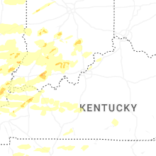


Connect with Interactive Hail Maps