

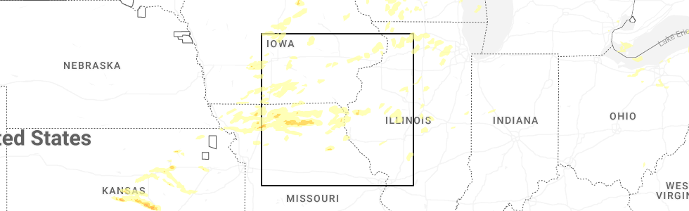
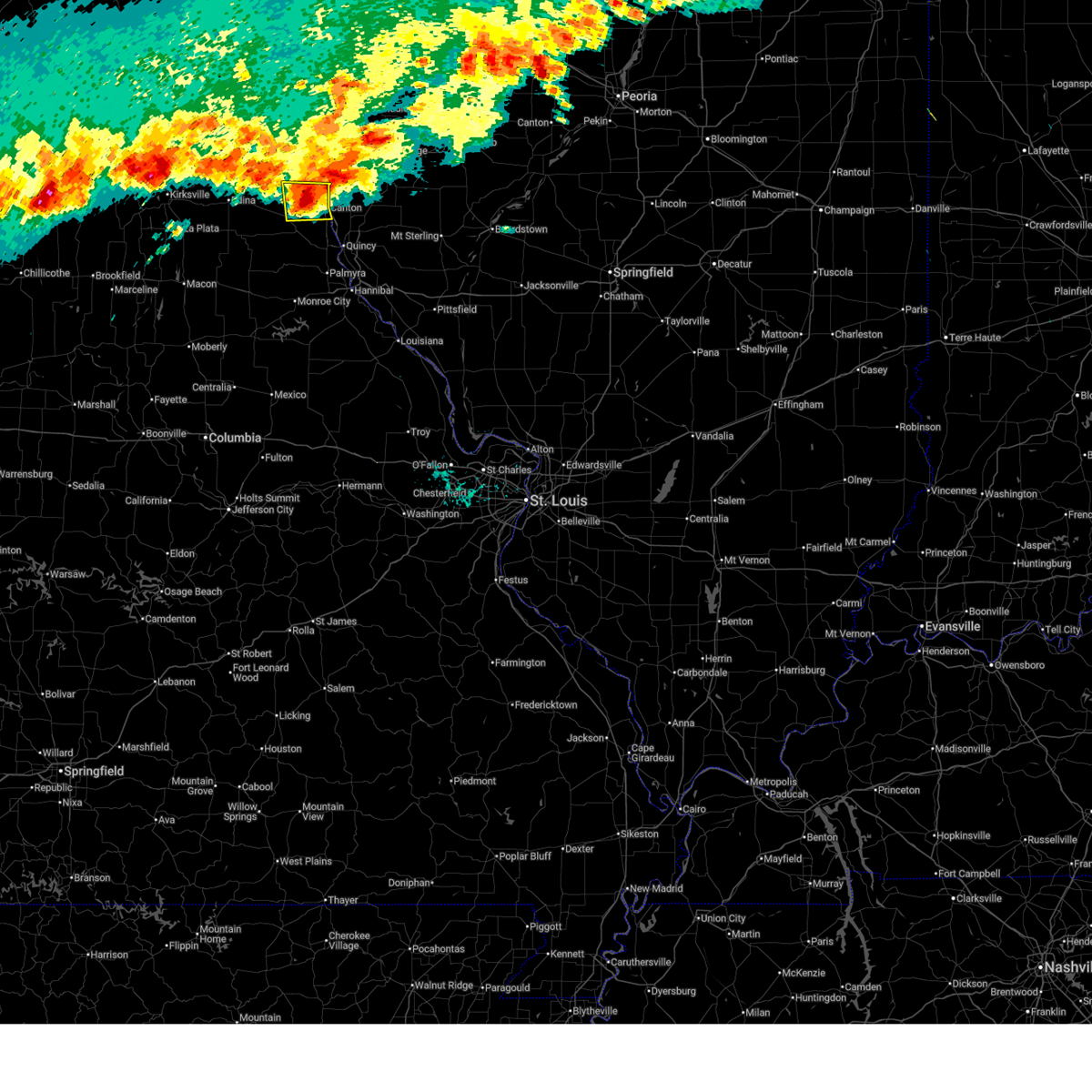
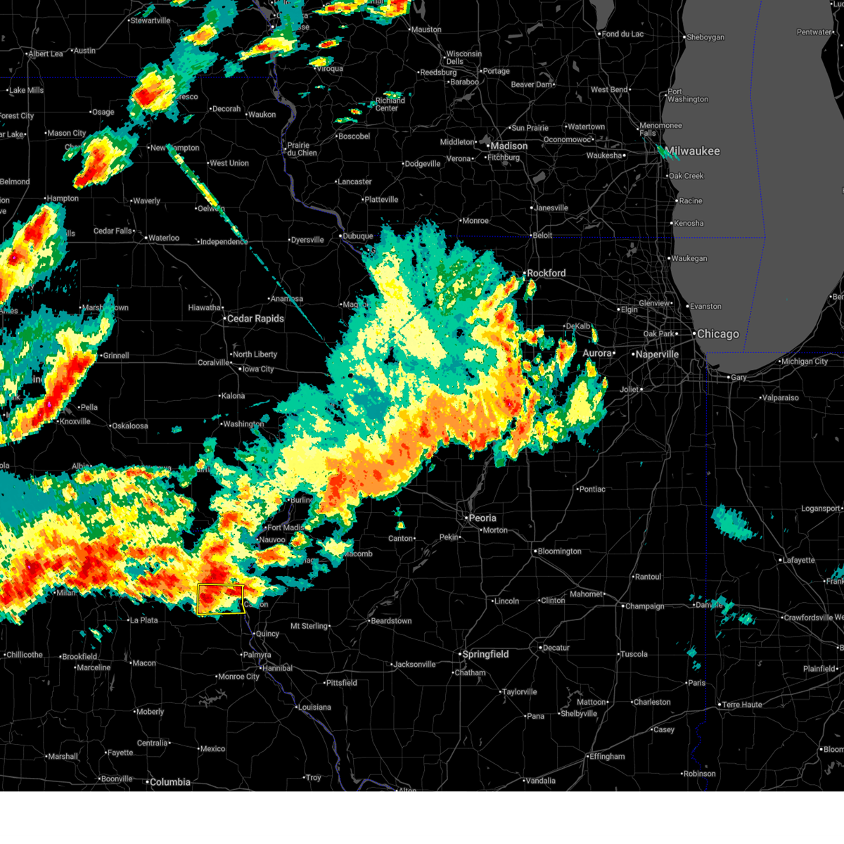
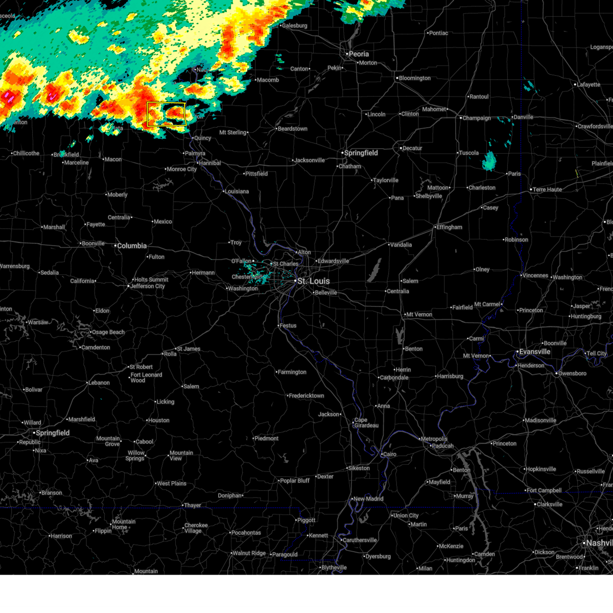
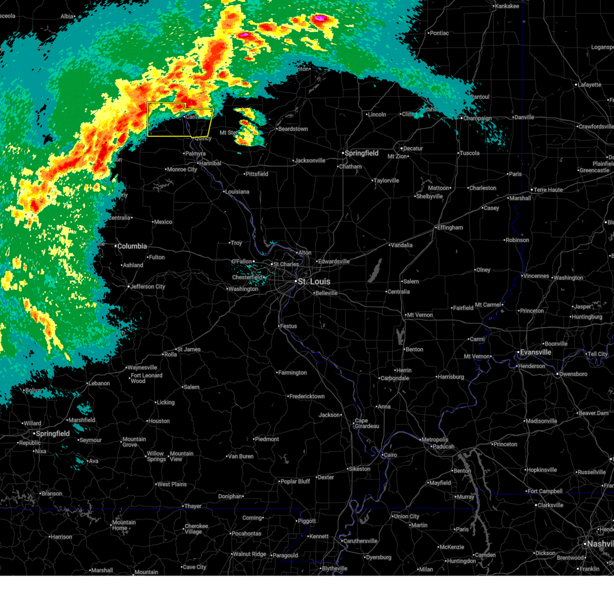
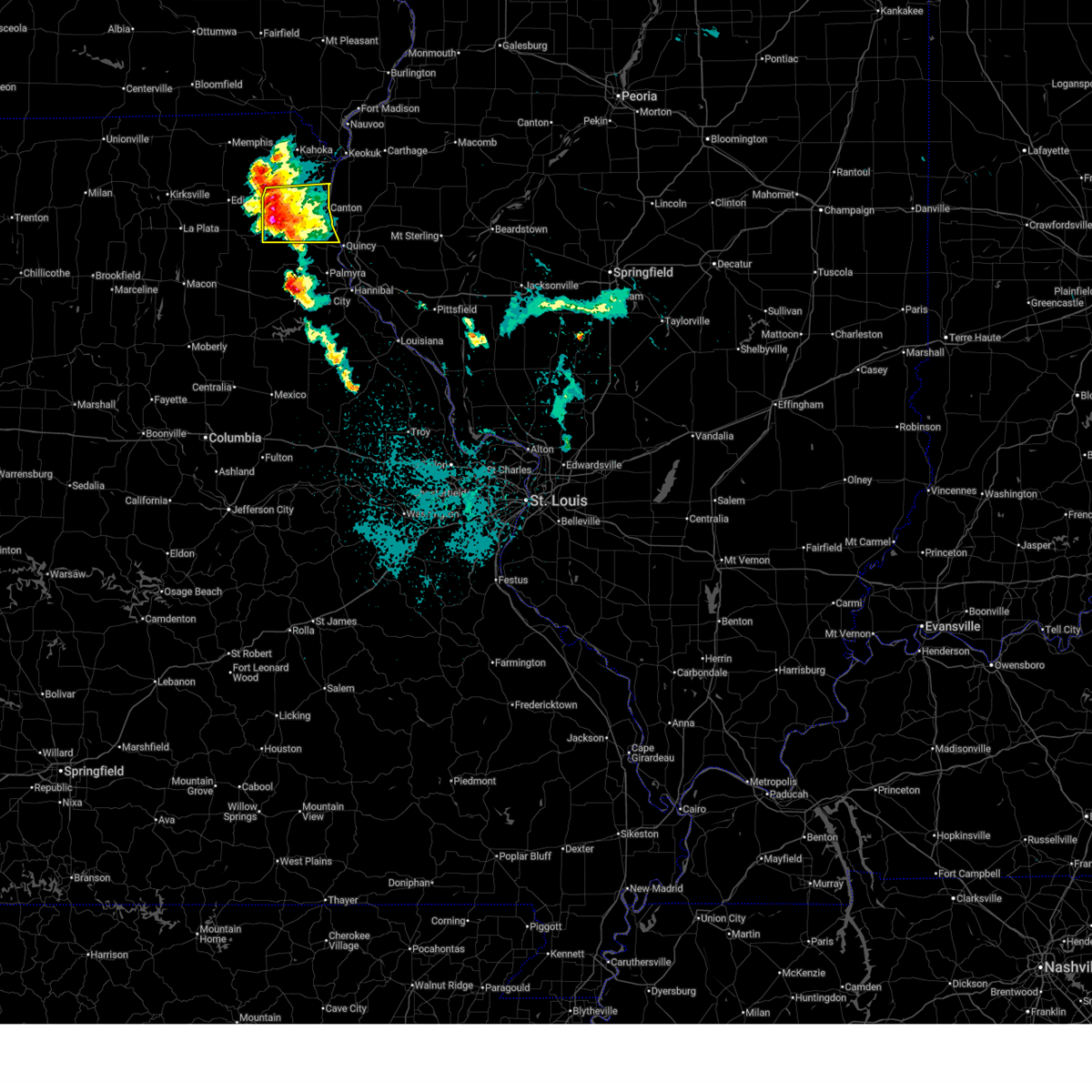
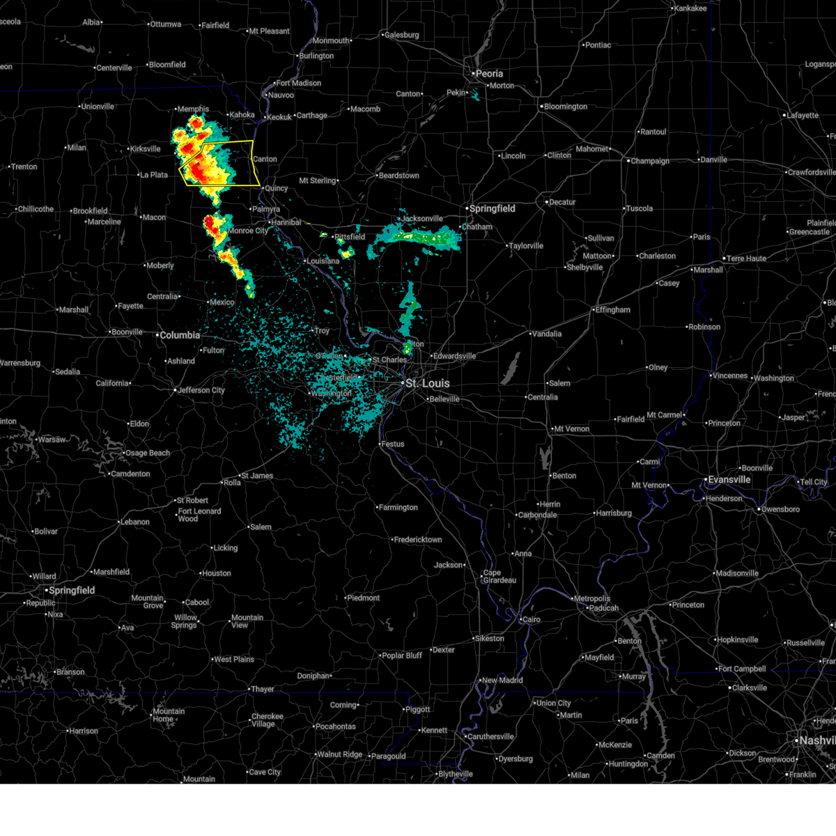
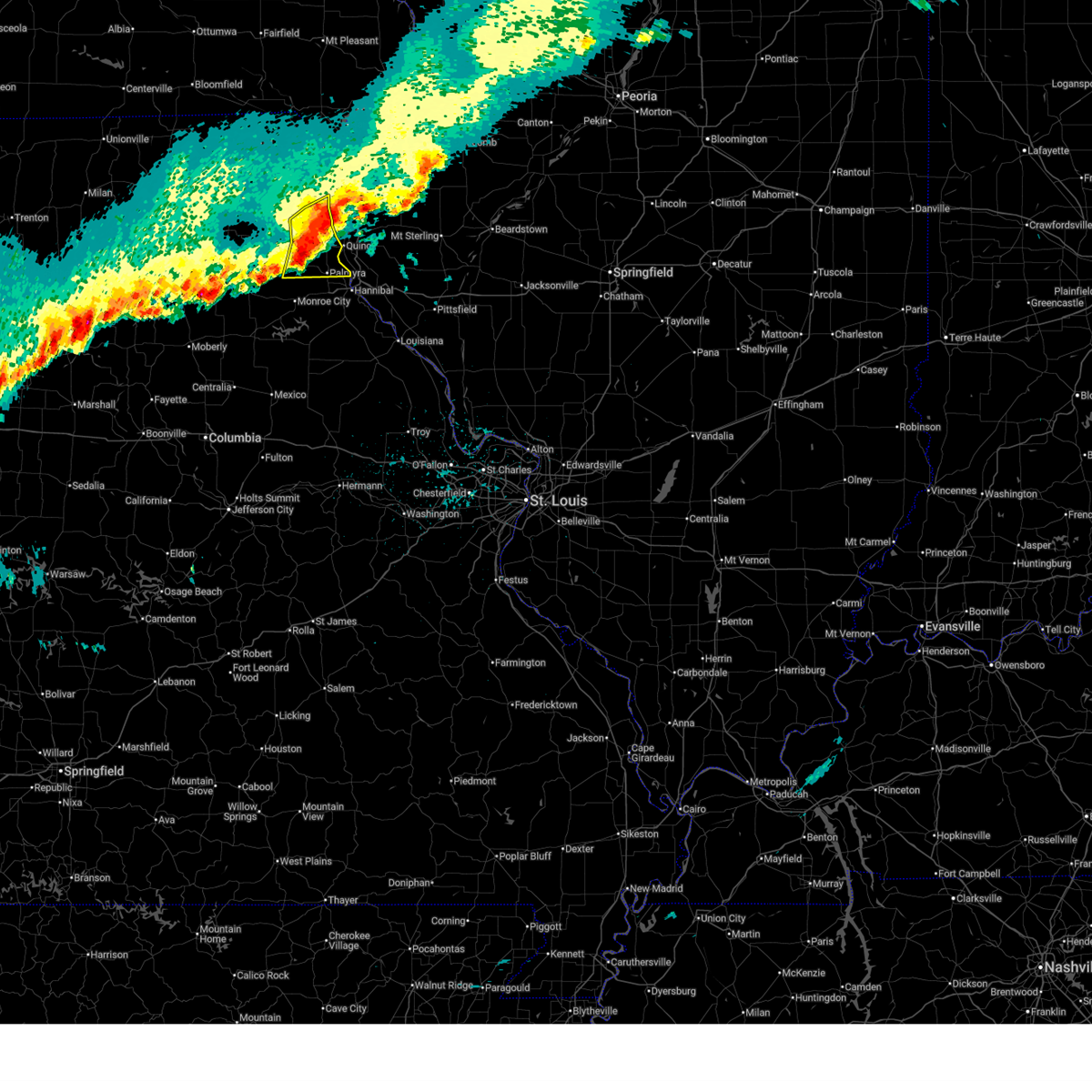
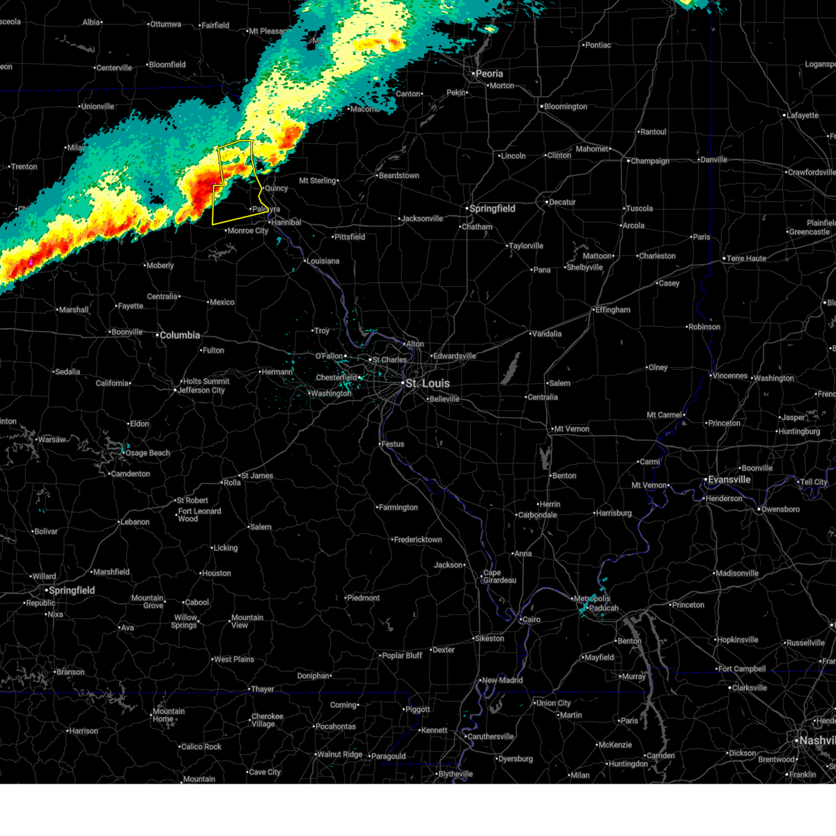
Hail Map for Canton, MO
The Canton, MO area has had 10 reports of on-the-ground hail by trained spotters, and has been under severe weather warnings 18 times during the past 12 months. Doppler radar has detected hail at or near Canton, MO on 64 occasions, including 6 occasions during the past year.
| Name: | Canton, MO |
| Where Located: | 22.5 miles SSE of Kahoka, MO |
| Map: | Google Map for Canton, MO |
| Population: | 2377 |
| Housing Units: | 954 |
| More Info: | Search Google for Canton, MO |
2
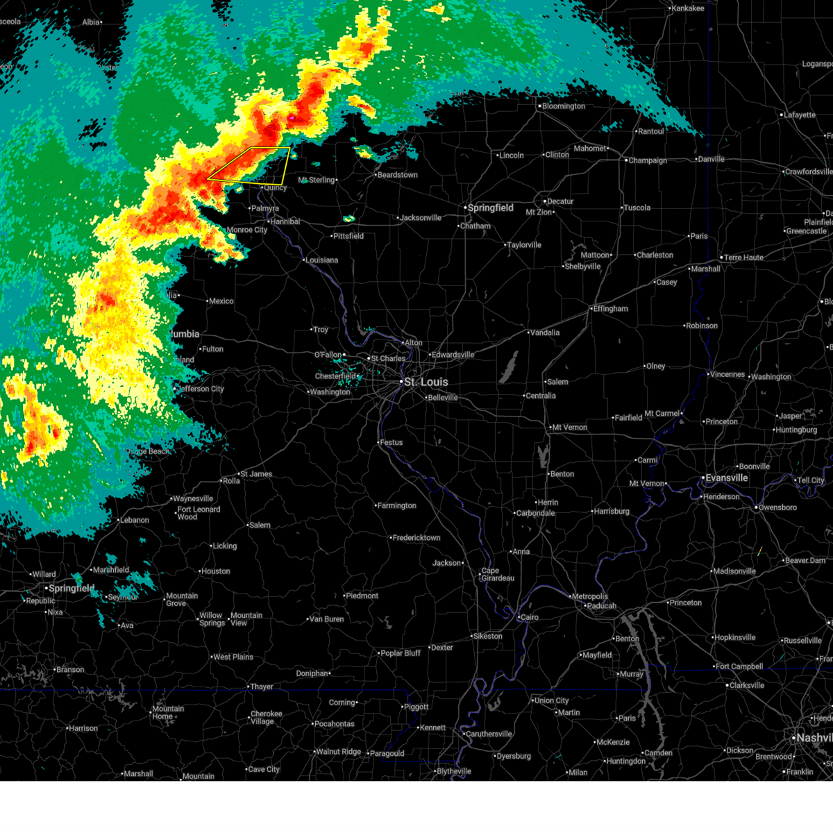
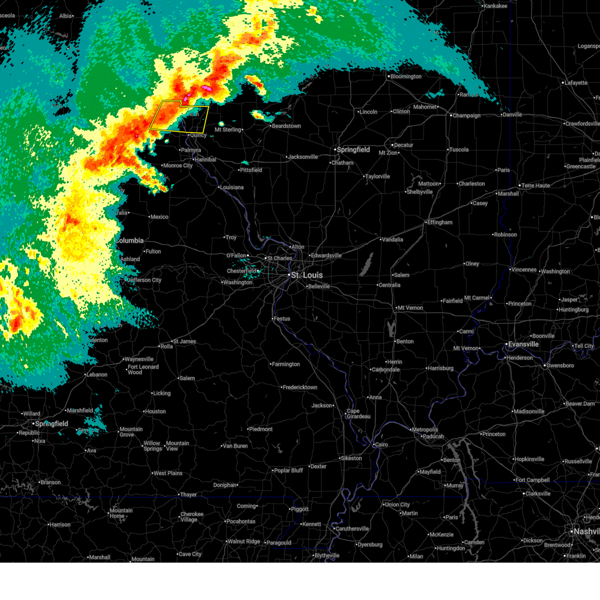
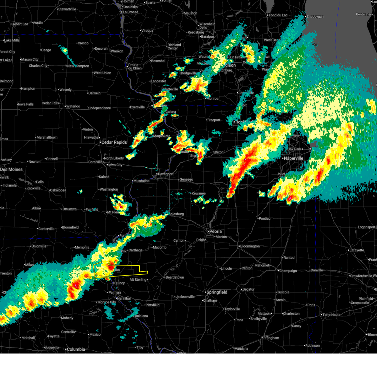
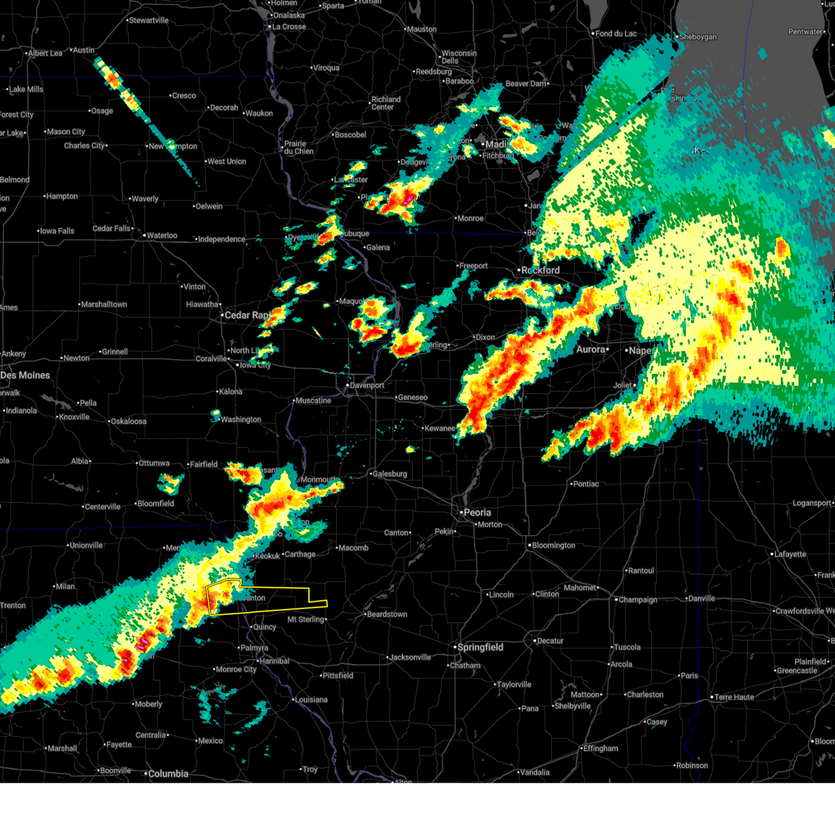
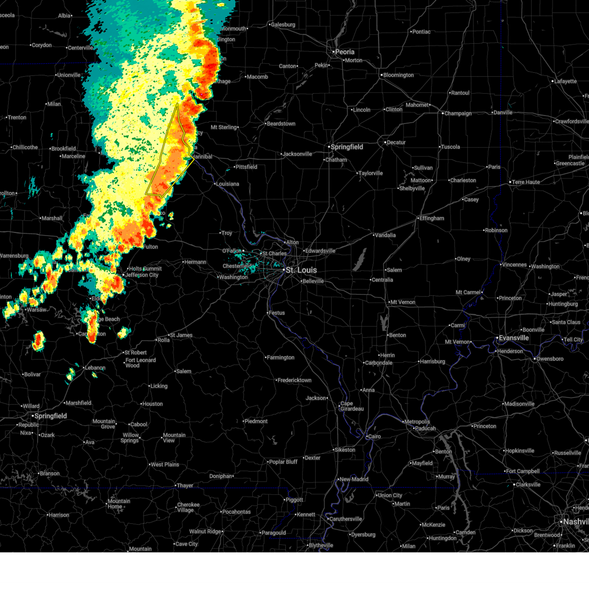
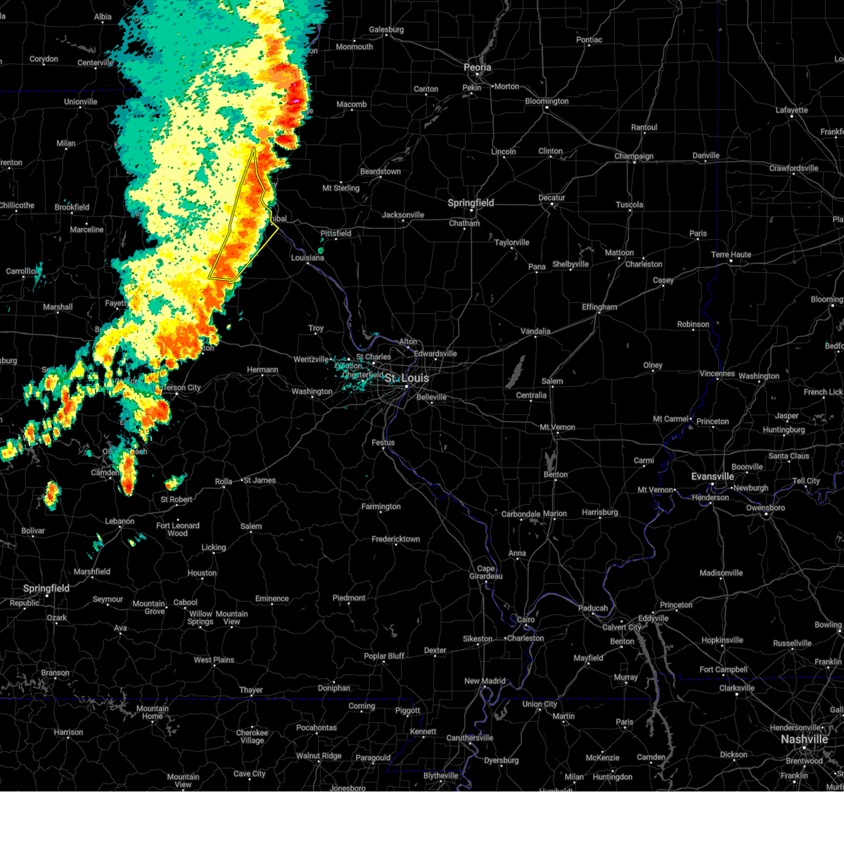
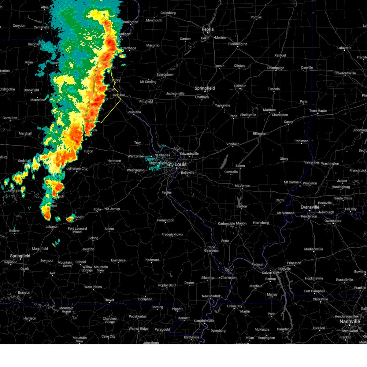
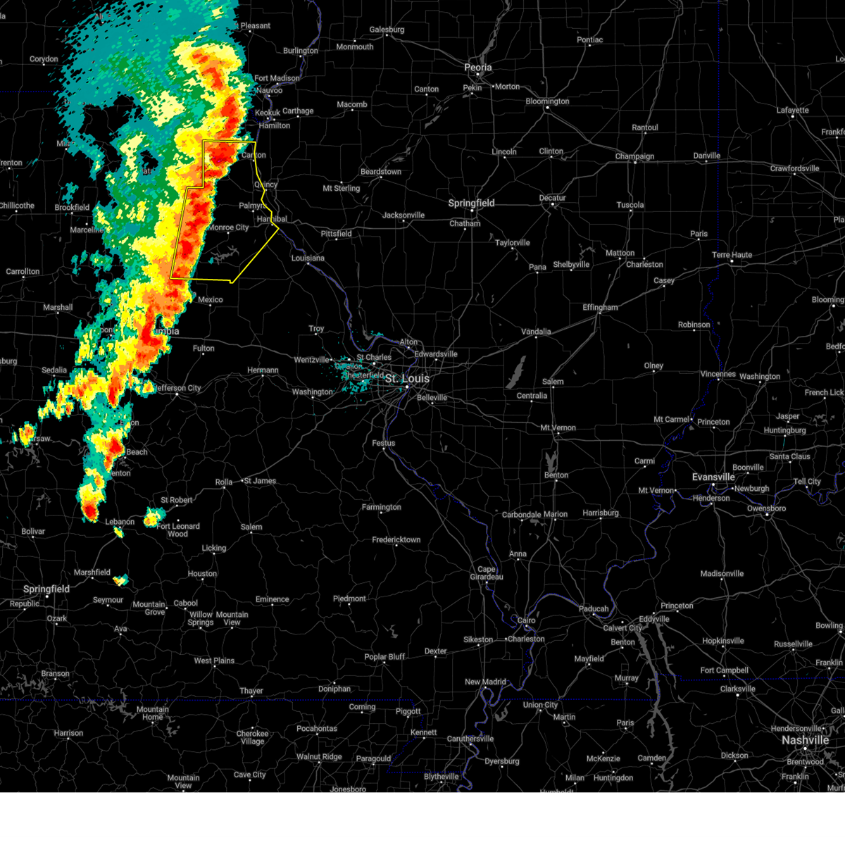
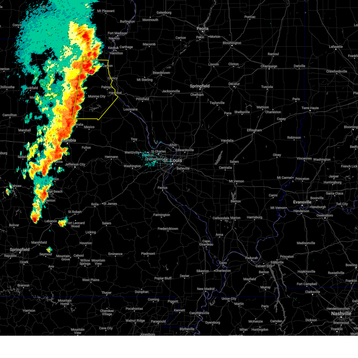
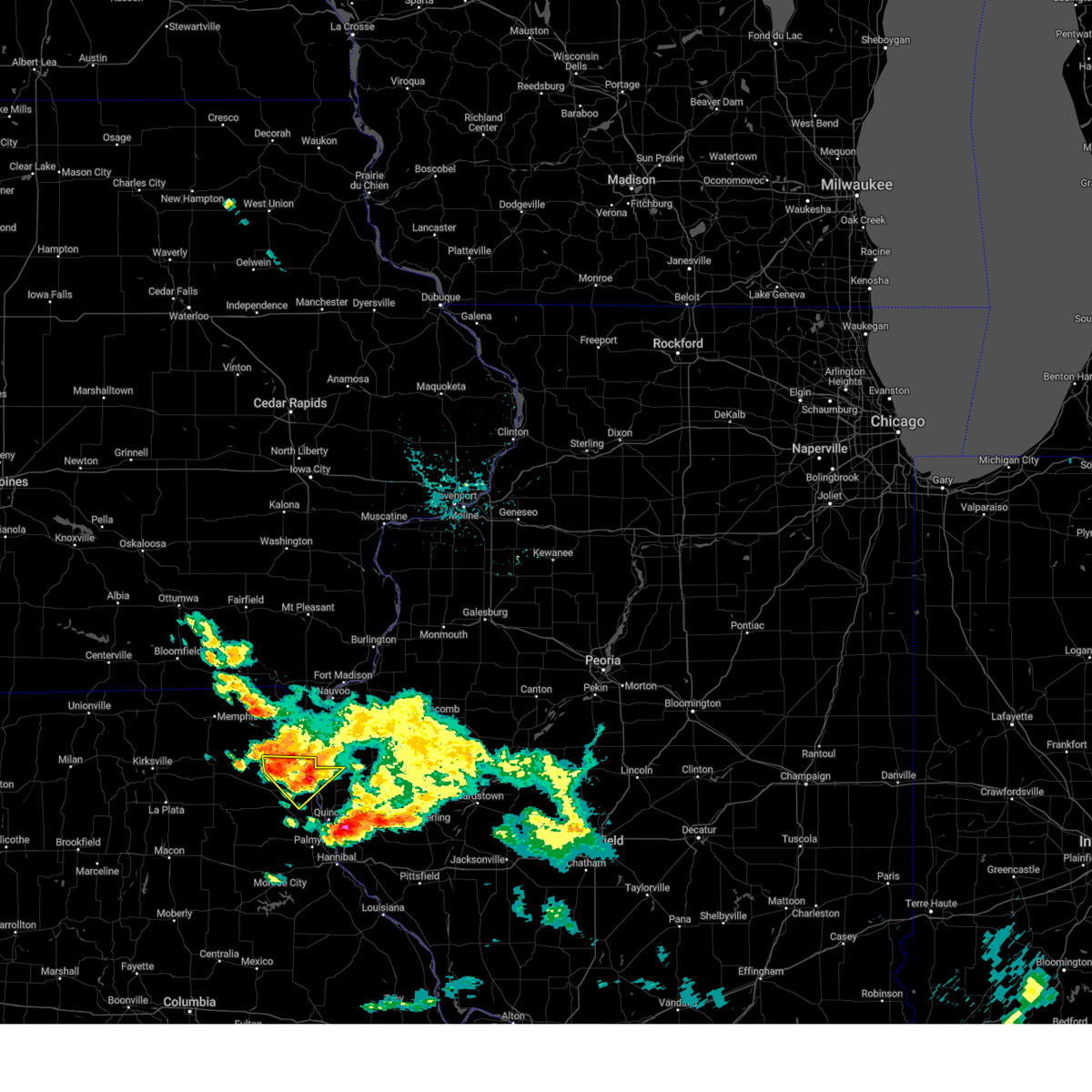
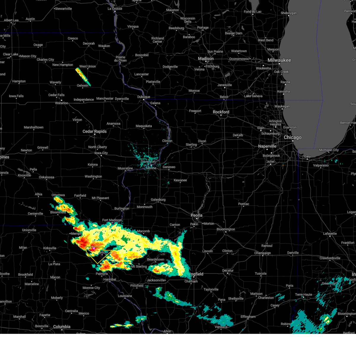
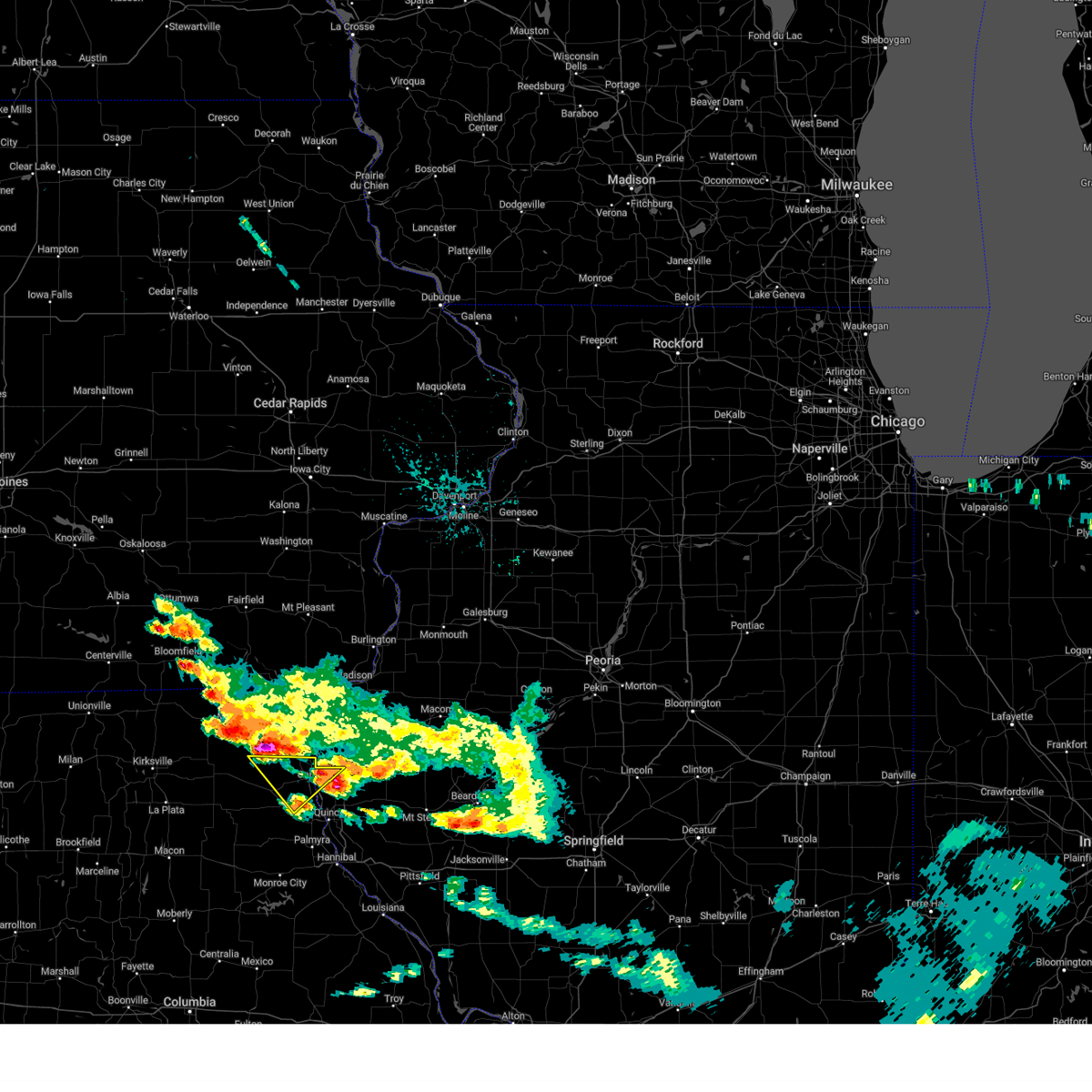
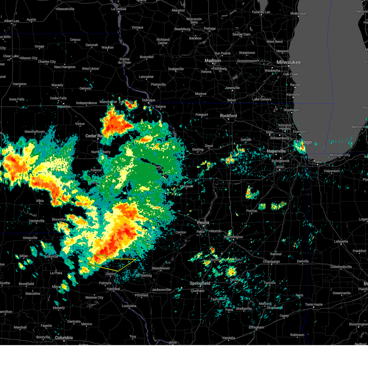
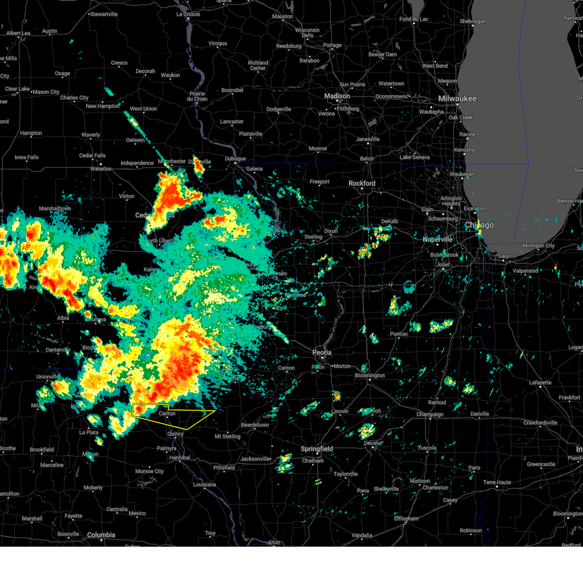
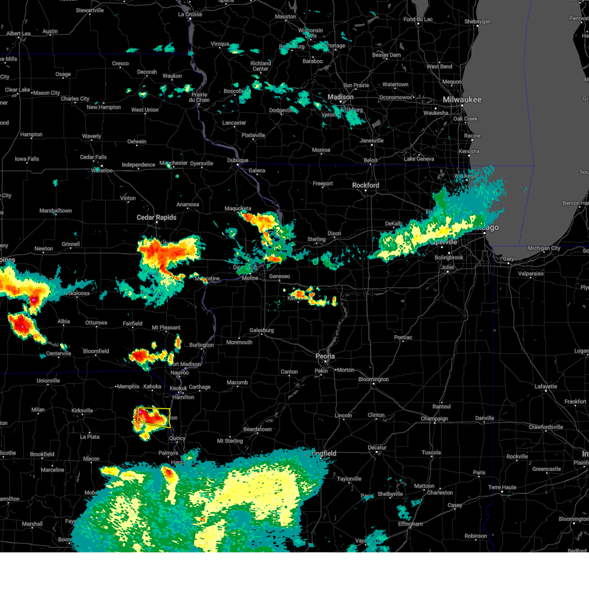
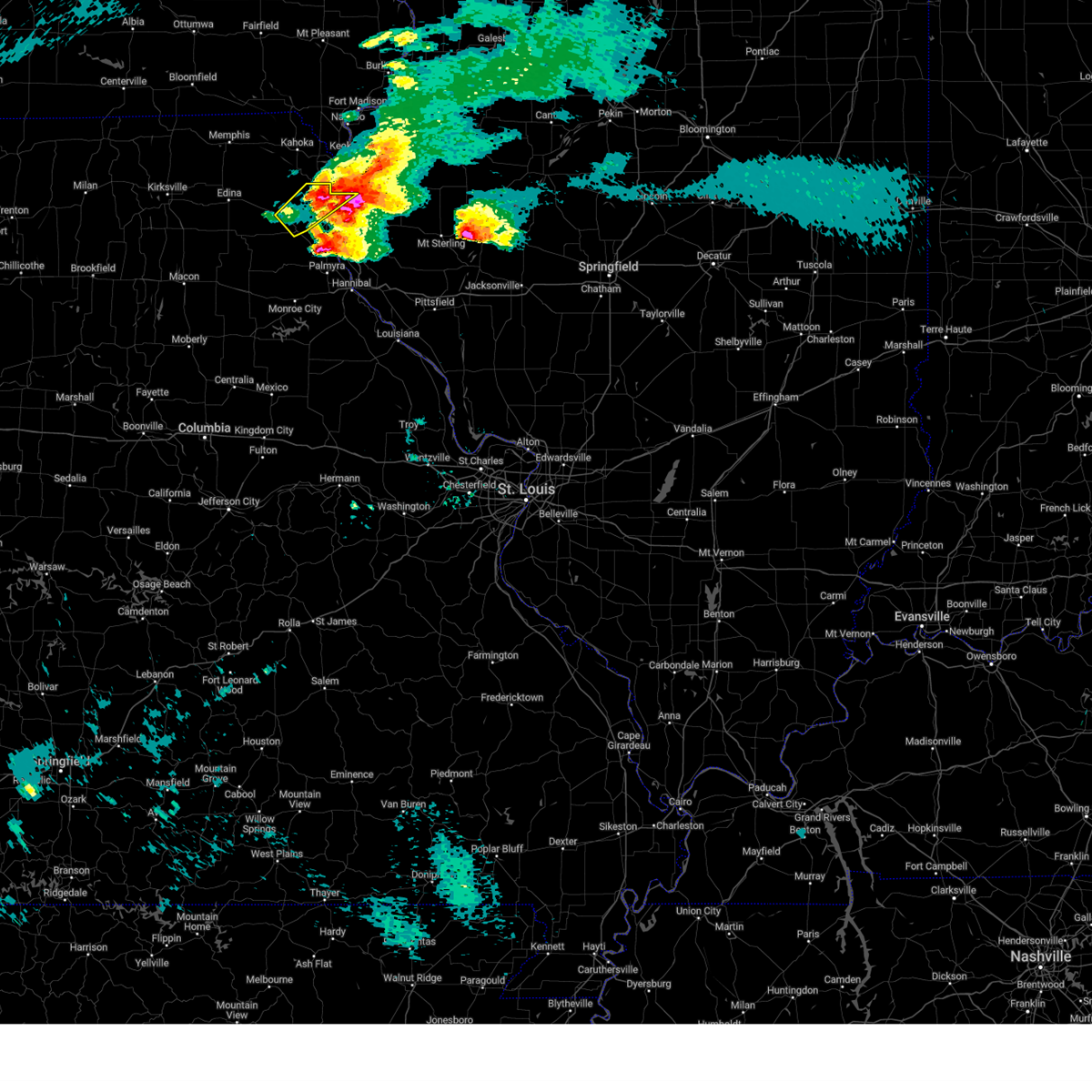
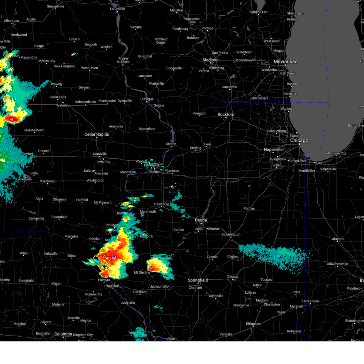
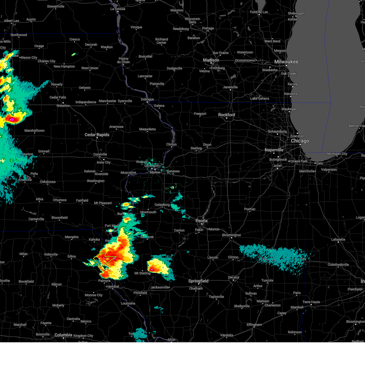
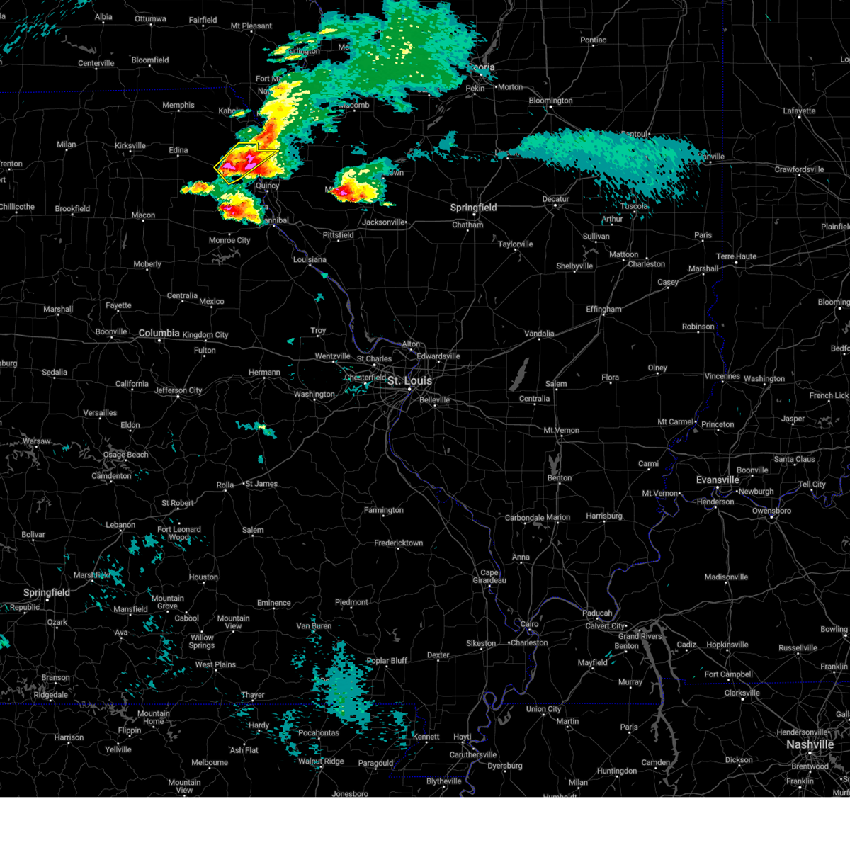
The Top Recent Hail Date for Canton, MO is Wednesday, June 10, 2026 (12th out of 64)
Hail and Wind Damage Spotted near Canton, MO
| Date / Time | Report Details |
|---|---|
| 6/10/2026 7:54 PM CDT |
 At 754 pm cdt, a severe thunderstorm was located 7 miles northwest of canton, moving east at 35 mph (radar indicated). Hazards include 60 mph wind gusts and quarter size hail. Hail damage to vehicles is expected. expect wind damage to roofs, siding, and trees. Locations impacted include, monticello and canton. At 754 pm cdt, a severe thunderstorm was located 7 miles northwest of canton, moving east at 35 mph (radar indicated). Hazards include 60 mph wind gusts and quarter size hail. Hail damage to vehicles is expected. expect wind damage to roofs, siding, and trees. Locations impacted include, monticello and canton.
|
| 6/10/2026 7:43 PM CDT |
 At 743 pm cdt, a severe thunderstorm was located 6 miles northeast of lewistown, or 13 miles west of canton, moving east at 40 mph (radar indicated). Hazards include 60 mph wind gusts and quarter size hail. Hail damage to vehicles is expected. expect wind damage to roofs, siding, and trees. Locations impacted include, lewistown, monticello and canton. At 743 pm cdt, a severe thunderstorm was located 6 miles northeast of lewistown, or 13 miles west of canton, moving east at 40 mph (radar indicated). Hazards include 60 mph wind gusts and quarter size hail. Hail damage to vehicles is expected. expect wind damage to roofs, siding, and trees. Locations impacted include, lewistown, monticello and canton.
|
| 6/10/2026 7:20 PM CDT |
 Svrlsx the national weather service in st louis has issued a * severe thunderstorm warning for, lewis county in northeastern missouri, * until 815 pm cdt. * at 720 pm cdt, a severe thunderstorm was located over knox city, or 7 miles east of edina, moving east at 35 mph (radar indicated). Hazards include 60 mph wind gusts and quarter size hail. Hail damage to vehicles is expected. Expect wind damage to roofs, siding, and trees. Svrlsx the national weather service in st louis has issued a * severe thunderstorm warning for, lewis county in northeastern missouri, * until 815 pm cdt. * at 720 pm cdt, a severe thunderstorm was located over knox city, or 7 miles east of edina, moving east at 35 mph (radar indicated). Hazards include 60 mph wind gusts and quarter size hail. Hail damage to vehicles is expected. Expect wind damage to roofs, siding, and trees.
|
| 4/17/2026 6:53 PM CDT |
 At 653 pm cdt, severe thunderstorms were located along a line from 16 miles north of mendon to over la grange, or along a line from 19 miles northeast of canton to 7 miles south of canton, moving east at 55 mph (radar indicated). Hazards include 70 mph wind gusts and quarter size hail. Hail damage to vehicles is expected. expect considerable tree damage. wind damage is also likely to mobile homes, roofs, and outbuildings. locations impacted include, ewing, canton, meyer, lima, la grange, ursa, loraine, mendon, woodville, quincy and fowler. this includes the following state parks, wakonda state park. This includes interstate 172 between exits 15 and 19. At 653 pm cdt, severe thunderstorms were located along a line from 16 miles north of mendon to over la grange, or along a line from 19 miles northeast of canton to 7 miles south of canton, moving east at 55 mph (radar indicated). Hazards include 70 mph wind gusts and quarter size hail. Hail damage to vehicles is expected. expect considerable tree damage. wind damage is also likely to mobile homes, roofs, and outbuildings. locations impacted include, ewing, canton, meyer, lima, la grange, ursa, loraine, mendon, woodville, quincy and fowler. this includes the following state parks, wakonda state park. This includes interstate 172 between exits 15 and 19.
|
| 4/17/2026 6:41 PM CDT |
 At 641 pm cdt, severe thunderstorms were located along a line from 13 miles north of canton to over ewing, or along a line from 13 miles north of canton to 12 miles southwest of canton, moving east at 55 mph (radar indicated). Hazards include 70 mph wind gusts and quarter size hail. Hail damage to vehicles is expected. expect considerable tree damage. wind damage is also likely to mobile homes, roofs, and outbuildings. locations impacted include, lewistown, monticello, ewing, canton, meyer, lima, la grange, ursa, loraine, mendon, woodville, quincy and fowler. this includes the following state parks, wakonda state park. This includes interstate 172 near exit 19. At 641 pm cdt, severe thunderstorms were located along a line from 13 miles north of canton to over ewing, or along a line from 13 miles north of canton to 12 miles southwest of canton, moving east at 55 mph (radar indicated). Hazards include 70 mph wind gusts and quarter size hail. Hail damage to vehicles is expected. expect considerable tree damage. wind damage is also likely to mobile homes, roofs, and outbuildings. locations impacted include, lewistown, monticello, ewing, canton, meyer, lima, la grange, ursa, loraine, mendon, woodville, quincy and fowler. this includes the following state parks, wakonda state park. This includes interstate 172 near exit 19.
|
| 4/17/2026 6:41 PM CDT |
 At 641 pm cdt, a severe thunderstorm capable of producing a tornado was located 7 miles northeast of canton, moving east at 65 mph (radar indicated rotation). Hazards include tornado and quarter size hail. Flying debris will be dangerous to those caught without shelter. mobile homes will be damaged or destroyed. damage to roofs, windows and vehicles will occur. tree damage is likely. Other locations impacted by the tornado include lima, meyer, loraine and woodville. At 641 pm cdt, a severe thunderstorm capable of producing a tornado was located 7 miles northeast of canton, moving east at 65 mph (radar indicated rotation). Hazards include tornado and quarter size hail. Flying debris will be dangerous to those caught without shelter. mobile homes will be damaged or destroyed. damage to roofs, windows and vehicles will occur. tree damage is likely. Other locations impacted by the tornado include lima, meyer, loraine and woodville.
|
| 4/17/2026 6:32 PM CDT |
 At 632 pm cdt, a severe thunderstorm capable of producing a tornado was located 7 miles northwest of canton, moving east at 65 mph (radar indicated rotation). Hazards include tornado and quarter size hail. Flying debris will be dangerous to those caught without shelter. mobile homes will be damaged or destroyed. damage to roofs, windows and vehicles will occur. tree damage is likely. this tornado will be near, canton around 635 pm cdt. Other locations impacted by the tornado include meyer, lima, loraine and woodville. At 632 pm cdt, a severe thunderstorm capable of producing a tornado was located 7 miles northwest of canton, moving east at 65 mph (radar indicated rotation). Hazards include tornado and quarter size hail. Flying debris will be dangerous to those caught without shelter. mobile homes will be damaged or destroyed. damage to roofs, windows and vehicles will occur. tree damage is likely. this tornado will be near, canton around 635 pm cdt. Other locations impacted by the tornado include meyer, lima, loraine and woodville.
|
| 4/17/2026 6:13 PM CDT |
 Svrlsx the national weather service in st louis has issued a * severe thunderstorm warning for, northwestern adams county in west central illinois, lewis county in northeastern missouri, * until 700 pm cdt. * at 613 pm cdt, severe thunderstorms were located along a line from near colony to 7 miles west of plevna, or along a line from 13 miles northeast of edina to 11 miles south of edina, moving east at 60 mph (radar indicated). Hazards include 70 mph wind gusts and quarter size hail. Hail damage to vehicles is expected. expect considerable tree damage. Wind damage is also likely to mobile homes, roofs, and outbuildings. Svrlsx the national weather service in st louis has issued a * severe thunderstorm warning for, northwestern adams county in west central illinois, lewis county in northeastern missouri, * until 700 pm cdt. * at 613 pm cdt, severe thunderstorms were located along a line from near colony to 7 miles west of plevna, or along a line from 13 miles northeast of edina to 11 miles south of edina, moving east at 60 mph (radar indicated). Hazards include 70 mph wind gusts and quarter size hail. Hail damage to vehicles is expected. expect considerable tree damage. Wind damage is also likely to mobile homes, roofs, and outbuildings.
|
| 4/17/2026 6:01 PM CDT |
 At 601 pm cdt, a severe thunderstorm capable of producing a tornado was located near canton, moving northeast at 25 mph (radar indicated rotation). Hazards include tornado and quarter size hail. Flying debris will be dangerous to those caught without shelter. mobile homes will be damaged or destroyed. damage to roofs, windows and vehicles will occur. tree damage is likely. this tornado will be near, canton around 610 pm cdt. Other locations impacted by the tornado include monticello, meyer and lima. At 601 pm cdt, a severe thunderstorm capable of producing a tornado was located near canton, moving northeast at 25 mph (radar indicated rotation). Hazards include tornado and quarter size hail. Flying debris will be dangerous to those caught without shelter. mobile homes will be damaged or destroyed. damage to roofs, windows and vehicles will occur. tree damage is likely. this tornado will be near, canton around 610 pm cdt. Other locations impacted by the tornado include monticello, meyer and lima.
|
| 4/17/2026 5:38 PM CDT |
 Torlsx the national weather service in st louis has issued a * tornado warning for, northwestern adams county in west central illinois, central lewis county in northeastern missouri, * until 630 pm cdt. * at 538 pm cdt, a severe thunderstorm capable of producing a tornado was located over lewistown, or 15 miles west of canton, moving northeast at 50 mph (radar indicated rotation). Hazards include tornado and golf ball size hail. Flying debris will be dangerous to those caught without shelter. mobile homes will be damaged or destroyed. damage to roofs, windows and vehicles will occur. tree damage is likely. this tornado will be near, lewistown and ewing around 540 pm cdt. canton around 555 pm cdt. Other locations impacted by the tornado include monticello and meyer. Torlsx the national weather service in st louis has issued a * tornado warning for, northwestern adams county in west central illinois, central lewis county in northeastern missouri, * until 630 pm cdt. * at 538 pm cdt, a severe thunderstorm capable of producing a tornado was located over lewistown, or 15 miles west of canton, moving northeast at 50 mph (radar indicated rotation). Hazards include tornado and golf ball size hail. Flying debris will be dangerous to those caught without shelter. mobile homes will be damaged or destroyed. damage to roofs, windows and vehicles will occur. tree damage is likely. this tornado will be near, lewistown and ewing around 540 pm cdt. canton around 555 pm cdt. Other locations impacted by the tornado include monticello and meyer.
|
| 4/14/2026 3:39 AM CDT |
 At 339 am cdt, a severe thunderstorm was located 8 miles northeast of ewing, or 7 miles west of canton, moving east at 30 mph (radar indicated). Hazards include 60 mph wind gusts and quarter size hail. Hail damage to vehicles is expected. expect wind damage to roofs, siding, and trees. locations impacted include, lewistown, ewing, monticello, la grange and canton. This includes the following state parks, wakonda state park. At 339 am cdt, a severe thunderstorm was located 8 miles northeast of ewing, or 7 miles west of canton, moving east at 30 mph (radar indicated). Hazards include 60 mph wind gusts and quarter size hail. Hail damage to vehicles is expected. expect wind damage to roofs, siding, and trees. locations impacted include, lewistown, ewing, monticello, la grange and canton. This includes the following state parks, wakonda state park.
|
| 4/14/2026 3:21 AM CDT |
 At 321 am cdt, a severe thunderstorm was located over lewistown, or 16 miles west of canton, moving northeast at 25 mph (radar indicated). Hazards include 60 mph wind gusts and quarter size hail. Hail damage to vehicles is expected. expect wind damage to roofs, siding, and trees. locations impacted include, steffenville, la belle, lewistown, ewing, maywood, monticello, la grange and canton. This includes the following state parks, wakonda state park. At 321 am cdt, a severe thunderstorm was located over lewistown, or 16 miles west of canton, moving northeast at 25 mph (radar indicated). Hazards include 60 mph wind gusts and quarter size hail. Hail damage to vehicles is expected. expect wind damage to roofs, siding, and trees. locations impacted include, steffenville, la belle, lewistown, ewing, maywood, monticello, la grange and canton. This includes the following state parks, wakonda state park.
|
| 4/14/2026 3:05 AM CDT |
 Svrlsx the national weather service in st louis has issued a * severe thunderstorm warning for, southeastern knox county in northeastern missouri, lewis county in northeastern missouri, * until 400 am cdt. * at 305 am cdt, a severe thunderstorm was located near steffenville, or 16 miles southeast of edina, moving northeast at 30 mph (radar indicated). Hazards include 60 mph wind gusts and quarter size hail. Hail damage to vehicles is expected. Expect wind damage to roofs, siding, and trees. Svrlsx the national weather service in st louis has issued a * severe thunderstorm warning for, southeastern knox county in northeastern missouri, lewis county in northeastern missouri, * until 400 am cdt. * at 305 am cdt, a severe thunderstorm was located near steffenville, or 16 miles southeast of edina, moving northeast at 30 mph (radar indicated). Hazards include 60 mph wind gusts and quarter size hail. Hail damage to vehicles is expected. Expect wind damage to roofs, siding, and trees.
|
| 3/10/2026 10:32 PM CDT |
 At 1032 pm cdt, a severe thunderstorm was located over maywood, or 12 miles southwest of canton, moving northeast at 50 mph (radar indicated). Hazards include 60 mph wind gusts and quarter size hail. Hail damage to vehicles is expected. expect wind damage to roofs, siding, and trees. locations impacted include, philadelphia, ewing, palmyra, maywood, taylor, la grange and canton. This includes the following state parks, wakonda state park. At 1032 pm cdt, a severe thunderstorm was located over maywood, or 12 miles southwest of canton, moving northeast at 50 mph (radar indicated). Hazards include 60 mph wind gusts and quarter size hail. Hail damage to vehicles is expected. expect wind damage to roofs, siding, and trees. locations impacted include, philadelphia, ewing, palmyra, maywood, taylor, la grange and canton. This includes the following state parks, wakonda state park.
|
| 3/10/2026 10:26 PM CDT |
 At 1026 pm cdt, a severe thunderstorm was located near ewing, or 14 miles northwest of palmyra, moving northeast at 50 mph (radar indicated). Hazards include 60 mph wind gusts and quarter size hail. Hail damage to vehicles is expected. expect wind damage to roofs, siding, and trees. locations impacted include, warren, philadelphia, ewing, palmyra, maywood, taylor, la grange and canton. This includes the following state parks, wakonda state park. At 1026 pm cdt, a severe thunderstorm was located near ewing, or 14 miles northwest of palmyra, moving northeast at 50 mph (radar indicated). Hazards include 60 mph wind gusts and quarter size hail. Hail damage to vehicles is expected. expect wind damage to roofs, siding, and trees. locations impacted include, warren, philadelphia, ewing, palmyra, maywood, taylor, la grange and canton. This includes the following state parks, wakonda state park.
|
| 3/10/2026 10:14 PM CDT |
 Svrlsx the national weather service in st louis has issued a * severe thunderstorm warning for, central lewis county in northeastern missouri, marion county in northeastern missouri, * until 1100 pm cdt. * at 1014 pm cdt, a severe thunderstorm was located 6 miles north of emden, or 15 miles northeast of shelbina, moving northeast at 50 mph (radar indicated). Hazards include 60 mph wind gusts and quarter size hail. Hail damage to vehicles is expected. Expect wind damage to roofs, siding, and trees. Svrlsx the national weather service in st louis has issued a * severe thunderstorm warning for, central lewis county in northeastern missouri, marion county in northeastern missouri, * until 1100 pm cdt. * at 1014 pm cdt, a severe thunderstorm was located 6 miles north of emden, or 15 miles northeast of shelbina, moving northeast at 50 mph (radar indicated). Hazards include 60 mph wind gusts and quarter size hail. Hail damage to vehicles is expected. Expect wind damage to roofs, siding, and trees.
|
| 3/10/2026 10:00 PM CDT |
 At 1000 pm cdt, a severe thunderstorm was located 8 miles northwest of mendon, or 8 miles northeast of canton, moving east at 60 mph (radar indicated). Hazards include 60 mph wind gusts and quarter size hail. Hail damage to vehicles is expected. expect wind damage to roofs, siding, and trees. Locations impacted include, ewing, monticello, canton, la grange, meyer, ursa, lima, mendon, loraine, woodville, chatton, golden and la prairie. At 1000 pm cdt, a severe thunderstorm was located 8 miles northwest of mendon, or 8 miles northeast of canton, moving east at 60 mph (radar indicated). Hazards include 60 mph wind gusts and quarter size hail. Hail damage to vehicles is expected. expect wind damage to roofs, siding, and trees. Locations impacted include, ewing, monticello, canton, la grange, meyer, ursa, lima, mendon, loraine, woodville, chatton, golden and la prairie.
|
| 3/10/2026 9:44 PM CDT |
 Svrlsx the national weather service in st louis has issued a * severe thunderstorm warning for, northern adams county in west central illinois, northwestern brown county in west central illinois, central lewis county in northeastern missouri, * until 1045 pm cdt. * at 944 pm cdt, a severe thunderstorm was located 8 miles north of ewing, or 9 miles west of canton, moving east at 50 mph (radar indicated). Hazards include 60 mph wind gusts and quarter size hail. Hail damage to vehicles is expected. Expect wind damage to roofs, siding, and trees. Svrlsx the national weather service in st louis has issued a * severe thunderstorm warning for, northern adams county in west central illinois, northwestern brown county in west central illinois, central lewis county in northeastern missouri, * until 1045 pm cdt. * at 944 pm cdt, a severe thunderstorm was located 8 miles north of ewing, or 9 miles west of canton, moving east at 50 mph (radar indicated). Hazards include 60 mph wind gusts and quarter size hail. Hail damage to vehicles is expected. Expect wind damage to roofs, siding, and trees.
|
| 6/3/2025 6:22 PM CDT |
 The storms which prompted the warning have weakened below severe limits, and no longer pose an immediate threat to life or property. therefore, the warning will be allowed to expire. however, gusty winds are still possible with these thunderstorms. a severe thunderstorm watch remains in effect until 1100 pm cdt tuesday for a portion of northeast missouri. a tornado watch remains in effect until 800 pm cdt for a portion of northeast missouri. The storms which prompted the warning have weakened below severe limits, and no longer pose an immediate threat to life or property. therefore, the warning will be allowed to expire. however, gusty winds are still possible with these thunderstorms. a severe thunderstorm watch remains in effect until 1100 pm cdt tuesday for a portion of northeast missouri. a tornado watch remains in effect until 800 pm cdt for a portion of northeast missouri.
|
| 6/3/2025 6:17 PM CDT |
 At 617 pm cdt, severe thunderstorms were located along a line from 23 miles north of mendon to near perry, or along a line from 22 miles northeast of canton to 10 miles northwest of vandalia, moving east at 35 mph (radar indicated). Hazards include 60 mph wind gusts and small hail. Expect damage to roofs, siding, and trees. other locations impacted by the severe thunderstorm include florida, taylor, the landing and ilasco. This includes the following state parks, wakonda state park and mark twain lake recreational area. At 617 pm cdt, severe thunderstorms were located along a line from 23 miles north of mendon to near perry, or along a line from 22 miles northeast of canton to 10 miles northwest of vandalia, moving east at 35 mph (radar indicated). Hazards include 60 mph wind gusts and small hail. Expect damage to roofs, siding, and trees. other locations impacted by the severe thunderstorm include florida, taylor, the landing and ilasco. This includes the following state parks, wakonda state park and mark twain lake recreational area.
|
| 6/3/2025 5:56 PM CDT |
 the severe thunderstorm warning has been cancelled and is no longer in effect the severe thunderstorm warning has been cancelled and is no longer in effect
|
| 6/3/2025 5:56 PM CDT |
 At 556 pm cdt, severe thunderstorms were located along a line from 15 miles north of canton to over santa fe, moving northeast at 35 mph (radar indicated). Hazards include 60 mph wind gusts and quarter size hail. Hail damage to vehicles is expected. expect wind damage to roofs, siding, and trees. this severe thunderstorm will be near, lewistown around 530 pm cdt. other locations impacted by the severe thunderstorm include stoutsville, monticello, indian creek, florida, taylor, the landing and ilasco. This includes the following state parks, wakonda state park and mark twain lake recreational area. At 556 pm cdt, severe thunderstorms were located along a line from 15 miles north of canton to over santa fe, moving northeast at 35 mph (radar indicated). Hazards include 60 mph wind gusts and quarter size hail. Hail damage to vehicles is expected. expect wind damage to roofs, siding, and trees. this severe thunderstorm will be near, lewistown around 530 pm cdt. other locations impacted by the severe thunderstorm include stoutsville, monticello, indian creek, florida, taylor, the landing and ilasco. This includes the following state parks, wakonda state park and mark twain lake recreational area.
|
| 6/3/2025 5:34 PM CDT |
 At 534 pm cdt, severe thunderstorms were located along a line from 13 miles north of lewistown to near paris, or along a line from 17 miles northwest of canton to near paris, moving northeast at 35 mph (radar indicated). Hazards include 60 mph wind gusts and quarter size hail. Hail damage to vehicles is expected. expect wind damage to roofs, siding, and trees. this severe thunderstorm will be near, la belle, shelbina, granville and shelbyville around 525 pm cdt. paris, steffenville and lewistown around 530 pm cdt. other locations impacted by the severe thunderstorm include holliday, bethel, hunnewell, stoutsville, monticello, indian creek, florida, taylor, the landing and ilasco. This includes the following state parks, wakonda state park, union covered bridge historic site and mark twain lake recreational area. At 534 pm cdt, severe thunderstorms were located along a line from 13 miles north of lewistown to near paris, or along a line from 17 miles northwest of canton to near paris, moving northeast at 35 mph (radar indicated). Hazards include 60 mph wind gusts and quarter size hail. Hail damage to vehicles is expected. expect wind damage to roofs, siding, and trees. this severe thunderstorm will be near, la belle, shelbina, granville and shelbyville around 525 pm cdt. paris, steffenville and lewistown around 530 pm cdt. other locations impacted by the severe thunderstorm include holliday, bethel, hunnewell, stoutsville, monticello, indian creek, florida, taylor, the landing and ilasco. This includes the following state parks, wakonda state park, union covered bridge historic site and mark twain lake recreational area.
|
| 6/3/2025 5:31 PM CDT |
 At 531 pm cdt, severe thunderstorms were located along a line from 8 miles east of colony to 6 miles south of paris, or along a line from 18 miles northwest of canton to 6 miles south of paris, moving northeast at 35 mph (radar indicated). Hazards include 60 mph wind gusts and quarter size hail. Hail damage to vehicles is expected. expect wind damage to roofs, siding, and trees. this severe thunderstorm will be near, la belle, shelbina, granville and shelbyville around 525 pm cdt. paris, steffenville and lewistown around 530 pm cdt. other locations impacted by the severe thunderstorm include holliday, bethel, hunnewell, stoutsville, monticello, indian creek, florida, taylor, the landing and ilasco. This includes the following state parks, wakonda state park, union covered bridge historic site and mark twain lake recreational area. At 531 pm cdt, severe thunderstorms were located along a line from 8 miles east of colony to 6 miles south of paris, or along a line from 18 miles northwest of canton to 6 miles south of paris, moving northeast at 35 mph (radar indicated). Hazards include 60 mph wind gusts and quarter size hail. Hail damage to vehicles is expected. expect wind damage to roofs, siding, and trees. this severe thunderstorm will be near, la belle, shelbina, granville and shelbyville around 525 pm cdt. paris, steffenville and lewistown around 530 pm cdt. other locations impacted by the severe thunderstorm include holliday, bethel, hunnewell, stoutsville, monticello, indian creek, florida, taylor, the landing and ilasco. This includes the following state parks, wakonda state park, union covered bridge historic site and mark twain lake recreational area.
|
| 6/3/2025 5:31 PM CDT |
 the severe thunderstorm warning has been cancelled and is no longer in effect the severe thunderstorm warning has been cancelled and is no longer in effect
|
| 6/3/2025 5:23 PM CDT |
 Svrlsx the national weather service in st louis has issued a * severe thunderstorm warning for, eastern knox county in northeastern missouri, lewis county in northeastern missouri, marion county in northeastern missouri, monroe county in northeastern missouri, ralls county in northeastern missouri, eastern shelby county in northeastern missouri, * until 630 pm cdt. * at 523 pm cdt, severe thunderstorms were located along a line from near colony to 9 miles southeast of madison, or along a line from 15 miles east of edina to 9 miles southwest of paris, moving northeast at 35 mph (radar indicated). Hazards include 60 mph wind gusts and small hail. Expect damage to roofs, siding, and trees. this severe thunderstorm will be near, la belle, shelbina, granville, shelbyville, colony and knox city around 525 pm cdt. paris, steffenville and lewistown around 530 pm cdt. other locations impacted by the severe thunderstorm include newark, holliday, bethel, hunnewell, stoutsville, monticello, indian creek, florida, taylor and the landing. This includes the following state parks, wakonda state park, union covered bridge historic site and mark twain lake recreational area. Svrlsx the national weather service in st louis has issued a * severe thunderstorm warning for, eastern knox county in northeastern missouri, lewis county in northeastern missouri, marion county in northeastern missouri, monroe county in northeastern missouri, ralls county in northeastern missouri, eastern shelby county in northeastern missouri, * until 630 pm cdt. * at 523 pm cdt, severe thunderstorms were located along a line from near colony to 9 miles southeast of madison, or along a line from 15 miles east of edina to 9 miles southwest of paris, moving northeast at 35 mph (radar indicated). Hazards include 60 mph wind gusts and small hail. Expect damage to roofs, siding, and trees. this severe thunderstorm will be near, la belle, shelbina, granville, shelbyville, colony and knox city around 525 pm cdt. paris, steffenville and lewistown around 530 pm cdt. other locations impacted by the severe thunderstorm include newark, holliday, bethel, hunnewell, stoutsville, monticello, indian creek, florida, taylor and the landing. This includes the following state parks, wakonda state park, union covered bridge historic site and mark twain lake recreational area.
|
| 4/20/2025 6:15 PM CDT |
 Svrlsx the national weather service in st louis has issued a * severe thunderstorm warning for, adams county in west central illinois, southeastern lewis county in northeastern missouri, marion county in northeastern missouri, * until 715 pm cdt. * at 615 pm cdt, severe thunderstorms were located along a line from near steffenville to over monroe city, or along a line from 17 miles southeast of edina to over monroe city, moving east at 50 mph (radar indicated). Hazards include 60 mph wind gusts and small hail. Expect damage to roofs, siding, and trees. this severe thunderstorm will be near, monroe city, steffenville and warren around 615 pm cdt. philadelphia around 620 pm cdt. other locations impacted by the severe thunderstorm include monticello, taylor, meyer, marblehead, burton, lima, ursa, adams, paloma and fowler. this includes the following state parks, wakonda state park and siloam springs state park. this includes the following highways, interstate 72 near exit 4. Interstate 172 between exits 2 and 19. Svrlsx the national weather service in st louis has issued a * severe thunderstorm warning for, adams county in west central illinois, southeastern lewis county in northeastern missouri, marion county in northeastern missouri, * until 715 pm cdt. * at 615 pm cdt, severe thunderstorms were located along a line from near steffenville to over monroe city, or along a line from 17 miles southeast of edina to over monroe city, moving east at 50 mph (radar indicated). Hazards include 60 mph wind gusts and small hail. Expect damage to roofs, siding, and trees. this severe thunderstorm will be near, monroe city, steffenville and warren around 615 pm cdt. philadelphia around 620 pm cdt. other locations impacted by the severe thunderstorm include monticello, taylor, meyer, marblehead, burton, lima, ursa, adams, paloma and fowler. this includes the following state parks, wakonda state park and siloam springs state park. this includes the following highways, interstate 72 near exit 4. Interstate 172 between exits 2 and 19.
|
| 3/14/2025 7:35 PM CDT |
 Svrlsx the national weather service in st louis has issued a * severe thunderstorm warning for, adams county in west central illinois, northwestern pike county in west central illinois, southeastern lewis county in northeastern missouri, eastern marion county in northeastern missouri, northeastern ralls county in northeastern missouri, * until 830 pm cdt. * at 735 pm cdt, severe thunderstorms were located along a line from near quincy to near center, or along a line from near quincy to 12 miles north of vandalia, moving northeast at 45 mph (radar indicated). Hazards include 70 mph wind gusts. Expect considerable tree damage. damage is likely to mobile homes, roofs, and outbuildings. this severe thunderstorm will be near, hannibal, quincy, new london, la grange and palmyra around 735 pm cdt. other locations impacted by the severe thunderstorm include taylor, marblehead, ursa, ilasco, burton, saverton, seehorn, fowler, lima and adams. this includes the following state parks, wakonda state park and siloam springs state park. this includes the following highways, interstate 72 between exits 4 and 20. Interstate 172 between exits 2 and 19. Svrlsx the national weather service in st louis has issued a * severe thunderstorm warning for, adams county in west central illinois, northwestern pike county in west central illinois, southeastern lewis county in northeastern missouri, eastern marion county in northeastern missouri, northeastern ralls county in northeastern missouri, * until 830 pm cdt. * at 735 pm cdt, severe thunderstorms were located along a line from near quincy to near center, or along a line from near quincy to 12 miles north of vandalia, moving northeast at 45 mph (radar indicated). Hazards include 70 mph wind gusts. Expect considerable tree damage. damage is likely to mobile homes, roofs, and outbuildings. this severe thunderstorm will be near, hannibal, quincy, new london, la grange and palmyra around 735 pm cdt. other locations impacted by the severe thunderstorm include taylor, marblehead, ursa, ilasco, burton, saverton, seehorn, fowler, lima and adams. this includes the following state parks, wakonda state park and siloam springs state park. this includes the following highways, interstate 72 between exits 4 and 20. Interstate 172 between exits 2 and 19.
|
| 7/31/2024 1:45 PM CDT |
 the severe thunderstorm warning has been cancelled and is no longer in effect the severe thunderstorm warning has been cancelled and is no longer in effect
|
| 7/31/2024 1:26 PM CDT |
 At 126 pm cdt, a severe thunderstorm was located 11 miles northeast of lewistown, moving southeast at 30 mph (radar indicated). Hazards include ping pong ball size hail and 60 mph wind gusts. People and animals outdoors will be injured. expect hail damage to roofs, siding, windows, and vehicles. expect wind damage to roofs, siding, and trees. Locations impacted include, canton, lima, monticello, and meyer. At 126 pm cdt, a severe thunderstorm was located 11 miles northeast of lewistown, moving southeast at 30 mph (radar indicated). Hazards include ping pong ball size hail and 60 mph wind gusts. People and animals outdoors will be injured. expect hail damage to roofs, siding, windows, and vehicles. expect wind damage to roofs, siding, and trees. Locations impacted include, canton, lima, monticello, and meyer.
|
| 7/31/2024 1:12 PM CDT |
 Svrlsx the national weather service in st louis has issued a * severe thunderstorm warning for, northwestern adams county in west central illinois, central lewis county in northeastern missouri, * until 200 pm cdt. * at 112 pm cdt, a severe thunderstorm was located 10 miles southeast of wyaconda, moving southeast at 35 mph (radar indicated). Hazards include ping pong ball size hail and 60 mph wind gusts. People and animals outdoors will be injured. expect hail damage to roofs, siding, windows, and vehicles. Expect wind damage to roofs, siding, and trees. Svrlsx the national weather service in st louis has issued a * severe thunderstorm warning for, northwestern adams county in west central illinois, central lewis county in northeastern missouri, * until 200 pm cdt. * at 112 pm cdt, a severe thunderstorm was located 10 miles southeast of wyaconda, moving southeast at 35 mph (radar indicated). Hazards include ping pong ball size hail and 60 mph wind gusts. People and animals outdoors will be injured. expect hail damage to roofs, siding, windows, and vehicles. Expect wind damage to roofs, siding, and trees.
|
| 7/31/2024 5:50 AM CDT |
 At 550 am cdt, severe thunderstorms were located along a line extending from near west point to near canton, moving east at 40 mph (radar indicated). Hazards include 60 mph wind gusts and quarter size hail. Hail damage to vehicles is expected. expect wind damage to roofs, siding, and trees. Locations impacted include, canton, mendon, la grange, ursa, loraine, woodville, lima, monticello, la prairie, meyer, and chatton. At 550 am cdt, severe thunderstorms were located along a line extending from near west point to near canton, moving east at 40 mph (radar indicated). Hazards include 60 mph wind gusts and quarter size hail. Hail damage to vehicles is expected. expect wind damage to roofs, siding, and trees. Locations impacted include, canton, mendon, la grange, ursa, loraine, woodville, lima, monticello, la prairie, meyer, and chatton.
|
| 7/31/2024 5:35 AM CDT |
 Svrlsx the national weather service in st louis has issued a * severe thunderstorm warning for, northern adams county in west central illinois, northern lewis county in northeastern missouri, * until 615 am cdt. * at 534 am cdt, severe thunderstorms were located along a line extending from near biggsville to near carthage to near la belle, moving east at 40 mph (radar indicated). Hazards include 60 mph wind gusts and quarter size hail. Hail damage to vehicles is expected. Expect wind damage to roofs, siding, and trees. Svrlsx the national weather service in st louis has issued a * severe thunderstorm warning for, northern adams county in west central illinois, northern lewis county in northeastern missouri, * until 615 am cdt. * at 534 am cdt, severe thunderstorms were located along a line extending from near biggsville to near carthage to near la belle, moving east at 40 mph (radar indicated). Hazards include 60 mph wind gusts and quarter size hail. Hail damage to vehicles is expected. Expect wind damage to roofs, siding, and trees.
|
| 7/7/2024 4:31 PM CDT |
 Svrlsx the national weather service in st louis has issued a * severe thunderstorm warning for, northwestern adams county in west central illinois, north central marion county in northeastern missouri, eastern lewis county in northeastern missouri, * until 515 pm cdt. * at 430 pm cdt, severe thunderstorms were located along a line extending from near canton to la grange to near maywood, moving east at 30 mph (radar indicated). Hazards include 60 mph wind gusts and quarter size hail. Hail damage to vehicles is expected. Expect wind damage to roofs, siding, and trees. Svrlsx the national weather service in st louis has issued a * severe thunderstorm warning for, northwestern adams county in west central illinois, north central marion county in northeastern missouri, eastern lewis county in northeastern missouri, * until 515 pm cdt. * at 430 pm cdt, severe thunderstorms were located along a line extending from near canton to la grange to near maywood, moving east at 30 mph (radar indicated). Hazards include 60 mph wind gusts and quarter size hail. Hail damage to vehicles is expected. Expect wind damage to roofs, siding, and trees.
|
| 7/7/2024 4:22 PM CDT |
 At 422 pm cdt, a severe thunderstorm was located near ewing, moving east at 25 mph (radar indicated). Hazards include 60 mph wind gusts and quarter size hail. Hail damage to vehicles is expected. expect wind damage to roofs, siding, and trees. locations impacted include, canton, la grange, ewing, and monticello. This also includes wakonda state park. At 422 pm cdt, a severe thunderstorm was located near ewing, moving east at 25 mph (radar indicated). Hazards include 60 mph wind gusts and quarter size hail. Hail damage to vehicles is expected. expect wind damage to roofs, siding, and trees. locations impacted include, canton, la grange, ewing, and monticello. This also includes wakonda state park.
|
| 7/7/2024 4:13 PM CDT |
 At 413 pm cdt, a severe thunderstorm was located over ewing, moving east at 30 mph (radar indicated). Hazards include 60 mph wind gusts and quarter size hail. Hail damage to vehicles is expected. expect wind damage to roofs, siding, and trees. locations impacted include, canton, la grange, lewistown, ewing, and monticello. This also includes wakonda state park. At 413 pm cdt, a severe thunderstorm was located over ewing, moving east at 30 mph (radar indicated). Hazards include 60 mph wind gusts and quarter size hail. Hail damage to vehicles is expected. expect wind damage to roofs, siding, and trees. locations impacted include, canton, la grange, lewistown, ewing, and monticello. This also includes wakonda state park.
|
| 7/7/2024 4:03 PM CDT |
 Svrlsx the national weather service in st louis has issued a * severe thunderstorm warning for, lewis county in northeastern missouri, * until 445 pm cdt. * at 402 pm cdt, a severe thunderstorm was located near steffenville, moving east at 25 mph (radar indicated). Hazards include 60 mph wind gusts and quarter size hail. Hail damage to vehicles is expected. Expect wind damage to roofs, siding, and trees. Svrlsx the national weather service in st louis has issued a * severe thunderstorm warning for, lewis county in northeastern missouri, * until 445 pm cdt. * at 402 pm cdt, a severe thunderstorm was located near steffenville, moving east at 25 mph (radar indicated). Hazards include 60 mph wind gusts and quarter size hail. Hail damage to vehicles is expected. Expect wind damage to roofs, siding, and trees.
|
| 7/2/2024 9:07 PM CDT |
 The storm which prompted the warning has moved out of the area. therefore, the warning will be allowed to expire. a severe thunderstorm watch remains in effect until midnight cdt for west central illinois, and northeastern missouri. The storm which prompted the warning has moved out of the area. therefore, the warning will be allowed to expire. a severe thunderstorm watch remains in effect until midnight cdt for west central illinois, and northeastern missouri.
|
| 7/2/2024 8:56 PM CDT |
 At 856 pm cdt, a severe thunderstorm was located near la grange, moving east at 50 mph (radar indicated). Hazards include 60 mph wind gusts. Expect damage to roofs, siding, and trees. locations impacted include, canton, la grange, ewing, maywood, steffenville, and monticello. This also includes wakonda state park. At 856 pm cdt, a severe thunderstorm was located near la grange, moving east at 50 mph (radar indicated). Hazards include 60 mph wind gusts. Expect damage to roofs, siding, and trees. locations impacted include, canton, la grange, ewing, maywood, steffenville, and monticello. This also includes wakonda state park.
|
| 7/2/2024 8:54 PM CDT |
 Svrlsx the national weather service in st louis has issued a * severe thunderstorm warning for, northern adams county in west central illinois, * until 945 pm cdt. * at 854 pm cdt, a severe thunderstorm was located near canton, moving east at 55 mph (radar indicated). Hazards include 60 mph wind gusts. expect damage to roofs, siding, and trees Svrlsx the national weather service in st louis has issued a * severe thunderstorm warning for, northern adams county in west central illinois, * until 945 pm cdt. * at 854 pm cdt, a severe thunderstorm was located near canton, moving east at 55 mph (radar indicated). Hazards include 60 mph wind gusts. expect damage to roofs, siding, and trees
|
| 7/2/2024 8:46 PM CDT |
 At 846 pm cdt, a severe thunderstorm was located 7 miles north of ewing, moving east at 55 mph (radar indicated). Hazards include 60 mph wind gusts. Expect damage to roofs, siding, and trees. locations impacted include, canton, la grange, la belle, lewistown, ewing, maywood, steffenville, and monticello. This also includes wakonda state park. At 846 pm cdt, a severe thunderstorm was located 7 miles north of ewing, moving east at 55 mph (radar indicated). Hazards include 60 mph wind gusts. Expect damage to roofs, siding, and trees. locations impacted include, canton, la grange, la belle, lewistown, ewing, maywood, steffenville, and monticello. This also includes wakonda state park.
|
| 7/2/2024 8:37 PM CDT |
 At 836 pm cdt, a severe thunderstorm was located over lewistown, moving east at 50 mph (radar indicated). Hazards include 60 mph wind gusts. Expect damage to roofs, siding, and trees. locations impacted include, canton, la grange, la belle, lewistown, ewing, maywood, steffenville, and monticello. This also includes wakonda state park. At 836 pm cdt, a severe thunderstorm was located over lewistown, moving east at 50 mph (radar indicated). Hazards include 60 mph wind gusts. Expect damage to roofs, siding, and trees. locations impacted include, canton, la grange, la belle, lewistown, ewing, maywood, steffenville, and monticello. This also includes wakonda state park.
|
| 7/2/2024 8:24 PM CDT |
 Svrlsx the national weather service in st louis has issued a * severe thunderstorm warning for, lewis county in northeastern missouri, * until 915 pm cdt. * at 824 pm cdt, a severe thunderstorm was located near plevna, moving east at 55 mph (radar indicated). Hazards include 60 mph wind gusts and penny size hail. expect damage to roofs, siding, and trees Svrlsx the national weather service in st louis has issued a * severe thunderstorm warning for, lewis county in northeastern missouri, * until 915 pm cdt. * at 824 pm cdt, a severe thunderstorm was located near plevna, moving east at 55 mph (radar indicated). Hazards include 60 mph wind gusts and penny size hail. expect damage to roofs, siding, and trees
|
| 6/25/2024 7:41 PM CDT |
 The storm which prompted the warning has weakened below severe limits, and no longer poses an immediate threat to life or property. therefore, the warning will be allowed to expire. The storm which prompted the warning has weakened below severe limits, and no longer poses an immediate threat to life or property. therefore, the warning will be allowed to expire.
|
| 6/25/2024 7:22 PM CDT |
 At 721 pm cdt, a severe thunderstorm was located 7 miles northwest of canton, moving east at 30 mph (trained weather spotters reported 1-2 inch hail in williamstown). Hazards include ping pong ball size hail and 60 mph wind gusts. People and animals outdoors will be injured. expect hail damage to roofs, siding, windows, and vehicles. expect wind damage to roofs, siding, and trees. Locations impacted include, canton and monticello. At 721 pm cdt, a severe thunderstorm was located 7 miles northwest of canton, moving east at 30 mph (trained weather spotters reported 1-2 inch hail in williamstown). Hazards include ping pong ball size hail and 60 mph wind gusts. People and animals outdoors will be injured. expect hail damage to roofs, siding, windows, and vehicles. expect wind damage to roofs, siding, and trees. Locations impacted include, canton and monticello.
|
| 6/25/2024 7:02 PM CDT |
 Svrlsx the national weather service in st louis has issued a * severe thunderstorm warning for, northern lewis county in northeastern missouri, * until 745 pm cdt. * at 702 pm cdt, a severe thunderstorm was located 9 miles north of lewistown, moving east at 30 mph (radar indicated). Hazards include 60 mph wind gusts and quarter size hail. Hail damage to vehicles is expected. Expect wind damage to roofs, siding, and trees. Svrlsx the national weather service in st louis has issued a * severe thunderstorm warning for, northern lewis county in northeastern missouri, * until 745 pm cdt. * at 702 pm cdt, a severe thunderstorm was located 9 miles north of lewistown, moving east at 30 mph (radar indicated). Hazards include 60 mph wind gusts and quarter size hail. Hail damage to vehicles is expected. Expect wind damage to roofs, siding, and trees.
|
| 6/13/2024 6:57 PM CDT |
 the severe thunderstorm warning has been cancelled and is no longer in effect the severe thunderstorm warning has been cancelled and is no longer in effect
|
| 6/13/2024 6:51 PM CDT |
 At 651 pm cdt, a severe thunderstorm was located near la grange, moving southeast at 40 mph (radar indicated). Hazards include 60 mph wind gusts and quarter size hail. Hail damage to vehicles is expected. expect wind damage to roofs, siding, and trees. locations impacted include, canton, la grange, ewing, maywood, and taylor. This also includes wakonda state park. At 651 pm cdt, a severe thunderstorm was located near la grange, moving southeast at 40 mph (radar indicated). Hazards include 60 mph wind gusts and quarter size hail. Hail damage to vehicles is expected. expect wind damage to roofs, siding, and trees. locations impacted include, canton, la grange, ewing, maywood, and taylor. This also includes wakonda state park.
|
| 6/13/2024 6:42 PM CDT |
 At 642 pm cdt, a severe thunderstorm was located near ewing, moving southeast at 30 mph (public). Hazards include golf ball size hail and 60 mph wind gusts. People and animals outdoors will be injured. expect hail damage to roofs, siding, windows, and vehicles. expect wind damage to roofs, siding, and trees. locations impacted include, canton, la grange, ewing, maywood, and taylor. This also includes wakonda state park. At 642 pm cdt, a severe thunderstorm was located near ewing, moving southeast at 30 mph (public). Hazards include golf ball size hail and 60 mph wind gusts. People and animals outdoors will be injured. expect hail damage to roofs, siding, windows, and vehicles. expect wind damage to roofs, siding, and trees. locations impacted include, canton, la grange, ewing, maywood, and taylor. This also includes wakonda state park.
|
| 6/13/2024 6:32 PM CDT |
 Svrlsx the national weather service in st louis has issued a * severe thunderstorm warning for, north central marion county in northeastern missouri, southeastern lewis county in northeastern missouri, * until 715 pm cdt. * at 632 pm cdt, a severe thunderstorm was located near lewistown, moving southeast at 30 mph (radar indicated). Hazards include ping pong ball size hail and 60 mph wind gusts. People and animals outdoors will be injured. expect hail damage to roofs, siding, windows, and vehicles. Expect wind damage to roofs, siding, and trees. Svrlsx the national weather service in st louis has issued a * severe thunderstorm warning for, north central marion county in northeastern missouri, southeastern lewis county in northeastern missouri, * until 715 pm cdt. * at 632 pm cdt, a severe thunderstorm was located near lewistown, moving southeast at 30 mph (radar indicated). Hazards include ping pong ball size hail and 60 mph wind gusts. People and animals outdoors will be injured. expect hail damage to roofs, siding, windows, and vehicles. Expect wind damage to roofs, siding, and trees.
|
| 6/13/2024 5:48 PM CDT |
 At 547 pm cdt, severe thunderstorms were located along a line extending from near la grange to near maywood to near ewing, moving southeast at 35 mph (law enforcement). Hazards include golf ball size hail and 70 mph wind gusts. People and animals outdoors will be injured. expect hail damage to roofs, siding, windows, and vehicles. expect considerable tree damage. wind damage is also likely to mobile homes, roofs, and outbuildings. locations impacted include, quincy, hannibal, palmyra, canton, quincy regional airport, payson, la grange, fall creek, ewing, maywood, burton, ursa, taylor, coatsburg, columbus, marblehead, paloma, and fowler. this also includes wakonda state park. This includes interstate 172 between exits 2 and 19. At 547 pm cdt, severe thunderstorms were located along a line extending from near la grange to near maywood to near ewing, moving southeast at 35 mph (law enforcement). Hazards include golf ball size hail and 70 mph wind gusts. People and animals outdoors will be injured. expect hail damage to roofs, siding, windows, and vehicles. expect considerable tree damage. wind damage is also likely to mobile homes, roofs, and outbuildings. locations impacted include, quincy, hannibal, palmyra, canton, quincy regional airport, payson, la grange, fall creek, ewing, maywood, burton, ursa, taylor, coatsburg, columbus, marblehead, paloma, and fowler. this also includes wakonda state park. This includes interstate 172 between exits 2 and 19.
|
| 6/13/2024 5:40 PM CDT | Marion co necomm receiving multiple reports of trees and power lines down in canto in lewis county MO, 0.4 miles W of Canton, MO |
| 6/13/2024 5:38 PM CDT | Report from mping: small tree limbs broke in lewis county MO, 0.4 miles W of Canton, MO |
| 6/13/2024 5:36 PM CDT |
 At 535 pm cdt, severe thunderstorms were located along a line extending from near canton to near ewing to steffenville, moving southeast at 30 mph (law enforcement reported 60 mph winds in ewing). Hazards include golf ball size hail and 70 mph wind gusts. People and animals outdoors will be injured. expect hail damage to roofs, siding, windows, and vehicles. expect considerable tree damage. wind damage is also likely to mobile homes, roofs, and outbuildings. locations impacted include, quincy, hannibal, palmyra, quincy regional airport, warren, payson, la grange, fall creek, ewing, steffenville, maywood, philadelphia, burton, ursa, taylor, coatsburg, columbus, marblehead, paloma, and fowler. this also includes wakonda state park. This includes interstate 172 between exits 2 and 19. At 535 pm cdt, severe thunderstorms were located along a line extending from near canton to near ewing to steffenville, moving southeast at 30 mph (law enforcement reported 60 mph winds in ewing). Hazards include golf ball size hail and 70 mph wind gusts. People and animals outdoors will be injured. expect hail damage to roofs, siding, windows, and vehicles. expect considerable tree damage. wind damage is also likely to mobile homes, roofs, and outbuildings. locations impacted include, quincy, hannibal, palmyra, quincy regional airport, warren, payson, la grange, fall creek, ewing, steffenville, maywood, philadelphia, burton, ursa, taylor, coatsburg, columbus, marblehead, paloma, and fowler. this also includes wakonda state park. This includes interstate 172 between exits 2 and 19.
|
| 6/13/2024 5:33 PM CDT |
 Svrlsx the national weather service in st louis has issued a * severe thunderstorm warning for, southwestern adams county in west central illinois, marion county in northeastern missouri, southern lewis county in northeastern missouri, * until 630 pm cdt. * at 533 pm cdt, severe thunderstorms were located along a line extending from near canton to near ewing to steffenville, moving southeast at 30 mph (radar indicated). Hazards include golf ball size hail and 70 mph wind gusts. People and animals outdoors will be injured. expect hail damage to roofs, siding, windows, and vehicles. expect considerable tree damage. Wind damage is also likely to mobile homes, roofs, and outbuildings. Svrlsx the national weather service in st louis has issued a * severe thunderstorm warning for, southwestern adams county in west central illinois, marion county in northeastern missouri, southern lewis county in northeastern missouri, * until 630 pm cdt. * at 533 pm cdt, severe thunderstorms were located along a line extending from near canton to near ewing to steffenville, moving southeast at 30 mph (radar indicated). Hazards include golf ball size hail and 70 mph wind gusts. People and animals outdoors will be injured. expect hail damage to roofs, siding, windows, and vehicles. expect considerable tree damage. Wind damage is also likely to mobile homes, roofs, and outbuildings.
|
| 4/16/2024 1:19 PM CDT | Spotter reported a 6 inch tree limb down at their own residence and noted a 3 to 4 feet diameter tree was downed at a separate residence near 4th st. and lewis st. time in lewis county MO, 0.4 miles W of Canton, MO |
| 4/16/2024 1:15 PM CDT | 4-6 tree limbs dow in lewis county MO, 0.8 miles SSW of Canton, MO |
| 3/14/2024 3:22 AM CDT |
 At 321 am cdt, severe thunderstorms were located along a line extending from near st. francisville to near warsaw to near mendon to near hannibal, moving east at 40 mph (radar indicated). Hazards include 60 mph wind gusts. Expect damage to roofs, siding, and trees. locations impacted include, quincy, quincy regional airport, camp point, payson, mendon, la grange, clayton, golden, fall creek, adams, burton, ursa, liberty, richfield, loraine, woodville, lima, coatsburg, columbus, and la prairie. this also includes siloam springs state park. This includes interstate 172 between exits 2 and 19. At 321 am cdt, severe thunderstorms were located along a line extending from near st. francisville to near warsaw to near mendon to near hannibal, moving east at 40 mph (radar indicated). Hazards include 60 mph wind gusts. Expect damage to roofs, siding, and trees. locations impacted include, quincy, quincy regional airport, camp point, payson, mendon, la grange, clayton, golden, fall creek, adams, burton, ursa, liberty, richfield, loraine, woodville, lima, coatsburg, columbus, and la prairie. this also includes siloam springs state park. This includes interstate 172 between exits 2 and 19.
|
| 3/14/2024 3:22 AM CDT |
 the severe thunderstorm warning has been cancelled and is no longer in effect the severe thunderstorm warning has been cancelled and is no longer in effect
|
| 3/14/2024 2:40 AM CDT |
 Svrlsx the national weather service in st louis has issued a * severe thunderstorm warning for, adams county in west central illinois, central marion county in northeastern missouri, eastern lewis county in northeastern missouri, * until 330 am cdt. * at 240 am cdt, severe thunderstorms were located along a line extending from near south gorin to near lewistown to 6 miles east of shelbina, moving east at 55 mph (radar indicated). Hazards include 60 mph wind gusts. expect damage to roofs, siding, and trees Svrlsx the national weather service in st louis has issued a * severe thunderstorm warning for, adams county in west central illinois, central marion county in northeastern missouri, eastern lewis county in northeastern missouri, * until 330 am cdt. * at 240 am cdt, severe thunderstorms were located along a line extending from near south gorin to near lewistown to 6 miles east of shelbina, moving east at 55 mph (radar indicated). Hazards include 60 mph wind gusts. expect damage to roofs, siding, and trees
|
| 8/11/2023 11:16 PM CDT |
 At 1116 pm cdt, a severe thunderstorm was located 8 miles east of colony, moving east at 50 mph (radar indicated). Hazards include 60 mph wind gusts and quarter size hail. Hail damage to vehicles is expected. Expect wind damage to roofs, siding, and trees. At 1116 pm cdt, a severe thunderstorm was located 8 miles east of colony, moving east at 50 mph (radar indicated). Hazards include 60 mph wind gusts and quarter size hail. Hail damage to vehicles is expected. Expect wind damage to roofs, siding, and trees.
|
| 6/29/2023 10:39 AM CDT | 8 inch diameter tree limbs dow in lewis county MO, 0.4 miles W of Canton, MO |
| 6/29/2023 10:39 AM CDT |
 The severe thunderstorm warning for central lewis county will expire at 1045 am cdt, the storm which prompted the warning has weakened below severe limits, and no longer poses an immediate threat to life or property. therefore, the warning will be allowed to expire. a severe thunderstorm watch remains in effect until 100 pm cdt for west central illinois, and northeastern missouri. remember, a severe thunderstorm warning still remains in effect for southwest lewis county until 1115 am cdt. The severe thunderstorm warning for central lewis county will expire at 1045 am cdt, the storm which prompted the warning has weakened below severe limits, and no longer poses an immediate threat to life or property. therefore, the warning will be allowed to expire. a severe thunderstorm watch remains in effect until 100 pm cdt for west central illinois, and northeastern missouri. remember, a severe thunderstorm warning still remains in effect for southwest lewis county until 1115 am cdt.
|
| 6/29/2023 10:30 AM CDT |
 At 1030 am cdt, a severe thunderstorm was located near canton, moving east at 45 mph (radar indicated). Hazards include 70 mph wind gusts and quarter size hail. Hail damage to vehicles is expected. expect considerable tree damage. wind damage is also likely to mobile homes, roofs, and outbuildings. locations impacted include, canton. this also includes wakonda state park. thunderstorm damage threat, considerable hail threat, radar indicated max hail size, 1. 00 in wind threat, radar indicated max wind gust, 70 mph. At 1030 am cdt, a severe thunderstorm was located near canton, moving east at 45 mph (radar indicated). Hazards include 70 mph wind gusts and quarter size hail. Hail damage to vehicles is expected. expect considerable tree damage. wind damage is also likely to mobile homes, roofs, and outbuildings. locations impacted include, canton. this also includes wakonda state park. thunderstorm damage threat, considerable hail threat, radar indicated max hail size, 1. 00 in wind threat, radar indicated max wind gust, 70 mph.
|
| 6/29/2023 10:09 AM CDT |
 At 1009 am cdt, a severe thunderstorm was located over la belle, moving east at 45 mph (radar indicated). Hazards include 70 mph wind gusts and quarter size hail. Hail damage to vehicles is expected. expect considerable tree damage. Wind damage is also likely to mobile homes, roofs, and outbuildings. At 1009 am cdt, a severe thunderstorm was located over la belle, moving east at 45 mph (radar indicated). Hazards include 70 mph wind gusts and quarter size hail. Hail damage to vehicles is expected. expect considerable tree damage. Wind damage is also likely to mobile homes, roofs, and outbuildings.
|
| 6/29/2023 10:05 AM CDT |
 At 1004 am cdt, a severe thunderstorm was located over knox city, moving east at 45 mph (radar indicated). Hazards include 70 mph wind gusts and quarter size hail. Hail damage to vehicles is expected. expect considerable tree damage. wind damage is also likely to mobile homes, roofs, and outbuildings. locations impacted include, la belle, lewistown and canton. This also includes wakonda state park. At 1004 am cdt, a severe thunderstorm was located over knox city, moving east at 45 mph (radar indicated). Hazards include 70 mph wind gusts and quarter size hail. Hail damage to vehicles is expected. expect considerable tree damage. wind damage is also likely to mobile homes, roofs, and outbuildings. locations impacted include, la belle, lewistown and canton. This also includes wakonda state park.
|
| 6/29/2023 9:35 AM CDT |
 At 934 am cdt, a severe thunderstorm was located near brashear, moving east at 50 mph (at 934 am, the kirksville asos measured a 61 mph wind gust). Hazards include 70 mph wind gusts and quarter size hail. Hail damage to vehicles is expected. expect considerable tree damage. wind damage is also likely to mobile homes, roofs, and outbuildings. locations impacted include, canton, edina, la grange, la belle, lewistown, ewing, knox city, greensburg, plevna, steffenville, maywood, colony, hurdland, novelty, baring, monticello, and newark. This also includes wakonda state park. At 934 am cdt, a severe thunderstorm was located near brashear, moving east at 50 mph (at 934 am, the kirksville asos measured a 61 mph wind gust). Hazards include 70 mph wind gusts and quarter size hail. Hail damage to vehicles is expected. expect considerable tree damage. wind damage is also likely to mobile homes, roofs, and outbuildings. locations impacted include, canton, edina, la grange, la belle, lewistown, ewing, knox city, greensburg, plevna, steffenville, maywood, colony, hurdland, novelty, baring, monticello, and newark. This also includes wakonda state park.
|
| 6/29/2023 9:19 AM CDT |
 At 919 am cdt, a severe thunderstorm was located over novinger, moving east at 60 mph (radar indicated). Hazards include 70 mph wind gusts and quarter size hail. Hail damage to vehicles is expected. expect considerable tree damage. Wind damage is also likely to mobile homes, roofs, and outbuildings. At 919 am cdt, a severe thunderstorm was located over novinger, moving east at 60 mph (radar indicated). Hazards include 70 mph wind gusts and quarter size hail. Hail damage to vehicles is expected. expect considerable tree damage. Wind damage is also likely to mobile homes, roofs, and outbuildings.
|
| 4/20/2023 2:04 PM CDT |
 At 204 pm cdt, a severe thunderstorm was located over mendon, moving northeast at 55 mph (trained weather spotters report quarter sized hail north of quincy, il). Hazards include 60 mph wind gusts and quarter size hail. Hail damage to vehicles is expected. expect wind damage to roofs, siding, and trees. this severe thunderstorm will remain over mainly rural areas of northern adams county, including the following locations, coatsburg, meyer, ursa, paloma, lima, loraine, woodville, fowler, la prairie , and chatton. this includes interstate 172 near exit 19. hail threat, observed max hail size, 1. 00 in wind threat, radar indicated max wind gust, 60 mph. At 204 pm cdt, a severe thunderstorm was located over mendon, moving northeast at 55 mph (trained weather spotters report quarter sized hail north of quincy, il). Hazards include 60 mph wind gusts and quarter size hail. Hail damage to vehicles is expected. expect wind damage to roofs, siding, and trees. this severe thunderstorm will remain over mainly rural areas of northern adams county, including the following locations, coatsburg, meyer, ursa, paloma, lima, loraine, woodville, fowler, la prairie , and chatton. this includes interstate 172 near exit 19. hail threat, observed max hail size, 1. 00 in wind threat, radar indicated max wind gust, 60 mph.
|
| 4/20/2023 1:51 PM CDT |
 At 151 pm cdt, a severe thunderstorm was located near la grange, moving northeast at 55 mph (radar indicated). Hazards include 60 mph wind gusts and half dollar size hail. Hail damage to vehicles is expected. expect wind damage to roofs, siding, and trees. this severe thunderstorm will be near, quincy and la grange around 155 pm cdt. mendon around 200 pm cdt. this includes interstate 172 near exit 19. this also includes wakonda state park. hail threat, radar indicated max hail size, 1. 25 in wind threat, radar indicated max wind gust, 60 mph. At 151 pm cdt, a severe thunderstorm was located near la grange, moving northeast at 55 mph (radar indicated). Hazards include 60 mph wind gusts and half dollar size hail. Hail damage to vehicles is expected. expect wind damage to roofs, siding, and trees. this severe thunderstorm will be near, quincy and la grange around 155 pm cdt. mendon around 200 pm cdt. this includes interstate 172 near exit 19. this also includes wakonda state park. hail threat, radar indicated max hail size, 1. 25 in wind threat, radar indicated max wind gust, 60 mph.
|
| 4/20/2023 1:37 PM CDT |
 At 136 pm cdt, a severe thunderstorm was located near philadelphia, moving northeast at 45 mph (radar indicated). Hazards include 60 mph wind gusts and quarter size hail. Hail damage to vehicles is expected. expect wind damage to roofs, siding, and trees. this severe storm will be near, maywood around 140 pm cdt. other locations in the path of this severe thunderstorm include la grange. this also includes wakonda state park. hail threat, radar indicated max hail size, 1. 00 in wind threat, radar indicated max wind gust, 60 mph. At 136 pm cdt, a severe thunderstorm was located near philadelphia, moving northeast at 45 mph (radar indicated). Hazards include 60 mph wind gusts and quarter size hail. Hail damage to vehicles is expected. expect wind damage to roofs, siding, and trees. this severe storm will be near, maywood around 140 pm cdt. other locations in the path of this severe thunderstorm include la grange. this also includes wakonda state park. hail threat, radar indicated max hail size, 1. 00 in wind threat, radar indicated max wind gust, 60 mph.
|
| 4/20/2023 1:26 PM CDT |
 At 126 pm cdt, a severe thunderstorm was located near philadelphia, moving northeast at 50 mph (radar indicated). Hazards include 60 mph wind gusts and quarter size hail. Hail damage to vehicles is expected. expect wind damage to roofs, siding, and trees. this severe storm will be near, philadelphia around 130 pm cdt. other locations in the path of this severe thunderstorm include maywood. this also includes wakonda state park. hail threat, radar indicated max hail size, 1. 00 in wind threat, radar indicated max wind gust, 60 mph. At 126 pm cdt, a severe thunderstorm was located near philadelphia, moving northeast at 50 mph (radar indicated). Hazards include 60 mph wind gusts and quarter size hail. Hail damage to vehicles is expected. expect wind damage to roofs, siding, and trees. this severe storm will be near, philadelphia around 130 pm cdt. other locations in the path of this severe thunderstorm include maywood. this also includes wakonda state park. hail threat, radar indicated max hail size, 1. 00 in wind threat, radar indicated max wind gust, 60 mph.
|
| 4/20/2023 1:13 PM CDT |
 At 112 pm cdt, a severe thunderstorm was located near shelbyville, moving northeast at 55 mph (radar indicated). Hazards include 60 mph wind gusts and quarter size hail. Hail damage to vehicles is expected. expect wind damage to roofs, siding, and trees. this severe thunderstorm will be near, emden around 115 pm cdt. philadelphia around 125 pm cdt. other locations in the path of this severe thunderstorm include maywood. this also includes wakonda state park. hail threat, radar indicated max hail size, 1. 00 in wind threat, radar indicated max wind gust, 60 mph. At 112 pm cdt, a severe thunderstorm was located near shelbyville, moving northeast at 55 mph (radar indicated). Hazards include 60 mph wind gusts and quarter size hail. Hail damage to vehicles is expected. expect wind damage to roofs, siding, and trees. this severe thunderstorm will be near, emden around 115 pm cdt. philadelphia around 125 pm cdt. other locations in the path of this severe thunderstorm include maywood. this also includes wakonda state park. hail threat, radar indicated max hail size, 1. 00 in wind threat, radar indicated max wind gust, 60 mph.
|
| 4/4/2023 5:57 PM CDT |
 The severe thunderstorm warning for northwestern adams and central lewis counties will expire at 600 pm cdt, the storm which prompted the warning has moved out of the area. therefore, the warning will be allowed to expire. a tornado watch remains in effect until 1000 pm cdt for west central illinois, and northeastern missouri. The severe thunderstorm warning for northwestern adams and central lewis counties will expire at 600 pm cdt, the storm which prompted the warning has moved out of the area. therefore, the warning will be allowed to expire. a tornado watch remains in effect until 1000 pm cdt for west central illinois, and northeastern missouri.
|
| 4/4/2023 5:52 PM CDT |
 At 551 pm cdt, a severe thunderstorm was located near canton, moving northeast at 55 mph (public). Hazards include golf ball size hail and 60 mph wind gusts. People and animals outdoors will be injured. expect hail damage to roofs, siding, windows, and vehicles. expect wind damage to roofs, siding, and trees. this severe thunderstorm will remain over mainly rural areas of northwestern adams and northeastern lewis counties, including the following locations, lima and meyer. thunderstorm damage threat, considerable hail threat, radar indicated max hail size, 1. 75 in wind threat, radar indicated max wind gust, 60 mph. At 551 pm cdt, a severe thunderstorm was located near canton, moving northeast at 55 mph (public). Hazards include golf ball size hail and 60 mph wind gusts. People and animals outdoors will be injured. expect hail damage to roofs, siding, windows, and vehicles. expect wind damage to roofs, siding, and trees. this severe thunderstorm will remain over mainly rural areas of northwestern adams and northeastern lewis counties, including the following locations, lima and meyer. thunderstorm damage threat, considerable hail threat, radar indicated max hail size, 1. 75 in wind threat, radar indicated max wind gust, 60 mph.
|
| 4/4/2023 5:47 PM CDT |
 At 547 pm cdt, a severe thunderstorm was located near maywood, moving northeast at 55 mph (radar indicated). Hazards include 60 mph wind gusts and half dollar size hail. Hail damage to vehicles is expected. expect wind damage to roofs, siding, and trees. this severe storm will be near, maywood around 555 pm cdt. other locations in the path of this severe thunderstorm include quincy, la grange and mendon. this also includes wakonda state park. this includes interstate 172 between exits 15 and 19. hail threat, radar indicated max hail size, 1. 25 in wind threat, radar indicated max wind gust, 60 mph. At 547 pm cdt, a severe thunderstorm was located near maywood, moving northeast at 55 mph (radar indicated). Hazards include 60 mph wind gusts and half dollar size hail. Hail damage to vehicles is expected. expect wind damage to roofs, siding, and trees. this severe storm will be near, maywood around 555 pm cdt. other locations in the path of this severe thunderstorm include quincy, la grange and mendon. this also includes wakonda state park. this includes interstate 172 between exits 15 and 19. hail threat, radar indicated max hail size, 1. 25 in wind threat, radar indicated max wind gust, 60 mph.
|
| 4/4/2023 5:42 PM CDT | Quarter sized hail reported 0.4 miles W of Canton, MO |
| 4/4/2023 5:41 PM CDT | Hen Egg sized hail reported 0.4 miles W of Canton, MO |
| 4/4/2023 5:40 PM CDT |
 At 539 pm cdt, a severe thunderstorm was located near lewistown, moving northeast at 65 mph (public. at 524 pm three and one quarter inch hail was reported near steffenville). Hazards include tennis ball size hail and 60 mph wind gusts. People and animals outdoors will be injured. expect hail damage to roofs, siding, windows, and vehicles. expect wind damage to roofs, siding, and trees. locations impacted include, canton, lewistown, ewing, lima, monticello and meyer. thunderstorm damage threat, considerable hail threat, radar indicated max hail size, 2. 50 in wind threat, radar indicated max wind gust, 60 mph. At 539 pm cdt, a severe thunderstorm was located near lewistown, moving northeast at 65 mph (public. at 524 pm three and one quarter inch hail was reported near steffenville). Hazards include tennis ball size hail and 60 mph wind gusts. People and animals outdoors will be injured. expect hail damage to roofs, siding, windows, and vehicles. expect wind damage to roofs, siding, and trees. locations impacted include, canton, lewistown, ewing, lima, monticello and meyer. thunderstorm damage threat, considerable hail threat, radar indicated max hail size, 2. 50 in wind threat, radar indicated max wind gust, 60 mph.
|
| 4/4/2023 5:40 PM CDT |
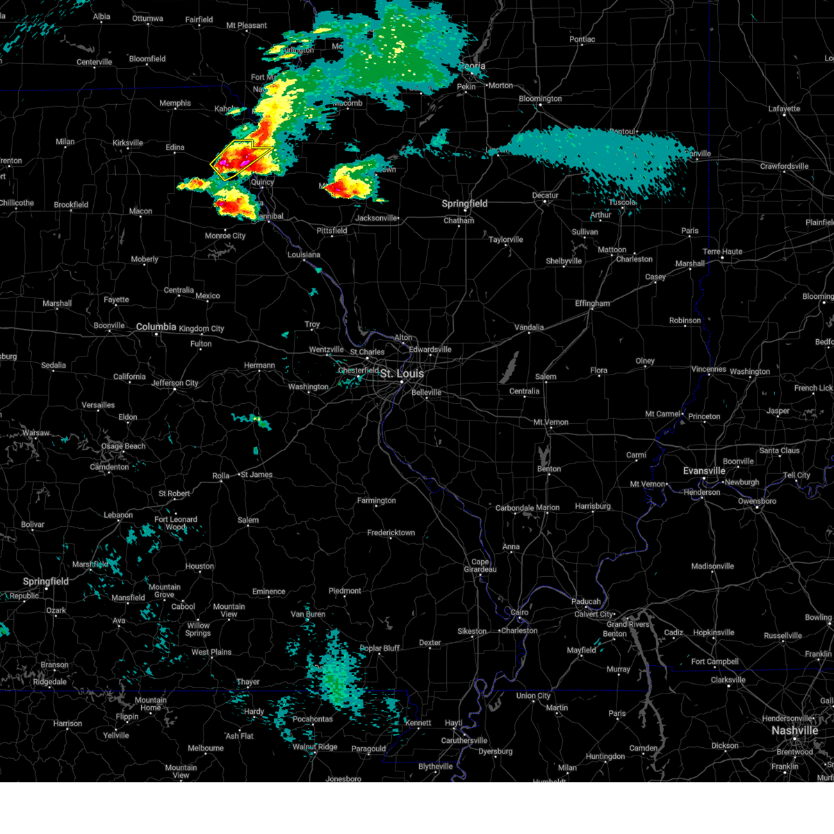 At 539 pm cdt, a severe thunderstorm was located near lewistown, moving northeast at 65 mph (public. at 524 pm three and one quarter inch hail was reported near steffenville). Hazards include tennis ball size hail and 60 mph wind gusts. People and animals outdoors will be injured. expect hail damage to roofs, siding, windows, and vehicles. expect wind damage to roofs, siding, and trees. locations impacted include, canton, lewistown, ewing, lima, monticello and meyer. thunderstorm damage threat, considerable hail threat, radar indicated max hail size, 2. 50 in wind threat, radar indicated max wind gust, 60 mph. At 539 pm cdt, a severe thunderstorm was located near lewistown, moving northeast at 65 mph (public. at 524 pm three and one quarter inch hail was reported near steffenville). Hazards include tennis ball size hail and 60 mph wind gusts. People and animals outdoors will be injured. expect hail damage to roofs, siding, windows, and vehicles. expect wind damage to roofs, siding, and trees. locations impacted include, canton, lewistown, ewing, lima, monticello and meyer. thunderstorm damage threat, considerable hail threat, radar indicated max hail size, 2. 50 in wind threat, radar indicated max wind gust, 60 mph.
|
| 4/4/2023 5:36 PM CDT |
 At 536 pm cdt, a severe thunderstorm was located over warren, moving northeast at 60 mph (radar indicated). Hazards include 60 mph wind gusts and half dollar size hail. Hail damage to vehicles is expected. expect wind damage to roofs, siding, and trees. this severe thunderstorm will be near, philadelphia around 540 pm cdt. maywood around 550 pm cdt. other locations in the path of this severe thunderstorm include quincy, la grange and mendon. this includes interstate 172 between exits 14 and 19. this also includes wakonda state park. hail threat, radar indicated max hail size, 1. 25 in wind threat, radar indicated max wind gust, 60 mph. At 536 pm cdt, a severe thunderstorm was located over warren, moving northeast at 60 mph (radar indicated). Hazards include 60 mph wind gusts and half dollar size hail. Hail damage to vehicles is expected. expect wind damage to roofs, siding, and trees. this severe thunderstorm will be near, philadelphia around 540 pm cdt. maywood around 550 pm cdt. other locations in the path of this severe thunderstorm include quincy, la grange and mendon. this includes interstate 172 between exits 14 and 19. this also includes wakonda state park. hail threat, radar indicated max hail size, 1. 25 in wind threat, radar indicated max wind gust, 60 mph.
|
| 4/4/2023 5:30 PM CDT |
 At 530 pm cdt, a severe thunderstorm was located near steffenville, moving northeast at 45 mph (radar indicated). Hazards include tennis ball size hail and 60 mph wind gusts. People and animals outdoors will be injured. expect hail damage to roofs, siding, windows, and vehicles. expect wind damage to roofs, siding, and trees. locations impacted include, canton, lewistown, ewing, lima, monticello and meyer. thunderstorm damage threat, considerable hail threat, radar indicated max hail size, 2. 50 in wind threat, radar indicated max wind gust, 60 mph. At 530 pm cdt, a severe thunderstorm was located near steffenville, moving northeast at 45 mph (radar indicated). Hazards include tennis ball size hail and 60 mph wind gusts. People and animals outdoors will be injured. expect hail damage to roofs, siding, windows, and vehicles. expect wind damage to roofs, siding, and trees. locations impacted include, canton, lewistown, ewing, lima, monticello and meyer. thunderstorm damage threat, considerable hail threat, radar indicated max hail size, 2. 50 in wind threat, radar indicated max wind gust, 60 mph.
|
| 4/4/2023 5:30 PM CDT |
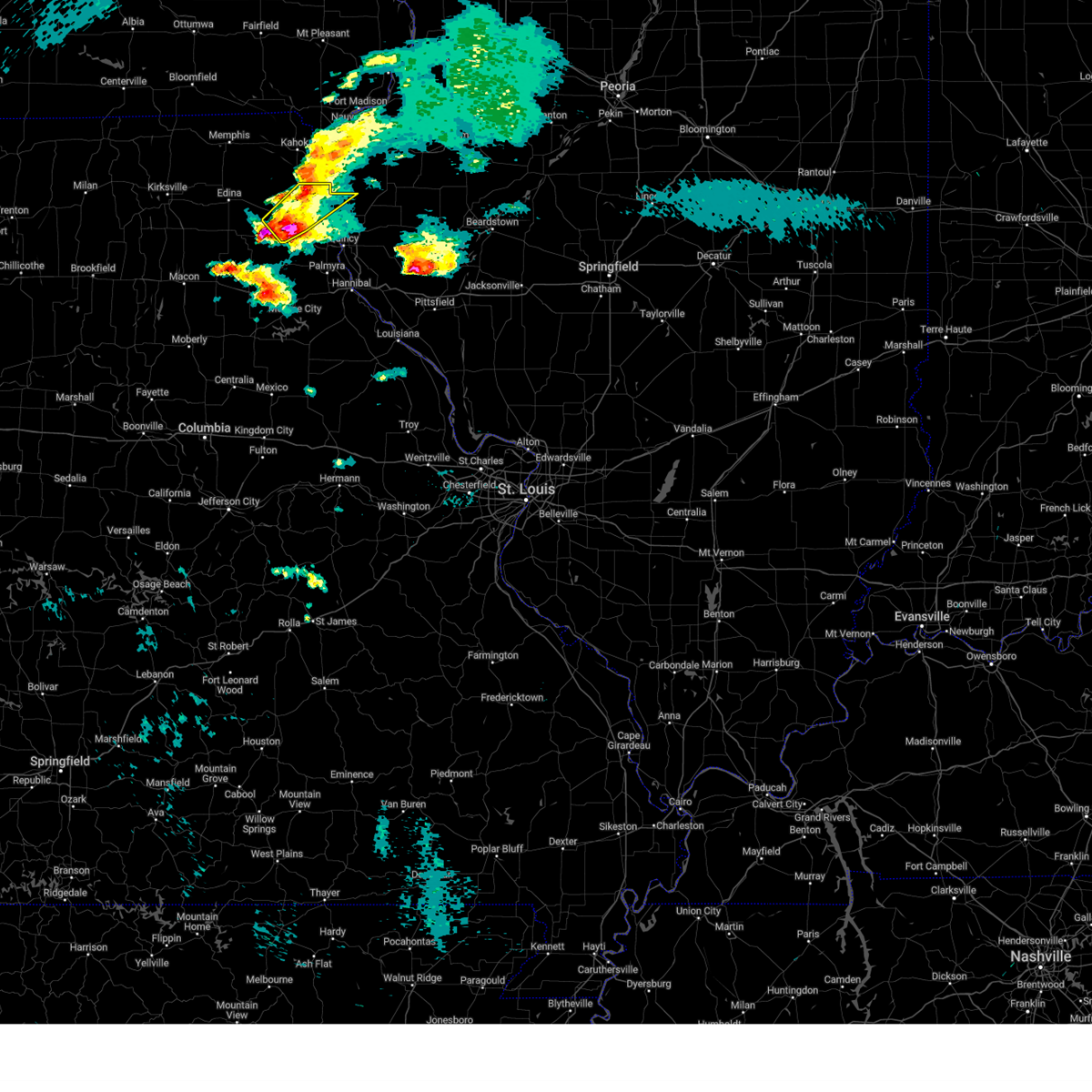 At 530 pm cdt, a severe thunderstorm was located near steffenville, moving northeast at 45 mph (radar indicated). Hazards include tennis ball size hail and 60 mph wind gusts. People and animals outdoors will be injured. expect hail damage to roofs, siding, windows, and vehicles. expect wind damage to roofs, siding, and trees. locations impacted include, canton, lewistown, ewing, lima, monticello and meyer. thunderstorm damage threat, considerable hail threat, radar indicated max hail size, 2. 50 in wind threat, radar indicated max wind gust, 60 mph. At 530 pm cdt, a severe thunderstorm was located near steffenville, moving northeast at 45 mph (radar indicated). Hazards include tennis ball size hail and 60 mph wind gusts. People and animals outdoors will be injured. expect hail damage to roofs, siding, windows, and vehicles. expect wind damage to roofs, siding, and trees. locations impacted include, canton, lewistown, ewing, lima, monticello and meyer. thunderstorm damage threat, considerable hail threat, radar indicated max hail size, 2. 50 in wind threat, radar indicated max wind gust, 60 mph.
|
| 4/4/2023 5:19 PM CDT |
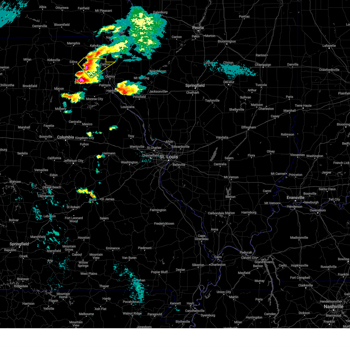 At 518 pm cdt, a severe thunderstorm was located near lewistown, moving northeast at 70 mph (law enforcement. at 516 pm, ping pong ball size hail was reported near la belle). Hazards include golf ball size hail and 60 mph wind gusts. People and animals outdoors will be injured. expect hail damage to roofs, siding, windows, and vehicles. expect wind damage to roofs, siding, and trees. this severe thunderstorm will remain over mainly rural areas of northwestern adams, east central knox and lewis counties, including the following locations, lima, monticello and meyer. thunderstorm damage threat, considerable hail threat, radar indicated max hail size, 1. 75 in wind threat, radar indicated max wind gust, 60 mph. At 518 pm cdt, a severe thunderstorm was located near lewistown, moving northeast at 70 mph (law enforcement. at 516 pm, ping pong ball size hail was reported near la belle). Hazards include golf ball size hail and 60 mph wind gusts. People and animals outdoors will be injured. expect hail damage to roofs, siding, windows, and vehicles. expect wind damage to roofs, siding, and trees. this severe thunderstorm will remain over mainly rural areas of northwestern adams, east central knox and lewis counties, including the following locations, lima, monticello and meyer. thunderstorm damage threat, considerable hail threat, radar indicated max hail size, 1. 75 in wind threat, radar indicated max wind gust, 60 mph.
|
| 4/4/2023 5:19 PM CDT |
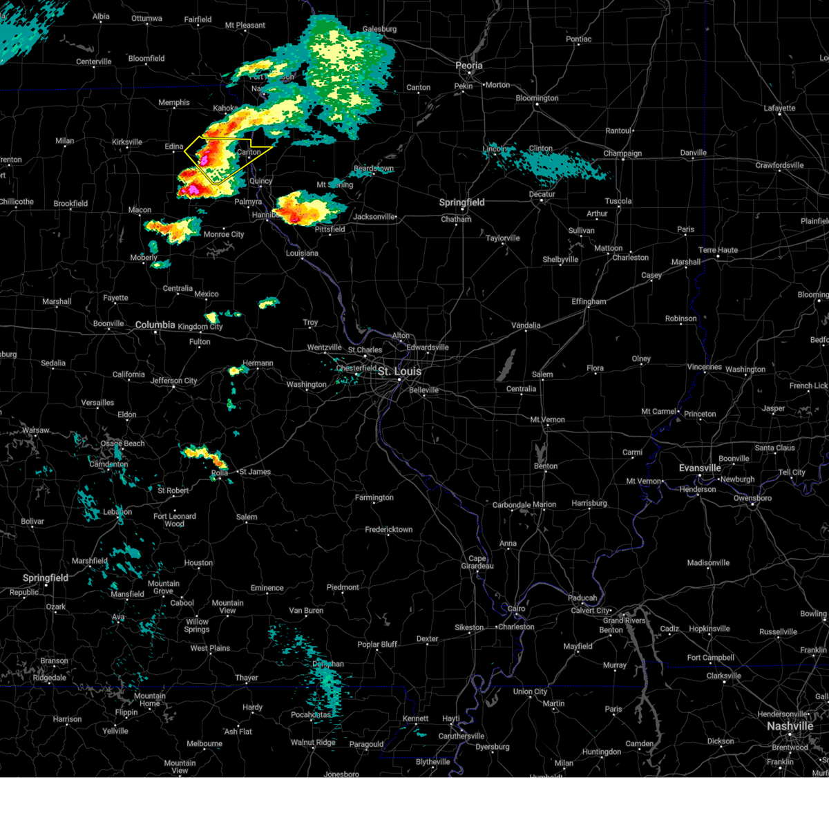 At 518 pm cdt, a severe thunderstorm was located near lewistown, moving northeast at 70 mph (law enforcement. at 516 pm, ping pong ball size hail was reported near la belle). Hazards include golf ball size hail and 60 mph wind gusts. People and animals outdoors will be injured. expect hail damage to roofs, siding, windows, and vehicles. expect wind damage to roofs, siding, and trees. this severe thunderstorm will remain over mainly rural areas of northwestern adams, east central knox and lewis counties, including the following locations, lima, monticello and meyer. thunderstorm damage threat, considerable hail threat, radar indicated max hail size, 1. 75 in wind threat, radar indicated max wind gust, 60 mph. At 518 pm cdt, a severe thunderstorm was located near lewistown, moving northeast at 70 mph (law enforcement. at 516 pm, ping pong ball size hail was reported near la belle). Hazards include golf ball size hail and 60 mph wind gusts. People and animals outdoors will be injured. expect hail damage to roofs, siding, windows, and vehicles. expect wind damage to roofs, siding, and trees. this severe thunderstorm will remain over mainly rural areas of northwestern adams, east central knox and lewis counties, including the following locations, lima, monticello and meyer. thunderstorm damage threat, considerable hail threat, radar indicated max hail size, 1. 75 in wind threat, radar indicated max wind gust, 60 mph.
|
| 8/29/2022 6:37 PM CDT |
 At 637 pm cdt, severe thunderstorms were located along a line extending from near golden to near mendon to near ewing, moving east at 25 mph (radar indicated). Hazards include 60 mph wind gusts and quarter size hail. Hail damage to vehicles is expected. expect wind damage to roofs, siding, and trees. locations impacted include, quincy, canton, quincy regional airport, camp point, mendon, la grange, clayton, golden, ewing, maywood, ursa, loraine, woodville, taylor, lima, coatsburg, columbus, la prairie, paloma and fowler. this also includes wakonda state park. this includes interstate 172 between exits 14 and 19. hail threat, radar indicated max hail size, 1. 00 in wind threat, radar indicated max wind gust, 60 mph. At 637 pm cdt, severe thunderstorms were located along a line extending from near golden to near mendon to near ewing, moving east at 25 mph (radar indicated). Hazards include 60 mph wind gusts and quarter size hail. Hail damage to vehicles is expected. expect wind damage to roofs, siding, and trees. locations impacted include, quincy, canton, quincy regional airport, camp point, mendon, la grange, clayton, golden, ewing, maywood, ursa, loraine, woodville, taylor, lima, coatsburg, columbus, la prairie, paloma and fowler. this also includes wakonda state park. this includes interstate 172 between exits 14 and 19. hail threat, radar indicated max hail size, 1. 00 in wind threat, radar indicated max wind gust, 60 mph.
|
| 8/29/2022 6:13 PM CDT |
 At 612 pm cdt, severe thunderstorms were located along a line extending from near west point to near la grange to near ewing, moving southeast at 15 mph (trained weather spotters. half dollar size hail was reported near canton at 606 pm cdt). Hazards include 60 mph wind gusts and half dollar size hail. Hail damage to vehicles is expected. Expect wind damage to roofs, siding, and trees. At 612 pm cdt, severe thunderstorms were located along a line extending from near west point to near la grange to near ewing, moving southeast at 15 mph (trained weather spotters. half dollar size hail was reported near canton at 606 pm cdt). Hazards include 60 mph wind gusts and half dollar size hail. Hail damage to vehicles is expected. Expect wind damage to roofs, siding, and trees.
|
| 8/29/2022 6:06 PM CDT | Half Dollar sized hail reported 0.8 miles NNW of Canton, MO, spotter reported numerous 1 inch hail stones with some up to half-dollar size. |
| 6/17/2022 3:11 AM CDT |
 At 311 am cdt, severe thunderstorms were located along a line extending from near colony to near steffenville to shelbina, moving east at 45 mph (radar indicated). Hazards include 60 mph wind gusts and penny size hail. Expect damage to roofs, siding, and trees. severe thunderstorms will be near, emden around 320 am cdt. ewing around 325 am cdt. warren around 330 am cdt. other locations in the path of these severe thunderstorms include maywood, la grange and canton. This also includes wakonda state park. At 311 am cdt, severe thunderstorms were located along a line extending from near colony to near steffenville to shelbina, moving east at 45 mph (radar indicated). Hazards include 60 mph wind gusts and penny size hail. Expect damage to roofs, siding, and trees. severe thunderstorms will be near, emden around 320 am cdt. ewing around 325 am cdt. warren around 330 am cdt. other locations in the path of these severe thunderstorms include maywood, la grange and canton. This also includes wakonda state park.
|
| 4/5/2022 7:53 PM CDT |
 At 753 pm cdt, a severe thunderstorm was located over la grange, moving east at 45 mph (trained weather spotters). Hazards include quarter size hail. Damage to vehicles is expected. this severe thunderstorm will be near, quincy around 805 pm cdt. mendon around 810 pm cdt. other locations in the path of this severe thunderstorm include quincy regional airport and camp point. this includes interstate 172 between exits 15 and 19. this also includes wakonda state park. hail threat, observed max hail size, 1. 00 in wind threat, radar indicated max wind gust, <50 mph. At 753 pm cdt, a severe thunderstorm was located over la grange, moving east at 45 mph (trained weather spotters). Hazards include quarter size hail. Damage to vehicles is expected. this severe thunderstorm will be near, quincy around 805 pm cdt. mendon around 810 pm cdt. other locations in the path of this severe thunderstorm include quincy regional airport and camp point. this includes interstate 172 between exits 15 and 19. this also includes wakonda state park. hail threat, observed max hail size, 1. 00 in wind threat, radar indicated max wind gust, <50 mph.
|
| 4/5/2022 7:44 PM CDT |
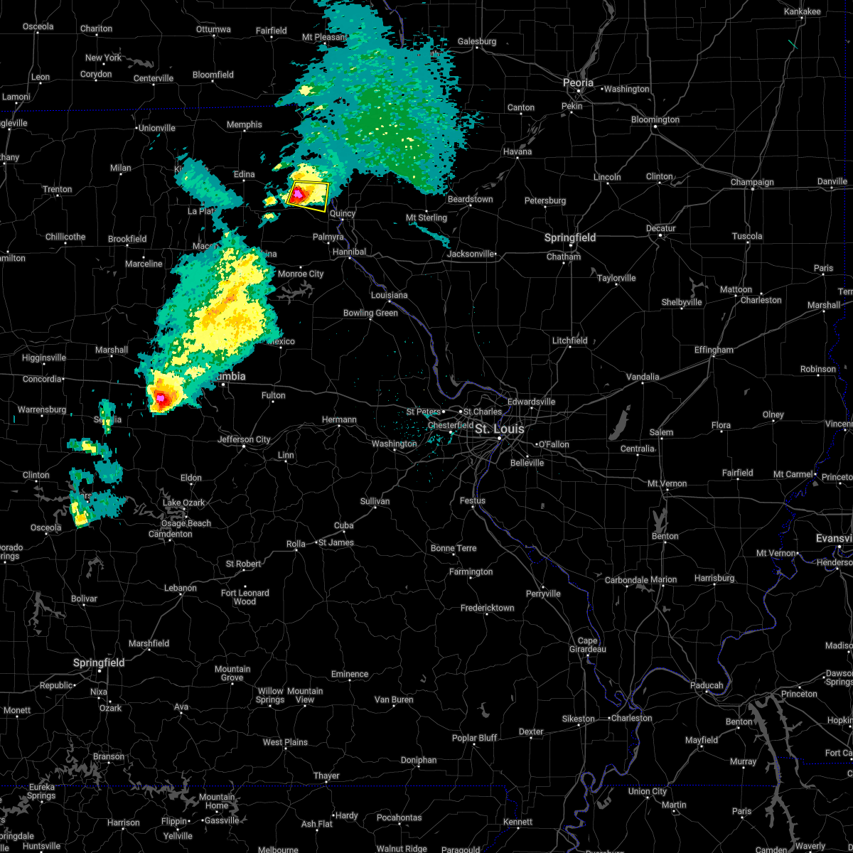 At 744 pm cdt, a severe thunderstorm was located near ewing, moving east at 35 mph (trained weather spotters). Hazards include quarter size hail. Damage to vehicles is expected. locations impacted include, canton. hail threat, radar indicated max hail size, 1. 00 in wind threat, radar indicated max wind gust, <50 mph. At 744 pm cdt, a severe thunderstorm was located near ewing, moving east at 35 mph (trained weather spotters). Hazards include quarter size hail. Damage to vehicles is expected. locations impacted include, canton. hail threat, radar indicated max hail size, 1. 00 in wind threat, radar indicated max wind gust, <50 mph.
|
| 4/5/2022 7:32 PM CDT |
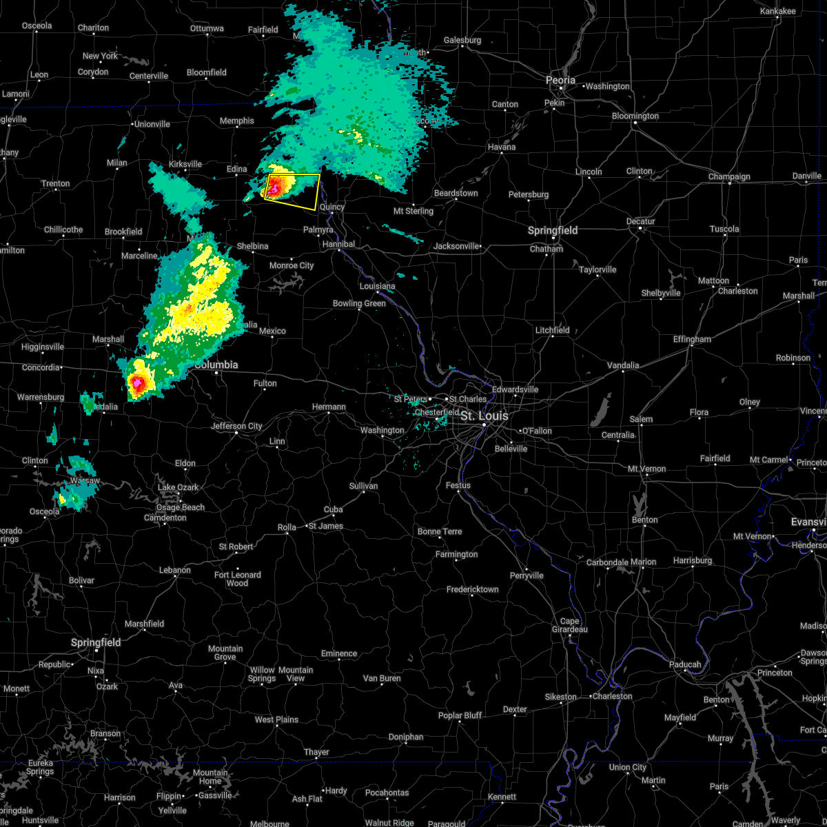 At 732 pm cdt, a severe thunderstorm was located over lewistown, moving east at 40 mph (radar indicated). Hazards include 60 mph wind gusts and quarter size hail. Hail damage to vehicles is expected. expect wind damage to roofs, siding, and trees. this severe storm will be near, ewing around 740 pm cdt. other locations in the path of this severe thunderstorm include canton. hail threat, radar indicated max hail size, 1. 00 in wind threat, radar indicated max wind gust, 60 mph. At 732 pm cdt, a severe thunderstorm was located over lewistown, moving east at 40 mph (radar indicated). Hazards include 60 mph wind gusts and quarter size hail. Hail damage to vehicles is expected. expect wind damage to roofs, siding, and trees. this severe storm will be near, ewing around 740 pm cdt. other locations in the path of this severe thunderstorm include canton. hail threat, radar indicated max hail size, 1. 00 in wind threat, radar indicated max wind gust, 60 mph.
|
| 4/5/2022 7:20 PM CDT |
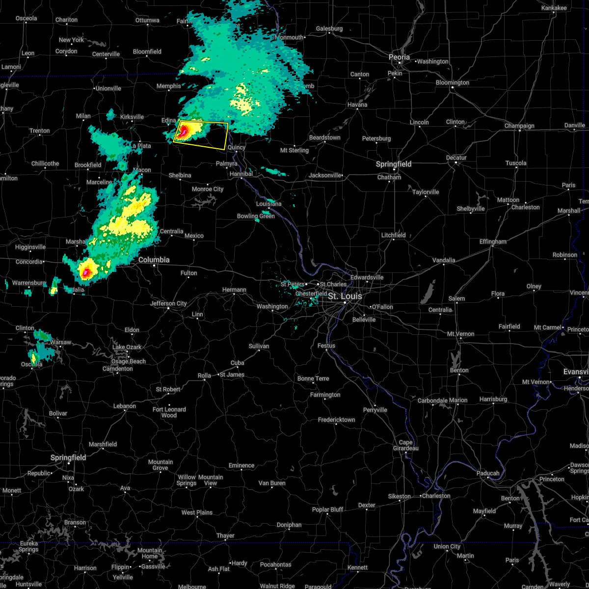 At 720 pm cdt, a severe thunderstorm was located near la belle, moving east at 40 mph (radar indicated). Hazards include 60 mph wind gusts and quarter size hail. Hail damage to vehicles is expected. expect wind damage to roofs, siding, and trees. this severe thunderstorm will be near, la belle around 725 pm cdt. lewistown around 735 pm cdt. ewing around 740 pm cdt. other locations in the path of this severe thunderstorm include canton. hail threat, radar indicated max hail size, 1. 00 in wind threat, radar indicated max wind gust, 60 mph. At 720 pm cdt, a severe thunderstorm was located near la belle, moving east at 40 mph (radar indicated). Hazards include 60 mph wind gusts and quarter size hail. Hail damage to vehicles is expected. expect wind damage to roofs, siding, and trees. this severe thunderstorm will be near, la belle around 725 pm cdt. lewistown around 735 pm cdt. ewing around 740 pm cdt. other locations in the path of this severe thunderstorm include canton. hail threat, radar indicated max hail size, 1. 00 in wind threat, radar indicated max wind gust, 60 mph.
|
| 9/20/2021 9:27 PM CDT | 12 to 18 inch tree and a few power poles down in canto in lewis county MO, 0.4 miles W of Canton, MO |
| 9/20/2021 9:24 PM CDT |
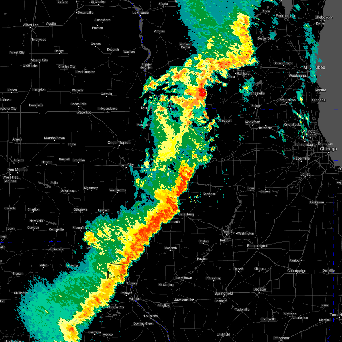 The severe thunderstorm warning for northern lewis county will expire at 930 pm cdt, the storm which prompted the warning has weakened below severe limits, and no longer poses an immediate threat to life or property. therefore, the warning will be allowed to expire. however gusty winds are still possible with this thunderstorm. to report severe weather, contact your nearest law enforcement agency. they will relay your report to the national weather service st louis. The severe thunderstorm warning for northern lewis county will expire at 930 pm cdt, the storm which prompted the warning has weakened below severe limits, and no longer poses an immediate threat to life or property. therefore, the warning will be allowed to expire. however gusty winds are still possible with this thunderstorm. to report severe weather, contact your nearest law enforcement agency. they will relay your report to the national weather service st louis.
|
| 9/20/2021 9:14 PM CDT |
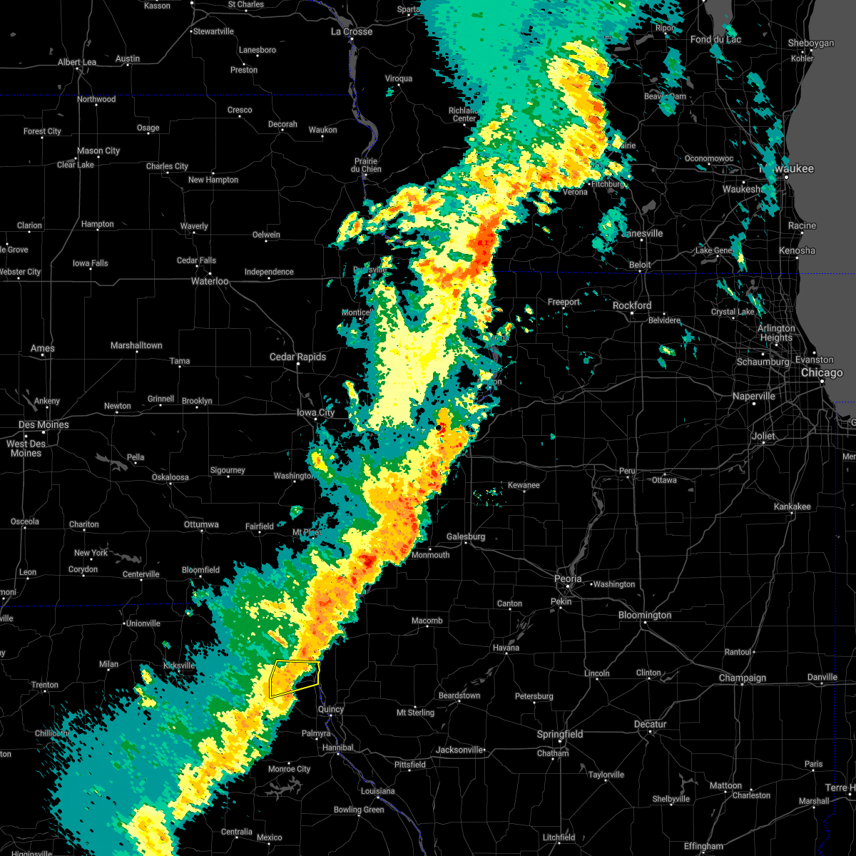 At 914 pm cdt, a severe thunderstorm was located near lewistown, moving northeast at 30 mph (radar indicated). Hazards include 60 mph wind gusts. Expect damage to roofs, siding, and trees. locations impacted include, canton, lewistown and monticello. hail threat, radar indicated max hail size, <. 75 in wind threat, radar indicated max wind gust, 60 mph. At 914 pm cdt, a severe thunderstorm was located near lewistown, moving northeast at 30 mph (radar indicated). Hazards include 60 mph wind gusts. Expect damage to roofs, siding, and trees. locations impacted include, canton, lewistown and monticello. hail threat, radar indicated max hail size, <. 75 in wind threat, radar indicated max wind gust, 60 mph.
|
| 9/20/2021 9:00 PM CDT |
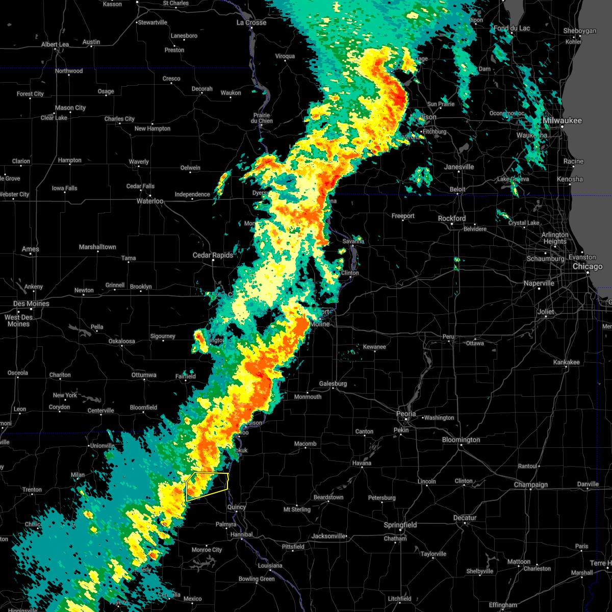 At 900 pm cdt, a severe thunderstorm was located over la belle, moving northeast at 30 mph (radar indicated). Hazards include 60 mph wind gusts and penny size hail. Expect damage to roofs, siding, and trees. this severe thunderstorm will remain over mainly rural areas of northern lewis county, including the following locations, monticello. hail threat, radar indicated max hail size, 0. 75 in wind threat, radar indicated max wind gust, 60 mph. At 900 pm cdt, a severe thunderstorm was located over la belle, moving northeast at 30 mph (radar indicated). Hazards include 60 mph wind gusts and penny size hail. Expect damage to roofs, siding, and trees. this severe thunderstorm will remain over mainly rural areas of northern lewis county, including the following locations, monticello. hail threat, radar indicated max hail size, 0. 75 in wind threat, radar indicated max wind gust, 60 mph.
|
| 9/20/2021 8:45 PM CDT |
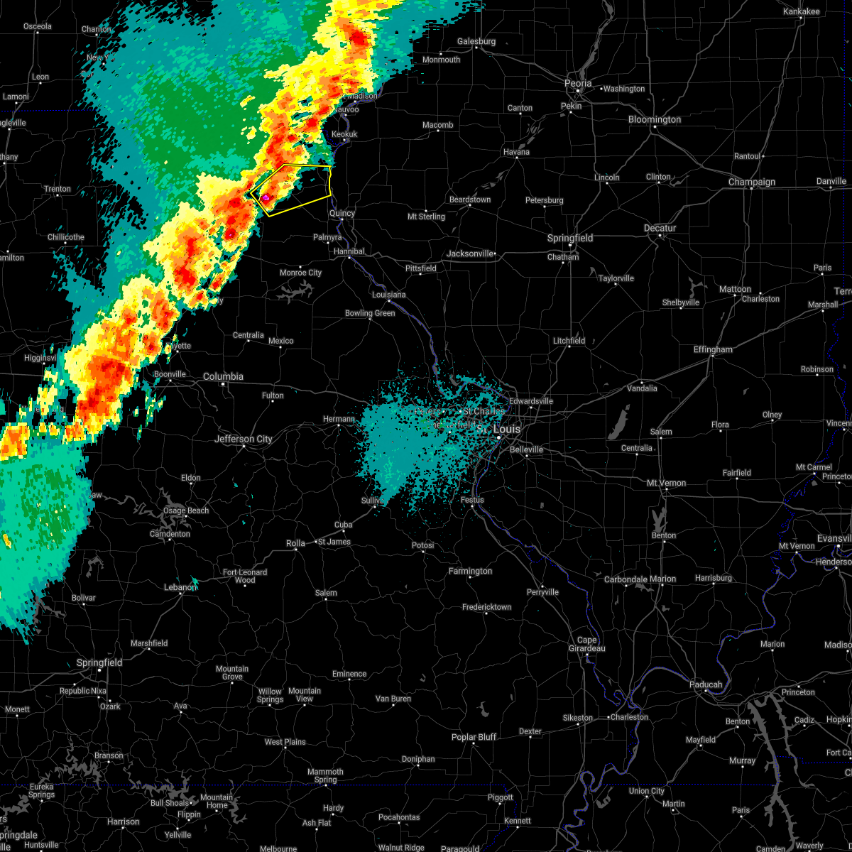 At 845 pm cdt, a severe thunderstorm was located near la belle, moving northeast at 30 mph (radar indicated). Hazards include 60 mph wind gusts and quarter size hail. Hail damage to vehicles is expected. expect wind damage to roofs, siding, and trees. this severe thunderstorm will be near, la belle around 855 pm cdt. lewistown around 900 pm cdt. hail threat, radar indicated max hail size, 1. 00 in wind threat, radar indicated max wind gust, 60 mph. At 845 pm cdt, a severe thunderstorm was located near la belle, moving northeast at 30 mph (radar indicated). Hazards include 60 mph wind gusts and quarter size hail. Hail damage to vehicles is expected. expect wind damage to roofs, siding, and trees. this severe thunderstorm will be near, la belle around 855 pm cdt. lewistown around 900 pm cdt. hail threat, radar indicated max hail size, 1. 00 in wind threat, radar indicated max wind gust, 60 mph.
|
| 7/9/2021 9:10 PM CDT |
 At 909 pm cdt, a severe thunderstorm was located over lewistown, moving southeast at 20 mph (radar indicated). Hazards include 60 mph wind gusts and half dollar size hail. Hail damage to vehicles is expected. expect wind damage to roofs, siding, and trees. this severe thunderstorm will be near, ewing around 925 pm cdt. other locations in the path of this severe thunderstorm include maywood, philadelphia and palmyra. this includes interstate 172 near exit 2. This also includes wakonda state park. At 909 pm cdt, a severe thunderstorm was located over lewistown, moving southeast at 20 mph (radar indicated). Hazards include 60 mph wind gusts and half dollar size hail. Hail damage to vehicles is expected. expect wind damage to roofs, siding, and trees. this severe thunderstorm will be near, ewing around 925 pm cdt. other locations in the path of this severe thunderstorm include maywood, philadelphia and palmyra. this includes interstate 172 near exit 2. This also includes wakonda state park.
|
| 6/24/2021 11:52 PM CDT |
 At 1151 pm cdt, severe thunderstorms were located along a line extending from canton to near maywood to near rensselaer to 7 miles northeast of mexico, moving east at 45 mph (radar indicated). Hazards include 60 mph wind gusts. Expect damage to roofs, siding, and trees. locations impacted include, palmyra, canton, la grange, rensselaer, quincy, spaulding, new london, laddonia, mendon, fall creek, farber, vandalia, quincy regional airport, payson, camp point, golden, barry, beverly and clayton. this also includes wakonda state park, mark twain lake recreational area, and siloam springs state park. this includes the following highways, interstate 172 between exits 2 and 19. Interstate 72 between exits 4 and 20. At 1151 pm cdt, severe thunderstorms were located along a line extending from canton to near maywood to near rensselaer to 7 miles northeast of mexico, moving east at 45 mph (radar indicated). Hazards include 60 mph wind gusts. Expect damage to roofs, siding, and trees. locations impacted include, palmyra, canton, la grange, rensselaer, quincy, spaulding, new london, laddonia, mendon, fall creek, farber, vandalia, quincy regional airport, payson, camp point, golden, barry, beverly and clayton. this also includes wakonda state park, mark twain lake recreational area, and siloam springs state park. this includes the following highways, interstate 172 between exits 2 and 19. Interstate 72 between exits 4 and 20.
|
| 6/24/2021 11:47 PM CDT |
 At 1147 pm cdt, a severe thunderstorm capable of producing a tornado was located near ewing, moving east at 50 mph (radar indicated rotation). Hazards include tornado. Flying debris will be dangerous to those caught without shelter. mobile homes will be damaged or destroyed. damage to roofs, windows, and vehicles will occur. tree damage is likely. locations impacted include, canton and la grange. This also includes wakonda state park. At 1147 pm cdt, a severe thunderstorm capable of producing a tornado was located near ewing, moving east at 50 mph (radar indicated rotation). Hazards include tornado. Flying debris will be dangerous to those caught without shelter. mobile homes will be damaged or destroyed. damage to roofs, windows, and vehicles will occur. tree damage is likely. locations impacted include, canton and la grange. This also includes wakonda state park.
|
| 6/24/2021 11:32 PM CDT |
 At 1132 pm cdt, a severe thunderstorm capable of producing a tornado was located over steffenville, moving east at 50 mph (radar indicated rotation). Hazards include tornado. Flying debris will be dangerous to those caught without shelter. mobile homes will be damaged or destroyed. damage to roofs, windows, and vehicles will occur. tree damage is likely. this dangerous storm will be near, lewistown around 1140 pm cdt. ewing around 1145 pm cdt. other locations in the path of this tornadic thunderstorm include canton and la grange. This also includes wakonda state park. At 1132 pm cdt, a severe thunderstorm capable of producing a tornado was located over steffenville, moving east at 50 mph (radar indicated rotation). Hazards include tornado. Flying debris will be dangerous to those caught without shelter. mobile homes will be damaged or destroyed. damage to roofs, windows, and vehicles will occur. tree damage is likely. this dangerous storm will be near, lewistown around 1140 pm cdt. ewing around 1145 pm cdt. other locations in the path of this tornadic thunderstorm include canton and la grange. This also includes wakonda state park.
|
| 6/24/2021 11:29 PM CDT |
 At 1129 pm cdt, severe thunderstorms were located along a line extending from near la belle to near steffenville to near shelbina to near centralia, moving east at 45 mph (radar indicated). Hazards include 60 mph wind gusts. Expect damage to roofs, siding, and trees. severe thunderstorms will be near, lewistown around 1135 pm cdt. warren, ewing and philadelphia around 1140 pm cdt. monroe city and maywood around 1145 pm cdt. other locations in the path of these severe thunderstorms include mexico, santa fe, palmyra, canton, la grange, rensselaer, spaulding, quincy, new london, laddonia, farber, mendon and fall creek. this includes the following highways, interstate 172 between exits 2 and 19. interstate 72 between exits 4 and 20. This also includes wakonda state park, union covered bridge historic site, mark twain lake recreational area, and siloam springs state park. At 1129 pm cdt, severe thunderstorms were located along a line extending from near la belle to near steffenville to near shelbina to near centralia, moving east at 45 mph (radar indicated). Hazards include 60 mph wind gusts. Expect damage to roofs, siding, and trees. severe thunderstorms will be near, lewistown around 1135 pm cdt. warren, ewing and philadelphia around 1140 pm cdt. monroe city and maywood around 1145 pm cdt. other locations in the path of these severe thunderstorms include mexico, santa fe, palmyra, canton, la grange, rensselaer, spaulding, quincy, new london, laddonia, farber, mendon and fall creek. this includes the following highways, interstate 172 between exits 2 and 19. interstate 72 between exits 4 and 20. This also includes wakonda state park, union covered bridge historic site, mark twain lake recreational area, and siloam springs state park.
|
| 5/3/2021 2:32 PM CDT |
 At 232 pm cdt, a severe thunderstorm was located near ewing, moving northeast at 30 mph (radar indicated). Hazards include ping pong ball size hail and 60 mph wind gusts. People and animals outdoors will be injured. expect hail damage to roofs, siding, windows, and vehicles. expect wind damage to roofs, siding, and trees. locations impacted include, canton, la grange, ewing, maywood and taylor. This also includes wakonda state park. At 232 pm cdt, a severe thunderstorm was located near ewing, moving northeast at 30 mph (radar indicated). Hazards include ping pong ball size hail and 60 mph wind gusts. People and animals outdoors will be injured. expect hail damage to roofs, siding, windows, and vehicles. expect wind damage to roofs, siding, and trees. locations impacted include, canton, la grange, ewing, maywood and taylor. This also includes wakonda state park.
|
| 5/3/2021 2:22 PM CDT |
 At 222 pm cdt, a severe thunderstorm was located near steffenville, moving northeast at 35 mph (radar indicated). Hazards include 60 mph wind gusts and half dollar size hail. Hail damage to vehicles is expected. Expect wind damage to roofs, siding, and trees. At 222 pm cdt, a severe thunderstorm was located near steffenville, moving northeast at 35 mph (radar indicated). Hazards include 60 mph wind gusts and half dollar size hail. Hail damage to vehicles is expected. Expect wind damage to roofs, siding, and trees.
|
| 4/7/2021 5:20 PM CDT |
 At 520 pm cdt, severe thunderstorms were located along a line extending from near plevna to near steffenville to near monroe city, moving northeast at 50 mph (radar indicated). Hazards include 60 mph wind gusts and nickel size hail. Expect damage to roofs, siding, and trees. locations impacted include, hannibal, palmyra, monroe city, canton, warren, la grange, la belle, lewistown, ewing, rensselaer, knox city, maywood, spaulding, plevna, steffenville, colony, emden, philadelphia, hunnewell and taylor. this also includes wakonda state park and mark twain lake recreational area. This includes interstate 72 near exit 4. At 520 pm cdt, severe thunderstorms were located along a line extending from near plevna to near steffenville to near monroe city, moving northeast at 50 mph (radar indicated). Hazards include 60 mph wind gusts and nickel size hail. Expect damage to roofs, siding, and trees. locations impacted include, hannibal, palmyra, monroe city, canton, warren, la grange, la belle, lewistown, ewing, rensselaer, knox city, maywood, spaulding, plevna, steffenville, colony, emden, philadelphia, hunnewell and taylor. this also includes wakonda state park and mark twain lake recreational area. This includes interstate 72 near exit 4.
|
| 4/7/2021 5:09 PM CDT |
 At 509 pm cdt, severe thunderstorms were located along a line extending from 6 miles northeast of clarence to emden to near perry, moving northeast at 40 mph (radar indicated). Hazards include 60 mph wind gusts and nickel size hail. expect damage to roofs, siding, and trees At 509 pm cdt, severe thunderstorms were located along a line extending from 6 miles northeast of clarence to emden to near perry, moving northeast at 40 mph (radar indicated). Hazards include 60 mph wind gusts and nickel size hail. expect damage to roofs, siding, and trees
|
| 11/10/2020 1:07 PM CST |
 At 106 pm cst, severe thunderstorms were located along a line extending from 7 miles northwest of canton to near la grange to 7 miles northwest of perry, moving northeast at 65 mph (radar indicated). Hazards include 60 mph wind gusts. expect damage to roofs, siding, and trees At 106 pm cst, severe thunderstorms were located along a line extending from 7 miles northwest of canton to near la grange to 7 miles northwest of perry, moving northeast at 65 mph (radar indicated). Hazards include 60 mph wind gusts. expect damage to roofs, siding, and trees
|
| 11/10/2020 12:58 PM CST |
 At 1258 pm cst, severe thunderstorms were located along a line extending from 9 miles south of kahoka to maywood, moving east at 50 mph (radar indicated). Hazards include 60 mph wind gusts. Expect damage to roofs, siding, and trees. locations impacted include, canton, la grange, ewing, maywood and monticello. This also includes wakonda state park. At 1258 pm cst, severe thunderstorms were located along a line extending from 9 miles south of kahoka to maywood, moving east at 50 mph (radar indicated). Hazards include 60 mph wind gusts. Expect damage to roofs, siding, and trees. locations impacted include, canton, la grange, ewing, maywood and monticello. This also includes wakonda state park.
|
| 11/10/2020 12:51 PM CST |
 At 1251 pm cst, severe thunderstorms were located along a line extending from 8 miles east of colony to near ewing, moving east at 50 mph (radar indicated). Hazards include 60 mph wind gusts. expect damage to roofs, siding, and trees At 1251 pm cst, severe thunderstorms were located along a line extending from 8 miles east of colony to near ewing, moving east at 50 mph (radar indicated). Hazards include 60 mph wind gusts. expect damage to roofs, siding, and trees
|
| 7/15/2020 10:12 AM CDT |
 At 1011 am cdt, severe thunderstorms were located along a line extending from near canton to near quincy to near payson, moving northeast at 40 mph (radar indicated). Hazards include 60 mph wind gusts and penny size hail. Expect damage to roofs, siding, and trees. locations impacted include, quincy, canton, quincy regional airport, camp point, payson, mendon, la grange, clayton, golden, adams, burton, ursa, liberty, loraine, woodville, lima, coatsburg, columbus, la prairie and meyer. this also includes wakonda state park. This includes interstate 172 between exits 10 and 19. At 1011 am cdt, severe thunderstorms were located along a line extending from near canton to near quincy to near payson, moving northeast at 40 mph (radar indicated). Hazards include 60 mph wind gusts and penny size hail. Expect damage to roofs, siding, and trees. locations impacted include, quincy, canton, quincy regional airport, camp point, payson, mendon, la grange, clayton, golden, adams, burton, ursa, liberty, loraine, woodville, lima, coatsburg, columbus, la prairie and meyer. this also includes wakonda state park. This includes interstate 172 between exits 10 and 19.
|
| 7/15/2020 9:56 AM CDT |
 At 956 am cdt, severe thunderstorms were located along a line extending from maywood to 6 miles west of quincy to near hannibal, moving northeast at 35 mph (radar indicated). Hazards include 60 mph wind gusts and penny size hail. expect damage to roofs, siding, and trees At 956 am cdt, severe thunderstorms were located along a line extending from maywood to 6 miles west of quincy to near hannibal, moving northeast at 35 mph (radar indicated). Hazards include 60 mph wind gusts and penny size hail. expect damage to roofs, siding, and trees
|
| 6/5/2020 7:12 AM CDT |
 At 711 am cdt, a severe thunderstorm was located near clarence, moving east at 35 mph (radar indicated). Hazards include 60 mph wind gusts and quarter size hail. Hail damage to vehicles is expected. Expect wind damage to roofs, siding, and trees. At 711 am cdt, a severe thunderstorm was located near clarence, moving east at 35 mph (radar indicated). Hazards include 60 mph wind gusts and quarter size hail. Hail damage to vehicles is expected. Expect wind damage to roofs, siding, and trees.
|
| 5/24/2020 6:02 PM CDT |
 At 602 pm cdt, severe thunderstorms were located along a line extending from near canton to 6 miles northeast of la grange to near quincy, moving east at 30 mph (radar indicated). Hazards include 60 mph wind gusts and penny size hail. Expect damage to roofs, siding, and trees. locations impacted include, quincy, canton, camp point, mendon, la grange, clayton, golden, ursa, loraine, woodville, lima, coatsburg, la prairie, meyer, paloma, fowler and chatton. this also includes wakonda state park. This includes interstate 172 near exit 19. At 602 pm cdt, severe thunderstorms were located along a line extending from near canton to 6 miles northeast of la grange to near quincy, moving east at 30 mph (radar indicated). Hazards include 60 mph wind gusts and penny size hail. Expect damage to roofs, siding, and trees. locations impacted include, quincy, canton, camp point, mendon, la grange, clayton, golden, ursa, loraine, woodville, lima, coatsburg, la prairie, meyer, paloma, fowler and chatton. this also includes wakonda state park. This includes interstate 172 near exit 19.
|
| 5/24/2020 5:44 PM CDT |
 At 544 pm cdt, severe thunderstorms were located along a line extending from 10 miles northeast of lewistown to near canton to maywood, moving east at 40 mph (radar indicated). Hazards include 70 mph wind gusts and quarter size hail. Hail damage to vehicles is expected. expect considerable tree damage. Wind damage is also likely to mobile homes, roofs, and outbuildings. At 544 pm cdt, severe thunderstorms were located along a line extending from 10 miles northeast of lewistown to near canton to maywood, moving east at 40 mph (radar indicated). Hazards include 70 mph wind gusts and quarter size hail. Hail damage to vehicles is expected. expect considerable tree damage. Wind damage is also likely to mobile homes, roofs, and outbuildings.
|
| 5/24/2020 5:36 PM CDT |
 At 536 pm cdt, severe thunderstorms were located along a line extending from 9 miles north of lewistown to maywood, moving east at 25 mph (radar indicated). Hazards include 60 mph wind gusts and quarter size hail. Hail damage to vehicles is expected. expect wind damage to roofs, siding, and trees. locations impacted include, canton, la grange, lewistown, ewing, maywood and monticello. This also includes wakonda state park. At 536 pm cdt, severe thunderstorms were located along a line extending from 9 miles north of lewistown to maywood, moving east at 25 mph (radar indicated). Hazards include 60 mph wind gusts and quarter size hail. Hail damage to vehicles is expected. expect wind damage to roofs, siding, and trees. locations impacted include, canton, la grange, lewistown, ewing, maywood and monticello. This also includes wakonda state park.
|
| 5/24/2020 5:18 PM CDT |
 At 518 pm cdt, a severe thunderstorm was located near lewistown, moving northeast at 15 mph (radar indicated). Hazards include 60 mph wind gusts and half dollar size hail. Hail damage to vehicles is expected. Expect wind damage to roofs, siding, and trees. At 518 pm cdt, a severe thunderstorm was located near lewistown, moving northeast at 15 mph (radar indicated). Hazards include 60 mph wind gusts and half dollar size hail. Hail damage to vehicles is expected. Expect wind damage to roofs, siding, and trees.
|
| 9/27/2019 9:41 PM CDT |
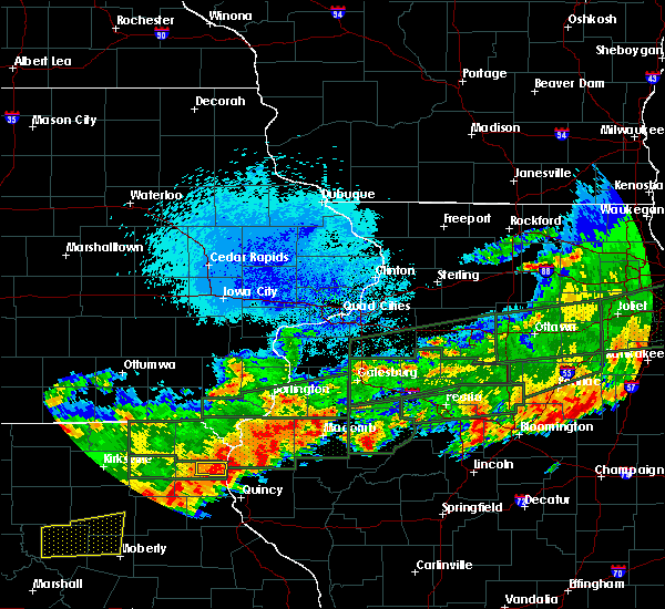 The severe thunderstorm warning for northeastern lewis county will expire at 945 pm cdt, the storm which prompted the warning has weakened below severe limits, and has exited the warned area. therefore, the warning will be allowed to expire. however small hail, gusty winds and heavy rain are still possible with this thunderstorm. a tornado watch remains in effect until 1100 pm cdt for west central illinois, and northeastern missouri. to report severe weather, contact your nearest law enforcement agency. they will relay your report to the national weather service st louis. The severe thunderstorm warning for northeastern lewis county will expire at 945 pm cdt, the storm which prompted the warning has weakened below severe limits, and has exited the warned area. therefore, the warning will be allowed to expire. however small hail, gusty winds and heavy rain are still possible with this thunderstorm. a tornado watch remains in effect until 1100 pm cdt for west central illinois, and northeastern missouri. to report severe weather, contact your nearest law enforcement agency. they will relay your report to the national weather service st louis.
|
| 9/27/2019 9:29 PM CDT |
 At 928 pm cdt, a severe thunderstorm was located 9 miles northeast of lewistown, moving east at 25 mph (radar indicated). Hazards include 60 mph wind gusts and quarter size hail. Hail damage to vehicles is expected. expect wind damage to roofs, siding, and trees. Locations impacted include, canton. At 928 pm cdt, a severe thunderstorm was located 9 miles northeast of lewistown, moving east at 25 mph (radar indicated). Hazards include 60 mph wind gusts and quarter size hail. Hail damage to vehicles is expected. expect wind damage to roofs, siding, and trees. Locations impacted include, canton.
|
| 9/27/2019 9:09 PM CDT |
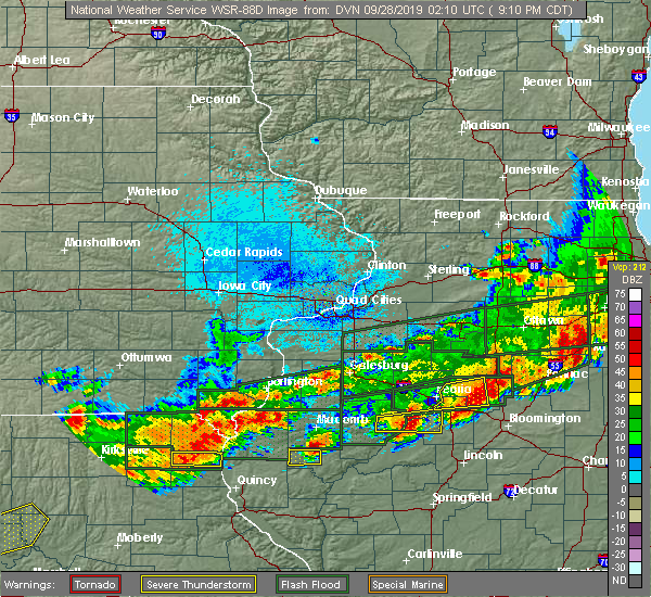 At 909 pm cdt, a severe thunderstorm was located 11 miles north of lewistown, moving east at 30 mph (radar indicated). Hazards include 60 mph wind gusts and quarter size hail. Hail damage to vehicles is expected. expect wind damage to roofs, siding, and trees. Locations impacted include, canton. At 909 pm cdt, a severe thunderstorm was located 11 miles north of lewistown, moving east at 30 mph (radar indicated). Hazards include 60 mph wind gusts and quarter size hail. Hail damage to vehicles is expected. expect wind damage to roofs, siding, and trees. Locations impacted include, canton.
|
| 9/27/2019 8:51 PM CDT |
 At 850 pm cdt, a severe thunderstorm was located over colony, moving east at 30 mph (radar indicated). Hazards include 60 mph wind gusts and half dollar size hail. Hail damage to vehicles is expected. Expect wind damage to roofs, siding, and trees. At 850 pm cdt, a severe thunderstorm was located over colony, moving east at 30 mph (radar indicated). Hazards include 60 mph wind gusts and half dollar size hail. Hail damage to vehicles is expected. Expect wind damage to roofs, siding, and trees.
|
| 9/27/2019 8:03 PM CDT | Quarter sized hail reported 0.8 miles SSW of Canton, MO, reported via law enforcement: dime-sized hail up to quarter-sized. |
| 9/27/2019 7:59 PM CDT |
 At 759 pm cdt, a severe thunderstorm capable of producing a tornado was located near canton, moving east at 40 mph (radar indicated rotation). Hazards include tornado and golf ball size hail. Flying debris will be dangerous to those caught without shelter. mobile homes will be damaged or destroyed. damage to roofs, windows, and vehicles will occur. tree damage is likely. This tornadic thunderstorm will remain over mainly rural areas of northwestern adams and northeastern lewis counties, including the following locations, monticello, meyer, ursa and lima. At 759 pm cdt, a severe thunderstorm capable of producing a tornado was located near canton, moving east at 40 mph (radar indicated rotation). Hazards include tornado and golf ball size hail. Flying debris will be dangerous to those caught without shelter. mobile homes will be damaged or destroyed. damage to roofs, windows, and vehicles will occur. tree damage is likely. This tornadic thunderstorm will remain over mainly rural areas of northwestern adams and northeastern lewis counties, including the following locations, monticello, meyer, ursa and lima.
|
| 9/27/2019 7:53 PM CDT |
 At 752 pm cdt, a severe thunderstorm capable of producing a tornado was located near ewing, moving east at 40 mph (radar indicated rotation). Hazards include tornado and golf ball size hail. Flying debris will be dangerous to those caught without shelter. mobile homes will be damaged or destroyed. damage to roofs, windows, and vehicles will occur. tree damage is likely. this dangerous storm will be near, canton and la grange around 805 pm cdt. Other locations impacted by this tornadic thunderstorm include monticello, meyer, ursa and lima. At 752 pm cdt, a severe thunderstorm capable of producing a tornado was located near ewing, moving east at 40 mph (radar indicated rotation). Hazards include tornado and golf ball size hail. Flying debris will be dangerous to those caught without shelter. mobile homes will be damaged or destroyed. damage to roofs, windows, and vehicles will occur. tree damage is likely. this dangerous storm will be near, canton and la grange around 805 pm cdt. Other locations impacted by this tornadic thunderstorm include monticello, meyer, ursa and lima.
|
| 9/27/2019 7:43 PM CDT |
 At 741 pm cdt, a severe thunderstorm capable of producing a tornado was located over lewistown, moving east at 30 mph (radar indicated rotation). Hazards include tornado and half dollar size hail. Flying debris will be dangerous to those caught without shelter. mobile homes will be damaged or destroyed. damage to roofs, windows, and vehicles will occur. tree damage is likely. this dangerous storm will be near, canton and la grange around 815 pm cdt. Other locations impacted by this tornadic thunderstorm include monticello, meyer, ursa and lima. At 741 pm cdt, a severe thunderstorm capable of producing a tornado was located over lewistown, moving east at 30 mph (radar indicated rotation). Hazards include tornado and half dollar size hail. Flying debris will be dangerous to those caught without shelter. mobile homes will be damaged or destroyed. damage to roofs, windows, and vehicles will occur. tree damage is likely. this dangerous storm will be near, canton and la grange around 815 pm cdt. Other locations impacted by this tornadic thunderstorm include monticello, meyer, ursa and lima.
|
| 9/27/2019 7:34 PM CDT |
 At 734 pm cdt, a severe thunderstorm capable of producing a tornado was located over lewistown, moving east at 40 mph (radar indicated rotation). Hazards include tornado and half dollar size hail. Flying debris will be dangerous to those caught without shelter. mobile homes will be damaged or destroyed. damage to roofs, windows, and vehicles will occur. tree damage is likely. this dangerous storm will be near, canton and la grange around 805 pm cdt. Other locations impacted by this tornadic thunderstorm include monticello, meyer, ursa and lima. At 734 pm cdt, a severe thunderstorm capable of producing a tornado was located over lewistown, moving east at 40 mph (radar indicated rotation). Hazards include tornado and half dollar size hail. Flying debris will be dangerous to those caught without shelter. mobile homes will be damaged or destroyed. damage to roofs, windows, and vehicles will occur. tree damage is likely. this dangerous storm will be near, canton and la grange around 805 pm cdt. Other locations impacted by this tornadic thunderstorm include monticello, meyer, ursa and lima.
|
| 9/27/2019 7:30 PM CDT | Quarter sized hail reported 2.1 miles SSE of Canton, MO, spotter reported hail west of canton quarter sized via twitter. |
| 9/27/2019 7:29 PM CDT |
 At 728 pm cdt, a severe thunderstorm capable of producing a tornado was located near canton, moving east at 45 mph (radar indicated rotation). Hazards include tornado and half dollar size hail. Flying debris will be dangerous to those caught without shelter. mobile homes will be damaged or destroyed. damage to roofs, windows, and vehicles will occur. tree damage is likely. this dangerous storm will be near, canton around 735 pm cdt. Other locations impacted by this tornadic thunderstorm include monticello. At 728 pm cdt, a severe thunderstorm capable of producing a tornado was located near canton, moving east at 45 mph (radar indicated rotation). Hazards include tornado and half dollar size hail. Flying debris will be dangerous to those caught without shelter. mobile homes will be damaged or destroyed. damage to roofs, windows, and vehicles will occur. tree damage is likely. this dangerous storm will be near, canton around 735 pm cdt. Other locations impacted by this tornadic thunderstorm include monticello.
|
| 9/27/2019 7:15 PM CDT |
 At 714 pm cdt, a severe thunderstorm capable of producing a tornado was located near lewistown, moving east at 35 mph (radar indicated rotation). Hazards include tornado and half dollar size hail. Flying debris will be dangerous to those caught without shelter. mobile homes will be damaged or destroyed. damage to roofs, windows, and vehicles will occur. tree damage is likely. this dangerous storm will be near, canton and la grange around 740 pm cdt. emergency management reported a funnel cloud associated with this storm northwest of lewistown. Other locations impacted by this tornadic thunderstorm include monticello. At 714 pm cdt, a severe thunderstorm capable of producing a tornado was located near lewistown, moving east at 35 mph (radar indicated rotation). Hazards include tornado and half dollar size hail. Flying debris will be dangerous to those caught without shelter. mobile homes will be damaged or destroyed. damage to roofs, windows, and vehicles will occur. tree damage is likely. this dangerous storm will be near, canton and la grange around 740 pm cdt. emergency management reported a funnel cloud associated with this storm northwest of lewistown. Other locations impacted by this tornadic thunderstorm include monticello.
|
| 9/27/2019 7:00 PM CDT |
 At 700 pm cdt, a severe thunderstorm capable of producing a tornado was located over la belle, moving east at 30 mph (radar indicated rotation). Hazards include tornado and half dollar size hail. Flying debris will be dangerous to those caught without shelter. mobile homes will be damaged or destroyed. damage to roofs, windows, and vehicles will occur. tree damage is likely. this dangerous storm will be near, la belle around 705 pm cdt. lewistown around 720 pm cdt. canton around 745 pm cdt. Other locations impacted by this tornadic thunderstorm include monticello. At 700 pm cdt, a severe thunderstorm capable of producing a tornado was located over la belle, moving east at 30 mph (radar indicated rotation). Hazards include tornado and half dollar size hail. Flying debris will be dangerous to those caught without shelter. mobile homes will be damaged or destroyed. damage to roofs, windows, and vehicles will occur. tree damage is likely. this dangerous storm will be near, la belle around 705 pm cdt. lewistown around 720 pm cdt. canton around 745 pm cdt. Other locations impacted by this tornadic thunderstorm include monticello.
|
| 9/27/2019 6:52 PM CDT |
 At 652 pm cdt, a severe thunderstorm was located over knox city, moving east at 30 mph (radar indicated). Hazards include 60 mph wind gusts and half dollar size hail. Hail damage to vehicles is expected. Expect wind damage to roofs, siding, and trees. At 652 pm cdt, a severe thunderstorm was located over knox city, moving east at 30 mph (radar indicated). Hazards include 60 mph wind gusts and half dollar size hail. Hail damage to vehicles is expected. Expect wind damage to roofs, siding, and trees.
|
| 8/20/2019 9:19 AM CDT |
 At 853 am cdt, severe thunderstorms were located along a line extending from near fandon to near philadelphia, moving southeast at 35 mph (radar indicated). Hazards include 60 mph wind gusts and quarter size hail. Hail damage to vehicles is expected. Expect wind damage to roofs, siding, and trees. At 853 am cdt, severe thunderstorms were located along a line extending from near fandon to near philadelphia, moving southeast at 35 mph (radar indicated). Hazards include 60 mph wind gusts and quarter size hail. Hail damage to vehicles is expected. Expect wind damage to roofs, siding, and trees.
|
| 8/20/2019 9:07 AM CDT | Reported at 6th st and lewis canton mo... 18-inch diameter tree dow in lewis county MO, 0.4 miles W of Canton, MO |
| 8/20/2019 8:54 AM CDT |
 At 853 am cdt, severe thunderstorms were located along a line extending from near fandon to near philadelphia, moving southeast at 35 mph (radar indicated). Hazards include 60 mph wind gusts and quarter size hail. Hail damage to vehicles is expected. Expect wind damage to roofs, siding, and trees. At 853 am cdt, severe thunderstorms were located along a line extending from near fandon to near philadelphia, moving southeast at 35 mph (radar indicated). Hazards include 60 mph wind gusts and quarter size hail. Hail damage to vehicles is expected. Expect wind damage to roofs, siding, and trees.
|
| 7/17/2019 3:28 PM CDT |
 The severe thunderstorm warning for northwestern adams, southeastern knox and lewis counties will expire at 330 pm cdt, the storms which prompted the warning have weakened below severe limits, and no longer pose an immediate threat to life or property. therefore, the warning will be allowed to expire. however gusty winds are still possible with these thunderstorms. a severe thunderstorm watch remains in effect until 900 pm cdt for west central illinois, and northeastern missouri. The severe thunderstorm warning for northwestern adams, southeastern knox and lewis counties will expire at 330 pm cdt, the storms which prompted the warning have weakened below severe limits, and no longer pose an immediate threat to life or property. therefore, the warning will be allowed to expire. however gusty winds are still possible with these thunderstorms. a severe thunderstorm watch remains in effect until 900 pm cdt for west central illinois, and northeastern missouri.
|
| 7/17/2019 3:11 PM CDT |
 At 311 pm cdt, severe thunderstorms were located along a line extending from near adrian to warsaw to 8 miles northeast of lewistown, moving east at 35 mph (radar indicated). Hazards include 60 mph wind gusts. Expect damage to roofs, siding, and trees. locations impacted include, canton, la grange, la belle, lewistown, ewing, maywood, steffenville, ursa, lima, monticello and meyer. This also includes wakonda state park. At 311 pm cdt, severe thunderstorms were located along a line extending from near adrian to warsaw to 8 miles northeast of lewistown, moving east at 35 mph (radar indicated). Hazards include 60 mph wind gusts. Expect damage to roofs, siding, and trees. locations impacted include, canton, la grange, la belle, lewistown, ewing, maywood, steffenville, ursa, lima, monticello and meyer. This also includes wakonda state park.
|
| 7/17/2019 2:58 PM CDT |
 At 258 pm cdt, severe thunderstorms were located along a line extending from near fort madison to near st. francisville to 8 miles south of kahoka, moving southeast at 45 mph (radar indicated). Hazards include 60 mph wind gusts and penny size hail. expect damage to roofs, siding, and trees At 258 pm cdt, severe thunderstorms were located along a line extending from near fort madison to near st. francisville to 8 miles south of kahoka, moving southeast at 45 mph (radar indicated). Hazards include 60 mph wind gusts and penny size hail. expect damage to roofs, siding, and trees
|
| 6/5/2019 4:56 PM CDT |
 The severe thunderstorm warning for marion, northern shelby and southern lewis counties will expire at 500 pm cdt, the storms which prompted the warning have weakened below severe limits, and no longer pose an immediate threat to life or property. therefore, the warning will be allowed to expire. however gusty winds are still possible with these thunderstorms. a severe thunderstorm watch remains in effect until 1000 pm cdt for west central illinois, and northeastern missouri. The severe thunderstorm warning for marion, northern shelby and southern lewis counties will expire at 500 pm cdt, the storms which prompted the warning have weakened below severe limits, and no longer pose an immediate threat to life or property. therefore, the warning will be allowed to expire. however gusty winds are still possible with these thunderstorms. a severe thunderstorm watch remains in effect until 1000 pm cdt for west central illinois, and northeastern missouri.
|
| 6/5/2019 4:48 PM CDT |
 At 448 pm cdt, severe thunderstorms were located along a line extending from near plevna to philadelphia to hannibal, moving east at 25 mph (radar indicated). Hazards include 60 mph wind gusts and nickel size hail. Expect damage to roofs, siding, and trees. locations impacted include, hannibal, palmyra, canton, la grange, lewistown, ewing, steffenville, maywood, emden, philadelphia, taylor, bethel, monticello and leonard. This also includes wakonda state park. At 448 pm cdt, severe thunderstorms were located along a line extending from near plevna to philadelphia to hannibal, moving east at 25 mph (radar indicated). Hazards include 60 mph wind gusts and nickel size hail. Expect damage to roofs, siding, and trees. locations impacted include, hannibal, palmyra, canton, la grange, lewistown, ewing, steffenville, maywood, emden, philadelphia, taylor, bethel, monticello and leonard. This also includes wakonda state park.
|
| 6/5/2019 4:27 PM CDT |
 At 427 pm cdt, severe thunderstorms were located along a line extending from near plevna to near steffenville to near palmyra, moving southeast at 25 mph (radar indicated). Hazards include 60 mph wind gusts and quarter size hail. Hail damage to vehicles is expected. expect wind damage to roofs, siding, and trees. locations impacted include, hannibal, palmyra, canton, la grange, la belle, lewistown, ewing, plevna, steffenville, maywood, emden, philadelphia, taylor, novelty, bethel, monticello, newark and leonard. This also includes wakonda state park. At 427 pm cdt, severe thunderstorms were located along a line extending from near plevna to near steffenville to near palmyra, moving southeast at 25 mph (radar indicated). Hazards include 60 mph wind gusts and quarter size hail. Hail damage to vehicles is expected. expect wind damage to roofs, siding, and trees. locations impacted include, hannibal, palmyra, canton, la grange, la belle, lewistown, ewing, plevna, steffenville, maywood, emden, philadelphia, taylor, novelty, bethel, monticello, newark and leonard. This also includes wakonda state park.
|
| 6/5/2019 4:11 PM CDT |
 At 411 pm cdt, severe thunderstorms were located along a line extending from 8 miles southeast of brashear to near steffenville to near palmyra, moving southeast at 25 mph (radar indicated). Hazards include 60 mph wind gusts and quarter size hail. Hail damage to vehicles is expected. Expect wind damage to roofs, siding, and trees. At 411 pm cdt, severe thunderstorms were located along a line extending from 8 miles southeast of brashear to near steffenville to near palmyra, moving southeast at 25 mph (radar indicated). Hazards include 60 mph wind gusts and quarter size hail. Hail damage to vehicles is expected. Expect wind damage to roofs, siding, and trees.
|
| 6/1/2019 4:38 PM CDT |
 At 438 pm cdt, a severe thunderstorm was located over la grange, moving southeast at 20 mph (law enforcement). Hazards include ping pong ball size hail and 60 mph wind gusts. People and animals outdoors will be injured. expect hail damage to roofs, siding, windows, and vehicles. expect wind damage to roofs, siding, and trees. locations impacted include, quincy, canton, quincy regional airport, camp point, payson, mendon, la grange, adams, burton, ursa, liberty, plainville, taylor, coatsburg, columbus, paloma and fowler. this also includes wakonda state park. This includes interstate 172 between exits 10 and 19. At 438 pm cdt, a severe thunderstorm was located over la grange, moving southeast at 20 mph (law enforcement). Hazards include ping pong ball size hail and 60 mph wind gusts. People and animals outdoors will be injured. expect hail damage to roofs, siding, windows, and vehicles. expect wind damage to roofs, siding, and trees. locations impacted include, quincy, canton, quincy regional airport, camp point, payson, mendon, la grange, adams, burton, ursa, liberty, plainville, taylor, coatsburg, columbus, paloma and fowler. this also includes wakonda state park. This includes interstate 172 between exits 10 and 19.
|
| 6/1/2019 4:30 PM CDT | Half Dollar sized hail reported 3.8 miles NNW of Canton, MO |
| 6/1/2019 4:24 PM CDT |
 At 423 pm cdt, a severe thunderstorm was located over la grange, moving southeast at 30 mph (radar indicated). Hazards include ping pong ball size hail and 60 mph wind gusts. People and animals outdoors will be injured. expect hail damage to roofs, siding, windows, and vehicles. Expect wind damage to roofs, siding, and trees. At 423 pm cdt, a severe thunderstorm was located over la grange, moving southeast at 30 mph (radar indicated). Hazards include ping pong ball size hail and 60 mph wind gusts. People and animals outdoors will be injured. expect hail damage to roofs, siding, windows, and vehicles. Expect wind damage to roofs, siding, and trees.
|
| 6/1/2019 4:14 PM CDT |
 At 413 pm cdt, a severe thunderstorm was located near canton, moving east at 35 mph (radar indicated). Hazards include ping pong ball size hail and 60 mph wind gusts. People and animals outdoors will be injured. expect hail damage to roofs, siding, windows, and vehicles. expect wind damage to roofs, siding, and trees. locations impacted include, canton, mendon, la grange, ursa, loraine, lima, monticello, meyer and fowler. This includes interstate 172 near exit 19. At 413 pm cdt, a severe thunderstorm was located near canton, moving east at 35 mph (radar indicated). Hazards include ping pong ball size hail and 60 mph wind gusts. People and animals outdoors will be injured. expect hail damage to roofs, siding, windows, and vehicles. expect wind damage to roofs, siding, and trees. locations impacted include, canton, mendon, la grange, ursa, loraine, lima, monticello, meyer and fowler. This includes interstate 172 near exit 19.
|
| 6/1/2019 4:02 PM CDT |
 At 401 pm cdt, a severe thunderstorm was located near lewistown, moving east at 40 mph (radar indicated). Hazards include 60 mph wind gusts and quarter size hail. Hail damage to vehicles is expected. expect wind damage to roofs, siding, and trees. locations impacted include, canton, mendon, la grange, lewistown, ursa, loraine, lima, monticello, meyer and fowler. This includes interstate 172 near exit 19. At 401 pm cdt, a severe thunderstorm was located near lewistown, moving east at 40 mph (radar indicated). Hazards include 60 mph wind gusts and quarter size hail. Hail damage to vehicles is expected. expect wind damage to roofs, siding, and trees. locations impacted include, canton, mendon, la grange, lewistown, ursa, loraine, lima, monticello, meyer and fowler. This includes interstate 172 near exit 19.
|
| 6/1/2019 3:51 PM CDT |
 At 351 pm cdt, a severe thunderstorm was located near lewistown, moving east at 50 mph (radar indicated). Hazards include 60 mph wind gusts and quarter size hail. Hail damage to vehicles is expected. Expect wind damage to roofs, siding, and trees. At 351 pm cdt, a severe thunderstorm was located near lewistown, moving east at 50 mph (radar indicated). Hazards include 60 mph wind gusts and quarter size hail. Hail damage to vehicles is expected. Expect wind damage to roofs, siding, and trees.
|
| 5/25/2019 8:49 PM CDT | Quarter sized hail reported 12.5 miles SSE of Canton, MO |
| 5/22/2019 8:24 PM CDT |
 At 824 pm cdt, a confirmed tornado was located 8 miles northwest of mendon, moving east at 40 mph (public confirmed tornado). Hazards include damaging tornado and half dollar size hail. Flying debris will be dangerous to those caught without shelter. mobile homes will be damaged or destroyed. damage to roofs, windows, and vehicles will occur. tree damage is likely. Locations impacted include, woodville, lima and meyer. At 824 pm cdt, a confirmed tornado was located 8 miles northwest of mendon, moving east at 40 mph (public confirmed tornado). Hazards include damaging tornado and half dollar size hail. Flying debris will be dangerous to those caught without shelter. mobile homes will be damaged or destroyed. damage to roofs, windows, and vehicles will occur. tree damage is likely. Locations impacted include, woodville, lima and meyer.
|
| 5/22/2019 8:23 PM CDT |
 At 823 pm cdt, a severe thunderstorm was located near maywood, moving northeast at 30 mph (radar indicated). Hazards include 60 mph wind gusts and half dollar size hail. Hail damage to vehicles is expected. Expect wind damage to roofs, siding, and trees. At 823 pm cdt, a severe thunderstorm was located near maywood, moving northeast at 30 mph (radar indicated). Hazards include 60 mph wind gusts and half dollar size hail. Hail damage to vehicles is expected. Expect wind damage to roofs, siding, and trees.
|
| 5/22/2019 8:14 PM CDT |
 At 814 pm cdt, a confirmed tornado was located over canton, moving east at 40 mph (public confirmed tornado). Hazards include damaging tornado and quarter size hail. Flying debris will be dangerous to those caught without shelter. mobile homes will be damaged or destroyed. damage to roofs, windows, and vehicles will occur. tree damage is likely. This tornadic thunderstorm will remain over mainly rural areas of northwestern adams and northeastern lewis counties, including the following locations, woodville, meyer and lima. At 814 pm cdt, a confirmed tornado was located over canton, moving east at 40 mph (public confirmed tornado). Hazards include damaging tornado and quarter size hail. Flying debris will be dangerous to those caught without shelter. mobile homes will be damaged or destroyed. damage to roofs, windows, and vehicles will occur. tree damage is likely. This tornadic thunderstorm will remain over mainly rural areas of northwestern adams and northeastern lewis counties, including the following locations, woodville, meyer and lima.
|
| 5/22/2019 8:04 PM CDT |
 At 804 pm cdt, a severe thunderstorm was located near canton, moving northeast at 45 mph (trained weather spotters reported quarter sized hail near monticello). Hazards include 60 mph wind gusts and half dollar size hail. Hail damage to vehicles is expected. expect wind damage to roofs, siding, and trees. Locations impacted include, canton, la grange, lewistown, ewing, ursa, lima, monticello and meyer. At 804 pm cdt, a severe thunderstorm was located near canton, moving northeast at 45 mph (trained weather spotters reported quarter sized hail near monticello). Hazards include 60 mph wind gusts and half dollar size hail. Hail damage to vehicles is expected. expect wind damage to roofs, siding, and trees. Locations impacted include, canton, la grange, lewistown, ewing, ursa, lima, monticello and meyer.
|
| 5/22/2019 7:54 PM CDT |
 At 754 pm cdt, a severe thunderstorm was located near lewistown, moving northeast at 45 mph (radar indicated). Hazards include 60 mph wind gusts and half dollar size hail. Hail damage to vehicles is expected. Expect wind damage to roofs, siding, and trees. At 754 pm cdt, a severe thunderstorm was located near lewistown, moving northeast at 45 mph (radar indicated). Hazards include 60 mph wind gusts and half dollar size hail. Hail damage to vehicles is expected. Expect wind damage to roofs, siding, and trees.
|
| 7/19/2018 8:20 PM CDT |
 At 820 pm cdt, a severe thunderstorm was located near maywood, moving southeast at 40 mph (radar indicated). Hazards include 60 mph wind gusts and quarter size hail. Hail damage to vehicles is expected. expect wind damage to roofs, siding, and trees. locations impacted include, quincy, hannibal, palmyra, canton, payson, la grange, fall creek, ewing, maywood, adams, burton, ursa, richfield, plainville, taylor, meyer, marblehead and seehorn. this also includes wakonda state park. this includes the following highways, interstate 172 between exits 2 and 19. Interstate 72 near exit 4. At 820 pm cdt, a severe thunderstorm was located near maywood, moving southeast at 40 mph (radar indicated). Hazards include 60 mph wind gusts and quarter size hail. Hail damage to vehicles is expected. expect wind damage to roofs, siding, and trees. locations impacted include, quincy, hannibal, palmyra, canton, payson, la grange, fall creek, ewing, maywood, adams, burton, ursa, richfield, plainville, taylor, meyer, marblehead and seehorn. this also includes wakonda state park. this includes the following highways, interstate 172 between exits 2 and 19. Interstate 72 near exit 4.
|
| 7/19/2018 7:56 PM CDT |
 At 756 pm cdt, a severe thunderstorm was located near lewistown, moving southeast at 40 mph (radar indicated). Hazards include 60 mph wind gusts and quarter size hail. Hail damage to vehicles is expected. Expect wind damage to roofs, siding, and trees. At 756 pm cdt, a severe thunderstorm was located near lewistown, moving southeast at 40 mph (radar indicated). Hazards include 60 mph wind gusts and quarter size hail. Hail damage to vehicles is expected. Expect wind damage to roofs, siding, and trees.
|
| 7/19/2018 7:04 PM CDT |
 At 704 pm cdt, a severe thunderstorm was located over wayland, moving southeast at 35 mph (radar indicated). Hazards include 60 mph wind gusts and quarter size hail. Hail damage to vehicles is expected. Expect wind damage to roofs, siding, and trees. At 704 pm cdt, a severe thunderstorm was located over wayland, moving southeast at 35 mph (radar indicated). Hazards include 60 mph wind gusts and quarter size hail. Hail damage to vehicles is expected. Expect wind damage to roofs, siding, and trees.
|
| 6/28/2018 3:26 PM CDT |
 The severe thunderstorm warning for knox, northern marion, shelby and lewis counties will expire at 330 pm cdt, the storms which prompted the warning have moved out of the area. therefore, the warning will be allowed to expire. a severe thunderstorm watch remains in effect until 700 pm cdt for northeastern missouri. remember, a severe thunderstorm warning still remains in effect for portions of shelby and marion counties until 430 pm cdt. The severe thunderstorm warning for knox, northern marion, shelby and lewis counties will expire at 330 pm cdt, the storms which prompted the warning have moved out of the area. therefore, the warning will be allowed to expire. a severe thunderstorm watch remains in effect until 700 pm cdt for northeastern missouri. remember, a severe thunderstorm warning still remains in effect for portions of shelby and marion counties until 430 pm cdt.
|
| 6/28/2018 2:50 PM CDT |
 At 249 pm cdt, severe thunderstorms were located along a line extending from 6 miles northeast of lewistown to 6 miles west of plevna, moving southeast at 15 mph (radar indicated). Hazards include 60 mph wind gusts and quarter size hail. Hail damage to vehicles is expected. Expect wind damage to roofs, siding, and trees. At 249 pm cdt, severe thunderstorms were located along a line extending from 6 miles northeast of lewistown to 6 miles west of plevna, moving southeast at 15 mph (radar indicated). Hazards include 60 mph wind gusts and quarter size hail. Hail damage to vehicles is expected. Expect wind damage to roofs, siding, and trees.
|
| 6/28/2018 2:37 PM CDT |
 The national weather service in st louis has issued a * severe thunderstorm warning for. adams county in west central illinois. northeastern marion county in northeastern missouri. eastern lewis county in northeastern missouri. Until 330 pm cdt. The national weather service in st louis has issued a * severe thunderstorm warning for. adams county in west central illinois. northeastern marion county in northeastern missouri. eastern lewis county in northeastern missouri. Until 330 pm cdt.
|
| 6/28/2018 2:37 PM CDT |
 At 236 pm cdt, severe thunderstorms were located along a line extending from near fort madison to 6 miles southwest of alexandria to la belle, moving southeast at 50 mph (radar indicated). Hazards include 60 mph wind gusts and quarter size hail. Hail damage to vehicles is expected. Expect wind damage to roofs, siding, and trees. At 236 pm cdt, severe thunderstorms were located along a line extending from near fort madison to 6 miles southwest of alexandria to la belle, moving southeast at 50 mph (radar indicated). Hazards include 60 mph wind gusts and quarter size hail. Hail damage to vehicles is expected. Expect wind damage to roofs, siding, and trees.
|
| 5/26/2018 5:45 PM CDT |
 At 544 pm cdt, a severe thunderstorm was located near canton, moving southeast at 10 mph (radar indicated). Hazards include 60 mph wind gusts and quarter size hail. Hail damage to vehicles is expected. Expect wind damage to roofs, siding, and trees. At 544 pm cdt, a severe thunderstorm was located near canton, moving southeast at 10 mph (radar indicated). Hazards include 60 mph wind gusts and quarter size hail. Hail damage to vehicles is expected. Expect wind damage to roofs, siding, and trees.
|
| 6/17/2017 8:28 PM CDT |
 At 828 pm cdt, a severe thunderstorm was located near colony, moving southeast at 20 mph (radar indicated). Hazards include 60 mph wind gusts and half dollar size hail. Hail damage to vehicles is expected. Expect wind damage to roofs, siding, and trees. At 828 pm cdt, a severe thunderstorm was located near colony, moving southeast at 20 mph (radar indicated). Hazards include 60 mph wind gusts and half dollar size hail. Hail damage to vehicles is expected. Expect wind damage to roofs, siding, and trees.
|
| 6/16/2017 1:26 AM CDT |
 At 125 am cdt, severe thunderstorms were located along a line extending from 8 miles northwest of canton to 6 miles northeast of ewing to 6 miles east of shelbina, moving east at 55 mph (radar indicated). Hazards include 60 mph wind gusts and penny size hail. Expect damage to roofs, siding, and trees. Locations impacted include, canton, shelbina, warren, la belle, shelbyville, lewistown, ewing, steffenville, maywood, emden, philadelphia, hunnewell, bethel, monticello and newark. At 125 am cdt, severe thunderstorms were located along a line extending from 8 miles northwest of canton to 6 miles northeast of ewing to 6 miles east of shelbina, moving east at 55 mph (radar indicated). Hazards include 60 mph wind gusts and penny size hail. Expect damage to roofs, siding, and trees. Locations impacted include, canton, shelbina, warren, la belle, shelbyville, lewistown, ewing, steffenville, maywood, emden, philadelphia, hunnewell, bethel, monticello and newark.
|
| 6/16/2017 1:06 AM CDT |
 At 105 am cdt, severe thunderstorms were located along a line extending from near colony to near steffenville to near clarence, moving northeast at 45 mph (radar indicated). Hazards include 60 mph wind gusts and penny size hail. expect damage to roofs, siding, and trees At 105 am cdt, severe thunderstorms were located along a line extending from near colony to near steffenville to near clarence, moving northeast at 45 mph (radar indicated). Hazards include 60 mph wind gusts and penny size hail. expect damage to roofs, siding, and trees
|
| 6/14/2017 3:43 PM CDT |
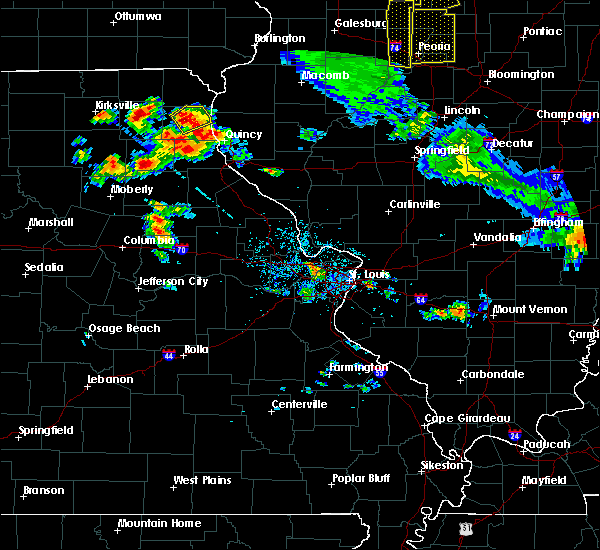 At 343 pm cdt, a severe thunderstorm was located near lewistown, moving northeast at 10 mph (radar indicated). Hazards include 60 mph wind gusts and quarter size hail. Hail damage to vehicles is expected. Expect wind damage to roofs, siding, and trees. At 343 pm cdt, a severe thunderstorm was located near lewistown, moving northeast at 10 mph (radar indicated). Hazards include 60 mph wind gusts and quarter size hail. Hail damage to vehicles is expected. Expect wind damage to roofs, siding, and trees.
|
| 6/14/2017 12:35 PM CDT |
 At 1235 pm cdt, a severe thunderstorm was located near la grange, moving east at 30 mph (radar indicated). Hazards include 60 mph wind gusts and nickel size hail. expect damage to roofs, siding, and trees At 1235 pm cdt, a severe thunderstorm was located near la grange, moving east at 30 mph (radar indicated). Hazards include 60 mph wind gusts and nickel size hail. expect damage to roofs, siding, and trees
|
| 3/29/2017 9:22 PM CDT |
 The severe thunderstorm warning for northwestern adams and lewis counties will expire at 930 pm cdt, the storm which prompted the warning has weakened below severe limits, and has exited the warned area. therefore, the warning will be allowed to expire. The severe thunderstorm warning for northwestern adams and lewis counties will expire at 930 pm cdt, the storm which prompted the warning has weakened below severe limits, and has exited the warned area. therefore, the warning will be allowed to expire.
|
| 3/29/2017 8:55 PM CDT |
 At 855 pm cdt, a severe thunderstorm was located near maywood, moving north at 60 mph (radar indicated). Hazards include quarter size hail. damage to vehicles is expected At 855 pm cdt, a severe thunderstorm was located near maywood, moving north at 60 mph (radar indicated). Hazards include quarter size hail. damage to vehicles is expected
|
| 3/6/2017 10:20 PM CST |
 At 1020 pm cst, severe thunderstorms were located along a line extending from near alexandria to maywood to near monroe city, moving east at 65 mph (radar indicated). Hazards include 60 mph wind gusts and quarter size hail. Hail damage to vehicles is expected. Expect wind damage to roofs, siding, and trees. At 1020 pm cst, severe thunderstorms were located along a line extending from near alexandria to maywood to near monroe city, moving east at 65 mph (radar indicated). Hazards include 60 mph wind gusts and quarter size hail. Hail damage to vehicles is expected. Expect wind damage to roofs, siding, and trees.
|
| 3/6/2017 10:06 PM CST |
 At 1005 pm cst, severe thunderstorms were located along a line extending from near kahoka to near granville, moving east at 55 mph (trained weather spotters. trained spotters reported winds near 60 mph near the knox and shelby county line). Hazards include 60 mph wind gusts and quarter size hail. Hail damage to vehicles is expected. expect wind damage to roofs, siding, and trees. locations impacted include, hannibal, palmyra, monroe city, canton, shelbina, paris, santa fe, warren, new london, la grange, perry, la belle, madison, shelbyville, lewistown, center, ewing, rensselaer, maywood and spaulding. this also includes wakonda state park, union covered bridge historic site, and mark twain lake recreational area. A tornado watch remains in effect until 400 am cst for west central illinois, and central and northeastern missouri. At 1005 pm cst, severe thunderstorms were located along a line extending from near kahoka to near granville, moving east at 55 mph (trained weather spotters. trained spotters reported winds near 60 mph near the knox and shelby county line). Hazards include 60 mph wind gusts and quarter size hail. Hail damage to vehicles is expected. expect wind damage to roofs, siding, and trees. locations impacted include, hannibal, palmyra, monroe city, canton, shelbina, paris, santa fe, warren, new london, la grange, perry, la belle, madison, shelbyville, lewistown, center, ewing, rensselaer, maywood and spaulding. this also includes wakonda state park, union covered bridge historic site, and mark twain lake recreational area. A tornado watch remains in effect until 400 am cst for west central illinois, and central and northeastern missouri.
|
| 3/6/2017 9:33 PM CST |
 At 932 pm cst, severe thunderstorms were located along a line extending from near memphis to 9 miles northwest of huntsville, moving east at 55 mph (radar indicated). Hazards include 60 mph wind gusts and quarter size hail. Hail damage to vehicles is expected. Expect wind damage to roofs, siding, and trees. At 932 pm cst, severe thunderstorms were located along a line extending from near memphis to 9 miles northwest of huntsville, moving east at 55 mph (radar indicated). Hazards include 60 mph wind gusts and quarter size hail. Hail damage to vehicles is expected. Expect wind damage to roofs, siding, and trees.
|
| 7/19/2016 5:27 PM CDT |
 At 526 pm cdt, severe thunderstorms were located along a line extending from 6 miles north of canton to near quincy to near fall creek, moving east at 30 mph (law enforcement reported a tree blocking railroad tracks in canton mo). Hazards include 60 mph wind gusts. Expect damage to roofs. siding. And trees. At 526 pm cdt, severe thunderstorms were located along a line extending from 6 miles north of canton to near quincy to near fall creek, moving east at 30 mph (law enforcement reported a tree blocking railroad tracks in canton mo). Hazards include 60 mph wind gusts. Expect damage to roofs. siding. And trees.
|
| 7/19/2016 5:15 PM CDT | Large tree fell on pickup truck on rte c btw rte bb and z. tree blocking railroad tracks in town in lewis county MO, 0.4 miles W of Canton, MO |
| 7/10/2016 4:57 PM CDT |
 The severe thunderstorm warning for western adams, southeastern lewis and northern marion counties will expire at 500 pm cdt, the storms which prompted the warning have weakened below severe limits, and no longer pose an immediate threat to life or property. therefore the warning will be allowed to expire. however gusty winds and heavy rain are still possible with these thunderstorms. The severe thunderstorm warning for western adams, southeastern lewis and northern marion counties will expire at 500 pm cdt, the storms which prompted the warning have weakened below severe limits, and no longer pose an immediate threat to life or property. therefore the warning will be allowed to expire. however gusty winds and heavy rain are still possible with these thunderstorms.
|
| 7/10/2016 4:42 PM CDT |
 At 442 pm cdt, severe thunderstorms were located along a line extending from 6 miles east of canton to near la grange to near philadelphia, moving southeast at 15 mph (radar indicated). Hazards include 60 mph wind gusts. Expect damage to roofs. siding. and trees. locations impacted include, quincy, canton, la grange, maywood, ursa, taylor, lima and meyer. This also includes wakonda state park. At 442 pm cdt, severe thunderstorms were located along a line extending from 6 miles east of canton to near la grange to near philadelphia, moving southeast at 15 mph (radar indicated). Hazards include 60 mph wind gusts. Expect damage to roofs. siding. and trees. locations impacted include, quincy, canton, la grange, maywood, ursa, taylor, lima and meyer. This also includes wakonda state park.
|
| 7/10/2016 4:30 PM CDT |
 At 430 pm cdt, severe thunderstorms were located along a line extending from canton to near maywood, moving east southeast at 10 mph (radar indicated). Hazards include 60 mph wind gusts and quarter size hail. Hail damage to vehicles is expected. expect wind damage to roofs, siding, and trees. locations impacted include, quincy, canton, la grange, ewing, maywood, taylor, lima and meyer. This also includes wakonda state park. At 430 pm cdt, severe thunderstorms were located along a line extending from canton to near maywood, moving east southeast at 10 mph (radar indicated). Hazards include 60 mph wind gusts and quarter size hail. Hail damage to vehicles is expected. expect wind damage to roofs, siding, and trees. locations impacted include, quincy, canton, la grange, ewing, maywood, taylor, lima and meyer. This also includes wakonda state park.
|
| 7/10/2016 4:19 PM CDT |
 At 419 pm cdt, severe thunderstorms were located along a line extending from near canton to near maywood, and are nearly stationary (radar indicated). Hazards include 60 mph wind gusts and quarter size hail. Hail damage to vehicles is expected. Expect wind damage to roofs, siding, and trees. At 419 pm cdt, severe thunderstorms were located along a line extending from near canton to near maywood, and are nearly stationary (radar indicated). Hazards include 60 mph wind gusts and quarter size hail. Hail damage to vehicles is expected. Expect wind damage to roofs, siding, and trees.
|
| 7/7/2016 7:39 AM CDT |
 At 738 am cdt, severe thunderstorms were located along a line extending from 11 miles south of kahoka to warren, moving east at 45 mph (radar indicated). Hazards include 60 mph wind gusts and penny size hail. Expect damage to roofs. siding. and trees. locations impacted include, hannibal, palmyra, canton, warren, la grange, la belle, lewistown, ewing, emden, philadelphia, steffenville, maywood, taylor and monticello. This also includes wakonda state park. At 738 am cdt, severe thunderstorms were located along a line extending from 11 miles south of kahoka to warren, moving east at 45 mph (radar indicated). Hazards include 60 mph wind gusts and penny size hail. Expect damage to roofs. siding. and trees. locations impacted include, hannibal, palmyra, canton, warren, la grange, la belle, lewistown, ewing, emden, philadelphia, steffenville, maywood, taylor and monticello. This also includes wakonda state park.
|
| 7/7/2016 7:11 AM CDT |
 At 710 am cdt, severe thunderstorms were located along a line extending from near rutledge to near shelbyville, moving east at 45 mph (radar indicated. a 61 mile per hour wind gust was reported 1 mile east of novelty at 7:02 am). Hazards include 60 mph wind gusts. Expect damage to roofs. siding. And trees. At 710 am cdt, severe thunderstorms were located along a line extending from near rutledge to near shelbyville, moving east at 45 mph (radar indicated. a 61 mile per hour wind gust was reported 1 mile east of novelty at 7:02 am). Hazards include 60 mph wind gusts. Expect damage to roofs. siding. And trees.
|
| 5/11/2016 9:53 PM CDT |
 At 953 pm cdt, a severe thunderstorm was located over ewing, moving east at 40 mph (radar indicated). Hazards include quarter size hail. damage to vehicles is expected At 953 pm cdt, a severe thunderstorm was located over ewing, moving east at 40 mph (radar indicated). Hazards include quarter size hail. damage to vehicles is expected
|
| 4/27/2016 9:36 PM CDT |
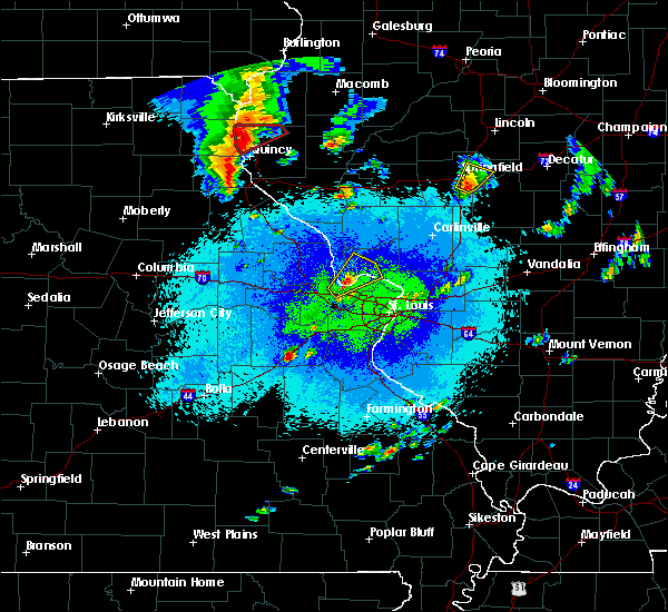 At 936 pm cdt, a severe thunderstorm capable of producing a tornado was located over mendon, moving east at 25 mph (radar indicated rotation). Hazards include tornado and ping pong ball size hail. Flying debris will be dangerous to those caught without shelter. mobile homes will be damaged or destroyed. damage to roofs, windows, and vehicles will occur. tree damage is likely. this dangerous storm will be near, mendon around 945 pm cdt. Other locations impacted by this tornadic thunderstorm include lima, woodville, loraine, ursa and meyer. At 936 pm cdt, a severe thunderstorm capable of producing a tornado was located over mendon, moving east at 25 mph (radar indicated rotation). Hazards include tornado and ping pong ball size hail. Flying debris will be dangerous to those caught without shelter. mobile homes will be damaged or destroyed. damage to roofs, windows, and vehicles will occur. tree damage is likely. this dangerous storm will be near, mendon around 945 pm cdt. Other locations impacted by this tornadic thunderstorm include lima, woodville, loraine, ursa and meyer.
|
| 4/27/2016 9:24 PM CDT | Golf Ball sized hail reported 0.4 miles W of Canton, MO |
| 4/27/2016 9:15 PM CDT |
 At 915 pm cdt, a confirmed tornado was located over la grange, moving northeast at 30 mph (law enforcement confirmed tornado). Hazards include damaging tornado and ping pong ball size hail. Flying debris will be dangerous to those caught without shelter. mobile homes will be damaged or destroyed. damage to roofs, windows, and vehicles will occur. tree damage is likely. the tornado will be near, mendon around 940 pm cdt. other locations impacted by this tornadic thunderstorm include lima, woodville, loraine, ursa and meyer. This also includes wakonda state park. At 915 pm cdt, a confirmed tornado was located over la grange, moving northeast at 30 mph (law enforcement confirmed tornado). Hazards include damaging tornado and ping pong ball size hail. Flying debris will be dangerous to those caught without shelter. mobile homes will be damaged or destroyed. damage to roofs, windows, and vehicles will occur. tree damage is likely. the tornado will be near, mendon around 940 pm cdt. other locations impacted by this tornadic thunderstorm include lima, woodville, loraine, ursa and meyer. This also includes wakonda state park.
|
| 4/27/2016 9:06 PM CDT |
 At 905 pm cdt, a severe thunderstorm was located near maywood, moving northeast at 30 mph (radar indicated). Hazards include ping pong ball size hail and 60 mph wind gusts. People and animals outdoors will be injured. expect hail damage to roofs, siding, windows, and vehicles. expect wind damage to roofs, siding, and trees. locations impacted include, quincy, canton, la grange, ewing, maywood, ursa and meyer. this also includes wakonda state park. A tornado watch remains in effect until 1000 pm cdt for west central illinois, and northeastern missouri. At 905 pm cdt, a severe thunderstorm was located near maywood, moving northeast at 30 mph (radar indicated). Hazards include ping pong ball size hail and 60 mph wind gusts. People and animals outdoors will be injured. expect hail damage to roofs, siding, windows, and vehicles. expect wind damage to roofs, siding, and trees. locations impacted include, quincy, canton, la grange, ewing, maywood, ursa and meyer. this also includes wakonda state park. A tornado watch remains in effect until 1000 pm cdt for west central illinois, and northeastern missouri.
|
| 4/27/2016 8:48 PM CDT |
 At 848 pm cdt, a severe thunderstorm was located near maywood, moving northeast at 25 mph (radar indicated). Hazards include ping pong ball size hail and 60 mph wind gusts. People and animals outdoors will be injured. expect hail damage to roofs, siding, windows, and vehicles. Expect wind damage to roofs, siding, and trees. At 848 pm cdt, a severe thunderstorm was located near maywood, moving northeast at 25 mph (radar indicated). Hazards include ping pong ball size hail and 60 mph wind gusts. People and animals outdoors will be injured. expect hail damage to roofs, siding, windows, and vehicles. Expect wind damage to roofs, siding, and trees.
|
| 3/15/2016 5:36 PM CDT | Tennis Ball sized hail reported 11 miles SSE of Canton, MO, time estimated. |
| 3/15/2016 5:30 PM CDT | Quarter sized hail reported 11 miles SSE of Canton, MO, quarter size hail reported. |
| 3/15/2016 4:55 PM CDT |
 At 455 pm cdt, a severe thunderstorm was located over la grange, moving northeast at 45 mph (radar indicated). Hazards include 60 mph wind gusts and quarter size hail. Hail damage to vehicles is expected. Expect wind damage to roofs, siding and trees. At 455 pm cdt, a severe thunderstorm was located over la grange, moving northeast at 45 mph (radar indicated). Hazards include 60 mph wind gusts and quarter size hail. Hail damage to vehicles is expected. Expect wind damage to roofs, siding and trees.
|
| 11/11/2015 5:28 PM CST | Large tree blown down in lewis county MO, 0.4 miles W of Canton, MO |
| 11/11/2015 5:19 PM CST |
 At 518 pm cst, a severe thunderstorm was located near canton, moving northeast at 55 mph (radar indicated). Hazards include 70 mph wind gusts. Expect considerable tree damage. damage is likely to mobile homes, roofs and outbuildings. locations impacted include, canton, mendon, la grange, ursa, loraine, woodville, lima and meyer. A tornado watch remains in effect until 900 pm cst for west central illinois and northeastern missouri. At 518 pm cst, a severe thunderstorm was located near canton, moving northeast at 55 mph (radar indicated). Hazards include 70 mph wind gusts. Expect considerable tree damage. damage is likely to mobile homes, roofs and outbuildings. locations impacted include, canton, mendon, la grange, ursa, loraine, woodville, lima and meyer. A tornado watch remains in effect until 900 pm cst for west central illinois and northeastern missouri.
|
| 11/11/2015 5:05 PM CST |
 At 505 pm cst, a severe thunderstorm was located near la grange, moving northeast at 55 mph (radar indicated). Hazards include 70 mph wind gusts. Expect considerable tree damage. damage is likely to mobile homes, roofs and outbuildings. locations impacted include, canton, mendon, la grange, ewing, philadelphia, maywood, ursa, loraine, woodville, taylor, lima, monticello, chatton and meyer. this warning also includes wakonda state park. A tornado watch remains in effect until 900 pm cst for west central illinois and northeastern missouri. At 505 pm cst, a severe thunderstorm was located near la grange, moving northeast at 55 mph (radar indicated). Hazards include 70 mph wind gusts. Expect considerable tree damage. damage is likely to mobile homes, roofs and outbuildings. locations impacted include, canton, mendon, la grange, ewing, philadelphia, maywood, ursa, loraine, woodville, taylor, lima, monticello, chatton and meyer. this warning also includes wakonda state park. A tornado watch remains in effect until 900 pm cst for west central illinois and northeastern missouri.
|
| 11/11/2015 4:52 PM CST |
 At 452 pm cst, a severe thunderstorm was located near ewing, moving northeast at 55 mph (radar indicated). Hazards include 70 mph wind gusts. Expect considerable tree damage. Damage is likely to mobile homes, roofs and outbuildings. At 452 pm cst, a severe thunderstorm was located near ewing, moving northeast at 55 mph (radar indicated). Hazards include 70 mph wind gusts. Expect considerable tree damage. Damage is likely to mobile homes, roofs and outbuildings.
|
| 7/16/2015 7:01 PM CDT |
 At 701 pm cdt, a severe thunderstorm was located over la grange, moving east at 35 mph (radar indicated). Hazards include 60 mph wind gusts and quarter size hail. Hail damage to vehicles is expected. Expect wind damage to roofs, siding and trees. At 701 pm cdt, a severe thunderstorm was located over la grange, moving east at 35 mph (radar indicated). Hazards include 60 mph wind gusts and quarter size hail. Hail damage to vehicles is expected. Expect wind damage to roofs, siding and trees.
|
| 7/16/2015 6:47 PM CDT |
 At 647 pm cdt, a severe thunderstorm was located near ewing, moving east at 35 mph (radar indicated). Hazards include 60 mph wind gusts and quarter size hail. Hail damage to vehicles is expected. expect wind damage to roofs, siding and trees. locations impacted include, canton, la grange, lewistown, ewing, maywood and monticello. This warning also includes wakonda state park. At 647 pm cdt, a severe thunderstorm was located near ewing, moving east at 35 mph (radar indicated). Hazards include 60 mph wind gusts and quarter size hail. Hail damage to vehicles is expected. expect wind damage to roofs, siding and trees. locations impacted include, canton, la grange, lewistown, ewing, maywood and monticello. This warning also includes wakonda state park.
|
| 7/16/2015 6:25 PM CDT |
 At 625 pm cdt, a severe thunderstorm was located over la belle, moving east at 30 mph (radar indicated). Hazards include 70 mph wind gusts and half dollar size hail. Hail damage to vehicles is expected. expect considerable tree damage. Wind damage is also likely to mobile homes, roofs and outbuildings. At 625 pm cdt, a severe thunderstorm was located over la belle, moving east at 30 mph (radar indicated). Hazards include 70 mph wind gusts and half dollar size hail. Hail damage to vehicles is expected. expect considerable tree damage. Wind damage is also likely to mobile homes, roofs and outbuildings.
|
| 7/13/2015 6:12 PM CDT |
 At 612 pm cdt, a severe thunderstorm was located near mendon, moving east at 55 mph (trained weather spotters). Hazards include 70 mph wind gusts and quarter size hail. Hail damage to vehicles is expected. expect considerable tree damage. wind damage is also likely to mobile homes, roofs and outbuildings. locations impacted include, quincy, canton, payson, mendon, la grange, lewistown, fall creek, ewing, maywood, adams, burton, ursa, loraine, woodville, taylor, lima, coatsburg, monticello, meyer and fowler. this warning also includes wakonda state park. This includes interstate 172 between exits 2 and 19. At 612 pm cdt, a severe thunderstorm was located near mendon, moving east at 55 mph (trained weather spotters). Hazards include 70 mph wind gusts and quarter size hail. Hail damage to vehicles is expected. expect considerable tree damage. wind damage is also likely to mobile homes, roofs and outbuildings. locations impacted include, quincy, canton, payson, mendon, la grange, lewistown, fall creek, ewing, maywood, adams, burton, ursa, loraine, woodville, taylor, lima, coatsburg, monticello, meyer and fowler. this warning also includes wakonda state park. This includes interstate 172 between exits 2 and 19.
|
| 7/13/2015 6:04 PM CDT |
 At 603 pm cdt, a severe thunderstorm was located over canton, moving east at 55 mph (trained weather spotters). Hazards include 70 mph wind gusts and quarter size hail. Hail damage to vehicles is expected. expect considerable tree damage. wind damage is also likely to mobile homes, roofs and outbuildings. locations impacted include, quincy, canton, payson, mendon, la grange, la belle, lewistown, fall creek, ewing, steffenville, maywood, adams, burton, ursa, loraine, woodville, taylor, lima, coatsburg and monticello. this warning also includes wakonda state park. This includes interstate 172 between exits 2 and 19. At 603 pm cdt, a severe thunderstorm was located over canton, moving east at 55 mph (trained weather spotters). Hazards include 70 mph wind gusts and quarter size hail. Hail damage to vehicles is expected. expect considerable tree damage. wind damage is also likely to mobile homes, roofs and outbuildings. locations impacted include, quincy, canton, payson, mendon, la grange, la belle, lewistown, fall creek, ewing, steffenville, maywood, adams, burton, ursa, loraine, woodville, taylor, lima, coatsburg and monticello. this warning also includes wakonda state park. This includes interstate 172 between exits 2 and 19.
|
| 7/13/2015 6:00 PM CDT | Canton police reported a mobile home pushed off its foundation. trees and power lines down across tow in lewis county MO, 0.4 miles W of Canton, MO |
| 7/13/2015 5:49 PM CDT |
 At 549 pm cdt, a severe thunderstorm was located near lewistown, moving east at 55 mph (trained weather spotters). Hazards include 70 mph wind gusts and quarter size hail. Hail damage to vehicles is expected. expect considerable tree damage. wind damage is also likely to mobile homes, roofs and outbuildings. locations impacted include, quincy, canton, payson, mendon, la grange, la belle, lewistown, fall creek, ewing, steffenville, maywood, adams, burton, ursa, loraine, woodville, taylor, lima, coatsburg and monticello. this warning also includes wakonda state park. This includes interstate 172 between exits 2 and 19. At 549 pm cdt, a severe thunderstorm was located near lewistown, moving east at 55 mph (trained weather spotters). Hazards include 70 mph wind gusts and quarter size hail. Hail damage to vehicles is expected. expect considerable tree damage. wind damage is also likely to mobile homes, roofs and outbuildings. locations impacted include, quincy, canton, payson, mendon, la grange, la belle, lewistown, fall creek, ewing, steffenville, maywood, adams, burton, ursa, loraine, woodville, taylor, lima, coatsburg and monticello. this warning also includes wakonda state park. This includes interstate 172 between exits 2 and 19.
|
| 7/13/2015 5:49 PM CDT |
 A severe thunderstorm warning remains in effect until 630 pm cdt for western adams. northeastern shelby. lewis and northern marion counties. at 549 pm cdt. a severe thunderstorm was located near lewistown. moving east at 55 mph. hazard. 70 mph wind gusts and quarter size hail. A severe thunderstorm warning remains in effect until 630 pm cdt for western adams. northeastern shelby. lewis and northern marion counties. at 549 pm cdt. a severe thunderstorm was located near lewistown. moving east at 55 mph. hazard. 70 mph wind gusts and quarter size hail.
|
| 7/13/2015 5:37 PM CDT |
 At 537 pm cdt, a severe thunderstorm was located over knox city, moving east at 55 mph (trained weather spotters). Hazards include 70 mph wind gusts and quarter size hail. Hail damage to vehicles is expected. expect considerable tree damage. Wind damage is also likely to mobile homes, roofs and outbuildings. At 537 pm cdt, a severe thunderstorm was located over knox city, moving east at 55 mph (trained weather spotters). Hazards include 70 mph wind gusts and quarter size hail. Hail damage to vehicles is expected. expect considerable tree damage. Wind damage is also likely to mobile homes, roofs and outbuildings.
|
| 7/13/2015 5:37 PM CDT |
 The national weather service in st louis has issued a * severe thunderstorm warning for. western adams county in west central illinois. northeastern shelby county in northeastern missouri. lewis county in northeastern missouri. Northern marion county in northeastern missouri. The national weather service in st louis has issued a * severe thunderstorm warning for. western adams county in west central illinois. northeastern shelby county in northeastern missouri. lewis county in northeastern missouri. Northern marion county in northeastern missouri.
|
| 6/22/2015 8:36 PM CDT |
 At 833 pm cdt, a severe thunderstorm was located 6 miles northeast of la grange, and moving southeast at 50 mph (trained weather spotters reported damage to a metal barn north of monticello missouri). Hazards include 60 mph wind gusts. Expect damage to roofs. siding and trees. locations impacted include, quincy, mendon, golden, camp point, ursa, loraine, woodville, fowler, paloma, marblehead, coatsburg, chatton, burton, la prairie and columbus. This warning also includes, interstate 172 from exit 10 to exit 19. At 833 pm cdt, a severe thunderstorm was located 6 miles northeast of la grange, and moving southeast at 50 mph (trained weather spotters reported damage to a metal barn north of monticello missouri). Hazards include 60 mph wind gusts. Expect damage to roofs. siding and trees. locations impacted include, quincy, mendon, golden, camp point, ursa, loraine, woodville, fowler, paloma, marblehead, coatsburg, chatton, burton, la prairie and columbus. This warning also includes, interstate 172 from exit 10 to exit 19.
|
| 6/22/2015 8:26 PM CDT |
 At 823 pm cdt, a severe thunderstorm was located near canton, and moving southeast at 50 mph (trained weather spotters. damage was reported to a metal barn north of monticello missouri). Hazards include 60 mph wind gusts. Expect damage to roofs. siding and trees. locations impacted include, quincy, maywood, la grange, mendon, golden, camp point, lima, taylor, ursa, loraine, woodville, fowler, paloma, marblehead, coatsburg, chatton, burton, la prairie and columbus. this warning includes wakonda state park. This warning also includes, interstate 172 from exit 10 to exit 19. At 823 pm cdt, a severe thunderstorm was located near canton, and moving southeast at 50 mph (trained weather spotters. damage was reported to a metal barn north of monticello missouri). Hazards include 60 mph wind gusts. Expect damage to roofs. siding and trees. locations impacted include, quincy, maywood, la grange, mendon, golden, camp point, lima, taylor, ursa, loraine, woodville, fowler, paloma, marblehead, coatsburg, chatton, burton, la prairie and columbus. this warning includes wakonda state park. This warning also includes, interstate 172 from exit 10 to exit 19.
|
| 6/22/2015 8:24 PM CDT |
 The tornado warning for northeastern lewis county will expire at 830 pm cdt, the tornado threat has diminished, therefore the tornado warning has expired. however, a severe thunderstorm warning remains in effect for the area, and gusty winds are still possible with this thunderstorm. in addition, strong thunderstorms may redevelop, and a severe thunderstorm watch remains in effect until midnight. The tornado warning for northeastern lewis county will expire at 830 pm cdt, the tornado threat has diminished, therefore the tornado warning has expired. however, a severe thunderstorm warning remains in effect for the area, and gusty winds are still possible with this thunderstorm. in addition, strong thunderstorms may redevelop, and a severe thunderstorm watch remains in effect until midnight.
|
| 6/22/2015 8:12 PM CDT |
 At 811 pm cdt, a severe thunderstorm was located 11 miles southwest of wayland, and moving southeast at 50 mph (radar indicated). Hazards include 60 mph wind gusts. Expect damage to roofs. Siding and trees. At 811 pm cdt, a severe thunderstorm was located 11 miles southwest of wayland, and moving southeast at 50 mph (radar indicated). Hazards include 60 mph wind gusts. Expect damage to roofs. Siding and trees.
|
| 6/22/2015 7:49 PM CDT |
 At 745 pm cdt, a severe thunderstorm capable of producing a tornado was located near wyaconda, and moving southeast at 40 mph (law enforcement reported funnel cloud). Hazards include tornado. Flying debris will be dangerous to those caught without shelter. mobile homes will be damaged or destroyed. damage to roofs, windows and vehicles will occur. tree damage is likely. This dangerous storm will be near, canton around 830 pm cdt. At 745 pm cdt, a severe thunderstorm capable of producing a tornado was located near wyaconda, and moving southeast at 40 mph (law enforcement reported funnel cloud). Hazards include tornado. Flying debris will be dangerous to those caught without shelter. mobile homes will be damaged or destroyed. damage to roofs, windows and vehicles will occur. tree damage is likely. This dangerous storm will be near, canton around 830 pm cdt.
|
| 6/20/2015 9:50 PM CDT |
 The severe thunderstorm warning for northern shelby, northern marion, southern lewis, southern knox, brown and central adams counties will expire at 1000 pm cdt, the line of storms which prompted the warning has weakened below severe limits, and no longer poses an immediate threat to life or property. however, gusty winds and heavy rain are still possible with these thunderstorms. in addition, strong thunderstorms may redevelop, and a tornado watch remains in effect until 11 pm. The severe thunderstorm warning for northern shelby, northern marion, southern lewis, southern knox, brown and central adams counties will expire at 1000 pm cdt, the line of storms which prompted the warning has weakened below severe limits, and no longer poses an immediate threat to life or property. however, gusty winds and heavy rain are still possible with these thunderstorms. in addition, strong thunderstorms may redevelop, and a tornado watch remains in effect until 11 pm.
|
| 6/20/2015 9:24 PM CDT |
 The severe thunderstorm warning for northern lewis, northern knox and northern adams counties will expire at 930 pm cdt, the line of storms which prompted the warning has weakened below severe limits, and no longer poses an immediate threat to life or property. however, gusty winds and heavy rain are still possible with these thunderstorms. in addition, strong thunderstorms may redevelop, and a tornado watch remains in effect until 11 pm. The severe thunderstorm warning for northern lewis, northern knox and northern adams counties will expire at 930 pm cdt, the line of storms which prompted the warning has weakened below severe limits, and no longer poses an immediate threat to life or property. however, gusty winds and heavy rain are still possible with these thunderstorms. in addition, strong thunderstorms may redevelop, and a tornado watch remains in effect until 11 pm.
|
| 6/20/2015 8:55 PM CDT |
 At 853 pm cdt, severe thunderstorms were located along a line extending from vermont to 5 miles southwest of west point to green city, and moving southeast at 25 mph (radar indicated). Hazards include 60 mph wind gusts. Expect damage to roofs. Siding and trees. At 853 pm cdt, severe thunderstorms were located along a line extending from vermont to 5 miles southwest of west point to green city, and moving southeast at 25 mph (radar indicated). Hazards include 60 mph wind gusts. Expect damage to roofs. Siding and trees.
|
| 6/20/2015 8:23 PM CDT |
 At 821 pm cdt, severe thunderstorms were located along a line extending from 13 miles north of industry to alexandria to 9 miles northeast of greentop, and moving southeast at 40 mph (law enforcement in scotland county missouri reported widespread tree damage). Hazards include 60 mph wind gusts. Expect damage to roofs. Siding and trees. At 821 pm cdt, severe thunderstorms were located along a line extending from 13 miles north of industry to alexandria to 9 miles northeast of greentop, and moving southeast at 40 mph (law enforcement in scotland county missouri reported widespread tree damage). Hazards include 60 mph wind gusts. Expect damage to roofs. Siding and trees.
|
| 6/8/2015 2:58 PM CDT |
 At 255 pm cdt, a severe thunderstorm was located near la grange, and moving southeast at 30 mph (trained weather spotters report quarter size hail in ursa). Hazards include 60 mph wind gusts and quarter size hail. Hail damage to vehicles is expected. expect wind damage to roofs, siding and trees. locations impacted include, fowler, paloma, coatsburg and columbus. This warning also includes, interstate 172 near exit 19. At 255 pm cdt, a severe thunderstorm was located near la grange, and moving southeast at 30 mph (trained weather spotters report quarter size hail in ursa). Hazards include 60 mph wind gusts and quarter size hail. Hail damage to vehicles is expected. expect wind damage to roofs, siding and trees. locations impacted include, fowler, paloma, coatsburg and columbus. This warning also includes, interstate 172 near exit 19.
|
| 6/8/2015 2:54 PM CDT |
 At 252 pm cdt, a severe thunderstorm was located near la grange, and moving southeast at 30 mph (radar indicated). Hazards include 60 mph wind gusts and quarter size hail. Hail damage to vehicles is expected. expect wind damage to roofs, siding and trees. locations impacted include, mendon, ursa, fowler, paloma, coatsburg and columbus. This warning also includes, interstate 172 near exit 19. At 252 pm cdt, a severe thunderstorm was located near la grange, and moving southeast at 30 mph (radar indicated). Hazards include 60 mph wind gusts and quarter size hail. Hail damage to vehicles is expected. expect wind damage to roofs, siding and trees. locations impacted include, mendon, ursa, fowler, paloma, coatsburg and columbus. This warning also includes, interstate 172 near exit 19.
|
| 6/8/2015 2:43 PM CDT |
 At 242 pm cdt, a severe thunderstorm was located 6 miles west of mendon, and moving southeast at 30 mph (radar indicated). Hazards include 60 mph wind gusts and quarter size hail. Hail damage to vehicles is expected. expect wind damage to roofs, siding and trees. locations impacted include, mendon, camp point, ursa, loraine, fowler, paloma, coatsburg and columbus. This warning also includes, interstate 172 near exit 19. At 242 pm cdt, a severe thunderstorm was located 6 miles west of mendon, and moving southeast at 30 mph (radar indicated). Hazards include 60 mph wind gusts and quarter size hail. Hail damage to vehicles is expected. expect wind damage to roofs, siding and trees. locations impacted include, mendon, camp point, ursa, loraine, fowler, paloma, coatsburg and columbus. This warning also includes, interstate 172 near exit 19.
|
| 6/8/2015 2:31 PM CDT |
 At 228 pm cdt, a severe thunderstorm was located 6 miles northeast of canton, and moving southeast at 30 mph (radar indicated). Hazards include 60 mph wind gusts and quarter size hail. Hail damage to vehicles is expected. expect wind damage to roofs, siding and trees. locations impacted include, la grange, mendon, camp point, lima, ursa, loraine, fowler, paloma, coatsburg and columbus. This warning also includes, interstate 172 near exit 19. At 228 pm cdt, a severe thunderstorm was located 6 miles northeast of canton, and moving southeast at 30 mph (radar indicated). Hazards include 60 mph wind gusts and quarter size hail. Hail damage to vehicles is expected. expect wind damage to roofs, siding and trees. locations impacted include, la grange, mendon, camp point, lima, ursa, loraine, fowler, paloma, coatsburg and columbus. This warning also includes, interstate 172 near exit 19.
|
| 6/8/2015 2:12 PM CDT |
 At 208 pm cdt, a severe thunderstorm was located 5 miles southwest of wayland, and moving southeast at 30 mph (radar indicated). Hazards include 60 mph wind gusts and quarter size hail. Hail damage to vehicles is expected. Expect wind damage to roofs, siding and trees. At 208 pm cdt, a severe thunderstorm was located 5 miles southwest of wayland, and moving southeast at 30 mph (radar indicated). Hazards include 60 mph wind gusts and quarter size hail. Hail damage to vehicles is expected. Expect wind damage to roofs, siding and trees.
|
| 4/9/2015 4:41 PM CDT | The severe thunderstorm warning for lewis county will expire at 445 pm cdt. the storm which prompted the warning has weakened below severe limits. and no longer poses an immediate threat to life or property. however. The storm will still be capable of producing nickle size hail and 40 to 50 mph wind gusts. |
| 4/9/2015 4:28 PM CDT | A severe thunderstorm warning remains in effect for lewis county until 445 pm cdt. at 427 pm cdt. a severe thunderstorm was located near ewing. and moving northeast at 60 mph. hazard. 60 mph wind gusts and quarter size hail. source. Radar indicated. |
| 4/9/2015 4:16 PM CDT | The national weather service in st louis has issued a * severe thunderstorm warning for. lewis county in northeast missouri. until 445 pm cdt * at 414 pm cdt. a severe thunderstorm was located near steffenville. And moving northeast at 35 mph. |
| 1/1/0001 12:00 AM | Measured at lock and dam 20 in lewis county MO, 0.4 miles W of Canton, MO |
Hail Maps for Canton, MO


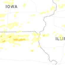
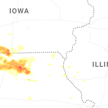
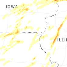
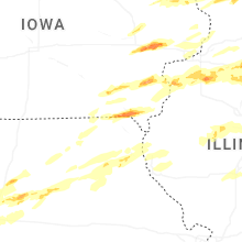
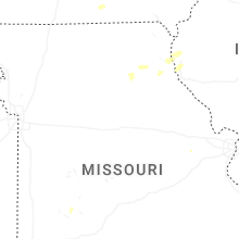


Connect with Interactive Hail Maps