

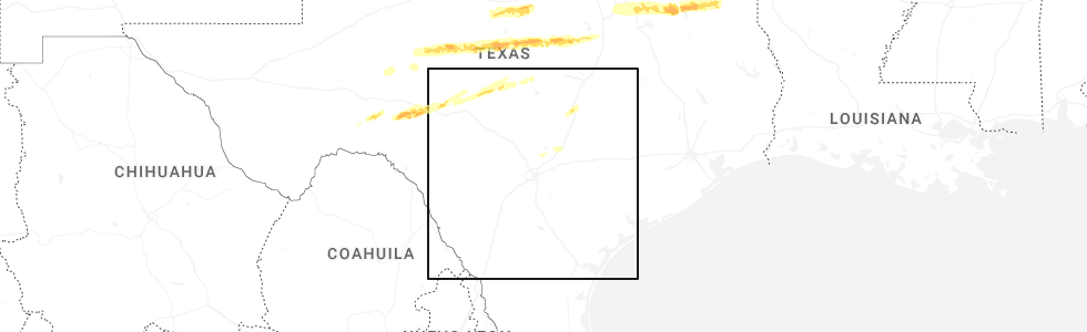
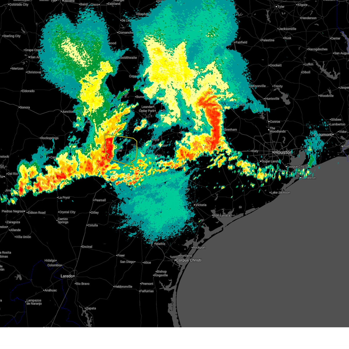
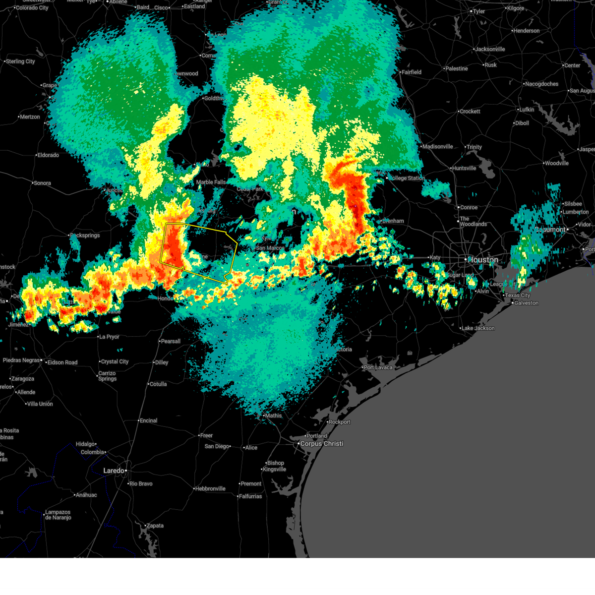
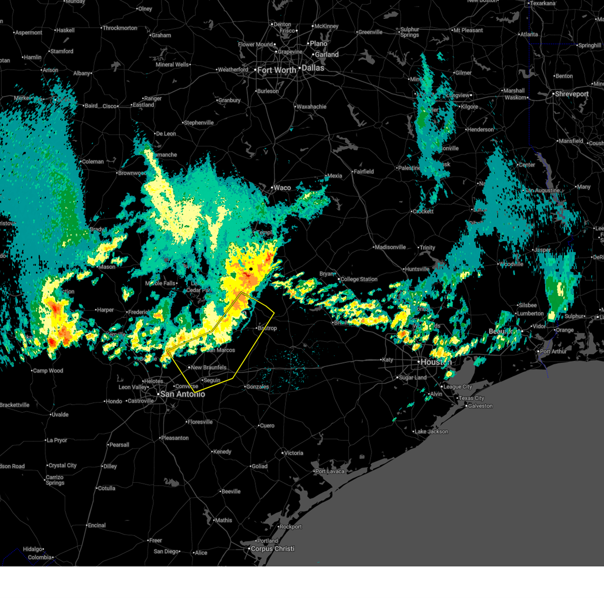
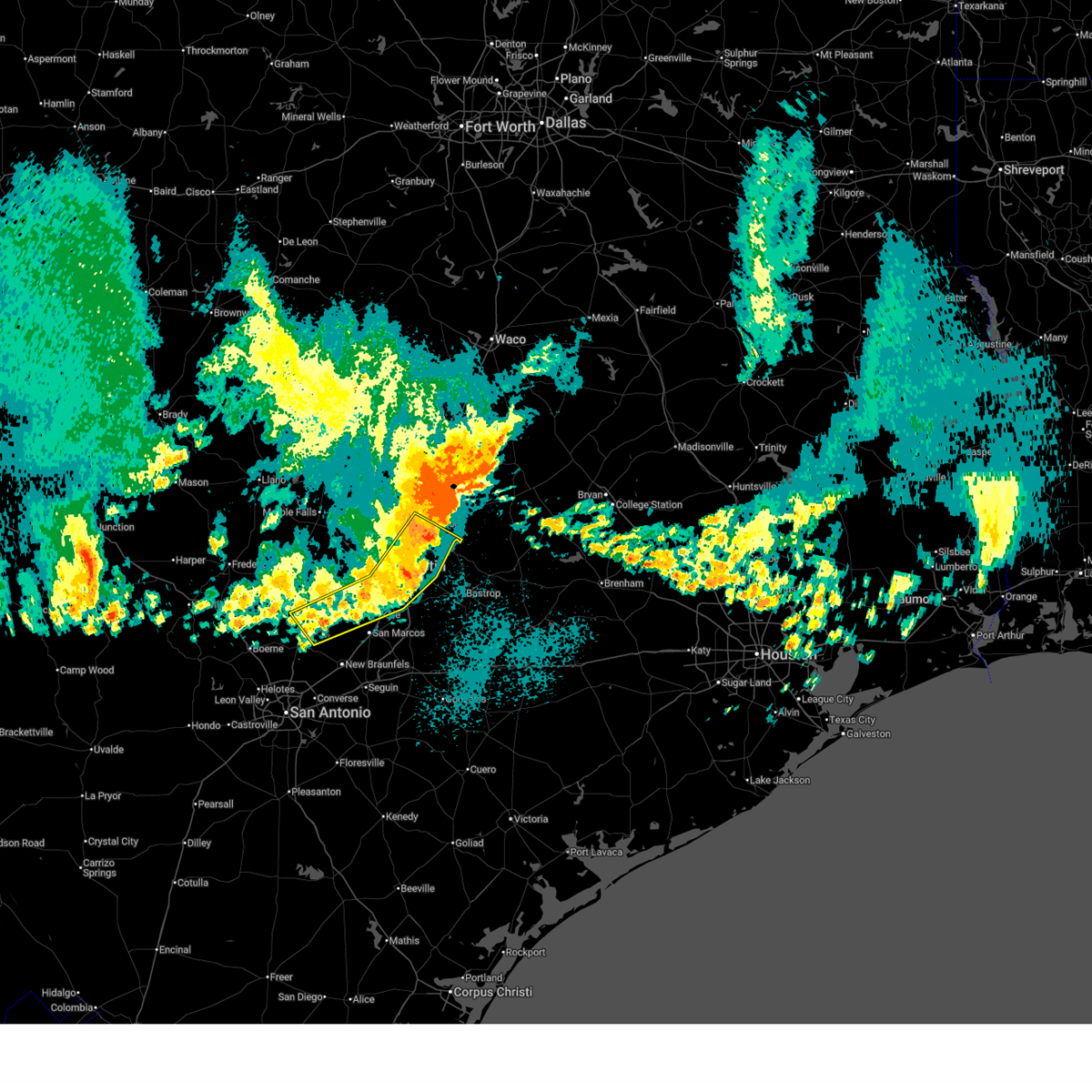
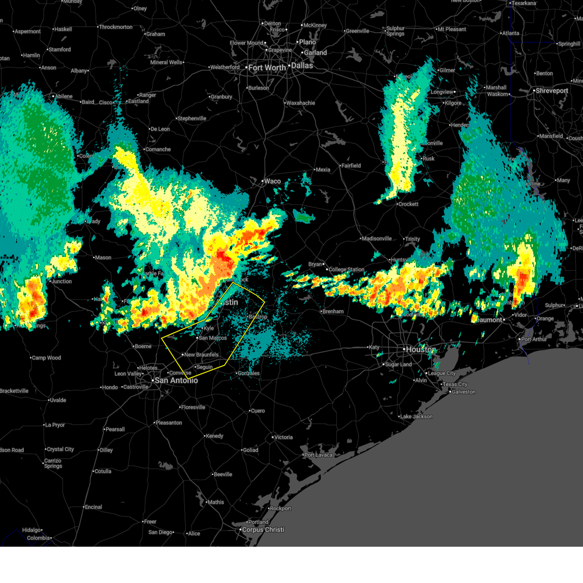
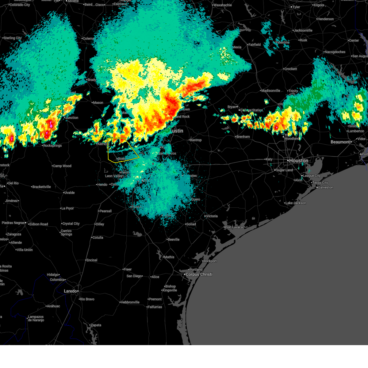
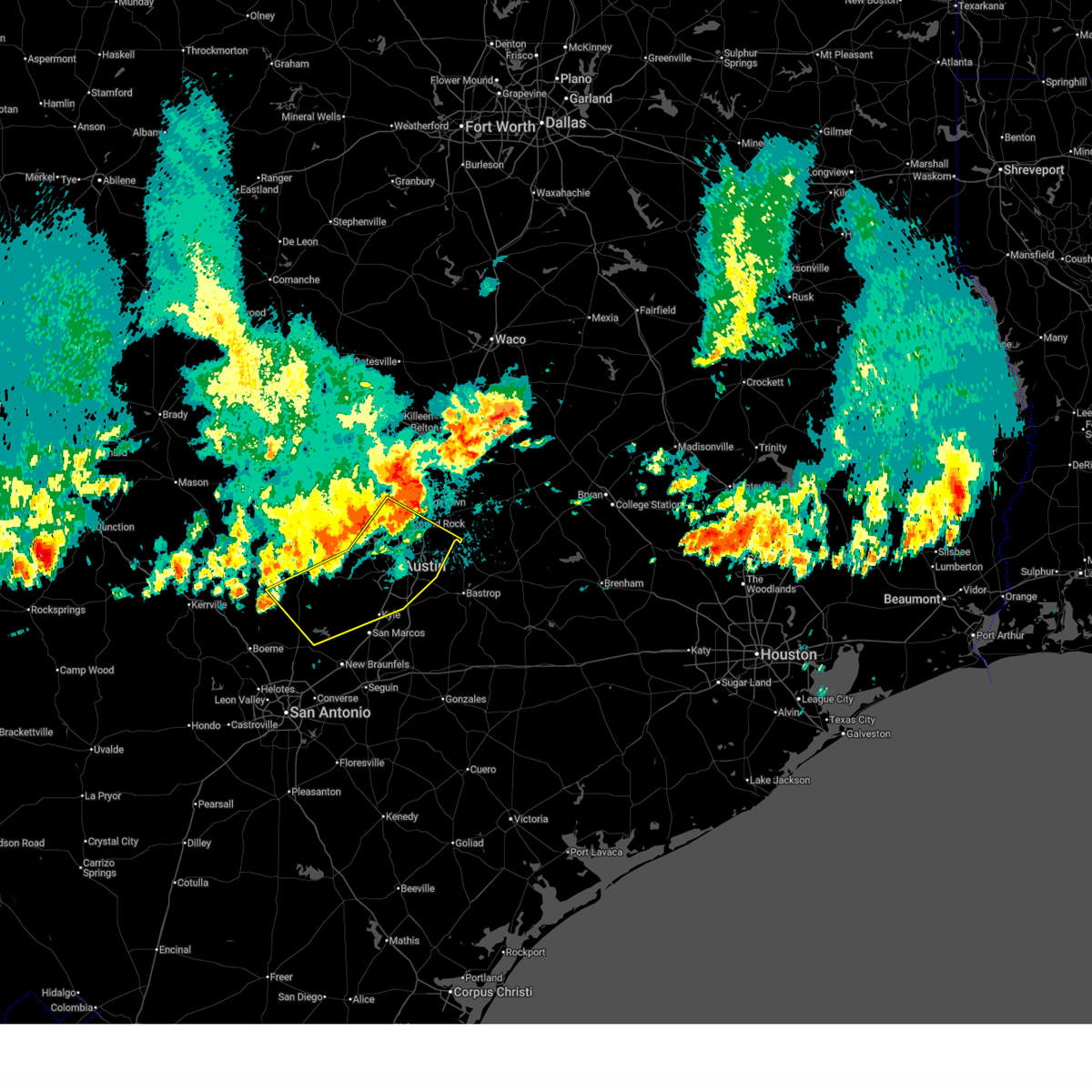
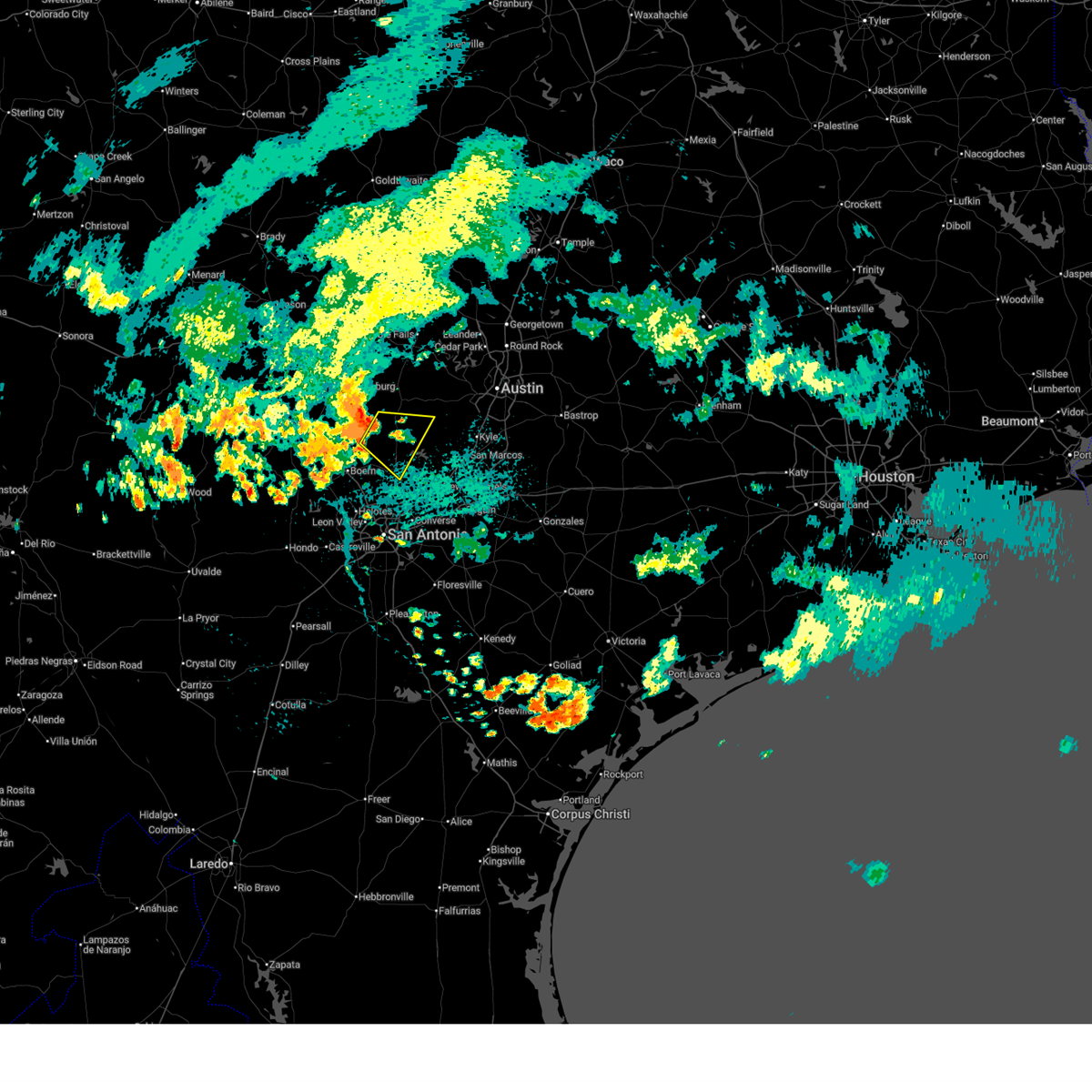
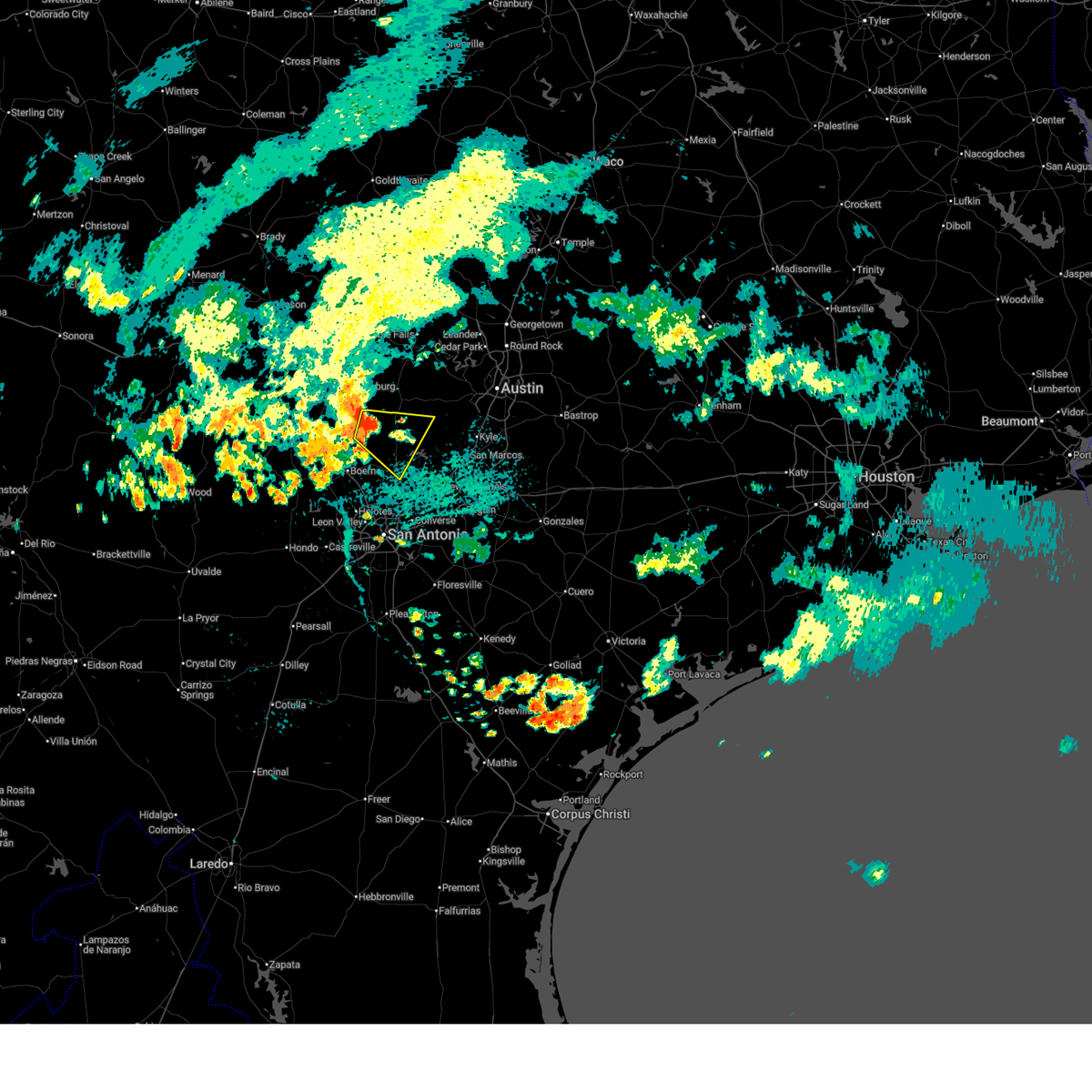
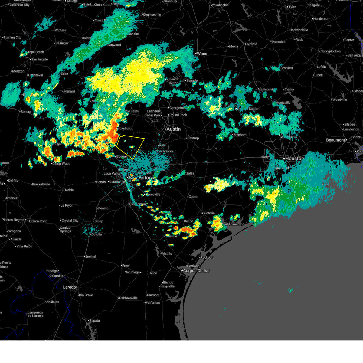
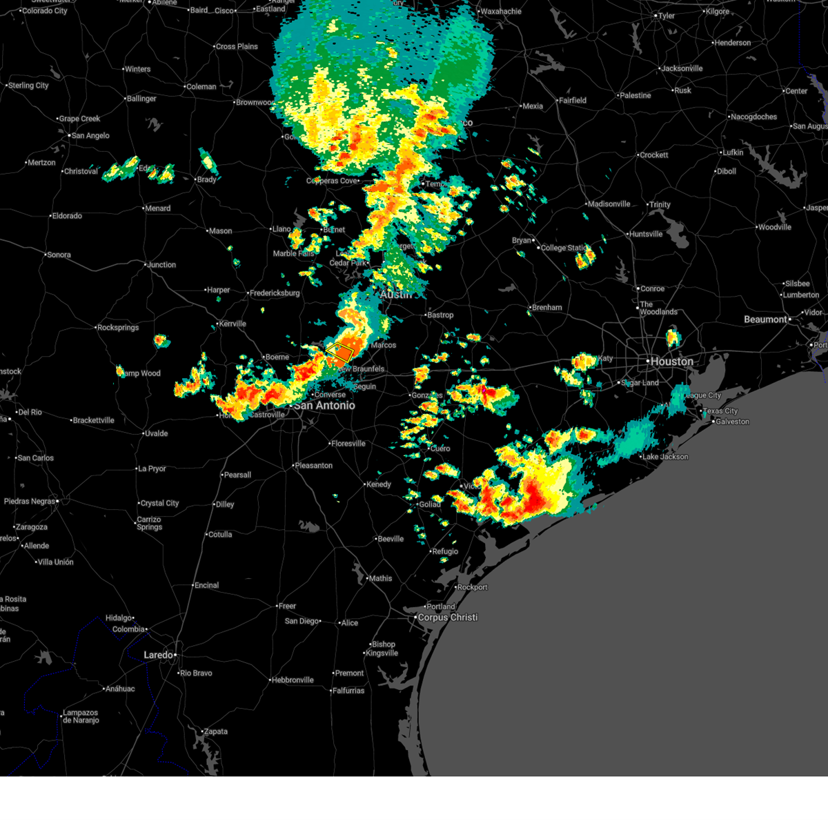
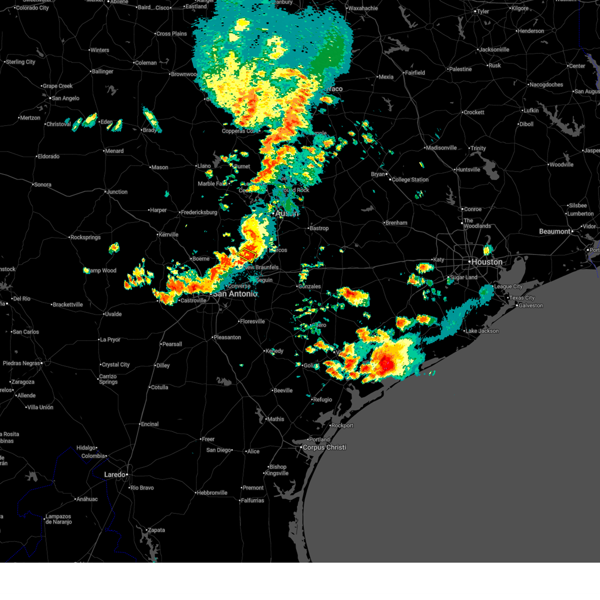
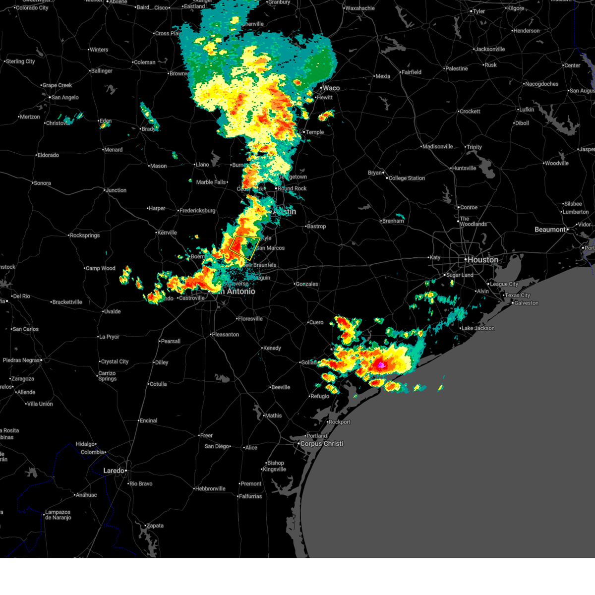
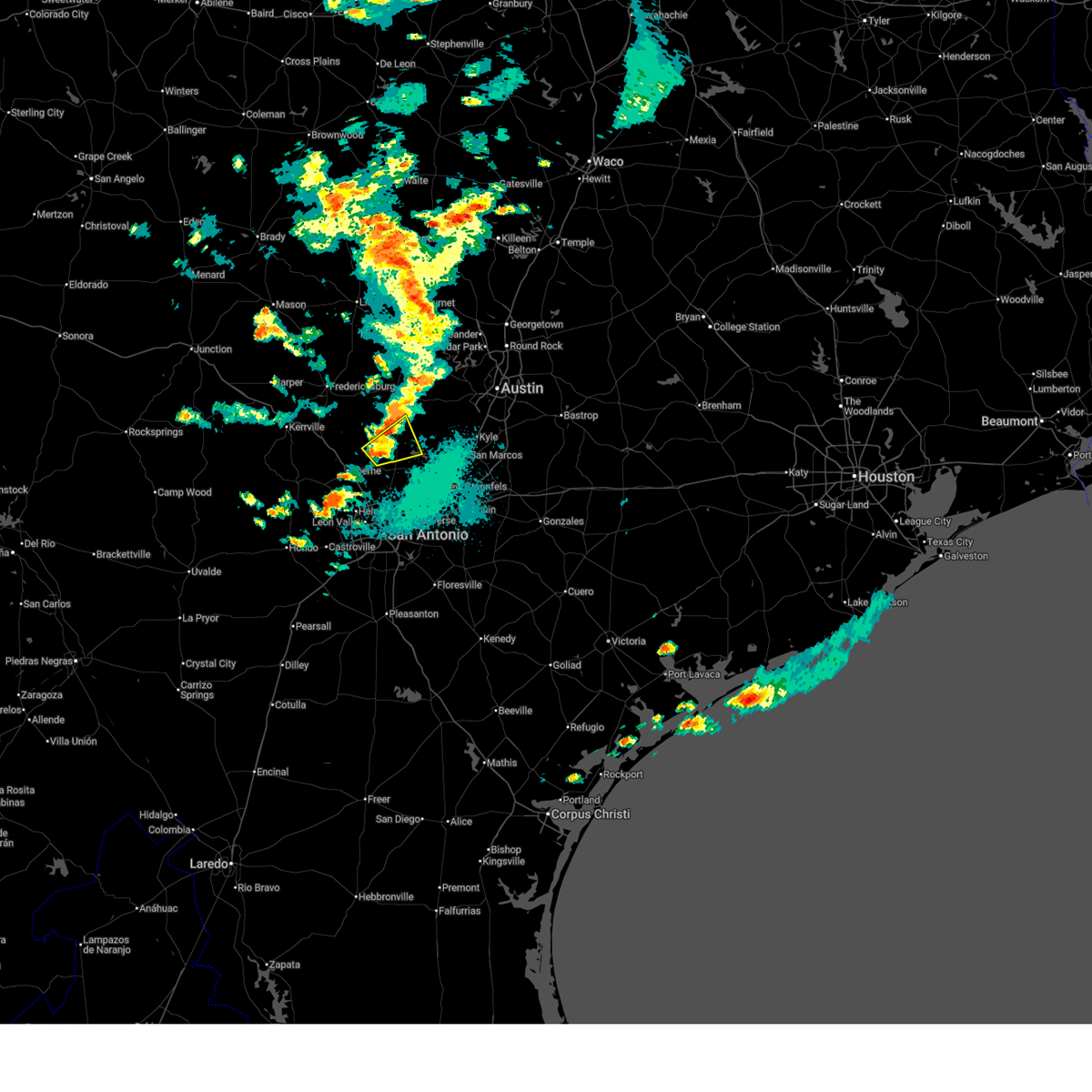
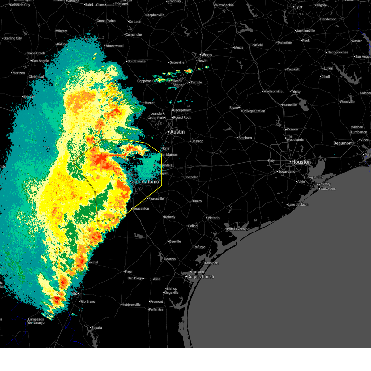
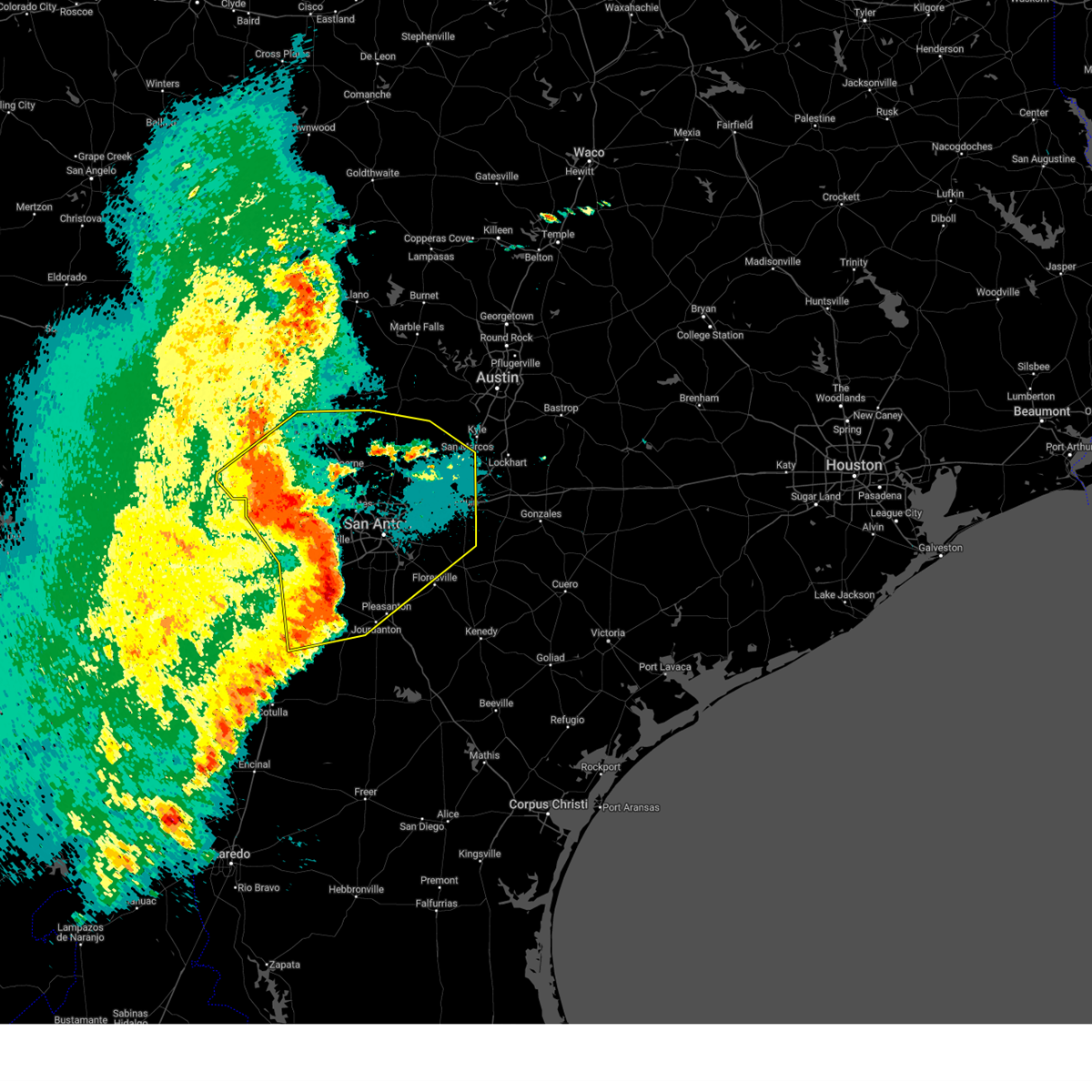
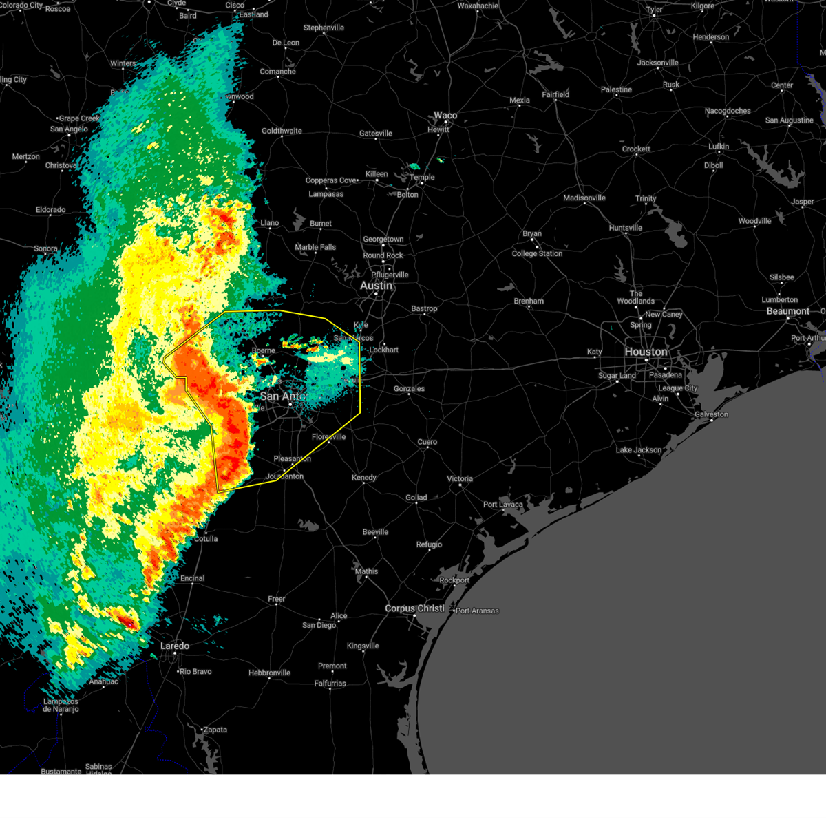
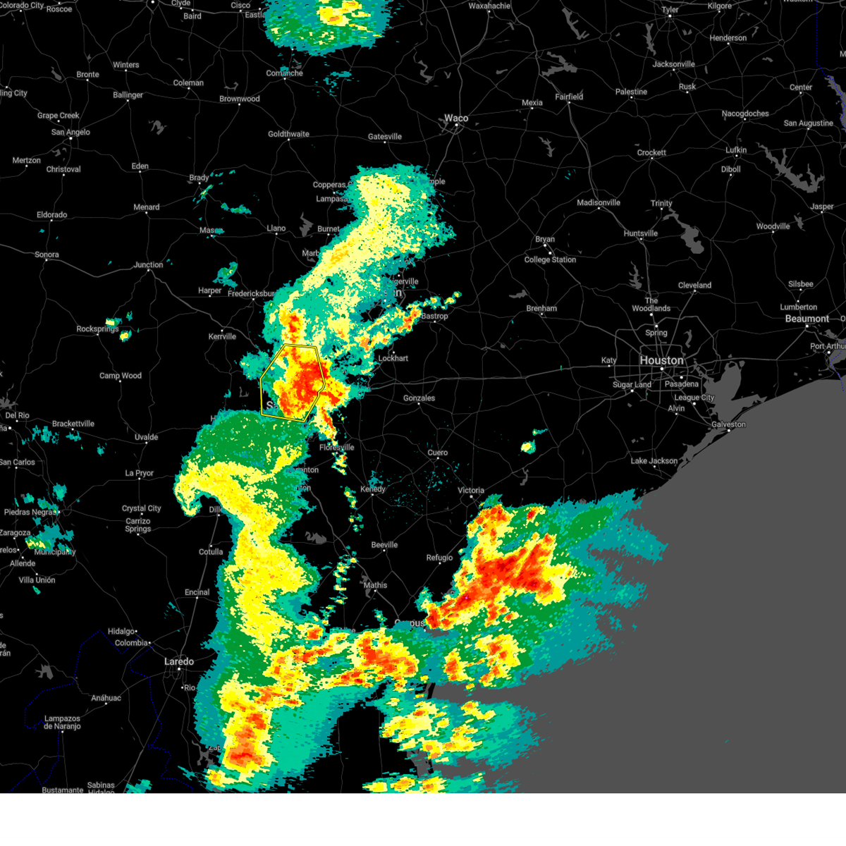
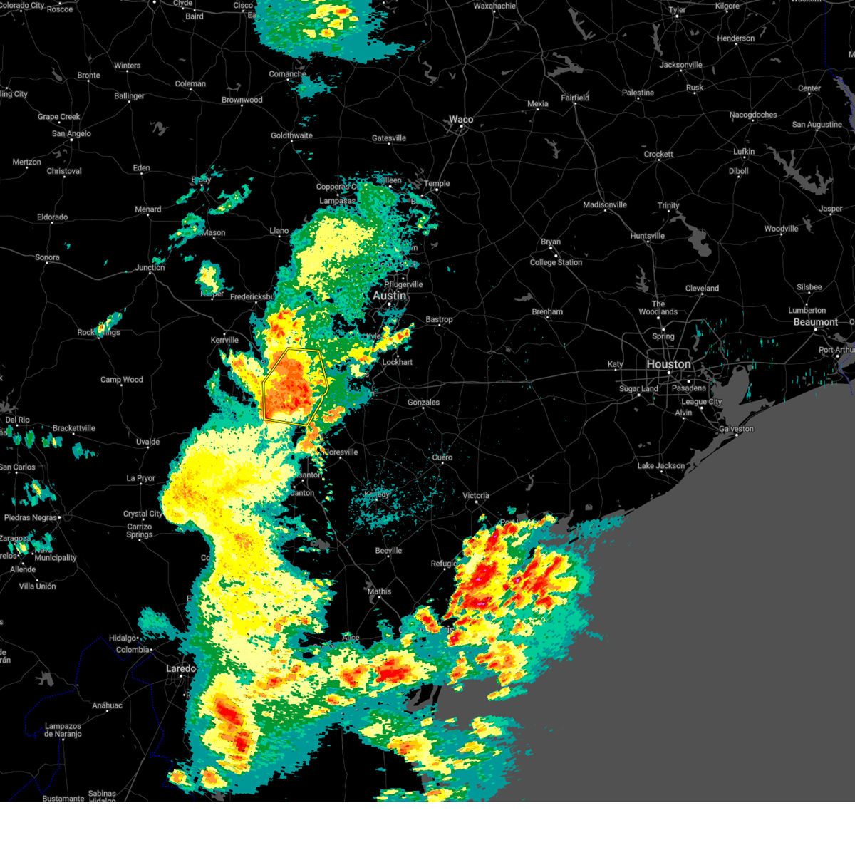
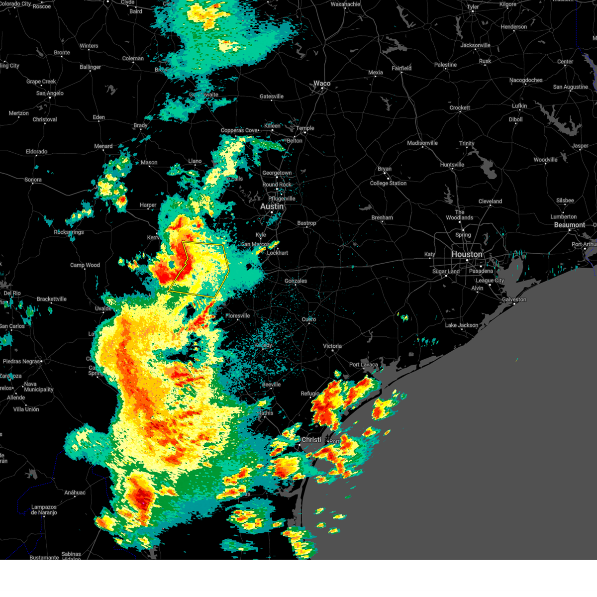
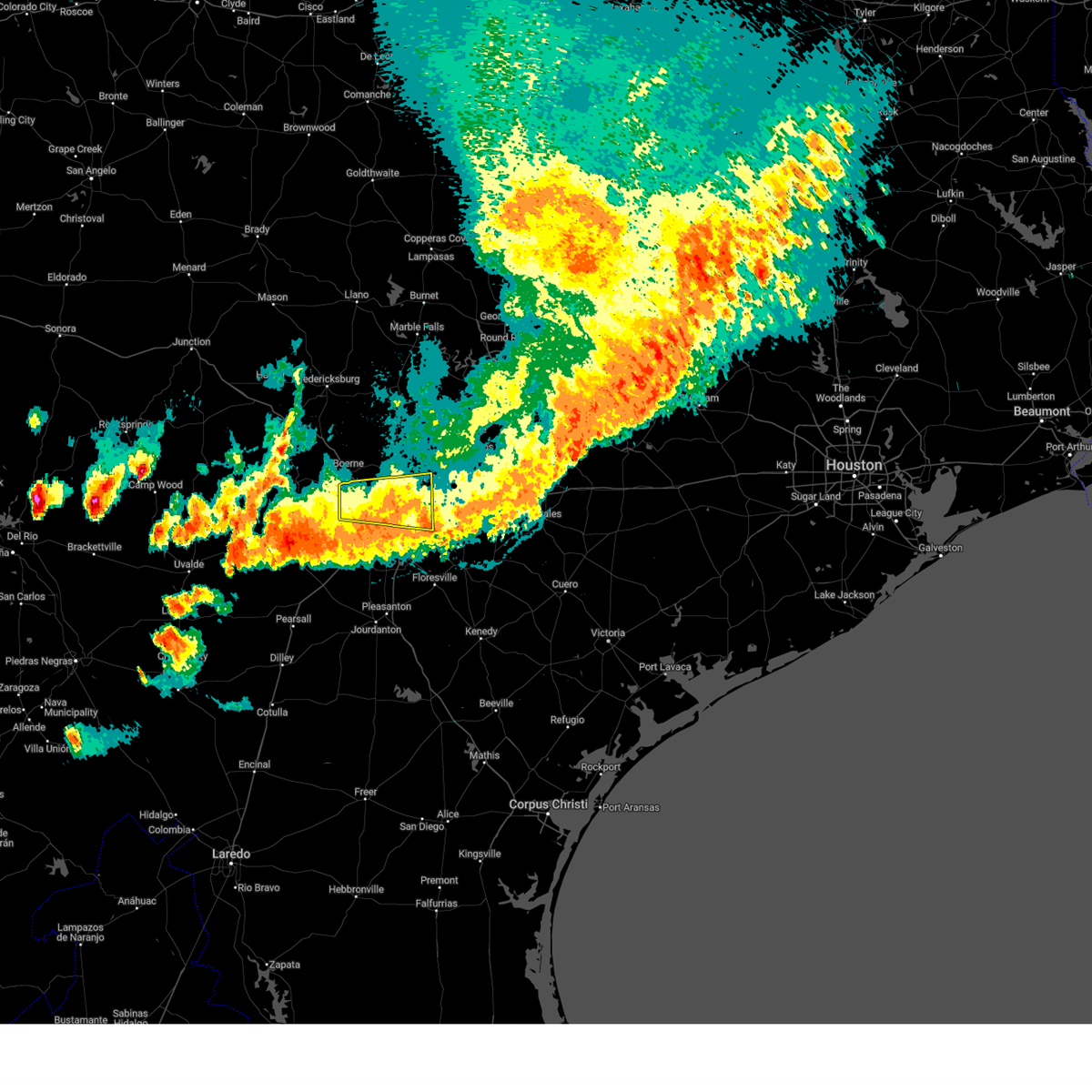
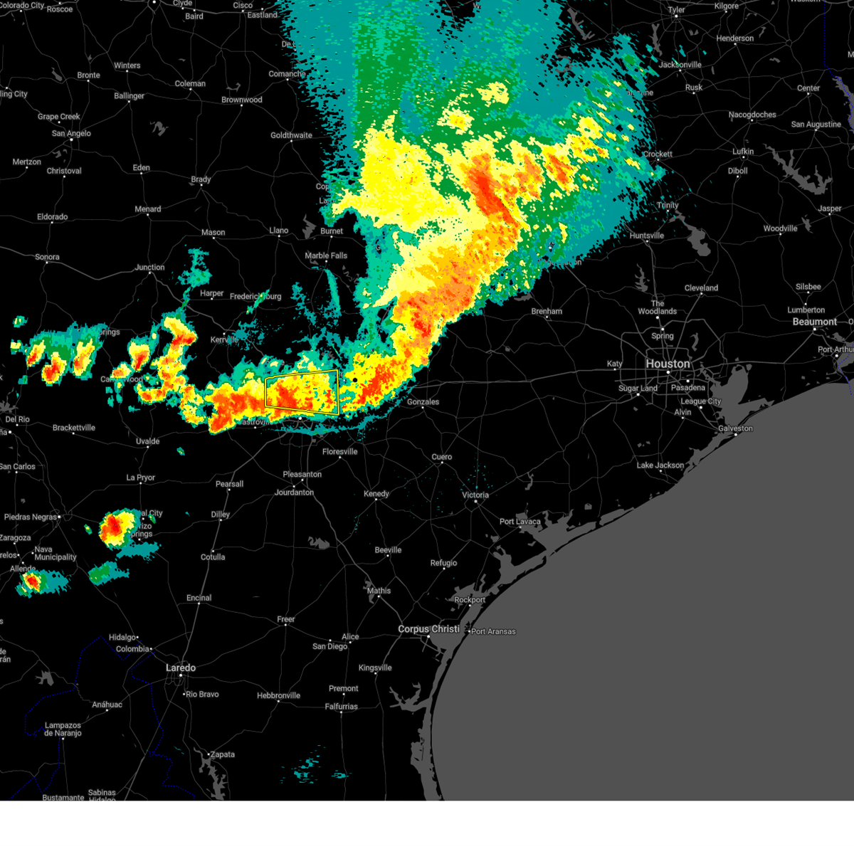
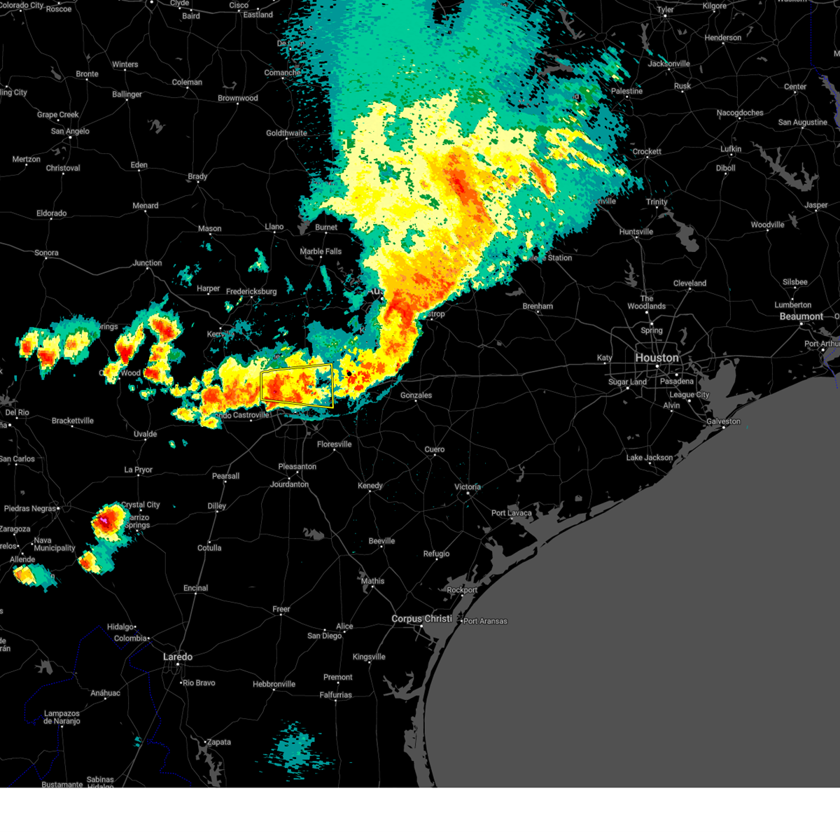
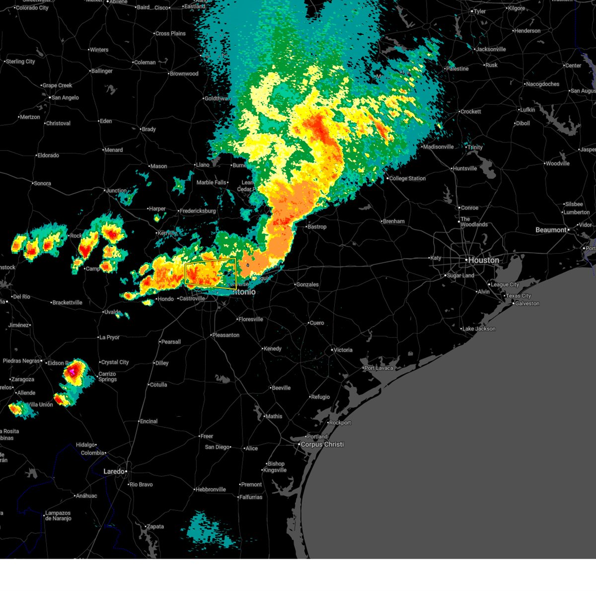
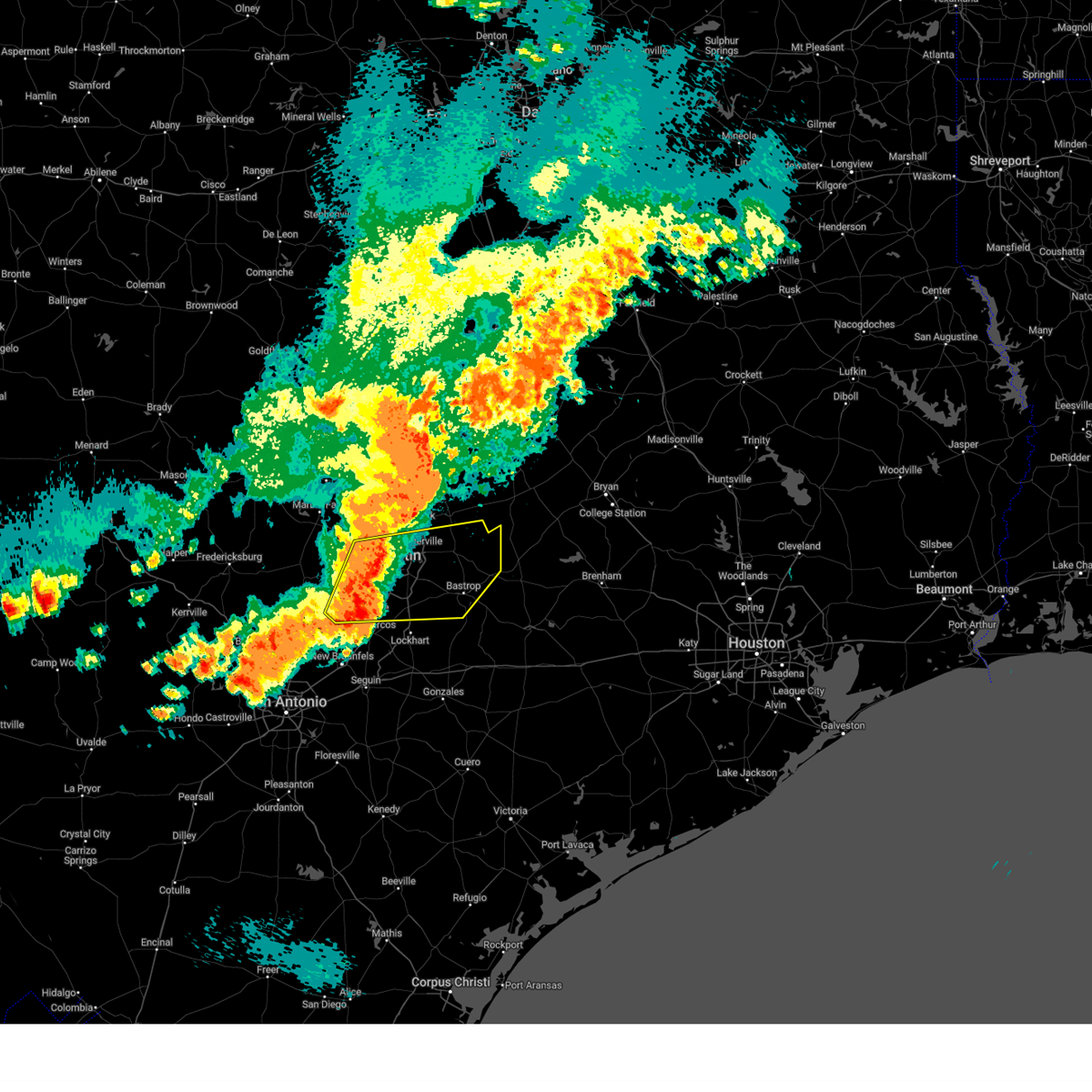
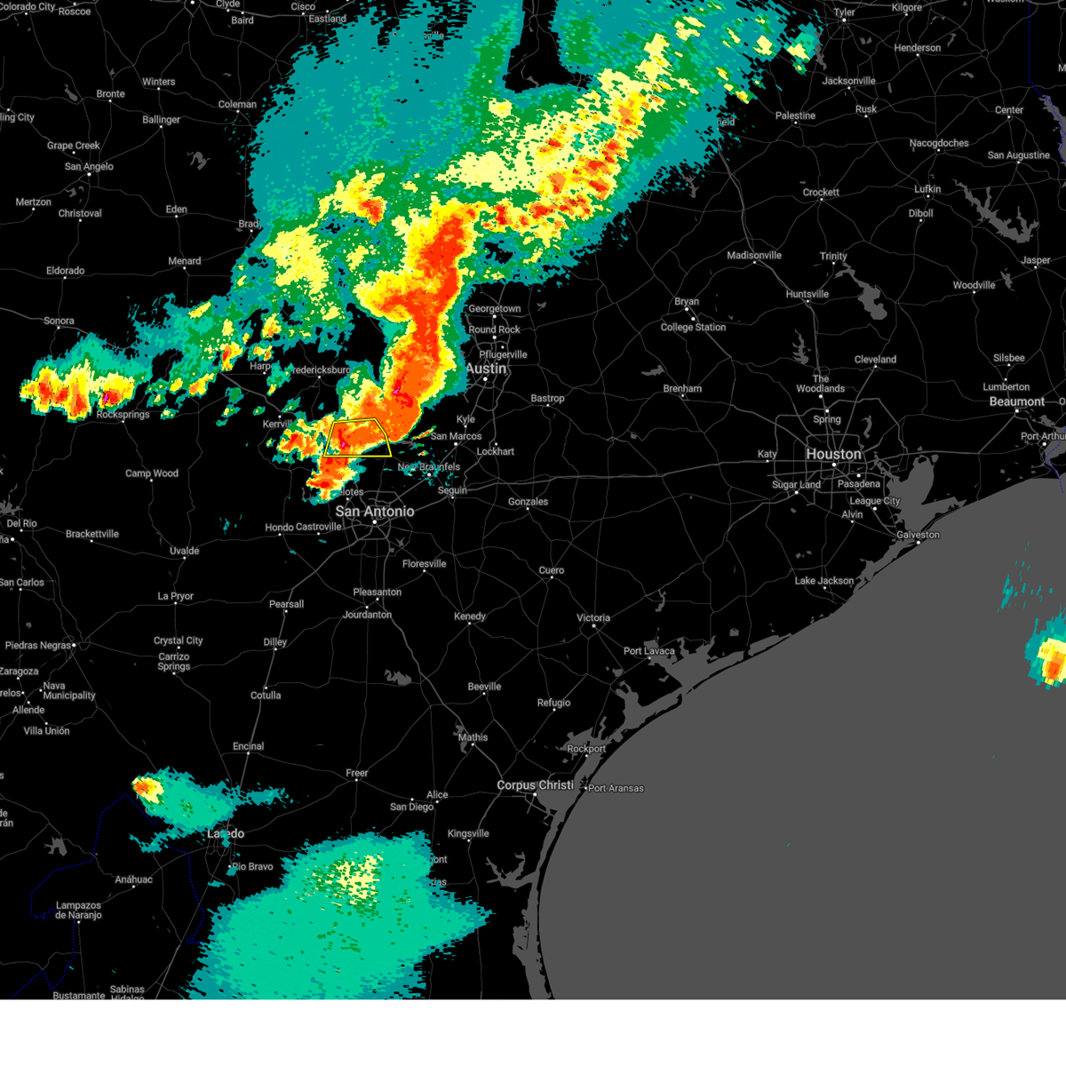
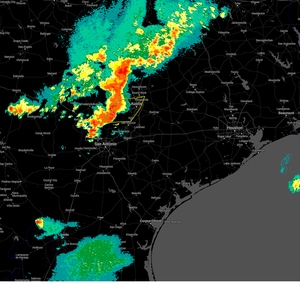
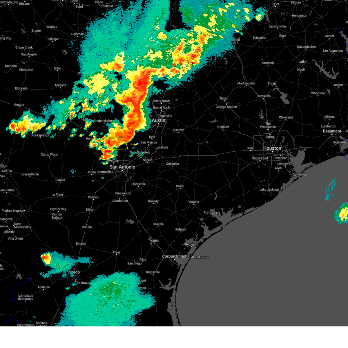
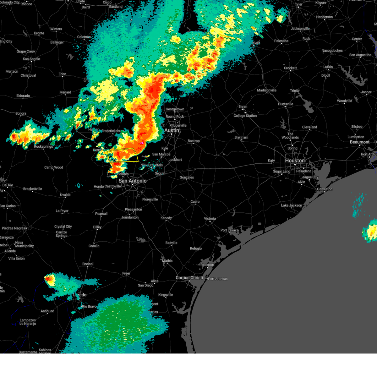
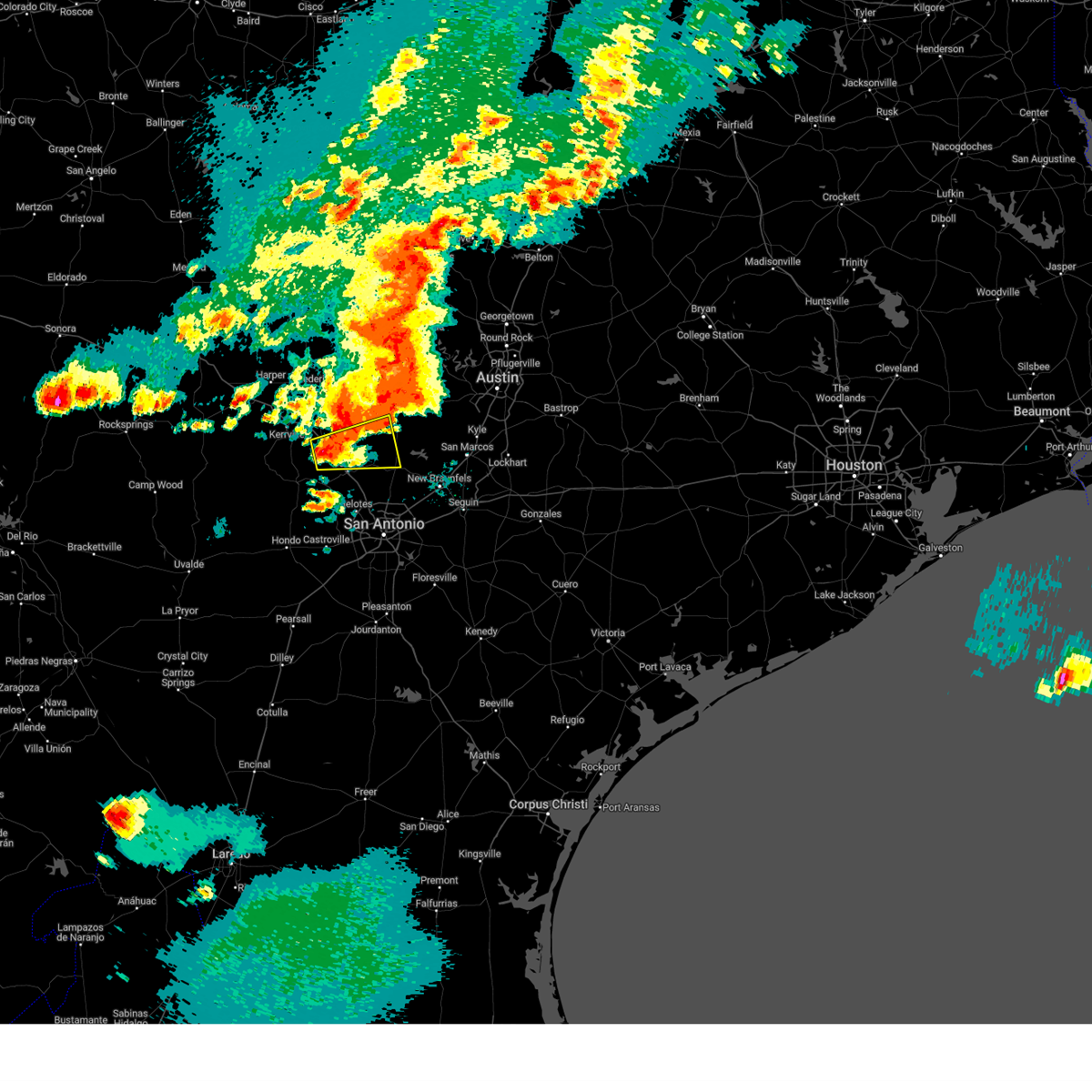
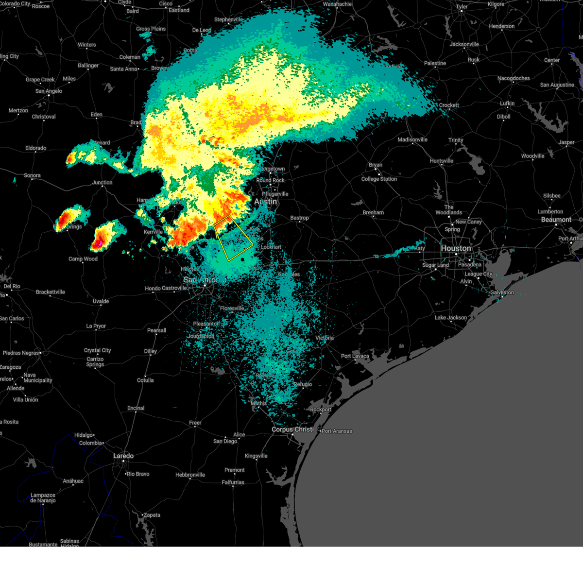
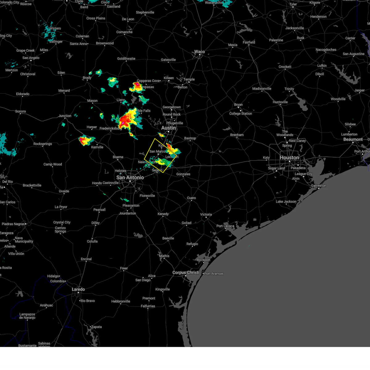
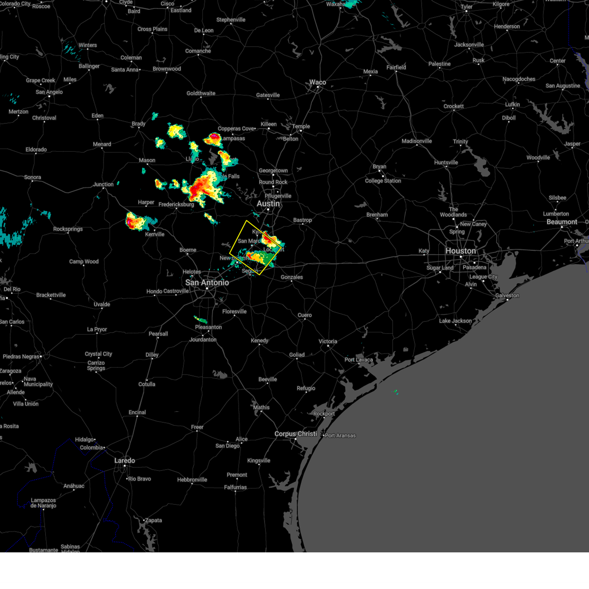
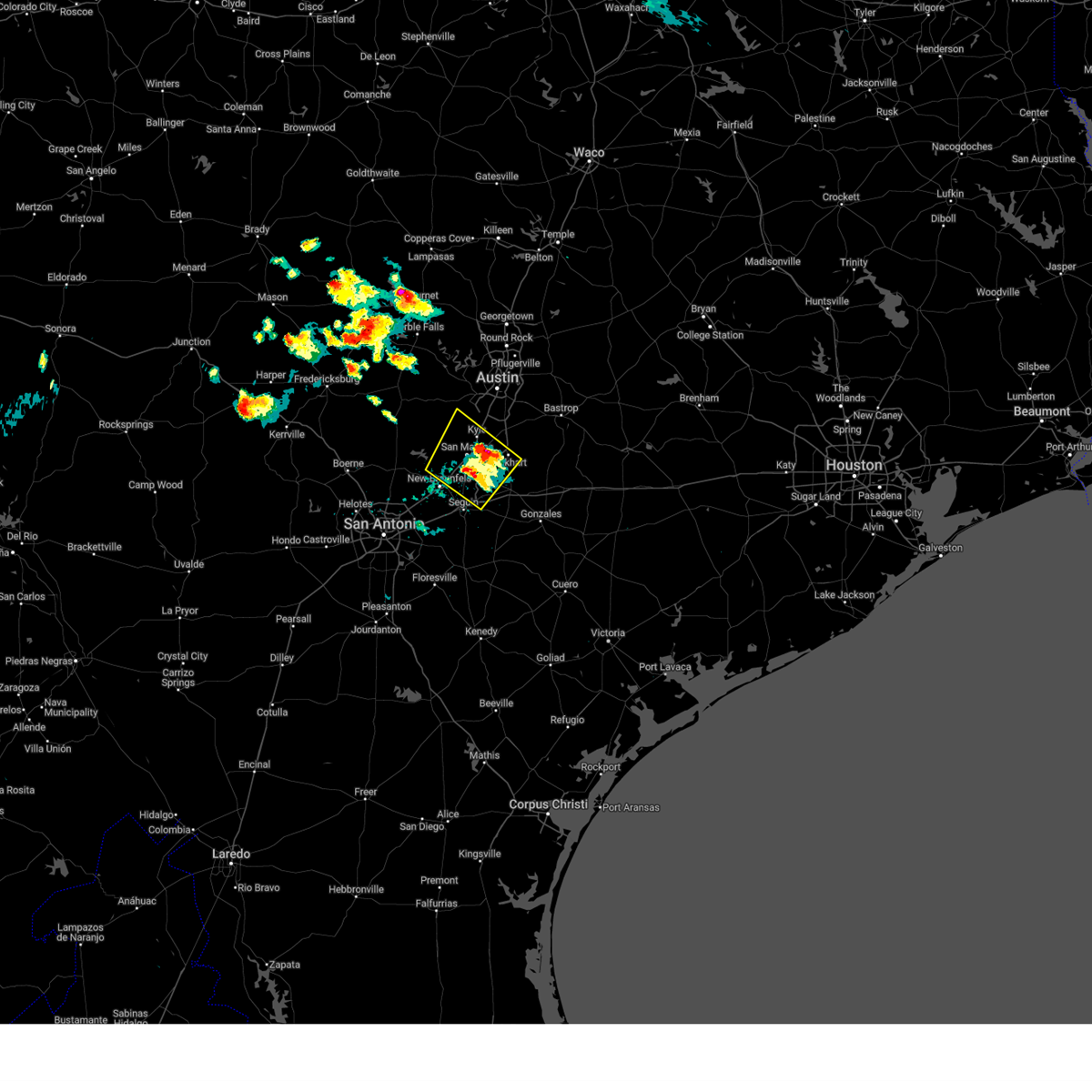
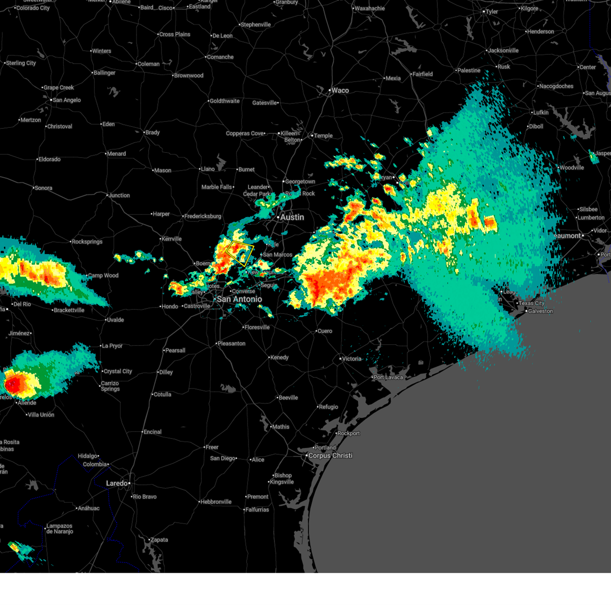
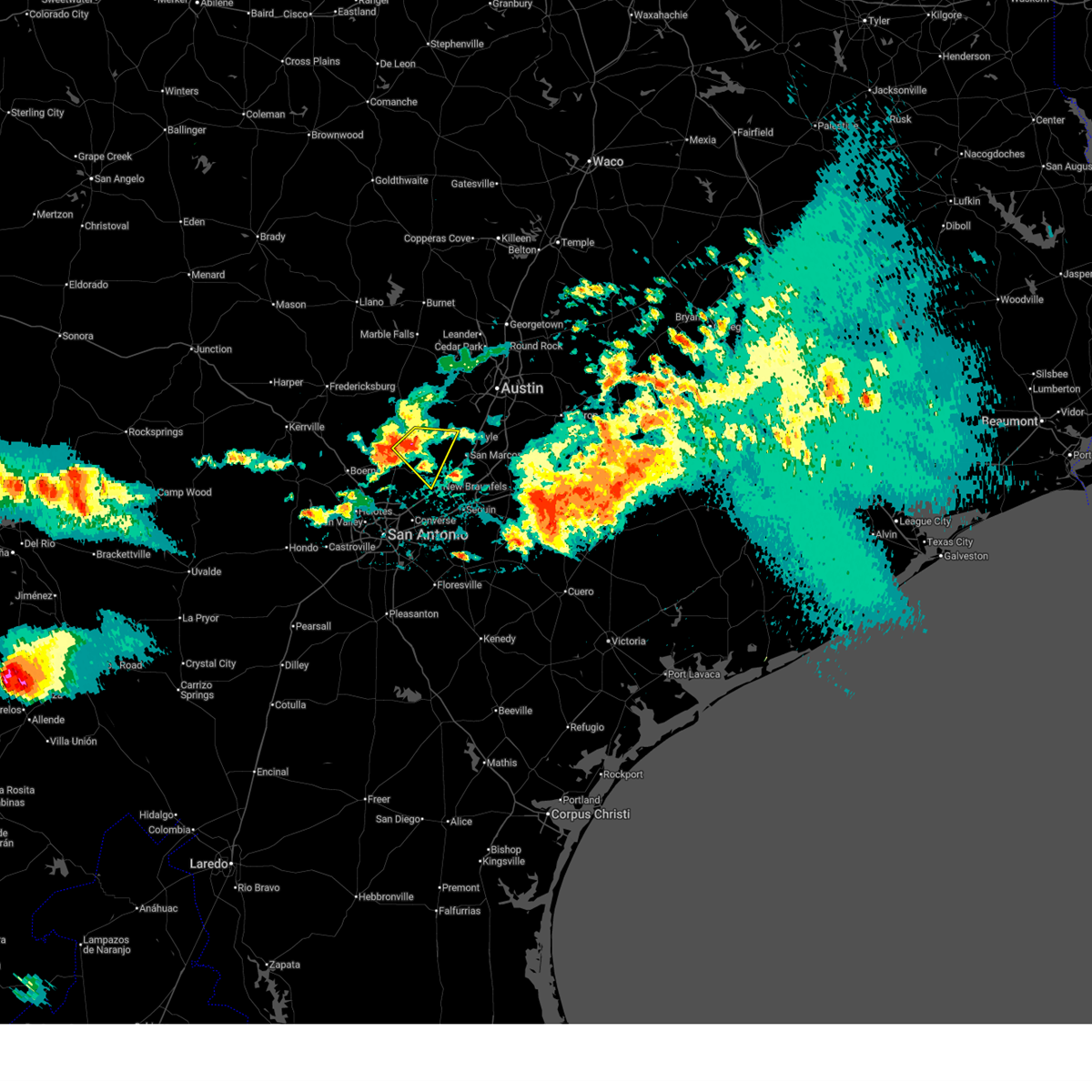
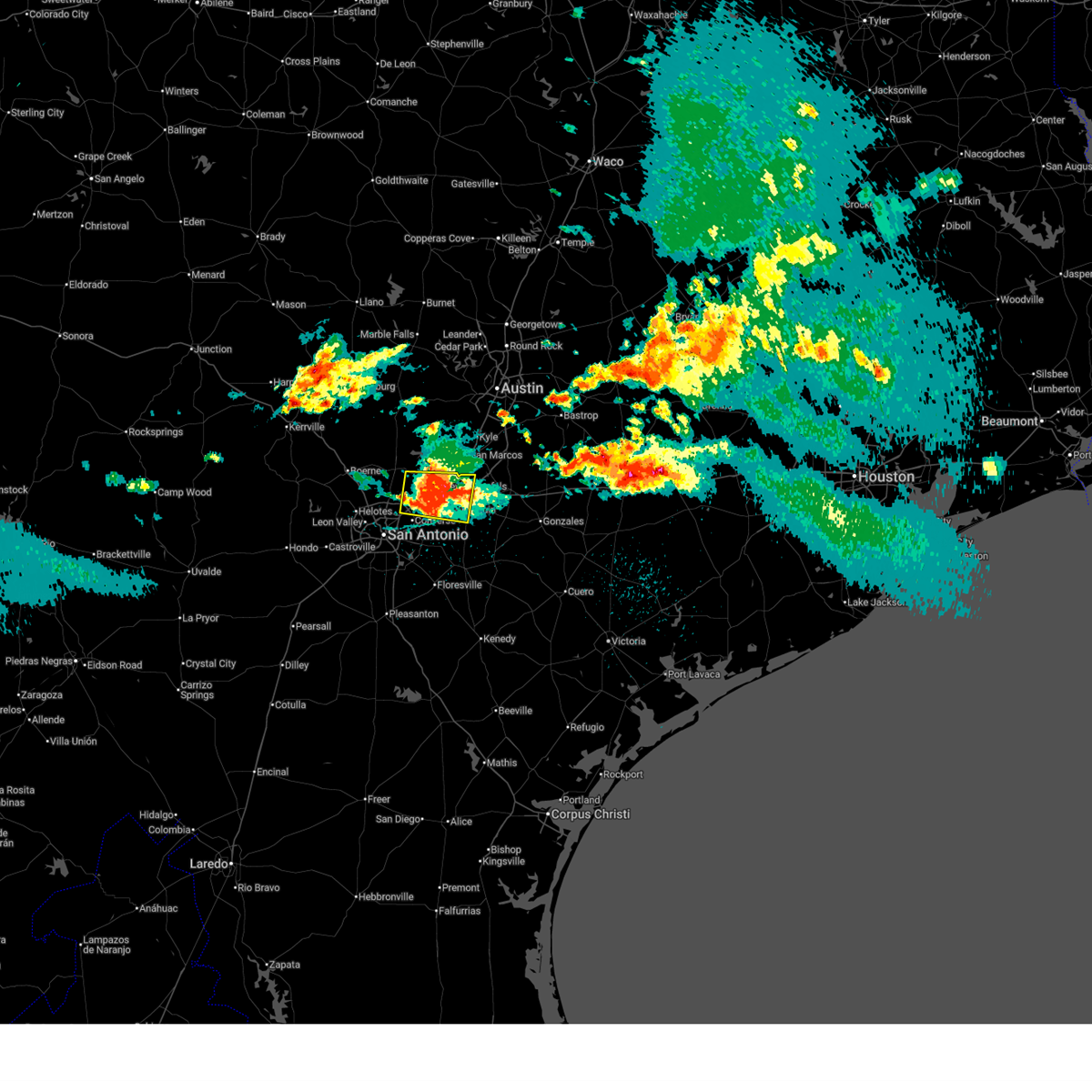
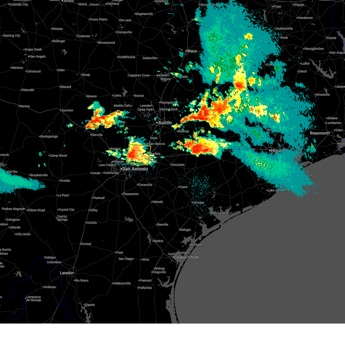
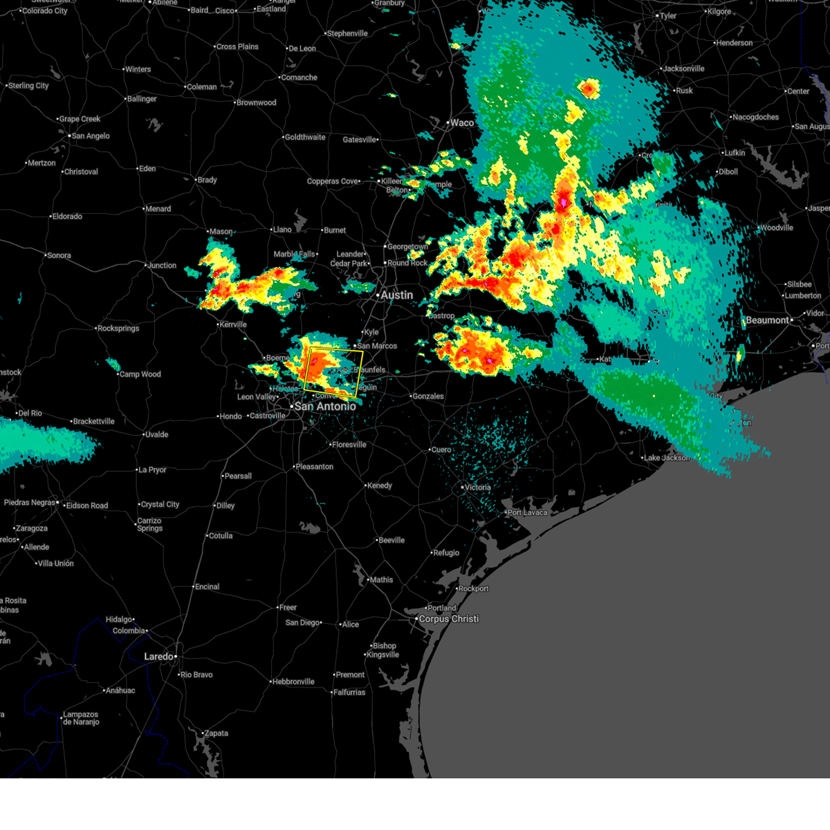
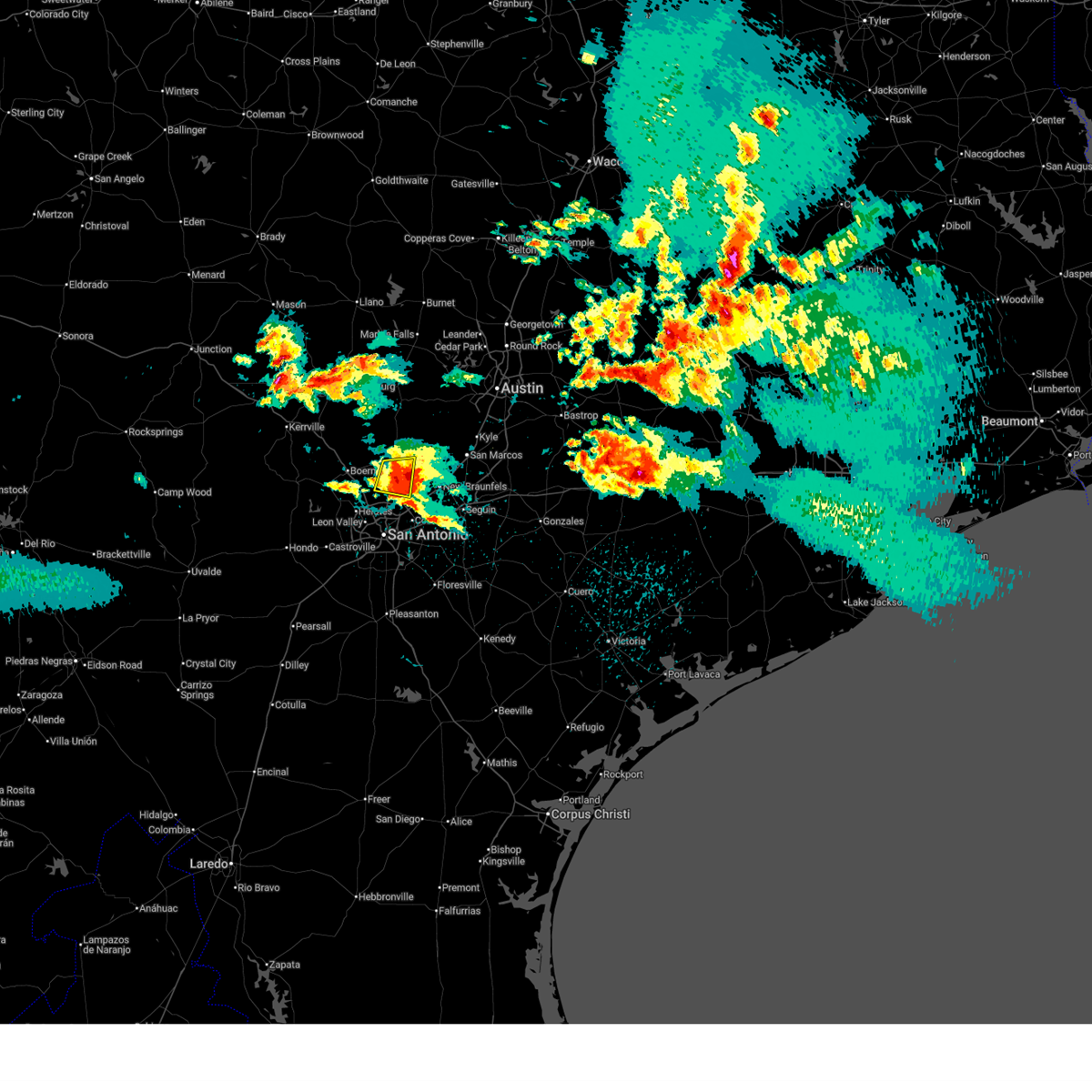
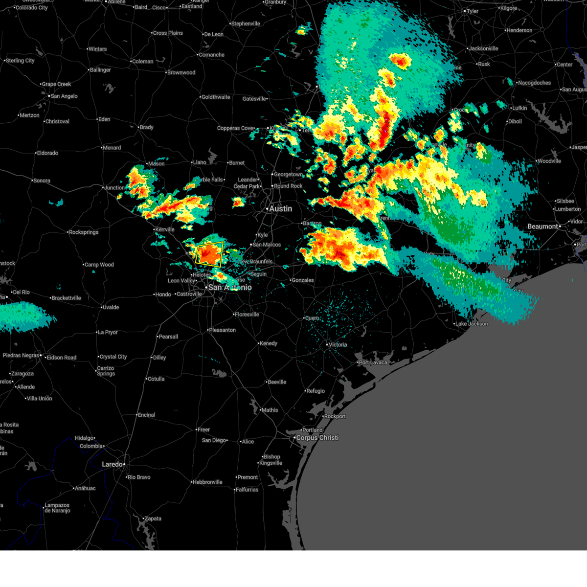
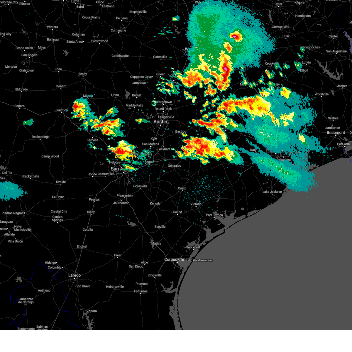
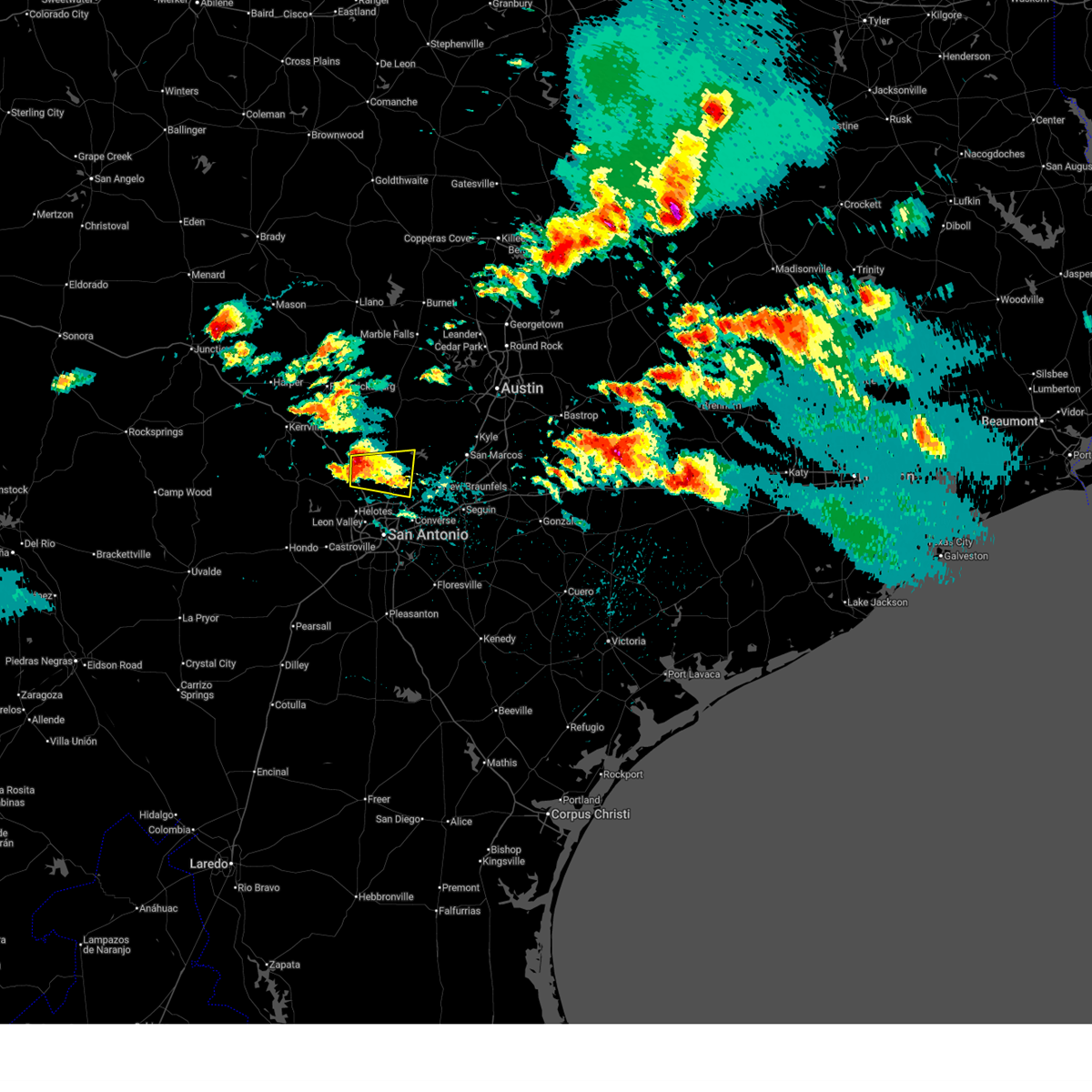
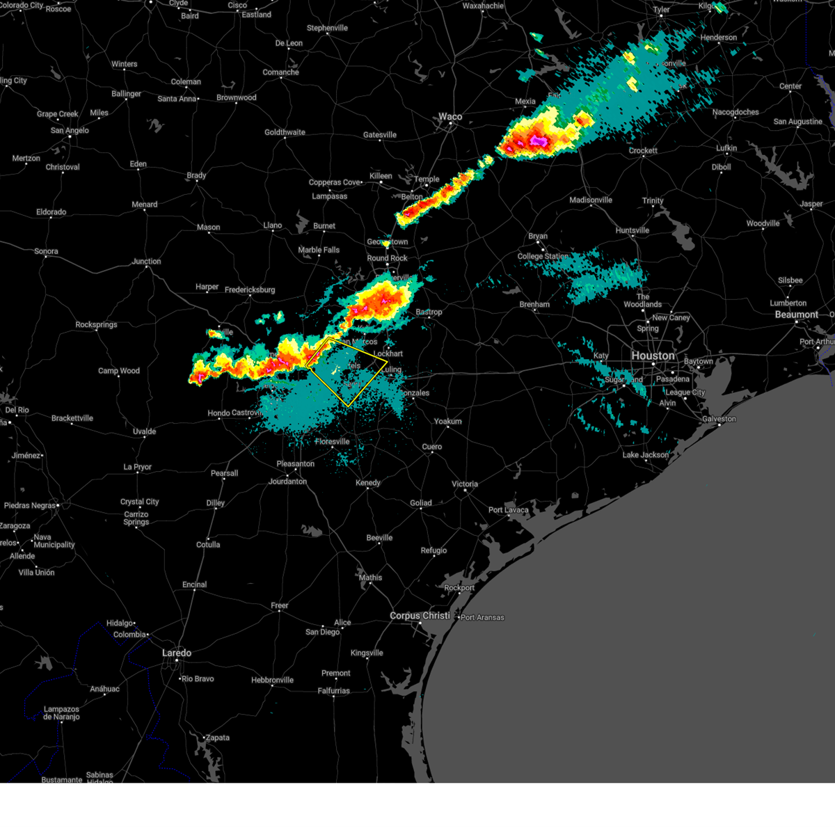
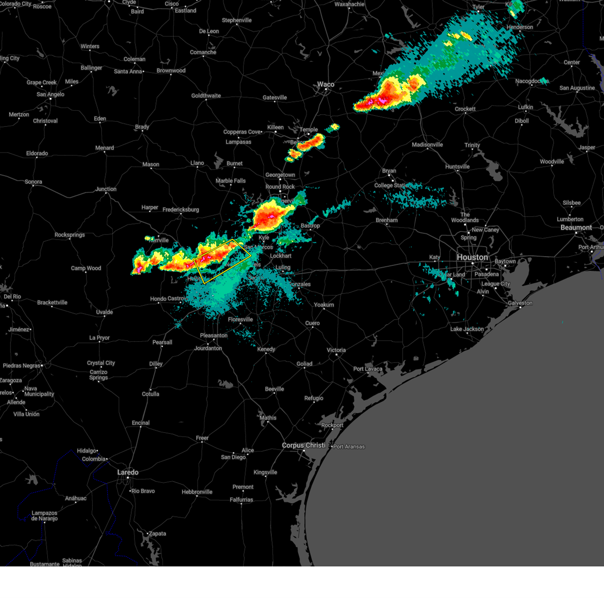
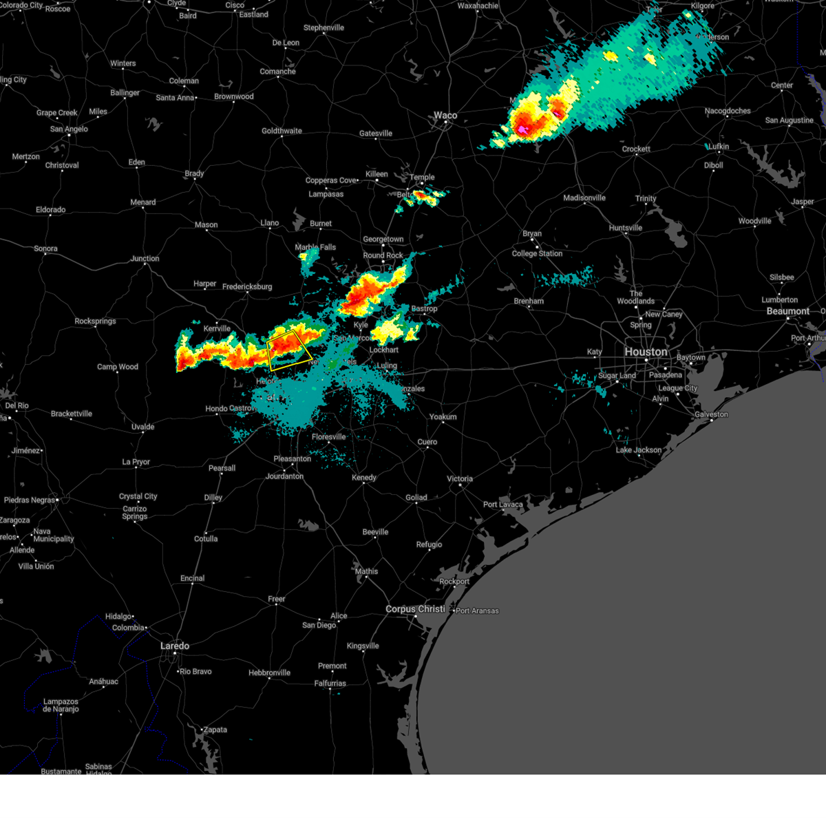
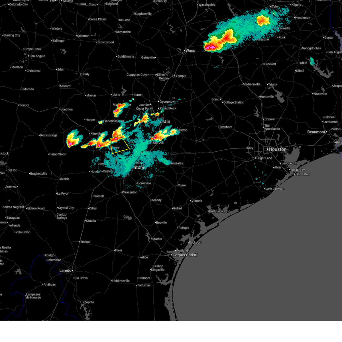
Hail Map for Canyon Lake, TX
The Canyon Lake, TX area has had 16 reports of on-the-ground hail by trained spotters, and has been under severe weather warnings 23 times during the past 12 months. Doppler radar has detected hail at or near Canyon Lake, TX on 95 occasions, including 4 occasions during the past year.
| Name: | Canyon Lake, TX |
| Where Located: | 33.6 miles NNE of San Antonio, TX |
| Map: | Google Map for Canyon Lake, TX |
| Population: | 21262 |
| Housing Units: | 11775 |
| More Info: | Search Google for Canyon Lake, TX |
1
The Top Recent Hail Date for Canyon Lake, TX is Saturday, April 18, 2026 (45th out of 95)
Hail and Wind Damage Spotted near Canyon Lake, TX
| Date / Time | Report Details |
|---|---|
| 5/26/2026 9:35 PM CDT |
 The storms which prompted the warning have weakened below severe limits, and have exited the warned area. therefore, the warning will be allowed to expire. however gusty winds and heavy rain are still possible with these thunderstorms. a severe thunderstorm watch remains in effect until 600 am cdt for south central texas. The storms which prompted the warning have weakened below severe limits, and have exited the warned area. therefore, the warning will be allowed to expire. however gusty winds and heavy rain are still possible with these thunderstorms. a severe thunderstorm watch remains in effect until 600 am cdt for south central texas.
|
| 5/26/2026 9:08 PM CDT |
 At 908 pm cdt, severe thunderstorms were located along a line extending from near kendalia to near kronkosky state natural area, moving east at 25 mph (radar indicated). Hazards include 60 mph wind gusts and penny size hail. Expect damage to roofs, siding, and trees. Locations impacted include, san antonio, boerne, canyon lake, fair oaks ranch, bulverde, cross mountain, guadalupe river state park, walnut grove, kendalia, the dominion, sisterdale, kreutzberg, spring branch, welfare, nelson city, waring, timberwood park, leon springs, kronkosky state natural area, and bergheim. At 908 pm cdt, severe thunderstorms were located along a line extending from near kendalia to near kronkosky state natural area, moving east at 25 mph (radar indicated). Hazards include 60 mph wind gusts and penny size hail. Expect damage to roofs, siding, and trees. Locations impacted include, san antonio, boerne, canyon lake, fair oaks ranch, bulverde, cross mountain, guadalupe river state park, walnut grove, kendalia, the dominion, sisterdale, kreutzberg, spring branch, welfare, nelson city, waring, timberwood park, leon springs, kronkosky state natural area, and bergheim.
|
| 5/26/2026 8:47 PM CDT |
 Svrewx the national weather service in austin san antonio has issued a * severe thunderstorm warning for, east central bandera county in south central texas, southeastern kerr county in south central texas, kendall county in south central texas, northwestern bexar county in south central texas, northwestern comal county in south central texas, * until 945 pm cdt. * at 846 pm cdt, severe thunderstorms were located along a line extending from near kendalia to near bandera falls, moving east at 25 mph (radar indicated). Hazards include 60 mph wind gusts and quarter size hail. Hail damage to vehicles is expected. Expect wind damage to roofs, siding, and trees. Svrewx the national weather service in austin san antonio has issued a * severe thunderstorm warning for, east central bandera county in south central texas, southeastern kerr county in south central texas, kendall county in south central texas, northwestern bexar county in south central texas, northwestern comal county in south central texas, * until 945 pm cdt. * at 846 pm cdt, severe thunderstorms were located along a line extending from near kendalia to near bandera falls, moving east at 25 mph (radar indicated). Hazards include 60 mph wind gusts and quarter size hail. Hail damage to vehicles is expected. Expect wind damage to roofs, siding, and trees.
|
| 5/19/2026 11:41 PM CDT |
 the severe thunderstorm warning has been cancelled and is no longer in effect the severe thunderstorm warning has been cancelled and is no longer in effect
|
| 5/19/2026 11:41 PM CDT |
 At 1141 pm cdt, severe thunderstorms were located along a line extending from near sisterdale to near cross mountain, moving east at 35 mph (radar indicated). Hazards include 60 mph wind gusts. Expect damage to roofs, siding, and trees. Locations impacted include, san antonio, new braunfels, schertz, converse, universal city, live oak, boerne, selma, randolph afb, canyon lake, fair oaks ranch, bulverde, garden ridge, shavano park, hollywood park, cross mountain, guadalupe river state park, walnut grove, kendalia, and smithson valley. At 1141 pm cdt, severe thunderstorms were located along a line extending from near sisterdale to near cross mountain, moving east at 35 mph (radar indicated). Hazards include 60 mph wind gusts. Expect damage to roofs, siding, and trees. Locations impacted include, san antonio, new braunfels, schertz, converse, universal city, live oak, boerne, selma, randolph afb, canyon lake, fair oaks ranch, bulverde, garden ridge, shavano park, hollywood park, cross mountain, guadalupe river state park, walnut grove, kendalia, and smithson valley.
|
| 5/19/2026 11:22 PM CDT |
 Svrewx the national weather service in austin san antonio has issued a * severe thunderstorm warning for, northeastern bandera county in south central texas, southeastern kerr county in south central texas, southwestern blanco county in south central texas, kendall county in south central texas, northern bexar county in south central texas, comal county in south central texas, * until 1215 am cdt. * at 1122 pm cdt, severe thunderstorms were located along a line extending from near old tunnel state park to near kronkosky state natural area, moving east at 35 mph (radar indicated). Hazards include 60 mph wind gusts. expect damage to roofs, siding, and trees Svrewx the national weather service in austin san antonio has issued a * severe thunderstorm warning for, northeastern bandera county in south central texas, southeastern kerr county in south central texas, southwestern blanco county in south central texas, kendall county in south central texas, northern bexar county in south central texas, comal county in south central texas, * until 1215 am cdt. * at 1122 pm cdt, severe thunderstorms were located along a line extending from near old tunnel state park to near kronkosky state natural area, moving east at 35 mph (radar indicated). Hazards include 60 mph wind gusts. expect damage to roofs, siding, and trees
|
| 5/19/2026 9:51 PM CDT |
 At 951 pm cdt, severe thunderstorms were located along a line extending from 6 miles southwest of elgin to near staples to near new braunfels, moving southeast at 30 mph (radar indicated). Hazards include 60 mph wind gusts and quarter size hail. Hail damage to vehicles is expected. expect wind damage to roofs, siding, and trees. Locations impacted include, austin, new braunfels, san marcos, pflugerville, schertz, kyle, seguin, cibolo, buda, lockhart, elgin, bastrop, luling, wimberley, austin bergstrom int airport, canyon lake dam, canyon lake, manor, mcqueeney, and martindale. At 951 pm cdt, severe thunderstorms were located along a line extending from 6 miles southwest of elgin to near staples to near new braunfels, moving southeast at 30 mph (radar indicated). Hazards include 60 mph wind gusts and quarter size hail. Hail damage to vehicles is expected. expect wind damage to roofs, siding, and trees. Locations impacted include, austin, new braunfels, san marcos, pflugerville, schertz, kyle, seguin, cibolo, buda, lockhart, elgin, bastrop, luling, wimberley, austin bergstrom int airport, canyon lake dam, canyon lake, manor, mcqueeney, and martindale.
|
| 5/19/2026 9:42 PM CDT |
 At 942 pm cdt, severe thunderstorms were located along a line extending from 8 miles west of fedor to near cedar creek to 7 miles west of san marcos, moving southeast at 40 mph (radar indicated). Hazards include 60 mph wind gusts and quarter size hail. Hail damage to vehicles is expected. expect wind damage to roofs, siding, and trees. Locations impacted include, austin, round rock, pflugerville, kyle, buda, elgin, wimberley, tanglewood forest, austin bergstrom int airport, windemere, canyon lake dam, hutto, canyon lake, manor, west lake hills, woodcreek, rollingwood, mustang ridge, niederwald, and bear creek. At 942 pm cdt, severe thunderstorms were located along a line extending from 8 miles west of fedor to near cedar creek to 7 miles west of san marcos, moving southeast at 40 mph (radar indicated). Hazards include 60 mph wind gusts and quarter size hail. Hail damage to vehicles is expected. expect wind damage to roofs, siding, and trees. Locations impacted include, austin, round rock, pflugerville, kyle, buda, elgin, wimberley, tanglewood forest, austin bergstrom int airport, windemere, canyon lake dam, hutto, canyon lake, manor, west lake hills, woodcreek, rollingwood, mustang ridge, niederwald, and bear creek.
|
| 5/19/2026 9:26 PM CDT |
 Svrewx the national weather service in austin san antonio has issued a * severe thunderstorm warning for, caldwell county in south central texas, southern hays county in south central texas, guadalupe county in south central texas, southeastern travis county in south central texas, bastrop county in south central texas, northwestern gonzales county in south central texas, eastern comal county in south central texas, * until 1030 pm cdt. * at 925 pm cdt, severe thunderstorms were located along a line extending from near pflugerville to near san marcos to near smithson valley, moving southeast at 30 mph (radar indicated). Hazards include 70 mph wind gusts and quarter size hail. Hail damage to vehicles is expected. expect considerable tree damage. Wind damage is also likely to mobile homes, roofs, and outbuildings. Svrewx the national weather service in austin san antonio has issued a * severe thunderstorm warning for, caldwell county in south central texas, southern hays county in south central texas, guadalupe county in south central texas, southeastern travis county in south central texas, bastrop county in south central texas, northwestern gonzales county in south central texas, eastern comal county in south central texas, * until 1030 pm cdt. * at 925 pm cdt, severe thunderstorms were located along a line extending from near pflugerville to near san marcos to near smithson valley, moving southeast at 30 mph (radar indicated). Hazards include 70 mph wind gusts and quarter size hail. Hail damage to vehicles is expected. expect considerable tree damage. Wind damage is also likely to mobile homes, roofs, and outbuildings.
|
| 5/19/2026 9:13 PM CDT |
 Svrewx the national weather service in austin san antonio has issued a * severe thunderstorm warning for, kendall county in south central texas, west central comal county in south central texas, * until 1015 pm cdt. * at 913 pm cdt, severe thunderstorms were located along a line extending from near twin sisters to near cypress creek, moving south at 15 mph (radar indicated). Hazards include 60 mph wind gusts and half dollar size hail. Hail damage to vehicles is expected. Expect wind damage to roofs, siding, and trees. Svrewx the national weather service in austin san antonio has issued a * severe thunderstorm warning for, kendall county in south central texas, west central comal county in south central texas, * until 1015 pm cdt. * at 913 pm cdt, severe thunderstorms were located along a line extending from near twin sisters to near cypress creek, moving south at 15 mph (radar indicated). Hazards include 60 mph wind gusts and half dollar size hail. Hail damage to vehicles is expected. Expect wind damage to roofs, siding, and trees.
|
| 5/19/2026 8:54 PM CDT |
 Svrewx the national weather service in austin san antonio has issued a * severe thunderstorm warning for, southwestern williamson county in south central texas, hays county in south central texas, travis county in south central texas, southern blanco county in south central texas, northeastern kendall county in south central texas, northeastern comal county in south central texas, * until 1000 pm cdt. * at 854 pm cdt, severe thunderstorms were located along a line extending from near round rock to near bee cave to near flugrath, moving southeast at 40 mph (radar indicated). Hazards include 70 mph wind gusts and quarter size hail. Hail damage to vehicles is expected. expect considerable tree damage. Wind damage is also likely to mobile homes, roofs, and outbuildings. Svrewx the national weather service in austin san antonio has issued a * severe thunderstorm warning for, southwestern williamson county in south central texas, hays county in south central texas, travis county in south central texas, southern blanco county in south central texas, northeastern kendall county in south central texas, northeastern comal county in south central texas, * until 1000 pm cdt. * at 854 pm cdt, severe thunderstorms were located along a line extending from near round rock to near bee cave to near flugrath, moving southeast at 40 mph (radar indicated). Hazards include 70 mph wind gusts and quarter size hail. Hail damage to vehicles is expected. expect considerable tree damage. Wind damage is also likely to mobile homes, roofs, and outbuildings.
|
| 10/25/2025 12:11 AM CDT | The storm which prompted the warning has weakened below severe limits, and no longer appears capable of producing a tornado. therefore, the warning will be allowed to expire. however gusty winds and heavy rain are still possible with this thunderstorm. a severe thunderstorm watch remains in effect until 300 am cdt for south central texas. |
| 10/25/2025 12:03 AM CDT | At 1203 am cdt, a severe thunderstorm capable of producing a tornado was located over wimberley, moving east at 65 mph (radar indicated rotation). Hazards include tornado. Flying debris will be dangerous to those caught without shelter. mobile homes will be damaged or destroyed. damage to roofs, windows, and vehicles will occur. tree damage is likely. Locations impacted include, san marcos, wimberley, canyon lake dam, canyon lake, woodcreek, fischer, driftwood, hays city, and sattler. |
| 10/25/2025 12:03 AM CDT | the tornado warning has been cancelled and is no longer in effect |
| 10/25/2025 12:01 AM CDT | Corrects previous non-tstm wnd gst report from 3 e canyon lake. mesonet station ew4792 canyon lak in comal county TX, 2.7 miles WSW of Canyon Lake, TX |
| 10/25/2025 12:00 AM CDT | Damage with possible roof off a structure reported on the 800 block of sundown trail near fischer. possible tornado. em relayed via scanner. time estimated via rada in comal county TX, 5.3 miles SW of Canyon Lake, TX |
| 10/24/2025 11:52 PM CDT | At 1152 pm cdt, severe thunderstorms were located along a line extending from 6 miles southeast of payton to near garden ridge to near helotes, moving east at 60 mph (radar indicated). Hazards include 70 mph wind gusts and penny size hail. Expect considerable tree damage. damage is likely to mobile homes, roofs, and outbuildings. Locations impacted include, san antonio, new braunfels, san marcos, schertz, kyle, cibolo, converse, universal city, live oak, buda, boerne, selma, wimberley, blanco, san antonio int airport, randolph afb, canyon lake dam, canyon lake, leon valley, and helotes. |
| 10/24/2025 11:52 PM CDT | the severe thunderstorm warning has been cancelled and is no longer in effect |
| 10/24/2025 11:51 PM CDT | Trees down and power lost in the cascada subdivision via social media; possible tornado... time estimated via rada in comal county TX, 7.9 miles SE of Canyon Lake, TX |
| 10/24/2025 11:51 PM CDT | At 1150 pm cdt, a severe thunderstorm capable of producing a tornado was located over fischer, or 8 miles northwest of canyon lake dam, moving east at 65 mph (radar indicated rotation). Hazards include tornado. Flying debris will be dangerous to those caught without shelter. mobile homes will be damaged or destroyed. damage to roofs, windows, and vehicles will occur. tree damage is likely. Locations impacted include, san marcos, wimberley, canyon lake dam, canyon lake, woodcreek, fischer, spring branch, twin sisters, driftwood, smithson valley, startzville, sattler, and hays city. |
| 10/24/2025 11:46 PM CDT | Downed powerlines near hwy 281 and fm 306. possible tornado. em relayed via scanner. time estimated via rada in comal county TX, 10.6 miles ESE of Canyon Lake, TX |
| 10/24/2025 11:39 PM CDT | Torewx the national weather service in austin san antonio has issued a * tornado warning for, southwestern hays county in south central texas, south central blanco county in south central texas, southeastern kendall county in south central texas, northern comal county in south central texas, * until 1215 am cdt. * at 1139 pm cdt, a severe thunderstorm capable of producing a tornado was located near guadalupe river state park, or 13 miles south of blanco, moving east at 65 mph (radar indicated rotation). Hazards include tornado. Flying debris will be dangerous to those caught without shelter. mobile homes will be damaged or destroyed. damage to roofs, windows, and vehicles will occur. Tree damage is likely. |
| 10/24/2025 11:24 PM CDT | Svrewx the national weather service in austin san antonio has issued a * severe thunderstorm warning for, northern medina county in south central texas, southeastern bandera county in south central texas, hays county in south central texas, northwestern guadalupe county in south central texas, southwestern blanco county in south central texas, southeastern gillespie county in south central texas, kendall county in south central texas, northern bexar county in south central texas, comal county in south central texas, * until 1215 am cdt. * at 1123 pm cdt, severe thunderstorms were located along a line extending from 6 miles southeast of luckenbach to near kronkosky state natural area to near hill country state natural area, moving east at 60 mph (radar indicated). Hazards include 70 mph wind gusts and penny size hail. Expect considerable tree damage. Damage is likely to mobile homes, roofs, and outbuildings. |
| 8/31/2025 5:43 PM CDT |
 The storm which prompted the warning has weakened below severe limits, and no longer poses an immediate threat to life or property. therefore, the warning will be allowed to expire. however, gusty winds and heavy rain will accompany this thunderstorm. The storm which prompted the warning has weakened below severe limits, and no longer poses an immediate threat to life or property. therefore, the warning will be allowed to expire. however, gusty winds and heavy rain will accompany this thunderstorm.
|
| 8/31/2025 5:30 PM CDT |
 At 530 pm cdt, a severe thunderstorm was located over twin sisters, or 7 miles south of blanco, moving east at 15 mph (radar indicated). Hazards include 60 mph wind gusts. Expect damage to roofs, siding, and trees. Locations impacted include, blanco, canyon lake, bulverde, flugrath, guadalupe river state park, kendalia, spring branch, smithson valley, twin sisters, fischer, and honey creek state natural area. At 530 pm cdt, a severe thunderstorm was located over twin sisters, or 7 miles south of blanco, moving east at 15 mph (radar indicated). Hazards include 60 mph wind gusts. Expect damage to roofs, siding, and trees. Locations impacted include, blanco, canyon lake, bulverde, flugrath, guadalupe river state park, kendalia, spring branch, smithson valley, twin sisters, fischer, and honey creek state natural area.
|
| 8/31/2025 5:08 PM CDT |
 At 506 pm cdt, a severe thunderstorm was located near kendalia, or 7 miles southwest of blanco, moving east at 15 mph (radar indicated). Hazards include 60 mph wind gusts. Expect damage to roofs, siding, and trees. Locations impacted include, blanco, canyon lake, bulverde, flugrath, guadalupe river state park, kendalia, spring branch, smithson valley, twin sisters, fischer, payton, honey creek state natural area and farm to market road 1888. At 506 pm cdt, a severe thunderstorm was located near kendalia, or 7 miles southwest of blanco, moving east at 15 mph (radar indicated). Hazards include 60 mph wind gusts. Expect damage to roofs, siding, and trees. Locations impacted include, blanco, canyon lake, bulverde, flugrath, guadalupe river state park, kendalia, spring branch, smithson valley, twin sisters, fischer, payton, honey creek state natural area and farm to market road 1888.
|
| 8/31/2025 4:44 PM CDT |
 Svrewx the national weather service in austin san antonio has issued a * severe thunderstorm warning for, west central hays county in south central texas, southwestern blanco county in south central texas, northeastern kendall county in south central texas, northwestern comal county in south central texas, * until 545 pm cdt. * at 444 pm cdt, a severe thunderstorm was located near flugrath, or 12 miles west of blanco, moving east at 15 mph (radar indicated). Hazards include 60 mph wind gusts. expect damage to roofs, siding, and trees Svrewx the national weather service in austin san antonio has issued a * severe thunderstorm warning for, west central hays county in south central texas, southwestern blanco county in south central texas, northeastern kendall county in south central texas, northwestern comal county in south central texas, * until 545 pm cdt. * at 444 pm cdt, a severe thunderstorm was located near flugrath, or 12 miles west of blanco, moving east at 15 mph (radar indicated). Hazards include 60 mph wind gusts. expect damage to roofs, siding, and trees
|
| 6/12/2025 1:45 AM CDT |
 the severe thunderstorm warning has been cancelled and is no longer in effect the severe thunderstorm warning has been cancelled and is no longer in effect
|
| 6/12/2025 1:33 AM CDT |
 At 133 am cdt, a severe thunderstorm was located 7 miles northwest of zorn, or 8 miles southwest of san marcos, moving southeast at 20 mph (radar indicated). Hazards include 60 mph wind gusts. Expect damage to roofs, siding, and trees. Locations impacted include, san marcos, canyon lake, hunter, and sattler. At 133 am cdt, a severe thunderstorm was located 7 miles northwest of zorn, or 8 miles southwest of san marcos, moving southeast at 20 mph (radar indicated). Hazards include 60 mph wind gusts. Expect damage to roofs, siding, and trees. Locations impacted include, san marcos, canyon lake, hunter, and sattler.
|
| 6/12/2025 1:04 AM CDT |
 Svrewx the national weather service in austin san antonio has issued a * severe thunderstorm warning for, southwestern hays county in south central texas, northeastern comal county in south central texas, * until 200 am cdt. * at 103 am cdt, a severe thunderstorm was located near wimberley, moving east at 5 mph (radar indicated). Hazards include 60 mph wind gusts. expect damage to roofs, siding, and trees Svrewx the national weather service in austin san antonio has issued a * severe thunderstorm warning for, southwestern hays county in south central texas, northeastern comal county in south central texas, * until 200 am cdt. * at 103 am cdt, a severe thunderstorm was located near wimberley, moving east at 5 mph (radar indicated). Hazards include 60 mph wind gusts. expect damage to roofs, siding, and trees
|
| 6/11/2025 10:54 PM CDT |
 Svrewx the national weather service in austin san antonio has issued a * severe thunderstorm warning for, south central blanco county in south central texas, east central kendall county in south central texas, northwestern comal county in south central texas, * until 1130 pm cdt. * at 1054 pm cdt, a severe thunderstorm was located over guadalupe river state park, or 14 miles northeast of boerne, moving northeast at 15 mph (radar indicated). Hazards include 60 mph wind gusts and quarter size hail. Hail damage to vehicles is expected. Expect wind damage to roofs, siding, and trees. Svrewx the national weather service in austin san antonio has issued a * severe thunderstorm warning for, south central blanco county in south central texas, east central kendall county in south central texas, northwestern comal county in south central texas, * until 1130 pm cdt. * at 1054 pm cdt, a severe thunderstorm was located over guadalupe river state park, or 14 miles northeast of boerne, moving northeast at 15 mph (radar indicated). Hazards include 60 mph wind gusts and quarter size hail. Hail damage to vehicles is expected. Expect wind damage to roofs, siding, and trees.
|
| 6/11/2025 12:53 AM CDT |
 The storms which prompted the warning have weakened below severe limits, and no longer pose an immediate threat to life or property. therefore, the warning will be allowed to expire. a severe thunderstorm watch remains in effect until 200 am cdt for south central texas. The storms which prompted the warning have weakened below severe limits, and no longer pose an immediate threat to life or property. therefore, the warning will be allowed to expire. a severe thunderstorm watch remains in effect until 200 am cdt for south central texas.
|
| 6/11/2025 12:19 AM CDT |
 At 1218 am cdt, severe thunderstorms were located along a line extending from near lakehills to near sea world to near somerset, moving east at 60 mph (radar indicated). Hazards include 60 mph wind gusts and quarter size hail. Hail damage to vehicles is expected. expect wind damage to roofs, siding, and trees. Locations impacted include, san antonio, new braunfels, san marcos, medina, schertz, seguin, cibolo, kerrville, converse, universal city, live oak, boerne, pleasanton, selma, pearsall, hondo, floresville, devine, jourdanton, and poteet. At 1218 am cdt, severe thunderstorms were located along a line extending from near lakehills to near sea world to near somerset, moving east at 60 mph (radar indicated). Hazards include 60 mph wind gusts and quarter size hail. Hail damage to vehicles is expected. expect wind damage to roofs, siding, and trees. Locations impacted include, san antonio, new braunfels, san marcos, medina, schertz, seguin, cibolo, kerrville, converse, universal city, live oak, boerne, pleasanton, selma, pearsall, hondo, floresville, devine, jourdanton, and poteet.
|
| 6/11/2025 12:10 AM CDT |
 Svrewx the national weather service in austin san antonio has issued a * severe thunderstorm warning for, medina county in south central texas, bandera county in south central texas, southeastern kerr county in south central texas, southwestern hays county in south central texas, guadalupe county in south central texas, southwestern blanco county in south central texas, northeastern frio county in south central texas, northwestern atascosa county in south central texas, kendall county in south central texas, northwestern wilson county in south central texas, bexar county in south central texas, comal county in south central texas, * until 100 am cdt. * at 1207 am cdt, severe thunderstorms were located along a line extending from near mico to near rio medina to near lytle, moving northeast at 55 mph (radar indicated). Hazards include 60 mph wind gusts and quarter size hail. Hail damage to vehicles is expected. Expect wind damage to roofs, siding, and trees. Svrewx the national weather service in austin san antonio has issued a * severe thunderstorm warning for, medina county in south central texas, bandera county in south central texas, southeastern kerr county in south central texas, southwestern hays county in south central texas, guadalupe county in south central texas, southwestern blanco county in south central texas, northeastern frio county in south central texas, northwestern atascosa county in south central texas, kendall county in south central texas, northwestern wilson county in south central texas, bexar county in south central texas, comal county in south central texas, * until 100 am cdt. * at 1207 am cdt, severe thunderstorms were located along a line extending from near mico to near rio medina to near lytle, moving northeast at 55 mph (radar indicated). Hazards include 60 mph wind gusts and quarter size hail. Hail damage to vehicles is expected. Expect wind damage to roofs, siding, and trees.
|
| 5/28/2025 4:57 AM CDT |
 The storms which prompted the warning have weakened below severe limits, and no longer pose an immediate threat to life or property. therefore, the warning will be allowed to expire. however gusty winds and heavy rain are still possible with these thunderstorms. The storms which prompted the warning have weakened below severe limits, and no longer pose an immediate threat to life or property. therefore, the warning will be allowed to expire. however gusty winds and heavy rain are still possible with these thunderstorms.
|
| 5/28/2025 4:35 AM CDT |
 the severe thunderstorm warning has been cancelled and is no longer in effect the severe thunderstorm warning has been cancelled and is no longer in effect
|
| 5/28/2025 4:35 AM CDT |
 At 434 am cdt, severe thunderstorms were located along a line extending from guadalupe river state park to near hollywood park to san antonio, moving southeast at 40 mph (radar indicated). Hazards include 60 mph wind gusts and nickel size hail. Expect damage to roofs, siding, and trees. these severe storms will be near, san antonio, schertz, converse, universal city, live oak, selma, kirby, alamo heights, windcrest, and terrell hills around 440 am cdt. canyon lake around 445 am cdt. Other locations impacted by these severe thunderstorms include fiesta texas, hill country village, grey forest, scenic oaks, san geronimo, cascade caverns, anhalt, castle hills, honey creek state natural area, and balcones heights. At 434 am cdt, severe thunderstorms were located along a line extending from guadalupe river state park to near hollywood park to san antonio, moving southeast at 40 mph (radar indicated). Hazards include 60 mph wind gusts and nickel size hail. Expect damage to roofs, siding, and trees. these severe storms will be near, san antonio, schertz, converse, universal city, live oak, selma, kirby, alamo heights, windcrest, and terrell hills around 440 am cdt. canyon lake around 445 am cdt. Other locations impacted by these severe thunderstorms include fiesta texas, hill country village, grey forest, scenic oaks, san geronimo, cascade caverns, anhalt, castle hills, honey creek state natural area, and balcones heights.
|
| 5/28/2025 4:02 AM CDT |
 Svrewx the national weather service in austin san antonio has issued a * severe thunderstorm warning for, east central medina county in south central texas, southern kendall county in south central texas, northwestern bexar county in south central texas, southwestern comal county in south central texas, * until 500 am cdt. * at 402 am cdt, severe thunderstorms were located along a line extending from near walnut grove to fair oaks ranch to cliff, moving east at 25 mph (radar indicated). Hazards include 60 mph wind gusts and nickel size hail. Expect damage to roofs, siding, and trees. severe thunderstorms will be near, san antonio, boerne, helotes, fair oaks ranch, cross mountain, kreutzberg, the dominion, leon springs, and government canyon state natural area around 405 am cdt. bergheim around 410 am cdt. bulverde and timberwood park around 415 am cdt. leon valley, shavano park, and sea world around 420 am cdt. guadalupe river state park around 425 am cdt. hollywood park around 430 am cdt. san antonio int airport around 435 am cdt. alamo heights, olmos park, and spring branch around 440 am cdt. Other locations impacted by these severe thunderstorms include hill country village, grey forest, san geronimo, cascade caverns, anhalt, bracken, specht store, fiesta texas, crown, and scenic oaks. Svrewx the national weather service in austin san antonio has issued a * severe thunderstorm warning for, east central medina county in south central texas, southern kendall county in south central texas, northwestern bexar county in south central texas, southwestern comal county in south central texas, * until 500 am cdt. * at 402 am cdt, severe thunderstorms were located along a line extending from near walnut grove to fair oaks ranch to cliff, moving east at 25 mph (radar indicated). Hazards include 60 mph wind gusts and nickel size hail. Expect damage to roofs, siding, and trees. severe thunderstorms will be near, san antonio, boerne, helotes, fair oaks ranch, cross mountain, kreutzberg, the dominion, leon springs, and government canyon state natural area around 405 am cdt. bergheim around 410 am cdt. bulverde and timberwood park around 415 am cdt. leon valley, shavano park, and sea world around 420 am cdt. guadalupe river state park around 425 am cdt. hollywood park around 430 am cdt. san antonio int airport around 435 am cdt. alamo heights, olmos park, and spring branch around 440 am cdt. Other locations impacted by these severe thunderstorms include hill country village, grey forest, san geronimo, cascade caverns, anhalt, bracken, specht store, fiesta texas, crown, and scenic oaks.
|
| 5/26/2025 10:28 PM CDT |
 The storm which prompted the warning has weakened below severe limits, and no longer poses an immediate threat to life or property. therefore, the warning will be allowed to expire. a tornado watch remains in effect until midnight cdt for south central texas. The storm which prompted the warning has weakened below severe limits, and no longer poses an immediate threat to life or property. therefore, the warning will be allowed to expire. a tornado watch remains in effect until midnight cdt for south central texas.
|
| 5/26/2025 10:03 PM CDT |
 At 1003 pm cdt, a severe thunderstorm was located over garden ridge, or over selma, moving east at 30 mph (radar indicated). Hazards include ping pong ball size hail and 60 mph wind gusts. People and animals outdoors will be injured. expect hail damage to roofs, siding, windows, and vehicles. expect wind damage to roofs, siding, and trees. Locations impacted include, san antonio, new braunfels, schertz, cibolo, converse, universal city, live oak, selma, san antonio int airport, randolph afb, leon valley, helotes, fair oaks ranch, kirby, alamo heights, windcrest, terrell hills, bulverde, garden ridge, and shavano park. At 1003 pm cdt, a severe thunderstorm was located over garden ridge, or over selma, moving east at 30 mph (radar indicated). Hazards include ping pong ball size hail and 60 mph wind gusts. People and animals outdoors will be injured. expect hail damage to roofs, siding, windows, and vehicles. expect wind damage to roofs, siding, and trees. Locations impacted include, san antonio, new braunfels, schertz, cibolo, converse, universal city, live oak, selma, san antonio int airport, randolph afb, leon valley, helotes, fair oaks ranch, kirby, alamo heights, windcrest, terrell hills, bulverde, garden ridge, and shavano park.
|
| 5/26/2025 9:45 PM CDT |
 At 945 pm cdt, a severe thunderstorm was located over hollywood park, or near san antonio int airport, moving east at 30 mph. this is a destructive storm for northern bexar county (radar indicated). Hazards include baseball size hail and 60 mph wind gusts. People and animals outdoors will be severely injured. expect shattered windows, extensive damage to roofs, siding, and vehicles. Locations impacted include, san antonio, new braunfels, schertz, cibolo, converse, universal city, live oak, selma, san antonio int airport, randolph afb, leon valley, helotes, fair oaks ranch, kirby, alamo heights, windcrest, terrell hills, bulverde, garden ridge, and shavano park. At 945 pm cdt, a severe thunderstorm was located over hollywood park, or near san antonio int airport, moving east at 30 mph. this is a destructive storm for northern bexar county (radar indicated). Hazards include baseball size hail and 60 mph wind gusts. People and animals outdoors will be severely injured. expect shattered windows, extensive damage to roofs, siding, and vehicles. Locations impacted include, san antonio, new braunfels, schertz, cibolo, converse, universal city, live oak, selma, san antonio int airport, randolph afb, leon valley, helotes, fair oaks ranch, kirby, alamo heights, windcrest, terrell hills, bulverde, garden ridge, and shavano park.
|
| 5/26/2025 9:41 PM CDT |
 Svrewx the national weather service in austin san antonio has issued a * severe thunderstorm warning for, west central guadalupe county in south central texas, northern bexar county in south central texas, southwestern comal county in south central texas, * until 1030 pm cdt. * at 940 pm cdt, a severe thunderstorm was located over shavano park, or near san antonio int airport, moving east at 30 mph (radar indicated). Hazards include 60 mph wind gusts and half dollar size hail. Hail damage to vehicles is expected. Expect wind damage to roofs, siding, and trees. Svrewx the national weather service in austin san antonio has issued a * severe thunderstorm warning for, west central guadalupe county in south central texas, northern bexar county in south central texas, southwestern comal county in south central texas, * until 1030 pm cdt. * at 940 pm cdt, a severe thunderstorm was located over shavano park, or near san antonio int airport, moving east at 30 mph (radar indicated). Hazards include 60 mph wind gusts and half dollar size hail. Hail damage to vehicles is expected. Expect wind damage to roofs, siding, and trees.
|
| 5/26/2025 8:54 PM CDT |
 the severe thunderstorm warning has been cancelled and is no longer in effect the severe thunderstorm warning has been cancelled and is no longer in effect
|
| 5/26/2025 8:54 PM CDT |
 At 853 pm cdt, severe thunderstorms were located along a line extending from 6 miles north of austin to tanglewood forest to near wimberley, moving east at 40 mph (radar indicated). Hazards include 70 mph wind gusts and quarter size hail. Hail damage to vehicles is expected. expect considerable tree damage. wind damage is also likely to mobile homes, roofs, and outbuildings. Locations impacted include, austin, pflugerville, kyle, buda, elgin, bastrop, dripping springs, wimberley, tanglewood forest, austin bergstrom int airport, windemere, lakeway, manor, lago vista, bee cave, west lake hills, hudson bend, the hills, woodcreek, and rollingwood. At 853 pm cdt, severe thunderstorms were located along a line extending from 6 miles north of austin to tanglewood forest to near wimberley, moving east at 40 mph (radar indicated). Hazards include 70 mph wind gusts and quarter size hail. Hail damage to vehicles is expected. expect considerable tree damage. wind damage is also likely to mobile homes, roofs, and outbuildings. Locations impacted include, austin, pflugerville, kyle, buda, elgin, bastrop, dripping springs, wimberley, tanglewood forest, austin bergstrom int airport, windemere, lakeway, manor, lago vista, bee cave, west lake hills, hudson bend, the hills, woodcreek, and rollingwood.
|
| 5/26/2025 8:46 PM CDT |
 the severe thunderstorm warning has been cancelled and is no longer in effect the severe thunderstorm warning has been cancelled and is no longer in effect
|
| 5/26/2025 8:39 PM CDT |
 The storm which prompted the warning has weakened below severe limits, and no longer poses an immediate threat to life or property. therefore, the warning will be allowed to expire. however small hail is still possible with this thunderstorm. a tornado watch remains in effect until 1000 pm cdt for south central texas. The storm which prompted the warning has weakened below severe limits, and no longer poses an immediate threat to life or property. therefore, the warning will be allowed to expire. however small hail is still possible with this thunderstorm. a tornado watch remains in effect until 1000 pm cdt for south central texas.
|
| 5/26/2025 8:37 PM CDT |
 Svrewx the national weather service in austin san antonio has issued a * severe thunderstorm warning for, southeastern williamson county in south central texas, northwestern caldwell county in south central texas, hays county in south central texas, travis county in south central texas, bastrop county in south central texas, northwestern lee county in south central texas, north central comal county in south central texas, * until 945 pm cdt. * at 837 pm cdt, severe thunderstorms were located along a line extending from mansfield dam to driftwood to near fischer, moving east at 40 mph (radar indicated). Hazards include 70 mph wind gusts and quarter size hail. Hail damage to vehicles is expected. expect considerable tree damage. Wind damage is also likely to mobile homes, roofs, and outbuildings. Svrewx the national weather service in austin san antonio has issued a * severe thunderstorm warning for, southeastern williamson county in south central texas, northwestern caldwell county in south central texas, hays county in south central texas, travis county in south central texas, bastrop county in south central texas, northwestern lee county in south central texas, north central comal county in south central texas, * until 945 pm cdt. * at 837 pm cdt, severe thunderstorms were located along a line extending from mansfield dam to driftwood to near fischer, moving east at 40 mph (radar indicated). Hazards include 70 mph wind gusts and quarter size hail. Hail damage to vehicles is expected. expect considerable tree damage. Wind damage is also likely to mobile homes, roofs, and outbuildings.
|
| 5/26/2025 8:21 PM CDT |
 At 820 pm cdt, a severe thunderstorm was located near sisterdale, or 11 miles north of boerne, moving east at 25 mph (radar indicated). Hazards include ping pong ball size hail and 60 mph wind gusts. People and animals outdoors will be injured. expect hail damage to roofs, siding, windows, and vehicles. expect wind damage to roofs, siding, and trees. Locations impacted include, boerne, sisterdale, kreutzberg, walnut grove, guadalupe river state park, kendalia, spring branch, welfare, nelson city, bergheim, crown, and honey creek state natural area. At 820 pm cdt, a severe thunderstorm was located near sisterdale, or 11 miles north of boerne, moving east at 25 mph (radar indicated). Hazards include ping pong ball size hail and 60 mph wind gusts. People and animals outdoors will be injured. expect hail damage to roofs, siding, windows, and vehicles. expect wind damage to roofs, siding, and trees. Locations impacted include, boerne, sisterdale, kreutzberg, walnut grove, guadalupe river state park, kendalia, spring branch, welfare, nelson city, bergheim, crown, and honey creek state natural area.
|
| 5/26/2025 8:21 PM CDT |
 the severe thunderstorm warning has been cancelled and is no longer in effect the severe thunderstorm warning has been cancelled and is no longer in effect
|
| 5/26/2025 8:19 PM CDT |
 Svrewx the national weather service in austin san antonio has issued a * severe thunderstorm warning for, east central bandera county in south central texas, southwestern kendall county in south central texas, northwestern bexar county in south central texas, southwestern comal county in south central texas, * until 915 pm cdt. * at 819 pm cdt, a severe thunderstorm was located near kronkosky state natural area, or near boerne, moving east at 25 mph (radar indicated). Hazards include 60 mph wind gusts and quarter size hail. Hail damage to vehicles is expected. Expect wind damage to roofs, siding, and trees. Svrewx the national weather service in austin san antonio has issued a * severe thunderstorm warning for, east central bandera county in south central texas, southwestern kendall county in south central texas, northwestern bexar county in south central texas, southwestern comal county in south central texas, * until 915 pm cdt. * at 819 pm cdt, a severe thunderstorm was located near kronkosky state natural area, or near boerne, moving east at 25 mph (radar indicated). Hazards include 60 mph wind gusts and quarter size hail. Hail damage to vehicles is expected. Expect wind damage to roofs, siding, and trees.
|
| 5/26/2025 8:12 PM CDT |
 Svrewx the national weather service in austin san antonio has issued a * severe thunderstorm warning for, hays county in south central texas, central travis county in south central texas, central blanco county in south central texas, east central kendall county in south central texas, north central comal county in south central texas, * until 845 pm cdt. * at 812 pm cdt, severe thunderstorms were located along a line extending from near cypress mill to near payton to near twin sisters, moving east at 70 mph (radar indicated). Hazards include 70 mph wind gusts and quarter size hail. Hail damage to vehicles is expected. expect considerable tree damage. Wind damage is also likely to mobile homes, roofs, and outbuildings. Svrewx the national weather service in austin san antonio has issued a * severe thunderstorm warning for, hays county in south central texas, central travis county in south central texas, central blanco county in south central texas, east central kendall county in south central texas, north central comal county in south central texas, * until 845 pm cdt. * at 812 pm cdt, severe thunderstorms were located along a line extending from near cypress mill to near payton to near twin sisters, moving east at 70 mph (radar indicated). Hazards include 70 mph wind gusts and quarter size hail. Hail damage to vehicles is expected. expect considerable tree damage. Wind damage is also likely to mobile homes, roofs, and outbuildings.
|
| 5/26/2025 8:08 PM CDT |
 the severe thunderstorm warning has been cancelled and is no longer in effect the severe thunderstorm warning has been cancelled and is no longer in effect
|
| 5/26/2025 8:08 PM CDT |
 At 808 pm cdt, a severe thunderstorm was located over welfare, or 9 miles east of comfort, moving east at 25 mph (radar indicated). Hazards include ping pong ball size hail and 60 mph wind gusts. People and animals outdoors will be injured. expect hail damage to roofs, siding, windows, and vehicles. expect wind damage to roofs, siding, and trees. Locations impacted include, boerne, comfort, walnut grove, guadalupe river state park, kendalia, sisterdale, kreutzberg, spring branch, welfare, nelson city, waring, bergheim, crown, and honey creek state natural area. At 808 pm cdt, a severe thunderstorm was located over welfare, or 9 miles east of comfort, moving east at 25 mph (radar indicated). Hazards include ping pong ball size hail and 60 mph wind gusts. People and animals outdoors will be injured. expect hail damage to roofs, siding, windows, and vehicles. expect wind damage to roofs, siding, and trees. Locations impacted include, boerne, comfort, walnut grove, guadalupe river state park, kendalia, sisterdale, kreutzberg, spring branch, welfare, nelson city, waring, bergheim, crown, and honey creek state natural area.
|
| 5/26/2025 7:49 PM CDT |
 Svrewx the national weather service in austin san antonio has issued a * severe thunderstorm warning for, east central kerr county in south central texas, southwestern blanco county in south central texas, kendall county in south central texas, west central comal county in south central texas, * until 845 pm cdt. * at 749 pm cdt, a severe thunderstorm was located near comfort, moving east at 25 mph (radar indicated). Hazards include ping pong ball size hail and 60 mph wind gusts. People and animals outdoors will be injured. expect hail damage to roofs, siding, windows, and vehicles. Expect wind damage to roofs, siding, and trees. Svrewx the national weather service in austin san antonio has issued a * severe thunderstorm warning for, east central kerr county in south central texas, southwestern blanco county in south central texas, kendall county in south central texas, west central comal county in south central texas, * until 845 pm cdt. * at 749 pm cdt, a severe thunderstorm was located near comfort, moving east at 25 mph (radar indicated). Hazards include ping pong ball size hail and 60 mph wind gusts. People and animals outdoors will be injured. expect hail damage to roofs, siding, windows, and vehicles. Expect wind damage to roofs, siding, and trees.
|
| 5/23/2025 2:09 AM CDT |
 Svrewx the national weather service in austin san antonio has issued a * severe thunderstorm warning for, southwestern hays county in south central texas, south central blanco county in south central texas, eastern comal county in south central texas, * until 245 am cdt. * at 208 am cdt, a severe thunderstorm was located near payton, or 10 miles northwest of wimberley, moving southeast at 30 mph (radar indicated). Hazards include 60 mph wind gusts. Expect damage to roofs, siding, and trees. this severe thunderstorm will be near, canyon lake and fischer around 215 am cdt. wimberley around 220 am cdt. canyon lake dam around 230 am cdt. Other locations impacted by this severe thunderstorm include startzville, hunter, and sattler. Svrewx the national weather service in austin san antonio has issued a * severe thunderstorm warning for, southwestern hays county in south central texas, south central blanco county in south central texas, eastern comal county in south central texas, * until 245 am cdt. * at 208 am cdt, a severe thunderstorm was located near payton, or 10 miles northwest of wimberley, moving southeast at 30 mph (radar indicated). Hazards include 60 mph wind gusts. Expect damage to roofs, siding, and trees. this severe thunderstorm will be near, canyon lake and fischer around 215 am cdt. wimberley around 220 am cdt. canyon lake dam around 230 am cdt. Other locations impacted by this severe thunderstorm include startzville, hunter, and sattler.
|
| 5/22/2025 7:51 PM CDT |
 The storm which prompted the warning has weakened below severe limits, and has exited the warned area. therefore, the warning will be allowed to expire. The storm which prompted the warning has weakened below severe limits, and has exited the warned area. therefore, the warning will be allowed to expire.
|
| 5/22/2025 7:41 PM CDT |
 At 740 pm cdt, a severe thunderstorm was located over zorn, or 8 miles south of san marcos, moving southwest at 5 mph (radar indicated). Hazards include 60 mph wind gusts and quarter size hail. Hail damage to vehicles is expected. expect wind damage to roofs, siding, and trees. Locations impacted include, new braunfels, san marcos, kyle, seguin, lockhart, wimberley, canyon lake, martindale, uhland, kingsbury, niederwald, staples, fentress, geronimo, zorn, mountain city, joliet, maxwell, reedville, and redwood. At 740 pm cdt, a severe thunderstorm was located over zorn, or 8 miles south of san marcos, moving southwest at 5 mph (radar indicated). Hazards include 60 mph wind gusts and quarter size hail. Hail damage to vehicles is expected. expect wind damage to roofs, siding, and trees. Locations impacted include, new braunfels, san marcos, kyle, seguin, lockhart, wimberley, canyon lake, martindale, uhland, kingsbury, niederwald, staples, fentress, geronimo, zorn, mountain city, joliet, maxwell, reedville, and redwood.
|
| 5/22/2025 7:18 PM CDT |
 At 717 pm cdt, severe thunderstorms were located near zorn and near uhland, moving northeast at 15 mph (radar indicated). Hazards include tennis ball size hail and 60 mph wind gusts. People and animals outdoors will be injured. expect hail damage to roofs, siding, windows, and vehicles. expect wind damage to roofs, siding, and trees. Locations impacted include, new braunfels, san marcos, kyle, seguin, lockhart, wimberley, canyon lake, martindale, uhland, kingsbury, niederwald, staples, fentress, geronimo, zorn, mountain city, joliet, maxwell, reedville, and redwood. At 717 pm cdt, severe thunderstorms were located near zorn and near uhland, moving northeast at 15 mph (radar indicated). Hazards include tennis ball size hail and 60 mph wind gusts. People and animals outdoors will be injured. expect hail damage to roofs, siding, windows, and vehicles. expect wind damage to roofs, siding, and trees. Locations impacted include, new braunfels, san marcos, kyle, seguin, lockhart, wimberley, canyon lake, martindale, uhland, kingsbury, niederwald, staples, fentress, geronimo, zorn, mountain city, joliet, maxwell, reedville, and redwood.
|
| 5/22/2025 7:05 PM CDT |
 At 704 pm cdt, severe thunderstorms were located near zorn and near martindale, moving east at 10 mph (radar indicated). Hazards include golf ball size hail and 60 mph wind gusts. People and animals outdoors will be injured. expect hail damage to roofs, siding, windows, and vehicles. expect wind damage to roofs, siding, and trees. Locations impacted include, new braunfels, san marcos, kyle, seguin, lockhart, wimberley, canyon lake, martindale, uhland, kingsbury, niederwald, staples, fentress, geronimo, zorn, mountain city, joliet, maxwell, reedville, and redwood. At 704 pm cdt, severe thunderstorms were located near zorn and near martindale, moving east at 10 mph (radar indicated). Hazards include golf ball size hail and 60 mph wind gusts. People and animals outdoors will be injured. expect hail damage to roofs, siding, windows, and vehicles. expect wind damage to roofs, siding, and trees. Locations impacted include, new braunfels, san marcos, kyle, seguin, lockhart, wimberley, canyon lake, martindale, uhland, kingsbury, niederwald, staples, fentress, geronimo, zorn, mountain city, joliet, maxwell, reedville, and redwood.
|
| 5/22/2025 6:57 PM CDT |
 At 657 pm cdt, a severe thunderstorm was located over san marcos, moving northwest at 5 mph (radar indicated). Hazards include golf ball size hail and 60 mph wind gusts. People and animals outdoors will be injured. expect hail damage to roofs, siding, windows, and vehicles. expect wind damage to roofs, siding, and trees. Locations impacted include, new braunfels, san marcos, kyle, seguin, lockhart, wimberley, canyon lake, martindale, uhland, kingsbury, niederwald, staples, fentress, geronimo, zorn, mountain city, joliet, maxwell, reedville, and redwood. At 657 pm cdt, a severe thunderstorm was located over san marcos, moving northwest at 5 mph (radar indicated). Hazards include golf ball size hail and 60 mph wind gusts. People and animals outdoors will be injured. expect hail damage to roofs, siding, windows, and vehicles. expect wind damage to roofs, siding, and trees. Locations impacted include, new braunfels, san marcos, kyle, seguin, lockhart, wimberley, canyon lake, martindale, uhland, kingsbury, niederwald, staples, fentress, geronimo, zorn, mountain city, joliet, maxwell, reedville, and redwood.
|
| 5/22/2025 6:55 PM CDT |
 Svrewx the national weather service in austin san antonio has issued a * severe thunderstorm warning for, western caldwell county in south central texas, southeastern hays county in south central texas, northeastern guadalupe county in south central texas, east central comal county in south central texas, * until 800 pm cdt. * at 654 pm cdt, a severe thunderstorm was located near san marcos, moving northwest at 5 mph (radar indicated). Hazards include 60 mph wind gusts and quarter size hail. Hail damage to vehicles is expected. Expect wind damage to roofs, siding, and trees. Svrewx the national weather service in austin san antonio has issued a * severe thunderstorm warning for, western caldwell county in south central texas, southeastern hays county in south central texas, northeastern guadalupe county in south central texas, east central comal county in south central texas, * until 800 pm cdt. * at 654 pm cdt, a severe thunderstorm was located near san marcos, moving northwest at 5 mph (radar indicated). Hazards include 60 mph wind gusts and quarter size hail. Hail damage to vehicles is expected. Expect wind damage to roofs, siding, and trees.
|
| 5/2/2025 6:43 PM CDT |
 the severe thunderstorm warning has been cancelled and is no longer in effect the severe thunderstorm warning has been cancelled and is no longer in effect
|
| 5/2/2025 6:37 PM CDT |
 At 637 pm cdt, a severe thunderstorm was located near canyon lake, or near canyon lake dam, moving east at 15 mph (radar indicated). Hazards include 60 mph wind gusts and quarter size hail. Hail damage to vehicles is expected. expect wind damage to roofs, siding, and trees. Locations impacted include, wimberley, canyon lake dam, canyon lake, fischer, and sattler. At 637 pm cdt, a severe thunderstorm was located near canyon lake, or near canyon lake dam, moving east at 15 mph (radar indicated). Hazards include 60 mph wind gusts and quarter size hail. Hail damage to vehicles is expected. expect wind damage to roofs, siding, and trees. Locations impacted include, wimberley, canyon lake dam, canyon lake, fischer, and sattler.
|
| 5/2/2025 6:24 PM CDT |
 Svrewx the national weather service in austin san antonio has issued a * severe thunderstorm warning for, southwestern hays county in south central texas, central comal county in south central texas, * until 730 pm cdt. * at 623 pm cdt, a severe thunderstorm was located near fischer, or 8 miles northwest of canyon lake dam, moving east at 10 mph (radar indicated). Hazards include 60 mph wind gusts and quarter size hail. Hail damage to vehicles is expected. Expect wind damage to roofs, siding, and trees. Svrewx the national weather service in austin san antonio has issued a * severe thunderstorm warning for, southwestern hays county in south central texas, central comal county in south central texas, * until 730 pm cdt. * at 623 pm cdt, a severe thunderstorm was located near fischer, or 8 miles northwest of canyon lake dam, moving east at 10 mph (radar indicated). Hazards include 60 mph wind gusts and quarter size hail. Hail damage to vehicles is expected. Expect wind damage to roofs, siding, and trees.
|
| 5/2/2025 5:08 PM CDT |
 At 507 pm cdt, a severe thunderstorm was located near santa clara, or near new braunfels, moving east at 20 mph (radar indicated). Hazards include 60 mph wind gusts and quarter size hail. Hail damage to vehicles is expected. expect wind damage to roofs, siding, and trees. Locations impacted include, san antonio, new braunfels, schertz, seguin, cibolo, universal city, live oak, selma, randolph afb, canyon lake, bulverde, garden ridge, mcqueeney, marion, santa clara, new berlin, geronimo, zorn, freiheit, and solms. At 507 pm cdt, a severe thunderstorm was located near santa clara, or near new braunfels, moving east at 20 mph (radar indicated). Hazards include 60 mph wind gusts and quarter size hail. Hail damage to vehicles is expected. expect wind damage to roofs, siding, and trees. Locations impacted include, san antonio, new braunfels, schertz, seguin, cibolo, universal city, live oak, selma, randolph afb, canyon lake, bulverde, garden ridge, mcqueeney, marion, santa clara, new berlin, geronimo, zorn, freiheit, and solms.
|
| 5/2/2025 5:08 PM CDT |
 the severe thunderstorm warning has been cancelled and is no longer in effect the severe thunderstorm warning has been cancelled and is no longer in effect
|
| 5/2/2025 4:53 PM CDT |
 At 452 pm cdt, a severe thunderstorm was located over garden ridge, or near selma, moving east at 20 mph (radar indicated). Hazards include ping pong ball size hail and 60 mph wind gusts. People and animals outdoors will be injured. expect hail damage to roofs, siding, windows, and vehicles. expect wind damage to roofs, siding, and trees. Locations impacted include, san antonio, new braunfels, san marcos, schertz, seguin, cibolo, universal city, live oak, selma, randolph afb, canyon lake, bulverde, garden ridge, mcqueeney, marion, santa clara, new berlin, geronimo, zorn, and startzville. At 452 pm cdt, a severe thunderstorm was located over garden ridge, or near selma, moving east at 20 mph (radar indicated). Hazards include ping pong ball size hail and 60 mph wind gusts. People and animals outdoors will be injured. expect hail damage to roofs, siding, windows, and vehicles. expect wind damage to roofs, siding, and trees. Locations impacted include, san antonio, new braunfels, san marcos, schertz, seguin, cibolo, universal city, live oak, selma, randolph afb, canyon lake, bulverde, garden ridge, mcqueeney, marion, santa clara, new berlin, geronimo, zorn, and startzville.
|
| 5/2/2025 4:46 PM CDT |
 Svrewx the national weather service in austin san antonio has issued a * severe thunderstorm warning for, south central hays county in south central texas, central guadalupe county in south central texas, northeastern bexar county in south central texas, southeastern comal county in south central texas, * until 545 pm cdt. * at 445 pm cdt, a severe thunderstorm was located near smithson valley, or 9 miles southwest of canyon lake dam, moving east at 20 mph. another severe thunderstorm was located near garden ridge and was also moving east at 20 mph (radar indicated). Hazards include 60 mph wind gusts and half dollar size hail. Hail damage to vehicles is expected. Expect wind damage to roofs, siding, and trees. Svrewx the national weather service in austin san antonio has issued a * severe thunderstorm warning for, south central hays county in south central texas, central guadalupe county in south central texas, northeastern bexar county in south central texas, southeastern comal county in south central texas, * until 545 pm cdt. * at 445 pm cdt, a severe thunderstorm was located near smithson valley, or 9 miles southwest of canyon lake dam, moving east at 20 mph. another severe thunderstorm was located near garden ridge and was also moving east at 20 mph (radar indicated). Hazards include 60 mph wind gusts and half dollar size hail. Hail damage to vehicles is expected. Expect wind damage to roofs, siding, and trees.
|
| 5/2/2025 4:38 PM CDT |
 the severe thunderstorm warning has been cancelled and is no longer in effect the severe thunderstorm warning has been cancelled and is no longer in effect
|
| 5/2/2025 4:38 PM CDT |
 At 435 pm cdt, a severe thunderstorm was located over bulverde, or 14 miles northwest of selma, moving east at 25 mph (trained weather spotters). Hazards include 60 mph wind gusts and half dollar size hail. Hail damage to vehicles is expected. expect wind damage to roofs, siding, and trees. Locations impacted include, canyon lake, bulverde, garden ridge, smithson valley, timberwood park, guadalupe river state park, spring branch, anhalt, honey creek state natural area, and specht store. At 435 pm cdt, a severe thunderstorm was located over bulverde, or 14 miles northwest of selma, moving east at 25 mph (trained weather spotters). Hazards include 60 mph wind gusts and half dollar size hail. Hail damage to vehicles is expected. expect wind damage to roofs, siding, and trees. Locations impacted include, canyon lake, bulverde, garden ridge, smithson valley, timberwood park, guadalupe river state park, spring branch, anhalt, honey creek state natural area, and specht store.
|
| 5/2/2025 4:24 PM CDT |
 At 424 pm cdt, a severe thunderstorm was located near bulverde, or 12 miles east of boerne, moving east at 20 mph (radar indicated). Hazards include 60 mph wind gusts and half dollar size hail. Hail damage to vehicles is expected. expect wind damage to roofs, siding, and trees. Locations impacted include, canyon lake, fair oaks ranch, bulverde, garden ridge, guadalupe river state park, spring branch, smithson valley, timberwood park, bergheim, anhalt, honey creek state natural area, and specht store. At 424 pm cdt, a severe thunderstorm was located near bulverde, or 12 miles east of boerne, moving east at 20 mph (radar indicated). Hazards include 60 mph wind gusts and half dollar size hail. Hail damage to vehicles is expected. expect wind damage to roofs, siding, and trees. Locations impacted include, canyon lake, fair oaks ranch, bulverde, garden ridge, guadalupe river state park, spring branch, smithson valley, timberwood park, bergheim, anhalt, honey creek state natural area, and specht store.
|
| 5/2/2025 4:11 PM CDT |
 At 411 pm cdt, a severe thunderstorm was located over bergheim, or 8 miles east of boerne, moving east at 15 mph (radar indicated). Hazards include 60 mph wind gusts and quarter size hail. Hail damage to vehicles is expected. expect wind damage to roofs, siding, and trees. Locations impacted include, canyon lake, fair oaks ranch, bulverde, garden ridge, guadalupe river state park, smithson valley, timberwood park, spring branch, bergheim, anhalt, specht store, honey creek state natural area, and scenic oaks. At 411 pm cdt, a severe thunderstorm was located over bergheim, or 8 miles east of boerne, moving east at 15 mph (radar indicated). Hazards include 60 mph wind gusts and quarter size hail. Hail damage to vehicles is expected. expect wind damage to roofs, siding, and trees. Locations impacted include, canyon lake, fair oaks ranch, bulverde, garden ridge, guadalupe river state park, smithson valley, timberwood park, spring branch, bergheim, anhalt, specht store, honey creek state natural area, and scenic oaks.
|
| 5/2/2025 3:59 PM CDT |
 Svrewx the national weather service in austin san antonio has issued a * severe thunderstorm warning for, southeastern kendall county in south central texas, north central bexar county in south central texas, southwestern comal county in south central texas, * until 500 pm cdt. * at 359 pm cdt, a severe thunderstorm was located over fair oaks ranch, or near boerne, moving east at 20 mph (radar indicated). Hazards include 60 mph wind gusts and quarter size hail. Hail damage to vehicles is expected. Expect wind damage to roofs, siding, and trees. Svrewx the national weather service in austin san antonio has issued a * severe thunderstorm warning for, southeastern kendall county in south central texas, north central bexar county in south central texas, southwestern comal county in south central texas, * until 500 pm cdt. * at 359 pm cdt, a severe thunderstorm was located over fair oaks ranch, or near boerne, moving east at 20 mph (radar indicated). Hazards include 60 mph wind gusts and quarter size hail. Hail damage to vehicles is expected. Expect wind damage to roofs, siding, and trees.
|
| 3/23/2025 10:00 PM CDT |
 Svrewx the national weather service in austin san antonio has issued a * severe thunderstorm warning for, southwestern caldwell county in south central texas, southwestern hays county in south central texas, central guadalupe county in south central texas, eastern comal county in south central texas, * until 1045 pm cdt. * at 1000 pm cdt, a severe thunderstorm was located near new braunfels, moving southeast at 40 mph (radar indicated). Hazards include 60 mph wind gusts and quarter size hail. Hail damage to vehicles is expected. Expect wind damage to roofs, siding, and trees. Svrewx the national weather service in austin san antonio has issued a * severe thunderstorm warning for, southwestern caldwell county in south central texas, southwestern hays county in south central texas, central guadalupe county in south central texas, eastern comal county in south central texas, * until 1045 pm cdt. * at 1000 pm cdt, a severe thunderstorm was located near new braunfels, moving southeast at 40 mph (radar indicated). Hazards include 60 mph wind gusts and quarter size hail. Hail damage to vehicles is expected. Expect wind damage to roofs, siding, and trees.
|
| 3/23/2025 9:53 PM CDT |
 At 953 pm cdt, a severe thunderstorm was located over timberwood park, or 14 miles north of san antonio int airport, moving southeast at 15 mph (radar indicated). Hazards include 60 mph wind gusts and quarter size hail. Hail damage to vehicles is expected. expect wind damage to roofs, siding, and trees. Locations impacted include, san antonio, boerne, canyon lake dam, canyon lake, fair oaks ranch, bulverde, shavano park, hollywood park, cross mountain, guadalupe river state park, smithson valley, timberwood park, leon springs, the dominion, spring branch, bergheim, cascade caverns, anhalt, startzville, and sattler. At 953 pm cdt, a severe thunderstorm was located over timberwood park, or 14 miles north of san antonio int airport, moving southeast at 15 mph (radar indicated). Hazards include 60 mph wind gusts and quarter size hail. Hail damage to vehicles is expected. expect wind damage to roofs, siding, and trees. Locations impacted include, san antonio, boerne, canyon lake dam, canyon lake, fair oaks ranch, bulverde, shavano park, hollywood park, cross mountain, guadalupe river state park, smithson valley, timberwood park, leon springs, the dominion, spring branch, bergheim, cascade caverns, anhalt, startzville, and sattler.
|
| 3/23/2025 9:35 PM CDT |
 Svrewx the national weather service in austin san antonio has issued a * severe thunderstorm warning for, southeastern kendall county in south central texas, north central bexar county in south central texas, comal county in south central texas, * until 1015 pm cdt. * at 935 pm cdt, a severe thunderstorm was located near bergheim, or 12 miles east of boerne, moving southeast at 20 mph (radar indicated). Hazards include 60 mph wind gusts and half dollar size hail. Hail damage to vehicles is expected. Expect wind damage to roofs, siding, and trees. Svrewx the national weather service in austin san antonio has issued a * severe thunderstorm warning for, southeastern kendall county in south central texas, north central bexar county in south central texas, comal county in south central texas, * until 1015 pm cdt. * at 935 pm cdt, a severe thunderstorm was located near bergheim, or 12 miles east of boerne, moving southeast at 20 mph (radar indicated). Hazards include 60 mph wind gusts and half dollar size hail. Hail damage to vehicles is expected. Expect wind damage to roofs, siding, and trees.
|
| 3/23/2025 9:23 PM CDT |
 At 923 pm cdt, a severe thunderstorm was located over bergheim, or 11 miles east of boerne, moving south at 20 mph (radar indicated). Hazards include 60 mph wind gusts and quarter size hail. Hail damage to vehicles is expected. expect wind damage to roofs, siding, and trees. Locations impacted include, canyon lake, fair oaks ranch, bulverde, guadalupe river state park, smithson valley, kreutzberg, spring branch, bergheim, kendalia, timberwood park, anhalt, specht store, honey creek state natural area, and scenic oaks. At 923 pm cdt, a severe thunderstorm was located over bergheim, or 11 miles east of boerne, moving south at 20 mph (radar indicated). Hazards include 60 mph wind gusts and quarter size hail. Hail damage to vehicles is expected. expect wind damage to roofs, siding, and trees. Locations impacted include, canyon lake, fair oaks ranch, bulverde, guadalupe river state park, smithson valley, kreutzberg, spring branch, bergheim, kendalia, timberwood park, anhalt, specht store, honey creek state natural area, and scenic oaks.
|
| 3/23/2025 9:01 PM CDT |
 Svrewx the national weather service in austin san antonio has issued a * severe thunderstorm warning for, southeastern kendall county in south central texas, north central bexar county in south central texas, west central comal county in south central texas, * until 945 pm cdt. * at 901 pm cdt, a severe thunderstorm was located near kendalia, or 13 miles northeast of boerne, moving south at 20 mph (radar indicated). Hazards include golf ball size hail and 60 mph wind gusts. People and animals outdoors will be injured. expect hail damage to roofs, siding, windows, and vehicles. Expect wind damage to roofs, siding, and trees. Svrewx the national weather service in austin san antonio has issued a * severe thunderstorm warning for, southeastern kendall county in south central texas, north central bexar county in south central texas, west central comal county in south central texas, * until 945 pm cdt. * at 901 pm cdt, a severe thunderstorm was located near kendalia, or 13 miles northeast of boerne, moving south at 20 mph (radar indicated). Hazards include golf ball size hail and 60 mph wind gusts. People and animals outdoors will be injured. expect hail damage to roofs, siding, windows, and vehicles. Expect wind damage to roofs, siding, and trees.
|
| 5/31/2024 9:33 AM CDT |
 the severe thunderstorm warning has been cancelled and is no longer in effect the severe thunderstorm warning has been cancelled and is no longer in effect
|
| 5/31/2024 9:23 AM CDT |
 At 923 am cdt, a severe thunderstorm was located near guadalupe river state park, or 15 miles west of canyon lake dam, moving east at 25 mph (radar indicated). Hazards include quarter size hail. Damage to vehicles is expected. Locations impacted include, canyon lake, bulverde, guadalupe river state park, spring branch, smithson valley, anhalt, honey creek state natural area, and startzville. At 923 am cdt, a severe thunderstorm was located near guadalupe river state park, or 15 miles west of canyon lake dam, moving east at 25 mph (radar indicated). Hazards include quarter size hail. Damage to vehicles is expected. Locations impacted include, canyon lake, bulverde, guadalupe river state park, spring branch, smithson valley, anhalt, honey creek state natural area, and startzville.
|
| 5/31/2024 9:23 AM CDT |
 the severe thunderstorm warning has been cancelled and is no longer in effect the severe thunderstorm warning has been cancelled and is no longer in effect
|
| 5/31/2024 9:00 AM CDT |
 the severe thunderstorm warning has been cancelled and is no longer in effect the severe thunderstorm warning has been cancelled and is no longer in effect
|
| 5/31/2024 9:00 AM CDT |
 At 900 am cdt, a severe thunderstorm was located near bergheim, or 11 miles northeast of boerne, moving east at 30 mph (radar indicated). Hazards include 60 mph wind gusts and quarter size hail. Hail damage to vehicles is expected. expect wind damage to roofs, siding, and trees. Locations impacted include, canyon lake, bulverde, guadalupe river state park, kendalia, spring branch, smithson valley, bergheim, anhalt, honey creek state natural area, and startzville. At 900 am cdt, a severe thunderstorm was located near bergheim, or 11 miles northeast of boerne, moving east at 30 mph (radar indicated). Hazards include 60 mph wind gusts and quarter size hail. Hail damage to vehicles is expected. expect wind damage to roofs, siding, and trees. Locations impacted include, canyon lake, bulverde, guadalupe river state park, kendalia, spring branch, smithson valley, bergheim, anhalt, honey creek state natural area, and startzville.
|
| 5/31/2024 8:44 AM CDT |
 Svrewx the national weather service in austin san antonio has issued a * severe thunderstorm warning for, south central blanco county in south central texas, central kendall county in south central texas, central comal county in south central texas, * until 945 am cdt. * at 843 am cdt, a severe thunderstorm was located over sisterdale, or 11 miles north of boerne, moving east at 25 mph (radar indicated). Hazards include 60 mph wind gusts and quarter size hail. Hail damage to vehicles is expected. Expect wind damage to roofs, siding, and trees. Svrewx the national weather service in austin san antonio has issued a * severe thunderstorm warning for, south central blanco county in south central texas, central kendall county in south central texas, central comal county in south central texas, * until 945 am cdt. * at 843 am cdt, a severe thunderstorm was located over sisterdale, or 11 miles north of boerne, moving east at 25 mph (radar indicated). Hazards include 60 mph wind gusts and quarter size hail. Hail damage to vehicles is expected. Expect wind damage to roofs, siding, and trees.
|
| 5/28/2024 10:54 PM CDT |
 The storm which prompted the warning has weakened below severe limits, and no longer poses an immediate threat to life or property. therefore, the warning will be allowed to expire. however gusty winds are still possible with this thunderstorm. The storm which prompted the warning has weakened below severe limits, and no longer poses an immediate threat to life or property. therefore, the warning will be allowed to expire. however gusty winds are still possible with this thunderstorm.
|
| 5/28/2024 10:41 PM CDT |
 At 1041 pm cdt, a severe thunderstorm was located over spring branch, or 11 miles west of canyon lake dam, moving southeast at 40 mph (radar indicated). Hazards include 60 mph wind gusts and nickel size hail. Expect damage to roofs, siding, and trees. Locations impacted include, new braunfels, san marcos, wimberley, blanco, canyon lake dam, canyon lake, bulverde, flugrath, guadalupe river state park, kendalia, smithson valley, fischer, spring branch, twin sisters, hunter, startzville, sattler, freiheit, solms, and gruene. At 1041 pm cdt, a severe thunderstorm was located over spring branch, or 11 miles west of canyon lake dam, moving southeast at 40 mph (radar indicated). Hazards include 60 mph wind gusts and nickel size hail. Expect damage to roofs, siding, and trees. Locations impacted include, new braunfels, san marcos, wimberley, blanco, canyon lake dam, canyon lake, bulverde, flugrath, guadalupe river state park, kendalia, smithson valley, fischer, spring branch, twin sisters, hunter, startzville, sattler, freiheit, solms, and gruene.
|
| 5/28/2024 10:41 PM CDT |
 the severe thunderstorm warning has been cancelled and is no longer in effect the severe thunderstorm warning has been cancelled and is no longer in effect
|
| 5/28/2024 10:14 PM CDT |
 Svrewx the national weather service in austin san antonio has issued a * severe thunderstorm warning for, southwestern hays county in south central texas, southwestern blanco county in south central texas, southeastern gillespie county in south central texas, northern kendall county in south central texas, comal county in south central texas, * until 1100 pm cdt. * at 1013 pm cdt, a severe thunderstorm was located near flugrath, or 9 miles west of blanco, moving southeast at 40 mph (radar indicated). Hazards include 60 mph wind gusts and quarter size hail. Hail damage to vehicles is expected. Expect wind damage to roofs, siding, and trees. Svrewx the national weather service in austin san antonio has issued a * severe thunderstorm warning for, southwestern hays county in south central texas, southwestern blanco county in south central texas, southeastern gillespie county in south central texas, northern kendall county in south central texas, comal county in south central texas, * until 1100 pm cdt. * at 1013 pm cdt, a severe thunderstorm was located near flugrath, or 9 miles west of blanco, moving southeast at 40 mph (radar indicated). Hazards include 60 mph wind gusts and quarter size hail. Hail damage to vehicles is expected. Expect wind damage to roofs, siding, and trees.
|
| 5/9/2024 8:19 PM CDT | Emergency manager reported tree blown over... blocking road one quarter mile from fm232 in comal county TX, 8.1 miles S of Canyon Lake, TX |
| 4/28/2024 7:52 AM CDT |
 Svrewx the national weather service in austin san antonio has issued a * severe thunderstorm warning for, western caldwell county in south central texas, hays county in south central texas, northeastern guadalupe county in south central texas, central travis county in south central texas, eastern comal county in south central texas, * until 845 am cdt. * at 751 am cdt, severe thunderstorms were located along a line extending from 6 miles west of lakeway to near san marcos to marion, moving east at 25 mph (radar indicated). Hazards include 60 mph wind gusts and nickel size hail. expect damage to roofs, siding, and trees Svrewx the national weather service in austin san antonio has issued a * severe thunderstorm warning for, western caldwell county in south central texas, hays county in south central texas, northeastern guadalupe county in south central texas, central travis county in south central texas, eastern comal county in south central texas, * until 845 am cdt. * at 751 am cdt, severe thunderstorms were located along a line extending from 6 miles west of lakeway to near san marcos to marion, moving east at 25 mph (radar indicated). Hazards include 60 mph wind gusts and nickel size hail. expect damage to roofs, siding, and trees
|
| 4/21/2024 1:00 AM CDT |
 The storms which prompted the warning have weakened below severe limits, and no longer pose an immediate threat to life or property. therefore, the warning has been allowed to expire. however small hail, gusty winds and heavy rain are still possible with these thunderstorms. The storms which prompted the warning have weakened below severe limits, and no longer pose an immediate threat to life or property. therefore, the warning has been allowed to expire. however small hail, gusty winds and heavy rain are still possible with these thunderstorms.
|
| 4/21/2024 12:43 AM CDT |
 At 1243 am cdt, severe thunderstorms were located along a line extending from near zorn to near garden ridge, moving east at 45 mph (radar indicated). Hazards include quarter size hail. Damage to vehicles is expected. Locations impacted include, new braunfels, san marcos, schertz, seguin, canyon lake dam, canyon lake, bulverde, garden ridge, kingsbury, staples, geronimo, zorn, smithson valley, hunter, startzville, sattler, redwood, freiheit, solms, and gruene. At 1243 am cdt, severe thunderstorms were located along a line extending from near zorn to near garden ridge, moving east at 45 mph (radar indicated). Hazards include quarter size hail. Damage to vehicles is expected. Locations impacted include, new braunfels, san marcos, schertz, seguin, canyon lake dam, canyon lake, bulverde, garden ridge, kingsbury, staples, geronimo, zorn, smithson valley, hunter, startzville, sattler, redwood, freiheit, solms, and gruene.
|
| 4/21/2024 12:43 AM CDT |
 the severe thunderstorm warning has been cancelled and is no longer in effect the severe thunderstorm warning has been cancelled and is no longer in effect
|
| 4/21/2024 12:32 AM CDT |
 At 1231 am cdt, severe thunderstorms were located along a line extending from near new braunfels to near timberwood park, moving east at 30 mph (radar indicated). Hazards include ping pong ball size hail. People and animals outdoors will be injured. expect damage to roofs, siding, windows, and vehicles. Locations impacted include, san antonio, new braunfels, san marcos, schertz, seguin, cibolo, selma, canyon lake dam, canyon lake, fair oaks ranch, bulverde, garden ridge, shavano park, hollywood park, cross mountain, kingsbury, santa clara, staples, smithson valley, and the dominion. At 1231 am cdt, severe thunderstorms were located along a line extending from near new braunfels to near timberwood park, moving east at 30 mph (radar indicated). Hazards include ping pong ball size hail. People and animals outdoors will be injured. expect damage to roofs, siding, windows, and vehicles. Locations impacted include, san antonio, new braunfels, san marcos, schertz, seguin, cibolo, selma, canyon lake dam, canyon lake, fair oaks ranch, bulverde, garden ridge, shavano park, hollywood park, cross mountain, kingsbury, santa clara, staples, smithson valley, and the dominion.
|
| 4/21/2024 12:30 AM CDT |
 At 1229 am cdt, severe thunderstorms were located along a line extending from 6 miles northwest of new braunfels to timberwood park, moving east at 30 mph (radar indicated). Hazards include quarter size hail. Damage to vehicles is expected. Locations impacted include, san antonio, new braunfels, san marcos, schertz, seguin, cibolo, selma, canyon lake dam, canyon lake, fair oaks ranch, bulverde, garden ridge, shavano park, hollywood park, cross mountain, kingsbury, santa clara, staples, smithson valley, and the dominion. At 1229 am cdt, severe thunderstorms were located along a line extending from 6 miles northwest of new braunfels to timberwood park, moving east at 30 mph (radar indicated). Hazards include quarter size hail. Damage to vehicles is expected. Locations impacted include, san antonio, new braunfels, san marcos, schertz, seguin, cibolo, selma, canyon lake dam, canyon lake, fair oaks ranch, bulverde, garden ridge, shavano park, hollywood park, cross mountain, kingsbury, santa clara, staples, smithson valley, and the dominion.
|
| 4/21/2024 12:17 AM CDT |
 Svrewx the national weather service in austin san antonio has issued a * severe thunderstorm warning for, south central hays county in south central texas, northern guadalupe county in south central texas, north central bexar county in south central texas, comal county in south central texas, * until 100 am cdt. * at 1217 am cdt, severe thunderstorms were located along a line extending from near garden ridge to near the dominion, moving east at 45 mph (radar indicated). Hazards include quarter size hail. damage to vehicles is expected Svrewx the national weather service in austin san antonio has issued a * severe thunderstorm warning for, south central hays county in south central texas, northern guadalupe county in south central texas, north central bexar county in south central texas, comal county in south central texas, * until 100 am cdt. * at 1217 am cdt, severe thunderstorms were located along a line extending from near garden ridge to near the dominion, moving east at 45 mph (radar indicated). Hazards include quarter size hail. damage to vehicles is expected
|
| 4/9/2024 9:48 PM CDT |
 the severe thunderstorm warning has been cancelled and is no longer in effect the severe thunderstorm warning has been cancelled and is no longer in effect
|
| 4/9/2024 9:41 PM CDT |
 the severe thunderstorm warning has been cancelled and is no longer in effect the severe thunderstorm warning has been cancelled and is no longer in effect
|
| 4/9/2024 9:41 PM CDT |
 At 940 pm cdt, a severe thunderstorm was located near smithson valley, or near canyon lake dam, moving east at 35 mph (radar indicated). Hazards include 60 mph wind gusts and quarter size hail. Hail damage to vehicles is expected. expect wind damage to roofs, siding, and trees. Locations impacted include, wimberley, canyon lake dam, canyon lake, bulverde, woodcreek, guadalupe river state park, smithson valley, fischer, spring branch, timberwood park, anhalt, startzville, sattler, specht store, and honey creek state natural area. At 940 pm cdt, a severe thunderstorm was located near smithson valley, or near canyon lake dam, moving east at 35 mph (radar indicated). Hazards include 60 mph wind gusts and quarter size hail. Hail damage to vehicles is expected. expect wind damage to roofs, siding, and trees. Locations impacted include, wimberley, canyon lake dam, canyon lake, bulverde, woodcreek, guadalupe river state park, smithson valley, fischer, spring branch, timberwood park, anhalt, startzville, sattler, specht store, and honey creek state natural area.
|
| 4/9/2024 9:36 PM CDT | Quarter sized hail reported 9.6 miles E of Canyon Lake, TX, trained spotter reports quarter sized hail. |
| 4/9/2024 9:32 PM CDT |
 At 932 pm cdt, a severe thunderstorm was located over smithson valley, or 11 miles west of canyon lake dam, moving east at 35 mph (radar indicated). Hazards include golf ball size hail and 60 mph wind gusts. People and animals outdoors will be injured. expect hail damage to roofs, siding, windows, and vehicles. expect wind damage to roofs, siding, and trees. Locations impacted include, wimberley, canyon lake dam, canyon lake, fair oaks ranch, bulverde, woodcreek, guadalupe river state park, smithson valley, fischer, spring branch, bergheim, timberwood park, anhalt, startzville, sattler, specht store, scenic oaks, and honey creek state natural area. At 932 pm cdt, a severe thunderstorm was located over smithson valley, or 11 miles west of canyon lake dam, moving east at 35 mph (radar indicated). Hazards include golf ball size hail and 60 mph wind gusts. People and animals outdoors will be injured. expect hail damage to roofs, siding, windows, and vehicles. expect wind damage to roofs, siding, and trees. Locations impacted include, wimberley, canyon lake dam, canyon lake, fair oaks ranch, bulverde, woodcreek, guadalupe river state park, smithson valley, fischer, spring branch, bergheim, timberwood park, anhalt, startzville, sattler, specht store, scenic oaks, and honey creek state natural area.
|
| 4/9/2024 9:19 PM CDT |
 Svrewx the national weather service in austin san antonio has issued a * severe thunderstorm warning for, southwestern hays county in south central texas, southeastern kendall county in south central texas, north central bexar county in south central texas, comal county in south central texas, * until 1015 pm cdt. * at 919 pm cdt, a severe thunderstorm was located near bergheim, or 12 miles east of boerne, moving east at 35 mph (radar indicated). Hazards include 60 mph wind gusts and quarter size hail. Hail damage to vehicles is expected. Expect wind damage to roofs, siding, and trees. Svrewx the national weather service in austin san antonio has issued a * severe thunderstorm warning for, southwestern hays county in south central texas, southeastern kendall county in south central texas, north central bexar county in south central texas, comal county in south central texas, * until 1015 pm cdt. * at 919 pm cdt, a severe thunderstorm was located near bergheim, or 12 miles east of boerne, moving east at 35 mph (radar indicated). Hazards include 60 mph wind gusts and quarter size hail. Hail damage to vehicles is expected. Expect wind damage to roofs, siding, and trees.
|
| 2/2/2024 9:06 PM CST |
 The severe thunderstorm warning for hays, north central guadalupe, southern blanco and northeastern comal counties will expire at 915 pm cst, the storm which prompted the warning has weakened below severe limits, and no longer poses an immediate threat to life or property. therefore, the warning will be allowed to expire. however gusty winds are still possible with this thunderstorm. a severe thunderstorm watch remains in effect until midnight cst for south central texas. The severe thunderstorm warning for hays, north central guadalupe, southern blanco and northeastern comal counties will expire at 915 pm cst, the storm which prompted the warning has weakened below severe limits, and no longer poses an immediate threat to life or property. therefore, the warning will be allowed to expire. however gusty winds are still possible with this thunderstorm. a severe thunderstorm watch remains in effect until midnight cst for south central texas.
|
| 2/2/2024 8:56 PM CST |
 At 856 pm cst, a severe thunderstorm was located near wimberley, moving east at 45 mph (radar indicated). Hazards include 60 mph wind gusts. Expect damage to roofs, siding, and trees. locations impacted include, new braunfels, san marcos, dripping springs, wimberley, blanco, canyon lake dam, canyon lake, woodcreek, fischer, twin sisters, payton, henly, zorn, driftwood, smithson valley, spring branch, hunter, startzville, sattler, and redwood. hail threat, radar indicated max hail size, <. 75 in wind threat, radar indicated max wind gust, 60 mph. At 856 pm cst, a severe thunderstorm was located near wimberley, moving east at 45 mph (radar indicated). Hazards include 60 mph wind gusts. Expect damage to roofs, siding, and trees. locations impacted include, new braunfels, san marcos, dripping springs, wimberley, blanco, canyon lake dam, canyon lake, woodcreek, fischer, twin sisters, payton, henly, zorn, driftwood, smithson valley, spring branch, hunter, startzville, sattler, and redwood. hail threat, radar indicated max hail size, <. 75 in wind threat, radar indicated max wind gust, 60 mph.
|
| 2/2/2024 8:39 PM CST |
 At 839 pm cst, a severe thunderstorm was located near spring branch, or 10 miles northwest of canyon lake dam, moving east at 45 mph (radar indicated). Hazards include 60 mph wind gusts. Expect damage to roofs, siding, and trees. locations impacted include, new braunfels, san marcos, dripping springs, wimberley, blanco, canyon lake dam, canyon lake, bulverde, woodcreek, guadalupe river state park, kendalia, smithson valley, spring branch, payton, henly, pedernales falls state park, flugrath, fischer, twin sisters, and zorn. hail threat, radar indicated max hail size, <. 75 in wind threat, radar indicated max wind gust, 60 mph. At 839 pm cst, a severe thunderstorm was located near spring branch, or 10 miles northwest of canyon lake dam, moving east at 45 mph (radar indicated). Hazards include 60 mph wind gusts. Expect damage to roofs, siding, and trees. locations impacted include, new braunfels, san marcos, dripping springs, wimberley, blanco, canyon lake dam, canyon lake, bulverde, woodcreek, guadalupe river state park, kendalia, smithson valley, spring branch, payton, henly, pedernales falls state park, flugrath, fischer, twin sisters, and zorn. hail threat, radar indicated max hail size, <. 75 in wind threat, radar indicated max wind gust, 60 mph.
|
| 2/2/2024 8:16 PM CST |
 At 816 pm cst, a severe thunderstorm was located near kreutzberg, or 9 miles northeast of boerne, moving east at 45 mph (radar indicated). Hazards include 60 mph wind gusts. expect damage to roofs, siding, and trees At 816 pm cst, a severe thunderstorm was located near kreutzberg, or 9 miles northeast of boerne, moving east at 45 mph (radar indicated). Hazards include 60 mph wind gusts. expect damage to roofs, siding, and trees
|
| 10/26/2023 9:24 AM CDT |
 At 923 am cdt, a severe thunderstorm capable of producing a tornado was located near canyon lake dam, moving northeast at 15 mph (radar indicated rotation). Hazards include tornado. Flying debris will be dangerous to those caught without shelter. mobile homes will be damaged or destroyed. damage to roofs, windows, and vehicles will occur. tree damage is likely. This tornadic thunderstorm will remain over mainly rural areas of southern hays and northeastern comal counties. At 923 am cdt, a severe thunderstorm capable of producing a tornado was located near canyon lake dam, moving northeast at 15 mph (radar indicated rotation). Hazards include tornado. Flying debris will be dangerous to those caught without shelter. mobile homes will be damaged or destroyed. damage to roofs, windows, and vehicles will occur. tree damage is likely. This tornadic thunderstorm will remain over mainly rural areas of southern hays and northeastern comal counties.
|
| 10/26/2023 9:21 AM CDT |
 At 920 am cdt, a severe thunderstorm capable of producing a tornado was located near canyon lake dam, moving northeast at 15 mph (radar indicated rotation). Hazards include tornado. Flying debris will be dangerous to those caught without shelter. mobile homes will be damaged or destroyed. damage to roofs, windows, and vehicles will occur. tree damage is likely. Locations impacted include, san marcos and canyon lake. At 920 am cdt, a severe thunderstorm capable of producing a tornado was located near canyon lake dam, moving northeast at 15 mph (radar indicated rotation). Hazards include tornado. Flying debris will be dangerous to those caught without shelter. mobile homes will be damaged or destroyed. damage to roofs, windows, and vehicles will occur. tree damage is likely. Locations impacted include, san marcos and canyon lake.
|
| 10/26/2023 9:13 AM CDT | Very preliminary report. nws survey team will be out friday to establish if damage was caused by a tornado or straight line wind in comal county TX, 7.9 miles W of Canyon Lake, TX |
| 10/26/2023 9:11 AM CDT |
 At 911 am cdt, a severe thunderstorm capable of producing a tornado was located near canyon lake dam, moving northeast at 20 mph (radar indicated rotation). Hazards include tornado. Flying debris will be dangerous to those caught without shelter. mobile homes will be damaged or destroyed. damage to roofs, windows, and vehicles will occur. Tree damage is likely. At 911 am cdt, a severe thunderstorm capable of producing a tornado was located near canyon lake dam, moving northeast at 20 mph (radar indicated rotation). Hazards include tornado. Flying debris will be dangerous to those caught without shelter. mobile homes will be damaged or destroyed. damage to roofs, windows, and vehicles will occur. Tree damage is likely.
|
| 10/5/2023 5:38 AM CDT |
 At 538 am cdt, a severe thunderstorm was located near canyon lake dam, moving east at 35 mph (radar indicated). Hazards include 60 mph wind gusts. expect damage to roofs, siding, and trees At 538 am cdt, a severe thunderstorm was located near canyon lake dam, moving east at 35 mph (radar indicated). Hazards include 60 mph wind gusts. expect damage to roofs, siding, and trees
|
| 8/22/2023 3:15 PM CDT |
 At 315 pm cdt, severe thunderstorms were located along a line extending from near bulverde to near windcrest, moving west at 45 mph (radar indicated). Hazards include 60 mph wind gusts. Expect damage to roofs, siding, and trees. locations impacted include, san antonio, new braunfels, schertz, cibolo, universal city, live oak, selma, san antonio int airport, randolph afb, canyon lake, kirby, alamo heights, windcrest, terrell hills, bulverde, garden ridge, hollywood park, olmos park, marion, and santa clara. hail threat, radar indicated max hail size, <. 75 in wind threat, radar indicated max wind gust, 60 mph. At 315 pm cdt, severe thunderstorms were located along a line extending from near bulverde to near windcrest, moving west at 45 mph (radar indicated). Hazards include 60 mph wind gusts. Expect damage to roofs, siding, and trees. locations impacted include, san antonio, new braunfels, schertz, cibolo, universal city, live oak, selma, san antonio int airport, randolph afb, canyon lake, kirby, alamo heights, windcrest, terrell hills, bulverde, garden ridge, hollywood park, olmos park, marion, and santa clara. hail threat, radar indicated max hail size, <. 75 in wind threat, radar indicated max wind gust, 60 mph.
|
| 8/22/2023 2:49 PM CDT |
 At 249 pm cdt, severe thunderstorms were located along a line extending from near geronimo to 7 miles south of seguin, moving west at 45 mph (radar indicated). Hazards include 60 mph wind gusts. expect damage to roofs, siding, and trees At 249 pm cdt, severe thunderstorms were located along a line extending from near geronimo to 7 miles south of seguin, moving west at 45 mph (radar indicated). Hazards include 60 mph wind gusts. expect damage to roofs, siding, and trees
|
| 6/21/2023 6:55 PM CDT |
 At 654 pm cdt, severe thunderstorms were located along a line extending from buchanan dam to near spicewood to near canyon lake, moving east at 35 mph (radar indicated). Hazards include 60 mph wind gusts and quarter size hail. Hail damage to vehicles is expected. expect wind damage to roofs, siding, and trees. locations impacted include, burnet, marble falls, kingsland, dripping springs, wimberley, blanco, bertram, round mountain, buchanan dam, canyon lake dam, leander, canyon lake, gainesville, lakeway, lago vista, bee cave, granite shoals, horseshoe bay, hudson bend and the hills. hail threat, radar indicated max hail size, 1. 00 in wind threat, radar indicated max wind gust, 60 mph. At 654 pm cdt, severe thunderstorms were located along a line extending from buchanan dam to near spicewood to near canyon lake, moving east at 35 mph (radar indicated). Hazards include 60 mph wind gusts and quarter size hail. Hail damage to vehicles is expected. expect wind damage to roofs, siding, and trees. locations impacted include, burnet, marble falls, kingsland, dripping springs, wimberley, blanco, bertram, round mountain, buchanan dam, canyon lake dam, leander, canyon lake, gainesville, lakeway, lago vista, bee cave, granite shoals, horseshoe bay, hudson bend and the hills. hail threat, radar indicated max hail size, 1. 00 in wind threat, radar indicated max wind gust, 60 mph.
|
| 6/21/2023 6:30 PM CDT |
 At 630 pm cdt, severe thunderstorms were located along a line extending from near baby head to near round mountain to near kreutzberg, moving east at 30 mph (radar indicated). Hazards include 60 mph wind gusts and quarter size hail. Hail damage to vehicles is expected. Expect wind damage to roofs, siding, and trees. At 630 pm cdt, severe thunderstorms were located along a line extending from near baby head to near round mountain to near kreutzberg, moving east at 30 mph (radar indicated). Hazards include 60 mph wind gusts and quarter size hail. Hail damage to vehicles is expected. Expect wind damage to roofs, siding, and trees.
|
| 6/8/2023 2:13 PM CDT |
 At 213 pm cdt, a severe thunderstorm was located near garden ridge, or 8 miles west of new braunfels, moving southeast at 30 mph (trained weather spotters). Hazards include 60 mph wind gusts and quarter size hail. Hail damage to vehicles is expected. expect wind damage to roofs, siding, and trees. locations impacted include, new braunfels, schertz, cibolo, selma, canyon lake, bulverde, garden ridge, santa clara, guadalupe river state park, smithson valley, spring branch, timberwood park, anhalt, startzville, bracken, freiheit, solms, gruene, honey creek state natural area and new braunfels national airport. hail threat, observed max hail size, 1. 00 in wind threat, radar indicated max wind gust, 60 mph. At 213 pm cdt, a severe thunderstorm was located near garden ridge, or 8 miles west of new braunfels, moving southeast at 30 mph (trained weather spotters). Hazards include 60 mph wind gusts and quarter size hail. Hail damage to vehicles is expected. expect wind damage to roofs, siding, and trees. locations impacted include, new braunfels, schertz, cibolo, selma, canyon lake, bulverde, garden ridge, santa clara, guadalupe river state park, smithson valley, spring branch, timberwood park, anhalt, startzville, bracken, freiheit, solms, gruene, honey creek state natural area and new braunfels national airport. hail threat, observed max hail size, 1. 00 in wind threat, radar indicated max wind gust, 60 mph.
|
| 6/8/2023 1:59 PM CDT |
 At 158 pm cdt, a severe thunderstorm was located over smithson valley, or 10 miles southwest of canyon lake dam, moving southeast at 30 mph (radar indicated). Hazards include 60 mph wind gusts and quarter size hail. Hail damage to vehicles is expected. expect wind damage to roofs, siding, and trees. locations impacted include, new braunfels, schertz, cibolo, selma, canyon lake, bulverde, garden ridge, santa clara, guadalupe river state park, smithson valley, spring branch, timberwood park, anhalt, startzville, bracken, freiheit, solms, gruene, honey creek state natural area and new braunfels national airport. hail threat, radar indicated max hail size, 1. 00 in wind threat, radar indicated max wind gust, 60 mph. At 158 pm cdt, a severe thunderstorm was located over smithson valley, or 10 miles southwest of canyon lake dam, moving southeast at 30 mph (radar indicated). Hazards include 60 mph wind gusts and quarter size hail. Hail damage to vehicles is expected. expect wind damage to roofs, siding, and trees. locations impacted include, new braunfels, schertz, cibolo, selma, canyon lake, bulverde, garden ridge, santa clara, guadalupe river state park, smithson valley, spring branch, timberwood park, anhalt, startzville, bracken, freiheit, solms, gruene, honey creek state natural area and new braunfels national airport. hail threat, radar indicated max hail size, 1. 00 in wind threat, radar indicated max wind gust, 60 mph.
|
| 6/8/2023 1:38 PM CDT |
 At 138 pm cdt, a severe thunderstorm was located over guadalupe river state park, or 15 miles south of blanco, moving southeast at 30 mph (radar indicated). Hazards include 60 mph wind gusts and quarter size hail. Hail damage to vehicles is expected. Expect wind damage to roofs, siding, and trees. At 138 pm cdt, a severe thunderstorm was located over guadalupe river state park, or 15 miles south of blanco, moving southeast at 30 mph (radar indicated). Hazards include 60 mph wind gusts and quarter size hail. Hail damage to vehicles is expected. Expect wind damage to roofs, siding, and trees.
|
| 6/3/2023 12:34 AM CDT |
 At 1234 am cdt, severe thunderstorms were located along a line extending from near canyon lake dam to near mcqueeney to 8 miles northeast of leming, moving east at 45 mph (radar indicated). Hazards include 60 mph wind gusts. Expect damage to roofs, siding, and trees. locations impacted include, san antonio, new braunfels, san marcos, schertz, kyle, seguin, cibolo, universal city, live oak, selma, floresville, wimberley, randolph afb, canyon lake dam, stinson municipal airport, canyon lake, garden ridge, mcqueeney, st. hedwig and elmendorf. hail threat, radar indicated max hail size, <. 75 in wind threat, radar indicated max wind gust, 60 mph. At 1234 am cdt, severe thunderstorms were located along a line extending from near canyon lake dam to near mcqueeney to 8 miles northeast of leming, moving east at 45 mph (radar indicated). Hazards include 60 mph wind gusts. Expect damage to roofs, siding, and trees. locations impacted include, san antonio, new braunfels, san marcos, schertz, kyle, seguin, cibolo, universal city, live oak, selma, floresville, wimberley, randolph afb, canyon lake dam, stinson municipal airport, canyon lake, garden ridge, mcqueeney, st. hedwig and elmendorf. hail threat, radar indicated max hail size, <. 75 in wind threat, radar indicated max wind gust, 60 mph.
|
| 6/3/2023 12:14 AM CDT |
 At 1213 am cdt, severe thunderstorms were located along a line extending from near twin sisters to garden ridge to somerset, moving east at 45 mph (radar indicated). Hazards include 60 mph wind gusts and penny size hail. Expect damage to roofs, siding, and trees. locations impacted include, san antonio, new braunfels, san marcos, schertz, kyle, seguin, cibolo, universal city, live oak, buda, selma, floresville, wimberley, san antonio int airport, randolph afb, canyon lake dam, stinson municipal airport, canyon lake, leon valley and helotes. hail threat, radar indicated max hail size, 0. 75 in wind threat, radar indicated max wind gust, 60 mph. At 1213 am cdt, severe thunderstorms were located along a line extending from near twin sisters to garden ridge to somerset, moving east at 45 mph (radar indicated). Hazards include 60 mph wind gusts and penny size hail. Expect damage to roofs, siding, and trees. locations impacted include, san antonio, new braunfels, san marcos, schertz, kyle, seguin, cibolo, universal city, live oak, buda, selma, floresville, wimberley, san antonio int airport, randolph afb, canyon lake dam, stinson municipal airport, canyon lake, leon valley and helotes. hail threat, radar indicated max hail size, 0. 75 in wind threat, radar indicated max wind gust, 60 mph.
|
| 6/2/2023 11:53 PM CDT |
 At 1153 pm cdt, severe thunderstorms were located along a line extending from near kendalia to timberwood park to pearson, moving east at 45 mph (radar indicated). Hazards include 60 mph wind gusts and penny size hail. expect damage to roofs, siding, and trees At 1153 pm cdt, severe thunderstorms were located along a line extending from near kendalia to timberwood park to pearson, moving east at 45 mph (radar indicated). Hazards include 60 mph wind gusts and penny size hail. expect damage to roofs, siding, and trees
|
| 6/2/2023 11:47 PM CDT |
 At 1146 pm cdt, severe thunderstorms were located along a line extending from near sisterdale to near the dominion to near dunlay, moving east at 45 mph (radar indicated). Hazards include 70 mph wind gusts and penny size hail. Expect considerable tree damage. damage is likely to mobile homes, roofs, and outbuildings. locations impacted include, san antonio, boerne, hondo, castroville, canyon lake, leon valley, helotes, fair oaks ranch, bulverde, shavano park, cross mountain, lacoste, walnut grove, guadalupe river state park, kendalia, smithson valley, d`hanis, noonan, the dominion and quihi. thunderstorm damage threat, considerable hail threat, radar indicated max hail size, 0. 75 in wind threat, radar indicated max wind gust, 70 mph. At 1146 pm cdt, severe thunderstorms were located along a line extending from near sisterdale to near the dominion to near dunlay, moving east at 45 mph (radar indicated). Hazards include 70 mph wind gusts and penny size hail. Expect considerable tree damage. damage is likely to mobile homes, roofs, and outbuildings. locations impacted include, san antonio, boerne, hondo, castroville, canyon lake, leon valley, helotes, fair oaks ranch, bulverde, shavano park, cross mountain, lacoste, walnut grove, guadalupe river state park, kendalia, smithson valley, d`hanis, noonan, the dominion and quihi. thunderstorm damage threat, considerable hail threat, radar indicated max hail size, 0. 75 in wind threat, radar indicated max wind gust, 70 mph.
|
| 6/2/2023 11:29 PM CDT |
 At 1128 pm cdt, severe thunderstorms were located along a line extending from near old tunnel state park to near kronkosky state natural area to near d`hanis, moving east at 65 mph (radar indicated). Hazards include 70 mph wind gusts and penny size hail. Expect considerable tree damage. damage is likely to mobile homes, roofs, and outbuildings. locations impacted include, san antonio, kerrville, boerne, hondo, castroville, comfort, bandera, tarpley, canyon lake, leon valley, helotes, fair oaks ranch, bulverde, shavano park, cross mountain, lytle, lacoste, guadalupe river state park, kendalia and d`hanis. thunderstorm damage threat, considerable hail threat, radar indicated max hail size, 0. 75 in wind threat, radar indicated max wind gust, 70 mph. At 1128 pm cdt, severe thunderstorms were located along a line extending from near old tunnel state park to near kronkosky state natural area to near d`hanis, moving east at 65 mph (radar indicated). Hazards include 70 mph wind gusts and penny size hail. Expect considerable tree damage. damage is likely to mobile homes, roofs, and outbuildings. locations impacted include, san antonio, kerrville, boerne, hondo, castroville, comfort, bandera, tarpley, canyon lake, leon valley, helotes, fair oaks ranch, bulverde, shavano park, cross mountain, lytle, lacoste, guadalupe river state park, kendalia and d`hanis. thunderstorm damage threat, considerable hail threat, radar indicated max hail size, 0. 75 in wind threat, radar indicated max wind gust, 70 mph.
|
| 6/2/2023 11:12 PM CDT |
 At 1112 pm cdt, severe thunderstorms were located along a line extending from near kerrville to 7 miles southeast of camp verde to near sabinal, moving east at 45 mph (radar indicated). Hazards include 60 mph wind gusts and quarter size hail. Hail damage to vehicles is expected. Expect wind damage to roofs, siding, and trees. At 1112 pm cdt, severe thunderstorms were located along a line extending from near kerrville to 7 miles southeast of camp verde to near sabinal, moving east at 45 mph (radar indicated). Hazards include 60 mph wind gusts and quarter size hail. Hail damage to vehicles is expected. Expect wind damage to roofs, siding, and trees.
|
| 5/13/2023 12:56 AM CDT |
 At 1256 am cdt, severe thunderstorms were located along a line extending from walnut grove to near san antonio to 9 miles east of bigfoot, moving east at 45 mph (radar indicated). Hazards include 60 mph wind gusts. Expect damage to roofs, siding, and trees. locations impacted include, san antonio, schertz, cibolo, universal city, live oak, boerne, selma, stinson municipal airport, san antonio int airport, randolph afb, canyon lake, leon valley, helotes, fair oaks ranch, kirby, alamo heights, windcrest, terrell hills, bulverde and garden ridge. hail threat, radar indicated max hail size, <. 75 in wind threat, radar indicated max wind gust, 60 mph. At 1256 am cdt, severe thunderstorms were located along a line extending from walnut grove to near san antonio to 9 miles east of bigfoot, moving east at 45 mph (radar indicated). Hazards include 60 mph wind gusts. Expect damage to roofs, siding, and trees. locations impacted include, san antonio, schertz, cibolo, universal city, live oak, boerne, selma, stinson municipal airport, san antonio int airport, randolph afb, canyon lake, leon valley, helotes, fair oaks ranch, kirby, alamo heights, windcrest, terrell hills, bulverde and garden ridge. hail threat, radar indicated max hail size, <. 75 in wind threat, radar indicated max wind gust, 60 mph.
|
| 5/13/2023 12:37 AM CDT |
 At 1237 am cdt, severe thunderstorms were located along a line extending from near nelson city to near leon valley to 9 miles east of bigfoot, moving east at 40 mph (radar indicated). Hazards include 60 mph wind gusts and penny size hail. Expect damage to roofs, siding, and trees. locations impacted include, san antonio, schertz, cibolo, universal city, live oak, boerne, selma, devine, castroville, bandera, stinson municipal airport, san antonio int airport, randolph afb, canyon lake, leon valley, helotes, fair oaks ranch, kirby, alamo heights and windcrest. hail threat, radar indicated max hail size, 0. 75 in wind threat, radar indicated max wind gust, 60 mph. At 1237 am cdt, severe thunderstorms were located along a line extending from near nelson city to near leon valley to 9 miles east of bigfoot, moving east at 40 mph (radar indicated). Hazards include 60 mph wind gusts and penny size hail. Expect damage to roofs, siding, and trees. locations impacted include, san antonio, schertz, cibolo, universal city, live oak, boerne, selma, devine, castroville, bandera, stinson municipal airport, san antonio int airport, randolph afb, canyon lake, leon valley, helotes, fair oaks ranch, kirby, alamo heights and windcrest. hail threat, radar indicated max hail size, 0. 75 in wind threat, radar indicated max wind gust, 60 mph.
|
| 5/13/2023 12:13 AM CDT |
 At 1213 am cdt, severe thunderstorms were located along a line extending from near camp verde to near rio medina to near bigfoot, moving east at 30 mph (radar indicated). Hazards include 60 mph wind gusts. expect damage to roofs, siding, and trees At 1213 am cdt, severe thunderstorms were located along a line extending from near camp verde to near rio medina to near bigfoot, moving east at 30 mph (radar indicated). Hazards include 60 mph wind gusts. expect damage to roofs, siding, and trees
|
| 4/28/2023 6:03 PM CDT |
 At 603 pm cdt, severe thunderstorms were located along a line extending from near niederwald to near mico, moving southeast at 35 mph (trained weather spotters). Hazards include golf ball size hail and 60 mph wind gusts. People and animals outdoors will be injured. expect hail damage to roofs, siding, windows, and vehicles. expect wind damage to roofs, siding, and trees. locations impacted include, san antonio, new braunfels, san marcos, schertz, kyle, buda, boerne, lockhart, selma, wimberley, bandera, canyon lake dam, canyon lake, helotes, fair oaks ranch, bulverde, garden ridge, shavano park, hollywood park and cross mountain. thunderstorm damage threat, considerable hail threat, observed max hail size, 1. 75 in wind threat, radar indicated max wind gust, 60 mph. At 603 pm cdt, severe thunderstorms were located along a line extending from near niederwald to near mico, moving southeast at 35 mph (trained weather spotters). Hazards include golf ball size hail and 60 mph wind gusts. People and animals outdoors will be injured. expect hail damage to roofs, siding, windows, and vehicles. expect wind damage to roofs, siding, and trees. locations impacted include, san antonio, new braunfels, san marcos, schertz, kyle, buda, boerne, lockhart, selma, wimberley, bandera, canyon lake dam, canyon lake, helotes, fair oaks ranch, bulverde, garden ridge, shavano park, hollywood park and cross mountain. thunderstorm damage threat, considerable hail threat, observed max hail size, 1. 75 in wind threat, radar indicated max wind gust, 60 mph.
|
| 4/28/2023 5:50 PM CDT |
 At 549 pm cdt, severe thunderstorms were located along a line extending from buda to near lakehills, moving southeast at 35 mph (trained weather spotters reported golf ball size hail in downtown bandera at 5:30 pm). Hazards include golf ball size hail and 60 mph wind gusts. People and animals outdoors will be injured. expect hail damage to roofs, siding, windows, and vehicles. expect wind damage to roofs, siding, and trees. locations impacted include, san antonio, new braunfels, san marcos, schertz, kyle, buda, boerne, lockhart, selma, dripping springs, wimberley, bandera, canyon lake dam, canyon lake, helotes, fair oaks ranch, bulverde, garden ridge, shavano park and hollywood park. thunderstorm damage threat, considerable hail threat, observed max hail size, 1. 75 in wind threat, radar indicated max wind gust, 60 mph. At 549 pm cdt, severe thunderstorms were located along a line extending from buda to near lakehills, moving southeast at 35 mph (trained weather spotters reported golf ball size hail in downtown bandera at 5:30 pm). Hazards include golf ball size hail and 60 mph wind gusts. People and animals outdoors will be injured. expect hail damage to roofs, siding, windows, and vehicles. expect wind damage to roofs, siding, and trees. locations impacted include, san antonio, new braunfels, san marcos, schertz, kyle, buda, boerne, lockhart, selma, dripping springs, wimberley, bandera, canyon lake dam, canyon lake, helotes, fair oaks ranch, bulverde, garden ridge, shavano park and hollywood park. thunderstorm damage threat, considerable hail threat, observed max hail size, 1. 75 in wind threat, radar indicated max wind gust, 60 mph.
|
| 4/28/2023 5:40 PM CDT |
 At 540 pm cdt, severe thunderstorms were located along a line extending from near shady hollow to 6 miles west of lakehills, moving southeast at 35 mph (radar indicated). Hazards include golf ball size hail and 60 mph wind gusts. People and animals outdoors will be injured. expect hail damage to roofs, siding, windows, and vehicles. Expect wind damage to roofs, siding, and trees. At 540 pm cdt, severe thunderstorms were located along a line extending from near shady hollow to 6 miles west of lakehills, moving southeast at 35 mph (radar indicated). Hazards include golf ball size hail and 60 mph wind gusts. People and animals outdoors will be injured. expect hail damage to roofs, siding, windows, and vehicles. Expect wind damage to roofs, siding, and trees.
|
| 4/28/2023 5:25 PM CDT |
 At 525 pm cdt, severe thunderstorms were located along a line extending from near tanglewood forest to near kronkosky state natural area, moving east at 50 mph (radar indicated). Hazards include golf ball size hail and 60 mph wind gusts. People and animals outdoors will be injured. expect hail damage to roofs, siding, windows, and vehicles. expect wind damage to roofs, siding, and trees. locations impacted include, san antonio, new braunfels, san marcos, schertz, kyle, buda, boerne, selma, dripping springs, wimberley, comfort, blanco, bandera, canyon lake dam, canyon lake, helotes, fair oaks ranch, bulverde, garden ridge and shavano park. thunderstorm damage threat, considerable hail threat, radar indicated max hail size, 1. 75 in wind threat, radar indicated max wind gust, 60 mph. At 525 pm cdt, severe thunderstorms were located along a line extending from near tanglewood forest to near kronkosky state natural area, moving east at 50 mph (radar indicated). Hazards include golf ball size hail and 60 mph wind gusts. People and animals outdoors will be injured. expect hail damage to roofs, siding, windows, and vehicles. expect wind damage to roofs, siding, and trees. locations impacted include, san antonio, new braunfels, san marcos, schertz, kyle, buda, boerne, selma, dripping springs, wimberley, comfort, blanco, bandera, canyon lake dam, canyon lake, helotes, fair oaks ranch, bulverde, garden ridge and shavano park. thunderstorm damage threat, considerable hail threat, radar indicated max hail size, 1. 75 in wind threat, radar indicated max wind gust, 60 mph.
|
| 4/28/2023 5:14 PM CDT |
 At 514 pm cdt, severe thunderstorms were located along a line extending from near bee cave to pipe creek, moving east at 50 mph (radar indicated). Hazards include 60 mph wind gusts and quarter size hail. Hail damage to vehicles is expected. Expect wind damage to roofs, siding, and trees. At 514 pm cdt, severe thunderstorms were located along a line extending from near bee cave to pipe creek, moving east at 50 mph (radar indicated). Hazards include 60 mph wind gusts and quarter size hail. Hail damage to vehicles is expected. Expect wind damage to roofs, siding, and trees.
|
| 4/20/2023 11:25 PM CDT |
 The severe thunderstorm warning for west central hays and central comal counties will expire at 1130 pm cdt, the storms which prompted the warning have weakened below severe limits, and have exited the warned area. therefore, the warning will be allowed to expire. The severe thunderstorm warning for west central hays and central comal counties will expire at 1130 pm cdt, the storms which prompted the warning have weakened below severe limits, and have exited the warned area. therefore, the warning will be allowed to expire.
|
| 4/20/2023 11:17 PM CDT |
 At 1117 pm cdt, severe thunderstorms were located along a line extending from near wimberley to near new braunfels to near garden ridge, moving east at 30 mph (radar indicated). Hazards include 60 mph wind gusts and quarter size hail. Hail damage to vehicles is expected. expect wind damage to roofs, siding, and trees. these severe storms will be near, zorn around 1130 pm cdt. san marcos, kyle and staples around 1140 pm cdt. martindale around 1145 pm cdt. seguin, uhland, kingsbury, niederwald and fentress around 1150 pm cdt. geronimo around 1155 pm cdt. lockhart around 1205 am cdt. other locations impacted by these severe thunderstorms include hunter, freiheit, san marcos regional airport, gruene, maxwell, reedville, new braunfels national airport and redwood. hail threat, radar indicated max hail size, 1. 00 in wind threat, radar indicated max wind gust, 60 mph. At 1117 pm cdt, severe thunderstorms were located along a line extending from near wimberley to near new braunfels to near garden ridge, moving east at 30 mph (radar indicated). Hazards include 60 mph wind gusts and quarter size hail. Hail damage to vehicles is expected. expect wind damage to roofs, siding, and trees. these severe storms will be near, zorn around 1130 pm cdt. san marcos, kyle and staples around 1140 pm cdt. martindale around 1145 pm cdt. seguin, uhland, kingsbury, niederwald and fentress around 1150 pm cdt. geronimo around 1155 pm cdt. lockhart around 1205 am cdt. other locations impacted by these severe thunderstorms include hunter, freiheit, san marcos regional airport, gruene, maxwell, reedville, new braunfels national airport and redwood. hail threat, radar indicated max hail size, 1. 00 in wind threat, radar indicated max wind gust, 60 mph.
|
| 4/20/2023 11:08 PM CDT |
 At 1108 pm cdt, severe thunderstorms were located along a line extending from near woodcreek to near canyon lake dam to near smithson valley, moving east at 30 mph (radar indicated). Hazards include 60 mph wind gusts and quarter size hail. Hail damage to vehicles is expected. expect wind damage to roofs, siding, and trees. these severe storms will be near, wimberley around 1115 pm cdt. new braunfels and woodcreek around 1120 pm cdt. san marcos around 1145 pm cdt. kyle, seguin, buda and martindale around 1150 pm cdt. uhland, staples, zorn and geronimo around 1155 pm cdt. niederwald around 1200 am cdt. lockhart and kingsbury around 1210 am cdt. mustang ridge and fentress around 1215 am cdt. other locations impacted by these severe thunderstorms include mountain city, hunter, san marcos regional airport, creedmoor, maha, maxwell, reedville, sattler, redwood and freiheit. hail threat, radar indicated max hail size, 1. 00 in wind threat, radar indicated max wind gust, 60 mph. At 1108 pm cdt, severe thunderstorms were located along a line extending from near woodcreek to near canyon lake dam to near smithson valley, moving east at 30 mph (radar indicated). Hazards include 60 mph wind gusts and quarter size hail. Hail damage to vehicles is expected. expect wind damage to roofs, siding, and trees. these severe storms will be near, wimberley around 1115 pm cdt. new braunfels and woodcreek around 1120 pm cdt. san marcos around 1145 pm cdt. kyle, seguin, buda and martindale around 1150 pm cdt. uhland, staples, zorn and geronimo around 1155 pm cdt. niederwald around 1200 am cdt. lockhart and kingsbury around 1210 am cdt. mustang ridge and fentress around 1215 am cdt. other locations impacted by these severe thunderstorms include mountain city, hunter, san marcos regional airport, creedmoor, maha, maxwell, reedville, sattler, redwood and freiheit. hail threat, radar indicated max hail size, 1. 00 in wind threat, radar indicated max wind gust, 60 mph.
|
| 4/20/2023 11:01 PM CDT | Half Dollar sized hail reported 1.6 miles NW of Canyon Lake, TX, mping report of half dollar size hail. |
| 4/20/2023 10:55 PM CDT |
 At 1055 pm cdt, severe thunderstorms were located along a line extending from near fischer to near smithson valley to bulverde, moving east at 25 mph (radar indicated). Hazards include two inch hail and 70 mph wind gusts. People and animals outdoors will be injured. expect hail damage to roofs, siding, windows, and vehicles. expect considerable tree damage. Wind damage is also likely to mobile homes, roofs, and outbuildings. At 1055 pm cdt, severe thunderstorms were located along a line extending from near fischer to near smithson valley to bulverde, moving east at 25 mph (radar indicated). Hazards include two inch hail and 70 mph wind gusts. People and animals outdoors will be injured. expect hail damage to roofs, siding, windows, and vehicles. expect considerable tree damage. Wind damage is also likely to mobile homes, roofs, and outbuildings.
|
| 4/20/2023 10:50 PM CDT |
 At 1050 pm cdt, a severe thunderstorm capable of producing a tornado was located near canyon lake dam, moving southeast at 35 mph (radar indicated rotation). Hazards include tornado and ping pong ball size hail. Flying debris will be dangerous to those caught without shelter. mobile homes will be damaged or destroyed. damage to roofs, windows, and vehicles will occur. tree damage is likely. Locations impacted include, new braunfels, canyon lake, hunter, freiheit and gruene. At 1050 pm cdt, a severe thunderstorm capable of producing a tornado was located near canyon lake dam, moving southeast at 35 mph (radar indicated rotation). Hazards include tornado and ping pong ball size hail. Flying debris will be dangerous to those caught without shelter. mobile homes will be damaged or destroyed. damage to roofs, windows, and vehicles will occur. tree damage is likely. Locations impacted include, new braunfels, canyon lake, hunter, freiheit and gruene.
|
| 4/20/2023 10:42 PM CDT |
 At 1042 pm cdt, a severe thunderstorm capable of producing a tornado was located over canyon lake, or near canyon lake dam, moving east at 20 mph (radar indicated rotation). Hazards include tornado and ping pong ball size hail. Flying debris will be dangerous to those caught without shelter. mobile homes will be damaged or destroyed. damage to roofs, windows, and vehicles will occur. Tree damage is likely. At 1042 pm cdt, a severe thunderstorm capable of producing a tornado was located over canyon lake, or near canyon lake dam, moving east at 20 mph (radar indicated rotation). Hazards include tornado and ping pong ball size hail. Flying debris will be dangerous to those caught without shelter. mobile homes will be damaged or destroyed. damage to roofs, windows, and vehicles will occur. Tree damage is likely.
|
| 4/20/2023 10:38 PM CDT |
 At 1038 pm cdt, severe thunderstorms were located along a line extending from near fischer to near canyon lake to near bulverde, moving southeast at 10 mph (radar indicated). Hazards include 70 mph wind gusts and half dollar size hail. Hail damage to vehicles is expected. expect considerable tree damage. wind damage is also likely to mobile homes, roofs, and outbuildings. locations impacted include, wimberley, canyon lake dam, canyon lake, bulverde, woodcreek, guadalupe river state park, spring branch, smithson valley, fischer, honey creek state natural area, startzville and sattler. thunderstorm damage threat, considerable hail threat, radar indicated max hail size, 1. 25 in wind threat, radar indicated max wind gust, 70 mph. At 1038 pm cdt, severe thunderstorms were located along a line extending from near fischer to near canyon lake to near bulverde, moving southeast at 10 mph (radar indicated). Hazards include 70 mph wind gusts and half dollar size hail. Hail damage to vehicles is expected. expect considerable tree damage. wind damage is also likely to mobile homes, roofs, and outbuildings. locations impacted include, wimberley, canyon lake dam, canyon lake, bulverde, woodcreek, guadalupe river state park, spring branch, smithson valley, fischer, honey creek state natural area, startzville and sattler. thunderstorm damage threat, considerable hail threat, radar indicated max hail size, 1. 25 in wind threat, radar indicated max wind gust, 70 mph.
|
| 4/20/2023 10:26 PM CDT |
 At 1026 pm cdt, severe thunderstorms were located along a line extending from near payton to near spring branch to near kreutzberg, moving southeast at 5 mph (radar indicated). Hazards include 60 mph wind gusts and quarter size hail. Hail damage to vehicles is expected. Expect wind damage to roofs, siding, and trees. At 1026 pm cdt, severe thunderstorms were located along a line extending from near payton to near spring branch to near kreutzberg, moving southeast at 5 mph (radar indicated). Hazards include 60 mph wind gusts and quarter size hail. Hail damage to vehicles is expected. Expect wind damage to roofs, siding, and trees.
|
| 3/2/2023 8:15 PM CST |
 At 815 pm cst, severe thunderstorms were located along a line extending from niederwald to near zorn to new braunfels to kirby to 6 miles southwest of elmendorf, moving east at 70 mph (radar indicated). Hazards include 60 mph wind gusts and quarter size hail. Hail damage to vehicles is expected. expect wind damage to roofs, siding, and trees. locations impacted include, san antonio, new braunfels, san marcos, schertz, kyle, seguin, cibolo, universal city, live oak, selma, wimberley, san antonio int airport, randolph afb, canyon lake dam, stinson municipal airport, canyon lake, leon valley, helotes, fair oaks ranch and kirby. hail threat, radar indicated max hail size, 1. 00 in wind threat, radar indicated max wind gust, 60 mph. At 815 pm cst, severe thunderstorms were located along a line extending from niederwald to near zorn to new braunfels to kirby to 6 miles southwest of elmendorf, moving east at 70 mph (radar indicated). Hazards include 60 mph wind gusts and quarter size hail. Hail damage to vehicles is expected. expect wind damage to roofs, siding, and trees. locations impacted include, san antonio, new braunfels, san marcos, schertz, kyle, seguin, cibolo, universal city, live oak, selma, wimberley, san antonio int airport, randolph afb, canyon lake dam, stinson municipal airport, canyon lake, leon valley, helotes, fair oaks ranch and kirby. hail threat, radar indicated max hail size, 1. 00 in wind threat, radar indicated max wind gust, 60 mph.
|
| 3/2/2023 7:38 PM CST |
 At 737 pm cst, severe thunderstorms were located along a line extending from near woodcreek to near spring branch to near bergheim to near sea world, moving east at 65 mph (radar indicated). Hazards include 60 mph wind gusts and penny size hail. expect damage to roofs, siding, and trees At 737 pm cst, severe thunderstorms were located along a line extending from near woodcreek to near spring branch to near bergheim to near sea world, moving east at 65 mph (radar indicated). Hazards include 60 mph wind gusts and penny size hail. expect damage to roofs, siding, and trees
|
| 3/2/2023 3:52 AM CST |
 At 352 am cst, a severe thunderstorm was located over san marcos, moving east at 50 mph (radar indicated). Hazards include two inch hail and 60 mph wind gusts. People and animals outdoors will be injured. expect hail damage to roofs, siding, windows, and vehicles. expect wind damage to roofs, siding, and trees. locations impacted include, new braunfels, san marcos, kyle, buda, lockhart, wimberley, canyon lake, martindale, uhland, mustang ridge, niederwald, staples, mountain city, maxwell, reedville, redwood, lytton springs, taylorsville, hunter and san marcos regional airport. thunderstorm damage threat, considerable hail threat, radar indicated max hail size, 2. 00 in wind threat, radar indicated max wind gust, 60 mph. At 352 am cst, a severe thunderstorm was located over san marcos, moving east at 50 mph (radar indicated). Hazards include two inch hail and 60 mph wind gusts. People and animals outdoors will be injured. expect hail damage to roofs, siding, windows, and vehicles. expect wind damage to roofs, siding, and trees. locations impacted include, new braunfels, san marcos, kyle, buda, lockhart, wimberley, canyon lake, martindale, uhland, mustang ridge, niederwald, staples, mountain city, maxwell, reedville, redwood, lytton springs, taylorsville, hunter and san marcos regional airport. thunderstorm damage threat, considerable hail threat, radar indicated max hail size, 2. 00 in wind threat, radar indicated max wind gust, 60 mph.
|
| 3/2/2023 3:44 AM CST |
 At 344 am cst, a severe thunderstorm was located 7 miles southeast of canyon lake dam, moving east at 50 mph (public). Hazards include golf ball size hail. People and animals outdoors will be injured. expect damage to roofs, siding, windows, and vehicles. locations impacted include, new braunfels, san marcos, kyle, buda, lockhart, wimberley, canyon lake dam, canyon lake, martindale, uhland, mustang ridge, niederwald, staples, zorn, mountain city, maxwell, reedville, redwood, lytton springs and taylorsville. thunderstorm damage threat, considerable hail threat, observed max hail size, 1. 75 in wind threat, radar indicated max wind gust, <50 mph. At 344 am cst, a severe thunderstorm was located 7 miles southeast of canyon lake dam, moving east at 50 mph (public). Hazards include golf ball size hail. People and animals outdoors will be injured. expect damage to roofs, siding, windows, and vehicles. locations impacted include, new braunfels, san marcos, kyle, buda, lockhart, wimberley, canyon lake dam, canyon lake, martindale, uhland, mustang ridge, niederwald, staples, zorn, mountain city, maxwell, reedville, redwood, lytton springs and taylorsville. thunderstorm damage threat, considerable hail threat, observed max hail size, 1. 75 in wind threat, radar indicated max wind gust, <50 mph.
|
| 3/2/2023 3:34 AM CST |
 At 334 am cst, a severe thunderstorm was located near canyon lake dam, moving east at 50 mph (radar indicated). Hazards include ping pong ball size hail. People and animals outdoors will be injured. Expect damage to roofs, siding, windows, and vehicles. At 334 am cst, a severe thunderstorm was located near canyon lake dam, moving east at 50 mph (radar indicated). Hazards include ping pong ball size hail. People and animals outdoors will be injured. Expect damage to roofs, siding, windows, and vehicles.
|
| 3/2/2023 3:29 AM CST |
 At 329 am cst, a severe thunderstorm was located over smithson valley, or 8 miles southwest of canyon lake dam, moving east at 50 mph (radar indicated). Hazards include half dollar size hail. Damage to vehicles is expected. locations impacted include, new braunfels, canyon lake dam, canyon lake, bulverde, spring branch, smithson valley, fischer, guadalupe river state park, timberwood park, startzville, sattler and honey creek state natural area. hail threat, observed max hail size, 1. 25 in wind threat, radar indicated max wind gust, <50 mph. At 329 am cst, a severe thunderstorm was located over smithson valley, or 8 miles southwest of canyon lake dam, moving east at 50 mph (radar indicated). Hazards include half dollar size hail. Damage to vehicles is expected. locations impacted include, new braunfels, canyon lake dam, canyon lake, bulverde, spring branch, smithson valley, fischer, guadalupe river state park, timberwood park, startzville, sattler and honey creek state natural area. hail threat, observed max hail size, 1. 25 in wind threat, radar indicated max wind gust, <50 mph.
|
| 3/2/2023 3:17 AM CST |
 At 317 am cst, a severe thunderstorm was located over bulverde, or 15 miles northwest of selma, moving east at 50 mph (public). Hazards include quarter size hail. Damage to vehicles is expected. locations impacted include, new braunfels, canyon lake dam, canyon lake, fair oaks ranch, bulverde, guadalupe river state park, smithson valley, timberwood park, fischer, spring branch, bergheim, anhalt, startzville, sattler, specht store and honey creek state natural area. hail threat, observed max hail size, 1. 00 in wind threat, radar indicated max wind gust, <50 mph. At 317 am cst, a severe thunderstorm was located over bulverde, or 15 miles northwest of selma, moving east at 50 mph (public). Hazards include quarter size hail. Damage to vehicles is expected. locations impacted include, new braunfels, canyon lake dam, canyon lake, fair oaks ranch, bulverde, guadalupe river state park, smithson valley, timberwood park, fischer, spring branch, bergheim, anhalt, startzville, sattler, specht store and honey creek state natural area. hail threat, observed max hail size, 1. 00 in wind threat, radar indicated max wind gust, <50 mph.
|
| 3/2/2023 3:07 AM CST |
 At 307 am cst, a severe thunderstorm was located over fair oaks ranch, or 8 miles east of boerne, moving east at 55 mph (radar indicated). Hazards include quarter size hail. Damage to vehicles is expected. locations impacted include, new braunfels, boerne, canyon lake dam, canyon lake, fair oaks ranch, bulverde, cross mountain, walnut grove, guadalupe river state park, smithson valley, the dominion, kreutzberg, spring branch, timberwood park, leon springs, fischer, bergheim, grey forest, startzville and specht store. hail threat, radar indicated max hail size, 1. 00 in wind threat, radar indicated max wind gust, <50 mph. At 307 am cst, a severe thunderstorm was located over fair oaks ranch, or 8 miles east of boerne, moving east at 55 mph (radar indicated). Hazards include quarter size hail. Damage to vehicles is expected. locations impacted include, new braunfels, boerne, canyon lake dam, canyon lake, fair oaks ranch, bulverde, cross mountain, walnut grove, guadalupe river state park, smithson valley, the dominion, kreutzberg, spring branch, timberwood park, leon springs, fischer, bergheim, grey forest, startzville and specht store. hail threat, radar indicated max hail size, 1. 00 in wind threat, radar indicated max wind gust, <50 mph.
|
| 3/2/2023 2:50 AM CST |
 At 249 am cst, a severe thunderstorm was located near kronkosky state natural area, or 9 miles southwest of boerne, moving east at 55 mph (radar indicated). Hazards include quarter size hail. damage to vehicles is expected At 249 am cst, a severe thunderstorm was located near kronkosky state natural area, or 9 miles southwest of boerne, moving east at 55 mph (radar indicated). Hazards include quarter size hail. damage to vehicles is expected
|
| 10/24/2022 9:42 PM CDT |
 At 942 pm cdt, severe thunderstorms were located along a line extending from near buda to near canyon lake dam to near garden ridge, moving east at 45 mph (radar indicated). Hazards include 60 mph wind gusts and nickel size hail. Expect damage to roofs, siding, and trees. locations impacted include, new braunfels, san marcos, schertz, kyle, seguin, cibolo, buda, lockhart, luling, wimberley, canyon lake dam, canyon lake, bulverde, garden ridge, mcqueeney, woodcreek, martindale, marion, uhland and mustang ridge. hail threat, radar indicated max hail size, 0. 88 in wind threat, radar indicated max wind gust, 60 mph. At 942 pm cdt, severe thunderstorms were located along a line extending from near buda to near canyon lake dam to near garden ridge, moving east at 45 mph (radar indicated). Hazards include 60 mph wind gusts and nickel size hail. Expect damage to roofs, siding, and trees. locations impacted include, new braunfels, san marcos, schertz, kyle, seguin, cibolo, buda, lockhart, luling, wimberley, canyon lake dam, canyon lake, bulverde, garden ridge, mcqueeney, woodcreek, martindale, marion, uhland and mustang ridge. hail threat, radar indicated max hail size, 0. 88 in wind threat, radar indicated max wind gust, 60 mph.
|
| 10/24/2022 9:14 PM CDT |
 At 913 pm cdt, severe thunderstorms were located along a line extending from henly to near spring branch to near bergheim, moving east at 55 mph (radar indicated). Hazards include 60 mph wind gusts and penny size hail. expect damage to roofs, siding, and trees At 913 pm cdt, severe thunderstorms were located along a line extending from henly to near spring branch to near bergheim, moving east at 55 mph (radar indicated). Hazards include 60 mph wind gusts and penny size hail. expect damage to roofs, siding, and trees
|
| 7/10/2022 4:02 PM CDT |
 At 402 pm cdt, a severe thunderstorm was located near smithson valley, or 9 miles southwest of canyon lake dam, moving southwest at 10 mph (radar indicated). Hazards include 60 mph wind gusts. expect damage to roofs, siding, and trees At 402 pm cdt, a severe thunderstorm was located near smithson valley, or 9 miles southwest of canyon lake dam, moving southwest at 10 mph (radar indicated). Hazards include 60 mph wind gusts. expect damage to roofs, siding, and trees
|
| 6/27/2022 4:22 PM CDT |
 At 422 pm cdt, a severe thunderstorm was located over san marcos, moving northwest at 15 mph (radar indicated). Hazards include 60 mph wind gusts and nickel size hail. Expect damage to roofs, siding, and trees. locations impacted include, san marcos, kyle, wimberley, canyon lake, martindale, uhland, niederwald, mountain city, san marcos regional airport, reedville, hays city, maxwell and redwood. hail threat, radar indicated max hail size, 0. 88 in wind threat, radar indicated max wind gust, 60 mph. At 422 pm cdt, a severe thunderstorm was located over san marcos, moving northwest at 15 mph (radar indicated). Hazards include 60 mph wind gusts and nickel size hail. Expect damage to roofs, siding, and trees. locations impacted include, san marcos, kyle, wimberley, canyon lake, martindale, uhland, niederwald, mountain city, san marcos regional airport, reedville, hays city, maxwell and redwood. hail threat, radar indicated max hail size, 0. 88 in wind threat, radar indicated max wind gust, 60 mph.
|
| 6/27/2022 4:06 PM CDT |
 At 405 pm cdt, a severe thunderstorm was located over san marcos, moving northwest at 15 mph (radar indicated). Hazards include 60 mph wind gusts and nickel size hail. expect damage to roofs, siding, and trees At 405 pm cdt, a severe thunderstorm was located over san marcos, moving northwest at 15 mph (radar indicated). Hazards include 60 mph wind gusts and nickel size hail. expect damage to roofs, siding, and trees
|
| 6/27/2022 2:31 PM CDT |
 At 231 pm cdt, a severe thunderstorm was located over smithson valley, or 7 miles west of canyon lake dam, moving southwest at 10 mph (radar indicated). Hazards include 60 mph wind gusts and nickel size hail. Expect damage to roofs, siding, and trees. locations impacted include, canyon lake dam, canyon lake, bulverde, smithson valley, spring branch, startzville and sattler. hail threat, radar indicated max hail size, 0. 88 in wind threat, radar indicated max wind gust, 60 mph. At 231 pm cdt, a severe thunderstorm was located over smithson valley, or 7 miles west of canyon lake dam, moving southwest at 10 mph (radar indicated). Hazards include 60 mph wind gusts and nickel size hail. Expect damage to roofs, siding, and trees. locations impacted include, canyon lake dam, canyon lake, bulverde, smithson valley, spring branch, startzville and sattler. hail threat, radar indicated max hail size, 0. 88 in wind threat, radar indicated max wind gust, 60 mph.
|
| 6/27/2022 2:15 PM CDT | Metal roof ripped off of house on live oak dr in canyon lak in comal county TX, 4.6 miles S of Canyon Lake, TX |
| 6/27/2022 2:13 PM CDT |
 At 213 pm cdt, a severe thunderstorm was located over canyon lake, or near canyon lake dam, and is nearly stationary (radar indicated). Hazards include 60 mph wind gusts and nickel size hail. expect damage to roofs, siding, and trees At 213 pm cdt, a severe thunderstorm was located over canyon lake, or near canyon lake dam, and is nearly stationary (radar indicated). Hazards include 60 mph wind gusts and nickel size hail. expect damage to roofs, siding, and trees
|
| 6/27/2022 2:08 PM CDT | Wind damage to a floating dock and roof shingles at canyon lake marin in comal county TX, 2.8 miles SSW of Canyon Lake, TX |
| 5/24/2022 11:27 PM CDT |
 At 1127 pm cdt, severe thunderstorms were located along a line extending from near buda to near canyon lake dam to 8 miles north of sabinal, moving east at 60 mph (radar indicated). Hazards include 60 mph wind gusts and quarter size hail. Hail damage to vehicles is expected. expect wind damage to roofs, siding, and trees. locations impacted include, san antonio, new braunfels, san marcos, boerne, hondo, wimberley, bandera, leakey, tarpley, vanderpool, canyon lake dam, canyon lake, helotes, fair oaks ranch, bulverde, garden ridge, shavano park, hollywood park, cross mountain and sabinal. hail threat, radar indicated max hail size, 1. 00 in wind threat, radar indicated max wind gust, 60 mph. At 1127 pm cdt, severe thunderstorms were located along a line extending from near buda to near canyon lake dam to 8 miles north of sabinal, moving east at 60 mph (radar indicated). Hazards include 60 mph wind gusts and quarter size hail. Hail damage to vehicles is expected. expect wind damage to roofs, siding, and trees. locations impacted include, san antonio, new braunfels, san marcos, boerne, hondo, wimberley, bandera, leakey, tarpley, vanderpool, canyon lake dam, canyon lake, helotes, fair oaks ranch, bulverde, garden ridge, shavano park, hollywood park, cross mountain and sabinal. hail threat, radar indicated max hail size, 1. 00 in wind threat, radar indicated max wind gust, 60 mph.
|
| 5/24/2022 11:01 PM CDT |
 At 1100 pm cdt, severe thunderstorms were located along a line extending from 6 miles north of woodcreek to near kendalia to near vanderpool, moving east at 50 mph (radar indicated). Hazards include 60 mph wind gusts and quarter size hail. Hail damage to vehicles is expected. Expect wind damage to roofs, siding, and trees. At 1100 pm cdt, severe thunderstorms were located along a line extending from 6 miles north of woodcreek to near kendalia to near vanderpool, moving east at 50 mph (radar indicated). Hazards include 60 mph wind gusts and quarter size hail. Hail damage to vehicles is expected. Expect wind damage to roofs, siding, and trees.
|
| 5/21/2022 9:59 PM CDT |
 At 958 pm cdt, a severe thunderstorm was located near canyon lake dam, moving east at 30 mph (radar indicated). Hazards include 70 mph wind gusts and quarter size hail. Hail damage to vehicles is expected. expect considerable tree damage. wind damage is also likely to mobile homes, roofs, and outbuildings. locations impacted include, new braunfels, san marcos, schertz, cibolo, wimberley, canyon lake dam, canyon lake, fair oaks ranch, bulverde, garden ridge, mcqueeney, woodcreek, santa clara, guadalupe river state park, smithson valley, spring branch, timberwood park, fischer, bergheim and startzville. thunderstorm damage threat, considerable hail threat, radar indicated max hail size, 1. 00 in wind threat, radar indicated max wind gust, 70 mph. At 958 pm cdt, a severe thunderstorm was located near canyon lake dam, moving east at 30 mph (radar indicated). Hazards include 70 mph wind gusts and quarter size hail. Hail damage to vehicles is expected. expect considerable tree damage. wind damage is also likely to mobile homes, roofs, and outbuildings. locations impacted include, new braunfels, san marcos, schertz, cibolo, wimberley, canyon lake dam, canyon lake, fair oaks ranch, bulverde, garden ridge, mcqueeney, woodcreek, santa clara, guadalupe river state park, smithson valley, spring branch, timberwood park, fischer, bergheim and startzville. thunderstorm damage threat, considerable hail threat, radar indicated max hail size, 1. 00 in wind threat, radar indicated max wind gust, 70 mph.
|
| 5/21/2022 9:41 PM CDT |
 At 940 pm cdt, a severe thunderstorm was located near fischer, or 9 miles northwest of canyon lake dam, moving east at 30 mph (radar indicated). Hazards include 70 mph wind gusts and quarter size hail. Hail damage to vehicles is expected. expect considerable tree damage. wind damage is also likely to mobile homes, roofs, and outbuildings. Locations impacted include, new braunfels, san marcos, schertz, cibolo, wimberley, blanco, canyon lake dam, canyon lake, fair oaks ranch, bulverde, garden ridge, mcqueeney, woodcreek, santa clara, guadalupe river state park, kendalia, smithson valley, spring branch, payton and timberwood park. At 940 pm cdt, a severe thunderstorm was located near fischer, or 9 miles northwest of canyon lake dam, moving east at 30 mph (radar indicated). Hazards include 70 mph wind gusts and quarter size hail. Hail damage to vehicles is expected. expect considerable tree damage. wind damage is also likely to mobile homes, roofs, and outbuildings. Locations impacted include, new braunfels, san marcos, schertz, cibolo, wimberley, blanco, canyon lake dam, canyon lake, fair oaks ranch, bulverde, garden ridge, mcqueeney, woodcreek, santa clara, guadalupe river state park, kendalia, smithson valley, spring branch, payton and timberwood park.
|
| 5/21/2022 9:20 PM CDT |
 At 920 pm cdt, a severe thunderstorm was located over kendalia, or 10 miles south of blanco, moving east at 30 mph (radar indicated). Hazards include 70 mph wind gusts and quarter size hail. Hail damage to vehicles is expected. expect considerable tree damage. Wind damage is also likely to mobile homes, roofs, and outbuildings. At 920 pm cdt, a severe thunderstorm was located over kendalia, or 10 miles south of blanco, moving east at 30 mph (radar indicated). Hazards include 70 mph wind gusts and quarter size hail. Hail damage to vehicles is expected. expect considerable tree damage. Wind damage is also likely to mobile homes, roofs, and outbuildings.
|
| 5/5/2022 7:38 PM CDT |
 At 738 pm cdt, a severe thunderstorm was located near new braunfels, moving southeast at 25 mph (radar indicated). Hazards include 60 mph wind gusts and quarter size hail. Hail damage to vehicles is expected. expect wind damage to roofs, siding, and trees. locations impacted include, new braunfels, seguin, canyon lake dam, canyon lake, mcqueeney, geronimo, zorn, hunter, nolte, zipp, sattler, freiheit, gruene, new braunfels national airport, solms and redwood. hail threat, radar indicated max hail size, 1. 00 in wind threat, radar indicated max wind gust, 60 mph. At 738 pm cdt, a severe thunderstorm was located near new braunfels, moving southeast at 25 mph (radar indicated). Hazards include 60 mph wind gusts and quarter size hail. Hail damage to vehicles is expected. expect wind damage to roofs, siding, and trees. locations impacted include, new braunfels, seguin, canyon lake dam, canyon lake, mcqueeney, geronimo, zorn, hunter, nolte, zipp, sattler, freiheit, gruene, new braunfels national airport, solms and redwood. hail threat, radar indicated max hail size, 1. 00 in wind threat, radar indicated max wind gust, 60 mph.
|
| 5/5/2022 6:16 PM CDT |
 At 615 pm cdt, a severe thunderstorm was located near payton, or near blanco, moving east at 45 mph (radar indicated). Hazards include 60 mph wind gusts and quarter size hail. Hail damage to vehicles is expected. Expect wind damage to roofs, siding, and trees. At 615 pm cdt, a severe thunderstorm was located near payton, or near blanco, moving east at 45 mph (radar indicated). Hazards include 60 mph wind gusts and quarter size hail. Hail damage to vehicles is expected. Expect wind damage to roofs, siding, and trees.
|
| 4/12/2022 5:45 PM CDT |
 At 544 pm cdt, a severe thunderstorm was located near garden ridge, or 9 miles north of selma, moving northeast at 25 mph (radar indicated). Hazards include 60 mph wind gusts and quarter size hail. Hail damage to vehicles is expected. expect wind damage to roofs, siding, and trees. locations impacted include, new braunfels, san marcos, wimberley, canyon lake dam, canyon lake, bulverde, hunter, freiheit, gruene, sattler and new braunfels national airport. hail threat, radar indicated max hail size, 1. 00 in wind threat, radar indicated max wind gust, 60 mph. At 544 pm cdt, a severe thunderstorm was located near garden ridge, or 9 miles north of selma, moving northeast at 25 mph (radar indicated). Hazards include 60 mph wind gusts and quarter size hail. Hail damage to vehicles is expected. expect wind damage to roofs, siding, and trees. locations impacted include, new braunfels, san marcos, wimberley, canyon lake dam, canyon lake, bulverde, hunter, freiheit, gruene, sattler and new braunfels national airport. hail threat, radar indicated max hail size, 1. 00 in wind threat, radar indicated max wind gust, 60 mph.
|
| 4/12/2022 5:34 PM CDT |
 At 534 pm cdt, a severe thunderstorm was located near garden ridge, or 7 miles north of selma, moving northeast at 25 mph (radar indicated). Hazards include 60 mph wind gusts and quarter size hail. Hail damage to vehicles is expected. Expect wind damage to roofs, siding, and trees. At 534 pm cdt, a severe thunderstorm was located near garden ridge, or 7 miles north of selma, moving northeast at 25 mph (radar indicated). Hazards include 60 mph wind gusts and quarter size hail. Hail damage to vehicles is expected. Expect wind damage to roofs, siding, and trees.
|
| 4/12/2022 5:04 PM CDT |
 At 504 pm cdt, a severe thunderstorm was located over hollywood park, or near san antonio int airport, moving northeast at 25 mph (broadcast media). Hazards include quarter size hail. Damage to vehicles is expected. locations impacted include, san antonio, new braunfels, schertz, canyon lake, bulverde, garden ridge, shavano park, hollywood park, smithson valley, timberwood park, hill country village and solms. hail threat, observed max hail size, 1. 00 in wind threat, radar indicated max wind gust, <50 mph. At 504 pm cdt, a severe thunderstorm was located over hollywood park, or near san antonio int airport, moving northeast at 25 mph (broadcast media). Hazards include quarter size hail. Damage to vehicles is expected. locations impacted include, san antonio, new braunfels, schertz, canyon lake, bulverde, garden ridge, shavano park, hollywood park, smithson valley, timberwood park, hill country village and solms. hail threat, observed max hail size, 1. 00 in wind threat, radar indicated max wind gust, <50 mph.
|
| 4/12/2022 5:00 PM CDT |
 At 500 pm cdt, a severe thunderstorm was located over shavano park, or near san antonio int airport, moving northeast at 25 mph (broadcast media). Hazards include quarter size hail. damage to vehicles is expected At 500 pm cdt, a severe thunderstorm was located over shavano park, or near san antonio int airport, moving northeast at 25 mph (broadcast media). Hazards include quarter size hail. damage to vehicles is expected
|
| 3/21/2022 4:55 PM CDT |
 At 455 pm cdt, a severe thunderstorm was located over canyon lake, or near canyon lake dam, moving northeast at 30 mph (radar indicated). Hazards include 60 mph wind gusts and quarter size hail. Hail damage to vehicles is expected. expect wind damage to roofs, siding, and trees. Locations impacted include, buda, dripping springs, wimberley, canyon lake dam, canyon lake, woodcreek, bear creek, fischer, driftwood, mountain city, hays, startzville, sattler, mount gainor and hays city. At 455 pm cdt, a severe thunderstorm was located over canyon lake, or near canyon lake dam, moving northeast at 30 mph (radar indicated). Hazards include 60 mph wind gusts and quarter size hail. Hail damage to vehicles is expected. expect wind damage to roofs, siding, and trees. Locations impacted include, buda, dripping springs, wimberley, canyon lake dam, canyon lake, woodcreek, bear creek, fischer, driftwood, mountain city, hays, startzville, sattler, mount gainor and hays city.
|
| 3/21/2022 4:47 PM CDT |
 At 447 pm cdt, a severe thunderstorm was located over canyon lake, or near canyon lake dam, moving northeast at 30 mph (radar indicated). Hazards include 60 mph wind gusts and quarter size hail. Hail damage to vehicles is expected. Expect wind damage to roofs, siding, and trees. At 447 pm cdt, a severe thunderstorm was located over canyon lake, or near canyon lake dam, moving northeast at 30 mph (radar indicated). Hazards include 60 mph wind gusts and quarter size hail. Hail damage to vehicles is expected. Expect wind damage to roofs, siding, and trees.
|
| 3/21/2022 4:43 PM CDT |
 At 443 pm cdt, a severe thunderstorm was located near randolph afb, moving northeast at 35 mph (radar indicated). Hazards include 60 mph wind gusts and quarter size hail. Hail damage to vehicles is expected. Expect wind damage to roofs, siding, and trees. At 443 pm cdt, a severe thunderstorm was located near randolph afb, moving northeast at 35 mph (radar indicated). Hazards include 60 mph wind gusts and quarter size hail. Hail damage to vehicles is expected. Expect wind damage to roofs, siding, and trees.
|
| 10/27/2021 5:17 AM CDT |
 At 517 am cdt, severe thunderstorms were located along a line extending from 6 miles northeast of wimberley to near hollywood park, moving east at 40 mph (radar indicated). Hazards include 60 mph wind gusts and penny size hail. Expect damage to roofs, siding, and trees. locations impacted include, san antonio, new braunfels, san marcos, schertz, kyle, buda, boerne, selma, wimberley, blanco, canyon lake dam, canyon lake, fair oaks ranch, bulverde, garden ridge, hollywood park, cross mountain, woodcreek, guadalupe river state park and kendalia. hail threat, radar indicated max hail size, 0. 75 in wind threat, radar indicated max wind gust, 60 mph. At 517 am cdt, severe thunderstorms were located along a line extending from 6 miles northeast of wimberley to near hollywood park, moving east at 40 mph (radar indicated). Hazards include 60 mph wind gusts and penny size hail. Expect damage to roofs, siding, and trees. locations impacted include, san antonio, new braunfels, san marcos, schertz, kyle, buda, boerne, selma, wimberley, blanco, canyon lake dam, canyon lake, fair oaks ranch, bulverde, garden ridge, hollywood park, cross mountain, woodcreek, guadalupe river state park and kendalia. hail threat, radar indicated max hail size, 0. 75 in wind threat, radar indicated max wind gust, 60 mph.
|
| 10/27/2021 4:50 AM CDT |
 At 450 am cdt, severe thunderstorms were located along a line extending from near payton to cross mountain, moving east at 45 mph (radar indicated). Hazards include 60 mph wind gusts and penny size hail. expect damage to roofs, siding, and trees At 450 am cdt, severe thunderstorms were located along a line extending from near payton to cross mountain, moving east at 45 mph (radar indicated). Hazards include 60 mph wind gusts and penny size hail. expect damage to roofs, siding, and trees
|
| 10/13/2021 8:05 PM CDT |
 At 805 pm cdt, a severe thunderstorm capable of producing a tornado was located near flugrath, or near blanco, moving northeast at 15 mph (radar indicated rotation). Hazards include tornado. Flying debris will be dangerous to those caught without shelter. mobile homes will be damaged or destroyed. damage to roofs, windows, and vehicles will occur. Tree damage is likely. At 805 pm cdt, a severe thunderstorm capable of producing a tornado was located near flugrath, or near blanco, moving northeast at 15 mph (radar indicated rotation). Hazards include tornado. Flying debris will be dangerous to those caught without shelter. mobile homes will be damaged or destroyed. damage to roofs, windows, and vehicles will occur. Tree damage is likely.
|
| 9/6/2021 4:17 PM CDT |
 At 417 pm cdt, a severe thunderstorm was located near buda, moving southwest at 20 mph (radar indicated). Hazards include 60 mph wind gusts and quarter size hail. Hail damage to vehicles is expected. Expect wind damage to roofs, siding, and trees. At 417 pm cdt, a severe thunderstorm was located near buda, moving southwest at 20 mph (radar indicated). Hazards include 60 mph wind gusts and quarter size hail. Hail damage to vehicles is expected. Expect wind damage to roofs, siding, and trees.
|
| 8/18/2021 9:01 PM CDT |
 At 901 pm cdt, a severe thunderstorm was located near spring branch, or 11 miles south of blanco, and is nearly stationary (radar indicated). Hazards include 60 mph wind gusts and quarter size hail. Hail damage to vehicles is expected. expect wind damage to roofs, siding, and trees. locations impacted include, canyon lake, spring branch, twin sisters, guadalupe river state park and honey creek state natural area. hail threat, radar indicated max hail size, 1. 00 in wind threat, radar indicated max wind gust, 60 mph. At 901 pm cdt, a severe thunderstorm was located near spring branch, or 11 miles south of blanco, and is nearly stationary (radar indicated). Hazards include 60 mph wind gusts and quarter size hail. Hail damage to vehicles is expected. expect wind damage to roofs, siding, and trees. locations impacted include, canyon lake, spring branch, twin sisters, guadalupe river state park and honey creek state natural area. hail threat, radar indicated max hail size, 1. 00 in wind threat, radar indicated max wind gust, 60 mph.
|
| 8/18/2021 8:32 PM CDT |
 At 832 pm cdt, a severe thunderstorm was located over spring branch, or 12 miles south of blanco, moving north at 5 mph (radar indicated). Hazards include 60 mph wind gusts and quarter size hail. Hail damage to vehicles is expected. Expect wind damage to roofs, siding, and trees. At 832 pm cdt, a severe thunderstorm was located over spring branch, or 12 miles south of blanco, moving north at 5 mph (radar indicated). Hazards include 60 mph wind gusts and quarter size hail. Hail damage to vehicles is expected. Expect wind damage to roofs, siding, and trees.
|
| 8/1/2021 5:47 PM CDT |
 At 547 pm cdt, a severe thunderstorm was located over spring branch, or 10 miles west of canyon lake dam, moving south at 5 mph (radar indicated). Hazards include ping pong ball size hail. People and animals outdoors will be injured. Expect damage to roofs, siding, windows, and vehicles. At 547 pm cdt, a severe thunderstorm was located over spring branch, or 10 miles west of canyon lake dam, moving south at 5 mph (radar indicated). Hazards include ping pong ball size hail. People and animals outdoors will be injured. Expect damage to roofs, siding, windows, and vehicles.
|
| 6/5/2021 1:51 PM CDT |
 At 150 pm cdt, a severe thunderstorm was located near garden ridge, or 7 miles west of new braunfels, and is nearly stationary (radar indicated). Hazards include quarter size hail. damage to vehicles is expected At 150 pm cdt, a severe thunderstorm was located near garden ridge, or 7 miles west of new braunfels, and is nearly stationary (radar indicated). Hazards include quarter size hail. damage to vehicles is expected
|
| 5/28/2021 10:14 PM CDT |
 At 1012 pm cdt, severe thunderstorms were located along a line extending from near zorn to near seguin to near sutherland springs, moving east at 45 mph (radar indicated). Hazards include 60 mph wind gusts and penny size hail. Expect damage to roofs, siding, and trees. Locations impacted include, new braunfels, san marcos, kyle, seguin, cibolo, lockhart, luling, stockdale, mcqueeney, nixon, la vernia, martindale, uhland, kingsbury, santa clara, niederwald, new berlin, staples, pandora and fentress. At 1012 pm cdt, severe thunderstorms were located along a line extending from near zorn to near seguin to near sutherland springs, moving east at 45 mph (radar indicated). Hazards include 60 mph wind gusts and penny size hail. Expect damage to roofs, siding, and trees. Locations impacted include, new braunfels, san marcos, kyle, seguin, cibolo, lockhart, luling, stockdale, mcqueeney, nixon, la vernia, martindale, uhland, kingsbury, santa clara, niederwald, new berlin, staples, pandora and fentress.
|
| 5/28/2021 9:48 PM CDT |
 At 947 pm cdt, severe thunderstorms were located along a line extending from near spring branch to garden ridge to near china grove, moving east at 45 mph (radar indicated). Hazards include 70 mph wind gusts and penny size hail. Expect considerable tree damage. damage is likely to mobile homes, roofs, and outbuildings. Locations impacted include, san antonio, new braunfels, san marcos, schertz, kyle, seguin, cibolo, universal city, live oak, lockhart, selma, luling, wimberley, stockdale, stinson municipal airport, san antonio int airport, randolph afb, canyon lake dam, canyon lake and leon valley. At 947 pm cdt, severe thunderstorms were located along a line extending from near spring branch to garden ridge to near china grove, moving east at 45 mph (radar indicated). Hazards include 70 mph wind gusts and penny size hail. Expect considerable tree damage. damage is likely to mobile homes, roofs, and outbuildings. Locations impacted include, san antonio, new braunfels, san marcos, schertz, kyle, seguin, cibolo, universal city, live oak, lockhart, selma, luling, wimberley, stockdale, stinson municipal airport, san antonio int airport, randolph afb, canyon lake dam, canyon lake and leon valley.
|
| 5/28/2021 9:34 PM CDT |
 At 933 pm cdt, severe thunderstorms were located along a line extending from near guadalupe river state park to near timberwood park to near lackland afb, moving east at 45 mph. these are very dangerous storms (radar indicated). Hazards include 80 mph wind gusts and penny size hail. Flying debris will be dangerous to those caught without shelter. mobile homes will be heavily damaged. expect considerable damage to roofs, windows, and vehicles. Extensive tree damage and power outages are likely. At 933 pm cdt, severe thunderstorms were located along a line extending from near guadalupe river state park to near timberwood park to near lackland afb, moving east at 45 mph. these are very dangerous storms (radar indicated). Hazards include 80 mph wind gusts and penny size hail. Flying debris will be dangerous to those caught without shelter. mobile homes will be heavily damaged. expect considerable damage to roofs, windows, and vehicles. Extensive tree damage and power outages are likely.
|
| 5/28/2021 9:21 PM CDT |
 At 920 pm cdt, severe thunderstorms were located along a line extending from near kreutzberg to near the dominion to near cliff, moving southeast at 55 mph (radar indicated). Hazards include 70 mph wind gusts and quarter size hail. Hail damage to vehicles is expected. expect considerable tree damage. wind damage is also likely to mobile homes, roofs, and outbuildings. Locations impacted include, san antonio, live oak, boerne, castroville, stinson municipal airport, san antonio int airport, canyon lake, leon valley, helotes, fair oaks ranch, kirby, alamo heights, windcrest, terrell hills, bulverde, shavano park, hollywood park, cross mountain, olmos park and lacoste. At 920 pm cdt, severe thunderstorms were located along a line extending from near kreutzberg to near the dominion to near cliff, moving southeast at 55 mph (radar indicated). Hazards include 70 mph wind gusts and quarter size hail. Hail damage to vehicles is expected. expect considerable tree damage. wind damage is also likely to mobile homes, roofs, and outbuildings. Locations impacted include, san antonio, live oak, boerne, castroville, stinson municipal airport, san antonio int airport, canyon lake, leon valley, helotes, fair oaks ranch, kirby, alamo heights, windcrest, terrell hills, bulverde, shavano park, hollywood park, cross mountain, olmos park and lacoste.
|
| 5/28/2021 9:10 PM CDT |
 At 909 pm cdt, severe thunderstorms were located along a line extending from walnut grove to near government canyon state natural area to near mico to near utopia, moving southeast at 40 mph (radar indicated). Hazards include 80 mph wind gusts and ping pong ball size hail. People and animals outdoors will be injured. expect hail damage to roofs, siding, windows, and vehicles. expect considerable tree damage. wind damage is also likely to mobile homes, roofs, and outbuildings. Locations impacted include, san antonio, live oak, boerne, hondo, castroville, bandera, stinson municipal airport, san antonio int airport, canyon lake, leon valley, helotes, fair oaks ranch, kirby, alamo heights, windcrest, terrell hills, bulverde, shavano park, hollywood park and cross mountain. At 909 pm cdt, severe thunderstorms were located along a line extending from walnut grove to near government canyon state natural area to near mico to near utopia, moving southeast at 40 mph (radar indicated). Hazards include 80 mph wind gusts and ping pong ball size hail. People and animals outdoors will be injured. expect hail damage to roofs, siding, windows, and vehicles. expect considerable tree damage. wind damage is also likely to mobile homes, roofs, and outbuildings. Locations impacted include, san antonio, live oak, boerne, hondo, castroville, bandera, stinson municipal airport, san antonio int airport, canyon lake, leon valley, helotes, fair oaks ranch, kirby, alamo heights, windcrest, terrell hills, bulverde, shavano park, hollywood park and cross mountain.
|
| 5/28/2021 8:44 PM CDT |
 At 844 pm cdt, severe thunderstorms were located along a line extending from near center point to near pipe creek to near hill country state natural area to near tuff, moving southeast at 40 mph (radar indicated). Hazards include 60 mph wind gusts and quarter size hail. Hail damage to vehicles is expected. Expect wind damage to roofs, siding, and trees. At 844 pm cdt, severe thunderstorms were located along a line extending from near center point to near pipe creek to near hill country state natural area to near tuff, moving southeast at 40 mph (radar indicated). Hazards include 60 mph wind gusts and quarter size hail. Hail damage to vehicles is expected. Expect wind damage to roofs, siding, and trees.
|
| 5/28/2021 8:25 PM CDT |
 At 825 pm cdt, a severe thunderstorm was located over zorn, or 7 miles southwest of san marcos, moving east at 35 mph (radar indicated). Hazards include 60 mph wind gusts and quarter size hail. Hail damage to vehicles is expected. Expect wind damage to roofs, siding, and trees. At 825 pm cdt, a severe thunderstorm was located over zorn, or 7 miles southwest of san marcos, moving east at 35 mph (radar indicated). Hazards include 60 mph wind gusts and quarter size hail. Hail damage to vehicles is expected. Expect wind damage to roofs, siding, and trees.
|
| 5/18/2021 3:27 PM CDT |
 At 327 pm cdt, severe thunderstorms were located along a line extending from near wimberley to new braunfels, moving east at 20 mph (radar indicated). Hazards include 60 mph wind gusts and half dollar size hail. Hail damage to vehicles is expected. expect wind damage to roofs, siding, and trees. Locations impacted include, new braunfels, san marcos, wimberley, canyon lake dam, canyon lake, woodcreek, hunter, freiheit, gruene, hays city, sattler and new braunfels regional airport. At 327 pm cdt, severe thunderstorms were located along a line extending from near wimberley to new braunfels, moving east at 20 mph (radar indicated). Hazards include 60 mph wind gusts and half dollar size hail. Hail damage to vehicles is expected. expect wind damage to roofs, siding, and trees. Locations impacted include, new braunfels, san marcos, wimberley, canyon lake dam, canyon lake, woodcreek, hunter, freiheit, gruene, hays city, sattler and new braunfels regional airport.
|
| 5/18/2021 3:17 PM CDT |
 At 317 pm cdt, severe thunderstorms were located along a line extending from near wimberley to near canyon lake dam, moving east at 20 mph (radar indicated). Hazards include 60 mph wind gusts and nickel size hail. Expect damage to roofs, siding, and trees. Locations impacted include, new braunfels, san marcos, wimberley, canyon lake dam, canyon lake, woodcreek, hunter, freiheit, gruene, hays city, sattler and new braunfels regional airport. At 317 pm cdt, severe thunderstorms were located along a line extending from near wimberley to near canyon lake dam, moving east at 20 mph (radar indicated). Hazards include 60 mph wind gusts and nickel size hail. Expect damage to roofs, siding, and trees. Locations impacted include, new braunfels, san marcos, wimberley, canyon lake dam, canyon lake, woodcreek, hunter, freiheit, gruene, hays city, sattler and new braunfels regional airport.
|
| 5/18/2021 2:56 PM CDT |
 At 255 pm cdt, severe thunderstorms were located along a line extending from near fischer to 6 miles east of smithson valley, moving east at 25 mph (radar indicated). Hazards include 60 mph wind gusts and quarter size hail. Hail damage to vehicles is expected. expect wind damage to roofs, siding, and trees. Locations impacted include, new braunfels, san marcos, wimberley, canyon lake dam, canyon lake, bulverde, woodcreek, smithson valley, fischer, hunter, startzville, sattler, freiheit, gruene, hays city and new braunfels regional airport. At 255 pm cdt, severe thunderstorms were located along a line extending from near fischer to 6 miles east of smithson valley, moving east at 25 mph (radar indicated). Hazards include 60 mph wind gusts and quarter size hail. Hail damage to vehicles is expected. expect wind damage to roofs, siding, and trees. Locations impacted include, new braunfels, san marcos, wimberley, canyon lake dam, canyon lake, bulverde, woodcreek, smithson valley, fischer, hunter, startzville, sattler, freiheit, gruene, hays city and new braunfels regional airport.
|
| 5/18/2021 2:50 PM CDT |
 At 249 pm cdt, severe thunderstorms were located along a line extending from near fischer to near smithson valley, moving east at 20 mph (radar indicated). Hazards include 60 mph wind gusts and nickel size hail. Expect damage to roofs, siding, and trees. Locations impacted include, new braunfels, san marcos, wimberley, canyon lake dam, canyon lake, bulverde, woodcreek, smithson valley, fischer, hunter, startzville, sattler, freiheit, gruene, hays city and new braunfels regional airport. At 249 pm cdt, severe thunderstorms were located along a line extending from near fischer to near smithson valley, moving east at 20 mph (radar indicated). Hazards include 60 mph wind gusts and nickel size hail. Expect damage to roofs, siding, and trees. Locations impacted include, new braunfels, san marcos, wimberley, canyon lake dam, canyon lake, bulverde, woodcreek, smithson valley, fischer, hunter, startzville, sattler, freiheit, gruene, hays city and new braunfels regional airport.
|
| 5/18/2021 2:46 PM CDT |
 At 246 pm cdt, severe thunderstorms were located along a line extending from near fischer to near smithson valley, moving east at 20 mph (radar indicated). Hazards include 60 mph wind gusts and nickel size hail. expect damage to roofs, siding, and trees At 246 pm cdt, severe thunderstorms were located along a line extending from near fischer to near smithson valley, moving east at 20 mph (radar indicated). Hazards include 60 mph wind gusts and nickel size hail. expect damage to roofs, siding, and trees
|
| 5/18/2021 2:36 PM CDT |
 At 234 pm cdt, severe thunderstorms were located along a line extending from near twin sisters to near smithson valley, moving northeast at 15 mph. the storm has weakened slightly, and the warning will be allowed to expire at 245 pm cdt (radar indicated). Hazards include 60 mph wind gusts and quarter size hail. Hail damage to vehicles is expected. expect wind damage to roofs, siding, and trees. Locations impacted include, canyon lake, bulverde, guadalupe river state park, kendalia, spring branch, smithson valley, twin sisters, anhalt and honey creek state natural area. At 234 pm cdt, severe thunderstorms were located along a line extending from near twin sisters to near smithson valley, moving northeast at 15 mph. the storm has weakened slightly, and the warning will be allowed to expire at 245 pm cdt (radar indicated). Hazards include 60 mph wind gusts and quarter size hail. Hail damage to vehicles is expected. expect wind damage to roofs, siding, and trees. Locations impacted include, canyon lake, bulverde, guadalupe river state park, kendalia, spring branch, smithson valley, twin sisters, anhalt and honey creek state natural area.
|
| 5/18/2021 2:15 PM CDT |
 At 200 pm cdt, severe thunderstorms were located along a line extending from near kendalia to near timberwood park, moving east at 30 mph (radar indicated). Hazards include 60 mph wind gusts and quarter size hail. Hail damage to vehicles is expected. expect wind damage to roofs, siding, and trees. Locations impacted include, boerne, blanco, canyon lake, fair oaks ranch, bulverde, cross mountain, guadalupe river state park, kendalia, smithson valley, leon springs, kreutzberg, spring branch, twin sisters, bergheim, the dominion, timberwood park, sisterdale, anhalt, specht store and scenic oaks. At 200 pm cdt, severe thunderstorms were located along a line extending from near kendalia to near timberwood park, moving east at 30 mph (radar indicated). Hazards include 60 mph wind gusts and quarter size hail. Hail damage to vehicles is expected. expect wind damage to roofs, siding, and trees. Locations impacted include, boerne, blanco, canyon lake, fair oaks ranch, bulverde, cross mountain, guadalupe river state park, kendalia, smithson valley, leon springs, kreutzberg, spring branch, twin sisters, bergheim, the dominion, timberwood park, sisterdale, anhalt, specht store and scenic oaks.
|
| 5/18/2021 2:00 PM CDT |
 At 200 pm cdt, severe thunderstorms were located along a line extending from near kendalia to near timberwood park, moving east at 30 mph (radar indicated). Hazards include 60 mph wind gusts and quarter size hail. Hail damage to vehicles is expected. expect wind damage to roofs, siding, and trees. Locations impacted include, boerne, blanco, canyon lake, fair oaks ranch, bulverde, cross mountain, guadalupe river state park, kendalia, smithson valley, leon springs, kreutzberg, spring branch, twin sisters, bergheim, the dominion, timberwood park, sisterdale, anhalt, specht store and scenic oaks. At 200 pm cdt, severe thunderstorms were located along a line extending from near kendalia to near timberwood park, moving east at 30 mph (radar indicated). Hazards include 60 mph wind gusts and quarter size hail. Hail damage to vehicles is expected. expect wind damage to roofs, siding, and trees. Locations impacted include, boerne, blanco, canyon lake, fair oaks ranch, bulverde, cross mountain, guadalupe river state park, kendalia, smithson valley, leon springs, kreutzberg, spring branch, twin sisters, bergheim, the dominion, timberwood park, sisterdale, anhalt, specht store and scenic oaks.
|
| 5/18/2021 1:51 PM CDT |
 At 151 pm cdt, severe thunderstorms were located along a line extending from near sisterdale to near fair oaks ranch, moving northeast at 15 mph (radar indicated). Hazards include 60 mph wind gusts and quarter size hail. Hail damage to vehicles is expected. Expect wind damage to roofs, siding, and trees. At 151 pm cdt, severe thunderstorms were located along a line extending from near sisterdale to near fair oaks ranch, moving northeast at 15 mph (radar indicated). Hazards include 60 mph wind gusts and quarter size hail. Hail damage to vehicles is expected. Expect wind damage to roofs, siding, and trees.
|
| 5/3/2021 7:54 PM CDT |
 At 753 pm cdt, a severe thunderstorm was located near lackland afb, or near san antonio, moving northeast at 30 mph. this is a very dangerous storm (radar indicated). Hazards include baseball size hail and 60 mph wind gusts. People and animals outdoors will be severely injured. expect shattered windows, extensive damage to roofs, siding, and vehicles. Locations impacted include, san antonio, new braunfels, schertz, cibolo, universal city, live oak, selma, san antonio int airport, randolph afb, canyon lake, leon valley, kirby, alamo heights, windcrest, terrell hills, bulverde, garden ridge, shavano park, hollywood park and olmos park. At 753 pm cdt, a severe thunderstorm was located near lackland afb, or near san antonio, moving northeast at 30 mph. this is a very dangerous storm (radar indicated). Hazards include baseball size hail and 60 mph wind gusts. People and animals outdoors will be severely injured. expect shattered windows, extensive damage to roofs, siding, and vehicles. Locations impacted include, san antonio, new braunfels, schertz, cibolo, universal city, live oak, selma, san antonio int airport, randolph afb, canyon lake, leon valley, kirby, alamo heights, windcrest, terrell hills, bulverde, garden ridge, shavano park, hollywood park and olmos park.
|
| 5/3/2021 7:49 PM CDT |
 At 749 pm cdt, a severe thunderstorm was located over lackland afb, or 7 miles southwest of san antonio, moving northeast at 30 mph (radar indicated). Hazards include two inch hail and 60 mph wind gusts. People and animals outdoors will be injured. expect hail damage to roofs, siding, windows, and vehicles. Expect wind damage to roofs, siding, and trees. At 749 pm cdt, a severe thunderstorm was located over lackland afb, or 7 miles southwest of san antonio, moving northeast at 30 mph (radar indicated). Hazards include two inch hail and 60 mph wind gusts. People and animals outdoors will be injured. expect hail damage to roofs, siding, windows, and vehicles. Expect wind damage to roofs, siding, and trees.
|
| 4/28/2021 10:10 PM CDT |
 At 1009 pm cdt, a severe thunderstorm was located 7 miles west of san marcos, moving northeast at 40 mph (public). Hazards include 60 mph wind gusts and half dollar size hail. Hail damage to vehicles is expected. expect wind damage to roofs, siding, and trees. Locations impacted include, new braunfels, san marcos, wimberley, canyon lake dam, canyon lake, woodcreek, staples, zorn, fentress, hunter, sattler, redwood, freiheit, gruene and new braunfels regional airport. At 1009 pm cdt, a severe thunderstorm was located 7 miles west of san marcos, moving northeast at 40 mph (public). Hazards include 60 mph wind gusts and half dollar size hail. Hail damage to vehicles is expected. expect wind damage to roofs, siding, and trees. Locations impacted include, new braunfels, san marcos, wimberley, canyon lake dam, canyon lake, woodcreek, staples, zorn, fentress, hunter, sattler, redwood, freiheit, gruene and new braunfels regional airport.
|
| 4/28/2021 10:05 PM CDT |
 At 1005 pm cdt, a severe thunderstorm capable of producing a tornado was located near canyon lake dam, moving northeast at 50 mph (radar indicated rotation). Hazards include tornado and ping pong ball size hail. Flying debris will be dangerous to those caught without shelter. mobile homes will be damaged or destroyed. damage to roofs, windows, and vehicles will occur. tree damage is likely. Locations impacted include, new braunfels, san marcos, wimberley, canyon lake dam, canyon lake, woodcreek, staples, zorn, hunter, gruene, sattler and redwood. At 1005 pm cdt, a severe thunderstorm capable of producing a tornado was located near canyon lake dam, moving northeast at 50 mph (radar indicated rotation). Hazards include tornado and ping pong ball size hail. Flying debris will be dangerous to those caught without shelter. mobile homes will be damaged or destroyed. damage to roofs, windows, and vehicles will occur. tree damage is likely. Locations impacted include, new braunfels, san marcos, wimberley, canyon lake dam, canyon lake, woodcreek, staples, zorn, hunter, gruene, sattler and redwood.
|
| 4/28/2021 9:57 PM CDT |
 At 957 pm cdt, a severe thunderstorm capable of producing a tornado was located 7 miles west of new braunfels, moving northeast at 25 mph (radar indicated rotation). Hazards include tornado and golf ball size hail. Flying debris will be dangerous to those caught without shelter. mobile homes will be damaged or destroyed. damage to roofs, windows, and vehicles will occur. Tree damage is likely. At 957 pm cdt, a severe thunderstorm capable of producing a tornado was located 7 miles west of new braunfels, moving northeast at 25 mph (radar indicated rotation). Hazards include tornado and golf ball size hail. Flying debris will be dangerous to those caught without shelter. mobile homes will be damaged or destroyed. damage to roofs, windows, and vehicles will occur. Tree damage is likely.
|
| 4/28/2021 9:53 PM CDT |
 At 953 pm cdt, a severe thunderstorm was located 7 miles northwest of new braunfels, moving northeast at 20 mph (radar indicated). Hazards include ping pong ball size hail and 60 mph wind gusts. People and animals outdoors will be injured. expect hail damage to roofs, siding, windows, and vehicles. Expect wind damage to roofs, siding, and trees. At 953 pm cdt, a severe thunderstorm was located 7 miles northwest of new braunfels, moving northeast at 20 mph (radar indicated). Hazards include ping pong ball size hail and 60 mph wind gusts. People and animals outdoors will be injured. expect hail damage to roofs, siding, windows, and vehicles. Expect wind damage to roofs, siding, and trees.
|
| 4/28/2021 9:47 PM CDT |
 At 947 pm cdt, a severe thunderstorm was located near garden ridge, or 8 miles north of selma, moving northeast at 25 mph (radar indicated). Hazards include 60 mph wind gusts and quarter size hail. Hail damage to vehicles is expected. expect wind damage to roofs, siding, and trees. Locations impacted include, new braunfels, schertz, cibolo, selma, canyon lake, bulverde, garden ridge, marion, santa clara, smithson valley, spring branch, startzville, bracken and solms. At 947 pm cdt, a severe thunderstorm was located near garden ridge, or 8 miles north of selma, moving northeast at 25 mph (radar indicated). Hazards include 60 mph wind gusts and quarter size hail. Hail damage to vehicles is expected. expect wind damage to roofs, siding, and trees. Locations impacted include, new braunfels, schertz, cibolo, selma, canyon lake, bulverde, garden ridge, marion, santa clara, smithson valley, spring branch, startzville, bracken and solms.
|
| 4/28/2021 9:33 PM CDT |
 At 933 pm cdt, a severe thunderstorm was located near garden ridge, or near selma, moving northeast at 25 mph (radar indicated). Hazards include 60 mph wind gusts and quarter size hail. Hail damage to vehicles is expected. expect wind damage to roofs, siding, and trees. Locations impacted include, san antonio, new braunfels, schertz, cibolo, universal city, live oak, selma, san antonio int airport, randolph afb, canyon lake, kirby, alamo heights, windcrest, terrell hills, bulverde, garden ridge, shavano park, hollywood park, marion and santa clara. At 933 pm cdt, a severe thunderstorm was located near garden ridge, or near selma, moving northeast at 25 mph (radar indicated). Hazards include 60 mph wind gusts and quarter size hail. Hail damage to vehicles is expected. expect wind damage to roofs, siding, and trees. Locations impacted include, san antonio, new braunfels, schertz, cibolo, universal city, live oak, selma, san antonio int airport, randolph afb, canyon lake, kirby, alamo heights, windcrest, terrell hills, bulverde, garden ridge, shavano park, hollywood park, marion and santa clara.
|
| 4/28/2021 9:14 PM CDT |
 At 913 pm cdt, a severe thunderstorm was located over hollywood park, or near san antonio int airport, moving northeast at 30 mph (radar indicated). Hazards include 60 mph wind gusts and quarter size hail. Hail damage to vehicles is expected. expect wind damage to roofs, siding, and trees. Locations impacted include, san antonio, new braunfels, schertz, cibolo, universal city, live oak, selma, san antonio int airport, randolph afb, canyon lake, leon valley, helotes, fair oaks ranch, kirby, alamo heights, windcrest, terrell hills, bulverde, garden ridge and shavano park. At 913 pm cdt, a severe thunderstorm was located over hollywood park, or near san antonio int airport, moving northeast at 30 mph (radar indicated). Hazards include 60 mph wind gusts and quarter size hail. Hail damage to vehicles is expected. expect wind damage to roofs, siding, and trees. Locations impacted include, san antonio, new braunfels, schertz, cibolo, universal city, live oak, selma, san antonio int airport, randolph afb, canyon lake, leon valley, helotes, fair oaks ranch, kirby, alamo heights, windcrest, terrell hills, bulverde, garden ridge and shavano park.
|
| 4/28/2021 8:55 PM CDT |
 At 855 pm cdt, a severe thunderstorm was located over leon valley, or near san antonio, moving northeast at 25 mph (radar indicated). Hazards include 60 mph wind gusts and half dollar size hail. Hail damage to vehicles is expected. Expect wind damage to roofs, siding, and trees. At 855 pm cdt, a severe thunderstorm was located over leon valley, or near san antonio, moving northeast at 25 mph (radar indicated). Hazards include 60 mph wind gusts and half dollar size hail. Hail damage to vehicles is expected. Expect wind damage to roofs, siding, and trees.
|
| 4/28/2021 8:42 PM CDT |
 At 841 pm cdt, a severe thunderstorm was located over leon valley, or near san antonio, moving northeast at 40 mph (radar indicated). Hazards include golf ball size hail and 60 mph wind gusts. People and animals outdoors will be injured. expect hail damage to roofs, siding, windows, and vehicles. expect wind damage to roofs, siding, and trees. Locations impacted include, san antonio, schertz, universal city, live oak, selma, castroville, stinson municipal airport, san antonio int airport, randolph afb, canyon lake, leon valley, helotes, fair oaks ranch, kirby, alamo heights, windcrest, terrell hills, bulverde, garden ridge and shavano park. At 841 pm cdt, a severe thunderstorm was located over leon valley, or near san antonio, moving northeast at 40 mph (radar indicated). Hazards include golf ball size hail and 60 mph wind gusts. People and animals outdoors will be injured. expect hail damage to roofs, siding, windows, and vehicles. expect wind damage to roofs, siding, and trees. Locations impacted include, san antonio, schertz, universal city, live oak, selma, castroville, stinson municipal airport, san antonio int airport, randolph afb, canyon lake, leon valley, helotes, fair oaks ranch, kirby, alamo heights, windcrest, terrell hills, bulverde, garden ridge and shavano park.
|
| 4/28/2021 8:29 PM CDT |
 At 829 pm cdt, a severe thunderstorm was located near lackland afb, or near san antonio, moving east at 45 mph. this is a very dangerous storm (radar indicated). Hazards include baseball size hail and 70 mph wind gusts. People and animals outdoors will be severely injured. expect shattered windows, extensive damage to roofs, siding, and vehicles. Locations impacted include, san antonio, schertz, universal city, live oak, boerne, selma, devine, castroville, stinson municipal airport, san antonio int airport, randolph afb, canyon lake, leon valley, helotes, fair oaks ranch, kirby, alamo heights, windcrest, terrell hills and bulverde. At 829 pm cdt, a severe thunderstorm was located near lackland afb, or near san antonio, moving east at 45 mph. this is a very dangerous storm (radar indicated). Hazards include baseball size hail and 70 mph wind gusts. People and animals outdoors will be severely injured. expect shattered windows, extensive damage to roofs, siding, and vehicles. Locations impacted include, san antonio, schertz, universal city, live oak, boerne, selma, devine, castroville, stinson municipal airport, san antonio int airport, randolph afb, canyon lake, leon valley, helotes, fair oaks ranch, kirby, alamo heights, windcrest, terrell hills and bulverde.
|
| 4/28/2021 8:17 PM CDT |
 At 817 pm cdt, a severe thunderstorm was located near sea world, or 9 miles northeast of castroville, moving east at 30 mph (radar indicated). Hazards include two inch hail and 70 mph wind gusts. People and animals outdoors will be injured. expect hail damage to roofs, siding, windows, and vehicles. expect considerable tree damage. wind damage is also likely to mobile homes, roofs, and outbuildings. Locations impacted include, san antonio, schertz, universal city, live oak, boerne, selma, devine, castroville, stinson municipal airport, san antonio int airport, randolph afb, canyon lake, leon valley, helotes, fair oaks ranch, kirby, alamo heights, windcrest, terrell hills and bulverde. At 817 pm cdt, a severe thunderstorm was located near sea world, or 9 miles northeast of castroville, moving east at 30 mph (radar indicated). Hazards include two inch hail and 70 mph wind gusts. People and animals outdoors will be injured. expect hail damage to roofs, siding, windows, and vehicles. expect considerable tree damage. wind damage is also likely to mobile homes, roofs, and outbuildings. Locations impacted include, san antonio, schertz, universal city, live oak, boerne, selma, devine, castroville, stinson municipal airport, san antonio int airport, randolph afb, canyon lake, leon valley, helotes, fair oaks ranch, kirby, alamo heights, windcrest, terrell hills and bulverde.
|
| 4/28/2021 7:59 PM CDT |
 At 759 pm cdt, a severe thunderstorm was located over rio medina, or near castroville, moving east at 45 mph (radar indicated). Hazards include two inch hail and 70 mph wind gusts. People and animals outdoors will be injured. expect hail damage to roofs, siding, windows, and vehicles. expect considerable tree damage. Wind damage is also likely to mobile homes, roofs, and outbuildings. At 759 pm cdt, a severe thunderstorm was located over rio medina, or near castroville, moving east at 45 mph (radar indicated). Hazards include two inch hail and 70 mph wind gusts. People and animals outdoors will be injured. expect hail damage to roofs, siding, windows, and vehicles. expect considerable tree damage. Wind damage is also likely to mobile homes, roofs, and outbuildings.
|
| 3/23/2021 1:39 AM CDT |
 At 138 am cdt, a severe thunderstorm was located over leon valley, or near san antonio, moving east at 35 mph (radar indicated). Hazards include 60 mph wind gusts and quarter size hail. Hail damage to vehicles is expected. expect wind damage to roofs, siding, and trees. Locations impacted include, san antonio, new braunfels, schertz, seguin, cibolo, universal city, live oak, selma, castroville, stinson municipal airport, san antonio int airport, randolph afb, canyon lake, leon valley, helotes, kirby, alamo heights, windcrest, terrell hills and bulverde. At 138 am cdt, a severe thunderstorm was located over leon valley, or near san antonio, moving east at 35 mph (radar indicated). Hazards include 60 mph wind gusts and quarter size hail. Hail damage to vehicles is expected. expect wind damage to roofs, siding, and trees. Locations impacted include, san antonio, new braunfels, schertz, seguin, cibolo, universal city, live oak, selma, castroville, stinson municipal airport, san antonio int airport, randolph afb, canyon lake, leon valley, helotes, kirby, alamo heights, windcrest, terrell hills and bulverde.
|
| 3/23/2021 1:33 AM CDT |
 At 133 am cdt, a severe thunderstorm was located over san marcos, moving east at 40 mph (trained weather spotters). Hazards include golf ball size hail and 60 mph wind gusts. People and animals outdoors will be injured. expect hail damage to roofs, siding, windows, and vehicles. expect wind damage to roofs, siding, and trees. Locations impacted include, new braunfels, san marcos, kyle, buda, lockhart, bastrop, luling, wimberley, canyon lake, woodcreek, martindale, uhland, mustang ridge, kingsbury, niederwald, staples, fentress, cedar creek, palmeto state park and driftwood. At 133 am cdt, a severe thunderstorm was located over san marcos, moving east at 40 mph (trained weather spotters). Hazards include golf ball size hail and 60 mph wind gusts. People and animals outdoors will be injured. expect hail damage to roofs, siding, windows, and vehicles. expect wind damage to roofs, siding, and trees. Locations impacted include, new braunfels, san marcos, kyle, buda, lockhart, bastrop, luling, wimberley, canyon lake, woodcreek, martindale, uhland, mustang ridge, kingsbury, niederwald, staples, fentress, cedar creek, palmeto state park and driftwood.
|
| 3/23/2021 1:26 AM CDT |
 At 125 am cdt, a severe thunderstorm was located near san marcos, moving east at 40 mph (radar indicated). Hazards include 60 mph wind gusts and quarter size hail. Hail damage to vehicles is expected. Expect wind damage to roofs, siding, and trees. At 125 am cdt, a severe thunderstorm was located near san marcos, moving east at 40 mph (radar indicated). Hazards include 60 mph wind gusts and quarter size hail. Hail damage to vehicles is expected. Expect wind damage to roofs, siding, and trees.
|
| 3/23/2021 1:13 AM CDT |
 At 113 am cdt, a severe thunderstorm was located near cliff, or 14 miles north of castroville, moving east at 35 mph (radar indicated). Hazards include 60 mph wind gusts and quarter size hail. Hail damage to vehicles is expected. Expect wind damage to roofs, siding, and trees. At 113 am cdt, a severe thunderstorm was located near cliff, or 14 miles north of castroville, moving east at 35 mph (radar indicated). Hazards include 60 mph wind gusts and quarter size hail. Hail damage to vehicles is expected. Expect wind damage to roofs, siding, and trees.
|
| 3/23/2021 1:11 AM CDT |
 At 110 am cdt, a severe thunderstorm was located near smithson valley, or 13 miles southwest of canyon lake dam, moving east at 35 mph (radar indicated). Hazards include golf ball size hail and 70 mph wind gusts. People and animals outdoors will be injured. expect hail damage to roofs, siding, windows, and vehicles. expect considerable tree damage. wind damage is also likely to mobile homes, roofs, and outbuildings. Locations impacted include, new braunfels, schertz, universal city, boerne, selma, wimberley, canyon lake dam, canyon lake, fair oaks ranch, bulverde, garden ridge, woodcreek, guadalupe river state park, smithson valley, spring branch, payton, timberwood park, fischer, twin sisters and bergheim. At 110 am cdt, a severe thunderstorm was located near smithson valley, or 13 miles southwest of canyon lake dam, moving east at 35 mph (radar indicated). Hazards include golf ball size hail and 70 mph wind gusts. People and animals outdoors will be injured. expect hail damage to roofs, siding, windows, and vehicles. expect considerable tree damage. wind damage is also likely to mobile homes, roofs, and outbuildings. Locations impacted include, new braunfels, schertz, universal city, boerne, selma, wimberley, canyon lake dam, canyon lake, fair oaks ranch, bulverde, garden ridge, woodcreek, guadalupe river state park, smithson valley, spring branch, payton, timberwood park, fischer, twin sisters and bergheim.
|
| 3/23/2021 1:06 AM CDT |
 At 105 am cdt, a severe thunderstorm capable of producing a tornado was located near canyon lake, or 8 miles west of canyon lake dam, moving east at 40 mph (radar indicated rotation). Hazards include tornado and quarter size hail. Flying debris will be dangerous to those caught without shelter. mobile homes will be damaged or destroyed. damage to roofs, windows, and vehicles will occur. Tree damage is likely. At 105 am cdt, a severe thunderstorm capable of producing a tornado was located near canyon lake, or 8 miles west of canyon lake dam, moving east at 40 mph (radar indicated rotation). Hazards include tornado and quarter size hail. Flying debris will be dangerous to those caught without shelter. mobile homes will be damaged or destroyed. damage to roofs, windows, and vehicles will occur. Tree damage is likely.
|
| 3/23/2021 1:05 AM CDT | Golf Ball sized hail reported 3.9 miles SE of Canyon Lake, TX, numerous reports of quarter to golf ball sized hail around canyon lake. |
| 3/23/2021 12:56 AM CDT | Golf Ball sized hail reported 11.7 miles ESE of Canyon Lake, TX, golf ball sized hail called in on the north side of spring branch. |
| 3/23/2021 12:53 AM CDT |
 At 1252 am cdt, a severe thunderstorm was located over bergheim, or 9 miles east of boerne, moving east at 35 mph (radar indicated). Hazards include 70 mph wind gusts and half dollar size hail. Hail damage to vehicles is expected. expect considerable tree damage. wind damage is also likely to mobile homes, roofs, and outbuildings. Locations impacted include, new braunfels, schertz, universal city, boerne, selma, wimberley, blanco, canyon lake dam, canyon lake, fair oaks ranch, bulverde, garden ridge, woodcreek, walnut grove, guadalupe river state park, kendalia, smithson valley, sisterdale, kreutzberg and spring branch. At 1252 am cdt, a severe thunderstorm was located over bergheim, or 9 miles east of boerne, moving east at 35 mph (radar indicated). Hazards include 70 mph wind gusts and half dollar size hail. Hail damage to vehicles is expected. expect considerable tree damage. wind damage is also likely to mobile homes, roofs, and outbuildings. Locations impacted include, new braunfels, schertz, universal city, boerne, selma, wimberley, blanco, canyon lake dam, canyon lake, fair oaks ranch, bulverde, garden ridge, woodcreek, walnut grove, guadalupe river state park, kendalia, smithson valley, sisterdale, kreutzberg and spring branch.
|
| 3/23/2021 12:35 AM CDT |
 At 1235 am cdt, a severe thunderstorm was located over walnut grove, or 7 miles north of boerne, moving east at 35 mph (radar indicated). Hazards include 60 mph wind gusts and quarter size hail. Hail damage to vehicles is expected. Expect wind damage to roofs, siding, and trees. At 1235 am cdt, a severe thunderstorm was located over walnut grove, or 7 miles north of boerne, moving east at 35 mph (radar indicated). Hazards include 60 mph wind gusts and quarter size hail. Hail damage to vehicles is expected. Expect wind damage to roofs, siding, and trees.
|
| 3/22/2021 10:45 PM CDT |
 At 1044 pm cdt, a severe thunderstorm was located near kreutzberg, or 8 miles northeast of boerne, moving east at 55 mph (radar indicated). Hazards include 60 mph wind gusts and quarter size hail. Hail damage to vehicles is expected. expect wind damage to roofs, siding, and trees. Locations impacted include, boerne, comfort, blanco, canyon lake, fair oaks ranch, bulverde, walnut grove, guadalupe river state park, kendalia, smithson valley, sisterdale, kreutzberg, spring branch, welfare, nelson city, waring, flugrath, twin sisters, bergheim and kronkosky state natural area. At 1044 pm cdt, a severe thunderstorm was located near kreutzberg, or 8 miles northeast of boerne, moving east at 55 mph (radar indicated). Hazards include 60 mph wind gusts and quarter size hail. Hail damage to vehicles is expected. expect wind damage to roofs, siding, and trees. Locations impacted include, boerne, comfort, blanco, canyon lake, fair oaks ranch, bulverde, walnut grove, guadalupe river state park, kendalia, smithson valley, sisterdale, kreutzberg, spring branch, welfare, nelson city, waring, flugrath, twin sisters, bergheim and kronkosky state natural area.
|
| 3/22/2021 10:28 PM CDT |
 At 1028 pm cdt, a severe thunderstorm was located near comfort, moving east at 55 mph (radar indicated). Hazards include 60 mph wind gusts and quarter size hail. Hail damage to vehicles is expected. expect wind damage to roofs, siding, and trees. Locations impacted include, kerrville, boerne, comfort, blanco, canyon lake, fair oaks ranch, bulverde, walnut grove, guadalupe river state park, camp verde, kendalia, smithson valley, sisterdale, kreutzberg, spring branch, welfare, nelson city, center point, waring and flugrath. At 1028 pm cdt, a severe thunderstorm was located near comfort, moving east at 55 mph (radar indicated). Hazards include 60 mph wind gusts and quarter size hail. Hail damage to vehicles is expected. expect wind damage to roofs, siding, and trees. Locations impacted include, kerrville, boerne, comfort, blanco, canyon lake, fair oaks ranch, bulverde, walnut grove, guadalupe river state park, camp verde, kendalia, smithson valley, sisterdale, kreutzberg, spring branch, welfare, nelson city, center point, waring and flugrath.
|
| 3/22/2021 10:05 PM CDT |
 At 1005 pm cdt, a severe thunderstorm was located near medina, moving east at 55 mph (radar indicated). Hazards include 60 mph wind gusts and half dollar size hail. Hail damage to vehicles is expected. Expect wind damage to roofs, siding, and trees. At 1005 pm cdt, a severe thunderstorm was located near medina, moving east at 55 mph (radar indicated). Hazards include 60 mph wind gusts and half dollar size hail. Hail damage to vehicles is expected. Expect wind damage to roofs, siding, and trees.
|
| 8/22/2020 6:44 AM CDT |
 At 643 am cdt, severe thunderstorms were located along a line extending from near buda to near wimberley to fischer, moving south at 35 mph (radar indicated). Hazards include 60 mph wind gusts. expect damage to roofs, siding, and trees At 643 am cdt, severe thunderstorms were located along a line extending from near buda to near wimberley to fischer, moving south at 35 mph (radar indicated). Hazards include 60 mph wind gusts. expect damage to roofs, siding, and trees
|
| 7/31/2020 5:46 PM CDT |
 At 545 pm cdt, a severe thunderstorm was located 7 miles southeast of canyon lake dam, moving south at 35 mph (radar indicated). Hazards include 60 mph wind gusts and quarter size hail. Hail damage to vehicles is expected. Expect wind damage to roofs, siding, and trees. At 545 pm cdt, a severe thunderstorm was located 7 miles southeast of canyon lake dam, moving south at 35 mph (radar indicated). Hazards include 60 mph wind gusts and quarter size hail. Hail damage to vehicles is expected. Expect wind damage to roofs, siding, and trees.
|
| 5/27/2020 7:59 PM CDT |
 At 759 pm cdt, a severe thunderstorm was located over kreutzberg, or near boerne, moving southeast at 25 mph (radar indicated). Hazards include 60 mph wind gusts and half dollar size hail. Hail damage to vehicles is expected. expect wind damage to roofs, siding, and trees. Locations impacted include, boerne, comfort, helotes, fair oaks ranch, bulverde, cross mountain, walnut grove, guadalupe river state park, the dominion, sisterdale, kreutzberg, welfare, nelson city, waring, leon springs, old tunnel state park, bankersmith, bergheim, timberwood park and smithson valley. At 759 pm cdt, a severe thunderstorm was located over kreutzberg, or near boerne, moving southeast at 25 mph (radar indicated). Hazards include 60 mph wind gusts and half dollar size hail. Hail damage to vehicles is expected. expect wind damage to roofs, siding, and trees. Locations impacted include, boerne, comfort, helotes, fair oaks ranch, bulverde, cross mountain, walnut grove, guadalupe river state park, the dominion, sisterdale, kreutzberg, welfare, nelson city, waring, leon springs, old tunnel state park, bankersmith, bergheim, timberwood park and smithson valley.
|
| 5/27/2020 7:37 PM CDT |
 At 737 pm cdt, a severe thunderstorm was located over sisterdale, or 8 miles east of comfort, moving southeast at 30 mph (radar indicated). Hazards include ping pong ball size hail and 60 mph wind gusts. People and animals outdoors will be injured. expect hail damage to roofs, siding, windows, and vehicles. expect wind damage to roofs, siding, and trees. Locations impacted include, boerne, comfort, helotes, fair oaks ranch, bulverde, cross mountain, walnut grove, guadalupe river state park, the dominion, sisterdale, kreutzberg, welfare, nelson city, waring, leon springs, old tunnel state park, bankersmith, bergheim, timberwood park and smithson valley. At 737 pm cdt, a severe thunderstorm was located over sisterdale, or 8 miles east of comfort, moving southeast at 30 mph (radar indicated). Hazards include ping pong ball size hail and 60 mph wind gusts. People and animals outdoors will be injured. expect hail damage to roofs, siding, windows, and vehicles. expect wind damage to roofs, siding, and trees. Locations impacted include, boerne, comfort, helotes, fair oaks ranch, bulverde, cross mountain, walnut grove, guadalupe river state park, the dominion, sisterdale, kreutzberg, welfare, nelson city, waring, leon springs, old tunnel state park, bankersmith, bergheim, timberwood park and smithson valley.
|
| 5/27/2020 7:26 PM CDT |
 At 726 pm cdt, a severe thunderstorm was located near waring, or 7 miles northeast of comfort, moving southeast at 40 mph (radar indicated). Hazards include ping pong ball size hail and 60 mph wind gusts. People and animals outdoors will be injured. expect hail damage to roofs, siding, windows, and vehicles. Expect wind damage to roofs, siding, and trees. At 726 pm cdt, a severe thunderstorm was located near waring, or 7 miles northeast of comfort, moving southeast at 40 mph (radar indicated). Hazards include ping pong ball size hail and 60 mph wind gusts. People and animals outdoors will be injured. expect hail damage to roofs, siding, windows, and vehicles. Expect wind damage to roofs, siding, and trees.
|
| 5/24/2020 9:32 PM CDT |
 At 931 pm cdt, severe thunderstorms were located along a line extending from 7 miles southwest of the hills to near zorn to near st. hedwig, moving east at 25 mph (radar indicated). Hazards include 60 mph wind gusts and nickel size hail. Expect damage to roofs, siding, and trees. Locations impacted include, san antonio, austin, new braunfels, san marcos, schertz, kyle, seguin, cibolo, universal city, live oak, buda, lockhart, selma, luling, dripping springs, wimberley, tanglewood forest, austin bergstrom int airport, randolph afb and canyon lake dam. At 931 pm cdt, severe thunderstorms were located along a line extending from 7 miles southwest of the hills to near zorn to near st. hedwig, moving east at 25 mph (radar indicated). Hazards include 60 mph wind gusts and nickel size hail. Expect damage to roofs, siding, and trees. Locations impacted include, san antonio, austin, new braunfels, san marcos, schertz, kyle, seguin, cibolo, universal city, live oak, buda, lockhart, selma, luling, dripping springs, wimberley, tanglewood forest, austin bergstrom int airport, randolph afb and canyon lake dam.
|
| 5/24/2020 8:54 PM CDT |
 At 853 pm cdt, severe thunderstorms were located along a line extending from near johnson city to near garden ridge to stinson municipal airport, moving east at 45 mph (radar indicated). Hazards include 60 mph wind gusts and nickel size hail. expect damage to roofs, siding, and trees At 853 pm cdt, severe thunderstorms were located along a line extending from near johnson city to near garden ridge to stinson municipal airport, moving east at 45 mph (radar indicated). Hazards include 60 mph wind gusts and nickel size hail. expect damage to roofs, siding, and trees
|
| 5/24/2020 8:43 PM CDT |
 At 843 pm cdt, severe thunderstorms were located along a line extending from near horseshoe bay to near live oak to 9 miles southeast of derby, moving east at 60 mph (radar indicated). Hazards include 60 mph wind gusts and quarter size hail. Hail damage to vehicles is expected. expect wind damage to roofs, siding, and trees. Locations impacted include, san antonio, schertz, universal city, live oak, boerne, fredericksburg, pleasanton, selma, pearsall, marble falls, devine, jourdanton, dilley, poteet, castroville, comfort, blanco, charlotte, christine and round mountain. At 843 pm cdt, severe thunderstorms were located along a line extending from near horseshoe bay to near live oak to 9 miles southeast of derby, moving east at 60 mph (radar indicated). Hazards include 60 mph wind gusts and quarter size hail. Hail damage to vehicles is expected. expect wind damage to roofs, siding, and trees. Locations impacted include, san antonio, schertz, universal city, live oak, boerne, fredericksburg, pleasanton, selma, pearsall, marble falls, devine, jourdanton, dilley, poteet, castroville, comfort, blanco, charlotte, christine and round mountain.
|
| 5/24/2020 8:25 PM CDT |
 At 825 pm cdt, a severe thunderstorm capable of producing a tornado was located over shavano park, or 7 miles northwest of san antonio int airport, moving east at 45 mph (radar indicated rotation). Hazards include tornado. Flying debris will be dangerous to those caught without shelter. mobile homes will be damaged or destroyed. damage to roofs, windows, and vehicles will occur. Tree damage is likely. At 825 pm cdt, a severe thunderstorm capable of producing a tornado was located over shavano park, or 7 miles northwest of san antonio int airport, moving east at 45 mph (radar indicated rotation). Hazards include tornado. Flying debris will be dangerous to those caught without shelter. mobile homes will be damaged or destroyed. damage to roofs, windows, and vehicles will occur. Tree damage is likely.
|
| 5/24/2020 8:00 PM CDT |
 At 759 pm cdt, severe thunderstorms were located along a line extending from near crabapple to 6 miles east of derby, moving east at 40 mph (radar indicated). Hazards include 60 mph wind gusts and quarter size hail. Hail damage to vehicles is expected. Expect wind damage to roofs, siding, and trees. At 759 pm cdt, severe thunderstorms were located along a line extending from near crabapple to 6 miles east of derby, moving east at 40 mph (radar indicated). Hazards include 60 mph wind gusts and quarter size hail. Hail damage to vehicles is expected. Expect wind damage to roofs, siding, and trees.
|
| 5/15/2020 11:08 PM CDT |
 At 1107 pm cdt, severe thunderstorms were located along a line extending from lake victor to near fischer to near windcrest to near lacoste, moving east at 30 mph (radar indicated). Hazards include 60 mph wind gusts and quarter size hail. Hail damage to vehicles is expected. expect wind damage to roofs, siding, and trees. Locations impacted include, san antonio, austin, new braunfels, cedar park, san marcos, schertz, cibolo, universal city, live oak, selma, burnet, marble falls, kingsland, dripping springs, wimberley, blanco, bertram, round mountain, san antonio int airport and randolph afb. At 1107 pm cdt, severe thunderstorms were located along a line extending from lake victor to near fischer to near windcrest to near lacoste, moving east at 30 mph (radar indicated). Hazards include 60 mph wind gusts and quarter size hail. Hail damage to vehicles is expected. expect wind damage to roofs, siding, and trees. Locations impacted include, san antonio, austin, new braunfels, cedar park, san marcos, schertz, cibolo, universal city, live oak, selma, burnet, marble falls, kingsland, dripping springs, wimberley, blanco, bertram, round mountain, san antonio int airport and randolph afb.
|
| 5/15/2020 10:31 PM CDT |
 At 1031 pm cdt, severe thunderstorms were located along a line extending from 6 miles north of tow to near twin sisters to cross mountain to quihi, moving east at 30 mph (radar indicated). Hazards include 60 mph wind gusts and quarter size hail. Hail damage to vehicles is expected. Expect wind damage to roofs, siding, and trees. At 1031 pm cdt, severe thunderstorms were located along a line extending from 6 miles north of tow to near twin sisters to cross mountain to quihi, moving east at 30 mph (radar indicated). Hazards include 60 mph wind gusts and quarter size hail. Hail damage to vehicles is expected. Expect wind damage to roofs, siding, and trees.
|
| 5/12/2020 6:24 PM CDT |
 At 623 pm cdt, a severe thunderstorm was located over smithson valley, or 12 miles southwest of canyon lake dam, moving southeast at 25 mph (radar indicated). Hazards include 60 mph wind gusts and quarter size hail. Hail damage to vehicles is expected. expect wind damage to roofs, siding, and trees. Locations impacted include, canyon lake, bulverde and smithson valley. At 623 pm cdt, a severe thunderstorm was located over smithson valley, or 12 miles southwest of canyon lake dam, moving southeast at 25 mph (radar indicated). Hazards include 60 mph wind gusts and quarter size hail. Hail damage to vehicles is expected. expect wind damage to roofs, siding, and trees. Locations impacted include, canyon lake, bulverde and smithson valley.
|
| 5/12/2020 6:12 PM CDT |
 At 611 pm cdt, a severe thunderstorm was located over bulverde, or 15 miles west of canyon lake dam, moving southeast at 20 mph (radar indicated). Hazards include 60 mph wind gusts and quarter size hail. Hail damage to vehicles is expected. expect wind damage to roofs, siding, and trees. Locations impacted include, canyon lake, bulverde, smithson valley, guadalupe river state park, spring branch and honey creek state natural area. At 611 pm cdt, a severe thunderstorm was located over bulverde, or 15 miles west of canyon lake dam, moving southeast at 20 mph (radar indicated). Hazards include 60 mph wind gusts and quarter size hail. Hail damage to vehicles is expected. expect wind damage to roofs, siding, and trees. Locations impacted include, canyon lake, bulverde, smithson valley, guadalupe river state park, spring branch and honey creek state natural area.
|
| 5/12/2020 5:58 PM CDT |
 At 557 pm cdt, a severe thunderstorm was located over guadalupe river state park, or 15 miles south of blanco, moving southeast at 25 mph (radar indicated). Hazards include quarter size hail. damage to vehicles is expected At 557 pm cdt, a severe thunderstorm was located over guadalupe river state park, or 15 miles south of blanco, moving southeast at 25 mph (radar indicated). Hazards include quarter size hail. damage to vehicles is expected
|
| 5/12/2020 12:37 PM CDT |
 At 1236 pm cdt, a severe thunderstorm capable of producing a tornado was located near canyon lake dam, moving east at 15 mph (radar indicated rotation). Hazards include tornado. Flying debris will be dangerous to those caught without shelter. mobile homes will be damaged or destroyed. damage to roofs, windows, and vehicles will occur. tree damage is likely. Locations impacted include, new braunfels, san marcos, canyon lake, hunter and sattler. At 1236 pm cdt, a severe thunderstorm capable of producing a tornado was located near canyon lake dam, moving east at 15 mph (radar indicated rotation). Hazards include tornado. Flying debris will be dangerous to those caught without shelter. mobile homes will be damaged or destroyed. damage to roofs, windows, and vehicles will occur. tree damage is likely. Locations impacted include, new braunfels, san marcos, canyon lake, hunter and sattler.
|
| 5/12/2020 12:23 PM CDT |
 At 1223 pm cdt, a severe thunderstorm capable of producing a tornado was located near smithson valley, or 9 miles southwest of canyon lake dam, moving east at 25 mph (radar indicated rotation). Hazards include tornado. Flying debris will be dangerous to those caught without shelter. mobile homes will be damaged or destroyed. damage to roofs, windows, and vehicles will occur. Tree damage is likely. At 1223 pm cdt, a severe thunderstorm capable of producing a tornado was located near smithson valley, or 9 miles southwest of canyon lake dam, moving east at 25 mph (radar indicated rotation). Hazards include tornado. Flying debris will be dangerous to those caught without shelter. mobile homes will be damaged or destroyed. damage to roofs, windows, and vehicles will occur. Tree damage is likely.
|
| 5/12/2020 11:44 AM CDT |
 At 1144 am cdt, a severe thunderstorm was located near timberwood park, or 12 miles southeast of boerne, moving east at 15 mph (radar indicated). Hazards include 60 mph wind gusts. Expect damage to roofs, siding, and trees. Locations impacted include, canyon lake, bulverde, guadalupe river state park, spring branch, smithson valley, timberwood park, anhalt, honey creek state natural area and specht store. At 1144 am cdt, a severe thunderstorm was located near timberwood park, or 12 miles southeast of boerne, moving east at 15 mph (radar indicated). Hazards include 60 mph wind gusts. Expect damage to roofs, siding, and trees. Locations impacted include, canyon lake, bulverde, guadalupe river state park, spring branch, smithson valley, timberwood park, anhalt, honey creek state natural area and specht store.
|
| 5/12/2020 11:14 AM CDT |
 At 1114 am cdt, a severe thunderstorm was located over fair oaks ranch, or near boerne, moving east at 20 mph (radar indicated). Hazards include 60 mph wind gusts. expect damage to roofs, siding, and trees At 1114 am cdt, a severe thunderstorm was located over fair oaks ranch, or near boerne, moving east at 20 mph (radar indicated). Hazards include 60 mph wind gusts. expect damage to roofs, siding, and trees
|
| 3/4/2020 6:02 AM CST |
 At 602 am cst, severe thunderstorms were located along a line extending from near pedernales falls state park to near woodcreek to smithson valley, moving east at 40 mph (radar indicated). Hazards include 60 mph wind gusts and penny size hail. Expect damage to roofs, siding, and trees. Locations impacted include, dripping springs, canyon lake dam, canyon lake, bulverde, smithson valley, fischer, spring branch, twin sisters, cypress mill, henly, payton, pedernales falls state park, anhalt, startzville, honey creek state natural area and mount gainor. At 602 am cst, severe thunderstorms were located along a line extending from near pedernales falls state park to near woodcreek to smithson valley, moving east at 40 mph (radar indicated). Hazards include 60 mph wind gusts and penny size hail. Expect damage to roofs, siding, and trees. Locations impacted include, dripping springs, canyon lake dam, canyon lake, bulverde, smithson valley, fischer, spring branch, twin sisters, cypress mill, henly, payton, pedernales falls state park, anhalt, startzville, honey creek state natural area and mount gainor.
|
| 3/4/2020 5:29 AM CST |
 At 528 am cst, severe thunderstorms were located along a line extending from rocky creek to near kendalia to fair oaks ranch, moving east at 40 mph (radar indicated). Hazards include 60 mph wind gusts and penny size hail. expect damage to roofs, siding, and trees At 528 am cst, severe thunderstorms were located along a line extending from rocky creek to near kendalia to fair oaks ranch, moving east at 40 mph (radar indicated). Hazards include 60 mph wind gusts and penny size hail. expect damage to roofs, siding, and trees
|
| 1/10/2020 8:00 PM CST |
 At 800 pm cst, a severe thunderstorm was located near st. hedwig, or near randolph afb, moving east at 45 mph (radar indicated). Hazards include 60 mph wind gusts and nickel size hail. Expect damage to roofs, siding, and trees. locations impacted include, san antonio, new braunfels, san marcos, schertz, seguin, cibolo, universal city, selma, floresville, stockdale, stinson municipal airport, canyon lake dam, randolph afb, canyon lake, garden ridge, mcqueeney, nixon, st. Hedwig, somerset and elmendorf. At 800 pm cst, a severe thunderstorm was located near st. hedwig, or near randolph afb, moving east at 45 mph (radar indicated). Hazards include 60 mph wind gusts and nickel size hail. Expect damage to roofs, siding, and trees. locations impacted include, san antonio, new braunfels, san marcos, schertz, seguin, cibolo, universal city, selma, floresville, stockdale, stinson municipal airport, canyon lake dam, randolph afb, canyon lake, garden ridge, mcqueeney, nixon, st. Hedwig, somerset and elmendorf.
|
| 1/10/2020 7:53 PM CST |
 At 753 pm cst, a severe thunderstorm was located near kirby, or near randolph afb, moving east at 45 mph (radar indicated). Hazards include 60 mph wind gusts and nickel size hail. expect damage to roofs, siding, and trees At 753 pm cst, a severe thunderstorm was located near kirby, or near randolph afb, moving east at 45 mph (radar indicated). Hazards include 60 mph wind gusts and nickel size hail. expect damage to roofs, siding, and trees
|
| 1/10/2020 7:16 PM CST |
 At 716 pm cst, a severe thunderstorm was located near spring branch, or 11 miles south of blanco, moving east at 40 mph (radar indicated). Hazards include 60 mph wind gusts and penny size hail. Expect damage to roofs, siding, and trees. Locations impacted include, canyon lake, kendalia, twin sisters, fischer and spring branch. At 716 pm cst, a severe thunderstorm was located near spring branch, or 11 miles south of blanco, moving east at 40 mph (radar indicated). Hazards include 60 mph wind gusts and penny size hail. Expect damage to roofs, siding, and trees. Locations impacted include, canyon lake, kendalia, twin sisters, fischer and spring branch.
|
| 1/10/2020 6:59 PM CST |
 At 659 pm cst, a severe thunderstorm was located near kendalia, or 13 miles northeast of boerne, moving east at 30 mph (radar indicated). Hazards include two inch hail and 60 mph wind gusts. People and animals outdoors will be injured. expect hail damage to roofs, siding, windows, and vehicles. expect wind damage to roofs, siding, and trees. Locations impacted include, canyon lake, bulverde, guadalupe river state park, kendalia, spring branch, smithson valley, twin sisters, fischer, bergheim, anhalt, honey creek state natural area and startzville. At 659 pm cst, a severe thunderstorm was located near kendalia, or 13 miles northeast of boerne, moving east at 30 mph (radar indicated). Hazards include two inch hail and 60 mph wind gusts. People and animals outdoors will be injured. expect hail damage to roofs, siding, windows, and vehicles. expect wind damage to roofs, siding, and trees. Locations impacted include, canyon lake, bulverde, guadalupe river state park, kendalia, spring branch, smithson valley, twin sisters, fischer, bergheim, anhalt, honey creek state natural area and startzville.
|
| 1/10/2020 6:46 PM CST |
 At 646 pm cst, a severe thunderstorm was located near kreutzberg, or 9 miles northeast of boerne, moving east at 30 mph (radar indicated). Hazards include 60 mph wind gusts. expect damage to roofs, siding, and trees At 646 pm cst, a severe thunderstorm was located near kreutzberg, or 9 miles northeast of boerne, moving east at 30 mph (radar indicated). Hazards include 60 mph wind gusts. expect damage to roofs, siding, and trees
|
| 10/20/2019 9:18 PM CDT |
 At 917 pm cdt, a severe thunderstorm was located near fischer, or 9 miles southeast of blanco, moving north at 20 mph (radar indicated). Hazards include 60 mph wind gusts and quarter size hail. Hail damage to vehicles is expected. expect wind damage to roofs, siding, and trees. Locations impacted include, blanco, canyon lake, payton, twin sisters, and fischer. At 917 pm cdt, a severe thunderstorm was located near fischer, or 9 miles southeast of blanco, moving north at 20 mph (radar indicated). Hazards include 60 mph wind gusts and quarter size hail. Hail damage to vehicles is expected. expect wind damage to roofs, siding, and trees. Locations impacted include, blanco, canyon lake, payton, twin sisters, and fischer.
|
| 10/20/2019 9:00 PM CDT |
 At 900 pm cdt, a severe thunderstorm was located near fischer, or 9 miles northwest of canyon lake dam, moving north at 20 mph (radar indicated). Hazards include 60 mph wind gusts and quarter size hail. Hail damage to vehicles is expected. expect wind damage to roofs, siding, and trees. Locations impacted include, blanco, canyon lake, spring branch, twin sisters, fischer, payton, smithson valley, guadalupe river state park, startzville, and honey creek state natural area. At 900 pm cdt, a severe thunderstorm was located near fischer, or 9 miles northwest of canyon lake dam, moving north at 20 mph (radar indicated). Hazards include 60 mph wind gusts and quarter size hail. Hail damage to vehicles is expected. expect wind damage to roofs, siding, and trees. Locations impacted include, blanco, canyon lake, spring branch, twin sisters, fischer, payton, smithson valley, guadalupe river state park, startzville, and honey creek state natural area.
|
| 10/20/2019 8:47 PM CDT |
 At 846 pm cdt, a severe thunderstorm was located over spring branch, or 10 miles west of canyon lake dam, moving north at 25 mph (radar indicated). Hazards include 60 mph wind gusts and quarter size hail. Hail damage to vehicles is expected. Expect wind damage to roofs, siding, and trees. At 846 pm cdt, a severe thunderstorm was located over spring branch, or 10 miles west of canyon lake dam, moving north at 25 mph (radar indicated). Hazards include 60 mph wind gusts and quarter size hail. Hail damage to vehicles is expected. Expect wind damage to roofs, siding, and trees.
|
| 10/15/2019 6:01 PM CDT |
 At 600 pm cdt, a severe thunderstorm was located near bulverde, or 12 miles northwest of selma, moving southeast at 25 mph (radar indicated). Hazards include 60 mph wind gusts and quarter size hail. Hail damage to vehicles is expected. expect wind damage to roofs, siding, and trees. Locations impacted include, new braunfels, canyon lake, bulverde, garden ridge, smithson valley, timberwood park, spring branch, anhalt and honey creek state natural area. At 600 pm cdt, a severe thunderstorm was located near bulverde, or 12 miles northwest of selma, moving southeast at 25 mph (radar indicated). Hazards include 60 mph wind gusts and quarter size hail. Hail damage to vehicles is expected. expect wind damage to roofs, siding, and trees. Locations impacted include, new braunfels, canyon lake, bulverde, garden ridge, smithson valley, timberwood park, spring branch, anhalt and honey creek state natural area.
|
| 10/15/2019 5:49 PM CDT |
 At 549 pm cdt, a severe thunderstorm was located near bulverde, or 15 miles east of boerne, moving southeast at 25 mph (radar indicated). Hazards include 60 mph wind gusts and quarter size hail. Hail damage to vehicles is expected. Expect wind damage to roofs, siding, and trees. At 549 pm cdt, a severe thunderstorm was located near bulverde, or 15 miles east of boerne, moving southeast at 25 mph (radar indicated). Hazards include 60 mph wind gusts and quarter size hail. Hail damage to vehicles is expected. Expect wind damage to roofs, siding, and trees.
|
| 6/17/2019 1:01 AM CDT |
 At 101 am cdt, severe thunderstorms were located along a line extending from near new braunfels to near zuehl to near elmendorf to 11 miles south of tarpley, moving southeast at 40 mph (radar indicated). Hazards include 70 mph wind gusts and nickel size hail. Expect considerable tree damage. damage is likely to mobile homes, roofs, and outbuildings. Locations impacted include, san antonio, new braunfels, schertz, seguin, cibolo, universal city, live oak, selma, hondo, castroville, san antonio int airport, randolph afb, stinson municipal airport, canyon lake, leon valley, helotes, fair oaks ranch, kirby, alamo heights and windcrest. At 101 am cdt, severe thunderstorms were located along a line extending from near new braunfels to near zuehl to near elmendorf to 11 miles south of tarpley, moving southeast at 40 mph (radar indicated). Hazards include 70 mph wind gusts and nickel size hail. Expect considerable tree damage. damage is likely to mobile homes, roofs, and outbuildings. Locations impacted include, san antonio, new braunfels, schertz, seguin, cibolo, universal city, live oak, selma, hondo, castroville, san antonio int airport, randolph afb, stinson municipal airport, canyon lake, leon valley, helotes, fair oaks ranch, kirby, alamo heights and windcrest.
|
| 6/17/2019 12:49 AM CDT |
 At 1249 am cdt, severe thunderstorms were located along a line extending from near smithson valley to garden ridge to near kirby to rio medina, moving southeast at 35 mph (radar indicated). Hazards include 70 mph wind gusts and nickel size hail. Expect considerable tree damage. damage is likely to mobile homes, roofs, and outbuildings. Locations impacted include, san antonio, new braunfels, schertz, seguin, cibolo, universal city, live oak, selma, hondo, castroville, san antonio int airport, randolph afb, stinson municipal airport, canyon lake, leon valley, helotes, fair oaks ranch, kirby, alamo heights and windcrest. At 1249 am cdt, severe thunderstorms were located along a line extending from near smithson valley to garden ridge to near kirby to rio medina, moving southeast at 35 mph (radar indicated). Hazards include 70 mph wind gusts and nickel size hail. Expect considerable tree damage. damage is likely to mobile homes, roofs, and outbuildings. Locations impacted include, san antonio, new braunfels, schertz, seguin, cibolo, universal city, live oak, selma, hondo, castroville, san antonio int airport, randolph afb, stinson municipal airport, canyon lake, leon valley, helotes, fair oaks ranch, kirby, alamo heights and windcrest.
|
| 6/17/2019 12:27 AM CDT |
 At 1226 am cdt, severe thunderstorms were located along a line extending from near guadalupe river state park to near timberwood park to near leon valley to 7 miles southwest of tarpley, moving east at 35 mph (radar indicated). Hazards include 70 mph wind gusts and penny size hail. Expect considerable tree damage. Damage is likely to mobile homes, roofs, and outbuildings. At 1226 am cdt, severe thunderstorms were located along a line extending from near guadalupe river state park to near timberwood park to near leon valley to 7 miles southwest of tarpley, moving east at 35 mph (radar indicated). Hazards include 70 mph wind gusts and penny size hail. Expect considerable tree damage. Damage is likely to mobile homes, roofs, and outbuildings.
|
| 6/17/2019 12:16 AM CDT |
 At 1215 am cdt, severe thunderstorms were located along a line extending from near bergheim to helotes to near tarpley, moving southeast at 25 mph (radar indicated). Hazards include 60 mph wind gusts and penny size hail. Expect damage to roofs, siding, and trees. Locations impacted include, san antonio, medina, boerne, hondo, castroville, bandera, tarpley, canyon lake, leon valley, helotes, fair oaks ranch, bulverde, shavano park, cross mountain, lacoste, guadalupe river state park, d`hanis, bandera falls, the dominion and dunlay. At 1215 am cdt, severe thunderstorms were located along a line extending from near bergheim to helotes to near tarpley, moving southeast at 25 mph (radar indicated). Hazards include 60 mph wind gusts and penny size hail. Expect damage to roofs, siding, and trees. Locations impacted include, san antonio, medina, boerne, hondo, castroville, bandera, tarpley, canyon lake, leon valley, helotes, fair oaks ranch, bulverde, shavano park, cross mountain, lacoste, guadalupe river state park, d`hanis, bandera falls, the dominion and dunlay.
|
| 6/17/2019 12:02 AM CDT |
 At 1201 am cdt, severe thunderstorms were located along a line extending from near bergheim to near lakehills to near tarpley, moving southeast at 35 mph (radar indicated). Hazards include 60 mph wind gusts and quarter size hail. Hail damage to vehicles is expected. expect wind damage to roofs, siding, and trees. Locations impacted include, san antonio, medina, boerne, hondo, castroville, bandera, tarpley, canyon lake, leon valley, helotes, fair oaks ranch, bulverde, shavano park, cross mountain, lacoste, guadalupe river state park, d`hanis, bandera falls, the dominion and dunlay. At 1201 am cdt, severe thunderstorms were located along a line extending from near bergheim to near lakehills to near tarpley, moving southeast at 35 mph (radar indicated). Hazards include 60 mph wind gusts and quarter size hail. Hail damage to vehicles is expected. expect wind damage to roofs, siding, and trees. Locations impacted include, san antonio, medina, boerne, hondo, castroville, bandera, tarpley, canyon lake, leon valley, helotes, fair oaks ranch, bulverde, shavano park, cross mountain, lacoste, guadalupe river state park, d`hanis, bandera falls, the dominion and dunlay.
|
| 6/16/2019 11:28 PM CDT |
 The national weather service in austin san antonio has issued a * severe thunderstorm warning for. medina county in south central texas. bandera county in south central texas. southeastern kerr county in south central texas. Northeastern uvalde county in south central texas. The national weather service in austin san antonio has issued a * severe thunderstorm warning for. medina county in south central texas. bandera county in south central texas. southeastern kerr county in south central texas. Northeastern uvalde county in south central texas.
|
| 6/9/2019 8:28 PM CDT |
 At 828 pm cdt, severe thunderstorms were located along a line extending from 7 miles southwest of rosanky to near canyon lake, moving south at 20 mph (radar indicated). Hazards include 60 mph wind gusts and quarter size hail. Hail damage to vehicles is expected. Expect wind damage to roofs, siding, and trees. At 828 pm cdt, severe thunderstorms were located along a line extending from 7 miles southwest of rosanky to near canyon lake, moving south at 20 mph (radar indicated). Hazards include 60 mph wind gusts and quarter size hail. Hail damage to vehicles is expected. Expect wind damage to roofs, siding, and trees.
|
| 6/9/2019 8:19 PM CDT |
 At 818 pm cdt, severe thunderstorms were located along a line extending from near rosanky to near seguin to near bulverde, moving south at 45 mph (radar indicated). Hazards include golf ball size hail and 70 mph wind gusts. People and animals outdoors will be injured. expect hail damage to roofs, siding, windows, and vehicles. expect considerable tree damage. wind damage is also likely to mobile homes, roofs, and outbuildings. Locations impacted include, san antonio, new braunfels, san marcos, schertz, kyle, seguin, cibolo, universal city, live oak, lockhart, selma, luling, flatonia, canyon lake dam, san antonio int airport, canyon lake, bulverde, garden ridge, shavano park and hollywood park. At 818 pm cdt, severe thunderstorms were located along a line extending from near rosanky to near seguin to near bulverde, moving south at 45 mph (radar indicated). Hazards include golf ball size hail and 70 mph wind gusts. People and animals outdoors will be injured. expect hail damage to roofs, siding, windows, and vehicles. expect considerable tree damage. wind damage is also likely to mobile homes, roofs, and outbuildings. Locations impacted include, san antonio, new braunfels, san marcos, schertz, kyle, seguin, cibolo, universal city, live oak, lockhart, selma, luling, flatonia, canyon lake dam, san antonio int airport, canyon lake, bulverde, garden ridge, shavano park and hollywood park.
|
| 6/9/2019 8:08 PM CDT |
 At 807 pm cdt, severe thunderstorms were located along a line extending from 8 miles west of cistern to near zorn to near smithson valley, moving south at 50 mph (radar indicated). Hazards include golf ball size hail and 70 mph wind gusts. People and animals outdoors will be injured. expect hail damage to roofs, siding, windows, and vehicles. expect considerable tree damage. wind damage is also likely to mobile homes, roofs, and outbuildings. Locations impacted include, san antonio, new braunfels, san marcos, schertz, kyle, seguin, cibolo, universal city, live oak, lockhart, selma, luling, smithville, wimberley, flatonia, canyon lake dam, san antonio int airport, canyon lake, bulverde and garden ridge. At 807 pm cdt, severe thunderstorms were located along a line extending from 8 miles west of cistern to near zorn to near smithson valley, moving south at 50 mph (radar indicated). Hazards include golf ball size hail and 70 mph wind gusts. People and animals outdoors will be injured. expect hail damage to roofs, siding, windows, and vehicles. expect considerable tree damage. wind damage is also likely to mobile homes, roofs, and outbuildings. Locations impacted include, san antonio, new braunfels, san marcos, schertz, kyle, seguin, cibolo, universal city, live oak, lockhart, selma, luling, smithville, wimberley, flatonia, canyon lake dam, san antonio int airport, canyon lake, bulverde and garden ridge.
|
| 6/9/2019 7:59 PM CDT | Golf Ball sized hail reported 7.3 miles S of Canyon Lake, TX |
| 6/9/2019 7:56 PM CDT |
 At 756 pm cdt, severe thunderstorms were located along a line extending from near rosanky to near spring branch, moving south at 40 mph (radar indicated). Hazards include 60 mph wind gusts and quarter size hail. Hail damage to vehicles is expected. expect wind damage to roofs, siding, and trees. Locations impacted include, san antonio, austin, new braunfels, san marcos, schertz, kyle, seguin, cibolo, universal city, live oak, buda, lockhart, selma, bastrop, luling, smithville, dripping springs, wimberley, blanco and flatonia. At 756 pm cdt, severe thunderstorms were located along a line extending from near rosanky to near spring branch, moving south at 40 mph (radar indicated). Hazards include 60 mph wind gusts and quarter size hail. Hail damage to vehicles is expected. expect wind damage to roofs, siding, and trees. Locations impacted include, san antonio, austin, new braunfels, san marcos, schertz, kyle, seguin, cibolo, universal city, live oak, buda, lockhart, selma, bastrop, luling, smithville, dripping springs, wimberley, blanco and flatonia.
|
| 6/9/2019 7:46 PM CDT |
 At 745 pm cdt, severe thunderstorms were located along a line extending from near bastrop to twin sisters, moving south at 40 mph (radar indicated). Hazards include 60 mph wind gusts and quarter size hail. Hail damage to vehicles is expected. Expect wind damage to roofs, siding, and trees. At 745 pm cdt, severe thunderstorms were located along a line extending from near bastrop to twin sisters, moving south at 40 mph (radar indicated). Hazards include 60 mph wind gusts and quarter size hail. Hail damage to vehicles is expected. Expect wind damage to roofs, siding, and trees.
|
| 6/9/2019 7:35 PM CDT |
 At 734 pm cdt, a severe thunderstorm was located near henly, or 7 miles southwest of dripping springs, moving south at 25 mph (radar indicated). Hazards include 60 mph wind gusts and quarter size hail. Hail damage to vehicles is expected. Expect wind damage to roofs, siding, and trees. At 734 pm cdt, a severe thunderstorm was located near henly, or 7 miles southwest of dripping springs, moving south at 25 mph (radar indicated). Hazards include 60 mph wind gusts and quarter size hail. Hail damage to vehicles is expected. Expect wind damage to roofs, siding, and trees.
|
| 6/6/2019 4:08 PM CDT |
 At 401 pm cdt, the public reported quarter sized hail 1 mile east of bulverde. at 405 pm cdt, a severe thunderstorm was located near smithson valley, or 11 miles southwest of canyon lake dam, moving east at 30 mph (public). Hazards include 60 mph wind gusts and quarter size hail. Hail damage to vehicles is expected. expect wind damage to roofs, siding, and trees. Locations impacted include, san antonio, new braunfels, schertz, cibolo, universal city, live oak, selma, randolph afb, canyon lake, bulverde, garden ridge, hollywood park, smithson valley, timberwood park, spring branch, converse, startzville, bracken, sattler and anhalt. At 401 pm cdt, the public reported quarter sized hail 1 mile east of bulverde. at 405 pm cdt, a severe thunderstorm was located near smithson valley, or 11 miles southwest of canyon lake dam, moving east at 30 mph (public). Hazards include 60 mph wind gusts and quarter size hail. Hail damage to vehicles is expected. expect wind damage to roofs, siding, and trees. Locations impacted include, san antonio, new braunfels, schertz, cibolo, universal city, live oak, selma, randolph afb, canyon lake, bulverde, garden ridge, hollywood park, smithson valley, timberwood park, spring branch, converse, startzville, bracken, sattler and anhalt.
|
| 6/6/2019 3:51 PM CDT |
 At 351 pm cdt, a severe thunderstorm was located over bulverde, or 15 miles northwest of selma, moving east at 30 mph (radar indicated). Hazards include 60 mph wind gusts and quarter size hail. Hail damage to vehicles is expected. Expect wind damage to roofs, siding, and trees. At 351 pm cdt, a severe thunderstorm was located over bulverde, or 15 miles northwest of selma, moving east at 30 mph (radar indicated). Hazards include 60 mph wind gusts and quarter size hail. Hail damage to vehicles is expected. Expect wind damage to roofs, siding, and trees.
|
| 5/30/2019 2:41 AM CDT |
 At 240 am cdt, a severe thunderstorm was located over spring branch, or 12 miles west of canyon lake dam, moving east at 25 mph (radar indicated). Hazards include 60 mph wind gusts and half dollar size hail. Hail damage to vehicles is expected. expect wind damage to roofs, siding, and trees. Locations impacted include, canyon lake, spring branch, smithson valley and honey creek state natural area. At 240 am cdt, a severe thunderstorm was located over spring branch, or 12 miles west of canyon lake dam, moving east at 25 mph (radar indicated). Hazards include 60 mph wind gusts and half dollar size hail. Hail damage to vehicles is expected. expect wind damage to roofs, siding, and trees. Locations impacted include, canyon lake, spring branch, smithson valley and honey creek state natural area.
|
| 5/30/2019 2:28 AM CDT |
 At 227 am cdt, a severe thunderstorm was located over guadalupe river state park, or 15 miles northeast of boerne, moving east at 20 mph (radar indicated). Hazards include 60 mph wind gusts and quarter size hail. Hail damage to vehicles is expected. Expect wind damage to roofs, siding, and trees. At 227 am cdt, a severe thunderstorm was located over guadalupe river state park, or 15 miles northeast of boerne, moving east at 20 mph (radar indicated). Hazards include 60 mph wind gusts and quarter size hail. Hail damage to vehicles is expected. Expect wind damage to roofs, siding, and trees.
|
| 5/9/2019 4:58 PM CDT |
 At 458 pm cdt, a severe thunderstorm was located near canyon lake dam, moving northeast at 15 mph (radar indicated). Hazards include 60 mph wind gusts and penny size hail. Expect damage to roofs, siding, and trees. Locations impacted include, wimberley, canyon lake dam, canyon lake, woodcreek and sattler. At 458 pm cdt, a severe thunderstorm was located near canyon lake dam, moving northeast at 15 mph (radar indicated). Hazards include 60 mph wind gusts and penny size hail. Expect damage to roofs, siding, and trees. Locations impacted include, wimberley, canyon lake dam, canyon lake, woodcreek and sattler.
|
| 5/9/2019 4:43 PM CDT |
 At 443 pm cdt, a severe thunderstorm was located over canyon lake dam, moving northeast at 15 mph (radar indicated). Hazards include 60 mph wind gusts and quarter size hail. Hail damage to vehicles is expected. expect wind damage to roofs, siding, and trees. Locations impacted include, wimberley, canyon lake dam, canyon lake, woodcreek, fischer, startzville and sattler. At 443 pm cdt, a severe thunderstorm was located over canyon lake dam, moving northeast at 15 mph (radar indicated). Hazards include 60 mph wind gusts and quarter size hail. Hail damage to vehicles is expected. expect wind damage to roofs, siding, and trees. Locations impacted include, wimberley, canyon lake dam, canyon lake, woodcreek, fischer, startzville and sattler.
|
| 5/9/2019 4:35 PM CDT |
 At 435 pm cdt, a severe thunderstorm was located over canyon lake dam, moving northeast at 15 mph (radar indicated). Hazards include 60 mph wind gusts and quarter size hail. Hail damage to vehicles is expected. Expect wind damage to roofs, siding, and trees. At 435 pm cdt, a severe thunderstorm was located over canyon lake dam, moving northeast at 15 mph (radar indicated). Hazards include 60 mph wind gusts and quarter size hail. Hail damage to vehicles is expected. Expect wind damage to roofs, siding, and trees.
|
| 5/9/2019 4:18 PM CDT |
 At 418 pm cdt, a severe thunderstorm was located over canyon lake, or near canyon lake dam, moving northeast at 15 mph (radar indicated). Hazards include 60 mph wind gusts and quarter size hail. Hail damage to vehicles is expected. expect wind damage to roofs, siding, and trees. Locations impacted include, wimberley, canyon lake dam, canyon lake, bulverde, woodcreek, spring branch, smithson valley, fischer and startzville. At 418 pm cdt, a severe thunderstorm was located over canyon lake, or near canyon lake dam, moving northeast at 15 mph (radar indicated). Hazards include 60 mph wind gusts and quarter size hail. Hail damage to vehicles is expected. expect wind damage to roofs, siding, and trees. Locations impacted include, wimberley, canyon lake dam, canyon lake, bulverde, woodcreek, spring branch, smithson valley, fischer and startzville.
|
| 5/9/2019 4:17 PM CDT | Ping Pong Ball sized hail reported 2.6 miles SSW of Canyon Lake, TX |
| 5/9/2019 4:06 PM CDT | Quarter sized hail reported 1.8 miles ESE of Canyon Lake, TX, 10-15 minutes of continuous hail has fallen sw of canyon lake... hail sizes of up to 1 inch. |
| 5/9/2019 3:56 PM CDT |
 At 356 pm cdt, a severe thunderstorm was located near canyon lake, or near canyon lake dam, moving northeast at 15 mph (radar indicated). Hazards include 60 mph wind gusts and quarter size hail. Hail damage to vehicles is expected. Expect wind damage to roofs, siding, and trees. At 356 pm cdt, a severe thunderstorm was located near canyon lake, or near canyon lake dam, moving northeast at 15 mph (radar indicated). Hazards include 60 mph wind gusts and quarter size hail. Hail damage to vehicles is expected. Expect wind damage to roofs, siding, and trees.
|
| 5/9/2019 3:50 PM CDT | Quarter sized hail reported 2 miles NE of Canyon Lake, TX |
| 5/3/2019 8:18 PM CDT |
 At 818 pm cdt, severe thunderstorms were located along a line extending from near san marcos to near new braunfels to garden ridge, moving east at 35 mph (radar indicated). Hazards include 60 mph wind gusts and nickel size hail. expect damage to roofs, siding, and trees At 818 pm cdt, severe thunderstorms were located along a line extending from near san marcos to near new braunfels to garden ridge, moving east at 35 mph (radar indicated). Hazards include 60 mph wind gusts and nickel size hail. expect damage to roofs, siding, and trees
|
| 4/18/2019 12:10 AM CDT |
 At 1210 am cdt, severe thunderstorms were located along a line extending from near shady hollow to near garden ridge, moving southeast at 20 mph (radar indicated). Hazards include 60 mph wind gusts and penny size hail. Expect damage to roofs, siding, and trees. Locations impacted include, new braunfels, san marcos, schertz, kyle, buda, boerne, dripping springs, wimberley, blanco, canyon lake dam, canyon lake, fair oaks ranch, bulverde, garden ridge, woodcreek, uhland, niederwald, guadalupe river state park, kendalia and smithson valley. At 1210 am cdt, severe thunderstorms were located along a line extending from near shady hollow to near garden ridge, moving southeast at 20 mph (radar indicated). Hazards include 60 mph wind gusts and penny size hail. Expect damage to roofs, siding, and trees. Locations impacted include, new braunfels, san marcos, schertz, kyle, buda, boerne, dripping springs, wimberley, blanco, canyon lake dam, canyon lake, fair oaks ranch, bulverde, garden ridge, woodcreek, uhland, niederwald, guadalupe river state park, kendalia and smithson valley.
|
| 4/17/2019 11:53 PM CDT |
 At 1153 pm cdt, severe thunderstorms were located along a line extending from near driftwood to timberwood park, moving east at 30 mph (radar indicated). Hazards include 60 mph wind gusts and penny size hail. expect damage to roofs, siding, and trees At 1153 pm cdt, severe thunderstorms were located along a line extending from near driftwood to timberwood park, moving east at 30 mph (radar indicated). Hazards include 60 mph wind gusts and penny size hail. expect damage to roofs, siding, and trees
|
| 4/13/2019 10:29 AM CDT |
 At 1028 am cdt, a severe thunderstorm was located over canyon lake dam, moving northeast at 40 mph (radar indicated). Hazards include 60 mph wind gusts and quarter size hail. Hail damage to vehicles is expected. Expect wind damage to roofs, siding, and trees. At 1028 am cdt, a severe thunderstorm was located over canyon lake dam, moving northeast at 40 mph (radar indicated). Hazards include 60 mph wind gusts and quarter size hail. Hail damage to vehicles is expected. Expect wind damage to roofs, siding, and trees.
|
| 4/13/2019 10:15 AM CDT | Golf Ball sized hail reported 1.7 miles NNE of Canyon Lake, TX |
| 4/13/2019 10:13 AM CDT |
 At 1012 am cdt, a severe thunderstorm was located near canyon lake, or near canyon lake dam, moving northeast at 40 mph (radar indicated). Hazards include 60 mph wind gusts and quarter size hail. Hail damage to vehicles is expected. expect wind damage to roofs, siding, and trees. Locations impacted include, new braunfels, canyon lake dam, canyon lake, bulverde, smithson valley, spring branch, hunter, gruene, startzville and sattler. At 1012 am cdt, a severe thunderstorm was located near canyon lake, or near canyon lake dam, moving northeast at 40 mph (radar indicated). Hazards include 60 mph wind gusts and quarter size hail. Hail damage to vehicles is expected. expect wind damage to roofs, siding, and trees. Locations impacted include, new braunfels, canyon lake dam, canyon lake, bulverde, smithson valley, spring branch, hunter, gruene, startzville and sattler.
|
| 4/13/2019 9:58 AM CDT |
 At 957 am cdt, a severe thunderstorm was located over bulverde, or 13 miles northwest of selma, moving northeast at 40 mph (radar indicated). Hazards include ping pong ball size hail and 60 mph wind gusts. People and animals outdoors will be injured. expect hail damage to roofs, siding, windows, and vehicles. expect wind damage to roofs, siding, and trees. Locations impacted include, new braunfels, canyon lake dam, canyon lake, bulverde, smithson valley, timberwood park, spring branch, hunter, anhalt, startzville, sattler, specht store, gruene and honey creek state natural area. At 957 am cdt, a severe thunderstorm was located over bulverde, or 13 miles northwest of selma, moving northeast at 40 mph (radar indicated). Hazards include ping pong ball size hail and 60 mph wind gusts. People and animals outdoors will be injured. expect hail damage to roofs, siding, windows, and vehicles. expect wind damage to roofs, siding, and trees. Locations impacted include, new braunfels, canyon lake dam, canyon lake, bulverde, smithson valley, timberwood park, spring branch, hunter, anhalt, startzville, sattler, specht store, gruene and honey creek state natural area.
|
| 4/13/2019 9:41 AM CDT |
 At 941 am cdt, a severe thunderstorm was located over the dominion, or 11 miles southeast of boerne, moving northeast at 45 mph. this is a very dangerous storm (radar indicated). Hazards include baseball size hail and 60 mph wind gusts. People and animals outdoors will be severely injured. expect shattered windows, extensive damage to roofs, siding, and vehicles. Locations impacted include, san antonio, new braunfels, schertz, canyon lake dam, canyon lake, fair oaks ranch, bulverde, garden ridge, shavano park, hollywood park, cross mountain, smithson valley, the dominion, timberwood park, leon springs, spring branch, hill country village, startzville, specht store and fiesta texas. At 941 am cdt, a severe thunderstorm was located over the dominion, or 11 miles southeast of boerne, moving northeast at 45 mph. this is a very dangerous storm (radar indicated). Hazards include baseball size hail and 60 mph wind gusts. People and animals outdoors will be severely injured. expect shattered windows, extensive damage to roofs, siding, and vehicles. Locations impacted include, san antonio, new braunfels, schertz, canyon lake dam, canyon lake, fair oaks ranch, bulverde, garden ridge, shavano park, hollywood park, cross mountain, smithson valley, the dominion, timberwood park, leon springs, spring branch, hill country village, startzville, specht store and fiesta texas.
|
| 4/13/2019 9:37 AM CDT |
 At 936 am cdt, a severe thunderstorm was located over leon springs, or 10 miles southeast of boerne, moving northeast at 45 mph (radar indicated). Hazards include two inch hail and 60 mph wind gusts. People and animals outdoors will be injured. expect hail damage to roofs, siding, windows, and vehicles. Expect wind damage to roofs, siding, and trees. At 936 am cdt, a severe thunderstorm was located over leon springs, or 10 miles southeast of boerne, moving northeast at 45 mph (radar indicated). Hazards include two inch hail and 60 mph wind gusts. People and animals outdoors will be injured. expect hail damage to roofs, siding, windows, and vehicles. Expect wind damage to roofs, siding, and trees.
|
| 4/7/2019 7:21 AM CDT |
 At 721 am cdt, severe thunderstorms were located along a line extending from near canyon lake to near mcqueeney to 8 miles north of stockdale, moving east at 35 mph (radar indicated). Hazards include 60 mph wind gusts and penny size hail. Expect damage to roofs, siding, and trees. locations impacted include, san antonio, new braunfels, schertz, seguin, cibolo, universal city, live oak, selma, randolph afb, canyon lake dam, san antonio int airport, canyon lake, kirby, windcrest, bulverde, garden ridge, hollywood park, mcqueeney, st. Hedwig and la vernia. At 721 am cdt, severe thunderstorms were located along a line extending from near canyon lake to near mcqueeney to 8 miles north of stockdale, moving east at 35 mph (radar indicated). Hazards include 60 mph wind gusts and penny size hail. Expect damage to roofs, siding, and trees. locations impacted include, san antonio, new braunfels, schertz, seguin, cibolo, universal city, live oak, selma, randolph afb, canyon lake dam, san antonio int airport, canyon lake, kirby, windcrest, bulverde, garden ridge, hollywood park, mcqueeney, st. Hedwig and la vernia.
|
| 4/7/2019 7:01 AM CDT |
 At 700 am cdt, severe thunderstorms were located along a line extending from near guadalupe river state park to near cibolo to la vernia, moving east at 35 mph (radar indicated). Hazards include 60 mph wind gusts. Expect damage to roofs, siding, and trees. Locations impacted include, san antonio, new braunfels, schertz, seguin, cibolo, universal city, live oak, boerne, selma, stinson municipal airport, san antonio int airport, randolph afb, canyon lake dam, canyon lake, fair oaks ranch, kirby, alamo heights, windcrest, terrell hills and bulverde. At 700 am cdt, severe thunderstorms were located along a line extending from near guadalupe river state park to near cibolo to la vernia, moving east at 35 mph (radar indicated). Hazards include 60 mph wind gusts. Expect damage to roofs, siding, and trees. Locations impacted include, san antonio, new braunfels, schertz, seguin, cibolo, universal city, live oak, boerne, selma, stinson municipal airport, san antonio int airport, randolph afb, canyon lake dam, canyon lake, fair oaks ranch, kirby, alamo heights, windcrest, terrell hills and bulverde.
|
| 4/7/2019 6:38 AM CDT |
 At 637 am cdt, severe thunderstorms were located along a line extending from walnut grove to hollywood park to elmendorf, moving east at 35 mph (radar indicated). Hazards include 60 mph wind gusts and penny size hail. expect damage to roofs, siding, and trees At 637 am cdt, severe thunderstorms were located along a line extending from walnut grove to hollywood park to elmendorf, moving east at 35 mph (radar indicated). Hazards include 60 mph wind gusts and penny size hail. expect damage to roofs, siding, and trees
|
| 4/6/2019 9:11 PM CDT |
 At 911 pm cdt, a severe thunderstorm was located near kyle, moving northeast at 15 mph. several reports of quarter to half dollar sized hail have come in from around the san marcos area (trained weather spotters). Hazards include 60 mph wind gusts and half dollar size hail. Hail damage to vehicles is expected. expect wind damage to roofs, siding, and trees. Locations impacted include, san marcos, kyle, buda, lockhart, wimberley, canyon lake, martindale, uhland, mustang ridge, niederwald, zorn, mountain city, hays, hunter, san marcos regional airport, maxwell, reedville, redwood, hays city and mendoza. At 911 pm cdt, a severe thunderstorm was located near kyle, moving northeast at 15 mph. several reports of quarter to half dollar sized hail have come in from around the san marcos area (trained weather spotters). Hazards include 60 mph wind gusts and half dollar size hail. Hail damage to vehicles is expected. expect wind damage to roofs, siding, and trees. Locations impacted include, san marcos, kyle, buda, lockhart, wimberley, canyon lake, martindale, uhland, mustang ridge, niederwald, zorn, mountain city, hays, hunter, san marcos regional airport, maxwell, reedville, redwood, hays city and mendoza.
|
| 4/6/2019 8:54 PM CDT |
 At 853 pm cdt, a severe thunderstorm was located over san marcos, moving northeast at 15 mph. this storm has a history of producing quarter sized hail (radar indicated). Hazards include 60 mph wind gusts and quarter size hail. Hail damage to vehicles is expected. Expect wind damage to roofs, siding, and trees. At 853 pm cdt, a severe thunderstorm was located over san marcos, moving northeast at 15 mph. this storm has a history of producing quarter sized hail (radar indicated). Hazards include 60 mph wind gusts and quarter size hail. Hail damage to vehicles is expected. Expect wind damage to roofs, siding, and trees.
|
| 4/6/2019 8:44 PM CDT |
 At 844 pm cdt, a severe thunderstorm was located near san marcos, moving northeast at 15 mph (radar indicated). Hazards include quarter size hail. Damage to vehicles is expected. Locations impacted include, new braunfels, san marcos, kyle, wimberley, canyon lake, uhland, niederwald, mountain city, hunter, gruene and hays city. At 844 pm cdt, a severe thunderstorm was located near san marcos, moving northeast at 15 mph (radar indicated). Hazards include quarter size hail. Damage to vehicles is expected. Locations impacted include, new braunfels, san marcos, kyle, wimberley, canyon lake, uhland, niederwald, mountain city, hunter, gruene and hays city.
|
| 4/6/2019 8:19 PM CDT |
 At 818 pm cdt, a severe thunderstorm was located near san marcos, moving northeast at 15 mph (radar indicated). Hazards include quarter size hail. damage to vehicles is expected At 818 pm cdt, a severe thunderstorm was located near san marcos, moving northeast at 15 mph (radar indicated). Hazards include quarter size hail. damage to vehicles is expected
|
| 12/26/2018 10:43 PM CST |
 At 1042 pm cst, a severe thunderstorm was located near canyon lake dam, moving east at 35 mph (radar indicated). Hazards include 60 mph wind gusts. expect damage to roofs, siding, and trees At 1042 pm cst, a severe thunderstorm was located near canyon lake dam, moving east at 35 mph (radar indicated). Hazards include 60 mph wind gusts. expect damage to roofs, siding, and trees
|
| 5/15/2018 8:41 PM CDT |
 At 840 pm cdt, a severe thunderstorm was located near twin sisters, or near blanco, moving south at 20 mph (radar indicated). Hazards include 60 mph wind gusts and quarter size hail. Hail damage to vehicles is expected. expect wind damage to roofs, siding, and trees. Locations impacted include, blanco, canyon lake, guadalupe river state park, spring branch, twin sisters, fischer and honey creek state natural area. At 840 pm cdt, a severe thunderstorm was located near twin sisters, or near blanco, moving south at 20 mph (radar indicated). Hazards include 60 mph wind gusts and quarter size hail. Hail damage to vehicles is expected. expect wind damage to roofs, siding, and trees. Locations impacted include, blanco, canyon lake, guadalupe river state park, spring branch, twin sisters, fischer and honey creek state natural area.
|
| 5/15/2018 8:12 PM CDT |
 At 811 pm cdt, a severe thunderstorm was located near blanco, moving south at 20 mph (radar indicated). Hazards include quarter size hail and wind gusts to 50 mph. damage to vehicles is expected At 811 pm cdt, a severe thunderstorm was located near blanco, moving south at 20 mph (radar indicated). Hazards include quarter size hail and wind gusts to 50 mph. damage to vehicles is expected
|
| 5/4/2018 9:52 AM CDT |
 At 952 am cdt, a severe thunderstorm was located 7 miles southeast of smithson valley, or 8 miles west of new braunfels, moving east at 25 mph (radar indicated). Hazards include 60 mph wind gusts and penny size hail. Expect damage to roofs, siding, and trees. Locations impacted include, new braunfels, schertz, canyon lake, smithson valley, freiheit, solms, gruene, startzville and sattler. At 952 am cdt, a severe thunderstorm was located 7 miles southeast of smithson valley, or 8 miles west of new braunfels, moving east at 25 mph (radar indicated). Hazards include 60 mph wind gusts and penny size hail. Expect damage to roofs, siding, and trees. Locations impacted include, new braunfels, schertz, canyon lake, smithson valley, freiheit, solms, gruene, startzville and sattler.
|
| 5/4/2018 9:29 AM CDT |
 At 928 am cdt, a severe thunderstorm was located over bulverde, or 14 miles northwest of selma, moving east at 30 mph (radar indicated). Hazards include 60 mph wind gusts and penny size hail. expect damage to roofs, siding, and trees At 928 am cdt, a severe thunderstorm was located over bulverde, or 14 miles northwest of selma, moving east at 30 mph (radar indicated). Hazards include 60 mph wind gusts and penny size hail. expect damage to roofs, siding, and trees
|
| 7/30/2017 4:54 PM CDT | Thunderstorm winds damaged the roof of a hardware store in startzville and broke tree limbs. time estimated with rada in comal county TX, 1.7 miles NNE of Canyon Lake, TX |
| 7/30/2017 4:54 PM CDT | Trained spotter reported numerous large trees blown down by earlier thunderstorm winds over a quarter mile area between startz rd and fm 3159 near startzville. time of in comal county TX, 2 miles NE of Canyon Lake, TX |
| 5/28/2017 8:19 PM CDT |
 At 819 pm cdt, a severe thunderstorm was located over martindale, or near san marcos, moving east at 35 mph (radar indicated). Hazards include 60 mph wind gusts and quarter size hail. Hail damage to vehicles is expected. expect wind damage to roofs, siding, and trees. Locations impacted include, san marcos, kyle, lockhart, luling, wimberley, canyon lake, martindale, uhland, staples, fentress, kingsbury, hunter, joliet, stairtown, san marcos regional airport, maxwell, reedville and redwood. At 819 pm cdt, a severe thunderstorm was located over martindale, or near san marcos, moving east at 35 mph (radar indicated). Hazards include 60 mph wind gusts and quarter size hail. Hail damage to vehicles is expected. expect wind damage to roofs, siding, and trees. Locations impacted include, san marcos, kyle, lockhart, luling, wimberley, canyon lake, martindale, uhland, staples, fentress, kingsbury, hunter, joliet, stairtown, san marcos regional airport, maxwell, reedville and redwood.
|
| 5/28/2017 8:04 PM CDT |
 At 804 pm cdt, severe thunderstorms were located along a line extending from near wimberley to 6 miles southwest of san marcos to zorn to santa clara, moving east at 40 mph (radar indicated). Hazards include 60 mph wind gusts and quarter size hail. Hail damage to vehicles is expected. expect wind damage to roofs, siding, and trees. Locations impacted include, new braunfels, san marcos, schertz, kyle, seguin, cibolo, lockhart, selma, luling, wimberley, canyon lake dam, canyon lake, bulverde, garden ridge, martindale, marion, uhland, santa clara, staples and fentress. At 804 pm cdt, severe thunderstorms were located along a line extending from near wimberley to 6 miles southwest of san marcos to zorn to santa clara, moving east at 40 mph (radar indicated). Hazards include 60 mph wind gusts and quarter size hail. Hail damage to vehicles is expected. expect wind damage to roofs, siding, and trees. Locations impacted include, new braunfels, san marcos, schertz, kyle, seguin, cibolo, lockhart, selma, luling, wimberley, canyon lake dam, canyon lake, bulverde, garden ridge, martindale, marion, uhland, santa clara, staples and fentress.
|
| 5/28/2017 7:52 PM CDT |
 At 751 pm cdt, severe thunderstorms were located along a line extending from near wimberley to 6 miles east of canyon lake dam to near new braunfels to near garden ridge, moving east at 40 mph (radar indicated). Hazards include 60 mph wind gusts and quarter size hail. Hail damage to vehicles is expected. expect wind damage to roofs, siding, and trees. Locations impacted include, new braunfels, san marcos, schertz, kyle, seguin, cibolo, lockhart, selma, luling, wimberley, canyon lake dam, canyon lake, bulverde, garden ridge, woodcreek, martindale, marion, uhland, santa clara and new berlin. At 751 pm cdt, severe thunderstorms were located along a line extending from near wimberley to 6 miles east of canyon lake dam to near new braunfels to near garden ridge, moving east at 40 mph (radar indicated). Hazards include 60 mph wind gusts and quarter size hail. Hail damage to vehicles is expected. expect wind damage to roofs, siding, and trees. Locations impacted include, new braunfels, san marcos, schertz, kyle, seguin, cibolo, lockhart, selma, luling, wimberley, canyon lake dam, canyon lake, bulverde, garden ridge, woodcreek, martindale, marion, uhland, santa clara and new berlin.
|
| 5/28/2017 7:48 PM CDT | Quarter sized hail reported 11.2 miles ESE of Canyon Lake, TX, twitter report of quarter sized hail 1 mile north of hwy 306 on hwy 281. |
| 5/28/2017 7:41 PM CDT |
 The national weather service in austin san antonio has issued a * severe thunderstorm warning for. southwestern caldwell county in south central texas. southern hays county in south central texas. guadalupe county in south central texas. Comal county in south central texas. The national weather service in austin san antonio has issued a * severe thunderstorm warning for. southwestern caldwell county in south central texas. southern hays county in south central texas. guadalupe county in south central texas. Comal county in south central texas.
|
| 5/28/2017 7:07 PM CDT |
 At 707 pm cdt, a severe thunderstorm was located near kreutzberg, or 10 miles northeast of boerne, moving southeast at 40 mph (radar indicated). Hazards include 70 mph wind gusts and quarter size hail. Hail damage to vehicles is expected. expect considerable tree damage. Wind damage is also likely to mobile homes, roofs, and outbuildings. At 707 pm cdt, a severe thunderstorm was located near kreutzberg, or 10 miles northeast of boerne, moving southeast at 40 mph (radar indicated). Hazards include 70 mph wind gusts and quarter size hail. Hail damage to vehicles is expected. expect considerable tree damage. Wind damage is also likely to mobile homes, roofs, and outbuildings.
|
| 4/11/2017 1:06 PM CDT |
 At 106 pm cdt, a severe thunderstorm was located over new braunfels, moving southeast at 20 mph (radar indicated). Hazards include quarter size hail. damage to vehicles is expected At 106 pm cdt, a severe thunderstorm was located over new braunfels, moving southeast at 20 mph (radar indicated). Hazards include quarter size hail. damage to vehicles is expected
|
| 4/11/2017 12:34 PM CDT |
 At 1234 pm cdt, a severe thunderstorm was located over spring branch, or 9 miles west of canyon lake dam, moving southeast at 15 mph (radar indicated). Hazards include quarter size hail. damage to vehicles is expected At 1234 pm cdt, a severe thunderstorm was located over spring branch, or 9 miles west of canyon lake dam, moving southeast at 15 mph (radar indicated). Hazards include quarter size hail. damage to vehicles is expected
|
| 4/11/2017 12:26 PM CDT |
 At 1224 pm cdt, a severe thunderstorm was located over fischer, or near canyon lake dam, moving southeast at 10 mph. another severe thunderstorm was located 2 miles north of spring branch (radar indicated). Hazards include quarter size hail. Damage to vehicles is expected. Locations impacted include, canyon lake, fischer and spring branch. At 1224 pm cdt, a severe thunderstorm was located over fischer, or near canyon lake dam, moving southeast at 10 mph. another severe thunderstorm was located 2 miles north of spring branch (radar indicated). Hazards include quarter size hail. Damage to vehicles is expected. Locations impacted include, canyon lake, fischer and spring branch.
|
| 4/11/2017 12:03 PM CDT |
 At 1201 pm cdt, a severe thunderstorm was located near twin sisters, or 9 miles southeast of blanco, moving southeast at 15 mph (radar indicated). Hazards include quarter size hail. Damage to vehicles is expected. locations impacted include, canyon lake, spring branch, twin sisters, fischer and u. s. Highway 281. At 1201 pm cdt, a severe thunderstorm was located near twin sisters, or 9 miles southeast of blanco, moving southeast at 15 mph (radar indicated). Hazards include quarter size hail. Damage to vehicles is expected. locations impacted include, canyon lake, spring branch, twin sisters, fischer and u. s. Highway 281.
|
| 4/11/2017 11:40 AM CDT |
 At 1140 am cdt, a severe thunderstorm was located near twin sisters, or near blanco, moving south at 15 mph (radar indicated). Hazards include quarter size hail. damage to vehicles is expected At 1140 am cdt, a severe thunderstorm was located near twin sisters, or near blanco, moving south at 15 mph (radar indicated). Hazards include quarter size hail. damage to vehicles is expected
|
| 4/2/2017 9:12 AM CDT | At 912 am cdt, severe thunderstorms were located along a line extending from near oatmeal to near canyon lake dam, moving northeast at 45 mph (radar indicated). Hazards include 60 mph wind gusts and nickel size hail. Expect damage to roofs, siding, and trees. locations impacted include, austin, new braunfels, san marcos, kyle, wimberley, dripping springs, canyon lake dam, lakeway, lago vista, canyon lake, bee cave, the hills, woodcreek, bear creek, spicewood, hudson bend, henly, pedernales falls state park, shady hollow and fischer. A tornado watch remains in effect until 100 pm cdt for south central texas. |
| 4/2/2017 8:59 AM CDT | Strong winds causing tree damage. time estimated from rada in comal county TX, 6.6 miles E of Canyon Lake, TX |
| 4/2/2017 8:58 AM CDT | At 858 am cdt, severe thunderstorms were located along a line extending from near marble falls to 7 miles southeast of smithson valley, moving northeast at 40 mph (radar indicated). Hazards include 60 mph wind gusts and nickel size hail. expect damage to roofs, siding, and trees |
| 4/2/2017 8:46 AM CDT | Trees blown down near hwy 281 at 473 in southern rural area of blanco county in blanco county TX, 12.4 miles SE of Canyon Lake, TX |
| 4/2/2017 8:43 AM CDT |
 At 843 am cdt, a severe thunderstorm was located over smithson valley, or 11 miles west of canyon lake dam, moving east at 40 mph (radar indicated). Hazards include 60 mph wind gusts. Expect damage to roofs, siding, and trees. locations impacted include, san antonio, new braunfels, schertz, live oak, selma, san antonio int ap, canyon lake dam, leon valley, helotes, fair oaks ranch, canyon lake, bulverde, shavano park, garden ridge, hollywood park, cross mountain, guadalupe river state park, smithson valley, the dominion and spring branch. A tornado watch remains in effect until 100 pm cdt for south central texas. At 843 am cdt, a severe thunderstorm was located over smithson valley, or 11 miles west of canyon lake dam, moving east at 40 mph (radar indicated). Hazards include 60 mph wind gusts. Expect damage to roofs, siding, and trees. locations impacted include, san antonio, new braunfels, schertz, live oak, selma, san antonio int ap, canyon lake dam, leon valley, helotes, fair oaks ranch, canyon lake, bulverde, shavano park, garden ridge, hollywood park, cross mountain, guadalupe river state park, smithson valley, the dominion and spring branch. A tornado watch remains in effect until 100 pm cdt for south central texas.
|
| 4/2/2017 8:19 AM CDT |
 At 819 am cdt, a severe thunderstorm was located over fair oaks ranch, or near boerne, moving east at 35 mph (radar indicated). Hazards include 60 mph wind gusts and nickel size hail. expect damage to roofs, siding, and trees At 819 am cdt, a severe thunderstorm was located over fair oaks ranch, or near boerne, moving east at 35 mph (radar indicated). Hazards include 60 mph wind gusts and nickel size hail. expect damage to roofs, siding, and trees
|
| 2/19/2017 11:18 PM CST |
 At 1117 pm cst, severe thunderstorms were located along a line extending from wimberley to near pandora, moving east at 30 mph (radar indicated). Hazards include 60 mph wind gusts and nickel size hail. Expect damage to roofs, siding, and trees. Locations impacted include, new braunfels, san marcos, seguin, wimberley, canyon lake, woodcreek, mcqueeney, geronimo, zorn, kingsbury, hunter, nolte, zipp, redwood, freiheit, gruene, hays city and new braunfels regional airport. At 1117 pm cst, severe thunderstorms were located along a line extending from wimberley to near pandora, moving east at 30 mph (radar indicated). Hazards include 60 mph wind gusts and nickel size hail. Expect damage to roofs, siding, and trees. Locations impacted include, new braunfels, san marcos, seguin, wimberley, canyon lake, woodcreek, mcqueeney, geronimo, zorn, kingsbury, hunter, nolte, zipp, redwood, freiheit, gruene, hays city and new braunfels regional airport.
|
| 2/19/2017 11:09 PM CST |
 At 1109 pm cst, a severe squall line capable of producing both tornadoes and extensive straight line wind damage was located near new braunfels, moving northeast at 50 mph (radar indicated rotation). Hazards include tornado. Flying debris will be dangerous to those caught without shelter. mobile homes will be damaged or destroyed. damage to roofs, windows, and vehicles will occur. tree damage is likely. Locations impacted include, new braunfels, freiheit, solms and gruene. At 1109 pm cst, a severe squall line capable of producing both tornadoes and extensive straight line wind damage was located near new braunfels, moving northeast at 50 mph (radar indicated rotation). Hazards include tornado. Flying debris will be dangerous to those caught without shelter. mobile homes will be damaged or destroyed. damage to roofs, windows, and vehicles will occur. tree damage is likely. Locations impacted include, new braunfels, freiheit, solms and gruene.
|
| 2/19/2017 11:02 PM CST |
 The national weather service in austin san antonio has issued a * tornado warning for. west central guadalupe county in south central texas. southeastern comal county in south central texas. Until 1145 pm cst * at 1102 pm cst, severe thunderstorms capable of producing both. The national weather service in austin san antonio has issued a * tornado warning for. west central guadalupe county in south central texas. southeastern comal county in south central texas. Until 1145 pm cst * at 1102 pm cst, severe thunderstorms capable of producing both.
|
| 2/19/2017 10:56 PM CST |
 At 1056 pm cst, severe thunderstorms were located along a line extending from near fischer to near sutherland springs, moving east at 40 mph (radar indicated). Hazards include 60 mph wind gusts and nickel size hail. expect damage to roofs, siding, and trees At 1056 pm cst, severe thunderstorms were located along a line extending from near fischer to near sutherland springs, moving east at 40 mph (radar indicated). Hazards include 60 mph wind gusts and nickel size hail. expect damage to roofs, siding, and trees
|
| 2/19/2017 10:52 PM CST |
 At 1051 pm cst, severe thunderstorms were located along a line extending from near selma to st. hedwig, moving northeast at 45 mph. these storms may contain tornadoes along the leading edge of the line (radar indicated). Hazards include 60 mph wind gusts and quarter size hail. Hail damage to vehicles is expected. expect wind damage to roofs, siding, and trees. locations impacted include, san antonio, new braunfels, schertz, cibolo, universal city, live oak, selma, randolph afb, windcrest, canyon lake, bulverde, garden ridge, st. Hedwig, la vernia, santa clara, new berlin, zuehl, converse, bracken and friendly corner. At 1051 pm cst, severe thunderstorms were located along a line extending from near selma to st. hedwig, moving northeast at 45 mph. these storms may contain tornadoes along the leading edge of the line (radar indicated). Hazards include 60 mph wind gusts and quarter size hail. Hail damage to vehicles is expected. expect wind damage to roofs, siding, and trees. locations impacted include, san antonio, new braunfels, schertz, cibolo, universal city, live oak, selma, randolph afb, windcrest, canyon lake, bulverde, garden ridge, st. Hedwig, la vernia, santa clara, new berlin, zuehl, converse, bracken and friendly corner.
|
| 2/19/2017 10:34 PM CST |
 At 1034 pm cst, severe thunderstorms were located along a line extending from near san antonio int ap to near elmendorf, moving northeast at 30 mph (radar indicated). Hazards include 60 mph wind gusts and quarter size hail. Hail damage to vehicles is expected. Expect wind damage to roofs, siding, and trees. At 1034 pm cst, severe thunderstorms were located along a line extending from near san antonio int ap to near elmendorf, moving northeast at 30 mph (radar indicated). Hazards include 60 mph wind gusts and quarter size hail. Hail damage to vehicles is expected. Expect wind damage to roofs, siding, and trees.
|
| 1/15/2017 10:06 PM CST |
 At 1005 pm cst, a severe thunderstorm was located over twin sisters, or near blanco, moving east northeast at 45 mph (radar indicated). Hazards include 60 mph wind gusts and nickel size hail. Expect damage to roofs, siding, and trees. locations impacted include, blanco, canyon lake, flugrath, guadalupe river state park, kendalia, twin sisters, fischer and payton. A tornado watch remains in effect until midnight cst for south central texas. At 1005 pm cst, a severe thunderstorm was located over twin sisters, or near blanco, moving east northeast at 45 mph (radar indicated). Hazards include 60 mph wind gusts and nickel size hail. Expect damage to roofs, siding, and trees. locations impacted include, blanco, canyon lake, flugrath, guadalupe river state park, kendalia, twin sisters, fischer and payton. A tornado watch remains in effect until midnight cst for south central texas.
|
| 1/15/2017 9:50 PM CST | Quarter sized hail reported 17.7 miles ESE of Canyon Lake, TX |
| 1/15/2017 9:44 PM CST |
 At 943 pm cst, a severe thunderstorm was located near sisterdale, or 9 miles northeast of boerne, moving east at 45 mph (radar indicated). Hazards include 60 mph wind gusts and nickel size hail. expect damage to roofs, siding, and trees At 943 pm cst, a severe thunderstorm was located near sisterdale, or 9 miles northeast of boerne, moving east at 45 mph (radar indicated). Hazards include 60 mph wind gusts and nickel size hail. expect damage to roofs, siding, and trees
|
| 6/1/2016 7:35 PM CDT |
 At 734 pm cdt, a severe thunderstorm was located near new braunfels, moving east at 40 mph (radar indicated). Hazards include quarter size hail. Damage to vehicles is expected. Locations impacted include, new braunfels, schertz, canyon lake, bulverde, garden ridge, sattler, hunter, solms, gruene, freiheit and startzville. At 734 pm cdt, a severe thunderstorm was located near new braunfels, moving east at 40 mph (radar indicated). Hazards include quarter size hail. Damage to vehicles is expected. Locations impacted include, new braunfels, schertz, canyon lake, bulverde, garden ridge, sattler, hunter, solms, gruene, freiheit and startzville.
|
| 6/1/2016 7:08 PM CDT |
 At 707 pm cdt, a severe thunderstorm was located over bulverde, or 16 miles northwest of universal city, moving east at 40 mph (radar indicated). Hazards include half dollar size hail. damage to vehicles is expected At 707 pm cdt, a severe thunderstorm was located over bulverde, or 16 miles northwest of universal city, moving east at 40 mph (radar indicated). Hazards include half dollar size hail. damage to vehicles is expected
|
| 6/1/2016 6:33 PM CDT |
 At 632 pm cdt, a severe thunderstorm was located over bergheim, or 11 miles east of boerne, moving east at 40 mph (trained weather spotters. at 6:22 pm one inch hail was reported near boerne). Hazards include golf ball size hail and 60 mph wind gusts. People and animals outdoors will be injured. expect hail damage to roofs, siding, windows, and vehicles. expect wind damage to roofs, siding, and trees. Locations impacted include, boerne, fair oaks ranch, canyon lake, bulverde, timberwood park, bergheim, waring, walnut grove, kendalia, guadalupe river state park, spring branch, welfare, nelson city, kreutzberg, cascade caverns, anhalt, specht store, crown and scenic oaks. At 632 pm cdt, a severe thunderstorm was located over bergheim, or 11 miles east of boerne, moving east at 40 mph (trained weather spotters. at 6:22 pm one inch hail was reported near boerne). Hazards include golf ball size hail and 60 mph wind gusts. People and animals outdoors will be injured. expect hail damage to roofs, siding, windows, and vehicles. expect wind damage to roofs, siding, and trees. Locations impacted include, boerne, fair oaks ranch, canyon lake, bulverde, timberwood park, bergheim, waring, walnut grove, kendalia, guadalupe river state park, spring branch, welfare, nelson city, kreutzberg, cascade caverns, anhalt, specht store, crown and scenic oaks.
|
| 6/1/2016 6:10 PM CDT |
 At 609 pm cdt, a severe thunderstorm was located over nelson city, or near boerne, moving east at 40 mph (trained weather spotters). Hazards include golf ball size hail and 60 mph wind gusts. People and animals outdoors will be injured. expect hail damage to roofs, siding, windows, and vehicles. Expect wind damage to roofs, siding, and trees. At 609 pm cdt, a severe thunderstorm was located over nelson city, or near boerne, moving east at 40 mph (trained weather spotters). Hazards include golf ball size hail and 60 mph wind gusts. People and animals outdoors will be injured. expect hail damage to roofs, siding, windows, and vehicles. Expect wind damage to roofs, siding, and trees.
|
| 5/31/2016 3:33 PM CDT |
 At 332 pm cdt, a severe thunderstorm was located near san marcos, moving east at 35 mph (radar indicated). Hazards include 60 mph wind gusts and quarter size hail. Hail damage to vehicles is expected. expect wind damage to roofs, siding, and trees. reports of 50 to 60 mph winds have been reported with this storm. please take shelter now. Locations impacted include, new braunfels, san marcos, lockhart, wimberley, canyon lake dam, schertz, kyle, cibolo, buda, canyon lake, garden ridge, woodcreek, martindale, uhland, santa clara, niederwald, staples, geronimo, northcliff and zorn. At 332 pm cdt, a severe thunderstorm was located near san marcos, moving east at 35 mph (radar indicated). Hazards include 60 mph wind gusts and quarter size hail. Hail damage to vehicles is expected. expect wind damage to roofs, siding, and trees. reports of 50 to 60 mph winds have been reported with this storm. please take shelter now. Locations impacted include, new braunfels, san marcos, lockhart, wimberley, canyon lake dam, schertz, kyle, cibolo, buda, canyon lake, garden ridge, woodcreek, martindale, uhland, santa clara, niederwald, staples, geronimo, northcliff and zorn.
|
| 5/31/2016 3:18 PM CDT |
 At 318 pm cdt, a severe thunderstorm was located near zorn, or 7 miles southwest of san marcos, moving northeast at 45 mph (radar indicated). Hazards include 60 mph wind gusts and quarter size hail. Hail damage to vehicles is expected. expect wind damage to roofs, siding, and trees. Locations impacted include, new braunfels, san marcos, lockhart, wimberley, canyon lake dam, schertz, kyle, cibolo, buda, selma, canyon lake, bulverde, garden ridge, woodcreek, martindale, uhland, santa clara, niederwald, staples and geronimo. At 318 pm cdt, a severe thunderstorm was located near zorn, or 7 miles southwest of san marcos, moving northeast at 45 mph (radar indicated). Hazards include 60 mph wind gusts and quarter size hail. Hail damage to vehicles is expected. expect wind damage to roofs, siding, and trees. Locations impacted include, new braunfels, san marcos, lockhart, wimberley, canyon lake dam, schertz, kyle, cibolo, buda, selma, canyon lake, bulverde, garden ridge, woodcreek, martindale, uhland, santa clara, niederwald, staples and geronimo.
|
| 5/31/2016 2:56 PM CDT |
 At 256 pm cdt, a severe thunderstorm was located near garden ridge, or 9 miles west of new braunfels, moving northeast at 45 mph (radar indicated). Hazards include 60 mph wind gusts and quarter size hail. Hail damage to vehicles is expected. Expect wind damage to roofs, siding, and trees. At 256 pm cdt, a severe thunderstorm was located near garden ridge, or 9 miles west of new braunfels, moving northeast at 45 mph (radar indicated). Hazards include 60 mph wind gusts and quarter size hail. Hail damage to vehicles is expected. Expect wind damage to roofs, siding, and trees.
|
| 5/17/2016 11:45 PM CDT |
 At 1145 pm cdt, severe thunderstorms were located along a line extending from near canyon lake dam to selma, moving east at 30 mph (radar indicated). Hazards include 60 mph wind gusts and nickel size hail. Expect damage to roofs. siding. and trees. Locations impacted include, new braunfels, canyon lake dam, schertz, cibolo, selma, canyon lake, bulverde, garden ridge, marion, santa clara, timberwood park, fischer, spring branch, northcliff, anhalt, hunter, bracken, solms, gruene and sattler. At 1145 pm cdt, severe thunderstorms were located along a line extending from near canyon lake dam to selma, moving east at 30 mph (radar indicated). Hazards include 60 mph wind gusts and nickel size hail. Expect damage to roofs. siding. and trees. Locations impacted include, new braunfels, canyon lake dam, schertz, cibolo, selma, canyon lake, bulverde, garden ridge, marion, santa clara, timberwood park, fischer, spring branch, northcliff, anhalt, hunter, bracken, solms, gruene and sattler.
|
| 5/17/2016 11:05 PM CDT |
 At 1105 pm cdt, severe thunderstorms were located along a line extending from near kendalia to leon springs, moving east at 30 mph (radar indicated). Hazards include 60 mph wind gusts and nickel size hail. Expect damage to roofs. siding. And trees. At 1105 pm cdt, severe thunderstorms were located along a line extending from near kendalia to leon springs, moving east at 30 mph (radar indicated). Hazards include 60 mph wind gusts and nickel size hail. Expect damage to roofs. siding. And trees.
|
| 4/30/2016 3:52 AM CDT |
 At 352 am cdt, a severe thunderstorm was located over wimberley, moving east at 40 mph (radar indicated). Hazards include two inch hail and 60 mph wind gusts. People and animals outdoors will be injured. expect hail damage to roofs, siding, windows, and vehicles. Expect wind damage to roofs, siding, and trees. At 352 am cdt, a severe thunderstorm was located over wimberley, moving east at 40 mph (radar indicated). Hazards include two inch hail and 60 mph wind gusts. People and animals outdoors will be injured. expect hail damage to roofs, siding, windows, and vehicles. Expect wind damage to roofs, siding, and trees.
|
| 4/30/2016 3:42 AM CDT |
 At 341 am cdt, a severe thunderstorm was located over fischer, or 7 miles northwest of canyon lake dam, moving east at 30 mph (radar indicated). Hazards include tennis ball size hail and 70 mph wind gusts. People and animals outdoors will be injured. expect hail damage to roofs, siding, windows, and vehicles. expect considerable tree damage. wind damage is also likely to mobile homes, roofs, and outbuildings. Locations impacted include, wimberley, canyon lake dam, canyon lake, bulverde, woodcreek, spring branch, twin sisters, fischer, sattler, anhalt and startzville. At 341 am cdt, a severe thunderstorm was located over fischer, or 7 miles northwest of canyon lake dam, moving east at 30 mph (radar indicated). Hazards include tennis ball size hail and 70 mph wind gusts. People and animals outdoors will be injured. expect hail damage to roofs, siding, windows, and vehicles. expect considerable tree damage. wind damage is also likely to mobile homes, roofs, and outbuildings. Locations impacted include, wimberley, canyon lake dam, canyon lake, bulverde, woodcreek, spring branch, twin sisters, fischer, sattler, anhalt and startzville.
|
| 4/30/2016 3:35 AM CDT | Golf Ball sized hail reported 8.4 miles SSE of Canyon Lake, TX |
| 4/30/2016 3:25 AM CDT | Storm damage reported in comal county TX, 9 miles E of Canyon Lake, TX |
| 4/30/2016 3:21 AM CDT |
 At 321 am cdt, a severe thunderstorm was located near spring branch, or 12 miles south of blanco, moving east at 40 mph. this is a very dangerous storm (radar indicated). Hazards include baseball size hail and 70 mph wind gusts. People and animals outdoors will be severely injured. expect shattered windows, extensive damage to roofs, siding, and vehicles. Locations impacted include, new braunfels, wimberley, canyon lake dam, fair oaks ranch, canyon lake, bulverde, woodcreek, bergheim, twin sisters, fischer, kendalia, guadalupe river state park, spring branch, anhalt, gruene, specht store, sattler and startzville. At 321 am cdt, a severe thunderstorm was located near spring branch, or 12 miles south of blanco, moving east at 40 mph. this is a very dangerous storm (radar indicated). Hazards include baseball size hail and 70 mph wind gusts. People and animals outdoors will be severely injured. expect shattered windows, extensive damage to roofs, siding, and vehicles. Locations impacted include, new braunfels, wimberley, canyon lake dam, fair oaks ranch, canyon lake, bulverde, woodcreek, bergheim, twin sisters, fischer, kendalia, guadalupe river state park, spring branch, anhalt, gruene, specht store, sattler and startzville.
|
| 4/30/2016 2:59 AM CDT |
 At 257 am cdt, a severe thunderstorm was located over kreutzberg, or near boerne, moving east at 40 mph. this is a very dangerous storm (radar indicated). Hazards include baseball size hail and 60 mph wind gusts. People and animals outdoors will be severely injured. Expect shattered windows, extensive damage to roofs, siding, and vehicles. At 257 am cdt, a severe thunderstorm was located over kreutzberg, or near boerne, moving east at 40 mph. this is a very dangerous storm (radar indicated). Hazards include baseball size hail and 60 mph wind gusts. People and animals outdoors will be severely injured. Expect shattered windows, extensive damage to roofs, siding, and vehicles.
|
| 4/29/2016 9:34 PM CDT |
 At 934 pm cdt, a severe thunderstorm was located over universal city, moving east at 20 mph (radar indicated). Hazards include 60 mph wind gusts and quarter size hail. Hail damage to vehicles is expected. expect wind damage to roofs, siding, and trees. locations impacted include, san antonio, new braunfels, seguin, universal city, canyon lake dam, schertz, cibolo, live oak, kirby, alamo heights, selma, windcrest, canyon lake, terrell hills, bulverde, garden ridge, olmos park, st. Hedwig, marion and santa clara. At 934 pm cdt, a severe thunderstorm was located over universal city, moving east at 20 mph (radar indicated). Hazards include 60 mph wind gusts and quarter size hail. Hail damage to vehicles is expected. expect wind damage to roofs, siding, and trees. locations impacted include, san antonio, new braunfels, seguin, universal city, canyon lake dam, schertz, cibolo, live oak, kirby, alamo heights, selma, windcrest, canyon lake, terrell hills, bulverde, garden ridge, olmos park, st. Hedwig, marion and santa clara.
|
| 4/29/2016 9:16 PM CDT |
 At 916 pm cdt, a severe thunderstorm was located over windcrest, or near universal city, moving east at 10 mph (radar indicated). Hazards include 60 mph wind gusts and quarter size hail. Hail damage to vehicles is expected. expect wind damage to roofs, siding, and trees. Locations impacted include, san antonio, new braunfels, seguin, universal city, canyon lake dam, schertz, cibolo, live oak, leon valley, kirby, alamo heights, fair oaks ranch, selma, windcrest, canyon lake, terrell hills, bulverde, garden ridge, hollywood park and shavano park. At 916 pm cdt, a severe thunderstorm was located over windcrest, or near universal city, moving east at 10 mph (radar indicated). Hazards include 60 mph wind gusts and quarter size hail. Hail damage to vehicles is expected. expect wind damage to roofs, siding, and trees. Locations impacted include, san antonio, new braunfels, seguin, universal city, canyon lake dam, schertz, cibolo, live oak, leon valley, kirby, alamo heights, fair oaks ranch, selma, windcrest, canyon lake, terrell hills, bulverde, garden ridge, hollywood park and shavano park.
|
| 4/29/2016 9:06 PM CDT |
 At 905 pm cdt, severe thunderstorms were located near timberwood park and near windcrest, moving east at 20 mph. the threat for damaging wind gusts is increasing (radar indicated). Hazards include 70 mph wind gusts and quarter size hail. Hail damage to vehicles is expected. expect considerable tree damage. wind damage is also likely to mobile homes, roofs, and outbuildings. Locations impacted include, san antonio, new braunfels, seguin, universal city, canyon lake dam, schertz, cibolo, live oak, leon valley, kirby, alamo heights, fair oaks ranch, selma, windcrest, canyon lake, terrell hills, bulverde, garden ridge, hollywood park and shavano park. At 905 pm cdt, severe thunderstorms were located near timberwood park and near windcrest, moving east at 20 mph. the threat for damaging wind gusts is increasing (radar indicated). Hazards include 70 mph wind gusts and quarter size hail. Hail damage to vehicles is expected. expect considerable tree damage. wind damage is also likely to mobile homes, roofs, and outbuildings. Locations impacted include, san antonio, new braunfels, seguin, universal city, canyon lake dam, schertz, cibolo, live oak, leon valley, kirby, alamo heights, fair oaks ranch, selma, windcrest, canyon lake, terrell hills, bulverde, garden ridge, hollywood park and shavano park.
|
| 4/29/2016 8:52 PM CDT |
 At 851 pm cdt, a severe thunderstorm was located near hollywood park, or 8 miles west of universal city, moving east at 30 mph. this storm will move east between loops 410 and 1604 toward interstate 35 (radar indicated). Hazards include 70 mph wind gusts and ping pong ball size hail. People and animals outdoors will be injured. expect hail damage to roofs, siding, windows, and vehicles. expect considerable tree damage. wind damage is also likely to mobile homes, roofs, and outbuildings. Locations impacted include, san antonio, new braunfels, seguin, universal city, canyon lake dam, schertz, cibolo, live oak, leon valley, kirby, alamo heights, fair oaks ranch, selma, windcrest, canyon lake, terrell hills, bulverde, garden ridge, hollywood park and shavano park. At 851 pm cdt, a severe thunderstorm was located near hollywood park, or 8 miles west of universal city, moving east at 30 mph. this storm will move east between loops 410 and 1604 toward interstate 35 (radar indicated). Hazards include 70 mph wind gusts and ping pong ball size hail. People and animals outdoors will be injured. expect hail damage to roofs, siding, windows, and vehicles. expect considerable tree damage. wind damage is also likely to mobile homes, roofs, and outbuildings. Locations impacted include, san antonio, new braunfels, seguin, universal city, canyon lake dam, schertz, cibolo, live oak, leon valley, kirby, alamo heights, fair oaks ranch, selma, windcrest, canyon lake, terrell hills, bulverde, garden ridge, hollywood park and shavano park.
|
| 4/29/2016 8:48 PM CDT |
 At 846 pm cdt, a severe thunderstorm was located over hollywood park, or 7 miles north of san antonio, moving east at 30 mph. this storm will move east between loops 410 and 1604 toward interstate 35 (radar indicated). Hazards include 60 mph wind gusts and quarter size hail. Hail damage to vehicles is expected. Expect wind damage to roofs, siding, and trees. At 846 pm cdt, a severe thunderstorm was located over hollywood park, or 7 miles north of san antonio, moving east at 30 mph. this storm will move east between loops 410 and 1604 toward interstate 35 (radar indicated). Hazards include 60 mph wind gusts and quarter size hail. Hail damage to vehicles is expected. Expect wind damage to roofs, siding, and trees.
|
| 4/27/2016 2:45 AM CDT |
 At 244 am cdt, severe thunderstorms were located along a line extending from near coupland to niederwald to near new braunfels to windcrest, moving southeast at 55 mph. wind gusts of 51 mph were reported at rusty miller lago vista airport and 46 mph at austin bergstrom and san antonio international airports (radar indicated). Hazards include 60 mph wind gusts. Expect damage to roofs. siding. and trees. Locations impacted include, san antonio, austin, round rock, new braunfels, cedar park, pflugerville, san marcos, seguin, universal city, lockhart, elgin, bastrop, luling, wimberley, dripping springs, tanglewood forest, anderson mill, canyon lake dam, windemere and austin bergstrom int ap. At 244 am cdt, severe thunderstorms were located along a line extending from near coupland to niederwald to near new braunfels to windcrest, moving southeast at 55 mph. wind gusts of 51 mph were reported at rusty miller lago vista airport and 46 mph at austin bergstrom and san antonio international airports (radar indicated). Hazards include 60 mph wind gusts. Expect damage to roofs. siding. and trees. Locations impacted include, san antonio, austin, round rock, new braunfels, cedar park, pflugerville, san marcos, seguin, universal city, lockhart, elgin, bastrop, luling, wimberley, dripping springs, tanglewood forest, anderson mill, canyon lake dam, windemere and austin bergstrom int ap.
|
| 4/27/2016 2:22 AM CDT |
 At 221 am cdt, severe thunderstorms were located along a line extending from near leander to near driftwood to near timberwood park, moving east at 60 mph. this line will cross the i-35 corridor northeast of san antonio to austin and round rock (radar indicated). Hazards include 70 mph wind gusts. Expect considerable tree damage. damage is likely to mobile homes, roofs, and outbuildings. Locations impacted include, san antonio, austin, round rock, new braunfels, cedar park, pflugerville, san marcos, seguin, universal city, lockhart, elgin, bastrop, luling, wimberley, dripping springs, tanglewood forest, anderson mill, canyon lake dam, windemere and austin bergstrom int ap. At 221 am cdt, severe thunderstorms were located along a line extending from near leander to near driftwood to near timberwood park, moving east at 60 mph. this line will cross the i-35 corridor northeast of san antonio to austin and round rock (radar indicated). Hazards include 70 mph wind gusts. Expect considerable tree damage. damage is likely to mobile homes, roofs, and outbuildings. Locations impacted include, san antonio, austin, round rock, new braunfels, cedar park, pflugerville, san marcos, seguin, universal city, lockhart, elgin, bastrop, luling, wimberley, dripping springs, tanglewood forest, anderson mill, canyon lake dam, windemere and austin bergstrom int ap.
|
| 4/27/2016 2:04 AM CDT |
 At 202 am cdt, severe thunderstorms were located along a line extending from near smithwick to near johnson city to kreutzberg, moving east at 60 mph. this line of storms will cross the i-35 corridor between san antonio and round rock, including austin (radar indicated). Hazards include 70 mph wind gusts. Expect considerable tree damage. Damage is likely to mobile homes, roofs, and outbuildings. At 202 am cdt, severe thunderstorms were located along a line extending from near smithwick to near johnson city to kreutzberg, moving east at 60 mph. this line of storms will cross the i-35 corridor between san antonio and round rock, including austin (radar indicated). Hazards include 70 mph wind gusts. Expect considerable tree damage. Damage is likely to mobile homes, roofs, and outbuildings.
|
| 4/25/2016 7:40 PM CDT |
 At 739 pm cdt, a severe thunderstorm was located near fischer, or 9 miles northwest of canyon lake dam, moving northeast at 35 mph (trained weather spotters). Hazards include 60 mph wind gusts and quarter size hail. Hail damage to vehicles is expected. expect wind damage to roofs, siding, and trees. Locations impacted include, canyon lake dam, canyon lake, spring branch, twin sisters, fischer, sattler and startzville. At 739 pm cdt, a severe thunderstorm was located near fischer, or 9 miles northwest of canyon lake dam, moving northeast at 35 mph (trained weather spotters). Hazards include 60 mph wind gusts and quarter size hail. Hail damage to vehicles is expected. expect wind damage to roofs, siding, and trees. Locations impacted include, canyon lake dam, canyon lake, spring branch, twin sisters, fischer, sattler and startzville.
|
| 4/25/2016 7:30 PM CDT | Ping Pong Ball sized hail reported 9 miles E of Canyon Lake, TX |
| 4/25/2016 7:27 PM CDT |
 At 726 pm cdt, a severe thunderstorm was located near spring branch, or 9 miles southwest of canyon lake dam, moving northeast at 30 mph (trained weather spotters). Hazards include 60 mph wind gusts and quarter size hail. Hail damage to vehicles is expected. expect wind damage to roofs, siding, and trees. Locations impacted include, canyon lake dam, canyon lake, bulverde, kendalia, guadalupe river state park, spring branch, twin sisters, fischer, sattler, anhalt and startzville. At 726 pm cdt, a severe thunderstorm was located near spring branch, or 9 miles southwest of canyon lake dam, moving northeast at 30 mph (trained weather spotters). Hazards include 60 mph wind gusts and quarter size hail. Hail damage to vehicles is expected. expect wind damage to roofs, siding, and trees. Locations impacted include, canyon lake dam, canyon lake, bulverde, kendalia, guadalupe river state park, spring branch, twin sisters, fischer, sattler, anhalt and startzville.
|
| 4/25/2016 7:06 PM CDT |
 At 706 pm cdt, a severe thunderstorm was located over timberwood park, or 11 miles northwest of universal city, moving northeast at 30 mph (trained weather spotters). Hazards include ping pong ball size hail and 60 mph wind gusts. People and animals outdoors will be injured. expect hail damage to roofs, siding, windows, and vehicles. Expect wind damage to roofs, siding, and trees. At 706 pm cdt, a severe thunderstorm was located over timberwood park, or 11 miles northwest of universal city, moving northeast at 30 mph (trained weather spotters). Hazards include ping pong ball size hail and 60 mph wind gusts. People and animals outdoors will be injured. expect hail damage to roofs, siding, windows, and vehicles. Expect wind damage to roofs, siding, and trees.
|
| 4/1/2016 8:32 AM CDT | Quarter sized hail reported 2.6 miles ESE of Canyon Lake, TX, nickel sized hail starting to cover the ground with a few quarter sized hailstones |
| 3/24/2016 2:02 AM CDT |
 At 201 am cdt, severe thunderstorms were located along a line extending from near austin to near niederwald to near staples, moving southeast at 45 mph (radar indicated). Hazards include 60 mph wind gusts and penny size hail. Expect damage to roofs. siding. and trees. Locations impacted include, austin, san marcos, lockhart, wimberley, dripping springs, tanglewood forest, austin bergstrom int ap, kyle, lakeway, buda, lago vista, canyon lake, manor, bee cave, west lake hills, the hills, woodcreek, rollingwood, martindale and uhland. At 201 am cdt, severe thunderstorms were located along a line extending from near austin to near niederwald to near staples, moving southeast at 45 mph (radar indicated). Hazards include 60 mph wind gusts and penny size hail. Expect damage to roofs. siding. and trees. Locations impacted include, austin, san marcos, lockhart, wimberley, dripping springs, tanglewood forest, austin bergstrom int ap, kyle, lakeway, buda, lago vista, canyon lake, manor, bee cave, west lake hills, the hills, woodcreek, rollingwood, martindale and uhland.
|
| 3/24/2016 1:47 AM CDT |
 At 147 am cdt, severe thunderstorms were located along a line extending from near mansfield dam to san marcos, moving east at 50 mph (radar indicated). Hazards include 60 mph wind gusts and penny size hail. Expect damage to roofs. siding. and trees. Locations impacted include, austin, san marcos, lockhart, wimberley, dripping springs, tanglewood forest, austin bergstrom int ap, canyon lake dam, kyle, lakeway, buda, lago vista, canyon lake, manor, bee cave, west lake hills, the hills, woodcreek, rollingwood and martindale. At 147 am cdt, severe thunderstorms were located along a line extending from near mansfield dam to san marcos, moving east at 50 mph (radar indicated). Hazards include 60 mph wind gusts and penny size hail. Expect damage to roofs. siding. and trees. Locations impacted include, austin, san marcos, lockhart, wimberley, dripping springs, tanglewood forest, austin bergstrom int ap, canyon lake dam, kyle, lakeway, buda, lago vista, canyon lake, manor, bee cave, west lake hills, the hills, woodcreek, rollingwood and martindale.
|
| 3/24/2016 1:23 AM CDT |
 At 123 am cdt, severe thunderstorms were located along a line extending from 7 miles east of pedernales falls state park to near fischer, moving east at 50 mph (radar indicated). Hazards include 70 mph wind gusts and quarter size hail. Hail damage to vehicles is expected. expect considerable tree damage. Wind damage is also likely to mobile homes, roofs, and outbuildings. At 123 am cdt, severe thunderstorms were located along a line extending from 7 miles east of pedernales falls state park to near fischer, moving east at 50 mph (radar indicated). Hazards include 70 mph wind gusts and quarter size hail. Hail damage to vehicles is expected. expect considerable tree damage. Wind damage is also likely to mobile homes, roofs, and outbuildings.
|
| 3/24/2016 1:17 AM CDT |
 At 117 am cdt, a severe thunderstorm was located near payton, or 9 miles northeast of blanco, moving east at 40 mph. this is a very dangerous storm (radar indicated). Hazards include 80 mph wind gusts and quarter size hail. Flying debris will be dangerous to those caught without shelter. mobile homes will be heavily damaged. expect considerable damage to roofs, windows, and vehicles. extensive tree damage and power outages are likely. Locations impacted include, wimberley, dripping springs, blanco, canyon lake, johnson city, woodcreek, flugrath, pedernales falls state park, twin sisters, fischer, kendalia, payton, henly and mount gainor. At 117 am cdt, a severe thunderstorm was located near payton, or 9 miles northeast of blanco, moving east at 40 mph. this is a very dangerous storm (radar indicated). Hazards include 80 mph wind gusts and quarter size hail. Flying debris will be dangerous to those caught without shelter. mobile homes will be heavily damaged. expect considerable damage to roofs, windows, and vehicles. extensive tree damage and power outages are likely. Locations impacted include, wimberley, dripping springs, blanco, canyon lake, johnson city, woodcreek, flugrath, pedernales falls state park, twin sisters, fischer, kendalia, payton, henly and mount gainor.
|
| 3/24/2016 1:04 AM CDT |
 At 104 am cdt, a severe thunderstorm was located near blanco, moving east at 40 mph (radar indicated). Hazards include 70 mph wind gusts and nickel size hail. Expect considerable tree damage. damage is likely to mobile homes, roofs, and outbuildings. Locations impacted include, wimberley, dripping springs, blanco, canyon lake, johnson city, stonewall, woodcreek, flugrath, rocky creek, albert, hye, pedernales falls state park, twin sisters, fischer, kendalia, payton, henly, lbj state park and mount gainor. At 104 am cdt, a severe thunderstorm was located near blanco, moving east at 40 mph (radar indicated). Hazards include 70 mph wind gusts and nickel size hail. Expect considerable tree damage. damage is likely to mobile homes, roofs, and outbuildings. Locations impacted include, wimberley, dripping springs, blanco, canyon lake, johnson city, stonewall, woodcreek, flugrath, rocky creek, albert, hye, pedernales falls state park, twin sisters, fischer, kendalia, payton, henly, lbj state park and mount gainor.
|
| 3/24/2016 12:50 AM CDT |
 At 1249 am cdt, a severe thunderstorm was located near flugrath, or 9 miles west of blanco, moving east at 40 mph (radar indicated). Hazards include 60 mph wind gusts and quarter size hail. Hail damage to vehicles is expected. Expect wind damage to roofs, siding, and trees. At 1249 am cdt, a severe thunderstorm was located near flugrath, or 9 miles west of blanco, moving east at 40 mph (radar indicated). Hazards include 60 mph wind gusts and quarter size hail. Hail damage to vehicles is expected. Expect wind damage to roofs, siding, and trees.
|
| 3/18/2016 7:36 PM CDT |
 At 735 pm cdt, a severe thunderstorm was located over san marcos, moving southeast at 25 mph. wind gusts up to 50 mph have been observed in new braunfels and san marcos, but wind gusts up to 60 mph are still possible. this storm continues to transition toward a straight-line wind threat, but nickel size hail is still possible (radar indicated). Hazards include 60 mph wind gusts and nickel size hail. Expect damage to roofs. siding. and trees. Locations impacted include, new braunfels, san marcos, seguin, lockhart, wimberley, canyon lake dam, kyle, buda, canyon lake, martindale, uhland, santa clara, niederwald, staples, geronimo, mcqueeney, kingsbury, zorn, fentress and mountain city. At 735 pm cdt, a severe thunderstorm was located over san marcos, moving southeast at 25 mph. wind gusts up to 50 mph have been observed in new braunfels and san marcos, but wind gusts up to 60 mph are still possible. this storm continues to transition toward a straight-line wind threat, but nickel size hail is still possible (radar indicated). Hazards include 60 mph wind gusts and nickel size hail. Expect damage to roofs. siding. and trees. Locations impacted include, new braunfels, san marcos, seguin, lockhart, wimberley, canyon lake dam, kyle, buda, canyon lake, martindale, uhland, santa clara, niederwald, staples, geronimo, mcqueeney, kingsbury, zorn, fentress and mountain city.
|
| 3/18/2016 6:57 PM CDT |
 At 656 pm cdt, a severe thunderstorm was located near woodcreek, or near wimberley, moving southeast at 35 mph. the straight-line winds in this storm are intensifying to 70 mph as the storm heads towards wimberley (radar indicated). Hazards include 70 mph wind gusts and quarter size hail. Hail damage to vehicles is expected. expect considerable tree damage. wind damage is also likely to mobile homes, roofs, and outbuildings. Locations impacted include, new braunfels, san marcos, seguin, lockhart, wimberley, dripping springs, canyon lake dam, kyle, buda, canyon lake, woodcreek, martindale, uhland, santa clara, niederwald, bear creek, staples, geronimo, driftwood and mcqueeney. At 656 pm cdt, a severe thunderstorm was located near woodcreek, or near wimberley, moving southeast at 35 mph. the straight-line winds in this storm are intensifying to 70 mph as the storm heads towards wimberley (radar indicated). Hazards include 70 mph wind gusts and quarter size hail. Hail damage to vehicles is expected. expect considerable tree damage. wind damage is also likely to mobile homes, roofs, and outbuildings. Locations impacted include, new braunfels, san marcos, seguin, lockhart, wimberley, dripping springs, canyon lake dam, kyle, buda, canyon lake, woodcreek, martindale, uhland, santa clara, niederwald, bear creek, staples, geronimo, driftwood and mcqueeney.
|
| 3/18/2016 6:49 PM CDT |
 At 648 pm cdt, a severe thunderstorm was located near woodcreek, or near dripping springs, moving southeast at 35 mph. this storm has a history of producing quarter size hail and 60 mph wind gusts. this storm appears to be transitioning to a straight line wind threat (radar indicated). Hazards include 60 mph wind gusts and quarter size hail. Hail damage to vehicles is expected. Expect wind damage to roofs, siding, and trees. At 648 pm cdt, a severe thunderstorm was located near woodcreek, or near dripping springs, moving southeast at 35 mph. this storm has a history of producing quarter size hail and 60 mph wind gusts. this storm appears to be transitioning to a straight line wind threat (radar indicated). Hazards include 60 mph wind gusts and quarter size hail. Hail damage to vehicles is expected. Expect wind damage to roofs, siding, and trees.
|
| 12/13/2015 2:15 AM CST |
 At 213 am cst, severe thunderstorms were located along a line extending from near tanglewood forest to 6 miles southeast of canyon lake dam, moving east at 25 mph (radar indicated). Hazards include 60 mph wind gusts. Expect damage to roofs. siding and trees. Locations impacted include, austin, new braunfels, wimberley, dripping springs, canyon lake dam, tanglewood forest, buda, canyon lake, bulverde, woodcreek, bear creek, driftwood, spring branch, shady hollow, fischer, timberwood park, sunset valley, mountain city, hays and mount gainor. At 213 am cst, severe thunderstorms were located along a line extending from near tanglewood forest to 6 miles southeast of canyon lake dam, moving east at 25 mph (radar indicated). Hazards include 60 mph wind gusts. Expect damage to roofs. siding and trees. Locations impacted include, austin, new braunfels, wimberley, dripping springs, canyon lake dam, tanglewood forest, buda, canyon lake, bulverde, woodcreek, bear creek, driftwood, spring branch, shady hollow, fischer, timberwood park, sunset valley, mountain city, hays and mount gainor.
|
| 12/13/2015 1:36 AM CST |
 At 136 am cst, severe thunderstorms were located along a line extending from near henly to near bulverde, moving east at 50 mph (radar indicated). Hazards include 60 mph wind gusts. Expect damage to roofs. Siding and trees. At 136 am cst, severe thunderstorms were located along a line extending from near henly to near bulverde, moving east at 50 mph (radar indicated). Hazards include 60 mph wind gusts. Expect damage to roofs. Siding and trees.
|
| 10/30/2015 8:21 AM CDT |
 At 821 am cdt, a severe thunderstorm was located over san marcos, moving northeast at 25 mph (radar indicated). Hazards include 60 mph wind gusts. Expect damage to roofs. Siding and trees. At 821 am cdt, a severe thunderstorm was located over san marcos, moving northeast at 25 mph (radar indicated). Hazards include 60 mph wind gusts. Expect damage to roofs. Siding and trees.
|
| 10/30/2015 8:08 AM CDT |
 At 807 am cdt, a severe thunderstorm was located near spring branch, or 10 miles west of canyon lake dam, moving northeast at 35 mph (radar indicated). Hazards include 60 mph wind gusts. Expect damage to roofs. Siding and trees. At 807 am cdt, a severe thunderstorm was located near spring branch, or 10 miles west of canyon lake dam, moving northeast at 35 mph (radar indicated). Hazards include 60 mph wind gusts. Expect damage to roofs. Siding and trees.
|
| 10/30/2015 8:07 AM CDT |
 At 807 am cdt, a severe thunderstorm was located near spring branch, or 11 miles west of canyon lake dam, moving northeast at 35 mph (radar indicated). Hazards include 60 mph wind gusts. Expect damage to roofs. Siding and trees. At 807 am cdt, a severe thunderstorm was located near spring branch, or 11 miles west of canyon lake dam, moving northeast at 35 mph (radar indicated). Hazards include 60 mph wind gusts. Expect damage to roofs. Siding and trees.
|
| 10/30/2015 7:30 AM CDT |
 At 729 am cdt, a confirmed tornado was located over zorn, or near new braunfels, moving north at 20 mph (radar confirmed tornado). Hazards include damaging tornado. Flying debris will be dangerous to those caught without shelter. mobile homes will be damaged or destroyed. damage to roofs, windows and vehicles will occur. tree damage is likely. This tornadic thunderstorm will remain over mainly rural areas of east central comal, north central guadalupe and south central hays counties, including the following locations, freiheit, hunter, redwood and gruene. At 729 am cdt, a confirmed tornado was located over zorn, or near new braunfels, moving north at 20 mph (radar confirmed tornado). Hazards include damaging tornado. Flying debris will be dangerous to those caught without shelter. mobile homes will be damaged or destroyed. damage to roofs, windows and vehicles will occur. tree damage is likely. This tornadic thunderstorm will remain over mainly rural areas of east central comal, north central guadalupe and south central hays counties, including the following locations, freiheit, hunter, redwood and gruene.
|
| 10/30/2015 7:27 AM CDT |
 At 726 am cdt, a severe thunderstorm capable of producing a tornado was located over zorn, north of new braunfels, moving north at 35 mph. the radar sampled a tight vortex at less than 500 feet as it passed within 2 miles of the radar to the east (radar indicated rotation). Hazards include tornado. Flying debris will be dangerous to those caught without shelter. mobile homes will be damaged or destroyed. damage to roofs, windows and vehicles will occur. tree damage is likely. This tornadic thunderstorm will remain over mainly rural areas of east central comal, north central guadalupe and south central hays counties, including the following locations, freiheit, hunter, redwood and gruene. At 726 am cdt, a severe thunderstorm capable of producing a tornado was located over zorn, north of new braunfels, moving north at 35 mph. the radar sampled a tight vortex at less than 500 feet as it passed within 2 miles of the radar to the east (radar indicated rotation). Hazards include tornado. Flying debris will be dangerous to those caught without shelter. mobile homes will be damaged or destroyed. damage to roofs, windows and vehicles will occur. tree damage is likely. This tornadic thunderstorm will remain over mainly rural areas of east central comal, north central guadalupe and south central hays counties, including the following locations, freiheit, hunter, redwood and gruene.
|
| 10/30/2015 7:18 AM CDT |
 At 717 am cdt, a severe thunderstorm capable of producing a tornado was located over geronimo, or near seguin, moving north at 30 mph (radar indicated rotation). Hazards include tornado. Flying debris will be dangerous to those caught without shelter. mobile homes will be damaged or destroyed. damage to roofs, windows and vehicles will occur. tree damage is likely. this dangerous storm will be near, zorn around 725 am cdt. new braunfels around 730 am cdt. Other locations impacted by this tornadic thunderstorm include freiheit, hunter, redwood and gruene. At 717 am cdt, a severe thunderstorm capable of producing a tornado was located over geronimo, or near seguin, moving north at 30 mph (radar indicated rotation). Hazards include tornado. Flying debris will be dangerous to those caught without shelter. mobile homes will be damaged or destroyed. damage to roofs, windows and vehicles will occur. tree damage is likely. this dangerous storm will be near, zorn around 725 am cdt. new braunfels around 730 am cdt. Other locations impacted by this tornadic thunderstorm include freiheit, hunter, redwood and gruene.
|
| 10/30/2015 7:07 AM CDT |
 At 707 am cdt, a severe thunderstorm was located over geronimo, or near seguin, moving north at 40 mph (radar indicated). Hazards include 60 mph wind gusts and penny size hail. Expect damage to roofs. Siding and trees. At 707 am cdt, a severe thunderstorm was located over geronimo, or near seguin, moving north at 40 mph (radar indicated). Hazards include 60 mph wind gusts and penny size hail. Expect damage to roofs. Siding and trees.
|
| 10/30/2015 7:04 AM CDT |
 At 704 am cdt, a severe thunderstorm was located over timberwood park, or 15 miles northwest of universal city, moving northeast at 35 mph (radar indicated). Hazards include 60 mph wind gusts and penny size hail. Expect damage to roofs. Siding and trees. At 704 am cdt, a severe thunderstorm was located over timberwood park, or 15 miles northwest of universal city, moving northeast at 35 mph (radar indicated). Hazards include 60 mph wind gusts and penny size hail. Expect damage to roofs. Siding and trees.
|
| 6/21/2015 6:13 PM CDT |
 At 613 pm cdt, severe thunderstorms were located along a line extending from near spring branch to garden ridge, moving north at 20 mph (radar indicated). Hazards include 60 mph wind gusts. Expect damage to roofs. Siding and trees. At 613 pm cdt, severe thunderstorms were located along a line extending from near spring branch to garden ridge, moving north at 20 mph (radar indicated). Hazards include 60 mph wind gusts. Expect damage to roofs. Siding and trees.
|
| 5/28/2015 11:58 PM CDT | At 1157 pm cdt, severe thunderstorms were located along a line extending from near blanco to near pipe creek to near d`hanis, moving southeast at 35 mph (radar indicated). Hazards include 60 mph wind gusts. Expect damage to roofs. Siding and trees. |
| 5/27/2015 11:19 AM CDT | At 1119 am cdt, a severe thunderstorm was located over twin sisters, or near blanco, moving north at 5 mph (radar indicated). Hazards include 60 mph wind gusts and quarter size hail. Hail damage to vehicles is expected. Expect wind damage to roofs, siding and trees. |
| 5/23/2015 8:52 PM CDT | At 851 pm cdt, severe thunderstorms were located along a line extending from zorn to near dilley, moving northeast at 60 mph (radar indicated). Hazards include 60 mph wind gusts and nickel size hail. Expect damage to roofs. siding and trees. locations impacted include, san antonio, new braunfels, seguin, universal city, pearsall, pleasanton, dilley, jourdanton, poteet, charlotte, canyon lake dam, schertz, moore, cibolo, live oak, leon valley, kirby, alamo heights, selma and windcrest. A tornado watch remains in effect until 300 am cdt for south central texas. |
| 5/23/2015 8:32 PM CDT | At 832 pm cdt, severe thunderstorms were located along a line extending from 7 miles south of san antonio to near dilley, moving southeast at 20 mph (radar indicated). Hazards include 60 mph wind gusts. Expect damage to roofs. Siding and trees. |
| 5/23/2015 6:26 PM CDT | The tornado warning for central comal county will expire at 630 pm cdt, the storm which prompted the warning has moved out of the area. therefore the warning will be allowed to expire. a tornado watch remains in effect until 300 am cdt for south central texas. |
| 5/23/2015 5:57 PM CDT | At 557 pm cdt, a severe thunderstorm capable of producing a tornado was located near bulverde, or 12 miles southwest of canyon lake dam, moving north at 20 mph (radar indicated rotation). Hazards include tornado. Flying debris will be dangerous to those caught without shelter. mobile homes will be damaged or destroyed. damage to roofs, windows and vehicles will occur. tree damage is likely. this dangerous storm will be near, spring branch around 615 pm cdt. canyon lake dam around 620 pm cdt. fischer around 630 pm cdt. Other locations impacted by this tornadic thunderstorm include startzville and anhalt. |
| 4/27/2015 1:58 AM CDT | At 157 am cdt, severe thunderstorms were located along a line extending from near cameron to 9 miles south of cedar creek to near sutherland springs to near elmendorf to near bigfoot to pearsall to dilley, moving east at 55 mph (radar indicated). Hazards include 60 mph wind gusts and penny size hail. Expect damage to roofs. siding and trees. locations impacted include, san antonio, austin, round rock, new braunfels, cedar park, georgetown, pflugerville, san marcos, seguin, universal city, taylor, lockhart, pearsall, pleasanton, elgin, gonzales, bastrop, crystal city, floresville and luling. a tornado watch remains in effect until 900 am cdt for south central texas. 0. 75in. |
| 4/27/2015 1:38 AM CDT | At 137 am cdt, severe thunderstorms were located along a line extending from near bartlett to zorn to near somerset to moore to 9 miles east of batesville to near brundage, moving east at 50 mph (radar indicated). Hazards include 60 mph wind gusts and penny size hail. Expect damage to roofs. Siding and trees. |
| 4/27/2015 1:05 AM CDT | At 103 am cdt, severe thunderstorms were located along a line extending from near watson to near canyon lake to near fair oaks ranch to near lacoste to near yancey, and are nearly stationary. these are very dangerous storms (radar indicated). Hazards include 80 mph wind gusts and penny size hail. the strongest winds will impact medina, bexar and comal counties. Flying debris will be dangerous to those caught without shelter. mobile homes will be heavily damaged. expect considerable damage to roofs, windows and vehicles. extensive tree damage and power outages are likely. locations impacted include, san antonio, austin, round rock, new braunfels, cedar park, georgetown, pflugerville, san marcos, seguin, universal city, taylor, boerne, hondo, kingsland, marble falls, burnet, castroville, comfort, wimberley and dripping springs. 0. 75in. |
| 4/27/2015 12:44 AM CDT | At 1243 am cdt, severe thunderstorms were located along a line extending from near lake victor to near guadalupe river state park to near pipe creek to quihi to 9 miles southeast of sabinal, moving east at 45 mph (radar indicated). Hazards include 70 mph wind gusts and penny size hail. Expect considerable tree damage. Damage is likely to mobile homes, roofs and outbuildings. |
| 4/16/2015 4:55 PM CDT | The severe thunderstorm warning for northeastern guadalupe, eastern comal, southern hays and southwestern caldwell counties will expire at 500 pm cdt, the storms which prompted the warning have weakened below severe limits, and no longer pose an immediate threat to life or property. therefore the warning will be allowed to expire. however small. |
| 4/16/2015 4:19 PM CDT | At 418 pm cdt, a severe thunderstorm was located near canyon lake dam, moving east at 30 mph (radar indicated). Hazards include 60 mph wind gusts and quarter size hail. Hail damage to vehicles is expected. Expect wind damage to roofs, siding and trees. |
| 4/16/2015 4:10 PM CDT | At 409 pm cdt, a severe thunderstorm was located over canyon lake, or over canyon lake dam, moving northeast at 25 mph (radar indicated). Hazards include 60 mph wind gusts and quarter size hail. Hail damage to vehicles is expected. expect wind damage to roofs, siding and trees. locations impacted include, canyon lake dam, canyon lake, bulverde, spring branch, fischer, canyon city, sattler and startzville. 1. 00in. |
| 4/16/2015 4:01 PM CDT | Quarter sized hail reported 8.1 miles ENE of Canyon Lake, TX, quarter size hail reported in spring branch. |
| 4/16/2015 3:54 PM CDT | At 353 pm cdt, a severe thunderstorm was located near canyon lake, moving east at 30 mph (radar indicated). Hazards include 60 mph wind gusts and quarter size hail. Hail damage to vehicles is expected. expect wind damage to roofs, siding and trees. locations impacted include, canyon lake dam, canyon lake, bulverde, timberwood park, spring branch, fischer, canyon city, anhalt, sattler, specht store and startzville. 1. 00in. |
| 4/16/2015 3:36 PM CDT | At 335 pm cdt, doppler radar indicated a severe thunderstorm capable of producing quarter size hail and damaging winds in excess of 60 mph. this storm was located near bulverde, or 14 miles east of boerne, and moving northeast at 25 mph. heavy rains can also be expected with this storm. |
| 8/10/2012 4:50 PM CDT | Several large oak trees were blown over near her home along with rainfall estimated 1.35 in 30 minute in comal county TX, 6.6 miles S of Canyon Lake, TX |
| 1/1/0001 12:00 AM | Significant wind damage at cranes mill marina on cayon lak in comal county TX, 3 miles SE of Canyon Lake, TX |
| 2/10/2009 10:16 PM CST | Ping Pong Ball sized hail reported 9 miles E of Canyon Lake, TX, marble to near ping ball size hail |
Hail Maps for Canyon Lake, TX
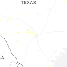
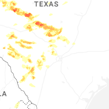
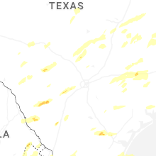


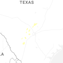


Connect with Interactive Hail Maps