

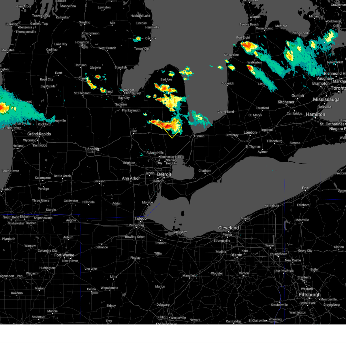
Hail Map for Capac, MI
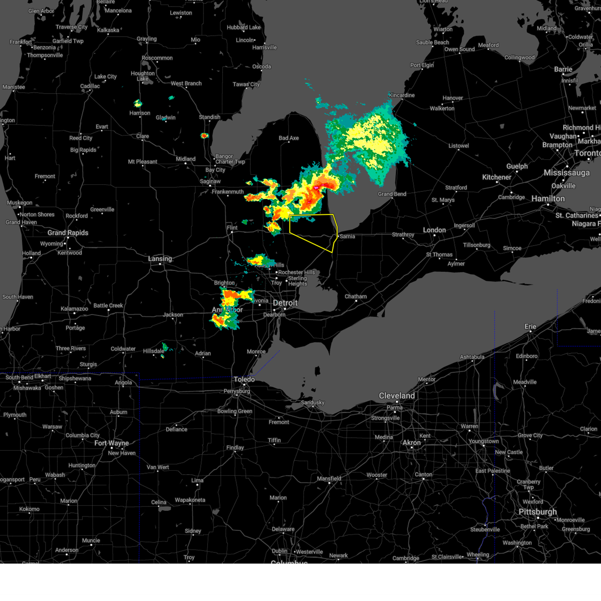
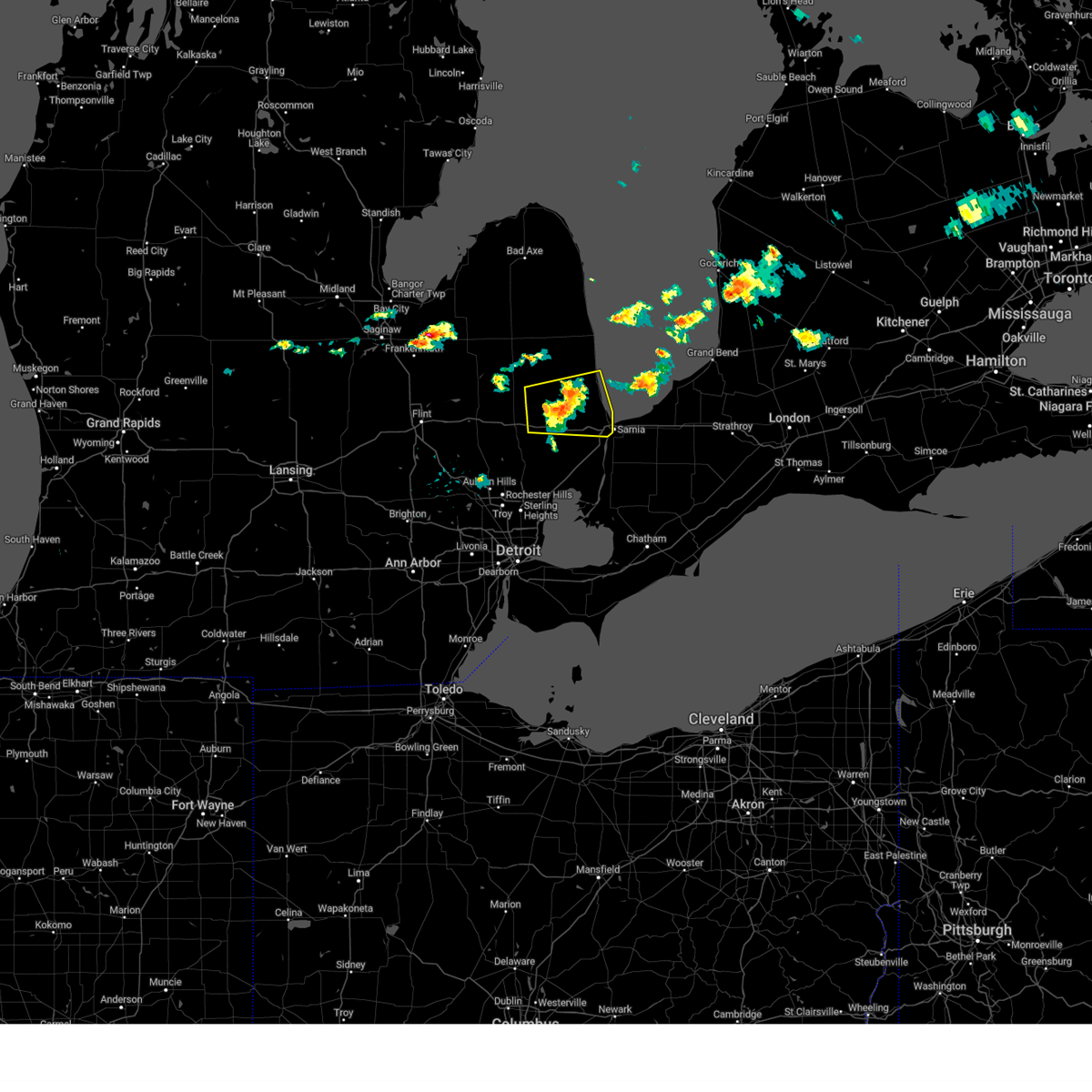
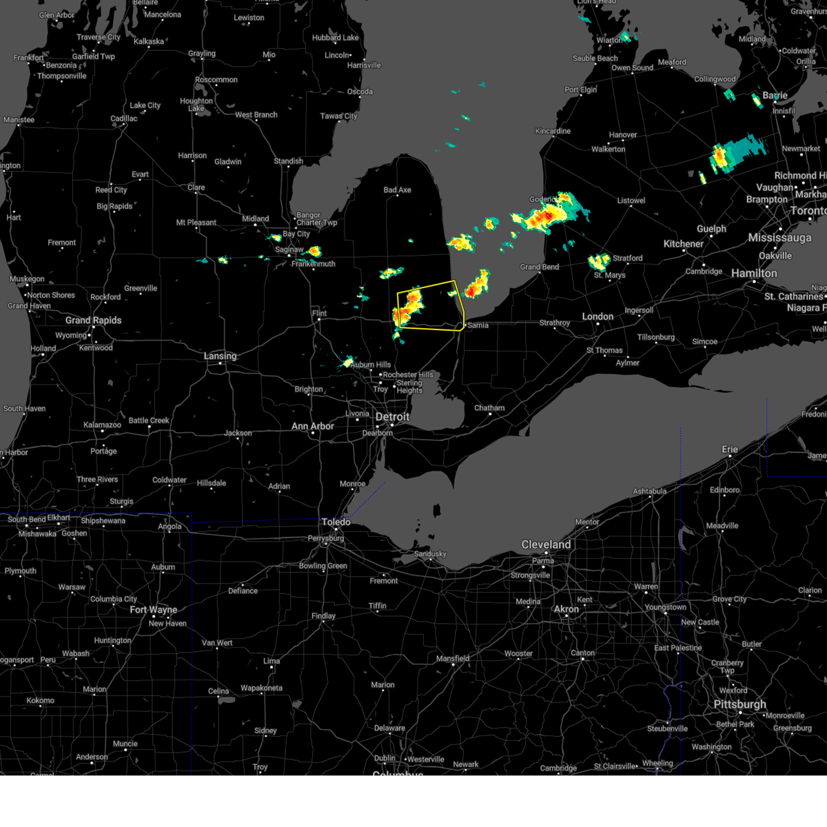
The Capac, MI area has had 0 reports of on-the-ground hail by trained spotters, and has been under severe weather warnings 26 times during the past 12 months. Doppler radar has detected hail at or near Capac, MI on 17 occasions, including 2 occasions during the past year.
| Name: | Capac, MI |
| Where Located: | 38.4 miles E of Flint, MI |
| Map: | Google Map for Capac, MI |
| Population: | 1890 |
| Housing Units: | 807 |
| More Info: | Search Google for Capac, MI |
4
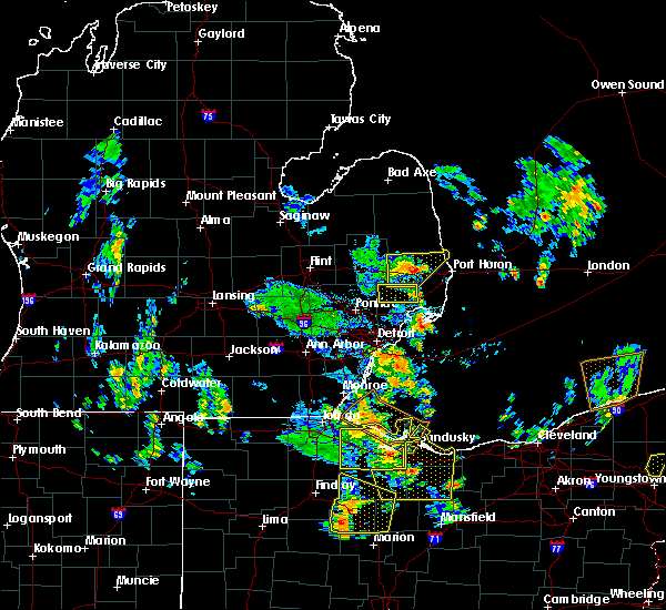
The Top Recent Hail Date for Capac, MI is Thursday, July 20, 2023 (4th out of 17)

Hail and Wind Damage Spotted near Capac, MI
| Date / Time | Report Details |
|---|---|
| 4/17/2024 4:38 PM EDT |
 At 438 pm edt, severe thunderstorms were located along a line extending from near emmett to near st. clair, moving northeast at 40 mph (radar indicated). Hazards include 60 mph wind gusts and penny size hail. Expect damage to roofs, siding, and trees. these severe storms will be near, st. clair and marysville around 445 pm edt. port huron around 455 pm edt. lakeport around 500 pm edt. Other locations impacted by these severe thunderstorms include north street, adair, lynn township, rattle run, goodells, brockway, smiths creek, wadhams, fort gratiot, and avoca. At 438 pm edt, severe thunderstorms were located along a line extending from near emmett to near st. clair, moving northeast at 40 mph (radar indicated). Hazards include 60 mph wind gusts and penny size hail. Expect damage to roofs, siding, and trees. these severe storms will be near, st. clair and marysville around 445 pm edt. port huron around 455 pm edt. lakeport around 500 pm edt. Other locations impacted by these severe thunderstorms include north street, adair, lynn township, rattle run, goodells, brockway, smiths creek, wadhams, fort gratiot, and avoca.
|
| 4/17/2024 4:29 PM EDT |
 At 428 pm edt, severe thunderstorms were located along a line extending from near capac to near new baltimore, moving northeast at 45 mph (radar indicated). Hazards include 60 mph wind gusts and penny size hail. Expect damage to roofs, siding, and trees. these severe storms will be near, st. clair and emmett around 435 pm edt. marysville around 440 pm edt. port huron around 445 pm edt. lakeport around 450 pm edt. Other locations impacted by these severe thunderstorms include anchorville, north street, adair, lynn township, rattle run, goodells, brockway, smiths creek, fair haven, and wadhams. At 428 pm edt, severe thunderstorms were located along a line extending from near capac to near new baltimore, moving northeast at 45 mph (radar indicated). Hazards include 60 mph wind gusts and penny size hail. Expect damage to roofs, siding, and trees. these severe storms will be near, st. clair and emmett around 435 pm edt. marysville around 440 pm edt. port huron around 445 pm edt. lakeport around 450 pm edt. Other locations impacted by these severe thunderstorms include anchorville, north street, adair, lynn township, rattle run, goodells, brockway, smiths creek, fair haven, and wadhams.
|
| 4/17/2024 4:17 PM EDT |
 Svrdtx the national weather service in detroit/pontiac has issued a * severe thunderstorm warning for, st. clair county in southeastern michigan, * until 530 pm edt. * at 415 pm edt, severe thunderstorms were located along a line extending from near almont to near mount clemens, moving northeast at 35 mph (radar indicated). Hazards include 60 mph wind gusts and penny size hail. Expect damage to roofs, siding, and trees. severe thunderstorms will be near, new baltimore, richmond, and capac around 430 pm edt. memphis and emmett around 435 pm edt. st. clair around 455 pm edt. marysville around 500 pm edt. port huron and lakeport around 505 pm edt. Other locations impacted by these severe thunderstorms include anchorville, north street, adair, lynn township, rattle run, goodells, brockway, smiths creek, fair haven, and wadhams. Svrdtx the national weather service in detroit/pontiac has issued a * severe thunderstorm warning for, st. clair county in southeastern michigan, * until 530 pm edt. * at 415 pm edt, severe thunderstorms were located along a line extending from near almont to near mount clemens, moving northeast at 35 mph (radar indicated). Hazards include 60 mph wind gusts and penny size hail. Expect damage to roofs, siding, and trees. severe thunderstorms will be near, new baltimore, richmond, and capac around 430 pm edt. memphis and emmett around 435 pm edt. st. clair around 455 pm edt. marysville around 500 pm edt. port huron and lakeport around 505 pm edt. Other locations impacted by these severe thunderstorms include anchorville, north street, adair, lynn township, rattle run, goodells, brockway, smiths creek, fair haven, and wadhams.
|
| 2/28/2024 2:29 AM EST |
 At 228 am est, severe thunderstorms were located along a line extending from near lakeport to near port huron to near emmett, moving east at 50 mph (radar indicated). Hazards include 60 mph wind gusts. Expect damage to roofs, siding, and trees. these severe storms will be near, port huron around 235 am est. Other locations impacted by these severe thunderstorms include north street, goodells, brockway, smiths creek, wadhams, riley center, fort gratiot, allenton, avoca, and blaine. At 228 am est, severe thunderstorms were located along a line extending from near lakeport to near port huron to near emmett, moving east at 50 mph (radar indicated). Hazards include 60 mph wind gusts. Expect damage to roofs, siding, and trees. these severe storms will be near, port huron around 235 am est. Other locations impacted by these severe thunderstorms include north street, goodells, brockway, smiths creek, wadhams, riley center, fort gratiot, allenton, avoca, and blaine.
|
| 2/28/2024 2:16 AM EST |
 At 216 am est, severe thunderstorms were located along a line extending from 6 miles east of yale to near emmett to near memphis, moving east at 45 mph (radar indicated). Hazards include 60 mph wind gusts. Expect damage to roofs, siding, and trees. these severe storms will be near, memphis and emmett around 220 am est. lakeport around 225 am est. port huron and marysville around 235 am est. Other locations impacted by these severe thunderstorms include north street, goodells, brockway, smiths creek, wadhams, riley center, fort gratiot, allenton, avoca, and blaine. At 216 am est, severe thunderstorms were located along a line extending from 6 miles east of yale to near emmett to near memphis, moving east at 45 mph (radar indicated). Hazards include 60 mph wind gusts. Expect damage to roofs, siding, and trees. these severe storms will be near, memphis and emmett around 220 am est. lakeport around 225 am est. port huron and marysville around 235 am est. Other locations impacted by these severe thunderstorms include north street, goodells, brockway, smiths creek, wadhams, riley center, fort gratiot, allenton, avoca, and blaine.
|
| 2/28/2024 2:08 AM EST |
 At 208 am est, severe thunderstorms were located along a line extending from yale to near emmett to near armada, moving east at 45 mph (radar indicated). Hazards include 60 mph wind gusts. Expect damage to roofs, siding, and trees. these severe storms will be near, memphis and emmett around 215 am est. lakeport around 225 am est. port huron around 235 am est. Other locations impacted by these severe thunderstorms include north street, lynn township, goodells, brockway, smiths creek, wadhams, riley center, fort gratiot, allenton, and avoca. At 208 am est, severe thunderstorms were located along a line extending from yale to near emmett to near armada, moving east at 45 mph (radar indicated). Hazards include 60 mph wind gusts. Expect damage to roofs, siding, and trees. these severe storms will be near, memphis and emmett around 215 am est. lakeport around 225 am est. port huron around 235 am est. Other locations impacted by these severe thunderstorms include north street, lynn township, goodells, brockway, smiths creek, wadhams, riley center, fort gratiot, allenton, and avoca.
|
| 2/28/2024 1:55 AM EST |
 Svrdtx the national weather service in detroit/pontiac has issued a * severe thunderstorm warning for, st. clair county in southeastern michigan, * until 300 am est. * at 155 am est, a severe thunderstorm was located near almont, moving east at 45 mph (radar indicated). Hazards include 60 mph wind gusts. Expect damage to roofs, siding, and trees. this severe thunderstorm will be near, capac around 200 am est. emmett around 205 am est. port huron around 230 am est. Other locations impacted by this severe thunderstorm include north street, lynn township, goodells, brockway, smiths creek, wadhams, riley center, fort gratiot, allenton, and avoca. Svrdtx the national weather service in detroit/pontiac has issued a * severe thunderstorm warning for, st. clair county in southeastern michigan, * until 300 am est. * at 155 am est, a severe thunderstorm was located near almont, moving east at 45 mph (radar indicated). Hazards include 60 mph wind gusts. Expect damage to roofs, siding, and trees. this severe thunderstorm will be near, capac around 200 am est. emmett around 205 am est. port huron around 230 am est. Other locations impacted by this severe thunderstorm include north street, lynn township, goodells, brockway, smiths creek, wadhams, riley center, fort gratiot, allenton, and avoca.
|
| 8/3/2023 8:30 PM EDT | Report of tree on house in st. clair county MI, 1.1 miles S of Capac, MI |
| 8/3/2023 8:16 PM EDT |
 At 816 pm edt, a severe thunderstorm was located 7 miles south of brown city, moving south at 25 mph (radar indicated). Hazards include 60 mph wind gusts and quarter size hail. Hail damage to vehicles is expected. expect wind damage to roofs, siding, and trees. this severe storm will be near, capac around 830 pm edt. other locations impacted by this severe thunderstorm include lynn township, roseburg, goodland township, brockway and valley center. hail threat, radar indicated max hail size, 1. 00 in wind threat, radar indicated max wind gust, 60 mph. At 816 pm edt, a severe thunderstorm was located 7 miles south of brown city, moving south at 25 mph (radar indicated). Hazards include 60 mph wind gusts and quarter size hail. Hail damage to vehicles is expected. expect wind damage to roofs, siding, and trees. this severe storm will be near, capac around 830 pm edt. other locations impacted by this severe thunderstorm include lynn township, roseburg, goodland township, brockway and valley center. hail threat, radar indicated max hail size, 1. 00 in wind threat, radar indicated max wind gust, 60 mph.
|
| 8/3/2023 8:04 PM EDT |
 At 804 pm edt, a severe thunderstorm was located near melvin, or near brown city, moving southeast at 35 mph (radar indicated). Hazards include 60 mph wind gusts and quarter size hail. Hail damage to vehicles is expected. expect wind damage to roofs, siding, and trees. this severe storm will be near, yale and capac around 815 pm edt. other locations impacted by this severe thunderstorm include goodland township, burnside, lynn township, roseburg, amador, brockway and valley center. hail threat, radar indicated max hail size, 1. 00 in wind threat, radar indicated max wind gust, 60 mph. At 804 pm edt, a severe thunderstorm was located near melvin, or near brown city, moving southeast at 35 mph (radar indicated). Hazards include 60 mph wind gusts and quarter size hail. Hail damage to vehicles is expected. expect wind damage to roofs, siding, and trees. this severe storm will be near, yale and capac around 815 pm edt. other locations impacted by this severe thunderstorm include goodland township, burnside, lynn township, roseburg, amador, brockway and valley center. hail threat, radar indicated max hail size, 1. 00 in wind threat, radar indicated max wind gust, 60 mph.
|
| 8/3/2023 7:47 PM EDT |
 At 747 pm edt, a severe thunderstorm was located near brown city, moving southeast at 45 mph (radar indicated). Hazards include 60 mph wind gusts and half dollar size hail. Hail damage to vehicles is expected. expect wind damage to roofs, siding, and trees. this severe thunderstorm will be near, brown city around 755 pm edt. melvin around 800 pm edt. yale around 810 pm edt. other locations impacted by this severe thunderstorm include goodland township, burnside, watertown, lexington heights, lynn township, roseburg, amador, brockway, juhl and valley center. hail threat, radar indicated max hail size, 1. 25 in wind threat, radar indicated max wind gust, 60 mph. At 747 pm edt, a severe thunderstorm was located near brown city, moving southeast at 45 mph (radar indicated). Hazards include 60 mph wind gusts and half dollar size hail. Hail damage to vehicles is expected. expect wind damage to roofs, siding, and trees. this severe thunderstorm will be near, brown city around 755 pm edt. melvin around 800 pm edt. yale around 810 pm edt. other locations impacted by this severe thunderstorm include goodland township, burnside, watertown, lexington heights, lynn township, roseburg, amador, brockway, juhl and valley center. hail threat, radar indicated max hail size, 1. 25 in wind threat, radar indicated max wind gust, 60 mph.
|
| 7/26/2023 4:28 PM EDT |
 At 428 pm edt, severe thunderstorms were located along a line extending from near memphis to near marine city to 7 miles southeast of algonac, moving northeast at 50 mph (radar indicated). Hazards include 60 mph wind gusts. Expect damage to roofs, siding, and trees. these severe storms will be near, marysville around 440 pm edt. port huron around 445 pm edt. other locations impacted by these severe thunderstorms include riley center, fort gratiot, allenton, adair, berville, columbus, rattle run, goodells, smiths creek and wadhams. hail threat, radar indicated max hail size, <. 75 in wind threat, radar indicated max wind gust, 60 mph. At 428 pm edt, severe thunderstorms were located along a line extending from near memphis to near marine city to 7 miles southeast of algonac, moving northeast at 50 mph (radar indicated). Hazards include 60 mph wind gusts. Expect damage to roofs, siding, and trees. these severe storms will be near, marysville around 440 pm edt. port huron around 445 pm edt. other locations impacted by these severe thunderstorms include riley center, fort gratiot, allenton, adair, berville, columbus, rattle run, goodells, smiths creek and wadhams. hail threat, radar indicated max hail size, <. 75 in wind threat, radar indicated max wind gust, 60 mph.
|
| 7/26/2023 4:12 PM EDT |
 At 410 pm edt, severe thunderstorms were located along a line extending from near romeo to new baltimore to 7 miles southwest of harsens island, moving northeast at 45 mph (radar indicated). Hazards include 60 mph wind gusts. Expect damage to roofs, siding, and trees. these severe storms will be near, richmond and harsens island around 420 pm edt. algonac and memphis around 425 pm edt. st. clair, marine city and emmett around 430 pm edt. marysville around 440 pm edt. port huron around 445 pm edt. Other locations impacted by these severe thunderstorms include anchorville, adair, rattle run, goodells, smiths creek, fair haven, wadhams, riley center, fort gratiot and allenton. At 410 pm edt, severe thunderstorms were located along a line extending from near romeo to new baltimore to 7 miles southwest of harsens island, moving northeast at 45 mph (radar indicated). Hazards include 60 mph wind gusts. Expect damage to roofs, siding, and trees. these severe storms will be near, richmond and harsens island around 420 pm edt. algonac and memphis around 425 pm edt. st. clair, marine city and emmett around 430 pm edt. marysville around 440 pm edt. port huron around 445 pm edt. Other locations impacted by these severe thunderstorms include anchorville, adair, rattle run, goodells, smiths creek, fair haven, wadhams, riley center, fort gratiot and allenton.
|
| 7/26/2023 3:54 PM EDT |
 At 354 pm edt, severe thunderstorms were located along a line extending from near rochester to st. clair shores to 6 miles east of grosse pointe, moving northeast at 50 mph (radar indicated). Hazards include 60 mph wind gusts. Expect damage to roofs, siding, and trees. severe thunderstorms will be near, harsens island around 415 pm edt. richmond and algonac around 420 pm edt. marine city, memphis and emmett around 425 pm edt. marysville around 440 pm edt. port huron around 445 pm edt. Other locations impacted by these severe thunderstorms include anchorville, adair, rattle run, goodells, smiths creek, fair haven, wadhams, riley center, fort gratiot and allenton. At 354 pm edt, severe thunderstorms were located along a line extending from near rochester to st. clair shores to 6 miles east of grosse pointe, moving northeast at 50 mph (radar indicated). Hazards include 60 mph wind gusts. Expect damage to roofs, siding, and trees. severe thunderstorms will be near, harsens island around 415 pm edt. richmond and algonac around 420 pm edt. marine city, memphis and emmett around 425 pm edt. marysville around 440 pm edt. port huron around 445 pm edt. Other locations impacted by these severe thunderstorms include anchorville, adair, rattle run, goodells, smiths creek, fair haven, wadhams, riley center, fort gratiot and allenton.
|
| 7/20/2023 3:39 PM EDT |
 At 339 pm edt, severe thunderstorms were located along a line extending from near melvin to 7 miles east of yale to near memphis, moving east at 45 mph (radar indicated). Hazards include ping pong ball size hail and 60 mph wind gusts. People and animals outdoors will be injured. expect hail damage to roofs, siding, windows, and vehicles. expect wind damage to roofs, siding, and trees. these severe storms will be near, lakeport around 350 pm edt. croswell around 400 pm edt. port huron, lexington and marysville around 405 pm edt. other locations impacted by these severe thunderstorms include north street, birch beach, lynn township, amador, goodells, brockway, smiths creek, valley center, wadhams and riley center. people attending goodells county park should seek safe shelter immediately! hail threat, radar indicated max hail size, 1. 50 in wind threat, radar indicated max wind gust, 60 mph. At 339 pm edt, severe thunderstorms were located along a line extending from near melvin to 7 miles east of yale to near memphis, moving east at 45 mph (radar indicated). Hazards include ping pong ball size hail and 60 mph wind gusts. People and animals outdoors will be injured. expect hail damage to roofs, siding, windows, and vehicles. expect wind damage to roofs, siding, and trees. these severe storms will be near, lakeport around 350 pm edt. croswell around 400 pm edt. port huron, lexington and marysville around 405 pm edt. other locations impacted by these severe thunderstorms include north street, birch beach, lynn township, amador, goodells, brockway, smiths creek, valley center, wadhams and riley center. people attending goodells county park should seek safe shelter immediately! hail threat, radar indicated max hail size, 1. 50 in wind threat, radar indicated max wind gust, 60 mph.
|
| 7/20/2023 3:28 PM EDT |
 At 328 pm edt, a severe thunderstorm was located over yale, moving northeast at 25 mph (radar indicated). Hazards include ping pong ball size hail and 60 mph wind gusts. People and animals outdoors will be injured. expect hail damage to roofs, siding, windows, and vehicles. expect wind damage to roofs, siding, and trees. this severe storm will be near, croswell around 400 pm edt. lexington around 410 pm edt. other locations impacted by this severe thunderstorm include north street, birch beach, lynn township, amador, goodells, brockway, juhl, smiths creek, valley center and wadhams. people attending goodells county park should seek safe shelter immediately! hail threat, radar indicated max hail size, 1. 50 in wind threat, radar indicated max wind gust, 60 mph. At 328 pm edt, a severe thunderstorm was located over yale, moving northeast at 25 mph (radar indicated). Hazards include ping pong ball size hail and 60 mph wind gusts. People and animals outdoors will be injured. expect hail damage to roofs, siding, windows, and vehicles. expect wind damage to roofs, siding, and trees. this severe storm will be near, croswell around 400 pm edt. lexington around 410 pm edt. other locations impacted by this severe thunderstorm include north street, birch beach, lynn township, amador, goodells, brockway, juhl, smiths creek, valley center and wadhams. people attending goodells county park should seek safe shelter immediately! hail threat, radar indicated max hail size, 1. 50 in wind threat, radar indicated max wind gust, 60 mph.
|
| 7/20/2023 3:12 PM EDT |
 At 312 pm edt, a severe thunderstorm was located over capac, moving northeast at 30 mph (radar indicated). Hazards include ping pong ball size hail and 60 mph wind gusts. People and animals outdoors will be injured. expect hail damage to roofs, siding, windows, and vehicles. expect wind damage to roofs, siding, and trees. this severe storm will be near, emmett around 320 pm edt. yale and melvin around 330 pm edt. croswell around 400 pm edt. lexington around 405 pm edt. other locations impacted by this severe thunderstorm include north street, lynn township, amador, brockway, juhl, elmer, fort gratiot, avoca, fargo and berville. people attending goodells county park should seek safe shelter immediately! hail threat, radar indicated max hail size, 1. 50 in wind threat, radar indicated max wind gust, 60 mph. At 312 pm edt, a severe thunderstorm was located over capac, moving northeast at 30 mph (radar indicated). Hazards include ping pong ball size hail and 60 mph wind gusts. People and animals outdoors will be injured. expect hail damage to roofs, siding, windows, and vehicles. expect wind damage to roofs, siding, and trees. this severe storm will be near, emmett around 320 pm edt. yale and melvin around 330 pm edt. croswell around 400 pm edt. lexington around 405 pm edt. other locations impacted by this severe thunderstorm include north street, lynn township, amador, brockway, juhl, elmer, fort gratiot, avoca, fargo and berville. people attending goodells county park should seek safe shelter immediately! hail threat, radar indicated max hail size, 1. 50 in wind threat, radar indicated max wind gust, 60 mph.
|
| 7/20/2023 2:57 PM EDT |
 At 257 pm edt, a severe thunderstorm was located over imlay city, moving northeast at 25 mph (radar indicated). Hazards include ping pong ball size hail and 60 mph wind gusts. People and animals outdoors will be injured. expect hail damage to roofs, siding, windows, and vehicles. expect wind damage to roofs, siding, and trees. this severe thunderstorm will be near, capac around 310 pm edt. emmett around 320 pm edt. yale and melvin around 330 pm edt. croswell around 400 pm edt. lexington around 410 pm edt. other locations impacted by this severe thunderstorm include north street, lynn township, amador, brockway, juhl, elmer, fort gratiot, avoca, fargo and berville. people attending goodells county park should seek safe shelter immediately! hail threat, radar indicated max hail size, 1. 50 in wind threat, radar indicated max wind gust, 60 mph. At 257 pm edt, a severe thunderstorm was located over imlay city, moving northeast at 25 mph (radar indicated). Hazards include ping pong ball size hail and 60 mph wind gusts. People and animals outdoors will be injured. expect hail damage to roofs, siding, windows, and vehicles. expect wind damage to roofs, siding, and trees. this severe thunderstorm will be near, capac around 310 pm edt. emmett around 320 pm edt. yale and melvin around 330 pm edt. croswell around 400 pm edt. lexington around 410 pm edt. other locations impacted by this severe thunderstorm include north street, lynn township, amador, brockway, juhl, elmer, fort gratiot, avoca, fargo and berville. people attending goodells county park should seek safe shelter immediately! hail threat, radar indicated max hail size, 1. 50 in wind threat, radar indicated max wind gust, 60 mph.
|
| 7/14/2023 5:34 PM EDT |
 At 533 pm edt, severe thunderstorms were located along a line extending from near marysville to 7 miles northwest of st. clair to near armada, moving east at 30 mph (radar indicated). Hazards include 60 mph wind gusts and quarter size hail. Hail damage to vehicles is expected. expect wind damage to roofs, siding, and trees. these severe storms will be near, port huron around 540 pm edt. marysville around 545 pm edt. st. clair around 550 pm edt. other locations impacted by these severe thunderstorms include riley center, fort gratiot, allenton, berville, columbus, rattle run, goodells, smiths creek and wadhams. hail threat, radar indicated max hail size, 1. 00 in wind threat, radar indicated max wind gust, 60 mph. At 533 pm edt, severe thunderstorms were located along a line extending from near marysville to 7 miles northwest of st. clair to near armada, moving east at 30 mph (radar indicated). Hazards include 60 mph wind gusts and quarter size hail. Hail damage to vehicles is expected. expect wind damage to roofs, siding, and trees. these severe storms will be near, port huron around 540 pm edt. marysville around 545 pm edt. st. clair around 550 pm edt. other locations impacted by these severe thunderstorms include riley center, fort gratiot, allenton, berville, columbus, rattle run, goodells, smiths creek and wadhams. hail threat, radar indicated max hail size, 1. 00 in wind threat, radar indicated max wind gust, 60 mph.
|
| 7/14/2023 5:09 PM EDT |
 At 509 pm edt, severe thunderstorms were located along a line extending from near port huron to near emmett to near imlay city, moving east at 20 mph (radar indicated). Hazards include 60 mph wind gusts and half dollar size hail. Hail damage to vehicles is expected. expect wind damage to roofs, siding, and trees. these severe storms will be near, lakeport and emmett around 515 pm edt. port huron around 525 pm edt. capac around 535 pm edt. marysville around 605 pm edt. st. clair and memphis around 610 pm edt. richmond around 615 pm edt. other locations impacted by these severe thunderstorms include north street, rattle run, goodells, brockway, smiths creek, wadhams, riley center, fort gratiot, allenton and avoca. hail threat, radar indicated max hail size, 1. 25 in wind threat, radar indicated max wind gust, 60 mph. At 509 pm edt, severe thunderstorms were located along a line extending from near port huron to near emmett to near imlay city, moving east at 20 mph (radar indicated). Hazards include 60 mph wind gusts and half dollar size hail. Hail damage to vehicles is expected. expect wind damage to roofs, siding, and trees. these severe storms will be near, lakeport and emmett around 515 pm edt. port huron around 525 pm edt. capac around 535 pm edt. marysville around 605 pm edt. st. clair and memphis around 610 pm edt. richmond around 615 pm edt. other locations impacted by these severe thunderstorms include north street, rattle run, goodells, brockway, smiths creek, wadhams, riley center, fort gratiot, allenton and avoca. hail threat, radar indicated max hail size, 1. 25 in wind threat, radar indicated max wind gust, 60 mph.
|
| 7/14/2023 4:45 PM EDT |
 At 445 pm edt, severe thunderstorms were located along a line extending from near port huron to near capac to near lum, moving east at 25 mph (radar indicated). Hazards include 60 mph wind gusts and quarter size hail. Hail damage to vehicles is expected. expect wind damage to roofs, siding, and trees. severe thunderstorms will be near, port huron around 450 pm edt. emmett around 505 pm edt. marysville and memphis around 540 pm edt. richmond around 545 pm edt. other locations impacted by these severe thunderstorms include north street, lynn township, rattle run, goodells, brockway, smiths creek, wadhams, riley center, fort gratiot and allenton. hail threat, radar indicated max hail size, 1. 00 in wind threat, radar indicated max wind gust, 60 mph. At 445 pm edt, severe thunderstorms were located along a line extending from near port huron to near capac to near lum, moving east at 25 mph (radar indicated). Hazards include 60 mph wind gusts and quarter size hail. Hail damage to vehicles is expected. expect wind damage to roofs, siding, and trees. severe thunderstorms will be near, port huron around 450 pm edt. emmett around 505 pm edt. marysville and memphis around 540 pm edt. richmond around 545 pm edt. other locations impacted by these severe thunderstorms include north street, lynn township, rattle run, goodells, brockway, smiths creek, wadhams, riley center, fort gratiot and allenton. hail threat, radar indicated max hail size, 1. 00 in wind threat, radar indicated max wind gust, 60 mph.
|
| 7/14/2023 4:00 PM EDT |
 At 359 pm edt, severe thunderstorms were located along a line extending from 9 miles north of port huron to near lakeport to near capac, moving east at 35 mph (radar indicated). Hazards include 60 mph wind gusts and penny size hail. Expect damage to roofs, siding, and trees. these severe storms will be near, lakeport around 405 pm edt. marysville around 435 pm edt. port huron around 440 pm edt. other locations impacted by these severe thunderstorms include fort gratiot, north street, avoca, blaine, jeddo, fargo, lynn township, goodells, brockway and smiths creek. hail threat, radar indicated max hail size, 0. 75 in wind threat, radar indicated max wind gust, 60 mph. At 359 pm edt, severe thunderstorms were located along a line extending from 9 miles north of port huron to near lakeport to near capac, moving east at 35 mph (radar indicated). Hazards include 60 mph wind gusts and penny size hail. Expect damage to roofs, siding, and trees. these severe storms will be near, lakeport around 405 pm edt. marysville around 435 pm edt. port huron around 440 pm edt. other locations impacted by these severe thunderstorms include fort gratiot, north street, avoca, blaine, jeddo, fargo, lynn township, goodells, brockway and smiths creek. hail threat, radar indicated max hail size, 0. 75 in wind threat, radar indicated max wind gust, 60 mph.
|
| 7/14/2023 3:27 PM EDT |
 At 327 pm edt, severe thunderstorms were located along a line extending from near port sanilac to near croswell to melvin, moving southeast at 25 mph (radar indicated). Hazards include 60 mph wind gusts and quarter size hail. Hail damage to vehicles is expected. expect wind damage to roofs, siding, and trees. severe thunderstorms will be near, emmett around 355 pm edt. lakeport around 400 pm edt. port huron around 420 pm edt. marysville around 425 pm edt. Other locations impacted by these severe thunderstorms include fort gratiot, north street, avoca, blaine, jeddo, fargo, lynn township, goodells, brockway and smiths creek. At 327 pm edt, severe thunderstorms were located along a line extending from near port sanilac to near croswell to melvin, moving southeast at 25 mph (radar indicated). Hazards include 60 mph wind gusts and quarter size hail. Hail damage to vehicles is expected. expect wind damage to roofs, siding, and trees. severe thunderstorms will be near, emmett around 355 pm edt. lakeport around 400 pm edt. port huron around 420 pm edt. marysville around 425 pm edt. Other locations impacted by these severe thunderstorms include fort gratiot, north street, avoca, blaine, jeddo, fargo, lynn township, goodells, brockway and smiths creek.
|
| 7/11/2023 2:28 PM EDT |
 At 227 pm edt, severe thunderstorms were located along a line extending from 7 miles east of yale to emmett, moving east at 40 mph (radar indicated). Hazards include 60 mph wind gusts and quarter size hail. Hail damage to vehicles is expected. expect wind damage to roofs, siding, and trees. these severe storms will be near, lakeport around 240 pm edt. port huron around 250 pm edt. other locations impacted by these severe thunderstorms include north street, birch beach, lynn township, amador, goodells, brockway, valley center, wadhams, fort gratiot and avoca. hail threat, radar indicated max hail size, 1. 00 in wind threat, radar indicated max wind gust, 60 mph. At 227 pm edt, severe thunderstorms were located along a line extending from 7 miles east of yale to emmett, moving east at 40 mph (radar indicated). Hazards include 60 mph wind gusts and quarter size hail. Hail damage to vehicles is expected. expect wind damage to roofs, siding, and trees. these severe storms will be near, lakeport around 240 pm edt. port huron around 250 pm edt. other locations impacted by these severe thunderstorms include north street, birch beach, lynn township, amador, goodells, brockway, valley center, wadhams, fort gratiot and avoca. hail threat, radar indicated max hail size, 1. 00 in wind threat, radar indicated max wind gust, 60 mph.
|
| 7/11/2023 2:18 PM EDT |
 At 217 pm edt, a severe thunderstorm was located near yale, moving east at 40 mph (radar indicated). Hazards include 60 mph wind gusts and quarter size hail. Hail damage to vehicles is expected. expect wind damage to roofs, siding, and trees. this severe thunderstorm will be near, port huron and lakeport around 245 pm edt. other locations impacted by this severe thunderstorm include north street, birch beach, lynn township, amador, goodells, brockway, valley center, wadhams, fort gratiot and avoca. hail threat, radar indicated max hail size, 1. 00 in wind threat, radar indicated max wind gust, 60 mph. At 217 pm edt, a severe thunderstorm was located near yale, moving east at 40 mph (radar indicated). Hazards include 60 mph wind gusts and quarter size hail. Hail damage to vehicles is expected. expect wind damage to roofs, siding, and trees. this severe thunderstorm will be near, port huron and lakeport around 245 pm edt. other locations impacted by this severe thunderstorm include north street, birch beach, lynn township, amador, goodells, brockway, valley center, wadhams, fort gratiot and avoca. hail threat, radar indicated max hail size, 1. 00 in wind threat, radar indicated max wind gust, 60 mph.
|
| 6/25/2023 7:40 PM EDT |
 At 740 pm edt, a severe thunderstorm was located near new baltimore, moving north at 40 mph (radar indicated). Hazards include 60 mph wind gusts. Expect damage to roofs, siding, and trees. this severe storm will be near, richmond around 745 pm edt. st. clair and memphis around 755 pm edt. marysville around 805 pm edt. port huron around 815 pm edt. lakeport around 825 pm edt. other locations impacted by this severe thunderstorm include anchorville, north street, adair, lynn township, rattle run, goodells, brockway, smiths creek, fair haven and wadhams. hail threat, radar indicated max hail size, <. 75 in wind threat, radar indicated max wind gust, 60 mph. At 740 pm edt, a severe thunderstorm was located near new baltimore, moving north at 40 mph (radar indicated). Hazards include 60 mph wind gusts. Expect damage to roofs, siding, and trees. this severe storm will be near, richmond around 745 pm edt. st. clair and memphis around 755 pm edt. marysville around 805 pm edt. port huron around 815 pm edt. lakeport around 825 pm edt. other locations impacted by this severe thunderstorm include anchorville, north street, adair, lynn township, rattle run, goodells, brockway, smiths creek, fair haven and wadhams. hail threat, radar indicated max hail size, <. 75 in wind threat, radar indicated max wind gust, 60 mph.
|
| 6/25/2023 7:24 PM EDT |
 At 723 pm edt, a severe thunderstorm was located near mount clemens, moving northeast at 50 mph (radar indicated). Hazards include 60 mph wind gusts. Expect damage to roofs, siding, and trees. this severe thunderstorm will be near, new baltimore and harsens island around 735 pm edt. algonac around 740 pm edt. marine city around 745 pm edt. st. clair around 755 pm edt. marysville around 800 pm edt. other locations impacted by this severe thunderstorm include anchorville, north street, adair, lynn township, rattle run, goodells, brockway, smiths creek, fair haven and wadhams. hail threat, radar indicated max hail size, <. 75 in wind threat, radar indicated max wind gust, 60 mph. At 723 pm edt, a severe thunderstorm was located near mount clemens, moving northeast at 50 mph (radar indicated). Hazards include 60 mph wind gusts. Expect damage to roofs, siding, and trees. this severe thunderstorm will be near, new baltimore and harsens island around 735 pm edt. algonac around 740 pm edt. marine city around 745 pm edt. st. clair around 755 pm edt. marysville around 800 pm edt. other locations impacted by this severe thunderstorm include anchorville, north street, adair, lynn township, rattle run, goodells, brockway, smiths creek, fair haven and wadhams. hail threat, radar indicated max hail size, <. 75 in wind threat, radar indicated max wind gust, 60 mph.
|
| 9/21/2022 11:15 AM EDT |
 At 1113 am edt, severe thunderstorms were located along a line extending from near emmett to near armada to sterling heights, moving southeast at 35 mph (radar indicated). Hazards include 60 mph wind gusts and penny size hail. Expect damage to roofs, siding, and trees. severe thunderstorms will be near, richmond around 1120 am edt. mount clemens and new baltimore around 1125 am edt. st. clair shores and marysville around 1130 am edt. st. clair around 1135 am edt. marine city around 1140 am edt. algonac and harsens island around 1145 am edt. other locations impacted by these severe thunderstorms include anchorville, north street, adair, shelby township, rattle run, goodells, ray center, utica, smiths creek and washington. hail threat, radar indicated max hail size, 0. 75 in wind threat, radar indicated max wind gust, 60 mph. At 1113 am edt, severe thunderstorms were located along a line extending from near emmett to near armada to sterling heights, moving southeast at 35 mph (radar indicated). Hazards include 60 mph wind gusts and penny size hail. Expect damage to roofs, siding, and trees. severe thunderstorms will be near, richmond around 1120 am edt. mount clemens and new baltimore around 1125 am edt. st. clair shores and marysville around 1130 am edt. st. clair around 1135 am edt. marine city around 1140 am edt. algonac and harsens island around 1145 am edt. other locations impacted by these severe thunderstorms include anchorville, north street, adair, shelby township, rattle run, goodells, ray center, utica, smiths creek and washington. hail threat, radar indicated max hail size, 0. 75 in wind threat, radar indicated max wind gust, 60 mph.
|
| 8/29/2022 6:35 PM EDT |
 At 635 pm edt, severe thunderstorms were located along a line extending from 10 miles southeast of port sanilac to near lakeport to near marysville, moving east at 55 mph (radar indicated). Hazards include 60 mph wind gusts. Expect damage to roofs, siding, and trees. these severe thunderstorms will remain over mainly rural areas of southeastern sanilac and st. clair counties, including the following locations, anchorville, north street, amador, brockway, fort gratiot, avoca, fargo, berville, roseburg and ruby. hail threat, radar indicated max hail size, <. 75 in wind threat, radar indicated max wind gust, 60 mph. At 635 pm edt, severe thunderstorms were located along a line extending from 10 miles southeast of port sanilac to near lakeport to near marysville, moving east at 55 mph (radar indicated). Hazards include 60 mph wind gusts. Expect damage to roofs, siding, and trees. these severe thunderstorms will remain over mainly rural areas of southeastern sanilac and st. clair counties, including the following locations, anchorville, north street, amador, brockway, fort gratiot, avoca, fargo, berville, roseburg and ruby. hail threat, radar indicated max hail size, <. 75 in wind threat, radar indicated max wind gust, 60 mph.
|
| 8/29/2022 6:11 PM EDT |
 At 611 pm edt, severe thunderstorms were located along a line extending from near peck to near capac to near almont, moving east at 60 mph (radar indicated). Hazards include 60 mph wind gusts. Expect damage to roofs, siding, and trees. these severe storms will be near, yale and emmett around 615 pm edt. croswell around 620 pm edt. lexington and memphis around 625 pm edt. lakeport around 630 pm edt. port huron and st. clair around 635 pm edt. marysville around 640 pm edt. other locations impacted by these severe thunderstorms include anchorville, north street, lynn township, amador, brockway, fort gratiot, avoca, fargo, berville and roseburg. hail threat, radar indicated max hail size, <. 75 in wind threat, radar indicated max wind gust, 60 mph. At 611 pm edt, severe thunderstorms were located along a line extending from near peck to near capac to near almont, moving east at 60 mph (radar indicated). Hazards include 60 mph wind gusts. Expect damage to roofs, siding, and trees. these severe storms will be near, yale and emmett around 615 pm edt. croswell around 620 pm edt. lexington and memphis around 625 pm edt. lakeport around 630 pm edt. port huron and st. clair around 635 pm edt. marysville around 640 pm edt. other locations impacted by these severe thunderstorms include anchorville, north street, lynn township, amador, brockway, fort gratiot, avoca, fargo, berville and roseburg. hail threat, radar indicated max hail size, <. 75 in wind threat, radar indicated max wind gust, 60 mph.
|
| 8/29/2022 5:52 PM EDT |
 At 551 pm edt, severe thunderstorms were located along a line extending from near kingston to near lapeer to livonia, moving east at 60 mph (radar indicated). Hazards include 60 mph wind gusts. Expect damage to roofs, siding, and trees. severe thunderstorms will be near, marlette around 555 pm edt. capac around 610 pm edt. yale and emmett around 615 pm edt. port huron and lakeport around 630 pm edt. other locations impacted by these severe thunderstorms include anchorville, north street, lynn township, amador, brockway, fort gratiot, avoca, fargo, berville and roseburg. additional scattered thunderstorms have developed ahead of this main line and will be capable of producing wind gusts to 60 mph. hail threat, radar indicated max hail size, <. 75 in wind threat, radar indicated max wind gust, 60 mph. At 551 pm edt, severe thunderstorms were located along a line extending from near kingston to near lapeer to livonia, moving east at 60 mph (radar indicated). Hazards include 60 mph wind gusts. Expect damage to roofs, siding, and trees. severe thunderstorms will be near, marlette around 555 pm edt. capac around 610 pm edt. yale and emmett around 615 pm edt. port huron and lakeport around 630 pm edt. other locations impacted by these severe thunderstorms include anchorville, north street, lynn township, amador, brockway, fort gratiot, avoca, fargo, berville and roseburg. additional scattered thunderstorms have developed ahead of this main line and will be capable of producing wind gusts to 60 mph. hail threat, radar indicated max hail size, <. 75 in wind threat, radar indicated max wind gust, 60 mph.
|
| 8/3/2022 4:52 PM EDT |
 At 451 pm edt, severe thunderstorms were located along a line extending from lexington to near goodrich, moving southeast at 15 mph (radar indicated). Hazards include 60 mph wind gusts and penny size hail. Expect damage to roofs, siding, and trees. these severe storms will be near, croswell and lexington around 455 pm edt. other locations impacted by these severe thunderstorms include goodland township, birch beach, attica, lynn township, amador, brockway, valley center, thornville, allenton and avoca. hail threat, radar indicated max hail size, 0. 75 in wind threat, radar indicated max wind gust, 60 mph. At 451 pm edt, severe thunderstorms were located along a line extending from lexington to near goodrich, moving southeast at 15 mph (radar indicated). Hazards include 60 mph wind gusts and penny size hail. Expect damage to roofs, siding, and trees. these severe storms will be near, croswell and lexington around 455 pm edt. other locations impacted by these severe thunderstorms include goodland township, birch beach, attica, lynn township, amador, brockway, valley center, thornville, allenton and avoca. hail threat, radar indicated max hail size, 0. 75 in wind threat, radar indicated max wind gust, 60 mph.
|
| 8/3/2022 4:33 PM EDT |
 At 433 pm edt, severe thunderstorms were located along a line extending from near applegate to goodrich, moving southeast at 15 mph (radar indicated). Hazards include 60 mph wind gusts and penny size hail. Expect damage to roofs, siding, and trees. severe thunderstorms will be near, croswell around 440 pm edt. lexington around 450 pm edt. metamora around 510 pm edt. other locations impacted by these severe thunderstorms include goodland township, birch beach, attica, lynn township, amador, brockway, valley center, thornville, allenton and avoca. hail threat, radar indicated max hail size, 0. 75 in wind threat, radar indicated max wind gust, 60 mph. At 433 pm edt, severe thunderstorms were located along a line extending from near applegate to goodrich, moving southeast at 15 mph (radar indicated). Hazards include 60 mph wind gusts and penny size hail. Expect damage to roofs, siding, and trees. severe thunderstorms will be near, croswell around 440 pm edt. lexington around 450 pm edt. metamora around 510 pm edt. other locations impacted by these severe thunderstorms include goodland township, birch beach, attica, lynn township, amador, brockway, valley center, thornville, allenton and avoca. hail threat, radar indicated max hail size, 0. 75 in wind threat, radar indicated max wind gust, 60 mph.
|
| 7/20/2022 3:10 PM EDT |
 At 310 pm edt, severe thunderstorms were located along a line extending from near lum to near dryden to near romeo, moving northeast at 45 mph (radar indicated). Hazards include 60 mph wind gusts and nickel size hail. Expect damage to roofs, siding, and trees. severe thunderstorms will be near, capac and armada around 325 pm edt. yale, memphis and emmett around 335 pm edt. port huron and lakeport around 400 pm edt. other locations impacted by these severe thunderstorms include north street, goodland township, lynn township, rattle run, goodells, brockway, smiths creek, wadhams, riley center and fort gratiot. People attending goodells county park should seek safe shelter immediately!. At 310 pm edt, severe thunderstorms were located along a line extending from near lum to near dryden to near romeo, moving northeast at 45 mph (radar indicated). Hazards include 60 mph wind gusts and nickel size hail. Expect damage to roofs, siding, and trees. severe thunderstorms will be near, capac and armada around 325 pm edt. yale, memphis and emmett around 335 pm edt. port huron and lakeport around 400 pm edt. other locations impacted by these severe thunderstorms include north street, goodland township, lynn township, rattle run, goodells, brockway, smiths creek, wadhams, riley center and fort gratiot. People attending goodells county park should seek safe shelter immediately!.
|
| 5/21/2022 10:32 AM EDT |
 At 1032 am edt, severe thunderstorms were located along a line extending from near emmett to near new baltimore to 7 miles southwest of harsens island, moving northeast at 60 mph (radar indicated). Hazards include 60 mph wind gusts and quarter size hail. Hail damage to vehicles is expected. expect wind damage to roofs, siding, and trees. these severe storms will be near, marine city around 1040 am edt. port huron, st. clair, algonac and lakeport around 1045 am edt. other locations impacted by these severe thunderstorms include anchorville, north street, adair, rattle run, goodells, ray center, brockway, smiths creek, fair haven and wadhams. people attending city of st clair harbor should seek safe shelter immediately! hail threat, radar indicated max hail size, 1. 00 in wind threat, radar indicated max wind gust, 60 mph. At 1032 am edt, severe thunderstorms were located along a line extending from near emmett to near new baltimore to 7 miles southwest of harsens island, moving northeast at 60 mph (radar indicated). Hazards include 60 mph wind gusts and quarter size hail. Hail damage to vehicles is expected. expect wind damage to roofs, siding, and trees. these severe storms will be near, marine city around 1040 am edt. port huron, st. clair, algonac and lakeport around 1045 am edt. other locations impacted by these severe thunderstorms include anchorville, north street, adair, rattle run, goodells, ray center, brockway, smiths creek, fair haven and wadhams. people attending city of st clair harbor should seek safe shelter immediately! hail threat, radar indicated max hail size, 1. 00 in wind threat, radar indicated max wind gust, 60 mph.
|
| 5/21/2022 10:16 AM EDT |
 At 1015 am edt, severe thunderstorms were located along a line extending from near almont to grosse pointe, moving northeast at 60 mph (radar indicated). Hazards include 60 mph wind gusts and penny size hail. Expect damage to roofs, siding, and trees. severe thunderstorms will be near, almont and armada around 1020 am edt. capac around 1025 am edt. memphis and emmett around 1030 am edt. yale and harsens island around 1035 am edt. algonac around 1040 am edt. lakeport and marine city around 1045 am edt. other locations impacted by these severe thunderstorms include anchorville, north street, roseville, shelby township, lynn township, ray center, brockway, utica, washington and fort gratiot. hail threat, radar indicated max hail size, 0. 75 in wind threat, radar indicated max wind gust, 60 mph. At 1015 am edt, severe thunderstorms were located along a line extending from near almont to grosse pointe, moving northeast at 60 mph (radar indicated). Hazards include 60 mph wind gusts and penny size hail. Expect damage to roofs, siding, and trees. severe thunderstorms will be near, almont and armada around 1020 am edt. capac around 1025 am edt. memphis and emmett around 1030 am edt. yale and harsens island around 1035 am edt. algonac around 1040 am edt. lakeport and marine city around 1045 am edt. other locations impacted by these severe thunderstorms include anchorville, north street, roseville, shelby township, lynn township, ray center, brockway, utica, washington and fort gratiot. hail threat, radar indicated max hail size, 0. 75 in wind threat, radar indicated max wind gust, 60 mph.
|
| 9/12/2021 8:56 PM EDT |
 At 855 pm edt, a severe thunderstorm was located near lum, or near imlay city, moving east at 55 mph (radar indicated). Hazards include 60 mph wind gusts. Expect damage to roofs, siding, and trees. this severe thunderstorm will be near, capac around 910 pm edt. emmett around 915 pm edt. memphis around 920 pm edt. port huron, st. clair and marysville around 935 pm edt. other locations impacted by this severe thunderstorm include anchorville, north street, lynn township, amador, ray center, brockway, juhl, washington, fort gratiot and avoca. hail threat, radar indicated max hail size, <. 75 in wind threat, radar indicated max wind gust, 60 mph. At 855 pm edt, a severe thunderstorm was located near lum, or near imlay city, moving east at 55 mph (radar indicated). Hazards include 60 mph wind gusts. Expect damage to roofs, siding, and trees. this severe thunderstorm will be near, capac around 910 pm edt. emmett around 915 pm edt. memphis around 920 pm edt. port huron, st. clair and marysville around 935 pm edt. other locations impacted by this severe thunderstorm include anchorville, north street, lynn township, amador, ray center, brockway, juhl, washington, fort gratiot and avoca. hail threat, radar indicated max hail size, <. 75 in wind threat, radar indicated max wind gust, 60 mph.
|
| 8/29/2021 7:32 PM EDT |
 At 732 pm edt, severe thunderstorms were located along a line extending from near lakeport to near marysville to near new baltimore to st. clair shores, moving east at 40 mph (radar indicated). Hazards include 60 mph wind gusts. Expect damage to roofs, siding, and trees. these severe storms will be near, st. clair, algonac, lakeport and marysville around 740 pm edt. port huron and marine city around 745 pm edt. other locations impacted by these severe thunderstorms include anchorville, north street, roseville, shelby township, lynn township, ray center, brockway, utica, washington and fort gratiot. hail threat, radar indicated max hail size, <. 75 in wind threat, radar indicated max wind gust, 60 mph. At 732 pm edt, severe thunderstorms were located along a line extending from near lakeport to near marysville to near new baltimore to st. clair shores, moving east at 40 mph (radar indicated). Hazards include 60 mph wind gusts. Expect damage to roofs, siding, and trees. these severe storms will be near, st. clair, algonac, lakeport and marysville around 740 pm edt. port huron and marine city around 745 pm edt. other locations impacted by these severe thunderstorms include anchorville, north street, roseville, shelby township, lynn township, ray center, brockway, utica, washington and fort gratiot. hail threat, radar indicated max hail size, <. 75 in wind threat, radar indicated max wind gust, 60 mph.
|
| 8/29/2021 7:21 PM EDT |
 At 721 pm edt, severe thunderstorms were located along a line extending from near lakeport to near marysville to new baltimore to near st. clair shores, moving east at 40 mph (radar indicated). Hazards include 60 mph wind gusts. Expect damage to roofs, siding, and trees. these severe storms will be near, lakeport around 725 pm edt. marysville around 730 pm edt. port huron around 735 pm edt. algonac around 740 pm edt. st. clair and marine city around 745 pm edt. harsens island around 755 pm edt. other locations impacted by these severe thunderstorms include anchorville, north street, roseville, shelby township, lynn township, ray center, brockway, utica, washington and fort gratiot. hail threat, radar indicated max hail size, <. 75 in wind threat, radar indicated max wind gust, 60 mph. At 721 pm edt, severe thunderstorms were located along a line extending from near lakeport to near marysville to new baltimore to near st. clair shores, moving east at 40 mph (radar indicated). Hazards include 60 mph wind gusts. Expect damage to roofs, siding, and trees. these severe storms will be near, lakeport around 725 pm edt. marysville around 730 pm edt. port huron around 735 pm edt. algonac around 740 pm edt. st. clair and marine city around 745 pm edt. harsens island around 755 pm edt. other locations impacted by these severe thunderstorms include anchorville, north street, roseville, shelby township, lynn township, ray center, brockway, utica, washington and fort gratiot. hail threat, radar indicated max hail size, <. 75 in wind threat, radar indicated max wind gust, 60 mph.
|
| 8/29/2021 7:01 PM EDT |
 At 701 pm edt, severe thunderstorms were located along a line extending from near yale to near capac to near rochester to southfield, moving east at 40 mph (radar indicated). Hazards include 60 mph wind gusts. Expect damage to roofs, siding, and trees. these severe storms will be near, yale, capac and memphis around 705 pm edt. emmett around 710 pm edt. new baltimore and richmond around 725 pm edt. st. clair shores and mount clemens around 730 pm edt. port huron and lakeport around 735 pm edt. marine city around 745 pm edt. st. clair and marysville around 750 pm edt. harsens island around 755 pm edt. other locations impacted by these severe thunderstorms include anchorville, north street, roseville, shelby township, lynn township, ray center, brockway, utica, washington and fort gratiot. hail threat, radar indicated max hail size, <. 75 in wind threat, radar indicated max wind gust, 60 mph. At 701 pm edt, severe thunderstorms were located along a line extending from near yale to near capac to near rochester to southfield, moving east at 40 mph (radar indicated). Hazards include 60 mph wind gusts. Expect damage to roofs, siding, and trees. these severe storms will be near, yale, capac and memphis around 705 pm edt. emmett around 710 pm edt. new baltimore and richmond around 725 pm edt. st. clair shores and mount clemens around 730 pm edt. port huron and lakeport around 735 pm edt. marine city around 745 pm edt. st. clair and marysville around 750 pm edt. harsens island around 755 pm edt. other locations impacted by these severe thunderstorms include anchorville, north street, roseville, shelby township, lynn township, ray center, brockway, utica, washington and fort gratiot. hail threat, radar indicated max hail size, <. 75 in wind threat, radar indicated max wind gust, 60 mph.
|
| 8/29/2021 6:52 PM EDT |
 At 651 pm edt, severe thunderstorms were located along a line extending from near melvin to near capac to rochester to near southfield, moving east at 40 mph (radar indicated). Hazards include 60 mph wind gusts. Expect damage to roofs, siding, and trees. these severe storms will be near, yale and capac around 655 pm edt. romeo and emmett around 705 pm edt. warren and macomb township around 710 pm edt. armada around 715 pm edt. new baltimore, richmond and clinton around 725 pm edt. st. clair shores, port huron, mount clemens and lakeport around 730 pm edt. st. clair around 745 pm edt. marysville around 750 pm edt. other locations impacted by these severe thunderstorms include anchorville, north street, roseville, shelby township, lynn township, ray center, brockway, utica, washington and fort gratiot. hail threat, radar indicated max hail size, <. 75 in wind threat, radar indicated max wind gust, 60 mph. At 651 pm edt, severe thunderstorms were located along a line extending from near melvin to near capac to rochester to near southfield, moving east at 40 mph (radar indicated). Hazards include 60 mph wind gusts. Expect damage to roofs, siding, and trees. these severe storms will be near, yale and capac around 655 pm edt. romeo and emmett around 705 pm edt. warren and macomb township around 710 pm edt. armada around 715 pm edt. new baltimore, richmond and clinton around 725 pm edt. st. clair shores, port huron, mount clemens and lakeport around 730 pm edt. st. clair around 745 pm edt. marysville around 750 pm edt. other locations impacted by these severe thunderstorms include anchorville, north street, roseville, shelby township, lynn township, ray center, brockway, utica, washington and fort gratiot. hail threat, radar indicated max hail size, <. 75 in wind threat, radar indicated max wind gust, 60 mph.
|
| 8/29/2021 6:37 PM EDT |
 At 636 pm edt, severe thunderstorms were located along a line extending from near brown city to near dryden to near clarkston to near novi, moving east at 40 mph (radar indicated). Hazards include 60 mph wind gusts. Expect damage to roofs, siding, and trees. severe thunderstorms will be near, capac around 655 pm edt. romeo, sterling heights, clinton and emmett around 705 pm edt. memphis and macomb township around 710 pm edt. warren around 715 pm edt. new baltimore and richmond around 725 pm edt. mount clemens, lakeport and marysville around 730 pm edt. st. clair shores and port huron around 735 pm edt. st. clair and marine city around 745 pm edt. other locations impacted by these severe thunderstorms include anchorville, north street, roseville, shelby township, lynn township, ray center, brockway, utica, washington and fort gratiot. hail threat, radar indicated max hail size, <. 75 in wind threat, radar indicated max wind gust, 60 mph. At 636 pm edt, severe thunderstorms were located along a line extending from near brown city to near dryden to near clarkston to near novi, moving east at 40 mph (radar indicated). Hazards include 60 mph wind gusts. Expect damage to roofs, siding, and trees. severe thunderstorms will be near, capac around 655 pm edt. romeo, sterling heights, clinton and emmett around 705 pm edt. memphis and macomb township around 710 pm edt. warren around 715 pm edt. new baltimore and richmond around 725 pm edt. mount clemens, lakeport and marysville around 730 pm edt. st. clair shores and port huron around 735 pm edt. st. clair and marine city around 745 pm edt. other locations impacted by these severe thunderstorms include anchorville, north street, roseville, shelby township, lynn township, ray center, brockway, utica, washington and fort gratiot. hail threat, radar indicated max hail size, <. 75 in wind threat, radar indicated max wind gust, 60 mph.
|
| 8/11/2021 4:21 PM EDT |
 At 419 pm edt, severe thunderstorms were located along a line extending from brown city to near emmett to near harsens island, moving east at 55 mph. these are destructive storms for macomb and st clair counties (radar indicated with 75 mph observerd at selfridge angb). Hazards include 80 mph wind gusts. Flying debris will be dangerous to those caught without shelter. mobile homes will be heavily damaged. expect considerable damage to roofs, windows, and vehicles. extensive tree damage and power outages are likely. these severe storms will be near, algonac around 425 pm edt. yale and marysville around 430 pm edt. port huron around 435 pm edt. croswell around 440 pm edt. lexington around 445 pm edt. other locations impacted by these severe thunderstorms include anchorville, north street, goodland township, lynn township, amador, ray center, brockway, fort gratiot, avoca and burnside. thunderstorm damage threat, destructive hail threat, radar indicated max hail size, <. 75 in wind threat, observed max wind gust, 80 mph. At 419 pm edt, severe thunderstorms were located along a line extending from brown city to near emmett to near harsens island, moving east at 55 mph. these are destructive storms for macomb and st clair counties (radar indicated with 75 mph observerd at selfridge angb). Hazards include 80 mph wind gusts. Flying debris will be dangerous to those caught without shelter. mobile homes will be heavily damaged. expect considerable damage to roofs, windows, and vehicles. extensive tree damage and power outages are likely. these severe storms will be near, algonac around 425 pm edt. yale and marysville around 430 pm edt. port huron around 435 pm edt. croswell around 440 pm edt. lexington around 445 pm edt. other locations impacted by these severe thunderstorms include anchorville, north street, goodland township, lynn township, amador, ray center, brockway, fort gratiot, avoca and burnside. thunderstorm damage threat, destructive hail threat, radar indicated max hail size, <. 75 in wind threat, observed max wind gust, 80 mph.
|
| 8/11/2021 3:59 PM EDT |
 At 357 pm edt, severe thunderstorms were located along a line extending from near columbiaville to almont to near mount clemens, moving northeast at 55 mph (radar indicated). Hazards include 70 mph wind gusts. Expect considerable tree damage. damage is likely to mobile homes, roofs, and outbuildings. these severe storms will be near, armada around 405 pm edt. new baltimore and capac around 410 pm edt. brown city, memphis, emmett and harsens island around 415 pm edt. algonac and yale around 420 pm edt. marine city and peck around 425 pm edt. st. clair around 430 pm edt. lakeport around 435 pm edt. other locations impacted by these severe thunderstorms include anchorville, north street, goodland township, roseville, shelby township, lynn township, amador, ray center, brockway and utica. thunderstorm damage threat, considerable hail threat, radar indicated max hail size, <. 75 in wind threat, observed max wind gust, 70 mph. At 357 pm edt, severe thunderstorms were located along a line extending from near columbiaville to almont to near mount clemens, moving northeast at 55 mph (radar indicated). Hazards include 70 mph wind gusts. Expect considerable tree damage. damage is likely to mobile homes, roofs, and outbuildings. these severe storms will be near, armada around 405 pm edt. new baltimore and capac around 410 pm edt. brown city, memphis, emmett and harsens island around 415 pm edt. algonac and yale around 420 pm edt. marine city and peck around 425 pm edt. st. clair around 430 pm edt. lakeport around 435 pm edt. other locations impacted by these severe thunderstorms include anchorville, north street, goodland township, roseville, shelby township, lynn township, amador, ray center, brockway and utica. thunderstorm damage threat, considerable hail threat, radar indicated max hail size, <. 75 in wind threat, observed max wind gust, 70 mph.
|
| 8/11/2021 3:51 PM EDT |
 At 350 pm edt, severe thunderstorms were located along a line extending from columbiaville to near oxford to warren, moving northeast at 50 mph (radar indicated). Hazards include 60 mph wind gusts. Expect damage to roofs, siding, and trees. these severe storms will be near, dryden around 355 pm edt. imlay city, romeo and almont around 400 pm edt. st. clair shores, mount clemens and macomb township around 405 pm edt. capac and north branch around 410 pm edt. new baltimore and emmett around 415 pm edt. yale, brown city and harsens island around 420 pm edt. algonac around 425 pm edt. marine city and peck around 430 pm edt. other locations impacted by these severe thunderstorms include anchorville, north street, goodland township, roseville, shelby township, lynn township, amador, ray center, brockway and utica. hail threat, radar indicated max hail size, <. 75 in wind threat, observed max wind gust, 60 mph. At 350 pm edt, severe thunderstorms were located along a line extending from columbiaville to near oxford to warren, moving northeast at 50 mph (radar indicated). Hazards include 60 mph wind gusts. Expect damage to roofs, siding, and trees. these severe storms will be near, dryden around 355 pm edt. imlay city, romeo and almont around 400 pm edt. st. clair shores, mount clemens and macomb township around 405 pm edt. capac and north branch around 410 pm edt. new baltimore and emmett around 415 pm edt. yale, brown city and harsens island around 420 pm edt. algonac around 425 pm edt. marine city and peck around 430 pm edt. other locations impacted by these severe thunderstorms include anchorville, north street, goodland township, roseville, shelby township, lynn township, amador, ray center, brockway and utica. hail threat, radar indicated max hail size, <. 75 in wind threat, observed max wind gust, 60 mph.
|
| 8/11/2021 3:36 PM EDT |
 At 336 pm edt, severe thunderstorms were located along a line extending from near flint to near southfield, moving northeast at 55 mph (radar indicated). Hazards include 60 mph wind gusts. Expect damage to roofs, siding, and trees. severe thunderstorms will be near, warren and hadley around 350 pm edt. columbiaville, sterling heights and clinton around 355 pm edt. st. clair shores, mount clemens, lapeer and macomb township around 400 pm edt. lum around 405 pm edt. new baltimore and north branch around 410 pm edt. harsens island around 415 pm edt. algonac and brown city around 420 pm edt. marine city and melvin around 425 pm edt. other locations impacted by these severe thunderstorms include anchorville, north street, goodland township, roseville, shelby township, lynn township, amador, ray center, brockway and utica. hail threat, radar indicated max hail size, <. 75 in wind threat, radar indicated max wind gust, 60 mph. At 336 pm edt, severe thunderstorms were located along a line extending from near flint to near southfield, moving northeast at 55 mph (radar indicated). Hazards include 60 mph wind gusts. Expect damage to roofs, siding, and trees. severe thunderstorms will be near, warren and hadley around 350 pm edt. columbiaville, sterling heights and clinton around 355 pm edt. st. clair shores, mount clemens, lapeer and macomb township around 400 pm edt. lum around 405 pm edt. new baltimore and north branch around 410 pm edt. harsens island around 415 pm edt. algonac and brown city around 420 pm edt. marine city and melvin around 425 pm edt. other locations impacted by these severe thunderstorms include anchorville, north street, goodland township, roseville, shelby township, lynn township, amador, ray center, brockway and utica. hail threat, radar indicated max hail size, <. 75 in wind threat, radar indicated max wind gust, 60 mph.
|
| 7/10/2020 2:21 PM EDT |
 At 220 pm edt, a severe thunderstorm was located over emmett, or 7 miles east of capac, moving northeast at 25 mph (radar indicated). Hazards include 60 mph wind gusts and quarter size hail. Hail damage to vehicles is expected. expect wind damage to roofs, siding, and trees. this severe storm will be near, yale around 240 pm edt. Other locations impacted by this severe thunderstorm include riley center, north street, avoca, blaine, jeddo, fargo, lynn township, goodells, brockway and ruby. At 220 pm edt, a severe thunderstorm was located over emmett, or 7 miles east of capac, moving northeast at 25 mph (radar indicated). Hazards include 60 mph wind gusts and quarter size hail. Hail damage to vehicles is expected. expect wind damage to roofs, siding, and trees. this severe storm will be near, yale around 240 pm edt. Other locations impacted by this severe thunderstorm include riley center, north street, avoca, blaine, jeddo, fargo, lynn township, goodells, brockway and ruby.
|
| 7/10/2020 1:57 PM EDT |
 At 157 pm edt, a severe thunderstorm was located over armada, or 8 miles northwest of richmond, moving northeast at 20 mph (radar indicated). Hazards include 60 mph wind gusts. Expect damage to roofs, siding, and trees. this severe thunderstorm will be near, memphis around 210 pm edt. capac around 215 pm edt. emmett around 220 pm edt. yale around 240 pm edt. Other locations impacted by this severe thunderstorm include riley center, north street, allenton, avoca, blaine, jeddo, fargo, berville, lynn township and goodells. At 157 pm edt, a severe thunderstorm was located over armada, or 8 miles northwest of richmond, moving northeast at 20 mph (radar indicated). Hazards include 60 mph wind gusts. Expect damage to roofs, siding, and trees. this severe thunderstorm will be near, memphis around 210 pm edt. capac around 215 pm edt. emmett around 220 pm edt. yale around 240 pm edt. Other locations impacted by this severe thunderstorm include riley center, north street, allenton, avoca, blaine, jeddo, fargo, berville, lynn township and goodells.
|
| 7/9/2020 6:21 PM EDT |
 At 620 pm edt, a severe thunderstorm was located over capac, moving northeast at 5 mph (radar indicated). Hazards include 60 mph wind gusts. Expect damage to roofs, siding, and trees. this severe storm will be near, yale around 715 pm edt. additional strong to severe thunderstorms will be possible over the across the warned area through 7 pm. these storms will be capable of producing wind gusts of 50 to 60 mph. Locations potentially impacted by these storms include allenton, goodland township, lakeville, berville, lynn township, leonard and brockway. At 620 pm edt, a severe thunderstorm was located over capac, moving northeast at 5 mph (radar indicated). Hazards include 60 mph wind gusts. Expect damage to roofs, siding, and trees. this severe storm will be near, yale around 715 pm edt. additional strong to severe thunderstorms will be possible over the across the warned area through 7 pm. these storms will be capable of producing wind gusts of 50 to 60 mph. Locations potentially impacted by these storms include allenton, goodland township, lakeville, berville, lynn township, leonard and brockway.
|
| 7/9/2020 6:07 PM EDT |
 At 606 pm edt, a severe thunderstorm was located over capac, moving northeast at 5 mph (radar indicated). Hazards include 60 mph wind gusts. Expect damage to roofs, siding, and trees. this severe thunderstorm will be near, capac around 620 pm edt. yale around 700 pm edt. additional strong to severe thunderstorms will be possible over the next hour across the warned area. these storms will be capable of producing wind gusts of 50 to 60 mph. Locations that may impacted by this severe thunderstorm include allenton, goodland township, lakeville, berville, lynn township, leonard and brockway. At 606 pm edt, a severe thunderstorm was located over capac, moving northeast at 5 mph (radar indicated). Hazards include 60 mph wind gusts. Expect damage to roofs, siding, and trees. this severe thunderstorm will be near, capac around 620 pm edt. yale around 700 pm edt. additional strong to severe thunderstorms will be possible over the next hour across the warned area. these storms will be capable of producing wind gusts of 50 to 60 mph. Locations that may impacted by this severe thunderstorm include allenton, goodland township, lakeville, berville, lynn township, leonard and brockway.
|
| 6/10/2020 5:09 PM EDT |
 At 509 pm edt, severe thunderstorms were located along a line extending from near peck to armada to near troy, moving northeast at 25 mph. an additional thunderstorm is moving northeast from windsor (radar indicated). Hazards include 60 mph wind gusts. Expect damage to roofs, siding, and trees. these severe storms will be near, richmond around 520 pm edt. memphis around 530 pm edt. mount clemens, emmett and macomb township around 535 pm edt. new baltimore and marysville around 600 pm edt. port huron and lakeport around 615 pm edt. marine city around 625 pm edt. st. clair around 630 pm edt. Other locations impacted by these severe thunderstorms include anchorville, north street, roseville, shelby township, lynn township, ray center, brockway, utica, washington and fort gratiot. At 509 pm edt, severe thunderstorms were located along a line extending from near peck to armada to near troy, moving northeast at 25 mph. an additional thunderstorm is moving northeast from windsor (radar indicated). Hazards include 60 mph wind gusts. Expect damage to roofs, siding, and trees. these severe storms will be near, richmond around 520 pm edt. memphis around 530 pm edt. mount clemens, emmett and macomb township around 535 pm edt. new baltimore and marysville around 600 pm edt. port huron and lakeport around 615 pm edt. marine city around 625 pm edt. st. clair around 630 pm edt. Other locations impacted by these severe thunderstorms include anchorville, north street, roseville, shelby township, lynn township, ray center, brockway, utica, washington and fort gratiot.
|
| 6/10/2020 4:52 PM EDT |
 At 452 pm edt, severe thunderstorms were located along a line extending from near sandusky to near capac to near rochester, moving northeast at 55 mph (radar indicated). Hazards include 70 mph wind gusts and quarter size hail. Hail damage to vehicles is expected. expect considerable tree damage. wind damage is also likely to mobile homes, roofs, and outbuildings. these severe storms will be near, yale and armada around 505 pm edt. richmond around 510 pm edt. emmett around 520 pm edt. lakeport around 535 pm edt. Other locations impacted by these severe thunderstorms include anchorville, north street, roseville, shelby township, lynn township, ray center, brockway, utica, washington and fort gratiot. At 452 pm edt, severe thunderstorms were located along a line extending from near sandusky to near capac to near rochester, moving northeast at 55 mph (radar indicated). Hazards include 70 mph wind gusts and quarter size hail. Hail damage to vehicles is expected. expect considerable tree damage. wind damage is also likely to mobile homes, roofs, and outbuildings. these severe storms will be near, yale and armada around 505 pm edt. richmond around 510 pm edt. emmett around 520 pm edt. lakeport around 535 pm edt. Other locations impacted by these severe thunderstorms include anchorville, north street, roseville, shelby township, lynn township, ray center, brockway, utica, washington and fort gratiot.
|
| 6/10/2020 4:40 PM EDT |
 At 440 pm edt, severe thunderstorms were located along a line extending from brown city to near romeo to near pontiac, moving northeast at 55 mph (radar indicated). Hazards include 70 mph wind gusts and quarter size hail. Hail damage to vehicles is expected. expect considerable tree damage. wind damage is also likely to mobile homes, roofs, and outbuildings. severe thunderstorms will be near, capac around 455 pm edt. yale around 505 pm edt. richmond around 510 pm edt. memphis and emmett around 515 pm edt. lakeport around 535 pm edt. Other locations impacted by these severe thunderstorms include anchorville, north street, roseville, shelby township, lynn township, ray center, brockway, utica, washington and fort gratiot. At 440 pm edt, severe thunderstorms were located along a line extending from brown city to near romeo to near pontiac, moving northeast at 55 mph (radar indicated). Hazards include 70 mph wind gusts and quarter size hail. Hail damage to vehicles is expected. expect considerable tree damage. wind damage is also likely to mobile homes, roofs, and outbuildings. severe thunderstorms will be near, capac around 455 pm edt. yale around 505 pm edt. richmond around 510 pm edt. memphis and emmett around 515 pm edt. lakeport around 535 pm edt. Other locations impacted by these severe thunderstorms include anchorville, north street, roseville, shelby township, lynn township, ray center, brockway, utica, washington and fort gratiot.
|
| 4/7/2020 8:51 PM EDT |
 At 851 pm edt, severe thunderstorms were located along a line extending from near yale to capac to near dryden, moving southeast at 65 mph (radar indicated). Hazards include quarter size hail. Damage to vehicles is expected. these severe storms will be near, emmett around 900 pm edt. lakeport and armada around 905 pm edt. port huron, richmond and memphis around 910 pm edt. new baltimore, st. clair and marysville around 915 pm edt. Other locations impacted by these severe thunderstorms include anchorville, north street, adair, lynn township, rattle run, goodells, brockway, smiths creek, fair haven and wadhams. At 851 pm edt, severe thunderstorms were located along a line extending from near yale to capac to near dryden, moving southeast at 65 mph (radar indicated). Hazards include quarter size hail. Damage to vehicles is expected. these severe storms will be near, emmett around 900 pm edt. lakeport and armada around 905 pm edt. port huron, richmond and memphis around 910 pm edt. new baltimore, st. clair and marysville around 915 pm edt. Other locations impacted by these severe thunderstorms include anchorville, north street, adair, lynn township, rattle run, goodells, brockway, smiths creek, fair haven and wadhams.
|
| 4/7/2020 8:41 PM EDT |
 At 840 pm edt, severe thunderstorms were located along a line extending from near peck to near brown city to near lum, moving southeast at 65 mph (radar indicated). Hazards include quarter size hail. Damage to vehicles is expected. severe thunderstorms will be near, yale and capac around 855 pm edt. lakeport, armada and emmett around 900 pm edt. richmond and memphis around 905 pm edt. port huron and marysville around 910 pm edt. st. clair and marine city around 920 pm edt. Other locations impacted by these severe thunderstorms include anchorville, north street, adair, lynn township, rattle run, goodells, brockway, smiths creek, fair haven and wadhams. At 840 pm edt, severe thunderstorms were located along a line extending from near peck to near brown city to near lum, moving southeast at 65 mph (radar indicated). Hazards include quarter size hail. Damage to vehicles is expected. severe thunderstorms will be near, yale and capac around 855 pm edt. lakeport, armada and emmett around 900 pm edt. richmond and memphis around 905 pm edt. port huron and marysville around 910 pm edt. st. clair and marine city around 920 pm edt. Other locations impacted by these severe thunderstorms include anchorville, north street, adair, lynn township, rattle run, goodells, brockway, smiths creek, fair haven and wadhams.
|
| 11/27/2019 11:07 AM EST |
 At 1107 am est, a severe thunderstorm was located near armada, or 8 miles east of almont, moving northeast at 55 mph (radar indicated). Hazards include 60 mph wind gusts. Expect damage to roofs, siding, and trees. this severe storm will be near, richmond around 1110 am est. memphis and emmett around 1115 am est. lakeport around 1130 am est. Other locations impacted by this severe thunderstorm include north street, rattle run, goodells, brockway, smiths creek, wadhams, riley center, fort gratiot, allenton and avoca. At 1107 am est, a severe thunderstorm was located near armada, or 8 miles east of almont, moving northeast at 55 mph (radar indicated). Hazards include 60 mph wind gusts. Expect damage to roofs, siding, and trees. this severe storm will be near, richmond around 1110 am est. memphis and emmett around 1115 am est. lakeport around 1130 am est. Other locations impacted by this severe thunderstorm include north street, rattle run, goodells, brockway, smiths creek, wadhams, riley center, fort gratiot, allenton and avoca.
|
| 11/27/2019 11:00 AM EST |
 At 1100 am est, a severe thunderstorm was located near romeo, moving northeast at 55 mph (radar indicated). Hazards include 60 mph wind gusts. Expect damage to roofs, siding, and trees. this severe thunderstorm will be near, capac and memphis around 1110 am est. emmett around 1115 am est. yale around 1120 am est. lakeport around 1135 am est. Other locations impacted by this severe thunderstorm include north street, adair, rattle run, goodells, ray center, brockway, smiths creek, washington, wadhams and riley center. At 1100 am est, a severe thunderstorm was located near romeo, moving northeast at 55 mph (radar indicated). Hazards include 60 mph wind gusts. Expect damage to roofs, siding, and trees. this severe thunderstorm will be near, capac and memphis around 1110 am est. emmett around 1115 am est. yale around 1120 am est. lakeport around 1135 am est. Other locations impacted by this severe thunderstorm include north street, adair, rattle run, goodells, ray center, brockway, smiths creek, washington, wadhams and riley center.
|
| 7/20/2019 6:22 PM EDT |
 At 622 pm edt, severe thunderstorms were located along a line extending from near north branch to near metamora, moving east at 20 mph (radar indicated). Hazards include 60 mph wind gusts. Expect damage to roofs, siding, and trees. these severe storms will be near, dryden around 640 pm edt. brown city around 645 pm edt. almont around 655 pm edt. melvin around 705 pm edt. capac and memphis around 715 pm edt. other locations impacted by these severe thunderstorms include north street, goodland township, lynn township, amador, brockway, fort gratiot, avoca, burnside, fargo and berville. People attending st clair county 4h fair, and blue water fest 2019 should seek safe shelter immediately!. At 622 pm edt, severe thunderstorms were located along a line extending from near north branch to near metamora, moving east at 20 mph (radar indicated). Hazards include 60 mph wind gusts. Expect damage to roofs, siding, and trees. these severe storms will be near, dryden around 640 pm edt. brown city around 645 pm edt. almont around 655 pm edt. melvin around 705 pm edt. capac and memphis around 715 pm edt. other locations impacted by these severe thunderstorms include north street, goodland township, lynn township, amador, brockway, fort gratiot, avoca, burnside, fargo and berville. People attending st clair county 4h fair, and blue water fest 2019 should seek safe shelter immediately!.
|
| 7/20/2019 6:09 PM EDT |
 The national weather service in detroit/pontiac has issued a * severe thunderstorm warning for. southeastern sanilac county in southeastern michigan. lapeer county in southeastern michigan. st. clair county in southeastern michigan. Until 715 pm edt. The national weather service in detroit/pontiac has issued a * severe thunderstorm warning for. southeastern sanilac county in southeastern michigan. lapeer county in southeastern michigan. st. clair county in southeastern michigan. Until 715 pm edt.
|
| 6/28/2019 7:52 PM EDT |
 At 752 pm edt, a severe thunderstorm was located near yale, moving east at 30 mph (radar indicated). Hazards include ping pong ball size hail and 60 mph wind gusts. People and animals outdoors will be injured. expect hail damage to roofs, siding, windows, and vehicles. expect wind damage to roofs, siding, and trees. this severe storm will be near, emmett around 755 pm edt. lakeport around 815 pm edt. other locations impacted by this severe thunderstorm include fort gratiot, north street, avoca, blaine, jeddo, fargo, lynn township, goodells, brockway and ruby. People attending blue water cruise weekend should seek safe shelter immediately!. At 752 pm edt, a severe thunderstorm was located near yale, moving east at 30 mph (radar indicated). Hazards include ping pong ball size hail and 60 mph wind gusts. People and animals outdoors will be injured. expect hail damage to roofs, siding, windows, and vehicles. expect wind damage to roofs, siding, and trees. this severe storm will be near, emmett around 755 pm edt. lakeport around 815 pm edt. other locations impacted by this severe thunderstorm include fort gratiot, north street, avoca, blaine, jeddo, fargo, lynn township, goodells, brockway and ruby. People attending blue water cruise weekend should seek safe shelter immediately!.
|
| 6/28/2019 7:45 PM EDT |
 At 745 pm edt, a severe thunderstorm was located near capac, moving east at 30 mph (radar indicated). Hazards include ping pong ball size hail and 60 mph wind gusts. People and animals outdoors will be injured. expect hail damage to roofs, siding, windows, and vehicles. expect wind damage to roofs, siding, and trees. this severe storm will be near, yale and emmett around 755 pm edt. lakeport around 815 pm edt. other locations impacted by this severe thunderstorm include fort gratiot, north street, avoca, blaine, jeddo, fargo, lynn township, goodells, brockway and ruby. People attending blue water cruise weekend should seek safe shelter immediately!. At 745 pm edt, a severe thunderstorm was located near capac, moving east at 30 mph (radar indicated). Hazards include ping pong ball size hail and 60 mph wind gusts. People and animals outdoors will be injured. expect hail damage to roofs, siding, windows, and vehicles. expect wind damage to roofs, siding, and trees. this severe storm will be near, yale and emmett around 755 pm edt. lakeport around 815 pm edt. other locations impacted by this severe thunderstorm include fort gratiot, north street, avoca, blaine, jeddo, fargo, lynn township, goodells, brockway and ruby. People attending blue water cruise weekend should seek safe shelter immediately!.
|
| 6/28/2019 7:40 PM EDT |
 At 739 pm edt, a severe thunderstorm was located near capac, moving east at 25 mph (radar indicated). Hazards include ping pong ball size hail and 60 mph wind gusts. People and animals outdoors will be injured. expect hail damage to roofs, siding, windows, and vehicles. expect wind damage to roofs, siding, and trees. this severe storm will be near, yale and emmett around 800 pm edt. other locations impacted by this severe thunderstorm include north street, goodland township, birch beach, lynn township, amador, goodells, brockway, valley center, wadhams and fort gratiot. People attending blue water cruise weekend should seek safe shelter immediately!. At 739 pm edt, a severe thunderstorm was located near capac, moving east at 25 mph (radar indicated). Hazards include ping pong ball size hail and 60 mph wind gusts. People and animals outdoors will be injured. expect hail damage to roofs, siding, windows, and vehicles. expect wind damage to roofs, siding, and trees. this severe storm will be near, yale and emmett around 800 pm edt. other locations impacted by this severe thunderstorm include north street, goodland township, birch beach, lynn township, amador, goodells, brockway, valley center, wadhams and fort gratiot. People attending blue water cruise weekend should seek safe shelter immediately!.
|
| 6/28/2019 7:28 PM EDT |
 At 727 pm edt, a severe thunderstorm was located near imlay city, moving east at 30 mph (radar indicated). Hazards include ping pong ball size hail and 60 mph wind gusts. People and animals outdoors will be injured. expect hail damage to roofs, siding, windows, and vehicles. expect wind damage to roofs, siding, and trees. this severe storm will be near, capac around 735 pm edt. melvin around 745 pm edt. yale around 750 pm edt. emmett around 755 pm edt. lakeport around 815 pm edt. other locations impacted by this severe thunderstorm include north street, goodland township, birch beach, lynn township, amador, goodells, brockway, valley center, wadhams and fort gratiot. People attending blue water cruise weekend should seek safe shelter immediately!. At 727 pm edt, a severe thunderstorm was located near imlay city, moving east at 30 mph (radar indicated). Hazards include ping pong ball size hail and 60 mph wind gusts. People and animals outdoors will be injured. expect hail damage to roofs, siding, windows, and vehicles. expect wind damage to roofs, siding, and trees. this severe storm will be near, capac around 735 pm edt. melvin around 745 pm edt. yale around 750 pm edt. emmett around 755 pm edt. lakeport around 815 pm edt. other locations impacted by this severe thunderstorm include north street, goodland township, birch beach, lynn township, amador, goodells, brockway, valley center, wadhams and fort gratiot. People attending blue water cruise weekend should seek safe shelter immediately!.
|
| 6/28/2019 7:19 PM EDT |
 At 719 pm edt, a severe thunderstorm was located over lum, or near imlay city, moving east at 30 mph (radar indicated). Hazards include 60 mph wind gusts and half dollar size hail. Hail damage to vehicles is expected. expect wind damage to roofs, siding, and trees. this severe thunderstorm will be near, capac around 740 pm edt. melvin around 745 pm edt. yale around 750 pm edt. emmett around 755 pm edt. lakeport around 815 pm edt. other locations impacted by this severe thunderstorm include north street, goodland township, birch beach, attica, lynn township, amador, goodells, brockway, valley center and wadhams. People attending blue water cruise weekend should seek safe shelter immediately!. At 719 pm edt, a severe thunderstorm was located over lum, or near imlay city, moving east at 30 mph (radar indicated). Hazards include 60 mph wind gusts and half dollar size hail. Hail damage to vehicles is expected. expect wind damage to roofs, siding, and trees. this severe thunderstorm will be near, capac around 740 pm edt. melvin around 745 pm edt. yale around 750 pm edt. emmett around 755 pm edt. lakeport around 815 pm edt. other locations impacted by this severe thunderstorm include north street, goodland township, birch beach, attica, lynn township, amador, goodells, brockway, valley center and wadhams. People attending blue water cruise weekend should seek safe shelter immediately!.
|
| 6/1/2019 3:02 PM EDT |
 At 302 pm edt, severe thunderstorms were located along a line extending from near yale to grosse ile, moving east at 35 mph (radar indicated). Hazards include 60 mph wind gusts and quarter size hail. Hail damage to vehicles is expected. expect wind damage to roofs, siding, and trees. these severe storms will be near, yale and emmett around 305 pm edt. lakeport around 330 pm edt. port huron around 340 pm edt. other locations impacted by these severe thunderstorms include anchorville, melvindale, gibraltar, amador, ray center, fort gratiot, harper woods, grosse pointe shores, fargo and woodhaven. People attending detroit grand prix should seek safe shelter immediately!. At 302 pm edt, severe thunderstorms were located along a line extending from near yale to grosse ile, moving east at 35 mph (radar indicated). Hazards include 60 mph wind gusts and quarter size hail. Hail damage to vehicles is expected. expect wind damage to roofs, siding, and trees. these severe storms will be near, yale and emmett around 305 pm edt. lakeport around 330 pm edt. port huron around 340 pm edt. other locations impacted by these severe thunderstorms include anchorville, melvindale, gibraltar, amador, ray center, fort gratiot, harper woods, grosse pointe shores, fargo and woodhaven. People attending detroit grand prix should seek safe shelter immediately!.
|
| 6/1/2019 2:56 PM EDT |
 At 256 pm edt, severe thunderstorms were located along a line extending from near capac to grosse ile, moving east at 35 mph (radar indicated). Hazards include 60 mph wind gusts and quarter size hail. Hail damage to vehicles is expected. expect wind damage to roofs, siding, and trees. these severe storms will be near, capac around 300 pm edt. yale and emmett around 305 pm edt. lakeport around 330 pm edt. port huron around 340 pm edt. other locations impacted by these severe thunderstorms include anchorville, franklin, auburn hills, fort gratiot, harper woods, pleasant ridge, westland, fargo, scofield and huntington woods. People attending art on the grand, birmingham village fair, and detroit grand prix should seek safe shelter immediately!. At 256 pm edt, severe thunderstorms were located along a line extending from near capac to grosse ile, moving east at 35 mph (radar indicated). Hazards include 60 mph wind gusts and quarter size hail. Hail damage to vehicles is expected. expect wind damage to roofs, siding, and trees. these severe storms will be near, capac around 300 pm edt. yale and emmett around 305 pm edt. lakeport around 330 pm edt. port huron around 340 pm edt. other locations impacted by these severe thunderstorms include anchorville, franklin, auburn hills, fort gratiot, harper woods, pleasant ridge, westland, fargo, scofield and huntington woods. People attending art on the grand, birmingham village fair, and detroit grand prix should seek safe shelter immediately!.
|
| 6/1/2019 2:43 PM EDT |
 At 243 pm edt, severe thunderstorms were located along a line extending from near imlay city to near flat rock, moving east at 35 mph (radar indicated). Hazards include 60 mph wind gusts and quarter size hail. Hail damage to vehicles is expected. expect wind damage to roofs, siding, and trees. severe thunderstorms will be near, capac around 250 pm edt. wyandotte around 300 pm edt. yale and emmett around 305 pm edt. lakeport around 330 pm edt. port huron around 335 pm edt. other locations impacted by these severe thunderstorms include anchorville, franklin, auburn hills, fort gratiot, harper woods, pleasant ridge, westland, fargo, scofield and huntington woods. People attending art on the grand, birmingham village fair, and detroit grand prix should seek safe shelter immediately!. At 243 pm edt, severe thunderstorms were located along a line extending from near imlay city to near flat rock, moving east at 35 mph (radar indicated). Hazards include 60 mph wind gusts and quarter size hail. Hail damage to vehicles is expected. expect wind damage to roofs, siding, and trees. severe thunderstorms will be near, capac around 250 pm edt. wyandotte around 300 pm edt. yale and emmett around 305 pm edt. lakeport around 330 pm edt. port huron around 335 pm edt. other locations impacted by these severe thunderstorms include anchorville, franklin, auburn hills, fort gratiot, harper woods, pleasant ridge, westland, fargo, scofield and huntington woods. People attending art on the grand, birmingham village fair, and detroit grand prix should seek safe shelter immediately!.
|
| 10/20/2018 2:38 PM EDT |
 At 237 pm edt, a severe thunderstorm was located over macomb township, or 7 miles north of mount clemens, moving east at 40 mph (radar indicated). Hazards include 60 mph wind gusts. Expect damage to roofs, siding, and trees. this severe storm will be near, new baltimore around 250 pm edt. harsens island around 305 pm edt. algonac and marine city around 310 pm edt. Other locations impacted by this severe thunderstorm include anchorville, melvindale, shelby township, ray center, utica, harper woods, pleasant ridge, grosse pointe shores, huntington woods and leonard. At 237 pm edt, a severe thunderstorm was located over macomb township, or 7 miles north of mount clemens, moving east at 40 mph (radar indicated). Hazards include 60 mph wind gusts. Expect damage to roofs, siding, and trees. this severe storm will be near, new baltimore around 250 pm edt. harsens island around 305 pm edt. algonac and marine city around 310 pm edt. Other locations impacted by this severe thunderstorm include anchorville, melvindale, shelby township, ray center, utica, harper woods, pleasant ridge, grosse pointe shores, huntington woods and leonard.
|
| 10/20/2018 2:20 PM EDT |
 At 220 pm edt, a severe thunderstorm was located near rochester, or near romeo, moving east at 40 mph (radar indicated). Hazards include 60 mph wind gusts. Expect damage to roofs, siding, and trees. this severe thunderstorm will be near, romeo and sterling heights around 230 pm edt. clinton and macomb township around 235 pm edt. mount clemens around 240 pm edt. new baltimore around 250 pm edt. harsens island around 305 pm edt. algonac and marine city around 310 pm edt. Other locations impacted by this severe thunderstorm include anchorville, melvindale, shelby township, ray center, utica, harper woods, pleasant ridge, grosse pointe shores, huntington woods and leonard. At 220 pm edt, a severe thunderstorm was located near rochester, or near romeo, moving east at 40 mph (radar indicated). Hazards include 60 mph wind gusts. Expect damage to roofs, siding, and trees. this severe thunderstorm will be near, romeo and sterling heights around 230 pm edt. clinton and macomb township around 235 pm edt. mount clemens around 240 pm edt. new baltimore around 250 pm edt. harsens island around 305 pm edt. algonac and marine city around 310 pm edt. Other locations impacted by this severe thunderstorm include anchorville, melvindale, shelby township, ray center, utica, harper woods, pleasant ridge, grosse pointe shores, huntington woods and leonard.
|
| 7/16/2018 4:32 PM EDT |
 At 432 pm edt, a severe thunderstorm was located near armada, or near richmond, moving east at 30 mph (radar indicated). Hazards include 60 mph wind gusts and quarter size hail. Hail damage to vehicles is expected. expect wind damage to roofs, siding, and trees. this severe storm will be near, new baltimore, richmond and memphis around 440 pm edt. st. clair, marysville and marine city around 500 pm edt. other locations impacted by this severe thunderstorm include anchorville, north street, shelby township, ray center, brockway, washington, fort gratiot, avoca, fargo and berville. People attending st clair county 4h fair should seek safe shelter immediately!. At 432 pm edt, a severe thunderstorm was located near armada, or near richmond, moving east at 30 mph (radar indicated). Hazards include 60 mph wind gusts and quarter size hail. Hail damage to vehicles is expected. expect wind damage to roofs, siding, and trees. this severe storm will be near, new baltimore, richmond and memphis around 440 pm edt. st. clair, marysville and marine city around 500 pm edt. other locations impacted by this severe thunderstorm include anchorville, north street, shelby township, ray center, brockway, washington, fort gratiot, avoca, fargo and berville. People attending st clair county 4h fair should seek safe shelter immediately!.
|
| 7/16/2018 4:15 PM EDT |
 At 414 pm edt, a severe thunderstorm was located near port huron, moving east at 20 mph (radar indicated). Hazards include 60 mph wind gusts and quarter size hail. Hail damage to vehicles is expected. expect wind damage to roofs, siding, and trees. this severe storm will be near, port huron around 420 pm edt. other locations impacted by this severe thunderstorm include anchorville, north street, shelby township, ray center, brockway, washington, fort gratiot, avoca, fargo and berville. People attending st clair county 4h fair should seek safe shelter immediately!. At 414 pm edt, a severe thunderstorm was located near port huron, moving east at 20 mph (radar indicated). Hazards include 60 mph wind gusts and quarter size hail. Hail damage to vehicles is expected. expect wind damage to roofs, siding, and trees. this severe storm will be near, port huron around 420 pm edt. other locations impacted by this severe thunderstorm include anchorville, north street, shelby township, ray center, brockway, washington, fort gratiot, avoca, fargo and berville. People attending st clair county 4h fair should seek safe shelter immediately!.
|
| 7/16/2018 4:01 PM EDT |
 At 401 pm edt, a severe thunderstorm was located near memphis, or near richmond, moving east at 25 mph (radar indicated). Hazards include 60 mph wind gusts and penny size hail. Expect damage to roofs, siding, and trees. this severe thunderstorm will be near, richmond around 405 pm edt. st. clair and marysville around 435 pm edt. other locations impacted by this severe thunderstorm include anchorville, north street, shelby township, ray center, brockway, washington, fort gratiot, avoca, fargo and berville. People attending st clair county 4h fair should seek safe shelter immediately!. At 401 pm edt, a severe thunderstorm was located near memphis, or near richmond, moving east at 25 mph (radar indicated). Hazards include 60 mph wind gusts and penny size hail. Expect damage to roofs, siding, and trees. this severe thunderstorm will be near, richmond around 405 pm edt. st. clair and marysville around 435 pm edt. other locations impacted by this severe thunderstorm include anchorville, north street, shelby township, ray center, brockway, washington, fort gratiot, avoca, fargo and berville. People attending st clair county 4h fair should seek safe shelter immediately!.
|
| 7/1/2018 5:30 PM EDT |
 At 510 pm edt, a severe thunderstorm was located over almont, moving northeast at 30 mph (radar indicated). Hazards include 60 mph wind gusts. Expect damage to roofs, siding, and trees. this severe storm will be near, almont around 515 pm edt. imlay city around 525 pm edt. capac around 535 pm edt. yale around 555 pm edt. other locations impacted by this severe thunderstorm include rochester hills, goodland township, lakeville, lynn township, ray center, brockway, lake orion, washington, auburn hills and bloomfield hills. additional thunderstorms are strengthening between bloomfield hills and rochester. These may become severe as well. At 510 pm edt, a severe thunderstorm was located over almont, moving northeast at 30 mph (radar indicated). Hazards include 60 mph wind gusts. Expect damage to roofs, siding, and trees. this severe storm will be near, almont around 515 pm edt. imlay city around 525 pm edt. capac around 535 pm edt. yale around 555 pm edt. other locations impacted by this severe thunderstorm include rochester hills, goodland township, lakeville, lynn township, ray center, brockway, lake orion, washington, auburn hills and bloomfield hills. additional thunderstorms are strengthening between bloomfield hills and rochester. These may become severe as well.
|
| 7/1/2018 5:12 PM EDT |
 At 510 pm edt, a severe thunderstorm was located over almont, moving northeast at 30 mph (radar indicated). Hazards include 60 mph wind gusts. Expect damage to roofs, siding, and trees. this severe storm will be near, almont around 515 pm edt. imlay city around 525 pm edt. capac around 535 pm edt. yale around 555 pm edt. other locations impacted by this severe thunderstorm include rochester hills, goodland township, lakeville, lynn township, ray center, brockway, lake orion, washington, auburn hills and bloomfield hills. additional thunderstorms are strengthening between bloomfield hills and rochester. These may become severe as well. At 510 pm edt, a severe thunderstorm was located over almont, moving northeast at 30 mph (radar indicated). Hazards include 60 mph wind gusts. Expect damage to roofs, siding, and trees. this severe storm will be near, almont around 515 pm edt. imlay city around 525 pm edt. capac around 535 pm edt. yale around 555 pm edt. other locations impacted by this severe thunderstorm include rochester hills, goodland township, lakeville, lynn township, ray center, brockway, lake orion, washington, auburn hills and bloomfield hills. additional thunderstorms are strengthening between bloomfield hills and rochester. These may become severe as well.
|
| 7/1/2018 4:58 PM EDT |
 At 458 pm edt, a severe thunderstorm was located near oxford, moving northeast at 40 mph (radar indicated). Hazards include 60 mph wind gusts. Expect damage to roofs, siding, and trees. this severe thunderstorm will be near, dryden around 505 pm edt. almont around 510 pm edt. imlay city around 515 pm edt. capac around 520 pm edt. yale around 535 pm edt. Other locations impacted by this severe thunderstorm include rochester hills, goodland township, lakeville, lynn township, ray center, brockway, lake orion, washington, auburn hills and bloomfield hills. At 458 pm edt, a severe thunderstorm was located near oxford, moving northeast at 40 mph (radar indicated). Hazards include 60 mph wind gusts. Expect damage to roofs, siding, and trees. this severe thunderstorm will be near, dryden around 505 pm edt. almont around 510 pm edt. imlay city around 515 pm edt. capac around 520 pm edt. yale around 535 pm edt. Other locations impacted by this severe thunderstorm include rochester hills, goodland township, lakeville, lynn township, ray center, brockway, lake orion, washington, auburn hills and bloomfield hills.
|
| 10/15/2017 12:35 PM EDT |
 At 1233 pm edt, heavy showers producing damaging winds located along a line extending from near yale to near armada to near sterling heights, moving northeast at 65 mph (radar indicated). Hazards include 60 mph wind gusts. Expect damage to roofs, siding, and trees. severe thunderstorms will be near, croswell and emmett around 1240 pm edt. lexington around 1245 pm edt. new baltimore and richmond around 1250 pm edt. lakeport around 1255 pm edt. st. clair around 100 pm edt. marysville around 105 pm edt. port huron around 110 pm edt. other locations impacted include yale, lexington, st. Clair, algonac, richmond, lakeport, port huron, mount clemens, warren and new baltimore. At 1233 pm edt, heavy showers producing damaging winds located along a line extending from near yale to near armada to near sterling heights, moving northeast at 65 mph (radar indicated). Hazards include 60 mph wind gusts. Expect damage to roofs, siding, and trees. severe thunderstorms will be near, croswell and emmett around 1240 pm edt. lexington around 1245 pm edt. new baltimore and richmond around 1250 pm edt. lakeport around 1255 pm edt. st. clair around 100 pm edt. marysville around 105 pm edt. port huron around 110 pm edt. other locations impacted include yale, lexington, st. Clair, algonac, richmond, lakeport, port huron, mount clemens, warren and new baltimore.
|
| 11/18/2016 8:34 PM EST |
 At 834 pm est, severe thunderstorms were located along a line extending from near sebewaing to 8 miles east of kingston to near brown city, moving northeast at 75 mph (radar indicated). Hazards include 60 mph wind gusts. Expect damage to roofs. siding. and trees. these severe storms will be near, argyle and owendale around 840 pm est. caseville and pigeon around 845 pm est. sandusky and carsonville around 850 pm est. deckerville and port austin around 855 pm est. harbor beach, port hope and forestville around 900 pm est. Other locations impacted by these severe thunderstorms include marlette, sandusky, deckerville, forestville, port sanilac, ubly, yale, port hope, harbor beach and cass city. At 834 pm est, severe thunderstorms were located along a line extending from near sebewaing to 8 miles east of kingston to near brown city, moving northeast at 75 mph (radar indicated). Hazards include 60 mph wind gusts. Expect damage to roofs. siding. and trees. these severe storms will be near, argyle and owendale around 840 pm est. caseville and pigeon around 845 pm est. sandusky and carsonville around 850 pm est. deckerville and port austin around 855 pm est. harbor beach, port hope and forestville around 900 pm est. Other locations impacted by these severe thunderstorms include marlette, sandusky, deckerville, forestville, port sanilac, ubly, yale, port hope, harbor beach and cass city.
|
| 11/18/2016 8:10 PM EST |
 At 809 pm est, severe thunderstorms were located along a line extending from near birch run to near lapeer to near ortonville, moving northeast at 70 mph (radar indicated). Hazards include 60 mph wind gusts. Expect damage to roofs. siding. and trees. severe thunderstorms will be near, reese around 820 pm est. akron, fairgrove and clifford around 825 pm est. brown city, unionville and kingston around 830 pm est. marlette and sebewaing around 835 pm est. pigeon and argyle around 840 pm est. sandusky and caseville around 845 pm est. deckerville around 850 pm est. harbor beach, port austin and forestville around 855 pm est. Other locations impacted by these severe thunderstorms include marlette, sandusky, deckerville, forestville, port sanilac, ubly, mayville, millington, yale and port hope. At 809 pm est, severe thunderstorms were located along a line extending from near birch run to near lapeer to near ortonville, moving northeast at 70 mph (radar indicated). Hazards include 60 mph wind gusts. Expect damage to roofs. siding. and trees. severe thunderstorms will be near, reese around 820 pm est. akron, fairgrove and clifford around 825 pm est. brown city, unionville and kingston around 830 pm est. marlette and sebewaing around 835 pm est. pigeon and argyle around 840 pm est. sandusky and caseville around 845 pm est. deckerville around 850 pm est. harbor beach, port austin and forestville around 855 pm est. Other locations impacted by these severe thunderstorms include marlette, sandusky, deckerville, forestville, port sanilac, ubly, mayville, millington, yale and port hope.
|
| 9/10/2016 5:39 PM EDT |
 At 539 pm edt, severe thunderstorms were located along a line extending from near lexington to emmett to romeo, moving east at 60 mph (radar indicated). Hazards include 60 mph wind gusts. Expect damage to roofs. siding. and trees. these severe storms will be near, lexington around 545 pm edt. port huron around 600 pm edt. st. clair around 605 pm edt. other locations impacted by these severe thunderstorms include richmond, lakeport, st. Clair, yale, romeo, port huron, memphis, marysville, emmett and armada. At 539 pm edt, severe thunderstorms were located along a line extending from near lexington to emmett to romeo, moving east at 60 mph (radar indicated). Hazards include 60 mph wind gusts. Expect damage to roofs. siding. and trees. these severe storms will be near, lexington around 545 pm edt. port huron around 600 pm edt. st. clair around 605 pm edt. other locations impacted by these severe thunderstorms include richmond, lakeport, st. Clair, yale, romeo, port huron, memphis, marysville, emmett and armada.
|
| 9/10/2016 5:35 PM EDT | Report of tree down in roadway in st. clair county MI, 1.1 miles S of Capac, MI |
| 9/10/2016 5:26 PM EDT |
 At 525 pm edt, a line of showers containing strong wind gusts were located along a line extending from near brown city to imlay city to near oxford, moving east at 45 mph (radar indicated). Hazards include 60 mph wind gusts. Expect damage to roofs. siding. and trees. these showers will be near, capac and melvin around 535 pm edt. romeo and yale around 540 pm edt. armada and emmett around 545 pm edt. richmond around 555 pm edt. lakeport around 600 pm edt. port huron around 605 pm edt. st. clair around 610 pm edt. other locations impacted by these showers include richmond, lakeport, st. Clair, yale, romeo, capac, port huron, memphis, melvin and marysville. At 525 pm edt, a line of showers containing strong wind gusts were located along a line extending from near brown city to imlay city to near oxford, moving east at 45 mph (radar indicated). Hazards include 60 mph wind gusts. Expect damage to roofs. siding. and trees. these showers will be near, capac and melvin around 535 pm edt. romeo and yale around 540 pm edt. armada and emmett around 545 pm edt. richmond around 555 pm edt. lakeport around 600 pm edt. port huron around 605 pm edt. st. clair around 610 pm edt. other locations impacted by these showers include richmond, lakeport, st. Clair, yale, romeo, capac, port huron, memphis, melvin and marysville.
|
| 5/29/2016 4:47 PM EDT |
 At 447 pm edt, a severe thunderstorm was located near memphis, or near richmond, moving east at 40 mph (radar indicated). Hazards include 60 mph wind gusts and quarter size hail. Hail damage to vehicles is expected. expect wind damage to roofs, siding, and trees. this severe storm will be near, memphis and emmett around 455 pm edt. Other locations impacted by this severe thunderstorm include berville, armada, riley center, emmett, capac, memphis, allenton and romeo. At 447 pm edt, a severe thunderstorm was located near memphis, or near richmond, moving east at 40 mph (radar indicated). Hazards include 60 mph wind gusts and quarter size hail. Hail damage to vehicles is expected. expect wind damage to roofs, siding, and trees. this severe storm will be near, memphis and emmett around 455 pm edt. Other locations impacted by this severe thunderstorm include berville, armada, riley center, emmett, capac, memphis, allenton and romeo.
|
| 5/29/2016 4:30 PM EDT |
 At 429 pm edt, a severe thunderstorm was located near armada, or 7 miles south of capac, moving east at 45 mph (radar indicated). Hazards include 60 mph wind gusts and quarter size hail. Hail damage to vehicles is expected. expect wind damage to roofs, siding, and trees. this severe storm will be near, emmett around 435 pm edt. Other locations impacted by this severe thunderstorm include berville, armada, riley center, emmett, capac, memphis, allenton and romeo. At 429 pm edt, a severe thunderstorm was located near armada, or 7 miles south of capac, moving east at 45 mph (radar indicated). Hazards include 60 mph wind gusts and quarter size hail. Hail damage to vehicles is expected. expect wind damage to roofs, siding, and trees. this severe storm will be near, emmett around 435 pm edt. Other locations impacted by this severe thunderstorm include berville, armada, riley center, emmett, capac, memphis, allenton and romeo.
|
| 5/29/2016 4:16 PM EDT |
 At 416 pm edt, a severe thunderstorm was located near oxford, moving northeast at 40 mph (radar indicated). Hazards include 60 mph wind gusts and quarter size hail. Hail damage to vehicles is expected. expect wind damage to roofs, siding, and trees. this severe thunderstorm will be near, romeo and almont around 430 pm edt. armada around 440 pm edt. memphis around 450 pm edt. emmett around 455 pm edt. Other locations impacted by this severe thunderstorm include berville, oxford, emmett, dryden, lakeville, thornville, romeo, lake orion, armada and riley center. At 416 pm edt, a severe thunderstorm was located near oxford, moving northeast at 40 mph (radar indicated). Hazards include 60 mph wind gusts and quarter size hail. Hail damage to vehicles is expected. expect wind damage to roofs, siding, and trees. this severe thunderstorm will be near, romeo and almont around 430 pm edt. armada around 440 pm edt. memphis around 450 pm edt. emmett around 455 pm edt. Other locations impacted by this severe thunderstorm include berville, oxford, emmett, dryden, lakeville, thornville, romeo, lake orion, armada and riley center.
|
| 3/16/2016 2:23 PM EDT |
 At 222 pm edt, severe thunderstorms were located along a line extending from near capac to near macomb township to warren, moving east at 55 mph (radar indicated). Hazards include 60 mph wind gusts. Expect damage to roofs. siding and trees. these severe storms will be near, yale around 230 pm edt. st. clair and lakeport around 245 pm edt. marysville and harsens island around 250 pm edt. algonac and marine city around 255 pm edt. Other locations impacted by these severe thunderstorms include berville, pearl beach, adair, jeddo, ruby, wadhams, brockway, fargo, fair haven and anchorville. At 222 pm edt, severe thunderstorms were located along a line extending from near capac to near macomb township to warren, moving east at 55 mph (radar indicated). Hazards include 60 mph wind gusts. Expect damage to roofs. siding and trees. these severe storms will be near, yale around 230 pm edt. st. clair and lakeport around 245 pm edt. marysville and harsens island around 250 pm edt. algonac and marine city around 255 pm edt. Other locations impacted by these severe thunderstorms include berville, pearl beach, adair, jeddo, ruby, wadhams, brockway, fargo, fair haven and anchorville.
|
| 3/16/2016 2:11 PM EDT |
 At 210 pm edt, severe thunderstorms were located along a line extending from imlay city to near rochester to near southfield, moving east at 55 mph (radar indicated). Hazards include 60 mph wind gusts. Expect damage to roofs. siding and trees. severe thunderstorms will be near, capac around 220 pm edt. new baltimore, richmond and yale around 230 pm edt. st. clair and lakeport around 245 pm edt. algonac, marysville and harsens island around 250 pm edt. marine city around 255 pm edt. Other locations impacted by these severe thunderstorms include berville, pearl beach, adair, jeddo, ruby, wadhams, brockway, fargo, fair haven and anchorville. At 210 pm edt, severe thunderstorms were located along a line extending from imlay city to near rochester to near southfield, moving east at 55 mph (radar indicated). Hazards include 60 mph wind gusts. Expect damage to roofs. siding and trees. severe thunderstorms will be near, capac around 220 pm edt. new baltimore, richmond and yale around 230 pm edt. st. clair and lakeport around 245 pm edt. algonac, marysville and harsens island around 250 pm edt. marine city around 255 pm edt. Other locations impacted by these severe thunderstorms include berville, pearl beach, adair, jeddo, ruby, wadhams, brockway, fargo, fair haven and anchorville.
|
| 9/3/2015 1:57 PM EDT |
 At 157 pm edt, severe thunderstorms were located along a line extending from yale to near southfield, moving east at 20 mph (radar indicated). Hazards include 60 mph wind gusts and penny size hail. Expect damage to roofs. siding and trees. these severe storms will be near, yale around 205 pm edt. warren around 230 pm edt. lakeport around 235 pm edt. st. clair shores around 300 pm edt. Other locations impacted by these severe thunderstorms include clinton township, ray center, shelby township, fargo, roseville, anchorville, utica, lynn township, fort gratiot and columbus. At 157 pm edt, severe thunderstorms were located along a line extending from yale to near southfield, moving east at 20 mph (radar indicated). Hazards include 60 mph wind gusts and penny size hail. Expect damage to roofs. siding and trees. these severe storms will be near, yale around 205 pm edt. warren around 230 pm edt. lakeport around 235 pm edt. st. clair shores around 300 pm edt. Other locations impacted by these severe thunderstorms include clinton township, ray center, shelby township, fargo, roseville, anchorville, utica, lynn township, fort gratiot and columbus.
|
| 9/3/2015 1:43 PM EDT |
 At 142 pm edt, severe thunderstorms were located along a line extending from near capac to near novi, moving east at 20 mph (radar indicated). Hazards include 60 mph wind gusts and penny size hail. Expect damage to roofs. siding and trees. severe thunderstorms will be near, capac around 150 pm edt. emmett around 210 pm edt. port huron and marysville around 300 pm edt. Other locations impacted by these severe thunderstorms include clinton township, ray center, shelby township, fargo, roseville, anchorville, utica, lynn township, fort gratiot and columbus. At 142 pm edt, severe thunderstorms were located along a line extending from near capac to near novi, moving east at 20 mph (radar indicated). Hazards include 60 mph wind gusts and penny size hail. Expect damage to roofs. siding and trees. severe thunderstorms will be near, capac around 150 pm edt. emmett around 210 pm edt. port huron and marysville around 300 pm edt. Other locations impacted by these severe thunderstorms include clinton township, ray center, shelby township, fargo, roseville, anchorville, utica, lynn township, fort gratiot and columbus.
|
| 6/23/2015 12:02 AM EDT |
 At 1202 am edt, severe thunderstorms were located along a line extending from 6 miles southwest of lakeport to near memphis, moving east at 45 mph (radar indicated). Hazards include 60 mph wind gusts. Expect damage to roofs. siding and trees. these severe storms will be near, port huron and lakeport around 1210 am edt. st. clair around 1225 am edt. marysville around 1230 am edt. other locations impacted by these severe thunderstorms include berville, jeddo, ruby, wadhams, brockway, fargo, north street, fort gratiot, columbus and goodells. A tornado watch remains in effect until 300 am edt for southeastern michigan. At 1202 am edt, severe thunderstorms were located along a line extending from 6 miles southwest of lakeport to near memphis, moving east at 45 mph (radar indicated). Hazards include 60 mph wind gusts. Expect damage to roofs. siding and trees. these severe storms will be near, port huron and lakeport around 1210 am edt. st. clair around 1225 am edt. marysville around 1230 am edt. other locations impacted by these severe thunderstorms include berville, jeddo, ruby, wadhams, brockway, fargo, north street, fort gratiot, columbus and goodells. A tornado watch remains in effect until 300 am edt for southeastern michigan.
|
| 6/22/2015 11:38 PM EDT |
 At 1137 pm edt, severe thunderstorms were located along a line extending from 6 miles west of lakeport to near capac, moving east at 40 mph (radar indicated). Hazards include 60 mph wind gusts. Expect damage to roofs. siding and trees. these severe storms will be near, lakeport around 1145 pm edt. port huron around 1155 pm edt. marysville around 1210 am edt. st. clair around 1215 am edt. other locations impacted by these severe thunderstorms include berville, jeddo, ruby, wadhams, brockway, fargo, north street, lynn township, fort gratiot and columbus. A tornado watch remains in effect until 300 am edt for southeastern michigan. At 1137 pm edt, severe thunderstorms were located along a line extending from 6 miles west of lakeport to near capac, moving east at 40 mph (radar indicated). Hazards include 60 mph wind gusts. Expect damage to roofs. siding and trees. these severe storms will be near, lakeport around 1145 pm edt. port huron around 1155 pm edt. marysville around 1210 am edt. st. clair around 1215 am edt. other locations impacted by these severe thunderstorms include berville, jeddo, ruby, wadhams, brockway, fargo, north street, lynn township, fort gratiot and columbus. A tornado watch remains in effect until 300 am edt for southeastern michigan.
|
| 6/22/2015 11:15 PM EDT |
 At 1114 pm edt, severe thunderstorms were located along a line extending from near brown city to near imlay city, moving east at 30 mph (radar indicated). Hazards include 60 mph wind gusts. Expect damage to roofs. siding and trees. severe thunderstorms will be near, yale around 1130 pm edt. capac around 1135 pm edt. emmett around 1150 pm edt. memphis around 1155 pm edt. lakeport around 1200 am edt. st. clair and marysville around 1220 am edt. port huron around 1225 am edt. other locations impacted by these severe thunderstorms include berville, jeddo, ruby, wadhams, brockway, fargo, north street, lynn township, fort gratiot and columbus. A tornado watch remains in effect until 300 am edt for southeastern michigan. At 1114 pm edt, severe thunderstorms were located along a line extending from near brown city to near imlay city, moving east at 30 mph (radar indicated). Hazards include 60 mph wind gusts. Expect damage to roofs. siding and trees. severe thunderstorms will be near, yale around 1130 pm edt. capac around 1135 pm edt. emmett around 1150 pm edt. memphis around 1155 pm edt. lakeport around 1200 am edt. st. clair and marysville around 1220 am edt. port huron around 1225 am edt. other locations impacted by these severe thunderstorms include berville, jeddo, ruby, wadhams, brockway, fargo, north street, lynn township, fort gratiot and columbus. A tornado watch remains in effect until 300 am edt for southeastern michigan.
|
Hail Maps for Capac, MI


Connect with Interactive Hail Maps