

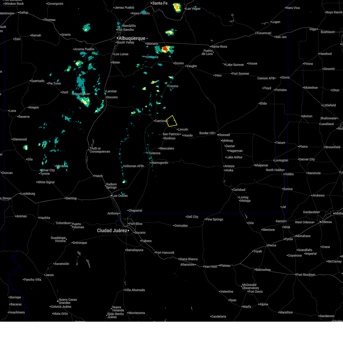
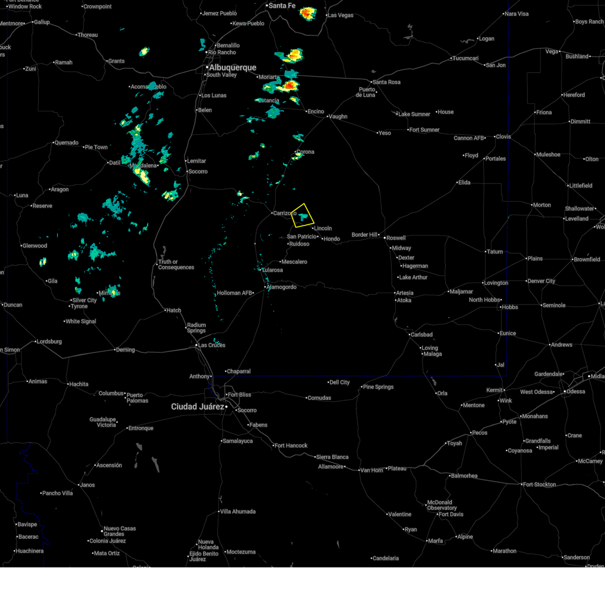
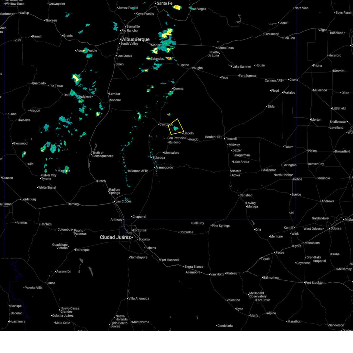
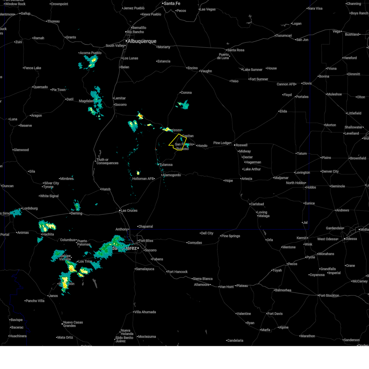
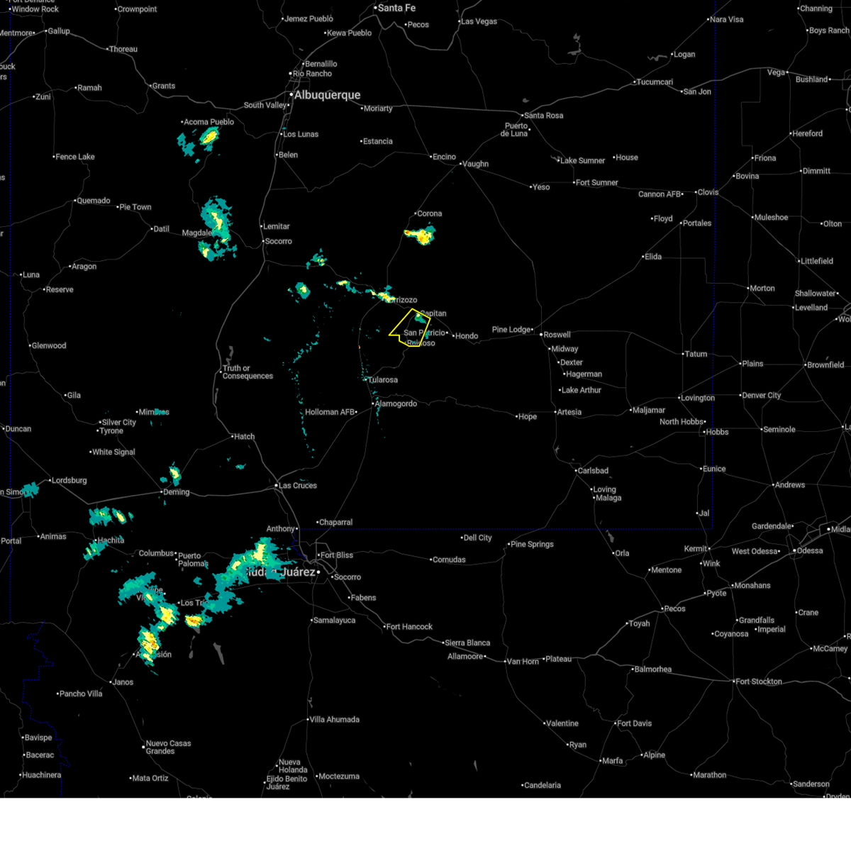
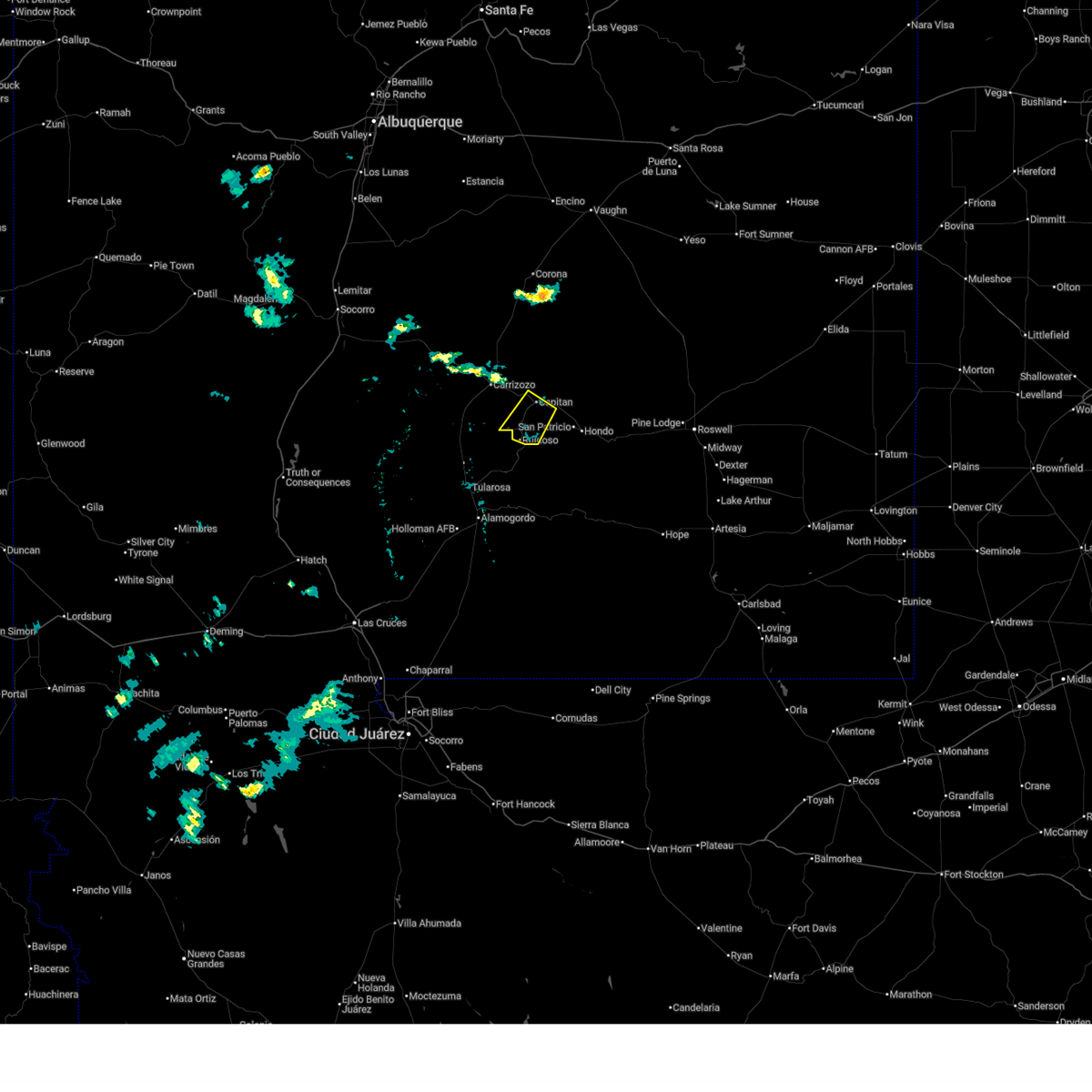
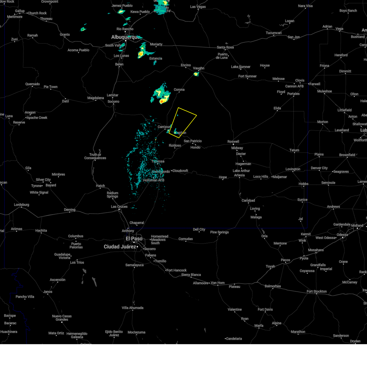
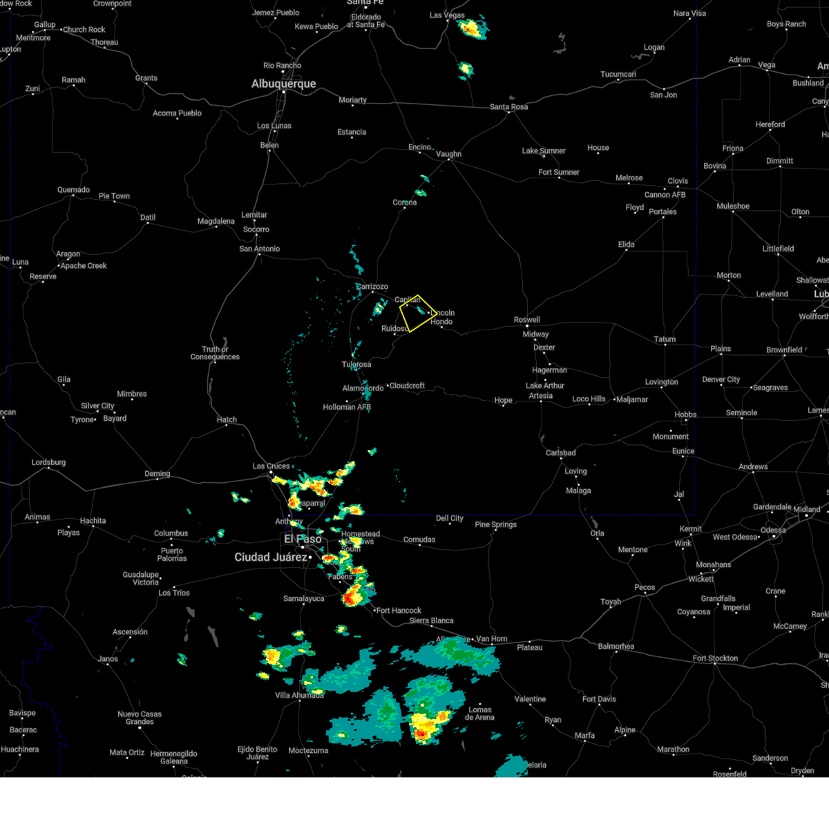
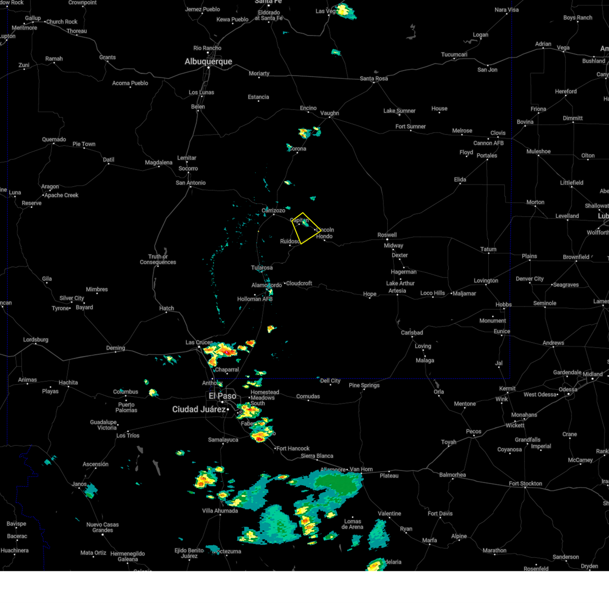
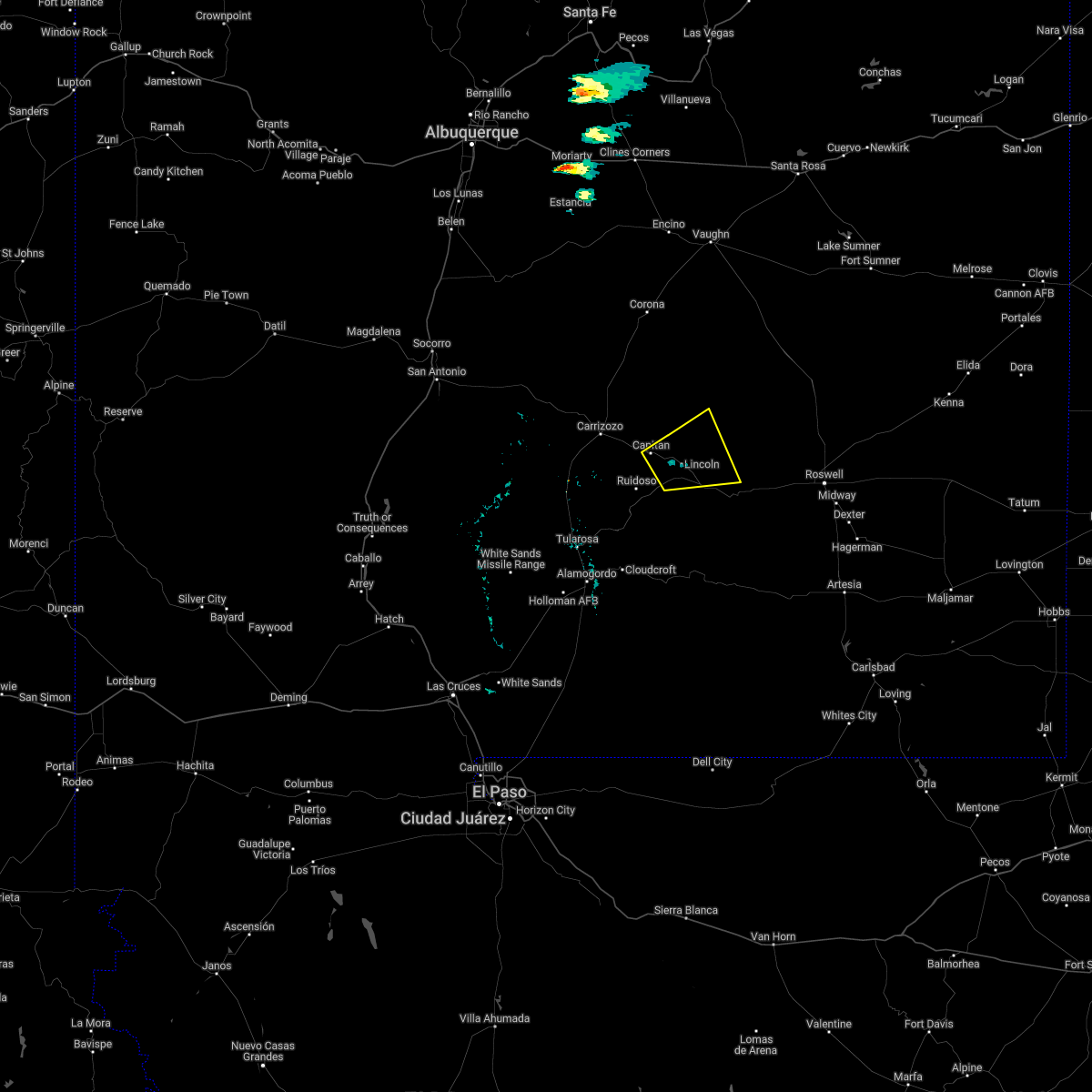
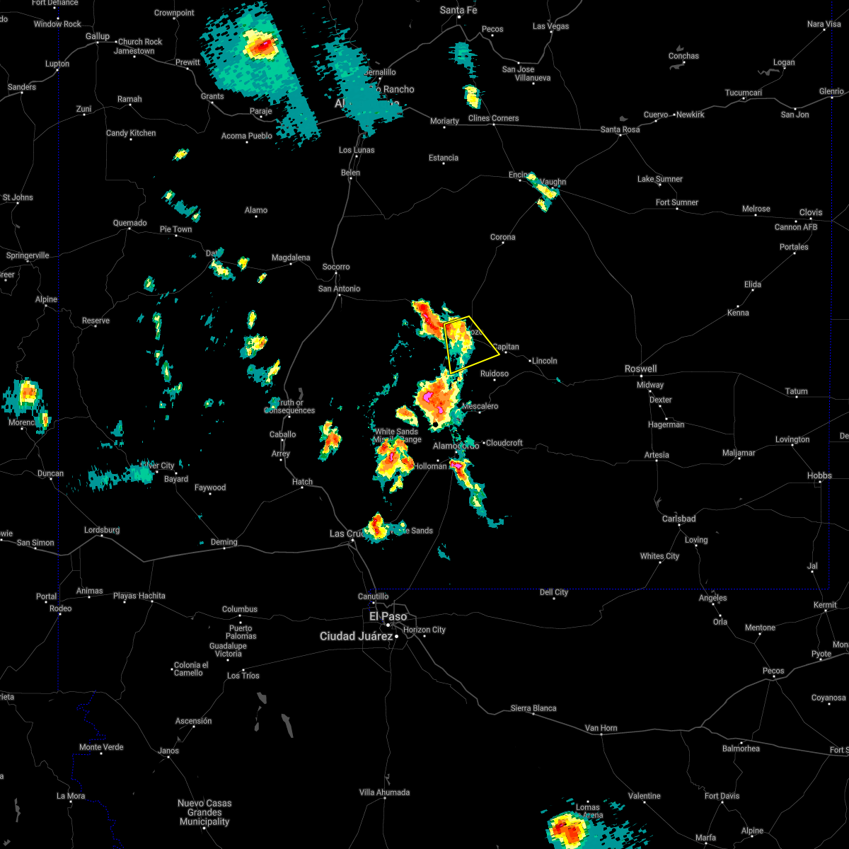
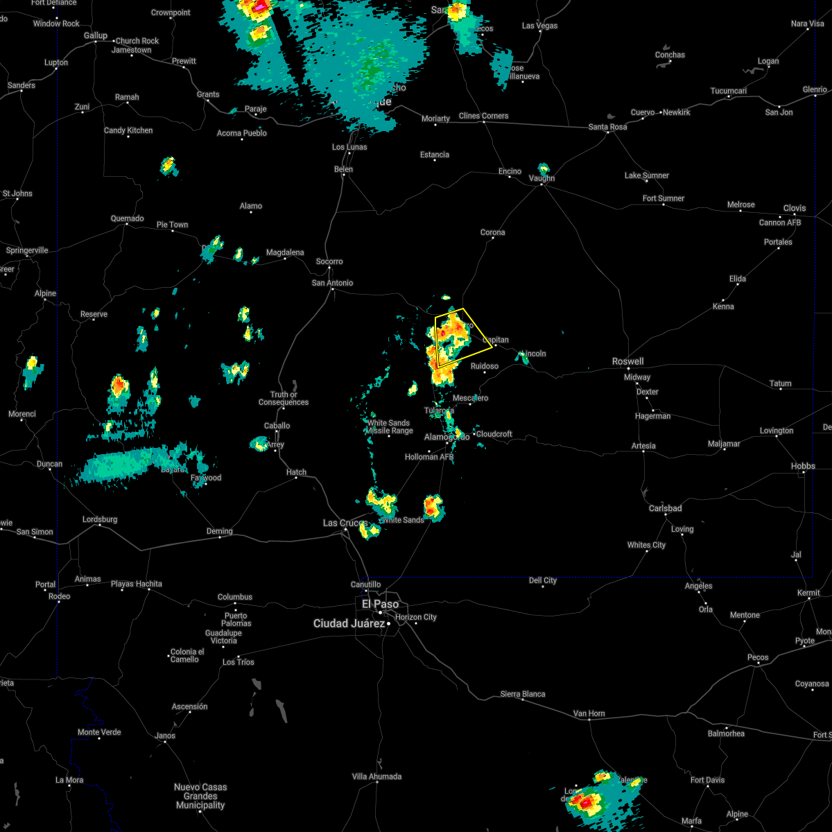
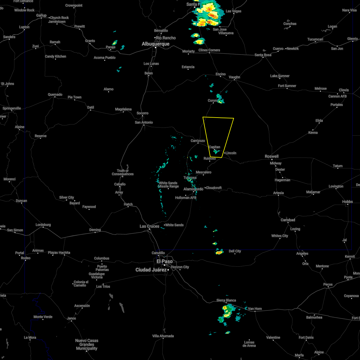
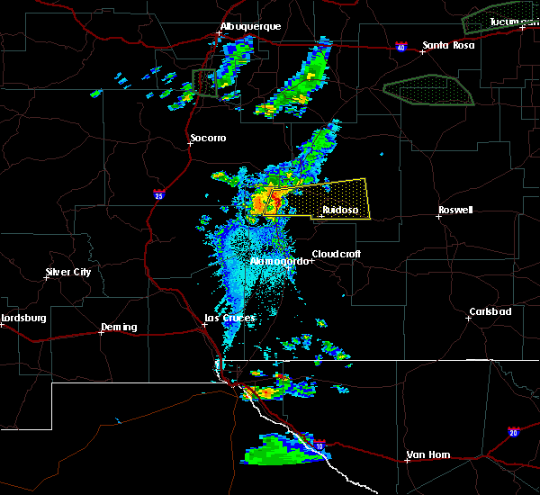
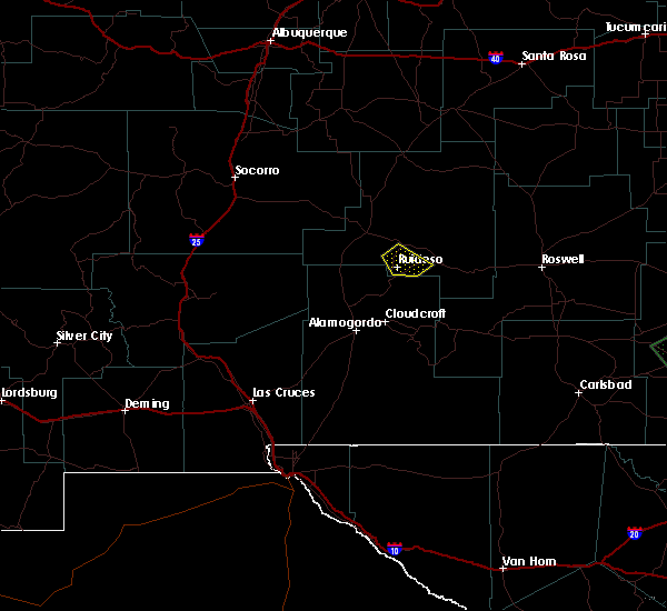
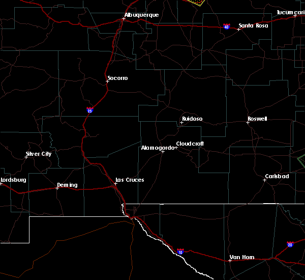
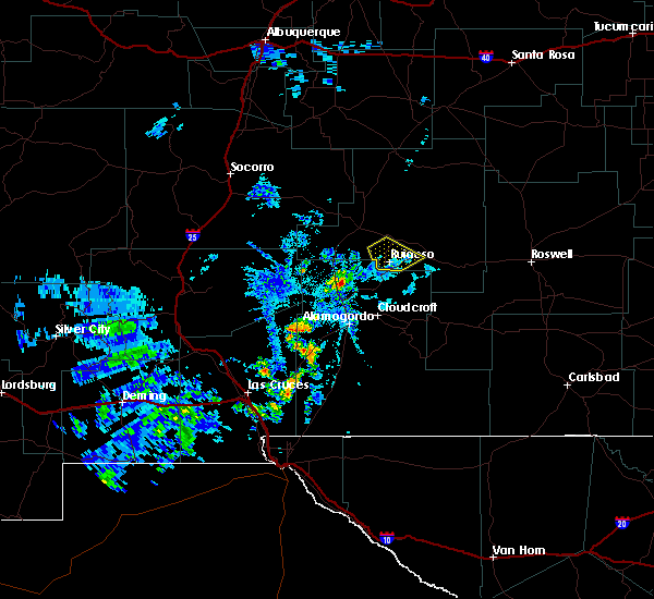
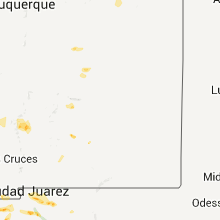
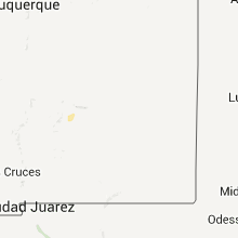
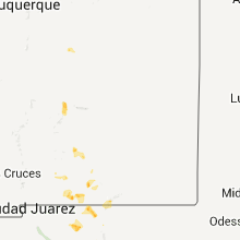
Hail Map for Capitan, NM
The Capitan, NM area has had 9 reports of on-the-ground hail by trained spotters, and has been under severe weather warnings 3 times during the past 12 months. Doppler radar has detected hail at or near Capitan, NM on 14 occasions.
| Name: | Capitan, NM |
| Where Located: | 62.7 miles W of Roswell, NM |
| Map: | Google Map for Capitan, NM |
| Population: | 1489 |
| Housing Units: | 804 |
| More Info: | Search Google for Capitan, NM |
5
The Top Recent Hail Date for Capitan, NM is Friday, May 23, 2014 (1st out of 14)

Hail and Wind Damage Spotted near Capitan, NM
| Date / Time | Report Details |
|---|---|
| 6/24/2026 2:13 PM MDT |
 At 213 pm mdt, a severe thunderstorm was located near encinoso, or 22 miles northeast of ruidoso, moving northeast at 10 mph (radar indicated). Hazards include 60 mph wind gusts and small hail. Expect damage to roofs, siding, and trees. locations impacted include, encinoso. This includes highway 380 near mile marker 86. At 213 pm mdt, a severe thunderstorm was located near encinoso, or 22 miles northeast of ruidoso, moving northeast at 10 mph (radar indicated). Hazards include 60 mph wind gusts and small hail. Expect damage to roofs, siding, and trees. locations impacted include, encinoso. This includes highway 380 near mile marker 86.
|
| 6/24/2026 1:58 PM MDT |
 At 158 pm mdt, a severe thunderstorm was located near encinoso, or 20 miles north of ruidoso, moving northeast at 10 mph (radar indicated). Hazards include ping pong ball size hail and 60 mph wind gusts. People and animals outdoors will be injured. expect hail damage to roofs, siding, windows, and vehicles. expect wind damage to roofs, siding, and trees. locations impacted include, capitan, smokey bear historical park and encinoso. This includes highway 380 between mile markers 81 and 90. At 158 pm mdt, a severe thunderstorm was located near encinoso, or 20 miles north of ruidoso, moving northeast at 10 mph (radar indicated). Hazards include ping pong ball size hail and 60 mph wind gusts. People and animals outdoors will be injured. expect hail damage to roofs, siding, windows, and vehicles. expect wind damage to roofs, siding, and trees. locations impacted include, capitan, smokey bear historical park and encinoso. This includes highway 380 between mile markers 81 and 90.
|
| 6/24/2026 1:46 PM MDT |
 Svrabq the national weather service in albuquerque has issued a * severe thunderstorm warning for, central lincoln county in central new mexico, * until 230 pm mdt. * at 146 pm mdt, a severe thunderstorm was located near smokey bear historical park, or 16 miles north of ruidoso, moving northeast at 5 mph (radar indicated). Hazards include 60 mph wind gusts and half dollar size hail. Hail damage to vehicles is expected. Expect wind damage to roofs, siding, and trees. Svrabq the national weather service in albuquerque has issued a * severe thunderstorm warning for, central lincoln county in central new mexico, * until 230 pm mdt. * at 146 pm mdt, a severe thunderstorm was located near smokey bear historical park, or 16 miles north of ruidoso, moving northeast at 5 mph (radar indicated). Hazards include 60 mph wind gusts and half dollar size hail. Hail damage to vehicles is expected. Expect wind damage to roofs, siding, and trees.
|
| 7/7/2025 7:46 PM MDT |
 the severe thunderstorm warning has been cancelled and is no longer in effect the severe thunderstorm warning has been cancelled and is no longer in effect
|
| 7/7/2025 7:35 PM MDT |
 At 735 pm mdt, a severe thunderstorm was located near fort stanton, or 9 miles northeast of ruidoso, moving southwest at 15 mph (radar indicated). Hazards include 60 mph wind gusts and quarter size hail. Hail damage to vehicles is expected. expect wind damage to roofs, siding, and trees. locations impacted include, ruidoso, ruidoso downs, capitan, alto, bonito lake, fort stanton, smokey bear historical park, angus and hollywood. This includes highway 380 between mile markers 81 and 88, and between mile markers 90 and 91. At 735 pm mdt, a severe thunderstorm was located near fort stanton, or 9 miles northeast of ruidoso, moving southwest at 15 mph (radar indicated). Hazards include 60 mph wind gusts and quarter size hail. Hail damage to vehicles is expected. expect wind damage to roofs, siding, and trees. locations impacted include, ruidoso, ruidoso downs, capitan, alto, bonito lake, fort stanton, smokey bear historical park, angus and hollywood. This includes highway 380 between mile markers 81 and 88, and between mile markers 90 and 91.
|
| 7/7/2025 7:25 PM MDT |
 Svrabq the national weather service in albuquerque has issued a * severe thunderstorm warning for, south central lincoln county in central new mexico, * until 800 pm mdt. * at 725 pm mdt, a severe thunderstorm was located over smokey bear historical park, or 12 miles north of ruidoso, moving southwest at 15 mph (radar indicated). Hazards include 60 mph wind gusts and quarter size hail. Hail damage to vehicles is expected. Expect wind damage to roofs, siding, and trees. Svrabq the national weather service in albuquerque has issued a * severe thunderstorm warning for, south central lincoln county in central new mexico, * until 800 pm mdt. * at 725 pm mdt, a severe thunderstorm was located over smokey bear historical park, or 12 miles north of ruidoso, moving southwest at 15 mph (radar indicated). Hazards include 60 mph wind gusts and quarter size hail. Hail damage to vehicles is expected. Expect wind damage to roofs, siding, and trees.
|
| 5/4/2025 10:49 PM MDT |
 Svrabq the national weather service in albuquerque has issued a * severe thunderstorm warning for, central lincoln county in central new mexico, * until 1130 pm mdt. * at 1049 pm mdt, a severe thunderstorm was located 5 miles northeast of nogal, or 14 miles east of carrizozo, moving northeast at 30 mph (radar indicated). Hazards include 60 mph wind gusts and quarter size hail. Hail damage to vehicles is expected. Expect wind damage to roofs, siding, and trees. Svrabq the national weather service in albuquerque has issued a * severe thunderstorm warning for, central lincoln county in central new mexico, * until 1130 pm mdt. * at 1049 pm mdt, a severe thunderstorm was located 5 miles northeast of nogal, or 14 miles east of carrizozo, moving northeast at 30 mph (radar indicated). Hazards include 60 mph wind gusts and quarter size hail. Hail damage to vehicles is expected. Expect wind damage to roofs, siding, and trees.
|
| 7/5/2024 4:41 PM MDT |
 At 441 pm mdt, a severe thunderstorm was located near lincoln state monument, or 13 miles northeast of ruidoso, moving southeast at 10 mph (radar indicated). Hazards include 60 mph wind gusts and quarter size hail. Hail damage to vehicles is expected. expect wind damage to roofs, siding, and trees. Locations impacted include, ruidoso, lincoln, capitan, glencoe, fort stanton, lincoln state monument, smokey bear historical park, and angus. At 441 pm mdt, a severe thunderstorm was located near lincoln state monument, or 13 miles northeast of ruidoso, moving southeast at 10 mph (radar indicated). Hazards include 60 mph wind gusts and quarter size hail. Hail damage to vehicles is expected. expect wind damage to roofs, siding, and trees. Locations impacted include, ruidoso, lincoln, capitan, glencoe, fort stanton, lincoln state monument, smokey bear historical park, and angus.
|
| 7/5/2024 4:21 PM MDT |
 Svrabq the national weather service in albuquerque has issued a * severe thunderstorm warning for, south central lincoln county in central new mexico, * until 515 pm mdt. * at 421 pm mdt, a severe thunderstorm was located over fort stanton, or 12 miles northeast of ruidoso, moving southeast at 10 mph (radar indicated). Hazards include ping pong ball size hail and 60 mph wind gusts. People and animals outdoors will be injured. expect hail damage to roofs, siding, windows, and vehicles. Expect wind damage to roofs, siding, and trees. Svrabq the national weather service in albuquerque has issued a * severe thunderstorm warning for, south central lincoln county in central new mexico, * until 515 pm mdt. * at 421 pm mdt, a severe thunderstorm was located over fort stanton, or 12 miles northeast of ruidoso, moving southeast at 10 mph (radar indicated). Hazards include ping pong ball size hail and 60 mph wind gusts. People and animals outdoors will be injured. expect hail damage to roofs, siding, windows, and vehicles. Expect wind damage to roofs, siding, and trees.
|
| 6/3/2022 1:27 PM MDT |
 At 127 pm mdt, a severe thunderstorm was located over lincoln state monument, or 20 miles northeast of ruidoso, moving east at 10 mph (radar indicated). Hazards include 60 mph wind gusts and quarter size hail. Hail damage to vehicles is expected. Expect wind damage to roofs, siding, and trees. At 127 pm mdt, a severe thunderstorm was located over lincoln state monument, or 20 miles northeast of ruidoso, moving east at 10 mph (radar indicated). Hazards include 60 mph wind gusts and quarter size hail. Hail damage to vehicles is expected. Expect wind damage to roofs, siding, and trees.
|
| 7/11/2021 5:48 PM MDT |
 At 547 pm mdt, a severe thunderstorm was located over carrizozo, moving southeast at 10 mph (radar indicated). Hazards include ping pong ball size hail and 60 mph wind gusts. People and animals outdoors will be injured. expect hail damage to roofs, siding, windows, and vehicles. Expect wind damage to roofs, siding, and trees. At 547 pm mdt, a severe thunderstorm was located over carrizozo, moving southeast at 10 mph (radar indicated). Hazards include ping pong ball size hail and 60 mph wind gusts. People and animals outdoors will be injured. expect hail damage to roofs, siding, windows, and vehicles. Expect wind damage to roofs, siding, and trees.
|
| 7/11/2021 5:39 PM MDT |
 The severe thunderstorm warning for southwestern lincoln county will expire at 545 pm mdt, the storm which prompted the warning has weakened below severe limits, and no longer poses an immediate threat to life or property. therefore, the warning will be allowed to expire. however small hail and heavy rain are still possible with this thunderstorm. The severe thunderstorm warning for southwestern lincoln county will expire at 545 pm mdt, the storm which prompted the warning has weakened below severe limits, and no longer poses an immediate threat to life or property. therefore, the warning will be allowed to expire. however small hail and heavy rain are still possible with this thunderstorm.
|
| 7/11/2021 5:20 PM MDT |
 At 520 pm mdt, a severe thunderstorm was located over carrizozo, moving south at 5 mph (radar indicated). Hazards include 60 mph wind gusts and quarter size hail. Hail damage to vehicles is expected. expect wind damage to roofs, siding, and trees. locations impacted include, capitan, carrizozo and nogal. This includes highway 380 between mile markers 54 and 78. At 520 pm mdt, a severe thunderstorm was located over carrizozo, moving south at 5 mph (radar indicated). Hazards include 60 mph wind gusts and quarter size hail. Hail damage to vehicles is expected. expect wind damage to roofs, siding, and trees. locations impacted include, capitan, carrizozo and nogal. This includes highway 380 between mile markers 54 and 78.
|
| 7/11/2021 4:54 PM MDT |
 At 454 pm mdt, a severe thunderstorm was located over carrizozo, moving south at 5 mph (radar indicated). Hazards include ping pong ball size hail and 60 mph wind gusts. People and animals outdoors will be injured. expect hail damage to roofs, siding, windows, and vehicles. Expect wind damage to roofs, siding, and trees. At 454 pm mdt, a severe thunderstorm was located over carrizozo, moving south at 5 mph (radar indicated). Hazards include ping pong ball size hail and 60 mph wind gusts. People and animals outdoors will be injured. expect hail damage to roofs, siding, windows, and vehicles. Expect wind damage to roofs, siding, and trees.
|
| 7/11/2021 3:59 PM MDT |
 The national weather service in albuquerque has issued a * severe thunderstorm warning for. south central lincoln county in central new mexico. until 445 pm mdt. At 359 pm mdt, a severe thunderstorm was located over fort stanton, or 13 miles northeast of ruidoso, moving southeast at 5 mph. The national weather service in albuquerque has issued a * severe thunderstorm warning for. south central lincoln county in central new mexico. until 445 pm mdt. At 359 pm mdt, a severe thunderstorm was located over fort stanton, or 13 miles northeast of ruidoso, moving southeast at 5 mph.
|
| 5/30/2021 12:33 PM MDT |
 At 1232 pm mdt, a severe thunderstorm was located near smokey bear historical park, or 19 miles northeast of ruidoso, moving northeast at 10 mph (radar indicated). Hazards include 60 mph wind gusts and quarter size hail. Hail damage to vehicles is expected. expect wind damage to roofs, siding, and trees. locations impacted include, capitan, fort stanton, encinoso and smokey bear historical park. This includes highway 380 between mile markers 80 and 95. At 1232 pm mdt, a severe thunderstorm was located near smokey bear historical park, or 19 miles northeast of ruidoso, moving northeast at 10 mph (radar indicated). Hazards include 60 mph wind gusts and quarter size hail. Hail damage to vehicles is expected. expect wind damage to roofs, siding, and trees. locations impacted include, capitan, fort stanton, encinoso and smokey bear historical park. This includes highway 380 between mile markers 80 and 95.
|
| 5/30/2021 12:17 PM MDT |
 At 1217 pm mdt, a severe thunderstorm was located near smokey bear historical park, or 17 miles northeast of ruidoso, moving northeast at 10 mph (radar indicated). Hazards include 60 mph wind gusts and quarter size hail. Hail damage to vehicles is expected. Expect wind damage to roofs, siding, and trees. At 1217 pm mdt, a severe thunderstorm was located near smokey bear historical park, or 17 miles northeast of ruidoso, moving northeast at 10 mph (radar indicated). Hazards include 60 mph wind gusts and quarter size hail. Hail damage to vehicles is expected. Expect wind damage to roofs, siding, and trees.
|
| 5/28/2021 6:05 PM MDT | Hen Egg sized hail reported 26.1 miles WSW of Capitan, NM |
| 5/22/2021 2:13 PM MDT |
 At 212 pm mdt, a severe thunderstorm was located near fort stanton, or 21 miles northeast of ruidoso, moving northeast at 15 mph (radar indicated). Hazards include 60 mph wind gusts and half dollar size hail. Hail damage to vehicles is expected. expect wind damage to roofs, siding, and trees. locations impacted include, capitan, fort stanton, encinoso and smokey bear historical park. This includes highway 380 between mile markers 85 and 95. At 212 pm mdt, a severe thunderstorm was located near fort stanton, or 21 miles northeast of ruidoso, moving northeast at 15 mph (radar indicated). Hazards include 60 mph wind gusts and half dollar size hail. Hail damage to vehicles is expected. expect wind damage to roofs, siding, and trees. locations impacted include, capitan, fort stanton, encinoso and smokey bear historical park. This includes highway 380 between mile markers 85 and 95.
|
| 5/22/2021 1:57 PM MDT |
 At 157 pm mdt, a severe thunderstorm capable of producing a tornado was located over fort stanton, or 16 miles northeast of ruidoso, moving north at 30 mph (radar indicated rotation). Hazards include tornado and quarter size hail. Flying debris will be dangerous to those caught without shelter. mobile homes will be damaged or destroyed. damage to roofs, windows, and vehicles will occur. tree damage is likely. This dangerous storm will be near, encinoso around 225 pm mdt. At 157 pm mdt, a severe thunderstorm capable of producing a tornado was located over fort stanton, or 16 miles northeast of ruidoso, moving north at 30 mph (radar indicated rotation). Hazards include tornado and quarter size hail. Flying debris will be dangerous to those caught without shelter. mobile homes will be damaged or destroyed. damage to roofs, windows, and vehicles will occur. tree damage is likely. This dangerous storm will be near, encinoso around 225 pm mdt.
|
| 5/22/2021 1:41 PM MDT |
 At 140 pm mdt, a severe thunderstorm was located over fort stanton, or 14 miles northeast of ruidoso, moving north at 40 mph (radar indicated). Hazards include 60 mph wind gusts and half dollar size hail. Hail damage to vehicles is expected. Expect wind damage to roofs, siding, and trees. At 140 pm mdt, a severe thunderstorm was located over fort stanton, or 14 miles northeast of ruidoso, moving north at 40 mph (radar indicated). Hazards include 60 mph wind gusts and half dollar size hail. Hail damage to vehicles is expected. Expect wind damage to roofs, siding, and trees.
|
| 7/31/2020 7:26 PM MDT |
 The severe thunderstorm warning for south central lincoln county will expire at 730 pm mdt, the storm which prompted the warning has weakened below severe limits, and no longer poses an immediate threat to life or property. therefore, the warning will be allowed to expire. however the storm may reintensify. small hail, gusty winds and heavy rain are still possible with this thunderstorm. a severe thunderstorm watch remains in effect until 1000 pm mdt for central new mexico. The severe thunderstorm warning for south central lincoln county will expire at 730 pm mdt, the storm which prompted the warning has weakened below severe limits, and no longer poses an immediate threat to life or property. therefore, the warning will be allowed to expire. however the storm may reintensify. small hail, gusty winds and heavy rain are still possible with this thunderstorm. a severe thunderstorm watch remains in effect until 1000 pm mdt for central new mexico.
|
| 7/31/2020 7:01 PM MDT |
 At 701 pm mdt, a severe thunderstorm was located over fort stanton, or 12 miles northeast of ruidoso, moving south at 10 mph (radar indicated). Hazards include two inch hail and 60 mph wind gusts. People and animals outdoors will be injured. expect hail damage to roofs, siding, windows, and vehicles. expect wind damage to roofs, siding, and trees. locations impacted include, lincoln, ruidoso, ruidoso downs, capitan, glencoe, fort stanton, smokey bear historical park, nogal, san patricio and bonito lake. This includes highway 380 between mile markers 74 and 107. At 701 pm mdt, a severe thunderstorm was located over fort stanton, or 12 miles northeast of ruidoso, moving south at 10 mph (radar indicated). Hazards include two inch hail and 60 mph wind gusts. People and animals outdoors will be injured. expect hail damage to roofs, siding, windows, and vehicles. expect wind damage to roofs, siding, and trees. locations impacted include, lincoln, ruidoso, ruidoso downs, capitan, glencoe, fort stanton, smokey bear historical park, nogal, san patricio and bonito lake. This includes highway 380 between mile markers 74 and 107.
|
| 7/31/2020 6:49 PM MDT |
 At 649 pm mdt, a severe thunderstorm was located over fort stanton, or 14 miles northeast of ruidoso, moving south at 10 mph (radar indicated). Hazards include 60 mph wind gusts and half dollar size hail. Hail damage to vehicles is expected. Expect wind damage to roofs, siding, and trees. At 649 pm mdt, a severe thunderstorm was located over fort stanton, or 14 miles northeast of ruidoso, moving south at 10 mph (radar indicated). Hazards include 60 mph wind gusts and half dollar size hail. Hail damage to vehicles is expected. Expect wind damage to roofs, siding, and trees.
|
| 6/23/2020 5:20 PM MDT |
 At 519 pm mdt, a severe thunderstorm was located near lincoln state monument, or 22 miles northeast of ruidoso, moving southeast at 15 mph (radar indicated). Hazards include 60 mph wind gusts and quarter size hail. Hail damage to vehicles is expected. expect wind damage to roofs, siding, and trees. locations impacted include, lincoln, ruidoso, capitan, tinnie, glencoe, hondo, fort stanton recreational area, lincoln state monument, smokey bear historical park and san patricio. this includes highway 380 between mile markers 82 and 107 and portions of u. s. Highway 70 near glencoe. At 519 pm mdt, a severe thunderstorm was located near lincoln state monument, or 22 miles northeast of ruidoso, moving southeast at 15 mph (radar indicated). Hazards include 60 mph wind gusts and quarter size hail. Hail damage to vehicles is expected. expect wind damage to roofs, siding, and trees. locations impacted include, lincoln, ruidoso, capitan, tinnie, glencoe, hondo, fort stanton recreational area, lincoln state monument, smokey bear historical park and san patricio. this includes highway 380 between mile markers 82 and 107 and portions of u. s. Highway 70 near glencoe.
|
| 6/23/2020 4:47 PM MDT |
 The national weather service in albuquerque has issued a * severe thunderstorm warning for. southeastern lincoln county in central new mexico. until 545 pm mdt. At 447 pm mdt, a severe thunderstorm was located over encinoso, or 23 miles east of carrizozo, moving southeast at 15 mph. The national weather service in albuquerque has issued a * severe thunderstorm warning for. southeastern lincoln county in central new mexico. until 545 pm mdt. At 447 pm mdt, a severe thunderstorm was located over encinoso, or 23 miles east of carrizozo, moving southeast at 15 mph.
|
| 6/4/2019 12:26 PM MDT |
 At 1225 pm mdt, a severe thunderstorm was located near bonito lake, or 11 miles north of ruidoso, moving northeast at 25 mph (radar indicated). Hazards include 60 mph wind gusts and half dollar size hail. Hail damage to vehicles is expected. Expect wind damage to roofs, siding, and trees. At 1225 pm mdt, a severe thunderstorm was located near bonito lake, or 11 miles north of ruidoso, moving northeast at 25 mph (radar indicated). Hazards include 60 mph wind gusts and half dollar size hail. Hail damage to vehicles is expected. Expect wind damage to roofs, siding, and trees.
|
| 6/3/2019 12:47 PM MDT |
 At 1246 pm mdt, a severe thunderstorm was located near encinoso, or 19 miles east of carrizozo, moving northeast at 15 mph (radar indicated). Hazards include 60 mph wind gusts and quarter size hail. Hail damage to vehicles is expected. Expect wind damage to roofs, siding, and trees. At 1246 pm mdt, a severe thunderstorm was located near encinoso, or 19 miles east of carrizozo, moving northeast at 15 mph (radar indicated). Hazards include 60 mph wind gusts and quarter size hail. Hail damage to vehicles is expected. Expect wind damage to roofs, siding, and trees.
|
| 8/20/2018 6:55 PM MDT |
 At 655 pm mdt, a severe thunderstorm was located near bonito lake, or 10 miles north of ruidoso, and is nearly stationary (radar indicated). Hazards include 60 mph wind gusts and quarter size hail. Hail damage to vehicles is expected. Expect wind damage to roofs, siding, and trees. At 655 pm mdt, a severe thunderstorm was located near bonito lake, or 10 miles north of ruidoso, and is nearly stationary (radar indicated). Hazards include 60 mph wind gusts and quarter size hail. Hail damage to vehicles is expected. Expect wind damage to roofs, siding, and trees.
|
| 8/1/2018 7:01 PM MDT |
 At 700 pm mdt, a severe thunderstorm was located 8 miles north of lincoln, or 27 miles northeast of ruidoso, moving southwest at 10 mph (radar indicated). Hazards include ping pong ball size hail and 60 mph wind gusts. People and animals outdoors will be injured. expect hail damage to roofs, siding, windows, and vehicles. Expect wind damage to roofs, siding, and trees. At 700 pm mdt, a severe thunderstorm was located 8 miles north of lincoln, or 27 miles northeast of ruidoso, moving southwest at 10 mph (radar indicated). Hazards include ping pong ball size hail and 60 mph wind gusts. People and animals outdoors will be injured. expect hail damage to roofs, siding, windows, and vehicles. Expect wind damage to roofs, siding, and trees.
|
| 5/22/2018 2:05 PM MDT |
 The national weather service in albuquerque has issued a * severe thunderstorm warning for. central lincoln county in central new mexico. until 245 pm mdt. At 205 pm mdt, a severe thunderstorm was located near smokey bear historical park, or 15 miles east of carrizozo, moving northeast at. The national weather service in albuquerque has issued a * severe thunderstorm warning for. central lincoln county in central new mexico. until 245 pm mdt. At 205 pm mdt, a severe thunderstorm was located near smokey bear historical park, or 15 miles east of carrizozo, moving northeast at.
|
| 5/21/2018 8:26 PM MDT |
 The severe thunderstorm warning for central lincoln county will expire at 830 pm mdt, the storm which prompted the warning has moved out of the area. therefore the warning will be allowed to expire. a severe thunderstorm watch remains in effect until 1100 pm mdt for central new mexico. remember, two severe thunderstorm warnings remain in effect until 900 pm and 930 pm mdt. The severe thunderstorm warning for central lincoln county will expire at 830 pm mdt, the storm which prompted the warning has moved out of the area. therefore the warning will be allowed to expire. a severe thunderstorm watch remains in effect until 1100 pm mdt for central new mexico. remember, two severe thunderstorm warnings remain in effect until 900 pm and 930 pm mdt.
|
| 5/21/2018 8:01 PM MDT |
 At 801 pm mdt, a severe thunderstorm was located near encinoso, or 25 miles east of carrizozo, moving northeast at 25 mph (radar indicated). Hazards include 60 mph wind gusts and half dollar size hail. Hail damage to vehicles is expected. expect wind damage to roofs, siding, and trees. Locations impacted include, capitan, fort stanton, encinoso, smokey bear historical park and angus. At 801 pm mdt, a severe thunderstorm was located near encinoso, or 25 miles east of carrizozo, moving northeast at 25 mph (radar indicated). Hazards include 60 mph wind gusts and half dollar size hail. Hail damage to vehicles is expected. expect wind damage to roofs, siding, and trees. Locations impacted include, capitan, fort stanton, encinoso, smokey bear historical park and angus.
|
| 5/21/2018 7:26 PM MDT |
 At 726 pm mdt, a severe thunderstorm was located near capitan, or 11 miles north of ruidoso, moving northeast at 25 mph (radar indicated). Hazards include 60 mph wind gusts and half dollar size hail. Hail damage to vehicles is expected. Expect wind damage to roofs, siding, and trees. At 726 pm mdt, a severe thunderstorm was located near capitan, or 11 miles north of ruidoso, moving northeast at 25 mph (radar indicated). Hazards include 60 mph wind gusts and half dollar size hail. Hail damage to vehicles is expected. Expect wind damage to roofs, siding, and trees.
|
| 10/5/2017 8:40 PM MDT |
 The severe thunderstorm warning for southeastern lincoln county will expire at 845 pm mdt, the storm which prompted the warning has weakened below severe limits, and no longer poses an immediate threat to life or property. therefore the warning will be allowed to expire. however small hail, gusty winds and heavy rain are still possible with this thunderstorm. The severe thunderstorm warning for southeastern lincoln county will expire at 845 pm mdt, the storm which prompted the warning has weakened below severe limits, and no longer poses an immediate threat to life or property. therefore the warning will be allowed to expire. however small hail, gusty winds and heavy rain are still possible with this thunderstorm.
|
| 10/5/2017 8:23 PM MDT |
 At 821 pm mdt, a severe thunderstorm was located 7 miles west of bonito lake, or 12 miles northwest of ruidoso, moving east southeast at 25 mph. another strong thunderstorm was located 4 miles southeast of encinoso, also moving east southeast at 25 mph (radar indicated). Hazards include 60 mph wind gusts and quarter size hail. Hail damage to vehicles is expected. expect wind damage to roofs, siding, and trees. Locations impacted include, lincoln, ruidoso, capitan, tinnie, glencoe, encinoso, fort stanton, smokey bear historical park, nogal and san patricio. At 821 pm mdt, a severe thunderstorm was located 7 miles west of bonito lake, or 12 miles northwest of ruidoso, moving east southeast at 25 mph. another strong thunderstorm was located 4 miles southeast of encinoso, also moving east southeast at 25 mph (radar indicated). Hazards include 60 mph wind gusts and quarter size hail. Hail damage to vehicles is expected. expect wind damage to roofs, siding, and trees. Locations impacted include, lincoln, ruidoso, capitan, tinnie, glencoe, encinoso, fort stanton, smokey bear historical park, nogal and san patricio.
|
| 10/5/2017 7:55 PM MDT |
 At 755 pm mdt, a severe thunderstorm was located 11 miles southwest of carrizozo, moving east at 40 mph (radar indicated). Hazards include 60 mph wind gusts and half dollar size hail. Hail damage to vehicles is expected. Expect wind damage to roofs, siding, and trees. At 755 pm mdt, a severe thunderstorm was located 11 miles southwest of carrizozo, moving east at 40 mph (radar indicated). Hazards include 60 mph wind gusts and half dollar size hail. Hail damage to vehicles is expected. Expect wind damage to roofs, siding, and trees.
|
| 6/23/2017 4:25 PM MDT |
 The severe thunderstorm warning for south central lincoln county will expire at 430 pm mdt, the storm which prompted the warning has weakened below severe limits, and no longer pose an immediate threat to life or property. therefore the warning will be allowed to expire. however small hail, gusty winds and heavy rain are still possible with this thunderstorm. The severe thunderstorm warning for south central lincoln county will expire at 430 pm mdt, the storm which prompted the warning has weakened below severe limits, and no longer pose an immediate threat to life or property. therefore the warning will be allowed to expire. however small hail, gusty winds and heavy rain are still possible with this thunderstorm.
|
| 6/23/2017 4:14 PM MDT |
 At 414 pm mdt, a severe thunderstorm was located near fort stanton, or 10 miles northeast of ruidoso, moving east at 10 mph (radar indicated). Hazards include 60 mph wind gusts and quarter size hail. Hail damage to vehicles is expected. expect wind damage to roofs, siding, and trees. Locations impacted include, ruidoso, ruidoso downs, capitan, glencoe and angus. At 414 pm mdt, a severe thunderstorm was located near fort stanton, or 10 miles northeast of ruidoso, moving east at 10 mph (radar indicated). Hazards include 60 mph wind gusts and quarter size hail. Hail damage to vehicles is expected. expect wind damage to roofs, siding, and trees. Locations impacted include, ruidoso, ruidoso downs, capitan, glencoe and angus.
|
| 6/23/2017 3:59 PM MDT |
 At 359 pm mdt, a severe thunderstorm was located near alto, or 8 miles northeast of ruidoso, moving southeast at 10 mph (radar indicated). Hazards include 60 mph wind gusts and quarter size hail. Hail damage to vehicles is expected. expect wind damage to roofs, siding, and trees. Locations impacted include, ruidoso, ruidoso downs, capitan, glencoe, bonito lake, alto, hollywood and angus. At 359 pm mdt, a severe thunderstorm was located near alto, or 8 miles northeast of ruidoso, moving southeast at 10 mph (radar indicated). Hazards include 60 mph wind gusts and quarter size hail. Hail damage to vehicles is expected. expect wind damage to roofs, siding, and trees. Locations impacted include, ruidoso, ruidoso downs, capitan, glencoe, bonito lake, alto, hollywood and angus.
|
| 6/23/2017 3:44 PM MDT |
 At 344 pm mdt, a severe thunderstorm was located near bonito lake, or 10 miles north of ruidoso, moving southeast at 10 mph (radar indicated). Hazards include 60 mph wind gusts and quarter size hail. Hail damage to vehicles is expected. Expect wind damage to roofs, siding, and trees. At 344 pm mdt, a severe thunderstorm was located near bonito lake, or 10 miles north of ruidoso, moving southeast at 10 mph (radar indicated). Hazards include 60 mph wind gusts and quarter size hail. Hail damage to vehicles is expected. Expect wind damage to roofs, siding, and trees.
|
| 6/20/2017 1:35 PM MDT |
 At 134 pm mdt, a severe thunderstorm was located near jicarilla, or 17 miles northeast of carrizozo, moving northeast at 10 mph (radar indicated). Hazards include 60 mph wind gusts and quarter size hail. Hail damage to vehicles is expected. expect wind damage to roofs, siding, and trees. Locations impacted include, capitan, white oaks, nogal and jicarilla. At 134 pm mdt, a severe thunderstorm was located near jicarilla, or 17 miles northeast of carrizozo, moving northeast at 10 mph (radar indicated). Hazards include 60 mph wind gusts and quarter size hail. Hail damage to vehicles is expected. expect wind damage to roofs, siding, and trees. Locations impacted include, capitan, white oaks, nogal and jicarilla.
|
| 6/20/2017 1:20 PM MDT |
 At 120 pm mdt, a severe thunderstorm was located near white oaks, or 13 miles east of carrizozo, moving northeast at 10 mph (radar indicated). Hazards include 60 mph wind gusts and half dollar size hail. Hail damage to vehicles is expected. Expect wind damage to roofs, siding, and trees. At 120 pm mdt, a severe thunderstorm was located near white oaks, or 13 miles east of carrizozo, moving northeast at 10 mph (radar indicated). Hazards include 60 mph wind gusts and half dollar size hail. Hail damage to vehicles is expected. Expect wind damage to roofs, siding, and trees.
|
| 6/7/2017 8:53 PM MDT |
 The severe thunderstorm warning for south central lincoln county will expire at 900 pm mdt, the storm which prompted the warning has weakened below severe limits, and no longer pose an immediate threat to life or property. therefore the warning will be allowed to expire. however heavy rain is still possible with this thunderstorm. The severe thunderstorm warning for south central lincoln county will expire at 900 pm mdt, the storm which prompted the warning has weakened below severe limits, and no longer pose an immediate threat to life or property. therefore the warning will be allowed to expire. however heavy rain is still possible with this thunderstorm.
|
| 6/7/2017 8:41 PM MDT |
 At 840 pm mdt, a severe thunderstorm was located near alto, or 8 miles north of ruidoso, moving southeast at 25 mph (emergency management). Hazards include 60 mph wind gusts and quarter size hail. Hail damage to vehicles is expected. expect wind damage to roofs, siding, and trees. Locations impacted include, ruidoso, ruidoso downs, capitan, glencoe, bonito lake, alto, fort stanton, hollywood and angus. At 840 pm mdt, a severe thunderstorm was located near alto, or 8 miles north of ruidoso, moving southeast at 25 mph (emergency management). Hazards include 60 mph wind gusts and quarter size hail. Hail damage to vehicles is expected. expect wind damage to roofs, siding, and trees. Locations impacted include, ruidoso, ruidoso downs, capitan, glencoe, bonito lake, alto, fort stanton, hollywood and angus.
|
| 6/7/2017 8:35 PM MDT | Quarter sized hail reported 3.8 miles E of Capitan, NM |
| 6/7/2017 8:25 PM MDT |
 At 825 pm mdt, a severe thunderstorm was located near nogal, or 12 miles north of ruidoso, moving southeast at 25 mph (radar indicated). Hazards include 60 mph wind gusts and quarter size hail. Hail damage to vehicles is expected. Expect wind damage to roofs, siding, and trees. At 825 pm mdt, a severe thunderstorm was located near nogal, or 12 miles north of ruidoso, moving southeast at 25 mph (radar indicated). Hazards include 60 mph wind gusts and quarter size hail. Hail damage to vehicles is expected. Expect wind damage to roofs, siding, and trees.
|
| 6/7/2017 7:20 PM MDT | Quarter sized hail reported 0.3 miles W of Capitan, NM |
| 6/7/2017 6:47 PM MDT |
 At 647 pm mdt, a severe thunderstorm was located over fort stanton, or 13 miles northeast of ruidoso, moving south at 15 mph (radar indicated). Hazards include 60 mph wind gusts and quarter size hail. Hail damage to vehicles is expected. Expect wind damage to roofs, siding, and trees. At 647 pm mdt, a severe thunderstorm was located over fort stanton, or 13 miles northeast of ruidoso, moving south at 15 mph (radar indicated). Hazards include 60 mph wind gusts and quarter size hail. Hail damage to vehicles is expected. Expect wind damage to roofs, siding, and trees.
|
| 6/7/2017 6:40 PM MDT | Quarter sized hail reported 0.3 miles W of Capitan, NM |
| 6/7/2017 6:37 PM MDT | Golf Ball sized hail reported 0.3 miles W of Capitan, NM |
| 6/7/2017 6:30 PM MDT | Quarter sized hail reported 3.7 miles SSW of Capitan, NM |
| 6/7/2017 6:30 PM MDT |
 At 630 pm mdt, a severe thunderstorm was located over smokey bear historical park, or 17 miles north of ruidoso, moving south at 15 mph (radar indicated). Hazards include 60 mph wind gusts and quarter size hail. Hail damage to vehicles is expected. expect wind damage to roofs, siding, and trees. Locations impacted include, capitan and smokey bear historical park. At 630 pm mdt, a severe thunderstorm was located over smokey bear historical park, or 17 miles north of ruidoso, moving south at 15 mph (radar indicated). Hazards include 60 mph wind gusts and quarter size hail. Hail damage to vehicles is expected. expect wind damage to roofs, siding, and trees. Locations impacted include, capitan and smokey bear historical park.
|
| 6/7/2017 6:20 PM MDT |
 At 620 pm mdt, a severe thunderstorm was located near nogal, or 13 miles east of carrizozo, moving southwest at 15 mph (radar indicated). Hazards include 70 mph wind gusts and quarter size hail. Hail damage to vehicles is expected. expect considerable tree damage. wind damage is also likely to mobile homes, roofs, and outbuildings. Locations impacted include, capitan, smokey bear historical park, nogal and angus. At 620 pm mdt, a severe thunderstorm was located near nogal, or 13 miles east of carrizozo, moving southwest at 15 mph (radar indicated). Hazards include 70 mph wind gusts and quarter size hail. Hail damage to vehicles is expected. expect considerable tree damage. wind damage is also likely to mobile homes, roofs, and outbuildings. Locations impacted include, capitan, smokey bear historical park, nogal and angus.
|
| 6/7/2017 5:58 PM MDT |
 At 558 pm mdt, a severe thunderstorm was located near encinoso, or 17 miles east of carrizozo, moving southwest at 15 mph (radar indicated). Hazards include 60 mph wind gusts and quarter size hail. Hail damage to vehicles is expected. Expect wind damage to roofs, siding, and trees. At 558 pm mdt, a severe thunderstorm was located near encinoso, or 17 miles east of carrizozo, moving southwest at 15 mph (radar indicated). Hazards include 60 mph wind gusts and quarter size hail. Hail damage to vehicles is expected. Expect wind damage to roofs, siding, and trees.
|
| 6/6/2017 5:39 PM MDT |
 The severe thunderstorm warning for central lincoln county will expire at 545 pm mdt, the storm which prompted the warning has weakened below severe limits, and has exited the warned area. therefore the warning will be allowed to expire. a severe thunderstorm watch remains in effect until 1000 pm mdt for central new mexico. The severe thunderstorm warning for central lincoln county will expire at 545 pm mdt, the storm which prompted the warning has weakened below severe limits, and has exited the warned area. therefore the warning will be allowed to expire. a severe thunderstorm watch remains in effect until 1000 pm mdt for central new mexico.
|
| 6/6/2017 5:02 PM MDT |
 At 502 pm mdt, a severe thunderstorm was located near smokey bear historical park, or 20 miles northeast of ruidoso, moving south at 25 mph (radar indicated). Hazards include golf ball size hail and 70 mph wind gusts. People and animals outdoors will be injured. expect hail damage to roofs, siding, windows, and vehicles. expect considerable tree damage. wind damage is also likely to mobile homes, roofs, and outbuildings. Locations impacted include, capitan, encinoso and smokey bear historical park. At 502 pm mdt, a severe thunderstorm was located near smokey bear historical park, or 20 miles northeast of ruidoso, moving south at 25 mph (radar indicated). Hazards include golf ball size hail and 70 mph wind gusts. People and animals outdoors will be injured. expect hail damage to roofs, siding, windows, and vehicles. expect considerable tree damage. wind damage is also likely to mobile homes, roofs, and outbuildings. Locations impacted include, capitan, encinoso and smokey bear historical park.
|
| 6/6/2017 4:54 PM MDT |
 At 454 pm mdt, a severe thunderstorm was located near encinoso, or 19 miles east of carrizozo, moving south at 10 mph (radar indicated). Hazards include 60 mph wind gusts and quarter size hail. Hail damage to vehicles is expected. Expect wind damage to roofs, siding, and trees. At 454 pm mdt, a severe thunderstorm was located near encinoso, or 19 miles east of carrizozo, moving south at 10 mph (radar indicated). Hazards include 60 mph wind gusts and quarter size hail. Hail damage to vehicles is expected. Expect wind damage to roofs, siding, and trees.
|
| 10/6/2015 8:00 PM MDT |
 At 759 pm mdt, a severe thunderstorm was located 12 miles north of three rivers, or 16 miles southwest of carrizozo, moving northeast at 30 mph (radar indicated). Hazards include quarter size hail and 60 mph wind gusts. Hail damage to vehicles is expected. Expect wind damage to roofs, siding and trees. At 759 pm mdt, a severe thunderstorm was located 12 miles north of three rivers, or 16 miles southwest of carrizozo, moving northeast at 30 mph (radar indicated). Hazards include quarter size hail and 60 mph wind gusts. Hail damage to vehicles is expected. Expect wind damage to roofs, siding and trees.
|
| 6/5/2015 1:47 PM MDT | At 146 pm mdt, a severe thunderstorm was located near smokey bear historical park, or 19 miles northeast of ruidoso, moving northeast at 20 mph (radar indicated). Hazards include half dollar size hail and 60 mph wind gusts. Hail damage to vehicles is expected. Expect wind damage to roofs, siding and trees. |
| 7/17/2014 7:35 PM MDT | Quarter sized hail reported 22.1 miles WSW of Capitan, NM, nickel to quarter size hail on highway 246. |
| 6/8/2014 3:25 PM MDT | Richardson canyon area. 2 homes destroyed... 5 damaged in lincoln county NM, 17 miles SW of Capitan, NM |
| 5/23/2014 5:32 PM MDT | Quarter sized hail reported 0.3 miles W of Capitan, NM |
| 8/9/2013 3:45 PM MDT | Half Dollar sized hail reported 13.3 miles SW of Capitan, NM, route 246 around mile post 14 half dollar size hail fell probably from 345 to 4 pm |
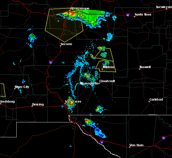
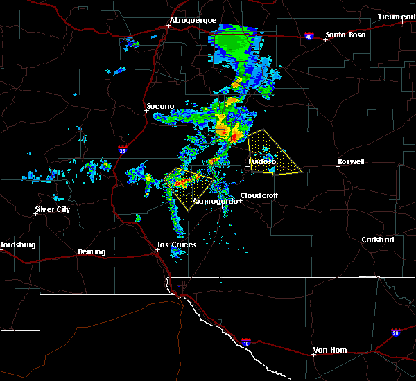
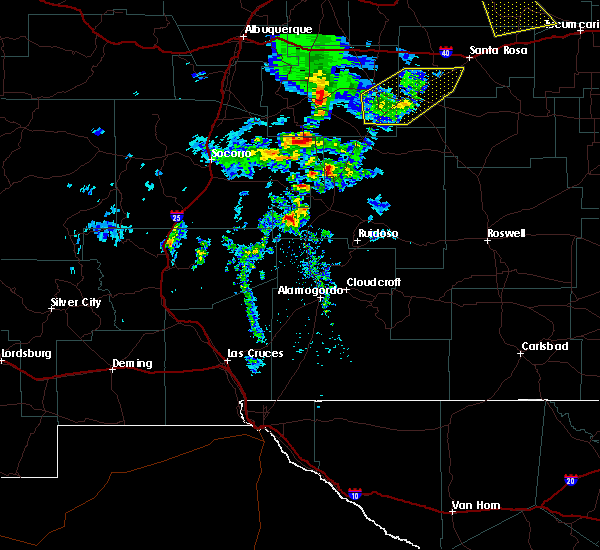
Hail Maps for Capitan, NM


Connect with Interactive Hail Maps