

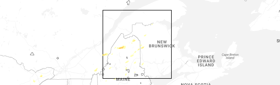
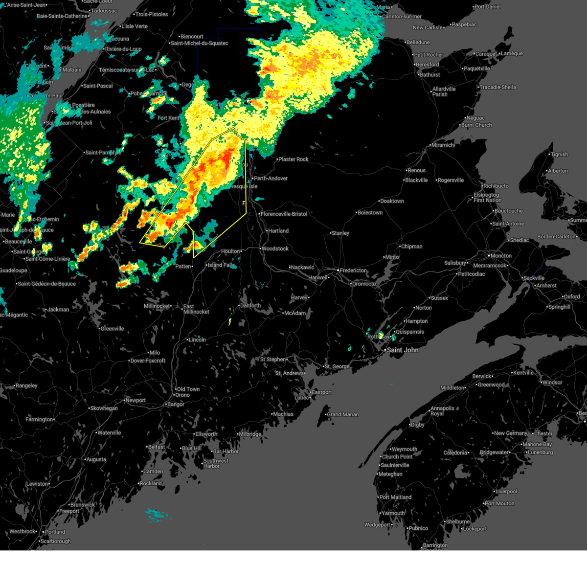
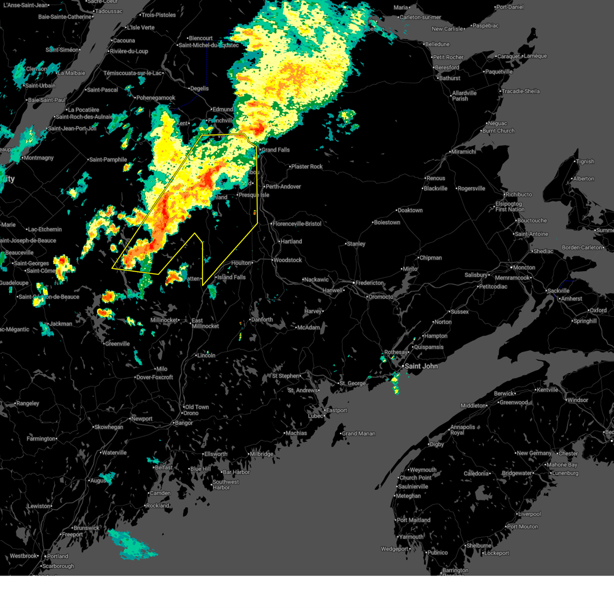
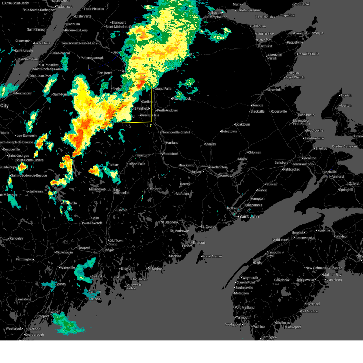
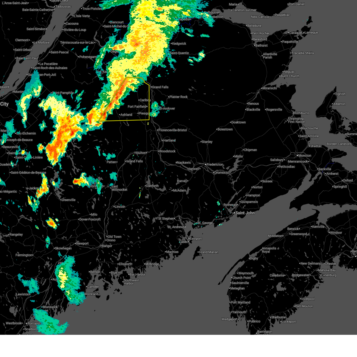
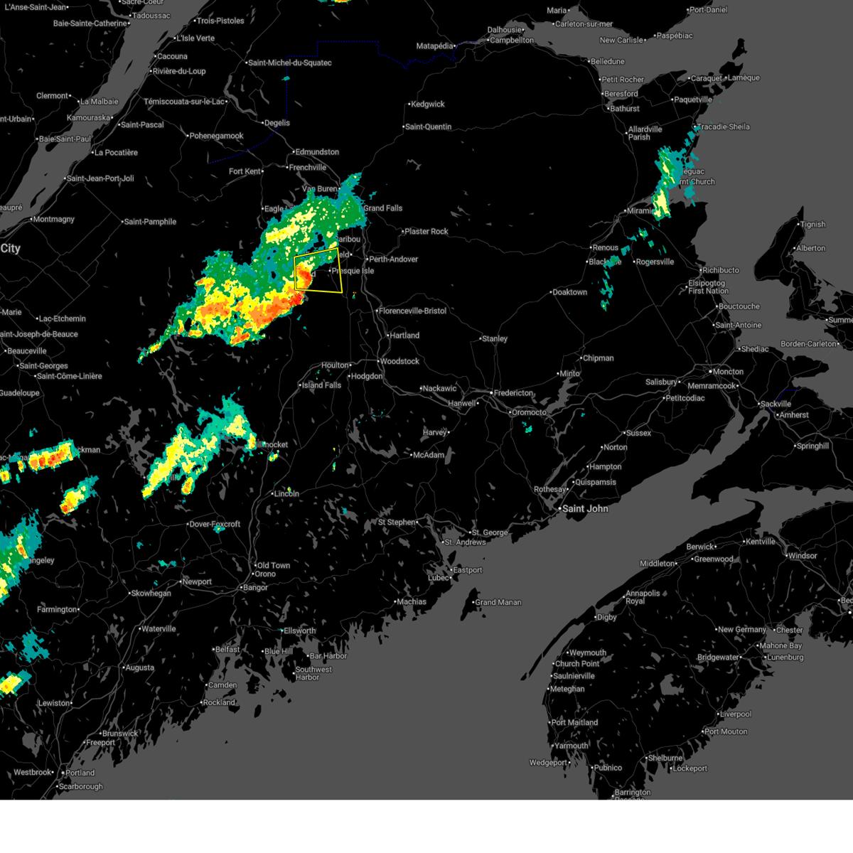
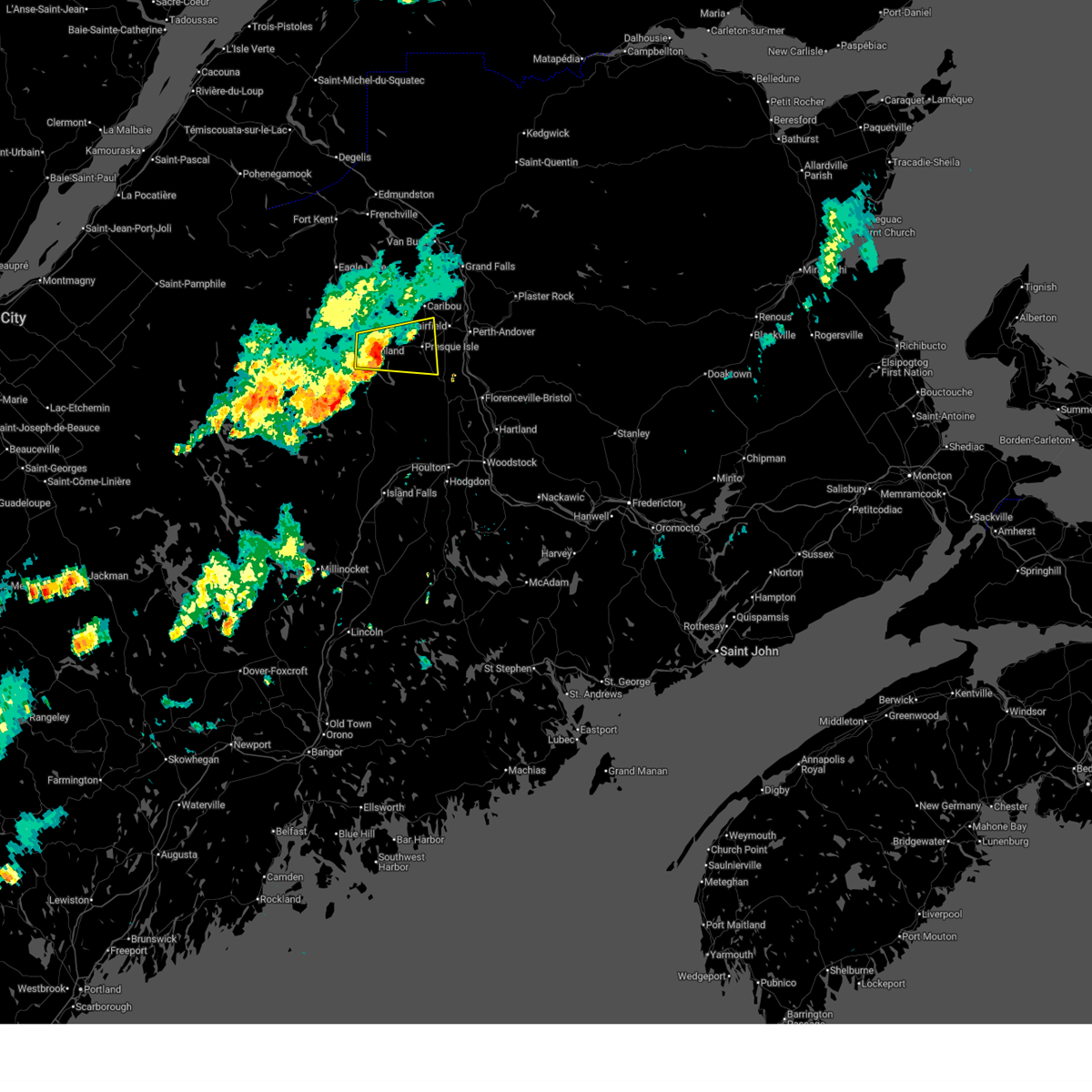
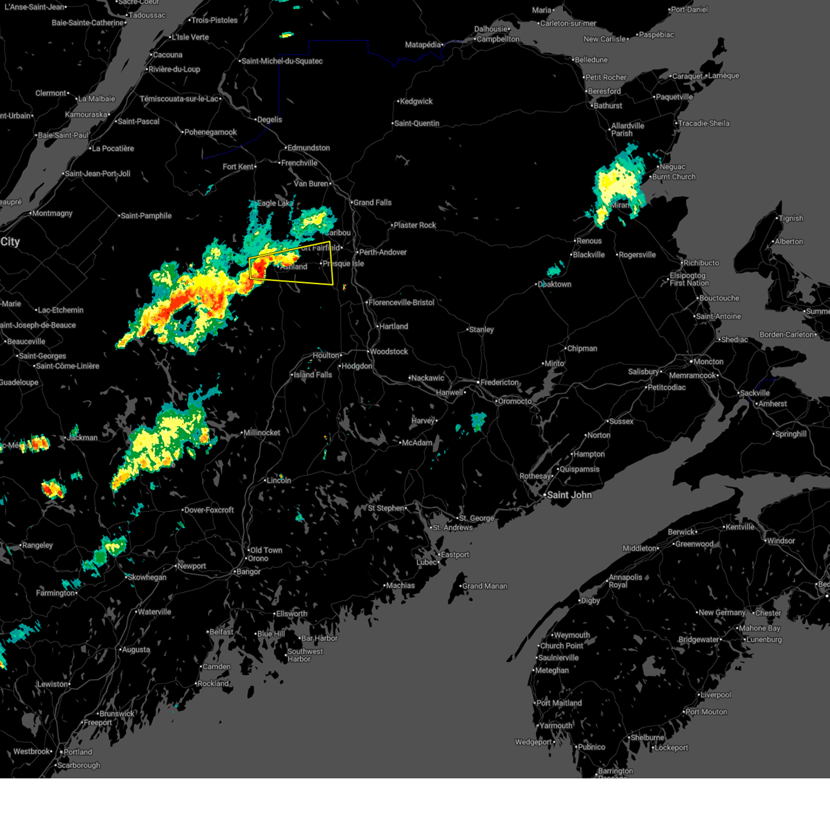
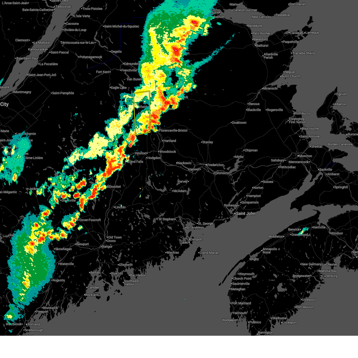
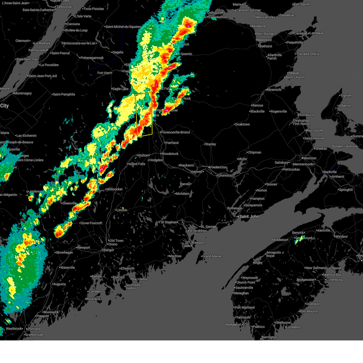
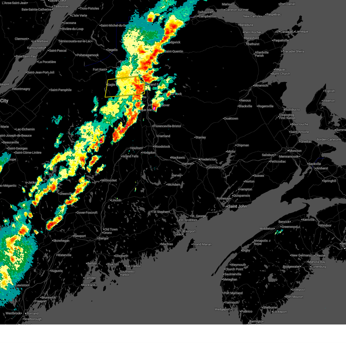
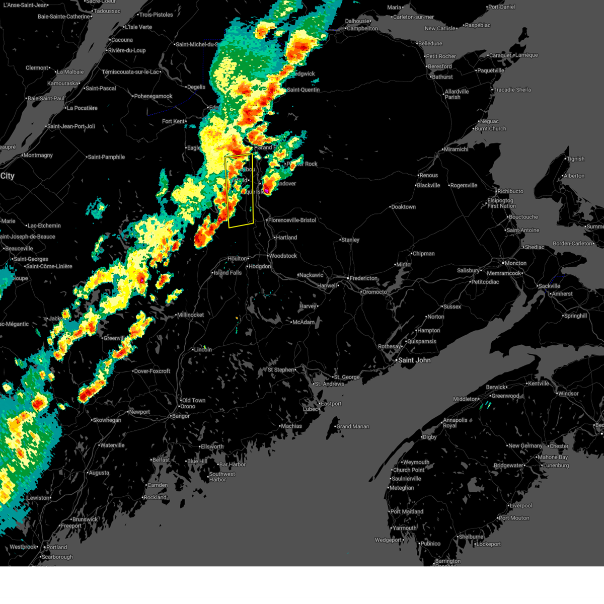
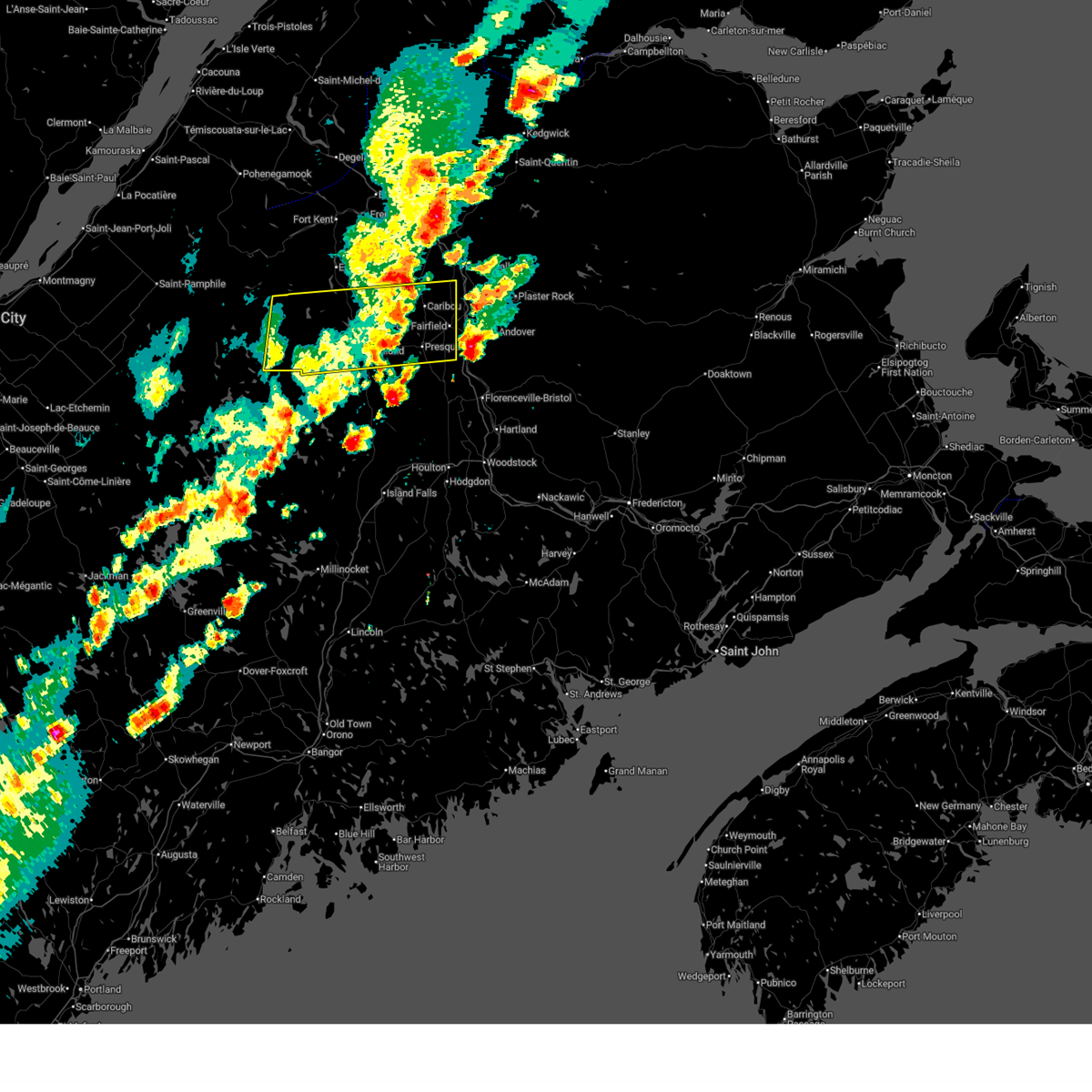
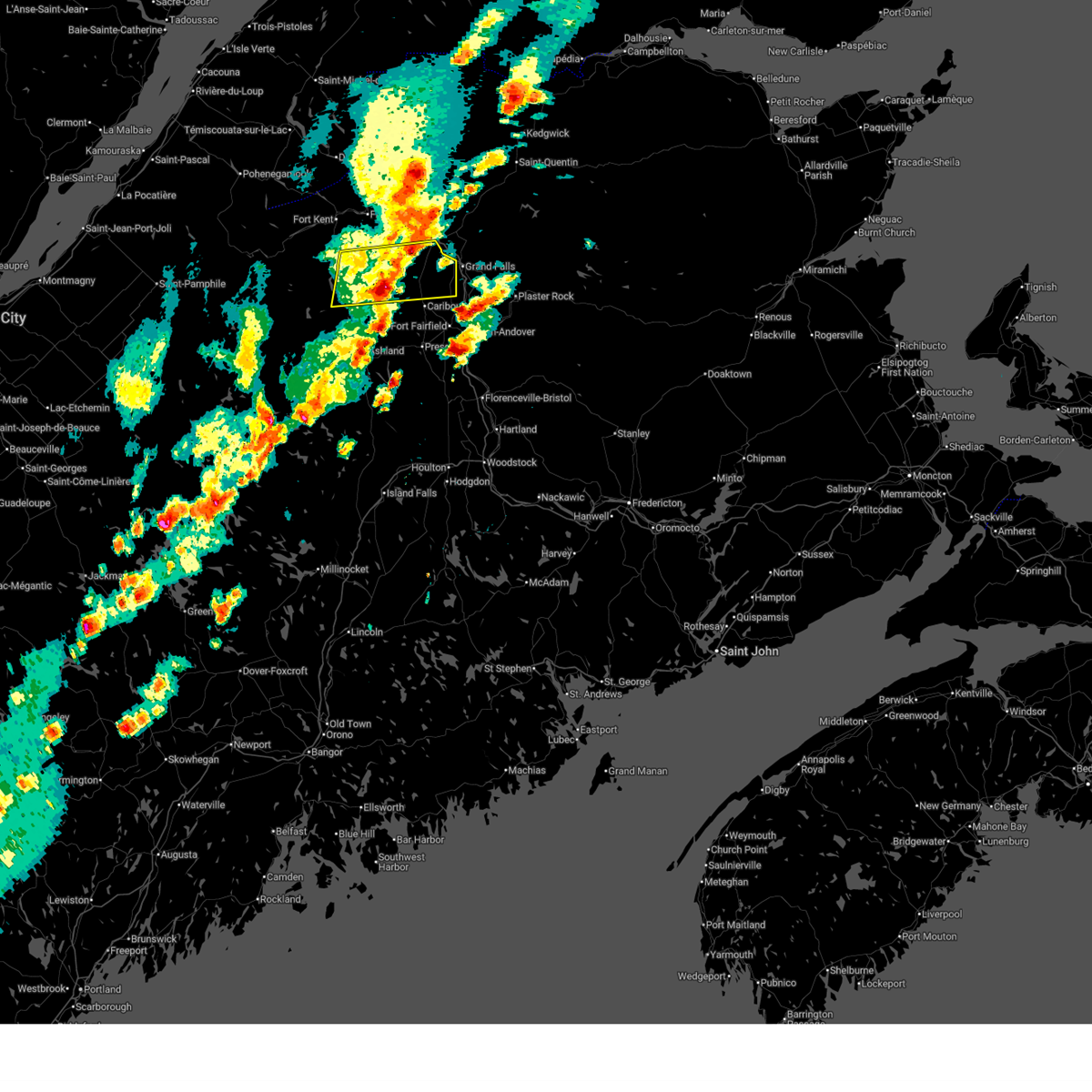
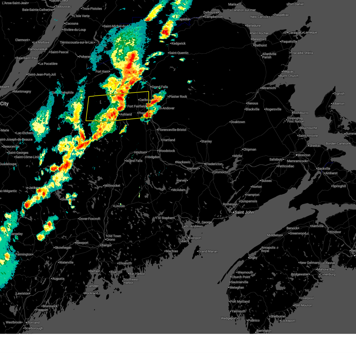
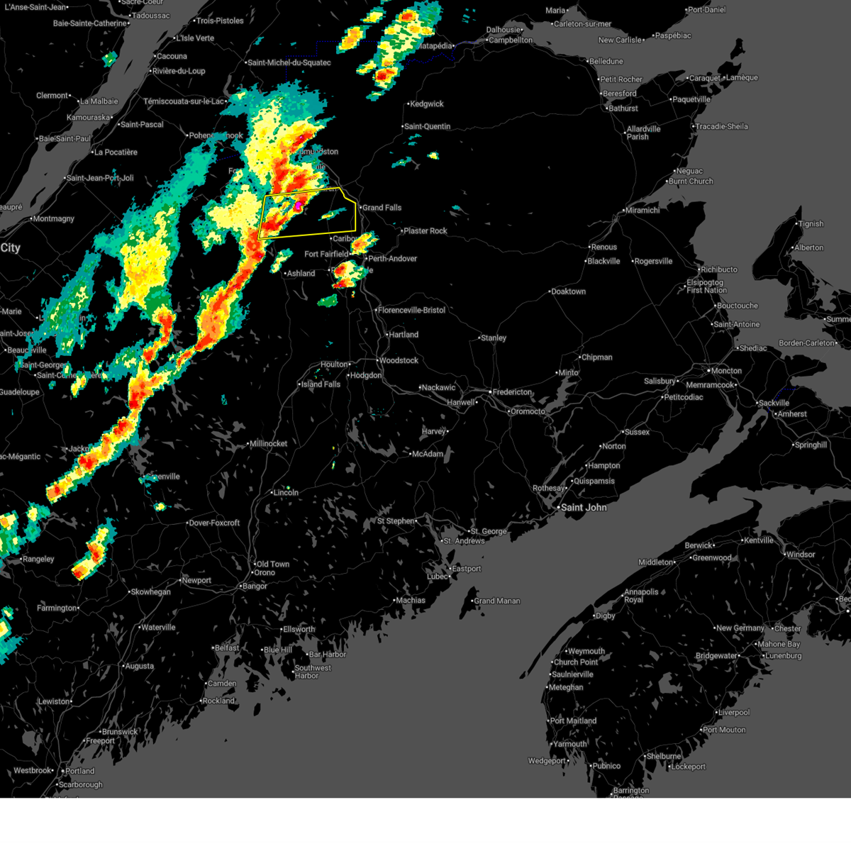
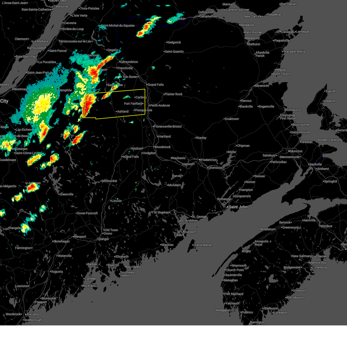
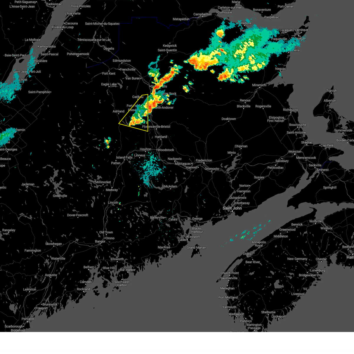
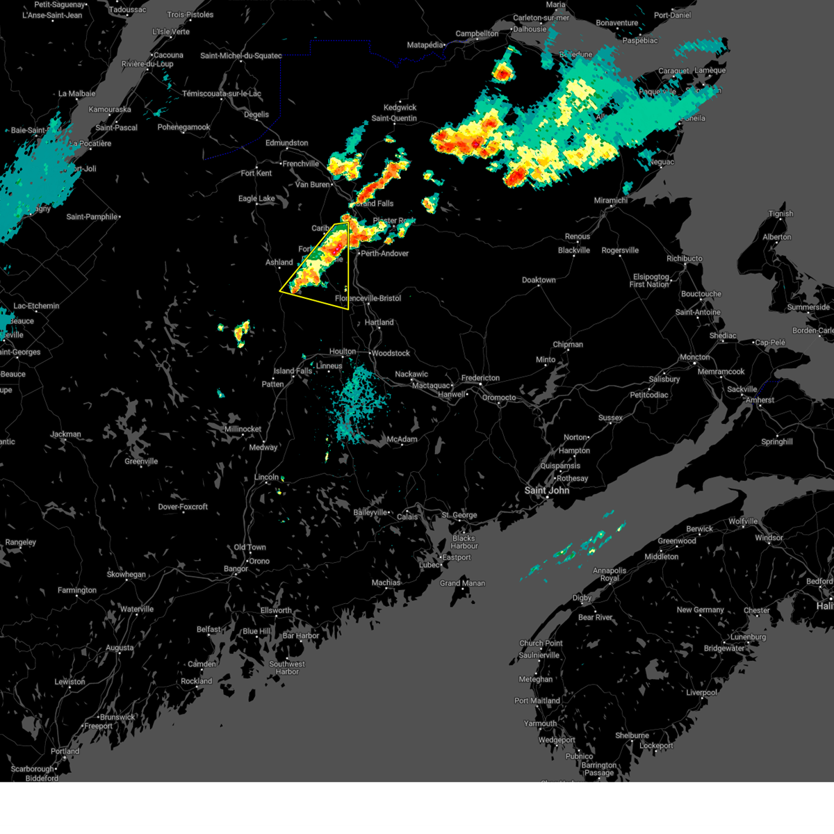
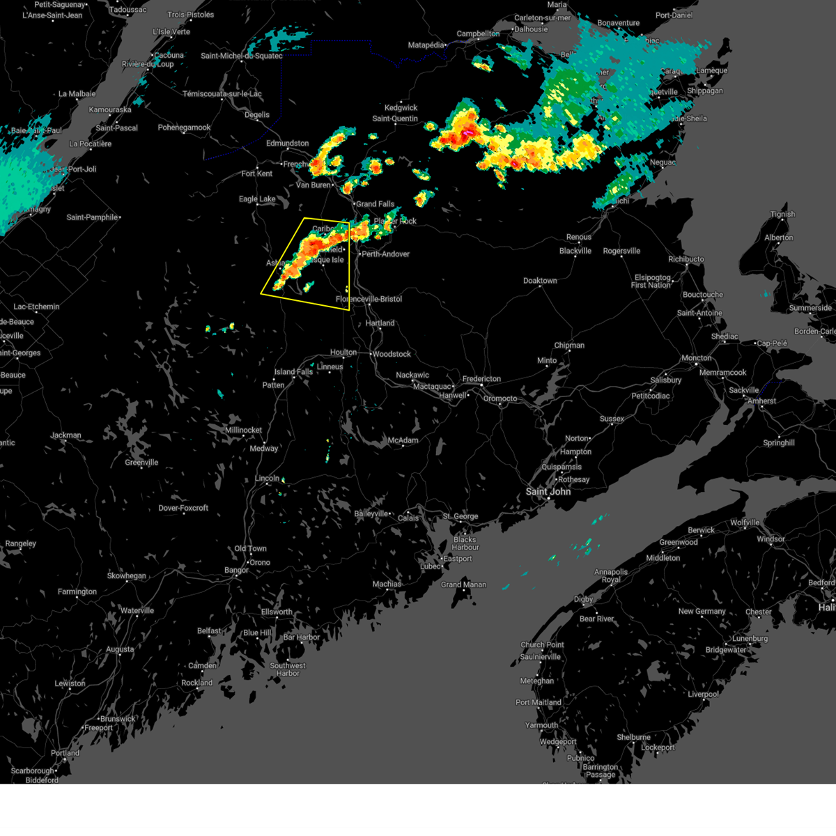
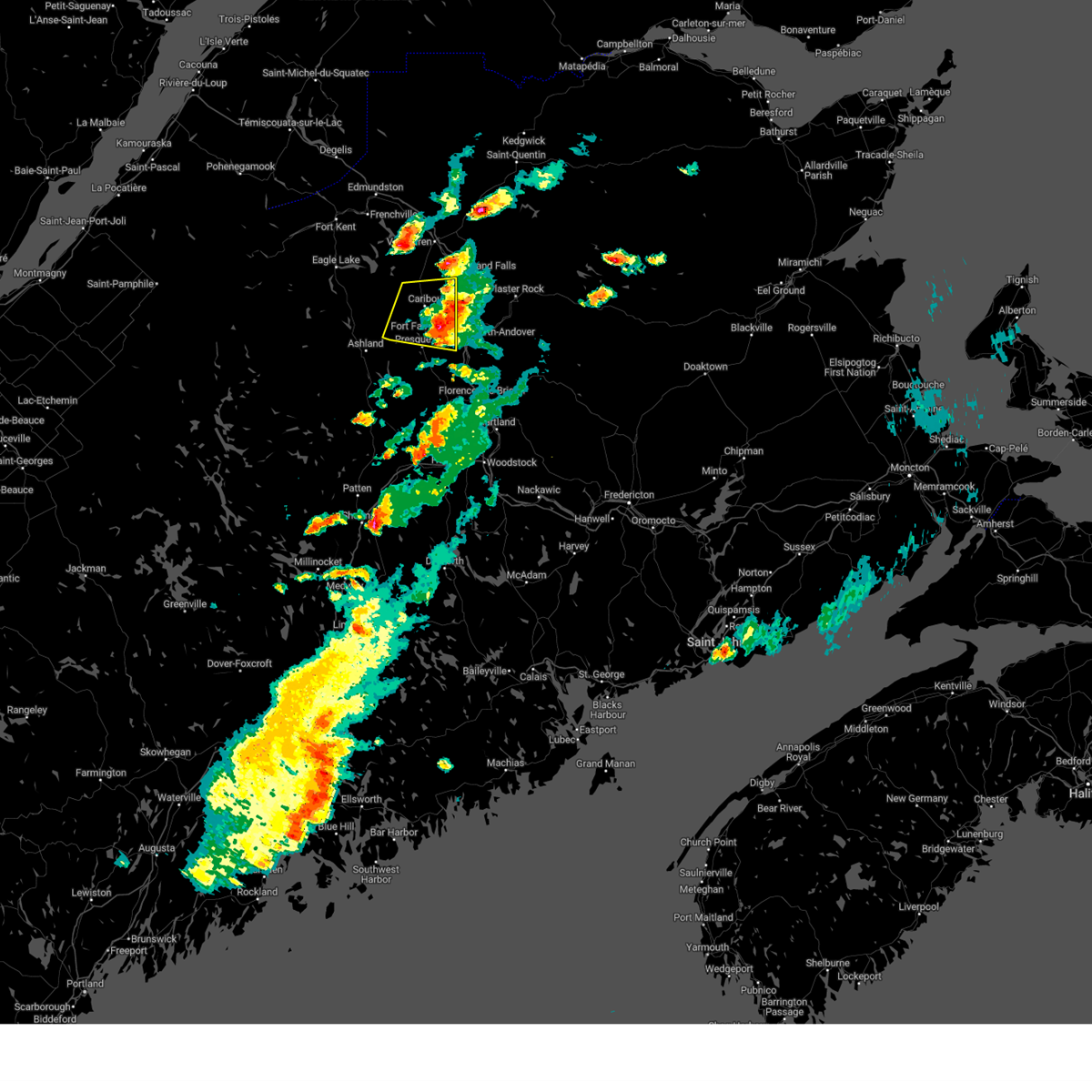
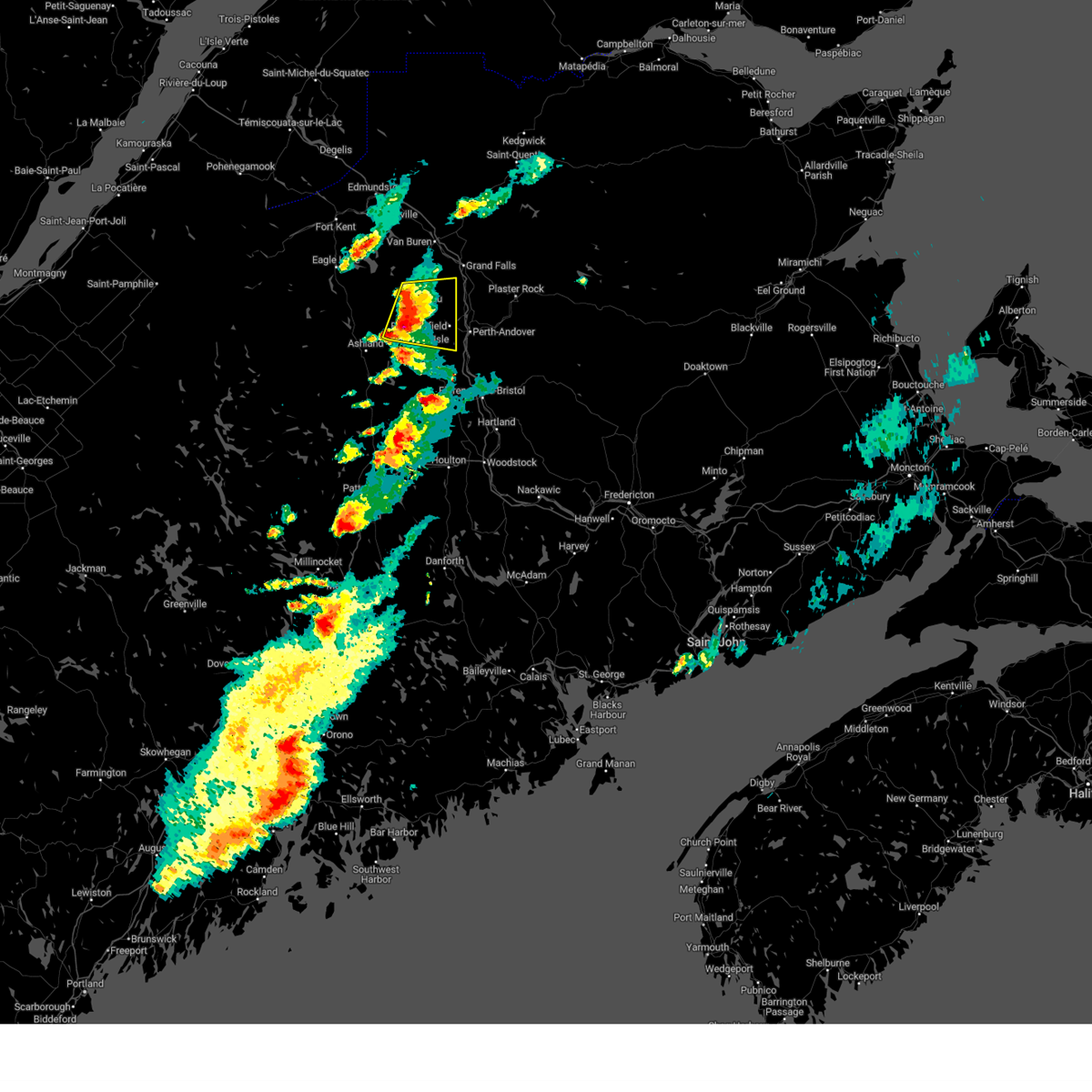
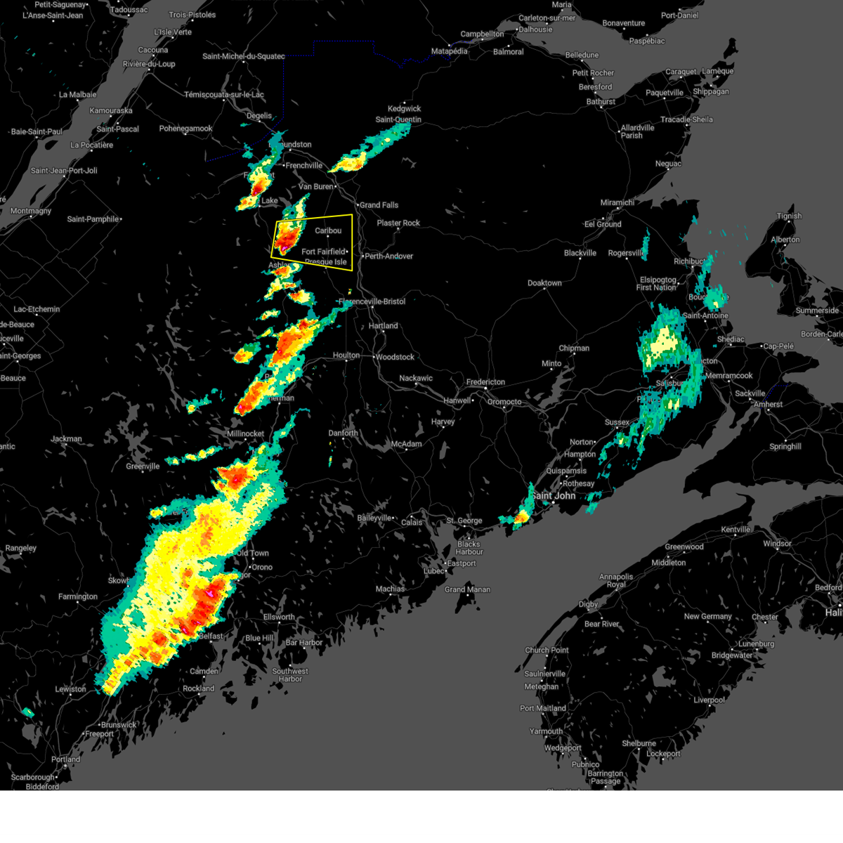
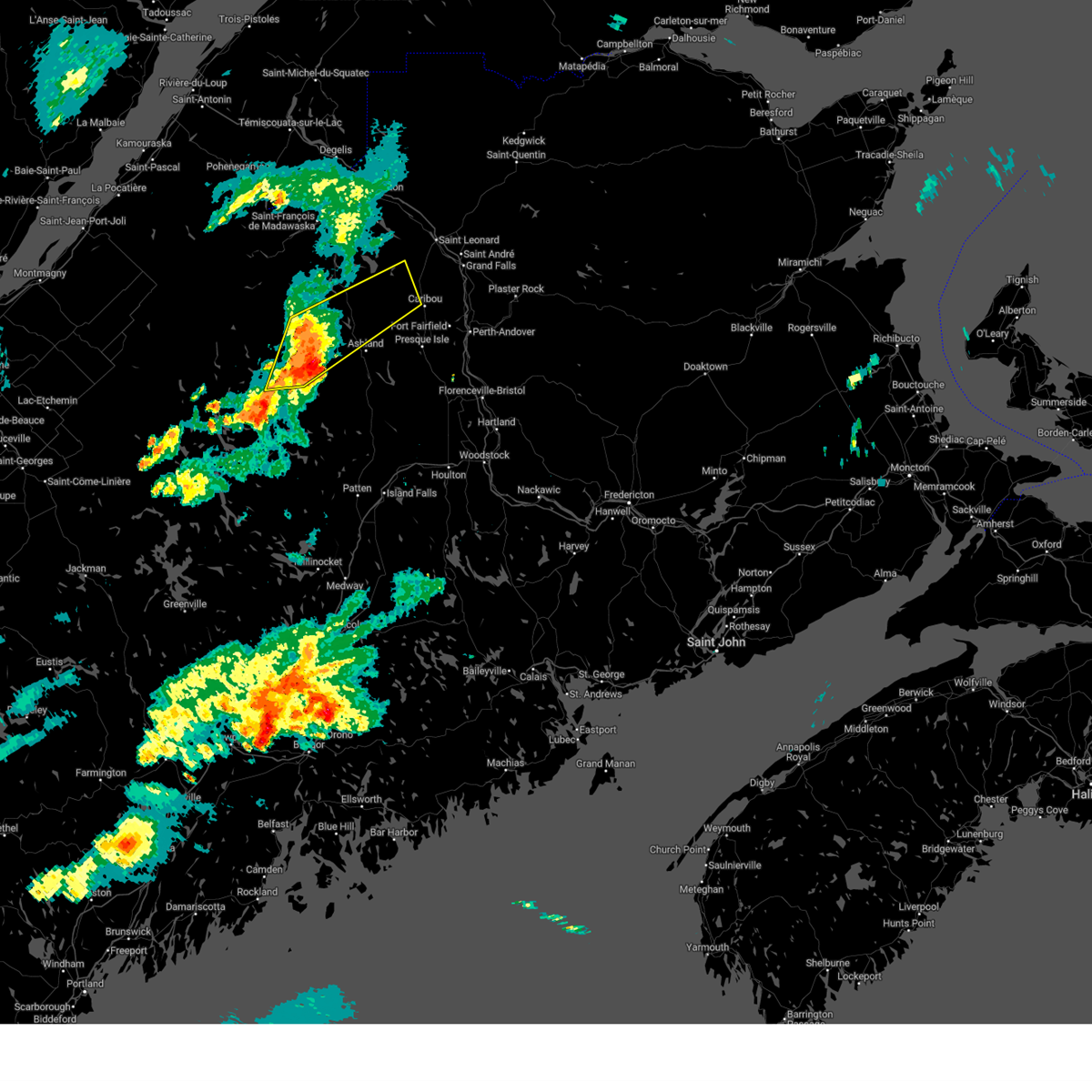
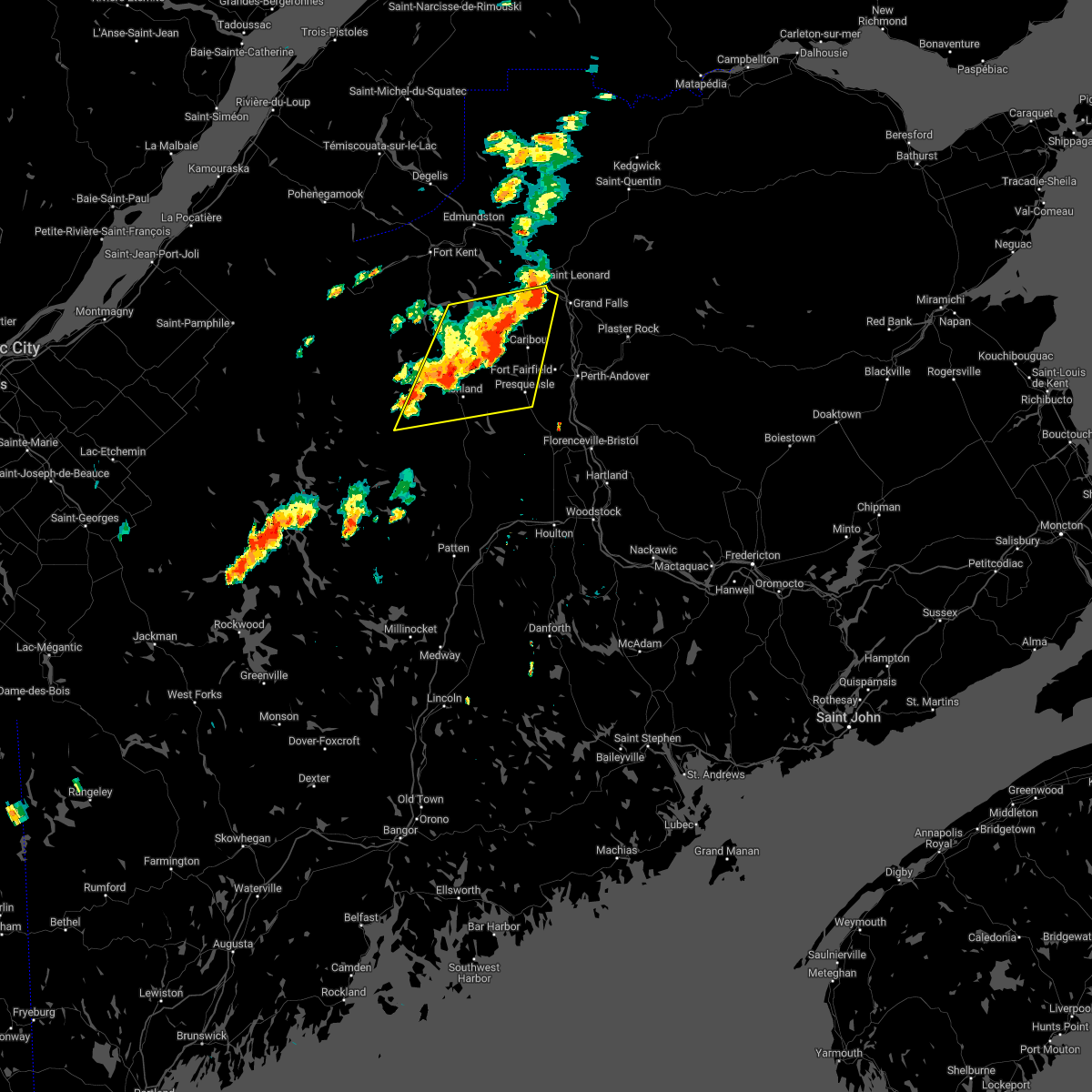
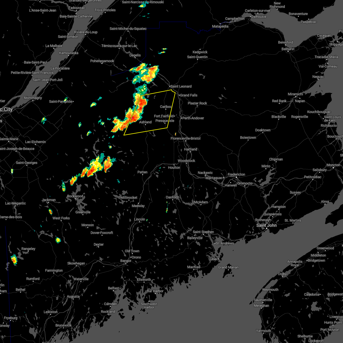
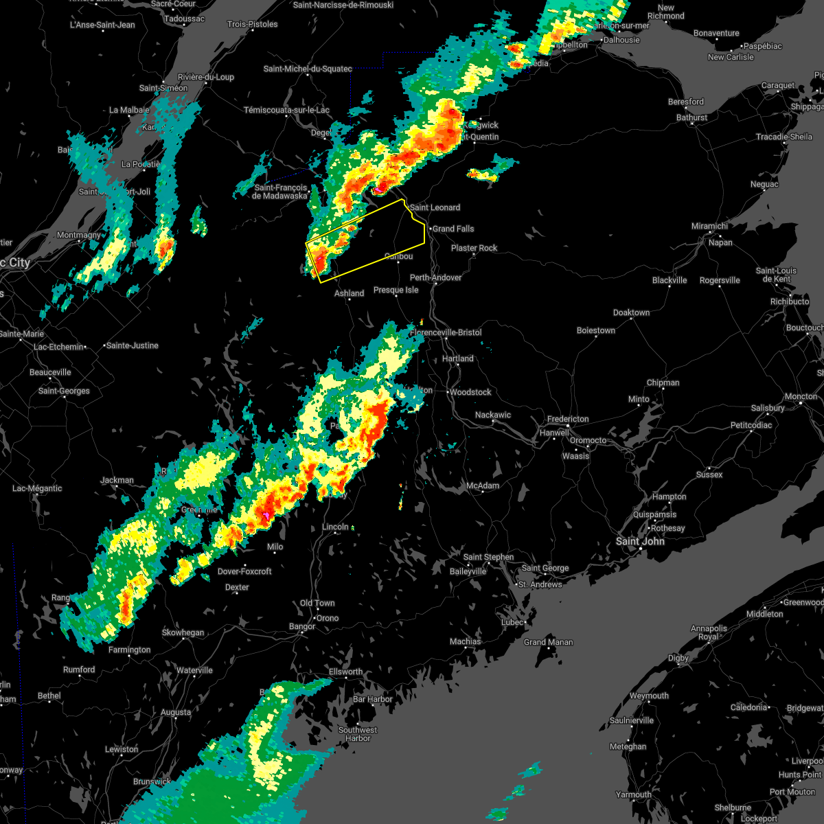
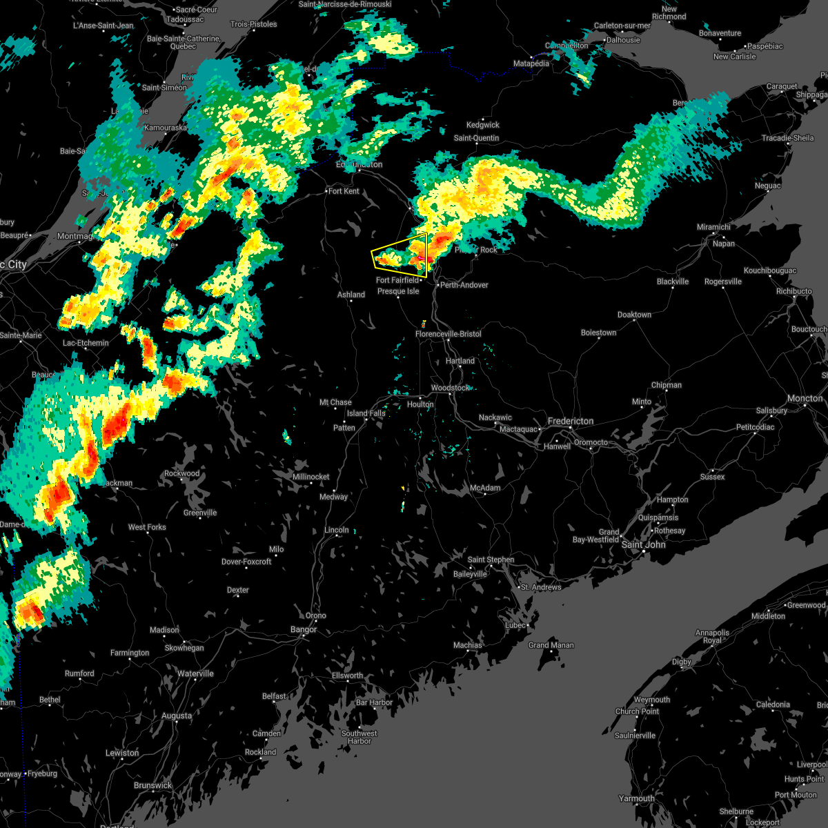
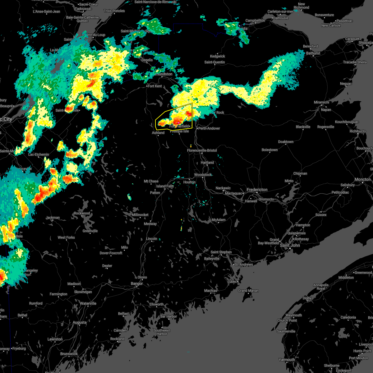
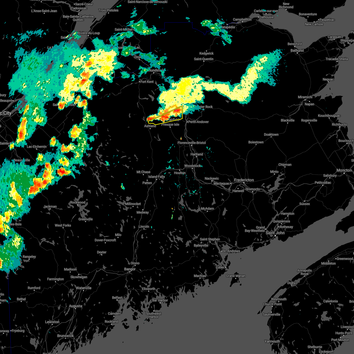
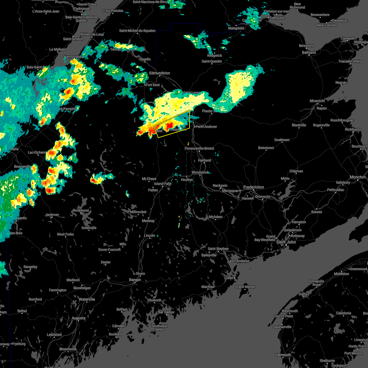
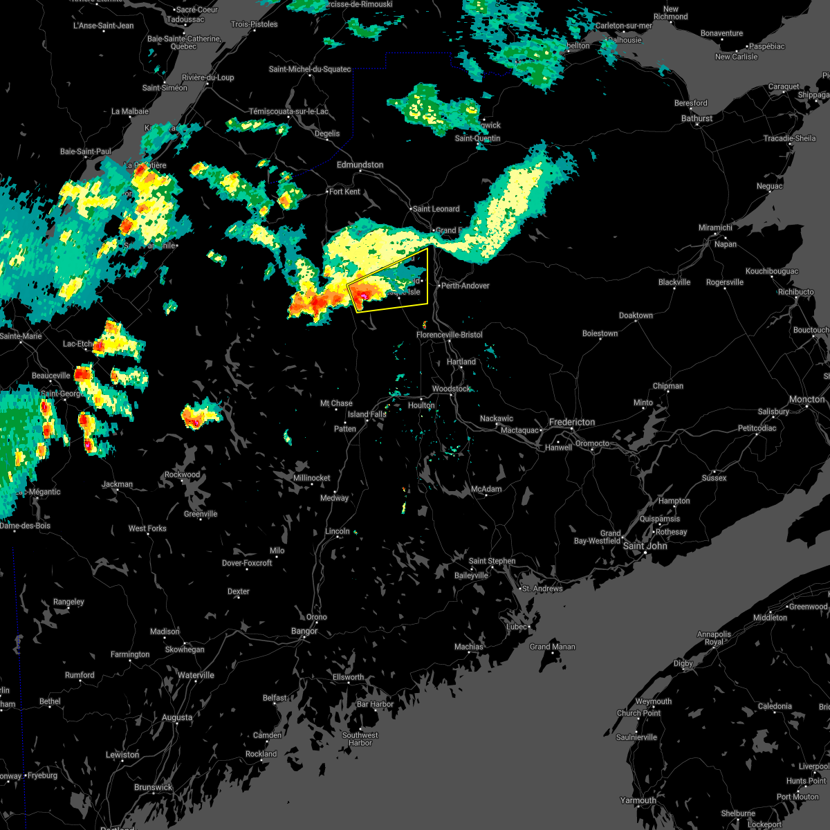
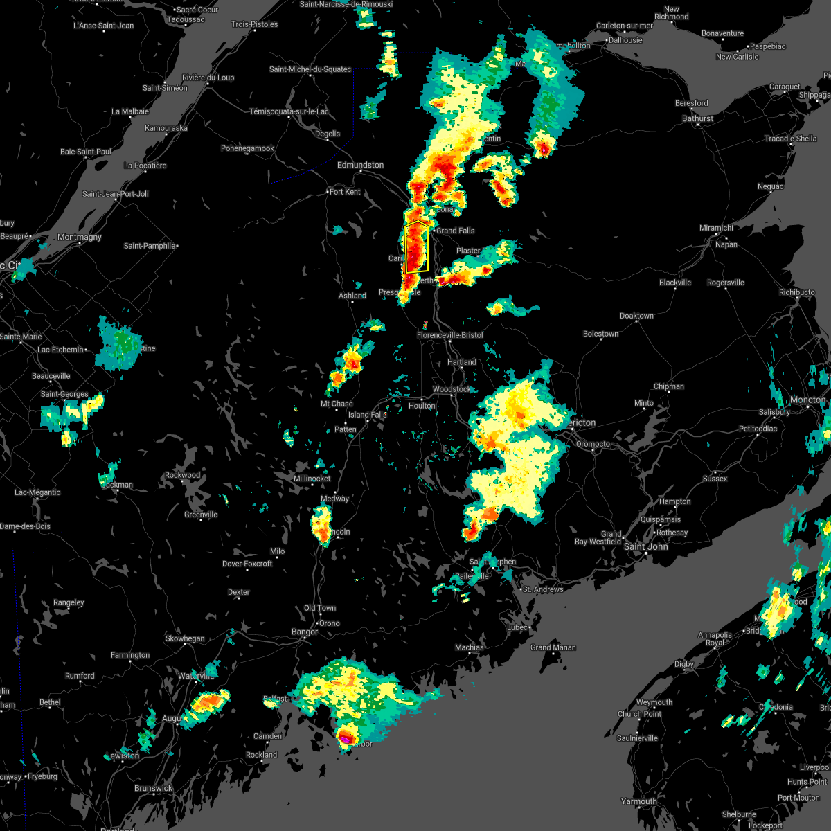
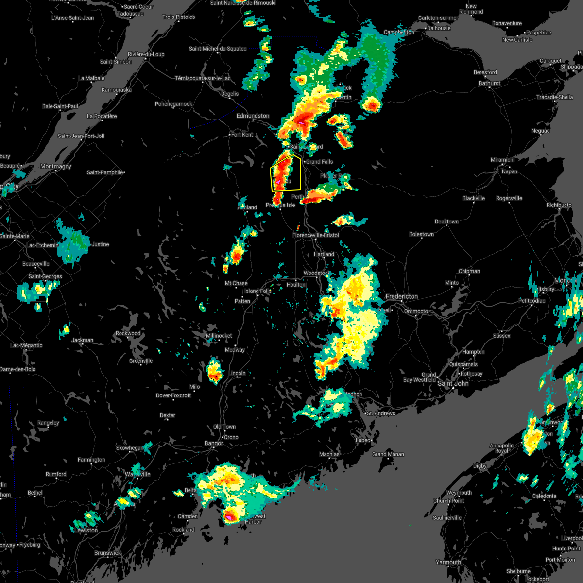
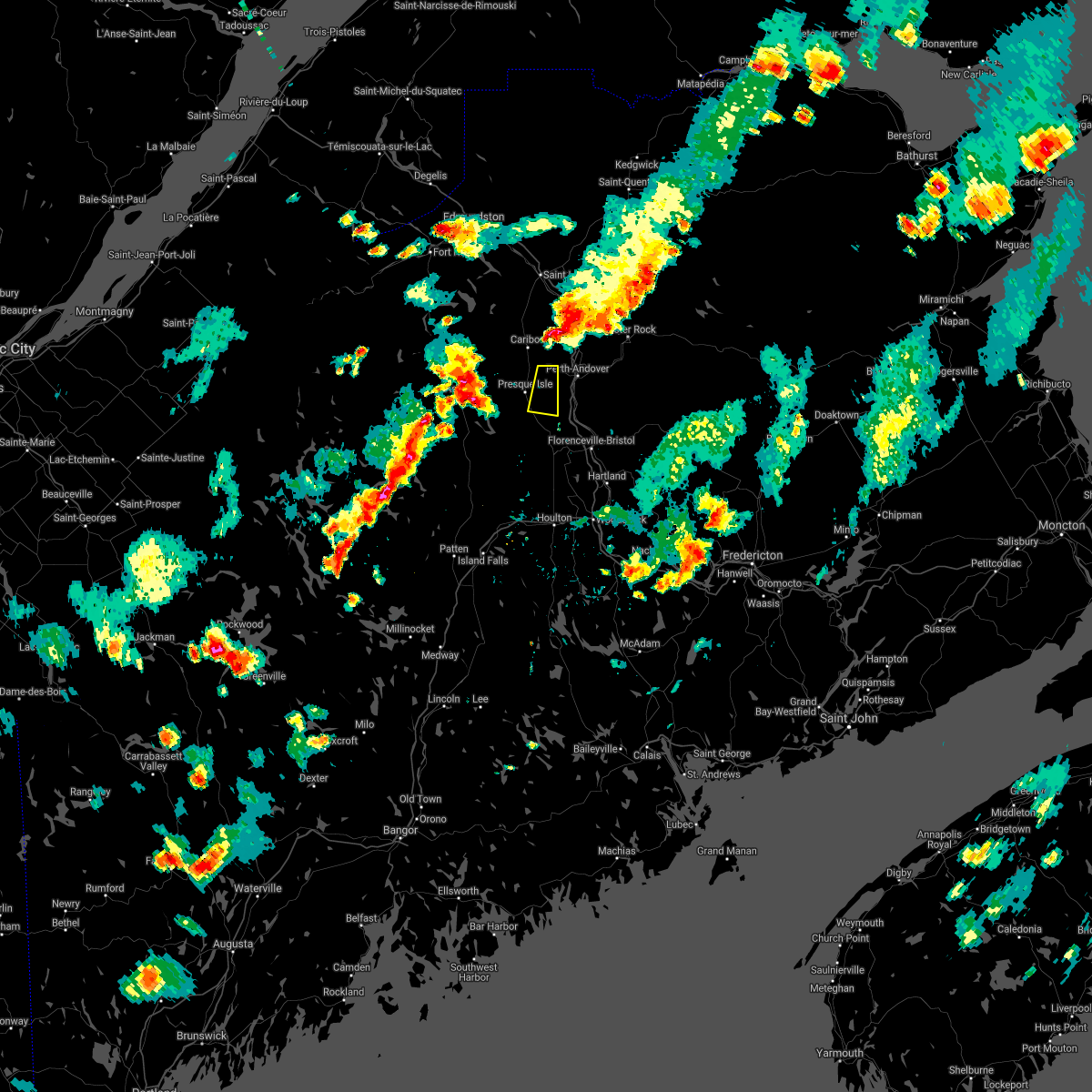
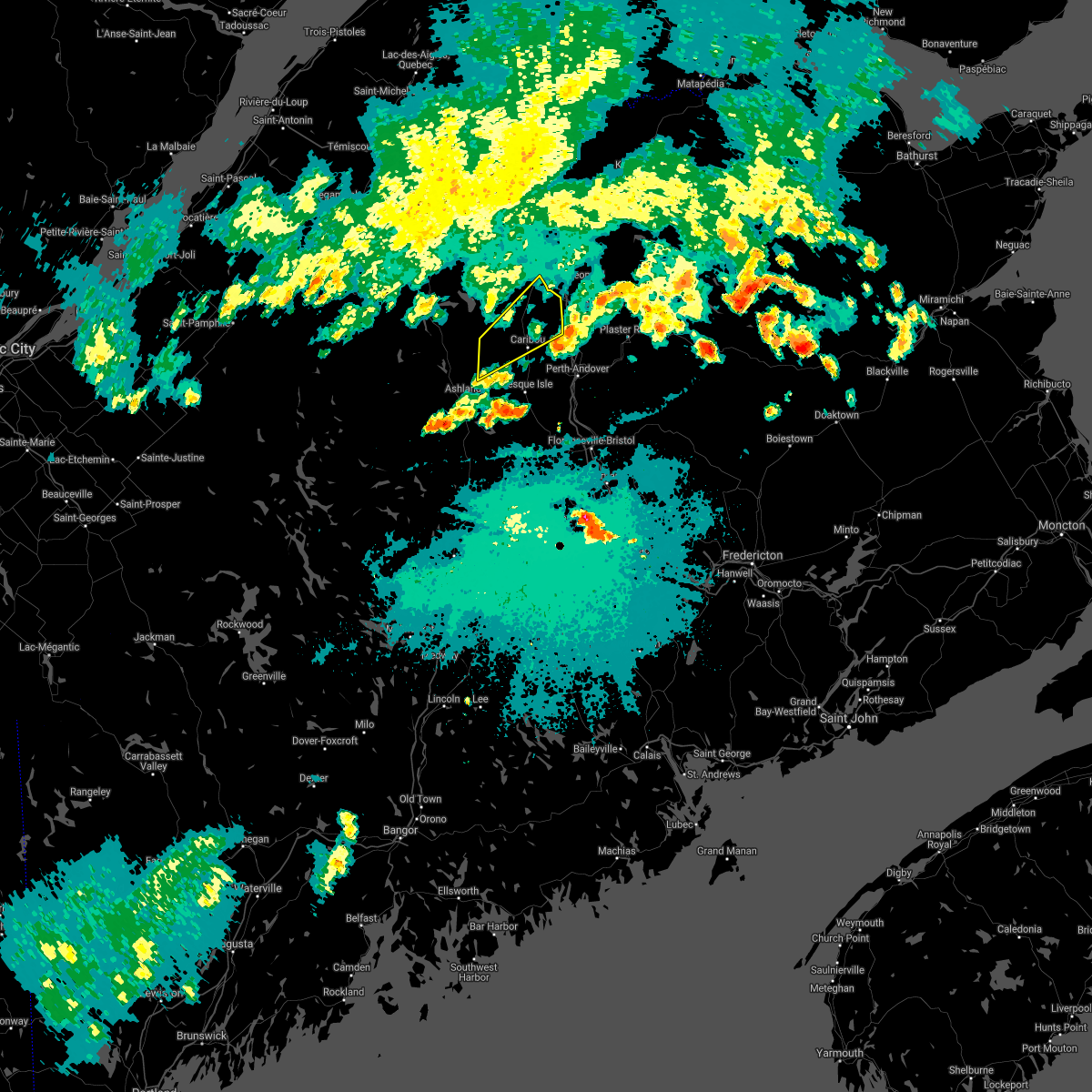
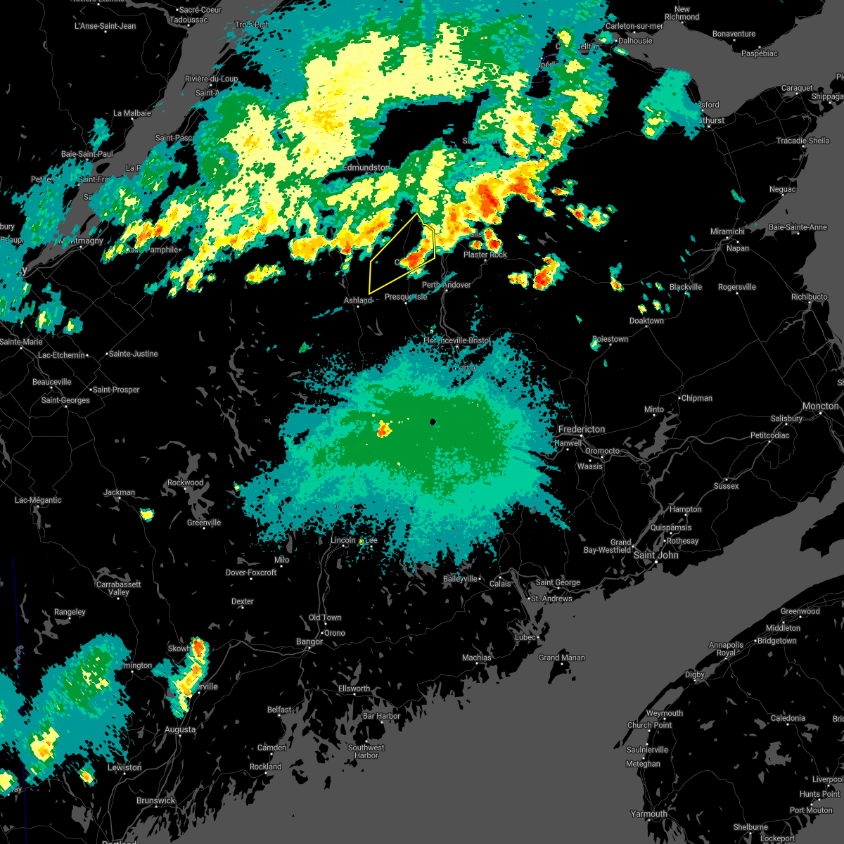
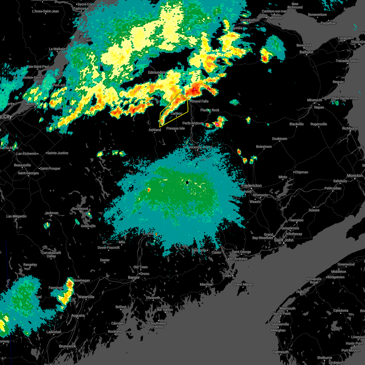
Hail Map for Caribou, ME
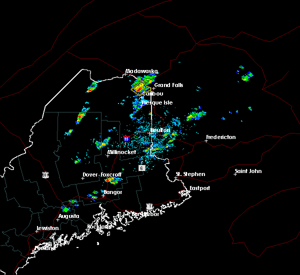
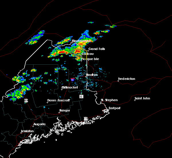
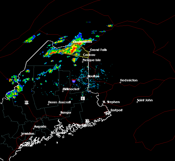
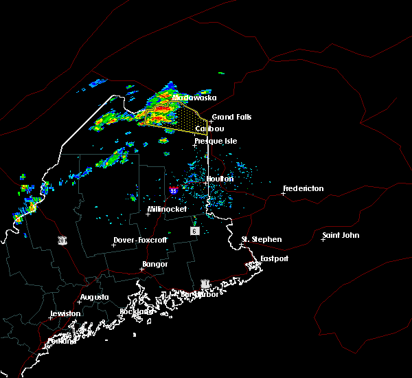
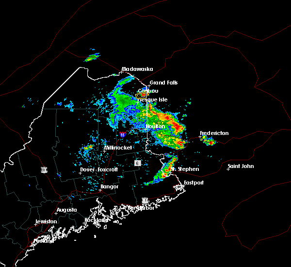
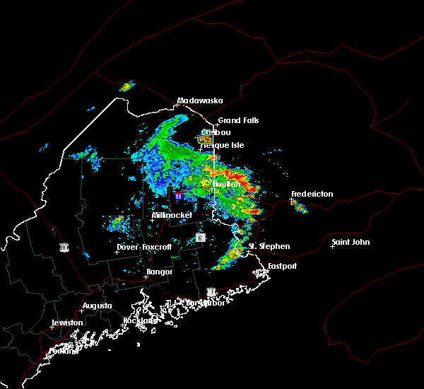
The Caribou, ME area has had 14 reports of on-the-ground hail by trained spotters, and has been under severe weather warnings 10 times during the past 12 months. Doppler radar has detected hail at or near Caribou, ME on 21 occasions.
| Name: | Caribou, ME |
| Where Located: | 1 miles NE of Caribou, ME |
| Map: | Google Map for Caribou, ME |
| Population: | 8189 |
| Housing Units: | 3914 |
| More Info: | Search Google for Caribou, ME |
0
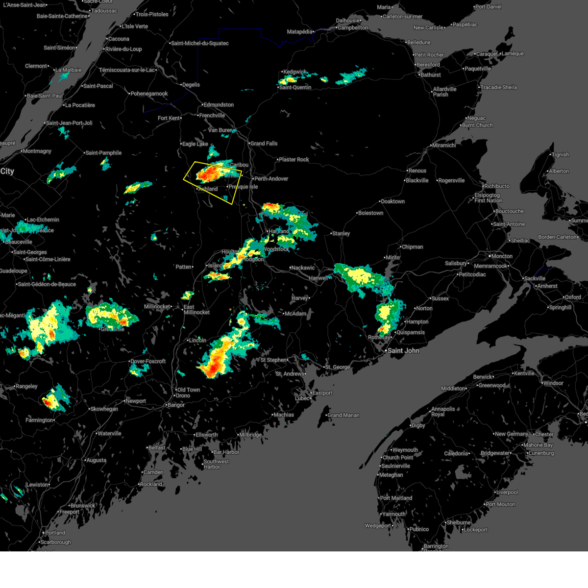
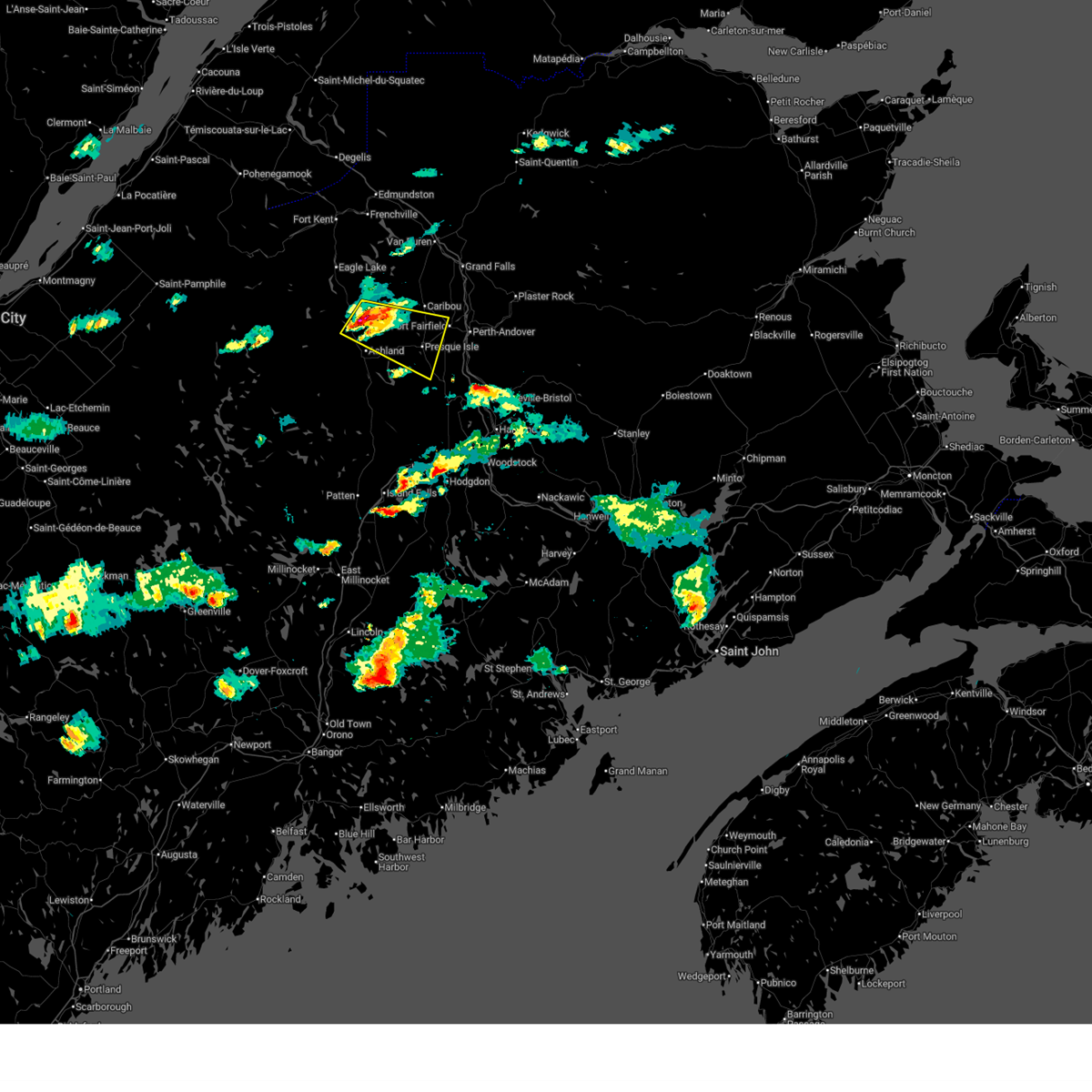
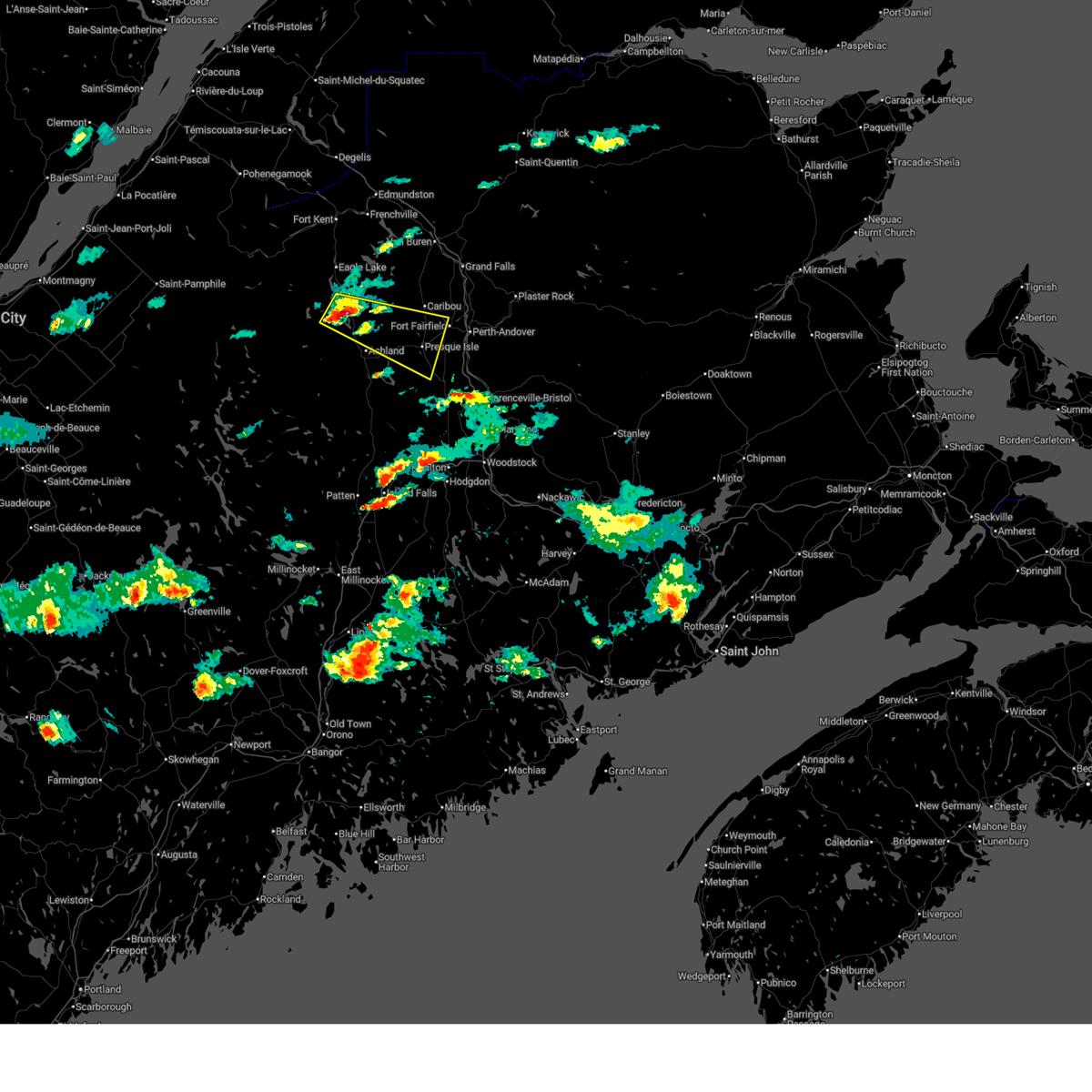
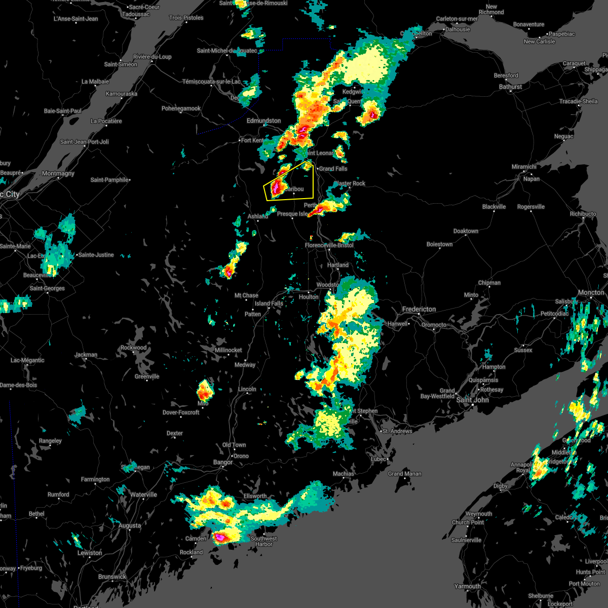
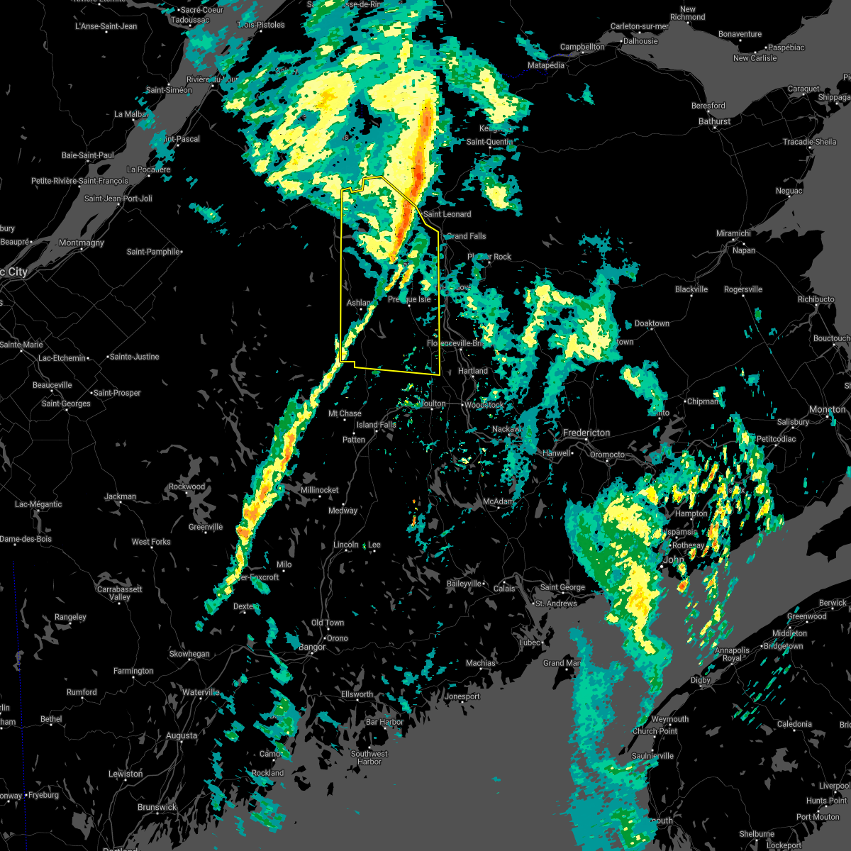
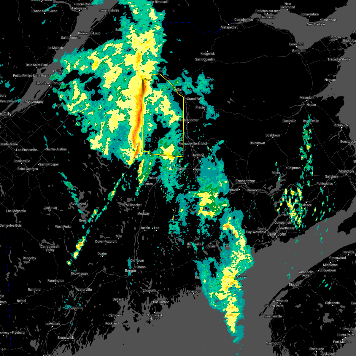
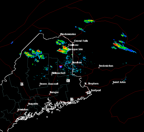
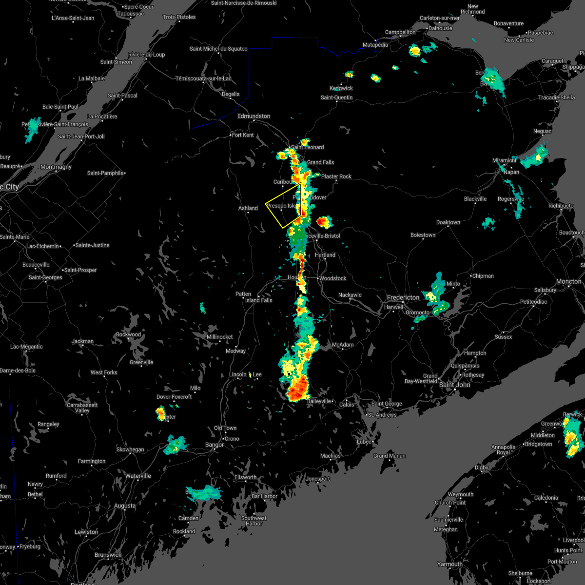
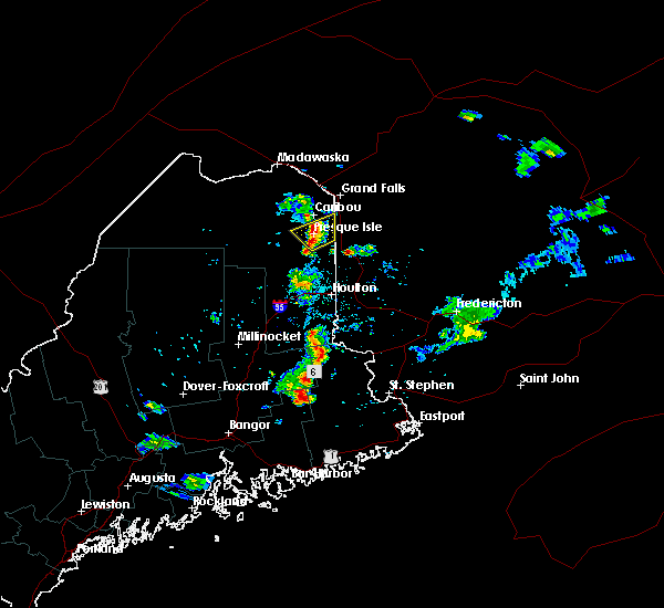
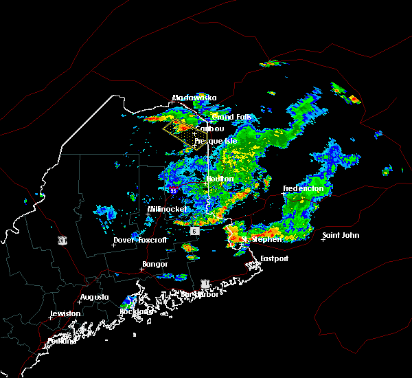
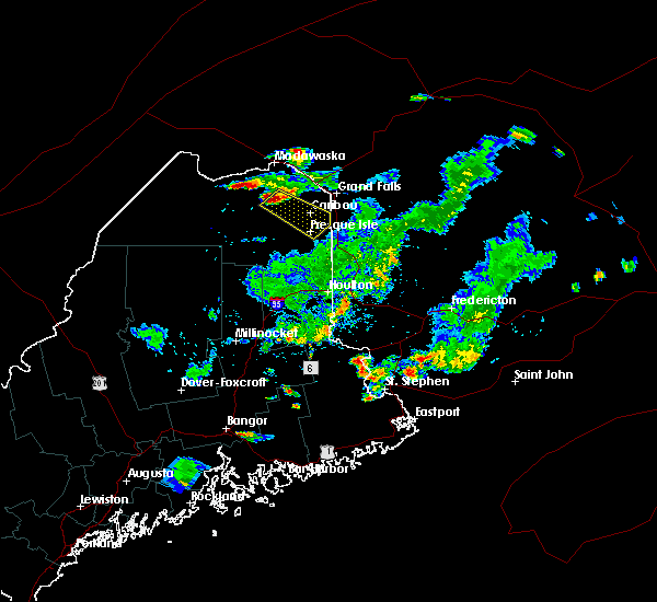
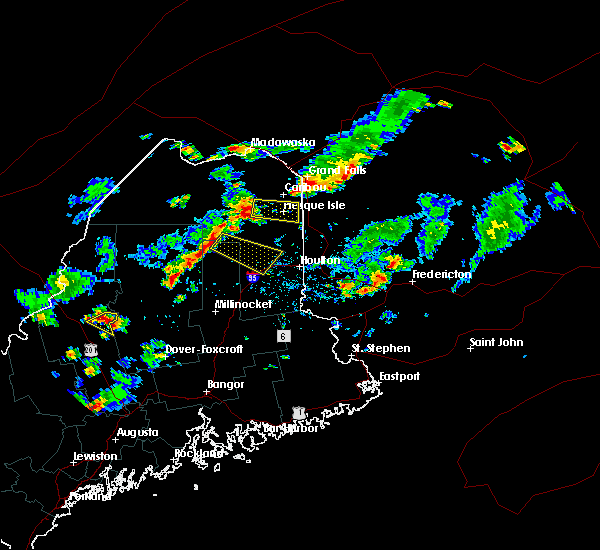
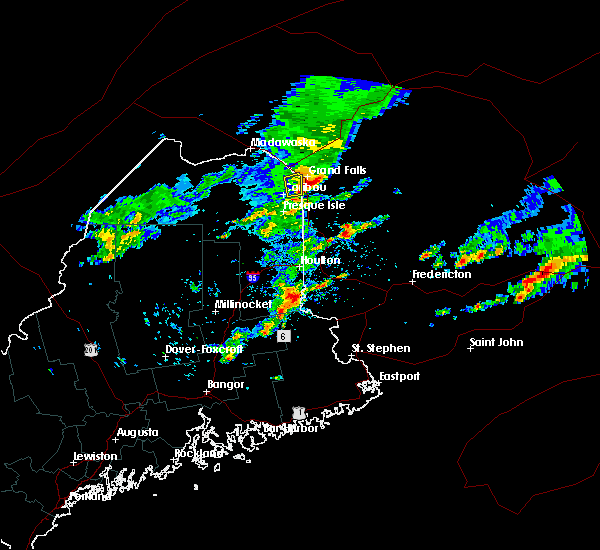
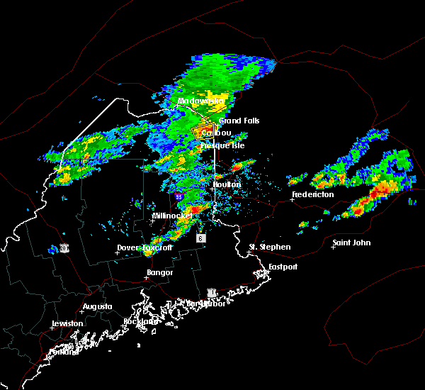
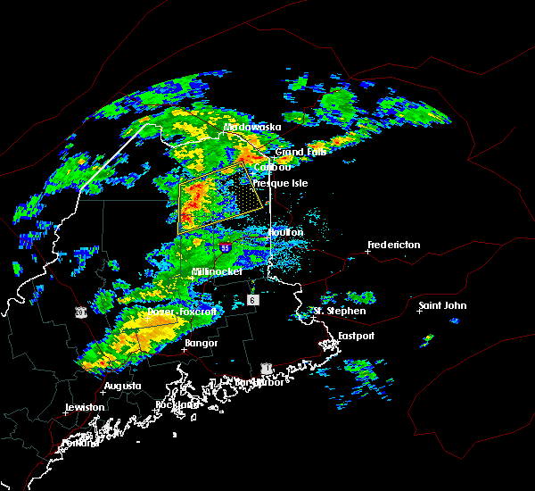
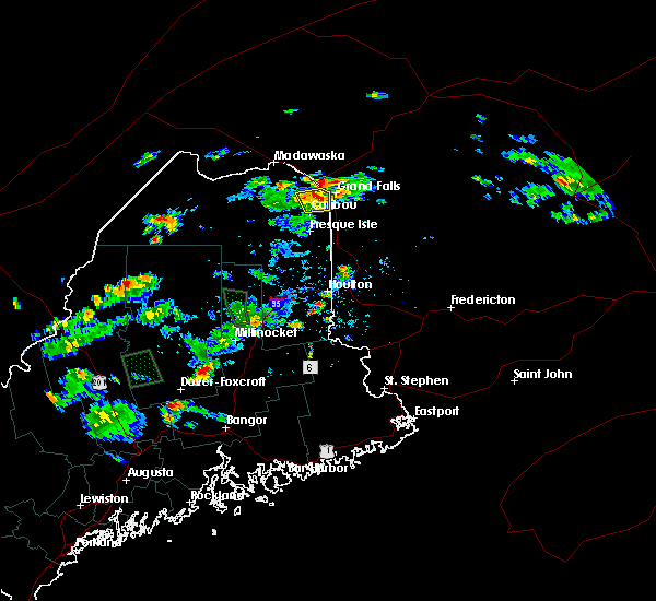
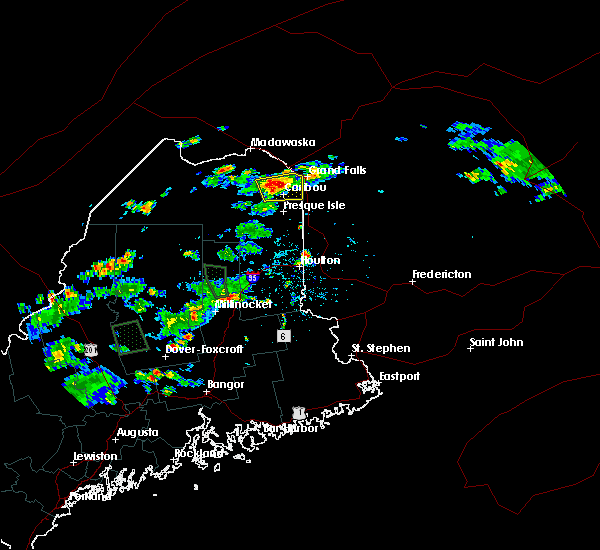
The Top Recent Hail Date for Caribou, ME is Thursday, July 3, 2025 (21st out of 21)
Hail and Wind Damage Spotted near Caribou, ME
| Date / Time | Report Details |
|---|---|
| 8/13/2025 4:45 PM EDT | Report from social media. tree down near madawaska lake shoreline. large tree limb down as well. time estimated based on rada in aroostook county ME, 15.2 miles SE of Caribou, ME |
| 7/30/2025 4:51 PM EDT |
 The storm which prompted the warning has weakened below severe limits, and no longer poses an immediate threat to life or property. therefore, the warning will be allowed to expire. however, small hail, gusty winds and heavy rain are still possible with this thunderstorm. The storm which prompted the warning has weakened below severe limits, and no longer poses an immediate threat to life or property. therefore, the warning will be allowed to expire. however, small hail, gusty winds and heavy rain are still possible with this thunderstorm.
|
| 7/30/2025 4:35 PM EDT |
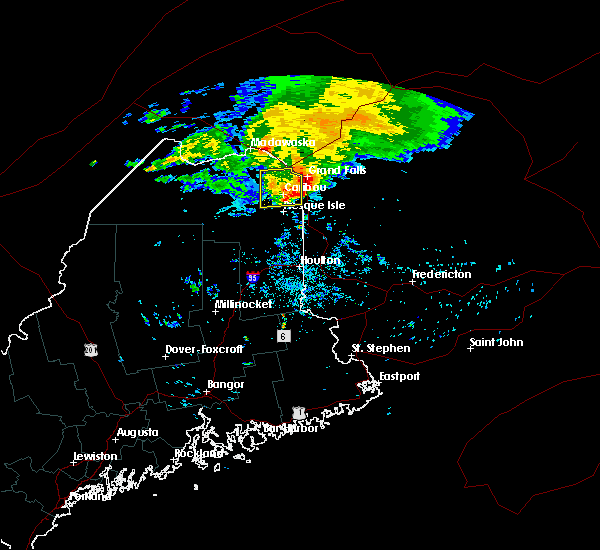
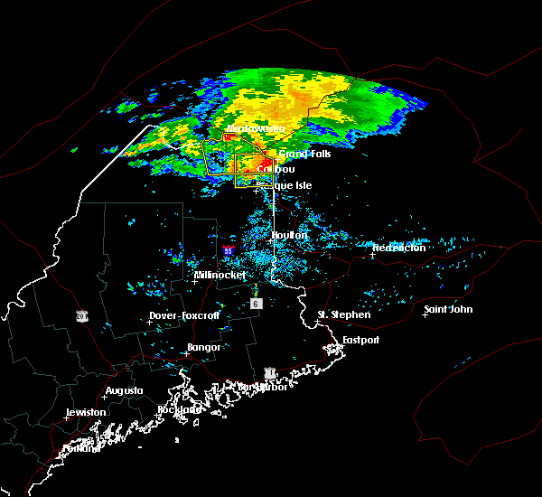
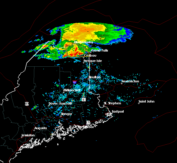
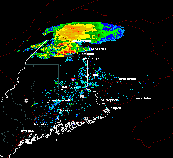
 At 435 pm edt, a severe thunderstorm was located near portage, moving east at 30 mph (radar indicated). Hazards include 60 mph wind gusts and quarter size hail. Minor hail damage to vehicles is possible. expect wind damage to trees and power lines. locations impacted include, presque isle, caribou, fort fairfield, portage, mapleton, washburn, ashland, easton, woodland, portage lake, nashville plantation, westfield, chapman, castle hill, perham, and wade. this includes the following highways, us highway 1 near presque isle. State highway 11 near portage. At 435 pm edt, a severe thunderstorm was located near portage, moving east at 30 mph (radar indicated). Hazards include 60 mph wind gusts and quarter size hail. Minor hail damage to vehicles is possible. expect wind damage to trees and power lines. locations impacted include, presque isle, caribou, fort fairfield, portage, mapleton, washburn, ashland, easton, woodland, portage lake, nashville plantation, westfield, chapman, castle hill, perham, and wade. this includes the following highways, us highway 1 near presque isle. State highway 11 near portage.
|
| 7/30/2025 4:21 PM EDT |
 Svrcar the national weather service in caribou maine has issued a * severe thunderstorm warning for, east central aroostook county in northern maine, * until 500 pm edt. * at 421 pm edt, a severe thunderstorm was located over portage lake, or near portage, moving east at 30 mph (radar indicated). Hazards include 60 mph wind gusts and quarter size hail. Minor hail damage to vehicles is possible. Expect wind damage to trees and power lines. Svrcar the national weather service in caribou maine has issued a * severe thunderstorm warning for, east central aroostook county in northern maine, * until 500 pm edt. * at 421 pm edt, a severe thunderstorm was located over portage lake, or near portage, moving east at 30 mph (radar indicated). Hazards include 60 mph wind gusts and quarter size hail. Minor hail damage to vehicles is possible. Expect wind damage to trees and power lines.
|
| 7/17/2025 6:45 PM EDT |
 At 644 pm edt, severe thunderstorms were located along a line extending from caribou to ashland to moosehorn crossing, moving east at 40 mph (radar indicated). Hazards include 60 mph wind gusts. Expect damage to trees and power lines. locations impacted include, presque isle, caribou, fort fairfield, limestone, van buren, portage, mapleton, washburn, mars hill, ashland, easton, woodland, bridgewater, portage lake, masardis, oxbow, loring, moosehorn crossing, scopan, and nashville plantation. this includes the following highways, us highway 1 between bridgewater and van buren. State highway 11 between knowles corner and portage. At 644 pm edt, severe thunderstorms were located along a line extending from caribou to ashland to moosehorn crossing, moving east at 40 mph (radar indicated). Hazards include 60 mph wind gusts. Expect damage to trees and power lines. locations impacted include, presque isle, caribou, fort fairfield, limestone, van buren, portage, mapleton, washburn, mars hill, ashland, easton, woodland, bridgewater, portage lake, masardis, oxbow, loring, moosehorn crossing, scopan, and nashville plantation. this includes the following highways, us highway 1 between bridgewater and van buren. State highway 11 between knowles corner and portage.
|
| 7/17/2025 6:35 PM EDT | Tree down on powerline in aroostook county ME, 3.6 miles E of Caribou, ME |
| 7/17/2025 6:09 PM EDT |
 Svrcar the national weather service in caribou maine has issued a * severe thunderstorm warning for, northeastern piscataquis county in north central maine, eastern aroostook county in northern maine, north central penobscot county in east central maine, * until 715 pm edt. * at 609 pm edt, severe thunderstorms were located along a line extending from 6 miles south of van buren to near chesuncook lake, moving east at 40 mph (radar indicated). Hazards include 60 mph wind gusts. expect damage to trees and power lines Svrcar the national weather service in caribou maine has issued a * severe thunderstorm warning for, northeastern piscataquis county in north central maine, eastern aroostook county in northern maine, north central penobscot county in east central maine, * until 715 pm edt. * at 609 pm edt, severe thunderstorms were located along a line extending from 6 miles south of van buren to near chesuncook lake, moving east at 40 mph (radar indicated). Hazards include 60 mph wind gusts. expect damage to trees and power lines
|
| 7/17/2025 5:44 PM EDT |
 At 543 pm edt, severe thunderstorms were located along a line extending from near van buren to near ashland, moving east at 30 mph (radar indicated). Hazards include 60 mph wind gusts. Expect damage to trees and power lines. these severe storms will be near, caribou, van buren, mapleton, washburn, ashland, and woodland around 555 pm edt. limestone around 600 pm edt. presque isle and loring around 610 pm edt. fort fairfield around 615 pm edt. other locations impacted by these severe thunderstorms include scopan mountain, chapman, wade, connor, stockholm, caswell, westmanland, cyr plantation, hamlin, and castle hill. this includes the following highways, us highway 1 between presque isle and van buren. State highway 11 between ashland and portage. At 543 pm edt, severe thunderstorms were located along a line extending from near van buren to near ashland, moving east at 30 mph (radar indicated). Hazards include 60 mph wind gusts. Expect damage to trees and power lines. these severe storms will be near, caribou, van buren, mapleton, washburn, ashland, and woodland around 555 pm edt. limestone around 600 pm edt. presque isle and loring around 610 pm edt. fort fairfield around 615 pm edt. other locations impacted by these severe thunderstorms include scopan mountain, chapman, wade, connor, stockholm, caswell, westmanland, cyr plantation, hamlin, and castle hill. this includes the following highways, us highway 1 between presque isle and van buren. State highway 11 between ashland and portage.
|
| 7/17/2025 5:10 PM EDT |
 Svrcar the national weather service in caribou maine has issued a * severe thunderstorm warning for, northeastern aroostook county in northern maine, * until 615 pm edt. * at 509 pm edt, severe thunderstorms were located along a line extending from madawaska lake to just west of ashland, moving east at 25 mph (radar indicated). Hazards include 60 mph wind gusts. Expect damage to trees and power lines. severe thunderstorms will be near, portage, ashland, portage lake, nashville plantation, and madawaska lake around 520 pm edt. woodland around 530 pm edt. caribou and washburn around 545 pm edt. limestone and mapleton around 555 pm edt. presque isle and loring around 555 pm edt. fort fairfield around 615 pm edt. other locations impacted by these severe thunderstorms include scopan mountain, chapman, wade, sinclair, connor, stockholm, caswell, westmanland, cyr plantation, and hamlin. this includes the following highways, us highway 1 between presque isle and van buren. State highway 11 between ashland and portage. Svrcar the national weather service in caribou maine has issued a * severe thunderstorm warning for, northeastern aroostook county in northern maine, * until 615 pm edt. * at 509 pm edt, severe thunderstorms were located along a line extending from madawaska lake to just west of ashland, moving east at 25 mph (radar indicated). Hazards include 60 mph wind gusts. Expect damage to trees and power lines. severe thunderstorms will be near, portage, ashland, portage lake, nashville plantation, and madawaska lake around 520 pm edt. woodland around 530 pm edt. caribou and washburn around 545 pm edt. limestone and mapleton around 555 pm edt. presque isle and loring around 555 pm edt. fort fairfield around 615 pm edt. other locations impacted by these severe thunderstorms include scopan mountain, chapman, wade, sinclair, connor, stockholm, caswell, westmanland, cyr plantation, and hamlin. this includes the following highways, us highway 1 between presque isle and van buren. State highway 11 between ashland and portage.
|
| 7/14/2025 4:40 PM EDT |
 At 440 pm edt, a severe thunderstorm was located near mapleton, or 8 miles west of presque isle, moving east at 25 mph (public). Hazards include 60 mph wind gusts and quarter size hail. Minor hail damage to vehicles is possible. expect wind damage to trees and power lines. locations impacted include, presque isle, caribou, mapleton, washburn, ashland, westfield, chapman, castle hill, wade, and scopan mountain. This includes us highway 1 near presque isle. At 440 pm edt, a severe thunderstorm was located near mapleton, or 8 miles west of presque isle, moving east at 25 mph (public). Hazards include 60 mph wind gusts and quarter size hail. Minor hail damage to vehicles is possible. expect wind damage to trees and power lines. locations impacted include, presque isle, caribou, mapleton, washburn, ashland, westfield, chapman, castle hill, wade, and scopan mountain. This includes us highway 1 near presque isle.
|
| 7/14/2025 4:28 PM EDT |
 At 428 pm edt, a severe thunderstorm was located near ashland, or 11 miles southeast of portage, moving east at 30 mph (radar indicated). Hazards include 60 mph wind gusts and quarter size hail. Minor hail damage to vehicles is possible. expect wind damage to trees and power lines. locations impacted include, presque isle, caribou, mapleton, washburn, ashland, nashville plantation, westfield, chapman, castle hill, wade, scopan mountain, and garfield. this includes the following highways, us highway 1 near presque isle. State highway 11 near ashland. At 428 pm edt, a severe thunderstorm was located near ashland, or 11 miles southeast of portage, moving east at 30 mph (radar indicated). Hazards include 60 mph wind gusts and quarter size hail. Minor hail damage to vehicles is possible. expect wind damage to trees and power lines. locations impacted include, presque isle, caribou, mapleton, washburn, ashland, nashville plantation, westfield, chapman, castle hill, wade, scopan mountain, and garfield. this includes the following highways, us highway 1 near presque isle. State highway 11 near ashland.
|
| 7/14/2025 4:10 PM EDT |
 Svrcar the national weather service in caribou maine has issued a * severe thunderstorm warning for, east central aroostook county in northern maine, * until 515 pm edt. * at 409 pm edt, a severe thunderstorm was located near nashville plantation, or 7 miles south of portage, moving east at 25 mph (radar indicated). Hazards include 60 mph wind gusts and quarter size hail. Minor hail damage to vehicles is possible. Expect wind damage to trees and power lines. Svrcar the national weather service in caribou maine has issued a * severe thunderstorm warning for, east central aroostook county in northern maine, * until 515 pm edt. * at 409 pm edt, a severe thunderstorm was located near nashville plantation, or 7 miles south of portage, moving east at 25 mph (radar indicated). Hazards include 60 mph wind gusts and quarter size hail. Minor hail damage to vehicles is possible. Expect wind damage to trees and power lines.
|
| 7/3/2025 1:11 PM EDT |
 The storm which prompted the warning has weakened below severe limits, and no longer poses an immediate threat to life or property. therefore, the warning will be allowed to expire. a severe thunderstorm watch remains in effect until 600 pm edt for northern maine. The storm which prompted the warning has weakened below severe limits, and no longer poses an immediate threat to life or property. therefore, the warning will be allowed to expire. a severe thunderstorm watch remains in effect until 600 pm edt for northern maine.
|
| 7/3/2025 12:49 PM EDT |
 At 1248 pm edt, a severe thunderstorm was located near mars hill, or 14 miles southeast of presque isle, moving east at 25 mph (radar indicated). Hazards include 60 mph wind gusts and quarter size hail. Minor hail damage to vehicles is possible. expect wind damage to trees and power lines. locations impacted include, presque isle, caribou, fort fairfield, limestone, mapleton, washburn, mars hill, easton, woodland, bridgewater, loring, blaine, new sweden, westfield, chapman, connor, caswell, and number nine mountain. This includes us highway 1 between bridgewater and caribou. At 1248 pm edt, a severe thunderstorm was located near mars hill, or 14 miles southeast of presque isle, moving east at 25 mph (radar indicated). Hazards include 60 mph wind gusts and quarter size hail. Minor hail damage to vehicles is possible. expect wind damage to trees and power lines. locations impacted include, presque isle, caribou, fort fairfield, limestone, mapleton, washburn, mars hill, easton, woodland, bridgewater, loring, blaine, new sweden, westfield, chapman, connor, caswell, and number nine mountain. This includes us highway 1 between bridgewater and caribou.
|
| 7/3/2025 12:30 PM EDT |
 The storm which prompted the warning has weakened below severe limits, and no longer poses an immediate threat to life or property. therefore, the warning will be allowed to expire. however, small hail and gusty winds are still possible with this thunderstorm. a severe thunderstorm watch remains in effect until 600 pm edt for northern maine. The storm which prompted the warning has weakened below severe limits, and no longer poses an immediate threat to life or property. therefore, the warning will be allowed to expire. however, small hail and gusty winds are still possible with this thunderstorm. a severe thunderstorm watch remains in effect until 600 pm edt for northern maine.
|
| 7/3/2025 12:28 PM EDT |
 Svrcar the national weather service in caribou maine has issued a * severe thunderstorm warning for, east central aroostook county in northern maine, * until 115 pm edt. * at 1227 pm edt, a severe thunderstorm was located near mars hill, or 10 miles south of presque isle, moving east at 25 mph (radar indicated). Hazards include 60 mph wind gusts and quarter size hail. Minor hail damage to vehicles is possible. Expect wind damage to trees and power lines. Svrcar the national weather service in caribou maine has issued a * severe thunderstorm warning for, east central aroostook county in northern maine, * until 115 pm edt. * at 1227 pm edt, a severe thunderstorm was located near mars hill, or 10 miles south of presque isle, moving east at 25 mph (radar indicated). Hazards include 60 mph wind gusts and quarter size hail. Minor hail damage to vehicles is possible. Expect wind damage to trees and power lines.
|
| 7/3/2025 12:24 PM EDT | A tree was observed to be leaning on a powerline in the caribou area. time estimated by rada in aroostook county ME, 0.9 miles NE of Caribou, ME |
| 7/3/2025 12:16 PM EDT |
 The storm which prompted the warning has weakened below severe limits, and no longer poses an immediate threat to life or property. therefore, the warning will be allowed to expire. however, small hail and gusty winds are still possible with this thunderstorm. a severe thunderstorm watch remains in effect until 600 pm edt for northern and north central maine. to report severe weather, contact your nearest law enforcement agency. they will relay your report to the national weather service caribou maine. The storm which prompted the warning has weakened below severe limits, and no longer poses an immediate threat to life or property. therefore, the warning will be allowed to expire. however, small hail and gusty winds are still possible with this thunderstorm. a severe thunderstorm watch remains in effect until 600 pm edt for northern and north central maine. to report severe weather, contact your nearest law enforcement agency. they will relay your report to the national weather service caribou maine.
|
| 7/3/2025 12:04 PM EDT |
 At 1203 pm edt, a severe thunderstorm was located 8 miles north of loring, or 9 miles south of van buren, moving east at 25 mph (radar indicated). Hazards include 60 mph wind gusts and quarter size hail. Minor hail damage to vehicles is possible. expect wind damage to trees and power lines. locations impacted include, caribou, limestone, van buren, eagle lake, woodland, new canada, madawaska lake, loring, cross lake, new sweden, connor, perham, caswell, stockholm, winterville, hamlin, westmanland, guerette, and cyr plantation. this includes the following highways, us highway 1 near van buren. State highway 11 near winterville. At 1203 pm edt, a severe thunderstorm was located 8 miles north of loring, or 9 miles south of van buren, moving east at 25 mph (radar indicated). Hazards include 60 mph wind gusts and quarter size hail. Minor hail damage to vehicles is possible. expect wind damage to trees and power lines. locations impacted include, caribou, limestone, van buren, eagle lake, woodland, new canada, madawaska lake, loring, cross lake, new sweden, connor, perham, caswell, stockholm, winterville, hamlin, westmanland, guerette, and cyr plantation. this includes the following highways, us highway 1 near van buren. State highway 11 near winterville.
|
| 7/3/2025 11:56 AM EDT |
 At 1153 am edt, a severe thunderstorm was located near washburn, moving east at 45 mph (radar indicated). Hazards include 60 mph wind gusts and quarter size hail. Minor hail damage to vehicles is possible. expect wind damage to trees and power lines. locations impacted include, presque isle, caribou, fort fairfield, limestone, portage, mapleton, washburn, ashland, easton, woodland, portage lake, russel crossing, big machias lake, loring, fish river lake, nashville plantation, new sweden, chapman, connor, and castle hill. this includes the following highways, us highway 1 between presque isle and caribou. State highway 11 between ashland and portage. At 1153 am edt, a severe thunderstorm was located near washburn, moving east at 45 mph (radar indicated). Hazards include 60 mph wind gusts and quarter size hail. Minor hail damage to vehicles is possible. expect wind damage to trees and power lines. locations impacted include, presque isle, caribou, fort fairfield, limestone, portage, mapleton, washburn, ashland, easton, woodland, portage lake, russel crossing, big machias lake, loring, fish river lake, nashville plantation, new sweden, chapman, connor, and castle hill. this includes the following highways, us highway 1 between presque isle and caribou. State highway 11 between ashland and portage.
|
| 7/3/2025 11:35 AM EDT |
 Svrcar the national weather service in caribou maine has issued a * severe thunderstorm warning for, northeastern aroostook county in northern maine, * until 1230 pm edt. * at 1134 am edt, a severe thunderstorm was located over madawaska lake, or 13 miles southwest of van buren, moving east at 30 mph (radar indicated). Hazards include 60 mph wind gusts and quarter size hail. Minor hail damage to vehicles is possible. Expect wind damage to trees and power lines. Svrcar the national weather service in caribou maine has issued a * severe thunderstorm warning for, northeastern aroostook county in northern maine, * until 1230 pm edt. * at 1134 am edt, a severe thunderstorm was located over madawaska lake, or 13 miles southwest of van buren, moving east at 30 mph (radar indicated). Hazards include 60 mph wind gusts and quarter size hail. Minor hail damage to vehicles is possible. Expect wind damage to trees and power lines.
|
| 7/3/2025 10:58 AM EDT |
 Svrcar the national weather service in caribou maine has issued a * severe thunderstorm warning for, east central aroostook county in northern maine, * until 1215 pm edt. * at 1057 am edt, a severe thunderstorm was located near big machias lake, or 15 miles south of deboullie mountain, moving east at 55 mph (emergency management). Hazards include 60 mph wind gusts and quarter size hail. Minor hail damage to vehicles is possible. Expect wind damage to trees and power lines. Svrcar the national weather service in caribou maine has issued a * severe thunderstorm warning for, east central aroostook county in northern maine, * until 1215 pm edt. * at 1057 am edt, a severe thunderstorm was located near big machias lake, or 15 miles south of deboullie mountain, moving east at 55 mph (emergency management). Hazards include 60 mph wind gusts and quarter size hail. Minor hail damage to vehicles is possible. Expect wind damage to trees and power lines.
|
| 11/8/2024 2:11 PM EST | Tree reported down by houlton police department. time estimated based on rada in aroostook county ME, 8.6 miles SSE of Caribou, ME |
| 8/3/2024 9:09 PM EDT |
 The storms which prompted the warning have moved out of the area. therefore, the warning will be allowed to expire. The storms which prompted the warning have moved out of the area. therefore, the warning will be allowed to expire.
|
| 8/3/2024 8:55 PM EDT |
 At 854 pm edt, severe thunderstorms were located along a line extending from 6 miles northeast of fort fairfield to near scopan, moving east at 25 mph (radar indicated). Hazards include 60 mph wind gusts and half dollar size hail. Minor hail damage to vehicles is possible. expect wind damage to trees and power lines. Locations impacted include, presque isle, caribou, fort fairfield, limestone, mapleton, washburn, mars hill, ashland, easton, bridgewater, masardis, scopan, blaine, westfield, chapman, castle hill, scopan mountain, and scopan lake. At 854 pm edt, severe thunderstorms were located along a line extending from 6 miles northeast of fort fairfield to near scopan, moving east at 25 mph (radar indicated). Hazards include 60 mph wind gusts and half dollar size hail. Minor hail damage to vehicles is possible. expect wind damage to trees and power lines. Locations impacted include, presque isle, caribou, fort fairfield, limestone, mapleton, washburn, mars hill, ashland, easton, bridgewater, masardis, scopan, blaine, westfield, chapman, castle hill, scopan mountain, and scopan lake.
|
| 8/3/2024 8:37 PM EDT |
 Svrcar the national weather service in caribou maine has issued a * severe thunderstorm warning for, east central aroostook county in northern maine, * until 915 pm edt. * at 837 pm edt, severe thunderstorms were located along a line extending from near limestone to near masardis, moving east at 25 mph (radar indicated). Hazards include 60 mph wind gusts and quarter size hail. Minor hail damage to vehicles is possible. Expect wind damage to trees and power lines. Svrcar the national weather service in caribou maine has issued a * severe thunderstorm warning for, east central aroostook county in northern maine, * until 915 pm edt. * at 837 pm edt, severe thunderstorms were located along a line extending from near limestone to near masardis, moving east at 25 mph (radar indicated). Hazards include 60 mph wind gusts and quarter size hail. Minor hail damage to vehicles is possible. Expect wind damage to trees and power lines.
|
| 6/30/2024 4:25 PM EDT | Multiple trees down at madawaska lake with damage to a cam in aroostook county ME, 14.5 miles SE of Caribou, ME |
| 5/23/2024 3:42 PM EDT |
 The storm which prompted the warning has weakened below severe limits, and no longer poses an immediate threat to life or property. therefore, the warning will be allowed to expire. however, small hail, gusty winds and heavy rain are still possible with this thunderstorm. a severe thunderstorm watch remains in effect until 700 pm edt for northern maine. The storm which prompted the warning has weakened below severe limits, and no longer poses an immediate threat to life or property. therefore, the warning will be allowed to expire. however, small hail, gusty winds and heavy rain are still possible with this thunderstorm. a severe thunderstorm watch remains in effect until 700 pm edt for northern maine.
|
| 5/23/2024 3:23 PM EDT |
 At 323 pm edt, a severe thunderstorm was located over washburn, or 7 miles northwest of presque isle, moving east at 30 mph (radar indicated). Hazards include 60 mph wind gusts and quarter size hail. Minor hail damage to vehicles is possible. expect wind damage to trees and power lines. Locations impacted include, presque isle, caribou, fort fairfield, limestone, mapleton, washburn, easton, woodland, loring, new sweden, connor, castle hill, perham, caswell, and wade. At 323 pm edt, a severe thunderstorm was located over washburn, or 7 miles northwest of presque isle, moving east at 30 mph (radar indicated). Hazards include 60 mph wind gusts and quarter size hail. Minor hail damage to vehicles is possible. expect wind damage to trees and power lines. Locations impacted include, presque isle, caribou, fort fairfield, limestone, mapleton, washburn, easton, woodland, loring, new sweden, connor, castle hill, perham, caswell, and wade.
|
| 5/23/2024 2:58 PM EDT |
 Svrcar the national weather service in caribou maine has issued a * severe thunderstorm warning for, east central aroostook county in northern maine, * until 345 pm edt. * at 258 pm edt, a severe thunderstorm was located near portage, moving east at 45 mph (radar indicated). Hazards include ping pong ball size hail and 60 mph wind gusts. People and animals outdoors will be injured. expect hail damage to roofs, siding, windows, and vehicles. Expect wind damage to trees and power lines. Svrcar the national weather service in caribou maine has issued a * severe thunderstorm warning for, east central aroostook county in northern maine, * until 345 pm edt. * at 258 pm edt, a severe thunderstorm was located near portage, moving east at 45 mph (radar indicated). Hazards include ping pong ball size hail and 60 mph wind gusts. People and animals outdoors will be injured. expect hail damage to roofs, siding, windows, and vehicles. Expect wind damage to trees and power lines.
|
| 8/13/2023 5:01 PM EDT |
 At 501 pm edt, severe thunderstorms were located along a line extending from near fish river lake to near russel crossing to 10 miles southwest of big machias lake, moving northeast at 40 mph (radar indicated). Hazards include 70 mph wind gusts and quarter size hail. Minor hail damage to vehicles is possible. expect considerable tree damage. Wind damage is also likely to mobile homes, roofs, and outbuildings. At 501 pm edt, severe thunderstorms were located along a line extending from near fish river lake to near russel crossing to 10 miles southwest of big machias lake, moving northeast at 40 mph (radar indicated). Hazards include 70 mph wind gusts and quarter size hail. Minor hail damage to vehicles is possible. expect considerable tree damage. Wind damage is also likely to mobile homes, roofs, and outbuildings.
|
| 12/23/2022 5:54 PM EST | Storm damage reported in aroostook county ME, 0.8 miles ESE of Caribou, ME |
| 8/30/2022 6:13 PM EDT |
 The severe thunderstorm warning for northeastern aroostook county will expire at 615 pm edt, the storms which prompted the warning have weakened below severe limits, but frequent cloud to ground lightning and heavy downpours are still likely. therefore, the warning will be allowed to expire. however heavy rain is still possible with these thunderstorms. The severe thunderstorm warning for northeastern aroostook county will expire at 615 pm edt, the storms which prompted the warning have weakened below severe limits, but frequent cloud to ground lightning and heavy downpours are still likely. therefore, the warning will be allowed to expire. however heavy rain is still possible with these thunderstorms.
|
| 8/30/2022 5:29 PM EDT |
 At 529 pm edt, severe thunderstorms were located along a line extending from 6 miles southwest of madawaska lake to 6 miles southeast of russel crossing, moving east at 35 mph (radar indicated). Hazards include 60 mph wind gusts and nickel size hail. expect damage to trees and power lines At 529 pm edt, severe thunderstorms were located along a line extending from 6 miles southwest of madawaska lake to 6 miles southeast of russel crossing, moving east at 35 mph (radar indicated). Hazards include 60 mph wind gusts and nickel size hail. expect damage to trees and power lines
|
| 7/19/2022 3:54 PM EDT |
 At 353 pm edt, severe thunderstorms were located along a line extending from near caribou to masardis, moving southeast at 45 mph (radar indicated). Hazards include 60 mph wind gusts. expect damage to trees and power lines At 353 pm edt, severe thunderstorms were located along a line extending from near caribou to masardis, moving southeast at 45 mph (radar indicated). Hazards include 60 mph wind gusts. expect damage to trees and power lines
|
| 7/12/2022 8:28 PM EDT |
 At 828 pm edt, a severe thunderstorm was located near loring, or 8 miles north of limestone, moving northeast at 45 mph (radar indicated). Hazards include 60 mph wind gusts and quarter size hail. Minor hail damage to vehicles is possible. Expect wind damage to trees and power lines. At 828 pm edt, a severe thunderstorm was located near loring, or 8 miles north of limestone, moving northeast at 45 mph (radar indicated). Hazards include 60 mph wind gusts and quarter size hail. Minor hail damage to vehicles is possible. Expect wind damage to trees and power lines.
|
| 7/12/2022 8:02 PM EDT |
 At 802 pm edt, a severe thunderstorm was located near madawaska lake, or 13 miles northwest of caribou, moving northeast at 45 mph (radar indicated). Hazards include 60 mph wind gusts and quarter size hail. Minor hail damage to vehicles is possible. expect wind damage to trees and power lines. Locations impacted include, caribou, limestone, van buren, woodland, madawaska lake, new sweden, connor, perham, caswell, stockholm, hamlin, westmanland and cyr plantation. At 802 pm edt, a severe thunderstorm was located near madawaska lake, or 13 miles northwest of caribou, moving northeast at 45 mph (radar indicated). Hazards include 60 mph wind gusts and quarter size hail. Minor hail damage to vehicles is possible. expect wind damage to trees and power lines. Locations impacted include, caribou, limestone, van buren, woodland, madawaska lake, new sweden, connor, perham, caswell, stockholm, hamlin, westmanland and cyr plantation.
|
| 7/12/2022 7:40 PM EDT |
 At 740 pm edt, a severe thunderstorm was located 7 miles north of portage lake, or 9 miles north of portage, moving northeast at 45 mph (radar indicated). Hazards include 60 mph wind gusts and quarter size hail. Minor hail damage to vehicles is possible. Expect wind damage to trees and power lines. At 740 pm edt, a severe thunderstorm was located 7 miles north of portage lake, or 9 miles north of portage, moving northeast at 45 mph (radar indicated). Hazards include 60 mph wind gusts and quarter size hail. Minor hail damage to vehicles is possible. Expect wind damage to trees and power lines.
|
| 6/21/2021 6:50 PM EDT |
 At 649 pm edt, a severe thunderstorm was located near limestone, moving northeast at 35 mph. this storm has a history of producing damaging winds (radar indicated). Hazards include 60 mph wind gusts and penny size hail. Expect damage to trees and power lines. Locations impacted include, caribou, fort fairfield, limestone, washburn, woodland, loring, new sweden, connor, perham, caswell and westmanland. At 649 pm edt, a severe thunderstorm was located near limestone, moving northeast at 35 mph. this storm has a history of producing damaging winds (radar indicated). Hazards include 60 mph wind gusts and penny size hail. Expect damage to trees and power lines. Locations impacted include, caribou, fort fairfield, limestone, washburn, woodland, loring, new sweden, connor, perham, caswell and westmanland.
|
| 6/21/2021 6:30 PM EDT | Corrects previous tstm wnd dmg report from 2 wsw limestone. structural damag in aroostook county ME, 3.8 miles SW of Caribou, ME |
| 6/21/2021 6:29 PM EDT |
 At 628 pm edt, severe thunderstorms were located along a line extending from near limestone to 7 miles northeast of portage, moving northeast at 35 mph. this storm has a history of producing damaging wind (radar indicated). Hazards include 60 mph wind gusts and penny size hail. expect damage to trees and power lines At 628 pm edt, severe thunderstorms were located along a line extending from near limestone to 7 miles northeast of portage, moving northeast at 35 mph. this storm has a history of producing damaging wind (radar indicated). Hazards include 60 mph wind gusts and penny size hail. expect damage to trees and power lines
|
| 6/21/2021 6:21 PM EDT |
 At 619 pm edt, a severe thunderstorm was located near caribou, moving northeast at 40 mph. another strong to severe thunderstorm was located over washburn (radar indicated). Hazards include 60 mph wind gusts and penny size hail. Expect damage to trees and power lines. Locations impacted include, presque isle, caribou, fort fairfield, limestone, mapleton, washburn, ashland, woodland, castle hill and wade. At 619 pm edt, a severe thunderstorm was located near caribou, moving northeast at 40 mph. another strong to severe thunderstorm was located over washburn (radar indicated). Hazards include 60 mph wind gusts and penny size hail. Expect damage to trees and power lines. Locations impacted include, presque isle, caribou, fort fairfield, limestone, mapleton, washburn, ashland, woodland, castle hill and wade.
|
| 6/21/2021 6:11 PM EDT | Tree dow in aroostook county ME, 3.5 miles NNE of Caribou, ME |
| 6/21/2021 5:57 PM EDT |
 At 556 pm edt, a severe thunderstorm was located near mapleton, or near presque isle, moving northeast at 30 mph. another strong to severe thunderstorm was located north of ashland (radar indicated). Hazards include 60 mph wind gusts and quarter size hail. Minor hail damage to vehicles is possible. expect wind damage to trees and power lines. Locations impacted include, presque isle, caribou, fort fairfield, limestone, mapleton, washburn, ashland, woodland, chapman, castle hill and wade. At 556 pm edt, a severe thunderstorm was located near mapleton, or near presque isle, moving northeast at 30 mph. another strong to severe thunderstorm was located north of ashland (radar indicated). Hazards include 60 mph wind gusts and quarter size hail. Minor hail damage to vehicles is possible. expect wind damage to trees and power lines. Locations impacted include, presque isle, caribou, fort fairfield, limestone, mapleton, washburn, ashland, woodland, chapman, castle hill and wade.
|
| 6/21/2021 5:37 PM EDT |
 At 536 pm edt, a severe thunderstorm was located near ashland, or 10 miles southeast of portage, moving northeast at 30 mph (radar indicated). Hazards include 60 mph wind gusts and quarter size hail. Minor hail damage to vehicles is possible. Expect wind damage to trees and power lines. At 536 pm edt, a severe thunderstorm was located near ashland, or 10 miles southeast of portage, moving northeast at 30 mph (radar indicated). Hazards include 60 mph wind gusts and quarter size hail. Minor hail damage to vehicles is possible. Expect wind damage to trees and power lines.
|
| 6/19/2021 6:04 PM EDT |
 At 603 pm edt, severe thunderstorms were located along a line extending from 8 miles southeast of van buren to near limestone, moving east at 30 mph. wind gusts up to 55 mph have been reported with this storm (radar indicated). Hazards include 60 mph wind gusts. Expect damage to trees and power lines. Locations impacted include, caribou, fort fairfield, limestone, loring, connor, caswell, hamlin and cyr plantation. At 603 pm edt, severe thunderstorms were located along a line extending from 8 miles southeast of van buren to near limestone, moving east at 30 mph. wind gusts up to 55 mph have been reported with this storm (radar indicated). Hazards include 60 mph wind gusts. Expect damage to trees and power lines. Locations impacted include, caribou, fort fairfield, limestone, loring, connor, caswell, hamlin and cyr plantation.
|
| 6/19/2021 5:48 PM EDT |
 At 547 pm edt, severe thunderstorms were located along a line extending from 6 miles south of van buren to caribou, moving northeast at 45 mph (radar indicated). Hazards include 60 mph wind gusts and quarter size hail. Minor hail damage to vehicles is possible. expect wind damage to trees and power lines. Locations impacted include, caribou, fort fairfield, limestone, washburn, woodland, loring, new sweden, connor, caswell, hamlin and cyr plantation. At 547 pm edt, severe thunderstorms were located along a line extending from 6 miles south of van buren to caribou, moving northeast at 45 mph (radar indicated). Hazards include 60 mph wind gusts and quarter size hail. Minor hail damage to vehicles is possible. expect wind damage to trees and power lines. Locations impacted include, caribou, fort fairfield, limestone, washburn, woodland, loring, new sweden, connor, caswell, hamlin and cyr plantation.
|
| 6/19/2021 5:38 PM EDT | Half Dollar sized hail reported 5.6 miles E of Caribou, ME, via social media photo. |
| 6/19/2021 5:28 PM EDT |
 At 526 pm edt, a severe thunderstorm was located near woodland, or 9 miles west of caribou, moving east at 25 mph (radar indicated). Hazards include 60 mph wind gusts and quarter size hail. Minor hail damage to vehicles is possible. Expect wind damage to trees and power lines. At 526 pm edt, a severe thunderstorm was located near woodland, or 9 miles west of caribou, moving east at 25 mph (radar indicated). Hazards include 60 mph wind gusts and quarter size hail. Minor hail damage to vehicles is possible. Expect wind damage to trees and power lines.
|
| 9/30/2020 12:41 PM EDT |
 The severe thunderstorm warning for northeastern aroostook county will expire at 1245 pm edt, the line of showers which prompted the warning have moved out of the area. therefore, the warning will be allowed to expire. however gusty winds to 40 mph are still possible. The severe thunderstorm warning for northeastern aroostook county will expire at 1245 pm edt, the line of showers which prompted the warning have moved out of the area. therefore, the warning will be allowed to expire. however gusty winds to 40 mph are still possible.
|
| 9/30/2020 12:01 PM EDT |
 At 1159 am edt, intense showers with embedded thunder were located along a line extending from near frenchville to 7 miles southeast of moosehorn crossing, moving east at 50 mph (radar indicated). Hazards include 60 mph wind gusts. expect damage to trees and power lines At 1159 am edt, intense showers with embedded thunder were located along a line extending from near frenchville to 7 miles southeast of moosehorn crossing, moving east at 50 mph (radar indicated). Hazards include 60 mph wind gusts. expect damage to trees and power lines
|
| 7/9/2020 12:56 PM EDT |
 The national weather service in caribou maine has issued a * severe thunderstorm warning for. east central aroostook county in northern maine. until 200 pm edt. At 1254 pm edt, severe thunderstorms were located along a line extending from near woodland to 6 miles west of mapleton, moving. The national weather service in caribou maine has issued a * severe thunderstorm warning for. east central aroostook county in northern maine. until 200 pm edt. At 1254 pm edt, severe thunderstorms were located along a line extending from near woodland to 6 miles west of mapleton, moving.
|
| 6/26/2020 6:42 PM EDT |
 The severe thunderstorm warning for eastern aroostook county will expire at 645 pm edt, the storm which prompted the warning has weakened below severe limits, but frequent cloud to ground lightning and heavy downpours are still likely. therefore, the warning will be allowed to expire. however small hail and brief gusty winds are still possible with this thunderstorm as it rapidly crosses into new brunswick during the next 15 minutes. The severe thunderstorm warning for eastern aroostook county will expire at 645 pm edt, the storm which prompted the warning has weakened below severe limits, but frequent cloud to ground lightning and heavy downpours are still likely. therefore, the warning will be allowed to expire. however small hail and brief gusty winds are still possible with this thunderstorm as it rapidly crosses into new brunswick during the next 15 minutes.
|
| 6/26/2020 6:09 PM EDT |
 At 608 pm edt, a severe thunderstorm was located near presque isle, moving northeast at 40 mph (national weather service employee). Hazards include quarter size hail. Minor damage to vehicles is possible. Locations impacted include, presque isle, caribou, fort fairfield, limestone, mapleton, washburn, mars hill, easton, westfield, chapman and castle hill. At 608 pm edt, a severe thunderstorm was located near presque isle, moving northeast at 40 mph (national weather service employee). Hazards include quarter size hail. Minor damage to vehicles is possible. Locations impacted include, presque isle, caribou, fort fairfield, limestone, mapleton, washburn, mars hill, easton, westfield, chapman and castle hill.
|
| 6/26/2020 6:01 PM EDT |
 At 601 pm edt, a severe thunderstorm was located over presque isle, moving northeast at 40 mph (radar indicated). Hazards include quarter size hail. minor damage to vehicles is possible At 601 pm edt, a severe thunderstorm was located over presque isle, moving northeast at 40 mph (radar indicated). Hazards include quarter size hail. minor damage to vehicles is possible
|
| 8/3/2019 3:46 PM EDT |
 At 346 pm edt, a severe thunderstorm was located near caribou, moving east at 35 mph (radar indicated). Hazards include 60 mph wind gusts and quarter size hail. Minor hail damage to vehicles is possible. Expect wind damage to trees and power lines. At 346 pm edt, a severe thunderstorm was located near caribou, moving east at 35 mph (radar indicated). Hazards include 60 mph wind gusts and quarter size hail. Minor hail damage to vehicles is possible. Expect wind damage to trees and power lines.
|
| 7/31/2019 12:10 PM EDT | Tree down and blocking rt. 161. time estimated based on rada in aroostook county ME, 4.6 miles ESE of Caribou, ME |
| 8/15/2018 5:43 PM EDT |
 At 543 pm edt, a severe thunderstorm was located over woodland, or 8 miles northwest of caribou, moving southeast at 25 mph (radar indicated). Hazards include 60 mph wind gusts and quarter size hail. Minor hail damage to vehicles is possible. expect wind damage to trees and power lines. Locations impacted include, presque isle, caribou, fort fairfield, limestone, mapleton, washburn, easton, woodland, madawaska lake, new sweden, connor, perham, wade, stockholm and westmanland. At 543 pm edt, a severe thunderstorm was located over woodland, or 8 miles northwest of caribou, moving southeast at 25 mph (radar indicated). Hazards include 60 mph wind gusts and quarter size hail. Minor hail damage to vehicles is possible. expect wind damage to trees and power lines. Locations impacted include, presque isle, caribou, fort fairfield, limestone, mapleton, washburn, easton, woodland, madawaska lake, new sweden, connor, perham, wade, stockholm and westmanland.
|
| 8/15/2018 5:18 PM EDT |
 At 518 pm edt, a severe thunderstorm was located near madawaska lake, or 14 miles east of eagle lake, moving southeast at 30 mph (radar indicated). Hazards include 60 mph wind gusts and quarter size hail. Minor hail damage to vehicles is possible. Expect wind damage to trees and power lines. At 518 pm edt, a severe thunderstorm was located near madawaska lake, or 14 miles east of eagle lake, moving southeast at 30 mph (radar indicated). Hazards include 60 mph wind gusts and quarter size hail. Minor hail damage to vehicles is possible. Expect wind damage to trees and power lines.
|
| 8/15/2018 4:27 PM EDT |
 The severe thunderstorm warning for eastern aroostook county will expire at 430 pm edt, the storm which prompted the warning has weakened below severe limits, and has exited the warned area. therefore, the warning will be allowed to expire. The severe thunderstorm warning for eastern aroostook county will expire at 430 pm edt, the storm which prompted the warning has weakened below severe limits, and has exited the warned area. therefore, the warning will be allowed to expire.
|
| 8/15/2018 4:10 PM EDT |
 At 409 pm edt, a severe thunderstorm was located near easton, or near fort fairfield, moving east at 20 mph (radar indicated). Hazards include 60 mph wind gusts and quarter size hail. Minor hail damage to vehicles is possible. expect wind damage to trees and power lines. Locations impacted include, presque isle, caribou, fort fairfield, mars hill, easton and westfield. At 409 pm edt, a severe thunderstorm was located near easton, or near fort fairfield, moving east at 20 mph (radar indicated). Hazards include 60 mph wind gusts and quarter size hail. Minor hail damage to vehicles is possible. expect wind damage to trees and power lines. Locations impacted include, presque isle, caribou, fort fairfield, mars hill, easton and westfield.
|
| 8/15/2018 3:48 PM EDT |
 At 348 pm edt, a severe thunderstorm was located near washburn, or 10 miles northwest of presque isle, moving east at 30 mph (radar indicated). Hazards include 60 mph wind gusts and quarter size hail. Minor hail damage to vehicles is possible. Expect wind damage to trees and power lines. At 348 pm edt, a severe thunderstorm was located near washburn, or 10 miles northwest of presque isle, moving east at 30 mph (radar indicated). Hazards include 60 mph wind gusts and quarter size hail. Minor hail damage to vehicles is possible. Expect wind damage to trees and power lines.
|
| 8/15/2018 3:44 PM EDT |
 At 344 pm edt, a severe thunderstorm was located near 30 15 mph (radar indicated). Hazards include 60 mph wind gusts and quarter size hail. Minor hail damage to vehicles is possible. Expect wind damage to trees and power lines. At 344 pm edt, a severe thunderstorm was located near 30 15 mph (radar indicated). Hazards include 60 mph wind gusts and quarter size hail. Minor hail damage to vehicles is possible. Expect wind damage to trees and power lines.
|
| 8/7/2018 2:24 PM EDT | Trees down. power pole to house dow in aroostook county ME, 9.8 miles SSE of Caribou, ME |
| 8/7/2018 2:14 PM EDT |
 At 214 pm edt, a severe thunderstorm was located over limestone, moving east at 35 mph (radar indicated). Hazards include 60 mph wind gusts and quarter size hail. Minor hail damage to vehicles is possible. expect wind damage to trees and power lines. this storm is showing signs of rotation on the international border. Locations impacted include, caribou, fort fairfield, limestone, loring, connor, caswell, hamlin and cyr plantation. At 214 pm edt, a severe thunderstorm was located over limestone, moving east at 35 mph (radar indicated). Hazards include 60 mph wind gusts and quarter size hail. Minor hail damage to vehicles is possible. expect wind damage to trees and power lines. this storm is showing signs of rotation on the international border. Locations impacted include, caribou, fort fairfield, limestone, loring, connor, caswell, hamlin and cyr plantation.
|
| 8/7/2018 2:00 PM EDT |
 At 159 pm edt, a severe thunderstorm was located near loring, or near caribou, moving east at 40 mph (radar indicated). Hazards include 60 mph wind gusts and quarter size hail. Minor hail damage to vehicles is possible. Expect wind damage to trees and power lines. At 159 pm edt, a severe thunderstorm was located near loring, or near caribou, moving east at 40 mph (radar indicated). Hazards include 60 mph wind gusts and quarter size hail. Minor hail damage to vehicles is possible. Expect wind damage to trees and power lines.
|
| 8/7/2018 8:24 AM EDT | Corrects previous tstm wnd dmg report from rista rd. trees down. power pole to house dow in aroostook county ME, 9.8 miles SSE of Caribou, ME |
| 8/7/2018 8:23 AM EDT |
 At 807 am edt, a severe thunderstorm was located over loring, or near limestone, moving east at 50 mph (radar indicated). Hazards include 60 mph wind gusts and quarter size hail. Minor hail damage to vehicles is possible. Expect wind damage to trees and power lines. At 807 am edt, a severe thunderstorm was located over loring, or near limestone, moving east at 50 mph (radar indicated). Hazards include 60 mph wind gusts and quarter size hail. Minor hail damage to vehicles is possible. Expect wind damage to trees and power lines.
|
| 8/7/2018 8:07 AM EDT |
 At 807 am edt, a severe thunderstorm was located over loring, or near limestone, moving east at 50 mph (radar indicated). Hazards include 60 mph wind gusts and quarter size hail. Minor hail damage to vehicles is possible. Expect wind damage to trees and power lines. At 807 am edt, a severe thunderstorm was located over loring, or near limestone, moving east at 50 mph (radar indicated). Hazards include 60 mph wind gusts and quarter size hail. Minor hail damage to vehicles is possible. Expect wind damage to trees and power lines.
|
| 8/7/2018 7:42 AM EDT |
 At 741 am edt, severe thunderstorms were located along a line extending from near frenchville to near madawaska lake, moving east at 40 mph (radar indicated). Hazards include ping pong ball size hail and 60 mph wind gusts. People and animals outdoors could be injured. possible hail damage to roofs, siding, windows, and vehicles. expect wind damage to trees and power lines. Locations impacted include, fort kent, madawaska, van buren, eagle lake, woodland, frenchville, new canada, lille, cross lake, loring, madawaska lake, new sweden, wallagrass, grand isle, connor, perham, caswell and stockholm. At 741 am edt, severe thunderstorms were located along a line extending from near frenchville to near madawaska lake, moving east at 40 mph (radar indicated). Hazards include ping pong ball size hail and 60 mph wind gusts. People and animals outdoors could be injured. possible hail damage to roofs, siding, windows, and vehicles. expect wind damage to trees and power lines. Locations impacted include, fort kent, madawaska, van buren, eagle lake, woodland, frenchville, new canada, lille, cross lake, loring, madawaska lake, new sweden, wallagrass, grand isle, connor, perham, caswell and stockholm.
|
| 8/7/2018 7:27 AM EDT |
 At 726 am edt, severe thunderstorms were located along a line extending from near fort kent to near madawaska lake, moving east northeast at 40 mph (radar indicated). Hazards include 60 mph wind gusts and half dollar size hail. Minor hail damage to vehicles is possible. Expect wind damage to trees and power lines. At 726 am edt, severe thunderstorms were located along a line extending from near fort kent to near madawaska lake, moving east northeast at 40 mph (radar indicated). Hazards include 60 mph wind gusts and half dollar size hail. Minor hail damage to vehicles is possible. Expect wind damage to trees and power lines.
|
| 7/28/2018 6:25 PM EDT | Multiple trees down at the limestone country clu in aroostook county ME, 6.4 miles SSW of Caribou, ME |
| 7/28/2018 6:19 PM EDT |
 At 619 pm edt, a severe thunderstorm was located near loring, or near caribou, moving northeast at 20 mph (radar indicated). Hazards include 60 mph wind gusts and quarter size hail. Minor hail damage to vehicles is possible. Expect wind damage to trees and power lines. At 619 pm edt, a severe thunderstorm was located near loring, or near caribou, moving northeast at 20 mph (radar indicated). Hazards include 60 mph wind gusts and quarter size hail. Minor hail damage to vehicles is possible. Expect wind damage to trees and power lines.
|
| 7/28/2018 2:36 PM EDT |
 At 236 pm edt, a severe thunderstorm was located 7 miles east of madawaska lake, or 10 miles southwest of van buren, moving northeast at 30 mph (radar indicated). Hazards include 60 mph wind gusts and half dollar size hail. Minor hail damage to vehicles is possible. Expect wind damage to trees and power lines. At 236 pm edt, a severe thunderstorm was located 7 miles east of madawaska lake, or 10 miles southwest of van buren, moving northeast at 30 mph (radar indicated). Hazards include 60 mph wind gusts and half dollar size hail. Minor hail damage to vehicles is possible. Expect wind damage to trees and power lines.
|
| 6/29/2018 2:07 PM EDT |
 The severe thunderstorm warning for east central aroostook county will expire at 215 pm edt, the storm which prompted the warning has weakened below severe limits, and no longer poses an immediate threat to life or property. therefore, the warning will be allowed to expire. however heavy rain is still possible with this thunderstorm. The severe thunderstorm warning for east central aroostook county will expire at 215 pm edt, the storm which prompted the warning has weakened below severe limits, and no longer poses an immediate threat to life or property. therefore, the warning will be allowed to expire. however heavy rain is still possible with this thunderstorm.
|
| 6/29/2018 2:02 PM EDT |
 At 133 pm edt, doppler radar indicated a severe thunderstorm capable of producing quarter size hail and damaging winds in excess of 60 mph. this storm was located over loring, or near limestone, moving east at 35 mph. locations impacted include, caribou, fort fairfield, limestone, woodland, madawaska lake, loring, new sweden, connor, perham, caswell, stockholm, hamlin, westmanland and cyr plantation. At 133 pm edt, doppler radar indicated a severe thunderstorm capable of producing quarter size hail and damaging winds in excess of 60 mph. this storm was located over loring, or near limestone, moving east at 35 mph. locations impacted include, caribou, fort fairfield, limestone, woodland, madawaska lake, loring, new sweden, connor, perham, caswell, stockholm, hamlin, westmanland and cyr plantation.
|
| 6/29/2018 1:34 PM EDT |
 At 133 pm edt, doppler radar indicated a severe thunderstorm capable of producing quarter size hail and damaging winds in excess of 60 mph. this storm was located over loring, or near limestone, moving east at 35 mph. locations impacted include, caribou, fort fairfield, limestone, woodland, madawaska lake, loring, new sweden, connor, perham, caswell, stockholm, hamlin, westmanland and cyr plantation. At 133 pm edt, doppler radar indicated a severe thunderstorm capable of producing quarter size hail and damaging winds in excess of 60 mph. this storm was located over loring, or near limestone, moving east at 35 mph. locations impacted include, caribou, fort fairfield, limestone, woodland, madawaska lake, loring, new sweden, connor, perham, caswell, stockholm, hamlin, westmanland and cyr plantation.
|
| 6/29/2018 1:18 PM EDT |
 At 118 pm edt, doppler radar indicated a severe thunderstorm capable of producing quarter size hail and damaging winds in excess of 60 mph. this storm was located near madawaska lake, or 10 miles northwest of caribou, and moving east at 35 mph. At 118 pm edt, doppler radar indicated a severe thunderstorm capable of producing quarter size hail and damaging winds in excess of 60 mph. this storm was located near madawaska lake, or 10 miles northwest of caribou, and moving east at 35 mph.
|
| 6/29/2018 12:57 PM EDT |
 At 1256 pm edt, doppler radar indicated severe thunderstorms capable of producing quarter size hail and damaging winds in excess of 60 mph. these storms were located along a line extending from 7 miles east of cross lake to near madawaska lake to 10 miles southeast of eagle lake, moving southeast at 25 mph. additional storms behind this line will result in continued heavy downpours and gusty winds, particularly near eagle lake. locations impacted include, caribou, fort kent, madawaska, fort fairfield, limestone, van buren, eagle lake, woodland, frenchville, new canada, lille, cross lake, loring, madawaska lake, new sweden, wallagrass, grand isle, connor, perham and caswell. At 1256 pm edt, doppler radar indicated severe thunderstorms capable of producing quarter size hail and damaging winds in excess of 60 mph. these storms were located along a line extending from 7 miles east of cross lake to near madawaska lake to 10 miles southeast of eagle lake, moving southeast at 25 mph. additional storms behind this line will result in continued heavy downpours and gusty winds, particularly near eagle lake. locations impacted include, caribou, fort kent, madawaska, fort fairfield, limestone, van buren, eagle lake, woodland, frenchville, new canada, lille, cross lake, loring, madawaska lake, new sweden, wallagrass, grand isle, connor, perham and caswell.
|
| 6/29/2018 12:35 PM EDT |
 At 1235 pm edt, doppler radar indicated a severe thunderstorm capable of producing quarter size hail and damaging winds in excess of 60 mph. this storm was located near frenchville, or 8 miles east of fort kent, and moving east at 35 mph. At 1235 pm edt, doppler radar indicated a severe thunderstorm capable of producing quarter size hail and damaging winds in excess of 60 mph. this storm was located near frenchville, or 8 miles east of fort kent, and moving east at 35 mph.
|
| 10/4/2017 9:18 PM EDT |
 At 917 pm edt, a severe thunderstorm was located 10 miles northwest of caribou, moving east at 35 mph (radar indicated). Hazards include 60 mph wind gusts. Expect downed trees and power lines. locations impacted include, presque isle, caribou, fort fairfield, limestone, eagle lake, portage, deboullie mountain, washburn, woodland, portage lake, madawaska lake, fish river lake, loring, new sweden, connor, perham, caswell, wade, stockholm and winterville. this includes the following highways, us highway 1 near caribou. State highway 11 between portage and winterville. At 917 pm edt, a severe thunderstorm was located 10 miles northwest of caribou, moving east at 35 mph (radar indicated). Hazards include 60 mph wind gusts. Expect downed trees and power lines. locations impacted include, presque isle, caribou, fort fairfield, limestone, eagle lake, portage, deboullie mountain, washburn, woodland, portage lake, madawaska lake, fish river lake, loring, new sweden, connor, perham, caswell, wade, stockholm and winterville. this includes the following highways, us highway 1 near caribou. State highway 11 between portage and winterville.
|
| 10/4/2017 8:57 PM EDT |
 At 857 pm edt, a severe thunderstorm was located near fish river lake, or 10 miles south of eagle lake, moving east at 45 mph (radar indicated). Hazards include 60 mph wind gusts. expect downed trees and power lines At 857 pm edt, a severe thunderstorm was located near fish river lake, or 10 miles south of eagle lake, moving east at 45 mph (radar indicated). Hazards include 60 mph wind gusts. expect downed trees and power lines
|
| 9/27/2017 8:10 PM EDT | Trees down on power lines in aroostook county ME, 6.6 miles SSE of Caribou, ME |
| 9/27/2017 8:09 PM EDT |
 At 808 pm edt, a severe thunderstorm was located near woodland, caribou, and new sweden, moving east at 50 mph (radar indicated). Hazards include 60 mph wind gusts. Expect damage to trees and power lines. locations impacted include, caribou, fort fairfield, limestone, washburn, woodland, loring, new sweden, connor, perham, caswell, wade, stockholm, hamlin, westmanland and cyr plantation. This includes us highway 1 near caribou. At 808 pm edt, a severe thunderstorm was located near woodland, caribou, and new sweden, moving east at 50 mph (radar indicated). Hazards include 60 mph wind gusts. Expect damage to trees and power lines. locations impacted include, caribou, fort fairfield, limestone, washburn, woodland, loring, new sweden, connor, perham, caswell, wade, stockholm, hamlin, westmanland and cyr plantation. This includes us highway 1 near caribou.
|
| 9/27/2017 8:06 PM EDT | Three trees down. time estimated by radar. report via faceboo in aroostook county ME, 7.8 miles SE of Caribou, ME |
| 9/27/2017 7:53 PM EDT |
 At 753 pm edt, a severe thunderstorm was located 10 miles southwest of madawaska lake, or 12 miles southeast of eagle lake, moving east at 50 mph (radar indicated). Hazards include 60 mph wind gusts. Expect damage to trees and power lines. this severe thunderstorm will be near, madawaska lake around 805 pm edt. woodland around 810 pm edt. caribou, limestone and loring around 820 pm edt. other locations impacted by this severe thunderstorm include caswell, westmanland, connor, new sweden, stockholm, perham, hamlin, cyr plantation and wade. This includes us highway 1 near caribou. At 753 pm edt, a severe thunderstorm was located 10 miles southwest of madawaska lake, or 12 miles southeast of eagle lake, moving east at 50 mph (radar indicated). Hazards include 60 mph wind gusts. Expect damage to trees and power lines. this severe thunderstorm will be near, madawaska lake around 805 pm edt. woodland around 810 pm edt. caribou, limestone and loring around 820 pm edt. other locations impacted by this severe thunderstorm include caswell, westmanland, connor, new sweden, stockholm, perham, hamlin, cyr plantation and wade. This includes us highway 1 near caribou.
|
| 8/15/2017 9:13 PM EDT |
 At 912 pm edt, a severe thunderstorm was located over washburn, or 9 miles southwest of caribou, moving northeast at 40 mph (radar indicated). Hazards include 60 mph wind gusts. Expect damage to trees and power lines. locations impacted include, presque isle, caribou, portage, mapleton, washburn, mars hill, ashland, woodland, portage lake, masardis, oxbow, moosehorn crossing, scopan, nashville plantation, blaine, new sweden, westfield, chapman, castle hill and perham. this includes the following highways, us highway 1 blaine and near presque isle. State highway 11 between masardis and portage. At 912 pm edt, a severe thunderstorm was located over washburn, or 9 miles southwest of caribou, moving northeast at 40 mph (radar indicated). Hazards include 60 mph wind gusts. Expect damage to trees and power lines. locations impacted include, presque isle, caribou, portage, mapleton, washburn, mars hill, ashland, woodland, portage lake, masardis, oxbow, moosehorn crossing, scopan, nashville plantation, blaine, new sweden, westfield, chapman, castle hill and perham. this includes the following highways, us highway 1 blaine and near presque isle. State highway 11 between masardis and portage.
|
| 8/15/2017 8:41 PM EDT |
 At 841 pm edt, a severe thunderstorm was located near nashville plantation, or 8 miles southwest of portage, moving northeast at 40 mph (radar indicated). Hazards include 60 mph wind gusts. expect damage to trees and power lines At 841 pm edt, a severe thunderstorm was located near nashville plantation, or 8 miles southwest of portage, moving northeast at 40 mph (radar indicated). Hazards include 60 mph wind gusts. expect damage to trees and power lines
|
| 8/11/2017 1:40 PM EDT |
 At 139 pm edt, a severe thunderstorm was located near limestone, moving east at 15 mph (radar indicated). Hazards include 60 mph wind gusts and quarter size hail. Minor hail damage to vehicles is possible. expect wind damage to trees and power lines. locations impacted include, caribou, fort fairfield and limestone. This includes us highway 1 near caribou. At 139 pm edt, a severe thunderstorm was located near limestone, moving east at 15 mph (radar indicated). Hazards include 60 mph wind gusts and quarter size hail. Minor hail damage to vehicles is possible. expect wind damage to trees and power lines. locations impacted include, caribou, fort fairfield and limestone. This includes us highway 1 near caribou.
|
| 8/11/2017 1:18 PM EDT |
 At 117 pm edt, a severe thunderstorm was located near fort fairfield, moving east at 15 mph (radar indicated). Hazards include 60 mph wind gusts and quarter size hail. Minor hail damage to vehicles is possible. Expect wind damage to trees and power lines. At 117 pm edt, a severe thunderstorm was located near fort fairfield, moving east at 15 mph (radar indicated). Hazards include 60 mph wind gusts and quarter size hail. Minor hail damage to vehicles is possible. Expect wind damage to trees and power lines.
|
| 8/3/2017 5:25 PM EDT |
 The severe thunderstorm warning for northeastern aroostook county will expire at 530 pm edt, the storm which prompted the warning has moved out of the area. therefore the warning will be allowed to expire. however additional thunderstorms with heavy rain are possible across the region through this evening. to report severe weather, contact your nearest law enforcement agency. they will relay your report to the national weather service caribou maine. The severe thunderstorm warning for northeastern aroostook county will expire at 530 pm edt, the storm which prompted the warning has moved out of the area. therefore the warning will be allowed to expire. however additional thunderstorms with heavy rain are possible across the region through this evening. to report severe weather, contact your nearest law enforcement agency. they will relay your report to the national weather service caribou maine.
|
| 8/3/2017 4:56 PM EDT |
 At 455 pm edt, a severe thunderstorm was located near loring, or 7 miles northwest of limestone, moving east at 15 mph (radar indicated). Hazards include 60 mph wind gusts and penny size hail. Expect damage to trees and power lines. Locations impacted include, caribou, limestone, loring, new sweden, connor, caswell, stockholm, hamlin and cyr plantation. At 455 pm edt, a severe thunderstorm was located near loring, or 7 miles northwest of limestone, moving east at 15 mph (radar indicated). Hazards include 60 mph wind gusts and penny size hail. Expect damage to trees and power lines. Locations impacted include, caribou, limestone, loring, new sweden, connor, caswell, stockholm, hamlin and cyr plantation.
|
| 8/3/2017 4:32 PM EDT |
 At 432 pm edt, a severe thunderstorm was located near caribou, moving east at 20 mph (radar indicated). Hazards include 60 mph wind gusts and penny size hail. expect damage to trees and power lines At 432 pm edt, a severe thunderstorm was located near caribou, moving east at 20 mph (radar indicated). Hazards include 60 mph wind gusts and penny size hail. expect damage to trees and power lines
|
| 7/21/2017 7:43 PM EDT |
 At 742 pm edt, a severe thunderstorm was located near fort fairfield, moving southeast at 35 mph (radar indicated). Hazards include 60 mph wind gusts and quarter size hail. Minor hail damage to vehicles is possible. expect wind damage to trees and power lines. Locations impacted include, caribou, fort fairfield, limestone, mapleton, washburn, easton, woodland, loring, connor and caswell. At 742 pm edt, a severe thunderstorm was located near fort fairfield, moving southeast at 35 mph (radar indicated). Hazards include 60 mph wind gusts and quarter size hail. Minor hail damage to vehicles is possible. expect wind damage to trees and power lines. Locations impacted include, caribou, fort fairfield, limestone, mapleton, washburn, easton, woodland, loring, connor and caswell.
|
| 7/21/2017 7:24 PM EDT |
 At 724 pm edt, a severe thunderstorm was located near woodland, or near caribou, moving southeast at 35 mph (radar indicated. this storm also has a history of producing quarter sized hail in stockholm). Hazards include 60 mph wind gusts and quarter size hail. Minor hail damage to vehicles is possible. Expect wind damage to trees and power lines. At 724 pm edt, a severe thunderstorm was located near woodland, or near caribou, moving southeast at 35 mph (radar indicated. this storm also has a history of producing quarter sized hail in stockholm). Hazards include 60 mph wind gusts and quarter size hail. Minor hail damage to vehicles is possible. Expect wind damage to trees and power lines.
|
| 7/21/2017 7:11 PM EDT |
 The severe thunderstorm warning for northeastern aroostook county will expire at 715 pm edt, the severe thunderstorm which prompted the warning has weakened and moved out of the warned area. therefore, the warning will be allowed to expire. however small hail is still possible with this thunderstorm. The severe thunderstorm warning for northeastern aroostook county will expire at 715 pm edt, the severe thunderstorm which prompted the warning has weakened and moved out of the warned area. therefore, the warning will be allowed to expire. however small hail is still possible with this thunderstorm.
|
| 7/21/2017 6:55 PM EDT | Quarter sized hail reported 13.8 miles SSE of Caribou, ME, quarter size hail in stockholm maine. |
| 7/21/2017 6:46 PM EDT |
 At 645 pm edt, a severe thunderstorms were located along and just south of the st. john valley moving east around 40 mph (trained weather spotters reported quarter sized hail and winds of 60 mph). Hazards include 60 mph wind gusts and quarter size hail. Minor hail damage to vehicles is possible. expect wind damage to trees and power lines. locations impacted include, caribou, fort kent, madawaska, fort fairfield, limestone, van buren, eagle lake, allagash, woodland, frenchville, new canada, allagash township, lille, cross lake, loring, madawaska lake, dickey, new sweden, wallagrass and grand isle. this includes the following highways, us highway 1 between van buren and grand isle, and between frenchville and fort kent. State highway 11 between eagle lake and fort kent. At 645 pm edt, a severe thunderstorms were located along and just south of the st. john valley moving east around 40 mph (trained weather spotters reported quarter sized hail and winds of 60 mph). Hazards include 60 mph wind gusts and quarter size hail. Minor hail damage to vehicles is possible. expect wind damage to trees and power lines. locations impacted include, caribou, fort kent, madawaska, fort fairfield, limestone, van buren, eagle lake, allagash, woodland, frenchville, new canada, allagash township, lille, cross lake, loring, madawaska lake, dickey, new sweden, wallagrass and grand isle. this includes the following highways, us highway 1 between van buren and grand isle, and between frenchville and fort kent. State highway 11 between eagle lake and fort kent.
|
| 7/21/2017 6:40 PM EDT |
 At 639 pm edt, scattered thunderstorms were located near and just south of the st. john valley moving east at 40 mph (trained weather spotters). Hazards include 60 mph wind gusts and quarter size hail. Minor hail damage to vehicles is possible. expect wind damage to trees and power lines. locations impacted include, caribou, fort kent, madawaska, fort fairfield, limestone, van buren, eagle lake, allagash, woodland, frenchville, new canada, allagash township, lille, cross lake, loring, madawaska lake, dickey, new sweden, wallagrass and grand isle. this includes the following highways, us highway 1 between van buren and grand isle, and between frenchville and fort kent. State highway 11 between eagle lake and fort kent. At 639 pm edt, scattered thunderstorms were located near and just south of the st. john valley moving east at 40 mph (trained weather spotters). Hazards include 60 mph wind gusts and quarter size hail. Minor hail damage to vehicles is possible. expect wind damage to trees and power lines. locations impacted include, caribou, fort kent, madawaska, fort fairfield, limestone, van buren, eagle lake, allagash, woodland, frenchville, new canada, allagash township, lille, cross lake, loring, madawaska lake, dickey, new sweden, wallagrass and grand isle. this includes the following highways, us highway 1 between van buren and grand isle, and between frenchville and fort kent. State highway 11 between eagle lake and fort kent.
|
| 7/21/2017 6:09 PM EDT |
 At 609 pm edt, a severe thunderstorm was located 12 miles northwest of dickey, or 13 miles south of estcourt station, moving southeast at 40 mph (trained weather spotters). Hazards include 60 mph wind gusts and quarter size hail. Minor hail damage to vehicles is possible. Expect wind damage to trees and power lines. At 609 pm edt, a severe thunderstorm was located 12 miles northwest of dickey, or 13 miles south of estcourt station, moving southeast at 40 mph (trained weather spotters). Hazards include 60 mph wind gusts and quarter size hail. Minor hail damage to vehicles is possible. Expect wind damage to trees and power lines.
|
| 7/6/2017 4:04 PM EDT |
 At 402 pm edt, a severe thunderstorm was located over fort fairfield, moving northeast at 35 mph (radar indicated). Hazards include 60 mph wind gusts and quarter size hail. Minor hail damage to vehicles is possible. Expect wind damage to trees and power lines. At 402 pm edt, a severe thunderstorm was located over fort fairfield, moving northeast at 35 mph (radar indicated). Hazards include 60 mph wind gusts and quarter size hail. Minor hail damage to vehicles is possible. Expect wind damage to trees and power lines.
|
| 6/27/2017 12:25 PM EDT |
 At 423 pm edt, a severe thunderstorm was located 5 miles southwest of presque isle, moving northeast at 35 mph (radar indicated). Hazards include 70 mph wind gusts and quarter size hail. Minor hail damage to vehicles is possible. expect wind damage to trees and power lines. some rotation has been noted with this storm. locations impacted include, presque isle, caribou, fort fairfield, limestone, mapleton, washburn, mars hill, ashland, easton, loring, scopan, westfield, chapman, castle hill, caswell, wade, scopan mountain and scopan lake. This includes us highway 1 between presque isle and caribou. At 423 pm edt, a severe thunderstorm was located 5 miles southwest of presque isle, moving northeast at 35 mph (radar indicated). Hazards include 70 mph wind gusts and quarter size hail. Minor hail damage to vehicles is possible. expect wind damage to trees and power lines. some rotation has been noted with this storm. locations impacted include, presque isle, caribou, fort fairfield, limestone, mapleton, washburn, mars hill, ashland, easton, loring, scopan, westfield, chapman, castle hill, caswell, wade, scopan mountain and scopan lake. This includes us highway 1 between presque isle and caribou.
|
| 6/27/2017 12:05 PM EDT |
 At 405 pm edt, a severe thunderstorm was located near mapleton, or 9 miles west of presque isle, moving northeast at 35 mph (radar indicated). Hazards include 60 mph wind gusts and quarter size hail. Minor hail damage to vehicles is possible. Expect wind damage to trees and power lines. At 405 pm edt, a severe thunderstorm was located near mapleton, or 9 miles west of presque isle, moving northeast at 35 mph (radar indicated). Hazards include 60 mph wind gusts and quarter size hail. Minor hail damage to vehicles is possible. Expect wind damage to trees and power lines.
|
| 5/18/2017 10:27 PM EDT |
 The severe thunderstorm warning for east central aroostook county will expire at 1030 pm edt. the severe thunderstorm which prompted the warning has moved out of the warned area. Therefore, the warning will be allowed to expire. The severe thunderstorm warning for east central aroostook county will expire at 1030 pm edt. the severe thunderstorm which prompted the warning has moved out of the warned area. Therefore, the warning will be allowed to expire.
|
| 5/18/2017 9:56 PM EDT |
 At 955 pm edt, a severe thunderstorm was located 8 miles southeast of van buren, moving northeast at 50 mph (58 mile an hour wind gusts at the nws caribou office). Hazards include 60 mph wind gusts and quarter size hail. Minor hail damage to vehicles is possible. expect wind damage to trees and power lines. locations impacted include, caribou, limestone, van buren, washburn, woodland, loring, new sweden, connor, castle hill, perham, caswell, wade, stockholm, hamlin, westmanland and cyr plantation. This includes us highway 1 between caribou and van buren. At 955 pm edt, a severe thunderstorm was located 8 miles southeast of van buren, moving northeast at 50 mph (58 mile an hour wind gusts at the nws caribou office). Hazards include 60 mph wind gusts and quarter size hail. Minor hail damage to vehicles is possible. expect wind damage to trees and power lines. locations impacted include, caribou, limestone, van buren, washburn, woodland, loring, new sweden, connor, castle hill, perham, caswell, wade, stockholm, hamlin, westmanland and cyr plantation. This includes us highway 1 between caribou and van buren.
|
| 5/18/2017 9:38 PM EDT |
 At 937 pm edt, a severe thunderstorms was located near woodland, or 8 miles northwest of caribou, moving northeast at 50 mph (radar indicated). Hazards include 60 mph wind gusts and quarter size hail. Minor hail damage to vehicles is possible. Expect wind damage to trees and power lines. At 937 pm edt, a severe thunderstorms was located near woodland, or 8 miles northwest of caribou, moving northeast at 50 mph (radar indicated). Hazards include 60 mph wind gusts and quarter size hail. Minor hail damage to vehicles is possible. Expect wind damage to trees and power lines.
|
| 8/11/2016 6:07 AM EDT |
 The severe thunderstorm warning for east central aroostook county will expire at 615 am edt, the storm which prompted the warning has weakened below severe limits, and has exited the warned area. therefore, the warning will be allowed to expire. The severe thunderstorm warning for east central aroostook county will expire at 615 am edt, the storm which prompted the warning has weakened below severe limits, and has exited the warned area. therefore, the warning will be allowed to expire.
|
| 8/11/2016 5:42 AM EDT |
 At 541 am edt, a severe thunderstorm was located near caribou, moving southeast at 40 mph (quarter inch hail was observed at the national weather service office in caribou at 5:33 am). Hazards include quarter sized hail. damage to vehicles is expected At 541 am edt, a severe thunderstorm was located near caribou, moving southeast at 40 mph (quarter inch hail was observed at the national weather service office in caribou at 5:33 am). Hazards include quarter sized hail. damage to vehicles is expected
|
| 8/11/2016 5:38 AM EDT | Quarter sized hail reported 1.1 miles SE of Caribou, ME, the hail lasted about 5 minutes and began at 533 am. |
| 8/11/2016 5:38 AM EDT | Half Dollar sized hail reported 1.1 miles SE of Caribou, ME, the hail lasted about 5 minutes and began at 533 am. |
| 8/11/2016 5:38 AM EDT | Reports of broken windows and vehicles dented in the caribou are in aroostook county ME, 0.9 miles NE of Caribou, ME |
| 8/11/2016 5:38 AM EDT | Half Dollar sized hail reported 0.9 miles NE of Caribou, ME, reports of broken windows and vehicles dented in the caribou area. |
| 8/11/2016 5:38 AM EDT | Ping Pong Ball sized hail reported 0.9 miles NE of Caribou, ME, reports of broken windows and vehicles dented in the caribou area from hail up to 1.5 inches in diameter |
| 8/11/2016 5:26 AM EDT |
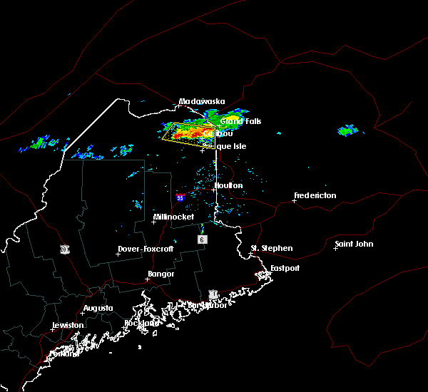 At 526 am edt, a severe thunderstorm was located near woodland and new sweden, moving southeast at 35 mph (radar indicated). Hazards include 60 mph wind gusts and quarter size hail. Hail damage to vehicles is expected. expect wind damage to roofs, siding, and trees. Locations impacted include, presque isle, caribou, fort fairfield, limestone, washburn, woodland, madawaska lake, loring, new sweden, connor, perham, caswell, wade, stockholm, westmanland and cyr plantation. At 526 am edt, a severe thunderstorm was located near woodland and new sweden, moving southeast at 35 mph (radar indicated). Hazards include 60 mph wind gusts and quarter size hail. Hail damage to vehicles is expected. expect wind damage to roofs, siding, and trees. Locations impacted include, presque isle, caribou, fort fairfield, limestone, washburn, woodland, madawaska lake, loring, new sweden, connor, perham, caswell, wade, stockholm, westmanland and cyr plantation.
|
| 8/11/2016 5:25 AM EDT | Quarter sized hail reported 7.8 miles SE of Caribou, ME |
| 8/11/2016 5:07 AM EDT |
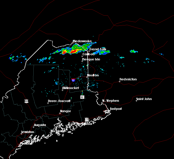 At 507 am edt, a severe thunderstorm was located near madawaska lake, or 14 miles east of eagle lake, moving east at 40 mph (radar indicated). Hazards include 60 mph wind gusts and quarter size hail. Hail damage to vehicles is expected. Expect wind damage to roofs, siding, and trees. At 507 am edt, a severe thunderstorm was located near madawaska lake, or 14 miles east of eagle lake, moving east at 40 mph (radar indicated). Hazards include 60 mph wind gusts and quarter size hail. Hail damage to vehicles is expected. Expect wind damage to roofs, siding, and trees.
|
| 7/28/2016 2:55 PM EDT |
 At 255 pm edt, a severe thunderstorm was located over mapleton, or near presque isle, moving east at 35 mph (radar indicated). Hazards include 60 mph wind gusts and quarter size hail. Hail damage to vehicles is expected. Expect wind damage to roofs, siding, and trees. At 255 pm edt, a severe thunderstorm was located over mapleton, or near presque isle, moving east at 35 mph (radar indicated). Hazards include 60 mph wind gusts and quarter size hail. Hail damage to vehicles is expected. Expect wind damage to roofs, siding, and trees.
|
| 7/28/2016 2:12 PM EDT |
 The severe thunderstorm warning for east central aroostook county will expire at 215 pm edt, the storm which prompted the warning has weakened below severe limits, and no longer pose an immediate threat to life or property. therefore, the warning will be allowed to expire. The severe thunderstorm warning for east central aroostook county will expire at 215 pm edt, the storm which prompted the warning has weakened below severe limits, and no longer pose an immediate threat to life or property. therefore, the warning will be allowed to expire.
|
| 7/28/2016 1:50 PM EDT |
 At 150 pm edt, a severe thunderstorm was located over caribou, moving east at 30 mph (radar indicated). Hazards include 60 mph wind gusts and half dollar size hail. Hail damage to vehicles is expected. expect wind damage to roofs, siding, and trees. Locations impacted include, presque isle, caribou, fort fairfield, limestone, mapleton, washburn, woodland, castle hill, perham and wade. At 150 pm edt, a severe thunderstorm was located over caribou, moving east at 30 mph (radar indicated). Hazards include 60 mph wind gusts and half dollar size hail. Hail damage to vehicles is expected. expect wind damage to roofs, siding, and trees. Locations impacted include, presque isle, caribou, fort fairfield, limestone, mapleton, washburn, woodland, castle hill, perham and wade.
|
| 7/28/2016 1:36 PM EDT |
 At 135 pm edt, a severe thunderstorm was located over washburn, or 8 miles west of caribou, moving east at 30 mph (radar indicated). Hazards include 60 mph wind gusts and quarter size hail. Hail damage to vehicles is expected. Expect wind damage to roofs, siding, and trees. At 135 pm edt, a severe thunderstorm was located over washburn, or 8 miles west of caribou, moving east at 30 mph (radar indicated). Hazards include 60 mph wind gusts and quarter size hail. Hail damage to vehicles is expected. Expect wind damage to roofs, siding, and trees.
|
| 7/27/2016 8:28 PM EDT |
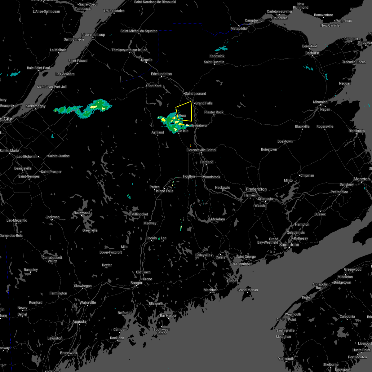 The severe thunderstorm warning for northeastern aroostook county will expire at 830 pm edt, the storm which prompted the warning has moved out of the area. therefore, the warning will be allowed to expire. to report severe weather, contact your nearest law enforcement agency. they will relay your report to the national weather service caribou maine. The severe thunderstorm warning for northeastern aroostook county will expire at 830 pm edt, the storm which prompted the warning has moved out of the area. therefore, the warning will be allowed to expire. to report severe weather, contact your nearest law enforcement agency. they will relay your report to the national weather service caribou maine.
|
| 7/27/2016 8:03 PM EDT | One tree down on plant road. time estimated from rada in aroostook county ME, 4.7 miles SW of Caribou, ME |
| 7/27/2016 8:01 PM EDT |
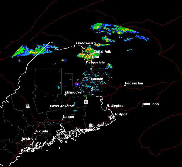 At 800 pm edt, a severe thunderstorm was located over loring, or near limestone, moving east at 35 mph (radar indicated). Hazards include 60 mph wind gusts and quarter size hail. Hail damage to vehicles is expected. expect wind damage to roofs, siding, and trees. Locations impacted include, caribou, fort fairfield, limestone, loring, connor, caswell and hamlin. At 800 pm edt, a severe thunderstorm was located over loring, or near limestone, moving east at 35 mph (radar indicated). Hazards include 60 mph wind gusts and quarter size hail. Hail damage to vehicles is expected. expect wind damage to roofs, siding, and trees. Locations impacted include, caribou, fort fairfield, limestone, loring, connor, caswell and hamlin.
|
| 7/27/2016 7:46 PM EDT |
 At 744 pm edt, a severe thunderstorm was located over woodland, or 7 miles northwest of caribou, moving east at 25 mph (radar indicated). Hazards include 60 mph wind gusts and quarter size hail. Hail damage to vehicles is expected. Expect wind damage to roofs, siding, and trees. At 744 pm edt, a severe thunderstorm was located over woodland, or 7 miles northwest of caribou, moving east at 25 mph (radar indicated). Hazards include 60 mph wind gusts and quarter size hail. Hail damage to vehicles is expected. Expect wind damage to roofs, siding, and trees.
|
| 7/18/2016 6:30 PM EDT |
 At 630 pm edt, a confirmed tornado was located near limestone, moving east at 20 mph (weather spotters confirmed tornado touching down intermittently). Hazards include damaging tornado and quarter size hail. Flying debris will be dangerous to those caught without shelter. mobile homes will be damaged or destroyed. damage to roofs, windows, and vehicles will occur. tree damage is likely. This tornadic thunderstorm will remain over mainly rural areas of northeastern aroostook county, including the following locations: caswell and connor. At 630 pm edt, a confirmed tornado was located near limestone, moving east at 20 mph (weather spotters confirmed tornado touching down intermittently). Hazards include damaging tornado and quarter size hail. Flying debris will be dangerous to those caught without shelter. mobile homes will be damaged or destroyed. damage to roofs, windows, and vehicles will occur. tree damage is likely. This tornadic thunderstorm will remain over mainly rural areas of northeastern aroostook county, including the following locations: caswell and connor.
|
| 7/18/2016 6:13 PM EDT |
 At 612 pm edt, a confirmed tornado was located over loring, or near caribou, moving east at 25 mph (weather spotters confirmed tornado intermittently touching down). Hazards include damaging tornado and quarter size hail. Flying debris will be dangerous to those caught without shelter. mobile homes will be damaged or destroyed. damage to roofs, windows, and vehicles will occur. tree damage is likely. the tornado will be near, limestone around 620 pm edt. Other locations impacted by this tornadic thunderstorm include caswell, hamlin and connor. At 612 pm edt, a confirmed tornado was located over loring, or near caribou, moving east at 25 mph (weather spotters confirmed tornado intermittently touching down). Hazards include damaging tornado and quarter size hail. Flying debris will be dangerous to those caught without shelter. mobile homes will be damaged or destroyed. damage to roofs, windows, and vehicles will occur. tree damage is likely. the tornado will be near, limestone around 620 pm edt. Other locations impacted by this tornadic thunderstorm include caswell, hamlin and connor.
|
| 7/18/2016 6:06 PM EDT |
 At 606 pm edt, a confirmed tornado was located near loring, or near caribou, moving east at 25 mph (weather spotters continue to view tornado intermittently touching down). Hazards include damaging tornado. Flying debris will be dangerous to those caught without shelter. mobile homes will be damaged or destroyed. damage to roofs, windows, and vehicles will occur. tree damage is likely. this tornado will be near, limestone around 610 pm edt. loring around 615 pm edt. Other locations impacted by this tornadic thunderstorm include new sweden, caswell, hamlin, connor, westmanland and cyr plantation. At 606 pm edt, a confirmed tornado was located near loring, or near caribou, moving east at 25 mph (weather spotters continue to view tornado intermittently touching down). Hazards include damaging tornado. Flying debris will be dangerous to those caught without shelter. mobile homes will be damaged or destroyed. damage to roofs, windows, and vehicles will occur. tree damage is likely. this tornado will be near, limestone around 610 pm edt. loring around 615 pm edt. Other locations impacted by this tornadic thunderstorm include new sweden, caswell, hamlin, connor, westmanland and cyr plantation.
|
| 7/18/2016 5:48 PM EDT |
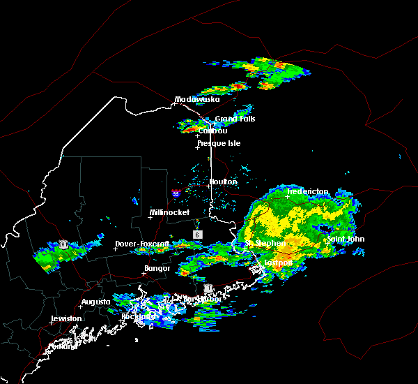 At 547 pm edt, a confirmed tornado was located near woodland, or 7 miles northwest of caribou, moving east at 40 mph (weather spotters confirmed tornado). Hazards include damaging tornado. Flying debris will be dangerous to those caught without shelter. mobile homes will be damaged or destroyed. damage to roofs, windows, and vehicles will occur. tree damage is likely. the tornado will be near, limestone around 600 pm edt. loring around 605 pm edt. Other locations impacted by this tornadic thunderstorm include new sweden, hamlin, westmanland, connor, caswell, stockholm, cyr plantation and perham. At 547 pm edt, a confirmed tornado was located near woodland, or 7 miles northwest of caribou, moving east at 40 mph (weather spotters confirmed tornado). Hazards include damaging tornado. Flying debris will be dangerous to those caught without shelter. mobile homes will be damaged or destroyed. damage to roofs, windows, and vehicles will occur. tree damage is likely. the tornado will be near, limestone around 600 pm edt. loring around 605 pm edt. Other locations impacted by this tornadic thunderstorm include new sweden, hamlin, westmanland, connor, caswell, stockholm, cyr plantation and perham.
|
| 7/14/2016 7:31 PM EDT |
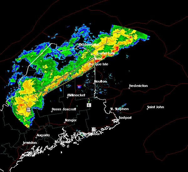 At 729 pm edt, severe thunderstorms were located along a line extending from 7 miles northeast of fort fairfield to 6 miles northwest of kokadjo, moving south at 20 mph (radar indicated). Hazards include 60 mph wind gusts and quarter size hail. Expect wind damage to roofs. siding. and trees. Locations impacted include, presque isle, caribou, fort fairfield, limestone, baxter st park, mapleton, washburn, ashland, easton, masardis, oxbow, lobster township, moosehorn crossing, northeast carry, scopan, south branch pond, telos lake, baxter state park, chesuncook and westfield. At 729 pm edt, severe thunderstorms were located along a line extending from 7 miles northeast of fort fairfield to 6 miles northwest of kokadjo, moving south at 20 mph (radar indicated). Hazards include 60 mph wind gusts and quarter size hail. Expect wind damage to roofs. siding. and trees. Locations impacted include, presque isle, caribou, fort fairfield, limestone, baxter st park, mapleton, washburn, ashland, easton, masardis, oxbow, lobster township, moosehorn crossing, northeast carry, scopan, south branch pond, telos lake, baxter state park, chesuncook and westfield.
|
| 7/14/2016 6:45 PM EDT |
 At 645 pm edt, severe thunderstorms were located along a line extending from 7 miles northeast of loring to near northeast carry, moving southeast at 20 mph (radar indicated). Hazards include 60 mph wind gusts and quarter size hail. Expect wind damage to roofs. siding. And trees. At 645 pm edt, severe thunderstorms were located along a line extending from 7 miles northeast of loring to near northeast carry, moving southeast at 20 mph (radar indicated). Hazards include 60 mph wind gusts and quarter size hail. Expect wind damage to roofs. siding. And trees.
|
| 7/14/2016 6:23 PM EDT |
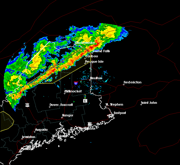 At 622 pm edt, severe thunderstorms were located along a line extending from 12 miles east of van buren to near seboomook, moving southeast at 20 mph (radar indicated). Hazards include 60 mph wind gusts and quarter size hail. Expect wind damage to roofs. siding. and trees. Locations impacted include, presque isle, caribou, fort fairfield, limestone, van buren, portage, mapleton, washburn, ashland, woodland, portage lake, masardis, oxbow, nashville plantation, moosehorn crossing, loring, chesuncook, chamberlain lake, tamway and russel crossing. At 622 pm edt, severe thunderstorms were located along a line extending from 12 miles east of van buren to near seboomook, moving southeast at 20 mph (radar indicated). Hazards include 60 mph wind gusts and quarter size hail. Expect wind damage to roofs. siding. and trees. Locations impacted include, presque isle, caribou, fort fairfield, limestone, van buren, portage, mapleton, washburn, ashland, woodland, portage lake, masardis, oxbow, nashville plantation, moosehorn crossing, loring, chesuncook, chamberlain lake, tamway and russel crossing.
|
| 7/14/2016 5:59 PM EDT |
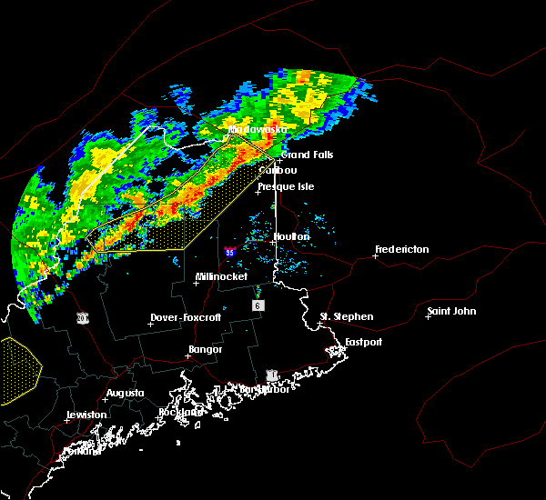 At 559 pm edt, severe thunderstorms were located along a line extending from van buren to 8 miles northwest of seboomook, moving southeast at 20 mph (radar indicated). Hazards include 60 mph wind gusts and quarter size hail. Expect wind damage to roofs. siding. And trees. At 559 pm edt, severe thunderstorms were located along a line extending from van buren to 8 miles northwest of seboomook, moving southeast at 20 mph (radar indicated). Hazards include 60 mph wind gusts and quarter size hail. Expect wind damage to roofs. siding. And trees.
|
| 7/14/2016 5:38 PM EDT |
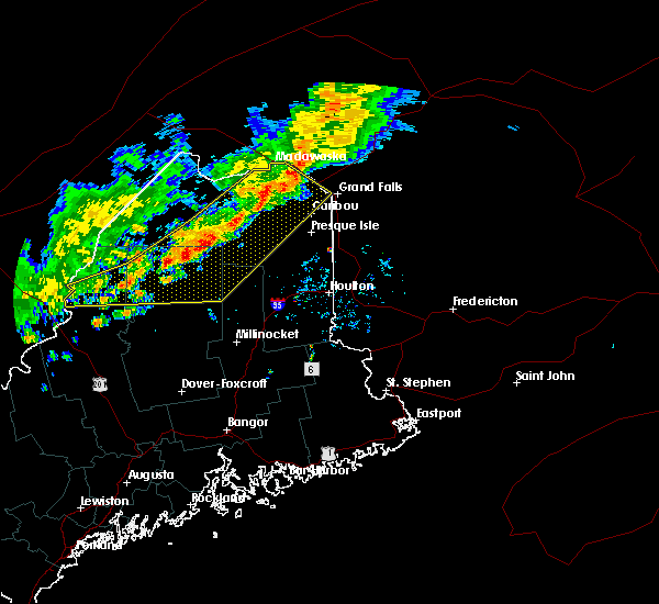 At 537 pm edt, severe thunderstorms were located along a line extending from grand isle to 9 miles west of chesuncook, moving southeast at 35 mph (radar indicated). Hazards include 60 mph wind gusts and quarter size hail. Expect wind damage to roofs. siding. and trees. Locations impacted include, caribou, madawaska, limestone, van buren, eagle lake, portage, mapleton, washburn, ashland, woodland, frenchville, portage lake, new canada, masardis, oxbow, moosehorn crossing, south branch pond, big machias lake, caucomgomoc lake and fish river lake. At 537 pm edt, severe thunderstorms were located along a line extending from grand isle to 9 miles west of chesuncook, moving southeast at 35 mph (radar indicated). Hazards include 60 mph wind gusts and quarter size hail. Expect wind damage to roofs. siding. and trees. Locations impacted include, caribou, madawaska, limestone, van buren, eagle lake, portage, mapleton, washburn, ashland, woodland, frenchville, portage lake, new canada, masardis, oxbow, moosehorn crossing, south branch pond, big machias lake, caucomgomoc lake and fish river lake.
|
| 7/14/2016 5:15 PM EDT |
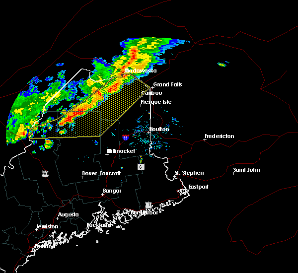 At 514 pm edt, severe thunderstorms were located along a line extending from madawaska to 14 miles west of rockwood, moving east at 40 mph (radar indicated). Hazards include 60 mph wind gusts and quarter size hail. Expect wind damage to roofs. siding. And trees. At 514 pm edt, severe thunderstorms were located along a line extending from madawaska to 14 miles west of rockwood, moving east at 40 mph (radar indicated). Hazards include 60 mph wind gusts and quarter size hail. Expect wind damage to roofs. siding. And trees.
|
| 7/4/2016 8:29 PM EDT |
 At 829 pm edt, a severe thunderstorm was located near portage lake, or near portage, moving east at 45 mph (radar indicated). Hazards include 60 mph wind gusts. Expect damage to roofs. siding. And trees. At 829 pm edt, a severe thunderstorm was located near portage lake, or near portage, moving east at 45 mph (radar indicated). Hazards include 60 mph wind gusts. Expect damage to roofs. siding. And trees.
|
| 7/4/2016 7:55 PM EDT |
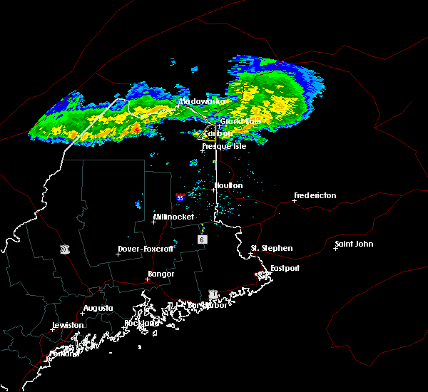 The severe thunderstorm warning for northeastern aroostook county will expire at 800 pm edt, the storms which prompted the warning have moved out of the area. therefore, the warning will be allowed to expire. however additional showers and thunderstorms are likely through this evening. gusty winds and heavy rain will be possible with any thunderstorms. The severe thunderstorm warning for northeastern aroostook county will expire at 800 pm edt, the storms which prompted the warning have moved out of the area. therefore, the warning will be allowed to expire. however additional showers and thunderstorms are likely through this evening. gusty winds and heavy rain will be possible with any thunderstorms.
|
| 7/4/2016 7:42 PM EDT |
 At 742 pm edt, severe thunderstorms were located along a line extending from 15 miles east of van buren to near loring, moving east at 45 mph (radar indicated). Hazards include 60 mph wind gusts. Expect damage to roofs. siding. and trees. Locations impacted include, caribou, fort fairfield, limestone, loring, connor, caswell and hamlin. At 742 pm edt, severe thunderstorms were located along a line extending from 15 miles east of van buren to near loring, moving east at 45 mph (radar indicated). Hazards include 60 mph wind gusts. Expect damage to roofs. siding. and trees. Locations impacted include, caribou, fort fairfield, limestone, loring, connor, caswell and hamlin.
|
| 7/4/2016 7:33 PM EDT |
 At 732 pm edt, severe thunderstorms were located along a line extending from 7 miles east of van buren to near woodland, moving east at 45 mph (radar indicated). Hazards include 60 mph wind gusts. Expect damage to roofs. siding. And trees. At 732 pm edt, severe thunderstorms were located along a line extending from 7 miles east of van buren to near woodland, moving east at 45 mph (radar indicated). Hazards include 60 mph wind gusts. Expect damage to roofs. siding. And trees.
|
| 9/9/2015 6:30 PM EDT | Tree down on collins st in aroostook county ME, 0.9 miles NE of Caribou, ME |
| 9/9/2015 6:29 PM EDT |
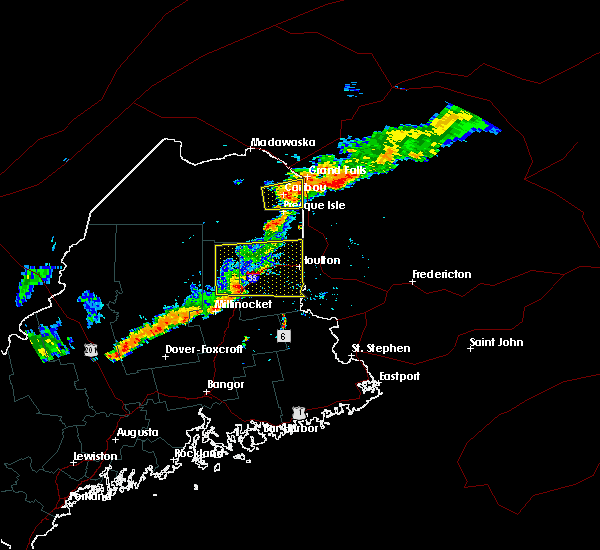 At 629 pm edt, a severe thunderstorm was located near limestone, moving east at 65 mph (radar indicated). Hazards include 60 mph wind gusts and quarter size hail. Hail damage to vehicles is expected. expect wind damage to roofs, siding and trees. Locations impacted include, presque isle, caribou, fort fairfield, limestone, washburn, woodland, loring, new sweden, connor and caswell. At 629 pm edt, a severe thunderstorm was located near limestone, moving east at 65 mph (radar indicated). Hazards include 60 mph wind gusts and quarter size hail. Hail damage to vehicles is expected. expect wind damage to roofs, siding and trees. Locations impacted include, presque isle, caribou, fort fairfield, limestone, washburn, woodland, loring, new sweden, connor and caswell.
|
| 9/9/2015 6:05 PM EDT |
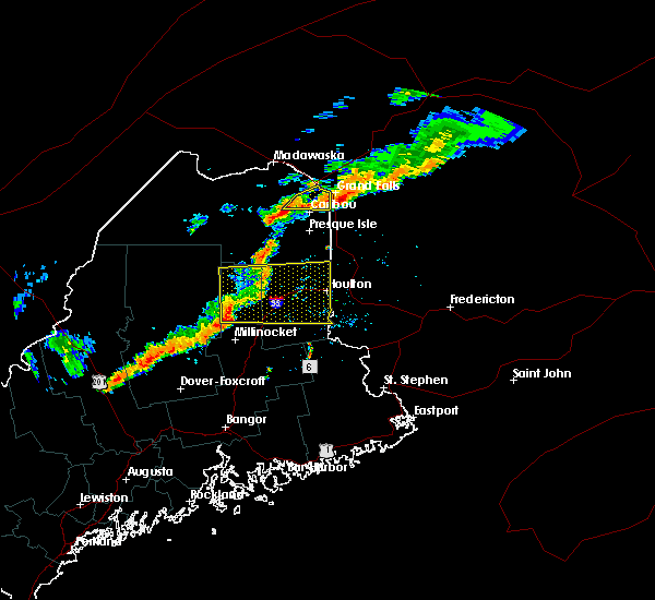 At 604 pm edt, a severe thunderstorm was located over caribou, moving east at 30 mph (radar indicated). Hazards include 60 mph wind gusts and quarter size hail. Hail damage to vehicles is expected. Expect wind damage to roofs, siding and trees. At 604 pm edt, a severe thunderstorm was located over caribou, moving east at 30 mph (radar indicated). Hazards include 60 mph wind gusts and quarter size hail. Hail damage to vehicles is expected. Expect wind damage to roofs, siding and trees.
|
| 9/9/2015 5:45 PM EDT |
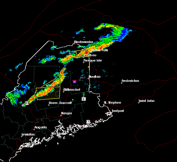 At 545 pm edt, a severe thunderstorm was located over loring, or near limestone, moving east at 30 mph (radar indicated). Hazards include 60 mph wind gusts and quarter size hail. Hail damage to vehicles is expected. expect wind damage to roofs, siding and trees. Locations impacted include, caribou, limestone, woodland, loring, new sweden, connor, perham, caswell, stockholm, hamlin, westmanland and cyr plantation. At 545 pm edt, a severe thunderstorm was located over loring, or near limestone, moving east at 30 mph (radar indicated). Hazards include 60 mph wind gusts and quarter size hail. Hail damage to vehicles is expected. expect wind damage to roofs, siding and trees. Locations impacted include, caribou, limestone, woodland, loring, new sweden, connor, perham, caswell, stockholm, hamlin, westmanland and cyr plantation.
|
| 9/9/2015 5:26 PM EDT |
 At 524 pm edt, a severe thunderstorm was located near madawaska lake, or 10 miles northwest of caribou, moving east at 35 mph (radar indicated). Hazards include 60 mph wind gusts and quarter size hail. Hail damage to vehicles is expected. Expect wind damage to roofs, siding and trees. At 524 pm edt, a severe thunderstorm was located near madawaska lake, or 10 miles northwest of caribou, moving east at 35 mph (radar indicated). Hazards include 60 mph wind gusts and quarter size hail. Hail damage to vehicles is expected. Expect wind damage to roofs, siding and trees.
|
| 8/3/2015 7:17 PM EDT |
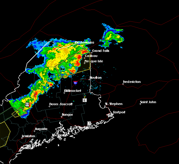 At 714 pm edt, a line of severe thunderstorms extended from near stockholm, to caribou, to presque isle moving northeast at 45 mph (radar indicated). Hazards include 60 mph wind gusts and quarter size hail. Hail damage to vehicles is expected. expect wind damage to roofs, siding and trees. Locations impacted include, presque isle, caribou, fort fairfield, limestone, van buren, portage, mapleton, washburn, mars hill, ashland, easton, woodland, bridgewater, portage lake, masardis, oxbow, madawaska lake, nashville plantation, moosehorn crossing and loring. At 714 pm edt, a line of severe thunderstorms extended from near stockholm, to caribou, to presque isle moving northeast at 45 mph (radar indicated). Hazards include 60 mph wind gusts and quarter size hail. Hail damage to vehicles is expected. expect wind damage to roofs, siding and trees. Locations impacted include, presque isle, caribou, fort fairfield, limestone, van buren, portage, mapleton, washburn, mars hill, ashland, easton, woodland, bridgewater, portage lake, masardis, oxbow, madawaska lake, nashville plantation, moosehorn crossing and loring.
|
| 8/3/2015 6:50 PM EDT | Some roofing blown off a house. estimate 60mph wind gust in aroostook county ME, 8.4 miles ESE of Caribou, ME |
| 8/3/2015 6:41 PM EDT |
 At 639 pm edt, a severe thunderstorm was located 9 miles southwest of ashland, or 14 miles south of portage, moving northeast at 45 mph (radar indicated). Hazards include 60 mph wind gusts and quarter size hail. Hail damage to vehicles is expected. Expect wind damage to roofs, siding and trees. At 639 pm edt, a severe thunderstorm was located 9 miles southwest of ashland, or 14 miles south of portage, moving northeast at 45 mph (radar indicated). Hazards include 60 mph wind gusts and quarter size hail. Hail damage to vehicles is expected. Expect wind damage to roofs, siding and trees.
|
| 8/3/2015 6:32 PM EDT | Some roofing blown off a house. estimate 60mph wind gust in aroostook county ME, 8.4 miles ESE of Caribou, ME |
| 8/3/2015 6:08 PM EDT |
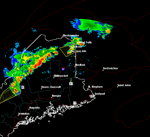 At 605 pm edt, thunderstorms were located from near caribou to near presque isle, moving northeast at 45 mph (trained weather spotters have reported trees down). Hazards include 60 mph wind gusts and quarter size hail. Hail damage to vehicles is expected. expect wind damage to roofs, siding and trees. Locations impacted include, presque isle, caribou, fort fairfield, limestone, mapleton, washburn, ashland, easton, woodland, loring, scopan, new sweden, chapman, connor, castle hill, perham, caswell, wade, hamlin and westmanland. At 605 pm edt, thunderstorms were located from near caribou to near presque isle, moving northeast at 45 mph (trained weather spotters have reported trees down). Hazards include 60 mph wind gusts and quarter size hail. Hail damage to vehicles is expected. expect wind damage to roofs, siding and trees. Locations impacted include, presque isle, caribou, fort fairfield, limestone, mapleton, washburn, ashland, easton, woodland, loring, scopan, new sweden, chapman, connor, castle hill, perham, caswell, wade, hamlin and westmanland.
|
| 8/3/2015 5:32 PM EDT | Trees down on grimes roa in aroostook county ME, 1.7 miles WNW of Caribou, ME |
| 8/3/2015 5:30 PM EDT | Two trees reported down along connor twp/new sweden borde in aroostook county ME, 5.9 miles SSE of Caribou, ME |
| 8/3/2015 5:30 PM EDT | Trees down on power lines on lombard roa in aroostook county ME, 2.2 miles ENE of Caribou, ME |
| 8/3/2015 5:27 PM EDT | Trees down on carson road west of caribo in aroostook county ME, 5.4 miles ENE of Caribou, ME |
| 8/3/2015 5:24 PM EDT |
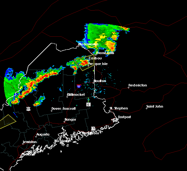 At 524 pm edt, a severe thunderstorm was located over caribou, moving northeast at 50 mph (radar indicated). Hazards include 60 mph wind gusts and quarter size hail. Hail damage to vehicles is expected. Expect wind damage to roofs, siding and trees. At 524 pm edt, a severe thunderstorm was located over caribou, moving northeast at 50 mph (radar indicated). Hazards include 60 mph wind gusts and quarter size hail. Hail damage to vehicles is expected. Expect wind damage to roofs, siding and trees.
|
| 8/3/2015 4:57 PM EDT |
 At 454 pm edt, a severe thunderstorm was located 11 miles northeast of limestone, moving northeast at 50 mph (radar indicated). Hazards include 60 mph wind gusts and quarter size hail. Hail damage to vehicles is expected. expect wind damage to roofs, siding and trees. Locations impacted include, presque isle, caribou, madawaska, fort fairfield, limestone, van buren, mapleton, washburn, ashland, easton, woodland, masardis, madawaska lake, lille, loring, cross lake, new sweden, chapman, grand isle and connor. At 454 pm edt, a severe thunderstorm was located 11 miles northeast of limestone, moving northeast at 50 mph (radar indicated). Hazards include 60 mph wind gusts and quarter size hail. Hail damage to vehicles is expected. expect wind damage to roofs, siding and trees. Locations impacted include, presque isle, caribou, madawaska, fort fairfield, limestone, van buren, mapleton, washburn, ashland, easton, woodland, masardis, madawaska lake, lille, loring, cross lake, new sweden, chapman, grand isle and connor.
|
| 8/3/2015 4:40 PM EDT | Numerous trees down on route 161 in aroostook county ME, 7.8 miles SE of Caribou, ME |
| 8/3/2015 4:39 PM EDT |
 The severe thunderstorm warning for east central aroostook county will expire at 445 pm edt, the severe thunderstorm which prompted the warning allowed to expire and a new warning has been issued. a severe thunderstorm watch remains in effect until 900 pm edt for northern maine. remember, a severe thunderstorm warning still remains in effect. The severe thunderstorm warning for east central aroostook county will expire at 445 pm edt, the severe thunderstorm which prompted the warning allowed to expire and a new warning has been issued. a severe thunderstorm watch remains in effect until 900 pm edt for northern maine. remember, a severe thunderstorm warning still remains in effect.
|
| 8/3/2015 4:37 PM EDT |
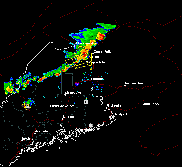 At 436 pm edt, a severe thunderstorm was located near caribou, moving northeast at 50 mph (radar indicated). Hazards include 70 mph wind gusts and quarter size hail. Hail damage to vehicles is expected. expect considerable tree damage. Wind damage is also likely to mobile homes, roofs and outbuildings. At 436 pm edt, a severe thunderstorm was located near caribou, moving northeast at 50 mph (radar indicated). Hazards include 70 mph wind gusts and quarter size hail. Hail damage to vehicles is expected. expect considerable tree damage. Wind damage is also likely to mobile homes, roofs and outbuildings.
|
| 8/3/2015 4:33 PM EDT |
 At 431 pm edt, a severe thunderstorm was located near caribou, and is nearly stationary (observed 62 mph wind gust at caribou weather office). Hazards include 60 mph wind gusts and quarter size hail. Hail damage to vehicles is expected. expect wind damage to roofs, siding and trees. Locations impacted include, presque isle, caribou, fort fairfield, limestone, portage, mapleton, washburn, ashland, woodland, portage lake, nashville plantation, loring, new sweden, connor, castle hill, perham, caswell, wade, stockholm and westmanland. At 431 pm edt, a severe thunderstorm was located near caribou, and is nearly stationary (observed 62 mph wind gust at caribou weather office). Hazards include 60 mph wind gusts and quarter size hail. Hail damage to vehicles is expected. expect wind damage to roofs, siding and trees. Locations impacted include, presque isle, caribou, fort fairfield, limestone, portage, mapleton, washburn, ashland, woodland, portage lake, nashville plantation, loring, new sweden, connor, castle hill, perham, caswell, wade, stockholm and westmanland.
|
| 8/3/2015 4:29 PM EDT | Storm damage reported in aroostook county ME, 0.9 miles NE of Caribou, ME |
| 8/3/2015 4:05 PM EDT |
 At 404 pm edt, a severe thunderstorm was located over portage, moving northeast at 40 mph (radar indicated). Hazards include 60 mph wind gusts and quarter size hail. Hail damage to vehicles is expected. Expect wind damage to roofs, siding and trees. At 404 pm edt, a severe thunderstorm was located over portage, moving northeast at 40 mph (radar indicated). Hazards include 60 mph wind gusts and quarter size hail. Hail damage to vehicles is expected. Expect wind damage to roofs, siding and trees.
|
| 8/1/2015 1:58 PM EDT |
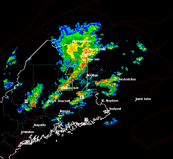 At 158 pm edt, a severe thunderstorm was located near mars hill, or 14 miles south of fort fairfield, and is nearly stationary (radar indicated). Hazards include 60 mph wind gusts. Expect damage to roofs. siding and trees. Locations impacted include, presque isle, caribou, fort fairfield, mapleton, washburn, mars hill, ashland, easton, bridgewater, masardis, oxbow, scopan, dudley township, monticello, blaine, westfield, chapman, castle hill, wade and saint croix. At 158 pm edt, a severe thunderstorm was located near mars hill, or 14 miles south of fort fairfield, and is nearly stationary (radar indicated). Hazards include 60 mph wind gusts. Expect damage to roofs. siding and trees. Locations impacted include, presque isle, caribou, fort fairfield, mapleton, washburn, mars hill, ashland, easton, bridgewater, masardis, oxbow, scopan, dudley township, monticello, blaine, westfield, chapman, castle hill, wade and saint croix.
|
| 8/1/2015 1:25 PM EDT |
 At 124 pm edt, a severe thunderstorm was located over scopan, or 15 miles southwest of presque isle, moving east at 30 mph (radar indicated). Hazards include 60 mph wind gusts. Expect damage to roofs. Siding and trees. At 124 pm edt, a severe thunderstorm was located over scopan, or 15 miles southwest of presque isle, moving east at 30 mph (radar indicated). Hazards include 60 mph wind gusts. Expect damage to roofs. Siding and trees.
|
| 5/27/2015 6:23 PM EDT | At 622 pm edt, a severe thunderstorm was located near fort fairfield, and is nearly stationary (radar indicated). Hazards include 60 mph wind gusts. Expect damage to roofs. Siding and trees. |
| 5/27/2015 6:19 PM EDT | At 618 pm edt, a severe thunderstorm was located over fort fairfield, moving east at 65 mph (radar indicated). Hazards include 60 mph wind gusts. Expect damage to roofs. Siding and trees. |
| 5/27/2015 5:45 PM EDT | Trees reported on power line in aroostook county ME, 7.8 miles SE of Caribou, ME |
| 5/27/2015 5:40 PM EDT | At 539 pm edt, a severe thunderstorm was located near cross lake, or 15 miles east of eagle lake, moving northeast at 35 mph (radar indicated). Hazards include 60 mph wind gusts. Expect damage to roofs. Siding and trees. |
| 8/4/2013 4:20 PM EDT | Quarter sized hail reported 7.1 miles ESE of Caribou, ME, hail ranged from 1/2 to 1 inch in diameter. reported via facebook. |
| 7/17/2013 6:00 PM EDT | Multiple trees down on coffin rd. time estimate in aroostook county ME, 6.2 miles NNE of Caribou, ME |
| 7/17/2013 5:20 PM EDT | Two power lines down near conno in aroostook county ME, 7.4 miles SSE of Caribou, ME |
| 5/31/2013 6:12 PM EDT | Trees were blocking route 161 from just north of new sweden to cross lake. trees have mostly been cleare in aroostook county ME, 8.7 miles SE of Caribou, ME |
| 5/31/2013 6:07 PM EDT | Trees in aroostook county ME, 17.6 miles SSE of Caribou, ME |
| 8/3/2012 3:42 PM EDT | Estimated 60 mph wind gust at the caribou inn and convention cente in aroostook county ME, 1.4 miles NNE of Caribou, ME |
| 7/15/2012 3:48 PM EDT | Trees down on green ridge rd. time estimated based on rada in aroostook county ME, 6.2 miles NNW of Caribou, ME |
| 7/15/2012 3:35 PM EDT | Trees down on ft fairfield rd/161 in aroostook county ME, 3.9 miles NNW of Caribou, ME |
| 7/15/2012 3:31 PM EDT | Trees down on south main st in aroostook county ME, 2.7 miles NNE of Caribou, ME |
| 6/29/2012 7:45 PM EDT | Trees down on the grimes road between caribou and fort fairfield. time is estimate in aroostook county ME, 0.9 miles NE of Caribou, ME |
| 6/29/2012 7:45 PM EDT | Trees down on the grimes road between caribou and fort fairfield. time is estimate in aroostook county ME, 2.4 miles WNW of Caribou, ME |
| 6/29/2012 6:15 PM EDT | Scattered tree damage throughout caribo in aroostook county ME, 0.9 miles NE of Caribou, ME |
| 6/29/2012 6:06 PM EDT | Golf Ball sized hail reported 8.6 miles SSE of Caribou, ME, golf ball sized hail in connor |
| 8/21/2011 7:20 PM EDT | Quarter sized hail reported 0.9 miles NE of Caribou, ME |
| 8/21/2011 5:15 PM EDT | Quarter sized hail reported 1.7 miles SSE of Caribou, ME |
| 1/1/0001 12:00 AM | Trees down along the noyes road. time is estimate in aroostook county ME, 1.1 miles SW of Caribou, ME |
| 1/1/0001 12:00 AM | Large tree took down power line on the river roa in aroostook county ME, 0.9 miles NE of Caribou, ME |
| 1/1/0001 12:00 AM | Power pole snapped off...power lines down...tree down on washburn r in aroostook county ME, 0.9 miles NE of Caribou, ME |
| 1/1/0001 12:00 AM | Large tree down on sincock st...tree down on wright st blocking roa in aroostook county ME, 0.9 miles NE of Caribou, ME |
| 1/1/0001 12:00 AM | Power pole snapped off...power lines down...tree down on washburn r in aroostook county ME, 0.9 miles NE of Caribou, ME |
| 1/1/0001 12:00 AM | Fence down in aroostook county ME, 0.9 miles NE of Caribou, ME |
| 1/1/0001 12:00 AM | Tree down in cemetery on s mai in aroostook county ME, 0.9 miles NE of Caribou, ME |
| 1/1/0001 12:00 AM | 2 trees down in aroostook county ME, 7.8 miles SE of Caribou, ME |
| 1/1/0001 12:00 AM | Trees down river rd in aroostook county ME, 0.9 miles NE of Caribou, ME |
| 1/1/0001 12:00 AM | Trees down washburn rd in aroostook county ME, 0.9 miles NE of Caribou, ME |
| 1/1/0001 12:00 AM | 5 trees down up rooted in aroostook county ME, 7.8 miles SE of Caribou, ME |
| 1/1/0001 12:00 AM | 3 large trees dow in aroostook county ME, 0.9 miles NE of Caribou, ME |
| 1/1/0001 12:00 AM | Grimes rd...albair rd...portions of us rte 1...and powers rd closed due to numerous trees across road. power lines dow in aroostook county ME, 0.9 miles NE of Caribou, ME |
| 1/1/0001 12:00 AM | Oak tree split...lombard s in aroostook county ME, 0.9 miles NE of Caribou, ME |
| 1/1/0001 12:00 AM | Trailer lifted off its foundation - grimes roa in aroostook county ME, 0.9 miles NE of Caribou, ME |
| 1/1/0001 12:00 AM | Trees upr in aroostook county ME, 0.9 miles NE of Caribou, ME |
| 1/1/0001 12:00 AM | Utility poles down on south main s in aroostook county ME, 0.9 miles NE of Caribou, ME |
| 1/1/0001 12:00 AM | Many trees down...est wnd gusts 65kts or greater...pwr lines ripped off house...culvert ovr flowing water running across road. est 2 inches of rain in 20 minute in aroostook county ME, 1.6 miles S of Caribou, ME |
| 1/1/0001 12:00 AM | 1 large tree down on west road...numerous trees down on hedman rd in aroostook county ME, 11.7 miles SE of Caribou, ME |
| 1/1/0001 12:00 AM | Tree down in aroostook county ME, 0.9 miles NE of Caribou, ME |
| 1/1/0001 12:00 AM | Many trees down...est wnd gusts 65kts or greater...pwr lines ripped off house...culvert ovr flowing water running across road. est 2 inches of rain in 20 minute in aroostook county ME, 1.6 miles S of Caribou, ME |
| 1/1/0001 12:00 AM | Storm damage reported in aroostook county ME, 0.9 miles NE of Caribou, ME |
| 1/1/0001 12:00 AM | Trees down on moose run road in aroostook county ME, 14.8 miles SE of Caribou, ME |
| 1/1/0001 12:00 AM | Golf Ball sized hail reported 14.8 miles SE of Caribou, ME |
| 1/1/0001 12:00 AM | Golf Ball sized hail reported 13.8 miles SSE of Caribou, ME |
| 1/1/0001 12:00 AM | Spruce tree took down a power line on the albair roa in aroostook county ME, 3.7 miles SSE of Caribou, ME |
| 1/1/0001 12:00 AM | Quarter sized hail reported 0.9 miles NE of Caribou, ME, quarter sized hail. |
| 1/1/0001 12:00 AM | Large tree took down power line on the bondeson road. time is estimate in aroostook county ME, 7.8 miles SE of Caribou, ME |
| 1/1/0001 12:00 AM | Trees down on page avenue in aroostook county ME, 0.9 miles NE of Caribou, ME |
| 1/1/0001 12:00 AM | Trees down on about 6 inches across. gravel and dirt across roa in aroostook county ME, 8.1 miles NNW of Caribou, ME |
| 1/1/0001 12:00 AM | Trees down on bowls roa in aroostook county ME, 1.1 miles SW of Caribou, ME |
| 1/1/0001 12:00 AM | Numerous trees and powerlines down on madawaska roa in aroostook county ME, 5 miles SW of Caribou, ME |
| 1/1/0001 12:00 AM | Numerous trees down in caribo in aroostook county ME, 0.9 miles NE of Caribou, ME |
| 1/1/0001 12:00 AM | Garage moved in to road on plante roa in aroostook county ME, 5.9 miles SSE of Caribou, ME |
| 1/1/0001 12:00 AM | Barn destroyed on brissette roa in aroostook county ME, 5.3 miles SSW of Caribou, ME |
| 1/1/0001 12:00 AM | Numerous trees down in aroostook county ME, 7 miles SW of Caribou, ME |
| 1/1/0001 12:00 AM | Numeorous trees and powerlines down on albair roa in aroostook county ME, 5.3 miles SSW of Caribou, ME |
| 1/1/0001 12:00 AM | Numerous trees and powerlines down on albair roa in aroostook county ME, 5.3 miles SSW of Caribou, ME |
| 1/1/0001 12:00 AM | Several large trees uprooted in aroostook county ME, 8.8 miles ESE of Caribou, ME |
| 1/1/0001 12:00 AM | Numerous trees uprooted in aroostook county ME, 10.7 miles ESE of Caribou, ME |
| 1/1/0001 12:00 AM | Trees and powerlines down in stockhol in aroostook county ME, 13.8 miles SSE of Caribou, ME |
Hail Maps for Caribou, ME


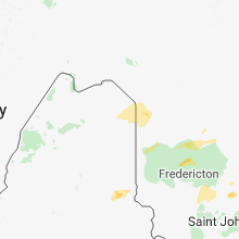
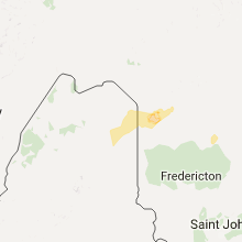
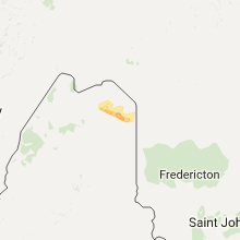
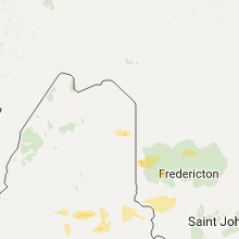
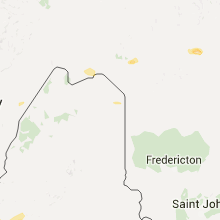
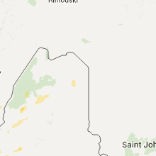
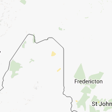

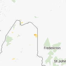
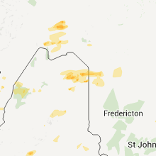
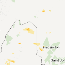
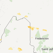
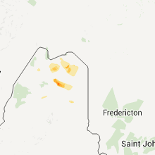
Connect with Interactive Hail Maps