

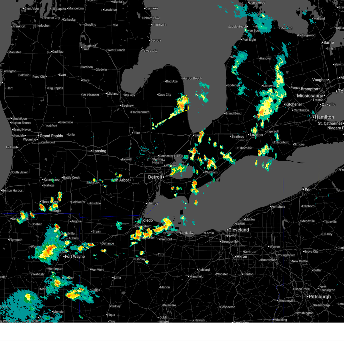
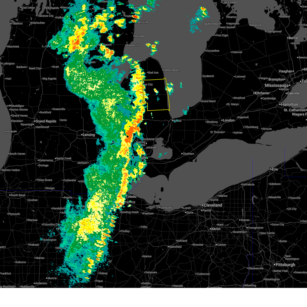
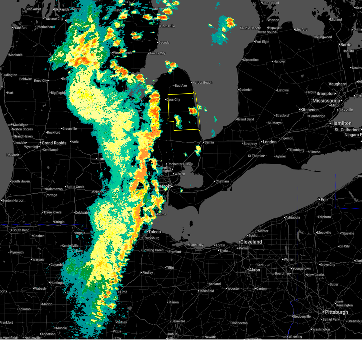
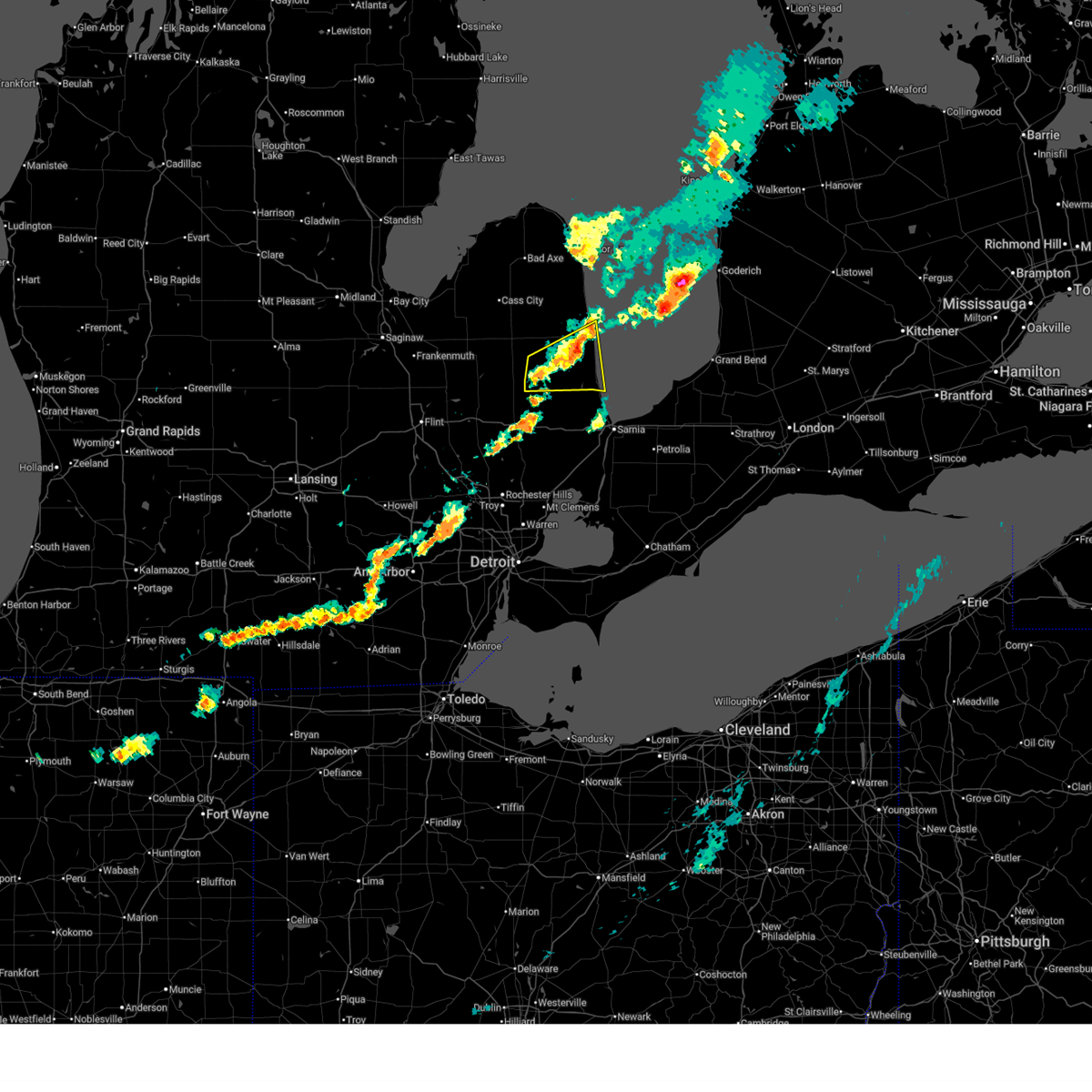
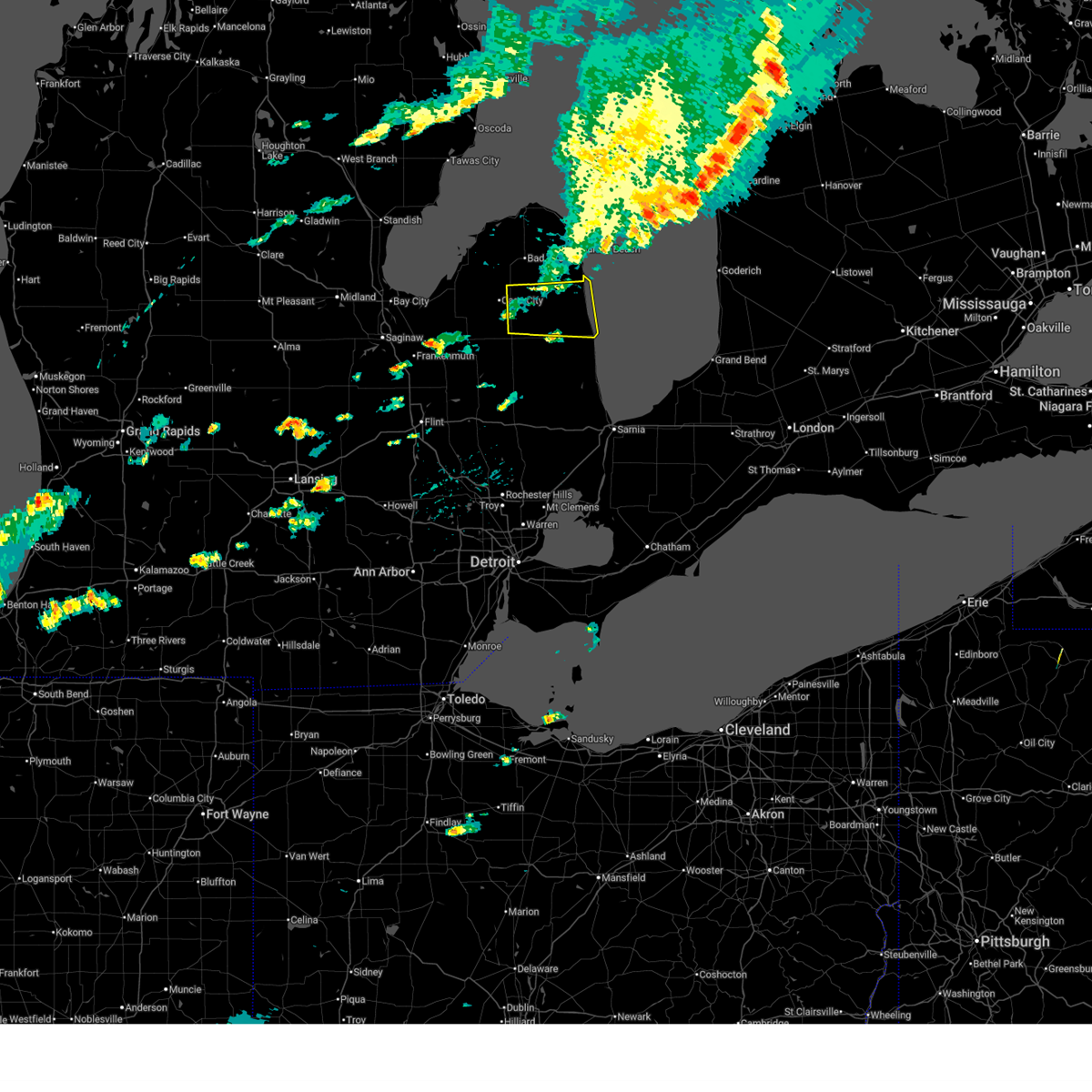
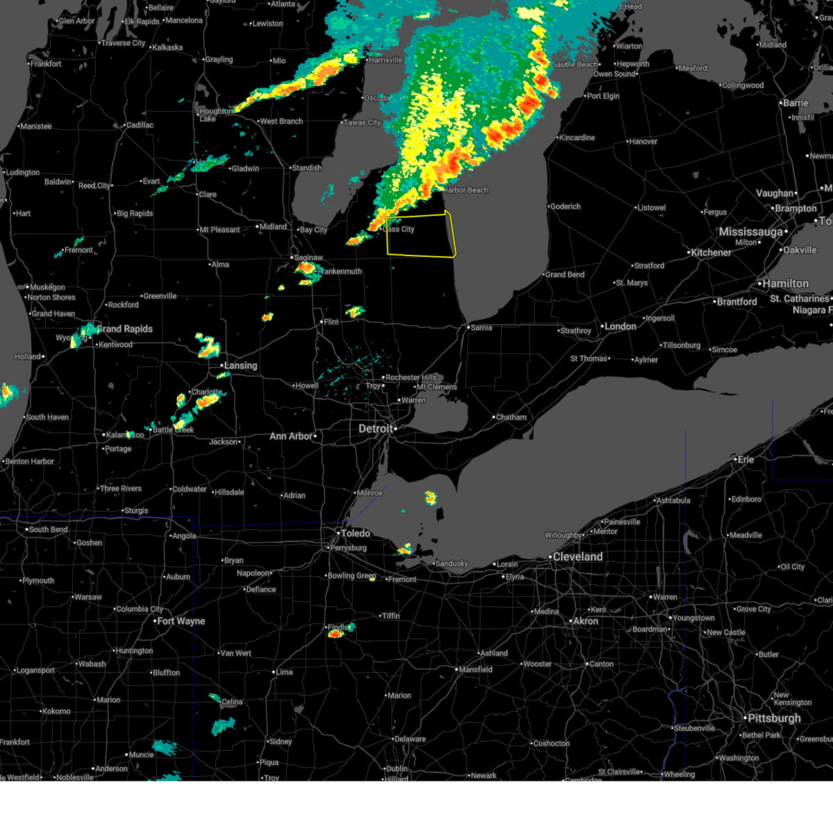
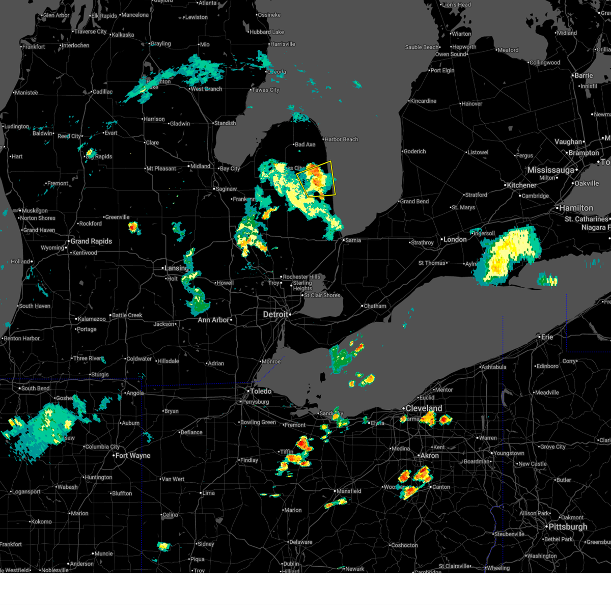
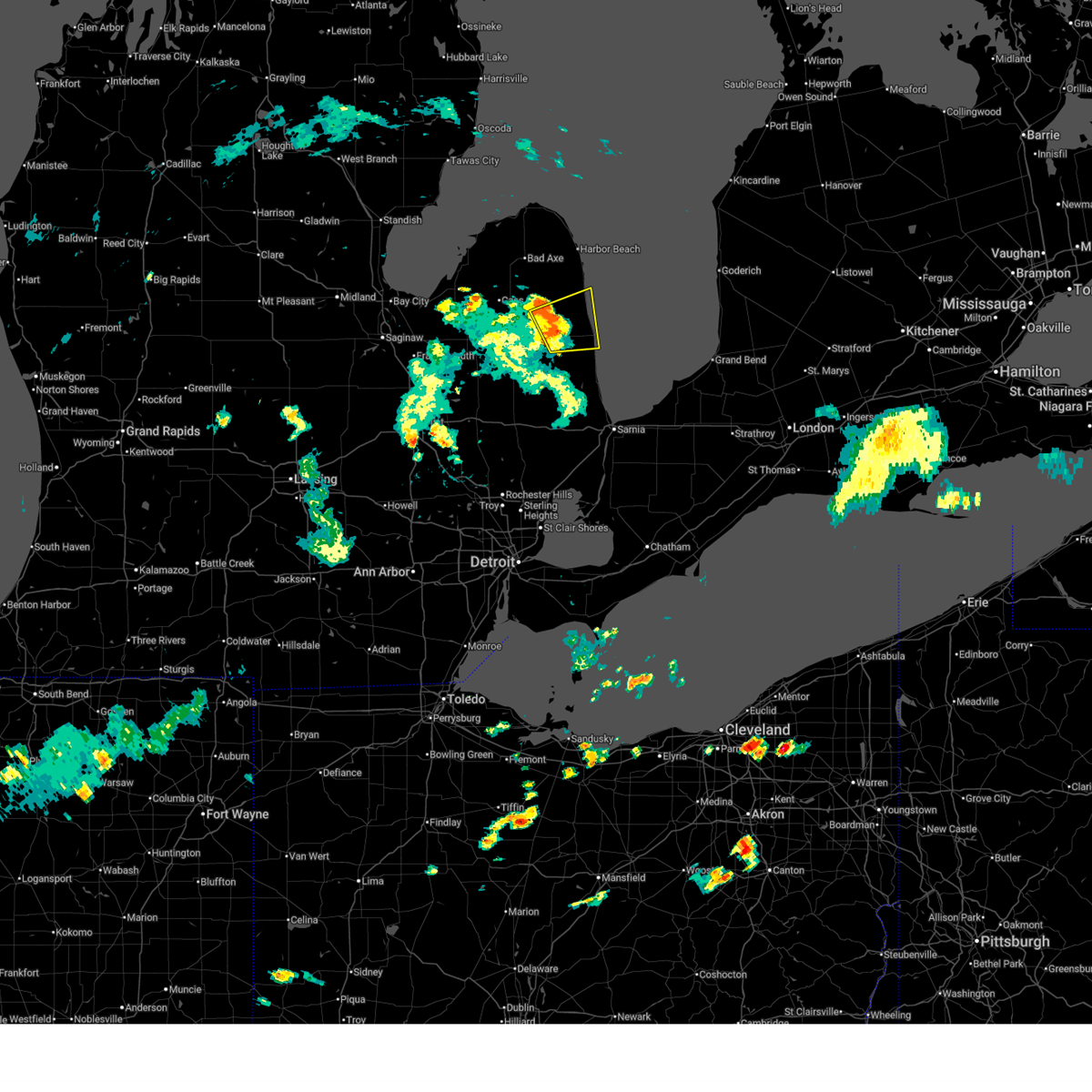
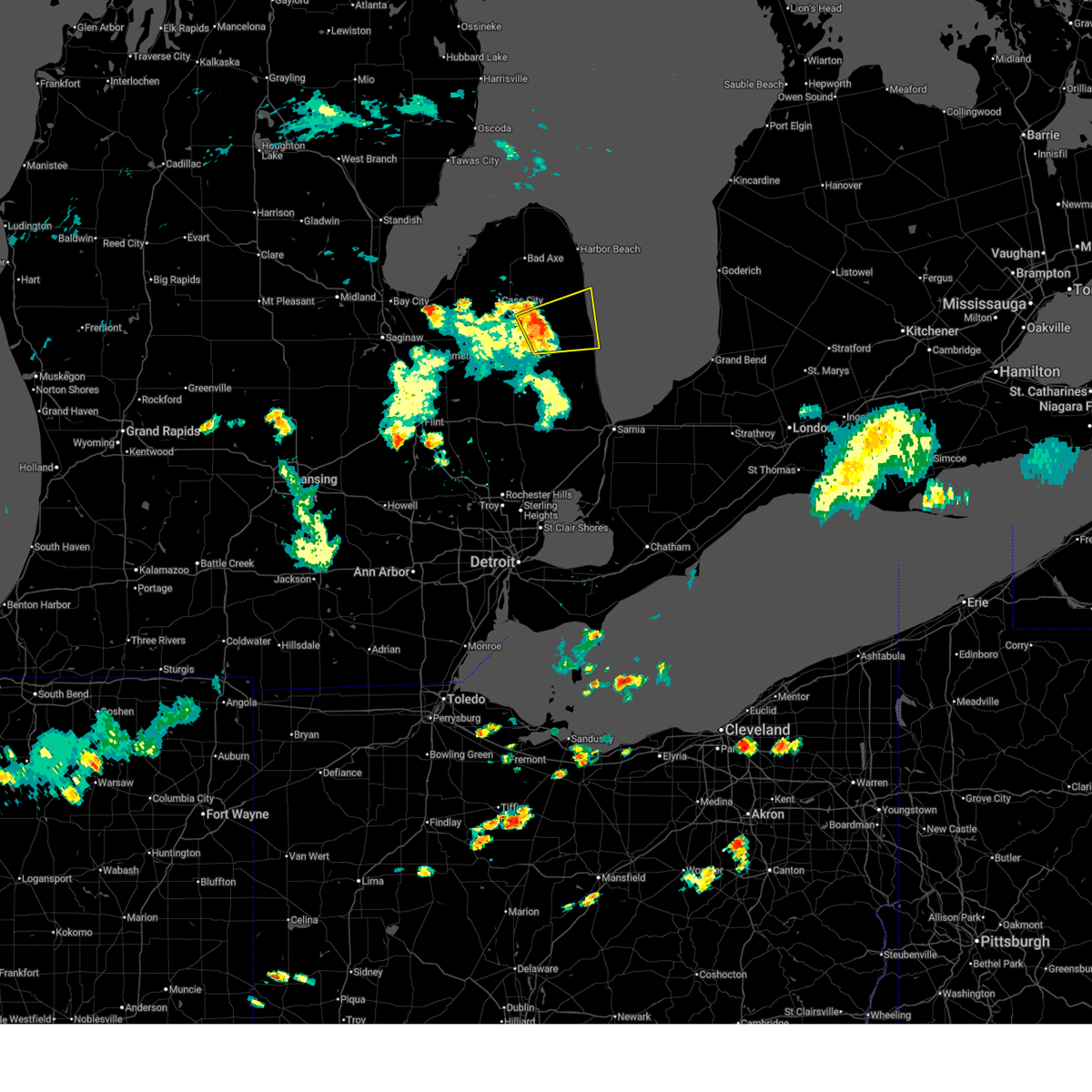
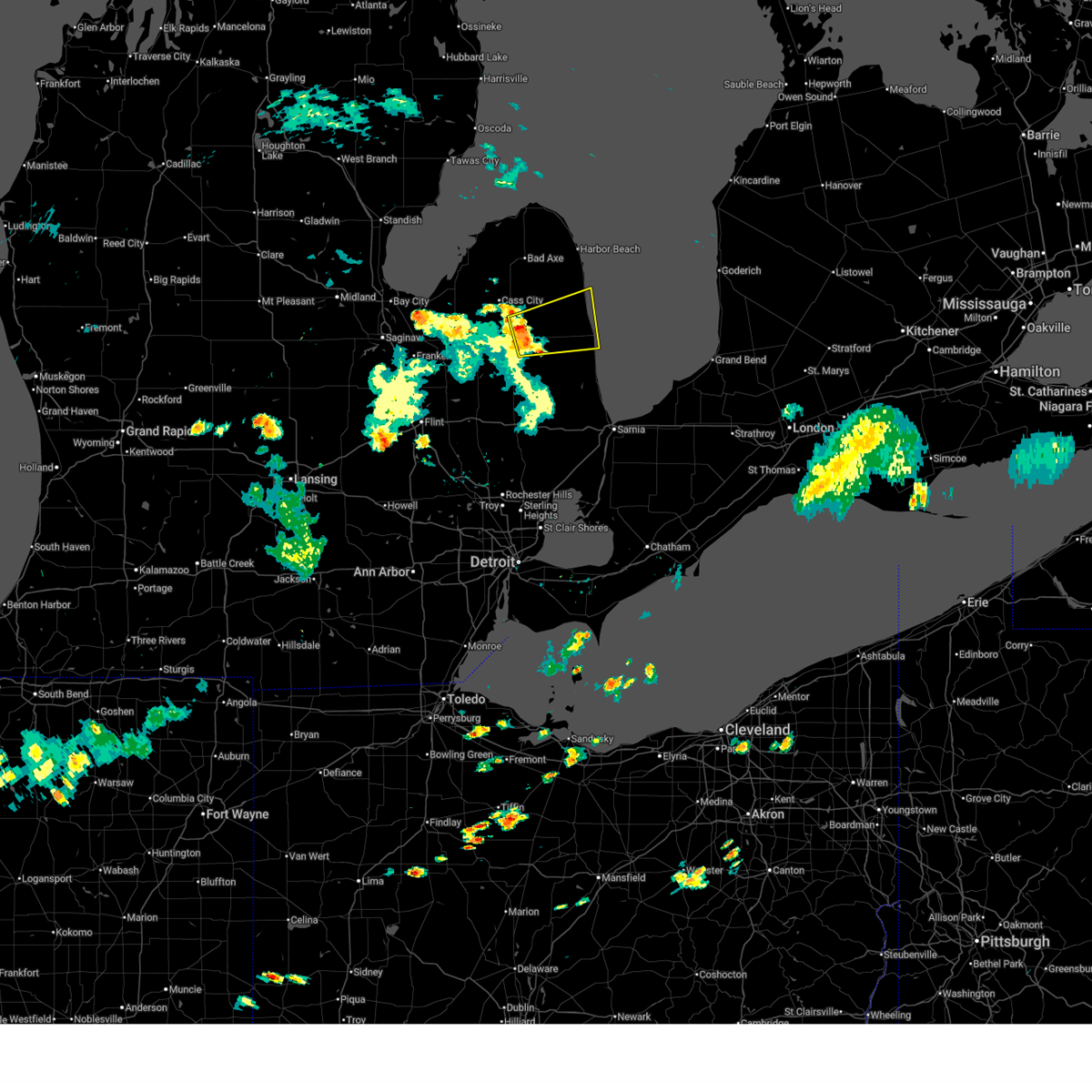
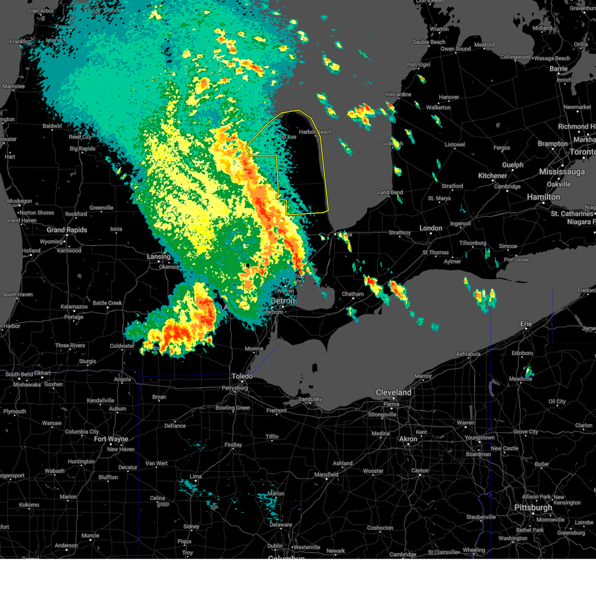
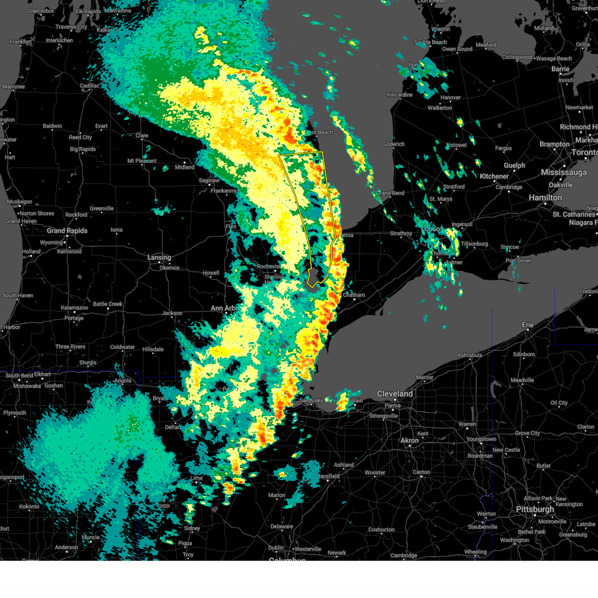
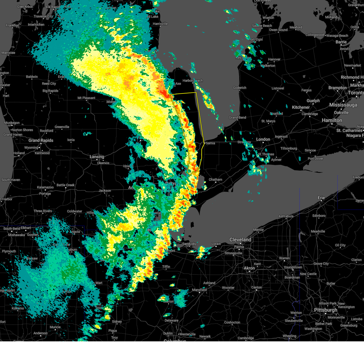
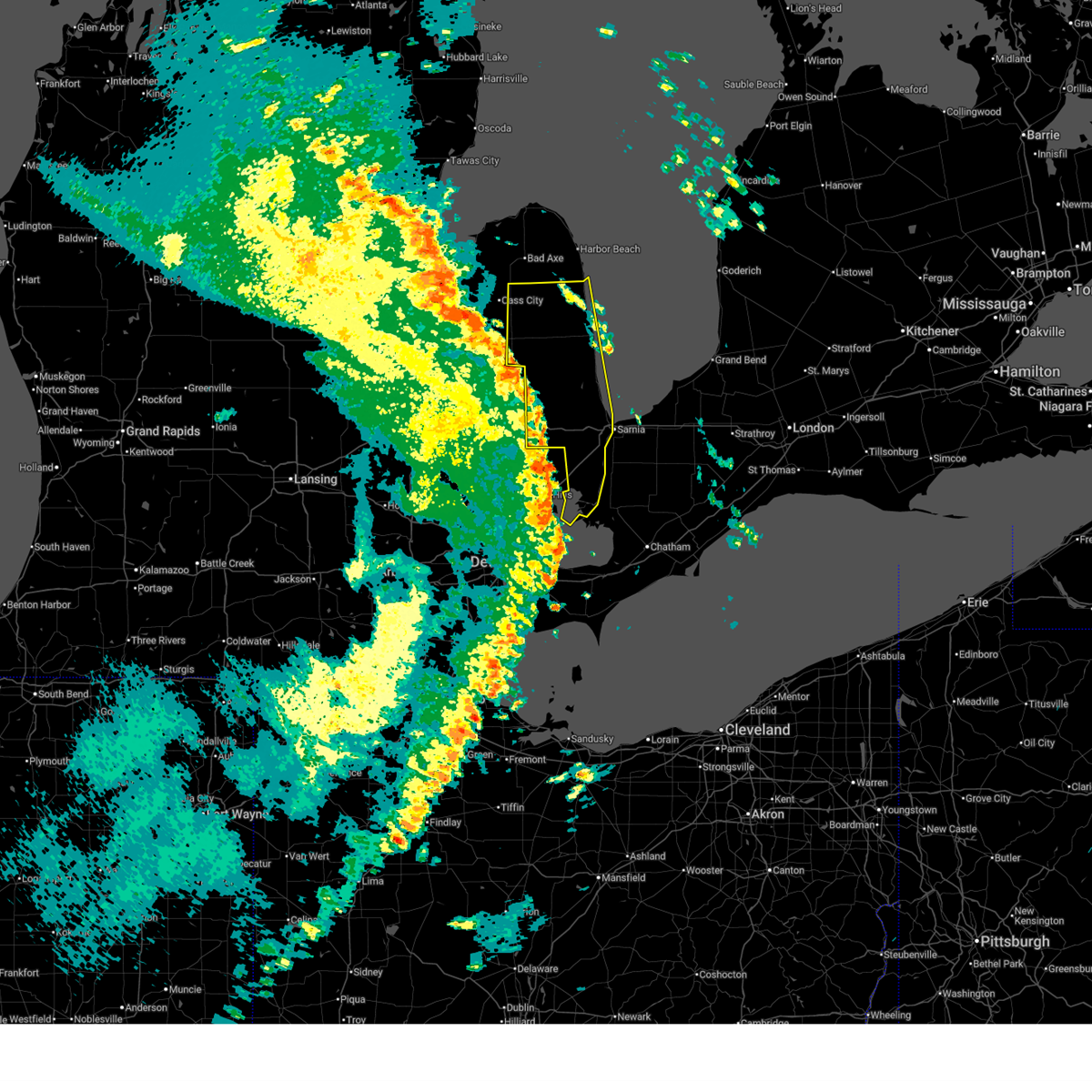
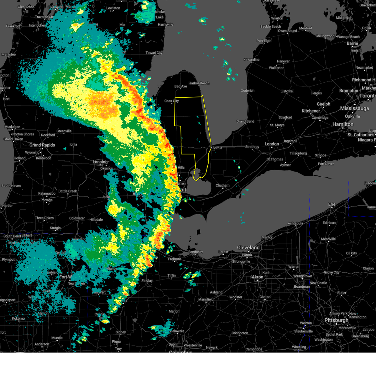
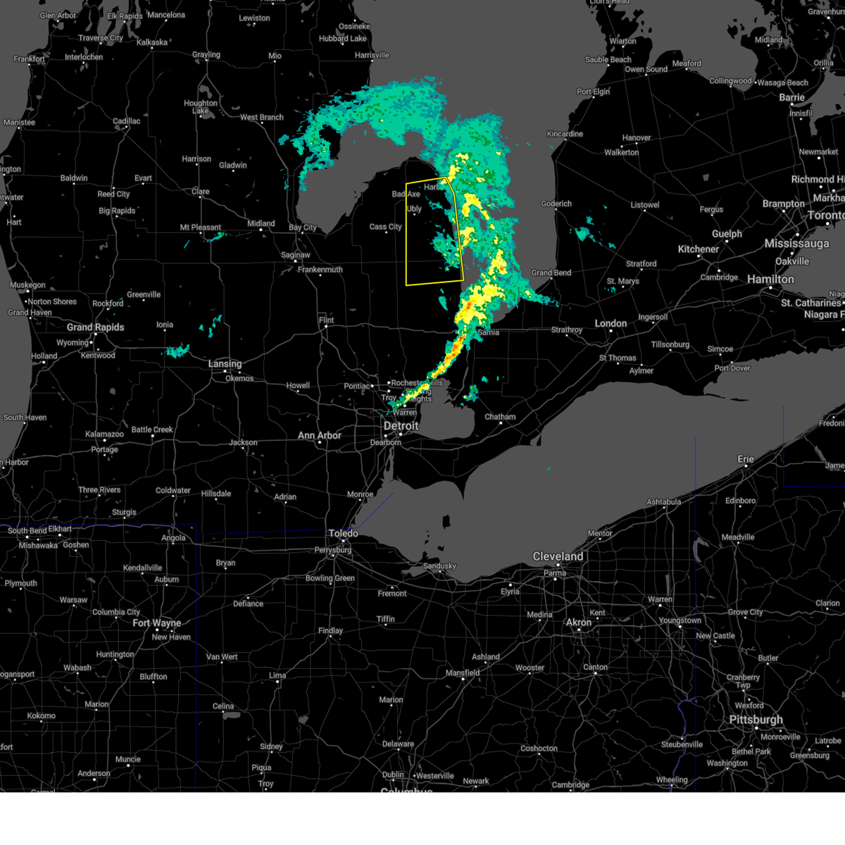
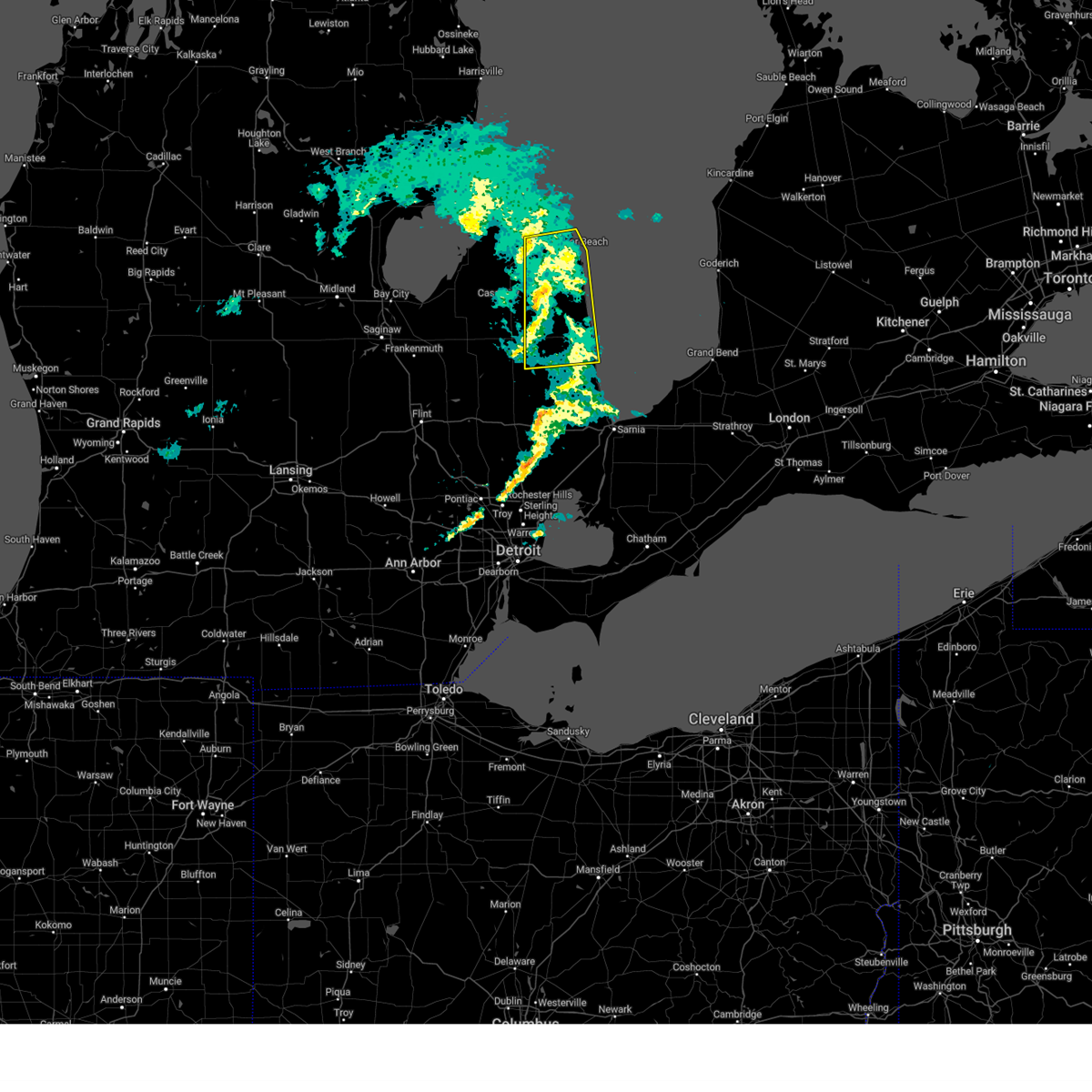
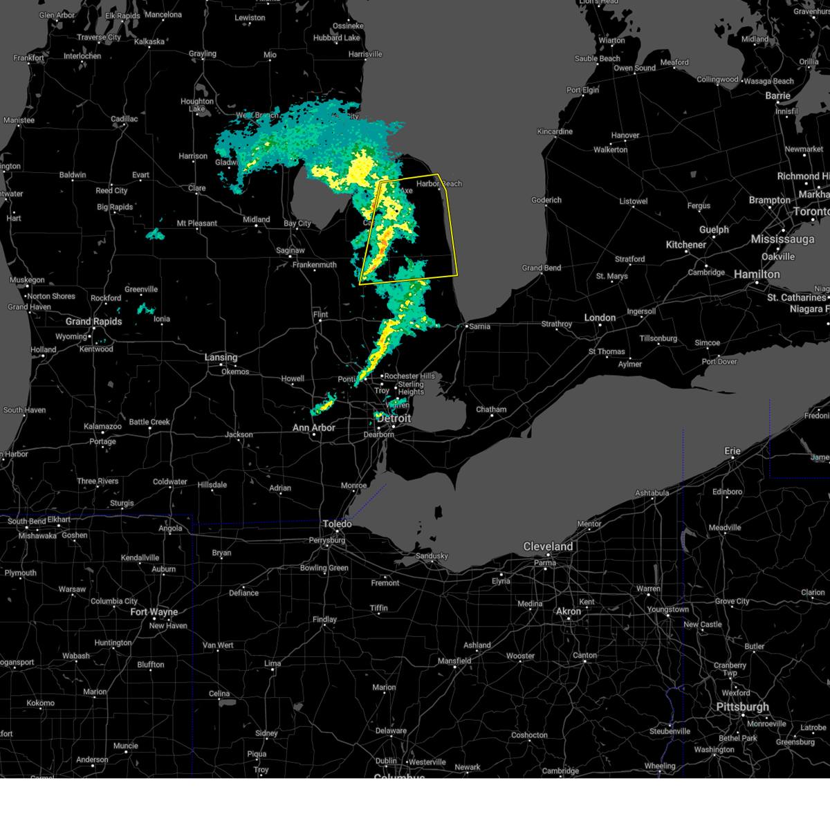
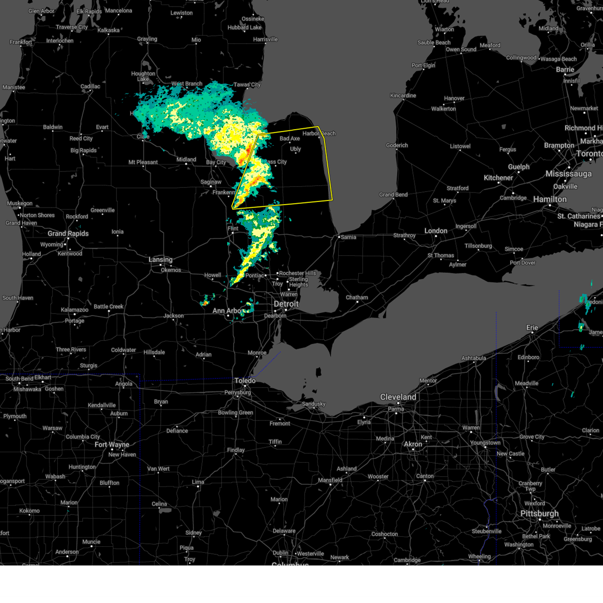
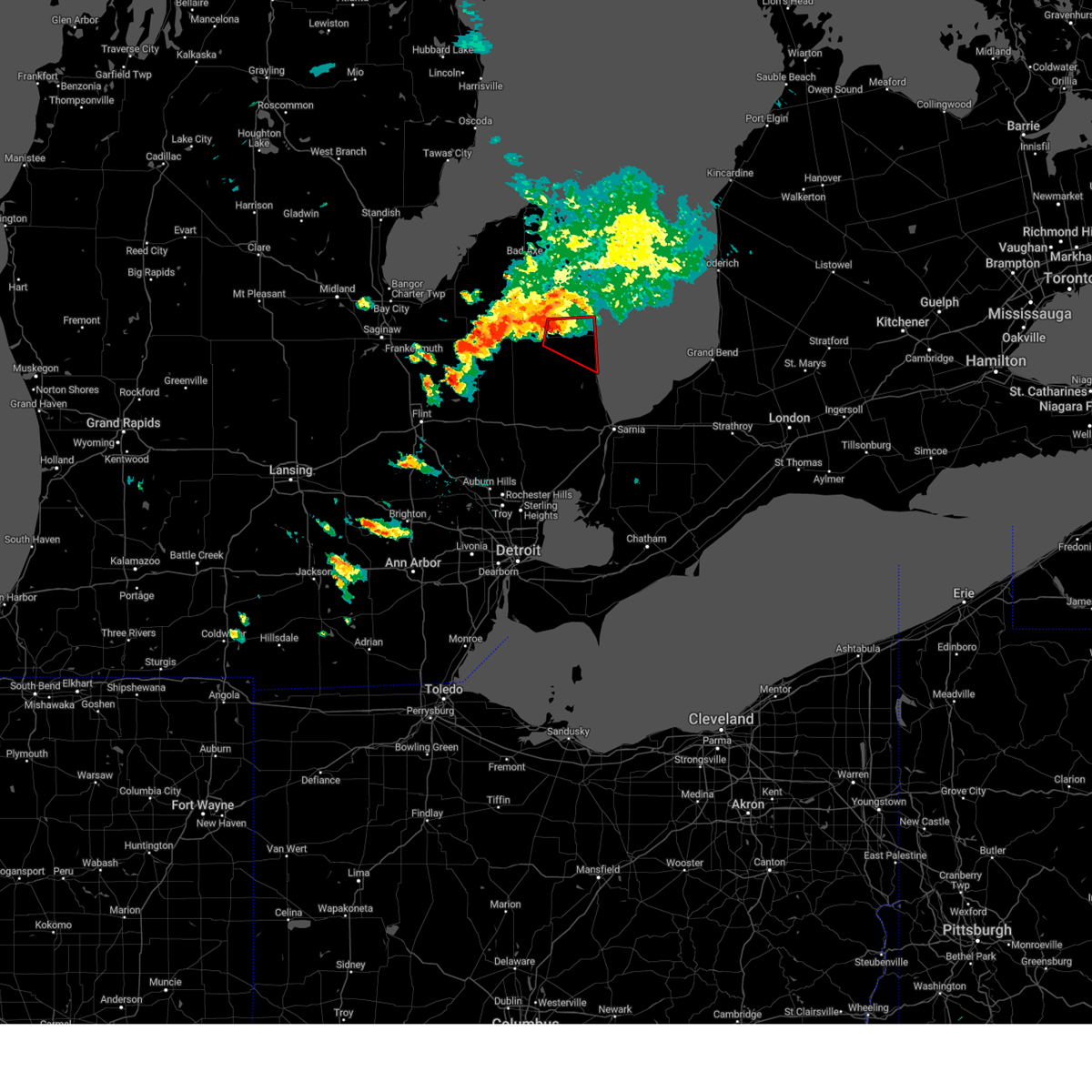
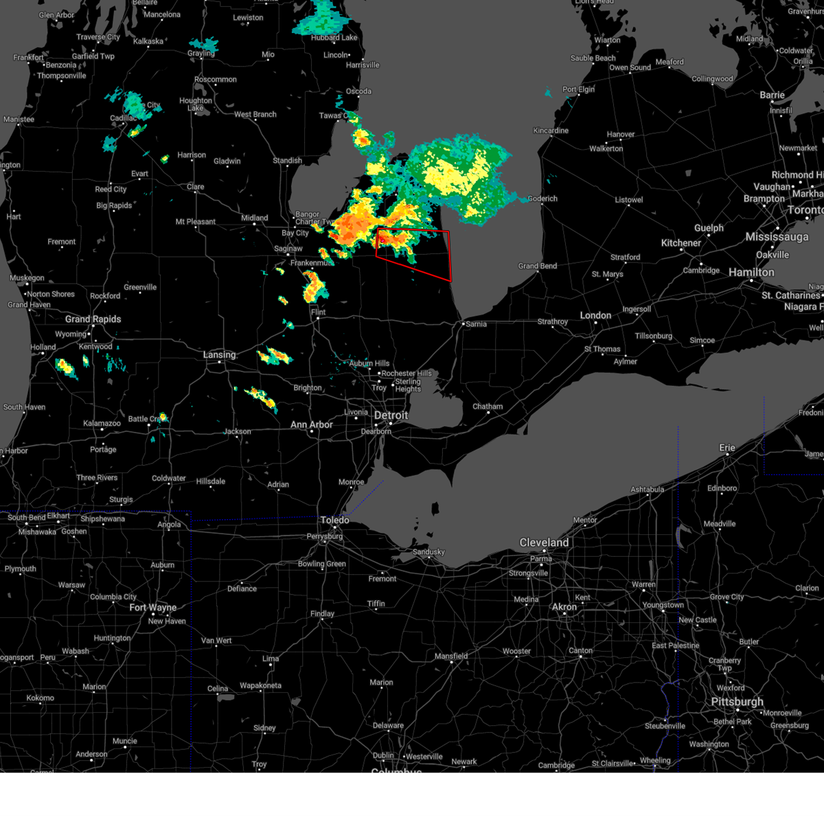
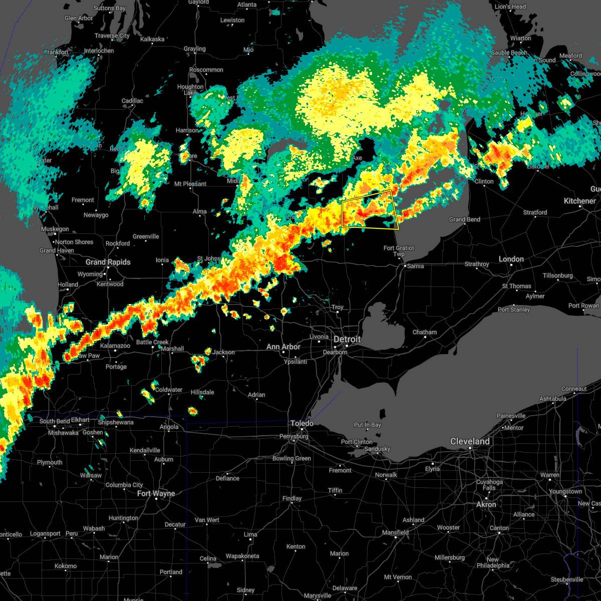
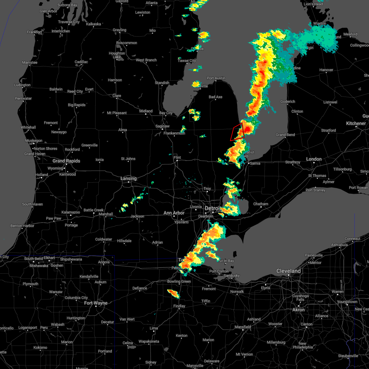
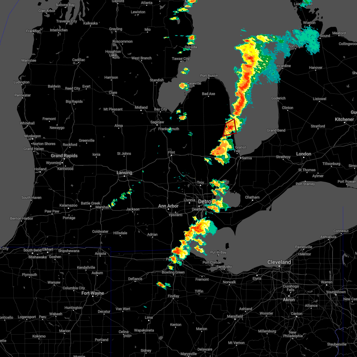
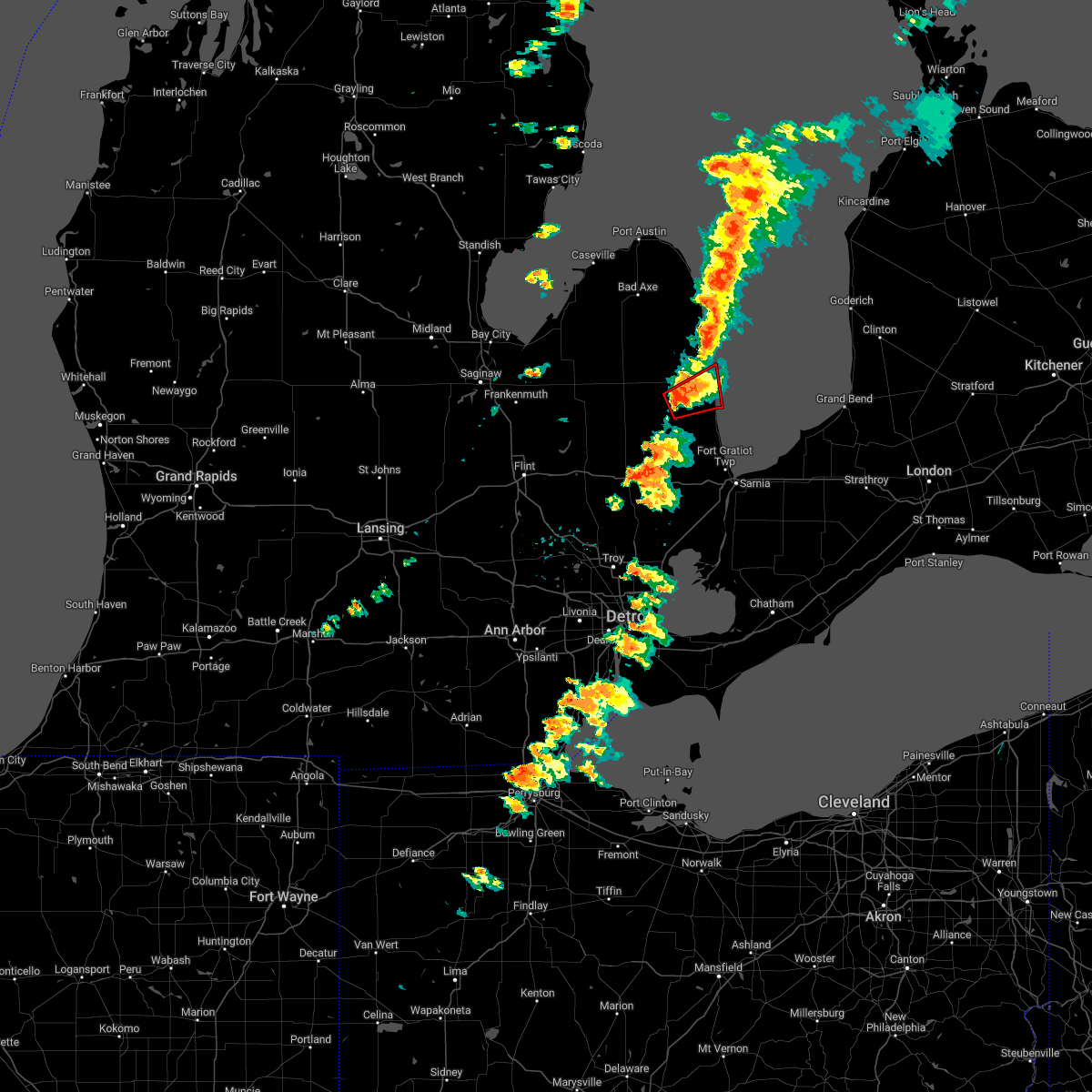
Hail Map for Carsonville, MI
The Carsonville, MI area has had 1 report of on-the-ground hail by trained spotters, and has been under severe weather warnings 9 times during the past 12 months. Doppler radar has detected hail at or near Carsonville, MI on 11 occasions.
| Name: | Carsonville, MI |
| Where Located: | 58.4 miles ENE of Flint, MI |
| Map: | Google Map for Carsonville, MI |
| Population: | 527 |
| Housing Units: | 224 |
| More Info: | Search Google for Carsonville, MI |
0
The Top Recent Hail Date for Carsonville, MI is Wednesday, April 2, 2025 (11th out of 11)

Hail and Wind Damage Spotted near Carsonville, MI
| Date / Time | Report Details |
|---|---|
| 6/9/2026 9:54 PM EDT |
 At 953 pm edt, a severe thunderstorm was located near carsonville, or near port sanilac, moving northeast at 25 mph (radar indicated). Hazards include 60 mph wind gusts. Expect damage to roofs, siding, and trees. this severe storm will be near, port sanilac around 1000 pm edt. Other locations impacted by this severe thunderstorm include forester and mcgregor. At 953 pm edt, a severe thunderstorm was located near carsonville, or near port sanilac, moving northeast at 25 mph (radar indicated). Hazards include 60 mph wind gusts. Expect damage to roofs, siding, and trees. this severe storm will be near, port sanilac around 1000 pm edt. Other locations impacted by this severe thunderstorm include forester and mcgregor.
|
| 6/9/2026 9:38 PM EDT |
 Svrdtx the national weather service in detroit/pontiac has issued a * severe thunderstorm warning for, east central sanilac county in southeastern michigan, * until 1030 pm edt. * at 937 pm edt, a severe thunderstorm was located over carsonville, or near sandusky, moving northeast at 25 mph (radar indicated). Hazards include 60 mph wind gusts. Expect damage to roofs, siding, and trees. this severe thunderstorm will be near, port sanilac, carsonville, and applegate around 940 pm edt. Other locations impacted by this severe thunderstorm include forester and mcgregor. Svrdtx the national weather service in detroit/pontiac has issued a * severe thunderstorm warning for, east central sanilac county in southeastern michigan, * until 1030 pm edt. * at 937 pm edt, a severe thunderstorm was located over carsonville, or near sandusky, moving northeast at 25 mph (radar indicated). Hazards include 60 mph wind gusts. Expect damage to roofs, siding, and trees. this severe thunderstorm will be near, port sanilac, carsonville, and applegate around 940 pm edt. Other locations impacted by this severe thunderstorm include forester and mcgregor.
|
| 5/18/2026 5:40 PM EDT |
 At 540 pm edt, severe thunderstorms were located along a line extending from near forestville to applegate to yale, moving northeast at 55 mph (radar indicated). Hazards include 60 mph wind gusts. Expect damage to roofs, siding, and trees. these severe storms will be near, croswell, port sanilac, forestville, and applegate around 545 pm edt. lexington around 550 pm edt. Other locations impacted by these severe thunderstorms include birch beach, mcgregor, amador, juhl, elmer, valley center, palms, watertown, lexington heights, and forester. At 540 pm edt, severe thunderstorms were located along a line extending from near forestville to applegate to yale, moving northeast at 55 mph (radar indicated). Hazards include 60 mph wind gusts. Expect damage to roofs, siding, and trees. these severe storms will be near, croswell, port sanilac, forestville, and applegate around 545 pm edt. lexington around 550 pm edt. Other locations impacted by these severe thunderstorms include birch beach, mcgregor, amador, juhl, elmer, valley center, palms, watertown, lexington heights, and forester.
|
| 5/18/2026 5:24 PM EDT |
 At 524 pm edt, severe thunderstorms were located along a line extending from near ubly to near peck to near capac, moving northeast at 40 mph (radar indicated). Hazards include 60 mph wind gusts. Expect damage to roofs, siding, and trees. these severe storms will be near, sandusky, deckerville, peck, carsonville, and melvin around 530 pm edt. applegate around 535 pm edt. croswell and forestville around 540 pm edt. port sanilac around 545 pm edt. lexington around 550 pm edt. Other locations impacted by these severe thunderstorms include birch beach, mcgregor, amador, snover, juhl, elmer, valley center, tyre, palms, and watertown. At 524 pm edt, severe thunderstorms were located along a line extending from near ubly to near peck to near capac, moving northeast at 40 mph (radar indicated). Hazards include 60 mph wind gusts. Expect damage to roofs, siding, and trees. these severe storms will be near, sandusky, deckerville, peck, carsonville, and melvin around 530 pm edt. applegate around 535 pm edt. croswell and forestville around 540 pm edt. port sanilac around 545 pm edt. lexington around 550 pm edt. Other locations impacted by these severe thunderstorms include birch beach, mcgregor, amador, snover, juhl, elmer, valley center, tyre, palms, and watertown.
|
| 5/18/2026 5:08 PM EDT |
 At 508 pm edt, severe thunderstorms were located along a line extending from 6 miles northwest of argyle to near brown city to dryden, moving northeast at 50 mph (radar indicated). Hazards include 60 mph wind gusts. Expect damage to roofs, siding, and trees. these severe storms will be near, sandusky, brown city, argyle, peck, and melvin around 515 pm edt. deckerville around 520 pm edt. carsonville around 525 pm edt. croswell, forestville, and applegate around 530 pm edt. port sanilac around 535 pm edt. lexington around 540 pm edt. Other locations impacted by these severe thunderstorms include birch beach, mcgregor, amador, snover, juhl, elmer, valley center, new greenleaf, tyre, and decker. At 508 pm edt, severe thunderstorms were located along a line extending from 6 miles northwest of argyle to near brown city to dryden, moving northeast at 50 mph (radar indicated). Hazards include 60 mph wind gusts. Expect damage to roofs, siding, and trees. these severe storms will be near, sandusky, brown city, argyle, peck, and melvin around 515 pm edt. deckerville around 520 pm edt. carsonville around 525 pm edt. croswell, forestville, and applegate around 530 pm edt. port sanilac around 535 pm edt. lexington around 540 pm edt. Other locations impacted by these severe thunderstorms include birch beach, mcgregor, amador, snover, juhl, elmer, valley center, new greenleaf, tyre, and decker.
|
| 5/18/2026 4:54 PM EDT |
 Svrdtx the national weather service in detroit/pontiac has issued a * severe thunderstorm warning for, sanilac county in southeastern michigan, * until 615 pm edt. * at 453 pm edt, severe thunderstorms were located along a line extending from 6 miles southwest of cass city to near north branch to near ortonville, moving northeast at 40 mph (radar indicated). Hazards include 60 mph wind gusts. Expect damage to roofs, siding, and trees. severe thunderstorms will be near, marlette around 500 pm edt. brown city around 505 pm edt. argyle around 515 pm edt. sandusky around 520 pm edt. peck and melvin around 525 pm edt. deckerville around 530 pm edt. carsonville around 535 pm edt. forestville and applegate around 540 pm edt. Other locations impacted by these severe thunderstorms include birch beach, mcgregor, amador, snover, juhl, elmer, valley center, new greenleaf, tyre, and decker. Svrdtx the national weather service in detroit/pontiac has issued a * severe thunderstorm warning for, sanilac county in southeastern michigan, * until 615 pm edt. * at 453 pm edt, severe thunderstorms were located along a line extending from 6 miles southwest of cass city to near north branch to near ortonville, moving northeast at 40 mph (radar indicated). Hazards include 60 mph wind gusts. Expect damage to roofs, siding, and trees. severe thunderstorms will be near, marlette around 500 pm edt. brown city around 505 pm edt. argyle around 515 pm edt. sandusky around 520 pm edt. peck and melvin around 525 pm edt. deckerville around 530 pm edt. carsonville around 535 pm edt. forestville and applegate around 540 pm edt. Other locations impacted by these severe thunderstorms include birch beach, mcgregor, amador, snover, juhl, elmer, valley center, new greenleaf, tyre, and decker.
|
| 8/23/2025 7:36 PM EDT |
 Svrdtx the national weather service in detroit/pontiac has issued a * severe thunderstorm warning for, southern sanilac county in southeastern michigan, * until 800 pm edt. * at 736 pm edt, severe thunderstorms were located along a line extending from near port sanilac to near croswell to melvin, moving east at 35 mph (radar indicated). Hazards include 60 mph wind gusts. Expect damage to roofs, siding, and trees. severe thunderstorms will be near, croswell, lexington, peck, and melvin around 745 pm edt. Other locations impacted by these severe thunderstorms include roseburg, amador, birch beach, watertown, valley center, and lexington heights. Svrdtx the national weather service in detroit/pontiac has issued a * severe thunderstorm warning for, southern sanilac county in southeastern michigan, * until 800 pm edt. * at 736 pm edt, severe thunderstorms were located along a line extending from near port sanilac to near croswell to melvin, moving east at 35 mph (radar indicated). Hazards include 60 mph wind gusts. Expect damage to roofs, siding, and trees. severe thunderstorms will be near, croswell, lexington, peck, and melvin around 745 pm edt. Other locations impacted by these severe thunderstorms include roseburg, amador, birch beach, watertown, valley center, and lexington heights.
|
| 7/24/2025 5:05 PM EDT |
 the severe thunderstorm warning has been cancelled and is no longer in effect the severe thunderstorm warning has been cancelled and is no longer in effect
|
| 7/24/2025 4:33 PM EDT |
 Svrdtx the national weather service in detroit/pontiac has issued a * severe thunderstorm warning for, northern sanilac county in southeastern michigan, * until 545 pm edt. * at 433 pm edt, severe thunderstorms were located along a line extending from near harbor beach to 6 miles west of ubly to caro, moving east at 35 mph (radar indicated). Hazards include 60 mph wind gusts. Expect damage to roofs, siding, and trees. severe thunderstorms will be near, argyle around 455 pm edt. forestville around 505 pm edt. deckerville around 515 pm edt. Other locations impacted by these severe thunderstorms include tyre, decker, palms, mcgregor, forester, minden, snover, richmondville, and new greenleaf. Svrdtx the national weather service in detroit/pontiac has issued a * severe thunderstorm warning for, northern sanilac county in southeastern michigan, * until 545 pm edt. * at 433 pm edt, severe thunderstorms were located along a line extending from near harbor beach to 6 miles west of ubly to caro, moving east at 35 mph (radar indicated). Hazards include 60 mph wind gusts. Expect damage to roofs, siding, and trees. severe thunderstorms will be near, argyle around 455 pm edt. forestville around 505 pm edt. deckerville around 515 pm edt. Other locations impacted by these severe thunderstorms include tyre, decker, palms, mcgregor, forester, minden, snover, richmondville, and new greenleaf.
|
| 6/24/2025 8:11 PM EDT |
 the severe thunderstorm warning has been cancelled and is no longer in effect the severe thunderstorm warning has been cancelled and is no longer in effect
|
| 6/24/2025 8:00 PM EDT |
 At 800 pm edt, a severe thunderstorm was located near deckerville, moving east at 35 mph (radar indicated). Hazards include 60 mph wind gusts. Expect damage to roofs, siding, and trees. This severe thunderstorm will remain over mainly rural areas of central sanilac county, including the following locations, richmondville, forester, and mcgregor. At 800 pm edt, a severe thunderstorm was located near deckerville, moving east at 35 mph (radar indicated). Hazards include 60 mph wind gusts. Expect damage to roofs, siding, and trees. This severe thunderstorm will remain over mainly rural areas of central sanilac county, including the following locations, richmondville, forester, and mcgregor.
|
| 6/24/2025 7:49 PM EDT |
 At 748 pm edt, a severe thunderstorm was located over argyle and sandusky, moving east at 35 mph (radar indicated). Hazards include 60 mph wind gusts. Expect damage to roofs, siding, and trees. this severe storm will be near, deckerville around 755 pm edt. Other locations impacted by this severe thunderstorm include forester, snover, juhl, elmer, richmondville, and mcgregor. At 748 pm edt, a severe thunderstorm was located over argyle and sandusky, moving east at 35 mph (radar indicated). Hazards include 60 mph wind gusts. Expect damage to roofs, siding, and trees. this severe storm will be near, deckerville around 755 pm edt. Other locations impacted by this severe thunderstorm include forester, snover, juhl, elmer, richmondville, and mcgregor.
|
| 6/24/2025 7:38 PM EDT |
 At 737 pm edt, a severe thunderstorm was located near decker, moving east at 35 mph (radar indicated). Hazards include 60 mph wind gusts and penny size hail. Expect damage to roofs, siding, and trees. this severe storm will be near, deckerville around 745 pm edt. Other locations impacted by this severe thunderstorm include mcgregor, forester, snover, juhl, elmer, and richmondville. At 737 pm edt, a severe thunderstorm was located near decker, moving east at 35 mph (radar indicated). Hazards include 60 mph wind gusts and penny size hail. Expect damage to roofs, siding, and trees. this severe storm will be near, deckerville around 745 pm edt. Other locations impacted by this severe thunderstorm include mcgregor, forester, snover, juhl, elmer, and richmondville.
|
| 6/24/2025 7:27 PM EDT | Svrdtx the national weather service in detroit/pontiac has issued a * severe thunderstorm warning for, central sanilac county in southeastern michigan, * until 830 pm edt. * at 727 pm edt, a severe thunderstorm was located 7 miles east of kingston, or 8 miles north of marlette, moving east at 30 mph (radar indicated). Hazards include 60 mph wind gusts and penny size hail. Expect damage to roofs, siding, and trees. this severe thunderstorm will be near, deckerville around 750 pm edt. Other locations impacted by this severe thunderstorm include decker, mcgregor, forester, snover, juhl, elmer, and richmondville. |
| 5/16/2025 1:47 AM EDT |
 the severe thunderstorm warning has been cancelled and is no longer in effect the severe thunderstorm warning has been cancelled and is no longer in effect
|
| 5/16/2025 1:35 AM EDT |
 At 134 am edt, severe thunderstorms were located along a line extending from 6 miles southwest of port hope to near deckerville to 6 miles northwest of lakeport, moving northeast at 45 mph (radar indicated). Hazards include 60 mph wind gusts. Expect damage to roofs, siding, and trees. these severe storms will be near, harbor beach, lexington, port sanilac, port hope, and forestville around 140 am edt. Other locations impacted by these severe thunderstorms include redman, parisville, birch beach, huron city, mcgregor, white rock, rapson, grindstone city, amador, and ruth. At 134 am edt, severe thunderstorms were located along a line extending from 6 miles southwest of port hope to near deckerville to 6 miles northwest of lakeport, moving northeast at 45 mph (radar indicated). Hazards include 60 mph wind gusts. Expect damage to roofs, siding, and trees. these severe storms will be near, harbor beach, lexington, port sanilac, port hope, and forestville around 140 am edt. Other locations impacted by these severe thunderstorms include redman, parisville, birch beach, huron city, mcgregor, white rock, rapson, grindstone city, amador, and ruth.
|
| 5/16/2025 1:19 AM EDT |
 At 119 am edt, severe thunderstorms were located along a line extending from pigeon to near argyle to near croswell, moving northeast at 45 mph (radar indicated). Hazards include 60 mph wind gusts. Expect damage to roofs, siding, and trees. these severe storms will be near, bad axe, croswell, lexington, ubly, deckerville, port sanilac, carsonville, and applegate around 125 am edt. forestville and kinde around 130 am edt. harbor beach around 140 am edt. port hope around 145 am edt. Other locations impacted by these severe thunderstorms include parisville, huron city, white rock, ivanhoe, rapson, grindstone city, amador, juhl, elmer, and new greenleaf. At 119 am edt, severe thunderstorms were located along a line extending from pigeon to near argyle to near croswell, moving northeast at 45 mph (radar indicated). Hazards include 60 mph wind gusts. Expect damage to roofs, siding, and trees. these severe storms will be near, bad axe, croswell, lexington, ubly, deckerville, port sanilac, carsonville, and applegate around 125 am edt. forestville and kinde around 130 am edt. harbor beach around 140 am edt. port hope around 145 am edt. Other locations impacted by these severe thunderstorms include parisville, huron city, white rock, ivanhoe, rapson, grindstone city, amador, juhl, elmer, and new greenleaf.
|
| 5/16/2025 12:56 AM EDT |
 Svrdtx the national weather service in detroit/pontiac has issued a * severe thunderstorm warning for, sanilac county in southeastern michigan, huron county in southeastern michigan, * until 215 am edt. * at 1255 am edt, severe thunderstorms were located along a line extending from sebewaing to 6 miles northwest of kingston to near brown city, moving northeast at 45 mph (radar indicated). Hazards include 60 mph wind gusts. Expect damage to roofs, siding, and trees. severe thunderstorms will be near, marlette, brown city, owendale, and melvin around 100 am edt. pigeon and peck around 105 am edt. sandusky, elkton, and argyle around 110 am edt. bad axe around 115 am edt. croswell, ubly, deckerville, carsonville, and applegate around 120 am edt. lexington and kinde around 125 am edt. port sanilac around 130 am edt. forestville around 135 am edt. Other locations impacted by these severe thunderstorms include parisville, huron city, white rock, ivanhoe, rapson, grindstone city, amador, juhl, elmer, and new greenleaf. Svrdtx the national weather service in detroit/pontiac has issued a * severe thunderstorm warning for, sanilac county in southeastern michigan, huron county in southeastern michigan, * until 215 am edt. * at 1255 am edt, severe thunderstorms were located along a line extending from sebewaing to 6 miles northwest of kingston to near brown city, moving northeast at 45 mph (radar indicated). Hazards include 60 mph wind gusts. Expect damage to roofs, siding, and trees. severe thunderstorms will be near, marlette, brown city, owendale, and melvin around 100 am edt. pigeon and peck around 105 am edt. sandusky, elkton, and argyle around 110 am edt. bad axe around 115 am edt. croswell, ubly, deckerville, carsonville, and applegate around 120 am edt. lexington and kinde around 125 am edt. port sanilac around 130 am edt. forestville around 135 am edt. Other locations impacted by these severe thunderstorms include parisville, huron city, white rock, ivanhoe, rapson, grindstone city, amador, juhl, elmer, and new greenleaf.
|
| 3/30/2025 8:24 PM EDT |
 The storms which prompted the warning have moved out of the warned area. therefore, the warning will be allowed to expire. a severe thunderstorm watch remains in effect until 1000 pm edt for southeastern michigan. The storms which prompted the warning have moved out of the warned area. therefore, the warning will be allowed to expire. a severe thunderstorm watch remains in effect until 1000 pm edt for southeastern michigan.
|
| 3/30/2025 8:04 PM EDT |
 At 804 pm edt, severe thunderstorms were located along a line extending from argyle to near applegate to 7 miles east of yale, moving northeast at 60 mph (radar indicated). Hazards include 70 mph wind gusts and penny size hail. Expect considerable tree damage. damage is likely to mobile homes, roofs, and outbuildings. these severe storms will be near, deckerville, applegate, port sanilac, lakeport, carsonville, croswell, and lexington around 810 pm edt. forestville around 815 pm edt. other locations impacted by these severe thunderstorms include anchorville, north street, amador, brockway, elmer, new greenleaf, fort gratiot, avoca, fargo, and roseburg. this includes the following highways, i-94 between mile markers 251 and 273. I-69 between mile markers 184 and 199. At 804 pm edt, severe thunderstorms were located along a line extending from argyle to near applegate to 7 miles east of yale, moving northeast at 60 mph (radar indicated). Hazards include 70 mph wind gusts and penny size hail. Expect considerable tree damage. damage is likely to mobile homes, roofs, and outbuildings. these severe storms will be near, deckerville, applegate, port sanilac, lakeport, carsonville, croswell, and lexington around 810 pm edt. forestville around 815 pm edt. other locations impacted by these severe thunderstorms include anchorville, north street, amador, brockway, elmer, new greenleaf, fort gratiot, avoca, fargo, and roseburg. this includes the following highways, i-94 between mile markers 251 and 273. I-69 between mile markers 184 and 199.
|
| 3/30/2025 7:50 PM EDT |
 At 750 pm edt, severe thunderstorms were located along a line extending from kingston to brown city to near capac, moving northeast at 50 mph (radar indicated). Hazards include 70 mph wind gusts and penny size hail. Expect considerable tree damage. damage is likely to mobile homes, roofs, and outbuildings. these severe storms will be near, peck, yale, emmett, and melvin around 755 pm edt. sandusky around 800 pm edt. argyle and croswell around 805 pm edt. deckerville, applegate, and carsonville around 810 pm edt. port sanilac and lexington around 815 pm edt. forestville around 825 pm edt. other locations impacted by these severe thunderstorms include anchorville, north street, lynn township, amador, brockway, juhl, elmer, new greenleaf, fort gratiot, and avoca. this includes the following highways, i-94 between mile markers 251 and 273. I-69 between mile markers 173 and 199. At 750 pm edt, severe thunderstorms were located along a line extending from kingston to brown city to near capac, moving northeast at 50 mph (radar indicated). Hazards include 70 mph wind gusts and penny size hail. Expect considerable tree damage. damage is likely to mobile homes, roofs, and outbuildings. these severe storms will be near, peck, yale, emmett, and melvin around 755 pm edt. sandusky around 800 pm edt. argyle and croswell around 805 pm edt. deckerville, applegate, and carsonville around 810 pm edt. port sanilac and lexington around 815 pm edt. forestville around 825 pm edt. other locations impacted by these severe thunderstorms include anchorville, north street, lynn township, amador, brockway, juhl, elmer, new greenleaf, fort gratiot, and avoca. this includes the following highways, i-94 between mile markers 251 and 273. I-69 between mile markers 173 and 199.
|
| 3/30/2025 7:37 PM EDT |
 Svrdtx the national weather service in detroit/pontiac has issued a * severe thunderstorm warning for, sanilac county in southeastern michigan, st. clair county in southeastern michigan, * until 830 pm edt. * at 736 pm edt, severe thunderstorms were located along a line extending from near otter lake to near lum to 6 miles east of oxford, moving northeast at 65 mph (radar indicated). Hazards include 70 mph wind gusts and penny size hail. Expect considerable tree damage. damage is likely to mobile homes, roofs, and outbuildings. severe thunderstorms will be near, brown city and capac around 745 pm edt. melvin and marlette around 750 pm edt. peck, yale, and emmett around 755 pm edt. sandusky around 800 pm edt. deckerville, applegate, argyle, carsonville, and croswell around 805 pm edt. port sanilac, lakeport, and lexington around 810 pm edt. forestville around 815 pm edt. other locations impacted by these severe thunderstorms include anchorville, north street, lynn township, amador, brockway, juhl, elmer, new greenleaf, fort gratiot, and avoca. this includes the following highways, i-94 between mile markers 251 and 273. I-69 between mile markers 173 and 199. Svrdtx the national weather service in detroit/pontiac has issued a * severe thunderstorm warning for, sanilac county in southeastern michigan, st. clair county in southeastern michigan, * until 830 pm edt. * at 736 pm edt, severe thunderstorms were located along a line extending from near otter lake to near lum to 6 miles east of oxford, moving northeast at 65 mph (radar indicated). Hazards include 70 mph wind gusts and penny size hail. Expect considerable tree damage. damage is likely to mobile homes, roofs, and outbuildings. severe thunderstorms will be near, brown city and capac around 745 pm edt. melvin and marlette around 750 pm edt. peck, yale, and emmett around 755 pm edt. sandusky around 800 pm edt. deckerville, applegate, argyle, carsonville, and croswell around 805 pm edt. port sanilac, lakeport, and lexington around 810 pm edt. forestville around 815 pm edt. other locations impacted by these severe thunderstorms include anchorville, north street, lynn township, amador, brockway, juhl, elmer, new greenleaf, fort gratiot, and avoca. this includes the following highways, i-94 between mile markers 251 and 273. I-69 between mile markers 173 and 199.
|
| 11/10/2024 8:15 PM EST |
 the severe thunderstorm warning has been cancelled and is no longer in effect the severe thunderstorm warning has been cancelled and is no longer in effect
|
| 11/10/2024 7:51 PM EST |
 At 750 pm est, severe thunderstorms were located along a line extending from 7 miles east of bad axe to near deckerville to near marlette, moving east at 45 mph (radar indicated). Hazards include 60 mph wind gusts. Expect damage to roofs, siding, and trees. these severe storms will be near, sandusky, deckerville, and forestville around 755 pm est. harbor beach and carsonville around 800 pm est. port sanilac and applegate around 805 pm est. Other locations impacted by these severe thunderstorms include parisville, mcgregor, white rock, rapson, snover, juhl, elmer, tyre, ruth, and palms. At 750 pm est, severe thunderstorms were located along a line extending from 7 miles east of bad axe to near deckerville to near marlette, moving east at 45 mph (radar indicated). Hazards include 60 mph wind gusts. Expect damage to roofs, siding, and trees. these severe storms will be near, sandusky, deckerville, and forestville around 755 pm est. harbor beach and carsonville around 800 pm est. port sanilac and applegate around 805 pm est. Other locations impacted by these severe thunderstorms include parisville, mcgregor, white rock, rapson, snover, juhl, elmer, tyre, ruth, and palms.
|
| 11/10/2024 7:51 PM EST |
 the severe thunderstorm warning has been cancelled and is no longer in effect the severe thunderstorm warning has been cancelled and is no longer in effect
|
| 11/10/2024 7:35 PM EST |
 At 735 pm est, severe thunderstorms were located along a line extending from near elkton to near argyle to near clifford, moving east at 40 mph (radar indicated). Hazards include 60 mph wind gusts. Expect damage to roofs, siding, and trees. these severe storms will be near, bad axe, marlette, ubly, argyle, and clifford around 740 pm est. sandusky and deckerville around 750 pm est. harbor beach, forestville, and carsonville around 800 pm est. applegate around 810 pm est. port sanilac around 815 pm est. Other locations impacted by these severe thunderstorms include east dayton, parisville, mcgregor, wilmot, white rock, ivanhoe, rapson, snover, juhl, and elmer. At 735 pm est, severe thunderstorms were located along a line extending from near elkton to near argyle to near clifford, moving east at 40 mph (radar indicated). Hazards include 60 mph wind gusts. Expect damage to roofs, siding, and trees. these severe storms will be near, bad axe, marlette, ubly, argyle, and clifford around 740 pm est. sandusky and deckerville around 750 pm est. harbor beach, forestville, and carsonville around 800 pm est. applegate around 810 pm est. port sanilac around 815 pm est. Other locations impacted by these severe thunderstorms include east dayton, parisville, mcgregor, wilmot, white rock, ivanhoe, rapson, snover, juhl, and elmer.
|
| 11/10/2024 7:11 PM EST |
 Svrdtx the national weather service in detroit/pontiac has issued a * severe thunderstorm warning for, tuscola county in southeastern michigan, sanilac county in southeastern michigan, northeastern lapeer county in southeastern michigan, huron county in southeastern michigan, * until 830 pm est. * at 710 pm est, severe thunderstorms were located along a line extending from near sebewaing to near caro to near millington, moving east at 45 mph (radar indicated). Hazards include 60 mph wind gusts. Expect damage to roofs, siding, and trees. severe thunderstorms will be near, cass city, millington, mayville, pigeon, gagetown, and owendale around 715 pm est. elkton and kingston around 720 pm est. clifford around 725 pm est. bad axe, marlette, and argyle around 730 pm est. ubly around 735 pm est. sandusky and deckerville around 740 pm est. harbor beach, forestville, and carsonville around 755 pm est. port sanilac and applegate around 800 pm est. Other locations impacted by these severe thunderstorms include parisville, colling, white rock, ivanhoe, rapson, ellington, juhl, elmer, silverwood, and new greenleaf. Svrdtx the national weather service in detroit/pontiac has issued a * severe thunderstorm warning for, tuscola county in southeastern michigan, sanilac county in southeastern michigan, northeastern lapeer county in southeastern michigan, huron county in southeastern michigan, * until 830 pm est. * at 710 pm est, severe thunderstorms were located along a line extending from near sebewaing to near caro to near millington, moving east at 45 mph (radar indicated). Hazards include 60 mph wind gusts. Expect damage to roofs, siding, and trees. severe thunderstorms will be near, cass city, millington, mayville, pigeon, gagetown, and owendale around 715 pm est. elkton and kingston around 720 pm est. clifford around 725 pm est. bad axe, marlette, and argyle around 730 pm est. ubly around 735 pm est. sandusky and deckerville around 740 pm est. harbor beach, forestville, and carsonville around 755 pm est. port sanilac and applegate around 800 pm est. Other locations impacted by these severe thunderstorms include parisville, colling, white rock, ivanhoe, rapson, ellington, juhl, elmer, silverwood, and new greenleaf.
|
| 8/27/2024 5:43 PM EDT |
 At 543 pm edt, severe thunderstorms were located along a line extending from near carsonville to near capac to near novi, moving east at 50 mph (radar indicated). Hazards include 70 mph wind gusts and penny size hail. Expect considerable tree damage. damage is likely to mobile homes, roofs, and outbuildings. these severe storms will be near, warren, troy, richmond, romeo, croswell, lexington, port sanilac, sterling heights, armada, and memphis around 550 pm edt. lakeport, clinton, and macomb township around 555 pm edt. st. clair shores, mount clemens, and new baltimore around 600 pm edt. port huron and marysville around 605 pm edt. st. clair around 610 pm edt. algonac, marine city, and harsens island around 615 pm edt. other locations impacted by these severe thunderstorms include anchorville, north street, roseville, shelby township, lynn township, amador, ray center, brockway, utica, and washington. this includes the following highways, i-94 between mile markers 226 and 273. i-696 between mile markers 19 and 28. i-69 between mile markers 173 and 199. m-39 between mile markers 16 and 24. m-53 between mile markers 16 and 24. M-59 near mile marker 49. At 543 pm edt, severe thunderstorms were located along a line extending from near carsonville to near capac to near novi, moving east at 50 mph (radar indicated). Hazards include 70 mph wind gusts and penny size hail. Expect considerable tree damage. damage is likely to mobile homes, roofs, and outbuildings. these severe storms will be near, warren, troy, richmond, romeo, croswell, lexington, port sanilac, sterling heights, armada, and memphis around 550 pm edt. lakeport, clinton, and macomb township around 555 pm edt. st. clair shores, mount clemens, and new baltimore around 600 pm edt. port huron and marysville around 605 pm edt. st. clair around 610 pm edt. algonac, marine city, and harsens island around 615 pm edt. other locations impacted by these severe thunderstorms include anchorville, north street, roseville, shelby township, lynn township, amador, ray center, brockway, utica, and washington. this includes the following highways, i-94 between mile markers 226 and 273. i-696 between mile markers 19 and 28. i-69 between mile markers 173 and 199. m-39 between mile markers 16 and 24. m-53 between mile markers 16 and 24. M-59 near mile marker 49.
|
| 8/27/2024 5:25 PM EDT |
 Svrdtx the national weather service in detroit/pontiac has issued a * severe thunderstorm warning for, southern sanilac county in southeastern michigan, macomb county in southeastern michigan, st. clair county in southeastern michigan, * until 645 pm edt. * at 525 pm edt, severe thunderstorms were located along a line extending from 6 miles northeast of marlette to near clarkston to whitmore lake, moving east at 45 mph (radar indicated). Hazards include 60 mph wind gusts and penny size hail. Expect damage to roofs, siding, and trees. severe thunderstorms will be near, brown city around 530 pm edt. sandusky around 535 pm edt. capac, peck, and melvin around 540 pm edt. romeo, yale, and applegate around 545 pm edt. troy, croswell, sterling heights, armada, and emmett around 550 pm edt. warren, lexington, clinton, memphis, and macomb township around 555 pm edt. mount clemens and richmond around 600 pm edt. st. clair shores, new baltimore, and lakeport around 605 pm edt. other locations impacted by these severe thunderstorms include anchorville, north street, roseville, shelby township, lynn township, amador, ray center, brockway, juhl, and utica. this includes the following highways, i-94 between mile markers 226 and 273. i-696 between mile markers 19 and 28. i-69 between mile markers 174 and 199. m-39 between mile markers 16 and 24. m-53 between mile markers 16 and 24. M-59 near mile marker 49. Svrdtx the national weather service in detroit/pontiac has issued a * severe thunderstorm warning for, southern sanilac county in southeastern michigan, macomb county in southeastern michigan, st. clair county in southeastern michigan, * until 645 pm edt. * at 525 pm edt, severe thunderstorms were located along a line extending from 6 miles northeast of marlette to near clarkston to whitmore lake, moving east at 45 mph (radar indicated). Hazards include 60 mph wind gusts and penny size hail. Expect damage to roofs, siding, and trees. severe thunderstorms will be near, brown city around 530 pm edt. sandusky around 535 pm edt. capac, peck, and melvin around 540 pm edt. romeo, yale, and applegate around 545 pm edt. troy, croswell, sterling heights, armada, and emmett around 550 pm edt. warren, lexington, clinton, memphis, and macomb township around 555 pm edt. mount clemens and richmond around 600 pm edt. st. clair shores, new baltimore, and lakeport around 605 pm edt. other locations impacted by these severe thunderstorms include anchorville, north street, roseville, shelby township, lynn township, amador, ray center, brockway, juhl, and utica. this includes the following highways, i-94 between mile markers 226 and 273. i-696 between mile markers 19 and 28. i-69 between mile markers 174 and 199. m-39 between mile markers 16 and 24. m-53 between mile markers 16 and 24. M-59 near mile marker 49.
|
| 6/5/2024 5:13 PM EDT |
 The storms which prompted the warning have moved out of the area. therefore, the warning will be allowed to expire. to report severe weather, contact your nearest law enforcement agency. they will relay your report to the national weather service detroit/pontiac. The storms which prompted the warning have moved out of the area. therefore, the warning will be allowed to expire. to report severe weather, contact your nearest law enforcement agency. they will relay your report to the national weather service detroit/pontiac.
|
| 6/5/2024 5:01 PM EDT |
 At 501 pm edt, severe thunderstorms were located along a line extending from argyle to near peck to near lakeport, moving northeast at 35 mph (radar indicated). Hazards include 60 mph wind gusts. Expect damage to roofs, siding, and trees. these severe storms will be near, croswell, lexington, deckerville, carsonville, and applegate around 505 pm edt. port sanilac around 515 pm edt. forestville around 525 pm edt. Other locations impacted by these severe thunderstorms include birch beach, palms, watertown, blaine, jeddo, lexington heights, fargo, mcgregor, forester, and amador. At 501 pm edt, severe thunderstorms were located along a line extending from argyle to near peck to near lakeport, moving northeast at 35 mph (radar indicated). Hazards include 60 mph wind gusts. Expect damage to roofs, siding, and trees. these severe storms will be near, croswell, lexington, deckerville, carsonville, and applegate around 505 pm edt. port sanilac around 515 pm edt. forestville around 525 pm edt. Other locations impacted by these severe thunderstorms include birch beach, palms, watertown, blaine, jeddo, lexington heights, fargo, mcgregor, forester, and amador.
|
| 6/5/2024 4:44 PM EDT |
 At 444 pm edt, a severe thunderstorm was located over port sanilac, moving northeast at 40 mph (radar indicated). Hazards include 60 mph wind gusts and nickel size hail. Expect damage to roofs, siding, and trees. this severe thunderstorm will remain over mainly rural areas of sanilac and northwestern st. Clair counties, including the following locations, birch beach, mcgregor, amador, brockway, valley center, palms, watertown, blaine, jeddo, and lexington heights. At 444 pm edt, a severe thunderstorm was located over port sanilac, moving northeast at 40 mph (radar indicated). Hazards include 60 mph wind gusts and nickel size hail. Expect damage to roofs, siding, and trees. this severe thunderstorm will remain over mainly rural areas of sanilac and northwestern st. Clair counties, including the following locations, birch beach, mcgregor, amador, brockway, valley center, palms, watertown, blaine, jeddo, and lexington heights.
|
| 6/5/2024 4:33 PM EDT | Report of multiple trees down across carsonvill in sanilac county MI, 5.5 miles WSW of Carsonville, MI |
| 6/5/2024 4:21 PM EDT |
 At 421 pm edt, a severe thunderstorm was located near peck, or near croswell, moving northeast at 40 mph (radar indicated). Hazards include 60 mph wind gusts and nickel size hail. Expect damage to roofs, siding, and trees. this severe storm will be near, croswell and applegate around 425 pm edt. port sanilac and carsonville around 435 pm edt. Other locations impacted by this severe thunderstorm include birch beach, mcgregor, lynn township, amador, brockway, valley center, palms, watertown, blaine, and jeddo. At 421 pm edt, a severe thunderstorm was located near peck, or near croswell, moving northeast at 40 mph (radar indicated). Hazards include 60 mph wind gusts and nickel size hail. Expect damage to roofs, siding, and trees. this severe storm will be near, croswell and applegate around 425 pm edt. port sanilac and carsonville around 435 pm edt. Other locations impacted by this severe thunderstorm include birch beach, mcgregor, lynn township, amador, brockway, valley center, palms, watertown, blaine, and jeddo.
|
| 6/5/2024 4:08 PM EDT |
 Svrdtx the national weather service in detroit/pontiac has issued a * severe thunderstorm warning for, sanilac county in southeastern michigan, northern st. clair county in southeastern michigan, * until 515 pm edt. * at 408 pm edt, a severe thunderstorm was located over melvin, or near yale, moving northeast at 40 mph (radar indicated). Hazards include 60 mph wind gusts and nickel size hail. Expect damage to roofs, siding, and trees. this severe thunderstorm will be near, yale, peck, and melvin around 415 pm edt. croswell around 425 pm edt. applegate around 430 pm edt. port sanilac around 440 pm edt. Other locations impacted by this severe thunderstorm include birch beach, mcgregor, lynn township, amador, brockway, valley center, palms, watertown, blaine, and jeddo. Svrdtx the national weather service in detroit/pontiac has issued a * severe thunderstorm warning for, sanilac county in southeastern michigan, northern st. clair county in southeastern michigan, * until 515 pm edt. * at 408 pm edt, a severe thunderstorm was located over melvin, or near yale, moving northeast at 40 mph (radar indicated). Hazards include 60 mph wind gusts and nickel size hail. Expect damage to roofs, siding, and trees. this severe thunderstorm will be near, yale, peck, and melvin around 415 pm edt. croswell around 425 pm edt. applegate around 430 pm edt. port sanilac around 440 pm edt. Other locations impacted by this severe thunderstorm include birch beach, mcgregor, lynn township, amador, brockway, valley center, palms, watertown, blaine, and jeddo.
|
| 5/20/2024 3:00 PM EDT |
 The storms which prompted the warning have moved out of the area. therefore, the warning will be allowed to expire. however, penny sized hail and gusty winds are still possible with trailing thunderstorms. The storms which prompted the warning have moved out of the area. therefore, the warning will be allowed to expire. however, penny sized hail and gusty winds are still possible with trailing thunderstorms.
|
| 5/20/2024 2:32 PM EDT |
 the severe thunderstorm warning has been cancelled and is no longer in effect the severe thunderstorm warning has been cancelled and is no longer in effect
|
| 5/20/2024 2:32 PM EDT |
 At 232 pm edt, severe thunderstorms were located along a line extending from near ubly to carsonville to yale, moving northeast at 40 mph (radar indicated). Hazards include 60 mph wind gusts and quarter size hail. Hail damage to vehicles is expected. expect wind damage to roofs, siding, and trees. these severe storms will be near, croswell, deckerville, port sanilac, carsonville, and applegate around 235 pm edt. lexington around 240 pm edt. forestville around 245 pm edt. Other locations impacted by these severe thunderstorms include birch beach, mcgregor, lynn township, amador, snover, juhl, elmer, valley center, tyre, and palms. At 232 pm edt, severe thunderstorms were located along a line extending from near ubly to carsonville to yale, moving northeast at 40 mph (radar indicated). Hazards include 60 mph wind gusts and quarter size hail. Hail damage to vehicles is expected. expect wind damage to roofs, siding, and trees. these severe storms will be near, croswell, deckerville, port sanilac, carsonville, and applegate around 235 pm edt. lexington around 240 pm edt. forestville around 245 pm edt. Other locations impacted by these severe thunderstorms include birch beach, mcgregor, lynn township, amador, snover, juhl, elmer, valley center, tyre, and palms.
|
| 5/20/2024 1:53 PM EDT |
 Svrdtx the national weather service in detroit/pontiac has issued a * severe thunderstorm warning for, sanilac county in southeastern michigan, northeastern lapeer county in southeastern michigan, northern st. clair county in southeastern michigan, * until 300 pm edt. * at 152 pm edt, severe thunderstorms were located along a line extending from near unionville to marlette to near columbiaville, moving northeast at 40 mph (radar indicated). Hazards include 60 mph wind gusts and quarter size hail. Hail damage to vehicles is expected. expect wind damage to roofs, siding, and trees. severe thunderstorms will be near, marlette around 200 pm edt. sandusky around 205 pm edt. argyle around 210 pm edt. deckerville around 220 pm edt. carsonville around 230 pm edt. forestville around 235 pm edt. Other locations impacted by these severe thunderstorms include goodland township, birch beach, mcgregor, lynn township, amador, snover, juhl, elmer, valley center, and new greenleaf. Svrdtx the national weather service in detroit/pontiac has issued a * severe thunderstorm warning for, sanilac county in southeastern michigan, northeastern lapeer county in southeastern michigan, northern st. clair county in southeastern michigan, * until 300 pm edt. * at 152 pm edt, severe thunderstorms were located along a line extending from near unionville to marlette to near columbiaville, moving northeast at 40 mph (radar indicated). Hazards include 60 mph wind gusts and quarter size hail. Hail damage to vehicles is expected. expect wind damage to roofs, siding, and trees. severe thunderstorms will be near, marlette around 200 pm edt. sandusky around 205 pm edt. argyle around 210 pm edt. deckerville around 220 pm edt. carsonville around 230 pm edt. forestville around 235 pm edt. Other locations impacted by these severe thunderstorms include goodland township, birch beach, mcgregor, lynn township, amador, snover, juhl, elmer, valley center, and new greenleaf.
|
| 7/26/2023 5:31 PM EDT |
 At 530 pm edt, a severe thunderstorm was located near forestville, moving northeast at 25 mph (radar indicated). Hazards include 60 mph wind gusts. Expect damage to roofs, siding, and trees. this severe storm will be near, forestville around 540 pm edt. other locations impacted by this severe thunderstorm include tyre, forester, minden, palms, richmondville and mcgregor. hail threat, radar indicated max hail size, <. 75 in wind threat, radar indicated max wind gust, 60 mph. At 530 pm edt, a severe thunderstorm was located near forestville, moving northeast at 25 mph (radar indicated). Hazards include 60 mph wind gusts. Expect damage to roofs, siding, and trees. this severe storm will be near, forestville around 540 pm edt. other locations impacted by this severe thunderstorm include tyre, forester, minden, palms, richmondville and mcgregor. hail threat, radar indicated max hail size, <. 75 in wind threat, radar indicated max wind gust, 60 mph.
|
| 7/26/2023 5:13 PM EDT |
 At 511 pm edt, a severe thunderstorm was located near deckerville, moving northeast at 25 mph (radar indicated). Hazards include 60 mph wind gusts. Expect damage to roofs, siding, and trees. this severe storm will be near, deckerville around 515 pm edt. forestville around 540 pm edt. Other locations impacted by this severe thunderstorm include tyre, palms, mcgregor, forester, minden, snover, elmer, richmondville, new greenleaf and decker. At 511 pm edt, a severe thunderstorm was located near deckerville, moving northeast at 25 mph (radar indicated). Hazards include 60 mph wind gusts. Expect damage to roofs, siding, and trees. this severe storm will be near, deckerville around 515 pm edt. forestville around 540 pm edt. Other locations impacted by this severe thunderstorm include tyre, palms, mcgregor, forester, minden, snover, elmer, richmondville, new greenleaf and decker.
|
| 7/26/2023 4:58 PM EDT |
 At 457 pm edt, a severe thunderstorm was located over argyle, or 9 miles west of deckerville, moving northeast at 25 mph (radar indicated). Hazards include 60 mph wind gusts. Expect damage to roofs, siding, and trees. this severe thunderstorm will be near, deckerville around 515 pm edt. forestville around 540 pm edt. Other locations impacted by this severe thunderstorm include tyre, decker, palms, mcgregor, forester, minden, snover, elmer, richmondville and new greenleaf. At 457 pm edt, a severe thunderstorm was located over argyle, or 9 miles west of deckerville, moving northeast at 25 mph (radar indicated). Hazards include 60 mph wind gusts. Expect damage to roofs, siding, and trees. this severe thunderstorm will be near, deckerville around 515 pm edt. forestville around 540 pm edt. Other locations impacted by this severe thunderstorm include tyre, decker, palms, mcgregor, forester, minden, snover, elmer, richmondville and new greenleaf.
|
| 7/20/2023 3:28 PM EDT |
 At 328 pm edt, a severe thunderstorm was located over yale, moving northeast at 25 mph (radar indicated). Hazards include ping pong ball size hail and 60 mph wind gusts. People and animals outdoors will be injured. expect hail damage to roofs, siding, windows, and vehicles. expect wind damage to roofs, siding, and trees. this severe storm will be near, croswell around 400 pm edt. lexington around 410 pm edt. other locations impacted by this severe thunderstorm include north street, birch beach, lynn township, amador, goodells, brockway, juhl, smiths creek, valley center and wadhams. people attending goodells county park should seek safe shelter immediately! hail threat, radar indicated max hail size, 1. 50 in wind threat, radar indicated max wind gust, 60 mph. At 328 pm edt, a severe thunderstorm was located over yale, moving northeast at 25 mph (radar indicated). Hazards include ping pong ball size hail and 60 mph wind gusts. People and animals outdoors will be injured. expect hail damage to roofs, siding, windows, and vehicles. expect wind damage to roofs, siding, and trees. this severe storm will be near, croswell around 400 pm edt. lexington around 410 pm edt. other locations impacted by this severe thunderstorm include north street, birch beach, lynn township, amador, goodells, brockway, juhl, smiths creek, valley center and wadhams. people attending goodells county park should seek safe shelter immediately! hail threat, radar indicated max hail size, 1. 50 in wind threat, radar indicated max wind gust, 60 mph.
|
| 7/20/2023 3:12 PM EDT |
 At 312 pm edt, a severe thunderstorm was located over capac, moving northeast at 30 mph (radar indicated). Hazards include ping pong ball size hail and 60 mph wind gusts. People and animals outdoors will be injured. expect hail damage to roofs, siding, windows, and vehicles. expect wind damage to roofs, siding, and trees. this severe storm will be near, emmett around 320 pm edt. yale and melvin around 330 pm edt. croswell around 400 pm edt. lexington around 405 pm edt. other locations impacted by this severe thunderstorm include north street, lynn township, amador, brockway, juhl, elmer, fort gratiot, avoca, fargo and berville. people attending goodells county park should seek safe shelter immediately! hail threat, radar indicated max hail size, 1. 50 in wind threat, radar indicated max wind gust, 60 mph. At 312 pm edt, a severe thunderstorm was located over capac, moving northeast at 30 mph (radar indicated). Hazards include ping pong ball size hail and 60 mph wind gusts. People and animals outdoors will be injured. expect hail damage to roofs, siding, windows, and vehicles. expect wind damage to roofs, siding, and trees. this severe storm will be near, emmett around 320 pm edt. yale and melvin around 330 pm edt. croswell around 400 pm edt. lexington around 405 pm edt. other locations impacted by this severe thunderstorm include north street, lynn township, amador, brockway, juhl, elmer, fort gratiot, avoca, fargo and berville. people attending goodells county park should seek safe shelter immediately! hail threat, radar indicated max hail size, 1. 50 in wind threat, radar indicated max wind gust, 60 mph.
|
| 7/20/2023 2:57 PM EDT |
 At 257 pm edt, a severe thunderstorm was located over imlay city, moving northeast at 25 mph (radar indicated). Hazards include ping pong ball size hail and 60 mph wind gusts. People and animals outdoors will be injured. expect hail damage to roofs, siding, windows, and vehicles. expect wind damage to roofs, siding, and trees. this severe thunderstorm will be near, capac around 310 pm edt. emmett around 320 pm edt. yale and melvin around 330 pm edt. croswell around 400 pm edt. lexington around 410 pm edt. other locations impacted by this severe thunderstorm include north street, lynn township, amador, brockway, juhl, elmer, fort gratiot, avoca, fargo and berville. people attending goodells county park should seek safe shelter immediately! hail threat, radar indicated max hail size, 1. 50 in wind threat, radar indicated max wind gust, 60 mph. At 257 pm edt, a severe thunderstorm was located over imlay city, moving northeast at 25 mph (radar indicated). Hazards include ping pong ball size hail and 60 mph wind gusts. People and animals outdoors will be injured. expect hail damage to roofs, siding, windows, and vehicles. expect wind damage to roofs, siding, and trees. this severe thunderstorm will be near, capac around 310 pm edt. emmett around 320 pm edt. yale and melvin around 330 pm edt. croswell around 400 pm edt. lexington around 410 pm edt. other locations impacted by this severe thunderstorm include north street, lynn township, amador, brockway, juhl, elmer, fort gratiot, avoca, fargo and berville. people attending goodells county park should seek safe shelter immediately! hail threat, radar indicated max hail size, 1. 50 in wind threat, radar indicated max wind gust, 60 mph.
|
| 7/14/2023 3:35 PM EDT | Wind-driven hail resulted in vinyl siding being completely punched in to at least one structur in sanilac county MI, 0.6 miles SW of Carsonville, MI |
| 7/14/2023 3:04 PM EDT |
 At 304 pm edt, a severe thunderstorm capable of producing a tornado was located over carsonville, or near sandusky, moving east at 25 mph (radar indicated rotation). Hazards include tornado and quarter size hail. Flying debris will be dangerous to those caught without shelter. mobile homes will be damaged or destroyed. damage to roofs, windows, and vehicles will occur. tree damage is likely. this dangerous storm will be near, applegate around 315 pm edt. Port sanilac around 325 pm edt. At 304 pm edt, a severe thunderstorm capable of producing a tornado was located over carsonville, or near sandusky, moving east at 25 mph (radar indicated rotation). Hazards include tornado and quarter size hail. Flying debris will be dangerous to those caught without shelter. mobile homes will be damaged or destroyed. damage to roofs, windows, and vehicles will occur. tree damage is likely. this dangerous storm will be near, applegate around 315 pm edt. Port sanilac around 325 pm edt.
|
| 7/14/2023 2:49 PM EDT |
 At 249 pm edt, a severe thunderstorm capable of producing a tornado was located over sandusky, moving east at 25 mph (radar indicated rotation). Hazards include tornado and quarter size hail. Flying debris will be dangerous to those caught without shelter. mobile homes will be damaged or destroyed. damage to roofs, windows, and vehicles will occur. tree damage is likely. this dangerous storm will be near, carsonville around 305 pm edt. applegate around 315 pm edt. port sanilac around 320 pm edt. Other locations impacted by this tornadic thunderstorm include forester and mcgregor. At 249 pm edt, a severe thunderstorm capable of producing a tornado was located over sandusky, moving east at 25 mph (radar indicated rotation). Hazards include tornado and quarter size hail. Flying debris will be dangerous to those caught without shelter. mobile homes will be damaged or destroyed. damage to roofs, windows, and vehicles will occur. tree damage is likely. this dangerous storm will be near, carsonville around 305 pm edt. applegate around 315 pm edt. port sanilac around 320 pm edt. Other locations impacted by this tornadic thunderstorm include forester and mcgregor.
|
| 7/14/2023 2:41 PM EDT |
 At 240 pm edt, a severe thunderstorm capable of producing a tornado was located near sandusky, moving east at 25 mph (radar indicated rotation). Hazards include tornado and quarter size hail. Flying debris will be dangerous to those caught without shelter. mobile homes will be damaged or destroyed. damage to roofs, windows, and vehicles will occur. tree damage is likely. this dangerous storm will be near, sandusky around 250 pm edt. carsonville around 305 pm edt. applegate around 315 pm edt. port sanilac around 320 pm edt. Other locations impacted by this tornadic thunderstorm include forester, elmer, watertown and mcgregor. At 240 pm edt, a severe thunderstorm capable of producing a tornado was located near sandusky, moving east at 25 mph (radar indicated rotation). Hazards include tornado and quarter size hail. Flying debris will be dangerous to those caught without shelter. mobile homes will be damaged or destroyed. damage to roofs, windows, and vehicles will occur. tree damage is likely. this dangerous storm will be near, sandusky around 250 pm edt. carsonville around 305 pm edt. applegate around 315 pm edt. port sanilac around 320 pm edt. Other locations impacted by this tornadic thunderstorm include forester, elmer, watertown and mcgregor.
|
| 7/14/2023 2:31 PM EDT |
 At 230 pm edt, a severe thunderstorm capable of producing a tornado was located 7 miles west of sandusky, moving east at 20 mph (radar indicated rotation). Hazards include tornado and quarter size hail. Flying debris will be dangerous to those caught without shelter. mobile homes will be damaged or destroyed. damage to roofs, windows, and vehicles will occur. tree damage is likely. this dangerous storm will be near, sandusky and deckerville around 255 pm edt. carsonville around 315 pm edt. croswell and applegate around 325 pm edt. lexington and port sanilac around 330 pm edt. Other locations impacted by this tornadic thunderstorm include decker, forester, snover, elmer, watertown and mcgregor. At 230 pm edt, a severe thunderstorm capable of producing a tornado was located 7 miles west of sandusky, moving east at 20 mph (radar indicated rotation). Hazards include tornado and quarter size hail. Flying debris will be dangerous to those caught without shelter. mobile homes will be damaged or destroyed. damage to roofs, windows, and vehicles will occur. tree damage is likely. this dangerous storm will be near, sandusky and deckerville around 255 pm edt. carsonville around 315 pm edt. croswell and applegate around 325 pm edt. lexington and port sanilac around 330 pm edt. Other locations impacted by this tornadic thunderstorm include decker, forester, snover, elmer, watertown and mcgregor.
|
| 7/14/2023 2:24 PM EDT |
 At 223 pm edt, a severe thunderstorm capable of producing a tornado was located 8 miles southwest of argyle, or 9 miles west of sandusky, moving east at 20 mph (radar indicated rotation). Hazards include tornado and quarter size hail. Flying debris will be dangerous to those caught without shelter. mobile homes will be damaged or destroyed. damage to roofs, windows, and vehicles will occur. tree damage is likely. this dangerous storm will be near, argyle around 235 pm edt. sandusky around 250 pm edt. deckerville around 300 pm edt. carsonville around 310 pm edt. applegate around 320 pm edt. port sanilac around 330 pm edt. Other locations impacted by this tornadic thunderstorm include decker, watertown, mcgregor, forester, snover, juhl and elmer. At 223 pm edt, a severe thunderstorm capable of producing a tornado was located 8 miles southwest of argyle, or 9 miles west of sandusky, moving east at 20 mph (radar indicated rotation). Hazards include tornado and quarter size hail. Flying debris will be dangerous to those caught without shelter. mobile homes will be damaged or destroyed. damage to roofs, windows, and vehicles will occur. tree damage is likely. this dangerous storm will be near, argyle around 235 pm edt. sandusky around 250 pm edt. deckerville around 300 pm edt. carsonville around 310 pm edt. applegate around 320 pm edt. port sanilac around 330 pm edt. Other locations impacted by this tornadic thunderstorm include decker, watertown, mcgregor, forester, snover, juhl and elmer.
|
| 7/14/2023 2:16 PM EDT |
 At 216 pm edt, a severe thunderstorm capable of producing a tornado was located near kingston, or 9 miles north of marlette, moving east at 25 mph (radar indicated rotation). Hazards include tornado and quarter size hail. Flying debris will be dangerous to those caught without shelter. mobile homes will be damaged or destroyed. damage to roofs, windows, and vehicles will occur. tree damage is likely. this dangerous storm will be near, argyle around 230 pm edt. sandusky around 245 pm edt. deckerville around 250 pm edt. carsonville around 305 pm edt. applegate around 310 pm edt. port sanilac around 315 pm edt. Other locations impacted by this tornadic thunderstorm include decker, watertown, mcgregor, forester, snover, juhl and elmer. At 216 pm edt, a severe thunderstorm capable of producing a tornado was located near kingston, or 9 miles north of marlette, moving east at 25 mph (radar indicated rotation). Hazards include tornado and quarter size hail. Flying debris will be dangerous to those caught without shelter. mobile homes will be damaged or destroyed. damage to roofs, windows, and vehicles will occur. tree damage is likely. this dangerous storm will be near, argyle around 230 pm edt. sandusky around 245 pm edt. deckerville around 250 pm edt. carsonville around 305 pm edt. applegate around 310 pm edt. port sanilac around 315 pm edt. Other locations impacted by this tornadic thunderstorm include decker, watertown, mcgregor, forester, snover, juhl and elmer.
|
| 9/21/2022 12:23 PM EDT |
 At 1222 pm edt, severe thunderstorms were located along a line extending from 19 miles east of forestville to near port sanilac to near argyle, moving east at 55 mph (radar indicated). Hazards include 60 mph wind gusts and quarter size hail. Hail damage to vehicles is expected. expect wind damage to roofs, siding, and trees. these severe thunderstorms will remain over mainly rural areas of northeastern sanilac county, including the following locations, tyre, forester, minden, palms, richmondville and mcgregor. hail threat, radar indicated max hail size, 1. 00 in wind threat, radar indicated max wind gust, 60 mph. At 1222 pm edt, severe thunderstorms were located along a line extending from 19 miles east of forestville to near port sanilac to near argyle, moving east at 55 mph (radar indicated). Hazards include 60 mph wind gusts and quarter size hail. Hail damage to vehicles is expected. expect wind damage to roofs, siding, and trees. these severe thunderstorms will remain over mainly rural areas of northeastern sanilac county, including the following locations, tyre, forester, minden, palms, richmondville and mcgregor. hail threat, radar indicated max hail size, 1. 00 in wind threat, radar indicated max wind gust, 60 mph.
|
| 9/21/2022 12:09 PM EDT |
 At 1208 pm edt, severe thunderstorms were located along a line extending from near forestville to 7 miles north of deckerville to near cass city, moving southeast at 40 mph (radar indicated). Hazards include 60 mph wind gusts and quarter size hail. Hail damage to vehicles is expected. expect wind damage to roofs, siding, and trees. severe thunderstorms will be near, forestville around 1215 pm edt. sandusky and deckerville around 1230 pm edt. carsonville around 1240 pm edt. applegate around 1245 pm edt. port sanilac around 1250 pm edt. lexington around 1255 pm edt. other locations impacted by these severe thunderstorms include mcgregor, snover, juhl, elmer, new greenleaf, tyre, decker, palms, watertown and forester. hail threat, radar indicated max hail size, 1. 00 in wind threat, radar indicated max wind gust, 60 mph. At 1208 pm edt, severe thunderstorms were located along a line extending from near forestville to 7 miles north of deckerville to near cass city, moving southeast at 40 mph (radar indicated). Hazards include 60 mph wind gusts and quarter size hail. Hail damage to vehicles is expected. expect wind damage to roofs, siding, and trees. severe thunderstorms will be near, forestville around 1215 pm edt. sandusky and deckerville around 1230 pm edt. carsonville around 1240 pm edt. applegate around 1245 pm edt. port sanilac around 1250 pm edt. lexington around 1255 pm edt. other locations impacted by these severe thunderstorms include mcgregor, snover, juhl, elmer, new greenleaf, tyre, decker, palms, watertown and forester. hail threat, radar indicated max hail size, 1. 00 in wind threat, radar indicated max wind gust, 60 mph.
|
| 8/29/2022 6:28 PM EDT |
 At 627 pm edt, severe thunderstorms were located along a line extending from near kinde to 7 miles southwest of harbor beach to near carsonville, moving east at 35 mph (radar indicated). Hazards include 60 mph wind gusts. Expect damage to roofs, siding, and trees. these severe storms will be near, forestville around 635 pm edt. harbor beach and port sanilac around 640 pm edt. port hope around 650 pm edt. other locations impacted by these severe thunderstorms include redman, parisville, huron city, mcgregor, white rock, rapson, grindstone city, ruth, tyre and port crescent state park. hail threat, radar indicated max hail size, <. 75 in wind threat, radar indicated max wind gust, 60 mph. At 627 pm edt, severe thunderstorms were located along a line extending from near kinde to 7 miles southwest of harbor beach to near carsonville, moving east at 35 mph (radar indicated). Hazards include 60 mph wind gusts. Expect damage to roofs, siding, and trees. these severe storms will be near, forestville around 635 pm edt. harbor beach and port sanilac around 640 pm edt. port hope around 650 pm edt. other locations impacted by these severe thunderstorms include redman, parisville, huron city, mcgregor, white rock, rapson, grindstone city, ruth, tyre and port crescent state park. hail threat, radar indicated max hail size, <. 75 in wind threat, radar indicated max wind gust, 60 mph.
|
| 8/29/2022 6:08 PM EDT |
 At 608 pm edt, severe thunderstorms were located along a line extending from near port austin to ubly to near sandusky, moving east at 45 mph (radar indicated). Hazards include 60 mph wind gusts. Expect damage to roofs, siding, and trees. these severe storms will be near, carsonville and applegate around 625 pm edt. harbor beach and forestville around 630 pm edt. port sanilac around 635 pm edt. other locations impacted by these severe thunderstorms include redman, parisville, huron city, mcgregor, white rock, rapson, grindstone city, snover, juhl and elmer. hail threat, radar indicated max hail size, <. 75 in wind threat, radar indicated max wind gust, 60 mph. At 608 pm edt, severe thunderstorms were located along a line extending from near port austin to ubly to near sandusky, moving east at 45 mph (radar indicated). Hazards include 60 mph wind gusts. Expect damage to roofs, siding, and trees. these severe storms will be near, carsonville and applegate around 625 pm edt. harbor beach and forestville around 630 pm edt. port sanilac around 635 pm edt. other locations impacted by these severe thunderstorms include redman, parisville, huron city, mcgregor, white rock, rapson, grindstone city, snover, juhl and elmer. hail threat, radar indicated max hail size, <. 75 in wind threat, radar indicated max wind gust, 60 mph.
|
| 8/29/2022 5:47 PM EDT |
 At 546 pm edt, severe thunderstorms were located along a line extending from 8 miles west of port austin to near gagetown to near clifford, moving east at 45 mph (radar indicated). Hazards include 60 mph wind gusts. Expect damage to roofs, siding, and trees. severe thunderstorms will be near, port austin around 600 pm edt. ubly around 610 pm edt. sandusky around 625 pm edt. harbor beach, deckerville, forestville and carsonville around 635 pm edt. applegate around 640 pm edt. port sanilac around 650 pm edt. other locations impacted by these severe thunderstorms include parisville, huron city, white rock, ivanhoe, rapson, grindstone city, juhl, elmer, new greenleaf and port crescent state park. hail threat, radar indicated max hail size, <. 75 in wind threat, radar indicated max wind gust, 60 mph. At 546 pm edt, severe thunderstorms were located along a line extending from 8 miles west of port austin to near gagetown to near clifford, moving east at 45 mph (radar indicated). Hazards include 60 mph wind gusts. Expect damage to roofs, siding, and trees. severe thunderstorms will be near, port austin around 600 pm edt. ubly around 610 pm edt. sandusky around 625 pm edt. harbor beach, deckerville, forestville and carsonville around 635 pm edt. applegate around 640 pm edt. port sanilac around 650 pm edt. other locations impacted by these severe thunderstorms include parisville, huron city, white rock, ivanhoe, rapson, grindstone city, juhl, elmer, new greenleaf and port crescent state park. hail threat, radar indicated max hail size, <. 75 in wind threat, radar indicated max wind gust, 60 mph.
|
| 8/3/2022 4:15 PM EDT |
 At 415 pm edt, severe thunderstorms were located along a line extending from 6 miles northwest of forestville to near sandusky to near marlette, moving east at 30 mph (radar indicated). Hazards include 60 mph wind gusts and quarter size hail. Hail damage to vehicles is expected. expect wind damage to roofs, siding, and trees. these severe storms will be near, carsonville and applegate around 435 pm edt. deckerville around 445 pm edt. port sanilac around 450 pm edt. Other locations impacted by these severe thunderstorms include decker, watertown, mcgregor, forester, snover, juhl, elmer and richmondville. At 415 pm edt, severe thunderstorms were located along a line extending from 6 miles northwest of forestville to near sandusky to near marlette, moving east at 30 mph (radar indicated). Hazards include 60 mph wind gusts and quarter size hail. Hail damage to vehicles is expected. expect wind damage to roofs, siding, and trees. these severe storms will be near, carsonville and applegate around 435 pm edt. deckerville around 445 pm edt. port sanilac around 450 pm edt. Other locations impacted by these severe thunderstorms include decker, watertown, mcgregor, forester, snover, juhl, elmer and richmondville.
|
| 8/3/2022 3:56 PM EDT |
 At 356 pm edt, severe thunderstorms were located along a line extending from near ubly to 6 miles west of sandusky to marlette, moving northeast at 20 mph (radar indicated). Hazards include 60 mph wind gusts and quarter size hail. Hail damage to vehicles is expected. expect wind damage to roofs, siding, and trees. severe thunderstorms will be near, forestville around 420 pm edt. deckerville around 430 pm edt. sandusky around 435 pm edt. carsonville around 450 pm edt. port sanilac around 500 pm edt. other locations impacted by these severe thunderstorms include tyre, decker, palms, watertown, mcgregor, forester, minden, snover, juhl and elmer. hail threat, radar indicated max hail size, 1. 00 in wind threat, radar indicated max wind gust, 60 mph. At 356 pm edt, severe thunderstorms were located along a line extending from near ubly to 6 miles west of sandusky to marlette, moving northeast at 20 mph (radar indicated). Hazards include 60 mph wind gusts and quarter size hail. Hail damage to vehicles is expected. expect wind damage to roofs, siding, and trees. severe thunderstorms will be near, forestville around 420 pm edt. deckerville around 430 pm edt. sandusky around 435 pm edt. carsonville around 450 pm edt. port sanilac around 500 pm edt. other locations impacted by these severe thunderstorms include tyre, decker, palms, watertown, mcgregor, forester, minden, snover, juhl and elmer. hail threat, radar indicated max hail size, 1. 00 in wind threat, radar indicated max wind gust, 60 mph.
|
| 8/1/2022 3:17 PM EDT |
 At 317 pm edt, a severe thunderstorm was located over deckerville, moving northeast at 35 mph (radar indicated). Hazards include 60 mph wind gusts. Expect damage to roofs, siding, and trees. this severe storm will be near, deckerville around 320 pm edt. forestville around 340 pm edt. other locations impacted by this severe thunderstorm include tyre, palms, watertown, mcgregor, forester, minden, snover, juhl, elmer and richmondville. hail threat, radar indicated max hail size, <. 75 in wind threat, radar indicated max wind gust, 60 mph. At 317 pm edt, a severe thunderstorm was located over deckerville, moving northeast at 35 mph (radar indicated). Hazards include 60 mph wind gusts. Expect damage to roofs, siding, and trees. this severe storm will be near, deckerville around 320 pm edt. forestville around 340 pm edt. other locations impacted by this severe thunderstorm include tyre, palms, watertown, mcgregor, forester, minden, snover, juhl, elmer and richmondville. hail threat, radar indicated max hail size, <. 75 in wind threat, radar indicated max wind gust, 60 mph.
|
| 8/1/2022 2:57 PM EDT |
 At 256 pm edt, a severe thunderstorm was located near argyle, or 10 miles northwest of sandusky, moving northeast at 35 mph (radar indicated). Hazards include 60 mph wind gusts. Expect damage to roofs, siding, and trees. this severe storm will be near, argyle around 305 pm edt. deckerville around 315 pm edt. forestville around 335 pm edt. other locations impacted by this severe thunderstorm include tyre, decker, palms, watertown, mcgregor, forester, minden, snover, juhl and elmer. hail threat, radar indicated max hail size, <. 75 in wind threat, radar indicated max wind gust, 60 mph. At 256 pm edt, a severe thunderstorm was located near argyle, or 10 miles northwest of sandusky, moving northeast at 35 mph (radar indicated). Hazards include 60 mph wind gusts. Expect damage to roofs, siding, and trees. this severe storm will be near, argyle around 305 pm edt. deckerville around 315 pm edt. forestville around 335 pm edt. other locations impacted by this severe thunderstorm include tyre, decker, palms, watertown, mcgregor, forester, minden, snover, juhl and elmer. hail threat, radar indicated max hail size, <. 75 in wind threat, radar indicated max wind gust, 60 mph.
|
| 8/1/2022 2:45 PM EDT |
 At 244 pm edt, a severe thunderstorm was located near kingston, or 9 miles north of marlette, moving northeast at 35 mph (radar indicated). Hazards include 60 mph wind gusts. Expect damage to roofs, siding, and trees. this severe thunderstorm will be near, argyle around 305 pm edt. deckerville around 315 pm edt. forestville around 335 pm edt. other locations impacted by this severe thunderstorm include tyre, decker, palms, watertown, mcgregor, forester, minden, snover, juhl and elmer. hail threat, radar indicated max hail size, <. 75 in wind threat, radar indicated max wind gust, 60 mph. At 244 pm edt, a severe thunderstorm was located near kingston, or 9 miles north of marlette, moving northeast at 35 mph (radar indicated). Hazards include 60 mph wind gusts. Expect damage to roofs, siding, and trees. this severe thunderstorm will be near, argyle around 305 pm edt. deckerville around 315 pm edt. forestville around 335 pm edt. other locations impacted by this severe thunderstorm include tyre, decker, palms, watertown, mcgregor, forester, minden, snover, juhl and elmer. hail threat, radar indicated max hail size, <. 75 in wind threat, radar indicated max wind gust, 60 mph.
|
| 7/20/2022 3:42 PM EDT |
 The tornado warning for southeastern sanilac county will expire at 345 pm edt, the storm which prompted the warning has weakened below severe limits, and has exited the warned area. therefore, the warning will be allowed to expire. a severe thunderstorm watch remains in effect until 800 pm edt for southeastern michigan. to report severe weather, contact your nearest law enforcement agency. they will relay your report to the national weather service detroit/pontiac. The tornado warning for southeastern sanilac county will expire at 345 pm edt, the storm which prompted the warning has weakened below severe limits, and has exited the warned area. therefore, the warning will be allowed to expire. a severe thunderstorm watch remains in effect until 800 pm edt for southeastern michigan. to report severe weather, contact your nearest law enforcement agency. they will relay your report to the national weather service detroit/pontiac.
|
| 7/20/2022 3:32 PM EDT | Quarter sized hail reported 6.6 miles WNW of Carsonville, MI, a post on social media showed hail the size of quarters. time estimated based on radar. |
| 7/20/2022 3:31 PM EDT |
 At 330 pm edt, a severe thunderstorm capable of producing a tornado was located over applegate, or near croswell, moving northeast at 40 mph (radar indicated rotation). Hazards include tornado and half dollar size hail. Flying debris will be dangerous to those caught without shelter. mobile homes will be damaged or destroyed. damage to roofs, windows, and vehicles will occur. tree damage is likely. This dangerous storm will be near, port sanilac around 340 pm edt. At 330 pm edt, a severe thunderstorm capable of producing a tornado was located over applegate, or near croswell, moving northeast at 40 mph (radar indicated rotation). Hazards include tornado and half dollar size hail. Flying debris will be dangerous to those caught without shelter. mobile homes will be damaged or destroyed. damage to roofs, windows, and vehicles will occur. tree damage is likely. This dangerous storm will be near, port sanilac around 340 pm edt.
|
| 7/20/2022 3:20 PM EDT |
 At 320 pm edt, a severe thunderstorm capable of producing a tornado was located near peck, or 7 miles northwest of croswell, moving northeast at 45 mph (radar indicated rotation). Hazards include tornado. Flying debris will be dangerous to those caught without shelter. mobile homes will be damaged or destroyed. damage to roofs, windows, and vehicles will occur. tree damage is likely. this dangerous storm will be near, carsonville and applegate around 330 pm edt. port sanilac around 340 pm edt. Other locations impacted by this tornadic thunderstorm include watertown. At 320 pm edt, a severe thunderstorm capable of producing a tornado was located near peck, or 7 miles northwest of croswell, moving northeast at 45 mph (radar indicated rotation). Hazards include tornado. Flying debris will be dangerous to those caught without shelter. mobile homes will be damaged or destroyed. damage to roofs, windows, and vehicles will occur. tree damage is likely. this dangerous storm will be near, carsonville and applegate around 330 pm edt. port sanilac around 340 pm edt. Other locations impacted by this tornadic thunderstorm include watertown.
|
| 7/20/2022 3:04 PM EDT |
 At 303 pm edt, a severe thunderstorm was located 7 miles east of marlette, moving east at 40 mph (radar indicated). Hazards include 60 mph wind gusts and quarter size hail. Hail damage to vehicles is expected. expect wind damage to roofs, siding, and trees. this severe storm will be near, peck around 310 pm edt. sandusky around 315 pm edt. croswell and carsonville around 325 pm edt. applegate around 330 pm edt. port sanilac around 335 pm edt. Other locations impacted by this severe thunderstorm include birch beach, mcgregor, amador, snover, juhl, elmer, valley center, decker, burnside and watertown. At 303 pm edt, a severe thunderstorm was located 7 miles east of marlette, moving east at 40 mph (radar indicated). Hazards include 60 mph wind gusts and quarter size hail. Hail damage to vehicles is expected. expect wind damage to roofs, siding, and trees. this severe storm will be near, peck around 310 pm edt. sandusky around 315 pm edt. croswell and carsonville around 325 pm edt. applegate around 330 pm edt. port sanilac around 335 pm edt. Other locations impacted by this severe thunderstorm include birch beach, mcgregor, amador, snover, juhl, elmer, valley center, decker, burnside and watertown.
|
| 7/20/2022 2:50 PM EDT |
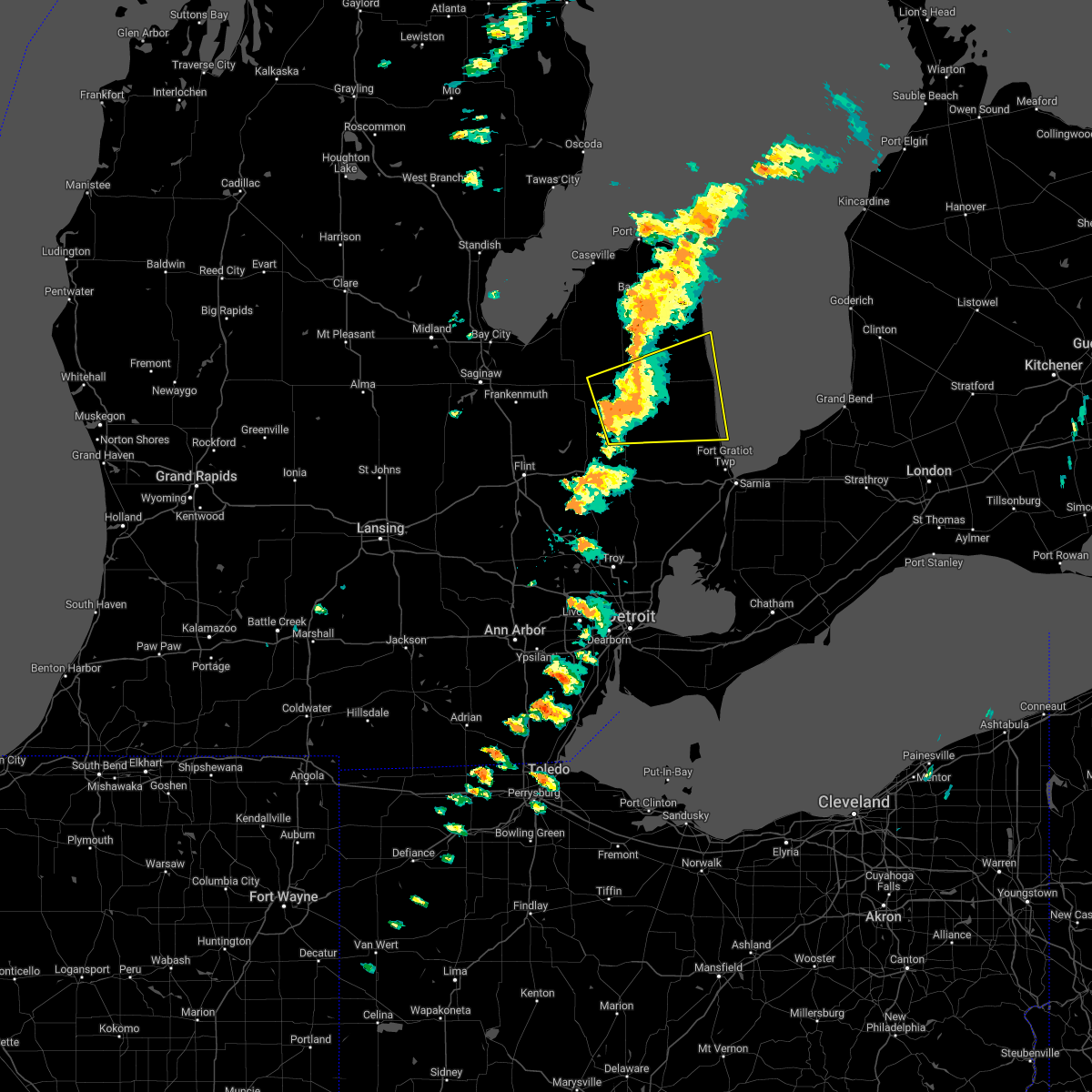 At 249 pm edt, a severe thunderstorm was located near clifford, or near marlette, moving east at 40 mph (radar indicated). Hazards include 60 mph wind gusts and nickel size hail. Expect damage to roofs, siding, and trees. this severe thunderstorm will be near, brown city around 255 pm edt. sandusky and peck around 315 pm edt. croswell around 325 pm edt. carsonville and applegate around 330 pm edt. port sanilac around 340 pm edt. Other locations impacted by this severe thunderstorm include east dayton, birch beach, mcgregor, wilmot, amador, snover, juhl, elmer, silverwood and valley center. At 249 pm edt, a severe thunderstorm was located near clifford, or near marlette, moving east at 40 mph (radar indicated). Hazards include 60 mph wind gusts and nickel size hail. Expect damage to roofs, siding, and trees. this severe thunderstorm will be near, brown city around 255 pm edt. sandusky and peck around 315 pm edt. croswell around 325 pm edt. carsonville and applegate around 330 pm edt. port sanilac around 340 pm edt. Other locations impacted by this severe thunderstorm include east dayton, birch beach, mcgregor, wilmot, amador, snover, juhl, elmer, silverwood and valley center.
|
| 9/14/2021 6:28 PM EDT |
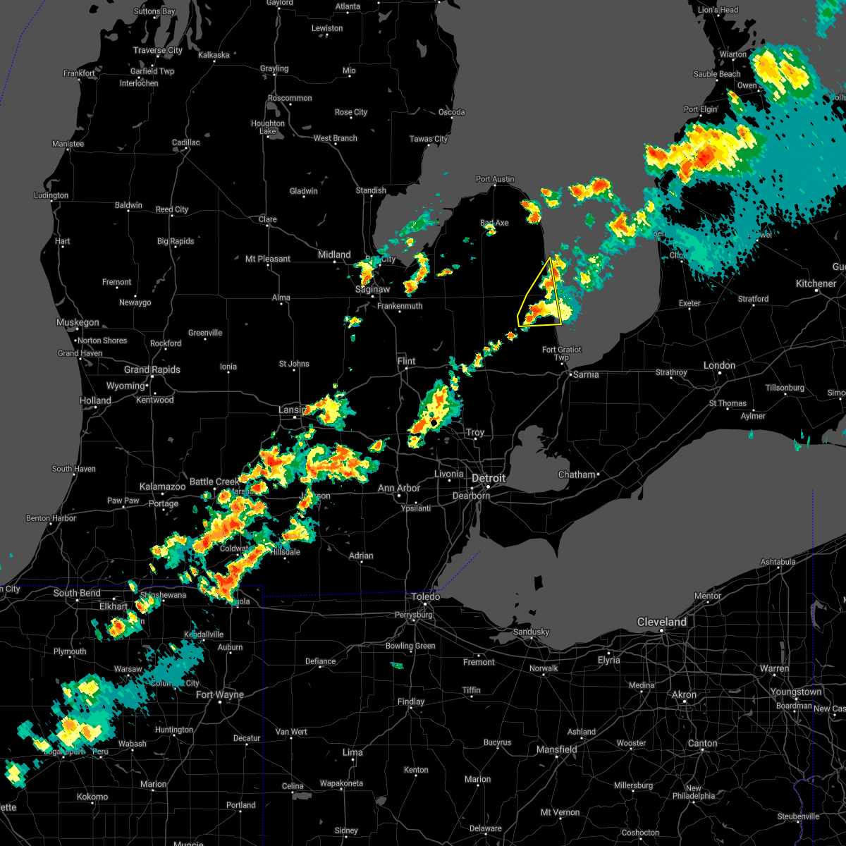 At 628 pm edt, a severe thunderstorm was located over applegate, or near croswell, moving east at 35 mph (radar indicated). Hazards include 60 mph wind gusts and quarter size hail. Hail damage to vehicles is expected. expect wind damage to roofs, siding, and trees. this severe storm will be near, lexington around 635 pm edt. port sanilac around 640 pm edt. other locations impacted by this severe thunderstorm include richmondville and forester. hail threat, radar indicated max hail size, 1. 00 in wind threat, radar indicated max wind gust, 60 mph. At 628 pm edt, a severe thunderstorm was located over applegate, or near croswell, moving east at 35 mph (radar indicated). Hazards include 60 mph wind gusts and quarter size hail. Hail damage to vehicles is expected. expect wind damage to roofs, siding, and trees. this severe storm will be near, lexington around 635 pm edt. port sanilac around 640 pm edt. other locations impacted by this severe thunderstorm include richmondville and forester. hail threat, radar indicated max hail size, 1. 00 in wind threat, radar indicated max wind gust, 60 mph.
|
| 9/14/2021 6:13 PM EDT |
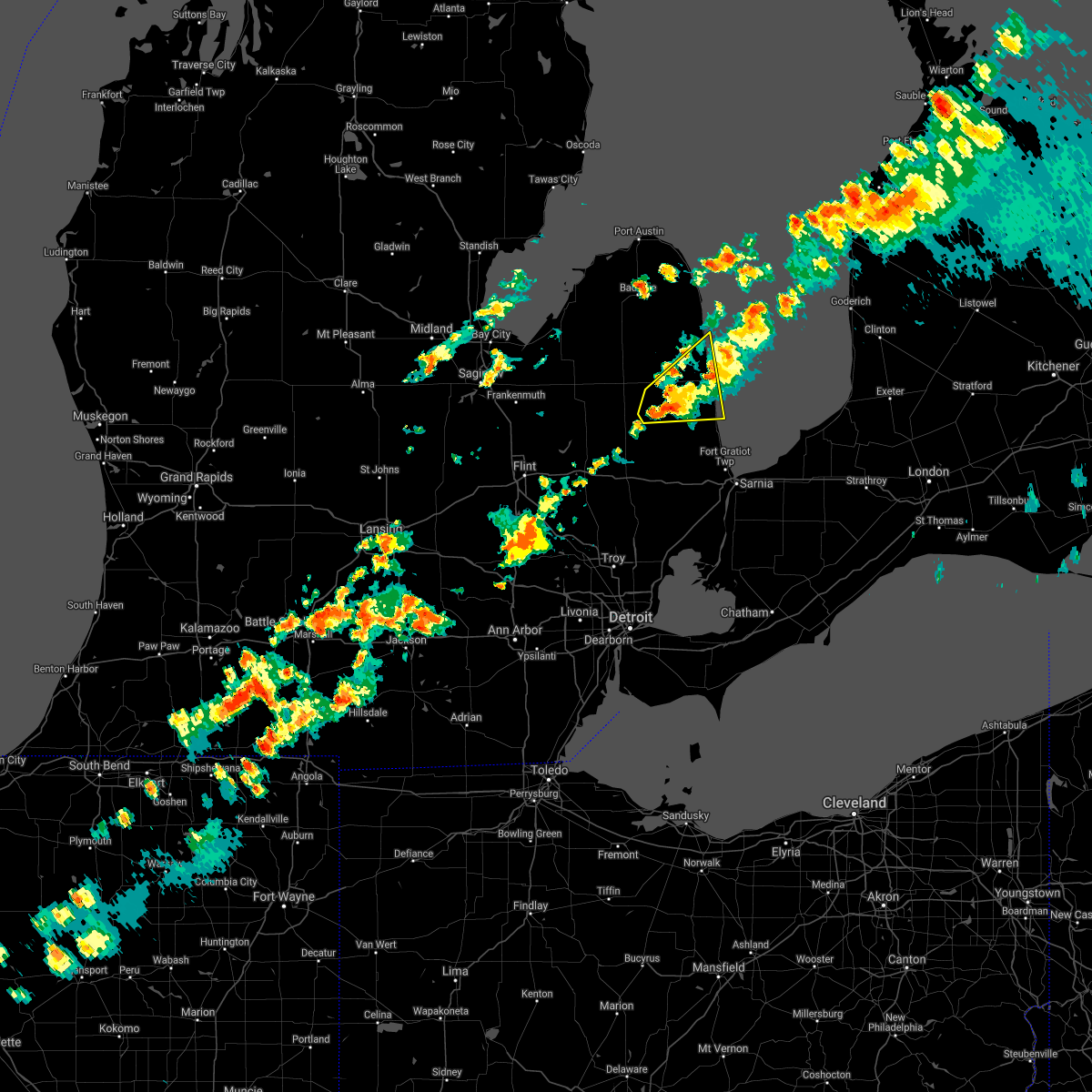 At 613 pm edt, a severe thunderstorm was located near peck, or 7 miles south of sandusky, moving east at 35 mph (radar indicated). Hazards include 60 mph wind gusts and quarter size hail. Hail damage to vehicles is expected. expect wind damage to roofs, siding, and trees. this severe storm will be near, croswell, carsonville and applegate around 630 pm edt. lexington around 635 pm edt. port sanilac around 640 pm edt. other locations impacted by this severe thunderstorm include forester, juhl, richmondville, watertown and mcgregor. hail threat, radar indicated max hail size, 1. 00 in wind threat, radar indicated max wind gust, 60 mph. At 613 pm edt, a severe thunderstorm was located near peck, or 7 miles south of sandusky, moving east at 35 mph (radar indicated). Hazards include 60 mph wind gusts and quarter size hail. Hail damage to vehicles is expected. expect wind damage to roofs, siding, and trees. this severe storm will be near, croswell, carsonville and applegate around 630 pm edt. lexington around 635 pm edt. port sanilac around 640 pm edt. other locations impacted by this severe thunderstorm include forester, juhl, richmondville, watertown and mcgregor. hail threat, radar indicated max hail size, 1. 00 in wind threat, radar indicated max wind gust, 60 mph.
|
| 9/14/2021 5:58 PM EDT |
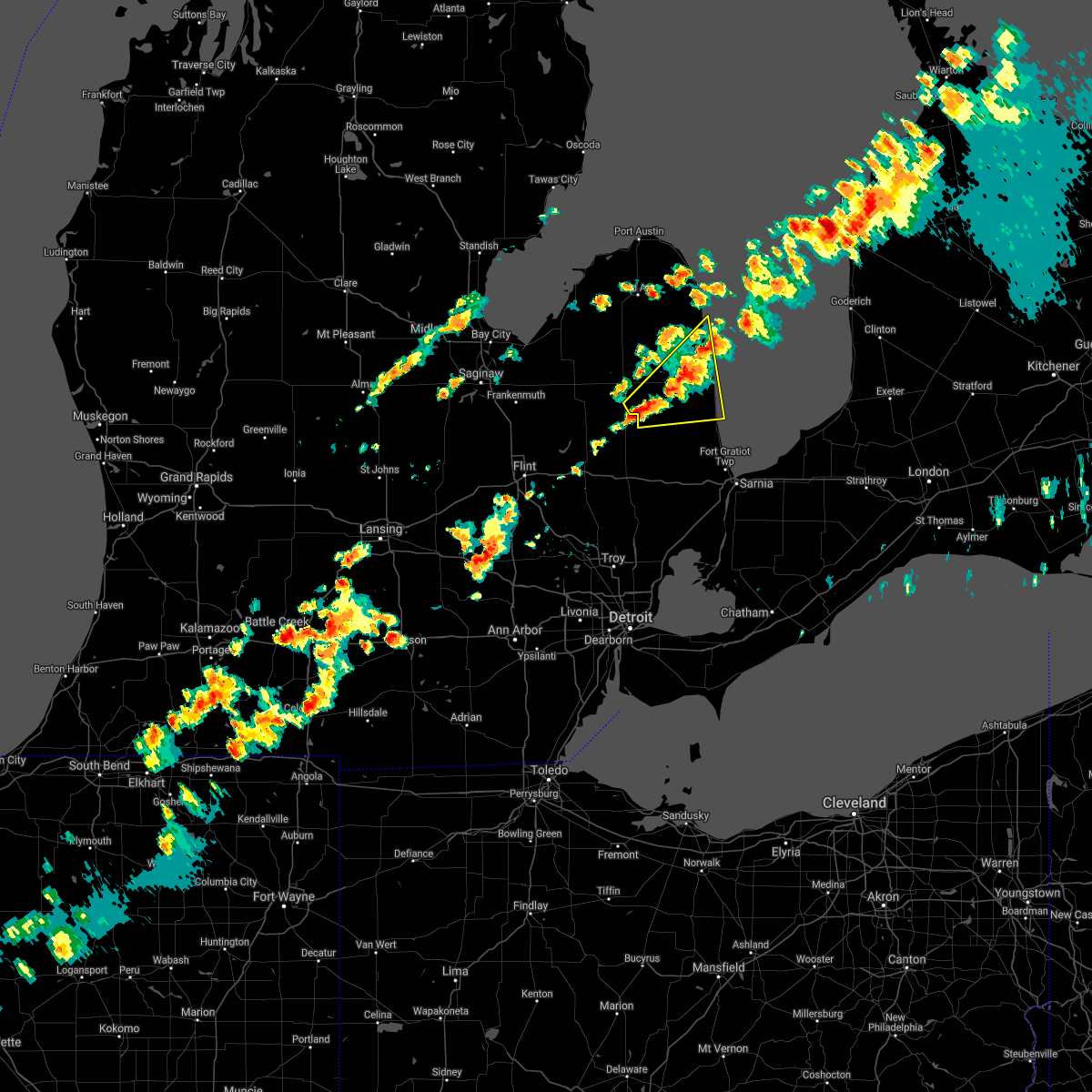 At 558 pm edt, a severe thunderstorm was located near marlette, moving northeast at 40 mph (radar indicated). Hazards include 60 mph wind gusts and quarter size hail. Hail damage to vehicles is expected. expect wind damage to roofs, siding, and trees. this severe thunderstorm will be near, peck around 605 pm edt. sandusky around 615 pm edt. carsonville and applegate around 625 pm edt. port sanilac around 635 pm edt. other locations impacted by this severe thunderstorm include forester, juhl, elmer, richmondville, watertown and mcgregor. hail threat, radar indicated max hail size, 1. 00 in wind threat, radar indicated max wind gust, 60 mph. At 558 pm edt, a severe thunderstorm was located near marlette, moving northeast at 40 mph (radar indicated). Hazards include 60 mph wind gusts and quarter size hail. Hail damage to vehicles is expected. expect wind damage to roofs, siding, and trees. this severe thunderstorm will be near, peck around 605 pm edt. sandusky around 615 pm edt. carsonville and applegate around 625 pm edt. port sanilac around 635 pm edt. other locations impacted by this severe thunderstorm include forester, juhl, elmer, richmondville, watertown and mcgregor. hail threat, radar indicated max hail size, 1. 00 in wind threat, radar indicated max wind gust, 60 mph.
|
| 8/29/2021 6:49 PM EDT |
 At 649 pm edt, severe thunderstorms were located along a line extending from near forestville to near carsonville to near melvin, moving east at 40 mph (radar indicated). Hazards include 60 mph wind gusts. Expect damage to roofs, siding, and trees. these severe storms will be near, port sanilac and forestville around 655 pm edt. other locations impacted by these severe thunderstorms include palms, birch beach, watertown, lexington heights, mcgregor, roseburg, forester, amador, minden and juhl. hail threat, radar indicated max hail size, <. 75 in wind threat, radar indicated max wind gust, 60 mph. At 649 pm edt, severe thunderstorms were located along a line extending from near forestville to near carsonville to near melvin, moving east at 40 mph (radar indicated). Hazards include 60 mph wind gusts. Expect damage to roofs, siding, and trees. these severe storms will be near, port sanilac and forestville around 655 pm edt. other locations impacted by these severe thunderstorms include palms, birch beach, watertown, lexington heights, mcgregor, roseburg, forester, amador, minden and juhl. hail threat, radar indicated max hail size, <. 75 in wind threat, radar indicated max wind gust, 60 mph.
|
| 8/29/2021 6:35 PM EDT |
 At 635 pm edt, severe thunderstorms were located along a line extending from 6 miles southeast of ubly to near sandusky to near brown city, moving east at 40 mph (radar indicated). Hazards include 60 mph wind gusts. Expect damage to roofs, siding, and trees. these severe storms will be near, deckerville around 640 pm edt. carsonville around 645 pm edt. port sanilac and forestville around 655 pm edt. croswell and applegate around 705 pm edt. lexington around 710 pm edt. other locations impacted by these severe thunderstorms include birch beach, mcgregor, amador, snover, juhl, elmer, valley center, tyre, decker and palms. hail threat, radar indicated max hail size, <. 75 in wind threat, radar indicated max wind gust, 60 mph. At 635 pm edt, severe thunderstorms were located along a line extending from 6 miles southeast of ubly to near sandusky to near brown city, moving east at 40 mph (radar indicated). Hazards include 60 mph wind gusts. Expect damage to roofs, siding, and trees. these severe storms will be near, deckerville around 640 pm edt. carsonville around 645 pm edt. port sanilac and forestville around 655 pm edt. croswell and applegate around 705 pm edt. lexington around 710 pm edt. other locations impacted by these severe thunderstorms include birch beach, mcgregor, amador, snover, juhl, elmer, valley center, tyre, decker and palms. hail threat, radar indicated max hail size, <. 75 in wind threat, radar indicated max wind gust, 60 mph.
|
| 8/29/2021 6:22 PM EDT |
 At 622 pm edt, severe thunderstorms were located along a line extending from near ubly to near argyle to near marlette, moving east at 40 mph (radar indicated). Hazards include 60 mph wind gusts. Expect damage to roofs, siding, and trees. these severe storms will be near, sandusky around 640 pm edt. deckerville and peck around 645 pm edt. forestville around 650 pm edt. croswell, carsonville and applegate around 655 pm edt. lexington and port sanilac around 705 pm edt. other locations impacted by these severe thunderstorms include birch beach, mcgregor, amador, snover, juhl, elmer, valley center, new greenleaf, tyre and decker. hail threat, radar indicated max hail size, <. 75 in wind threat, radar indicated max wind gust, 60 mph. At 622 pm edt, severe thunderstorms were located along a line extending from near ubly to near argyle to near marlette, moving east at 40 mph (radar indicated). Hazards include 60 mph wind gusts. Expect damage to roofs, siding, and trees. these severe storms will be near, sandusky around 640 pm edt. deckerville and peck around 645 pm edt. forestville around 650 pm edt. croswell, carsonville and applegate around 655 pm edt. lexington and port sanilac around 705 pm edt. other locations impacted by these severe thunderstorms include birch beach, mcgregor, amador, snover, juhl, elmer, valley center, new greenleaf, tyre and decker. hail threat, radar indicated max hail size, <. 75 in wind threat, radar indicated max wind gust, 60 mph.
|
| 8/29/2021 6:13 PM EDT |
 At 613 pm edt, severe thunderstorms were located along a line extending from 6 miles southwest of ubly to near cass city to near marlette, moving east at 40 mph (radar indicated). Hazards include 60 mph wind gusts. Expect damage to roofs, siding, and trees. severe thunderstorms will be near, argyle around 630 pm edt. sandusky and peck around 640 pm edt. deckerville around 645 pm edt. forestville and carsonville around 650 pm edt. croswell and applegate around 655 pm edt. lexington and port sanilac around 700 pm edt. other locations impacted by these severe thunderstorms include birch beach, mcgregor, amador, snover, juhl, elmer, valley center, new greenleaf, tyre and decker. hail threat, radar indicated max hail size, <. 75 in wind threat, radar indicated max wind gust, 60 mph. At 613 pm edt, severe thunderstorms were located along a line extending from 6 miles southwest of ubly to near cass city to near marlette, moving east at 40 mph (radar indicated). Hazards include 60 mph wind gusts. Expect damage to roofs, siding, and trees. severe thunderstorms will be near, argyle around 630 pm edt. sandusky and peck around 640 pm edt. deckerville around 645 pm edt. forestville and carsonville around 650 pm edt. croswell and applegate around 655 pm edt. lexington and port sanilac around 700 pm edt. other locations impacted by these severe thunderstorms include birch beach, mcgregor, amador, snover, juhl, elmer, valley center, new greenleaf, tyre and decker. hail threat, radar indicated max hail size, <. 75 in wind threat, radar indicated max wind gust, 60 mph.
|
| 7/24/2021 6:19 PM EDT |
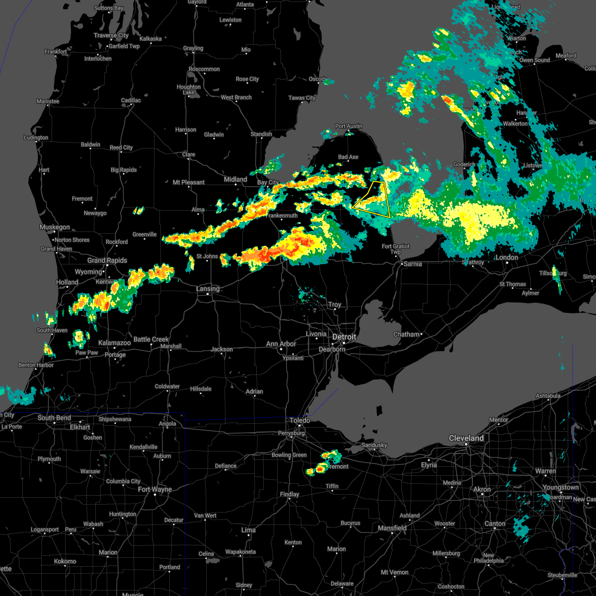 At 619 pm edt, severe thunderstorms were located along a line extending from forestville to near deckerville to near sandusky, moving east at 40 mph (radar indicated). Hazards include 60 mph wind gusts. Expect damage to roofs, siding, and trees. These severe thunderstorms will remain over mainly rural areas of northeastern sanilac county, including the following locations, richmondville and mcgregor. At 619 pm edt, severe thunderstorms were located along a line extending from forestville to near deckerville to near sandusky, moving east at 40 mph (radar indicated). Hazards include 60 mph wind gusts. Expect damage to roofs, siding, and trees. These severe thunderstorms will remain over mainly rural areas of northeastern sanilac county, including the following locations, richmondville and mcgregor.
|
| 7/24/2021 6:06 PM EDT |
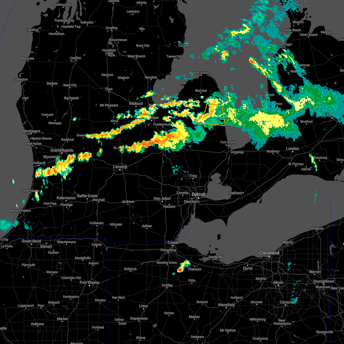 At 606 pm edt, a severe thunderstorm was located over deckerville, moving east at 45 mph (radar indicated). Hazards include 60 mph wind gusts. Expect damage to roofs, siding, and trees. this severe storm will be near, deckerville around 610 pm edt. carsonville around 615 pm edt. Other locations impacted by this severe thunderstorm include snover, palms, elmer, richmondville and mcgregor. At 606 pm edt, a severe thunderstorm was located over deckerville, moving east at 45 mph (radar indicated). Hazards include 60 mph wind gusts. Expect damage to roofs, siding, and trees. this severe storm will be near, deckerville around 610 pm edt. carsonville around 615 pm edt. Other locations impacted by this severe thunderstorm include snover, palms, elmer, richmondville and mcgregor.
|
| 7/24/2021 5:49 PM EDT |
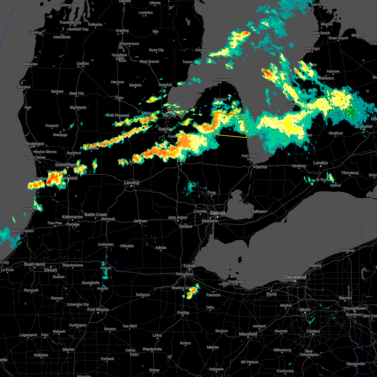 At 549 pm edt, a severe thunderstorm was located 7 miles southwest of argyle, or 7 miles southeast of cass city, moving east at 40 mph (radar indicated). Hazards include 60 mph wind gusts. Expect damage to roofs, siding, and trees. this severe thunderstorm will be near, argyle around 600 pm edt. Other locations in the path of this severe thunderstorm include sandusky, deckerville and carsonville. At 549 pm edt, a severe thunderstorm was located 7 miles southwest of argyle, or 7 miles southeast of cass city, moving east at 40 mph (radar indicated). Hazards include 60 mph wind gusts. Expect damage to roofs, siding, and trees. this severe thunderstorm will be near, argyle around 600 pm edt. Other locations in the path of this severe thunderstorm include sandusky, deckerville and carsonville.
|
| 7/6/2021 11:12 PM EDT |
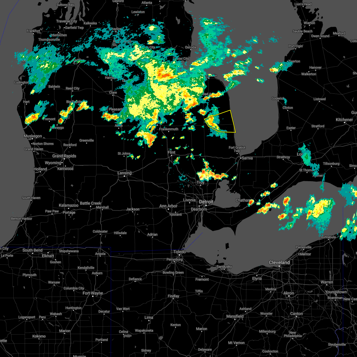 At 1111 pm edt, a severe thunderstorm was located near sandusky, moving east at 25 mph (radar indicated). Hazards include 60 mph wind gusts and penny size hail. Expect damage to roofs, siding, and trees. this severe storm will be near, sandusky around 1120 pm edt. deckerville around 1135 pm edt. carsonville around 1140 pm edt. port sanilac around 1155 pm edt. Other locations impacted by this severe thunderstorm include forester, snover, elmer, richmondville, watertown and mcgregor. At 1111 pm edt, a severe thunderstorm was located near sandusky, moving east at 25 mph (radar indicated). Hazards include 60 mph wind gusts and penny size hail. Expect damage to roofs, siding, and trees. this severe storm will be near, sandusky around 1120 pm edt. deckerville around 1135 pm edt. carsonville around 1140 pm edt. port sanilac around 1155 pm edt. Other locations impacted by this severe thunderstorm include forester, snover, elmer, richmondville, watertown and mcgregor.
|
| 7/6/2021 10:49 PM EDT |
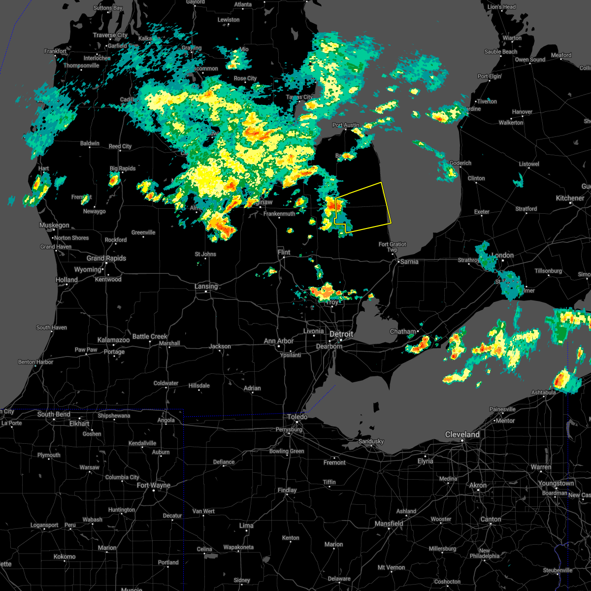 At 1048 pm edt, a severe thunderstorm was located near kingston, or 7 miles north of marlette, moving east at 35 mph (radar indicated). Hazards include 60 mph wind gusts and penny size hail. Expect damage to roofs, siding, and trees. this severe thunderstorm will be near, sandusky around 1110 pm edt. deckerville and carsonville around 1120 pm edt. port sanilac around 1135 pm edt. Other locations impacted by this severe thunderstorm include decker, watertown, mcgregor, forester, snover, juhl, elmer and richmondville. At 1048 pm edt, a severe thunderstorm was located near kingston, or 7 miles north of marlette, moving east at 35 mph (radar indicated). Hazards include 60 mph wind gusts and penny size hail. Expect damage to roofs, siding, and trees. this severe thunderstorm will be near, sandusky around 1110 pm edt. deckerville and carsonville around 1120 pm edt. port sanilac around 1135 pm edt. Other locations impacted by this severe thunderstorm include decker, watertown, mcgregor, forester, snover, juhl, elmer and richmondville.
|
| 10/23/2020 3:56 PM EDT |
 The severe thunderstorm warning for southeastern sanilac county will expire at 400 pm edt, the storms which prompted the warning have moved out of the area. therefore, the warning will be allowed to expire. however gusty winds and heavy rain are still possible with additional thunderstorms. a severe thunderstorm watch remains in effect until 900 pm edt for southeastern michigan. The severe thunderstorm warning for southeastern sanilac county will expire at 400 pm edt, the storms which prompted the warning have moved out of the area. therefore, the warning will be allowed to expire. however gusty winds and heavy rain are still possible with additional thunderstorms. a severe thunderstorm watch remains in effect until 900 pm edt for southeastern michigan.
|
| 10/23/2020 3:45 PM EDT |
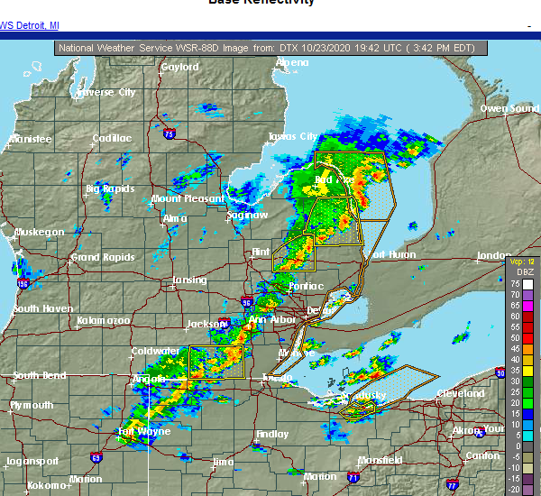 At 345 pm edt, severe thunderstorms were located along a line extending from near port sanilac to near carsonville to melvin, moving northeast at 50 mph (radar indicated). Hazards include 60 mph wind gusts and penny size hail. Expect damage to roofs, siding, and trees. these severe storms will be near, port sanilac around 355 pm edt. croswell around 400 pm edt. lexington around 405 pm edt. Other locations impacted by these severe thunderstorms include birch beach, watertown, lexington heights, mcgregor, roseburg, forester, amador, richmondville and valley center. At 345 pm edt, severe thunderstorms were located along a line extending from near port sanilac to near carsonville to melvin, moving northeast at 50 mph (radar indicated). Hazards include 60 mph wind gusts and penny size hail. Expect damage to roofs, siding, and trees. these severe storms will be near, port sanilac around 355 pm edt. croswell around 400 pm edt. lexington around 405 pm edt. Other locations impacted by these severe thunderstorms include birch beach, watertown, lexington heights, mcgregor, roseburg, forester, amador, richmondville and valley center.
|
| 10/23/2020 3:23 PM EDT |
 At 323 pm edt, severe thunderstorms were located along a line extending from near ubly to near sandusky to 6 miles north of brown city, moving northeast at 60 mph (radar indicated). Hazards include 60 mph wind gusts and penny size hail. Expect damage to roofs, siding, and trees. these severe storms will be near, deckerville around 330 pm edt. forestville around 335 pm edt. croswell, carsonville and applegate around 340 pm edt. port sanilac around 345 pm edt. Other locations impacted by these severe thunderstorms include birch beach, mcgregor, amador, snover, juhl, elmer, valley center, tyre, decker and palms. At 323 pm edt, severe thunderstorms were located along a line extending from near ubly to near sandusky to 6 miles north of brown city, moving northeast at 60 mph (radar indicated). Hazards include 60 mph wind gusts and penny size hail. Expect damage to roofs, siding, and trees. these severe storms will be near, deckerville around 330 pm edt. forestville around 335 pm edt. croswell, carsonville and applegate around 340 pm edt. port sanilac around 345 pm edt. Other locations impacted by these severe thunderstorms include birch beach, mcgregor, amador, snover, juhl, elmer, valley center, tyre, decker and palms.
|
| 10/23/2020 3:04 PM EDT |
 At 304 pm edt, severe thunderstorms were located along a line extending from near cass city to near lapeer, moving northeast at 60 mph (radar indicated). Hazards include 60 mph wind gusts and penny size hail. Expect damage to roofs, siding, and trees. severe thunderstorms will be near, marlette and brown city around 325 pm edt. melvin around 330 pm edt. peck around 335 pm edt. sandusky around 340 pm edt. croswell, carsonville and applegate around 345 pm edt. port sanilac around 350 pm edt. Other locations impacted by these severe thunderstorms include birch beach, mcgregor, amador, snover, juhl, elmer, valley center, tyre, decker and palms. At 304 pm edt, severe thunderstorms were located along a line extending from near cass city to near lapeer, moving northeast at 60 mph (radar indicated). Hazards include 60 mph wind gusts and penny size hail. Expect damage to roofs, siding, and trees. severe thunderstorms will be near, marlette and brown city around 325 pm edt. melvin around 330 pm edt. peck around 335 pm edt. sandusky around 340 pm edt. croswell, carsonville and applegate around 345 pm edt. port sanilac around 350 pm edt. Other locations impacted by these severe thunderstorms include birch beach, mcgregor, amador, snover, juhl, elmer, valley center, tyre, decker and palms.
|
| 7/9/2020 6:41 PM EDT |
 At 640 pm edt, a severe thunderstorm was located near argyle, or 9 miles northwest of sandusky, and is moving northeast at 5 mph (radar indicated). Hazards include 60 mph wind gusts. Expect damage to roofs, siding, and trees. Locations impacted include, sandusky, croswell, deckerville, forestville, argyle, carsonville, applegate, watertown, elmer, minden, mcgregor, snover, juhl, new greenleaf, tyre, decker, palms and richmondville. At 640 pm edt, a severe thunderstorm was located near argyle, or 9 miles northwest of sandusky, and is moving northeast at 5 mph (radar indicated). Hazards include 60 mph wind gusts. Expect damage to roofs, siding, and trees. Locations impacted include, sandusky, croswell, deckerville, forestville, argyle, carsonville, applegate, watertown, elmer, minden, mcgregor, snover, juhl, new greenleaf, tyre, decker, palms and richmondville.
|
| 7/9/2020 6:29 PM EDT |
 At 628 pm edt, a severe thunderstorm was located near marlette, moving north at 5 mph (radar indicated). Hazards include 60 mph wind gusts. Expect damage to roofs, siding, and trees. this severe thunderstorm will remain over mainly rural areas of sanilac county, including the following locations, tyre, decker, palms, watertown, mcgregor, snover, minden, juhl, elmer and richmondville. additional strong to severe thunderstorms may develop during this time across the county. These storms will be capable of wind gusts of 50 to 60 mph. At 628 pm edt, a severe thunderstorm was located near marlette, moving north at 5 mph (radar indicated). Hazards include 60 mph wind gusts. Expect damage to roofs, siding, and trees. this severe thunderstorm will remain over mainly rural areas of sanilac county, including the following locations, tyre, decker, palms, watertown, mcgregor, snover, minden, juhl, elmer and richmondville. additional strong to severe thunderstorms may develop during this time across the county. These storms will be capable of wind gusts of 50 to 60 mph.
|
| 7/9/2020 6:20 PM EDT |
 At 618 pm edt, a severe thunderstorm was located over marlette, moving northeast at 10 mph (radar indicated). Hazards include 60 mph wind gusts. Expect damage to roofs, siding, and trees. this severe thunderstorm will be near, argyle around 715 pm edt. additional strong to severe thunderstorms will be possible across the sanilac county over the next hour. these storms will be capable of producing wind gusts of 50 to 60 mph. Locations potentially impacted include mcgregor, snover, juhl, elmer, valley center, new greenleaf, tyre, decker, palms and watertown. At 618 pm edt, a severe thunderstorm was located over marlette, moving northeast at 10 mph (radar indicated). Hazards include 60 mph wind gusts. Expect damage to roofs, siding, and trees. this severe thunderstorm will be near, argyle around 715 pm edt. additional strong to severe thunderstorms will be possible across the sanilac county over the next hour. these storms will be capable of producing wind gusts of 50 to 60 mph. Locations potentially impacted include mcgregor, snover, juhl, elmer, valley center, new greenleaf, tyre, decker, palms and watertown.
|
| 6/10/2020 4:45 PM EDT |
 At 445 pm edt, a severe thunderstorm was located over sandusky, moving northeast at 45 mph (radar indicated). Hazards include 60 mph wind gusts and nickel size hail. Expect damage to roofs, siding, and trees. this severe storm will be near, deckerville around 450 pm edt. forestville around 510 pm edt. Other locations impacted by this severe thunderstorm include goodland township, birch beach, attica, elba, mcgregor, amador, snover, juhl, elmer and valley center. At 445 pm edt, a severe thunderstorm was located over sandusky, moving northeast at 45 mph (radar indicated). Hazards include 60 mph wind gusts and nickel size hail. Expect damage to roofs, siding, and trees. this severe storm will be near, deckerville around 450 pm edt. forestville around 510 pm edt. Other locations impacted by this severe thunderstorm include goodland township, birch beach, attica, elba, mcgregor, amador, snover, juhl, elmer and valley center.
|
| 6/10/2020 4:30 PM EDT |
 At 430 pm edt, a severe thunderstorm was located 7 miles northwest of peck, or 7 miles east of marlette, moving northeast at 55 mph (radar indicated). Hazards include golf ball size hail and 70 mph wind gusts. People and animals outdoors will be injured. expect hail damage to roofs, siding, windows, and vehicles. expect considerable tree damage. wind damage is also likely to mobile homes, roofs, and outbuildings. this severe storm will be near, sandusky around 440 pm edt. deckerville and carsonville around 445 pm edt. forestville around 500 pm edt. Other locations impacted by this severe thunderstorm include goodland township, birch beach, attica, elba, mcgregor, amador, snover, juhl, elmer and silverwood. At 430 pm edt, a severe thunderstorm was located 7 miles northwest of peck, or 7 miles east of marlette, moving northeast at 55 mph (radar indicated). Hazards include golf ball size hail and 70 mph wind gusts. People and animals outdoors will be injured. expect hail damage to roofs, siding, windows, and vehicles. expect considerable tree damage. wind damage is also likely to mobile homes, roofs, and outbuildings. this severe storm will be near, sandusky around 440 pm edt. deckerville and carsonville around 445 pm edt. forestville around 500 pm edt. Other locations impacted by this severe thunderstorm include goodland township, birch beach, attica, elba, mcgregor, amador, snover, juhl, elmer and silverwood.
|
| 6/10/2020 4:14 PM EDT |
 At 414 pm edt, severe thunderstorms were located along a line extending from 7 miles west of forestville to 6 miles northwest of peck to near lapeer, moving northeast at 35 mph (radar indicated). Hazards include 70 mph wind gusts. Expect considerable tree damage. damage is likely to mobile homes, roofs, and outbuildings. these severe storms will be near, sandusky and forestville around 425 pm edt. north branch, carsonville and lum around 435 pm edt. brown city around 450 pm edt. melvin around 500 pm edt. peck around 505 pm edt. croswell around 520 pm edt. applegate around 525 pm edt. lexington around 530 pm edt. Other locations impacted by these severe thunderstorms include goodland township, birch beach, attica, elba, mcgregor, amador, snover, juhl, elmer and silverwood. At 414 pm edt, severe thunderstorms were located along a line extending from 7 miles west of forestville to 6 miles northwest of peck to near lapeer, moving northeast at 35 mph (radar indicated). Hazards include 70 mph wind gusts. Expect considerable tree damage. damage is likely to mobile homes, roofs, and outbuildings. these severe storms will be near, sandusky and forestville around 425 pm edt. north branch, carsonville and lum around 435 pm edt. brown city around 450 pm edt. melvin around 500 pm edt. peck around 505 pm edt. croswell around 520 pm edt. applegate around 525 pm edt. lexington around 530 pm edt. Other locations impacted by these severe thunderstorms include goodland township, birch beach, attica, elba, mcgregor, amador, snover, juhl, elmer and silverwood.
|
| 6/10/2020 3:59 PM EDT |
 At 359 pm edt, severe thunderstorms were located along a line extending from argyle to near lum, moving northeast at 40 mph (radar indicated). Hazards include 70 mph wind gusts and half dollar size hail. Hail damage to vehicles is expected. expect considerable tree damage. wind damage is also likely to mobile homes, roofs, and outbuildings. these severe storms will be near, argyle around 405 pm edt. north branch around 415 pm edt. brown city around 420 pm edt. clifford around 425 pm edt. marlette around 430 pm edt. sandusky around 445 pm edt. deckerville around 455 pm edt. forestville around 515 pm edt. Other locations impacted by these severe thunderstorms include goodland township, birch beach, attica, elba, mcgregor, amador, snover, juhl, elmer and silverwood. At 359 pm edt, severe thunderstorms were located along a line extending from argyle to near lum, moving northeast at 40 mph (radar indicated). Hazards include 70 mph wind gusts and half dollar size hail. Hail damage to vehicles is expected. expect considerable tree damage. wind damage is also likely to mobile homes, roofs, and outbuildings. these severe storms will be near, argyle around 405 pm edt. north branch around 415 pm edt. brown city around 420 pm edt. clifford around 425 pm edt. marlette around 430 pm edt. sandusky around 445 pm edt. deckerville around 455 pm edt. forestville around 515 pm edt. Other locations impacted by these severe thunderstorms include goodland township, birch beach, attica, elba, mcgregor, amador, snover, juhl, elmer and silverwood.
|
| 6/10/2020 3:46 PM EDT |
 At 345 pm edt, severe thunderstorms were located along a line extending from near sandusky to near davison, moving northeast at 45 mph (radar indicated). Hazards include 70 mph wind gusts and quarter size hail. Hail damage to vehicles is expected. expect considerable tree damage. wind damage is also likely to mobile homes, roofs, and outbuildings. severe thunderstorms will be near, argyle around 355 pm edt. deckerville around 400 pm edt. lapeer and columbiaville around 405 pm edt. lum around 415 pm edt. north branch and forestville around 420 pm edt. clifford around 425 pm edt. brown city around 430 pm edt. marlette around 435 pm edt. Other locations impacted by these severe thunderstorms include goodland township, birch beach, attica, elba, mcgregor, amador, snover, juhl, elmer and silverwood. At 345 pm edt, severe thunderstorms were located along a line extending from near sandusky to near davison, moving northeast at 45 mph (radar indicated). Hazards include 70 mph wind gusts and quarter size hail. Hail damage to vehicles is expected. expect considerable tree damage. wind damage is also likely to mobile homes, roofs, and outbuildings. severe thunderstorms will be near, argyle around 355 pm edt. deckerville around 400 pm edt. lapeer and columbiaville around 405 pm edt. lum around 415 pm edt. north branch and forestville around 420 pm edt. clifford around 425 pm edt. brown city around 430 pm edt. marlette around 435 pm edt. Other locations impacted by these severe thunderstorms include goodland township, birch beach, attica, elba, mcgregor, amador, snover, juhl, elmer and silverwood.
|
| 9/13/2019 5:18 PM EDT | Numerous trees down and damage to a pavilion near forester rd and m-2 in sanilac county MI, 7.5 miles SW of Carsonville, MI |
| 9/10/2019 9:22 PM EDT |
 At 922 pm edt, a severe thunderstorm capable of producing a tornado was located near applegate, or 7 miles southeast of sandusky, moving east at 40 mph (radar indicated rotation). Hazards include tornado. Flying debris will be dangerous to those caught without shelter. mobile homes will be damaged or destroyed. damage to roofs, windows, and vehicles will occur. tree damage is likely. this dangerous storm will be near, croswell around 930 pm edt. port sanilac around 935 pm edt. lexington around 940 pm edt. Other locations impacted by this tornadic thunderstorm include watertown. At 922 pm edt, a severe thunderstorm capable of producing a tornado was located near applegate, or 7 miles southeast of sandusky, moving east at 40 mph (radar indicated rotation). Hazards include tornado. Flying debris will be dangerous to those caught without shelter. mobile homes will be damaged or destroyed. damage to roofs, windows, and vehicles will occur. tree damage is likely. this dangerous storm will be near, croswell around 930 pm edt. port sanilac around 935 pm edt. lexington around 940 pm edt. Other locations impacted by this tornadic thunderstorm include watertown.
|
| 9/10/2019 9:08 PM EDT |
 At 908 pm edt, a severe thunderstorm capable of producing a tornado was located near sandusky, moving east at 40 mph (radar indicated rotation). Hazards include tornado and quarter size hail. Flying debris will be dangerous to those caught without shelter. mobile homes will be damaged or destroyed. damage to roofs, windows, and vehicles will occur. tree damage is likely. this dangerous storm will be near, sandusky around 915 pm edt. carsonville around 925 pm edt. croswell and applegate around 935 pm edt. lexington around 940 pm edt. Other locations impacted by this tornadic thunderstorm include decker, watertown, mcgregor, forester, snover, juhl and elmer. At 908 pm edt, a severe thunderstorm capable of producing a tornado was located near sandusky, moving east at 40 mph (radar indicated rotation). Hazards include tornado and quarter size hail. Flying debris will be dangerous to those caught without shelter. mobile homes will be damaged or destroyed. damage to roofs, windows, and vehicles will occur. tree damage is likely. this dangerous storm will be near, sandusky around 915 pm edt. carsonville around 925 pm edt. croswell and applegate around 935 pm edt. lexington around 940 pm edt. Other locations impacted by this tornadic thunderstorm include decker, watertown, mcgregor, forester, snover, juhl and elmer.
|
| 9/10/2019 8:52 PM EDT |
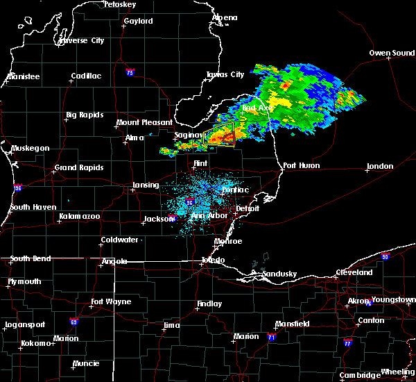 At 852 pm edt, a severe thunderstorm capable of producing a tornado was located near kingston, or near marlette, moving east at 35 mph (radar indicated rotation). Hazards include tornado and quarter size hail. Flying debris will be dangerous to those caught without shelter. mobile homes will be damaged or destroyed. damage to roofs, windows, and vehicles will occur. tree damage is likely. this dangerous storm will be near, marlette around 900 pm edt. sandusky around 915 pm edt. carsonville around 930 pm edt. croswell and applegate around 935 pm edt. lexington and port sanilac around 940 pm edt. Other locations impacted by this tornadic thunderstorm include decker, watertown, mcgregor, forester, snover, juhl and elmer. At 852 pm edt, a severe thunderstorm capable of producing a tornado was located near kingston, or near marlette, moving east at 35 mph (radar indicated rotation). Hazards include tornado and quarter size hail. Flying debris will be dangerous to those caught without shelter. mobile homes will be damaged or destroyed. damage to roofs, windows, and vehicles will occur. tree damage is likely. this dangerous storm will be near, marlette around 900 pm edt. sandusky around 915 pm edt. carsonville around 930 pm edt. croswell and applegate around 935 pm edt. lexington and port sanilac around 940 pm edt. Other locations impacted by this tornadic thunderstorm include decker, watertown, mcgregor, forester, snover, juhl and elmer.
|
| 8/18/2019 2:20 PM EDT |
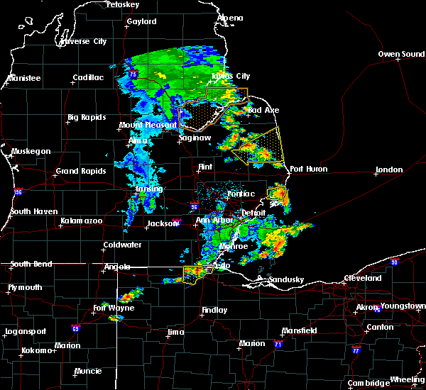 At 220 pm edt, a severe thunderstorm was located near applegate, or near sandusky, moving northeast at 35 mph (radar indicated). Hazards include 60 mph wind gusts. Expect damage to roofs, siding, and trees. this severe storm will be near, croswell around 225 pm edt. carsonville and applegate around 230 pm edt. port sanilac around 240 pm edt. Other locations impacted by this severe thunderstorm include birch beach, watertown, lexington heights, mcgregor, forester, amador, juhl, elmer and richmondville. At 220 pm edt, a severe thunderstorm was located near applegate, or near sandusky, moving northeast at 35 mph (radar indicated). Hazards include 60 mph wind gusts. Expect damage to roofs, siding, and trees. this severe storm will be near, croswell around 225 pm edt. carsonville and applegate around 230 pm edt. port sanilac around 240 pm edt. Other locations impacted by this severe thunderstorm include birch beach, watertown, lexington heights, mcgregor, forester, amador, juhl, elmer and richmondville.
|
| 8/18/2019 2:04 PM EDT |
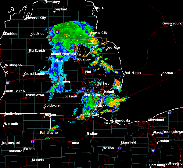 At 204 pm edt, a severe thunderstorm was located near peck, or near brown city, moving northeast at 35 mph (radar indicated). Hazards include 60 mph wind gusts. Expect damage to roofs, siding, and trees. this severe storm will be near, sandusky around 220 pm edt. croswell around 225 pm edt. carsonville and applegate around 230 pm edt. port sanilac around 240 pm edt. Other locations impacted by this severe thunderstorm include birch beach, watertown, lexington heights, mcgregor, roseburg, forester, amador, juhl, elmer and richmondville. At 204 pm edt, a severe thunderstorm was located near peck, or near brown city, moving northeast at 35 mph (radar indicated). Hazards include 60 mph wind gusts. Expect damage to roofs, siding, and trees. this severe storm will be near, sandusky around 220 pm edt. croswell around 225 pm edt. carsonville and applegate around 230 pm edt. port sanilac around 240 pm edt. Other locations impacted by this severe thunderstorm include birch beach, watertown, lexington heights, mcgregor, roseburg, forester, amador, juhl, elmer and richmondville.
|
| 8/18/2019 1:49 PM EDT |
 At 149 pm edt, a severe thunderstorm was located near brown city, moving northeast at 35 mph (radar indicated). Hazards include 60 mph wind gusts. Expect damage to roofs, siding, and trees. this severe thunderstorm will be near, melvin around 200 pm edt. peck around 210 pm edt. sandusky around 220 pm edt. croswell around 225 pm edt. carsonville and applegate around 230 pm edt. port sanilac around 240 pm edt. Other locations impacted by this severe thunderstorm include birch beach, burnside, watertown, lexington heights, mcgregor, roseburg, forester, amador, juhl and elmer. At 149 pm edt, a severe thunderstorm was located near brown city, moving northeast at 35 mph (radar indicated). Hazards include 60 mph wind gusts. Expect damage to roofs, siding, and trees. this severe thunderstorm will be near, melvin around 200 pm edt. peck around 210 pm edt. sandusky around 220 pm edt. croswell around 225 pm edt. carsonville and applegate around 230 pm edt. port sanilac around 240 pm edt. Other locations impacted by this severe thunderstorm include birch beach, burnside, watertown, lexington heights, mcgregor, roseburg, forester, amador, juhl and elmer.
|
| 7/29/2019 3:17 PM EDT |
 At 317 pm edt, a severe thunderstorm was located over carsonville, or near deckerville, moving northeast at 50 mph (radar indicated). Hazards include 60 mph wind gusts. Expect damage to roofs, siding, and trees. this severe storm will be near, forestville around 335 pm edt. Other locations impacted by this severe thunderstorm include forester, minden, palms, richmondville and mcgregor. At 317 pm edt, a severe thunderstorm was located over carsonville, or near deckerville, moving northeast at 50 mph (radar indicated). Hazards include 60 mph wind gusts. Expect damage to roofs, siding, and trees. this severe storm will be near, forestville around 335 pm edt. Other locations impacted by this severe thunderstorm include forester, minden, palms, richmondville and mcgregor.
|
| 7/29/2019 3:11 PM EDT |
 At 311 pm edt, a severe thunderstorm was located near carsonville, or near sandusky, moving northeast at 35 mph (radar indicated). Hazards include 60 mph wind gusts. Expect damage to roofs, siding, and trees. this severe storm will be near, deckerville, carsonville and applegate around 315 pm edt. port sanilac around 325 pm edt. Other locations impacted by this severe thunderstorm include tyre, palms, mcgregor, forester, minden, richmondville and new greenleaf. At 311 pm edt, a severe thunderstorm was located near carsonville, or near sandusky, moving northeast at 35 mph (radar indicated). Hazards include 60 mph wind gusts. Expect damage to roofs, siding, and trees. this severe storm will be near, deckerville, carsonville and applegate around 315 pm edt. port sanilac around 325 pm edt. Other locations impacted by this severe thunderstorm include tyre, palms, mcgregor, forester, minden, richmondville and new greenleaf.
|
| 7/29/2019 3:04 PM EDT |
 At 304 pm edt, a severe thunderstorm was located near sandusky, moving northeast at 60 mph (radar indicated). Hazards include 60 mph wind gusts. Expect damage to roofs, siding, and trees. this severe storm will be near, deckerville, carsonville and applegate around 310 pm edt. port sanilac around 315 pm edt. Other locations impacted by this severe thunderstorm include birch beach, mcgregor, amador, snover, juhl, elmer, new greenleaf, tyre, palms and watertown. At 304 pm edt, a severe thunderstorm was located near sandusky, moving northeast at 60 mph (radar indicated). Hazards include 60 mph wind gusts. Expect damage to roofs, siding, and trees. this severe storm will be near, deckerville, carsonville and applegate around 310 pm edt. port sanilac around 315 pm edt. Other locations impacted by this severe thunderstorm include birch beach, mcgregor, amador, snover, juhl, elmer, new greenleaf, tyre, palms and watertown.
|
| 7/29/2019 2:56 PM EDT |
 The national weather service in detroit/pontiac has issued a * severe thunderstorm warning for. sanilac county in southeastern michigan. northern st. clair county in southeastern michigan. until 400 pm edt. At 256 pm edt, severe thunderstorms were located along a line. The national weather service in detroit/pontiac has issued a * severe thunderstorm warning for. sanilac county in southeastern michigan. northern st. clair county in southeastern michigan. until 400 pm edt. At 256 pm edt, severe thunderstorms were located along a line.
|
| 7/20/2019 6:50 PM EDT |
 The severe thunderstorm warning for sanilac county will expire at 700 pm edt, the storms which prompted the warning have moved out of the area. therefore, the warning will be allowed to expire. however gusty winds are still possible. a severe thunderstorm watch remains in effect until 1000 pm edt for southeastern michigan. The severe thunderstorm warning for sanilac county will expire at 700 pm edt, the storms which prompted the warning have moved out of the area. therefore, the warning will be allowed to expire. however gusty winds are still possible. a severe thunderstorm watch remains in effect until 1000 pm edt for southeastern michigan.
|
| 7/20/2019 6:35 PM EDT |
 At 635 pm edt, severe thunderstorms were located along a line extending from near forestville to near yale, moving east at 40 mph (radar indicated). Hazards include 60 mph wind gusts. Expect damage to roofs, siding, and trees. these severe storms will be near, forestville around 640 pm edt. other locations impacted by these severe thunderstorms include tyre, palms, watertown, mcgregor, forester, minden, juhl, elmer and richmondville. People attending pioneer days festival should seek safe shelter immediately!. At 635 pm edt, severe thunderstorms were located along a line extending from near forestville to near yale, moving east at 40 mph (radar indicated). Hazards include 60 mph wind gusts. Expect damage to roofs, siding, and trees. these severe storms will be near, forestville around 640 pm edt. other locations impacted by these severe thunderstorms include tyre, palms, watertown, mcgregor, forester, minden, juhl, elmer and richmondville. People attending pioneer days festival should seek safe shelter immediately!.
|
| 7/20/2019 6:20 PM EDT |
 At 620 pm edt, severe thunderstorms were located along a line extending from near ubly to near lum, moving east at 20 mph (radar indicated). Hazards include 60 mph wind gusts. Expect damage to roofs, siding, and trees. these severe storms will be near, argyle around 625 pm edt. forestville around 700 pm edt. other locations impacted by these severe thunderstorms include tyre, decker, palms, watertown, mcgregor, forester, snover, minden, juhl and elmer. People attending pioneer days festival, and marlettes country fair days should seek safe shelter immediately!. At 620 pm edt, severe thunderstorms were located along a line extending from near ubly to near lum, moving east at 20 mph (radar indicated). Hazards include 60 mph wind gusts. Expect damage to roofs, siding, and trees. these severe storms will be near, argyle around 625 pm edt. forestville around 700 pm edt. other locations impacted by these severe thunderstorms include tyre, decker, palms, watertown, mcgregor, forester, snover, minden, juhl and elmer. People attending pioneer days festival, and marlettes country fair days should seek safe shelter immediately!.
|
| 7/20/2019 6:09 PM EDT |
 At 609 pm edt, severe thunderstorms were located along a line extending from 6 miles southwest of ubly to near lapeer, moving east at 20 mph (radar indicated). Hazards include 60 mph wind gusts. Expect damage to roofs, siding, and trees. these severe storms will be near, argyle around 625 pm edt. forestville around 700 pm edt. other locations impacted by these severe thunderstorms include east dayton, colling, mcgregor, wilmot, ellington, snover, juhl, elmer, silverwood and new greenleaf. People attending pioneer days festival, and marlettes country fair days should seek safe shelter immediately!. At 609 pm edt, severe thunderstorms were located along a line extending from 6 miles southwest of ubly to near lapeer, moving east at 20 mph (radar indicated). Hazards include 60 mph wind gusts. Expect damage to roofs, siding, and trees. these severe storms will be near, argyle around 625 pm edt. forestville around 700 pm edt. other locations impacted by these severe thunderstorms include east dayton, colling, mcgregor, wilmot, ellington, snover, juhl, elmer, silverwood and new greenleaf. People attending pioneer days festival, and marlettes country fair days should seek safe shelter immediately!.
|
| 7/20/2019 5:53 PM EDT |
 At 553 pm edt, severe thunderstorms were located along a line extending from near cass city to near lapeer, moving east at 20 mph (radar indicated). Hazards include 60 mph wind gusts. Expect damage to roofs, siding, and trees. severe thunderstorms will be near, cass city around 600 pm edt. argyle around 625 pm edt. forestville around 700 pm edt. other locations impacted by these severe thunderstorms include east dayton, colling, mcgregor, wilmot, ellington, snover, juhl, elmer, silverwood and new greenleaf. People attending pioneer days festival, and marlettes country fair days should seek safe shelter immediately!. At 553 pm edt, severe thunderstorms were located along a line extending from near cass city to near lapeer, moving east at 20 mph (radar indicated). Hazards include 60 mph wind gusts. Expect damage to roofs, siding, and trees. severe thunderstorms will be near, cass city around 600 pm edt. argyle around 625 pm edt. forestville around 700 pm edt. other locations impacted by these severe thunderstorms include east dayton, colling, mcgregor, wilmot, ellington, snover, juhl, elmer, silverwood and new greenleaf. People attending pioneer days festival, and marlettes country fair days should seek safe shelter immediately!.
|
| 5/19/2019 2:57 PM EDT |
 At 257 pm edt, a severe thunderstorm was located near deckerville, moving northeast at 50 mph (radar indicated). Hazards include 60 mph wind gusts. Expect damage to roofs, siding, and trees. this severe storm will be near, forestville around 315 pm edt. Other locations impacted by this severe thunderstorm include birch beach, mcgregor, amador, snover, juhl, elmer, new greenleaf, tyre, palms and watertown. At 257 pm edt, a severe thunderstorm was located near deckerville, moving northeast at 50 mph (radar indicated). Hazards include 60 mph wind gusts. Expect damage to roofs, siding, and trees. this severe storm will be near, forestville around 315 pm edt. Other locations impacted by this severe thunderstorm include birch beach, mcgregor, amador, snover, juhl, elmer, new greenleaf, tyre, palms and watertown.
|
| 5/19/2019 2:36 PM EDT |
 At 235 pm edt, a severe thunderstorm was located near kingston, or near marlette, moving northeast at 50 mph (radar indicated). Hazards include 60 mph wind gusts. Expect damage to roofs, siding, and trees. this severe thunderstorm will be near, argyle around 250 pm edt. sandusky around 255 pm edt. deckerville and carsonville around 300 pm edt. forestville around 310 pm edt. Other locations impacted by this severe thunderstorm include birch beach, mcgregor, amador, snover, juhl, elmer, valley center, new greenleaf, tyre and decker. At 235 pm edt, a severe thunderstorm was located near kingston, or near marlette, moving northeast at 50 mph (radar indicated). Hazards include 60 mph wind gusts. Expect damage to roofs, siding, and trees. this severe thunderstorm will be near, argyle around 250 pm edt. sandusky around 255 pm edt. deckerville and carsonville around 300 pm edt. forestville around 310 pm edt. Other locations impacted by this severe thunderstorm include birch beach, mcgregor, amador, snover, juhl, elmer, valley center, new greenleaf, tyre and decker.
|
| 10/7/2017 11:42 PM EDT |
 At 1125 pm edt, severe thunderstorms were located along a line extending from near port hope to 6 miles west of forestville to near melvin, moving northeast at 60 mph (radar indicated). Hazards include 60 mph wind gusts. Expect damage to roofs, siding, and trees. these severe storms will be near, port hope and forestville around 1130 pm edt. croswell, lexington and applegate around 1140 pm edt. port sanilac around 1145 pm edt. Other locations impacted by these severe thunderstorms include bad axe, deckerville, lexington, ubly, port austin, harbor beach, port hope, sandusky, croswell and port sanilac. At 1125 pm edt, severe thunderstorms were located along a line extending from near port hope to 6 miles west of forestville to near melvin, moving northeast at 60 mph (radar indicated). Hazards include 60 mph wind gusts. Expect damage to roofs, siding, and trees. these severe storms will be near, port hope and forestville around 1130 pm edt. croswell, lexington and applegate around 1140 pm edt. port sanilac around 1145 pm edt. Other locations impacted by these severe thunderstorms include bad axe, deckerville, lexington, ubly, port austin, harbor beach, port hope, sandusky, croswell and port sanilac.
|
| 10/7/2017 11:40 PM EDT | Sanilac county central dispatch reported trees down along m25 in forester townshi in sanilac county MI, 7.5 miles SW of Carsonville, MI |
| 10/7/2017 11:26 PM EDT |
 At 1125 pm edt, severe thunderstorms were located along a line extending from near port hope to 6 miles west of forestville to near melvin, moving northeast at 60 mph (radar indicated). Hazards include 60 mph wind gusts. Expect damage to roofs, siding, and trees. these severe storms will be near, port hope and forestville around 1130 pm edt. croswell, lexington and applegate around 1140 pm edt. port sanilac around 1145 pm edt. Other locations impacted by these severe thunderstorms include bad axe, deckerville, lexington, ubly, port austin, harbor beach, port hope, sandusky, croswell and port sanilac. At 1125 pm edt, severe thunderstorms were located along a line extending from near port hope to 6 miles west of forestville to near melvin, moving northeast at 60 mph (radar indicated). Hazards include 60 mph wind gusts. Expect damage to roofs, siding, and trees. these severe storms will be near, port hope and forestville around 1130 pm edt. croswell, lexington and applegate around 1140 pm edt. port sanilac around 1145 pm edt. Other locations impacted by these severe thunderstorms include bad axe, deckerville, lexington, ubly, port austin, harbor beach, port hope, sandusky, croswell and port sanilac.
|
| 10/7/2017 11:20 PM EDT |
 At 1120 pm edt, severe thunderstorms were located along a line extending from 7 miles northwest of port hope to 6 miles east of ubly to near melvin, moving east at 50 mph (radar indicated). Hazards include 60 mph wind gusts. Expect damage to roofs, siding, and trees. these severe storms will be near, port hope around 1125 pm edt. forestville around 1130 pm edt. croswell around 1140 pm edt. lexington around 1145 pm edt. Other locations impacted by these severe thunderstorms include bad axe, deckerville, lexington, ubly, port austin, harbor beach, port hope, sandusky, croswell and marlette. At 1120 pm edt, severe thunderstorms were located along a line extending from 7 miles northwest of port hope to 6 miles east of ubly to near melvin, moving east at 50 mph (radar indicated). Hazards include 60 mph wind gusts. Expect damage to roofs, siding, and trees. these severe storms will be near, port hope around 1125 pm edt. forestville around 1130 pm edt. croswell around 1140 pm edt. lexington around 1145 pm edt. Other locations impacted by these severe thunderstorms include bad axe, deckerville, lexington, ubly, port austin, harbor beach, port hope, sandusky, croswell and marlette.
|
| 10/7/2017 10:49 PM EDT |
 At 1049 pm edt, severe thunderstorms were located along a line extending from sebewaing to near cass city to near mayville, moving northeast at 65 mph (radar indicated). Hazards include 60 mph wind gusts. Expect damage to roofs, siding, and trees. severe thunderstorms will be near, pigeon around 1100 pm edt. bad axe and caseville around 1105 pm edt. argyle around 1110 pm edt. ubly and port austin around 1115 pm edt. harbor beach around 1130 pm edt. port hope around 1135 pm edt. Other locations impacted by these severe thunderstorms include deckerville, lexington, port hope, sandusky, port sanilac, caseville, bad axe, ubly, port austin and harbor beach. At 1049 pm edt, severe thunderstorms were located along a line extending from sebewaing to near cass city to near mayville, moving northeast at 65 mph (radar indicated). Hazards include 60 mph wind gusts. Expect damage to roofs, siding, and trees. severe thunderstorms will be near, pigeon around 1100 pm edt. bad axe and caseville around 1105 pm edt. argyle around 1110 pm edt. ubly and port austin around 1115 pm edt. harbor beach around 1130 pm edt. port hope around 1135 pm edt. Other locations impacted by these severe thunderstorms include deckerville, lexington, port hope, sandusky, port sanilac, caseville, bad axe, ubly, port austin and harbor beach.
|
| 8/11/2017 4:03 PM EDT |
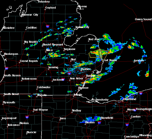 At 403 pm edt, a severe thunderstorm was located over applegate, or 7 miles northwest of croswell, moving northeast at 25 mph (radar indicated). Hazards include 60 mph wind gusts and quarter size hail. Hail damage to vehicles is expected. expect wind damage to roofs, siding, and trees. this severe storm will be near, port sanilac around 425 pm edt. Other locations impacted by this severe thunderstorm include port sanilac, croswell, lexington, carsonville, applegate, birch beach, watertown, lexington heights and peck. At 403 pm edt, a severe thunderstorm was located over applegate, or 7 miles northwest of croswell, moving northeast at 25 mph (radar indicated). Hazards include 60 mph wind gusts and quarter size hail. Hail damage to vehicles is expected. expect wind damage to roofs, siding, and trees. this severe storm will be near, port sanilac around 425 pm edt. Other locations impacted by this severe thunderstorm include port sanilac, croswell, lexington, carsonville, applegate, birch beach, watertown, lexington heights and peck.
|
| 8/11/2017 3:46 PM EDT |
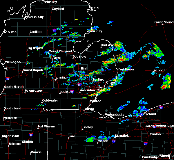 At 346 pm edt, a severe thunderstorm was located over peck, or 8 miles west of croswell, moving east at 25 mph (radar indicated). Hazards include 60 mph wind gusts and quarter size hail. Hail damage to vehicles is expected. expect wind damage to roofs, siding, and trees. this severe thunderstorm will be near, croswell around 405 pm edt. applegate around 410 pm edt. lexington around 420 pm edt. Other locations impacted by this severe thunderstorm include croswell, lexington, port sanilac, melvin, applegate, peck, carsonville, birch beach, amador and valley center. At 346 pm edt, a severe thunderstorm was located over peck, or 8 miles west of croswell, moving east at 25 mph (radar indicated). Hazards include 60 mph wind gusts and quarter size hail. Hail damage to vehicles is expected. expect wind damage to roofs, siding, and trees. this severe thunderstorm will be near, croswell around 405 pm edt. applegate around 410 pm edt. lexington around 420 pm edt. Other locations impacted by this severe thunderstorm include croswell, lexington, port sanilac, melvin, applegate, peck, carsonville, birch beach, amador and valley center.
|
| 8/11/2017 2:28 PM EDT |
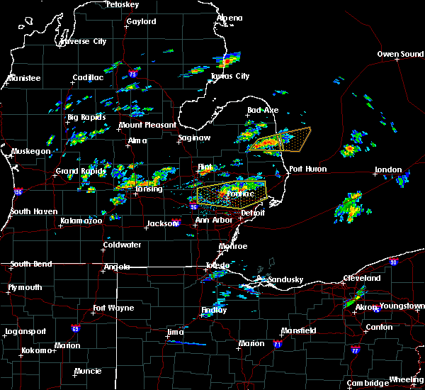 At 228 pm edt, severe thunderstorms were located along a line extending from near port sanilac to 7 miles northwest of peck, moving east at 20 mph (radar indicated). Hazards include 60 mph wind gusts and quarter size hail. Hail damage to vehicles is expected. expect wind damage to roofs, siding, and trees. these severe storms will be near, carsonville and applegate around 235 pm edt. port sanilac around 240 pm edt. Other locations impacted by these severe thunderstorms include port sanilac, sandusky, carsonville, applegate, watertown, mcgregor and forester. At 228 pm edt, severe thunderstorms were located along a line extending from near port sanilac to 7 miles northwest of peck, moving east at 20 mph (radar indicated). Hazards include 60 mph wind gusts and quarter size hail. Hail damage to vehicles is expected. expect wind damage to roofs, siding, and trees. these severe storms will be near, carsonville and applegate around 235 pm edt. port sanilac around 240 pm edt. Other locations impacted by these severe thunderstorms include port sanilac, sandusky, carsonville, applegate, watertown, mcgregor and forester.
|
| 8/11/2017 2:07 PM EDT |
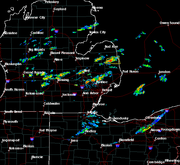 At 207 pm edt, a severe thunderstorm was located near sandusky, moving east at 20 mph (radar indicated). Hazards include 60 mph wind gusts and quarter size hail. Hail damage to vehicles is expected. expect wind damage to roofs, siding, and trees. this severe storm will be near, carsonville around 220 pm edt. applegate around 225 pm edt. port sanilac around 240 pm edt. Other locations impacted by this severe thunderstorm include port sanilac, sandusky, carsonville, applegate, watertown, mcgregor, forester, elmer and juhl. At 207 pm edt, a severe thunderstorm was located near sandusky, moving east at 20 mph (radar indicated). Hazards include 60 mph wind gusts and quarter size hail. Hail damage to vehicles is expected. expect wind damage to roofs, siding, and trees. this severe storm will be near, carsonville around 220 pm edt. applegate around 225 pm edt. port sanilac around 240 pm edt. Other locations impacted by this severe thunderstorm include port sanilac, sandusky, carsonville, applegate, watertown, mcgregor, forester, elmer and juhl.
|
| 8/11/2017 1:51 PM EDT |
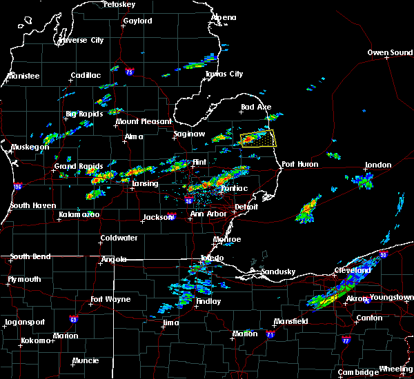 At 151 pm edt, a severe thunderstorm was located over sandusky, moving east at 20 mph (radar indicated). Hazards include 60 mph wind gusts and quarter size hail. Hail damage to vehicles is expected. expect wind damage to roofs, siding, and trees. this severe thunderstorm will be near, sandusky around 200 pm edt. carsonville around 220 pm edt. applegate around 225 pm edt. port sanilac around 240 pm edt. Other locations impacted by this severe thunderstorm include port sanilac, sandusky, carsonville, applegate, watertown, mcgregor, forester, snover, elmer and juhl. At 151 pm edt, a severe thunderstorm was located over sandusky, moving east at 20 mph (radar indicated). Hazards include 60 mph wind gusts and quarter size hail. Hail damage to vehicles is expected. expect wind damage to roofs, siding, and trees. this severe thunderstorm will be near, sandusky around 200 pm edt. carsonville around 220 pm edt. applegate around 225 pm edt. port sanilac around 240 pm edt. Other locations impacted by this severe thunderstorm include port sanilac, sandusky, carsonville, applegate, watertown, mcgregor, forester, snover, elmer and juhl.
|
| 6/17/2017 6:43 PM EDT |
 At 643 pm edt, severe thunderstorms were located along a line extending from 6 miles north of deckerville to near peck, moving east at 40 mph (radar indicated). Hazards include 60 mph wind gusts. Expect damage to roofs, siding, and trees. these severe storms will be near, forestville around 655 pm edt. croswell, carsonville and applegate around 700 pm edt. Other locations impacted by these severe thunderstorms include deckerville, port sanilac, forestville, sandusky, applegate, carsonville, argyle, mcgregor, snover and elmer. At 643 pm edt, severe thunderstorms were located along a line extending from 6 miles north of deckerville to near peck, moving east at 40 mph (radar indicated). Hazards include 60 mph wind gusts. Expect damage to roofs, siding, and trees. these severe storms will be near, forestville around 655 pm edt. croswell, carsonville and applegate around 700 pm edt. Other locations impacted by these severe thunderstorms include deckerville, port sanilac, forestville, sandusky, applegate, carsonville, argyle, mcgregor, snover and elmer.
|
| 6/17/2017 6:23 PM EDT |
 At 622 pm edt, severe thunderstorms were located along a line extending from near argyle to near marlette, moving east at 40 mph (radar indicated). Hazards include 60 mph wind gusts. Expect damage to roofs, siding, and trees. these severe storms will be near, argyle around 630 pm edt. sandusky around 645 pm edt. deckerville, forestville and carsonville around 655 pm edt. Other locations impacted by these severe thunderstorms include deckerville, marlette, port sanilac, forestville, sandusky, kingston, applegate, carsonville, argyle and mcgregor. At 622 pm edt, severe thunderstorms were located along a line extending from near argyle to near marlette, moving east at 40 mph (radar indicated). Hazards include 60 mph wind gusts. Expect damage to roofs, siding, and trees. these severe storms will be near, argyle around 630 pm edt. sandusky around 645 pm edt. deckerville, forestville and carsonville around 655 pm edt. Other locations impacted by these severe thunderstorms include deckerville, marlette, port sanilac, forestville, sandusky, kingston, applegate, carsonville, argyle and mcgregor.
|
| 6/17/2017 6:05 PM EDT |
 At 605 pm edt, severe thunderstorms were located along a line extending from 6 miles southwest of cass city to near mayville, moving east at 40 mph (radar indicated). Hazards include 60 mph wind gusts. Expect damage to roofs, siding, and trees. severe thunderstorms will be near, cass city around 615 pm edt. kingston around 620 pm edt. marlette around 625 pm edt. argyle around 630 pm edt. sandusky around 645 pm edt. deckerville, forestville and carsonville around 655 pm edt. Other locations impacted by these severe thunderstorms include deckerville, sandusky, marlette, port sanilac, forestville, kingston, argyle, applegate, carsonville and ellington. At 605 pm edt, severe thunderstorms were located along a line extending from 6 miles southwest of cass city to near mayville, moving east at 40 mph (radar indicated). Hazards include 60 mph wind gusts. Expect damage to roofs, siding, and trees. severe thunderstorms will be near, cass city around 615 pm edt. kingston around 620 pm edt. marlette around 625 pm edt. argyle around 630 pm edt. sandusky around 645 pm edt. deckerville, forestville and carsonville around 655 pm edt. Other locations impacted by these severe thunderstorms include deckerville, sandusky, marlette, port sanilac, forestville, kingston, argyle, applegate, carsonville and ellington.
|
| 4/27/2017 12:33 AM EDT |
 At 1233 am edt, severe thunderstorms were located along a line extending from 6 miles northeast of ubly to near carsonville, moving northeast at 45 mph (radar indicated). Hazards include 60 mph wind gusts. Expect damage to roofs, siding, and trees. severe thunderstorms will be near, harbor beach around 1245 am edt. port hope around 1255 am edt. forestville around 100 am edt. Other locations impacted by these severe thunderstorms include deckerville, forestville, harbor beach, port hope, carsonville, redman, parisville, huron city, mcgregor and white rock. At 1233 am edt, severe thunderstorms were located along a line extending from 6 miles northeast of ubly to near carsonville, moving northeast at 45 mph (radar indicated). Hazards include 60 mph wind gusts. Expect damage to roofs, siding, and trees. severe thunderstorms will be near, harbor beach around 1245 am edt. port hope around 1255 am edt. forestville around 100 am edt. Other locations impacted by these severe thunderstorms include deckerville, forestville, harbor beach, port hope, carsonville, redman, parisville, huron city, mcgregor and white rock.
|
| 11/18/2016 8:44 PM EST |
 At 843 pm est, severe thunderstorms were located along a line extending from near pigeon to argyle to near peck, moving east at 75 mph (radar indicated). Hazards include 60 mph wind gusts. Expect damage to roofs. siding. and trees. these severe storms will be near, deckerville, peck and applegate around 850 pm est. bad axe and croswell around 855 pm est. harbor beach around 905 pm est. Other locations impacted by these severe thunderstorms include sandusky, deckerville, forestville, port sanilac, ubly, port hope, harbor beach, cass city, bad axe and caseville. At 843 pm est, severe thunderstorms were located along a line extending from near pigeon to argyle to near peck, moving east at 75 mph (radar indicated). Hazards include 60 mph wind gusts. Expect damage to roofs. siding. and trees. these severe storms will be near, deckerville, peck and applegate around 850 pm est. bad axe and croswell around 855 pm est. harbor beach around 905 pm est. Other locations impacted by these severe thunderstorms include sandusky, deckerville, forestville, port sanilac, ubly, port hope, harbor beach, cass city, bad axe and caseville.
|
| 11/18/2016 8:34 PM EST |
 At 834 pm est, severe thunderstorms were located along a line extending from near sebewaing to 8 miles east of kingston to near brown city, moving northeast at 75 mph (radar indicated). Hazards include 60 mph wind gusts. Expect damage to roofs. siding. and trees. these severe storms will be near, argyle and owendale around 840 pm est. caseville and pigeon around 845 pm est. sandusky and carsonville around 850 pm est. deckerville and port austin around 855 pm est. harbor beach, port hope and forestville around 900 pm est. Other locations impacted by these severe thunderstorms include marlette, sandusky, deckerville, forestville, port sanilac, ubly, yale, port hope, harbor beach and cass city. At 834 pm est, severe thunderstorms were located along a line extending from near sebewaing to 8 miles east of kingston to near brown city, moving northeast at 75 mph (radar indicated). Hazards include 60 mph wind gusts. Expect damage to roofs. siding. and trees. these severe storms will be near, argyle and owendale around 840 pm est. caseville and pigeon around 845 pm est. sandusky and carsonville around 850 pm est. deckerville and port austin around 855 pm est. harbor beach, port hope and forestville around 900 pm est. Other locations impacted by these severe thunderstorms include marlette, sandusky, deckerville, forestville, port sanilac, ubly, yale, port hope, harbor beach and cass city.
|
| 11/18/2016 8:10 PM EST |
 At 809 pm est, severe thunderstorms were located along a line extending from near birch run to near lapeer to near ortonville, moving northeast at 70 mph (radar indicated). Hazards include 60 mph wind gusts. Expect damage to roofs. siding. and trees. severe thunderstorms will be near, reese around 820 pm est. akron, fairgrove and clifford around 825 pm est. brown city, unionville and kingston around 830 pm est. marlette and sebewaing around 835 pm est. pigeon and argyle around 840 pm est. sandusky and caseville around 845 pm est. deckerville around 850 pm est. harbor beach, port austin and forestville around 855 pm est. Other locations impacted by these severe thunderstorms include marlette, sandusky, deckerville, forestville, port sanilac, ubly, mayville, millington, yale and port hope. At 809 pm est, severe thunderstorms were located along a line extending from near birch run to near lapeer to near ortonville, moving northeast at 70 mph (radar indicated). Hazards include 60 mph wind gusts. Expect damage to roofs. siding. and trees. severe thunderstorms will be near, reese around 820 pm est. akron, fairgrove and clifford around 825 pm est. brown city, unionville and kingston around 830 pm est. marlette and sebewaing around 835 pm est. pigeon and argyle around 840 pm est. sandusky and caseville around 845 pm est. deckerville around 850 pm est. harbor beach, port austin and forestville around 855 pm est. Other locations impacted by these severe thunderstorms include marlette, sandusky, deckerville, forestville, port sanilac, ubly, mayville, millington, yale and port hope.
|
| 7/8/2016 6:01 PM EDT |
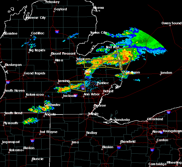 At 601 pm edt, a severe thunderstorm was located over marlette, moving east at 45 mph (radar indicated). Hazards include 60 mph wind gusts and quarter size hail. Hail damage to vehicles is expected. expect wind damage to roofs, siding, and trees. this severe storm will be near, peck around 620 pm edt. croswell and applegate around 630 pm edt. Other locations impacted by this severe thunderstorm include marlette, lexington, sandusky, port sanilac, croswell, applegate, carsonville, peck, elmer and juhl. At 601 pm edt, a severe thunderstorm was located over marlette, moving east at 45 mph (radar indicated). Hazards include 60 mph wind gusts and quarter size hail. Hail damage to vehicles is expected. expect wind damage to roofs, siding, and trees. this severe storm will be near, peck around 620 pm edt. croswell and applegate around 630 pm edt. Other locations impacted by this severe thunderstorm include marlette, lexington, sandusky, port sanilac, croswell, applegate, carsonville, peck, elmer and juhl.
|
| 7/8/2016 5:42 PM EDT |
 At 541 pm edt, a severe thunderstorm was located near applegate, or near sandusky, moving east at 30 mph (radar indicated). Hazards include 60 mph wind gusts and quarter size hail. Hail damage to vehicles is expected. expect wind damage to roofs, siding, and trees. this severe storm will be near, applegate around 550 pm edt. croswell around 555 pm edt. lexington around 605 pm edt. Other locations impacted by this severe thunderstorm include marlette, lexington, sandusky, port sanilac, croswell, applegate, carsonville, peck, elmer and juhl. At 541 pm edt, a severe thunderstorm was located near applegate, or near sandusky, moving east at 30 mph (radar indicated). Hazards include 60 mph wind gusts and quarter size hail. Hail damage to vehicles is expected. expect wind damage to roofs, siding, and trees. this severe storm will be near, applegate around 550 pm edt. croswell around 555 pm edt. lexington around 605 pm edt. Other locations impacted by this severe thunderstorm include marlette, lexington, sandusky, port sanilac, croswell, applegate, carsonville, peck, elmer and juhl.
|
| 7/8/2016 5:23 PM EDT |
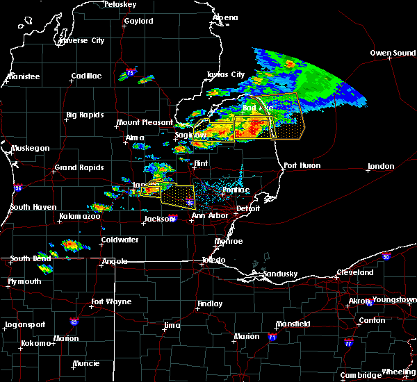 At 523 pm edt, a severe thunderstorm was located near sandusky, moving east at 30 mph (radar indicated). Hazards include 60 mph wind gusts and quarter size hail. Hail damage to vehicles is expected. expect wind damage to roofs, siding, and trees. this severe thunderstorm will be near, sandusky around 530 pm edt. carsonville around 545 pm edt. applegate around 555 pm edt. croswell around 600 pm edt. lexington around 610 pm edt. Other locations impacted by this severe thunderstorm include marlette, lexington, sandusky, port sanilac, croswell, applegate, carsonville, peck, elmer and juhl. At 523 pm edt, a severe thunderstorm was located near sandusky, moving east at 30 mph (radar indicated). Hazards include 60 mph wind gusts and quarter size hail. Hail damage to vehicles is expected. expect wind damage to roofs, siding, and trees. this severe thunderstorm will be near, sandusky around 530 pm edt. carsonville around 545 pm edt. applegate around 555 pm edt. croswell around 600 pm edt. lexington around 610 pm edt. Other locations impacted by this severe thunderstorm include marlette, lexington, sandusky, port sanilac, croswell, applegate, carsonville, peck, elmer and juhl.
|
| 7/8/2016 12:03 AM EDT |
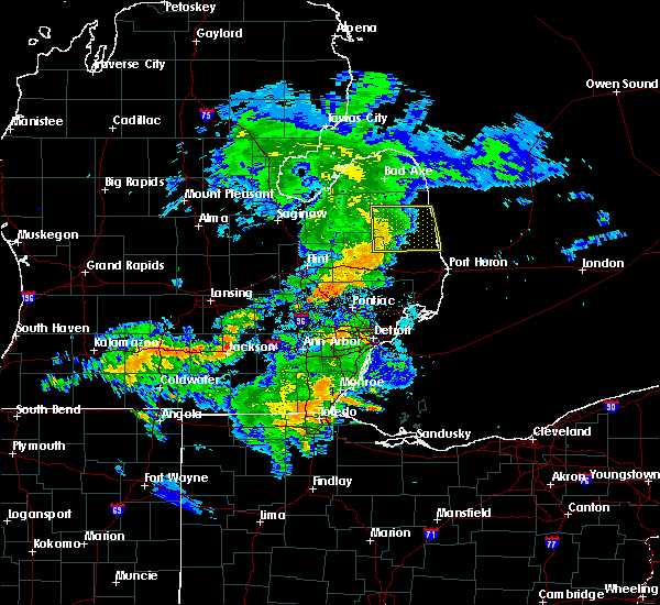 At 1202 am edt, severe thunderstorms were located along a line extending from 7 miles southwest of argyle to 6 miles east of marlette to near brown city, moving east at 20 mph (radar indicated). Hazards include 60 mph wind gusts. Expect damage to roofs. siding. and trees. these severe storms will be near, melvin around 1220 am edt. peck around 1225 am edt. sandusky and deckerville around 1230 am edt. Other locations impacted by these severe thunderstorms include marlette, lexington, sandusky, deckerville, brown city, port sanilac, croswell, applegate, carsonville and peck. At 1202 am edt, severe thunderstorms were located along a line extending from 7 miles southwest of argyle to 6 miles east of marlette to near brown city, moving east at 20 mph (radar indicated). Hazards include 60 mph wind gusts. Expect damage to roofs. siding. and trees. these severe storms will be near, melvin around 1220 am edt. peck around 1225 am edt. sandusky and deckerville around 1230 am edt. Other locations impacted by these severe thunderstorms include marlette, lexington, sandusky, deckerville, brown city, port sanilac, croswell, applegate, carsonville and peck.
|
| 7/7/2016 11:52 PM EDT |
 At 1151 pm edt, severe thunderstorms were located along a line extending from 6 miles northeast of kingston to near marlette to near brown city, moving east at 30 mph (radar indicated). Hazards include 60 mph wind gusts. Expect damage to roofs. siding. and trees. these severe storms will be near, brown city around 1200 am edt. peck and melvin around 1210 am edt. sandusky around 1220 am edt. deckerville around 1225 am edt. croswell, lexington, carsonville and applegate around 1230 am edt. Other locations impacted by these severe thunderstorms include marlette, lexington, sandusky, deckerville, brown city, port sanilac, croswell, applegate, carsonville and peck. At 1151 pm edt, severe thunderstorms were located along a line extending from 6 miles northeast of kingston to near marlette to near brown city, moving east at 30 mph (radar indicated). Hazards include 60 mph wind gusts. Expect damage to roofs. siding. and trees. these severe storms will be near, brown city around 1200 am edt. peck and melvin around 1210 am edt. sandusky around 1220 am edt. deckerville around 1225 am edt. croswell, lexington, carsonville and applegate around 1230 am edt. Other locations impacted by these severe thunderstorms include marlette, lexington, sandusky, deckerville, brown city, port sanilac, croswell, applegate, carsonville and peck.
|
| 7/7/2016 11:36 PM EDT |
 At 1136 pm edt, severe thunderstorms were located along a line extending from 6 miles northwest of kingston to clifford to near north branch, moving east at 20 mph (radar indicated). Hazards include 60 mph wind gusts. Expect damage to roofs. siding. and trees. these severe storms will be near, clifford around 1140 pm edt. marlette around 1155 pm edt. brown city around 1215 am edt. peck and melvin around 1230 am edt. Other locations impacted by these severe thunderstorms include marlette, sandusky, deckerville, port sanilac, lexington, brown city, cass city, croswell, north branch and clifford. At 1136 pm edt, severe thunderstorms were located along a line extending from 6 miles northwest of kingston to clifford to near north branch, moving east at 20 mph (radar indicated). Hazards include 60 mph wind gusts. Expect damage to roofs. siding. and trees. these severe storms will be near, clifford around 1140 pm edt. marlette around 1155 pm edt. brown city around 1215 am edt. peck and melvin around 1230 am edt. Other locations impacted by these severe thunderstorms include marlette, sandusky, deckerville, port sanilac, lexington, brown city, cass city, croswell, north branch and clifford.
|
| 7/7/2016 11:26 PM EDT |
 At 1125 pm edt, severe thunderstorms were located along a line extending from near caro to near clifford to near north branch, moving east at 30 mph (radar indicated). Hazards include 60 mph wind gusts. Expect damage to roofs. siding. and trees. these severe storms will be near, kingston and clifford around 1130 pm edt. marlette and north branch around 1140 pm edt. brown city around 1155 pm edt. argyle around 1205 am edt. melvin around 1210 am edt. peck around 1215 am edt. sandusky around 1220 am edt. deckerville around 1225 am edt. Other locations impacted by these severe thunderstorms include columbiaville, marlette, sandusky, deckerville, port sanilac, mayville, lexington, caro, brown city and cass city. At 1125 pm edt, severe thunderstorms were located along a line extending from near caro to near clifford to near north branch, moving east at 30 mph (radar indicated). Hazards include 60 mph wind gusts. Expect damage to roofs. siding. and trees. these severe storms will be near, kingston and clifford around 1130 pm edt. marlette and north branch around 1140 pm edt. brown city around 1155 pm edt. argyle around 1205 am edt. melvin around 1210 am edt. peck around 1215 am edt. sandusky around 1220 am edt. deckerville around 1225 am edt. Other locations impacted by these severe thunderstorms include columbiaville, marlette, sandusky, deckerville, port sanilac, mayville, lexington, caro, brown city and cass city.
|
| 7/7/2016 11:14 PM EDT |
 At 1113 pm edt, severe thunderstorms were located along a line extending from near fairgrove to mayville to otter lake, moving east at 20 mph (radar indicated). Hazards include 60 mph wind gusts. Expect damage to roofs. siding. and trees. severe thunderstorms will be near, mayville around 1120 pm edt. clifford around 1140 pm edt. kingston around 1145 pm edt. north branch around 1155 pm edt. cass city and marlette around 1200 am edt. brown city around 1220 am edt. sandusky, argyle and melvin around 1230 am edt. Other locations impacted by these severe thunderstorms include columbiaville, marlette, sandusky, deckerville, port sanilac, akron, mayville, millington, lexington and vassar. At 1113 pm edt, severe thunderstorms were located along a line extending from near fairgrove to mayville to otter lake, moving east at 20 mph (radar indicated). Hazards include 60 mph wind gusts. Expect damage to roofs. siding. and trees. severe thunderstorms will be near, mayville around 1120 pm edt. clifford around 1140 pm edt. kingston around 1145 pm edt. north branch around 1155 pm edt. cass city and marlette around 1200 am edt. brown city around 1220 am edt. sandusky, argyle and melvin around 1230 am edt. Other locations impacted by these severe thunderstorms include columbiaville, marlette, sandusky, deckerville, port sanilac, akron, mayville, millington, lexington and vassar.
|
| 5/29/2016 5:02 PM EDT |
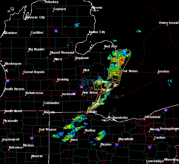 At 502 pm edt, severe thunderstorms were located along a line extending from near port sanilac to 8 miles southwest of lakeport, moving northeast at 30 mph (radar indicated). Hazards include 60 mph wind gusts and quarter size hail. Hail damage to vehicles is expected. expect wind damage to roofs, siding, and trees. these severe thunderstorms will remain over mainly rural areas of northeastern st. Clair and southeastern sanilac counties, including the following locations: roseburg, yale, jeddo, brockway, lexington, applegate, amador, fargo, birch beach and lakeport. At 502 pm edt, severe thunderstorms were located along a line extending from near port sanilac to 8 miles southwest of lakeport, moving northeast at 30 mph (radar indicated). Hazards include 60 mph wind gusts and quarter size hail. Hail damage to vehicles is expected. expect wind damage to roofs, siding, and trees. these severe thunderstorms will remain over mainly rural areas of northeastern st. Clair and southeastern sanilac counties, including the following locations: roseburg, yale, jeddo, brockway, lexington, applegate, amador, fargo, birch beach and lakeport.
|
| 5/29/2016 4:50 PM EDT |
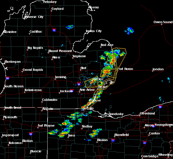 At 449 pm edt, severe thunderstorms were located along a line extending from near port sanilac to near emmett, moving northeast at 25 mph (radar indicated). Hazards include 60 mph wind gusts and quarter size hail. Hail damage to vehicles is expected. expect wind damage to roofs, siding, and trees. severe thunderstorms will be near, port sanilac around 455 pm edt. lakeport around 520 pm edt. Other locations impacted by these severe thunderstorms include roseburg, yale, jeddo, brockway, lexington, applegate, amador, fargo, birch beach and lakeport. At 449 pm edt, severe thunderstorms were located along a line extending from near port sanilac to near emmett, moving northeast at 25 mph (radar indicated). Hazards include 60 mph wind gusts and quarter size hail. Hail damage to vehicles is expected. expect wind damage to roofs, siding, and trees. severe thunderstorms will be near, port sanilac around 455 pm edt. lakeport around 520 pm edt. Other locations impacted by these severe thunderstorms include roseburg, yale, jeddo, brockway, lexington, applegate, amador, fargo, birch beach and lakeport.
|
| 8/2/2015 7:27 PM EDT |
 At 727 pm edt, severe thunderstorms were located along a line extending from near forestville to near sandusky, moving southeast at 45 mph (radar indicated). Hazards include ping pong ball size hail and 60 mph wind gusts. People and animals outdoors will be injured. expect hail damage to roofs, siding, windows and vehicles. expect wind damage to roofs, siding and trees. these severe storms will be near, carsonville around 735 pm edt. applegate around 745 pm edt. Other locations impacted by these severe thunderstorms include elmer, minden, richmondville, watertown, juhl, palms, snover and mcgregor. At 727 pm edt, severe thunderstorms were located along a line extending from near forestville to near sandusky, moving southeast at 45 mph (radar indicated). Hazards include ping pong ball size hail and 60 mph wind gusts. People and animals outdoors will be injured. expect hail damage to roofs, siding, windows and vehicles. expect wind damage to roofs, siding and trees. these severe storms will be near, carsonville around 735 pm edt. applegate around 745 pm edt. Other locations impacted by these severe thunderstorms include elmer, minden, richmondville, watertown, juhl, palms, snover and mcgregor.
|
| 8/2/2015 7:08 PM EDT |
 At 708 pm edt, severe thunderstorms were located along a line extending from 6 miles southeast of kinde to near ubly, moving east at 40 mph (radar indicated). Hazards include ping pong ball size hail and 60 mph wind gusts. People and animals outdoors will be injured. expect hail damage to roofs, siding, windows and vehicles. expect wind damage to roofs, siding and trees. severe thunderstorms will be near, port hope around 720 pm edt. harbor beach and forestville around 725 pm edt. Other locations impacted by these severe thunderstorms include redman, rapson, elmer, parisville, richmondville, juhl, palms, filion, mcgregor and helena. At 708 pm edt, severe thunderstorms were located along a line extending from 6 miles southeast of kinde to near ubly, moving east at 40 mph (radar indicated). Hazards include ping pong ball size hail and 60 mph wind gusts. People and animals outdoors will be injured. expect hail damage to roofs, siding, windows and vehicles. expect wind damage to roofs, siding and trees. severe thunderstorms will be near, port hope around 720 pm edt. harbor beach and forestville around 725 pm edt. Other locations impacted by these severe thunderstorms include redman, rapson, elmer, parisville, richmondville, juhl, palms, filion, mcgregor and helena.
|
| 8/2/2015 4:21 PM EDT |
 The severe thunderstorm warning for sanilac and tuscola counties will expire at 430 pm edt, the storms which prompted the warning have weakened below severe limits, and no longer pose an immediate threat to life or property. therefore the warning will be allowed to expire. however small. The severe thunderstorm warning for sanilac and tuscola counties will expire at 430 pm edt, the storms which prompted the warning have weakened below severe limits, and no longer pose an immediate threat to life or property. therefore the warning will be allowed to expire. however small.
|
| 8/2/2015 4:03 PM EDT |
 At 403 pm edt, severe thunderstorms were located along a line extending from 6 miles northwest of sandusky to vassar, moving east at 40 mph (radar indicated). Hazards include 60 mph wind gusts and quarter size hail. Hail damage to vehicles is expected. expect wind damage to roofs, siding and trees. these severe storms will be near, sandusky around 410 pm edt. deckerville around 415 pm edt. mayville and carsonville around 420 pm edt. port sanilac and kingston around 430 pm edt. Other locations impacted by these severe thunderstorms include east dayton, elmer, colwood, ellington, richmondville, gilford, tyre, juhl, palms and colling. At 403 pm edt, severe thunderstorms were located along a line extending from 6 miles northwest of sandusky to vassar, moving east at 40 mph (radar indicated). Hazards include 60 mph wind gusts and quarter size hail. Hail damage to vehicles is expected. expect wind damage to roofs, siding and trees. these severe storms will be near, sandusky around 410 pm edt. deckerville around 415 pm edt. mayville and carsonville around 420 pm edt. port sanilac and kingston around 430 pm edt. Other locations impacted by these severe thunderstorms include east dayton, elmer, colwood, ellington, richmondville, gilford, tyre, juhl, palms and colling.
|
| 8/2/2015 3:44 PM EDT |
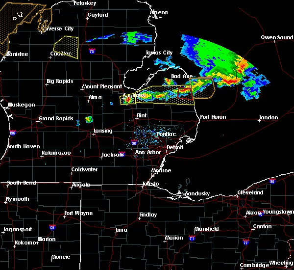 At 344 pm edt, a severe thunderstorm capable of producing a tornado was located over deckerville, moving east at 40 mph (radar indicated rotation). Hazards include tornado and quarter size hail. Flying debris will be dangerous to those caught without shelter. mobile homes will be damaged or destroyed. damage to roofs, windows and vehicles will occur. tree damage is likely. This tornadic thunderstorm will remain over mainly rural areas of northeastern sanilac county, including the following locations, palms, mcgregor and richmondville. At 344 pm edt, a severe thunderstorm capable of producing a tornado was located over deckerville, moving east at 40 mph (radar indicated rotation). Hazards include tornado and quarter size hail. Flying debris will be dangerous to those caught without shelter. mobile homes will be damaged or destroyed. damage to roofs, windows and vehicles will occur. tree damage is likely. This tornadic thunderstorm will remain over mainly rural areas of northeastern sanilac county, including the following locations, palms, mcgregor and richmondville.
|
| 8/2/2015 3:35 PM EDT |
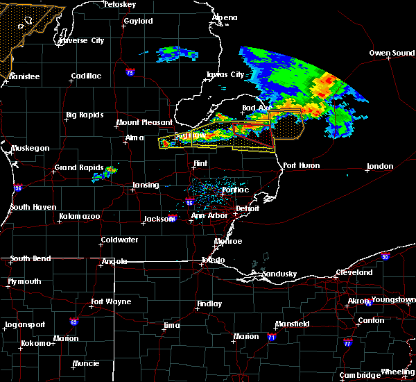 At 335 pm edt, a severe thunderstorm capable of producing a tornado was located over argyle, or 7 miles west of deckerville, moving east at 40 mph (radar indicated rotation). Hazards include tornado and quarter size hail. Flying debris will be dangerous to those caught without shelter. mobile homes will be damaged or destroyed. damage to roofs, windows and vehicles will occur. tree damage is likely. this dangerous storm will be near, deckerville around 345 pm edt. Other locations impacted by this tornadic thunderstorm include palms, mcgregor and richmondville. At 335 pm edt, a severe thunderstorm capable of producing a tornado was located over argyle, or 7 miles west of deckerville, moving east at 40 mph (radar indicated rotation). Hazards include tornado and quarter size hail. Flying debris will be dangerous to those caught without shelter. mobile homes will be damaged or destroyed. damage to roofs, windows and vehicles will occur. tree damage is likely. this dangerous storm will be near, deckerville around 345 pm edt. Other locations impacted by this tornadic thunderstorm include palms, mcgregor and richmondville.
|
| 8/2/2015 3:34 PM EDT |
 At 333 pm edt, severe thunderstorms were located along a line extending from near forestville to near vassar, moving east at 40 mph (radar indicated). Hazards include 60 mph wind gusts and quarter size hail. Hail damage to vehicles is expected. expect wind damage to roofs, siding and trees. severe thunderstorms will be near, mayville around 350 pm edt. kingston around 400 pm edt. marlette around 405 pm edt. applegate around 430 pm edt. Other locations impacted by these severe thunderstorms include east dayton, elmer, colwood, ellington, richmondville, gilford, tyre, juhl, palms and colling. At 333 pm edt, severe thunderstorms were located along a line extending from near forestville to near vassar, moving east at 40 mph (radar indicated). Hazards include 60 mph wind gusts and quarter size hail. Hail damage to vehicles is expected. expect wind damage to roofs, siding and trees. severe thunderstorms will be near, mayville around 350 pm edt. kingston around 400 pm edt. marlette around 405 pm edt. applegate around 430 pm edt. Other locations impacted by these severe thunderstorms include east dayton, elmer, colwood, ellington, richmondville, gilford, tyre, juhl, palms and colling.
|
| 8/2/2015 3:26 PM EDT |
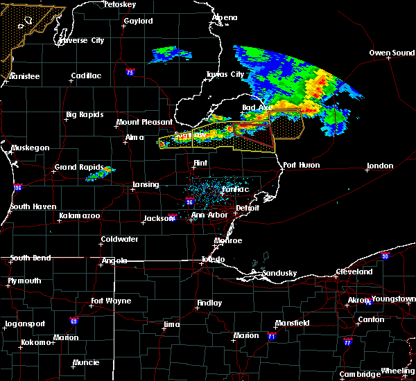 At 326 pm edt, a severe thunderstorm capable of producing a tornado was located near argyle, or 8 miles east of cass city, moving east at 30 mph (radar indicated rotation). Hazards include tornado and quarter size hail. Flying debris will be dangerous to those caught without shelter. mobile homes will be damaged or destroyed. damage to roofs, windows and vehicles will occur. tree damage is likely. this dangerous storm will be near, argyle around 335 pm edt. deckerville around 355 pm edt. carsonville around 405 pm edt. Other locations impacted by this tornadic thunderstorm include palms, snover, mcgregor and richmondville. At 326 pm edt, a severe thunderstorm capable of producing a tornado was located near argyle, or 8 miles east of cass city, moving east at 30 mph (radar indicated rotation). Hazards include tornado and quarter size hail. Flying debris will be dangerous to those caught without shelter. mobile homes will be damaged or destroyed. damage to roofs, windows and vehicles will occur. tree damage is likely. this dangerous storm will be near, argyle around 335 pm edt. deckerville around 355 pm edt. carsonville around 405 pm edt. Other locations impacted by this tornadic thunderstorm include palms, snover, mcgregor and richmondville.
|
| 8/2/2015 3:21 PM EDT |
 At 320 pm edt, a severe thunderstorm capable of producing a tornado was located near cass city, moving east at 30 mph (radar indicated rotation). Hazards include tornado and quarter size hail. Flying debris will be dangerous to those caught without shelter. mobile homes will be damaged or destroyed. damage to roofs, windows and vehicles will occur. tree damage is likely. this dangerous storm will be near, argyle around 335 pm edt. deckerville around 355 pm edt. carsonville around 405 pm edt. Other locations impacted by this tornadic thunderstorm include new greenleaf, palms, snover, mcgregor and richmondville. At 320 pm edt, a severe thunderstorm capable of producing a tornado was located near cass city, moving east at 30 mph (radar indicated rotation). Hazards include tornado and quarter size hail. Flying debris will be dangerous to those caught without shelter. mobile homes will be damaged or destroyed. damage to roofs, windows and vehicles will occur. tree damage is likely. this dangerous storm will be near, argyle around 335 pm edt. deckerville around 355 pm edt. carsonville around 405 pm edt. Other locations impacted by this tornadic thunderstorm include new greenleaf, palms, snover, mcgregor and richmondville.
|
| 8/2/2015 3:14 PM EDT |
 At 313 pm edt, severe thunderstorms were located along a line extending from near cass city to reese, moving southeast at 15 mph (radar indicated). Hazards include 60 mph wind gusts and quarter size hail. Hail damage to vehicles is expected. expect wind damage to roofs, siding and trees. these severe storms will be near, cass city around 320 pm edt. argyle around 345 pm edt. Other locations impacted by these severe thunderstorms include east dayton, elmer, colwood, ellington, richmondville, gilford, tyre, juhl, palms and colling. At 313 pm edt, severe thunderstorms were located along a line extending from near cass city to reese, moving southeast at 15 mph (radar indicated). Hazards include 60 mph wind gusts and quarter size hail. Hail damage to vehicles is expected. expect wind damage to roofs, siding and trees. these severe storms will be near, cass city around 320 pm edt. argyle around 345 pm edt. Other locations impacted by these severe thunderstorms include east dayton, elmer, colwood, ellington, richmondville, gilford, tyre, juhl, palms and colling.
|
| 8/2/2015 2:54 PM EDT |
 At 253 pm edt, severe thunderstorms were located along a line extending from gagetown to reese, moving east at 30 mph (radar indicated). Hazards include 60 mph wind gusts and quarter size hail. Hail damage to vehicles is expected. expect wind damage to roofs, siding and trees. these severe storms will be near, gagetown around 300 pm edt. cass city around 305 pm edt. mayville and argyle around 330 pm edt. deckerville and kingston around 345 pm edt. Other locations impacted by these severe thunderstorms include east dayton, elmer, colwood, ellington, richmondville, gilford, tyre, juhl, palms and colling. At 253 pm edt, severe thunderstorms were located along a line extending from gagetown to reese, moving east at 30 mph (radar indicated). Hazards include 60 mph wind gusts and quarter size hail. Hail damage to vehicles is expected. expect wind damage to roofs, siding and trees. these severe storms will be near, gagetown around 300 pm edt. cass city around 305 pm edt. mayville and argyle around 330 pm edt. deckerville and kingston around 345 pm edt. Other locations impacted by these severe thunderstorms include east dayton, elmer, colwood, ellington, richmondville, gilford, tyre, juhl, palms and colling.
|
| 8/2/2015 2:38 PM EDT |
 At 238 pm edt, severe thunderstorms were located along a line extending from near unionville to reese, moving east at 50 mph (radar indicated). Hazards include 60 mph wind gusts and quarter size hail. Hail damage to vehicles is expected. expect wind damage to roofs, siding and trees. these severe storms will be near, gagetown around 245 pm edt. cass city around 250 pm edt. caro around 300 pm edt. kingston around 310 pm edt. forestville around 325 pm edt. sandusky around 330 pm edt. deckerville around 335 pm edt. carsonville around 340 pm edt. Other locations impacted by these severe thunderstorms include east dayton, elmer, colwood, ellington, richmondville, gilford, tyre, juhl, palms and colling. At 238 pm edt, severe thunderstorms were located along a line extending from near unionville to reese, moving east at 50 mph (radar indicated). Hazards include 60 mph wind gusts and quarter size hail. Hail damage to vehicles is expected. expect wind damage to roofs, siding and trees. these severe storms will be near, gagetown around 245 pm edt. cass city around 250 pm edt. caro around 300 pm edt. kingston around 310 pm edt. forestville around 325 pm edt. sandusky around 330 pm edt. deckerville around 335 pm edt. carsonville around 340 pm edt. Other locations impacted by these severe thunderstorms include east dayton, elmer, colwood, ellington, richmondville, gilford, tyre, juhl, palms and colling.
|
| 8/2/2015 2:24 PM EDT |
 At 224 pm edt, severe thunderstorms were located along a line extending from near unionville to near zilwaukee, moving east at 55 mph (radar indicated). Hazards include 60 mph wind gusts and quarter size hail. Hail damage to vehicles is expected. expect wind damage to roofs, siding and trees. severe thunderstorms will be near, unionville around 230 pm edt. gagetown around 240 pm edt. vassar and cass city around 245 pm edt. mayville around 255 pm edt. argyle around 300 pm edt. kingston around 305 pm edt. marlette and deckerville around 310 pm edt. sandusky around 325 pm edt. Other locations impacted by these severe thunderstorms include east dayton, elmer, colwood, ellington, richmondville, gilford, tyre, juhl, palms and colling. At 224 pm edt, severe thunderstorms were located along a line extending from near unionville to near zilwaukee, moving east at 55 mph (radar indicated). Hazards include 60 mph wind gusts and quarter size hail. Hail damage to vehicles is expected. expect wind damage to roofs, siding and trees. severe thunderstorms will be near, unionville around 230 pm edt. gagetown around 240 pm edt. vassar and cass city around 245 pm edt. mayville around 255 pm edt. argyle around 300 pm edt. kingston around 305 pm edt. marlette and deckerville around 310 pm edt. sandusky around 325 pm edt. Other locations impacted by these severe thunderstorms include east dayton, elmer, colwood, ellington, richmondville, gilford, tyre, juhl, palms and colling.
|
| 6/22/2015 10:43 PM EDT |
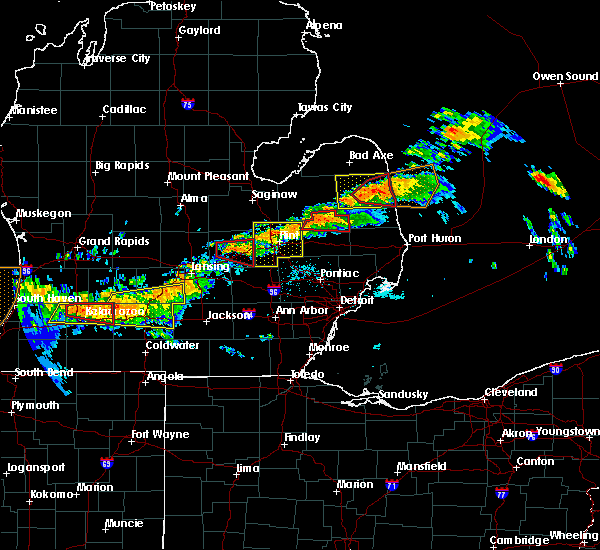 At 1042 pm edt, a large and extremely dangerous tornado was located over deckerville, moving east at 35 mph. this is a particularly dangerous situation (radar indicated rotation). Hazards include damaging tornado. You are in a life threatening situation. flying debris may be deadly to those caught without shelter. mobile homes will be destroyed. considerable damage to homes, businesses and vehicles is likely and complete destruction is possible. the tornado will be near, carsonville around 1045 pm edt. port sanilac around 1100 pm edt. Other locations impacted by this tornadic thunderstorm include mcgregor and richmondville. At 1042 pm edt, a large and extremely dangerous tornado was located over deckerville, moving east at 35 mph. this is a particularly dangerous situation (radar indicated rotation). Hazards include damaging tornado. You are in a life threatening situation. flying debris may be deadly to those caught without shelter. mobile homes will be destroyed. considerable damage to homes, businesses and vehicles is likely and complete destruction is possible. the tornado will be near, carsonville around 1045 pm edt. port sanilac around 1100 pm edt. Other locations impacted by this tornadic thunderstorm include mcgregor and richmondville.
|
| 6/22/2015 10:28 PM EDT |
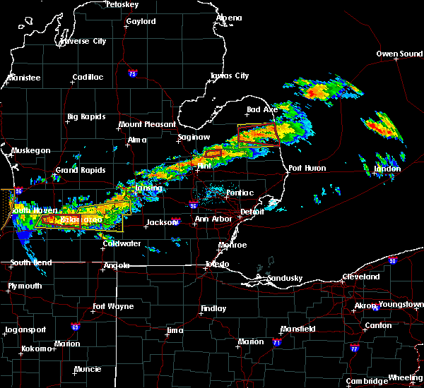 At 1027 pm edt, a severe thunderstorm capable of producing a tornado was located near sandusky, moving east at 40 mph (radar indicated rotation). Hazards include tornado and quarter size hail. Flying debris will be dangerous to those caught without shelter. mobile homes will be damaged or destroyed. damage to roofs, windows and vehicles will occur. tree damage is likely. this dangerous storm will be near, deckerville around 1035 pm edt. carsonville around 1045 pm edt. port sanilac around 1055 pm edt. a second storm southwest of forestville could also produce a tornado. Other locations impacted by this tornadic thunderstorm include palms, mcgregor and richmondville. At 1027 pm edt, a severe thunderstorm capable of producing a tornado was located near sandusky, moving east at 40 mph (radar indicated rotation). Hazards include tornado and quarter size hail. Flying debris will be dangerous to those caught without shelter. mobile homes will be damaged or destroyed. damage to roofs, windows and vehicles will occur. tree damage is likely. this dangerous storm will be near, deckerville around 1035 pm edt. carsonville around 1045 pm edt. port sanilac around 1055 pm edt. a second storm southwest of forestville could also produce a tornado. Other locations impacted by this tornadic thunderstorm include palms, mcgregor and richmondville.
|
| 6/22/2015 10:16 PM EDT |
 At 1015 pm edt, a severe thunderstorm capable of producing a tornado was located near argyle, or 9 miles southeast of cass city, moving east at 35 mph. a second possible tornadic storm was also located northeast of argyle (radar indicated rotation). Hazards include tornado. Flying debris will be dangerous to those caught without shelter. mobile homes will be damaged or destroyed. damage to roofs, windows and vehicles will occur. tree damage is likely. this dangerous storm will be near, argyle around 1020 pm edt. sandusky around 1030 pm edt. deckerville around 1035 pm edt. carsonville around 1045 pm edt. port sanilac around 1055 pm edt. Other locations impacted by this tornadic thunderstorm include elmer, richmondville, decker, palms, snover, mcgregor and minden. At 1015 pm edt, a severe thunderstorm capable of producing a tornado was located near argyle, or 9 miles southeast of cass city, moving east at 35 mph. a second possible tornadic storm was also located northeast of argyle (radar indicated rotation). Hazards include tornado. Flying debris will be dangerous to those caught without shelter. mobile homes will be damaged or destroyed. damage to roofs, windows and vehicles will occur. tree damage is likely. this dangerous storm will be near, argyle around 1020 pm edt. sandusky around 1030 pm edt. deckerville around 1035 pm edt. carsonville around 1045 pm edt. port sanilac around 1055 pm edt. Other locations impacted by this tornadic thunderstorm include elmer, richmondville, decker, palms, snover, mcgregor and minden.
|
| 6/22/2015 9:53 PM EDT |
 At 953 pm edt, severe thunderstorms were located along a line extending from near cass city to 6 miles northeast of caro, moving east at 45 mph (radar indicated). Hazards include 60 mph wind gusts and penny size hail. Expect damage to roofs. siding and trees. severe thunderstorms will be near, argyle around 1020 pm edt. sandusky around 1025 pm edt. deckerville and forestville around 1030 pm edt. carsonville around 1035 pm edt. port sanilac around 1045 pm edt. other locations impacted by these severe thunderstorms include elmer, minden, richmondville, new greenleaf, decker, tyre, juhl, forester, palms and snover. A tornado watch remains in effect until 300 am edt for southeastern michigan. At 953 pm edt, severe thunderstorms were located along a line extending from near cass city to 6 miles northeast of caro, moving east at 45 mph (radar indicated). Hazards include 60 mph wind gusts and penny size hail. Expect damage to roofs. siding and trees. severe thunderstorms will be near, argyle around 1020 pm edt. sandusky around 1025 pm edt. deckerville and forestville around 1030 pm edt. carsonville around 1035 pm edt. port sanilac around 1045 pm edt. other locations impacted by these severe thunderstorms include elmer, minden, richmondville, new greenleaf, decker, tyre, juhl, forester, palms and snover. A tornado watch remains in effect until 300 am edt for southeastern michigan.
|
| 9/5/2014 5:18 PM EDT | Multiple trees down in sanilac county MI, 6.4 miles W of Carsonville, MI |
Hail Maps for Carsonville, MI


Connect with Interactive Hail Maps