

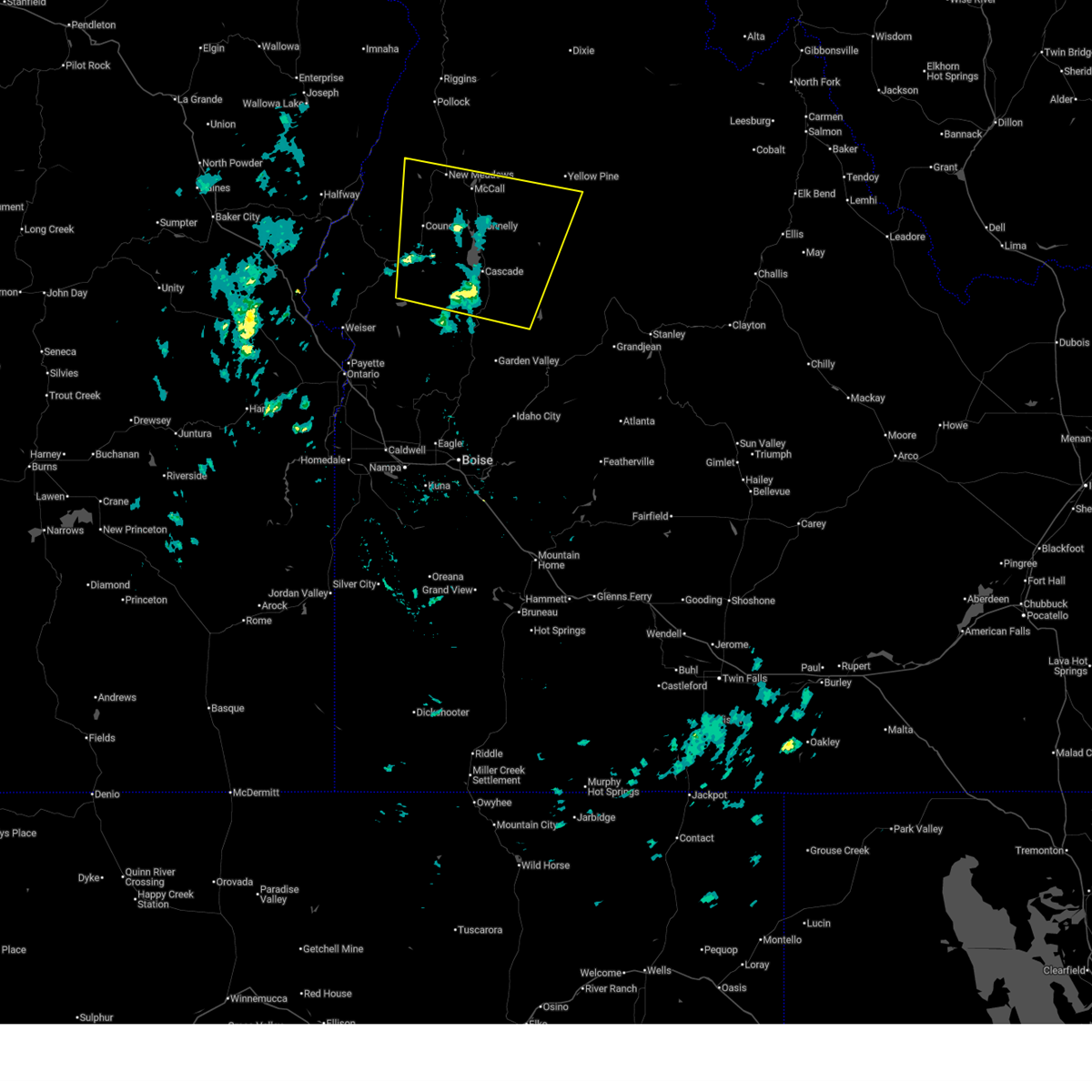
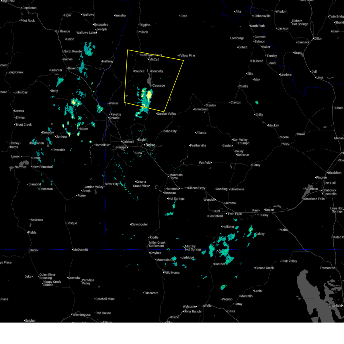
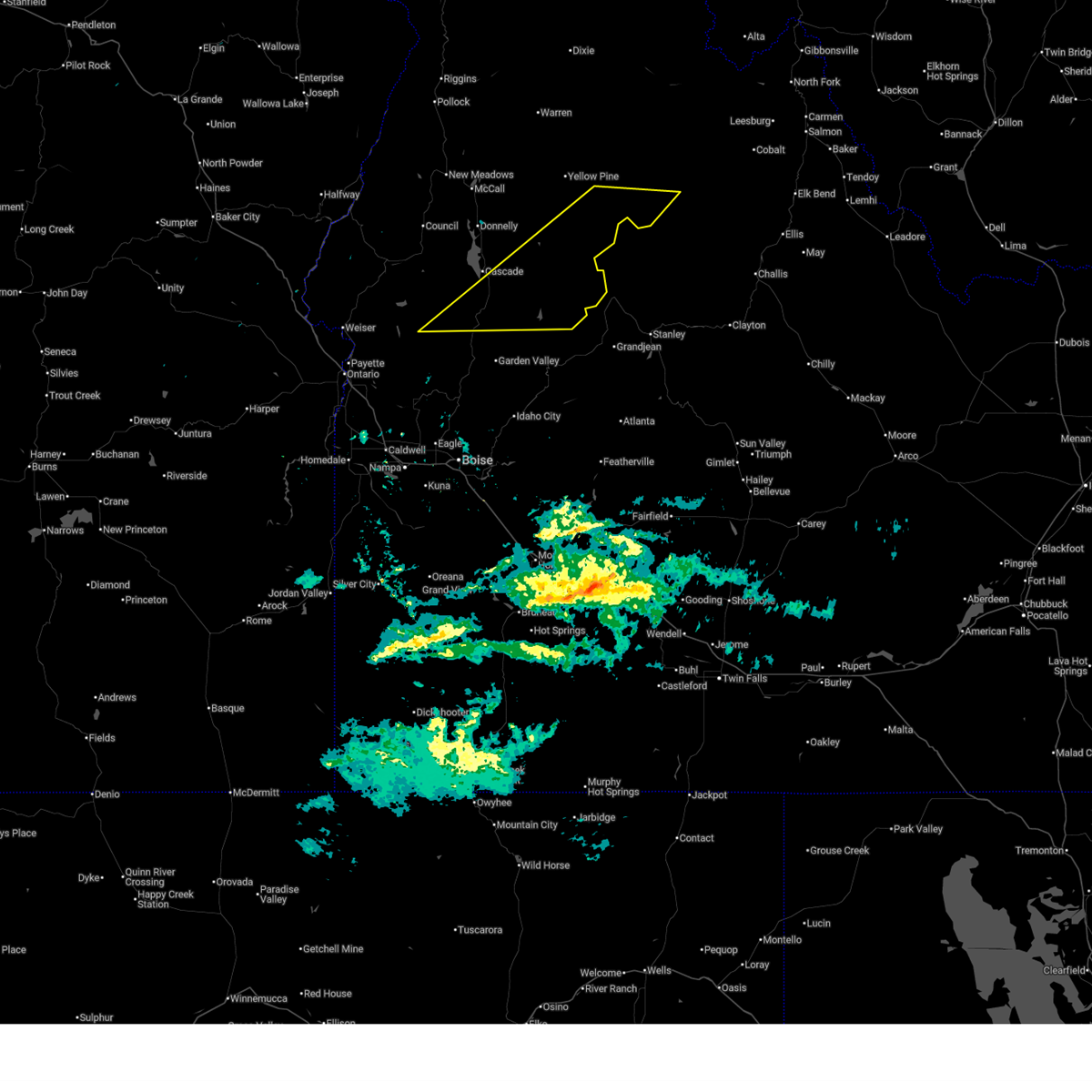
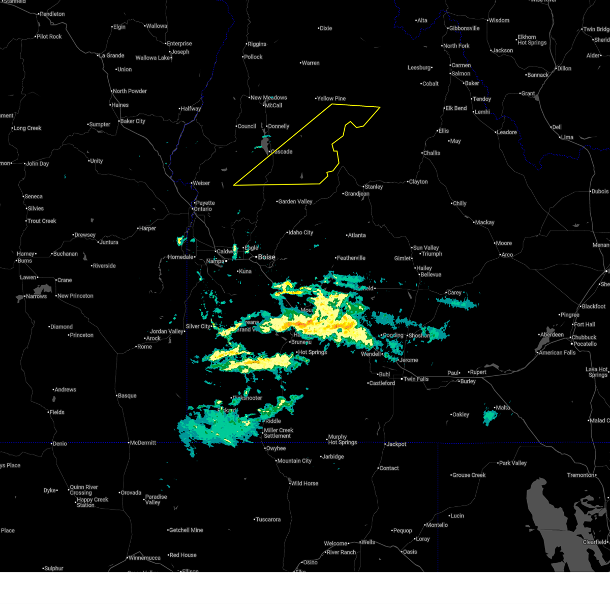
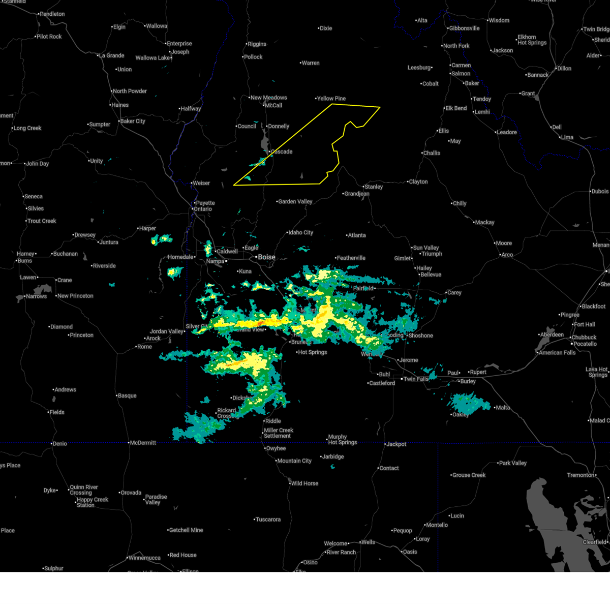
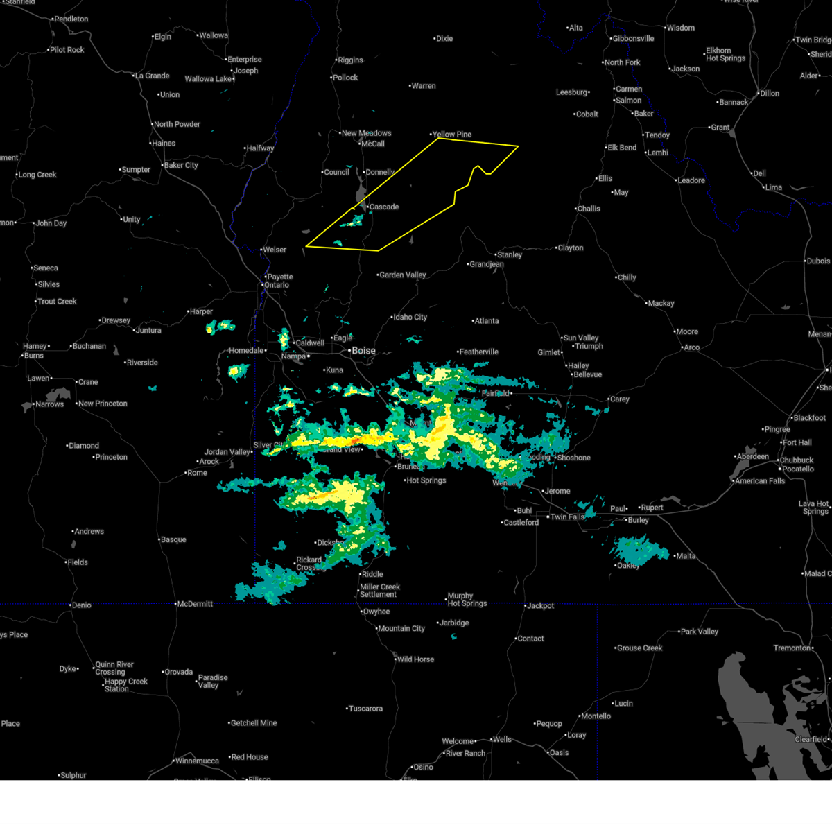
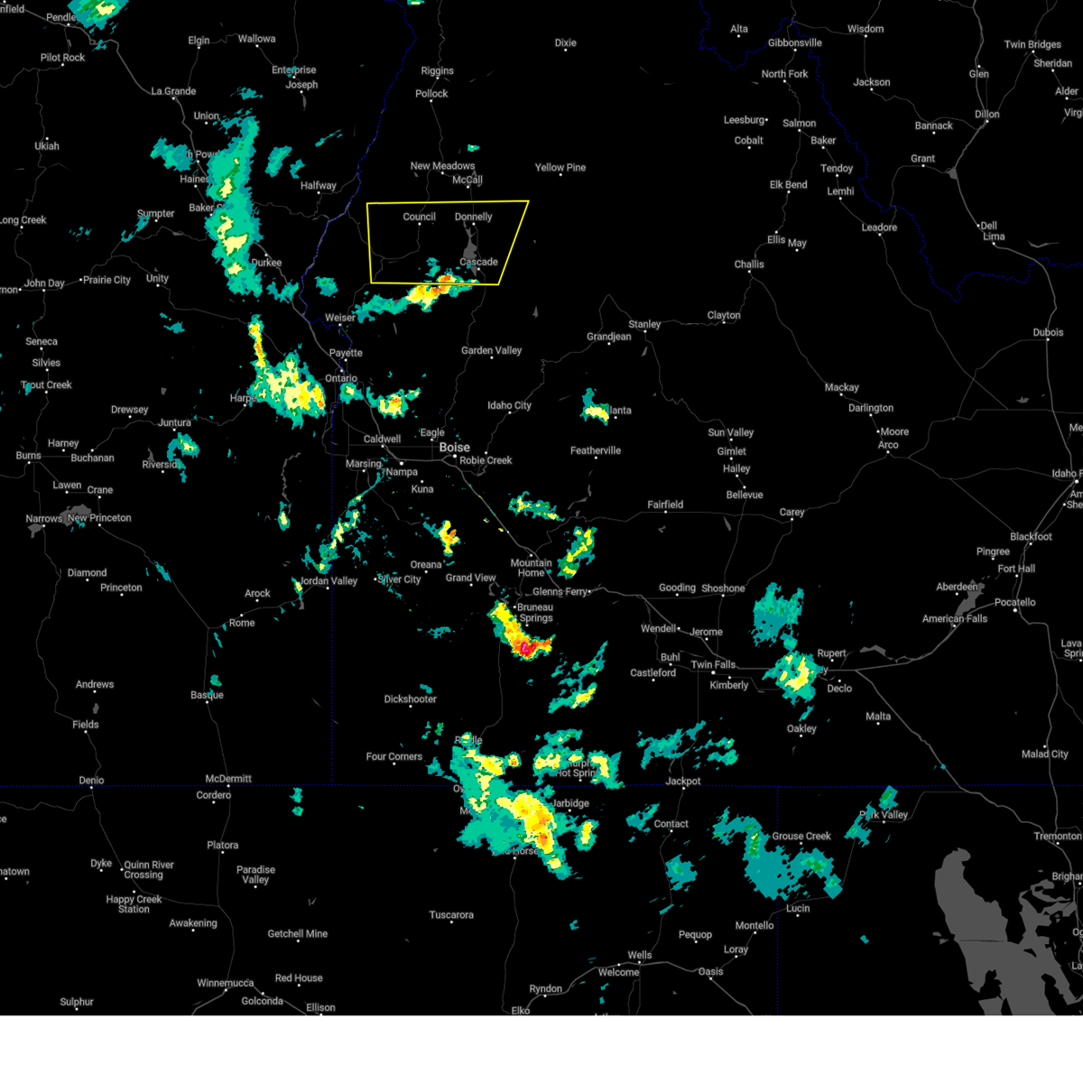
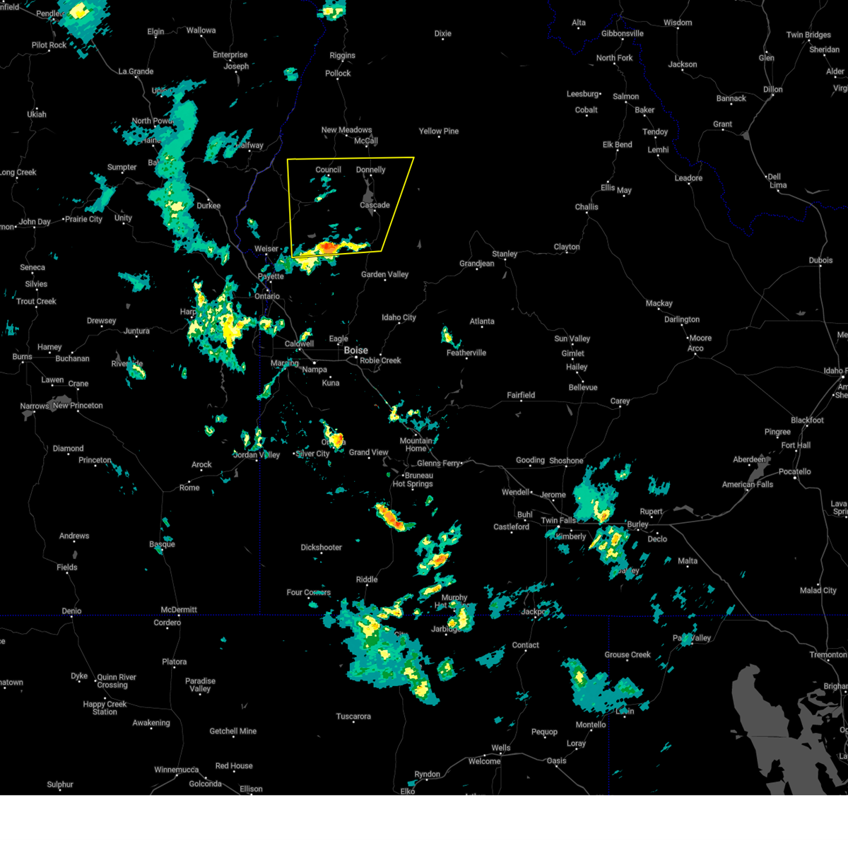
Hail Map for Cascade, ID
The Cascade, ID area has had 1 report of on-the-ground hail by trained spotters, and has been under severe weather warnings 8 times during the past 12 months. Doppler radar has detected hail at or near Cascade, ID on 2 occasions.
| Name: | Cascade, ID |
| Where Located: | 62.5 miles N of Boise, ID |
| Map: | Google Map for Cascade, ID |
| Population: | 939 |
| Housing Units: | 847 |
| More Info: | Search Google for Cascade, ID |
5
The Top Recent Hail Date for Cascade, ID is Thursday, September 5, 2013 (1st out of 2)

Hail and Wind Damage Spotted near Cascade, ID
| Date / Time | Report Details |
|---|---|
| 5/25/2026 5:53 PM MDT |
 At 553 pm mdt, severe thunderstorms were located along a line extending from glendale to near halfway station, moving north at 50 mph (radar indicated). Hazards include 60 mph wind gusts. Expect damage to roofs, siding, and trees. Locations impacted include, mccall, cascade, council, new meadows, goodrich, smiths ferry, donnelly, sage hen reservoir, poverty flat campground, price valley guard station, cascade reservoir, warm lake, horsethief reservoir, granger butte, glendale, meadows, indian mountain, council mountain, tamarack, and paddy flat work center. At 553 pm mdt, severe thunderstorms were located along a line extending from glendale to near halfway station, moving north at 50 mph (radar indicated). Hazards include 60 mph wind gusts. Expect damage to roofs, siding, and trees. Locations impacted include, mccall, cascade, council, new meadows, goodrich, smiths ferry, donnelly, sage hen reservoir, poverty flat campground, price valley guard station, cascade reservoir, warm lake, horsethief reservoir, granger butte, glendale, meadows, indian mountain, council mountain, tamarack, and paddy flat work center.
|
| 5/25/2026 5:45 PM MDT | Idaho power site w3t in valley county ID, 2.7 miles NNE of Cascade, ID |
| 5/25/2026 5:28 PM MDT |
 Svrboi the national weather service in boise has issued a * severe thunderstorm warning for, northwestern boise county in southwestern idaho, southwestern valley county in southwestern idaho, northeastern gem county in southwestern idaho, southeastern adams county in southwestern idaho, southeastern washington county in southwestern idaho, * until 615 pm mdt. * at 527 pm mdt, severe thunderstorms were located along a line extending from near indian valley to near monumental peak, moving northeast at 50 mph (radar indicated). Hazards include 60 mph wind gusts. expect damage to roofs, siding, and trees Svrboi the national weather service in boise has issued a * severe thunderstorm warning for, northwestern boise county in southwestern idaho, southwestern valley county in southwestern idaho, northeastern gem county in southwestern idaho, southeastern adams county in southwestern idaho, southeastern washington county in southwestern idaho, * until 615 pm mdt. * at 527 pm mdt, severe thunderstorms were located along a line extending from near indian valley to near monumental peak, moving northeast at 50 mph (radar indicated). Hazards include 60 mph wind gusts. expect damage to roofs, siding, and trees
|
| 12/17/2025 9:55 AM MST | Over 100 downed trees needed to be cleared on landmark road to provide access to yellow pin in valley county ID, 33 miles SW of Cascade, ID |
| 12/17/2025 9:00 AM MST | Multiple photos provided by the public showing downed/snapped trees in and near cascade... including one leaning on a hous in valley county ID, 0.3 miles SSE of Cascade, ID |
| 12/17/2025 8:24 AM MST |
 The storm which prompted the warning has moved out of the area. therefore, the warning will be allowed to expire. when safe to do so, please relay storm reports to the national weather service in boise via local law enforcement, or national weather service boise facebook and twitter accounts. The storm which prompted the warning has moved out of the area. therefore, the warning will be allowed to expire. when safe to do so, please relay storm reports to the national weather service in boise via local law enforcement, or national weather service boise facebook and twitter accounts.
|
| 12/17/2025 8:14 AM MST |
 Svrboi the national weather service in boise has issued a * severe thunderstorm warning for, southern valley county in southwestern idaho, east central gem county in southwestern idaho, southeastern washington county in southwestern idaho, * until 830 am mst. * at 814 am mst, a severe thunderstorm was located near deadwood summit, or 29 miles north of lowman, moving east at 65 mph (radar indicated). Hazards include 70 mph wind gusts and penny size hail. Expect considerable tree damage. damage is likely to mobile homes, roofs, and outbuildings. This severe thunderstorm will be near, dagger falls, boundary creek launch site, deadwood summit, and sulphur creek ranch around 820 am mst. Svrboi the national weather service in boise has issued a * severe thunderstorm warning for, southern valley county in southwestern idaho, east central gem county in southwestern idaho, southeastern washington county in southwestern idaho, * until 830 am mst. * at 814 am mst, a severe thunderstorm was located near deadwood summit, or 29 miles north of lowman, moving east at 65 mph (radar indicated). Hazards include 70 mph wind gusts and penny size hail. Expect considerable tree damage. damage is likely to mobile homes, roofs, and outbuildings. This severe thunderstorm will be near, dagger falls, boundary creek launch site, deadwood summit, and sulphur creek ranch around 820 am mst.
|
| 12/17/2025 8:09 AM MST |
 Svrboi the national weather service in boise has issued a * severe thunderstorm warning for, southern valley county in southwestern idaho, east central gem county in southwestern idaho, southeastern washington county in southwestern idaho, * until 830 am mst. * at 808 am mst, a severe thunderstorm was located near monumental peak, or 30 miles north of lowman, moving east at 95 mph (radar indicated). Hazards include 70 mph wind gusts and penny size hail. Expect considerable tree damage. damage is likely to mobile homes, roofs, and outbuildings. this severe thunderstorm will be near, monumental peak and deadwood summit around 810 am mst. Dagger falls, boundary creek launch site, and sulphur creek ranch around 820 am mst. Svrboi the national weather service in boise has issued a * severe thunderstorm warning for, southern valley county in southwestern idaho, east central gem county in southwestern idaho, southeastern washington county in southwestern idaho, * until 830 am mst. * at 808 am mst, a severe thunderstorm was located near monumental peak, or 30 miles north of lowman, moving east at 95 mph (radar indicated). Hazards include 70 mph wind gusts and penny size hail. Expect considerable tree damage. damage is likely to mobile homes, roofs, and outbuildings. this severe thunderstorm will be near, monumental peak and deadwood summit around 810 am mst. Dagger falls, boundary creek launch site, and sulphur creek ranch around 820 am mst.
|
| 12/17/2025 7:57 AM MST |
 the severe thunderstorm warning has been cancelled and is no longer in effect the severe thunderstorm warning has been cancelled and is no longer in effect
|
| 12/17/2025 7:57 AM MST |
 At 756 am mst, severe thunderstorms were located along a line extending from near pistol rock to 7 miles southwest of dodson pass, moving east at 50 mph (radar indicated). Hazards include 70 mph wind gusts and penny size hail. Expect considerable tree damage. damage is likely to mobile homes, roofs, and outbuildings. these severe storms will be near, cascade, halfway station, granite peak, and big baldy mountain around 800 am mst. smiths ferry, indian creek guard station, monumental peak, and deadwood summit around 810 am mst. silver creek work center, boiling springs, trail creek summit, and sulphur creek ranch around 820 am mst. Boundary creek launch site around 830 am mst. At 756 am mst, severe thunderstorms were located along a line extending from near pistol rock to 7 miles southwest of dodson pass, moving east at 50 mph (radar indicated). Hazards include 70 mph wind gusts and penny size hail. Expect considerable tree damage. damage is likely to mobile homes, roofs, and outbuildings. these severe storms will be near, cascade, halfway station, granite peak, and big baldy mountain around 800 am mst. smiths ferry, indian creek guard station, monumental peak, and deadwood summit around 810 am mst. silver creek work center, boiling springs, trail creek summit, and sulphur creek ranch around 820 am mst. Boundary creek launch site around 830 am mst.
|
| 12/17/2025 7:28 AM MST |
 Svrboi the national weather service in boise has issued a * severe thunderstorm warning for, central valley county in southwestern idaho, northeastern gem county in southwestern idaho, southeastern adams county in southwestern idaho, southeastern washington county in southwestern idaho, * until 815 am mst. * at 727 am mst, severe thunderstorms were located along a line extending from near poverty flat campground to near weiser, moving east at 50 mph (radar indicated). Hazards include 70 mph wind gusts and penny size hail. Expect considerable tree damage. damage is likely to mobile homes, roofs, and outbuildings. severe thunderstorms will be near, donnelly, tamarack ski area, indian valley, and indian mountain around 730 am mst. cascade, four bit summit, and halfway station around 740 am mst. granite peak, dodson pass, horsethief reservoir, and big creek summit around 750 am mst. big baldy mountain, landmark, and sage hen reservoir around 800 am mst. Smiths ferry, indian creek guard station, monumental peak, and deadwood summit around 810 am mst. Svrboi the national weather service in boise has issued a * severe thunderstorm warning for, central valley county in southwestern idaho, northeastern gem county in southwestern idaho, southeastern adams county in southwestern idaho, southeastern washington county in southwestern idaho, * until 815 am mst. * at 727 am mst, severe thunderstorms were located along a line extending from near poverty flat campground to near weiser, moving east at 50 mph (radar indicated). Hazards include 70 mph wind gusts and penny size hail. Expect considerable tree damage. damage is likely to mobile homes, roofs, and outbuildings. severe thunderstorms will be near, donnelly, tamarack ski area, indian valley, and indian mountain around 730 am mst. cascade, four bit summit, and halfway station around 740 am mst. granite peak, dodson pass, horsethief reservoir, and big creek summit around 750 am mst. big baldy mountain, landmark, and sage hen reservoir around 800 am mst. Smiths ferry, indian creek guard station, monumental peak, and deadwood summit around 810 am mst.
|
| 9/2/2024 8:15 PM MDT | Large tree dow in valley county ID, 0.5 miles NW of Cascade, ID |
| 9/2/2024 8:04 PM MDT |
 At 804 pm mdt, severe thunderstorms were located along a line extending from near goodrich to near big creek summit, moving north at 45 mph (radar indicated). Hazards include 60 mph wind gusts. Expect damage to roofs, siding, and trees. these severe storms will be near, council, goodrich, donnelly, and tamarack ski area around 810 pm mdt. Glendale, fruitvale, and paddy flat work center around 820 pm mdt. At 804 pm mdt, severe thunderstorms were located along a line extending from near goodrich to near big creek summit, moving north at 45 mph (radar indicated). Hazards include 60 mph wind gusts. Expect damage to roofs, siding, and trees. these severe storms will be near, council, goodrich, donnelly, and tamarack ski area around 810 pm mdt. Glendale, fruitvale, and paddy flat work center around 820 pm mdt.
|
| 9/2/2024 7:39 PM MDT |
 Svrboi the national weather service in boise has issued a * severe thunderstorm warning for, southwestern valley county in southwestern idaho, northeastern gem county in southwestern idaho, southeastern adams county in southwestern idaho, eastern washington county in southwestern idaho, * until 815 pm mdt.. * at 738 pm mdt, severe thunderstorms were located along a line extending from star butte to near boiling springs, moving north at 45 mph (radar indicated). Hazards include 60 mph wind gusts. Expect damage to roofs, siding, and trees. severe thunderstorms will be near, cascade, four bit summit, granite peak, and cascade reservoir around 740 pm mdt. indian valley and horsethief reservoir around 750 pm mdt. goodrich, tamarack ski area, indian mountain, and mesa around 800 pm mdt. Council, donnelly, and council mountain around 810 pm mdt. Svrboi the national weather service in boise has issued a * severe thunderstorm warning for, southwestern valley county in southwestern idaho, northeastern gem county in southwestern idaho, southeastern adams county in southwestern idaho, eastern washington county in southwestern idaho, * until 815 pm mdt.. * at 738 pm mdt, severe thunderstorms were located along a line extending from star butte to near boiling springs, moving north at 45 mph (radar indicated). Hazards include 60 mph wind gusts. Expect damage to roofs, siding, and trees. severe thunderstorms will be near, cascade, four bit summit, granite peak, and cascade reservoir around 740 pm mdt. indian valley and horsethief reservoir around 750 pm mdt. goodrich, tamarack ski area, indian mountain, and mesa around 800 pm mdt. Council, donnelly, and council mountain around 810 pm mdt.
|
| 9/7/2022 6:41 PM MDT |
 At 640 pm mdt/540 pm pdt/, severe thunderstorms were located along a line extending from richland to near homedale, moving east-northeast at 55 mph (radar indicated). Hazards include 70 mph wind gusts. Expect considerable tree damage. damage is likely to mobile homes, roofs, and outbuildings. severe thunderstorms will be near, halfway, richland and carson around 550 pm pdt. cambridge around 650 pm mdt. oxbow dam and brownlee dam around 600 pm pdt. goodrich and brownlee reservoir around 700 pm mdt. emmett, eagle, council and bear around 710 pm mdt. sweet, horseshoe bend, montour and lost valley reservoir around 720 pm mdt. mccall, gardena, ola and new meadows around 730 pm mdt. thunderstorm damage threat, considerable hail threat, radar indicated max hail size, <. 75 in wind threat, radar indicated max wind gust, 70 mph. At 640 pm mdt/540 pm pdt/, severe thunderstorms were located along a line extending from richland to near homedale, moving east-northeast at 55 mph (radar indicated). Hazards include 70 mph wind gusts. Expect considerable tree damage. damage is likely to mobile homes, roofs, and outbuildings. severe thunderstorms will be near, halfway, richland and carson around 550 pm pdt. cambridge around 650 pm mdt. oxbow dam and brownlee dam around 600 pm pdt. goodrich and brownlee reservoir around 700 pm mdt. emmett, eagle, council and bear around 710 pm mdt. sweet, horseshoe bend, montour and lost valley reservoir around 720 pm mdt. mccall, gardena, ola and new meadows around 730 pm mdt. thunderstorm damage threat, considerable hail threat, radar indicated max hail size, <. 75 in wind threat, radar indicated max wind gust, 70 mph.
|
| 5/5/2017 6:46 PM MDT |
 At 646 pm mdt, a severe thunderstorm was located near french corner, or 11 miles east of payette, moving northeast at 40 mph (radar indicated). Hazards include quarter size hail and gusty winds. Damage to vehicles is expected. this severe thunderstorm will be near, french corner around 650 pm mdt. paddock valley reservoir around 710 pm mdt. Cascade, dodson pass, sage hen reservoir and four bit summit around 730 pm mdt. At 646 pm mdt, a severe thunderstorm was located near french corner, or 11 miles east of payette, moving northeast at 40 mph (radar indicated). Hazards include quarter size hail and gusty winds. Damage to vehicles is expected. this severe thunderstorm will be near, french corner around 650 pm mdt. paddock valley reservoir around 710 pm mdt. Cascade, dodson pass, sage hen reservoir and four bit summit around 730 pm mdt.
|
| 9/5/2013 5:00 PM MDT | Half Dollar sized hail reported 0.3 miles SSE of Cascade, ID |
| 6/4/2012 8:16 PM MDT | Pilot reported microburst with winds blowing upright pine trees off 30 degree in valley county ID, 0.3 miles SSE of Cascade, ID |
| 6/4/2012 7:55 PM MDT | 60 inch tree snapped. time estimate in valley county ID, 0.3 miles SSE of Cascade, ID |
Hail Maps for Cascade, ID


Connect with Interactive Hail Maps