

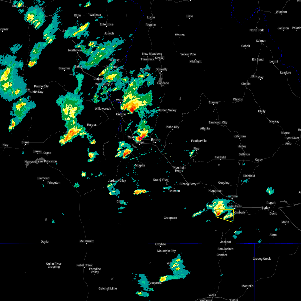
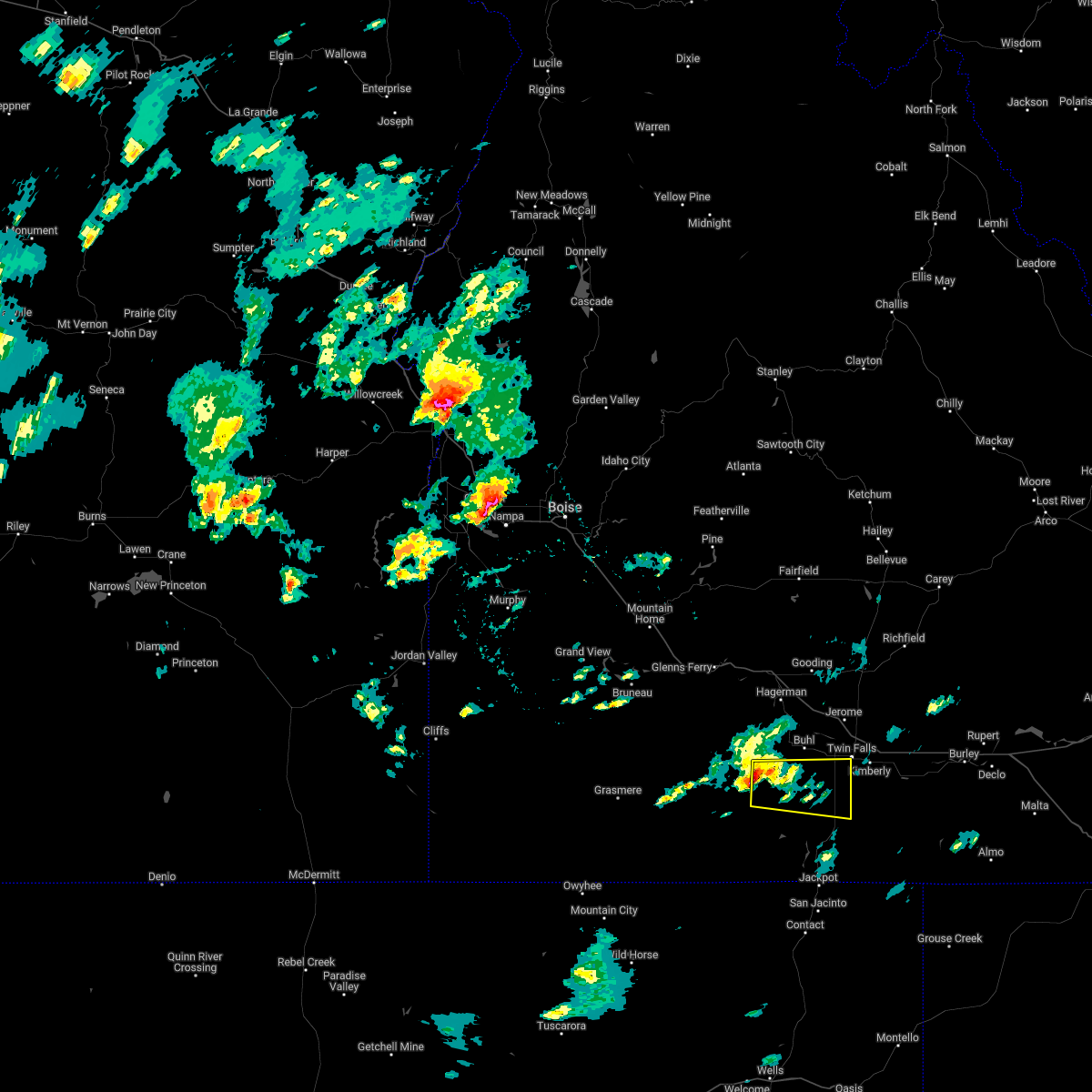
Hail Map for Castleford, ID
The Castleford, ID area has had 0 reports of on-the-ground hail by trained spotters, and has been under severe weather warnings 1 time during the past 12 months. Doppler radar has detected hail at or near Castleford, ID on 2 occasions.
| Name: | Castleford, ID |
| Where Located: | 20.7 miles W of Twin Falls, ID |
| Map: | Google Map for Castleford, ID |
| Population: | 226 |
| Housing Units: | 103 |
| More Info: | Search Google for Castleford, ID |
0
The Top Recent Hail Date for Castleford, ID is Sunday, August 18, 2024 (2nd out of 2)

Hail and Wind Damage Spotted near Castleford, ID
| Date / Time | Report Details |
|---|---|
| 12/17/2025 9:09 AM MST |
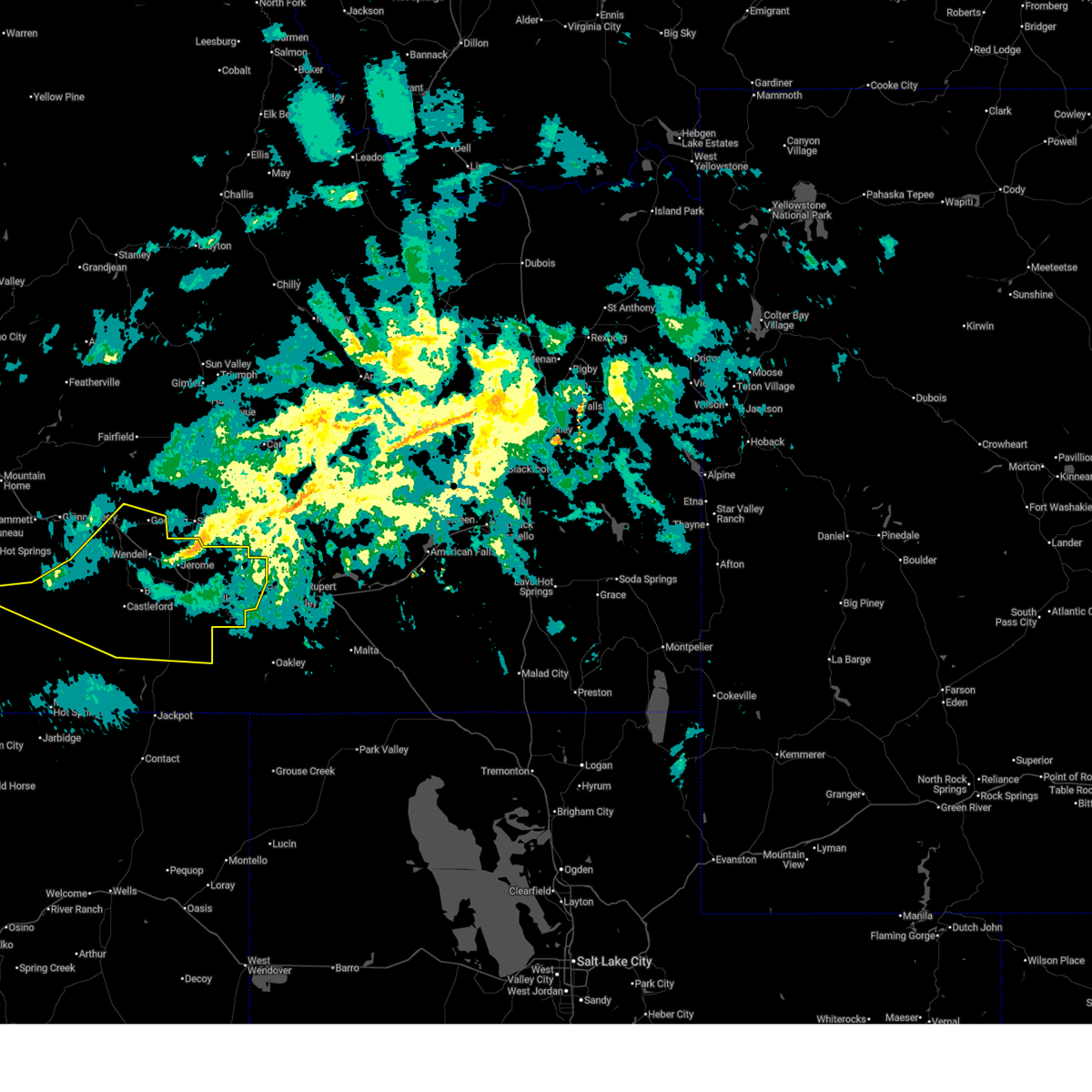 Svrboi the national weather service in boise has issued a * severe thunderstorm warning for, jerome county in south central idaho, twin falls county in south central idaho, southeastern elmore county in southwestern idaho, east central owyhee county in southwestern idaho, southern gooding county in south central idaho, * until 1000 am mst. * at 908 am mst, severe thunderstorms were located along a line extending from near gooding to 9 miles south of twentymile butte to near crows nest butte to near twin butte, moving east at 65 mph (radar indicated). Hazards include 70 mph wind gusts and penny size hail. Expect considerable tree damage. damage is likely to mobile homes, roofs, and outbuildings. severe thunderstorms will be near, gooding, wendell, hagerman, and crows nest butte around 910 am mst. jerome, buhl, and castleford around 920 am mst. twin falls, filer, horse butte, and clover creek crossing around 930 am mst. kimberly, hansen, hazelton, and eden around 940 am mst. Murtaugh, rock creek, and milner dam around 950 am mst. Svrboi the national weather service in boise has issued a * severe thunderstorm warning for, jerome county in south central idaho, twin falls county in south central idaho, southeastern elmore county in southwestern idaho, east central owyhee county in southwestern idaho, southern gooding county in south central idaho, * until 1000 am mst. * at 908 am mst, severe thunderstorms were located along a line extending from near gooding to 9 miles south of twentymile butte to near crows nest butte to near twin butte, moving east at 65 mph (radar indicated). Hazards include 70 mph wind gusts and penny size hail. Expect considerable tree damage. damage is likely to mobile homes, roofs, and outbuildings. severe thunderstorms will be near, gooding, wendell, hagerman, and crows nest butte around 910 am mst. jerome, buhl, and castleford around 920 am mst. twin falls, filer, horse butte, and clover creek crossing around 930 am mst. kimberly, hansen, hazelton, and eden around 940 am mst. Murtaugh, rock creek, and milner dam around 950 am mst.
|
| 7/24/2024 4:52 PM MDT | Mesonet station hbfi1 horse butt in owyhee county ID, 19.6 miles ENE of Castleford, ID |
| 6/5/2022 3:32 PM MDT |
 At 331 pm mdt, a severe thunderstorm was located 7 miles southeast of castleford, or 16 miles southwest of twin falls, moving east at 35 mph (radar indicated). Hazards include 60 mph wind gusts and quarter size hail. Hail damage to vehicles is expected. expect wind damage to roofs, siding, and trees. this severe storm will be near, hollister around 350 pm mdt. hail threat, radar indicated max hail size, 1. 00 in wind threat, radar indicated max wind gust, 60 mph. At 331 pm mdt, a severe thunderstorm was located 7 miles southeast of castleford, or 16 miles southwest of twin falls, moving east at 35 mph (radar indicated). Hazards include 60 mph wind gusts and quarter size hail. Hail damage to vehicles is expected. expect wind damage to roofs, siding, and trees. this severe storm will be near, hollister around 350 pm mdt. hail threat, radar indicated max hail size, 1. 00 in wind threat, radar indicated max wind gust, 60 mph.
|
| 6/5/2022 3:11 PM MDT |
 At 311 pm mdt, a severe thunderstorm was located near roseworth, or 27 miles west of twin falls, moving east at 30 mph (radar indicated). Hazards include 60 mph wind gusts and quarter size hail. Hail damage to vehicles is expected. expect wind damage to roofs, siding, and trees. this severe thunderstorm will be near, castleford around 320 pm mdt. hollister around 350 pm mdt. twin falls and magic valley regional airport around 400 pm mdt. hail threat, radar indicated max hail size, 1. 00 in wind threat, radar indicated max wind gust, 60 mph. At 311 pm mdt, a severe thunderstorm was located near roseworth, or 27 miles west of twin falls, moving east at 30 mph (radar indicated). Hazards include 60 mph wind gusts and quarter size hail. Hail damage to vehicles is expected. expect wind damage to roofs, siding, and trees. this severe thunderstorm will be near, castleford around 320 pm mdt. hollister around 350 pm mdt. twin falls and magic valley regional airport around 400 pm mdt. hail threat, radar indicated max hail size, 1. 00 in wind threat, radar indicated max wind gust, 60 mph.
|
| 9/6/2019 2:07 PM MDT |
 The severe thunderstorm warning for central twin falls, western jerome and southeastern gooding counties will expire at 215 pm mdt, the storm which prompted the warning has weakened below severe limits, and no longer poses an immediate threat to life or property. therefore, the warning will be allowed to expire. however small hail and heavy rain are still possible with this thunderstorm. when safe to do so, please relay storm reports to the national weather service in boise via local law enforcement, or national weather service boise facebook and twitter accounts. The severe thunderstorm warning for central twin falls, western jerome and southeastern gooding counties will expire at 215 pm mdt, the storm which prompted the warning has weakened below severe limits, and no longer poses an immediate threat to life or property. therefore, the warning will be allowed to expire. however small hail and heavy rain are still possible with this thunderstorm. when safe to do so, please relay storm reports to the national weather service in boise via local law enforcement, or national weather service boise facebook and twitter accounts.
|
| 9/6/2019 1:26 PM MDT |
 At 126 pm mdt, a severe thunderstorm was located near castleford, or 18 miles west of twin falls, moving east at 25 mph (radar indicated). Hazards include 60 mph wind gusts and quarter size hail. Hail damage to vehicles is expected. expect wind damage to roofs, siding, and trees. this severe thunderstorm will be near, buhl around 130 pm mdt. filer around 150 pm mdt. twin falls and magic valley regional airport around 200 pm mdt. Jerome, kimberly, hansen and rock creek around 210 pm mdt. At 126 pm mdt, a severe thunderstorm was located near castleford, or 18 miles west of twin falls, moving east at 25 mph (radar indicated). Hazards include 60 mph wind gusts and quarter size hail. Hail damage to vehicles is expected. expect wind damage to roofs, siding, and trees. this severe thunderstorm will be near, buhl around 130 pm mdt. filer around 150 pm mdt. twin falls and magic valley regional airport around 200 pm mdt. Jerome, kimberly, hansen and rock creek around 210 pm mdt.
|
| 8/11/2015 4:52 PM MDT | Horse butte raws reported a thunderstorm wind gust of 48 mp in owyhee county ID, 19.6 miles ENE of Castleford, ID |
| 8/5/2012 7:52 PM MDT | 16g60 from the sw in the hour ending at 752 pm mdt. no precipitatio in owyhee county ID, 19.6 miles ENE of Castleford, ID |
Hail Maps for Castleford, ID


Connect with Interactive Hail Maps