

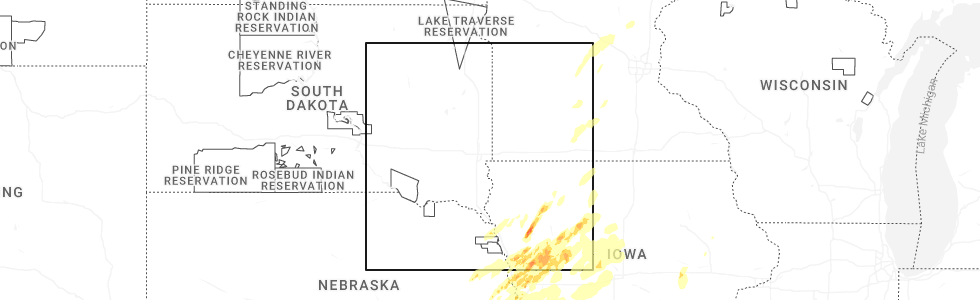
Hail Map for Cedar Mills, MN
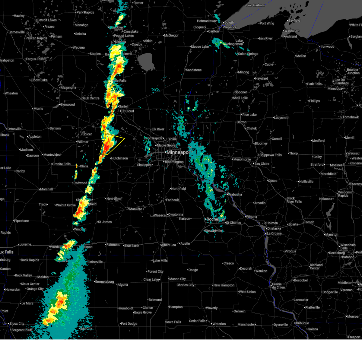
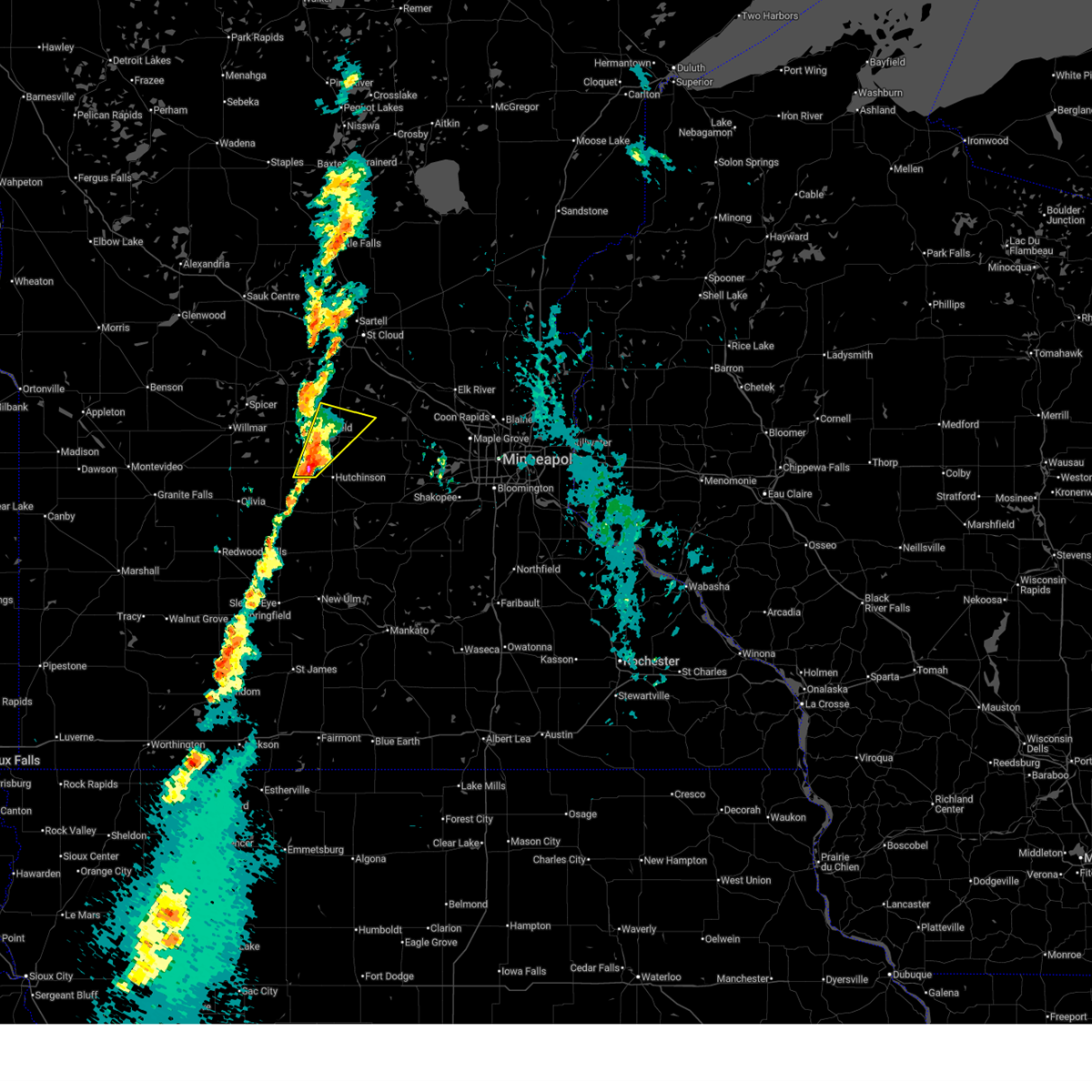
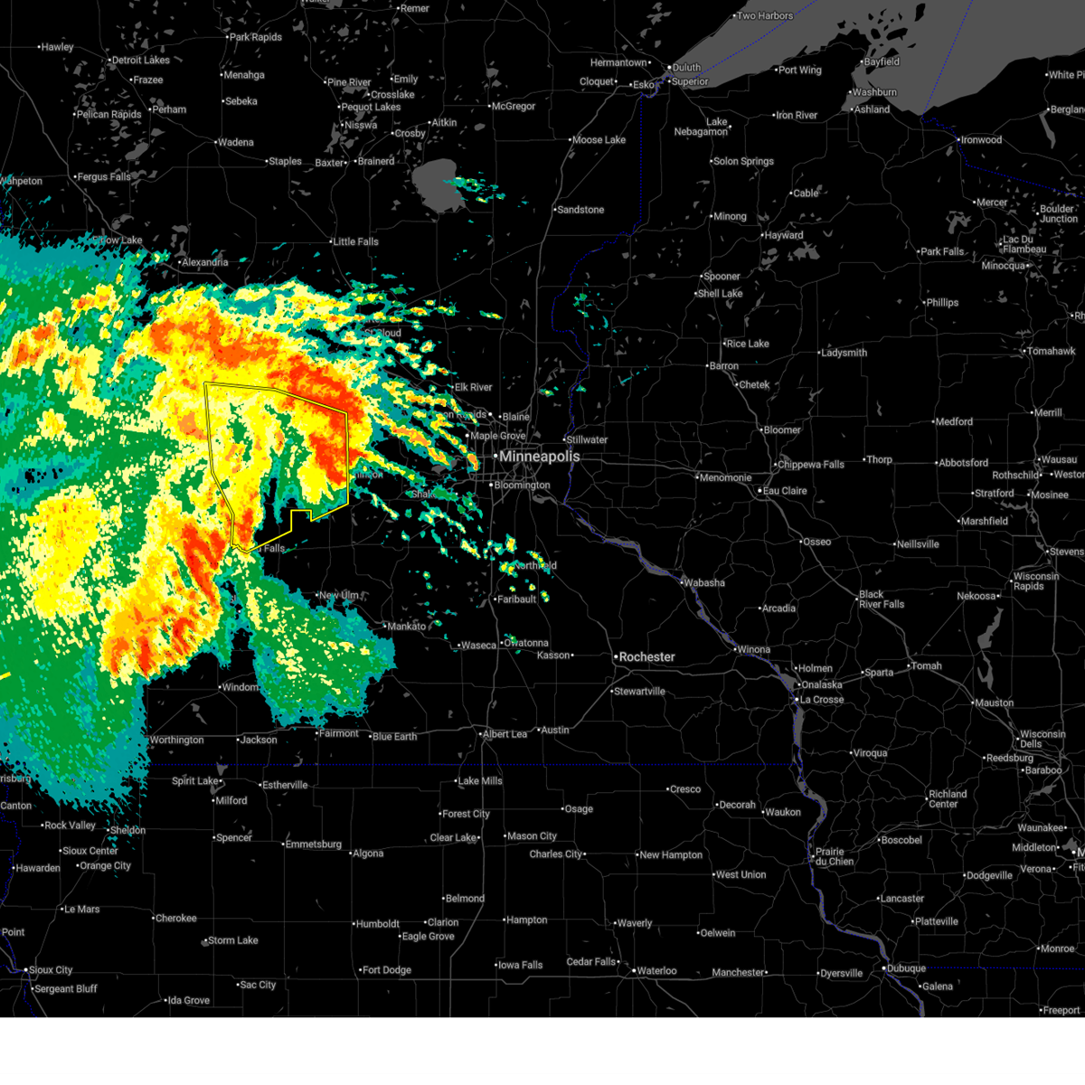
The Cedar Mills, MN area has had 1 report of on-the-ground hail by trained spotters, and has been under severe weather warnings 5 times during the past 12 months. Doppler radar has detected hail at or near Cedar Mills, MN on 67 occasions, including 5 occasions during the past year.
| Name: | Cedar Mills, MN |
| Where Located: | 58.6 miles E of Montevideo, MN |
| Map: | Google Map for Cedar Mills, MN |
| Population: | 45 |
| Housing Units: | 24 |
| More Info: | Search Google for Cedar Mills, MN |
1
The Top Recent Hail Date for Cedar Mills, MN is Thursday, April 23, 2026 (27th out of 67)
Hail and Wind Damage Spotted near Cedar Mills, MN
| Date / Time | Report Details |
|---|---|
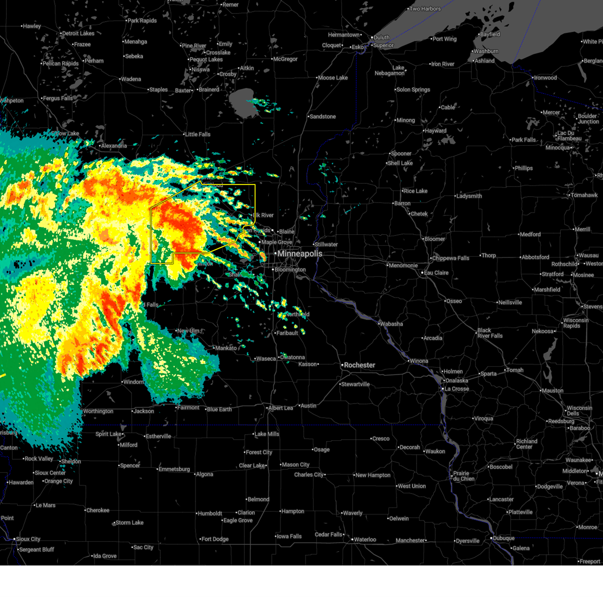
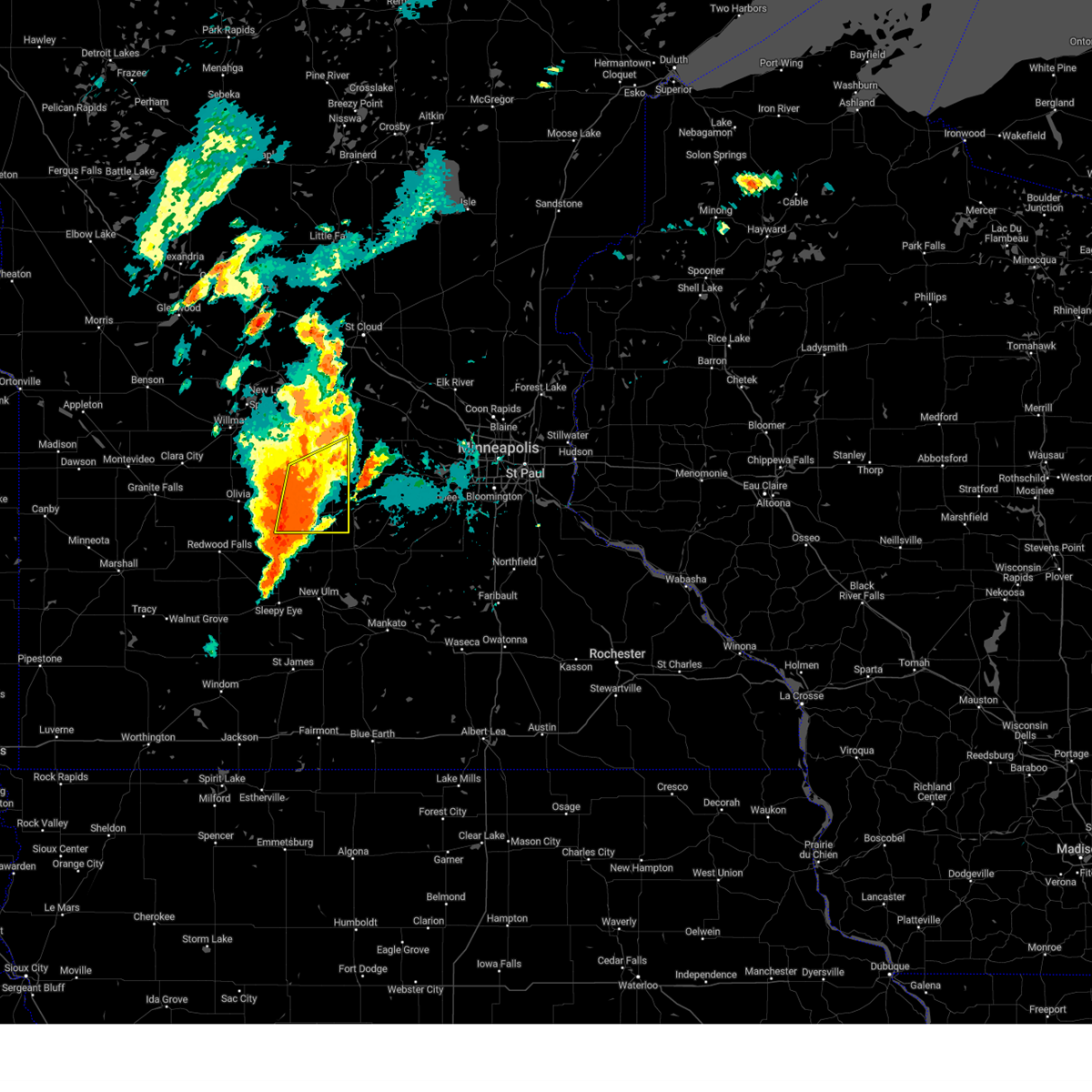
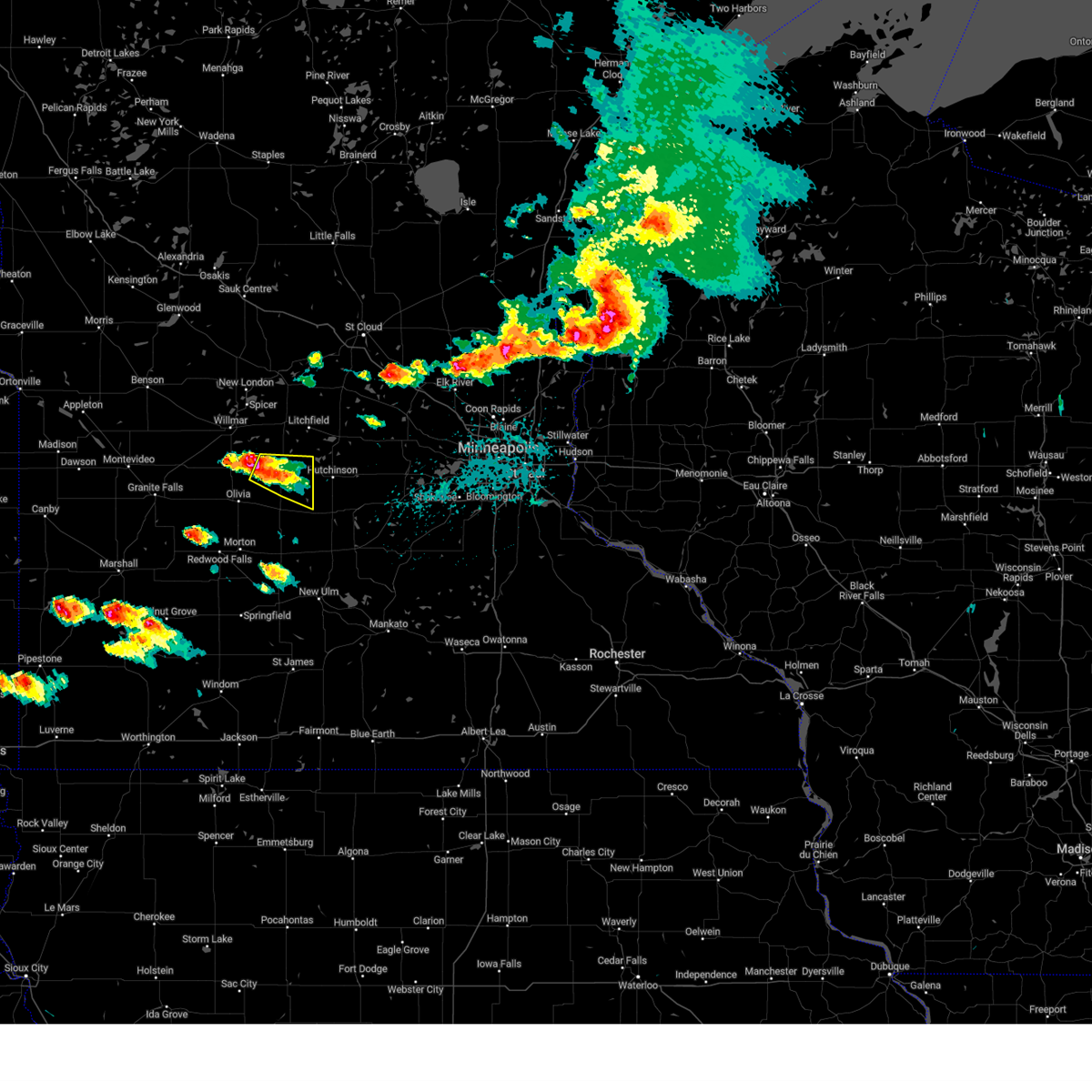
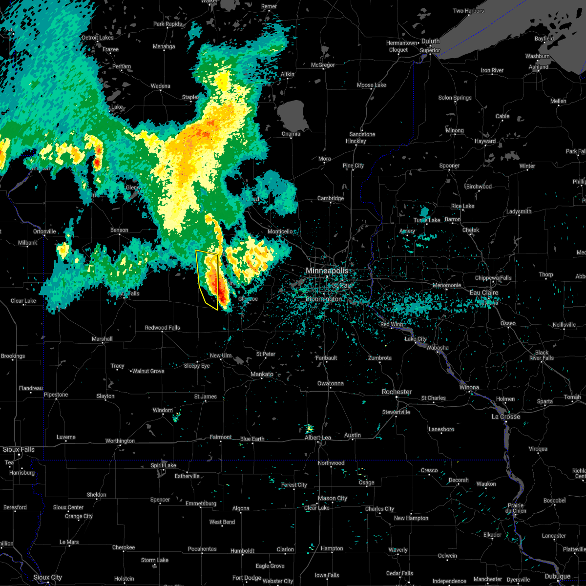
| 4/23/2026 2:54 PM CDT |
 At 254 pm cdt, a severe thunderstorm was located 7 miles southwest of dassel, or 10 miles north of hutchinson, moving northeast at 40 mph (trained spotters reported). Hazards include 60 mph wind gusts and half dollar size hail. Hail damage to vehicles is expected. expect wind damage to roofs, siding, and trees. Locations impacted include, greenleaf, darwin, dassel and forest city. At 254 pm cdt, a severe thunderstorm was located 7 miles southwest of dassel, or 10 miles north of hutchinson, moving northeast at 40 mph (trained spotters reported). Hazards include 60 mph wind gusts and half dollar size hail. Hail damage to vehicles is expected. expect wind damage to roofs, siding, and trees. Locations impacted include, greenleaf, darwin, dassel and forest city.
|
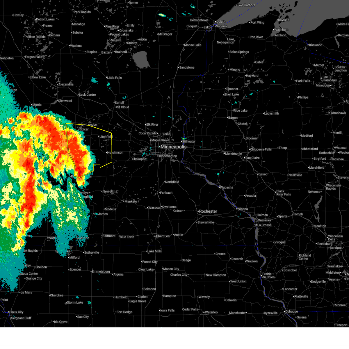
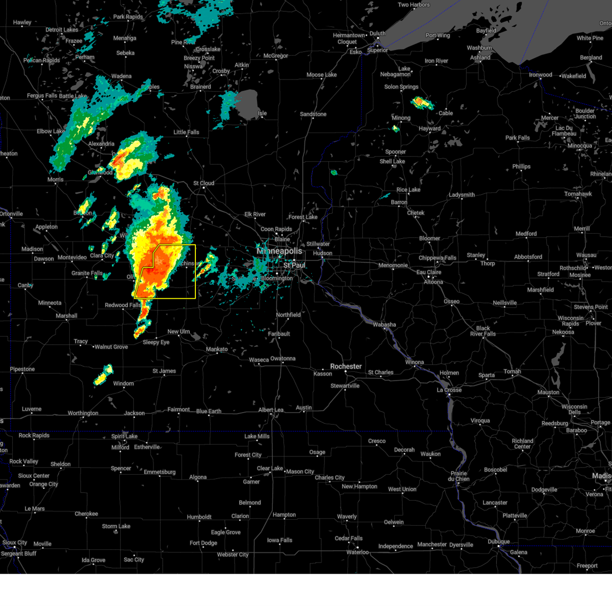
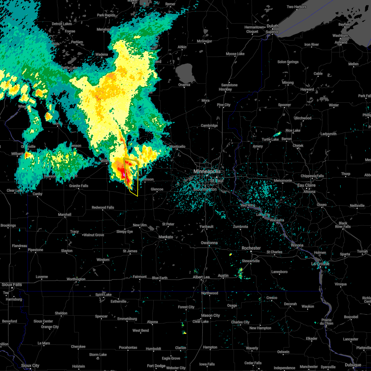
| 4/23/2026 2:47 PM CDT |
 Svrmpx the national weather service in the twin cities has issued a * severe thunderstorm warning for, northwestern mcleod county in central minnesota, eastern meeker county in central minnesota, west central wright county in central minnesota, * until 315 pm cdt. * at 247 pm cdt, a severe thunderstorm was located 8 miles northwest of hutchinson, moving northeast at 40 mph (radar indicated). Hazards include 60 mph wind gusts and quarter size hail. Hail damage to vehicles is expected. Expect wind damage to roofs, siding, and trees. Svrmpx the national weather service in the twin cities has issued a * severe thunderstorm warning for, northwestern mcleod county in central minnesota, eastern meeker county in central minnesota, west central wright county in central minnesota, * until 315 pm cdt. * at 247 pm cdt, a severe thunderstorm was located 8 miles northwest of hutchinson, moving northeast at 40 mph (radar indicated). Hazards include 60 mph wind gusts and quarter size hail. Hail damage to vehicles is expected. Expect wind damage to roofs, siding, and trees.
|
| 8/16/2025 6:07 AM CDT |
 The storms which prompted the warning have moved out of the area. therefore, the warning has been allowed to expire. to report severe weather, contact your nearest law enforcement agency. they will send your report to the national weather service office. The storms which prompted the warning have moved out of the area. therefore, the warning has been allowed to expire. to report severe weather, contact your nearest law enforcement agency. they will send your report to the national weather service office.
|
| 8/16/2025 5:52 AM CDT |
 Svrmpx the national weather service in the twin cities has issued a * severe thunderstorm warning for, meeker county in central minnesota, sherburne county in central minnesota, southeastern stearns county in central minnesota, wright county in central minnesota, * until 645 am cdt. * at 552 am cdt, severe thunderstorms were located along a line from 5 miles south of waite park to over howard lake, or along a line from 6 miles southwest of st. cloud to 14 miles southwest of buffalo, moving northeast at 55 mph (radar indicated). Hazards include 60 mph wind gusts and quarter size hail. Hail damage to vehicles is expected. Expect wind damage to roofs, siding, and trees. Svrmpx the national weather service in the twin cities has issued a * severe thunderstorm warning for, meeker county in central minnesota, sherburne county in central minnesota, southeastern stearns county in central minnesota, wright county in central minnesota, * until 645 am cdt. * at 552 am cdt, severe thunderstorms were located along a line from 5 miles south of waite park to over howard lake, or along a line from 6 miles southwest of st. cloud to 14 miles southwest of buffalo, moving northeast at 55 mph (radar indicated). Hazards include 60 mph wind gusts and quarter size hail. Hail damage to vehicles is expected. Expect wind damage to roofs, siding, and trees.
|
| 8/16/2025 5:07 AM CDT |
 Svrmpx the national weather service in the twin cities has issued a * severe thunderstorm warning for, kandiyohi county in central minnesota, western mcleod county in central minnesota, meeker county in central minnesota, eastern renville county in central minnesota, * until 600 am cdt. * at 507 am cdt, severe thunderstorms were located along a line from 8 miles southwest of atwater to 5 miles south of buffalo lake, or along a line from 11 miles southeast of willmar to 20 miles southwest of hutchinson, moving northeast at 50 mph (radar indicated). Hazards include 60 mph wind gusts and quarter size hail. Hail damage to vehicles is expected. Expect wind damage to roofs, siding, and trees. Svrmpx the national weather service in the twin cities has issued a * severe thunderstorm warning for, kandiyohi county in central minnesota, western mcleod county in central minnesota, meeker county in central minnesota, eastern renville county in central minnesota, * until 600 am cdt. * at 507 am cdt, severe thunderstorms were located along a line from 8 miles southwest of atwater to 5 miles south of buffalo lake, or along a line from 11 miles southeast of willmar to 20 miles southwest of hutchinson, moving northeast at 50 mph (radar indicated). Hazards include 60 mph wind gusts and quarter size hail. Hail damage to vehicles is expected. Expect wind damage to roofs, siding, and trees.
|
| 6/2/2025 5:33 PM CDT |
 the severe thunderstorm warning has been cancelled and is no longer in effect the severe thunderstorm warning has been cancelled and is no longer in effect
|
| 6/2/2025 5:33 PM CDT |
 At 533 pm cdt, a severe thunderstorm was located 6 miles northeast of bird island, or 21 miles west of hutchinson, moving east at 30 mph (radar indicated). Hazards include 60 mph wind gusts and quarter size hail. Hail damage to vehicles is expected. expect wind damage to roofs, siding, and trees. Locations impacted include, hector, bird island, buffalo lake, cosmos, lakeside, corvuso and cedar mills. At 533 pm cdt, a severe thunderstorm was located 6 miles northeast of bird island, or 21 miles west of hutchinson, moving east at 30 mph (radar indicated). Hazards include 60 mph wind gusts and quarter size hail. Hail damage to vehicles is expected. expect wind damage to roofs, siding, and trees. Locations impacted include, hector, bird island, buffalo lake, cosmos, lakeside, corvuso and cedar mills.
|
| 6/2/2025 5:10 PM CDT |
 Svrmpx the national weather service in the twin cities has issued a * severe thunderstorm warning for, southeastern kandiyohi county in central minnesota, southwestern meeker county in central minnesota, northeastern renville county in central minnesota, * until 600 pm cdt. * at 510 pm cdt, a severe thunderstorm was located over olivia, or 18 miles north of redwood falls, moving east at 30 mph (radar indicated). Hazards include golf ball size hail. People and animals outdoors will be injured. Expect damage to roofs, siding, windows, and vehicles. Svrmpx the national weather service in the twin cities has issued a * severe thunderstorm warning for, southeastern kandiyohi county in central minnesota, southwestern meeker county in central minnesota, northeastern renville county in central minnesota, * until 600 pm cdt. * at 510 pm cdt, a severe thunderstorm was located over olivia, or 18 miles north of redwood falls, moving east at 30 mph (radar indicated). Hazards include golf ball size hail. People and animals outdoors will be injured. Expect damage to roofs, siding, windows, and vehicles.
|
| 8/29/2024 3:05 PM CDT |
 Svrmpx the national weather service in the twin cities has issued a * severe thunderstorm warning for, wright county in central minnesota, eastern meeker county in central minnesota, northwestern mcleod county in central minnesota, * until 345 pm cdt. * at 304 pm cdt, severe thunderstorms were located along a line extending from litchfield to near hutchinson, moving northeast at 55 mph (radar indicated). Hazards include 60 mph wind gusts and quarter size hail. Hail damage to vehicles is expected. Expect wind damage to roofs, siding, and trees. Svrmpx the national weather service in the twin cities has issued a * severe thunderstorm warning for, wright county in central minnesota, eastern meeker county in central minnesota, northwestern mcleod county in central minnesota, * until 345 pm cdt. * at 304 pm cdt, severe thunderstorms were located along a line extending from litchfield to near hutchinson, moving northeast at 55 mph (radar indicated). Hazards include 60 mph wind gusts and quarter size hail. Hail damage to vehicles is expected. Expect wind damage to roofs, siding, and trees.
|
| 8/26/2024 6:06 PM CDT |
 At 606 pm cdt, a severe thunderstorm was located near brownton, or 7 miles south of hutchinson, moving east at 20 mph (radar indicated). Hazards include 60 mph wind gusts and quarter size hail. Hail damage to vehicles is expected. expect wind damage to roofs, siding, and trees. Locations impacted include, hutchinson, hector, brownton, buffalo lake, stewart, greenleaf, sumter, lakeside, biscay, corvuso, hutchinson airport, and fernando. At 606 pm cdt, a severe thunderstorm was located near brownton, or 7 miles south of hutchinson, moving east at 20 mph (radar indicated). Hazards include 60 mph wind gusts and quarter size hail. Hail damage to vehicles is expected. expect wind damage to roofs, siding, and trees. Locations impacted include, hutchinson, hector, brownton, buffalo lake, stewart, greenleaf, sumter, lakeside, biscay, corvuso, hutchinson airport, and fernando.
|
| 8/26/2024 5:44 PM CDT |
 Svrmpx the national weather service in the twin cities has issued a * severe thunderstorm warning for, southern meeker county in central minnesota, northwestern sibley county in central minnesota, western mcleod county in central minnesota, northeastern renville county in central minnesota, * until 630 pm cdt. * at 543 pm cdt, a severe thunderstorm was located near buffalo lake, or 10 miles southwest of hutchinson, moving east at 30 mph (radar indicated). Hazards include 60 mph wind gusts and quarter size hail. Hail damage to vehicles is expected. Expect wind damage to roofs, siding, and trees. Svrmpx the national weather service in the twin cities has issued a * severe thunderstorm warning for, southern meeker county in central minnesota, northwestern sibley county in central minnesota, western mcleod county in central minnesota, northeastern renville county in central minnesota, * until 630 pm cdt. * at 543 pm cdt, a severe thunderstorm was located near buffalo lake, or 10 miles southwest of hutchinson, moving east at 30 mph (radar indicated). Hazards include 60 mph wind gusts and quarter size hail. Hail damage to vehicles is expected. Expect wind damage to roofs, siding, and trees.
|
| 8/3/2024 10:32 PM CDT | At 1032 pm cdt, a severe thunderstorm was located near cosmos, or 13 miles west of hutchinson, moving southeast at 45 mph (law enforcement reported golf ball sized hail north of cosmos). Hazards include golf ball size hail and 60 mph wind gusts. People and animals outdoors will be injured. expect hail damage to roofs, siding, windows, and vehicles. expect wind damage to roofs, siding, and trees. Locations impacted include, winthrop, hector, gibbon, brownton, buffalo lake, stewart, cosmos, lakeside, thorpe, strout, corvuso, and fernando. |
| 8/3/2024 10:31 PM CDT | The severe thunderstorm which prompted the warning has remained strong over the area. a new warning has been issued. a severe thunderstorm watch remains in effect until 100 am cdt for central minnesota. remember, a severe thunderstorm warning still remains in effect for portions of southern kandiyohi, meeker, northeastern renville, and western mccleod counties until 1115pm. |
| 8/3/2024 10:29 PM CDT | Svrmpx the national weather service in the twin cities has issued a * severe thunderstorm warning for, southwestern meeker county in central minnesota, northwestern sibley county in central minnesota, southwestern mcleod county in central minnesota, southeastern kandiyohi county in central minnesota, eastern renville county in central minnesota, * until 1115 pm cdt. * at 1028 pm cdt, a severe thunderstorm was located over cosmos, or 14 miles west of hutchinson, moving southeast at 45 mph (radar indicated). Hazards include 60 mph wind gusts and quarter size hail. Hail damage to vehicles is expected. Expect wind damage to roofs, siding, and trees. |
| 8/3/2024 10:16 PM CDT | At 1016 pm cdt, a severe thunderstorm was located near stewart, or 7 miles southwest of hutchinson, moving southeast at 45 mph (radar indicated). Hazards include 60 mph wind gusts and half dollar size hail. Hail damage to vehicles is expected. expect wind damage to roofs, siding, and trees. Locations impacted include, hutchinson, atwater, grove city, stewart, cosmos, greenleaf, lakeside, lake lillian, thorpe, strout, corvuso, and hutchinson airport. |
| 8/3/2024 9:40 PM CDT |
 Svrmpx the national weather service in the twin cities has issued a * severe thunderstorm warning for, southwestern meeker county in central minnesota, northwestern mcleod county in central minnesota, southeastern kandiyohi county in central minnesota, northeastern renville county in central minnesota, * until 1030 pm cdt. * at 940 pm cdt, a severe thunderstorm was located 7 miles northwest of cosmos, or 15 miles southeast of willmar, moving southeast at 30 mph (radar indicated). Hazards include ping pong ball size hail and 60 mph wind gusts. People and animals outdoors will be injured. expect hail damage to roofs, siding, windows, and vehicles. Expect wind damage to roofs, siding, and trees. Svrmpx the national weather service in the twin cities has issued a * severe thunderstorm warning for, southwestern meeker county in central minnesota, northwestern mcleod county in central minnesota, southeastern kandiyohi county in central minnesota, northeastern renville county in central minnesota, * until 1030 pm cdt. * at 940 pm cdt, a severe thunderstorm was located 7 miles northwest of cosmos, or 15 miles southeast of willmar, moving southeast at 30 mph (radar indicated). Hazards include ping pong ball size hail and 60 mph wind gusts. People and animals outdoors will be injured. expect hail damage to roofs, siding, windows, and vehicles. Expect wind damage to roofs, siding, and trees.
|
| 8/11/2023 4:43 PM CDT |
 The severe thunderstorm warning for southwestern meeker, southeastern kandiyohi and northeastern renville counties will expire at 445 pm cdt, the storm which prompted the warning has moved out of the area. therefore, the warning will be allowed to expire. a severe thunderstorm watch remains in effect until 1000 pm cdt for central minnesota. The severe thunderstorm warning for southwestern meeker, southeastern kandiyohi and northeastern renville counties will expire at 445 pm cdt, the storm which prompted the warning has moved out of the area. therefore, the warning will be allowed to expire. a severe thunderstorm watch remains in effect until 1000 pm cdt for central minnesota.
|
| 8/11/2023 4:17 PM CDT |
 At 417 pm cdt, a severe thunderstorm was located near cosmos, or 12 miles west of hutchinson, moving east at 50 mph (radar indicated). Hazards include 60 mph wind gusts and half dollar size hail. Hail damage to vehicles is expected. expect wind damage to roofs, siding, and trees. this severe thunderstorm will remain over mainly rural areas of southwestern meeker, southeastern kandiyohi and northeastern renville counties, including the following locations, thorpe, corvuso, cedar mills, lakeside and lake lillian. hail threat, radar indicated max hail size, 1. 25 in wind threat, radar indicated max wind gust, 60 mph. At 417 pm cdt, a severe thunderstorm was located near cosmos, or 12 miles west of hutchinson, moving east at 50 mph (radar indicated). Hazards include 60 mph wind gusts and half dollar size hail. Hail damage to vehicles is expected. expect wind damage to roofs, siding, and trees. this severe thunderstorm will remain over mainly rural areas of southwestern meeker, southeastern kandiyohi and northeastern renville counties, including the following locations, thorpe, corvuso, cedar mills, lakeside and lake lillian. hail threat, radar indicated max hail size, 1. 25 in wind threat, radar indicated max wind gust, 60 mph.
|
| 8/11/2023 4:06 PM CDT |
 At 406 pm cdt, a severe thunderstorm was located near cosmos, or 19 miles southeast of willmar, moving east at 50 mph (radar indicated). Hazards include 60 mph wind gusts and half dollar size hail. Hail damage to vehicles is expected. expect wind damage to roofs, siding, and trees. this severe storm will be near, cosmos around 410 pm cdt. hail threat, radar indicated max hail size, 1. 25 in wind threat, radar indicated max wind gust, 60 mph. At 406 pm cdt, a severe thunderstorm was located near cosmos, or 19 miles southeast of willmar, moving east at 50 mph (radar indicated). Hazards include 60 mph wind gusts and half dollar size hail. Hail damage to vehicles is expected. expect wind damage to roofs, siding, and trees. this severe storm will be near, cosmos around 410 pm cdt. hail threat, radar indicated max hail size, 1. 25 in wind threat, radar indicated max wind gust, 60 mph.
|
| 8/11/2023 3:54 PM CDT |
 At 354 pm cdt, a severe thunderstorm was located 9 miles east of prinsburg, or 12 miles south of willmar, moving east at 50 mph (radar indicated). Hazards include 60 mph wind gusts and half dollar size hail. Hail damage to vehicles is expected. expect wind damage to roofs, siding, and trees. this severe thunderstorm will be near, cosmos around 410 pm cdt. hail threat, radar indicated max hail size, 1. 25 in wind threat, radar indicated max wind gust, 60 mph. At 354 pm cdt, a severe thunderstorm was located 9 miles east of prinsburg, or 12 miles south of willmar, moving east at 50 mph (radar indicated). Hazards include 60 mph wind gusts and half dollar size hail. Hail damage to vehicles is expected. expect wind damage to roofs, siding, and trees. this severe thunderstorm will be near, cosmos around 410 pm cdt. hail threat, radar indicated max hail size, 1. 25 in wind threat, radar indicated max wind gust, 60 mph.
|
| 7/27/2023 10:02 PM CDT |
 At 1002 pm cdt, a severe thunderstorm was located near cosmos, or 19 miles west of hutchinson, moving southeast at 15 mph (radar indicated). Hazards include 60 mph wind gusts and half dollar size hail. Hail damage to vehicles is expected. expect wind damage to roofs, siding, and trees. this severe thunderstorm will remain over mainly rural areas of southwestern meeker, southeastern kandiyohi and north central renville counties, including the following locations, thorpe, corvuso and cedar mills. hail threat, radar indicated max hail size, 1. 25 in wind threat, radar indicated max wind gust, 60 mph. At 1002 pm cdt, a severe thunderstorm was located near cosmos, or 19 miles west of hutchinson, moving southeast at 15 mph (radar indicated). Hazards include 60 mph wind gusts and half dollar size hail. Hail damage to vehicles is expected. expect wind damage to roofs, siding, and trees. this severe thunderstorm will remain over mainly rural areas of southwestern meeker, southeastern kandiyohi and north central renville counties, including the following locations, thorpe, corvuso and cedar mills. hail threat, radar indicated max hail size, 1. 25 in wind threat, radar indicated max wind gust, 60 mph.
|
| 7/27/2023 9:47 PM CDT |
 At 947 pm cdt, a severe thunderstorm was located 6 miles west of cosmos, or 17 miles southeast of willmar, moving southeast at 15 mph (trained weather spotters). Hazards include 60 mph wind gusts and half dollar size hail. Hail damage to vehicles is expected. expect wind damage to roofs, siding, and trees. this severe thunderstorm will be near, cosmos around 1005 pm cdt. hail threat, radar indicated max hail size, 1. 25 in wind threat, radar indicated max wind gust, 60 mph. At 947 pm cdt, a severe thunderstorm was located 6 miles west of cosmos, or 17 miles southeast of willmar, moving southeast at 15 mph (trained weather spotters). Hazards include 60 mph wind gusts and half dollar size hail. Hail damage to vehicles is expected. expect wind damage to roofs, siding, and trees. this severe thunderstorm will be near, cosmos around 1005 pm cdt. hail threat, radar indicated max hail size, 1. 25 in wind threat, radar indicated max wind gust, 60 mph.
|
| 7/26/2023 12:25 AM CDT |
 The severe thunderstorm warning for southern meeker county will expire at 1230 am cdt, the storm which prompted the warning has weakened below severe limits, and has exited the warned area. therefore, the warning will be allowed to expire. however gusty winds are still possible with this thunderstorm. a severe thunderstorm watch remains in effect until 400 am cdt for central minnesota. The severe thunderstorm warning for southern meeker county will expire at 1230 am cdt, the storm which prompted the warning has weakened below severe limits, and has exited the warned area. therefore, the warning will be allowed to expire. however gusty winds are still possible with this thunderstorm. a severe thunderstorm watch remains in effect until 400 am cdt for central minnesota.
|
| 7/25/2023 11:52 PM CDT |
 At 1152 pm cdt, a severe thunderstorm was located over dassel, or 12 miles north of hutchinson, moving east at 50 mph (radar indicated). Hazards include 70 mph wind gusts and quarter size hail. Hail damage to vehicles is expected. expect considerable tree damage. wind damage is also likely to mobile homes, roofs, and outbuildings. locations impacted include, dassel. thunderstorm damage threat, considerable hail threat, radar indicated max hail size, 1. 00 in wind threat, radar indicated max wind gust, 70 mph. At 1152 pm cdt, a severe thunderstorm was located over dassel, or 12 miles north of hutchinson, moving east at 50 mph (radar indicated). Hazards include 70 mph wind gusts and quarter size hail. Hail damage to vehicles is expected. expect considerable tree damage. wind damage is also likely to mobile homes, roofs, and outbuildings. locations impacted include, dassel. thunderstorm damage threat, considerable hail threat, radar indicated max hail size, 1. 00 in wind threat, radar indicated max wind gust, 70 mph.
|
| 7/25/2023 11:28 PM CDT |
 At 1127 pm cdt, a severe thunderstorm was located near atwater, or 14 miles east of willmar, moving east at 40 mph (radar indicated). Hazards include 60 mph wind gusts and quarter size hail. Hail damage to vehicles is expected. expect wind damage to roofs, siding, and trees. this severe thunderstorm will be near, litchfield around 1145 pm cdt. other locations in the path of this severe thunderstorm include dassel. hail threat, radar indicated max hail size, 1. 00 in wind threat, radar indicated max wind gust, 60 mph. At 1127 pm cdt, a severe thunderstorm was located near atwater, or 14 miles east of willmar, moving east at 40 mph (radar indicated). Hazards include 60 mph wind gusts and quarter size hail. Hail damage to vehicles is expected. expect wind damage to roofs, siding, and trees. this severe thunderstorm will be near, litchfield around 1145 pm cdt. other locations in the path of this severe thunderstorm include dassel. hail threat, radar indicated max hail size, 1. 00 in wind threat, radar indicated max wind gust, 60 mph.
|
| 7/4/2023 8:23 AM CDT |
 At 823 am cdt, a severe thunderstorm was located near buffalo lake, or 12 miles southwest of hutchinson, moving east at 30 mph (radar indicated). Hazards include 60 mph wind gusts and penny size hail. Expect damage to roofs, siding, and trees. locations impacted include, hutchinson. hail threat, radar indicated max hail size, 0. 75 in wind threat, radar indicated max wind gust, 60 mph. At 823 am cdt, a severe thunderstorm was located near buffalo lake, or 12 miles southwest of hutchinson, moving east at 30 mph (radar indicated). Hazards include 60 mph wind gusts and penny size hail. Expect damage to roofs, siding, and trees. locations impacted include, hutchinson. hail threat, radar indicated max hail size, 0. 75 in wind threat, radar indicated max wind gust, 60 mph.
|
| 7/4/2023 8:04 AM CDT |
 At 804 am cdt, a severe thunderstorm was located near bird island, or 21 miles west of hutchinson, moving northeast at 25 mph (radar indicated). Hazards include 60 mph wind gusts and quarter size hail. Hail damage to vehicles is expected. expect wind damage to roofs, siding, and trees. this severe thunderstorm will be near, hector around 810 am cdt. other locations in the path of this severe thunderstorm include cosmos. hail threat, radar indicated max hail size, 1. 00 in wind threat, radar indicated max wind gust, 60 mph. At 804 am cdt, a severe thunderstorm was located near bird island, or 21 miles west of hutchinson, moving northeast at 25 mph (radar indicated). Hazards include 60 mph wind gusts and quarter size hail. Hail damage to vehicles is expected. expect wind damage to roofs, siding, and trees. this severe thunderstorm will be near, hector around 810 am cdt. other locations in the path of this severe thunderstorm include cosmos. hail threat, radar indicated max hail size, 1. 00 in wind threat, radar indicated max wind gust, 60 mph.
|
| 8/2/2022 11:06 PM CDT |
 At 1105 pm cdt, severe thunderstorms were located along a line extending from 8 miles north of bird island to hector to near fairfax, moving east at 70 mph. these are destructive storms for eastern renville and western mcleod counties (radar indicated). Hazards include 80 mph wind gusts. Flying debris will be dangerous to those caught without shelter. mobile homes will be heavily damaged. expect considerable damage to roofs, windows, and vehicles. extensive tree damage and power outages are likely. these severe storms will be near, buffalo lake around 1110 pm cdt. gibbon and stewart around 1115 pm cdt. winthrop and brownton around 1120 pm cdt. gaylord around 1125 pm cdt. hutchinson and glencoe around 1130 pm cdt. silver lake around 1135 pm cdt. other locations impacted by these severe thunderstorms include sumter, biscay, danube, lakeside, thorpe, corvuso, fernando, glencoe airport, hutchinson airport and cedar mills. thunderstorm damage threat, destructive hail threat, radar indicated max hail size, <. 75 in wind threat, observed max wind gust, 80 mph. At 1105 pm cdt, severe thunderstorms were located along a line extending from 8 miles north of bird island to hector to near fairfax, moving east at 70 mph. these are destructive storms for eastern renville and western mcleod counties (radar indicated). Hazards include 80 mph wind gusts. Flying debris will be dangerous to those caught without shelter. mobile homes will be heavily damaged. expect considerable damage to roofs, windows, and vehicles. extensive tree damage and power outages are likely. these severe storms will be near, buffalo lake around 1110 pm cdt. gibbon and stewart around 1115 pm cdt. winthrop and brownton around 1120 pm cdt. gaylord around 1125 pm cdt. hutchinson and glencoe around 1130 pm cdt. silver lake around 1135 pm cdt. other locations impacted by these severe thunderstorms include sumter, biscay, danube, lakeside, thorpe, corvuso, fernando, glencoe airport, hutchinson airport and cedar mills. thunderstorm damage threat, destructive hail threat, radar indicated max hail size, <. 75 in wind threat, observed max wind gust, 80 mph.
|
| 8/2/2022 10:53 PM CDT |
 At 1053 pm cdt, severe thunderstorms were located along a line extending from 5 miles southeast of prinsburg to near bird island to morton, moving east at 70 mph (radar indicated). Hazards include 70 mph wind gusts. Expect considerable tree damage. damage is likely to mobile homes, roofs, and outbuildings. severe thunderstorms will be near, fairfax and hector around 1105 pm cdt. buffalo lake and cosmos around 1110 pm cdt. other locations in the path of these severe thunderstorms include gibbon, stewart, winthrop, brownton, hutchinson, glencoe, gaylord and silver lake. thunderstorm damage threat, considerable hail threat, radar indicated max hail size, <. 75 in wind threat, observed max wind gust, 70 mph. At 1053 pm cdt, severe thunderstorms were located along a line extending from 5 miles southeast of prinsburg to near bird island to morton, moving east at 70 mph (radar indicated). Hazards include 70 mph wind gusts. Expect considerable tree damage. damage is likely to mobile homes, roofs, and outbuildings. severe thunderstorms will be near, fairfax and hector around 1105 pm cdt. buffalo lake and cosmos around 1110 pm cdt. other locations in the path of these severe thunderstorms include gibbon, stewart, winthrop, brownton, hutchinson, glencoe, gaylord and silver lake. thunderstorm damage threat, considerable hail threat, radar indicated max hail size, <. 75 in wind threat, observed max wind gust, 70 mph.
|
| 5/30/2022 3:52 AM CDT |
 At 351 am cdt, severe thunderstorms were located along a line extending from 8 miles north of watson to near hector, moving northeast at 70 mph (radar indicated). Hazards include 70 mph wind gusts. Expect considerable tree damage. damage is likely to mobile homes, roofs, and outbuildings. severe thunderstorms will be near, hector around 355 am cdt. cosmos around 400 am cdt. other locations in the path of these severe thunderstorms include litchfield. thunderstorm damage threat, considerable hail threat, radar indicated max hail size, <. 75 in wind threat, radar indicated max wind gust, 70 mph. At 351 am cdt, severe thunderstorms were located along a line extending from 8 miles north of watson to near hector, moving northeast at 70 mph (radar indicated). Hazards include 70 mph wind gusts. Expect considerable tree damage. damage is likely to mobile homes, roofs, and outbuildings. severe thunderstorms will be near, hector around 355 am cdt. cosmos around 400 am cdt. other locations in the path of these severe thunderstorms include litchfield. thunderstorm damage threat, considerable hail threat, radar indicated max hail size, <. 75 in wind threat, radar indicated max wind gust, 70 mph.
|
| 5/12/2022 7:25 PM CDT |
 At 724 pm cdt, severe thunderstorms were located along a line extending from near long prairie to near upsala to near avon to dassel, moving northeast at 75 mph (radar indicated). Hazards include 70 mph wind gusts. Expect considerable tree damage. damage is likely to mobile homes, roofs, and outbuildings. these severe storms will be near, waite park, st. joseph, collegeville, holdingford and upsala around 730 pm cdt. sartell, annandale, browerville and flensburg around 735 pm cdt. little falls, maple lake, royalton and rice around 740 pm cdt. thunderstorm damage threat, considerable hail threat, radar indicated max hail size, <. 75 in wind threat, radar indicated max wind gust, 70 mph. At 724 pm cdt, severe thunderstorms were located along a line extending from near long prairie to near upsala to near avon to dassel, moving northeast at 75 mph (radar indicated). Hazards include 70 mph wind gusts. Expect considerable tree damage. damage is likely to mobile homes, roofs, and outbuildings. these severe storms will be near, waite park, st. joseph, collegeville, holdingford and upsala around 730 pm cdt. sartell, annandale, browerville and flensburg around 735 pm cdt. little falls, maple lake, royalton and rice around 740 pm cdt. thunderstorm damage threat, considerable hail threat, radar indicated max hail size, <. 75 in wind threat, radar indicated max wind gust, 70 mph.
|
| 5/12/2022 7:22 PM CDT |
 At 722 pm cdt, severe thunderstorms were located along a line extending from 8 miles south of sauk centre to paynesville to near grove city, moving northeast at 85 mph (radar indicated). Hazards include 70 mph wind gusts. Expect considerable tree damage. damage is likely to mobile homes, roofs, and outbuildings. these severe thunderstorms will remain over mainly rural areas of western meeker, southwestern stearns and kandiyohi counties, including the following locations, willmar airport, spring hill, blomkest, lake lillian, greenwald, green lake, cedar mills, paynesville airport, litchfield airport and kandiyohi. thunderstorm damage threat, considerable hail threat, radar indicated max hail size, <. 75 in wind threat, radar indicated max wind gust, 70 mph. At 722 pm cdt, severe thunderstorms were located along a line extending from 8 miles south of sauk centre to paynesville to near grove city, moving northeast at 85 mph (radar indicated). Hazards include 70 mph wind gusts. Expect considerable tree damage. damage is likely to mobile homes, roofs, and outbuildings. these severe thunderstorms will remain over mainly rural areas of western meeker, southwestern stearns and kandiyohi counties, including the following locations, willmar airport, spring hill, blomkest, lake lillian, greenwald, green lake, cedar mills, paynesville airport, litchfield airport and kandiyohi. thunderstorm damage threat, considerable hail threat, radar indicated max hail size, <. 75 in wind threat, radar indicated max wind gust, 70 mph.
|
| 5/12/2022 7:08 PM CDT |
 At 707 pm cdt, severe thunderstorms were located along a line extending from 8 miles northeast of glenwood to 8 miles northeast of belgrade to near paynesville to 6 miles south of grove city, moving northeast at 70 mph (radar indicated). Hazards include 70 mph wind gusts. Expect considerable tree damage. damage is likely to mobile homes, roofs, and outbuildings. severe thunderstorms will be near, melrose around 715 pm cdt. st. anthony, freeport and lake osakis around 720 pm cdt. collegeville, albany, avon, watkins and grey eagle around 725 pm cdt. long prairie, kimball, holdingford, upsala and swanville around 730 pm cdt. rockville, browerville, clarissa, bowlus and flensburg around 735 pm cdt. thunderstorm damage threat, considerable hail threat, radar indicated max hail size, <. 75 in wind threat, radar indicated max wind gust, 70 mph. At 707 pm cdt, severe thunderstorms were located along a line extending from 8 miles northeast of glenwood to 8 miles northeast of belgrade to near paynesville to 6 miles south of grove city, moving northeast at 70 mph (radar indicated). Hazards include 70 mph wind gusts. Expect considerable tree damage. damage is likely to mobile homes, roofs, and outbuildings. severe thunderstorms will be near, melrose around 715 pm cdt. st. anthony, freeport and lake osakis around 720 pm cdt. collegeville, albany, avon, watkins and grey eagle around 725 pm cdt. long prairie, kimball, holdingford, upsala and swanville around 730 pm cdt. rockville, browerville, clarissa, bowlus and flensburg around 735 pm cdt. thunderstorm damage threat, considerable hail threat, radar indicated max hail size, <. 75 in wind threat, radar indicated max wind gust, 70 mph.
|
| 5/12/2022 6:41 PM CDT |
 At 640 pm cdt, severe thunderstorms were located along a line extending from murdock to near prinsburg to 6 miles southwest of olivia, moving northeast at 70 mph. these are destructive storms for willmar and paynesville (radar indicated). Hazards include 80 mph wind gusts. Flying debris will be dangerous to those caught without shelter. mobile homes will be heavily damaged. expect considerable damage to roofs, windows, and vehicles. extensive tree damage and power outages are likely. these severe storms will be near, willmar around 650 pm cdt. new london, spicer, atwater, brooten and belgrade around 700 pm cdt. paynesville and grove city around 710 pm cdt. litchfield around 715 pm cdt. thunderstorm damage threat, destructive hail threat, radar indicated max hail size, <. 75 in wind threat, radar indicated max wind gust, 80 mph. At 640 pm cdt, severe thunderstorms were located along a line extending from murdock to near prinsburg to 6 miles southwest of olivia, moving northeast at 70 mph. these are destructive storms for willmar and paynesville (radar indicated). Hazards include 80 mph wind gusts. Flying debris will be dangerous to those caught without shelter. mobile homes will be heavily damaged. expect considerable damage to roofs, windows, and vehicles. extensive tree damage and power outages are likely. these severe storms will be near, willmar around 650 pm cdt. new london, spicer, atwater, brooten and belgrade around 700 pm cdt. paynesville and grove city around 710 pm cdt. litchfield around 715 pm cdt. thunderstorm damage threat, destructive hail threat, radar indicated max hail size, <. 75 in wind threat, radar indicated max wind gust, 80 mph.
|
| 5/12/2022 6:26 PM CDT |
 At 625 pm cdt, severe thunderstorms were located along a line extending from 6 miles northeast of montevideo to sacred heart to 8 miles north of wabasso, moving northeast at 70 mph. these are destructive storms for willmar and paynesville (radar indicated). Hazards include 80 mph wind gusts. Flying debris will be dangerous to those caught without shelter. mobile homes will be heavily damaged. expect considerable damage to roofs, windows, and vehicles. extensive tree damage and power outages are likely. severe thunderstorms will be near, prinsburg around 635 pm cdt. willmar around 650 pm cdt. new london, spicer and atwater around 655 pm cdt. brooten, belgrade, grove city and cosmos around 700 pm cdt. paynesville around 710 pm cdt. litchfield around 715 pm cdt. thunderstorm damage threat, destructive hail threat, radar indicated max hail size, <. 75 in wind threat, radar indicated max wind gust, 80 mph. At 625 pm cdt, severe thunderstorms were located along a line extending from 6 miles northeast of montevideo to sacred heart to 8 miles north of wabasso, moving northeast at 70 mph. these are destructive storms for willmar and paynesville (radar indicated). Hazards include 80 mph wind gusts. Flying debris will be dangerous to those caught without shelter. mobile homes will be heavily damaged. expect considerable damage to roofs, windows, and vehicles. extensive tree damage and power outages are likely. severe thunderstorms will be near, prinsburg around 635 pm cdt. willmar around 650 pm cdt. new london, spicer and atwater around 655 pm cdt. brooten, belgrade, grove city and cosmos around 700 pm cdt. paynesville around 710 pm cdt. litchfield around 715 pm cdt. thunderstorm damage threat, destructive hail threat, radar indicated max hail size, <. 75 in wind threat, radar indicated max wind gust, 80 mph.
|
| 9/16/2021 8:45 PM CDT |
 At 844 pm cdt, a severe thunderstorm was located near hutchinson, moving east at 55 mph (radar indicated). Hazards include quarter size hail. Damage to vehicles is expected. this severe thunderstorm will be near, silver lake around 855 pm cdt. cokato around 900 pm cdt. other locations in the path of this severe thunderstorm include winsted, howard lake and montrose. hail threat, radar indicated max hail size, 1. 00 in wind threat, radar indicated max wind gust, <50 mph. At 844 pm cdt, a severe thunderstorm was located near hutchinson, moving east at 55 mph (radar indicated). Hazards include quarter size hail. Damage to vehicles is expected. this severe thunderstorm will be near, silver lake around 855 pm cdt. cokato around 900 pm cdt. other locations in the path of this severe thunderstorm include winsted, howard lake and montrose. hail threat, radar indicated max hail size, 1. 00 in wind threat, radar indicated max wind gust, <50 mph.
|
| 9/16/2021 8:26 PM CDT |
 At 825 pm cdt, a severe thunderstorm was located near cosmos, or 12 miles west of hutchinson, moving east at 50 mph (radar indicated). Hazards include 60 mph wind gusts and half dollar size hail. Hail damage to vehicles is expected. expect wind damage to roofs, siding, and trees. locations impacted include, hutchinson and dassel. hail threat, radar indicated max hail size, 1. 25 in wind threat, radar indicated max wind gust, 60 mph. At 825 pm cdt, a severe thunderstorm was located near cosmos, or 12 miles west of hutchinson, moving east at 50 mph (radar indicated). Hazards include 60 mph wind gusts and half dollar size hail. Hail damage to vehicles is expected. expect wind damage to roofs, siding, and trees. locations impacted include, hutchinson and dassel. hail threat, radar indicated max hail size, 1. 25 in wind threat, radar indicated max wind gust, 60 mph.
|
| 9/16/2021 8:12 PM CDT |
 At 812 pm cdt, a severe thunderstorm was located 6 miles southwest of cosmos, or 20 miles west of hutchinson, moving east at 60 mph (radar indicated). Hazards include ping pong ball size hail and 60 mph wind gusts. People and animals outdoors will be injured. expect hail damage to roofs, siding, windows, and vehicles. expect wind damage to roofs, siding, and trees. this severe thunderstorm will be near, cosmos around 820 pm cdt. other locations in the path of this severe thunderstorm include hutchinson and dassel. hail threat, radar indicated max hail size, 1. 50 in wind threat, radar indicated max wind gust, 60 mph. At 812 pm cdt, a severe thunderstorm was located 6 miles southwest of cosmos, or 20 miles west of hutchinson, moving east at 60 mph (radar indicated). Hazards include ping pong ball size hail and 60 mph wind gusts. People and animals outdoors will be injured. expect hail damage to roofs, siding, windows, and vehicles. expect wind damage to roofs, siding, and trees. this severe thunderstorm will be near, cosmos around 820 pm cdt. other locations in the path of this severe thunderstorm include hutchinson and dassel. hail threat, radar indicated max hail size, 1. 50 in wind threat, radar indicated max wind gust, 60 mph.
|
| 8/24/2021 5:27 AM CDT | At 526 am cdt, a severe thunderstorm was located 6 miles southwest of dassel, or 10 miles north of hutchinson, moving southeast at 45 mph (radar indicated). Hazards include 60 mph wind gusts and quarter size hail. Hail damage to vehicles is expected. expect wind damage to roofs, siding, and trees. this severe thunderstorm will be near, dassel around 530 am cdt. hutchinson around 540 am cdt. silver lake around 545 am cdt. other locations in the path of this severe thunderstorm include winsted and lester prairie. hail threat, radar indicated max hail size, 1. 00 in wind threat, radar indicated max wind gust, 60 mph. |
| 8/24/2021 4:44 AM CDT |
 At 443 am cdt, a severe thunderstorm was located near new london, or 13 miles northeast of willmar, moving east at 55 mph (radar indicated). Hazards include 70 mph wind gusts and quarter size hail. Hail damage to vehicles is expected. expect considerable tree damage. wind damage is also likely to mobile homes, roofs, and outbuildings. this severe thunderstorm will be near, paynesville around 450 am cdt. grove city around 455 am cdt. other locations in the path of this severe thunderstorm include watkins and kimball. thunderstorm damage threat, considerable hail threat, radar indicated max hail size, 1. 00 in wind threat, observed max wind gust, 70 mph. At 443 am cdt, a severe thunderstorm was located near new london, or 13 miles northeast of willmar, moving east at 55 mph (radar indicated). Hazards include 70 mph wind gusts and quarter size hail. Hail damage to vehicles is expected. expect considerable tree damage. wind damage is also likely to mobile homes, roofs, and outbuildings. this severe thunderstorm will be near, paynesville around 450 am cdt. grove city around 455 am cdt. other locations in the path of this severe thunderstorm include watkins and kimball. thunderstorm damage threat, considerable hail threat, radar indicated max hail size, 1. 00 in wind threat, observed max wind gust, 70 mph.
|
| 8/24/2020 4:11 AM CDT |
 The severe thunderstorm warning for southwestern meeker and northeastern renville counties will expire at 415 am cdt, the storms which prompted the warning have moved out of the area. therefore, the warning will be allowed to expire. remember, a severe thunderstorm warning still remains in effect for southeast meeker county until 430 am. The severe thunderstorm warning for southwestern meeker and northeastern renville counties will expire at 415 am cdt, the storms which prompted the warning have moved out of the area. therefore, the warning will be allowed to expire. remember, a severe thunderstorm warning still remains in effect for southeast meeker county until 430 am.
|
| 8/24/2020 4:04 AM CDT |
 At 403 am cdt, severe thunderstorms were located along a line extending from near litchfield to 7 miles west of hutchinson to near buffalo lake to bird island, moving southeast at 45 mph (law enforcement). Hazards include 60 mph wind gusts and quarter size hail. Hail damage to vehicles is expected. expect wind damage to roofs, siding, and trees. These severe thunderstorms will remain over mainly rural areas of southwestern meeker and northeastern renville counties, including the following locations, corvuso, greenleaf, cedar mills, litchfield airport, lakeside and strout. At 403 am cdt, severe thunderstorms were located along a line extending from near litchfield to 7 miles west of hutchinson to near buffalo lake to bird island, moving southeast at 45 mph (law enforcement). Hazards include 60 mph wind gusts and quarter size hail. Hail damage to vehicles is expected. expect wind damage to roofs, siding, and trees. These severe thunderstorms will remain over mainly rural areas of southwestern meeker and northeastern renville counties, including the following locations, corvuso, greenleaf, cedar mills, litchfield airport, lakeside and strout.
|
| 8/24/2020 3:53 AM CDT |
 At 353 am cdt, severe thunderstorms were located along a line extending from near litchfield to near cosmos to 6 miles north of hector to near olivia, moving southeast at 45 mph (law enforcement). Hazards include 60 mph wind gusts and quarter size hail. Hail damage to vehicles is expected. expect wind damage to roofs, siding, and trees. these severe storms will be near, buffalo lake around 400 am cdt. Other locations impacted by these severe thunderstorms include greenleaf, lakeside, strout, thorpe, corvuso, cedar mills and lake lillian. At 353 am cdt, severe thunderstorms were located along a line extending from near litchfield to near cosmos to 6 miles north of hector to near olivia, moving southeast at 45 mph (law enforcement). Hazards include 60 mph wind gusts and quarter size hail. Hail damage to vehicles is expected. expect wind damage to roofs, siding, and trees. these severe storms will be near, buffalo lake around 400 am cdt. Other locations impacted by these severe thunderstorms include greenleaf, lakeside, strout, thorpe, corvuso, cedar mills and lake lillian.
|
| 8/24/2020 3:41 AM CDT |
 At 340 am cdt, severe thunderstorms were located along a line extending from 6 miles northwest of grove city to 7 miles south of atwater to 7 miles west of cosmos to near prinsburg, moving southeast at 50 mph (law enforcement. at 315 am, 61 mph winds were reported at willmar). Hazards include 60 mph wind gusts and quarter size hail. Hail damage to vehicles is expected. expect wind damage to roofs, siding, and trees. these severe storms will be near, grove city and cosmos around 350 am cdt. olivia around 355 am cdt. litchfield, bird island and buffalo lake around 400 am cdt. hector around 410 am cdt. Other locations impacted by these severe thunderstorms include kandiyohi, strout, thorpe, corvuso, blomkest, lake lillian, greenleaf, green lake and danube. At 340 am cdt, severe thunderstorms were located along a line extending from 6 miles northwest of grove city to 7 miles south of atwater to 7 miles west of cosmos to near prinsburg, moving southeast at 50 mph (law enforcement. at 315 am, 61 mph winds were reported at willmar). Hazards include 60 mph wind gusts and quarter size hail. Hail damage to vehicles is expected. expect wind damage to roofs, siding, and trees. these severe storms will be near, grove city and cosmos around 350 am cdt. olivia around 355 am cdt. litchfield, bird island and buffalo lake around 400 am cdt. hector around 410 am cdt. Other locations impacted by these severe thunderstorms include kandiyohi, strout, thorpe, corvuso, blomkest, lake lillian, greenleaf, green lake and danube.
|
| 8/24/2020 3:13 AM CDT |
 At 313 am cdt, severe thunderstorms were located along a line extending from 6 miles southwest of belgrade to 7 miles northwest of willmar to near raymond to 9 miles north of maynard, moving southeast at 45 mph (law enforcement). Hazards include 70 mph wind gusts and quarter size hail. Hail damage to vehicles is expected. expect considerable tree damage. wind damage is also likely to mobile homes, roofs, and outbuildings. severe thunderstorms will be near, willmar around 320 am cdt. new london and spicer around 330 am cdt. prinsburg around 335 am cdt. atwater and grove city around 345 am cdt. cosmos around 350 am cdt. litchfield, olivia and hector around 355 am cdt. bird island and buffalo lake around 400 am cdt. Other locations impacted by these severe thunderstorms include kandiyohi, strout, thorpe, corvuso, blomkest, lake lillian, greenleaf, green lake and danube. At 313 am cdt, severe thunderstorms were located along a line extending from 6 miles southwest of belgrade to 7 miles northwest of willmar to near raymond to 9 miles north of maynard, moving southeast at 45 mph (law enforcement). Hazards include 70 mph wind gusts and quarter size hail. Hail damage to vehicles is expected. expect considerable tree damage. wind damage is also likely to mobile homes, roofs, and outbuildings. severe thunderstorms will be near, willmar around 320 am cdt. new london and spicer around 330 am cdt. prinsburg around 335 am cdt. atwater and grove city around 345 am cdt. cosmos around 350 am cdt. litchfield, olivia and hector around 355 am cdt. bird island and buffalo lake around 400 am cdt. Other locations impacted by these severe thunderstorms include kandiyohi, strout, thorpe, corvuso, blomkest, lake lillian, greenleaf, green lake and danube.
|
| 8/8/2020 2:57 PM CDT |
 At 247 pm cdt, severe thunderstorms were located near hutchinson, moving east at 40 mph. these stors have a history of producing widespread damaging wind (radar indicated). Hazards include 70 mph wind gusts. Expect considerable tree damage. Damage is likely to mobile homes, roofs, and outbuildings. At 247 pm cdt, severe thunderstorms were located near hutchinson, moving east at 40 mph. these stors have a history of producing widespread damaging wind (radar indicated). Hazards include 70 mph wind gusts. Expect considerable tree damage. Damage is likely to mobile homes, roofs, and outbuildings.
|
| 8/8/2020 2:57 PM CDT |
 At 257 pm cdt, severe thunderstorms were located along a line extending from near silver lake to 6 miles west of henderson to 8 miles northwest of st. peter, moving east at 50 mph (trained weather spotters). Hazards include 60 mph wind gusts. Expect damage to roofs, siding, and trees. locations impacted include, hutchinson, st. Peter, glencoe, le sueur, norwood young america, winsted, gaylord, arlington, lester prairie, winthrop, henderson and silver lake. At 257 pm cdt, severe thunderstorms were located along a line extending from near silver lake to 6 miles west of henderson to 8 miles northwest of st. peter, moving east at 50 mph (trained weather spotters). Hazards include 60 mph wind gusts. Expect damage to roofs, siding, and trees. locations impacted include, hutchinson, st. Peter, glencoe, le sueur, norwood young america, winsted, gaylord, arlington, lester prairie, winthrop, henderson and silver lake.
|
| 8/8/2020 2:48 PM CDT |
 At 247 pm cdt, severe thunderstorms were located near hutchinson, moving east at 40 mph. these stors have a history of producing widespread damaging wind (radar indicated). Hazards include 70 mph wind gusts. Expect considerable tree damage. Damage is likely to mobile homes, roofs, and outbuildings. At 247 pm cdt, severe thunderstorms were located near hutchinson, moving east at 40 mph. these stors have a history of producing widespread damaging wind (radar indicated). Hazards include 70 mph wind gusts. Expect considerable tree damage. Damage is likely to mobile homes, roofs, and outbuildings.
|
| 8/8/2020 2:28 PM CDT |
 At 227 pm cdt, severe thunderstorms were located along a line extending from near cosmos to gibbon to 9 miles west of lafayette, moving east at 50 mph. these thunderstorms have a history of producing widespread wind damage (trained weather spotters). Hazards include 70 mph wind gusts. Expect considerable tree damage. Damage is likely to mobile homes, roofs, and outbuildings. At 227 pm cdt, severe thunderstorms were located along a line extending from near cosmos to gibbon to 9 miles west of lafayette, moving east at 50 mph. these thunderstorms have a history of producing widespread wind damage (trained weather spotters). Hazards include 70 mph wind gusts. Expect considerable tree damage. Damage is likely to mobile homes, roofs, and outbuildings.
|
| 8/8/2020 2:03 PM CDT |
 At 203 pm cdt, severe thunderstorms were located along a line extending from 7 miles north of maynard to 6 miles northeast of morton to near franklin, moving east at 55 mph (trained weather spotters). Hazards include 70 mph wind gusts. Expect considerable tree damage. Damage is likely to mobile homes, roofs, and outbuildings. At 203 pm cdt, severe thunderstorms were located along a line extending from 7 miles north of maynard to 6 miles northeast of morton to near franklin, moving east at 55 mph (trained weather spotters). Hazards include 70 mph wind gusts. Expect considerable tree damage. Damage is likely to mobile homes, roofs, and outbuildings.
|
| 7/11/2020 1:12 PM CDT |
 At 111 pm cdt, a severe thunderstorm was located near cosmos, or 19 miles west of hutchinson, moving southeast at 35 mph (law enforcement reported ping pong ball size hail in lake lillian at 108 pm cdt). Hazards include 70 mph wind gusts and ping pong ball size hail. People and animals outdoors will be injured. expect hail damage to roofs, siding, windows, and vehicles. expect considerable tree damage. wind damage is also likely to mobile homes, roofs, and outbuildings. Locations impacted include, hutchinson, hector, bird island, buffalo lake, stewart, cosmos, lakeside, corvuso, hutchinson airport and cedar mills. At 111 pm cdt, a severe thunderstorm was located near cosmos, or 19 miles west of hutchinson, moving southeast at 35 mph (law enforcement reported ping pong ball size hail in lake lillian at 108 pm cdt). Hazards include 70 mph wind gusts and ping pong ball size hail. People and animals outdoors will be injured. expect hail damage to roofs, siding, windows, and vehicles. expect considerable tree damage. wind damage is also likely to mobile homes, roofs, and outbuildings. Locations impacted include, hutchinson, hector, bird island, buffalo lake, stewart, cosmos, lakeside, corvuso, hutchinson airport and cedar mills.
|
| 7/11/2020 1:05 PM CDT |
 At 105 pm cdt, a severe thunderstorm was located 7 miles west of cosmos, or 16 miles southeast of willmar, moving southeast at 35 mph (radar indicated). Hazards include 70 mph wind gusts and half dollar size hail. Hail damage to vehicles is expected. expect considerable tree damage. Wind damage is also likely to mobile homes, roofs, and outbuildings. At 105 pm cdt, a severe thunderstorm was located 7 miles west of cosmos, or 16 miles southeast of willmar, moving southeast at 35 mph (radar indicated). Hazards include 70 mph wind gusts and half dollar size hail. Hail damage to vehicles is expected. expect considerable tree damage. Wind damage is also likely to mobile homes, roofs, and outbuildings.
|
| 9/2/2019 9:40 PM CDT |
 At 940 pm cdt, severe thunderstorms were located along a line extending from 6 miles south of milaca to near hutchinson, moving east at 60 mph (radar indicated). Hazards include 60 mph wind gusts and half dollar size hail. Hail damage to vehicles is expected. expect wind damage to roofs, siding, and trees. locations impacted include, st. Cloud, hutchinson, litchfield, becker, annandale, cokato, maple lake, clearwater, dassel, kimball, clear lake and cosmos. At 940 pm cdt, severe thunderstorms were located along a line extending from 6 miles south of milaca to near hutchinson, moving east at 60 mph (radar indicated). Hazards include 60 mph wind gusts and half dollar size hail. Hail damage to vehicles is expected. expect wind damage to roofs, siding, and trees. locations impacted include, st. Cloud, hutchinson, litchfield, becker, annandale, cokato, maple lake, clearwater, dassel, kimball, clear lake and cosmos.
|
| 9/2/2019 9:08 PM CDT |
 At 908 pm cdt, severe thunderstorms were located along a line extending from near rice to 11 miles east of prinsburg, moving east at 60 mph (radar indicated). Hazards include 60 mph wind gusts and half dollar size hail. Hail damage to vehicles is expected. Expect wind damage to roofs, siding, and trees. At 908 pm cdt, severe thunderstorms were located along a line extending from near rice to 11 miles east of prinsburg, moving east at 60 mph (radar indicated). Hazards include 60 mph wind gusts and half dollar size hail. Hail damage to vehicles is expected. Expect wind damage to roofs, siding, and trees.
|
| 6/4/2019 2:55 PM CDT |
 At 255 pm cdt, a severe thunderstorm was located 7 miles southwest of litchfield, or 14 miles northwest of hutchinson, moving southeast at 35 mph (radar indicated). Hazards include 60 mph wind gusts and half dollar size hail. Hail damage to vehicles is expected. Expect wind damage to roofs, siding, and trees. At 255 pm cdt, a severe thunderstorm was located 7 miles southwest of litchfield, or 14 miles northwest of hutchinson, moving southeast at 35 mph (radar indicated). Hazards include 60 mph wind gusts and half dollar size hail. Hail damage to vehicles is expected. Expect wind damage to roofs, siding, and trees.
|
| 6/6/2018 4:38 AM CDT |
 The severe thunderstorm warning for southwestern wright, southeastern meeker, northwestern sibley, mcleod and northeastern renville counties will expire at 445 am cdt, the storms which prompted the warning have weakened below severe limits, and no longer pose an immediate threat to life or property. therefore the warning will be allowed to expire. however wind gusts to 45mph are still possible with these thunderstorms. a severe thunderstorm watch remains in effect until 600 am cdt for central minnesota. The severe thunderstorm warning for southwestern wright, southeastern meeker, northwestern sibley, mcleod and northeastern renville counties will expire at 445 am cdt, the storms which prompted the warning have weakened below severe limits, and no longer pose an immediate threat to life or property. therefore the warning will be allowed to expire. however wind gusts to 45mph are still possible with these thunderstorms. a severe thunderstorm watch remains in effect until 600 am cdt for central minnesota.
|
| 6/6/2018 4:24 AM CDT |
 At 423 am cdt, severe thunderstorms were located along a line extending from near cokato to near silver lake to near fernando, moving east at 55 mph (radar indicated). Hazards include 60 mph wind gusts and penny size hail. Expect damage to roofs, siding, and trees. these severe storms will be near, howard lake around 430 am cdt. winsted and lester prairie around 435 am cdt. arlington around 440 am cdt. Other locations impacted by these severe thunderstorms include smith lake, sumter, greenleaf, darwin, biscay, lakeside, fernando and plato. At 423 am cdt, severe thunderstorms were located along a line extending from near cokato to near silver lake to near fernando, moving east at 55 mph (radar indicated). Hazards include 60 mph wind gusts and penny size hail. Expect damage to roofs, siding, and trees. these severe storms will be near, howard lake around 430 am cdt. winsted and lester prairie around 435 am cdt. arlington around 440 am cdt. Other locations impacted by these severe thunderstorms include smith lake, sumter, greenleaf, darwin, biscay, lakeside, fernando and plato.
|
| 6/6/2018 3:57 AM CDT |
 At 356 am cdt, severe thunderstorms were located along a line extending from near grove city to near cosmos to near franklin, moving east at 55 mph (radar indicated). Hazards include 60 mph wind gusts and penny size hail. Expect damage to roofs, siding, and trees. severe thunderstorms will be near, cosmos around 400 am cdt. litchfield around 405 am cdt. dassel around 415 am cdt. hutchinson, cokato and stewart around 420 am cdt. silver lake and brownton around 425 am cdt. Other locations impacted by these severe thunderstorms include strout, corvuso, smith lake, sumter, greenleaf, darwin, biscay and lakeside. At 356 am cdt, severe thunderstorms were located along a line extending from near grove city to near cosmos to near franklin, moving east at 55 mph (radar indicated). Hazards include 60 mph wind gusts and penny size hail. Expect damage to roofs, siding, and trees. severe thunderstorms will be near, cosmos around 400 am cdt. litchfield around 405 am cdt. dassel around 415 am cdt. hutchinson, cokato and stewart around 420 am cdt. silver lake and brownton around 425 am cdt. Other locations impacted by these severe thunderstorms include strout, corvuso, smith lake, sumter, greenleaf, darwin, biscay and lakeside.
|
| 6/6/2018 3:35 AM CDT |
 At 335 am cdt, severe thunderstorms were located along a line extending from near kandiyohi to near danube to belview, moving east at 70 mph (radar indicated). Hazards include 60 mph wind gusts and penny size hail. Expect damage to roofs, siding, and trees. severe thunderstorms will be near, atwater and grove city around 345 am cdt. cosmos around 350 am cdt. litchfield around 355 am cdt. Other locations impacted by these severe thunderstorms include bechyn, kandiyohi, strout, thorpe, corvuso, blomkest, priam, lake lillian and greenleaf. At 335 am cdt, severe thunderstorms were located along a line extending from near kandiyohi to near danube to belview, moving east at 70 mph (radar indicated). Hazards include 60 mph wind gusts and penny size hail. Expect damage to roofs, siding, and trees. severe thunderstorms will be near, atwater and grove city around 345 am cdt. cosmos around 350 am cdt. litchfield around 355 am cdt. Other locations impacted by these severe thunderstorms include bechyn, kandiyohi, strout, thorpe, corvuso, blomkest, priam, lake lillian and greenleaf.
|
| 9/20/2017 1:30 AM CDT |
 At 130 am cdt, severe thunderstorms were located along a line extending from near watkins to near strout to near lakeside, moving east at 55 mph (radar indicated). Hazards include 60 mph wind gusts and nickel size hail. Expect damage to roofs, siding, and trees. these severe storms will be near, watkins around 135 am cdt. Other locations impacted by these severe thunderstorms include greenleaf, strout, hawick, thorpe, manannah, corvuso, lake koronis regional park, cedar mills and forest city. At 130 am cdt, severe thunderstorms were located along a line extending from near watkins to near strout to near lakeside, moving east at 55 mph (radar indicated). Hazards include 60 mph wind gusts and nickel size hail. Expect damage to roofs, siding, and trees. these severe storms will be near, watkins around 135 am cdt. Other locations impacted by these severe thunderstorms include greenleaf, strout, hawick, thorpe, manannah, corvuso, lake koronis regional park, cedar mills and forest city.
|
| 9/20/2017 1:02 AM CDT |
 At 101 am cdt, severe thunderstorms were located along a line extending from near spicer to blomkest to near bechyn, moving east at 55 mph (radar indicated). Hazards include 60 mph wind gusts and nickel size hail. Expect damage to roofs, siding, and trees. severe thunderstorms will be near, new london and spicer around 105 am cdt. atwater and cosmos around 120 am cdt. grove city around 125 am cdt. litchfield and watkins around 135 am cdt. Other locations impacted by these severe thunderstorms include kandiyohi, strout, thorpe, corvuso, blomkest, lake lillian, greenleaf, green lake and danube. At 101 am cdt, severe thunderstorms were located along a line extending from near spicer to blomkest to near bechyn, moving east at 55 mph (radar indicated). Hazards include 60 mph wind gusts and nickel size hail. Expect damage to roofs, siding, and trees. severe thunderstorms will be near, new london and spicer around 105 am cdt. atwater and cosmos around 120 am cdt. grove city around 125 am cdt. litchfield and watkins around 135 am cdt. Other locations impacted by these severe thunderstorms include kandiyohi, strout, thorpe, corvuso, blomkest, lake lillian, greenleaf, green lake and danube.
|
| 7/9/2017 8:15 PM CDT |
 At 815 pm cdt, a severe thunderstorm was located near biscay, or near hutchinson, moving east at 40 mph (public). Hazards include ping pong ball size hail and 60 mph wind gusts. People and animals outdoors will be injured. expect hail damage to roofs, siding, windows, and vehicles. expect wind damage to roofs, siding, and trees. this severe storm will be near, silver lake around 820 pm cdt. glencoe and lester prairie around 830 pm cdt. other locations impacted by this severe thunderstorm include sumter, greenleaf, biscay, lakeside, plato, glencoe airport, hutchinson airport, cedar mills and lake marion regional park. A tornado watch remains in effect until 100 am cdt for central and east central minnesota. At 815 pm cdt, a severe thunderstorm was located near biscay, or near hutchinson, moving east at 40 mph (public). Hazards include ping pong ball size hail and 60 mph wind gusts. People and animals outdoors will be injured. expect hail damage to roofs, siding, windows, and vehicles. expect wind damage to roofs, siding, and trees. this severe storm will be near, silver lake around 820 pm cdt. glencoe and lester prairie around 830 pm cdt. other locations impacted by this severe thunderstorm include sumter, greenleaf, biscay, lakeside, plato, glencoe airport, hutchinson airport, cedar mills and lake marion regional park. A tornado watch remains in effect until 100 am cdt for central and east central minnesota.
|
| 7/9/2017 7:51 PM CDT |
 At 751 pm cdt, a severe thunderstorm was located over cedar mills, or near hutchinson, moving east at 35 mph (radar indicated). Hazards include ping pong ball size hail and 60 mph wind gusts. People and animals outdoors will be injured. expect hail damage to roofs, siding, windows, and vehicles. expect wind damage to roofs, siding, and trees. this severe thunderstorm will be near, hutchinson around 805 pm cdt. silver lake around 815 pm cdt. glencoe around 825 pm cdt. lester prairie around 830 pm cdt. other locations impacted by this severe thunderstorm include sumter, greenleaf, biscay, lakeside, strout, corvuso, plato, glencoe airport, hutchinson airport and cedar mills. this includes u. s. highway 212 between mile markers 106 and 126. A tornado watch remains in effect until 100 am cdt for central and east central minnesota. At 751 pm cdt, a severe thunderstorm was located over cedar mills, or near hutchinson, moving east at 35 mph (radar indicated). Hazards include ping pong ball size hail and 60 mph wind gusts. People and animals outdoors will be injured. expect hail damage to roofs, siding, windows, and vehicles. expect wind damage to roofs, siding, and trees. this severe thunderstorm will be near, hutchinson around 805 pm cdt. silver lake around 815 pm cdt. glencoe around 825 pm cdt. lester prairie around 830 pm cdt. other locations impacted by this severe thunderstorm include sumter, greenleaf, biscay, lakeside, strout, corvuso, plato, glencoe airport, hutchinson airport and cedar mills. this includes u. s. highway 212 between mile markers 106 and 126. A tornado watch remains in effect until 100 am cdt for central and east central minnesota.
|
| 6/11/2017 7:36 AM CDT |
 At 735 am cdt, severe thunderstorms were located along a line extending from near manannah to cedar mills to near hutchinson airport to near st george, moving east at 60 mph (trained weather spotters). Hazards include golf ball size hail and 70 mph wind gusts. People and animals outdoors will be injured. expect hail damage to roofs, siding, windows, and vehicles. expect considerable tree damage. wind damage is also likely to mobile homes, roofs, and outbuildings. These severe thunderstorms will remain over mainly rural areas of western meeker, east central redwood, eastern kandiyohi and eastern renville counties, including the following locations: litchfield airport, kandiyohi, redwood falls airport, strout, thorpe, corvuso, regal, lake lillian, greenleaf and green lake. At 735 am cdt, severe thunderstorms were located along a line extending from near manannah to cedar mills to near hutchinson airport to near st george, moving east at 60 mph (trained weather spotters). Hazards include golf ball size hail and 70 mph wind gusts. People and animals outdoors will be injured. expect hail damage to roofs, siding, windows, and vehicles. expect considerable tree damage. wind damage is also likely to mobile homes, roofs, and outbuildings. These severe thunderstorms will remain over mainly rural areas of western meeker, east central redwood, eastern kandiyohi and eastern renville counties, including the following locations: litchfield airport, kandiyohi, redwood falls airport, strout, thorpe, corvuso, regal, lake lillian, greenleaf and green lake.
|
| 6/11/2017 7:14 AM CDT |
 At 713 am cdt, severe thunderstorms were located along a line extending from near new london to near lake lillian to 6 miles southwest of thorpe to near morton, moving east at 60 mph (trained weather spotters damage and 70 mph winds with this storm). Hazards include 70 mph wind gusts and quarter size hail. Hail damage to vehicles is expected. expect considerable tree damage. wind damage is also likely to mobile homes, roofs, and outbuildings. these severe storms will be near, cosmos around 725 am cdt. fairfax around 730 am cdt. Other locations impacted by these severe thunderstorms include bechyn, delhi, willmar airport, blomkest, lake lillian, green lake, cedar mills, litchfield airport, kandiyohi and redwood falls airport. At 713 am cdt, severe thunderstorms were located along a line extending from near new london to near lake lillian to 6 miles southwest of thorpe to near morton, moving east at 60 mph (trained weather spotters damage and 70 mph winds with this storm). Hazards include 70 mph wind gusts and quarter size hail. Hail damage to vehicles is expected. expect considerable tree damage. wind damage is also likely to mobile homes, roofs, and outbuildings. these severe storms will be near, cosmos around 725 am cdt. fairfax around 730 am cdt. Other locations impacted by these severe thunderstorms include bechyn, delhi, willmar airport, blomkest, lake lillian, green lake, cedar mills, litchfield airport, kandiyohi and redwood falls airport.
|
| 6/11/2017 6:50 AM CDT |
 At 648 am cdt, severe thunderstorms were located along a line extending from near benson to maynard to near minnesota falls to milroy, moving east at 60 mph (trained weather spotters measured 71 mph winds along with downed powerlines). Hazards include 70 mph wind gusts and quarter size hail. Hail damage to vehicles is expected. expect considerable tree damage. wind damage is also likely to mobile homes, roofs, and outbuildings. severe thunderstorms will be near, renville, raymond and prinsburg around 705 am cdt. willmar, redwood falls and olivia around 715 am cdt. new london, spicer, bird island and morton around 720 am cdt. franklin around 725 am cdt. hector and cosmos around 730 am cdt. fairfax, buffalo lake and grove city around 735 am cdt. other locations impacted by these severe thunderstorms include bechyn, delhi, willmar airport, blomkest, lake lillian, green lake, cedar mills, litchfield airport, kandiyohi and redwood falls airport. this includes the following highways, u. s. highway 12 between mile markers 64 and 101. u. s. highway 212 between mile markers 63 and 101. u. s. highway 8 in minnesota near mile marker 6. u. s. Highway 71 between mile markers 70 and 144. At 648 am cdt, severe thunderstorms were located along a line extending from near benson to maynard to near minnesota falls to milroy, moving east at 60 mph (trained weather spotters measured 71 mph winds along with downed powerlines). Hazards include 70 mph wind gusts and quarter size hail. Hail damage to vehicles is expected. expect considerable tree damage. wind damage is also likely to mobile homes, roofs, and outbuildings. severe thunderstorms will be near, renville, raymond and prinsburg around 705 am cdt. willmar, redwood falls and olivia around 715 am cdt. new london, spicer, bird island and morton around 720 am cdt. franklin around 725 am cdt. hector and cosmos around 730 am cdt. fairfax, buffalo lake and grove city around 735 am cdt. other locations impacted by these severe thunderstorms include bechyn, delhi, willmar airport, blomkest, lake lillian, green lake, cedar mills, litchfield airport, kandiyohi and redwood falls airport. this includes the following highways, u. s. highway 12 between mile markers 64 and 101. u. s. highway 212 between mile markers 63 and 101. u. s. highway 8 in minnesota near mile marker 6. u. s. Highway 71 between mile markers 70 and 144.
|
| 6/2/2017 6:57 PM CDT |
 At 657 pm cdt, a severe thunderstorm was located over lakeside, or 9 miles west of hutchinson, moving northeast at 10 mph (radar indicated). Hazards include half dollar size hail. Damage to vehicles is expected. This severe thunderstorm will remain over mainly rural areas of southern meeker and northeastern renville counties, including the following locations: lakeside and cedar mills. At 657 pm cdt, a severe thunderstorm was located over lakeside, or 9 miles west of hutchinson, moving northeast at 10 mph (radar indicated). Hazards include half dollar size hail. Damage to vehicles is expected. This severe thunderstorm will remain over mainly rural areas of southern meeker and northeastern renville counties, including the following locations: lakeside and cedar mills.
|
| 6/2/2017 6:43 PM CDT |
 At 643 pm cdt, a severe thunderstorm was located near lakeside, or 12 miles west of hutchinson, moving northeast at 10 mph (radar indicated). Hazards include half dollar size hail. Damage to vehicles is expected. This severe thunderstorm will remain over mainly rural areas of southern meeker and northeastern renville counties, including the following locations: lakeside and cedar mills. At 643 pm cdt, a severe thunderstorm was located near lakeside, or 12 miles west of hutchinson, moving northeast at 10 mph (radar indicated). Hazards include half dollar size hail. Damage to vehicles is expected. This severe thunderstorm will remain over mainly rural areas of southern meeker and northeastern renville counties, including the following locations: lakeside and cedar mills.
|
| 8/28/2016 7:32 AM CDT |
 At 732 am cdt, a severe thunderstorm was located near lakeside, or 14 miles west of hutchinson, moving east at 30 mph (radar indicated). Hazards include quarter size hail. damage to vehicles is expected At 732 am cdt, a severe thunderstorm was located near lakeside, or 14 miles west of hutchinson, moving east at 30 mph (radar indicated). Hazards include quarter size hail. damage to vehicles is expected
|
| 8/28/2016 7:23 AM CDT |
 At 723 am cdt, a severe thunderstorm was located near cosmos, or 15 miles west of hutchinson, moving east at 30 mph (radar indicated). Hazards include quarter size hail. Damage to vehicles is expected. This severe thunderstorm will remain over mainly rural areas of southwestern meeker and northeastern renville counties, including the following locations: cedar mills, corvuso and lakeside. At 723 am cdt, a severe thunderstorm was located near cosmos, or 15 miles west of hutchinson, moving east at 30 mph (radar indicated). Hazards include quarter size hail. Damage to vehicles is expected. This severe thunderstorm will remain over mainly rural areas of southwestern meeker and northeastern renville counties, including the following locations: cedar mills, corvuso and lakeside.
|
| 8/28/2016 6:33 AM CDT |
 At 632 am cdt, a severe thunderstorm was located near lake lillian, or 15 miles south of willmar, moving east at 30 mph (radar indicated). Hazards include quarter size hail. Damage to vehicles is expected. this severe thunderstorm will be near, cosmos around 655 am cdt. Other locations impacted by this severe thunderstorm include thorpe, lakeside, cedar mills, lake lillian and corvuso. At 632 am cdt, a severe thunderstorm was located near lake lillian, or 15 miles south of willmar, moving east at 30 mph (radar indicated). Hazards include quarter size hail. Damage to vehicles is expected. this severe thunderstorm will be near, cosmos around 655 am cdt. Other locations impacted by this severe thunderstorm include thorpe, lakeside, cedar mills, lake lillian and corvuso.
|
| 7/23/2016 1:56 PM CDT |
 The tornado warning for northwestern mcleod and south central meeker counties will expire at 200 pm cdt, the storm which prompted the warning has weakened, and no longer appears capable of producing a tornado. therefore the tornado warning will be allowed to expire. however, a severe thunderstorm warning continues until 230 pm, for large hail and damaging winds. The tornado warning for northwestern mcleod and south central meeker counties will expire at 200 pm cdt, the storm which prompted the warning has weakened, and no longer appears capable of producing a tornado. therefore the tornado warning will be allowed to expire. however, a severe thunderstorm warning continues until 230 pm, for large hail and damaging winds.
|
| 7/23/2016 1:49 PM CDT |
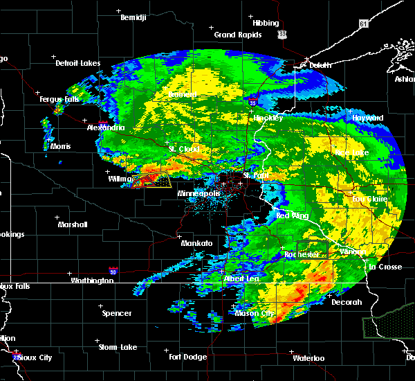 At 149 pm cdt, a severe thunderstorm capable of producing a tornado was located over cedar mills, or 8 miles northwest of hutchinson, moving east at 25 mph (radar indicated rotation). Hazards include tornado and ping pong ball size hail. Flying debris will be dangerous to those caught without shelter. mobile homes will be damaged or destroyed. damage to roofs, windows, and vehicles will occur. tree damage is likely. Locations impacted include, greenleaf, cedar mills and corvuso. At 149 pm cdt, a severe thunderstorm capable of producing a tornado was located over cedar mills, or 8 miles northwest of hutchinson, moving east at 25 mph (radar indicated rotation). Hazards include tornado and ping pong ball size hail. Flying debris will be dangerous to those caught without shelter. mobile homes will be damaged or destroyed. damage to roofs, windows, and vehicles will occur. tree damage is likely. Locations impacted include, greenleaf, cedar mills and corvuso.
|
| 7/23/2016 1:46 PM CDT |
 At 146 pm cdt, a severe thunderstorm was located over greenleaf, or 11 miles northwest of hutchinson, moving east at 30 mph (radar indicated). Hazards include ping pong ball size hail and 60 mph wind gusts. People and animals outdoors will be injured. expect hail damage to roofs, siding, windows, and vehicles. expect wind damage to roofs, siding, and trees. this severe thunderstorm will be near, dassel around 210 pm cdt. cokato around 225 pm cdt. other locations impacted by this severe thunderstorm include greenleaf, darwin, cedar mills and strout. this includes u. s. Highway 12 between mile markers 107 and 120. At 146 pm cdt, a severe thunderstorm was located over greenleaf, or 11 miles northwest of hutchinson, moving east at 30 mph (radar indicated). Hazards include ping pong ball size hail and 60 mph wind gusts. People and animals outdoors will be injured. expect hail damage to roofs, siding, windows, and vehicles. expect wind damage to roofs, siding, and trees. this severe thunderstorm will be near, dassel around 210 pm cdt. cokato around 225 pm cdt. other locations impacted by this severe thunderstorm include greenleaf, darwin, cedar mills and strout. this includes u. s. Highway 12 between mile markers 107 and 120.
|
| 7/23/2016 1:34 PM CDT |
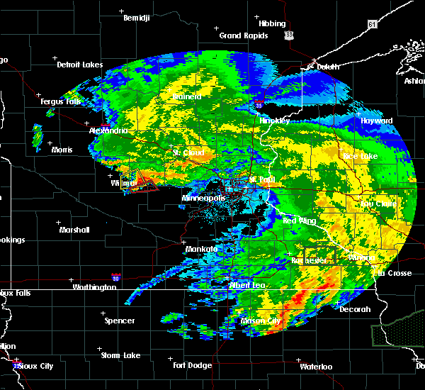 At 134 pm cdt, a severe thunderstorm capable of producing a tornado was located over corvuso, or 13 miles west of hutchinson, moving east at 25 mph (radar indicated rotation). Hazards include tornado and ping pong ball size hail. Flying debris will be dangerous to those caught without shelter. mobile homes will be damaged or destroyed. damage to roofs, windows, and vehicles will occur. tree damage is likely. This tornadic thunderstorm will remain over mainly rural areas of northwestern mcleod and southwestern meeker counties, including the following locations: greenleaf, cedar mills and corvuso. At 134 pm cdt, a severe thunderstorm capable of producing a tornado was located over corvuso, or 13 miles west of hutchinson, moving east at 25 mph (radar indicated rotation). Hazards include tornado and ping pong ball size hail. Flying debris will be dangerous to those caught without shelter. mobile homes will be damaged or destroyed. damage to roofs, windows, and vehicles will occur. tree damage is likely. This tornadic thunderstorm will remain over mainly rural areas of northwestern mcleod and southwestern meeker counties, including the following locations: greenleaf, cedar mills and corvuso.
|
| 7/16/2016 9:03 PM CDT |
 At 903 pm cdt, severe thunderstorms were located along a line extending from near corvuso to near buffalo lake to near franklin, moving southeast at 30 mph (radar indicated). Hazards include 60 mph wind gusts and quarter size hail. Hail damage to vehicles is expected. expect wind damage to roofs, siding, and trees. these severe storms will be near, hutchinson and fairfax around 920 pm cdt. gibbon and stewart around 925 pm cdt. winthrop and brownton around 930 pm cdt. Other locations impacted by these severe thunderstorms include lake marion regional park, sumter, cedar mills, biscay, fernando, corvuso, lakeside and hutchinson airport. At 903 pm cdt, severe thunderstorms were located along a line extending from near corvuso to near buffalo lake to near franklin, moving southeast at 30 mph (radar indicated). Hazards include 60 mph wind gusts and quarter size hail. Hail damage to vehicles is expected. expect wind damage to roofs, siding, and trees. these severe storms will be near, hutchinson and fairfax around 920 pm cdt. gibbon and stewart around 925 pm cdt. winthrop and brownton around 930 pm cdt. Other locations impacted by these severe thunderstorms include lake marion regional park, sumter, cedar mills, biscay, fernando, corvuso, lakeside and hutchinson airport.
|
| 7/16/2016 8:35 PM CDT |
 At 834 pm cdt, severe thunderstorms were located along a line extending from near lake lillian to near bird island to bechyn, moving southeast at 40 mph (radar indicated). Hazards include 70 mph wind gusts and quarter size hail. Hail damage to vehicles is expected. expect considerable tree damage. wind damage is also likely to mobile homes, roofs, and outbuildings. severe thunderstorms will be near, cosmos around 845 pm cdt. hector around 850 pm cdt. buffalo lake and franklin around 855 pm cdt. fairfax and stewart around 905 pm cdt. brownton around 910 pm cdt. hutchinson around 915 pm cdt. Other locations impacted by these severe thunderstorms include greenleaf, lake marion regional park, sumter, cedar mills, biscay, fernando, corvuso, lakeside, strout and hutchinson airport. At 834 pm cdt, severe thunderstorms were located along a line extending from near lake lillian to near bird island to bechyn, moving southeast at 40 mph (radar indicated). Hazards include 70 mph wind gusts and quarter size hail. Hail damage to vehicles is expected. expect considerable tree damage. wind damage is also likely to mobile homes, roofs, and outbuildings. severe thunderstorms will be near, cosmos around 845 pm cdt. hector around 850 pm cdt. buffalo lake and franklin around 855 pm cdt. fairfax and stewart around 905 pm cdt. brownton around 910 pm cdt. hutchinson around 915 pm cdt. Other locations impacted by these severe thunderstorms include greenleaf, lake marion regional park, sumter, cedar mills, biscay, fernando, corvuso, lakeside, strout and hutchinson airport.
|
| 7/5/2016 5:37 PM CDT |
 At 537 pm cdt, a severe thunderstorm was located over lakeside, or 7 miles southwest of hutchinson, moving southeast at 45 mph (radar indicated). Hazards include golf ball size hail and 60 mph wind gusts. People and animals outdoors will be injured. expect hail damage to roofs, siding, windows, and vehicles. expect wind damage to roofs, siding, and trees. this severe thunderstorm will be near, hutchinson and stewart around 545 pm cdt. brownton around 550 pm cdt. glencoe around 600 pm cdt. arlington around 615 pm cdt. other locations impacted by this severe thunderstorm include lake marion regional park, sumter, cedar mills, biscay, corvuso, new auburn, glencoe airport, lakeside, hutchinson airport and plato. this includes u. s. highway 212 between mile markers 94 and 127. A tornado watch remains in effect until 900 pm cdt for central minnesota. At 537 pm cdt, a severe thunderstorm was located over lakeside, or 7 miles southwest of hutchinson, moving southeast at 45 mph (radar indicated). Hazards include golf ball size hail and 60 mph wind gusts. People and animals outdoors will be injured. expect hail damage to roofs, siding, windows, and vehicles. expect wind damage to roofs, siding, and trees. this severe thunderstorm will be near, hutchinson and stewart around 545 pm cdt. brownton around 550 pm cdt. glencoe around 600 pm cdt. arlington around 615 pm cdt. other locations impacted by this severe thunderstorm include lake marion regional park, sumter, cedar mills, biscay, corvuso, new auburn, glencoe airport, lakeside, hutchinson airport and plato. this includes u. s. highway 212 between mile markers 94 and 127. A tornado watch remains in effect until 900 pm cdt for central minnesota.
|
| 7/5/2016 5:19 PM CDT |
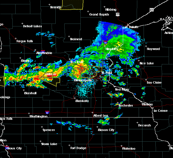 At 518 pm cdt, a severe thunderstorm was located over thorpe, or 17 miles southeast of willmar, moving east at 35 mph (radar indicated). Hazards include golf ball size hail and 70 mph wind gusts. People and animals outdoors will be injured. expect hail damage to roofs, siding, windows, and vehicles. expect considerable tree damage. wind damage is also likely to mobile homes, roofs, and outbuildings. this severe thunderstorm will be near, cosmos around 525 pm cdt. other locations impacted by this severe thunderstorm include greenleaf, cedar mills, strout and corvuso. A tornado watch remains in effect until 900 pm cdt for central minnesota. At 518 pm cdt, a severe thunderstorm was located over thorpe, or 17 miles southeast of willmar, moving east at 35 mph (radar indicated). Hazards include golf ball size hail and 70 mph wind gusts. People and animals outdoors will be injured. expect hail damage to roofs, siding, windows, and vehicles. expect considerable tree damage. wind damage is also likely to mobile homes, roofs, and outbuildings. this severe thunderstorm will be near, cosmos around 525 pm cdt. other locations impacted by this severe thunderstorm include greenleaf, cedar mills, strout and corvuso. A tornado watch remains in effect until 900 pm cdt for central minnesota.
|
| 6/19/2016 10:36 PM CDT |
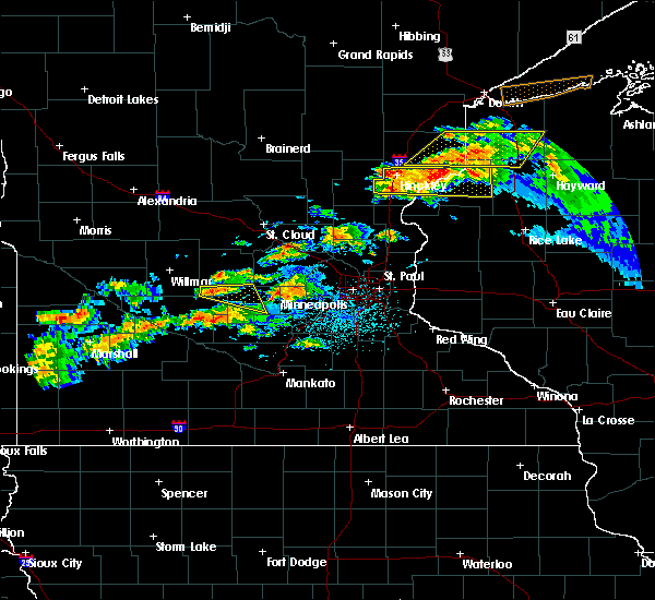 At 1036 pm cdt, a severe thunderstorm was located over cosmos, or 13 miles west of hutchinson, moving east at 45 mph (radar indicated). Hazards include half dollar size hail. Damage to vehicles is expected. this severe thunderstorm will be near, hutchinson around 1055 pm cdt. glencoe around 1110 pm cdt. other locations impacted by this severe thunderstorm include cedar mills, biscay, hutchinson airport and corvuso. this includes u. s. Highway 212 between mile markers 118 and 120. At 1036 pm cdt, a severe thunderstorm was located over cosmos, or 13 miles west of hutchinson, moving east at 45 mph (radar indicated). Hazards include half dollar size hail. Damage to vehicles is expected. this severe thunderstorm will be near, hutchinson around 1055 pm cdt. glencoe around 1110 pm cdt. other locations impacted by this severe thunderstorm include cedar mills, biscay, hutchinson airport and corvuso. this includes u. s. Highway 212 between mile markers 118 and 120.
|
| 6/17/2016 3:28 PM CDT |
 The severe thunderstorm warning for southern meeker county will expire at 330 pm cdt. the storm which prompted the warning has weakened below severe limits. and no longer pose an immediate threat to life or property. therefore the warning will be allowed to expire. However small hail and heavy rain are still possible with this thunderstorm. The severe thunderstorm warning for southern meeker county will expire at 330 pm cdt. the storm which prompted the warning has weakened below severe limits. and no longer pose an immediate threat to life or property. therefore the warning will be allowed to expire. However small hail and heavy rain are still possible with this thunderstorm.
|
| 6/17/2016 3:10 PM CDT |
 At 310 pm cdt, a severe thunderstorm was located over greenleaf, or 8 miles northwest of hutchinson, moving south at 25 mph (radar indicated). Hazards include 60 mph wind gusts and quarter size hail. Hail damage to vehicles is expected. expect wind damage to roofs, siding, and trees. Locations impacted include, litchfield, dassel, cosmos, greenleaf, darwin, cedar mills, corvuso, strout and litchfield airport. At 310 pm cdt, a severe thunderstorm was located over greenleaf, or 8 miles northwest of hutchinson, moving south at 25 mph (radar indicated). Hazards include 60 mph wind gusts and quarter size hail. Hail damage to vehicles is expected. expect wind damage to roofs, siding, and trees. Locations impacted include, litchfield, dassel, cosmos, greenleaf, darwin, cedar mills, corvuso, strout and litchfield airport.
|
| 6/17/2016 2:56 PM CDT |
 At 255 pm cdt, a severe thunderstorm was located near strout, or 14 miles northwest of hutchinson, moving southeast at 20 mph (radar indicated). Hazards include 60 mph wind gusts and half dollar size hail. Hail damage to vehicles is expected. expect wind damage to roofs, siding, and trees. Locations impacted include, litchfield, dassel, grove city, cosmos, greenleaf, forest city, darwin, cedar mills, corvuso, strout and litchfield airport. At 255 pm cdt, a severe thunderstorm was located near strout, or 14 miles northwest of hutchinson, moving southeast at 20 mph (radar indicated). Hazards include 60 mph wind gusts and half dollar size hail. Hail damage to vehicles is expected. expect wind damage to roofs, siding, and trees. Locations impacted include, litchfield, dassel, grove city, cosmos, greenleaf, forest city, darwin, cedar mills, corvuso, strout and litchfield airport.
|
| 6/17/2016 2:39 PM CDT |
 At 238 pm cdt, a severe thunderstorm was located near strout, or 16 miles northwest of hutchinson, moving south at 25 mph (trained weather spotters). Hazards include golf ball size hail and 60 mph wind gusts. People and animals outdoors will be injured. expect hail damage to roofs, siding, windows, and vehicles. expect wind damage to roofs, siding, and trees. This severe thunderstorm will remain over mainly rural areas of meeker county, including the following locations: greenleaf, cedar mills, forest city, corvuso, darwin, strout and litchfield airport. At 238 pm cdt, a severe thunderstorm was located near strout, or 16 miles northwest of hutchinson, moving south at 25 mph (trained weather spotters). Hazards include golf ball size hail and 60 mph wind gusts. People and animals outdoors will be injured. expect hail damage to roofs, siding, windows, and vehicles. expect wind damage to roofs, siding, and trees. This severe thunderstorm will remain over mainly rural areas of meeker county, including the following locations: greenleaf, cedar mills, forest city, corvuso, darwin, strout and litchfield airport.
|
| 6/17/2016 2:22 PM CDT |
 At 222 pm cdt, a severe thunderstorm was located over grove city, or 20 miles east of willmar, moving south at 25 mph (radar indicated). Hazards include two inch hail and 60 mph wind gusts. People and animals outdoors will be injured. expect hail damage to roofs, siding, windows, and vehicles. expect wind damage to roofs, siding, and trees. this severe thunderstorm will be near, litchfield around 235 pm cdt. other locations impacted by this severe thunderstorm include greenleaf, cedar mills, forest city, corvuso, darwin, strout and litchfield airport. this includes u. s. Highway 12 between mile markers 89 and 114. At 222 pm cdt, a severe thunderstorm was located over grove city, or 20 miles east of willmar, moving south at 25 mph (radar indicated). Hazards include two inch hail and 60 mph wind gusts. People and animals outdoors will be injured. expect hail damage to roofs, siding, windows, and vehicles. expect wind damage to roofs, siding, and trees. this severe thunderstorm will be near, litchfield around 235 pm cdt. other locations impacted by this severe thunderstorm include greenleaf, cedar mills, forest city, corvuso, darwin, strout and litchfield airport. this includes u. s. Highway 12 between mile markers 89 and 114.
|
| 8/9/2015 11:56 AM CDT |
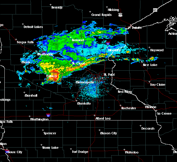 At 1156 am cdt, a severe thunderstorm was located over greenleaf, or 7 miles northwest of hutchinson, moving east at 30 mph (radar indicated). Hazards include 60 mph wind gusts and quarter size hail. Hail damage to vehicles is expected. expect wind damage to roofs, siding and trees. this severe thunderstorm will remain over mainly rural areas of southwestern meeker, southeastern kandiyohi and northeastern renville counties, including the following locations, greenleaf, thorpe, lakeside, cedar mills, strout and corvuso. this includes u. s. Highway 12 near mile marker 87, and between mile markers 102 and 105. At 1156 am cdt, a severe thunderstorm was located over greenleaf, or 7 miles northwest of hutchinson, moving east at 30 mph (radar indicated). Hazards include 60 mph wind gusts and quarter size hail. Hail damage to vehicles is expected. expect wind damage to roofs, siding and trees. this severe thunderstorm will remain over mainly rural areas of southwestern meeker, southeastern kandiyohi and northeastern renville counties, including the following locations, greenleaf, thorpe, lakeside, cedar mills, strout and corvuso. this includes u. s. Highway 12 near mile marker 87, and between mile markers 102 and 105.
|
| 8/9/2015 11:31 AM CDT |
 At 1130 am cdt, a severe thunderstorm was located near thorpe, or 13 miles southeast of willmar, moving east at 30 mph (radar indicated). Hazards include 60 mph wind gusts and quarter size hail. Hail damage to vehicles is expected. expect wind damage to roofs, siding and trees. this severe thunderstorm will be near, cosmos around 1140 am cdt. other locations impacted by this severe thunderstorm include greenleaf, cedar mills, corvuso, thorpe, lakeside, lake lillian and strout. this includes u. s. Highway 12 near mile marker 83, and between mile markers 102 and 105. At 1130 am cdt, a severe thunderstorm was located near thorpe, or 13 miles southeast of willmar, moving east at 30 mph (radar indicated). Hazards include 60 mph wind gusts and quarter size hail. Hail damage to vehicles is expected. expect wind damage to roofs, siding and trees. this severe thunderstorm will be near, cosmos around 1140 am cdt. other locations impacted by this severe thunderstorm include greenleaf, cedar mills, corvuso, thorpe, lakeside, lake lillian and strout. this includes u. s. Highway 12 near mile marker 83, and between mile markers 102 and 105.
|
| 7/17/2015 11:31 PM CDT |
 At 1131 pm cdt, severe thunderstorms were located along a line extending from st nicholas to near kimball to near lakeside, moving east at 35 mph (radar indicated). Hazards include 60 mph wind gusts. Expect damage to roofs. siding and trees. these severe storms will be near, hutchinson, annandale and kimball around 1145 pm cdt. silver lake around 1155 pm cdt. maple lake, clearwater and lester prairie around 1200 am cdt. other locations impacted by these severe thunderstorms include greenleaf, fairhaven, forest city, waverly, darwin, st augusta, rassat, smith lake, luxemburg and south haven. this includes the following highways, interstate 94 in minnesota between mile markers 173 and 182. u. s. Highway 12 between mile markers 96 and 129. At 1131 pm cdt, severe thunderstorms were located along a line extending from st nicholas to near kimball to near lakeside, moving east at 35 mph (radar indicated). Hazards include 60 mph wind gusts. Expect damage to roofs. siding and trees. these severe storms will be near, hutchinson, annandale and kimball around 1145 pm cdt. silver lake around 1155 pm cdt. maple lake, clearwater and lester prairie around 1200 am cdt. other locations impacted by these severe thunderstorms include greenleaf, fairhaven, forest city, waverly, darwin, st augusta, rassat, smith lake, luxemburg and south haven. this includes the following highways, interstate 94 in minnesota between mile markers 173 and 182. u. s. Highway 12 between mile markers 96 and 129.
|
| 7/17/2015 11:09 PM CDT |
 At 1108 pm cdt, severe thunderstorms were located along a line extending from near roscoe to near eden valley to near cosmos, moving east at 40 mph (radar indicated). Hazards include 60 mph wind gusts. Expect damage to roofs. siding and trees. severe thunderstorms will be near, eden valley around 1115 pm cdt. richmond and watkins around 1120 pm cdt. cold spring and kimball around 1130 pm cdt. rockville around 1135 pm cdt. hutchinson and annandale around 1140 pm cdt. silver lake around 1150 pm cdt. maple lake around 1155 pm cdt. clearwater and lester prairie around 1200 am cdt. other locations impacted by these severe thunderstorms include greenleaf, fairhaven, forest city, waverly, darwin, st augusta, rassat, smith lake, luxemburg and south haven. this includes the following highways, interstate 94 in minnesota between mile markers 173 and 182. u. s. Highway 12 between mile markers 93 and 129. At 1108 pm cdt, severe thunderstorms were located along a line extending from near roscoe to near eden valley to near cosmos, moving east at 40 mph (radar indicated). Hazards include 60 mph wind gusts. Expect damage to roofs. siding and trees. severe thunderstorms will be near, eden valley around 1115 pm cdt. richmond and watkins around 1120 pm cdt. cold spring and kimball around 1130 pm cdt. rockville around 1135 pm cdt. hutchinson and annandale around 1140 pm cdt. silver lake around 1150 pm cdt. maple lake around 1155 pm cdt. clearwater and lester prairie around 1200 am cdt. other locations impacted by these severe thunderstorms include greenleaf, fairhaven, forest city, waverly, darwin, st augusta, rassat, smith lake, luxemburg and south haven. this includes the following highways, interstate 94 in minnesota between mile markers 173 and 182. u. s. Highway 12 between mile markers 93 and 129.
|
| 5/16/2015 7:58 PM CDT | Quarter sized hail reported 5.1 miles SSW of Cedar Mills, MN, nickel to quarter sized hail reported in the greenleaf area. |
| 5/16/2015 7:30 PM CDT | At 730 pm cdt, a severe thunderstorm capable of producing a tornado was located over greenleaf, or 11 miles northwest of hutchinson, moving north at 30 mph (radar indicated rotation). Hazards include tornado and quarter size hail. Flying debris will be dangerous to those caught without shelter. mobile homes will be damaged or destroyed. damage to roofs, windows and vehicles will occur. tree damage is likely. locations impacted include, cedar mills. Radar indicated. |
| 5/16/2015 7:24 PM CDT | The severe thunderstorm warning for southwestern meeker and northeastern renville counties will expire at 730 pm cdt, the storm which prompted the warning has moved out of the area. therefore the warning will be allowed to expire. a tornado watch remains in effect until 1000 pm cdt for central minnesota. remember, a tornado warning still remains in effect for meeker and mcleod counties. |
| 5/16/2015 7:15 PM CDT | At 714 pm cdt, a severe thunderstorm capable of producing a tornado was located near lakeside, or 9 miles west of hutchinson, moving north at 30 mph (radar indicated rotation). Hazards include tornado and quarter size hail. Flying debris will be dangerous to those caught without shelter. mobile homes will be damaged or destroyed. damage to roofs, windows and vehicles will occur. tree damage is likely. this tornadic thunderstorm will remain over mainly rural areas of south central meeker, northwestern mcleod and northeastern renville counties, including the following locations, cedar mills and corvuso. Radar indicated. |
| 5/16/2015 7:03 PM CDT | At 702 pm cdt, a severe thunderstorm was located over lakeside, or 10 miles west of hutchinson, moving north at 35 mph (radar indicated). Hazards include ping pong ball size hail and 60 mph wind gusts. People and animals outdoors will be injured. expect hail damage to roofs, siding, windows and vehicles. expect wind damage to roofs, siding and trees. this severe thunderstorm will be near, cosmos around 710 pm cdt. litchfield around 730 pm cdt. other locations impacted by this severe thunderstorm include lakeside, strout, corvuso and cedar mills. a tornado watch remains in effect until 1000 pm cdt for central minnesota. 1. 50in. |
| 7/7/2014 5:12 PM CDT | Recorded two wind gusts via vehicle anemometer of 58.2 and 61.2 the average sustained winds for approx 10 min was anywhere from 27-36 mph. no damage was observe in mcleod county MN, 3 miles WNW of Cedar Mills, MN |
Hail Maps for Cedar Mills, MN
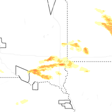
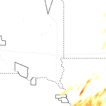


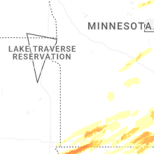


Connect with Interactive Hail Maps