

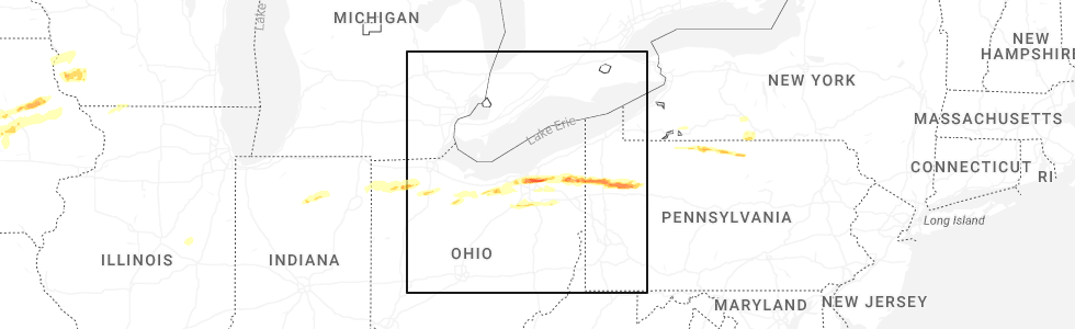
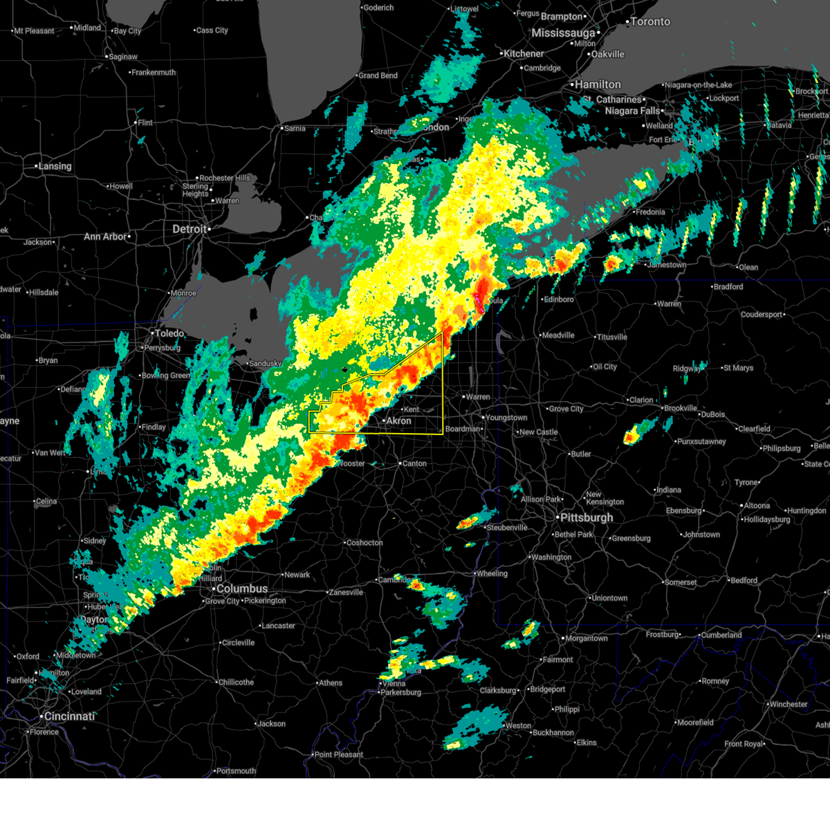
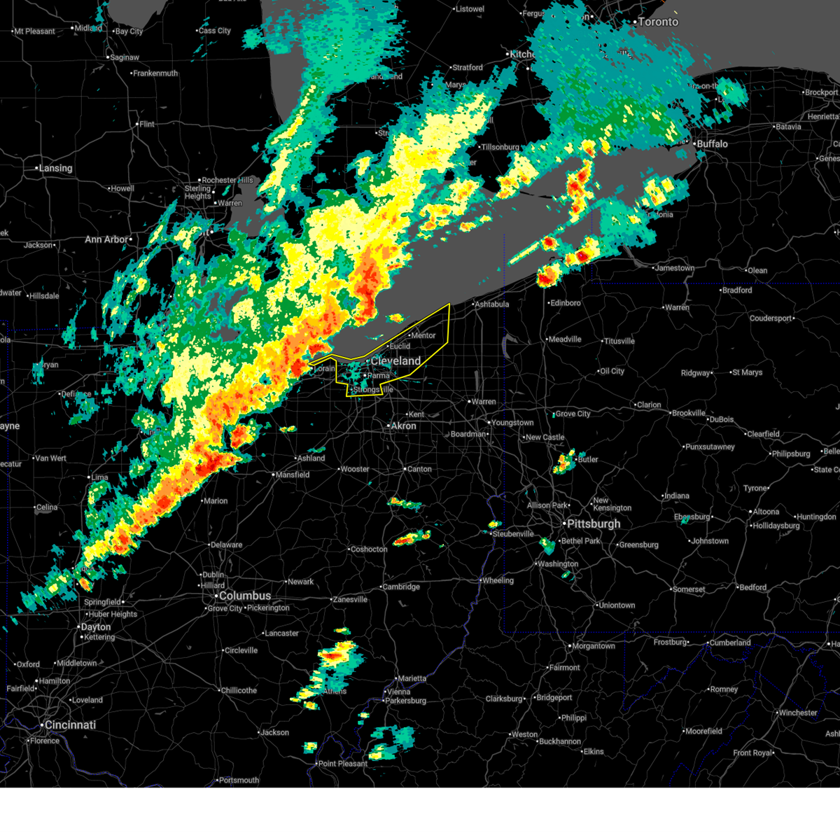
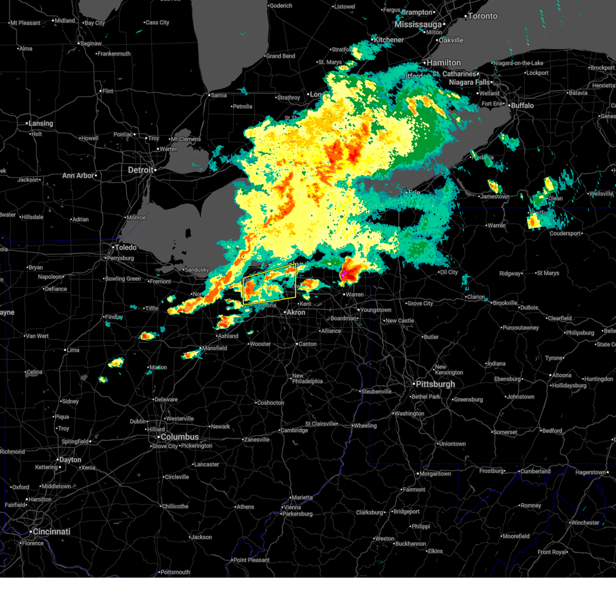
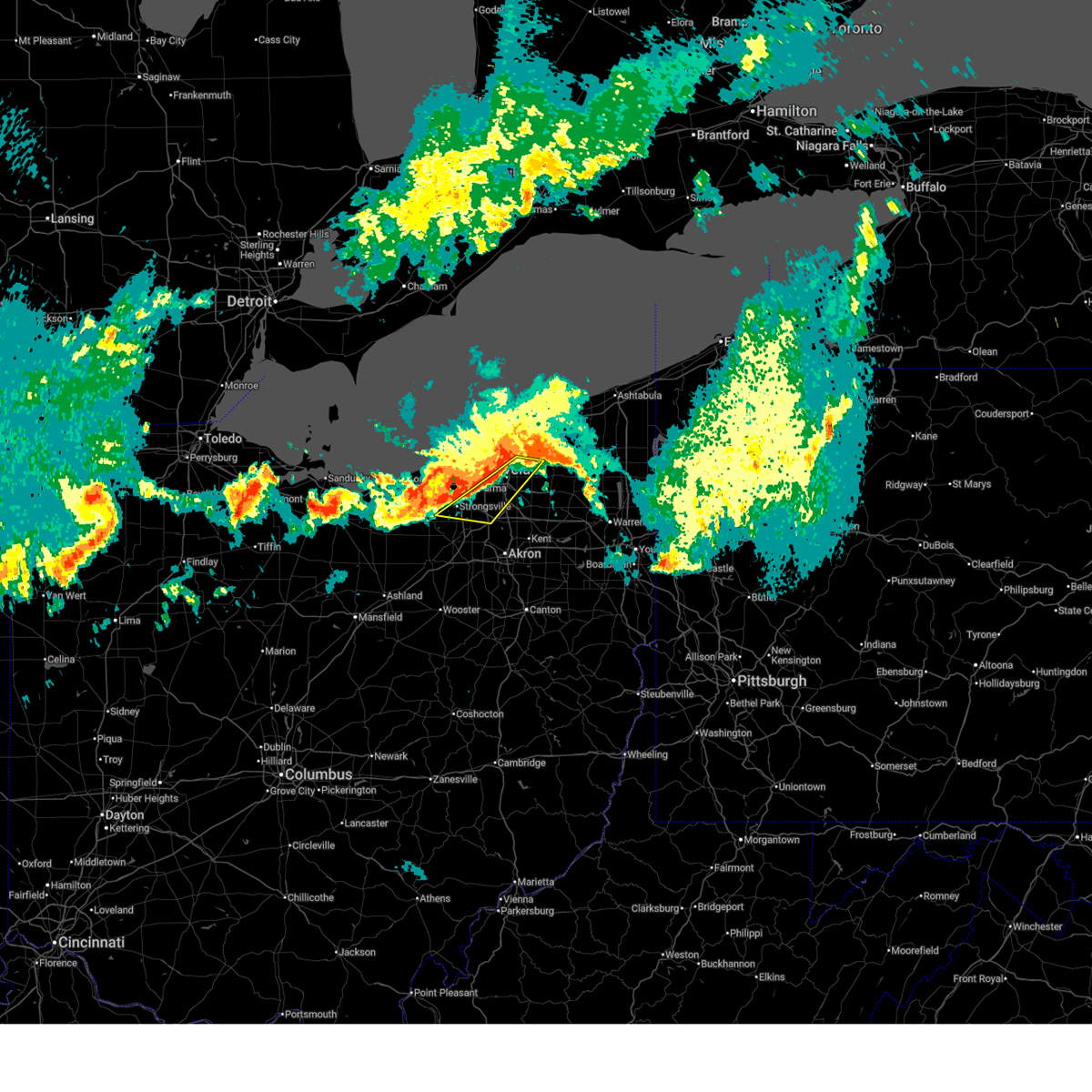
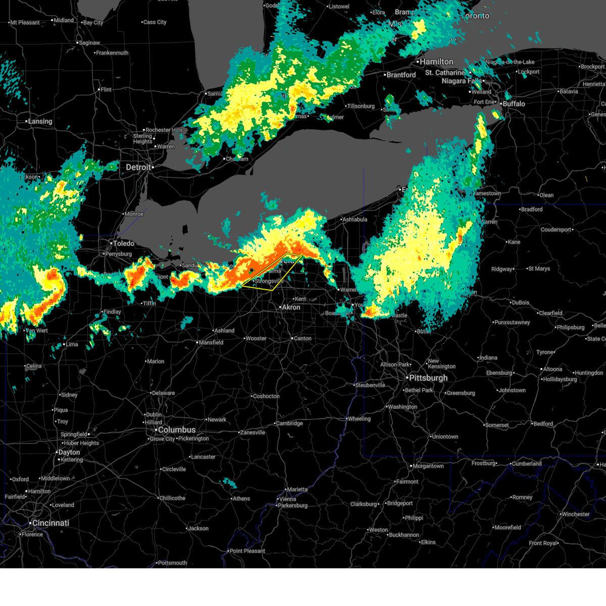
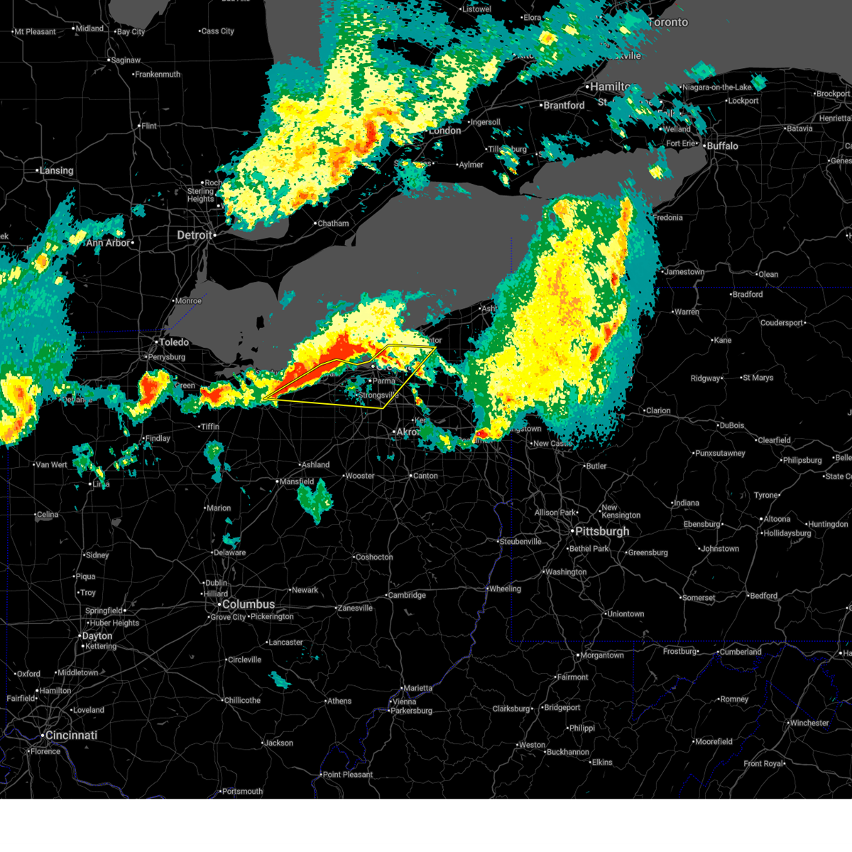
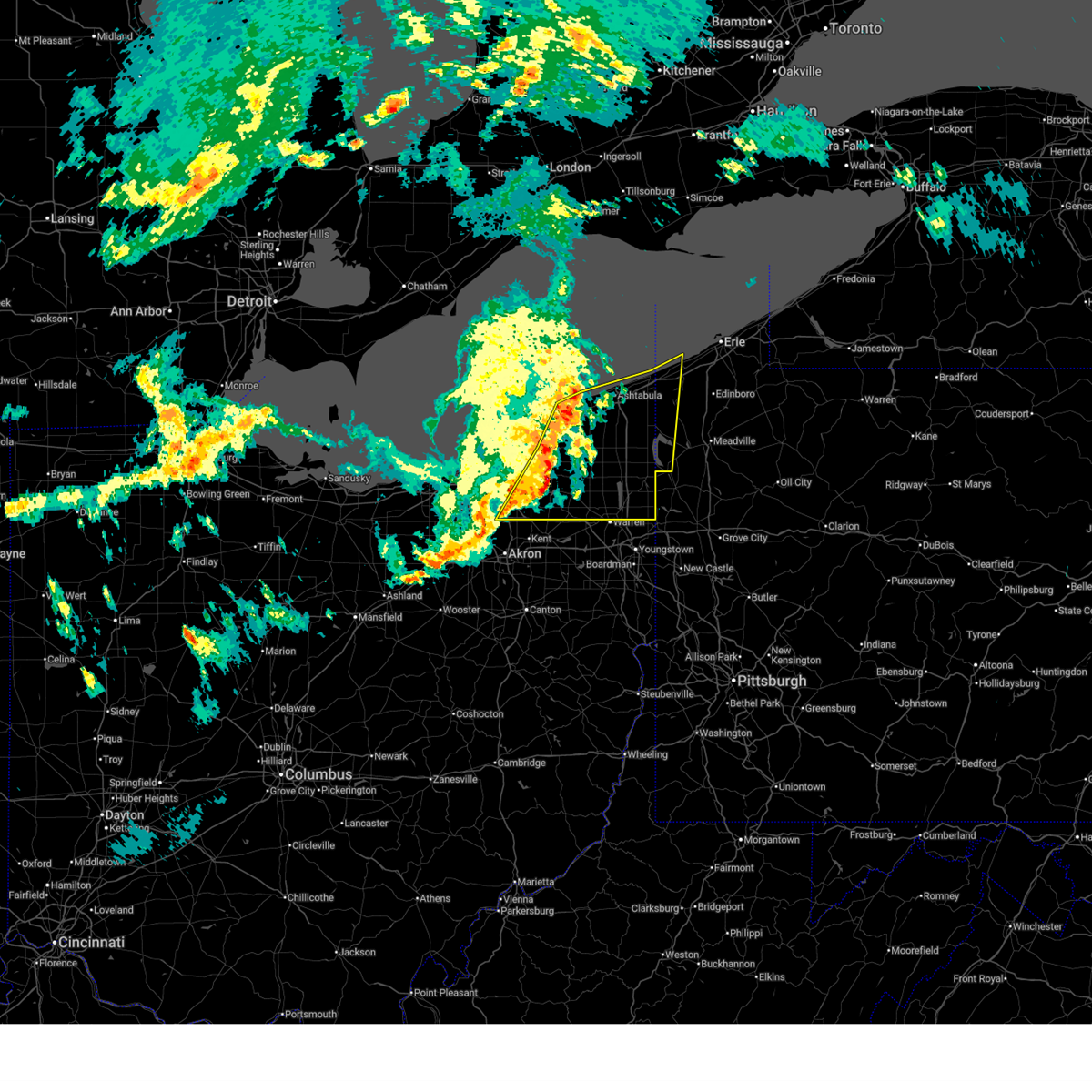
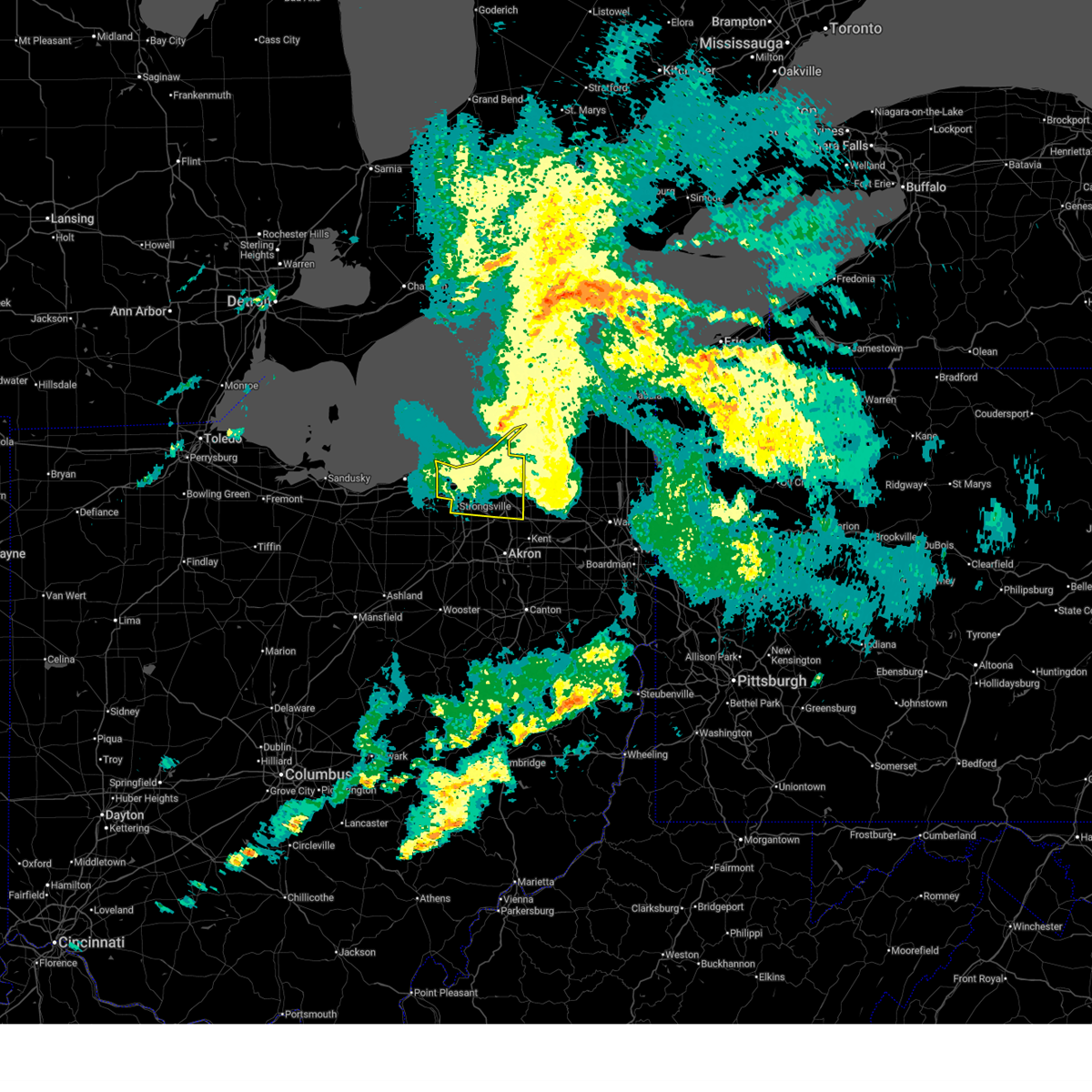
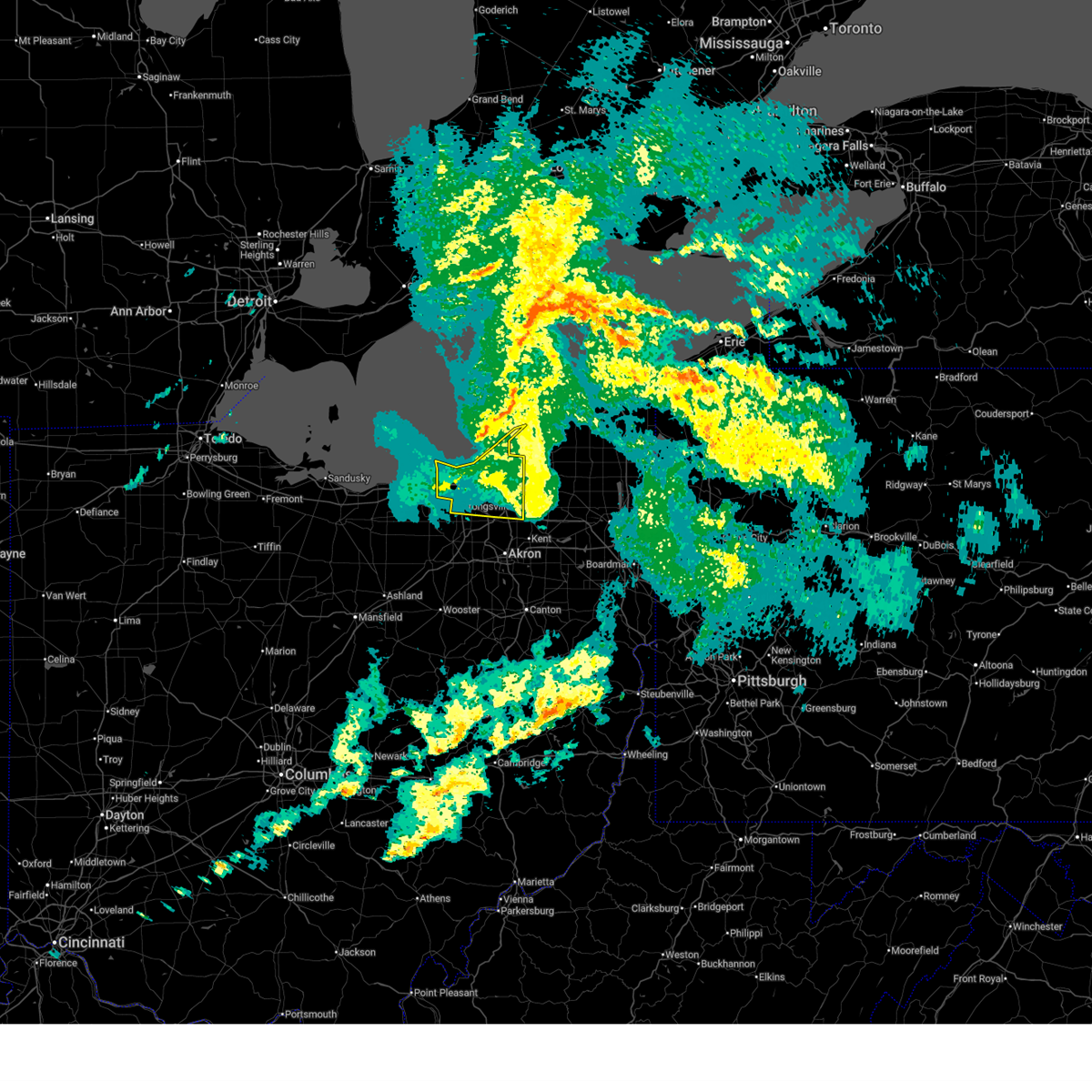
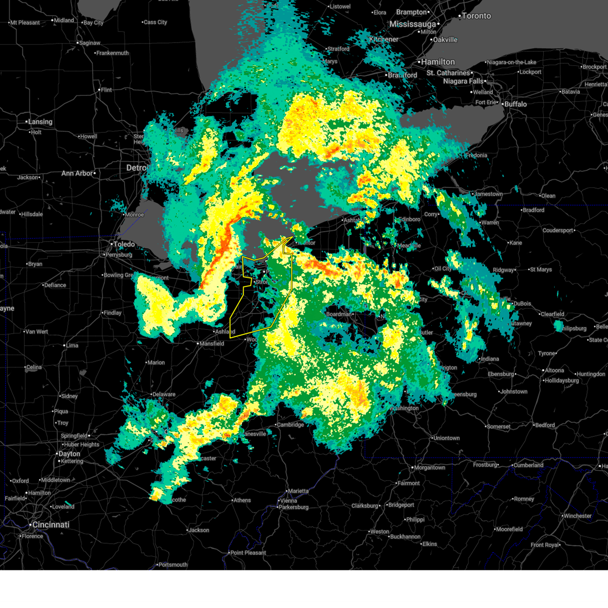
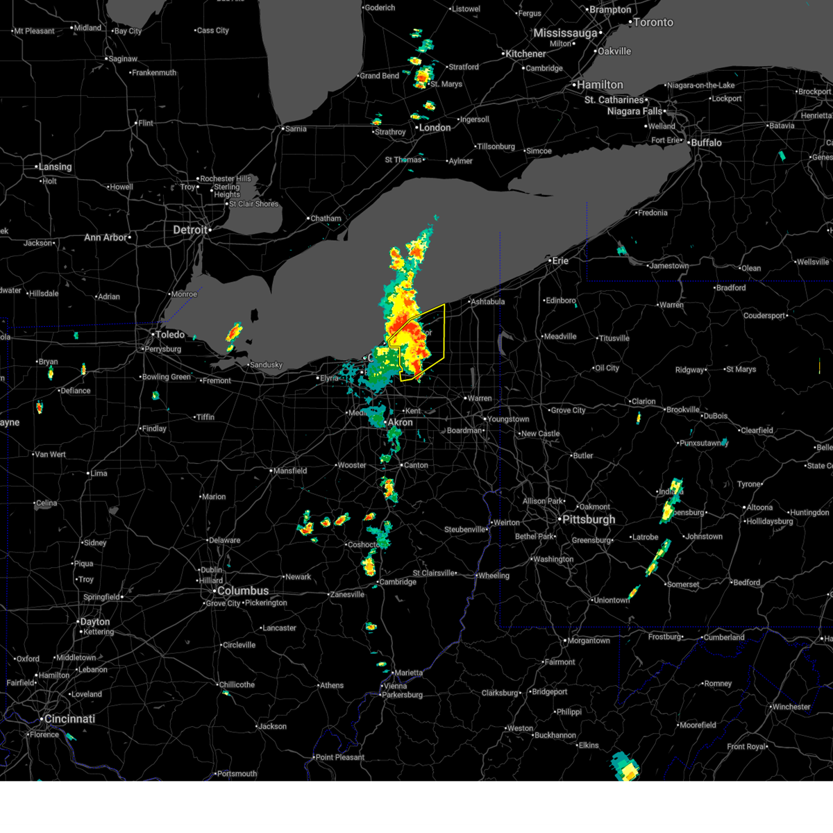
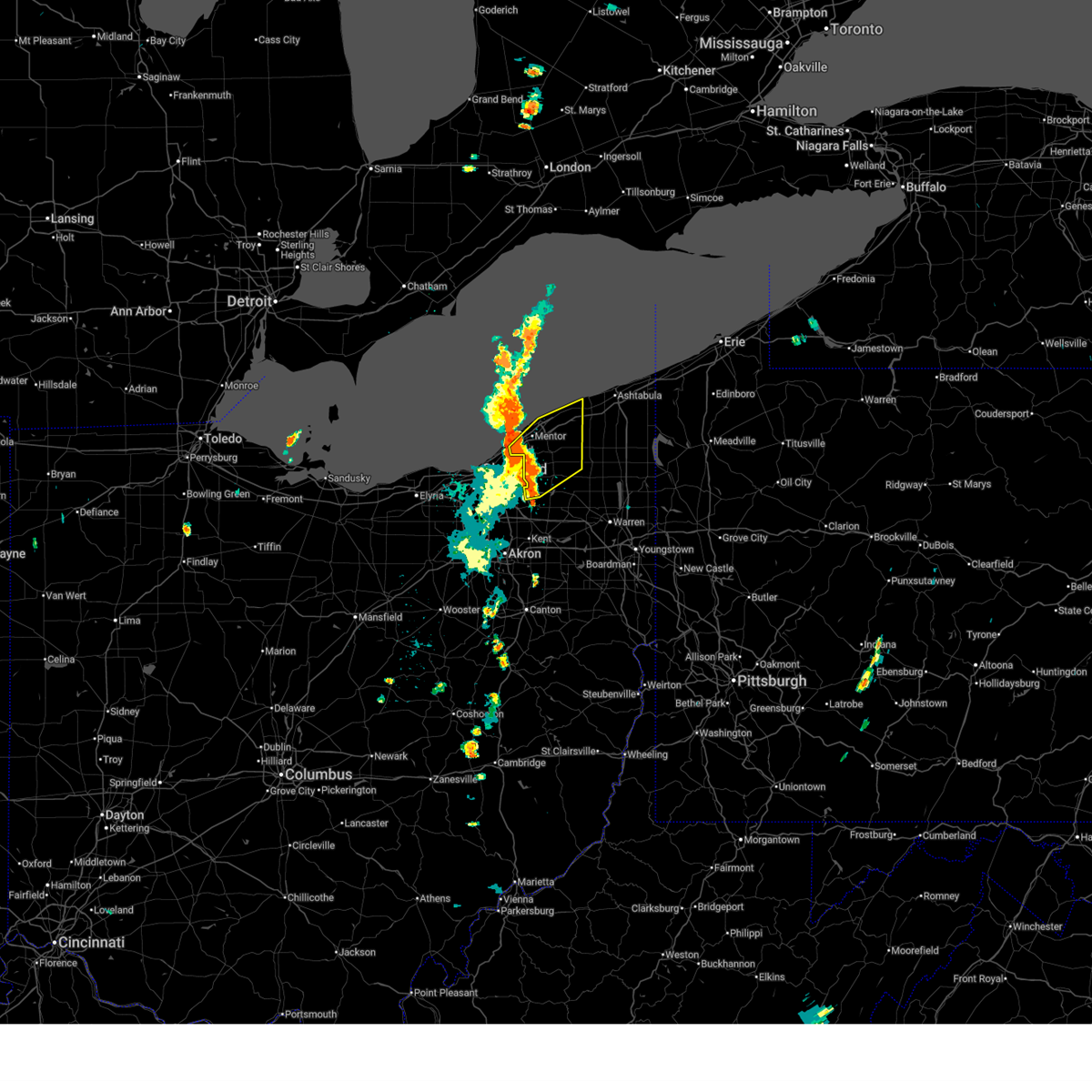
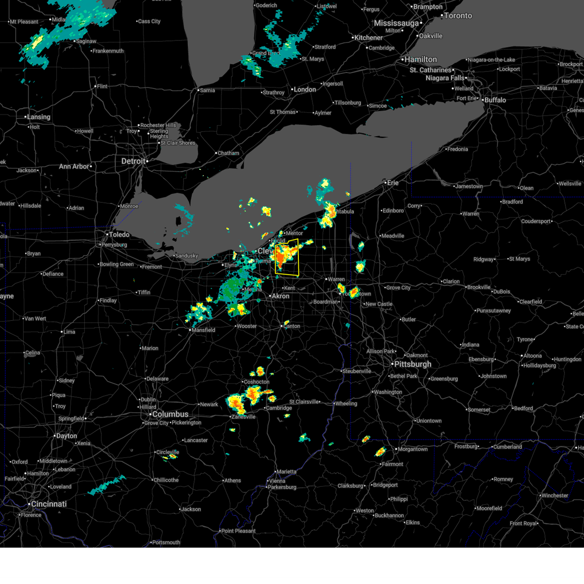
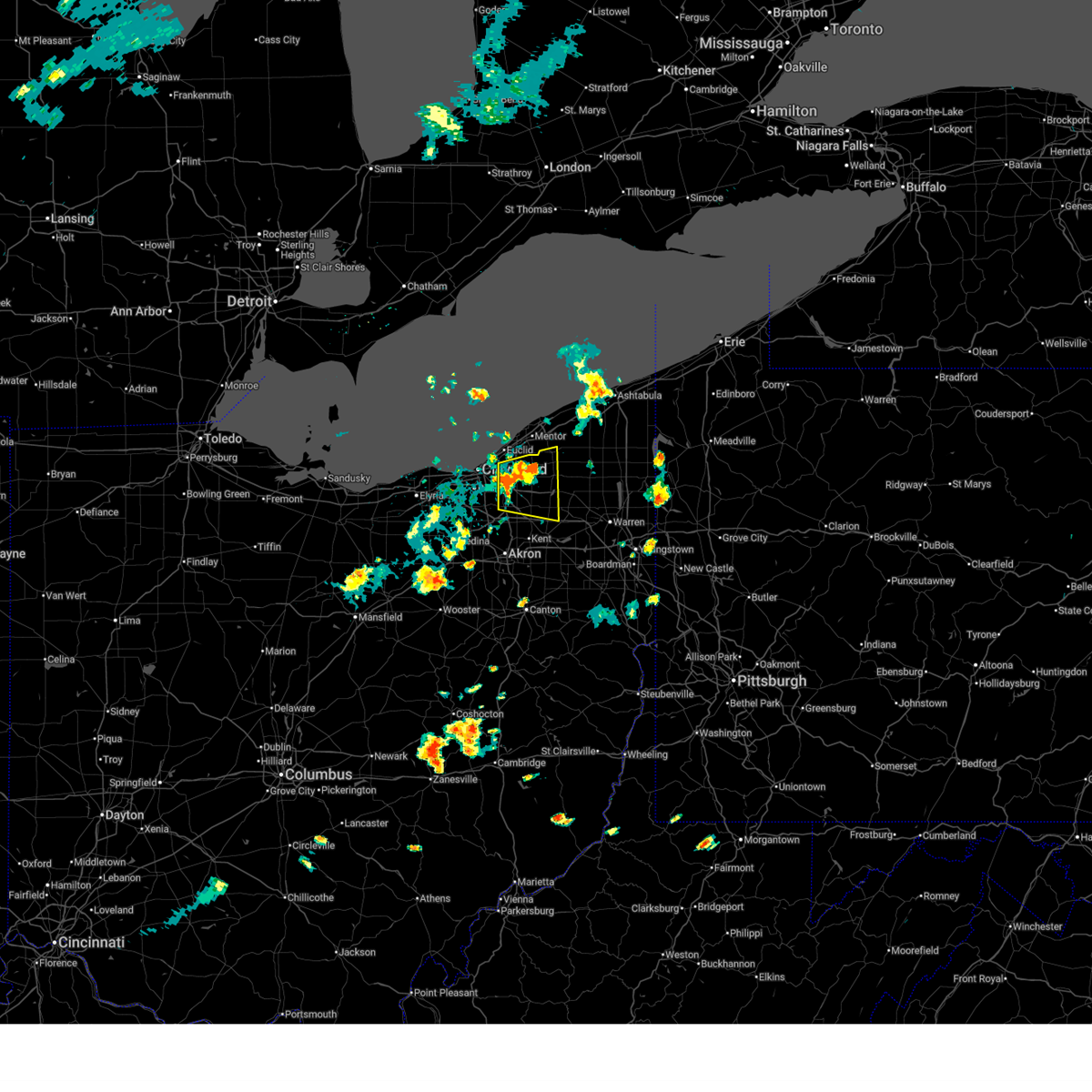
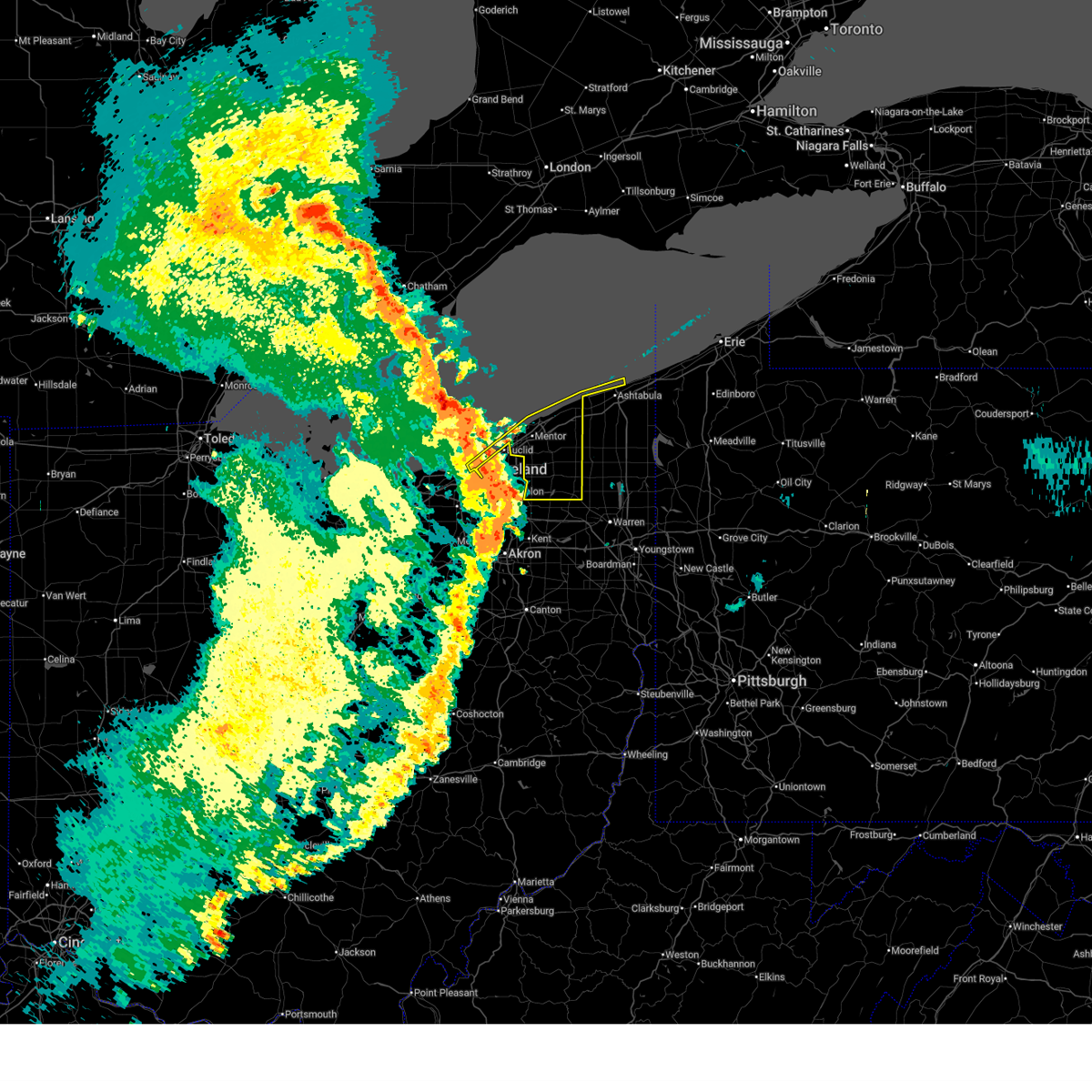
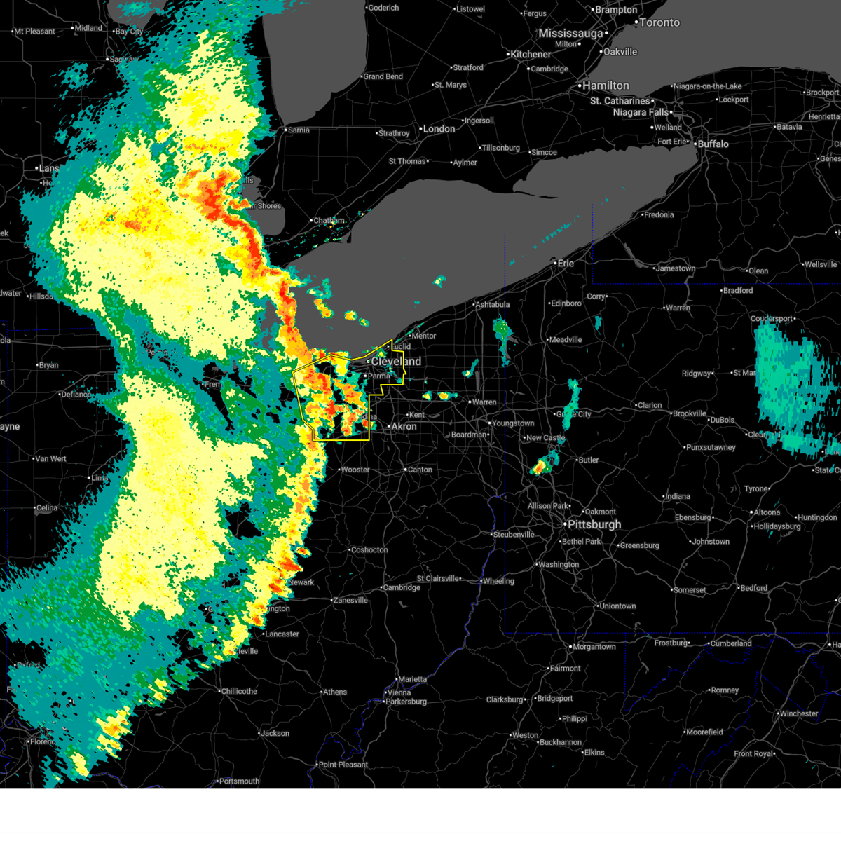
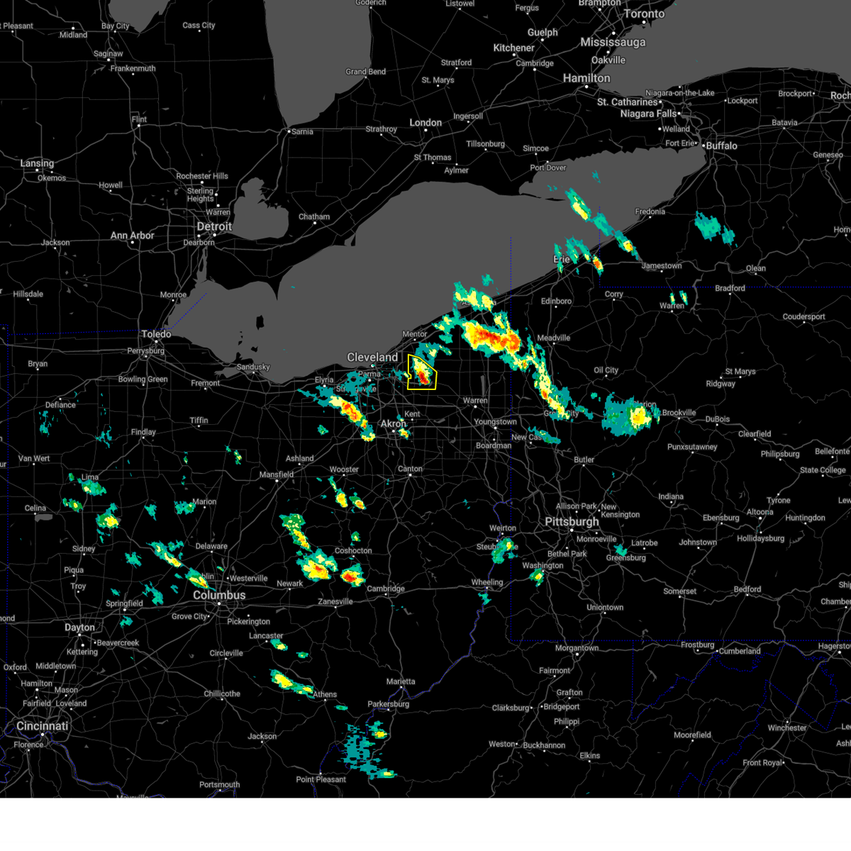
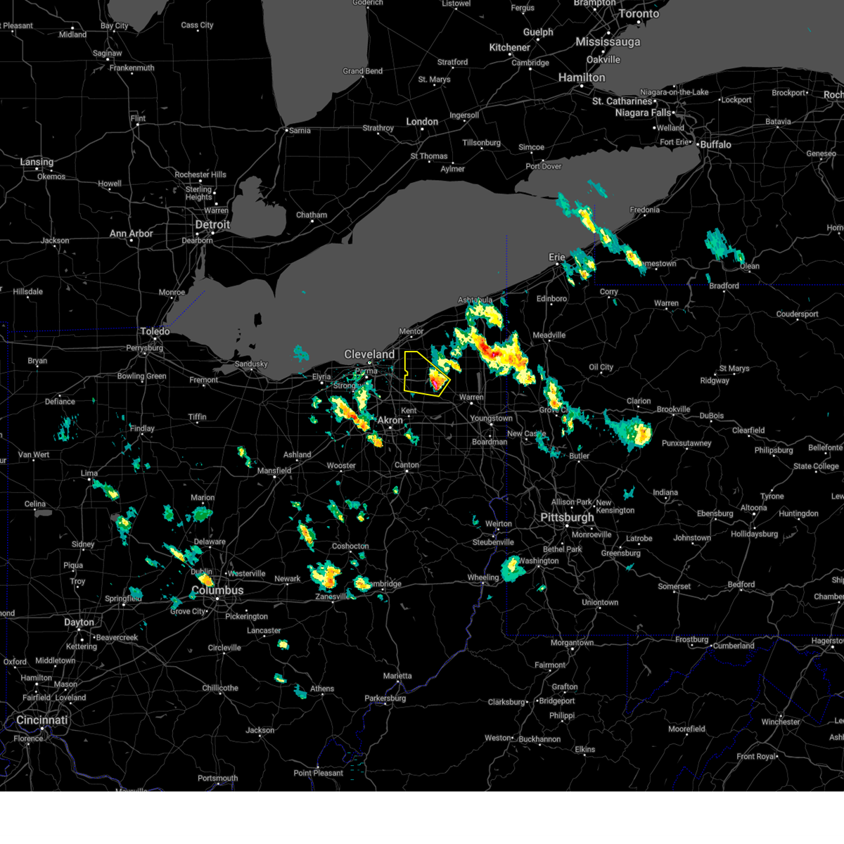
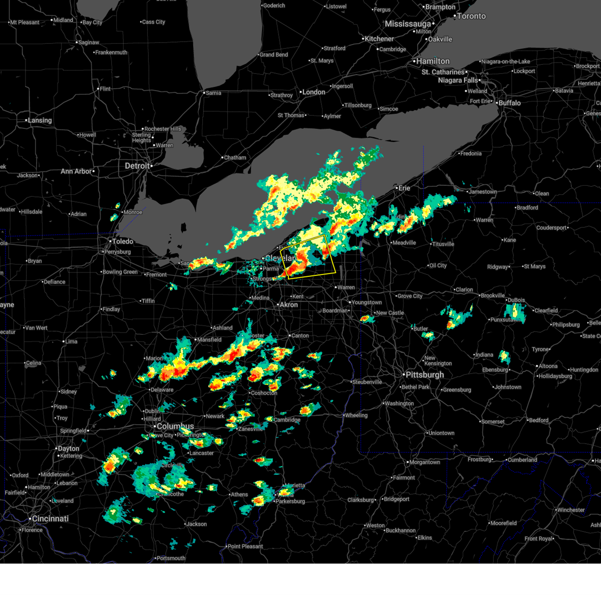
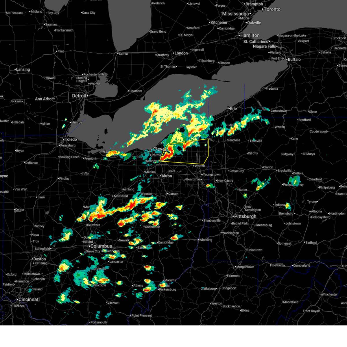
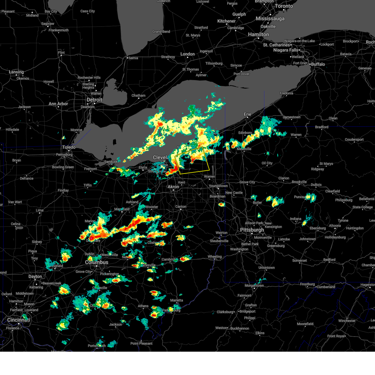
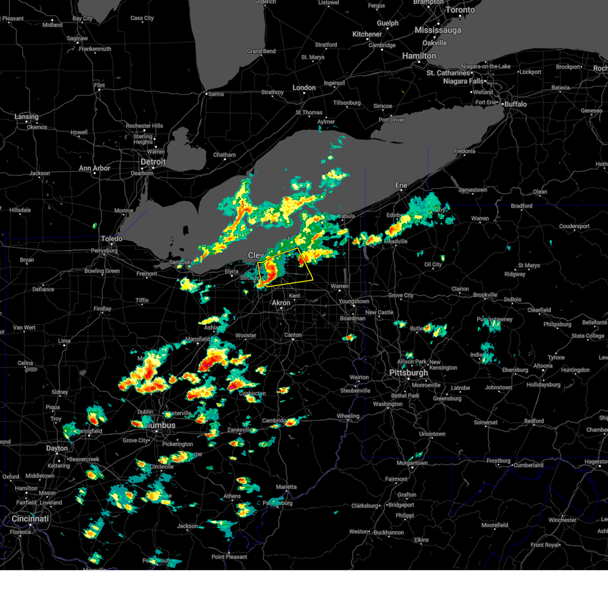
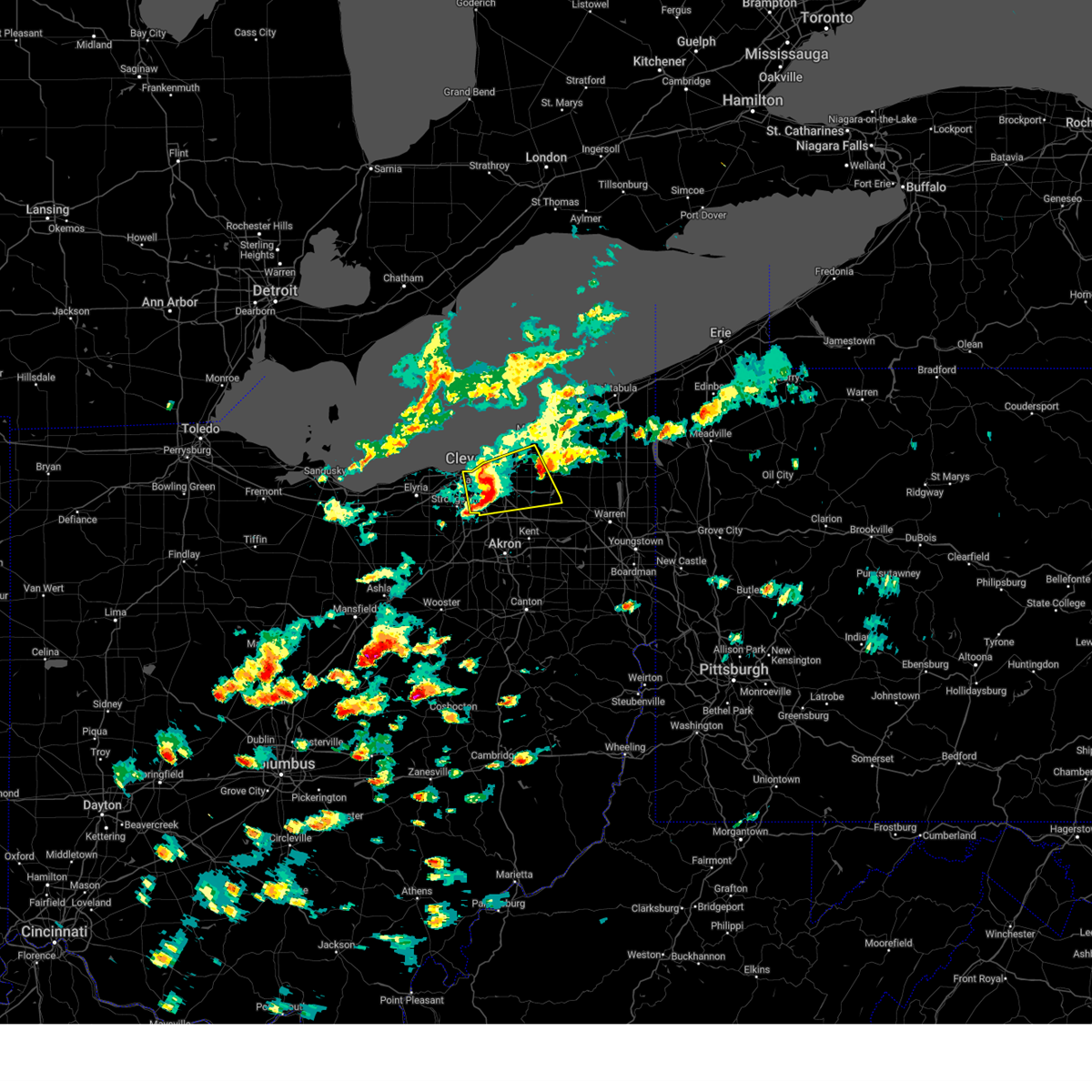
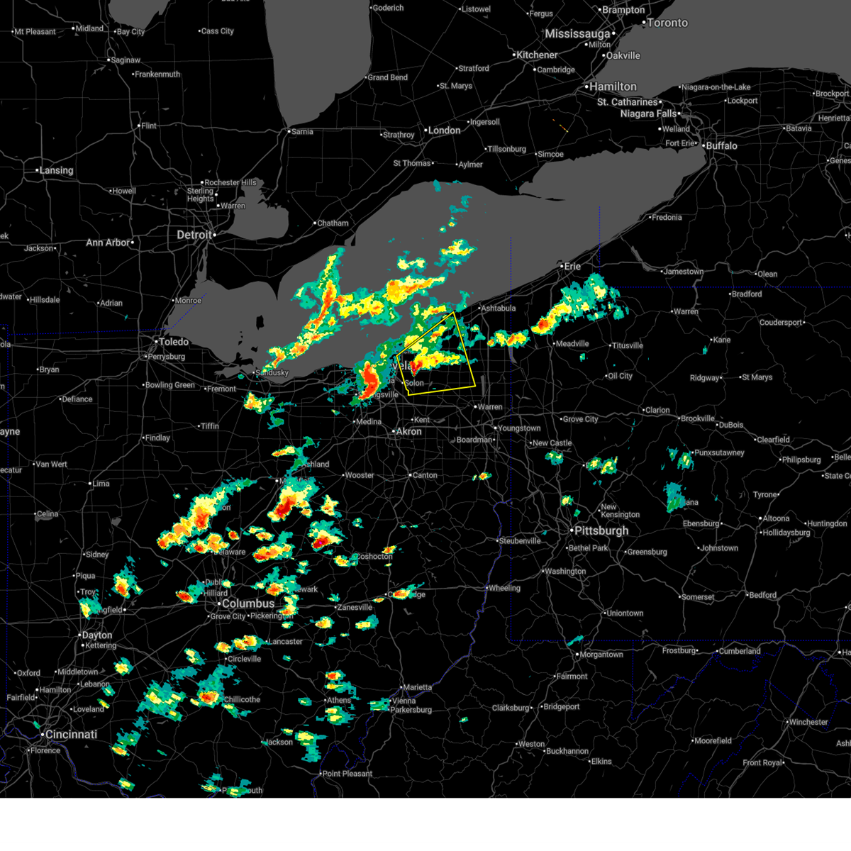
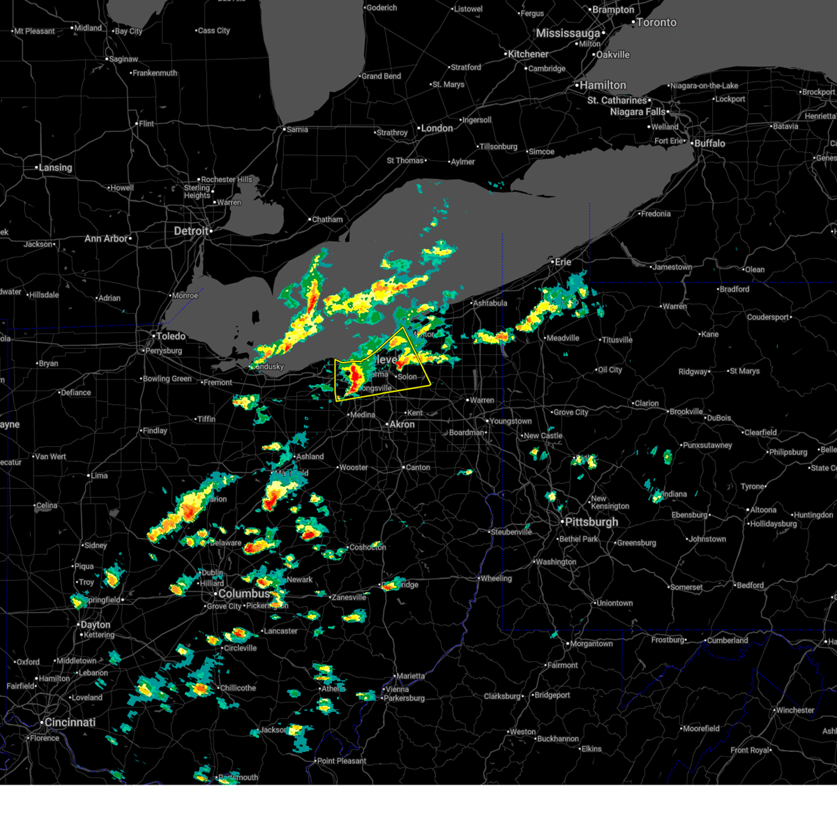
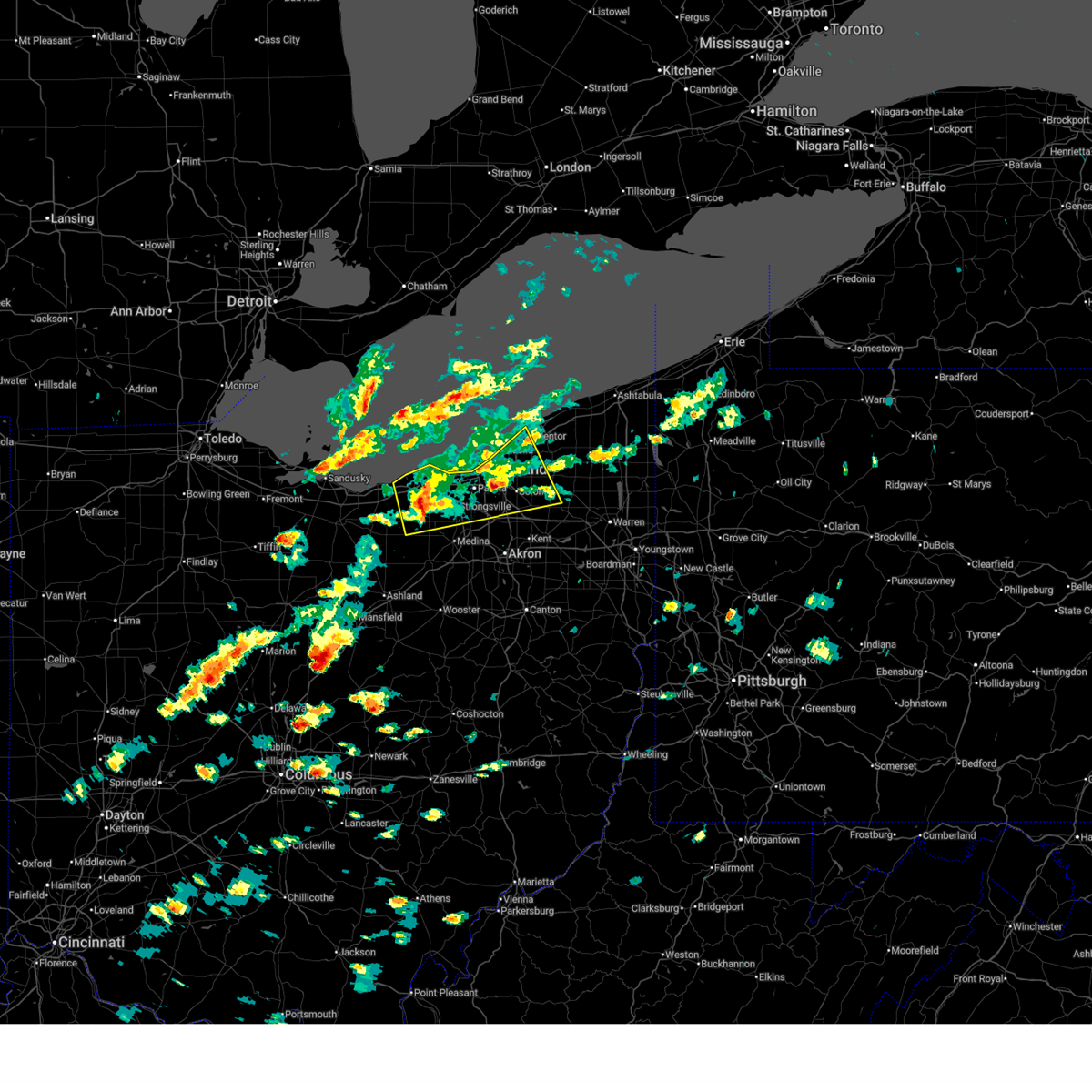
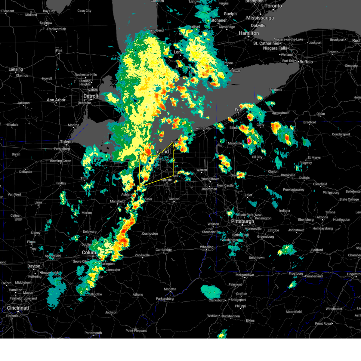
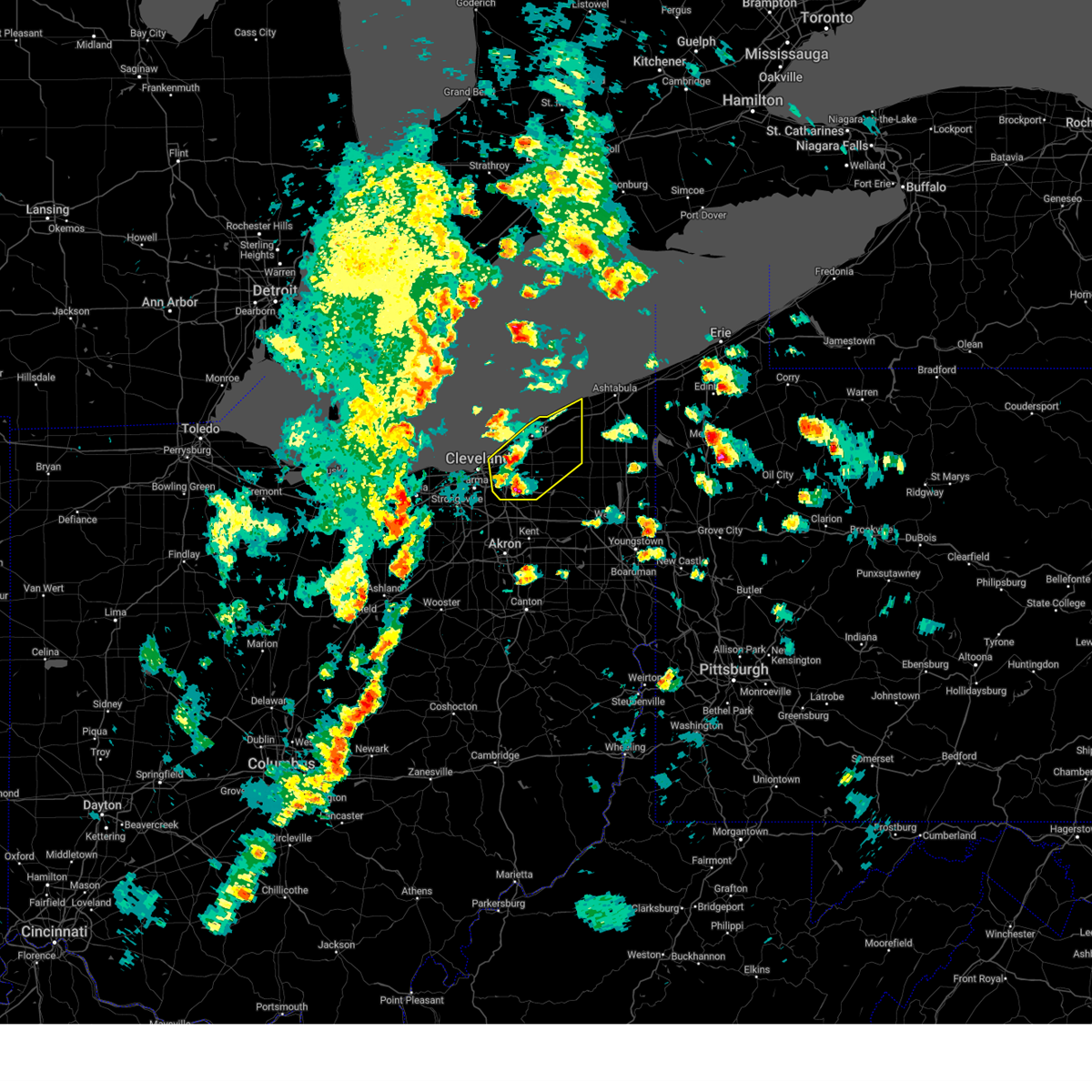
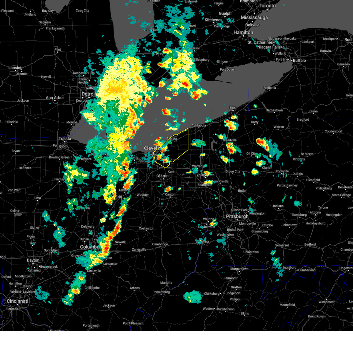
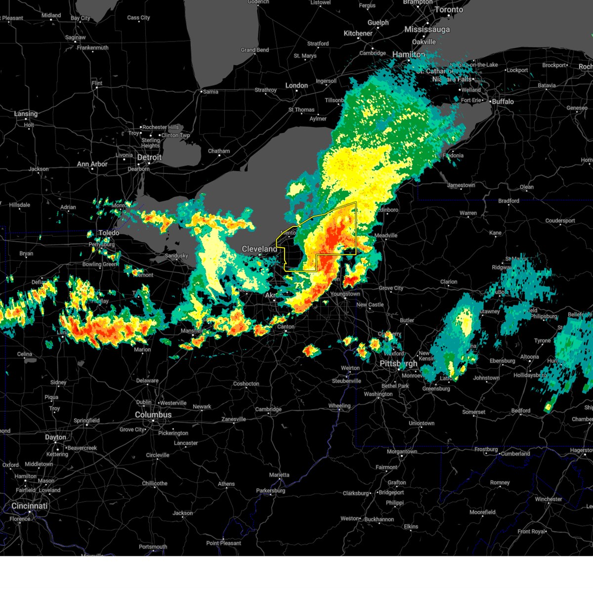
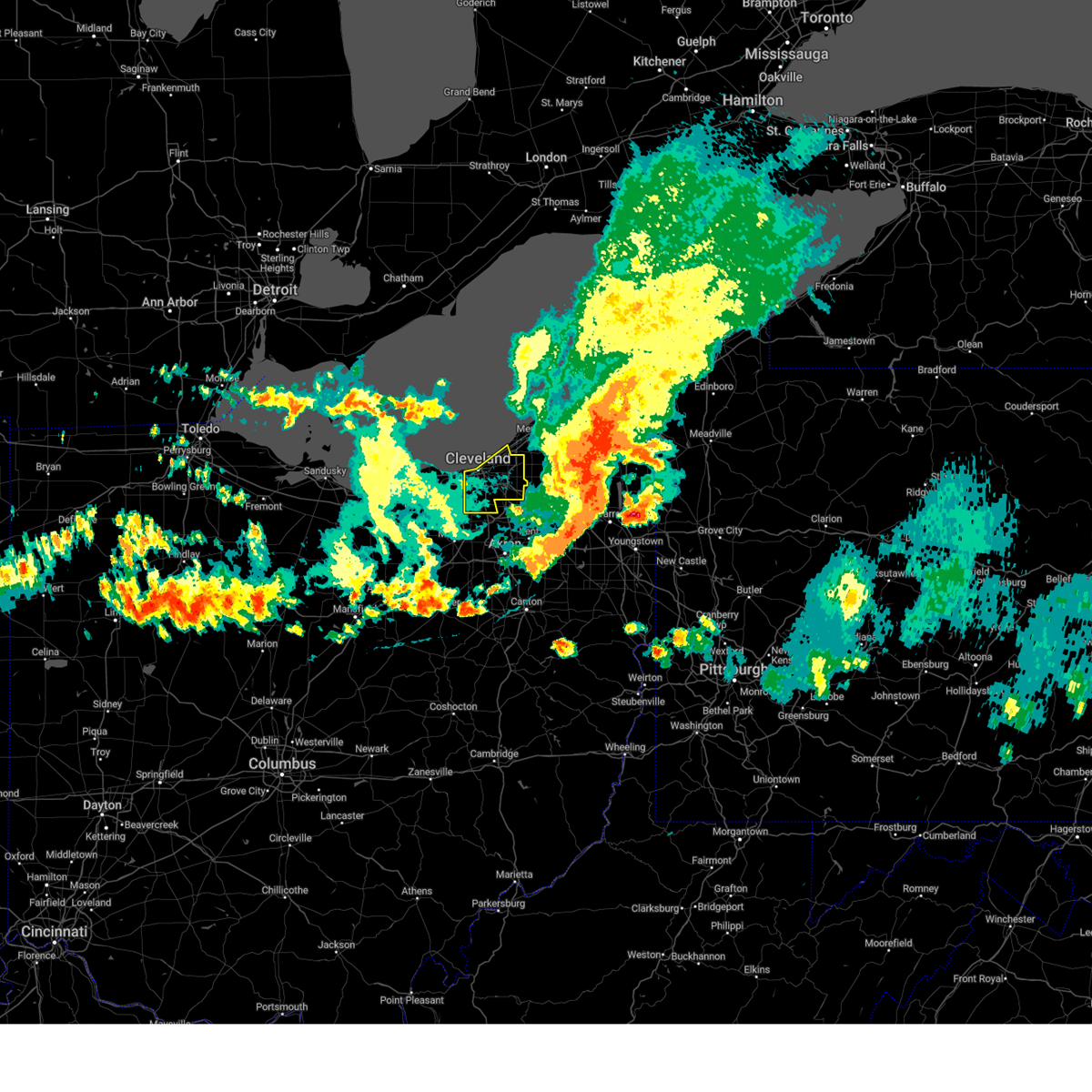
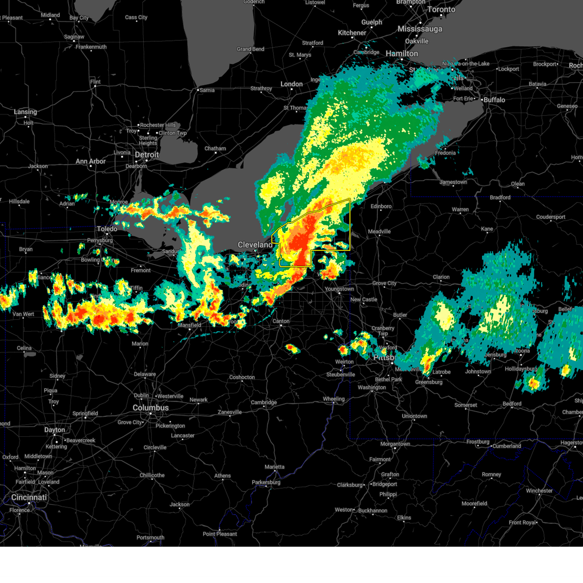
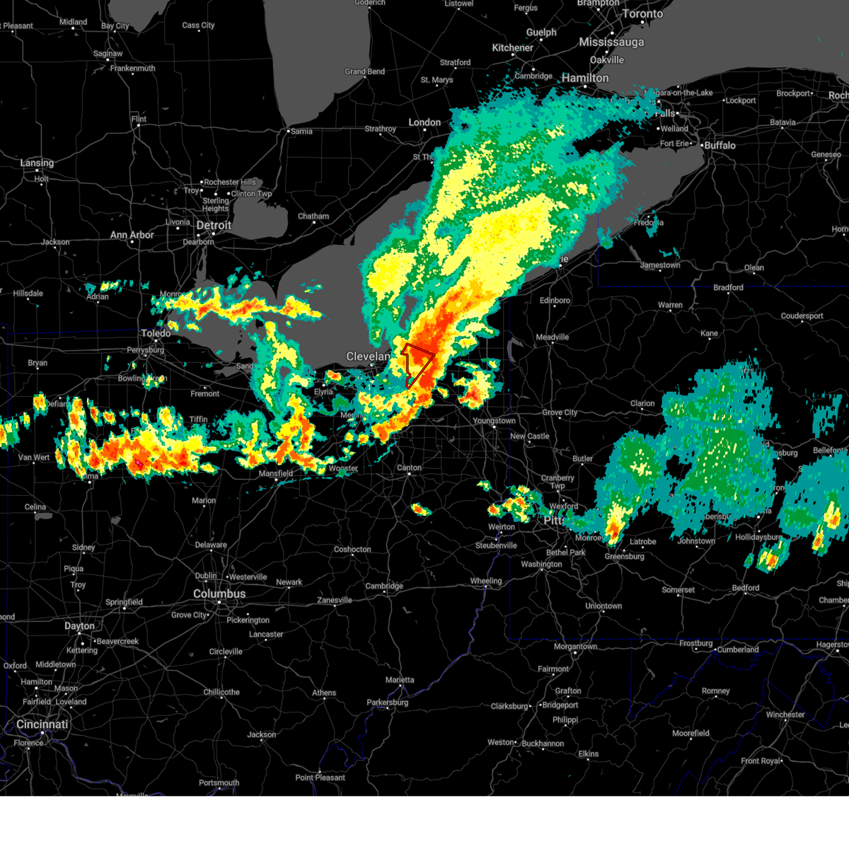
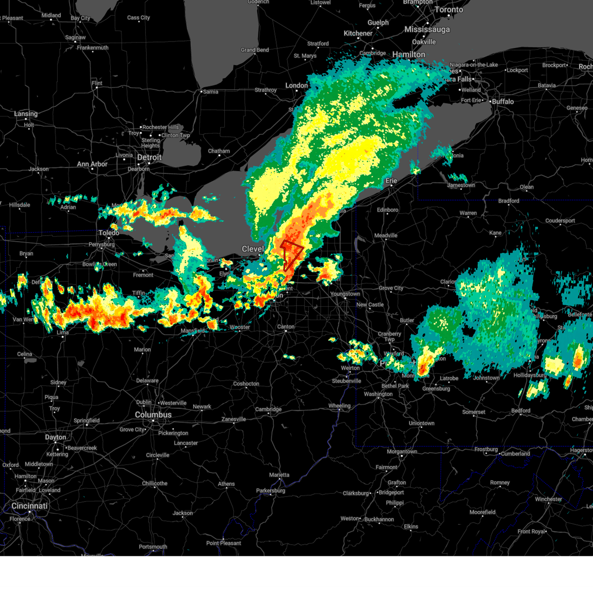
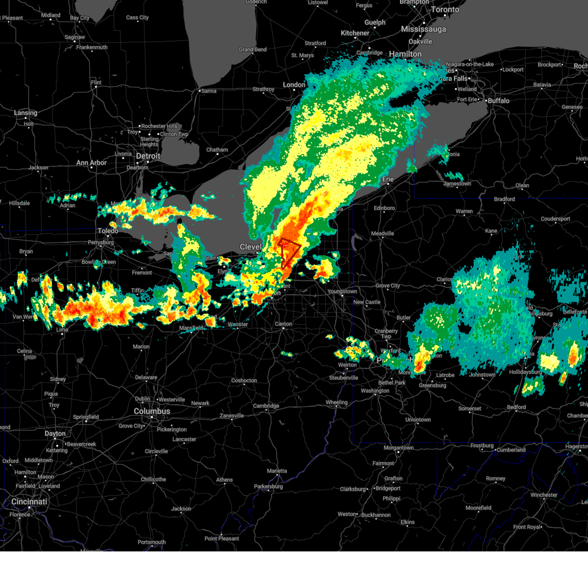
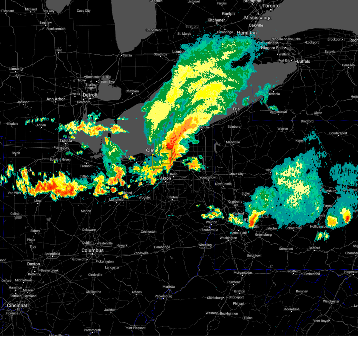
Hail Map for Chagrin Falls, OH
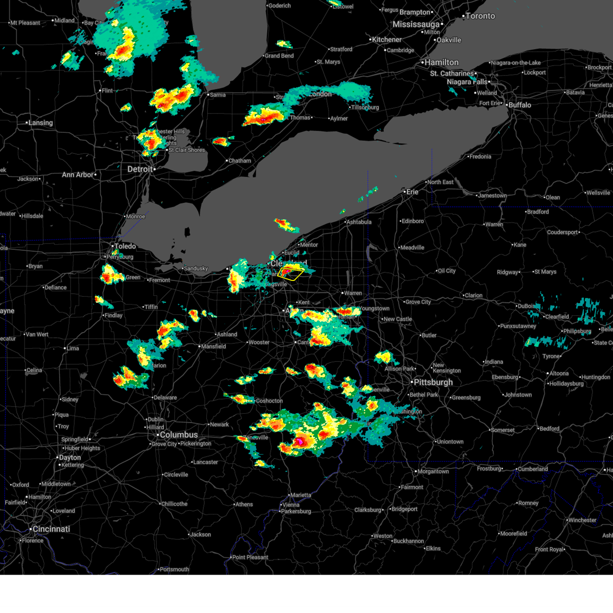
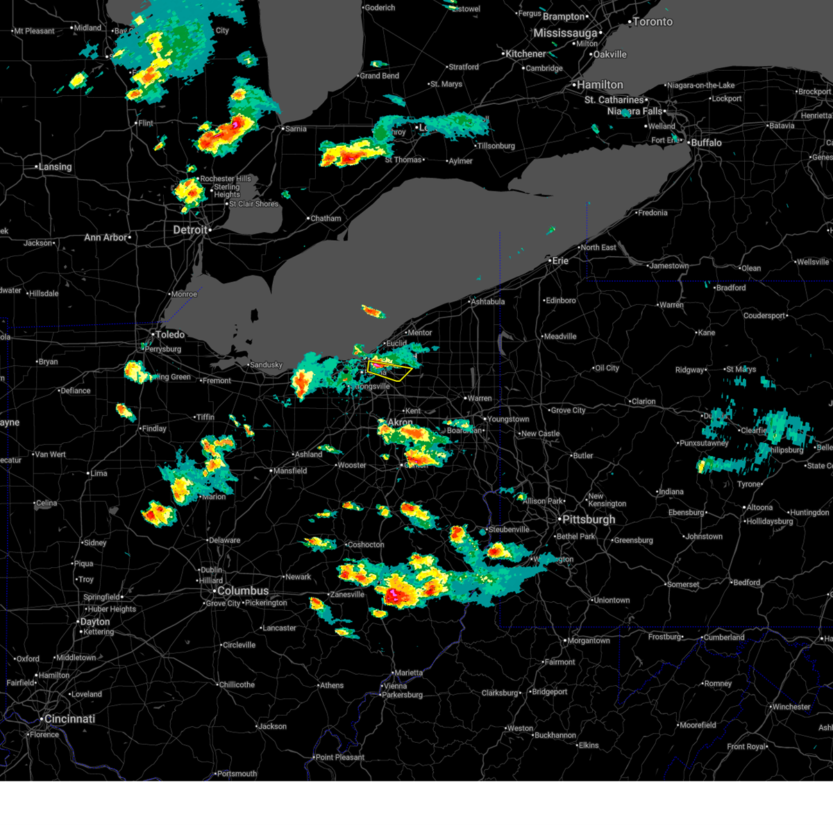
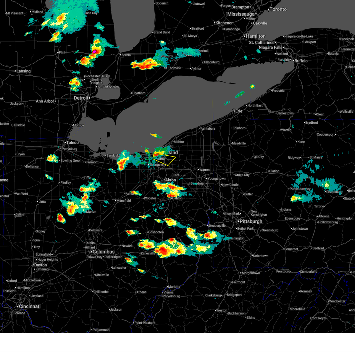
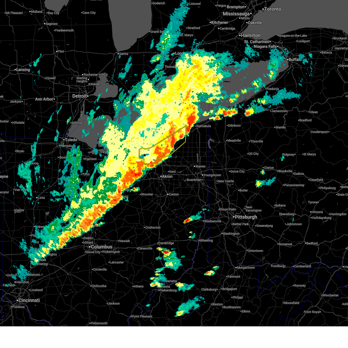
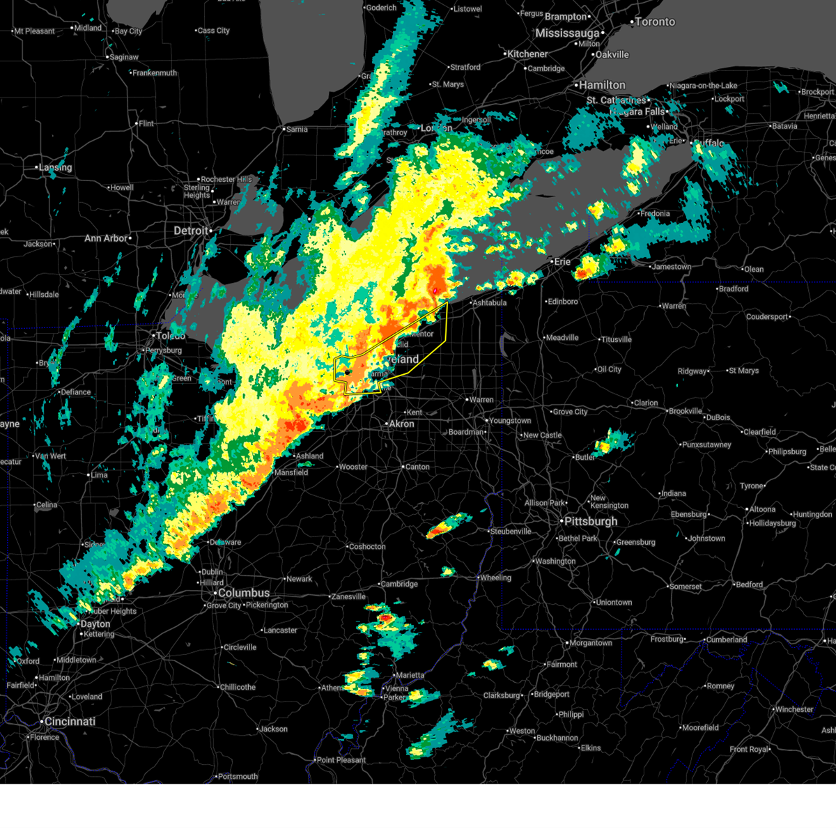
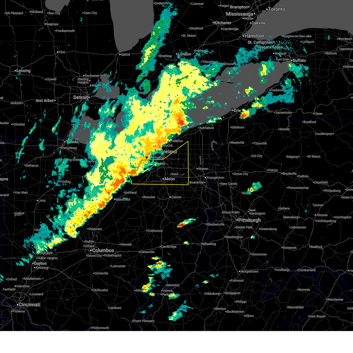
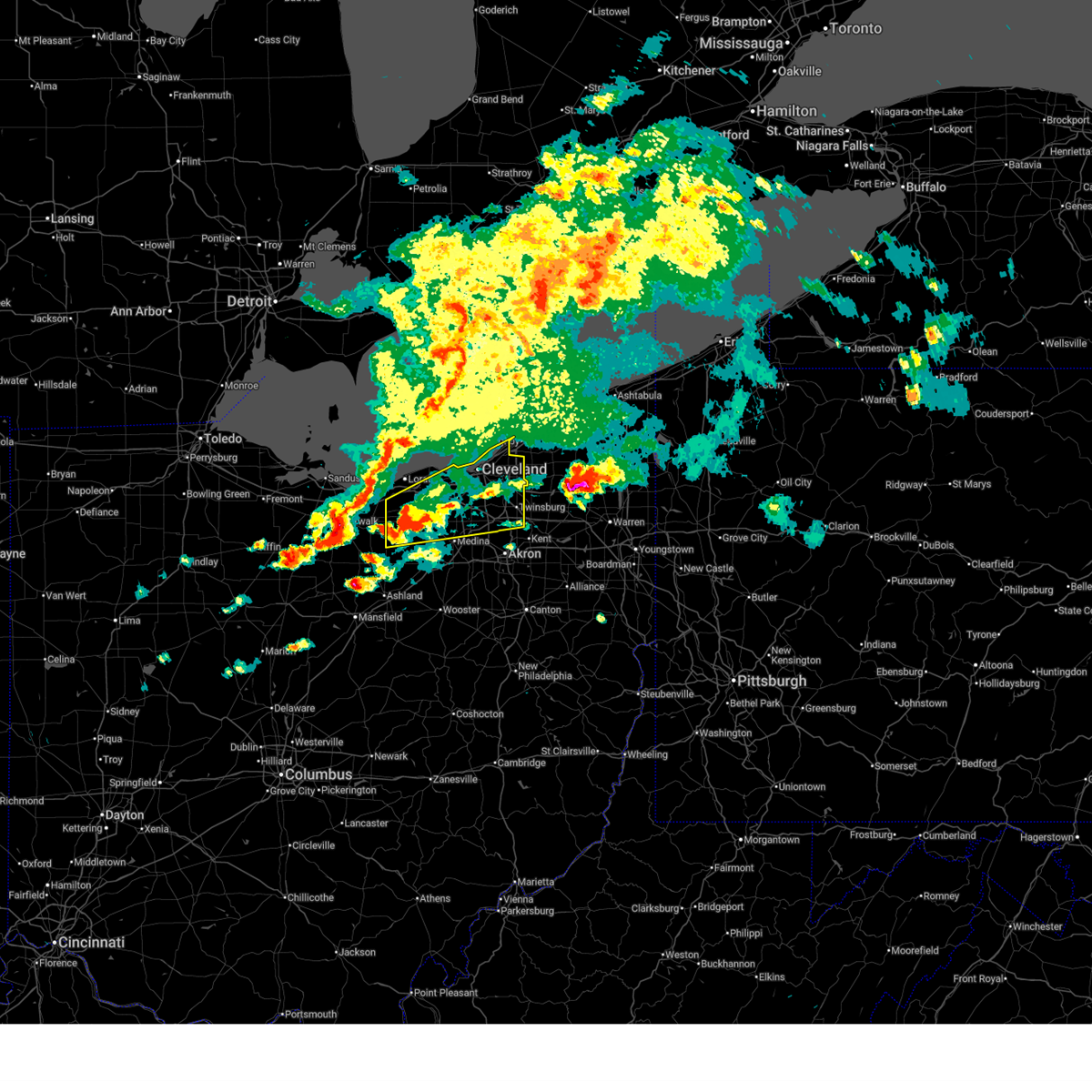
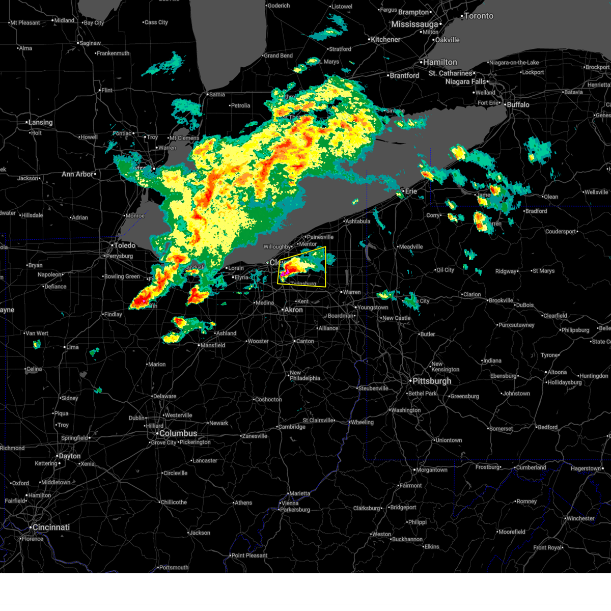
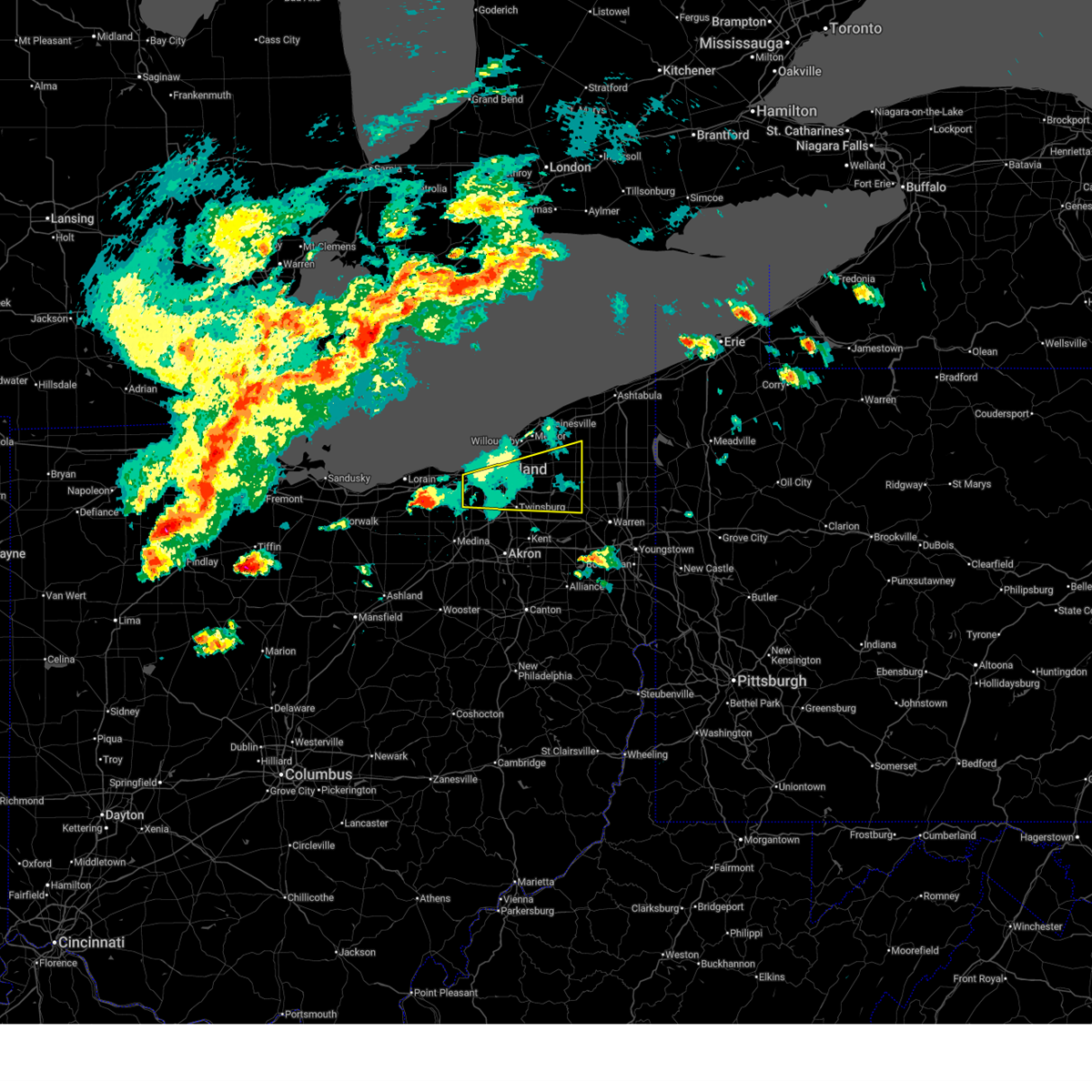
The Chagrin Falls, OH area has had 8 reports of on-the-ground hail by trained spotters, and has been under severe weather warnings 30 times during the past 12 months. Doppler radar has detected hail at or near Chagrin Falls, OH on 44 occasions, including 2 occasions during the past year.
| Name: | Chagrin Falls, OH |
| Where Located: | 16.6 miles ESE of Cleveland, OH |
| Map: | Google Map for Chagrin Falls, OH |
| Population: | 4113 |
| Housing Units: | 2042 |
| More Info: | Search Google for Chagrin Falls, OH |
3
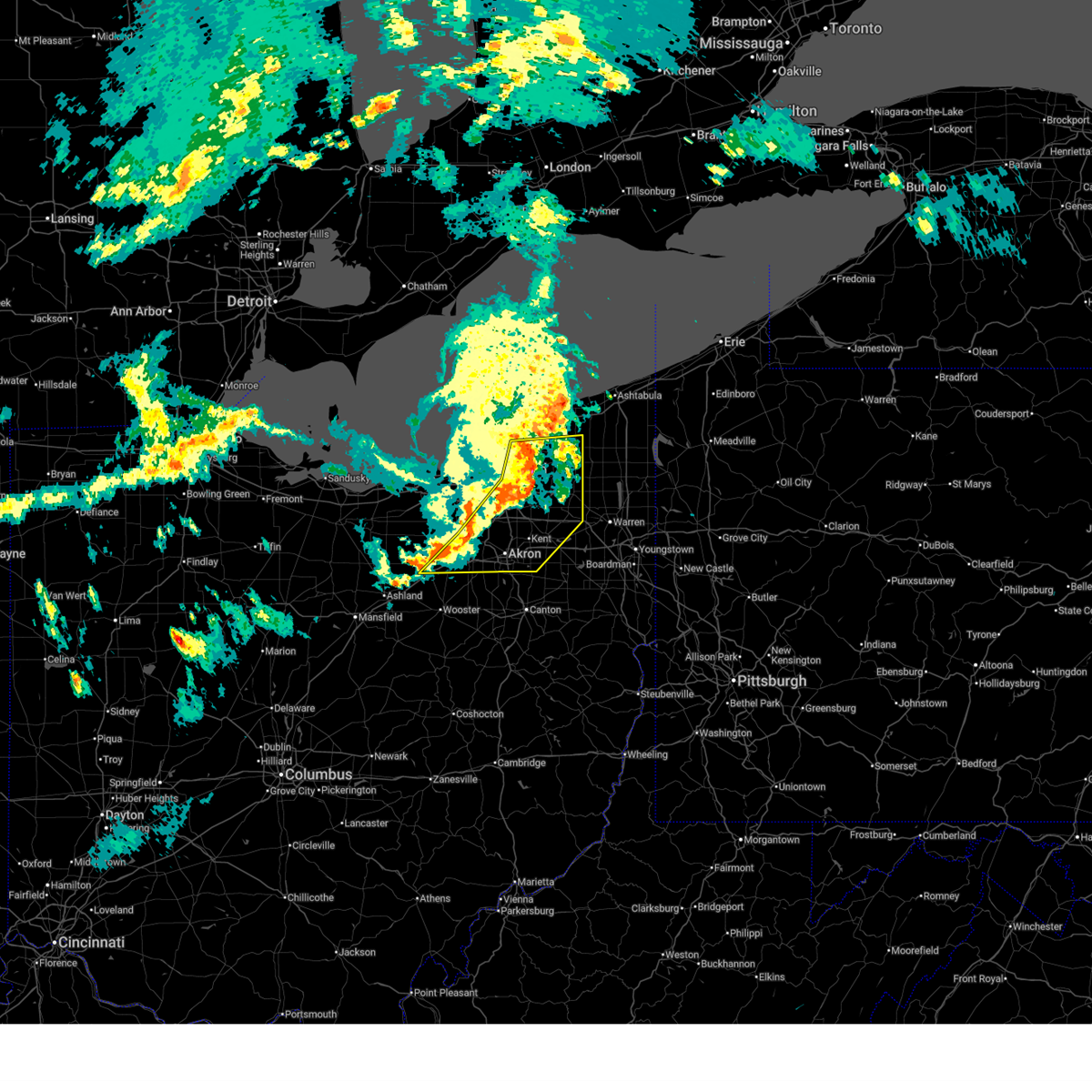
The Top Recent Hail Date for Chagrin Falls, OH is Wednesday, April 15, 2026 (2nd out of 44)
Hail and Wind Damage Spotted near Chagrin Falls, OH
| Date / Time | Report Details |
|---|---|
| 6/25/2026 6:10 PM EDT | Quarter sized hail reported 4.2 miles WNW of Chagrin Falls, OH, report from mping: quarter (1.00 in.). |
| 6/25/2026 6:06 PM EDT |
 The storm which prompted the warning has weakened below severe limits, and has exited the warned area. therefore, the warning will be allowed to expire. however, small hail and gusty winds are still possible with this thunderstorm. a severe thunderstorm watch remains in effect until 100 am edt for northeastern ohio. The storm which prompted the warning has weakened below severe limits, and has exited the warned area. therefore, the warning will be allowed to expire. however, small hail and gusty winds are still possible with this thunderstorm. a severe thunderstorm watch remains in effect until 100 am edt for northeastern ohio.
|
| 6/25/2026 5:52 PM EDT |
 At 551 pm edt, a severe thunderstorm was located over warrensville heights, or 9 miles southeast of cleveland, moving east at 25 mph (radar indicated). Hazards include 60 mph wind gusts and half dollar size hail. People and animals outdoors will be injured. expect hail damage to roofs, siding, windows, and vehicles. expect damage to trees and power lines. Locations impacted include, solon, warrensville heights, south russell, highland hills, garfield heights, shaker heights, maple heights, bedford, beachwood, bedford heights, chagrin falls, orange, moreland hills, walton hills, north randall, glenwillow, bentleyville, bainbridge, and warrensville heigh. At 551 pm edt, a severe thunderstorm was located over warrensville heights, or 9 miles southeast of cleveland, moving east at 25 mph (radar indicated). Hazards include 60 mph wind gusts and half dollar size hail. People and animals outdoors will be injured. expect hail damage to roofs, siding, windows, and vehicles. expect damage to trees and power lines. Locations impacted include, solon, warrensville heights, south russell, highland hills, garfield heights, shaker heights, maple heights, bedford, beachwood, bedford heights, chagrin falls, orange, moreland hills, walton hills, north randall, glenwillow, bentleyville, bainbridge, and warrensville heigh.
|
| 6/25/2026 5:39 PM EDT |
 At 538 pm edt, a severe thunderstorm was located near cleveland, moving east at 25 mph (radar indicated). Hazards include 60 mph wind gusts and half dollar size hail. People and animals outdoors will be injured. expect hail damage to roofs, siding, windows, and vehicles. expect damage to trees and power lines. Locations impacted include, cleveland, solon, warrensville heights, south russell, highland hills, garfield heights, shaker heights, maple heights, bedford, beachwood, bedford heights, independence, chagrin falls, orange, moreland hills, walton hills, newburgh heights, valley view, brooklyn heights, and north randall. At 538 pm edt, a severe thunderstorm was located near cleveland, moving east at 25 mph (radar indicated). Hazards include 60 mph wind gusts and half dollar size hail. People and animals outdoors will be injured. expect hail damage to roofs, siding, windows, and vehicles. expect damage to trees and power lines. Locations impacted include, cleveland, solon, warrensville heights, south russell, highland hills, garfield heights, shaker heights, maple heights, bedford, beachwood, bedford heights, independence, chagrin falls, orange, moreland hills, walton hills, newburgh heights, valley view, brooklyn heights, and north randall.
|
| 6/25/2026 5:31 PM EDT |
 Svrcle the national weather service in cleveland has issued a * severe thunderstorm warning for, southwestern geauga county in northeastern ohio, east central cuyahoga county in northeastern ohio, northeastern summit county in northeastern ohio, * until 615 pm edt. * at 531 pm edt, a severe thunderstorm was located over cleveland, moving east at 25 mph (radar indicated). Hazards include 60 mph wind gusts and quarter size hail. Minor damage to vehicles is possible. Expect damage to trees and power lines. Svrcle the national weather service in cleveland has issued a * severe thunderstorm warning for, southwestern geauga county in northeastern ohio, east central cuyahoga county in northeastern ohio, northeastern summit county in northeastern ohio, * until 615 pm edt. * at 531 pm edt, a severe thunderstorm was located over cleveland, moving east at 25 mph (radar indicated). Hazards include 60 mph wind gusts and quarter size hail. Minor damage to vehicles is possible. Expect damage to trees and power lines.
|
| 6/14/2026 3:58 PM EDT |
 At 357 pm edt, severe thunderstorms were located along a line extending from 7 miles north of orwell to ravenna to near shreve, moving southeast at 45 mph (radar indicated). Hazards include 60 mph wind gusts and penny size hail. Expect damage to trees and power lines. Locations impacted include, akron, medina, ravenna, chardon, parma, cuyahoga falls, strongsville, brunswick, north royalton, kent, barberton, solon, hudson, wadsworth, twinsburg, tallmadge, streetsboro, macedonia, rittman, and mogadore. At 357 pm edt, severe thunderstorms were located along a line extending from 7 miles north of orwell to ravenna to near shreve, moving southeast at 45 mph (radar indicated). Hazards include 60 mph wind gusts and penny size hail. Expect damage to trees and power lines. Locations impacted include, akron, medina, ravenna, chardon, parma, cuyahoga falls, strongsville, brunswick, north royalton, kent, barberton, solon, hudson, wadsworth, twinsburg, tallmadge, streetsboro, macedonia, rittman, and mogadore.
|
| 6/14/2026 3:58 PM EDT |
 the severe thunderstorm warning has been cancelled and is no longer in effect the severe thunderstorm warning has been cancelled and is no longer in effect
|
| 6/14/2026 3:34 PM EDT |
 At 334 pm edt, severe thunderstorms were located along a line extending from near painesville to 6 miles northwest of cuyahoga falls to near bellville, moving southeast at 45 mph (radar indicated). Hazards include 70 mph wind gusts. Expect considerable tree damage. damage is likely to mobile homes, roofs, and outbuildings. Locations impacted include, cleveland, painesville, willowick, chardon, fairport harbor, parma, lakewood, euclid, mentor, cleveland heights, strongsville, brunswick, westlake, north royalton, solon, willoughby, eastlake, warrensville heights, south russell, and madison. At 334 pm edt, severe thunderstorms were located along a line extending from near painesville to 6 miles northwest of cuyahoga falls to near bellville, moving southeast at 45 mph (radar indicated). Hazards include 70 mph wind gusts. Expect considerable tree damage. damage is likely to mobile homes, roofs, and outbuildings. Locations impacted include, cleveland, painesville, willowick, chardon, fairport harbor, parma, lakewood, euclid, mentor, cleveland heights, strongsville, brunswick, westlake, north royalton, solon, willoughby, eastlake, warrensville heights, south russell, and madison.
|
| 6/14/2026 3:24 PM EDT |
 At 324 pm edt, severe thunderstorms were located along a line extending from painesville to near north royalton to near mansfield, moving east at 45 mph (radar indicated). Hazards include 70 mph wind gusts. Expect considerable tree damage. damage is likely to mobile homes, roofs, and outbuildings. Locations impacted include, cleveland, painesville, willowick, chardon, fairport harbor, parma, lakewood, euclid, mentor, cleveland heights, strongsville, brunswick, westlake, north royalton, solon, willoughby, eastlake, warrensville heights, south russell, and madison. At 324 pm edt, severe thunderstorms were located along a line extending from painesville to near north royalton to near mansfield, moving east at 45 mph (radar indicated). Hazards include 70 mph wind gusts. Expect considerable tree damage. damage is likely to mobile homes, roofs, and outbuildings. Locations impacted include, cleveland, painesville, willowick, chardon, fairport harbor, parma, lakewood, euclid, mentor, cleveland heights, strongsville, brunswick, westlake, north royalton, solon, willoughby, eastlake, warrensville heights, south russell, and madison.
|
| 6/14/2026 3:16 PM EDT |
 Svrcle the national weather service in cleveland has issued a * severe thunderstorm warning for, portage county in northeastern ohio, geauga county in northeastern ohio, southern cuyahoga county in northeastern ohio, medina county in northeastern ohio, summit county in northeastern ohio, southeastern lorain county in north central ohio, * until 430 pm edt. * at 315 pm edt, severe thunderstorms were located along a line extending from 13 miles north of fairport harbor to cleveland to near savannah, moving southeast at 35 mph (radar indicated). Hazards include 60 mph wind gusts and penny size hail. expect damage to trees and power lines Svrcle the national weather service in cleveland has issued a * severe thunderstorm warning for, portage county in northeastern ohio, geauga county in northeastern ohio, southern cuyahoga county in northeastern ohio, medina county in northeastern ohio, summit county in northeastern ohio, southeastern lorain county in north central ohio, * until 430 pm edt. * at 315 pm edt, severe thunderstorms were located along a line extending from 13 miles north of fairport harbor to cleveland to near savannah, moving southeast at 35 mph (radar indicated). Hazards include 60 mph wind gusts and penny size hail. expect damage to trees and power lines
|
| 6/14/2026 2:49 PM EDT |
 Svrcle the national weather service in cleveland has issued a * severe thunderstorm warning for, central geauga county in northeastern ohio, cuyahoga county in northeastern ohio, lake county in northeastern ohio, * until 345 pm edt. * at 249 pm edt, severe thunderstorms were located along a line extending from 22 miles northwest of fairport harbor to 6 miles northeast of avon lake to near willard, moving southeast at 45 mph (radar indicated). Hazards include 70 mph wind gusts and penny size hail. Expect considerable tree damage. Damage is likely to mobile homes, roofs, and outbuildings. Svrcle the national weather service in cleveland has issued a * severe thunderstorm warning for, central geauga county in northeastern ohio, cuyahoga county in northeastern ohio, lake county in northeastern ohio, * until 345 pm edt. * at 249 pm edt, severe thunderstorms were located along a line extending from 22 miles northwest of fairport harbor to 6 miles northeast of avon lake to near willard, moving southeast at 45 mph (radar indicated). Hazards include 70 mph wind gusts and penny size hail. Expect considerable tree damage. Damage is likely to mobile homes, roofs, and outbuildings.
|
| 5/9/2026 6:39 PM EDT |
 At 639 pm edt, severe thunderstorms were located along a line extending from near madison to near chesterland to north ridgeville, moving east at 50 mph (radar indicated). Hazards include 60 mph wind gusts. Expect damage to trees and power lines. Locations impacted include, cleveland, elyria, painesville, willowick, chardon, fairport harbor, parma, lakewood, euclid, mentor, cleveland heights, strongsville, westlake, north royalton, north ridgeville, solon, willoughby, eastlake, warrensville heights, and grafton. At 639 pm edt, severe thunderstorms were located along a line extending from near madison to near chesterland to north ridgeville, moving east at 50 mph (radar indicated). Hazards include 60 mph wind gusts. Expect damage to trees and power lines. Locations impacted include, cleveland, elyria, painesville, willowick, chardon, fairport harbor, parma, lakewood, euclid, mentor, cleveland heights, strongsville, westlake, north royalton, north ridgeville, solon, willoughby, eastlake, warrensville heights, and grafton.
|
| 5/9/2026 6:08 PM EDT |
 Svrcle the national weather service in cleveland has issued a * severe thunderstorm warning for, erie county in north central ohio, central geauga county in northeastern ohio, cuyahoga county in northeastern ohio, lake county in northeastern ohio, northern lorain county in north central ohio, * until 700 pm edt. * at 607 pm edt, severe thunderstorms were located along a line extending from 18 miles northwest of fairport harbor to 14 miles north of lakewood to 6 miles west of western vermilion, moving east at 40 mph (radar indicated). Hazards include 60 mph wind gusts and penny size hail. expect damage to trees and power lines Svrcle the national weather service in cleveland has issued a * severe thunderstorm warning for, erie county in north central ohio, central geauga county in northeastern ohio, cuyahoga county in northeastern ohio, lake county in northeastern ohio, northern lorain county in north central ohio, * until 700 pm edt. * at 607 pm edt, severe thunderstorms were located along a line extending from 18 miles northwest of fairport harbor to 14 miles north of lakewood to 6 miles west of western vermilion, moving east at 40 mph (radar indicated). Hazards include 60 mph wind gusts and penny size hail. expect damage to trees and power lines
|
| 4/15/2026 6:18 PM EDT |
 At 617 pm edt, a severe thunderstorm was located over macedonia, or 14 miles southeast of cleveland, moving east at 45 mph (radar indicated). Hazards include 60 mph wind gusts and penny size hail. Expect damage to trees and power lines. Locations impacted include, cleveland, cuyahoga falls, north royalton, solon, hudson, twinsburg, streetsboro, warrensville heights, macedonia, south russell, highland hills, stow, garfield heights, shaker heights, maple heights, broadview heights, aurora, brecksville, bedford, and beachwood. At 617 pm edt, a severe thunderstorm was located over macedonia, or 14 miles southeast of cleveland, moving east at 45 mph (radar indicated). Hazards include 60 mph wind gusts and penny size hail. Expect damage to trees and power lines. Locations impacted include, cleveland, cuyahoga falls, north royalton, solon, hudson, twinsburg, streetsboro, warrensville heights, macedonia, south russell, highland hills, stow, garfield heights, shaker heights, maple heights, broadview heights, aurora, brecksville, bedford, and beachwood.
|
| 4/15/2026 6:16 PM EDT | Quarter sized hail reported 3.8 miles NW of Chagrin Falls, OH, public report of significant accumulation of one inch and greater hail. |
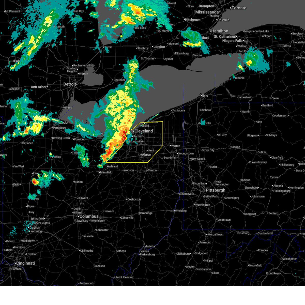
| 4/15/2026 5:55 PM EDT |
 At 555 pm edt, a severe thunderstorm was located near strongsville, or 10 miles north of medina, moving east at 50 mph (radar indicated). Hazards include ping pong ball size hail and 60 mph wind gusts. People and animals outdoors will be injured. expect hail damage to roofs, siding, windows, and vehicles. expect damage to trees and power lines. Locations impacted include, cleveland, medina, parma, cuyahoga falls, strongsville, brunswick, north royalton, north ridgeville, solon, hudson, twinsburg, streetsboro, warrensville heights, macedonia, grafton, south russell, highland hills, stow, north olmsted, and garfield heights. At 555 pm edt, a severe thunderstorm was located near strongsville, or 10 miles north of medina, moving east at 50 mph (radar indicated). Hazards include ping pong ball size hail and 60 mph wind gusts. People and animals outdoors will be injured. expect hail damage to roofs, siding, windows, and vehicles. expect damage to trees and power lines. Locations impacted include, cleveland, medina, parma, cuyahoga falls, strongsville, brunswick, north royalton, north ridgeville, solon, hudson, twinsburg, streetsboro, warrensville heights, macedonia, grafton, south russell, highland hills, stow, north olmsted, and garfield heights.
|
| 4/15/2026 5:42 PM EDT |
 Svrcle the national weather service in cleveland has issued a * severe thunderstorm warning for, cuyahoga county in northeastern ohio, northern medina county in northeastern ohio, northern summit county in northeastern ohio, lorain county in north central ohio, * until 630 pm edt. * at 541 pm edt, a severe thunderstorm was located near grafton, or 8 miles south of elyria, moving east at 45 mph (radar indicated). Hazards include golf ball size hail and 60 mph wind gusts. People and animals outdoors will be injured. expect hail damage to roofs, siding, windows, and vehicles. Expect damage to trees and power lines. Svrcle the national weather service in cleveland has issued a * severe thunderstorm warning for, cuyahoga county in northeastern ohio, northern medina county in northeastern ohio, northern summit county in northeastern ohio, lorain county in north central ohio, * until 630 pm edt. * at 541 pm edt, a severe thunderstorm was located near grafton, or 8 miles south of elyria, moving east at 45 mph (radar indicated). Hazards include golf ball size hail and 60 mph wind gusts. People and animals outdoors will be injured. expect hail damage to roofs, siding, windows, and vehicles. Expect damage to trees and power lines.
|
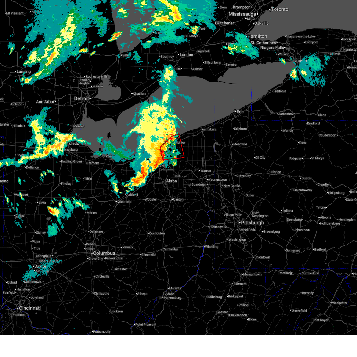
| 4/15/2026 5:21 PM EDT | Hen Egg sized hail reported 7.6 miles WNW of Chagrin Falls, OH, time estimated via radar. |
| 4/15/2026 5:20 PM EDT | Golf Ball sized hail reported 2.1 miles NW of Chagrin Falls, OH, report from mping: golf ball (1.75 in.). |
| 4/15/2026 5:16 PM EDT | Quarter sized hail reported 3.8 miles NW of Chagrin Falls, OH, corrects previous hail report from bainbridge. public report of significant accumulation of one inch and greater hail. |
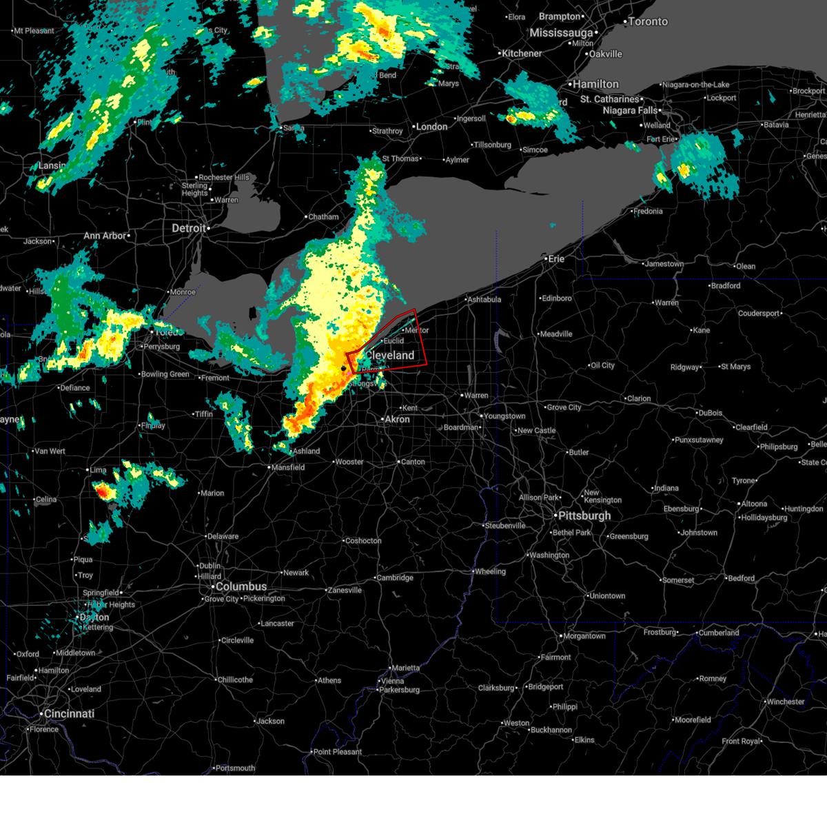
| 4/15/2026 5:07 PM EDT |
 At 507 pm edt, a severe thunderstorm was located over warrensville heights, or 10 miles southeast of cleveland, moving east at 50 mph (radar indicated). Hazards include tennis ball size hail and 60 mph wind gusts. People and animals outdoors will be injured. expect hail damage to roofs, siding, windows, and vehicles. expect damage to trees and power lines. Locations impacted include, cleveland, chardon, cleveland heights, solon, twinsburg, warrensville heights, macedonia, south russell, middlefield, garrettsville, burton, highland hills, chesterland, shaker heights, maple heights, south euclid, mayfield heights, aurora, lyndhurst, and university heights. At 507 pm edt, a severe thunderstorm was located over warrensville heights, or 10 miles southeast of cleveland, moving east at 50 mph (radar indicated). Hazards include tennis ball size hail and 60 mph wind gusts. People and animals outdoors will be injured. expect hail damage to roofs, siding, windows, and vehicles. expect damage to trees and power lines. Locations impacted include, cleveland, chardon, cleveland heights, solon, twinsburg, warrensville heights, macedonia, south russell, middlefield, garrettsville, burton, highland hills, chesterland, shaker heights, maple heights, south euclid, mayfield heights, aurora, lyndhurst, and university heights.
|
| 4/15/2026 4:51 PM EDT |
 Svrcle the national weather service in cleveland has issued a * severe thunderstorm warning for, northern portage county in northeastern ohio, geauga county in northeastern ohio, cuyahoga county in northeastern ohio, northeastern summit county in northeastern ohio, * until 530 pm edt. * at 451 pm edt, a severe thunderstorm was located near parma, or near cleveland, moving east at 50 mph (radar indicated). Hazards include 60 mph wind gusts and quarter size hail. Minor damage to vehicles is possible. Expect damage to trees and power lines. Svrcle the national weather service in cleveland has issued a * severe thunderstorm warning for, northern portage county in northeastern ohio, geauga county in northeastern ohio, cuyahoga county in northeastern ohio, northeastern summit county in northeastern ohio, * until 530 pm edt. * at 451 pm edt, a severe thunderstorm was located near parma, or near cleveland, moving east at 50 mph (radar indicated). Hazards include 60 mph wind gusts and quarter size hail. Minor damage to vehicles is possible. Expect damage to trees and power lines.
|
| 3/31/2026 7:41 PM EDT |
 At 741 pm edt, severe thunderstorms were located along a line extending from near chesterland to near grafton, moving east at 60 mph (radar indicated). Hazards include 60 mph wind gusts. Expect damage to trees and power lines. Locations impacted include, cleveland, parma, cleveland heights, strongsville, brunswick, north royalton, solon, twinsburg, warrensville heights, macedonia, highland hills, chesterland, garfield heights, shaker heights, maple heights, south euclid, parma heights, broadview heights, mayfield heights, and middleburg heights. At 741 pm edt, severe thunderstorms were located along a line extending from near chesterland to near grafton, moving east at 60 mph (radar indicated). Hazards include 60 mph wind gusts. Expect damage to trees and power lines. Locations impacted include, cleveland, parma, cleveland heights, strongsville, brunswick, north royalton, solon, twinsburg, warrensville heights, macedonia, highland hills, chesterland, garfield heights, shaker heights, maple heights, south euclid, parma heights, broadview heights, mayfield heights, and middleburg heights.
|
| 3/31/2026 7:41 PM EDT |
 the severe thunderstorm warning has been cancelled and is no longer in effect the severe thunderstorm warning has been cancelled and is no longer in effect
|
| 3/31/2026 7:15 PM EDT |
 Svrcle the national weather service in cleveland has issued a * severe thunderstorm warning for, erie county in north central ohio, west central geauga county in northeastern ohio, cuyahoga county in northeastern ohio, northeastern medina county in northeastern ohio, southwestern lake county in northeastern ohio, northwestern summit county in northeastern ohio, lorain county in north central ohio, * until 800 pm edt. * at 715 pm edt, severe thunderstorms were located along a line extending from 6 miles northwest of lakewood to near wakeman, moving east at 55 mph (radar indicated). Hazards include 60 mph wind gusts. expect damage to trees and power lines Svrcle the national weather service in cleveland has issued a * severe thunderstorm warning for, erie county in north central ohio, west central geauga county in northeastern ohio, cuyahoga county in northeastern ohio, northeastern medina county in northeastern ohio, southwestern lake county in northeastern ohio, northwestern summit county in northeastern ohio, lorain county in north central ohio, * until 800 pm edt. * at 715 pm edt, severe thunderstorms were located along a line extending from 6 miles northwest of lakewood to near wakeman, moving east at 55 mph (radar indicated). Hazards include 60 mph wind gusts. expect damage to trees and power lines
|
| 3/31/2026 5:58 PM EDT |
 Svrcle the national weather service in cleveland has issued a * severe thunderstorm warning for, trumbull county in northeastern ohio, northern portage county in northeastern ohio, geauga county in northeastern ohio, east central cuyahoga county in northeastern ohio, eastern lake county in northeastern ohio, northeastern summit county in northeastern ohio, ashtabula county in northeastern ohio, southwestern erie county in northwestern pennsylvania, western crawford county in northwestern pennsylvania, * until 700 pm edt. * at 558 pm edt, severe thunderstorms were located along a line extending from near geneva-on-the-lake to near burton to near hudson, moving east at 45 mph (radar indicated). Hazards include 70 mph wind gusts and penny size hail. Expect considerable tree damage. Damage is likely to mobile homes, roofs, and outbuildings. Svrcle the national weather service in cleveland has issued a * severe thunderstorm warning for, trumbull county in northeastern ohio, northern portage county in northeastern ohio, geauga county in northeastern ohio, east central cuyahoga county in northeastern ohio, eastern lake county in northeastern ohio, northeastern summit county in northeastern ohio, ashtabula county in northeastern ohio, southwestern erie county in northwestern pennsylvania, western crawford county in northwestern pennsylvania, * until 700 pm edt. * at 558 pm edt, severe thunderstorms were located along a line extending from near geneva-on-the-lake to near burton to near hudson, moving east at 45 mph (radar indicated). Hazards include 70 mph wind gusts and penny size hail. Expect considerable tree damage. Damage is likely to mobile homes, roofs, and outbuildings.
|
| 3/31/2026 5:50 PM EDT | Wires down on roa in geauga county OH, 4.1 miles NW of Chagrin Falls, OH |
| 3/31/2026 5:49 PM EDT |
 the severe thunderstorm warning has been cancelled and is no longer in effect the severe thunderstorm warning has been cancelled and is no longer in effect
|
| 3/31/2026 5:49 PM EDT |
 At 548 pm edt, severe thunderstorms were located along a line extending from near chesterland to hudson to rittman, moving east at 65 mph (radar indicated). Hazards include 70 mph wind gusts and penny size hail. Expect considerable tree damage. damage is likely to mobile homes, roofs, and outbuildings. Locations impacted include, akron, medina, willowick, ravenna, chardon, cuyahoga falls, euclid, mentor, north royalton, kent, barberton, solon, willoughby, hudson, wadsworth, twinsburg, eastlake, tallmadge, streetsboro, and warrensville heights. At 548 pm edt, severe thunderstorms were located along a line extending from near chesterland to hudson to rittman, moving east at 65 mph (radar indicated). Hazards include 70 mph wind gusts and penny size hail. Expect considerable tree damage. damage is likely to mobile homes, roofs, and outbuildings. Locations impacted include, akron, medina, willowick, ravenna, chardon, cuyahoga falls, euclid, mentor, north royalton, kent, barberton, solon, willoughby, hudson, wadsworth, twinsburg, eastlake, tallmadge, streetsboro, and warrensville heights.
|
| 3/31/2026 5:41 PM EDT |
 At 540 pm edt, a severe thunderstorm capable of producing a tornado was located over highland hills, or 10 miles east of cleveland, moving east at 65 mph (radar indicated rotation). Hazards include tornado. vortices capable of producing tornadoes were located near shaker heights and bedford heights at 5:40 pm. Flying debris will be dangerous to those caught without shelter. mobile homes will be damaged or destroyed. damage to roofs, windows, and vehicles will occur. tree damage is likely. Locations impacted include, cleveland, painesville, willowick, chardon, fairport harbor, euclid, mentor, cleveland heights, solon, willoughby, eastlake, warrensville heights, south russell, burton, highland hills, timberlake, lakeline, chesterland, garfield heights, and shaker heights. At 540 pm edt, a severe thunderstorm capable of producing a tornado was located over highland hills, or 10 miles east of cleveland, moving east at 65 mph (radar indicated rotation). Hazards include tornado. vortices capable of producing tornadoes were located near shaker heights and bedford heights at 5:40 pm. Flying debris will be dangerous to those caught without shelter. mobile homes will be damaged or destroyed. damage to roofs, windows, and vehicles will occur. tree damage is likely. Locations impacted include, cleveland, painesville, willowick, chardon, fairport harbor, euclid, mentor, cleveland heights, solon, willoughby, eastlake, warrensville heights, south russell, burton, highland hills, timberlake, lakeline, chesterland, garfield heights, and shaker heights.
|
| 3/31/2026 5:31 PM EDT |
 Torcle the national weather service in cleveland has issued a * tornado warning for, western geauga county in northeastern ohio, northeastern cuyahoga county in northeastern ohio, southwestern lake county in northeastern ohio, * until 615 pm edt. * at 531 pm edt, a severe thunderstorm capable of producing a tornado was located over cleveland, moving east at 65 mph (radar indicated rotation). Hazards include tornado. Flying debris will be dangerous to those caught without shelter. mobile homes will be damaged or destroyed. damage to roofs, windows, and vehicles will occur. tree damage is likely. this dangerous storm will be near, cleveland, euclid, cleveland heights, solon, warrensville heights, and highland hills around 535 pm edt. willowick, willoughby, eastlake, and chesterland around 540 pm edt. chardon, mentor, and south russell around 545 pm edt. Other locations impacted by this tornadic thunderstorm include waite hill, bratenahl, mentor-on-the-lake, richmond heights, parma heights, north randall, moreland hills, brooklyn, shaker heights, and warrensville heigh. Torcle the national weather service in cleveland has issued a * tornado warning for, western geauga county in northeastern ohio, northeastern cuyahoga county in northeastern ohio, southwestern lake county in northeastern ohio, * until 615 pm edt. * at 531 pm edt, a severe thunderstorm capable of producing a tornado was located over cleveland, moving east at 65 mph (radar indicated rotation). Hazards include tornado. Flying debris will be dangerous to those caught without shelter. mobile homes will be damaged or destroyed. damage to roofs, windows, and vehicles will occur. tree damage is likely. this dangerous storm will be near, cleveland, euclid, cleveland heights, solon, warrensville heights, and highland hills around 535 pm edt. willowick, willoughby, eastlake, and chesterland around 540 pm edt. chardon, mentor, and south russell around 545 pm edt. Other locations impacted by this tornadic thunderstorm include waite hill, bratenahl, mentor-on-the-lake, richmond heights, parma heights, north randall, moreland hills, brooklyn, shaker heights, and warrensville heigh.
|
| 3/31/2026 5:25 PM EDT |
 Svrcle the national weather service in cleveland has issued a * severe thunderstorm warning for, portage county in northeastern ohio, geauga county in northeastern ohio, cuyahoga county in northeastern ohio, medina county in northeastern ohio, southern lake county in northeastern ohio, northeastern ashland county in north central ohio, north central stark county in northeastern ohio, summit county in northeastern ohio, northern wayne county in northeastern ohio, southeastern lorain county in north central ohio, * until 615 pm edt. * at 524 pm edt, severe thunderstorms were located along a line extending from near lakewood to near brunswick to near polk, moving east at 65 mph (radar indicated). Hazards include 70 mph wind gusts and penny size hail. Expect considerable tree damage. Damage is likely to mobile homes, roofs, and outbuildings. Svrcle the national weather service in cleveland has issued a * severe thunderstorm warning for, portage county in northeastern ohio, geauga county in northeastern ohio, cuyahoga county in northeastern ohio, medina county in northeastern ohio, southern lake county in northeastern ohio, northeastern ashland county in north central ohio, north central stark county in northeastern ohio, summit county in northeastern ohio, northern wayne county in northeastern ohio, southeastern lorain county in north central ohio, * until 615 pm edt. * at 524 pm edt, severe thunderstorms were located along a line extending from near lakewood to near brunswick to near polk, moving east at 65 mph (radar indicated). Hazards include 70 mph wind gusts and penny size hail. Expect considerable tree damage. Damage is likely to mobile homes, roofs, and outbuildings.
|
| 3/11/2026 12:45 PM EDT |
 The storms which prompted the warning have weakened below severe limits, and have exited the warned area. therefore, the warning will be allowed to expire. a tornado watch remains in effect until 500 pm edt for north central and northeastern ohio. The storms which prompted the warning have weakened below severe limits, and have exited the warned area. therefore, the warning will be allowed to expire. a tornado watch remains in effect until 500 pm edt for north central and northeastern ohio.
|
| 3/11/2026 12:38 PM EDT |
 the severe thunderstorm warning has been cancelled and is no longer in effect the severe thunderstorm warning has been cancelled and is no longer in effect
|
| 3/11/2026 12:38 PM EDT |
 At 1238 pm edt, severe thunderstorms were located along a line extending from 6 miles south of perry to 6 miles northwest of garrettsville to near mogadore, moving east at 70 mph (radar indicated). Hazards include 60 mph wind gusts. Expect damage to trees and power lines. Locations impacted include, cleveland, parma, lakewood, euclid, cleveland heights, strongsville, brunswick, westlake, north royalton, solon, avon lake, hudson, twinsburg, warrensville heights, macedonia, highland hills, north olmsted, garfield heights, shaker heights, and maple heights. At 1238 pm edt, severe thunderstorms were located along a line extending from 6 miles south of perry to 6 miles northwest of garrettsville to near mogadore, moving east at 70 mph (radar indicated). Hazards include 60 mph wind gusts. Expect damage to trees and power lines. Locations impacted include, cleveland, parma, lakewood, euclid, cleveland heights, strongsville, brunswick, westlake, north royalton, solon, avon lake, hudson, twinsburg, warrensville heights, macedonia, highland hills, north olmsted, garfield heights, shaker heights, and maple heights.
|
| 3/11/2026 11:57 AM EDT |
 Svrcle the national weather service in cleveland has issued a * severe thunderstorm warning for, cuyahoga county in northeastern ohio, medina county in northeastern ohio, summit county in northeastern ohio, northern wayne county in northeastern ohio, * until 1245 pm edt. * at 1157 am edt, severe thunderstorms were located along a line extending from near avon lake to near grafton to near west salem, moving east at 70 mph (radar indicated). Hazards include 70 mph wind gusts and quarter size hail. Minor damage to vehicles is possible. expect considerable tree damage. Wind damage is also likely to mobile homes, roofs, and outbuildings. Svrcle the national weather service in cleveland has issued a * severe thunderstorm warning for, cuyahoga county in northeastern ohio, medina county in northeastern ohio, summit county in northeastern ohio, northern wayne county in northeastern ohio, * until 1245 pm edt. * at 1157 am edt, severe thunderstorms were located along a line extending from near avon lake to near grafton to near west salem, moving east at 70 mph (radar indicated). Hazards include 70 mph wind gusts and quarter size hail. Minor damage to vehicles is possible. expect considerable tree damage. Wind damage is also likely to mobile homes, roofs, and outbuildings.
|
| 6/27/2025 1:12 PM EDT |
 The storms which prompted the warning have weakened below severe limits, and no longer pose an immediate threat to life or property. therefore, the warning will be allowed to expire. The storms which prompted the warning have weakened below severe limits, and no longer pose an immediate threat to life or property. therefore, the warning will be allowed to expire.
|
| 6/27/2025 12:49 PM EDT |
 the severe thunderstorm warning has been cancelled and is no longer in effect the severe thunderstorm warning has been cancelled and is no longer in effect
|
| 6/27/2025 12:49 PM EDT |
 At 1248 pm edt, severe thunderstorms were located along a line extending from near eastlake to near chardon to near chesterland to near south russell, moving northeast at 30 mph (radar indicated). Hazards include 60 mph wind gusts and penny size hail. Expect damage to trees and power lines. Locations impacted include, painesville, willowick, chardon, fairport harbor, mentor, willoughby, eastlake, south russell, madison, middlefield, perry, burton, chesterland, wickliffe, willoughby hills, mentor-on-the-lake, kirtland, chagrin falls, huntsburg, and claridon. At 1248 pm edt, severe thunderstorms were located along a line extending from near eastlake to near chardon to near chesterland to near south russell, moving northeast at 30 mph (radar indicated). Hazards include 60 mph wind gusts and penny size hail. Expect damage to trees and power lines. Locations impacted include, painesville, willowick, chardon, fairport harbor, mentor, willoughby, eastlake, south russell, madison, middlefield, perry, burton, chesterland, wickliffe, willoughby hills, mentor-on-the-lake, kirtland, chagrin falls, huntsburg, and claridon.
|
| 6/27/2025 12:25 PM EDT |
 Svrcle the national weather service in cleveland has issued a * severe thunderstorm warning for, geauga county in northeastern ohio, northeastern cuyahoga county in northeastern ohio, lake county in northeastern ohio, * until 115 pm edt. * at 1225 pm edt, a severe thunderstorm was located near highland hills, or 10 miles south of willowick, moving northeast at 40 mph (radar indicated). Hazards include 60 mph wind gusts. expect damage to trees and power lines Svrcle the national weather service in cleveland has issued a * severe thunderstorm warning for, geauga county in northeastern ohio, northeastern cuyahoga county in northeastern ohio, lake county in northeastern ohio, * until 115 pm edt. * at 1225 pm edt, a severe thunderstorm was located near highland hills, or 10 miles south of willowick, moving northeast at 40 mph (radar indicated). Hazards include 60 mph wind gusts. expect damage to trees and power lines
|
| 6/24/2025 10:50 PM EDT |
 At 1050 pm edt, a severe thunderstorm was located over south russell, or 13 miles southwest of chardon, moving east at 20 mph (radar indicated). Hazards include 60 mph wind gusts. Expect damage to trees and power lines. Locations impacted include, chardon, solon, twinsburg, south russell, mantua, chesterland, mayfield heights, aurora, highland heights, pepper pike, chagrin falls, mayfield, reminderville, moreland hills, gates mills, bentleyville, bainbridge, hunting valley, and aquilla. At 1050 pm edt, a severe thunderstorm was located over south russell, or 13 miles southwest of chardon, moving east at 20 mph (radar indicated). Hazards include 60 mph wind gusts. Expect damage to trees and power lines. Locations impacted include, chardon, solon, twinsburg, south russell, mantua, chesterland, mayfield heights, aurora, highland heights, pepper pike, chagrin falls, mayfield, reminderville, moreland hills, gates mills, bentleyville, bainbridge, hunting valley, and aquilla.
|
| 6/24/2025 10:43 PM EDT | Large tree down blocking roadway near bainbridge and geauga lake road. time was estimated by rada in geauga county OH, 3.3 miles NNW of Chagrin Falls, OH |
| 6/24/2025 10:34 PM EDT |
 Svrcle the national weather service in cleveland has issued a * severe thunderstorm warning for, northwestern portage county in northeastern ohio, southwestern geauga county in northeastern ohio, east central cuyahoga county in northeastern ohio, northeastern summit county in northeastern ohio, * until 1115 pm edt. * at 1034 pm edt, a severe thunderstorm was located over solon, or 11 miles east of cleveland, moving east at 20 mph (radar indicated). Hazards include 60 mph wind gusts. expect damage to trees and power lines Svrcle the national weather service in cleveland has issued a * severe thunderstorm warning for, northwestern portage county in northeastern ohio, southwestern geauga county in northeastern ohio, east central cuyahoga county in northeastern ohio, northeastern summit county in northeastern ohio, * until 1115 pm edt. * at 1034 pm edt, a severe thunderstorm was located over solon, or 11 miles east of cleveland, moving east at 20 mph (radar indicated). Hazards include 60 mph wind gusts. expect damage to trees and power lines
|
| 6/18/2025 9:22 PM EDT |
 At 921 pm edt, severe thunderstorms were located along a line extending from 12 miles north of lakewood to near macedonia, moving east at 60 mph (radar indicated). Hazards include 70 mph wind gusts. Expect considerable tree damage. damage is likely to mobile homes, roofs, and outbuildings. Locations impacted include, painesville, willowick, chardon, fairport harbor, euclid, mentor, willoughby, eastlake, south russell, madison, middlefield, perry, burton, timberlake, lakeline, chesterland, wickliffe, willoughby hills, highland heights, and mentor-on-the-lake. At 921 pm edt, severe thunderstorms were located along a line extending from 12 miles north of lakewood to near macedonia, moving east at 60 mph (radar indicated). Hazards include 70 mph wind gusts. Expect considerable tree damage. damage is likely to mobile homes, roofs, and outbuildings. Locations impacted include, painesville, willowick, chardon, fairport harbor, euclid, mentor, willoughby, eastlake, south russell, madison, middlefield, perry, burton, timberlake, lakeline, chesterland, wickliffe, willoughby hills, highland heights, and mentor-on-the-lake.
|
| 6/18/2025 9:20 PM EDT |
 the severe thunderstorm warning has been cancelled and is no longer in effect the severe thunderstorm warning has been cancelled and is no longer in effect
|
| 6/18/2025 9:20 PM EDT |
 At 920 pm edt, severe thunderstorms were located along a line extending from 8 miles north of lakewood to near macedonia, moving northeast at 65 mph (radar indicated). Hazards include 70 mph wind gusts. Expect considerable tree damage. damage is likely to mobile homes, roofs, and outbuildings. Locations impacted include, cleveland, parma, lakewood, euclid, cleveland heights, north royalton, solon, warrensville heights, highland hills, garfield heights, shaker heights, maple heights, south euclid, parma heights, rocky river, broadview heights, brook park, mayfield heights, east cleveland, and fairview park. At 920 pm edt, severe thunderstorms were located along a line extending from 8 miles north of lakewood to near macedonia, moving northeast at 65 mph (radar indicated). Hazards include 70 mph wind gusts. Expect considerable tree damage. damage is likely to mobile homes, roofs, and outbuildings. Locations impacted include, cleveland, parma, lakewood, euclid, cleveland heights, north royalton, solon, warrensville heights, highland hills, garfield heights, shaker heights, maple heights, south euclid, parma heights, rocky river, broadview heights, brook park, mayfield heights, east cleveland, and fairview park.
|
| 6/18/2025 9:19 PM EDT |
 Svrcle the national weather service in cleveland has issued a * severe thunderstorm warning for, geauga county in northeastern ohio, lake county in northeastern ohio, * until 1000 pm edt. * at 918 pm edt, severe thunderstorms were located along a line extending from 12 miles north of lakewood to near macedonia, moving east at 60 mph (radar indicated). Hazards include 70 mph wind gusts. Expect considerable tree damage. Damage is likely to mobile homes, roofs, and outbuildings. Svrcle the national weather service in cleveland has issued a * severe thunderstorm warning for, geauga county in northeastern ohio, lake county in northeastern ohio, * until 1000 pm edt. * at 918 pm edt, severe thunderstorms were located along a line extending from 12 miles north of lakewood to near macedonia, moving east at 60 mph (radar indicated). Hazards include 70 mph wind gusts. Expect considerable tree damage. Damage is likely to mobile homes, roofs, and outbuildings.
|
| 6/18/2025 8:54 PM EDT |
 At 854 pm edt, severe thunderstorms were located along a line extending from near lorain to 6 miles west of medina, moving northeast at 45 mph. an 81 mph wind gust was measured in the city of lorain at 8:47 pm (radar indicated). Hazards include 70 mph wind gusts. Expect considerable tree damage. damage is likely to mobile homes, roofs, and outbuildings. Locations impacted include, cleveland, lorain, elyria, medina, vermilion, parma, lakewood, euclid, cleveland heights, strongsville, brunswick, westlake, north royalton, north ridgeville, solon, avon lake, wadsworth, warrensville heights, amherst, and grafton. At 854 pm edt, severe thunderstorms were located along a line extending from near lorain to 6 miles west of medina, moving northeast at 45 mph. an 81 mph wind gust was measured in the city of lorain at 8:47 pm (radar indicated). Hazards include 70 mph wind gusts. Expect considerable tree damage. damage is likely to mobile homes, roofs, and outbuildings. Locations impacted include, cleveland, lorain, elyria, medina, vermilion, parma, lakewood, euclid, cleveland heights, strongsville, brunswick, westlake, north royalton, north ridgeville, solon, avon lake, wadsworth, warrensville heights, amherst, and grafton.
|
| 6/18/2025 8:52 PM EDT |
 At 851 pm edt, severe thunderstorms were located along a line extending from near lorain to 7 miles north of lodi, moving northeast at 45 mph. an 81 mph wind gust was measured in the city of lorain at 7:47 pm (radar indicated). Hazards include 70 mph wind gusts. Expect considerable tree damage. damage is likely to mobile homes, roofs, and outbuildings. Locations impacted include, cleveland, lorain, elyria, medina, vermilion, parma, lakewood, euclid, cleveland heights, strongsville, brunswick, westlake, north royalton, north ridgeville, solon, avon lake, wadsworth, warrensville heights, amherst, and grafton. At 851 pm edt, severe thunderstorms were located along a line extending from near lorain to 7 miles north of lodi, moving northeast at 45 mph. an 81 mph wind gust was measured in the city of lorain at 7:47 pm (radar indicated). Hazards include 70 mph wind gusts. Expect considerable tree damage. damage is likely to mobile homes, roofs, and outbuildings. Locations impacted include, cleveland, lorain, elyria, medina, vermilion, parma, lakewood, euclid, cleveland heights, strongsville, brunswick, westlake, north royalton, north ridgeville, solon, avon lake, wadsworth, warrensville heights, amherst, and grafton.
|
| 6/18/2025 8:18 PM EDT |
 Svrcle the national weather service in cleveland has issued a * severe thunderstorm warning for, cuyahoga county in northeastern ohio, medina county in northeastern ohio, lorain county in north central ohio, * until 930 pm edt. * at 818 pm edt, severe thunderstorms were located along a line extending from near kelleys island to near plymouth, moving east at 55 mph (radar indicated). Hazards include 70 mph wind gusts. Expect considerable tree damage. Damage is likely to mobile homes, roofs, and outbuildings. Svrcle the national weather service in cleveland has issued a * severe thunderstorm warning for, cuyahoga county in northeastern ohio, medina county in northeastern ohio, lorain county in north central ohio, * until 930 pm edt. * at 818 pm edt, severe thunderstorms were located along a line extending from near kelleys island to near plymouth, moving east at 55 mph (radar indicated). Hazards include 70 mph wind gusts. Expect considerable tree damage. Damage is likely to mobile homes, roofs, and outbuildings.
|
| 6/18/2025 7:27 PM EDT |
 Svrcle the national weather service in cleveland has issued a * severe thunderstorm warning for, northern portage county in northeastern ohio, southern geauga county in northeastern ohio, east central cuyahoga county in northeastern ohio, northeastern summit county in northeastern ohio, * until 815 pm edt. * at 727 pm edt, severe thunderstorms were located along a line extending from near solon to near hudson, moving east at 30 mph (radar indicated). Hazards include 60 mph wind gusts and penny size hail. expect damage to trees and power lines Svrcle the national weather service in cleveland has issued a * severe thunderstorm warning for, northern portage county in northeastern ohio, southern geauga county in northeastern ohio, east central cuyahoga county in northeastern ohio, northeastern summit county in northeastern ohio, * until 815 pm edt. * at 727 pm edt, severe thunderstorms were located along a line extending from near solon to near hudson, moving east at 30 mph (radar indicated). Hazards include 60 mph wind gusts and penny size hail. expect damage to trees and power lines
|
| 5/5/2025 3:15 PM EDT |
 The storm which prompted the warning has moved out of the area. therefore, the warning has been allowed to expire. to report severe weather, contact your nearest law enforcement agency. they will relay your report to the national weather service cleveland. The storm which prompted the warning has moved out of the area. therefore, the warning has been allowed to expire. to report severe weather, contact your nearest law enforcement agency. they will relay your report to the national weather service cleveland.
|
| 5/5/2025 2:54 PM EDT |
 the severe thunderstorm warning has been cancelled and is no longer in effect the severe thunderstorm warning has been cancelled and is no longer in effect
|
| 5/5/2025 2:54 PM EDT |
 At 253 pm edt, a severe thunderstorm was located near south russell, or 13 miles south of chardon, moving northwest at 25 mph (radar indicated). Hazards include 60 mph wind gusts and quarter size hail. Minor damage to vehicles is possible. expect damage to trees and power lines. Locations impacted include, solon, south russell, chesterland, chagrin falls, bainbridge, and hunting valley. At 253 pm edt, a severe thunderstorm was located near south russell, or 13 miles south of chardon, moving northwest at 25 mph (radar indicated). Hazards include 60 mph wind gusts and quarter size hail. Minor damage to vehicles is possible. expect damage to trees and power lines. Locations impacted include, solon, south russell, chesterland, chagrin falls, bainbridge, and hunting valley.
|
| 5/5/2025 2:38 PM EDT |
 Svrcle the national weather service in cleveland has issued a * severe thunderstorm warning for, northwestern portage county in northeastern ohio, southern geauga county in northeastern ohio, * until 315 pm edt. * at 238 pm edt, a severe thunderstorm was located near garrettsville, or 13 miles north of ravenna, moving northwest at 25 mph (radar indicated). Hazards include 60 mph wind gusts and quarter size hail. Minor damage to vehicles is possible. Expect damage to trees and power lines. Svrcle the national weather service in cleveland has issued a * severe thunderstorm warning for, northwestern portage county in northeastern ohio, southern geauga county in northeastern ohio, * until 315 pm edt. * at 238 pm edt, a severe thunderstorm was located near garrettsville, or 13 miles north of ravenna, moving northwest at 25 mph (radar indicated). Hazards include 60 mph wind gusts and quarter size hail. Minor damage to vehicles is possible. Expect damage to trees and power lines.
|
| 5/2/2025 3:11 PM EDT |
 The storms which prompted the warning have moved out of the area. therefore, the warning will be allowed to expire. however, small hail and gusty winds are still possible with these thunderstorms. a severe thunderstorm watch remains in effect until 700 pm edt for northeastern ohio. remember, a severe thunderstorm warning still remains in effect for portions of cuyahoga, geauga, portage, ashtabula, and trumbull counties. The storms which prompted the warning have moved out of the area. therefore, the warning will be allowed to expire. however, small hail and gusty winds are still possible with these thunderstorms. a severe thunderstorm watch remains in effect until 700 pm edt for northeastern ohio. remember, a severe thunderstorm warning still remains in effect for portions of cuyahoga, geauga, portage, ashtabula, and trumbull counties.
|
| 5/2/2025 3:08 PM EDT |
 Svrcle the national weather service in cleveland has issued a * severe thunderstorm warning for, northern trumbull county in northeastern ohio, northern portage county in northeastern ohio, geauga county in northeastern ohio, east central cuyahoga county in northeastern ohio, northeastern summit county in northeastern ohio, southern ashtabula county in northeastern ohio, * until 400 pm edt. * at 308 pm edt, severe thunderstorms were located along a line extending from near chardon to near burton to macedonia, moving east at 40 mph (radar indicated). Hazards include 60 mph wind gusts and quarter size hail. Minor damage to vehicles is possible. Expect damage to trees and power lines. Svrcle the national weather service in cleveland has issued a * severe thunderstorm warning for, northern trumbull county in northeastern ohio, northern portage county in northeastern ohio, geauga county in northeastern ohio, east central cuyahoga county in northeastern ohio, northeastern summit county in northeastern ohio, southern ashtabula county in northeastern ohio, * until 400 pm edt. * at 308 pm edt, severe thunderstorms were located along a line extending from near chardon to near burton to macedonia, moving east at 40 mph (radar indicated). Hazards include 60 mph wind gusts and quarter size hail. Minor damage to vehicles is possible. Expect damage to trees and power lines.
|
| 5/2/2025 2:57 PM EDT |
 At 255 pm edt, severe thunderstorms were located along a line extending from cleveland heights to near solon to near north royalton, moving east at 40 mph (radar indicated). Hazards include 60 mph wind gusts and quarter size hail. Minor damage to vehicles is possible. expect damage to trees and power lines. Locations impacted include, chardon, solon, south russell, middlefield, north bloomfield, burton, west farmington, chesterland, bristolville, mayfield heights, aurora, lyndhurst, willoughby hills, highland heights, kirtland, pepper pike, parkman, chagrin falls, huntsburg, and mayfield. At 255 pm edt, severe thunderstorms were located along a line extending from cleveland heights to near solon to near north royalton, moving east at 40 mph (radar indicated). Hazards include 60 mph wind gusts and quarter size hail. Minor damage to vehicles is possible. expect damage to trees and power lines. Locations impacted include, chardon, solon, south russell, middlefield, north bloomfield, burton, west farmington, chesterland, bristolville, mayfield heights, aurora, lyndhurst, willoughby hills, highland heights, kirtland, pepper pike, parkman, chagrin falls, huntsburg, and mayfield.
|
| 5/2/2025 2:44 PM EDT |
 At 243 pm edt, a severe thunderstorm was located near warrensville heights, or 8 miles southeast of cleveland, moving east at 40 mph (radar indicated). Hazards include 60 mph wind gusts and quarter size hail. Minor damage to vehicles is possible. expect damage to trees and power lines. Locations impacted include, cleveland, parma, lakewood, euclid, cleveland heights, north royalton, solon, twinsburg, warrensville heights, macedonia, south russell, highland hills, chesterland, garfield heights, shaker heights, maple heights, south euclid, parma heights, broadview heights, and mayfield heights. At 243 pm edt, a severe thunderstorm was located near warrensville heights, or 8 miles southeast of cleveland, moving east at 40 mph (radar indicated). Hazards include 60 mph wind gusts and quarter size hail. Minor damage to vehicles is possible. expect damage to trees and power lines. Locations impacted include, cleveland, parma, lakewood, euclid, cleveland heights, north royalton, solon, twinsburg, warrensville heights, macedonia, south russell, highland hills, chesterland, garfield heights, shaker heights, maple heights, south euclid, parma heights, broadview heights, and mayfield heights.
|
| 5/2/2025 2:44 PM EDT |
 the severe thunderstorm warning has been cancelled and is no longer in effect the severe thunderstorm warning has been cancelled and is no longer in effect
|
| 5/2/2025 2:37 PM EDT |
 Svrcle the national weather service in cleveland has issued a * severe thunderstorm warning for, northwestern trumbull county in northeastern ohio, northwestern portage county in northeastern ohio, geauga county in northeastern ohio, east central cuyahoga county in northeastern ohio, central lake county in northeastern ohio, southwestern ashtabula county in northeastern ohio, * until 315 pm edt. * at 236 pm edt, a severe thunderstorm was located over chesterland, or 9 miles southwest of chardon, moving east at 35 mph (radar indicated). Hazards include 60 mph wind gusts and quarter size hail. Minor damage to vehicles is possible. Expect damage to trees and power lines. Svrcle the national weather service in cleveland has issued a * severe thunderstorm warning for, northwestern trumbull county in northeastern ohio, northwestern portage county in northeastern ohio, geauga county in northeastern ohio, east central cuyahoga county in northeastern ohio, central lake county in northeastern ohio, southwestern ashtabula county in northeastern ohio, * until 315 pm edt. * at 236 pm edt, a severe thunderstorm was located over chesterland, or 9 miles southwest of chardon, moving east at 35 mph (radar indicated). Hazards include 60 mph wind gusts and quarter size hail. Minor damage to vehicles is possible. Expect damage to trees and power lines.
|
| 5/2/2025 2:32 PM EDT | Quarter sized hail reported 2.4 miles W of Chagrin Falls, OH |
| 5/2/2025 2:29 PM EDT |
 At 228 pm edt, a severe thunderstorm was located near parma, or 8 miles southwest of cleveland, moving east at 50 mph (radar indicated). Hazards include 60 mph wind gusts and quarter size hail. Minor damage to vehicles is possible. expect damage to trees and power lines. Locations impacted include, cleveland, willowick, parma, lakewood, euclid, mentor, cleveland heights, strongsville, brunswick, westlake, north royalton, solon, willoughby, twinsburg, eastlake, warrensville heights, macedonia, south russell, highland hills, and timberlake. At 228 pm edt, a severe thunderstorm was located near parma, or 8 miles southwest of cleveland, moving east at 50 mph (radar indicated). Hazards include 60 mph wind gusts and quarter size hail. Minor damage to vehicles is possible. expect damage to trees and power lines. Locations impacted include, cleveland, willowick, parma, lakewood, euclid, mentor, cleveland heights, strongsville, brunswick, westlake, north royalton, solon, willoughby, twinsburg, eastlake, warrensville heights, macedonia, south russell, highland hills, and timberlake.
|
| 5/2/2025 2:10 PM EDT |
 Svrcle the national weather service in cleveland has issued a * severe thunderstorm warning for, northwestern portage county in northeastern ohio, southwestern geauga county in northeastern ohio, cuyahoga county in northeastern ohio, northern medina county in northeastern ohio, southwestern lake county in northeastern ohio, northern summit county in northeastern ohio, lorain county in north central ohio, * until 300 pm edt. * at 210 pm edt, a severe thunderstorm was located near elyria, moving east at 50 mph (public). Hazards include 60 mph wind gusts and quarter size hail. Minor damage to vehicles is possible. Expect damage to trees and power lines. Svrcle the national weather service in cleveland has issued a * severe thunderstorm warning for, northwestern portage county in northeastern ohio, southwestern geauga county in northeastern ohio, cuyahoga county in northeastern ohio, northern medina county in northeastern ohio, southwestern lake county in northeastern ohio, northern summit county in northeastern ohio, lorain county in north central ohio, * until 300 pm edt. * at 210 pm edt, a severe thunderstorm was located near elyria, moving east at 50 mph (public). Hazards include 60 mph wind gusts and quarter size hail. Minor damage to vehicles is possible. Expect damage to trees and power lines.
|
| 5/1/2025 3:41 PM EDT |
 Svrcle the national weather service in cleveland has issued a * severe thunderstorm warning for, cuyahoga county in northeastern ohio, medina county in northeastern ohio, southwestern lake county in northeastern ohio, northern summit county in northeastern ohio, northeastern lorain county in north central ohio, * until 415 pm edt. * at 340 pm edt, severe thunderstorms were located along a line extending from westlake to near strongsville to near lodi, moving northeast at 55 mph (radar indicated). Hazards include 60 mph wind gusts. expect damage to trees and power lines Svrcle the national weather service in cleveland has issued a * severe thunderstorm warning for, cuyahoga county in northeastern ohio, medina county in northeastern ohio, southwestern lake county in northeastern ohio, northern summit county in northeastern ohio, northeastern lorain county in north central ohio, * until 415 pm edt. * at 340 pm edt, severe thunderstorms were located along a line extending from westlake to near strongsville to near lodi, moving northeast at 55 mph (radar indicated). Hazards include 60 mph wind gusts. expect damage to trees and power lines
|
| 5/1/2025 3:22 PM EDT |
 At 321 pm edt, a severe thunderstorm was located near euclid and another severe storm was located near solon, moving northeast at 45 mph (radar indicated, although quarter size hail was reported in the bedford heights area recently). Hazards include 60 mph wind gusts and quarter size hail. Minor damage to vehicles is possible. expect damage to trees and power lines. Locations impacted include, cleveland, painesville, willowick, chardon, fairport harbor, euclid, mentor, cleveland heights, solon, willoughby, eastlake, warrensville heights, south russell, madison, perry, burton, highland hills, timberlake, lakeline, and chesterland. At 321 pm edt, a severe thunderstorm was located near euclid and another severe storm was located near solon, moving northeast at 45 mph (radar indicated, although quarter size hail was reported in the bedford heights area recently). Hazards include 60 mph wind gusts and quarter size hail. Minor damage to vehicles is possible. expect damage to trees and power lines. Locations impacted include, cleveland, painesville, willowick, chardon, fairport harbor, euclid, mentor, cleveland heights, solon, willoughby, eastlake, warrensville heights, south russell, madison, perry, burton, highland hills, timberlake, lakeline, and chesterland.
|
| 5/1/2025 3:22 PM EDT |
 the severe thunderstorm warning has been cancelled and is no longer in effect the severe thunderstorm warning has been cancelled and is no longer in effect
|
| 5/1/2025 3:13 PM EDT |
 Svrcle the national weather service in cleveland has issued a * severe thunderstorm warning for, geauga county in northeastern ohio, eastern cuyahoga county in northeastern ohio, lake county in northeastern ohio, northeastern summit county in northeastern ohio, * until 400 pm edt. * at 313 pm edt, a severe thunderstorm was located over cleveland heights, or 8 miles east of cleveland, moving northeast at 45 mph (radar indicated). Hazards include 60 mph wind gusts and quarter size hail. Minor damage to vehicles is possible. Expect damage to trees and power lines. Svrcle the national weather service in cleveland has issued a * severe thunderstorm warning for, geauga county in northeastern ohio, eastern cuyahoga county in northeastern ohio, lake county in northeastern ohio, northeastern summit county in northeastern ohio, * until 400 pm edt. * at 313 pm edt, a severe thunderstorm was located over cleveland heights, or 8 miles east of cleveland, moving northeast at 45 mph (radar indicated). Hazards include 60 mph wind gusts and quarter size hail. Minor damage to vehicles is possible. Expect damage to trees and power lines.
|
| 4/29/2025 9:11 PM EDT |
 Svrcle the national weather service in cleveland has issued a * severe thunderstorm warning for, southwestern trumbull county in northeastern ohio, northern portage county in northeastern ohio, southern geauga county in northeastern ohio, east central cuyahoga county in northeastern ohio, northeastern summit county in northeastern ohio, * until 1000 pm edt. * at 911 pm edt, a severe thunderstorm was located near solon, or 14 miles northwest of ravenna, moving east at 35 mph (radar indicated). Hazards include 60 mph wind gusts and quarter size hail. Minor damage to vehicles is possible. Expect damage to trees and power lines. Svrcle the national weather service in cleveland has issued a * severe thunderstorm warning for, southwestern trumbull county in northeastern ohio, northern portage county in northeastern ohio, southern geauga county in northeastern ohio, east central cuyahoga county in northeastern ohio, northeastern summit county in northeastern ohio, * until 1000 pm edt. * at 911 pm edt, a severe thunderstorm was located near solon, or 14 miles northwest of ravenna, moving east at 35 mph (radar indicated). Hazards include 60 mph wind gusts and quarter size hail. Minor damage to vehicles is possible. Expect damage to trees and power lines.
|
| 3/16/2025 12:24 PM EDT |
 At 1224 pm edt, severe thunderstorms were located along a line extending from near timberlake to near chesterland to near cuyahoga falls to near green, moving northeast at 75 mph (radar indicated). Hazards include 60 mph wind gusts. Expect damage to trees and power lines. Locations impacted include, akron, painesville, willowick, ravenna, chardon, fairport harbor, cuyahoga falls, mentor, kent, barberton, green, solon, willoughby, hudson, twinsburg, eastlake, tallmadge, streetsboro, warrensville heights, and macedonia. At 1224 pm edt, severe thunderstorms were located along a line extending from near timberlake to near chesterland to near cuyahoga falls to near green, moving northeast at 75 mph (radar indicated). Hazards include 60 mph wind gusts. Expect damage to trees and power lines. Locations impacted include, akron, painesville, willowick, ravenna, chardon, fairport harbor, cuyahoga falls, mentor, kent, barberton, green, solon, willoughby, hudson, twinsburg, eastlake, tallmadge, streetsboro, warrensville heights, and macedonia.
|
| 3/16/2025 12:24 PM EDT |
 the severe thunderstorm warning has been cancelled and is no longer in effect the severe thunderstorm warning has been cancelled and is no longer in effect
|
| 3/16/2025 12:01 PM EDT |
 Svrcle the national weather service in cleveland has issued a * severe thunderstorm warning for, portage county in northeastern ohio, geauga county in northeastern ohio, cuyahoga county in northeastern ohio, eastern medina county in northeastern ohio, lake county in northeastern ohio, summit county in northeastern ohio, northeastern wayne county in northeastern ohio, * until 100 pm edt. * at 1201 pm edt, severe thunderstorms were located along a line extending from 6 miles north of cleveland to parma to 6 miles southeast of brunswick, moving northeast at 70 mph (radar indicated). Hazards include 60 mph wind gusts. expect damage to trees and power lines Svrcle the national weather service in cleveland has issued a * severe thunderstorm warning for, portage county in northeastern ohio, geauga county in northeastern ohio, cuyahoga county in northeastern ohio, eastern medina county in northeastern ohio, lake county in northeastern ohio, summit county in northeastern ohio, northeastern wayne county in northeastern ohio, * until 100 pm edt. * at 1201 pm edt, severe thunderstorms were located along a line extending from 6 miles north of cleveland to parma to 6 miles southeast of brunswick, moving northeast at 70 mph (radar indicated). Hazards include 60 mph wind gusts. expect damage to trees and power lines
|
| 8/27/2024 7:52 PM EDT |
 Svrcle the national weather service in cleveland has issued a * severe thunderstorm warning for, geauga county in northeastern ohio, eastern cuyahoga county in northeastern ohio, lake county in northeastern ohio, ashtabula county in northeastern ohio, * until 845 pm edt. * at 752 pm edt, severe thunderstorms were located along a line extending from 19 miles northwest of geneva-on-the-lake to near fairport harbor to 10 miles north of lakewood, moving east at 50 mph (radar indicated). Hazards include 60 mph wind gusts. expect damage to trees and power lines Svrcle the national weather service in cleveland has issued a * severe thunderstorm warning for, geauga county in northeastern ohio, eastern cuyahoga county in northeastern ohio, lake county in northeastern ohio, ashtabula county in northeastern ohio, * until 845 pm edt. * at 752 pm edt, severe thunderstorms were located along a line extending from 19 miles northwest of geneva-on-the-lake to near fairport harbor to 10 miles north of lakewood, moving east at 50 mph (radar indicated). Hazards include 60 mph wind gusts. expect damage to trees and power lines
|
| 8/17/2024 3:10 PM EDT |
 Svrcle the national weather service in cleveland has issued a * severe thunderstorm warning for, southern geauga county in northeastern ohio, east central cuyahoga county in northeastern ohio, * until 400 pm edt. * at 309 pm edt, a severe thunderstorm was located over south russell, or 13 miles southwest of chardon, moving northeast at 25 mph (radar indicated). Hazards include 60 mph wind gusts and quarter size hail. Minor damage to vehicles is possible. Expect damage to trees and power lines. Svrcle the national weather service in cleveland has issued a * severe thunderstorm warning for, southern geauga county in northeastern ohio, east central cuyahoga county in northeastern ohio, * until 400 pm edt. * at 309 pm edt, a severe thunderstorm was located over south russell, or 13 miles southwest of chardon, moving northeast at 25 mph (radar indicated). Hazards include 60 mph wind gusts and quarter size hail. Minor damage to vehicles is possible. Expect damage to trees and power lines.
|
| 8/6/2024 5:14 PM EDT |
 The storms which prompted the warning have moved out of the area. therefore, the warning will be allowed to expire. a severe thunderstorm watch remains in effect until 700 pm edt for northeastern ohio. The storms which prompted the warning have moved out of the area. therefore, the warning will be allowed to expire. a severe thunderstorm watch remains in effect until 700 pm edt for northeastern ohio.
|
| 8/6/2024 5:07 PM EDT |
 The storm which prompted the warning has moved out of the area. therefore, the warning will be allowed to expire. a severe thunderstorm watch remains in effect until 700 pm edt for northeastern ohio. The storm which prompted the warning has moved out of the area. therefore, the warning will be allowed to expire. a severe thunderstorm watch remains in effect until 700 pm edt for northeastern ohio.
|
| 8/6/2024 4:52 PM EDT |
 At 452 pm edt, severe thunderstorms were located along a line extending from ashtabula to near madison to 6 miles south of burton, moving east at 35 mph (trained weather spotters). Hazards include 70 mph wind gusts and quarter size hail. Minor damage to vehicles is possible. expect considerable tree damage. wind damage is also likely to mobile homes, roofs, and outbuildings. Locations impacted include, painesville, ashtabula, willowick, conneaut, chardon, fairport harbor, geneva-on-the-lake, euclid, mentor, solon, willoughby, eastlake, geneva, south russell, madison, north kingsville, middlefield, perry, orwell, and burton. At 452 pm edt, severe thunderstorms were located along a line extending from ashtabula to near madison to 6 miles south of burton, moving east at 35 mph (trained weather spotters). Hazards include 70 mph wind gusts and quarter size hail. Minor damage to vehicles is possible. expect considerable tree damage. wind damage is also likely to mobile homes, roofs, and outbuildings. Locations impacted include, painesville, ashtabula, willowick, conneaut, chardon, fairport harbor, geneva-on-the-lake, euclid, mentor, solon, willoughby, eastlake, geneva, south russell, madison, north kingsville, middlefield, perry, orwell, and burton.
|
| 8/6/2024 4:50 PM EDT |
 The storm which prompted the warning has weakened below severe limits, and no longer appears capable of producing a tornado. therefore, the warning will be allowed to expire. however, gusty winds and heavy rain are still possible with this thunderstorm. a severe thunderstorm watch remains in effect until 700 pm edt for northeastern ohio. The storm which prompted the warning has weakened below severe limits, and no longer appears capable of producing a tornado. therefore, the warning will be allowed to expire. however, gusty winds and heavy rain are still possible with this thunderstorm. a severe thunderstorm watch remains in effect until 700 pm edt for northeastern ohio.
|
| 8/6/2024 4:42 PM EDT |
 At 442 pm edt, a severe squall line capable of producing both tornadoes and extensive straight line wind damage was located near chesterland, or 7 miles south of willowick, moving southeast at 25 mph (radar indicated rotation). Hazards include tornado. Flying debris will be dangerous to those caught without shelter. mobile homes will be damaged or destroyed. damage to roofs, windows, and vehicles will occur. tree damage is likely. these dangerous storms will be near, chesterland around 450 pm edt. south russell around 500 pm edt. Other locations impacted by this tornadic thunderstorm include waite hill, bainbridge, kirtland, aquilla, willoughby hills, chagrin falls, gates mills, hunting valley, and mayfield. At 442 pm edt, a severe squall line capable of producing both tornadoes and extensive straight line wind damage was located near chesterland, or 7 miles south of willowick, moving southeast at 25 mph (radar indicated rotation). Hazards include tornado. Flying debris will be dangerous to those caught without shelter. mobile homes will be damaged or destroyed. damage to roofs, windows, and vehicles will occur. tree damage is likely. these dangerous storms will be near, chesterland around 450 pm edt. south russell around 500 pm edt. Other locations impacted by this tornadic thunderstorm include waite hill, bainbridge, kirtland, aquilla, willoughby hills, chagrin falls, gates mills, hunting valley, and mayfield.
|
| 8/6/2024 4:42 PM EDT |
 the tornado warning has been cancelled and is no longer in effect the tornado warning has been cancelled and is no longer in effect
|
| 8/6/2024 4:35 PM EDT |
 Svrcle the national weather service in cleveland has issued a * severe thunderstorm warning for, cuyahoga county in northeastern ohio, * until 515 pm edt. * at 435 pm edt, a severe thunderstorm was located over warrensville heights, or near cleveland, moving east at 45 mph (trained weather spotters. damaging winds are continuing behind the main line of thunderstorms). Hazards include 60 mph wind gusts. expect damage to trees and power lines Svrcle the national weather service in cleveland has issued a * severe thunderstorm warning for, cuyahoga county in northeastern ohio, * until 515 pm edt. * at 435 pm edt, a severe thunderstorm was located over warrensville heights, or near cleveland, moving east at 45 mph (trained weather spotters. damaging winds are continuing behind the main line of thunderstorms). Hazards include 60 mph wind gusts. expect damage to trees and power lines
|
| 8/6/2024 4:33 PM EDT |
 At 433 pm edt, a severe squall line capable of producing both tornadoes and extensive straight line wind damage was located over euclid, or near willowick, moving southeast at 25 mph (radar indicated rotation). Hazards include tornado. Flying debris will be dangerous to those caught without shelter. mobile homes will be damaged or destroyed. damage to roofs, windows, and vehicles will occur. tree damage is likely. these dangerous storms will be near, chesterland around 440 pm edt. south russell around 500 pm edt. Other locations impacted by this tornadic thunderstorm include woodmere, waite hill, mayfield, moreland hills, chagrin falls, bentleyville, orange, gates mills, kirtland, and bedford heights. At 433 pm edt, a severe squall line capable of producing both tornadoes and extensive straight line wind damage was located over euclid, or near willowick, moving southeast at 25 mph (radar indicated rotation). Hazards include tornado. Flying debris will be dangerous to those caught without shelter. mobile homes will be damaged or destroyed. damage to roofs, windows, and vehicles will occur. tree damage is likely. these dangerous storms will be near, chesterland around 440 pm edt. south russell around 500 pm edt. Other locations impacted by this tornadic thunderstorm include woodmere, waite hill, mayfield, moreland hills, chagrin falls, bentleyville, orange, gates mills, kirtland, and bedford heights.
|
| 8/6/2024 4:23 PM EDT |
 Svrcle the national weather service in cleveland has issued a * severe thunderstorm warning for, geauga county in northeastern ohio, lake county in northeastern ohio, * until 515 pm edt. * at 423 pm edt, severe thunderstorms were located along a line extending from 9 miles north of fairport harbor to willowick to near north royalton, moving southeast at 50 mph. these are destructive storms for lake and geauga counties (trained weather spotters). Hazards include 80 mph wind gusts and quarter size hail. Flying debris will be dangerous to those caught without shelter. mobile homes will be heavily damaged. expect considerable damage to roofs, windows, and vehicles. Extensive tree damage and power outages are likely. Svrcle the national weather service in cleveland has issued a * severe thunderstorm warning for, geauga county in northeastern ohio, lake county in northeastern ohio, * until 515 pm edt. * at 423 pm edt, severe thunderstorms were located along a line extending from 9 miles north of fairport harbor to willowick to near north royalton, moving southeast at 50 mph. these are destructive storms for lake and geauga counties (trained weather spotters). Hazards include 80 mph wind gusts and quarter size hail. Flying debris will be dangerous to those caught without shelter. mobile homes will be heavily damaged. expect considerable damage to roofs, windows, and vehicles. Extensive tree damage and power outages are likely.
|
| 8/6/2024 4:18 PM EDT |
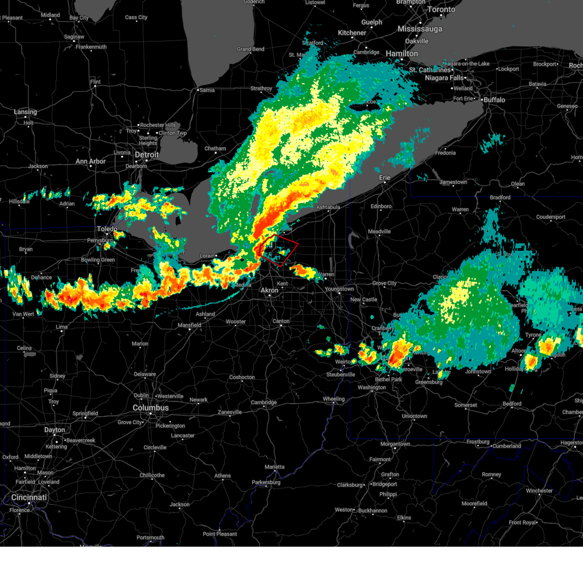 Torcle the national weather service in cleveland has issued a * tornado warning for, southwestern geauga county in northeastern ohio, northeastern cuyahoga county in northeastern ohio, southwestern lake county in northeastern ohio, * until 500 pm edt. * at 418 pm edt, severe thunderstorms capable of producing both tornadoes and extensive straight line wind damage were located near euclid, or 8 miles west of willowick, moving southeast at 25 mph (radar indicated rotation). Hazards include tornado. Flying debris will be dangerous to those caught without shelter. mobile homes will be damaged or destroyed. damage to roofs, windows, and vehicles will occur. tree damage is likely. these dangerous storms will be near, cleveland, euclid, and cleveland heights around 425 pm edt. chesterland around 440 pm edt. Other locations impacted by this tornadic thunderstorm include waite hill, bratenahl, richmond heights, north randall, moreland hills, warrensville heigh, shaker heights, bentleyville, orange, and highland heights. Torcle the national weather service in cleveland has issued a * tornado warning for, southwestern geauga county in northeastern ohio, northeastern cuyahoga county in northeastern ohio, southwestern lake county in northeastern ohio, * until 500 pm edt. * at 418 pm edt, severe thunderstorms capable of producing both tornadoes and extensive straight line wind damage were located near euclid, or 8 miles west of willowick, moving southeast at 25 mph (radar indicated rotation). Hazards include tornado. Flying debris will be dangerous to those caught without shelter. mobile homes will be damaged or destroyed. damage to roofs, windows, and vehicles will occur. tree damage is likely. these dangerous storms will be near, cleveland, euclid, and cleveland heights around 425 pm edt. chesterland around 440 pm edt. Other locations impacted by this tornadic thunderstorm include waite hill, bratenahl, richmond heights, north randall, moreland hills, warrensville heigh, shaker heights, bentleyville, orange, and highland heights.
|
| 8/6/2024 3:55 PM EDT |
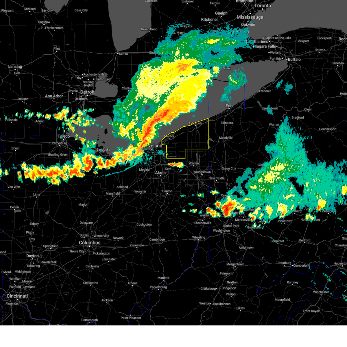 Svrcle the national weather service in cleveland has issued a * severe thunderstorm warning for, geauga county in northeastern ohio, lake county in northeastern ohio, ashtabula county in northeastern ohio, * until 515 pm edt. * at 355 pm edt, severe thunderstorms were located along a line extending from 21 miles northwest of fairport harbor to 18 miles northwest of lakeline to near westlake, moving east at 50 mph (radar indicated). Hazards include 70 mph wind gusts and quarter size hail. Minor damage to vehicles is possible. expect considerable tree damage. Wind damage is also likely to mobile homes, roofs, and outbuildings. Svrcle the national weather service in cleveland has issued a * severe thunderstorm warning for, geauga county in northeastern ohio, lake county in northeastern ohio, ashtabula county in northeastern ohio, * until 515 pm edt. * at 355 pm edt, severe thunderstorms were located along a line extending from 21 miles northwest of fairport harbor to 18 miles northwest of lakeline to near westlake, moving east at 50 mph (radar indicated). Hazards include 70 mph wind gusts and quarter size hail. Minor damage to vehicles is possible. expect considerable tree damage. Wind damage is also likely to mobile homes, roofs, and outbuildings.
|
| 8/6/2024 3:28 PM EDT |
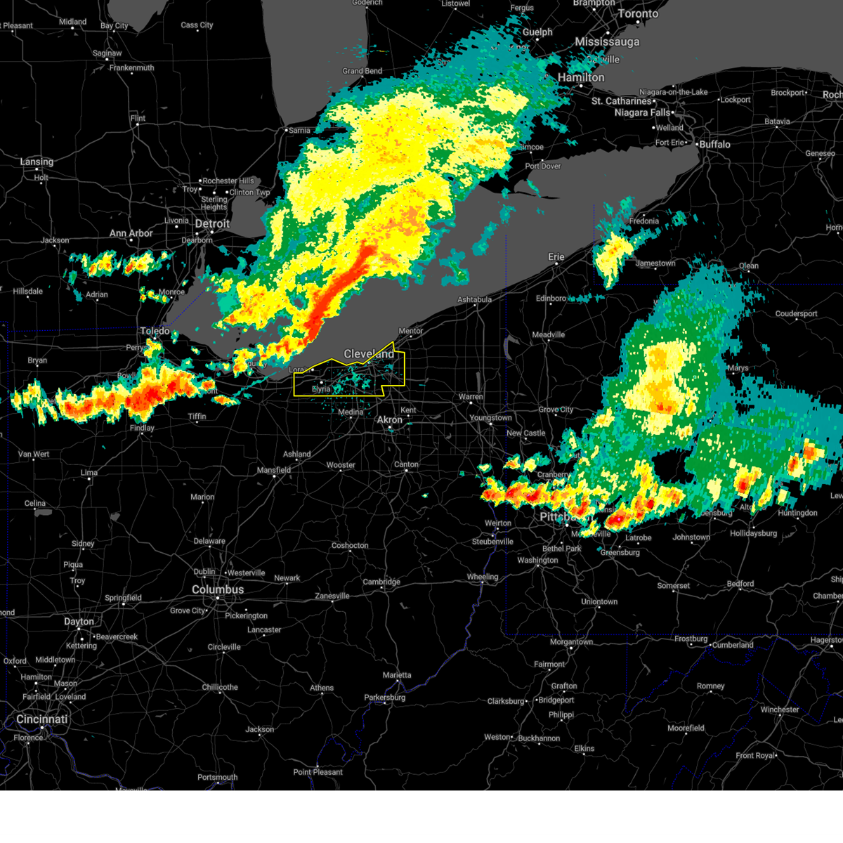 Svrcle the national weather service in cleveland has issued a * severe thunderstorm warning for, cuyahoga county in northeastern ohio, northern lorain county in north central ohio, * until 430 pm edt. * at 328 pm edt, severe thunderstorms were located along a line extending from 32 miles northwest of lakeline to 12 miles north of avon lake to western vermilion, moving southeast at 60 mph (radar indicated). Hazards include 70 mph wind gusts. Expect considerable tree damage. Damage is likely to mobile homes, roofs, and outbuildings. Svrcle the national weather service in cleveland has issued a * severe thunderstorm warning for, cuyahoga county in northeastern ohio, northern lorain county in north central ohio, * until 430 pm edt. * at 328 pm edt, severe thunderstorms were located along a line extending from 32 miles northwest of lakeline to 12 miles north of avon lake to western vermilion, moving southeast at 60 mph (radar indicated). Hazards include 70 mph wind gusts. Expect considerable tree damage. Damage is likely to mobile homes, roofs, and outbuildings.
|
| 6/29/2024 12:14 PM EDT | One power line down. time estimated from rada in cuyahoga county OH, 1.2 miles NE of Chagrin Falls, OH |
| 6/29/2024 12:10 PM EDT | A tree limb took power lines off of a house. time estimated from rada in cuyahoga county OH, 3.9 miles E of Chagrin Falls, OH |
| 6/29/2024 12:09 PM EDT |
 the severe thunderstorm warning has been cancelled and is no longer in effect the severe thunderstorm warning has been cancelled and is no longer in effect
|
| 6/29/2024 12:09 PM EDT |
 At 1209 pm edt, a severe thunderstorm was located over macedonia, or 12 miles southeast of cleveland, moving east at 45 mph (radar indicated). Hazards include 60 mph wind gusts. Expect damage to trees and power lines. Locations impacted include, cleveland, ravenna, cuyahoga falls, kent, solon, hudson, twinsburg, streetsboro, warrensville heights, macedonia, south russell, middlefield, garrettsville, burton, highland hills, mantua, stow, garfield heights, shaker heights, and maple heights. At 1209 pm edt, a severe thunderstorm was located over macedonia, or 12 miles southeast of cleveland, moving east at 45 mph (radar indicated). Hazards include 60 mph wind gusts. Expect damage to trees and power lines. Locations impacted include, cleveland, ravenna, cuyahoga falls, kent, solon, hudson, twinsburg, streetsboro, warrensville heights, macedonia, south russell, middlefield, garrettsville, burton, highland hills, mantua, stow, garfield heights, shaker heights, and maple heights.
|
| 6/29/2024 11:59 AM EDT |
 Svrcle the national weather service in cleveland has issued a * severe thunderstorm warning for, northern portage county in northeastern ohio, southern geauga county in northeastern ohio, southeastern cuyahoga county in northeastern ohio, northeastern medina county in northeastern ohio, northern summit county in northeastern ohio, * until 100 pm edt. * at 1159 am edt, a severe thunderstorm was located near north royalton, or 10 miles south of cleveland, moving east at 45 mph (radar indicated). Hazards include 60 mph wind gusts. expect damage to trees and power lines Svrcle the national weather service in cleveland has issued a * severe thunderstorm warning for, northern portage county in northeastern ohio, southern geauga county in northeastern ohio, southeastern cuyahoga county in northeastern ohio, northeastern medina county in northeastern ohio, northern summit county in northeastern ohio, * until 100 pm edt. * at 1159 am edt, a severe thunderstorm was located near north royalton, or 10 miles south of cleveland, moving east at 45 mph (radar indicated). Hazards include 60 mph wind gusts. expect damage to trees and power lines
|
| 6/23/2024 3:27 PM EDT |
 Svrcle the national weather service in cleveland has issued a * severe thunderstorm warning for, northern portage county in northeastern ohio, southern geauga county in northeastern ohio, southeastern cuyahoga county in northeastern ohio, northern summit county in northeastern ohio, * until 415 pm edt. * at 327 pm edt, severe thunderstorms were located along a line extending from near highland hills to near solon to near macedonia, moving east at 35 mph (radar indicated). Hazards include 60 mph wind gusts. expect damage to trees and power lines Svrcle the national weather service in cleveland has issued a * severe thunderstorm warning for, northern portage county in northeastern ohio, southern geauga county in northeastern ohio, southeastern cuyahoga county in northeastern ohio, northern summit county in northeastern ohio, * until 415 pm edt. * at 327 pm edt, severe thunderstorms were located along a line extending from near highland hills to near solon to near macedonia, moving east at 35 mph (radar indicated). Hazards include 60 mph wind gusts. expect damage to trees and power lines
|
| 6/18/2024 3:12 PM EDT | Road closed due to downed tree and power pole at chillicothe road and lucerne d in geauga county OH, 3.3 miles NW of Chagrin Falls, OH |
| 6/18/2024 3:07 PM EDT | State route 306 between bainbridge road and east washington street closed due to fallen tree. time estimated via rada in geauga county OH, 3.3 miles NW of Chagrin Falls, OH |
| 5/26/2024 7:46 PM EDT |
 the severe thunderstorm warning has been cancelled and is no longer in effect the severe thunderstorm warning has been cancelled and is no longer in effect
|
| 5/26/2024 7:46 PM EDT |
 At 745 pm edt, severe thunderstorms were located along a line extending from near garrettsville to 8 miles north of cleveland, moving northeast at 50 mph (radar indicated). Hazards include 60 mph wind gusts. Expect damage to trees and power lines. Locations impacted include, cleveland, painesville, willowick, chardon, euclid, mentor, cleveland heights, solon, willoughby, eastlake, streetsboro, south russell, middlefield, burton, timberlake, lakeline, chesterland, shaker heights, south euclid, and mayfield heights. At 745 pm edt, severe thunderstorms were located along a line extending from near garrettsville to 8 miles north of cleveland, moving northeast at 50 mph (radar indicated). Hazards include 60 mph wind gusts. Expect damage to trees and power lines. Locations impacted include, cleveland, painesville, willowick, chardon, euclid, mentor, cleveland heights, solon, willoughby, eastlake, streetsboro, south russell, middlefield, burton, timberlake, lakeline, chesterland, shaker heights, south euclid, and mayfield heights.
|
| 5/26/2024 7:26 PM EDT |
 Svrcle the national weather service in cleveland has issued a * severe thunderstorm warning for, northwestern portage county in northeastern ohio, geauga county in northeastern ohio, cuyahoga county in northeastern ohio, southwestern lake county in northeastern ohio, northeastern summit county in northeastern ohio, northeastern lorain county in north central ohio, * until 815 pm edt. * at 725 pm edt, severe thunderstorms were located along a line extending from near hudson to avon lake, moving northeast at 40 mph (radar indicated). Hazards include 60 mph wind gusts. expect damage to trees and power lines Svrcle the national weather service in cleveland has issued a * severe thunderstorm warning for, northwestern portage county in northeastern ohio, geauga county in northeastern ohio, cuyahoga county in northeastern ohio, southwestern lake county in northeastern ohio, northeastern summit county in northeastern ohio, northeastern lorain county in north central ohio, * until 815 pm edt. * at 725 pm edt, severe thunderstorms were located along a line extending from near hudson to avon lake, moving northeast at 40 mph (radar indicated). Hazards include 60 mph wind gusts. expect damage to trees and power lines
|
| 5/22/2024 10:28 PM EDT |
 The storms which prompted the warning have weakened below severe limits, and have exited the warned area. therefore, the warning will be allowed to expire. however, gusty winds are still possible with these thunderstorms. The storms which prompted the warning have weakened below severe limits, and have exited the warned area. therefore, the warning will be allowed to expire. however, gusty winds are still possible with these thunderstorms.
|
| 5/22/2024 10:08 PM EDT |
 the severe thunderstorm warning has been cancelled and is no longer in effect the severe thunderstorm warning has been cancelled and is no longer in effect
|
| 5/22/2024 10:08 PM EDT |
 At 1008 pm edt, severe thunderstorms were located along a line extending from near cleveland heights to hudson, moving east at 40 mph (radar indicated). Hazards include 60 mph wind gusts. Expect damage to trees and power lines. Locations impacted include, cleveland, chardon, cuyahoga falls, cleveland heights, solon, hudson, twinsburg, streetsboro, warrensville heights, macedonia, south russell, middlefield, garrettsville, burton, highland hills, mantua, chesterland, stow, garfield heights, and shaker heights. At 1008 pm edt, severe thunderstorms were located along a line extending from near cleveland heights to hudson, moving east at 40 mph (radar indicated). Hazards include 60 mph wind gusts. Expect damage to trees and power lines. Locations impacted include, cleveland, chardon, cuyahoga falls, cleveland heights, solon, hudson, twinsburg, streetsboro, warrensville heights, macedonia, south russell, middlefield, garrettsville, burton, highland hills, mantua, chesterland, stow, garfield heights, and shaker heights.
|
| 5/22/2024 9:47 PM EDT |
 Svrcle the national weather service in cleveland has issued a * severe thunderstorm warning for, northern portage county in northeastern ohio, geauga county in northeastern ohio, cuyahoga county in northeastern ohio, northeastern medina county in northeastern ohio, southeastern lake county in northeastern ohio, northern summit county in northeastern ohio, * until 1030 pm edt. * at 947 pm edt, a severe thunderstorm was located over north royalton, or 10 miles south of cleveland, moving east at 55 mph (radar indicated). Hazards include 60 mph wind gusts and penny size hail. expect damage to trees and power lines Svrcle the national weather service in cleveland has issued a * severe thunderstorm warning for, northern portage county in northeastern ohio, geauga county in northeastern ohio, cuyahoga county in northeastern ohio, northeastern medina county in northeastern ohio, southeastern lake county in northeastern ohio, northern summit county in northeastern ohio, * until 1030 pm edt. * at 947 pm edt, a severe thunderstorm was located over north royalton, or 10 miles south of cleveland, moving east at 55 mph (radar indicated). Hazards include 60 mph wind gusts and penny size hail. expect damage to trees and power lines
|
| 4/17/2024 6:38 PM EDT |
 the severe thunderstorm warning has been cancelled and is no longer in effect the severe thunderstorm warning has been cancelled and is no longer in effect
|
| 4/17/2024 6:38 PM EDT |
 At 637 pm edt, a severe thunderstorm was located near south russell, or 13 miles south of chardon, moving east at 40 mph (radar indicated). Hazards include 60 mph wind gusts and quarter size hail. Minor damage to vehicles is possible. expect damage to trees and power lines. Locations impacted include, south russell, middlefield, garrettsville, burton, mantua, aurora, parkman, chagrin falls, windham, hiram, and bainbridge. At 637 pm edt, a severe thunderstorm was located near south russell, or 13 miles south of chardon, moving east at 40 mph (radar indicated). Hazards include 60 mph wind gusts and quarter size hail. Minor damage to vehicles is possible. expect damage to trees and power lines. Locations impacted include, south russell, middlefield, garrettsville, burton, mantua, aurora, parkman, chagrin falls, windham, hiram, and bainbridge.
|
| 4/17/2024 6:20 PM EDT |
 Svrcle the national weather service in cleveland has issued a * severe thunderstorm warning for, northern portage county in northeastern ohio, southern geauga county in northeastern ohio, east central cuyahoga county in northeastern ohio, northeastern summit county in northeastern ohio, * until 700 pm edt. * at 620 pm edt, a severe thunderstorm was located over solon, or 13 miles southeast of cleveland, moving east at 40 mph (radar indicated). Hazards include 60 mph wind gusts and quarter size hail. Minor damage to vehicles is possible. Expect damage to trees and power lines. Svrcle the national weather service in cleveland has issued a * severe thunderstorm warning for, northern portage county in northeastern ohio, southern geauga county in northeastern ohio, east central cuyahoga county in northeastern ohio, northeastern summit county in northeastern ohio, * until 700 pm edt. * at 620 pm edt, a severe thunderstorm was located over solon, or 13 miles southeast of cleveland, moving east at 40 mph (radar indicated). Hazards include 60 mph wind gusts and quarter size hail. Minor damage to vehicles is possible. Expect damage to trees and power lines.
|
| 4/14/2024 5:03 PM EDT |
 Svrcle the national weather service in cleveland has issued a * severe thunderstorm warning for, northern portage county in northeastern ohio, trumbull county in northeastern ohio, geauga county in northeastern ohio, * until 545 pm edt. * at 502 pm edt, severe thunderstorms were located along a line extending from near kinsman to near north bloomfield to south russell, moving east at 60 mph (radar indicated). Hazards include 60 mph wind gusts and quarter size hail. Minor damage to vehicles is possible. Expect damage to trees and power lines. Svrcle the national weather service in cleveland has issued a * severe thunderstorm warning for, northern portage county in northeastern ohio, trumbull county in northeastern ohio, geauga county in northeastern ohio, * until 545 pm edt. * at 502 pm edt, severe thunderstorms were located along a line extending from near kinsman to near north bloomfield to south russell, moving east at 60 mph (radar indicated). Hazards include 60 mph wind gusts and quarter size hail. Minor damage to vehicles is possible. Expect damage to trees and power lines.
|
| 8/25/2023 12:15 AM EDT |
 At 1214 am edt, severe thunderstorms were located along a line extending from solon to 6 miles west of lodi, moving southeast at 55 mph (radar indicated). Hazards include 70 mph wind gusts. Expect considerable tree damage. damage is likely to mobile homes, roofs, and outbuildings. Locations impacted include, cleveland, akron, medina, parma, cuyahoga falls, strongsville, brunswick, north royalton, solon, hudson, wadsworth, twinsburg, streetsboro, warrensville heights, macedonia, rittman, wellington, lodi, creston and highland hills. At 1214 am edt, severe thunderstorms were located along a line extending from solon to 6 miles west of lodi, moving southeast at 55 mph (radar indicated). Hazards include 70 mph wind gusts. Expect considerable tree damage. damage is likely to mobile homes, roofs, and outbuildings. Locations impacted include, cleveland, akron, medina, parma, cuyahoga falls, strongsville, brunswick, north royalton, solon, hudson, wadsworth, twinsburg, streetsboro, warrensville heights, macedonia, rittman, wellington, lodi, creston and highland hills.
|
| 8/25/2023 12:06 AM EDT |
 At 1206 am edt, a severe thunderstorm capable of producing a tornado was located over highland hills, or 7 miles east of cleveland, moving east at 60 mph (radar indicated rotation). Hazards include tornado. Flying debris will be dangerous to those caught without shelter. mobile homes will be damaged or destroyed. damage to roofs, windows, and vehicles will occur. tree damage is likely. this dangerous storm will be near, solon and macedonia around 1210 am edt. south russell around 1215 am edt. streetsboro around 1220 am edt. mantua around 1225 am edt. garrettsville and west farmington around 1235 am edt. newton falls and bristolville around 1240 am edt. Other locations impacted by this tornadic thunderstorm include north randall, valley view, shaker heights, bentleyville, orange, seven hills, highland heights, aurora, south euclid, bainbridge, aquilla, hunting valley, lyndhurst, glenwillow, wayland, university heights, turnpike interchange, kirtland, garfield heights and claridon. At 1206 am edt, a severe thunderstorm capable of producing a tornado was located over highland hills, or 7 miles east of cleveland, moving east at 60 mph (radar indicated rotation). Hazards include tornado. Flying debris will be dangerous to those caught without shelter. mobile homes will be damaged or destroyed. damage to roofs, windows, and vehicles will occur. tree damage is likely. this dangerous storm will be near, solon and macedonia around 1210 am edt. south russell around 1215 am edt. streetsboro around 1220 am edt. mantua around 1225 am edt. garrettsville and west farmington around 1235 am edt. newton falls and bristolville around 1240 am edt. Other locations impacted by this tornadic thunderstorm include north randall, valley view, shaker heights, bentleyville, orange, seven hills, highland heights, aurora, south euclid, bainbridge, aquilla, hunting valley, lyndhurst, glenwillow, wayland, university heights, turnpike interchange, kirtland, garfield heights and claridon.
|
| 8/24/2023 11:57 PM EDT |
 At 1157 pm edt, a severe thunderstorm capable of producing a tornado was located over cleveland, moving east at 60 mph (radar indicated rotation). Hazards include tornado. Flying debris will be dangerous to those caught without shelter. mobile homes will be damaged or destroyed. damage to roofs, windows, and vehicles will occur. tree damage is likely. this dangerous storm will be near, warrensville heights and highland hills around 1205 am edt. solon and macedonia around 1210 am edt. south russell around 1215 am edt. streetsboro around 1220 am edt. mantua around 1225 am edt. garrettsville around 1230 am edt. Other locations impacted by this tornadic thunderstorm include north randall, valley view, shaker heights, bentleyville, orange, seven hills, highland heights, aurora, south euclid, bainbridge, aquilla, hunting valley, lyndhurst, glenwillow, wayland, university heights, brooklyn heights, turnpike interchange, kirtland and wickliffe. At 1157 pm edt, a severe thunderstorm capable of producing a tornado was located over cleveland, moving east at 60 mph (radar indicated rotation). Hazards include tornado. Flying debris will be dangerous to those caught without shelter. mobile homes will be damaged or destroyed. damage to roofs, windows, and vehicles will occur. tree damage is likely. this dangerous storm will be near, warrensville heights and highland hills around 1205 am edt. solon and macedonia around 1210 am edt. south russell around 1215 am edt. streetsboro around 1220 am edt. mantua around 1225 am edt. garrettsville around 1230 am edt. Other locations impacted by this tornadic thunderstorm include north randall, valley view, shaker heights, bentleyville, orange, seven hills, highland heights, aurora, south euclid, bainbridge, aquilla, hunting valley, lyndhurst, glenwillow, wayland, university heights, brooklyn heights, turnpike interchange, kirtland and wickliffe.
|
| 8/24/2023 11:34 PM EDT |
 At 1133 pm edt, severe thunderstorms were located along a line extending from 16 miles north of avon lake to 8 miles southeast of kelleys island, moving southeast at 65 mph (radar indicated). Hazards include 70 mph wind gusts. Expect considerable tree damage. Damage is likely to mobile homes, roofs, and outbuildings. At 1133 pm edt, severe thunderstorms were located along a line extending from 16 miles north of avon lake to 8 miles southeast of kelleys island, moving southeast at 65 mph (radar indicated). Hazards include 70 mph wind gusts. Expect considerable tree damage. Damage is likely to mobile homes, roofs, and outbuildings.
|
| 8/12/2023 1:24 PM EDT |
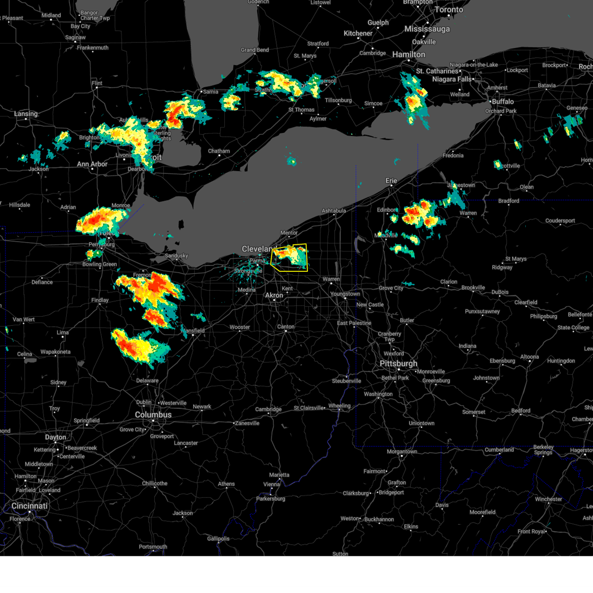 The severe thunderstorm warning for southwestern geauga and northeastern cuyahoga counties will expire at 130 pm edt, the storm which prompted the warning has weakened below severe limits, and no longer poses an immediate threat to life or property. therefore, the warning will be allowed to expire. however gusty winds are still possible with this thunderstorm. a tornado watch remains in effect until 900 pm edt for northeastern ohio. The severe thunderstorm warning for southwestern geauga and northeastern cuyahoga counties will expire at 130 pm edt, the storm which prompted the warning has weakened below severe limits, and no longer poses an immediate threat to life or property. therefore, the warning will be allowed to expire. however gusty winds are still possible with this thunderstorm. a tornado watch remains in effect until 900 pm edt for northeastern ohio.
|
| 8/12/2023 1:10 PM EDT |
 At 109 pm edt, a severe thunderstorm was located near cleveland heights and lyndhurst, or 8 miles south of willowick, moving east at 25 mph (radar indicated). Hazards include 60 mph wind gusts and penny size hail. Expect damage to trees and power lines. locations impacted include, chardon, euclid, cleveland heights, solon, warrensville heights, south russell, burton, highland hills, chesterland, shaker heights, maple heights, south euclid, mayfield heights, lyndhurst, university heights, bedford, beachwood, bedford heights, richmond heights and highland heights. hail threat, radar indicated max hail size, 0. 75 in wind threat, radar indicated max wind gust, 60 mph. At 109 pm edt, a severe thunderstorm was located near cleveland heights and lyndhurst, or 8 miles south of willowick, moving east at 25 mph (radar indicated). Hazards include 60 mph wind gusts and penny size hail. Expect damage to trees and power lines. locations impacted include, chardon, euclid, cleveland heights, solon, warrensville heights, south russell, burton, highland hills, chesterland, shaker heights, maple heights, south euclid, mayfield heights, lyndhurst, university heights, bedford, beachwood, bedford heights, richmond heights and highland heights. hail threat, radar indicated max hail size, 0. 75 in wind threat, radar indicated max wind gust, 60 mph.
|
| 8/12/2023 12:50 PM EDT |
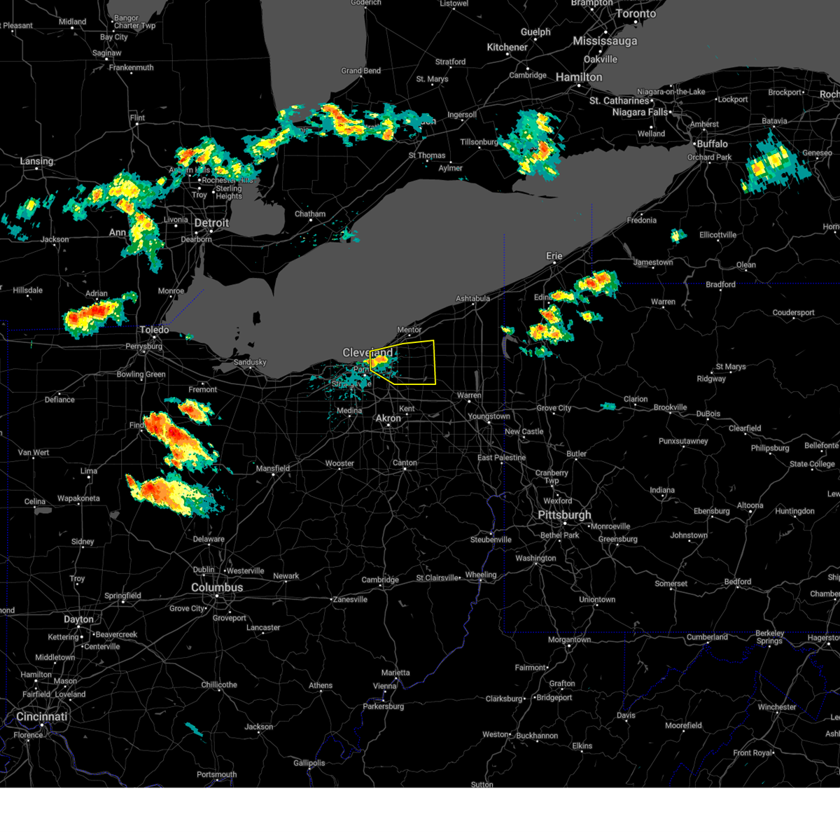 At 1250 pm edt, a severe thunderstorm was located over cleveland heights, or near cleveland, moving east at 35 mph (radar indicated). Hazards include 60 mph wind gusts and quarter size hail. Minor damage to vehicles is possible. Expect damage to trees and power lines. At 1250 pm edt, a severe thunderstorm was located over cleveland heights, or near cleveland, moving east at 35 mph (radar indicated). Hazards include 60 mph wind gusts and quarter size hail. Minor damage to vehicles is possible. Expect damage to trees and power lines.
|
| 7/26/2023 6:36 PM EDT |
 At 636 pm edt, severe thunderstorms were located along a line extending from near cleveland heights to near brunswick to near chippewa lake, moving east at 50 mph (radar indicated). Hazards include 60 mph wind gusts. Expect damage to trees and power lines. locations impacted include, cleveland, akron, medina, parma, lakewood, cuyahoga falls, euclid, cleveland heights, strongsville, brunswick, north royalton, north ridgeville, kent, solon, hudson, wadsworth, twinsburg, tallmadge, streetsboro and warrensville heights. hail threat, radar indicated max hail size, <. 75 in wind threat, radar indicated max wind gust, 60 mph. At 636 pm edt, severe thunderstorms were located along a line extending from near cleveland heights to near brunswick to near chippewa lake, moving east at 50 mph (radar indicated). Hazards include 60 mph wind gusts. Expect damage to trees and power lines. locations impacted include, cleveland, akron, medina, parma, lakewood, cuyahoga falls, euclid, cleveland heights, strongsville, brunswick, north royalton, north ridgeville, kent, solon, hudson, wadsworth, twinsburg, tallmadge, streetsboro and warrensville heights. hail threat, radar indicated max hail size, <. 75 in wind threat, radar indicated max wind gust, 60 mph.
|
| 7/26/2023 6:14 PM EDT |
 At 613 pm edt, severe thunderstorms were located along a line extending from 8 miles northeast of lakewood to near brunswick to near wellington, moving east at 25 mph (radar indicated). Hazards include 60 mph wind gusts and penny size hail. Expect damage to trees and power lines. locations impacted include, cleveland, akron, lorain, elyria, medina, parma, lakewood, cuyahoga falls, euclid, cleveland heights, strongsville, brunswick, westlake, north royalton, north ridgeville, kent, solon, avon lake, hudson and wadsworth. hail threat, radar indicated max hail size, 0. 75 in wind threat, radar indicated max wind gust, 60 mph. At 613 pm edt, severe thunderstorms were located along a line extending from 8 miles northeast of lakewood to near brunswick to near wellington, moving east at 25 mph (radar indicated). Hazards include 60 mph wind gusts and penny size hail. Expect damage to trees and power lines. locations impacted include, cleveland, akron, lorain, elyria, medina, parma, lakewood, cuyahoga falls, euclid, cleveland heights, strongsville, brunswick, westlake, north royalton, north ridgeville, kent, solon, avon lake, hudson and wadsworth. hail threat, radar indicated max hail size, 0. 75 in wind threat, radar indicated max wind gust, 60 mph.
|
| 7/26/2023 6:07 PM EDT |
 At 607 pm edt, severe thunderstorms were located along a line extending from 8 miles north of lakewood to near grafton to near wellington, moving east at 35 mph (radar indicated). Hazards include 60 mph wind gusts and penny size hail. Expect damage to trees and power lines. locations impacted include, cleveland, akron, lorain, elyria, medina, vermilion, parma, lakewood, cuyahoga falls, euclid, cleveland heights, strongsville, brunswick, westlake, north royalton, north ridgeville, kent, solon, avon lake and hudson. hail threat, radar indicated max hail size, 0. 75 in wind threat, radar indicated max wind gust, 60 mph. At 607 pm edt, severe thunderstorms were located along a line extending from 8 miles north of lakewood to near grafton to near wellington, moving east at 35 mph (radar indicated). Hazards include 60 mph wind gusts and penny size hail. Expect damage to trees and power lines. locations impacted include, cleveland, akron, lorain, elyria, medina, vermilion, parma, lakewood, cuyahoga falls, euclid, cleveland heights, strongsville, brunswick, westlake, north royalton, north ridgeville, kent, solon, avon lake and hudson. hail threat, radar indicated max hail size, 0. 75 in wind threat, radar indicated max wind gust, 60 mph.
|
| 7/26/2023 5:56 PM EDT |
 At 555 pm edt, severe thunderstorms were located along a line extending from 10 miles north of lakewood to near grafton to near wellington, moving east-northeast at 40 mph (radar indicated). Hazards include 60 mph wind gusts and penny size hail. expect damage to trees and power lines At 555 pm edt, severe thunderstorms were located along a line extending from 10 miles north of lakewood to near grafton to near wellington, moving east-northeast at 40 mph (radar indicated). Hazards include 60 mph wind gusts and penny size hail. expect damage to trees and power lines
|
| 7/26/2023 4:45 PM EDT |
 At 444 pm edt, a severe thunderstorm was located 8 miles north of lorain, moving east at 55 mph (radar indicated). Hazards include 70 mph wind gusts and penny size hail. Expect considerable tree damage. Damage is likely to mobile homes, roofs, and outbuildings. At 444 pm edt, a severe thunderstorm was located 8 miles north of lorain, moving east at 55 mph (radar indicated). Hazards include 70 mph wind gusts and penny size hail. Expect considerable tree damage. Damage is likely to mobile homes, roofs, and outbuildings.
|
| 7/25/2023 3:20 PM EDT |
 The severe thunderstorm warning for northwestern portage, southwestern geauga, east central cuyahoga and northeastern summit counties will expire at 330 pm edt, the storm which prompted the warning has weakened below severe limits, and no longer poses an immediate threat to life or property. therefore, the warning will be allowed to expire. The severe thunderstorm warning for northwestern portage, southwestern geauga, east central cuyahoga and northeastern summit counties will expire at 330 pm edt, the storm which prompted the warning has weakened below severe limits, and no longer poses an immediate threat to life or property. therefore, the warning will be allowed to expire.
|
| 7/25/2023 2:49 PM EDT | Trees down in the chagrin falls area. time estimated via rada in cuyahoga county OH, 0.8 miles ENE of Chagrin Falls, OH |
| 7/25/2023 2:44 PM EDT |
 At 243 pm edt, a severe thunderstorm was located over chagrin falls, or 14 miles southwest of chardon, moving south at 10 mph (radar indicated). Hazards include 60 mph wind gusts and quarter size hail. Minor damage to vehicles is possible. Expect damage to trees and power lines. At 243 pm edt, a severe thunderstorm was located over chagrin falls, or 14 miles southwest of chardon, moving south at 10 mph (radar indicated). Hazards include 60 mph wind gusts and quarter size hail. Minor damage to vehicles is possible. Expect damage to trees and power lines.
|
| 7/20/2023 7:38 PM EDT |
 At 737 pm edt, severe thunderstorms were located along a line extending from near garrettsville to 6 miles northwest of cuyahoga falls to near wellington, moving southeast at 25 mph (radar indicated). Hazards include 60 mph wind gusts and quarter size hail. Minor damage to vehicles is possible. expect damage to trees and power lines. locations impacted include, cleveland, akron, elyria, medina, ravenna, parma, cuyahoga falls, strongsville, brunswick, westlake, north royalton, north ridgeville, kent, solon, hudson, wadsworth, twinsburg, tallmadge, streetsboro and warrensville heights. hail threat, radar indicated max hail size, 1. 00 in wind threat, radar indicated max wind gust, 60 mph. At 737 pm edt, severe thunderstorms were located along a line extending from near garrettsville to 6 miles northwest of cuyahoga falls to near wellington, moving southeast at 25 mph (radar indicated). Hazards include 60 mph wind gusts and quarter size hail. Minor damage to vehicles is possible. expect damage to trees and power lines. locations impacted include, cleveland, akron, elyria, medina, ravenna, parma, cuyahoga falls, strongsville, brunswick, westlake, north royalton, north ridgeville, kent, solon, hudson, wadsworth, twinsburg, tallmadge, streetsboro and warrensville heights. hail threat, radar indicated max hail size, 1. 00 in wind threat, radar indicated max wind gust, 60 mph.
|
| 7/20/2023 6:59 PM EDT |
 At 659 pm edt, severe thunderstorms were located along a line extending from near burton to parma to near vermilion, moving southeast at 30 mph (radar indicated). Hazards include 70 mph wind gusts and quarter size hail. Minor damage to vehicles is possible. expect considerable tree damage. Wind damage is also likely to mobile homes, roofs, and outbuildings. At 659 pm edt, severe thunderstorms were located along a line extending from near burton to parma to near vermilion, moving southeast at 30 mph (radar indicated). Hazards include 70 mph wind gusts and quarter size hail. Minor damage to vehicles is possible. expect considerable tree damage. Wind damage is also likely to mobile homes, roofs, and outbuildings.
|
| 7/20/2023 6:51 PM EDT |
 At 650 pm edt, severe thunderstorms were located along a line extending from north kingsville to 6 miles east of chardon to highland hills, moving southwest at 10 mph (radar indicated). Hazards include 70 mph wind gusts and quarter size hail. Minor damage to vehicles is possible. expect considerable tree damage. wind damage is also likely to mobile homes, roofs, and outbuildings. locations impacted include, cleveland, painesville, ashtabula, willowick, conneaut, chardon, fairport harbor, geneva-on-the-lake, euclid, mentor, cleveland heights, solon, willoughby, twinsburg, eastlake, warrensville heights, macedonia, geneva, south russell and madison. thunderstorm damage threat, considerable hail threat, radar indicated max hail size, 1. 00 in wind threat, radar indicated max wind gust, 70 mph. At 650 pm edt, severe thunderstorms were located along a line extending from north kingsville to 6 miles east of chardon to highland hills, moving southwest at 10 mph (radar indicated). Hazards include 70 mph wind gusts and quarter size hail. Minor damage to vehicles is possible. expect considerable tree damage. wind damage is also likely to mobile homes, roofs, and outbuildings. locations impacted include, cleveland, painesville, ashtabula, willowick, conneaut, chardon, fairport harbor, geneva-on-the-lake, euclid, mentor, cleveland heights, solon, willoughby, twinsburg, eastlake, warrensville heights, macedonia, geneva, south russell and madison. thunderstorm damage threat, considerable hail threat, radar indicated max hail size, 1. 00 in wind threat, radar indicated max wind gust, 70 mph.
|
| 7/20/2023 5:58 PM EDT |
 At 557 pm edt, severe thunderstorms were located along a line extending from 19 miles north of ashtabula to 6 miles northwest of fairport harbor to 15 miles northwest of euclid, moving southeast at 45 mph (radar indicated). Hazards include 70 mph wind gusts and quarter size hail. Minor damage to vehicles is possible. expect considerable tree damage. Wind damage is also likely to mobile homes, roofs, and outbuildings. At 557 pm edt, severe thunderstorms were located along a line extending from 19 miles north of ashtabula to 6 miles northwest of fairport harbor to 15 miles northwest of euclid, moving southeast at 45 mph (radar indicated). Hazards include 70 mph wind gusts and quarter size hail. Minor damage to vehicles is possible. expect considerable tree damage. Wind damage is also likely to mobile homes, roofs, and outbuildings.
|
| 7/2/2023 9:08 PM EDT |
 At 907 pm edt, a severe thunderstorm was located near south russell, or 11 miles southwest of chardon, moving east at 30 mph (radar indicated). Hazards include 60 mph wind gusts. Expect damage to trees and power lines. locations impacted include, cleveland, willowick, chardon, euclid, mentor, cleveland heights, solon, willoughby, eastlake, streetsboro, warrensville heights, south russell, highland hills, timberlake, lakeline, chesterland, garfield heights, shaker heights, maple heights and south euclid. hail threat, radar indicated max hail size, <. 75 in wind threat, radar indicated max wind gust, 60 mph. At 907 pm edt, a severe thunderstorm was located near south russell, or 11 miles southwest of chardon, moving east at 30 mph (radar indicated). Hazards include 60 mph wind gusts. Expect damage to trees and power lines. locations impacted include, cleveland, willowick, chardon, euclid, mentor, cleveland heights, solon, willoughby, eastlake, streetsboro, warrensville heights, south russell, highland hills, timberlake, lakeline, chesterland, garfield heights, shaker heights, maple heights and south euclid. hail threat, radar indicated max hail size, <. 75 in wind threat, radar indicated max wind gust, 60 mph.
|
| 7/2/2023 8:32 PM EDT |
 At 831 pm edt, a severe thunderstorm was located near cleveland, moving east at 30 mph (radar indicated). Hazards include 60 mph wind gusts. expect damage to trees and power lines At 831 pm edt, a severe thunderstorm was located near cleveland, moving east at 30 mph (radar indicated). Hazards include 60 mph wind gusts. expect damage to trees and power lines
|
| 4/1/2023 12:45 PM EDT |
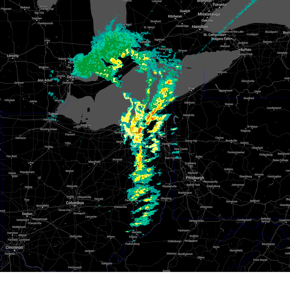 At 1245 pm edt, severe thunderstorms were located along a line extending from near euclid to near macedonia, moving northeast at 60 mph (several reports of damaging wind across cuyahoga county and measured gusts over 60 mph at burke lakefront airport). Hazards include 70 mph wind gusts and penny size hail. Expect considerable tree damage. Damage is likely to mobile homes, roofs, and outbuildings. At 1245 pm edt, severe thunderstorms were located along a line extending from near euclid to near macedonia, moving northeast at 60 mph (several reports of damaging wind across cuyahoga county and measured gusts over 60 mph at burke lakefront airport). Hazards include 70 mph wind gusts and penny size hail. Expect considerable tree damage. Damage is likely to mobile homes, roofs, and outbuildings.
|
| 4/1/2023 12:41 PM EDT | Corrects previous tstm wnd dmg report from bainbridge. large tree uprooted near route 306 and bainbridge roa in geauga county OH, 3.8 miles NW of Chagrin Falls, OH |
| 4/1/2023 12:41 PM EDT | Corrects previous tstm wnd dmg report from bainbridge. large tree uprooted near route 306 and bainbridge roa in geauga county OH, 3.8 miles NW of Chagrin Falls, OH |
| 4/1/2023 12:36 PM EDT |
 At 1235 pm edt, severe thunderstorms were located along a line extending from near timberlake to north royalton, moving east at 75 mph (measured wind gust of 64 mph at burke lakefront airport and numerous reports of tree and power-line damage). Hazards include 70 mph wind gusts and penny size hail. Expect considerable tree damage. damage is likely to mobile homes, roofs, and outbuildings. locations impacted include, painesville, willowick, chardon, fairport harbor, euclid, mentor, willoughby, eastlake, south russell, madison, middlefield, perry, burton, timberlake, lakeline, chesterland, wickliffe, richmond heights, willoughby hills and highland heights. thunderstorm damage threat, considerable hail threat, radar indicated max hail size, 0. 75 in wind threat, observed max wind gust, 70 mph. At 1235 pm edt, severe thunderstorms were located along a line extending from near timberlake to north royalton, moving east at 75 mph (measured wind gust of 64 mph at burke lakefront airport and numerous reports of tree and power-line damage). Hazards include 70 mph wind gusts and penny size hail. Expect considerable tree damage. damage is likely to mobile homes, roofs, and outbuildings. locations impacted include, painesville, willowick, chardon, fairport harbor, euclid, mentor, willoughby, eastlake, south russell, madison, middlefield, perry, burton, timberlake, lakeline, chesterland, wickliffe, richmond heights, willoughby hills and highland heights. thunderstorm damage threat, considerable hail threat, radar indicated max hail size, 0. 75 in wind threat, observed max wind gust, 70 mph.
|
| 4/1/2023 12:18 PM EDT |
 At 1217 pm edt, severe thunderstorms were located along a line extending from 6 miles north of cleveland to near lodi, moving east at 60 mph. additional thunderstorms are developing ahead of this line across cuyahoga county (law enforcement. numerous trees were downed in northern ashland county. lorain county airport gusted to 61 mph). Hazards include 70 mph wind gusts and penny size hail. Expect considerable tree damage. damage is likely to mobile homes, roofs, and outbuildings. locations impacted include, cleveland, medina, parma, lakewood, euclid, cleveland heights, strongsville, brunswick, westlake, north royalton, solon, wadsworth, warrensville heights, rittman, lodi, highland hills, chippewa lake, north olmsted, garfield heights and shaker heights. thunderstorm damage threat, considerable hail threat, radar indicated max hail size, 0. 75 in wind threat, observed max wind gust, 70 mph. At 1217 pm edt, severe thunderstorms were located along a line extending from 6 miles north of cleveland to near lodi, moving east at 60 mph. additional thunderstorms are developing ahead of this line across cuyahoga county (law enforcement. numerous trees were downed in northern ashland county. lorain county airport gusted to 61 mph). Hazards include 70 mph wind gusts and penny size hail. Expect considerable tree damage. damage is likely to mobile homes, roofs, and outbuildings. locations impacted include, cleveland, medina, parma, lakewood, euclid, cleveland heights, strongsville, brunswick, westlake, north royalton, solon, wadsworth, warrensville heights, rittman, lodi, highland hills, chippewa lake, north olmsted, garfield heights and shaker heights. thunderstorm damage threat, considerable hail threat, radar indicated max hail size, 0. 75 in wind threat, observed max wind gust, 70 mph.
|
| 4/1/2023 12:13 PM EDT |
 At 1212 pm edt, severe thunderstorms were located along a line extending from 11 miles northwest of euclid to near wellington, moving northeast at 75 mph. additional thunderstorms are developing ahead of this line over western lake and eastern cuyahoga counties and moving northeast (radar indicated). Hazards include 60 mph wind gusts and quarter size hail. Minor damage to vehicles is possible. Expect damage to trees and power lines. At 1212 pm edt, severe thunderstorms were located along a line extending from 11 miles northwest of euclid to near wellington, moving northeast at 75 mph. additional thunderstorms are developing ahead of this line over western lake and eastern cuyahoga counties and moving northeast (radar indicated). Hazards include 60 mph wind gusts and quarter size hail. Minor damage to vehicles is possible. Expect damage to trees and power lines.
|
| 4/1/2023 11:59 AM EDT |
 At 1158 am edt, severe thunderstorms were located along a line extending from avon lake to near savannah, moving northeast at 55 mph. strong wind gusts in excess of 50 mph will continue even after the rain exits (public reported. there have been several measured wind gusts in excess of 60 mph and reports of down trees and power-lines with this line of thunderstorms). Hazards include 60 mph wind gusts and penny size hail. expect damage to trees and power lines At 1158 am edt, severe thunderstorms were located along a line extending from avon lake to near savannah, moving northeast at 55 mph. strong wind gusts in excess of 50 mph will continue even after the rain exits (public reported. there have been several measured wind gusts in excess of 60 mph and reports of down trees and power-lines with this line of thunderstorms). Hazards include 60 mph wind gusts and penny size hail. expect damage to trees and power lines
|
| 3/25/2023 2:16 PM EDT |
 At 215 pm edt, severe thunderstorms were located along a line extending from chesterland to near south russell to near hudson, moving northeast at 65 mph (radar indicated). Hazards include 60 mph wind gusts. Expect damage to trees and power lines. locations impacted include, south russell, middlefield, burton, parkman, chagrin falls, claridon and bainbridge. hail threat, radar indicated max hail size, <. 75 in wind threat, radar indicated max wind gust, 60 mph. At 215 pm edt, severe thunderstorms were located along a line extending from chesterland to near south russell to near hudson, moving northeast at 65 mph (radar indicated). Hazards include 60 mph wind gusts. Expect damage to trees and power lines. locations impacted include, south russell, middlefield, burton, parkman, chagrin falls, claridon and bainbridge. hail threat, radar indicated max hail size, <. 75 in wind threat, radar indicated max wind gust, 60 mph.
|
| 3/25/2023 1:59 PM EDT |
 At 159 pm edt, severe thunderstorms were located along a line extending from near macedonia to near cuyahoga falls to near wadsworth, moving northeast at 65 mph (radar indicated). Hazards include 60 mph wind gusts. Expect damage to trees and power lines. locations impacted include, cuyahoga falls, solon, hudson, twinsburg, streetsboro, macedonia, south russell, middlefield, garrettsville, burton, mantua, stow, broadview heights, aurora, brecksville, fairlawn, parkman, chagrin falls, northfield and richfield. hail threat, radar indicated max hail size, <. 75 in wind threat, radar indicated max wind gust, 60 mph. At 159 pm edt, severe thunderstorms were located along a line extending from near macedonia to near cuyahoga falls to near wadsworth, moving northeast at 65 mph (radar indicated). Hazards include 60 mph wind gusts. Expect damage to trees and power lines. locations impacted include, cuyahoga falls, solon, hudson, twinsburg, streetsboro, macedonia, south russell, middlefield, garrettsville, burton, mantua, stow, broadview heights, aurora, brecksville, fairlawn, parkman, chagrin falls, northfield and richfield. hail threat, radar indicated max hail size, <. 75 in wind threat, radar indicated max wind gust, 60 mph.
|
| 3/25/2023 1:58 PM EDT |
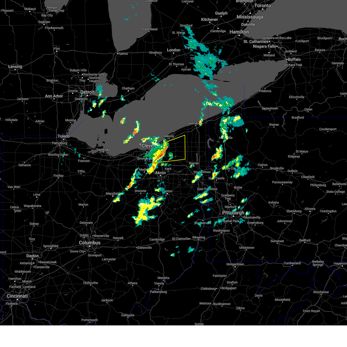 At 158 pm edt, severe thunderstorms were located along a line extending from chesterland to 6 miles northwest of mantua, moving east at 55 mph (radar indicated). Hazards include 70 mph wind gusts. Expect considerable tree damage. damage is likely to mobile homes, roofs, and outbuildings. locations impacted include, chardon, solon, twinsburg, warrensville heights, macedonia, south russell, middlefield, burton, chesterland, maple heights, aurora, brecksville, bedford, bedford heights, kirtland, pepper pike, parkman, chagrin falls, northfield and huntsburg. thunderstorm damage threat, considerable hail threat, radar indicated max hail size, <. 75 in wind threat, radar indicated max wind gust, 70 mph. At 158 pm edt, severe thunderstorms were located along a line extending from chesterland to 6 miles northwest of mantua, moving east at 55 mph (radar indicated). Hazards include 70 mph wind gusts. Expect considerable tree damage. damage is likely to mobile homes, roofs, and outbuildings. locations impacted include, chardon, solon, twinsburg, warrensville heights, macedonia, south russell, middlefield, burton, chesterland, maple heights, aurora, brecksville, bedford, bedford heights, kirtland, pepper pike, parkman, chagrin falls, northfield and huntsburg. thunderstorm damage threat, considerable hail threat, radar indicated max hail size, <. 75 in wind threat, radar indicated max wind gust, 70 mph.
|
| 3/25/2023 1:54 PM EDT |
 At 153 pm edt, severe thunderstorms were located along a line extending from near north royalton to 7 miles west of cuyahoga falls to near chippewa lake, moving northeast at 65 mph (radar indicated). Hazards include 60 mph wind gusts. expect damage to trees and power lines At 153 pm edt, severe thunderstorms were located along a line extending from near north royalton to 7 miles west of cuyahoga falls to near chippewa lake, moving northeast at 65 mph (radar indicated). Hazards include 60 mph wind gusts. expect damage to trees and power lines
|
| 3/25/2023 1:44 PM EDT |
 At 144 pm edt, severe thunderstorms were located along a line extending from cleveland heights to near macedonia, moving east at 55 mph (radar indicated). Hazards include 70 mph wind gusts. Expect considerable tree damage. Damage is likely to mobile homes, roofs, and outbuildings. At 144 pm edt, severe thunderstorms were located along a line extending from cleveland heights to near macedonia, moving east at 55 mph (radar indicated). Hazards include 70 mph wind gusts. Expect considerable tree damage. Damage is likely to mobile homes, roofs, and outbuildings.
|
| 1/19/2023 6:38 PM EST |
 At 637 pm est, severe thunderstorms were located along a line extending from 9 miles north of avon lake to near strongsville to near wooster, moving east at 45 mph (radar indicated). Hazards include 60 mph wind gusts. Expect damage to trees and power lines. locations impacted include, cleveland, akron, elyria, medina, parma, lakewood, cuyahoga falls, euclid, cleveland heights, strongsville, brunswick, westlake, north royalton, north ridgeville, kent, solon, avon lake, hudson, twinsburg and tallmadge. hail threat, radar indicated max hail size, <. 75 in wind threat, radar indicated max wind gust, 60 mph. At 637 pm est, severe thunderstorms were located along a line extending from 9 miles north of avon lake to near strongsville to near wooster, moving east at 45 mph (radar indicated). Hazards include 60 mph wind gusts. Expect damage to trees and power lines. locations impacted include, cleveland, akron, elyria, medina, parma, lakewood, cuyahoga falls, euclid, cleveland heights, strongsville, brunswick, westlake, north royalton, north ridgeville, kent, solon, avon lake, hudson, twinsburg and tallmadge. hail threat, radar indicated max hail size, <. 75 in wind threat, radar indicated max wind gust, 60 mph.
|
| 1/19/2023 6:24 PM EST |
 At 622 pm est, severe thunderstorms were located along a line extending from 9 miles north of lorain to grafton to 6 miles northwest of shreve, moving east at 60 mph (radar indicated). Hazards include 60 mph wind gusts. Expect damage to trees and power lines. locations impacted include, cleveland, akron, lorain, elyria, medina, vermilion, western vermilion, parma, lakewood, cuyahoga falls, euclid, cleveland heights, strongsville, brunswick, westlake, north royalton, north ridgeville, kent, solon and avon lake. hail threat, radar indicated max hail size, <. 75 in wind threat, radar indicated max wind gust, 60 mph. At 622 pm est, severe thunderstorms were located along a line extending from 9 miles north of lorain to grafton to 6 miles northwest of shreve, moving east at 60 mph (radar indicated). Hazards include 60 mph wind gusts. Expect damage to trees and power lines. locations impacted include, cleveland, akron, lorain, elyria, medina, vermilion, western vermilion, parma, lakewood, cuyahoga falls, euclid, cleveland heights, strongsville, brunswick, westlake, north royalton, north ridgeville, kent, solon and avon lake. hail threat, radar indicated max hail size, <. 75 in wind threat, radar indicated max wind gust, 60 mph.
|
| 1/19/2023 6:05 PM EST |
 At 605 pm est, severe thunderstorms were located along a line extending from 9 miles northwest of western vermilion to near wellington to near bellville, moving east at 60 mph (radar indicated). Hazards include 60 mph wind gusts. expect damage to trees and power lines At 605 pm est, severe thunderstorms were located along a line extending from 9 miles northwest of western vermilion to near wellington to near bellville, moving east at 60 mph (radar indicated). Hazards include 60 mph wind gusts. expect damage to trees and power lines
|
| 8/8/2022 8:12 PM EDT |
 The severe thunderstorm warning for northwestern portage, geauga, northeastern medina, cuyahoga, lake, northern summit, central lorain and southwestern ashtabula counties will expire at 815 pm edt, the storms which prompted the warning have weakened below severe limits, and no longer pose an immediate threat to life or property. therefore, the warning will be allowed to expire. The severe thunderstorm warning for northwestern portage, geauga, northeastern medina, cuyahoga, lake, northern summit, central lorain and southwestern ashtabula counties will expire at 815 pm edt, the storms which prompted the warning have weakened below severe limits, and no longer pose an immediate threat to life or property. therefore, the warning will be allowed to expire.
|
| 8/8/2022 8:06 PM EDT |
 At 806 pm edt, severe thunderstorms were located along a line extending from 6 miles southeast of perry to near highland hills to near wellington, moving southeast at 40 mph (radar indicated). Hazards include 60 mph wind gusts. Expect damage to trees and power lines. locations impacted include, cleveland, lorain, elyria, painesville, willowick, chardon, fairport harbor, parma, lakewood, euclid, mentor, cleveland heights, strongsville, brunswick, westlake, north royalton, north ridgeville, solon, avon lake and willoughby. hail threat, radar indicated max hail size, <. 75 in wind threat, radar indicated max wind gust, 60 mph. At 806 pm edt, severe thunderstorms were located along a line extending from 6 miles southeast of perry to near highland hills to near wellington, moving southeast at 40 mph (radar indicated). Hazards include 60 mph wind gusts. Expect damage to trees and power lines. locations impacted include, cleveland, lorain, elyria, painesville, willowick, chardon, fairport harbor, parma, lakewood, euclid, mentor, cleveland heights, strongsville, brunswick, westlake, north royalton, north ridgeville, solon, avon lake and willoughby. hail threat, radar indicated max hail size, <. 75 in wind threat, radar indicated max wind gust, 60 mph.
|
| 8/8/2022 7:47 PM EDT |
 At 747 pm edt, severe thunderstorms were located along a line extending from near fairport harbor to near euclid to near vermilion, moving southeast at 35 mph (radar indicated). Hazards include 60 mph wind gusts. Expect damage to trees and power lines. locations impacted include, cleveland, lorain, elyria, painesville, willowick, vermilion, western vermilion, chardon, fairport harbor, parma, lakewood, euclid, mentor, cleveland heights, strongsville, brunswick, westlake, north royalton, north ridgeville and solon. hail threat, radar indicated max hail size, <. 75 in wind threat, radar indicated max wind gust, 60 mph. At 747 pm edt, severe thunderstorms were located along a line extending from near fairport harbor to near euclid to near vermilion, moving southeast at 35 mph (radar indicated). Hazards include 60 mph wind gusts. Expect damage to trees and power lines. locations impacted include, cleveland, lorain, elyria, painesville, willowick, vermilion, western vermilion, chardon, fairport harbor, parma, lakewood, euclid, mentor, cleveland heights, strongsville, brunswick, westlake, north royalton, north ridgeville and solon. hail threat, radar indicated max hail size, <. 75 in wind threat, radar indicated max wind gust, 60 mph.
|
| 8/8/2022 7:25 PM EDT |
 At 725 pm edt, severe thunderstorms were located along a line extending from 16 miles northwest of timberlake to 6 miles northwest of euclid to 6 miles northeast of milan, moving southeast at 35 mph (radar indicated). Hazards include 60 mph wind gusts. expect damage to trees and power lines At 725 pm edt, severe thunderstorms were located along a line extending from 16 miles northwest of timberlake to 6 miles northwest of euclid to 6 miles northeast of milan, moving southeast at 35 mph (radar indicated). Hazards include 60 mph wind gusts. expect damage to trees and power lines
|
| 7/25/2022 12:17 AM EDT |
 At 1216 am edt, severe thunderstorms were located along a line extending from near middlefield to near south russell, moving east at 30 mph (radar indicated). Hazards include 60 mph wind gusts. Expect damage to trees and power lines. locations impacted include, south russell, middlefield, burton, parkman, chagrin falls, huntsburg, claridon and bainbridge. hail threat, radar indicated max hail size, <. 75 in wind threat, radar indicated max wind gust, 60 mph. At 1216 am edt, severe thunderstorms were located along a line extending from near middlefield to near south russell, moving east at 30 mph (radar indicated). Hazards include 60 mph wind gusts. Expect damage to trees and power lines. locations impacted include, south russell, middlefield, burton, parkman, chagrin falls, huntsburg, claridon and bainbridge. hail threat, radar indicated max hail size, <. 75 in wind threat, radar indicated max wind gust, 60 mph.
|
| 7/24/2022 11:53 PM EDT |
 At 1152 pm edt, a severe thunderstorm was located near chesterland, or 10 miles southeast of willowick, moving east at 35 mph (radar indicated). Hazards include 70 mph wind gusts. Expect considerable tree damage. damage is likely to mobile homes, roofs, and outbuildings. locations impacted include, cleveland, chardon, cleveland heights, solon, warrensville heights, south russell, middlefield, burton, highland hills, chesterland, garfield heights, shaker heights, maple heights, south euclid, mayfield heights, lyndhurst, university heights, bedford, beachwood and bedford heights. thunderstorm damage threat, considerable hail threat, radar indicated max hail size, <. 75 in wind threat, radar indicated max wind gust, 70 mph. At 1152 pm edt, a severe thunderstorm was located near chesterland, or 10 miles southeast of willowick, moving east at 35 mph (radar indicated). Hazards include 70 mph wind gusts. Expect considerable tree damage. damage is likely to mobile homes, roofs, and outbuildings. locations impacted include, cleveland, chardon, cleveland heights, solon, warrensville heights, south russell, middlefield, burton, highland hills, chesterland, garfield heights, shaker heights, maple heights, south euclid, mayfield heights, lyndhurst, university heights, bedford, beachwood and bedford heights. thunderstorm damage threat, considerable hail threat, radar indicated max hail size, <. 75 in wind threat, radar indicated max wind gust, 70 mph.
|
| 7/24/2022 11:48 PM EDT |
 At 1148 pm edt, severe thunderstorms were located along a line extending from near chesterland to near solon to near parma, moving east at 35 mph (radar indicated). Hazards include 60 mph wind gusts. expect damage to trees and power lines At 1148 pm edt, severe thunderstorms were located along a line extending from near chesterland to near solon to near parma, moving east at 35 mph (radar indicated). Hazards include 60 mph wind gusts. expect damage to trees and power lines
|
| 7/20/2022 8:08 PM EDT |
 At 807 pm edt, severe thunderstorms were located along a line extending from near independence to 6 miles southwest of macedonia to 8 miles west of cuyahoga falls, moving east at 40 mph (radar indicated). Hazards include 60 mph wind gusts. Expect damage to trees and power lines. locations impacted include, cleveland, akron, parma, cuyahoga falls, kent, solon, hudson, twinsburg, tallmadge, streetsboro, warrensville heights, macedonia, south russell, highland hills, stow, garfield heights, maple heights, broadview heights, aurora and brecksville. hail threat, radar indicated max hail size, <. 75 in wind threat, radar indicated max wind gust, 60 mph. At 807 pm edt, severe thunderstorms were located along a line extending from near independence to 6 miles southwest of macedonia to 8 miles west of cuyahoga falls, moving east at 40 mph (radar indicated). Hazards include 60 mph wind gusts. Expect damage to trees and power lines. locations impacted include, cleveland, akron, parma, cuyahoga falls, kent, solon, hudson, twinsburg, tallmadge, streetsboro, warrensville heights, macedonia, south russell, highland hills, stow, garfield heights, maple heights, broadview heights, aurora and brecksville. hail threat, radar indicated max hail size, <. 75 in wind threat, radar indicated max wind gust, 60 mph.
|
| 7/20/2022 7:53 PM EDT |
 At 753 pm edt, severe thunderstorms were located along a line extending from strongsville to brunswick to medina, moving east at 35 mph (radar indicated). Hazards include 60 mph wind gusts. expect damage to trees and power lines At 753 pm edt, severe thunderstorms were located along a line extending from strongsville to brunswick to medina, moving east at 35 mph (radar indicated). Hazards include 60 mph wind gusts. expect damage to trees and power lines
|
| 7/20/2022 6:57 PM EDT |
 At 657 pm edt, a severe thunderstorm was located 8 miles north of lakewood, or 10 miles northwest of cleveland, moving east at 45 mph (radar indicated). Hazards include 60 mph wind gusts and penny size hail. expect damage to trees and power lines At 657 pm edt, a severe thunderstorm was located 8 miles north of lakewood, or 10 miles northwest of cleveland, moving east at 45 mph (radar indicated). Hazards include 60 mph wind gusts and penny size hail. expect damage to trees and power lines
|
| 6/1/2022 5:22 PM EDT |
 At 522 pm edt, a severe thunderstorm was located near north royalton, or 13 miles south of cleveland, moving east at 40 mph (radar indicated). Hazards include 60 mph wind gusts and quarter size hail. Minor damage to vehicles is possible. Expect damage to trees and power lines. At 522 pm edt, a severe thunderstorm was located near north royalton, or 13 miles south of cleveland, moving east at 40 mph (radar indicated). Hazards include 60 mph wind gusts and quarter size hail. Minor damage to vehicles is possible. Expect damage to trees and power lines.
|
| 5/21/2022 4:14 PM EDT |
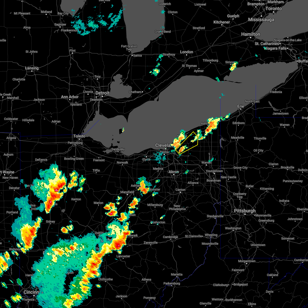 At 413 pm edt, a severe thunderstorm was located over chesterland, or 8 miles southwest of chardon, moving northeast at 35 mph (radar indicated). Hazards include 60 mph wind gusts and quarter size hail. Minor damage to vehicles is possible. Expect damage to trees and power lines. At 413 pm edt, a severe thunderstorm was located over chesterland, or 8 miles southwest of chardon, moving northeast at 35 mph (radar indicated). Hazards include 60 mph wind gusts and quarter size hail. Minor damage to vehicles is possible. Expect damage to trees and power lines.
|
| 5/3/2022 7:42 PM EDT |
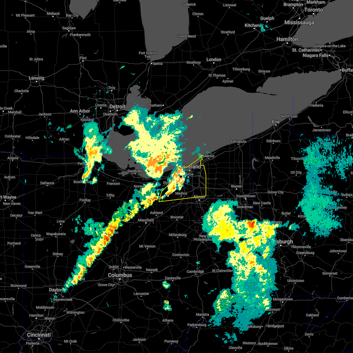 At 742 pm edt, severe thunderstorms were located along a line extending from near lakewood to near strongsville to near wellington, moving northeast at 25 mph (radar indicated). Hazards include 60 mph wind gusts. Expect damage to trees and power lines. locations impacted include, cleveland, akron, medina, willowick, parma, lakewood, cuyahoga falls, euclid, cleveland heights, strongsville, brunswick, westlake, north royalton, north ridgeville, kent, solon, hudson, twinsburg, streetsboro and warrensville heights. hail threat, radar indicated max hail size, <. 75 in wind threat, radar indicated max wind gust, 60 mph. At 742 pm edt, severe thunderstorms were located along a line extending from near lakewood to near strongsville to near wellington, moving northeast at 25 mph (radar indicated). Hazards include 60 mph wind gusts. Expect damage to trees and power lines. locations impacted include, cleveland, akron, medina, willowick, parma, lakewood, cuyahoga falls, euclid, cleveland heights, strongsville, brunswick, westlake, north royalton, north ridgeville, kent, solon, hudson, twinsburg, streetsboro and warrensville heights. hail threat, radar indicated max hail size, <. 75 in wind threat, radar indicated max wind gust, 60 mph.
|
| 5/3/2022 7:24 PM EDT |
 At 724 pm edt, severe thunderstorms were located along a line extending from 12 miles north of lorain to near north ridgeville to near new london, moving northeast at 45 mph (radar indicated). Hazards include 60 mph wind gusts and quarter size hail. Minor damage to vehicles is possible. Expect damage to trees and power lines. At 724 pm edt, severe thunderstorms were located along a line extending from 12 miles north of lorain to near north ridgeville to near new london, moving northeast at 45 mph (radar indicated). Hazards include 60 mph wind gusts and quarter size hail. Minor damage to vehicles is possible. Expect damage to trees and power lines.
|
| 4/25/2022 2:58 PM EDT |
 At 258 pm edt, a severe thunderstorm was located near highland hills, or 12 miles east of cleveland, moving northeast at 55 mph (radar indicated). Hazards include 60 mph wind gusts. expect damage to trees and power lines At 258 pm edt, a severe thunderstorm was located near highland hills, or 12 miles east of cleveland, moving northeast at 55 mph (radar indicated). Hazards include 60 mph wind gusts. expect damage to trees and power lines
|
| 9/15/2021 2:11 AM EDT |
 The severe thunderstorm warning for portage, geauga, southeastern cuyahoga, south central lake and northern summit counties will expire at 215 am edt, the storms which prompted the warning have weakened below severe limits, and no longer pose an immediate threat to life or property. therefore, the warning will be allowed to expire. however gusty winds are still possible with these thunderstorms. The severe thunderstorm warning for portage, geauga, southeastern cuyahoga, south central lake and northern summit counties will expire at 215 am edt, the storms which prompted the warning have weakened below severe limits, and no longer pose an immediate threat to life or property. therefore, the warning will be allowed to expire. however gusty winds are still possible with these thunderstorms.
|
| 9/15/2021 2:02 AM EDT |
 At 202 am edt, severe thunderstorms were located along a line extending from near burton to near streetsboro, moving east at 40 mph (radar indicated). Hazards include 60 mph wind gusts. Expect damage to trees and power lines. locations impacted include, akron, ravenna, chardon, cuyahoga falls, kent, solon, hudson, twinsburg, tallmadge, streetsboro, macedonia, south russell, middlefield, garrettsville, burton, mantua, chesterland, stow, aurora and brecksville. hail threat, radar indicated max hail size, <. 75 in wind threat, radar indicated max wind gust, 60 mph. At 202 am edt, severe thunderstorms were located along a line extending from near burton to near streetsboro, moving east at 40 mph (radar indicated). Hazards include 60 mph wind gusts. Expect damage to trees and power lines. locations impacted include, akron, ravenna, chardon, cuyahoga falls, kent, solon, hudson, twinsburg, tallmadge, streetsboro, macedonia, south russell, middlefield, garrettsville, burton, mantua, chesterland, stow, aurora and brecksville. hail threat, radar indicated max hail size, <. 75 in wind threat, radar indicated max wind gust, 60 mph.
|
| 9/15/2021 1:46 AM EDT |
 At 146 am edt, severe thunderstorms were located along a line extending from near south russell to near cuyahoga falls, moving east at 40 mph (radar indicated). Hazards include 60 mph wind gusts and penny size hail. Expect damage to trees and power lines. locations impacted include, cleveland, akron, willowick, ravenna, chardon, parma, cuyahoga falls, euclid, mentor, cleveland heights, strongsville, brunswick, north royalton, kent, solon, willoughby, hudson, twinsburg, eastlake and tallmadge. hail threat, radar indicated max hail size, 0. 75 in wind threat, radar indicated max wind gust, 60 mph. At 146 am edt, severe thunderstorms were located along a line extending from near south russell to near cuyahoga falls, moving east at 40 mph (radar indicated). Hazards include 60 mph wind gusts and penny size hail. Expect damage to trees and power lines. locations impacted include, cleveland, akron, willowick, ravenna, chardon, parma, cuyahoga falls, euclid, mentor, cleveland heights, strongsville, brunswick, north royalton, kent, solon, willoughby, hudson, twinsburg, eastlake and tallmadge. hail threat, radar indicated max hail size, 0. 75 in wind threat, radar indicated max wind gust, 60 mph.
|
| 9/15/2021 1:04 AM EDT |
 At 103 am edt, severe thunderstorms were located along a line extending from near lakewood to grafton, moving east at 40 mph (radar indicated). Hazards include 60 mph wind gusts. expect damage to trees and power lines At 103 am edt, severe thunderstorms were located along a line extending from near lakewood to grafton, moving east at 40 mph (radar indicated). Hazards include 60 mph wind gusts. expect damage to trees and power lines
|
| 8/12/2021 10:38 AM EDT | Tree down on wire in geauga county OH, 9.3 miles WNW of Chagrin Falls, OH |
| 8/12/2021 10:38 AM EDT |
 At 1038 am edt, severe thunderstorms were located along a line extending from near chesterland to near south russell to hudson, moving east at 45 mph (radar indicated). Hazards include 60 mph wind gusts. Expect damage to trees and power lines. locations impacted include, chardon, solon, hudson, streetsboro, cortland, south russell, middlefield, garrettsville, north bloomfield, orwell, burton, mantua, west farmington, chesterland, bristolville, aurora, parkman, chagrin falls, huntsburg and reminderville. hail threat, radar indicated max hail size, <. 75 in wind threat, radar indicated max wind gust, 60 mph. At 1038 am edt, severe thunderstorms were located along a line extending from near chesterland to near south russell to hudson, moving east at 45 mph (radar indicated). Hazards include 60 mph wind gusts. Expect damage to trees and power lines. locations impacted include, chardon, solon, hudson, streetsboro, cortland, south russell, middlefield, garrettsville, north bloomfield, orwell, burton, mantua, west farmington, chesterland, bristolville, aurora, parkman, chagrin falls, huntsburg and reminderville. hail threat, radar indicated max hail size, <. 75 in wind threat, radar indicated max wind gust, 60 mph.
|
| 8/12/2021 10:32 AM EDT | Large branch and utility wires dow in geauga county OH, 6.4 miles NW of Chagrin Falls, OH |
| 8/12/2021 10:28 AM EDT |
 At 1028 am edt, severe thunderstorms were located along a line extending from near highland hills to solon to near cuyahoga falls, moving east at 45 mph (radar indicated). Hazards include 60 mph wind gusts. expect damage to trees and power lines At 1028 am edt, severe thunderstorms were located along a line extending from near highland hills to solon to near cuyahoga falls, moving east at 45 mph (radar indicated). Hazards include 60 mph wind gusts. expect damage to trees and power lines
|
| 8/11/2021 5:59 PM EDT |
 At 558 pm edt, a line of severe thunderstorms was located near south russell to bedford, moving east at 45 mph (radar indicated). Hazards include 70 mph wind gusts and penny size hail. Expect considerable tree damage. damage is likely to mobile homes, roofs, and outbuildings. locations impacted include, cleveland, parma, euclid, cleveland heights, north royalton, solon, hudson, twinsburg, warrensville heights, macedonia, south russell, highland hills, chesterland, garfield heights, shaker heights, maple heights, south euclid, parma heights, broadview heights and mayfield heights. thunderstorm damage threat, considerable hail threat, radar indicated max hail size, 0. 75 in wind threat, radar indicated max wind gust, 70 mph. At 558 pm edt, a line of severe thunderstorms was located near south russell to bedford, moving east at 45 mph (radar indicated). Hazards include 70 mph wind gusts and penny size hail. Expect considerable tree damage. damage is likely to mobile homes, roofs, and outbuildings. locations impacted include, cleveland, parma, euclid, cleveland heights, north royalton, solon, hudson, twinsburg, warrensville heights, macedonia, south russell, highland hills, chesterland, garfield heights, shaker heights, maple heights, south euclid, parma heights, broadview heights and mayfield heights. thunderstorm damage threat, considerable hail threat, radar indicated max hail size, 0. 75 in wind threat, radar indicated max wind gust, 70 mph.
|
| 8/11/2021 5:33 PM EDT |
 At 533 pm edt, a severe thunderstorm was located over warrensville heights, or 9 miles southeast of cleveland, moving east at 45 mph. this is a destructive storm for cuyahoga county (radar indicated). Hazards include 80 mph wind gusts and penny size hail. Flying debris will be dangerous to those caught without shelter. mobile homes will be heavily damaged. expect considerable damage to roofs, windows, and vehicles. extensive tree damage and power outages are likely. locations impacted include, cleveland, painesville, willowick, fairport harbor, parma, lakewood, euclid, mentor, cleveland heights, strongsville, brunswick, north royalton, solon, willoughby, twinsburg, eastlake, warrensville heights, macedonia, south russell and highland hills. thunderstorm damage threat, destructive hail threat, radar indicated max hail size, 0. 75 in wind threat, radar indicated max wind gust, 80 mph. At 533 pm edt, a severe thunderstorm was located over warrensville heights, or 9 miles southeast of cleveland, moving east at 45 mph. this is a destructive storm for cuyahoga county (radar indicated). Hazards include 80 mph wind gusts and penny size hail. Flying debris will be dangerous to those caught without shelter. mobile homes will be heavily damaged. expect considerable damage to roofs, windows, and vehicles. extensive tree damage and power outages are likely. locations impacted include, cleveland, painesville, willowick, fairport harbor, parma, lakewood, euclid, mentor, cleveland heights, strongsville, brunswick, north royalton, solon, willoughby, twinsburg, eastlake, warrensville heights, macedonia, south russell and highland hills. thunderstorm damage threat, destructive hail threat, radar indicated max hail size, 0. 75 in wind threat, radar indicated max wind gust, 80 mph.
|
| 8/11/2021 5:17 PM EDT |
 At 517 pm edt, a severe thunderstorm was located near parma, or near cleveland, moving east at 45 mph (radar indicated). Hazards include 70 mph wind gusts and penny size hail. Expect considerable tree damage. Damage is likely to mobile homes, roofs, and outbuildings. At 517 pm edt, a severe thunderstorm was located near parma, or near cleveland, moving east at 45 mph (radar indicated). Hazards include 70 mph wind gusts and penny size hail. Expect considerable tree damage. Damage is likely to mobile homes, roofs, and outbuildings.
|
| 7/8/2021 2:39 PM EDT | Tree limb down on wire in geauga county OH, 4.4 miles N of Chagrin Falls, OH |
| 7/8/2021 2:30 PM EDT |
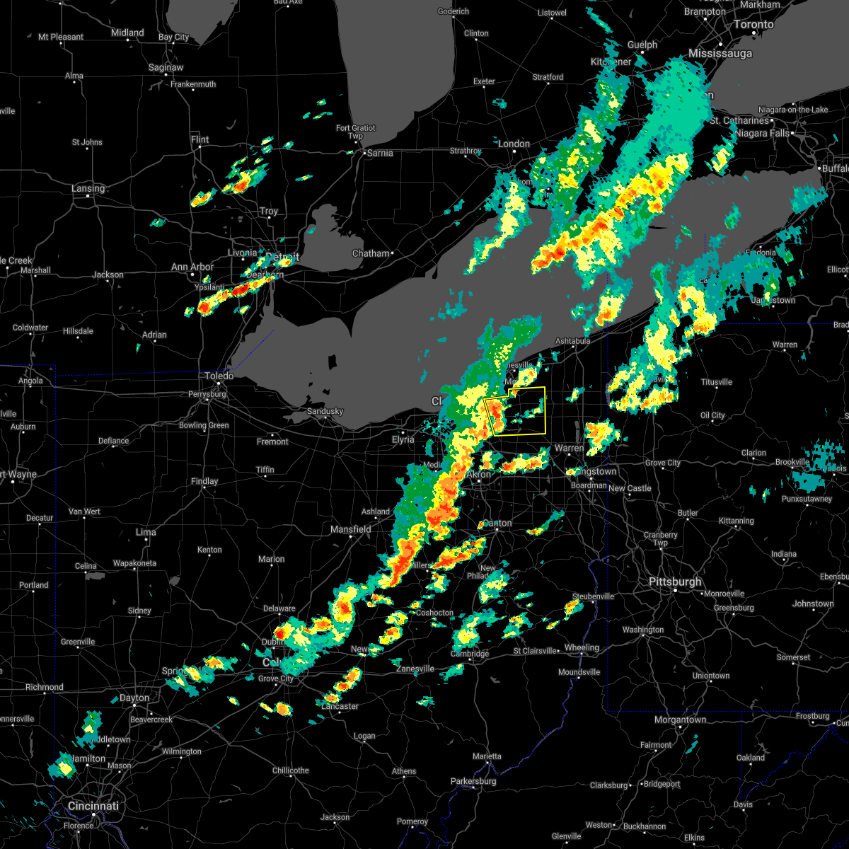 At 229 pm edt, a severe thunderstorm was located over chesterland, or 9 miles southwest of chardon, moving east at 35 mph (radar indicated). Hazards include 60 mph wind gusts and quarter size hail. Minor damage to vehicles is possible. Expect damage to trees and power lines. At 229 pm edt, a severe thunderstorm was located over chesterland, or 9 miles southwest of chardon, moving east at 35 mph (radar indicated). Hazards include 60 mph wind gusts and quarter size hail. Minor damage to vehicles is possible. Expect damage to trees and power lines.
|
| 7/7/2021 6:41 PM EDT |
 At 641 pm edt, severe thunderstorms were located along a line extending from near north royalton to 6 miles northwest of cuyahoga falls, moving northeast at 30 mph (radar indicated). Hazards include 60 mph wind gusts. Expect damage to trees and power lines. Locations impacted include, akron, cuyahoga falls, solon, hudson, twinsburg, streetsboro, macedonia, stow, broadview heights, aurora, brecksville, bedford, seven hills, bedford heights, independence, chagrin falls, northfield, richfield, reminderville and moreland hills. At 641 pm edt, severe thunderstorms were located along a line extending from near north royalton to 6 miles northwest of cuyahoga falls, moving northeast at 30 mph (radar indicated). Hazards include 60 mph wind gusts. Expect damage to trees and power lines. Locations impacted include, akron, cuyahoga falls, solon, hudson, twinsburg, streetsboro, macedonia, stow, broadview heights, aurora, brecksville, bedford, seven hills, bedford heights, independence, chagrin falls, northfield, richfield, reminderville and moreland hills.
|
| 7/7/2021 6:22 PM EDT |
 At 622 pm edt, a severe thunderstorm was located over brunswick, or 7 miles north of medina, moving east at 20 mph (radar indicated). Hazards include 60 mph wind gusts and quarter size hail. Minor damage to vehicles is possible. Expect damage to trees and power lines. At 622 pm edt, a severe thunderstorm was located over brunswick, or 7 miles north of medina, moving east at 20 mph (radar indicated). Hazards include 60 mph wind gusts and quarter size hail. Minor damage to vehicles is possible. Expect damage to trees and power lines.
|
| 6/28/2021 5:02 PM EDT |
 At 501 pm edt, severe thunderstorms were located along a line extending from near south russell to near twinsburg, moving northeast at 20 mph (radar indicated). Hazards include 60 mph wind gusts. Expect damage to trees and power lines. Locations impacted include, solon, hudson, twinsburg, south russell, aurora, chagrin falls, reminderville, orange, moreland hills, glenwillow, bentleyville and bainbridge. At 501 pm edt, severe thunderstorms were located along a line extending from near south russell to near twinsburg, moving northeast at 20 mph (radar indicated). Hazards include 60 mph wind gusts. Expect damage to trees and power lines. Locations impacted include, solon, hudson, twinsburg, south russell, aurora, chagrin falls, reminderville, orange, moreland hills, glenwillow, bentleyville and bainbridge.
|
| 6/28/2021 4:42 PM EDT |
 At 442 pm edt, severe thunderstorms were located along a line extending from near macedonia to cuyahoga falls, moving northeast at 25 mph (radar indicated). Hazards include 60 mph wind gusts and penny size hail. expect damage to trees and power lines At 442 pm edt, severe thunderstorms were located along a line extending from near macedonia to cuyahoga falls, moving northeast at 25 mph (radar indicated). Hazards include 60 mph wind gusts and penny size hail. expect damage to trees and power lines
|
| 6/21/2021 1:06 PM EDT |
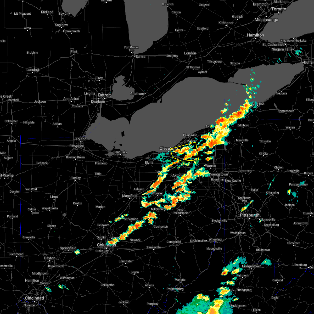 At 106 pm edt, a severe thunderstorm was located near highland hills, or 10 miles south of willowick, moving east at 45 mph (radar indicated). Hazards include 60 mph wind gusts. Expect damage to trees and power lines. Locations impacted include, cleveland, chardon, euclid, cleveland heights, solon, warrensville heights, south russell, middlefield, burton, highland hills, chesterland, garfield heights, shaker heights, maple heights, south euclid, mayfield heights, east cleveland, lyndhurst, university heights and bedford. At 106 pm edt, a severe thunderstorm was located near highland hills, or 10 miles south of willowick, moving east at 45 mph (radar indicated). Hazards include 60 mph wind gusts. Expect damage to trees and power lines. Locations impacted include, cleveland, chardon, euclid, cleveland heights, solon, warrensville heights, south russell, middlefield, burton, highland hills, chesterland, garfield heights, shaker heights, maple heights, south euclid, mayfield heights, east cleveland, lyndhurst, university heights and bedford.
|
| 6/21/2021 12:52 PM EDT |
 At 1252 pm edt, a severe thunderstorm was located over cleveland, moving east at 45 mph (radar indicated). Hazards include 60 mph wind gusts and quarter size hail. Minor damage to vehicles is possible. Expect damage to trees and power lines. At 1252 pm edt, a severe thunderstorm was located over cleveland, moving east at 45 mph (radar indicated). Hazards include 60 mph wind gusts and quarter size hail. Minor damage to vehicles is possible. Expect damage to trees and power lines.
|
| 6/21/2021 6:33 AM EDT |
 At 633 am edt, severe thunderstorms were located along a line extending from near cleveland heights to near macedonia, moving east at 60 mph (radar indicated). Hazards include 60 mph wind gusts. Expect damage to trees and power lines. Locations impacted include, cleveland, parma, euclid, cleveland heights, strongsville, brunswick, north royalton, solon, warrensville heights, highland hills, garfield heights, shaker heights, maple heights, south euclid, parma heights, broadview heights, mayfield heights, east cleveland, middleburg heights and lyndhurst. At 633 am edt, severe thunderstorms were located along a line extending from near cleveland heights to near macedonia, moving east at 60 mph (radar indicated). Hazards include 60 mph wind gusts. Expect damage to trees and power lines. Locations impacted include, cleveland, parma, euclid, cleveland heights, strongsville, brunswick, north royalton, solon, warrensville heights, highland hills, garfield heights, shaker heights, maple heights, south euclid, parma heights, broadview heights, mayfield heights, east cleveland, middleburg heights and lyndhurst.
|
| 6/21/2021 6:26 AM EDT |
 At 626 am edt, severe thunderstorms were located along a line extending from near lakeline to cleveland heights to north royalton, moving east at 60 mph (radar indicated). Hazards include 60 mph wind gusts and quarter size hail. Minor damage to vehicles is possible. Expect damage to trees and power lines. At 626 am edt, severe thunderstorms were located along a line extending from near lakeline to cleveland heights to north royalton, moving east at 60 mph (radar indicated). Hazards include 60 mph wind gusts and quarter size hail. Minor damage to vehicles is possible. Expect damage to trees and power lines.
|
| 6/21/2021 6:14 AM EDT |
 At 613 am edt, severe thunderstorms were located along a line extending from lakewood to near strongsville, moving east at 50 mph (radar indicated). Hazards include 60 mph wind gusts. Expect damage to trees and power lines. Locations impacted include, cleveland, elyria, parma, lakewood, euclid, cleveland heights, strongsville, brunswick, westlake, north royalton, north ridgeville, solon, avon lake, warrensville heights, grafton, highland hills, north olmsted, garfield heights, shaker heights and maple heights. At 613 am edt, severe thunderstorms were located along a line extending from lakewood to near strongsville, moving east at 50 mph (radar indicated). Hazards include 60 mph wind gusts. Expect damage to trees and power lines. Locations impacted include, cleveland, elyria, parma, lakewood, euclid, cleveland heights, strongsville, brunswick, westlake, north royalton, north ridgeville, solon, avon lake, warrensville heights, grafton, highland hills, north olmsted, garfield heights, shaker heights and maple heights.
|
| 6/21/2021 5:38 AM EDT |
 At 538 am edt, severe thunderstorms were located along a line extending from near western vermilion to near milan, moving east at 55 mph (radar indicated). Hazards include 60 mph wind gusts. expect damage to trees and power lines At 538 am edt, severe thunderstorms were located along a line extending from near western vermilion to near milan, moving east at 55 mph (radar indicated). Hazards include 60 mph wind gusts. expect damage to trees and power lines
|
| 6/20/2021 3:34 PM EDT |
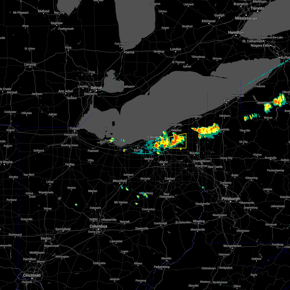 At 334 pm edt, a severe thunderstorm was located near burton, or 7 miles south of chardon, moving east at 25 mph (radar indicated). Hazards include 60 mph wind gusts and penny size hail. Expect damage to trees and power lines. Locations impacted include, chardon, south russell, middlefield, burton, chesterland, parkman, chagrin falls, huntsburg, claridon, bainbridge, hunting valley and aquilla. At 334 pm edt, a severe thunderstorm was located near burton, or 7 miles south of chardon, moving east at 25 mph (radar indicated). Hazards include 60 mph wind gusts and penny size hail. Expect damage to trees and power lines. Locations impacted include, chardon, south russell, middlefield, burton, chesterland, parkman, chagrin falls, huntsburg, claridon, bainbridge, hunting valley and aquilla.
|
| 6/20/2021 3:26 PM EDT | Tree down on powerlines. time estimated via rada in geauga county OH, 2.1 miles WSW of Chagrin Falls, OH |
| 6/20/2021 3:20 PM EDT |
 At 319 pm edt, a severe thunderstorm was located over south russell, or 11 miles southwest of chardon, moving east at 25 mph (radar indicated). Hazards include 60 mph wind gusts and quarter size hail. Minor damage to vehicles is possible. Expect damage to trees and power lines. At 319 pm edt, a severe thunderstorm was located over south russell, or 11 miles southwest of chardon, moving east at 25 mph (radar indicated). Hazards include 60 mph wind gusts and quarter size hail. Minor damage to vehicles is possible. Expect damage to trees and power lines.
|
| 11/15/2020 1:21 PM EST |
 At 120 pm est, severe thunderstorms were located along a line extending from near highland hills to coshocton, moving east at 55 mph (radar indicated). Hazards include 70 mph wind gusts. Expect considerable tree damage. damage is likely to mobile homes, roofs, and outbuildings. Locations impacted include, akron, canton, painesville, ravenna, chardon, fairport harbor, cuyahoga falls, mentor, massillon, kent, barberton, green, solon, alliance, willoughby, hudson, twinsburg, tallmadge, north canton and streetsboro. At 120 pm est, severe thunderstorms were located along a line extending from near highland hills to coshocton, moving east at 55 mph (radar indicated). Hazards include 70 mph wind gusts. Expect considerable tree damage. damage is likely to mobile homes, roofs, and outbuildings. Locations impacted include, akron, canton, painesville, ravenna, chardon, fairport harbor, cuyahoga falls, mentor, massillon, kent, barberton, green, solon, alliance, willoughby, hudson, twinsburg, tallmadge, north canton and streetsboro.
|
| 11/15/2020 12:58 PM EST |
 At 1258 pm est, severe thunderstorms were located along a line extending from near westlake to 10 miles east of utica, moving east at 55 mph (radar indicated). Hazards include 70 mph wind gusts. Expect considerable tree damage. damage is likely to mobile homes, roofs, and outbuildings. Locations impacted include, cleveland, akron, canton, painesville, willowick, ravenna, chardon, fairport harbor, millersburg, cuyahoga falls, euclid, mentor, cleveland heights, massillon, kent, barberton, green, solon, alliance and willoughby. At 1258 pm est, severe thunderstorms were located along a line extending from near westlake to 10 miles east of utica, moving east at 55 mph (radar indicated). Hazards include 70 mph wind gusts. Expect considerable tree damage. damage is likely to mobile homes, roofs, and outbuildings. Locations impacted include, cleveland, akron, canton, painesville, willowick, ravenna, chardon, fairport harbor, millersburg, cuyahoga falls, euclid, mentor, cleveland heights, massillon, kent, barberton, green, solon, alliance and willoughby.
|
| 11/15/2020 12:51 PM EST |
 At 1251 pm est, severe thunderstorms were located along a line extending from near westlake to 10 miles east of utica, moving east at 55 mph (radar indicated). Hazards include 60 mph wind gusts. expect damage to trees and power lines At 1251 pm est, severe thunderstorms were located along a line extending from near westlake to 10 miles east of utica, moving east at 55 mph (radar indicated). Hazards include 60 mph wind gusts. expect damage to trees and power lines
|
| 10/23/2020 7:40 PM EDT |
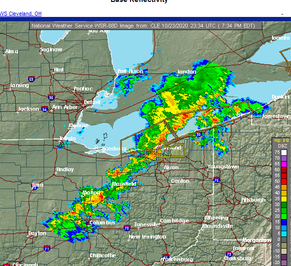 At 740 pm edt, a severe thunderstorm was located near highland hills, or 9 miles south of willowick, moving northeast at 50 mph (radar indicated). Hazards include 60 mph wind gusts and penny size hail. expect damage to trees and power lines At 740 pm edt, a severe thunderstorm was located near highland hills, or 9 miles south of willowick, moving northeast at 50 mph (radar indicated). Hazards include 60 mph wind gusts and penny size hail. expect damage to trees and power lines
|
| 10/23/2020 7:32 PM EDT |
 At 731 pm edt, severe thunderstorms were located along a line extending from 8 miles west of lakeline to cleveland to strongsville, moving east at 50 mph (radar indicated). Hazards include 60 mph wind gusts and penny size hail. Expect damage to trees and power lines. Locations impacted include, cleveland, parma, lakewood, euclid, cleveland heights, strongsville, brunswick, north royalton, solon, eastlake, warrensville heights, highland hills, timberlake, lakeline, garfield heights, shaker heights, maple heights, south euclid, parma heights and rocky river. At 731 pm edt, severe thunderstorms were located along a line extending from 8 miles west of lakeline to cleveland to strongsville, moving east at 50 mph (radar indicated). Hazards include 60 mph wind gusts and penny size hail. Expect damage to trees and power lines. Locations impacted include, cleveland, parma, lakewood, euclid, cleveland heights, strongsville, brunswick, north royalton, solon, eastlake, warrensville heights, highland hills, timberlake, lakeline, garfield heights, shaker heights, maple heights, south euclid, parma heights and rocky river.
|
| 10/23/2020 7:24 PM EDT |
 At 723 pm edt, severe thunderstorms were located along a line extending from 9 miles northwest of euclid to near lakewood to near strongsville, moving northeast at 50 mph (radar indicated). Hazards include 60 mph wind gusts and penny size hail. Expect damage to trees and power lines. Locations impacted include, cleveland, parma, lakewood, euclid, cleveland heights, strongsville, brunswick, westlake, north royalton, north ridgeville, solon, eastlake, warrensville heights, grafton, highland hills, timberlake, lakeline, north olmsted, garfield heights and shaker heights. At 723 pm edt, severe thunderstorms were located along a line extending from 9 miles northwest of euclid to near lakewood to near strongsville, moving northeast at 50 mph (radar indicated). Hazards include 60 mph wind gusts and penny size hail. Expect damage to trees and power lines. Locations impacted include, cleveland, parma, lakewood, euclid, cleveland heights, strongsville, brunswick, westlake, north royalton, north ridgeville, solon, eastlake, warrensville heights, grafton, highland hills, timberlake, lakeline, north olmsted, garfield heights and shaker heights.
|
| 10/23/2020 7:05 PM EDT |
 At 705 pm edt, severe thunderstorms were located along a line extending from 12 miles northwest of avon lake to near elyria to near wellington, moving east at 50 mph (radar indicated). Hazards include 70 mph wind gusts and penny size hail. Expect considerable tree damage. Damage is likely to mobile homes, roofs, and outbuildings. At 705 pm edt, severe thunderstorms were located along a line extending from 12 miles northwest of avon lake to near elyria to near wellington, moving east at 50 mph (radar indicated). Hazards include 70 mph wind gusts and penny size hail. Expect considerable tree damage. Damage is likely to mobile homes, roofs, and outbuildings.
|
| 10/23/2020 6:39 PM EDT |
 The severe thunderstorm warning for southwestern geauga, northeastern cuyahoga and southwestern lake counties will expire at 645 pm edt, the storm which prompted the warning has weakened below severe limits, and no longer poses an immediate threat to life or property. therefore, the warning will be allowed to expire. however gusty winds are likely with the line of approaching storms. The severe thunderstorm warning for southwestern geauga, northeastern cuyahoga and southwestern lake counties will expire at 645 pm edt, the storm which prompted the warning has weakened below severe limits, and no longer poses an immediate threat to life or property. therefore, the warning will be allowed to expire. however gusty winds are likely with the line of approaching storms.
|
| 10/23/2020 6:10 PM EDT |
 At 609 pm edt, a severe thunderstorm was located over warrensville heights, or 10 miles southeast of cleveland, moving northeast at 35 mph (radar indicated). Hazards include 60 mph wind gusts and quarter size hail. Minor damage to vehicles is possible. Expect damage to trees and power lines. At 609 pm edt, a severe thunderstorm was located over warrensville heights, or 10 miles southeast of cleveland, moving northeast at 35 mph (radar indicated). Hazards include 60 mph wind gusts and quarter size hail. Minor damage to vehicles is possible. Expect damage to trees and power lines.
|
| 7/19/2020 6:12 PM EDT |
 The severe thunderstorm warning for southeastern cuyahoga and northeastern summit counties will expire at 615 pm edt, the storms which prompted the warning have moved out of the area. therefore, the warning will be allowed to expire. a severe thunderstorm watch remains in effect until 1100 pm edt for northeastern ohio. to report severe weather, contact your nearest law enforcement agency. they will relay your report to the national weather service cleveland. The severe thunderstorm warning for southeastern cuyahoga and northeastern summit counties will expire at 615 pm edt, the storms which prompted the warning have moved out of the area. therefore, the warning will be allowed to expire. a severe thunderstorm watch remains in effect until 1100 pm edt for northeastern ohio. to report severe weather, contact your nearest law enforcement agency. they will relay your report to the national weather service cleveland.
|
| 7/19/2020 6:00 PM EDT |
 At 559 pm edt, severe thunderstorms were located along a line extending from near solon to near cuyahoga falls, moving east at 50 mph (radar indicated). Hazards include 60 mph wind gusts. Expect damage to trees and power lines. Locations impacted include, cuyahoga falls, solon, hudson, twinsburg, streetsboro, warrensville heights, macedonia, highland hills, stow, mayfield heights, aurora, brecksville, bedford, beachwood, bedford heights, pepper pike, chagrin falls, northfield, reminderville and orange. At 559 pm edt, severe thunderstorms were located along a line extending from near solon to near cuyahoga falls, moving east at 50 mph (radar indicated). Hazards include 60 mph wind gusts. Expect damage to trees and power lines. Locations impacted include, cuyahoga falls, solon, hudson, twinsburg, streetsboro, warrensville heights, macedonia, highland hills, stow, mayfield heights, aurora, brecksville, bedford, beachwood, bedford heights, pepper pike, chagrin falls, northfield, reminderville and orange.
|
| 7/19/2020 5:47 PM EDT |
 At 546 pm edt, severe thunderstorms were located along a line extending from near chagrin falls to near cuyahoga falls, moving east at 45 mph (radar indicated). Hazards include 60 mph wind gusts. expect damage to trees and power lines At 546 pm edt, severe thunderstorms were located along a line extending from near chagrin falls to near cuyahoga falls, moving east at 45 mph (radar indicated). Hazards include 60 mph wind gusts. expect damage to trees and power lines
|
| 7/19/2020 5:43 PM EDT |
 At 541 pm edt, severe thunderstorms were located along a line extending from cleveland to near parma to near macedonia to hinckley, moving east at 50 mph (radar indicated). Hazards include 60 mph wind gusts. Expect damage to trees and power lines. Locations impacted include, cleveland, parma, lakewood, cuyahoga falls, euclid, cleveland heights, strongsville, brunswick, north royalton, solon, hudson, twinsburg, warrensville heights, macedonia, highland hills, stow, garfield heights, shaker heights and maple heights. At 541 pm edt, severe thunderstorms were located along a line extending from cleveland to near parma to near macedonia to hinckley, moving east at 50 mph (radar indicated). Hazards include 60 mph wind gusts. Expect damage to trees and power lines. Locations impacted include, cleveland, parma, lakewood, cuyahoga falls, euclid, cleveland heights, strongsville, brunswick, north royalton, solon, hudson, twinsburg, warrensville heights, macedonia, highland hills, stow, garfield heights, shaker heights and maple heights.
|
| 7/19/2020 5:18 PM EDT |
 At 517 pm edt, severe thunderstorms were located along a line extending from near avon lake to north ridgeville to grafton, moving east at 50 mph (radar indicated). Hazards include 60 mph wind gusts. expect damage to trees and power lines At 517 pm edt, severe thunderstorms were located along a line extending from near avon lake to north ridgeville to grafton, moving east at 50 mph (radar indicated). Hazards include 60 mph wind gusts. expect damage to trees and power lines
|
| 6/27/2020 12:23 AM EDT |
 At 1222 am edt, a severe thunderstorm was located over warrensville heights, or 10 miles southeast of cleveland, moving southeast at 30 mph (radar indicated). Hazards include 70 mph wind gusts and quarter size hail. Minor damage to vehicles is possible. expect considerable tree damage. Wind damage is also likely to mobile homes, roofs, and outbuildings. At 1222 am edt, a severe thunderstorm was located over warrensville heights, or 10 miles southeast of cleveland, moving southeast at 30 mph (radar indicated). Hazards include 70 mph wind gusts and quarter size hail. Minor damage to vehicles is possible. expect considerable tree damage. Wind damage is also likely to mobile homes, roofs, and outbuildings.
|
| 6/27/2020 12:11 AM EDT |
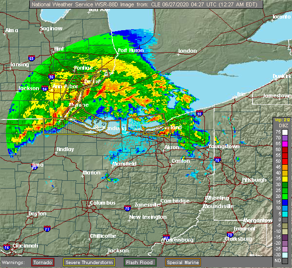 At 1211 am edt, a severe thunderstorm was located near cleveland heights, or near cleveland, moving east at 30 mph (radar indicated). Hazards include 60 mph wind gusts and quarter size hail. Minor damage to vehicles is possible. expect damage to trees and power lines. Locations impacted include, cleveland, parma, euclid, cleveland heights, solon, warrensville heights, highland hills, garfield heights, shaker heights, maple heights, south euclid, parma heights, mayfield heights, east cleveland, lyndhurst, university heights, bedford, wickliffe, beachwood and seven hills. At 1211 am edt, a severe thunderstorm was located near cleveland heights, or near cleveland, moving east at 30 mph (radar indicated). Hazards include 60 mph wind gusts and quarter size hail. Minor damage to vehicles is possible. expect damage to trees and power lines. Locations impacted include, cleveland, parma, euclid, cleveland heights, solon, warrensville heights, highland hills, garfield heights, shaker heights, maple heights, south euclid, parma heights, mayfield heights, east cleveland, lyndhurst, university heights, bedford, wickliffe, beachwood and seven hills.
|
| 6/26/2020 11:53 PM EDT |
 A severe thunderstorm warning remains in effect until 1230 am edt for cuyahoga county. at 1152 pm edt, a severe thunderstorm was located near lakewood, or near cleveland, moving east at 30 mph. hazard. 60 mph wind gusts and quarter size hail. source. Radar indicated. A severe thunderstorm warning remains in effect until 1230 am edt for cuyahoga county. at 1152 pm edt, a severe thunderstorm was located near lakewood, or near cleveland, moving east at 30 mph. hazard. 60 mph wind gusts and quarter size hail. source. Radar indicated.
|
| 6/26/2020 11:23 PM EDT |
 At 1123 pm edt, a severe thunderstorm was located 7 miles northwest of avon lake, or 9 miles northeast of lorain, moving east at 30 mph (radar indicated). Hazards include 70 mph wind gusts and half dollar size hail. People and animals outdoors will be injured. expect hail damage to roofs, siding, windows, and vehicles. expect considerable tree damage. Wind damage is also likely to mobile homes, roofs, and outbuildings. At 1123 pm edt, a severe thunderstorm was located 7 miles northwest of avon lake, or 9 miles northeast of lorain, moving east at 30 mph (radar indicated). Hazards include 70 mph wind gusts and half dollar size hail. People and animals outdoors will be injured. expect hail damage to roofs, siding, windows, and vehicles. expect considerable tree damage. Wind damage is also likely to mobile homes, roofs, and outbuildings.
|
| 6/10/2020 8:38 PM EDT |
 At 835 pm edt, severe thunderstorms were located along a line extending from 18 miles northwest of geneva-on-the-lake to perry, moving northeast at 55 mph (radar indicated). Hazards include 60 mph wind gusts and penny size hail. Expect damage to trees and power lines. Locations impacted include, painesville, willowick, chardon, fairport harbor, euclid, mentor, solon, willoughby, eastlake, south russell, madison, perry, burton, timberlake, lakeline, chesterland, mayfield heights, wickliffe, richmond heights and willoughby hills. At 835 pm edt, severe thunderstorms were located along a line extending from 18 miles northwest of geneva-on-the-lake to perry, moving northeast at 55 mph (radar indicated). Hazards include 60 mph wind gusts and penny size hail. Expect damage to trees and power lines. Locations impacted include, painesville, willowick, chardon, fairport harbor, euclid, mentor, solon, willoughby, eastlake, south russell, madison, perry, burton, timberlake, lakeline, chesterland, mayfield heights, wickliffe, richmond heights and willoughby hills.
|
| 6/10/2020 8:37 PM EDT | Tree down on addington ct - tree fell on gas meter and is leaking ga in geauga county OH, 4.4 miles W of Chagrin Falls, OH |
| 6/10/2020 8:28 PM EDT |
 The severe thunderstorm warning for cuyahoga county will expire at 830 pm edt, the storm which prompted the warning has weakened below severe limits, and no longer poses an immediate threat to life or property. therefore, the warning will be allowed to expire. however gusty winds are still possible with this thunderstorm. a severe thunderstorm watch remains in effect until 1000 pm edt for northeastern ohio. a severe thunderstorm watch also remains in effect until 100 am edt for northeastern ohio. The severe thunderstorm warning for cuyahoga county will expire at 830 pm edt, the storm which prompted the warning has weakened below severe limits, and no longer poses an immediate threat to life or property. therefore, the warning will be allowed to expire. however gusty winds are still possible with this thunderstorm. a severe thunderstorm watch remains in effect until 1000 pm edt for northeastern ohio. a severe thunderstorm watch also remains in effect until 100 am edt for northeastern ohio.
|
| 6/10/2020 8:17 PM EDT |
 At 816 pm edt, a severe thunderstorm was located over fairport harbor, moving northeast at 60 mph (radar indicated). Hazards include 60 mph wind gusts. Expect damage to trees and power lines. Locations impacted include, cleveland, parma, lakewood, euclid, cleveland heights, strongsville, north royalton, solon, warrensville heights, highland hills, garfield heights, shaker heights, maple heights, south euclid, parma heights, rocky river, broadview heights, brook park, mayfield heights and east cleveland. At 816 pm edt, a severe thunderstorm was located over fairport harbor, moving northeast at 60 mph (radar indicated). Hazards include 60 mph wind gusts. Expect damage to trees and power lines. Locations impacted include, cleveland, parma, lakewood, euclid, cleveland heights, strongsville, north royalton, solon, warrensville heights, highland hills, garfield heights, shaker heights, maple heights, south euclid, parma heights, rocky river, broadview heights, brook park, mayfield heights and east cleveland.
|
| 6/10/2020 7:55 PM EDT |
 At 755 pm edt, severe thunderstorms were located along a line extending from 8 miles northwest of lakeline to near parma, moving northeast at 55 mph (radar indicated). Hazards include 70 mph wind gusts and penny size hail. Expect considerable tree damage. Damage is likely to mobile homes, roofs, and outbuildings. At 755 pm edt, severe thunderstorms were located along a line extending from 8 miles northwest of lakeline to near parma, moving northeast at 55 mph (radar indicated). Hazards include 70 mph wind gusts and penny size hail. Expect considerable tree damage. Damage is likely to mobile homes, roofs, and outbuildings.
|
| 6/10/2020 7:54 PM EDT |
 At 753 pm edt, a severe thunderstorm was located near cleveland, moving northeast at 50 mph (radar indicated). Hazards include 70 mph wind gusts and nickel size hail. Expect considerable tree damage. damage is likely to mobile homes, roofs, and outbuildings. Locations impacted include, cleveland, parma, lakewood, euclid, cleveland heights, strongsville, brunswick, westlake, north royalton, solon, warrensville heights, highland hills, north olmsted, garfield heights, shaker heights, maple heights, south euclid, parma heights, rocky river and broadview heights. At 753 pm edt, a severe thunderstorm was located near cleveland, moving northeast at 50 mph (radar indicated). Hazards include 70 mph wind gusts and nickel size hail. Expect considerable tree damage. damage is likely to mobile homes, roofs, and outbuildings. Locations impacted include, cleveland, parma, lakewood, euclid, cleveland heights, strongsville, brunswick, westlake, north royalton, solon, warrensville heights, highland hills, north olmsted, garfield heights, shaker heights, maple heights, south euclid, parma heights, rocky river and broadview heights.
|
| 6/10/2020 7:23 PM EDT |
 At 722 pm edt, a severe thunderstorm was located near grafton, or near elyria, moving northeast at 60 mph (radar indicated). Hazards include 70 mph wind gusts and nickel size hail. Expect considerable tree damage. Damage is likely to mobile homes, roofs, and outbuildings. At 722 pm edt, a severe thunderstorm was located near grafton, or near elyria, moving northeast at 60 mph (radar indicated). Hazards include 70 mph wind gusts and nickel size hail. Expect considerable tree damage. Damage is likely to mobile homes, roofs, and outbuildings.
|
| 4/7/2020 11:52 PM EDT |
 At 1152 pm edt, severe thunderstorms were located along a line extending from jamestown west to linesville, moving east at 100 mph (radar indicated). Hazards include 60 mph wind gusts and quarter size hail. Minor damage to vehicles is possible. expect damage to trees and power lines. Locations impacted include, warren, meadville, ravenna, chardon, kent, solon, hudson, niles, twinsburg, tallmadge, streetsboro, macedonia, cortland, newton falls, south russell, lordstown, middlefield, garrettsville, kinsman and north bloomfield. At 1152 pm edt, severe thunderstorms were located along a line extending from jamestown west to linesville, moving east at 100 mph (radar indicated). Hazards include 60 mph wind gusts and quarter size hail. Minor damage to vehicles is possible. expect damage to trees and power lines. Locations impacted include, warren, meadville, ravenna, chardon, kent, solon, hudson, niles, twinsburg, tallmadge, streetsboro, macedonia, cortland, newton falls, south russell, lordstown, middlefield, garrettsville, kinsman and north bloomfield.
|
| 4/7/2020 11:38 PM EDT |
 At 1137 pm edt, severe thunderstorms were located along a line extending from solon to 6 miles northwest of lodi to near norwalk, moving southeast at 45 mph (radar indicated). Hazards include 70 mph wind gusts and quarter size hail. Minor damage to vehicles is possible. expect considerable tree damage. Wind damage is also likely to mobile homes, roofs, and outbuildings. At 1137 pm edt, severe thunderstorms were located along a line extending from solon to 6 miles northwest of lodi to near norwalk, moving southeast at 45 mph (radar indicated). Hazards include 70 mph wind gusts and quarter size hail. Minor damage to vehicles is possible. expect considerable tree damage. Wind damage is also likely to mobile homes, roofs, and outbuildings.
|
| 4/7/2020 11:34 PM EDT |
 At 1134 pm edt, severe thunderstorms were located along a line extending from highland hills to 7 miles west of medina to 6 miles southwest of wakeman, moving southeast at 70 mph (radar indicated). Hazards include 70 mph wind gusts and quarter size hail. Minor damage to vehicles is possible. expect considerable tree damage. wind damage is also likely to mobile homes, roofs, and outbuildings. Locations impacted include, cleveland, akron, lorain, elyria, medina, ravenna, vermilion, parma, lakewood, cuyahoga falls, euclid, cleveland heights, strongsville, brunswick, westlake, north royalton, north ridgeville, kent, barberton and solon. At 1134 pm edt, severe thunderstorms were located along a line extending from highland hills to 7 miles west of medina to 6 miles southwest of wakeman, moving southeast at 70 mph (radar indicated). Hazards include 70 mph wind gusts and quarter size hail. Minor damage to vehicles is possible. expect considerable tree damage. wind damage is also likely to mobile homes, roofs, and outbuildings. Locations impacted include, cleveland, akron, lorain, elyria, medina, ravenna, vermilion, parma, lakewood, cuyahoga falls, euclid, cleveland heights, strongsville, brunswick, westlake, north royalton, north ridgeville, kent, barberton and solon.
|
| 4/7/2020 11:30 PM EDT | Half Dollar sized hail reported 5.2 miles WNW of Chagrin Falls, OH, from cocorahs observer. |
| 4/7/2020 11:18 PM EDT |
 At 1118 pm edt, a severe thunderstorm was located near south russell, or 15 miles southwest of chardon, moving east at 45 mph (radar indicated). Hazards include two inch hail and 60 mph wind gusts. People and animals outdoors will be injured. expect hail damage to roofs, siding, windows, and vehicles. expect damage to trees and power lines. Locations impacted include, cleveland, parma, cleveland heights, north royalton, solon, twinsburg, streetsboro, warrensville heights, macedonia, south russell, middlefield, garrettsville, burton, highland hills, mantua, garfield heights, shaker heights, maple heights, south euclid and parma heights. At 1118 pm edt, a severe thunderstorm was located near south russell, or 15 miles southwest of chardon, moving east at 45 mph (radar indicated). Hazards include two inch hail and 60 mph wind gusts. People and animals outdoors will be injured. expect hail damage to roofs, siding, windows, and vehicles. expect damage to trees and power lines. Locations impacted include, cleveland, parma, cleveland heights, north royalton, solon, twinsburg, streetsboro, warrensville heights, macedonia, south russell, middlefield, garrettsville, burton, highland hills, mantua, garfield heights, shaker heights, maple heights, south euclid and parma heights.
|
| 4/7/2020 11:17 PM EDT |
 At 1117 pm edt, severe thunderstorms were located along a line extending from 6 miles north of cleveland to 6 miles south of amherst to near northern milan, moving south at 50 mph (trained weather spotters reported half dollar size hail in avon recently). Hazards include 70 mph wind gusts and half dollar size hail. People and animals outdoors will be injured. expect hail damage to roofs, siding, windows, and vehicles. expect considerable tree damage. wind damage is also likely to mobile homes, roofs, and outbuildings. Locations impacted include, cleveland, akron, lorain, elyria, medina, sandusky, ravenna, western vermilion, vermilion, parma, lakewood, cuyahoga falls, euclid, cleveland heights, strongsville, brunswick, westlake, north royalton, north ridgeville and kent. At 1117 pm edt, severe thunderstorms were located along a line extending from 6 miles north of cleveland to 6 miles south of amherst to near northern milan, moving south at 50 mph (trained weather spotters reported half dollar size hail in avon recently). Hazards include 70 mph wind gusts and half dollar size hail. People and animals outdoors will be injured. expect hail damage to roofs, siding, windows, and vehicles. expect considerable tree damage. wind damage is also likely to mobile homes, roofs, and outbuildings. Locations impacted include, cleveland, akron, lorain, elyria, medina, sandusky, ravenna, western vermilion, vermilion, parma, lakewood, cuyahoga falls, euclid, cleveland heights, strongsville, brunswick, westlake, north royalton, north ridgeville and kent.
|
| 4/7/2020 11:12 PM EDT |
 At 1112 pm edt, severe thunderstorms were located along a line extending from 11 miles north of conneaut to 9 miles northwest of euclid, moving southeast at 60 mph (radar indicated). Hazards include 60 mph wind gusts and quarter size hail. Minor damage to vehicles is possible. Expect damage to trees and power lines. At 1112 pm edt, severe thunderstorms were located along a line extending from 11 miles north of conneaut to 9 miles northwest of euclid, moving southeast at 60 mph (radar indicated). Hazards include 60 mph wind gusts and quarter size hail. Minor damage to vehicles is possible. Expect damage to trees and power lines.
|
| 4/7/2020 11:01 PM EDT |
 At 1100 pm edt, severe thunderstorms were located along a line extending from 16 miles northwest of lakeline to near lorain to 7 miles east of sandusky, moving southeast at 55 mph (radar indicated). Hazards include 60 mph wind gusts and quarter size hail. Minor damage to vehicles is possible. Expect damage to trees and power lines. At 1100 pm edt, severe thunderstorms were located along a line extending from 16 miles northwest of lakeline to near lorain to 7 miles east of sandusky, moving southeast at 55 mph (radar indicated). Hazards include 60 mph wind gusts and quarter size hail. Minor damage to vehicles is possible. Expect damage to trees and power lines.
|
| 4/7/2020 10:57 PM EDT |
 At 1056 pm edt, a severe thunderstorm was located near parma, or near cleveland, moving east at 45 mph (radar indicated). Hazards include 60 mph wind gusts and quarter size hail. Minor damage to vehicles is possible. Expect damage to trees and power lines. At 1056 pm edt, a severe thunderstorm was located near parma, or near cleveland, moving east at 45 mph (radar indicated). Hazards include 60 mph wind gusts and quarter size hail. Minor damage to vehicles is possible. Expect damage to trees and power lines.
|
| 3/20/2020 12:02 PM EDT |
 At 1201 pm edt, a severe thunderstorm was located over highland hills, or 13 miles east of cleveland, moving east at 45 mph (radar indicated). Hazards include 60 mph wind gusts. expect damage to trees and power lines At 1201 pm edt, a severe thunderstorm was located over highland hills, or 13 miles east of cleveland, moving east at 45 mph (radar indicated). Hazards include 60 mph wind gusts. expect damage to trees and power lines
|
| 9/13/2019 8:55 PM EDT |
 At 854 pm edt, a severe thunderstorm was located over chesterland, or 7 miles southwest of chardon, moving east at 55 mph (radar indicated. downed trees were recently reported in shaker heights). Hazards include 70 mph wind gusts and penny size hail. Expect considerable tree damage. damage is likely to mobile homes, roofs, and outbuildings. Locations impacted include, cleveland, willowick, chardon, euclid, mentor, cleveland heights, solon, willoughby, eastlake, warrensville heights, cortland, south russell, middlefield, north bloomfield, orwell, burton, highland hills, timberlake, west farmington and lakeline. At 854 pm edt, a severe thunderstorm was located over chesterland, or 7 miles southwest of chardon, moving east at 55 mph (radar indicated. downed trees were recently reported in shaker heights). Hazards include 70 mph wind gusts and penny size hail. Expect considerable tree damage. damage is likely to mobile homes, roofs, and outbuildings. Locations impacted include, cleveland, willowick, chardon, euclid, mentor, cleveland heights, solon, willoughby, eastlake, warrensville heights, cortland, south russell, middlefield, north bloomfield, orwell, burton, highland hills, timberlake, west farmington and lakeline.
|
| 9/13/2019 8:35 PM EDT |
 At 835 pm edt, a severe thunderstorm was located near highland hills, or 10 miles south of willowick, moving east at 55 mph (radar indicated). Hazards include 70 mph wind gusts and penny size hail. Expect considerable tree damage. Damage is likely to mobile homes, roofs, and outbuildings. At 835 pm edt, a severe thunderstorm was located near highland hills, or 10 miles south of willowick, moving east at 55 mph (radar indicated). Hazards include 70 mph wind gusts and penny size hail. Expect considerable tree damage. Damage is likely to mobile homes, roofs, and outbuildings.
|
| 9/11/2019 5:37 PM EDT |
 At 536 pm edt, severe thunderstorms were located along a line extending from near mentor to near mantua, moving east at 45 mph (radar indicated). Hazards include 60 mph wind gusts and penny size hail. Expect damage to trees and power lines. Locations impacted include, painesville, chardon, mentor, solon, willoughby, twinsburg, macedonia, south russell, middlefield, garrettsville, burton, chesterland, mayfield heights, aurora, bedford heights, willoughby hills, kirtland, pepper pike, parkman and chagrin falls. At 536 pm edt, severe thunderstorms were located along a line extending from near mentor to near mantua, moving east at 45 mph (radar indicated). Hazards include 60 mph wind gusts and penny size hail. Expect damage to trees and power lines. Locations impacted include, painesville, chardon, mentor, solon, willoughby, twinsburg, macedonia, south russell, middlefield, garrettsville, burton, chesterland, mayfield heights, aurora, bedford heights, willoughby hills, kirtland, pepper pike, parkman and chagrin falls.
|
| 9/11/2019 5:21 PM EDT |
 At 520 pm edt, a severe thunderstorm was located over chesterland, or 8 miles southeast of willowick, moving east at 35 mph (radar indicated). Hazards include 60 mph wind gusts and nickel size hail. expect damage to trees and power lines At 520 pm edt, a severe thunderstorm was located over chesterland, or 8 miles southeast of willowick, moving east at 35 mph (radar indicated). Hazards include 60 mph wind gusts and nickel size hail. expect damage to trees and power lines
|
| 8/18/2019 6:36 AM EDT |
 At 616 am edt, severe thunderstorms were located along a line extending from near euclid to near macedonia, moving east at 50 mph (radar indicated). Hazards include 60 mph wind gusts. Expect damage to trees and power lines. Locations impacted include, cleveland, parma, euclid, cleveland heights, solon, hudson, twinsburg, warrensville heights, macedonia, highland hills, garfield heights, shaker heights, maple heights, south euclid, broadview heights, mayfield heights, east cleveland, lyndhurst, brecksville and university heights. At 616 am edt, severe thunderstorms were located along a line extending from near euclid to near macedonia, moving east at 50 mph (radar indicated). Hazards include 60 mph wind gusts. Expect damage to trees and power lines. Locations impacted include, cleveland, parma, euclid, cleveland heights, solon, hudson, twinsburg, warrensville heights, macedonia, highland hills, garfield heights, shaker heights, maple heights, south euclid, broadview heights, mayfield heights, east cleveland, lyndhurst, brecksville and university heights.
|
| 8/18/2019 6:21 AM EDT |
 At 619 am edt, severe thunderstorms were located along a line extending from near euclid to solon, moving east at 50 mph (radar indicated). Hazards include 60 mph wind gusts. expect damage to trees and power lines At 619 am edt, severe thunderstorms were located along a line extending from near euclid to solon, moving east at 50 mph (radar indicated). Hazards include 60 mph wind gusts. expect damage to trees and power lines
|
| 8/18/2019 6:16 AM EDT |
 At 616 am edt, severe thunderstorms were located along a line extending from near euclid to near macedonia, moving east at 50 mph (radar indicated). Hazards include 60 mph wind gusts. Expect damage to trees and power lines. Locations impacted include, cleveland, parma, euclid, cleveland heights, solon, hudson, twinsburg, warrensville heights, macedonia, highland hills, garfield heights, shaker heights, maple heights, south euclid, broadview heights, mayfield heights, east cleveland, lyndhurst, brecksville and university heights. At 616 am edt, severe thunderstorms were located along a line extending from near euclid to near macedonia, moving east at 50 mph (radar indicated). Hazards include 60 mph wind gusts. Expect damage to trees and power lines. Locations impacted include, cleveland, parma, euclid, cleveland heights, solon, hudson, twinsburg, warrensville heights, macedonia, highland hills, garfield heights, shaker heights, maple heights, south euclid, broadview heights, mayfield heights, east cleveland, lyndhurst, brecksville and university heights.
|
| 8/18/2019 5:55 AM EDT |
 At 554 am edt, severe thunderstorms were located along a line extending from near westlake to near brunswick, moving northeast at 40 mph (radar indicated). Hazards include 60 mph wind gusts. expect damage to trees and power lines At 554 am edt, severe thunderstorms were located along a line extending from near westlake to near brunswick, moving northeast at 40 mph (radar indicated). Hazards include 60 mph wind gusts. expect damage to trees and power lines
|
| 8/17/2019 3:29 PM EDT |
 At 329 pm edt, a severe thunderstorm was located near twinsburg, or 13 miles northwest of ravenna, moving southeast at 20 mph (radar indicated). Hazards include 60 mph wind gusts and quarter size hail and heavy rain. Minor damage to vehicles is possible. Expect damage to trees and power lines. At 329 pm edt, a severe thunderstorm was located near twinsburg, or 13 miles northwest of ravenna, moving southeast at 20 mph (radar indicated). Hazards include 60 mph wind gusts and quarter size hail and heavy rain. Minor damage to vehicles is possible. Expect damage to trees and power lines.
|
| 8/15/2019 3:37 PM EDT |
 At 336 pm edt, a severe thunderstorm was located near highland hills, or 9 miles south of willowick, moving northeast at 20 mph (radar indicated). Hazards include 60 mph wind gusts and quarter size hail. Minor damage to vehicles is possible. Expect damage to trees and power lines. At 336 pm edt, a severe thunderstorm was located near highland hills, or 9 miles south of willowick, moving northeast at 20 mph (radar indicated). Hazards include 60 mph wind gusts and quarter size hail. Minor damage to vehicles is possible. Expect damage to trees and power lines.
|
| 8/15/2019 3:26 PM EDT |
 At 326 pm edt, a severe thunderstorm was located over highland hills, or 10 miles east of cleveland, moving northeast at 25 mph (radar indicated). Hazards include 60 mph wind gusts and quarter size hail. Minor damage to vehicles is possible. expect damage to trees and power lines. Locations impacted include, cleveland, euclid, cleveland heights, solon, warrensville heights, south russell, highland hills, garfield heights, shaker heights, maple heights, south euclid, mayfield heights, east cleveland, lyndhurst, university heights, bedford, beachwood, bedford heights, richmond heights and highland heights. At 326 pm edt, a severe thunderstorm was located over highland hills, or 10 miles east of cleveland, moving northeast at 25 mph (radar indicated). Hazards include 60 mph wind gusts and quarter size hail. Minor damage to vehicles is possible. expect damage to trees and power lines. Locations impacted include, cleveland, euclid, cleveland heights, solon, warrensville heights, south russell, highland hills, garfield heights, shaker heights, maple heights, south euclid, mayfield heights, east cleveland, lyndhurst, university heights, bedford, beachwood, bedford heights, richmond heights and highland heights.
|
| 8/15/2019 3:12 PM EDT |
 At 311 pm edt, a severe thunderstorm was located near warrensville heights, or 9 miles southeast of cleveland, moving northeast at 20 mph (radar indicated). Hazards include 60 mph wind gusts and penny size hail. Expect damage to trees and power lines. Locations impacted include, cleveland, parma, euclid, cleveland heights, solon, twinsburg, warrensville heights, macedonia, south russell, highland hills, garfield heights, shaker heights, maple heights, south euclid, broadview heights, mayfield heights, east cleveland, lyndhurst, brecksville and university heights. At 311 pm edt, a severe thunderstorm was located near warrensville heights, or 9 miles southeast of cleveland, moving northeast at 20 mph (radar indicated). Hazards include 60 mph wind gusts and penny size hail. Expect damage to trees and power lines. Locations impacted include, cleveland, parma, euclid, cleveland heights, solon, twinsburg, warrensville heights, macedonia, south russell, highland hills, garfield heights, shaker heights, maple heights, south euclid, broadview heights, mayfield heights, east cleveland, lyndhurst, brecksville and university heights.
|
| 8/15/2019 2:55 PM EDT |
 At 255 pm edt, a severe thunderstorm was located over north royalton, or 11 miles south of cleveland, moving northeast at 20 mph (radar indicated). Hazards include 60 mph wind gusts and quarter size hail. Minor damage to vehicles is possible. Expect damage to trees and power lines. At 255 pm edt, a severe thunderstorm was located over north royalton, or 11 miles south of cleveland, moving northeast at 20 mph (radar indicated). Hazards include 60 mph wind gusts and quarter size hail. Minor damage to vehicles is possible. Expect damage to trees and power lines.
|
| 8/6/2019 1:47 PM EDT |
 At 147 pm edt, severe thunderstorms were located along a line extending from near cleveland heights to solon, moving northeast at 25 mph (radar indicated). Hazards include 60 mph wind gusts. expect damage to trees and power lines At 147 pm edt, severe thunderstorms were located along a line extending from near cleveland heights to solon, moving northeast at 25 mph (radar indicated). Hazards include 60 mph wind gusts. expect damage to trees and power lines
|
| 6/28/2019 8:08 PM EDT |
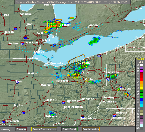 At 807 pm edt, a severe thunderstorm was located over chesterland, or 9 miles southeast of willowick, moving east at 25 mph (radar indicated). Hazards include 60 mph wind gusts. expect damage to trees and power lines At 807 pm edt, a severe thunderstorm was located over chesterland, or 9 miles southeast of willowick, moving east at 25 mph (radar indicated). Hazards include 60 mph wind gusts. expect damage to trees and power lines
|
| 6/16/2019 3:41 PM EDT |
 At 341 pm edt, a severe thunderstorm capable of producing a tornado was located near south russell, or 13 miles north of ravenna, moving east at 35 mph (radar indicated rotation). Hazards include tornado. Flying debris will be dangerous to those caught without shelter. mobile homes will be damaged or destroyed. damage to roofs, windows, and vehicles will occur. tree damage is likely. Locations impacted include, solon, south russell, middlefield, garrettsville, burton, mantua, aurora, parkman, chagrin falls, reminderville, windham, hiram and bainbridge. At 341 pm edt, a severe thunderstorm capable of producing a tornado was located near south russell, or 13 miles north of ravenna, moving east at 35 mph (radar indicated rotation). Hazards include tornado. Flying debris will be dangerous to those caught without shelter. mobile homes will be damaged or destroyed. damage to roofs, windows, and vehicles will occur. tree damage is likely. Locations impacted include, solon, south russell, middlefield, garrettsville, burton, mantua, aurora, parkman, chagrin falls, reminderville, windham, hiram and bainbridge.
|
| 6/16/2019 3:27 PM EDT |
 At 327 pm edt, a severe thunderstorm capable of producing a tornado was located over solon, or 15 miles southeast of cleveland, moving east at 30 mph (radar indicated rotation). Hazards include tornado and quarter size hail. Flying debris will be dangerous to those caught without shelter. mobile homes will be damaged or destroyed. damage to roofs, windows, and vehicles will occur. Tree damage is likely. At 327 pm edt, a severe thunderstorm capable of producing a tornado was located over solon, or 15 miles southeast of cleveland, moving east at 30 mph (radar indicated rotation). Hazards include tornado and quarter size hail. Flying debris will be dangerous to those caught without shelter. mobile homes will be damaged or destroyed. damage to roofs, windows, and vehicles will occur. Tree damage is likely.
|
| 5/30/2019 5:24 PM EDT |
 At 524 pm edt, severe thunderstorms were located along a line extending from near cleveland to near north royalton, moving east at 45 mph (radar indicated). Hazards include 60 mph wind gusts. Expect damage to trees and power lines. Locations impacted include, cleveland, parma, north royalton, solon, warrensville heights, highland hills, garfield heights, shaker heights, maple heights, broadview heights, brecksville, bedford, beachwood, seven hills, bedford heights, independence, pepper pike, chagrin falls, northfield and orange. At 524 pm edt, severe thunderstorms were located along a line extending from near cleveland to near north royalton, moving east at 45 mph (radar indicated). Hazards include 60 mph wind gusts. Expect damage to trees and power lines. Locations impacted include, cleveland, parma, north royalton, solon, warrensville heights, highland hills, garfield heights, shaker heights, maple heights, broadview heights, brecksville, bedford, beachwood, seven hills, bedford heights, independence, pepper pike, chagrin falls, northfield and orange.
|
| 5/30/2019 4:59 PM EDT |
 At 458 pm edt, severe thunderstorms were located along a line extending from near avon lake to near north ridgeville, moving east at 45 mph (radar indicated). Hazards include 60 mph wind gusts. expect damage to trees and power lines At 458 pm edt, severe thunderstorms were located along a line extending from near avon lake to near north ridgeville, moving east at 45 mph (radar indicated). Hazards include 60 mph wind gusts. expect damage to trees and power lines
|
| 5/28/2019 6:57 PM EDT |
 At 657 pm edt, a severe thunderstorm was located over avon lake, or 7 miles northeast of elyria, moving east at 50 mph (radar indicated). Hazards include 60 mph wind gusts and quarter size hail. Minor damage to vehicles is possible. Expect damage to trees and power lines. At 657 pm edt, a severe thunderstorm was located over avon lake, or 7 miles northeast of elyria, moving east at 50 mph (radar indicated). Hazards include 60 mph wind gusts and quarter size hail. Minor damage to vehicles is possible. Expect damage to trees and power lines.
|
| 5/23/2019 8:40 AM EDT |
 At 839 am edt, severe thunderstorms were located along a line extending from near twinsburg to 6 miles northwest of mount eaton, moving east at 60 mph (radar indicated). Hazards include 60 mph wind gusts. Expect damage to trees and power lines. Locations impacted include, cleveland, akron, canton, wooster, painesville, willowick, millersburg, cuyahoga falls, euclid, mentor, cleveland heights, massillon, kent, barberton, green, solon, willoughby, hudson, wadsworth and twinsburg. At 839 am edt, severe thunderstorms were located along a line extending from near twinsburg to 6 miles northwest of mount eaton, moving east at 60 mph (radar indicated). Hazards include 60 mph wind gusts. Expect damage to trees and power lines. Locations impacted include, cleveland, akron, canton, wooster, painesville, willowick, millersburg, cuyahoga falls, euclid, mentor, cleveland heights, massillon, kent, barberton, green, solon, willoughby, hudson, wadsworth and twinsburg.
|
| 5/23/2019 8:38 AM EDT |
 At 837 am edt, severe thunderstorms were located along a line extending from painesville to hudson, moving northeast at 60 mph (radar indicated). Hazards include 60 mph wind gusts. expect damage to trees and power lines At 837 am edt, severe thunderstorms were located along a line extending from painesville to hudson, moving northeast at 60 mph (radar indicated). Hazards include 60 mph wind gusts. expect damage to trees and power lines
|
| 5/23/2019 8:32 AM EDT |
 At 832 am edt, severe thunderstorms were located along a line extending from near macedonia to near wooster, moving east at 45 mph (radar indicated). Hazards include 60 mph wind gusts. Expect damage to trees and power lines. Locations impacted include, cleveland, akron, canton, medina, wooster, painesville, mount vernon, willowick, millersburg, parma, cuyahoga falls, euclid, mentor, cleveland heights, strongsville, brunswick, massillon, north royalton, kent and barberton. At 832 am edt, severe thunderstorms were located along a line extending from near macedonia to near wooster, moving east at 45 mph (radar indicated). Hazards include 60 mph wind gusts. Expect damage to trees and power lines. Locations impacted include, cleveland, akron, canton, medina, wooster, painesville, mount vernon, willowick, millersburg, parma, cuyahoga falls, euclid, mentor, cleveland heights, strongsville, brunswick, massillon, north royalton, kent and barberton.
|
| 5/23/2019 8:19 AM EDT |
 At 819 am edt, severe thunderstorms were located along a line extending from near north royalton to near shreve, moving east at 45 mph (radar indicated). Hazards include 60 mph wind gusts. Expect damage to trees and power lines. Locations impacted include, cleveland, akron, canton, medina, wooster, painesville, mount vernon, willowick, millersburg, parma, lakewood, cuyahoga falls, euclid, mentor, cleveland heights, strongsville, brunswick, westlake, massillon and north royalton. At 819 am edt, severe thunderstorms were located along a line extending from near north royalton to near shreve, moving east at 45 mph (radar indicated). Hazards include 60 mph wind gusts. Expect damage to trees and power lines. Locations impacted include, cleveland, akron, canton, medina, wooster, painesville, mount vernon, willowick, millersburg, parma, lakewood, cuyahoga falls, euclid, mentor, cleveland heights, strongsville, brunswick, westlake, massillon and north royalton.
|
| 5/23/2019 8:17 AM EDT |
 At 817 am edt, severe thunderstorms were located along a line extending from near north royalton to near shreve, moving east at 45 mph (radar indicated). Hazards include 60 mph wind gusts. expect damage to trees and power lines At 817 am edt, severe thunderstorms were located along a line extending from near north royalton to near shreve, moving east at 45 mph (radar indicated). Hazards include 60 mph wind gusts. expect damage to trees and power lines
|
| 4/14/2019 6:12 PM EDT |
 At 612 pm edt, a severe thunderstorm was located near euclid, or near willowick, moving east at 50 mph (radar indicated). Hazards include 60 mph wind gusts and penny size hail. Expect damage to trees and power lines. Locations impacted include, cleveland, painesville, willowick, fairport harbor, euclid, mentor, cleveland heights, solon, willoughby, eastlake, warrensville heights, south russell, highland hills, timberlake, lakeline, chesterland, garfield heights, shaker heights, maple heights and south euclid. At 612 pm edt, a severe thunderstorm was located near euclid, or near willowick, moving east at 50 mph (radar indicated). Hazards include 60 mph wind gusts and penny size hail. Expect damage to trees and power lines. Locations impacted include, cleveland, painesville, willowick, fairport harbor, euclid, mentor, cleveland heights, solon, willoughby, eastlake, warrensville heights, south russell, highland hills, timberlake, lakeline, chesterland, garfield heights, shaker heights, maple heights and south euclid.
|
| 4/14/2019 6:03 PM EDT |
 At 603 pm edt, a severe thunderstorm was located over cleveland heights, or near cleveland, moving northeast at 55 mph (radar indicated). Hazards include 60 mph wind gusts and penny size hail. Expect damage to trees and power lines. Locations impacted include, cleveland, painesville, willowick, fairport harbor, euclid, mentor, cleveland heights, solon, willoughby, eastlake, warrensville heights, south russell, highland hills, timberlake, lakeline, chesterland, garfield heights, shaker heights, maple heights and south euclid. At 603 pm edt, a severe thunderstorm was located over cleveland heights, or near cleveland, moving northeast at 55 mph (radar indicated). Hazards include 60 mph wind gusts and penny size hail. Expect damage to trees and power lines. Locations impacted include, cleveland, painesville, willowick, fairport harbor, euclid, mentor, cleveland heights, solon, willoughby, eastlake, warrensville heights, south russell, highland hills, timberlake, lakeline, chesterland, garfield heights, shaker heights, maple heights and south euclid.
|
| 4/14/2019 5:51 PM EDT |
 At 551 pm edt, a severe thunderstorm was located over lakewood, or near cleveland, moving east at 55 mph (radar indicated). Hazards include 60 mph wind gusts and penny size hail. expect damage to trees and power lines At 551 pm edt, a severe thunderstorm was located over lakewood, or near cleveland, moving east at 55 mph (radar indicated). Hazards include 60 mph wind gusts and penny size hail. expect damage to trees and power lines
|
| 1/8/2019 4:25 PM EST | Tree down on quinn road in auburn townshi in geauga county OH, 7.1 miles NW of Chagrin Falls, OH |
| 1/8/2019 4:21 PM EST |
 At 420 pm est, a severe thunderstorm was located near mantua, or 12 miles north of ravenna, moving east at 60 mph (radar indicated). Hazards include 60 mph wind gusts and quarter size hail. Minor damage to vehicles is possible. expect damage to trees and power lines. Locations impacted include, cleveland, parma, lakewood, euclid, cleveland heights, strongsville, north royalton, solon, hudson, twinsburg, warrensville heights, macedonia, highland hills, garfield heights, shaker heights, maple heights, south euclid, parma heights, rocky river and broadview heights. At 420 pm est, a severe thunderstorm was located near mantua, or 12 miles north of ravenna, moving east at 60 mph (radar indicated). Hazards include 60 mph wind gusts and quarter size hail. Minor damage to vehicles is possible. expect damage to trees and power lines. Locations impacted include, cleveland, parma, lakewood, euclid, cleveland heights, strongsville, north royalton, solon, hudson, twinsburg, warrensville heights, macedonia, highland hills, garfield heights, shaker heights, maple heights, south euclid, parma heights, rocky river and broadview heights.
|
| 1/8/2019 3:44 PM EST |
 At 344 pm est, a severe thunderstorm was located over grafton, or 8 miles southeast of elyria, moving east at 45 mph (radar indicated). Hazards include 60 mph wind gusts and quarter size hail. Minor damage to vehicles is possible. Expect damage to trees and power lines. At 344 pm est, a severe thunderstorm was located over grafton, or 8 miles southeast of elyria, moving east at 45 mph (radar indicated). Hazards include 60 mph wind gusts and quarter size hail. Minor damage to vehicles is possible. Expect damage to trees and power lines.
|
| 12/2/2018 6:36 PM EST |
 At 635 pm est, severe thunderstorms were located along a line extending from chardon to near south russell, moving northeast at 50 mph (radar indicated. there have been reports of minor wind damage with several trees and power lines blown down with these storms ). Hazards include 60 mph wind gusts. expect damage to trees and power lines At 635 pm est, severe thunderstorms were located along a line extending from chardon to near south russell, moving northeast at 50 mph (radar indicated. there have been reports of minor wind damage with several trees and power lines blown down with these storms ). Hazards include 60 mph wind gusts. expect damage to trees and power lines
|
| 10/20/2018 5:05 PM EDT |
 The severe thunderstorm warning for cuyahoga county will expire at 515 pm edt, the storm which prompted the warning has weakened below severe limits, and has exited the warned area. therefore, the warning will be allowed to expire. The severe thunderstorm warning for cuyahoga county will expire at 515 pm edt, the storm which prompted the warning has weakened below severe limits, and has exited the warned area. therefore, the warning will be allowed to expire.
|
| 10/20/2018 4:39 PM EDT |
 At 439 pm edt, strong winds from a thunderstorm outflow were located near parma, or near cleveland, moving east at 45 mph (radar indicated). Hazards include 60 mph wind gusts. Expect damage to trees and power lines. Locations impacted include, cleveland, parma, lakewood, euclid, cleveland heights, strongsville, westlake, north royalton, solon, warrensville heights, highland hills, north olmsted, garfield heights, shaker heights, maple heights, south euclid, parma heights, rocky river, broadview heights and brook park. At 439 pm edt, strong winds from a thunderstorm outflow were located near parma, or near cleveland, moving east at 45 mph (radar indicated). Hazards include 60 mph wind gusts. Expect damage to trees and power lines. Locations impacted include, cleveland, parma, lakewood, euclid, cleveland heights, strongsville, westlake, north royalton, solon, warrensville heights, highland hills, north olmsted, garfield heights, shaker heights, maple heights, south euclid, parma heights, rocky river, broadview heights and brook park.
|
| 10/20/2018 4:21 PM EDT |
 At 420 pm edt, strong winds from a thunderstorm outflow were located over westlake, or 7 miles northeast of elyria, moving east at 45 mph (radar indicated). Hazards include 70 mph wind gusts. Expect considerable tree damage. Damage is likely to mobile homes, roofs, and outbuildings. At 420 pm edt, strong winds from a thunderstorm outflow were located over westlake, or 7 miles northeast of elyria, moving east at 45 mph (radar indicated). Hazards include 70 mph wind gusts. Expect considerable tree damage. Damage is likely to mobile homes, roofs, and outbuildings.
|
| 9/21/2018 4:33 PM EDT |
 A severe thunderstorm warning remains in effect until 515 pm edt for geauga. northeastern cuyahoga and lake counties. at 433 pm edt, a severe thunderstorm was located near cleveland heights, or near willowick, moving east at 40 mph. hazard. 60 mph wind gusts. source. Radar indicated. A severe thunderstorm warning remains in effect until 515 pm edt for geauga. northeastern cuyahoga and lake counties. at 433 pm edt, a severe thunderstorm was located near cleveland heights, or near willowick, moving east at 40 mph. hazard. 60 mph wind gusts. source. Radar indicated.
|
| 9/21/2018 4:24 PM EDT |
 The national weather service in cleveland has issued a * severe thunderstorm warning for. geauga county in northeastern ohio. eastern cuyahoga county in northeastern ohio. lake county in northeastern ohio. Until 515 pm edt. The national weather service in cleveland has issued a * severe thunderstorm warning for. geauga county in northeastern ohio. eastern cuyahoga county in northeastern ohio. lake county in northeastern ohio. Until 515 pm edt.
|
| 9/5/2018 6:49 PM EDT |
 At 649 pm edt, a severe thunderstorm was located near parma, or near cleveland, moving northeast at 20 mph (radar indicated). Hazards include 60 mph wind gusts and penny size hail. expect damage to trees and power lines At 649 pm edt, a severe thunderstorm was located near parma, or near cleveland, moving northeast at 20 mph (radar indicated). Hazards include 60 mph wind gusts and penny size hail. expect damage to trees and power lines
|
| 8/29/2018 3:50 PM EDT |
 At 349 pm edt, a severe thunderstorm was located over macedonia, or 15 miles southeast of cleveland, moving east at 30 mph (radar indicated). Hazards include 60 mph wind gusts and quarter size hail. Minor damage to vehicles is possible. expect damage to trees and power lines. Locations impacted include, akron, cuyahoga falls, north royalton, kent, solon, hudson, twinsburg, tallmadge, streetsboro, macedonia, mogadore, south russell, stow, garfield heights, maple heights, broadview heights, aurora, brecksville, bedford and seven hills. At 349 pm edt, a severe thunderstorm was located over macedonia, or 15 miles southeast of cleveland, moving east at 30 mph (radar indicated). Hazards include 60 mph wind gusts and quarter size hail. Minor damage to vehicles is possible. expect damage to trees and power lines. Locations impacted include, akron, cuyahoga falls, north royalton, kent, solon, hudson, twinsburg, tallmadge, streetsboro, macedonia, mogadore, south russell, stow, garfield heights, maple heights, broadview heights, aurora, brecksville, bedford and seven hills.
|
| 8/29/2018 3:23 PM EDT |
 At 323 pm edt, a severe thunderstorm was located over north royalton, or 12 miles northeast of medina, moving southeast at 30 mph (radar indicated). Hazards include 60 mph wind gusts and quarter size hail. Minor damage to vehicles is possible. Expect damage to trees and power lines. At 323 pm edt, a severe thunderstorm was located over north royalton, or 12 miles northeast of medina, moving southeast at 30 mph (radar indicated). Hazards include 60 mph wind gusts and quarter size hail. Minor damage to vehicles is possible. Expect damage to trees and power lines.
|
| 8/7/2018 12:06 AM EDT |
 At 1205 am edt, a severe thunderstorm was located over north royalton, or 13 miles south of cleveland, moving east at 15 mph (radar indicated). Hazards include 60 mph wind gusts. Expect damage to trees and power lines. Locations impacted include, strongsville, westlake, north royalton, solon, warrensville heights, highland hills, north olmsted, garfield heights, shaker heights, maple heights, south euclid, parma heights, rocky river, broadview heights and brook park. At 1205 am edt, a severe thunderstorm was located over north royalton, or 13 miles south of cleveland, moving east at 15 mph (radar indicated). Hazards include 60 mph wind gusts. Expect damage to trees and power lines. Locations impacted include, strongsville, westlake, north royalton, solon, warrensville heights, highland hills, north olmsted, garfield heights, shaker heights, maple heights, south euclid, parma heights, rocky river, broadview heights and brook park.
|
| 8/6/2018 11:55 PM EDT |
 At 1133 pm edt, severe thunderstorms were located along a line extending from near euclid to near cleveland to strongsville to 7 miles west of grafton, moving east at 30 mph. reports from east of lorain to near sheffield lake indicate some tree damage has occured with this storm (radar indicated). Hazards include 60 mph wind gusts. Expect damage to trees and power lines. Locations impacted include, cleveland, lorain, elyria, parma, lakewood, euclid, cleveland heights, strongsville, westlake, north royalton, north ridgeville, solon, avon lake, warrensville heights, grafton, highland hills, north olmsted, garfield heights, shaker heights and maple heights. At 1133 pm edt, severe thunderstorms were located along a line extending from near euclid to near cleveland to strongsville to 7 miles west of grafton, moving east at 30 mph. reports from east of lorain to near sheffield lake indicate some tree damage has occured with this storm (radar indicated). Hazards include 60 mph wind gusts. Expect damage to trees and power lines. Locations impacted include, cleveland, lorain, elyria, parma, lakewood, euclid, cleveland heights, strongsville, westlake, north royalton, north ridgeville, solon, avon lake, warrensville heights, grafton, highland hills, north olmsted, garfield heights, shaker heights and maple heights.
|
| 8/6/2018 11:34 PM EDT |
 At 1133 pm edt, severe thunderstorms were located along a line extending from near euclid to near cleveland to strongsville to 7 miles west of grafton, moving east at 30 mph. reports from east of lorain to near sheffield lake indicate some tree damage has occured with this storm (radar indicated). Hazards include 60 mph wind gusts. Expect damage to trees and power lines. Locations impacted include, cleveland, lorain, elyria, parma, lakewood, euclid, cleveland heights, strongsville, westlake, north royalton, north ridgeville, solon, avon lake, warrensville heights, grafton, highland hills, north olmsted, garfield heights, shaker heights and maple heights. At 1133 pm edt, severe thunderstorms were located along a line extending from near euclid to near cleveland to strongsville to 7 miles west of grafton, moving east at 30 mph. reports from east of lorain to near sheffield lake indicate some tree damage has occured with this storm (radar indicated). Hazards include 60 mph wind gusts. Expect damage to trees and power lines. Locations impacted include, cleveland, lorain, elyria, parma, lakewood, euclid, cleveland heights, strongsville, westlake, north royalton, north ridgeville, solon, avon lake, warrensville heights, grafton, highland hills, north olmsted, garfield heights, shaker heights and maple heights.
|
| 8/6/2018 11:09 PM EDT |
 At 1108 pm edt, severe thunderstorms were located along a line extending from 9 miles northwest of cleveland to near lakewood to near elyria, moving east at 30 mph (radar indicated). Hazards include 60 mph wind gusts. expect damage to trees and power lines At 1108 pm edt, severe thunderstorms were located along a line extending from 9 miles northwest of cleveland to near lakewood to near elyria, moving east at 30 mph (radar indicated). Hazards include 60 mph wind gusts. expect damage to trees and power lines
|
| 7/26/2018 6:30 PM EDT |
 At 630 pm edt, a severe thunderstorm was located over south russell, or 10 miles southwest of chardon, moving east at 60 mph (radar indicated). Hazards include 60 mph wind gusts and quarter size hail. Minor damage to vehicles is possible. expect damage to trees and power lines. Locations impacted include, chardon, south russell, middlefield, burton, chesterland, chagrin falls, huntsburg, claridon, gates mills, montville, hunting valley and aquilla. At 630 pm edt, a severe thunderstorm was located over south russell, or 10 miles southwest of chardon, moving east at 60 mph (radar indicated). Hazards include 60 mph wind gusts and quarter size hail. Minor damage to vehicles is possible. expect damage to trees and power lines. Locations impacted include, chardon, south russell, middlefield, burton, chesterland, chagrin falls, huntsburg, claridon, gates mills, montville, hunting valley and aquilla.
|
| 7/26/2018 6:14 PM EDT |
 At 614 pm edt, a severe thunderstorm was located over chesterland, or 8 miles southeast of willowick, moving east at 45 mph (radar indicated). Hazards include 60 mph wind gusts and quarter size hail. Minor damage to vehicles is possible. expect damage to trees and power lines. Locations impacted include, cleveland, euclid, cleveland heights, solon, warrensville heights, highland hills, shaker heights, south euclid, mayfield heights, east cleveland, lyndhurst, university heights, wickliffe, beachwood, richmond heights, willoughby hills, highland heights, pepper pike, chagrin falls and mayfield. At 614 pm edt, a severe thunderstorm was located over chesterland, or 8 miles southeast of willowick, moving east at 45 mph (radar indicated). Hazards include 60 mph wind gusts and quarter size hail. Minor damage to vehicles is possible. expect damage to trees and power lines. Locations impacted include, cleveland, euclid, cleveland heights, solon, warrensville heights, highland hills, shaker heights, south euclid, mayfield heights, east cleveland, lyndhurst, university heights, wickliffe, beachwood, richmond heights, willoughby hills, highland heights, pepper pike, chagrin falls and mayfield.
|
| 7/26/2018 6:09 PM EDT |
 At 608 pm edt, a severe thunderstorm was located over chesterland, or 7 miles southwest of chardon, moving east at 50 mph (radar indicated). Hazards include 60 mph wind gusts and quarter size hail. Minor damage to vehicles is possible. Expect damage to trees and power lines. At 608 pm edt, a severe thunderstorm was located over chesterland, or 7 miles southwest of chardon, moving east at 50 mph (radar indicated). Hazards include 60 mph wind gusts and quarter size hail. Minor damage to vehicles is possible. Expect damage to trees and power lines.
|
| 7/26/2018 5:49 PM EDT |
 At 548 pm edt, a severe thunderstorm was located near cleveland, moving east at 40 mph (radar indicated). Hazards include 60 mph wind gusts and quarter size hail. Minor damage to vehicles is possible. Expect damage to trees and power lines. At 548 pm edt, a severe thunderstorm was located near cleveland, moving east at 40 mph (radar indicated). Hazards include 60 mph wind gusts and quarter size hail. Minor damage to vehicles is possible. Expect damage to trees and power lines.
|
| 7/5/2018 4:02 PM EDT |
 At 341 pm edt, a severe thunderstorm was located over lakewood, or near cleveland, moving northeast at 30 mph. another thunderstorm was located near strongsville moving east at 30 mph. (radar indicated). Hazards include 60 mph wind gusts and quarter size hail. Minor damage to vehicles is possible. Expect damage to trees and power lines. At 341 pm edt, a severe thunderstorm was located over lakewood, or near cleveland, moving northeast at 30 mph. another thunderstorm was located near strongsville moving east at 30 mph. (radar indicated). Hazards include 60 mph wind gusts and quarter size hail. Minor damage to vehicles is possible. Expect damage to trees and power lines.
|
| 7/5/2018 3:42 PM EDT |
 At 341 pm edt, a severe thunderstorm was located over lakewood, or near cleveland, moving northeast at 30 mph. another thunderstorm was located near strongsville moving east at 30 mph. (radar indicated). Hazards include 60 mph wind gusts and quarter size hail. Minor damage to vehicles is possible. Expect damage to trees and power lines. At 341 pm edt, a severe thunderstorm was located over lakewood, or near cleveland, moving northeast at 30 mph. another thunderstorm was located near strongsville moving east at 30 mph. (radar indicated). Hazards include 60 mph wind gusts and quarter size hail. Minor damage to vehicles is possible. Expect damage to trees and power lines.
|
| 5/31/2018 5:00 PM EDT |
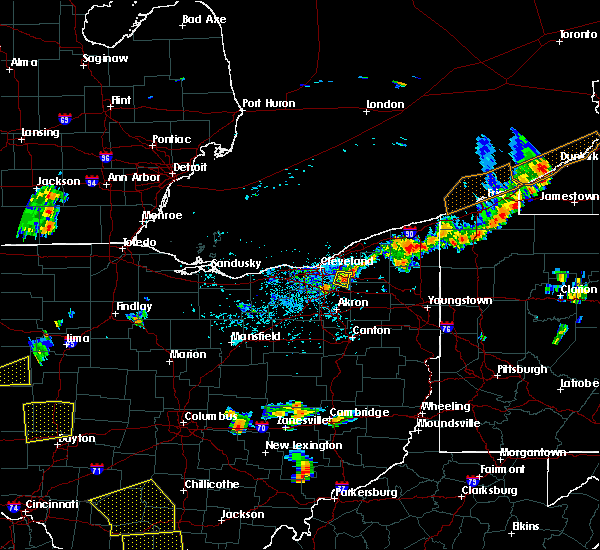 At 500 pm edt, a severe thunderstorm was located over solon, moving east at 25 mph (radar indicated). Hazards include 60 mph wind gusts. Expect damage to trees and power lines. Locations impacted include, solon, twinsburg, warrensville heights, macedonia, south russell, highland hills, bedford, bedford heights, chagrin falls, northfield, reminderville, orange, moreland hills, walton hills, glenwillow and bentleyville. At 500 pm edt, a severe thunderstorm was located over solon, moving east at 25 mph (radar indicated). Hazards include 60 mph wind gusts. Expect damage to trees and power lines. Locations impacted include, solon, twinsburg, warrensville heights, macedonia, south russell, highland hills, bedford, bedford heights, chagrin falls, northfield, reminderville, orange, moreland hills, walton hills, glenwillow and bentleyville.
|
| 5/31/2018 4:39 PM EDT |
 At 439 pm edt, a severe thunderstorm was located near warrensville heights, or 10 miles southeast of cleveland, moving east at 25 mph (radar indicated). Hazards include 60 mph wind gusts. expect damage to trees and power lines At 439 pm edt, a severe thunderstorm was located near warrensville heights, or 10 miles southeast of cleveland, moving east at 25 mph (radar indicated). Hazards include 60 mph wind gusts. expect damage to trees and power lines
|
| 5/31/2018 3:51 PM EDT |
 At 350 pm edt, a severe thunderstorm was located over south russell, or 12 miles southwest of chardon, moving northeast at 10 mph (radar indicated). Hazards include 60 mph wind gusts. Expect damage to trees and power lines. Locations impacted include, chardon, south russell, middlefield, burton, chesterland, kirtland, parkman, chagrin falls, huntsburg, claridon, montville, bainbridge, hunting valley, thompson and aquilla. At 350 pm edt, a severe thunderstorm was located over south russell, or 12 miles southwest of chardon, moving northeast at 10 mph (radar indicated). Hazards include 60 mph wind gusts. Expect damage to trees and power lines. Locations impacted include, chardon, south russell, middlefield, burton, chesterland, kirtland, parkman, chagrin falls, huntsburg, claridon, montville, bainbridge, hunting valley, thompson and aquilla.
|
| 5/31/2018 3:29 PM EDT |
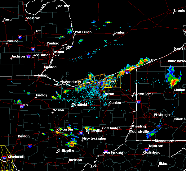 The national weather service in cleveland has issued a * severe thunderstorm warning for. geauga county in northeastern ohio. east central cuyahoga county in northeastern ohio. Until 415 pm edt * at 329 pm edt, a severe thunderstorm was located over solon, or 14. The national weather service in cleveland has issued a * severe thunderstorm warning for. geauga county in northeastern ohio. east central cuyahoga county in northeastern ohio. Until 415 pm edt * at 329 pm edt, a severe thunderstorm was located over solon, or 14.
|
| 5/22/2018 2:31 PM EDT |
 At 229 pm edt, a severe thunderstorm was located near richfield, or 10 miles north of akron, moving east at 35 mph. damaging winds will sweep through peninsula and hudson by 245 pm (radar indicated). Hazards include 70 mph wind gusts and quarter size hail. Minor damage to vehicles is possible. expect considerable tree damage. wind damage is also likely to mobile homes, roofs, and outbuildings. Locations impacted include, akron, medina, parma, cuyahoga falls, strongsville, brunswick, north royalton, kent, barberton, solon, hudson, wadsworth, twinsburg, tallmadge, streetsboro, warrensville heights, macedonia, rittman, mogadore and south russell. At 229 pm edt, a severe thunderstorm was located near richfield, or 10 miles north of akron, moving east at 35 mph. damaging winds will sweep through peninsula and hudson by 245 pm (radar indicated). Hazards include 70 mph wind gusts and quarter size hail. Minor damage to vehicles is possible. expect considerable tree damage. wind damage is also likely to mobile homes, roofs, and outbuildings. Locations impacted include, akron, medina, parma, cuyahoga falls, strongsville, brunswick, north royalton, kent, barberton, solon, hudson, wadsworth, twinsburg, tallmadge, streetsboro, warrensville heights, macedonia, rittman, mogadore and south russell.
|
| 5/22/2018 2:25 PM EDT |
 At 223 pm edt, a severe thunderstorm was located near cuyahoga falls, or 11 miles north of akron, moving east at 35 mph (radar indicated. quarter sized hail was reported in north royalton with this storm). Hazards include 60 mph wind gusts and quarter size hail. Minor damage to vehicles is possible. expect damage to trees and power lines. torrential rainfall is also occurring with this storm. Locations impacted include, akron, medina, parma, cuyahoga falls, strongsville, brunswick, north royalton, kent, barberton, solon, hudson, wadsworth, twinsburg, tallmadge, streetsboro, warrensville heights, macedonia, rittman, mogadore and south russell. At 223 pm edt, a severe thunderstorm was located near cuyahoga falls, or 11 miles north of akron, moving east at 35 mph (radar indicated. quarter sized hail was reported in north royalton with this storm). Hazards include 60 mph wind gusts and quarter size hail. Minor damage to vehicles is possible. expect damage to trees and power lines. torrential rainfall is also occurring with this storm. Locations impacted include, akron, medina, parma, cuyahoga falls, strongsville, brunswick, north royalton, kent, barberton, solon, hudson, wadsworth, twinsburg, tallmadge, streetsboro, warrensville heights, macedonia, rittman, mogadore and south russell.
|
| 5/22/2018 2:12 PM EDT |
 At 212 pm edt, a severe thunderstorm was located near brunswick, or 9 miles northeast of medina, moving southeast at 35 mph (radar indicated). Hazards include 60 mph wind gusts and quarter size hail. Minor damage to vehicles is possible. Expect damage to trees and power lines. At 212 pm edt, a severe thunderstorm was located near brunswick, or 9 miles northeast of medina, moving southeast at 35 mph (radar indicated). Hazards include 60 mph wind gusts and quarter size hail. Minor damage to vehicles is possible. Expect damage to trees and power lines.
|
| 5/22/2018 1:48 PM EDT |
 At 148 pm edt, a severe thunderstorm was located near parma, or 9 miles southwest of cleveland, moving east at 25 mph (radar indicated). Hazards include 60 mph wind gusts and quarter size hail. Minor damage to vehicles is possible. expect damage to trees and power lines. Locations impacted include, cleveland, parma, lakewood, euclid, cleveland heights, strongsville, brunswick, westlake, north royalton, north ridgeville, solon, avon lake, warrensville heights, south russell, highland hills, north olmsted, garfield heights, shaker heights, maple heights and south euclid. At 148 pm edt, a severe thunderstorm was located near parma, or 9 miles southwest of cleveland, moving east at 25 mph (radar indicated). Hazards include 60 mph wind gusts and quarter size hail. Minor damage to vehicles is possible. expect damage to trees and power lines. Locations impacted include, cleveland, parma, lakewood, euclid, cleveland heights, strongsville, brunswick, westlake, north royalton, north ridgeville, solon, avon lake, warrensville heights, south russell, highland hills, north olmsted, garfield heights, shaker heights, maple heights and south euclid.
|
| 5/22/2018 1:23 PM EDT |
 At 123 pm edt, a severe thunderstorm was located over westlake, or 10 miles west of cleveland, moving northeast at 55 mph (radar indicated). Hazards include 60 mph wind gusts and quarter size hail. Minor damage to vehicles is possible. Expect damage to trees and power lines. At 123 pm edt, a severe thunderstorm was located over westlake, or 10 miles west of cleveland, moving northeast at 55 mph (radar indicated). Hazards include 60 mph wind gusts and quarter size hail. Minor damage to vehicles is possible. Expect damage to trees and power lines.
|
| 11/5/2017 7:18 PM EDT | Multiple trees down in bainbridge townshi in geauga county OH, 3.8 miles NW of Chagrin Falls, OH |
| 11/5/2017 7:18 PM EDT |
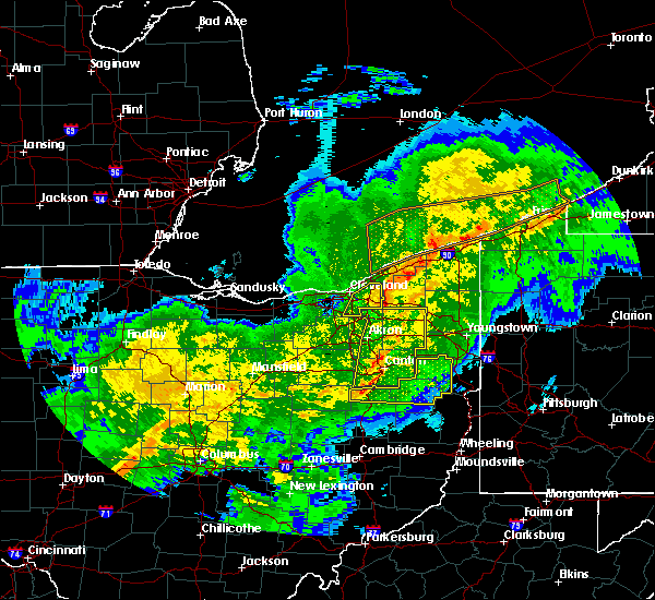 At 618 pm est, severe thunderstorms were located along a line extending from near chardon to near solon, moving east at 60 mph. these are very dangerous storms (radar indicated). Hazards include 80 mph wind gusts. Flying debris will be dangerous to those caught without shelter. mobile homes will be heavily damaged. expect considerable damage to roofs, windows, and vehicles. Extensive tree damage and power outages are likely. At 618 pm est, severe thunderstorms were located along a line extending from near chardon to near solon, moving east at 60 mph. these are very dangerous storms (radar indicated). Hazards include 80 mph wind gusts. Flying debris will be dangerous to those caught without shelter. mobile homes will be heavily damaged. expect considerable damage to roofs, windows, and vehicles. Extensive tree damage and power outages are likely.
|
| 11/5/2017 7:09 PM EDT |
 At 608 pm est, a severe thunderstorm was located near macedonia, or 14 miles southeast of cleveland, moving east at 65 mph. this is a very dangerous storm (radar indicated). Hazards include 80 mph wind gusts and quarter size hail. Flying debris will be dangerous to those caught without shelter. mobile homes will be heavily damaged. expect considerable damage to roofs, windows, and vehicles. extensive tree damage and power outages are likely. locations impacted include, cleveland, parma, cleveland heights, north royalton, solon, warrensville heights, south russell, highland hills, garfield heights, shaker heights, maple heights, south euclid, broadview heights, mayfield heights, lyndhurst, brecksville, university heights, bedford, beachwood and seven hills. A tornado watch remains in effect until 700 pm est for northeastern ohio. At 608 pm est, a severe thunderstorm was located near macedonia, or 14 miles southeast of cleveland, moving east at 65 mph. this is a very dangerous storm (radar indicated). Hazards include 80 mph wind gusts and quarter size hail. Flying debris will be dangerous to those caught without shelter. mobile homes will be heavily damaged. expect considerable damage to roofs, windows, and vehicles. extensive tree damage and power outages are likely. locations impacted include, cleveland, parma, cleveland heights, north royalton, solon, warrensville heights, south russell, highland hills, garfield heights, shaker heights, maple heights, south euclid, broadview heights, mayfield heights, lyndhurst, brecksville, university heights, bedford, beachwood and seven hills. A tornado watch remains in effect until 700 pm est for northeastern ohio.
|
| 11/5/2017 7:03 PM EDT |
 At 602 pm est, a severe thunderstorm was located over north royalton, or 14 miles south of cleveland, moving east at 70 mph (radar indicated). Hazards include 70 mph wind gusts and quarter size hail. Minor damage to vehicles is possible. expect considerable tree damage. Wind damage is also likely to mobile homes, roofs, and outbuildings. At 602 pm est, a severe thunderstorm was located over north royalton, or 14 miles south of cleveland, moving east at 70 mph (radar indicated). Hazards include 70 mph wind gusts and quarter size hail. Minor damage to vehicles is possible. expect considerable tree damage. Wind damage is also likely to mobile homes, roofs, and outbuildings.
|
| 8/4/2017 3:11 PM EDT |
 At 310 pm edt, severe thunderstorms were located along a line extending from near south russell to near mantua to near hartville, moving northeast at 50 mph (radar indicated). Hazards include 60 mph wind gusts. expect damage to trees and power lines At 310 pm edt, severe thunderstorms were located along a line extending from near south russell to near mantua to near hartville, moving northeast at 50 mph (radar indicated). Hazards include 60 mph wind gusts. expect damage to trees and power lines
|
| 7/7/2017 7:57 AM EDT |
 The national weather service in cleveland has issued a * severe thunderstorm warning for. portage county in northeastern ohio. southern geauga county in northeastern ohio. summit county in northeastern ohio. Until 900 am edt. The national weather service in cleveland has issued a * severe thunderstorm warning for. portage county in northeastern ohio. southern geauga county in northeastern ohio. summit county in northeastern ohio. Until 900 am edt.
|
| 7/7/2017 7:48 AM EDT |
 At 748 am edt, severe thunderstorms were located along a line extending from 8 miles west of euclid to cleveland to near strongsville to near grafton, moving east at 30 mph (radar indicated). Hazards include 60 mph wind gusts. Expect damage to trees and power lines. Locations impacted include, cleveland, parma, euclid, cleveland heights, strongsville, north royalton, solon, warrensville heights, south russell, highland hills, garfield heights, shaker heights, maple heights, south euclid, parma heights, broadview heights, brook park, mayfield heights, berea and east cleveland. At 748 am edt, severe thunderstorms were located along a line extending from 8 miles west of euclid to cleveland to near strongsville to near grafton, moving east at 30 mph (radar indicated). Hazards include 60 mph wind gusts. Expect damage to trees and power lines. Locations impacted include, cleveland, parma, euclid, cleveland heights, strongsville, north royalton, solon, warrensville heights, south russell, highland hills, garfield heights, shaker heights, maple heights, south euclid, parma heights, broadview heights, brook park, mayfield heights, berea and east cleveland.
|
| 7/7/2017 7:23 AM EDT |
 At 723 am edt, severe thunderstorms were located along a line extending from 13 miles north of lakewood to near avon lake to elyria to 8 miles south of amherst, moving east at 45 mph (radar indicated). Hazards include 60 mph wind gusts. Expect damage to trees and power lines. Locations impacted include, cleveland, lorain, elyria, vermilion, parma, lakewood, euclid, cleveland heights, strongsville, westlake, north royalton, north ridgeville, solon, avon lake, warrensville heights, amherst, grafton, south russell, highland hills and north olmsted. At 723 am edt, severe thunderstorms were located along a line extending from 13 miles north of lakewood to near avon lake to elyria to 8 miles south of amherst, moving east at 45 mph (radar indicated). Hazards include 60 mph wind gusts. Expect damage to trees and power lines. Locations impacted include, cleveland, lorain, elyria, vermilion, parma, lakewood, euclid, cleveland heights, strongsville, westlake, north royalton, north ridgeville, solon, avon lake, warrensville heights, amherst, grafton, south russell, highland hills and north olmsted.
|
| 7/7/2017 7:08 AM EDT |
 At 708 am edt, severe thunderstorms were located along a line extending from 16 miles north of avon lake to 10 miles north of lorain to near western vermilion, moving east at 30 mph (radar indicated). Hazards include 70 mph wind gusts. Expect considerable tree damage. Damage is likely to mobile homes, roofs, and outbuildings. At 708 am edt, severe thunderstorms were located along a line extending from 16 miles north of avon lake to 10 miles north of lorain to near western vermilion, moving east at 30 mph (radar indicated). Hazards include 70 mph wind gusts. Expect considerable tree damage. Damage is likely to mobile homes, roofs, and outbuildings.
|
| 5/30/2017 12:27 AM EDT |
 The severe thunderstorm warning for eastern cuyahoga county will expire at 1230 am edt, the storm which prompted the warning has weakened below severe limits, and has moved east of cuyahoga county. therefore, the warning will be allowed to expire. The severe thunderstorm warning for eastern cuyahoga county will expire at 1230 am edt, the storm which prompted the warning has weakened below severe limits, and has moved east of cuyahoga county. therefore, the warning will be allowed to expire.
|
| 5/30/2017 12:11 AM EDT |
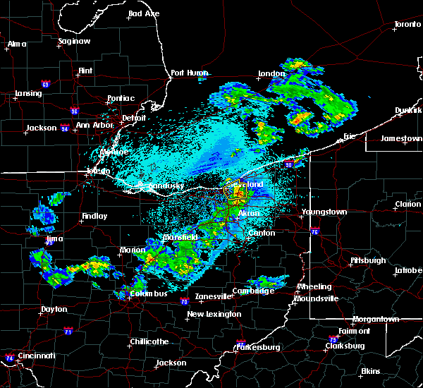 At 1210 am edt, a severe thunderstorm was located over warrensville heights, or 12 miles southeast of cleveland, moving east at 40 mph (radar indicated). Hazards include 60 mph wind gusts and quarter size hail. Minor damage to vehicles is possible. expect damage to trees and power lines. Locations impacted include, cleveland, euclid, cleveland heights, solon, warrensville heights, highland hills, garfield heights, shaker heights, maple heights, south euclid, mayfield heights, east cleveland, lyndhurst, brecksville, university heights, bedford, beachwood, bedford heights and richmond heights. At 1210 am edt, a severe thunderstorm was located over warrensville heights, or 12 miles southeast of cleveland, moving east at 40 mph (radar indicated). Hazards include 60 mph wind gusts and quarter size hail. Minor damage to vehicles is possible. expect damage to trees and power lines. Locations impacted include, cleveland, euclid, cleveland heights, solon, warrensville heights, highland hills, garfield heights, shaker heights, maple heights, south euclid, mayfield heights, east cleveland, lyndhurst, brecksville, university heights, bedford, beachwood, bedford heights and richmond heights.
|
| 5/29/2017 11:40 PM EDT |
 At 1140 pm edt, a severe thunderstorm was located near strongsville, or 9 miles east of elyria, moving northeast at 55 mph (radar indicated). Hazards include 60 mph wind gusts and quarter size hail. Minor damage to vehicles is possible. Expect damage to trees and power lines. At 1140 pm edt, a severe thunderstorm was located near strongsville, or 9 miles east of elyria, moving northeast at 55 mph (radar indicated). Hazards include 60 mph wind gusts and quarter size hail. Minor damage to vehicles is possible. Expect damage to trees and power lines.
|
| 5/28/2017 6:33 PM EDT |
 At 631 pm edt, a severe thunderstorm was located near hudson, or 11 miles northwest of ravenna, moving east at 30 mph. an additional area of strong winds was located over southwestern lake county (radar indicated). Hazards include 60 mph wind gusts. Expect damage to trees and power lines. Locations impacted include, willowick, cuyahoga falls, euclid, mentor, solon, willoughby, hudson, twinsburg, eastlake, warrensville heights, macedonia, south russell, highland hills, timberlake, lakeline, stow, garfield heights, shaker heights and maple heights. At 631 pm edt, a severe thunderstorm was located near hudson, or 11 miles northwest of ravenna, moving east at 30 mph. an additional area of strong winds was located over southwestern lake county (radar indicated). Hazards include 60 mph wind gusts. Expect damage to trees and power lines. Locations impacted include, willowick, cuyahoga falls, euclid, mentor, solon, willoughby, hudson, twinsburg, eastlake, warrensville heights, macedonia, south russell, highland hills, timberlake, lakeline, stow, garfield heights, shaker heights and maple heights.
|
| 5/28/2017 6:18 PM EDT |
 At 618 pm edt, a severe thunderstorm was located near chesterland, or near chardon, moving northeast at 15 mph (radar indicated). Hazards include 60 mph wind gusts and quarter size hail. Minor damage to vehicles is possible. Expect damage to trees and power lines. At 618 pm edt, a severe thunderstorm was located near chesterland, or near chardon, moving northeast at 15 mph (radar indicated). Hazards include 60 mph wind gusts and quarter size hail. Minor damage to vehicles is possible. Expect damage to trees and power lines.
|
| 5/28/2017 6:16 PM EDT |
 At 616 pm edt, a severe thunderstorm was located near macedonia, or 14 miles southeast of cleveland, moving northeast at 30 mph (radar indicated). Hazards include 60 mph wind gusts and quarter size hail. Minor damage to vehicles is possible. Expect damage to trees and power lines. At 616 pm edt, a severe thunderstorm was located near macedonia, or 14 miles southeast of cleveland, moving northeast at 30 mph (radar indicated). Hazards include 60 mph wind gusts and quarter size hail. Minor damage to vehicles is possible. Expect damage to trees and power lines.
|
| 3/1/2017 5:48 AM EST |
 At 548 am est, severe thunderstorms were located along a line extending from near geneva to south russell to near brunswick, moving east at 55 mph (radar indicated). Hazards include 60 mph wind gusts and quarter size hail. Hail damage to vehicles is expected. expect wind damage to roofs, siding, and trees. Locations impacted include, chardon, north royalton, solon, twinsburg, warrensville heights, macedonia, south russell, middlefield, garrettsville, burton, mantua, chesterland, maple heights, broadview heights, aurora, brecksville, bedford, bedford heights, independence and pepper pike. At 548 am est, severe thunderstorms were located along a line extending from near geneva to south russell to near brunswick, moving east at 55 mph (radar indicated). Hazards include 60 mph wind gusts and quarter size hail. Hail damage to vehicles is expected. expect wind damage to roofs, siding, and trees. Locations impacted include, chardon, north royalton, solon, twinsburg, warrensville heights, macedonia, south russell, middlefield, garrettsville, burton, mantua, chesterland, maple heights, broadview heights, aurora, brecksville, bedford, bedford heights, independence and pepper pike.
|
| 3/1/2017 5:45 AM EST |
 At 544 am est, a severe squall line capable of producing both tornadoes and extensive straight line wind damage was located over solon, or 14 miles southeast of cleveland, moving southeast at 50 mph (radar indicated rotation). Hazards include tornado. Flying debris will be dangerous to those caught without shelter. mobile homes will be damaged or destroyed. damage to roofs, windows, and vehicles will occur. tree damage is likely. This tornadic thunderstorm will remain over mainly rural areas of southwestern geauga, southeastern cuyahoga, northeastern medina and northern summit counties, including the following locations: moreland hills, bentleyville, orange, bedford heights, northfield, peninsula, glenwillow, richfield, chagrin falls and walton hills. At 544 am est, a severe squall line capable of producing both tornadoes and extensive straight line wind damage was located over solon, or 14 miles southeast of cleveland, moving southeast at 50 mph (radar indicated rotation). Hazards include tornado. Flying debris will be dangerous to those caught without shelter. mobile homes will be damaged or destroyed. damage to roofs, windows, and vehicles will occur. tree damage is likely. This tornadic thunderstorm will remain over mainly rural areas of southwestern geauga, southeastern cuyahoga, northeastern medina and northern summit counties, including the following locations: moreland hills, bentleyville, orange, bedford heights, northfield, peninsula, glenwillow, richfield, chagrin falls and walton hills.
|
| 3/1/2017 5:36 AM EST |
 At 535 am est, severe thunderstorms capable of producing both tornadoes and extensive straight line wind damage were located over warrensville heights, or 8 miles southeast of cleveland, moving southeast at 40 mph (radar indicated rotation). Hazards include tornado. Flying debris will be dangerous to those caught without shelter. mobile homes will be damaged or destroyed. damage to roofs, windows, and vehicles will occur. tree damage is likely. these dangerous storms will be near, macedonia around 540 am est. solon around 545 am est. twinsburg around 550 am est. Other locations impacted by this tornadic thunderstorm include north randall, valley view, bentleyville, orange, seven hills, peninsula, glenwillow, broadview heights, garfield heights and boston heights. At 535 am est, severe thunderstorms capable of producing both tornadoes and extensive straight line wind damage were located over warrensville heights, or 8 miles southeast of cleveland, moving southeast at 40 mph (radar indicated rotation). Hazards include tornado. Flying debris will be dangerous to those caught without shelter. mobile homes will be damaged or destroyed. damage to roofs, windows, and vehicles will occur. tree damage is likely. these dangerous storms will be near, macedonia around 540 am est. solon around 545 am est. twinsburg around 550 am est. Other locations impacted by this tornadic thunderstorm include north randall, valley view, bentleyville, orange, seven hills, peninsula, glenwillow, broadview heights, garfield heights and boston heights.
|
| 3/1/2017 5:28 AM EST |
 At 528 am est, severe thunderstorms were located along a line extending from fairport harbor to near cleveland to 7 miles east of wellington, moving east at 60 mph (radar indicated). Hazards include 60 mph wind gusts and quarter size hail. Hail damage to vehicles is expected. expect wind damage to roofs, siding, and trees. Locations impacted include, cleveland, painesville, willowick, chardon, fairport harbor, parma, lakewood, euclid, mentor, cleveland heights, strongsville, north royalton, solon, willoughby, twinsburg, eastlake, warrensville heights, macedonia, grafton and south russell. At 528 am est, severe thunderstorms were located along a line extending from fairport harbor to near cleveland to 7 miles east of wellington, moving east at 60 mph (radar indicated). Hazards include 60 mph wind gusts and quarter size hail. Hail damage to vehicles is expected. expect wind damage to roofs, siding, and trees. Locations impacted include, cleveland, painesville, willowick, chardon, fairport harbor, parma, lakewood, euclid, mentor, cleveland heights, strongsville, north royalton, solon, willoughby, twinsburg, eastlake, warrensville heights, macedonia, grafton and south russell.
|
| 3/1/2017 5:09 AM EST |
 At 509 am est, severe thunderstorms were located along a line extending from 10 miles northwest of timberlake to near westlake, moving east at 55 mph (radar indicated). Hazards include 60 mph wind gusts and quarter size hail. Hail damage to vehicles is expected. Expect wind damage to roofs, siding, and trees. At 509 am est, severe thunderstorms were located along a line extending from 10 miles northwest of timberlake to near westlake, moving east at 55 mph (radar indicated). Hazards include 60 mph wind gusts and quarter size hail. Hail damage to vehicles is expected. Expect wind damage to roofs, siding, and trees.
|
| 3/1/2017 1:15 AM EST |
 At 115 am est, severe thunderstorms were located along a line extending from norwalk to near medina to rittman to 7 miles west of wooster, moving east at 95 mph (radar indicated). Hazards include 70 mph wind gusts and quarter size hail. Hail damage to vehicles is expected. expect considerable tree damage. Wind damage is also likely to mobile homes, roofs, and outbuildings. At 115 am est, severe thunderstorms were located along a line extending from norwalk to near medina to rittman to 7 miles west of wooster, moving east at 95 mph (radar indicated). Hazards include 70 mph wind gusts and quarter size hail. Hail damage to vehicles is expected. expect considerable tree damage. Wind damage is also likely to mobile homes, roofs, and outbuildings.
|
| 9/10/2016 5:55 PM EDT |
 At 554 pm edt, severe thunderstorms were located along a line extending from ashtabula to near mantua, moving northeast at 50 mph (radar indicated). Hazards include 60 mph wind gusts and nickel size hail. Expect damage to roofs. Siding and trees. At 554 pm edt, severe thunderstorms were located along a line extending from ashtabula to near mantua, moving northeast at 50 mph (radar indicated). Hazards include 60 mph wind gusts and nickel size hail. Expect damage to roofs. Siding and trees.
|
| 9/10/2016 5:24 PM EDT |
 At 522 pm edt, severe thunderstorms were located along a line extending from 8 miles north of fairport harbor to warrensville heights, moving northeast at 40 mph. wind gusts to 54 mph have been reported when the storms passed over cleveland hopkins airport (radar indicated). Hazards include 60 mph wind gusts and nickel size hail. Expect damage to roofs. siding and trees. Locations impacted include, cleveland, painesville, willowick, chardon, fairport harbor, geneva-on-the-lake, parma, euclid, mentor, cleveland heights, north royalton, solon, willoughby, twinsburg, eastlake, warrensville heights, macedonia, south russell, madison and middlefield. At 522 pm edt, severe thunderstorms were located along a line extending from 8 miles north of fairport harbor to warrensville heights, moving northeast at 40 mph. wind gusts to 54 mph have been reported when the storms passed over cleveland hopkins airport (radar indicated). Hazards include 60 mph wind gusts and nickel size hail. Expect damage to roofs. siding and trees. Locations impacted include, cleveland, painesville, willowick, chardon, fairport harbor, geneva-on-the-lake, parma, euclid, mentor, cleveland heights, north royalton, solon, willoughby, twinsburg, eastlake, warrensville heights, macedonia, south russell, madison and middlefield.
|
| 9/10/2016 4:55 PM EDT |
 At 454 pm edt, severe thunderstorms were located along a line extending from 8 miles northwest of lakeline to strongsville, moving northeast at 40 mph (radar indicated). Hazards include 60 mph wind gusts and nickel size hail. Expect damage to roofs. Siding and trees. At 454 pm edt, severe thunderstorms were located along a line extending from 8 miles northwest of lakeline to strongsville, moving northeast at 40 mph (radar indicated). Hazards include 60 mph wind gusts and nickel size hail. Expect damage to roofs. Siding and trees.
|
| 8/9/2016 10:39 PM EDT |
 The severe thunderstorm warning for lake and northern geauga counties will expire at 1045 pm edt, the storms which prompted the warning have weakened below severe limits, and no longer pose an immediate threat to life or property. therefore the warning will be allowed to expire. The severe thunderstorm warning for lake and northern geauga counties will expire at 1045 pm edt, the storms which prompted the warning have weakened below severe limits, and no longer pose an immediate threat to life or property. therefore the warning will be allowed to expire.
|
| 8/9/2016 10:18 PM EDT |
 At 1017 pm edt, severe thunderstorms were located along a line extending from near timberlake to near chardon, moving east at 40 mph (radar indicated). Hazards include 60 mph wind gusts and quarter size hail. Hail damage to vehicles is expected. expect wind damage to roofs, siding and trees. Locations impacted include, painesville, willowick, chardon, fairport harbor, mentor, willoughby, eastlake, madison, perry, timberlake, lakeline, chesterland, wickliffe, willoughby hills, highland heights, mentor-on-the-lake, kirtland, chagrin falls, mayfield and gates mills. At 1017 pm edt, severe thunderstorms were located along a line extending from near timberlake to near chardon, moving east at 40 mph (radar indicated). Hazards include 60 mph wind gusts and quarter size hail. Hail damage to vehicles is expected. expect wind damage to roofs, siding and trees. Locations impacted include, painesville, willowick, chardon, fairport harbor, mentor, willoughby, eastlake, madison, perry, timberlake, lakeline, chesterland, wickliffe, willoughby hills, highland heights, mentor-on-the-lake, kirtland, chagrin falls, mayfield and gates mills.
|
| 8/9/2016 9:55 PM EDT |
 At 955 pm edt, severe thunderstorms were located along a line extending from 6 miles north of cleveland to near solon, moving northeast at 40 mph (radar indicated). Hazards include 60 mph wind gusts and quarter size hail. Hail damage to vehicles is expected. Expect wind damage to roofs, siding and trees. At 955 pm edt, severe thunderstorms were located along a line extending from 6 miles north of cleveland to near solon, moving northeast at 40 mph (radar indicated). Hazards include 60 mph wind gusts and quarter size hail. Hail damage to vehicles is expected. Expect wind damage to roofs, siding and trees.
|
| 7/30/2016 3:00 PM EDT | Approximately 10 large trees uprooted or snapped in neighborhood by strong wind in geauga county OH, 6.2 miles WNW of Chagrin Falls, OH |
| 7/18/2016 5:34 AM EDT |
 At 533 am edt, a severe thunderstorm was located over lorain, moving east at 40 mph (radar indicated). Hazards include 60 mph wind gusts. Expect damage to roofs. Siding and trees. At 533 am edt, a severe thunderstorm was located over lorain, moving east at 40 mph (radar indicated). Hazards include 60 mph wind gusts. Expect damage to roofs. Siding and trees.
|
| 7/13/2016 10:33 PM EDT | Several reports of tree and other related wind damage from bainbridge 91 in geauga county OH, 3.8 miles NW of Chagrin Falls, OH |
| 7/13/2016 10:16 PM EDT |
 At 1016 pm edt, severe thunderstorms were located along a line extending from near cleveland heights to near massillon, moving southeast at 30 mph (radar indicated). Hazards include 60 mph wind gusts. Expect damage to roofs. Siding and trees. At 1016 pm edt, severe thunderstorms were located along a line extending from near cleveland heights to near massillon, moving southeast at 30 mph (radar indicated). Hazards include 60 mph wind gusts. Expect damage to roofs. Siding and trees.
|
| 6/5/2016 3:31 PM EDT |
 At 330 pm edt, severe thunderstorms were located along a line extending from near highland hills to near wadsworth, moving east at 45 mph (radar indicated). Hazards include 60 mph wind gusts and quarter size hail. Hail damage to vehicles is expected. Expect wind damage to roofs, siding and trees. At 330 pm edt, severe thunderstorms were located along a line extending from near highland hills to near wadsworth, moving east at 45 mph (radar indicated). Hazards include 60 mph wind gusts and quarter size hail. Hail damage to vehicles is expected. Expect wind damage to roofs, siding and trees.
|
| 6/5/2016 3:16 PM EDT |
 At 315 pm edt, a severe thunderstorm was located near parma, or near cleveland, moving northeast at 45 mph. in addition, another another severe thunderstorm was located near lorain, moving east at 45 mph (radar indicated). Hazards include 60 mph wind gusts and quarter size hail. Hail damage to vehicles is expected. expect wind damage to roofs, siding and trees. Locations impacted include, cleveland, lorain, elyria, willowick, parma, lakewood, euclid, mentor, cleveland heights, strongsville, westlake, north royalton, north ridgeville, solon, avon lake, willoughby, eastlake, warrensville heights, amherst and grafton. At 315 pm edt, a severe thunderstorm was located near parma, or near cleveland, moving northeast at 45 mph. in addition, another another severe thunderstorm was located near lorain, moving east at 45 mph (radar indicated). Hazards include 60 mph wind gusts and quarter size hail. Hail damage to vehicles is expected. expect wind damage to roofs, siding and trees. Locations impacted include, cleveland, lorain, elyria, willowick, parma, lakewood, euclid, mentor, cleveland heights, strongsville, westlake, north royalton, north ridgeville, solon, avon lake, willoughby, eastlake, warrensville heights, amherst and grafton.
|
| 6/5/2016 2:52 PM EDT |
 At 252 pm edt, severe thunderstorms were located along a line extending from near timberlake to near grafton, moving east at 50 mph (radar indicated). Hazards include 60 mph wind gusts and quarter size hail. Hail damage to vehicles is expected. Expect wind damage to roofs, siding and trees. At 252 pm edt, severe thunderstorms were located along a line extending from near timberlake to near grafton, moving east at 50 mph (radar indicated). Hazards include 60 mph wind gusts and quarter size hail. Hail damage to vehicles is expected. Expect wind damage to roofs, siding and trees.
|
| 8/3/2015 8:53 PM EDT |
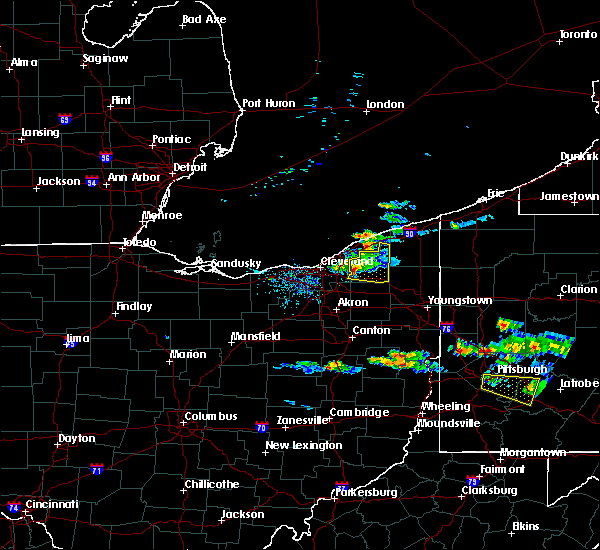 At 853 pm edt, a severe thunderstorm was located over south russell, or 10 miles southwest of chardon, moving east at 35 mph (radar indicated). Hazards include 60 mph wind gusts and quarter size hail. Hail damage to vehicles is expected. expect wind damage to roofs, siding and trees. Locations impacted include, chardon, solon, south russell, middlefield, burton, chesterland, kirtland, parkman, chagrin falls, huntsburg, claridon, montville, bentleyville, bainbridge, hunting valley, thompson and aquilla. At 853 pm edt, a severe thunderstorm was located over south russell, or 10 miles southwest of chardon, moving east at 35 mph (radar indicated). Hazards include 60 mph wind gusts and quarter size hail. Hail damage to vehicles is expected. expect wind damage to roofs, siding and trees. Locations impacted include, chardon, solon, south russell, middlefield, burton, chesterland, kirtland, parkman, chagrin falls, huntsburg, claridon, montville, bentleyville, bainbridge, hunting valley, thompson and aquilla.
|
| 8/3/2015 8:30 PM EDT |
 At 830 pm edt, a severe thunderstorm was located over cleveland heights, or 8 miles southwest of willowick, moving east at 40 mph (radar indicated). Hazards include 60 mph wind gusts and quarter size hail. Hail damage to vehicles is expected. Expect wind damage to roofs, siding and trees. At 830 pm edt, a severe thunderstorm was located over cleveland heights, or 8 miles southwest of willowick, moving east at 40 mph (radar indicated). Hazards include 60 mph wind gusts and quarter size hail. Hail damage to vehicles is expected. Expect wind damage to roofs, siding and trees.
|
| 7/14/2015 2:16 PM EDT |
 At 215 pm edt, a severe thunderstorm was located over bristolville, or 11 miles north of warren, moving east at 20 mph. other potentially severe storms were in trumbull county and extreme eastern cuyahoga county (radar indicated). Hazards include 60 mph wind gusts and quarter size hail. Hail damage to vehicles is expected. Expect wind damage to roofs, siding and trees. At 215 pm edt, a severe thunderstorm was located over bristolville, or 11 miles north of warren, moving east at 20 mph. other potentially severe storms were in trumbull county and extreme eastern cuyahoga county (radar indicated). Hazards include 60 mph wind gusts and quarter size hail. Hail damage to vehicles is expected. Expect wind damage to roofs, siding and trees.
|
| 7/14/2015 1:29 PM EDT |
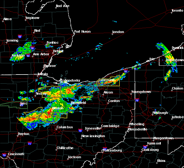 At 129 pm edt, a severe thunderstorm was located near south russell, or 8 miles southwest of chardon, moving east at 25 mph (radar indicated). Hazards include 60 mph wind gusts and quarter size hail. Hail damage to vehicles is expected. expect wind damage to roofs, siding and trees. Locations impacted include, cleveland, chardon, parma, cleveland heights, solon, warrensville heights, south russell, middlefield, burton, highland hills, chesterland, garfield heights, shaker heights, maple heights, south euclid, broadview heights, mayfield heights, lyndhurst, university heights and bedford. At 129 pm edt, a severe thunderstorm was located near south russell, or 8 miles southwest of chardon, moving east at 25 mph (radar indicated). Hazards include 60 mph wind gusts and quarter size hail. Hail damage to vehicles is expected. expect wind damage to roofs, siding and trees. Locations impacted include, cleveland, chardon, parma, cleveland heights, solon, warrensville heights, south russell, middlefield, burton, highland hills, chesterland, garfield heights, shaker heights, maple heights, south euclid, broadview heights, mayfield heights, lyndhurst, university heights and bedford.
|
| 7/14/2015 1:02 PM EDT |
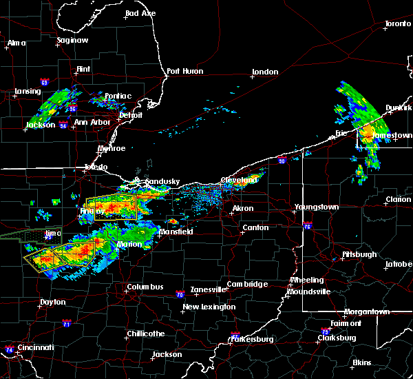 At 102 pm edt, a severe thunderstorm was located near highland hills, or 9 miles south of willowick, moving east at 15 mph (radar indicated). Hazards include 60 mph wind gusts and quarter size hail. Hail damage to vehicles is expected. Expect wind damage to roofs, siding and trees. At 102 pm edt, a severe thunderstorm was located near highland hills, or 9 miles south of willowick, moving east at 15 mph (radar indicated). Hazards include 60 mph wind gusts and quarter size hail. Hail damage to vehicles is expected. Expect wind damage to roofs, siding and trees.
|
| 6/23/2015 5:28 AM EDT |
 At 527 am edt, a severe thunderstorm was located over avon lake, or 8 miles northeast of lorain, moving east at 40 mph (radar indicated). Hazards include 70 mph wind gusts. Expect considerable tree damage. Damage is likely to mobile homes, roofs and outbuildings. At 527 am edt, a severe thunderstorm was located over avon lake, or 8 miles northeast of lorain, moving east at 40 mph (radar indicated). Hazards include 70 mph wind gusts. Expect considerable tree damage. Damage is likely to mobile homes, roofs and outbuildings.
|
| 6/23/2015 4:34 AM EDT |
 At 433 am edt, severe thunderstorms were located along a line extending from near orwell to south russell to near north ridgeville, moving east at 50 mph (radar indicated). Hazards include 60 mph wind gusts. Expect considerable tree damage. damage is likely to mobile homes, roofs and outbuildings. Locations impacted include, cleveland, parma, lakewood, euclid, cleveland heights, strongsville, brunswick, westlake, north royalton, solon, warrensville heights, highland hills, north olmsted, garfield heights, shaker heights, maple heights, south euclid, parma heights, rocky river and broadview heights. At 433 am edt, severe thunderstorms were located along a line extending from near orwell to south russell to near north ridgeville, moving east at 50 mph (radar indicated). Hazards include 60 mph wind gusts. Expect considerable tree damage. damage is likely to mobile homes, roofs and outbuildings. Locations impacted include, cleveland, parma, lakewood, euclid, cleveland heights, strongsville, brunswick, westlake, north royalton, solon, warrensville heights, highland hills, north olmsted, garfield heights, shaker heights, maple heights, south euclid, parma heights, rocky river and broadview heights.
|
| 6/23/2015 4:25 AM EDT |
 At 423 am edt, severe thunderstorms were located along a line extending from near chardon to near warrensville heights to near amherst, moving east at 50 mph. a 52 mph wind gust has been measured at burke lakefront airport in downtown cleveland (radar indicated). Hazards include 70 mph wind gusts. Expect considerable tree damage. damage is likely to mobile homes, roofs and outbuildings. Locations impacted include, cleveland, lorain, elyria, vermilion, parma, lakewood, euclid, cleveland heights, strongsville, brunswick, westlake, north royalton, north ridgeville, solon, avon lake, warrensville heights, amherst, grafton, highland hills and north olmsted. At 423 am edt, severe thunderstorms were located along a line extending from near chardon to near warrensville heights to near amherst, moving east at 50 mph. a 52 mph wind gust has been measured at burke lakefront airport in downtown cleveland (radar indicated). Hazards include 70 mph wind gusts. Expect considerable tree damage. damage is likely to mobile homes, roofs and outbuildings. Locations impacted include, cleveland, lorain, elyria, vermilion, parma, lakewood, euclid, cleveland heights, strongsville, brunswick, westlake, north royalton, north ridgeville, solon, avon lake, warrensville heights, amherst, grafton, highland hills and north olmsted.
|
| 6/23/2015 3:56 AM EDT |
 At 355 am edt, severe thunderstorms were located along a line extending from near mentor to near cleveland to near vermilion, moving east at 80 mph (radar indicated). Hazards include 70 mph wind gusts. Expect considerable tree damage. Damage is likely to mobile homes, roofs and outbuildings. At 355 am edt, severe thunderstorms were located along a line extending from near mentor to near cleveland to near vermilion, moving east at 80 mph (radar indicated). Hazards include 70 mph wind gusts. Expect considerable tree damage. Damage is likely to mobile homes, roofs and outbuildings.
|
| 6/22/2015 6:26 PM EDT |
 The severe thunderstorm warning for southeastern cuyahoga county will expire at 630 pm edt, the storm which prompted the warning has moved out of the area. therefore the warning will be allowed to expire. a severe thunderstorm watch remains in effect until midnight edt for northeastern ohio. The severe thunderstorm warning for southeastern cuyahoga county will expire at 630 pm edt, the storm which prompted the warning has moved out of the area. therefore the warning will be allowed to expire. a severe thunderstorm watch remains in effect until midnight edt for northeastern ohio.
|
| 6/22/2015 6:12 PM EDT |
 At 611 pm edt, a severe thunderstorm was located over macedonia, or 15 miles southeast of cleveland, moving east at 35 mph (radar indicated). Hazards include 60 mph wind gusts and quarter size hail. Hail damage to vehicles is expected. expect wind damage to roofs, siding and trees. Locations impacted include, solon, warrensville heights, garfield heights, maple heights, broadview heights, brecksville, bedford, bedford heights, independence, chagrin falls, northfield, orange, moreland hills, walton hills, valley view, glenwillow and bentleyville. At 611 pm edt, a severe thunderstorm was located over macedonia, or 15 miles southeast of cleveland, moving east at 35 mph (radar indicated). Hazards include 60 mph wind gusts and quarter size hail. Hail damage to vehicles is expected. expect wind damage to roofs, siding and trees. Locations impacted include, solon, warrensville heights, garfield heights, maple heights, broadview heights, brecksville, bedford, bedford heights, independence, chagrin falls, northfield, orange, moreland hills, walton hills, valley view, glenwillow and bentleyville.
|
| 6/22/2015 6:05 PM EDT |
 At 605 pm edt, a severe thunderstorm was located near chardon, moving east at 35 mph (radar indicated). Hazards include 60 mph wind gusts and quarter size hail. Hail damage to vehicles is expected. expect wind damage to roofs, siding and trees. Locations impacted include, painesville, chardon, fairport harbor, mentor, willoughby, south russell, madison, middlefield, perry, burton, chesterland, kirtland, parkman, chagrin falls, huntsburg, claridon, montville, north perry, bainbridge and hunting valley. At 605 pm edt, a severe thunderstorm was located near chardon, moving east at 35 mph (radar indicated). Hazards include 60 mph wind gusts and quarter size hail. Hail damage to vehicles is expected. expect wind damage to roofs, siding and trees. Locations impacted include, painesville, chardon, fairport harbor, mentor, willoughby, south russell, madison, middlefield, perry, burton, chesterland, kirtland, parkman, chagrin falls, huntsburg, claridon, montville, north perry, bainbridge and hunting valley.
|
| 6/22/2015 5:56 PM EDT |
 At 553 pm edt, several strong to severe thunderstorms were located from eastern lorain county across cuyahoga county moving east at 45 mph (radar indicated). Hazards include 60 mph wind gusts and quarter size hail. Hail damage to vehicles is expected. expect wind damage to roofs, siding and trees. Locations impacted include, cleveland, lorain, elyria, parma, lakewood, euclid, cleveland heights, strongsville, brunswick, westlake, north royalton, north ridgeville, solon, avon lake, warrensville heights, amherst, grafton, highland hills, north olmsted and garfield heights. At 553 pm edt, several strong to severe thunderstorms were located from eastern lorain county across cuyahoga county moving east at 45 mph (radar indicated). Hazards include 60 mph wind gusts and quarter size hail. Hail damage to vehicles is expected. expect wind damage to roofs, siding and trees. Locations impacted include, cleveland, lorain, elyria, parma, lakewood, euclid, cleveland heights, strongsville, brunswick, westlake, north royalton, north ridgeville, solon, avon lake, warrensville heights, amherst, grafton, highland hills, north olmsted and garfield heights.
|
| 6/22/2015 5:41 PM EDT |
 At 541 pm edt, a severe thunderstorm was located over chesterland, or 7 miles west of chardon, moving east at 30 mph (radar indicated). Hazards include 60 mph wind gusts and quarter size hail. Hail damage to vehicles is expected. Expect wind damage to roofs, siding and trees. At 541 pm edt, a severe thunderstorm was located over chesterland, or 7 miles west of chardon, moving east at 30 mph (radar indicated). Hazards include 60 mph wind gusts and quarter size hail. Hail damage to vehicles is expected. Expect wind damage to roofs, siding and trees.
|
| 6/22/2015 5:26 PM EDT |
 At 526 pm edt, a severe thunderstorm was located over amherst, or near lorain, moving east at 45 mph (radar indicated). Hazards include 60 mph wind gusts and quarter size hail. Hail damage to vehicles is expected. Expect wind damage to roofs, siding and trees. At 526 pm edt, a severe thunderstorm was located over amherst, or near lorain, moving east at 45 mph (radar indicated). Hazards include 60 mph wind gusts and quarter size hail. Hail damage to vehicles is expected. Expect wind damage to roofs, siding and trees.
|
| 5/30/2015 7:15 PM EDT | At 715 pm edt, a severe thunderstorm was located near chesterland, or 12 miles west of chardon, moving northeast at 30 mph (radar indicated). Hazards include 60 mph wind gusts and penny size hail. Expect damage to roofs. siding and trees. Locations impacted include, euclid, cleveland heights, solon, willoughby, eastlake, warrensville heights, south russell, highland hills, timberlake, lakeline, chesterland, garfield heights, shaker heights, maple heights, south euclid, mayfield heights, east cleveland, lyndhurst, university heights and bedford. |
| 5/30/2015 6:56 PM EDT | At 656 pm edt, a severe thunderstorm was located near warrensville heights, or 22 miles southwest of chardon, moving northeast at 30 mph (radar indicated). Hazards include 60 mph wind gusts and penny size hail. Expect damage to roofs. Siding and trees. |
| 5/30/2015 6:23 PM EDT | At 622 pm edt, a severe thunderstorm was located near solon, or 15 miles northwest of ravenna, moving east at 25 mph (radar indicated). Hazards include 60 mph wind gusts and penny size hail. Expect damage to roofs. Siding and trees. |
| 5/30/2015 6:00 PM EDT | At 558 pm edt, a severe thunderstorm was located near macedonia, or 18 miles north of akron, moving east at 15 mph. another severe thunderstorm was located near cuyahoga heights and was also moving east at 15 mph (radar indicated). Hazards include 60 mph wind gusts and nickel size hail. Expect damage to roofs. Siding and trees. |
| 5/11/2015 7:16 PM EDT | At 705 pm edt, a severe thunderstorm was located near solon, and moving east at 50 mph (radar indicated). Hazards include 60 mph wind gusts. Expect damage to roofs. siding and trees. locations impacted include, , <. 75in. |
| 5/11/2015 7:02 PM EDT | At 700 pm edt, severe thunderstorms were located along a line extending from solon to twinsburg to hudson, and moving east at 40 mph (radar indicated). Hazards include 60 mph wind gusts and penny size hail. Expect damage to roofs. Siding and trees. |
| 5/11/2015 6:48 PM EDT | At 647 pm edt, a severe thunderstorm was located 6 miles east of north royalton, and moving east at 50 mph (radar indicated). Hazards include 60 mph wind gusts. Expect damage to roofs. Siding and trees. |
| 6/13/2013 2:35 AM EDT | Some trees dow in cuyahoga county OH, 0.4 miles NE of Chagrin Falls, OH |
| 1/1/0001 12:00 AM | Tree down on a house in cuyahoga county OH, 0.4 miles NE of Chagrin Falls, OH |
| 1/1/0001 12:00 AM | Quarter sized hail reported 3.8 miles NW of Chagrin Falls, OH |
Hail Maps for Chagrin Falls, OH
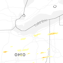
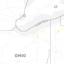


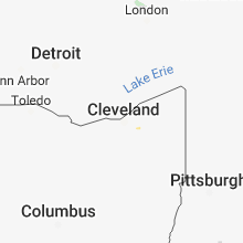


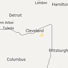

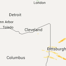


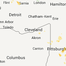


Connect with Interactive Hail Maps