

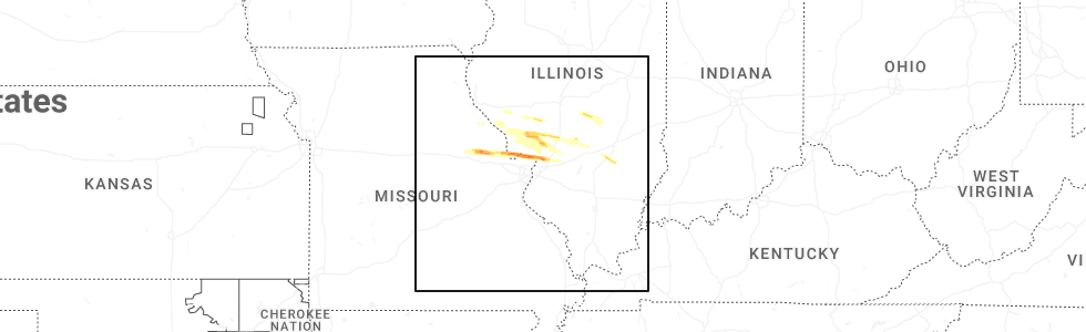
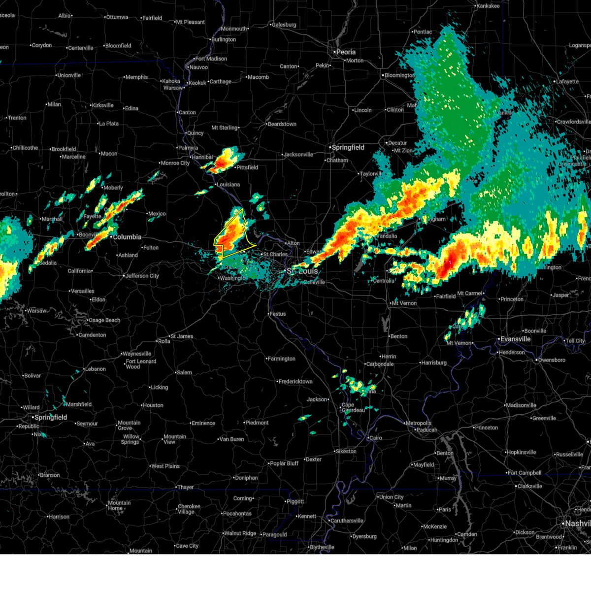
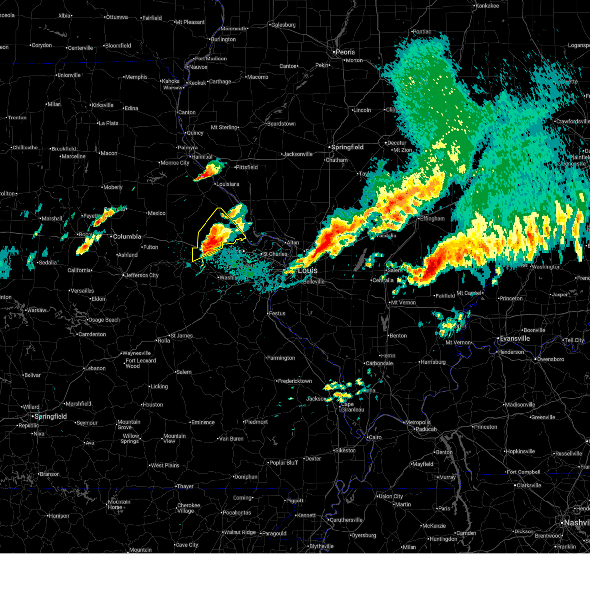
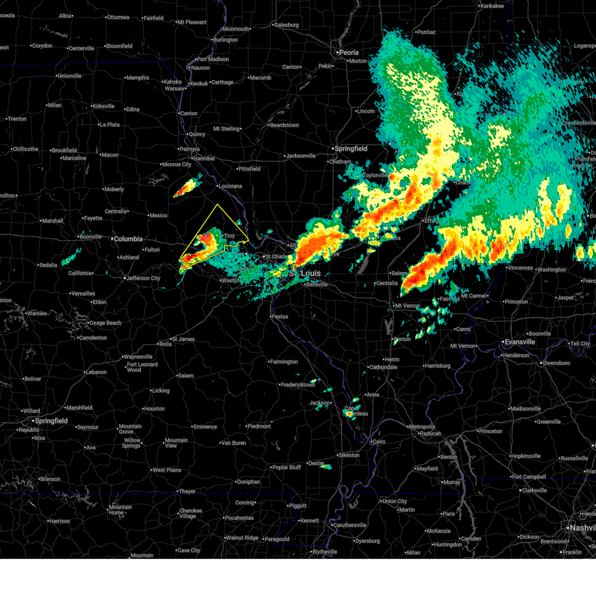
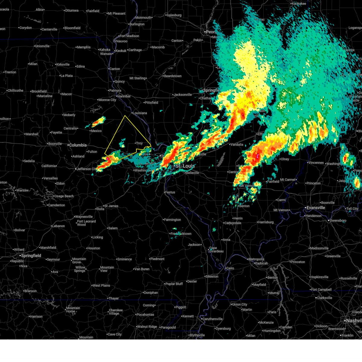
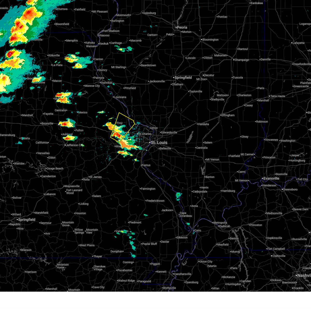
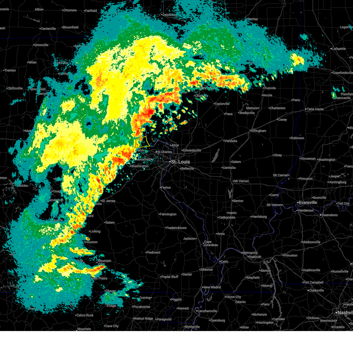
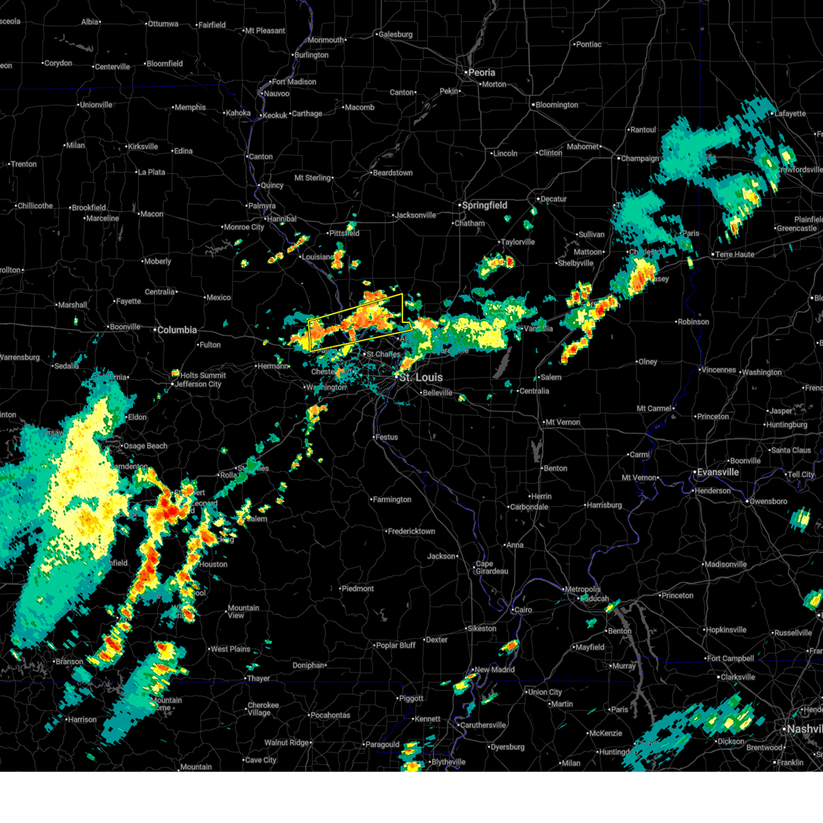
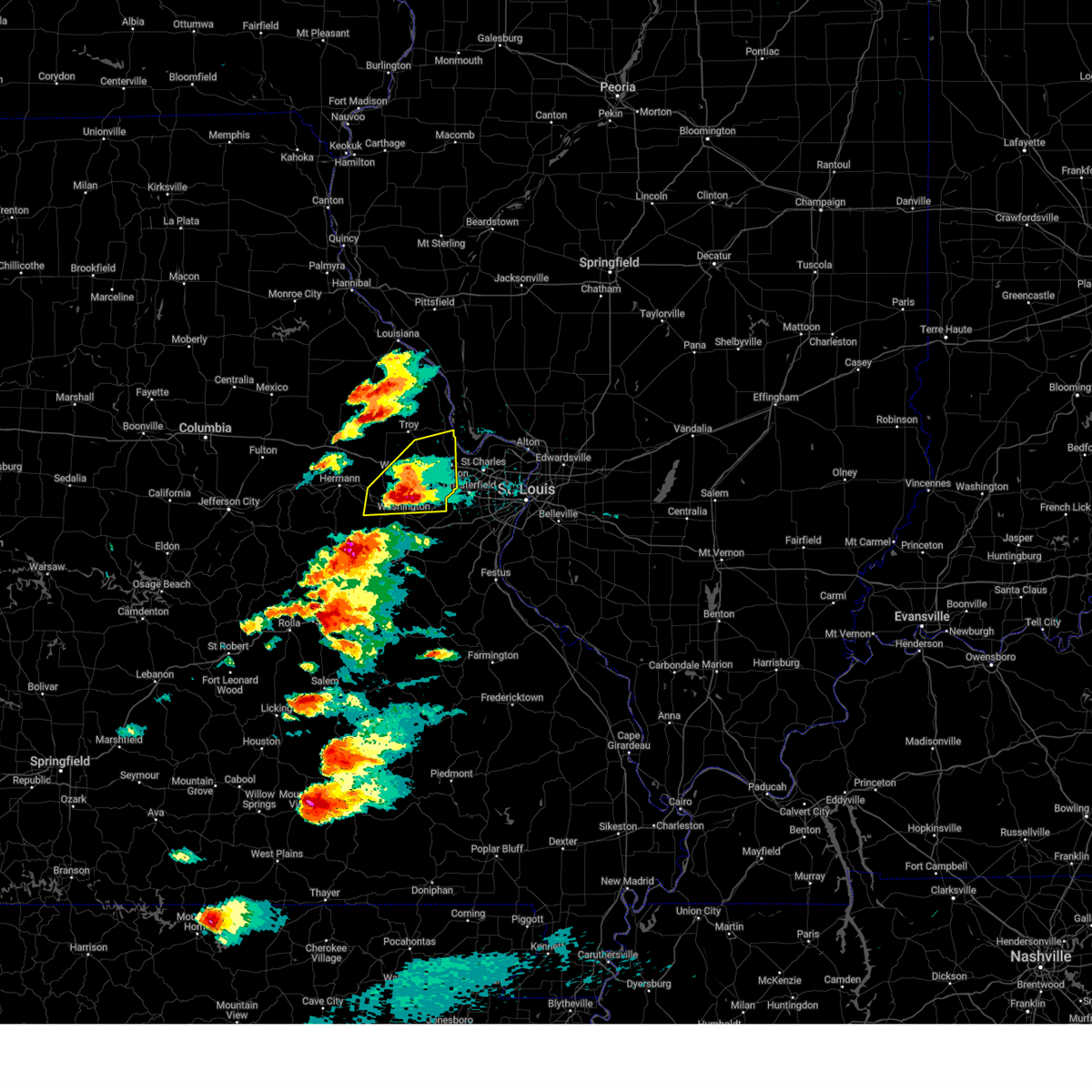
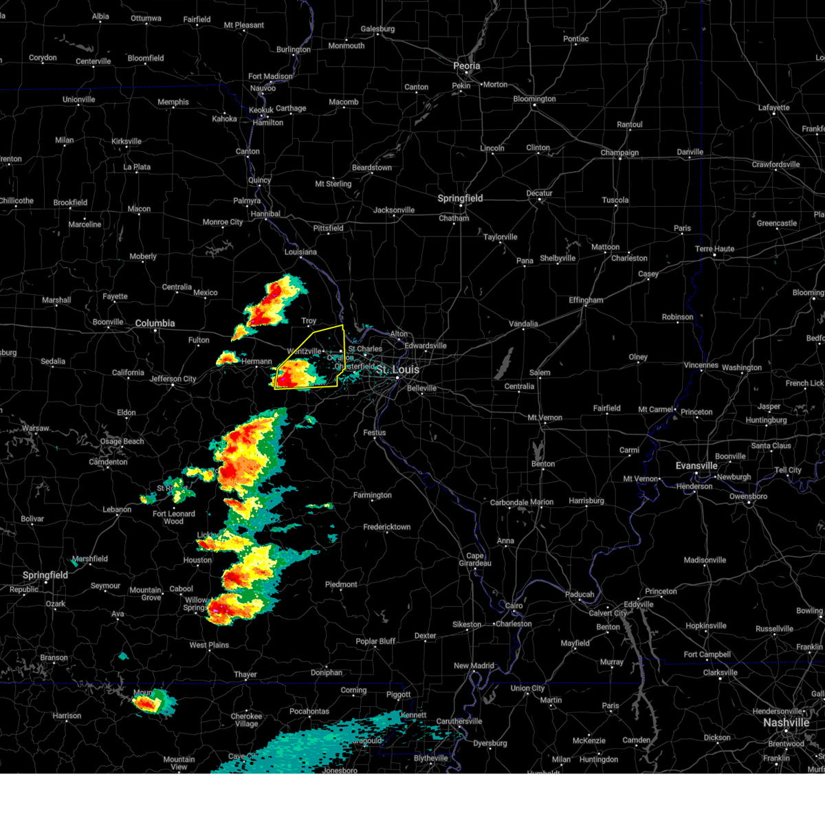
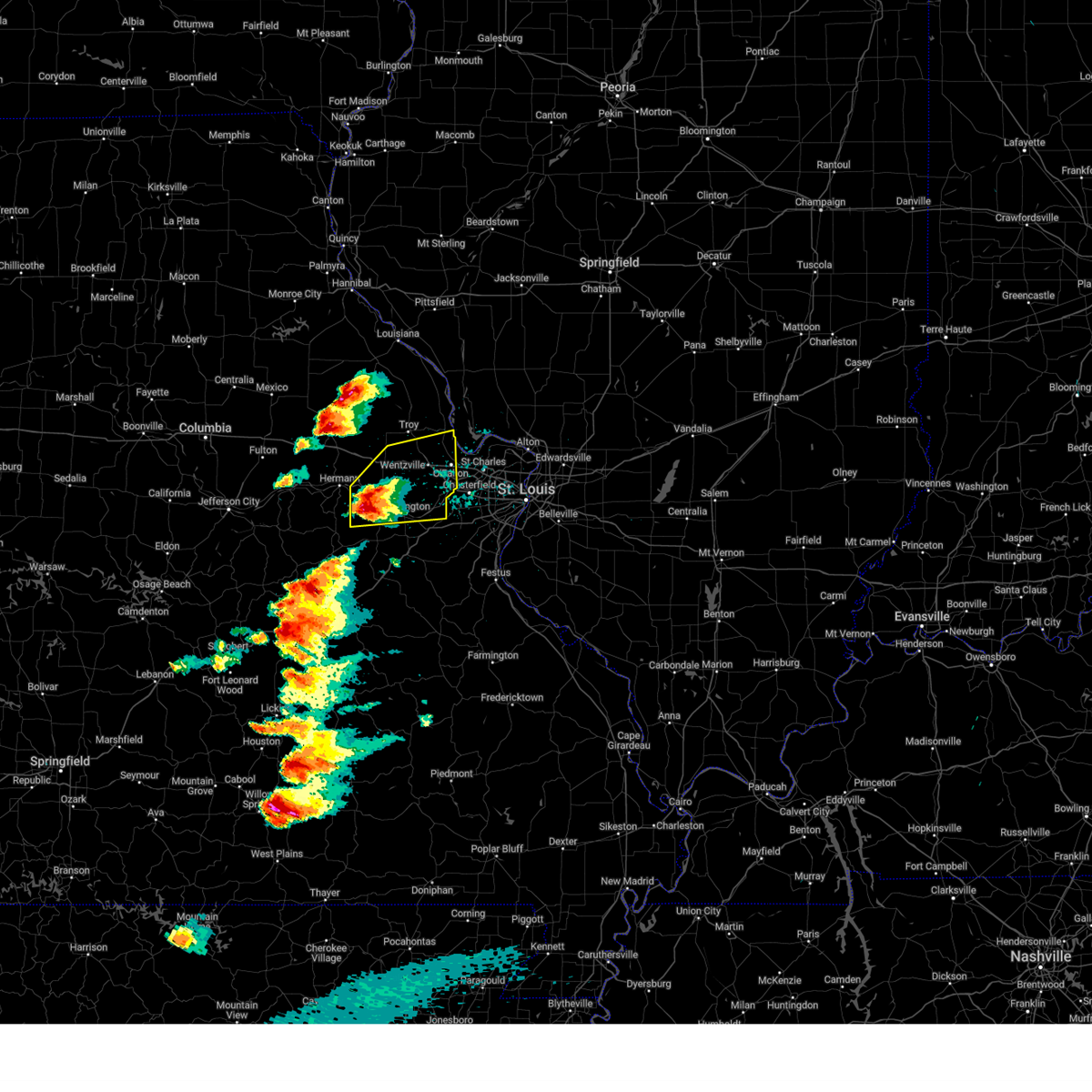
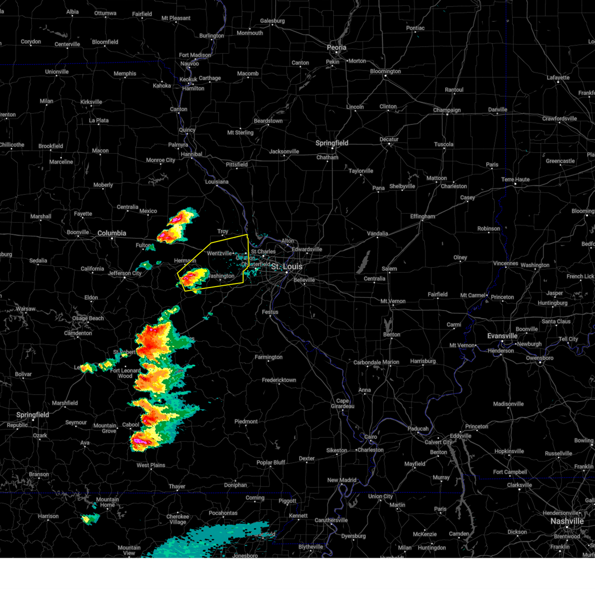
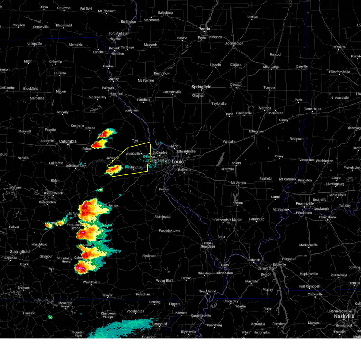
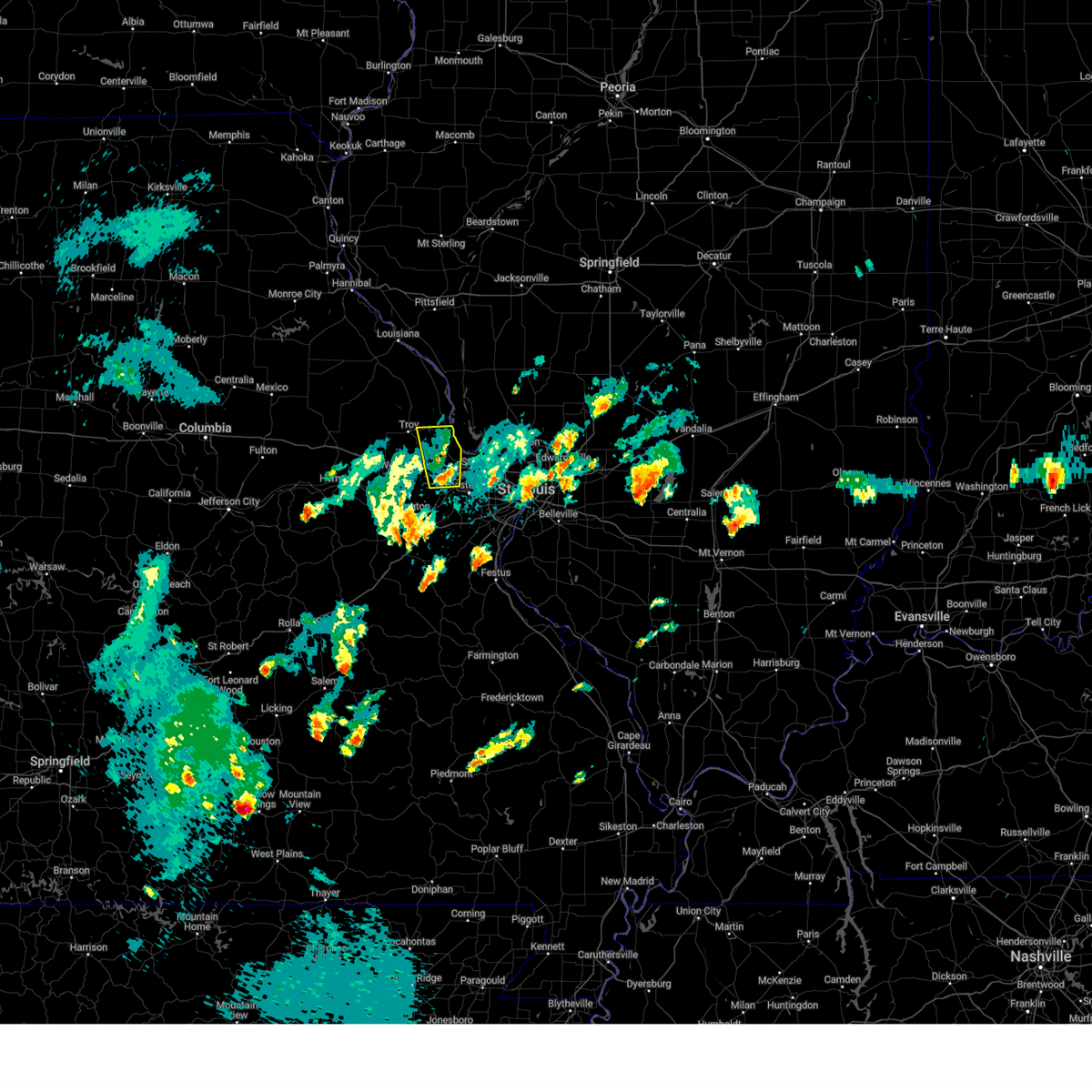
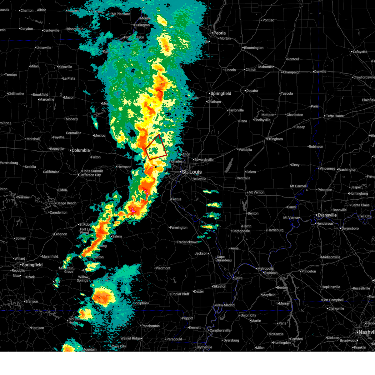
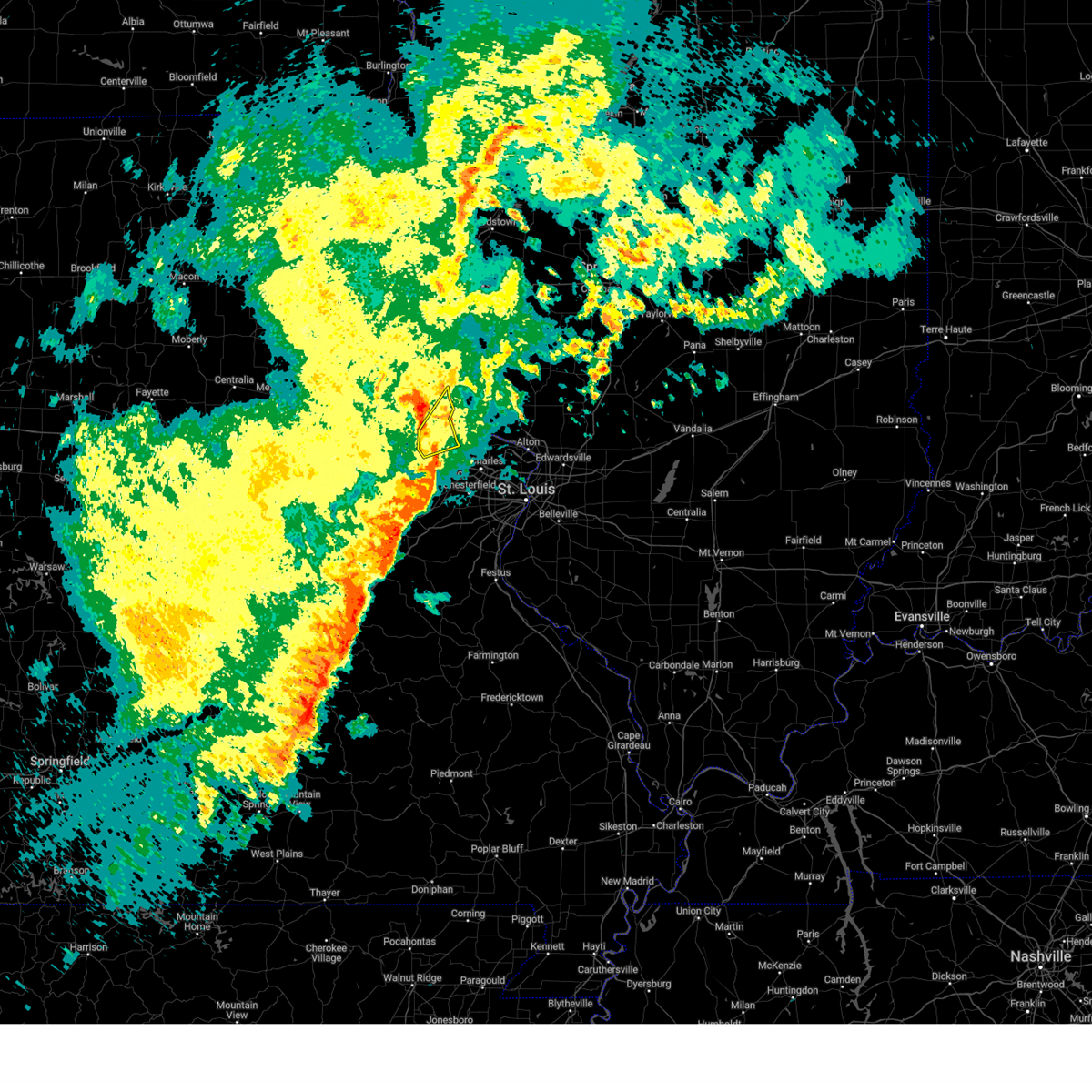
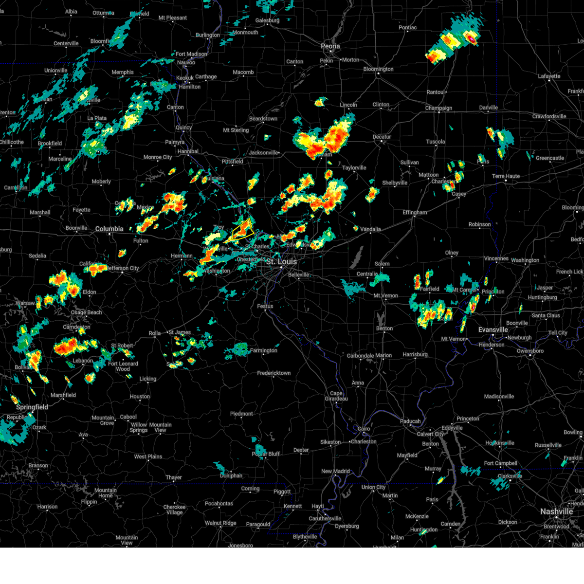
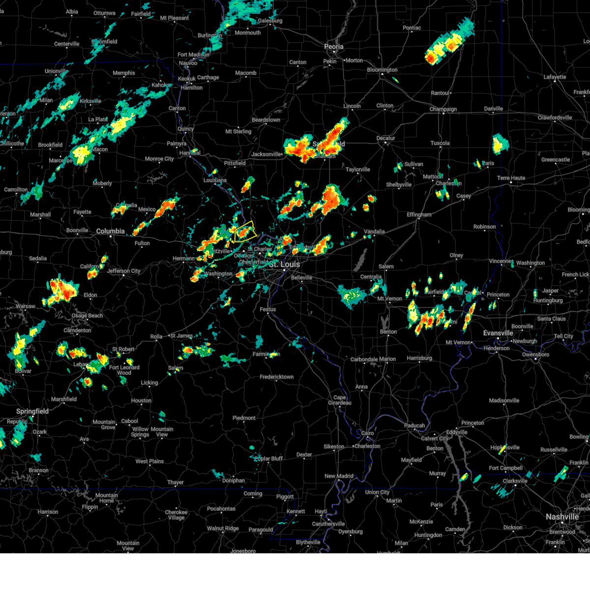
Hail Map for Chain of Rocks, MO
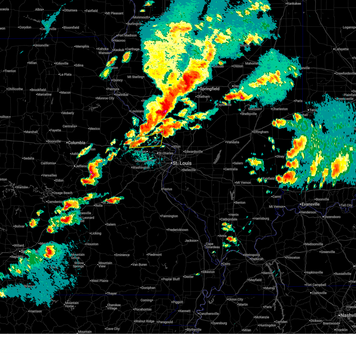
The Chain of Rocks, MO area has had 0 reports of on-the-ground hail by trained spotters, and has been under severe weather warnings 33 times during the past 12 months. Doppler radar has detected hail at or near Chain of Rocks, MO on 69 occasions, including 4 occasions during the past year.
| Name: | Chain of Rocks, MO |
| Where Located: | 38.1 miles WNW of Saint Louis, MO |
| Map: | Google Map for Chain of Rocks, MO |
| Population: | 93 |
| Housing Units: | 39 |
| More Info: | Search Google for Chain of Rocks, MO |
1
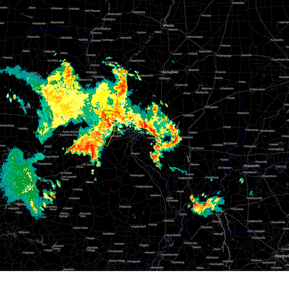
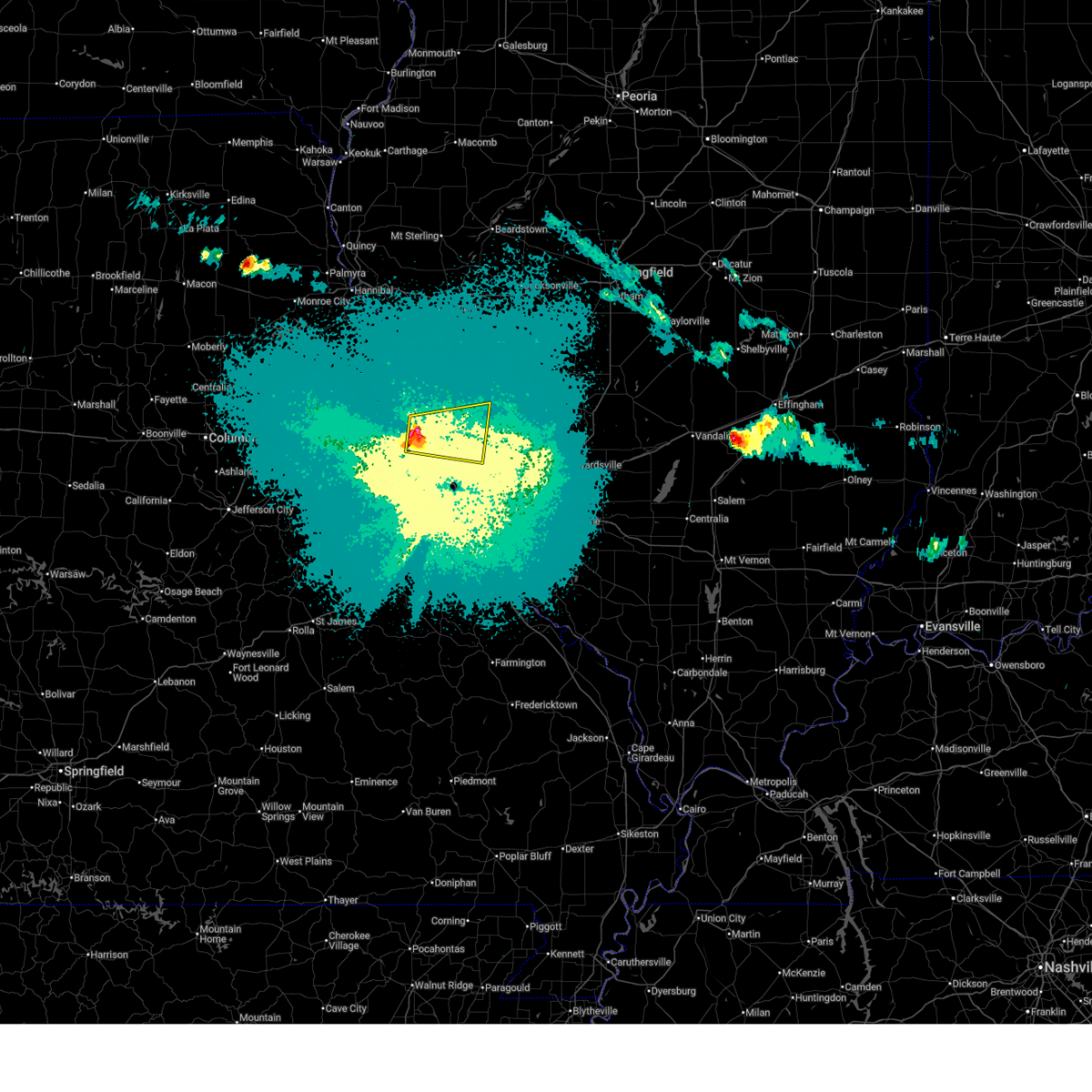
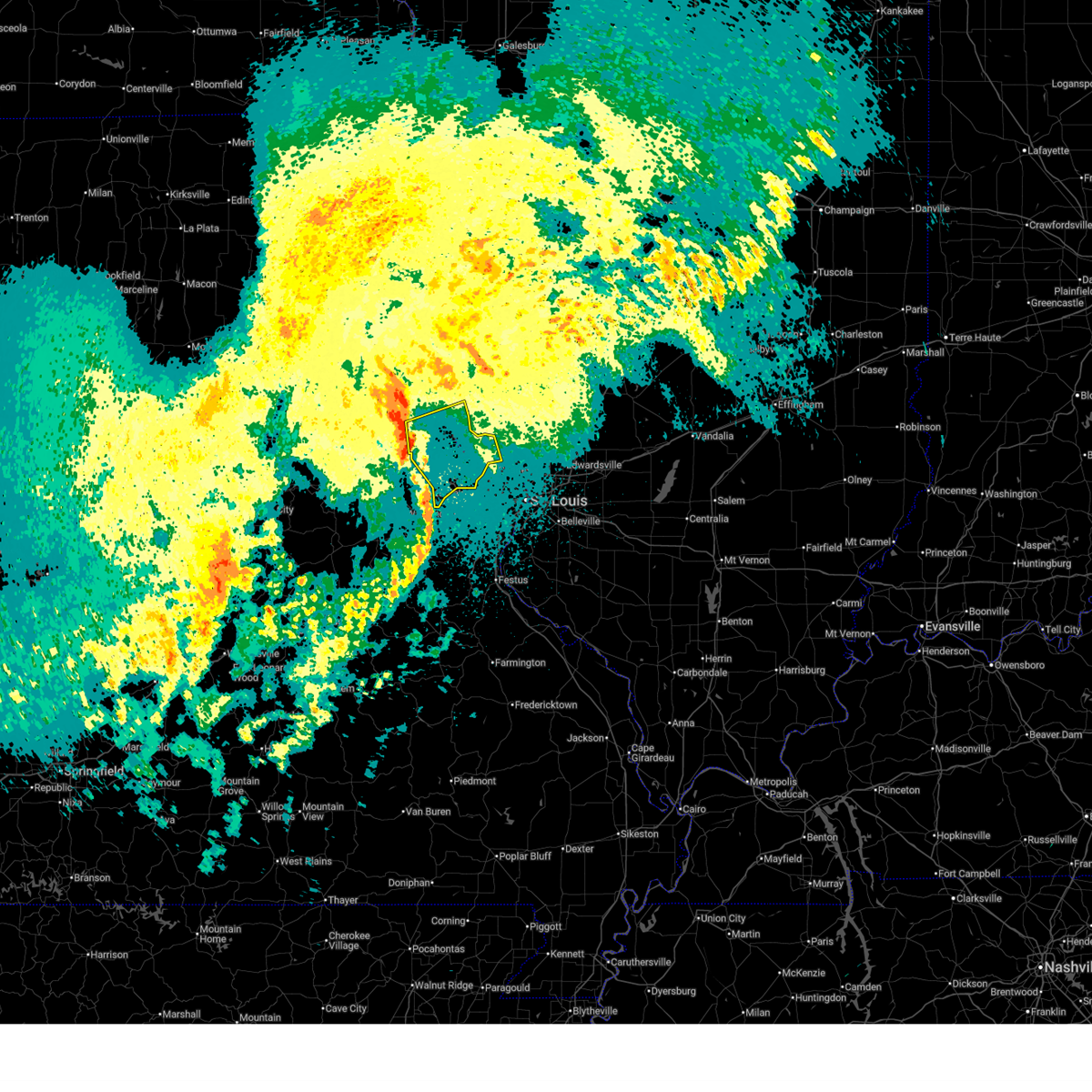
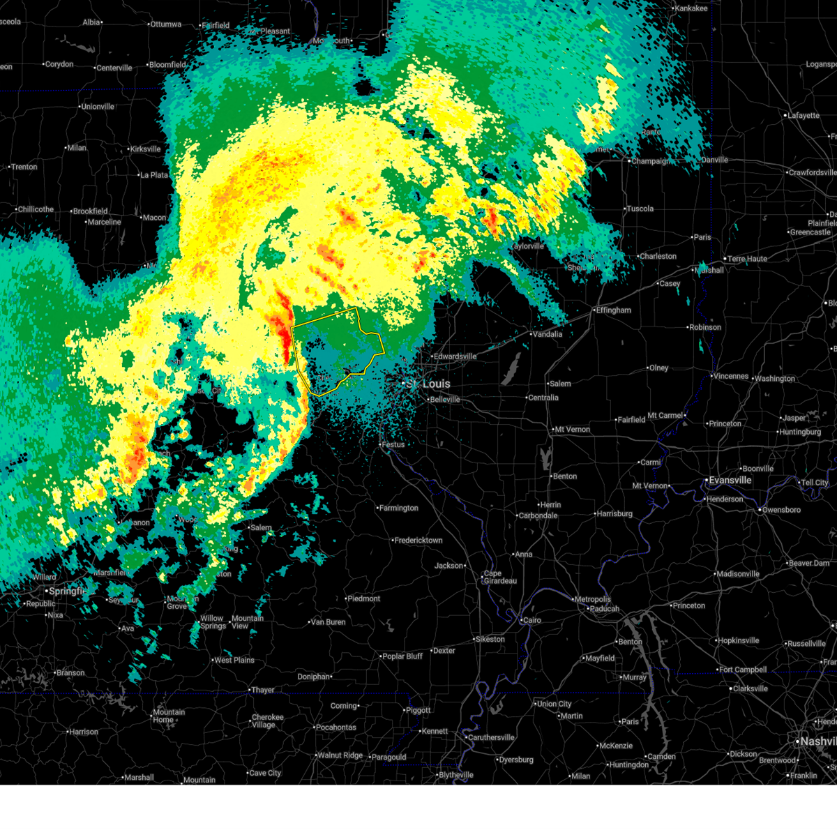
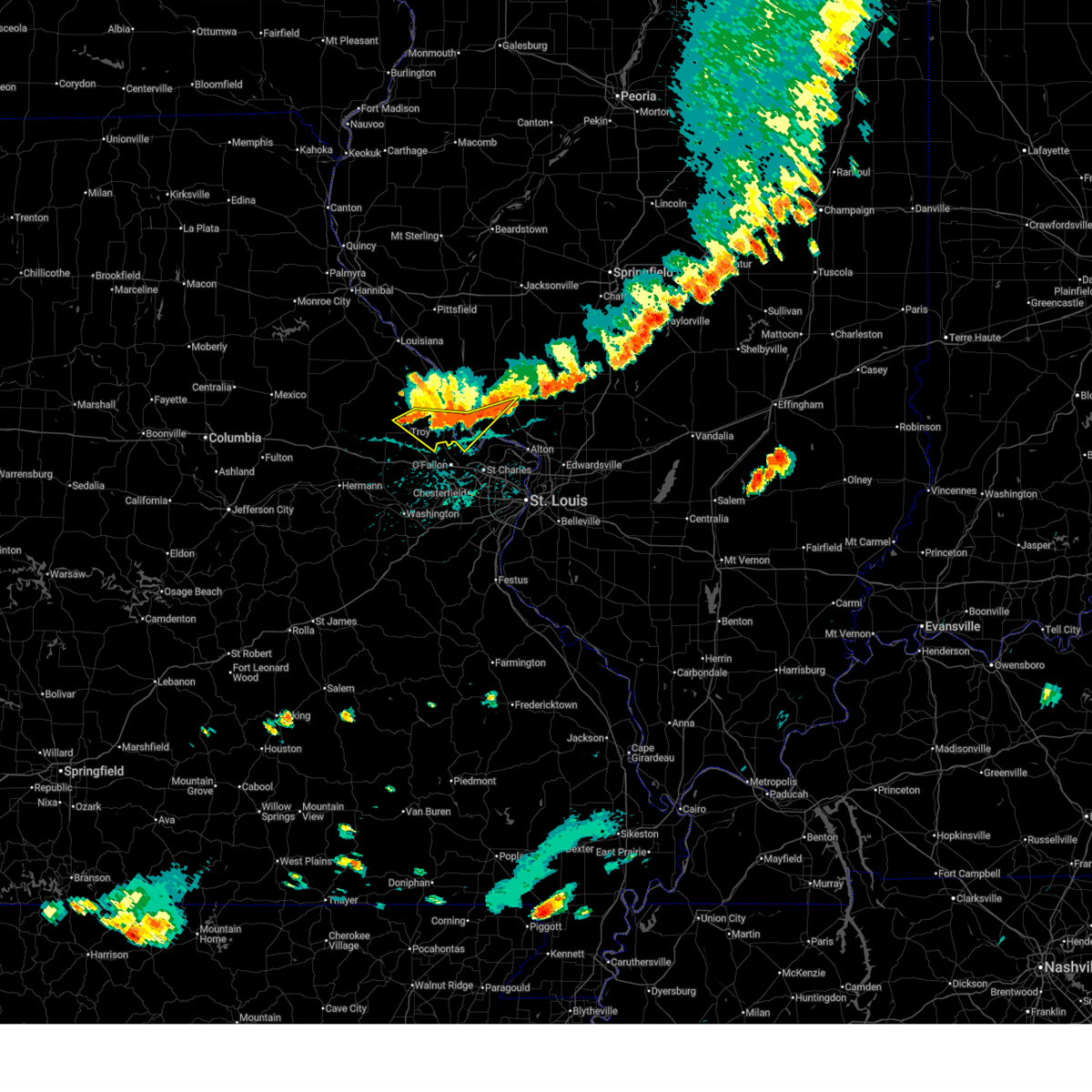
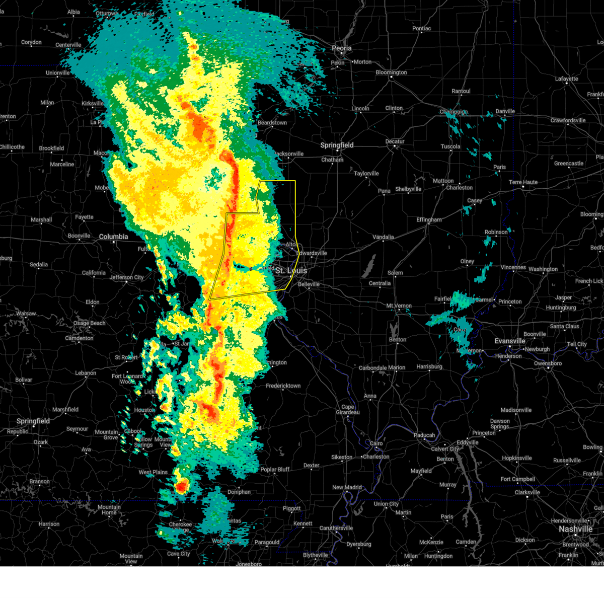
The Top Recent Hail Date for Chain of Rocks, MO is Sunday, May 3, 2026 (3rd out of 69)
Hail and Wind Damage Spotted near Chain of Rocks, MO
| Date / Time | Report Details |
|---|---|
| 7/10/2026 8:17 PM CDT |
 At 817 pm cdt, severe thunderstorms were located along a line from over st. peters to over spirit of st. louis airport, moving east at 45 mph (radar indicated). Hazards include 60 mph wind gusts. Expect damage to roofs, siding, and trees. locations impacted include, wentzville, lake st. louis, o'fallon, st. peters, wildwood, chesterfield, st. charles, maryland heights, ballwin, manchester, creve coeur, hazelwood, st. ann, overland, kirkwood, university city, florissant, webster groves, crestwood and clayton. this includes the following state parks, babler memorial state park, castlewood state park and first missouri state capitol historic site. this includes the following highways, interstate 70 in missouri between exits 209 and 231. Interstate 44 in missouri between exits 272 and 277. At 817 pm cdt, severe thunderstorms were located along a line from over st. peters to over spirit of st. louis airport, moving east at 45 mph (radar indicated). Hazards include 60 mph wind gusts. Expect damage to roofs, siding, and trees. locations impacted include, wentzville, lake st. louis, o'fallon, st. peters, wildwood, chesterfield, st. charles, maryland heights, ballwin, manchester, creve coeur, hazelwood, st. ann, overland, kirkwood, university city, florissant, webster groves, crestwood and clayton. this includes the following state parks, babler memorial state park, castlewood state park and first missouri state capitol historic site. this includes the following highways, interstate 70 in missouri between exits 209 and 231. Interstate 44 in missouri between exits 272 and 277.
|
| 7/10/2026 7:58 PM CDT |
 Svrlsx the national weather service in st louis has issued a * severe thunderstorm warning for, southeastern calhoun county in southwestern illinois, southeastern lincoln county in east central missouri, saint charles county in east central missouri, central saint louis county in east central missouri, east central warren county in east central missouri, * until 845 pm cdt. * at 758 pm cdt, severe thunderstorms were located along a line from near moscow mills to near new melle, or along a line from 6 miles north of wentzville to 8 miles southwest of wentzville, moving east at 45 mph (radar indicated). Hazards include 60 mph wind gusts. expect damage to roofs, siding, and trees Svrlsx the national weather service in st louis has issued a * severe thunderstorm warning for, southeastern calhoun county in southwestern illinois, southeastern lincoln county in east central missouri, saint charles county in east central missouri, central saint louis county in east central missouri, east central warren county in east central missouri, * until 845 pm cdt. * at 758 pm cdt, severe thunderstorms were located along a line from near moscow mills to near new melle, or along a line from 6 miles north of wentzville to 8 miles southwest of wentzville, moving east at 45 mph (radar indicated). Hazards include 60 mph wind gusts. expect damage to roofs, siding, and trees
|
| 6/1/2026 5:35 AM CDT |
 At 535 am cdt, severe thunderstorms were located along a line from over chain of rocks to over union, or along a line from near st. paul to over union, moving east at 40 mph (radar indicated). Hazards include 60 mph wind gusts. Expect damage to roofs, siding, and trees. locations impacted include, innsbrook, wright city, troy, marthasville, lyon, foristell, washington, moscow mills, wentzville, dutzow, flint hill, fountain n' lakes, new melle, union, chain of rocks and augusta. this includes the following state parks, cuivre river state park. This includes interstate 70 in missouri between exits 199 and 210. At 535 am cdt, severe thunderstorms were located along a line from over chain of rocks to over union, or along a line from near st. paul to over union, moving east at 40 mph (radar indicated). Hazards include 60 mph wind gusts. Expect damage to roofs, siding, and trees. locations impacted include, innsbrook, wright city, troy, marthasville, lyon, foristell, washington, moscow mills, wentzville, dutzow, flint hill, fountain n' lakes, new melle, union, chain of rocks and augusta. this includes the following state parks, cuivre river state park. This includes interstate 70 in missouri between exits 199 and 210.
|
| 6/1/2026 5:28 AM CDT |
 At 528 am cdt, severe thunderstorms were located along a line from near moscow mills to near union, or along a line from 6 miles north of wentzville to near union, moving east at 40 mph (radar indicated). Hazards include 60 mph wind gusts and small hail. Expect damage to roofs, siding, and trees. locations impacted include, warrenton, new haven, truesdale, treloar, innsbrook, wright city, troy, marthasville, washington, moscow mills, wentzville, dutzow, flint hill, fountain n' lakes, new melle, union, chain of rocks and augusta. this includes the following state parks, cuivre river state park. This includes interstate 70 in missouri between exits 199 and 210. At 528 am cdt, severe thunderstorms were located along a line from near moscow mills to near union, or along a line from 6 miles north of wentzville to near union, moving east at 40 mph (radar indicated). Hazards include 60 mph wind gusts and small hail. Expect damage to roofs, siding, and trees. locations impacted include, warrenton, new haven, truesdale, treloar, innsbrook, wright city, troy, marthasville, washington, moscow mills, wentzville, dutzow, flint hill, fountain n' lakes, new melle, union, chain of rocks and augusta. this includes the following state parks, cuivre river state park. This includes interstate 70 in missouri between exits 199 and 210.
|
| 6/1/2026 5:15 AM CDT |
 At 515 am cdt, severe thunderstorms were located along a line from near troy to 7 miles south of new haven, moving east at 40 mph (radar indicated). Hazards include 60 mph wind gusts and quarter size hail. Hail damage to vehicles is expected. expect wind damage to roofs, siding, and trees. locations impacted include, hermann, jonesburg, warrenton, hawk point, new haven, truesdale, innsbrook, wright city, troy, marthasville, washington, moscow mills, wentzville, fountain n' lakes, new melle, union, chain of rocks and augusta. this includes the following state parks, deutschheim historic site and cuivre river state park. This includes interstate 70 in missouri between exits 183 and 210. At 515 am cdt, severe thunderstorms were located along a line from near troy to 7 miles south of new haven, moving east at 40 mph (radar indicated). Hazards include 60 mph wind gusts and quarter size hail. Hail damage to vehicles is expected. expect wind damage to roofs, siding, and trees. locations impacted include, hermann, jonesburg, warrenton, hawk point, new haven, truesdale, innsbrook, wright city, troy, marthasville, washington, moscow mills, wentzville, fountain n' lakes, new melle, union, chain of rocks and augusta. this includes the following state parks, deutschheim historic site and cuivre river state park. This includes interstate 70 in missouri between exits 183 and 210.
|
| 6/1/2026 4:53 AM CDT |
 Svrlsx the national weather service in st louis has issued a * severe thunderstorm warning for, northeastern osage county in central missouri, northwestern franklin county in east central missouri, northern gasconade county in east central missouri, southern lincoln county in east central missouri, montgomery county in east central missouri, western saint charles county in east central missouri, warren county in east central missouri, * until 545 am cdt. * at 453 am cdt, severe thunderstorms were located along a line from near bellflower to over swiss, or along a line from 12 miles east of montgomery city to 8 miles south of hermann, moving east at 40 mph (radar indicated). Hazards include 60 mph wind gusts and quarter size hail. Hail damage to vehicles is expected. Expect wind damage to roofs, siding, and trees. Svrlsx the national weather service in st louis has issued a * severe thunderstorm warning for, northeastern osage county in central missouri, northwestern franklin county in east central missouri, northern gasconade county in east central missouri, southern lincoln county in east central missouri, montgomery county in east central missouri, western saint charles county in east central missouri, warren county in east central missouri, * until 545 am cdt. * at 453 am cdt, severe thunderstorms were located along a line from near bellflower to over swiss, or along a line from 12 miles east of montgomery city to 8 miles south of hermann, moving east at 40 mph (radar indicated). Hazards include 60 mph wind gusts and quarter size hail. Hail damage to vehicles is expected. Expect wind damage to roofs, siding, and trees.
|
| 5/3/2026 10:27 PM CDT |
 At 1027 pm cdt, a severe thunderstorm was located near winfield, or 7 miles north of st. paul, moving east at 50 mph (radar indicated). Hazards include ping pong ball size hail and 60 mph wind gusts. People and animals outdoors will be injured. expect hail damage to roofs, siding, windows, and vehicles. expect wind damage to roofs, siding, and trees. this severe thunderstorm will be near, winfield, st. paul, o'fallon and chain of rocks around 1030 pm cdt. st. charles and st. peters around 1040 pm cdt. other locations impacted by the severe thunderstorm include beechville, old monroe, batchtown, brussels, golden eagle, meppen, deer plain and kampville. This includes the following state parks, pere marquette state park. At 1027 pm cdt, a severe thunderstorm was located near winfield, or 7 miles north of st. paul, moving east at 50 mph (radar indicated). Hazards include ping pong ball size hail and 60 mph wind gusts. People and animals outdoors will be injured. expect hail damage to roofs, siding, windows, and vehicles. expect wind damage to roofs, siding, and trees. this severe thunderstorm will be near, winfield, st. paul, o'fallon and chain of rocks around 1030 pm cdt. st. charles and st. peters around 1040 pm cdt. other locations impacted by the severe thunderstorm include beechville, old monroe, batchtown, brussels, golden eagle, meppen, deer plain and kampville. This includes the following state parks, pere marquette state park.
|
| 5/3/2026 10:15 PM CDT |
 Svrlsx the national weather service in st louis has issued a * severe thunderstorm warning for, southeastern calhoun county in southwestern illinois, southwestern jersey county in southwestern illinois, southeastern lincoln county in east central missouri, northwestern saint charles county in east central missouri, * until 1045 pm cdt. * at 1015 pm cdt, a severe thunderstorm was located over moscow mills, or near troy, moving east at 50 mph (radar indicated). Hazards include 60 mph wind gusts and quarter size hail. Hail damage to vehicles is expected. expect wind damage to roofs, siding, and trees. this severe thunderstorm will be near, fountain n' lakes, chain of rocks, moscow mills and troy around 1020 pm cdt. winfield and st. paul around 1025 pm cdt. o'fallon around 1030 pm cdt. other locations impacted by the severe thunderstorm include flint hill, old monroe, foley, beechville, batchtown, brussels, golden eagle, meppen, deer plain and kampville. This includes the following state parks, cuivre river state park and pere marquette state park. Svrlsx the national weather service in st louis has issued a * severe thunderstorm warning for, southeastern calhoun county in southwestern illinois, southwestern jersey county in southwestern illinois, southeastern lincoln county in east central missouri, northwestern saint charles county in east central missouri, * until 1045 pm cdt. * at 1015 pm cdt, a severe thunderstorm was located over moscow mills, or near troy, moving east at 50 mph (radar indicated). Hazards include 60 mph wind gusts and quarter size hail. Hail damage to vehicles is expected. expect wind damage to roofs, siding, and trees. this severe thunderstorm will be near, fountain n' lakes, chain of rocks, moscow mills and troy around 1020 pm cdt. winfield and st. paul around 1025 pm cdt. o'fallon around 1030 pm cdt. other locations impacted by the severe thunderstorm include flint hill, old monroe, foley, beechville, batchtown, brussels, golden eagle, meppen, deer plain and kampville. This includes the following state parks, cuivre river state park and pere marquette state park.
|
| 4/27/2026 5:59 PM CDT |
 Svrlsx the national weather service in st louis has issued a * severe thunderstorm warning for, southeastern calhoun county in southwestern illinois, southwestern jersey county in southwestern illinois, southeastern lincoln county in east central missouri, northwestern saint charles county in east central missouri, * until 645 pm cdt. * at 559 pm cdt, a severe thunderstorm was located over winfield, or 8 miles north of st. paul, moving east at 50 mph (radar indicated). Hazards include 60 mph wind gusts and quarter size hail. Hail damage to vehicles is expected. Expect wind damage to roofs, siding, and trees. Svrlsx the national weather service in st louis has issued a * severe thunderstorm warning for, southeastern calhoun county in southwestern illinois, southwestern jersey county in southwestern illinois, southeastern lincoln county in east central missouri, northwestern saint charles county in east central missouri, * until 645 pm cdt. * at 559 pm cdt, a severe thunderstorm was located over winfield, or 8 miles north of st. paul, moving east at 50 mph (radar indicated). Hazards include 60 mph wind gusts and quarter size hail. Hail damage to vehicles is expected. Expect wind damage to roofs, siding, and trees.
|
| 4/27/2026 3:15 PM CDT |
 At 315 pm cdt, a severe thunderstorm was located 7 miles east of winfield, or 10 miles northeast of st. paul, moving northeast at 50 mph (radar indicated). Hazards include 60 mph wind gusts and quarter size hail. Hail damage to vehicles is expected. expect wind damage to roofs, siding, and trees. This severe thunderstorm will remain over mainly rural areas of southeastern lincoln and northwestern saint charles counties. At 315 pm cdt, a severe thunderstorm was located 7 miles east of winfield, or 10 miles northeast of st. paul, moving northeast at 50 mph (radar indicated). Hazards include 60 mph wind gusts and quarter size hail. Hail damage to vehicles is expected. expect wind damage to roofs, siding, and trees. This severe thunderstorm will remain over mainly rural areas of southeastern lincoln and northwestern saint charles counties.
|
| 4/27/2026 3:08 PM CDT |
 At 308 pm cdt, a severe thunderstorm was located over winfield, or 10 miles north of st. paul, moving northeast at 45 mph (radar indicated). Hazards include 60 mph wind gusts and quarter size hail. Hail damage to vehicles is expected. expect wind damage to roofs, siding, and trees. this severe thunderstorm will be near, winfield and chain of rocks around 310 pm cdt. other locations impacted by the severe thunderstorm include foley and old monroe. This includes interstate 70 in missouri between exits 208 and 212. At 308 pm cdt, a severe thunderstorm was located over winfield, or 10 miles north of st. paul, moving northeast at 45 mph (radar indicated). Hazards include 60 mph wind gusts and quarter size hail. Hail damage to vehicles is expected. expect wind damage to roofs, siding, and trees. this severe thunderstorm will be near, winfield and chain of rocks around 310 pm cdt. other locations impacted by the severe thunderstorm include foley and old monroe. This includes interstate 70 in missouri between exits 208 and 212.
|
| 4/27/2026 2:58 PM CDT |
 At 258 pm cdt, a severe thunderstorm was located over fountain n' lakes, or 7 miles east of troy, moving northeast at 45 mph (radar indicated). Hazards include 60 mph wind gusts and quarter size hail. Hail damage to vehicles is expected. expect wind damage to roofs, siding, and trees. this severe thunderstorm will be near, fountain n' lakes, chain of rocks, moscow mills and troy around 300 pm cdt. winfield around 305 pm cdt. other locations impacted by the severe thunderstorm include old monroe and foley. this includes the following state parks, cuivre river state park. This includes interstate 70 in missouri between exits 203 and 212. At 258 pm cdt, a severe thunderstorm was located over fountain n' lakes, or 7 miles east of troy, moving northeast at 45 mph (radar indicated). Hazards include 60 mph wind gusts and quarter size hail. Hail damage to vehicles is expected. expect wind damage to roofs, siding, and trees. this severe thunderstorm will be near, fountain n' lakes, chain of rocks, moscow mills and troy around 300 pm cdt. winfield around 305 pm cdt. other locations impacted by the severe thunderstorm include old monroe and foley. this includes the following state parks, cuivre river state park. This includes interstate 70 in missouri between exits 203 and 212.
|
| 4/27/2026 2:40 PM CDT |
 The severe thunderstorm warning that was previously in effect has been reissued for warren and lincoln counties and is in effect until 330 pm cdt. please refer to that bulletin for the latest severe weather information. a tornado watch remains in effect until 900 pm cdt monday for a portion of east central missouri. The severe thunderstorm warning that was previously in effect has been reissued for warren and lincoln counties and is in effect until 330 pm cdt. please refer to that bulletin for the latest severe weather information. a tornado watch remains in effect until 900 pm cdt monday for a portion of east central missouri.
|
| 4/27/2026 2:39 PM CDT |
 Svrlsx the national weather service in st louis has issued a * severe thunderstorm warning for, lincoln county in east central missouri, northwestern saint charles county in east central missouri, northeastern warren county in east central missouri, * until 330 pm cdt. * at 239 pm cdt, a severe thunderstorm was located 5 miles northwest of wright city, moving northeast at 45 mph (radar indicated). Hazards include 60 mph wind gusts and quarter size hail. Hail damage to vehicles is expected. expect wind damage to roofs, siding, and trees. this severe thunderstorm will be near, warrenton, wright city, truesdale, hawk point and innsbrook around 240 pm cdt. moscow mills, troy and wentzville around 250 pm cdt. fountain n' lakes around 255 pm cdt. other locations impacted by the severe thunderstorm include foristell, cave, flint hill, old monroe and foley. this includes the following state parks, cuivre river state park. This includes interstate 70 in missouri between exits 199 and 212. Svrlsx the national weather service in st louis has issued a * severe thunderstorm warning for, lincoln county in east central missouri, northwestern saint charles county in east central missouri, northeastern warren county in east central missouri, * until 330 pm cdt. * at 239 pm cdt, a severe thunderstorm was located 5 miles northwest of wright city, moving northeast at 45 mph (radar indicated). Hazards include 60 mph wind gusts and quarter size hail. Hail damage to vehicles is expected. expect wind damage to roofs, siding, and trees. this severe thunderstorm will be near, warrenton, wright city, truesdale, hawk point and innsbrook around 240 pm cdt. moscow mills, troy and wentzville around 250 pm cdt. fountain n' lakes around 255 pm cdt. other locations impacted by the severe thunderstorm include foristell, cave, flint hill, old monroe and foley. this includes the following state parks, cuivre river state park. This includes interstate 70 in missouri between exits 199 and 212.
|
| 4/27/2026 2:21 PM CDT |
 At 221 pm cdt, a severe thunderstorm was located over hawk point, or 9 miles west of troy, moving northeast at 60 mph (radar indicated). Hazards include 60 mph wind gusts and quarter size hail. Hail damage to vehicles is expected. expect wind damage to roofs, siding, and trees. this severe thunderstorm will be near, hawk point around 225 pm cdt. davis and troy around 230 pm cdt. eolia around 235 pm cdt. other locations impacted by the severe thunderstorm include cave, silex and whiteside. this includes the following state parks, cuivre river state park. This includes interstate 70 in missouri between exits 179 and 200. At 221 pm cdt, a severe thunderstorm was located over hawk point, or 9 miles west of troy, moving northeast at 60 mph (radar indicated). Hazards include 60 mph wind gusts and quarter size hail. Hail damage to vehicles is expected. expect wind damage to roofs, siding, and trees. this severe thunderstorm will be near, hawk point around 225 pm cdt. davis and troy around 230 pm cdt. eolia around 235 pm cdt. other locations impacted by the severe thunderstorm include cave, silex and whiteside. this includes the following state parks, cuivre river state park. This includes interstate 70 in missouri between exits 179 and 200.
|
| 4/27/2026 2:05 PM CDT |
 Svrlsx the national weather service in st louis has issued a * severe thunderstorm warning for, lincoln county in east central missouri, central montgomery county in east central missouri, central warren county in east central missouri, southwestern pike county in northeastern missouri, * until 245 pm cdt. * at 205 pm cdt, a severe thunderstorm was located near jonesburg, or 11 miles north of hermann, moving northeast at 55 mph (radar indicated). Hazards include 60 mph wind gusts and quarter size hail. Hail damage to vehicles is expected. expect wind damage to roofs, siding, and trees. this severe thunderstorm will be near, jonesburg and new florence around 210 pm cdt. warrenton and bellflower around 215 pm cdt. hawk point around 220 pm cdt. other locations impacted by the severe thunderstorm include high hill, truxton, cave, silex and whiteside. this includes the following state parks, cuivre river state park. This includes interstate 70 in missouri between exits 175 and 200. Svrlsx the national weather service in st louis has issued a * severe thunderstorm warning for, lincoln county in east central missouri, central montgomery county in east central missouri, central warren county in east central missouri, southwestern pike county in northeastern missouri, * until 245 pm cdt. * at 205 pm cdt, a severe thunderstorm was located near jonesburg, or 11 miles north of hermann, moving northeast at 55 mph (radar indicated). Hazards include 60 mph wind gusts and quarter size hail. Hail damage to vehicles is expected. expect wind damage to roofs, siding, and trees. this severe thunderstorm will be near, jonesburg and new florence around 210 pm cdt. warrenton and bellflower around 215 pm cdt. hawk point around 220 pm cdt. other locations impacted by the severe thunderstorm include high hill, truxton, cave, silex and whiteside. this includes the following state parks, cuivre river state park. This includes interstate 70 in missouri between exits 175 and 200.
|
| 4/17/2026 10:10 PM CDT |
 At 1010 pm cdt, severe thunderstorms were located along a line from near hardin to over chesterfield, or along a line from 9 miles southeast of elsberry to over chesterfield, moving northeast at 55 mph (radar indicated). Hazards include 60 mph wind gusts. Expect damage to roofs, siding, and trees. this severe thunderstorm will be near, st. charles, maryland heights, st. peters, harvester, hazelwood, cottleville, weldon spring and o'fallon around 1015 pm cdt. bridgeton and orchard farms around 1020 pm cdt. other locations impacted by the severe thunderstorm include kampville, deer plain, brussels, meppen, golden eagle, batchtown and beechville. this includes the following state parks, first missouri state capitol historic site and pere marquette state park. This includes interstate 70 in missouri between exits 216 and 229. At 1010 pm cdt, severe thunderstorms were located along a line from near hardin to over chesterfield, or along a line from 9 miles southeast of elsberry to over chesterfield, moving northeast at 55 mph (radar indicated). Hazards include 60 mph wind gusts. Expect damage to roofs, siding, and trees. this severe thunderstorm will be near, st. charles, maryland heights, st. peters, harvester, hazelwood, cottleville, weldon spring and o'fallon around 1015 pm cdt. bridgeton and orchard farms around 1020 pm cdt. other locations impacted by the severe thunderstorm include kampville, deer plain, brussels, meppen, golden eagle, batchtown and beechville. this includes the following state parks, first missouri state capitol historic site and pere marquette state park. This includes interstate 70 in missouri between exits 216 and 229.
|
| 4/17/2026 10:01 PM CDT |
 At 1001 pm cdt, severe thunderstorms were located along a line from near davis to near wildwood, or along a line from 7 miles north of troy to near wildwood, moving northeast at 45 mph (radar indicated). Hazards include 60 mph wind gusts. Expect damage to roofs, siding, and trees. this severe thunderstorm will be near, o'fallon, chesterfield, dardenne prairie, weldon spring, st. paul, weldon spring heights, chain of rocks, cottleville, lake st. louis and fountain n' lakes around 1005 pm cdt. st. peters and winfield around 1010 pm cdt. maryland heights, st. charles and harvester around 1015 pm cdt. other locations impacted by the severe thunderstorm include flint hill, old monroe, foley, beechville, brussels, meppen, kampville, batchtown, golden eagle and deer plain. this includes the following state parks, cuivre river state park, first missouri state capitol historic site and pere marquette state park. This includes interstate 70 in missouri between exits 208 and 229. At 1001 pm cdt, severe thunderstorms were located along a line from near davis to near wildwood, or along a line from 7 miles north of troy to near wildwood, moving northeast at 45 mph (radar indicated). Hazards include 60 mph wind gusts. Expect damage to roofs, siding, and trees. this severe thunderstorm will be near, o'fallon, chesterfield, dardenne prairie, weldon spring, st. paul, weldon spring heights, chain of rocks, cottleville, lake st. louis and fountain n' lakes around 1005 pm cdt. st. peters and winfield around 1010 pm cdt. maryland heights, st. charles and harvester around 1015 pm cdt. other locations impacted by the severe thunderstorm include flint hill, old monroe, foley, beechville, brussels, meppen, kampville, batchtown, golden eagle and deer plain. this includes the following state parks, cuivre river state park, first missouri state capitol historic site and pere marquette state park. This includes interstate 70 in missouri between exits 208 and 229.
|
| 4/17/2026 9:42 PM CDT |
 Svrlsx the national weather service in st louis has issued a * severe thunderstorm warning for, southeastern calhoun county in southwestern illinois, southern lincoln county in east central missouri, saint charles county in east central missouri, eastern warren county in east central missouri, * until 1030 pm cdt. * at 942 pm cdt, severe thunderstorms were located along a line from over hawk point to over augusta, or along a line from 11 miles west of troy to near washington, moving northeast at 45 mph (radar indicated). Hazards include 60 mph wind gusts. Expect damage to roofs, siding, and trees. this severe thunderstorm will be near, wright city, hawk point, innsbrook, augusta, dutzow, warrenton, truesdale and marthasville around 945 pm cdt. new melle and wentzville around 950 pm cdt. troy, defiance and moscow mills around 955 pm cdt. other locations impacted by the severe thunderstorm include foristell, cave, matson, flint hill, old monroe, foley, beechville, brussels, meppen and kampville. this includes the following state parks, cuivre river state park, first missouri state capitol historic site and pere marquette state park. This includes interstate 70 in missouri between exits 199 and 229. Svrlsx the national weather service in st louis has issued a * severe thunderstorm warning for, southeastern calhoun county in southwestern illinois, southern lincoln county in east central missouri, saint charles county in east central missouri, eastern warren county in east central missouri, * until 1030 pm cdt. * at 942 pm cdt, severe thunderstorms were located along a line from over hawk point to over augusta, or along a line from 11 miles west of troy to near washington, moving northeast at 45 mph (radar indicated). Hazards include 60 mph wind gusts. Expect damage to roofs, siding, and trees. this severe thunderstorm will be near, wright city, hawk point, innsbrook, augusta, dutzow, warrenton, truesdale and marthasville around 945 pm cdt. new melle and wentzville around 950 pm cdt. troy, defiance and moscow mills around 955 pm cdt. other locations impacted by the severe thunderstorm include foristell, cave, matson, flint hill, old monroe, foley, beechville, brussels, meppen and kampville. this includes the following state parks, cuivre river state park, first missouri state capitol historic site and pere marquette state park. This includes interstate 70 in missouri between exits 199 and 229.
|
| 4/17/2026 3:32 PM CDT |
 At 332 pm cdt, a severe thunderstorm was located over chain of rocks, or 8 miles northwest of st. paul, moving northeast at 40 mph (emergency management reported power poles snapped in moscow mills). Hazards include 60 mph wind gusts and quarter size hail. Hail damage to vehicles is expected. expect wind damage to roofs, siding, and trees. locations impacted include, lake st. louis, wentzville, o'fallon, flint hill, josephville, st. paul, moscow mills, troy, chain of rocks, fountain n' lakes, old monroe, winfield, beechville, brussels, foley, meppen, batchtown and new hope. this includes the following state parks, cuivre river state park. This includes interstate 70 in missouri near exit 214. At 332 pm cdt, a severe thunderstorm was located over chain of rocks, or 8 miles northwest of st. paul, moving northeast at 40 mph (emergency management reported power poles snapped in moscow mills). Hazards include 60 mph wind gusts and quarter size hail. Hail damage to vehicles is expected. expect wind damage to roofs, siding, and trees. locations impacted include, lake st. louis, wentzville, o'fallon, flint hill, josephville, st. paul, moscow mills, troy, chain of rocks, fountain n' lakes, old monroe, winfield, beechville, brussels, foley, meppen, batchtown and new hope. this includes the following state parks, cuivre river state park. This includes interstate 70 in missouri near exit 214.
|
| 4/17/2026 3:20 PM CDT |
 At 320 pm cdt, a severe thunderstorm was located over wentzville, moving northeast at 40 mph (radar indicated). Hazards include 60 mph wind gusts and quarter size hail. Hail damage to vehicles is expected. expect wind damage to roofs, siding, and trees. locations impacted include, foristell, wright city, lake st. louis, wentzville, o'fallon, flint hill, josephville, st. paul, moscow mills, troy, chain of rocks, fountain n' lakes, old monroe, winfield, beechville, brussels, foley and batchtown. this includes the following state parks, cuivre river state park. This includes interstate 70 in missouri between exits 199 and 216. At 320 pm cdt, a severe thunderstorm was located over wentzville, moving northeast at 40 mph (radar indicated). Hazards include 60 mph wind gusts and quarter size hail. Hail damage to vehicles is expected. expect wind damage to roofs, siding, and trees. locations impacted include, foristell, wright city, lake st. louis, wentzville, o'fallon, flint hill, josephville, st. paul, moscow mills, troy, chain of rocks, fountain n' lakes, old monroe, winfield, beechville, brussels, foley and batchtown. this includes the following state parks, cuivre river state park. This includes interstate 70 in missouri between exits 199 and 216.
|
| 4/17/2026 3:10 PM CDT |
 Svrlsx the national weather service in st louis has issued a * severe thunderstorm warning for, south central calhoun county in southwestern illinois, eastern lincoln county in east central missouri, northwestern saint charles county in east central missouri, east central warren county in east central missouri, * until 400 pm cdt. * at 310 pm cdt, a severe thunderstorm was located near new melle, or 7 miles southeast of wright city, moving northeast at 35 mph (radar indicated). Hazards include 60 mph wind gusts and quarter size hail. Hail damage to vehicles is expected. Expect wind damage to roofs, siding, and trees. Svrlsx the national weather service in st louis has issued a * severe thunderstorm warning for, south central calhoun county in southwestern illinois, eastern lincoln county in east central missouri, northwestern saint charles county in east central missouri, east central warren county in east central missouri, * until 400 pm cdt. * at 310 pm cdt, a severe thunderstorm was located near new melle, or 7 miles southeast of wright city, moving northeast at 35 mph (radar indicated). Hazards include 60 mph wind gusts and quarter size hail. Hail damage to vehicles is expected. Expect wind damage to roofs, siding, and trees.
|
| 3/15/2026 4:07 PM CDT |
 At 407 pm cdt, a severe thunderstorm was located over lake st. louis, or over dardenne prairie, moving east at 30 mph (radar indicated). Hazards include 60 mph wind gusts. Expect damage to roofs, siding, and trees. this severe thunderstorm will remain over mainly rural areas of southeastern calhoun, southeastern lincoln and northwestern saint charles counties. this includes the following state parks, first missouri state capitol historic site. This includes interstate 70 in missouri between exits 209 and 229. At 407 pm cdt, a severe thunderstorm was located over lake st. louis, or over dardenne prairie, moving east at 30 mph (radar indicated). Hazards include 60 mph wind gusts. Expect damage to roofs, siding, and trees. this severe thunderstorm will remain over mainly rural areas of southeastern calhoun, southeastern lincoln and northwestern saint charles counties. this includes the following state parks, first missouri state capitol historic site. This includes interstate 70 in missouri between exits 209 and 229.
|
| 3/15/2026 3:44 PM CDT |
 Svrlsx the national weather service in st louis has issued a * severe thunderstorm warning for, southeastern calhoun county in southwestern illinois, southeastern lincoln county in east central missouri, saint charles county in east central missouri, * until 430 pm cdt. * at 344 pm cdt, a severe thunderstorm was located near innsbrook, or 6 miles south of wright city, moving east at 30 mph (radar indicated). Hazards include 60 mph wind gusts. expect damage to roofs, siding, and trees Svrlsx the national weather service in st louis has issued a * severe thunderstorm warning for, southeastern calhoun county in southwestern illinois, southeastern lincoln county in east central missouri, saint charles county in east central missouri, * until 430 pm cdt. * at 344 pm cdt, a severe thunderstorm was located near innsbrook, or 6 miles south of wright city, moving east at 30 mph (radar indicated). Hazards include 60 mph wind gusts. expect damage to roofs, siding, and trees
|
| 3/11/2026 3:07 AM CDT |
 The storm which prompted the warning has weakened below severe limits, and has exited the warned area. therefore, the warning will be allowed to expire. The storm which prompted the warning has weakened below severe limits, and has exited the warned area. therefore, the warning will be allowed to expire.
|
| 3/11/2026 2:59 AM CDT |
 At 259 am cdt, a severe thunderstorm was located over fountain n' lakes, or 9 miles east of troy, moving northeast at 45 mph (radar indicated). Hazards include 60 mph wind gusts. Expect damage to roofs, siding, and trees. Locations impacted include, flint hill, fountain n' lakes, chain of rocks, old monroe and winfield. At 259 am cdt, a severe thunderstorm was located over fountain n' lakes, or 9 miles east of troy, moving northeast at 45 mph (radar indicated). Hazards include 60 mph wind gusts. Expect damage to roofs, siding, and trees. Locations impacted include, flint hill, fountain n' lakes, chain of rocks, old monroe and winfield.
|
| 3/11/2026 2:48 AM CDT |
 Svrlsx the national weather service in st louis has issued a * severe thunderstorm warning for, southeastern lincoln county in east central missouri, northwestern saint charles county in east central missouri, * until 315 am cdt. * at 248 am cdt, a severe thunderstorm was located over moscow mills, or near troy, moving northeast at 45 mph (radar indicated). Hazards include 60 mph wind gusts. expect damage to roofs, siding, and trees Svrlsx the national weather service in st louis has issued a * severe thunderstorm warning for, southeastern lincoln county in east central missouri, northwestern saint charles county in east central missouri, * until 315 am cdt. * at 248 am cdt, a severe thunderstorm was located over moscow mills, or near troy, moving northeast at 45 mph (radar indicated). Hazards include 60 mph wind gusts. expect damage to roofs, siding, and trees
|
| 12/18/2025 10:46 AM CST |
 The storm which prompted the warning has weakened below severe limits, and no longer poses an immediate threat to life or property. therefore, the warning has been allowed to expire. however, gusty winds are still possible with this thunderstorm. The storm which prompted the warning has weakened below severe limits, and no longer poses an immediate threat to life or property. therefore, the warning has been allowed to expire. however, gusty winds are still possible with this thunderstorm.
|
| 12/18/2025 10:16 AM CST |
 Svrlsx the national weather service in st louis has issued a * severe thunderstorm warning for, southern lincoln county in east central missouri, western saint charles county in east central missouri, warren county in east central missouri, * until 1045 am cst. * at 1016 am cst, a severe thunderstorm was located over warrenton, moving east at 45 mph (radar indicated). Hazards include 60 mph wind gusts. Expect damage to roofs, siding, and trees. this severe thunderstorm will be near, warrenton and truesdale around 1020 am cst. wright city and innsbrook around 1025 am cst. other locations impacted by the severe thunderstorm include foristell and flint hill. This includes interstate 70 in missouri between exits 188 and 212. Svrlsx the national weather service in st louis has issued a * severe thunderstorm warning for, southern lincoln county in east central missouri, western saint charles county in east central missouri, warren county in east central missouri, * until 1045 am cst. * at 1016 am cst, a severe thunderstorm was located over warrenton, moving east at 45 mph (radar indicated). Hazards include 60 mph wind gusts. Expect damage to roofs, siding, and trees. this severe thunderstorm will be near, warrenton and truesdale around 1020 am cst. wright city and innsbrook around 1025 am cst. other locations impacted by the severe thunderstorm include foristell and flint hill. This includes interstate 70 in missouri between exits 188 and 212.
|
| 7/16/2025 4:06 PM CDT |
 At 406 pm cdt, severe thunderstorms were located along a line from 5 miles east of jerseyville to over fountain n' lakes, or along a line from 5 miles east of jerseyville to 5 miles east of troy, moving east at 25 mph (radar indicated). Hazards include 60 mph wind gusts and small hail. Expect damage to roofs, siding, and trees. locations impacted include, troy, jerseyville, moscow mills, winfield, davis, fountain n' lakes, chain of rocks, old monroe, batchtown, foley, brussels, otterville, cave, beechville, meppen and nutwood. This includes the following state parks, cuivre river state park and pere marquette state park. At 406 pm cdt, severe thunderstorms were located along a line from 5 miles east of jerseyville to over fountain n' lakes, or along a line from 5 miles east of jerseyville to 5 miles east of troy, moving east at 25 mph (radar indicated). Hazards include 60 mph wind gusts and small hail. Expect damage to roofs, siding, and trees. locations impacted include, troy, jerseyville, moscow mills, winfield, davis, fountain n' lakes, chain of rocks, old monroe, batchtown, foley, brussels, otterville, cave, beechville, meppen and nutwood. This includes the following state parks, cuivre river state park and pere marquette state park.
|
| 7/16/2025 3:53 PM CDT |
 the severe thunderstorm warning has been cancelled and is no longer in effect the severe thunderstorm warning has been cancelled and is no longer in effect
|
| 7/16/2025 3:53 PM CDT |
 At 353 pm cdt, severe thunderstorms were located along a line from over jerseyville to near troy, moving east at 25 mph (radar indicated). Hazards include 60 mph wind gusts and small hail. Expect damage to roofs, siding, and trees. locations impacted include, troy, jerseyville, moscow mills, winfield, davis, fountain n' lakes, chain of rocks, old monroe, fieldon, batchtown, foley, brussels, otterville, cave, beechville, meppen and nutwood. This includes the following state parks, cuivre river state park and pere marquette state park. At 353 pm cdt, severe thunderstorms were located along a line from over jerseyville to near troy, moving east at 25 mph (radar indicated). Hazards include 60 mph wind gusts and small hail. Expect damage to roofs, siding, and trees. locations impacted include, troy, jerseyville, moscow mills, winfield, davis, fountain n' lakes, chain of rocks, old monroe, fieldon, batchtown, foley, brussels, otterville, cave, beechville, meppen and nutwood. This includes the following state parks, cuivre river state park and pere marquette state park.
|
| 7/16/2025 3:41 PM CDT |
 Svrlsx the national weather service in st louis has issued a * severe thunderstorm warning for, southeastern calhoun county in southwestern illinois, southern greene county in southwestern illinois, northwestern jersey county in southwestern illinois, northeastern lincoln county in east central missouri, * until 415 pm cdt. * at 341 pm cdt, severe thunderstorms were located along a line from over old kane to over davis, or along a line from 5 miles northwest of jerseyville to 6 miles northwest of troy, moving east at 25 mph (radar indicated). Hazards include 60 mph wind gusts and small hail. expect damage to roofs, siding, and trees Svrlsx the national weather service in st louis has issued a * severe thunderstorm warning for, southeastern calhoun county in southwestern illinois, southern greene county in southwestern illinois, northwestern jersey county in southwestern illinois, northeastern lincoln county in east central missouri, * until 415 pm cdt. * at 341 pm cdt, severe thunderstorms were located along a line from over old kane to over davis, or along a line from 5 miles northwest of jerseyville to 6 miles northwest of troy, moving east at 25 mph (radar indicated). Hazards include 60 mph wind gusts and small hail. expect damage to roofs, siding, and trees
|
| 7/8/2025 2:49 PM CDT |
 Svrlsx the national weather service in st louis has issued a * severe thunderstorm warning for, south central calhoun county in southwestern illinois, southeastern lincoln county in east central missouri, northwestern saint charles county in east central missouri, * until 330 pm cdt. * at 249 pm cdt, a severe thunderstorm was located over chain of rocks, or 6 miles north of st. paul, moving east at 15 mph (radar indicated). Hazards include 60 mph wind gusts and small hail. Expect damage to roofs, siding, and trees. this severe thunderstorm will be near, chain of rocks, winfield, fountain n' lakes, josephville, wentzville and moscow mills around 250 pm cdt. st. paul around 255 pm cdt. other locations impacted by the severe thunderstorm include old monroe, flint hill, beechville, meppen and brussels. This includes interstate 70 in missouri between exits 208 and 220. Svrlsx the national weather service in st louis has issued a * severe thunderstorm warning for, south central calhoun county in southwestern illinois, southeastern lincoln county in east central missouri, northwestern saint charles county in east central missouri, * until 330 pm cdt. * at 249 pm cdt, a severe thunderstorm was located over chain of rocks, or 6 miles north of st. paul, moving east at 15 mph (radar indicated). Hazards include 60 mph wind gusts and small hail. Expect damage to roofs, siding, and trees. this severe thunderstorm will be near, chain of rocks, winfield, fountain n' lakes, josephville, wentzville and moscow mills around 250 pm cdt. st. paul around 255 pm cdt. other locations impacted by the severe thunderstorm include old monroe, flint hill, beechville, meppen and brussels. This includes interstate 70 in missouri between exits 208 and 220.
|
| 6/27/2025 2:27 PM CDT |
 Svrlsx the national weather service in st louis has issued a * severe thunderstorm warning for, southeastern calhoun county in southwestern illinois, jersey county in southwestern illinois, northwestern madison county in southwestern illinois, southeastern lincoln county in east central missouri, northwestern saint charles county in east central missouri, * until 315 pm cdt. * at 227 pm cdt, a severe thunderstorm was located near grafton, or 11 miles north of st. charles, moving east at 25 mph (radar indicated). Hazards include 60 mph wind gusts and small hail. expect damage to roofs, siding, and trees Svrlsx the national weather service in st louis has issued a * severe thunderstorm warning for, southeastern calhoun county in southwestern illinois, jersey county in southwestern illinois, northwestern madison county in southwestern illinois, southeastern lincoln county in east central missouri, northwestern saint charles county in east central missouri, * until 315 pm cdt. * at 227 pm cdt, a severe thunderstorm was located near grafton, or 11 miles north of st. charles, moving east at 25 mph (radar indicated). Hazards include 60 mph wind gusts and small hail. expect damage to roofs, siding, and trees
|
| 5/16/2025 1:52 PM CDT |
 At 152 pm cdt, a severe thunderstorm was located over dutzow, or 7 miles north of washington, moving east at 50 mph (trained spotters reported). Hazards include two inch hail and 60 mph wind gusts. People and animals outdoors will be injured. expect hail damage to roofs, siding, windows, and vehicles. expect wind damage to roofs, siding, and trees. locations impacted include, o'fallon, st. peters, wildwood, wentzville, lake st. louis, washington, dardenne prairie, warrenton, weldon spring, wright city, cottleville, new haven, st. paul, moscow mills, marthasville, innsbrook, new melle, josephville, augusta and chain of rocks. This includes interstate 70 in missouri between exits 199 and 219. At 152 pm cdt, a severe thunderstorm was located over dutzow, or 7 miles north of washington, moving east at 50 mph (trained spotters reported). Hazards include two inch hail and 60 mph wind gusts. People and animals outdoors will be injured. expect hail damage to roofs, siding, windows, and vehicles. expect wind damage to roofs, siding, and trees. locations impacted include, o'fallon, st. peters, wildwood, wentzville, lake st. louis, washington, dardenne prairie, warrenton, weldon spring, wright city, cottleville, new haven, st. paul, moscow mills, marthasville, innsbrook, new melle, josephville, augusta and chain of rocks. This includes interstate 70 in missouri between exits 199 and 219.
|
| 5/16/2025 1:45 PM CDT |
 At 145 pm cdt, a severe thunderstorm was located over marthasville, or 6 miles east of new haven, moving east at 50 mph (radar indicated). Hazards include two inch hail and 60 mph wind gusts. People and animals outdoors will be injured. expect hail damage to roofs, siding, windows, and vehicles. expect wind damage to roofs, siding, and trees. locations impacted include, o'fallon, st. peters, wildwood, wentzville, lake st. louis, washington, dardenne prairie, warrenton, weldon spring, wright city, cottleville, new haven, st. paul, moscow mills, marthasville, innsbrook, new melle, josephville, augusta and chain of rocks. This includes interstate 70 in missouri between exits 199 and 219. At 145 pm cdt, a severe thunderstorm was located over marthasville, or 6 miles east of new haven, moving east at 50 mph (radar indicated). Hazards include two inch hail and 60 mph wind gusts. People and animals outdoors will be injured. expect hail damage to roofs, siding, windows, and vehicles. expect wind damage to roofs, siding, and trees. locations impacted include, o'fallon, st. peters, wildwood, wentzville, lake st. louis, washington, dardenne prairie, warrenton, weldon spring, wright city, cottleville, new haven, st. paul, moscow mills, marthasville, innsbrook, new melle, josephville, augusta and chain of rocks. This includes interstate 70 in missouri between exits 199 and 219.
|
| 5/16/2025 1:34 PM CDT |
 At 134 pm cdt, a severe thunderstorm was located over new haven, moving northeast at 55 mph (radar indicated). Hazards include 60 mph wind gusts and half dollar size hail. Hail damage to vehicles is expected. expect wind damage to roofs, siding, and trees. locations impacted include, o'fallon, st. peters, wildwood, wentzville, lake st. louis, washington, dardenne prairie, warrenton, weldon spring, wright city, cottleville, new haven, st. paul, moscow mills, marthasville, truesdale, innsbrook, new melle, josephville and augusta. This includes interstate 70 in missouri between exits 193 and 219. At 134 pm cdt, a severe thunderstorm was located over new haven, moving northeast at 55 mph (radar indicated). Hazards include 60 mph wind gusts and half dollar size hail. Hail damage to vehicles is expected. expect wind damage to roofs, siding, and trees. locations impacted include, o'fallon, st. peters, wildwood, wentzville, lake st. louis, washington, dardenne prairie, warrenton, weldon spring, wright city, cottleville, new haven, st. paul, moscow mills, marthasville, truesdale, innsbrook, new melle, josephville and augusta. This includes interstate 70 in missouri between exits 193 and 219.
|
| 5/16/2025 1:34 PM CDT |
 the severe thunderstorm warning has been cancelled and is no longer in effect the severe thunderstorm warning has been cancelled and is no longer in effect
|
| 5/16/2025 1:25 PM CDT |
 At 125 pm cdt, a severe thunderstorm was located 7 miles west of new haven, moving northeast at 60 mph (radar indicated). Hazards include 60 mph wind gusts and half dollar size hail. Hail damage to vehicles is expected. expect wind damage to roofs, siding, and trees. locations impacted include, o'fallon, st. peters, wildwood, wentzville, lake st. louis, washington, dardenne prairie, warrenton, weldon spring, wright city, cottleville, hermann, new haven, st. paul, moscow mills, marthasville, truesdale, innsbrook, new melle and josephville. This includes interstate 70 in missouri between exits 193 and 219. At 125 pm cdt, a severe thunderstorm was located 7 miles west of new haven, moving northeast at 60 mph (radar indicated). Hazards include 60 mph wind gusts and half dollar size hail. Hail damage to vehicles is expected. expect wind damage to roofs, siding, and trees. locations impacted include, o'fallon, st. peters, wildwood, wentzville, lake st. louis, washington, dardenne prairie, warrenton, weldon spring, wright city, cottleville, hermann, new haven, st. paul, moscow mills, marthasville, truesdale, innsbrook, new melle and josephville. This includes interstate 70 in missouri between exits 193 and 219.
|
| 5/16/2025 1:23 PM CDT |
 Svrlsx the national weather service in st louis has issued a * severe thunderstorm warning for, northern franklin county in east central missouri, northeastern gasconade county in east central missouri, southeastern lincoln county in east central missouri, western saint charles county in east central missouri, warren county in east central missouri, * until 215 pm cdt. * at 123 pm cdt, a severe thunderstorm was located 5 miles east of swiss, or 9 miles west of new haven, moving northeast at 60 mph (radar indicated). Hazards include 60 mph wind gusts. expect damage to roofs, siding, and trees Svrlsx the national weather service in st louis has issued a * severe thunderstorm warning for, northern franklin county in east central missouri, northeastern gasconade county in east central missouri, southeastern lincoln county in east central missouri, western saint charles county in east central missouri, warren county in east central missouri, * until 215 pm cdt. * at 123 pm cdt, a severe thunderstorm was located 5 miles east of swiss, or 9 miles west of new haven, moving northeast at 60 mph (radar indicated). Hazards include 60 mph wind gusts. expect damage to roofs, siding, and trees
|
| 4/30/2025 6:06 PM CDT |
 the severe thunderstorm warning has been cancelled and is no longer in effect the severe thunderstorm warning has been cancelled and is no longer in effect
|
| 4/30/2025 5:57 PM CDT |
 At 557 pm cdt, a severe thunderstorm was located over st. paul, moving north at 30 mph (radar indicated). Hazards include 60 mph wind gusts and quarter size hail. Hail damage to vehicles is expected. expect wind damage to roofs, siding, and trees. this severe thunderstorm will be near, o'fallon, lake st. louis, wentzville and st. peters around 550 pm cdt. other locations impacted by the severe thunderstorm include flint hill and old monroe. This includes interstate 70 in missouri between exits 210 and 220. At 557 pm cdt, a severe thunderstorm was located over st. paul, moving north at 30 mph (radar indicated). Hazards include 60 mph wind gusts and quarter size hail. Hail damage to vehicles is expected. expect wind damage to roofs, siding, and trees. this severe thunderstorm will be near, o'fallon, lake st. louis, wentzville and st. peters around 550 pm cdt. other locations impacted by the severe thunderstorm include flint hill and old monroe. This includes interstate 70 in missouri between exits 210 and 220.
|
| 4/30/2025 5:44 PM CDT |
 Svrlsx the national weather service in st louis has issued a * severe thunderstorm warning for, southeastern lincoln county in east central missouri, northwestern saint charles county in east central missouri, * until 630 pm cdt. * at 544 pm cdt, a severe thunderstorm was located over lake st. louis, or over dardenne prairie, moving north at 30 mph (radar indicated). Hazards include 60 mph wind gusts and quarter size hail. Hail damage to vehicles is expected. expect wind damage to roofs, siding, and trees. this severe thunderstorm will be near, dardenne prairie, cottleville, weldon spring and weldon spring heights around 545 pm cdt. o'fallon, lake st. louis, wentzville and st. peters around 550 pm cdt. other locations impacted by the severe thunderstorm include flint hill and old monroe. This includes interstate 70 in missouri between exits 209 and 220. Svrlsx the national weather service in st louis has issued a * severe thunderstorm warning for, southeastern lincoln county in east central missouri, northwestern saint charles county in east central missouri, * until 630 pm cdt. * at 544 pm cdt, a severe thunderstorm was located over lake st. louis, or over dardenne prairie, moving north at 30 mph (radar indicated). Hazards include 60 mph wind gusts and quarter size hail. Hail damage to vehicles is expected. expect wind damage to roofs, siding, and trees. this severe thunderstorm will be near, dardenne prairie, cottleville, weldon spring and weldon spring heights around 545 pm cdt. o'fallon, lake st. louis, wentzville and st. peters around 550 pm cdt. other locations impacted by the severe thunderstorm include flint hill and old monroe. This includes interstate 70 in missouri between exits 209 and 220.
|
| 4/20/2025 6:56 PM CDT |
 Svrlsx the national weather service in st louis has issued a * severe thunderstorm warning for, eastern calhoun county in southwestern illinois, greene county in southwestern illinois, jersey county in southwestern illinois, western madison county in southwestern illinois, northeastern franklin county in east central missouri, north central jefferson county in east central missouri, eastern lincoln county in east central missouri, saint charles county in east central missouri, saint louis county in east central missouri, southeastern warren county in east central missouri, saint louis city in east central missouri, * until 800 pm cdt. * at 656 pm cdt, severe thunderstorms were located along a line from 5 miles northwest of elsberry to over union, moving east at 40 mph (radar indicated). Hazards include 60 mph wind gusts and small hail. expect damage to roofs, siding, and trees Svrlsx the national weather service in st louis has issued a * severe thunderstorm warning for, eastern calhoun county in southwestern illinois, greene county in southwestern illinois, jersey county in southwestern illinois, western madison county in southwestern illinois, northeastern franklin county in east central missouri, north central jefferson county in east central missouri, eastern lincoln county in east central missouri, saint charles county in east central missouri, saint louis county in east central missouri, southeastern warren county in east central missouri, saint louis city in east central missouri, * until 800 pm cdt. * at 656 pm cdt, severe thunderstorms were located along a line from 5 miles northwest of elsberry to over union, moving east at 40 mph (radar indicated). Hazards include 60 mph wind gusts and small hail. expect damage to roofs, siding, and trees
|
| 4/20/2025 6:46 PM CDT |
 At 646 pm cdt, severe thunderstorms were located along a line from near eolia to 5 miles east of beaufort, or along a line from 9 miles northwest of elsberry to 6 miles west of union, moving northeast at 50 mph (radar indicated). Hazards include 60 mph wind gusts and small hail. Expect damage to roofs, siding, and trees. locations impacted include, o'fallon, st. charles, st. peters, chesterfield, wildwood, ballwin, wentzville, maryland heights, manchester, lake st. louis, washington, dardenne prairie, town and country, troy, union, eureka, ellisville, warrenton, pacific and valley park. this includes the following state parks, babler memorial state park, route 66 state park, cuivre river state park and castlewood state park. this includes the following highways, interstate 70 in missouri between exits 193 and 224. Interstate 44 in missouri between exits 251 and 274. At 646 pm cdt, severe thunderstorms were located along a line from near eolia to 5 miles east of beaufort, or along a line from 9 miles northwest of elsberry to 6 miles west of union, moving northeast at 50 mph (radar indicated). Hazards include 60 mph wind gusts and small hail. Expect damage to roofs, siding, and trees. locations impacted include, o'fallon, st. charles, st. peters, chesterfield, wildwood, ballwin, wentzville, maryland heights, manchester, lake st. louis, washington, dardenne prairie, town and country, troy, union, eureka, ellisville, warrenton, pacific and valley park. this includes the following state parks, babler memorial state park, route 66 state park, cuivre river state park and castlewood state park. this includes the following highways, interstate 70 in missouri between exits 193 and 224. Interstate 44 in missouri between exits 251 and 274.
|
| 4/20/2025 6:46 PM CDT |
 the severe thunderstorm warning has been cancelled and is no longer in effect the severe thunderstorm warning has been cancelled and is no longer in effect
|
| 4/20/2025 6:20 PM CDT |
 Svrlsx the national weather service in st louis has issued a * severe thunderstorm warning for, central franklin county in east central missouri, lincoln county in east central missouri, southeastern montgomery county in east central missouri, saint charles county in east central missouri, southwestern saint louis county in east central missouri, warren county in east central missouri, * until 700 pm cdt. * at 620 pm cdt, severe thunderstorms were located along a line from over new hartford to over jonesburg, or along a line from 8 miles southwest of bowling green to 9 miles northwest of warrenton, moving northeast at 50 mph (radar indicated). Hazards include 70 mph wind gusts and small hail. Expect considerable tree damage. Damage is likely to mobile homes, roofs, and outbuildings. Svrlsx the national weather service in st louis has issued a * severe thunderstorm warning for, central franklin county in east central missouri, lincoln county in east central missouri, southeastern montgomery county in east central missouri, saint charles county in east central missouri, southwestern saint louis county in east central missouri, warren county in east central missouri, * until 700 pm cdt. * at 620 pm cdt, severe thunderstorms were located along a line from over new hartford to over jonesburg, or along a line from 8 miles southwest of bowling green to 9 miles northwest of warrenton, moving northeast at 50 mph (radar indicated). Hazards include 70 mph wind gusts and small hail. Expect considerable tree damage. Damage is likely to mobile homes, roofs, and outbuildings.
|
| 3/14/2025 9:13 PM CDT |
 At 913 pm cdt, a severe thunderstorm capable of producing a tornado was located near winfield, or 7 miles north of st. paul, moving northeast at 55 mph (radar indicated rotation). Hazards include tornado. Flying debris will be dangerous to those caught without shelter. mobile homes will be damaged or destroyed. damage to roofs, windows and vehicles will occur. tree damage is likely. this tornado will be near, wentzville and josephville around 905 pm cdt. chain of rocks, fountain n' lakes, st. paul and o'fallon around 910 pm cdt. other locations impacted by the tornado include old monroe, beechville, batchtown, brussels, foley, golden eagle, meppen and deer plain. This includes the following state parks, pere marquette state park. At 913 pm cdt, a severe thunderstorm capable of producing a tornado was located near winfield, or 7 miles north of st. paul, moving northeast at 55 mph (radar indicated rotation). Hazards include tornado. Flying debris will be dangerous to those caught without shelter. mobile homes will be damaged or destroyed. damage to roofs, windows and vehicles will occur. tree damage is likely. this tornado will be near, wentzville and josephville around 905 pm cdt. chain of rocks, fountain n' lakes, st. paul and o'fallon around 910 pm cdt. other locations impacted by the tornado include old monroe, beechville, batchtown, brussels, foley, golden eagle, meppen and deer plain. This includes the following state parks, pere marquette state park.
|
| 3/14/2025 9:02 PM CDT |
 Torlsx the national weather service in st louis has issued a * tornado warning for, southeastern calhoun county in southwestern illinois, southwestern jersey county in southwestern illinois, southeastern lincoln county in east central missouri, northwestern saint charles county in east central missouri, * until 945 pm cdt. * at 902 pm cdt, a severe thunderstorm capable of producing a tornado was located near wentzville, moving east at 45 mph (radar indicated rotation). Hazards include tornado. Flying debris will be dangerous to those caught without shelter. mobile homes will be damaged or destroyed. damage to roofs, windows and vehicles will occur. tree damage is likely. this tornado will be near, wentzville, moscow mills and troy around 905 pm cdt. josephville, lake st. louis and fountain n' lakes around 910 pm cdt. other locations impacted by the tornado include flint hill, foristell, old monroe, beechville, batchtown, brussels, deer plain, meppen and golden eagle. this includes the following state parks, pere marquette state park. This includes interstate 70 in missouri between exits 203 and 212. Torlsx the national weather service in st louis has issued a * tornado warning for, southeastern calhoun county in southwestern illinois, southwestern jersey county in southwestern illinois, southeastern lincoln county in east central missouri, northwestern saint charles county in east central missouri, * until 945 pm cdt. * at 902 pm cdt, a severe thunderstorm capable of producing a tornado was located near wentzville, moving east at 45 mph (radar indicated rotation). Hazards include tornado. Flying debris will be dangerous to those caught without shelter. mobile homes will be damaged or destroyed. damage to roofs, windows and vehicles will occur. tree damage is likely. this tornado will be near, wentzville, moscow mills and troy around 905 pm cdt. josephville, lake st. louis and fountain n' lakes around 910 pm cdt. other locations impacted by the tornado include flint hill, foristell, old monroe, beechville, batchtown, brussels, deer plain, meppen and golden eagle. this includes the following state parks, pere marquette state park. This includes interstate 70 in missouri between exits 203 and 212.
|
| 3/14/2025 8:52 PM CDT |
 Svrlsx the national weather service in st louis has issued a * severe thunderstorm warning for, southern lincoln county in east central missouri, northwestern saint charles county in east central missouri, eastern warren county in east central missouri, * until 915 pm cdt. * at 852 pm cdt, severe thunderstorms were located along a line from over davis to near innsbrook, or along a line from 6 miles northwest of troy to 9 miles south of wright city, moving northeast at 70 mph (radar indicated). Hazards include 70 mph wind gusts and small hail. Expect considerable tree damage. Damage is likely to mobile homes, roofs, and outbuildings. Svrlsx the national weather service in st louis has issued a * severe thunderstorm warning for, southern lincoln county in east central missouri, northwestern saint charles county in east central missouri, eastern warren county in east central missouri, * until 915 pm cdt. * at 852 pm cdt, severe thunderstorms were located along a line from over davis to near innsbrook, or along a line from 6 miles northwest of troy to 9 miles south of wright city, moving northeast at 70 mph (radar indicated). Hazards include 70 mph wind gusts and small hail. Expect considerable tree damage. Damage is likely to mobile homes, roofs, and outbuildings.
|
| 11/4/2024 10:15 PM CST |
 the severe thunderstorm warning has been cancelled and is no longer in effect the severe thunderstorm warning has been cancelled and is no longer in effect
|
| 11/4/2024 10:00 PM CST |
 the tornado warning has been cancelled and is no longer in effect the tornado warning has been cancelled and is no longer in effect
|
| 11/4/2024 9:53 PM CST |
 At 953 pm cst, severe thunderstorms were located along a line from near fountain n' lakes to over chain of rocks, or along a line from 9 miles east of troy to 5 miles northwest of st. paul, moving northeast at 45 mph (radar indicated). Hazards include 60 mph wind gusts and small hail. Expect damage to roofs, siding, and trees. this severe thunderstorm will be near, wentzville around 940 pm cst. moscow mills and fountain n' lakes around 945 pm cst. Other locations impacted by the severe thunderstorm include flint hill, foley and old monroe. At 953 pm cst, severe thunderstorms were located along a line from near fountain n' lakes to over chain of rocks, or along a line from 9 miles east of troy to 5 miles northwest of st. paul, moving northeast at 45 mph (radar indicated). Hazards include 60 mph wind gusts and small hail. Expect damage to roofs, siding, and trees. this severe thunderstorm will be near, wentzville around 940 pm cst. moscow mills and fountain n' lakes around 945 pm cst. Other locations impacted by the severe thunderstorm include flint hill, foley and old monroe.
|
| 11/4/2024 9:52 PM CST |
 At 952 pm cst, a severe thunderstorm capable of producing a tornado was located over chain of rocks, or 7 miles north of wentzville, moving northeast at 30 mph (radar indicated rotation). Hazards include tornado. Flying debris will be dangerous to those caught without shelter. mobile homes will be damaged or destroyed. damage to roofs, windows and vehicles will occur. tree damage is likely. this tornado will be near, chain of rocks around 955 pm cst. Other locations impacted by the tornado include old monroe and foley. At 952 pm cst, a severe thunderstorm capable of producing a tornado was located over chain of rocks, or 7 miles north of wentzville, moving northeast at 30 mph (radar indicated rotation). Hazards include tornado. Flying debris will be dangerous to those caught without shelter. mobile homes will be damaged or destroyed. damage to roofs, windows and vehicles will occur. tree damage is likely. this tornado will be near, chain of rocks around 955 pm cst. Other locations impacted by the tornado include old monroe and foley.
|
| 11/4/2024 9:52 PM CST |
 the tornado warning has been cancelled and is no longer in effect the tornado warning has been cancelled and is no longer in effect
|
| 11/4/2024 9:44 PM CST |
 Torlsx the national weather service in st louis has issued a * tornado warning for, southeastern lincoln county in east central missouri, northwestern saint charles county in east central missouri, * until 1015 pm cst. * at 944 pm cst, a tornado producing storm was located 5 miles south of moscow mills, or near wentzville, moving northeast at 30 mph (radar confirmed tornado). Hazards include damaging tornado. Flying debris will be dangerous to those caught without shelter. mobile homes will be damaged or destroyed. damage to roofs, windows and vehicles will occur. tree damage is likely. this tornado will be near, wentzville around 945 pm cst. moscow mills around 950 pm cst. Other locations impacted by the tornado include flint hill, foristell, old monroe and foley. Torlsx the national weather service in st louis has issued a * tornado warning for, southeastern lincoln county in east central missouri, northwestern saint charles county in east central missouri, * until 1015 pm cst. * at 944 pm cst, a tornado producing storm was located 5 miles south of moscow mills, or near wentzville, moving northeast at 30 mph (radar confirmed tornado). Hazards include damaging tornado. Flying debris will be dangerous to those caught without shelter. mobile homes will be damaged or destroyed. damage to roofs, windows and vehicles will occur. tree damage is likely. this tornado will be near, wentzville around 945 pm cst. moscow mills around 950 pm cst. Other locations impacted by the tornado include flint hill, foristell, old monroe and foley.
|
| 11/4/2024 9:38 PM CST |
 Svrlsx the national weather service in st louis has issued a * severe thunderstorm warning for, eastern lincoln county in east central missouri, northwestern saint charles county in east central missouri, * until 1030 pm cst. * at 938 pm cst, severe thunderstorms were located along a line from near moscow mills to near wright city, or along a line from near troy to near wright city, moving northeast at 45 mph (radar indicated). Hazards include 60 mph wind gusts and small hail. Expect damage to roofs, siding, and trees. this severe thunderstorm will be near, wentzville and troy around 940 pm cst. moscow mills and fountain n' lakes around 945 pm cst. other locations impacted by the severe thunderstorm include foristell, flint hill, foley and old monroe. this includes the following state parks, cuivre river state park. This includes interstate 70 in missouri near exit 203. Svrlsx the national weather service in st louis has issued a * severe thunderstorm warning for, eastern lincoln county in east central missouri, northwestern saint charles county in east central missouri, * until 1030 pm cst. * at 938 pm cst, severe thunderstorms were located along a line from near moscow mills to near wright city, or along a line from near troy to near wright city, moving northeast at 45 mph (radar indicated). Hazards include 60 mph wind gusts and small hail. Expect damage to roofs, siding, and trees. this severe thunderstorm will be near, wentzville and troy around 940 pm cst. moscow mills and fountain n' lakes around 945 pm cst. other locations impacted by the severe thunderstorm include foristell, flint hill, foley and old monroe. this includes the following state parks, cuivre river state park. This includes interstate 70 in missouri near exit 203.
|
| 8/30/2024 4:25 PM CDT |
 the severe thunderstorm warning has been cancelled and is no longer in effect the severe thunderstorm warning has been cancelled and is no longer in effect
|
| 8/30/2024 4:17 PM CDT |
 At 417 pm cdt, a severe thunderstorm was located near winfield, or 9 miles northeast of st. paul, moving east at 10 mph (radar indicated). Hazards include 60 mph wind gusts and small hail. Expect damage to roofs, siding, and trees. this severe thunderstorm will be near, winfield and chain of rocks around 400 pm cdt. Other locations impacted by the severe thunderstorm include old monroe, beechville, batchtown, meppen and brussels. At 417 pm cdt, a severe thunderstorm was located near winfield, or 9 miles northeast of st. paul, moving east at 10 mph (radar indicated). Hazards include 60 mph wind gusts and small hail. Expect damage to roofs, siding, and trees. this severe thunderstorm will be near, winfield and chain of rocks around 400 pm cdt. Other locations impacted by the severe thunderstorm include old monroe, beechville, batchtown, meppen and brussels.
|
| 8/30/2024 3:57 PM CDT |
 Svrlsx the national weather service in st louis has issued a * severe thunderstorm warning for, southeastern calhoun county in southwestern illinois, southeastern lincoln county in east central missouri, northern saint charles county in east central missouri, * until 445 pm cdt. * at 357 pm cdt, a severe thunderstorm was located over winfield, or 9 miles north of st. paul. this storm was nearly stationary (radar indicated). Hazards include 60 mph wind gusts and small hail. Expect damage to roofs, siding, and trees. this severe thunderstorm will be near, winfield and chain of rocks around 400 pm cdt. Other locations impacted by the severe thunderstorm include old monroe, beechville, batchtown, meppen and brussels. Svrlsx the national weather service in st louis has issued a * severe thunderstorm warning for, southeastern calhoun county in southwestern illinois, southeastern lincoln county in east central missouri, northern saint charles county in east central missouri, * until 445 pm cdt. * at 357 pm cdt, a severe thunderstorm was located over winfield, or 9 miles north of st. paul. this storm was nearly stationary (radar indicated). Hazards include 60 mph wind gusts and small hail. Expect damage to roofs, siding, and trees. this severe thunderstorm will be near, winfield and chain of rocks around 400 pm cdt. Other locations impacted by the severe thunderstorm include old monroe, beechville, batchtown, meppen and brussels.
|
| 7/16/2024 10:51 AM CDT |
 Svrlsx the national weather service in st louis has issued a * severe thunderstorm warning for, south central calhoun county in southwestern illinois, southeastern lincoln county in east central missouri, northwestern saint charles county in east central missouri, * until 1145 am cdt. * at 1051 am cdt, a severe thunderstorm was located near winfield, or 7 miles north of st. paul, moving southeast at 25 mph (radar indicated). Hazards include 60 mph wind gusts and small hail. expect damage to roofs, siding, and trees Svrlsx the national weather service in st louis has issued a * severe thunderstorm warning for, south central calhoun county in southwestern illinois, southeastern lincoln county in east central missouri, northwestern saint charles county in east central missouri, * until 1145 am cdt. * at 1051 am cdt, a severe thunderstorm was located near winfield, or 7 miles north of st. paul, moving southeast at 25 mph (radar indicated). Hazards include 60 mph wind gusts and small hail. expect damage to roofs, siding, and trees
|
| 4/18/2024 5:00 PM CDT |
 At 500 pm cdt, severe thunderstorms were located along a line extending from winfield to st. paul to near marthasville, moving east at 45 mph (radar indicated). Hazards include 60 mph wind gusts and quarter size hail. Hail damage to vehicles is expected. expect wind damage to roofs, siding, and trees. locations impacted include, o'fallon, st. charles, st. peters, wentzville, lake st. louis, dardenne prairie, weldon spring, wright city, cottleville, st. paul, moscow mills, winfield, innsbrook, new melle, josephville, fountain n' lakes, chain of rocks, weldon spring heights, harvester, and flint hill. This includes interstate 70 in missouri between exits 203 and 225. At 500 pm cdt, severe thunderstorms were located along a line extending from winfield to st. paul to near marthasville, moving east at 45 mph (radar indicated). Hazards include 60 mph wind gusts and quarter size hail. Hail damage to vehicles is expected. expect wind damage to roofs, siding, and trees. locations impacted include, o'fallon, st. charles, st. peters, wentzville, lake st. louis, dardenne prairie, weldon spring, wright city, cottleville, st. paul, moscow mills, winfield, innsbrook, new melle, josephville, fountain n' lakes, chain of rocks, weldon spring heights, harvester, and flint hill. This includes interstate 70 in missouri between exits 203 and 225.
|
| 4/18/2024 4:59 PM CDT |
 At 459 pm cdt, a severe thunderstorm capable of producing a tornado was located over chain of rocks, moving east at 45 mph (radar indicated rotation). Hazards include tornado. Flying debris will be dangerous to those caught without shelter. mobile homes will be damaged or destroyed. damage to roofs, windows, and vehicles will occur. tree damage is likely. this dangerous storm will be near, st. Paul around 505 pm cdt. At 459 pm cdt, a severe thunderstorm capable of producing a tornado was located over chain of rocks, moving east at 45 mph (radar indicated rotation). Hazards include tornado. Flying debris will be dangerous to those caught without shelter. mobile homes will be damaged or destroyed. damage to roofs, windows, and vehicles will occur. tree damage is likely. this dangerous storm will be near, st. Paul around 505 pm cdt.
|
| 4/18/2024 4:48 PM CDT |
 Torlsx the national weather service in st louis has issued a * tornado warning for, southeastern calhoun county in southwestern illinois, northwestern st. charles county in east central missouri, southeastern lincoln county in east central missouri, * until 530 pm cdt. * at 448 pm cdt, a severe thunderstorm capable of producing a tornado was located near moscow mills, moving east at 40 mph (radar indicated rotation). Hazards include tornado. Flying debris will be dangerous to those caught without shelter. mobile homes will be damaged or destroyed. damage to roofs, windows, and vehicles will occur. tree damage is likely. this dangerous storm will be near, wentzville, st. Paul, josephville, and chain of rocks around 455 pm cdt. Torlsx the national weather service in st louis has issued a * tornado warning for, southeastern calhoun county in southwestern illinois, northwestern st. charles county in east central missouri, southeastern lincoln county in east central missouri, * until 530 pm cdt. * at 448 pm cdt, a severe thunderstorm capable of producing a tornado was located near moscow mills, moving east at 40 mph (radar indicated rotation). Hazards include tornado. Flying debris will be dangerous to those caught without shelter. mobile homes will be damaged or destroyed. damage to roofs, windows, and vehicles will occur. tree damage is likely. this dangerous storm will be near, wentzville, st. Paul, josephville, and chain of rocks around 455 pm cdt.
|
| 4/18/2024 4:44 PM CDT |
 At 444 pm cdt, severe thunderstorms were located along a line extending from near fountain n' lakes to near wright city to near treloar, moving east at 45 mph (radar indicated). Hazards include 60 mph wind gusts and quarter size hail. Hail damage to vehicles is expected. expect wind damage to roofs, siding, and trees. locations impacted include, o'fallon, st. charles, st. peters, wentzville, lake st. louis, dardenne prairie, troy, warrenton, weldon spring, wright city, cottleville, st. paul, moscow mills, winfield, truesdale, innsbrook, new melle, josephville, fountain n' lakes, and chain of rocks. this also includes cuivre river state park. This includes interstate 70 in missouri between exits 199 and 225. At 444 pm cdt, severe thunderstorms were located along a line extending from near fountain n' lakes to near wright city to near treloar, moving east at 45 mph (radar indicated). Hazards include 60 mph wind gusts and quarter size hail. Hail damage to vehicles is expected. expect wind damage to roofs, siding, and trees. locations impacted include, o'fallon, st. charles, st. peters, wentzville, lake st. louis, dardenne prairie, troy, warrenton, weldon spring, wright city, cottleville, st. paul, moscow mills, winfield, truesdale, innsbrook, new melle, josephville, fountain n' lakes, and chain of rocks. this also includes cuivre river state park. This includes interstate 70 in missouri between exits 199 and 225.
|
| 4/18/2024 4:40 PM CDT |
 Svrlsx the national weather service in st louis has issued a * severe thunderstorm warning for, southeastern calhoun county in southwestern illinois, st. charles county in east central missouri, southeastern lincoln county in east central missouri, east central warren county in east central missouri, * until 530 pm cdt. * at 440 pm cdt, severe thunderstorms were located along a line extending from near troy to near wright city to near treloar, moving east at 45 mph (radar indicated). Hazards include 60 mph wind gusts and quarter size hail. Hail damage to vehicles is expected. Expect wind damage to roofs, siding, and trees. Svrlsx the national weather service in st louis has issued a * severe thunderstorm warning for, southeastern calhoun county in southwestern illinois, st. charles county in east central missouri, southeastern lincoln county in east central missouri, east central warren county in east central missouri, * until 530 pm cdt. * at 440 pm cdt, severe thunderstorms were located along a line extending from near troy to near wright city to near treloar, moving east at 45 mph (radar indicated). Hazards include 60 mph wind gusts and quarter size hail. Hail damage to vehicles is expected. Expect wind damage to roofs, siding, and trees.
|
| 4/16/2024 3:08 PM CDT |
 At 308 pm cdt, a severe thunderstorm was located over winfield, moving northeast at 65 mph (public reported). Hazards include 60 mph wind gusts and quarter size hail. Hail damage to vehicles is expected. expect wind damage to roofs, siding, and trees. locations impacted include, troy, elsberry, moscow mills, winfield, hardin, fountain n' lakes, chain of rocks, kampsville, old monroe, batchtown, foley, hamburg, and michael. This also includes cuivre river state park. At 308 pm cdt, a severe thunderstorm was located over winfield, moving northeast at 65 mph (public reported). Hazards include 60 mph wind gusts and quarter size hail. Hail damage to vehicles is expected. expect wind damage to roofs, siding, and trees. locations impacted include, troy, elsberry, moscow mills, winfield, hardin, fountain n' lakes, chain of rocks, kampsville, old monroe, batchtown, foley, hamburg, and michael. This also includes cuivre river state park.
|
| 4/16/2024 3:03 PM CDT |
 At 302 pm cdt, a severe thunderstorm was located over winfield, moving northeast at 70 mph (radar indicated). Hazards include 60 mph wind gusts and nickel size hail. Expect damage to roofs, siding, and trees. locations impacted include, troy, elsberry, moscow mills, winfield, hardin, fountain n' lakes, chain of rocks, kampsville, old monroe, batchtown, foley, hamburg, and michael. This also includes cuivre river state park. At 302 pm cdt, a severe thunderstorm was located over winfield, moving northeast at 70 mph (radar indicated). Hazards include 60 mph wind gusts and nickel size hail. Expect damage to roofs, siding, and trees. locations impacted include, troy, elsberry, moscow mills, winfield, hardin, fountain n' lakes, chain of rocks, kampsville, old monroe, batchtown, foley, hamburg, and michael. This also includes cuivre river state park.
|
| 4/16/2024 2:51 PM CDT |
 At 251 pm cdt, a severe thunderstorm was located near hardin, moving northeast at 70 mph (radar indicated). Hazards include 60 mph wind gusts and nickel size hail. Expect damage to roofs, siding, and trees. locations impacted include, troy, elsberry, moscow mills, winfield, hardin, fountain n' lakes, chain of rocks, kampsville, old monroe, batchtown, foley, hamburg, and michael. This also includes cuivre river state park. At 251 pm cdt, a severe thunderstorm was located near hardin, moving northeast at 70 mph (radar indicated). Hazards include 60 mph wind gusts and nickel size hail. Expect damage to roofs, siding, and trees. locations impacted include, troy, elsberry, moscow mills, winfield, hardin, fountain n' lakes, chain of rocks, kampsville, old monroe, batchtown, foley, hamburg, and michael. This also includes cuivre river state park.
|
| 4/16/2024 2:41 PM CDT |
 At 241 pm cdt, a severe thunderstorm was located over fountain n' lakes, moving northeast at 70 mph (radar indicated). Hazards include 60 mph wind gusts and nickel size hail. Expect damage to roofs, siding, and trees. locations impacted include, troy, elsberry, moscow mills, winfield, hardin, fountain n' lakes, chain of rocks, kampsville, old monroe, batchtown, foley, hamburg, and michael. This also includes cuivre river state park. At 241 pm cdt, a severe thunderstorm was located over fountain n' lakes, moving northeast at 70 mph (radar indicated). Hazards include 60 mph wind gusts and nickel size hail. Expect damage to roofs, siding, and trees. locations impacted include, troy, elsberry, moscow mills, winfield, hardin, fountain n' lakes, chain of rocks, kampsville, old monroe, batchtown, foley, hamburg, and michael. This also includes cuivre river state park.
|
| 4/16/2024 2:41 PM CDT |
 the severe thunderstorm warning has been cancelled and is no longer in effect the severe thunderstorm warning has been cancelled and is no longer in effect
|
| 4/16/2024 2:33 PM CDT |
 Svrlsx the national weather service in st louis has issued a * severe thunderstorm warning for, central calhoun county in southwestern illinois, northwestern st. charles county in east central missouri, eastern lincoln county in east central missouri, northeastern warren county in east central missouri, * until 315 pm cdt. * at 233 pm cdt, a severe thunderstorm was located near moscow mills, moving northeast at 75 mph (radar indicated). Hazards include 60 mph wind gusts and nickel size hail. expect damage to roofs, siding, and trees Svrlsx the national weather service in st louis has issued a * severe thunderstorm warning for, central calhoun county in southwestern illinois, northwestern st. charles county in east central missouri, eastern lincoln county in east central missouri, northeastern warren county in east central missouri, * until 315 pm cdt. * at 233 pm cdt, a severe thunderstorm was located near moscow mills, moving northeast at 75 mph (radar indicated). Hazards include 60 mph wind gusts and nickel size hail. expect damage to roofs, siding, and trees
|
| 4/1/2024 8:01 PM CDT |
 At 759 pm cdt, a severe thunderstorm was located over western st. charles county, moving east at 40 mph (radar indicated). Hazards include 60 mph wind gusts and half dollar size hail. Hail damage to vehicles is expected. expect wind damage to roofs, siding, and trees. locations impacted include, o'fallon, st. peters, wentzville, lake st. louis, dardenne prairie, weldon spring, cottleville, st. paul, new melle, josephville, chain of rocks, flint hill, foristell, and old monroe. This includes interstate 70 in missouri between exits 203 and 220. At 759 pm cdt, a severe thunderstorm was located over western st. charles county, moving east at 40 mph (radar indicated). Hazards include 60 mph wind gusts and half dollar size hail. Hail damage to vehicles is expected. expect wind damage to roofs, siding, and trees. locations impacted include, o'fallon, st. peters, wentzville, lake st. louis, dardenne prairie, weldon spring, cottleville, st. paul, new melle, josephville, chain of rocks, flint hill, foristell, and old monroe. This includes interstate 70 in missouri between exits 203 and 220.
|
| 4/1/2024 8:01 PM CDT |
 the severe thunderstorm warning has been cancelled and is no longer in effect the severe thunderstorm warning has been cancelled and is no longer in effect
|
| 4/1/2024 7:50 PM CDT |
 At 749 pm cdt, a severe thunderstorm was located near innsbrook, moving east at 35 mph (radar indicated). Hazards include ping pong ball size hail and 60 mph wind gusts. People and animals outdoors will be injured. expect hail damage to roofs, siding, windows, and vehicles. expect wind damage to roofs, siding, and trees. locations impacted include, o'fallon, st. peters, wentzville, lake st. louis, dardenne prairie, warrenton, weldon spring, wright city, cottleville, st. paul, innsbrook, new melle, josephville, chain of rocks, flint hill, foristell, and old monroe. This includes interstate 70 in missouri between exits 199 and 220. At 749 pm cdt, a severe thunderstorm was located near innsbrook, moving east at 35 mph (radar indicated). Hazards include ping pong ball size hail and 60 mph wind gusts. People and animals outdoors will be injured. expect hail damage to roofs, siding, windows, and vehicles. expect wind damage to roofs, siding, and trees. locations impacted include, o'fallon, st. peters, wentzville, lake st. louis, dardenne prairie, warrenton, weldon spring, wright city, cottleville, st. paul, innsbrook, new melle, josephville, chain of rocks, flint hill, foristell, and old monroe. This includes interstate 70 in missouri between exits 199 and 220.
|
| 4/1/2024 7:32 PM CDT |
 Svrlsx the national weather service in st louis has issued a * severe thunderstorm warning for, northwestern st. charles county in east central missouri, southeastern lincoln county in east central missouri, southeastern warren county in east central missouri, * until 830 pm cdt. * at 732 pm cdt, a severe thunderstorm was located near treloar, moving northeast at 40 mph (radar indicated). Hazards include ping pong ball size hail and 60 mph wind gusts. People and animals outdoors will be injured. expect hail damage to roofs, siding, windows, and vehicles. Expect wind damage to roofs, siding, and trees. Svrlsx the national weather service in st louis has issued a * severe thunderstorm warning for, northwestern st. charles county in east central missouri, southeastern lincoln county in east central missouri, southeastern warren county in east central missouri, * until 830 pm cdt. * at 732 pm cdt, a severe thunderstorm was located near treloar, moving northeast at 40 mph (radar indicated). Hazards include ping pong ball size hail and 60 mph wind gusts. People and animals outdoors will be injured. expect hail damage to roofs, siding, windows, and vehicles. Expect wind damage to roofs, siding, and trees.
|
| 3/14/2024 6:52 PM CDT |
 The storms which prompted the warning have weakened below severe limits, and no longer pose an immediate threat to life or property. therefore, the warning will be allowed to expire. however, gusty winds are still possible with these thunderstorms. a tornado watch remains in effect until 900 pm cdt for southwestern illinois, and east central missouri. The storms which prompted the warning have weakened below severe limits, and no longer pose an immediate threat to life or property. therefore, the warning will be allowed to expire. however, gusty winds are still possible with these thunderstorms. a tornado watch remains in effect until 900 pm cdt for southwestern illinois, and east central missouri.
|
| 3/14/2024 6:34 PM CDT |
 At 633 pm cdt, severe thunderstorms were located along a line extending from near davis to near winfield to harvester, moving northeast at 60 mph (trained weather spotters). Hazards include 60 mph wind gusts and penny size hail. Expect damage to roofs, siding, and trees. locations impacted include, o'fallon, st. charles, st. peters, chesterfield, wentzville, maryland heights, hazelwood, godfrey, lake st. louis, bridgeton, dardenne prairie, troy, jerseyville, weldon spring, cottleville, elsberry, st. paul, moscow mills, winfield, and davis. this also includes cuivre river state park, first missouri state capitol historic site, and pere marquette state park. This includes interstate 70 in missouri between exits 208 and 229. At 633 pm cdt, severe thunderstorms were located along a line extending from near davis to near winfield to harvester, moving northeast at 60 mph (trained weather spotters). Hazards include 60 mph wind gusts and penny size hail. Expect damage to roofs, siding, and trees. locations impacted include, o'fallon, st. charles, st. peters, chesterfield, wentzville, maryland heights, hazelwood, godfrey, lake st. louis, bridgeton, dardenne prairie, troy, jerseyville, weldon spring, cottleville, elsberry, st. paul, moscow mills, winfield, and davis. this also includes cuivre river state park, first missouri state capitol historic site, and pere marquette state park. This includes interstate 70 in missouri between exits 208 and 229.
|
| 3/14/2024 6:24 PM CDT |
 At 624 pm cdt, severe thunderstorms were located along a line extending from near hawk point to near wentzville to near defiance, moving northeast at 35 mph (trained weather spotters reported a 63 mph wind gust near warrenton around 618 pm). Hazards include 70 mph wind gusts and quarter size hail. Hail damage to vehicles is expected. expect considerable tree damage. wind damage is also likely to mobile homes, roofs, and outbuildings. locations impacted include, o'fallon, st. charles, st. peters, chesterfield, wentzville, maryland heights, hazelwood, godfrey, lake st. louis, bridgeton, dardenne prairie, troy, jerseyville, weldon spring, cottleville, elsberry, st. paul, moscow mills, winfield, and davis. this also includes cuivre river state park, first missouri state capitol historic site, and pere marquette state park. This includes interstate 70 in missouri between exits 203 and 229. At 624 pm cdt, severe thunderstorms were located along a line extending from near hawk point to near wentzville to near defiance, moving northeast at 35 mph (trained weather spotters reported a 63 mph wind gust near warrenton around 618 pm). Hazards include 70 mph wind gusts and quarter size hail. Hail damage to vehicles is expected. expect considerable tree damage. wind damage is also likely to mobile homes, roofs, and outbuildings. locations impacted include, o'fallon, st. charles, st. peters, chesterfield, wentzville, maryland heights, hazelwood, godfrey, lake st. louis, bridgeton, dardenne prairie, troy, jerseyville, weldon spring, cottleville, elsberry, st. paul, moscow mills, winfield, and davis. this also includes cuivre river state park, first missouri state capitol historic site, and pere marquette state park. This includes interstate 70 in missouri between exits 203 and 229.
|
| 3/14/2024 6:12 PM CDT |
 At 611 pm cdt, a severe thunderstorm was located near st. paul, moving east at 40 mph (trained weather spotters). Hazards include golf ball size hail and 60 mph wind gusts. People and animals outdoors will be injured. expect hail damage to roofs, siding, windows, and vehicles. expect wind damage to roofs, siding, and trees. locations impacted include, o'fallon, st. charles, st. peters, wentzville, st. paul, moscow mills, josephville, chain of rocks, flint hill, old monroe, brussels, meppen, deer plain, kampville, golden eagle, and beechville. This includes interstate 70 in missouri near exit 208. At 611 pm cdt, a severe thunderstorm was located near st. paul, moving east at 40 mph (trained weather spotters). Hazards include golf ball size hail and 60 mph wind gusts. People and animals outdoors will be injured. expect hail damage to roofs, siding, windows, and vehicles. expect wind damage to roofs, siding, and trees. locations impacted include, o'fallon, st. charles, st. peters, wentzville, st. paul, moscow mills, josephville, chain of rocks, flint hill, old monroe, brussels, meppen, deer plain, kampville, golden eagle, and beechville. This includes interstate 70 in missouri near exit 208.
|
| 3/14/2024 6:12 PM CDT |
 the severe thunderstorm warning has been cancelled and is no longer in effect the severe thunderstorm warning has been cancelled and is no longer in effect
|
| 3/14/2024 6:09 PM CDT |
 Svrlsx the national weather service in st louis has issued a * severe thunderstorm warning for, southeastern calhoun county in southwestern illinois, jersey county in southwestern illinois, st. charles county in east central missouri, lincoln county in east central missouri, * until 700 pm cdt. * at 609 pm cdt, severe thunderstorms were located along a line extending from near bellflower to innsbrook to near augusta, moving northeast at 60 mph (radar indicated). Hazards include 70 mph wind gusts and quarter size hail. Hail damage to vehicles is expected. expect considerable tree damage. Wind damage is also likely to mobile homes, roofs, and outbuildings. Svrlsx the national weather service in st louis has issued a * severe thunderstorm warning for, southeastern calhoun county in southwestern illinois, jersey county in southwestern illinois, st. charles county in east central missouri, lincoln county in east central missouri, * until 700 pm cdt. * at 609 pm cdt, severe thunderstorms were located along a line extending from near bellflower to innsbrook to near augusta, moving northeast at 60 mph (radar indicated). Hazards include 70 mph wind gusts and quarter size hail. Hail damage to vehicles is expected. expect considerable tree damage. Wind damage is also likely to mobile homes, roofs, and outbuildings.
|
| 3/14/2024 5:55 PM CDT |
 Svrlsx the national weather service in st louis has issued a * severe thunderstorm warning for, southeastern calhoun county in southwestern illinois, northwestern st. charles county in east central missouri, southeastern lincoln county in east central missouri, east central warren county in east central missouri, * until 645 pm cdt. * at 555 pm cdt, a severe thunderstorm was located near moscow mills, moving east at 40 mph (radar indicated). Hazards include 60 mph wind gusts and quarter size hail. Hail damage to vehicles is expected. Expect wind damage to roofs, siding, and trees. Svrlsx the national weather service in st louis has issued a * severe thunderstorm warning for, southeastern calhoun county in southwestern illinois, northwestern st. charles county in east central missouri, southeastern lincoln county in east central missouri, east central warren county in east central missouri, * until 645 pm cdt. * at 555 pm cdt, a severe thunderstorm was located near moscow mills, moving east at 40 mph (radar indicated). Hazards include 60 mph wind gusts and quarter size hail. Hail damage to vehicles is expected. Expect wind damage to roofs, siding, and trees.
|
| 3/14/2024 5:36 PM CDT |
 At 535 pm cdt, a severe thunderstorm was located near hawk point, moving east at 35 mph (at 521 pm, trained weather spotters reported golf ball sized hail in high hill, mo). Hazards include golf ball size hail and 60 mph wind gusts. People and animals outdoors will be injured. expect hail damage to roofs, siding, windows, and vehicles. expect wind damage to roofs, siding, and trees. locations impacted include, o'fallon, wentzville, troy, warrenton, wright city, st. paul, moscow mills, winfield, hawk point, josephville, fountain n' lakes, chain of rocks, flint hill, foristell, old monroe, foley, truxton, and cave. this also includes cuivre river state park. This includes interstate 70 in missouri near exit 188. At 535 pm cdt, a severe thunderstorm was located near hawk point, moving east at 35 mph (at 521 pm, trained weather spotters reported golf ball sized hail in high hill, mo). Hazards include golf ball size hail and 60 mph wind gusts. People and animals outdoors will be injured. expect hail damage to roofs, siding, windows, and vehicles. expect wind damage to roofs, siding, and trees. locations impacted include, o'fallon, wentzville, troy, warrenton, wright city, st. paul, moscow mills, winfield, hawk point, josephville, fountain n' lakes, chain of rocks, flint hill, foristell, old monroe, foley, truxton, and cave. this also includes cuivre river state park. This includes interstate 70 in missouri near exit 188.
|
| 3/14/2024 5:36 PM CDT |
 the severe thunderstorm warning has been cancelled and is no longer in effect the severe thunderstorm warning has been cancelled and is no longer in effect
|
| 3/14/2024 5:13 PM CDT |
 Svrlsx the national weather service in st louis has issued a * severe thunderstorm warning for, northwestern st. charles county in east central missouri, southern lincoln county in east central missouri, central montgomery county in east central missouri, northern warren county in east central missouri, * until 600 pm cdt. * at 513 pm cdt, a severe thunderstorm was located over new florence, moving east at 55 mph (radar indicated). Hazards include 60 mph wind gusts and quarter size hail. Hail damage to vehicles is expected. Expect wind damage to roofs, siding, and trees. Svrlsx the national weather service in st louis has issued a * severe thunderstorm warning for, northwestern st. charles county in east central missouri, southern lincoln county in east central missouri, central montgomery county in east central missouri, northern warren county in east central missouri, * until 600 pm cdt. * at 513 pm cdt, a severe thunderstorm was located over new florence, moving east at 55 mph (radar indicated). Hazards include 60 mph wind gusts and quarter size hail. Hail damage to vehicles is expected. Expect wind damage to roofs, siding, and trees.
|
| 3/14/2024 4:52 PM CDT |
 the severe thunderstorm warning has been cancelled and is no longer in effect the severe thunderstorm warning has been cancelled and is no longer in effect
|
| 3/14/2024 4:18 PM CDT |
 Svrlsx the national weather service in st louis has issued a * severe thunderstorm warning for, southeastern calhoun county in southwestern illinois, lincoln county in east central missouri, northeastern warren county in east central missouri, * until 515 pm cdt. * at 418 pm cdt, a severe thunderstorm was located near bellflower, moving east at 45 mph (radar indicated). Hazards include ping pong ball size hail and 60 mph wind gusts. People and animals outdoors will be injured. expect hail damage to roofs, siding, windows, and vehicles. Expect wind damage to roofs, siding, and trees. Svrlsx the national weather service in st louis has issued a * severe thunderstorm warning for, southeastern calhoun county in southwestern illinois, lincoln county in east central missouri, northeastern warren county in east central missouri, * until 515 pm cdt. * at 418 pm cdt, a severe thunderstorm was located near bellflower, moving east at 45 mph (radar indicated). Hazards include ping pong ball size hail and 60 mph wind gusts. People and animals outdoors will be injured. expect hail damage to roofs, siding, windows, and vehicles. Expect wind damage to roofs, siding, and trees.
|
| 8/26/2023 8:56 AM CDT |
 At 856 am cdt, a severe thunderstorm was located over davis, moving southeast at 40 mph (radar indicated). Hazards include 60 mph wind gusts. Expect damage to roofs, siding, and trees. locations impacted include, troy, elsberry, moscow mills, winfield, davis, hawk point, eolia, fountain n` lakes, chain of rocks, flint hill, old monroe, silex, foley, truxton, whiteside, cave, olney, and new hope. this also includes cuivre river state park. hail threat, radar indicated max hail size, <. 75 in wind threat, radar indicated max wind gust, 60 mph. At 856 am cdt, a severe thunderstorm was located over davis, moving southeast at 40 mph (radar indicated). Hazards include 60 mph wind gusts. Expect damage to roofs, siding, and trees. locations impacted include, troy, elsberry, moscow mills, winfield, davis, hawk point, eolia, fountain n` lakes, chain of rocks, flint hill, old monroe, silex, foley, truxton, whiteside, cave, olney, and new hope. this also includes cuivre river state park. hail threat, radar indicated max hail size, <. 75 in wind threat, radar indicated max wind gust, 60 mph.
|
| 8/26/2023 8:25 AM CDT |
 At 824 am cdt, a severe thunderstorm was located near new hartford, moving southeast at 45 mph (radar indicated). Hazards include 60 mph wind gusts. expect damage to roofs, siding, and trees At 824 am cdt, a severe thunderstorm was located near new hartford, moving southeast at 45 mph (radar indicated). Hazards include 60 mph wind gusts. expect damage to roofs, siding, and trees
|
| 8/12/2023 4:36 AM CDT |
 The severe thunderstorm warning for lincoln and warren counties will expire at 445 am cdt, the storms which prompted the warning have moved out of the area. therefore, the warning will be allowed to expire. however, gusty winds and heavy rain are still possible with these thunderstorms. a severe thunderstorm watch remains in effect until 1000 am cdt for southwestern illinois, and east central missouri. The severe thunderstorm warning for lincoln and warren counties will expire at 445 am cdt, the storms which prompted the warning have moved out of the area. therefore, the warning will be allowed to expire. however, gusty winds and heavy rain are still possible with these thunderstorms. a severe thunderstorm watch remains in effect until 1000 am cdt for southwestern illinois, and east central missouri.
|
| 8/12/2023 4:19 AM CDT |
 At 417 am cdt, severe thunderstorms were located along a line extending from near hardin to near st. paul to near innsbrook, moving east at 65 mph (radar indicated. at 403 pm, news media reported downed trees in troy missouri). Hazards include 70 mph wind gusts. Expect considerable tree damage. damage is likely to mobile homes, roofs, and outbuildings. locations impacted include, troy, warrenton, wright city, elsberry, moscow mills, winfield, davis, marthasville, jonesburg, truesdale, hawk point, innsbrook, fountain n` lakes, chain of rocks, dutzow, flint hill, foristell, old monroe, silex, and foley. this also includes cuivre river state park. this includes interstate 70 in missouri between exits 188 and 200. thunderstorm damage threat, considerable hail threat, radar indicated max hail size, <. 75 in wind threat, radar indicated max wind gust, 70 mph. At 417 am cdt, severe thunderstorms were located along a line extending from near hardin to near st. paul to near innsbrook, moving east at 65 mph (radar indicated. at 403 pm, news media reported downed trees in troy missouri). Hazards include 70 mph wind gusts. Expect considerable tree damage. damage is likely to mobile homes, roofs, and outbuildings. locations impacted include, troy, warrenton, wright city, elsberry, moscow mills, winfield, davis, marthasville, jonesburg, truesdale, hawk point, innsbrook, fountain n` lakes, chain of rocks, dutzow, flint hill, foristell, old monroe, silex, and foley. this also includes cuivre river state park. this includes interstate 70 in missouri between exits 188 and 200. thunderstorm damage threat, considerable hail threat, radar indicated max hail size, <. 75 in wind threat, radar indicated max wind gust, 70 mph.
|
| 8/12/2023 3:49 AM CDT |
 At 349 am cdt, severe thunderstorms were located along a line extending from near new hartford to bellflower to near new florence, moving east at 45 mph (radar indicated). Hazards include 70 mph wind gusts. Expect considerable tree damage. Damage is likely to mobile homes, roofs, and outbuildings. At 349 am cdt, severe thunderstorms were located along a line extending from near new hartford to bellflower to near new florence, moving east at 45 mph (radar indicated). Hazards include 70 mph wind gusts. Expect considerable tree damage. Damage is likely to mobile homes, roofs, and outbuildings.
|
| 7/29/2023 3:02 PM CDT |
 At 302 pm cdt, severe thunderstorms were located along a line extending from near louisiana to 7 miles east of davis to near chain of rocks to wentzville to near marthasville to near gerald, moving southeast at 45 mph (trained weather spotters). Hazards include 70 mph wind gusts and quarter size hail. Hail damage to vehicles is expected. expect considerable tree damage. wind damage is also likely to mobile homes, roofs, and outbuildings. locations impacted include, o`fallon, st. peters, wentzville, lake st. louis, washington, dardenne prairie, union, weldon spring, cottleville, elsberry, chesterfield, wildwood, st. clair, villa ridge, gray summit, spirit of st. louis airport, weldon spring heights, st. charles, pacific, clarkson valley, parkway, harvester, ballwin, maryland heights, creve coeur, bridgeton, town and country, eureka, ellisville, hardin, champ, hazelwood, manchester and orchard farms. this also includes babler memorial state park, route 66 state park, cuivre river state park, first missouri state capitol historic site, and robertsville state park. this includes the following highways, interstate 44 in missouri between exits 230 and 265. interstate 70 in missouri between exits 193 and 231. thunderstorm damage threat, considerable hail threat, radar indicated max hail size, 1. 00 in wind threat, observed max wind gust, 70 mph. At 302 pm cdt, severe thunderstorms were located along a line extending from near louisiana to 7 miles east of davis to near chain of rocks to wentzville to near marthasville to near gerald, moving southeast at 45 mph (trained weather spotters). Hazards include 70 mph wind gusts and quarter size hail. Hail damage to vehicles is expected. expect considerable tree damage. wind damage is also likely to mobile homes, roofs, and outbuildings. locations impacted include, o`fallon, st. peters, wentzville, lake st. louis, washington, dardenne prairie, union, weldon spring, cottleville, elsberry, chesterfield, wildwood, st. clair, villa ridge, gray summit, spirit of st. louis airport, weldon spring heights, st. charles, pacific, clarkson valley, parkway, harvester, ballwin, maryland heights, creve coeur, bridgeton, town and country, eureka, ellisville, hardin, champ, hazelwood, manchester and orchard farms. this also includes babler memorial state park, route 66 state park, cuivre river state park, first missouri state capitol historic site, and robertsville state park. this includes the following highways, interstate 44 in missouri between exits 230 and 265. interstate 70 in missouri between exits 193 and 231. thunderstorm damage threat, considerable hail threat, radar indicated max hail size, 1. 00 in wind threat, observed max wind gust, 70 mph.
|
| 7/29/2023 2:47 PM CDT |
 At 246 pm cdt, severe thunderstorms were located along a line extending from near tarrants to 6 miles southwest of eolia to near wright city to near treloar to near owensville, moving east at 45 mph (trained weather spotters. at 240 pm, a wind gust of 68 mph was measured in warrenton). Hazards include 70 mph wind gusts and quarter size hail. Hail damage to vehicles is expected. expect considerable tree damage. wind damage is also likely to mobile homes, roofs, and outbuildings. severe thunderstorms will be near, wentzville, troy, warrenton, bowling green, wright city, owensville, new haven, moscow mills, gerald, and davis around 250 pm cdt. washington, fountain n` lakes, and beaufort around 255 pm cdt. lake st. louis, st. paul, new melle, josephville, chain of rocks, and dutzow around 300 pm cdt. o`fallon, dardenne prairie, union, elsberry, winfield, clarksville, and augusta around 305 pm cdt. other locations in the path of these severe thunderstorms include st. peters, weldon spring, cottleville, villa ridge, gray summit, defiance, st. charles, chesterfield, wildwood, pacific, st. clair, spirit of st. louis airport, hardin, parkway, weldon spring heights, belleview, maryland heights, eureka, clarkson valley, miramiguoa park and harvester. this includes the following highways, interstate 44 in missouri between exits 230 and 265. interstate 70 in missouri between exits 193 and 231. this also includes babler memorial state park, route 66 state park, cuivre river state park, first missouri state capitol historic site, and robertsville state park. thunderstorm damage threat, considerable hail threat, radar indicated max hail size, 1. 00 in wind threat, observed max wind gust, 70 mph. At 246 pm cdt, severe thunderstorms were located along a line extending from near tarrants to 6 miles southwest of eolia to near wright city to near treloar to near owensville, moving east at 45 mph (trained weather spotters. at 240 pm, a wind gust of 68 mph was measured in warrenton). Hazards include 70 mph wind gusts and quarter size hail. Hail damage to vehicles is expected. expect considerable tree damage. wind damage is also likely to mobile homes, roofs, and outbuildings. severe thunderstorms will be near, wentzville, troy, warrenton, bowling green, wright city, owensville, new haven, moscow mills, gerald, and davis around 250 pm cdt. washington, fountain n` lakes, and beaufort around 255 pm cdt. lake st. louis, st. paul, new melle, josephville, chain of rocks, and dutzow around 300 pm cdt. o`fallon, dardenne prairie, union, elsberry, winfield, clarksville, and augusta around 305 pm cdt. other locations in the path of these severe thunderstorms include st. peters, weldon spring, cottleville, villa ridge, gray summit, defiance, st. charles, chesterfield, wildwood, pacific, st. clair, spirit of st. louis airport, hardin, parkway, weldon spring heights, belleview, maryland heights, eureka, clarkson valley, miramiguoa park and harvester. this includes the following highways, interstate 44 in missouri between exits 230 and 265. interstate 70 in missouri between exits 193 and 231. this also includes babler memorial state park, route 66 state park, cuivre river state park, first missouri state capitol historic site, and robertsville state park. thunderstorm damage threat, considerable hail threat, radar indicated max hail size, 1. 00 in wind threat, observed max wind gust, 70 mph.
|
| 6/30/2023 8:12 PM CDT |
 At 811 pm cdt, a severe thunderstorm was located over troy, moving east at 35 mph (public reported quarter sized hail in hawk point). Hazards include 60 mph wind gusts and quarter size hail. Hail damage to vehicles is expected. expect wind damage to roofs, siding, and trees. locations impacted include, troy, moscow mills, winfield, hawk point, fountain n` lakes, chain of rocks, flint hill, old monroe, foley, and cave. this also includes cuivre river state park. hail threat, radar indicated max hail size, 1. 00 in wind threat, radar indicated max wind gust, 60 mph. At 811 pm cdt, a severe thunderstorm was located over troy, moving east at 35 mph (public reported quarter sized hail in hawk point). Hazards include 60 mph wind gusts and quarter size hail. Hail damage to vehicles is expected. expect wind damage to roofs, siding, and trees. locations impacted include, troy, moscow mills, winfield, hawk point, fountain n` lakes, chain of rocks, flint hill, old monroe, foley, and cave. this also includes cuivre river state park. hail threat, radar indicated max hail size, 1. 00 in wind threat, radar indicated max wind gust, 60 mph.
|
| 6/30/2023 7:53 PM CDT |
 At 753 pm cdt, a severe thunderstorm was located near hawk point, moving east at 35 mph (radar indicated). Hazards include 60 mph wind gusts and quarter size hail. Hail damage to vehicles is expected. Expect wind damage to roofs, siding, and trees. At 753 pm cdt, a severe thunderstorm was located near hawk point, moving east at 35 mph (radar indicated). Hazards include 60 mph wind gusts and quarter size hail. Hail damage to vehicles is expected. Expect wind damage to roofs, siding, and trees.
|
| 5/13/2023 12:44 PM CDT |
 At 1243 pm cdt, a severe thunderstorm was located over wentzville, moving east at 20 mph (radar indicated). Hazards include 60 mph wind gusts and quarter size hail. Hail damage to vehicles is expected. expect wind damage to roofs, siding, and trees. locations impacted include, wentzville, lake st. louis, josephville, chain of rocks, flint hill, and foristell. this includes interstate 70 in missouri between exits 203 and 212. hail threat, radar indicated max hail size, 1. 00 in wind threat, radar indicated max wind gust, 60 mph. At 1243 pm cdt, a severe thunderstorm was located over wentzville, moving east at 20 mph (radar indicated). Hazards include 60 mph wind gusts and quarter size hail. Hail damage to vehicles is expected. expect wind damage to roofs, siding, and trees. locations impacted include, wentzville, lake st. louis, josephville, chain of rocks, flint hill, and foristell. this includes interstate 70 in missouri between exits 203 and 212. hail threat, radar indicated max hail size, 1. 00 in wind threat, radar indicated max wind gust, 60 mph.
|
| 5/13/2023 12:17 PM CDT |
 At 1217 pm cdt, a severe thunderstorm was located over wright city, moving east at 20 mph (radar indicated). Hazards include 60 mph wind gusts and quarter size hail. Hail damage to vehicles is expected. Expect wind damage to roofs, siding, and trees. At 1217 pm cdt, a severe thunderstorm was located over wright city, moving east at 20 mph (radar indicated). Hazards include 60 mph wind gusts and quarter size hail. Hail damage to vehicles is expected. Expect wind damage to roofs, siding, and trees.
|
| 4/20/2023 4:32 PM CDT |
 At 431 pm cdt, a severe thunderstorm was located over mainly rural areas of lincoln county , moving northeast at 50 mph (trained weather spotters reported ping pong ball size hail 2 miles southeast of troy). Hazards include ping pong ball size hail. People and animals outdoors will be injured. expect damage to roofs, siding, windows, and vehicles. locations impacted include, troy, moscow mills, fountain n` lakes, chain of rocks, and cave. this also includes cuivre river state park. hail threat, observed max hail size, 1. 50 in wind threat, radar indicated max wind gust, <50 mph. At 431 pm cdt, a severe thunderstorm was located over mainly rural areas of lincoln county , moving northeast at 50 mph (trained weather spotters reported ping pong ball size hail 2 miles southeast of troy). Hazards include ping pong ball size hail. People and animals outdoors will be injured. expect damage to roofs, siding, windows, and vehicles. locations impacted include, troy, moscow mills, fountain n` lakes, chain of rocks, and cave. this also includes cuivre river state park. hail threat, observed max hail size, 1. 50 in wind threat, radar indicated max wind gust, <50 mph.
|
| 4/20/2023 4:19 PM CDT |
 At 419 pm cdt, a severe thunderstorm was located near wright city, moving northeast at 40 mph (trained weather spotters reported golf ball size hail north of warrenton ). Hazards include golf ball size hail. People and animals outdoors will be injured. expect damage to roofs, siding, windows, and vehicles. locations impacted include, wentzville, troy, warrenton, wright city, st. paul, moscow mills, hawk point, fountain n` lakes, chain of rocks, flint hill, foristell, and cave. this also includes cuivre river state park. this includes interstate 70 in missouri between exits 199 and 200. thunderstorm damage threat, considerable hail threat, observed max hail size, 1. 75 in wind threat, radar indicated max wind gust, <50 mph. At 419 pm cdt, a severe thunderstorm was located near wright city, moving northeast at 40 mph (trained weather spotters reported golf ball size hail north of warrenton ). Hazards include golf ball size hail. People and animals outdoors will be injured. expect damage to roofs, siding, windows, and vehicles. locations impacted include, wentzville, troy, warrenton, wright city, st. paul, moscow mills, hawk point, fountain n` lakes, chain of rocks, flint hill, foristell, and cave. this also includes cuivre river state park. this includes interstate 70 in missouri between exits 199 and 200. thunderstorm damage threat, considerable hail threat, observed max hail size, 1. 75 in wind threat, radar indicated max wind gust, <50 mph.
|
| 4/20/2023 4:12 PM CDT |
 At 411 pm cdt, a severe thunderstorm was located near warrenton, moving northeast at 40 mph (radar indicated). Hazards include quarter size hail. damage to vehicles is expected At 411 pm cdt, a severe thunderstorm was located near warrenton, moving northeast at 40 mph (radar indicated). Hazards include quarter size hail. damage to vehicles is expected
|
| 2/22/2023 1:21 PM CST |
 The tornado warning for eastern lincoln county will expire at 130 pm cst, the tornado threat has diminished and the tornado warning has been cancelled. however, damaging winds remain likely and a severe thunderstorm warning remains in effect for the area. a tornado watch remains in effect until 600 pm cst for southwestern illinois, and east central missouri. The tornado warning for eastern lincoln county will expire at 130 pm cst, the tornado threat has diminished and the tornado warning has been cancelled. however, damaging winds remain likely and a severe thunderstorm warning remains in effect for the area. a tornado watch remains in effect until 600 pm cst for southwestern illinois, and east central missouri.
|
| 2/22/2023 1:14 PM CST |
 At 114 pm cst, a severe squall line capable of producing both tornadoes and extensive straight line wind damage was located near elsberry, moving northeast at 40 mph (radar indicated rotation). Hazards include tornado. Flying debris will be dangerous to those caught without shelter. mobile homes will be damaged or destroyed. damage to roofs, windows, and vehicles will occur. tree damage is likely. Locations impacted include, elsberry, winfield, chain of rocks, old monroe and foley. At 114 pm cst, a severe squall line capable of producing both tornadoes and extensive straight line wind damage was located near elsberry, moving northeast at 40 mph (radar indicated rotation). Hazards include tornado. Flying debris will be dangerous to those caught without shelter. mobile homes will be damaged or destroyed. damage to roofs, windows, and vehicles will occur. tree damage is likely. Locations impacted include, elsberry, winfield, chain of rocks, old monroe and foley.
|
| 2/22/2023 1:07 PM CST |
 At 106 pm cst, a severe squall line capable of producing both tornadoes and extensive straight line wind damage was located over mainly rural areas of lincoln county, moving east at 40 mph (radar indicated rotation). Hazards include tornado. Flying debris will be dangerous to those caught without shelter. mobile homes will be damaged or destroyed. damage to roofs, windows, and vehicles will occur. tree damage is likely. Locations impacted include, elsberry, winfield, fountain n` lakes, chain of rocks, old monroe, foley and new hope. At 106 pm cst, a severe squall line capable of producing both tornadoes and extensive straight line wind damage was located over mainly rural areas of lincoln county, moving east at 40 mph (radar indicated rotation). Hazards include tornado. Flying debris will be dangerous to those caught without shelter. mobile homes will be damaged or destroyed. damage to roofs, windows, and vehicles will occur. tree damage is likely. Locations impacted include, elsberry, winfield, fountain n` lakes, chain of rocks, old monroe, foley and new hope.
|
| 2/22/2023 12:57 PM CST |
 At 1257 pm cst, a severe squall line capable of producing both tornadoes and extensive straight line wind damage was located near davis, moving northeast at 40 mph (radar indicated rotation). Hazards include tornado. Flying debris will be dangerous to those caught without shelter. mobile homes will be damaged or destroyed. damage to roofs, windows, and vehicles will occur. tree damage is likely. locations impacted include, troy, elsberry, moscow mills, winfield, davis, fountain n` lakes, chain of rocks, flint hill, old monroe, foley and new hope. This also includes cuivre river state park. At 1257 pm cst, a severe squall line capable of producing both tornadoes and extensive straight line wind damage was located near davis, moving northeast at 40 mph (radar indicated rotation). Hazards include tornado. Flying debris will be dangerous to those caught without shelter. mobile homes will be damaged or destroyed. damage to roofs, windows, and vehicles will occur. tree damage is likely. locations impacted include, troy, elsberry, moscow mills, winfield, davis, fountain n` lakes, chain of rocks, flint hill, old monroe, foley and new hope. This also includes cuivre river state park.
|
| 2/22/2023 12:43 PM CST |
 At 1243 pm cst, a severe squall line capable of producing both tornadoes and extensive straight line wind damage was located over hawk point, moving northeast at 45 mph (radar indicated rotation). Hazards include tornado. Flying debris will be dangerous to those caught without shelter. mobile homes will be damaged or destroyed. damage to roofs, windows, and vehicles will occur. tree damage is likely. locations impacted include, troy, moscow mills, davis, fountain n` lakes and elsberry. This also includes cuivre river state park. At 1243 pm cst, a severe squall line capable of producing both tornadoes and extensive straight line wind damage was located over hawk point, moving northeast at 45 mph (radar indicated rotation). Hazards include tornado. Flying debris will be dangerous to those caught without shelter. mobile homes will be damaged or destroyed. damage to roofs, windows, and vehicles will occur. tree damage is likely. locations impacted include, troy, moscow mills, davis, fountain n` lakes and elsberry. This also includes cuivre river state park.
|
| 2/22/2023 12:41 PM CST |
 At 1241 pm cst, severe thunderstorms were located along a line extending from 6 miles southeast of new hartford to near innsbrook to 7 miles northwest of sullivan, moving east at 40 mph (radar indicated). Hazards include 60 mph wind gusts. Expect damage to roofs, siding, and trees. severe thunderstorms will be near, new melle around 100 pm cst. other locations in the path of these severe thunderstorms include wentzville, lake st. louis, josephville, dardenne prairie, elsberry, st. paul, chain of rocks, o`fallon, cottleville, st. charles, hardin, orchard farms and grafton. this includes interstate 70 in missouri between exits 203 and 229. This also includes cuivre river state park, first missouri state capitol historic site, and pere marquette state park. At 1241 pm cst, severe thunderstorms were located along a line extending from 6 miles southeast of new hartford to near innsbrook to 7 miles northwest of sullivan, moving east at 40 mph (radar indicated). Hazards include 60 mph wind gusts. Expect damage to roofs, siding, and trees. severe thunderstorms will be near, new melle around 100 pm cst. other locations in the path of these severe thunderstorms include wentzville, lake st. louis, josephville, dardenne prairie, elsberry, st. paul, chain of rocks, o`fallon, cottleville, st. charles, hardin, orchard farms and grafton. this includes interstate 70 in missouri between exits 203 and 229. This also includes cuivre river state park, first missouri state capitol historic site, and pere marquette state park.
|
| 2/22/2023 12:34 PM CST |
 At 1233 pm cst, severe thunderstorms capable of producing both tornadoes and extensive straight line wind damage were located near hawk point, moving northeast at 40 mph (radar indicated rotation). Hazards include tornado. Flying debris will be dangerous to those caught without shelter. mobile homes will be damaged or destroyed. damage to roofs, windows, and vehicles will occur. tree damage is likely. these dangerous storms will be near, hawk point around 1245 pm cst. other locations in the path of this tornadic thunderstorm include davis, troy, moscow mills, fountain n` lakes, elsberry and winfield. This also includes cuivre river state park. At 1233 pm cst, severe thunderstorms capable of producing both tornadoes and extensive straight line wind damage were located near hawk point, moving northeast at 40 mph (radar indicated rotation). Hazards include tornado. Flying debris will be dangerous to those caught without shelter. mobile homes will be damaged or destroyed. damage to roofs, windows, and vehicles will occur. tree damage is likely. these dangerous storms will be near, hawk point around 1245 pm cst. other locations in the path of this tornadic thunderstorm include davis, troy, moscow mills, fountain n` lakes, elsberry and winfield. This also includes cuivre river state park.
|
| 2/22/2023 7:43 AM CST |
 At 742 am cst, a severe thunderstorm was located near fountain n` lakes, moving northeast at 55 mph (radar indicated). Hazards include quarter size hail. Damage to vehicles is expected. this severe thunderstorm will remain over mainly rural areas of northwestern st. charles and southeastern lincoln counties, including the following locations, old monroe. hail threat, radar indicated max hail size, 1. 00 in wind threat, radar indicated max wind gust, <50 mph. At 742 am cst, a severe thunderstorm was located near fountain n` lakes, moving northeast at 55 mph (radar indicated). Hazards include quarter size hail. Damage to vehicles is expected. this severe thunderstorm will remain over mainly rural areas of northwestern st. charles and southeastern lincoln counties, including the following locations, old monroe. hail threat, radar indicated max hail size, 1. 00 in wind threat, radar indicated max wind gust, <50 mph.
|
| 2/22/2023 7:41 AM CST |
 At 741 am cst, a severe thunderstorm was located near st. paul, moving northeast at 60 mph (radar indicated). Hazards include quarter size hail. Damage to vehicles is expected. this severe thunderstorm will be near, grafton around 755 am cst. elsah around 800 am cst. other locations in the path of this severe thunderstorm include jerseyville, brighton and kemper. this also includes pere marquette state park. hail threat, radar indicated max hail size, 1. 00 in wind threat, radar indicated max wind gust, <50 mph. At 741 am cst, a severe thunderstorm was located near st. paul, moving northeast at 60 mph (radar indicated). Hazards include quarter size hail. Damage to vehicles is expected. this severe thunderstorm will be near, grafton around 755 am cst. elsah around 800 am cst. other locations in the path of this severe thunderstorm include jerseyville, brighton and kemper. this also includes pere marquette state park. hail threat, radar indicated max hail size, 1. 00 in wind threat, radar indicated max wind gust, <50 mph.
|
| 2/22/2023 7:30 AM CST |
 At 729 am cst, a severe thunderstorm was located near wright city, moving northeast at 50 mph (public reported quarter sized hail 1 mile southwest of truesdale). Hazards include 60 mph wind gusts and quarter size hail. Hail damage to vehicles is expected. expect wind damage to roofs, siding, and trees. this severe storm will be near, moscow mills around 735 am cst. other locations in the path of this severe thunderstorm include fountain n` lakes, chain of rocks and winfield. this also includes cuivre river state park. this includes interstate 70 in missouri between exits 199 and 210. hail threat, radar indicated max hail size, 1. 00 in wind threat, radar indicated max wind gust, 60 mph. At 729 am cst, a severe thunderstorm was located near wright city, moving northeast at 50 mph (public reported quarter sized hail 1 mile southwest of truesdale). Hazards include 60 mph wind gusts and quarter size hail. Hail damage to vehicles is expected. expect wind damage to roofs, siding, and trees. this severe storm will be near, moscow mills around 735 am cst. other locations in the path of this severe thunderstorm include fountain n` lakes, chain of rocks and winfield. this also includes cuivre river state park. this includes interstate 70 in missouri between exits 199 and 210. hail threat, radar indicated max hail size, 1. 00 in wind threat, radar indicated max wind gust, 60 mph.
|
| 2/22/2023 7:18 AM CST |
 At 717 am cst, a severe thunderstorm was located over truesdale, moving northeast at 55 mph (radar indicated). Hazards include 60 mph wind gusts and quarter size hail. Hail damage to vehicles is expected. expect wind damage to roofs, siding, and trees. this severe thunderstorm will be near, troy, st. paul, moscow mills, fountain n` lakes and chain of rocks around 735 am cst. other locations in the path of this severe thunderstorm include winfield. this includes interstate 70 in missouri between exits 188 and 212. this also includes cuivre river state park. hail threat, radar indicated max hail size, 1. 00 in wind threat, radar indicated max wind gust, 60 mph. At 717 am cst, a severe thunderstorm was located over truesdale, moving northeast at 55 mph (radar indicated). Hazards include 60 mph wind gusts and quarter size hail. Hail damage to vehicles is expected. expect wind damage to roofs, siding, and trees. this severe thunderstorm will be near, troy, st. paul, moscow mills, fountain n` lakes and chain of rocks around 735 am cst. other locations in the path of this severe thunderstorm include winfield. this includes interstate 70 in missouri between exits 188 and 212. this also includes cuivre river state park. hail threat, radar indicated max hail size, 1. 00 in wind threat, radar indicated max wind gust, 60 mph.
|
| 8/3/2022 3:04 PM CDT |
 At 304 pm cdt, a severe thunderstorm was located over josephville, moving east at 30 mph (radar indicated). Hazards include 60 mph wind gusts and nickel size hail. expect damage to roofs, siding, and trees At 304 pm cdt, a severe thunderstorm was located over josephville, moving east at 30 mph (radar indicated). Hazards include 60 mph wind gusts and nickel size hail. expect damage to roofs, siding, and trees
|
| 6/17/2022 4:40 AM CDT |
 At 440 am cdt, severe thunderstorms were located along a line extending from roodhouse to near carrollton to hardin to near chain of rocks, moving east at 40 mph (radar indicated). Hazards include 60 mph wind gusts and penny size hail. Expect damage to roofs, siding, and trees. severe thunderstorms will be near, carrollton around 445 am cdt. greenfield around 450 am cdt. athensville around 455 am cdt. st. charles, jerseyville and old kane around 500 am cdt. other locations in the path of these severe thunderstorms include orchard farms, bridgeton, grafton, elsah, florissant, hazelwood, berkeley, palmyra, portage des sioux, kemper, ferguson, carlinville, dellwood, brighton, calverton park and west alton. this includes the following highways, interstate 55 in illinois between exits 23 and 44. interstate 44 in missouri between exits 261 and 277. interstate 70 in missouri between exits 208 and 231. this also includes babler memorial state park, scott joplin historic site, route 66 state park, castlewood state park, confluence state park, first missouri state capitol historic site, pere marquette state park, beaver dam state park, and horseshoe lake state park. hail threat, radar indicated max hail size, 0. 75 in wind threat, radar indicated max wind gust, 60 mph. At 440 am cdt, severe thunderstorms were located along a line extending from roodhouse to near carrollton to hardin to near chain of rocks, moving east at 40 mph (radar indicated). Hazards include 60 mph wind gusts and penny size hail. Expect damage to roofs, siding, and trees. severe thunderstorms will be near, carrollton around 445 am cdt. greenfield around 450 am cdt. athensville around 455 am cdt. st. charles, jerseyville and old kane around 500 am cdt. other locations in the path of these severe thunderstorms include orchard farms, bridgeton, grafton, elsah, florissant, hazelwood, berkeley, palmyra, portage des sioux, kemper, ferguson, carlinville, dellwood, brighton, calverton park and west alton. this includes the following highways, interstate 55 in illinois between exits 23 and 44. interstate 44 in missouri between exits 261 and 277. interstate 70 in missouri between exits 208 and 231. this also includes babler memorial state park, scott joplin historic site, route 66 state park, castlewood state park, confluence state park, first missouri state capitol historic site, pere marquette state park, beaver dam state park, and horseshoe lake state park. hail threat, radar indicated max hail size, 0. 75 in wind threat, radar indicated max wind gust, 60 mph.
|
| 6/17/2022 4:29 AM CDT |
 At 429 am cdt, severe thunderstorms were located along a line extending from near old kane to near winfield to near treloar, moving east at 80 mph (radar indicated). Hazards include 60 mph wind gusts and nickel size hail. Expect damage to roofs, siding, and trees. locations impacted include, o`fallon, st. charles, st. peters, chesterfield, wentzville, maryland heights, hazelwood, lake st. louis, washington, bridgeton, dardenne prairie, troy, jerseyville, warrenton, weldon spring, wright city, cottleville, hermann, new haven and elsberry. this also includes cuivre river state park, first missouri state capitol historic site, and pere marquette state park. this includes interstate 70 in missouri between exits 188 and 229. hail threat, radar indicated max hail size, 0. 88 in wind threat, radar indicated max wind gust, 60 mph. At 429 am cdt, severe thunderstorms were located along a line extending from near old kane to near winfield to near treloar, moving east at 80 mph (radar indicated). Hazards include 60 mph wind gusts and nickel size hail. Expect damage to roofs, siding, and trees. locations impacted include, o`fallon, st. charles, st. peters, chesterfield, wentzville, maryland heights, hazelwood, lake st. louis, washington, bridgeton, dardenne prairie, troy, jerseyville, warrenton, weldon spring, wright city, cottleville, hermann, new haven and elsberry. this also includes cuivre river state park, first missouri state capitol historic site, and pere marquette state park. this includes interstate 70 in missouri between exits 188 and 229. hail threat, radar indicated max hail size, 0. 88 in wind threat, radar indicated max wind gust, 60 mph.
|
| 6/17/2022 4:19 AM CDT |
 At 419 am cdt, severe thunderstorms were located along a line extending from near hardin to near fountain n` lakes to 6 miles east of big spring, moving east at 65 mph (radar indicated). Hazards include 60 mph wind gusts and nickel size hail. Expect damage to roofs, siding, and trees. locations impacted include, winfield, hardin, fountain n` lakes, chain of rocks, warrenton, st. paul, truesdale, treloar, marthasville, innsbrook, st. charles, jerseyville, dutzow, grafton, elsah, new melle, portage des sioux, augusta, orchard farms, kemper, hazelwood, bridgeton, brighton, west alton, defiance and weldon spring heights. this also includes deutschheim historic site, cuivre river state park, graham cave state park, first missouri state capitol historic site, and pere marquette state park. this includes interstate 70 in missouri between exits 170 and 229. hail threat, radar indicated max hail size, 0. 88 in wind threat, radar indicated max wind gust, 60 mph. At 419 am cdt, severe thunderstorms were located along a line extending from near hardin to near fountain n` lakes to 6 miles east of big spring, moving east at 65 mph (radar indicated). Hazards include 60 mph wind gusts and nickel size hail. Expect damage to roofs, siding, and trees. locations impacted include, winfield, hardin, fountain n` lakes, chain of rocks, warrenton, st. paul, truesdale, treloar, marthasville, innsbrook, st. charles, jerseyville, dutzow, grafton, elsah, new melle, portage des sioux, augusta, orchard farms, kemper, hazelwood, bridgeton, brighton, west alton, defiance and weldon spring heights. this also includes deutschheim historic site, cuivre river state park, graham cave state park, first missouri state capitol historic site, and pere marquette state park. this includes interstate 70 in missouri between exits 170 and 229. hail threat, radar indicated max hail size, 0. 88 in wind threat, radar indicated max wind gust, 60 mph.
|
| 6/17/2022 3:59 AM CDT |
 At 358 am cdt, severe thunderstorms were located along a line extending from near eolia to 6 miles northeast of bellflower to near williamsburg, moving east at 80 mph (radar indicated). Hazards include 60 mph wind gusts and penny size hail. Expect damage to roofs, siding, and trees. severe thunderstorms will be near, hawk point and eolia around 405 am cdt. elsberry, davis and new florence around 410 am cdt. troy, hermann, moscow mills, jonesburg and fountain n` lakes around 415 am cdt. other locations in the path of these severe thunderstorms include st. paul, winfield, hardin, chain of rocks, warrenton, new haven, truesdale, treloar, st. charles, washington, jerseyville, marthasville, innsbrook, dutzow, maryland heights, bridgeton, elsah, new melle, portage des sioux, augusta, orchard farms, hazelwood, brighton, west alton and defiance. this includes interstate 70 in missouri between exits 155 and 229. this also includes deutschheim historic site, cuivre river state park, clarks hill/norton historic site, graham cave state park, first missouri state capitol historic site, and pere marquette state park. hail threat, radar indicated max hail size, 0. 75 in wind threat, radar indicated max wind gust, 60 mph. At 358 am cdt, severe thunderstorms were located along a line extending from near eolia to 6 miles northeast of bellflower to near williamsburg, moving east at 80 mph (radar indicated). Hazards include 60 mph wind gusts and penny size hail. Expect damage to roofs, siding, and trees. severe thunderstorms will be near, hawk point and eolia around 405 am cdt. elsberry, davis and new florence around 410 am cdt. troy, hermann, moscow mills, jonesburg and fountain n` lakes around 415 am cdt. other locations in the path of these severe thunderstorms include st. paul, winfield, hardin, chain of rocks, warrenton, new haven, truesdale, treloar, st. charles, washington, jerseyville, marthasville, innsbrook, dutzow, maryland heights, bridgeton, elsah, new melle, portage des sioux, augusta, orchard farms, hazelwood, brighton, west alton and defiance. this includes interstate 70 in missouri between exits 155 and 229. this also includes deutschheim historic site, cuivre river state park, clarks hill/norton historic site, graham cave state park, first missouri state capitol historic site, and pere marquette state park. hail threat, radar indicated max hail size, 0. 75 in wind threat, radar indicated max wind gust, 60 mph.
|
| 5/20/2022 10:18 PM CDT |
 At 1017 pm cdt, a severe thunderstorm was located over wright city, moving east at 30 mph (radar indicated). Hazards include 60 mph wind gusts and quarter size hail. Hail damage to vehicles is expected. expect wind damage to roofs, siding, and trees. locations impacted include, new melle, wentzville, chain of rocks, lake st. louis, st. paul, josephville, dardenne prairie and o`fallon. this includes interstate 70 in missouri between exits 199 and 214. hail threat, radar indicated max hail size, 1. 00 in wind threat, radar indicated max wind gust, 60 mph. At 1017 pm cdt, a severe thunderstorm was located over wright city, moving east at 30 mph (radar indicated). Hazards include 60 mph wind gusts and quarter size hail. Hail damage to vehicles is expected. expect wind damage to roofs, siding, and trees. locations impacted include, new melle, wentzville, chain of rocks, lake st. louis, st. paul, josephville, dardenne prairie and o`fallon. this includes interstate 70 in missouri between exits 199 and 214. hail threat, radar indicated max hail size, 1. 00 in wind threat, radar indicated max wind gust, 60 mph.
|
| 5/20/2022 9:54 PM CDT |
 At 953 pm cdt, a severe thunderstorm was located near warrenton, moving east at 30 mph (radar indicated). Hazards include 60 mph wind gusts and quarter size hail. Hail damage to vehicles is expected. expect wind damage to roofs, siding, and trees. this severe thunderstorm will be near, warrenton and truesdale around 1005 pm cdt. other locations in the path of this severe thunderstorm include wright city, innsbrook, new melle, wentzville, chain of rocks, o`fallon, lake st. louis, dardenne prairie, st. paul and josephville. this includes interstate 70 in missouri between exits 188 and 214. hail threat, radar indicated max hail size, 1. 00 in wind threat, radar indicated max wind gust, 60 mph. At 953 pm cdt, a severe thunderstorm was located near warrenton, moving east at 30 mph (radar indicated). Hazards include 60 mph wind gusts and quarter size hail. Hail damage to vehicles is expected. expect wind damage to roofs, siding, and trees. this severe thunderstorm will be near, warrenton and truesdale around 1005 pm cdt. other locations in the path of this severe thunderstorm include wright city, innsbrook, new melle, wentzville, chain of rocks, o`fallon, lake st. louis, dardenne prairie, st. paul and josephville. this includes interstate 70 in missouri between exits 188 and 214. hail threat, radar indicated max hail size, 1. 00 in wind threat, radar indicated max wind gust, 60 mph.
|
| 8/12/2021 6:15 PM CDT |
 At 615 pm cdt, severe thunderstorms were located along a line extending from near winfield to near augusta to near gerald, moving east at 40 mph (this line of storms has a history of producing wind damage). Hazards include 60 mph wind gusts and penny size hail. Expect damage to roofs, siding, and trees. locations impacted include, winfield, new melle, augusta, pacific, defiance, wildwood, sullivan, weldon spring heights, orchard farms, eureka, spirit of st. louis airport, ballwin, union, ellisville, st. clair, clarkson valley, parkway, portage des sioux, chesterfield, manchester, town and country, winchester, west alton, twin oaks, kirkwood, des peres, valley park, fenton, murphy, crystal lake park, westwood, country life acres, webster groves, creve coeur, overland, crestwood, ladue, sunset hills, brentwood, olivette, glendale and frontenac. this also includes babler memorial state park, route 66 state park, castlewood state park, first missouri state capitol historic site, and robertsville state park. this includes the following highways, interstate 44 in missouri between exits 228 and 277. interstate 70 in missouri between exits 200 and 231. hail threat, radar indicated max hail size, 0. 75 in wind threat, radar indicated max wind gust, 60 mph. At 615 pm cdt, severe thunderstorms were located along a line extending from near winfield to near augusta to near gerald, moving east at 40 mph (this line of storms has a history of producing wind damage). Hazards include 60 mph wind gusts and penny size hail. Expect damage to roofs, siding, and trees. locations impacted include, winfield, new melle, augusta, pacific, defiance, wildwood, sullivan, weldon spring heights, orchard farms, eureka, spirit of st. louis airport, ballwin, union, ellisville, st. clair, clarkson valley, parkway, portage des sioux, chesterfield, manchester, town and country, winchester, west alton, twin oaks, kirkwood, des peres, valley park, fenton, murphy, crystal lake park, westwood, country life acres, webster groves, creve coeur, overland, crestwood, ladue, sunset hills, brentwood, olivette, glendale and frontenac. this also includes babler memorial state park, route 66 state park, castlewood state park, first missouri state capitol historic site, and robertsville state park. this includes the following highways, interstate 44 in missouri between exits 228 and 277. interstate 70 in missouri between exits 200 and 231. hail threat, radar indicated max hail size, 0. 75 in wind threat, radar indicated max wind gust, 60 mph.
|
| 8/12/2021 5:58 PM CDT |
 At 557 pm cdt, severe thunderstorms were located along a line extending from near fountain n` lakes to near marthasville to near drake, moving east at 40 mph (this line of storms has downed trees and snapped power poles). Hazards include 70 mph wind gusts and penny size hail. Expect considerable tree damage. damage is likely to mobile homes, roofs, and outbuildings. these severe storms will be near, washington, marthasville and fountain n` lakes around 600 pm cdt. winfield, innsbrook and dutzow around 605 pm cdt. gerald around 610 pm cdt. other locations in the path of these severe thunderstorms include new melle, augusta, defiance, dardenne prairie, beaufort, o`fallon, wildwood, spirit of st. louis airport, weldon spring heights, st. peters, union, weldon spring, cottleville and clarkson valley. this also includes babler memorial state park, route 66 state park, deutschheim historic site, castlewood state park, first missouri state capitol historic site, and robertsville state park. this includes the following highways, interstate 44 in missouri between exits 228 and 277. interstate 70 in missouri between exits 188 and 231. thunderstorm damage threat, considerable hail threat, radar indicated max hail size, 0. 75 in wind threat, radar indicated max wind gust, 70 mph. At 557 pm cdt, severe thunderstorms were located along a line extending from near fountain n` lakes to near marthasville to near drake, moving east at 40 mph (this line of storms has downed trees and snapped power poles). Hazards include 70 mph wind gusts and penny size hail. Expect considerable tree damage. damage is likely to mobile homes, roofs, and outbuildings. these severe storms will be near, washington, marthasville and fountain n` lakes around 600 pm cdt. winfield, innsbrook and dutzow around 605 pm cdt. gerald around 610 pm cdt. other locations in the path of these severe thunderstorms include new melle, augusta, defiance, dardenne prairie, beaufort, o`fallon, wildwood, spirit of st. louis airport, weldon spring heights, st. peters, union, weldon spring, cottleville and clarkson valley. this also includes babler memorial state park, route 66 state park, deutschheim historic site, castlewood state park, first missouri state capitol historic site, and robertsville state park. this includes the following highways, interstate 44 in missouri between exits 228 and 277. interstate 70 in missouri between exits 188 and 231. thunderstorm damage threat, considerable hail threat, radar indicated max hail size, 0. 75 in wind threat, radar indicated max wind gust, 70 mph.
|
| 8/12/2021 5:51 PM CDT |
 At 551 pm cdt, severe thunderstorms were located along a line extending from near davis to near treloar to near mount sterling, moving southeast at 40 mph (this line of storms has a history of wind damage). Hazards include 60 mph wind gusts and penny size hail. Expect damage to roofs, siding, and trees. severe thunderstorms will be near, marthasville and fountain n` lakes around 600 pm cdt. washington, winfield, chain of rocks and dutzow around 605 pm cdt. gerald around 610 pm cdt. other locations in the path of these severe thunderstorms include augusta, villa ridge, defiance, beaufort, gray summit, st. charles, oak grove, sullivan, pacific, orchard farms, maryland heights, eureka, portage des sioux and miramiguoa park. this includes the following highways, interstate 44 in missouri between exits 228 and 277. interstate 70 in missouri between exits 188 and 231. this also includes babler memorial state park, route 66 state park, deutschheim historic site, castlewood state park, first missouri state capitol historic site, and robertsville state park. hail threat, radar indicated max hail size, 0. 75 in wind threat, radar indicated max wind gust, 60 mph. At 551 pm cdt, severe thunderstorms were located along a line extending from near davis to near treloar to near mount sterling, moving southeast at 40 mph (this line of storms has a history of wind damage). Hazards include 60 mph wind gusts and penny size hail. Expect damage to roofs, siding, and trees. severe thunderstorms will be near, marthasville and fountain n` lakes around 600 pm cdt. washington, winfield, chain of rocks and dutzow around 605 pm cdt. gerald around 610 pm cdt. other locations in the path of these severe thunderstorms include augusta, villa ridge, defiance, beaufort, gray summit, st. charles, oak grove, sullivan, pacific, orchard farms, maryland heights, eureka, portage des sioux and miramiguoa park. this includes the following highways, interstate 44 in missouri between exits 228 and 277. interstate 70 in missouri between exits 188 and 231. this also includes babler memorial state park, route 66 state park, deutschheim historic site, castlewood state park, first missouri state capitol historic site, and robertsville state park. hail threat, radar indicated max hail size, 0. 75 in wind threat, radar indicated max wind gust, 60 mph.
|
| 8/8/2021 3:49 PM CDT |
 At 349 pm cdt, severe thunderstorms were located along a line extending from near wentzville to augusta, moving northeast at 35 mph (radar indicated). Hazards include 60 mph wind gusts. Expect damage to roofs, siding, and trees. locations impacted include, o`fallon, st. peters, wentzville, lake st. louis, dardenne prairie, troy, weldon spring, cottleville, st. paul, moscow mills, winfield, new melle, josephville, augusta, fountain n` lakes, chain of rocks, weldon spring heights, defiance, flint hill and foristell. this includes interstate 70 in missouri between exits 203 and 220. hail threat, radar indicated max hail size, <. 75 in wind threat, radar indicated max wind gust, 60 mph. At 349 pm cdt, severe thunderstorms were located along a line extending from near wentzville to augusta, moving northeast at 35 mph (radar indicated). Hazards include 60 mph wind gusts. Expect damage to roofs, siding, and trees. locations impacted include, o`fallon, st. peters, wentzville, lake st. louis, dardenne prairie, troy, weldon spring, cottleville, st. paul, moscow mills, winfield, new melle, josephville, augusta, fountain n` lakes, chain of rocks, weldon spring heights, defiance, flint hill and foristell. this includes interstate 70 in missouri between exits 203 and 220. hail threat, radar indicated max hail size, <. 75 in wind threat, radar indicated max wind gust, 60 mph.
|
| 8/8/2021 3:40 PM CDT |
 At 340 pm cdt, severe thunderstorms were located along a line extending from near innsbrook to near augusta, moving northeast at 35 mph (radar indicated). Hazards include 60 mph wind gusts. Expect damage to roofs, siding, and trees. locations impacted include, wright city, new melle, wentzville, lake st. louis, josephville, defiance, st. paul, fountain n` lakes, chain of rocks, weldon spring heights, o`fallon, st. peters, dardenne prairie, weldon spring, cottleville and winfield. this includes interstate 70 in missouri between exits 199 and 220. hail threat, radar indicated max hail size, <. 75 in wind threat, radar indicated max wind gust, 60 mph. At 340 pm cdt, severe thunderstorms were located along a line extending from near innsbrook to near augusta, moving northeast at 35 mph (radar indicated). Hazards include 60 mph wind gusts. Expect damage to roofs, siding, and trees. locations impacted include, wright city, new melle, wentzville, lake st. louis, josephville, defiance, st. paul, fountain n` lakes, chain of rocks, weldon spring heights, o`fallon, st. peters, dardenne prairie, weldon spring, cottleville and winfield. this includes interstate 70 in missouri between exits 199 and 220. hail threat, radar indicated max hail size, <. 75 in wind threat, radar indicated max wind gust, 60 mph.
|
| 8/8/2021 3:19 PM CDT |
 At 318 pm cdt, severe thunderstorms were located along a line extending from treloar to near beaufort, moving northeast at 35 mph (radar indicated). Hazards include 60 mph wind gusts and penny size hail. Expect damage to roofs, siding, and trees. severe thunderstorms will be near, marthasville around 325 pm cdt. washington, warrenton, truesdale and innsbrook around 335 pm cdt. other locations in the path of these severe thunderstorms include dutzow, wright city, new melle, augusta, wentzville, defiance, lake st. louis, st. paul, josephville, fountain n` lakes, chain of rocks and weldon spring heights. this includes interstate 70 in missouri between exits 193 and 222. hail threat, radar indicated max hail size, 0. 75 in wind threat, radar indicated max wind gust, 60 mph. At 318 pm cdt, severe thunderstorms were located along a line extending from treloar to near beaufort, moving northeast at 35 mph (radar indicated). Hazards include 60 mph wind gusts and penny size hail. Expect damage to roofs, siding, and trees. severe thunderstorms will be near, marthasville around 325 pm cdt. washington, warrenton, truesdale and innsbrook around 335 pm cdt. other locations in the path of these severe thunderstorms include dutzow, wright city, new melle, augusta, wentzville, defiance, lake st. louis, st. paul, josephville, fountain n` lakes, chain of rocks and weldon spring heights. this includes interstate 70 in missouri between exits 193 and 222. hail threat, radar indicated max hail size, 0. 75 in wind threat, radar indicated max wind gust, 60 mph.
|
| 7/9/2021 11:59 PM CDT |
 At 1158 pm cdt, severe thunderstorms were located along a line extending from near grafton to near chain of rocks to innsbrook to near treloar, moving south at 30 mph (trained weather spotters). Hazards include 70 mph wind gusts and penny size hail. Expect considerable tree damage. damage is likely to mobile homes, roofs, and outbuildings. severe thunderstorms will be near, innsbrook and treloar around 1205 am cdt. new haven and josephville around 1210 am cdt. wentzville, lake st. louis and marthasville around 1215 am cdt. other locations in the path of these severe thunderstorms include dardenne prairie, dutzow, st. charles, florissant, washington, new melle, hazelwood, maryland heights, ferguson, bridgeton, berkeley, lambert-st. louis international airport, calverton park, st. ann, union, st. john, normandy, woodson terrace, bel-ridge, cool valley, kinloch, breckenridge hills and edmundson. this includes the following highways, interstate 44 in missouri between exits 230 and 277. interstate 55 in missouri between exits 187 and 191. interstate 70 in missouri between exits 199 and 231. This also includes babler memorial state park, scott joplin historic site, route 66 state park, castlewood state park, confluence state park, mastodon historic site, first missouri state capitol historic site, robertsville state park, pere marquette state park, and horseshoe lake state park. At 1158 pm cdt, severe thunderstorms were located along a line extending from near grafton to near chain of rocks to innsbrook to near treloar, moving south at 30 mph (trained weather spotters). Hazards include 70 mph wind gusts and penny size hail. Expect considerable tree damage. damage is likely to mobile homes, roofs, and outbuildings. severe thunderstorms will be near, innsbrook and treloar around 1205 am cdt. new haven and josephville around 1210 am cdt. wentzville, lake st. louis and marthasville around 1215 am cdt. other locations in the path of these severe thunderstorms include dardenne prairie, dutzow, st. charles, florissant, washington, new melle, hazelwood, maryland heights, ferguson, bridgeton, berkeley, lambert-st. louis international airport, calverton park, st. ann, union, st. john, normandy, woodson terrace, bel-ridge, cool valley, kinloch, breckenridge hills and edmundson. this includes the following highways, interstate 44 in missouri between exits 230 and 277. interstate 55 in missouri between exits 187 and 191. interstate 70 in missouri between exits 199 and 231. This also includes babler memorial state park, scott joplin historic site, route 66 state park, castlewood state park, confluence state park, mastodon historic site, first missouri state capitol historic site, robertsville state park, pere marquette state park, and horseshoe lake state park.
|
| 7/9/2021 11:52 PM CDT |
 At 1151 pm cdt, severe thunderstorms were located along a line extending from near grafton to near winfield to moscow mills, moving south at 25 mph (emergency management). Hazards include 70 mph wind gusts. Expect considerable tree damage. damage is likely to mobile homes, roofs, and outbuildings. these severe storms will be near, chain of rocks around 1155 pm cdt. grafton around 1200 am cdt. other locations in the path of these severe thunderstorms include st. paul, elsah, wright city, st. charles, orchard farms, o`fallon, wentzville, lake st. louis, dardenne prairie, josephville, florissant, cottleville, st. peters, maryland heights, hazelwood, bridgeton, weldon spring, new melle, weldon spring heights and harvester. this also includes cuivre river state park, first missouri state capitol historic site, and pere marquette state park. This includes interstate 70 in missouri between exits 203 and 229. At 1151 pm cdt, severe thunderstorms were located along a line extending from near grafton to near winfield to moscow mills, moving south at 25 mph (emergency management). Hazards include 70 mph wind gusts. Expect considerable tree damage. damage is likely to mobile homes, roofs, and outbuildings. these severe storms will be near, chain of rocks around 1155 pm cdt. grafton around 1200 am cdt. other locations in the path of these severe thunderstorms include st. paul, elsah, wright city, st. charles, orchard farms, o`fallon, wentzville, lake st. louis, dardenne prairie, josephville, florissant, cottleville, st. peters, maryland heights, hazelwood, bridgeton, weldon spring, new melle, weldon spring heights and harvester. this also includes cuivre river state park, first missouri state capitol historic site, and pere marquette state park. This includes interstate 70 in missouri between exits 203 and 229.
|
| 7/9/2021 11:42 PM CDT |
 At 1141 pm cdt, severe thunderstorms were located along a line extending from 7 miles southeast of hardin to near winfield to near troy, moving south at 25 mph (emergency management reported trees down in hawk point). Hazards include 60 mph wind gusts. Expect damage to roofs, siding, and trees. these severe storms will be near, winfield around 1145 pm cdt. other locations in the path of these severe thunderstorms include moscow mills, fountain n` lakes, chain of rocks, grafton, st. paul, elsah, wright city, st. charles, orchard farms, o`fallon, wentzville, lake st. louis, dardenne prairie and josephville. this also includes cuivre river state park, first missouri state capitol historic site, and pere marquette state park. This includes interstate 70 in missouri between exits 179 and 183, and between exits 203 and 229. At 1141 pm cdt, severe thunderstorms were located along a line extending from 7 miles southeast of hardin to near winfield to near troy, moving south at 25 mph (emergency management reported trees down in hawk point). Hazards include 60 mph wind gusts. Expect damage to roofs, siding, and trees. these severe storms will be near, winfield around 1145 pm cdt. other locations in the path of these severe thunderstorms include moscow mills, fountain n` lakes, chain of rocks, grafton, st. paul, elsah, wright city, st. charles, orchard farms, o`fallon, wentzville, lake st. louis, dardenne prairie and josephville. this also includes cuivre river state park, first missouri state capitol historic site, and pere marquette state park. This includes interstate 70 in missouri between exits 179 and 183, and between exits 203 and 229.
|
| 7/9/2021 11:28 PM CDT |
 At 1128 pm cdt, severe thunderstorms were located along a line extending from hardin to near elsberry to near davis, moving south at 25 mph (radar indicated). Hazards include 60 mph wind gusts. Expect damage to roofs, siding, and trees. severe thunderstorms will be near, winfield around 1145 pm cdt. other locations in the path of these severe thunderstorms include troy, moscow mills, fountain n` lakes, chain of rocks, grafton, st. paul, elsah, wright city, josephville, o`fallon, st. charles, st. peters, florissant, wentzville, maryland heights, hazelwood, lake st. louis, bridgeton and dardenne prairie. this includes interstate 70 in missouri between exits 175 and 183, and between exits 203 and 229. This also includes cuivre river state park, first missouri state capitol historic site, and pere marquette state park. At 1128 pm cdt, severe thunderstorms were located along a line extending from hardin to near elsberry to near davis, moving south at 25 mph (radar indicated). Hazards include 60 mph wind gusts. Expect damage to roofs, siding, and trees. severe thunderstorms will be near, winfield around 1145 pm cdt. other locations in the path of these severe thunderstorms include troy, moscow mills, fountain n` lakes, chain of rocks, grafton, st. paul, elsah, wright city, josephville, o`fallon, st. charles, st. peters, florissant, wentzville, maryland heights, hazelwood, lake st. louis, bridgeton and dardenne prairie. this includes interstate 70 in missouri between exits 175 and 183, and between exits 203 and 229. This also includes cuivre river state park, first missouri state capitol historic site, and pere marquette state park.
|
| 6/20/2021 11:41 PM CDT |
 At 1141 pm cdt, severe thunderstorms were located along a line extending from near moscow mills to near innsbrook, moving east at 55 mph (radar indicated). Hazards include 60 mph wind gusts. Expect damage to roofs, siding, and trees. severe thunderstorms will be near, fountain n` lakes and chain of rocks around 1145 pm cdt. wentzville, lake st. louis, st. paul, new melle and josephville around 1150 pm cdt. o`fallon and dardenne prairie around 1155 pm cdt. st. peters, weldon spring and cottleville around 1200 am cdt. This includes interstate 70 in missouri between exits 203 and 220. At 1141 pm cdt, severe thunderstorms were located along a line extending from near moscow mills to near innsbrook, moving east at 55 mph (radar indicated). Hazards include 60 mph wind gusts. Expect damage to roofs, siding, and trees. severe thunderstorms will be near, fountain n` lakes and chain of rocks around 1145 pm cdt. wentzville, lake st. louis, st. paul, new melle and josephville around 1150 pm cdt. o`fallon and dardenne prairie around 1155 pm cdt. st. peters, weldon spring and cottleville around 1200 am cdt. This includes interstate 70 in missouri between exits 203 and 220.
|
| 6/19/2021 7:49 PM CDT |
 At 746 pm cdt, a severe thunderstorm was located near st. paul, moving southeast at 30 mph. trees were blown down due to damaging winds in flint hill and lake st louis (trained weather spotters). Hazards include 70 mph wind gusts and quarter size hail. Hail damage to vehicles is expected. expect considerable tree damage. wind damage is also likely to mobile homes, roofs, and outbuildings. locations impacted include, o`fallon, dardenne prairie, cottleville, st. charles, st. peters, weldon spring, harvester and orchard farms. this also includes cuivre river state park. This includes interstate 70 in missouri between exits 203 and 227. At 746 pm cdt, a severe thunderstorm was located near st. paul, moving southeast at 30 mph. trees were blown down due to damaging winds in flint hill and lake st louis (trained weather spotters). Hazards include 70 mph wind gusts and quarter size hail. Hail damage to vehicles is expected. expect considerable tree damage. wind damage is also likely to mobile homes, roofs, and outbuildings. locations impacted include, o`fallon, dardenne prairie, cottleville, st. charles, st. peters, weldon spring, harvester and orchard farms. this also includes cuivre river state park. This includes interstate 70 in missouri between exits 203 and 227.
|
| 6/19/2021 7:31 PM CDT |
 At 731 pm cdt, a severe thunderstorm was located over fountain n` lakes, moving southeast at 30 mph (radar indicated). Hazards include 60 mph wind gusts and quarter size hail. Hail damage to vehicles is expected. expect wind damage to roofs, siding, and trees. this severe thunderstorm will be near, winfield and chain of rocks around 740 pm cdt. lake st. louis, st. paul and josephville around 750 pm cdt. other locations in the path of this severe thunderstorm include o`fallon, dardenne prairie, cottleville, st. charles, st. peters, weldon spring, harvester and orchard farms. this includes interstate 70 in missouri between exits 203 and 227. This also includes cuivre river state park. At 731 pm cdt, a severe thunderstorm was located over fountain n` lakes, moving southeast at 30 mph (radar indicated). Hazards include 60 mph wind gusts and quarter size hail. Hail damage to vehicles is expected. expect wind damage to roofs, siding, and trees. this severe thunderstorm will be near, winfield and chain of rocks around 740 pm cdt. lake st. louis, st. paul and josephville around 750 pm cdt. other locations in the path of this severe thunderstorm include o`fallon, dardenne prairie, cottleville, st. charles, st. peters, weldon spring, harvester and orchard farms. this includes interstate 70 in missouri between exits 203 and 227. This also includes cuivre river state park.
|
| 5/27/2021 11:50 AM CDT |
 At 1150 am cdt, severe thunderstorms were located along a line extending from greenfield to near grafton to new melle, moving east at 45 mph (radar indicated). Hazards include 70 mph wind gusts and quarter size hail. Hail damage to vehicles is expected. expect considerable tree damage. wind damage is also likely to mobile homes, roofs, and outbuildings. severe thunderstorms will be near, greenfield and grafton around 1155 am cdt. jerseyville, st. paul, weldon spring heights and old kane around 1205 pm cdt. o`fallon, weldon spring and cottleville around 1210 pm cdt. other locations in the path of these severe thunderstorms include st. peters, brighton, harvester, st. charles, maryland heights, kemper, girard, shipman, champ, florissant, hazelwood, bridgeton, orchard farms, elsah and portage des sioux. this includes the following highways, interstate 44 in missouri between exits 272 and 277. interstate 70 in missouri between exits 203 and 231. This also includes babler memorial state park, scott joplin historic site, castlewood state park, confluence state park, first missouri state capitol historic site, pere marquette state park, beaver dam state park, and horseshoe lake state park. At 1150 am cdt, severe thunderstorms were located along a line extending from greenfield to near grafton to new melle, moving east at 45 mph (radar indicated). Hazards include 70 mph wind gusts and quarter size hail. Hail damage to vehicles is expected. expect considerable tree damage. wind damage is also likely to mobile homes, roofs, and outbuildings. severe thunderstorms will be near, greenfield and grafton around 1155 am cdt. jerseyville, st. paul, weldon spring heights and old kane around 1205 pm cdt. o`fallon, weldon spring and cottleville around 1210 pm cdt. other locations in the path of these severe thunderstorms include st. peters, brighton, harvester, st. charles, maryland heights, kemper, girard, shipman, champ, florissant, hazelwood, bridgeton, orchard farms, elsah and portage des sioux. this includes the following highways, interstate 44 in missouri between exits 272 and 277. interstate 70 in missouri between exits 203 and 231. This also includes babler memorial state park, scott joplin historic site, castlewood state park, confluence state park, first missouri state capitol historic site, pere marquette state park, beaver dam state park, and horseshoe lake state park.
|
| 5/27/2021 11:38 AM CDT |
 At 1138 am cdt, severe thunderstorms were located along a line extending from near carrollton to 8 miles northwest of grafton to wentzville, moving east at 45 mph (radar indicated). Hazards include 70 mph wind gusts and nickel size hail. Expect considerable tree damage. damage is likely to mobile homes, roofs, and outbuildings. locations impacted include, carrollton, grafton, st. peters, jerseyville, greenfield, kemper, old kane, harvester, st. charles, orchard farms and elsah. this also includes pere marquette state park. This includes interstate 70 in missouri between exits 200 and 227. At 1138 am cdt, severe thunderstorms were located along a line extending from near carrollton to 8 miles northwest of grafton to wentzville, moving east at 45 mph (radar indicated). Hazards include 70 mph wind gusts and nickel size hail. Expect considerable tree damage. damage is likely to mobile homes, roofs, and outbuildings. locations impacted include, carrollton, grafton, st. peters, jerseyville, greenfield, kemper, old kane, harvester, st. charles, orchard farms and elsah. this also includes pere marquette state park. This includes interstate 70 in missouri between exits 200 and 227.
|
| 5/27/2021 11:22 AM CDT |
 At 1122 am cdt, severe thunderstorms were located along a line extending from near hardin to near winfield to innsbrook, moving east at 40 mph (radar indicated). Hazards include 70 mph wind gusts and nickel size hail. Expect considerable tree damage. damage is likely to mobile homes, roofs, and outbuildings. these severe storms will be near, winfield and hardin around 1125 am cdt. other locations in the path of these severe thunderstorms include wentzville, carrollton, old kane, lake st. louis, st. paul, josephville, o`fallon, dardenne prairie, grafton, st. peters, cottleville, greenfield, kemper, harvester, jerseyville, st. charles and orchard farms. this also includes pere marquette state park. This includes interstate 70 in missouri between exits 199 and 227. At 1122 am cdt, severe thunderstorms were located along a line extending from near hardin to near winfield to innsbrook, moving east at 40 mph (radar indicated). Hazards include 70 mph wind gusts and nickel size hail. Expect considerable tree damage. damage is likely to mobile homes, roofs, and outbuildings. these severe storms will be near, winfield and hardin around 1125 am cdt. other locations in the path of these severe thunderstorms include wentzville, carrollton, old kane, lake st. louis, st. paul, josephville, o`fallon, dardenne prairie, grafton, st. peters, cottleville, greenfield, kemper, harvester, jerseyville, st. charles and orchard farms. this also includes pere marquette state park. This includes interstate 70 in missouri between exits 199 and 227.
|
| 5/27/2021 11:13 AM CDT |
 At 1112 am cdt, severe thunderstorms were located along a line extending from near elsberry to moscow mills to 6 miles southwest of truesdale, moving northeast at 45 mph (radar indicated). Hazards include 60 mph wind gusts and nickel size hail. Expect damage to roofs, siding, and trees. severe thunderstorms will be near, fountain n` lakes around 1120 am cdt. winfield and hardin around 1125 am cdt. other locations in the path of these severe thunderstorms include wentzville, carrollton, lake st. louis, st. paul, josephville, chain of rocks, jerseyville, greenfield and old kane. this includes interstate 70 in missouri between exits 199 and 227. This also includes pere marquette state park. At 1112 am cdt, severe thunderstorms were located along a line extending from near elsberry to moscow mills to 6 miles southwest of truesdale, moving northeast at 45 mph (radar indicated). Hazards include 60 mph wind gusts and nickel size hail. Expect damage to roofs, siding, and trees. severe thunderstorms will be near, fountain n` lakes around 1120 am cdt. winfield and hardin around 1125 am cdt. other locations in the path of these severe thunderstorms include wentzville, carrollton, lake st. louis, st. paul, josephville, chain of rocks, jerseyville, greenfield and old kane. this includes interstate 70 in missouri between exits 199 and 227. This also includes pere marquette state park.
|
| 8/10/2020 5:24 PM CDT |
 At 523 pm cdt, severe thunderstorms were located along a line extending from near greenfield to fountain n` lakes to near warrenton, moving southeast at 25 mph (radar indicated). Hazards include 60 mph wind gusts. Expect damage to roofs, siding, and trees. locations impacted include, florissant, granite city, alton, hazelwood, edwardsville, godfrey, glen carbon, wood river, troy, bethalto, jerseyville, black jack, staunton, gillespie, st. paul, spanish lake, east alton, moscow mills, brighton and mount olive. this also includes confluence state park, pere marquette state park, and beaver dam state park. This includes interstate 55 in illinois between exits 23 and 44. At 523 pm cdt, severe thunderstorms were located along a line extending from near greenfield to fountain n` lakes to near warrenton, moving southeast at 25 mph (radar indicated). Hazards include 60 mph wind gusts. Expect damage to roofs, siding, and trees. locations impacted include, florissant, granite city, alton, hazelwood, edwardsville, godfrey, glen carbon, wood river, troy, bethalto, jerseyville, black jack, staunton, gillespie, st. paul, spanish lake, east alton, moscow mills, brighton and mount olive. this also includes confluence state park, pere marquette state park, and beaver dam state park. This includes interstate 55 in illinois between exits 23 and 44.
|
| 8/10/2020 5:09 PM CDT |
 At 508 pm cdt, severe thunderstorms were located along a line extending from greenfield to near troy to near jonesburg, moving southeast at 25 mph (emergency management reported a tree down and highway signs blown down in and around troy). Hazards include 60 mph wind gusts. Expect damage to roofs, siding, and trees. locations impacted include, florissant, granite city, alton, hazelwood, edwardsville, godfrey, glen carbon, wood river, troy, bethalto, jerseyville, black jack, staunton, gillespie, elsberry, st. paul, spanish lake, east alton, moscow mills and carrollton. this also includes cuivre river state park, confluence state park, pere marquette state park, and beaver dam state park. This includes interstate 55 in illinois between exits 23 and 44. At 508 pm cdt, severe thunderstorms were located along a line extending from greenfield to near troy to near jonesburg, moving southeast at 25 mph (emergency management reported a tree down and highway signs blown down in and around troy). Hazards include 60 mph wind gusts. Expect damage to roofs, siding, and trees. locations impacted include, florissant, granite city, alton, hazelwood, edwardsville, godfrey, glen carbon, wood river, troy, bethalto, jerseyville, black jack, staunton, gillespie, elsberry, st. paul, spanish lake, east alton, moscow mills and carrollton. this also includes cuivre river state park, confluence state park, pere marquette state park, and beaver dam state park. This includes interstate 55 in illinois between exits 23 and 44.
|
| 8/10/2020 4:56 PM CDT |
 At 456 pm cdt, severe thunderstorms were located along a line extending from near greenfield to davis to near bellflower, moving southeast at 25 mph (radar indicated). Hazards include 60 mph wind gusts. expect damage to roofs, siding, and trees At 456 pm cdt, severe thunderstorms were located along a line extending from near greenfield to davis to near bellflower, moving southeast at 25 mph (radar indicated). Hazards include 60 mph wind gusts. expect damage to roofs, siding, and trees
|
| 6/22/2020 6:51 PM CDT |
 At 651 pm cdt, a severe thunderstorm was located near moscow mills, moving southeast at 30 mph (radar indicated). Hazards include 60 mph wind gusts. expect damage to roofs, siding, and trees At 651 pm cdt, a severe thunderstorm was located near moscow mills, moving southeast at 30 mph (radar indicated). Hazards include 60 mph wind gusts. expect damage to roofs, siding, and trees
|
| 6/3/2020 6:19 PM CDT |
 At 619 pm cdt, a severe thunderstorm was located near moscow mills, moving south at 25 mph (radar indicated). Hazards include 60 mph wind gusts and penny size hail. Expect damage to roofs, siding, and trees. locations impacted include, o`fallon, wentzville, lake st. louis, dardenne prairie, troy, warrenton, weldon spring, wright city, cottleville, st. paul, moscow mills, truesdale, hawk point, innsbrook, josephville, fountain n` lakes, chain of rocks, flint hill, foristell and old monroe. This includes interstate 70 in missouri between exits 193 and 217. At 619 pm cdt, a severe thunderstorm was located near moscow mills, moving south at 25 mph (radar indicated). Hazards include 60 mph wind gusts and penny size hail. Expect damage to roofs, siding, and trees. locations impacted include, o`fallon, wentzville, lake st. louis, dardenne prairie, troy, warrenton, weldon spring, wright city, cottleville, st. paul, moscow mills, truesdale, hawk point, innsbrook, josephville, fountain n` lakes, chain of rocks, flint hill, foristell and old monroe. This includes interstate 70 in missouri between exits 193 and 217.
|
| 6/3/2020 6:01 PM CDT |
 At 601 pm cdt, a severe thunderstorm was located near troy, moving south at 25 mph. the leading edge of the strong winds may precede the rain and thunder (radar indicated). Hazards include 60 mph wind gusts and penny size hail. expect damage to roofs, siding, and trees At 601 pm cdt, a severe thunderstorm was located near troy, moving south at 25 mph. the leading edge of the strong winds may precede the rain and thunder (radar indicated). Hazards include 60 mph wind gusts and penny size hail. expect damage to roofs, siding, and trees
|
| 4/28/2020 6:51 PM CDT |
 At 650 pm cdt, severe thunderstorms were located along a line extending from 8 miles southeast of hardin to near wentzville, moving east at 30 mph (radar indicated). Hazards include 60 mph wind gusts and quarter size hail. Hail damage to vehicles is expected. Expect wind damage to roofs, siding, and trees. At 650 pm cdt, severe thunderstorms were located along a line extending from 8 miles southeast of hardin to near wentzville, moving east at 30 mph (radar indicated). Hazards include 60 mph wind gusts and quarter size hail. Hail damage to vehicles is expected. Expect wind damage to roofs, siding, and trees.
|
| 3/27/2020 11:43 PM CDT |
 At 1142 pm cdt, a severe thunderstorm was located over fountain n` lakes, moving east at 65 mph. this is a very dangerous storm (trained weather spotters). Hazards include baseball size hail and 60 mph wind gusts. People and animals outdoors will be severely injured. Expect shattered windows, extensive damage to roofs, siding, and vehicles. At 1142 pm cdt, a severe thunderstorm was located over fountain n` lakes, moving east at 65 mph. this is a very dangerous storm (trained weather spotters). Hazards include baseball size hail and 60 mph wind gusts. People and animals outdoors will be severely injured. Expect shattered windows, extensive damage to roofs, siding, and vehicles.
|
| 3/27/2020 11:37 PM CDT |
 At 1136 pm cdt, a severe thunderstorm was located near moscow mills, moving east at 55 mph. this is a very dangerous storm (trained weather spotters. this storm has a long history of very large hail to 3 inches in diameter). Hazards include three inch hail and 60 mph wind gusts. People and animals outdoors will be severely injured. expect shattered windows, extensive damage to roofs, siding, and vehicles. locations impacted include, troy, st. Paul, moscow mills, winfield, fountain n` lakes, chain of rocks, flint hill, old monroe, brussels, meppen, beechville and golden eagle. At 1136 pm cdt, a severe thunderstorm was located near moscow mills, moving east at 55 mph. this is a very dangerous storm (trained weather spotters. this storm has a long history of very large hail to 3 inches in diameter). Hazards include three inch hail and 60 mph wind gusts. People and animals outdoors will be severely injured. expect shattered windows, extensive damage to roofs, siding, and vehicles. locations impacted include, troy, st. Paul, moscow mills, winfield, fountain n` lakes, chain of rocks, flint hill, old monroe, brussels, meppen, beechville and golden eagle.
|
| 3/27/2020 11:20 PM CDT |
 At 1120 pm cdt, a severe thunderstorm was located near jonesburg, moving east at 55 mph. this is a very dangerous storm (trained weather spotters). Hazards include three inch hail and 60 mph wind gusts. People and animals outdoors will be severely injured. Expect shattered windows, extensive damage to roofs, siding, and vehicles. At 1120 pm cdt, a severe thunderstorm was located near jonesburg, moving east at 55 mph. this is a very dangerous storm (trained weather spotters). Hazards include three inch hail and 60 mph wind gusts. People and animals outdoors will be severely injured. Expect shattered windows, extensive damage to roofs, siding, and vehicles.
|
| 3/27/2020 2:51 AM CDT |
 At 250 am cdt, a severe thunderstorm was located near bridgeton, moving east at 60 mph (public). Hazards include quarter size hail. damage to vehicles is expected At 250 am cdt, a severe thunderstorm was located near bridgeton, moving east at 60 mph (public). Hazards include quarter size hail. damage to vehicles is expected
|
| 1/10/2020 7:54 PM CST |
 The severe thunderstorm warning for southeastern calhoun, greene, jersey, northwestern st. charles and southeastern lincoln counties will expire at 800 pm cst, the storms which prompted the warning have weakened below severe limits, and no longer pose an immediate threat to life or property. therefore, the warning will be allowed to expire. The severe thunderstorm warning for southeastern calhoun, greene, jersey, northwestern st. charles and southeastern lincoln counties will expire at 800 pm cst, the storms which prompted the warning have weakened below severe limits, and no longer pose an immediate threat to life or property. therefore, the warning will be allowed to expire.
|
| 1/10/2020 7:35 PM CST |
 At 734 pm cst, severe thunderstorms were located along a line extending from near white hall to near old kane to near orchard farms to cottleville, moving northeast at 60 mph (radar indicated). Hazards include 60 mph wind gusts and nickel size hail. Expect damage to roofs, siding, and trees. locations impacted include, o`fallon, st. charles, st. peters, wentzville, lake st. louis, dardenne prairie, jerseyville, white hall, st. paul, carrollton, brighton, roodhouse, winfield, greenfield, hardin, grafton, elsah, new melle, josephville and athensville. this also includes pere marquette state park. This includes interstate 70 in missouri between exits 210 and 222. At 734 pm cst, severe thunderstorms were located along a line extending from near white hall to near old kane to near orchard farms to cottleville, moving northeast at 60 mph (radar indicated). Hazards include 60 mph wind gusts and nickel size hail. Expect damage to roofs, siding, and trees. locations impacted include, o`fallon, st. charles, st. peters, wentzville, lake st. louis, dardenne prairie, jerseyville, white hall, st. paul, carrollton, brighton, roodhouse, winfield, greenfield, hardin, grafton, elsah, new melle, josephville and athensville. this also includes pere marquette state park. This includes interstate 70 in missouri between exits 210 and 222.
|
| 1/10/2020 7:31 PM CST |
 At 730 pm cst, severe thunderstorms were located along a line extending from near carrollton to 7 miles southwest of old kane to near st. charles to weldon spring heights, moving northeast at 60 mph (radar indicated). Hazards include 60 mph wind gusts and nickel size hail. Expect damage to roofs, siding, and trees. locations impacted include, o`fallon, st. charles, st. peters, wentzville, lake st. louis, dardenne prairie, jerseyville, white hall, st. paul, carrollton, brighton, roodhouse, winfield, greenfield, hardin, grafton, elsah, new melle, josephville and athensville. this also includes pere marquette state park. This includes interstate 70 in missouri between exits 210 and 222. At 730 pm cst, severe thunderstorms were located along a line extending from near carrollton to 7 miles southwest of old kane to near st. charles to weldon spring heights, moving northeast at 60 mph (radar indicated). Hazards include 60 mph wind gusts and nickel size hail. Expect damage to roofs, siding, and trees. locations impacted include, o`fallon, st. charles, st. peters, wentzville, lake st. louis, dardenne prairie, jerseyville, white hall, st. paul, carrollton, brighton, roodhouse, winfield, greenfield, hardin, grafton, elsah, new melle, josephville and athensville. this also includes pere marquette state park. This includes interstate 70 in missouri between exits 210 and 222.
|
| 1/10/2020 7:11 PM CST |
 The tornado warning for south central calhoun, northwestern st. charles and lincoln counties will expire at 715 pm cst, the storms which prompted the warning have weakened below severe limits, and no longer appear capable of producing a tornado. therefore, the warning will be allowed to expire. remember, a severe thunderstorm warning still remains in effect for parts of calhoun, st. charles, and lincoln counties until 8 pm. The tornado warning for south central calhoun, northwestern st. charles and lincoln counties will expire at 715 pm cst, the storms which prompted the warning have weakened below severe limits, and no longer appear capable of producing a tornado. therefore, the warning will be allowed to expire. remember, a severe thunderstorm warning still remains in effect for parts of calhoun, st. charles, and lincoln counties until 8 pm.
|
| 1/10/2020 7:09 PM CST |
 At 709 pm cst, severe thunderstorms were located along a line extending from near elsberry to 6 miles southwest of hardin to near chain of rocks, moving northeast at 80 mph (radar indicated). Hazards include 60 mph wind gusts. expect damage to roofs, siding, and trees At 709 pm cst, severe thunderstorms were located along a line extending from near elsberry to 6 miles southwest of hardin to near chain of rocks, moving northeast at 80 mph (radar indicated). Hazards include 60 mph wind gusts. expect damage to roofs, siding, and trees
|
| 1/10/2020 7:01 PM CST |
 At 701 pm cst, severe thunderstorms capable of producing tornadoes were located along a line extending from near elsberry to fountain n` lakes to wentzville, moving northeast at 70 mph (radar indicated rotation). Hazards include tornado. Flying debris will be dangerous to those caught without shelter. mobile homes will be damaged or destroyed. damage to roofs, windows, and vehicles will occur. tree damage is likely. these dangerous storms will be near, elsberry and winfield around 705 pm cst. hardin around 715 pm cst. other locations impacted by these tornadic storms include brussels, cave, foristell, golden eagle, batchtown, meppen, foley, silex, new hope and flint hill. this also includes cuivre river state park. This includes interstate 70 in missouri between exits 199 and 219. At 701 pm cst, severe thunderstorms capable of producing tornadoes were located along a line extending from near elsberry to fountain n` lakes to wentzville, moving northeast at 70 mph (radar indicated rotation). Hazards include tornado. Flying debris will be dangerous to those caught without shelter. mobile homes will be damaged or destroyed. damage to roofs, windows, and vehicles will occur. tree damage is likely. these dangerous storms will be near, elsberry and winfield around 705 pm cst. hardin around 715 pm cst. other locations impacted by these tornadic storms include brussels, cave, foristell, golden eagle, batchtown, meppen, foley, silex, new hope and flint hill. this also includes cuivre river state park. This includes interstate 70 in missouri between exits 199 and 219.
|
| 1/10/2020 6:48 PM CST |
 At 647 pm cst, severe thunderstorms capable of producing tornadoes were located along a line extending from 8 miles west of davis to near hawk point to near wright city to near innsbrook, moving east at 50 mph (radar indicated rotation). Hazards include tornado. Flying debris will be dangerous to those caught without shelter. mobile homes will be damaged or destroyed. damage to roofs, windows, and vehicles will occur. tree damage is likely. these dangerous storms will be near, davis around 655 pm cst. wentzville and troy around 700 pm cst. lake st. louis, moscow mills, eolia, josephville, fountain n` lakes and chain of rocks around 705 pm cst. o`fallon, dardenne prairie and st. paul around 710 pm cst. st. peters, elsberry and winfield around 715 pm cst. other locations impacted by these tornadic storms include nebo, whiteside, brussels, mozier, batchtown, meppen, olney, hamburg, silex and flint hill. this also includes cuivre river state park. This includes interstate 70 in missouri between exits 188 and 219. At 647 pm cst, severe thunderstorms capable of producing tornadoes were located along a line extending from 8 miles west of davis to near hawk point to near wright city to near innsbrook, moving east at 50 mph (radar indicated rotation). Hazards include tornado. Flying debris will be dangerous to those caught without shelter. mobile homes will be damaged or destroyed. damage to roofs, windows, and vehicles will occur. tree damage is likely. these dangerous storms will be near, davis around 655 pm cst. wentzville and troy around 700 pm cst. lake st. louis, moscow mills, eolia, josephville, fountain n` lakes and chain of rocks around 705 pm cst. o`fallon, dardenne prairie and st. paul around 710 pm cst. st. peters, elsberry and winfield around 715 pm cst. other locations impacted by these tornadic storms include nebo, whiteside, brussels, mozier, batchtown, meppen, olney, hamburg, silex and flint hill. this also includes cuivre river state park. This includes interstate 70 in missouri between exits 188 and 219.
|
| 1/10/2020 6:35 PM CST |
 At 635 pm cst, severe thunderstorms capable of producing tornadoes were located along a line extending from near bellflower to near jonesburg to treloar, moving northeast at 60 mph (radar indicated rotation). Hazards include tornado. Flying debris will be dangerous to those caught without shelter. mobile homes will be damaged or destroyed. damage to roofs, windows, and vehicles will occur. tree damage is likely. these dangerous storms will be near, warrenton and truesdale around 640 pm cst. wright city, hawk point and innsbrook around 650 pm cst. troy, moscow mills and davis around 655 pm cst. wentzville, lake st. louis, eolia and josephville around 700 pm cst. st. paul, fountain n` lakes and chain of rocks around 705 pm cst. elsberry, winfield and clarksville around 710 pm cst. hardin and belleview around 715 pm cst. other locations impacted by these tornadic storms include nebo, whiteside, brussels, mozier, batchtown, high hill, meppen, olney, hamburg and silex. this also includes cuivre river state park. This includes interstate 70 in missouri between exits 179 and 219. At 635 pm cst, severe thunderstorms capable of producing tornadoes were located along a line extending from near bellflower to near jonesburg to treloar, moving northeast at 60 mph (radar indicated rotation). Hazards include tornado. Flying debris will be dangerous to those caught without shelter. mobile homes will be damaged or destroyed. damage to roofs, windows, and vehicles will occur. tree damage is likely. these dangerous storms will be near, warrenton and truesdale around 640 pm cst. wright city, hawk point and innsbrook around 650 pm cst. troy, moscow mills and davis around 655 pm cst. wentzville, lake st. louis, eolia and josephville around 700 pm cst. st. paul, fountain n` lakes and chain of rocks around 705 pm cst. elsberry, winfield and clarksville around 710 pm cst. hardin and belleview around 715 pm cst. other locations impacted by these tornadic storms include nebo, whiteside, brussels, mozier, batchtown, high hill, meppen, olney, hamburg and silex. this also includes cuivre river state park. This includes interstate 70 in missouri between exits 179 and 219.
|
| 9/8/2019 7:20 AM CDT |
 At 720 am cdt, severe thunderstorms were located along a line extending from near moscow mills to wentzville to near marthasville, moving east at 55 mph (radar indicated). Hazards include 60 mph wind gusts. Expect damage to roofs, siding, and trees. locations impacted include, o`fallon, st. peters, chesterfield, wentzville, lake st. louis, dardenne prairie, troy, warrenton, weldon spring, wright city, cottleville, st. paul, moscow mills, winfield, marthasville, truesdale, hawk point, innsbrook, new melle and josephville. This includes interstate 70 in missouri between exits 199 and 220. At 720 am cdt, severe thunderstorms were located along a line extending from near moscow mills to wentzville to near marthasville, moving east at 55 mph (radar indicated). Hazards include 60 mph wind gusts. Expect damage to roofs, siding, and trees. locations impacted include, o`fallon, st. peters, chesterfield, wentzville, lake st. louis, dardenne prairie, troy, warrenton, weldon spring, wright city, cottleville, st. paul, moscow mills, winfield, marthasville, truesdale, hawk point, innsbrook, new melle and josephville. This includes interstate 70 in missouri between exits 199 and 220.
|
| 9/8/2019 7:08 AM CDT |
 At 708 am cdt, severe thunderstorms were located along a line extending from near hawk point to near innsbrook to treloar, moving east at 40 mph (radar indicated). Hazards include 60 mph wind gusts and nickel size hail. Expect damage to roofs, siding, and trees. locations impacted include, o`fallon, st. peters, chesterfield, wentzville, lake st. louis, dardenne prairie, troy, warrenton, weldon spring, wright city, cottleville, new haven, st. paul, moscow mills, winfield, marthasville, truesdale, hawk point, innsbrook and new melle. This includes interstate 70 in missouri between exits 188 and 220. At 708 am cdt, severe thunderstorms were located along a line extending from near hawk point to near innsbrook to treloar, moving east at 40 mph (radar indicated). Hazards include 60 mph wind gusts and nickel size hail. Expect damage to roofs, siding, and trees. locations impacted include, o`fallon, st. peters, chesterfield, wentzville, lake st. louis, dardenne prairie, troy, warrenton, weldon spring, wright city, cottleville, new haven, st. paul, moscow mills, winfield, marthasville, truesdale, hawk point, innsbrook and new melle. This includes interstate 70 in missouri between exits 188 and 220.
|
| 9/8/2019 6:46 AM CDT |
 At 646 am cdt, severe thunderstorms were located along a line extending from bellflower to jonesburg to near hermann, moving east at 40 mph (radar indicated). Hazards include 60 mph wind gusts and quarter size hail. Hail damage to vehicles is expected. Expect wind damage to roofs, siding, and trees. At 646 am cdt, severe thunderstorms were located along a line extending from bellflower to jonesburg to near hermann, moving east at 40 mph (radar indicated). Hazards include 60 mph wind gusts and quarter size hail. Hail damage to vehicles is expected. Expect wind damage to roofs, siding, and trees.
|
| 8/13/2019 1:32 AM CDT |
 At 132 am cdt, a severe thunderstorm was located over truesdale, moving east at 35 mph (radar indicated). Hazards include 70 mph wind gusts. Expect considerable tree damage. damage is likely to mobile homes, roofs, and outbuildings. locations impacted include, o`fallon, wentzville, lake st. louis, dardenne prairie, troy, warrenton, wright city, st. paul, moscow mills, truesdale, innsbrook, josephville, fountain n` lakes, chain of rocks, flint hill and foristell. This includes interstate 70 in missouri between exits 199 and 216. At 132 am cdt, a severe thunderstorm was located over truesdale, moving east at 35 mph (radar indicated). Hazards include 70 mph wind gusts. Expect considerable tree damage. damage is likely to mobile homes, roofs, and outbuildings. locations impacted include, o`fallon, wentzville, lake st. louis, dardenne prairie, troy, warrenton, wright city, st. paul, moscow mills, truesdale, innsbrook, josephville, fountain n` lakes, chain of rocks, flint hill and foristell. This includes interstate 70 in missouri between exits 199 and 216.
|
| 8/13/2019 1:19 AM CDT |
 At 119 am cdt, a severe thunderstorm was located near jonesburg, moving east at 35 mph (radar indicated). Hazards include 60 mph wind gusts. expect damage to roofs, siding, and trees At 119 am cdt, a severe thunderstorm was located near jonesburg, moving east at 35 mph (radar indicated). Hazards include 60 mph wind gusts. expect damage to roofs, siding, and trees
|
| 8/12/2019 9:10 PM CDT |
 At 909 pm cdt, a severe thunderstorm was located over troy, moving east at 35 mph (retired national weather service employee. at 902 pm, 60 mph wind was reported in troy). Hazards include 60 mph wind gusts and penny size hail. Expect damage to roofs, siding, and trees. locations impacted include, troy, moscow mills, winfield, davis, hawk point, fountain n` lakes, chain of rocks, flint hill, old monroe, foley and cave. This also includes cuivre river state park. At 909 pm cdt, a severe thunderstorm was located over troy, moving east at 35 mph (retired national weather service employee. at 902 pm, 60 mph wind was reported in troy). Hazards include 60 mph wind gusts and penny size hail. Expect damage to roofs, siding, and trees. locations impacted include, troy, moscow mills, winfield, davis, hawk point, fountain n` lakes, chain of rocks, flint hill, old monroe, foley and cave. This also includes cuivre river state park.
|
| 8/12/2019 8:55 PM CDT |
 At 855 pm cdt, a severe thunderstorm was located near hawk point, moving east at 35 mph (radar indicated). Hazards include 60 mph wind gusts and penny size hail. expect damage to roofs, siding, and trees At 855 pm cdt, a severe thunderstorm was located near hawk point, moving east at 35 mph (radar indicated). Hazards include 60 mph wind gusts and penny size hail. expect damage to roofs, siding, and trees
|
| 7/17/2019 5:14 PM CDT |
 At 514 pm cdt, severe thunderstorms were located along a line extending from near kemper to 8 miles south of hardin to near fountain n` lakes, moving east at 45 mph (radar indicated). Hazards include 60 mph wind gusts. Expect damage to roofs, siding, and trees. locations impacted include, o`fallon, st. charles, st. peters, alton, hazelwood, godfrey, jerseyville, carlinville, cottleville, elsberry, st. paul, carrollton, brighton, bunker hill, winfield, greenfield, hardin, palmyra, grafton and elsah. this also includes pere marquette state park and beaver dam state park. This includes interstate 70 in missouri between exits 217 and 227. At 514 pm cdt, severe thunderstorms were located along a line extending from near kemper to 8 miles south of hardin to near fountain n` lakes, moving east at 45 mph (radar indicated). Hazards include 60 mph wind gusts. Expect damage to roofs, siding, and trees. locations impacted include, o`fallon, st. charles, st. peters, alton, hazelwood, godfrey, jerseyville, carlinville, cottleville, elsberry, st. paul, carrollton, brighton, bunker hill, winfield, greenfield, hardin, palmyra, grafton and elsah. this also includes pere marquette state park and beaver dam state park. This includes interstate 70 in missouri between exits 217 and 227.
|
| 7/17/2019 4:51 PM CDT |
 At 451 pm cdt, severe thunderstorms were located along a line extending from near roodhouse to 7 miles northeast of elsberry to near eolia, moving southeast at 45 mph (radar indicated). Hazards include 60 mph wind gusts and penny size hail. expect damage to roofs, siding, and trees At 451 pm cdt, severe thunderstorms were located along a line extending from near roodhouse to 7 miles northeast of elsberry to near eolia, moving southeast at 45 mph (radar indicated). Hazards include 60 mph wind gusts and penny size hail. expect damage to roofs, siding, and trees
|
| 6/21/2019 11:35 AM CDT |
 At 1135 am cdt, severe thunderstorms were located along a line extending from near carrollton to near josephville, moving east at 45 mph (radar indicated). Hazards include 60 mph wind gusts and penny size hail. Expect damage to roofs, siding, and trees. locations impacted include, o`fallon, st. charles, st. peters, wentzville, lake st. louis, dardenne prairie, jerseyville, weldon spring, wright city, cottleville, st. paul, winfield, grafton, elsah, innsbrook, new melle, josephville, chain of rocks, weldon spring heights and harvester. this also includes pere marquette state park. This includes interstate 70 in missouri between exits 203 and 228. At 1135 am cdt, severe thunderstorms were located along a line extending from near carrollton to near josephville, moving east at 45 mph (radar indicated). Hazards include 60 mph wind gusts and penny size hail. Expect damage to roofs, siding, and trees. locations impacted include, o`fallon, st. charles, st. peters, wentzville, lake st. louis, dardenne prairie, jerseyville, weldon spring, wright city, cottleville, st. paul, winfield, grafton, elsah, innsbrook, new melle, josephville, chain of rocks, weldon spring heights and harvester. this also includes pere marquette state park. This includes interstate 70 in missouri between exits 203 and 228.
|
| 6/21/2019 11:02 AM CDT |
 At 1102 am cdt, severe thunderstorms were located along a line extending from near belleview to near warrenton, moving east at 45 mph (radar indicated). Hazards include 60 mph wind gusts and penny size hail. expect damage to roofs, siding, and trees At 1102 am cdt, severe thunderstorms were located along a line extending from near belleview to near warrenton, moving east at 45 mph (radar indicated). Hazards include 60 mph wind gusts and penny size hail. expect damage to roofs, siding, and trees
|
| 6/5/2019 6:50 PM CDT |
 At 650 pm cdt, severe thunderstorms were located along a line extending from near winfield to near fountain n` lakes to hawk point, moving south at 25 mph (radar indicated). Hazards include 60 mph wind gusts and penny size hail. expect damage to roofs, siding, and trees At 650 pm cdt, severe thunderstorms were located along a line extending from near winfield to near fountain n` lakes to hawk point, moving south at 25 mph (radar indicated). Hazards include 60 mph wind gusts and penny size hail. expect damage to roofs, siding, and trees
|
| 6/1/2019 7:19 PM CDT |
 At 719 pm cdt, severe thunderstorms were located along a line extending from davis to near winfield to near grafton, moving southeast at 35 mph (radar indicated). Hazards include 70 mph wind gusts and ping pong ball size hail. People and animals outdoors will be injured. expect hail damage to roofs, siding, windows, and vehicles. expect considerable tree damage. wind damage is also likely to mobile homes, roofs, and outbuildings. locations impacted include, troy, jerseyville, elsberry, moscow mills, winfield, davis, hardin, grafton, hawk point, fountain n` lakes, chain of rocks, old monroe, fieldon, batchtown, silex, foley, brussels, otterville, cave and delhi. This also includes cuivre river state park and pere marquette state park. At 719 pm cdt, severe thunderstorms were located along a line extending from davis to near winfield to near grafton, moving southeast at 35 mph (radar indicated). Hazards include 70 mph wind gusts and ping pong ball size hail. People and animals outdoors will be injured. expect hail damage to roofs, siding, windows, and vehicles. expect considerable tree damage. wind damage is also likely to mobile homes, roofs, and outbuildings. locations impacted include, troy, jerseyville, elsberry, moscow mills, winfield, davis, hardin, grafton, hawk point, fountain n` lakes, chain of rocks, old monroe, fieldon, batchtown, silex, foley, brussels, otterville, cave and delhi. This also includes cuivre river state park and pere marquette state park.
|
| 6/1/2019 7:00 PM CDT |
 At 700 pm cdt, severe thunderstorms were located along a line extending from 7 miles southwest of eolia to near elsberry to near hardin, moving southeast at 35 mph (radar indicated). Hazards include 70 mph wind gusts and ping pong ball size hail. People and animals outdoors will be injured. expect hail damage to roofs, siding, windows, and vehicles. expect considerable tree damage. wind damage is also likely to mobile homes, roofs, and outbuildings. locations impacted include, troy, jerseyville, elsberry, moscow mills, winfield, davis, hardin, grafton, hawk point, eolia, fountain n` lakes, chain of rocks, new hartford, kampsville, old monroe, fieldon, batchtown, eldred, silex and foley. This also includes cuivre river state park and pere marquette state park. At 700 pm cdt, severe thunderstorms were located along a line extending from 7 miles southwest of eolia to near elsberry to near hardin, moving southeast at 35 mph (radar indicated). Hazards include 70 mph wind gusts and ping pong ball size hail. People and animals outdoors will be injured. expect hail damage to roofs, siding, windows, and vehicles. expect considerable tree damage. wind damage is also likely to mobile homes, roofs, and outbuildings. locations impacted include, troy, jerseyville, elsberry, moscow mills, winfield, davis, hardin, grafton, hawk point, eolia, fountain n` lakes, chain of rocks, new hartford, kampsville, old monroe, fieldon, batchtown, eldred, silex and foley. This also includes cuivre river state park and pere marquette state park.
|
| 6/1/2019 6:42 PM CDT |
 At 641 pm cdt, severe thunderstorms were located along a line extending from near bowling green to near belleview, moving southeast at 30 mph (radar indicated). Hazards include 70 mph wind gusts and ping pong ball size hail. People and animals outdoors will be injured. expect hail damage to roofs, siding, windows, and vehicles. expect considerable tree damage. Wind damage is also likely to mobile homes, roofs, and outbuildings. At 641 pm cdt, severe thunderstorms were located along a line extending from near bowling green to near belleview, moving southeast at 30 mph (radar indicated). Hazards include 70 mph wind gusts and ping pong ball size hail. People and animals outdoors will be injured. expect hail damage to roofs, siding, windows, and vehicles. expect considerable tree damage. Wind damage is also likely to mobile homes, roofs, and outbuildings.
|
| 5/23/2019 1:39 AM CDT |
 At 139 am cdt, a severe thunderstorm capable of producing a tornado was located near wright city, moving east at 45 mph. storm spotters reported a wall cloud with this storm (radar indicated rotation). Hazards include tornado. Flying debris will be dangerous to those caught without shelter. mobile homes will be damaged or destroyed. damage to roofs, windows, and vehicles will occur. tree damage is likely. this dangerous storm will be near, new melle around 145 am cdt. wentzville around 150 am cdt. lake st. louis, st. paul and josephville around 155 am cdt. o`fallon, dardenne prairie and weldon spring heights around 200 am cdt. st. peters, weldon spring and cottleville around 205 am cdt. harvester around 210 am cdt. st. charles and maryland heights around 215 am cdt. other locations impacted by this tornadic thunderstorm include golden eagle, deer plain, flint hill, kampville, brussels and foristell. This includes interstate 70 in missouri between exits 208 and 228. At 139 am cdt, a severe thunderstorm capable of producing a tornado was located near wright city, moving east at 45 mph. storm spotters reported a wall cloud with this storm (radar indicated rotation). Hazards include tornado. Flying debris will be dangerous to those caught without shelter. mobile homes will be damaged or destroyed. damage to roofs, windows, and vehicles will occur. tree damage is likely. this dangerous storm will be near, new melle around 145 am cdt. wentzville around 150 am cdt. lake st. louis, st. paul and josephville around 155 am cdt. o`fallon, dardenne prairie and weldon spring heights around 200 am cdt. st. peters, weldon spring and cottleville around 205 am cdt. harvester around 210 am cdt. st. charles and maryland heights around 215 am cdt. other locations impacted by this tornadic thunderstorm include golden eagle, deer plain, flint hill, kampville, brussels and foristell. This includes interstate 70 in missouri between exits 208 and 228.
|
| 5/21/2019 12:57 PM CDT |
 The national weather service in st louis has issued a * severe thunderstorm warning for. northwestern st. charles county in east central missouri. lincoln county in east central missouri. eastern warren county in east central missouri. Until 630 pm cdt. The national weather service in st louis has issued a * severe thunderstorm warning for. northwestern st. charles county in east central missouri. lincoln county in east central missouri. eastern warren county in east central missouri. Until 630 pm cdt.
|
| 3/24/2019 6:31 PM CDT |
 At 631 pm cdt, severe thunderstorms were located along a line extending from davis to near swiss, moving east at 45 mph (trained weather spotters reported golf ball size hail in truxton). Hazards include golf ball size hail. People and animals outdoors will be injured. Expect damage to roofs, siding, windows, and vehicles. At 631 pm cdt, severe thunderstorms were located along a line extending from davis to near swiss, moving east at 45 mph (trained weather spotters reported golf ball size hail in truxton). Hazards include golf ball size hail. People and animals outdoors will be injured. Expect damage to roofs, siding, windows, and vehicles.
|
| 5/14/2018 5:49 PM CDT |
 At 548 pm cdt, severe thunderstorms were located along a line extending from near hardin to lake st. louis, moving east at 20 mph (radar indicated). Hazards include 60 mph wind gusts. Expect damage to roofs, siding, and trees. locations impacted include, o`fallon, st. charles, st. peters, chesterfield, wentzville, lake st. louis, dardenne prairie, troy, warrenton, weldon spring, wright city, cottleville, st. paul, moscow mills, winfield, marthasville, hardin, truesdale, innsbrook and new melle. this also includes cuivre river state park. This includes interstate 70 in missouri between exits 199 and 225. At 548 pm cdt, severe thunderstorms were located along a line extending from near hardin to lake st. louis, moving east at 20 mph (radar indicated). Hazards include 60 mph wind gusts. Expect damage to roofs, siding, and trees. locations impacted include, o`fallon, st. charles, st. peters, chesterfield, wentzville, lake st. louis, dardenne prairie, troy, warrenton, weldon spring, wright city, cottleville, st. paul, moscow mills, winfield, marthasville, hardin, truesdale, innsbrook and new melle. this also includes cuivre river state park. This includes interstate 70 in missouri between exits 199 and 225.
|
| 5/14/2018 4:53 PM CDT |
 At 453 pm cdt, severe thunderstorms were located along a line extending from 6 miles east of new hartford to near warrenton, moving east at 50 mph (trained weather spotters). Hazards include 70 mph wind gusts. Expect considerable tree damage. Damage is likely to mobile homes, roofs, and outbuildings. At 453 pm cdt, severe thunderstorms were located along a line extending from 6 miles east of new hartford to near warrenton, moving east at 50 mph (trained weather spotters). Hazards include 70 mph wind gusts. Expect considerable tree damage. Damage is likely to mobile homes, roofs, and outbuildings.
|
| 5/6/2018 5:48 PM CDT |
 At 547 pm cdt, a severe thunderstorm was located over fountain n` lakes, moving south at 15 mph (radar indicated). Hazards include 60 mph wind gusts and quarter size hail. Hail damage to vehicles is expected. Expect wind damage to roofs, siding, and trees. At 547 pm cdt, a severe thunderstorm was located over fountain n` lakes, moving south at 15 mph (radar indicated). Hazards include 60 mph wind gusts and quarter size hail. Hail damage to vehicles is expected. Expect wind damage to roofs, siding, and trees.
|
| 9/4/2017 6:25 PM CDT |
 At 625 pm cdt, severe thunderstorms were located along a line extending from near st. paul to near wright city, moving south at 20 mph (radar indicated). Hazards include 60 mph wind gusts and quarter size hail. Hail damage to vehicles is expected. Expect wind damage to roofs, siding, and trees. At 625 pm cdt, severe thunderstorms were located along a line extending from near st. paul to near wright city, moving south at 20 mph (radar indicated). Hazards include 60 mph wind gusts and quarter size hail. Hail damage to vehicles is expected. Expect wind damage to roofs, siding, and trees.
|
| 7/27/2017 1:49 AM CDT |
 At 149 am cdt, a severe thunderstorm was located over chain of rocks, moving east at 45 mph (radar indicated). Hazards include 60 mph wind gusts. Expect damage to roofs, siding, and trees. locations impacted include, o`fallon, wentzville, troy, st. paul, moscow mills, winfield, davis, josephville, fountain n` lakes, chain of rocks, flint hill, old monroe, batchtown, foley, cave and beechville. This also includes cuivre river state park. At 149 am cdt, a severe thunderstorm was located over chain of rocks, moving east at 45 mph (radar indicated). Hazards include 60 mph wind gusts. Expect damage to roofs, siding, and trees. locations impacted include, o`fallon, wentzville, troy, st. paul, moscow mills, winfield, davis, josephville, fountain n` lakes, chain of rocks, flint hill, old monroe, batchtown, foley, cave and beechville. This also includes cuivre river state park.
|
| 7/27/2017 1:37 AM CDT |
 At 136 am cdt, a severe thunderstorm was located over moscow mills, moving east at 35 mph (radar indicated). Hazards include 60 mph wind gusts. Expect damage to roofs, siding, and trees. locations impacted include, o`fallon, st. peters, wentzville, lake st. louis, dardenne prairie, troy, warrenton, weldon spring, wright city, cottleville, st. paul, moscow mills, winfield, davis, truesdale, hawk point, innsbrook, new melle, josephville and fountain n` lakes. this also includes cuivre river state park. This includes interstate 70 in missouri between exits 188 and 220. At 136 am cdt, a severe thunderstorm was located over moscow mills, moving east at 35 mph (radar indicated). Hazards include 60 mph wind gusts. Expect damage to roofs, siding, and trees. locations impacted include, o`fallon, st. peters, wentzville, lake st. louis, dardenne prairie, troy, warrenton, weldon spring, wright city, cottleville, st. paul, moscow mills, winfield, davis, truesdale, hawk point, innsbrook, new melle, josephville and fountain n` lakes. this also includes cuivre river state park. This includes interstate 70 in missouri between exits 188 and 220.
|
| 7/27/2017 1:19 AM CDT |
 At 119 am cdt, a severe thunderstorm was located over hawk point, moving east at 40 mph (radar indicated). Hazards include 60 mph wind gusts. expect damage to roofs, siding, and trees At 119 am cdt, a severe thunderstorm was located over hawk point, moving east at 40 mph (radar indicated). Hazards include 60 mph wind gusts. expect damage to roofs, siding, and trees
|
| 7/23/2017 2:48 AM CDT |
 At 248 am cdt, severe thunderstorms were located along a line extending from near atlas to near elsberry to wentzville, moving east at 50 mph (radar indicated). Hazards include 60 mph wind gusts and quarter size hail. Hail damage to vehicles is expected. Expect wind damage to roofs, siding, and trees. At 248 am cdt, severe thunderstorms were located along a line extending from near atlas to near elsberry to wentzville, moving east at 50 mph (radar indicated). Hazards include 60 mph wind gusts and quarter size hail. Hail damage to vehicles is expected. Expect wind damage to roofs, siding, and trees.
|
| 7/23/2017 2:17 AM CDT |
 At 217 am cdt, severe thunderstorms were located along a line extending from near new london to near new hartford to near hermann, moving east at 45 mph (radar indicated). Hazards include 60 mph wind gusts and quarter size hail. Hail damage to vehicles is expected. Expect wind damage to roofs, siding, and trees. At 217 am cdt, severe thunderstorms were located along a line extending from near new london to near new hartford to near hermann, moving east at 45 mph (radar indicated). Hazards include 60 mph wind gusts and quarter size hail. Hail damage to vehicles is expected. Expect wind damage to roofs, siding, and trees.
|
| 5/19/2017 4:37 AM CDT |
 At 436 am cdt, severe thunderstorms were located along a line extending from 8 miles north of buell to near warrenton, moving northeast at 55 mph (radar indicated). Hazards include 60 mph wind gusts. expect damage to roofs, siding, and trees At 436 am cdt, severe thunderstorms were located along a line extending from 8 miles north of buell to near warrenton, moving northeast at 55 mph (radar indicated). Hazards include 60 mph wind gusts. expect damage to roofs, siding, and trees
|
| 4/29/2017 3:21 PM CDT |
 At 320 pm cdt, severe thunderstorms were located along a line extending from near winfield to weldon spring to ellisville, moving northeast at 50 mph (radar indicated). Hazards include 60 mph wind gusts and penny size hail. Expect damage to roofs, siding, and trees. locations impacted include, o`fallon, st. charles, st. peters, chesterfield, wildwood, ballwin, wentzville, kirkwood, maryland heights, manchester, creve coeur, lake st. louis, dardenne prairie, town and country, ellisville, des peres, weldon spring, frontenac, cottleville and clarkson valley. this also includes babler memorial state park and first missouri state capitol historic site. This includes interstate 70 in missouri between exits 214 and 229. At 320 pm cdt, severe thunderstorms were located along a line extending from near winfield to weldon spring to ellisville, moving northeast at 50 mph (radar indicated). Hazards include 60 mph wind gusts and penny size hail. Expect damage to roofs, siding, and trees. locations impacted include, o`fallon, st. charles, st. peters, chesterfield, wildwood, ballwin, wentzville, kirkwood, maryland heights, manchester, creve coeur, lake st. louis, dardenne prairie, town and country, ellisville, des peres, weldon spring, frontenac, cottleville and clarkson valley. this also includes babler memorial state park and first missouri state capitol historic site. This includes interstate 70 in missouri between exits 214 and 229.
|
| 4/29/2017 3:06 PM CDT |
 At 305 pm cdt, severe thunderstorms were located along a line extending from near moscow mills to near defiance, moving northeast at 55 mph (radar indicated). Hazards include 60 mph wind gusts and penny size hail. Expect damage to roofs, siding, and trees. locations impacted include, o`fallon, st. charles, st. peters, chesterfield, wildwood, ballwin, wentzville, kirkwood, maryland heights, manchester, creve coeur, lake st. louis, dardenne prairie, town and country, ellisville, des peres, weldon spring, frontenac, cottleville and clarkson valley. this also includes babler memorial state park and first missouri state capitol historic site. This includes interstate 70 in missouri between exits 208 and 229. At 305 pm cdt, severe thunderstorms were located along a line extending from near moscow mills to near defiance, moving northeast at 55 mph (radar indicated). Hazards include 60 mph wind gusts and penny size hail. Expect damage to roofs, siding, and trees. locations impacted include, o`fallon, st. charles, st. peters, chesterfield, wildwood, ballwin, wentzville, kirkwood, maryland heights, manchester, creve coeur, lake st. louis, dardenne prairie, town and country, ellisville, des peres, weldon spring, frontenac, cottleville and clarkson valley. this also includes babler memorial state park and first missouri state capitol historic site. This includes interstate 70 in missouri between exits 208 and 229.
|
| 4/29/2017 2:53 PM CDT |
 At 252 pm cdt, severe thunderstorms were located along a line extending from wright city to near union, moving northeast at 55 mph (radar indicated). Hazards include 60 mph wind gusts and quarter size hail. Hail damage to vehicles is expected. Expect wind damage to roofs, siding, and trees. At 252 pm cdt, severe thunderstorms were located along a line extending from wright city to near union, moving northeast at 55 mph (radar indicated). Hazards include 60 mph wind gusts and quarter size hail. Hail damage to vehicles is expected. Expect wind damage to roofs, siding, and trees.
|
| 7/19/2016 8:08 PM CDT |
 At 808 pm cdt, severe thunderstorms were located along a line extending from elsah to near moscow mills, moving southeast at 35 mph (radar indicated). Hazards include 70 mph wind gusts. Expect considerable tree damage. damage is likely to mobile homes, roofs, and outbuildings. locations impacted include, o`fallon, st. charles, st. peters, florissant, wentzville, maryland heights, hazelwood, ferguson, lake st. louis, bridgeton, dardenne prairie, bellefontaine neighbors, troy, berkeley, black jack, weldon spring, dellwood, cottleville, st. paul and spanish lake. this also includes confluence state park, first missouri state capitol historic site, and pere marquette state park. This includes interstate 70 in missouri between exits 208 and 231. At 808 pm cdt, severe thunderstorms were located along a line extending from elsah to near moscow mills, moving southeast at 35 mph (radar indicated). Hazards include 70 mph wind gusts. Expect considerable tree damage. damage is likely to mobile homes, roofs, and outbuildings. locations impacted include, o`fallon, st. charles, st. peters, florissant, wentzville, maryland heights, hazelwood, ferguson, lake st. louis, bridgeton, dardenne prairie, bellefontaine neighbors, troy, berkeley, black jack, weldon spring, dellwood, cottleville, st. paul and spanish lake. this also includes confluence state park, first missouri state capitol historic site, and pere marquette state park. This includes interstate 70 in missouri between exits 208 and 231.
|
| 7/19/2016 7:47 PM CDT |
 At 747 pm cdt, severe thunderstorms were located along a line extending from 7 miles southwest of old kane to near davis, moving southeast at 25 mph (radar indicated). Hazards include 60 mph wind gusts. Expect damage to roofs. siding. And trees. At 747 pm cdt, severe thunderstorms were located along a line extending from 7 miles southwest of old kane to near davis, moving southeast at 25 mph (radar indicated). Hazards include 60 mph wind gusts. Expect damage to roofs. siding. And trees.
|
| 7/13/2016 3:15 PM CDT |
 At 314 pm cdt, severe thunderstorms were located along a line extending from near chapin to near richwoods, moving east at 55 mph (trained weather spotters. numeruus reports of trees down and winds in excess of 60 mph). Hazards include 70 mph wind gusts. Expect considerable tree damage. damage is likely to mobile homes, roofs, and outbuildings. locations impacted include, st. louis, o`fallon, st. charles, st. peters, florissant, belleville, wildwood, university city, ballwin, granite city, wentzville, alton, kirkwood, maryland heights, east st. louis, hazelwood, collinsville, edwardsville, webster groves and ferguson. this also includes babler memorial state park, scott joplin historic site, route 66 state park, castlewood state park, confluence state park, mastodon historic site, sandy creek covered bridge historic site, gov. dunklin`s grave historic site, first missouri state capitol historic site, robertsville state park, meramec state park, pere marquette state park, beaver dam state park, and horseshoe lake state park. this includes the following highways, interstate 64 in illinois between exits 9 and 12. interstate 44 in missouri between exits 230 and 277. interstate 55 in missouri between exits 174 and 191. Interstate 70 in missouri between exits 208 and 231. At 314 pm cdt, severe thunderstorms were located along a line extending from near chapin to near richwoods, moving east at 55 mph (trained weather spotters. numeruus reports of trees down and winds in excess of 60 mph). Hazards include 70 mph wind gusts. Expect considerable tree damage. damage is likely to mobile homes, roofs, and outbuildings. locations impacted include, st. louis, o`fallon, st. charles, st. peters, florissant, belleville, wildwood, university city, ballwin, granite city, wentzville, alton, kirkwood, maryland heights, east st. louis, hazelwood, collinsville, edwardsville, webster groves and ferguson. this also includes babler memorial state park, scott joplin historic site, route 66 state park, castlewood state park, confluence state park, mastodon historic site, sandy creek covered bridge historic site, gov. dunklin`s grave historic site, first missouri state capitol historic site, robertsville state park, meramec state park, pere marquette state park, beaver dam state park, and horseshoe lake state park. this includes the following highways, interstate 64 in illinois between exits 9 and 12. interstate 44 in missouri between exits 230 and 277. interstate 55 in missouri between exits 174 and 191. Interstate 70 in missouri between exits 208 and 231.
|
| 7/13/2016 2:58 PM CDT |
 At 258 pm cdt, severe thunderstorms were located along a line extending from naples to near miramiguoa park, moving east at 55 mph (trained weather spotters). Hazards include 70 mph wind gusts. Expect considerable tree damage. Damage is likely to mobile homes, roofs, and outbuildings. At 258 pm cdt, severe thunderstorms were located along a line extending from naples to near miramiguoa park, moving east at 55 mph (trained weather spotters). Hazards include 70 mph wind gusts. Expect considerable tree damage. Damage is likely to mobile homes, roofs, and outbuildings.
|
| 7/13/2016 2:38 PM CDT |
 At 237 pm cdt, severe thunderstorms were located along a line extending from near barry to troy to 8 miles northwest of bourbon, moving east at 40 mph (trained weather spotters). Hazards include 70 mph wind gusts and penny size hail. Expect considerable tree damage. damage is likely to mobile homes, roofs, and outbuildings. locations impacted include, st. louis, o`fallon, st. charles, st. peters, florissant, chesterfield, wildwood, university city, ballwin, granite city, wentzville, alton, kirkwood, maryland heights, east st. louis, hazelwood, webster groves, ferguson, arnold and manchester. this also includes babler memorial state park, scott joplin historic site, route 66 state park, cuivre river state park, castlewood state park, mastodon historic site, sandy creek covered bridge historic site, gov. dunklin`s grave historic site, first missouri state capitol historic site, robertsville state park, meramec state park, and pere marquette state park. this includes the following highways, interstate 72 between exits 20 and 35. interstate 44 in missouri between exits 225 and 277. interstate 55 in missouri between exits 170 and 191. Interstate 70 in missouri between exits 188 and 231. At 237 pm cdt, severe thunderstorms were located along a line extending from near barry to troy to 8 miles northwest of bourbon, moving east at 40 mph (trained weather spotters). Hazards include 70 mph wind gusts and penny size hail. Expect considerable tree damage. damage is likely to mobile homes, roofs, and outbuildings. locations impacted include, st. louis, o`fallon, st. charles, st. peters, florissant, chesterfield, wildwood, university city, ballwin, granite city, wentzville, alton, kirkwood, maryland heights, east st. louis, hazelwood, webster groves, ferguson, arnold and manchester. this also includes babler memorial state park, scott joplin historic site, route 66 state park, cuivre river state park, castlewood state park, mastodon historic site, sandy creek covered bridge historic site, gov. dunklin`s grave historic site, first missouri state capitol historic site, robertsville state park, meramec state park, and pere marquette state park. this includes the following highways, interstate 72 between exits 20 and 35. interstate 44 in missouri between exits 225 and 277. interstate 55 in missouri between exits 170 and 191. Interstate 70 in missouri between exits 188 and 231.
|
| 7/13/2016 2:06 PM CDT |
 At 206 pm cdt, severe thunderstorms were located along a line extending from near hannibal to bellflower to near belle, moving east at 50 mph (trained weather spotters). Hazards include 70 mph wind gusts and penny size hail. Expect considerable tree damage. Damage is likely to mobile homes, roofs, and outbuildings. At 206 pm cdt, severe thunderstorms were located along a line extending from near hannibal to bellflower to near belle, moving east at 50 mph (trained weather spotters). Hazards include 70 mph wind gusts and penny size hail. Expect considerable tree damage. Damage is likely to mobile homes, roofs, and outbuildings.
|
| 7/7/2016 8:54 AM CDT |
 At 853 am cdt, severe thunderstorms were located along a line extending from 6 miles west of alsey to st. peters to near anthonies mill, moving east at 50 mph (radar indicated). Hazards include 60 mph wind gusts. Expect damage to roofs. siding. and trees. locations impacted include, o`fallon, st. charles, st. peters, florissant, chesterfield, wildwood, university city, ballwin, wentzville, kirkwood, maryland heights, hazelwood, webster groves, ferguson, arnold, manchester, godfrey, creve coeur, overland and clayton. this also includes babler memorial state park, washington state park, route 66 state park, onondaga cave state park, cuivre river state park, castlewood state park, mastodon historic site, sandy creek covered bridge historic site, first missouri state capitol historic site, robertsville state park, meramec state park, and pere marquette state park. this includes the following highways, interstate 44 in missouri between exits 203 and 277. interstate 55 in missouri between exits 175 and 191. Interstate 70 in missouri between exits 203 and 231. At 853 am cdt, severe thunderstorms were located along a line extending from 6 miles west of alsey to st. peters to near anthonies mill, moving east at 50 mph (radar indicated). Hazards include 60 mph wind gusts. Expect damage to roofs. siding. and trees. locations impacted include, o`fallon, st. charles, st. peters, florissant, chesterfield, wildwood, university city, ballwin, wentzville, kirkwood, maryland heights, hazelwood, webster groves, ferguson, arnold, manchester, godfrey, creve coeur, overland and clayton. this also includes babler memorial state park, washington state park, route 66 state park, onondaga cave state park, cuivre river state park, castlewood state park, mastodon historic site, sandy creek covered bridge historic site, first missouri state capitol historic site, robertsville state park, meramec state park, and pere marquette state park. this includes the following highways, interstate 44 in missouri between exits 203 and 277. interstate 55 in missouri between exits 175 and 191. Interstate 70 in missouri between exits 203 and 231.
|
| 7/7/2016 8:36 AM CDT |
 At 835 am cdt, severe thunderstorms were located along a line extending from near pittsfield to wentzville to cuba, moving east at 30 mph (radar indicated). Hazards include 60 mph wind gusts. Expect damage to roofs. siding. and trees. locations impacted include, o`fallon, st. charles, st. peters, florissant, chesterfield, wildwood, university city, ballwin, wentzville, kirkwood, maryland heights, hazelwood, webster groves, ferguson, arnold, manchester, godfrey, creve coeur, overland and clayton. this also includes babler memorial state park, washington state park, route 66 state park, onondaga cave state park, cuivre river state park, castlewood state park, mastodon historic site, sandy creek covered bridge historic site, first missouri state capitol historic site, robertsville state park, meramec state park, and pere marquette state park. this includes the following highways, interstate 44 in missouri between exits 203 and 277. interstate 55 in missouri between exits 175 and 191. Interstate 70 in missouri between exits 188 and 231. At 835 am cdt, severe thunderstorms were located along a line extending from near pittsfield to wentzville to cuba, moving east at 30 mph (radar indicated). Hazards include 60 mph wind gusts. Expect damage to roofs. siding. and trees. locations impacted include, o`fallon, st. charles, st. peters, florissant, chesterfield, wildwood, university city, ballwin, wentzville, kirkwood, maryland heights, hazelwood, webster groves, ferguson, arnold, manchester, godfrey, creve coeur, overland and clayton. this also includes babler memorial state park, washington state park, route 66 state park, onondaga cave state park, cuivre river state park, castlewood state park, mastodon historic site, sandy creek covered bridge historic site, first missouri state capitol historic site, robertsville state park, meramec state park, and pere marquette state park. this includes the following highways, interstate 44 in missouri between exits 203 and 277. interstate 55 in missouri between exits 175 and 191. Interstate 70 in missouri between exits 188 and 231.
|
| 7/7/2016 8:11 AM CDT |
 At 811 am cdt, severe thunderstorms were located along a line extending from 6 miles southwest of barry to warrenton to 8 miles southeast of owensville, moving east at 40 mph (radar indicated). Hazards include 70 mph wind gusts. Expect considerable tree damage. damage is likely to mobile homes, roofs, and outbuildings. locations impacted include, o`fallon, st. charles, st. peters, florissant, chesterfield, wildwood, university city, ballwin, wentzville, kirkwood, maryland heights, hazelwood, webster groves, ferguson, arnold, manchester, godfrey, creve coeur, overland and clayton. this also includes babler memorial state park, washington state park, route 66 state park, onondaga cave state park, deutschheim historic site, cuivre river state park, castlewood state park, mastodon historic site, sandy creek covered bridge historic site, first missouri state capitol historic site, robertsville state park, meramec state park, and pere marquette state park. this includes the following highways, interstate 44 in missouri between exits 203 and 277. interstate 55 in missouri between exits 175 and 191. Interstate 70 in missouri between exits 175 and 231. At 811 am cdt, severe thunderstorms were located along a line extending from 6 miles southwest of barry to warrenton to 8 miles southeast of owensville, moving east at 40 mph (radar indicated). Hazards include 70 mph wind gusts. Expect considerable tree damage. damage is likely to mobile homes, roofs, and outbuildings. locations impacted include, o`fallon, st. charles, st. peters, florissant, chesterfield, wildwood, university city, ballwin, wentzville, kirkwood, maryland heights, hazelwood, webster groves, ferguson, arnold, manchester, godfrey, creve coeur, overland and clayton. this also includes babler memorial state park, washington state park, route 66 state park, onondaga cave state park, deutschheim historic site, cuivre river state park, castlewood state park, mastodon historic site, sandy creek covered bridge historic site, first missouri state capitol historic site, robertsville state park, meramec state park, and pere marquette state park. this includes the following highways, interstate 44 in missouri between exits 203 and 277. interstate 55 in missouri between exits 175 and 191. Interstate 70 in missouri between exits 175 and 231.
|
| 7/7/2016 7:59 AM CDT |
 At 758 am cdt, severe thunderstorms were located along a line extending from 9 miles southeast of hannibal to jonesburg to near bland, moving east at 65 mph (radar indicated). Hazards include 70 mph wind gusts. Expect considerable tree damage. Damage is likely to mobile homes, roofs, and outbuildings. At 758 am cdt, severe thunderstorms were located along a line extending from 9 miles southeast of hannibal to jonesburg to near bland, moving east at 65 mph (radar indicated). Hazards include 70 mph wind gusts. Expect considerable tree damage. Damage is likely to mobile homes, roofs, and outbuildings.
|
| 5/11/2016 6:50 PM CDT |
 At 650 pm cdt, severe thunderstorms were located along a line extending from 6 miles northeast of new hartford to near hermann, moving east at 20 mph (radar indicated). Hazards include 60 mph wind gusts and quarter size hail. Hail damage to vehicles is expected. Expect wind damage to roofs, siding, and trees. At 650 pm cdt, severe thunderstorms were located along a line extending from 6 miles northeast of new hartford to near hermann, moving east at 20 mph (radar indicated). Hazards include 60 mph wind gusts and quarter size hail. Hail damage to vehicles is expected. Expect wind damage to roofs, siding, and trees.
|
| 5/7/2016 3:55 PM CDT |
 At 355 pm cdt, severe thunderstorms were located along a line extending from 7 miles northeast of hardin to near davis, moving southeast at 40 mph (radar indicated). Hazards include 60 mph wind gusts and quarter size hail. Hail damage to vehicles is expected. Expect wind damage to roofs, siding, and trees. At 355 pm cdt, severe thunderstorms were located along a line extending from 7 miles northeast of hardin to near davis, moving southeast at 40 mph (radar indicated). Hazards include 60 mph wind gusts and quarter size hail. Hail damage to vehicles is expected. Expect wind damage to roofs, siding, and trees.
|
| 4/30/2016 7:09 PM CDT |
 At 709 pm cdt, a severe thunderstorm was located over new melle, moving northeast at 20 mph (trained weather spotters). Hazards include golf ball size hail and 60 mph wind gusts. People and animals outdoors will be injured. expect hail damage to roofs, siding, windows, and vehicles. expect wind damage to roofs, siding, and trees. locations impacted include, o`fallon, st. charles, st. peters, chesterfield, wildwood, wentzville, maryland heights, lake st. louis, washington, bridgeton, dardenne prairie, weldon spring, cottleville, st. paul, winfield, marthasville, innsbrook, new melle, josephville and augusta. this also includes first missouri state capitol historic site. This includes interstate 70 in missouri between exits 203 and 231. At 709 pm cdt, a severe thunderstorm was located over new melle, moving northeast at 20 mph (trained weather spotters). Hazards include golf ball size hail and 60 mph wind gusts. People and animals outdoors will be injured. expect hail damage to roofs, siding, windows, and vehicles. expect wind damage to roofs, siding, and trees. locations impacted include, o`fallon, st. charles, st. peters, chesterfield, wildwood, wentzville, maryland heights, lake st. louis, washington, bridgeton, dardenne prairie, weldon spring, cottleville, st. paul, winfield, marthasville, innsbrook, new melle, josephville and augusta. this also includes first missouri state capitol historic site. This includes interstate 70 in missouri between exits 203 and 231.
|
| 4/30/2016 6:48 PM CDT |
 At 647 pm cdt, a severe thunderstorm was located over dutzow, moving northeast at 25 mph (radar indicated). Hazards include quarter size hail. damage to vehicles is expected At 647 pm cdt, a severe thunderstorm was located over dutzow, moving northeast at 25 mph (radar indicated). Hazards include quarter size hail. damage to vehicles is expected
|
| 4/30/2016 6:25 PM CDT |
 The severe thunderstorm warning for southeastern calhoun, northwestern st. charles and southeastern lincoln counties will expire at 630 pm cdt, the storm which prompted the warning has weakened below severe limits, and no longer poses an immediate threat to life or property. therefore the warning will be allowed to expire. a severe thunderstorm watch remains in effect until 900 pm cdt for southwestern illinois, and east central missouri. The severe thunderstorm warning for southeastern calhoun, northwestern st. charles and southeastern lincoln counties will expire at 630 pm cdt, the storm which prompted the warning has weakened below severe limits, and no longer poses an immediate threat to life or property. therefore the warning will be allowed to expire. a severe thunderstorm watch remains in effect until 900 pm cdt for southwestern illinois, and east central missouri.
|
| 4/30/2016 5:49 PM CDT |
 At 549 pm cdt, a severe thunderstorm was located near chain of rocks, moving east at 15 mph (radar indicated). Hazards include 60 mph wind gusts and quarter size hail. Hail damage to vehicles is expected. Expect wind damage to roofs, siding, and trees. At 549 pm cdt, a severe thunderstorm was located near chain of rocks, moving east at 15 mph (radar indicated). Hazards include 60 mph wind gusts and quarter size hail. Hail damage to vehicles is expected. Expect wind damage to roofs, siding, and trees.
|
| 7/19/2015 5:05 AM CDT |
 At 505 am cdt, severe thunderstorms were located along a line extending from near curryville to 7 miles northeast of wellsville to near shamrock, moving southeast at 45 mph (radar indicated). Hazards include 60 mph wind gusts and quarter size hail. Hail damage to vehicles is expected. Expect wind damage to roofs, siding and trees. At 505 am cdt, severe thunderstorms were located along a line extending from near curryville to 7 miles northeast of wellsville to near shamrock, moving southeast at 45 mph (radar indicated). Hazards include 60 mph wind gusts and quarter size hail. Hail damage to vehicles is expected. Expect wind damage to roofs, siding and trees.
|
| 6/28/2015 7:44 PM CDT |
 At 744 pm cdt, a severe thunderstorm was located near st. paul, and moving southeast at 40 mph (radar indicated). Hazards include 60 mph wind gusts and half dollar size hail. Hail damage to vehicles is expected. expect wind damage to roofs, siding and trees. locations impacted include, lake st. louis, st. paul, dardenne prairie, o`fallon, cottleville, st. peters, weldon spring, st. charles, grafton, harvester, orchard farms, elsah, portage des sioux, beechville, meppen, brussels, golden eagle, deer plain and kampville. this warning includes pere marquette state park. This warning also includes, interstate 70 in missouri from exit 212 to exit 228. At 744 pm cdt, a severe thunderstorm was located near st. paul, and moving southeast at 40 mph (radar indicated). Hazards include 60 mph wind gusts and half dollar size hail. Hail damage to vehicles is expected. expect wind damage to roofs, siding and trees. locations impacted include, lake st. louis, st. paul, dardenne prairie, o`fallon, cottleville, st. peters, weldon spring, st. charles, grafton, harvester, orchard farms, elsah, portage des sioux, beechville, meppen, brussels, golden eagle, deer plain and kampville. this warning includes pere marquette state park. This warning also includes, interstate 70 in missouri from exit 212 to exit 228.
|
| 6/28/2015 7:28 PM CDT |
 At 726 pm cdt, a severe thunderstorm was located near moscow mills, and moving southeast at 40 mph (radar indicated). Hazards include 60 mph wind gusts and half dollar size hail. Hail damage to vehicles is expected. Expect wind damage to roofs, siding and trees. At 726 pm cdt, a severe thunderstorm was located near moscow mills, and moving southeast at 40 mph (radar indicated). Hazards include 60 mph wind gusts and half dollar size hail. Hail damage to vehicles is expected. Expect wind damage to roofs, siding and trees.
|
| 6/25/2015 9:03 PM CDT |
 At 901 pm cdt, severe thunderstorms were located along a line extending from 7 miles southwest of elsberry to st. paul to new melle to dutzow, and moving east at 30 mph (radar indicated). Hazards include 60 mph wind gusts. Expect damage to roofs. Siding and trees. At 901 pm cdt, severe thunderstorms were located along a line extending from 7 miles southwest of elsberry to st. paul to new melle to dutzow, and moving east at 30 mph (radar indicated). Hazards include 60 mph wind gusts. Expect damage to roofs. Siding and trees.
|
| 6/25/2015 8:54 PM CDT |
 At 853 pm cdt, severe thunderstorms were located along a line extending from davis to moscow mills to wentzville to 6 miles west of new melle to treloar, and moving southeast at 40 mph (radar indicated). Hazards include 60 mph wind gusts. Expect damage to roofs. siding and trees. locations impacted include, wentzville, lake st. louis, dardenne prairie, st. paul, o`fallon, cottleville, weldon spring, st. peters, treloar, new melle, marthasville, dutzow, winfield, defiance, augusta, holstein, flint hill, foley, old monroe and matson. this warning includes cuivre river state park. This warning also includes, interstate 70 in missouri from exit 188 to exit 222. At 853 pm cdt, severe thunderstorms were located along a line extending from davis to moscow mills to wentzville to 6 miles west of new melle to treloar, and moving southeast at 40 mph (radar indicated). Hazards include 60 mph wind gusts. Expect damage to roofs. siding and trees. locations impacted include, wentzville, lake st. louis, dardenne prairie, st. paul, o`fallon, cottleville, weldon spring, st. peters, treloar, new melle, marthasville, dutzow, winfield, defiance, augusta, holstein, flint hill, foley, old monroe and matson. this warning includes cuivre river state park. This warning also includes, interstate 70 in missouri from exit 188 to exit 222.
|
| 6/25/2015 8:36 PM CDT |
 At 834 pm cdt, severe thunderstorms were located along a line extending from new hartford to 6 miles northwest of hawk point to hawk point to jonesburg to big spring, and moving southeast at 40 mph (radar indicated). Hazards include 60 mph wind gusts. Expect damage to roofs. Siding and trees. At 834 pm cdt, severe thunderstorms were located along a line extending from new hartford to 6 miles northwest of hawk point to hawk point to jonesburg to big spring, and moving southeast at 40 mph (radar indicated). Hazards include 60 mph wind gusts. Expect damage to roofs. Siding and trees.
|
| 6/25/2015 7:52 PM CDT |
 The severe thunderstorm warning for southeastern lincoln county will expire at 800 pm cdt, the storm which prompted the warning has weakened below severe limits, and no longer poses an immediate threat to life or property. however, small hail, gusty winds and heavy rain are still possible with this thunderstorm. in addition, strong thunderstorms may redevelop, and a severe thunderstorm watch remains in effect until midnight. The severe thunderstorm warning for southeastern lincoln county will expire at 800 pm cdt, the storm which prompted the warning has weakened below severe limits, and no longer poses an immediate threat to life or property. however, small hail, gusty winds and heavy rain are still possible with this thunderstorm. in addition, strong thunderstorms may redevelop, and a severe thunderstorm watch remains in effect until midnight.
|
| 6/25/2015 7:34 PM CDT |
 At 731 pm cdt, a severe thunderstorm was located near st. paul, and moving southeast at 20 mph (radar indicated). Hazards include 60 mph wind gusts and penny size hail. Expect damage to roofs. Siding and trees. At 731 pm cdt, a severe thunderstorm was located near st. paul, and moving southeast at 20 mph (radar indicated). Hazards include 60 mph wind gusts and penny size hail. Expect damage to roofs. Siding and trees.
|
| 6/25/2015 7:03 PM CDT |
 At 701 pm cdt, a severe thunderstorm was located near moscow mills, and moving southeast at 15 mph (trained weather spotters). Hazards include golf ball size hail and 60 mph wind gusts. golf ball size hail was reported in troy with this storm. People and animals outdoors will be injured. expect hail damage to roofs, siding, windows and vehicles. expect wind damage to roofs, siding and trees. locations impacted include, winfield and old monroe. This warning includes cuivre river state park. At 701 pm cdt, a severe thunderstorm was located near moscow mills, and moving southeast at 15 mph (trained weather spotters). Hazards include golf ball size hail and 60 mph wind gusts. golf ball size hail was reported in troy with this storm. People and animals outdoors will be injured. expect hail damage to roofs, siding, windows and vehicles. expect wind damage to roofs, siding and trees. locations impacted include, winfield and old monroe. This warning includes cuivre river state park.
|
| 6/25/2015 6:54 PM CDT |
 At 650 pm cdt, a severe thunderstorm was located near troy, and moving southeast at 15 mph (radar indicated). Hazards include 60 mph wind gusts and nickel size hail. Expect damage to roofs. Siding and trees. At 650 pm cdt, a severe thunderstorm was located near troy, and moving southeast at 15 mph (radar indicated). Hazards include 60 mph wind gusts and nickel size hail. Expect damage to roofs. Siding and trees.
|
| 6/21/2015 2:23 AM CDT |
 The severe thunderstorm warning for eastern lincoln, greene, calhoun and jersey counties will expire at 230 am cdt, the line of storms which prompted the warning has weakened below severe limits, and no longer poses an immediate threat to life or property. however, gusty winds to 50 mph and heavy rain are still possible with these thunderstorms. The severe thunderstorm warning for eastern lincoln, greene, calhoun and jersey counties will expire at 230 am cdt, the line of storms which prompted the warning has weakened below severe limits, and no longer poses an immediate threat to life or property. however, gusty winds to 50 mph and heavy rain are still possible with these thunderstorms.
|
| 6/21/2015 1:48 AM CDT |
 At 147 am cdt, severe thunderstorms were located along a line extending from 6 miles northwest of carrollton to 8 miles northeast of hardin to elsberry to 6 miles west of elsberry, and moving southeast at 35 mph (radar indicated). Hazards include 60 mph wind gusts. Expect damage to roofs. Siding and trees. At 147 am cdt, severe thunderstorms were located along a line extending from 6 miles northwest of carrollton to 8 miles northeast of hardin to elsberry to 6 miles west of elsberry, and moving southeast at 35 mph (radar indicated). Hazards include 60 mph wind gusts. Expect damage to roofs. Siding and trees.
|
| 6/8/2015 5:53 PM CDT | The severe thunderstorm warning for eastern lincoln county will expire at 600 pm cdt, the storm which prompted the warning has weakened below severe limits, and no longer poses an immediate threat to life or property. |
| 6/8/2015 5:38 PM CDT | At 535 pm cdt, a severe thunderstorm was located 6 miles south of eolia, and moving southeast at 30 mph (radar indicated). Hazards include 60 mph wind gusts and quarter size hail. Hail damage to vehicles is expected. expect wind damage to roofs, siding and trees. locations impacted include, elsberry, troy, davis, moscow mills, winfield, new hope, cave, foley and old monroe. This warning includes cuivre river state park. |
| 6/8/2015 5:09 PM CDT | At 507 pm cdt, a severe thunderstorm was located 6 miles east of bowling green, and moving southeast at 40 mph (radar indicated). Hazards include 60 mph wind gusts and quarter size hail. Hail damage to vehicles is expected. Expect wind damage to roofs, siding and trees. |
| 4/9/2015 6:08 PM CDT | The tornado warning for northwestern st. charles and southeastern lincoln counties will expire at 615 pm cdt. the tornado threat has diminished. therefore the tornado warning has expired. however. a severe thunderstorm warning remains in effect for the area. additional strong thunderstorms are still possible. And a tornado. |
| 4/9/2015 5:58 PM CDT | A tornado warning remains in effect for north central st. charles and southeastern lincoln counties until 615 pm cdt. at 555 pm cdt. a severe thunderstorm capable of producing a tornado was located near moscow mills. and moving east at 45 mph. hazard. tornado and quarter size hail. source. Weather spotters reported funnel cloud. |
| 4/9/2015 5:47 PM CDT | A severe thunderstorm warning remains in effect for northeastern warren. northwestern st. charles and southern lincoln counties until 630 pm cdt. at 545 pm cdt. a severe thunderstorm was located near hawk point. and moving east at 40 mph. hazard. 60 mph wind gusts and half dollar size hail. |
| 4/9/2015 5:42 PM CDT | The national weather service in st louis has issued a * severe thunderstorm warning for. southern lincoln county in east central missouri. northwestern st. charles county in east central missouri. northeastern warren county in east central missouri. Until 630 pm cdt. |
Hail Maps for Chain of Rocks, MO
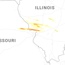

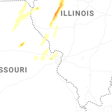
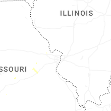

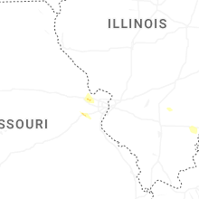


Connect with Interactive Hail Maps