

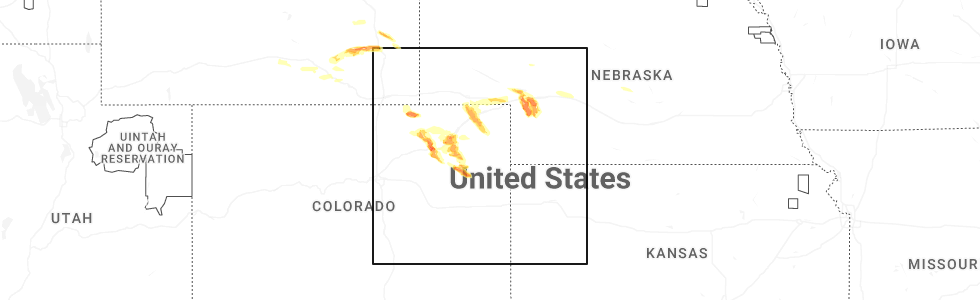
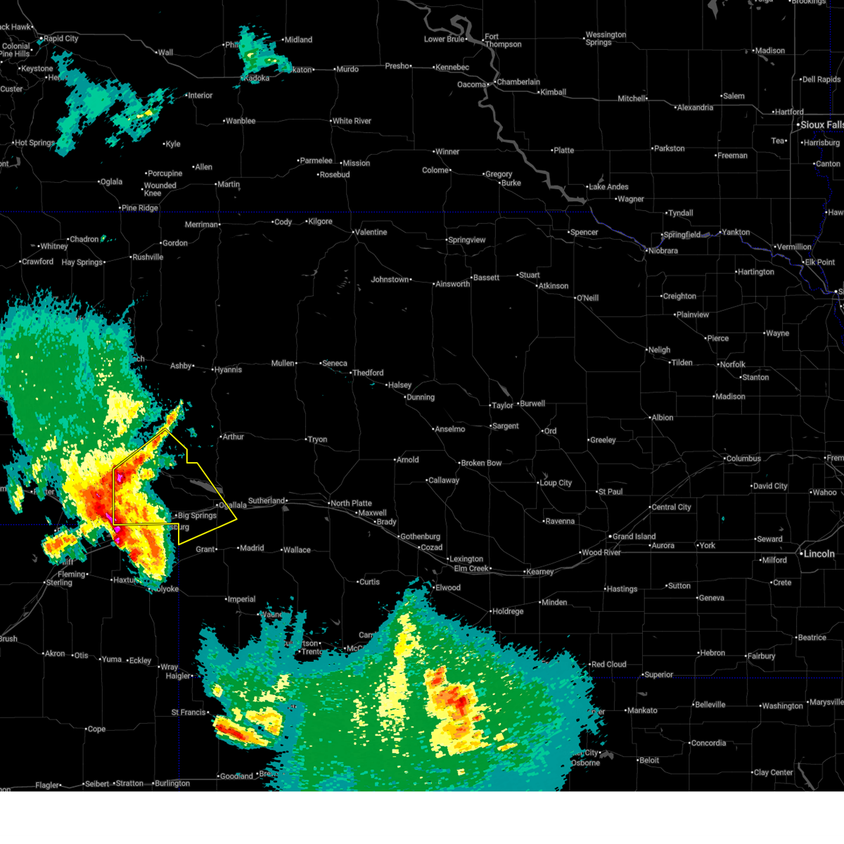
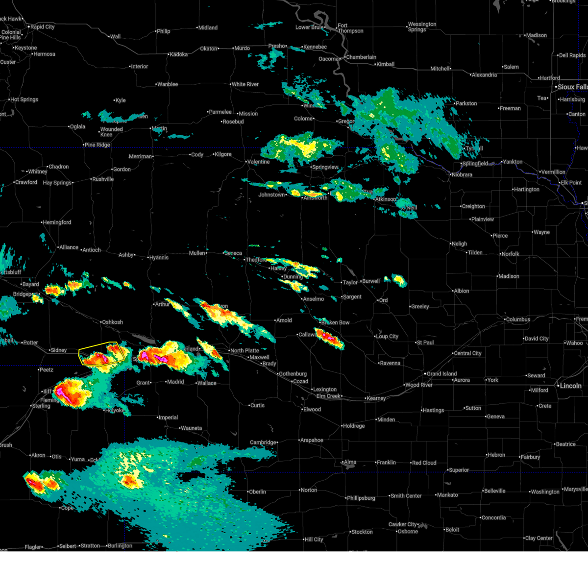
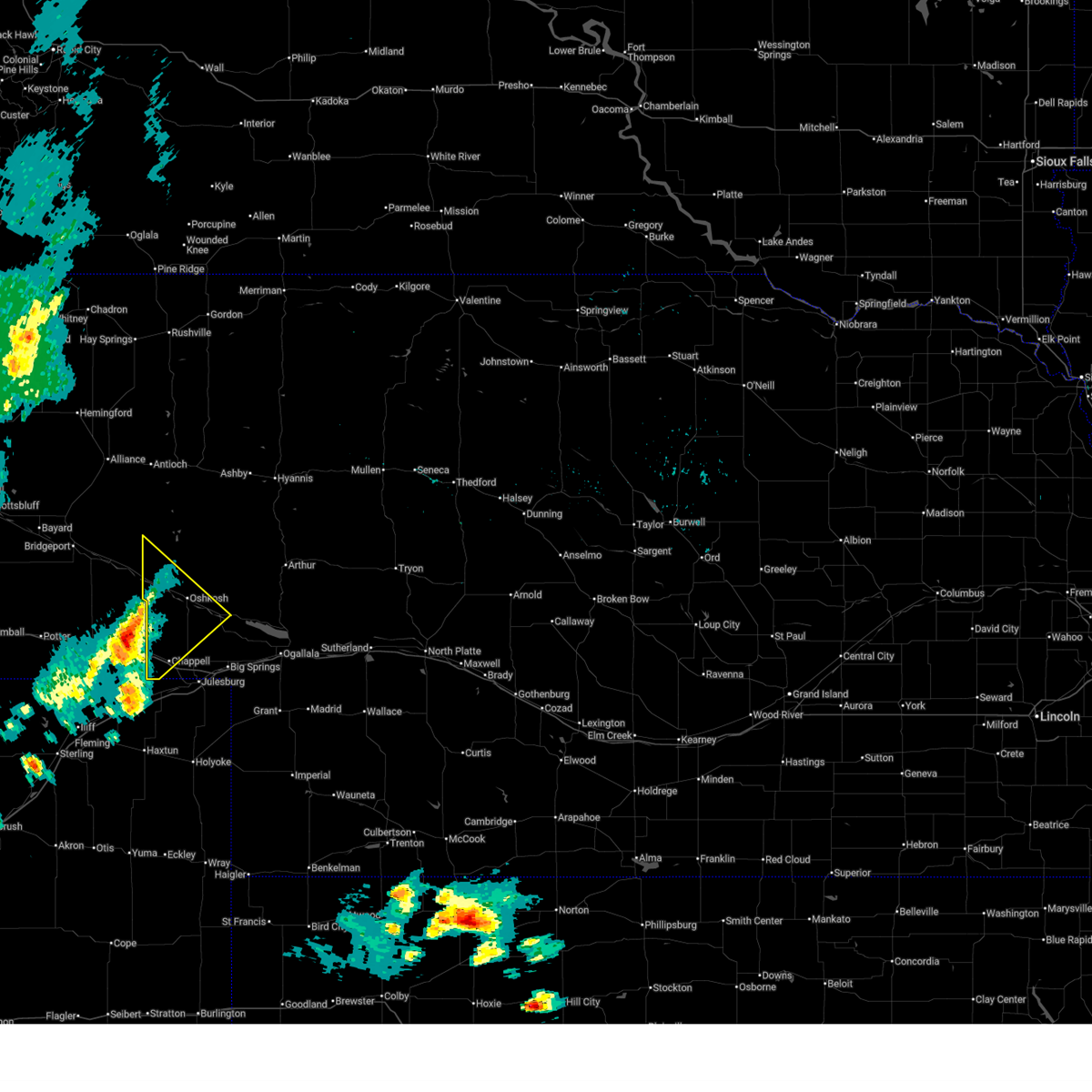
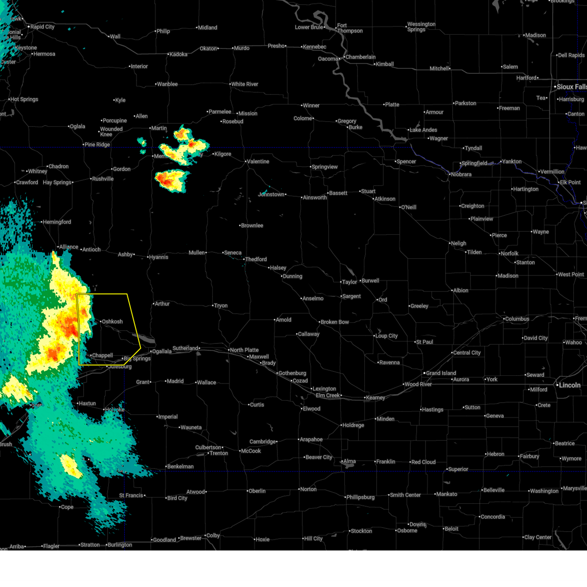
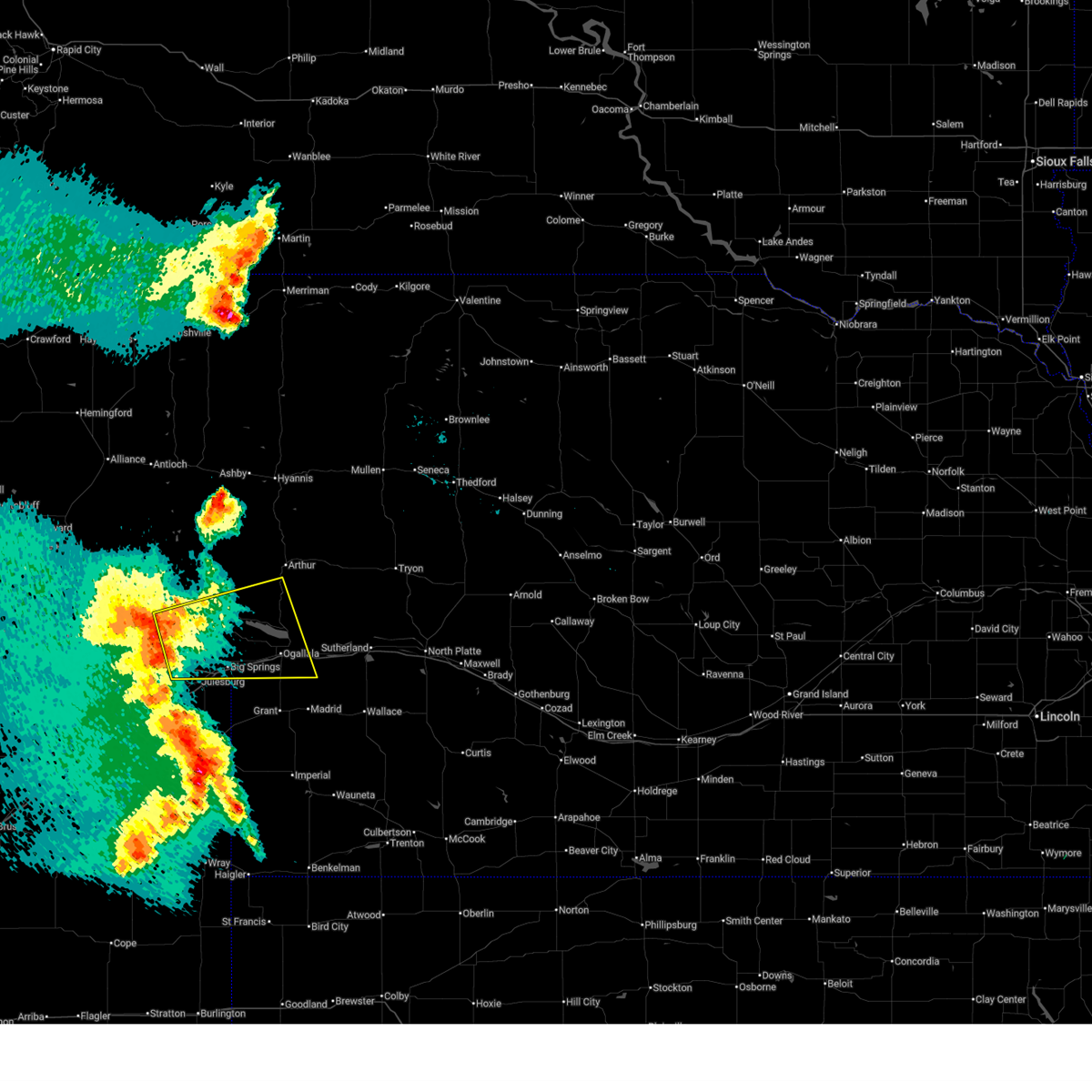
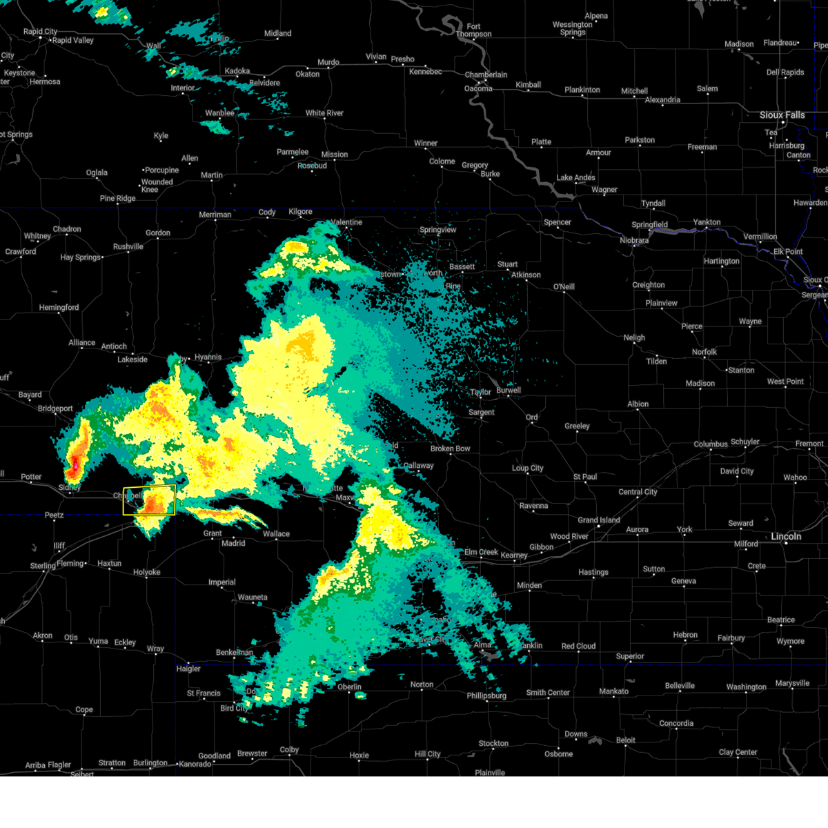
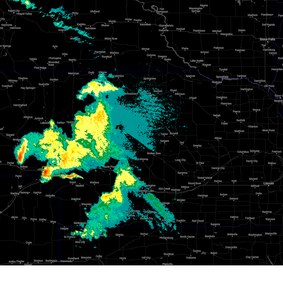
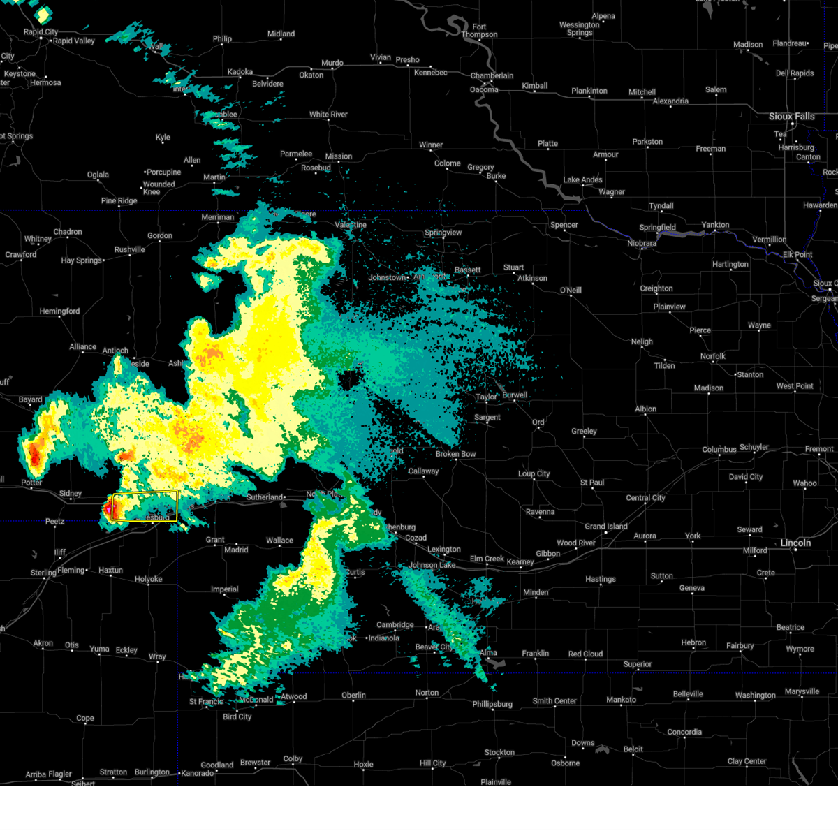
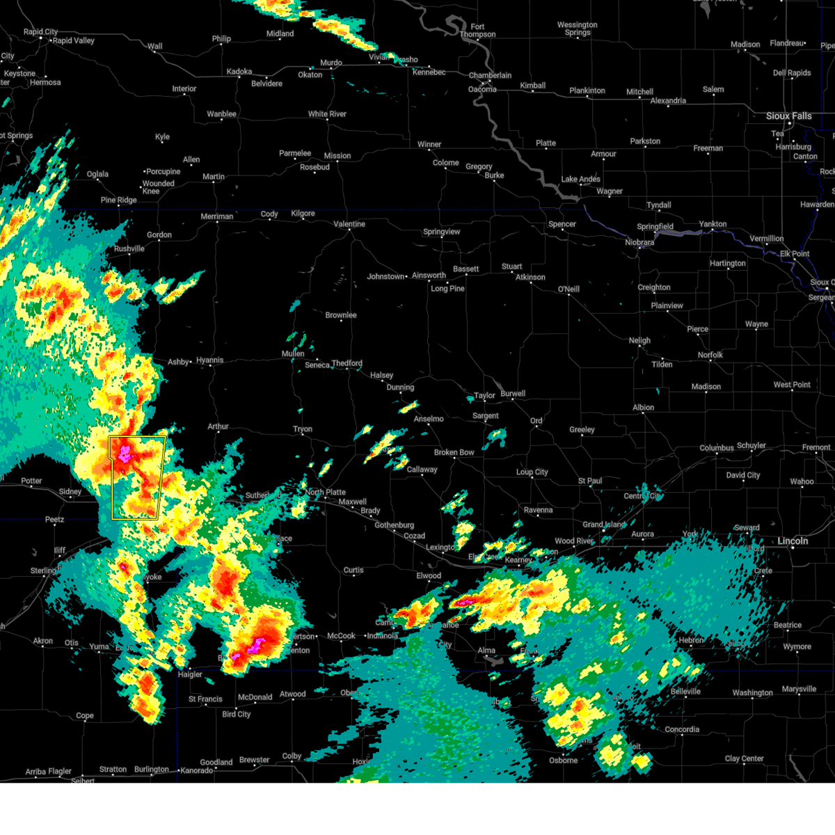
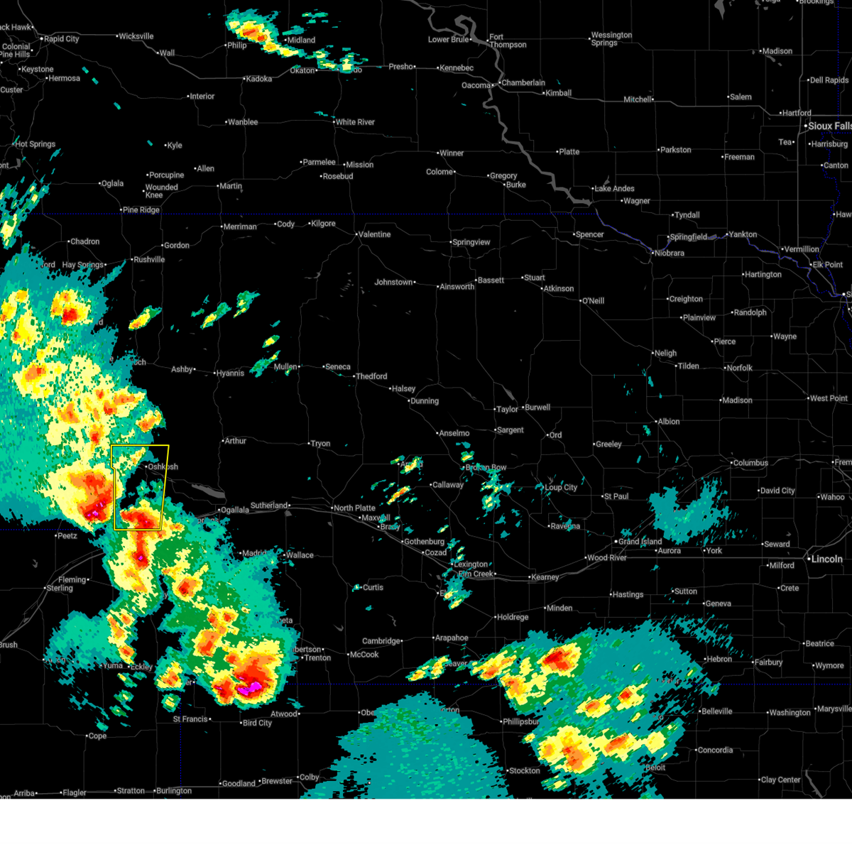
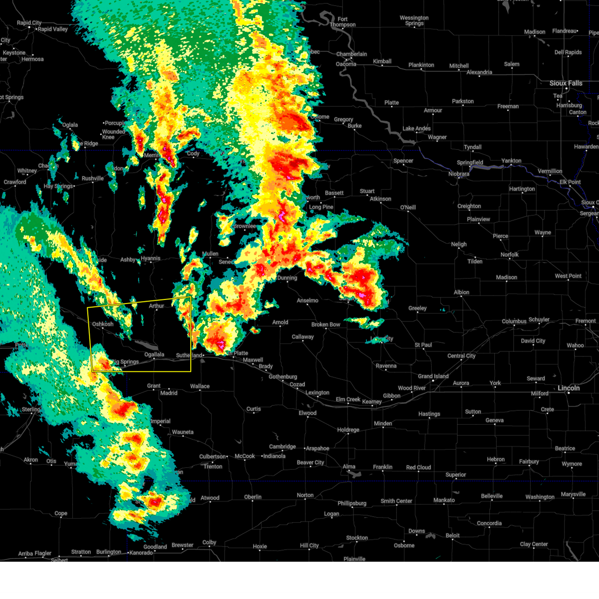
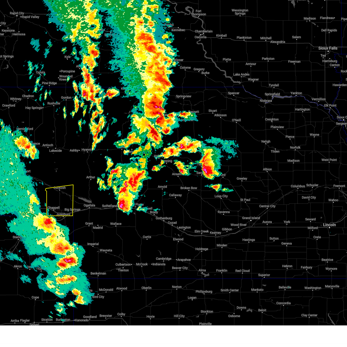
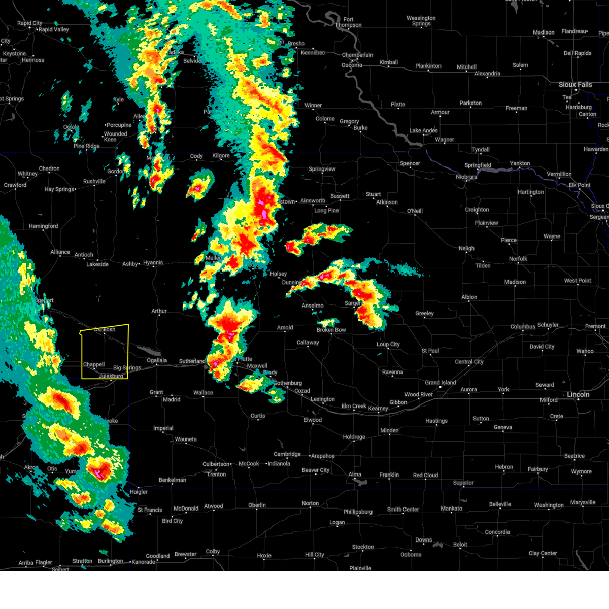
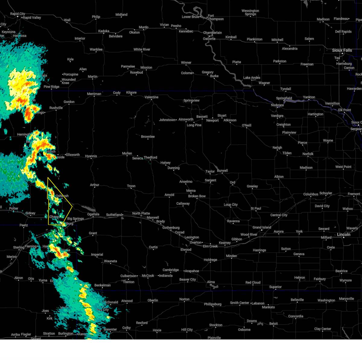
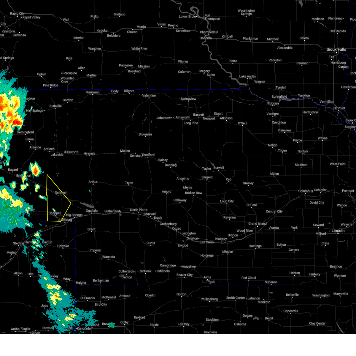
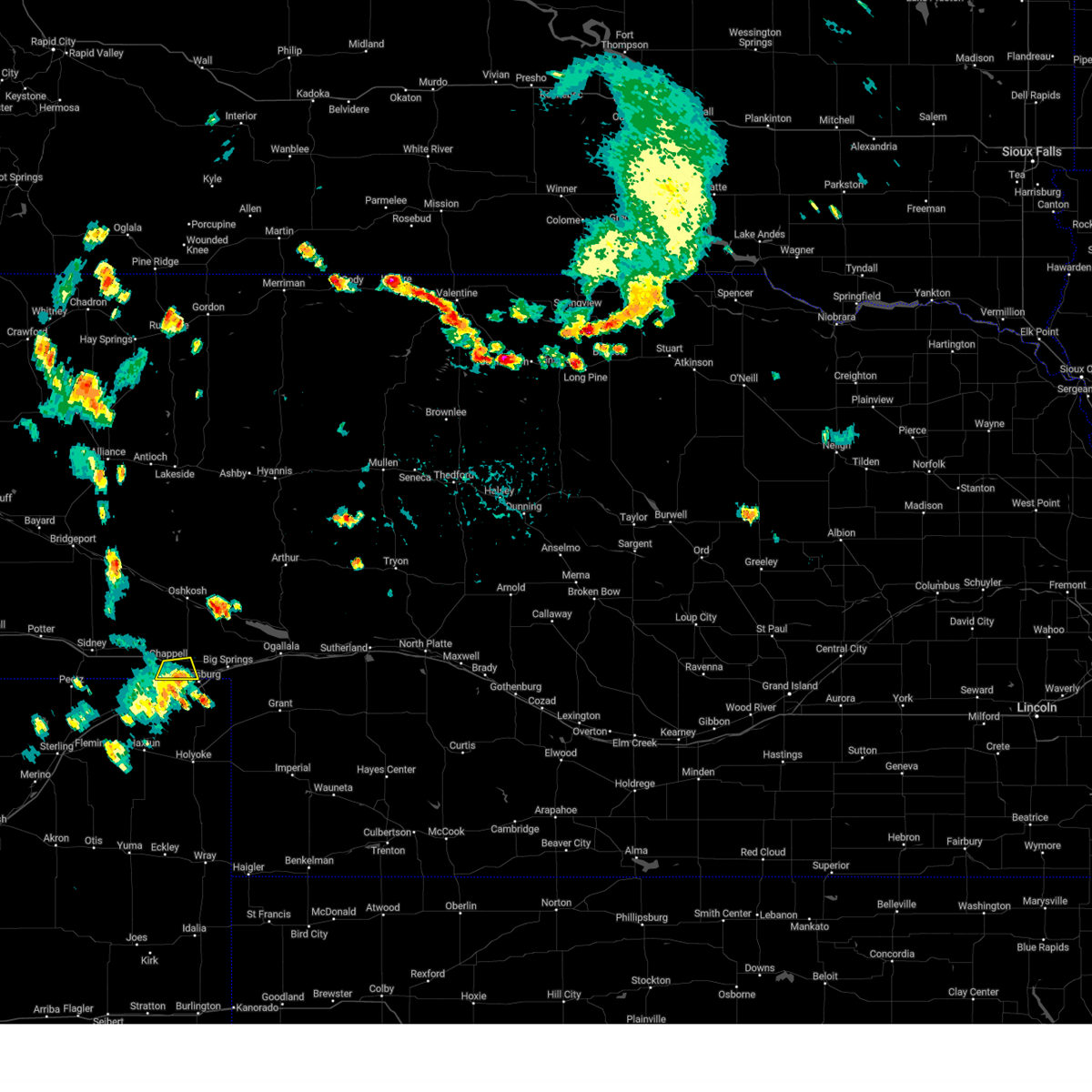
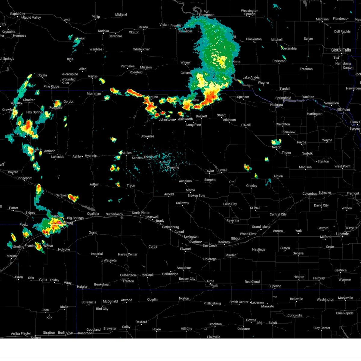
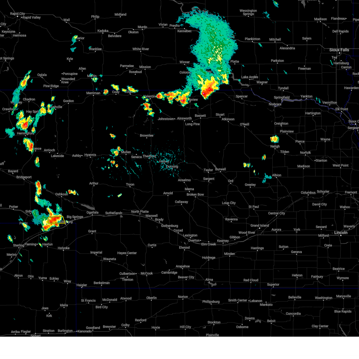
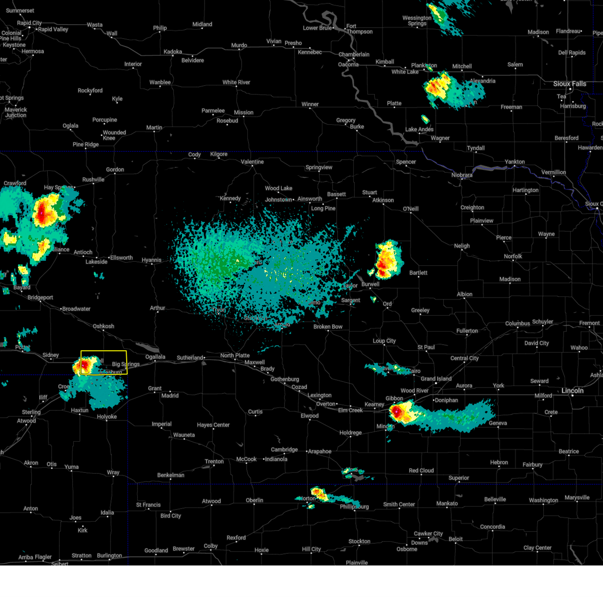
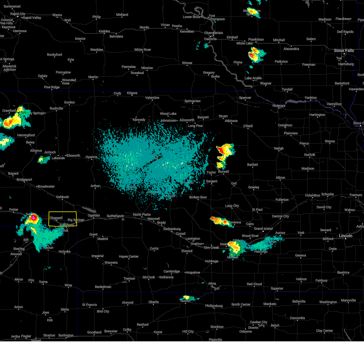
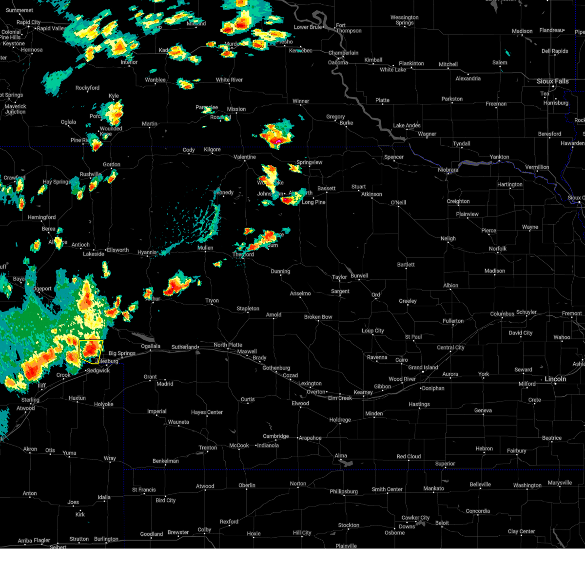
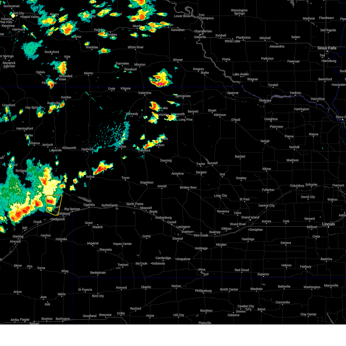
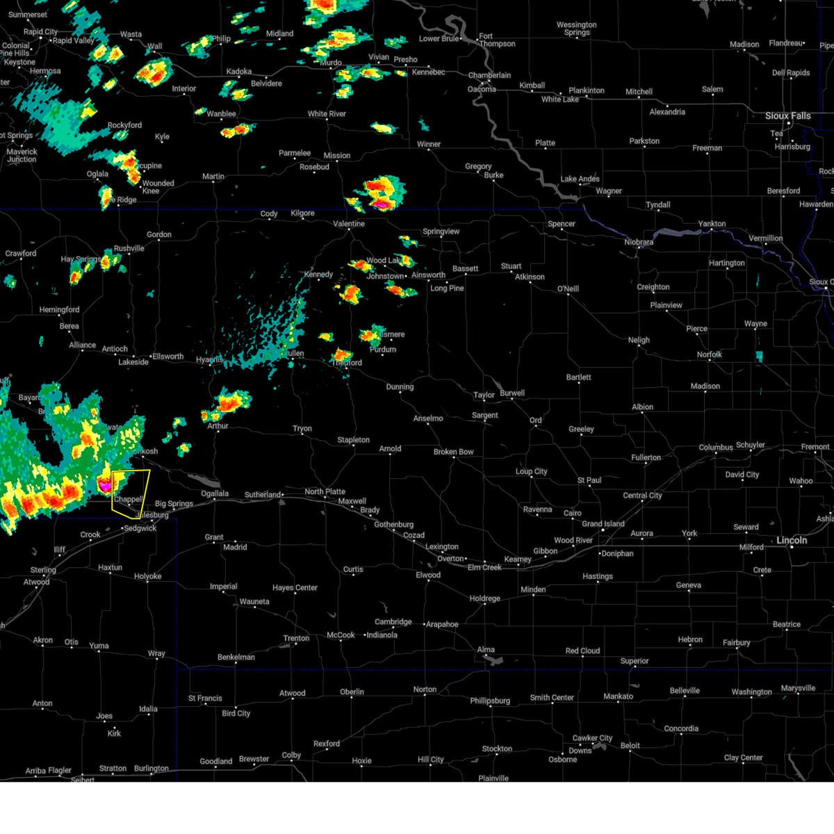
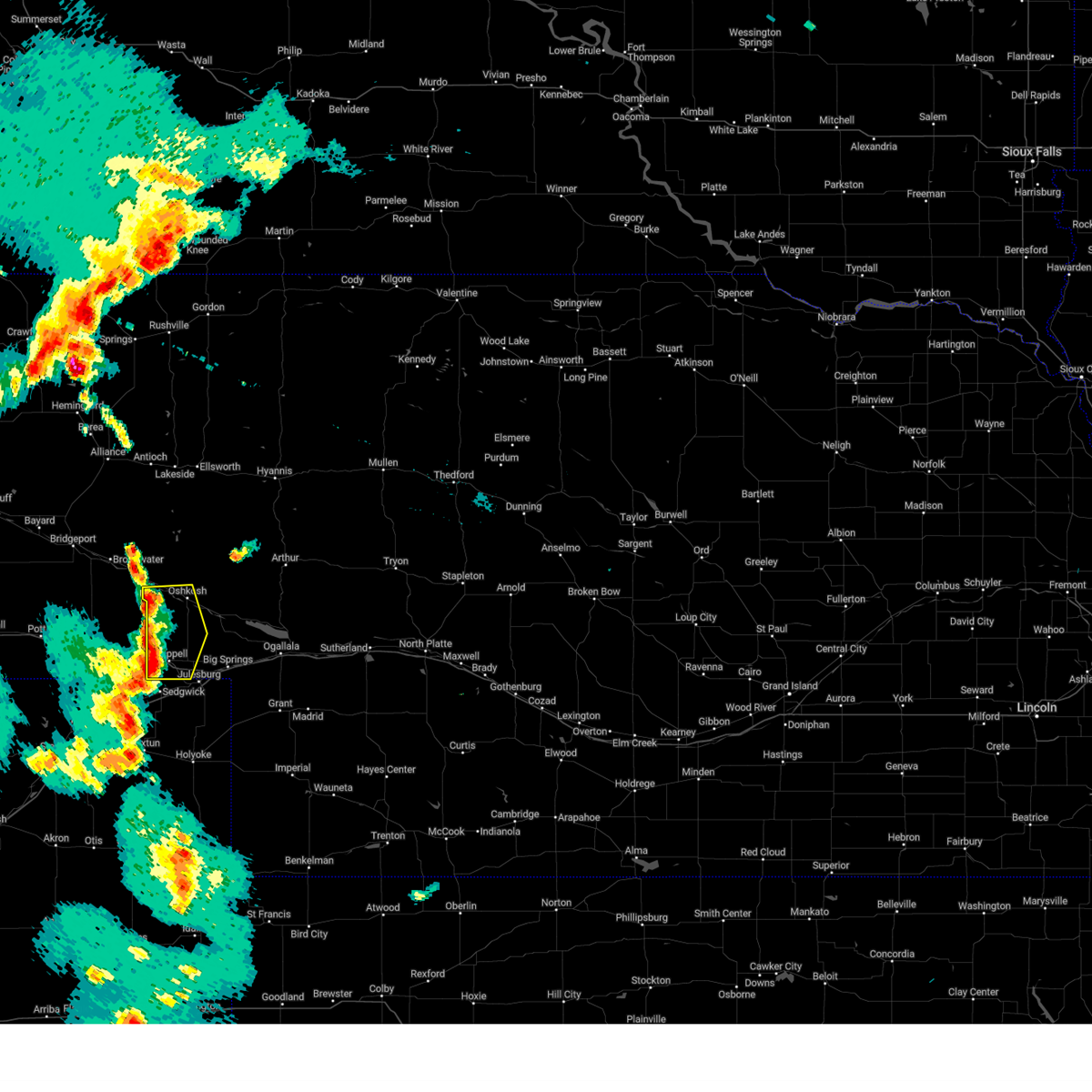
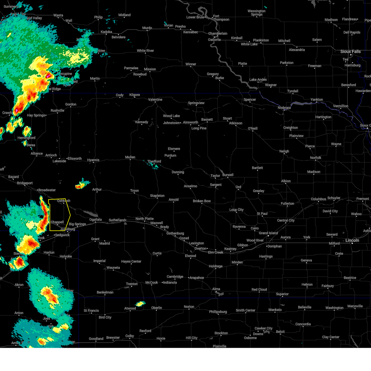
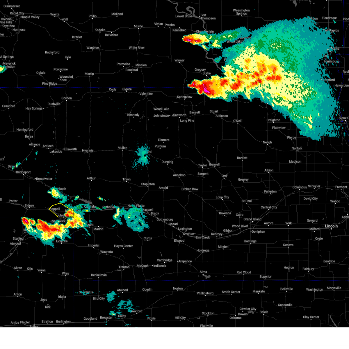
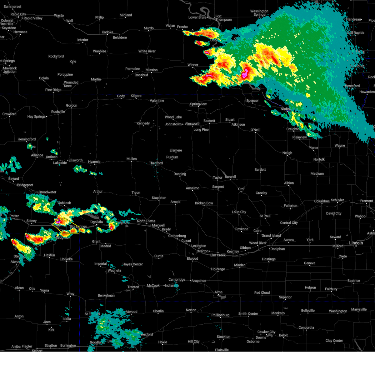
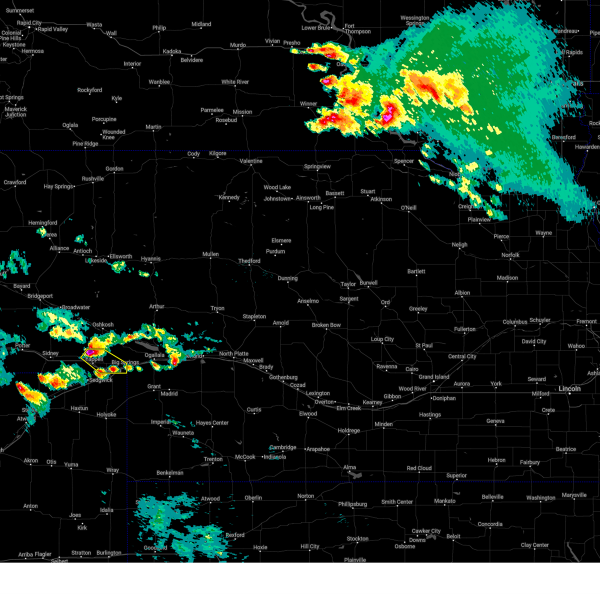
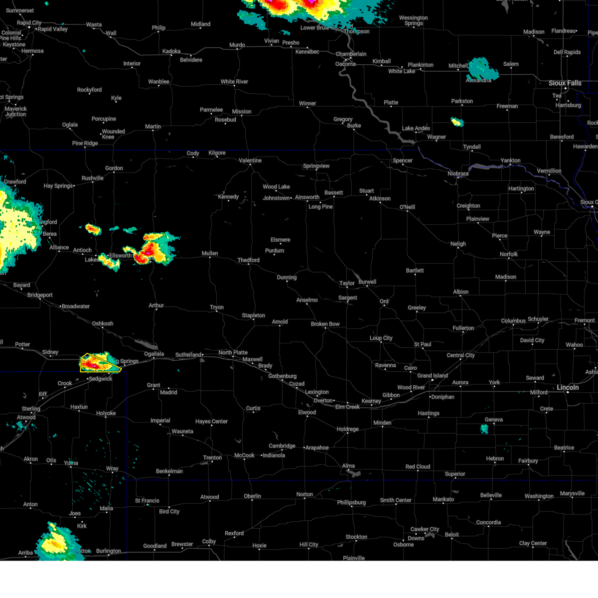
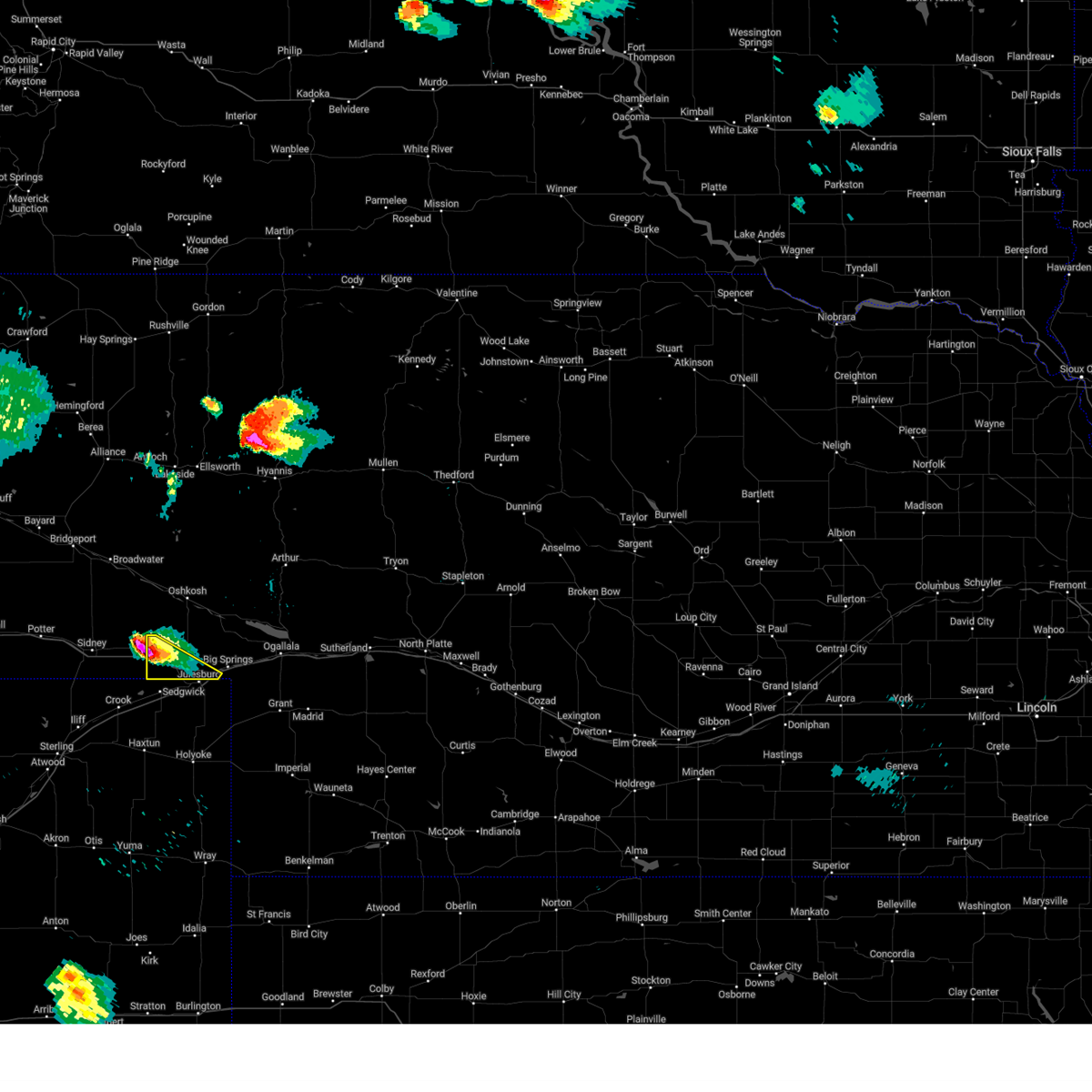
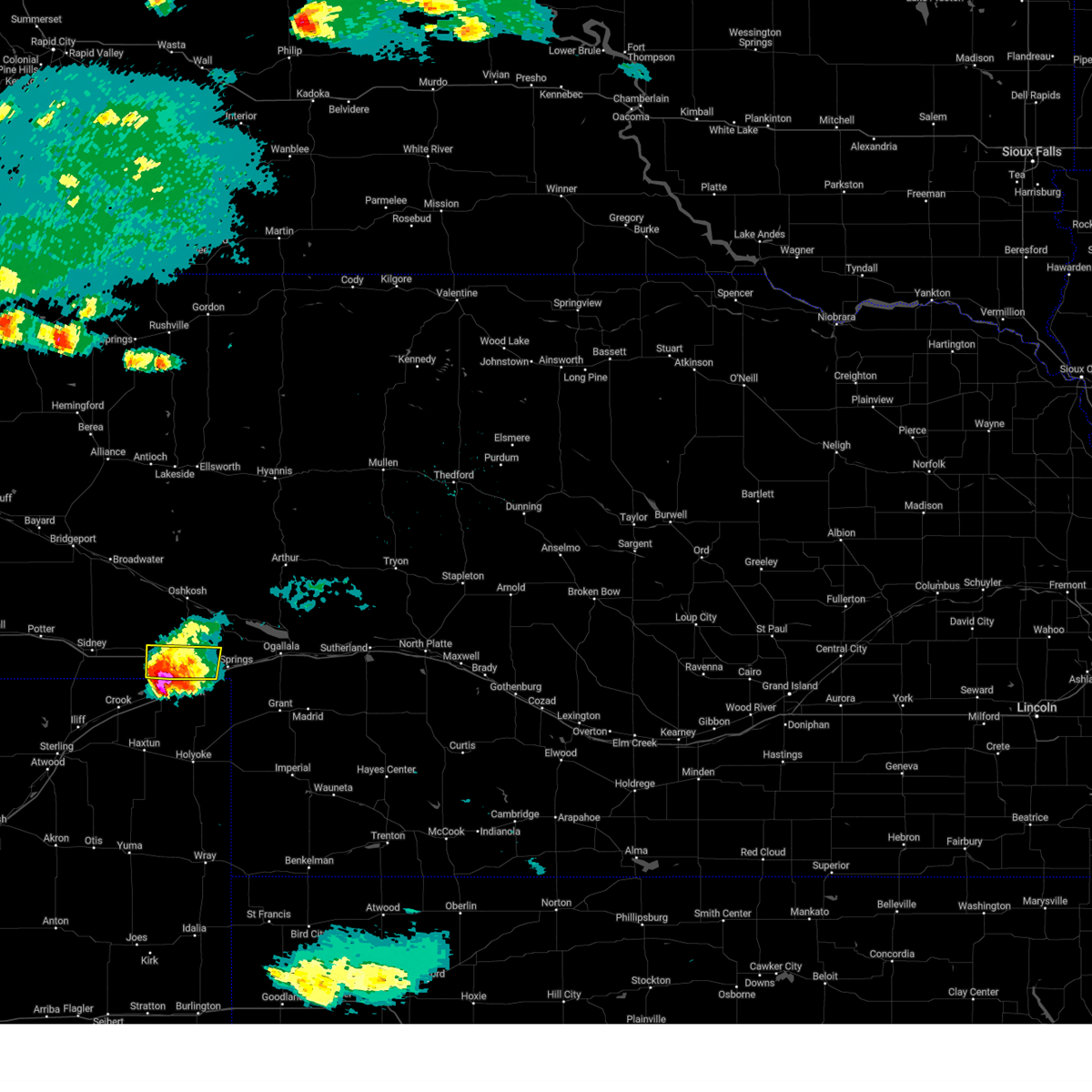
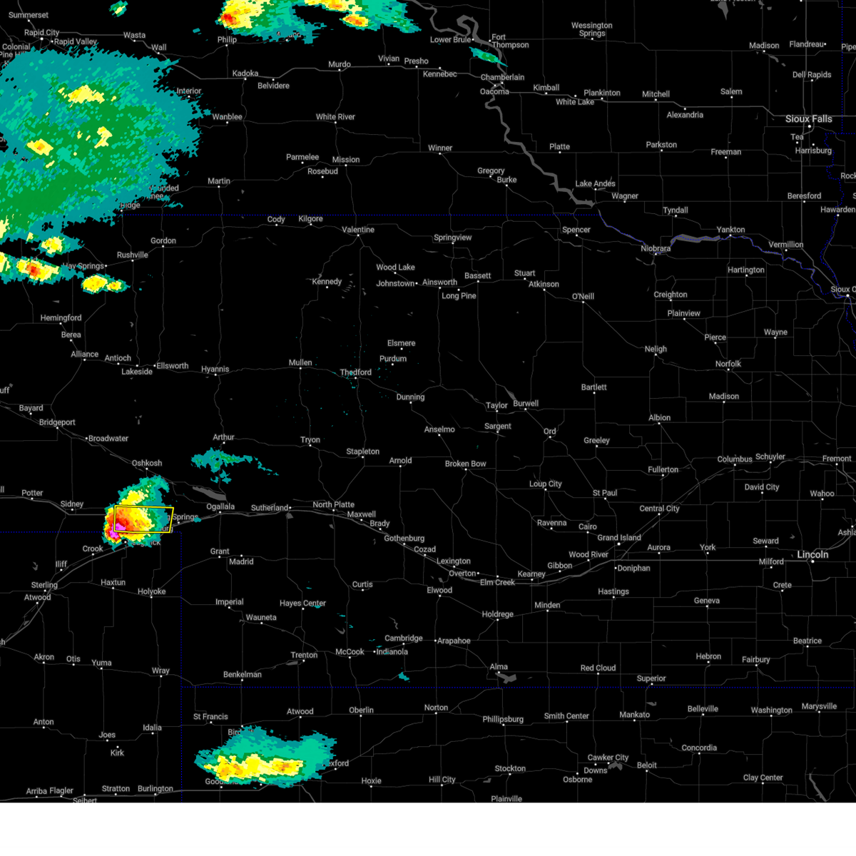
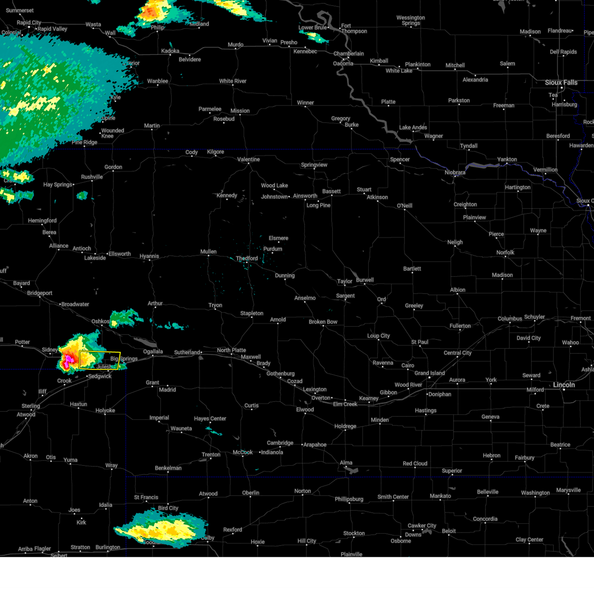
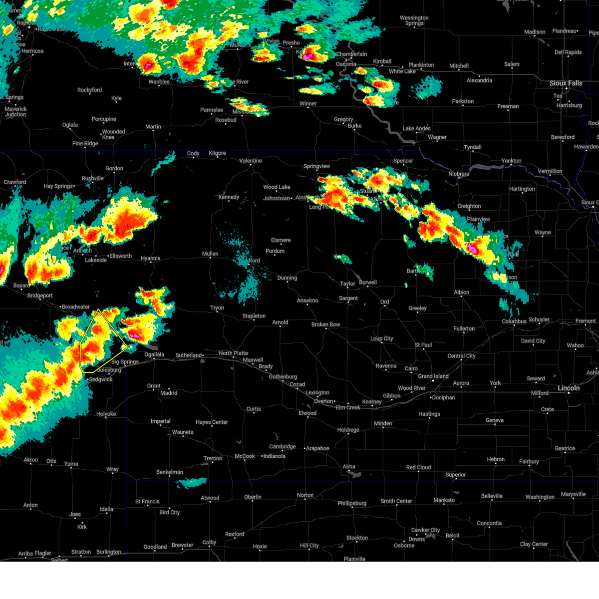
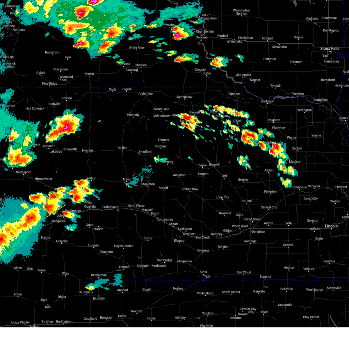
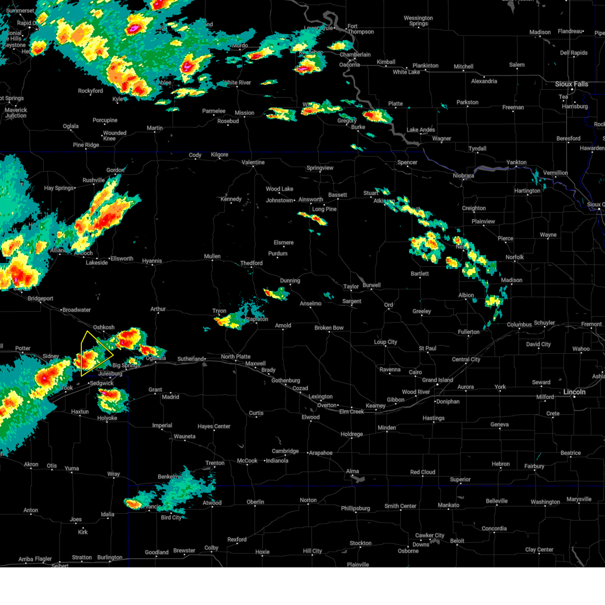
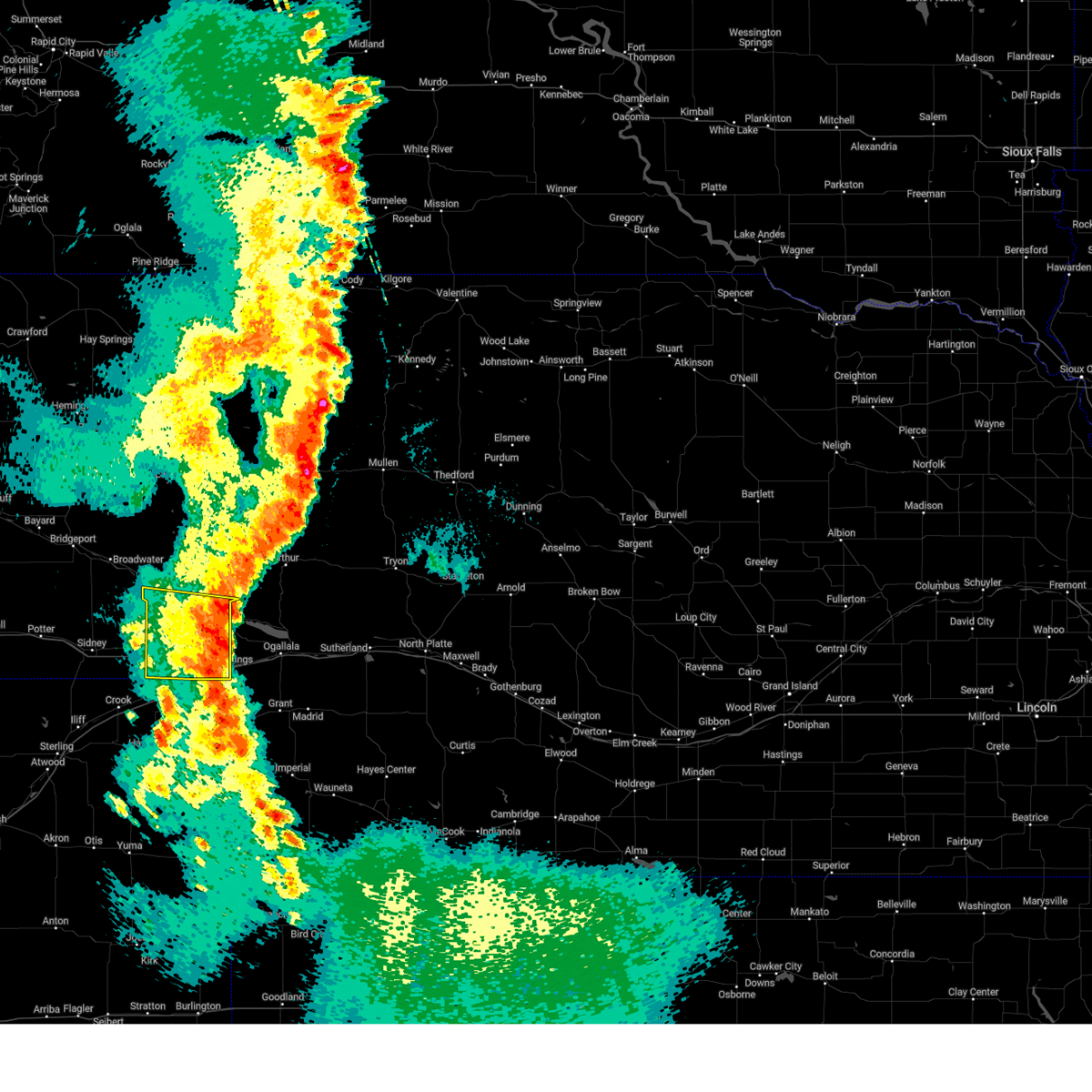
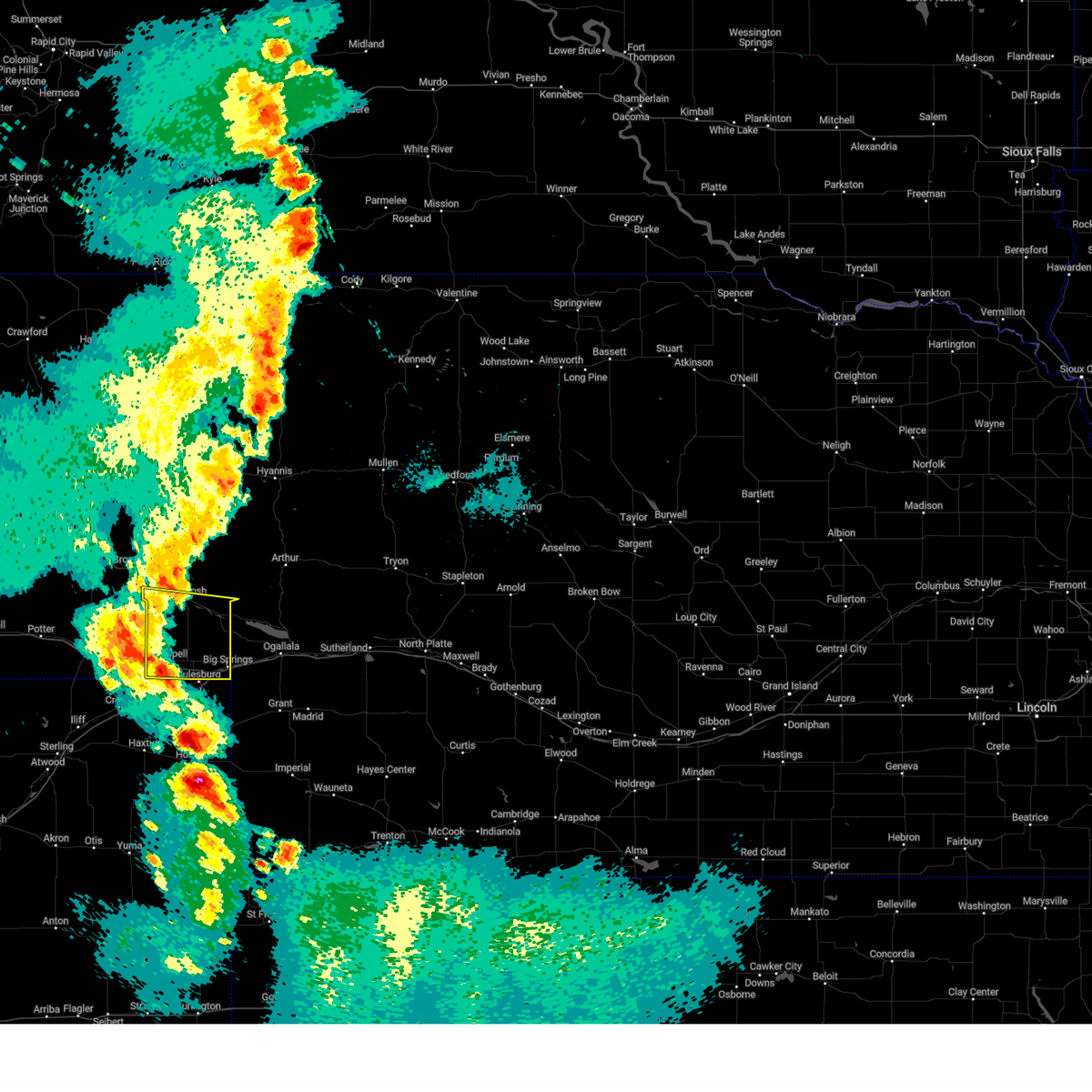
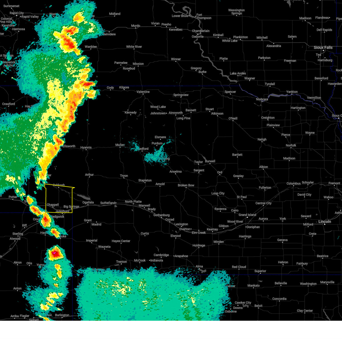
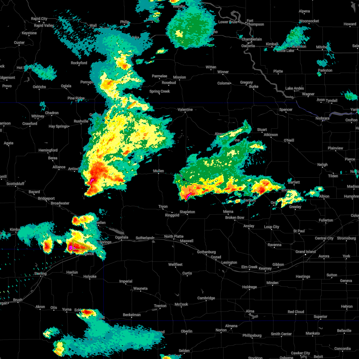
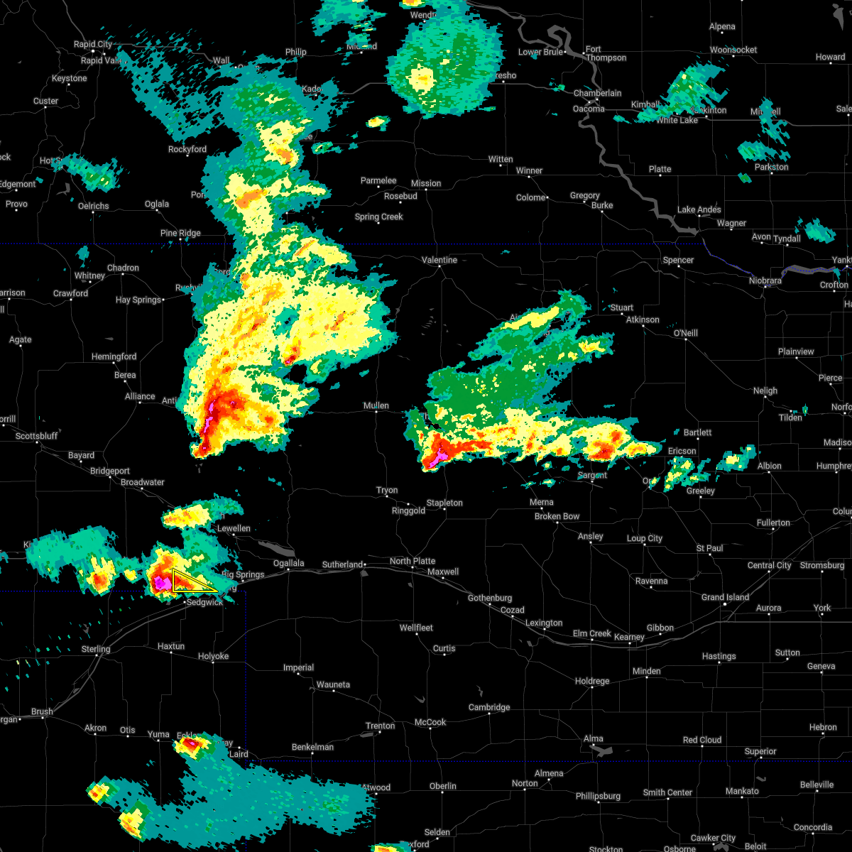
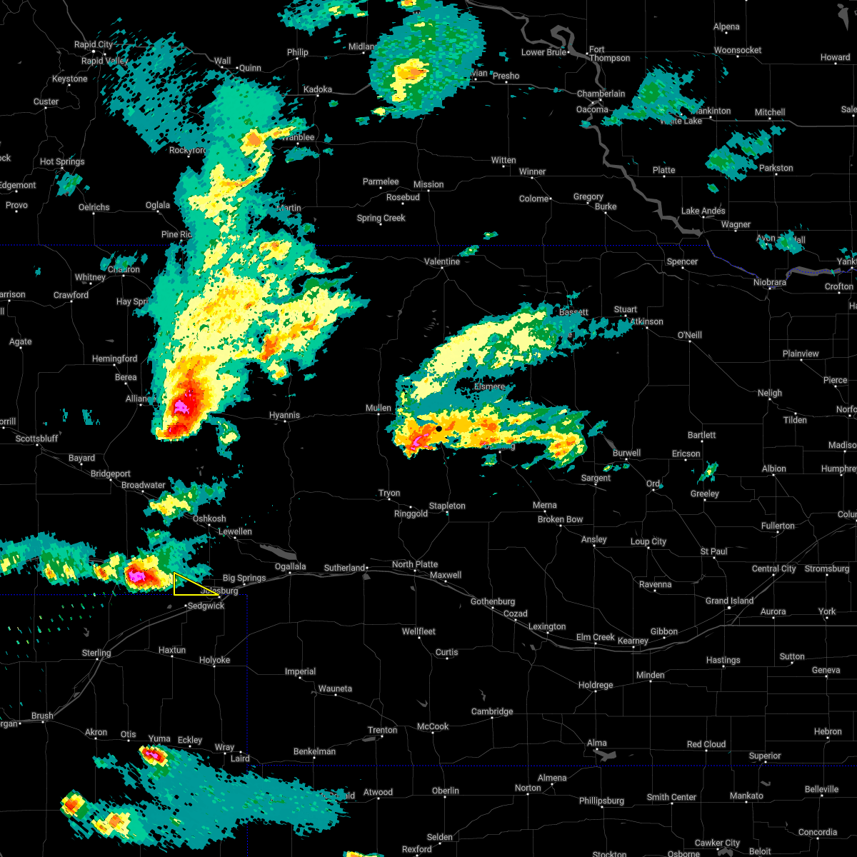
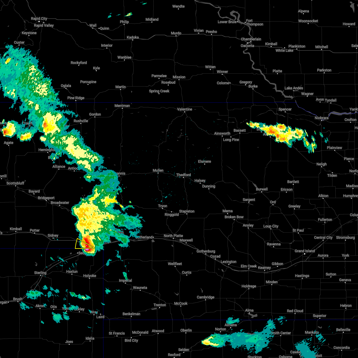
Hail Map for Chappell, NE
The Chappell, NE area has had 37 reports of on-the-ground hail by trained spotters, and has been under severe weather warnings 13 times during the past 12 months. Doppler radar has detected hail at or near Chappell, NE on 102 occasions, including 4 occasions during the past year.
| Name: | Chappell, NE |
| Where Located: | 68.2 miles N of Yuma, CO |
| Map: | Google Map for Chappell, NE |
| Population: | 929 |
| Housing Units: | 484 |
| More Info: | Search Google for Chappell, NE |
2
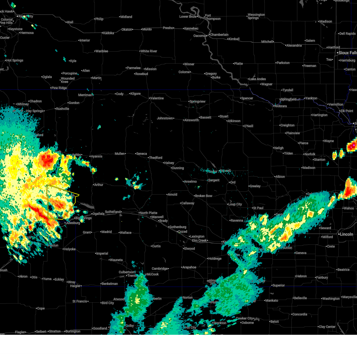
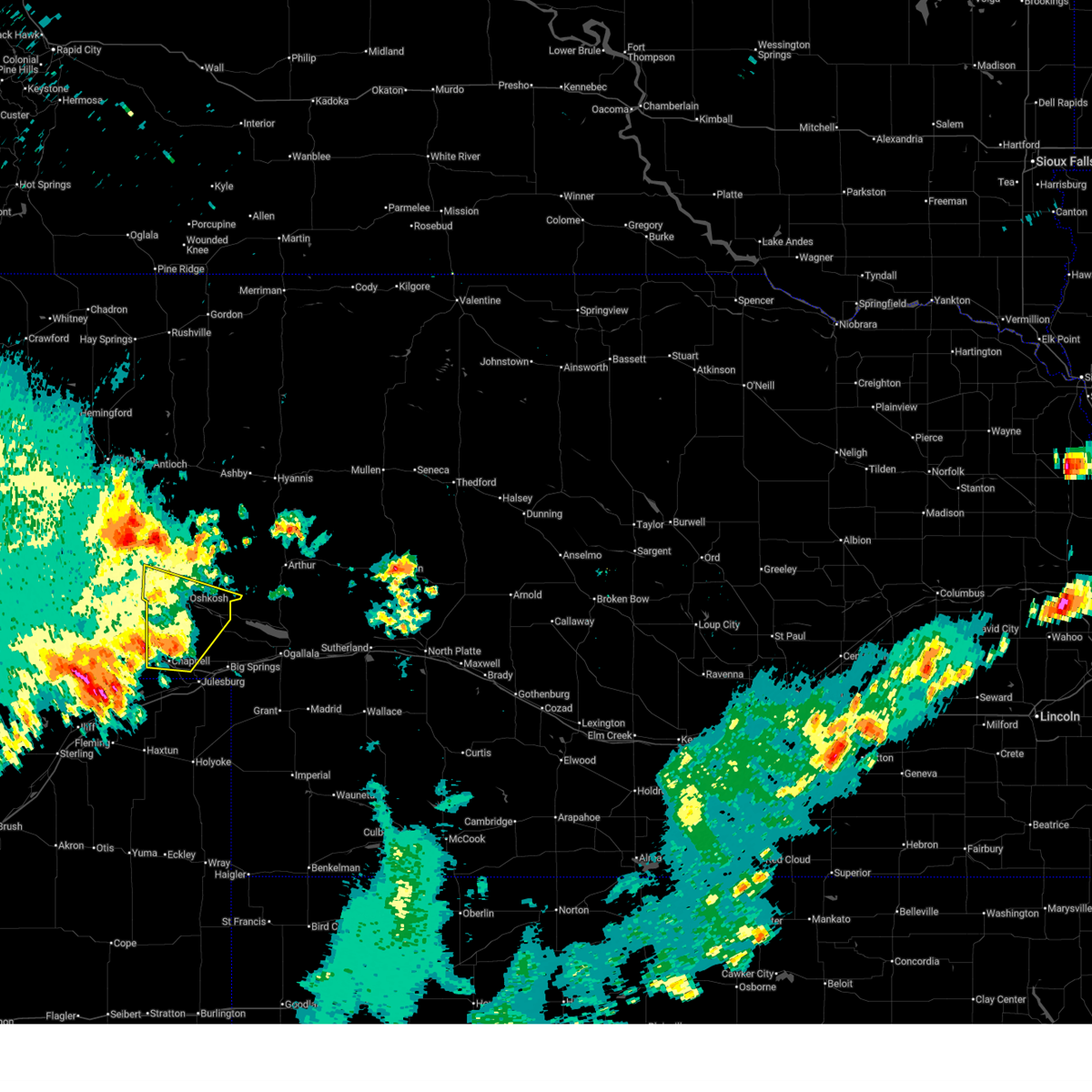
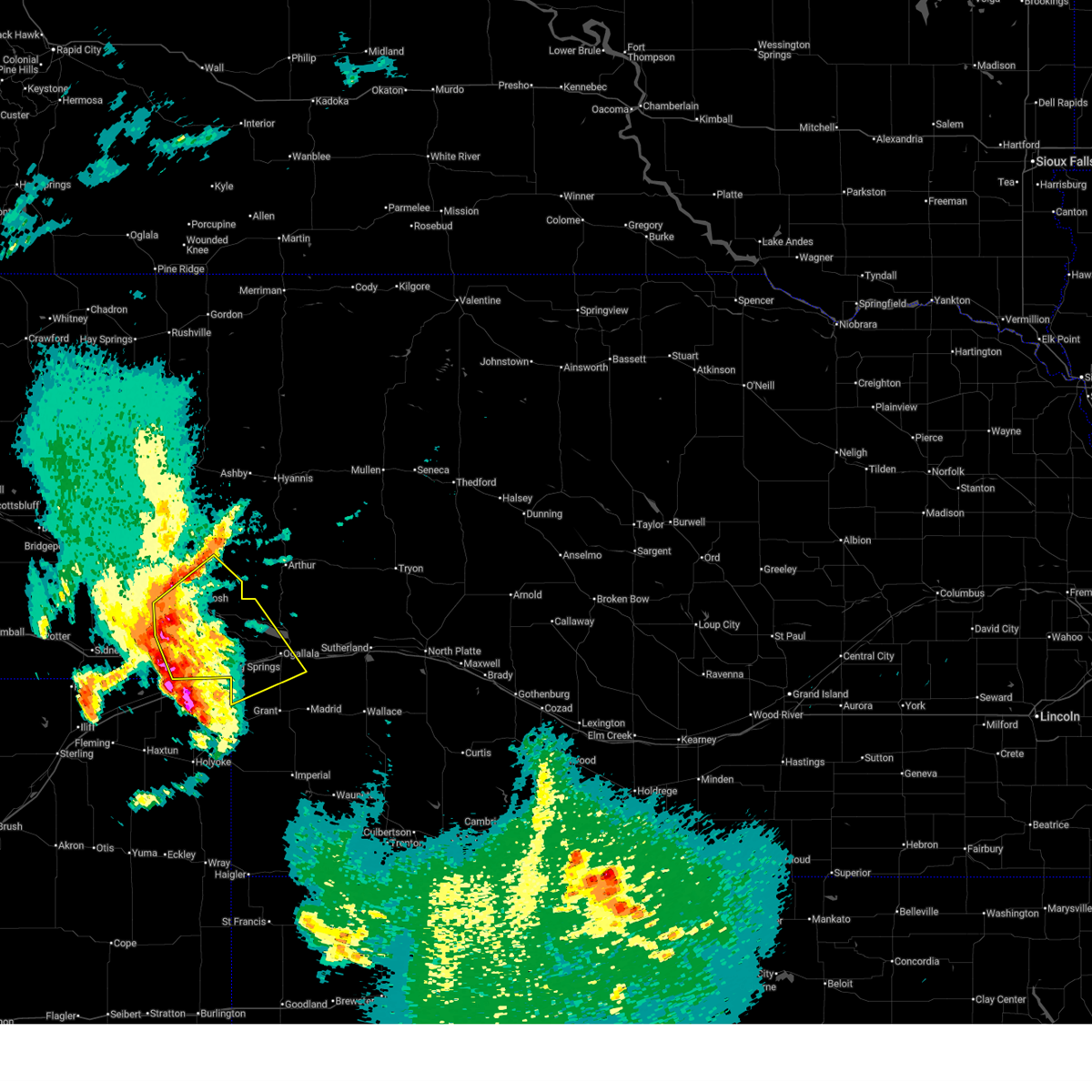
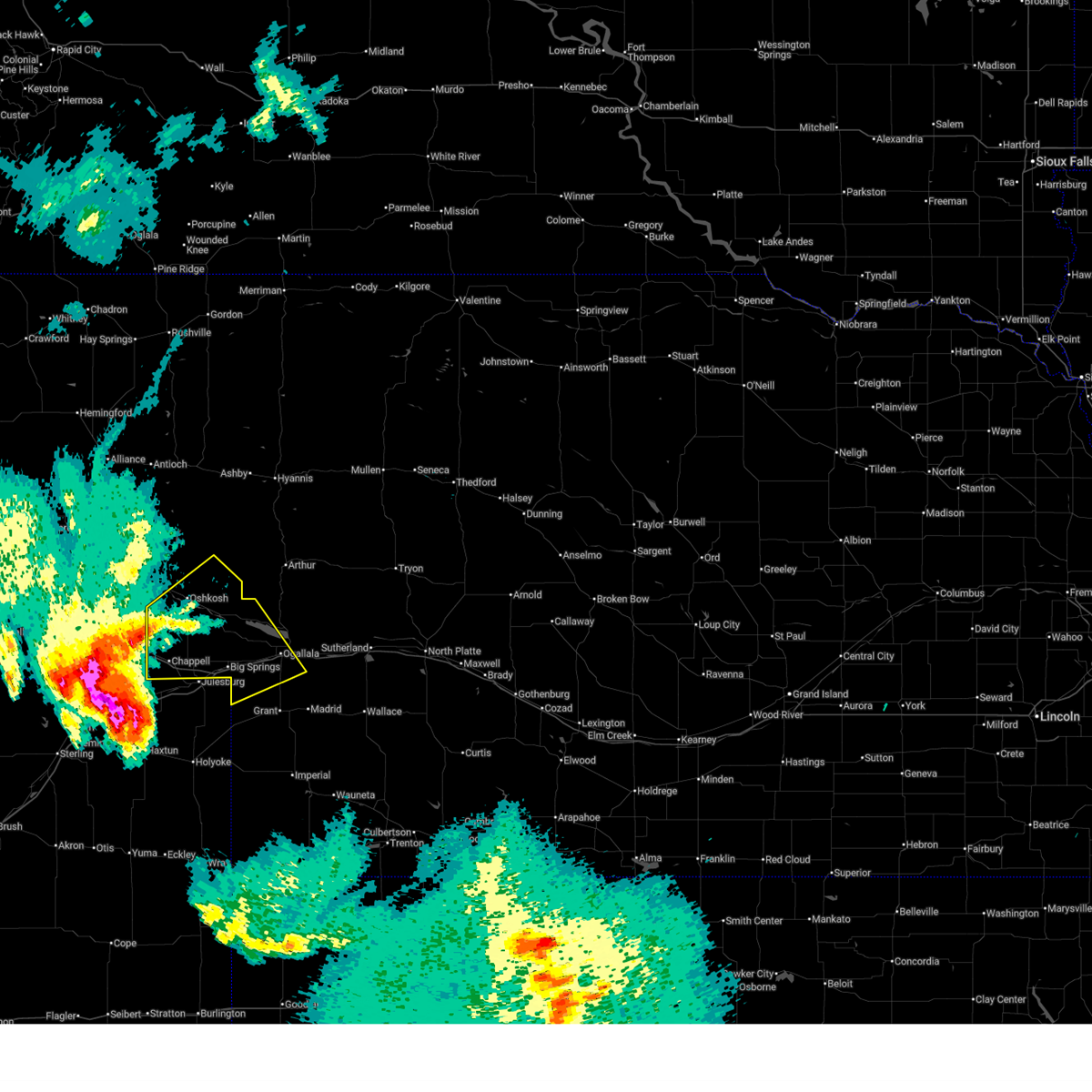
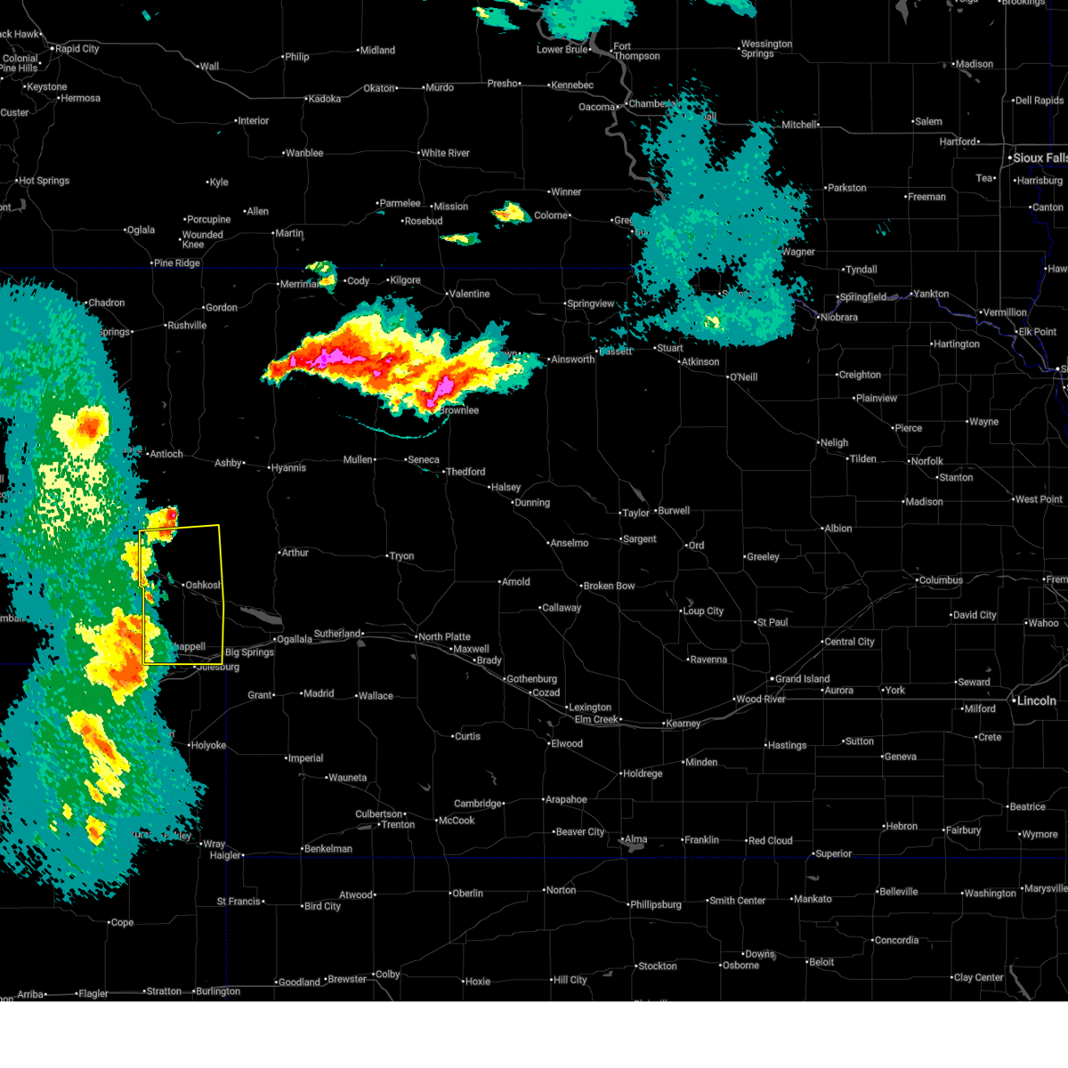
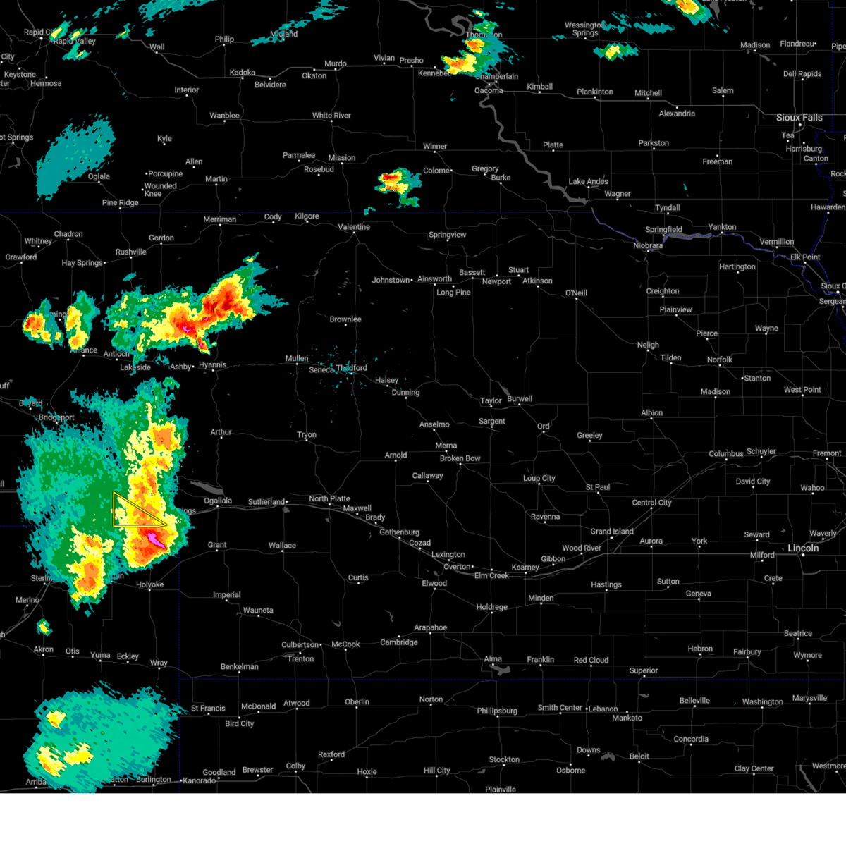
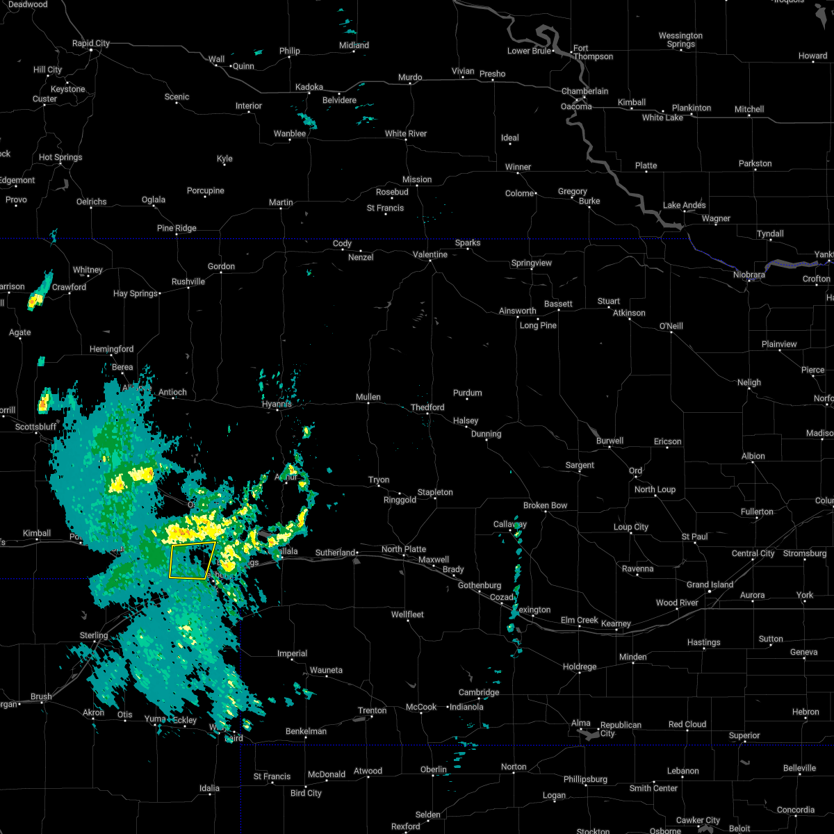
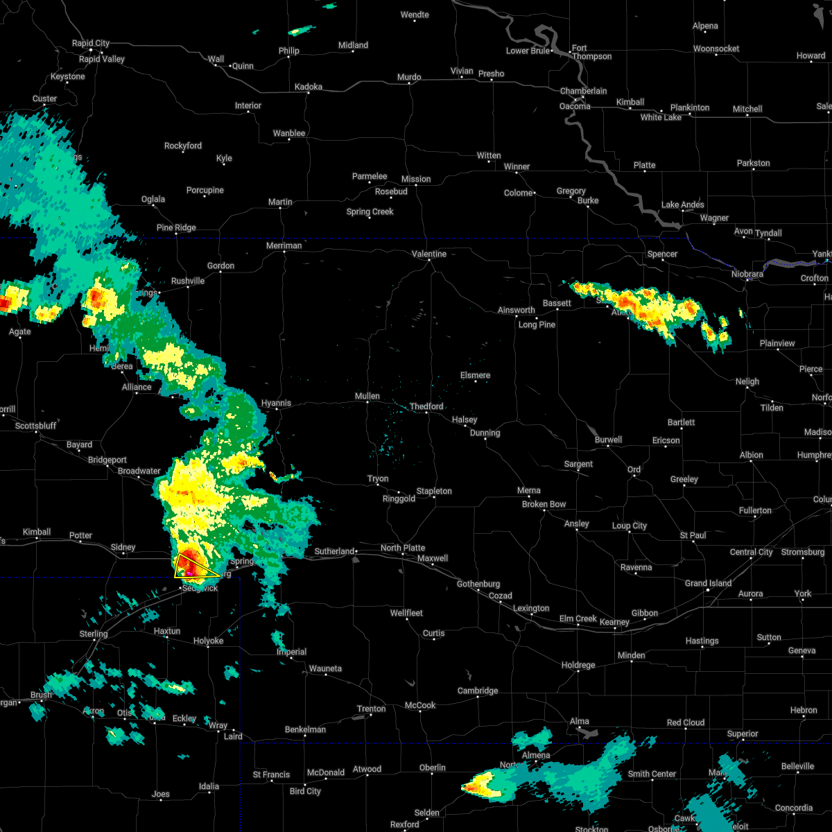
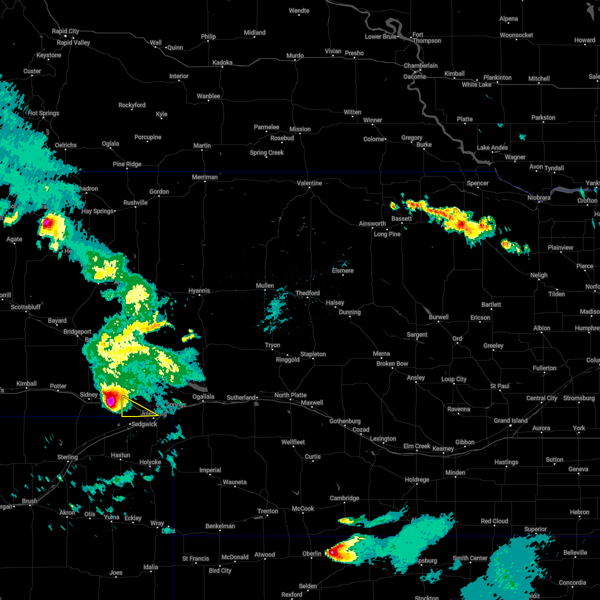
The Top Recent Hail Date for Chappell, NE is Wednesday, June 24, 2026 (4th out of 102)
Hail and Wind Damage Spotted near Chappell, NE
| Date / Time | Report Details |
|---|---|
| 7/2/2026 3:05 AM MDT |
 At 305 am mdt, severe thunderstorms were located along a line extending from near colton to near lodgepole to sedgwick, moving northeast at 35 mph (radar indicated). Hazards include 60 mph wind gusts and penny size hail. Expect damage to roofs, siding, and trees. locations impacted include, chappell, oshkosh, lewellen, lisco, ash hollow state historical park, mount vernon, intersection of highway 27 and 9 mile road, bluewater battlefield state historical park, windlass hill, and sugar loaf hill. this includes the following highways, highway 92 between mile markers 115 and 118. Interstate 80 in nebraska between mile markers 78 and 94. At 305 am mdt, severe thunderstorms were located along a line extending from near colton to near lodgepole to sedgwick, moving northeast at 35 mph (radar indicated). Hazards include 60 mph wind gusts and penny size hail. Expect damage to roofs, siding, and trees. locations impacted include, chappell, oshkosh, lewellen, lisco, ash hollow state historical park, mount vernon, intersection of highway 27 and 9 mile road, bluewater battlefield state historical park, windlass hill, and sugar loaf hill. this includes the following highways, highway 92 between mile markers 115 and 118. Interstate 80 in nebraska between mile markers 78 and 94.
|
| 7/2/2026 2:38 AM MDT |
 Svrlbf the national weather service in north platte has issued a * severe thunderstorm warning for, southern garden county in the panhandle of nebraska, western deuel county in the panhandle of nebraska, * until 330 am mdt. * at 238 am mdt, a severe thunderstorm was located near chappell, moving north at 25 mph (radar indicated). Hazards include 60 mph wind gusts and penny size hail. expect damage to roofs, siding, and trees Svrlbf the national weather service in north platte has issued a * severe thunderstorm warning for, southern garden county in the panhandle of nebraska, western deuel county in the panhandle of nebraska, * until 330 am mdt. * at 238 am mdt, a severe thunderstorm was located near chappell, moving north at 25 mph (radar indicated). Hazards include 60 mph wind gusts and penny size hail. expect damage to roofs, siding, and trees
|
| 6/30/2026 9:11 PM MDT |
 At 910 pm mdt, severe thunderstorms were located along a line extending from 7 miles south of oshkosh to 10 miles east of chappell to 8 miles southeast of barton, moving northeast at 35 mph (radar indicated). Hazards include 70 mph wind gusts and ping pong ball size hail. People and animals outdoors will be injured. expect hail damage to roofs, siding, windows, and vehicles. expect considerable tree damage. wind damage is also likely to mobile homes, roofs, and outbuildings. these severe storms will be near, big springs around 915 pm mdt. lewellen around 925 pm mdt. brule around 930 pm mdt. ogallala around 945 pm mdt. lemoyne around 950 pm mdt. other locations impacted by these severe thunderstorms include eagle gulch campground, ash hollow state historical park, ruthon, belmar, clear creek state wildlife management area, intersection of highway 27 and 9 mile road, goldeneye state wildlife management area, megeath, bluewater battlefield state historical park, and windlass hill. this includes the following highways, highway 61 between mile markers 77 and 92. highway 92 between mile markers 115 and 135. Interstate 80 in nebraska between mile markers 85 and 131. At 910 pm mdt, severe thunderstorms were located along a line extending from 7 miles south of oshkosh to 10 miles east of chappell to 8 miles southeast of barton, moving northeast at 35 mph (radar indicated). Hazards include 70 mph wind gusts and ping pong ball size hail. People and animals outdoors will be injured. expect hail damage to roofs, siding, windows, and vehicles. expect considerable tree damage. wind damage is also likely to mobile homes, roofs, and outbuildings. these severe storms will be near, big springs around 915 pm mdt. lewellen around 925 pm mdt. brule around 930 pm mdt. ogallala around 945 pm mdt. lemoyne around 950 pm mdt. other locations impacted by these severe thunderstorms include eagle gulch campground, ash hollow state historical park, ruthon, belmar, clear creek state wildlife management area, intersection of highway 27 and 9 mile road, goldeneye state wildlife management area, megeath, bluewater battlefield state historical park, and windlass hill. this includes the following highways, highway 61 between mile markers 77 and 92. highway 92 between mile markers 115 and 135. Interstate 80 in nebraska between mile markers 85 and 131.
|
| 6/30/2026 8:40 PM MDT |
 At 840 pm mdt, severe thunderstorms were located along a line extending from sunol to 6 miles north of sedgwick to 6 miles east of marks butte, moving northeast at 35 mph (radar indicated). Hazards include 70 mph wind gusts and ping pong ball size hail. People and animals outdoors will be injured. expect hail damage to roofs, siding, windows, and vehicles. expect considerable tree damage. wind damage is also likely to mobile homes, roofs, and outbuildings. these severe storms will be near, chappell around 845 pm mdt. barton around 905 pm mdt. big springs around 910 pm mdt. oshkosh around 920 pm mdt. lewellen around 925 pm mdt. brule around 930 pm mdt. ogallala around 940 pm mdt. lemoyne around 950 pm mdt. other locations impacted by these severe thunderstorms include eagle gulch campground, ruthon, clear creek state wildlife management area, intersection of highway 27 and 9 mile road, megeath, otter creek campground, lake view campground, ash hollow state historical park, belmar, and mount vernon. this includes the following highways, highway 61 between mile markers 77 and 92. highway 92 between mile markers 115 and 135. Interstate 80 in nebraska between mile markers 78 and 131. At 840 pm mdt, severe thunderstorms were located along a line extending from sunol to 6 miles north of sedgwick to 6 miles east of marks butte, moving northeast at 35 mph (radar indicated). Hazards include 70 mph wind gusts and ping pong ball size hail. People and animals outdoors will be injured. expect hail damage to roofs, siding, windows, and vehicles. expect considerable tree damage. wind damage is also likely to mobile homes, roofs, and outbuildings. these severe storms will be near, chappell around 845 pm mdt. barton around 905 pm mdt. big springs around 910 pm mdt. oshkosh around 920 pm mdt. lewellen around 925 pm mdt. brule around 930 pm mdt. ogallala around 940 pm mdt. lemoyne around 950 pm mdt. other locations impacted by these severe thunderstorms include eagle gulch campground, ruthon, clear creek state wildlife management area, intersection of highway 27 and 9 mile road, megeath, otter creek campground, lake view campground, ash hollow state historical park, belmar, and mount vernon. this includes the following highways, highway 61 between mile markers 77 and 92. highway 92 between mile markers 115 and 135. Interstate 80 in nebraska between mile markers 78 and 131.
|
| 6/30/2026 8:16 PM MDT |
 Svrlbf the national weather service in north platte has issued a * severe thunderstorm warning for, northwestern perkins county in southwestern nebraska, western keith county in southwestern nebraska, southern garden county in the panhandle of nebraska, deuel county in the panhandle of nebraska, * until 945 pm mdt. * at 815 pm mdt, severe thunderstorms were located along a line extending from near sidney municipal airport to twin buttes to near haxtun, moving northeast at 35 mph (radar indicated). Hazards include tennis ball size hail and 70 mph wind gusts. People and animals outdoors will be injured. expect hail damage to roofs, siding, windows, and vehicles. expect considerable tree damage. wind damage is also likely to mobile homes, roofs, and outbuildings. severe thunderstorms will be near, chappell around 845 pm mdt. barton around 905 pm mdt. big springs around 910 pm mdt. oshkosh around 920 pm mdt. lewellen around 925 pm mdt. brule around 930 pm mdt. other locations impacted by these severe thunderstorms include eagle gulch campground, ruthon, clear creek state wildlife management area, intersection of highway 27 and 9 mile road, megeath, otter creek campground, lake view campground, ash hollow state historical park, belmar, and mount vernon. this includes the following highways, highway 61 between mile markers 77 and 92. highway 92 between mile markers 115 and 135. Interstate 80 in nebraska between mile markers 78 and 131. Svrlbf the national weather service in north platte has issued a * severe thunderstorm warning for, northwestern perkins county in southwestern nebraska, western keith county in southwestern nebraska, southern garden county in the panhandle of nebraska, deuel county in the panhandle of nebraska, * until 945 pm mdt. * at 815 pm mdt, severe thunderstorms were located along a line extending from near sidney municipal airport to twin buttes to near haxtun, moving northeast at 35 mph (radar indicated). Hazards include tennis ball size hail and 70 mph wind gusts. People and animals outdoors will be injured. expect hail damage to roofs, siding, windows, and vehicles. expect considerable tree damage. wind damage is also likely to mobile homes, roofs, and outbuildings. severe thunderstorms will be near, chappell around 845 pm mdt. barton around 905 pm mdt. big springs around 910 pm mdt. oshkosh around 920 pm mdt. lewellen around 925 pm mdt. brule around 930 pm mdt. other locations impacted by these severe thunderstorms include eagle gulch campground, ruthon, clear creek state wildlife management area, intersection of highway 27 and 9 mile road, megeath, otter creek campground, lake view campground, ash hollow state historical park, belmar, and mount vernon. this includes the following highways, highway 61 between mile markers 77 and 92. highway 92 between mile markers 115 and 135. Interstate 80 in nebraska between mile markers 78 and 131.
|
| 6/24/2026 6:50 PM MDT |
 The storm which prompted the warning has weakened below severe limits, and no longer poses an immediate threat to life or property. therefore, the warning will be allowed to expire. however, heavy rain is still possible with this thunderstorm. a severe thunderstorm watch remains in effect until 100 am mdt for the panhandle of and southwestern nebraska. to report severe weather, contact your nearest law enforcement agency. they will relay your report to the national weather service north platte. The storm which prompted the warning has weakened below severe limits, and no longer poses an immediate threat to life or property. therefore, the warning will be allowed to expire. however, heavy rain is still possible with this thunderstorm. a severe thunderstorm watch remains in effect until 100 am mdt for the panhandle of and southwestern nebraska. to report severe weather, contact your nearest law enforcement agency. they will relay your report to the national weather service north platte.
|
| 6/24/2026 6:33 PM MDT |
 At 633 pm mdt, a severe thunderstorm was located near barton, moving east at 45 mph (radar indicated). Hazards include quarter size hail. Damage to vehicles is expected. locations impacted include, chappell, big springs, barton, and goldeneye state wildlife management area. This includes interstate 80 in nebraska between mile markers 84 and 101, and near mile marker 108. At 633 pm mdt, a severe thunderstorm was located near barton, moving east at 45 mph (radar indicated). Hazards include quarter size hail. Damage to vehicles is expected. locations impacted include, chappell, big springs, barton, and goldeneye state wildlife management area. This includes interstate 80 in nebraska between mile markers 84 and 101, and near mile marker 108.
|
| 6/24/2026 6:25 PM MDT |
 At 625 pm mdt, a severe thunderstorm was located 7 miles north of julesburg, moving east at 45 mph (radar indicated). Hazards include quarter size hail. Damage to vehicles is expected. locations impacted include, chappell, big springs, barton, and goldeneye state wildlife management area. This includes interstate 80 in nebraska between mile markers 78 and 101, and near mile marker 108. At 625 pm mdt, a severe thunderstorm was located 7 miles north of julesburg, moving east at 45 mph (radar indicated). Hazards include quarter size hail. Damage to vehicles is expected. locations impacted include, chappell, big springs, barton, and goldeneye state wildlife management area. This includes interstate 80 in nebraska between mile markers 78 and 101, and near mile marker 108.
|
| 6/24/2026 6:16 PM MDT |
 At 615 pm mdt, a severe thunderstorm was located over chappell, moving east northeast at 40 mph (radar indicated). Hazards include ping pong ball size hail and 60 mph wind gusts. People and animals outdoors will be injured. expect hail damage to roofs, siding, windows, and vehicles. expect wind damage to roofs, siding, and trees. locations impacted include, chappell, big springs, barton, goldeneye state wildlife management area, mount vernon, and intersection of highway 27 and 9 mile road. This includes interstate 80 in nebraska between mile markers 78 and 101, and near mile marker 108. At 615 pm mdt, a severe thunderstorm was located over chappell, moving east northeast at 40 mph (radar indicated). Hazards include ping pong ball size hail and 60 mph wind gusts. People and animals outdoors will be injured. expect hail damage to roofs, siding, windows, and vehicles. expect wind damage to roofs, siding, and trees. locations impacted include, chappell, big springs, barton, goldeneye state wildlife management area, mount vernon, and intersection of highway 27 and 9 mile road. This includes interstate 80 in nebraska between mile markers 78 and 101, and near mile marker 108.
|
| 6/24/2026 6:12 PM MDT | Quarter sized hail reported 0.2 miles SW of Chappell, NE, mostly nickels with a few quarters. time estimated from radar. |
| 6/24/2026 6:08 PM MDT |
 Svrlbf the national weather service in north platte has issued a * severe thunderstorm warning for, south central garden county in the panhandle of nebraska, deuel county in the panhandle of nebraska, * until 700 pm mdt. * at 608 pm mdt, a severe thunderstorm was located over chappell, moving northeast at 50 mph (radar indicated). Hazards include half dollar size hail. damage to vehicles is expected Svrlbf the national weather service in north platte has issued a * severe thunderstorm warning for, south central garden county in the panhandle of nebraska, deuel county in the panhandle of nebraska, * until 700 pm mdt. * at 608 pm mdt, a severe thunderstorm was located over chappell, moving northeast at 50 mph (radar indicated). Hazards include half dollar size hail. damage to vehicles is expected
|
| 6/9/2026 4:55 PM MDT |
 At 455 pm mdt, a severe thunderstorm was located near oshkosh, moving northeast at 30 mph (radar indicated). Hazards include 60 mph wind gusts and quarter size hail. Hail damage to vehicles is expected. expect wind damage to roofs, siding, and trees. locations impacted include, chappell, oshkosh, lewellen, lisco, ash hollow state historical park, richardson lake, mount vernon, intersection of highway 27 and 9 mile road, bluewater battlefield state historical park, and sugar loaf hill. this includes the following highways, highway 92 between mile markers 115 and 118. Interstate 80 in nebraska between mile markers 78 and 87. At 455 pm mdt, a severe thunderstorm was located near oshkosh, moving northeast at 30 mph (radar indicated). Hazards include 60 mph wind gusts and quarter size hail. Hail damage to vehicles is expected. expect wind damage to roofs, siding, and trees. locations impacted include, chappell, oshkosh, lewellen, lisco, ash hollow state historical park, richardson lake, mount vernon, intersection of highway 27 and 9 mile road, bluewater battlefield state historical park, and sugar loaf hill. this includes the following highways, highway 92 between mile markers 115 and 118. Interstate 80 in nebraska between mile markers 78 and 87.
|
| 6/9/2026 4:25 PM MDT |
 Svrlbf the national weather service in north platte has issued a * severe thunderstorm warning for, southern garden county in the panhandle of nebraska, western deuel county in the panhandle of nebraska, * until 530 pm mdt. * at 425 pm mdt, a severe thunderstorm was located near sunol, or 14 miles northeast of sidney, moving northeast at 25 mph (radar indicated). Hazards include 60 mph wind gusts and quarter size hail. Hail damage to vehicles is expected. Expect wind damage to roofs, siding, and trees. Svrlbf the national weather service in north platte has issued a * severe thunderstorm warning for, southern garden county in the panhandle of nebraska, western deuel county in the panhandle of nebraska, * until 530 pm mdt. * at 425 pm mdt, a severe thunderstorm was located near sunol, or 14 miles northeast of sidney, moving northeast at 25 mph (radar indicated). Hazards include 60 mph wind gusts and quarter size hail. Hail damage to vehicles is expected. Expect wind damage to roofs, siding, and trees.
|
| 6/8/2026 7:16 PM MDT |
 Svrlbf the national weather service in north platte has issued a * severe thunderstorm warning for, deuel county in the panhandle of nebraska, * until 800 pm mdt. * at 715 pm mdt, severe thunderstorms were located along a line extending from 6 miles south of lodgepole to near fairfield, moving east at 30 mph (radar indicated). Hazards include 60 mph wind gusts and quarter size hail. Hail damage to vehicles is expected. Expect wind damage to roofs, siding, and trees. Svrlbf the national weather service in north platte has issued a * severe thunderstorm warning for, deuel county in the panhandle of nebraska, * until 800 pm mdt. * at 715 pm mdt, severe thunderstorms were located along a line extending from 6 miles south of lodgepole to near fairfield, moving east at 30 mph (radar indicated). Hazards include 60 mph wind gusts and quarter size hail. Hail damage to vehicles is expected. Expect wind damage to roofs, siding, and trees.
|
| 7/11/2025 3:36 PM MDT |
 Svrlbf the national weather service in north platte has issued a * severe thunderstorm warning for, south central garden county in the panhandle of nebraska, northwestern deuel county in the panhandle of nebraska, * until 415 pm mdt. * at 336 pm mdt, a severe thunderstorm was located 8 miles north of chappell, moving northeast at 25 mph (radar indicated). Hazards include ping pong ball size hail and 60 mph wind gusts. People and animals outdoors will be injured. expect hail damage to roofs, siding, windows, and vehicles. Expect wind damage to roofs, siding, and trees. Svrlbf the national weather service in north platte has issued a * severe thunderstorm warning for, south central garden county in the panhandle of nebraska, northwestern deuel county in the panhandle of nebraska, * until 415 pm mdt. * at 336 pm mdt, a severe thunderstorm was located 8 miles north of chappell, moving northeast at 25 mph (radar indicated). Hazards include ping pong ball size hail and 60 mph wind gusts. People and animals outdoors will be injured. expect hail damage to roofs, siding, windows, and vehicles. Expect wind damage to roofs, siding, and trees.
|
| 6/15/2025 7:37 PM MDT |
 At 737 pm mdt, severe thunderstorms were located along a line extending from 10 miles southeast of crescent lake national wildlife refuge to 8 miles south of oshkosh to near ovid, moving east at 30 mph (radar indicated). Hazards include 60 mph wind gusts and quarter size hail. Hail damage to vehicles is expected. expect wind damage to roofs, siding, and trees. locations impacted include, chappell, oshkosh, big springs, lewellen, lisco, barton, eagle gulch campground, ruthon, clear creek state wildlife management area, dogtown flats, intersection of highway 27 and 9 mile road, megeath, otter creek campground, ash hollow state historical park, belmar, mount vernon, goldeneye state wildlife management area, bluewater battlefield state historical park, windlass hill, and sugar loaf hill. this includes the following highways, highway 92 between mile markers 115 and 127. Interstate 80 in nebraska between mile markers 78 and 112. At 737 pm mdt, severe thunderstorms were located along a line extending from 10 miles southeast of crescent lake national wildlife refuge to 8 miles south of oshkosh to near ovid, moving east at 30 mph (radar indicated). Hazards include 60 mph wind gusts and quarter size hail. Hail damage to vehicles is expected. expect wind damage to roofs, siding, and trees. locations impacted include, chappell, oshkosh, big springs, lewellen, lisco, barton, eagle gulch campground, ruthon, clear creek state wildlife management area, dogtown flats, intersection of highway 27 and 9 mile road, megeath, otter creek campground, ash hollow state historical park, belmar, mount vernon, goldeneye state wildlife management area, bluewater battlefield state historical park, windlass hill, and sugar loaf hill. this includes the following highways, highway 92 between mile markers 115 and 127. Interstate 80 in nebraska between mile markers 78 and 112.
|
| 6/15/2025 7:17 PM MDT |
 Svrlbf the national weather service in north platte has issued a * severe thunderstorm warning for, southwestern arthur county in west central nebraska, northwestern keith county in southwestern nebraska, southern garden county in the panhandle of nebraska, deuel county in the panhandle of nebraska, * until 800 pm mdt. * at 716 pm mdt, severe thunderstorms were located along a line extending from 9 miles south of crescent lake national wildlife refuge to 11 miles southwest of oshkosh to 6 miles northwest of sedgwick, moving east at 30 mph (radar indicated). Hazards include 60 mph wind gusts and quarter size hail. Hail damage to vehicles is expected. Expect wind damage to roofs, siding, and trees. Svrlbf the national weather service in north platte has issued a * severe thunderstorm warning for, southwestern arthur county in west central nebraska, northwestern keith county in southwestern nebraska, southern garden county in the panhandle of nebraska, deuel county in the panhandle of nebraska, * until 800 pm mdt. * at 716 pm mdt, severe thunderstorms were located along a line extending from 9 miles south of crescent lake national wildlife refuge to 11 miles southwest of oshkosh to 6 miles northwest of sedgwick, moving east at 30 mph (radar indicated). Hazards include 60 mph wind gusts and quarter size hail. Hail damage to vehicles is expected. Expect wind damage to roofs, siding, and trees.
|
| 6/13/2025 9:06 PM MDT |
 Svrlbf the national weather service in north platte has issued a * severe thunderstorm warning for, southwestern arthur county in west central nebraska, keith county in southwestern nebraska, southern garden county in the panhandle of nebraska, deuel county in the panhandle of nebraska, * until 1000 pm mdt. * at 906 pm mdt, severe thunderstorms were located along a line extending from 10 miles southwest of oshkosh to 6 miles northwest of julesburg, moving east at 35 mph (radar indicated). Hazards include 60 mph wind gusts and quarter size hail. Hail damage to vehicles is expected. Expect wind damage to roofs, siding, and trees. Svrlbf the national weather service in north platte has issued a * severe thunderstorm warning for, southwestern arthur county in west central nebraska, keith county in southwestern nebraska, southern garden county in the panhandle of nebraska, deuel county in the panhandle of nebraska, * until 1000 pm mdt. * at 906 pm mdt, severe thunderstorms were located along a line extending from 10 miles southwest of oshkosh to 6 miles northwest of julesburg, moving east at 35 mph (radar indicated). Hazards include 60 mph wind gusts and quarter size hail. Hail damage to vehicles is expected. Expect wind damage to roofs, siding, and trees.
|
| 6/12/2025 7:06 PM MDT |
 The storms which prompted the warning have weakened below severe limits, and no longer pose an immediate threat to life or property. therefore, the warning will be allowed to expire. however, gusty winds are still possible with these thunderstorms. a severe thunderstorm watch remains in effect until 1100 pm mdt for the panhandle of nebraska. The storms which prompted the warning have weakened below severe limits, and no longer pose an immediate threat to life or property. therefore, the warning will be allowed to expire. however, gusty winds are still possible with these thunderstorms. a severe thunderstorm watch remains in effect until 1100 pm mdt for the panhandle of nebraska.
|
| 6/12/2025 6:37 PM MDT |
 Svrlbf the national weather service in north platte has issued a * severe thunderstorm warning for, southern garden county in the panhandle of nebraska, deuel county in the panhandle of nebraska, * until 715 pm mdt. * at 635 pm mdt, severe thunderstorms were located along a line extending from 8 miles northwest of lisco to 12 miles east of gurley to 7 miles north of twin buttes, moving east at 40 mph (radar indicated). Hazards include 60 mph wind gusts and penny size hail. expect damage to roofs, siding, and trees Svrlbf the national weather service in north platte has issued a * severe thunderstorm warning for, southern garden county in the panhandle of nebraska, deuel county in the panhandle of nebraska, * until 715 pm mdt. * at 635 pm mdt, severe thunderstorms were located along a line extending from 8 miles northwest of lisco to 12 miles east of gurley to 7 miles north of twin buttes, moving east at 40 mph (radar indicated). Hazards include 60 mph wind gusts and penny size hail. expect damage to roofs, siding, and trees
|
| 5/23/2025 12:56 AM MDT |
 the severe thunderstorm warning has been cancelled and is no longer in effect the severe thunderstorm warning has been cancelled and is no longer in effect
|
| 5/23/2025 12:45 AM MDT |
 At 1244 am mdt, a severe thunderstorm was located near chappell, moving east at 45 mph (radar indicated). Hazards include quarter size hail. Damage to vehicles is expected. locations impacted include, chappell, big springs, barton, and goldeneye state wildlife management area. This includes interstate 80 in nebraska between mile markers 84 and 108. At 1244 am mdt, a severe thunderstorm was located near chappell, moving east at 45 mph (radar indicated). Hazards include quarter size hail. Damage to vehicles is expected. locations impacted include, chappell, big springs, barton, and goldeneye state wildlife management area. This includes interstate 80 in nebraska between mile markers 84 and 108.
|
| 5/23/2025 12:26 AM MDT |
 Svrlbf the national weather service in north platte has issued a * severe thunderstorm warning for, deuel county in the panhandle of nebraska, * until 115 am mdt. * at 1225 am mdt, a severe thunderstorm was located near lodgepole, or 7 miles west of chappell, moving east at 35 mph (radar indicated). Hazards include 60 mph wind gusts and half dollar size hail. Hail damage to vehicles is expected. Expect wind damage to roofs, siding, and trees. Svrlbf the national weather service in north platte has issued a * severe thunderstorm warning for, deuel county in the panhandle of nebraska, * until 115 am mdt. * at 1225 am mdt, a severe thunderstorm was located near lodgepole, or 7 miles west of chappell, moving east at 35 mph (radar indicated). Hazards include 60 mph wind gusts and half dollar size hail. Hail damage to vehicles is expected. Expect wind damage to roofs, siding, and trees.
|
| 5/18/2025 5:49 PM MDT |
 At 549 pm mdt, a severe thunderstorm was located 7 miles southeast of lisco, or 8 miles west of oshkosh, moving north at 35 mph (radar indicated). Hazards include 60 mph wind gusts and half dollar size hail. Hail damage to vehicles is expected. expect wind damage to roofs, siding, and trees. locations impacted include, chappell, oshkosh, lisco, mount vernon, intersection of highway 27 and 9 mile road, bluewater battlefield state historical park, and sugar loaf hill. This includes interstate 80 in nebraska between mile markers 78 and 99. At 549 pm mdt, a severe thunderstorm was located 7 miles southeast of lisco, or 8 miles west of oshkosh, moving north at 35 mph (radar indicated). Hazards include 60 mph wind gusts and half dollar size hail. Hail damage to vehicles is expected. expect wind damage to roofs, siding, and trees. locations impacted include, chappell, oshkosh, lisco, mount vernon, intersection of highway 27 and 9 mile road, bluewater battlefield state historical park, and sugar loaf hill. This includes interstate 80 in nebraska between mile markers 78 and 99.
|
| 5/18/2025 5:29 PM MDT |
 Svrlbf the national weather service in north platte has issued a * severe thunderstorm warning for, southwestern garden county in the panhandle of nebraska, deuel county in the panhandle of nebraska, * until 615 pm mdt. * at 528 pm mdt, a severe thunderstorm was located near chappell, moving north at 45 mph (radar indicated). Hazards include 60 mph wind gusts and half dollar size hail. Hail damage to vehicles is expected. Expect wind damage to roofs, siding, and trees. Svrlbf the national weather service in north platte has issued a * severe thunderstorm warning for, southwestern garden county in the panhandle of nebraska, deuel county in the panhandle of nebraska, * until 615 pm mdt. * at 528 pm mdt, a severe thunderstorm was located near chappell, moving north at 45 mph (radar indicated). Hazards include 60 mph wind gusts and half dollar size hail. Hail damage to vehicles is expected. Expect wind damage to roofs, siding, and trees.
|
| 5/14/2025 7:11 PM MDT |
 Svrlbf the national weather service in north platte has issued a * severe thunderstorm warning for, arthur county in west central nebraska, keith county in southwestern nebraska, southern garden county in the panhandle of nebraska, western mcpherson county in west central nebraska, deuel county in the panhandle of nebraska, * until 915 pm cdt/815 pm mdt/. * at 810 pm cdt/710 pm mdt/, severe thunderstorms were located along a line extending from 11 miles southeast of crescent lake national wildlife refuge to near ogallala, moving east at 40 mph (radar indicated). Hazards include 70 mph wind gusts. Expect considerable tree damage. Damage is likely to mobile homes, roofs, and outbuildings. Svrlbf the national weather service in north platte has issued a * severe thunderstorm warning for, arthur county in west central nebraska, keith county in southwestern nebraska, southern garden county in the panhandle of nebraska, western mcpherson county in west central nebraska, deuel county in the panhandle of nebraska, * until 915 pm cdt/815 pm mdt/. * at 810 pm cdt/710 pm mdt/, severe thunderstorms were located along a line extending from 11 miles southeast of crescent lake national wildlife refuge to near ogallala, moving east at 40 mph (radar indicated). Hazards include 70 mph wind gusts. Expect considerable tree damage. Damage is likely to mobile homes, roofs, and outbuildings.
|
| 5/14/2025 6:49 PM MDT | Storm damage reported in deuel county NE, 5.9 miles NNW of Chappell, NE |
| 5/14/2025 6:45 PM MDT |
 At 644 pm mdt, severe thunderstorms were located along a line extending from 9 miles north of lodgepole to near holyoke, moving northeast at 45 mph (radar indicated). Hazards include 60 mph wind gusts. Expect damage to roofs, siding, and trees. locations impacted include, chappell, oshkosh, big springs, lewellen, barton, ash hollow state historical park, mount vernon, intersection of highway 27 and 9 mile road, goldeneye state wildlife management area, bluewater battlefield state historical park, and windlass hill. this includes the following highways, highway 92 between mile markers 115 and 118. Interstate 80 in nebraska between mile markers 78 and 107. At 644 pm mdt, severe thunderstorms were located along a line extending from 9 miles north of lodgepole to near holyoke, moving northeast at 45 mph (radar indicated). Hazards include 60 mph wind gusts. Expect damage to roofs, siding, and trees. locations impacted include, chappell, oshkosh, big springs, lewellen, barton, ash hollow state historical park, mount vernon, intersection of highway 27 and 9 mile road, goldeneye state wildlife management area, bluewater battlefield state historical park, and windlass hill. this includes the following highways, highway 92 between mile markers 115 and 118. Interstate 80 in nebraska between mile markers 78 and 107.
|
| 5/14/2025 6:35 PM MDT | Storm damage reported in deuel county NE, 5 miles ESE of Chappell, NE |
| 5/14/2025 6:13 PM MDT |
 Svrlbf the national weather service in north platte has issued a * severe thunderstorm warning for, southern garden county in the panhandle of nebraska, deuel county in the panhandle of nebraska, * until 715 pm mdt. * at 611 pm mdt, severe thunderstorms were located along a line extending from near gurley to near paoli, moving east at 50 mph (radar indicated). Hazards include 60 mph wind gusts. expect damage to roofs, siding, and trees Svrlbf the national weather service in north platte has issued a * severe thunderstorm warning for, southern garden county in the panhandle of nebraska, deuel county in the panhandle of nebraska, * until 715 pm mdt. * at 611 pm mdt, severe thunderstorms were located along a line extending from near gurley to near paoli, moving east at 50 mph (radar indicated). Hazards include 60 mph wind gusts. expect damage to roofs, siding, and trees
|
| 9/17/2024 6:34 PM MDT |
 At 634 pm mdt, severe thunderstorms were located along a line extending from 9 miles northwest of lisco to 7 miles south of oshkosh, moving northeast at 60 mph (radar indicated). Hazards include 70 mph wind gusts. Expect considerable tree damage. damage is likely to mobile homes, roofs, and outbuildings. locations impacted include, chappell, oshkosh, lisco, richardson lake, mount vernon, intersection of highway 27 and 9 mile road, and sugar loaf hill. This includes interstate 80 in nebraska between mile markers 78 and 94. At 634 pm mdt, severe thunderstorms were located along a line extending from 9 miles northwest of lisco to 7 miles south of oshkosh, moving northeast at 60 mph (radar indicated). Hazards include 70 mph wind gusts. Expect considerable tree damage. damage is likely to mobile homes, roofs, and outbuildings. locations impacted include, chappell, oshkosh, lisco, richardson lake, mount vernon, intersection of highway 27 and 9 mile road, and sugar loaf hill. This includes interstate 80 in nebraska between mile markers 78 and 94.
|
| 9/17/2024 5:57 PM MDT |
 Svrlbf the national weather service in north platte has issued a * severe thunderstorm warning for, southwestern garden county in the panhandle of nebraska, deuel county in the panhandle of nebraska, * until 645 pm mdt. * at 556 pm mdt, severe thunderstorms were located along a line extending from near sidney to 8 miles north of haxtun, moving northeast at 60 mph (radar indicated). Hazards include 70 mph wind gusts. Expect considerable tree damage. Damage is likely to mobile homes, roofs, and outbuildings. Svrlbf the national weather service in north platte has issued a * severe thunderstorm warning for, southwestern garden county in the panhandle of nebraska, deuel county in the panhandle of nebraska, * until 645 pm mdt. * at 556 pm mdt, severe thunderstorms were located along a line extending from near sidney to 8 miles north of haxtun, moving northeast at 60 mph (radar indicated). Hazards include 70 mph wind gusts. Expect considerable tree damage. Damage is likely to mobile homes, roofs, and outbuildings.
|
| 7/21/2024 4:32 PM MDT |
 The storm which prompted the warning has weakened below severe limits, and no longer poses an immediate threat to life or property. therefore, the warning has been allowed to expire. The storm which prompted the warning has weakened below severe limits, and no longer poses an immediate threat to life or property. therefore, the warning has been allowed to expire.
|
| 7/21/2024 4:19 PM MDT |
 At 418 pm mdt, a severe thunderstorm was located near ovid, or near chappell, moving southeast at 10 mph (radar indicated). Hazards include 60 mph wind gusts and penny size hail. Expect damage to roofs, siding, and trees. locations impacted include, chappell. This includes interstate 80 in nebraska between mile markers 84 and 95. At 418 pm mdt, a severe thunderstorm was located near ovid, or near chappell, moving southeast at 10 mph (radar indicated). Hazards include 60 mph wind gusts and penny size hail. Expect damage to roofs, siding, and trees. locations impacted include, chappell. This includes interstate 80 in nebraska between mile markers 84 and 95.
|
| 7/21/2024 4:03 PM MDT |
 Svrlbf the national weather service in north platte has issued a * severe thunderstorm warning for, southwestern deuel county in the panhandle of nebraska, * until 430 pm mdt. * at 403 pm mdt, a severe thunderstorm was located near chappell, moving south at 10 mph (radar indicated). Hazards include 60 mph wind gusts and penny size hail. expect damage to roofs, siding, and trees Svrlbf the national weather service in north platte has issued a * severe thunderstorm warning for, southwestern deuel county in the panhandle of nebraska, * until 430 pm mdt. * at 403 pm mdt, a severe thunderstorm was located near chappell, moving south at 10 mph (radar indicated). Hazards include 60 mph wind gusts and penny size hail. expect damage to roofs, siding, and trees
|
| 6/2/2024 4:27 PM MDT |
 The storm which prompted the warning has moved out of the area. the storm remains severe so a new warning has been issued. a severe thunderstorm watch remains in effect until 1000 pm mdt for the panhandle of nebraska. The storm which prompted the warning has moved out of the area. the storm remains severe so a new warning has been issued. a severe thunderstorm watch remains in effect until 1000 pm mdt for the panhandle of nebraska.
|
| 6/2/2024 4:03 PM MDT |
 At 403 pm mdt, a severe thunderstorm was located over chappell, moving southeast at 35 mph (radar indicated). Hazards include ping pong ball size hail and 60 mph wind gusts. People and animals outdoors will be injured. expect hail damage to roofs, siding, windows, and vehicles. expect wind damage to roofs, siding, and trees. locations impacted include, chappell and mount vernon. This includes interstate 80 in nebraska between mile markers 78 and 99. At 403 pm mdt, a severe thunderstorm was located over chappell, moving southeast at 35 mph (radar indicated). Hazards include ping pong ball size hail and 60 mph wind gusts. People and animals outdoors will be injured. expect hail damage to roofs, siding, windows, and vehicles. expect wind damage to roofs, siding, and trees. locations impacted include, chappell and mount vernon. This includes interstate 80 in nebraska between mile markers 78 and 99.
|
| 6/2/2024 3:44 PM MDT |
 Svrlbf the national weather service in north platte has issued a * severe thunderstorm warning for, western deuel county in the panhandle of nebraska, * until 430 pm mdt. * at 343 pm mdt, a severe thunderstorm was located near lodgepole, or 12 miles west of chappell, moving southeast at 35 mph (radar indicated). Hazards include two inch hail and 60 mph wind gusts. People and animals outdoors will be injured. expect hail damage to roofs, siding, windows, and vehicles. Expect wind damage to roofs, siding, and trees. Svrlbf the national weather service in north platte has issued a * severe thunderstorm warning for, western deuel county in the panhandle of nebraska, * until 430 pm mdt. * at 343 pm mdt, a severe thunderstorm was located near lodgepole, or 12 miles west of chappell, moving southeast at 35 mph (radar indicated). Hazards include two inch hail and 60 mph wind gusts. People and animals outdoors will be injured. expect hail damage to roofs, siding, windows, and vehicles. Expect wind damage to roofs, siding, and trees.
|
| 8/10/2023 5:39 PM MDT |
 The severe thunderstorm warning for deuel county will expire at 545 pm mdt, the storm which prompted the warning has weakened below severe limits, and no longer poses an immediate threat to life or property. therefore, the warning will be allowed to expire. however gusty winds are still possible with this thunderstorm. to report severe weather, contact your nearest law enforcement agency. they will relay your report to the national weather service north platte. The severe thunderstorm warning for deuel county will expire at 545 pm mdt, the storm which prompted the warning has weakened below severe limits, and no longer poses an immediate threat to life or property. therefore, the warning will be allowed to expire. however gusty winds are still possible with this thunderstorm. to report severe weather, contact your nearest law enforcement agency. they will relay your report to the national weather service north platte.
|
| 8/10/2023 5:14 PM MDT |
 At 514 pm mdt, a severe thunderstorm was located over chappell, moving east at 50 mph (radar indicated). Hazards include 70 mph wind gusts and nickel size hail. Expect considerable tree damage. damage is likely to mobile homes, roofs, and outbuildings. locations impacted include, chappell, big springs, barton, goldeneye state wildlife management area and mount vernon. this includes interstate 80 in nebraska between mile markers 78 and 107. thunderstorm damage threat, considerable hail threat, radar indicated max hail size, 0. 88 in wind threat, radar indicated max wind gust, 70 mph. At 514 pm mdt, a severe thunderstorm was located over chappell, moving east at 50 mph (radar indicated). Hazards include 70 mph wind gusts and nickel size hail. Expect considerable tree damage. damage is likely to mobile homes, roofs, and outbuildings. locations impacted include, chappell, big springs, barton, goldeneye state wildlife management area and mount vernon. this includes interstate 80 in nebraska between mile markers 78 and 107. thunderstorm damage threat, considerable hail threat, radar indicated max hail size, 0. 88 in wind threat, radar indicated max wind gust, 70 mph.
|
| 8/10/2023 4:59 PM MDT |
 At 459 pm mdt, a severe thunderstorm was located near lodgepole, or 7 miles west of chappell, moving east at 60 mph (radar indicated). Hazards include 70 mph wind gusts and nickel size hail. Expect considerable tree damage. Damage is likely to mobile homes, roofs, and outbuildings. At 459 pm mdt, a severe thunderstorm was located near lodgepole, or 7 miles west of chappell, moving east at 60 mph (radar indicated). Hazards include 70 mph wind gusts and nickel size hail. Expect considerable tree damage. Damage is likely to mobile homes, roofs, and outbuildings.
|
| 8/4/2023 4:29 PM MDT |
 At 428 pm mdt, a severe thunderstorm was located just north of chappell, moving east at 30 mph (radar indicated). Hazards include 60 mph wind gusts and quarter size hail. Hail damage to vehicles is expected. expect wind damage to roofs, siding, and trees. locations impacted include, chappell and mount vernon. this includes interstate 80 in nebraska between mile markers 78 and 91. hail threat, radar indicated max hail size, 1. 00 in wind threat, radar indicated max wind gust, 60 mph. At 428 pm mdt, a severe thunderstorm was located just north of chappell, moving east at 30 mph (radar indicated). Hazards include 60 mph wind gusts and quarter size hail. Hail damage to vehicles is expected. expect wind damage to roofs, siding, and trees. locations impacted include, chappell and mount vernon. this includes interstate 80 in nebraska between mile markers 78 and 91. hail threat, radar indicated max hail size, 1. 00 in wind threat, radar indicated max wind gust, 60 mph.
|
| 8/4/2023 4:19 PM MDT |
 At 419 pm mdt, a severe thunderstorm was located 7 miles north of chappell, moving east at 20 mph (radar indicated). Hazards include 60 mph wind gusts and quarter size hail. Hail damage to vehicles is expected. expect wind damage to roofs, siding, and trees. locations impacted include, chappell, mount vernon and intersection of highway 27 and 9 mile road. this includes interstate 80 in nebraska between mile markers 78 and 91. hail threat, radar indicated max hail size, 1. 00 in wind threat, radar indicated max wind gust, 60 mph. At 419 pm mdt, a severe thunderstorm was located 7 miles north of chappell, moving east at 20 mph (radar indicated). Hazards include 60 mph wind gusts and quarter size hail. Hail damage to vehicles is expected. expect wind damage to roofs, siding, and trees. locations impacted include, chappell, mount vernon and intersection of highway 27 and 9 mile road. this includes interstate 80 in nebraska between mile markers 78 and 91. hail threat, radar indicated max hail size, 1. 00 in wind threat, radar indicated max wind gust, 60 mph.
|
| 8/4/2023 3:56 PM MDT |
 At 356 pm mdt, a severe thunderstorm was located near lodgepole, or 13 miles northwest of chappell, moving east at 20 mph (radar indicated). Hazards include 60 mph wind gusts and half dollar size hail. Hail damage to vehicles is expected. Expect wind damage to roofs, siding, and trees. At 356 pm mdt, a severe thunderstorm was located near lodgepole, or 13 miles northwest of chappell, moving east at 20 mph (radar indicated). Hazards include 60 mph wind gusts and half dollar size hail. Hail damage to vehicles is expected. Expect wind damage to roofs, siding, and trees.
|
| 8/3/2023 8:23 PM MDT |
 At 822 pm mdt, severe thunderstorms were located along a line extending from 7 miles southeast of lisco to near chappell to 6 miles north of sedgwick, moving east at 30 mph (radar indicated). Hazards include 60 mph wind gusts and quarter size hail. Hail damage to vehicles is expected. expect wind damage to roofs, siding, and trees. locations impacted include, chappell, oshkosh, mount vernon and intersection of highway 27 and 9 mile road. this includes interstate 80 in nebraska between mile markers 78 and 94. hail threat, radar indicated max hail size, 1. 00 in wind threat, radar indicated max wind gust, 60 mph. At 822 pm mdt, severe thunderstorms were located along a line extending from 7 miles southeast of lisco to near chappell to 6 miles north of sedgwick, moving east at 30 mph (radar indicated). Hazards include 60 mph wind gusts and quarter size hail. Hail damage to vehicles is expected. expect wind damage to roofs, siding, and trees. locations impacted include, chappell, oshkosh, mount vernon and intersection of highway 27 and 9 mile road. this includes interstate 80 in nebraska between mile markers 78 and 94. hail threat, radar indicated max hail size, 1. 00 in wind threat, radar indicated max wind gust, 60 mph.
|
| 8/3/2023 8:04 PM MDT |
 At 804 pm mdt, severe thunderstorms were located along a line extending from 8 miles southwest of lisco to near lodgepole to 7 miles northeast of twin buttes, moving east at 20 mph (radar indicated). Hazards include 60 mph wind gusts and quarter size hail. Hail damage to vehicles is expected. Expect wind damage to roofs, siding, and trees. At 804 pm mdt, severe thunderstorms were located along a line extending from 8 miles southwest of lisco to near lodgepole to 7 miles northeast of twin buttes, moving east at 20 mph (radar indicated). Hazards include 60 mph wind gusts and quarter size hail. Hail damage to vehicles is expected. Expect wind damage to roofs, siding, and trees.
|
| 7/18/2023 9:36 PM MDT |
 The severe thunderstorm warning for deuel county will expire at 945 pm mdt, the storm which prompted the warning has weakened below severe limits, and has exited the warned area. therefore, the warning will be allowed to expire. to report severe weather, contact your nearest law enforcement agency. they will relay your report to the national weather service north platte. The severe thunderstorm warning for deuel county will expire at 945 pm mdt, the storm which prompted the warning has weakened below severe limits, and has exited the warned area. therefore, the warning will be allowed to expire. to report severe weather, contact your nearest law enforcement agency. they will relay your report to the national weather service north platte.
|
| 7/18/2023 9:05 PM MDT | Quarter sized hail reported 4.9 miles SW of Chappell, NE |
| 7/18/2023 9:04 PM MDT |
 At 903 pm mdt, a severe thunderstorm was located near chappell, moving southeast at 35 mph (radar indicated). Hazards include two inch diameter hail and 60 mph wind gusts. People and animals outdoors will be injured. expect hail damage to roofs, siding, windows, and vehicles. expect wind damage to roofs, siding, and trees. locations impacted include, chappell, big springs, barton and goldeneye state wildlife management area. this includes interstate 80 in nebraska between mile markers 84 and 108. thunderstorm damage threat, considerable hail threat, radar indicated max hail size, 2. 00 in wind threat, radar indicated max wind gust, 60 mph. At 903 pm mdt, a severe thunderstorm was located near chappell, moving southeast at 35 mph (radar indicated). Hazards include two inch diameter hail and 60 mph wind gusts. People and animals outdoors will be injured. expect hail damage to roofs, siding, windows, and vehicles. expect wind damage to roofs, siding, and trees. locations impacted include, chappell, big springs, barton and goldeneye state wildlife management area. this includes interstate 80 in nebraska between mile markers 84 and 108. thunderstorm damage threat, considerable hail threat, radar indicated max hail size, 2. 00 in wind threat, radar indicated max wind gust, 60 mph.
|
| 7/18/2023 8:54 PM MDT |
 At 854 pm mdt, a severe thunderstorm was located near chappell, moving southeast at 35 mph (radar indicated). Hazards include 60 mph wind gusts and half dollar size hail. Hail damage to vehicles is expected. Expect wind damage to roofs, siding, and trees. At 854 pm mdt, a severe thunderstorm was located near chappell, moving southeast at 35 mph (radar indicated). Hazards include 60 mph wind gusts and half dollar size hail. Hail damage to vehicles is expected. Expect wind damage to roofs, siding, and trees.
|
| 7/18/2023 5:44 PM MDT |
 At 544 pm mdt, a severe thunderstorm was located near chappell, moving southeast at 25 mph (radar indicated). Hazards include 60 mph wind gusts and quarter size hail. Hail damage to vehicles is expected. expect wind damage to roofs, siding, and trees. locations impacted include, chappell and barton. this includes interstate 80 in nebraska between mile markers 79 and 104. hail threat, radar indicated max hail size, 1. 00 in wind threat, radar indicated max wind gust, 60 mph. At 544 pm mdt, a severe thunderstorm was located near chappell, moving southeast at 25 mph (radar indicated). Hazards include 60 mph wind gusts and quarter size hail. Hail damage to vehicles is expected. expect wind damage to roofs, siding, and trees. locations impacted include, chappell and barton. this includes interstate 80 in nebraska between mile markers 79 and 104. hail threat, radar indicated max hail size, 1. 00 in wind threat, radar indicated max wind gust, 60 mph.
|
| 7/18/2023 5:34 PM MDT | Storm damage reported in deuel county NE, 4 miles E of Chappell, NE |
| 7/18/2023 5:23 PM MDT |
 At 523 pm mdt, a severe thunderstorm was located over lodgepole, or 7 miles west of chappell, moving southeast at 25 mph (radar indicated). Hazards include ping pong ball size hail and 60 mph wind gusts. People and animals outdoors will be injured. expect hail damage to roofs, siding, windows, and vehicles. Expect wind damage to roofs, siding, and trees. At 523 pm mdt, a severe thunderstorm was located over lodgepole, or 7 miles west of chappell, moving southeast at 25 mph (radar indicated). Hazards include ping pong ball size hail and 60 mph wind gusts. People and animals outdoors will be injured. expect hail damage to roofs, siding, windows, and vehicles. Expect wind damage to roofs, siding, and trees.
|
| 6/26/2023 11:43 PM MDT | Quarter sized hail reported 9.2 miles WNW of Chappell, NE, report via spotter network. |
| 6/26/2023 11:28 PM MDT |
 At 1128 pm mdt, a severe thunderstorm was located 6 miles south of chappell, moving east-southeast at 30 mph (radar indicated). Hazards include two inch hail and 60 mph wind gusts. People and animals outdoors will be injured. expect hail damage to roofs, siding, windows, and vehicles. expect wind damage to roofs, siding, and trees. locations impacted include, chappell, barton and mount vernon. this includes interstate 80 in nebraska between mile markers 78 and 103. thunderstorm damage threat, considerable hail threat, radar indicated max hail size, 2. 00 in wind threat, radar indicated max wind gust, 60 mph. At 1128 pm mdt, a severe thunderstorm was located 6 miles south of chappell, moving east-southeast at 30 mph (radar indicated). Hazards include two inch hail and 60 mph wind gusts. People and animals outdoors will be injured. expect hail damage to roofs, siding, windows, and vehicles. expect wind damage to roofs, siding, and trees. locations impacted include, chappell, barton and mount vernon. this includes interstate 80 in nebraska between mile markers 78 and 103. thunderstorm damage threat, considerable hail threat, radar indicated max hail size, 2. 00 in wind threat, radar indicated max wind gust, 60 mph.
|
| 6/26/2023 11:16 PM MDT |
 At 1115 pm mdt, a severe thunderstorm was located 6 miles southwest of chappell, moving southeast at 35 mph (radar indicated). Hazards include golf ball size hail and 60 mph wind gusts. People and animals outdoors will be injured. expect hail damage to roofs, siding, windows, and vehicles. expect wind damage to roofs, siding, and trees. locations impacted include, chappell, barton and mount vernon. this includes interstate 80 in nebraska between mile markers 78 and 103. thunderstorm damage threat, considerable hail threat, radar indicated max hail size, 1. 75 in wind threat, radar indicated max wind gust, 60 mph. At 1115 pm mdt, a severe thunderstorm was located 6 miles southwest of chappell, moving southeast at 35 mph (radar indicated). Hazards include golf ball size hail and 60 mph wind gusts. People and animals outdoors will be injured. expect hail damage to roofs, siding, windows, and vehicles. expect wind damage to roofs, siding, and trees. locations impacted include, chappell, barton and mount vernon. this includes interstate 80 in nebraska between mile markers 78 and 103. thunderstorm damage threat, considerable hail threat, radar indicated max hail size, 1. 75 in wind threat, radar indicated max wind gust, 60 mph.
|
| 6/26/2023 11:00 PM MDT |
 At 1100 pm mdt, a severe thunderstorm was located near lodgepole, or 11 miles west of chappell, moving east-southeast at 40 mph (radar indicated). Hazards include two inch hail. People and animals outdoors will be injured. Expect damage to roofs, siding, windows, and vehicles. At 1100 pm mdt, a severe thunderstorm was located near lodgepole, or 11 miles west of chappell, moving east-southeast at 40 mph (radar indicated). Hazards include two inch hail. People and animals outdoors will be injured. Expect damage to roofs, siding, windows, and vehicles.
|
| 6/23/2023 9:42 PM MDT |
 At 941 pm mdt, severe thunderstorms were located along a line extending from 12 miles northeast of lewellen to near ovid, moving northeast at 25 mph (radar indicated). Hazards include golf ball size hail and 60 mph wind gusts. People and animals outdoors will be injured. expect hail damage to roofs, siding, windows, and vehicles. Expect wind damage to roofs, siding, and trees. At 941 pm mdt, severe thunderstorms were located along a line extending from 12 miles northeast of lewellen to near ovid, moving northeast at 25 mph (radar indicated). Hazards include golf ball size hail and 60 mph wind gusts. People and animals outdoors will be injured. expect hail damage to roofs, siding, windows, and vehicles. Expect wind damage to roofs, siding, and trees.
|
| 6/23/2023 9:15 PM MDT |
 At 915 pm mdt, a severe thunderstorm was located 11 miles southwest of oshkosh, moving northeast at 20 mph (radar indicated). Hazards include ping pong ball size hail. People and animals outdoors will be injured. expect damage to roofs, siding, windows, and vehicles. locations impacted include, chappell, oshkosh, lewellen, ash hollow state historical park, mount vernon, intersection of highway 27 and 9 mile road, windlass hill and sugar loaf hill. this includes interstate 80 in nebraska between mile markers 78 and 91. hail threat, radar indicated max hail size, 1. 50 in wind threat, radar indicated max wind gust, <50 mph. At 915 pm mdt, a severe thunderstorm was located 11 miles southwest of oshkosh, moving northeast at 20 mph (radar indicated). Hazards include ping pong ball size hail. People and animals outdoors will be injured. expect damage to roofs, siding, windows, and vehicles. locations impacted include, chappell, oshkosh, lewellen, ash hollow state historical park, mount vernon, intersection of highway 27 and 9 mile road, windlass hill and sugar loaf hill. this includes interstate 80 in nebraska between mile markers 78 and 91. hail threat, radar indicated max hail size, 1. 50 in wind threat, radar indicated max wind gust, <50 mph.
|
| 6/23/2023 8:55 PM MDT |
 At 855 pm mdt, a severe thunderstorm was located near lodgepole, or 7 miles northwest of chappell, moving northeast at 20 mph (radar indicated). Hazards include ping pong ball size hail. People and animals outdoors will be injured. Expect damage to roofs, siding, windows, and vehicles. At 855 pm mdt, a severe thunderstorm was located near lodgepole, or 7 miles northwest of chappell, moving northeast at 20 mph (radar indicated). Hazards include ping pong ball size hail. People and animals outdoors will be injured. Expect damage to roofs, siding, windows, and vehicles.
|
| 6/23/2023 8:48 PM MDT |
 At 848 pm mdt, a severe thunderstorm was located 7 miles north of chappell, moving northeast at 25 mph (radar indicated). Hazards include ping pong ball size hail. People and animals outdoors will be injured. expect damage to roofs, siding, windows, and vehicles. locations impacted include, chappell and mount vernon. this includes interstate 80 in nebraska between mile markers 78 and 85. hail threat, radar indicated max hail size, 1. 50 in wind threat, radar indicated max wind gust, <50 mph. At 848 pm mdt, a severe thunderstorm was located 7 miles north of chappell, moving northeast at 25 mph (radar indicated). Hazards include ping pong ball size hail. People and animals outdoors will be injured. expect damage to roofs, siding, windows, and vehicles. locations impacted include, chappell and mount vernon. this includes interstate 80 in nebraska between mile markers 78 and 85. hail threat, radar indicated max hail size, 1. 50 in wind threat, radar indicated max wind gust, <50 mph.
|
| 6/23/2023 8:16 PM MDT |
 At 816 pm mdt, a severe thunderstorm was located near lodgepole, or near chappell, moving northeast at 20 mph (radar indicated). Hazards include golf ball size hail. People and animals outdoors will be injured. Expect damage to roofs, siding, windows, and vehicles. At 816 pm mdt, a severe thunderstorm was located near lodgepole, or near chappell, moving northeast at 20 mph (radar indicated). Hazards include golf ball size hail. People and animals outdoors will be injured. Expect damage to roofs, siding, windows, and vehicles.
|
| 5/30/2023 9:23 PM MDT |
 The severe thunderstorm warning for western keith, southeastern garden and deuel counties will expire at 930 pm mdt, the storms which prompted the warning have moved out of the area so a new warning has been issued downstream. however small hail and gusty winds are still possible with these thunderstorms. a severe thunderstorm watch remains in effect until 1100 pm mdt for southwestern nebraska. The severe thunderstorm warning for western keith, southeastern garden and deuel counties will expire at 930 pm mdt, the storms which prompted the warning have moved out of the area so a new warning has been issued downstream. however small hail and gusty winds are still possible with these thunderstorms. a severe thunderstorm watch remains in effect until 1100 pm mdt for southwestern nebraska.
|
| 5/30/2023 8:40 PM MDT |
 The severe thunderstorm warning for southern garden and deuel counties will expire at 845 pm mdt, the storms which prompted the warning remain severe so a new warning has been issued. a severe thunderstorm watch remains in effect until 1100 pm mdt for the panhandle of and southwestern nebraska. The severe thunderstorm warning for southern garden and deuel counties will expire at 845 pm mdt, the storms which prompted the warning remain severe so a new warning has been issued. a severe thunderstorm watch remains in effect until 1100 pm mdt for the panhandle of and southwestern nebraska.
|
| 5/30/2023 8:24 PM MDT |
 At 824 pm mdt, severe thunderstorms were located along a line extending from 12 miles northwest of lemoyne to near barton, moving east at 25 mph (radar indicated). Hazards include 60 mph wind gusts and quarter size hail. Hail damage to vehicles is expected. Expect wind damage to roofs, siding, and trees. At 824 pm mdt, severe thunderstorms were located along a line extending from 12 miles northwest of lemoyne to near barton, moving east at 25 mph (radar indicated). Hazards include 60 mph wind gusts and quarter size hail. Hail damage to vehicles is expected. Expect wind damage to roofs, siding, and trees.
|
| 5/30/2023 7:59 PM MDT |
 At 759 pm mdt, severe thunderstorms were located along a line extending from near oshkosh to near lodgepole to near ovid, moving northeast at 25 mph (radar indicated). Hazards include 60 mph wind gusts and quarter size hail. Hail damage to vehicles is expected. expect wind damage to roofs, siding, and trees. locations impacted include, chappell, oshkosh, big springs, lewellen, barton, ash hollow state historical park, mount vernon, intersection of highway 27 and 9 mile road, goldeneye state wildlife management area, bluewater battlefield state historical park and windlass hill. this includes the following highways, highway 92 between mile markers 115 and 118. interstate 80 in nebraska between mile markers 78 and 108. hail threat, radar indicated max hail size, 1. 00 in wind threat, radar indicated max wind gust, 60 mph. At 759 pm mdt, severe thunderstorms were located along a line extending from near oshkosh to near lodgepole to near ovid, moving northeast at 25 mph (radar indicated). Hazards include 60 mph wind gusts and quarter size hail. Hail damage to vehicles is expected. expect wind damage to roofs, siding, and trees. locations impacted include, chappell, oshkosh, big springs, lewellen, barton, ash hollow state historical park, mount vernon, intersection of highway 27 and 9 mile road, goldeneye state wildlife management area, bluewater battlefield state historical park and windlass hill. this includes the following highways, highway 92 between mile markers 115 and 118. interstate 80 in nebraska between mile markers 78 and 108. hail threat, radar indicated max hail size, 1. 00 in wind threat, radar indicated max wind gust, 60 mph.
|
| 5/30/2023 7:30 PM MDT |
 At 730 pm mdt, severe thunderstorms were located along a line extending from near sidney to 6 miles northwest of marks butte to near fairfield, moving north at 25 mph (radar indicated). Hazards include 60 mph wind gusts and quarter size hail. Hail damage to vehicles is expected. Expect wind damage to roofs, siding, and trees. At 730 pm mdt, severe thunderstorms were located along a line extending from near sidney to 6 miles northwest of marks butte to near fairfield, moving north at 25 mph (radar indicated). Hazards include 60 mph wind gusts and quarter size hail. Hail damage to vehicles is expected. Expect wind damage to roofs, siding, and trees.
|
| 10/1/2022 8:50 PM MDT |
 The severe thunderstorm warning for western deuel county will expire at 900 pm mdt, the storm which prompted the warning has weakened below severe limits, and no longer poses an immediate threat to life or property. therefore, the warning will be allowed to expire. The severe thunderstorm warning for western deuel county will expire at 900 pm mdt, the storm which prompted the warning has weakened below severe limits, and no longer poses an immediate threat to life or property. therefore, the warning will be allowed to expire.
|
| 10/1/2022 8:36 PM MDT |
 At 836 pm mdt, a severe thunderstorm was located near lodgepole, or 9 miles northwest of chappell, moving north at 35 mph (radar indicated). Hazards include 60 mph wind gusts. Expect damage to roofs, siding, and trees. locations impacted include, chappell and mount vernon. this includes interstate 80 in nebraska between mile markers 79 and 94. hail threat, radar indicated max hail size, <. 75 in wind threat, radar indicated max wind gust, 60 mph. At 836 pm mdt, a severe thunderstorm was located near lodgepole, or 9 miles northwest of chappell, moving north at 35 mph (radar indicated). Hazards include 60 mph wind gusts. Expect damage to roofs, siding, and trees. locations impacted include, chappell and mount vernon. this includes interstate 80 in nebraska between mile markers 79 and 94. hail threat, radar indicated max hail size, <. 75 in wind threat, radar indicated max wind gust, 60 mph.
|
| 10/1/2022 8:16 PM MDT |
 At 814 pm mdt, a severe thunderstorm was located 8 miles south of lodgepole, or 9 miles southwest of chappell, moving north at 35 mph (public. at 815 pm mdt, a wind gust to 69 mph was recorded 7 miles west of sedwick colorado). Hazards include 70 mph wind gusts. Expect considerable tree damage. Damage is likely to mobile homes, roofs, and outbuildings. At 814 pm mdt, a severe thunderstorm was located 8 miles south of lodgepole, or 9 miles southwest of chappell, moving north at 35 mph (public. at 815 pm mdt, a wind gust to 69 mph was recorded 7 miles west of sedwick colorado). Hazards include 70 mph wind gusts. Expect considerable tree damage. Damage is likely to mobile homes, roofs, and outbuildings.
|
| 6/7/2022 4:56 PM MDT |
 At 455 pm mdt, a severe thunderstorm was located near sedgwick, or 7 miles southwest of chappell, moving southeast at 30 mph (radar indicated). Hazards include golf ball size hail. People and animals outdoors will be injured. expect damage to roofs, siding, windows, and vehicles. this severe thunderstorm will remain over mainly rural areas of southwestern deuel county. this includes interstate 80 in nebraska between mile markers 78 and 84, and between mile markers 87 and 89. thunderstorm damage threat, considerable hail threat, radar indicated max hail size, 1. 75 in wind threat, radar indicated max wind gust, <50 mph. At 455 pm mdt, a severe thunderstorm was located near sedgwick, or 7 miles southwest of chappell, moving southeast at 30 mph (radar indicated). Hazards include golf ball size hail. People and animals outdoors will be injured. expect damage to roofs, siding, windows, and vehicles. this severe thunderstorm will remain over mainly rural areas of southwestern deuel county. this includes interstate 80 in nebraska between mile markers 78 and 84, and between mile markers 87 and 89. thunderstorm damage threat, considerable hail threat, radar indicated max hail size, 1. 75 in wind threat, radar indicated max wind gust, <50 mph.
|
| 6/7/2022 4:46 PM MDT |
 At 445 pm mdt, a severe thunderstorm was located 7 miles northwest of sedgwick, or 9 miles southwest of chappell, moving southeast at 30 mph (radar indicated). Hazards include golf ball size hail. People and animals outdoors will be injured. expect damage to roofs, siding, windows, and vehicles. this severe thunderstorm will remain over mainly rural areas of southwestern deuel county. this includes interstate 80 in nebraska between mile markers 78 and 84, and between mile markers 87 and 89. thunderstorm damage threat, considerable hail threat, radar indicated max hail size, 1. 75 in wind threat, radar indicated max wind gust, <50 mph. At 445 pm mdt, a severe thunderstorm was located 7 miles northwest of sedgwick, or 9 miles southwest of chappell, moving southeast at 30 mph (radar indicated). Hazards include golf ball size hail. People and animals outdoors will be injured. expect damage to roofs, siding, windows, and vehicles. this severe thunderstorm will remain over mainly rural areas of southwestern deuel county. this includes interstate 80 in nebraska between mile markers 78 and 84, and between mile markers 87 and 89. thunderstorm damage threat, considerable hail threat, radar indicated max hail size, 1. 75 in wind threat, radar indicated max wind gust, <50 mph.
|
| 6/7/2022 4:29 PM MDT |
 At 429 pm mdt, a severe thunderstorm was located near colton, or 7 miles southeast of sidney, moving southeast at 30 mph (radar indicated). Hazards include ping pong ball size hail. People and animals outdoors will be injured. expect damage to roofs, siding, windows, and vehicles. this severe thunderstorm will remain over mainly rural areas of southwestern deuel county. this includes interstate 80 in nebraska between mile markers 78 and 84, and between mile markers 87 and 89. hail threat, radar indicated max hail size, 1. 50 in wind threat, radar indicated max wind gust, <50 mph. At 429 pm mdt, a severe thunderstorm was located near colton, or 7 miles southeast of sidney, moving southeast at 30 mph (radar indicated). Hazards include ping pong ball size hail. People and animals outdoors will be injured. expect damage to roofs, siding, windows, and vehicles. this severe thunderstorm will remain over mainly rural areas of southwestern deuel county. this includes interstate 80 in nebraska between mile markers 78 and 84, and between mile markers 87 and 89. hail threat, radar indicated max hail size, 1. 50 in wind threat, radar indicated max wind gust, <50 mph.
|
| 6/5/2022 11:56 PM MDT |
 The severe thunderstorm warning for southwestern deuel county will expire at midnight mdt, the storm which prompted the warning has moved out of the area. therefore, the warning will be allowed to expire. however gusty winds are still possible with this thunderstorm. The severe thunderstorm warning for southwestern deuel county will expire at midnight mdt, the storm which prompted the warning has moved out of the area. therefore, the warning will be allowed to expire. however gusty winds are still possible with this thunderstorm.
|
| 6/5/2022 11:49 PM MDT |
 At 1148 pm mdt, a severe thunderstorm was located over ovid, or near julesburg, moving southeast at 40 mph (radar indicated). Hazards include 60 mph wind gusts and quarter size hail. Hail damage to vehicles is expected. expect wind damage to roofs, siding, and trees. locations impacted include, chappell. this includes interstate 80 in nebraska between mile markers 82 and 95. hail threat, radar indicated max hail size, 1. 00 in wind threat, radar indicated max wind gust, 60 mph. At 1148 pm mdt, a severe thunderstorm was located over ovid, or near julesburg, moving southeast at 40 mph (radar indicated). Hazards include 60 mph wind gusts and quarter size hail. Hail damage to vehicles is expected. expect wind damage to roofs, siding, and trees. locations impacted include, chappell. this includes interstate 80 in nebraska between mile markers 82 and 95. hail threat, radar indicated max hail size, 1. 00 in wind threat, radar indicated max wind gust, 60 mph.
|
| 6/5/2022 11:20 PM MDT |
 At 1119 pm mdt, a severe thunderstorm was located near lodgepole, or 12 miles west of chappell, moving southeast at 35 mph (radar indicated). Hazards include 60 mph wind gusts and quarter size hail. Hail damage to vehicles is expected. Expect wind damage to roofs, siding, and trees. At 1119 pm mdt, a severe thunderstorm was located near lodgepole, or 12 miles west of chappell, moving southeast at 35 mph (radar indicated). Hazards include 60 mph wind gusts and quarter size hail. Hail damage to vehicles is expected. Expect wind damage to roofs, siding, and trees.
|
| 5/29/2022 5:43 PM MDT |
 The severe thunderstorm warning for western keith, southern garden and deuel counties will expire at 545 pm mdt, the storms which prompted the warning have weakened below severe limits, and no longer pose an immediate threat to life or property. therefore, the warning will be allowed to expire. however small hail, gusty winds and heavy rain are still possible with these thunderstorms. a severe thunderstorm watch remains in effect until 900 pm mdt for the panhandle of and southwestern nebraska. The severe thunderstorm warning for western keith, southern garden and deuel counties will expire at 545 pm mdt, the storms which prompted the warning have weakened below severe limits, and no longer pose an immediate threat to life or property. therefore, the warning will be allowed to expire. however small hail, gusty winds and heavy rain are still possible with these thunderstorms. a severe thunderstorm watch remains in effect until 900 pm mdt for the panhandle of and southwestern nebraska.
|
| 5/29/2022 5:02 PM MDT |
 At 502 pm mdt, severe thunderstorms were located along a line extending from 7 miles southwest of oshkosh to near chappell, moving east at 15 mph (radar indicated). Hazards include 60 mph wind gusts and penny size hail. Expect damage to roofs, siding, and trees. locations impacted include, chappell, big springs, brule, lewellen, barton, lemoyne, eagle gulch campground, ruthon, megeath, otter creek campground, lake view campground, ash hollow state historical park, belmar, mount vernon, goldeneye state wildlife management area and windlass hill. this includes the following highways, highway 61 near mile marker 105, and between mile markers 107 and 108. highway 92 between mile markers 115 and 136. interstate 80 in nebraska between mile markers 78 and 124. hail threat, radar indicated max hail size, 0. 75 in wind threat, radar indicated max wind gust, 60 mph. At 502 pm mdt, severe thunderstorms were located along a line extending from 7 miles southwest of oshkosh to near chappell, moving east at 15 mph (radar indicated). Hazards include 60 mph wind gusts and penny size hail. Expect damage to roofs, siding, and trees. locations impacted include, chappell, big springs, brule, lewellen, barton, lemoyne, eagle gulch campground, ruthon, megeath, otter creek campground, lake view campground, ash hollow state historical park, belmar, mount vernon, goldeneye state wildlife management area and windlass hill. this includes the following highways, highway 61 near mile marker 105, and between mile markers 107 and 108. highway 92 between mile markers 115 and 136. interstate 80 in nebraska between mile markers 78 and 124. hail threat, radar indicated max hail size, 0. 75 in wind threat, radar indicated max wind gust, 60 mph.
|
| 5/29/2022 4:27 PM MDT |
 At 427 pm mdt, severe thunderstorms were located along a line extending from 11 miles south of lisco to 6 miles north of twin buttes, moving east at 35 mph (radar indicated). Hazards include 60 mph wind gusts and penny size hail. expect damage to roofs, siding, and trees At 427 pm mdt, severe thunderstorms were located along a line extending from 11 miles south of lisco to 6 miles north of twin buttes, moving east at 35 mph (radar indicated). Hazards include 60 mph wind gusts and penny size hail. expect damage to roofs, siding, and trees
|
| 5/17/2022 7:42 PM MDT | Quarter sized hail reported 14.4 miles SW of Chappell, NE, hail was estimated at 3 inches deep on top of their car. |
| 4/22/2022 10:19 PM MDT |
 At 1019 pm mdt, severe thunderstorms were located along a line extending from 7 miles northeast of ellsworth to near oshkosh to near ovid, moving east at 25 mph (radar indicated). Hazards include 70 mph wind gusts and nickel size hail. Expect considerable tree damage. damage is likely to mobile homes, roofs, and outbuildings. locations impacted include, chappell, oshkosh, big springs, ellsworth, lewellen, barton, dogtown flats, billys lake, deer lake, britton lake, mount vernon, adams flats, sugar loaf hill, watson lake, rackett, intersection of highway 27 and 9 mile road, kincaid lake, kennedy lake, wild horse flats and ash hollow state historical park. this includes the following highways, highway 2 between mile markers 113 and 129. highway 92 between mile markers 115 and 118. interstate 80 in nebraska between mile markers 79 and 108. thunderstorm damage threat, considerable hail threat, radar indicated max hail size, 0. 88 in wind threat, radar indicated max wind gust, 70 mph. At 1019 pm mdt, severe thunderstorms were located along a line extending from 7 miles northeast of ellsworth to near oshkosh to near ovid, moving east at 25 mph (radar indicated). Hazards include 70 mph wind gusts and nickel size hail. Expect considerable tree damage. damage is likely to mobile homes, roofs, and outbuildings. locations impacted include, chappell, oshkosh, big springs, ellsworth, lewellen, barton, dogtown flats, billys lake, deer lake, britton lake, mount vernon, adams flats, sugar loaf hill, watson lake, rackett, intersection of highway 27 and 9 mile road, kincaid lake, kennedy lake, wild horse flats and ash hollow state historical park. this includes the following highways, highway 2 between mile markers 113 and 129. highway 92 between mile markers 115 and 118. interstate 80 in nebraska between mile markers 79 and 108. thunderstorm damage threat, considerable hail threat, radar indicated max hail size, 0. 88 in wind threat, radar indicated max wind gust, 70 mph.
|
| 4/22/2022 9:57 PM MDT |
 At 956 pm mdt, severe thunderstorms were located along a line extending from 7 miles north of ellsworth to near oshkosh to sedgwick, moving east at 20 mph (radar indicated). Hazards include 70 mph wind gusts. Expect considerable tree damage. damage is likely to mobile homes, roofs, and outbuildings. locations impacted include, chappell, oshkosh, big springs, ellsworth, lewellen, lisco, barton, antioch, crescent lake national wildlife refuge. this includes the following highways, highway 250 between mile markers 1 and 39. highway 2 between mile markers 96 and 129. highway 92 between mile markers 115 and 118. interstate 80 in nebraska between mile markers 78 and 108. thunderstorm damage threat, considerable hail threat, radar indicated max hail size, <. 75 in wind threat, radar indicated max wind gust, 70 mph. At 956 pm mdt, severe thunderstorms were located along a line extending from 7 miles north of ellsworth to near oshkosh to sedgwick, moving east at 20 mph (radar indicated). Hazards include 70 mph wind gusts. Expect considerable tree damage. damage is likely to mobile homes, roofs, and outbuildings. locations impacted include, chappell, oshkosh, big springs, ellsworth, lewellen, lisco, barton, antioch, crescent lake national wildlife refuge. this includes the following highways, highway 250 between mile markers 1 and 39. highway 2 between mile markers 96 and 129. highway 92 between mile markers 115 and 118. interstate 80 in nebraska between mile markers 78 and 108. thunderstorm damage threat, considerable hail threat, radar indicated max hail size, <. 75 in wind threat, radar indicated max wind gust, 70 mph.
|
| 4/22/2022 9:37 PM MDT |
 At 934 pm mdt, severe thunderstorms were located along a line extending from 9 miles east of wild horse butte to near lisco to near twin buttes, moving east at 20 mph (radar indicated). Hazards include 70 mph wind gusts. Expect considerable tree damage. damage is likely to mobile homes, roofs, and outbuildings. locations impacted include, chappell, oshkosh, big springs, ellsworth, lewellen, lisco, barton, antioch, crescent lake national wildlife refuge. this includes the following highways, highway 250 between mile markers 1 and 39. highway 2 between mile markers 96 and 129. highway 92 between mile markers 115 and 118. interstate 80 in nebraska between mile markers 78 and 108. thunderstorm damage threat, considerable hail threat, radar indicated max hail size, <. 75 in wind threat, radar indicated max wind gust, 70 mph. At 934 pm mdt, severe thunderstorms were located along a line extending from 9 miles east of wild horse butte to near lisco to near twin buttes, moving east at 20 mph (radar indicated). Hazards include 70 mph wind gusts. Expect considerable tree damage. damage is likely to mobile homes, roofs, and outbuildings. locations impacted include, chappell, oshkosh, big springs, ellsworth, lewellen, lisco, barton, antioch, crescent lake national wildlife refuge. this includes the following highways, highway 250 between mile markers 1 and 39. highway 2 between mile markers 96 and 129. highway 92 between mile markers 115 and 118. interstate 80 in nebraska between mile markers 78 and 108. thunderstorm damage threat, considerable hail threat, radar indicated max hail size, <. 75 in wind threat, radar indicated max wind gust, 70 mph.
|
| 4/22/2022 9:31 PM MDT |
 At 930 pm mdt, severe thunderstorms were located along a line extending from 9 miles east of wild horse butte to near lisco to near twin buttes, moving east at 20 mph (radar indicated). Hazards include 70 mph wind gusts. Expect considerable tree damage. Damage is likely to mobile homes, roofs, and outbuildings. At 930 pm mdt, severe thunderstorms were located along a line extending from 9 miles east of wild horse butte to near lisco to near twin buttes, moving east at 20 mph (radar indicated). Hazards include 70 mph wind gusts. Expect considerable tree damage. Damage is likely to mobile homes, roofs, and outbuildings.
|
| 8/19/2021 3:52 PM MDT |
 At 352 pm mdt, a severe thunderstorm was located near julesburg, moving north at 35 mph (radar indicated). Hazards include 60 mph wind gusts and quarter size hail. Hail damage to vehicles is expected. expect wind damage to roofs, siding, and trees. locations impacted include, chappell, big springs, barton and goldeneye state wildlife management area. this includes interstate 80 in nebraska between mile markers 83 and 108. hail threat, radar indicated max hail size, 1. 00 in wind threat, radar indicated max wind gust, 60 mph. At 352 pm mdt, a severe thunderstorm was located near julesburg, moving north at 35 mph (radar indicated). Hazards include 60 mph wind gusts and quarter size hail. Hail damage to vehicles is expected. expect wind damage to roofs, siding, and trees. locations impacted include, chappell, big springs, barton and goldeneye state wildlife management area. this includes interstate 80 in nebraska between mile markers 83 and 108. hail threat, radar indicated max hail size, 1. 00 in wind threat, radar indicated max wind gust, 60 mph.
|
| 8/19/2021 3:25 PM MDT |
 At 324 pm mdt, a severe thunderstorm was located near chappell, moving north at 25 mph (radar indicated). Hazards include 60 mph wind gusts and quarter size hail. Hail damage to vehicles is expected. expect wind damage to roofs, siding, and trees. locations impacted include, chappell, big springs, barton, mount vernon, intersection of highway 27 and 9 mile road, goldeneye state wildlife management area and windlass hill. this includes interstate 80 in nebraska between mile markers 83 and 108. hail threat, radar indicated max hail size, 1. 00 in wind threat, radar indicated max wind gust, 60 mph. At 324 pm mdt, a severe thunderstorm was located near chappell, moving north at 25 mph (radar indicated). Hazards include 60 mph wind gusts and quarter size hail. Hail damage to vehicles is expected. expect wind damage to roofs, siding, and trees. locations impacted include, chappell, big springs, barton, mount vernon, intersection of highway 27 and 9 mile road, goldeneye state wildlife management area and windlass hill. this includes interstate 80 in nebraska between mile markers 83 and 108. hail threat, radar indicated max hail size, 1. 00 in wind threat, radar indicated max wind gust, 60 mph.
|
| 8/19/2021 3:13 PM MDT |
 At 313 pm mdt, a severe thunderstorm was located over chappell, moving north at 25 mph (radar indicated). Hazards include 60 mph wind gusts and quarter size hail. Hail damage to vehicles is expected. Expect wind damage to roofs, siding, and trees. At 313 pm mdt, a severe thunderstorm was located over chappell, moving north at 25 mph (radar indicated). Hazards include 60 mph wind gusts and quarter size hail. Hail damage to vehicles is expected. Expect wind damage to roofs, siding, and trees.
|
| 8/14/2021 8:16 PM MDT |
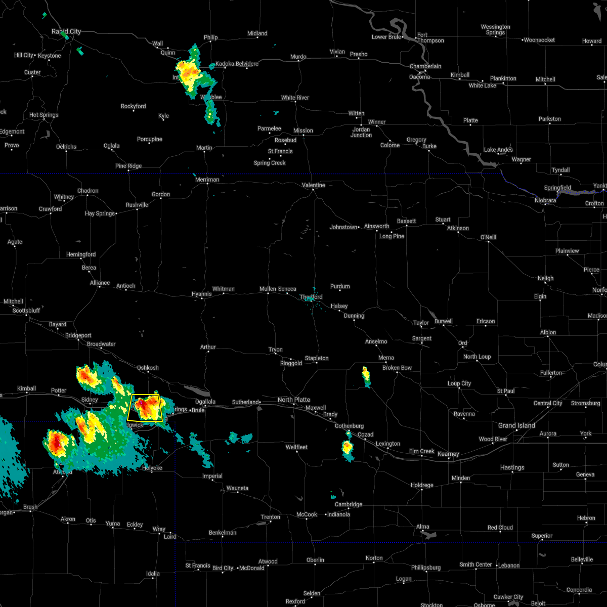 At 816 pm mdt, a severe thunderstorm was located near chappell, moving south at 40 mph (radar indicated). Hazards include 60 mph wind gusts and quarter size hail. Hail damage to vehicles is expected. expect wind damage to roofs, siding, and trees. locations impacted include, chappell. this includes interstate 80 in nebraska between mile markers 81 and 100. hail threat, radar indicated max hail size, 1. 00 in wind threat, radar indicated max wind gust, 60 mph. At 816 pm mdt, a severe thunderstorm was located near chappell, moving south at 40 mph (radar indicated). Hazards include 60 mph wind gusts and quarter size hail. Hail damage to vehicles is expected. expect wind damage to roofs, siding, and trees. locations impacted include, chappell. this includes interstate 80 in nebraska between mile markers 81 and 100. hail threat, radar indicated max hail size, 1. 00 in wind threat, radar indicated max wind gust, 60 mph.
|
| 8/14/2021 7:57 PM MDT |
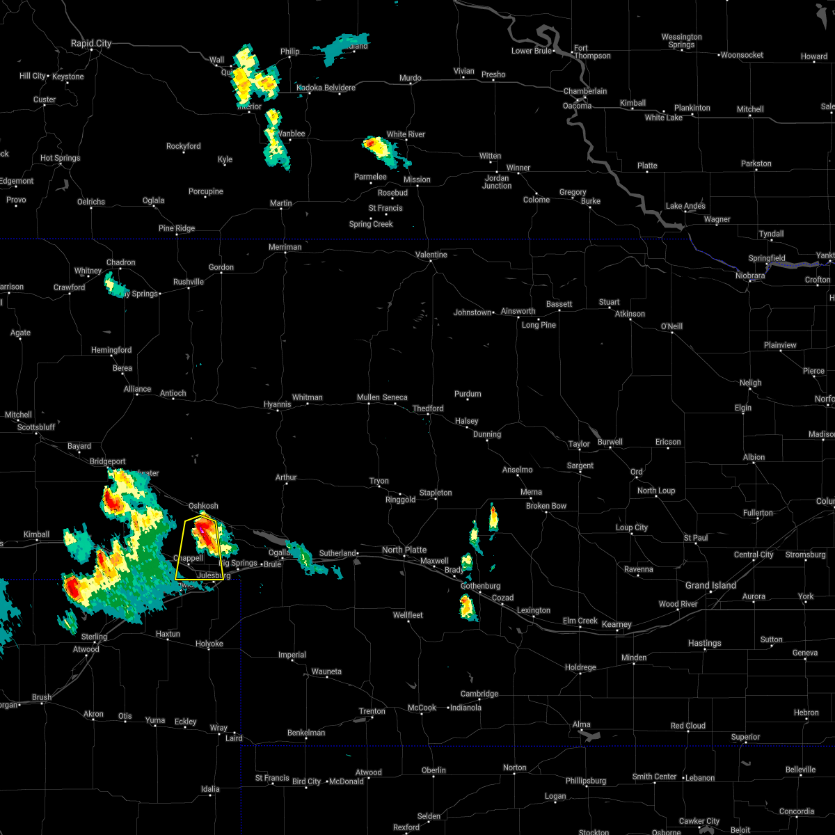 At 757 pm mdt, a severe thunderstorm was located 9 miles south of oshkosh, moving south at 30 mph (radar indicated). Hazards include 60 mph wind gusts and quarter size hail. Hail damage to vehicles is expected. Expect wind damage to roofs, siding, and trees. At 757 pm mdt, a severe thunderstorm was located 9 miles south of oshkosh, moving south at 30 mph (radar indicated). Hazards include 60 mph wind gusts and quarter size hail. Hail damage to vehicles is expected. Expect wind damage to roofs, siding, and trees.
|
| 5/22/2021 3:32 PM MDT |
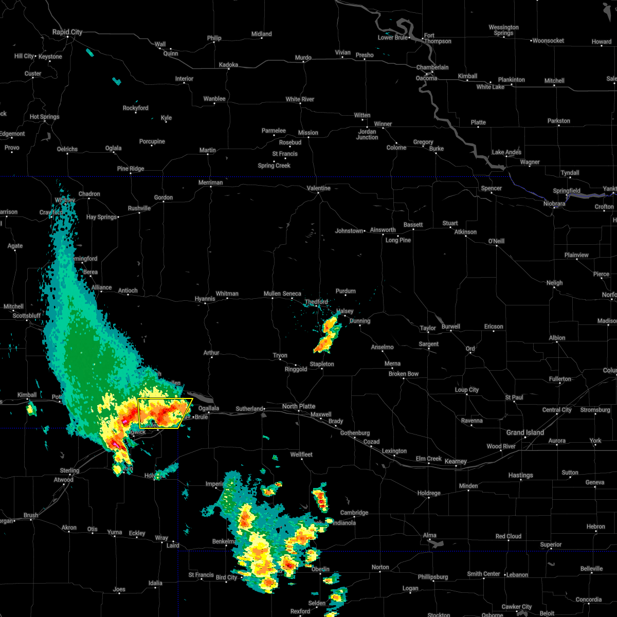 At 331 pm mdt, a severe thunderstorm was located near barton, or near julesburg, moving north at 30 mph (radar indicated). Hazards include 60 mph wind gusts and quarter size hail. Hail damage to vehicles is expected. expect wind damage to roofs, siding, and trees. locations impacted include, chappell, big springs, barton and goldeneye state wildlife management area. This includes interstate 80 in nebraska between mile markers 86 and 110. At 331 pm mdt, a severe thunderstorm was located near barton, or near julesburg, moving north at 30 mph (radar indicated). Hazards include 60 mph wind gusts and quarter size hail. Hail damage to vehicles is expected. expect wind damage to roofs, siding, and trees. locations impacted include, chappell, big springs, barton and goldeneye state wildlife management area. This includes interstate 80 in nebraska between mile markers 86 and 110.
|
| 5/22/2021 3:09 PM MDT |
 At 307 pm mdt, a severe thunderstorm was located near julesburg, moving north at 30 mph (radar indicated). Hazards include golf ball size hail and 60 mph wind gusts. People and animals outdoors will be injured. expect hail damage to roofs, siding, windows, and vehicles. Expect wind damage to roofs, siding, and trees. At 307 pm mdt, a severe thunderstorm was located near julesburg, moving north at 30 mph (radar indicated). Hazards include golf ball size hail and 60 mph wind gusts. People and animals outdoors will be injured. expect hail damage to roofs, siding, windows, and vehicles. Expect wind damage to roofs, siding, and trees.
|
| 7/8/2020 5:32 PM MDT |
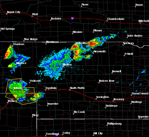 At 532 pm mdt, a severe thunderstorm was located near chappell, moving east at 45 mph (radar indicated). Hazards include 70 mph wind gusts. Expect considerable tree damage. damage is likely to mobile homes, roofs, and outbuildings. this severe storm will be near, barton around 550 pm mdt. other locations impacted by this severe thunderstorm include mount vernon. This includes interstate 80 in nebraska between mile markers 78 and 103. At 532 pm mdt, a severe thunderstorm was located near chappell, moving east at 45 mph (radar indicated). Hazards include 70 mph wind gusts. Expect considerable tree damage. damage is likely to mobile homes, roofs, and outbuildings. this severe storm will be near, barton around 550 pm mdt. other locations impacted by this severe thunderstorm include mount vernon. This includes interstate 80 in nebraska between mile markers 78 and 103.
|
| 7/8/2020 5:17 PM MDT |
 At 517 pm mdt, a severe thunderstorm was located near lodgepole, or 11 miles west of chappell, moving east at 35 mph (radar indicated). Hazards include 70 mph wind gusts. Expect considerable tree damage. damage is likely to mobile homes, roofs, and outbuildings. this severe thunderstorm will be near, chappell around 540 pm mdt. barton around 600 pm mdt. other locations impacted by this severe thunderstorm include mount vernon. This includes interstate 80 in nebraska between mile markers 78 and 103. At 517 pm mdt, a severe thunderstorm was located near lodgepole, or 11 miles west of chappell, moving east at 35 mph (radar indicated). Hazards include 70 mph wind gusts. Expect considerable tree damage. damage is likely to mobile homes, roofs, and outbuildings. this severe thunderstorm will be near, chappell around 540 pm mdt. barton around 600 pm mdt. other locations impacted by this severe thunderstorm include mount vernon. This includes interstate 80 in nebraska between mile markers 78 and 103.
|
| 7/8/2020 4:40 PM MDT | Union pacific mesonet in deuel county NE, 6.4 miles SE of Chappell, NE |
| 7/6/2020 7:20 PM MDT |
 At 720 pm mdt, severe thunderstorms were located along a line extending from 8 miles south of antioch to 7 miles southwest of crescent lake national wildlife refuge to near lodgepole, moving east at 30 mph (radar indicated). Hazards include 60 mph wind gusts and nickel size hail. Expect damage to roofs, siding, and trees. locations impacted include, chappell, oshkosh, lisco, crescent lake national wildlife refuge, dogtown flats, intersection of highway 27 and 9 mile road, deer lake, britton lake, richardson lake, miles lake, mumper, mount vernon, herman lake, adams flats, sugar loaf hill and tralnor lake. This includes interstate 80 in nebraska between mile markers 78 and 94. At 720 pm mdt, severe thunderstorms were located along a line extending from 8 miles south of antioch to 7 miles southwest of crescent lake national wildlife refuge to near lodgepole, moving east at 30 mph (radar indicated). Hazards include 60 mph wind gusts and nickel size hail. Expect damage to roofs, siding, and trees. locations impacted include, chappell, oshkosh, lisco, crescent lake national wildlife refuge, dogtown flats, intersection of highway 27 and 9 mile road, deer lake, britton lake, richardson lake, miles lake, mumper, mount vernon, herman lake, adams flats, sugar loaf hill and tralnor lake. This includes interstate 80 in nebraska between mile markers 78 and 94.
|
| 7/6/2020 7:00 PM MDT |
 At 659 pm mdt, severe thunderstorms were located along a line extending from 8 miles south of alliance airport to 10 miles northwest of lisco to colton, moving east at 25 mph (radar indicated). Hazards include 60 mph wind gusts and nickel size hail. expect damage to roofs, siding, and trees At 659 pm mdt, severe thunderstorms were located along a line extending from 8 miles south of alliance airport to 10 miles northwest of lisco to colton, moving east at 25 mph (radar indicated). Hazards include 60 mph wind gusts and nickel size hail. expect damage to roofs, siding, and trees
|
| 6/26/2020 7:36 PM MDT |
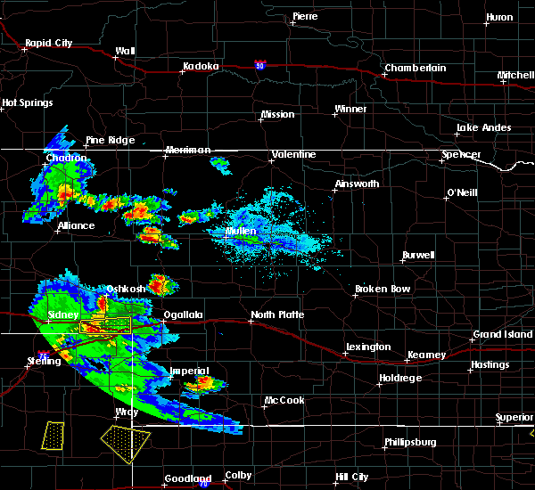 At 736 pm mdt, a severe thunderstorm was located near ovid, or near julesburg, moving east at 20 mph (radar indicated). Hazards include 60 mph wind gusts and quarter size hail. Hail damage to vehicles is expected. expect wind damage to roofs, siding, and trees. locations impacted include, chappell, big springs, barton and goldeneye state wildlife management area. This includes interstate 80 in nebraska between mile markers 83 and 107. At 736 pm mdt, a severe thunderstorm was located near ovid, or near julesburg, moving east at 20 mph (radar indicated). Hazards include 60 mph wind gusts and quarter size hail. Hail damage to vehicles is expected. expect wind damage to roofs, siding, and trees. locations impacted include, chappell, big springs, barton and goldeneye state wildlife management area. This includes interstate 80 in nebraska between mile markers 83 and 107.
|
| 6/26/2020 7:09 PM MDT |
 At 709 pm mdt, a severe thunderstorm was located near chappell, moving east at 25 mph (radar indicated). Hazards include ping pong ball size hail and 60 mph wind gusts. People and animals outdoors will be injured. expect hail damage to roofs, siding, windows, and vehicles. Expect wind damage to roofs, siding, and trees. At 709 pm mdt, a severe thunderstorm was located near chappell, moving east at 25 mph (radar indicated). Hazards include ping pong ball size hail and 60 mph wind gusts. People and animals outdoors will be injured. expect hail damage to roofs, siding, windows, and vehicles. Expect wind damage to roofs, siding, and trees.
|
| 6/6/2020 6:19 PM MDT |
 At 618 pm mdt, severe thunderstorms were located along a line extending from 13 miles south of antioch to 9 miles west of oshkosh to near ovid, moving east at 60 mph (radar indicated). Hazards include 70 mph wind gusts. Expect considerable tree damage. damage is likely to mobile homes, roofs, and outbuildings. locations impacted include, chappell, oshkosh, big springs, brule, lewellen, venango, lisco, barton, crescent lake national wildlife refuge, dogtown flats, deer lake, britton lake, megeath, richardson lake, miles lake, mumper, mount vernon, herman lake, adams flats and sugar loaf hill. this includes the following highways, highway 2 between mile markers 123 and 130. highway 92 between mile markers 115 and 126. Interstate 80 in nebraska between mile markers 78 and 119. At 618 pm mdt, severe thunderstorms were located along a line extending from 13 miles south of antioch to 9 miles west of oshkosh to near ovid, moving east at 60 mph (radar indicated). Hazards include 70 mph wind gusts. Expect considerable tree damage. damage is likely to mobile homes, roofs, and outbuildings. locations impacted include, chappell, oshkosh, big springs, brule, lewellen, venango, lisco, barton, crescent lake national wildlife refuge, dogtown flats, deer lake, britton lake, megeath, richardson lake, miles lake, mumper, mount vernon, herman lake, adams flats and sugar loaf hill. this includes the following highways, highway 2 between mile markers 123 and 130. highway 92 between mile markers 115 and 126. Interstate 80 in nebraska between mile markers 78 and 119.
|
| 6/6/2020 5:57 PM MDT |
 At 555 pm mdt, severe thunderstorms were located along a line extending from near the intersection of highway 385 and 92 to near colton to near crook, moving northeast at 60 mph (radar indicated). Hazards include 70 mph wind gusts. Expect considerable tree damage. Damage is likely to mobile homes, roofs, and outbuildings. At 555 pm mdt, severe thunderstorms were located along a line extending from near the intersection of highway 385 and 92 to near colton to near crook, moving northeast at 60 mph (radar indicated). Hazards include 70 mph wind gusts. Expect considerable tree damage. Damage is likely to mobile homes, roofs, and outbuildings.
|
| 5/23/2020 8:23 PM MDT |
 At 822 pm mdt, a severe thunderstorm was located near big springs, moving east at 20 mph (trained weather spotters). Hazards include golf ball size hail and 70 mph wind gusts. People and animals outdoors will be injured. expect hail damage to roofs, siding, windows, and vehicles. expect considerable tree damage. wind damage is also likely to mobile homes, roofs, and outbuildings. locations impacted include, chappell, oshkosh, big springs, brule, lewellen, barton, eagle gulch campground, ruthon, clear creek state wildlife management area, intersection of highway 27 and 9 mile road, megeath, otter creek campground, lake view campground, ash hollow state historical park, belmar, goldeneye state wildlife management area, bluewater battlefield state historical park and windlass hill. this includes the following highways, highway 92 between mile markers 115 and 132. Interstate 80 in nebraska between mile markers 84 and 119. At 822 pm mdt, a severe thunderstorm was located near big springs, moving east at 20 mph (trained weather spotters). Hazards include golf ball size hail and 70 mph wind gusts. People and animals outdoors will be injured. expect hail damage to roofs, siding, windows, and vehicles. expect considerable tree damage. wind damage is also likely to mobile homes, roofs, and outbuildings. locations impacted include, chappell, oshkosh, big springs, brule, lewellen, barton, eagle gulch campground, ruthon, clear creek state wildlife management area, intersection of highway 27 and 9 mile road, megeath, otter creek campground, lake view campground, ash hollow state historical park, belmar, goldeneye state wildlife management area, bluewater battlefield state historical park and windlass hill. this includes the following highways, highway 92 between mile markers 115 and 132. Interstate 80 in nebraska between mile markers 84 and 119.
|
| 5/23/2020 8:16 PM MDT |
 At 815 pm mdt, a severe thunderstorm was located 8 miles north of barton, or 8 miles northwest of big springs, moving east at 20 mph (radar indicated). Hazards include 70 mph wind gusts and half dollar size hail. Hail damage to vehicles is expected. expect considerable tree damage. wind damage is also likely to mobile homes, roofs, and outbuildings. locations impacted include, chappell, oshkosh, big springs, brule, lewellen, barton, eagle gulch campground, ruthon, clear creek state wildlife management area, intersection of highway 27 and 9 mile road, megeath, otter creek campground, lake view campground, ash hollow state historical park, belmar, goldeneye state wildlife management area, bluewater battlefield state historical park and windlass hill. this includes the following highways, highway 92 between mile markers 115 and 132. Interstate 80 in nebraska between mile markers 84 and 119. At 815 pm mdt, a severe thunderstorm was located 8 miles north of barton, or 8 miles northwest of big springs, moving east at 20 mph (radar indicated). Hazards include 70 mph wind gusts and half dollar size hail. Hail damage to vehicles is expected. expect considerable tree damage. wind damage is also likely to mobile homes, roofs, and outbuildings. locations impacted include, chappell, oshkosh, big springs, brule, lewellen, barton, eagle gulch campground, ruthon, clear creek state wildlife management area, intersection of highway 27 and 9 mile road, megeath, otter creek campground, lake view campground, ash hollow state historical park, belmar, goldeneye state wildlife management area, bluewater battlefield state historical park and windlass hill. this includes the following highways, highway 92 between mile markers 115 and 132. Interstate 80 in nebraska between mile markers 84 and 119.
|
| 5/23/2020 7:58 PM MDT | Golf Ball sized hail reported 8.5 miles W of Chappell, NE, golf ball sized hail. |
| 5/23/2020 7:57 PM MDT |
 The national weather service in north platte has issued a * severe thunderstorm warning for. northwestern perkins county in southwestern nebraska. western keith county in southwestern nebraska. southeastern garden county in the panhandle of nebraska. Deuel county in the panhandle of nebraska. The national weather service in north platte has issued a * severe thunderstorm warning for. northwestern perkins county in southwestern nebraska. western keith county in southwestern nebraska. southeastern garden county in the panhandle of nebraska. Deuel county in the panhandle of nebraska.
|
| 5/23/2020 7:43 PM MDT | Ping Pong Ball sized hail reported 2.3 miles W of Chappell, NE, 1.5 inch hail reported |
| 5/23/2020 7:41 PM MDT |
 At 741 pm mdt, severe thunderstorms were located along a line extending from 9 miles southwest of oshkosh to 8 miles northeast of chappell to near sedgwick, moving east at 15 mph (radar indicated). Hazards include 70 mph wind gusts and ping pong ball size hail. People and animals outdoors will be injured. expect hail damage to roofs, siding, windows, and vehicles. expect considerable tree damage. wind damage is also likely to mobile homes, roofs, and outbuildings. locations impacted include, chappell, big springs, lewellen, barton, ash hollow state historical park, mount vernon, intersection of highway 27 and 9 mile road, goldeneye state wildlife management area and windlass hill. this includes the following highways, highway 92 between mile markers 115 and 118. Interstate 80 in nebraska between mile markers 78 and 108. At 741 pm mdt, severe thunderstorms were located along a line extending from 9 miles southwest of oshkosh to 8 miles northeast of chappell to near sedgwick, moving east at 15 mph (radar indicated). Hazards include 70 mph wind gusts and ping pong ball size hail. People and animals outdoors will be injured. expect hail damage to roofs, siding, windows, and vehicles. expect considerable tree damage. wind damage is also likely to mobile homes, roofs, and outbuildings. locations impacted include, chappell, big springs, lewellen, barton, ash hollow state historical park, mount vernon, intersection of highway 27 and 9 mile road, goldeneye state wildlife management area and windlass hill. this includes the following highways, highway 92 between mile markers 115 and 118. Interstate 80 in nebraska between mile markers 78 and 108.
|
| 5/23/2020 7:29 PM MDT | Quarter sized hail reported 10.2 miles SE of Chappell, NE, 1.00 hail. |
| 5/23/2020 7:25 PM MDT |
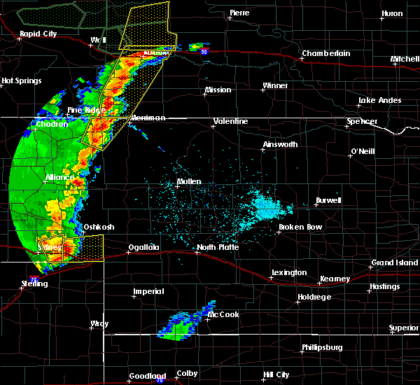 At 724 pm mdt, severe thunderstorms were located along a line extending from 12 miles north of lodgepole to 6 miles north of chappell to near sedgwick, moving east at 35 mph. these are very dangerous storms (radar indicated). Hazards include 80 mph wind gusts and half dollar size hail. Flying debris will be dangerous to those caught without shelter. mobile homes will be heavily damaged. expect considerable damage to roofs, windows, and vehicles. extensive tree damage and power outages are likely. locations impacted include, chappell, big springs, lewellen, barton, ash hollow state historical park, mount vernon, intersection of highway 27 and 9 mile road, goldeneye state wildlife management area and windlass hill. this includes the following highways, highway 92 between mile markers 115 and 118. Interstate 80 in nebraska between mile markers 78 and 108. At 724 pm mdt, severe thunderstorms were located along a line extending from 12 miles north of lodgepole to 6 miles north of chappell to near sedgwick, moving east at 35 mph. these are very dangerous storms (radar indicated). Hazards include 80 mph wind gusts and half dollar size hail. Flying debris will be dangerous to those caught without shelter. mobile homes will be heavily damaged. expect considerable damage to roofs, windows, and vehicles. extensive tree damage and power outages are likely. locations impacted include, chappell, big springs, lewellen, barton, ash hollow state historical park, mount vernon, intersection of highway 27 and 9 mile road, goldeneye state wildlife management area and windlass hill. this includes the following highways, highway 92 between mile markers 115 and 118. Interstate 80 in nebraska between mile markers 78 and 108.
|
| 5/23/2020 7:04 PM MDT |
 At 703 pm mdt, a severe thunderstorm was located near lodgepole, or 13 miles northwest of chappell, moving east at 30 mph. this is a very dangerous storm (radar indicated). Hazards include 80 mph wind gusts and half dollar size hail. Flying debris will be dangerous to those caught without shelter. mobile homes will be heavily damaged. expect considerable damage to roofs, windows, and vehicles. Extensive tree damage and power outages are likely. At 703 pm mdt, a severe thunderstorm was located near lodgepole, or 13 miles northwest of chappell, moving east at 30 mph. this is a very dangerous storm (radar indicated). Hazards include 80 mph wind gusts and half dollar size hail. Flying debris will be dangerous to those caught without shelter. mobile homes will be heavily damaged. expect considerable damage to roofs, windows, and vehicles. Extensive tree damage and power outages are likely.
|
| 8/21/2019 12:57 AM MDT |
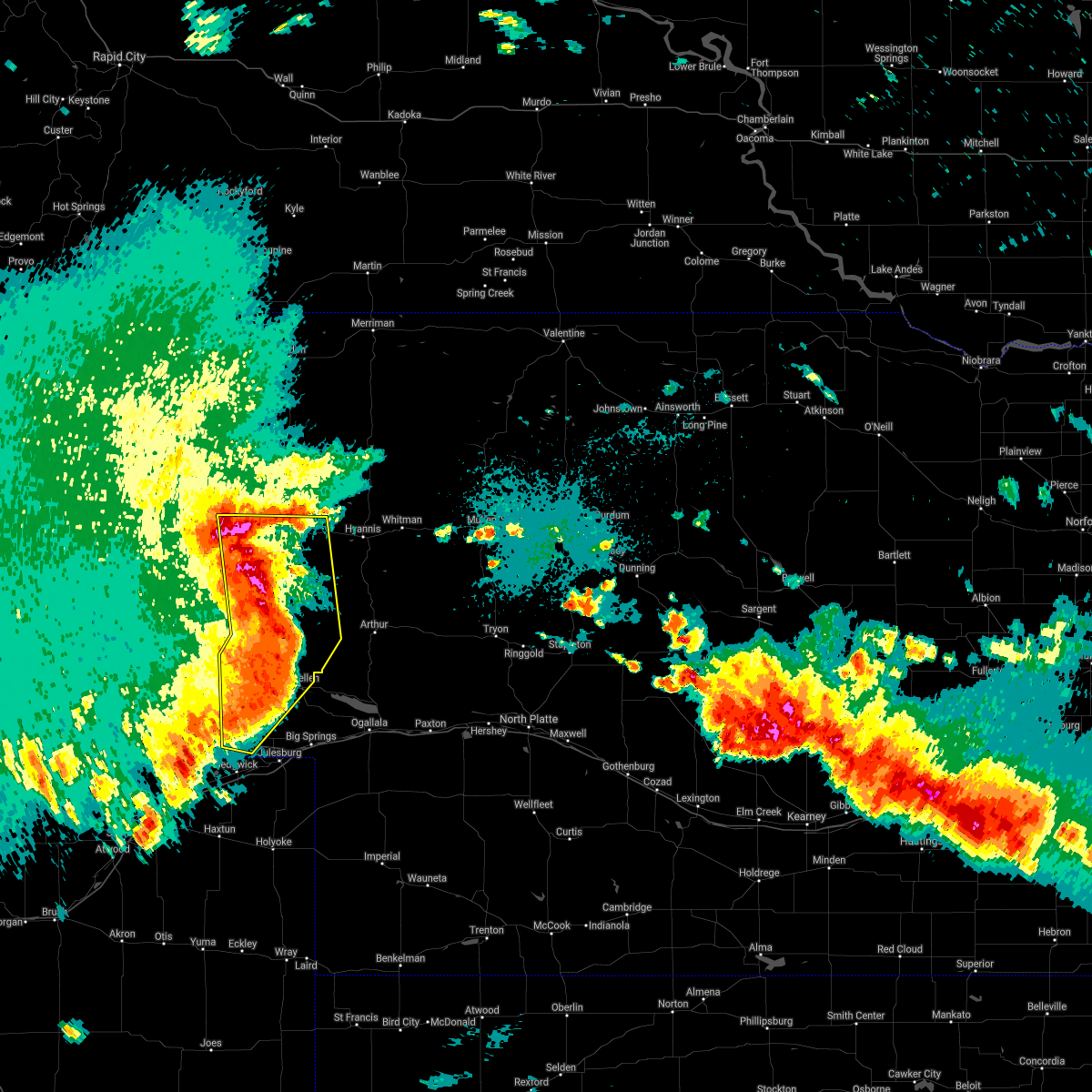 The severe thunderstorm warning for northwestern arthur, western grant, garden, southeastern sheridan and western deuel counties will expire at 100 am mdt, the storms which prompted the warning have weakened below severe limits, and no longer pose an immediate threat to life or property. therefore, the warning will be allowed to expire. however gusty winds up to 50 mph are still possible with these thunderstorms. a severe thunderstorm watch remains in effect until 500 am mdt for the panhandle of, southwestern and west central nebraska. The severe thunderstorm warning for northwestern arthur, western grant, garden, southeastern sheridan and western deuel counties will expire at 100 am mdt, the storms which prompted the warning have weakened below severe limits, and no longer pose an immediate threat to life or property. therefore, the warning will be allowed to expire. however gusty winds up to 50 mph are still possible with these thunderstorms. a severe thunderstorm watch remains in effect until 500 am mdt for the panhandle of, southwestern and west central nebraska.
|
| 8/21/2019 12:27 AM MDT |
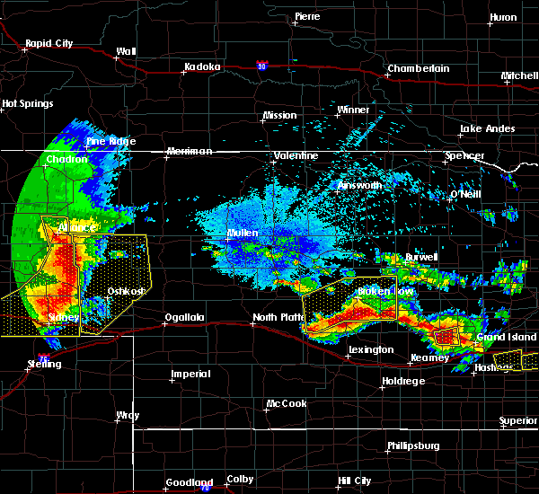 At 1227 am mdt, severe thunderstorms were located along a line extending from 6 miles southeast of antioch to 10 miles south of crescent lake national wildlife refuge to sunol, moving east at 35 mph (radar indicated). Hazards include 70 mph wind gusts and quarter size hail. Hail damage to vehicles is expected. expect considerable tree damage. wind damage is also likely to mobile homes, roofs, and outbuildings. locations impacted include, chappell, oshkosh, ellsworth, lewellen, antioch, crescent lake national wildlife refuge, dogtown flats, swede lake, deer lake, britton lake, mumper, mount vernon, bourquim hill, herman lake, adams flats, sugar loaf hill, rackett, patterson lake, intersection of highway 27 and 9 mile road and finnegan lake. this includes the following highways, highway 250 between mile markers 1 and 3. highway 2 between mile markers 100 and 134. highway 92 between mile markers 115 and 116. Interstate 80 in nebraska between mile markers 78 and 89. At 1227 am mdt, severe thunderstorms were located along a line extending from 6 miles southeast of antioch to 10 miles south of crescent lake national wildlife refuge to sunol, moving east at 35 mph (radar indicated). Hazards include 70 mph wind gusts and quarter size hail. Hail damage to vehicles is expected. expect considerable tree damage. wind damage is also likely to mobile homes, roofs, and outbuildings. locations impacted include, chappell, oshkosh, ellsworth, lewellen, antioch, crescent lake national wildlife refuge, dogtown flats, swede lake, deer lake, britton lake, mumper, mount vernon, bourquim hill, herman lake, adams flats, sugar loaf hill, rackett, patterson lake, intersection of highway 27 and 9 mile road and finnegan lake. this includes the following highways, highway 250 between mile markers 1 and 3. highway 2 between mile markers 100 and 134. highway 92 between mile markers 115 and 116. Interstate 80 in nebraska between mile markers 78 and 89.
|
| 8/20/2019 11:57 PM MDT |
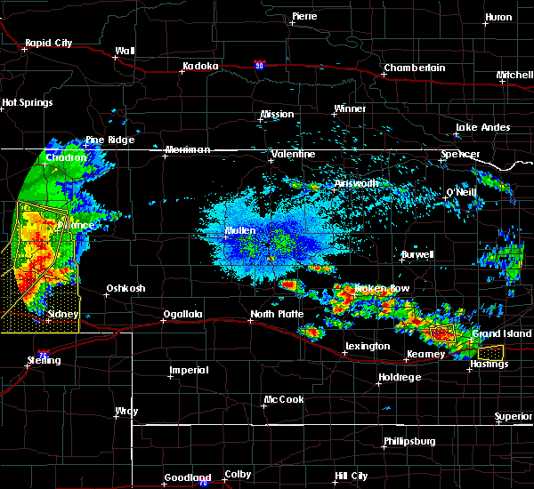 At 1157 pm mdt, severe thunderstorms were located along a line extending from alliance airport to 9 miles northwest of lisco to near brownson, moving east at 35 mph (radar indicated). Hazards include 70 mph wind gusts and quarter size hail. Hail damage to vehicles is expected. expect considerable tree damage. Wind damage is also likely to mobile homes, roofs, and outbuildings. At 1157 pm mdt, severe thunderstorms were located along a line extending from alliance airport to 9 miles northwest of lisco to near brownson, moving east at 35 mph (radar indicated). Hazards include 70 mph wind gusts and quarter size hail. Hail damage to vehicles is expected. expect considerable tree damage. Wind damage is also likely to mobile homes, roofs, and outbuildings.
|
| 7/26/2019 5:27 PM MDT |
 At 526 pm mdt, a severe thunderstorm was located near lodgepole, or 7 miles west of chappell, moving south southeast at 15 mph (radar indicated). Hazards include ping pong ball size hail and 60 mph wind gusts. People and animals outdoors will be injured. expect hail damage to roofs, siding, windows, and vehicles. expect wind damage to roofs, siding, and trees. locations impacted include, chappell and mount vernon. This includes interstate 80 in nebraska between mile markers 78 and 89. At 526 pm mdt, a severe thunderstorm was located near lodgepole, or 7 miles west of chappell, moving south southeast at 15 mph (radar indicated). Hazards include ping pong ball size hail and 60 mph wind gusts. People and animals outdoors will be injured. expect hail damage to roofs, siding, windows, and vehicles. expect wind damage to roofs, siding, and trees. locations impacted include, chappell and mount vernon. This includes interstate 80 in nebraska between mile markers 78 and 89.
|
| 7/26/2019 5:07 PM MDT |
 At 507 pm mdt, a severe thunderstorm was located over lodgepole, or 8 miles northwest of chappell, moving southeast at 30 mph (radar indicated). Hazards include ping pong ball size hail and 60 mph wind gusts. People and animals outdoors will be injured. expect hail damage to roofs, siding, windows, and vehicles. Expect wind damage to roofs, siding, and trees. At 507 pm mdt, a severe thunderstorm was located over lodgepole, or 8 miles northwest of chappell, moving southeast at 30 mph (radar indicated). Hazards include ping pong ball size hail and 60 mph wind gusts. People and animals outdoors will be injured. expect hail damage to roofs, siding, windows, and vehicles. Expect wind damage to roofs, siding, and trees.
|
| 7/12/2019 7:32 PM MDT |
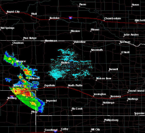 At 731 pm mdt, a severe thunderstorm was located near chappell, moving east at 25 mph (radar indicated). Hazards include 60 mph wind gusts and quarter size hail. Hail damage to vehicles is expected. expect wind damage to roofs, siding, and trees. locations impacted include, chappell and mount vernon. This includes interstate 80 in nebraska between mile markers 78 and 96. At 731 pm mdt, a severe thunderstorm was located near chappell, moving east at 25 mph (radar indicated). Hazards include 60 mph wind gusts and quarter size hail. Hail damage to vehicles is expected. expect wind damage to roofs, siding, and trees. locations impacted include, chappell and mount vernon. This includes interstate 80 in nebraska between mile markers 78 and 96.
|
| 7/12/2019 6:52 PM MDT |
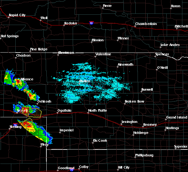 At 651 pm mdt, a severe thunderstorm was located over lodgepole, or 12 miles west of chappell, moving east at 25 mph (radar indicated). Hazards include golf ball size hail and 60 mph wind gusts. People and animals outdoors will be injured. expect hail damage to roofs, siding, windows, and vehicles. Expect wind damage to roofs, siding, and trees. At 651 pm mdt, a severe thunderstorm was located over lodgepole, or 12 miles west of chappell, moving east at 25 mph (radar indicated). Hazards include golf ball size hail and 60 mph wind gusts. People and animals outdoors will be injured. expect hail damage to roofs, siding, windows, and vehicles. Expect wind damage to roofs, siding, and trees.
|
| 7/6/2019 11:23 PM MDT |
 At 1123 pm mdt, severe thunderstorms were located along a line extending from 16 miles northeast of oshkosh to 7 miles south of lewellen to near sedgwick, moving east at 40 mph (radar indicated). Hazards include 70 mph wind gusts and penny size hail. Expect considerable tree damage. damage is likely to mobile homes, roofs, and outbuildings. locations impacted include, ogallala, chappell, oshkosh, big springs, brule, lewellen, kingsley dam, barton, lemoyne, dogtown flats, megeath, mount vernon, sugar loaf hill, eagle gulch campground, ruthon, clear creek state wildlife management area, intersection of highway 27 and 9 mile road, mckeag, otter creek campground and lake view campground. this includes the following highways, highway 61 between mile markers 85 and 92, and between mile markers 95 and 116. highway 92 between mile markers 115 and 138. Interstate 80 in nebraska between mile markers 78 and 127. At 1123 pm mdt, severe thunderstorms were located along a line extending from 16 miles northeast of oshkosh to 7 miles south of lewellen to near sedgwick, moving east at 40 mph (radar indicated). Hazards include 70 mph wind gusts and penny size hail. Expect considerable tree damage. damage is likely to mobile homes, roofs, and outbuildings. locations impacted include, ogallala, chappell, oshkosh, big springs, brule, lewellen, kingsley dam, barton, lemoyne, dogtown flats, megeath, mount vernon, sugar loaf hill, eagle gulch campground, ruthon, clear creek state wildlife management area, intersection of highway 27 and 9 mile road, mckeag, otter creek campground and lake view campground. this includes the following highways, highway 61 between mile markers 85 and 92, and between mile markers 95 and 116. highway 92 between mile markers 115 and 138. Interstate 80 in nebraska between mile markers 78 and 127.
|
| 7/6/2019 10:52 PM MDT |
 At 1052 pm mdt, severe thunderstorms were located along a line extending from 9 miles north of oshkosh to 11 miles northeast of lodgepole to near lorenzo, moving southeast at 35 mph (radar indicated). Hazards include 60 mph wind gusts and penny size hail. expect damage to roofs, siding, and trees At 1052 pm mdt, severe thunderstorms were located along a line extending from 9 miles north of oshkosh to 11 miles northeast of lodgepole to near lorenzo, moving southeast at 35 mph (radar indicated). Hazards include 60 mph wind gusts and penny size hail. expect damage to roofs, siding, and trees
|
| 5/27/2019 5:16 PM MDT | Also nickel size hail in deuel county NE, 12.9 miles WNW of Chappell, NE |
| 5/27/2019 5:12 PM MDT |
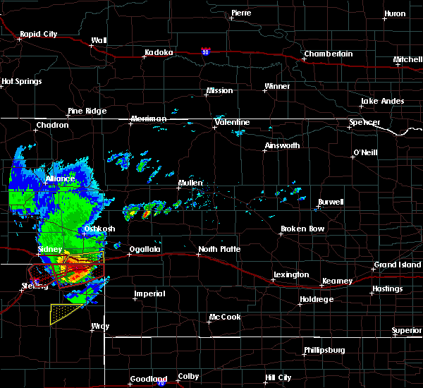 At 511 pm mdt, a severe thunderstorm was located over ovid, or near julesburg, moving northeast at 30 mph (radar indicated). Hazards include ping pong ball size hail and 60 mph wind gusts. People and animals outdoors will be injured. expect hail damage to roofs, siding, windows, and vehicles. Expect wind damage to roofs, siding, and trees. At 511 pm mdt, a severe thunderstorm was located over ovid, or near julesburg, moving northeast at 30 mph (radar indicated). Hazards include ping pong ball size hail and 60 mph wind gusts. People and animals outdoors will be injured. expect hail damage to roofs, siding, windows, and vehicles. Expect wind damage to roofs, siding, and trees.
|
| 5/17/2019 4:02 PM MDT |
 At 402 pm mdt, a severe thunderstorm was located 8 miles southwest of lewellen, or 10 miles south of oshkosh, moving northeast at 45 mph (radar indicated). Hazards include half dollar size hail. Damage to vehicles is expected. locations impacted include, chappell, oshkosh, lewellen, barton, ash hollow state historical park, eagle gulch campground, ruthon, clear creek state wildlife management area, mount vernon, intersection of highway 27 and 9 mile road, bluewater battlefield state historical park and windlass hill. this includes the following highways, highway 92 between mile markers 115 and 125. interstate 80 in nebraska between mile markers 78 and 103. A tornado watch remains in effect until 900 pm mdt for the panhandle of, southwestern and west central nebraska. At 402 pm mdt, a severe thunderstorm was located 8 miles southwest of lewellen, or 10 miles south of oshkosh, moving northeast at 45 mph (radar indicated). Hazards include half dollar size hail. Damage to vehicles is expected. locations impacted include, chappell, oshkosh, lewellen, barton, ash hollow state historical park, eagle gulch campground, ruthon, clear creek state wildlife management area, mount vernon, intersection of highway 27 and 9 mile road, bluewater battlefield state historical park and windlass hill. this includes the following highways, highway 92 between mile markers 115 and 125. interstate 80 in nebraska between mile markers 78 and 103. A tornado watch remains in effect until 900 pm mdt for the panhandle of, southwestern and west central nebraska.
|
| 5/17/2019 3:50 PM MDT | Quarter sized hail reported 4.4 miles SW of Chappell, NE |
| 5/17/2019 3:43 PM MDT |
 At 343 pm mdt, a severe thunderstorm was located near chappell, moving north at 60 mph (radar indicated). Hazards include golf ball size hail. People and animals outdoors will be injured. expect damage to roofs, siding, windows, and vehicles. locations impacted include, chappell, oshkosh, lewellen, barton, ash hollow state historical park, eagle gulch campground, ruthon, clear creek state wildlife management area, mount vernon, intersection of highway 27 and 9 mile road, bluewater battlefield state historical park and windlass hill. this includes the following highways, highway 92 between mile markers 115 and 125. interstate 80 in nebraska between mile markers 78 and 103. A tornado watch remains in effect until 900 pm mdt for the panhandle of, southwestern and west central nebraska. At 343 pm mdt, a severe thunderstorm was located near chappell, moving north at 60 mph (radar indicated). Hazards include golf ball size hail. People and animals outdoors will be injured. expect damage to roofs, siding, windows, and vehicles. locations impacted include, chappell, oshkosh, lewellen, barton, ash hollow state historical park, eagle gulch campground, ruthon, clear creek state wildlife management area, mount vernon, intersection of highway 27 and 9 mile road, bluewater battlefield state historical park and windlass hill. this includes the following highways, highway 92 between mile markers 115 and 125. interstate 80 in nebraska between mile markers 78 and 103. A tornado watch remains in effect until 900 pm mdt for the panhandle of, southwestern and west central nebraska.
|
| 5/17/2019 3:33 PM MDT |
 At 333 pm mdt, a severe thunderstorm was located near ovid, or near chappell, moving northeast at 40 mph (radar indicated). Hazards include tennis ball size hail. People and animals outdoors will be injured. Expect damage to roofs, siding, windows, and vehicles. At 333 pm mdt, a severe thunderstorm was located near ovid, or near chappell, moving northeast at 40 mph (radar indicated). Hazards include tennis ball size hail. People and animals outdoors will be injured. Expect damage to roofs, siding, windows, and vehicles.
|
| 7/28/2018 7:56 PM MDT | Baseball sized hail reported 10.8 miles W of Chappell, NE |
| 7/28/2018 7:56 PM MDT | Storm damage reported in deuel county NE, 10.8 miles W of Chappell, NE |
| 7/28/2018 7:50 PM MDT |
 At 750 pm mdt, a severe thunderstorm was located 8 miles north of barton, or 10 miles northwest of big springs, moving south at 40 mph. this is a very dangerous storm (radar indicated). Hazards include three inch hail and 70 mph wind gusts. People and animals outdoors will be severely injured. expect shattered windows, extensive damage to roofs, siding, and vehicles. locations impacted include, chappell, oshkosh, big springs, brule, lewellen, barton, eagle gulch campground, ruthon, clear creek state wildlife management area, intersection of highway 27 and 9 mile road, megeath, ash hollow state historical park, mount vernon, goldeneye state wildlife management area, bluewater battlefield state historical park and windlass hill. this includes the following highways, highway 61 near mile marker 80. highway 92 between mile markers 115 and 125. Interstate 80 in nebraska between mile markers 82 and 123. At 750 pm mdt, a severe thunderstorm was located 8 miles north of barton, or 10 miles northwest of big springs, moving south at 40 mph. this is a very dangerous storm (radar indicated). Hazards include three inch hail and 70 mph wind gusts. People and animals outdoors will be severely injured. expect shattered windows, extensive damage to roofs, siding, and vehicles. locations impacted include, chappell, oshkosh, big springs, brule, lewellen, barton, eagle gulch campground, ruthon, clear creek state wildlife management area, intersection of highway 27 and 9 mile road, megeath, ash hollow state historical park, mount vernon, goldeneye state wildlife management area, bluewater battlefield state historical park and windlass hill. this includes the following highways, highway 61 near mile marker 80. highway 92 between mile markers 115 and 125. Interstate 80 in nebraska between mile markers 82 and 123.
|
| 7/28/2018 7:39 PM MDT |
 At 738 pm mdt, a severe thunderstorm was located 8 miles southwest of lewellen, or 9 miles south of oshkosh, moving south at 40 mph. this is a very dangerous storm (radar indicated). Hazards include three inch hail and 70 mph wind gusts. People and animals outdoors will be severely injured. Expect shattered windows, extensive damage to roofs, siding, and vehicles. At 738 pm mdt, a severe thunderstorm was located 8 miles southwest of lewellen, or 9 miles south of oshkosh, moving south at 40 mph. this is a very dangerous storm (radar indicated). Hazards include three inch hail and 70 mph wind gusts. People and animals outdoors will be severely injured. Expect shattered windows, extensive damage to roofs, siding, and vehicles.
|
| 7/16/2018 11:36 PM MDT |
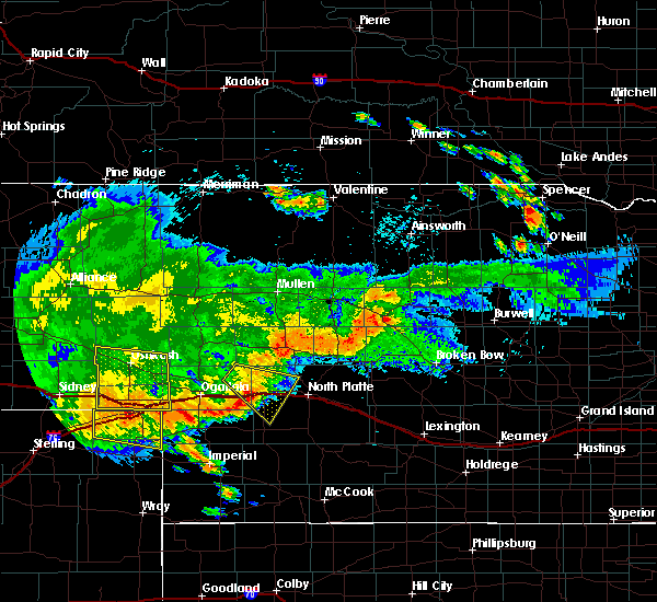 The severe thunderstorm warning for western keith, southern garden and deuel counties will expire at 1145 pm mdt, the storms which prompted the warning have moved out of the area. therefore, the warning will be allowed to expire. The severe thunderstorm warning for western keith, southern garden and deuel counties will expire at 1145 pm mdt, the storms which prompted the warning have moved out of the area. therefore, the warning will be allowed to expire.
|
| 7/16/2018 10:59 PM MDT |
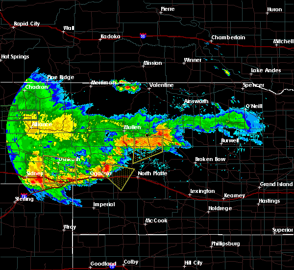 At 1059 pm mdt, severe thunderstorms were located along a line extending from near lisco to 7 miles south of lodgepole, moving east at 45 mph (radar indicated). Hazards include 60 mph wind gusts and penny size hail. expect damage to roofs, siding, and trees At 1059 pm mdt, severe thunderstorms were located along a line extending from near lisco to 7 miles south of lodgepole, moving east at 45 mph (radar indicated). Hazards include 60 mph wind gusts and penny size hail. expect damage to roofs, siding, and trees
|
| 6/30/2018 5:07 PM MDT |
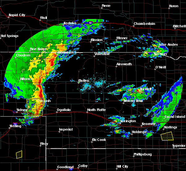 At 507 pm mdt, severe thunderstorms were located along a line extending from 13 miles north of lewellen to 10 miles northeast of chappell, moving east at 40 mph (radar indicated). Hazards include 60 mph wind gusts and penny size hail. Expect damage to roofs, siding, and trees. locations impacted include, chappell, oshkosh, lewellen, barton, intersection of highway 27 and 9 mile road, bluewater battlefield state historical park and sugar loaf hill. This includes interstate 80 in nebraska between mile markers 84 and 101. At 507 pm mdt, severe thunderstorms were located along a line extending from 13 miles north of lewellen to 10 miles northeast of chappell, moving east at 40 mph (radar indicated). Hazards include 60 mph wind gusts and penny size hail. Expect damage to roofs, siding, and trees. locations impacted include, chappell, oshkosh, lewellen, barton, intersection of highway 27 and 9 mile road, bluewater battlefield state historical park and sugar loaf hill. This includes interstate 80 in nebraska between mile markers 84 and 101.
|
| 6/30/2018 4:53 PM MDT |
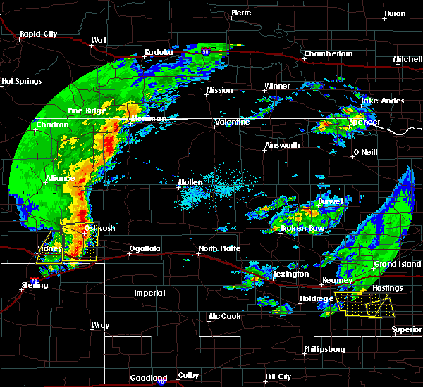 At 453 pm mdt, severe thunderstorms were located along a line extending from near oshkosh to near chappell, moving east at 60 mph (radar indicated). Hazards include 60 mph wind gusts and penny size hail. Expect damage to roofs, siding, and trees. locations impacted include, chappell, oshkosh, lewellen, lisco, barton, mount vernon, intersection of highway 27 and 9 mile road, bluewater battlefield state historical park and sugar loaf hill. This includes interstate 80 in nebraska between mile markers 78 and 101. At 453 pm mdt, severe thunderstorms were located along a line extending from near oshkosh to near chappell, moving east at 60 mph (radar indicated). Hazards include 60 mph wind gusts and penny size hail. Expect damage to roofs, siding, and trees. locations impacted include, chappell, oshkosh, lewellen, lisco, barton, mount vernon, intersection of highway 27 and 9 mile road, bluewater battlefield state historical park and sugar loaf hill. This includes interstate 80 in nebraska between mile markers 78 and 101.
|
| 6/30/2018 4:34 PM MDT |
 At 433 pm mdt, severe thunderstorms were located along a line extending from 6 miles southwest of lisco to near colton, moving east at 40 mph (radar indicated). Hazards include 60 mph wind gusts and penny size hail. expect damage to roofs, siding, and trees At 433 pm mdt, severe thunderstorms were located along a line extending from 6 miles southwest of lisco to near colton, moving east at 40 mph (radar indicated). Hazards include 60 mph wind gusts and penny size hail. expect damage to roofs, siding, and trees
|
| 6/17/2018 2:35 PM MDT | Camper flipped along i-80 near mm 92 in deuel county NE, 6.2 miles WNW of Chappell, NE |
| 6/17/2018 2:04 PM MDT |
 At 204 pm mdt, a severe thunderstorm was located near ovid, or near chappell, moving northeast at 15 mph (radar indicated). Hazards include golf ball size hail and 60 mph wind gusts. People and animals outdoors will be injured. expect hail damage to roofs, siding, windows, and vehicles. expect wind damage to roofs, siding, and trees. locations impacted include, chappell. this includes interstate 80 in nebraska between mile markers 85 and 100. A tornado watch remains in effect until 900 pm mdt for the panhandle of nebraska. At 204 pm mdt, a severe thunderstorm was located near ovid, or near chappell, moving northeast at 15 mph (radar indicated). Hazards include golf ball size hail and 60 mph wind gusts. People and animals outdoors will be injured. expect hail damage to roofs, siding, windows, and vehicles. expect wind damage to roofs, siding, and trees. locations impacted include, chappell. this includes interstate 80 in nebraska between mile markers 85 and 100. A tornado watch remains in effect until 900 pm mdt for the panhandle of nebraska.
|
| 6/17/2018 1:53 PM MDT |
 At 152 pm mdt, a severe thunderstorm was located near ovid, or 8 miles south of chappell, moving northeast at 20 mph (radar indicated). Hazards include golf ball size hail and 60 mph wind gusts. People and animals outdoors will be injured. expect hail damage to roofs, siding, windows, and vehicles. Expect wind damage to roofs, siding, and trees. At 152 pm mdt, a severe thunderstorm was located near ovid, or 8 miles south of chappell, moving northeast at 20 mph (radar indicated). Hazards include golf ball size hail and 60 mph wind gusts. People and animals outdoors will be injured. expect hail damage to roofs, siding, windows, and vehicles. Expect wind damage to roofs, siding, and trees.
|
| 6/6/2018 6:53 PM MDT |
 At 653 pm mdt, a severe thunderstorm was located over big springs, moving north at 10 mph (radar indicated). Hazards include ping pong ball size hail and 60 mph wind gusts. People and animals outdoors will be injured. expect hail damage to roofs, siding, windows, and vehicles. Expect wind damage to roofs, siding, and trees. At 653 pm mdt, a severe thunderstorm was located over big springs, moving north at 10 mph (radar indicated). Hazards include ping pong ball size hail and 60 mph wind gusts. People and animals outdoors will be injured. expect hail damage to roofs, siding, windows, and vehicles. Expect wind damage to roofs, siding, and trees.
|
| 5/27/2018 6:31 PM MDT | Davis weather station in deuel county NE, 2.3 miles W of Chappell, NE |
| 5/27/2018 6:29 PM MDT |
 At 629 pm mdt, severe thunderstorms were located along a line extending from lodgepole to big springs, moving north at 50 mph (radar indicated). Hazards include 60 mph wind gusts and quarter size hail. Hail damage to vehicles is expected. Expect wind damage to roofs, siding, and trees. At 629 pm mdt, severe thunderstorms were located along a line extending from lodgepole to big springs, moving north at 50 mph (radar indicated). Hazards include 60 mph wind gusts and quarter size hail. Hail damage to vehicles is expected. Expect wind damage to roofs, siding, and trees.
|
| 7/10/2017 7:45 PM MDT |
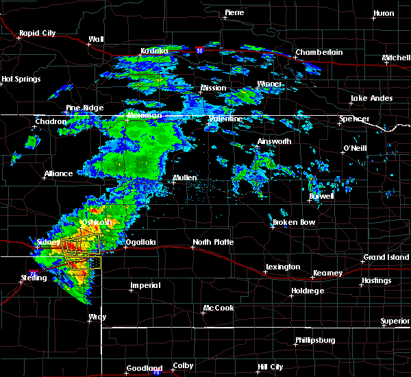 At 745 pm mdt, a severe thunderstorm was located near chappell, moving east at 25 mph (radar indicated). Hazards include 60 mph wind gusts and quarter size hail. Hail damage to vehicles is expected. Expect wind damage to roofs, siding, and trees. At 745 pm mdt, a severe thunderstorm was located near chappell, moving east at 25 mph (radar indicated). Hazards include 60 mph wind gusts and quarter size hail. Hail damage to vehicles is expected. Expect wind damage to roofs, siding, and trees.
|
| 7/10/2017 7:43 PM MDT |
 At 743 pm mdt, a severe thunderstorm was located near chappell, moving east at 35 mph (radar indicated). Hazards include 60 mph wind gusts and quarter size hail. Hail damage to vehicles is expected. expect wind damage to roofs, siding, and trees. locations impacted include, chappell and mount vernon. This includes interstate 80 in nebraska between mile markers 79 and 88. At 743 pm mdt, a severe thunderstorm was located near chappell, moving east at 35 mph (radar indicated). Hazards include 60 mph wind gusts and quarter size hail. Hail damage to vehicles is expected. expect wind damage to roofs, siding, and trees. locations impacted include, chappell and mount vernon. This includes interstate 80 in nebraska between mile markers 79 and 88.
|
| 7/10/2017 7:19 PM MDT |
 At 719 pm mdt, a severe thunderstorm was located near lodgepole, or 10 miles west of chappell, moving east at 20 mph (radar indicated). Hazards include 60 mph wind gusts and quarter size hail. Hail damage to vehicles is expected. Expect wind damage to roofs, siding, and trees. At 719 pm mdt, a severe thunderstorm was located near lodgepole, or 10 miles west of chappell, moving east at 20 mph (radar indicated). Hazards include 60 mph wind gusts and quarter size hail. Hail damage to vehicles is expected. Expect wind damage to roofs, siding, and trees.
|
| 7/7/2017 8:50 PM MDT | Ping Pong Ball sized hail reported 12.4 miles WNW of Chappell, NE |
| 6/7/2017 3:31 PM MDT |
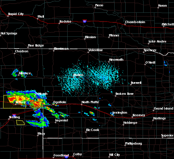 At 330 pm mdt, doppler radar indicated a severe thunderstorm capable of producing quarter size hail. this storm was located 8 miles northwest of barton, or 10 miles northwest of big springs, moving east at 30 mph. locations impacted include, chappell, big springs, barton and goldeneye state wildlife management area. this includes interstate 80 in nebraska between mile markers 87 and 101, and between mile markers 104 and 108. At 330 pm mdt, doppler radar indicated a severe thunderstorm capable of producing quarter size hail. this storm was located 8 miles northwest of barton, or 10 miles northwest of big springs, moving east at 30 mph. locations impacted include, chappell, big springs, barton and goldeneye state wildlife management area. this includes interstate 80 in nebraska between mile markers 87 and 101, and between mile markers 104 and 108.
|
| 6/7/2017 3:12 PM MDT | Quarter sized hail reported 0.2 miles SW of Chappell, NE |
| 6/7/2017 3:09 PM MDT | Quarter sized hail reported 0.2 miles SW of Chappell, NE, quarter size hail with 30 to 40 mph winds reported. |
| 6/7/2017 3:09 PM MDT |
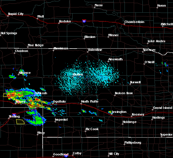 At 309 pm mdt, doppler radar indicated a severe thunderstorm capable of producing half dollar size hail. this storm was located over chappell, and moving northeast at 20 mph. At 309 pm mdt, doppler radar indicated a severe thunderstorm capable of producing half dollar size hail. this storm was located over chappell, and moving northeast at 20 mph.
|
| 8/13/2016 5:35 PM MDT | Quarter sized hail reported 5 miles WNW of Chappell, NE |
| 8/13/2016 5:31 PM MDT |
 At 531 pm mdt, a severe thunderstorm was located near chappell, moving northeast at 15 mph (radar indicated). Hazards include quarter size hail. damage to vehicles is expected At 531 pm mdt, a severe thunderstorm was located near chappell, moving northeast at 15 mph (radar indicated). Hazards include quarter size hail. damage to vehicles is expected
|
| 7/28/2016 6:23 AM MDT |
 At 622 am mdt, severe thunderstorms were located along a line extending from 8 miles northwest of oshkosh to 14 miles north of chappell to near sunol, moving southeast at 55 mph (radar indicated). Hazards include 60 mph wind gusts and penny size hail. Expect damage to roofs. siding. and trees. locations impacted include, chappell, oshkosh, lewellen, lisco, intersection of highway 27 and 9 mile road, richardson lake, mount vernon, sugar loaf hill, ash hollow state historical park and bluewater battlefield state historical park. this includes the following highways, highway 92 between mile markers 115 and 117. Interstate 80 in nebraska between mile markers 78 and 85. At 622 am mdt, severe thunderstorms were located along a line extending from 8 miles northwest of oshkosh to 14 miles north of chappell to near sunol, moving southeast at 55 mph (radar indicated). Hazards include 60 mph wind gusts and penny size hail. Expect damage to roofs. siding. and trees. locations impacted include, chappell, oshkosh, lewellen, lisco, intersection of highway 27 and 9 mile road, richardson lake, mount vernon, sugar loaf hill, ash hollow state historical park and bluewater battlefield state historical park. this includes the following highways, highway 92 between mile markers 115 and 117. Interstate 80 in nebraska between mile markers 78 and 85.
|
| 6/28/2016 7:50 PM MDT | Semi blow over near exit 95 on interstate 80 in deuel county NE, 10.8 miles W of Chappell, NE |
| 6/27/2016 4:05 PM MDT |
 At 404 pm mdt, a severe thunderstorm was located over julesburg, moving southeast at 25 mph (radar indicated). Hazards include tennis ball size hail. People and animals outdoors will be injured. expect damage to roofs, siding, windows, and vehicles. locations impacted include, big springs, barton and goldeneye state wildlife management area. This includes interstate 80 in nebraska between mile markers 85 and 108. At 404 pm mdt, a severe thunderstorm was located over julesburg, moving southeast at 25 mph (radar indicated). Hazards include tennis ball size hail. People and animals outdoors will be injured. expect damage to roofs, siding, windows, and vehicles. locations impacted include, big springs, barton and goldeneye state wildlife management area. This includes interstate 80 in nebraska between mile markers 85 and 108.
|
| 6/27/2016 4:00 PM MDT | Quarter sized hail reported 5.9 miles NW of Chappell, NE, hail at least quarter size. wind gusts est 50-60 mph |
| 6/27/2016 3:56 PM MDT |
 At 355 pm mdt, a severe thunderstorm was located near julesburg, moving southeast at 30 mph (radar indicated). Hazards include tennis ball size hail. People and animals outdoors will be injured. Expect damage to roofs, siding, windows, and vehicles. At 355 pm mdt, a severe thunderstorm was located near julesburg, moving southeast at 30 mph (radar indicated). Hazards include tennis ball size hail. People and animals outdoors will be injured. Expect damage to roofs, siding, windows, and vehicles.
|
| 6/27/2016 3:46 PM MDT |
 At 345 pm mdt, a severe thunderstorm was located near julesburg, moving southeast at 30 mph (radar indicated). Hazards include golf ball size hail and 60 mph wind gusts. People and animals outdoors will be injured. expect hail damage to roofs, siding, windows, and vehicles. expect wind damage to roofs, siding, and trees. locations impacted include, chappell and mount vernon. This includes interstate 80 in nebraska between mile markers 85 and 100. At 345 pm mdt, a severe thunderstorm was located near julesburg, moving southeast at 30 mph (radar indicated). Hazards include golf ball size hail and 60 mph wind gusts. People and animals outdoors will be injured. expect hail damage to roofs, siding, windows, and vehicles. expect wind damage to roofs, siding, and trees. locations impacted include, chappell and mount vernon. This includes interstate 80 in nebraska between mile markers 85 and 100.
|
| 6/27/2016 3:45 PM MDT | Hen Egg sized hail reported 8 miles NW of Chappell, NE, crop damage. relayed via social media |
| 6/27/2016 3:35 PM MDT |
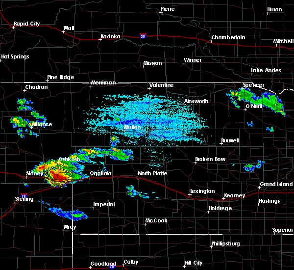 At 334 pm mdt, a severe thunderstorm was located near chappell, moving southeast at 25 mph (radar indicated). Hazards include golf ball size hail and 60 mph wind gusts. People and animals outdoors will be injured. expect hail damage to roofs, siding, windows, and vehicles. expect wind damage to roofs, siding, and trees. locations impacted include, chappell, mount vernon and intersection of highway 27 and 9 mile road. This includes interstate 80 in nebraska between mile markers 85 and 100. At 334 pm mdt, a severe thunderstorm was located near chappell, moving southeast at 25 mph (radar indicated). Hazards include golf ball size hail and 60 mph wind gusts. People and animals outdoors will be injured. expect hail damage to roofs, siding, windows, and vehicles. expect wind damage to roofs, siding, and trees. locations impacted include, chappell, mount vernon and intersection of highway 27 and 9 mile road. This includes interstate 80 in nebraska between mile markers 85 and 100.
|
| 6/27/2016 3:30 PM MDT | Golf Ball sized hail reported 5.7 miles SW of Chappell, NE, hail was jagged and irregularly shaped initially |
| 6/27/2016 3:24 PM MDT |
 At 324 pm mdt, a severe thunderstorm was located near chappell, moving southeast at 30 mph (radar indicated). Hazards include two inch hail and 60 mph wind gusts. People and animals outdoors will be injured. expect hail damage to roofs, siding, windows, and vehicles. expect wind damage to roofs, siding, and trees. locations impacted include, chappell, mount vernon and intersection of highway 27 and 9 mile road. This includes interstate 80 in nebraska between mile markers 85 and 100. At 324 pm mdt, a severe thunderstorm was located near chappell, moving southeast at 30 mph (radar indicated). Hazards include two inch hail and 60 mph wind gusts. People and animals outdoors will be injured. expect hail damage to roofs, siding, windows, and vehicles. expect wind damage to roofs, siding, and trees. locations impacted include, chappell, mount vernon and intersection of highway 27 and 9 mile road. This includes interstate 80 in nebraska between mile markers 85 and 100.
|
| 6/27/2016 3:15 PM MDT | Golf Ball sized hail reported 9.2 miles SSW of Chappell, NE, ground is covered by golf ball size hail. winds were estimated at 50 mph. residents suspected wheat crop was severly damaged... but had yet to assess damage. |
| 6/27/2016 3:13 PM MDT |
 At 312 pm mdt, a severe thunderstorm was located 9 miles north of chappell, moving southeast at 30 mph. this is a very dangerous storm (radar indicated). Hazards include softball size hail and 70 mph wind gusts. People and animals outdoors will be severely injured. Expect shattered windows, extensive damage to roofs, siding, and vehicles. At 312 pm mdt, a severe thunderstorm was located 9 miles north of chappell, moving southeast at 30 mph. this is a very dangerous storm (radar indicated). Hazards include softball size hail and 70 mph wind gusts. People and animals outdoors will be severely injured. Expect shattered windows, extensive damage to roofs, siding, and vehicles.
|
| 9/7/2015 5:07 PM MDT |
 At 506 pm mdt, a severe thunderstorm was located near barton, or 8 miles northwest of big springs, moving east at 45 mph (radar indicated). Hazards include 60 mph wind gusts and nickel size hail. Expect damage to roofs. siding and trees. this includes the following highways, highway 92 between mile markers 115 and 125. interstate 80 in nebraska between mile markers 85 and 88. Locations impacted include, chappell, intersection of highway 27 and 9 mile road, windlass hill, brule, clear creek state wildlife management area, lewellen, ruthon, eagle gulch campground and ash hollow state historical park. At 506 pm mdt, a severe thunderstorm was located near barton, or 8 miles northwest of big springs, moving east at 45 mph (radar indicated). Hazards include 60 mph wind gusts and nickel size hail. Expect damage to roofs. siding and trees. this includes the following highways, highway 92 between mile markers 115 and 125. interstate 80 in nebraska between mile markers 85 and 88. Locations impacted include, chappell, intersection of highway 27 and 9 mile road, windlass hill, brule, clear creek state wildlife management area, lewellen, ruthon, eagle gulch campground and ash hollow state historical park.
|
| 9/7/2015 4:53 PM MDT | Storm damage reported in deuel county NE, 8.7 miles SW of Chappell, NE |
| 9/7/2015 4:49 PM MDT |
 At 449 pm mdt, a severe thunderstorm was located near chappell, moving east at 30 mph (radar indicated). Hazards include 60 mph wind gusts and quarter size hail. Hail damage to vehicles is expected. Expect wind damage to roofs, siding and trees. At 449 pm mdt, a severe thunderstorm was located near chappell, moving east at 30 mph (radar indicated). Hazards include 60 mph wind gusts and quarter size hail. Hail damage to vehicles is expected. Expect wind damage to roofs, siding and trees.
|
| 9/7/2015 4:47 PM MDT | Quarter sized hail reported 3.6 miles S of Chappell, NE, 50 mph winds with quarter size hail. |
| 8/7/2015 4:36 PM MDT |
 At 436 pm mdt, a severe thunderstorm was located near lodgepole, or near chappell, moving north at 25 mph (radar indicated). Hazards include 60 mph wind gusts and quarter size hail. Hail damage to vehicles is expected. Expect wind damage to roofs, siding and trees. At 436 pm mdt, a severe thunderstorm was located near lodgepole, or near chappell, moving north at 25 mph (radar indicated). Hazards include 60 mph wind gusts and quarter size hail. Hail damage to vehicles is expected. Expect wind damage to roofs, siding and trees.
|
| 7/18/2015 6:44 PM MDT |
 At 641 pm mdt, severe thunderstorms were located along a line extending from 7 miles east of lisco to 12 miles southwest of oshkosh to 7 miles northwest of sedgwick, and moving east at 30 mph (radar indicated). Hazards include 60 mph wind gusts and quarter size hail. Hail damage to vehicles is expected. expect wind damage to roofs, siding and trees. locations impacted include, chappell, oshkosh, intersection of highway 27 and 9 mile road and bluewater battlefield state historical park. This includes interstate 80 between mile markers 81 and 98. At 641 pm mdt, severe thunderstorms were located along a line extending from 7 miles east of lisco to 12 miles southwest of oshkosh to 7 miles northwest of sedgwick, and moving east at 30 mph (radar indicated). Hazards include 60 mph wind gusts and quarter size hail. Hail damage to vehicles is expected. expect wind damage to roofs, siding and trees. locations impacted include, chappell, oshkosh, intersection of highway 27 and 9 mile road and bluewater battlefield state historical park. This includes interstate 80 between mile markers 81 and 98.
|
| 7/18/2015 6:19 PM MDT |
 At 616 pm mdt, severe thunderstorms were located along a line extending from 9 miles northwest of lisco to 13 miles southwest of lisco to 16 miles northwest of twin buttes, and moving east at 30 mph (radar indicated). Hazards include 60 mph wind gusts and nickel size hail. Expect damage to roofs. Siding and trees. At 616 pm mdt, severe thunderstorms were located along a line extending from 9 miles northwest of lisco to 13 miles southwest of lisco to 16 miles northwest of twin buttes, and moving east at 30 mph (radar indicated). Hazards include 60 mph wind gusts and nickel size hail. Expect damage to roofs. Siding and trees.
|
| 6/25/2015 7:43 PM MDT |
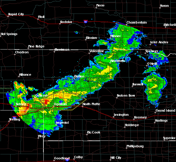 At 741 pm mdt, severe thunderstorms were located along a line extending from 6 miles northeast of chappell to ovid, and moving east at 40 mph (radar indicated). Hazards include 60 mph wind gusts. Expect damage to roofs. siding and trees. locations impacted include, big springs, barton and goldeneye state wildlife management area. This includes interstate 80 between mile markers 84 and 108. At 741 pm mdt, severe thunderstorms were located along a line extending from 6 miles northeast of chappell to ovid, and moving east at 40 mph (radar indicated). Hazards include 60 mph wind gusts. Expect damage to roofs. siding and trees. locations impacted include, big springs, barton and goldeneye state wildlife management area. This includes interstate 80 between mile markers 84 and 108.
|
| 6/25/2015 7:35 PM MDT | Storm damage reported in deuel county NE, 0.2 miles SW of Chappell, NE |
| 6/25/2015 7:20 PM MDT |
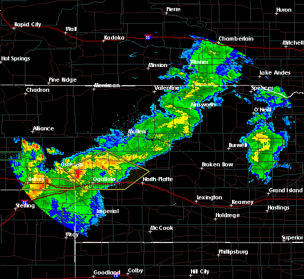 At 716 pm mdt, severe thunderstorms were located along a line extending from lodgepole to 7 miles south of lodgepole, and moving east at 45 mph (radar indicated). Hazards include 60 mph wind gusts. Expect damage to roofs. Siding and trees. At 716 pm mdt, severe thunderstorms were located along a line extending from lodgepole to 7 miles south of lodgepole, and moving east at 45 mph (radar indicated). Hazards include 60 mph wind gusts. Expect damage to roofs. Siding and trees.
|
| 6/1/2015 7:58 PM MDT | At 755 pm mdt, a severe thunderstorm was located near ovid, and moving east at 40 mph (radar indicated). Hazards include 60 mph wind gusts and half dollar size hail. Hail damage to vehicles is expected. expect wind damage to roofs, siding and trees. the severe thunderstorm will be near, big springs around 825 pm mdt. other locations in the warning include barton and goldeneye state wildlife management area. This includes interstate 80 between mile markers 78 and 108. |
| 6/1/2015 7:42 PM MDT | At 741 pm mdt, a severe thunderstorm was located near chappell, and moving east at 35 mph (radar indicated). Hazards include ping pong ball size hail and 60 mph wind gusts. People and animals outdoors will be injured. expect hail damage to roofs, siding, windows and vehicles. expect wind damage to roofs, siding and trees. the severe thunderstorm will be near, big springs around 810 pm mdt. This includes interstate 80 between mile markers 78 and 108. |
| 6/1/2015 7:25 PM MDT | At 722 pm mdt, a severe thunderstorm was located 6 miles south of lodgepole, and moving east at 35 mph (radar indicated). Hazards include 60 mph wind gusts and quarter size hail. Hail damage to vehicles is expected. expect wind damage to roofs, siding and trees. the severe thunderstorm will be near, chappell around 740 pm mdt. big springs around 810 pm mdt. other locations in the warning include mount vernon. This includes interstate 80 between mile markers 78 and 108. |
| 5/15/2015 7:32 PM MDT | At 729 pm mdt, a severe thunderstorm was located 6 miles north of big springs, and moving northeast at 40 mph (radar indicated). Hazards include 70 mph wind gusts and quarter size hail. Hail damage to vehicles is expected. expect considerable tree damage. wind damage is also likely to mobile homes, roofs and outbuildings. locations impacted include, brule, lemoyne, windlass hill, ash hollow state historical park, clear creek state wildlife management area, eagle gulch campground, ruthon, lake view campground, otter creek campground and belmar. this includes interstate 80 between mile markers 87 and 119. this includes highway 61 between mile markers 89 and 94. this includes highway 92 between mile markers 116 and 135. 1. 00in. |
| 5/15/2015 7:18 PM MDT | At 716 pm mdt, a severe thunderstorm was located near julesburg, and moving northeast at 40 mph (radar indicated). Hazards include 60 mph wind gusts and quarter size hail. Hail damage to vehicles is expected. Expect wind damage to roofs, siding and trees. |
| 4/17/2015 8:38 PM MDT | At 835 pm mdt, a severe thunderstorm was located 8 miles northeast of chappell, and moving north at 10 mph (radar indicated. one inch hail was reported east of chappell in central deuel county). Hazards include 60 mph wind gusts and quarter size hail. Hail damage to vehicles is expected. expect wind damage to roofs, siding and trees. the severe thunderstorm will affect mainly rural areas of deuel county. this includes interstate 80 between mile markers 84 and 102. Possible. |
| 4/17/2015 8:11 PM MDT | At 809 pm mdt, a severe thunderstorm was located 8 miles east of chappell, and moving north at 10 mph (radar indicated). Hazards include 60 mph wind gusts and quarter size hail. Hail damage to vehicles is expected. expect wind damage to roofs, siding and trees. the severe thunderstorm will affect mainly rural areas of deuel county. this includes interstate 80 between mile markers 84 and 103. Possible. |
| 8/18/2014 5:00 PM MDT | Quarter sized hail reported 14.9 miles WSW of Chappell, NE, public reported quarter size hail lasting 4 minutes. |
| 5/19/2014 8:35 PM MDT | Golf Ball sized hail reported 0.6 miles NNW of Chappell, NE |
| 5/19/2014 8:35 PM MDT | Storm damage reported in deuel county NE, 4.2 miles NW of Chappell, NE |
| 5/19/2014 8:35 PM MDT | Golf Ball sized hail reported 0.2 miles SW of Chappell, NE |
| 5/19/2014 8:20 PM MDT | Half Dollar sized hail reported 0.6 miles NNW of Chappell, NE |
| 5/19/2014 8:12 PM MDT | Tennis Ball sized hail reported 4.5 miles E of Chappell, NE, measured 2-3/8 inch... 2 miles east of lodgepole on hwy 30 |
| 10/10/2013 7:10 PM MDT | Storm damage reported in deuel county NE, 10.8 miles SW of Chappell, NE |
| 8/1/2013 7:25 PM MDT | Storm damage reported in deuel county NE, 4.3 miles S of Chappell, NE |
| 6/21/2013 5:24 PM MDT | Quarter sized hail reported 5.1 miles NW of Chappell, NE |
| 6/13/2013 7:46 PM MDT | Delayed report. estimated wind in excess of 60 mph. damage to outbuildings and pole barn in deuel county NE, 4.6 miles NNW of Chappell, NE |
| 6/13/2013 7:44 PM MDT | 60 mph winds reported with nickle size hai in deuel county NE, 2.6 miles N of Chappell, NE |
| 5/18/2013 6:49 PM MDT | Power lines were knocked down at county roads 185 and 28. time is estimate in deuel county NE, 10.8 miles SW of Chappell, NE |
| 5/18/2013 6:49 PM MDT | Power lines were knocked down at county roads 185 and 22. time is estimate in deuel county NE, 10.8 miles SW of Chappell, NE |
| 5/18/2013 6:00 PM MDT | Half Dollar sized hail reported 6.6 miles WSW of Chappell, NE, stones ranged from peas to half dollar size. pea size hail is still falling. |
| 7/17/2012 2:45 PM MDT | Quarter sized hail reported 0.2 miles SW of Chappell, NE, few quarter size hail stones occurring at time of report. |
| 7/17/2012 2:45 PM MDT | Quarter sized hail reported 5.9 miles NW of Chappell, NE, few quarter size hail stones occurring at time of report. |
| 6/22/2012 8:42 PM MDT | Ping Pong Ball sized hail reported 11.6 miles SW of Chappell, NE |
| 6/22/2012 8:06 PM MDT | Ping Pong Ball sized hail reported 7.2 miles SE of Chappell, NE |
| 4/12/2012 3:45 PM MDT | Quarter sized hail reported 3.3 miles N of Chappell, NE |
| 1/1/0001 12:00 AM | Golf Ball sized hail reported 0.2 miles SW of Chappell, NE |
| 1/1/0001 12:00 AM | Law enforcement estimated 60 mph winds in chappel in deuel county NE, 0.2 miles SW of Chappell, NE |
| 1/1/0001 12:00 AM | Quarter sized hail reported 6.4 miles ENE of Chappell, NE |
| 1/1/0001 12:00 AM | Quarter sized hail reported 5.9 miles NW of Chappell, NE, public reported quarter sized hail 6 miles southeast of chappell. |
| 1/1/0001 12:00 AM | Golf Ball sized hail reported 10.8 miles W of Chappell, NE |
| 1/1/0001 12:00 AM | Ping Pong Ball sized hail reported 3.6 miles NNE of Chappell, NE |
| 1/1/0001 12:00 AM | Golf Ball sized hail reported 8.4 miles SE of Chappell, NE, delayed report...public reported golf ball sized hail 8 miles nw of chappell |
| 1/1/0001 12:00 AM | Porch blown off of house in deuel county NE, 5.4 miles W of Chappell, NE |
| 1/1/0001 12:00 AM | Trampoline took flight and hit house damaging an outside faucet and gutter damaged. trampoline tumbled down hill from hous in deuel county NE, 0.2 miles SW of Chappell, NE |
| 1/1/0001 12:00 AM | Quarter sized hail reported 3.6 miles S of Chappell, NE |
Hail Maps for Chappell, NE
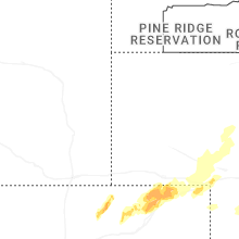
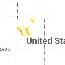

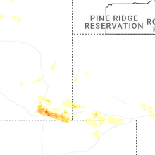
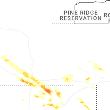
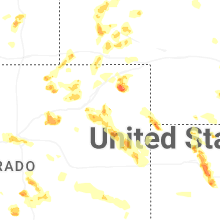
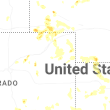
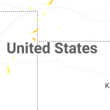

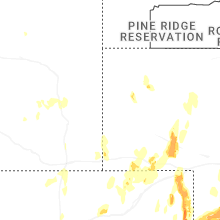
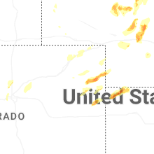


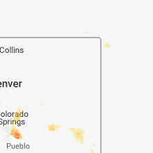


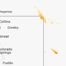


Connect with Interactive Hail Maps