

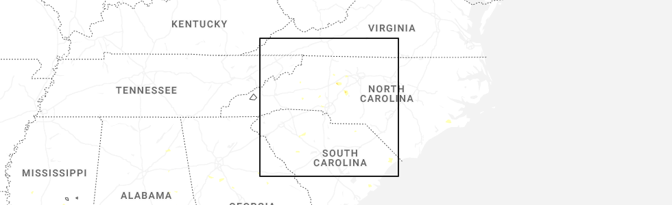
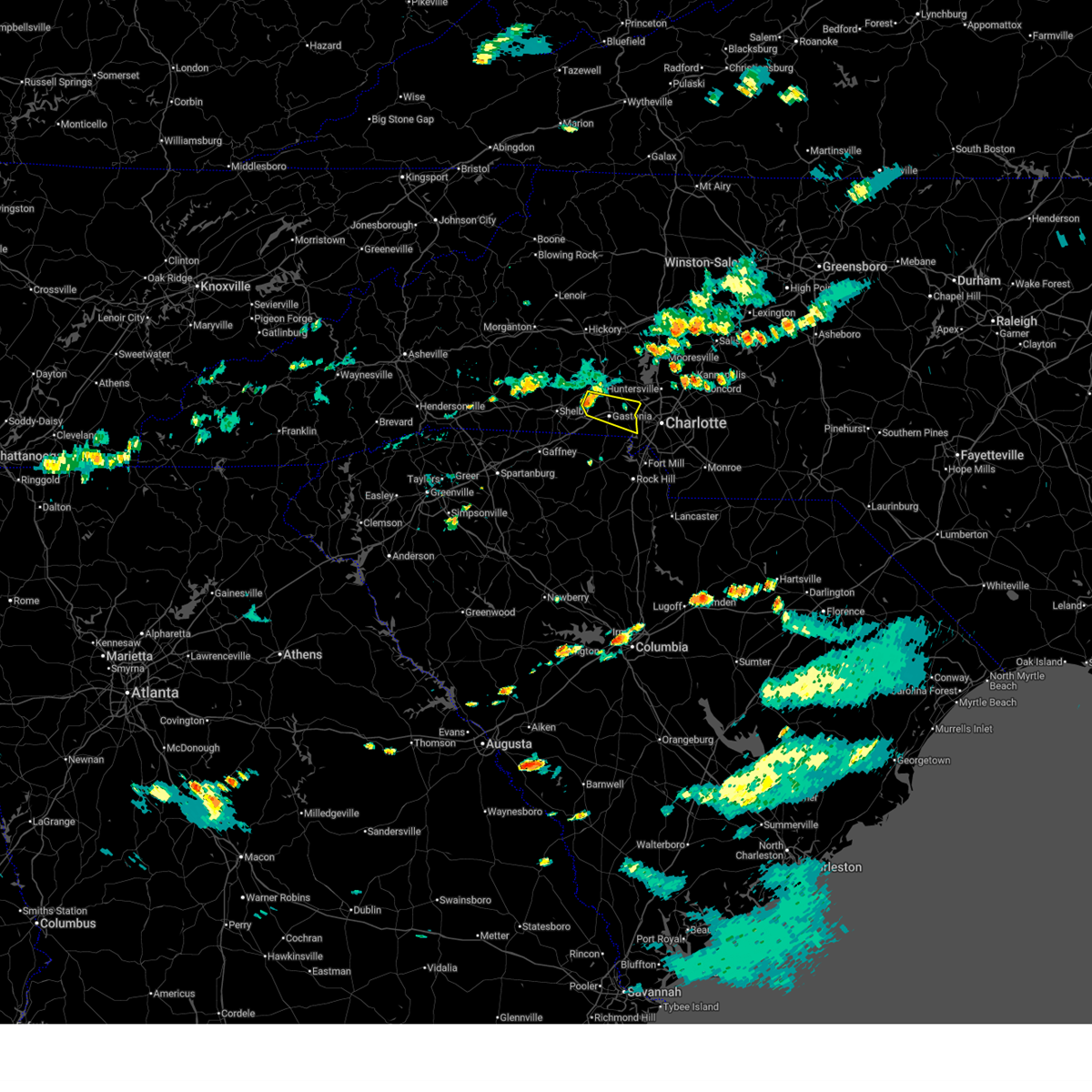
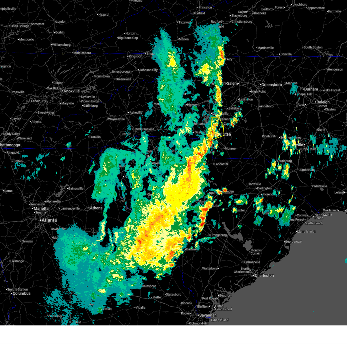
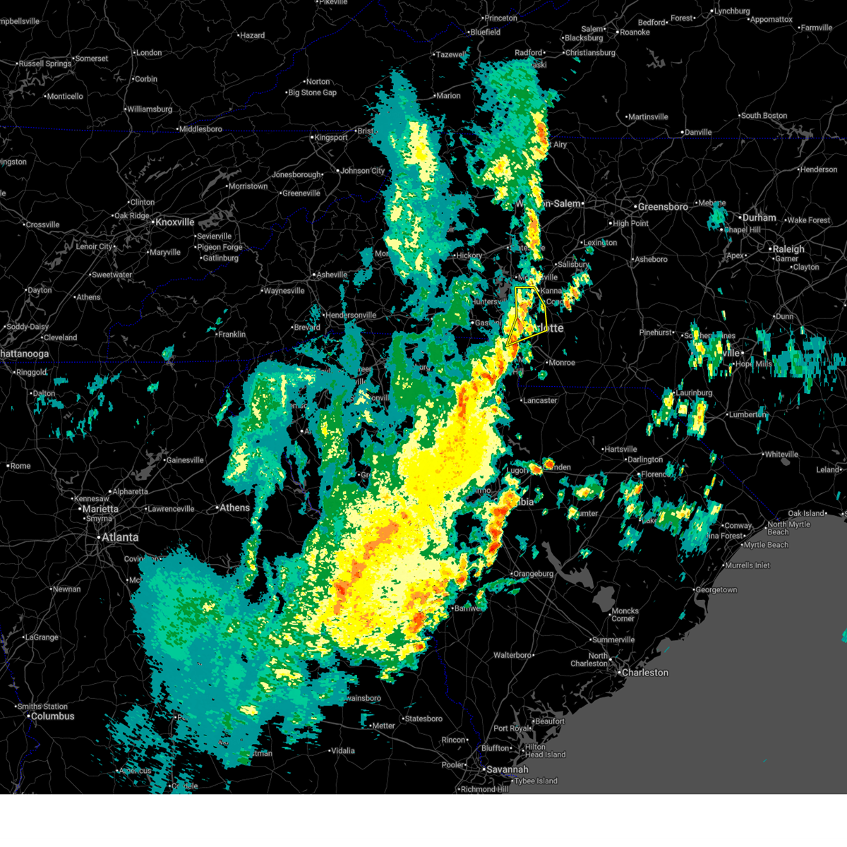
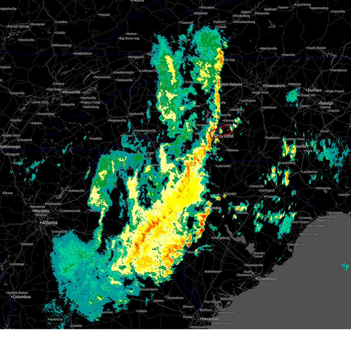
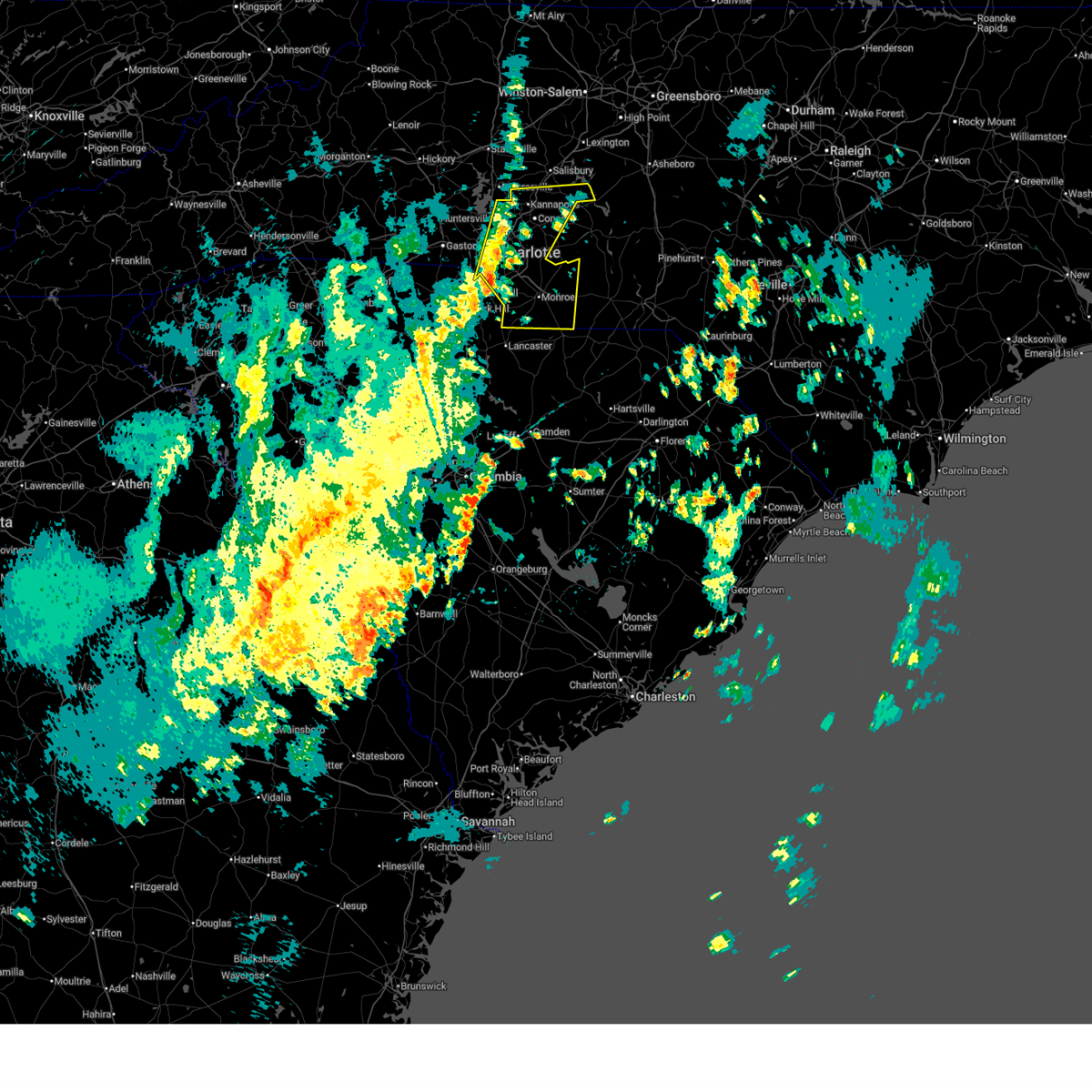
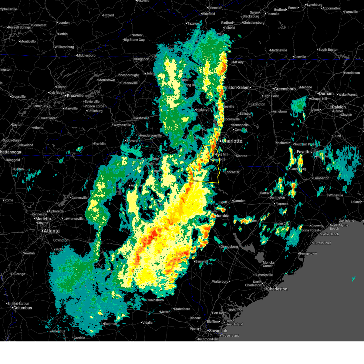
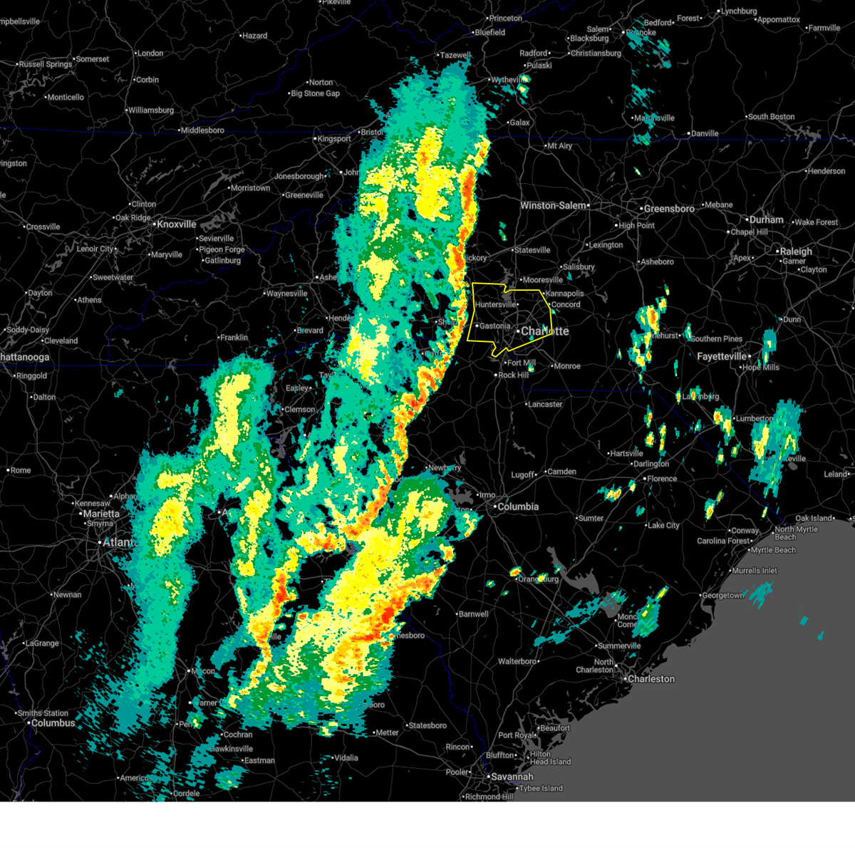
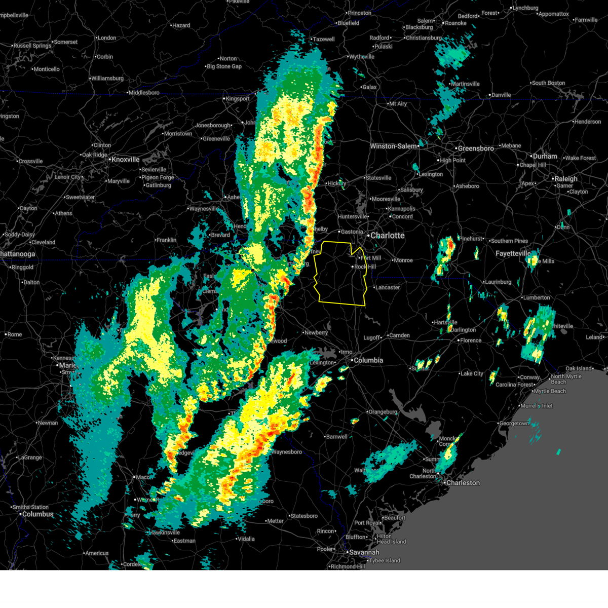
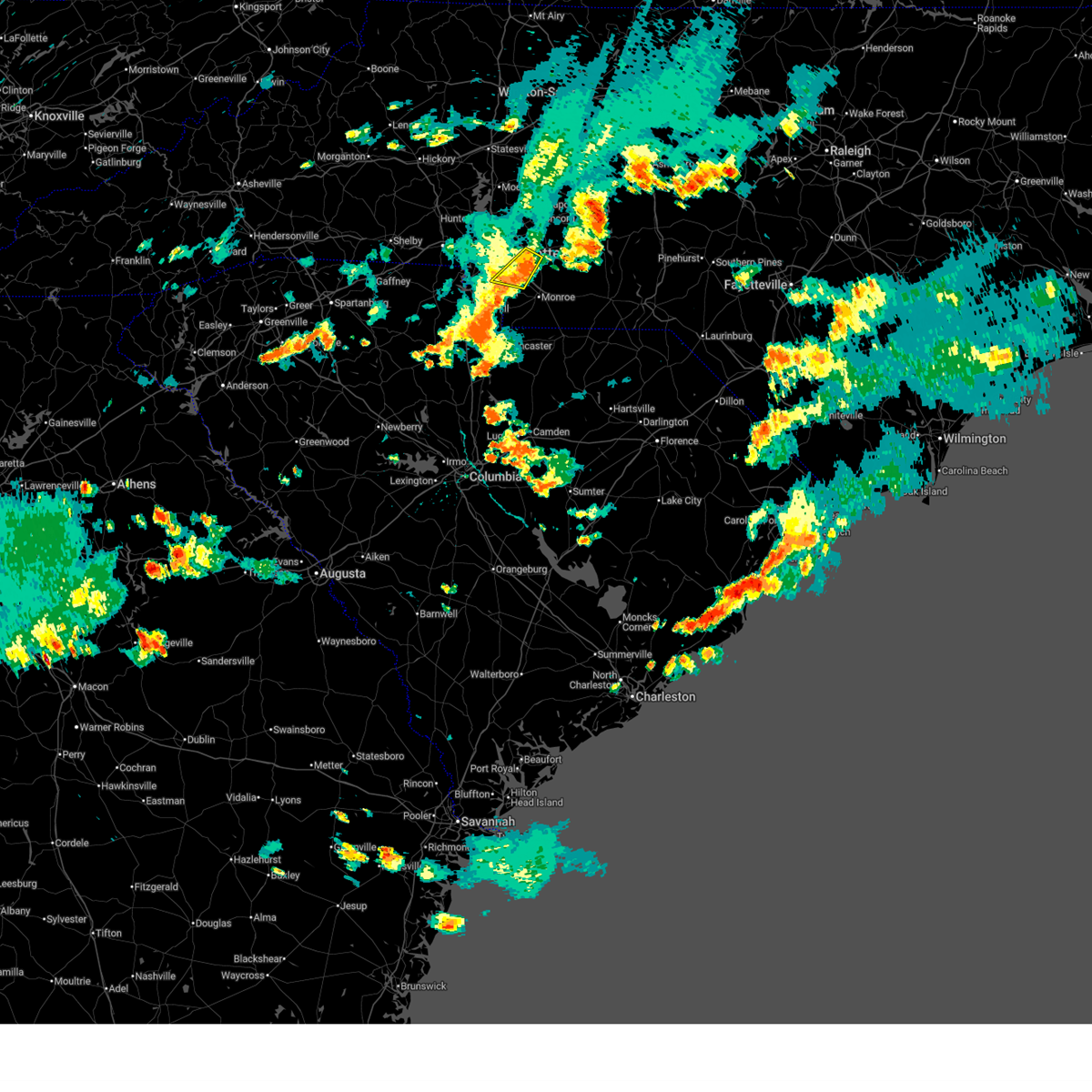
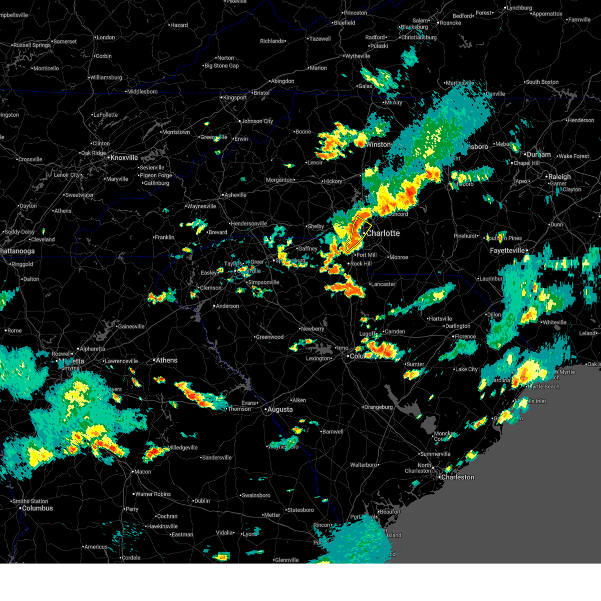
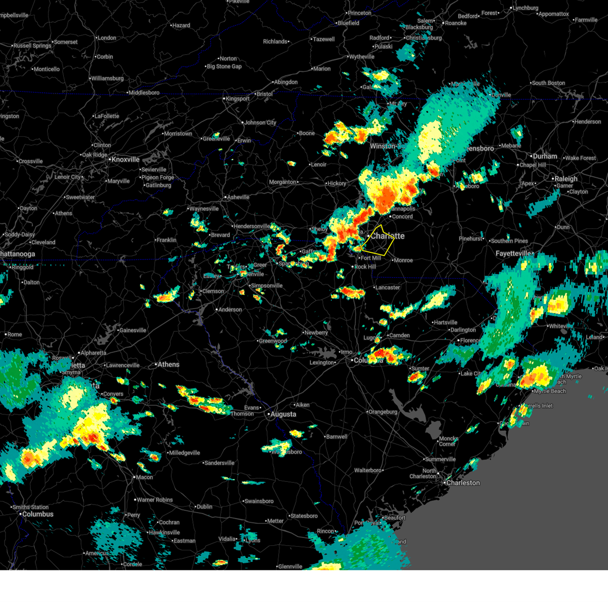
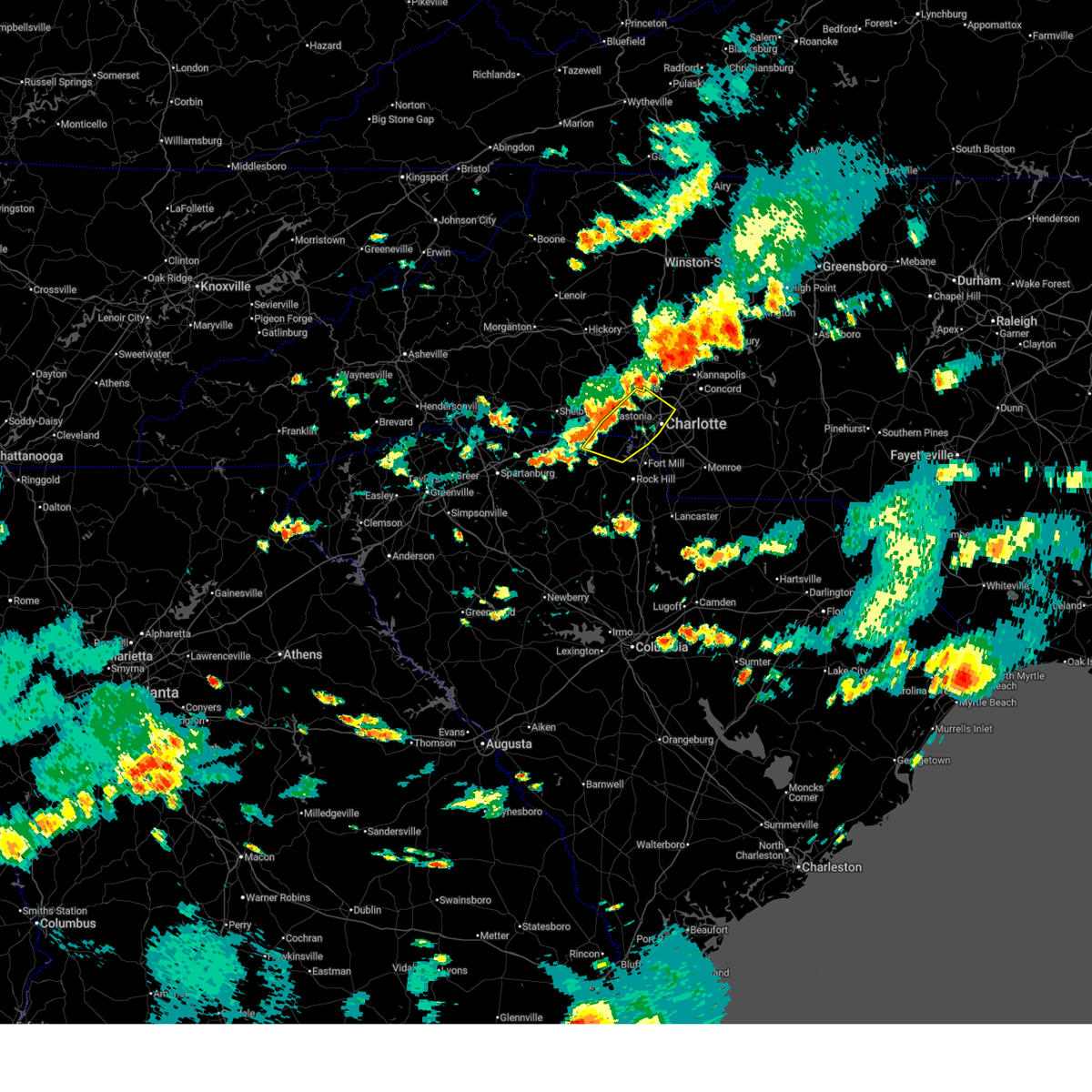
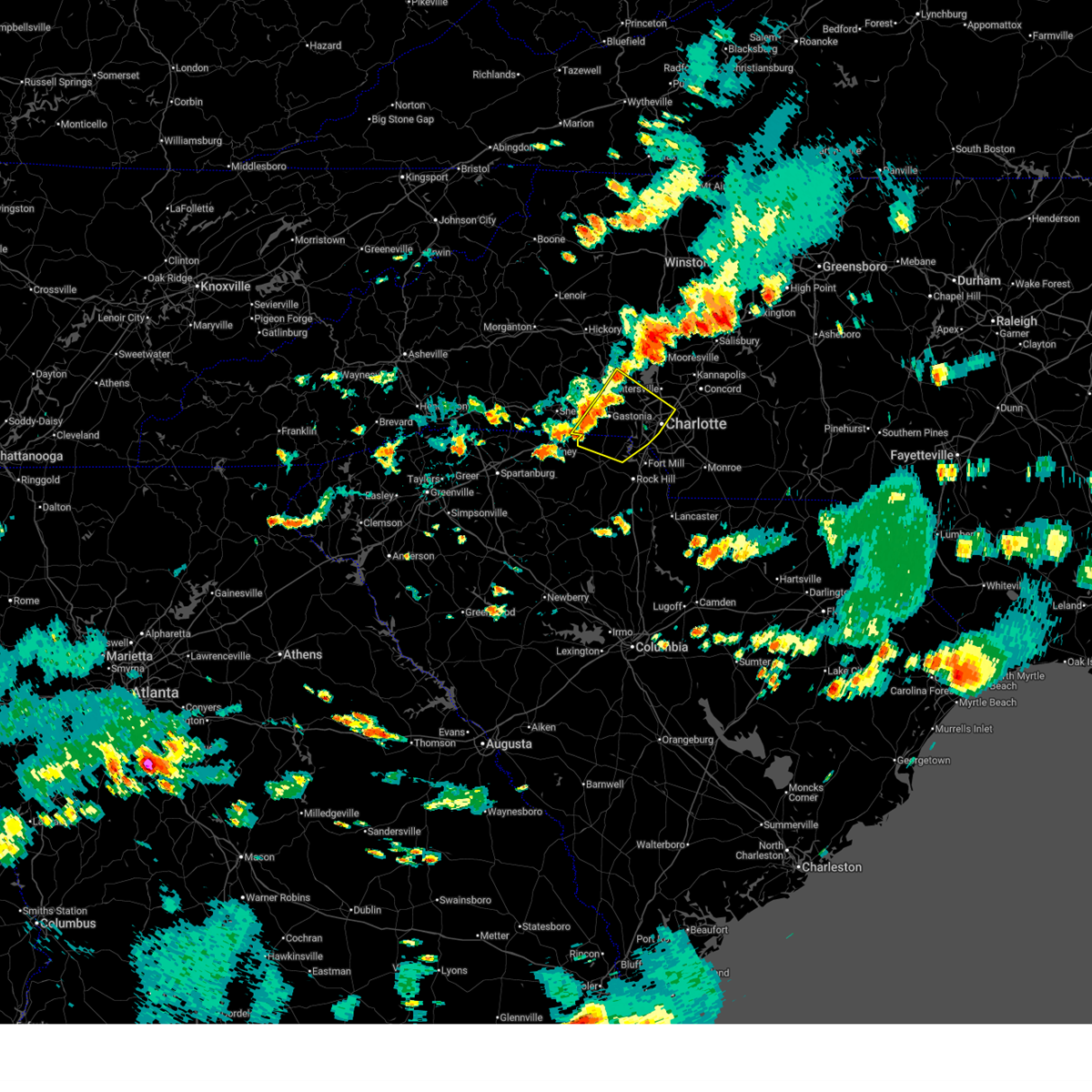
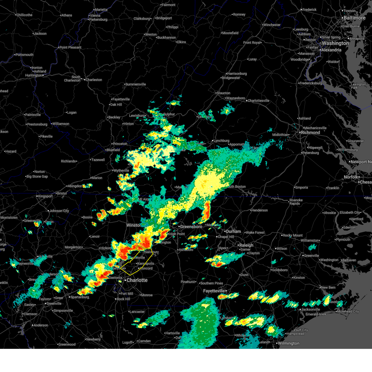
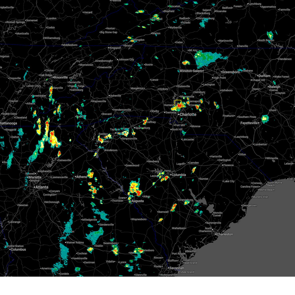
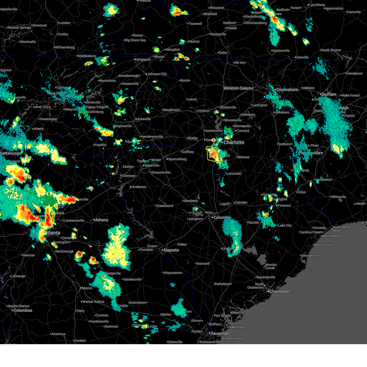
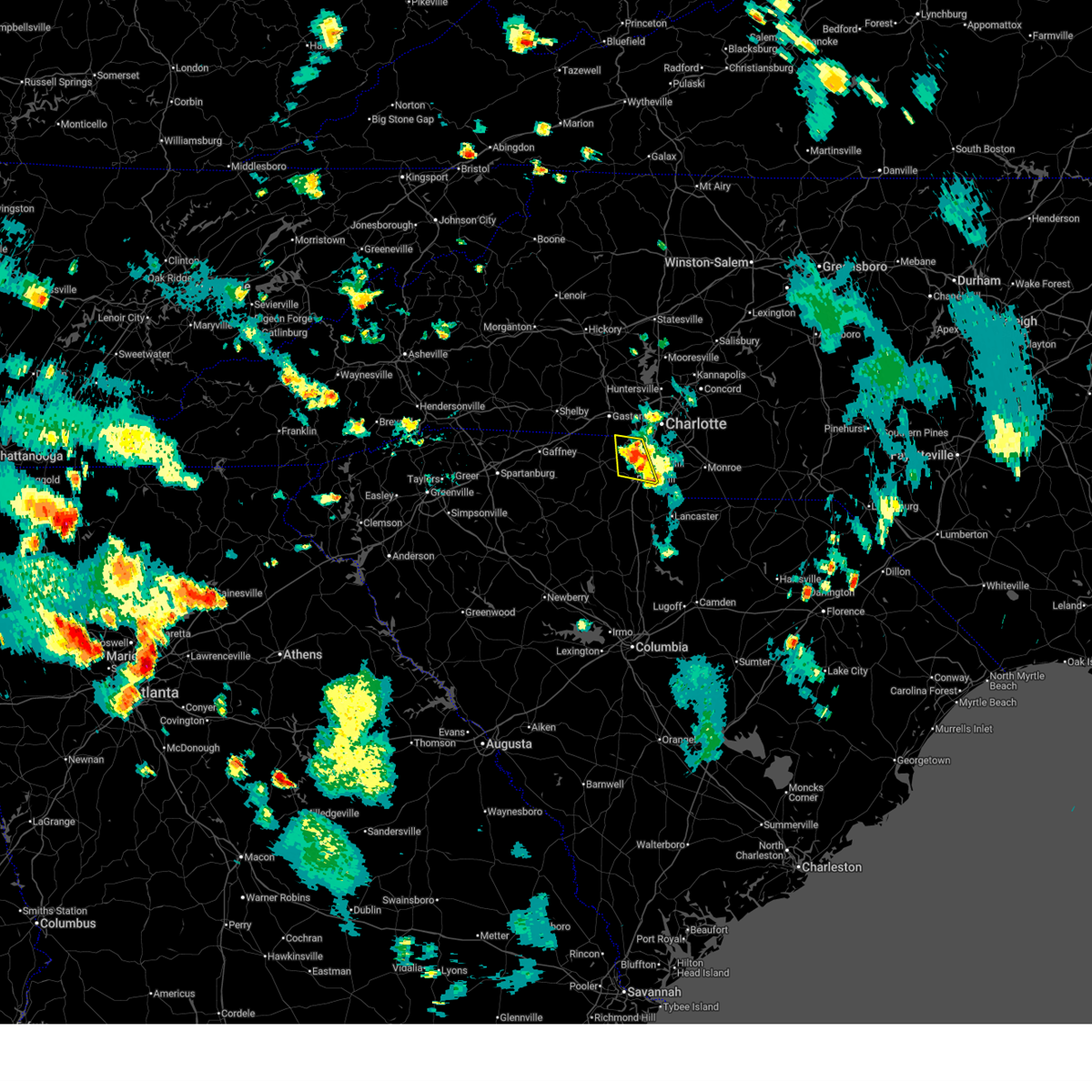
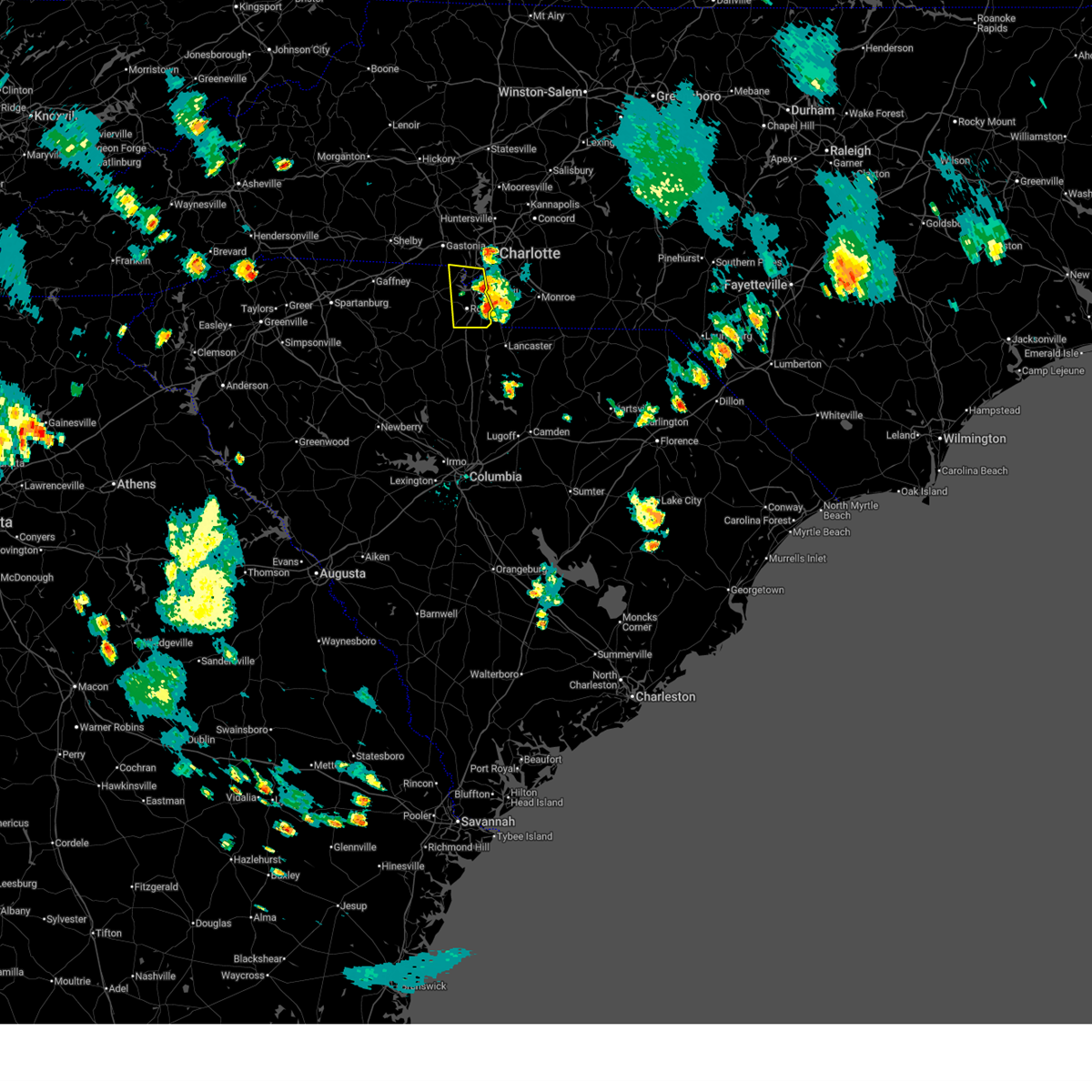
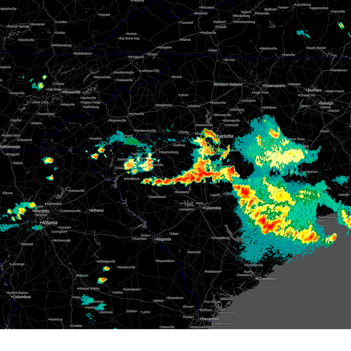
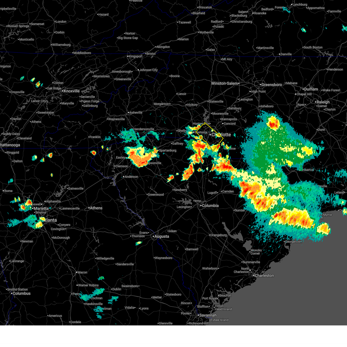
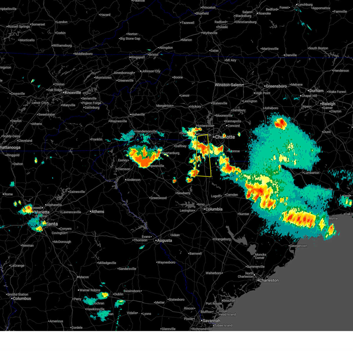
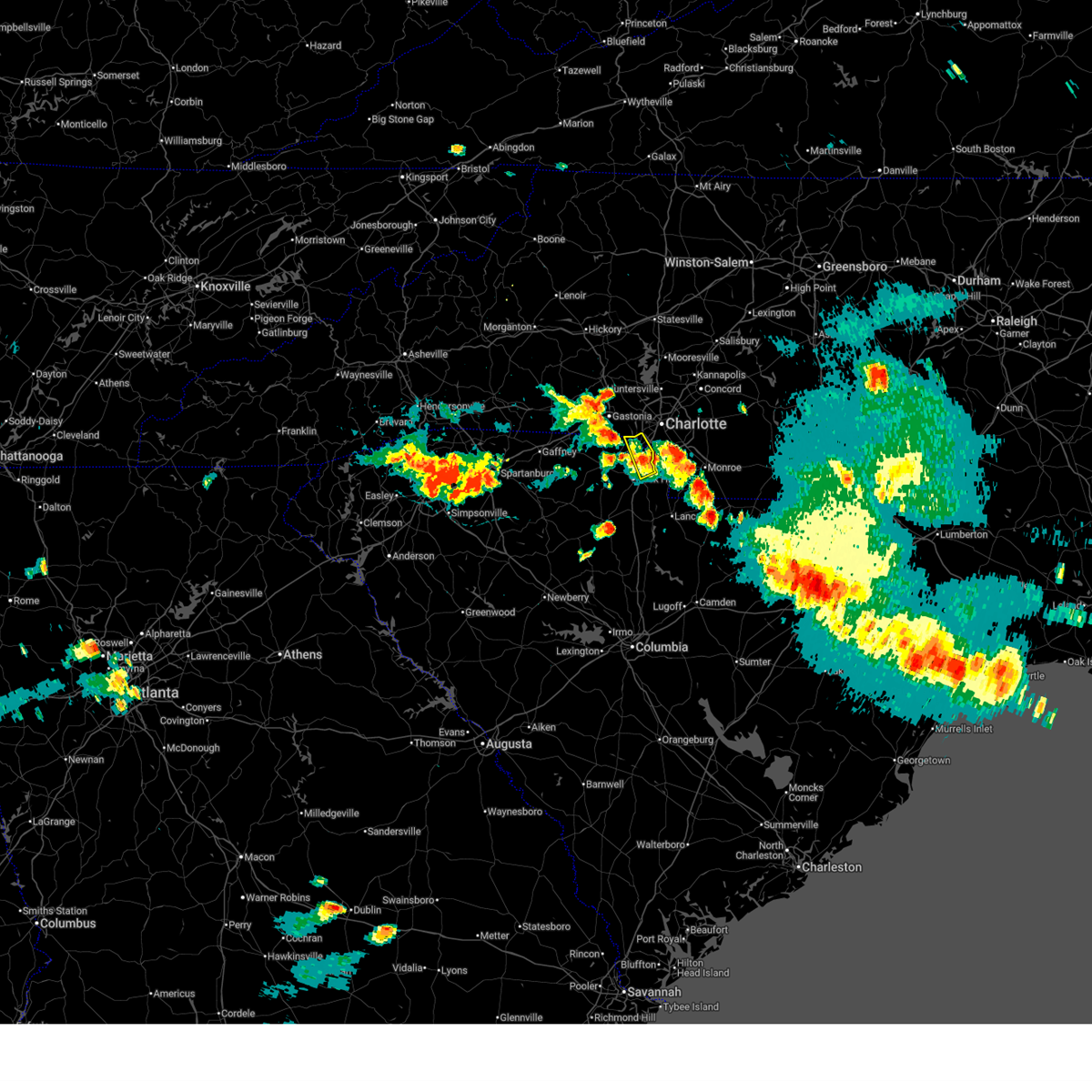
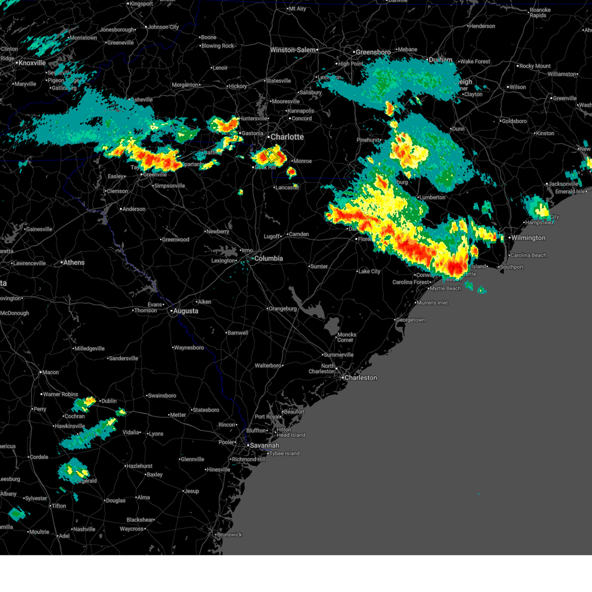
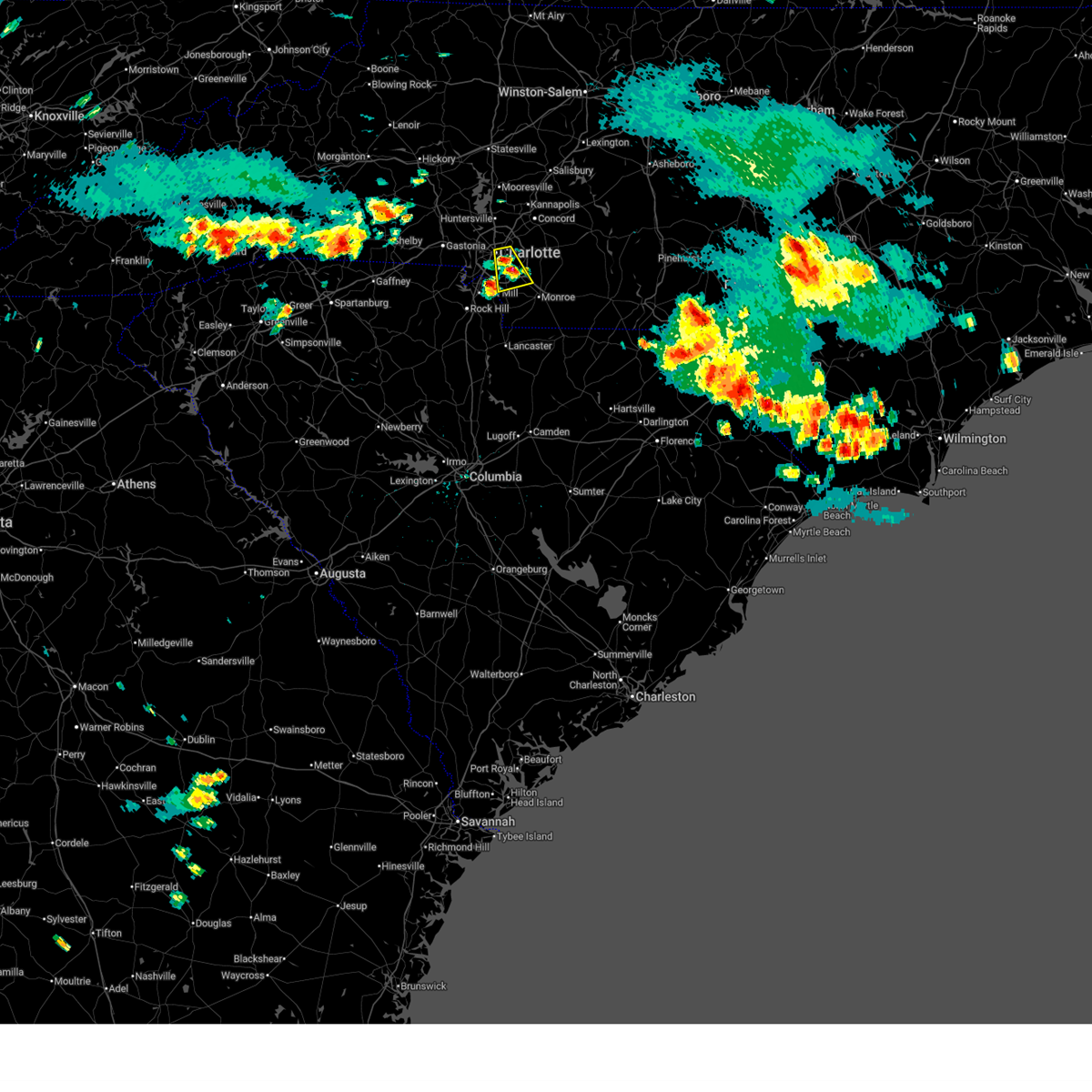
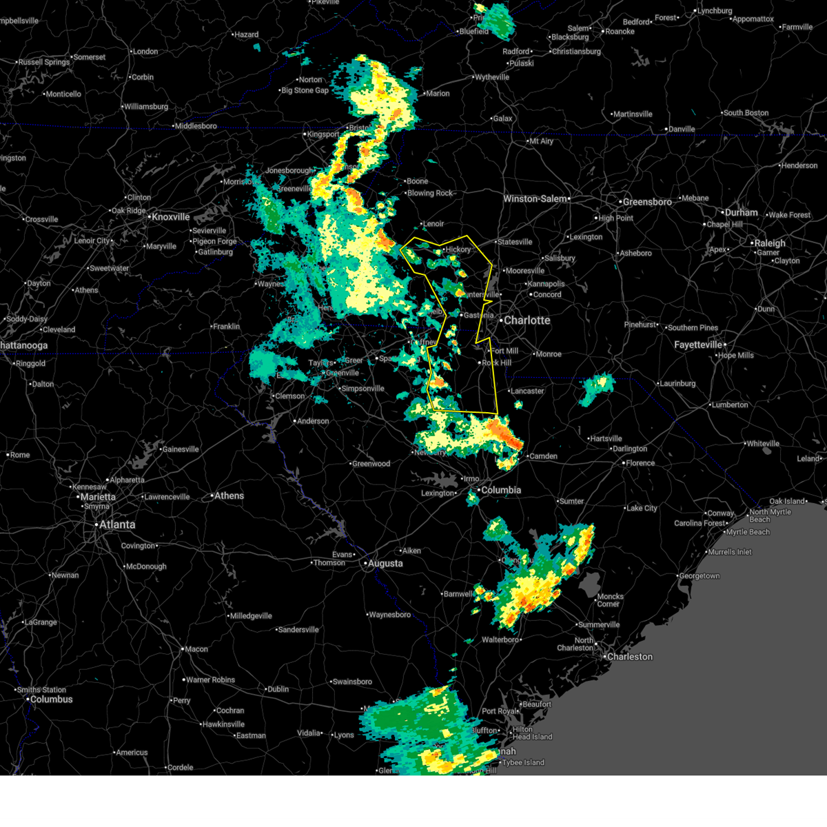
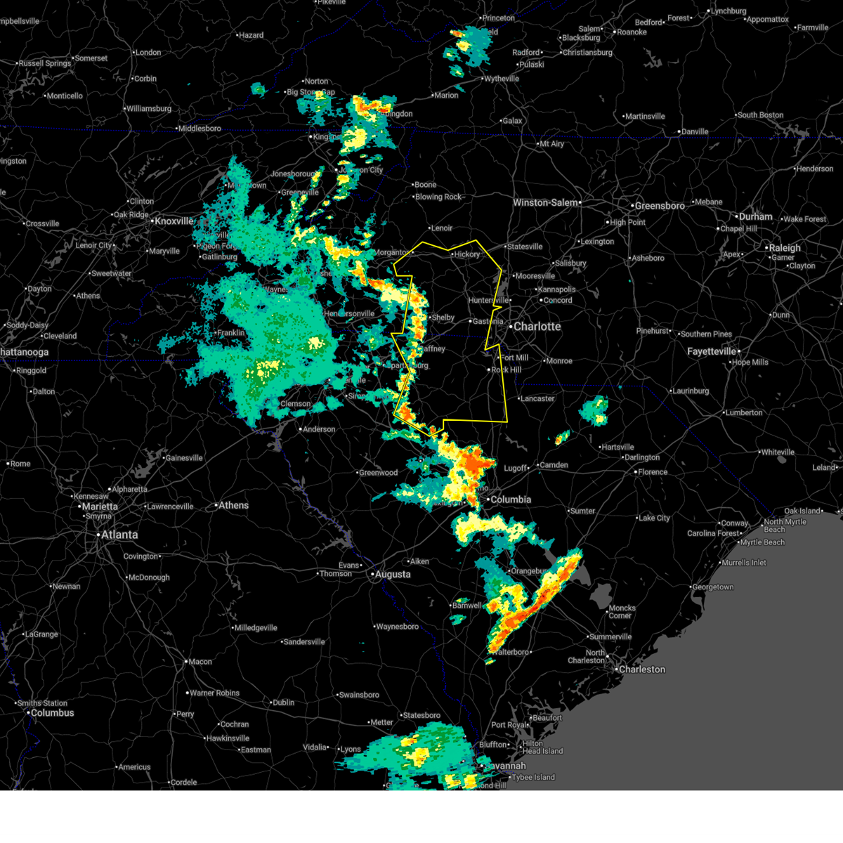
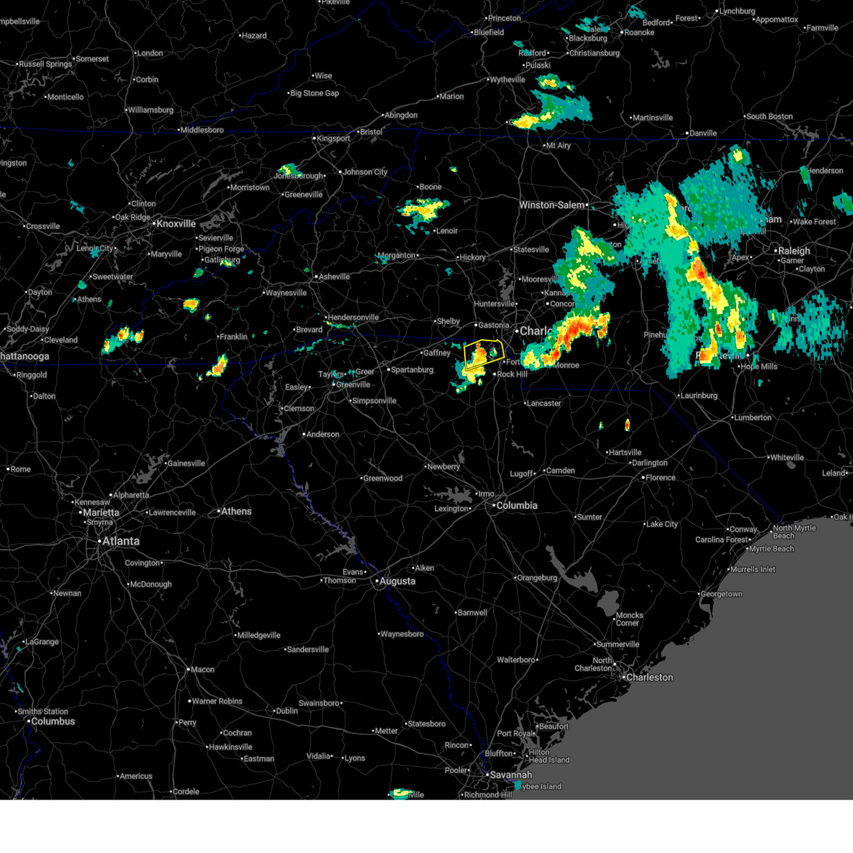
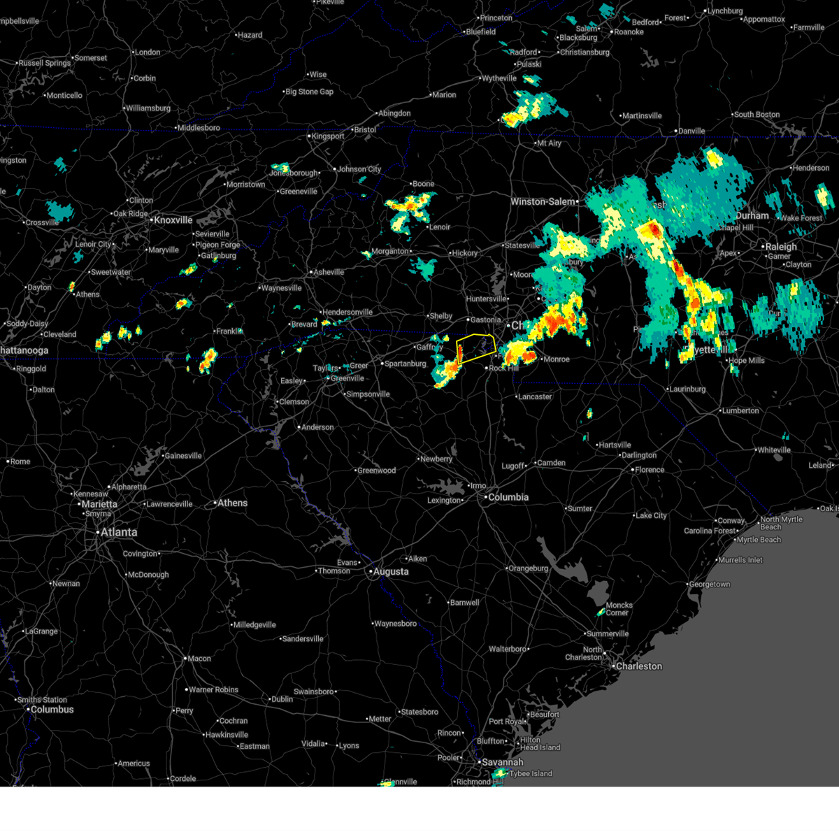
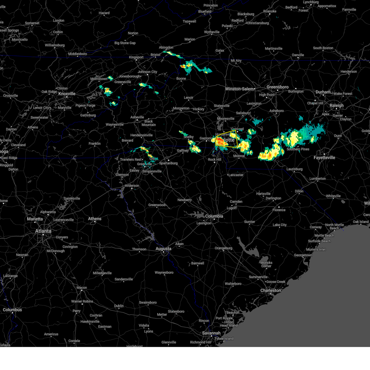
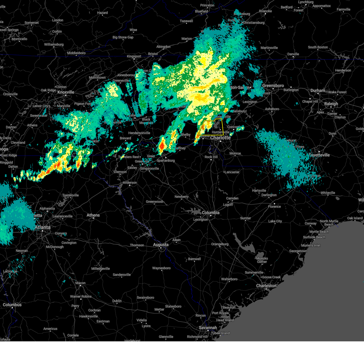
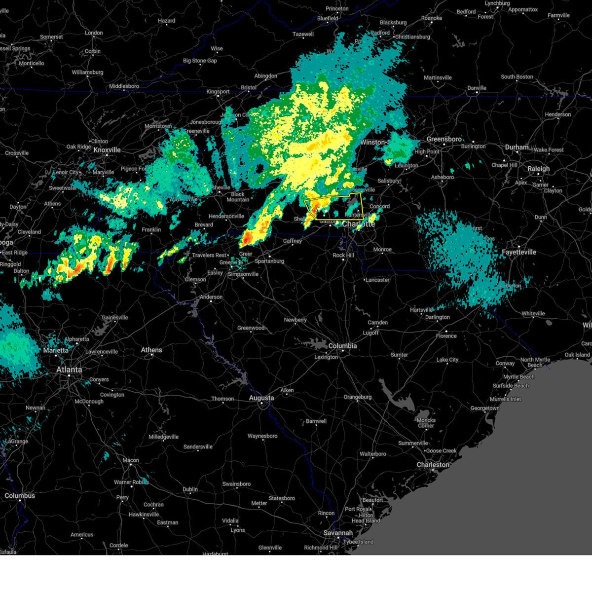
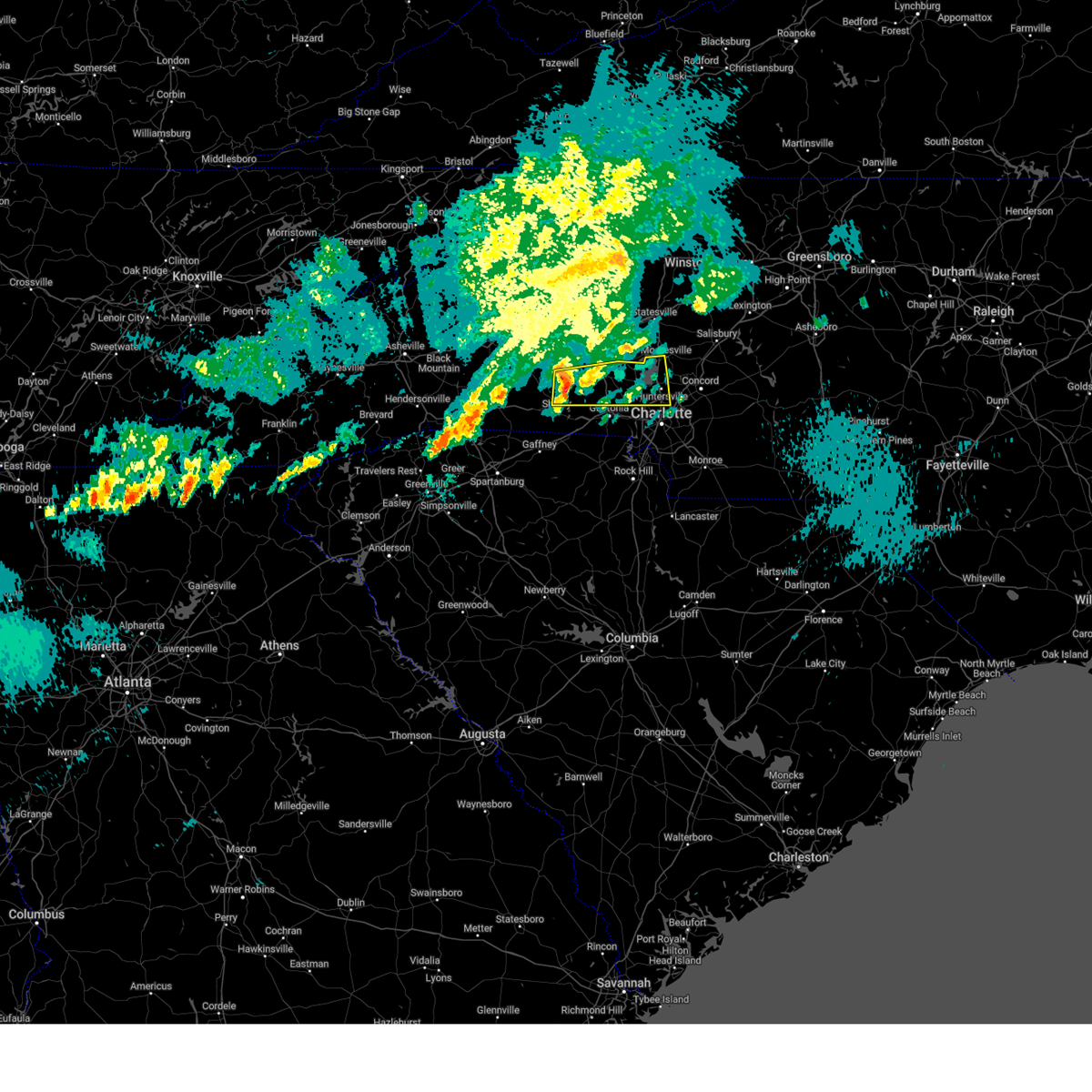
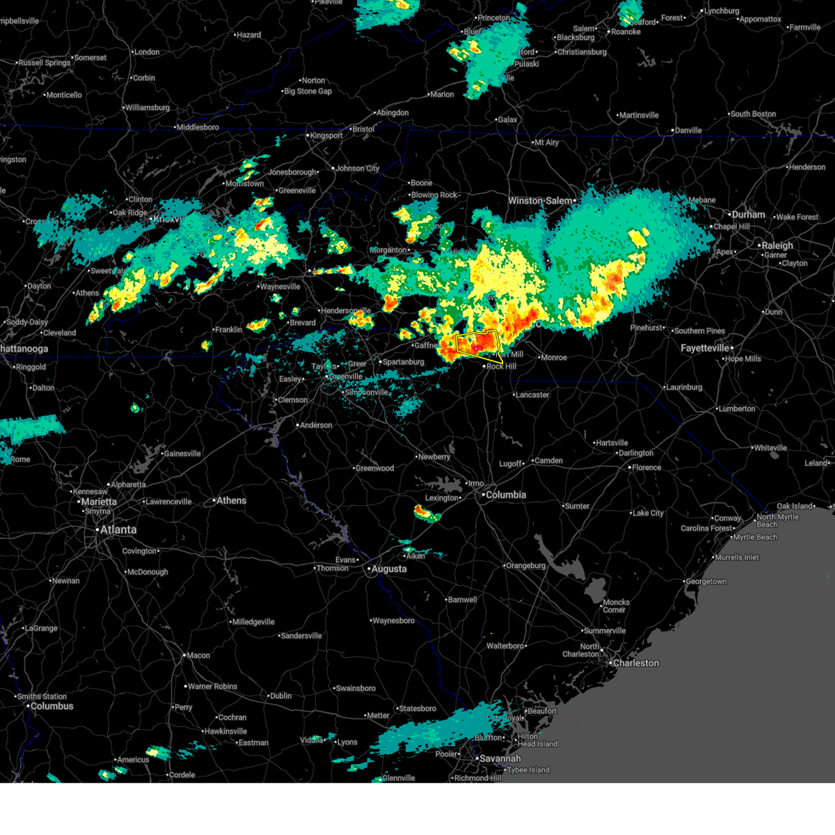
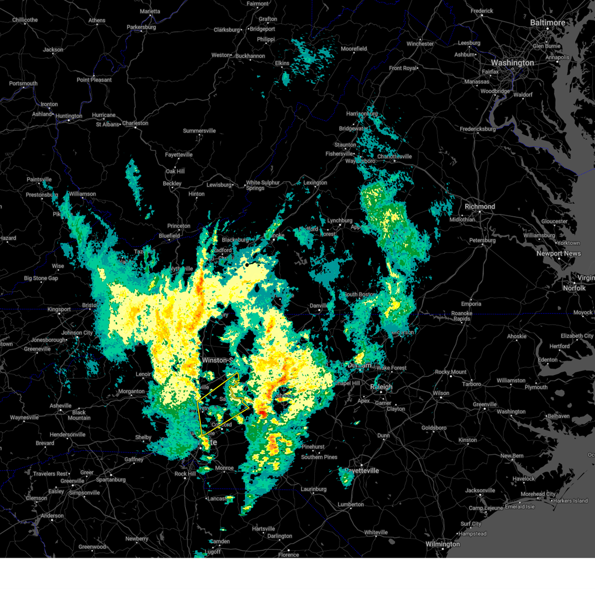
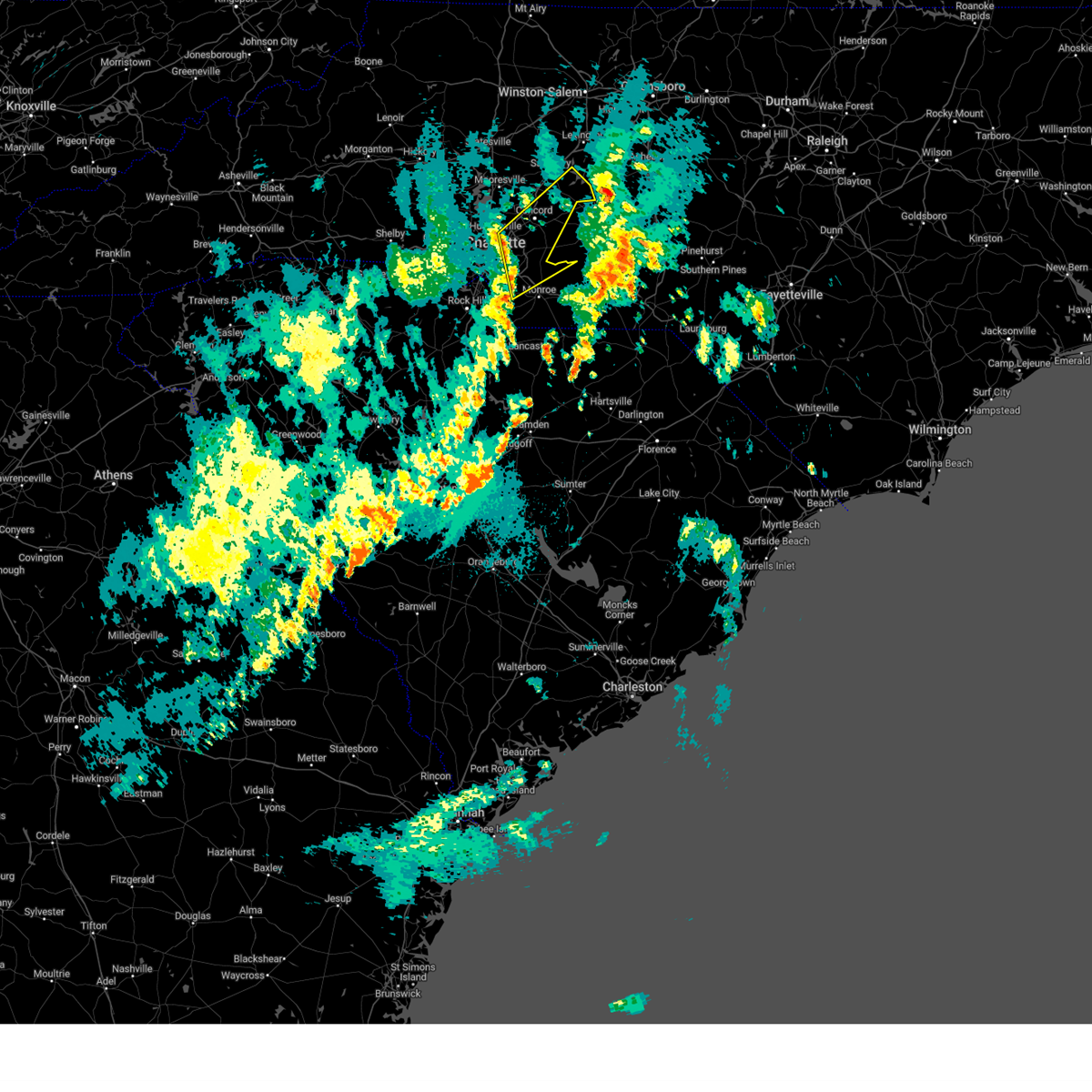
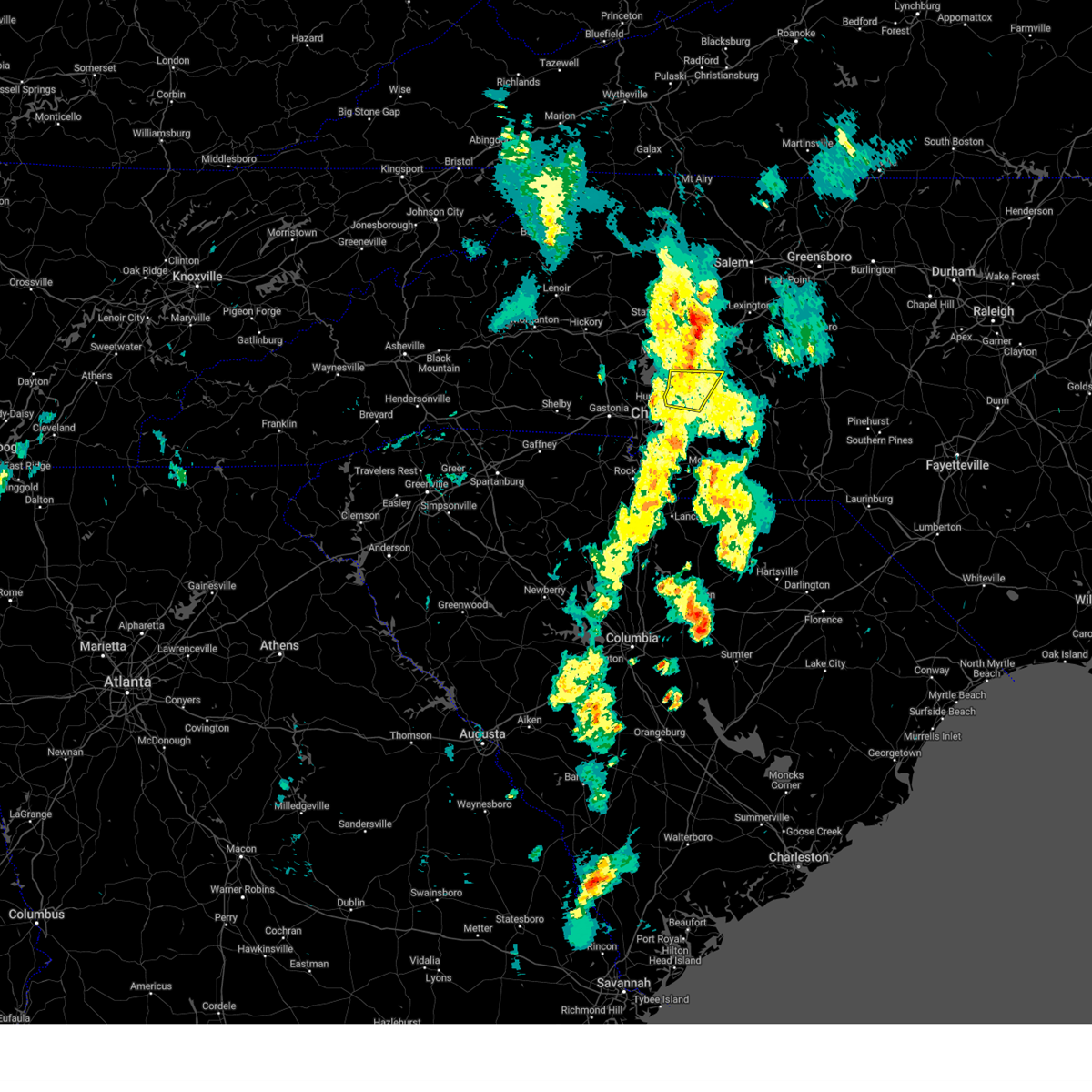
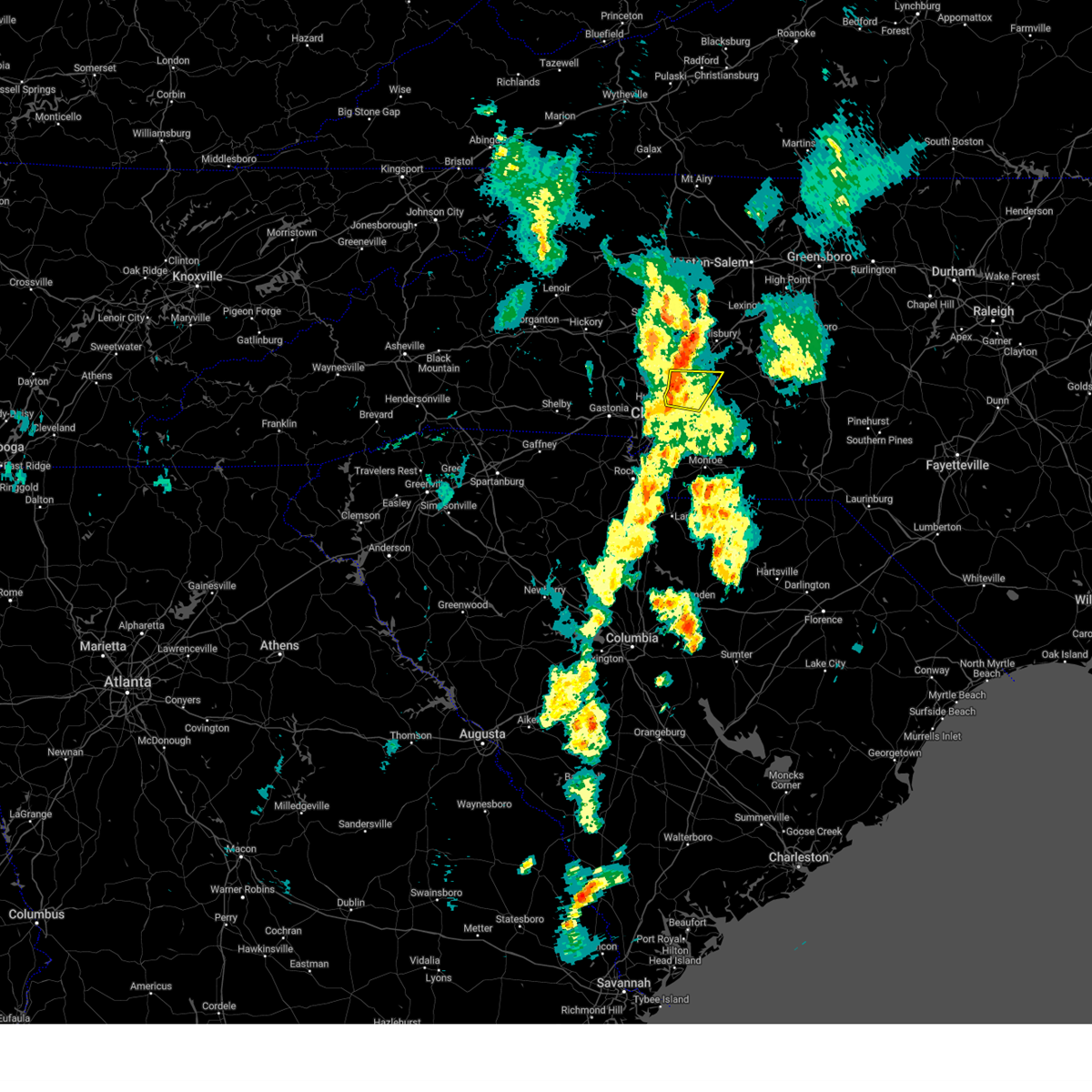
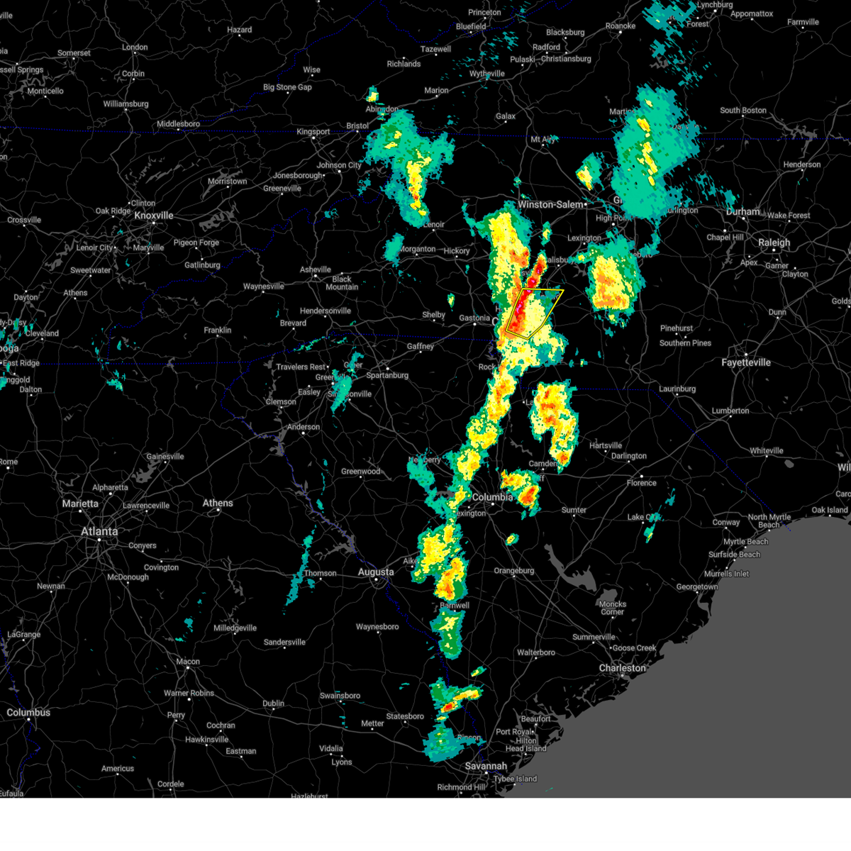
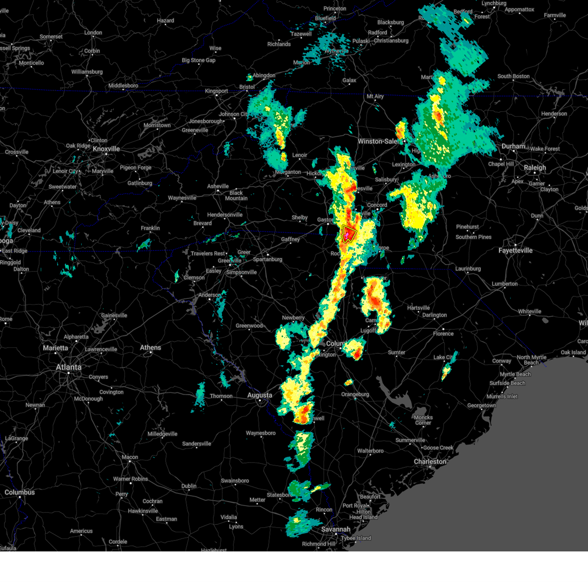
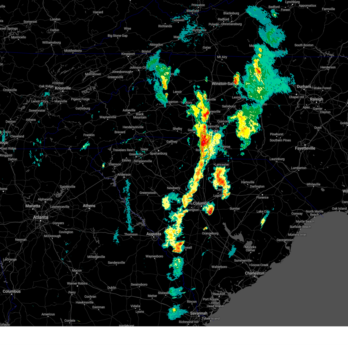
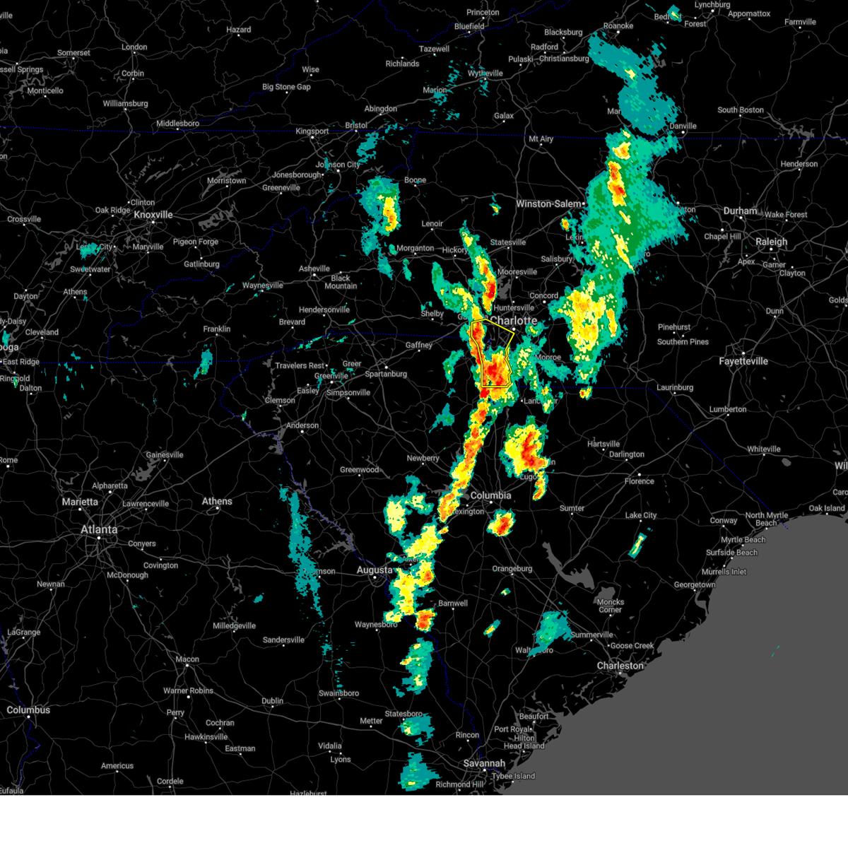
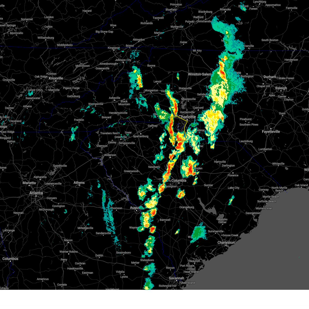
Hail Map for Charlotte, NC
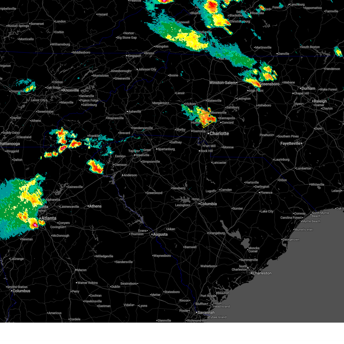
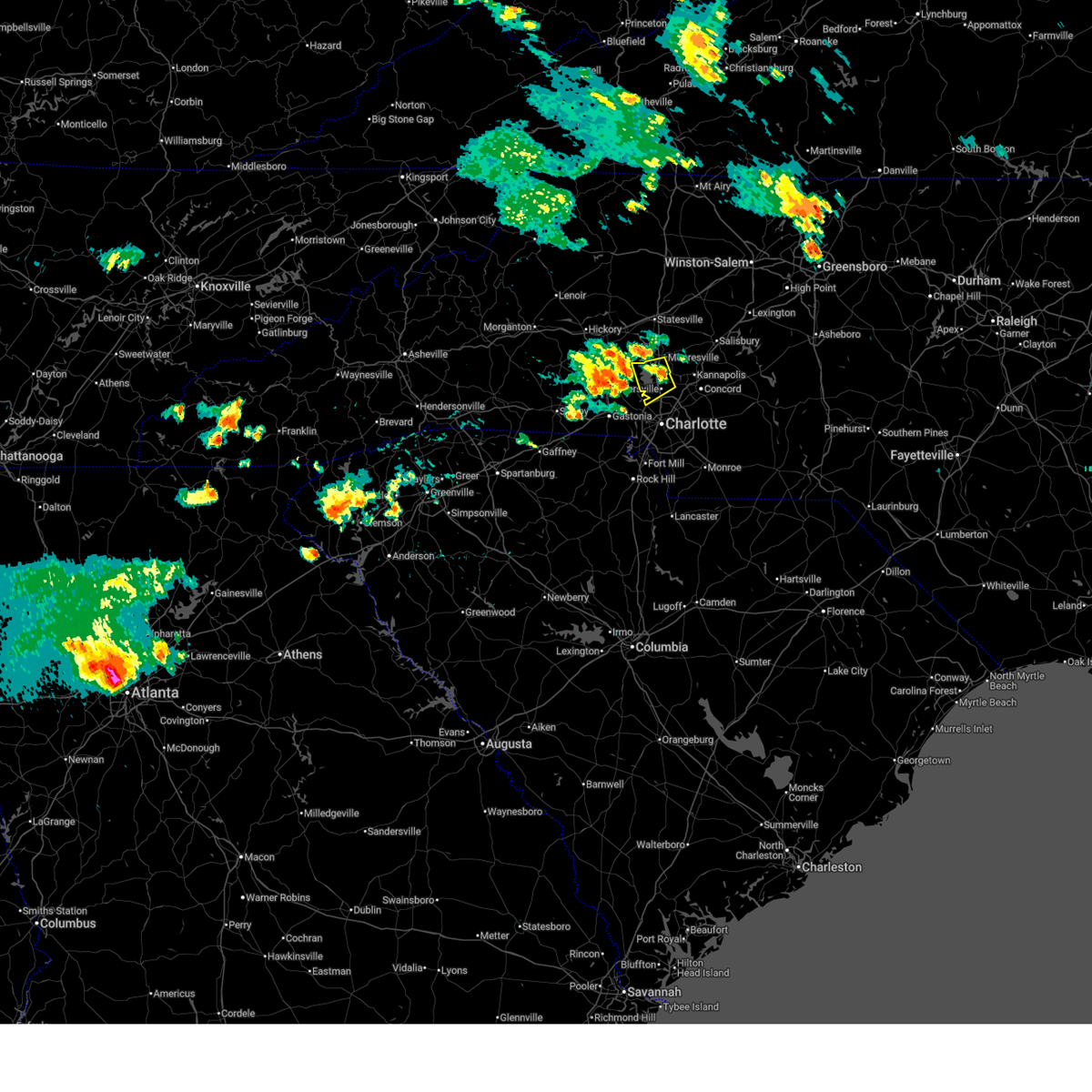
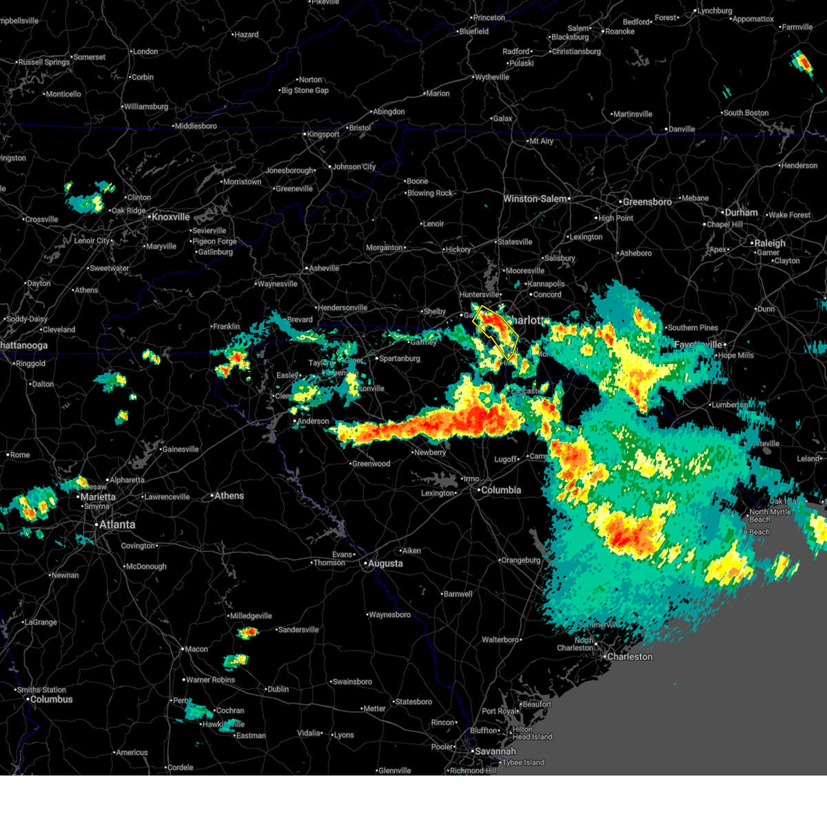
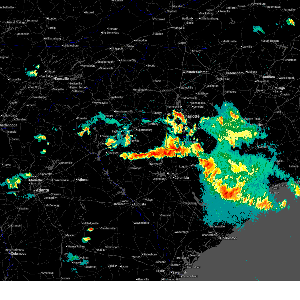
The Charlotte, NC area has had 42 reports of on-the-ground hail by trained spotters, and has been under severe weather warnings 35 times during the past 12 months. Doppler radar has detected hail at or near Charlotte, NC on 151 occasions, including 3 occasions during the past year.
| Name: | Charlotte, NC |
| Where Located: | 1.4 miles WNW of Charlotte, NC |
| Map: | Google Map for Charlotte, NC |
| Population: | 731424 |
| Housing Units: | 319918 |
| More Info: | Search Google for Charlotte, NC |
0
The Top Recent Hail Date for Charlotte, NC is Friday, August 1, 2025 (151st out of 151)
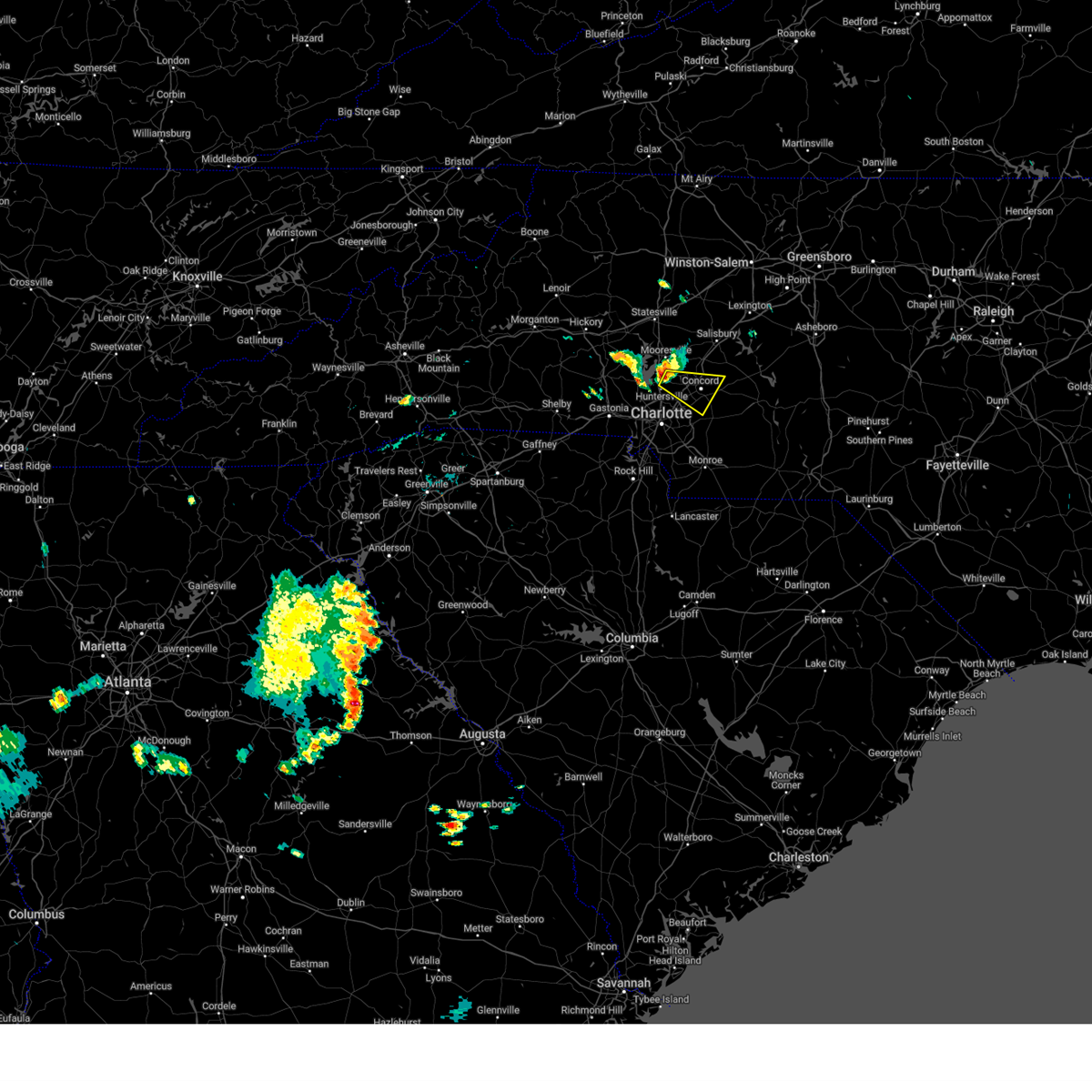
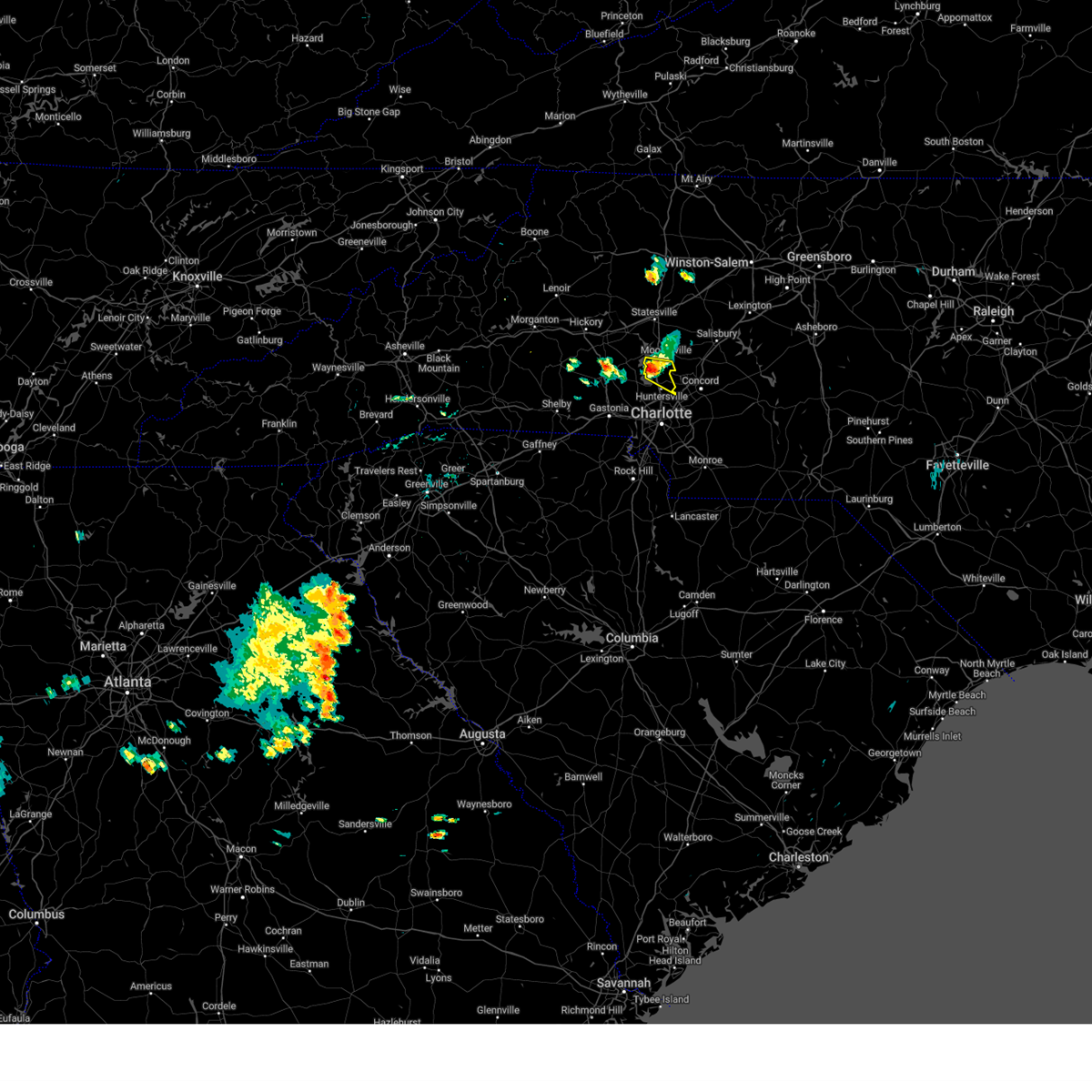
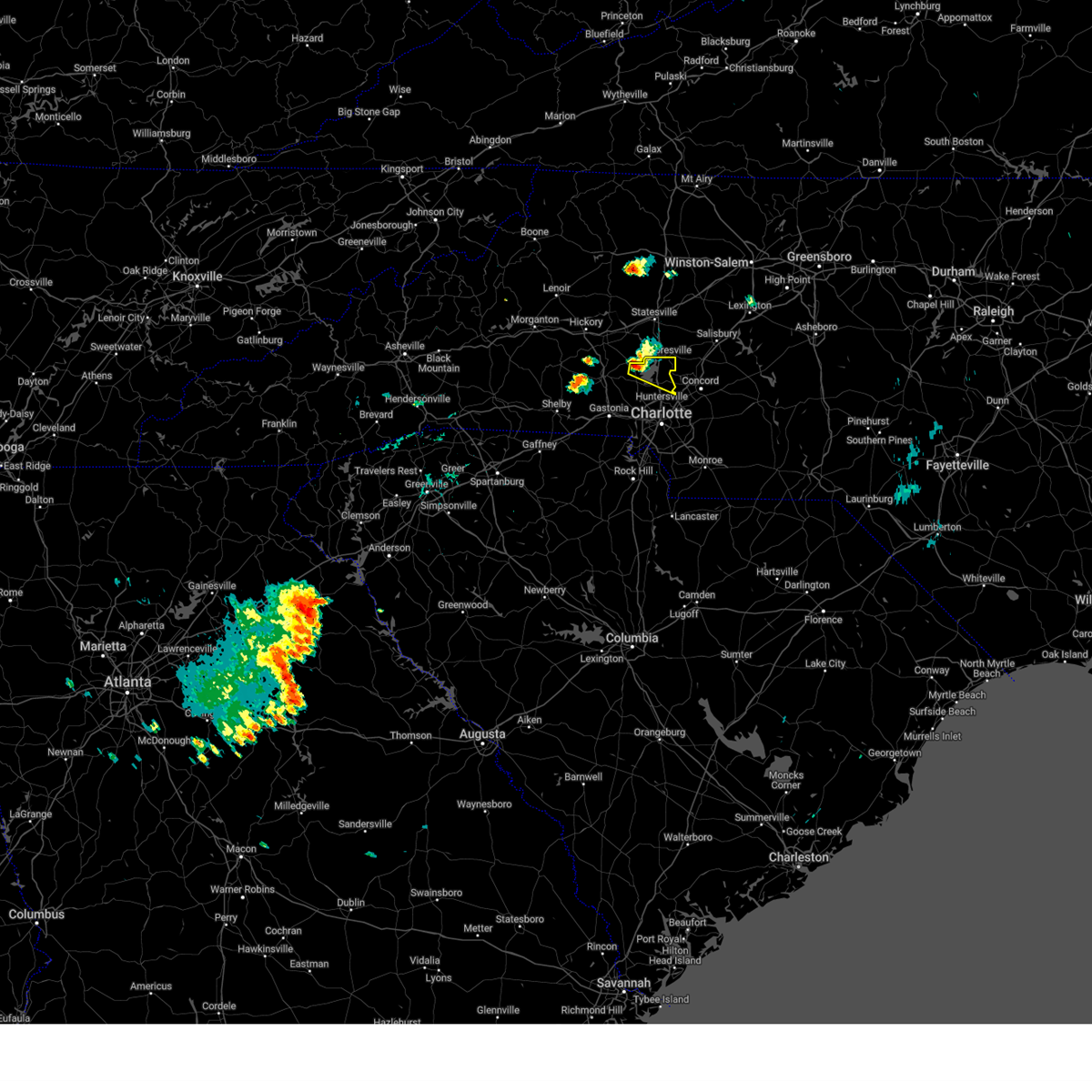
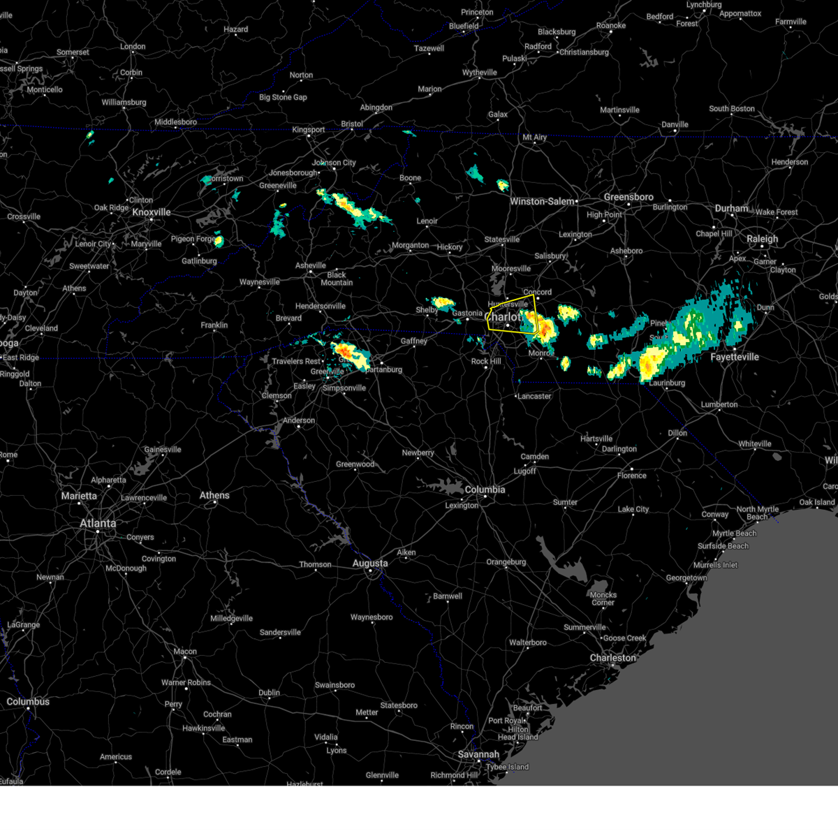
Hail and Wind Damage Spotted near Charlotte, NC
| Date / Time | Report Details |
|---|---|
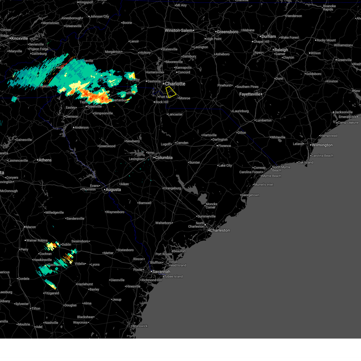
| 5/27/2026 7:40 PM EDT |
 The storm which prompted the warning has weakened below severe limits, and has exited the warned area. therefore, the warning will be allowed to expire. The storm which prompted the warning has weakened below severe limits, and has exited the warned area. therefore, the warning will be allowed to expire.
|
| 5/27/2026 7:14 PM EDT |
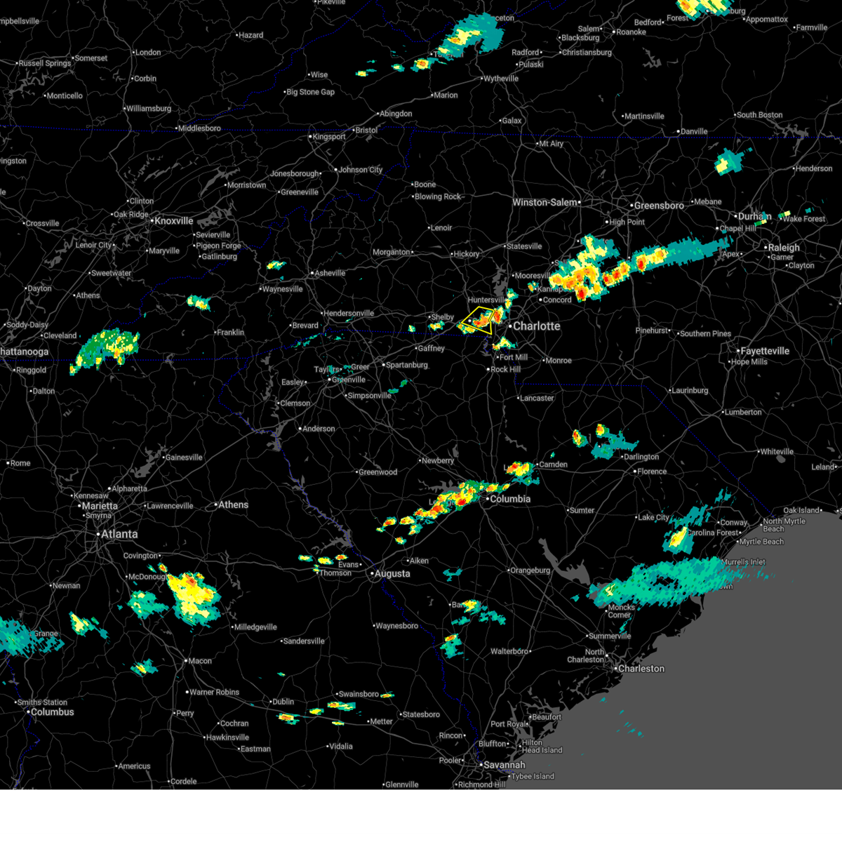
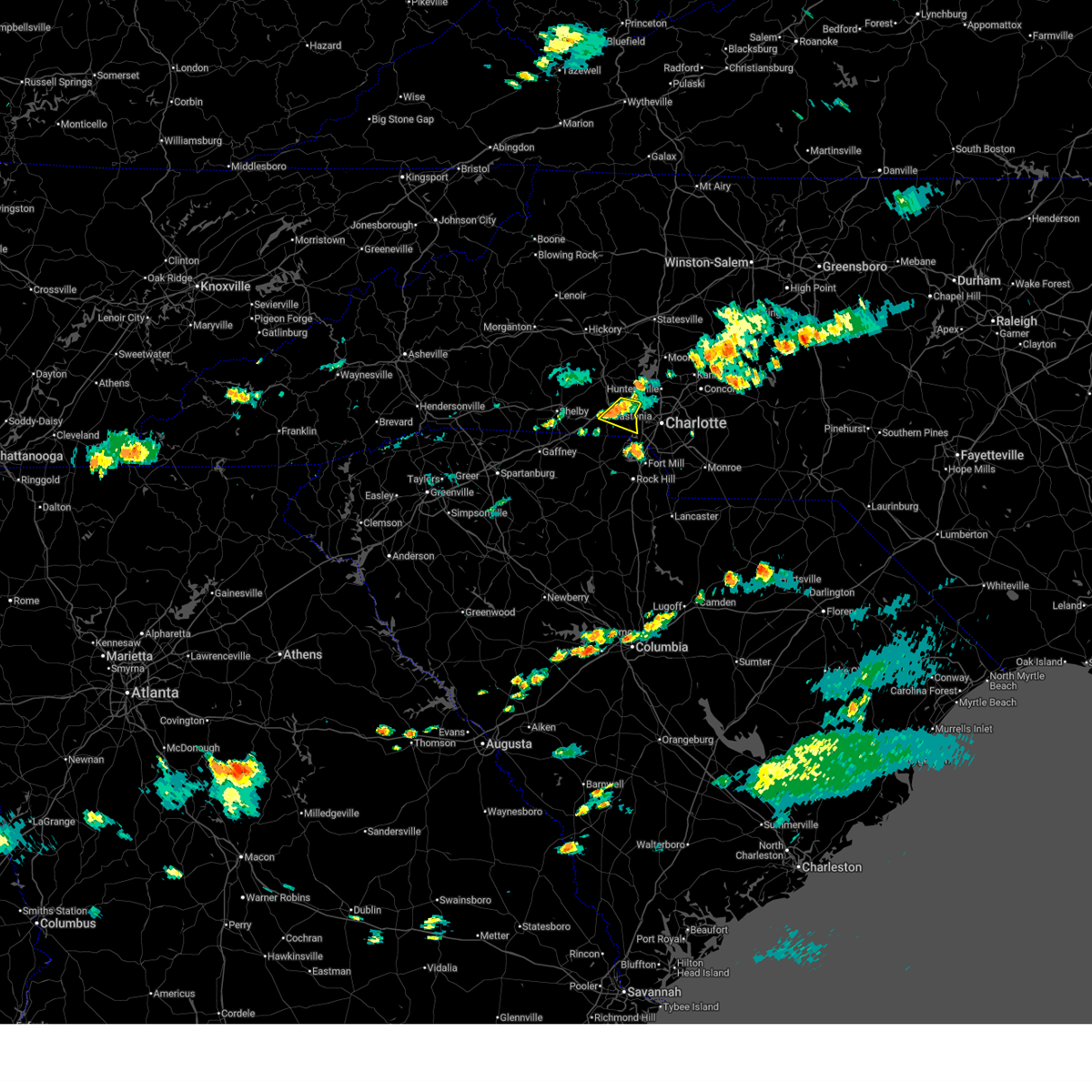 At 714 pm edt, a severe thunderstorm was located 4 miles northeast of gastonia, or over lowell, moving east at 20 mph (radar indicated). Hazards include 60 mph wind gusts. Expect damage to trees and power lines. Locations impacted include, gastonia, mt holly, belmont, stanley, cramerton, lowell, ranlo, mcadenville, and dallas. At 714 pm edt, a severe thunderstorm was located 4 miles northeast of gastonia, or over lowell, moving east at 20 mph (radar indicated). Hazards include 60 mph wind gusts. Expect damage to trees and power lines. Locations impacted include, gastonia, mt holly, belmont, stanley, cramerton, lowell, ranlo, mcadenville, and dallas.
|
| 5/27/2026 6:58 PM EDT |
 At 658 pm edt, a severe thunderstorm was located near gastonia, or near dallas, moving east at 20 mph (radar indicated). Hazards include 60 mph wind gusts and nickel size hail. Expect damage to trees and power lines. Locations impacted include, gastonia, mt holly, belmont, bessemer city, dallas, stanley, cramerton, lowell, ranlo, and mcadenville. At 658 pm edt, a severe thunderstorm was located near gastonia, or near dallas, moving east at 20 mph (radar indicated). Hazards include 60 mph wind gusts and nickel size hail. Expect damage to trees and power lines. Locations impacted include, gastonia, mt holly, belmont, bessemer city, dallas, stanley, cramerton, lowell, ranlo, and mcadenville.
|
| 5/27/2026 6:39 PM EDT |
 Svrgsp the national weather service in greenville-spartanburg has issued a * severe thunderstorm warning for, central gaston county in the piedmont of north carolina, * until 745 pm edt. * at 639 pm edt, a severe thunderstorm was located 7 miles northwest of gastonia, or near bessemer city, moving east at 20 mph (radar indicated). Hazards include 60 mph wind gusts and nickel size hail. expect damage to trees and power lines Svrgsp the national weather service in greenville-spartanburg has issued a * severe thunderstorm warning for, central gaston county in the piedmont of north carolina, * until 745 pm edt. * at 639 pm edt, a severe thunderstorm was located 7 miles northwest of gastonia, or near bessemer city, moving east at 20 mph (radar indicated). Hazards include 60 mph wind gusts and nickel size hail. expect damage to trees and power lines
|
| 3/16/2026 10:01 AM EDT | Large tree dow in mecklenburg county NC, 3 miles N of Charlotte, NC |
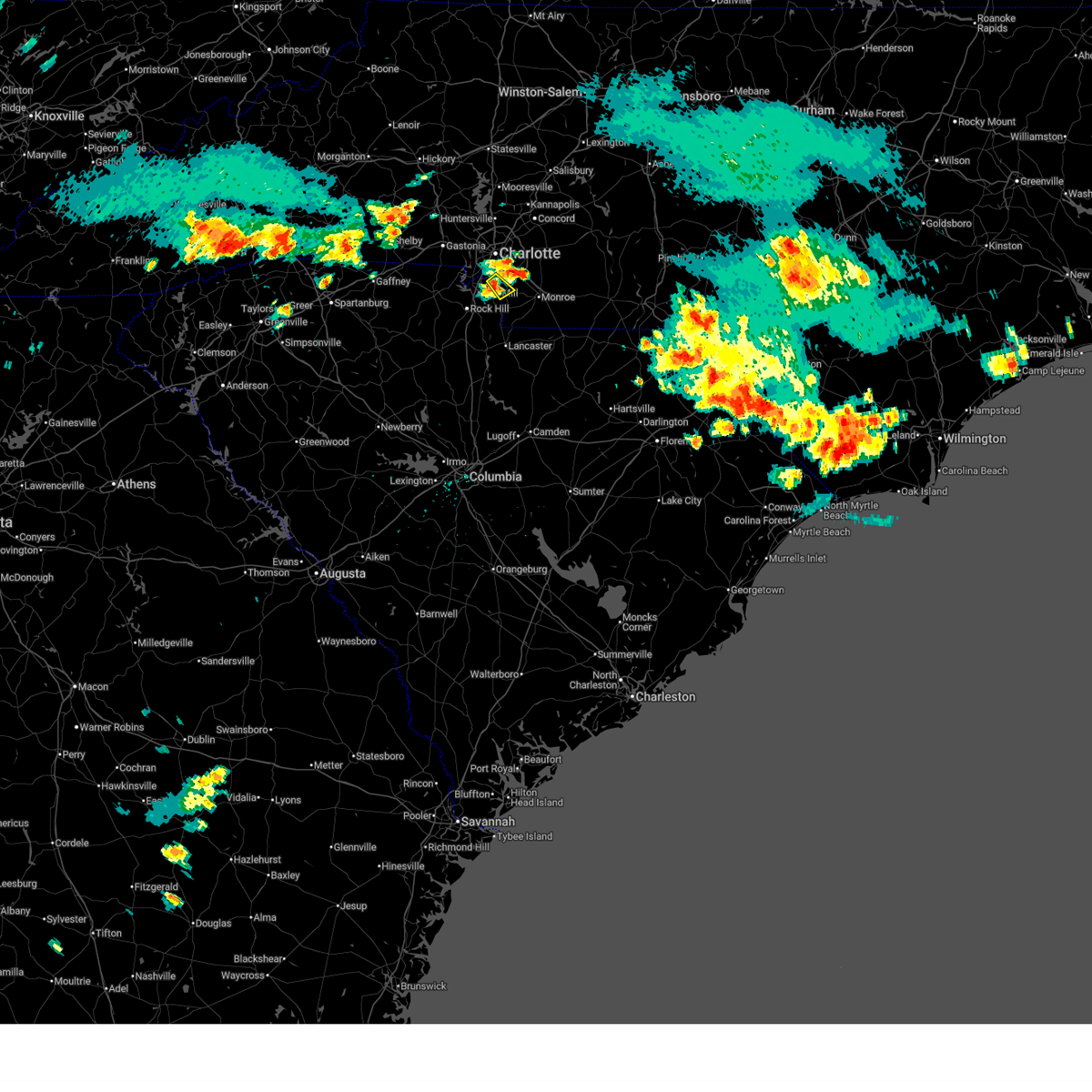
| 3/16/2026 9:47 AM EDT |
 At 946 am edt, a severe thunderstorm capable of producing a tornado was located 6 miles east of uptown charlotte, or near reedy creek park, moving northeast at 40 mph (radar indicated rotation). Hazards include tornado. Flying debris will be dangerous to those caught without shelter. mobile homes will be damaged or destroyed. damage to roofs, windows, and vehicles will occur. tree damage is likely. this dangerous storm will be near, charlotte, harrisburg, and reedy creek park around 950 am edt. Mt pleasant around 1000 am edt. At 946 am edt, a severe thunderstorm capable of producing a tornado was located 6 miles east of uptown charlotte, or near reedy creek park, moving northeast at 40 mph (radar indicated rotation). Hazards include tornado. Flying debris will be dangerous to those caught without shelter. mobile homes will be damaged or destroyed. damage to roofs, windows, and vehicles will occur. tree damage is likely. this dangerous storm will be near, charlotte, harrisburg, and reedy creek park around 950 am edt. Mt pleasant around 1000 am edt.
|
| 3/16/2026 9:47 AM EDT |
 At 946 am edt, severe thunderstorms were located along a line extending from 6 miles west of kannapolis to 9 miles southwest of downtown concord to 8 miles southeast of uptown charlotte, moving east at 50 mph (radar indicated). Hazards include 60 mph wind gusts. Expect damage to trees and power lines. Locations impacted include, uptown charlotte, downtown concord, northeast charlotte, east charlotte, west concord, mint hill, harrisburg, university city, freedom park, and reedy creek park. At 946 am edt, severe thunderstorms were located along a line extending from 6 miles west of kannapolis to 9 miles southwest of downtown concord to 8 miles southeast of uptown charlotte, moving east at 50 mph (radar indicated). Hazards include 60 mph wind gusts. Expect damage to trees and power lines. Locations impacted include, uptown charlotte, downtown concord, northeast charlotte, east charlotte, west concord, mint hill, harrisburg, university city, freedom park, and reedy creek park.
|
| 3/16/2026 9:47 AM EDT |
 the severe thunderstorm warning has been cancelled and is no longer in effect the severe thunderstorm warning has been cancelled and is no longer in effect
|
| 3/16/2026 9:46 AM EDT | Powerlines dow in mecklenburg county NC, 2.4 miles WSW of Charlotte, NC |
| 3/16/2026 9:41 AM EDT | Multiple tress dow in mecklenburg county NC, 2.3 miles N of Charlotte, NC |
| 3/16/2026 9:40 AM EDT | Bank of america stadium weatherste in mecklenburg county NC, 0.5 miles WNW of Charlotte, NC |
| 3/16/2026 9:40 AM EDT | Powerlines dow in mecklenburg county NC, 1.1 miles WNW of Charlotte, NC |
| 3/16/2026 9:40 AM EDT |
 Torgsp the national weather service in greenville-spartanburg has issued a * tornado warning for, central cabarrus county in the piedmont of north carolina, central mecklenburg county in the piedmont of north carolina, * until 1015 am edt. * at 940 am edt, a severe thunderstorm capable of producing a tornado was located near uptown charlotte, or over the plaza, moving northeast at 40 mph (radar indicated rotation). Hazards include tornado. Flying debris will be dangerous to those caught without shelter. mobile homes will be damaged or destroyed. damage to roofs, windows, and vehicles will occur. tree damage is likely. this dangerous storm will be near, charlotte, harrisburg, and reedy creek park around 950 am edt. Mt pleasant around 1010 am edt. Torgsp the national weather service in greenville-spartanburg has issued a * tornado warning for, central cabarrus county in the piedmont of north carolina, central mecklenburg county in the piedmont of north carolina, * until 1015 am edt. * at 940 am edt, a severe thunderstorm capable of producing a tornado was located near uptown charlotte, or over the plaza, moving northeast at 40 mph (radar indicated rotation). Hazards include tornado. Flying debris will be dangerous to those caught without shelter. mobile homes will be damaged or destroyed. damage to roofs, windows, and vehicles will occur. tree damage is likely. this dangerous storm will be near, charlotte, harrisburg, and reedy creek park around 950 am edt. Mt pleasant around 1010 am edt.
|
| 3/16/2026 9:39 AM EDT |
 Svrgsp the national weather service in greenville-spartanburg has issued a * severe thunderstorm warning for, cabarrus county in the piedmont of north carolina, mecklenburg county in the piedmont of north carolina, southern rowan county in the piedmont of north carolina, union county in the piedmont of north carolina, * until 1045 am edt. * at 937 am edt, severe thunderstorms were located along a line extending from 7 miles northeast of huntersville to 3 miles east of rock hill, moving east at 40 mph (radar indicated). Hazards include 60 mph wind gusts. expect damage to trees and power lines Svrgsp the national weather service in greenville-spartanburg has issued a * severe thunderstorm warning for, cabarrus county in the piedmont of north carolina, mecklenburg county in the piedmont of north carolina, southern rowan county in the piedmont of north carolina, union county in the piedmont of north carolina, * until 1045 am edt. * at 937 am edt, severe thunderstorms were located along a line extending from 7 miles northeast of huntersville to 3 miles east of rock hill, moving east at 40 mph (radar indicated). Hazards include 60 mph wind gusts. expect damage to trees and power lines
|
| 3/16/2026 9:32 AM EDT |
 At 932 am edt, severe thunderstorms were located along a line extending from 6 miles west of uptown charlotte to 5 miles northeast of rock hill to 4 miles northeast of chester, moving east at 50 mph (radar indicated). Hazards include 60 mph wind gusts. Expect damage to trees and power lines. Locations impacted include, rock hill, york, chester, fort mill, tega cay, newport, lesslie, great falls, fort lawn, and lockhart. At 932 am edt, severe thunderstorms were located along a line extending from 6 miles west of uptown charlotte to 5 miles northeast of rock hill to 4 miles northeast of chester, moving east at 50 mph (radar indicated). Hazards include 60 mph wind gusts. Expect damage to trees and power lines. Locations impacted include, rock hill, york, chester, fort mill, tega cay, newport, lesslie, great falls, fort lawn, and lockhart.
|
| 3/16/2026 9:04 AM EDT |
 Svrgsp the national weather service in greenville-spartanburg has issued a * severe thunderstorm warning for, western cabarrus county in the piedmont of north carolina, eastern lincoln county in the piedmont of north carolina, mecklenburg county in the piedmont of north carolina, gaston county in the piedmont of north carolina, * until 1000 am edt. * at 904 am edt, severe thunderstorms were located along a line extending from 6 miles north of lincolnton to 19 miles west of huntersville to 6 miles southwest of gastonia, moving east at 40 mph (radar indicated). Hazards include 60 mph wind gusts. expect damage to trees and power lines Svrgsp the national weather service in greenville-spartanburg has issued a * severe thunderstorm warning for, western cabarrus county in the piedmont of north carolina, eastern lincoln county in the piedmont of north carolina, mecklenburg county in the piedmont of north carolina, gaston county in the piedmont of north carolina, * until 1000 am edt. * at 904 am edt, severe thunderstorms were located along a line extending from 6 miles north of lincolnton to 19 miles west of huntersville to 6 miles southwest of gastonia, moving east at 40 mph (radar indicated). Hazards include 60 mph wind gusts. expect damage to trees and power lines
|
| 3/16/2026 8:41 AM EDT |
 Svrgsp the national weather service in greenville-spartanburg has issued a * severe thunderstorm warning for, chester county in upstate south carolina, york county in upstate south carolina, * until 1000 am edt. * at 841 am edt, severe thunderstorms were located along a line extending from 7 miles south of shelby to 6 miles southeast of gaffney to 8 miles west of union, moving east at 50 mph (radar indicated). Hazards include 60 mph wind gusts. expect damage to trees and power lines Svrgsp the national weather service in greenville-spartanburg has issued a * severe thunderstorm warning for, chester county in upstate south carolina, york county in upstate south carolina, * until 1000 am edt. * at 841 am edt, severe thunderstorms were located along a line extending from 7 miles south of shelby to 6 miles southeast of gaffney to 8 miles west of union, moving east at 50 mph (radar indicated). Hazards include 60 mph wind gusts. expect damage to trees and power lines
|
| 3/12/2026 9:51 AM EDT |
 The storms which prompted the warning have weakened below severe limits, and no longer pose an immediate threat to life or property. therefore, the warning will be allowed to expire. however, gusty winds are still possible with these thunderstorms. a tornado watch remains in effect until 100 pm edt for upstate south carolina. to report severe weather to the national weather service greenville-spartanburg, call toll free, 1, 800, 2 6 7, 8 1 0 1, or post on our facebook page, or post it to x using hashtag nwsgsp. your message should describe the event and the specific location where it occurred. The storms which prompted the warning have weakened below severe limits, and no longer pose an immediate threat to life or property. therefore, the warning will be allowed to expire. however, gusty winds are still possible with these thunderstorms. a tornado watch remains in effect until 100 pm edt for upstate south carolina. to report severe weather to the national weather service greenville-spartanburg, call toll free, 1, 800, 2 6 7, 8 1 0 1, or post on our facebook page, or post it to x using hashtag nwsgsp. your message should describe the event and the specific location where it occurred.
|
| 3/12/2026 9:50 AM EDT | Media reports multiple trees down in or along providence church lan in mecklenburg county NC, 12.3 miles NNW of Charlotte, NC |
| 3/12/2026 9:45 AM EDT | Media reports of powerlines down near providence road and kuykendall roa in mecklenburg county NC, 12 miles NNW of Charlotte, NC |
| 3/12/2026 9:27 AM EDT |
 At 926 am edt, severe thunderstorms were located along a line extending from 4 miles southwest of york to 8 miles southwest of chester, moving northeast at 45 mph (radar indicated). Hazards include 60 mph wind gusts. Expect damage to trees and power lines. Locations impacted include, rock hill, york, chester, fort mill, tega cay, newport, lesslie, mcconnells, richburg, and lowrys. At 926 am edt, severe thunderstorms were located along a line extending from 4 miles southwest of york to 8 miles southwest of chester, moving northeast at 45 mph (radar indicated). Hazards include 60 mph wind gusts. Expect damage to trees and power lines. Locations impacted include, rock hill, york, chester, fort mill, tega cay, newport, lesslie, mcconnells, richburg, and lowrys.
|
| 3/12/2026 9:27 AM EDT |
 the severe thunderstorm warning has been cancelled and is no longer in effect the severe thunderstorm warning has been cancelled and is no longer in effect
|
| 3/12/2026 9:08 AM EDT |
 Svrgsp the national weather service in greenville-spartanburg has issued a * severe thunderstorm warning for, chester county in upstate south carolina, york county in upstate south carolina, eastern union county in upstate south carolina, * until 1000 am edt. * at 908 am edt, severe thunderstorms were located along a line extending from 11 miles northeast of union to 17 miles north of newberry, moving northeast at 45 mph (radar indicated). Hazards include 60 mph wind gusts. expect damage to trees and power lines Svrgsp the national weather service in greenville-spartanburg has issued a * severe thunderstorm warning for, chester county in upstate south carolina, york county in upstate south carolina, eastern union county in upstate south carolina, * until 1000 am edt. * at 908 am edt, severe thunderstorms were located along a line extending from 11 miles northeast of union to 17 miles north of newberry, moving northeast at 45 mph (radar indicated). Hazards include 60 mph wind gusts. expect damage to trees and power lines
|
| 12/19/2025 4:55 AM EST |
 Svrgsp the national weather service in greenville-spartanburg has issued a * severe thunderstorm warning for, cabarrus county in the piedmont of north carolina, central mecklenburg county in the piedmont of north carolina, * until 600 am est. * at 455 am est, a severe thunderstorm was located 6 miles southwest of downtown concord, or over charlotte motor speedway, moving east at 45 mph (radar indicated). Hazards include 60 mph wind gusts. expect damage to trees and power lines Svrgsp the national weather service in greenville-spartanburg has issued a * severe thunderstorm warning for, cabarrus county in the piedmont of north carolina, central mecklenburg county in the piedmont of north carolina, * until 600 am est. * at 455 am est, a severe thunderstorm was located 6 miles southwest of downtown concord, or over charlotte motor speedway, moving east at 45 mph (radar indicated). Hazards include 60 mph wind gusts. expect damage to trees and power lines
|
| 8/1/2025 6:10 PM EDT |
 The storms which prompted the warning have moved out of the area. therefore, the warning will be allowed to expire. The storms which prompted the warning have moved out of the area. therefore, the warning will be allowed to expire.
|
| 8/1/2025 6:00 PM EDT |
 At 600 pm edt, severe thunderstorms were located along a line extending from 14 miles east of uptown charlotte to 14 miles northeast of indian land to 7 miles west of monroe, moving southeast at 25 mph (radar indicated). Hazards include 60 mph wind gusts. Expect damage to trees and power lines. Locations impacted include, south charlotte, matthews, mint hill, indian trail, stallings, lake park, hemby bridge, the arboretum, weddington, and fairview in union county. At 600 pm edt, severe thunderstorms were located along a line extending from 14 miles east of uptown charlotte to 14 miles northeast of indian land to 7 miles west of monroe, moving southeast at 25 mph (radar indicated). Hazards include 60 mph wind gusts. Expect damage to trees and power lines. Locations impacted include, south charlotte, matthews, mint hill, indian trail, stallings, lake park, hemby bridge, the arboretum, weddington, and fairview in union county.
|
| 8/1/2025 5:52 PM EDT |
 Svrgsp the national weather service in greenville-spartanburg has issued a * severe thunderstorm warning for, south central mecklenburg county in the piedmont of north carolina, union county in the piedmont of north carolina, * until 715 pm edt. * at 552 pm edt, severe thunderstorms were located along a line extending from 13 miles south of downtown concord to 4 miles east of indian land to 8 miles south of rock hill, moving southeast at 20 mph (radar indicated). Hazards include 60 mph wind gusts. expect damage to trees and power lines Svrgsp the national weather service in greenville-spartanburg has issued a * severe thunderstorm warning for, south central mecklenburg county in the piedmont of north carolina, union county in the piedmont of north carolina, * until 715 pm edt. * at 552 pm edt, severe thunderstorms were located along a line extending from 13 miles south of downtown concord to 4 miles east of indian land to 8 miles south of rock hill, moving southeast at 20 mph (radar indicated). Hazards include 60 mph wind gusts. expect damage to trees and power lines
|
| 8/1/2025 5:37 PM EDT | Social media picture of a tree down on a car near selwyn av in mecklenburg county NC, 3.8 miles NNW of Charlotte, NC |
| 8/1/2025 5:32 PM EDT |
 At 532 pm edt, severe thunderstorms were located along a line extending from 7 miles northwest of albemarle to near downtown concord to 14 miles south of kannapolis to near uptown charlotte, moving southeast at 25 mph (radar indicated). Hazards include 60 mph wind gusts. Expect damage to trees and power lines. Locations impacted include, downtown concord, northeast charlotte, west concord, rockwell, university city, charlotte motor speedway, high rock lake, croft, huntersville, and harrisburg. At 532 pm edt, severe thunderstorms were located along a line extending from 7 miles northwest of albemarle to near downtown concord to 14 miles south of kannapolis to near uptown charlotte, moving southeast at 25 mph (radar indicated). Hazards include 60 mph wind gusts. Expect damage to trees and power lines. Locations impacted include, downtown concord, northeast charlotte, west concord, rockwell, university city, charlotte motor speedway, high rock lake, croft, huntersville, and harrisburg.
|
| 8/1/2025 5:28 PM EDT |
 the severe thunderstorm warning has been cancelled and is no longer in effect the severe thunderstorm warning has been cancelled and is no longer in effect
|
| 8/1/2025 5:28 PM EDT |
 At 528 pm edt, severe thunderstorms were located along a line extending from 4 miles southeast of huntersville to 8 miles northwest of indian land to 5 miles northwest of rock hill, moving southeast at 20 mph (radar indicated). Hazards include 60 mph wind gusts. Expect damage to trees and power lines. Locations impacted include, uptown charlotte, central charlotte, southwest charlotte, northwest charlotte, freedom park, charlotte douglas airport, steele creek, paw creek, carowinds, and hidden valley. At 528 pm edt, severe thunderstorms were located along a line extending from 4 miles southeast of huntersville to 8 miles northwest of indian land to 5 miles northwest of rock hill, moving southeast at 20 mph (radar indicated). Hazards include 60 mph wind gusts. Expect damage to trees and power lines. Locations impacted include, uptown charlotte, central charlotte, southwest charlotte, northwest charlotte, freedom park, charlotte douglas airport, steele creek, paw creek, carowinds, and hidden valley.
|
| 8/1/2025 5:27 PM EDT | Social media report of stop lights blown off lines along south boulevard just north of i-48 in mecklenburg county NC, 7.2 miles N of Charlotte, NC |
| 8/1/2025 5:23 PM EDT | Tree down on utility equipmen in mecklenburg county NC, 9.3 miles WSW of Charlotte, NC |
| 8/1/2025 5:18 PM EDT |
 At 518 pm edt, severe thunderstorms were located along a line extending from 3 miles south of huntersville to 9 miles southwest of uptown charlotte to 7 miles east of york, moving southeast at 20 mph (radar indicated). Hazards include 60 mph wind gusts. Expect damage to trees and power lines. Locations impacted include, uptown charlotte, central charlotte, southwest charlotte, northwest charlotte, belmont, clover, cramerton, freedom park, charlotte douglas airport, and steele creek. At 518 pm edt, severe thunderstorms were located along a line extending from 3 miles south of huntersville to 9 miles southwest of uptown charlotte to 7 miles east of york, moving southeast at 20 mph (radar indicated). Hazards include 60 mph wind gusts. Expect damage to trees and power lines. Locations impacted include, uptown charlotte, central charlotte, southwest charlotte, northwest charlotte, belmont, clover, cramerton, freedom park, charlotte douglas airport, and steele creek.
|
| 8/1/2025 5:17 PM EDT |
 At 517 pm edt, severe thunderstorms were located along a line extending from 13 miles northwest of albemarle to 13 miles south of salisbury to near kannapolis to 6 miles southwest of downtown concord to near uptown charlotte, moving southeast at 25 mph (radar indicated). Hazards include 60 mph wind gusts. Expect damage to trees and power lines. Locations impacted include, huntersville, kannapolis, downtown concord, northeast charlotte, west concord, china grove, landis, enochville, granite quarry, and rockwell. At 517 pm edt, severe thunderstorms were located along a line extending from 13 miles northwest of albemarle to 13 miles south of salisbury to near kannapolis to 6 miles southwest of downtown concord to near uptown charlotte, moving southeast at 25 mph (radar indicated). Hazards include 60 mph wind gusts. Expect damage to trees and power lines. Locations impacted include, huntersville, kannapolis, downtown concord, northeast charlotte, west concord, china grove, landis, enochville, granite quarry, and rockwell.
|
| 8/1/2025 5:15 PM EDT |
 Svrgsp the national weather service in greenville-spartanburg has issued a * severe thunderstorm warning for, southeastern mecklenburg county in the piedmont of north carolina, northwestern union county in the piedmont of north carolina, * until 615 pm edt. * at 515 pm edt, severe thunderstorms were located along a line extending from 5 miles south of huntersville to 3 miles west of uptown charlotte to 10 miles northwest of indian land, moving southeast at 25 mph (radar indicated). Hazards include 60 mph wind gusts. expect damage to trees and power lines Svrgsp the national weather service in greenville-spartanburg has issued a * severe thunderstorm warning for, southeastern mecklenburg county in the piedmont of north carolina, northwestern union county in the piedmont of north carolina, * until 615 pm edt. * at 515 pm edt, severe thunderstorms were located along a line extending from 5 miles south of huntersville to 3 miles west of uptown charlotte to 10 miles northwest of indian land, moving southeast at 25 mph (radar indicated). Hazards include 60 mph wind gusts. expect damage to trees and power lines
|
| 8/1/2025 5:03 PM EDT |
 the severe thunderstorm warning has been cancelled and is no longer in effect the severe thunderstorm warning has been cancelled and is no longer in effect
|
| 8/1/2025 5:03 PM EDT |
 At 503 pm edt, severe thunderstorms were located along a line extending from 3 miles west of huntersville to 10 miles southeast of gastonia to 4 miles northeast of york, moving southeast at 25 mph (radar indicated). Hazards include 60 mph wind gusts. Expect damage to trees and power lines. Locations impacted include, gastonia, uptown charlotte, central charlotte, southwest charlotte, northwest charlotte, mt holly, belmont, south gastonia, clover, and cramerton. At 503 pm edt, severe thunderstorms were located along a line extending from 3 miles west of huntersville to 10 miles southeast of gastonia to 4 miles northeast of york, moving southeast at 25 mph (radar indicated). Hazards include 60 mph wind gusts. Expect damage to trees and power lines. Locations impacted include, gastonia, uptown charlotte, central charlotte, southwest charlotte, northwest charlotte, mt holly, belmont, south gastonia, clover, and cramerton.
|
| 8/1/2025 5:00 PM EDT |
 Svrgsp the national weather service in greenville-spartanburg has issued a * severe thunderstorm warning for, central cabarrus county in the piedmont of north carolina, southeastern rowan county in the piedmont of north carolina, * until 600 pm edt. * at 500 pm edt, severe thunderstorms were located along a line extending from 11 miles south of lexington to 8 miles south of salisbury to 4 miles east of huntersville, moving southeast at 25 mph (radar indicated). Hazards include 60 mph wind gusts. expect damage to trees and power lines Svrgsp the national weather service in greenville-spartanburg has issued a * severe thunderstorm warning for, central cabarrus county in the piedmont of north carolina, southeastern rowan county in the piedmont of north carolina, * until 600 pm edt. * at 500 pm edt, severe thunderstorms were located along a line extending from 11 miles south of lexington to 8 miles south of salisbury to 4 miles east of huntersville, moving southeast at 25 mph (radar indicated). Hazards include 60 mph wind gusts. expect damage to trees and power lines
|
| 8/1/2025 4:42 PM EDT |
 Svrgsp the national weather service in greenville-spartanburg has issued a * severe thunderstorm warning for, southeastern lincoln county in the piedmont of north carolina, western mecklenburg county in the piedmont of north carolina, southeastern cleveland county in the piedmont of north carolina, gaston county in the piedmont of north carolina, northwestern york county in upstate south carolina, * until 600 pm edt. * at 442 pm edt, severe thunderstorms were located along a line extending from 8 miles west of huntersville to 4 miles northeast of gastonia to 10 miles north of york, moving southeast at 20 mph (radar indicated). Hazards include 60 mph wind gusts. expect damage to trees and power lines Svrgsp the national weather service in greenville-spartanburg has issued a * severe thunderstorm warning for, southeastern lincoln county in the piedmont of north carolina, western mecklenburg county in the piedmont of north carolina, southeastern cleveland county in the piedmont of north carolina, gaston county in the piedmont of north carolina, northwestern york county in upstate south carolina, * until 600 pm edt. * at 442 pm edt, severe thunderstorms were located along a line extending from 8 miles west of huntersville to 4 miles northeast of gastonia to 10 miles north of york, moving southeast at 20 mph (radar indicated). Hazards include 60 mph wind gusts. expect damage to trees and power lines
|
| 8/1/2025 4:39 PM EDT |
 Svrgsp the national weather service in greenville-spartanburg has issued a * severe thunderstorm warning for, northwestern cabarrus county in the piedmont of north carolina, north central mecklenburg county in the piedmont of north carolina, southern rowan county in the piedmont of north carolina, * until 545 pm edt. * at 439 pm edt, severe thunderstorms were located along a line extending from near salisbury to 10 miles north of kannapolis to 12 miles southeast of statesville to 8 miles north of huntersville to 14 miles east of lincolnton, moving southeast at 25 mph (radar indicated). Hazards include 60 mph wind gusts. expect damage to trees and power lines Svrgsp the national weather service in greenville-spartanburg has issued a * severe thunderstorm warning for, northwestern cabarrus county in the piedmont of north carolina, north central mecklenburg county in the piedmont of north carolina, southern rowan county in the piedmont of north carolina, * until 545 pm edt. * at 439 pm edt, severe thunderstorms were located along a line extending from near salisbury to 10 miles north of kannapolis to 12 miles southeast of statesville to 8 miles north of huntersville to 14 miles east of lincolnton, moving southeast at 25 mph (radar indicated). Hazards include 60 mph wind gusts. expect damage to trees and power lines
|
| 6/29/2025 7:11 PM EDT |
 Svrgsp the national weather service in greenville-spartanburg has issued a * severe thunderstorm warning for, northwestern mecklenburg county in the piedmont of north carolina, * until 745 pm edt. * at 711 pm edt, a severe thunderstorm was located over huntersville, moving northwest at 15 mph (radar indicated). Hazards include 60 mph wind gusts and quarter size hail. Minor hail damage to vehicles is expected. Expect wind damage to trees and power lines. Svrgsp the national weather service in greenville-spartanburg has issued a * severe thunderstorm warning for, northwestern mecklenburg county in the piedmont of north carolina, * until 745 pm edt. * at 711 pm edt, a severe thunderstorm was located over huntersville, moving northwest at 15 mph (radar indicated). Hazards include 60 mph wind gusts and quarter size hail. Minor hail damage to vehicles is expected. Expect wind damage to trees and power lines.
|
| 6/27/2025 7:22 PM EDT |
 the severe thunderstorm warning has been cancelled and is no longer in effect the severe thunderstorm warning has been cancelled and is no longer in effect
|
| 6/27/2025 7:12 PM EDT |
 At 712 pm edt, severe thunderstorms were located along a line extending from 12 miles northwest of indian land to near rock hill, moving west at 15 mph (radar indicated). Hazards include 60 mph wind gusts and penny size hail. Expect damage to trees and power lines. Locations impacted include, rock hill, fort mill, tega cay, newport, steele creek, lake wylie, carowinds, and southwest charlotte. At 712 pm edt, severe thunderstorms were located along a line extending from 12 miles northwest of indian land to near rock hill, moving west at 15 mph (radar indicated). Hazards include 60 mph wind gusts and penny size hail. Expect damage to trees and power lines. Locations impacted include, rock hill, fort mill, tega cay, newport, steele creek, lake wylie, carowinds, and southwest charlotte.
|
| 6/27/2025 6:49 PM EDT |
 Svrgsp the national weather service in greenville-spartanburg has issued a * severe thunderstorm warning for, southwestern mecklenburg county in the piedmont of north carolina, eastern york county in upstate south carolina, * until 745 pm edt. * at 649 pm edt, severe thunderstorms were located along a line extending from 3 miles northwest of indian land to 8 miles east of rock hill, moving west at 10 mph (radar indicated). Hazards include 60 mph wind gusts and quarter size hail. Minor hail damage to vehicles is expected. Expect wind damage to trees and power lines. Svrgsp the national weather service in greenville-spartanburg has issued a * severe thunderstorm warning for, southwestern mecklenburg county in the piedmont of north carolina, eastern york county in upstate south carolina, * until 745 pm edt. * at 649 pm edt, severe thunderstorms were located along a line extending from 3 miles northwest of indian land to 8 miles east of rock hill, moving west at 10 mph (radar indicated). Hazards include 60 mph wind gusts and quarter size hail. Minor hail damage to vehicles is expected. Expect wind damage to trees and power lines.
|
| 6/26/2025 6:19 PM EDT |
 the severe thunderstorm warning has been cancelled and is no longer in effect the severe thunderstorm warning has been cancelled and is no longer in effect
|
| 6/26/2025 5:35 PM EDT |
 Svrgsp the national weather service in greenville-spartanburg has issued a * severe thunderstorm warning for, eastern lincoln county in the piedmont of north carolina, south central iredell county in the piedmont of north carolina, northwestern mecklenburg county in the piedmont of north carolina, * until 630 pm edt. * at 535 pm edt, a severe thunderstorm was located 4 miles north of huntersville, or near cornelius, and is nearly stationary (radar indicated). Hazards include 60 mph wind gusts and quarter size hail. Minor hail damage to vehicles is expected. Expect wind damage to trees and power lines. Svrgsp the national weather service in greenville-spartanburg has issued a * severe thunderstorm warning for, eastern lincoln county in the piedmont of north carolina, south central iredell county in the piedmont of north carolina, northwestern mecklenburg county in the piedmont of north carolina, * until 630 pm edt. * at 535 pm edt, a severe thunderstorm was located 4 miles north of huntersville, or near cornelius, and is nearly stationary (radar indicated). Hazards include 60 mph wind gusts and quarter size hail. Minor hail damage to vehicles is expected. Expect wind damage to trees and power lines.
|
| 6/25/2025 8:05 PM EDT |
 The storms which prompted the warning have weakened below severe limits, and no longer pose an immediate threat to life or property. therefore, the warning will be allowed to expire. however, gusty winds and heavy rain are still possible with these thunderstorms. to report severe weather to the national weather service greenville-spartanburg, call toll free, 1, 800, 2 6 7, 8 1 0 1, or post on our facebook page, or tweet it using hashtag nwsgsp. your message should describe the event and the specific location where it occurred. The storms which prompted the warning have weakened below severe limits, and no longer pose an immediate threat to life or property. therefore, the warning will be allowed to expire. however, gusty winds and heavy rain are still possible with these thunderstorms. to report severe weather to the national weather service greenville-spartanburg, call toll free, 1, 800, 2 6 7, 8 1 0 1, or post on our facebook page, or tweet it using hashtag nwsgsp. your message should describe the event and the specific location where it occurred.
|
| 6/25/2025 8:01 PM EDT |
 the severe thunderstorm warning has been cancelled and is no longer in effect the severe thunderstorm warning has been cancelled and is no longer in effect
|
| 6/25/2025 7:47 PM EDT |
 At 747 pm edt, severe thunderstorms were located along a line extending from 8 miles west of uptown charlotte to 8 miles northeast of indian land, moving south at 20 mph (radar indicated). Hazards include 60 mph wind gusts and quarter size hail. Minor hail damage to vehicles is expected. expect wind damage to trees and power lines. Locations impacted include, charlotte, matthews, weddington, belmont, pineville, cramerton, and marvin. At 747 pm edt, severe thunderstorms were located along a line extending from 8 miles west of uptown charlotte to 8 miles northeast of indian land, moving south at 20 mph (radar indicated). Hazards include 60 mph wind gusts and quarter size hail. Minor hail damage to vehicles is expected. expect wind damage to trees and power lines. Locations impacted include, charlotte, matthews, weddington, belmont, pineville, cramerton, and marvin.
|
| 6/25/2025 7:28 PM EDT |
 Svrgsp the national weather service in greenville-spartanburg has issued a * severe thunderstorm warning for, mecklenburg county in the piedmont of north carolina, eastern gaston county in the piedmont of north carolina, northwestern union county in the piedmont of north carolina, * until 815 pm edt. * at 728 pm edt, severe thunderstorms were located along a line extending from 7 miles southwest of huntersville to 9 miles southeast of uptown charlotte, moving southwest at 15 mph (radar indicated). Hazards include 60 mph wind gusts and quarter size hail. Minor hail damage to vehicles is expected. Expect wind damage to trees and power lines. Svrgsp the national weather service in greenville-spartanburg has issued a * severe thunderstorm warning for, mecklenburg county in the piedmont of north carolina, eastern gaston county in the piedmont of north carolina, northwestern union county in the piedmont of north carolina, * until 815 pm edt. * at 728 pm edt, severe thunderstorms were located along a line extending from 7 miles southwest of huntersville to 9 miles southeast of uptown charlotte, moving southwest at 15 mph (radar indicated). Hazards include 60 mph wind gusts and quarter size hail. Minor hail damage to vehicles is expected. Expect wind damage to trees and power lines.
|
| 6/25/2025 7:12 PM EDT |
 Svrgsp the national weather service in greenville-spartanburg has issued a * severe thunderstorm warning for, southwestern mecklenburg county in the piedmont of north carolina, southeastern gaston county in the piedmont of north carolina, eastern chester county in upstate south carolina, eastern york county in upstate south carolina, * until 815 pm edt. * at 712 pm edt, a severe thunderstorm was located near rock hill, moving south at 15 mph (radar indicated). Hazards include ping pong ball size hail and 60 mph wind gusts. People and animals outdoors will be injured. expect hail damage to roofs, siding, windows, and vehicles. Expect wind damage to trees and power lines. Svrgsp the national weather service in greenville-spartanburg has issued a * severe thunderstorm warning for, southwestern mecklenburg county in the piedmont of north carolina, southeastern gaston county in the piedmont of north carolina, eastern chester county in upstate south carolina, eastern york county in upstate south carolina, * until 815 pm edt. * at 712 pm edt, a severe thunderstorm was located near rock hill, moving south at 15 mph (radar indicated). Hazards include ping pong ball size hail and 60 mph wind gusts. People and animals outdoors will be injured. expect hail damage to roofs, siding, windows, and vehicles. Expect wind damage to trees and power lines.
|
| 6/25/2025 6:48 PM EDT |
 Svrgsp the national weather service in greenville-spartanburg has issued a * severe thunderstorm warning for, southwestern mecklenburg county in the piedmont of north carolina, northeastern york county in upstate south carolina, * until 715 pm edt. * at 648 pm edt, severe thunderstorms were located along a line extending from 10 miles northwest of indian land to 6 miles northeast of rock hill, moving west at 10 mph (radar indicated). Hazards include 60 mph wind gusts and quarter size hail. Minor hail damage to vehicles is expected. Expect wind damage to trees and power lines. Svrgsp the national weather service in greenville-spartanburg has issued a * severe thunderstorm warning for, southwestern mecklenburg county in the piedmont of north carolina, northeastern york county in upstate south carolina, * until 715 pm edt. * at 648 pm edt, severe thunderstorms were located along a line extending from 10 miles northwest of indian land to 6 miles northeast of rock hill, moving west at 10 mph (radar indicated). Hazards include 60 mph wind gusts and quarter size hail. Minor hail damage to vehicles is expected. Expect wind damage to trees and power lines.
|
| 6/25/2025 6:33 PM EDT |
 the severe thunderstorm warning has been cancelled and is no longer in effect the severe thunderstorm warning has been cancelled and is no longer in effect
|
| 6/25/2025 6:30 PM EDT |
 Svrgsp the national weather service in greenville-spartanburg has issued a * severe thunderstorm warning for, southeastern mecklenburg county in the piedmont of north carolina, west central union county in the piedmont of north carolina, * until 730 pm edt. * at 630 pm edt, a severe thunderstorm was located 9 miles northeast of indian land, or near matthews, moving southeast at 5 mph (radar indicated). Hazards include 60 mph wind gusts and half dollar size hail. Minor hail damage to vehicles is expected. Expect wind damage to trees and power lines. Svrgsp the national weather service in greenville-spartanburg has issued a * severe thunderstorm warning for, southeastern mecklenburg county in the piedmont of north carolina, west central union county in the piedmont of north carolina, * until 730 pm edt. * at 630 pm edt, a severe thunderstorm was located 9 miles northeast of indian land, or near matthews, moving southeast at 5 mph (radar indicated). Hazards include 60 mph wind gusts and half dollar size hail. Minor hail damage to vehicles is expected. Expect wind damage to trees and power lines.
|
| 6/25/2025 5:59 PM EDT | Quarter sized hail reported 12.1 miles NNW of Charlotte, NC, report from mping: quarter (1.00 in.). |
| 6/25/2025 5:39 PM EDT |
 Svrgsp the national weather service in greenville-spartanburg has issued a * severe thunderstorm warning for, south central mecklenburg county in the piedmont of north carolina, west central union county in the piedmont of north carolina, * until 645 pm edt. * at 539 pm edt, a severe thunderstorm was located near indian land, or near pineville, and is nearly stationary (radar indicated). Hazards include 60 mph wind gusts and quarter size hail. Minor hail damage to vehicles is expected. Expect wind damage to trees and power lines. Svrgsp the national weather service in greenville-spartanburg has issued a * severe thunderstorm warning for, south central mecklenburg county in the piedmont of north carolina, west central union county in the piedmont of north carolina, * until 645 pm edt. * at 539 pm edt, a severe thunderstorm was located near indian land, or near pineville, and is nearly stationary (radar indicated). Hazards include 60 mph wind gusts and quarter size hail. Minor hail damage to vehicles is expected. Expect wind damage to trees and power lines.
|
| 6/25/2025 5:37 PM EDT | Utility lines downed along providence r in mecklenburg county NC, 5.5 miles NW of Charlotte, NC |
| 6/25/2025 5:29 PM EDT |
 Svrgsp the national weather service in greenville-spartanburg has issued a * severe thunderstorm warning for, southeastern mecklenburg county in the piedmont of north carolina, northwestern union county in the piedmont of north carolina, * until 630 pm edt. * at 528 pm edt, a severe thunderstorm was located 6 miles southeast of uptown charlotte, or near east charlotte, moving south at 5 mph (radar indicated). Hazards include 60 mph wind gusts and quarter size hail. Minor hail damage to vehicles is expected. Expect wind damage to trees and power lines. Svrgsp the national weather service in greenville-spartanburg has issued a * severe thunderstorm warning for, southeastern mecklenburg county in the piedmont of north carolina, northwestern union county in the piedmont of north carolina, * until 630 pm edt. * at 528 pm edt, a severe thunderstorm was located 6 miles southeast of uptown charlotte, or near east charlotte, moving south at 5 mph (radar indicated). Hazards include 60 mph wind gusts and quarter size hail. Minor hail damage to vehicles is expected. Expect wind damage to trees and power lines.
|
| 6/17/2025 10:36 PM EDT |
 The storms which prompted the warning have weakened below severe limits, and no longer pose an immediate threat to life or property. therefore, the warning will be allowed to expire. however, gusty winds are still possible with these thunderstorms. The storms which prompted the warning have weakened below severe limits, and no longer pose an immediate threat to life or property. therefore, the warning will be allowed to expire. however, gusty winds are still possible with these thunderstorms.
|
| 6/17/2025 10:24 PM EDT |
 the severe thunderstorm warning has been cancelled and is no longer in effect the severe thunderstorm warning has been cancelled and is no longer in effect
|
| 6/17/2025 10:24 PM EDT |
 At 1024 pm edt, severe thunderstorms were located along a line extending from 7 miles east of morganton to 6 miles southwest of newton to 8 miles southwest of gastonia to near chester, moving northeast at 45 mph (radar indicated). Hazards include 60 mph wind gusts. Expect damage to trees and power lines. locations impacted include, gastonia, rock hill, hickory, morganton, newton, lincolnton, york, chester, mt holly, and st. Stephens. At 1024 pm edt, severe thunderstorms were located along a line extending from 7 miles east of morganton to 6 miles southwest of newton to 8 miles southwest of gastonia to near chester, moving northeast at 45 mph (radar indicated). Hazards include 60 mph wind gusts. Expect damage to trees and power lines. locations impacted include, gastonia, rock hill, hickory, morganton, newton, lincolnton, york, chester, mt holly, and st. Stephens.
|
| 6/17/2025 10:18 PM EDT |
 At 1018 pm edt, severe thunderstorms were located along a line extending from 4 miles southeast of morganton to 9 miles northwest of lincolnton to 9 miles northwest of york to 5 miles west of chester, moving east at 50 mph (radar indicated). Hazards include 60 mph wind gusts. Expect damage to trees and power lines. Locations impacted include, gastonia, rock hill, hickory, shelby, morganton, newton, gaffney, lincolnton, union, and york. At 1018 pm edt, severe thunderstorms were located along a line extending from 4 miles southeast of morganton to 9 miles northwest of lincolnton to 9 miles northwest of york to 5 miles west of chester, moving east at 50 mph (radar indicated). Hazards include 60 mph wind gusts. Expect damage to trees and power lines. Locations impacted include, gastonia, rock hill, hickory, shelby, morganton, newton, gaffney, lincolnton, union, and york.
|
| 6/17/2025 10:02 PM EDT |
 the severe thunderstorm warning has been cancelled and is no longer in effect the severe thunderstorm warning has been cancelled and is no longer in effect
|
| 6/17/2025 10:02 PM EDT |
 At 1002 pm edt, severe thunderstorms were located along a line extending from 9 miles southwest of morganton to 14 miles north of shelby to 11 miles east of gaffney to 11 miles southeast of union, moving east at 50 mph (radar indicated). Hazards include 60 mph wind gusts. Expect damage to trees and power lines. Locations impacted include, gastonia, rock hill, hickory, shelby, morganton, newton, gaffney, lincolnton, union, and york. At 1002 pm edt, severe thunderstorms were located along a line extending from 9 miles southwest of morganton to 14 miles north of shelby to 11 miles east of gaffney to 11 miles southeast of union, moving east at 50 mph (radar indicated). Hazards include 60 mph wind gusts. Expect damage to trees and power lines. Locations impacted include, gastonia, rock hill, hickory, shelby, morganton, newton, gaffney, lincolnton, union, and york.
|
| 6/17/2025 9:43 PM EDT |
 Svrgsp the national weather service in greenville-spartanburg has issued a * severe thunderstorm warning for, catawba county in the piedmont of north carolina, rutherford county in western north carolina, lincoln county in the piedmont of north carolina, gaston county in the piedmont of north carolina, southeastern mcdowell county in western north carolina, cleveland county in the piedmont of north carolina, southern burke county in western north carolina, southeastern laurens county in upstate south carolina, union county in upstate south carolina, chester county in upstate south carolina, york county in upstate south carolina, eastern spartanburg county in upstate south carolina, cherokee county in upstate south carolina, * until 1045 pm edt. * at 943 pm edt, severe thunderstorms were located along a line extending from 10 miles north of rutherfordton to 10 miles east of forest city to 9 miles south of gaffney to 13 miles south of union, moving northeast at 50 mph (radar indicated). Hazards include 60 mph wind gusts. expect damage to trees and power lines Svrgsp the national weather service in greenville-spartanburg has issued a * severe thunderstorm warning for, catawba county in the piedmont of north carolina, rutherford county in western north carolina, lincoln county in the piedmont of north carolina, gaston county in the piedmont of north carolina, southeastern mcdowell county in western north carolina, cleveland county in the piedmont of north carolina, southern burke county in western north carolina, southeastern laurens county in upstate south carolina, union county in upstate south carolina, chester county in upstate south carolina, york county in upstate south carolina, eastern spartanburg county in upstate south carolina, cherokee county in upstate south carolina, * until 1045 pm edt. * at 943 pm edt, severe thunderstorms were located along a line extending from 10 miles north of rutherfordton to 10 miles east of forest city to 9 miles south of gaffney to 13 miles south of union, moving northeast at 50 mph (radar indicated). Hazards include 60 mph wind gusts. expect damage to trees and power lines
|
| 6/16/2025 7:32 PM EDT |
 the severe thunderstorm warning has been cancelled and is no longer in effect the severe thunderstorm warning has been cancelled and is no longer in effect
|
| 6/16/2025 7:14 PM EDT |
 Svrgsp the national weather service in greenville-spartanburg has issued a * severe thunderstorm warning for, southwestern mecklenburg county in the piedmont of north carolina, northeastern york county in upstate south carolina, * until 800 pm edt. * at 714 pm edt, a severe thunderstorm was located near york, moving northeast at 20 mph (radar indicated). Hazards include 60 mph wind gusts and quarter size hail. Minor hail damage to vehicles is expected. Expect wind damage to trees and power lines. Svrgsp the national weather service in greenville-spartanburg has issued a * severe thunderstorm warning for, southwestern mecklenburg county in the piedmont of north carolina, northeastern york county in upstate south carolina, * until 800 pm edt. * at 714 pm edt, a severe thunderstorm was located near york, moving northeast at 20 mph (radar indicated). Hazards include 60 mph wind gusts and quarter size hail. Minor hail damage to vehicles is expected. Expect wind damage to trees and power lines.
|
| 6/10/2025 6:18 PM EDT |
 Svrgsp the national weather service in greenville-spartanburg has issued a * severe thunderstorm warning for, northwestern cabarrus county in the piedmont of north carolina, north central mecklenburg county in the piedmont of north carolina, * until 715 pm edt. * at 618 pm edt, a severe thunderstorm was located 4 miles northeast of huntersville, or 4 miles west of coddle creek reservoir, moving east at 15 mph (radar indicated). Hazards include 60 mph wind gusts and quarter size hail. Minor hail damage to vehicles is expected. Expect wind damage to trees and power lines. Svrgsp the national weather service in greenville-spartanburg has issued a * severe thunderstorm warning for, northwestern cabarrus county in the piedmont of north carolina, north central mecklenburg county in the piedmont of north carolina, * until 715 pm edt. * at 618 pm edt, a severe thunderstorm was located 4 miles northeast of huntersville, or 4 miles west of coddle creek reservoir, moving east at 15 mph (radar indicated). Hazards include 60 mph wind gusts and quarter size hail. Minor hail damage to vehicles is expected. Expect wind damage to trees and power lines.
|
| 6/10/2025 5:54 PM EDT |
 the severe thunderstorm warning has been cancelled and is no longer in effect the severe thunderstorm warning has been cancelled and is no longer in effect
|
| 6/10/2025 5:54 PM EDT |
 At 553 pm edt, a severe thunderstorm was located 7 miles northwest of huntersville, or over cornelius, moving east at 15 mph (radar indicated). Hazards include 60 mph wind gusts and quarter size hail. Hail damage to vehicles is expected. expect wind damage to trees and powerlines. Locations impacted include, cornelius, davidson, ramsey creek park, lake norman, huntersville, and mooresville. At 553 pm edt, a severe thunderstorm was located 7 miles northwest of huntersville, or over cornelius, moving east at 15 mph (radar indicated). Hazards include 60 mph wind gusts and quarter size hail. Hail damage to vehicles is expected. expect wind damage to trees and powerlines. Locations impacted include, cornelius, davidson, ramsey creek park, lake norman, huntersville, and mooresville.
|
| 6/10/2025 5:26 PM EDT |
 Svrgsp the national weather service in greenville-spartanburg has issued a * severe thunderstorm warning for, northeastern lincoln county in the piedmont of north carolina, southeastern iredell county in the piedmont of north carolina, north central mecklenburg county in the piedmont of north carolina, * until 615 pm edt. * at 526 pm edt, a severe thunderstorm was located 10 miles northwest of huntersville, or over westport, moving east at 15 mph (radar indicated). Hazards include 60 mph wind gusts. expect damage to trees and powerlines Svrgsp the national weather service in greenville-spartanburg has issued a * severe thunderstorm warning for, northeastern lincoln county in the piedmont of north carolina, southeastern iredell county in the piedmont of north carolina, north central mecklenburg county in the piedmont of north carolina, * until 615 pm edt. * at 526 pm edt, a severe thunderstorm was located 10 miles northwest of huntersville, or over westport, moving east at 15 mph (radar indicated). Hazards include 60 mph wind gusts. expect damage to trees and powerlines
|
| 6/1/2025 5:47 PM EDT |
 the severe thunderstorm warning has been cancelled and is no longer in effect the severe thunderstorm warning has been cancelled and is no longer in effect
|
| 6/1/2025 5:25 PM EDT | Trees down on utility equipmen in mecklenburg county NC, 9.3 miles WSW of Charlotte, NC |
| 6/1/2025 5:13 PM EDT | Trees down on utility equipmen in mecklenburg county NC, 4.8 miles SSE of Charlotte, NC |
| 6/1/2025 5:10 PM EDT |
 At 509 pm edt, a severe thunderstorm was located near uptown charlotte, or near hidden valley, moving east at 25 mph (radar indicated). Hazards include 60 mph wind gusts and quarter size hail. Minor hail damage to vehicles is expected. expect wind damage to trees and power lines. Locations impacted include, northwest charlotte, freedom park, university city, reedy creek park, the plaza, charlotte douglas airport, west concord, central charlotte, uptown charlotte, and charlotte motor speedway. At 509 pm edt, a severe thunderstorm was located near uptown charlotte, or near hidden valley, moving east at 25 mph (radar indicated). Hazards include 60 mph wind gusts and quarter size hail. Minor hail damage to vehicles is expected. expect wind damage to trees and power lines. Locations impacted include, northwest charlotte, freedom park, university city, reedy creek park, the plaza, charlotte douglas airport, west concord, central charlotte, uptown charlotte, and charlotte motor speedway.
|
| 6/1/2025 5:10 PM EDT |
 the severe thunderstorm warning has been cancelled and is no longer in effect the severe thunderstorm warning has been cancelled and is no longer in effect
|
| 6/1/2025 4:53 PM EDT |
 Svrgsp the national weather service in greenville-spartanburg has issued a * severe thunderstorm warning for, western cabarrus county in the piedmont of north carolina, central mecklenburg county in the piedmont of north carolina, southeastern gaston county in the piedmont of north carolina, * until 600 pm edt. * at 453 pm edt, a severe thunderstorm was located 6 miles northwest of uptown charlotte, or over paw creek, moving east at 25 mph (radar indicated). Hazards include 60 mph wind gusts and quarter size hail. Minor hail damage to vehicles is expected. Expect wind damage to trees and power lines. Svrgsp the national weather service in greenville-spartanburg has issued a * severe thunderstorm warning for, western cabarrus county in the piedmont of north carolina, central mecklenburg county in the piedmont of north carolina, southeastern gaston county in the piedmont of north carolina, * until 600 pm edt. * at 453 pm edt, a severe thunderstorm was located 6 miles northwest of uptown charlotte, or over paw creek, moving east at 25 mph (radar indicated). Hazards include 60 mph wind gusts and quarter size hail. Minor hail damage to vehicles is expected. Expect wind damage to trees and power lines.
|
| 5/21/2025 3:30 AM EDT | Tree down on roa in mecklenburg county NC, 7 miles NNW of Charlotte, NC |
| 5/21/2025 3:30 AM EDT | Tree down on roa in mecklenburg county NC, 8.5 miles WNW of Charlotte, NC |
| 5/17/2025 6:55 AM EDT |
 The storm which prompted the warning has weakened below severe limits, and has exited the warned area. therefore, the warning will be allowed to expire. a severe thunderstorm watch remains in effect until noon edt for the piedmont of north carolina. The storm which prompted the warning has weakened below severe limits, and has exited the warned area. therefore, the warning will be allowed to expire. a severe thunderstorm watch remains in effect until noon edt for the piedmont of north carolina.
|
| 5/17/2025 6:40 AM EDT |
 At 639 am edt, a severe thunderstorm was located 9 miles west of huntersville, or 5 miles south of westport, moving east at 50 mph (radar indicated). Hazards include 60 mph wind gusts and quarter size hail. Minor hail damage to vehicles is expected. expect wind damage to trees and power lines. Locations impacted include, westport, davidson, high shoals, huntersville, croft, cornelius, boger city, northeast charlotte, stanley, and iron station. At 639 am edt, a severe thunderstorm was located 9 miles west of huntersville, or 5 miles south of westport, moving east at 50 mph (radar indicated). Hazards include 60 mph wind gusts and quarter size hail. Minor hail damage to vehicles is expected. expect wind damage to trees and power lines. Locations impacted include, westport, davidson, high shoals, huntersville, croft, cornelius, boger city, northeast charlotte, stanley, and iron station.
|
| 5/17/2025 6:26 AM EDT |
 the severe thunderstorm warning has been cancelled and is no longer in effect the severe thunderstorm warning has been cancelled and is no longer in effect
|
| 5/17/2025 6:26 AM EDT |
 At 626 am edt, a severe thunderstorm was located near lincolnton, or near high shoals, moving east at 60 mph (radar indicated). Hazards include 60 mph wind gusts and quarter size hail. Minor hail damage to vehicles is expected. expect wind damage to trees and power lines. Locations impacted include, westport, davidson, high shoals, crouse, huntersville, croft, lincolnton, cornelius, boger city, and northeast charlotte. At 626 am edt, a severe thunderstorm was located near lincolnton, or near high shoals, moving east at 60 mph (radar indicated). Hazards include 60 mph wind gusts and quarter size hail. Minor hail damage to vehicles is expected. expect wind damage to trees and power lines. Locations impacted include, westport, davidson, high shoals, crouse, huntersville, croft, lincolnton, cornelius, boger city, and northeast charlotte.
|
| 5/17/2025 6:15 AM EDT |
 Svrgsp the national weather service in greenville-spartanburg has issued a * severe thunderstorm warning for, lincoln county in the piedmont of north carolina, south central iredell county in the piedmont of north carolina, northwestern mecklenburg county in the piedmont of north carolina, central cleveland county in the piedmont of north carolina, northern gaston county in the piedmont of north carolina, * until 700 am edt. * at 614 am edt, a severe thunderstorm was located 9 miles northeast of shelby, or near fallston, moving east at 60 mph (radar indicated). Hazards include 60 mph wind gusts and quarter size hail. Minor hail damage to vehicles is expected. Expect wind damage to trees and power lines. Svrgsp the national weather service in greenville-spartanburg has issued a * severe thunderstorm warning for, lincoln county in the piedmont of north carolina, south central iredell county in the piedmont of north carolina, northwestern mecklenburg county in the piedmont of north carolina, central cleveland county in the piedmont of north carolina, northern gaston county in the piedmont of north carolina, * until 700 am edt. * at 614 am edt, a severe thunderstorm was located 9 miles northeast of shelby, or near fallston, moving east at 60 mph (radar indicated). Hazards include 60 mph wind gusts and quarter size hail. Minor hail damage to vehicles is expected. Expect wind damage to trees and power lines.
|
| 5/8/2025 8:52 PM EDT |
 At 850 pm edt, a severe thunderstorm was located 7 miles north of rock hill, or near tega cay. another strong to severe storm was located just north of york. movement was east at 20 mph (radar indicated). Hazards include 60 mph wind gusts and quarter size hail. Minor hail damage to vehicles is expected. expect wind damage to trees and power lines. Locations impacted include, steele creek, clover, tega cay, carowinds, lake wylie, fort mill, newport, southwest charlotte, and rock hill. At 850 pm edt, a severe thunderstorm was located 7 miles north of rock hill, or near tega cay. another strong to severe storm was located just north of york. movement was east at 20 mph (radar indicated). Hazards include 60 mph wind gusts and quarter size hail. Minor hail damage to vehicles is expected. expect wind damage to trees and power lines. Locations impacted include, steele creek, clover, tega cay, carowinds, lake wylie, fort mill, newport, southwest charlotte, and rock hill.
|
| 5/8/2025 8:52 PM EDT |
 the severe thunderstorm warning has been cancelled and is no longer in effect the severe thunderstorm warning has been cancelled and is no longer in effect
|
| 5/8/2025 8:29 PM EDT | Fallen trees and limbs on powerline in mecklenburg county NC, 1.9 miles ESE of Charlotte, NC |
| 5/8/2025 8:29 PM EDT |
 Svrgsp the national weather service in greenville-spartanburg has issued a * severe thunderstorm warning for, southwestern mecklenburg county in the piedmont of north carolina, southeastern gaston county in the piedmont of north carolina, northeastern york county in upstate south carolina, * until 915 pm edt. * at 829 pm edt, a severe thunderstorm was located 8 miles northeast of york, or 4 miles east of clover, moving east at 20 mph (radar indicated). Hazards include ping pong ball size hail and 60 mph wind gusts. People and animals outdoors will be injured. expect hail damage to roofs, siding, windows, and vehicles. Expect wind damage to trees and power lines. Svrgsp the national weather service in greenville-spartanburg has issued a * severe thunderstorm warning for, southwestern mecklenburg county in the piedmont of north carolina, southeastern gaston county in the piedmont of north carolina, northeastern york county in upstate south carolina, * until 915 pm edt. * at 829 pm edt, a severe thunderstorm was located 8 miles northeast of york, or 4 miles east of clover, moving east at 20 mph (radar indicated). Hazards include ping pong ball size hail and 60 mph wind gusts. People and animals outdoors will be injured. expect hail damage to roofs, siding, windows, and vehicles. Expect wind damage to trees and power lines.
|
| 5/8/2025 8:12 PM EDT |
 The storm which prompted the warning has weakened below severe limits, and no longer poses an immediate threat to life or property. therefore, the warning will be allowed to expire. however, gusty winds and heavy rain are still possible with this thunderstorm. a severe thunderstorm watch remains in effect until midnight edt for the piedmont of north carolina, and upstate south carolina. The storm which prompted the warning has weakened below severe limits, and no longer poses an immediate threat to life or property. therefore, the warning will be allowed to expire. however, gusty winds and heavy rain are still possible with this thunderstorm. a severe thunderstorm watch remains in effect until midnight edt for the piedmont of north carolina, and upstate south carolina.
|
| 5/8/2025 7:57 PM EDT |
 At 756 pm edt, a severe thunderstorm was located near gastonia, or near cramerton, moving east at 15 mph. other storms over cleveland county could strengthen as they move into the western portion of gaston county through 830 pm (radar indicated). Hazards include 60 mph wind gusts and penny size hail. Expect damage to trees and power lines. Locations impacted include, gastonia, crowders, ranlo, south gastonia, crowders mountain state park, lowell, belmont, mt holly, bessemer city, and cramerton. At 756 pm edt, a severe thunderstorm was located near gastonia, or near cramerton, moving east at 15 mph. other storms over cleveland county could strengthen as they move into the western portion of gaston county through 830 pm (radar indicated). Hazards include 60 mph wind gusts and penny size hail. Expect damage to trees and power lines. Locations impacted include, gastonia, crowders, ranlo, south gastonia, crowders mountain state park, lowell, belmont, mt holly, bessemer city, and cramerton.
|
| 5/8/2025 7:09 PM EDT |
 Svrgsp the national weather service in greenville-spartanburg has issued a * severe thunderstorm warning for, southern gaston county in the piedmont of north carolina, * until 815 pm edt. * at 709 pm edt, a severe thunderstorm was located 9 miles west of gastonia, or near crowders mountain state park, moving east at 20 mph (radar indicated). Hazards include two inch hail and 60 mph wind gusts. People and animals outdoors will be injured. expect hail damage to roofs, siding, windows, and vehicles. Expect wind damage to trees and power lines. Svrgsp the national weather service in greenville-spartanburg has issued a * severe thunderstorm warning for, southern gaston county in the piedmont of north carolina, * until 815 pm edt. * at 709 pm edt, a severe thunderstorm was located 9 miles west of gastonia, or near crowders mountain state park, moving east at 20 mph (radar indicated). Hazards include two inch hail and 60 mph wind gusts. People and animals outdoors will be injured. expect hail damage to roofs, siding, windows, and vehicles. Expect wind damage to trees and power lines.
|
| 5/4/2025 1:05 AM EDT |
 Svrgsp the national weather service in greenville-spartanburg has issued a * severe thunderstorm warning for, northwestern cabarrus county in the piedmont of north carolina, southeastern davie county in the piedmont of north carolina, southeastern iredell county in the piedmont of north carolina, north central mecklenburg county in the piedmont of north carolina, rowan county in the piedmont of north carolina, * until 145 am edt. * at 105 am edt, severe thunderstorms were located along a line extending from 10 miles southeast of statesville to 5 miles east of huntersville, moving northeast at 35 mph (radar indicated). Hazards include 60 mph wind gusts. expect damage to trees and power lines Svrgsp the national weather service in greenville-spartanburg has issued a * severe thunderstorm warning for, northwestern cabarrus county in the piedmont of north carolina, southeastern davie county in the piedmont of north carolina, southeastern iredell county in the piedmont of north carolina, north central mecklenburg county in the piedmont of north carolina, rowan county in the piedmont of north carolina, * until 145 am edt. * at 105 am edt, severe thunderstorms were located along a line extending from 10 miles southeast of statesville to 5 miles east of huntersville, moving northeast at 35 mph (radar indicated). Hazards include 60 mph wind gusts. expect damage to trees and power lines
|
| 5/4/2025 1:00 AM EDT | Power outage attributed to fallen trees/limbs between univ city blvd and e wt harris blv in mecklenburg county NC, 7.2 miles SW of Charlotte, NC |
| 5/4/2025 1:00 AM EDT |
 Svrgsp the national weather service in greenville-spartanburg has issued a * severe thunderstorm warning for, cabarrus county in the piedmont of north carolina, southeastern mecklenburg county in the piedmont of north carolina, southeastern rowan county in the piedmont of north carolina, northern union county in the piedmont of north carolina, * until 145 am edt. * at 100 am edt, severe thunderstorms were located along a line extending from 8 miles northeast of uptown charlotte to 10 miles northwest of monroe, moving northeast at 45 mph (radar indicated). Hazards include 60 mph wind gusts. expect damage to trees and power lines Svrgsp the national weather service in greenville-spartanburg has issued a * severe thunderstorm warning for, cabarrus county in the piedmont of north carolina, southeastern mecklenburg county in the piedmont of north carolina, southeastern rowan county in the piedmont of north carolina, northern union county in the piedmont of north carolina, * until 145 am edt. * at 100 am edt, severe thunderstorms were located along a line extending from 8 miles northeast of uptown charlotte to 10 miles northwest of monroe, moving northeast at 45 mph (radar indicated). Hazards include 60 mph wind gusts. expect damage to trees and power lines
|
| 5/3/2025 11:21 PM EDT | Trees down at youngblood rd and mckee rd... and west to catawba river on adjacent roadway in mecklenburg county NC, 14.5 miles NE of Charlotte, NC |
| 5/3/2025 5:29 PM EDT |
 the severe thunderstorm warning has been cancelled and is no longer in effect the severe thunderstorm warning has been cancelled and is no longer in effect
|
| 5/3/2025 5:19 PM EDT |
 At 519 pm edt, a severe thunderstorm was located 4 miles west of kannapolis, or near coddle creek reservoir, moving north at 40 mph (radar indicated). Hazards include 60 mph wind gusts. Expect damage to trees and power lines. Locations impacted include, northeast charlotte, coddle creek reservoir, west concord, charlotte motor speedway, kannapolis, harrisburg, downtown concord, university city, croft, and davidson. At 519 pm edt, a severe thunderstorm was located 4 miles west of kannapolis, or near coddle creek reservoir, moving north at 40 mph (radar indicated). Hazards include 60 mph wind gusts. Expect damage to trees and power lines. Locations impacted include, northeast charlotte, coddle creek reservoir, west concord, charlotte motor speedway, kannapolis, harrisburg, downtown concord, university city, croft, and davidson.
|
| 5/3/2025 5:15 PM EDT | Tree down on utility equipmen in cabarrus county NC, 13 miles SSW of Charlotte, NC |
| 5/3/2025 5:11 PM EDT |
 the severe thunderstorm warning has been cancelled and is no longer in effect the severe thunderstorm warning has been cancelled and is no longer in effect
|
| 5/3/2025 5:10 PM EDT |
 At 510 pm edt, a severe thunderstorm was located 6 miles east of huntersville, or near west concord, moving northeast at 50 mph (radar indicated). Hazards include 60 mph wind gusts and penny size hail. Expect damage to trees and power lines. Locations impacted include, university city, reedy creek park, the plaza, west concord, uptown charlotte, charlotte motor speedway, kannapolis, croft, northeast charlotte, and coddle creek reservoir. At 510 pm edt, a severe thunderstorm was located 6 miles east of huntersville, or near west concord, moving northeast at 50 mph (radar indicated). Hazards include 60 mph wind gusts and penny size hail. Expect damage to trees and power lines. Locations impacted include, university city, reedy creek park, the plaza, west concord, uptown charlotte, charlotte motor speedway, kannapolis, croft, northeast charlotte, and coddle creek reservoir.
|
| 5/3/2025 4:54 PM EDT | Trees down on utility equipmen in mecklenburg county NC, 5 miles NNE of Charlotte, NC |
| 5/3/2025 4:53 PM EDT |
 the severe thunderstorm warning has been cancelled and is no longer in effect the severe thunderstorm warning has been cancelled and is no longer in effect
|
| 5/3/2025 4:53 PM EDT |
 At 453 pm edt, a severe thunderstorm was located 7 miles southwest of uptown charlotte, or near southwest charlotte, moving northeast at 30 mph (radar indicated). Hazards include 60 mph wind gusts and penny size hail. Expect damage to trees and power lines. Locations impacted include, freedom park, charlotte douglas airport, central charlotte, southwest charlotte, steele creek, carowinds, lake wylie, and south charlotte. At 453 pm edt, a severe thunderstorm was located 7 miles southwest of uptown charlotte, or near southwest charlotte, moving northeast at 30 mph (radar indicated). Hazards include 60 mph wind gusts and penny size hail. Expect damage to trees and power lines. Locations impacted include, freedom park, charlotte douglas airport, central charlotte, southwest charlotte, steele creek, carowinds, lake wylie, and south charlotte.
|
| 5/3/2025 4:52 PM EDT |
 Svrgsp the national weather service in greenville-spartanburg has issued a * severe thunderstorm warning for, western cabarrus county in the piedmont of north carolina, mecklenburg county in the piedmont of north carolina, * until 545 pm edt. * at 452 pm edt, a severe thunderstorm was located 6 miles southwest of uptown charlotte, or near charlotte douglas airport, moving north at 40 mph (radar indicated). Hazards include 60 mph wind gusts and penny size hail. expect damage to trees and power lines Svrgsp the national weather service in greenville-spartanburg has issued a * severe thunderstorm warning for, western cabarrus county in the piedmont of north carolina, mecklenburg county in the piedmont of north carolina, * until 545 pm edt. * at 452 pm edt, a severe thunderstorm was located 6 miles southwest of uptown charlotte, or near charlotte douglas airport, moving north at 40 mph (radar indicated). Hazards include 60 mph wind gusts and penny size hail. expect damage to trees and power lines
|
| 5/3/2025 4:49 PM EDT |
 At 449 pm edt, a severe thunderstorm was located 9 miles southwest of uptown charlotte, or near steele creek, moving north at 30 mph (radar indicated). Hazards include 60 mph wind gusts and quarter size hail. Minor hail damage to vehicles is expected. expect wind damage to trees and power lines. Locations impacted include, freedom park, charlotte douglas airport, tega cay, belmont, central charlotte, fort mill, rock hill, steele creek, lesslie, and catawba. At 449 pm edt, a severe thunderstorm was located 9 miles southwest of uptown charlotte, or near steele creek, moving north at 30 mph (radar indicated). Hazards include 60 mph wind gusts and quarter size hail. Minor hail damage to vehicles is expected. expect wind damage to trees and power lines. Locations impacted include, freedom park, charlotte douglas airport, tega cay, belmont, central charlotte, fort mill, rock hill, steele creek, lesslie, and catawba.
|
| 5/3/2025 4:44 PM EDT | Tree down on utility equipmen in mecklenburg county NC, 9.9 miles NE of Charlotte, NC |
| 5/3/2025 4:34 PM EDT |
 At 434 pm edt, a severe thunderstorm was located 5 miles northeast of rock hill, or near tega cay, moving northeast at 30 mph (radar indicated). Hazards include 60 mph wind gusts and quarter size hail. Minor hail damage to vehicles is expected. expect wind damage to trees and power lines. Locations impacted include, newport, freedom park, charlotte douglas airport, tega cay, belmont, central charlotte, fort mill, rock hill, steele creek, and gastonia. At 434 pm edt, a severe thunderstorm was located 5 miles northeast of rock hill, or near tega cay, moving northeast at 30 mph (radar indicated). Hazards include 60 mph wind gusts and quarter size hail. Minor hail damage to vehicles is expected. expect wind damage to trees and power lines. Locations impacted include, newport, freedom park, charlotte douglas airport, tega cay, belmont, central charlotte, fort mill, rock hill, steele creek, and gastonia.
|
| 5/3/2025 4:23 PM EDT |
 Svrgsp the national weather service in greenville-spartanburg has issued a * severe thunderstorm warning for, southwestern mecklenburg county in the piedmont of north carolina, southeastern gaston county in the piedmont of north carolina, york county in upstate south carolina, * until 530 pm edt. * at 423 pm edt, a severe thunderstorm was located over rock hill, moving northeast at 30 mph (radar indicated). Hazards include 60 mph wind gusts and quarter size hail. Minor hail damage to vehicles is expected. Expect wind damage to trees and power lines. Svrgsp the national weather service in greenville-spartanburg has issued a * severe thunderstorm warning for, southwestern mecklenburg county in the piedmont of north carolina, southeastern gaston county in the piedmont of north carolina, york county in upstate south carolina, * until 530 pm edt. * at 423 pm edt, a severe thunderstorm was located over rock hill, moving northeast at 30 mph (radar indicated). Hazards include 60 mph wind gusts and quarter size hail. Minor hail damage to vehicles is expected. Expect wind damage to trees and power lines.
|
| 5/2/2025 6:46 PM EDT |
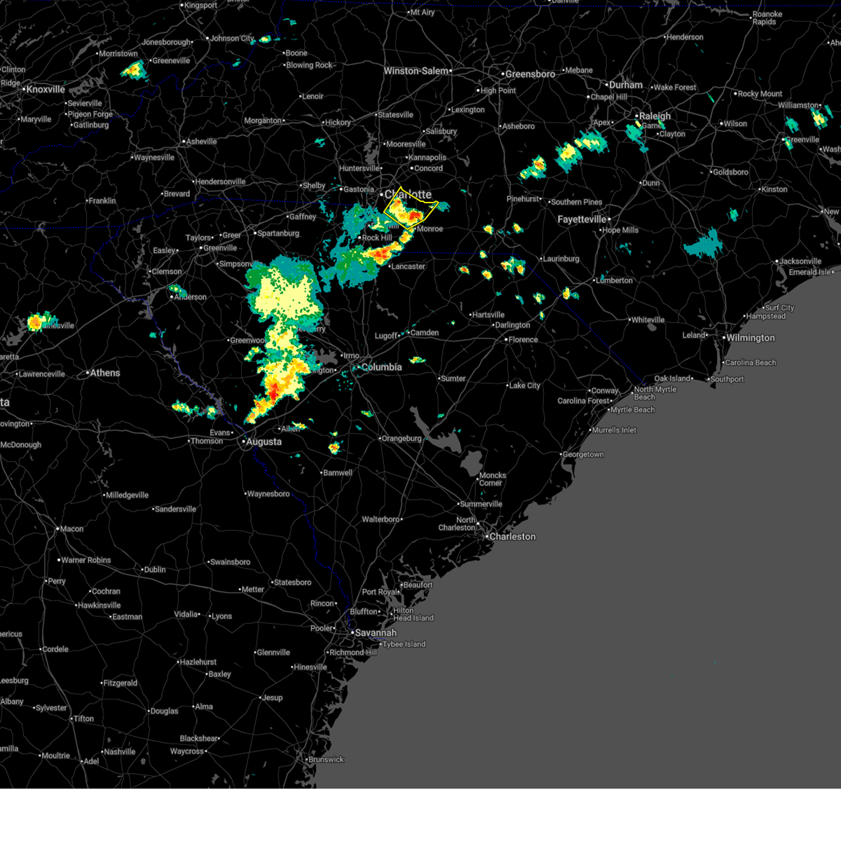 At 646 pm edt, a severe thunderstorm was located 10 miles northwest of monroe, or near hemby bridge, moving north at 20 mph (radar indicated). Hazards include 60 mph wind gusts and quarter size hail. Minor hail damage to vehicles is expected. expect wind damage to trees and power lines. Locations impacted include, indian trail, lake park, mint hill, south charlotte, matthews, stallings, the arboretum, hemby bridge, fairview in union county, and unionville. At 646 pm edt, a severe thunderstorm was located 10 miles northwest of monroe, or near hemby bridge, moving north at 20 mph (radar indicated). Hazards include 60 mph wind gusts and quarter size hail. Minor hail damage to vehicles is expected. expect wind damage to trees and power lines. Locations impacted include, indian trail, lake park, mint hill, south charlotte, matthews, stallings, the arboretum, hemby bridge, fairview in union county, and unionville.
|
| 5/2/2025 6:16 PM EDT |
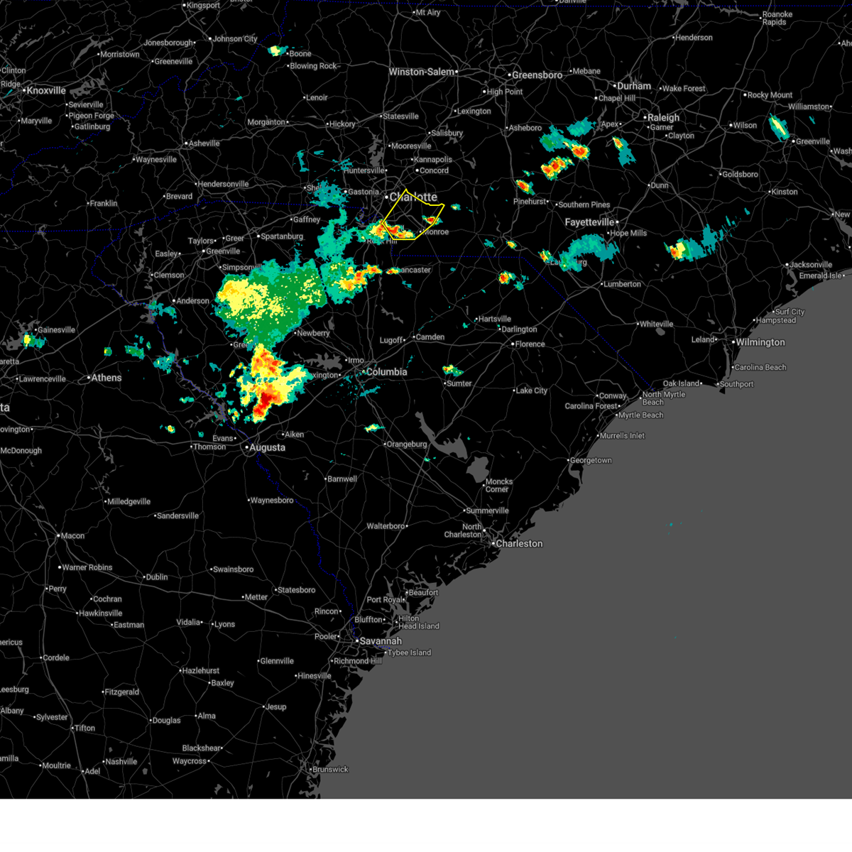 Svrgsp the national weather service in greenville-spartanburg has issued a * severe thunderstorm warning for, southeastern mecklenburg county in the piedmont of north carolina, central union county in the piedmont of north carolina, * until 730 pm edt. * at 616 pm edt, a severe thunderstorm was located 8 miles west of monroe, or near wesley chapel, moving north at 20 mph (radar indicated). Hazards include 60 mph wind gusts and quarter size hail. Minor hail damage to vehicles is expected. Expect wind damage to trees and power lines. Svrgsp the national weather service in greenville-spartanburg has issued a * severe thunderstorm warning for, southeastern mecklenburg county in the piedmont of north carolina, central union county in the piedmont of north carolina, * until 730 pm edt. * at 616 pm edt, a severe thunderstorm was located 8 miles west of monroe, or near wesley chapel, moving north at 20 mph (radar indicated). Hazards include 60 mph wind gusts and quarter size hail. Minor hail damage to vehicles is expected. Expect wind damage to trees and power lines.
|
| 3/31/2025 5:30 PM EDT |
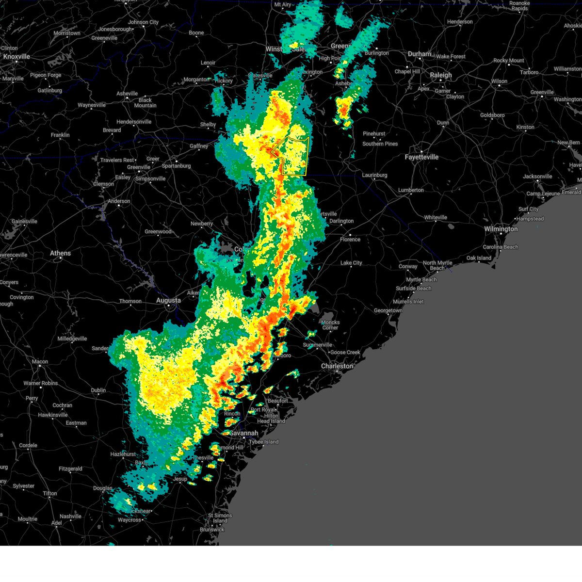 At 530 pm edt, severe thunderstorms were located along a line extending from 10 miles southeast of uptown charlotte to near monroe to 14 miles east of lancaster, moving northeast at 55 mph (radar indicated). Hazards include 60 mph wind gusts. Expect damage to trees and power lines. Locations impacted include, marshville, indian trail, trinity, lake park, wesley chapel, monroe, wingate, stallings, new salem, and hemby bridge. At 530 pm edt, severe thunderstorms were located along a line extending from 10 miles southeast of uptown charlotte to near monroe to 14 miles east of lancaster, moving northeast at 55 mph (radar indicated). Hazards include 60 mph wind gusts. Expect damage to trees and power lines. Locations impacted include, marshville, indian trail, trinity, lake park, wesley chapel, monroe, wingate, stallings, new salem, and hemby bridge.
|
| 3/31/2025 5:30 PM EDT |
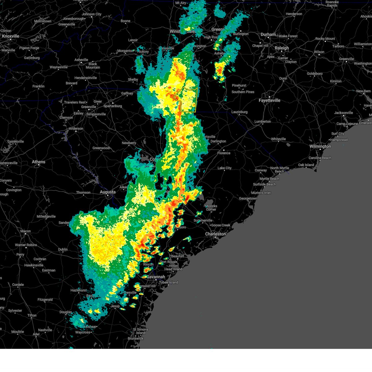 the severe thunderstorm warning has been cancelled and is no longer in effect the severe thunderstorm warning has been cancelled and is no longer in effect
|
| 3/31/2025 5:22 PM EDT |
 At 522 pm edt, severe thunderstorms were located along a line extending from 8 miles southeast of uptown charlotte to 5 miles southwest of monroe to 12 miles southeast of lancaster, moving east at 50 mph (radar indicated). Hazards include 60 mph wind gusts. Expect damage to trees and power lines. Locations impacted include, marshville, trinity, lake park, mint hill, south charlotte, mineral springs, new salem, hemby bridge, southwest charlotte, and fairview in union county. At 522 pm edt, severe thunderstorms were located along a line extending from 8 miles southeast of uptown charlotte to 5 miles southwest of monroe to 12 miles southeast of lancaster, moving east at 50 mph (radar indicated). Hazards include 60 mph wind gusts. Expect damage to trees and power lines. Locations impacted include, marshville, trinity, lake park, mint hill, south charlotte, mineral springs, new salem, hemby bridge, southwest charlotte, and fairview in union county.
|
| 3/31/2025 5:04 PM EDT |
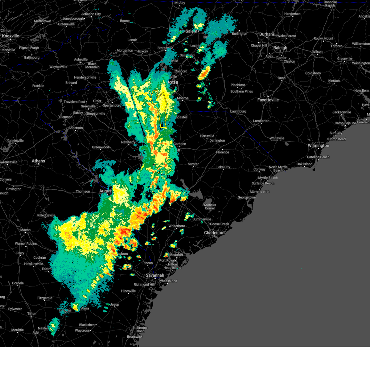 At 503 pm edt, severe thunderstorms were located along a line extending from 10 miles southeast of gastonia to near indian land to 12 miles northeast of springdale, moving northeast at 60 mph (radar indicated). Hazards include 60 mph wind gusts. Expect damage to trees and power lines. Locations impacted include, newport, lesslie, catawba, edgemoor, tega cay, lake wylie, fort lawn, fort mill, great falls, and rock hill. At 503 pm edt, severe thunderstorms were located along a line extending from 10 miles southeast of gastonia to near indian land to 12 miles northeast of springdale, moving northeast at 60 mph (radar indicated). Hazards include 60 mph wind gusts. Expect damage to trees and power lines. Locations impacted include, newport, lesslie, catawba, edgemoor, tega cay, lake wylie, fort lawn, fort mill, great falls, and rock hill.
|
| 3/31/2025 4:57 PM EDT |
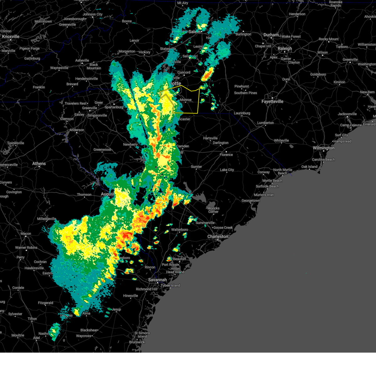 Svrgsp the national weather service in greenville-spartanburg has issued a * severe thunderstorm warning for, southern mecklenburg county in the piedmont of north carolina, union county in the piedmont of north carolina, * until 615 pm edt. * at 457 pm edt, severe thunderstorms were located along a line extending from 7 miles east of york to 6 miles southeast of rock hill to 13 miles north of springdale, moving east at 50 mph (radar indicated). Hazards include 60 mph wind gusts. expect damage to trees and power lines Svrgsp the national weather service in greenville-spartanburg has issued a * severe thunderstorm warning for, southern mecklenburg county in the piedmont of north carolina, union county in the piedmont of north carolina, * until 615 pm edt. * at 457 pm edt, severe thunderstorms were located along a line extending from 7 miles east of york to 6 miles southeast of rock hill to 13 miles north of springdale, moving east at 50 mph (radar indicated). Hazards include 60 mph wind gusts. expect damage to trees and power lines
|
| 3/31/2025 4:52 PM EDT |
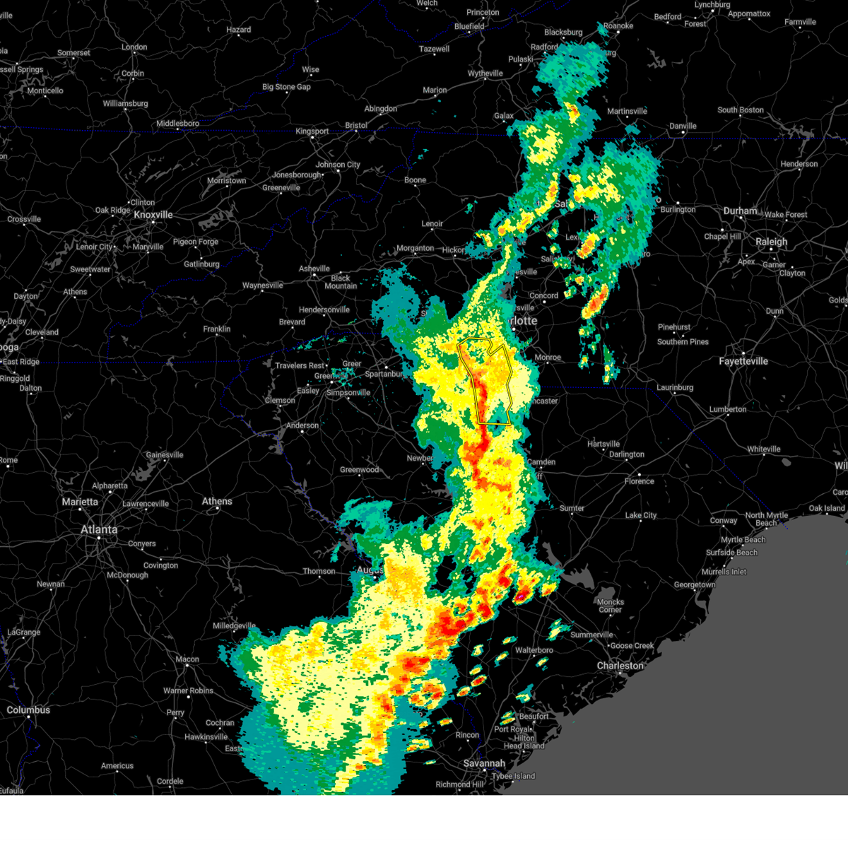 At 451 pm edt, severe thunderstorms were located along a line extending from 4 miles north of york to near rock hill to 5 miles northeast of winnsboro, moving northeast at 60 mph (radar indicated). Hazards include 60 mph wind gusts. Expect damage to trees and power lines. Locations impacted include, newport, richburg, york, edgemoor, clover, tega cay, fort mill, great falls, rock hill, and lesslie. At 451 pm edt, severe thunderstorms were located along a line extending from 4 miles north of york to near rock hill to 5 miles northeast of winnsboro, moving northeast at 60 mph (radar indicated). Hazards include 60 mph wind gusts. Expect damage to trees and power lines. Locations impacted include, newport, richburg, york, edgemoor, clover, tega cay, fort mill, great falls, rock hill, and lesslie.
|
| 3/31/2025 4:44 PM EDT |
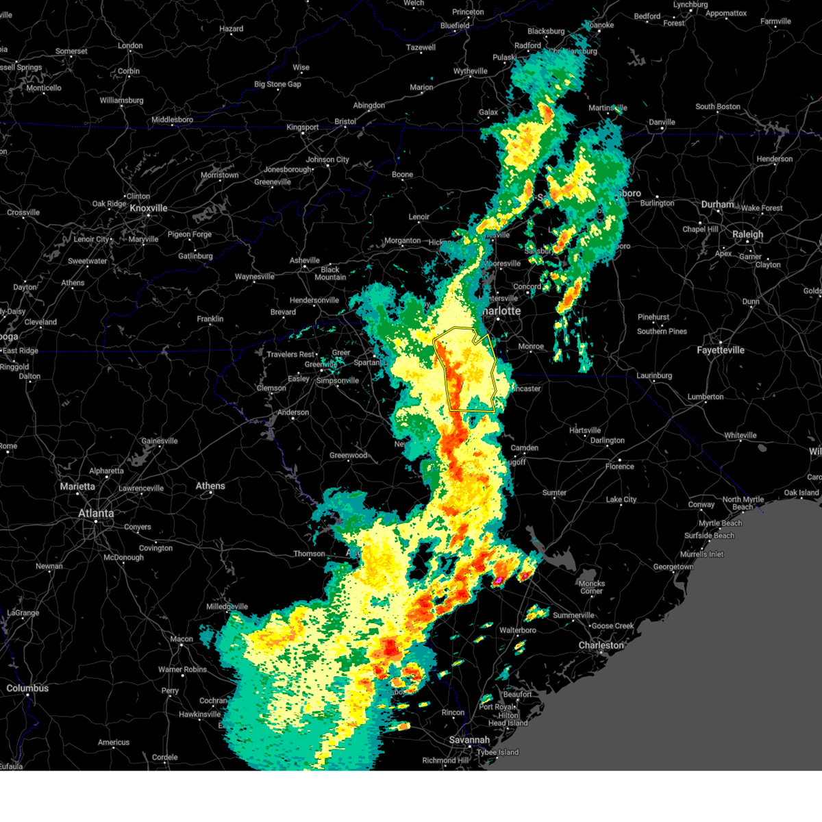 At 444 pm edt, severe thunderstorms were located along a line extending from 17 miles east of gaffney to 7 miles southeast of york to 4 miles northwest of winnsboro, moving northeast at 55 mph (radar indicated). Hazards include 60 mph wind gusts. Expect damage to trees and power lines. Locations impacted include, newport, chester state park, richburg, york, cornwell, edgemoor, clover, tega cay, fort mill, and sharon. At 444 pm edt, severe thunderstorms were located along a line extending from 17 miles east of gaffney to 7 miles southeast of york to 4 miles northwest of winnsboro, moving northeast at 55 mph (radar indicated). Hazards include 60 mph wind gusts. Expect damage to trees and power lines. Locations impacted include, newport, chester state park, richburg, york, cornwell, edgemoor, clover, tega cay, fort mill, and sharon.
|
| 3/31/2025 4:23 PM EDT |
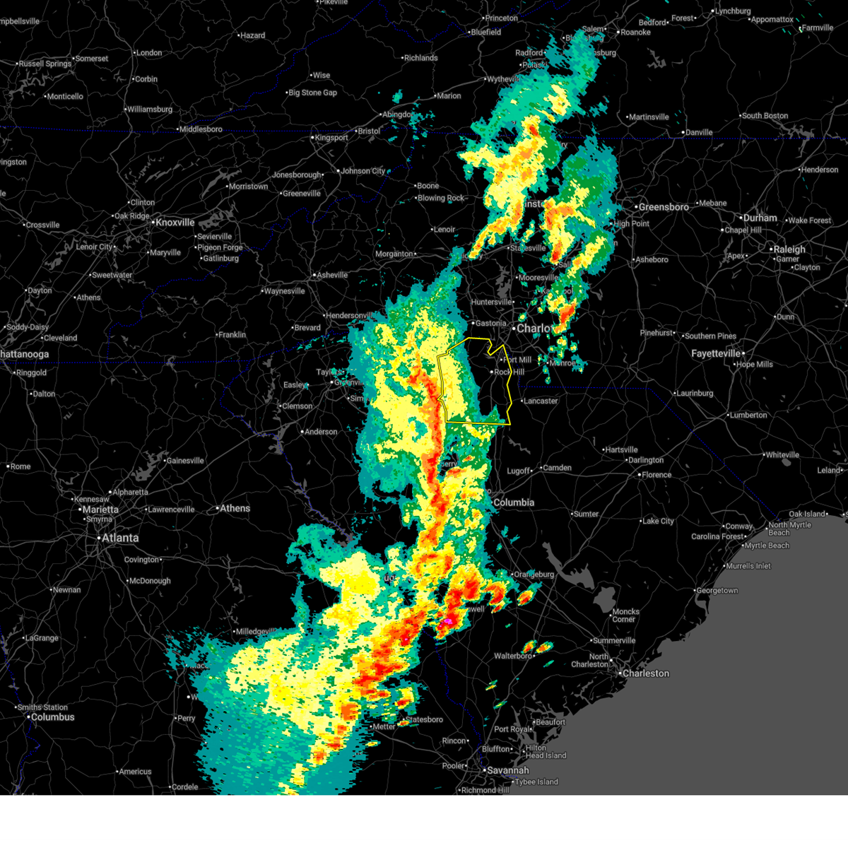 Svrgsp the national weather service in greenville-spartanburg has issued a * severe thunderstorm warning for, chester county in upstate south carolina, york county in upstate south carolina, * until 515 pm edt. * at 422 pm edt, severe thunderstorms were located along a line extending from 7 miles south of gaffney to 11 miles northeast of union to 7 miles west of vc summer nuclear station, moving northeast at 60 mph (radar indicated). Hazards include 60 mph wind gusts. expect damage to trees and power lines Svrgsp the national weather service in greenville-spartanburg has issued a * severe thunderstorm warning for, chester county in upstate south carolina, york county in upstate south carolina, * until 515 pm edt. * at 422 pm edt, severe thunderstorms were located along a line extending from 7 miles south of gaffney to 11 miles northeast of union to 7 miles west of vc summer nuclear station, moving northeast at 60 mph (radar indicated). Hazards include 60 mph wind gusts. expect damage to trees and power lines
|
| 3/5/2025 8:08 AM EST |
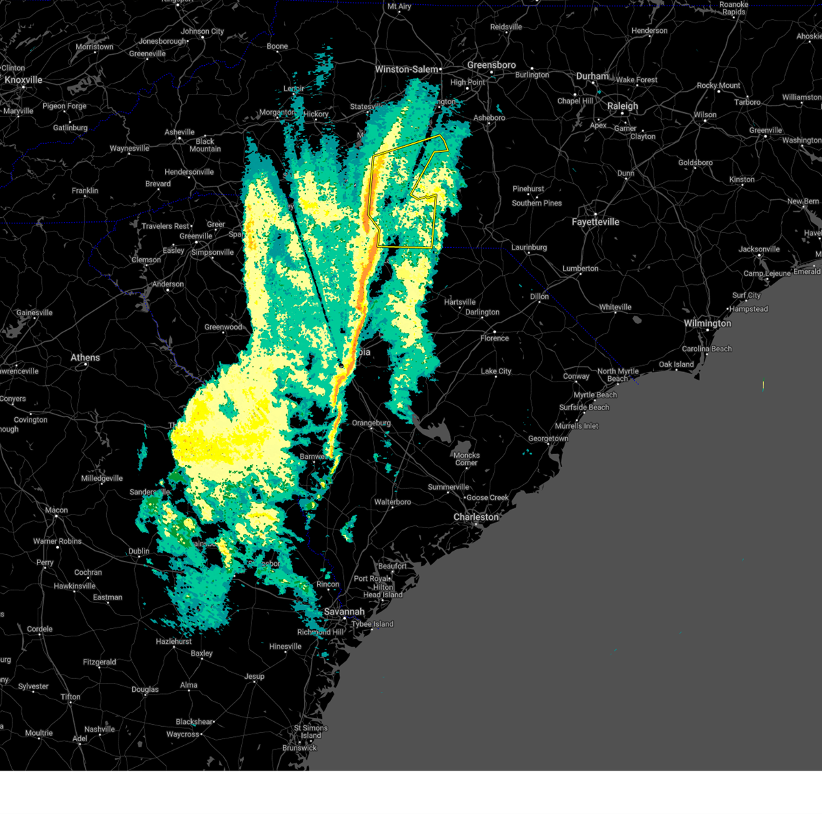 Svrgsp the national weather service in greenville-spartanburg has issued a * severe thunderstorm warning for, cabarrus county in the piedmont of north carolina, central mecklenburg county in the piedmont of north carolina, southeastern rowan county in the piedmont of north carolina, union county in the piedmont of north carolina, * until 900 am est. * at 808 am est, severe thunderstorms were located along a line extending from 3 miles east of huntersville to 10 miles southeast of rock hill, moving northeast at 45 mph (radar indicated). Hazards include 60 mph wind gusts. expect damage to trees and power lines Svrgsp the national weather service in greenville-spartanburg has issued a * severe thunderstorm warning for, cabarrus county in the piedmont of north carolina, central mecklenburg county in the piedmont of north carolina, southeastern rowan county in the piedmont of north carolina, union county in the piedmont of north carolina, * until 900 am est. * at 808 am est, severe thunderstorms were located along a line extending from 3 miles east of huntersville to 10 miles southeast of rock hill, moving northeast at 45 mph (radar indicated). Hazards include 60 mph wind gusts. expect damage to trees and power lines
|
| 3/5/2025 8:05 AM EST |
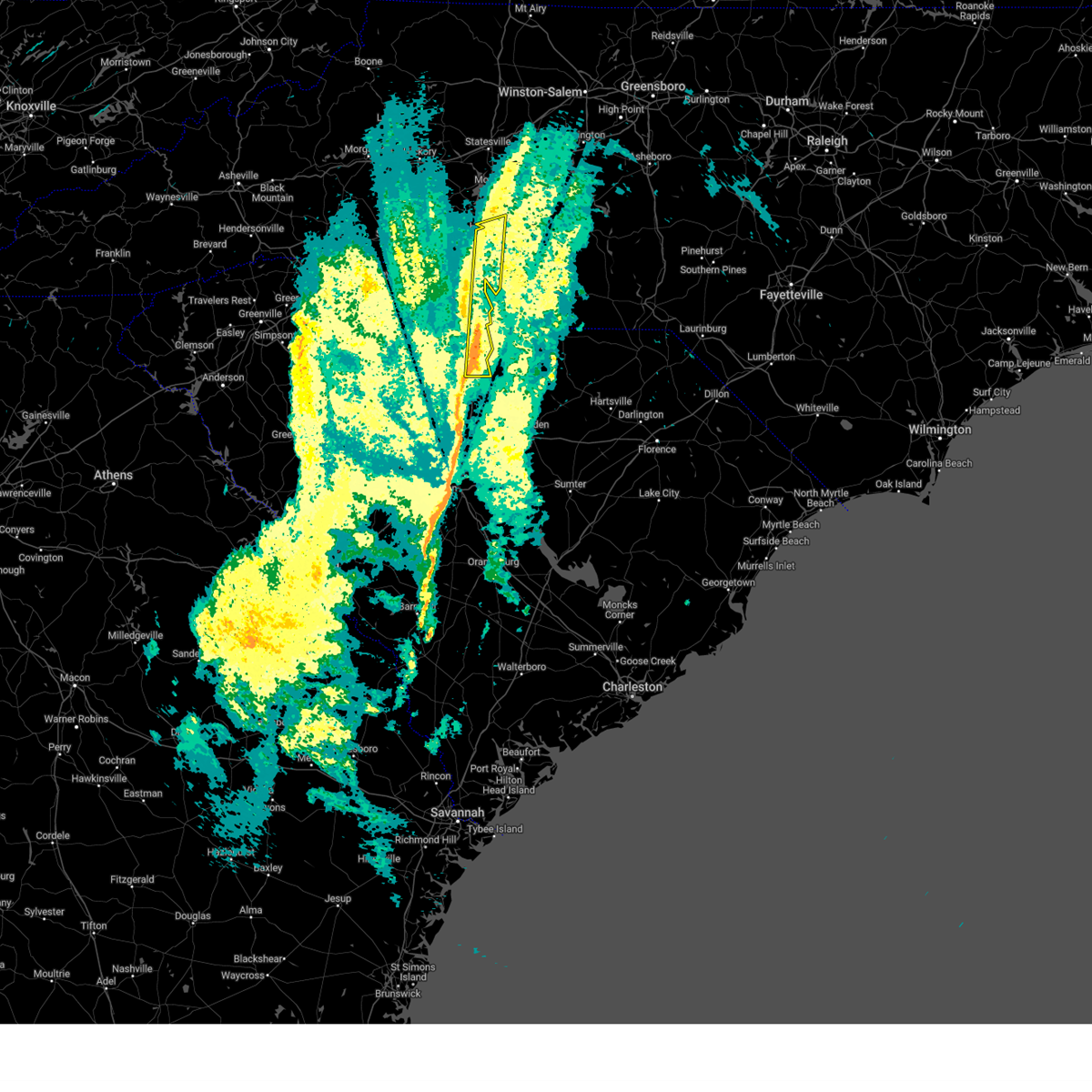 the severe thunderstorm warning has been cancelled and is no longer in effect the severe thunderstorm warning has been cancelled and is no longer in effect
|
| 3/5/2025 8:05 AM EST |
 At 804 am est, severe thunderstorms were located along a line extending from 3 miles southwest of huntersville to 13 miles southwest of lancaster, moving east at 40 mph (radar indicated). Hazards include 60 mph wind gusts. Expect damage to trees and power lines. Locations impacted include, charlotte, charlotte douglas airport, edgemoor, lesslie, freedom park, richburg, and the plaza. At 804 am est, severe thunderstorms were located along a line extending from 3 miles southwest of huntersville to 13 miles southwest of lancaster, moving east at 40 mph (radar indicated). Hazards include 60 mph wind gusts. Expect damage to trees and power lines. Locations impacted include, charlotte, charlotte douglas airport, edgemoor, lesslie, freedom park, richburg, and the plaza.
|
| 3/5/2025 7:45 AM EST |
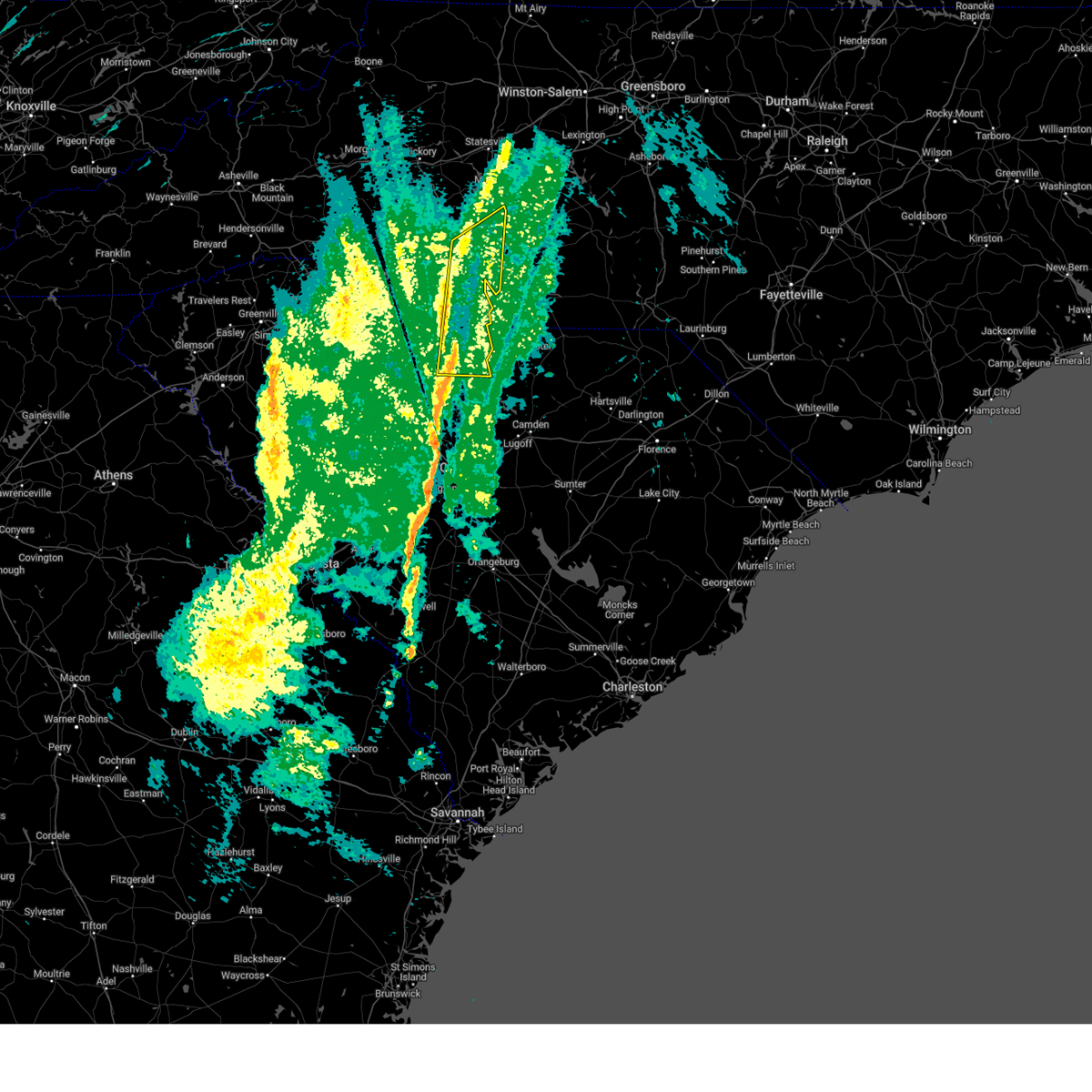 Svrgsp the national weather service in greenville-spartanburg has issued a * severe thunderstorm warning for, western mecklenburg county in the piedmont of north carolina, southeastern gaston county in the piedmont of north carolina, eastern chester county in upstate south carolina, eastern york county in upstate south carolina, * until 815 am est. * at 745 am est, severe thunderstorms were located along a line extending from 7 miles east of gastonia to 5 miles southeast of chester, moving northeast at 40 mph (radar indicated). Hazards include 60 mph wind gusts. expect damage to trees and power lines Svrgsp the national weather service in greenville-spartanburg has issued a * severe thunderstorm warning for, western mecklenburg county in the piedmont of north carolina, southeastern gaston county in the piedmont of north carolina, eastern chester county in upstate south carolina, eastern york county in upstate south carolina, * until 815 am est. * at 745 am est, severe thunderstorms were located along a line extending from 7 miles east of gastonia to 5 miles southeast of chester, moving northeast at 40 mph (radar indicated). Hazards include 60 mph wind gusts. expect damage to trees and power lines
|
| 2/16/2025 7:37 AM EST | Power outage attributed to fallen trees or limbs near intersection of wilgrove mint hill rd and truelight church r in mecklenburg county NC, 11.6 miles WNW of Charlotte, NC |
| 2/16/2025 6:56 AM EST |
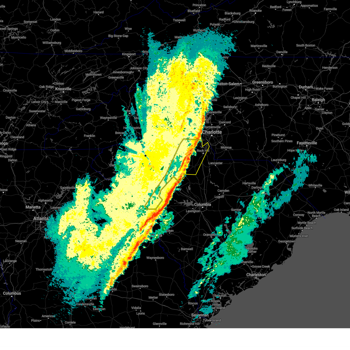 The storms which prompted the warning have weakened below severe limits, and no longer pose an immediate threat to life or property. therefore, the warning will be allowed to expire. The storms which prompted the warning have weakened below severe limits, and no longer pose an immediate threat to life or property. therefore, the warning will be allowed to expire.
|
| 2/16/2025 6:46 AM EST |
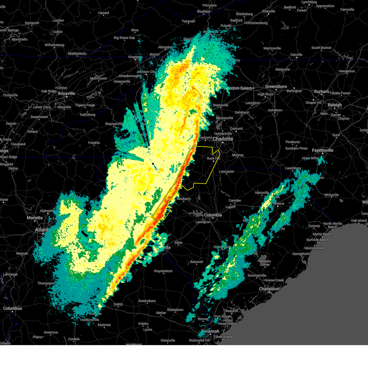 the severe thunderstorm warning has been cancelled and is no longer in effect the severe thunderstorm warning has been cancelled and is no longer in effect
|
| 2/16/2025 6:46 AM EST |
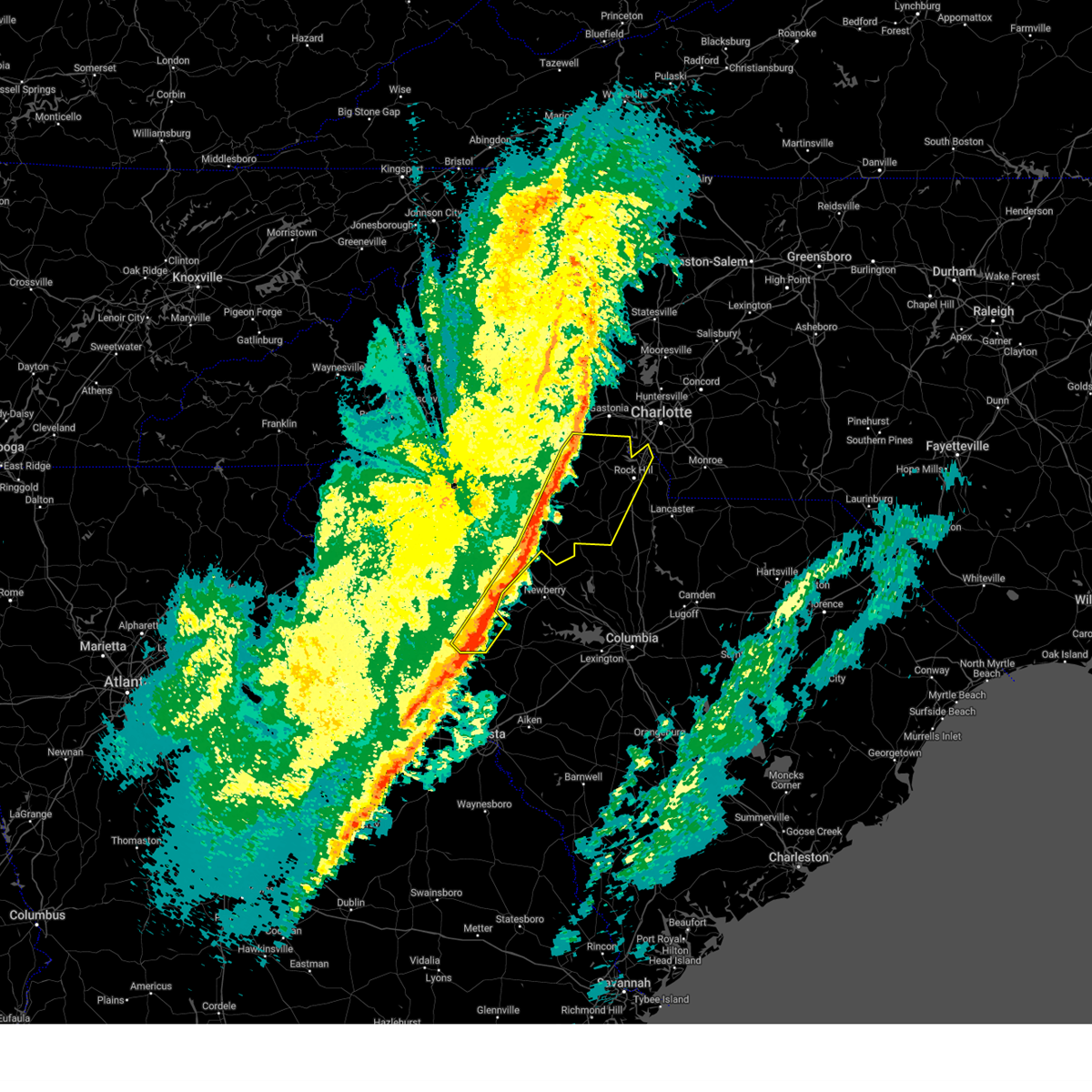 At 646 am est, severe thunderstorms were located along a line extending from 11 miles northwest of york to 9 miles south of union to 16 miles south of greenwood, moving east at 65 mph (radar indicated). Hazards include 60 mph wind gusts. Expect damage to trees and power lines. Locations impacted include, rock hill, union, york, chester, fort mill, clinton, tega cay, clover, newport, and monarch mill. At 646 am est, severe thunderstorms were located along a line extending from 11 miles northwest of york to 9 miles south of union to 16 miles south of greenwood, moving east at 65 mph (radar indicated). Hazards include 60 mph wind gusts. Expect damage to trees and power lines. Locations impacted include, rock hill, union, york, chester, fort mill, clinton, tega cay, clover, newport, and monarch mill.
|
| 2/16/2025 6:28 AM EST |
 Svrgsp the national weather service in greenville-spartanburg has issued a * severe thunderstorm warning for, laurens county in upstate south carolina, western chester county in upstate south carolina, york county in upstate south carolina, southeastern spartanburg county in upstate south carolina, cherokee county in upstate south carolina, southeastern abbeville county in upstate south carolina, union county in upstate south carolina, greenwood county in upstate south carolina, * until 700 am est. * at 628 am est, severe thunderstorms were located along a line extending from near gaffney to 14 miles southeast of abbeville, moving east at 80 mph (radar indicated). Hazards include 60 mph wind gusts. expect damage to trees and power lines Svrgsp the national weather service in greenville-spartanburg has issued a * severe thunderstorm warning for, laurens county in upstate south carolina, western chester county in upstate south carolina, york county in upstate south carolina, southeastern spartanburg county in upstate south carolina, cherokee county in upstate south carolina, southeastern abbeville county in upstate south carolina, union county in upstate south carolina, greenwood county in upstate south carolina, * until 700 am est. * at 628 am est, severe thunderstorms were located along a line extending from near gaffney to 14 miles southeast of abbeville, moving east at 80 mph (radar indicated). Hazards include 60 mph wind gusts. expect damage to trees and power lines
|
| 12/29/2024 10:03 AM EST | Report from mping: trees uprooted or snapped; roof blown of in mecklenburg county NC, 4 miles NW of Charlotte, NC |
| 12/29/2024 9:44 AM EST |
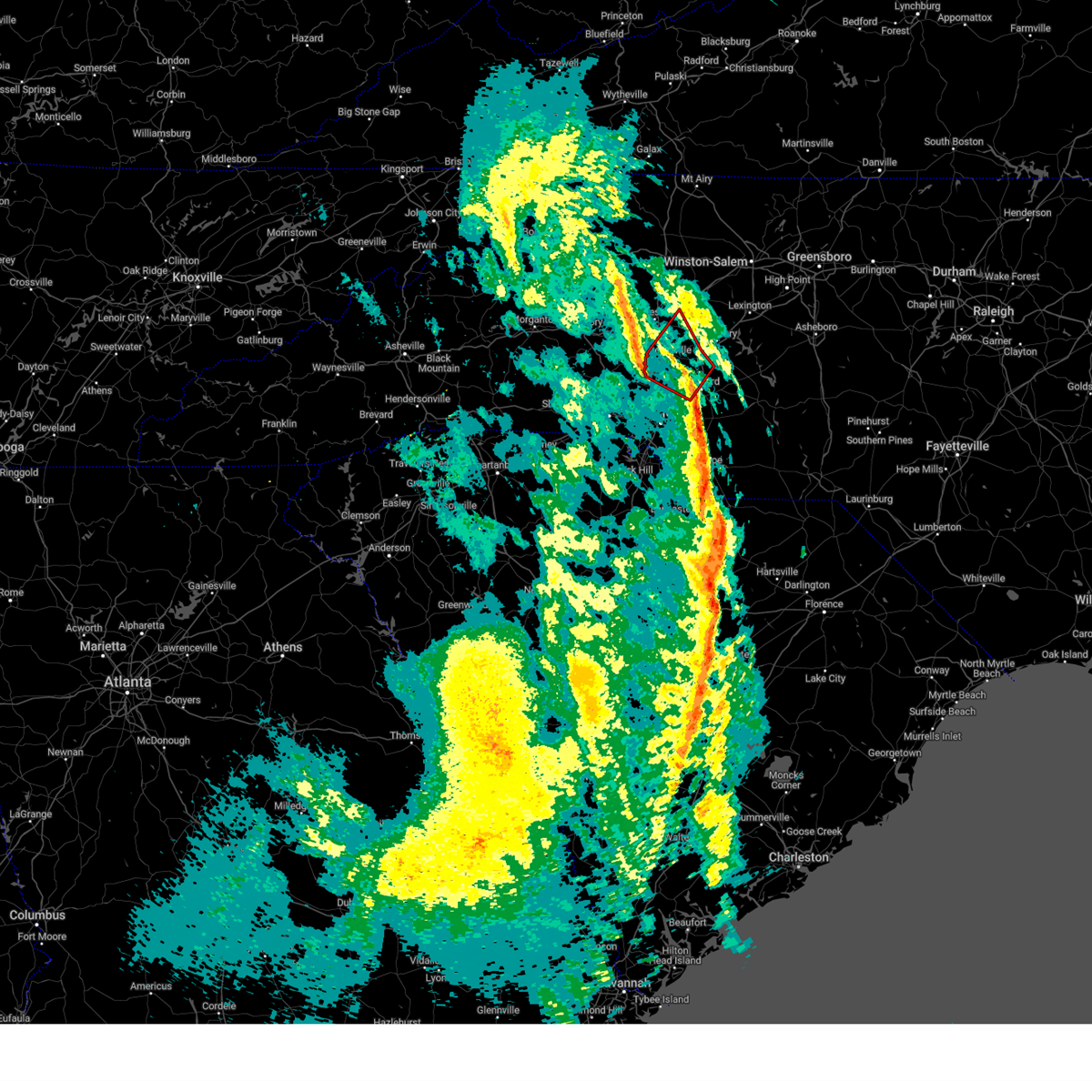 Torgsp the national weather service in greenville-spartanburg has issued a * tornado warning for, northwestern cabarrus county in the piedmont of north carolina, southeastern iredell county in the piedmont of north carolina, north central mecklenburg county in the piedmont of north carolina, southwestern rowan county in the piedmont of north carolina, * until 1030 am est. * at 944 am est, a severe thunderstorm capable of producing a tornado was located 5 miles northwest of huntersville, or near ramsey creek park, moving northeast at 45 mph (radar indicated rotation). Hazards include tornado. Flying debris will be dangerous to those caught without shelter. mobile homes will be damaged or destroyed. damage to roofs, windows, and vehicles will occur. tree damage is likely. this dangerous storm will be near, cornelius, mooresville, davidson, lake norman, and ramsey creek park around 950 am est. cleveland around 1010 am est. Other locations impacted by this dangerous thunderstorm include mount ulla and doolie. Torgsp the national weather service in greenville-spartanburg has issued a * tornado warning for, northwestern cabarrus county in the piedmont of north carolina, southeastern iredell county in the piedmont of north carolina, north central mecklenburg county in the piedmont of north carolina, southwestern rowan county in the piedmont of north carolina, * until 1030 am est. * at 944 am est, a severe thunderstorm capable of producing a tornado was located 5 miles northwest of huntersville, or near ramsey creek park, moving northeast at 45 mph (radar indicated rotation). Hazards include tornado. Flying debris will be dangerous to those caught without shelter. mobile homes will be damaged or destroyed. damage to roofs, windows, and vehicles will occur. tree damage is likely. this dangerous storm will be near, cornelius, mooresville, davidson, lake norman, and ramsey creek park around 950 am est. cleveland around 1010 am est. Other locations impacted by this dangerous thunderstorm include mount ulla and doolie.
|
| 12/29/2024 9:42 AM EST |
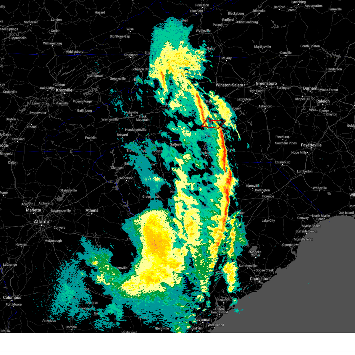 At 942 am est, a severe thunderstorm capable of producing a tornado was located 5 miles west of huntersville, or near ramsey creek park, moving northeast at 45 mph (radar indicated rotation). Hazards include tornado. Flying debris will be dangerous to those caught without shelter. mobile homes will be damaged or destroyed. damage to roofs, windows, and vehicles will occur. tree damage is likely. this dangerous storm will be near, cornelius, davidson, lake norman, and ramsey creek park around 950 am est. Other locations impacted by this tornadic thunderstorm include lowesville. At 942 am est, a severe thunderstorm capable of producing a tornado was located 5 miles west of huntersville, or near ramsey creek park, moving northeast at 45 mph (radar indicated rotation). Hazards include tornado. Flying debris will be dangerous to those caught without shelter. mobile homes will be damaged or destroyed. damage to roofs, windows, and vehicles will occur. tree damage is likely. this dangerous storm will be near, cornelius, davidson, lake norman, and ramsey creek park around 950 am est. Other locations impacted by this tornadic thunderstorm include lowesville.
|
| 12/29/2024 9:42 AM EST |
 the tornado warning has been cancelled and is no longer in effect the tornado warning has been cancelled and is no longer in effect
|
| 12/29/2024 9:41 AM EST | Report from mping: 1-inch tree limbs broken; shingles blown of in cabarrus county NC, 12 miles SW of Charlotte, NC |
| 12/29/2024 9:39 AM EST |
 At 938 am est, severe thunderstorms were located along a line extending from 4 miles east of huntersville to 11 miles east of uptown charlotte to 10 miles east of lancaster, moving northeast at 50 mph (radar indicated). Hazards include 60 mph wind gusts. Expect damage to trees and power lines. Locations impacted include, huntersville, kannapolis, downtown concord, monroe, west concord, matthews, mint hill, indian trail, stallings, and unionville. At 938 am est, severe thunderstorms were located along a line extending from 4 miles east of huntersville to 11 miles east of uptown charlotte to 10 miles east of lancaster, moving northeast at 50 mph (radar indicated). Hazards include 60 mph wind gusts. Expect damage to trees and power lines. Locations impacted include, huntersville, kannapolis, downtown concord, monroe, west concord, matthews, mint hill, indian trail, stallings, and unionville.
|
| 12/29/2024 9:39 AM EST |
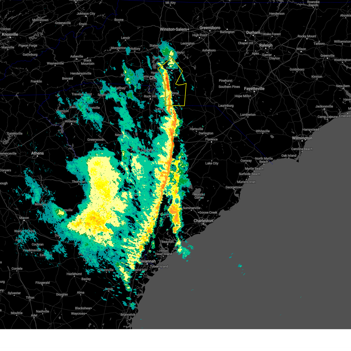 the severe thunderstorm warning has been cancelled and is no longer in effect the severe thunderstorm warning has been cancelled and is no longer in effect
|
| 12/29/2024 9:35 AM EST |
 At 935 am est, a severe thunderstorm capable of producing a tornado was located 8 miles west of huntersville, or 5 miles northeast of mt holly, moving northeast at 60 mph (radar indicated rotation). Hazards include tornado. Flying debris will be dangerous to those caught without shelter. mobile homes will be damaged or destroyed. damage to roofs, windows, and vehicles will occur. tree damage is likely. this dangerous storm will be near, huntersville, cornelius, davidson, lake norman, and ramsey creek park around 940 am est. Other locations impacted by this tornadic thunderstorm include lowesville, lucia, and croft. At 935 am est, a severe thunderstorm capable of producing a tornado was located 8 miles west of huntersville, or 5 miles northeast of mt holly, moving northeast at 60 mph (radar indicated rotation). Hazards include tornado. Flying debris will be dangerous to those caught without shelter. mobile homes will be damaged or destroyed. damage to roofs, windows, and vehicles will occur. tree damage is likely. this dangerous storm will be near, huntersville, cornelius, davidson, lake norman, and ramsey creek park around 940 am est. Other locations impacted by this tornadic thunderstorm include lowesville, lucia, and croft.
|
| 12/29/2024 9:27 AM EST |
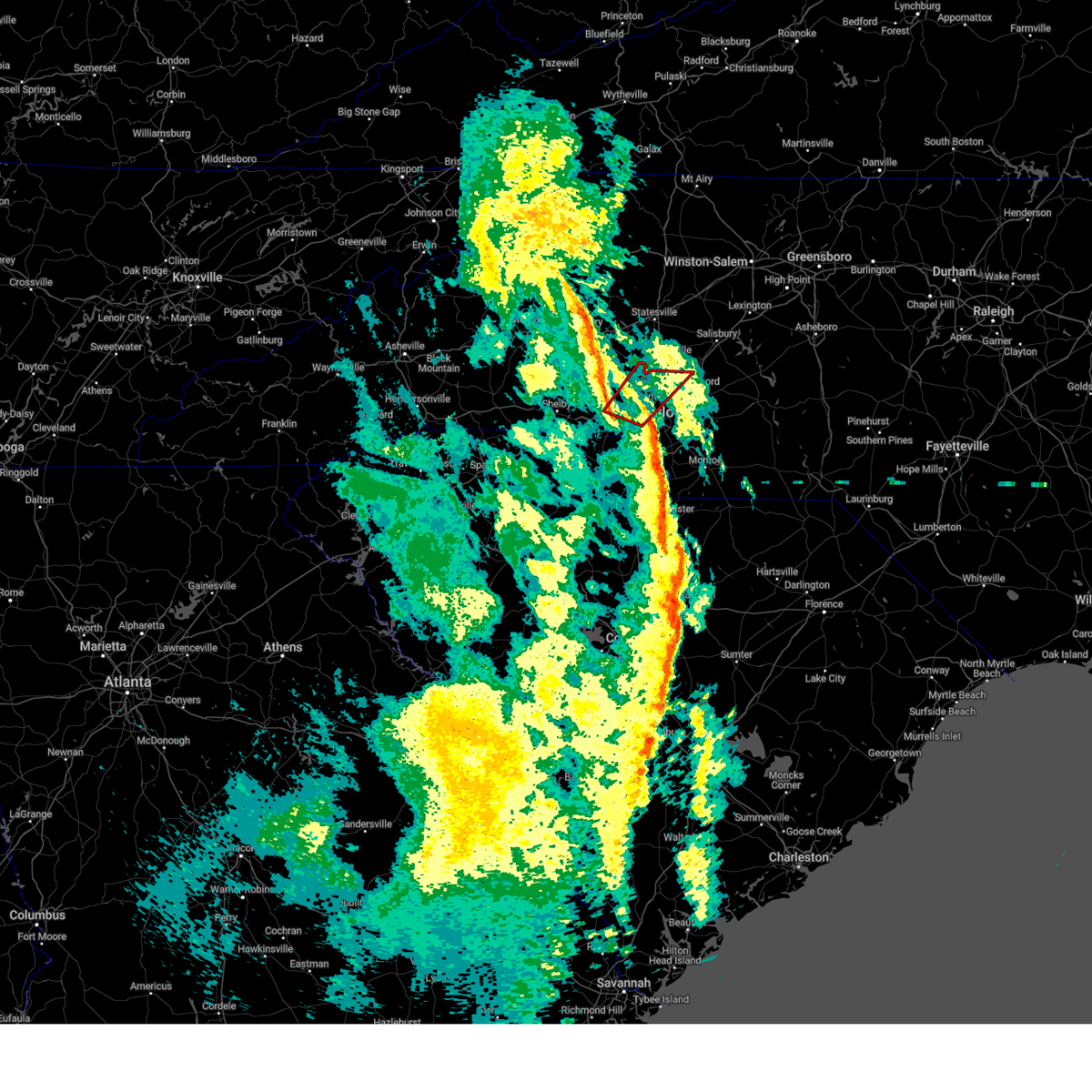 At 927 am est, a severe thunderstorm capable of producing a tornado was located 5 miles northeast of gastonia, or near lowell, moving northeast at 55 mph (radar indicated rotation). Hazards include tornado. Flying debris will be dangerous to those caught without shelter. mobile homes will be damaged or destroyed. damage to roofs, windows, and vehicles will occur. tree damage is likely. this dangerous storm will be near, mt holly, lowell, ranlo, and mcadenville around 930 am est. huntersville, cornelius, lake norman, and ramsey creek park around 940 am est. davidson around 950 am est. Other locations impacted by this tornadic thunderstorm include lowesville, lucia, and croft. At 927 am est, a severe thunderstorm capable of producing a tornado was located 5 miles northeast of gastonia, or near lowell, moving northeast at 55 mph (radar indicated rotation). Hazards include tornado. Flying debris will be dangerous to those caught without shelter. mobile homes will be damaged or destroyed. damage to roofs, windows, and vehicles will occur. tree damage is likely. this dangerous storm will be near, mt holly, lowell, ranlo, and mcadenville around 930 am est. huntersville, cornelius, lake norman, and ramsey creek park around 940 am est. davidson around 950 am est. Other locations impacted by this tornadic thunderstorm include lowesville, lucia, and croft.
|
| 12/29/2024 9:26 AM EST | Clt asos gusted to 51 knot in mecklenburg county NC, 6 miles ENE of Charlotte, NC |
| 12/29/2024 9:19 AM EST |
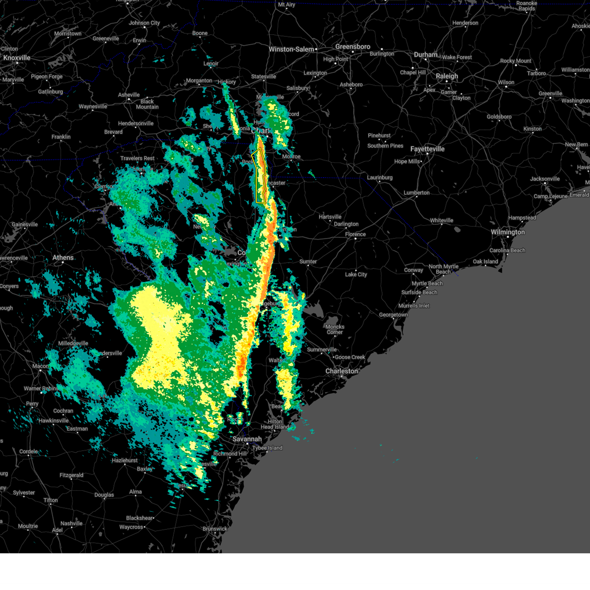 At 919 am est, severe thunderstorms were located along a line extending from 9 miles east of gastonia to 6 miles southwest of uptown charlotte to 8 miles northwest of lancaster, moving northeast at 60 mph (radar indicated). Hazards include 60 mph wind gusts. Expect damage to trees and power lines. Locations impacted include, fort mill, tega cay, lesslie, great falls, fort lawn, catawba, carowinds, fishing creek reservoir, rock hill, and lake wylie. At 919 am est, severe thunderstorms were located along a line extending from 9 miles east of gastonia to 6 miles southwest of uptown charlotte to 8 miles northwest of lancaster, moving northeast at 60 mph (radar indicated). Hazards include 60 mph wind gusts. Expect damage to trees and power lines. Locations impacted include, fort mill, tega cay, lesslie, great falls, fort lawn, catawba, carowinds, fishing creek reservoir, rock hill, and lake wylie.
|
| 12/29/2024 9:17 AM EST |
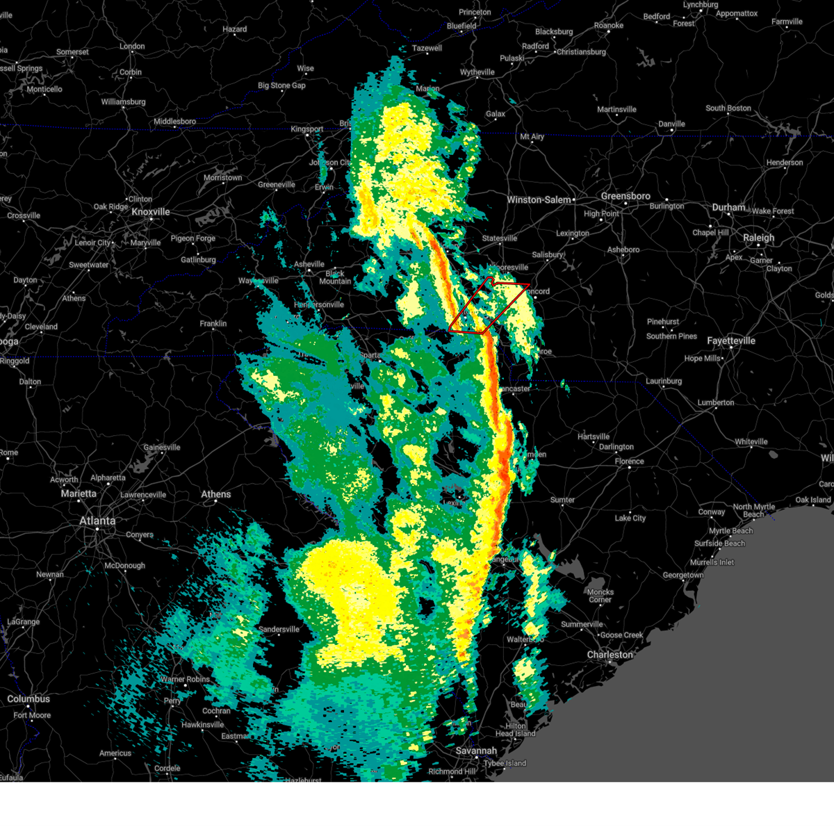 Torgsp the national weather service in greenville-spartanburg has issued a * tornado warning for, northwestern cabarrus county in the piedmont of north carolina, southeastern lincoln county in the piedmont of north carolina, northwestern mecklenburg county in the piedmont of north carolina, gaston county in the piedmont of north carolina, * until 1000 am est. * at 917 am est, a severe thunderstorm capable of producing a tornado was located 5 miles southwest of gastonia, or near south gastonia, moving northeast at 55 mph (radar indicated rotation). Hazards include tornado. Flying debris will be dangerous to those caught without shelter. mobile homes will be damaged or destroyed. damage to roofs, windows, and vehicles will occur. tree damage is likely. this dangerous storm will be near, gastonia, south gastonia, lowell, and ranlo around 920 am est. mt holly and mcadenville around 930 am est. huntersville, cornelius, lake norman, and ramsey creek park around 940 am est. davidson around 950 am est. Other locations impacted by this dangerous thunderstorm include lowesville, crowders, croft, and lucia. Torgsp the national weather service in greenville-spartanburg has issued a * tornado warning for, northwestern cabarrus county in the piedmont of north carolina, southeastern lincoln county in the piedmont of north carolina, northwestern mecklenburg county in the piedmont of north carolina, gaston county in the piedmont of north carolina, * until 1000 am est. * at 917 am est, a severe thunderstorm capable of producing a tornado was located 5 miles southwest of gastonia, or near south gastonia, moving northeast at 55 mph (radar indicated rotation). Hazards include tornado. Flying debris will be dangerous to those caught without shelter. mobile homes will be damaged or destroyed. damage to roofs, windows, and vehicles will occur. tree damage is likely. this dangerous storm will be near, gastonia, south gastonia, lowell, and ranlo around 920 am est. mt holly and mcadenville around 930 am est. huntersville, cornelius, lake norman, and ramsey creek park around 940 am est. davidson around 950 am est. Other locations impacted by this dangerous thunderstorm include lowesville, crowders, croft, and lucia.
|
| 12/29/2024 9:07 AM EST |
 At 907 am est, severe thunderstorms were located along a line extending from 7 miles south of gastonia to 6 miles north of rock hill to 12 miles west of lancaster, moving northeast at 60 mph (radar indicated). Hazards include 60 mph wind gusts. Expect damage to trees and power lines. Locations impacted include, rock hill, fort mill, tega cay, clover, newport, lesslie, great falls, fort lawn, richburg, and kings mountain state park. At 907 am est, severe thunderstorms were located along a line extending from 7 miles south of gastonia to 6 miles north of rock hill to 12 miles west of lancaster, moving northeast at 60 mph (radar indicated). Hazards include 60 mph wind gusts. Expect damage to trees and power lines. Locations impacted include, rock hill, fort mill, tega cay, clover, newport, lesslie, great falls, fort lawn, richburg, and kings mountain state park.
|
| 12/29/2024 9:07 AM EST |
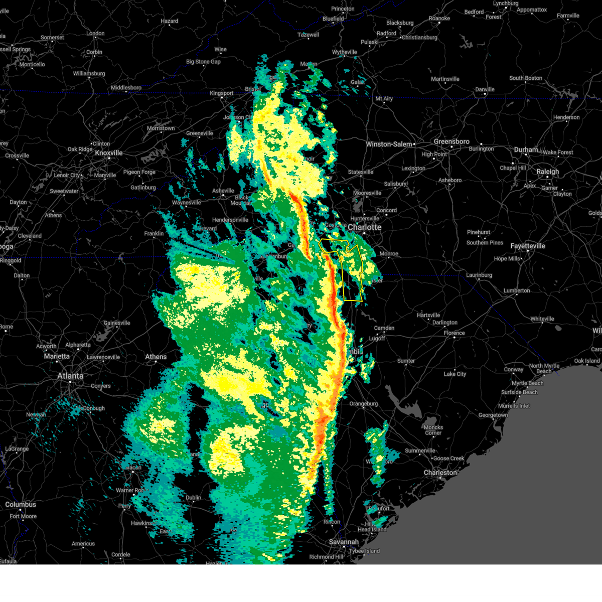 the severe thunderstorm warning has been cancelled and is no longer in effect the severe thunderstorm warning has been cancelled and is no longer in effect
|
| 12/29/2024 8:59 AM EST |
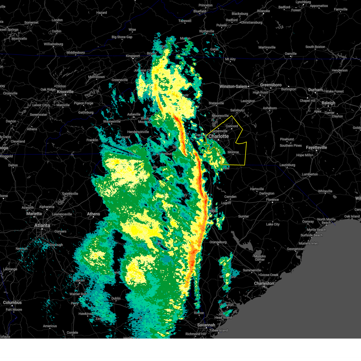 Svrgsp the national weather service in greenville-spartanburg has issued a * severe thunderstorm warning for, cabarrus county in the piedmont of north carolina, mecklenburg county in the piedmont of north carolina, south central rowan county in the piedmont of north carolina, southeastern gaston county in the piedmont of north carolina, union county in the piedmont of north carolina, * until 1015 am est. * at 859 am est, severe thunderstorms were located along a line extending from 8 miles north of york to 5 miles west of rock hill to 3 miles north of winnsboro, moving northeast at 50 mph (radar indicated). Hazards include 60 mph wind gusts. expect damage to trees and power lines Svrgsp the national weather service in greenville-spartanburg has issued a * severe thunderstorm warning for, cabarrus county in the piedmont of north carolina, mecklenburg county in the piedmont of north carolina, south central rowan county in the piedmont of north carolina, southeastern gaston county in the piedmont of north carolina, union county in the piedmont of north carolina, * until 1015 am est. * at 859 am est, severe thunderstorms were located along a line extending from 8 miles north of york to 5 miles west of rock hill to 3 miles north of winnsboro, moving northeast at 50 mph (radar indicated). Hazards include 60 mph wind gusts. expect damage to trees and power lines
|
| 12/29/2024 8:54 AM EST |
 At 854 am est, severe thunderstorms were located along a line extending from 3 miles northwest of york to 8 miles west of rock hill to 10 miles south of chester, moving northeast at 55 mph (radar indicated). Hazards include 60 mph wind gusts. Expect damage to trees and power lines. Locations impacted include, rock hill, york, chester, fort mill, tega cay, clover, newport, lesslie, great falls, and fort lawn. At 854 am est, severe thunderstorms were located along a line extending from 3 miles northwest of york to 8 miles west of rock hill to 10 miles south of chester, moving northeast at 55 mph (radar indicated). Hazards include 60 mph wind gusts. Expect damage to trees and power lines. Locations impacted include, rock hill, york, chester, fort mill, tega cay, clover, newport, lesslie, great falls, and fort lawn.
|
| 12/29/2024 8:45 AM EST |
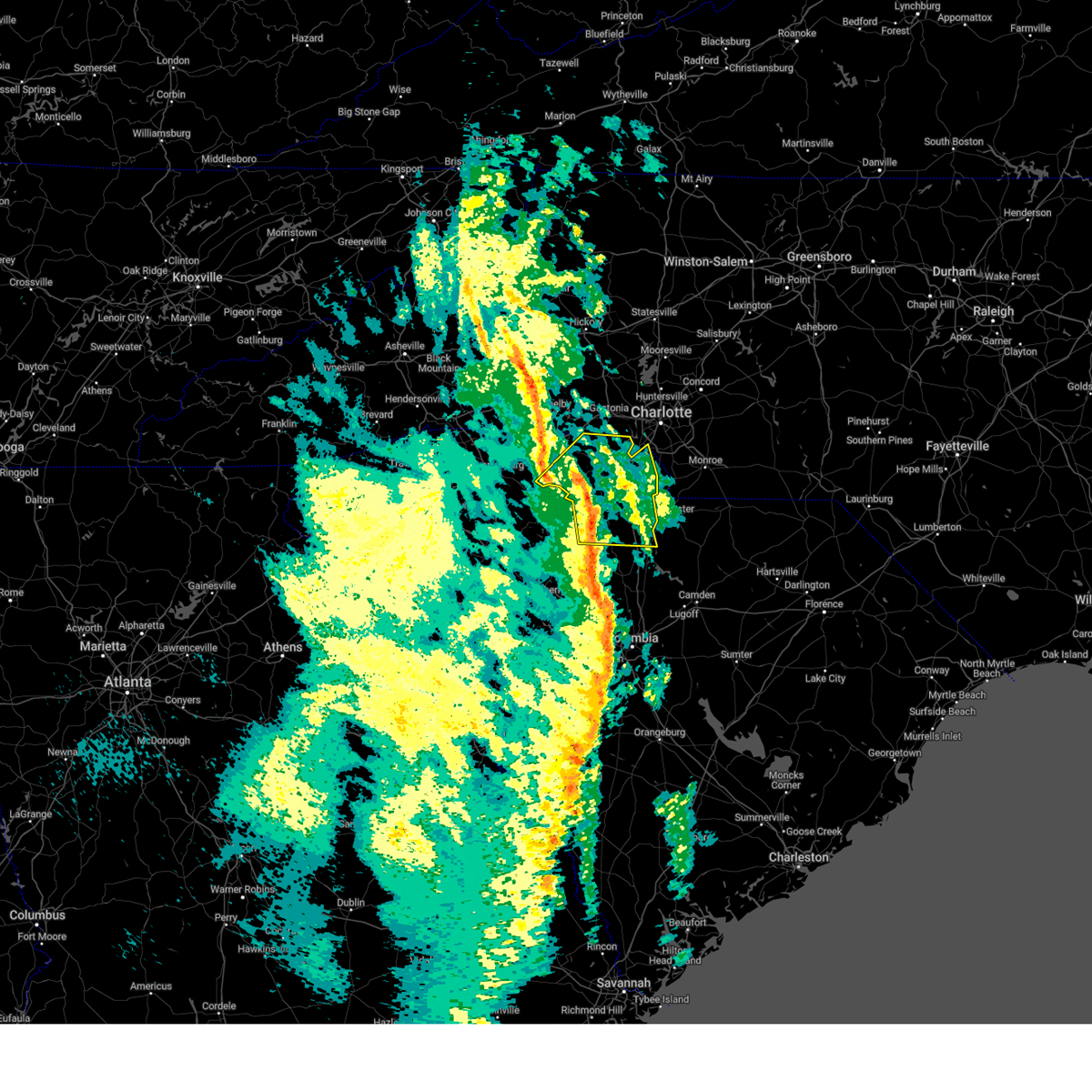 the severe thunderstorm warning has been cancelled and is no longer in effect the severe thunderstorm warning has been cancelled and is no longer in effect
|
| 12/29/2024 8:45 AM EST |
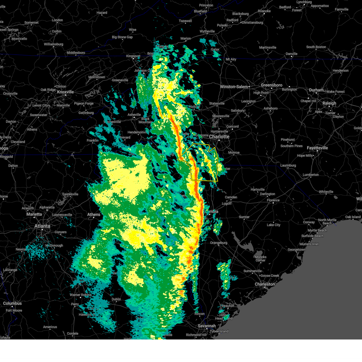 At 845 am est, severe thunderstorms were located along a line extending from 13 miles east of gaffney to 6 miles southwest of york to 9 miles southwest of chester, moving northeast at 60 mph (radar indicated). Hazards include 60 mph wind gusts. Expect damage to trees and power lines. Locations impacted include, rock hill, york, chester, fort mill, tega cay, clover, newport, lesslie, great falls, and fort lawn. At 845 am est, severe thunderstorms were located along a line extending from 13 miles east of gaffney to 6 miles southwest of york to 9 miles southwest of chester, moving northeast at 60 mph (radar indicated). Hazards include 60 mph wind gusts. Expect damage to trees and power lines. Locations impacted include, rock hill, york, chester, fort mill, tega cay, clover, newport, lesslie, great falls, and fort lawn.
|
| 12/29/2024 8:17 AM EST |
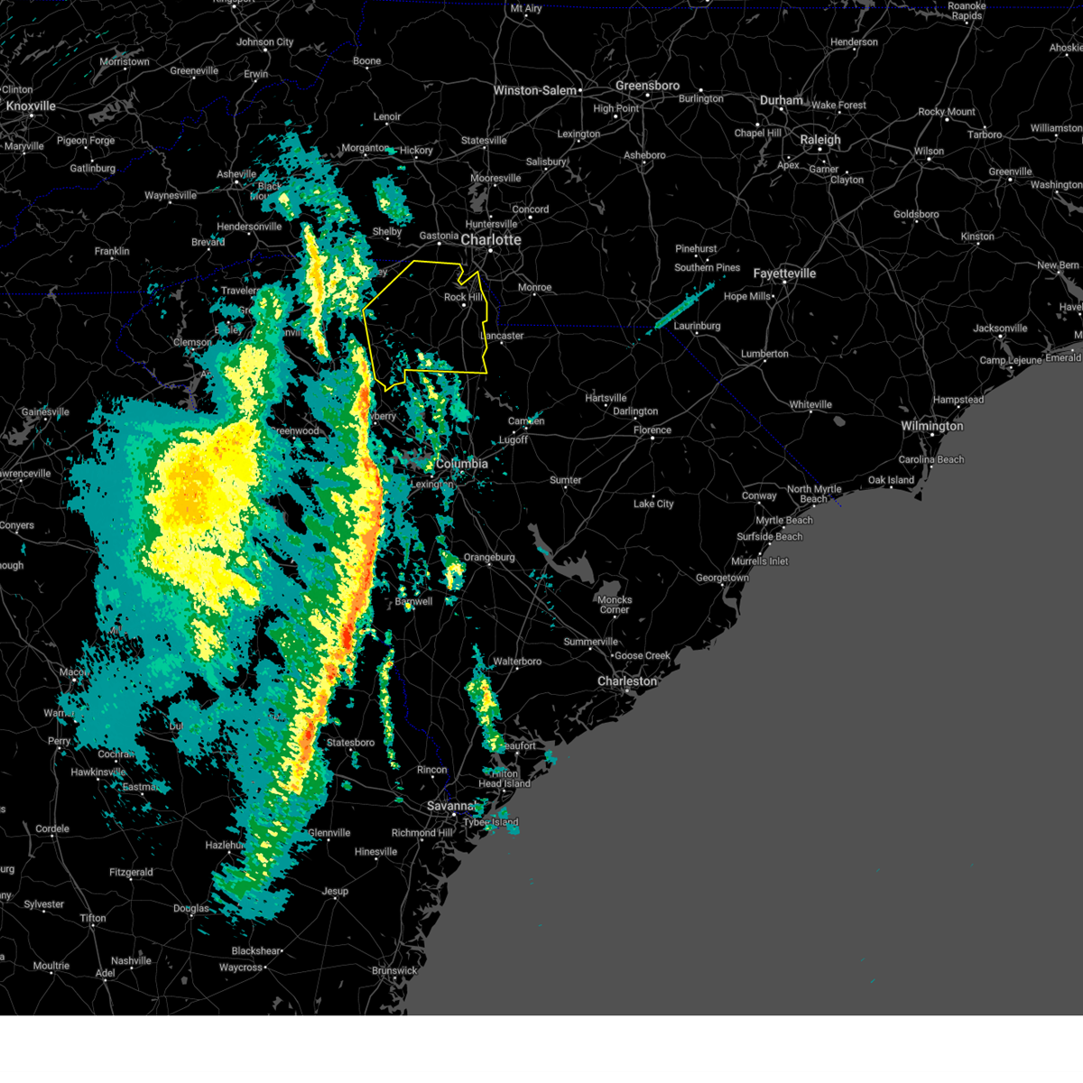 Svrgsp the national weather service in greenville-spartanburg has issued a * severe thunderstorm warning for, chester county in upstate south carolina, york county in upstate south carolina, southeastern cherokee county in upstate south carolina, union county in upstate south carolina, * until 930 am est. * at 817 am est, severe thunderstorms were located along a line extending from 16 miles southeast of spartanburg to 6 miles south of union to near newberry, moving northeast at 60 mph (radar indicated). Hazards include 60 mph wind gusts. expect damage to trees and power lines Svrgsp the national weather service in greenville-spartanburg has issued a * severe thunderstorm warning for, chester county in upstate south carolina, york county in upstate south carolina, southeastern cherokee county in upstate south carolina, union county in upstate south carolina, * until 930 am est. * at 817 am est, severe thunderstorms were located along a line extending from 16 miles southeast of spartanburg to 6 miles south of union to near newberry, moving northeast at 60 mph (radar indicated). Hazards include 60 mph wind gusts. expect damage to trees and power lines
|
| 9/26/2024 10:09 AM EDT |
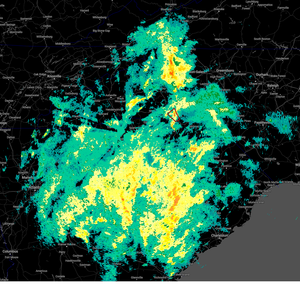 The storm which prompted the warning has weakened below severe limits, and no longer appears capable of producing a tornado. therefore, the warning will be allowed to expire. The storm which prompted the warning has weakened below severe limits, and no longer appears capable of producing a tornado. therefore, the warning will be allowed to expire.
|
| 9/26/2024 9:52 AM EDT |
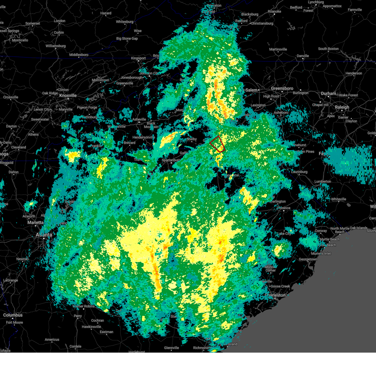 Torgsp the national weather service in greenville-spartanburg has issued a * tornado warning for, west central mecklenburg county in the piedmont of north carolina, eastern gaston county in the piedmont of north carolina, * until 1015 am edt. * at 952 am edt, a severe thunderstorm capable of producing a tornado was located 7 miles southwest of uptown charlotte, or near charlotte douglas airport, moving northwest at 15 mph (radar indicated rotation). Hazards include tornado. Flying debris will be dangerous to those caught without shelter. mobile homes will be damaged or destroyed. damage to roofs, windows, and vehicles will occur. tree damage is likely. This dangerous storm will be near, belmont, lake wylie, and charlotte douglas airport around 1000 am edt. Torgsp the national weather service in greenville-spartanburg has issued a * tornado warning for, west central mecklenburg county in the piedmont of north carolina, eastern gaston county in the piedmont of north carolina, * until 1015 am edt. * at 952 am edt, a severe thunderstorm capable of producing a tornado was located 7 miles southwest of uptown charlotte, or near charlotte douglas airport, moving northwest at 15 mph (radar indicated rotation). Hazards include tornado. Flying debris will be dangerous to those caught without shelter. mobile homes will be damaged or destroyed. damage to roofs, windows, and vehicles will occur. tree damage is likely. This dangerous storm will be near, belmont, lake wylie, and charlotte douglas airport around 1000 am edt.
|
| 9/25/2024 12:00 AM EDT |
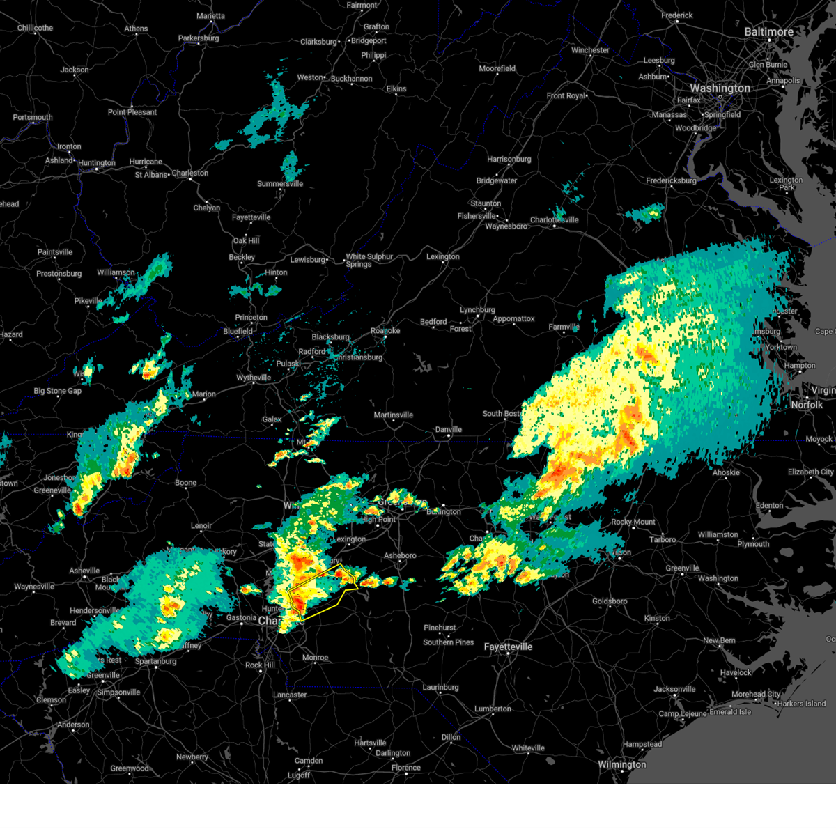 Svrgsp the national weather service in greenville-spartanburg has issued a * severe thunderstorm warning for, cabarrus county in the piedmont of north carolina, southeastern rowan county in the piedmont of north carolina, * until 100 am edt. * at 1200 am edt, a severe thunderstorm was located near downtown concord, moving northeast at 25 mph (radar indicated). Hazards include 60 mph wind gusts and penny size hail. expect damage to trees and power lines Svrgsp the national weather service in greenville-spartanburg has issued a * severe thunderstorm warning for, cabarrus county in the piedmont of north carolina, southeastern rowan county in the piedmont of north carolina, * until 100 am edt. * at 1200 am edt, a severe thunderstorm was located near downtown concord, moving northeast at 25 mph (radar indicated). Hazards include 60 mph wind gusts and penny size hail. expect damage to trees and power lines
|
| 9/24/2024 10:27 PM EDT |
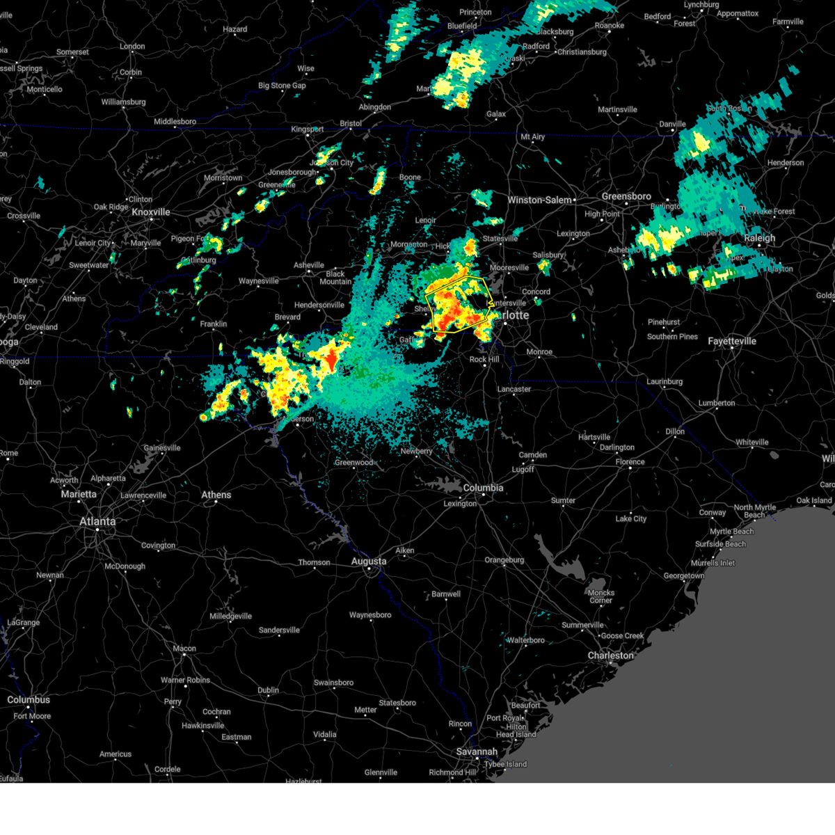 the severe thunderstorm warning has been cancelled and is no longer in effect the severe thunderstorm warning has been cancelled and is no longer in effect
|
| 9/24/2024 10:27 PM EDT |
 At 1026 pm edt, a severe thunderstorm was located 5 miles southeast of lincolnton, or near high shoals, moving northeast at 40 mph (radar indicated). Hazards include 60 mph wind gusts and quarter size hail. Minor hail damage to vehicles is expected. expect wind damage to trees and power lines. Locations impacted include, gastonia, lincolnton, kings mountain, mt holly, belmont, cherryville, bessemer city, south gastonia, dallas, and stanley. At 1026 pm edt, a severe thunderstorm was located 5 miles southeast of lincolnton, or near high shoals, moving northeast at 40 mph (radar indicated). Hazards include 60 mph wind gusts and quarter size hail. Minor hail damage to vehicles is expected. expect wind damage to trees and power lines. Locations impacted include, gastonia, lincolnton, kings mountain, mt holly, belmont, cherryville, bessemer city, south gastonia, dallas, and stanley.
|
| 9/24/2024 10:04 PM EDT |
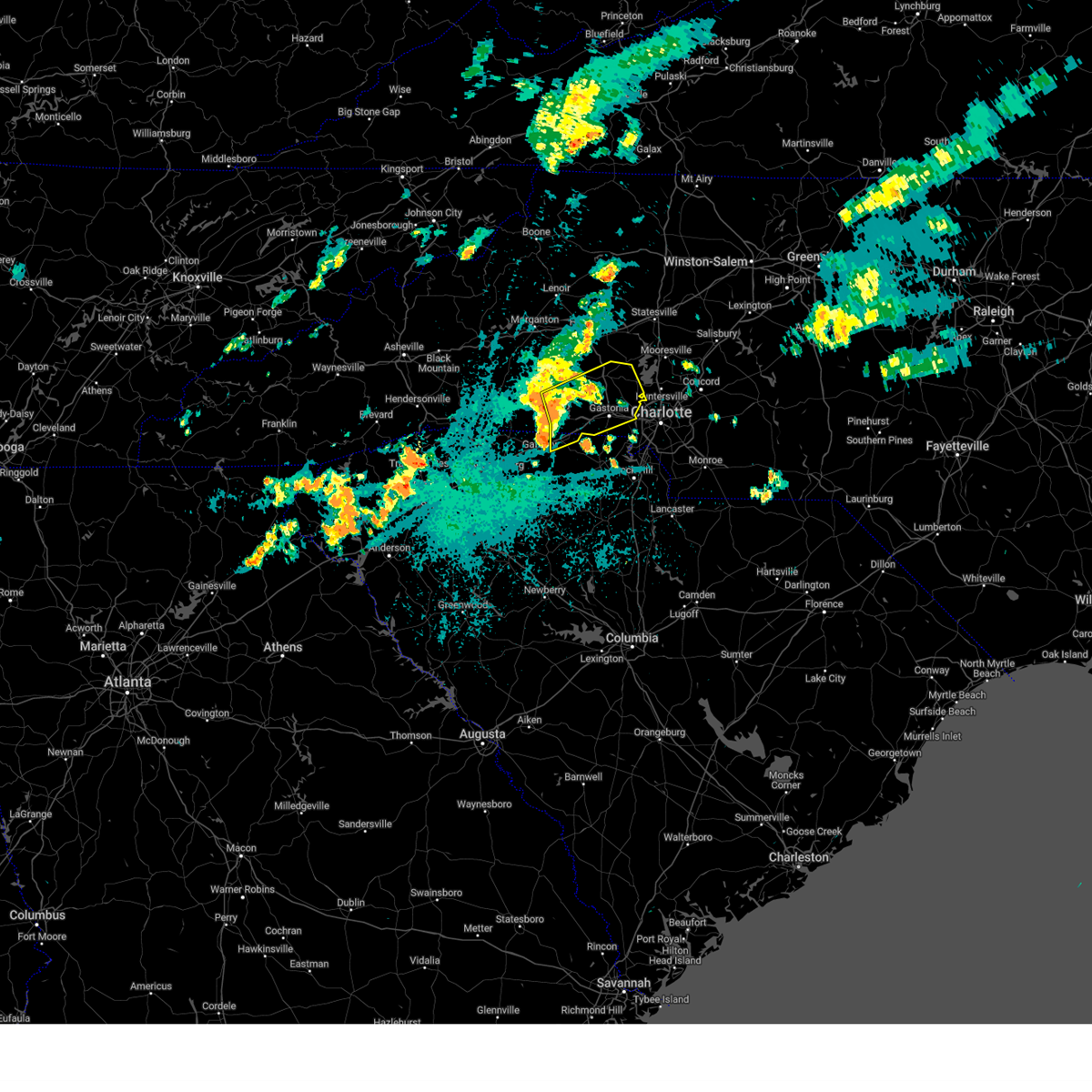 Svrgsp the national weather service in greenville-spartanburg has issued a * severe thunderstorm warning for, lincoln county in the piedmont of north carolina, southeastern cleveland county in the piedmont of north carolina, gaston county in the piedmont of north carolina, northeastern cherokee county in upstate south carolina, * until 1045 pm edt. * at 1004 pm edt, a severe thunderstorm was located 7 miles east of shelby, or near waco, moving northeast at 40 mph (radar indicated). Hazards include 60 mph wind gusts and quarter size hail. Minor hail damage to vehicles is expected. Expect wind damage to trees and power lines. Svrgsp the national weather service in greenville-spartanburg has issued a * severe thunderstorm warning for, lincoln county in the piedmont of north carolina, southeastern cleveland county in the piedmont of north carolina, gaston county in the piedmont of north carolina, northeastern cherokee county in upstate south carolina, * until 1045 pm edt. * at 1004 pm edt, a severe thunderstorm was located 7 miles east of shelby, or near waco, moving northeast at 40 mph (radar indicated). Hazards include 60 mph wind gusts and quarter size hail. Minor hail damage to vehicles is expected. Expect wind damage to trees and power lines.
|
| 9/1/2024 6:31 PM EDT |
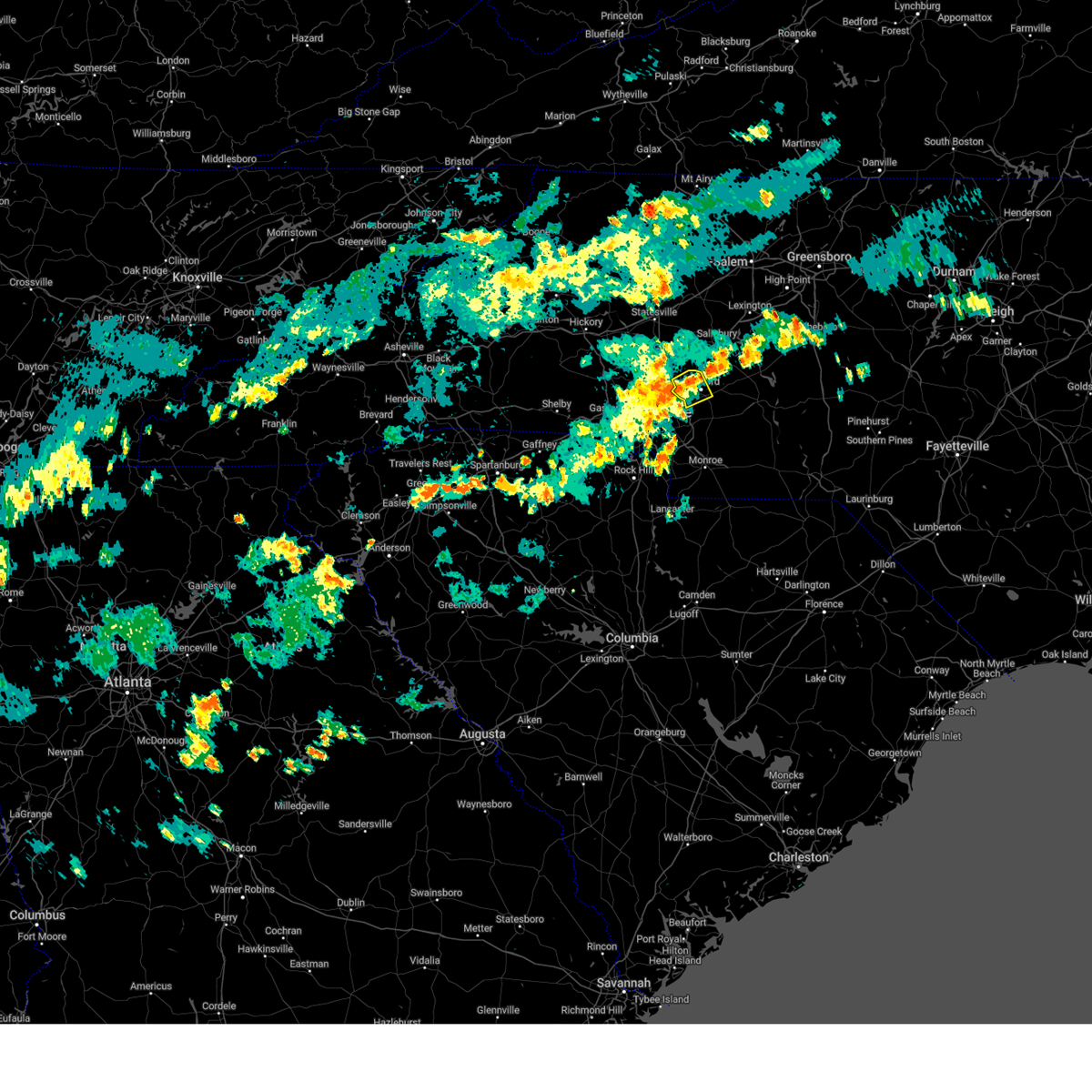 the severe thunderstorm warning has been cancelled and is no longer in effect the severe thunderstorm warning has been cancelled and is no longer in effect
|
| 9/1/2024 6:31 PM EDT |
 At 631 pm edt, a severe thunderstorm was located near downtown concord, moving northeast at 25 mph (radar indicated). Hazards include 60 mph wind gusts. Expect damage to trees and power lines. Locations impacted include, kannapolis, downtown concord, west concord, harrisburg, coddle creek reservoir, charlotte motor speedway, and enochville. At 631 pm edt, a severe thunderstorm was located near downtown concord, moving northeast at 25 mph (radar indicated). Hazards include 60 mph wind gusts. Expect damage to trees and power lines. Locations impacted include, kannapolis, downtown concord, west concord, harrisburg, coddle creek reservoir, charlotte motor speedway, and enochville.
|
| 9/1/2024 6:23 PM EDT |
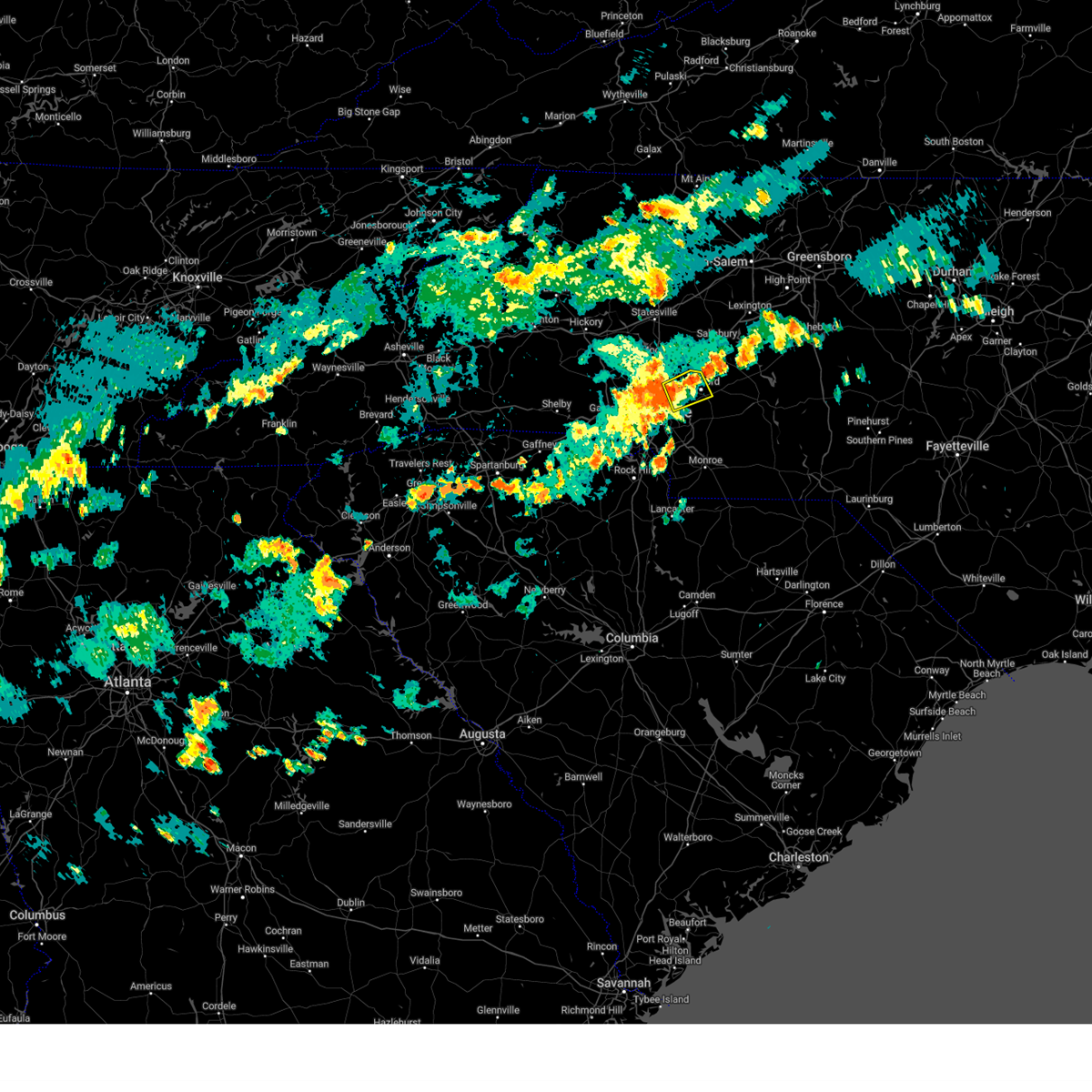 At 623 pm edt, a severe thunderstorm was located 4 miles west of downtown concord, or over west concord, moving northeast at 25 mph (radar indicated). Hazards include 60 mph wind gusts. Expect damage to trees and power lines. Locations impacted include, kannapolis, downtown concord, west concord, harrisburg, university city, coddle creek reservoir, charlotte motor speedway, northeast charlotte, and davidson. At 623 pm edt, a severe thunderstorm was located 4 miles west of downtown concord, or over west concord, moving northeast at 25 mph (radar indicated). Hazards include 60 mph wind gusts. Expect damage to trees and power lines. Locations impacted include, kannapolis, downtown concord, west concord, harrisburg, university city, coddle creek reservoir, charlotte motor speedway, northeast charlotte, and davidson.
|
| 9/1/2024 6:15 PM EDT | Several trees down... some of which fell onto power lines/utility equipment. these trees were downed mainly to the southwest of concord regional airpor in mecklenburg county NC, 10.9 miles SSW of Charlotte, NC |
| 9/1/2024 6:15 PM EDT |
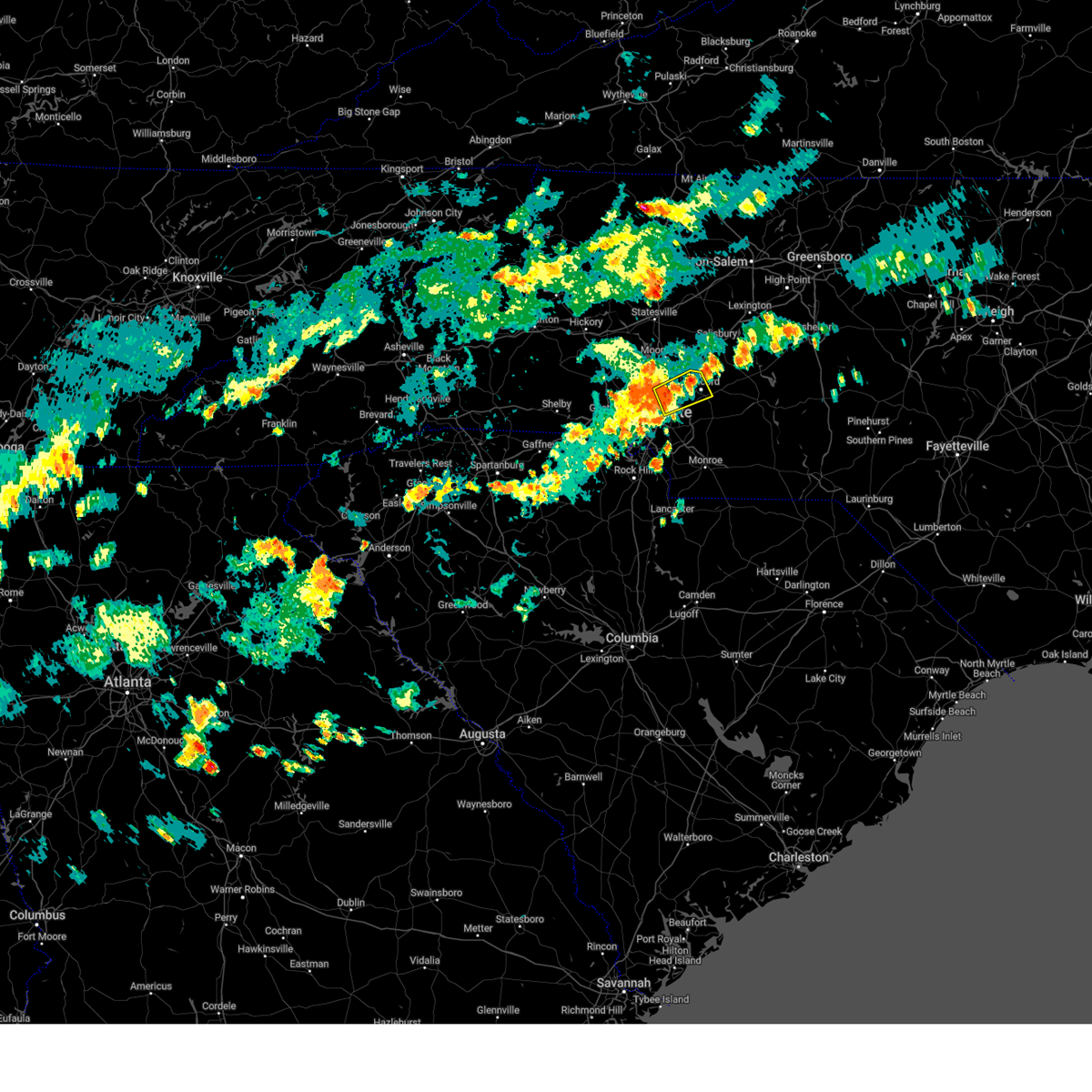 Svrgsp the national weather service in greenville-spartanburg has issued a * severe thunderstorm warning for, northwestern cabarrus county in the piedmont of north carolina, north central mecklenburg county in the piedmont of north carolina, * until 700 pm edt. * at 615 pm edt, a severe thunderstorm was located 5 miles southeast of huntersville, or near northeast charlotte, moving northeast at 25 mph (radar indicated). Hazards include 60 mph wind gusts. expect damage to trees and power lines Svrgsp the national weather service in greenville-spartanburg has issued a * severe thunderstorm warning for, northwestern cabarrus county in the piedmont of north carolina, north central mecklenburg county in the piedmont of north carolina, * until 700 pm edt. * at 615 pm edt, a severe thunderstorm was located 5 miles southeast of huntersville, or near northeast charlotte, moving northeast at 25 mph (radar indicated). Hazards include 60 mph wind gusts. expect damage to trees and power lines
|
| 8/19/2024 7:18 PM EDT |
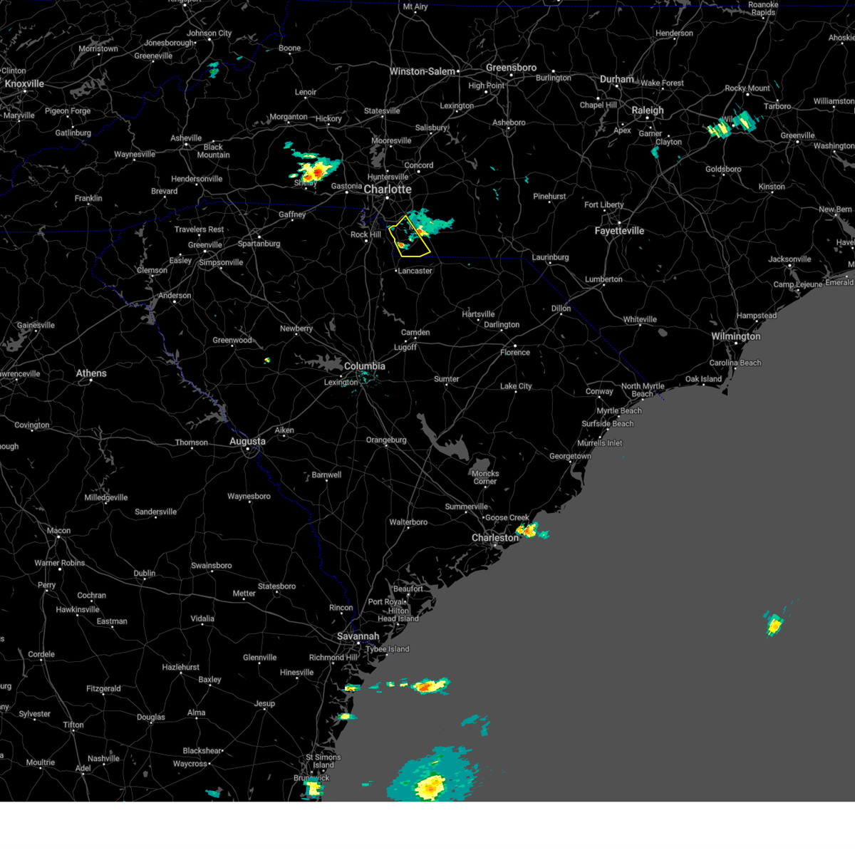 the severe thunderstorm warning has been cancelled and is no longer in effect the severe thunderstorm warning has been cancelled and is no longer in effect
|
| 8/19/2024 6:57 PM EDT |
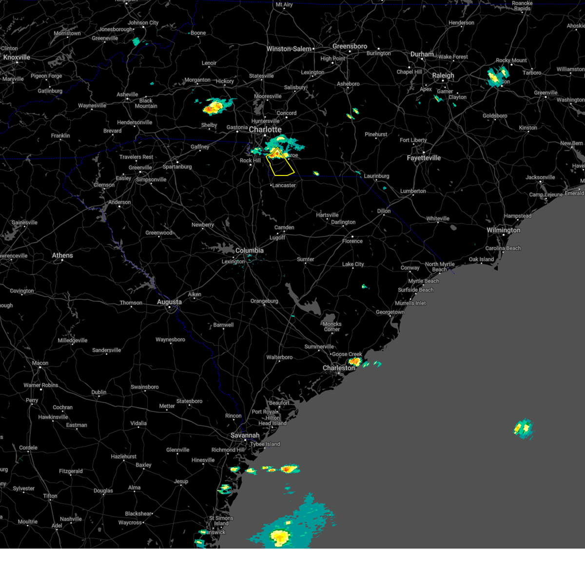 At 657 pm edt, a severe thunderstorm was located 7 miles east of indian land, or near weddington, moving southeast at 15 mph (radar indicated). Hazards include 60 mph wind gusts. Expect damage to trees and power lines. Locations impacted include, indian trail, weddington, stallings, wesley chapel, waxhaw, mineral springs, marvin, trinity, and jaars. At 657 pm edt, a severe thunderstorm was located 7 miles east of indian land, or near weddington, moving southeast at 15 mph (radar indicated). Hazards include 60 mph wind gusts. Expect damage to trees and power lines. Locations impacted include, indian trail, weddington, stallings, wesley chapel, waxhaw, mineral springs, marvin, trinity, and jaars.
|
| 8/19/2024 6:57 PM EDT |
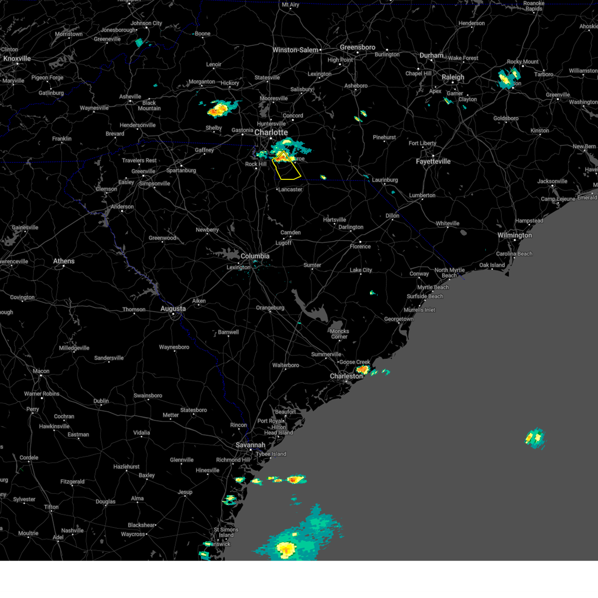 the severe thunderstorm warning has been cancelled and is no longer in effect the severe thunderstorm warning has been cancelled and is no longer in effect
|
| 8/19/2024 6:37 PM EDT |
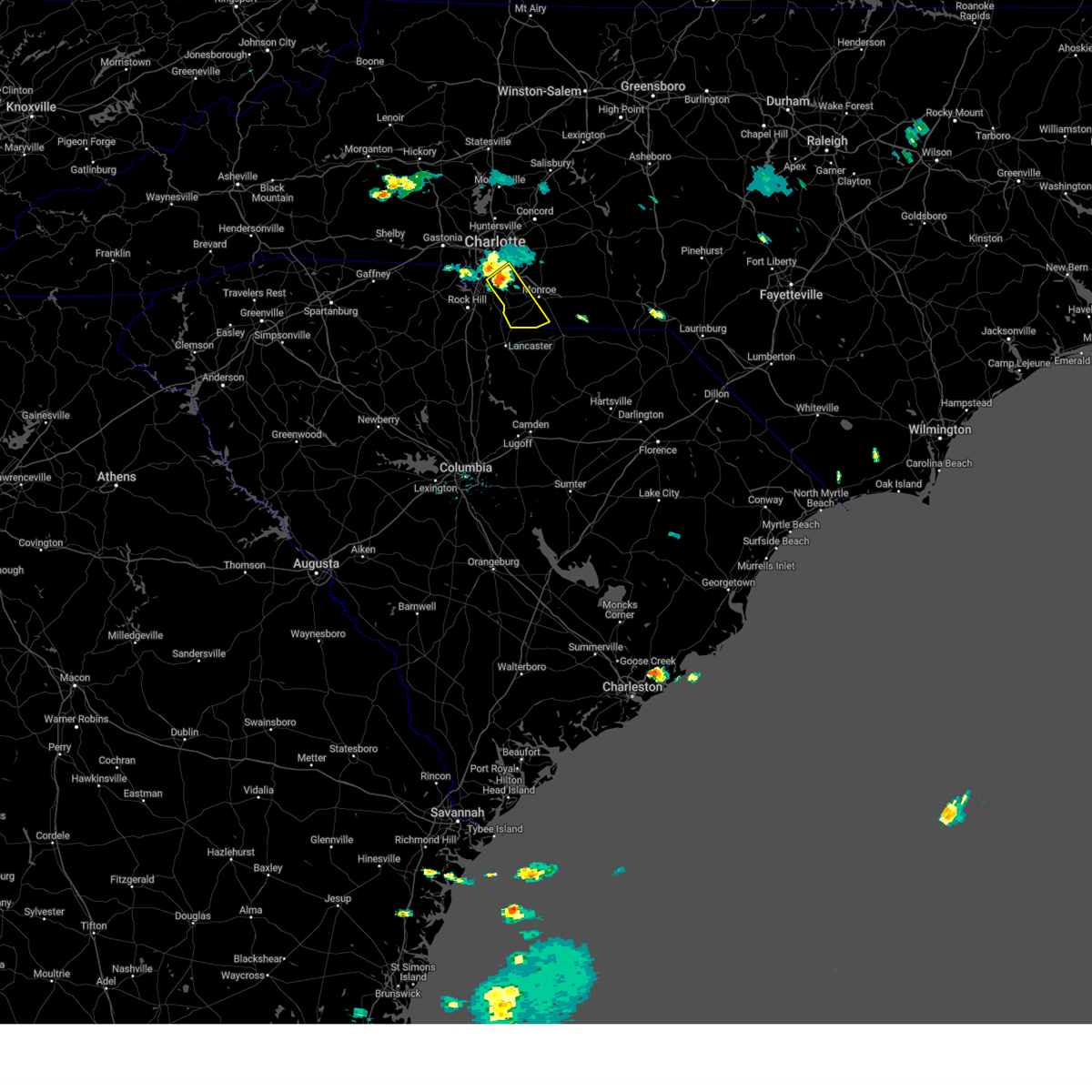 Svrgsp the national weather service in greenville-spartanburg has issued a * severe thunderstorm warning for, south central mecklenburg county in the piedmont of north carolina, southwestern union county in the piedmont of north carolina, * until 745 pm edt. * at 637 pm edt, a severe thunderstorm was located 5 miles northeast of indian land, or near the arboretum, moving southeast at 15 mph (radar indicated). Hazards include 60 mph wind gusts and penny size hail. expect damage to trees and power lines Svrgsp the national weather service in greenville-spartanburg has issued a * severe thunderstorm warning for, south central mecklenburg county in the piedmont of north carolina, southwestern union county in the piedmont of north carolina, * until 745 pm edt. * at 637 pm edt, a severe thunderstorm was located 5 miles northeast of indian land, or near the arboretum, moving southeast at 15 mph (radar indicated). Hazards include 60 mph wind gusts and penny size hail. expect damage to trees and power lines
|
| 8/19/2024 6:34 PM EDT | One tree down on pineville-matthews rd near fire station 2 in mecklenburg county NC, 9.9 miles N of Charlotte, NC |
| 8/19/2024 6:20 PM EDT |
 At 619 pm edt, a severe thunderstorm was located 8 miles west of uptown charlotte, or near charlotte douglas airport, moving southeast at 15 mph (radar indicated). Hazards include 60 mph wind gusts. Expect damage to trees and power lines. Locations impacted include, charlotte, steele creek, charlotte douglas airport, carowinds, and lake wylie. At 619 pm edt, a severe thunderstorm was located 8 miles west of uptown charlotte, or near charlotte douglas airport, moving southeast at 15 mph (radar indicated). Hazards include 60 mph wind gusts. Expect damage to trees and power lines. Locations impacted include, charlotte, steele creek, charlotte douglas airport, carowinds, and lake wylie.
|
| 8/19/2024 6:20 PM EDT |
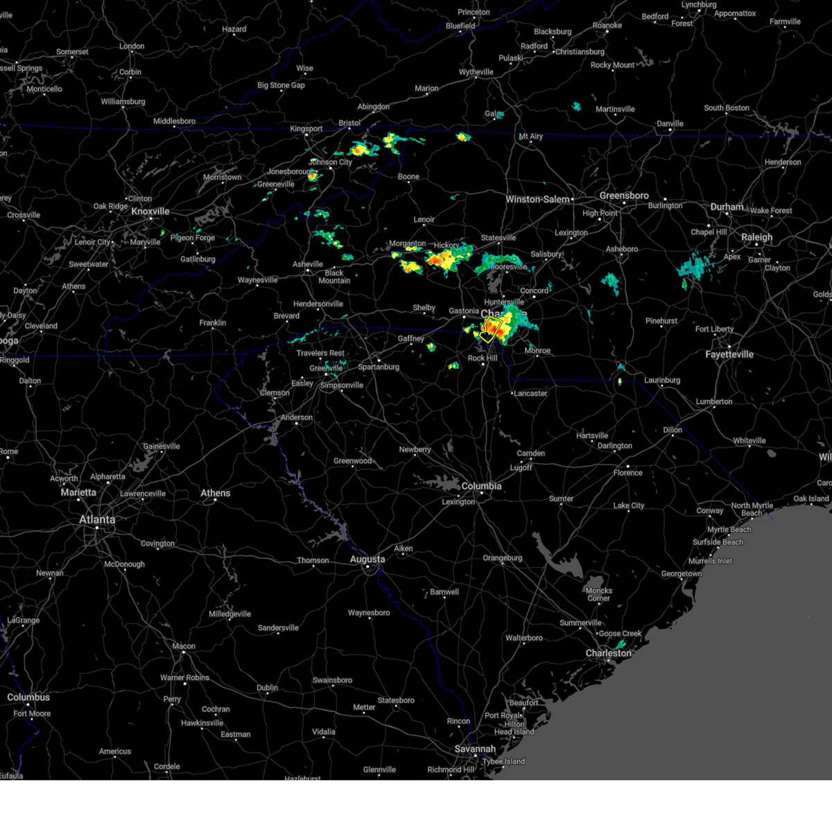 the severe thunderstorm warning has been cancelled and is no longer in effect the severe thunderstorm warning has been cancelled and is no longer in effect
|
| 8/19/2024 5:46 PM EDT |
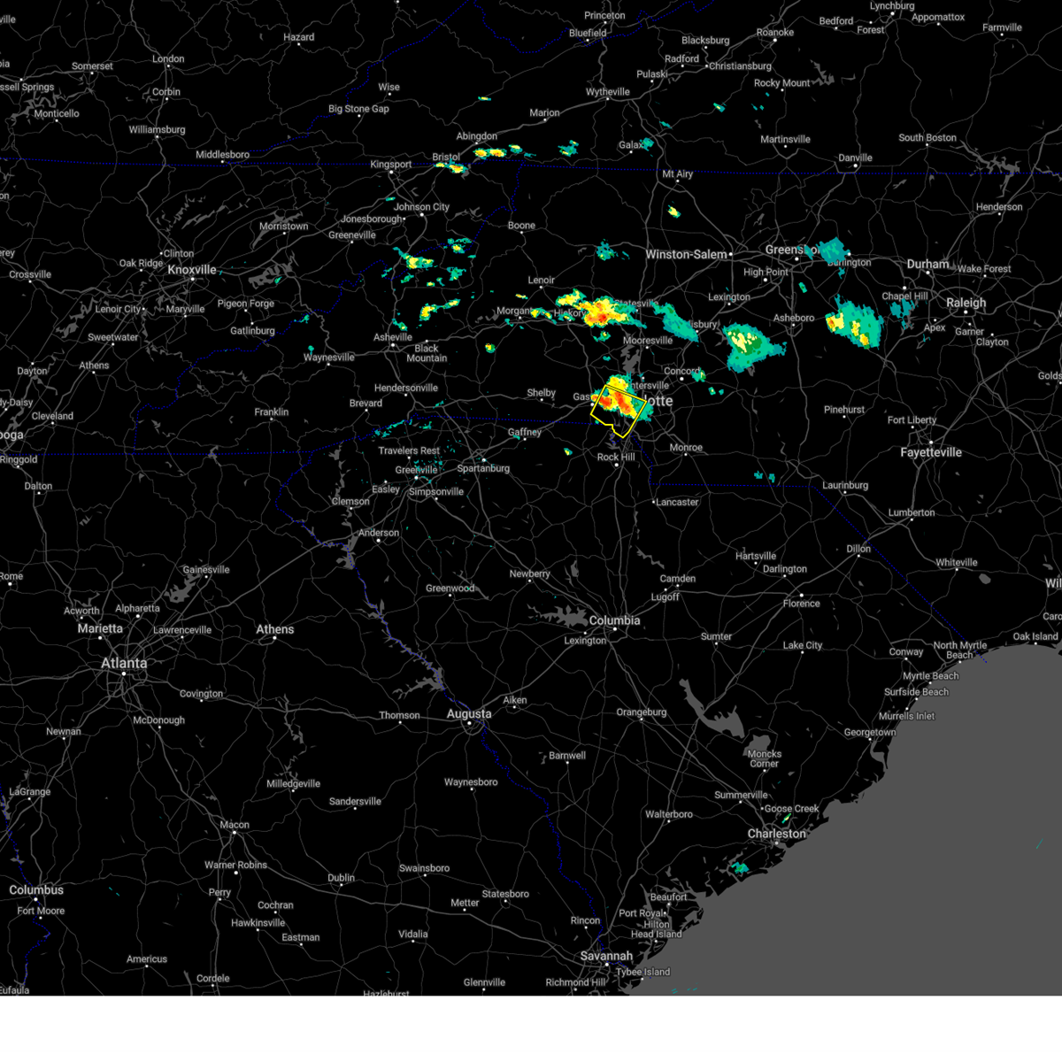 Svrgsp the national weather service in greenville-spartanburg has issued a * severe thunderstorm warning for, southwestern mecklenburg county in the piedmont of north carolina, eastern gaston county in the piedmont of north carolina, * until 630 pm edt. * at 546 pm edt, a severe thunderstorm was located 4 miles east of gastonia, or over mcadenville, moving southeast at 10 mph (radar indicated). Hazards include 60 mph wind gusts and penny size hail. expect damage to trees and power lines Svrgsp the national weather service in greenville-spartanburg has issued a * severe thunderstorm warning for, southwestern mecklenburg county in the piedmont of north carolina, eastern gaston county in the piedmont of north carolina, * until 630 pm edt. * at 546 pm edt, a severe thunderstorm was located 4 miles east of gastonia, or over mcadenville, moving southeast at 10 mph (radar indicated). Hazards include 60 mph wind gusts and penny size hail. expect damage to trees and power lines
|
| 8/18/2024 7:14 PM EDT |
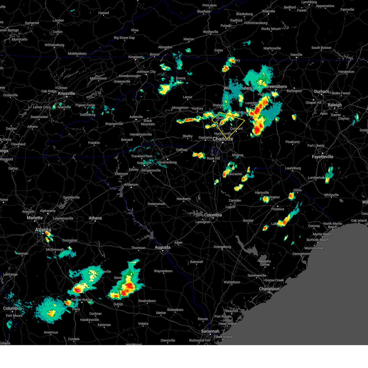 the severe thunderstorm warning has been cancelled and is no longer in effect the severe thunderstorm warning has been cancelled and is no longer in effect
|
| 8/18/2024 6:30 PM EDT |
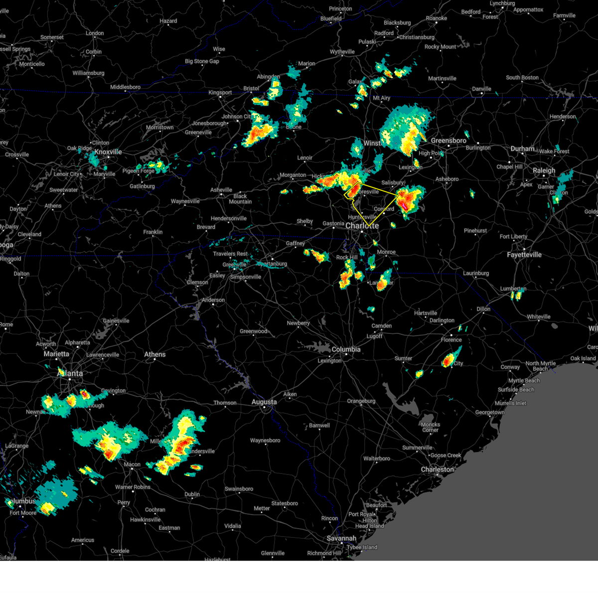 Svrgsp the national weather service in greenville-spartanburg has issued a * severe thunderstorm warning for, northwestern cabarrus county in the piedmont of north carolina, southeastern catawba county in the piedmont of north carolina, southeastern iredell county in the piedmont of north carolina, north central mecklenburg county in the piedmont of north carolina, southwestern rowan county in the piedmont of north carolina, * until 730 pm edt. * at 630 pm edt, severe thunderstorms were located along a line extending from 9 miles south of statesville to 12 miles northwest of huntersville, moving southeast at 20 mph (radar indicated). Hazards include 60 mph wind gusts and nickel size hail. expect damage to trees and power lines Svrgsp the national weather service in greenville-spartanburg has issued a * severe thunderstorm warning for, northwestern cabarrus county in the piedmont of north carolina, southeastern catawba county in the piedmont of north carolina, southeastern iredell county in the piedmont of north carolina, north central mecklenburg county in the piedmont of north carolina, southwestern rowan county in the piedmont of north carolina, * until 730 pm edt. * at 630 pm edt, severe thunderstorms were located along a line extending from 9 miles south of statesville to 12 miles northwest of huntersville, moving southeast at 20 mph (radar indicated). Hazards include 60 mph wind gusts and nickel size hail. expect damage to trees and power lines
|
| 8/16/2024 10:05 PM EDT |
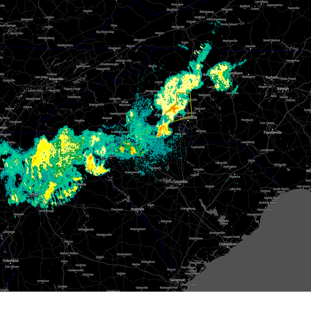 The storms which prompted the warning have weakened below severe limits, and no longer pose an immediate threat to life or property. therefore, the warning will be allowed to expire. The storms which prompted the warning have weakened below severe limits, and no longer pose an immediate threat to life or property. therefore, the warning will be allowed to expire.
|
| 8/16/2024 9:23 PM EDT |
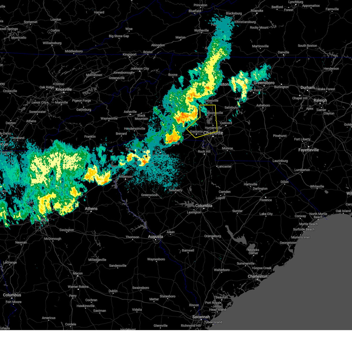 Svrgsp the national weather service in greenville-spartanburg has issued a * severe thunderstorm warning for, southeastern catawba county in the piedmont of north carolina, eastern lincoln county in the piedmont of north carolina, southern iredell county in the piedmont of north carolina, northwestern mecklenburg county in the piedmont of north carolina, gaston county in the piedmont of north carolina, * until 1015 pm edt. * at 923 pm edt, severe thunderstorms were located along a line extending from near newton to 3 miles northeast of lincolnton to 14 miles north of shelby, moving southeast at 35 mph (radar indicated). Hazards include 60 mph wind gusts and penny size hail. expect damage to trees and power lines Svrgsp the national weather service in greenville-spartanburg has issued a * severe thunderstorm warning for, southeastern catawba county in the piedmont of north carolina, eastern lincoln county in the piedmont of north carolina, southern iredell county in the piedmont of north carolina, northwestern mecklenburg county in the piedmont of north carolina, gaston county in the piedmont of north carolina, * until 1015 pm edt. * at 923 pm edt, severe thunderstorms were located along a line extending from near newton to 3 miles northeast of lincolnton to 14 miles north of shelby, moving southeast at 35 mph (radar indicated). Hazards include 60 mph wind gusts and penny size hail. expect damage to trees and power lines
|
| 7/30/2024 9:25 PM EDT | Power outage attributed to fallen trees or limb in mecklenburg county NC, 12 miles NNW of Charlotte, NC |
| 7/30/2024 9:18 PM EDT |
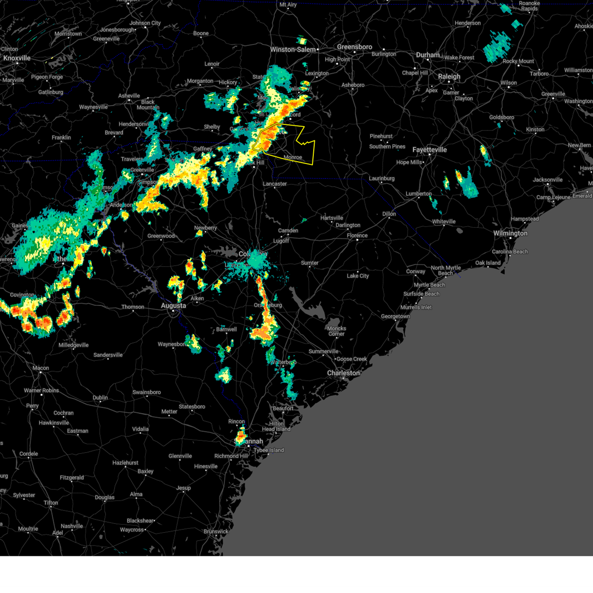 At 918 pm edt, a severe thunderstorm was located 5 miles east of uptown charlotte, or near east charlotte, moving east at 30 mph (radar indicated). Hazards include 60 mph wind gusts. Expect damage to trees and power lines. Locations impacted include, uptown charlotte, central charlotte, south charlotte, northeast charlotte, southwest charlotte, east charlotte, northwest charlotte, matthews, mint hill, and indian trail. At 918 pm edt, a severe thunderstorm was located 5 miles east of uptown charlotte, or near east charlotte, moving east at 30 mph (radar indicated). Hazards include 60 mph wind gusts. Expect damage to trees and power lines. Locations impacted include, uptown charlotte, central charlotte, south charlotte, northeast charlotte, southwest charlotte, east charlotte, northwest charlotte, matthews, mint hill, and indian trail.
|
| 7/30/2024 9:18 PM EDT |
 the severe thunderstorm warning has been cancelled and is no longer in effect the severe thunderstorm warning has been cancelled and is no longer in effect
|
| 7/30/2024 9:15 PM EDT | Power outage attributed to fallen trees or limbs near monroe rd crossing of mcmullen cree in mecklenburg county NC, 5.8 miles WNW of Charlotte, NC |
| 7/30/2024 9:09 PM EDT |
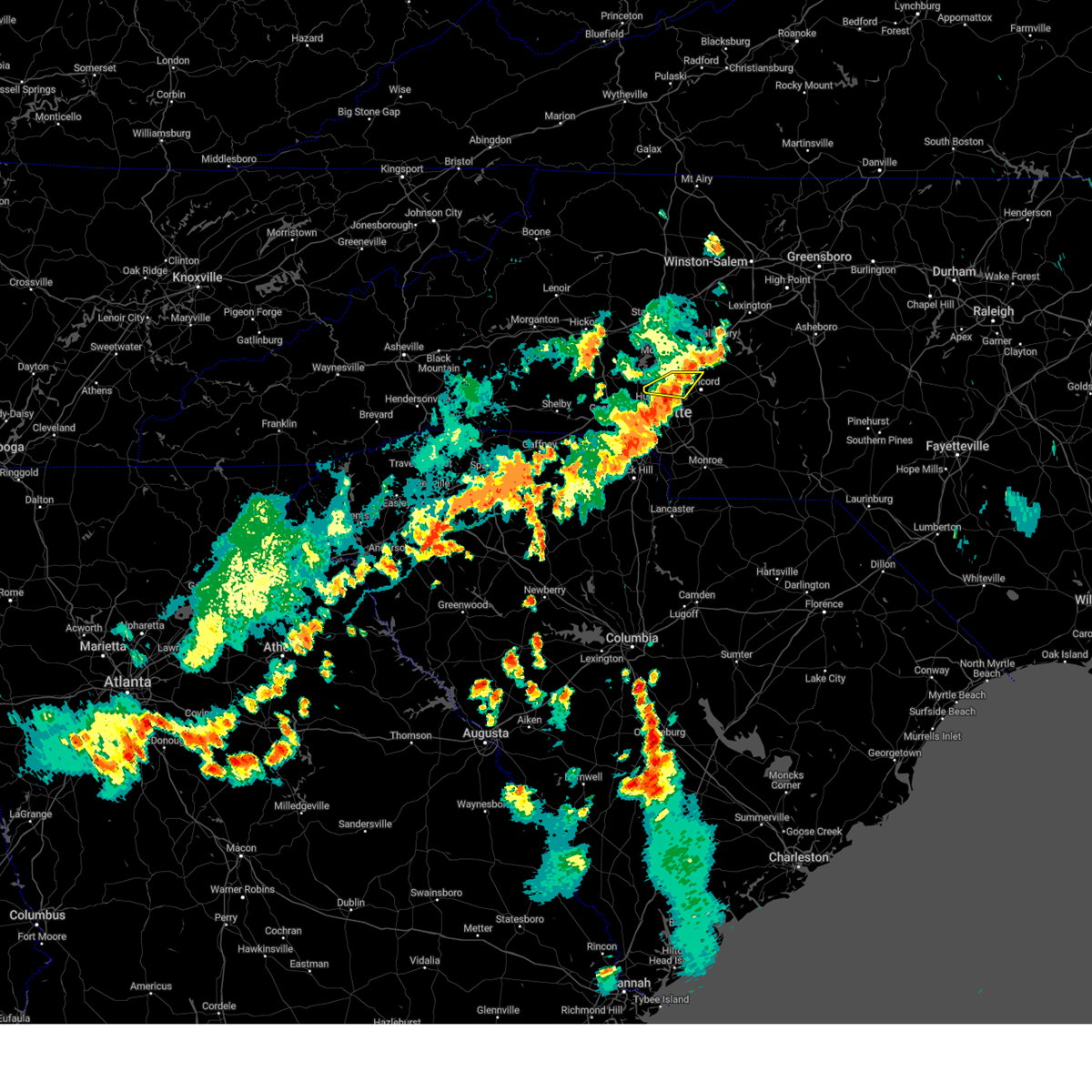 At 909 pm edt, a severe thunderstorm was located 7 miles north of salisbury, or near cooleemee, moving east at 30 mph (radar indicated). Hazards include 60 mph wind gusts. Expect damage to trees and power lines. Locations impacted include, huntersville, kannapolis, west concord, coddle creek reservoir, cornelius, davidson, and northeast charlotte. At 909 pm edt, a severe thunderstorm was located 7 miles north of salisbury, or near cooleemee, moving east at 30 mph (radar indicated). Hazards include 60 mph wind gusts. Expect damage to trees and power lines. Locations impacted include, huntersville, kannapolis, west concord, coddle creek reservoir, cornelius, davidson, and northeast charlotte.
|
| 7/30/2024 9:09 PM EDT |
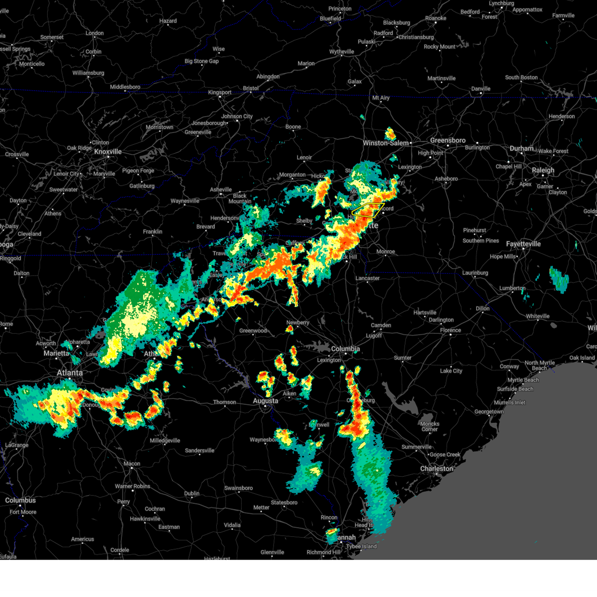 the severe thunderstorm warning has been cancelled and is no longer in effect the severe thunderstorm warning has been cancelled and is no longer in effect
|
| 7/30/2024 9:05 PM EDT | Char-meck emergency management reported a tree down on a vehicle at pineville-matthews rd and baybrook l in mecklenburg county NC, 10.7 miles N of Charlotte, NC |
| 7/30/2024 8:49 PM EDT |
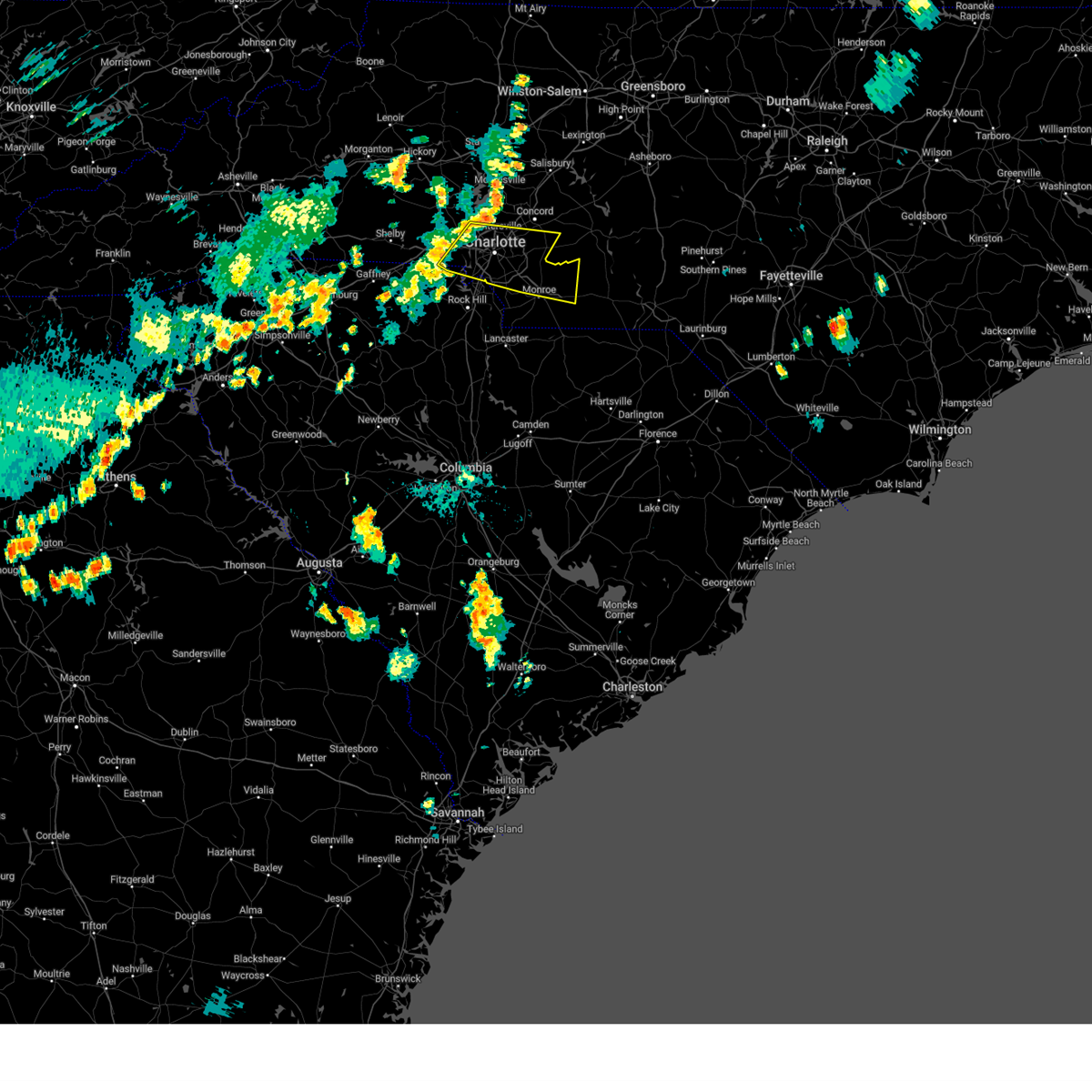 Svrgsp the national weather service in greenville-spartanburg has issued a * severe thunderstorm warning for, southwestern cabarrus county in the piedmont of north carolina, mecklenburg county in the piedmont of north carolina, eastern gaston county in the piedmont of north carolina, northern union county in the piedmont of north carolina, northeastern york county in upstate south carolina, * until 945 pm edt. * at 849 pm edt, a severe thunderstorm was located 8 miles east of gastonia, or near belmont, moving east at 30 mph (radar indicated). Hazards include 60 mph wind gusts and penny size hail. expect damage to trees and power lines Svrgsp the national weather service in greenville-spartanburg has issued a * severe thunderstorm warning for, southwestern cabarrus county in the piedmont of north carolina, mecklenburg county in the piedmont of north carolina, eastern gaston county in the piedmont of north carolina, northern union county in the piedmont of north carolina, northeastern york county in upstate south carolina, * until 945 pm edt. * at 849 pm edt, a severe thunderstorm was located 8 miles east of gastonia, or near belmont, moving east at 30 mph (radar indicated). Hazards include 60 mph wind gusts and penny size hail. expect damage to trees and power lines
|
| 7/30/2024 8:35 PM EDT |
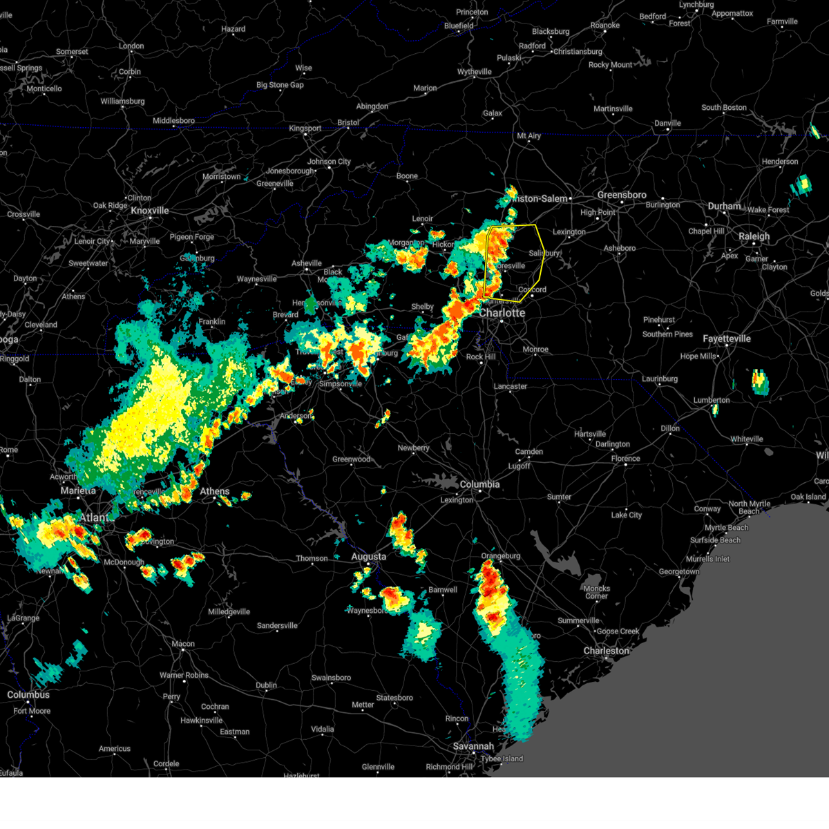 Svrgsp the national weather service in greenville-spartanburg has issued a * severe thunderstorm warning for, northwestern cabarrus county in the piedmont of north carolina, southeastern catawba county in the piedmont of north carolina, southwestern davie county in the piedmont of north carolina, southeastern lincoln county in the piedmont of north carolina, central iredell county in the piedmont of north carolina, northwestern mecklenburg county in the piedmont of north carolina, western rowan county in the piedmont of north carolina, * until 915 pm edt. * at 835 pm edt, a severe thunderstorm was located near statesville, moving east at 30 mph (radar indicated). Hazards include 60 mph wind gusts. expect damage to trees and power lines Svrgsp the national weather service in greenville-spartanburg has issued a * severe thunderstorm warning for, northwestern cabarrus county in the piedmont of north carolina, southeastern catawba county in the piedmont of north carolina, southwestern davie county in the piedmont of north carolina, southeastern lincoln county in the piedmont of north carolina, central iredell county in the piedmont of north carolina, northwestern mecklenburg county in the piedmont of north carolina, western rowan county in the piedmont of north carolina, * until 915 pm edt. * at 835 pm edt, a severe thunderstorm was located near statesville, moving east at 30 mph (radar indicated). Hazards include 60 mph wind gusts. expect damage to trees and power lines
|
| 7/23/2024 3:33 PM EDT |
 At 332 pm edt, a severe thunderstorm was located 9 miles south of downtown concord, or 4 miles northwest of midland, moving northeast at 20 mph (radar indicated). Hazards include 60 mph wind gusts and penny size hail. Expect damage to trees and power lines. Locations impacted include, harrisburg, mt pleasant, midland, charlotte motor speedway, fairview in union county, downtown concord, west concord, and stallings. At 332 pm edt, a severe thunderstorm was located 9 miles south of downtown concord, or 4 miles northwest of midland, moving northeast at 20 mph (radar indicated). Hazards include 60 mph wind gusts and penny size hail. Expect damage to trees and power lines. Locations impacted include, harrisburg, mt pleasant, midland, charlotte motor speedway, fairview in union county, downtown concord, west concord, and stallings.
|
| 7/23/2024 3:33 PM EDT |
 the severe thunderstorm warning has been cancelled and is no longer in effect the severe thunderstorm warning has been cancelled and is no longer in effect
|
| 7/23/2024 3:10 PM EDT |
 Svrgsp the national weather service in greenville-spartanburg has issued a * severe thunderstorm warning for, central cabarrus county in the piedmont of north carolina, southeastern mecklenburg county in the piedmont of north carolina, north central union county in the piedmont of north carolina, * until 345 pm edt. * at 310 pm edt, a severe thunderstorm was located 10 miles east of uptown charlotte, or near reedy creek park, moving northeast at 20 mph (radar indicated). Hazards include 60 mph wind gusts and penny size hail. expect damage to trees and power lines Svrgsp the national weather service in greenville-spartanburg has issued a * severe thunderstorm warning for, central cabarrus county in the piedmont of north carolina, southeastern mecklenburg county in the piedmont of north carolina, north central union county in the piedmont of north carolina, * until 345 pm edt. * at 310 pm edt, a severe thunderstorm was located 10 miles east of uptown charlotte, or near reedy creek park, moving northeast at 20 mph (radar indicated). Hazards include 60 mph wind gusts and penny size hail. expect damage to trees and power lines
|
| 7/18/2024 6:06 PM EDT |
 The storm which prompted the warning has weakened below severe limits, and has exited the warned area. therefore, the warning will be allowed to expire. a severe thunderstorm watch remains in effect until 900 pm edt for the piedmont of north carolina. The storm which prompted the warning has weakened below severe limits, and has exited the warned area. therefore, the warning will be allowed to expire. a severe thunderstorm watch remains in effect until 900 pm edt for the piedmont of north carolina.
|
| 7/18/2024 5:55 PM EDT | Tree down on roadwa in mecklenburg county NC, 12.3 miles NNW of Charlotte, NC |
| 7/18/2024 5:15 PM EDT |
 Svrgsp the national weather service in greenville-spartanburg has issued a * severe thunderstorm warning for, southern mecklenburg county in the piedmont of north carolina, southeastern gaston county in the piedmont of north carolina, northwestern union county in the piedmont of north carolina, northeastern york county in upstate south carolina, * until 615 pm edt. * at 515 pm edt, a severe thunderstorm was located 7 miles northwest of indian land, or near carowinds, moving east at 40 mph (radar indicated). Hazards include 60 mph wind gusts and quarter size hail. Minor hail damage to vehicles is expected. Expect wind damage to trees and power lines. Svrgsp the national weather service in greenville-spartanburg has issued a * severe thunderstorm warning for, southern mecklenburg county in the piedmont of north carolina, southeastern gaston county in the piedmont of north carolina, northwestern union county in the piedmont of north carolina, northeastern york county in upstate south carolina, * until 615 pm edt. * at 515 pm edt, a severe thunderstorm was located 7 miles northwest of indian land, or near carowinds, moving east at 40 mph (radar indicated). Hazards include 60 mph wind gusts and quarter size hail. Minor hail damage to vehicles is expected. Expect wind damage to trees and power lines.
|
| 7/17/2024 6:05 PM EDT |
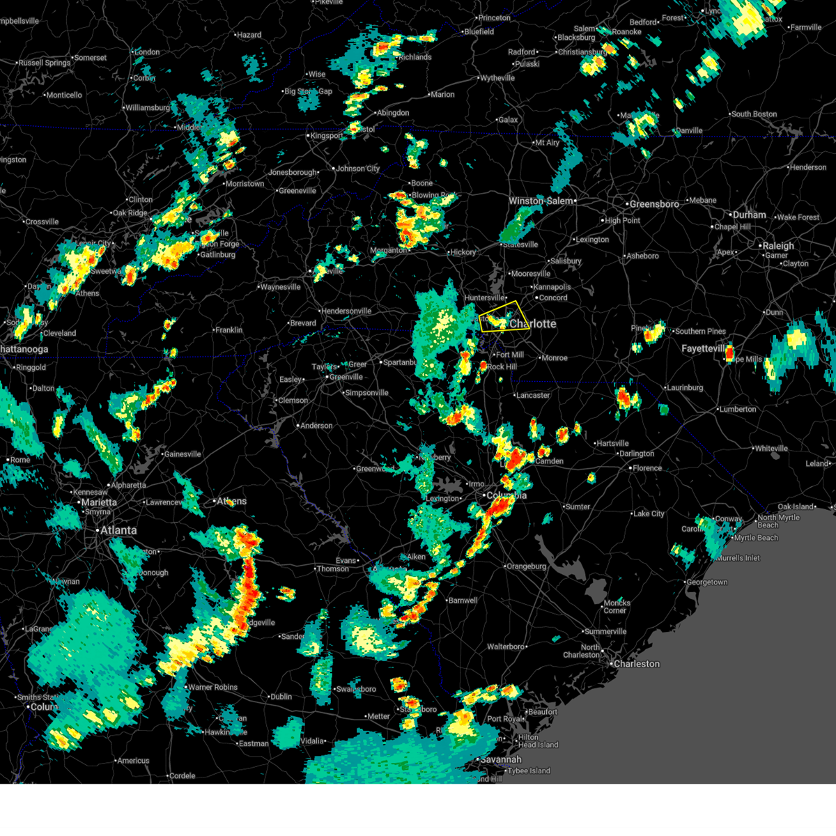 The storm which prompted the warning has weakened below severe limits, and no longer poses an immediate threat to life or property. therefore, the warning will be allowed to expire. however, gusty winds are still possible with this thunderstorm. The storm which prompted the warning has weakened below severe limits, and no longer poses an immediate threat to life or property. therefore, the warning will be allowed to expire. however, gusty winds are still possible with this thunderstorm.
|
| 7/17/2024 5:17 PM EDT |
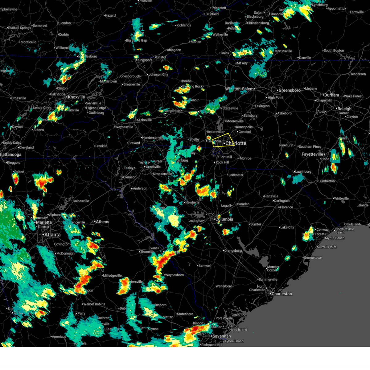 Svrgsp the national weather service in greenville-spartanburg has issued a * severe thunderstorm warning for, central mecklenburg county in the piedmont of north carolina, southeastern gaston county in the piedmont of north carolina, * until 615 pm edt. * at 516 pm edt, a severe thunderstorm was located 7 miles west of uptown charlotte, or near charlotte douglas airport, moving east at 25 mph (radar indicated). Hazards include 60 mph wind gusts and quarter size hail. Minor hail damage to vehicles is expected. Expect wind damage to trees and power lines. Svrgsp the national weather service in greenville-spartanburg has issued a * severe thunderstorm warning for, central mecklenburg county in the piedmont of north carolina, southeastern gaston county in the piedmont of north carolina, * until 615 pm edt. * at 516 pm edt, a severe thunderstorm was located 7 miles west of uptown charlotte, or near charlotte douglas airport, moving east at 25 mph (radar indicated). Hazards include 60 mph wind gusts and quarter size hail. Minor hail damage to vehicles is expected. Expect wind damage to trees and power lines.
|
| 7/15/2024 10:29 PM EDT |
 The storm which prompted the warning has weakened below severe limits, and no longer poses an immediate threat to life or property. therefore, the warning will be allowed to expire. however, gusty winds and heavy rain are still possible with this thunderstorm. to report severe weather to the national weather service greenville-spartanburg, call toll free, 1, 800, 2 6 7, 8 1 0 1, or post on our facebook page, or tweet it using hashtag nwsgsp. your message should describe the event and the specific location where it occurred. The storm which prompted the warning has weakened below severe limits, and no longer poses an immediate threat to life or property. therefore, the warning will be allowed to expire. however, gusty winds and heavy rain are still possible with this thunderstorm. to report severe weather to the national weather service greenville-spartanburg, call toll free, 1, 800, 2 6 7, 8 1 0 1, or post on our facebook page, or tweet it using hashtag nwsgsp. your message should describe the event and the specific location where it occurred.
|
| 7/15/2024 9:58 PM EDT |
 Svrgsp the national weather service in greenville-spartanburg has issued a * severe thunderstorm warning for, southwestern mecklenburg county in the piedmont of north carolina, * until 1030 pm edt. * at 957 pm edt, a severe thunderstorm was located 6 miles northwest of indian land, or near carowinds, moving northeast at 15 mph (radar indicated). Hazards include 60 mph wind gusts and quarter size hail. Minor hail damage to vehicles is expected. Expect wind damage to trees and power lines. Svrgsp the national weather service in greenville-spartanburg has issued a * severe thunderstorm warning for, southwestern mecklenburg county in the piedmont of north carolina, * until 1030 pm edt. * at 957 pm edt, a severe thunderstorm was located 6 miles northwest of indian land, or near carowinds, moving northeast at 15 mph (radar indicated). Hazards include 60 mph wind gusts and quarter size hail. Minor hail damage to vehicles is expected. Expect wind damage to trees and power lines.
|
| 7/15/2024 9:52 PM EDT |
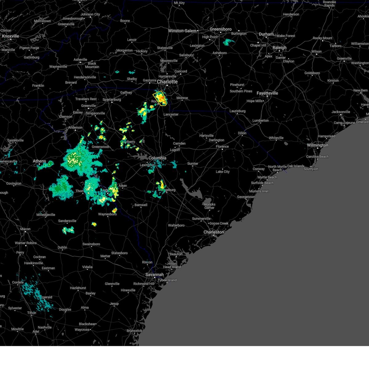 At 951 pm edt, severe thunderstorms were located along a line extending from 9 miles north of rock hill to 5 miles south of indian land, moving east at 15 mph (radar indicated). Hazards include 60 mph wind gusts and quarter size hail. Minor hail damage to vehicles is expected. expect wind damage to trees and power lines. Locations impacted include, fort mill, tega cay, carowinds, lake wylie, lesslie, steele creek, rock hill, and southwest charlotte. At 951 pm edt, severe thunderstorms were located along a line extending from 9 miles north of rock hill to 5 miles south of indian land, moving east at 15 mph (radar indicated). Hazards include 60 mph wind gusts and quarter size hail. Minor hail damage to vehicles is expected. expect wind damage to trees and power lines. Locations impacted include, fort mill, tega cay, carowinds, lake wylie, lesslie, steele creek, rock hill, and southwest charlotte.
|
| 7/15/2024 9:30 PM EDT |
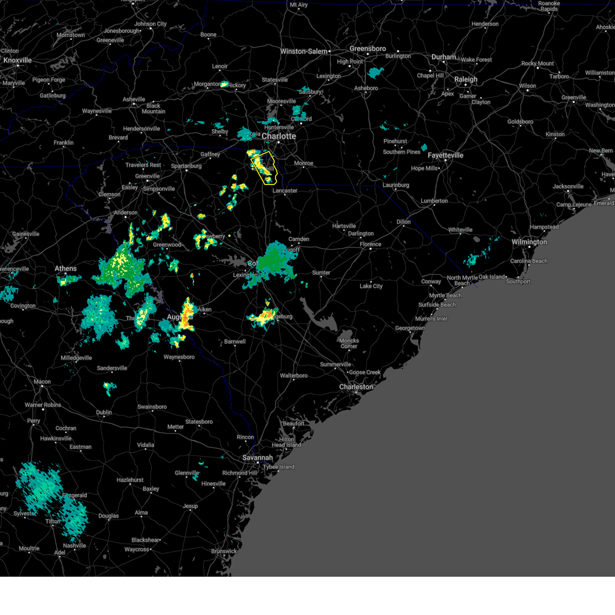 Svrgsp the national weather service in greenville-spartanburg has issued a * severe thunderstorm warning for, southwestern mecklenburg county in the piedmont of north carolina, eastern york county in upstate south carolina, * until 1015 pm edt. * at 930 pm edt, severe thunderstorms were located along a line extending from 8 miles northeast of york to 5 miles southeast of rock hill, moving east at 10 mph (radar indicated). Hazards include 60 mph wind gusts and quarter size hail. Minor hail damage to vehicles is expected. Expect wind damage to trees and power lines. Svrgsp the national weather service in greenville-spartanburg has issued a * severe thunderstorm warning for, southwestern mecklenburg county in the piedmont of north carolina, eastern york county in upstate south carolina, * until 1015 pm edt. * at 930 pm edt, severe thunderstorms were located along a line extending from 8 miles northeast of york to 5 miles southeast of rock hill, moving east at 10 mph (radar indicated). Hazards include 60 mph wind gusts and quarter size hail. Minor hail damage to vehicles is expected. Expect wind damage to trees and power lines.
|
| 6/30/2024 5:27 PM EDT |
 Svrgsp the national weather service in greenville-spartanburg has issued a * severe thunderstorm warning for, western union county in the piedmont of north carolina, * until 630 pm edt. * at 526 pm edt, a severe thunderstorm was located 8 miles west of monroe, or over wesley chapel, moving southeast at 10 mph (radar indicated). Hazards include 60 mph wind gusts and penny size hail. expect damage to trees and power lines Svrgsp the national weather service in greenville-spartanburg has issued a * severe thunderstorm warning for, western union county in the piedmont of north carolina, * until 630 pm edt. * at 526 pm edt, a severe thunderstorm was located 8 miles west of monroe, or over wesley chapel, moving southeast at 10 mph (radar indicated). Hazards include 60 mph wind gusts and penny size hail. expect damage to trees and power lines
|
| 5/26/2024 9:45 PM EDT |
 The storms which prompted the warning have weakened below severe limits, and no longer pose an immediate threat to life or property. therefore, the warning will be allowed to expire. however, gusty winds and heavy rain are still possible with these thunderstorms. a severe thunderstorm watch remains in effect until 1100 pm edt for the piedmont of north carolina. a severe thunderstorm watch also remains in effect until 1100 pm edt for the piedmont of north carolina, and upstate south carolina. The storms which prompted the warning have weakened below severe limits, and no longer pose an immediate threat to life or property. therefore, the warning will be allowed to expire. however, gusty winds and heavy rain are still possible with these thunderstorms. a severe thunderstorm watch remains in effect until 1100 pm edt for the piedmont of north carolina. a severe thunderstorm watch also remains in effect until 1100 pm edt for the piedmont of north carolina, and upstate south carolina.
|
| 5/26/2024 9:28 PM EDT |
 the severe thunderstorm warning has been cancelled and is no longer in effect the severe thunderstorm warning has been cancelled and is no longer in effect
|
| 5/26/2024 9:28 PM EDT |
 At 927 pm edt, severe thunderstorms were located along a line extending from 5 miles northwest of kannapolis to 4 miles north of gastonia, moving east at 40 mph (radar indicated). Hazards include 60 mph wind gusts. Expect damage to trees and power lines. Locations impacted include, gastonia, charlotte, huntersville, kannapolis, and concord. At 927 pm edt, severe thunderstorms were located along a line extending from 5 miles northwest of kannapolis to 4 miles north of gastonia, moving east at 40 mph (radar indicated). Hazards include 60 mph wind gusts. Expect damage to trees and power lines. Locations impacted include, gastonia, charlotte, huntersville, kannapolis, and concord.
|
| 5/26/2024 8:48 PM EDT |
 Svrgsp the national weather service in greenville-spartanburg has issued a * severe thunderstorm warning for, western cabarrus county in the piedmont of north carolina, southeastern catawba county in the piedmont of north carolina, lincoln county in the piedmont of north carolina, southeastern iredell county in the piedmont of north carolina, mecklenburg county in the piedmont of north carolina, southeastern cleveland county in the piedmont of north carolina, southwestern rowan county in the piedmont of north carolina, gaston county in the piedmont of north carolina, northeastern york county in upstate south carolina, * until 945 pm edt. * at 847 pm edt, a severe thunderstorm was located 11 miles north of shelby, or near fallston, moving southeast at 40 mph (radar indicated). Hazards include 60 mph wind gusts and penny size hail. expect damage to trees and power lines Svrgsp the national weather service in greenville-spartanburg has issued a * severe thunderstorm warning for, western cabarrus county in the piedmont of north carolina, southeastern catawba county in the piedmont of north carolina, lincoln county in the piedmont of north carolina, southeastern iredell county in the piedmont of north carolina, mecklenburg county in the piedmont of north carolina, southeastern cleveland county in the piedmont of north carolina, southwestern rowan county in the piedmont of north carolina, gaston county in the piedmont of north carolina, northeastern york county in upstate south carolina, * until 945 pm edt. * at 847 pm edt, a severe thunderstorm was located 11 miles north of shelby, or near fallston, moving southeast at 40 mph (radar indicated). Hazards include 60 mph wind gusts and penny size hail. expect damage to trees and power lines
|
| 5/25/2024 2:36 AM EDT |
 The storm which prompted the warning has weakened below severe limits, and no longer poses an immediate threat to life or property. therefore, the warning will be allowed to expire. however, gusty winds are still possible with this thunderstorm. The storm which prompted the warning has weakened below severe limits, and no longer poses an immediate threat to life or property. therefore, the warning will be allowed to expire. however, gusty winds are still possible with this thunderstorm.
|
| 5/25/2024 2:22 AM EDT |
 At 222 am edt, a severe thunderstorm was located near gastonia, or near cramerton, moving east at 25 mph (radar indicated). Hazards include 60 mph wind gusts. Expect damage to trees and power lines. Locations impacted include, gastonia, central charlotte, southwest charlotte, northwest charlotte, mt holly, belmont, south gastonia, dallas, cramerton, and lowell. At 222 am edt, a severe thunderstorm was located near gastonia, or near cramerton, moving east at 25 mph (radar indicated). Hazards include 60 mph wind gusts. Expect damage to trees and power lines. Locations impacted include, gastonia, central charlotte, southwest charlotte, northwest charlotte, mt holly, belmont, south gastonia, dallas, cramerton, and lowell.
|
| 5/25/2024 2:04 AM EDT |
 Svrgsp the national weather service in greenville-spartanburg has issued a * severe thunderstorm warning for, southwestern mecklenburg county in the piedmont of north carolina, gaston county in the piedmont of north carolina, northeastern york county in upstate south carolina, * until 245 am edt. * at 203 am edt, a severe thunderstorm was located 4 miles west of gastonia, or near crowders mountain state park, moving east at 25 mph (radar indicated). Hazards include 60 mph wind gusts. expect damage to trees and power lines Svrgsp the national weather service in greenville-spartanburg has issued a * severe thunderstorm warning for, southwestern mecklenburg county in the piedmont of north carolina, gaston county in the piedmont of north carolina, northeastern york county in upstate south carolina, * until 245 am edt. * at 203 am edt, a severe thunderstorm was located 4 miles west of gastonia, or near crowders mountain state park, moving east at 25 mph (radar indicated). Hazards include 60 mph wind gusts. expect damage to trees and power lines
|
| 5/15/2024 5:40 PM EDT |
 The storm which prompted the warning has moved out of the area. therefore, the warning will be allowed to expire. however, gusty winds and heavy rain are still possible with this thunderstorm. a severe thunderstorm watch remains in effect until 800 pm edt for the piedmont of north carolina. The storm which prompted the warning has moved out of the area. therefore, the warning will be allowed to expire. however, gusty winds and heavy rain are still possible with this thunderstorm. a severe thunderstorm watch remains in effect until 800 pm edt for the piedmont of north carolina.
|
| 5/15/2024 4:47 PM EDT |
 Svrgsp the national weather service in greenville-spartanburg has issued a * severe thunderstorm warning for, south central mecklenburg county in the piedmont of north carolina, union county in the piedmont of north carolina, * until 545 pm edt. * at 447 pm edt, a severe thunderstorm was located near indian land, or near marvin, moving east at 25 mph (radar indicated). Hazards include 60 mph wind gusts and quarter size hail. Minor hail damage to vehicles is expected. Expect wind damage to trees and power lines. Svrgsp the national weather service in greenville-spartanburg has issued a * severe thunderstorm warning for, south central mecklenburg county in the piedmont of north carolina, union county in the piedmont of north carolina, * until 545 pm edt. * at 447 pm edt, a severe thunderstorm was located near indian land, or near marvin, moving east at 25 mph (radar indicated). Hazards include 60 mph wind gusts and quarter size hail. Minor hail damage to vehicles is expected. Expect wind damage to trees and power lines.
|
| 5/15/2024 4:32 PM EDT |
 At 431 pm edt, a severe thunderstorm was located near indian land, or near fort mill, moving east at 25 mph (radar indicated). Hazards include 60 mph wind gusts and quarter size hail. Minor hail damage to vehicles is expected. expect wind damage to trees and power lines. Locations impacted include, rock hill, south charlotte, indian trail, weddington, fort mill, stallings, pineville, tega cay, waxhaw, and marvin. At 431 pm edt, a severe thunderstorm was located near indian land, or near fort mill, moving east at 25 mph (radar indicated). Hazards include 60 mph wind gusts and quarter size hail. Minor hail damage to vehicles is expected. expect wind damage to trees and power lines. Locations impacted include, rock hill, south charlotte, indian trail, weddington, fort mill, stallings, pineville, tega cay, waxhaw, and marvin.
|
| 5/15/2024 4:01 PM EDT |
 Svrgsp the national weather service in greenville-spartanburg has issued a * severe thunderstorm warning for, southwestern mecklenburg county in the piedmont of north carolina, southwestern union county in the piedmont of north carolina, northeastern york county in upstate south carolina, * until 445 pm edt. * at 401 pm edt, a severe thunderstorm was located 4 miles east of york, or near newport, moving east at 25 mph (radar indicated). Hazards include 60 mph wind gusts and quarter size hail. Minor hail damage to vehicles is expected. Expect wind damage to trees and power lines. Svrgsp the national weather service in greenville-spartanburg has issued a * severe thunderstorm warning for, southwestern mecklenburg county in the piedmont of north carolina, southwestern union county in the piedmont of north carolina, northeastern york county in upstate south carolina, * until 445 pm edt. * at 401 pm edt, a severe thunderstorm was located 4 miles east of york, or near newport, moving east at 25 mph (radar indicated). Hazards include 60 mph wind gusts and quarter size hail. Minor hail damage to vehicles is expected. Expect wind damage to trees and power lines.
|
| 5/8/2024 4:39 PM EDT |
 Svrgsp the national weather service in greenville-spartanburg has issued a * severe thunderstorm warning for, cabarrus county in the piedmont of north carolina, northeastern mecklenburg county in the piedmont of north carolina, * until 515 pm edt. * at 439 pm edt, a severe thunderstorm was located 6 miles south of downtown concord, or 4 miles east of harrisburg, moving east at 35 mph (radar indicated). Hazards include 70 mph wind gusts and quarter size hail. Minor hail damage to vehicles is expected. expect considerable tree damage. Wind damage is also likely to mobile homes, roofs, and outbuildings. Svrgsp the national weather service in greenville-spartanburg has issued a * severe thunderstorm warning for, cabarrus county in the piedmont of north carolina, northeastern mecklenburg county in the piedmont of north carolina, * until 515 pm edt. * at 439 pm edt, a severe thunderstorm was located 6 miles south of downtown concord, or 4 miles east of harrisburg, moving east at 35 mph (radar indicated). Hazards include 70 mph wind gusts and quarter size hail. Minor hail damage to vehicles is expected. expect considerable tree damage. Wind damage is also likely to mobile homes, roofs, and outbuildings.
|
| 5/8/2024 4:29 PM EDT |
 At 428 pm edt, a severe thunderstorm was located 9 miles northwest of monroe, or over hemby bridge, moving east at 40 mph (radar indicated). Hazards include 70 mph wind gusts and quarter size hail. Minor hail damage to vehicles is expected. expect considerable tree damage. wind damage is also likely to mobile homes, roofs, and outbuildings. Locations impacted include, uptown charlotte, huntersville, central charlotte, south charlotte, northeast charlotte, southwest charlotte, east charlotte, west concord, matthews, and mint hill. At 428 pm edt, a severe thunderstorm was located 9 miles northwest of monroe, or over hemby bridge, moving east at 40 mph (radar indicated). Hazards include 70 mph wind gusts and quarter size hail. Minor hail damage to vehicles is expected. expect considerable tree damage. wind damage is also likely to mobile homes, roofs, and outbuildings. Locations impacted include, uptown charlotte, huntersville, central charlotte, south charlotte, northeast charlotte, southwest charlotte, east charlotte, west concord, matthews, and mint hill.
|
| 5/8/2024 4:29 PM EDT |
 the severe thunderstorm warning has been cancelled and is no longer in effect the severe thunderstorm warning has been cancelled and is no longer in effect
|
| 5/8/2024 4:16 PM EDT |
 Svrgsp the national weather service in greenville-spartanburg has issued a * severe thunderstorm warning for, union county in the piedmont of north carolina, * until 515 pm edt. * at 416 pm edt, a severe thunderstorm was located 5 miles east of uptown charlotte, or over east charlotte, moving east at 45 mph (radar indicated). Hazards include 70 mph wind gusts and quarter size hail. Minor hail damage to vehicles is expected. expect considerable tree damage. Wind damage is also likely to mobile homes, roofs, and outbuildings. Svrgsp the national weather service in greenville-spartanburg has issued a * severe thunderstorm warning for, union county in the piedmont of north carolina, * until 515 pm edt. * at 416 pm edt, a severe thunderstorm was located 5 miles east of uptown charlotte, or over east charlotte, moving east at 45 mph (radar indicated). Hazards include 70 mph wind gusts and quarter size hail. Minor hail damage to vehicles is expected. expect considerable tree damage. Wind damage is also likely to mobile homes, roofs, and outbuildings.
|
| 5/8/2024 4:11 PM EDT |
 At 410 pm edt, a severe thunderstorm was located 5 miles south of uptown charlotte, or over southpark mall, moving east at 40 mph (radar indicated). Hazards include 70 mph wind gusts and half dollar size hail. Minor hail damage to vehicles is expected. expect considerable tree damage. wind damage is also likely to mobile homes, roofs, and outbuildings. Locations impacted include, uptown charlotte, huntersville, central charlotte, south charlotte, northeast charlotte, southwest charlotte, east charlotte, northwest charlotte, west concord, and matthews. At 410 pm edt, a severe thunderstorm was located 5 miles south of uptown charlotte, or over southpark mall, moving east at 40 mph (radar indicated). Hazards include 70 mph wind gusts and half dollar size hail. Minor hail damage to vehicles is expected. expect considerable tree damage. wind damage is also likely to mobile homes, roofs, and outbuildings. Locations impacted include, uptown charlotte, huntersville, central charlotte, south charlotte, northeast charlotte, southwest charlotte, east charlotte, northwest charlotte, west concord, and matthews.
|
| 5/8/2024 4:11 PM EDT |
 the severe thunderstorm warning has been cancelled and is no longer in effect the severe thunderstorm warning has been cancelled and is no longer in effect
|
| 5/8/2024 3:48 PM EDT |
 At 348 pm edt, a severe thunderstorm was located 4 miles southeast of gastonia, or near cramerton, moving east at 40 mph (radar indicated). Hazards include 70 mph wind gusts and half dollar size hail. Minor hail damage to vehicles is expected. expect considerable tree damage. wind damage is also likely to mobile homes, roofs, and outbuildings. Locations impacted include, gastonia, uptown charlotte, huntersville, central charlotte, south charlotte, northeast charlotte, southwest charlotte, east charlotte, northwest charlotte, and west concord. At 348 pm edt, a severe thunderstorm was located 4 miles southeast of gastonia, or near cramerton, moving east at 40 mph (radar indicated). Hazards include 70 mph wind gusts and half dollar size hail. Minor hail damage to vehicles is expected. expect considerable tree damage. wind damage is also likely to mobile homes, roofs, and outbuildings. Locations impacted include, gastonia, uptown charlotte, huntersville, central charlotte, south charlotte, northeast charlotte, southwest charlotte, east charlotte, northwest charlotte, and west concord.
|
| 5/8/2024 3:21 PM EDT |
 Svrgsp the national weather service in greenville-spartanburg has issued a * severe thunderstorm warning for, central cabarrus county in the piedmont of north carolina, eastern lincoln county in the piedmont of north carolina, mecklenburg county in the piedmont of north carolina, southeastern cleveland county in the piedmont of north carolina, gaston county in the piedmont of north carolina, northern york county in upstate south carolina, northeastern cherokee county in upstate south carolina, * until 445 pm edt. * at 321 pm edt, a severe thunderstorm was located 5 miles east of shelby, or 5 miles northeast of patterson springs, moving east at 40 mph (radar indicated). Hazards include 70 mph wind gusts and half dollar size hail. Minor hail damage to vehicles is expected. expect considerable tree damage. Wind damage is also likely to mobile homes, roofs, and outbuildings. Svrgsp the national weather service in greenville-spartanburg has issued a * severe thunderstorm warning for, central cabarrus county in the piedmont of north carolina, eastern lincoln county in the piedmont of north carolina, mecklenburg county in the piedmont of north carolina, southeastern cleveland county in the piedmont of north carolina, gaston county in the piedmont of north carolina, northern york county in upstate south carolina, northeastern cherokee county in upstate south carolina, * until 445 pm edt. * at 321 pm edt, a severe thunderstorm was located 5 miles east of shelby, or 5 miles northeast of patterson springs, moving east at 40 mph (radar indicated). Hazards include 70 mph wind gusts and half dollar size hail. Minor hail damage to vehicles is expected. expect considerable tree damage. Wind damage is also likely to mobile homes, roofs, and outbuildings.
|
| 2/28/2024 4:52 PM EST | Svrgsp the national weather service in greenville-spartanburg has issued a * severe thunderstorm warning for, south central mecklenburg county in the piedmont of north carolina, union county in the piedmont of north carolina, chester county in upstate south carolina, southeastern york county in upstate south carolina, southeastern union county in upstate south carolina, * until 530 pm est. * at 452 pm est, severe thunderstorms were located along a line extending from 5 miles west of indian land to 15 miles north of newberry, moving east at 45 mph (radar indicated). Hazards include 60 mph wind gusts. expect damage to trees and power lines |
| 1/9/2024 2:45 PM EST |
 At 245 pm est, severe thunderstorms were located along a line extending from 10 miles northeast of indian land to 5 miles northeast of lancaster to 8 miles northwest of lake wateree dam, moving northeast at 60 mph (radar indicated). Hazards include 60 mph wind gusts. expect damage to trees and power lines At 245 pm est, severe thunderstorms were located along a line extending from 10 miles northeast of indian land to 5 miles northeast of lancaster to 8 miles northwest of lake wateree dam, moving northeast at 60 mph (radar indicated). Hazards include 60 mph wind gusts. expect damage to trees and power lines
|
| 1/9/2024 2:32 PM EST |
 At 232 pm est, a severe thunderstorm capable of producing a tornado was located 8 miles southeast of uptown charlotte, or near matthews, moving north at 55 mph (radar indicated rotation). Hazards include tornado. Flying debris will be dangerous to those caught without shelter. mobile homes will be damaged or destroyed. damage to roofs, windows, and vehicles will occur. tree damage is likely. this dangerous storm will be near, east charlotte, west concord, mint hill, harrisburg, and reedy creek park around 240 pm est. Charlotte motor speedway around 250 pm est. At 232 pm est, a severe thunderstorm capable of producing a tornado was located 8 miles southeast of uptown charlotte, or near matthews, moving north at 55 mph (radar indicated rotation). Hazards include tornado. Flying debris will be dangerous to those caught without shelter. mobile homes will be damaged or destroyed. damage to roofs, windows, and vehicles will occur. tree damage is likely. this dangerous storm will be near, east charlotte, west concord, mint hill, harrisburg, and reedy creek park around 240 pm est. Charlotte motor speedway around 250 pm est.
|
| 1/9/2024 2:26 PM EST |
 At 226 pm est, a severe thunderstorm capable of producing a tornado was located 7 miles northeast of indian land, or near the arboretum, moving northeast at 55 mph (radar indicated rotation). Hazards include tornado. Flying debris will be dangerous to those caught without shelter. mobile homes will be damaged or destroyed. damage to roofs, windows, and vehicles will occur. tree damage is likely. this dangerous storm will be near, south charlotte, east charlotte, matthews, and mint hill around 230 pm est. Harrisburg around 240 pm est. At 226 pm est, a severe thunderstorm capable of producing a tornado was located 7 miles northeast of indian land, or near the arboretum, moving northeast at 55 mph (radar indicated rotation). Hazards include tornado. Flying debris will be dangerous to those caught without shelter. mobile homes will be damaged or destroyed. damage to roofs, windows, and vehicles will occur. tree damage is likely. this dangerous storm will be near, south charlotte, east charlotte, matthews, and mint hill around 230 pm est. Harrisburg around 240 pm est.
|
| 1/9/2024 2:24 PM EST | Trees down on power lines/utility equipmen in mecklenburg county NC, 13.4 miles NNW of Charlotte, NC |
| 1/9/2024 2:24 PM EST |
 At 224 pm est, a severe thunderstorm capable of producing a tornado was located 5 miles northeast of indian land, or near weddington, moving northeast at 55 mph (radar indicated rotation). Hazards include tornado. Flying debris will be dangerous to those caught without shelter. mobile homes will be damaged or destroyed. damage to roofs, windows, and vehicles will occur. tree damage is likely. this dangerous storm will be near, south charlotte, east charlotte, matthews, and mint hill around 230 pm est. Harrisburg around 240 pm est. At 224 pm est, a severe thunderstorm capable of producing a tornado was located 5 miles northeast of indian land, or near weddington, moving northeast at 55 mph (radar indicated rotation). Hazards include tornado. Flying debris will be dangerous to those caught without shelter. mobile homes will be damaged or destroyed. damage to roofs, windows, and vehicles will occur. tree damage is likely. this dangerous storm will be near, south charlotte, east charlotte, matthews, and mint hill around 230 pm est. Harrisburg around 240 pm est.
|
| 1/9/2024 1:51 PM EST |
 At 150 pm est, severe thunderstorms were located along a line extending from 9 miles north of lexington to 9 miles east of downtown concord, moving northeast at 80 mph (radar indicated). Hazards include 70 mph wind gusts. Expect considerable tree damage. damage is likely to mobile homes, roofs, and outbuildings. locations impacted include, downtown concord, east charlotte, mint hill, pineville, harrisburg, spencer, granite quarry, rockwell, mt pleasant, and faith. thunderstorm damage threat, considerable hail threat, radar indicated max hail size, <. 75 in wind threat, radar indicated max wind gust, 70 mph. At 150 pm est, severe thunderstorms were located along a line extending from 9 miles north of lexington to 9 miles east of downtown concord, moving northeast at 80 mph (radar indicated). Hazards include 70 mph wind gusts. Expect considerable tree damage. damage is likely to mobile homes, roofs, and outbuildings. locations impacted include, downtown concord, east charlotte, mint hill, pineville, harrisburg, spencer, granite quarry, rockwell, mt pleasant, and faith. thunderstorm damage threat, considerable hail threat, radar indicated max hail size, <. 75 in wind threat, radar indicated max wind gust, 70 mph.
|
| 1/9/2024 1:45 PM EST | Trees down on oak hollow drive at long pine with damage to a hous in mecklenburg county NC, 8 miles WNW of Charlotte, NC |
| 1/9/2024 1:37 PM EST |
 At 137 pm est, severe thunderstorms were located along a line extending from 5 miles east of mocksville to 11 miles east of uptown charlotte, moving northeast at 65 mph (radar indicated). Hazards include 70 mph wind gusts. Expect considerable tree damage. damage is likely to mobile homes, roofs, and outbuildings. locations impacted include, kannapolis, downtown concord, salisbury, mocksville, east charlotte, west concord, mint hill, pineville, harrisburg, and china grove. thunderstorm damage threat, considerable hail threat, radar indicated max hail size, <. 75 in wind threat, radar indicated max wind gust, 70 mph. At 137 pm est, severe thunderstorms were located along a line extending from 5 miles east of mocksville to 11 miles east of uptown charlotte, moving northeast at 65 mph (radar indicated). Hazards include 70 mph wind gusts. Expect considerable tree damage. damage is likely to mobile homes, roofs, and outbuildings. locations impacted include, kannapolis, downtown concord, salisbury, mocksville, east charlotte, west concord, mint hill, pineville, harrisburg, and china grove. thunderstorm damage threat, considerable hail threat, radar indicated max hail size, <. 75 in wind threat, radar indicated max wind gust, 70 mph.
|
| 1/9/2024 1:32 PM EST |
 At 132 pm est, severe thunderstorms were located along a line extending from 8 miles southwest of uptown charlotte to 4 miles southeast of rock hill to 12 miles south of chester, moving northeast at 75 mph (radar indicated). Hazards include 60 mph wind gusts. expect damage to trees and power lines At 132 pm est, severe thunderstorms were located along a line extending from 8 miles southwest of uptown charlotte to 4 miles southeast of rock hill to 12 miles south of chester, moving northeast at 75 mph (radar indicated). Hazards include 60 mph wind gusts. expect damage to trees and power lines
|
| 1/9/2024 1:30 PM EST |
 At 130 pm est, severe thunderstorms were located along a line extending from 7 miles northwest of indian land to 11 miles south of chester, moving northeast at 50 mph (radar indicated). Hazards include 60 mph wind gusts. Expect damage to trees and power lines. locations impacted include, rock hill, chester, fort mill, tega cay, newport, lesslie, great falls, fort lawn, richburg, and chester state park. hail threat, radar indicated max hail size, <. 75 in wind threat, radar indicated max wind gust, 60 mph. At 130 pm est, severe thunderstorms were located along a line extending from 7 miles northwest of indian land to 11 miles south of chester, moving northeast at 50 mph (radar indicated). Hazards include 60 mph wind gusts. Expect damage to trees and power lines. locations impacted include, rock hill, chester, fort mill, tega cay, newport, lesslie, great falls, fort lawn, richburg, and chester state park. hail threat, radar indicated max hail size, <. 75 in wind threat, radar indicated max wind gust, 60 mph.
|
| 1/9/2024 1:29 PM EST | Multiple large tree limbs down around the unc charlotte campu in mecklenburg county NC, 9 miles SW of Charlotte, NC |
| 1/9/2024 1:28 PM EST |
 At 128 pm est, severe thunderstorms were located along a line extending from 7 miles northeast of mocksville to 7 miles southeast of uptown charlotte, moving northeast at 85 mph (radar indicated). Hazards include 60 mph wind gusts. Expect damage to trees and power lines. locations impacted include, kannapolis, downtown concord, salisbury, mocksville, northeast charlotte, east charlotte, west concord, mint hill, pineville, and harrisburg. hail threat, radar indicated max hail size, <. 75 in wind threat, radar indicated max wind gust, 60 mph. At 128 pm est, severe thunderstorms were located along a line extending from 7 miles northeast of mocksville to 7 miles southeast of uptown charlotte, moving northeast at 85 mph (radar indicated). Hazards include 60 mph wind gusts. Expect damage to trees and power lines. locations impacted include, kannapolis, downtown concord, salisbury, mocksville, northeast charlotte, east charlotte, west concord, mint hill, pineville, and harrisburg. hail threat, radar indicated max hail size, <. 75 in wind threat, radar indicated max wind gust, 60 mph.
|
| 1/9/2024 1:10 PM EST |
 At 110 pm est, severe thunderstorms were located along a line extending from 8 miles southeast of statesville to 3 miles southwest of rock hill, moving northeast at 85 mph (radar indicated). Hazards include 60 mph wind gusts. expect damage to trees and power lines At 110 pm est, severe thunderstorms were located along a line extending from 8 miles southeast of statesville to 3 miles southwest of rock hill, moving northeast at 85 mph (radar indicated). Hazards include 60 mph wind gusts. expect damage to trees and power lines
|
| 1/9/2024 12:58 PM EST |
 At 1258 pm est, severe thunderstorms were located along a line extending from 9 miles southeast of newton to 8 miles west of huntersville to 7 miles northeast of gastonia, moving northeast at 80 mph (radar indicated). Hazards include 60 mph wind gusts. Expect damage to trees and power lines. locations impacted include, gastonia, huntersville, kannapolis, northeast charlotte, northwest charlotte, cornelius, mooresville, mt holly, davidson, and belmont. hail threat, radar indicated max hail size, <. 75 in wind threat, radar indicated max wind gust, 60 mph. At 1258 pm est, severe thunderstorms were located along a line extending from 9 miles southeast of newton to 8 miles west of huntersville to 7 miles northeast of gastonia, moving northeast at 80 mph (radar indicated). Hazards include 60 mph wind gusts. Expect damage to trees and power lines. locations impacted include, gastonia, huntersville, kannapolis, northeast charlotte, northwest charlotte, cornelius, mooresville, mt holly, davidson, and belmont. hail threat, radar indicated max hail size, <. 75 in wind threat, radar indicated max wind gust, 60 mph.
|
| 1/9/2024 12:44 PM EST |
 At 1244 pm est, severe thunderstorms were located along a line extending from 7 miles south of lincolnton to near gastonia to 6 miles north of york, moving northeast at 80 mph (radar indicated). Hazards include 60 mph wind gusts. Expect damage to trees and power lines. locations impacted include, gastonia, huntersville, kannapolis, northeast charlotte, northwest charlotte, cornelius, mooresville, mt holly, davidson, and belmont. hail threat, radar indicated max hail size, <. 75 in wind threat, radar indicated max wind gust, 60 mph. At 1244 pm est, severe thunderstorms were located along a line extending from 7 miles south of lincolnton to near gastonia to 6 miles north of york, moving northeast at 80 mph (radar indicated). Hazards include 60 mph wind gusts. Expect damage to trees and power lines. locations impacted include, gastonia, huntersville, kannapolis, northeast charlotte, northwest charlotte, cornelius, mooresville, mt holly, davidson, and belmont. hail threat, radar indicated max hail size, <. 75 in wind threat, radar indicated max wind gust, 60 mph.
|
| 1/9/2024 12:42 PM EST |
 At 1242 pm est, severe thunderstorms were located along a line extending from 6 miles west of york to 12 miles north of newberry, moving northeast at 50 mph (radar indicated). Hazards include 60 mph wind gusts. expect damage to trees and power lines At 1242 pm est, severe thunderstorms were located along a line extending from 6 miles west of york to 12 miles north of newberry, moving northeast at 50 mph (radar indicated). Hazards include 60 mph wind gusts. expect damage to trees and power lines
|
| 1/9/2024 12:35 PM EST |
 At 1234 pm est, severe thunderstorms were located along a line extending from 6 miles southeast of shelby to 9 miles northwest of york to 16 miles southeast of gaffney, moving northeast at 80 mph (radar indicated). Hazards include 60 mph wind gusts. expect damage to trees and power lines At 1234 pm est, severe thunderstorms were located along a line extending from 6 miles southeast of shelby to 9 miles northwest of york to 16 miles southeast of gaffney, moving northeast at 80 mph (radar indicated). Hazards include 60 mph wind gusts. expect damage to trees and power lines
|
| 9/7/2023 6:47 PM EDT |
 At 647 pm edt, a severe thunderstorm was located near wesley chapel, or 6 miles west of monroe, moving northeast at 25 mph (radar indicated). Hazards include ping pong ball size hail and 60 mph wind gusts. People and animals outdoors will be injured. expect hail damage to roofs, siding, windows, and vehicles. Expect wind damage to trees and power lines. At 647 pm edt, a severe thunderstorm was located near wesley chapel, or 6 miles west of monroe, moving northeast at 25 mph (radar indicated). Hazards include ping pong ball size hail and 60 mph wind gusts. People and animals outdoors will be injured. expect hail damage to roofs, siding, windows, and vehicles. Expect wind damage to trees and power lines.
|
| 9/7/2023 5:29 PM EDT |
 At 529 pm edt, a severe thunderstorm was located near rock hill, moving northeast at 15 mph (radar indicated). Hazards include 60 mph wind gusts and quarter size hail. Minor hail damage to vehicles is expected. Expect wind damage to trees and power lines. At 529 pm edt, a severe thunderstorm was located near rock hill, moving northeast at 15 mph (radar indicated). Hazards include 60 mph wind gusts and quarter size hail. Minor hail damage to vehicles is expected. Expect wind damage to trees and power lines.
|
| 9/7/2023 5:29 PM EDT |
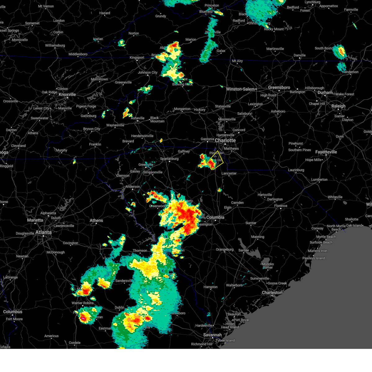 At 529 pm edt, a severe thunderstorm was located near rock hill, moving northeast at 15 mph (radar indicated). Hazards include 60 mph wind gusts and quarter size hail. Minor hail damage to vehicles is expected. Expect wind damage to trees and power lines. At 529 pm edt, a severe thunderstorm was located near rock hill, moving northeast at 15 mph (radar indicated). Hazards include 60 mph wind gusts and quarter size hail. Minor hail damage to vehicles is expected. Expect wind damage to trees and power lines.
|
| 8/29/2023 6:28 PM EDT |
 The severe thunderstorm warning for central mecklenburg county will expire at 630 pm edt, the storm which prompted the warning has weakened below severe limits, and no longer poses an immediate threat to life or property. therefore, the warning will be allowed to expire. however heavy rain is still possible with this thunderstorm. The severe thunderstorm warning for central mecklenburg county will expire at 630 pm edt, the storm which prompted the warning has weakened below severe limits, and no longer poses an immediate threat to life or property. therefore, the warning will be allowed to expire. however heavy rain is still possible with this thunderstorm.
|
| 8/29/2023 5:50 PM EDT | Large tree down on pineville-matthews road... blocking left lane of traffic. estimated time based on rada in mecklenburg county NC, 9.9 miles N of Charlotte, NC |
| 8/29/2023 5:50 PM EDT |
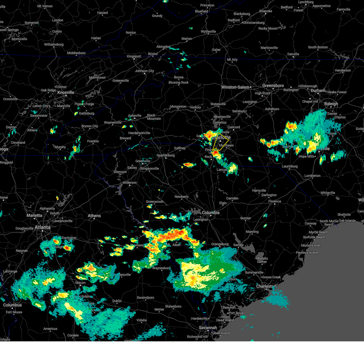 At 549 pm edt, a severe thunderstorm was located 8 miles north of indian land, or near southwest charlotte, moving northeast at 25 mph (radar indicated). Hazards include 60 mph wind gusts and quarter size hail. Minor hail damage to vehicles is expected. Expect wind damage to trees and power lines. At 549 pm edt, a severe thunderstorm was located 8 miles north of indian land, or near southwest charlotte, moving northeast at 25 mph (radar indicated). Hazards include 60 mph wind gusts and quarter size hail. Minor hail damage to vehicles is expected. Expect wind damage to trees and power lines.
|
| 8/27/2023 6:55 PM EDT |
 The severe thunderstorm warning for southern mecklenburg, northwestern union and east central york counties will expire at 700 pm edt, the storm which prompted the warning has weakened below severe limits, and no longer poses an immediate threat to life or property. therefore, the warning will be allowed to expire. however gusty winds and heavy rain are still possible with thunderstorms in the area. The severe thunderstorm warning for southern mecklenburg, northwestern union and east central york counties will expire at 700 pm edt, the storm which prompted the warning has weakened below severe limits, and no longer poses an immediate threat to life or property. therefore, the warning will be allowed to expire. however gusty winds and heavy rain are still possible with thunderstorms in the area.
|
| 8/27/2023 6:52 PM EDT |
 The severe thunderstorm warning for central cabarrus, east central mecklenburg and north central union counties will expire at 700 pm edt, the storm which prompted the warning has weakened below severe limits, and no longer poses an immediate threat to life or property. therefore, the warning will be allowed to expire. however gusty winds and heavy rain are still possible with thunderstorms over the area. The severe thunderstorm warning for central cabarrus, east central mecklenburg and north central union counties will expire at 700 pm edt, the storm which prompted the warning has weakened below severe limits, and no longer poses an immediate threat to life or property. therefore, the warning will be allowed to expire. however gusty winds and heavy rain are still possible with thunderstorms over the area.
|
| 8/27/2023 6:37 PM EDT |
 At 637 pm edt, a severe thunderstorm was located 7 miles southeast of uptown charlotte, or near matthews, moving south at 15 mph (radar indicated). Hazards include 60 mph wind gusts and penny size hail. Expect damage to trees and power lines. locations impacted include, uptown charlotte, central charlotte, south charlotte, southwest charlotte, east charlotte, northwest charlotte, matthews, indian trail, weddington and stallings. hail threat, radar indicated max hail size, 0. 75 in wind threat, radar indicated max wind gust, 60 mph. At 637 pm edt, a severe thunderstorm was located 7 miles southeast of uptown charlotte, or near matthews, moving south at 15 mph (radar indicated). Hazards include 60 mph wind gusts and penny size hail. Expect damage to trees and power lines. locations impacted include, uptown charlotte, central charlotte, south charlotte, southwest charlotte, east charlotte, northwest charlotte, matthews, indian trail, weddington and stallings. hail threat, radar indicated max hail size, 0. 75 in wind threat, radar indicated max wind gust, 60 mph.
|
| 8/27/2023 6:30 PM EDT | Utility company reported falling trees leading to power outages in uptown charlott in mecklenburg county NC, 4.7 miles WNW of Charlotte, NC |
| 8/27/2023 6:30 PM EDT |
 At 630 pm edt, a severe thunderstorm was located 7 miles south of downtown concord, or 4 miles east of harrisburg, moving south at 10 mph (radar indicated). Hazards include 60 mph wind gusts and penny size hail. Expect damage to trees and power lines. locations impacted include, downtown concord, east charlotte, west concord, mint hill, harrisburg, university city, reedy creek park, charlotte motor speedway, midland and fairview in union county. hail threat, radar indicated max hail size, 0. 75 in wind threat, radar indicated max wind gust, 60 mph. At 630 pm edt, a severe thunderstorm was located 7 miles south of downtown concord, or 4 miles east of harrisburg, moving south at 10 mph (radar indicated). Hazards include 60 mph wind gusts and penny size hail. Expect damage to trees and power lines. locations impacted include, downtown concord, east charlotte, west concord, mint hill, harrisburg, university city, reedy creek park, charlotte motor speedway, midland and fairview in union county. hail threat, radar indicated max hail size, 0. 75 in wind threat, radar indicated max wind gust, 60 mph.
|
| 8/27/2023 6:16 PM EDT |
 At 616 pm edt, a severe thunderstorm was located near uptown charlotte, or near the plaza, moving south at 10 mph (radar indicated). Hazards include 60 mph wind gusts and penny size hail. expect damage to trees and power lines At 616 pm edt, a severe thunderstorm was located near uptown charlotte, or near the plaza, moving south at 10 mph (radar indicated). Hazards include 60 mph wind gusts and penny size hail. expect damage to trees and power lines
|
| 8/27/2023 6:11 PM EDT |
 At 611 pm edt, a severe thunderstorm was located 4 miles south of downtown concord, or near harrisburg, moving south at 10 mph (radar indicated). Hazards include 60 mph wind gusts and penny size hail. expect damage to trees and power lines At 611 pm edt, a severe thunderstorm was located 4 miles south of downtown concord, or near harrisburg, moving south at 10 mph (radar indicated). Hazards include 60 mph wind gusts and penny size hail. expect damage to trees and power lines
|
| 8/26/2023 10:30 PM EDT | Numerous trees and power lines down due to wind across the northern side of charlott in mecklenburg county NC, 1.7 miles WSW of Charlotte, NC |
| 8/26/2023 10:23 PM EDT |
 At 1022 pm edt, severe thunderstorms were located along a line extending from near downtown concord to near gastonia, moving southeast at 20 mph (radar indicated). Hazards include 60 mph wind gusts and penny size hail. expect damage to trees and power lines At 1022 pm edt, severe thunderstorms were located along a line extending from near downtown concord to near gastonia, moving southeast at 20 mph (radar indicated). Hazards include 60 mph wind gusts and penny size hail. expect damage to trees and power lines
|
| 8/26/2023 9:56 PM EDT |
 At 956 pm edt, a severe thunderstorm was located 7 miles northwest of huntersville, or near westport, moving southeast at 10 mph (radar indicated). Hazards include 60 mph wind gusts and penny size hail. Expect damage to trees and power lines. locations impacted include, huntersville, cornelius, mt holly, davidson, stanley, westport, lake norman, iron station, coddle creek reservoir and paw creek. hail threat, radar indicated max hail size, 0. 75 in wind threat, radar indicated max wind gust, 60 mph. At 956 pm edt, a severe thunderstorm was located 7 miles northwest of huntersville, or near westport, moving southeast at 10 mph (radar indicated). Hazards include 60 mph wind gusts and penny size hail. Expect damage to trees and power lines. locations impacted include, huntersville, cornelius, mt holly, davidson, stanley, westport, lake norman, iron station, coddle creek reservoir and paw creek. hail threat, radar indicated max hail size, 0. 75 in wind threat, radar indicated max wind gust, 60 mph.
|
| 8/26/2023 9:48 PM EDT |
 At 948 pm edt, a severe thunderstorm was located 5 miles southwest of kannapolis, or over coddle creek reservoir, moving southeast at 10 mph (radar indicated). Hazards include 60 mph wind gusts and penny size hail. Expect damage to trees and power lines. locations impacted include, kannapolis, downtown concord, west concord, cornelius, mooresville, davidson, harrisburg, enochville, mt pleasant and charlotte motor speedway. hail threat, radar indicated max hail size, 0. 75 in wind threat, radar indicated max wind gust, 60 mph. At 948 pm edt, a severe thunderstorm was located 5 miles southwest of kannapolis, or over coddle creek reservoir, moving southeast at 10 mph (radar indicated). Hazards include 60 mph wind gusts and penny size hail. Expect damage to trees and power lines. locations impacted include, kannapolis, downtown concord, west concord, cornelius, mooresville, davidson, harrisburg, enochville, mt pleasant and charlotte motor speedway. hail threat, radar indicated max hail size, 0. 75 in wind threat, radar indicated max wind gust, 60 mph.
|
| 8/26/2023 9:38 PM EDT |
 At 937 pm edt, a severe thunderstorm was located 11 miles northwest of huntersville, or near westport, moving southeast at 10 mph (radar indicated). Hazards include 60 mph wind gusts and penny size hail. expect damage to trees and power lines At 937 pm edt, a severe thunderstorm was located 11 miles northwest of huntersville, or near westport, moving southeast at 10 mph (radar indicated). Hazards include 60 mph wind gusts and penny size hail. expect damage to trees and power lines
|
| 8/26/2023 9:27 PM EDT |
 At 927 pm edt, a severe thunderstorm was located 5 miles west of kannapolis, or near coddle creek reservoir, moving southeast at 10 mph (radar indicated). Hazards include 60 mph wind gusts and penny size hail. expect damage to trees and power lines At 927 pm edt, a severe thunderstorm was located 5 miles west of kannapolis, or near coddle creek reservoir, moving southeast at 10 mph (radar indicated). Hazards include 60 mph wind gusts and penny size hail. expect damage to trees and power lines
|
| 8/24/2023 9:44 PM EDT | Report from mping: 3-inch tree limbs broke in mecklenburg county NC, 6.8 miles NNW of Charlotte, NC |
| 8/24/2023 9:29 PM EDT |
 At 929 pm edt, a severe thunderstorm was located 4 miles south of huntersville, or near northeast charlotte, moving south at 20 mph (radar indicated). Hazards include 60 mph wind gusts and penny size hail. Expect damage to trees and power lines. locations impacted include, huntersville, downtown concord, northeast charlotte, east charlotte, northwest charlotte, west concord, cornelius, mt holly, davidson and harrisburg. hail threat, radar indicated max hail size, 0. 75 in wind threat, radar indicated max wind gust, 60 mph. At 929 pm edt, a severe thunderstorm was located 4 miles south of huntersville, or near northeast charlotte, moving south at 20 mph (radar indicated). Hazards include 60 mph wind gusts and penny size hail. Expect damage to trees and power lines. locations impacted include, huntersville, downtown concord, northeast charlotte, east charlotte, northwest charlotte, west concord, cornelius, mt holly, davidson and harrisburg. hail threat, radar indicated max hail size, 0. 75 in wind threat, radar indicated max wind gust, 60 mph.
|
| 8/24/2023 9:03 PM EDT |
 At 903 pm edt, a severe thunderstorm was located 5 miles northeast of huntersville, or near davidson, moving south at 20 mph (radar indicated). Hazards include 60 mph wind gusts and penny size hail. expect damage to trees and power lines At 903 pm edt, a severe thunderstorm was located 5 miles northeast of huntersville, or near davidson, moving south at 20 mph (radar indicated). Hazards include 60 mph wind gusts and penny size hail. expect damage to trees and power lines
|
| 8/15/2023 5:00 PM EDT |
 At 500 pm edt, a severe thunderstorm was located 8 miles southeast of downtown concord, or 4 miles south of mt pleasant, moving east at 50 mph (radar indicated). Hazards include 60 mph wind gusts and quarter size hail. Minor hail damage to vehicles is expected. expect wind damage to trees and power lines. locations impacted include, harrisburg, mt pleasant, charlotte motor speedway, downtown concord and west concord. hail threat, radar indicated max hail size, 1. 00 in wind threat, radar indicated max wind gust, 60 mph. At 500 pm edt, a severe thunderstorm was located 8 miles southeast of downtown concord, or 4 miles south of mt pleasant, moving east at 50 mph (radar indicated). Hazards include 60 mph wind gusts and quarter size hail. Minor hail damage to vehicles is expected. expect wind damage to trees and power lines. locations impacted include, harrisburg, mt pleasant, charlotte motor speedway, downtown concord and west concord. hail threat, radar indicated max hail size, 1. 00 in wind threat, radar indicated max wind gust, 60 mph.
|
| 8/15/2023 4:44 PM EDT |
 At 444 pm edt, a severe thunderstorm was located 9 miles east of uptown charlotte, or near reedy creek park, moving east at 50 mph (radar indicated). Hazards include 60 mph wind gusts and quarter size hail. Minor hail damage to vehicles is expected. Expect wind damage to trees and power lines. At 444 pm edt, a severe thunderstorm was located 9 miles east of uptown charlotte, or near reedy creek park, moving east at 50 mph (radar indicated). Hazards include 60 mph wind gusts and quarter size hail. Minor hail damage to vehicles is expected. Expect wind damage to trees and power lines.
|
| 8/15/2023 4:38 PM EDT | Duke energy reports trees blown down on powerlines near the intersection of henslowe ln and faringford c in mecklenburg county NC, 11.2 miles SW of Charlotte, NC |
| 8/15/2023 4:35 PM EDT |
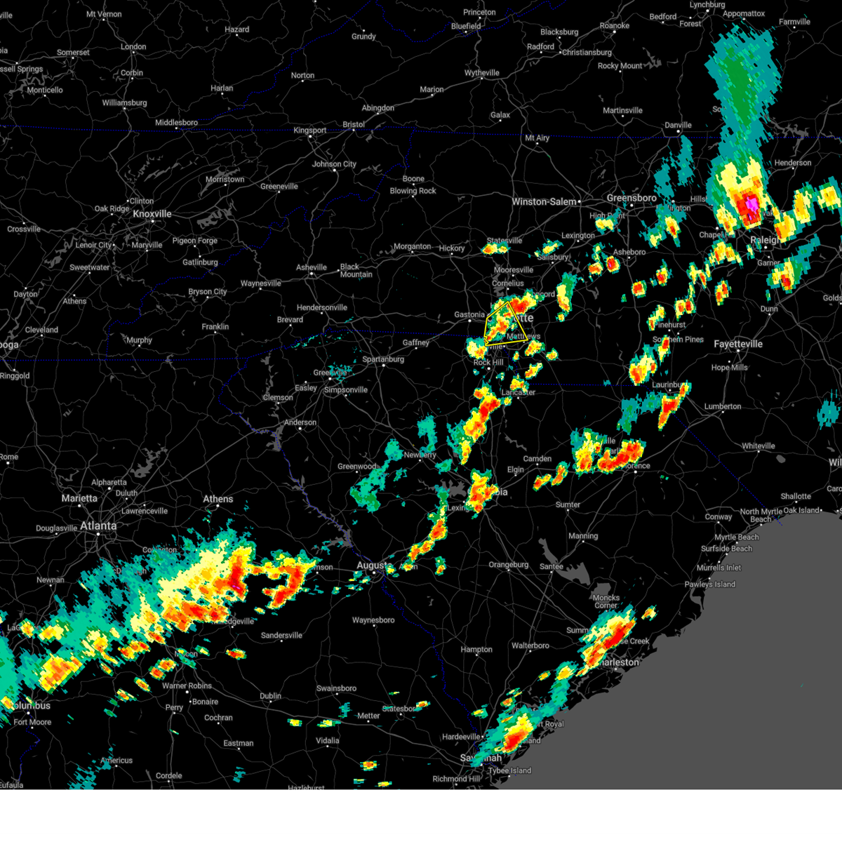 The severe thunderstorm warning for southwestern mecklenburg and southeastern gaston counties will expire at 445 pm edt, the storm which prompted the warning has weakened below severe limits, and has exited the warned area. therefore, the warning will be allowed to expire. a severe thunderstorm watch remains in effect until 900 pm edt for the piedmont of north carolina, and upstate south carolina. The severe thunderstorm warning for southwestern mecklenburg and southeastern gaston counties will expire at 445 pm edt, the storm which prompted the warning has weakened below severe limits, and has exited the warned area. therefore, the warning will be allowed to expire. a severe thunderstorm watch remains in effect until 900 pm edt for the piedmont of north carolina, and upstate south carolina.
|
| 8/15/2023 4:33 PM EDT | Duke energy reports trees blown down on powerlines near the intersection of durham ln and statesville r in mecklenburg county NC, 4 miles SSW of Charlotte, NC |
| 8/15/2023 4:29 PM EDT |
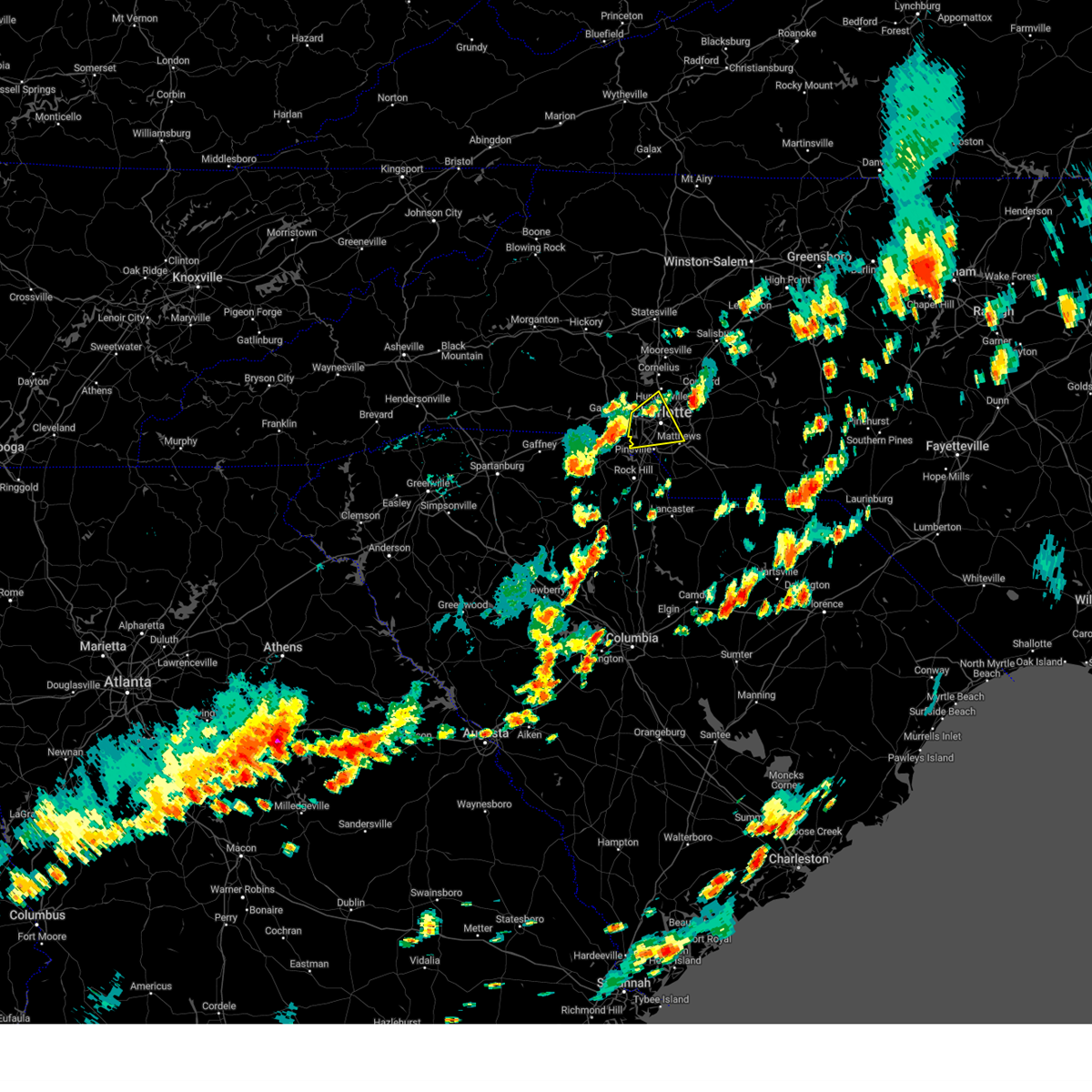 At 429 pm edt, a severe thunderstorm was located 6 miles west of uptown charlotte, or near charlotte douglas airport, moving east at 35 mph (radar indicated). Hazards include 60 mph wind gusts and quarter size hail. Minor hail damage to vehicles is expected. expect wind damage to trees and power lines. locations impacted include, uptown charlotte, central charlotte, southwest charlotte, east charlotte, northwest charlotte, belmont, freedom park, the plaza, charlotte douglas airport and steele creek. hail threat, radar indicated max hail size, 1. 00 in wind threat, radar indicated max wind gust, 60 mph. At 429 pm edt, a severe thunderstorm was located 6 miles west of uptown charlotte, or near charlotte douglas airport, moving east at 35 mph (radar indicated). Hazards include 60 mph wind gusts and quarter size hail. Minor hail damage to vehicles is expected. expect wind damage to trees and power lines. locations impacted include, uptown charlotte, central charlotte, southwest charlotte, east charlotte, northwest charlotte, belmont, freedom park, the plaza, charlotte douglas airport and steele creek. hail threat, radar indicated max hail size, 1. 00 in wind threat, radar indicated max wind gust, 60 mph.
|
| 8/15/2023 4:28 PM EDT |
 At 427 pm edt, a severe thunderstorm was located 6 miles southeast of huntersville, or near northeast charlotte, moving northeast at 30 mph (radar indicated). Hazards include 60 mph wind gusts and quarter size hail. Minor hail damage to vehicles is expected. Expect wind damage to trees and power lines. At 427 pm edt, a severe thunderstorm was located 6 miles southeast of huntersville, or near northeast charlotte, moving northeast at 30 mph (radar indicated). Hazards include 60 mph wind gusts and quarter size hail. Minor hail damage to vehicles is expected. Expect wind damage to trees and power lines.
|
| 8/15/2023 4:20 PM EDT | Duke energy reported fallen trees leading to power outage in the steele creek are in mecklenburg county NC, 9 miles NE of Charlotte, NC |
| 8/15/2023 4:12 PM EDT |
 At 411 pm edt, a severe thunderstorm was located 5 miles south of downtown concord, or near harrisburg, moving east at 30 mph (radar indicated). Hazards include 70 mph wind gusts and quarter size hail. Minor hail damage to vehicles is expected. expect considerable tree damage. wind damage is also likely to mobile homes, roofs, and outbuildings. locations impacted include, downtown concord, northeast charlotte, west concord, harrisburg, mt pleasant, university city, midland, reedy creek park, charlotte motor speedway and hidden valley. thunderstorm damage threat, considerable hail threat, radar indicated max hail size, 1. 00 in wind threat, radar indicated max wind gust, 70 mph. At 411 pm edt, a severe thunderstorm was located 5 miles south of downtown concord, or near harrisburg, moving east at 30 mph (radar indicated). Hazards include 70 mph wind gusts and quarter size hail. Minor hail damage to vehicles is expected. expect considerable tree damage. wind damage is also likely to mobile homes, roofs, and outbuildings. locations impacted include, downtown concord, northeast charlotte, west concord, harrisburg, mt pleasant, university city, midland, reedy creek park, charlotte motor speedway and hidden valley. thunderstorm damage threat, considerable hail threat, radar indicated max hail size, 1. 00 in wind threat, radar indicated max wind gust, 70 mph.
|
| 8/15/2023 4:09 PM EDT |
 At 409 pm edt, a severe thunderstorm was located 6 miles south of gastonia, or 5 miles southeast of south gastonia, moving east at 35 mph (radar indicated). Hazards include 60 mph wind gusts and quarter size hail. Minor hail damage to vehicles is expected. Expect wind damage to trees and power lines. At 409 pm edt, a severe thunderstorm was located 6 miles south of gastonia, or 5 miles southeast of south gastonia, moving east at 35 mph (radar indicated). Hazards include 60 mph wind gusts and quarter size hail. Minor hail damage to vehicles is expected. Expect wind damage to trees and power lines.
|
| 8/15/2023 4:02 PM EDT |
 At 401 pm edt, a severe thunderstorm was located 8 miles south of gastonia, or near clover, moving east at 35 mph (radar indicated). Hazards include 60 mph wind gusts and quarter size hail. Minor hail damage to vehicles is expected. expect wind damage to trees and power lines. locations impacted include, belmont, south gastonia, clover, cramerton, mcadenville, kings mountain state park, crowders mountain state park, lake wylie, crowders and bethany. hail threat, radar indicated max hail size, 1. 00 in wind threat, radar indicated max wind gust, 60 mph. At 401 pm edt, a severe thunderstorm was located 8 miles south of gastonia, or near clover, moving east at 35 mph (radar indicated). Hazards include 60 mph wind gusts and quarter size hail. Minor hail damage to vehicles is expected. expect wind damage to trees and power lines. locations impacted include, belmont, south gastonia, clover, cramerton, mcadenville, kings mountain state park, crowders mountain state park, lake wylie, crowders and bethany. hail threat, radar indicated max hail size, 1. 00 in wind threat, radar indicated max wind gust, 60 mph.
|
| 8/15/2023 3:58 PM EDT |
 At 358 pm edt, a severe thunderstorm was located 9 miles southwest of downtown concord, or near university city, moving east at 30 mph (radar indicated). Hazards include 60 mph wind gusts and quarter size hail. Minor hail damage to vehicles is expected. Expect wind damage to trees and power lines. At 358 pm edt, a severe thunderstorm was located 9 miles southwest of downtown concord, or near university city, moving east at 30 mph (radar indicated). Hazards include 60 mph wind gusts and quarter size hail. Minor hail damage to vehicles is expected. Expect wind damage to trees and power lines.
|
| 8/15/2023 3:40 PM EDT |
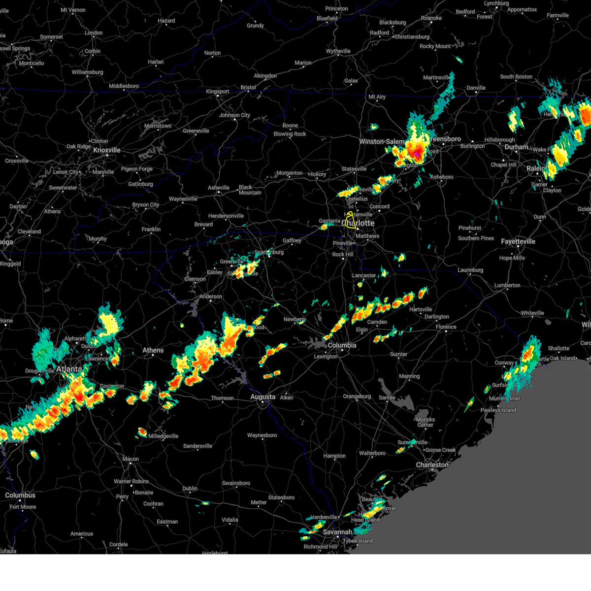 At 338 pm edt, a severe thunderstorm was located 6 miles northwest of uptown charlotte, or near northwest charlotte, moving east at 30 mph (radar indicated). Hazards include 60 mph wind gusts and quarter size hail. Minor hail damage to vehicles is expected. expect wind damage to trees and power lines. locations impacted include, northwest charlotte, paw creek, central charlotte and huntersville. hail threat, radar indicated max hail size, 1. 00 in wind threat, radar indicated max wind gust, 60 mph. At 338 pm edt, a severe thunderstorm was located 6 miles northwest of uptown charlotte, or near northwest charlotte, moving east at 30 mph (radar indicated). Hazards include 60 mph wind gusts and quarter size hail. Minor hail damage to vehicles is expected. expect wind damage to trees and power lines. locations impacted include, northwest charlotte, paw creek, central charlotte and huntersville. hail threat, radar indicated max hail size, 1. 00 in wind threat, radar indicated max wind gust, 60 mph.
|
| 8/15/2023 3:39 PM EDT |
 At 339 pm edt, a severe thunderstorm was located 12 miles northwest of york, or near smyrna, moving east at 35 mph (radar indicated). Hazards include 60 mph wind gusts and quarter size hail. Minor hail damage to vehicles is expected. Expect wind damage to trees and power lines. At 339 pm edt, a severe thunderstorm was located 12 miles northwest of york, or near smyrna, moving east at 35 mph (radar indicated). Hazards include 60 mph wind gusts and quarter size hail. Minor hail damage to vehicles is expected. Expect wind damage to trees and power lines.
|
| 8/15/2023 3:20 PM EDT |
 At 320 pm edt, a severe thunderstorm was located 6 miles northeast of gastonia, or near mcadenville, moving east at 30 mph (radar indicated). Hazards include 60 mph wind gusts and quarter size hail. Minor hail damage to vehicles is expected. expect wind damage to trees and power lines. locations impacted include, northwest charlotte, mt holly, belmont, stanley, cramerton, lowell, ranlo, mcadenville, charlotte douglas airport and paw creek. hail threat, radar indicated max hail size, 1. 00 in wind threat, radar indicated max wind gust, 60 mph. At 320 pm edt, a severe thunderstorm was located 6 miles northeast of gastonia, or near mcadenville, moving east at 30 mph (radar indicated). Hazards include 60 mph wind gusts and quarter size hail. Minor hail damage to vehicles is expected. expect wind damage to trees and power lines. locations impacted include, northwest charlotte, mt holly, belmont, stanley, cramerton, lowell, ranlo, mcadenville, charlotte douglas airport and paw creek. hail threat, radar indicated max hail size, 1. 00 in wind threat, radar indicated max wind gust, 60 mph.
|
| 8/15/2023 3:06 PM EDT |
 At 306 pm edt, a severe thunderstorm was located over gastonia, moving east at 30 mph (radar indicated). Hazards include 60 mph wind gusts and quarter size hail. Minor hail damage to vehicles is expected. Expect wind damage to trees and power lines. At 306 pm edt, a severe thunderstorm was located over gastonia, moving east at 30 mph (radar indicated). Hazards include 60 mph wind gusts and quarter size hail. Minor hail damage to vehicles is expected. Expect wind damage to trees and power lines.
|
| 8/7/2023 6:16 PM EDT |
 At 615 pm edt, severe thunderstorms were located along a line extending from 10 miles north of monroe to 9 miles northwest of lancaster, moving east at 40 mph (radar indicated). Hazards include 60 mph wind gusts and penny size hail. expect damage to trees and power lines At 615 pm edt, severe thunderstorms were located along a line extending from 10 miles north of monroe to 9 miles northwest of lancaster, moving east at 40 mph (radar indicated). Hazards include 60 mph wind gusts and penny size hail. expect damage to trees and power lines
|
| 8/7/2023 6:06 PM EDT |
 At 605 pm edt, severe thunderstorms were located along a line extending from 14 miles south of downtown concord to near indian land, moving east at 25 mph (radar indicated). Hazards include 60 mph wind gusts and penny size hail. Expect damage to trees and power lines. locations impacted include, monroe, indian trail, weddington, stallings, unionville, wesley chapel, wingate, waxhaw, marshville and lake park. hail threat, radar indicated max hail size, 0. 75 in wind threat, radar indicated max wind gust, 60 mph. At 605 pm edt, severe thunderstorms were located along a line extending from 14 miles south of downtown concord to near indian land, moving east at 25 mph (radar indicated). Hazards include 60 mph wind gusts and penny size hail. Expect damage to trees and power lines. locations impacted include, monroe, indian trail, weddington, stallings, unionville, wesley chapel, wingate, waxhaw, marshville and lake park. hail threat, radar indicated max hail size, 0. 75 in wind threat, radar indicated max wind gust, 60 mph.
|
| 8/7/2023 6:02 PM EDT |
 At 602 pm edt, severe thunderstorms were located along a line extending from 9 miles northeast of uptown charlotte to 9 miles north of rock hill, moving east at 35 mph (radar indicated). Hazards include 60 mph wind gusts and penny size hail. Expect damage to trees and power lines. locations impacted include, uptown charlotte, central charlotte, south charlotte, southwest charlotte, east charlotte, northwest charlotte, matthews, mint hill, fort mill and pineville. hail threat, radar indicated max hail size, 0. 75 in wind threat, radar indicated max wind gust, 60 mph. At 602 pm edt, severe thunderstorms were located along a line extending from 9 miles northeast of uptown charlotte to 9 miles north of rock hill, moving east at 35 mph (radar indicated). Hazards include 60 mph wind gusts and penny size hail. Expect damage to trees and power lines. locations impacted include, uptown charlotte, central charlotte, south charlotte, southwest charlotte, east charlotte, northwest charlotte, matthews, mint hill, fort mill and pineville. hail threat, radar indicated max hail size, 0. 75 in wind threat, radar indicated max wind gust, 60 mph.
|
| 8/7/2023 6:00 PM EDT | Emergency manager reports tree down across roadwa in mecklenburg county NC, 6.6 miles NNW of Charlotte, NC |
| 8/7/2023 5:55 PM EDT | Emergency manager reports a tree through the roof of a hous in mecklenburg county NC, 1.3 miles SSE of Charlotte, NC |
| 8/7/2023 5:55 PM EDT | Emergency manager reports trees down on powerline in mecklenburg county NC, 6.5 miles N of Charlotte, NC |
| 8/7/2023 5:50 PM EDT | Emergency manager reports tree fell on hom in mecklenburg county NC, 1.8 miles S of Charlotte, NC |
| 8/7/2023 5:50 PM EDT | Emergency manager reports tree and powerlines on fir in mecklenburg county NC, 4 miles WNW of Charlotte, NC |
| 8/7/2023 5:50 PM EDT | Emergency manager reports trees down on roadwa in mecklenburg county NC, 10.1 miles SSW of Charlotte, NC |
| 8/7/2023 5:50 PM EDT | Emergency manager reports trees down on roadwa in mecklenburg county NC, 5.3 miles SSW of Charlotte, NC |
| 8/7/2023 5:50 PM EDT | Emergency manager reports tree down on powerlin in mecklenburg county NC, 5.6 miles W of Charlotte, NC |
| 8/7/2023 5:48 PM EDT |
 At 548 pm edt, severe thunderstorms were located along a line extending from 5 miles north of uptown charlotte to 9 miles northeast of york, moving east at 35 mph (radar indicated). Hazards include 60 mph wind gusts and penny size hail. Expect damage to trees and power lines. locations impacted include, uptown charlotte, central charlotte, south charlotte, southwest charlotte, east charlotte, northwest charlotte, matthews, mint hill, mt holly and fort mill. hail threat, radar indicated max hail size, 0. 75 in wind threat, radar indicated max wind gust, 60 mph. At 548 pm edt, severe thunderstorms were located along a line extending from 5 miles north of uptown charlotte to 9 miles northeast of york, moving east at 35 mph (radar indicated). Hazards include 60 mph wind gusts and penny size hail. Expect damage to trees and power lines. locations impacted include, uptown charlotte, central charlotte, south charlotte, southwest charlotte, east charlotte, northwest charlotte, matthews, mint hill, mt holly and fort mill. hail threat, radar indicated max hail size, 0. 75 in wind threat, radar indicated max wind gust, 60 mph.
|
| 8/7/2023 5:45 PM EDT | Emergency manager reports powerlines on fir in mecklenburg county NC, 2.5 miles NNW of Charlotte, NC |
| 8/7/2023 5:43 PM EDT |
 At 542 pm edt, severe thunderstorms were located along a line extending from 10 miles southwest of winston-salem to 6 miles south of lexington to 10 miles west of albemarle, moving east at 45 mph (radar indicated). Hazards include 70 mph wind gusts and penny size hail. Expect considerable tree damage. damage is likely to mobile homes, roofs, and outbuildings. Locations impacted include, huntersville, kannapolis, downtown concord, salisbury, mocksville, northeast charlotte, west concord, harrisburg, china grove and spencer. At 542 pm edt, severe thunderstorms were located along a line extending from 10 miles southwest of winston-salem to 6 miles south of lexington to 10 miles west of albemarle, moving east at 45 mph (radar indicated). Hazards include 70 mph wind gusts and penny size hail. Expect considerable tree damage. damage is likely to mobile homes, roofs, and outbuildings. Locations impacted include, huntersville, kannapolis, downtown concord, salisbury, mocksville, northeast charlotte, west concord, harrisburg, china grove and spencer.
|
| 8/7/2023 5:38 PM EDT |
 At 537 pm edt, severe thunderstorms were located along a line extending from 13 miles south of downtown concord to 11 miles southeast of uptown charlotte to 5 miles north of indian land, moving southeast at 40 mph (radar indicated). Hazards include 60 mph wind gusts. expect damage to trees and power lines At 537 pm edt, severe thunderstorms were located along a line extending from 13 miles south of downtown concord to 11 miles southeast of uptown charlotte to 5 miles north of indian land, moving southeast at 40 mph (radar indicated). Hazards include 60 mph wind gusts. expect damage to trees and power lines
|
| 8/7/2023 5:37 PM EDT | Tree fell on hous in mecklenburg county NC, 5.1 miles W of Charlotte, NC |
| 8/7/2023 5:36 PM EDT | Tree down on ca in mecklenburg county NC, 7.3 miles WNW of Charlotte, NC |
| 8/7/2023 5:36 PM EDT | Tree down on hous in mecklenburg county NC, 3.9 miles W of Charlotte, NC |
| 8/7/2023 5:36 PM EDT | Tree down on hous in mecklenburg county NC, 7.1 miles WSW of Charlotte, NC |
| 8/7/2023 5:35 PM EDT | Large tree down on a structure... possible trapped resident in mecklenburg county NC, 5.1 miles W of Charlotte, NC |
| 8/7/2023 5:35 PM EDT | Tree down on roo in mecklenburg county NC, 4.5 miles WNW of Charlotte, NC |
| 8/7/2023 5:35 PM EDT | Tree fell on hous in mecklenburg county NC, 10.1 miles W of Charlotte, NC |
| 8/7/2023 5:32 PM EDT | Tree fell on hous in mecklenburg county NC, 4 miles NNW of Charlotte, NC |
| 8/7/2023 5:32 PM EDT | Large tree down on a mobile home... occupants trappe in mecklenburg county NC, 4.8 miles WSW of Charlotte, NC |
| 8/7/2023 5:32 PM EDT |
 At 531 pm edt, severe thunderstorms were located along a line extending from 5 miles west of huntersville to 5 miles south of gastonia, moving east at 45 mph (radar indicated). Hazards include 60 mph wind gusts and penny size hail. Expect damage to trees and power lines. locations impacted include, gastonia, kings mountain, mt holly, belmont, bessemer city, south gastonia, dallas, stanley, cramerton and lowell. hail threat, radar indicated max hail size, 0. 75 in wind threat, radar indicated max wind gust, 60 mph. At 531 pm edt, severe thunderstorms were located along a line extending from 5 miles west of huntersville to 5 miles south of gastonia, moving east at 45 mph (radar indicated). Hazards include 60 mph wind gusts and penny size hail. Expect damage to trees and power lines. locations impacted include, gastonia, kings mountain, mt holly, belmont, bessemer city, south gastonia, dallas, stanley, cramerton and lowell. hail threat, radar indicated max hail size, 0. 75 in wind threat, radar indicated max wind gust, 60 mph.
|
| 8/7/2023 5:30 PM EDT | Tree fell on hous in mecklenburg county NC, 1.3 miles ESE of Charlotte, NC |
| 8/7/2023 5:30 PM EDT | Emergency manager reports tree down on powerlin in mecklenburg county NC, 10.4 miles SSW of Charlotte, NC |
| 8/7/2023 5:29 PM EDT |
 At 528 pm edt, a severe thunderstorm capable of producing a tornado was located 8 miles southwest of downtown concord, or near harrisburg, moving east at 45 mph (radar indicated rotation). Hazards include tornado. Flying debris will be dangerous to those caught without shelter. mobile homes will be damaged or destroyed. damage to roofs, windows, and vehicles will occur. tree damage is likely. this dangerous storm will be near, downtown concord around 530 pm edt. Midland and mt pleasant around 540 pm edt. At 528 pm edt, a severe thunderstorm capable of producing a tornado was located 8 miles southwest of downtown concord, or near harrisburg, moving east at 45 mph (radar indicated rotation). Hazards include tornado. Flying debris will be dangerous to those caught without shelter. mobile homes will be damaged or destroyed. damage to roofs, windows, and vehicles will occur. tree damage is likely. this dangerous storm will be near, downtown concord around 530 pm edt. Midland and mt pleasant around 540 pm edt.
|
| 8/7/2023 5:22 PM EDT | Tree fell on house on pensfold d in mecklenburg county NC, 6.2 miles SSW of Charlotte, NC |
| 8/7/2023 5:22 PM EDT |
 At 522 pm edt, severe thunderstorms were located along a line extending from 10 miles west of huntersville to 6 miles southwest of gastonia, moving east at 35 mph (radar indicated). Hazards include 70 mph wind gusts and penny size hail. Expect considerable tree damage. Damage is likely to mobile homes, roofs, and outbuildings. At 522 pm edt, severe thunderstorms were located along a line extending from 10 miles west of huntersville to 6 miles southwest of gastonia, moving east at 35 mph (radar indicated). Hazards include 70 mph wind gusts and penny size hail. Expect considerable tree damage. Damage is likely to mobile homes, roofs, and outbuildings.
|
| 8/7/2023 5:20 PM EDT |
 At 519 pm edt, severe thunderstorms were located along a line extending from 8 miles south of yadkinville to 3 miles south of mocksville to 4 miles west of salisbury to 3 miles south of downtown concord, moving east at 45 mph (radar indicated). Hazards include 70 mph wind gusts and penny size hail. Expect considerable tree damage. Damage is likely to mobile homes, roofs, and outbuildings. At 519 pm edt, severe thunderstorms were located along a line extending from 8 miles south of yadkinville to 3 miles south of mocksville to 4 miles west of salisbury to 3 miles south of downtown concord, moving east at 45 mph (radar indicated). Hazards include 70 mph wind gusts and penny size hail. Expect considerable tree damage. Damage is likely to mobile homes, roofs, and outbuildings.
|
| 8/7/2023 5:19 PM EDT | Power lines down on hart roa in mecklenburg county NC, 8.8 miles SE of Charlotte, NC |
| 8/7/2023 5:18 PM EDT |
 At 518 pm edt, a severe thunderstorm capable of producing a tornado was located 5 miles southeast of huntersville, or over northeast charlotte, moving southeast at 45 mph (radar indicated rotation). Hazards include tornado. Flying debris will be dangerous to those caught without shelter. mobile homes will be damaged or destroyed. damage to roofs, windows, and vehicles will occur. tree damage is likely. this dangerous storm will be near, university city, hidden valley and charlotte motor speedway around 520 pm edt. downtown concord, reedy creek park, harrisburg and west concord around 530 pm edt. midland around 540 pm edt. Other locations impacted by this tornadic thunderstorm include croft. At 518 pm edt, a severe thunderstorm capable of producing a tornado was located 5 miles southeast of huntersville, or over northeast charlotte, moving southeast at 45 mph (radar indicated rotation). Hazards include tornado. Flying debris will be dangerous to those caught without shelter. mobile homes will be damaged or destroyed. damage to roofs, windows, and vehicles will occur. tree damage is likely. this dangerous storm will be near, university city, hidden valley and charlotte motor speedway around 520 pm edt. downtown concord, reedy creek park, harrisburg and west concord around 530 pm edt. midland around 540 pm edt. Other locations impacted by this tornadic thunderstorm include croft.
|
| 8/7/2023 5:15 PM EDT |
 At 514 pm edt, severe thunderstorms were located along a line extending from 7 miles southeast of lincolnton to 11 miles southeast of shelby, moving east at 40 mph (radar indicated). Hazards include 70 mph wind gusts and penny size hail. Expect considerable tree damage. damage is likely to mobile homes, roofs, and outbuildings. locations impacted include, gastonia, shelby, kings mountain, mt holly, belmont, cherryville, bessemer city, south gastonia, boiling springs nc and dallas. thunderstorm damage threat, considerable hail threat, radar indicated max hail size, 0. 75 in wind threat, radar indicated max wind gust, 70 mph. At 514 pm edt, severe thunderstorms were located along a line extending from 7 miles southeast of lincolnton to 11 miles southeast of shelby, moving east at 40 mph (radar indicated). Hazards include 70 mph wind gusts and penny size hail. Expect considerable tree damage. damage is likely to mobile homes, roofs, and outbuildings. locations impacted include, gastonia, shelby, kings mountain, mt holly, belmont, cherryville, bessemer city, south gastonia, boiling springs nc and dallas. thunderstorm damage threat, considerable hail threat, radar indicated max hail size, 0. 75 in wind threat, radar indicated max wind gust, 70 mph.
|
| 8/7/2023 5:08 PM EDT |
 At 508 pm edt, a severe thunderstorm capable of producing a tornado was located near huntersville, moving east at 45 mph (radar indicated rotation). Hazards include tornado. Flying debris will be dangerous to those caught without shelter. mobile homes will be damaged or destroyed. damage to roofs, windows, and vehicles will occur. tree damage is likely. this dangerous storm will be near, huntersville, northwest charlotte and davidson around 510 pm edt. northeast charlotte and university city around 520 pm edt. downtown concord, west concord, harrisburg, charlotte motor speedway and reedy creek park around 530 pm edt. midland and mt pleasant around 540 pm edt. Other locations impacted by this dangerous thunderstorm include croft. At 508 pm edt, a severe thunderstorm capable of producing a tornado was located near huntersville, moving east at 45 mph (radar indicated rotation). Hazards include tornado. Flying debris will be dangerous to those caught without shelter. mobile homes will be damaged or destroyed. damage to roofs, windows, and vehicles will occur. tree damage is likely. this dangerous storm will be near, huntersville, northwest charlotte and davidson around 510 pm edt. northeast charlotte and university city around 520 pm edt. downtown concord, west concord, harrisburg, charlotte motor speedway and reedy creek park around 530 pm edt. midland and mt pleasant around 540 pm edt. Other locations impacted by this dangerous thunderstorm include croft.
|
| 8/7/2023 4:59 PM EDT |
 At 459 pm edt, severe thunderstorms were located along a line extending from 11 miles west of lincolnton to 3 miles southeast of shelby, moving east at 45 mph (radar indicated). Hazards include 70 mph wind gusts and quarter size hail. Minor hail damage to vehicles is expected. expect considerable tree damage. Wind damage is also likely to mobile homes, roofs, and outbuildings. At 459 pm edt, severe thunderstorms were located along a line extending from 11 miles west of lincolnton to 3 miles southeast of shelby, moving east at 45 mph (radar indicated). Hazards include 70 mph wind gusts and quarter size hail. Minor hail damage to vehicles is expected. expect considerable tree damage. Wind damage is also likely to mobile homes, roofs, and outbuildings.
|
| 8/7/2023 4:52 PM EDT |
 At 451 pm edt, severe thunderstorms were located along a line extending from 6 miles northwest of statesville to 12 miles southeast of newton to 7 miles southeast of lincolnton, moving east at 50 mph (radar indicated). Hazards include 70 mph wind gusts and quarter size hail. Minor hail damage to vehicles is expected. expect considerable tree damage. Wind damage is also likely to mobile homes, roofs, and outbuildings. At 451 pm edt, severe thunderstorms were located along a line extending from 6 miles northwest of statesville to 12 miles southeast of newton to 7 miles southeast of lincolnton, moving east at 50 mph (radar indicated). Hazards include 70 mph wind gusts and quarter size hail. Minor hail damage to vehicles is expected. expect considerable tree damage. Wind damage is also likely to mobile homes, roofs, and outbuildings.
|
| 8/6/2023 4:24 PM EDT |
 At 424 pm edt, severe thunderstorms were located along a line extending from 7 miles east of salisbury to 12 miles northwest of albemarle to 10 miles south of downtown concord, moving east at 15 mph (radar indicated). Hazards include 60 mph wind gusts and penny size hail. Expect damage to trees and power lines. locations impacted include, east charlotte, granite quarry, rockwell, mt pleasant, faith, midland, gold hill, high rock, reedy creek park and high rock lake. hail threat, radar indicated max hail size, 0. 75 in wind threat, radar indicated max wind gust, 60 mph. At 424 pm edt, severe thunderstorms were located along a line extending from 7 miles east of salisbury to 12 miles northwest of albemarle to 10 miles south of downtown concord, moving east at 15 mph (radar indicated). Hazards include 60 mph wind gusts and penny size hail. Expect damage to trees and power lines. locations impacted include, east charlotte, granite quarry, rockwell, mt pleasant, faith, midland, gold hill, high rock, reedy creek park and high rock lake. hail threat, radar indicated max hail size, 0. 75 in wind threat, radar indicated max wind gust, 60 mph.
|
| 8/6/2023 4:06 PM EDT |
 At 406 pm edt, severe thunderstorms were located along a line extending from 3 miles east of salisbury to 8 miles east of downtown concord to 10 miles east of uptown charlotte, moving east at 20 mph (radar indicated). Hazards include 60 mph wind gusts and penny size hail. expect damage to trees and power lines At 406 pm edt, severe thunderstorms were located along a line extending from 3 miles east of salisbury to 8 miles east of downtown concord to 10 miles east of uptown charlotte, moving east at 20 mph (radar indicated). Hazards include 60 mph wind gusts and penny size hail. expect damage to trees and power lines
|
| 8/6/2023 3:48 PM EDT |
 At 348 pm edt, a severe thunderstorm was located 6 miles west of uptown charlotte, or near charlotte douglas airport, moving east at 35 mph (radar indicated). Hazards include 60 mph wind gusts and penny size hail. Expect damage to trees and power lines. locations impacted include, uptown charlotte, central charlotte, northeast charlotte, southwest charlotte, east charlotte, northwest charlotte, mint hill, mt holly, belmont and cramerton. hail threat, radar indicated max hail size, 0. 75 in wind threat, observed max wind gust, 60 mph. At 348 pm edt, a severe thunderstorm was located 6 miles west of uptown charlotte, or near charlotte douglas airport, moving east at 35 mph (radar indicated). Hazards include 60 mph wind gusts and penny size hail. Expect damage to trees and power lines. locations impacted include, uptown charlotte, central charlotte, northeast charlotte, southwest charlotte, east charlotte, northwest charlotte, mint hill, mt holly, belmont and cramerton. hail threat, radar indicated max hail size, 0. 75 in wind threat, observed max wind gust, 60 mph.
|
| 8/6/2023 3:32 PM EDT |
 At 332 pm edt, a severe thunderstorm was located 6 miles southeast of gastonia, or 5 miles southwest of cramerton, moving east at 35 mph (radar indicated). Hazards include 60 mph wind gusts and penny size hail. expect damage to trees and power lines At 332 pm edt, a severe thunderstorm was located 6 miles southeast of gastonia, or 5 miles southwest of cramerton, moving east at 35 mph (radar indicated). Hazards include 60 mph wind gusts and penny size hail. expect damage to trees and power lines
|
| 7/29/2023 8:58 PM EDT |
 The severe thunderstorm warning for cabarrus, mecklenburg, southeastern gaston and northeastern york counties will expire at 900 pm edt, the storms which prompted the warning have weakened below severe limits, and no longer pose an immediate threat to life or property. therefore, the warning will be allowed to expire. however gusty winds are still possible with these thunderstorms. to report severe weather to the national weather service greenville-spartanburg, call toll free, 1, 800, 2 6 7, 8 1 0 1, or post on our facebook page, or tweet it using hashtag nwsgsp. your message should describe the event and the specific location where it occurred. The severe thunderstorm warning for cabarrus, mecklenburg, southeastern gaston and northeastern york counties will expire at 900 pm edt, the storms which prompted the warning have weakened below severe limits, and no longer pose an immediate threat to life or property. therefore, the warning will be allowed to expire. however gusty winds are still possible with these thunderstorms. to report severe weather to the national weather service greenville-spartanburg, call toll free, 1, 800, 2 6 7, 8 1 0 1, or post on our facebook page, or tweet it using hashtag nwsgsp. your message should describe the event and the specific location where it occurred.
|
| 7/29/2023 8:47 PM EDT |
 At 846 pm edt, severe thunderstorms were located along a line extending from 5 miles west of downtown concord to 8 miles north of york, moving southeast at 35 mph (trained weather spotters). Hazards include 60 mph wind gusts. Expect damage to trees and power lines. locations impacted include, rock hill, charlotte, and concord. hail threat, radar indicated max hail size, <. 75 in wind threat, radar indicated max wind gust, 60 mph. At 846 pm edt, severe thunderstorms were located along a line extending from 5 miles west of downtown concord to 8 miles north of york, moving southeast at 35 mph (trained weather spotters). Hazards include 60 mph wind gusts. Expect damage to trees and power lines. locations impacted include, rock hill, charlotte, and concord. hail threat, radar indicated max hail size, <. 75 in wind threat, radar indicated max wind gust, 60 mph.
|
| 7/29/2023 8:35 PM EDT | Report of power lines down on eaton ci in mecklenburg county NC, 4.4 miles ENE of Charlotte, NC |
| 7/29/2023 8:20 PM EDT | Report of power lines on rock island rd. time estimated from rada in mecklenburg county NC, 9.5 miles ENE of Charlotte, NC |
| 7/29/2023 8:18 PM EDT |
 At 817 pm edt, severe thunderstorms were located along a line extending from 7 miles northwest of huntersville to 9 miles southeast of shelby, moving southeast at 35 mph (trained weather spotters and doppler radar). Hazards include 60 mph wind gusts and pea to dime size hail. expect damage to trees and power lines At 817 pm edt, severe thunderstorms were located along a line extending from 7 miles northwest of huntersville to 9 miles southeast of shelby, moving southeast at 35 mph (trained weather spotters and doppler radar). Hazards include 60 mph wind gusts and pea to dime size hail. expect damage to trees and power lines
|
| 7/29/2023 8:09 PM EDT |
 At 809 pm edt, severe thunderstorms were located along a line extending from 5 miles south of statesville to 11 miles northwest of huntersville to 4 miles northeast of shelby, moving southeast at 30 mph (radar indicated). Hazards include 60 mph wind gusts. Expect damage to trees and power lines. locations impacted include, gastonia, huntersville, shelby, cornelius, kings mountain, mt holly, davidson, cherryville, bessemer city and south gastonia. hail threat, radar indicated max hail size, <. 75 in wind threat, radar indicated max wind gust, 60 mph. At 809 pm edt, severe thunderstorms were located along a line extending from 5 miles south of statesville to 11 miles northwest of huntersville to 4 miles northeast of shelby, moving southeast at 30 mph (radar indicated). Hazards include 60 mph wind gusts. Expect damage to trees and power lines. locations impacted include, gastonia, huntersville, shelby, cornelius, kings mountain, mt holly, davidson, cherryville, bessemer city and south gastonia. hail threat, radar indicated max hail size, <. 75 in wind threat, radar indicated max wind gust, 60 mph.
|
| 7/29/2023 7:34 PM EDT |
 At 734 pm edt, severe thunderstorms were located along a line extending from 7 miles southeast of taylorsville to 3 miles south of newton to 9 miles northeast of forest city, moving southeast at 35 mph (radar indicated). Hazards include 60 mph wind gusts. expect damage to trees and power lines At 734 pm edt, severe thunderstorms were located along a line extending from 7 miles southeast of taylorsville to 3 miles south of newton to 9 miles northeast of forest city, moving southeast at 35 mph (radar indicated). Hazards include 60 mph wind gusts. expect damage to trees and power lines
|
| 7/28/2023 6:24 PM EDT |
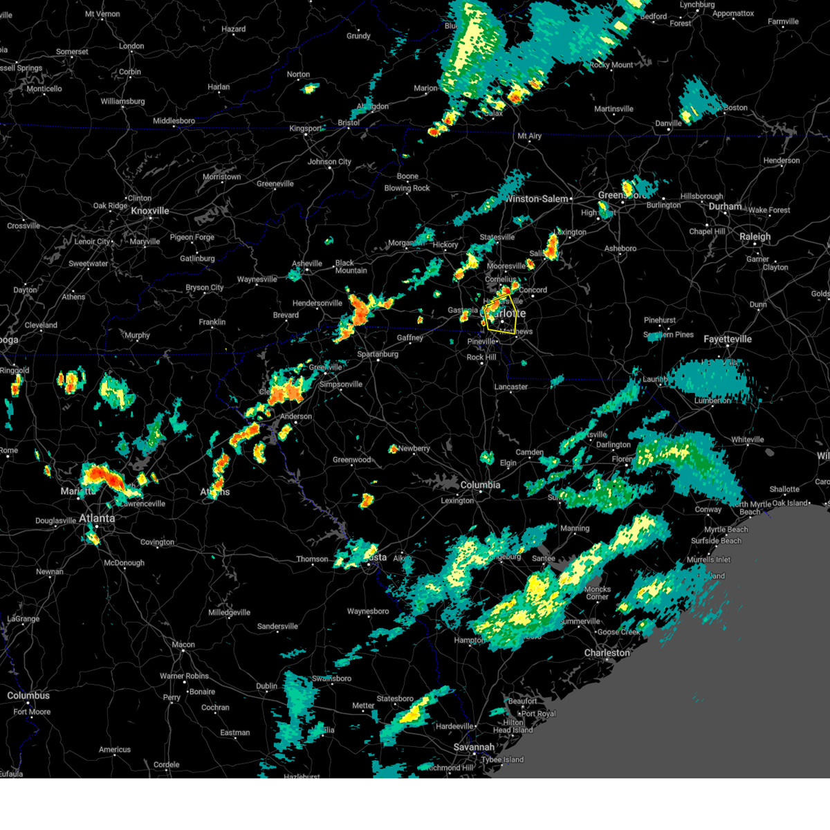 The severe thunderstorm warning for central mecklenburg county will expire at 630 pm edt, the storm which prompted the warning has weakened below severe limits, and no longer poses an immediate threat to life or property. therefore, the warning will be allowed to expire. however, additional strong or even severe thunderstorms could develop in the next 1 to 2 hours. to report severe weather to the national weather service greenville-spartanburg, call toll free, 1, 800, 2 6 7, 8 1 0 1, or post on our facebook page, or tweet it using hashtag nwsgsp. your message should describe the event and the specific location where it occurred. The severe thunderstorm warning for central mecklenburg county will expire at 630 pm edt, the storm which prompted the warning has weakened below severe limits, and no longer poses an immediate threat to life or property. therefore, the warning will be allowed to expire. however, additional strong or even severe thunderstorms could develop in the next 1 to 2 hours. to report severe weather to the national weather service greenville-spartanburg, call toll free, 1, 800, 2 6 7, 8 1 0 1, or post on our facebook page, or tweet it using hashtag nwsgsp. your message should describe the event and the specific location where it occurred.
|
| 7/28/2023 5:48 PM EDT |
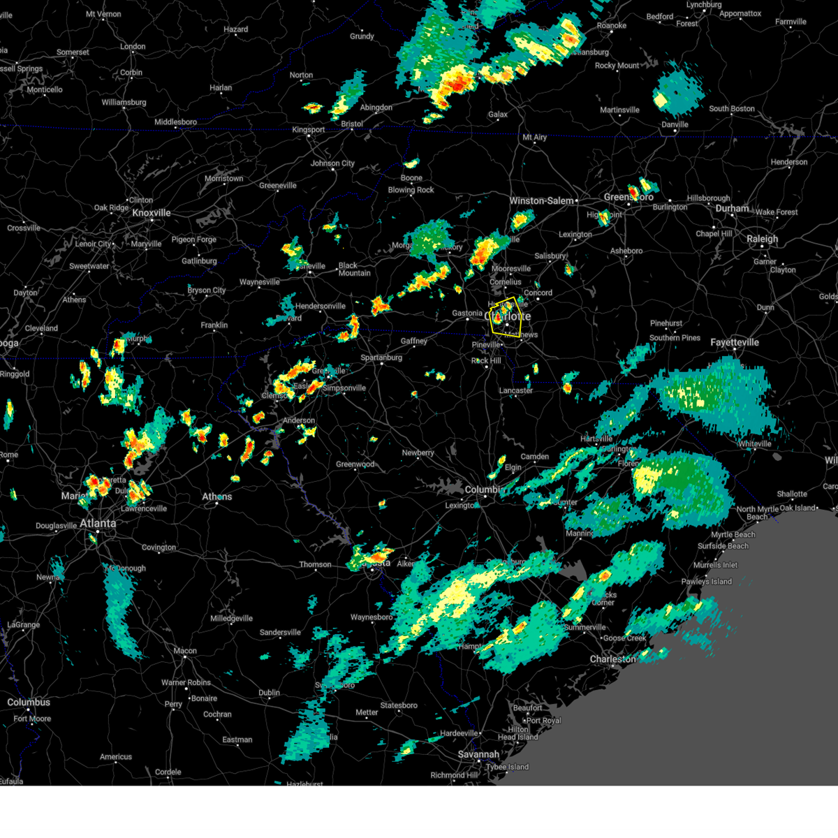 At 547 pm edt, a severe thunderstorm was located 5 miles northwest of uptown charlotte, and is nearly stationary (radar indicated). Hazards include 60 mph wind gusts and nickel size hail. expect damage to trees and power lines At 547 pm edt, a severe thunderstorm was located 5 miles northwest of uptown charlotte, and is nearly stationary (radar indicated). Hazards include 60 mph wind gusts and nickel size hail. expect damage to trees and power lines
|
| 7/14/2023 12:51 AM EDT |
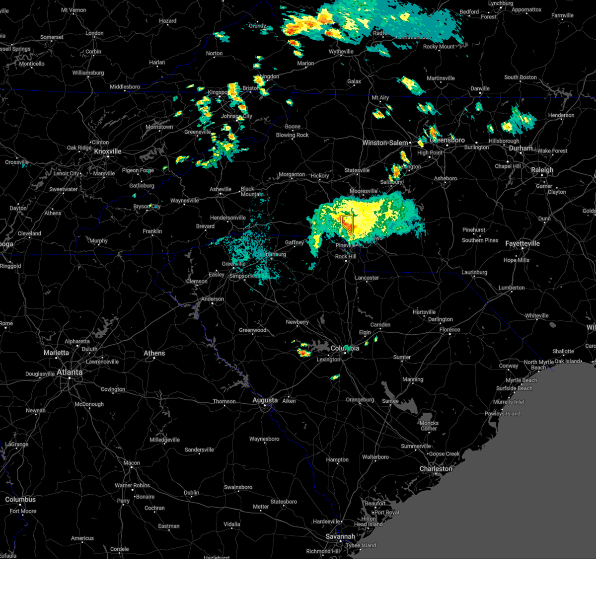 At 1250 am edt, a severe thunderstorm was located 9 miles northeast of gastonia, or over mt holly, moving east at 15 mph (radar indicated). Hazards include 60 mph wind gusts. Expect damage to trees and power lines. locations impacted include, mt holly, charlotte douglas airport, paw creek, lucia, belmont and northwest charlotte. hail threat, radar indicated max hail size, <. 75 in wind threat, radar indicated max wind gust, 60 mph. At 1250 am edt, a severe thunderstorm was located 9 miles northeast of gastonia, or over mt holly, moving east at 15 mph (radar indicated). Hazards include 60 mph wind gusts. Expect damage to trees and power lines. locations impacted include, mt holly, charlotte douglas airport, paw creek, lucia, belmont and northwest charlotte. hail threat, radar indicated max hail size, <. 75 in wind threat, radar indicated max wind gust, 60 mph.
|
| 7/14/2023 12:40 AM EDT |
 At 1240 am edt, a severe thunderstorm was located 7 miles northeast of gastonia, or near mt holly, moving east at 15 mph (radar indicated). Hazards include 60 mph wind gusts. expect damage to trees and power lines At 1240 am edt, a severe thunderstorm was located 7 miles northeast of gastonia, or near mt holly, moving east at 15 mph (radar indicated). Hazards include 60 mph wind gusts. expect damage to trees and power lines
|
| 7/8/2023 1:42 PM EDT |
 The severe thunderstorm warning for southern mecklenburg county will expire at 145 pm edt, the storm which prompted the warning has weakened below severe limits, and no longer poses an immediate threat to life or property. therefore, the warning will be allowed to expire. however heavy rain is still possible with this thunderstorm. to report severe weather to the national weather service greenville-spartanburg, call toll free, 1, 800, 2 6 7, 8 1 0 1, or post on our facebook page, or tweet it using hashtag nwsgsp. your message should describe the event and the specific location where it occurred. The severe thunderstorm warning for southern mecklenburg county will expire at 145 pm edt, the storm which prompted the warning has weakened below severe limits, and no longer poses an immediate threat to life or property. therefore, the warning will be allowed to expire. however heavy rain is still possible with this thunderstorm. to report severe weather to the national weather service greenville-spartanburg, call toll free, 1, 800, 2 6 7, 8 1 0 1, or post on our facebook page, or tweet it using hashtag nwsgsp. your message should describe the event and the specific location where it occurred.
|
| 7/8/2023 1:31 PM EDT | Trees down on power lines/utility equipmen in mecklenburg county NC, 3.2 miles WNW of Charlotte, NC |
| 7/8/2023 1:19 PM EDT |
 At 119 pm edt, a severe thunderstorm was located 5 miles south of uptown charlotte, or over southpark mall, moving southeast at 5 mph (radar indicated). Hazards include 60 mph wind gusts and quarter size hail. Minor hail damage to vehicles is expected. Expect wind damage to trees and power lines. At 119 pm edt, a severe thunderstorm was located 5 miles south of uptown charlotte, or over southpark mall, moving southeast at 5 mph (radar indicated). Hazards include 60 mph wind gusts and quarter size hail. Minor hail damage to vehicles is expected. Expect wind damage to trees and power lines.
|
| 6/26/2023 9:58 PM EDT |
 At 957 pm edt, a severe thunderstorm was located 7 miles southwest of downtown concord, or over harrisburg, moving east at 20 mph (radar indicated). Hazards include 60 mph wind gusts and quarter size hail. Minor hail damage to vehicles is expected. Expect wind damage to trees and power lines. At 957 pm edt, a severe thunderstorm was located 7 miles southwest of downtown concord, or over harrisburg, moving east at 20 mph (radar indicated). Hazards include 60 mph wind gusts and quarter size hail. Minor hail damage to vehicles is expected. Expect wind damage to trees and power lines.
|
| 6/26/2023 9:45 PM EDT | Golf Ball sized hail reported 9.6 miles SW of Charlotte, NC, social media report of golf ball size hail in mallard creek. |
| 6/26/2023 9:33 PM EDT | Quarter sized hail reported 7.8 miles SSW of Charlotte, NC |
| 6/26/2023 9:20 PM EDT |
 At 919 pm edt, a severe thunderstorm was located 5 miles north of uptown charlotte, or near northeast charlotte, moving east at 25 mph (radar indicated). Hazards include 60 mph wind gusts and penny size hail. Expect damage to trees and power lines. locations impacted include, uptown charlotte, north charlotte, reedy creek park, the plaza, paw creek, hidden valley, university city, northeast charlotte and mint hill. hail threat, radar indicated max hail size, 0. 75 in wind threat, radar indicated max wind gust, 60 mph. At 919 pm edt, a severe thunderstorm was located 5 miles north of uptown charlotte, or near northeast charlotte, moving east at 25 mph (radar indicated). Hazards include 60 mph wind gusts and penny size hail. Expect damage to trees and power lines. locations impacted include, uptown charlotte, north charlotte, reedy creek park, the plaza, paw creek, hidden valley, university city, northeast charlotte and mint hill. hail threat, radar indicated max hail size, 0. 75 in wind threat, radar indicated max wind gust, 60 mph.
|
| 6/26/2023 9:14 PM EDT | Half Dollar sized hail reported 7.9 miles SSE of Charlotte, NC, social media picture of hail just larger than quarters in the mountain island lake area. |
| 6/26/2023 9:02 PM EDT |
 At 902 pm edt, a severe thunderstorm was located 11 miles west of huntersville, or near stanley, moving east at 25 mph (radar indicated). Hazards include 60 mph wind gusts and quarter size hail. Minor hail damage to vehicles is expected. Expect wind damage to trees and power lines. At 902 pm edt, a severe thunderstorm was located 11 miles west of huntersville, or near stanley, moving east at 25 mph (radar indicated). Hazards include 60 mph wind gusts and quarter size hail. Minor hail damage to vehicles is expected. Expect wind damage to trees and power lines.
|
| 6/26/2023 8:49 PM EDT |
 At 848 pm edt, severe thunderstorms were located along a line extending from 3 miles northeast of kannapolis to 11 miles west of huntersville, moving east at 15 mph (radar indicated). Hazards include 60 mph wind gusts and quarter size hail. Minor hail damage to vehicles is expected. expect wind damage to trees and power lines. locations impacted include, huntersville, kannapolis, concord, enochville, coddle creek reservoir, gold hill, lucia, landis and stanley. hail threat, radar indicated max hail size, 1. 00 in wind threat, radar indicated max wind gust, 60 mph. At 848 pm edt, severe thunderstorms were located along a line extending from 3 miles northeast of kannapolis to 11 miles west of huntersville, moving east at 15 mph (radar indicated). Hazards include 60 mph wind gusts and quarter size hail. Minor hail damage to vehicles is expected. expect wind damage to trees and power lines. locations impacted include, huntersville, kannapolis, concord, enochville, coddle creek reservoir, gold hill, lucia, landis and stanley. hail threat, radar indicated max hail size, 1. 00 in wind threat, radar indicated max wind gust, 60 mph.
|
| 6/26/2023 8:46 PM EDT |
 At 846 pm edt, a severe thunderstorm was located 9 miles northeast of gastonia, or near mt holly, moving southeast at 25 mph (radar indicated). Hazards include 60 mph wind gusts and quarter size hail. Minor hail damage to vehicles is expected. Expect wind damage to trees and power lines. At 846 pm edt, a severe thunderstorm was located 9 miles northeast of gastonia, or near mt holly, moving southeast at 25 mph (radar indicated). Hazards include 60 mph wind gusts and quarter size hail. Minor hail damage to vehicles is expected. Expect wind damage to trees and power lines.
|
| 6/26/2023 8:15 PM EDT |
 At 815 pm edt, severe thunderstorms were located along a line extending from 7 miles northwest of kannapolis to 5 miles southeast of lincolnton, moving east at 25 mph (radar indicated). Hazards include 60 mph wind gusts and quarter size hail. Minor hail damage to vehicles is expected. Expect wind damage to trees and power lines. At 815 pm edt, severe thunderstorms were located along a line extending from 7 miles northwest of kannapolis to 5 miles southeast of lincolnton, moving east at 25 mph (radar indicated). Hazards include 60 mph wind gusts and quarter size hail. Minor hail damage to vehicles is expected. Expect wind damage to trees and power lines.
|
| 6/19/2023 8:23 PM EDT |
 The tornado warning for northwestern cabarrus, southeastern iredell, north central mecklenburg and southwestern rowan counties will expire at 830 pm edt, the storm which prompted the warning has weakened below severe limits, and no longer appears capable of producing a tornado. therefore, the warning will be allowed to expire. The tornado warning for northwestern cabarrus, southeastern iredell, north central mecklenburg and southwestern rowan counties will expire at 830 pm edt, the storm which prompted the warning has weakened below severe limits, and no longer appears capable of producing a tornado. therefore, the warning will be allowed to expire.
|
| 6/19/2023 8:04 PM EDT |
 At 804 pm edt, a severe thunderstorm capable of producing a tornado was located near huntersville, moving northeast at 5 mph (radar indicated rotation). Hazards include tornado. Flying debris will be dangerous to those caught without shelter. mobile homes will be damaged or destroyed. damage to roofs, windows, and vehicles will occur. tree damage is likely. this dangerous storm will be near, charlotte motor speedway around 810 pm edt. coddle creek reservoir and mooresville around 850 pm edt. Kannapolis and enochville around 900 pm edt. At 804 pm edt, a severe thunderstorm capable of producing a tornado was located near huntersville, moving northeast at 5 mph (radar indicated rotation). Hazards include tornado. Flying debris will be dangerous to those caught without shelter. mobile homes will be damaged or destroyed. damage to roofs, windows, and vehicles will occur. tree damage is likely. this dangerous storm will be near, charlotte motor speedway around 810 pm edt. coddle creek reservoir and mooresville around 850 pm edt. Kannapolis and enochville around 900 pm edt.
|
| 6/19/2023 7:50 PM EDT |
 At 750 pm edt, a severe thunderstorm capable of producing a tornado was located near huntersville, moving northeast at 10 mph (radar indicated rotation). Hazards include tornado. Flying debris will be dangerous to those caught without shelter. mobile homes will be damaged or destroyed. damage to roofs, windows, and vehicles will occur. tree damage is likely. This dangerous storm will be near, kannapolis, coddle creek reservoir, enochville and mooresville around 840 pm edt. At 750 pm edt, a severe thunderstorm capable of producing a tornado was located near huntersville, moving northeast at 10 mph (radar indicated rotation). Hazards include tornado. Flying debris will be dangerous to those caught without shelter. mobile homes will be damaged or destroyed. damage to roofs, windows, and vehicles will occur. tree damage is likely. This dangerous storm will be near, kannapolis, coddle creek reservoir, enochville and mooresville around 840 pm edt.
|
| 6/19/2023 7:39 PM EDT |
 At 739 pm edt, a severe thunderstorm capable of producing a tornado was located near huntersville, moving northeast at 5 mph (radar indicated rotation). Hazards include tornado. Flying debris will be dangerous to those caught without shelter. mobile homes will be damaged or destroyed. damage to roofs, windows, and vehicles will occur. tree damage is likely. this dangerous storm will be near, davidson around 750 pm edt. charlotte motor speedway around 800 pm edt. kannapolis, coddle creek reservoir, enochville and mooresville around 830 pm edt. Other locations impacted by this dangerous thunderstorm include croft. At 739 pm edt, a severe thunderstorm capable of producing a tornado was located near huntersville, moving northeast at 5 mph (radar indicated rotation). Hazards include tornado. Flying debris will be dangerous to those caught without shelter. mobile homes will be damaged or destroyed. damage to roofs, windows, and vehicles will occur. tree damage is likely. this dangerous storm will be near, davidson around 750 pm edt. charlotte motor speedway around 800 pm edt. kannapolis, coddle creek reservoir, enochville and mooresville around 830 pm edt. Other locations impacted by this dangerous thunderstorm include croft.
|
| 6/19/2023 7:22 PM EDT |
 At 722 pm edt, a severe thunderstorm capable of producing a tornado was located 7 miles west of kannapolis, or 4 miles northwest of coddle creek reservoir, moving northeast at 10 mph (radar indicated rotation). Hazards include tornado. Flying debris will be dangerous to those caught without shelter. mobile homes will be damaged or destroyed. damage to roofs, windows, and vehicles will occur. tree damage is likely. this dangerous storm will be near, enochville around 750 pm edt. kannapolis and landis around 800 pm edt. Other locations impacted by this tornadic thunderstorm include mount ulla. At 722 pm edt, a severe thunderstorm capable of producing a tornado was located 7 miles west of kannapolis, or 4 miles northwest of coddle creek reservoir, moving northeast at 10 mph (radar indicated rotation). Hazards include tornado. Flying debris will be dangerous to those caught without shelter. mobile homes will be damaged or destroyed. damage to roofs, windows, and vehicles will occur. tree damage is likely. this dangerous storm will be near, enochville around 750 pm edt. kannapolis and landis around 800 pm edt. Other locations impacted by this tornadic thunderstorm include mount ulla.
|
| 6/19/2023 7:08 PM EDT |
 At 708 pm edt, a severe thunderstorm capable of producing a tornado was located 6 miles northeast of huntersville, or near davidson, moving northeast at 10 mph (radar indicated rotation). Hazards include tornado. Flying debris will be dangerous to those caught without shelter. mobile homes will be damaged or destroyed. damage to roofs, windows, and vehicles will occur. tree damage is likely. this dangerous storm will be near, mooresville around 720 pm edt. coddle creek reservoir around 730 pm edt. Kannapolis, enochville and landis around 740 pm edt. At 708 pm edt, a severe thunderstorm capable of producing a tornado was located 6 miles northeast of huntersville, or near davidson, moving northeast at 10 mph (radar indicated rotation). Hazards include tornado. Flying debris will be dangerous to those caught without shelter. mobile homes will be damaged or destroyed. damage to roofs, windows, and vehicles will occur. tree damage is likely. this dangerous storm will be near, mooresville around 720 pm edt. coddle creek reservoir around 730 pm edt. Kannapolis, enochville and landis around 740 pm edt.
|
| 6/12/2023 3:42 PM EDT | Multiple trees fell across power lines and on utility equipment in the area between hickory grove and mint hil in mecklenburg county NC, 10.8 miles W of Charlotte, NC |
| 6/12/2023 3:40 PM EDT | Social media report of multiple trees down in the pence rd are in mecklenburg county NC, 9 miles W of Charlotte, NC |
| 6/12/2023 3:39 PM EDT | Social media picture of trees down on crestside l in mecklenburg county NC, 8.4 miles W of Charlotte, NC |
| 6/12/2023 3:34 PM EDT |
 At 333 pm edt, a severe thunderstorm was located 7 miles northeast of uptown charlotte, or near reedy creek park, moving east at 30 mph (radar indicated). Hazards include 60 mph wind gusts and quarter size hail. Minor hail damage to vehicles is expected. Expect wind damage to trees and power lines. At 333 pm edt, a severe thunderstorm was located 7 miles northeast of uptown charlotte, or near reedy creek park, moving east at 30 mph (radar indicated). Hazards include 60 mph wind gusts and quarter size hail. Minor hail damage to vehicles is expected. Expect wind damage to trees and power lines.
|
| 5/16/2023 10:23 PM EDT |
 The severe thunderstorm warning for cabarrus and northern mecklenburg counties will expire at 1030 pm edt, the storm which prompted the warning has weakened below severe limits, and no longer poses an immediate threat to life or property. therefore, the warning will be allowed to expire. however gusty winds are still possible with this thunderstorm. a severe thunderstorm watch remains in effect until midnight edt for the piedmont of north carolina. to report severe weather to the national weather service greenville-spartanburg, call toll free, 1, 800, 2 6 7, 8 1 0 1, or post on our facebook page, or tweet it using hashtag nwsgsp. your message should describe the event and the specific location where it occurred. The severe thunderstorm warning for cabarrus and northern mecklenburg counties will expire at 1030 pm edt, the storm which prompted the warning has weakened below severe limits, and no longer poses an immediate threat to life or property. therefore, the warning will be allowed to expire. however gusty winds are still possible with this thunderstorm. a severe thunderstorm watch remains in effect until midnight edt for the piedmont of north carolina. to report severe weather to the national weather service greenville-spartanburg, call toll free, 1, 800, 2 6 7, 8 1 0 1, or post on our facebook page, or tweet it using hashtag nwsgsp. your message should describe the event and the specific location where it occurred.
|
| 5/16/2023 10:00 PM EDT | Trees down along dunn commons parkwa in mecklenburg county NC, 7.9 miles SE of Charlotte, NC |
| 5/16/2023 9:50 PM EDT |
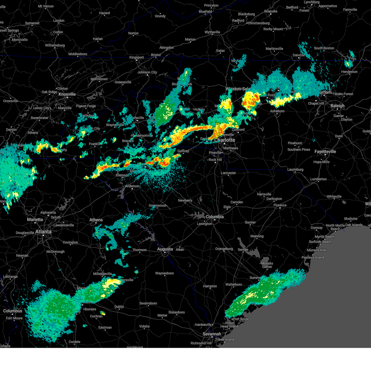 The severe thunderstorm warning for eastern lincoln and northeastern gaston counties will expire at 1000 pm edt, the storm which prompted the warning has moved out of the area. therefore, the warning will be allowed to expire. a severe thunderstorm watch remains in effect until 1000 pm edt for the piedmont of north carolina. The severe thunderstorm warning for eastern lincoln and northeastern gaston counties will expire at 1000 pm edt, the storm which prompted the warning has moved out of the area. therefore, the warning will be allowed to expire. a severe thunderstorm watch remains in effect until 1000 pm edt for the piedmont of north carolina.
|
| 5/16/2023 9:43 PM EDT |
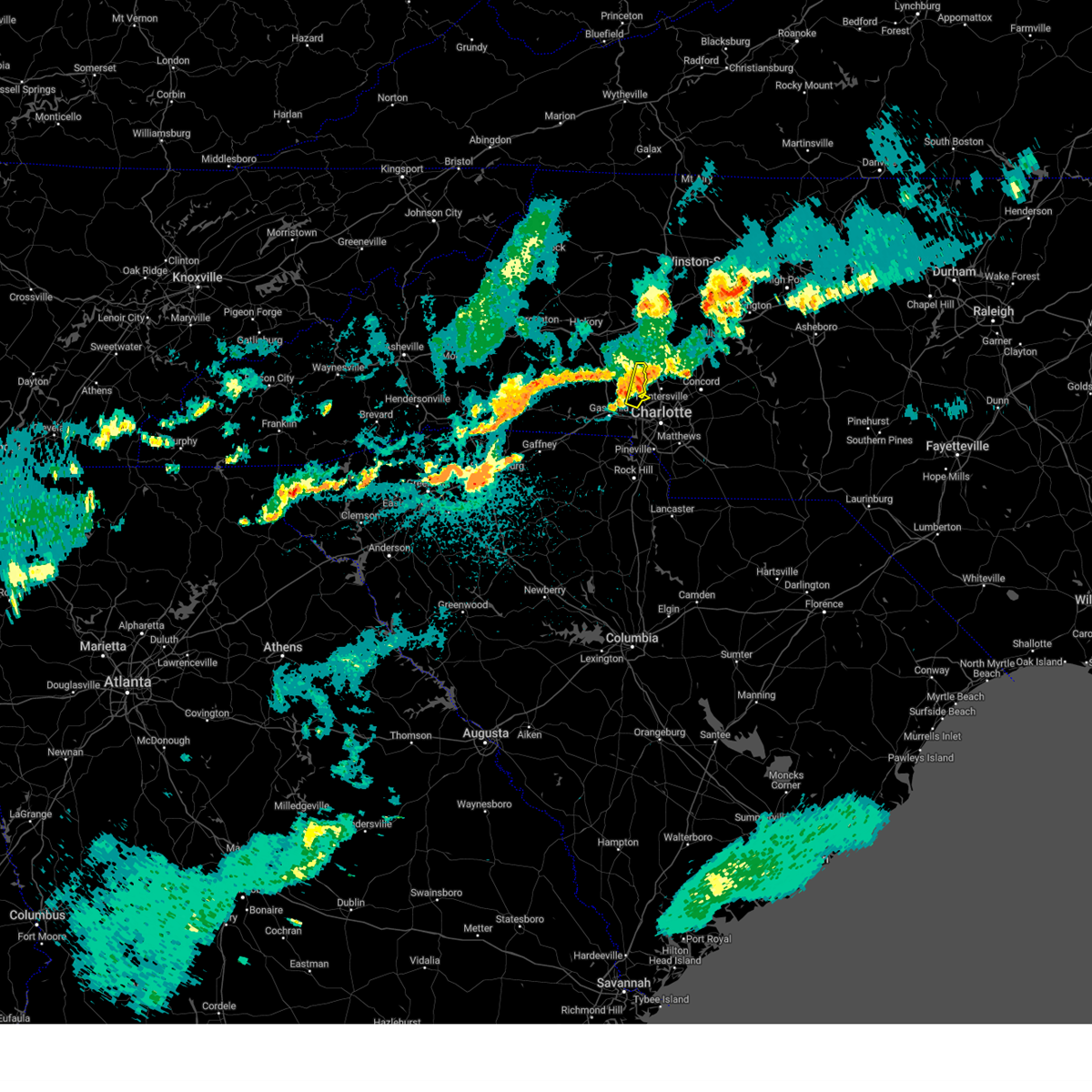 At 943 pm edt, a severe thunderstorm was located near huntersville, moving east at 35 mph (radar indicated). Hazards include 60 mph wind gusts and nickel size hail. Expect damage to trees and power lines. locations impacted include, westport, lowesville, lucia, denver, mt holly and lake norman. hail threat, radar indicated max hail size, 0. 88 in wind threat, radar indicated max wind gust, 60 mph. At 943 pm edt, a severe thunderstorm was located near huntersville, moving east at 35 mph (radar indicated). Hazards include 60 mph wind gusts and nickel size hail. Expect damage to trees and power lines. locations impacted include, westport, lowesville, lucia, denver, mt holly and lake norman. hail threat, radar indicated max hail size, 0. 88 in wind threat, radar indicated max wind gust, 60 mph.
|
| 5/16/2023 9:36 PM EDT |
 At 936 pm edt, a severe thunderstorm was located 6 miles west of huntersville, or 5 miles southwest of ramsey creek park, moving east at 40 mph (radar indicated). Hazards include 60 mph wind gusts. expect damage to trees and power lines At 936 pm edt, a severe thunderstorm was located 6 miles west of huntersville, or 5 miles southwest of ramsey creek park, moving east at 40 mph (radar indicated). Hazards include 60 mph wind gusts. expect damage to trees and power lines
|
| 5/16/2023 9:27 PM EDT |
 At 927 pm edt, a severe thunderstorm was located 10 miles east of lincolnton, or 4 miles north of stanley, moving east at 35 mph (radar indicated). Hazards include 60 mph wind gusts and nickel size hail. Expect damage to trees and power lines. locations impacted include, stanley, westport, high shoals, iron station, denver, lowesville, lucia, mt holly and lake norman. hail threat, radar indicated max hail size, 0. 88 in wind threat, radar indicated max wind gust, 60 mph. At 927 pm edt, a severe thunderstorm was located 10 miles east of lincolnton, or 4 miles north of stanley, moving east at 35 mph (radar indicated). Hazards include 60 mph wind gusts and nickel size hail. Expect damage to trees and power lines. locations impacted include, stanley, westport, high shoals, iron station, denver, lowesville, lucia, mt holly and lake norman. hail threat, radar indicated max hail size, 0. 88 in wind threat, radar indicated max wind gust, 60 mph.
|
| 5/16/2023 9:16 PM EDT |
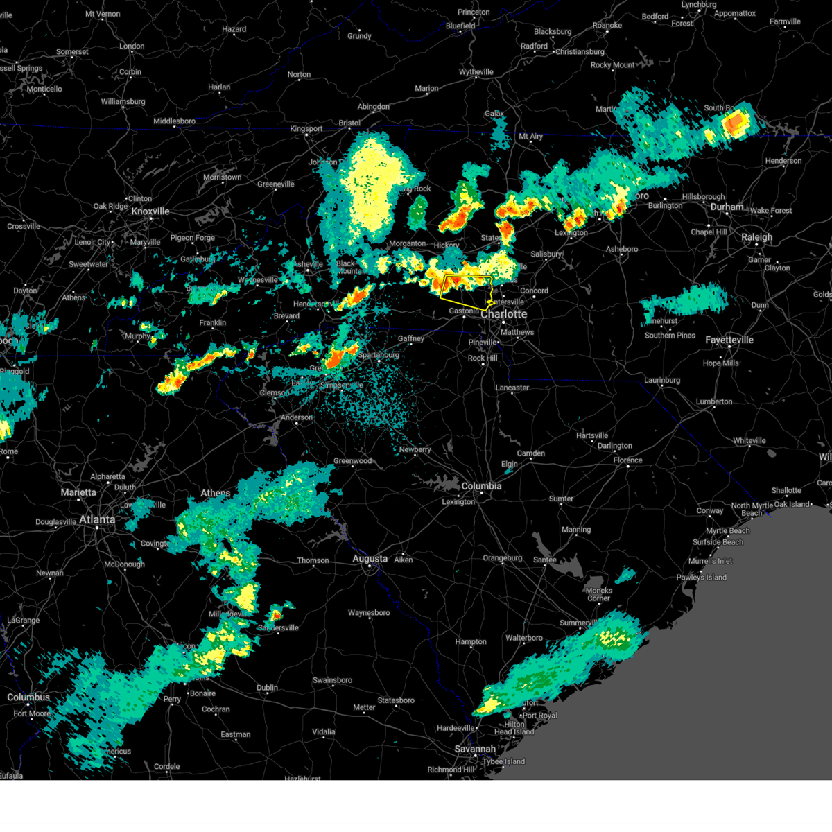 At 916 pm edt, a severe thunderstorm was located near lincolnton, moving east at 35 mph (radar indicated). Hazards include 60 mph wind gusts and nickel size hail. expect damage to trees and power lines At 916 pm edt, a severe thunderstorm was located near lincolnton, moving east at 35 mph (radar indicated). Hazards include 60 mph wind gusts and nickel size hail. expect damage to trees and power lines
|
| 5/16/2023 8:04 PM EDT |
 At 804 pm edt, a severe thunderstorm was located 10 miles east of uptown charlotte, or over mint hill, moving east at 30 mph (radar indicated). Hazards include 60 mph wind gusts and quarter size hail. Minor hail damage to vehicles is expected. expect wind damage to trees and power lines. locations impacted include, uptown charlotte, east charlotte, freedom park, reedy creek park, the plaza, hidden valley, southpark mall, central charlotte, south charlotte and matthews. hail threat, radar indicated max hail size, 1. 00 in wind threat, radar indicated max wind gust, 60 mph. At 804 pm edt, a severe thunderstorm was located 10 miles east of uptown charlotte, or over mint hill, moving east at 30 mph (radar indicated). Hazards include 60 mph wind gusts and quarter size hail. Minor hail damage to vehicles is expected. expect wind damage to trees and power lines. locations impacted include, uptown charlotte, east charlotte, freedom park, reedy creek park, the plaza, hidden valley, southpark mall, central charlotte, south charlotte and matthews. hail threat, radar indicated max hail size, 1. 00 in wind threat, radar indicated max wind gust, 60 mph.
|
| 5/16/2023 7:58 PM EDT | Quarter sized hail reported 1.1 miles WNW of Charlotte, NC, quarter size hail in uptown charlotte |
| 5/16/2023 7:26 PM EDT |
 At 725 pm edt, a severe thunderstorm was located 9 miles east of gastonia, or near mt holly, moving east at 30 mph (radar indicated). Hazards include 60 mph wind gusts and quarter size hail. Minor hail damage to vehicles is expected. Expect wind damage to trees and power lines. At 725 pm edt, a severe thunderstorm was located 9 miles east of gastonia, or near mt holly, moving east at 30 mph (radar indicated). Hazards include 60 mph wind gusts and quarter size hail. Minor hail damage to vehicles is expected. Expect wind damage to trees and power lines.
|
| 4/22/2023 7:34 AM EDT |
 At 734 am edt, a severe thunderstorm was located near huntersville, moving east at 35 mph (radar indicated). Hazards include 60 mph wind gusts. Expect damage to trees and power lines. Locations impacted include, huntersville, north charlotte, west concord, harrisburg, university city, reedy creek park, charlotte motor speedway, coddle creek reservoir and hidden valley. At 734 am edt, a severe thunderstorm was located near huntersville, moving east at 35 mph (radar indicated). Hazards include 60 mph wind gusts. Expect damage to trees and power lines. Locations impacted include, huntersville, north charlotte, west concord, harrisburg, university city, reedy creek park, charlotte motor speedway, coddle creek reservoir and hidden valley.
|
| 4/22/2023 7:22 AM EDT |
 At 721 am edt, a severe thunderstorm was located 8 miles west of huntersville, or 5 miles northeast of mt holly, moving east at 35 mph (radar indicated). Hazards include 60 mph wind gusts. Expect damage to trees and power lines. Locations impacted include, huntersville, north and northwest charlotte, west concord, cornelius, mt holly, harrisburg, university city, reedy creek park and charlotte motor speedway. At 721 am edt, a severe thunderstorm was located 8 miles west of huntersville, or 5 miles northeast of mt holly, moving east at 35 mph (radar indicated). Hazards include 60 mph wind gusts. Expect damage to trees and power lines. Locations impacted include, huntersville, north and northwest charlotte, west concord, cornelius, mt holly, harrisburg, university city, reedy creek park and charlotte motor speedway.
|
| 4/22/2023 7:00 AM EDT |
 At 700 am edt, a severe thunderstorm was located 6 miles south of lincolnton, or near high shoals, moving east at 40 mph (radar indicated). Hazards include 60 mph wind gusts. expect damage to trees and power lines At 700 am edt, a severe thunderstorm was located 6 miles south of lincolnton, or near high shoals, moving east at 40 mph (radar indicated). Hazards include 60 mph wind gusts. expect damage to trees and power lines
|
| 4/6/2023 4:12 PM EDT |
 The severe thunderstorm warning for southwestern mecklenburg, west central union, north central chester and southeastern york counties will expire at 415 pm edt, the storm which prompted the warning has weakened below severe limits, and no longer poses an immediate threat to life or property. therefore, the warning will be allowed to expire. to report severe weather to the national weather service greenville-spartanburg, call toll free, 1, 800, 2 6 7, 8 1 0 1, or post on our facebook page, or tweet it using hashtag nwsgsp. your message should describe the event and the specific location where it occurred. The severe thunderstorm warning for southwestern mecklenburg, west central union, north central chester and southeastern york counties will expire at 415 pm edt, the storm which prompted the warning has weakened below severe limits, and no longer poses an immediate threat to life or property. therefore, the warning will be allowed to expire. to report severe weather to the national weather service greenville-spartanburg, call toll free, 1, 800, 2 6 7, 8 1 0 1, or post on our facebook page, or tweet it using hashtag nwsgsp. your message should describe the event and the specific location where it occurred.
|
| 4/6/2023 3:40 PM EDT |
 At 340 pm edt, a severe thunderstorm was located 5 miles southwest of rock hill, moving northeast at 30 mph (radar indicated). Hazards include 60 mph wind gusts and quarter size hail. Minor hail damage to vehicles is expected. Expect wind damage to trees and power lines. At 340 pm edt, a severe thunderstorm was located 5 miles southwest of rock hill, moving northeast at 30 mph (radar indicated). Hazards include 60 mph wind gusts and quarter size hail. Minor hail damage to vehicles is expected. Expect wind damage to trees and power lines.
|
| 3/3/2023 8:55 PM EST | Tree down on power line in mecklenburg county NC, 5.5 miles WNW of Charlotte, NC |
| 3/3/2023 8:53 PM EST | Tree down and blocking roadwa in mecklenburg county NC, 6.2 miles SSW of Charlotte, NC |
| 3/3/2023 8:36 PM EST |
 At 836 pm est, severe thunderstorms were located along a line extending from 4 miles southwest of kannapolis to near indian land, moving northeast at 70 mph (radar indicated). Hazards include 60 mph wind gusts. Expect damage to trees and power lines. locations impacted include, uptown charlotte, kannapolis, downtown concord, south charlotte, northeast charlotte, east charlotte, west concord, matthews, mint hill and pineville. hail threat, radar indicated max hail size, <. 75 in wind threat, radar indicated max wind gust, 60 mph. At 836 pm est, severe thunderstorms were located along a line extending from 4 miles southwest of kannapolis to near indian land, moving northeast at 70 mph (radar indicated). Hazards include 60 mph wind gusts. Expect damage to trees and power lines. locations impacted include, uptown charlotte, kannapolis, downtown concord, south charlotte, northeast charlotte, east charlotte, west concord, matthews, mint hill and pineville. hail threat, radar indicated max hail size, <. 75 in wind threat, radar indicated max wind gust, 60 mph.
|
| 3/3/2023 8:25 PM EST |
 At 824 pm est, severe thunderstorms were located along a line extending from 7 miles northeast of huntersville to 8 miles northwest of indian land, moving northeast at 75 mph (radar indicated). Hazards include 60 mph wind gusts. Expect damage to trees and power lines. locations impacted include, uptown charlotte, huntersville, kannapolis, downtown concord, central charlotte, south charlotte, northeast charlotte, southwest charlotte, east charlotte and northwest charlotte. hail threat, radar indicated max hail size, <. 75 in wind threat, radar indicated max wind gust, 60 mph. At 824 pm est, severe thunderstorms were located along a line extending from 7 miles northeast of huntersville to 8 miles northwest of indian land, moving northeast at 75 mph (radar indicated). Hazards include 60 mph wind gusts. Expect damage to trees and power lines. locations impacted include, uptown charlotte, huntersville, kannapolis, downtown concord, central charlotte, south charlotte, northeast charlotte, southwest charlotte, east charlotte and northwest charlotte. hail threat, radar indicated max hail size, <. 75 in wind threat, radar indicated max wind gust, 60 mph.
|
| 3/3/2023 8:12 PM EST |
 At 812 pm est, severe thunderstorms were located along a line extending from 9 miles west of huntersville to near york, moving northeast at 75 mph (radar indicated). Hazards include 60 mph wind gusts. expect damage to trees and power lines At 812 pm est, severe thunderstorms were located along a line extending from 9 miles west of huntersville to near york, moving northeast at 75 mph (radar indicated). Hazards include 60 mph wind gusts. expect damage to trees and power lines
|
| 3/3/2023 7:20 PM EST | Tree down on a hous in mecklenburg county NC, 1.1 miles S of Charlotte, NC |
| 1/12/2023 7:22 PM EST |
 The severe thunderstorm warning for south central cabarrus and southeastern mecklenburg counties will expire at 730 pm est, the storms which prompted the warning have moved out of the area. therefore, the warning will be allowed to expire. a tornado watch remains in effect until 1000 pm est for the piedmont of north carolina. The severe thunderstorm warning for south central cabarrus and southeastern mecklenburg counties will expire at 730 pm est, the storms which prompted the warning have moved out of the area. therefore, the warning will be allowed to expire. a tornado watch remains in effect until 1000 pm est for the piedmont of north carolina.
|
| 1/12/2023 7:07 PM EST |
 At 706 pm est, severe thunderstorms were located along a line extending from 9 miles south of downtown concord to 8 miles east of indian land to 8 miles southeast of rock hill, moving east at 40 mph (radar indicated). Hazards include 60 mph wind gusts. Expect damage to trees and power lines. locations impacted include, south charlotte, matthews, mint hill, midland, the arboretum and east charlotte. hail threat, radar indicated max hail size, <. 75 in wind threat, radar indicated max wind gust, 60 mph. At 706 pm est, severe thunderstorms were located along a line extending from 9 miles south of downtown concord to 8 miles east of indian land to 8 miles southeast of rock hill, moving east at 40 mph (radar indicated). Hazards include 60 mph wind gusts. Expect damage to trees and power lines. locations impacted include, south charlotte, matthews, mint hill, midland, the arboretum and east charlotte. hail threat, radar indicated max hail size, <. 75 in wind threat, radar indicated max wind gust, 60 mph.
|
| 1/12/2023 7:06 PM EST | Social media picture of a tree down in mint hil in mecklenburg county NC, 12 miles WNW of Charlotte, NC |
| 1/12/2023 6:59 PM EST |
 At 658 pm est, severe thunderstorms were located along a line extending from 3 miles west of downtown concord to 5 miles southeast of uptown charlotte to 4 miles west of indian land, moving east at 40 mph (radar indicated). Hazards include 60 mph wind gusts. expect damage to trees and power lines At 658 pm est, severe thunderstorms were located along a line extending from 3 miles west of downtown concord to 5 miles southeast of uptown charlotte to 4 miles west of indian land, moving east at 40 mph (radar indicated). Hazards include 60 mph wind gusts. expect damage to trees and power lines
|
| 1/12/2023 6:55 PM EST | Emergency manager reports tree down on a house at tall oaks trai in mecklenburg county NC, 6.4 miles N of Charlotte, NC |
| 1/12/2023 6:53 PM EST |
 At 653 pm est, severe thunderstorms were located along a line extending from 4 miles east of kannapolis to 3 miles southwest of downtown concord to 3 miles northeast of uptown charlotte, moving east at 50 mph (radar indicated). Hazards include 60 mph wind gusts. Expect damage to trees and power lines. Locations impacted include, kannapolis, downtown concord, northeast charlotte, west concord, harrisburg, mt pleasant, university city, charlotte motor speedway, coddle creek reservoir and hidden valley. At 653 pm est, severe thunderstorms were located along a line extending from 4 miles east of kannapolis to 3 miles southwest of downtown concord to 3 miles northeast of uptown charlotte, moving east at 50 mph (radar indicated). Hazards include 60 mph wind gusts. Expect damage to trees and power lines. Locations impacted include, kannapolis, downtown concord, northeast charlotte, west concord, harrisburg, mt pleasant, university city, charlotte motor speedway, coddle creek reservoir and hidden valley.
|
| 1/12/2023 6:52 PM EST |
 At 652 pm est, severe thunderstorms were located along a line extending from 4 miles northeast of uptown charlotte to near indian land to 9 miles southwest of rock hill, moving east at 50 mph (radar indicated). Hazards include 60 mph wind gusts. Expect damage to trees and power lines. locations impacted include, rock hill, uptown charlotte, central charlotte, south charlotte, southwest charlotte, east charlotte, matthews, mint hill, fort mill and pineville. hail threat, radar indicated max hail size, <. 75 in wind threat, radar indicated max wind gust, 60 mph. At 652 pm est, severe thunderstorms were located along a line extending from 4 miles northeast of uptown charlotte to near indian land to 9 miles southwest of rock hill, moving east at 50 mph (radar indicated). Hazards include 60 mph wind gusts. Expect damage to trees and power lines. locations impacted include, rock hill, uptown charlotte, central charlotte, south charlotte, southwest charlotte, east charlotte, matthews, mint hill, fort mill and pineville. hail threat, radar indicated max hail size, <. 75 in wind threat, radar indicated max wind gust, 60 mph.
|
| 1/12/2023 6:36 PM EST |
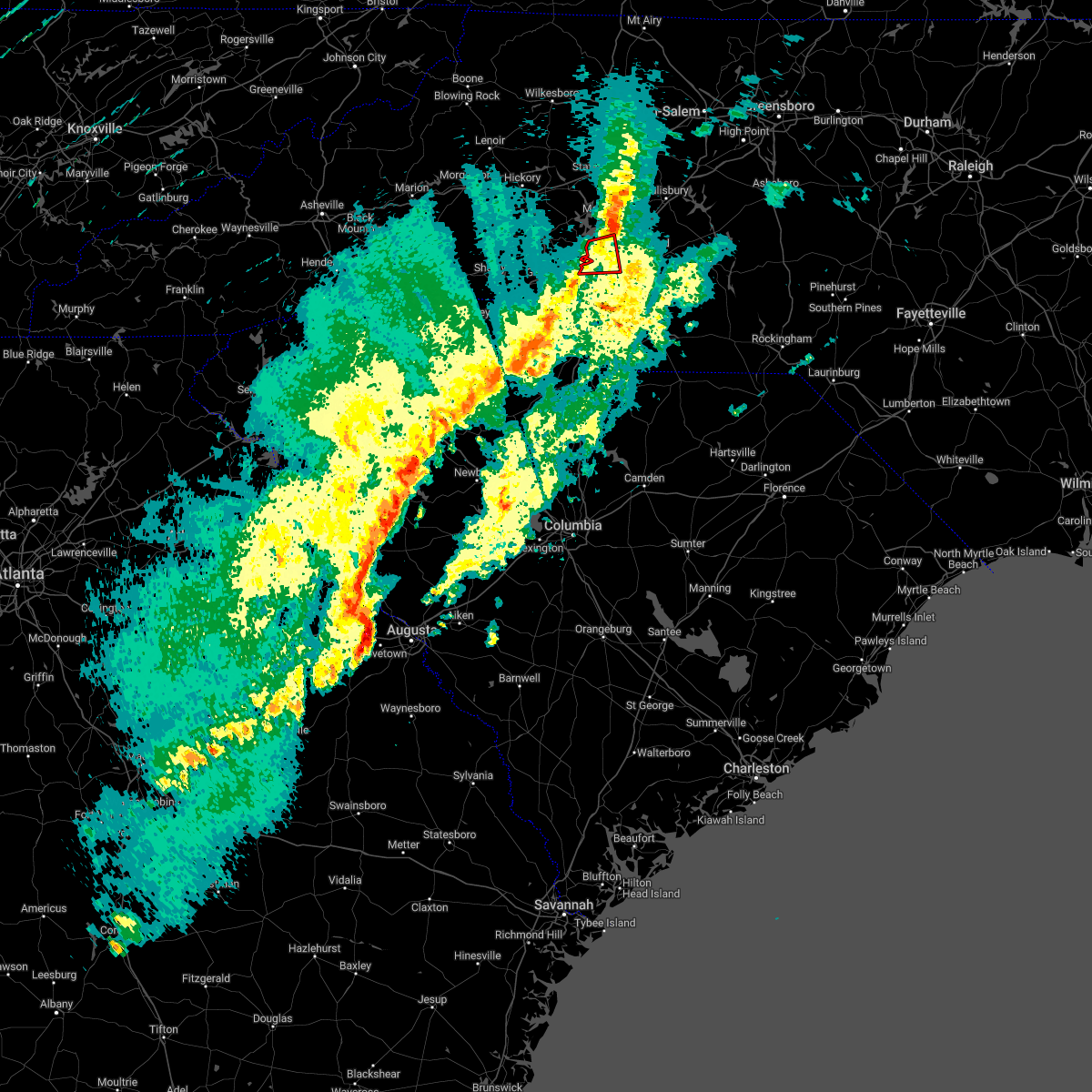 The tornado warning for northwestern mecklenburg county will expire at 645 pm est, the tornado threat has diminished and the tornado warning has been cancelled. however, large hail and damaging winds remain likely and a severe thunderstorm warning remains in effect for the area. a tornado watch remains in effect until 1000 pm est for the piedmont of north carolina. The tornado warning for northwestern mecklenburg county will expire at 645 pm est, the tornado threat has diminished and the tornado warning has been cancelled. however, large hail and damaging winds remain likely and a severe thunderstorm warning remains in effect for the area. a tornado watch remains in effect until 1000 pm est for the piedmont of north carolina.
|
| 1/12/2023 6:28 PM EST |
 At 628 pm est, severe thunderstorms were located along a line extending from 9 miles southwest of huntersville to 10 miles southwest of york, moving east at 40 mph (radar indicated). Hazards include 60 mph wind gusts. expect damage to trees and power lines At 628 pm est, severe thunderstorms were located along a line extending from 9 miles southwest of huntersville to 10 miles southwest of york, moving east at 40 mph (radar indicated). Hazards include 60 mph wind gusts. expect damage to trees and power lines
|
| 1/12/2023 6:25 PM EST |
 At 625 pm est, a severe thunderstorm capable of producing a tornado was located near huntersville, moving east at 55 mph (radar indicated rotation). Hazards include tornado. Flying debris will be dangerous to those caught without shelter. mobile homes will be damaged or destroyed. damage to roofs, windows, and vehicles will occur. tree damage is likely. this dangerous storm will be near, northeast charlotte around 630 pm est. Other locations impacted by this tornadic thunderstorm include croft. At 625 pm est, a severe thunderstorm capable of producing a tornado was located near huntersville, moving east at 55 mph (radar indicated rotation). Hazards include tornado. Flying debris will be dangerous to those caught without shelter. mobile homes will be damaged or destroyed. damage to roofs, windows, and vehicles will occur. tree damage is likely. this dangerous storm will be near, northeast charlotte around 630 pm est. Other locations impacted by this tornadic thunderstorm include croft.
|
| 1/12/2023 6:20 PM EST |
 At 620 pm est, severe thunderstorms were located along a line extending from 16 miles east of lincolnton to 6 miles west of huntersville to 6 miles east of gastonia, moving east at 55 mph (radar indicated). Hazards include 60 mph wind gusts. expect damage to trees and power lines At 620 pm est, severe thunderstorms were located along a line extending from 16 miles east of lincolnton to 6 miles west of huntersville to 6 miles east of gastonia, moving east at 55 mph (radar indicated). Hazards include 60 mph wind gusts. expect damage to trees and power lines
|
| 1/12/2023 6:15 PM EST |
 At 615 pm est, severe thunderstorms were located along a line extending from 11 miles east of newton to 8 miles northeast of gastonia to 9 miles north of york, moving northeast at 55 mph (radar indicated). Hazards include 60 mph wind gusts and penny size hail. Expect damage to trees and power lines. Locations impacted include, gastonia, mt holly, belmont, south gastonia, stanley, cramerton, lowell, ranlo, westport and mcadenville. At 615 pm est, severe thunderstorms were located along a line extending from 11 miles east of newton to 8 miles northeast of gastonia to 9 miles north of york, moving northeast at 55 mph (radar indicated). Hazards include 60 mph wind gusts and penny size hail. Expect damage to trees and power lines. Locations impacted include, gastonia, mt holly, belmont, south gastonia, stanley, cramerton, lowell, ranlo, westport and mcadenville.
|
| 1/12/2023 6:15 PM EST |
 At 615 pm est, a severe thunderstorm capable of producing a tornado was located 9 miles northeast of gastonia, or near stanley, moving east at 55 mph (radar indicated rotation). Hazards include tornado. Flying debris will be dangerous to those caught without shelter. mobile homes will be damaged or destroyed. damage to roofs, windows, and vehicles will occur. tree damage is likely. this dangerous storm will be near, huntersville and cornelius around 620 pm est. northeast charlotte, northwest charlotte, ramsey creek park and davidson around 630 pm est. Other locations impacted by this tornadic thunderstorm include lowesville, lucia and croft. At 615 pm est, a severe thunderstorm capable of producing a tornado was located 9 miles northeast of gastonia, or near stanley, moving east at 55 mph (radar indicated rotation). Hazards include tornado. Flying debris will be dangerous to those caught without shelter. mobile homes will be damaged or destroyed. damage to roofs, windows, and vehicles will occur. tree damage is likely. this dangerous storm will be near, huntersville and cornelius around 620 pm est. northeast charlotte, northwest charlotte, ramsey creek park and davidson around 630 pm est. Other locations impacted by this tornadic thunderstorm include lowesville, lucia and croft.
|
| 1/12/2023 6:15 PM EST |
 At 615 pm est, severe thunderstorms were located along a line extending from 11 miles east of newton to 8 miles northeast of gastonia to 9 miles north of york, moving northeast at 55 mph (radar indicated). Hazards include 60 mph wind gusts and penny size hail. Expect damage to trees and power lines. Locations impacted include, gastonia, mt holly, belmont, south gastonia, stanley, cramerton, lowell, ranlo, westport and mcadenville. At 615 pm est, severe thunderstorms were located along a line extending from 11 miles east of newton to 8 miles northeast of gastonia to 9 miles north of york, moving northeast at 55 mph (radar indicated). Hazards include 60 mph wind gusts and penny size hail. Expect damage to trees and power lines. Locations impacted include, gastonia, mt holly, belmont, south gastonia, stanley, cramerton, lowell, ranlo, westport and mcadenville.
|
| 1/12/2023 6:10 PM EST |
 At 610 pm est, a severe thunderstorm capable of producing a tornado was located 6 miles north of gastonia, or near stanley, moving east at 55 mph (radar indicated rotation). Hazards include tornado. Flying debris will be dangerous to those caught without shelter. mobile homes will be damaged or destroyed. damage to roofs, windows, and vehicles will occur. tree damage is likely. this dangerous storm will be near, huntersville and cornelius around 620 pm est. northeast charlotte, northwest charlotte, ramsey creek park and davidson around 630 pm est. Other locations impacted by this dangerous thunderstorm include lowesville, lucia and croft. At 610 pm est, a severe thunderstorm capable of producing a tornado was located 6 miles north of gastonia, or near stanley, moving east at 55 mph (radar indicated rotation). Hazards include tornado. Flying debris will be dangerous to those caught without shelter. mobile homes will be damaged or destroyed. damage to roofs, windows, and vehicles will occur. tree damage is likely. this dangerous storm will be near, huntersville and cornelius around 620 pm est. northeast charlotte, northwest charlotte, ramsey creek park and davidson around 630 pm est. Other locations impacted by this dangerous thunderstorm include lowesville, lucia and croft.
|
| 1/12/2023 6:04 PM EST |
 At 603 pm est, severe thunderstorms were located along a line extending from 5 miles north of lincolnton to 6 miles northwest of gastonia to 11 miles east of gaffney, moving northeast at 55 mph (radar indicated). Hazards include 60 mph wind gusts and penny size hail. Expect damage to trees and power lines. Locations impacted include, gastonia, lincolnton, kings mountain, mt holly, belmont, bessemer city, south gastonia, dallas, stanley and cramerton. At 603 pm est, severe thunderstorms were located along a line extending from 5 miles north of lincolnton to 6 miles northwest of gastonia to 11 miles east of gaffney, moving northeast at 55 mph (radar indicated). Hazards include 60 mph wind gusts and penny size hail. Expect damage to trees and power lines. Locations impacted include, gastonia, lincolnton, kings mountain, mt holly, belmont, bessemer city, south gastonia, dallas, stanley and cramerton.
|
| 1/12/2023 5:50 PM EST |
 At 550 pm est, severe thunderstorms were located along a line extending from 10 miles west of lincolnton to 4 miles southeast of shelby to 3 miles south of gaffney, moving northeast at 55 mph (radar indicated). Hazards include 60 mph wind gusts and penny size hail. Expect damage to trees and power lines. locations impacted include, gastonia, shelby, lincolnton, kings mountain, mt holly, belmont, cherryville, bessemer city, south gastonia and dallas. hail threat, radar indicated max hail size, 0. 75 in wind threat, radar indicated max wind gust, 60 mph. At 550 pm est, severe thunderstorms were located along a line extending from 10 miles west of lincolnton to 4 miles southeast of shelby to 3 miles south of gaffney, moving northeast at 55 mph (radar indicated). Hazards include 60 mph wind gusts and penny size hail. Expect damage to trees and power lines. locations impacted include, gastonia, shelby, lincolnton, kings mountain, mt holly, belmont, cherryville, bessemer city, south gastonia and dallas. hail threat, radar indicated max hail size, 0. 75 in wind threat, radar indicated max wind gust, 60 mph.
|
| 1/12/2023 5:32 PM EST |
 At 532 pm est, severe thunderstorms were located along a line extending from 12 miles northeast of forest city to 8 miles northwest of gaffney to near spartanburg, moving east at 55 mph (radar indicated). Hazards include 60 mph wind gusts and penny size hail. expect damage to trees and power lines At 532 pm est, severe thunderstorms were located along a line extending from 12 miles northeast of forest city to 8 miles northwest of gaffney to near spartanburg, moving east at 55 mph (radar indicated). Hazards include 60 mph wind gusts and penny size hail. expect damage to trees and power lines
|
| 8/15/2022 5:55 PM EDT |
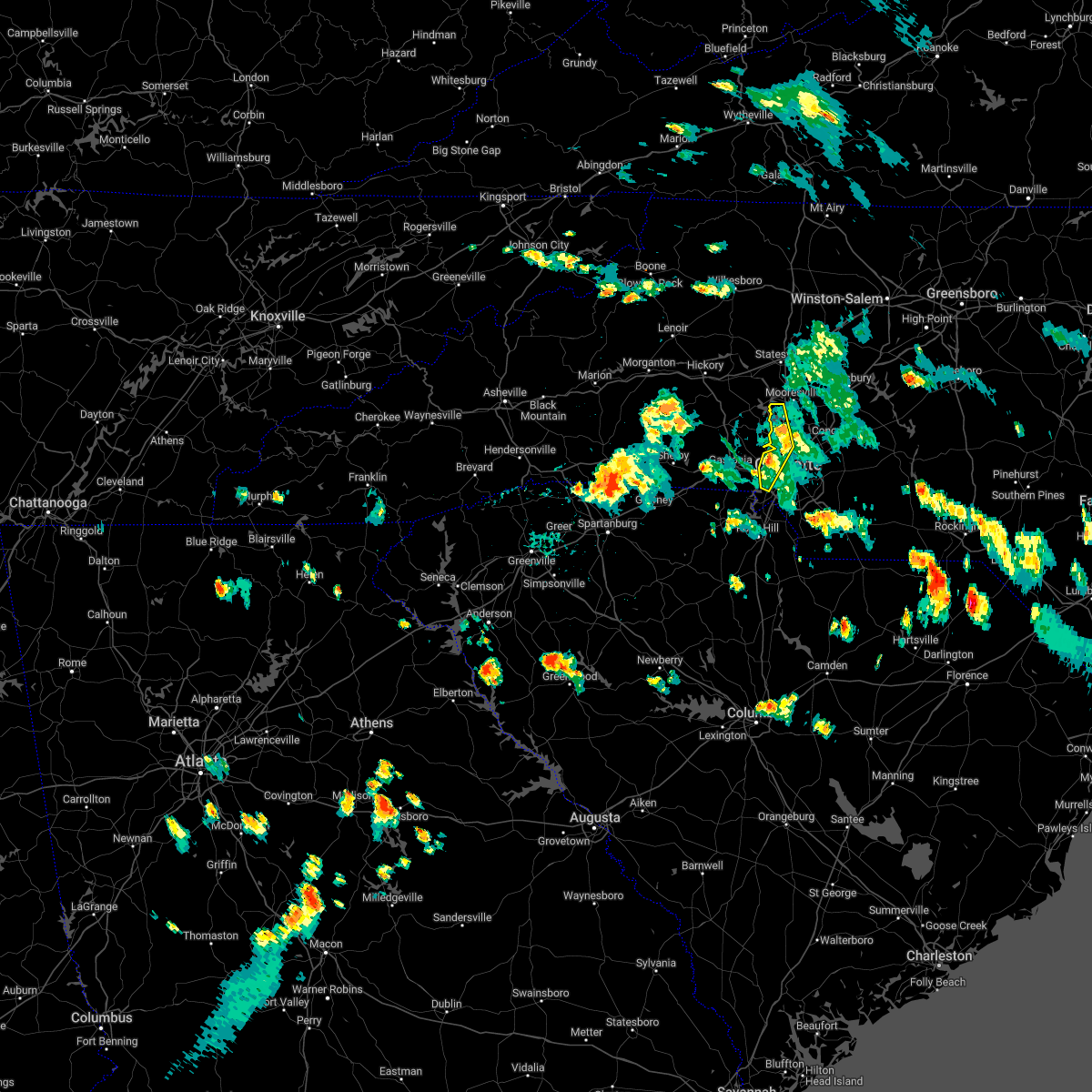 The severe thunderstorm warning for south central iredell and northwestern mecklenburg counties will expire at 600 pm edt, the storms which prompted the warning have weakened below severe limits, and have exited the warned area. therefore, the warning will be allowed to expire. a severe thunderstorm watch remains in effect until 1000 pm edt for the piedmont of north carolina. The severe thunderstorm warning for south central iredell and northwestern mecklenburg counties will expire at 600 pm edt, the storms which prompted the warning have weakened below severe limits, and have exited the warned area. therefore, the warning will be allowed to expire. a severe thunderstorm watch remains in effect until 1000 pm edt for the piedmont of north carolina.
|
| 8/15/2022 5:51 PM EDT |
 At 550 pm edt, severe thunderstorms were located along a line extending from 8 miles east of lincolnton to 13 miles southwest of huntersville to 4 miles east of gastonia, moving southeast at 15 mph (radar indicated). Hazards include 60 mph wind gusts and quarter size hail. Minor hail damage to vehicles is expected. expect wind damage to trees and power lines. Locations impacted include, huntersville, northwest charlotte, cornelius, charlotte douglas airport, lake norman, paw creek, ramsey creek park, davidson, croft and mt holly. At 550 pm edt, severe thunderstorms were located along a line extending from 8 miles east of lincolnton to 13 miles southwest of huntersville to 4 miles east of gastonia, moving southeast at 15 mph (radar indicated). Hazards include 60 mph wind gusts and quarter size hail. Minor hail damage to vehicles is expected. expect wind damage to trees and power lines. Locations impacted include, huntersville, northwest charlotte, cornelius, charlotte douglas airport, lake norman, paw creek, ramsey creek park, davidson, croft and mt holly.
|
| 8/15/2022 5:42 PM EDT |
 At 542 pm edt, severe thunderstorms were located along a line extending from 7 miles east of lincolnton to near gastonia, moving southeast at 15 mph (radar indicated). Hazards include 60 mph wind gusts and quarter size hail. Minor hail damage to vehicles is expected. expect wind damage to trees and power lines. Locations impacted include, huntersville, northwest charlotte, cornelius, mt holly, belmont, cramerton, westport, mcadenville, charlotte douglas airport and lake norman. At 542 pm edt, severe thunderstorms were located along a line extending from 7 miles east of lincolnton to near gastonia, moving southeast at 15 mph (radar indicated). Hazards include 60 mph wind gusts and quarter size hail. Minor hail damage to vehicles is expected. expect wind damage to trees and power lines. Locations impacted include, huntersville, northwest charlotte, cornelius, mt holly, belmont, cramerton, westport, mcadenville, charlotte douglas airport and lake norman.
|
| 8/15/2022 5:23 PM EDT |
 At 523 pm edt, severe thunderstorms were located along a line extending from 3 miles east of lincolnton to near gastonia, moving southeast at 15 mph (radar indicated). Hazards include 60 mph wind gusts and quarter size hail. Minor hail damage to vehicles is expected. expect wind damage to trees and power lines. Locations impacted include, gastonia, huntersville, northwest charlotte, cornelius, mt holly, belmont, stanley, cramerton, lowell and ranlo. At 523 pm edt, severe thunderstorms were located along a line extending from 3 miles east of lincolnton to near gastonia, moving southeast at 15 mph (radar indicated). Hazards include 60 mph wind gusts and quarter size hail. Minor hail damage to vehicles is expected. expect wind damage to trees and power lines. Locations impacted include, gastonia, huntersville, northwest charlotte, cornelius, mt holly, belmont, stanley, cramerton, lowell and ranlo.
|
| 8/15/2022 5:12 PM EDT |
 At 512 pm edt, severe thunderstorms were located along a line extending from near lincolnton to 18 miles west of huntersville to 3 miles northwest of gastonia, moving southeast at 15 mph (radar indicated). Hazards include 60 mph wind gusts and quarter size hail. Minor hail damage to vehicles is expected. Expect wind damage to trees and power lines. At 512 pm edt, severe thunderstorms were located along a line extending from near lincolnton to 18 miles west of huntersville to 3 miles northwest of gastonia, moving southeast at 15 mph (radar indicated). Hazards include 60 mph wind gusts and quarter size hail. Minor hail damage to vehicles is expected. Expect wind damage to trees and power lines.
|
| 8/12/2022 6:40 PM EDT |
 At 640 pm edt, a severe thunderstorm was located 4 miles southwest of indian land, moving south at 30 mph (radar indicated). Hazards include 60 mph wind gusts. expect damage to trees and power lines At 640 pm edt, a severe thunderstorm was located 4 miles southwest of indian land, moving south at 30 mph (radar indicated). Hazards include 60 mph wind gusts. expect damage to trees and power lines
|
| 8/12/2022 6:26 PM EDT |
 At 626 pm edt, a severe thunderstorm was located 5 miles northwest of indian land, or near pineville, moving south at 25 mph (radar indicated). Hazards include 60 mph wind gusts and nickel size hail. Expect damage to trees and power lines. locations impacted include, south charlotte, southwest charlotte, weddington, fort mill, pineville, tega cay, wesley chapel, lesslie, marvin and the arboretum. hail threat, radar indicated max hail size, 0. 88 in wind threat, observed max wind gust, 60 mph. At 626 pm edt, a severe thunderstorm was located 5 miles northwest of indian land, or near pineville, moving south at 25 mph (radar indicated). Hazards include 60 mph wind gusts and nickel size hail. Expect damage to trees and power lines. locations impacted include, south charlotte, southwest charlotte, weddington, fort mill, pineville, tega cay, wesley chapel, lesslie, marvin and the arboretum. hail threat, radar indicated max hail size, 0. 88 in wind threat, observed max wind gust, 60 mph.
|
| 8/12/2022 6:12 PM EDT |
 At 612 pm edt, a severe thunderstorm was located 6 miles southwest of uptown charlotte, or near southwest charlotte, moving south at 25 mph (radar indicated). Hazards include 60 mph wind gusts and penny size hail. expect damage to trees and power lines At 612 pm edt, a severe thunderstorm was located 6 miles southwest of uptown charlotte, or near southwest charlotte, moving south at 25 mph (radar indicated). Hazards include 60 mph wind gusts and penny size hail. expect damage to trees and power lines
|
| 8/12/2022 6:09 PM EDT | Corrects previous tstm wnd gst report from kclt. asos station kclt charlotte international airpor in mecklenburg county NC, 4.7 miles ENE of Charlotte, NC |
| 8/12/2022 6:07 PM EDT | Report of trees down near the vineyards on lake wylie near the charlotte international airpor in mecklenburg county NC, 8 miles E of Charlotte, NC |
| 8/12/2022 5:59 PM EDT |
 At 559 pm edt, a severe thunderstorm was located 6 miles northwest of uptown charlotte, or over paw creek, moving southeast at 25 mph (radar indicated). Hazards include 60 mph wind gusts and penny size hail. Expect damage to trees and power lines. locations impacted include, uptown charlotte, central charlotte, southwest charlotte, east charlotte, northwest charlotte, mt holly, belmont, cramerton, lowell and mcadenville. hail threat, radar indicated max hail size, 0. 75 in wind threat, radar indicated max wind gust, 60 mph. At 559 pm edt, a severe thunderstorm was located 6 miles northwest of uptown charlotte, or over paw creek, moving southeast at 25 mph (radar indicated). Hazards include 60 mph wind gusts and penny size hail. Expect damage to trees and power lines. locations impacted include, uptown charlotte, central charlotte, southwest charlotte, east charlotte, northwest charlotte, mt holly, belmont, cramerton, lowell and mcadenville. hail threat, radar indicated max hail size, 0. 75 in wind threat, radar indicated max wind gust, 60 mph.
|
| 8/12/2022 5:43 PM EDT |
 At 542 pm edt, a severe thunderstorm was located 8 miles southwest of huntersville, or 4 miles northeast of mt holly, moving southeast at 25 mph (radar indicated). Hazards include 60 mph wind gusts and penny size hail. expect damage to trees and power lines At 542 pm edt, a severe thunderstorm was located 8 miles southwest of huntersville, or 4 miles northeast of mt holly, moving southeast at 25 mph (radar indicated). Hazards include 60 mph wind gusts and penny size hail. expect damage to trees and power lines
|
| 8/10/2022 4:55 PM EDT |
 The severe thunderstorm warning for south central cabarrus, east central mecklenburg and north central union counties will expire at 500 pm edt, the storm which prompted the warning has moved out of the area. therefore, the warning will be allowed to expire. however heavy rain is still possible with this thunderstorm. The severe thunderstorm warning for south central cabarrus, east central mecklenburg and north central union counties will expire at 500 pm edt, the storm which prompted the warning has moved out of the area. therefore, the warning will be allowed to expire. however heavy rain is still possible with this thunderstorm.
|
| 8/10/2022 4:40 PM EDT |
 At 440 pm edt, a severe thunderstorm was located 13 miles south of downtown concord, or near midland, moving east at 10 mph (radar indicated). Hazards include 60 mph wind gusts and quarter size hail. Minor hail damage to vehicles is expected. expect wind damage to trees and power lines. locations impacted include, mint hill, midland, fairview in union county and stallings. hail threat, radar indicated max hail size, 1. 00 in wind threat, radar indicated max wind gust, 60 mph. At 440 pm edt, a severe thunderstorm was located 13 miles south of downtown concord, or near midland, moving east at 10 mph (radar indicated). Hazards include 60 mph wind gusts and quarter size hail. Minor hail damage to vehicles is expected. expect wind damage to trees and power lines. locations impacted include, mint hill, midland, fairview in union county and stallings. hail threat, radar indicated max hail size, 1. 00 in wind threat, radar indicated max wind gust, 60 mph.
|
| 8/10/2022 4:23 PM EDT |
 At 422 pm edt, a severe thunderstorm was located 12 miles east of uptown charlotte, or near mint hill, moving east at 10 mph (radar indicated). Hazards include 60 mph wind gusts and quarter size hail. Minor hail damage to vehicles is expected. expect wind damage to trees and power lines. locations impacted include, east charlotte, matthews, mint hill, harrisburg, reedy creek park, the plaza, midland, fairview in union county, stallings and south charlotte. hail threat, radar indicated max hail size, 1. 00 in wind threat, radar indicated max wind gust, 60 mph. At 422 pm edt, a severe thunderstorm was located 12 miles east of uptown charlotte, or near mint hill, moving east at 10 mph (radar indicated). Hazards include 60 mph wind gusts and quarter size hail. Minor hail damage to vehicles is expected. expect wind damage to trees and power lines. locations impacted include, east charlotte, matthews, mint hill, harrisburg, reedy creek park, the plaza, midland, fairview in union county, stallings and south charlotte. hail threat, radar indicated max hail size, 1. 00 in wind threat, radar indicated max wind gust, 60 mph.
|
| 8/10/2022 4:18 PM EDT | Quarter sized hail reported 12.4 miles W of Charlotte, NC, one inch hail near intersection of i-485 and albemarle rd |
| 8/10/2022 4:10 PM EDT |
 At 410 pm edt, a severe thunderstorm was located 10 miles east of uptown charlotte, or over mint hill, moving east at 10 mph (radar indicated). Hazards include 60 mph wind gusts and quarter size hail. Minor hail damage to vehicles is expected. Expect wind damage to trees and power lines. At 410 pm edt, a severe thunderstorm was located 10 miles east of uptown charlotte, or over mint hill, moving east at 10 mph (radar indicated). Hazards include 60 mph wind gusts and quarter size hail. Minor hail damage to vehicles is expected. Expect wind damage to trees and power lines.
|
| 8/4/2022 6:40 PM EDT |
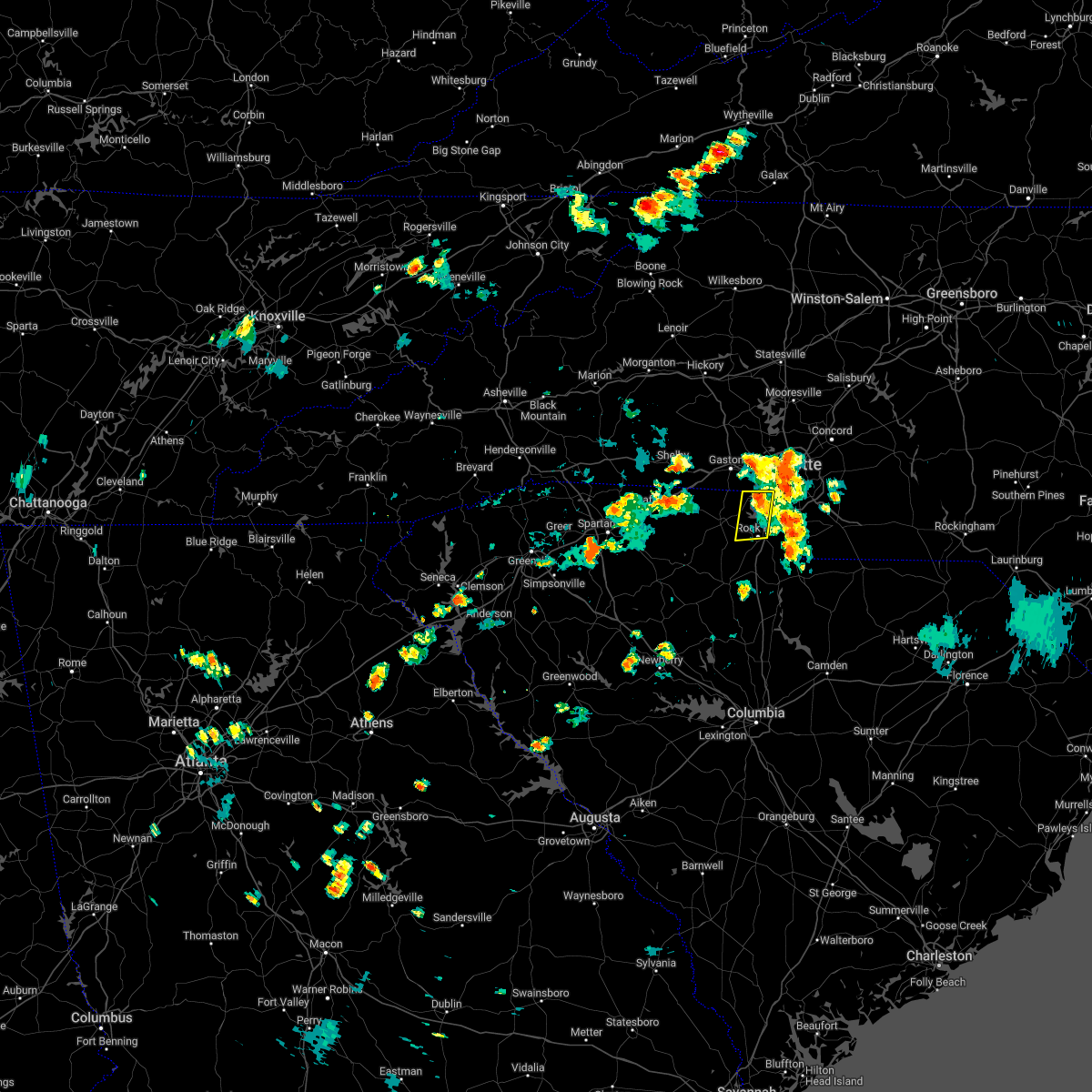 The severe thunderstorm warning for southwestern mecklenburg and northeastern york counties will expire at 645 pm edt, the storm which prompted the warning has weakened below severe limits, and no longer poses an immediate threat to life or property. therefore, the warning will be allowed to expire. however gusty winds and heavy rain are still possible with this thunderstorm. The severe thunderstorm warning for southwestern mecklenburg and northeastern york counties will expire at 645 pm edt, the storm which prompted the warning has weakened below severe limits, and no longer poses an immediate threat to life or property. therefore, the warning will be allowed to expire. however gusty winds and heavy rain are still possible with this thunderstorm.
|
| 8/4/2022 6:15 PM EDT |
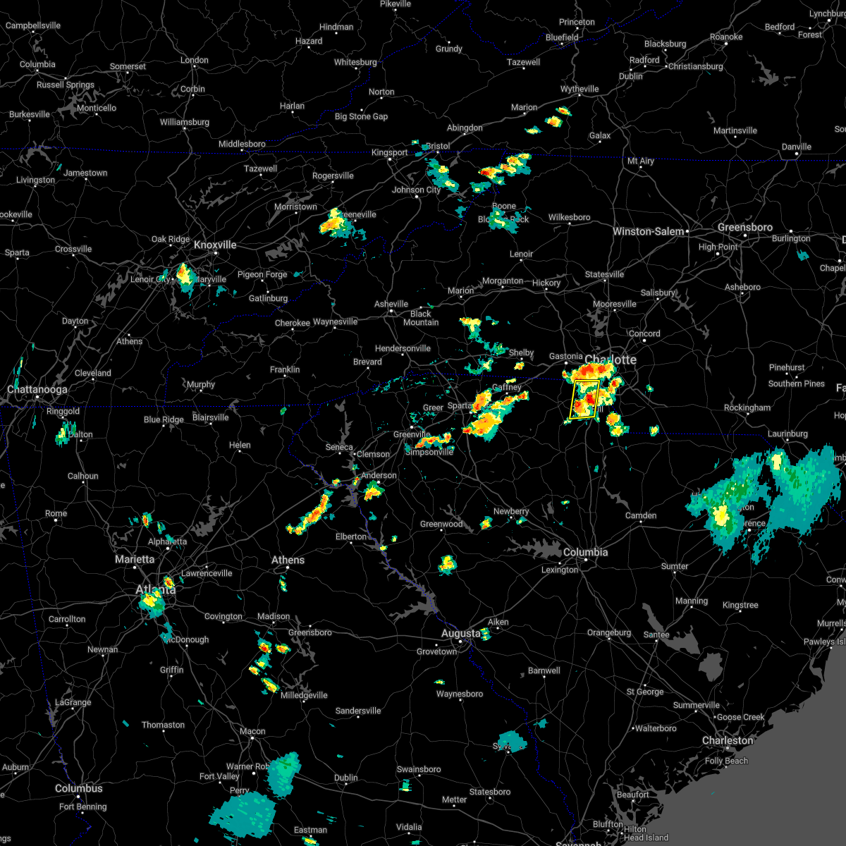 At 615 pm edt, a severe thunderstorm was located 6 miles north of rock hill, or near tega cay, moving north at 15 mph (radar indicated). Hazards include 60 mph wind gusts and penny size hail. Expect damage to trees and power lines. locations impacted include, rock hill, tega cay, newport, steele creek, carowinds, lake wylie, fort mill and southwest charlotte. hail threat, radar indicated max hail size, 0. 75 in wind threat, radar indicated max wind gust, 60 mph. At 615 pm edt, a severe thunderstorm was located 6 miles north of rock hill, or near tega cay, moving north at 15 mph (radar indicated). Hazards include 60 mph wind gusts and penny size hail. Expect damage to trees and power lines. locations impacted include, rock hill, tega cay, newport, steele creek, carowinds, lake wylie, fort mill and southwest charlotte. hail threat, radar indicated max hail size, 0. 75 in wind threat, radar indicated max wind gust, 60 mph.
|
| 8/4/2022 5:54 PM EDT |
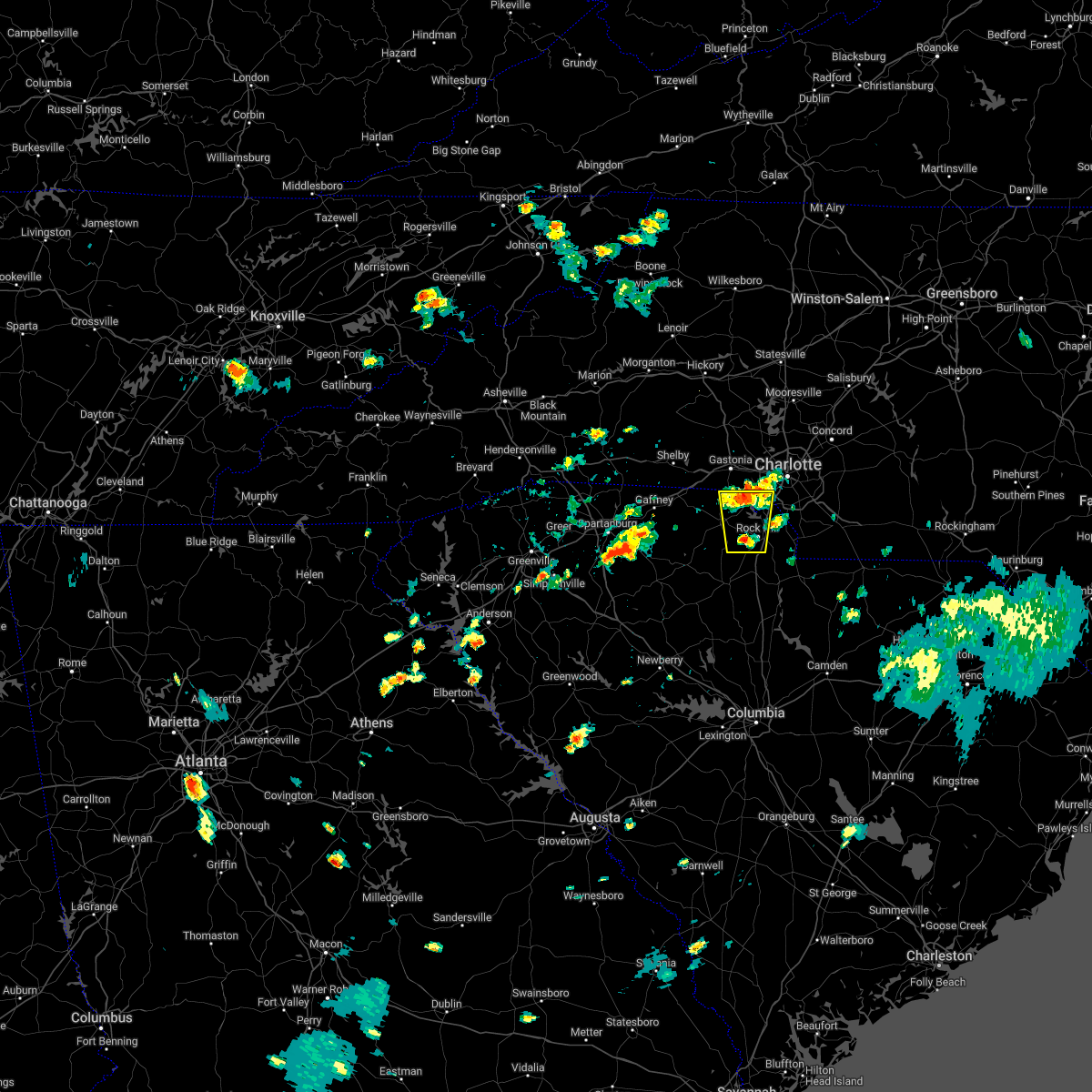 At 554 pm edt, a severe thunderstorm was located 4 miles west of rock hill, or 4 miles south of newport, moving north at 10 mph (radar indicated). Hazards include 60 mph wind gusts and penny size hail. expect damage to trees and power lines At 554 pm edt, a severe thunderstorm was located 4 miles west of rock hill, or 4 miles south of newport, moving north at 10 mph (radar indicated). Hazards include 60 mph wind gusts and penny size hail. expect damage to trees and power lines
|
| 7/25/2022 4:51 PM EDT |
 The severe thunderstorm warning for catawba, lincoln, southeastern cleveland and gaston counties will expire at 500 pm edt, the storms which prompted the warning have weakened below severe limits, and no longer pose an immediate threat to life or property. therefore, the warning will be allowed to expire. however, gusty winds and heavy rain are still possible with these thunderstorms. The severe thunderstorm warning for catawba, lincoln, southeastern cleveland and gaston counties will expire at 500 pm edt, the storms which prompted the warning have weakened below severe limits, and no longer pose an immediate threat to life or property. therefore, the warning will be allowed to expire. however, gusty winds and heavy rain are still possible with these thunderstorms.
|
| 7/25/2022 4:31 PM EDT |
 At 431 pm edt, severe thunderstorms were located along a line extending from 7 miles east of newton to 7 miles northeast of lincolnton to near shelby, moving southeast at 30 mph (radar indicated). Hazards include 60 mph wind gusts and penny size hail. Expect damage to trees and power lines. locations impacted include, gastonia, shelby, newton, lincolnton, kings mountain, mt holly, st. stephens, belmont, conover and cherryville. hail threat, radar indicated max hail size, 0. 75 in wind threat, radar indicated max wind gust, 60 mph. At 431 pm edt, severe thunderstorms were located along a line extending from 7 miles east of newton to 7 miles northeast of lincolnton to near shelby, moving southeast at 30 mph (radar indicated). Hazards include 60 mph wind gusts and penny size hail. Expect damage to trees and power lines. locations impacted include, gastonia, shelby, newton, lincolnton, kings mountain, mt holly, st. stephens, belmont, conover and cherryville. hail threat, radar indicated max hail size, 0. 75 in wind threat, radar indicated max wind gust, 60 mph.
|
| 7/25/2022 4:13 PM EDT |
 At 413 pm edt, severe thunderstorms were located along a line extending from 4 miles east of hickory to 6 miles north of lincolnton to near shelby, moving southeast at 30 mph (radar indicated). Hazards include 60 mph wind gusts and penny size hail. expect damage to trees and power lines At 413 pm edt, severe thunderstorms were located along a line extending from 4 miles east of hickory to 6 miles north of lincolnton to near shelby, moving southeast at 30 mph (radar indicated). Hazards include 60 mph wind gusts and penny size hail. expect damage to trees and power lines
|
| 7/20/2022 6:21 PM EDT |
 The severe thunderstorm warning for southeastern cleveland, gaston, northwestern york and northeastern cherokee counties will expire at 630 pm edt, the storms which prompted the warning have weakened below severe limits, and no longer pose an immediate threat to life or property. therefore, the warning will be allowed to expire. however, gusty winds and heavy rain are still possible with these thunderstorms. The severe thunderstorm warning for southeastern cleveland, gaston, northwestern york and northeastern cherokee counties will expire at 630 pm edt, the storms which prompted the warning have weakened below severe limits, and no longer pose an immediate threat to life or property. therefore, the warning will be allowed to expire. however, gusty winds and heavy rain are still possible with these thunderstorms.
|
| 7/20/2022 5:58 PM EDT |
 At 558 pm edt, severe thunderstorms were located along a line extending from 8 miles southeast of lincolnton to 6 miles west of gastonia to 7 miles south of shelby, moving east at 20 mph (radar indicated). Hazards include 60 mph wind gusts and quarter size hail. Minor hail damage to vehicles is expected. expect wind damage to trees and power lines. locations impacted include, gastonia, kings mountain, mt holly, bessemer city, south gastonia, clover, dallas, stanley, cramerton and lowell. hail threat, radar indicated max hail size, 1. 00 in wind threat, radar indicated max wind gust, 60 mph. At 558 pm edt, severe thunderstorms were located along a line extending from 8 miles southeast of lincolnton to 6 miles west of gastonia to 7 miles south of shelby, moving east at 20 mph (radar indicated). Hazards include 60 mph wind gusts and quarter size hail. Minor hail damage to vehicles is expected. expect wind damage to trees and power lines. locations impacted include, gastonia, kings mountain, mt holly, bessemer city, south gastonia, clover, dallas, stanley, cramerton and lowell. hail threat, radar indicated max hail size, 1. 00 in wind threat, radar indicated max wind gust, 60 mph.
|
| 7/20/2022 5:37 PM EDT |
 At 537 pm edt, severe thunderstorms were located along a line extending from 7 miles southwest of lincolnton to near shelby, moving southeast at 25 mph (radar indicated). Hazards include 60 mph wind gusts and quarter size hail. Minor hail damage to vehicles is expected. Expect wind damage to trees and power lines. At 537 pm edt, severe thunderstorms were located along a line extending from 7 miles southwest of lincolnton to near shelby, moving southeast at 25 mph (radar indicated). Hazards include 60 mph wind gusts and quarter size hail. Minor hail damage to vehicles is expected. Expect wind damage to trees and power lines.
|
| 7/16/2022 2:15 PM EDT | Large tree fell on a ca in mecklenburg county NC, 1.1 miles WNW of Charlotte, NC |
| 7/7/2022 8:53 PM EDT |
 The severe thunderstorm warning for central mecklenburg county will expire at 900 pm edt, the storm which prompted the warning has weakened below severe limits, and no longer poses an immediate threat to life or property. therefore, the warning will be allowed to expire. however heavy rain is still possible with this thunderstorm. to report severe weather to the national weather service greenville-spartanburg, call toll free, 1, 800, 2 6 7, 8 1 0 1, or post on our facebook page, or tweet it using hashtag nwsgsp. your message should describe the event and the specific location where it occurred. The severe thunderstorm warning for central mecklenburg county will expire at 900 pm edt, the storm which prompted the warning has weakened below severe limits, and no longer poses an immediate threat to life or property. therefore, the warning will be allowed to expire. however heavy rain is still possible with this thunderstorm. to report severe weather to the national weather service greenville-spartanburg, call toll free, 1, 800, 2 6 7, 8 1 0 1, or post on our facebook page, or tweet it using hashtag nwsgsp. your message should describe the event and the specific location where it occurred.
|
| 7/7/2022 8:26 PM EDT | 911 call center and public reported powerlines down in the myers park and park road area in mecklenburg county NC, 2.8 miles NW of Charlotte, NC |
| 7/7/2022 8:22 PM EDT |
 At 821 pm edt, a severe thunderstorm was located near uptown charlotte, or over freedom park, and is nearly stationary (radar indicated). Hazards include 60 mph wind gusts and quarter size hail. Minor hail damage to vehicles is expected. Expect wind damage to trees and power lines. At 821 pm edt, a severe thunderstorm was located near uptown charlotte, or over freedom park, and is nearly stationary (radar indicated). Hazards include 60 mph wind gusts and quarter size hail. Minor hail damage to vehicles is expected. Expect wind damage to trees and power lines.
|
| 7/7/2022 7:36 PM EDT |
 At 736 pm edt, a severe thunderstorm was located 9 miles southeast of uptown charlotte, or over matthews, moving east at 5 mph (radar indicated). Hazards include 60 mph wind gusts and nickel size hail. Expect damage to trees and power lines. locations impacted include, south and east charlotte, matthews, weddington, the arboretum, stallings, mint hill, southpark mall, indian trail. hail threat, radar indicated max hail size, 0. 88 in wind threat, radar indicated max wind gust, 60 mph. At 736 pm edt, a severe thunderstorm was located 9 miles southeast of uptown charlotte, or over matthews, moving east at 5 mph (radar indicated). Hazards include 60 mph wind gusts and nickel size hail. Expect damage to trees and power lines. locations impacted include, south and east charlotte, matthews, weddington, the arboretum, stallings, mint hill, southpark mall, indian trail. hail threat, radar indicated max hail size, 0. 88 in wind threat, radar indicated max wind gust, 60 mph.
|
| 7/7/2022 7:17 PM EDT |
 At 717 pm edt, a severe thunderstorm was located 7 miles south of uptown charlotte, or near pineville, and is nearly stationary. it will eventually drift slowly to the east (radar indicated). Hazards include 60 mph wind gusts and quarter size hail. Minor hail damage to vehicles is expected. Expect wind damage to trees and power lines. At 717 pm edt, a severe thunderstorm was located 7 miles south of uptown charlotte, or near pineville, and is nearly stationary. it will eventually drift slowly to the east (radar indicated). Hazards include 60 mph wind gusts and quarter size hail. Minor hail damage to vehicles is expected. Expect wind damage to trees and power lines.
|
| 7/6/2022 7:30 PM EDT |
 At 730 pm edt, a severe thunderstorm was located 8 miles east of indian land, or near weddington, moving southeast at 15 mph (radar indicated). Hazards include 60 mph wind gusts and quarter size hail. Minor hail damage to vehicles is expected. Expect wind damage to trees and power lines. At 730 pm edt, a severe thunderstorm was located 8 miles east of indian land, or near weddington, moving southeast at 15 mph (radar indicated). Hazards include 60 mph wind gusts and quarter size hail. Minor hail damage to vehicles is expected. Expect wind damage to trees and power lines.
|
| 7/6/2022 7:11 PM EDT |
 At 710 pm edt, a severe thunderstorm was located 7 miles northeast of indian land, or near the arboretum, moving southeast at 10 mph (radar indicated). Hazards include 60 mph wind gusts and quarter size hail. Minor hail damage to vehicles is expected. expect wind damage to trees and power lines. locations impacted include, south charlotte, east charlotte, matthews, mint hill, indian trail, weddington, stallings, wesley chapel, waxhaw and lake park. hail threat, radar indicated max hail size, 1. 00 in wind threat, radar indicated max wind gust, 60 mph. At 710 pm edt, a severe thunderstorm was located 7 miles northeast of indian land, or near the arboretum, moving southeast at 10 mph (radar indicated). Hazards include 60 mph wind gusts and quarter size hail. Minor hail damage to vehicles is expected. expect wind damage to trees and power lines. locations impacted include, south charlotte, east charlotte, matthews, mint hill, indian trail, weddington, stallings, wesley chapel, waxhaw and lake park. hail threat, radar indicated max hail size, 1. 00 in wind threat, radar indicated max wind gust, 60 mph.
|
| 7/6/2022 6:49 PM EDT |
 At 649 pm edt, a severe thunderstorm was located 7 miles south of uptown charlotte, or near southpark mall, moving southeast at 10 mph (radar indicated). Hazards include 60 mph wind gusts and quarter size hail. Minor hail damage to vehicles is expected. Expect wind damage to trees and power lines. At 649 pm edt, a severe thunderstorm was located 7 miles south of uptown charlotte, or near southpark mall, moving southeast at 10 mph (radar indicated). Hazards include 60 mph wind gusts and quarter size hail. Minor hail damage to vehicles is expected. Expect wind damage to trees and power lines.
|
| 7/6/2022 6:42 PM EDT |
 At 639 pm edt, severe thunderstorms were located along a line extending from 6 miles southeast of gaffney to 3 miles southwest of york to 10 miles north of rock hill, moving southeast at 15 mph (radar indicated). Hazards include 60 mph wind gusts and penny size hail. Expect damage to trees and power lines. locations impacted include, rock hill, york, fort mill, tega cay, newport, lesslie, sharon, hickory grove, mcconnells and steele creek. hail threat, radar indicated max hail size, 0. 75 in wind threat, radar indicated max wind gust, 60 mph. At 639 pm edt, severe thunderstorms were located along a line extending from 6 miles southeast of gaffney to 3 miles southwest of york to 10 miles north of rock hill, moving southeast at 15 mph (radar indicated). Hazards include 60 mph wind gusts and penny size hail. Expect damage to trees and power lines. locations impacted include, rock hill, york, fort mill, tega cay, newport, lesslie, sharon, hickory grove, mcconnells and steele creek. hail threat, radar indicated max hail size, 0. 75 in wind threat, radar indicated max wind gust, 60 mph.
|
| 7/6/2022 6:00 PM EDT |
 At 559 pm edt, severe thunderstorms were located along a line extending from 4 miles northwest of gaffney to 11 miles northwest of york to 3 miles south of gastonia, moving southeast at 20 mph (radar indicated). Hazards include 60 mph wind gusts and quarter size hail. Minor hail damage to vehicles is expected. Expect wind damage to trees and power lines. At 559 pm edt, severe thunderstorms were located along a line extending from 4 miles northwest of gaffney to 11 miles northwest of york to 3 miles south of gastonia, moving southeast at 20 mph (radar indicated). Hazards include 60 mph wind gusts and quarter size hail. Minor hail damage to vehicles is expected. Expect wind damage to trees and power lines.
|
| 7/5/2022 8:20 PM EDT | Numerous trees and power lines down around mint hil in mecklenburg county NC, 11.8 miles WNW of Charlotte, NC |
| 7/5/2022 8:10 PM EDT | Trees down along south stream blv in mecklenburg county NC, 5.1 miles NE of Charlotte, NC |
| 7/5/2022 8:10 PM EDT | Trees down along dalehurst d in mecklenburg county NC, 3.9 miles W of Charlotte, NC |
| 7/5/2022 8:08 PM EDT | Trees and power lines down along yuma s in mecklenburg county NC, 4.6 miles WSW of Charlotte, NC |
| 7/5/2022 8:05 PM EDT | Trees down along kendrick av in mecklenburg county NC, 3.6 miles SSW of Charlotte, NC |
| 7/5/2022 8:05 PM EDT |
 At 804 pm edt, severe thunderstorms were located along a line extending from near shelby to 9 miles west of albemarle, moving southeast at 35 mph (radar indicated). Hazards include 60 mph wind gusts and penny size hail. expect damage to trees and power lines At 804 pm edt, severe thunderstorms were located along a line extending from near shelby to 9 miles west of albemarle, moving southeast at 35 mph (radar indicated). Hazards include 60 mph wind gusts and penny size hail. expect damage to trees and power lines
|
| 7/5/2022 7:24 PM EDT |
 At 723 pm edt, severe thunderstorms were located along a line extending from 15 miles southwest of hickory to 5 miles northwest of salisbury, moving south at 15 mph (radar indicated). Hazards include 60 mph wind gusts and quarter size hail. Minor hail damage to vehicles is expected. Expect wind damage to trees and power lines. At 723 pm edt, severe thunderstorms were located along a line extending from 15 miles southwest of hickory to 5 miles northwest of salisbury, moving south at 15 mph (radar indicated). Hazards include 60 mph wind gusts and quarter size hail. Minor hail damage to vehicles is expected. Expect wind damage to trees and power lines.
|
| 6/17/2022 5:57 PM EDT |
 At 556 pm edt, a severe thunderstorm was located 4 miles north of rock hill, or near tega cay, moving southeast at 20 mph (radar indicated). Hazards include 60 mph wind gusts and quarter size hail. Minor hail damage to vehicles is expected. Expect wind damage to trees and power lines. At 556 pm edt, a severe thunderstorm was located 4 miles north of rock hill, or near tega cay, moving southeast at 20 mph (radar indicated). Hazards include 60 mph wind gusts and quarter size hail. Minor hail damage to vehicles is expected. Expect wind damage to trees and power lines.
|
| 6/17/2022 5:30 PM EDT |
 At 529 pm edt, a severe thunderstorm was located 4 miles south of gastonia, or near south gastonia, moving southeast at 20 mph (radar indicated). Hazards include 60 mph wind gusts and quarter size hail. Minor hail damage to vehicles is expected. Expect wind damage to trees and power lines. At 529 pm edt, a severe thunderstorm was located 4 miles south of gastonia, or near south gastonia, moving southeast at 20 mph (radar indicated). Hazards include 60 mph wind gusts and quarter size hail. Minor hail damage to vehicles is expected. Expect wind damage to trees and power lines.
|
| 6/16/2022 4:50 PM EDT |
 At 450 pm edt, a severe thunderstorm was located near gastonia, moving east at 15 mph (radar indicated). Hazards include 60 mph wind gusts and quarter size hail. Minor hail damage to vehicles is expected. Expect wind damage to trees and power lines. At 450 pm edt, a severe thunderstorm was located near gastonia, moving east at 15 mph (radar indicated). Hazards include 60 mph wind gusts and quarter size hail. Minor hail damage to vehicles is expected. Expect wind damage to trees and power lines.
|
| 6/16/2022 4:45 PM EDT | Quarter sized hail reported 5.3 miles NW of Charlotte, NC, quarter size hail in cotswold area. |
| 6/16/2022 4:41 PM EDT |
 At 441 pm edt, severe thunderstorms were located along a line extending from 7 miles southeast of downtown concord to 8 miles southeast of uptown charlotte to 8 miles northwest of indian land, moving southeast at 20 mph (radar indicated). Hazards include 60 mph wind gusts and quarter size hail. Minor hail damage to vehicles is expected. Expect wind damage to trees and power lines. At 441 pm edt, severe thunderstorms were located along a line extending from 7 miles southeast of downtown concord to 8 miles southeast of uptown charlotte to 8 miles northwest of indian land, moving southeast at 20 mph (radar indicated). Hazards include 60 mph wind gusts and quarter size hail. Minor hail damage to vehicles is expected. Expect wind damage to trees and power lines.
|
| 6/16/2022 4:27 PM EDT |
 At 427 pm edt, a severe thunderstorm was located 6 miles southeast of uptown charlotte, or near southpark mall, moving south at 30 mph (radar indicated). Hazards include 60 mph wind gusts and quarter size hail. Minor hail damage to vehicles is expected. Expect wind damage to trees and power lines. At 427 pm edt, a severe thunderstorm was located 6 miles southeast of uptown charlotte, or near southpark mall, moving south at 30 mph (radar indicated). Hazards include 60 mph wind gusts and quarter size hail. Minor hail damage to vehicles is expected. Expect wind damage to trees and power lines.
|
| 6/16/2022 4:08 PM EDT |
 At 408 pm edt, a severe thunderstorm was located 8 miles southeast of gastonia, or near steele creek, moving southeast at 15 mph (radar indicated). Hazards include 60 mph wind gusts and quarter size hail. Minor hail damage to vehicles is expected. Expect wind damage to trees and power lines. At 408 pm edt, a severe thunderstorm was located 8 miles southeast of gastonia, or near steele creek, moving southeast at 15 mph (radar indicated). Hazards include 60 mph wind gusts and quarter size hail. Minor hail damage to vehicles is expected. Expect wind damage to trees and power lines.
|
| 6/16/2022 3:54 PM EDT |
 At 354 pm edt, a severe thunderstorm was located 5 miles west of downtown concord, or near west concord, moving southeast at 5 mph (radar indicated). Hazards include 60 mph wind gusts and quarter size hail. Minor hail damage to vehicles is expected. Expect wind damage to trees and power lines. At 354 pm edt, a severe thunderstorm was located 5 miles west of downtown concord, or near west concord, moving southeast at 5 mph (radar indicated). Hazards include 60 mph wind gusts and quarter size hail. Minor hail damage to vehicles is expected. Expect wind damage to trees and power lines.
|
| 6/16/2022 3:42 PM EDT |
 At 342 pm edt, a severe thunderstorm was located 9 miles northeast of gastonia, or near stanley, moving southeast at 15 mph (radar indicated). Hazards include 60 mph wind gusts and quarter size hail. Minor hail damage to vehicles is expected. expect wind damage to trees and power lines. locations impacted include, gastonia, mt holly, belmont, dallas, stanley, cramerton, lowell, ranlo, high shoals and mcadenville. hail threat, radar indicated max hail size, 1. 00 in wind threat, radar indicated max wind gust, 60 mph. At 342 pm edt, a severe thunderstorm was located 9 miles northeast of gastonia, or near stanley, moving southeast at 15 mph (radar indicated). Hazards include 60 mph wind gusts and quarter size hail. Minor hail damage to vehicles is expected. expect wind damage to trees and power lines. locations impacted include, gastonia, mt holly, belmont, dallas, stanley, cramerton, lowell, ranlo, high shoals and mcadenville. hail threat, radar indicated max hail size, 1. 00 in wind threat, radar indicated max wind gust, 60 mph.
|
| 6/16/2022 3:22 PM EDT |
 At 322 pm edt, a severe thunderstorm was located 8 miles southeast of lincolnton, or near stanley, moving southeast at 15 mph (radar indicated). Hazards include 60 mph wind gusts and quarter size hail. Minor hail damage to vehicles is expected. Expect wind damage to trees and power lines. At 322 pm edt, a severe thunderstorm was located 8 miles southeast of lincolnton, or near stanley, moving southeast at 15 mph (radar indicated). Hazards include 60 mph wind gusts and quarter size hail. Minor hail damage to vehicles is expected. Expect wind damage to trees and power lines.
|
| 6/14/2022 8:01 AM EDT | At 800 am edt, severe thunderstorms were located along a line extending from 9 miles northeast of shelby to 8 miles east of gastonia to 11 miles south of downtown concord, moving south at 10 mph (radar indicated). Hazards include 60 mph wind gusts and quarter size hail. Minor hail damage to vehicles is expected. expect wind damage to trees and power lines. locations impacted include, charlotte, gastonia, shelby, matthews and mint hill. hail threat, radar indicated max hail size, 1. 00 in wind threat, radar indicated max wind gust, 60 mph. |
| 6/14/2022 7:41 AM EDT |
 At 739 am edt, severe thunderstorms were located along a line extending from 16 miles southeast of morganton to 4 miles southeast of downtown concord, moving south at 20 mph (radar indicated). Hazards include 60 mph wind gusts and quarter size hail. Minor hail damage to vehicles is expected. Expect wind damage to trees and power lines. At 739 am edt, severe thunderstorms were located along a line extending from 16 miles southeast of morganton to 4 miles southeast of downtown concord, moving south at 20 mph (radar indicated). Hazards include 60 mph wind gusts and quarter size hail. Minor hail damage to vehicles is expected. Expect wind damage to trees and power lines.
|
| 6/14/2022 7:28 AM EDT |
 At 726 am edt, severe thunderstorms were located along a line extending from 8 miles northwest of burnsville to 13 miles southwest of hickory to near downtown concord, moving south at 20 mph (radar indicated). Hazards include 60 mph wind gusts and quarter size hail. Minor hail damage to vehicles is expected. expect wind damage to trees and power lines. locations impacted include, charlotte, huntersville, kannapolis, concord, morganton, lincolnton, marion, spruce pine, and burnsville. hail threat, radar indicated max hail size, 1. 00 in wind threat, radar indicated max wind gust, 60 mph. At 726 am edt, severe thunderstorms were located along a line extending from 8 miles northwest of burnsville to 13 miles southwest of hickory to near downtown concord, moving south at 20 mph (radar indicated). Hazards include 60 mph wind gusts and quarter size hail. Minor hail damage to vehicles is expected. expect wind damage to trees and power lines. locations impacted include, charlotte, huntersville, kannapolis, concord, morganton, lincolnton, marion, spruce pine, and burnsville. hail threat, radar indicated max hail size, 1. 00 in wind threat, radar indicated max wind gust, 60 mph.
|
| 6/14/2022 6:55 AM EDT |
 At 655 am edt, severe thunderstorms were located along a line extending from 6 miles southeast of erwin to 12 miles north of morganton to 4 miles southwest of kannapolis, moving south at 25 mph (radar indicated). Hazards include 60 mph wind gusts. expect damage to trees and power lines At 655 am edt, severe thunderstorms were located along a line extending from 6 miles southeast of erwin to 12 miles north of morganton to 4 miles southwest of kannapolis, moving south at 25 mph (radar indicated). Hazards include 60 mph wind gusts. expect damage to trees and power lines
|
| 6/9/2022 2:15 PM EDT | Trees down near intersection of lawyers rd and chestnut lake dr in mint hil in mecklenburg county NC, 8.7 miles WNW of Charlotte, NC |
| 5/27/2022 5:35 AM EDT |
 The severe thunderstorm warning for northwestern cabarrus, southeastern iredell, north central mecklenburg and southwestern rowan counties will expire at 545 am edt, the storm which prompted the warning has weakened below severe limits, and no longer poses an immediate threat to life or property. therefore, the warning will be allowed to expire. however gusty winds and heavy rain are still possible with this thunderstorm. to report severe weather to the national weather service greenville-spartanburg, call toll free, 1, 800, 2 6 7, 8 1 0 1, or post on our facebook page, or tweet it using hashtag nwsgsp. your message should describe the event and the specific location where it occurred. The severe thunderstorm warning for northwestern cabarrus, southeastern iredell, north central mecklenburg and southwestern rowan counties will expire at 545 am edt, the storm which prompted the warning has weakened below severe limits, and no longer poses an immediate threat to life or property. therefore, the warning will be allowed to expire. however gusty winds and heavy rain are still possible with this thunderstorm. to report severe weather to the national weather service greenville-spartanburg, call toll free, 1, 800, 2 6 7, 8 1 0 1, or post on our facebook page, or tweet it using hashtag nwsgsp. your message should describe the event and the specific location where it occurred.
|
| 5/27/2022 5:19 AM EDT |
 At 517 am edt, a severe thunderstorm was located near huntersville, moving east at 40 mph (radar indicated). Hazards include 60 mph wind gusts. expect damage to trees and power lines At 517 am edt, a severe thunderstorm was located near huntersville, moving east at 40 mph (radar indicated). Hazards include 60 mph wind gusts. expect damage to trees and power lines
|
| 5/26/2022 9:41 PM EDT |
 The severe thunderstorm warning for cabarrus, davie, southeastern iredell, mecklenburg, rowan and northeastern york counties will expire at 945 pm edt, the storms which prompted the warning have weakened below severe limits, and no longer pose an immediate threat to life or property. therefore, the warning will be allowed to expire. a severe thunderstorm watch remains in effect until 1000 pm edt for the piedmont of north carolina, and upstate south carolina. The severe thunderstorm warning for cabarrus, davie, southeastern iredell, mecklenburg, rowan and northeastern york counties will expire at 945 pm edt, the storms which prompted the warning have weakened below severe limits, and no longer pose an immediate threat to life or property. therefore, the warning will be allowed to expire. a severe thunderstorm watch remains in effect until 1000 pm edt for the piedmont of north carolina, and upstate south carolina.
|
| 5/26/2022 9:17 PM EDT |
 At 916 pm edt, severe thunderstorms were located along a line extending from near east bend to near mocksville to 8 miles northwest of kannapolis to 10 miles northwest of indian land, moving northeast at 35 mph (radar indicated). Hazards include 60 mph wind gusts and quarter size hail. Minor hail damage to vehicles is expected. expect wind damage to trees and power lines. locations impacted include, uptown charlotte, huntersville, kannapolis, downtown concord, salisbury, mocksville, central charlotte, northeast charlotte, southwest charlotte and east charlotte. hail threat, radar indicated max hail size, 1. 00 in wind threat, radar indicated max wind gust, 60 mph. At 916 pm edt, severe thunderstorms were located along a line extending from near east bend to near mocksville to 8 miles northwest of kannapolis to 10 miles northwest of indian land, moving northeast at 35 mph (radar indicated). Hazards include 60 mph wind gusts and quarter size hail. Minor hail damage to vehicles is expected. expect wind damage to trees and power lines. locations impacted include, uptown charlotte, huntersville, kannapolis, downtown concord, salisbury, mocksville, central charlotte, northeast charlotte, southwest charlotte and east charlotte. hail threat, radar indicated max hail size, 1. 00 in wind threat, radar indicated max wind gust, 60 mph.
|
| 5/26/2022 8:45 PM EDT |
 At 845 pm edt, severe thunderstorms were located along a line extending from 6 miles south of yadkinville to 7 miles west of mocksville to 9 miles north of huntersville to 11 miles southwest of uptown charlotte, moving northeast at 30 mph (radar indicated). Hazards include 60 mph wind gusts and quarter size hail. Minor hail damage to vehicles is expected. Expect wind damage to trees and power lines. At 845 pm edt, severe thunderstorms were located along a line extending from 6 miles south of yadkinville to 7 miles west of mocksville to 9 miles north of huntersville to 11 miles southwest of uptown charlotte, moving northeast at 30 mph (radar indicated). Hazards include 60 mph wind gusts and quarter size hail. Minor hail damage to vehicles is expected. Expect wind damage to trees and power lines.
|
| 5/26/2022 8:31 PM EDT |
 At 831 pm edt, a severe thunderstorm was located 10 miles northwest of huntersville, or near lake norman, moving northeast at 40 mph (radar indicated). Hazards include 60 mph wind gusts and quarter size hail. Minor hail damage to vehicles is expected. expect wind damage to trees and power lines. Locations impacted include, statesville, cornelius, mooresville, mt holly, davidson, belmont, westport, troutman, cleveland and lake norman. At 831 pm edt, a severe thunderstorm was located 10 miles northwest of huntersville, or near lake norman, moving northeast at 40 mph (radar indicated). Hazards include 60 mph wind gusts and quarter size hail. Minor hail damage to vehicles is expected. expect wind damage to trees and power lines. Locations impacted include, statesville, cornelius, mooresville, mt holly, davidson, belmont, westport, troutman, cleveland and lake norman.
|
| 5/26/2022 8:16 PM EDT |
 At 816 pm edt, a severe thunderstorm was located 11 miles west of huntersville, or 6 miles southwest of westport, moving northeast at 40 mph (radar indicated). Hazards include 60 mph wind gusts and quarter size hail. Minor hail damage to vehicles is expected. expect wind damage to trees and power lines. Locations impacted include, gastonia, statesville, lincolnton, cornelius, mooresville, mt holly, davidson, belmont, bessemer city and south gastonia. At 816 pm edt, a severe thunderstorm was located 11 miles west of huntersville, or 6 miles southwest of westport, moving northeast at 40 mph (radar indicated). Hazards include 60 mph wind gusts and quarter size hail. Minor hail damage to vehicles is expected. expect wind damage to trees and power lines. Locations impacted include, gastonia, statesville, lincolnton, cornelius, mooresville, mt holly, davidson, belmont, bessemer city and south gastonia.
|
| 5/26/2022 7:58 PM EDT |
 At 758 pm edt, a severe thunderstorm was located 6 miles southeast of lincolnton, or over iron station, moving northeast at 40 mph (radar indicated). Hazards include 60 mph wind gusts and quarter size hail. Minor hail damage to vehicles is expected. Expect wind damage to trees and power lines. At 758 pm edt, a severe thunderstorm was located 6 miles southeast of lincolnton, or over iron station, moving northeast at 40 mph (radar indicated). Hazards include 60 mph wind gusts and quarter size hail. Minor hail damage to vehicles is expected. Expect wind damage to trees and power lines.
|
| 5/23/2022 1:44 PM EDT |
 At 144 pm edt, a severe thunderstorm capable of producing a tornado was located 7 miles southwest of downtown concord, or over harrisburg, moving northeast at 35 mph (radar indicated rotation). Hazards include tornado. Expect damage to mobile homes, roofs, and vehicles. this dangerous storm will be near, downtown concord and west concord around 150 pm edt. Kannapolis around 210 pm edt. At 144 pm edt, a severe thunderstorm capable of producing a tornado was located 7 miles southwest of downtown concord, or over harrisburg, moving northeast at 35 mph (radar indicated rotation). Hazards include tornado. Expect damage to mobile homes, roofs, and vehicles. this dangerous storm will be near, downtown concord and west concord around 150 pm edt. Kannapolis around 210 pm edt.
|
| 5/23/2022 1:37 PM EDT | Trained spotter reported trees snapped and uprooted on hood r in mecklenburg county NC, 9.8 miles WSW of Charlotte, NC |
| 5/23/2022 1:20 PM EDT | Trees and power lines down along burnt umber drive. possible tornad in mecklenburg county NC, 8.5 miles W of Charlotte, NC |
| 5/6/2022 6:53 PM EDT |
 The severe thunderstorm warning for western cabarrus, southeastern catawba, southern iredell, mecklenburg and western union counties will expire at 700 pm edt, the storms which prompted the warning have weakened below severe limits, and have exited the warned area. therefore, the warning will be allowed to expire. a tornado watch remains in effect until 800 pm edt for the piedmont of north carolina, and upstate south carolina. The severe thunderstorm warning for western cabarrus, southeastern catawba, southern iredell, mecklenburg and western union counties will expire at 700 pm edt, the storms which prompted the warning have weakened below severe limits, and have exited the warned area. therefore, the warning will be allowed to expire. a tornado watch remains in effect until 800 pm edt for the piedmont of north carolina, and upstate south carolina.
|
| 5/6/2022 6:37 PM EDT |
 At 636 pm edt, severe thunderstorms were located along a line extending from 9 miles northeast of lincolnton to 6 miles west of uptown charlotte to 3 miles southeast of rock hill, moving northeast at 35 mph (radar indicated). Hazards include 60 mph wind gusts and half dollar size hail. Minor hail damage to vehicles is expected. expect wind damage to trees and power lines. Locations impacted include, uptown charlotte, huntersville, statesville, central charlotte, south charlotte, northeast charlotte, east charlotte, northwest charlotte, west concord and matthews. At 636 pm edt, severe thunderstorms were located along a line extending from 9 miles northeast of lincolnton to 6 miles west of uptown charlotte to 3 miles southeast of rock hill, moving northeast at 35 mph (radar indicated). Hazards include 60 mph wind gusts and half dollar size hail. Minor hail damage to vehicles is expected. expect wind damage to trees and power lines. Locations impacted include, uptown charlotte, huntersville, statesville, central charlotte, south charlotte, northeast charlotte, east charlotte, northwest charlotte, west concord and matthews.
|
| 5/6/2022 6:28 PM EDT |
 At 627 pm edt, severe thunderstorms were located along a line extending from 6 miles northeast of lincolnton to 9 miles west of uptown charlotte to 4 miles south of rock hill, moving northeast at 35 mph (radar indicated). Hazards include 60 mph wind gusts and half dollar size hail. Minor hail damage to vehicles is expected. expect wind damage to trees and power lines. Locations impacted include, uptown charlotte, huntersville, statesville, central charlotte, south charlotte, northeast charlotte, southwest charlotte, east charlotte, northwest charlotte and west concord. At 627 pm edt, severe thunderstorms were located along a line extending from 6 miles northeast of lincolnton to 9 miles west of uptown charlotte to 4 miles south of rock hill, moving northeast at 35 mph (radar indicated). Hazards include 60 mph wind gusts and half dollar size hail. Minor hail damage to vehicles is expected. expect wind damage to trees and power lines. Locations impacted include, uptown charlotte, huntersville, statesville, central charlotte, south charlotte, northeast charlotte, southwest charlotte, east charlotte, northwest charlotte and west concord.
|
| 5/6/2022 6:25 PM EDT |
 The severe thunderstorm warning for western lincoln, western mecklenburg, gaston, north central chester and central york counties will expire at 630 pm edt, the storms which prompted the warning have exited the warned area. therefore, the warning will be allowed to expire. a tornado watch remains in effect until 800 pm edt for the piedmont of north carolina, and upstate south carolina. The severe thunderstorm warning for western lincoln, western mecklenburg, gaston, north central chester and central york counties will expire at 630 pm edt, the storms which prompted the warning have exited the warned area. therefore, the warning will be allowed to expire. a tornado watch remains in effect until 800 pm edt for the piedmont of north carolina, and upstate south carolina.
|
| 5/6/2022 6:24 PM EDT |
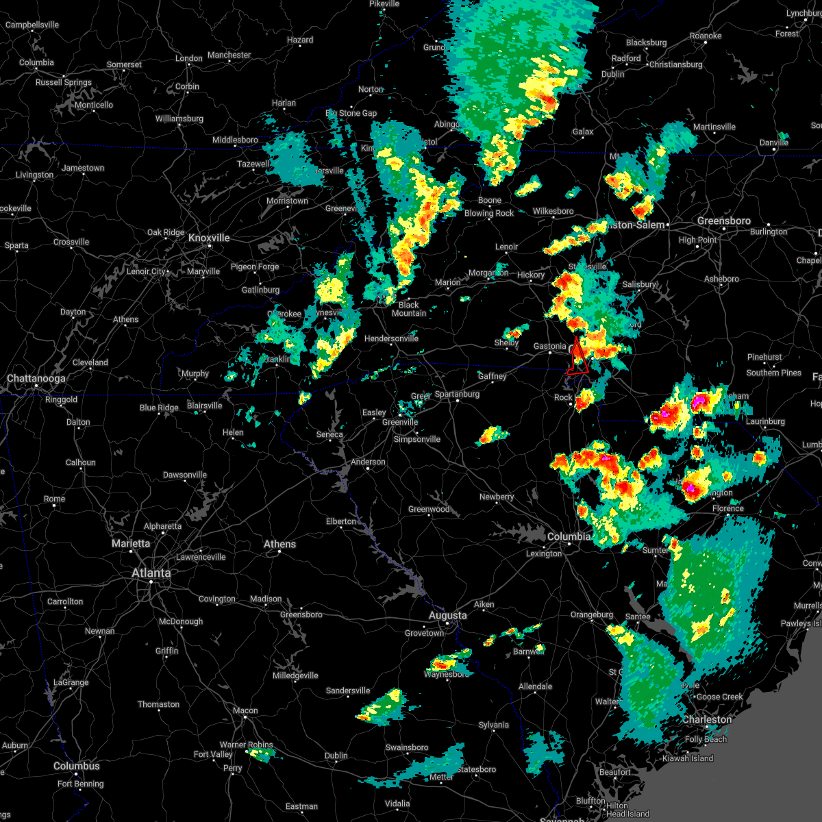 At 624 pm edt, a severe thunderstorm capable of producing a tornado was located 5 miles southeast of gastonia, or near cramerton, moving northeast at 20 mph (radar indicated rotation). Hazards include tornado and half dollar size hail. Flying debris will be dangerous to those caught without shelter. mobile homes will be damaged or destroyed. damage to roofs, windows, and vehicles will occur. tree damage is likely. this dangerous storm will be near, steele creek around 630 pm edt. southwest charlotte, paw creek and charlotte douglas airport around 650 pm edt. Central charlotte and northwest charlotte around 710 pm edt. At 624 pm edt, a severe thunderstorm capable of producing a tornado was located 5 miles southeast of gastonia, or near cramerton, moving northeast at 20 mph (radar indicated rotation). Hazards include tornado and half dollar size hail. Flying debris will be dangerous to those caught without shelter. mobile homes will be damaged or destroyed. damage to roofs, windows, and vehicles will occur. tree damage is likely. this dangerous storm will be near, steele creek around 630 pm edt. southwest charlotte, paw creek and charlotte douglas airport around 650 pm edt. Central charlotte and northwest charlotte around 710 pm edt.
|
| 5/6/2022 6:13 PM EDT |
 At 612 pm edt, a severe thunderstorm capable of producing a tornado was located 4 miles south of gastonia, or near south gastonia, moving northeast at 20 mph (radar indicated rotation). Hazards include tornado and half dollar size hail. Flying debris will be dangerous to those caught without shelter. mobile homes will be damaged or destroyed. damage to roofs, windows, and vehicles will occur. tree damage is likely. this dangerous storm will be near, cramerton, mcadenville, lowell, ranlo and steele creek around 630 pm edt. lake wylie, belmont and mt holly around 640 pm edt. southwest charlotte, paw creek and charlotte douglas airport around 650 pm edt. Central charlotte and northwest charlotte around 700 pm edt. At 612 pm edt, a severe thunderstorm capable of producing a tornado was located 4 miles south of gastonia, or near south gastonia, moving northeast at 20 mph (radar indicated rotation). Hazards include tornado and half dollar size hail. Flying debris will be dangerous to those caught without shelter. mobile homes will be damaged or destroyed. damage to roofs, windows, and vehicles will occur. tree damage is likely. this dangerous storm will be near, cramerton, mcadenville, lowell, ranlo and steele creek around 630 pm edt. lake wylie, belmont and mt holly around 640 pm edt. southwest charlotte, paw creek and charlotte douglas airport around 650 pm edt. Central charlotte and northwest charlotte around 700 pm edt.
|
| 5/6/2022 6:09 PM EDT |
 At 609 pm edt, a severe thunderstorm capable of producing a tornado was located 5 miles south of gastonia, or near south gastonia, moving northeast at 20 mph (radar indicated rotation). Hazards include tornado and half dollar size hail. Flying debris will be dangerous to those caught without shelter. mobile homes will be damaged or destroyed. damage to roofs, windows, and vehicles will occur. tree damage is likely. this dangerous storm will be near, gastonia around 610 pm edt. cramerton, mcadenville, lowell, ranlo and steele creek around 630 pm edt. lake wylie, belmont and mt holly around 640 pm edt. southwest charlotte, charlotte douglas airport and paw creek around 650 pm edt. central charlotte and northwest charlotte around 700 pm edt. Other locations impacted by this tornadic thunderstorm include crowders. At 609 pm edt, a severe thunderstorm capable of producing a tornado was located 5 miles south of gastonia, or near south gastonia, moving northeast at 20 mph (radar indicated rotation). Hazards include tornado and half dollar size hail. Flying debris will be dangerous to those caught without shelter. mobile homes will be damaged or destroyed. damage to roofs, windows, and vehicles will occur. tree damage is likely. this dangerous storm will be near, gastonia around 610 pm edt. cramerton, mcadenville, lowell, ranlo and steele creek around 630 pm edt. lake wylie, belmont and mt holly around 640 pm edt. southwest charlotte, charlotte douglas airport and paw creek around 650 pm edt. central charlotte and northwest charlotte around 700 pm edt. Other locations impacted by this tornadic thunderstorm include crowders.
|
| 5/6/2022 6:08 PM EDT |
 At 607 pm edt, severe thunderstorms were located along a line extending from 4 miles west of lincolnton to 5 miles south of gastonia to 7 miles north of chester, moving northeast at 35 mph (radar indicated). Hazards include 60 mph wind gusts and half dollar size hail. Minor hail damage to vehicles is expected. Expect wind damage to trees and power lines. At 607 pm edt, severe thunderstorms were located along a line extending from 4 miles west of lincolnton to 5 miles south of gastonia to 7 miles north of chester, moving northeast at 35 mph (radar indicated). Hazards include 60 mph wind gusts and half dollar size hail. Minor hail damage to vehicles is expected. Expect wind damage to trees and power lines.
|
| 5/6/2022 6:04 PM EDT |
 At 604 pm edt, severe thunderstorms were located along a line extending from 3 miles southwest of shelby to 9 miles west of york to 9 miles southeast of union, moving east at 20 mph (radar indicated). Hazards include golf ball size hail and 60 mph wind gusts. People and animals outdoors will be injured. expect hail damage to roofs, siding, windows, and vehicles. expect wind damage to trees and power lines. Locations impacted include, gastonia, lincolnton, york, cherryville, bessemer city, south gastonia, tega cay, clover, newport and dallas. At 604 pm edt, severe thunderstorms were located along a line extending from 3 miles southwest of shelby to 9 miles west of york to 9 miles southeast of union, moving east at 20 mph (radar indicated). Hazards include golf ball size hail and 60 mph wind gusts. People and animals outdoors will be injured. expect hail damage to roofs, siding, windows, and vehicles. expect wind damage to trees and power lines. Locations impacted include, gastonia, lincolnton, york, cherryville, bessemer city, south gastonia, tega cay, clover, newport and dallas.
|
| 5/6/2022 6:00 PM EDT |
 At 600 pm edt, a severe thunderstorm capable of producing a tornado was located 7 miles southwest of gastonia, or near clover, moving northeast at 20 mph (radar indicated rotation). Hazards include tornado and half dollar size hail. Flying debris will be dangerous to those caught without shelter. mobile homes will be damaged or destroyed. damage to roofs, windows, and vehicles will occur. tree damage is likely. this dangerous storm will be near, gastonia around 610 pm edt. cramerton, mcadenville, lowell, ranlo and steele creek around 630 pm edt. lake wylie, southwest charlotte, charlotte douglas airport, belmont and paw creek around 640 pm edt. Other locations impacted by this dangerous thunderstorm include crowders. At 600 pm edt, a severe thunderstorm capable of producing a tornado was located 7 miles southwest of gastonia, or near clover, moving northeast at 20 mph (radar indicated rotation). Hazards include tornado and half dollar size hail. Flying debris will be dangerous to those caught without shelter. mobile homes will be damaged or destroyed. damage to roofs, windows, and vehicles will occur. tree damage is likely. this dangerous storm will be near, gastonia around 610 pm edt. cramerton, mcadenville, lowell, ranlo and steele creek around 630 pm edt. lake wylie, southwest charlotte, charlotte douglas airport, belmont and paw creek around 640 pm edt. Other locations impacted by this dangerous thunderstorm include crowders.
|
| 5/6/2022 5:56 PM EDT |
 At 555 pm edt, severe thunderstorms were located along a line extending from 4 miles west of shelby to 11 miles west of york to 7 miles southeast of union, moving east at 20 mph (radar indicated). Hazards include golf ball size hail and 60 mph wind gusts. People and animals outdoors will be injured. expect hail damage to roofs, siding, windows, and vehicles. expect wind damage to trees and power lines. Locations impacted include, gastonia, lincolnton, york, kings mountain, cherryville, bessemer city, south gastonia, tega cay, clover and newport. At 555 pm edt, severe thunderstorms were located along a line extending from 4 miles west of shelby to 11 miles west of york to 7 miles southeast of union, moving east at 20 mph (radar indicated). Hazards include golf ball size hail and 60 mph wind gusts. People and animals outdoors will be injured. expect hail damage to roofs, siding, windows, and vehicles. expect wind damage to trees and power lines. Locations impacted include, gastonia, lincolnton, york, kings mountain, cherryville, bessemer city, south gastonia, tega cay, clover and newport.
|
| 5/6/2022 5:41 PM EDT |
 At 540 pm edt, severe thunderstorms were located along a line extending from 9 miles west of shelby to 7 miles east of gaffney to 4 miles south of union, moving east at 20 mph (radar indicated). Hazards include golf ball size hail and 60 mph wind gusts. People and animals outdoors will be injured. expect hail damage to roofs, siding, windows, and vehicles. Expect wind damage to trees and power lines. At 540 pm edt, severe thunderstorms were located along a line extending from 9 miles west of shelby to 7 miles east of gaffney to 4 miles south of union, moving east at 20 mph (radar indicated). Hazards include golf ball size hail and 60 mph wind gusts. People and animals outdoors will be injured. expect hail damage to roofs, siding, windows, and vehicles. Expect wind damage to trees and power lines.
|
| 5/6/2022 1:58 PM EDT |
 At 158 pm edt, a severe thunderstorm was located 6 miles southwest of uptown charlotte, or over southwest charlotte, moving northeast at 55 mph (radar indicated). Hazards include 60 mph wind gusts and quarter size hail. Minor hail damage to vehicles is expected. expect wind damage to trees and power lines. locations impacted include, uptown charlotte, central charlotte, northeast charlotte, southwest charlotte, east charlotte, northwest charlotte, pineville, freedom park, university city and reedy creek park. hail threat, radar indicated max hail size, 1. 00 in wind threat, radar indicated max wind gust, 60 mph. At 158 pm edt, a severe thunderstorm was located 6 miles southwest of uptown charlotte, or over southwest charlotte, moving northeast at 55 mph (radar indicated). Hazards include 60 mph wind gusts and quarter size hail. Minor hail damage to vehicles is expected. expect wind damage to trees and power lines. locations impacted include, uptown charlotte, central charlotte, northeast charlotte, southwest charlotte, east charlotte, northwest charlotte, pineville, freedom park, university city and reedy creek park. hail threat, radar indicated max hail size, 1. 00 in wind threat, radar indicated max wind gust, 60 mph.
|
| 5/6/2022 1:39 PM EDT |
 At 138 pm edt, a severe thunderstorm was located 4 miles west of rock hill, or near newport, moving northeast at 55 mph (radar indicated). Hazards include 60 mph wind gusts and quarter size hail. Minor hail damage to vehicles is expected. Expect wind damage to trees and power lines. At 138 pm edt, a severe thunderstorm was located 4 miles west of rock hill, or near newport, moving northeast at 55 mph (radar indicated). Hazards include 60 mph wind gusts and quarter size hail. Minor hail damage to vehicles is expected. Expect wind damage to trees and power lines.
|
| 5/4/2022 6:32 PM EDT |
 At 631 pm edt, a severe thunderstorm was located 13 miles northeast of monroe, or 8 miles east of unionville, moving east at 25 mph. additional severe thunderstorms winds are arriving from mecklenburg county in the western end of union county (radar indicated). Hazards include 60 mph wind gusts and quarter size hail. Minor hail damage to vehicles is expected. expect wind damage to trees and power lines. locations impacted include, monroe, indian trail, weddington, stallings, unionville, wesley chapel, wingate, waxhaw, marshville and lake park. hail threat, radar indicated max hail size, 1. 00 in wind threat, radar indicated max wind gust, 60 mph. At 631 pm edt, a severe thunderstorm was located 13 miles northeast of monroe, or 8 miles east of unionville, moving east at 25 mph. additional severe thunderstorms winds are arriving from mecklenburg county in the western end of union county (radar indicated). Hazards include 60 mph wind gusts and quarter size hail. Minor hail damage to vehicles is expected. expect wind damage to trees and power lines. locations impacted include, monroe, indian trail, weddington, stallings, unionville, wesley chapel, wingate, waxhaw, marshville and lake park. hail threat, radar indicated max hail size, 1. 00 in wind threat, radar indicated max wind gust, 60 mph.
|
| 5/4/2022 6:18 PM EDT |
 At 617 pm edt, a severe thunderstorm was located 7 miles northeast of indian land, or near the arboretum, moving east at 15 mph (radar indicated). Hazards include 60 mph wind gusts and quarter size hail. Minor hail damage to vehicles is expected. expect wind damage to trees and power lines. locations impacted include, monroe, south charlotte, matthews, mint hill, indian trail, weddington, stallings, unionville, wesley chapel and wingate. hail threat, radar indicated max hail size, 1. 00 in wind threat, radar indicated max wind gust, 60 mph. At 617 pm edt, a severe thunderstorm was located 7 miles northeast of indian land, or near the arboretum, moving east at 15 mph (radar indicated). Hazards include 60 mph wind gusts and quarter size hail. Minor hail damage to vehicles is expected. expect wind damage to trees and power lines. locations impacted include, monroe, south charlotte, matthews, mint hill, indian trail, weddington, stallings, unionville, wesley chapel and wingate. hail threat, radar indicated max hail size, 1. 00 in wind threat, radar indicated max wind gust, 60 mph.
|
| 5/4/2022 6:10 PM EDT | Quarter sized hail reported 7.2 miles N of Charlotte, NC, report of dime to quarter-sized hail near harris ymca. |
| 5/4/2022 6:03 PM EDT |
 At 602 pm edt, severe thunderstorms were located along a line extending from 5 miles southeast of uptown charlotte to near indian land, moving east at 15 mph (radar indicated). Hazards include 60 mph wind gusts and quarter size hail. Minor hail damage to vehicles is expected. Expect wind damage to trees and power lines. At 602 pm edt, severe thunderstorms were located along a line extending from 5 miles southeast of uptown charlotte to near indian land, moving east at 15 mph (radar indicated). Hazards include 60 mph wind gusts and quarter size hail. Minor hail damage to vehicles is expected. Expect wind damage to trees and power lines.
|
| 5/4/2022 5:51 PM EDT |
 At 551 pm edt, severe thunderstorms were located along a line extending from near uptown charlotte to 8 miles north of rock hill, moving southeast at 15 mph (radar indicated). Hazards include 60 mph wind gusts and quarter size hail. Minor hail damage to vehicles is expected. expect wind damage to trees and power lines. locations impacted include, uptown charlotte, central charlotte, south charlotte, southwest charlotte, east charlotte, matthews, mint hill, fort mill, stallings and pineville. hail threat, radar indicated max hail size, 1. 00 in wind threat, radar indicated max wind gust, 60 mph. At 551 pm edt, severe thunderstorms were located along a line extending from near uptown charlotte to 8 miles north of rock hill, moving southeast at 15 mph (radar indicated). Hazards include 60 mph wind gusts and quarter size hail. Minor hail damage to vehicles is expected. expect wind damage to trees and power lines. locations impacted include, uptown charlotte, central charlotte, south charlotte, southwest charlotte, east charlotte, matthews, mint hill, fort mill, stallings and pineville. hail threat, radar indicated max hail size, 1. 00 in wind threat, radar indicated max wind gust, 60 mph.
|
| 5/4/2022 5:49 PM EDT |
 At 548 pm edt, a severe thunderstorm was located over fort mill, or near indian land, moving east at 30 mph (radar indicated). Hazards include 60 mph wind gusts and quarter size hail. Hail damage to vehicles is expected. Expect wind damage to trees and powerlines. At 548 pm edt, a severe thunderstorm was located over fort mill, or near indian land, moving east at 30 mph (radar indicated). Hazards include 60 mph wind gusts and quarter size hail. Hail damage to vehicles is expected. Expect wind damage to trees and powerlines.
|
| 5/4/2022 5:43 PM EDT |
 At 543 pm edt, a severe thunderstorm was located 5 miles southwest of uptown charlotte, or near central charlotte, moving southeast at 10 mph (radar indicated). Hazards include 60 mph wind gusts and quarter size hail. Minor hail damage to vehicles is expected. Expect wind damage to trees and power lines. At 543 pm edt, a severe thunderstorm was located 5 miles southwest of uptown charlotte, or near central charlotte, moving southeast at 10 mph (radar indicated). Hazards include 60 mph wind gusts and quarter size hail. Minor hail damage to vehicles is expected. Expect wind damage to trees and power lines.
|
| 5/4/2022 5:37 PM EDT |
 At 536 pm edt, severe thunderstorms were located along a line extending from 9 miles southwest of gastonia to 11 miles west of york, moving east at 15 mph (radar indicated). Hazards include 60 mph wind gusts and quarter size hail. Minor hail damage to vehicles is expected. expect wind damage to trees and power lines. locations impacted include, york, tega cay, clover, newport, sharon, hickory grove, mcconnells, smyrna, kings mountain state park and steele creek. hail threat, radar indicated max hail size, 1. 00 in wind threat, radar indicated max wind gust, 60 mph. At 536 pm edt, severe thunderstorms were located along a line extending from 9 miles southwest of gastonia to 11 miles west of york, moving east at 15 mph (radar indicated). Hazards include 60 mph wind gusts and quarter size hail. Minor hail damage to vehicles is expected. expect wind damage to trees and power lines. locations impacted include, york, tega cay, clover, newport, sharon, hickory grove, mcconnells, smyrna, kings mountain state park and steele creek. hail threat, radar indicated max hail size, 1. 00 in wind threat, radar indicated max wind gust, 60 mph.
|
| 5/4/2022 5:28 PM EDT |
 At 528 pm edt, a severe thunderstorm was located 4 miles southwest of uptown charlotte, or near southwest charlotte, moving southeast at 20 mph (radar indicated). Hazards include 60 mph wind gusts and quarter size hail. Minor hail damage to vehicles is expected. expect wind damage to trees and power lines. locations impacted include, uptown charlotte, central charlotte, south charlotte, southwest charlotte, northwest charlotte, matthews, fort mill, belmont, pineville and tega cay. hail threat, radar indicated max hail size, 1. 00 in wind threat, radar indicated max wind gust, 60 mph. At 528 pm edt, a severe thunderstorm was located 4 miles southwest of uptown charlotte, or near southwest charlotte, moving southeast at 20 mph (radar indicated). Hazards include 60 mph wind gusts and quarter size hail. Minor hail damage to vehicles is expected. expect wind damage to trees and power lines. locations impacted include, uptown charlotte, central charlotte, south charlotte, southwest charlotte, northwest charlotte, matthews, fort mill, belmont, pineville and tega cay. hail threat, radar indicated max hail size, 1. 00 in wind threat, radar indicated max wind gust, 60 mph.
|
| 5/4/2022 5:25 PM EDT |
 At 524 pm edt, severe thunderstorms were located along a line extending from 9 miles southwest of gastonia to 11 miles southeast of gaffney, moving southeast at 15 mph (radar indicated). Hazards include 60 mph wind gusts and quarter size hail. Minor hail damage to vehicles is expected. Expect wind damage to trees and power lines. At 524 pm edt, severe thunderstorms were located along a line extending from 9 miles southwest of gastonia to 11 miles southeast of gaffney, moving southeast at 15 mph (radar indicated). Hazards include 60 mph wind gusts and quarter size hail. Minor hail damage to vehicles is expected. Expect wind damage to trees and power lines.
|
| 5/4/2022 5:06 PM EDT |
 At 505 pm edt, a severe thunderstorm was located 5 miles west of uptown charlotte, or over charlotte douglas airport, moving southeast at 20 mph (radar indicated). Hazards include 60 mph wind gusts and quarter size hail. Minor hail damage to vehicles is expected. Expect wind damage to trees and power lines. At 505 pm edt, a severe thunderstorm was located 5 miles west of uptown charlotte, or over charlotte douglas airport, moving southeast at 20 mph (radar indicated). Hazards include 60 mph wind gusts and quarter size hail. Minor hail damage to vehicles is expected. Expect wind damage to trees and power lines.
|
| 5/4/2022 4:50 PM EDT |
 The severe thunderstorm warning for northwestern cabarrus, southeastern iredell, north central mecklenburg and southwestern rowan counties will expire at 500 pm edt, the storm which prompted the warning has weakened below severe limits, and no longer poses an immediate threat to life or property. therefore, the warning will be allowed to expire on schedule at 5 pm. however, gusty winds are still possible with this thunderstorm. The severe thunderstorm warning for northwestern cabarrus, southeastern iredell, north central mecklenburg and southwestern rowan counties will expire at 500 pm edt, the storm which prompted the warning has weakened below severe limits, and no longer poses an immediate threat to life or property. therefore, the warning will be allowed to expire on schedule at 5 pm. however, gusty winds are still possible with this thunderstorm.
|
| 5/4/2022 4:35 PM EDT |
 At 435 pm edt, a severe thunderstorm was located 6 miles west of kannapolis, or near coddle creek reservoir, moving southeast at 15 mph (radar indicated). Hazards include 60 mph wind gusts and quarter size hail. Minor hail damage to vehicles is expected. expect wind damage to trees and power lines. locations impacted include, kannapolis, downtown concord, west concord, davidson, landis, enochville, university city, charlotte motor speedway, coddle creek reservoir and cornelius. hail threat, radar indicated max hail size, 1. 00 in wind threat, radar indicated max wind gust, 60 mph. At 435 pm edt, a severe thunderstorm was located 6 miles west of kannapolis, or near coddle creek reservoir, moving southeast at 15 mph (radar indicated). Hazards include 60 mph wind gusts and quarter size hail. Minor hail damage to vehicles is expected. expect wind damage to trees and power lines. locations impacted include, kannapolis, downtown concord, west concord, davidson, landis, enochville, university city, charlotte motor speedway, coddle creek reservoir and cornelius. hail threat, radar indicated max hail size, 1. 00 in wind threat, radar indicated max wind gust, 60 mph.
|
| 5/4/2022 4:11 PM EDT |
 At 410 pm edt, a severe thunderstorm was located 10 miles northwest of kannapolis, or near mooresville, moving southeast at 15 mph (radar indicated). Hazards include 60 mph wind gusts and quarter size hail. Minor hail damage to vehicles is expected. Expect wind damage to trees and power lines. At 410 pm edt, a severe thunderstorm was located 10 miles northwest of kannapolis, or near mooresville, moving southeast at 15 mph (radar indicated). Hazards include 60 mph wind gusts and quarter size hail. Minor hail damage to vehicles is expected. Expect wind damage to trees and power lines.
|
| 5/3/2022 4:03 PM EDT |
 At 402 pm edt, a severe thunderstorm was located 7 miles southeast of indian land, or near waxhaw, moving east at 20 mph (radar indicated). Hazards include 60 mph wind gusts and penny size hail. expect damage to trees and power lines At 402 pm edt, a severe thunderstorm was located 7 miles southeast of indian land, or near waxhaw, moving east at 20 mph (radar indicated). Hazards include 60 mph wind gusts and penny size hail. expect damage to trees and power lines
|
| 8/17/2021 6:11 PM EDT |
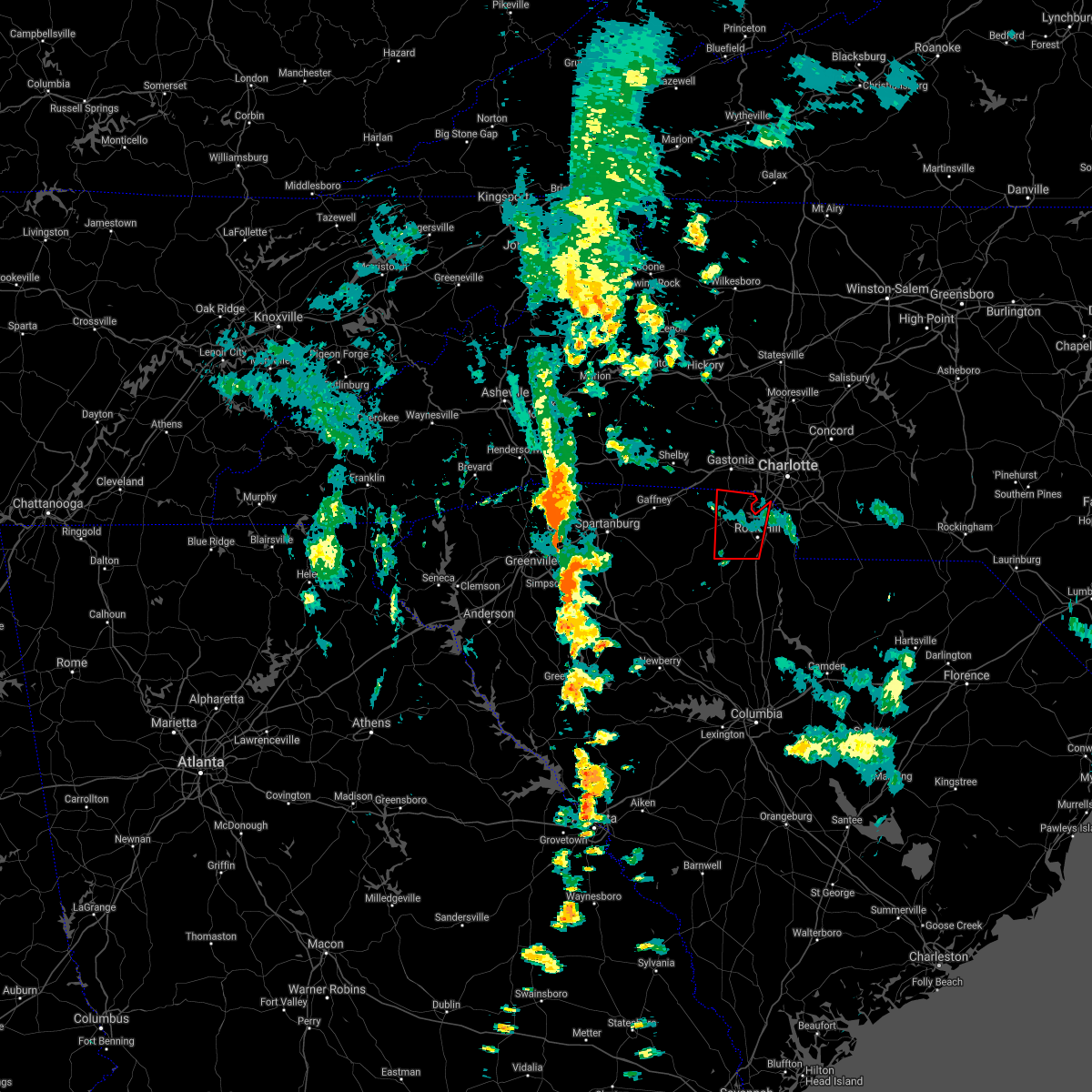 The tornado warning for central york county will expire at 615 pm edt, the storm which prompted the warning has weakened below severe limits, and no longer appears capable of producing a tornado. therefore, the warning will be allowed to expire. a tornado watch remains in effect until 700 pm edt for the piedmont of north carolina, and upstate south carolina. The tornado warning for central york county will expire at 615 pm edt, the storm which prompted the warning has weakened below severe limits, and no longer appears capable of producing a tornado. therefore, the warning will be allowed to expire. a tornado watch remains in effect until 700 pm edt for the piedmont of north carolina, and upstate south carolina.
|
| 8/17/2021 6:00 PM EDT |
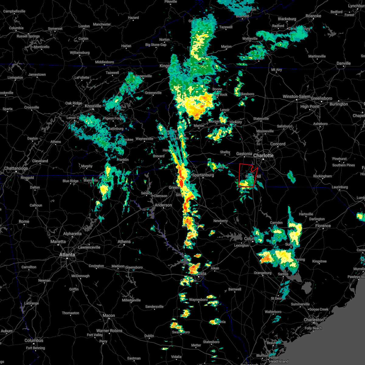 At 559 pm edt, a severe thunderstorm capable of producing a tornado was located 8 miles south of york, or over mcconnells, moving north at 40 mph (radar indicated rotation). Hazards include tornado. Flying debris will be dangerous to those caught without shelter. mobile homes will be damaged or destroyed. damage to roofs, windows, and vehicles will occur. tree damage is likely. this dangerous storm will be near, york around 620 pm edt. Clover around 630 pm edt. At 559 pm edt, a severe thunderstorm capable of producing a tornado was located 8 miles south of york, or over mcconnells, moving north at 40 mph (radar indicated rotation). Hazards include tornado. Flying debris will be dangerous to those caught without shelter. mobile homes will be damaged or destroyed. damage to roofs, windows, and vehicles will occur. tree damage is likely. this dangerous storm will be near, york around 620 pm edt. Clover around 630 pm edt.
|
| 8/17/2021 5:53 PM EDT |
 At 553 pm edt, a severe thunderstorm capable of producing a tornado was located 7 miles north of chester, or over lowrys, moving north at 40 mph (radar indicated rotation). Hazards include tornado. Flying debris will be dangerous to those caught without shelter. mobile homes will be damaged or destroyed. damage to roofs, windows, and vehicles will occur. tree damage is likely. this dangerous storm will be near, mcconnells around 600 pm edt. york around 620 pm edt. Clover around 630 pm edt. At 553 pm edt, a severe thunderstorm capable of producing a tornado was located 7 miles north of chester, or over lowrys, moving north at 40 mph (radar indicated rotation). Hazards include tornado. Flying debris will be dangerous to those caught without shelter. mobile homes will be damaged or destroyed. damage to roofs, windows, and vehicles will occur. tree damage is likely. this dangerous storm will be near, mcconnells around 600 pm edt. york around 620 pm edt. Clover around 630 pm edt.
|
| 8/17/2021 5:37 PM EDT |
 At 536 pm edt, a severe thunderstorm capable of producing a tornado was located 5 miles south of chester, or near chester state park, moving north at 40 mph (radar indicated rotation). Hazards include tornado. Flying debris will be dangerous to those caught without shelter. mobile homes will be damaged or destroyed. damage to roofs, windows, and vehicles will occur. tree damage is likely. this dangerous storm will be near, chester and chester state park around 540 pm edt. mcconnells and lowrys around 600 pm edt. rock hill, york and newport around 610 pm edt. Other locations impacted by this dangerous thunderstorm include blackstock and cornwell. At 536 pm edt, a severe thunderstorm capable of producing a tornado was located 5 miles south of chester, or near chester state park, moving north at 40 mph (radar indicated rotation). Hazards include tornado. Flying debris will be dangerous to those caught without shelter. mobile homes will be damaged or destroyed. damage to roofs, windows, and vehicles will occur. tree damage is likely. this dangerous storm will be near, chester and chester state park around 540 pm edt. mcconnells and lowrys around 600 pm edt. rock hill, york and newport around 610 pm edt. Other locations impacted by this dangerous thunderstorm include blackstock and cornwell.
|
| 8/14/2021 4:26 PM EDT |
 The severe thunderstorm warning for western union county will expire at 430 pm edt, the storm which prompted the warning has weakened below severe limits, and no longer poses an immediate threat to life or property. therefore, the warning will be allowed to expire. however, gusty winds and heavy rain are still possible with this thunderstorm. The severe thunderstorm warning for western union county will expire at 430 pm edt, the storm which prompted the warning has weakened below severe limits, and no longer poses an immediate threat to life or property. therefore, the warning will be allowed to expire. however, gusty winds and heavy rain are still possible with this thunderstorm.
|
| 8/14/2021 4:13 PM EDT |
 At 412 pm edt, a severe thunderstorm was located 10 miles southeast of indian land, or near waxhaw, moving southwest at 15 mph (radar indicated). Hazards include 60 mph wind gusts and quarter size hail. Minor hail damage to vehicles is expected. expect wind damage to trees and power lines. locations impacted include, monroe, indian trail, weddington, stallings, wesley chapel, wingate, waxhaw, lake park, mineral springs and hemby bridge. hail threat, radar indicated max hail size, 1. 00 in wind threat, radar indicated max wind gust, 60 mph. At 412 pm edt, a severe thunderstorm was located 10 miles southeast of indian land, or near waxhaw, moving southwest at 15 mph (radar indicated). Hazards include 60 mph wind gusts and quarter size hail. Minor hail damage to vehicles is expected. expect wind damage to trees and power lines. locations impacted include, monroe, indian trail, weddington, stallings, wesley chapel, wingate, waxhaw, lake park, mineral springs and hemby bridge. hail threat, radar indicated max hail size, 1. 00 in wind threat, radar indicated max wind gust, 60 mph.
|
| 8/14/2021 3:46 PM EDT |
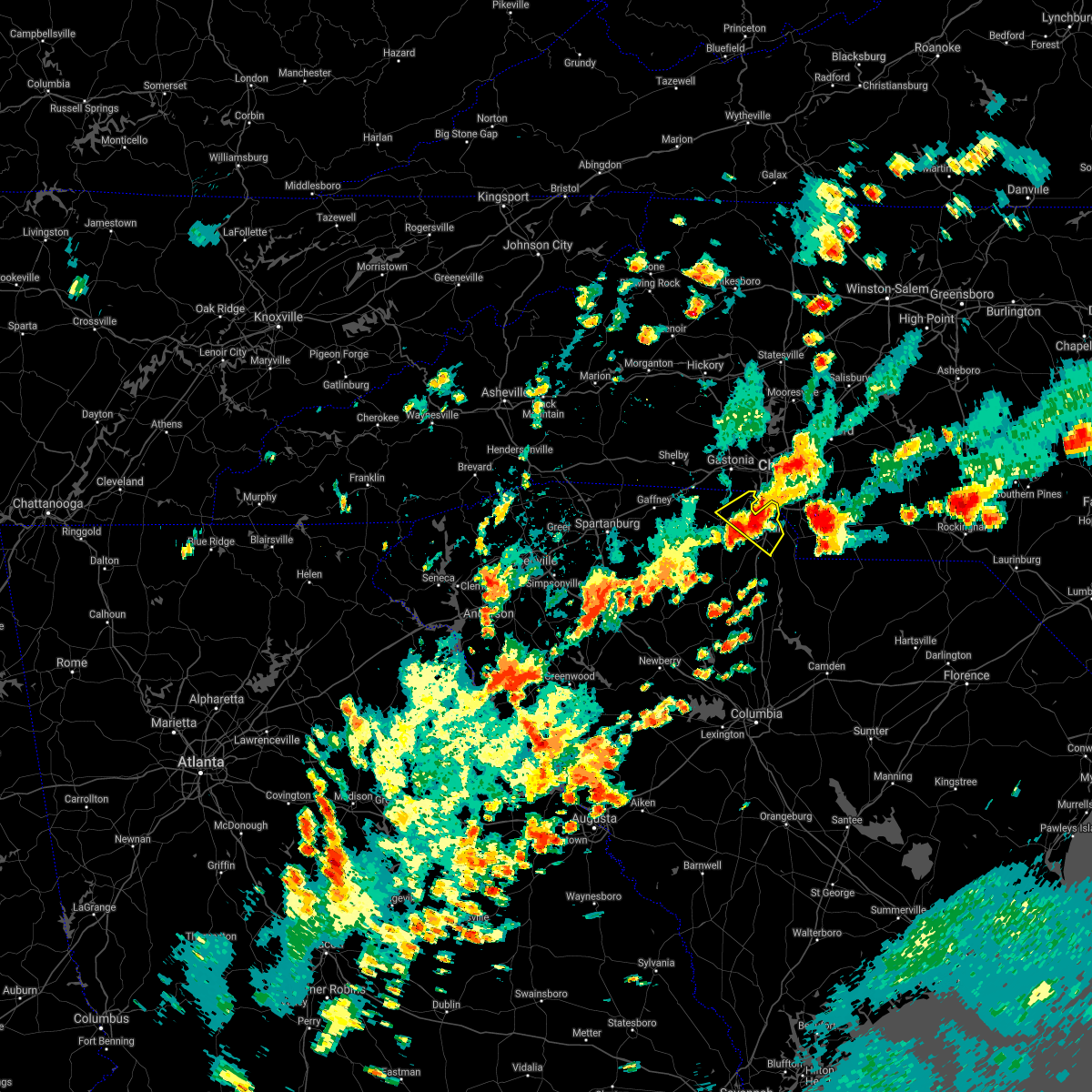 At 345 pm edt, a severe thunderstorm was located near rock hill, moving south at 15 mph (radar indicated). Hazards include 60 mph wind gusts and quarter size hail. Minor hail damage to vehicles is expected. expect wind damage to trees and power lines. locations impacted include, rock hill, fort mill, tega cay, newport, lesslie, lake wylie and carowinds. hail threat, radar indicated max hail size, 1. 00 in wind threat, radar indicated max wind gust, 60 mph. At 345 pm edt, a severe thunderstorm was located near rock hill, moving south at 15 mph (radar indicated). Hazards include 60 mph wind gusts and quarter size hail. Minor hail damage to vehicles is expected. expect wind damage to trees and power lines. locations impacted include, rock hill, fort mill, tega cay, newport, lesslie, lake wylie and carowinds. hail threat, radar indicated max hail size, 1. 00 in wind threat, radar indicated max wind gust, 60 mph.
|
| 8/14/2021 3:39 PM EDT |
 At 339 pm edt, a severe thunderstorm was located 4 miles west of monroe, or near wesley chapel, moving west at 5 mph (radar indicated). Hazards include 60 mph wind gusts and quarter size hail. Minor hail damage to vehicles is expected. Expect wind damage to trees and power lines. At 339 pm edt, a severe thunderstorm was located 4 miles west of monroe, or near wesley chapel, moving west at 5 mph (radar indicated). Hazards include 60 mph wind gusts and quarter size hail. Minor hail damage to vehicles is expected. Expect wind damage to trees and power lines.
|
| 8/14/2021 3:17 PM EDT |
 At 316 pm edt, a severe thunderstorm was located over carowinds, or 8 miles northwest of indian land, moving west at 20 mph (radar indicated). Hazards include 60 mph wind gusts. expect damage to roofs, siding, and trees At 316 pm edt, a severe thunderstorm was located over carowinds, or 8 miles northwest of indian land, moving west at 20 mph (radar indicated). Hazards include 60 mph wind gusts. expect damage to roofs, siding, and trees
|
| 8/14/2021 3:13 PM EDT |
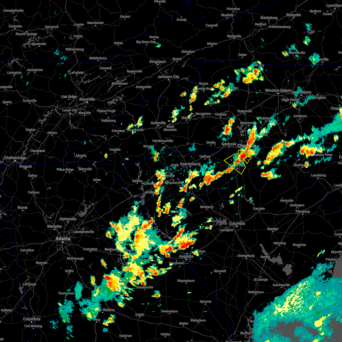 At 313 pm edt, a severe thunderstorm was located 7 miles northwest of indian land, or near tega cay, moving southwest at 10 mph (radar indicated). Hazards include 60 mph wind gusts and quarter size hail. Minor hail damage to vehicles is expected. Expect wind damage to trees and power lines. At 313 pm edt, a severe thunderstorm was located 7 miles northwest of indian land, or near tega cay, moving southwest at 10 mph (radar indicated). Hazards include 60 mph wind gusts and quarter size hail. Minor hail damage to vehicles is expected. Expect wind damage to trees and power lines.
|
| 8/14/2021 3:00 PM EDT | Trees and power lines down on sharon road wes in mecklenburg county NC, 7.8 miles N of Charlotte, NC |
| 8/14/2021 2:56 PM EDT |
 At 255 pm edt, a severe thunderstorm was located 6 miles north of indian land, or over pineville, moving west at 10 mph (radar indicated). Hazards include 60 mph wind gusts and quarter size hail. Minor hail damage to vehicles is expected. expect wind damage to trees and power lines. locations impacted include, central charlotte, south charlotte, southwest charlotte, matthews, pineville, freedom park, steele creek, the arboretum, carowinds and southpark mall. hail threat, radar indicated max hail size, 1. 00 in wind threat, radar indicated max wind gust, 60 mph. At 255 pm edt, a severe thunderstorm was located 6 miles north of indian land, or over pineville, moving west at 10 mph (radar indicated). Hazards include 60 mph wind gusts and quarter size hail. Minor hail damage to vehicles is expected. expect wind damage to trees and power lines. locations impacted include, central charlotte, south charlotte, southwest charlotte, matthews, pineville, freedom park, steele creek, the arboretum, carowinds and southpark mall. hail threat, radar indicated max hail size, 1. 00 in wind threat, radar indicated max wind gust, 60 mph.
|
| 8/14/2021 2:33 PM EDT |
 At 233 pm edt, a severe thunderstorm was located 6 miles northeast of indian land, or near the arboretum, moving west at 10 mph (radar indicated). Hazards include 60 mph wind gusts and quarter size hail. Minor hail damage to vehicles is expected. Expect wind damage to trees and power lines. At 233 pm edt, a severe thunderstorm was located 6 miles northeast of indian land, or near the arboretum, moving west at 10 mph (radar indicated). Hazards include 60 mph wind gusts and quarter size hail. Minor hail damage to vehicles is expected. Expect wind damage to trees and power lines.
|
| 8/11/2021 8:00 PM EDT | Massive tree down blocking all lanes of west morehead st near stadium. time estimated from radar velocity dat in mecklenburg county NC, 0.3 miles NNE of Charlotte, NC |
| 8/11/2021 7:47 PM EDT |
 At 746 pm edt, a severe thunderstorm was located near uptown charlotte, or near hidden valley, and is nearly stationary (radar indicated). Hazards include 60 mph wind gusts and quarter size hail. Minor hail damage to vehicles is expected. expect wind damage to trees and power lines. locations impacted include, uptown charlotte, central charlotte, northeast charlotte, east charlotte, northwest charlotte, freedom park, university city, reedy creek park, the plaza and charlotte douglas airport. hail threat, radar indicated max hail size, 1. 00 in wind threat, radar indicated max wind gust, 60 mph. At 746 pm edt, a severe thunderstorm was located near uptown charlotte, or near hidden valley, and is nearly stationary (radar indicated). Hazards include 60 mph wind gusts and quarter size hail. Minor hail damage to vehicles is expected. expect wind damage to trees and power lines. locations impacted include, uptown charlotte, central charlotte, northeast charlotte, east charlotte, northwest charlotte, freedom park, university city, reedy creek park, the plaza and charlotte douglas airport. hail threat, radar indicated max hail size, 1. 00 in wind threat, radar indicated max wind gust, 60 mph.
|
| 8/11/2021 7:45 PM EDT | 911 call center reported several trees down from uptown to i85 to universit in mecklenburg county NC, 8.6 miles WSW of Charlotte, NC |
| 8/11/2021 7:31 PM EDT |
 At 731 pm edt, a severe thunderstorm was located near uptown charlotte, and is nearly stationary (radar indicated). Hazards include 60 mph wind gusts and quarter size hail. Minor hail damage to vehicles is expected. Expect wind damage to trees and power lines. At 731 pm edt, a severe thunderstorm was located near uptown charlotte, and is nearly stationary (radar indicated). Hazards include 60 mph wind gusts and quarter size hail. Minor hail damage to vehicles is expected. Expect wind damage to trees and power lines.
|
| 8/11/2021 6:08 PM EDT |
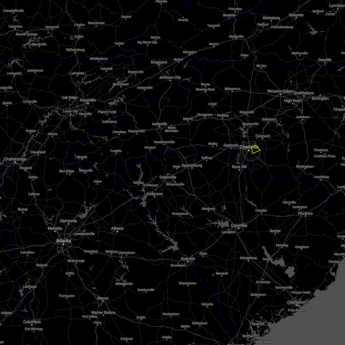 The national weather service in greenville-spartanburg has issued a * severe thunderstorm warning for. east central mecklenburg county in the piedmont of north carolina. until 700 pm edt. At 608 pm edt, a severe thunderstorm was located 6 miles east of. The national weather service in greenville-spartanburg has issued a * severe thunderstorm warning for. east central mecklenburg county in the piedmont of north carolina. until 700 pm edt. At 608 pm edt, a severe thunderstorm was located 6 miles east of.
|
| 8/10/2021 7:47 PM EDT |
 At 747 pm edt, a severe thunderstorm was located 6 miles northeast of uptown charlotte, or near university city, moving southeast at 10 mph (radar indicated). Hazards include 60 mph wind gusts and quarter size hail. Minor hail damage to vehicles is expected. Expect wind damage to trees and power lines. At 747 pm edt, a severe thunderstorm was located 6 miles northeast of uptown charlotte, or near university city, moving southeast at 10 mph (radar indicated). Hazards include 60 mph wind gusts and quarter size hail. Minor hail damage to vehicles is expected. Expect wind damage to trees and power lines.
|
| 7/26/2021 6:07 PM EDT |
 The severe thunderstorm warning for southwestern mecklenburg and northeastern york counties will expire at 615 pm edt, the storm which prompted the warning has weakened below severe limits, and no longer poses an immediate threat to life or property. therefore the warning will be allowed to expire. however gusty winds and heavy rain are still possible with this thunderstorm. if you observed large hail or wind damage, please report it to the national weather service greenville-spartanburg by calling toll free, 1, 800, 2 6 7, 8 1 0 1, or by posting on our facebook page, or tweet it using hashtag nwsgsp. your message should describe the event and the specific location where it occurred. The severe thunderstorm warning for southwestern mecklenburg and northeastern york counties will expire at 615 pm edt, the storm which prompted the warning has weakened below severe limits, and no longer poses an immediate threat to life or property. therefore the warning will be allowed to expire. however gusty winds and heavy rain are still possible with this thunderstorm. if you observed large hail or wind damage, please report it to the national weather service greenville-spartanburg by calling toll free, 1, 800, 2 6 7, 8 1 0 1, or by posting on our facebook page, or tweet it using hashtag nwsgsp. your message should describe the event and the specific location where it occurred.
|
| 7/26/2021 5:45 PM EDT |
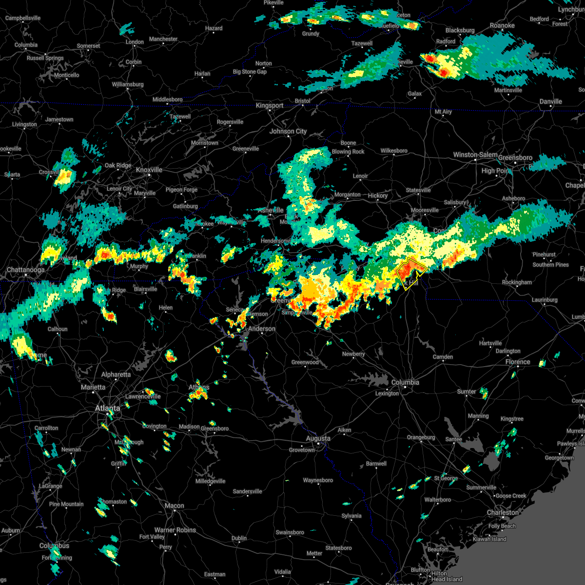 At 544 pm edt, a severe thunderstorm was located 10 miles northwest of indian land, or near steele creek, moving southeast at 10 mph (radar indicated). Hazards include 60 mph wind gusts. expect damage to trees and power lines At 544 pm edt, a severe thunderstorm was located 10 miles northwest of indian land, or near steele creek, moving southeast at 10 mph (radar indicated). Hazards include 60 mph wind gusts. expect damage to trees and power lines
|
| 7/26/2021 4:33 PM EDT |
 At 433 pm edt, a severe thunderstorm was located 8 miles southwest of gastonia, or near crowders mountain state park, moving east at 25 mph (radar indicated). Hazards include 60 mph wind gusts and penny size hail. expect damage to trees and power lines At 433 pm edt, a severe thunderstorm was located 8 miles southwest of gastonia, or near crowders mountain state park, moving east at 25 mph (radar indicated). Hazards include 60 mph wind gusts and penny size hail. expect damage to trees and power lines
|
| 7/12/2021 6:19 PM EDT |
 At 619 pm edt, a severe thunderstorm was located 5 miles northeast of uptown charlotte, or near hidden valley, moving northeast at 15 mph (radar indicated). Hazards include 60 mph wind gusts and quarter size hail. Minor hail damage to vehicles is expected. expect wind damage to trees and power lines. Locations impacted include, northeast charlotte, east charlotte, harrisburg, university city, reedy creek park, the plaza, charlotte motor speedway, hidden valley, uptown charlotte and west concord. At 619 pm edt, a severe thunderstorm was located 5 miles northeast of uptown charlotte, or near hidden valley, moving northeast at 15 mph (radar indicated). Hazards include 60 mph wind gusts and quarter size hail. Minor hail damage to vehicles is expected. expect wind damage to trees and power lines. Locations impacted include, northeast charlotte, east charlotte, harrisburg, university city, reedy creek park, the plaza, charlotte motor speedway, hidden valley, uptown charlotte and west concord.
|
| 7/12/2021 6:02 PM EDT |
 At 602 pm edt, a severe thunderstorm was located 4 miles east of uptown charlotte, or over east charlotte, moving northeast at 10 mph (radar indicated). Hazards include 60 mph wind gusts and quarter size hail. Minor hail damage to vehicles is expected. Expect wind damage to trees and power lines. At 602 pm edt, a severe thunderstorm was located 4 miles east of uptown charlotte, or over east charlotte, moving northeast at 10 mph (radar indicated). Hazards include 60 mph wind gusts and quarter size hail. Minor hail damage to vehicles is expected. Expect wind damage to trees and power lines.
|
| 7/9/2021 3:21 PM EDT |
 The severe thunderstorm warning for central mecklenburg county will expire at 330 pm edt, the storm which prompted the warning has weakened below severe limits, and has exited the warned area. therefore the warning will be allowed to expire. however gusty winds and heavy rain are still possible across southern mecklenburg county through 400 pm. The severe thunderstorm warning for central mecklenburg county will expire at 330 pm edt, the storm which prompted the warning has weakened below severe limits, and has exited the warned area. therefore the warning will be allowed to expire. however gusty winds and heavy rain are still possible across southern mecklenburg county through 400 pm.
|
| 7/9/2021 2:50 PM EDT | Trees and powerlines down at park rd. and east blv in mecklenburg county NC, 1.7 miles NNW of Charlotte, NC |
| 7/9/2021 2:45 PM EDT | Large (5 inch) diameter limbs blown down on a house on dillworth rd. west. took out power to the hous in mecklenburg county NC, 2.4 miles NNW of Charlotte, NC |
| 7/9/2021 2:36 PM EDT |
 At 235 pm edt, a severe thunderstorm was located 4 miles southwest of uptown charlotte, moving east at 15 mph (radar indicated). Hazards include 60 mph wind gusts and quarter size hail. Minor hail damage to vehicles is expected. Expect wind damage to trees and power lines. At 235 pm edt, a severe thunderstorm was located 4 miles southwest of uptown charlotte, moving east at 15 mph (radar indicated). Hazards include 60 mph wind gusts and quarter size hail. Minor hail damage to vehicles is expected. Expect wind damage to trees and power lines.
|
| 6/14/2021 4:04 PM EDT |
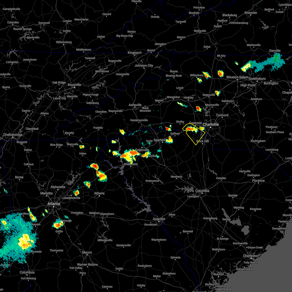 At 404 pm edt, a severe thunderstorm was located 7 miles southwest of gastonia, or near crowders mountain state park, moving southeast at 15 mph (radar indicated). Hazards include 60 mph wind gusts and quarter size hail. Minor hail damage to vehicles is expected. Expect wind damage to trees and power lines. At 404 pm edt, a severe thunderstorm was located 7 miles southwest of gastonia, or near crowders mountain state park, moving southeast at 15 mph (radar indicated). Hazards include 60 mph wind gusts and quarter size hail. Minor hail damage to vehicles is expected. Expect wind damage to trees and power lines.
|
| 5/3/2021 1:41 PM EDT |
 At 126 pm edt, a severe thunderstorm capable of producing a tornado was located near uptown charlotte, or near freedom park, moving east at 40 mph (radar indicated rotation). Hazards include tornado. Expect damage to mobile homes, roofs, and vehicles. this dangerous storm will be near, mint hill, matthews, reedy creek park and east charlotte around 140 pm edt. Midland around 150 pm edt. At 126 pm edt, a severe thunderstorm capable of producing a tornado was located near uptown charlotte, or near freedom park, moving east at 40 mph (radar indicated rotation). Hazards include tornado. Expect damage to mobile homes, roofs, and vehicles. this dangerous storm will be near, mint hill, matthews, reedy creek park and east charlotte around 140 pm edt. Midland around 150 pm edt.
|
| 5/3/2021 1:26 PM EDT |
 At 126 pm edt, a severe thunderstorm capable of producing a tornado was located near uptown charlotte, or near freedom park, moving east at 40 mph (radar indicated rotation). Hazards include tornado. Expect damage to mobile homes, roofs, and vehicles. this dangerous storm will be near, mint hill, matthews, reedy creek park and east charlotte around 140 pm edt. Midland around 150 pm edt. At 126 pm edt, a severe thunderstorm capable of producing a tornado was located near uptown charlotte, or near freedom park, moving east at 40 mph (radar indicated rotation). Hazards include tornado. Expect damage to mobile homes, roofs, and vehicles. this dangerous storm will be near, mint hill, matthews, reedy creek park and east charlotte around 140 pm edt. Midland around 150 pm edt.
|
| 5/3/2021 1:17 PM EDT |
 At 116 pm edt, a severe thunderstorm capable of producing a tornado was located 6 miles southwest of uptown charlotte, or near southwest charlotte, moving east at 45 mph (radar indicated rotation). Hazards include tornado. Expect damage to mobile homes, roofs, and vehicles. this dangerous storm will be near, southpark mall and freedom park around 120 pm edt. uptown charlotte, south charlotte, the plaza, matthews and central charlotte around 130 pm edt. Mint hill, reedy creek park, east charlotte, harrisburg and midland around 140 pm edt. At 116 pm edt, a severe thunderstorm capable of producing a tornado was located 6 miles southwest of uptown charlotte, or near southwest charlotte, moving east at 45 mph (radar indicated rotation). Hazards include tornado. Expect damage to mobile homes, roofs, and vehicles. this dangerous storm will be near, southpark mall and freedom park around 120 pm edt. uptown charlotte, south charlotte, the plaza, matthews and central charlotte around 130 pm edt. Mint hill, reedy creek park, east charlotte, harrisburg and midland around 140 pm edt.
|
| 3/27/2021 3:59 PM EDT |
 The national weather service in greenville-spartanburg has issued a * severe thunderstorm warning for. cabarrus county in the piedmont of north carolina. north central mecklenburg county in the piedmont of north carolina. Until 430 pm edt. The national weather service in greenville-spartanburg has issued a * severe thunderstorm warning for. cabarrus county in the piedmont of north carolina. north central mecklenburg county in the piedmont of north carolina. Until 430 pm edt.
|
| 3/18/2021 5:13 PM EDT |
 At 512 pm edt, a severe thunderstorm capable of producing a tornado was located 8 miles east of uptown charlotte, or near mint hill, moving northeast at 35 mph (radar indicated rotation). Hazards include tornado. Flying debris will be dangerous to those caught without shelter. mobile homes will be damaged or destroyed. damage to roofs, windows, and vehicles will occur. tree damage is likely. this dangerous storm will be near, midland around 530 pm edt. Mt pleasant around 540 pm edt. At 512 pm edt, a severe thunderstorm capable of producing a tornado was located 8 miles east of uptown charlotte, or near mint hill, moving northeast at 35 mph (radar indicated rotation). Hazards include tornado. Flying debris will be dangerous to those caught without shelter. mobile homes will be damaged or destroyed. damage to roofs, windows, and vehicles will occur. tree damage is likely. this dangerous storm will be near, midland around 530 pm edt. Mt pleasant around 540 pm edt.
|
| 3/18/2021 4:59 PM EDT |
 A tornado warning remains in effect until 530 pm edt for southern mecklenburg county. at 459 pm edt, a severe thunderstorm capable of producing a tornado was located 5 miles south of uptown charlotte, or over southpark mall, moving northeast at 35 mph. hazard. Tornado and quarter size hail. A tornado warning remains in effect until 530 pm edt for southern mecklenburg county. at 459 pm edt, a severe thunderstorm capable of producing a tornado was located 5 miles south of uptown charlotte, or over southpark mall, moving northeast at 35 mph. hazard. Tornado and quarter size hail.
|
| 3/18/2021 4:38 PM EDT |
 At 438 pm edt, a severe thunderstorm capable of producing a tornado was located 8 miles north of rock hill, or near tega cay, moving east at 35 mph (radar indicated rotation). Hazards include tornado and quarter size hail. Flying debris will be dangerous to those caught without shelter. mobile homes will be damaged or destroyed. damage to roofs, windows, and vehicles will occur. tree damage is likely. this dangerous storm will be near, carowinds and fort mill around 440 pm edt. pineville around 450 pm edt. the arboretum, weddington, southpark mall, south charlotte and marvin around 500 pm edt. lake park, matthews and wesley chapel around 510 pm edt. Monroe, indian trail, hemby bridge, stallings and mint hill around 520 pm edt. At 438 pm edt, a severe thunderstorm capable of producing a tornado was located 8 miles north of rock hill, or near tega cay, moving east at 35 mph (radar indicated rotation). Hazards include tornado and quarter size hail. Flying debris will be dangerous to those caught without shelter. mobile homes will be damaged or destroyed. damage to roofs, windows, and vehicles will occur. tree damage is likely. this dangerous storm will be near, carowinds and fort mill around 440 pm edt. pineville around 450 pm edt. the arboretum, weddington, southpark mall, south charlotte and marvin around 500 pm edt. lake park, matthews and wesley chapel around 510 pm edt. Monroe, indian trail, hemby bridge, stallings and mint hill around 520 pm edt.
|
| 3/18/2021 4:26 PM EDT |
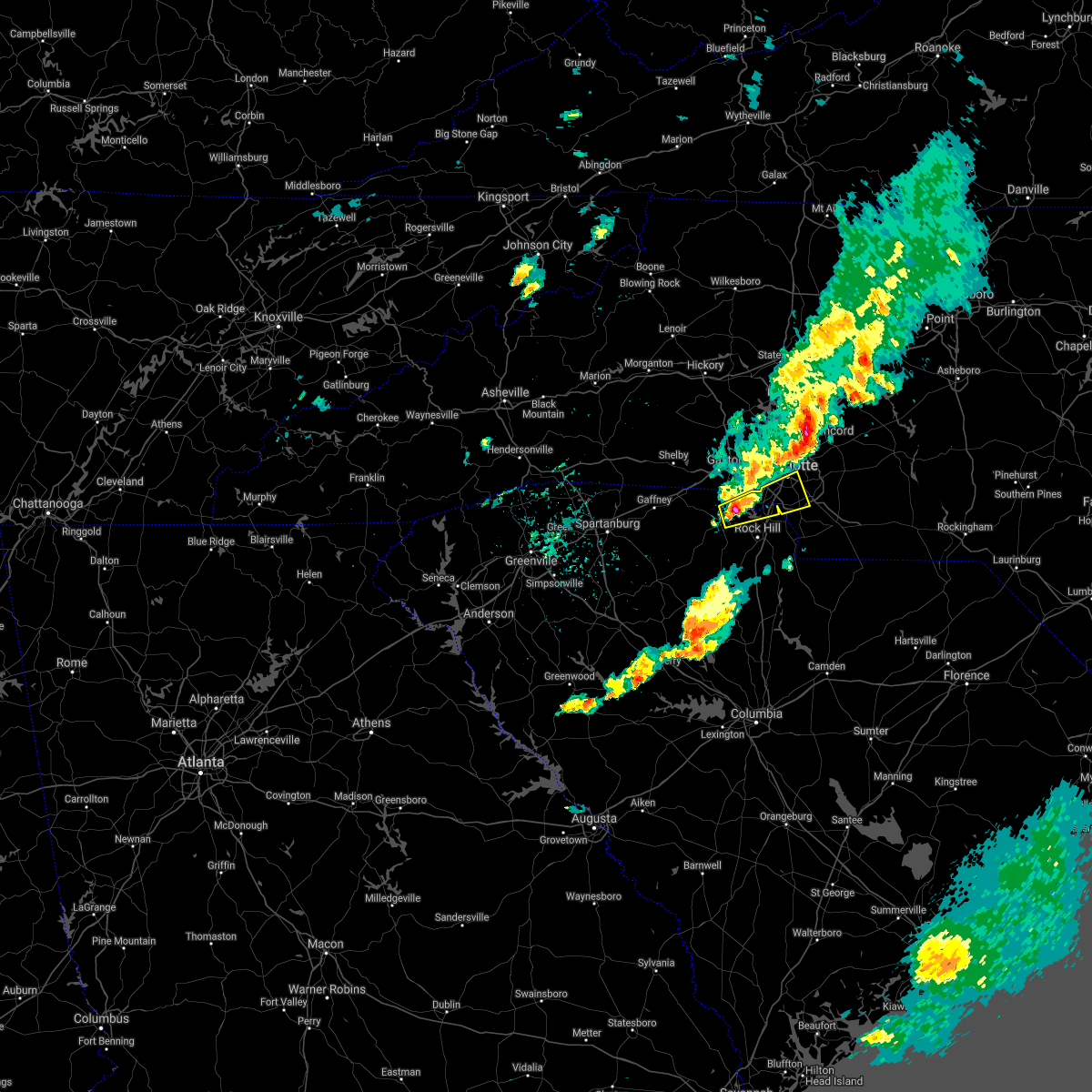 At 424 pm edt, a severe thunderstorm was located 6 miles northeast of york, or 5 miles west of lake wylie, moving east at 40 mph (radar indicated). Hazards include 60 mph wind gusts and quarter size hail. Minor hail damage to vehicles is expected. Expect wind damage to trees and power lines. At 424 pm edt, a severe thunderstorm was located 6 miles northeast of york, or 5 miles west of lake wylie, moving east at 40 mph (radar indicated). Hazards include 60 mph wind gusts and quarter size hail. Minor hail damage to vehicles is expected. Expect wind damage to trees and power lines.
|
| 10/11/2020 7:12 PM EDT |
 The tornado warning for southeastern mecklenburg and west central union counties will expire at 715 pm edt, the storm which prompted the warning has weakened below severe limits, and no longer appears capable of producing a tornado. therefore the warning will be allowed to expire. The tornado warning for southeastern mecklenburg and west central union counties will expire at 715 pm edt, the storm which prompted the warning has weakened below severe limits, and no longer appears capable of producing a tornado. therefore the warning will be allowed to expire.
|
| 10/11/2020 7:09 PM EDT |
 At 709 pm edt, a severe thunderstorm capable of producing a tornado was located 10 miles southeast of uptown charlotte, or over matthews, moving northeast at 20 mph (radar indicated rotation). Hazards include tornado. Expect damage to mobile homes, roofs, and vehicles. This dangerous storm will be near, lake park around 720 pm edt. At 709 pm edt, a severe thunderstorm capable of producing a tornado was located 10 miles southeast of uptown charlotte, or over matthews, moving northeast at 20 mph (radar indicated rotation). Hazards include tornado. Expect damage to mobile homes, roofs, and vehicles. This dangerous storm will be near, lake park around 720 pm edt.
|
| 10/11/2020 7:01 PM EDT |
 At 649 pm edt, a severe thunderstorm capable of producing a tornado was located 5 miles northeast of indian land, or near the arboretum, moving northeast at 20 mph (radar indicated rotation). Hazards include tornado. Expect damage to mobile homes, roofs, and vehicles. this dangerous storm will be near, the arboretum around 650 pm edt. weddington around 700 pm edt. Matthews, lake park, stallings, south charlotte and indian trail around 710 pm edt. At 649 pm edt, a severe thunderstorm capable of producing a tornado was located 5 miles northeast of indian land, or near the arboretum, moving northeast at 20 mph (radar indicated rotation). Hazards include tornado. Expect damage to mobile homes, roofs, and vehicles. this dangerous storm will be near, the arboretum around 650 pm edt. weddington around 700 pm edt. Matthews, lake park, stallings, south charlotte and indian trail around 710 pm edt.
|
| 10/11/2020 6:50 PM EDT |
 At 649 pm edt, a severe thunderstorm capable of producing a tornado was located 5 miles northeast of indian land, or near the arboretum, moving northeast at 20 mph (radar indicated rotation). Hazards include tornado. Expect damage to mobile homes, roofs, and vehicles. this dangerous storm will be near, the arboretum around 650 pm edt. weddington around 700 pm edt. Matthews, lake park, stallings, south charlotte and indian trail around 710 pm edt. At 649 pm edt, a severe thunderstorm capable of producing a tornado was located 5 miles northeast of indian land, or near the arboretum, moving northeast at 20 mph (radar indicated rotation). Hazards include tornado. Expect damage to mobile homes, roofs, and vehicles. this dangerous storm will be near, the arboretum around 650 pm edt. weddington around 700 pm edt. Matthews, lake park, stallings, south charlotte and indian trail around 710 pm edt.
|
| 8/31/2020 6:29 AM EDT |
 At 628 am edt, a severe thunderstorm was located 8 miles south of downtown concord, or 4 miles southeast of harrisburg, moving northeast at 15 mph (radar indicated). Hazards include 60 mph wind gusts and penny size hail. expect damage to trees and power lines At 628 am edt, a severe thunderstorm was located 8 miles south of downtown concord, or 4 miles southeast of harrisburg, moving northeast at 15 mph (radar indicated). Hazards include 60 mph wind gusts and penny size hail. expect damage to trees and power lines
|
| 8/13/2020 6:30 PM EDT |
 At 630 pm edt, a severe thunderstorm was located 8 miles west of huntersville, or 5 miles south of westport, moving south at 35 mph (radar indicated). Hazards include 60 mph wind gusts and quarter size hail. Minor hail damage to vehicles is expected. Expect wind damage to trees and power lines. At 630 pm edt, a severe thunderstorm was located 8 miles west of huntersville, or 5 miles south of westport, moving south at 35 mph (radar indicated). Hazards include 60 mph wind gusts and quarter size hail. Minor hail damage to vehicles is expected. Expect wind damage to trees and power lines.
|
| 7/25/2020 6:44 PM EDT |
 At 644 pm edt, a severe thunderstorm was located 8 miles west of uptown charlotte, or near charlotte douglas airport, moving north at 5 mph (radar indicated). Hazards include 60 mph wind gusts and quarter size hail. Minor hail damage to vehicles is expected. expect wind damage to trees and power lines. Locations impacted include, uptown charlotte, central charlotte, southwest charlotte, belmont, freedom park, charlotte douglas airport, steele creek, paw creek, carowinds and lake wylie. At 644 pm edt, a severe thunderstorm was located 8 miles west of uptown charlotte, or near charlotte douglas airport, moving north at 5 mph (radar indicated). Hazards include 60 mph wind gusts and quarter size hail. Minor hail damage to vehicles is expected. expect wind damage to trees and power lines. Locations impacted include, uptown charlotte, central charlotte, southwest charlotte, belmont, freedom park, charlotte douglas airport, steele creek, paw creek, carowinds and lake wylie.
|
| 7/25/2020 6:44 PM EDT |
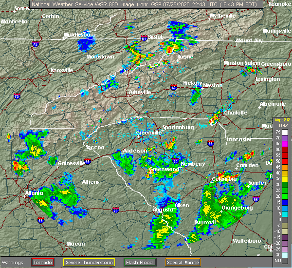 At 644 pm edt, a severe thunderstorm was located 8 miles west of uptown charlotte, or near charlotte douglas airport, moving north at 5 mph (radar indicated). Hazards include 60 mph wind gusts and quarter size hail. Minor hail damage to vehicles is expected. expect wind damage to trees and power lines. Locations impacted include, uptown charlotte, central charlotte, southwest charlotte, belmont, freedom park, charlotte douglas airport, steele creek, paw creek, carowinds and lake wylie. At 644 pm edt, a severe thunderstorm was located 8 miles west of uptown charlotte, or near charlotte douglas airport, moving north at 5 mph (radar indicated). Hazards include 60 mph wind gusts and quarter size hail. Minor hail damage to vehicles is expected. expect wind damage to trees and power lines. Locations impacted include, uptown charlotte, central charlotte, southwest charlotte, belmont, freedom park, charlotte douglas airport, steele creek, paw creek, carowinds and lake wylie.
|
| 7/25/2020 6:36 PM EDT | Shopton fire department reported two trees down on shopton road wes in mecklenburg county NC, 9 miles NE of Charlotte, NC |
| 7/25/2020 6:27 PM EDT |
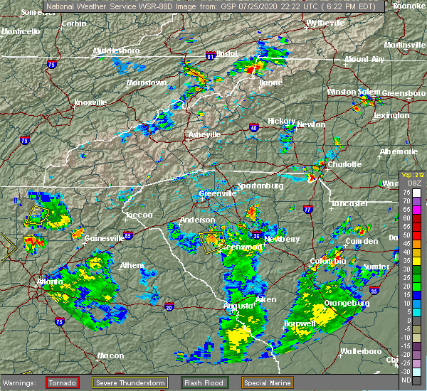 At 626 pm edt, a severe thunderstorm was located 10 miles southwest of uptown charlotte, or over steele creek, and is nearly stationary (radar indicated). Hazards include 60 mph wind gusts and quarter size hail. Minor hail damage to vehicles is expected. Expect wind damage to trees and power lines. At 626 pm edt, a severe thunderstorm was located 10 miles southwest of uptown charlotte, or over steele creek, and is nearly stationary (radar indicated). Hazards include 60 mph wind gusts and quarter size hail. Minor hail damage to vehicles is expected. Expect wind damage to trees and power lines.
|
| 7/24/2020 4:43 PM EDT |
 The severe thunderstorm warning for southwestern mecklenburg and eastern york counties will expire at 445 pm edt, the storm which prompted the warning has weakened below severe limits, and no longer poses an immediate threat to life or property. therefore, the warning will be allowed to expire. however, gusty winds are still possible with this thunderstorm. The severe thunderstorm warning for southwestern mecklenburg and eastern york counties will expire at 445 pm edt, the storm which prompted the warning has weakened below severe limits, and no longer poses an immediate threat to life or property. therefore, the warning will be allowed to expire. however, gusty winds are still possible with this thunderstorm.
|
| 7/24/2020 4:43 PM EDT |
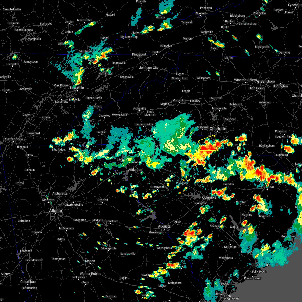 The severe thunderstorm warning for southwestern mecklenburg and eastern york counties will expire at 445 pm edt, the storm which prompted the warning has weakened below severe limits, and no longer poses an immediate threat to life or property. therefore, the warning will be allowed to expire. however, gusty winds are still possible with this thunderstorm. The severe thunderstorm warning for southwestern mecklenburg and eastern york counties will expire at 445 pm edt, the storm which prompted the warning has weakened below severe limits, and no longer poses an immediate threat to life or property. therefore, the warning will be allowed to expire. however, gusty winds are still possible with this thunderstorm.
|
| 7/24/2020 4:24 PM EDT |
 At 423 pm edt, a severe thunderstorm was located near rock hill, or near newport, moving east at 10 mph (radar indicated). Hazards include 60 mph wind gusts. Expect damage to trees and power lines. Locations impacted include, rock hill, york, fort mill, tega cay, newport, lesslie, steele creek, carowinds, lake wylie and southwest charlotte. At 423 pm edt, a severe thunderstorm was located near rock hill, or near newport, moving east at 10 mph (radar indicated). Hazards include 60 mph wind gusts. Expect damage to trees and power lines. Locations impacted include, rock hill, york, fort mill, tega cay, newport, lesslie, steele creek, carowinds, lake wylie and southwest charlotte.
|
| 7/24/2020 4:24 PM EDT |
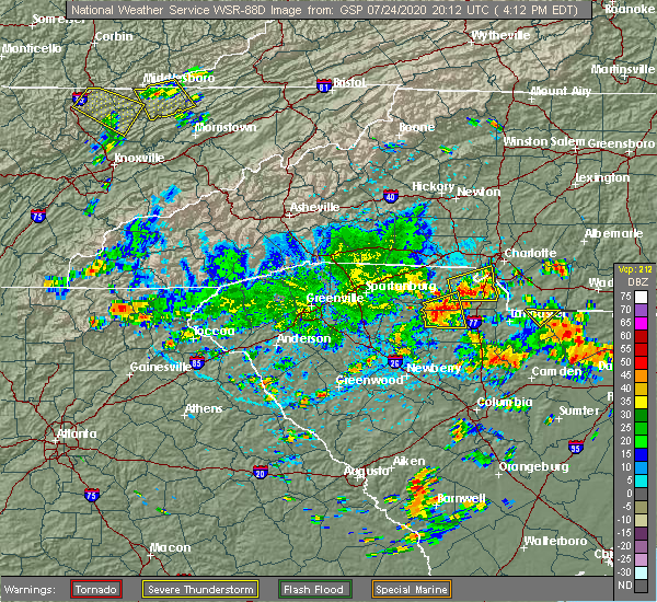 At 423 pm edt, a severe thunderstorm was located near rock hill, or near newport, moving east at 10 mph (radar indicated). Hazards include 60 mph wind gusts. Expect damage to trees and power lines. Locations impacted include, rock hill, york, fort mill, tega cay, newport, lesslie, steele creek, carowinds, lake wylie and southwest charlotte. At 423 pm edt, a severe thunderstorm was located near rock hill, or near newport, moving east at 10 mph (radar indicated). Hazards include 60 mph wind gusts. Expect damage to trees and power lines. Locations impacted include, rock hill, york, fort mill, tega cay, newport, lesslie, steele creek, carowinds, lake wylie and southwest charlotte.
|
| 7/24/2020 4:03 PM EDT |
 At 403 pm edt, a severe thunderstorm was located near york, moving east at 15 mph (radar indicated). Hazards include 60 mph wind gusts. expect damage to trees and power lines At 403 pm edt, a severe thunderstorm was located near york, moving east at 15 mph (radar indicated). Hazards include 60 mph wind gusts. expect damage to trees and power lines
|
| 7/24/2020 4:03 PM EDT |
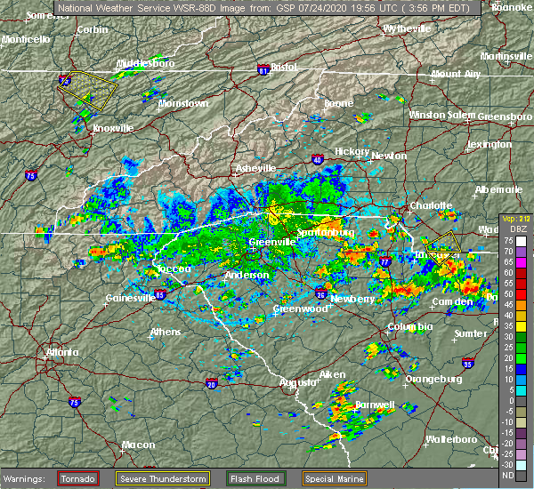 At 403 pm edt, a severe thunderstorm was located near york, moving east at 15 mph (radar indicated). Hazards include 60 mph wind gusts. expect damage to trees and power lines At 403 pm edt, a severe thunderstorm was located near york, moving east at 15 mph (radar indicated). Hazards include 60 mph wind gusts. expect damage to trees and power lines
|
| 7/22/2020 10:19 PM EDT |
 At 1019 pm edt, a severe thunderstorm was located 11 miles south of downtown concord, or 4 miles north of mint hill, moving northeast at 20 mph (radar indicated). Hazards include 60 mph wind gusts and quarter size hail. Minor hail damage to vehicles is expected. expect wind damage to trees and power lines. Locations impacted include, kannapolis, downtown concord, west concord, mint hill, harrisburg, midland, reedy creek park, charlotte motor speedway, university city and east charlotte. At 1019 pm edt, a severe thunderstorm was located 11 miles south of downtown concord, or 4 miles north of mint hill, moving northeast at 20 mph (radar indicated). Hazards include 60 mph wind gusts and quarter size hail. Minor hail damage to vehicles is expected. expect wind damage to trees and power lines. Locations impacted include, kannapolis, downtown concord, west concord, mint hill, harrisburg, midland, reedy creek park, charlotte motor speedway, university city and east charlotte.
|
| 7/22/2020 10:01 PM EDT |
 At 1001 pm edt, a severe thunderstorm was located 7 miles east of uptown charlotte, or near east charlotte, moving northeast at 20 mph (radar indicated). Hazards include 60 mph wind gusts and quarter size hail. Minor hail damage to vehicles is expected. Expect wind damage to trees and power lines. At 1001 pm edt, a severe thunderstorm was located 7 miles east of uptown charlotte, or near east charlotte, moving northeast at 20 mph (radar indicated). Hazards include 60 mph wind gusts and quarter size hail. Minor hail damage to vehicles is expected. Expect wind damage to trees and power lines.
|
| 7/21/2020 7:45 PM EDT | 911 call center reported power lines down on elmhurst r in mecklenburg county NC, 2.3 miles N of Charlotte, NC |
| 7/21/2020 7:45 PM EDT | 911 call center reported power lines down on sewickley d in mecklenburg county NC, 3.7 miles N of Charlotte, NC |
| 7/21/2020 7:40 PM EDT | 911 call center reported power lines down on university d in mecklenburg county NC, 3.7 miles N of Charlotte, NC |
| 7/21/2020 7:40 PM EDT | 911 call center reported power lines down on mill haven lan in mecklenburg county NC, 4.7 miles SSW of Charlotte, NC |
| 7/21/2020 7:40 PM EDT | 911 call center reported power lines down on kenilworth av in mecklenburg county NC, 2.4 miles NNW of Charlotte, NC |
| 7/21/2020 7:40 PM EDT | 911 call center reported trees down on patton av in mecklenburg county NC, 1.2 miles SSW of Charlotte, NC |
| 7/21/2020 7:40 PM EDT | 911 call center reported power lines down on south blvd in mecklenburg county NC, 4.5 miles NNE of Charlotte, NC |
| 7/21/2020 7:30 PM EDT | 911 call center reported trees down on ardmore r in mecklenburg county NC, 2.3 miles N of Charlotte, NC |
| 7/21/2020 7:30 PM EDT | 911 call center reported trees down on hollis r in mecklenburg county NC, 3.1 miles NNE of Charlotte, NC |
| 7/21/2020 7:30 PM EDT | 911 call center reported power lines down on w hampton av in mecklenburg county NC, 3.7 miles NW of Charlotte, NC |
| 7/21/2020 7:25 PM EDT | Quarter sized hail reported 9.2 miles NE of Charlotte, NC |
| 7/21/2020 7:20 PM EDT | 911 call center reported power lines down on tuckaseegee r in mecklenburg county NC, 3.5 miles E of Charlotte, NC |
| 7/21/2020 7:17 PM EDT |
 At 717 pm edt, a severe thunderstorm was located 9 miles southwest of uptown charlotte, or near steele creek, moving northeast at 15 mph (radar indicated). Hazards include 60 mph wind gusts and half dollar size hail. Minor hail damage to vehicles is expected. expect wind damage to trees and power lines. Locations impacted include, uptown charlotte, central charlotte, southwest charlotte, northwest charlotte, mt holly, belmont, pineville, tega cay, cramerton and lowell. At 717 pm edt, a severe thunderstorm was located 9 miles southwest of uptown charlotte, or near steele creek, moving northeast at 15 mph (radar indicated). Hazards include 60 mph wind gusts and half dollar size hail. Minor hail damage to vehicles is expected. expect wind damage to trees and power lines. Locations impacted include, uptown charlotte, central charlotte, southwest charlotte, northwest charlotte, mt holly, belmont, pineville, tega cay, cramerton and lowell.
|
| 7/21/2020 7:04 PM EDT |
 At 704 pm edt, a severe thunderstorm was located 11 miles southwest of uptown charlotte, or over steele creek, moving north at 15 mph (radar indicated). Hazards include 60 mph wind gusts and quarter size hail. Minor hail damage to vehicles is expected. Expect wind damage to trees and power lines. At 704 pm edt, a severe thunderstorm was located 11 miles southwest of uptown charlotte, or over steele creek, moving north at 15 mph (radar indicated). Hazards include 60 mph wind gusts and quarter size hail. Minor hail damage to vehicles is expected. Expect wind damage to trees and power lines.
|
| 7/21/2020 6:05 PM EDT |
 At 604 pm edt, a severe thunderstorm was located near uptown charlotte, or near freedom park, moving north at 10 mph (radar indicated). Hazards include 60 mph wind gusts. Expect damage to trees and power lines. Locations impacted include, uptown charlotte, central charlotte, south charlotte, east charlotte, freedom park, the plaza, the arboretum, southpark mall, southwest charlotte and reedy creek park. At 604 pm edt, a severe thunderstorm was located near uptown charlotte, or near freedom park, moving north at 10 mph (radar indicated). Hazards include 60 mph wind gusts. Expect damage to trees and power lines. Locations impacted include, uptown charlotte, central charlotte, south charlotte, east charlotte, freedom park, the plaza, the arboretum, southpark mall, southwest charlotte and reedy creek park.
|
| 7/21/2020 6:03 PM EDT |
 At 603 pm edt, a severe thunderstorm was located 11 miles west of huntersville, or near stanley, moving north at 10 mph (radar indicated). Hazards include 60 mph wind gusts and quarter size hail. Minor hail damage to vehicles is expected. Expect wind damage to trees and power lines. At 603 pm edt, a severe thunderstorm was located 11 miles west of huntersville, or near stanley, moving north at 10 mph (radar indicated). Hazards include 60 mph wind gusts and quarter size hail. Minor hail damage to vehicles is expected. Expect wind damage to trees and power lines.
|
| 7/21/2020 6:00 PM EDT | 911 call center reported power lines down on commonwealth av in mecklenburg county NC, 3.7 miles WNW of Charlotte, NC |
| 7/21/2020 6:00 PM EDT | 911 call center reported power lines down on wickersham rd in mecklenburg county NC, 5.3 miles NNW of Charlotte, NC |
| 7/21/2020 5:42 PM EDT |
 At 542 pm edt, a severe thunderstorm was located 5 miles south of uptown charlotte, or over southpark mall, moving north at 10 mph (radar indicated). Hazards include 60 mph wind gusts and penny size hail. expect damage to trees and power lines At 542 pm edt, a severe thunderstorm was located 5 miles south of uptown charlotte, or over southpark mall, moving north at 10 mph (radar indicated). Hazards include 60 mph wind gusts and penny size hail. expect damage to trees and power lines
|
| 7/21/2020 5:15 PM EDT | 911 call center reported trees down on w sugar creek r in mecklenburg county NC, 5.7 miles SW of Charlotte, NC |
| 7/20/2020 6:28 PM EDT |
 At 627 pm edt, severe thunderstorms were located along a line extending from 5 miles northeast of kannapolis to near downtown concord to 7 miles southeast of huntersville, moving east at 10 mph (radar indicated). Hazards include 60 mph wind gusts and penny size hail. expect damage to trees and power lines At 627 pm edt, severe thunderstorms were located along a line extending from 5 miles northeast of kannapolis to near downtown concord to 7 miles southeast of huntersville, moving east at 10 mph (radar indicated). Hazards include 60 mph wind gusts and penny size hail. expect damage to trees and power lines
|
| 7/20/2020 5:46 PM EDT |
 At 546 pm edt, a severe thunderstorm was located near uptown charlotte, or over the plaza, moving northeast at 10 mph (radar indicated). Hazards include 60 mph wind gusts. Expect damage to trees and power lines. Locations impacted include, northeast charlotte, east charlotte, mint hill, university city, reedy creek park, the plaza, hidden valley, southpark mall, south charlotte and uptown charlotte. At 546 pm edt, a severe thunderstorm was located near uptown charlotte, or over the plaza, moving northeast at 10 mph (radar indicated). Hazards include 60 mph wind gusts. Expect damage to trees and power lines. Locations impacted include, northeast charlotte, east charlotte, mint hill, university city, reedy creek park, the plaza, hidden valley, southpark mall, south charlotte and uptown charlotte.
|
| 7/20/2020 5:28 PM EDT |
 At 528 pm edt, a severe thunderstorm was located 9 miles southeast of gastonia, or 4 miles northwest of lake wylie, moving northeast at 5 mph (radar indicated). Hazards include 60 mph wind gusts and penny size hail. Expect damage to trees and power lines. Locations impacted include, southwest charlotte, pineville, steele creek, carowinds, lake wylie, community of almond glen, tega cay and south charlotte. At 528 pm edt, a severe thunderstorm was located 9 miles southeast of gastonia, or 4 miles northwest of lake wylie, moving northeast at 5 mph (radar indicated). Hazards include 60 mph wind gusts and penny size hail. Expect damage to trees and power lines. Locations impacted include, southwest charlotte, pineville, steele creek, carowinds, lake wylie, community of almond glen, tega cay and south charlotte.
|
| 7/20/2020 5:28 PM EDT |
 At 528 pm edt, a severe thunderstorm was located near uptown charlotte, or near freedom park, moving northeast at 10 mph (radar indicated). Hazards include 60 mph wind gusts and quarter size hail. Minor hail damage to vehicles is expected. Expect wind damage to trees and power lines. At 528 pm edt, a severe thunderstorm was located near uptown charlotte, or near freedom park, moving northeast at 10 mph (radar indicated). Hazards include 60 mph wind gusts and quarter size hail. Minor hail damage to vehicles is expected. Expect wind damage to trees and power lines.
|
| 7/20/2020 5:28 PM EDT |
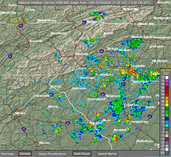 At 528 pm edt, a severe thunderstorm was located 9 miles southeast of gastonia, or 4 miles northwest of lake wylie, moving northeast at 5 mph (radar indicated). Hazards include 60 mph wind gusts and penny size hail. Expect damage to trees and power lines. Locations impacted include, southwest charlotte, pineville, steele creek, carowinds, lake wylie, community of almond glen, tega cay and south charlotte. At 528 pm edt, a severe thunderstorm was located 9 miles southeast of gastonia, or 4 miles northwest of lake wylie, moving northeast at 5 mph (radar indicated). Hazards include 60 mph wind gusts and penny size hail. Expect damage to trees and power lines. Locations impacted include, southwest charlotte, pineville, steele creek, carowinds, lake wylie, community of almond glen, tega cay and south charlotte.
|
| 7/20/2020 5:05 PM EDT |
 At 505 pm edt, a severe thunderstorm was located 11 miles northeast of york, or near lake wylie, moving northeast at 5 mph (radar indicated). Hazards include 60 mph wind gusts and penny size hail. expect damage to trees and power lines At 505 pm edt, a severe thunderstorm was located 11 miles northeast of york, or near lake wylie, moving northeast at 5 mph (radar indicated). Hazards include 60 mph wind gusts and penny size hail. expect damage to trees and power lines
|
| 7/20/2020 5:05 PM EDT |
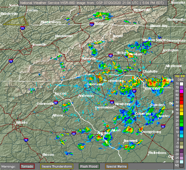 At 505 pm edt, a severe thunderstorm was located 11 miles northeast of york, or near lake wylie, moving northeast at 5 mph (radar indicated). Hazards include 60 mph wind gusts and penny size hail. expect damage to trees and power lines At 505 pm edt, a severe thunderstorm was located 11 miles northeast of york, or near lake wylie, moving northeast at 5 mph (radar indicated). Hazards include 60 mph wind gusts and penny size hail. expect damage to trees and power lines
|
| 7/18/2020 6:41 PM EDT |
 The severe thunderstorm warning for southern mecklenburg and northwestern union counties will expire at 645 pm edt, the storm which prompted the warning has moved out of the area. therefore the warning will be allowed to expire. however gusty winds and heavy rain are still possible with this thunderstorm. The severe thunderstorm warning for southern mecklenburg and northwestern union counties will expire at 645 pm edt, the storm which prompted the warning has moved out of the area. therefore the warning will be allowed to expire. however gusty winds and heavy rain are still possible with this thunderstorm.
|
| 7/18/2020 6:33 PM EDT |
 At 632 pm edt, a severe thunderstorm was located 6 miles northwest of monroe, or near lake park, moving southeast at 15 mph (radar indicated). Hazards include 60 mph wind gusts and quarter size hail. Minor hail damage to vehicles is expected. Expect wind damage to trees and power lines. At 632 pm edt, a severe thunderstorm was located 6 miles northwest of monroe, or near lake park, moving southeast at 15 mph (radar indicated). Hazards include 60 mph wind gusts and quarter size hail. Minor hail damage to vehicles is expected. Expect wind damage to trees and power lines.
|
| 7/18/2020 6:07 PM EDT |
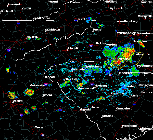 At 527 pm edt, a severe thunderstorm was located 9 miles southeast of gastonia, or near steele creek, moving southeast at 5 mph (radar indicated). Hazards include 60 mph wind gusts and quarter size hail. Minor hail damage to vehicles is expected. Expect wind damage to trees and power lines. At 527 pm edt, a severe thunderstorm was located 9 miles southeast of gastonia, or near steele creek, moving southeast at 5 mph (radar indicated). Hazards include 60 mph wind gusts and quarter size hail. Minor hail damage to vehicles is expected. Expect wind damage to trees and power lines.
|
| 7/18/2020 6:07 PM EDT |
 The severe thunderstorm warning for southwestern mecklenburg, southeastern gaston and northeastern york counties will expire at 615 pm edt, the storm which prompted the warning has moved out of the area. therefore the warning will be allowed to expire. however gusty winds and heavy rain are still possible with this thunderstorm. remember, a severe thunderstorm warning still remains in effect for southeastern mecklenburg county until 645 pm. The severe thunderstorm warning for southwestern mecklenburg, southeastern gaston and northeastern york counties will expire at 615 pm edt, the storm which prompted the warning has moved out of the area. therefore the warning will be allowed to expire. however gusty winds and heavy rain are still possible with this thunderstorm. remember, a severe thunderstorm warning still remains in effect for southeastern mecklenburg county until 645 pm.
|
| 7/18/2020 5:59 PM EDT |
 At 559 pm edt, a severe thunderstorm was located 7 miles north of indian land, or near the arboretum, moving southeast at 15 mph (radar indicated). Hazards include 60 mph wind gusts and quarter size hail. Minor hail damage to vehicles is expected. Expect wind damage to trees and power lines. At 559 pm edt, a severe thunderstorm was located 7 miles north of indian land, or near the arboretum, moving southeast at 15 mph (radar indicated). Hazards include 60 mph wind gusts and quarter size hail. Minor hail damage to vehicles is expected. Expect wind damage to trees and power lines.
|
| 7/18/2020 5:55 PM EDT |
 The severe thunderstorm warning for western cabarrus and central mecklenburg counties will expire at 600 pm edt, the storm which prompted the warning has weakened below severe limits, and no longer poses an immediate threat to life or property. therefore the warning will be allowed to expire. however gusty winds and heavy rain are still possible with this thunderstorm. remember, a severe thunderstorm warning still remains in effect for southwestern mecklenburg county until 615 pm. The severe thunderstorm warning for western cabarrus and central mecklenburg counties will expire at 600 pm edt, the storm which prompted the warning has weakened below severe limits, and no longer poses an immediate threat to life or property. therefore the warning will be allowed to expire. however gusty winds and heavy rain are still possible with this thunderstorm. remember, a severe thunderstorm warning still remains in effect for southwestern mecklenburg county until 615 pm.
|
| 7/18/2020 5:48 PM EDT | Trees down off south tryon s in mecklenburg county NC, 5.4 miles NNE of Charlotte, NC |
| 7/18/2020 5:46 PM EDT |
 At 545 pm edt, a severe thunderstorm was located 5 miles south of downtown concord, or 4 miles east of harrisburg, moving east at 15 mph (radar indicated). Hazards include 60 mph wind gusts and quarter size hail. Minor hail damage to vehicles is expected. expect wind damage to trees and power lines. Locations impacted include, uptown charlotte, central charlotte, northeast charlotte, east charlotte, west concord, harrisburg, freedom park, university city, reedy creek park and the plaza. At 545 pm edt, a severe thunderstorm was located 5 miles south of downtown concord, or 4 miles east of harrisburg, moving east at 15 mph (radar indicated). Hazards include 60 mph wind gusts and quarter size hail. Minor hail damage to vehicles is expected. expect wind damage to trees and power lines. Locations impacted include, uptown charlotte, central charlotte, northeast charlotte, east charlotte, west concord, harrisburg, freedom park, university city, reedy creek park and the plaza.
|
| 7/18/2020 5:27 PM EDT |
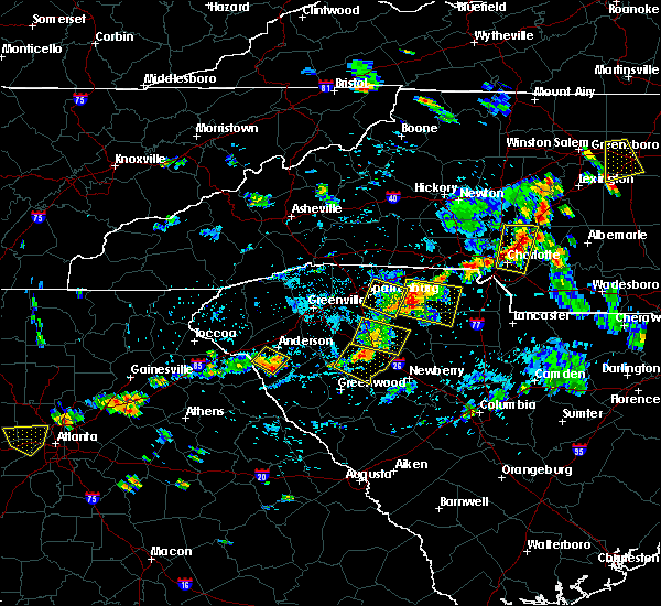 At 527 pm edt, a severe thunderstorm was located 9 miles southeast of gastonia, or near steele creek, moving southeast at 5 mph (radar indicated). Hazards include 60 mph wind gusts and quarter size hail. Minor hail damage to vehicles is expected. Expect wind damage to trees and power lines. At 527 pm edt, a severe thunderstorm was located 9 miles southeast of gastonia, or near steele creek, moving southeast at 5 mph (radar indicated). Hazards include 60 mph wind gusts and quarter size hail. Minor hail damage to vehicles is expected. Expect wind damage to trees and power lines.
|
| 7/18/2020 5:12 PM EDT |
 At 512 pm edt, a severe thunderstorm was located 7 miles west of downtown concord, or near charlotte motor speedway, moving east at 15 mph (radar indicated). Hazards include 60 mph wind gusts and quarter size hail. Minor hail damage to vehicles is expected. Expect wind damage to trees and power lines. At 512 pm edt, a severe thunderstorm was located 7 miles west of downtown concord, or near charlotte motor speedway, moving east at 15 mph (radar indicated). Hazards include 60 mph wind gusts and quarter size hail. Minor hail damage to vehicles is expected. Expect wind damage to trees and power lines.
|
| 7/17/2020 6:52 PM EDT |
 The severe thunderstorm warning for northwestern cabarrus county will expire at 700 pm edt, the storm which prompted the warning has moved out of the area. therefore the warning will be allowed to expire. however gusty winds and heavy rain are still possible with this thunderstorm. if you observed large hail or wind damage, please report it to the national weather service greenville-spartanburg by calling toll free, 1, 800, 2 6 7, 8 1 0 1, or by posting on our facebook page, or tweet it using hashtag nwsgsp. your message should describe the event and the specific location where it occurred. The severe thunderstorm warning for northwestern cabarrus county will expire at 700 pm edt, the storm which prompted the warning has moved out of the area. therefore the warning will be allowed to expire. however gusty winds and heavy rain are still possible with this thunderstorm. if you observed large hail or wind damage, please report it to the national weather service greenville-spartanburg by calling toll free, 1, 800, 2 6 7, 8 1 0 1, or by posting on our facebook page, or tweet it using hashtag nwsgsp. your message should describe the event and the specific location where it occurred.
|
| 7/17/2020 6:43 PM EDT |
 At 642 pm edt, a severe thunderstorm was located 6 miles southwest of downtown concord, or near harrisburg, moving east at 10 mph (radar indicated). Hazards include 60 mph wind gusts and quarter size hail. Minor hail damage to vehicles is expected. expect wind damage to trees and power lines. Locations impacted include, kannapolis, downtown concord, west concord, harrisburg, charlotte motor speedway and enochville. At 642 pm edt, a severe thunderstorm was located 6 miles southwest of downtown concord, or near harrisburg, moving east at 10 mph (radar indicated). Hazards include 60 mph wind gusts and quarter size hail. Minor hail damage to vehicles is expected. expect wind damage to trees and power lines. Locations impacted include, kannapolis, downtown concord, west concord, harrisburg, charlotte motor speedway and enochville.
|
| 7/17/2020 6:10 PM EDT |
 At 609 pm edt, a severe thunderstorm was located 7 miles southeast of huntersville, or near university city, moving east at 10 mph (radar indicated). Hazards include 60 mph wind gusts and quarter size hail. Minor hail damage to vehicles is expected. Expect wind damage to trees and power lines. At 609 pm edt, a severe thunderstorm was located 7 miles southeast of huntersville, or near university city, moving east at 10 mph (radar indicated). Hazards include 60 mph wind gusts and quarter size hail. Minor hail damage to vehicles is expected. Expect wind damage to trees and power lines.
|
| 7/10/2020 8:50 PM EDT |
 The severe thunderstorm warning for southwestern cabarrus and east central mecklenburg counties will expire at 900 pm edt, the storm which prompted the warning has weakened below severe limits, and no longer poses an immediate threat to life or property. therefore the warning will be allowed to expire. however gusty winds and heavy rain are still possible with this thunderstorm. The severe thunderstorm warning for southwestern cabarrus and east central mecklenburg counties will expire at 900 pm edt, the storm which prompted the warning has weakened below severe limits, and no longer poses an immediate threat to life or property. therefore the warning will be allowed to expire. however gusty winds and heavy rain are still possible with this thunderstorm.
|
| 7/10/2020 8:41 PM EDT |
 At 841 pm edt, a severe thunderstorm was located 9 miles east of uptown charlotte, or near reedy creek park, moving east at 10 mph (radar indicated). Hazards include 60 mph wind gusts and nickel size hail. Expect damage to trees and power lines. Locations impacted include, harrisburg, reedy creek park, mint hill and northeast charlotte. At 841 pm edt, a severe thunderstorm was located 9 miles east of uptown charlotte, or near reedy creek park, moving east at 10 mph (radar indicated). Hazards include 60 mph wind gusts and nickel size hail. Expect damage to trees and power lines. Locations impacted include, harrisburg, reedy creek park, mint hill and northeast charlotte.
|
| 7/10/2020 8:32 PM EDT |
 At 832 pm edt, a severe thunderstorm was located 8 miles east of uptown charlotte, or near reedy creek park, moving east at 10 mph (radar indicated). Hazards include 60 mph wind gusts and nickel size hail. Expect damage to trees and power lines. Locations impacted include, northeast charlotte, mint hill, harrisburg, university city, reedy creek park, hidden valley, east charlotte and central charlotte. At 832 pm edt, a severe thunderstorm was located 8 miles east of uptown charlotte, or near reedy creek park, moving east at 10 mph (radar indicated). Hazards include 60 mph wind gusts and nickel size hail. Expect damage to trees and power lines. Locations impacted include, northeast charlotte, mint hill, harrisburg, university city, reedy creek park, hidden valley, east charlotte and central charlotte.
|
| 7/10/2020 8:23 PM EDT |
 At 823 pm edt, a severe thunderstorm was located 6 miles east of uptown charlotte, or near reedy creek park, moving east at 10 mph (radar indicated). Hazards include 60 mph wind gusts and nickel size hail. expect damage to trees and power lines At 823 pm edt, a severe thunderstorm was located 6 miles east of uptown charlotte, or near reedy creek park, moving east at 10 mph (radar indicated). Hazards include 60 mph wind gusts and nickel size hail. expect damage to trees and power lines
|
| 7/5/2020 2:59 PM EDT |
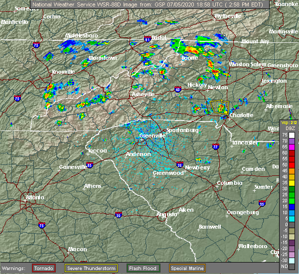 At 241 pm edt, a severe thunderstorm was located 6 miles southwest of huntersville, or 6 miles northeast of mt holly, moving north at 10 mph (radar indicated). Hazards include 60 mph wind gusts and quarter size hail. Minor hail damage to vehicles is expected. expect wind damage to trees and power lines. Locations impacted include, huntersville, cornelius, davidson, westport, ramsey creek park, lowesville, lucia, stanley, denver and mt holly. At 241 pm edt, a severe thunderstorm was located 6 miles southwest of huntersville, or 6 miles northeast of mt holly, moving north at 10 mph (radar indicated). Hazards include 60 mph wind gusts and quarter size hail. Minor hail damage to vehicles is expected. expect wind damage to trees and power lines. Locations impacted include, huntersville, cornelius, davidson, westport, ramsey creek park, lowesville, lucia, stanley, denver and mt holly.
|
| 7/5/2020 2:55 PM EDT | *** 1 fatal *** tree blown down on eddie nichols drive at the riverbend boat ramp. person struck and killed by the tre in gaston county NC, 10.2 miles SE of Charlotte, NC |
| 7/5/2020 2:42 PM EDT |
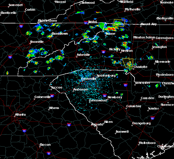 At 241 pm edt, a severe thunderstorm was located 6 miles southwest of huntersville, or 6 miles northeast of mt holly, moving north at 10 mph (radar indicated). Hazards include 60 mph wind gusts and quarter size hail. Minor hail damage to vehicles is expected. expect wind damage to trees and power lines. Locations impacted include, huntersville, cornelius, davidson, westport, ramsey creek park, lowesville, lucia, stanley, denver and mt holly. At 241 pm edt, a severe thunderstorm was located 6 miles southwest of huntersville, or 6 miles northeast of mt holly, moving north at 10 mph (radar indicated). Hazards include 60 mph wind gusts and quarter size hail. Minor hail damage to vehicles is expected. expect wind damage to trees and power lines. Locations impacted include, huntersville, cornelius, davidson, westport, ramsey creek park, lowesville, lucia, stanley, denver and mt holly.
|
| 7/5/2020 2:23 PM EDT |
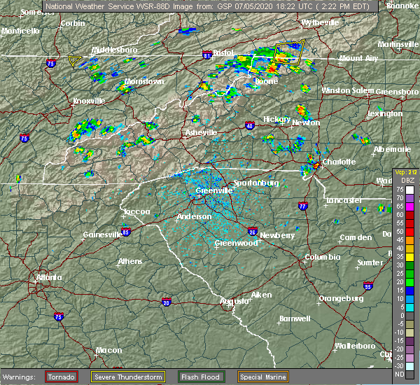 At 222 pm edt, a severe thunderstorm was located 8 miles southwest of huntersville, or 4 miles northeast of mt holly, moving north at 10 mph (radar indicated). Hazards include 60 mph wind gusts and quarter size hail. Minor hail damage to vehicles is expected. Expect wind damage to trees and power lines. At 222 pm edt, a severe thunderstorm was located 8 miles southwest of huntersville, or 4 miles northeast of mt holly, moving north at 10 mph (radar indicated). Hazards include 60 mph wind gusts and quarter size hail. Minor hail damage to vehicles is expected. Expect wind damage to trees and power lines.
|
| 6/28/2020 5:06 PM EDT |
 The severe thunderstorm warning for southwestern mecklenburg county will expire at 515 pm edt, the storm which prompted the warning has weakened below severe limits, and no longer poses an immediate threat to life or property. therefore the warning will be allowed to expire. if you observed large hail or wind damage, please report it to the national weather service greenville-spartanburg by calling toll free, 1, 800, 2 6 7, 8 1 0 1, or by posting on our facebook page, or tweet it using hashtag nwsgsp. your message should describe the event and the specific location where it occurred. The severe thunderstorm warning for southwestern mecklenburg county will expire at 515 pm edt, the storm which prompted the warning has weakened below severe limits, and no longer poses an immediate threat to life or property. therefore the warning will be allowed to expire. if you observed large hail or wind damage, please report it to the national weather service greenville-spartanburg by calling toll free, 1, 800, 2 6 7, 8 1 0 1, or by posting on our facebook page, or tweet it using hashtag nwsgsp. your message should describe the event and the specific location where it occurred.
|
| 6/28/2020 4:41 PM EDT |
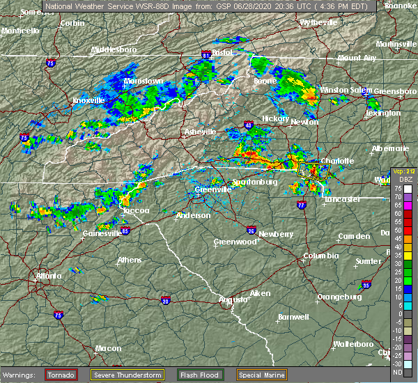 At 441 pm edt, a severe thunderstorm was located 6 miles southwest of uptown charlotte, or over southwest charlotte, moving east at 20 mph (radar indicated). Hazards include 60 mph wind gusts and penny size hail. Expect damage to trees and power lines. Locations impacted include, uptown charlotte, central charlotte, south charlotte, southwest charlotte, east charlotte, pineville, freedom park, the plaza, charlotte douglas airport and the arboretum. At 441 pm edt, a severe thunderstorm was located 6 miles southwest of uptown charlotte, or over southwest charlotte, moving east at 20 mph (radar indicated). Hazards include 60 mph wind gusts and penny size hail. Expect damage to trees and power lines. Locations impacted include, uptown charlotte, central charlotte, south charlotte, southwest charlotte, east charlotte, pineville, freedom park, the plaza, charlotte douglas airport and the arboretum.
|
| 6/28/2020 4:25 PM EDT |
 The national weather service in greenville-spartanburg has issued a * severe thunderstorm warning for. southwestern mecklenburg county in the piedmont of north carolina. southeastern gaston county in the piedmont of north carolina. Northeastern york county in upstate south carolina. The national weather service in greenville-spartanburg has issued a * severe thunderstorm warning for. southwestern mecklenburg county in the piedmont of north carolina. southeastern gaston county in the piedmont of north carolina. Northeastern york county in upstate south carolina.
|
| 6/28/2020 4:25 PM EDT |
 At 424 pm edt, a severe thunderstorm was located 10 miles southwest of uptown charlotte, or near steele creek, moving east at 20 mph (radar indicated). Hazards include 60 mph wind gusts and quarter size hail. Minor hail damage to vehicles is expected. Expect wind damage to trees and power lines. At 424 pm edt, a severe thunderstorm was located 10 miles southwest of uptown charlotte, or near steele creek, moving east at 20 mph (radar indicated). Hazards include 60 mph wind gusts and quarter size hail. Minor hail damage to vehicles is expected. Expect wind damage to trees and power lines.
|
| 6/25/2020 3:36 PM EDT |
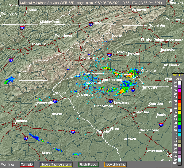 The severe thunderstorm warning for southwestern mecklenburg, south central gaston and northeastern york counties will expire at 345 pm edt, the storm which prompted the warning has weakened below severe limits, and no longer poses an immediate threat to life or property. therefore the warning will be allowed to expire. however gusty winds are still possible with this thunderstorm. The severe thunderstorm warning for southwestern mecklenburg, south central gaston and northeastern york counties will expire at 345 pm edt, the storm which prompted the warning has weakened below severe limits, and no longer poses an immediate threat to life or property. therefore the warning will be allowed to expire. however gusty winds are still possible with this thunderstorm.
|
| 6/25/2020 3:13 PM EDT |
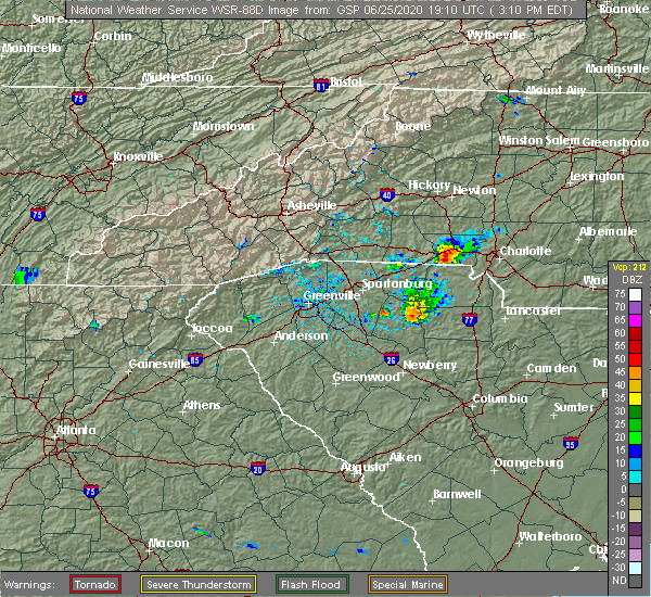 At 313 pm edt, a severe thunderstorm was located 6 miles southwest of gastonia, or near south gastonia, moving southeast at 30 mph (radar indicated). Hazards include 60 mph wind gusts. expect damage to trees and power lines At 313 pm edt, a severe thunderstorm was located 6 miles southwest of gastonia, or near south gastonia, moving southeast at 30 mph (radar indicated). Hazards include 60 mph wind gusts. expect damage to trees and power lines
|
| 6/22/2020 7:20 PM EDT |
 At 719 pm edt, severe thunderstorms were located along a line extending from 7 miles southwest of salisbury to 5 miles east of downtown concord to 14 miles east of uptown charlotte, moving east at 35 mph (radar indicated). Hazards include 60 mph wind gusts and penny size hail. Expect damage to trees and power lines. Locations impacted include, kannapolis, downtown concord, salisbury, west concord, mint hill, harrisburg, china grove, spencer, landis and enochville. At 719 pm edt, severe thunderstorms were located along a line extending from 7 miles southwest of salisbury to 5 miles east of downtown concord to 14 miles east of uptown charlotte, moving east at 35 mph (radar indicated). Hazards include 60 mph wind gusts and penny size hail. Expect damage to trees and power lines. Locations impacted include, kannapolis, downtown concord, salisbury, west concord, mint hill, harrisburg, china grove, spencer, landis and enochville.
|
| 6/22/2020 7:07 PM EDT |
 At 706 pm edt, severe thunderstorms were located along a line extending from 6 miles northwest of kannapolis to 3 miles southwest of downtown concord to 8 miles southeast of uptown charlotte, moving east at 35 mph (radar indicated). Hazards include 60 mph wind gusts and quarter size hail. Minor hail damage to vehicles is expected. expect wind damage to trees and power lines. Locations impacted include, kannapolis, downtown concord, salisbury, east charlotte, west concord, mint hill, harrisburg, china grove, spencer and landis. At 706 pm edt, severe thunderstorms were located along a line extending from 6 miles northwest of kannapolis to 3 miles southwest of downtown concord to 8 miles southeast of uptown charlotte, moving east at 35 mph (radar indicated). Hazards include 60 mph wind gusts and quarter size hail. Minor hail damage to vehicles is expected. expect wind damage to trees and power lines. Locations impacted include, kannapolis, downtown concord, salisbury, east charlotte, west concord, mint hill, harrisburg, china grove, spencer and landis.
|
| 6/22/2020 7:01 PM EDT | Amateur radio reported down tree limb 8 inch diamete in mecklenburg county NC, 8.8 miles NW of Charlotte, NC |
| 6/22/2020 6:48 PM EDT |
 At 647 pm edt, severe thunderstorms were located along a line extending from 14 miles west of kannapolis to 5 miles south of huntersville to 6 miles southwest of uptown charlotte, moving east at 35 mph (radar indicated). Hazards include 60 mph wind gusts and quarter size hail. Minor hail damage to vehicles is expected. Expect wind damage to trees and power lines. At 647 pm edt, severe thunderstorms were located along a line extending from 14 miles west of kannapolis to 5 miles south of huntersville to 6 miles southwest of uptown charlotte, moving east at 35 mph (radar indicated). Hazards include 60 mph wind gusts and quarter size hail. Minor hail damage to vehicles is expected. Expect wind damage to trees and power lines.
|
| 6/22/2020 6:45 PM EDT | Public reported numerous large branches down along gum branch roa in mecklenburg county NC, 6.9 miles SE of Charlotte, NC |
| 6/22/2020 6:44 PM EDT |
 At 643 pm edt, severe thunderstorms were located along a line extending from 7 miles northwest of huntersville to 7 miles northwest of uptown charlotte to 11 miles southeast of gastonia, moving east at 20 mph (radar indicated). Hazards include 60 mph wind gusts and quarter size hail. Minor hail damage to vehicles is expected. expect wind damage to trees and power lines. Locations impacted include, uptown charlotte, huntersville, central charlotte, northeast charlotte, east charlotte, northwest charlotte, cornelius, mooresville, davidson and freedom park. At 643 pm edt, severe thunderstorms were located along a line extending from 7 miles northwest of huntersville to 7 miles northwest of uptown charlotte to 11 miles southeast of gastonia, moving east at 20 mph (radar indicated). Hazards include 60 mph wind gusts and quarter size hail. Minor hail damage to vehicles is expected. expect wind damage to trees and power lines. Locations impacted include, uptown charlotte, huntersville, central charlotte, northeast charlotte, east charlotte, northwest charlotte, cornelius, mooresville, davidson and freedom park.
|
| 6/22/2020 6:23 PM EDT |
 At 622 pm edt, severe thunderstorms were located along a line extending from 6 miles southeast of lincolnton to 4 miles northeast of gastonia to 14 miles northeast of york, moving east at 35 mph (radar indicated). Hazards include 60 mph wind gusts and quarter size hail. Minor hail damage to vehicles is expected. Expect wind damage to trees and power lines. At 622 pm edt, severe thunderstorms were located along a line extending from 6 miles southeast of lincolnton to 4 miles northeast of gastonia to 14 miles northeast of york, moving east at 35 mph (radar indicated). Hazards include 60 mph wind gusts and quarter size hail. Minor hail damage to vehicles is expected. Expect wind damage to trees and power lines.
|
| 6/22/2020 6:13 PM EDT |
 At 612 pm edt, a severe thunderstorm was located near gastonia, or near dallas, moving east at 35 mph (radar indicated). Hazards include 60 mph wind gusts and quarter size hail. Minor hail damage to vehicles is expected. expect wind damage to trees and power lines. Locations impacted include, gastonia, mt holly, belmont, bessemer city, south gastonia, dallas, stanley, cramerton, lowell and ranlo. At 612 pm edt, a severe thunderstorm was located near gastonia, or near dallas, moving east at 35 mph (radar indicated). Hazards include 60 mph wind gusts and quarter size hail. Minor hail damage to vehicles is expected. expect wind damage to trees and power lines. Locations impacted include, gastonia, mt holly, belmont, bessemer city, south gastonia, dallas, stanley, cramerton, lowell and ranlo.
|
| 6/22/2020 5:44 PM EDT |
 At 544 pm edt, a severe thunderstorm was located 6 miles east of shelby, or 4 miles west of kings mountain, moving northeast at 30 mph (radar indicated). Hazards include 60 mph wind gusts and quarter size hail. Minor hail damage to vehicles is expected. Expect wind damage to trees and power lines. At 544 pm edt, a severe thunderstorm was located 6 miles east of shelby, or 4 miles west of kings mountain, moving northeast at 30 mph (radar indicated). Hazards include 60 mph wind gusts and quarter size hail. Minor hail damage to vehicles is expected. Expect wind damage to trees and power lines.
|
| 6/11/2020 11:36 PM EDT |
 The severe thunderstorm warning for southwestern union county will expire at 1145 pm edt, the storm which prompted the warning has weakened below severe limits, and no longer poses an immediate threat to life or property. therefore the warning will be allowed to expire. however heavy rain is still possible with this thunderstorm. if you observed large hail or wind damage, please report it to the national weather service greenville-spartanburg by calling toll free, 1, 800, 2 6 7, 8 1 0 1, or by posting on our facebook page, or tweet it using hashtag nwsgsp. your message should describe the event and the specific location where it occurred. The severe thunderstorm warning for southwestern union county will expire at 1145 pm edt, the storm which prompted the warning has weakened below severe limits, and no longer poses an immediate threat to life or property. therefore the warning will be allowed to expire. however heavy rain is still possible with this thunderstorm. if you observed large hail or wind damage, please report it to the national weather service greenville-spartanburg by calling toll free, 1, 800, 2 6 7, 8 1 0 1, or by posting on our facebook page, or tweet it using hashtag nwsgsp. your message should describe the event and the specific location where it occurred.
|
| 6/11/2020 11:24 PM EDT |
 At 1124 pm edt, a severe thunderstorm was located 8 miles east of indian land, or near wesley chapel, moving southeast at 10 mph (radar indicated). Hazards include 60 mph wind gusts. Expect damage to trees and power lines. Locations impacted include, monroe, indian trail, weddington, stallings, wesley chapel, waxhaw, mineral springs, jaars, wingate and marvin. At 1124 pm edt, a severe thunderstorm was located 8 miles east of indian land, or near wesley chapel, moving southeast at 10 mph (radar indicated). Hazards include 60 mph wind gusts. Expect damage to trees and power lines. Locations impacted include, monroe, indian trail, weddington, stallings, wesley chapel, waxhaw, mineral springs, jaars, wingate and marvin.
|
| 6/11/2020 11:05 PM EDT |
 At 1105 pm edt, a severe thunderstorm was located 6 miles east of indian land, or near weddington, moving southeast at 10 mph (radar indicated). Hazards include 60 mph wind gusts. expect damage to trees and power lines At 1105 pm edt, a severe thunderstorm was located 6 miles east of indian land, or near weddington, moving southeast at 10 mph (radar indicated). Hazards include 60 mph wind gusts. expect damage to trees and power lines
|
| 5/29/2020 12:15 PM EDT | 2 trees down on sardis roa in mecklenburg county NC, 8.2 miles NW of Charlotte, NC |
| 5/29/2020 12:13 PM EDT |
 The severe thunderstorm warning for central mecklenburg county will expire at 1215 pm edt, the storm which prompted the warning has weakened below severe limits, and no longer poses an immediate threat to life or property. therefore the warning will be allowed to expire. however small hail and gusty winds are still possible with this thunderstorm. The severe thunderstorm warning for central mecklenburg county will expire at 1215 pm edt, the storm which prompted the warning has weakened below severe limits, and no longer poses an immediate threat to life or property. therefore the warning will be allowed to expire. however small hail and gusty winds are still possible with this thunderstorm.
|
| 5/29/2020 12:05 PM EDT | One tree down and one power line down on the south side of charlott in mecklenburg county NC, 5.9 miles NNE of Charlotte, NC |
| 5/29/2020 12:01 PM EDT |
 At 1201 pm edt, a severe thunderstorm was located 6 miles southwest of uptown charlotte, or over southwest charlotte, moving east at 20 mph (radar indicated). Hazards include 60 mph wind gusts and penny size hail. Expect damage to trees and power lines. Locations impacted include, uptown charlotte, central charlotte, northeast charlotte, southwest charlotte, east charlotte, northwest charlotte, mint hill, pineville, freedom park and university city. At 1201 pm edt, a severe thunderstorm was located 6 miles southwest of uptown charlotte, or over southwest charlotte, moving east at 20 mph (radar indicated). Hazards include 60 mph wind gusts and penny size hail. Expect damage to trees and power lines. Locations impacted include, uptown charlotte, central charlotte, northeast charlotte, southwest charlotte, east charlotte, northwest charlotte, mint hill, pineville, freedom park and university city.
|
| 5/29/2020 11:48 AM EDT |
 At 1148 am edt, a severe thunderstorm was located 10 miles northwest of indian land, or near carowinds, moving east at 20 mph (radar indicated). Hazards include 60 mph wind gusts and quarter size hail. Minor hail damage to vehicles is expected. Expect wind damage to trees and power lines. At 1148 am edt, a severe thunderstorm was located 10 miles northwest of indian land, or near carowinds, moving east at 20 mph (radar indicated). Hazards include 60 mph wind gusts and quarter size hail. Minor hail damage to vehicles is expected. Expect wind damage to trees and power lines.
|
| 5/28/2020 7:55 PM EDT |
 At 755 pm edt, a severe thunderstorm was located 5 miles south of downtown concord, or near harrisburg, moving north at 25 mph (radar indicated). Hazards include 60 mph wind gusts and quarter size hail. Minor hail damage to vehicles is expected. Expect wind damage to trees and power lines. At 755 pm edt, a severe thunderstorm was located 5 miles south of downtown concord, or near harrisburg, moving north at 25 mph (radar indicated). Hazards include 60 mph wind gusts and quarter size hail. Minor hail damage to vehicles is expected. Expect wind damage to trees and power lines.
|
| 5/28/2020 3:30 PM EDT |
 At 329 pm edt, a severe thunderstorm was located 9 miles northwest of monroe, or over hemby bridge, moving northeast at 20 mph (radar indicated). Hazards include 60 mph wind gusts and quarter size hail. Minor hail damage to vehicles is expected. expect wind damage to trees and power lines. Locations impacted include, matthews, mint hill, indian trail, stallings, unionville, lake park, hemby bridge, midland, fairview in union county and new salem. At 329 pm edt, a severe thunderstorm was located 9 miles northwest of monroe, or over hemby bridge, moving northeast at 20 mph (radar indicated). Hazards include 60 mph wind gusts and quarter size hail. Minor hail damage to vehicles is expected. expect wind damage to trees and power lines. Locations impacted include, matthews, mint hill, indian trail, stallings, unionville, lake park, hemby bridge, midland, fairview in union county and new salem.
|
| 5/28/2020 3:09 PM EDT |
 At 309 pm edt, a severe thunderstorm was located 9 miles northeast of indian land, or near stallings, moving northeast at 20 mph (radar indicated). Hazards include 60 mph wind gusts and quarter size hail. Minor hail damage to vehicles is expected. Expect wind damage to trees and power lines. At 309 pm edt, a severe thunderstorm was located 9 miles northeast of indian land, or near stallings, moving northeast at 20 mph (radar indicated). Hazards include 60 mph wind gusts and quarter size hail. Minor hail damage to vehicles is expected. Expect wind damage to trees and power lines.
|
| 5/24/2020 4:22 PM EDT |
 The severe thunderstorm warning for southwestern mecklenburg and eastern york counties will expire at 430 pm edt, the storm which prompted the warning has weakened below severe limits, and no longer poses an immediate threat to life or property. therefore the warning will be allowed to expire. The severe thunderstorm warning for southwestern mecklenburg and eastern york counties will expire at 430 pm edt, the storm which prompted the warning has weakened below severe limits, and no longer poses an immediate threat to life or property. therefore the warning will be allowed to expire.
|
| 5/24/2020 4:08 PM EDT |
 At 408 pm edt, a severe thunderstorm was located 7 miles northwest of indian land, or near tega cay, and is nearly stationary (radar indicated). Hazards include 60 mph wind gusts and quarter size hail. Minor hail damage to vehicles is expected. expect wind damage to trees and power lines. Locations impacted include, rock hill, southwest charlotte, fort mill, pineville, tega cay, newport, steele creek, carowinds, lake wylie and southpark mall. At 408 pm edt, a severe thunderstorm was located 7 miles northwest of indian land, or near tega cay, and is nearly stationary (radar indicated). Hazards include 60 mph wind gusts and quarter size hail. Minor hail damage to vehicles is expected. expect wind damage to trees and power lines. Locations impacted include, rock hill, southwest charlotte, fort mill, pineville, tega cay, newport, steele creek, carowinds, lake wylie and southpark mall.
|
| 5/24/2020 3:48 PM EDT |
 At 348 pm edt, a severe thunderstorm was located 6 miles northwest of indian land, or near fort mill, moving west at 5 mph (radar indicated). Hazards include 60 mph wind gusts and quarter size hail. Minor hail damage to vehicles is expected. Expect wind damage to trees and power lines. At 348 pm edt, a severe thunderstorm was located 6 miles northwest of indian land, or near fort mill, moving west at 5 mph (radar indicated). Hazards include 60 mph wind gusts and quarter size hail. Minor hail damage to vehicles is expected. Expect wind damage to trees and power lines.
|
| 5/24/2020 3:48 PM EDT |
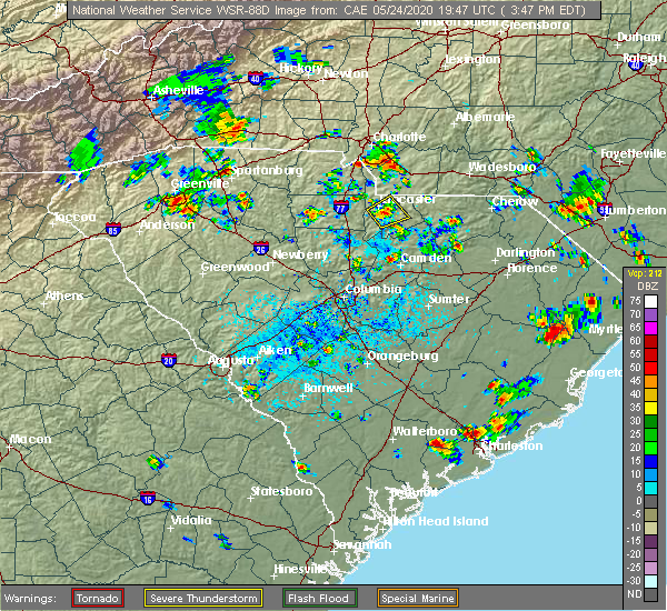 At 348 pm edt, a severe thunderstorm was located 6 miles northwest of indian land, or near fort mill, moving west at 5 mph (radar indicated). Hazards include 60 mph wind gusts and quarter size hail. Minor hail damage to vehicles is expected. Expect wind damage to trees and power lines. At 348 pm edt, a severe thunderstorm was located 6 miles northwest of indian land, or near fort mill, moving west at 5 mph (radar indicated). Hazards include 60 mph wind gusts and quarter size hail. Minor hail damage to vehicles is expected. Expect wind damage to trees and power lines.
|
| 5/24/2020 3:10 PM EDT | Tree down in freedom par in mecklenburg county NC, 3.2 miles NNW of Charlotte, NC |
| 5/22/2020 4:21 PM EDT | *** 1 fatal... 1 inj *** emergency management reported a tree down on a house on idlewood circle in mecklenburg county NC, 3 miles N of Charlotte, NC |
| 5/22/2020 4:15 PM EDT | Social media reported trees down near stonehaven in mecklenburg county NC, 7.5 miles NW of Charlotte, NC |
| 5/22/2020 4:12 PM EDT |
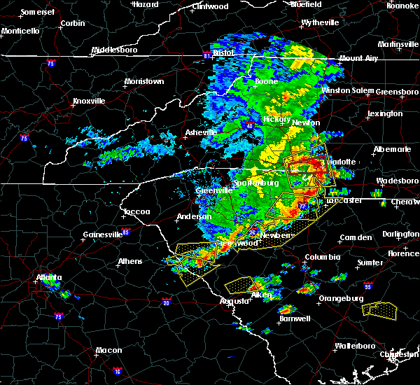 At 411 pm edt, a severe thunderstorm capable of producing a tornado was located near uptown charlotte, or near the plaza, moving east at 60 mph (radar indicated rotation). Hazards include tornado. Flying debris will be dangerous to those caught without shelter. mobile homes will be damaged or destroyed. damage to roofs, windows, and vehicles will occur. tree damage is likely. This dangerous storm will remain over mainly rural areas of west central mecklenburg county. At 411 pm edt, a severe thunderstorm capable of producing a tornado was located near uptown charlotte, or near the plaza, moving east at 60 mph (radar indicated rotation). Hazards include tornado. Flying debris will be dangerous to those caught without shelter. mobile homes will be damaged or destroyed. damage to roofs, windows, and vehicles will occur. tree damage is likely. This dangerous storm will remain over mainly rural areas of west central mecklenburg county.
|
| 5/22/2020 4:12 PM EDT |
 At 412 pm edt, severe thunderstorms were located along a line extending from 10 miles northeast of gastonia to 5 miles northwest of uptown charlotte to 10 miles northeast of indian land, moving northeast at 45 mph (radar indicated). Hazards include 60 mph wind gusts and nickel size hail. expect damage to trees and power lines At 412 pm edt, severe thunderstorms were located along a line extending from 10 miles northeast of gastonia to 5 miles northwest of uptown charlotte to 10 miles northeast of indian land, moving northeast at 45 mph (radar indicated). Hazards include 60 mph wind gusts and nickel size hail. expect damage to trees and power lines
|
| 5/22/2020 4:00 PM EDT | Public reported trees down on grand palisades pkwy in mecklenburg county NC, 15.3 miles NE of Charlotte, NC |
| 5/22/2020 3:53 PM EDT |
 At 352 pm edt, a severe thunderstorm capable of producing a tornado was located 4 miles southeast of gastonia, or 4 miles southwest of cramerton, moving east at 60 mph (radar indicated rotation). Hazards include tornado. Flying debris will be dangerous to those caught without shelter. mobile homes will be damaged or destroyed. damage to roofs, windows, and vehicles will occur. tree damage is likely. this dangerous storm will be near, charlotte douglas airport, southwest charlotte and paw creek around 400 pm edt. uptown charlotte, freedom park, the plaza, south charlotte and southpark mall around 410 pm edt. east charlotte around 420 pm edt. Other locations impacted by this dangerous thunderstorm include crowders. At 352 pm edt, a severe thunderstorm capable of producing a tornado was located 4 miles southeast of gastonia, or 4 miles southwest of cramerton, moving east at 60 mph (radar indicated rotation). Hazards include tornado. Flying debris will be dangerous to those caught without shelter. mobile homes will be damaged or destroyed. damage to roofs, windows, and vehicles will occur. tree damage is likely. this dangerous storm will be near, charlotte douglas airport, southwest charlotte and paw creek around 400 pm edt. uptown charlotte, freedom park, the plaza, south charlotte and southpark mall around 410 pm edt. east charlotte around 420 pm edt. Other locations impacted by this dangerous thunderstorm include crowders.
|
| 5/22/2020 3:51 PM EDT |
 At 350 pm edt, severe thunderstorms were located along a line extending from near gastonia to 5 miles east of york, moving east at 50 mph (radar indicated). Hazards include 60 mph wind gusts and penny size hail. expect damage to trees and power lines At 350 pm edt, severe thunderstorms were located along a line extending from near gastonia to 5 miles east of york, moving east at 50 mph (radar indicated). Hazards include 60 mph wind gusts and penny size hail. expect damage to trees and power lines
|
| 5/22/2020 3:25 PM EDT | Social media reported trees down in mint hill in mecklenburg county NC, 12 miles WNW of Charlotte, NC |
| 5/5/2020 4:33 AM EDT |
 At 432 am edt, severe thunderstorms were located along a line extending from 11 miles southeast of uptown charlotte to 6 miles northeast of lancaster, moving east at 45 mph (radar indicated). Hazards include 60 mph wind gusts and quarter size hail. Minor hail damage to vehicles is expected. Expect wind damage to trees and power lines. At 432 am edt, severe thunderstorms were located along a line extending from 11 miles southeast of uptown charlotte to 6 miles northeast of lancaster, moving east at 45 mph (radar indicated). Hazards include 60 mph wind gusts and quarter size hail. Minor hail damage to vehicles is expected. Expect wind damage to trees and power lines.
|
| 5/5/2020 4:13 AM EDT |
 At 413 am edt, severe thunderstorms were located along a line extending from 11 miles northwest of indian land to 8 miles southeast of rock hill to 12 miles southeast of chester, moving east at 55 mph (radar indicated). Hazards include 60 mph wind gusts and quarter size hail. Minor hail damage to vehicles is expected. expect wind damage to trees and power lines. Locations impacted include, rock hill, york, chester, south charlotte, indian trail, weddington, fort mill, stallings, pineville and tega cay. At 413 am edt, severe thunderstorms were located along a line extending from 11 miles northwest of indian land to 8 miles southeast of rock hill to 12 miles southeast of chester, moving east at 55 mph (radar indicated). Hazards include 60 mph wind gusts and quarter size hail. Minor hail damage to vehicles is expected. expect wind damage to trees and power lines. Locations impacted include, rock hill, york, chester, south charlotte, indian trail, weddington, fort mill, stallings, pineville and tega cay.
|
| 5/5/2020 3:57 AM EDT |
 At 356 am edt, severe thunderstorms were located along a line extending from 6 miles north of york to 9 miles southwest of rock hill to 8 miles southwest of chester, moving east at 55 mph (radar indicated). Hazards include 60 mph wind gusts and quarter size hail. Minor hail damage to vehicles is expected. Expect wind damage to trees and power lines. At 356 am edt, severe thunderstorms were located along a line extending from 6 miles north of york to 9 miles southwest of rock hill to 8 miles southwest of chester, moving east at 55 mph (radar indicated). Hazards include 60 mph wind gusts and quarter size hail. Minor hail damage to vehicles is expected. Expect wind damage to trees and power lines.
|
| 4/25/2020 11:22 PM EDT |
 At 1122 pm edt, a severe thunderstorm was located 8 miles northwest of monroe, or near indian trail, moving east at 40 mph (radar indicated). Hazards include 60 mph wind gusts and quarter size hail. Minor hail damage to vehicles is expected. expect wind damage to trees and power lines. Locations impacted include, monroe, south charlotte, east charlotte, matthews, mint hill, indian trail, weddington, stallings, unionville and wesley chapel. At 1122 pm edt, a severe thunderstorm was located 8 miles northwest of monroe, or near indian trail, moving east at 40 mph (radar indicated). Hazards include 60 mph wind gusts and quarter size hail. Minor hail damage to vehicles is expected. expect wind damage to trees and power lines. Locations impacted include, monroe, south charlotte, east charlotte, matthews, mint hill, indian trail, weddington, stallings, unionville and wesley chapel.
|
| 4/25/2020 10:59 PM EDT |
 The national weather service in greenville-spartanburg has issued a * severe thunderstorm warning for. southern mecklenburg county in the piedmont of north carolina. union county in the piedmont of north carolina. northeastern york county in upstate south carolina. Until midnight edt. The national weather service in greenville-spartanburg has issued a * severe thunderstorm warning for. southern mecklenburg county in the piedmont of north carolina. union county in the piedmont of north carolina. northeastern york county in upstate south carolina. Until midnight edt.
|
| 4/25/2020 10:48 PM EDT |
 At 1048 pm edt, a severe thunderstorm capable of producing a tornado was located 6 miles northwest of rock hill, or near newport, moving east at 45 mph (radar indicated rotation). Hazards include tornado and quarter size hail. Flying debris will be dangerous to those caught without shelter. mobile homes will be damaged or destroyed. damage to roofs, windows, and vehicles will occur. tree damage is likely. this dangerous storm will be near, rock hill around 1050 pm edt. fort mill, tega cay, carowinds and steele creek around 1100 pm edt. Pineville around 1110 pm edt. At 1048 pm edt, a severe thunderstorm capable of producing a tornado was located 6 miles northwest of rock hill, or near newport, moving east at 45 mph (radar indicated rotation). Hazards include tornado and quarter size hail. Flying debris will be dangerous to those caught without shelter. mobile homes will be damaged or destroyed. damage to roofs, windows, and vehicles will occur. tree damage is likely. this dangerous storm will be near, rock hill around 1050 pm edt. fort mill, tega cay, carowinds and steele creek around 1100 pm edt. Pineville around 1110 pm edt.
|
| 4/25/2020 10:43 PM EDT |
 At 1043 pm edt, a severe thunderstorm capable of producing a tornado was located 10 miles east of uptown charlotte, or near mint hill, moving east at 40 mph (radar indicated rotation). Hazards include tornado and quarter size hail. Flying debris will be dangerous to those caught without shelter. mobile homes will be damaged or destroyed. damage to roofs, windows, and vehicles will occur. tree damage is likely. This dangerous storm will be near, midland and mt pleasant around 1100 pm edt. At 1043 pm edt, a severe thunderstorm capable of producing a tornado was located 10 miles east of uptown charlotte, or near mint hill, moving east at 40 mph (radar indicated rotation). Hazards include tornado and quarter size hail. Flying debris will be dangerous to those caught without shelter. mobile homes will be damaged or destroyed. damage to roofs, windows, and vehicles will occur. tree damage is likely. This dangerous storm will be near, midland and mt pleasant around 1100 pm edt.
|
| 4/25/2020 10:37 PM EDT |
 At 1036 pm edt, a severe thunderstorm capable of producing a tornado was located 6 miles southeast of uptown charlotte, or near east charlotte, moving east at 40 mph (radar indicated rotation). Hazards include tornado and quarter size hail. Flying debris will be dangerous to those caught without shelter. mobile homes will be damaged or destroyed. damage to roofs, windows, and vehicles will occur. tree damage is likely. This dangerous storm will be near, mint hill, hemby bridge and fairview in union county around 1050 pm edt. At 1036 pm edt, a severe thunderstorm capable of producing a tornado was located 6 miles southeast of uptown charlotte, or near east charlotte, moving east at 40 mph (radar indicated rotation). Hazards include tornado and quarter size hail. Flying debris will be dangerous to those caught without shelter. mobile homes will be damaged or destroyed. damage to roofs, windows, and vehicles will occur. tree damage is likely. This dangerous storm will be near, mint hill, hemby bridge and fairview in union county around 1050 pm edt.
|
| 4/25/2020 10:33 PM EDT |
 At 1032 pm edt, a severe thunderstorm capable of producing a tornado was located 4 miles southwest of york, or near sharon, moving east at 40 mph (radar indicated rotation). Hazards include tornado and quarter size hail. Flying debris will be dangerous to those caught without shelter. mobile homes will be damaged or destroyed. damage to roofs, windows, and vehicles will occur. tree damage is likely. this dangerous storm will be near, rock hill and newport around 1050 pm edt. Fort mill, tega cay, lesslie and carowinds around 1100 pm edt. At 1032 pm edt, a severe thunderstorm capable of producing a tornado was located 4 miles southwest of york, or near sharon, moving east at 40 mph (radar indicated rotation). Hazards include tornado and quarter size hail. Flying debris will be dangerous to those caught without shelter. mobile homes will be damaged or destroyed. damage to roofs, windows, and vehicles will occur. tree damage is likely. this dangerous storm will be near, rock hill and newport around 1050 pm edt. Fort mill, tega cay, lesslie and carowinds around 1100 pm edt.
|
| 4/25/2020 10:30 PM EDT |
 At 1030 pm edt, a severe thunderstorm capable of producing a tornado was located near uptown charlotte, or near southpark mall, moving east at 40 mph (radar indicated rotation). Hazards include tornado and quarter size hail. Flying debris will be dangerous to those caught without shelter. mobile homes will be damaged or destroyed. damage to roofs, windows, and vehicles will occur. tree damage is likely. this dangerous storm will be near, reedy creek park around 1040 pm edt. Mint hill, hemby bridge and fairview in union county around 1050 pm edt. At 1030 pm edt, a severe thunderstorm capable of producing a tornado was located near uptown charlotte, or near southpark mall, moving east at 40 mph (radar indicated rotation). Hazards include tornado and quarter size hail. Flying debris will be dangerous to those caught without shelter. mobile homes will be damaged or destroyed. damage to roofs, windows, and vehicles will occur. tree damage is likely. this dangerous storm will be near, reedy creek park around 1040 pm edt. Mint hill, hemby bridge and fairview in union county around 1050 pm edt.
|
| 4/25/2020 10:24 PM EDT |
 At 1024 pm edt, a severe thunderstorm capable of producing a tornado was located 5 miles southwest of uptown charlotte, or near southwest charlotte, moving east at 40 mph (radar indicated rotation). Hazards include tornado and quarter size hail. Flying debris will be dangerous to those caught without shelter. mobile homes will be damaged or destroyed. damage to roofs, windows, and vehicles will occur. tree damage is likely. This dangerous storm will be near, south charlotte around 1030 pm edt. At 1024 pm edt, a severe thunderstorm capable of producing a tornado was located 5 miles southwest of uptown charlotte, or near southwest charlotte, moving east at 40 mph (radar indicated rotation). Hazards include tornado and quarter size hail. Flying debris will be dangerous to those caught without shelter. mobile homes will be damaged or destroyed. damage to roofs, windows, and vehicles will occur. tree damage is likely. This dangerous storm will be near, south charlotte around 1030 pm edt.
|
| 4/25/2020 10:22 PM EDT |
 At 1022 pm edt, a severe thunderstorm capable of producing a tornado was located 6 miles southwest of uptown charlotte, or near southwest charlotte, moving east at 40 mph (radar indicated rotation). Hazards include tornado and quarter size hail. Flying debris will be dangerous to those caught without shelter. mobile homes will be damaged or destroyed. damage to roofs, windows, and vehicles will occur. tree damage is likely. this dangerous storm will be near, south charlotte, the arboretum and the plaza around 1030 pm edt. Matthews, east charlotte, mint hill, reedy creek park and stallings around 1040 pm edt. At 1022 pm edt, a severe thunderstorm capable of producing a tornado was located 6 miles southwest of uptown charlotte, or near southwest charlotte, moving east at 40 mph (radar indicated rotation). Hazards include tornado and quarter size hail. Flying debris will be dangerous to those caught without shelter. mobile homes will be damaged or destroyed. damage to roofs, windows, and vehicles will occur. tree damage is likely. this dangerous storm will be near, south charlotte, the arboretum and the plaza around 1030 pm edt. Matthews, east charlotte, mint hill, reedy creek park and stallings around 1040 pm edt.
|
| 4/25/2020 10:13 PM EDT |
 At 1012 pm edt, a severe thunderstorm capable of producing a tornado was located 4 miles southwest of downtown concord, or near harrisburg, moving east at 40 mph. another severe thunderstorm, with a possible tornado, was moving into the southwestern part of mecklenburg county (radar indicated rotation). Hazards include tornado and quarter size hail. Flying debris will be dangerous to those caught without shelter. mobile homes will be damaged or destroyed. damage to roofs, windows, and vehicles will occur. tree damage is likely. this dangerous storm will be near, mt pleasant around 1030 pm edt. Other locations impacted by this dangerous storm include croft. At 1012 pm edt, a severe thunderstorm capable of producing a tornado was located 4 miles southwest of downtown concord, or near harrisburg, moving east at 40 mph. another severe thunderstorm, with a possible tornado, was moving into the southwestern part of mecklenburg county (radar indicated rotation). Hazards include tornado and quarter size hail. Flying debris will be dangerous to those caught without shelter. mobile homes will be damaged or destroyed. damage to roofs, windows, and vehicles will occur. tree damage is likely. this dangerous storm will be near, mt pleasant around 1030 pm edt. Other locations impacted by this dangerous storm include croft.
|
| 4/25/2020 10:11 PM EDT |
 At 1011 pm edt, a severe thunderstorm capable of producing a tornado was located 10 miles southeast of gastonia, or near steele creek, moving east at 40 mph (radar indicated rotation). Hazards include tornado and quarter size hail. Flying debris will be dangerous to those caught without shelter. mobile homes will be damaged or destroyed. damage to roofs, windows, and vehicles will occur. tree damage is likely. this dangerous storm will be near, charlotte douglas airport and southwest charlotte around 1020 pm edt. Uptown charlotte, southpark mall, freedom park, south charlotte and central charlotte around 1030 pm edt. At 1011 pm edt, a severe thunderstorm capable of producing a tornado was located 10 miles southeast of gastonia, or near steele creek, moving east at 40 mph (radar indicated rotation). Hazards include tornado and quarter size hail. Flying debris will be dangerous to those caught without shelter. mobile homes will be damaged or destroyed. damage to roofs, windows, and vehicles will occur. tree damage is likely. this dangerous storm will be near, charlotte douglas airport and southwest charlotte around 1020 pm edt. Uptown charlotte, southpark mall, freedom park, south charlotte and central charlotte around 1030 pm edt.
|
| 4/25/2020 10:06 PM EDT |
 At 1006 pm edt, a severe thunderstorm capable of producing a tornado was located 9 miles south of gastonia, or 4 miles northwest of lake wylie, moving east at 40 mph (radar indicated rotation). Hazards include tornado and quarter size hail. Flying debris will be dangerous to those caught without shelter. mobile homes will be damaged or destroyed. damage to roofs, windows, and vehicles will occur. tree damage is likely. this dangerous storm will be near, steele creek and cramerton around 1010 pm edt. carowinds, charlotte douglas airport, lake wylie and southwest charlotte around 1020 pm edt. uptown charlotte, southpark mall, freedom park, south charlotte and central charlotte around 1030 pm edt. Other locations impacted by this dangerous thunderstorm include crowders. At 1006 pm edt, a severe thunderstorm capable of producing a tornado was located 9 miles south of gastonia, or 4 miles northwest of lake wylie, moving east at 40 mph (radar indicated rotation). Hazards include tornado and quarter size hail. Flying debris will be dangerous to those caught without shelter. mobile homes will be damaged or destroyed. damage to roofs, windows, and vehicles will occur. tree damage is likely. this dangerous storm will be near, steele creek and cramerton around 1010 pm edt. carowinds, charlotte douglas airport, lake wylie and southwest charlotte around 1020 pm edt. uptown charlotte, southpark mall, freedom park, south charlotte and central charlotte around 1030 pm edt. Other locations impacted by this dangerous thunderstorm include crowders.
|
| 4/25/2020 10:03 PM EDT |
 At 1003 pm edt, a severe thunderstorm capable of producing a tornado was located 7 miles southwest of downtown concord, or over harrisburg, moving east at 45 mph (radar indicated rotation). Hazards include tornado and quarter size hail. Flying debris will be dangerous to those caught without shelter. mobile homes will be damaged or destroyed. damage to roofs, windows, and vehicles will occur. tree damage is likely. this dangerous storm will be near, downtown concord around 1010 pm edt. mt pleasant around 1020 pm edt. Other locations impacted by this dangerous storm include croft. At 1003 pm edt, a severe thunderstorm capable of producing a tornado was located 7 miles southwest of downtown concord, or over harrisburg, moving east at 45 mph (radar indicated rotation). Hazards include tornado and quarter size hail. Flying debris will be dangerous to those caught without shelter. mobile homes will be damaged or destroyed. damage to roofs, windows, and vehicles will occur. tree damage is likely. this dangerous storm will be near, downtown concord around 1010 pm edt. mt pleasant around 1020 pm edt. Other locations impacted by this dangerous storm include croft.
|
| 4/25/2020 9:53 PM EDT |
 At 953 pm edt, a severe thunderstorm capable of producing a tornado was located 4 miles northeast of uptown charlotte, or over hidden valley, moving east at 45 mph (radar indicated rotation). Hazards include tornado and quarter size hail. Flying debris will be dangerous to those caught without shelter. mobile homes will be damaged or destroyed. damage to roofs, windows, and vehicles will occur. tree damage is likely. this dangerous storm will be near, harrisburg and charlotte motor speedway around 1000 pm edt. downtown concord and west concord around 1010 pm edt. mt pleasant around 1020 pm edt. Other locations impacted by this dangerous thunderstorm include croft. At 953 pm edt, a severe thunderstorm capable of producing a tornado was located 4 miles northeast of uptown charlotte, or over hidden valley, moving east at 45 mph (radar indicated rotation). Hazards include tornado and quarter size hail. Flying debris will be dangerous to those caught without shelter. mobile homes will be damaged or destroyed. damage to roofs, windows, and vehicles will occur. tree damage is likely. this dangerous storm will be near, harrisburg and charlotte motor speedway around 1000 pm edt. downtown concord and west concord around 1010 pm edt. mt pleasant around 1020 pm edt. Other locations impacted by this dangerous thunderstorm include croft.
|
| 4/25/2020 9:37 PM EDT |
 At 937 pm edt, a severe thunderstorm was located 7 miles northwest of uptown charlotte, or near paw creek, moving east at 40 mph (radar indicated). Hazards include 60 mph wind gusts and quarter size hail. Minor hail damage to vehicles is expected. Expect wind damage to trees and power lines. At 937 pm edt, a severe thunderstorm was located 7 miles northwest of uptown charlotte, or near paw creek, moving east at 40 mph (radar indicated). Hazards include 60 mph wind gusts and quarter size hail. Minor hail damage to vehicles is expected. Expect wind damage to trees and power lines.
|
| 4/25/2020 9:25 PM EDT |
 At 925 pm edt, a severe thunderstorm capable of producing a tornado was located near gastonia, moving east at 45 mph (radar indicated rotation). Hazards include tornado and half dollar size hail. Flying debris will be dangerous to those caught without shelter. mobile homes will be damaged or destroyed. damage to roofs, windows, and vehicles will occur. tree damage is likely. this dangerous storm will be near, cramerton, mcadenville, belmont and town of lake wylie around 930 pm edt. lake wylie and mt holly around 940 pm edt. Other locations impacted by this dangerous storm include crowders. At 925 pm edt, a severe thunderstorm capable of producing a tornado was located near gastonia, moving east at 45 mph (radar indicated rotation). Hazards include tornado and half dollar size hail. Flying debris will be dangerous to those caught without shelter. mobile homes will be damaged or destroyed. damage to roofs, windows, and vehicles will occur. tree damage is likely. this dangerous storm will be near, cramerton, mcadenville, belmont and town of lake wylie around 930 pm edt. lake wylie and mt holly around 940 pm edt. Other locations impacted by this dangerous storm include crowders.
|
| 4/25/2020 9:14 PM EDT |
 At 914 pm edt, a severe thunderstorm capable of producing a tornado was located 7 miles southwest of gastonia, or near crowders mountain state park, moving east at 40 mph (radar indicated rotation). Hazards include tornado and half dollar size hail. Flying debris will be dangerous to those caught without shelter. mobile homes will be damaged or destroyed. damage to roofs, windows, and vehicles will occur. tree damage is likely. this dangerous storm will be near, gastonia and south gastonia around 920 pm edt. cramerton, mcadenville, ranlo and lowell around 930 pm edt. lake wylie, belmont and mt holly around 940 pm edt. Other locations impacted by this dangerous thunderstorm include bethany and crowders. At 914 pm edt, a severe thunderstorm capable of producing a tornado was located 7 miles southwest of gastonia, or near crowders mountain state park, moving east at 40 mph (radar indicated rotation). Hazards include tornado and half dollar size hail. Flying debris will be dangerous to those caught without shelter. mobile homes will be damaged or destroyed. damage to roofs, windows, and vehicles will occur. tree damage is likely. this dangerous storm will be near, gastonia and south gastonia around 920 pm edt. cramerton, mcadenville, ranlo and lowell around 930 pm edt. lake wylie, belmont and mt holly around 940 pm edt. Other locations impacted by this dangerous thunderstorm include bethany and crowders.
|
| 4/13/2020 5:51 AM EDT |
 The severe thunderstorm warning for cabarrus, central davie, mecklenburg, rowan, union, chester and southeastern york counties will expire at 600 am edt, the storms which prompted the warning have moved out of the area. therefore the warning will be allowed to expire. a tornado watch remains in effect until 800 am edt for the piedmont of north carolina, and upstate south carolina. if you observed large hail or wind damage, please report it to the national weather service greenville-spartanburg by calling toll free, 1, 800, 2 6 7, 8 1 0 1, or by posting on our facebook page, or tweet it using hashtag nwsgsp. your message should describe the event and the specific location where it occurred. remember, a severe thunderstorm warning still remains in effect for central and eastern union county in north carolina until 630 am edt. The severe thunderstorm warning for cabarrus, central davie, mecklenburg, rowan, union, chester and southeastern york counties will expire at 600 am edt, the storms which prompted the warning have moved out of the area. therefore the warning will be allowed to expire. a tornado watch remains in effect until 800 am edt for the piedmont of north carolina, and upstate south carolina. if you observed large hail or wind damage, please report it to the national weather service greenville-spartanburg by calling toll free, 1, 800, 2 6 7, 8 1 0 1, or by posting on our facebook page, or tweet it using hashtag nwsgsp. your message should describe the event and the specific location where it occurred. remember, a severe thunderstorm warning still remains in effect for central and eastern union county in north carolina until 630 am edt.
|
| 4/13/2020 5:15 AM EDT | *** 1 inj *** tree downed on home on countrymens cour in mecklenburg county NC, 7.8 miles N of Charlotte, NC |
| 4/13/2020 5:10 AM EDT |
 At 509 am edt, severe thunderstorms were located along a line extending from 5 miles east of mocksville to 9 miles southeast of chester, moving northeast at 60 mph (radar indicated). Hazards include 60 mph wind gusts. expect damage to trees and power lines At 509 am edt, severe thunderstorms were located along a line extending from 5 miles east of mocksville to 9 miles southeast of chester, moving northeast at 60 mph (radar indicated). Hazards include 60 mph wind gusts. expect damage to trees and power lines
|
| 4/13/2020 5:04 AM EDT | Storm damage reported in mecklenburg county NC, 5.3 miles E of Charlotte, NC |
| 4/13/2020 4:59 AM EDT |
 A severe thunderstorm warning remains in effect until 515 am edt for central chester and central york counties. at 458 am edt, severe thunderstorms were located along a line extending from 10 miles southeast of gastonia to 12 miles north of vc summer nuclear station, moving east at 35 mph. hazard. 60 mph wind gusts. A severe thunderstorm warning remains in effect until 515 am edt for central chester and central york counties. at 458 am edt, severe thunderstorms were located along a line extending from 10 miles southeast of gastonia to 12 miles north of vc summer nuclear station, moving east at 35 mph. hazard. 60 mph wind gusts.
|
| 4/13/2020 4:52 AM EDT |
 At 450 am edt, a line of strong to severe thunderstorms was located along a line extending from 9 miles west of mocksville to 5 miles northeast of york, moving northeast at 70 mph (radar indicated). Hazards include 60 mph wind gusts. Expect damage to trees and power lines. Locations impacted include, charlotte, huntersville, kannapolis, concord, salisbury, and mocksville. At 450 am edt, a line of strong to severe thunderstorms was located along a line extending from 9 miles west of mocksville to 5 miles northeast of york, moving northeast at 70 mph (radar indicated). Hazards include 60 mph wind gusts. Expect damage to trees and power lines. Locations impacted include, charlotte, huntersville, kannapolis, concord, salisbury, and mocksville.
|
| 4/13/2020 4:13 AM EDT |
 At 411 am edt, strong to severe thunderstorms were located along a line extending from 11 miles southeast of wilkesboro to 7 miles southeast of shelby, moving northeast at 70 mph. scattered pockets of wind damage will occur across the north carolina piedmont early this morning, including portions of the charlotte metropolitan area (radar indicated). Hazards include 60 mph wind gusts. expect damage to trees and power lines At 411 am edt, strong to severe thunderstorms were located along a line extending from 11 miles southeast of wilkesboro to 7 miles southeast of shelby, moving northeast at 70 mph. scattered pockets of wind damage will occur across the north carolina piedmont early this morning, including portions of the charlotte metropolitan area (radar indicated). Hazards include 60 mph wind gusts. expect damage to trees and power lines
|
| 4/13/2020 4:13 AM EDT |
 At 413 am edt, severe thunderstorms were located along a line extending from 10 miles southeast of shelby to 13 miles west of newberry, moving northeast at 30 mph (radar indicated). Hazards include 60 mph wind gusts. expect damage to trees and power lines At 413 am edt, severe thunderstorms were located along a line extending from 10 miles southeast of shelby to 13 miles west of newberry, moving northeast at 30 mph (radar indicated). Hazards include 60 mph wind gusts. expect damage to trees and power lines
|
| 4/13/2020 4:13 AM EDT |
 At 411 am edt, strong to severe thunderstorms were located along a line extending from 11 miles southeast of wilkesboro to 7 miles southeast of shelby, moving northeast at 70 mph. scattered pockets of wind damage will occur across the north carolina piedmont early this morning, including portions of the charlotte metropolitan area (radar indicated). Hazards include 60 mph wind gusts. expect damage to trees and power lines At 411 am edt, strong to severe thunderstorms were located along a line extending from 11 miles southeast of wilkesboro to 7 miles southeast of shelby, moving northeast at 70 mph. scattered pockets of wind damage will occur across the north carolina piedmont early this morning, including portions of the charlotte metropolitan area (radar indicated). Hazards include 60 mph wind gusts. expect damage to trees and power lines
|
| 4/9/2020 6:26 AM EDT |
 At 626 am edt, a severe thunderstorm was located 5 miles west of monroe, or near wesley chapel, moving east at 45 mph (radar indicated). Hazards include 60 mph wind gusts and penny size hail. expect damage to trees and power lines At 626 am edt, a severe thunderstorm was located 5 miles west of monroe, or near wesley chapel, moving east at 45 mph (radar indicated). Hazards include 60 mph wind gusts and penny size hail. expect damage to trees and power lines
|
| 4/8/2020 9:43 PM EDT |
 The severe thunderstorm warning for mecklenburg, cleveland, gaston, union, central york and northeastern cherokee counties will expire at 945 pm edt, the storms which prompted the warning have weakened below severe limits, and no longer pose an immediate threat to life or property. therefore the warning will be allowed to expire. however heavy rain is still possible with these thunderstorms. The severe thunderstorm warning for mecklenburg, cleveland, gaston, union, central york and northeastern cherokee counties will expire at 945 pm edt, the storms which prompted the warning have weakened below severe limits, and no longer pose an immediate threat to life or property. therefore the warning will be allowed to expire. however heavy rain is still possible with these thunderstorms.
|
| 4/8/2020 9:26 PM EDT |
 At 925 pm edt, severe thunderstorms were located along a line extending from 3 miles south of shelby to 10 miles east of monroe, moving southeast at 5 mph (radar indicated). Hazards include 60 mph wind gusts and quarter size hail. Minor hail damage to vehicles is expected. expect wind damage to trees and power lines. Locations impacted include, gastonia, rock hill, uptown charlotte, monroe, shelby, york, central charlotte, south charlotte, southwest charlotte and east charlotte. At 925 pm edt, severe thunderstorms were located along a line extending from 3 miles south of shelby to 10 miles east of monroe, moving southeast at 5 mph (radar indicated). Hazards include 60 mph wind gusts and quarter size hail. Minor hail damage to vehicles is expected. expect wind damage to trees and power lines. Locations impacted include, gastonia, rock hill, uptown charlotte, monroe, shelby, york, central charlotte, south charlotte, southwest charlotte and east charlotte.
|
| 4/8/2020 9:05 PM EDT | Quarter sized hail reported 14.1 miles N of Charlotte, NC, quarter size hail reported off longstone ln. |
| 4/8/2020 8:56 PM EDT |
 At 855 pm edt, severe thunderstorms were located along a line extending from 3 miles west of shelby to 8 miles east of monroe, moving southeast at 5 mph (radar indicated). Hazards include 60 mph wind gusts and quarter size hail. Minor hail damage to vehicles is expected. Expect wind damage to trees and power lines. At 855 pm edt, severe thunderstorms were located along a line extending from 3 miles west of shelby to 8 miles east of monroe, moving southeast at 5 mph (radar indicated). Hazards include 60 mph wind gusts and quarter size hail. Minor hail damage to vehicles is expected. Expect wind damage to trees and power lines.
|
| 4/8/2020 6:12 PM EDT |
 At 612 pm edt, a severe thunderstorm was located 12 miles north of monroe, or near fairview in union county, moving southeast at 20 mph (radar indicated). Hazards include 60 mph wind gusts and quarter size hail. Minor hail damage to vehicles is expected. Expect wind damage to trees and power lines. At 612 pm edt, a severe thunderstorm was located 12 miles north of monroe, or near fairview in union county, moving southeast at 20 mph (radar indicated). Hazards include 60 mph wind gusts and quarter size hail. Minor hail damage to vehicles is expected. Expect wind damage to trees and power lines.
|
| 2/13/2020 10:08 AM EST |
 At 1007 am est, severe thunderstorms were located along a line extending from near uptown charlotte to 6 miles northwest of indian land to 6 miles southwest of rock hill, moving east at 45 mph (radar indicated). Hazards include 60 mph wind gusts. Expect damage to trees and power lines. Locations impacted include, rock hill, uptown charlotte, downtown concord, central charlotte, south charlotte, northeast charlotte, southwest charlotte, east charlotte, northwest charlotte and west concord. At 1007 am est, severe thunderstorms were located along a line extending from near uptown charlotte to 6 miles northwest of indian land to 6 miles southwest of rock hill, moving east at 45 mph (radar indicated). Hazards include 60 mph wind gusts. Expect damage to trees and power lines. Locations impacted include, rock hill, uptown charlotte, downtown concord, central charlotte, south charlotte, northeast charlotte, southwest charlotte, east charlotte, northwest charlotte and west concord.
|
| 2/13/2020 9:47 AM EST |
 At 947 am est, severe thunderstorms were located along a line extending from 4 miles southeast of gastonia to 4 miles northeast of york to 15 miles northeast of union, moving east at 55 mph (radar indicated). Hazards include 60 mph wind gusts. expect damage to trees and power lines At 947 am est, severe thunderstorms were located along a line extending from 4 miles southeast of gastonia to 4 miles northeast of york to 15 miles northeast of union, moving east at 55 mph (radar indicated). Hazards include 60 mph wind gusts. expect damage to trees and power lines
|
| 2/6/2020 2:33 PM EST |
 At 233 pm est, severe thunderstorms were located along a line extending from weddington to near monticello, moving east at 35 mph (radar indicated). Hazards include 60 mph wind gusts. Expect damage to roofs, siding, and trees. severe thunderstorms will be near, waxhaw around 240 pm est. fishing creek reservoir, liberty hill and lake wateree state park around 315 pm est. other locations impacted by these severe thunderstorms include lebanon fire station, bell town fire station, arrowood estates, henderson island, mitford, faith christian school, rion, carolina commons shopping center, white oak and bear creek park. This includes interstate 77 between mile markers 38 and 50. At 233 pm est, severe thunderstorms were located along a line extending from weddington to near monticello, moving east at 35 mph (radar indicated). Hazards include 60 mph wind gusts. Expect damage to roofs, siding, and trees. severe thunderstorms will be near, waxhaw around 240 pm est. fishing creek reservoir, liberty hill and lake wateree state park around 315 pm est. other locations impacted by these severe thunderstorms include lebanon fire station, bell town fire station, arrowood estates, henderson island, mitford, faith christian school, rion, carolina commons shopping center, white oak and bear creek park. This includes interstate 77 between mile markers 38 and 50.
|
| 2/6/2020 12:30 PM EST |
 At 1230 pm est, severe thunderstorms were located along a line extending from 3 miles west of downtown concord to 7 miles east of uptown charlotte to 6 miles northwest of indian land, moving east at 70 mph (radar indicated). Hazards include 60 mph wind gusts and quarter size hail. Minor hail damage to vehicles is expected. expect wind damage to trees and power lines. Locations impacted include, rock hill, kannapolis, downtown concord, monroe, south charlotte, east charlotte, west concord, matthews, mint hill and indian trail. At 1230 pm est, severe thunderstorms were located along a line extending from 3 miles west of downtown concord to 7 miles east of uptown charlotte to 6 miles northwest of indian land, moving east at 70 mph (radar indicated). Hazards include 60 mph wind gusts and quarter size hail. Minor hail damage to vehicles is expected. expect wind damage to trees and power lines. Locations impacted include, rock hill, kannapolis, downtown concord, monroe, south charlotte, east charlotte, west concord, matthews, mint hill and indian trail.
|
| 2/6/2020 12:26 PM EST |
 At 1225 pm est, a severe thunderstorm capable of producing a tornado was located 9 miles southeast of uptown charlotte, or near matthews, moving east at 60 mph (radar indicated rotation). Hazards include tornado and quarter size hail. Flying debris will be dangerous to those caught without shelter. mobile homes will be damaged or destroyed. damage to roofs, windows, and vehicles will occur. tree damage is likely. this dangerous storm will be near, hemby bridge and mint hill around 1230 pm est. Fairview in union county around 1240 pm est. At 1225 pm est, a severe thunderstorm capable of producing a tornado was located 9 miles southeast of uptown charlotte, or near matthews, moving east at 60 mph (radar indicated rotation). Hazards include tornado and quarter size hail. Flying debris will be dangerous to those caught without shelter. mobile homes will be damaged or destroyed. damage to roofs, windows, and vehicles will occur. tree damage is likely. this dangerous storm will be near, hemby bridge and mint hill around 1230 pm est. Fairview in union county around 1240 pm est.
|
| 2/6/2020 12:20 PM EST |
 At 1220 pm est, a severe thunderstorm capable of producing a tornado was located 7 miles south of uptown charlotte, or near southpark mall, moving east at 50 mph (radar indicated rotation). Hazards include tornado. Flying debris will be dangerous to those caught without shelter. mobile homes will be damaged or destroyed. damage to roofs, windows, and vehicles will occur. tree damage is likely. this dangerous storm will be near, lake park around 1230 pm est. Indian trail, hemby bridge, fairview in union county, stallings and mint hill around 1240 pm est. At 1220 pm est, a severe thunderstorm capable of producing a tornado was located 7 miles south of uptown charlotte, or near southpark mall, moving east at 50 mph (radar indicated rotation). Hazards include tornado. Flying debris will be dangerous to those caught without shelter. mobile homes will be damaged or destroyed. damage to roofs, windows, and vehicles will occur. tree damage is likely. this dangerous storm will be near, lake park around 1230 pm est. Indian trail, hemby bridge, fairview in union county, stallings and mint hill around 1240 pm est.
|
| 2/6/2020 12:15 PM EST | Tree snapped on south blvd in south end. time estimated from rada in mecklenburg county NC, 7.9 miles N of Charlotte, NC |
| 2/6/2020 12:12 PM EST |
 At 1212 pm est, a severe thunderstorm capable of producing a tornado was located 9 miles northwest of indian land, or over carowinds, moving east at 60 mph (radar indicated rotation). Hazards include tornado. Flying debris will be dangerous to those caught without shelter. mobile homes will be damaged or destroyed. damage to roofs, windows, and vehicles will occur. tree damage is likely. this dangerous storm will be near, the arboretum and south charlotte around 1220 pm est. stallings, hemby bridge, matthews, lake park and indian trail around 1230 pm est. Fairview in union county around 1240 pm est. At 1212 pm est, a severe thunderstorm capable of producing a tornado was located 9 miles northwest of indian land, or over carowinds, moving east at 60 mph (radar indicated rotation). Hazards include tornado. Flying debris will be dangerous to those caught without shelter. mobile homes will be damaged or destroyed. damage to roofs, windows, and vehicles will occur. tree damage is likely. this dangerous storm will be near, the arboretum and south charlotte around 1220 pm est. stallings, hemby bridge, matthews, lake park and indian trail around 1230 pm est. Fairview in union county around 1240 pm est.
|
| 2/6/2020 12:11 PM EST | Trees snapped in steele creek area near hwy160 and 49. time estimated from radar in mecklenburg county NC, 11.5 miles NE of Charlotte, NC |
| 2/6/2020 12:02 PM EST |
 At 1202 pm est, severe thunderstorms were located along a line extending from near gastonia to near york to 15 miles northeast of union, moving east at 70 mph (radar indicated). Hazards include 60 mph wind gusts. expect damage to trees and power lines At 1202 pm est, severe thunderstorms were located along a line extending from near gastonia to near york to 15 miles northeast of union, moving east at 70 mph (radar indicated). Hazards include 60 mph wind gusts. expect damage to trees and power lines
|
| 2/6/2020 11:49 AM EST | Large tree down at dilworth rd & mount vernon ave. time estimated from rada in mecklenburg county NC, 1.9 miles NNW of Charlotte, NC |
| 2/6/2020 11:39 AM EST |
 At 1139 am est, a severe thunderstorm capable of producing a tornado was located 5 miles west of downtown concord, or near west concord, moving east at 35 mph (radar indicated rotation). Hazards include tornado. Flying debris will be dangerous to those caught without shelter. mobile homes will be damaged or destroyed. damage to roofs, windows, and vehicles will occur. tree damage is likely. This dangerous storm will be near, downtown concord and west concord around 1150 am est. At 1139 am est, a severe thunderstorm capable of producing a tornado was located 5 miles west of downtown concord, or near west concord, moving east at 35 mph (radar indicated rotation). Hazards include tornado. Flying debris will be dangerous to those caught without shelter. mobile homes will be damaged or destroyed. damage to roofs, windows, and vehicles will occur. tree damage is likely. This dangerous storm will be near, downtown concord and west concord around 1150 am est.
|
| 2/6/2020 11:38 AM EST |
 At 1137 am est, a severe thunderstorm capable of producing a tornado was located 6 miles southwest of downtown concord, or over charlotte motor speedway, moving east at 60 mph (radar indicated rotation). Hazards include tornado. Flying debris will be dangerous to those caught without shelter. mobile homes will be damaged or destroyed. damage to roofs, windows, and vehicles will occur. tree damage is likely. this dangerous storm will be near, downtown concord and west concord around 1140 am est. Other locations impacted by this dangerous storm include croft. At 1137 am est, a severe thunderstorm capable of producing a tornado was located 6 miles southwest of downtown concord, or over charlotte motor speedway, moving east at 60 mph (radar indicated rotation). Hazards include tornado. Flying debris will be dangerous to those caught without shelter. mobile homes will be damaged or destroyed. damage to roofs, windows, and vehicles will occur. tree damage is likely. this dangerous storm will be near, downtown concord and west concord around 1140 am est. Other locations impacted by this dangerous storm include croft.
|
| 2/6/2020 11:33 AM EST |
 At 1131 am est, a severe thunderstorm capable of producing a tornado was located 4 miles northwest of uptown charlotte, or over northwest charlotte, moving east at 45 mph (radar indicated rotation). Hazards include tornado. Flying debris will be dangerous to those caught without shelter. mobile homes will be damaged or destroyed. damage to roofs, windows, and vehicles will occur. tree damage is likely. this dangerous storm will be near, hidden valley, east charlotte and northeast charlotte around 1140 am est. harrisburg, charlotte motor speedway, university city, west concord and reedy creek park around 1150 am est. downtown concord, mt pleasant and midland around 1200 pm est. Other locations impacted by this dangerous storm include croft. At 1131 am est, a severe thunderstorm capable of producing a tornado was located 4 miles northwest of uptown charlotte, or over northwest charlotte, moving east at 45 mph (radar indicated rotation). Hazards include tornado. Flying debris will be dangerous to those caught without shelter. mobile homes will be damaged or destroyed. damage to roofs, windows, and vehicles will occur. tree damage is likely. this dangerous storm will be near, hidden valley, east charlotte and northeast charlotte around 1140 am est. harrisburg, charlotte motor speedway, university city, west concord and reedy creek park around 1150 am est. downtown concord, mt pleasant and midland around 1200 pm est. Other locations impacted by this dangerous storm include croft.
|
| 2/6/2020 11:28 AM EST |
 At 1128 am est, a severe thunderstorm capable of producing a tornado was located near huntersville, moving east at 35 mph (radar indicated rotation). Hazards include tornado. Flying debris will be dangerous to those caught without shelter. mobile homes will be damaged or destroyed. damage to roofs, windows, and vehicles will occur. tree damage is likely. this dangerous storm will be near, northeast charlotte around 1130 am est. coddle creek reservoir around 1140 am est. Downtown concord and west concord around 1150 am est. At 1128 am est, a severe thunderstorm capable of producing a tornado was located near huntersville, moving east at 35 mph (radar indicated rotation). Hazards include tornado. Flying debris will be dangerous to those caught without shelter. mobile homes will be damaged or destroyed. damage to roofs, windows, and vehicles will occur. tree damage is likely. this dangerous storm will be near, northeast charlotte around 1130 am est. coddle creek reservoir around 1140 am est. Downtown concord and west concord around 1150 am est.
|
| 2/6/2020 11:22 AM EST |
 At 1121 am est, a confirmed dangerous tornado was located 7 miles east of gastonia, or over belmont, moving east at 45 mph. this is a particularly dangerous situation. take cover now! (radar confirmed tornado). Hazards include damaging tornado. You are in a life-threatening situation. flying debris may be deadly to those caught without shelter. mobile homes will be destroyed. considerable damage to homes, businesses, and vehicles is likely and complete destruction is possible. the tornado will be near, uptown charlotte, central charlotte, hidden valley, the plaza and northwest charlotte around 1140 am est. harrisburg, university city, reedy creek park, charlotte motor speedway and east charlotte around 1150 am est. downtown concord, west concord, mt pleasant and midland around 1200 pm est. Other locations impacted by this dangerous thunderstorm include croft. At 1121 am est, a confirmed dangerous tornado was located 7 miles east of gastonia, or over belmont, moving east at 45 mph. this is a particularly dangerous situation. take cover now! (radar confirmed tornado). Hazards include damaging tornado. You are in a life-threatening situation. flying debris may be deadly to those caught without shelter. mobile homes will be destroyed. considerable damage to homes, businesses, and vehicles is likely and complete destruction is possible. the tornado will be near, uptown charlotte, central charlotte, hidden valley, the plaza and northwest charlotte around 1140 am est. harrisburg, university city, reedy creek park, charlotte motor speedway and east charlotte around 1150 am est. downtown concord, west concord, mt pleasant and midland around 1200 pm est. Other locations impacted by this dangerous thunderstorm include croft.
|
| 2/6/2020 11:04 AM EST |
 At 1104 am est, a tornado producing storm was located 4 miles southwest of gastonia, or near south gastonia, moving east at 60 mph (radar confirmed tornado). Hazards include damaging tornado. Flying debris will be dangerous to those caught without shelter. mobile homes will be damaged or destroyed. damage to roofs, windows, and vehicles will occur. tree damage is likely. this dangerous storm will be near, ranlo, lowell and dallas around 1110 am est. southwest charlotte, paw creek, belmont, lake wylie and charlotte douglas airport around 1120 am est. uptown charlotte, central charlotte, northwest charlotte, hidden valley and the plaza around 1130 am est. downtown concord, harrisburg, charlotte motor speedway, west concord and university city around 1140 am est. Other locations impacted by this dangerous thunderstorm include crowders and croft. At 1104 am est, a tornado producing storm was located 4 miles southwest of gastonia, or near south gastonia, moving east at 60 mph (radar confirmed tornado). Hazards include damaging tornado. Flying debris will be dangerous to those caught without shelter. mobile homes will be damaged or destroyed. damage to roofs, windows, and vehicles will occur. tree damage is likely. this dangerous storm will be near, ranlo, lowell and dallas around 1110 am est. southwest charlotte, paw creek, belmont, lake wylie and charlotte douglas airport around 1120 am est. uptown charlotte, central charlotte, northwest charlotte, hidden valley and the plaza around 1130 am est. downtown concord, harrisburg, charlotte motor speedway, west concord and university city around 1140 am est. Other locations impacted by this dangerous thunderstorm include crowders and croft.
|
| 2/6/2020 10:46 AM EST |
 At 1046 am est, a severe thunderstorm was located 7 miles northeast of gaffney, or near blacksburg, moving northeast at 65 mph (radar indicated). Hazards include 60 mph wind gusts. expect damage to trees and power lines At 1046 am est, a severe thunderstorm was located 7 miles northeast of gaffney, or near blacksburg, moving northeast at 65 mph (radar indicated). Hazards include 60 mph wind gusts. expect damage to trees and power lines
|
| 1/11/2020 10:23 PM EST |
 At 1022 pm est, severe thunderstorms were located along a line extending from 11 miles east of uptown charlotte to 5 miles northwest of monroe to 11 miles northeast of lancaster, moving east at 45 mph (radar indicated). Hazards include 60 mph wind gusts. Expect damage to trees and power lines. locations impacted include, monroe, south charlotte, matthews, mint hill, indian trail, weddington, stallings, unionville, wesley chapel and wingate. A tornado watch remains in effect until midnight est for the piedmont of north carolina. At 1022 pm est, severe thunderstorms were located along a line extending from 11 miles east of uptown charlotte to 5 miles northwest of monroe to 11 miles northeast of lancaster, moving east at 45 mph (radar indicated). Hazards include 60 mph wind gusts. Expect damage to trees and power lines. locations impacted include, monroe, south charlotte, matthews, mint hill, indian trail, weddington, stallings, unionville, wesley chapel and wingate. A tornado watch remains in effect until midnight est for the piedmont of north carolina.
|
| 1/11/2020 10:22 PM EST |
 At 1021 pm est, severe thunderstorms were located along a line extending from 3 miles west of yadkinville to 5 miles east of statesville to 5 miles west of gastonia, moving northeast at 25 mph (radar indicated). Hazards include 60 mph wind gusts. Expect damage to trees and power lines. locations impacted include, uptown charlotte, huntersville, kannapolis, mocksville, central charlotte, northeast charlotte, east charlotte, northwest charlotte, west concord and cornelius. A tornado watch remains in effect until midnight est for the piedmont of north carolina. At 1021 pm est, severe thunderstorms were located along a line extending from 3 miles west of yadkinville to 5 miles east of statesville to 5 miles west of gastonia, moving northeast at 25 mph (radar indicated). Hazards include 60 mph wind gusts. Expect damage to trees and power lines. locations impacted include, uptown charlotte, huntersville, kannapolis, mocksville, central charlotte, northeast charlotte, east charlotte, northwest charlotte, west concord and cornelius. A tornado watch remains in effect until midnight est for the piedmont of north carolina.
|
| 1/11/2020 10:19 PM EST |
 At 1019 pm est, severe thunderstorms were located along a line extending from 11 miles west of winston-salem to 9 miles east of uptown charlotte, moving northeast at 40 mph (radar indicated). Hazards include 60 mph wind gusts. expect damage to trees and power lines At 1019 pm est, severe thunderstorms were located along a line extending from 11 miles west of winston-salem to 9 miles east of uptown charlotte, moving northeast at 40 mph (radar indicated). Hazards include 60 mph wind gusts. expect damage to trees and power lines
|
| 1/11/2020 9:55 PM EST |
 At 955 pm est, severe thunderstorms were located along a line extending from 7 miles south of gastonia to 12 miles southeast of chester, moving east at 55 mph (radar indicated). Hazards include 60 mph wind gusts. expect damage to trees and power lines At 955 pm est, severe thunderstorms were located along a line extending from 7 miles south of gastonia to 12 miles southeast of chester, moving east at 55 mph (radar indicated). Hazards include 60 mph wind gusts. expect damage to trees and power lines
|
| 1/11/2020 9:41 PM EST |
 At 941 pm est, severe thunderstorms were located along a line extending from 12 miles northeast of taylorsville to 9 miles east of newton to 8 miles northeast of gaffney, moving northeast at 25 mph (radar indicated). Hazards include 60 mph wind gusts. expect damage to trees and power lines At 941 pm est, severe thunderstorms were located along a line extending from 12 miles northeast of taylorsville to 9 miles east of newton to 8 miles northeast of gaffney, moving northeast at 25 mph (radar indicated). Hazards include 60 mph wind gusts. expect damage to trees and power lines
|
| 10/31/2019 5:53 PM EDT |
 At 553 pm edt, severe thunderstorms were located along a line extending from 6 miles southeast of uptown charlotte to 7 miles north of lancaster, moving northeast at 55 mph (radar indicated). Hazards include 60 mph wind gusts. expect damage to trees and power lines At 553 pm edt, severe thunderstorms were located along a line extending from 6 miles southeast of uptown charlotte to 7 miles north of lancaster, moving northeast at 55 mph (radar indicated). Hazards include 60 mph wind gusts. expect damage to trees and power lines
|
| 10/31/2019 5:35 PM EDT |
 At 534 pm edt, severe thunderstorms were located along a line extending from 6 miles south of mocksville to 8 miles northeast of uptown charlotte to 7 miles north of indian land, moving northeast at 50 mph (radar indicated). Hazards include 60 mph wind gusts. expect damage to trees and power lines At 534 pm edt, severe thunderstorms were located along a line extending from 6 miles south of mocksville to 8 miles northeast of uptown charlotte to 7 miles north of indian land, moving northeast at 50 mph (radar indicated). Hazards include 60 mph wind gusts. expect damage to trees and power lines
|
| 10/31/2019 5:31 PM EDT |
 At 531 pm edt, severe thunderstorms were located along a line extending from 7 miles northeast of huntersville to 3 miles south of uptown charlotte, moving northeast at 65 mph (radar indicated). Hazards include 60 mph wind gusts. Expect damage to trees and power lines. locations impacted include, rock hill, uptown charlotte, huntersville, kannapolis, downtown concord, salisbury, york, central charlotte, south charlotte and northeast charlotte. A tornado watch remains in effect until 1100 pm edt for the piedmont of north carolina, and upstate south carolina. At 531 pm edt, severe thunderstorms were located along a line extending from 7 miles northeast of huntersville to 3 miles south of uptown charlotte, moving northeast at 65 mph (radar indicated). Hazards include 60 mph wind gusts. Expect damage to trees and power lines. locations impacted include, rock hill, uptown charlotte, huntersville, kannapolis, downtown concord, salisbury, york, central charlotte, south charlotte and northeast charlotte. A tornado watch remains in effect until 1100 pm edt for the piedmont of north carolina, and upstate south carolina.
|
| 10/31/2019 5:22 PM EDT | Tree blown down on glenfall av in mecklenburg county NC, 4.7 miles NNW of Charlotte, NC |
| 10/31/2019 5:10 PM EDT |
 At 509 pm edt, severe thunderstorms were located along a line extending from 5 miles east of gastonia to 13 miles north of rock hill to 4 miles east of york, moving northeast at 55 mph. another line of severe storms was located in southern iredell and northern mecklenburg counties, also moving northeast at 50-55 mph (radar indicated). Hazards include 60 mph wind gusts. Expect damage to trees and power lines. locations impacted include, gastonia, rock hill, uptown charlotte, huntersville, kannapolis, downtown concord, salisbury, york, central charlotte and south charlotte. A tornado watch remains in effect until 1100 pm edt for the piedmont of north carolina, and upstate south carolina. At 509 pm edt, severe thunderstorms were located along a line extending from 5 miles east of gastonia to 13 miles north of rock hill to 4 miles east of york, moving northeast at 55 mph. another line of severe storms was located in southern iredell and northern mecklenburg counties, also moving northeast at 50-55 mph (radar indicated). Hazards include 60 mph wind gusts. Expect damage to trees and power lines. locations impacted include, gastonia, rock hill, uptown charlotte, huntersville, kannapolis, downtown concord, salisbury, york, central charlotte and south charlotte. A tornado watch remains in effect until 1100 pm edt for the piedmont of north carolina, and upstate south carolina.
|
| 10/31/2019 4:58 PM EDT |
 At 457 pm edt, severe thunderstorms were located along a line extending from 10 miles east of lincolnton to 3 miles southeast of gastonia to 13 miles northwest of chester, moving northeast at 55 mph (radar indicated). Hazards include 60 mph wind gusts. expect damage to trees and power lines At 457 pm edt, severe thunderstorms were located along a line extending from 10 miles east of lincolnton to 3 miles southeast of gastonia to 13 miles northwest of chester, moving northeast at 55 mph (radar indicated). Hazards include 60 mph wind gusts. expect damage to trees and power lines
|
| 10/31/2019 4:50 PM EDT |
 At 450 pm edt, severe thunderstorms were located along a line extending from 3 miles southeast of lincolnton to 3 miles south of gastonia to 9 miles northeast of union, moving northeast at 50 mph (radar indicated). Hazards include 60 mph wind gusts. Expect damage to trees and power lines. locations impacted include, gastonia, union, york, kings mountain, mt holly, belmont, cherryville, bessemer city, south gastonia and clover. A tornado watch remains in effect until 1100 pm edt for the piedmont of north carolina, and upstate south carolina. At 450 pm edt, severe thunderstorms were located along a line extending from 3 miles southeast of lincolnton to 3 miles south of gastonia to 9 miles northeast of union, moving northeast at 50 mph (radar indicated). Hazards include 60 mph wind gusts. Expect damage to trees and power lines. locations impacted include, gastonia, union, york, kings mountain, mt holly, belmont, cherryville, bessemer city, south gastonia and clover. A tornado watch remains in effect until 1100 pm edt for the piedmont of north carolina, and upstate south carolina.
|
| 10/31/2019 4:30 PM EDT |
 At 430 pm edt, severe thunderstorms were located along a line extending from 3 miles southeast of shelby to 12 miles southeast of gaffney to 12 miles northeast of laurens, moving northeast at 40 mph (radar indicated). Hazards include 60 mph wind gusts. expect damage to trees and power lines At 430 pm edt, severe thunderstorms were located along a line extending from 3 miles southeast of shelby to 12 miles southeast of gaffney to 12 miles northeast of laurens, moving northeast at 40 mph (radar indicated). Hazards include 60 mph wind gusts. expect damage to trees and power lines
|
| 9/13/2019 4:22 PM EDT |
 The severe thunderstorm warning for southeastern mecklenburg and northwestern union counties will expire at 430 pm edt, the storms which prompted the warning have weakened below severe limits, and no longer pose an immediate threat to life or property. therefore the warning will be allowed to expire. however gusty winds and heavy rain are still occurring with these thunderstorms. if you observed large hail or wind damage, please report it to the national weather service greenville-spartanburg by calling toll free, 1, 800, 2 6 7, 8 1 0 1, or by posting on our facebook page, or tweet it using hashtag nwsgsp. your message should describe the event and the specific location where it occurred. The severe thunderstorm warning for southeastern mecklenburg and northwestern union counties will expire at 430 pm edt, the storms which prompted the warning have weakened below severe limits, and no longer pose an immediate threat to life or property. therefore the warning will be allowed to expire. however gusty winds and heavy rain are still occurring with these thunderstorms. if you observed large hail or wind damage, please report it to the national weather service greenville-spartanburg by calling toll free, 1, 800, 2 6 7, 8 1 0 1, or by posting on our facebook page, or tweet it using hashtag nwsgsp. your message should describe the event and the specific location where it occurred.
|
| 9/13/2019 3:54 PM EDT |
 At 328 pm edt, a severe thunderstorm was located 11 miles northwest of monroe, or near hemby bridge, moving southwest at 10 mph (radar indicated). Hazards include 60 mph wind gusts and quarter size hail. Minor hail damage to vehicles is expected. Expect wind damage to trees and power lines. At 328 pm edt, a severe thunderstorm was located 11 miles northwest of monroe, or near hemby bridge, moving southwest at 10 mph (radar indicated). Hazards include 60 mph wind gusts and quarter size hail. Minor hail damage to vehicles is expected. Expect wind damage to trees and power lines.
|
| 9/13/2019 3:28 PM EDT |
 At 328 pm edt, a severe thunderstorm was located 11 miles northwest of monroe, or near hemby bridge, moving southwest at 10 mph (radar indicated). Hazards include 60 mph wind gusts and quarter size hail. Minor hail damage to vehicles is expected. Expect wind damage to trees and power lines. At 328 pm edt, a severe thunderstorm was located 11 miles northwest of monroe, or near hemby bridge, moving southwest at 10 mph (radar indicated). Hazards include 60 mph wind gusts and quarter size hail. Minor hail damage to vehicles is expected. Expect wind damage to trees and power lines.
|
| 8/23/2019 7:19 PM EDT |
 At 718 pm edt, a severe thunderstorm was located 5 miles north of uptown charlotte, or near northeast charlotte, moving east at 35 mph (radar indicated). Hazards include 60 mph wind gusts. Expect damage to trees and power lines. Locations impacted include, huntersville, northeast charlotte, northwest charlotte, harrisburg, university city, charlotte motor speedway, ramsey creek park, croft, west concord and cornelius. At 718 pm edt, a severe thunderstorm was located 5 miles north of uptown charlotte, or near northeast charlotte, moving east at 35 mph (radar indicated). Hazards include 60 mph wind gusts. Expect damage to trees and power lines. Locations impacted include, huntersville, northeast charlotte, northwest charlotte, harrisburg, university city, charlotte motor speedway, ramsey creek park, croft, west concord and cornelius.
|
| 8/23/2019 6:27 PM EDT |
 At 627 pm edt, a severe thunderstorm was located 8 miles northwest of huntersville, or near westport, moving southeast at 15 mph (radar indicated). Hazards include 60 mph wind gusts and penny size hail. expect damage to trees and power lines At 627 pm edt, a severe thunderstorm was located 8 miles northwest of huntersville, or near westport, moving southeast at 15 mph (radar indicated). Hazards include 60 mph wind gusts and penny size hail. expect damage to trees and power lines
|
| 8/23/2019 6:21 PM EDT |
 At 620 pm edt, a severe thunderstorm was located 5 miles north of york, or near clover, moving east at 25 mph (radar indicated). Hazards include 60 mph wind gusts. expect damage to trees and power lines At 620 pm edt, a severe thunderstorm was located 5 miles north of york, or near clover, moving east at 25 mph (radar indicated). Hazards include 60 mph wind gusts. expect damage to trees and power lines
|
| 8/22/2019 4:19 PM EDT |
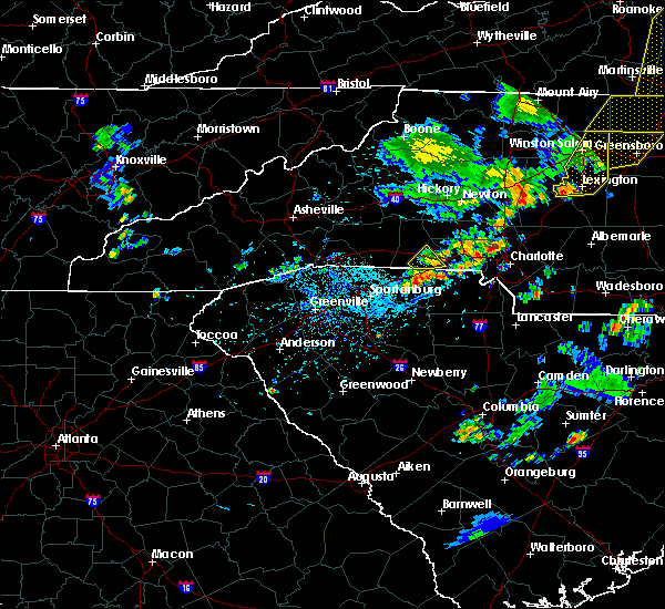 The national weather service in greenville-spartanburg has issued a * severe thunderstorm warning for. central mecklenburg county in the piedmont of north carolina. until 445 pm edt. At 419 pm edt, a severe thunderstorm was located 5 miles south of huntersville, or near northeast charlotte, moving east at 20 mph. The national weather service in greenville-spartanburg has issued a * severe thunderstorm warning for. central mecklenburg county in the piedmont of north carolina. until 445 pm edt. At 419 pm edt, a severe thunderstorm was located 5 miles south of huntersville, or near northeast charlotte, moving east at 20 mph.
|
| 8/19/2019 4:30 PM EDT |
 At 429 pm edt, a severe thunderstorm was located near uptown charlotte, or near southpark mall, and is nearly stationary (radar indicated). Hazards include 60 mph wind gusts and quarter size hail. Minor hail damage to vehicles is expected. expect wind damage to trees and power lines. Locations impacted include, uptown charlotte, central charlotte, south charlotte, southwest charlotte, east charlotte, mint hill, pineville, freedom park, reedy creek park and the plaza. At 429 pm edt, a severe thunderstorm was located near uptown charlotte, or near southpark mall, and is nearly stationary (radar indicated). Hazards include 60 mph wind gusts and quarter size hail. Minor hail damage to vehicles is expected. expect wind damage to trees and power lines. Locations impacted include, uptown charlotte, central charlotte, south charlotte, southwest charlotte, east charlotte, mint hill, pineville, freedom park, reedy creek park and the plaza.
|
| 8/19/2019 4:28 PM EDT |
 At 427 pm edt, a severe thunderstorm was located near uptown charlotte, or near charlotte douglas airport, and is nearly stationary (radar indicated). Hazards include 60 mph wind gusts and quarter size hail. Minor hail damage to vehicles is expected. expect wind damage to trees and power lines. Locations impacted include, uptown charlotte, central charlotte, northeast charlotte, northwest charlotte, freedom park, university city, reedy creek park, the plaza, charlotte douglas airport and paw creek. At 427 pm edt, a severe thunderstorm was located near uptown charlotte, or near charlotte douglas airport, and is nearly stationary (radar indicated). Hazards include 60 mph wind gusts and quarter size hail. Minor hail damage to vehicles is expected. expect wind damage to trees and power lines. Locations impacted include, uptown charlotte, central charlotte, northeast charlotte, northwest charlotte, freedom park, university city, reedy creek park, the plaza, charlotte douglas airport and paw creek.
|
| 8/19/2019 4:17 PM EDT | 65 mph peak wind gust from the southeas in mecklenburg county NC, 4.7 miles ENE of Charlotte, NC |
| 8/19/2019 4:11 PM EDT | Half Dollar sized hail reported 4.7 miles ENE of Charlotte, NC, half dollar sized hail reported at the charlotte douglas international airport. |
| 8/19/2019 4:10 PM EDT | Quarter sized hail reported 2.9 miles E of Charlotte, NC, dime to quarter sized hail on wilkinson blvd. |
| 8/19/2019 4:03 PM EDT |
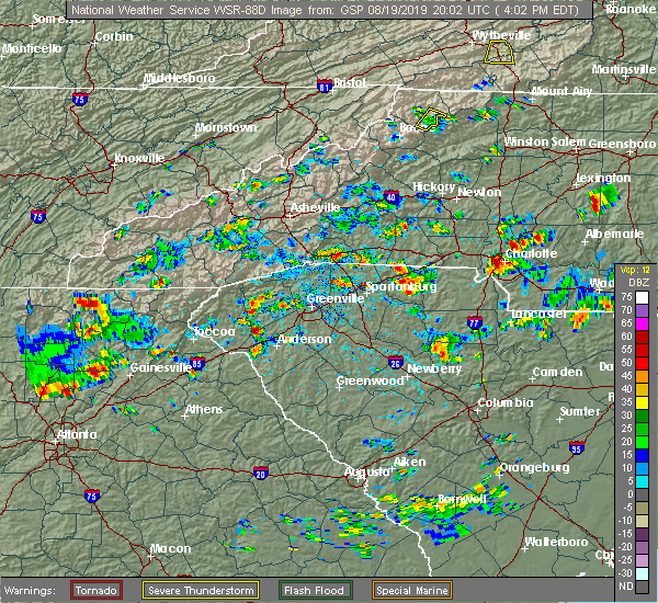 At 403 pm edt, a severe thunderstorm was located near uptown charlotte, or near charlotte douglas airport, and is nearly stationary (radar indicated). Hazards include 60 mph wind gusts and quarter size hail. Minor hail damage to vehicles is expected. Expect wind damage to trees and power lines. At 403 pm edt, a severe thunderstorm was located near uptown charlotte, or near charlotte douglas airport, and is nearly stationary (radar indicated). Hazards include 60 mph wind gusts and quarter size hail. Minor hail damage to vehicles is expected. Expect wind damage to trees and power lines.
|
| 8/19/2019 3:53 PM EDT |
 The national weather service in greenville-spartanburg has issued a * severe thunderstorm warning for. southern mecklenburg county in the piedmont of north carolina. northwestern union county in the piedmont of north carolina. until 445 pm edt. At 353 pm edt, a severe thunderstorm was located 4 miles southeast. The national weather service in greenville-spartanburg has issued a * severe thunderstorm warning for. southern mecklenburg county in the piedmont of north carolina. northwestern union county in the piedmont of north carolina. until 445 pm edt. At 353 pm edt, a severe thunderstorm was located 4 miles southeast.
|
| 8/17/2019 5:30 PM EDT | *** 1 inj *** broadcast media reported several trees down near victoria ave surrounding a mobile home park between skycrest dr and old statesville rd. one person suffer in mecklenburg county NC, 6.8 miles SSW of Charlotte, NC |
| 8/17/2019 5:26 PM EDT |
 At 507 pm edt, a severe thunderstorm was located near huntersville, moving south at 10 mph (radar indicated). Hazards include 60 mph wind gusts and quarter size hail. Minor hail damage to vehicles is expected. Expect wind damage to trees and power lines. At 507 pm edt, a severe thunderstorm was located near huntersville, moving south at 10 mph (radar indicated). Hazards include 60 mph wind gusts and quarter size hail. Minor hail damage to vehicles is expected. Expect wind damage to trees and power lines.
|
| 8/17/2019 5:07 PM EDT |
 The national weather service in greenville-spartanburg has issued a * severe thunderstorm warning for. west central cabarrus county in the piedmont of north carolina. north central mecklenburg county in the piedmont of north carolina. Until 545 pm edt. The national weather service in greenville-spartanburg has issued a * severe thunderstorm warning for. west central cabarrus county in the piedmont of north carolina. north central mecklenburg county in the piedmont of north carolina. Until 545 pm edt.
|
| 8/13/2019 6:39 PM EDT |
 The severe thunderstorm warning for western cabarrus, mecklenburg and northeastern gaston counties will expire at 645 pm edt, the storms which prompted the warning have weakened below severe limits, and no longer pose an immediate threat to life or property. therefore the warning will be allowed to expire. however gusty winds are still possible with these thunderstorms. a severe thunderstorm watch remains in effect until 700 pm edt for the piedmont of north carolina. if you observed large hail or wind damage, please report it to the national weather service greenville-spartanburg by calling toll free, 1, 800, 2 6 7, 8 1 0 1, or by posting on our facebook page, or tweet it using hashtag nwsgsp. your message should describe the event and the specific location where it occurred. The severe thunderstorm warning for western cabarrus, mecklenburg and northeastern gaston counties will expire at 645 pm edt, the storms which prompted the warning have weakened below severe limits, and no longer pose an immediate threat to life or property. therefore the warning will be allowed to expire. however gusty winds are still possible with these thunderstorms. a severe thunderstorm watch remains in effect until 700 pm edt for the piedmont of north carolina. if you observed large hail or wind damage, please report it to the national weather service greenville-spartanburg by calling toll free, 1, 800, 2 6 7, 8 1 0 1, or by posting on our facebook page, or tweet it using hashtag nwsgsp. your message should describe the event and the specific location where it occurred.
|
| 8/13/2019 6:12 PM EDT |
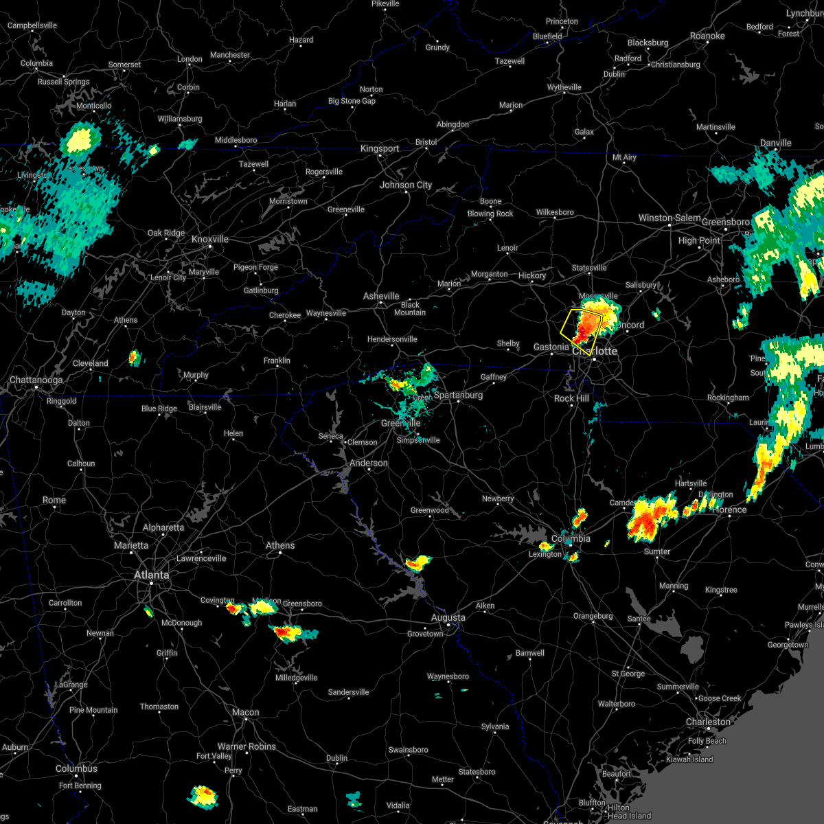 The severe thunderstorm warning for south central iredell, eastern lincoln, northwestern mecklenburg and northeastern gaston counties will expire at 615 pm edt, the storm which prompted the warning has moved out of the area. therefore the warning will be allowed to expire. a severe thunderstorm watch remains in effect until 700 pm edt for the piedmont of north carolina. if you observed large hail or wind damage, please report it to the national weather service greenville-spartanburg by calling toll free, 1, 800, 2 6 7, 8 1 0 1, or by posting on our facebook page, or tweet it using hashtag nwsgsp. your message should describe the event and the specific location where it occurred. remember, a severe thunderstorm warning still remains in effect for most of mecklenburg and extreme northeastern gaston counties until 645 pm edt. The severe thunderstorm warning for south central iredell, eastern lincoln, northwestern mecklenburg and northeastern gaston counties will expire at 615 pm edt, the storm which prompted the warning has moved out of the area. therefore the warning will be allowed to expire. a severe thunderstorm watch remains in effect until 700 pm edt for the piedmont of north carolina. if you observed large hail or wind damage, please report it to the national weather service greenville-spartanburg by calling toll free, 1, 800, 2 6 7, 8 1 0 1, or by posting on our facebook page, or tweet it using hashtag nwsgsp. your message should describe the event and the specific location where it occurred. remember, a severe thunderstorm warning still remains in effect for most of mecklenburg and extreme northeastern gaston counties until 645 pm edt.
|
| 8/13/2019 6:06 PM EDT |
 At 606 pm edt, severe thunderstorms were located along a line extending from 7 miles north of huntersville to 9 miles northeast of gastonia, moving southeast at 30 mph (radar indicated). Hazards include 60 mph wind gusts and penny size hail. expect damage to trees and power lines At 606 pm edt, severe thunderstorms were located along a line extending from 7 miles north of huntersville to 9 miles northeast of gastonia, moving southeast at 30 mph (radar indicated). Hazards include 60 mph wind gusts and penny size hail. expect damage to trees and power lines
|
| 8/13/2019 5:51 PM EDT |
 At 550 pm edt, a severe thunderstorm was located 8 miles west of huntersville, or near westport, moving southeast at 30 mph (radar indicated). Hazards include 60 mph wind gusts and penny size hail. Expect damage to trees and power lines. Locations impacted include, huntersville, northwest charlotte, cornelius, davidson, westport, denver, ramsey creek park, lowesville, lucia and paw creek. At 550 pm edt, a severe thunderstorm was located 8 miles west of huntersville, or near westport, moving southeast at 30 mph (radar indicated). Hazards include 60 mph wind gusts and penny size hail. Expect damage to trees and power lines. Locations impacted include, huntersville, northwest charlotte, cornelius, davidson, westport, denver, ramsey creek park, lowesville, lucia and paw creek.
|
| 8/13/2019 5:27 PM EDT |
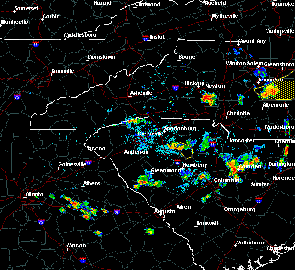 At 526 pm edt, a severe thunderstorm was located 5 miles northeast of lincolnton, or near maiden, moving southeast at 30 mph (radar indicated). Hazards include 60 mph wind gusts and penny size hail. expect damage to trees and power lines At 526 pm edt, a severe thunderstorm was located 5 miles northeast of lincolnton, or near maiden, moving southeast at 30 mph (radar indicated). Hazards include 60 mph wind gusts and penny size hail. expect damage to trees and power lines
|
| 8/13/2019 3:37 PM EDT |
 The severe thunderstorm warning for southeastern mecklenburg and west central union counties will expire at 345 pm edt, the storm which prompted the warning has weakened below severe limits, and no longer poses an immediate threat to life or property. therefore the warning will be allowed to expire. however gusty winds are still possible with this thunderstorm. a severe thunderstorm watch remains in effect until 700 pm edt for the piedmont of north carolina. if you observed large hail or wind damage, please report it to the national weather service greenville-spartanburg by calling toll free, 1, 800, 2 6 7, 8 1 0 1, or by posting on our facebook page, or tweet it using hashtag nwsgsp. your message should describe the event and the specific location where it occurred. The severe thunderstorm warning for southeastern mecklenburg and west central union counties will expire at 345 pm edt, the storm which prompted the warning has weakened below severe limits, and no longer poses an immediate threat to life or property. therefore the warning will be allowed to expire. however gusty winds are still possible with this thunderstorm. a severe thunderstorm watch remains in effect until 700 pm edt for the piedmont of north carolina. if you observed large hail or wind damage, please report it to the national weather service greenville-spartanburg by calling toll free, 1, 800, 2 6 7, 8 1 0 1, or by posting on our facebook page, or tweet it using hashtag nwsgsp. your message should describe the event and the specific location where it occurred.
|
| 8/13/2019 3:26 PM EDT |
 A severe thunderstorm warning remains in effect until 345 pm edt for southeastern mecklenburg and west central union counties. at 325 pm edt, a severe thunderstorm was located 5 miles northeast of indian land, or near weddington, moving southeast at 15 mph. hazard. 60 mph wind gusts. source. Radar indicated. A severe thunderstorm warning remains in effect until 345 pm edt for southeastern mecklenburg and west central union counties. at 325 pm edt, a severe thunderstorm was located 5 miles northeast of indian land, or near weddington, moving southeast at 15 mph. hazard. 60 mph wind gusts. source. Radar indicated.
|
| 8/13/2019 2:55 PM EDT |
 The national weather service in greenville-spartanburg has issued a * severe thunderstorm warning for. southern mecklenburg county in the piedmont of north carolina. west central union county in the piedmont of north carolina. northeastern york county in upstate south carolina. Until 345 pm edt. The national weather service in greenville-spartanburg has issued a * severe thunderstorm warning for. southern mecklenburg county in the piedmont of north carolina. west central union county in the piedmont of north carolina. northeastern york county in upstate south carolina. Until 345 pm edt.
|
| 8/13/2019 2:55 PM EDT |
 At 255 pm edt, a severe thunderstorm was located 8 miles southwest of uptown charlotte, or near southwest charlotte, moving southeast at 20 mph (radar indicated). Hazards include 60 mph wind gusts and penny size hail. expect damage to trees and power lines At 255 pm edt, a severe thunderstorm was located 8 miles southwest of uptown charlotte, or near southwest charlotte, moving southeast at 20 mph (radar indicated). Hazards include 60 mph wind gusts and penny size hail. expect damage to trees and power lines
|
| 8/1/2019 7:07 PM EDT |
 The severe thunderstorm warning for central mecklenburg and southeastern gaston counties will expire at 715 pm edt, the storm which prompted the warning has weakened below severe limits, and no longer poses an immediate threat to life or property. therefore the warning will be allowed to expire. however small hail and gusty winds are still possible with this thunderstorm. The severe thunderstorm warning for central mecklenburg and southeastern gaston counties will expire at 715 pm edt, the storm which prompted the warning has weakened below severe limits, and no longer poses an immediate threat to life or property. therefore the warning will be allowed to expire. however small hail and gusty winds are still possible with this thunderstorm.
|
| 8/1/2019 6:53 PM EDT |
 At 653 pm edt, a severe thunderstorm was located near uptown charlotte, or near hidden valley, moving northwest at 10 mph (radar indicated). Hazards include 60 mph wind gusts and quarter size hail. Minor hail damage to vehicles is expected. expect wind damage to trees and power lines. Locations impacted include, uptown charlotte, central charlotte, east charlotte, northwest charlotte, freedom park, university city, reedy creek park, the plaza, charlotte douglas airport and hidden valley. At 653 pm edt, a severe thunderstorm was located near uptown charlotte, or near hidden valley, moving northwest at 10 mph (radar indicated). Hazards include 60 mph wind gusts and quarter size hail. Minor hail damage to vehicles is expected. expect wind damage to trees and power lines. Locations impacted include, uptown charlotte, central charlotte, east charlotte, northwest charlotte, freedom park, university city, reedy creek park, the plaza, charlotte douglas airport and hidden valley.
|
| 8/1/2019 6:51 PM EDT |
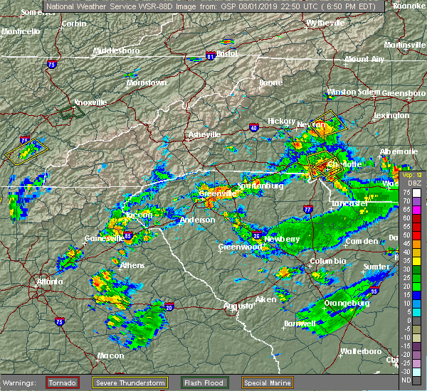 At 650 pm edt, a severe thunderstorm was located near uptown charlotte, or over central charlotte, moving south at 10 mph (radar indicated). Hazards include 60 mph wind gusts and quarter size hail. Minor hail damage to vehicles is expected. expect wind damage to trees and power lines. Locations impacted include, uptown charlotte, central charlotte, northeast charlotte, southwest charlotte, east charlotte, northwest charlotte, mt holly, belmont, freedom park and university city. At 650 pm edt, a severe thunderstorm was located near uptown charlotte, or over central charlotte, moving south at 10 mph (radar indicated). Hazards include 60 mph wind gusts and quarter size hail. Minor hail damage to vehicles is expected. expect wind damage to trees and power lines. Locations impacted include, uptown charlotte, central charlotte, northeast charlotte, southwest charlotte, east charlotte, northwest charlotte, mt holly, belmont, freedom park and university city.
|
| 8/1/2019 6:36 PM EDT |
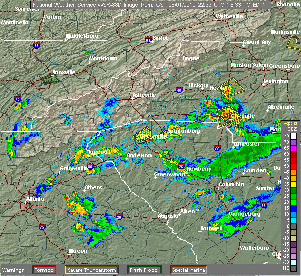 At 636 pm edt, a severe thunderstorm was located near uptown charlotte, or near northwest charlotte, moving south at 10 mph (radar indicated). Hazards include 60 mph wind gusts and quarter size hail. Minor hail damage to vehicles is expected. expect wind damage to trees and power lines. Locations impacted include, uptown charlotte, huntersville, central charlotte, northeast charlotte, southwest charlotte, east charlotte, northwest charlotte, mt holly, freedom park and university city. At 636 pm edt, a severe thunderstorm was located near uptown charlotte, or near northwest charlotte, moving south at 10 mph (radar indicated). Hazards include 60 mph wind gusts and quarter size hail. Minor hail damage to vehicles is expected. expect wind damage to trees and power lines. Locations impacted include, uptown charlotte, huntersville, central charlotte, northeast charlotte, southwest charlotte, east charlotte, northwest charlotte, mt holly, freedom park and university city.
|
| 8/1/2019 6:34 PM EDT |
 At 634 pm edt, a severe thunderstorm was located near uptown charlotte, or over the plaza, moving northwest at 10 mph (radar indicated). Hazards include 60 mph wind gusts and quarter size hail. Minor hail damage to vehicles is expected. expect wind damage to trees and power lines. Locations impacted include, uptown charlotte, central charlotte, east charlotte, northwest charlotte, freedom park, university city, reedy creek park, the plaza, charlotte douglas airport and hidden valley. At 634 pm edt, a severe thunderstorm was located near uptown charlotte, or over the plaza, moving northwest at 10 mph (radar indicated). Hazards include 60 mph wind gusts and quarter size hail. Minor hail damage to vehicles is expected. expect wind damage to trees and power lines. Locations impacted include, uptown charlotte, central charlotte, east charlotte, northwest charlotte, freedom park, university city, reedy creek park, the plaza, charlotte douglas airport and hidden valley.
|
| 8/1/2019 6:24 PM EDT |
 The national weather service in greenville-spartanburg has issued a * severe thunderstorm warning for. central mecklenburg county in the piedmont of north carolina. eastern gaston county in the piedmont of north carolina. until 715 pm edt. At 623 pm edt, a severe thunderstorm was located 4 miles northwest. The national weather service in greenville-spartanburg has issued a * severe thunderstorm warning for. central mecklenburg county in the piedmont of north carolina. eastern gaston county in the piedmont of north carolina. until 715 pm edt. At 623 pm edt, a severe thunderstorm was located 4 miles northwest.
|
| 8/1/2019 6:16 PM EDT | A few trees down along and near shamrock drive and kilborne park are in mecklenburg county NC, 6.3 miles WNW of Charlotte, NC |
| 8/1/2019 6:12 PM EDT |
 The national weather service in greenville-spartanburg has issued a * severe thunderstorm warning for. central mecklenburg county in the piedmont of north carolina. until 700 pm edt. At 612 pm edt, a severe thunderstorm was located 4 miles southeast of uptown charlotte, or near east charlotte, moving northwest at 10. The national weather service in greenville-spartanburg has issued a * severe thunderstorm warning for. central mecklenburg county in the piedmont of north carolina. until 700 pm edt. At 612 pm edt, a severe thunderstorm was located 4 miles southeast of uptown charlotte, or near east charlotte, moving northwest at 10.
|
| 8/1/2019 5:51 PM EDT |
 At 551 pm edt, a severe thunderstorm was located near huntersville, or near northeast charlotte, and is nearly stationary (radar indicated). Hazards include 60 mph wind gusts. expect damage to trees and power lines At 551 pm edt, a severe thunderstorm was located near huntersville, or near northeast charlotte, and is nearly stationary (radar indicated). Hazards include 60 mph wind gusts. expect damage to trees and power lines
|
| 7/31/2019 4:54 PM EDT |
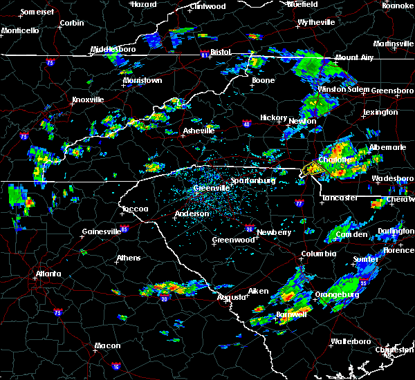 The severe thunderstorm warning for southwestern mecklenburg county will expire at 500 pm edt, the storm which prompted the warning has weakened below severe limits, and no longer poses an immediate threat to life or property. therefore the warning will be allowed to expire. however gusty winds are still possible with this thunderstorm. The severe thunderstorm warning for southwestern mecklenburg county will expire at 500 pm edt, the storm which prompted the warning has weakened below severe limits, and no longer poses an immediate threat to life or property. therefore the warning will be allowed to expire. however gusty winds are still possible with this thunderstorm.
|
| 7/31/2019 4:50 PM EDT | Fire dept/rescue reported trees down on power lines on quail hollow rd in mecklenburg county NC, 7.2 miles N of Charlotte, NC |
| 7/31/2019 4:48 PM EDT |
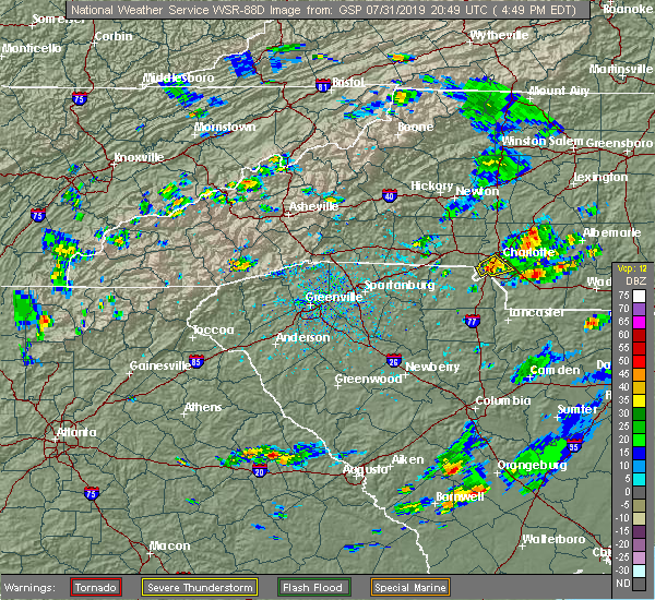 At 448 pm edt, a severe thunderstorm was located 5 miles south of uptown charlotte, or near southpark mall, moving northeast at 10 mph (radar indicated). Hazards include 60 mph wind gusts and quarter size hail. Minor hail damage to vehicles is expected. expect wind damage to trees and power lines. Locations impacted include, central charlotte, southwest charlotte, steele creek, freedom park, southpark mall, pineville, carowinds, uptown charlotte, charlotte douglas airport and south charlotte. At 448 pm edt, a severe thunderstorm was located 5 miles south of uptown charlotte, or near southpark mall, moving northeast at 10 mph (radar indicated). Hazards include 60 mph wind gusts and quarter size hail. Minor hail damage to vehicles is expected. expect wind damage to trees and power lines. Locations impacted include, central charlotte, southwest charlotte, steele creek, freedom park, southpark mall, pineville, carowinds, uptown charlotte, charlotte douglas airport and south charlotte.
|
| 7/31/2019 4:40 PM EDT | 911 call center reported trees down and power outages in the steele creek area. time estimated from rada in mecklenburg county NC, 8.8 miles NE of Charlotte, NC |
| 7/31/2019 4:20 PM EDT |
 At 420 pm edt, a severe thunderstorm was located 8 miles southwest of uptown charlotte, or near southwest charlotte, moving northeast at 10 mph (radar indicated). Hazards include 60 mph wind gusts and quarter size hail. Minor hail damage to vehicles is expected. Expect wind damage to trees and power lines. At 420 pm edt, a severe thunderstorm was located 8 miles southwest of uptown charlotte, or near southwest charlotte, moving northeast at 10 mph (radar indicated). Hazards include 60 mph wind gusts and quarter size hail. Minor hail damage to vehicles is expected. Expect wind damage to trees and power lines.
|
| 7/4/2019 4:10 PM EDT |
 The severe thunderstorm warning for northwestern cabarrus county will expire at 415 pm edt, the storm which prompted the warning has weakened below severe limits, and no longer poses an immediate threat to life or property. therefore the warning will be allowed to expire. however heavy rain is still possible with this thunderstorm. if you observed large hail or wind damage, please report it to the national weather service greenville-spartanburg by calling toll free, 1, 800, 2 6 7, 8 1 0 1, or by posting on our facebook page, or tweet it using hashtag nwsgsp. your message should describe the event and the specific location where it occurred. The severe thunderstorm warning for northwestern cabarrus county will expire at 415 pm edt, the storm which prompted the warning has weakened below severe limits, and no longer poses an immediate threat to life or property. therefore the warning will be allowed to expire. however heavy rain is still possible with this thunderstorm. if you observed large hail or wind damage, please report it to the national weather service greenville-spartanburg by calling toll free, 1, 800, 2 6 7, 8 1 0 1, or by posting on our facebook page, or tweet it using hashtag nwsgsp. your message should describe the event and the specific location where it occurred.
|
| 7/4/2019 3:57 PM EDT |
 At 354 pm edt, a severe thunderstorm was located 5 miles southwest of downtown concord, or near harrisburg, moving northeast at 10 mph (radar indicated). Hazards include 60 mph wind gusts and quarter size hail. Minor hail damage to vehicles is expected. expect wind damage to trees and power lines. Locations impacted include, concord, harrisburg, charlotte motor speedway and mt pleasant. At 354 pm edt, a severe thunderstorm was located 5 miles southwest of downtown concord, or near harrisburg, moving northeast at 10 mph (radar indicated). Hazards include 60 mph wind gusts and quarter size hail. Minor hail damage to vehicles is expected. expect wind damage to trees and power lines. Locations impacted include, concord, harrisburg, charlotte motor speedway and mt pleasant.
|
| 7/4/2019 3:42 PM EDT |
 At 342 pm edt, a severe thunderstorm was located 6 miles southwest of downtown concord, or over harrisburg, moving northeast at 5 mph (radar indicated). Hazards include 70 mph wind gusts and half dollar size hail. Minor hail damage to vehicles is expected. expect considerable tree damage. wind damage is also likely to mobile homes, roofs, and outbuildings. Locations impacted include, concord, harrisburg, university city, charlotte motor speedway, northeast charlotte and mt pleasant. At 342 pm edt, a severe thunderstorm was located 6 miles southwest of downtown concord, or over harrisburg, moving northeast at 5 mph (radar indicated). Hazards include 70 mph wind gusts and half dollar size hail. Minor hail damage to vehicles is expected. expect considerable tree damage. wind damage is also likely to mobile homes, roofs, and outbuildings. Locations impacted include, concord, harrisburg, university city, charlotte motor speedway, northeast charlotte and mt pleasant.
|
| 7/4/2019 3:30 PM EDT |
 At 330 pm edt, a severe thunderstorm was located 6 miles southwest of downtown concord, or near charlotte motor speedway, moving northeast at 10 mph (radar indicated). Hazards include 60 mph wind gusts and quarter size hail. Minor hail damage to vehicles is expected. Expect wind damage to trees and power lines. At 330 pm edt, a severe thunderstorm was located 6 miles southwest of downtown concord, or near charlotte motor speedway, moving northeast at 10 mph (radar indicated). Hazards include 60 mph wind gusts and quarter size hail. Minor hail damage to vehicles is expected. Expect wind damage to trees and power lines.
|
| 6/30/2019 8:47 PM EDT |
 At 847 pm edt, a severe thunderstorm was located 5 miles southeast of uptown charlotte, or near southpark mall, moving southeast at 20 mph (radar indicated). Hazards include 60 mph wind gusts. Expect damage to trees and power lines. Locations impacted include, uptown charlotte, central charlotte, south charlotte, east charlotte, matthews, mint hill, freedom park, the plaza, the arboretum and southpark mall. At 847 pm edt, a severe thunderstorm was located 5 miles southeast of uptown charlotte, or near southpark mall, moving southeast at 20 mph (radar indicated). Hazards include 60 mph wind gusts. Expect damage to trees and power lines. Locations impacted include, uptown charlotte, central charlotte, south charlotte, east charlotte, matthews, mint hill, freedom park, the plaza, the arboretum and southpark mall.
|
| 6/30/2019 8:37 PM EDT |
 At 837 pm edt, a severe thunderstorm was located near uptown charlotte, or near freedom park, moving southeast at 20 mph (radar indicated). Hazards include 60 mph wind gusts. Expect damage to trees and power lines. Locations impacted include, uptown charlotte, central charlotte, south charlotte, east charlotte, northwest charlotte, matthews, mint hill, freedom park, the plaza and the arboretum. At 837 pm edt, a severe thunderstorm was located near uptown charlotte, or near freedom park, moving southeast at 20 mph (radar indicated). Hazards include 60 mph wind gusts. Expect damage to trees and power lines. Locations impacted include, uptown charlotte, central charlotte, south charlotte, east charlotte, northwest charlotte, matthews, mint hill, freedom park, the plaza and the arboretum.
|
| 6/30/2019 8:27 PM EDT | Report of trees and part of a fence blown down on mingus roa in mecklenburg county NC, 5.4 miles SSE of Charlotte, NC |
| 6/30/2019 8:27 PM EDT |
 At 827 pm edt, a severe thunderstorm was located near uptown charlotte, moving southeast at 20 mph (radar indicated). Hazards include 60 mph wind gusts. expect damage to trees and power lines At 827 pm edt, a severe thunderstorm was located near uptown charlotte, moving southeast at 20 mph (radar indicated). Hazards include 60 mph wind gusts. expect damage to trees and power lines
|
| 6/24/2019 10:17 PM EDT |
 At 1016 pm edt, severe thunderstorms were located along a line extending from 7 miles southwest of winston-salem to 6 miles west of lexington to 11 miles north of badin lake to 9 miles east of downtown concord to 13 miles south of albemarle to 8 miles south of monroe to 14 miles northeast of lake wateree dam, moving east at 40 mph (radar indicated). Hazards include 60 mph wind gusts. Expect damage to trees and power lines. Locations impacted include, monroe, chester, indian trail, weddington, stallings, unionville, wesley chapel, wingate, waxhaw and marshville. At 1016 pm edt, severe thunderstorms were located along a line extending from 7 miles southwest of winston-salem to 6 miles west of lexington to 11 miles north of badin lake to 9 miles east of downtown concord to 13 miles south of albemarle to 8 miles south of monroe to 14 miles northeast of lake wateree dam, moving east at 40 mph (radar indicated). Hazards include 60 mph wind gusts. Expect damage to trees and power lines. Locations impacted include, monroe, chester, indian trail, weddington, stallings, unionville, wesley chapel, wingate, waxhaw and marshville.
|
| 6/24/2019 10:03 PM EDT |
 At 1003 pm edt, severe thunderstorms were located along a line extending from 12 miles southwest of winston-salem to 5 miles southeast of mocksville to 12 miles south of lexington to near downtown concord to 16 miles southwest of albemarle to 11 miles southwest of monroe to 13 miles south of lancaster, moving east at 40 mph (radar indicated). Hazards include 60 mph wind gusts. Expect damage to trees and power lines. Locations impacted include, rock hill, kannapolis, downtown concord, monroe, salisbury, mocksville, central charlotte, south charlotte, southwest charlotte and east charlotte. At 1003 pm edt, severe thunderstorms were located along a line extending from 12 miles southwest of winston-salem to 5 miles southeast of mocksville to 12 miles south of lexington to near downtown concord to 16 miles southwest of albemarle to 11 miles southwest of monroe to 13 miles south of lancaster, moving east at 40 mph (radar indicated). Hazards include 60 mph wind gusts. Expect damage to trees and power lines. Locations impacted include, rock hill, kannapolis, downtown concord, monroe, salisbury, mocksville, central charlotte, south charlotte, southwest charlotte and east charlotte.
|
| 6/24/2019 9:48 PM EDT |
 At 948 pm edt, severe thunderstorms were located along a line extending from 7 miles south of yadkinville to 7 miles southwest of mocksville to 4 miles east of salisbury to 6 miles east of huntersville to 14 miles north of monroe to 8 miles south of indian land to 14 miles southwest of lancaster, moving east at 25 mph (radar indicated). Hazards include 60 mph wind gusts. Expect damage to trees and power lines. Locations impacted include, rock hill, uptown charlotte, huntersville, kannapolis, downtown concord, monroe, salisbury, chester, mocksville and central charlotte. At 948 pm edt, severe thunderstorms were located along a line extending from 7 miles south of yadkinville to 7 miles southwest of mocksville to 4 miles east of salisbury to 6 miles east of huntersville to 14 miles north of monroe to 8 miles south of indian land to 14 miles southwest of lancaster, moving east at 25 mph (radar indicated). Hazards include 60 mph wind gusts. Expect damage to trees and power lines. Locations impacted include, rock hill, uptown charlotte, huntersville, kannapolis, downtown concord, monroe, salisbury, chester, mocksville and central charlotte.
|
| 6/24/2019 9:27 PM EDT |
 At 927 pm edt, severe thunderstorms were located along a line extending from 6 miles south of yadkinville to 4 miles north of statesville to 8 miles north of kannapolis to near huntersville to 7 miles northeast of indian land to 4 miles southwest of rock hill to 11 miles north of winnsboro, moving east at 40 mph (radar indicated). Hazards include 70 mph wind gusts. Expect considerable tree damage. Damage is likely to mobile homes, roofs, and outbuildings. At 927 pm edt, severe thunderstorms were located along a line extending from 6 miles south of yadkinville to 4 miles north of statesville to 8 miles north of kannapolis to near huntersville to 7 miles northeast of indian land to 4 miles southwest of rock hill to 11 miles north of winnsboro, moving east at 40 mph (radar indicated). Hazards include 70 mph wind gusts. Expect considerable tree damage. Damage is likely to mobile homes, roofs, and outbuildings.
|
| 6/24/2019 9:16 PM EDT |
 At 916 pm edt, severe thunderstorms were located along a line extending from 15 miles east of taylorsville to 7 miles northwest of statesville to 14 miles northwest of kannapolis to 5 miles west of huntersville to 6 miles southwest of uptown charlotte to 7 miles south of york to 6 miles south of chester, moving northeast at 70 mph (radar indicated). Hazards include 70 mph wind gusts. Expect considerable tree damage. damage is likely to mobile homes, roofs, and outbuildings. Locations impacted include, gastonia, rock hill, uptown charlotte, huntersville, statesville, lincolnton, york, chester, mocksville and central charlotte. At 916 pm edt, severe thunderstorms were located along a line extending from 15 miles east of taylorsville to 7 miles northwest of statesville to 14 miles northwest of kannapolis to 5 miles west of huntersville to 6 miles southwest of uptown charlotte to 7 miles south of york to 6 miles south of chester, moving northeast at 70 mph (radar indicated). Hazards include 70 mph wind gusts. Expect considerable tree damage. damage is likely to mobile homes, roofs, and outbuildings. Locations impacted include, gastonia, rock hill, uptown charlotte, huntersville, statesville, lincolnton, york, chester, mocksville and central charlotte.
|
| 6/24/2019 9:05 PM EDT |
 At 904 pm edt, severe thunderstorms were located along a line extending from 8 miles southeast of taylorsville to 11 miles east of newton to 9 miles southeast of lincolnton to 7 miles southeast of gastonia to 5 miles west of york to 13 miles southeast of union, moving east at 35 mph (radar indicated). Hazards include 60 mph wind gusts. Expect damage to trees and power lines. locations impacted include, gastonia, hickory, newton, lincolnton, union, york, mt holly, st. Stephens, belmont and clinton. At 904 pm edt, severe thunderstorms were located along a line extending from 8 miles southeast of taylorsville to 11 miles east of newton to 9 miles southeast of lincolnton to 7 miles southeast of gastonia to 5 miles west of york to 13 miles southeast of union, moving east at 35 mph (radar indicated). Hazards include 60 mph wind gusts. Expect damage to trees and power lines. locations impacted include, gastonia, hickory, newton, lincolnton, union, york, mt holly, st. Stephens, belmont and clinton.
|
| 6/24/2019 9:00 PM EDT |
 At 859 pm edt, severe thunderstorms were located along a line extending from 4 miles southeast of taylorsville to 10 miles southwest of statesville to 7 miles southeast of lincolnton to 8 miles southeast of gastonia to 7 miles southwest of york to 16 miles southeast of union, moving northeast at 50 mph (radar indicated). Hazards include 70 mph wind gusts. Expect considerable tree damage. Damage is likely to mobile homes, roofs, and outbuildings. At 859 pm edt, severe thunderstorms were located along a line extending from 4 miles southeast of taylorsville to 10 miles southwest of statesville to 7 miles southeast of lincolnton to 8 miles southeast of gastonia to 7 miles southwest of york to 16 miles southeast of union, moving northeast at 50 mph (radar indicated). Hazards include 70 mph wind gusts. Expect considerable tree damage. Damage is likely to mobile homes, roofs, and outbuildings.
|
| 6/24/2019 8:45 PM EDT |
 At 845 pm edt, severe thunderstorms were located along a line extending from 5 miles northeast of hickory to 5 miles northeast of lincolnton to 8 miles west of gastonia to 7 miles north of york to 13 miles northeast of union to 16 miles north of newberry, moving east at 60 mph (radar indicated). Hazards include 60 mph wind gusts. Expect damage to trees and power lines. Locations impacted include, gastonia, hickory, shelby, newton, gaffney, lincolnton, union, york, kings mountain and mt holly. At 845 pm edt, severe thunderstorms were located along a line extending from 5 miles northeast of hickory to 5 miles northeast of lincolnton to 8 miles west of gastonia to 7 miles north of york to 13 miles northeast of union to 16 miles north of newberry, moving east at 60 mph (radar indicated). Hazards include 60 mph wind gusts. Expect damage to trees and power lines. Locations impacted include, gastonia, hickory, shelby, newton, gaffney, lincolnton, union, york, kings mountain and mt holly.
|
| 6/24/2019 8:26 PM EDT |
 At 826 pm edt, severe thunderstorms were located along a line extending from 8 miles southwest of hickory to 7 miles southeast of shelby to 11 miles north of union to 7 miles southeast of laurens, moving northeast at 35 mph (radar indicated). Hazards include 60 mph wind gusts. expect damage to trees and power lines At 826 pm edt, severe thunderstorms were located along a line extending from 8 miles southwest of hickory to 7 miles southeast of shelby to 11 miles north of union to 7 miles southeast of laurens, moving northeast at 35 mph (radar indicated). Hazards include 60 mph wind gusts. expect damage to trees and power lines
|
| 6/22/2019 4:30 PM EDT | Social media report of a large tree down at lawyers rd & lebanon r in mecklenburg county NC, 10 miles WNW of Charlotte, NC |
| 6/22/2019 4:26 PM EDT | Trees down near selwyn and queens av in mecklenburg county NC, 3.8 miles NNW of Charlotte, NC |
| 6/22/2019 4:26 PM EDT |
 At 426 pm edt, severe thunderstorms were located along a line extending from 6 miles southeast of downtown concord to 5 miles east of indian land, moving east at 50 mph (radar indicated). Hazards include 60 mph wind gusts and quarter size hail. Minor hail damage to vehicles is expected. Expect wind damage to trees and power lines. At 426 pm edt, severe thunderstorms were located along a line extending from 6 miles southeast of downtown concord to 5 miles east of indian land, moving east at 50 mph (radar indicated). Hazards include 60 mph wind gusts and quarter size hail. Minor hail damage to vehicles is expected. Expect wind damage to trees and power lines.
|
| 6/22/2019 4:22 PM EDT |
 The severe thunderstorm warning for northwestern chester, york, east central spartanburg, southeastern cherokee and northern union counties will expire at 430 pm edt, the storms which prompted the warning have weakened below severe limits, and no longer pose an immediate threat to life or property. therefore the warning will be allowed to expire. however gusty winds and heavy rain are still possible with these thunderstorms. a severe thunderstorm watch remains in effect until 900 pm edt for the piedmont of north carolina, and upstate south carolina. if you observed large hail or wind damage, please report it to the national weather service greenville-spartanburg by calling toll free, 1, 800, 2 6 7, 8 1 0 1, or by posting on our facebook page, or tweet it using hashtag nwsgsp. your message should describe the event and the specific location where it occurred. The severe thunderstorm warning for northwestern chester, york, east central spartanburg, southeastern cherokee and northern union counties will expire at 430 pm edt, the storms which prompted the warning have weakened below severe limits, and no longer pose an immediate threat to life or property. therefore the warning will be allowed to expire. however gusty winds and heavy rain are still possible with these thunderstorms. a severe thunderstorm watch remains in effect until 900 pm edt for the piedmont of north carolina, and upstate south carolina. if you observed large hail or wind damage, please report it to the national weather service greenville-spartanburg by calling toll free, 1, 800, 2 6 7, 8 1 0 1, or by posting on our facebook page, or tweet it using hashtag nwsgsp. your message should describe the event and the specific location where it occurred.
|
| 6/22/2019 4:02 PM EDT |
 At 402 pm edt, severe thunderstorms were located along a line extending from 8 miles north of york to 9 miles north of union to 9 miles south of spartanburg, moving east at 30 mph (radar indicated). Hazards include 60 mph wind gusts and penny size hail. Expect damage to trees and power lines. Locations impacted include, rock hill, union, york, fort mill, tega cay, clover, newport, town of lake wylie, monarch mill and jonesville. At 402 pm edt, severe thunderstorms were located along a line extending from 8 miles north of york to 9 miles north of union to 9 miles south of spartanburg, moving east at 30 mph (radar indicated). Hazards include 60 mph wind gusts and penny size hail. Expect damage to trees and power lines. Locations impacted include, rock hill, union, york, fort mill, tega cay, clover, newport, town of lake wylie, monarch mill and jonesville.
|
| 6/22/2019 3:42 PM EDT |
 At 342 pm edt, severe thunderstorms were located along a line extending from 8 miles south of shelby to 6 miles southwest of spartanburg, moving east at 60 mph (radar indicated). Hazards include 60 mph wind gusts and penny size hail. expect damage to trees and power lines At 342 pm edt, severe thunderstorms were located along a line extending from 8 miles south of shelby to 6 miles southwest of spartanburg, moving east at 60 mph (radar indicated). Hazards include 60 mph wind gusts and penny size hail. expect damage to trees and power lines
|
| 6/20/2019 5:13 PM EDT |
 The severe thunderstorm warning for cabarrus, central mecklenburg and southeastern rowan counties will expire at 515 pm edt, the storms which prompted the warning have weakened below severe limits, and no longer pose an immediate threat to life or property. therefore the warning will be allowed to expire. however gusty winds and heavy rain are still possible with these thunderstorms. a severe thunderstorm watch remains in effect until 1000 pm edt for the piedmont of north carolina. if you observed large hail or wind damage, please report it to the national weather service greenville-spartanburg by calling toll free, 1, 800, 2 6 7, 8 1 0 1, or by posting on our facebook page, or tweet it using hashtag nwsgsp. your message should describe the event and the specific location where it occurred. The severe thunderstorm warning for cabarrus, central mecklenburg and southeastern rowan counties will expire at 515 pm edt, the storms which prompted the warning have weakened below severe limits, and no longer pose an immediate threat to life or property. therefore the warning will be allowed to expire. however gusty winds and heavy rain are still possible with these thunderstorms. a severe thunderstorm watch remains in effect until 1000 pm edt for the piedmont of north carolina. if you observed large hail or wind damage, please report it to the national weather service greenville-spartanburg by calling toll free, 1, 800, 2 6 7, 8 1 0 1, or by posting on our facebook page, or tweet it using hashtag nwsgsp. your message should describe the event and the specific location where it occurred.
|
| 6/20/2019 5:01 PM EDT |
 At 500 pm edt, severe thunderstorms were located along a line extending from 12 miles northwest of badin lake to 3 miles southwest of uptown charlotte, moving east at 40 mph (radar indicated). Hazards include 60 mph wind gusts. Expect damage to trees and power lines. Locations impacted include, uptown charlotte, downtown concord, central charlotte, east charlotte, harrisburg, rockwell, mt pleasant, freedom park, university city and reedy creek park. At 500 pm edt, severe thunderstorms were located along a line extending from 12 miles northwest of badin lake to 3 miles southwest of uptown charlotte, moving east at 40 mph (radar indicated). Hazards include 60 mph wind gusts. Expect damage to trees and power lines. Locations impacted include, uptown charlotte, downtown concord, central charlotte, east charlotte, harrisburg, rockwell, mt pleasant, freedom park, university city and reedy creek park.
|
| 6/20/2019 4:50 PM EDT | Amateur radio reported trees and power lines down on ridge rd between 485 and mallard creek r in mecklenburg county NC, 10.2 miles SSW of Charlotte, NC |
| 6/20/2019 4:43 PM EDT |
 At 443 pm edt, severe thunderstorms were located along a line extending from 8 miles south of salisbury to 6 miles west of uptown charlotte, moving east at 40 mph (radar indicated). Hazards include 60 mph wind gusts. expect damage to trees and power lines At 443 pm edt, severe thunderstorms were located along a line extending from 8 miles south of salisbury to 6 miles west of uptown charlotte, moving east at 40 mph (radar indicated). Hazards include 60 mph wind gusts. expect damage to trees and power lines
|
| 6/20/2019 4:20 PM EDT |
 At 420 pm edt, a severe thunderstorm was located near gastonia, or near dallas, moving east at 35 mph (radar indicated). Hazards include 60 mph wind gusts. expect damage to trees and power lines At 420 pm edt, a severe thunderstorm was located near gastonia, or near dallas, moving east at 35 mph (radar indicated). Hazards include 60 mph wind gusts. expect damage to trees and power lines
|
| 6/20/2019 4:15 PM EDT |
 At 415 pm edt, a severe thunderstorm was located 5 miles southwest of huntersville, moving east at 40 mph (radar indicated). Hazards include 60 mph wind gusts. expect damage to trees and power lines At 415 pm edt, a severe thunderstorm was located 5 miles southwest of huntersville, moving east at 40 mph (radar indicated). Hazards include 60 mph wind gusts. expect damage to trees and power lines
|
| 5/31/2019 3:12 PM EDT |
 The severe thunderstorm warning for northwestern mecklenburg and northeastern gaston counties will expire at 315 pm edt, the storm which prompted the warning has weakened below severe limits, and no longer poses an immediate threat to life or property. therefore the warning will be allowed to expire. a severe thunderstorm watch remains in effect until 1100 pm edt for the piedmont of north carolina. The severe thunderstorm warning for northwestern mecklenburg and northeastern gaston counties will expire at 315 pm edt, the storm which prompted the warning has weakened below severe limits, and no longer poses an immediate threat to life or property. therefore the warning will be allowed to expire. a severe thunderstorm watch remains in effect until 1100 pm edt for the piedmont of north carolina.
|
| 5/31/2019 3:02 PM EDT |
 At 301 pm edt, a severe thunderstorm was located 5 miles northeast of gastonia, or near ranlo, moving east at 25 mph (radar indicated). Hazards include 60 mph wind gusts. Expect damage to trees and power lines. Locations impacted include, northwest charlotte, mt holly, belmont, stanley, cramerton, lowell, ranlo, mcadenville, charlotte douglas airport and paw creek. At 301 pm edt, a severe thunderstorm was located 5 miles northeast of gastonia, or near ranlo, moving east at 25 mph (radar indicated). Hazards include 60 mph wind gusts. Expect damage to trees and power lines. Locations impacted include, northwest charlotte, mt holly, belmont, stanley, cramerton, lowell, ranlo, mcadenville, charlotte douglas airport and paw creek.
|
| 5/31/2019 2:33 PM EDT |
 At 233 pm edt, a severe thunderstorm was located 9 miles west of gastonia, or near bessemer city, moving east at 25 mph (radar indicated). Hazards include 60 mph wind gusts and penny size hail. expect damage to trees and power lines At 233 pm edt, a severe thunderstorm was located 9 miles west of gastonia, or near bessemer city, moving east at 25 mph (radar indicated). Hazards include 60 mph wind gusts and penny size hail. expect damage to trees and power lines
|
| 5/11/2019 4:38 PM EDT |
 The severe thunderstorm warning for south central mecklenburg, west central union and east central york counties will expire at 445 pm edt, the storm which prompted the warning has weakened below severe limits, and no longer poses an immediate threat to life or property. therefore the warning will be allowed to expire. however small hail and gusty winds are still possible with this thunderstorm. The severe thunderstorm warning for south central mecklenburg, west central union and east central york counties will expire at 445 pm edt, the storm which prompted the warning has weakened below severe limits, and no longer poses an immediate threat to life or property. therefore the warning will be allowed to expire. however small hail and gusty winds are still possible with this thunderstorm.
|
| 5/11/2019 4:24 PM EDT |
 At 423 pm edt, a severe thunderstorm was located near indian land, or near marvin, moving northeast at 25 mph (radar indicated). Hazards include 60 mph wind gusts and quarter size hail. Minor hail damage to vehicles is expected. expect wind damage to trees and power lines. Locations impacted include, south charlotte, weddington, fort mill, pineville, wesley chapel, marvin, the arboretum, southpark mall, southwest charlotte and waxhaw. At 423 pm edt, a severe thunderstorm was located near indian land, or near marvin, moving northeast at 25 mph (radar indicated). Hazards include 60 mph wind gusts and quarter size hail. Minor hail damage to vehicles is expected. expect wind damage to trees and power lines. Locations impacted include, south charlotte, weddington, fort mill, pineville, wesley chapel, marvin, the arboretum, southpark mall, southwest charlotte and waxhaw.
|
| 5/11/2019 4:15 PM EDT |
 At 415 pm edt, a severe thunderstorm was located near indian land, moving northeast at 25 mph (radar indicated). Hazards include 60 mph wind gusts and quarter size hail. Minor hail damage to vehicles is expected. expect wind damage to trees and power lines. Locations impacted include, rock hill, south charlotte, southwest charlotte, weddington, fort mill, pineville, wesley chapel, marvin, the arboretum and carowinds. At 415 pm edt, a severe thunderstorm was located near indian land, moving northeast at 25 mph (radar indicated). Hazards include 60 mph wind gusts and quarter size hail. Minor hail damage to vehicles is expected. expect wind damage to trees and power lines. Locations impacted include, rock hill, south charlotte, southwest charlotte, weddington, fort mill, pineville, wesley chapel, marvin, the arboretum and carowinds.
|
| 5/11/2019 3:53 PM EDT |
 At 353 pm edt, a severe thunderstorm was located near rock hill, moving northeast at 25 mph (radar indicated). Hazards include 60 mph wind gusts and quarter size hail. Minor hail damage to vehicles is expected. Expect wind damage to trees and power lines. At 353 pm edt, a severe thunderstorm was located near rock hill, moving northeast at 25 mph (radar indicated). Hazards include 60 mph wind gusts and quarter size hail. Minor hail damage to vehicles is expected. Expect wind damage to trees and power lines.
|
| 5/11/2019 3:40 PM EDT | 8 diameter tree fell near intersection of harrisburg road and reedy creek roa in mecklenburg county NC, 11.3 miles W of Charlotte, NC |
| 5/11/2019 3:23 PM EDT | Several trees down and at least one or two power lines dow in mecklenburg county NC, 5.1 miles SW of Charlotte, NC |
| 5/11/2019 3:10 PM EDT |
 The national weather service in greenville-spartanburg has issued a * severe thunderstorm warning for. central cabarrus county in the piedmont of north carolina. central mecklenburg county in the piedmont of north carolina. until 345 pm edt. At 308 pm edt, a severe thunderstorm was located near uptown. The national weather service in greenville-spartanburg has issued a * severe thunderstorm warning for. central cabarrus county in the piedmont of north carolina. central mecklenburg county in the piedmont of north carolina. until 345 pm edt. At 308 pm edt, a severe thunderstorm was located near uptown.
|
| 5/11/2019 3:01 PM EDT |
 A tornado warning remains in effect until 315 pm edt for west central mecklenburg county. at 300 pm edt, a severe thunderstorm capable of producing a tornado was located 7 miles west of uptown charlotte, or near paw creek, moving east at 30 mph. hazard. Tornado and quarter size hail. A tornado warning remains in effect until 315 pm edt for west central mecklenburg county. at 300 pm edt, a severe thunderstorm capable of producing a tornado was located 7 miles west of uptown charlotte, or near paw creek, moving east at 30 mph. hazard. Tornado and quarter size hail.
|
| 5/11/2019 2:34 PM EDT |
 The national weather service in greenville-spartanburg has issued a * tornado warning for. west central mecklenburg county in the piedmont of north carolina. southeastern gaston county in the piedmont of north carolina. Until 315 pm edt. The national weather service in greenville-spartanburg has issued a * tornado warning for. west central mecklenburg county in the piedmont of north carolina. southeastern gaston county in the piedmont of north carolina. Until 315 pm edt.
|
| 5/4/2019 5:40 PM EDT | Broadcast media reported a tree down on wilkinson blvd near clt airport. delayed repor in mecklenburg county NC, 4.6 miles E of Charlotte, NC |
| 5/4/2019 4:38 PM EDT |
 The severe thunderstorm warning for southeastern mecklenburg and central union counties will expire at 445 pm edt, the storm which prompted the warning has weakened below severe limits, and no longer poses an immediate threat to life or property. therefore the warning will be allowed to expire. however gusty winds and heavy rain are still possible, mainly across southern and eastern portions of union county. The severe thunderstorm warning for southeastern mecklenburg and central union counties will expire at 445 pm edt, the storm which prompted the warning has weakened below severe limits, and no longer poses an immediate threat to life or property. therefore the warning will be allowed to expire. however gusty winds and heavy rain are still possible, mainly across southern and eastern portions of union county.
|
| 5/4/2019 3:46 PM EDT |
 At 346 pm edt, a severe thunderstorm was located near indian land, or near marvin, moving northeast at 25 mph (radar indicated). Hazards include 60 mph wind gusts and half dollar size hail. Minor hail damage to vehicles is expected. Expect wind damage to trees and power lines. At 346 pm edt, a severe thunderstorm was located near indian land, or near marvin, moving northeast at 25 mph (radar indicated). Hazards include 60 mph wind gusts and half dollar size hail. Minor hail damage to vehicles is expected. Expect wind damage to trees and power lines.
|
| 4/19/2019 2:56 PM EDT |
 At 256 pm edt, a severe thunderstorm was located 9 miles south of monroe, or 7 miles northeast of buford, moving north at 45 mph (radar indicated). Hazards include 60 mph wind gusts and penny size hail. expect damage to trees and power lines At 256 pm edt, a severe thunderstorm was located 9 miles south of monroe, or 7 miles northeast of buford, moving north at 45 mph (radar indicated). Hazards include 60 mph wind gusts and penny size hail. expect damage to trees and power lines
|
| 4/14/2019 11:56 PM EDT |
 At 1156 pm edt, a severe thunderstorm capable of producing a tornado was located 10 miles west of huntersville, or 5 miles northeast of stanley, moving northeast at 50 mph (radar indicated rotation). Hazards include tornado. Flying debris will be dangerous to those caught without shelter. mobile homes will be damaged or destroyed. damage to roofs, windows, and vehicles will occur. tree damage is likely. this dangerous storm will be near, huntersville, cornelius, westport and denver around 1200 am edt. davidson, ramsey creek park and mooresville around 1210 am edt. Other locations impacted by this dangerous storm include lowesville, doolie and lucia. At 1156 pm edt, a severe thunderstorm capable of producing a tornado was located 10 miles west of huntersville, or 5 miles northeast of stanley, moving northeast at 50 mph (radar indicated rotation). Hazards include tornado. Flying debris will be dangerous to those caught without shelter. mobile homes will be damaged or destroyed. damage to roofs, windows, and vehicles will occur. tree damage is likely. this dangerous storm will be near, huntersville, cornelius, westport and denver around 1200 am edt. davidson, ramsey creek park and mooresville around 1210 am edt. Other locations impacted by this dangerous storm include lowesville, doolie and lucia.
|
| 4/14/2019 11:54 PM EDT |
 The severe thunderstorm warning for eastern lincoln, southeastern cleveland, gaston, northwestern york and northeastern cherokee counties will expire at midnight edt, the storms which prompted the warning are moving east of the severe thunderstorm warning area. however, a new tornado warning is now in effect across eastern lincoln and gaston counties until 1215 am edt. a tornado watch remains in effect until 500 am edt for the piedmont of north carolina, and upstate south carolina. The severe thunderstorm warning for eastern lincoln, southeastern cleveland, gaston, northwestern york and northeastern cherokee counties will expire at midnight edt, the storms which prompted the warning are moving east of the severe thunderstorm warning area. however, a new tornado warning is now in effect across eastern lincoln and gaston counties until 1215 am edt. a tornado watch remains in effect until 500 am edt for the piedmont of north carolina, and upstate south carolina.
|
| 4/14/2019 11:44 PM EDT |
 At 1144 pm edt, a severe thunderstorm capable of producing a tornado was located 7 miles north of gastonia, or near high shoals, moving northeast at 50 mph (radar indicated rotation). Hazards include tornado. Flying debris will be dangerous to those caught without shelter. mobile homes will be damaged or destroyed. damage to roofs, windows, and vehicles will occur. tree damage is likely. this dangerous storm will be near, mt holly around 1150 pm edt. huntersville, cornelius, westport and denver around 1200 am edt. davidson, mooresville and ramsey creek park around 1210 am edt. Other locations impacted by this dangerous thunderstorm include lowesville, doolie and lucia. At 1144 pm edt, a severe thunderstorm capable of producing a tornado was located 7 miles north of gastonia, or near high shoals, moving northeast at 50 mph (radar indicated rotation). Hazards include tornado. Flying debris will be dangerous to those caught without shelter. mobile homes will be damaged or destroyed. damage to roofs, windows, and vehicles will occur. tree damage is likely. this dangerous storm will be near, mt holly around 1150 pm edt. huntersville, cornelius, westport and denver around 1200 am edt. davidson, mooresville and ramsey creek park around 1210 am edt. Other locations impacted by this dangerous thunderstorm include lowesville, doolie and lucia.
|
| 4/14/2019 11:29 PM EDT |
 At 1128 pm edt, severe thunderstorms were located along a line extending from 10 miles east of shelby to 9 miles west of gastonia to 9 miles northwest of york, moving east at 50 mph (radar indicated). Hazards include 60 mph wind gusts. Expect damage to trees and power lines. locations impacted include, gastonia, kings mountain, mt holly, belmont, cherryville, bessemer city, south gastonia, clover, dallas and stanley. A tornado watch remains in effect until 500 am edt for the piedmont of north carolina, and upstate south carolina. At 1128 pm edt, severe thunderstorms were located along a line extending from 10 miles east of shelby to 9 miles west of gastonia to 9 miles northwest of york, moving east at 50 mph (radar indicated). Hazards include 60 mph wind gusts. Expect damage to trees and power lines. locations impacted include, gastonia, kings mountain, mt holly, belmont, cherryville, bessemer city, south gastonia, clover, dallas and stanley. A tornado watch remains in effect until 500 am edt for the piedmont of north carolina, and upstate south carolina.
|
| 4/14/2019 11:12 PM EDT |
 At 1112 pm edt, severe thunderstorms were located along a line extending from near shelby to 19 miles west of gastonia to 6 miles east of gaffney, moving east at 35 mph (radar indicated). Hazards include 60 mph wind gusts. expect damage to trees and power lines At 1112 pm edt, severe thunderstorms were located along a line extending from near shelby to 19 miles west of gastonia to 6 miles east of gaffney, moving east at 35 mph (radar indicated). Hazards include 60 mph wind gusts. expect damage to trees and power lines
|
| 4/8/2019 4:16 PM EDT |
 At 416 pm edt, a severe thunderstorm was located 5 miles northeast of huntersville, or near davidson, moving northeast at 45 mph (radar indicated). Hazards include 60 mph wind gusts and quarter size hail. Minor hail damage to vehicles is expected. expect wind damage to trees and power lines. Locations impacted include, huntersville, kannapolis, downtown concord, northeast charlotte, west concord, cornelius, mooresville, davidson, china grove and landis. At 416 pm edt, a severe thunderstorm was located 5 miles northeast of huntersville, or near davidson, moving northeast at 45 mph (radar indicated). Hazards include 60 mph wind gusts and quarter size hail. Minor hail damage to vehicles is expected. expect wind damage to trees and power lines. Locations impacted include, huntersville, kannapolis, downtown concord, northeast charlotte, west concord, cornelius, mooresville, davidson, china grove and landis.
|
| 4/8/2019 4:05 PM EDT |
 At 404 pm edt, a severe thunderstorm was located near huntersville, moving northeast at 45 mph (radar indicated). Hazards include 60 mph wind gusts and quarter size hail. Minor hail damage to vehicles is expected. Expect wind damage to trees and power lines. At 404 pm edt, a severe thunderstorm was located near huntersville, moving northeast at 45 mph (radar indicated). Hazards include 60 mph wind gusts and quarter size hail. Minor hail damage to vehicles is expected. Expect wind damage to trees and power lines.
|
| 4/8/2019 4:00 PM EDT |
 At 400 pm edt, a severe thunderstorm was located 7 miles west of huntersville, or 6 miles southwest of ramsey creek park, moving northeast at 35 mph (radar indicated). Hazards include 60 mph wind gusts and penny size hail. Expect damage to trees and power lines. Locations impacted include, uptown charlotte, central charlotte, northwest charlotte, mt holly, belmont, stanley, cramerton, lowell, ranlo and mcadenville. At 400 pm edt, a severe thunderstorm was located 7 miles west of huntersville, or 6 miles southwest of ramsey creek park, moving northeast at 35 mph (radar indicated). Hazards include 60 mph wind gusts and penny size hail. Expect damage to trees and power lines. Locations impacted include, uptown charlotte, central charlotte, northwest charlotte, mt holly, belmont, stanley, cramerton, lowell, ranlo and mcadenville.
|
| 4/8/2019 3:52 PM EDT |
 At 351 pm edt, a severe thunderstorm was located 9 miles northeast of gastonia, or near stanley, moving northeast at 35 mph (radar indicated). Hazards include 60 mph wind gusts and quarter size hail. Minor hail damage to vehicles is expected. expect wind damage to trees and power lines. Locations impacted include, gastonia, uptown charlotte, lincolnton, central charlotte, northwest charlotte, mt holly, belmont, dallas, stanley and cramerton. At 351 pm edt, a severe thunderstorm was located 9 miles northeast of gastonia, or near stanley, moving northeast at 35 mph (radar indicated). Hazards include 60 mph wind gusts and quarter size hail. Minor hail damage to vehicles is expected. expect wind damage to trees and power lines. Locations impacted include, gastonia, uptown charlotte, lincolnton, central charlotte, northwest charlotte, mt holly, belmont, dallas, stanley and cramerton.
|
| 4/8/2019 3:42 PM EDT |
 At 342 pm edt, a severe thunderstorm was located near gastonia, or near dallas, moving northeast at 35 mph (radar indicated). Hazards include 60 mph wind gusts and quarter size hail. Minor hail damage to vehicles is expected. expect wind damage to trees and power lines. Locations impacted include, gastonia, uptown charlotte, lincolnton, york, central charlotte, northwest charlotte, mt holly, belmont, bessemer city and south gastonia. At 342 pm edt, a severe thunderstorm was located near gastonia, or near dallas, moving northeast at 35 mph (radar indicated). Hazards include 60 mph wind gusts and quarter size hail. Minor hail damage to vehicles is expected. expect wind damage to trees and power lines. Locations impacted include, gastonia, uptown charlotte, lincolnton, york, central charlotte, northwest charlotte, mt holly, belmont, bessemer city and south gastonia.
|
| 4/8/2019 3:28 PM EDT |
 At 327 pm edt, a severe thunderstorm was located 7 miles west of gastonia, or over crowders mountain state park, moving northeast at 35 mph (radar indicated). Hazards include 60 mph wind gusts and quarter size hail. Minor hail damage to vehicles is expected. Expect wind damage to trees and power lines. At 327 pm edt, a severe thunderstorm was located 7 miles west of gastonia, or over crowders mountain state park, moving northeast at 35 mph (radar indicated). Hazards include 60 mph wind gusts and quarter size hail. Minor hail damage to vehicles is expected. Expect wind damage to trees and power lines.
|
| 9/27/2018 9:27 PM EDT |
 At 925 pm edt, severe thunderstorms were located along a line extending from 9 miles north of kannapolis to 7 miles northwest of lancaster, moving east at 40 mph (law enforcement reported widespread wind damage as this line of storms moved through the western parts of the charlotte metropolitan area). Hazards include 60 mph wind gusts. expect damage to trees and power lines At 925 pm edt, severe thunderstorms were located along a line extending from 9 miles north of kannapolis to 7 miles northwest of lancaster, moving east at 40 mph (law enforcement reported widespread wind damage as this line of storms moved through the western parts of the charlotte metropolitan area). Hazards include 60 mph wind gusts. expect damage to trees and power lines
|
| 9/27/2018 9:10 PM EDT | Multiple trees reported down across western charlotte... n in mecklenburg county NC, 2.4 miles NNE of Charlotte, NC |
| 9/27/2018 8:45 PM EDT |
 The national weather service in greenville-spartanburg has issued a * severe thunderstorm warning for. western cabarrus county in the piedmont of north carolina. southeastern catawba county in the piedmont of north carolina. lincoln county in the piedmont of north carolina. Southeastern iredell county in the piedmont of north carolina. The national weather service in greenville-spartanburg has issued a * severe thunderstorm warning for. western cabarrus county in the piedmont of north carolina. southeastern catawba county in the piedmont of north carolina. lincoln county in the piedmont of north carolina. Southeastern iredell county in the piedmont of north carolina.
|
| 9/27/2018 8:45 PM EDT |
 At 845 pm edt, severe thunderstorms were located along a line extending from 8 miles southwest of lincolnton to near gastonia to 5 miles east of york, moving northeast at 50 mph (radar indicated). Hazards include 60 mph wind gusts. expect damage to trees and power lines At 845 pm edt, severe thunderstorms were located along a line extending from 8 miles southwest of lincolnton to near gastonia to 5 miles east of york, moving northeast at 50 mph (radar indicated). Hazards include 60 mph wind gusts. expect damage to trees and power lines
|
| 9/27/2018 3:46 PM EDT |
 At 345 pm edt, a severe thunderstorm was located 4 miles north of uptown charlotte, or near hidden valley, moving northeast at 25 mph (radar indicated). Hazards include quarter size hail. Minor damage to vehicles is expected. Locations impacted include, uptown charlotte, northeast charlotte, west concord, harrisburg, reedy creek park, charlotte motor speedway, hidden valley, unc-charlotte, croft and the plaza. At 345 pm edt, a severe thunderstorm was located 4 miles north of uptown charlotte, or near hidden valley, moving northeast at 25 mph (radar indicated). Hazards include quarter size hail. Minor damage to vehicles is expected. Locations impacted include, uptown charlotte, northeast charlotte, west concord, harrisburg, reedy creek park, charlotte motor speedway, hidden valley, unc-charlotte, croft and the plaza.
|
| 9/27/2018 3:30 PM EDT |
 At 330 pm edt, a severe thunderstorm was located 4 miles west of uptown charlotte, or near charlotte douglas airport, moving northeast at 25 mph (radar indicated). Hazards include 60 mph wind gusts and quarter size hail. Minor hail damage to vehicles is expected. Expect wind damage to trees and power lines. At 330 pm edt, a severe thunderstorm was located 4 miles west of uptown charlotte, or near charlotte douglas airport, moving northeast at 25 mph (radar indicated). Hazards include 60 mph wind gusts and quarter size hail. Minor hail damage to vehicles is expected. Expect wind damage to trees and power lines.
|
| 9/1/2018 5:28 PM EDT |
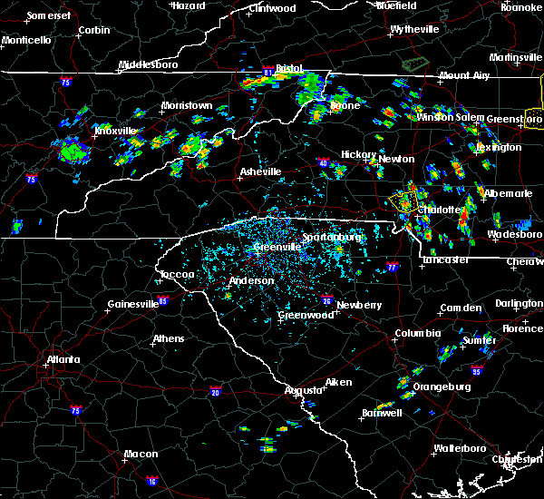 At 527 pm edt, a severe thunderstorm was located 8 miles southwest of huntersville, or near paw creek, moving northwest at 5 mph (radar indicated). Hazards include 60 mph wind gusts and quarter size hail. Minor hail damage to vehicles is expected. expect wind damage to trees and power lines. Locations impacted include, huntersville, northwest charlotte, paw creek, lucia, croft, mt holly, northeast charlotte and central charlotte. At 527 pm edt, a severe thunderstorm was located 8 miles southwest of huntersville, or near paw creek, moving northwest at 5 mph (radar indicated). Hazards include 60 mph wind gusts and quarter size hail. Minor hail damage to vehicles is expected. expect wind damage to trees and power lines. Locations impacted include, huntersville, northwest charlotte, paw creek, lucia, croft, mt holly, northeast charlotte and central charlotte.
|
| 9/1/2018 5:17 PM EDT |
 At 517 pm edt, a severe thunderstorm was located 6 miles northwest of uptown charlotte, or near northwest charlotte, moving north at 5 mph (radar indicated). Hazards include 60 mph wind gusts and quarter size hail. Minor hail damage to vehicles is expected. Expect wind damage to trees and power lines. At 517 pm edt, a severe thunderstorm was located 6 miles northwest of uptown charlotte, or near northwest charlotte, moving north at 5 mph (radar indicated). Hazards include 60 mph wind gusts and quarter size hail. Minor hail damage to vehicles is expected. Expect wind damage to trees and power lines.
|
| 8/31/2018 6:03 PM EDT |
 At 602 pm edt, a new severe thunderstorm was located 7 miles northeast of gastonia, or near stanley, moving north at 5 mph (radar indicated). Hazards include 60 mph wind gusts and quarter size hail. Minor hail damage to vehicles is expected. expect wind damage to trees and power lines. Locations impacted include, gastonia, mt holly, belmont, south gastonia, clover, dallas, stanley, cramerton, lowell and ranlo. At 602 pm edt, a new severe thunderstorm was located 7 miles northeast of gastonia, or near stanley, moving north at 5 mph (radar indicated). Hazards include 60 mph wind gusts and quarter size hail. Minor hail damage to vehicles is expected. expect wind damage to trees and power lines. Locations impacted include, gastonia, mt holly, belmont, south gastonia, clover, dallas, stanley, cramerton, lowell and ranlo.
|
| 8/31/2018 5:46 PM EDT |
 At 545 pm edt, a severe thunderstorm was located 8 miles southeast of gastonia, or near town of lake wylie, moving north at 5 mph (radar indicated). Hazards include 60 mph wind gusts and quarter size hail. Minor hail damage to vehicles is expected. Expect wind damage to trees and power lines. At 545 pm edt, a severe thunderstorm was located 8 miles southeast of gastonia, or near town of lake wylie, moving north at 5 mph (radar indicated). Hazards include 60 mph wind gusts and quarter size hail. Minor hail damage to vehicles is expected. Expect wind damage to trees and power lines.
|
| 8/31/2018 5:46 PM EDT |
 The national weather service in greenville-spartanburg has issued a * severe thunderstorm warning for. gaston county in the piedmont of north carolina. north central york county in upstate south carolina. until 630 pm edt. At 545 pm edt, a severe thunderstorm was located 8 miles southeast. The national weather service in greenville-spartanburg has issued a * severe thunderstorm warning for. gaston county in the piedmont of north carolina. north central york county in upstate south carolina. until 630 pm edt. At 545 pm edt, a severe thunderstorm was located 8 miles southeast.
|
| 8/31/2018 5:31 PM EDT |
 At 530 pm edt, a severe thunderstorm was located near rock hill, moving north at 5 mph. another severe thunderstorm was located north of tega cay, also moving north slowly at 5 mph (radar indicated). Hazards include 60 mph wind gusts and quarter size hail. Minor hail damage to vehicles is expected. expect wind damage to trees and power lines. Locations impacted include, rock hill, fort mill, tega cay, newport, town of lake wylie, steele creek, carowinds, lake wylie and southwest charlotte. At 530 pm edt, a severe thunderstorm was located near rock hill, moving north at 5 mph. another severe thunderstorm was located north of tega cay, also moving north slowly at 5 mph (radar indicated). Hazards include 60 mph wind gusts and quarter size hail. Minor hail damage to vehicles is expected. expect wind damage to trees and power lines. Locations impacted include, rock hill, fort mill, tega cay, newport, town of lake wylie, steele creek, carowinds, lake wylie and southwest charlotte.
|
| 8/31/2018 5:18 PM EDT |
 At 517 pm edt, a severe thunderstorm was located 4 miles west of rock hill, moving north at 10 mph. another thunderstorm from tega cay to fort mill will also produce severe weather as it moves north at 10 mph (radar indicated). Hazards include 60 mph wind gusts and quarter size hail. Minor hail damage to vehicles is expected. Expect wind damage to trees and power lines. At 517 pm edt, a severe thunderstorm was located 4 miles west of rock hill, moving north at 10 mph. another thunderstorm from tega cay to fort mill will also produce severe weather as it moves north at 10 mph (radar indicated). Hazards include 60 mph wind gusts and quarter size hail. Minor hail damage to vehicles is expected. Expect wind damage to trees and power lines.
|
| 8/31/2018 5:02 PM EDT |
 The national weather service in greenville-spartanburg has issued a * severe thunderstorm warning for. southwestern mecklenburg county in the piedmont of north carolina. northeastern york county in upstate south carolina. Until 530 pm edt. The national weather service in greenville-spartanburg has issued a * severe thunderstorm warning for. southwestern mecklenburg county in the piedmont of north carolina. northeastern york county in upstate south carolina. Until 530 pm edt.
|
| 8/31/2018 5:02 PM EDT |
 At 501 pm edt, a severe thunderstorm was located 6 miles northeast of rock hill, or near fort mill, moving north at 5 mph (radar indicated). Hazards include 60 mph wind gusts and quarter size hail. Minor hail damage to vehicles is expected. Expect wind damage to trees and power lines. At 501 pm edt, a severe thunderstorm was located 6 miles northeast of rock hill, or near fort mill, moving north at 5 mph (radar indicated). Hazards include 60 mph wind gusts and quarter size hail. Minor hail damage to vehicles is expected. Expect wind damage to trees and power lines.
|
| 8/31/2018 4:50 PM EDT | Storm damage reported in mecklenburg county NC, 5.3 miles E of Charlotte, NC |
| 8/30/2018 5:41 PM EDT |
 At 541 pm edt, a severe thunderstorm was located 11 miles north of monroe, or near fairview in union county, and is nearly stationary (radar indicated). Hazards include 60 mph wind gusts and quarter size hail. Minor hail damage to vehicles is expected. expect wind damage to trees and power lines. Locations impacted include, mint hill, unionville, hemby bridge, midland, fairview in union county, indian trail and stallings. At 541 pm edt, a severe thunderstorm was located 11 miles north of monroe, or near fairview in union county, and is nearly stationary (radar indicated). Hazards include 60 mph wind gusts and quarter size hail. Minor hail damage to vehicles is expected. expect wind damage to trees and power lines. Locations impacted include, mint hill, unionville, hemby bridge, midland, fairview in union county, indian trail and stallings.
|
| 8/30/2018 5:28 PM EDT |
 At 527 pm edt, a severe thunderstorm was located 10 miles north of monroe, or near fairview in union county, and is nearly stationary (radar indicated). Hazards include 60 mph wind gusts and quarter size hail. Minor hail damage to vehicles is expected. Expect wind damage to trees and power lines. At 527 pm edt, a severe thunderstorm was located 10 miles north of monroe, or near fairview in union county, and is nearly stationary (radar indicated). Hazards include 60 mph wind gusts and quarter size hail. Minor hail damage to vehicles is expected. Expect wind damage to trees and power lines.
|
| 8/8/2018 6:36 PM EDT |
 At 636 pm edt, severe thunderstorms were located along a line extending from 7 miles east of statesville to near kannapolis to 9 miles southeast of uptown charlotte, moving east at 30 mph (radar indicated). Hazards include 60 mph wind gusts and penny size hail. Expect damage to trees and power lines. Locations impacted include, kannapolis, concord, east charlotte, matthews, harrisburg, landis, enochville and cleveland. At 636 pm edt, severe thunderstorms were located along a line extending from 7 miles east of statesville to near kannapolis to 9 miles southeast of uptown charlotte, moving east at 30 mph (radar indicated). Hazards include 60 mph wind gusts and penny size hail. Expect damage to trees and power lines. Locations impacted include, kannapolis, concord, east charlotte, matthews, harrisburg, landis, enochville and cleveland.
|
| 8/8/2018 6:30 PM EDT |
 At 629 pm edt, severe thunderstorms were located along a line extending from 12 miles southeast of statesville to 3 miles southwest of kannapolis to 6 miles east of uptown charlotte, moving east at 45 mph (radar indicated). Hazards include 60 mph wind gusts and penny size hail. expect damage to trees and power lines At 629 pm edt, severe thunderstorms were located along a line extending from 12 miles southeast of statesville to 3 miles southwest of kannapolis to 6 miles east of uptown charlotte, moving east at 45 mph (radar indicated). Hazards include 60 mph wind gusts and penny size hail. expect damage to trees and power lines
|
| 8/8/2018 6:18 PM EDT |
 At 617 pm edt, severe thunderstorms were located along a line extending from near statesville to 4 miles northeast of huntersville to 5 miles south of uptown charlotte, moving east at 35 mph (radar indicated). Hazards include 60 mph wind gusts and quarter size hail. Minor hail damage to vehicles is expected. expect wind damage to trees and power lines. Locations impacted include, charlotte, huntersville, kannapolis, concord, and statesville. At 617 pm edt, severe thunderstorms were located along a line extending from near statesville to 4 miles northeast of huntersville to 5 miles south of uptown charlotte, moving east at 35 mph (radar indicated). Hazards include 60 mph wind gusts and quarter size hail. Minor hail damage to vehicles is expected. expect wind damage to trees and power lines. Locations impacted include, charlotte, huntersville, kannapolis, concord, and statesville.
|
| 8/8/2018 5:48 PM EDT |
 At 547 pm edt, severe thunderstorms were located along a line extending from 7 miles southeast of taylorsville to 9 miles south of gastonia, moving east at 20 mph (radar indicated). Hazards include 70 mph wind gusts and quarter size hail. Minor hail damage to vehicles is expected. expect considerable tree damage. Wind damage is also likely to mobile homes, roofs, and outbuildings. At 547 pm edt, severe thunderstorms were located along a line extending from 7 miles southeast of taylorsville to 9 miles south of gastonia, moving east at 20 mph (radar indicated). Hazards include 70 mph wind gusts and quarter size hail. Minor hail damage to vehicles is expected. expect considerable tree damage. Wind damage is also likely to mobile homes, roofs, and outbuildings.
|
| 8/7/2018 10:10 PM EDT |
 At 1010 pm edt, severe thunderstorms were located along a line extending from 10 miles southeast of downtown concord to 12 miles northwest of monroe, moving east at 20 mph (radar indicated). Hazards include 60 mph wind gusts and quarter size hail. Minor hail damage to vehicles is expected. expect wind damage to trees and power lines. Locations impacted include, downtown concord, east charlotte, matthews, mint hill, unionville, harrisburg, hemby bridge, mt pleasant, reedy creek park and midland. At 1010 pm edt, severe thunderstorms were located along a line extending from 10 miles southeast of downtown concord to 12 miles northwest of monroe, moving east at 20 mph (radar indicated). Hazards include 60 mph wind gusts and quarter size hail. Minor hail damage to vehicles is expected. expect wind damage to trees and power lines. Locations impacted include, downtown concord, east charlotte, matthews, mint hill, unionville, harrisburg, hemby bridge, mt pleasant, reedy creek park and midland.
|
| 8/7/2018 10:04 PM EDT | Public reported trees down in mint hill in mecklenburg county NC, 12.3 miles WNW of Charlotte, NC |
| 8/7/2018 9:57 PM EDT | 911 call center reported tree down along harrisburg road in mecklenburg county NC, 11.3 miles W of Charlotte, NC |
| 8/7/2018 9:56 PM EDT | 911 call center reported tree down along robinson church road in mecklenburg county NC, 9.5 miles W of Charlotte, NC |
| 8/7/2018 9:53 PM EDT |
 At 953 pm edt, severe thunderstorms were located along a line extending from 6 miles east of downtown concord to 7 miles southeast of uptown charlotte, moving east at 25 mph (radar indicated). Hazards include 60 mph wind gusts and quarter size hail. Minor hail damage to vehicles is expected. Expect wind damage to trees and power lines. At 953 pm edt, severe thunderstorms were located along a line extending from 6 miles east of downtown concord to 7 miles southeast of uptown charlotte, moving east at 25 mph (radar indicated). Hazards include 60 mph wind gusts and quarter size hail. Minor hail damage to vehicles is expected. Expect wind damage to trees and power lines.
|
| 7/24/2018 7:30 PM EDT | Social media reported tree down on a house on colony rd. time estimated from rada in mecklenburg county NC, 5.3 miles NNW of Charlotte, NC |
| 7/23/2018 4:10 PM EDT | Social media reported trees down in the eastway park area. time estimated from rada in mecklenburg county NC, 4.6 miles WSW of Charlotte, NC |
| 7/23/2018 4:05 PM EDT | Social media reported a tere down on woodland dr. time estimated from rada in mecklenburg county NC, 4.7 miles WNW of Charlotte, NC |
| 7/23/2018 4:00 PM EDT | Fire dept/rescue reported power lines down on arbor way. time estimated from rada in mecklenburg county NC, 5.8 miles NNW of Charlotte, NC |
| 7/23/2018 3:49 PM EDT |
 At 349 pm edt, severe thunderstorms were located along a line extending from near kannapolis to 3 miles southeast of uptown charlotte, moving northwest at 15 mph (radar indicated). Hazards include 60 mph wind gusts and penny size hail. expect damage to trees and power lines At 349 pm edt, severe thunderstorms were located along a line extending from near kannapolis to 3 miles southeast of uptown charlotte, moving northwest at 15 mph (radar indicated). Hazards include 60 mph wind gusts and penny size hail. expect damage to trees and power lines
|
| 7/22/2018 6:20 PM EDT | Couple trees down and port-o-johns knocked over on clt airport property in mecklenburg county NC, 5.2 miles ENE of Charlotte, NC |
| 7/6/2018 4:41 PM EDT |
 At 440 pm edt, severe thunderstorms were located along a line extending from near uptown charlotte to 11 miles north of lancaster, moving west at 5 mph (radar indicated). Hazards include 60 mph wind gusts and quarter size hail. Minor hail damage to vehicles is expected. Expect wind damage to trees and power lines. At 440 pm edt, severe thunderstorms were located along a line extending from near uptown charlotte to 11 miles north of lancaster, moving west at 5 mph (radar indicated). Hazards include 60 mph wind gusts and quarter size hail. Minor hail damage to vehicles is expected. Expect wind damage to trees and power lines.
|
| 7/6/2018 4:41 PM EDT |
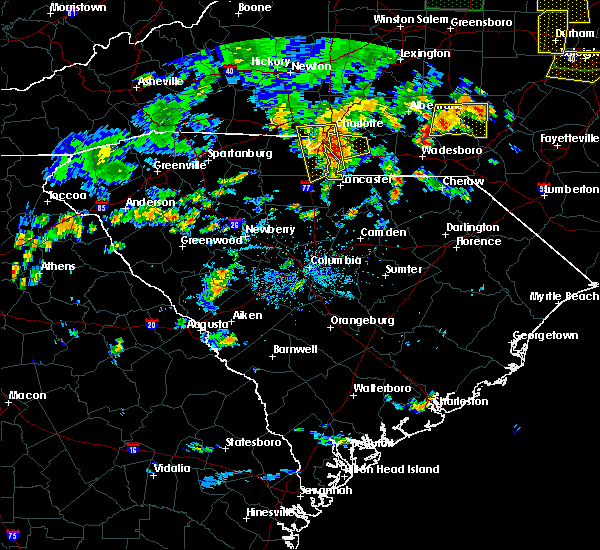 At 440 pm edt, severe thunderstorms were located along a line extending from near uptown charlotte to 11 miles north of lancaster, moving west at 5 mph (radar indicated). Hazards include 60 mph wind gusts and quarter size hail. Minor hail damage to vehicles is expected. Expect wind damage to trees and power lines. At 440 pm edt, severe thunderstorms were located along a line extending from near uptown charlotte to 11 miles north of lancaster, moving west at 5 mph (radar indicated). Hazards include 60 mph wind gusts and quarter size hail. Minor hail damage to vehicles is expected. Expect wind damage to trees and power lines.
|
| 7/6/2018 3:55 PM EDT |
 At 354 pm edt, a severe thunderstorm was located 7 miles northwest of monroe, or near lake park, moving west at 10 mph (radar indicated). Hazards include 60 mph wind gusts and quarter size hail. Minor hail damage to vehicles is expected. Expect wind damage to trees and power lines. At 354 pm edt, a severe thunderstorm was located 7 miles northwest of monroe, or near lake park, moving west at 10 mph (radar indicated). Hazards include 60 mph wind gusts and quarter size hail. Minor hail damage to vehicles is expected. Expect wind damage to trees and power lines.
|
| 6/25/2018 8:40 PM EDT |
 The severe thunderstorm warning for union county will expire at 845 pm edt, the storm which prompted the warning has moved out of the area. therefore the warning will be allowed to expire. however gusty winds are still possible with this thunderstorm. a severe thunderstorm watch remains in effect until 1000 pm edt for the piedmont of north carolina. The severe thunderstorm warning for union county will expire at 845 pm edt, the storm which prompted the warning has moved out of the area. therefore the warning will be allowed to expire. however gusty winds are still possible with this thunderstorm. a severe thunderstorm watch remains in effect until 1000 pm edt for the piedmont of north carolina.
|
| 6/25/2018 8:13 PM EDT |
 At 813 pm edt, a severe thunderstorm was located 12 miles northwest of wadesboro, or 8 miles west of ansonville, moving east at 25 mph (radar indicated). Hazards include 60 mph wind gusts and quarter size hail. Minor hail damage to vehicles is expected. expect wind damage to trees and power lines. Locations impacted include, monroe, indian trail, weddington, stallings, unionville, wesley chapel, wingate, waxhaw, marshville and lake park. At 813 pm edt, a severe thunderstorm was located 12 miles northwest of wadesboro, or 8 miles west of ansonville, moving east at 25 mph (radar indicated). Hazards include 60 mph wind gusts and quarter size hail. Minor hail damage to vehicles is expected. expect wind damage to trees and power lines. Locations impacted include, monroe, indian trail, weddington, stallings, unionville, wesley chapel, wingate, waxhaw, marshville and lake park.
|
| 6/25/2018 7:59 PM EDT |
 At 758 pm edt, a severe thunderstorm was located 12 miles northeast of monroe, or 6 miles north of marshville, moving east at 25 mph (radar indicated). Hazards include 60 mph wind gusts and quarter size hail. Minor hail damage to vehicles is expected. Expect wind damage to trees and power lines. At 758 pm edt, a severe thunderstorm was located 12 miles northeast of monroe, or 6 miles north of marshville, moving east at 25 mph (radar indicated). Hazards include 60 mph wind gusts and quarter size hail. Minor hail damage to vehicles is expected. Expect wind damage to trees and power lines.
|
| 6/25/2018 7:39 PM EDT |
 At 739 pm edt, a severe thunderstorm was located 7 miles north of monroe, or over unionville, moving east at 25 mph (radar indicated). Hazards include 60 mph wind gusts and quarter size hail. Minor hail damage to vehicles is expected. expect wind damage to trees and power lines. Locations impacted include, monroe, indian trail, weddington, stallings, unionville, wesley chapel, wingate, waxhaw, marshville and lake park. At 739 pm edt, a severe thunderstorm was located 7 miles north of monroe, or over unionville, moving east at 25 mph (radar indicated). Hazards include 60 mph wind gusts and quarter size hail. Minor hail damage to vehicles is expected. expect wind damage to trees and power lines. Locations impacted include, monroe, indian trail, weddington, stallings, unionville, wesley chapel, wingate, waxhaw, marshville and lake park.
|
| 6/25/2018 7:21 PM EDT |
 At 721 pm edt, a severe thunderstorm was located 10 miles northwest of monroe, or near hemby bridge, moving east at 25 mph (radar indicated). Hazards include 60 mph wind gusts and quarter size hail. Minor hail damage to vehicles is expected. Expect wind damage to trees and power lines. At 721 pm edt, a severe thunderstorm was located 10 miles northwest of monroe, or near hemby bridge, moving east at 25 mph (radar indicated). Hazards include 60 mph wind gusts and quarter size hail. Minor hail damage to vehicles is expected. Expect wind damage to trees and power lines.
|
| 6/25/2018 6:46 PM EDT |
 At 645 pm edt, severe thunderstorms were located along a line extending from 10 miles northeast of gastonia to 8 miles southwest of gaffney, moving east at 35 mph (radar indicated). Hazards include 60 mph wind gusts and quarter size hail. Minor hail damage to vehicles is expected. expect wind damage to trees and power lines. Locations impacted include, gastonia, spartanburg, shelby, gaffney, kings mountain, mt holly, cherryville, bessemer city, south gastonia and boiling springs sc. At 645 pm edt, severe thunderstorms were located along a line extending from 10 miles northeast of gastonia to 8 miles southwest of gaffney, moving east at 35 mph (radar indicated). Hazards include 60 mph wind gusts and quarter size hail. Minor hail damage to vehicles is expected. expect wind damage to trees and power lines. Locations impacted include, gastonia, spartanburg, shelby, gaffney, kings mountain, mt holly, cherryville, bessemer city, south gastonia and boiling springs sc.
|
| 6/25/2018 6:43 PM EDT |
 At 643 pm edt, severe thunderstorms were located along a line extending from 9 miles northeast of mocksville to 3 miles northeast of huntersville, moving east at 30 mph (radar indicated). Hazards include 60 mph wind gusts and quarter size hail. Minor hail damage to vehicles is expected. Expect wind damage to trees and power lines. At 643 pm edt, severe thunderstorms were located along a line extending from 9 miles northeast of mocksville to 3 miles northeast of huntersville, moving east at 30 mph (radar indicated). Hazards include 60 mph wind gusts and quarter size hail. Minor hail damage to vehicles is expected. Expect wind damage to trees and power lines.
|
| 6/25/2018 6:24 PM EDT |
 At 623 pm edt, severe thunderstorms were located along a line extending from near winston-salem to 10 miles west of huntersville, moving east at 50 mph (radar indicated). Hazards include 60 mph wind gusts and quarter size hail. Minor hail damage to vehicles is expected. expect wind damage to trees and power lines. Locations impacted include, huntersville, statesville, lincolnton, mocksville, cornelius, mooresville, davidson, china grove, maiden and landis. At 623 pm edt, severe thunderstorms were located along a line extending from near winston-salem to 10 miles west of huntersville, moving east at 50 mph (radar indicated). Hazards include 60 mph wind gusts and quarter size hail. Minor hail damage to vehicles is expected. expect wind damage to trees and power lines. Locations impacted include, huntersville, statesville, lincolnton, mocksville, cornelius, mooresville, davidson, china grove, maiden and landis.
|
| 6/25/2018 6:22 PM EDT |
 At 621 pm edt, severe thunderstorms were located along a line extending from 6 miles northwest of gastonia to 4 miles northwest of spartanburg, moving east at 35 mph (radar indicated). Hazards include 60 mph wind gusts and quarter size hail. Minor hail damage to vehicles is expected. Expect wind damage to trees and power lines. At 621 pm edt, severe thunderstorms were located along a line extending from 6 miles northwest of gastonia to 4 miles northwest of spartanburg, moving east at 35 mph (radar indicated). Hazards include 60 mph wind gusts and quarter size hail. Minor hail damage to vehicles is expected. Expect wind damage to trees and power lines.
|
| 6/25/2018 5:57 PM EDT |
 The national weather service in greenville-spartanburg has issued a * severe thunderstorm warning for. northwestern cabarrus county in the piedmont of north carolina. catawba county in the piedmont of north carolina. davie county in the piedmont of north carolina. Alexander county in the piedmont of north carolina. The national weather service in greenville-spartanburg has issued a * severe thunderstorm warning for. northwestern cabarrus county in the piedmont of north carolina. catawba county in the piedmont of north carolina. davie county in the piedmont of north carolina. Alexander county in the piedmont of north carolina.
|
| 6/20/2018 6:32 PM EDT | One tree down on south summit avenu in mecklenburg county NC, 0.3 miles NNE of Charlotte, NC |
| 6/20/2018 6:26 PM EDT |
 At 626 pm edt, a severe thunderstorm was located near uptown charlotte, moving east at 20 mph (radar indicated). Hazards include 60 mph wind gusts and quarter size hail. Minor hail damage to vehicles is expected. Expect wind damage to trees and power lines. At 626 pm edt, a severe thunderstorm was located near uptown charlotte, moving east at 20 mph (radar indicated). Hazards include 60 mph wind gusts and quarter size hail. Minor hail damage to vehicles is expected. Expect wind damage to trees and power lines.
|
| 6/20/2018 6:08 PM EDT | A few tree limbs down on josh birmingham parkway just east of the charlotte douglas international airpor in mecklenburg county NC, 4.4 miles ENE of Charlotte, NC |
| 6/14/2018 10:29 PM EDT |
 At 1028 pm edt, a severe thunderstorm was located 5 miles northwest of huntersville, or near ramsey creek park, moving southeast at 15 mph (radar indicated). Hazards include 60 mph wind gusts. Expect damage to trees and power lines. Locations impacted include, westport, denver, lowesville, terrell, lucia, lake norman and sherrills ford. At 1028 pm edt, a severe thunderstorm was located 5 miles northwest of huntersville, or near ramsey creek park, moving southeast at 15 mph (radar indicated). Hazards include 60 mph wind gusts. Expect damage to trees and power lines. Locations impacted include, westport, denver, lowesville, terrell, lucia, lake norman and sherrills ford.
|
| 6/14/2018 10:11 PM EDT |
 At 1010 pm edt, a severe thunderstorm was located 9 miles northwest of huntersville, or near lake norman, moving south at 10 mph (radar indicated). Hazards include 60 mph wind gusts. Expect damage to trees and power lines. Locations impacted include, huntersville, cornelius, davidson, westport, lake norman, denver, ramsey creek park, lowesville, terrell and lucia. At 1010 pm edt, a severe thunderstorm was located 9 miles northwest of huntersville, or near lake norman, moving south at 10 mph (radar indicated). Hazards include 60 mph wind gusts. Expect damage to trees and power lines. Locations impacted include, huntersville, cornelius, davidson, westport, lake norman, denver, ramsey creek park, lowesville, terrell and lucia.
|
| 6/14/2018 9:43 PM EDT |
 At 942 pm edt, a severe thunderstorm was located 11 miles north of huntersville, or near lake norman, moving southeast at 15 mph (radar indicated). Hazards include 60 mph wind gusts and quarter size hail. Minor hail damage to vehicles is expected. Expect wind damage to trees and power lines. At 942 pm edt, a severe thunderstorm was located 11 miles north of huntersville, or near lake norman, moving southeast at 15 mph (radar indicated). Hazards include 60 mph wind gusts and quarter size hail. Minor hail damage to vehicles is expected. Expect wind damage to trees and power lines.
|
| 6/11/2018 7:49 PM EDT |
 At 749 pm edt, a severe thunderstorm was located 8 miles southwest of uptown charlotte, or over southwest charlotte, moving south at 10 mph (radar indicated). Hazards include 60 mph wind gusts and penny size hail. expect damage to trees and power lines At 749 pm edt, a severe thunderstorm was located 8 miles southwest of uptown charlotte, or over southwest charlotte, moving south at 10 mph (radar indicated). Hazards include 60 mph wind gusts and penny size hail. expect damage to trees and power lines
|
| 6/3/2018 8:39 PM EDT |
 At 839 pm edt, a severe thunderstorm was located 7 miles south of salisbury, or near faith, moving southeast at 30 mph (radar indicated). Hazards include 60 mph wind gusts and quarter size hail. Minor hail damage to vehicles is expected. expect wind damage to trees and power lines. Locations impacted include, kannapolis, downtown concord, salisbury, west concord, mooresville, davidson, harrisburg, china grove, landis and enochville. At 839 pm edt, a severe thunderstorm was located 7 miles south of salisbury, or near faith, moving southeast at 30 mph (radar indicated). Hazards include 60 mph wind gusts and quarter size hail. Minor hail damage to vehicles is expected. expect wind damage to trees and power lines. Locations impacted include, kannapolis, downtown concord, salisbury, west concord, mooresville, davidson, harrisburg, china grove, landis and enochville.
|
| 6/3/2018 8:31 PM EDT |
 At 831 pm edt, a severe thunderstorm was located near uptown charlotte, moving southeast at 20 mph (radar indicated). Hazards include 60 mph wind gusts and quarter size hail. Minor hail damage to vehicles is expected. expect wind damage to trees and power lines. Locations impacted include, uptown charlotte, huntersville, central charlotte, south charlotte, northeast charlotte, southwest charlotte, east charlotte, northwest charlotte, west concord and matthews. At 831 pm edt, a severe thunderstorm was located near uptown charlotte, moving southeast at 20 mph (radar indicated). Hazards include 60 mph wind gusts and quarter size hail. Minor hail damage to vehicles is expected. expect wind damage to trees and power lines. Locations impacted include, uptown charlotte, huntersville, central charlotte, south charlotte, northeast charlotte, southwest charlotte, east charlotte, northwest charlotte, west concord and matthews.
|
| 6/3/2018 8:25 PM EDT |
 At 825 pm edt, a severe thunderstorm was located 12 miles southeast of statesville, or near mooresville, moving southeast at 25 mph (radar indicated). Hazards include 60 mph wind gusts and quarter size hail. Minor hail damage to vehicles is expected. Expect wind damage to trees and power lines. At 825 pm edt, a severe thunderstorm was located 12 miles southeast of statesville, or near mooresville, moving southeast at 25 mph (radar indicated). Hazards include 60 mph wind gusts and quarter size hail. Minor hail damage to vehicles is expected. Expect wind damage to trees and power lines.
|
| 6/3/2018 8:24 PM EDT | Trees and powerlines down on east 35th street and cinderella roa in mecklenburg county NC, 2.8 miles NW of Charlotte, NC |
| 6/3/2018 8:18 PM EDT |
 At 818 pm edt, a severe thunderstorm was located near uptown charlotte, or near northwest charlotte, moving southeast at 35 mph (radar indicated). Hazards include 60 mph wind gusts and quarter size hail. Minor hail damage to vehicles is expected. expect wind damage to trees and power lines. Locations impacted include, uptown charlotte, huntersville, central charlotte, south charlotte, northeast charlotte, southwest charlotte, east charlotte, northwest charlotte, west concord and matthews. At 818 pm edt, a severe thunderstorm was located near uptown charlotte, or near northwest charlotte, moving southeast at 35 mph (radar indicated). Hazards include 60 mph wind gusts and quarter size hail. Minor hail damage to vehicles is expected. expect wind damage to trees and power lines. Locations impacted include, uptown charlotte, huntersville, central charlotte, south charlotte, northeast charlotte, southwest charlotte, east charlotte, northwest charlotte, west concord and matthews.
|
| 6/3/2018 7:48 PM EDT |
 At 747 pm edt, severe thunderstorms were located along a line extending from 6 miles west of huntersville to 10 miles northwest of uptown charlotte, moving southeast at 20 mph (radar indicated). Hazards include 60 mph wind gusts and quarter size hail. Minor hail damage to vehicles is expected. Expect wind damage to trees and power lines. At 747 pm edt, severe thunderstorms were located along a line extending from 6 miles west of huntersville to 10 miles northwest of uptown charlotte, moving southeast at 20 mph (radar indicated). Hazards include 60 mph wind gusts and quarter size hail. Minor hail damage to vehicles is expected. Expect wind damage to trees and power lines.
|
| 6/3/2018 7:42 PM EDT |
 At 741 pm edt, a severe thunderstorm was located 6 miles east of lincolnton, or over iron station, moving east at 25 mph (radar indicated). Hazards include 60 mph wind gusts and quarter size hail. Minor hail damage to vehicles is expected. expect wind damage to trees and power lines. Locations impacted include, lincolnton, mt holly, belmont, cherryville, dallas, maiden, stanley, cramerton, lowell and ranlo. At 741 pm edt, a severe thunderstorm was located 6 miles east of lincolnton, or over iron station, moving east at 25 mph (radar indicated). Hazards include 60 mph wind gusts and quarter size hail. Minor hail damage to vehicles is expected. expect wind damage to trees and power lines. Locations impacted include, lincolnton, mt holly, belmont, cherryville, dallas, maiden, stanley, cramerton, lowell and ranlo.
|
| 6/3/2018 7:28 PM EDT |
 At 728 pm edt, severe thunderstorms were located along a line extending from 12 miles southwest of lincolnton to 9 miles southeast of shelby, moving east at 30 mph (radar indicated). Hazards include 60 mph wind gusts and quarter size hail. Minor hail damage to vehicles is expected. Expect wind damage to trees and power lines. At 728 pm edt, severe thunderstorms were located along a line extending from 12 miles southwest of lincolnton to 9 miles southeast of shelby, moving east at 30 mph (radar indicated). Hazards include 60 mph wind gusts and quarter size hail. Minor hail damage to vehicles is expected. Expect wind damage to trees and power lines.
|
| 6/3/2018 7:23 PM EDT |
 At 723 pm edt, severe thunderstorms were located along a line extending from 5 miles north of lincolnton to 14 miles northeast of shelby, moving east at 25 mph. this storm will produce widespread wind damage across lincolnton (radar indicated). Hazards include 70 mph wind gusts and ping pong ball size hail. People and animals outdoors will be injured. expect hail damage to roofs, siding, windows, and vehicles. expect considerable tree damage. wind damage is also likely to mobile homes, roofs, and outbuildings. Locations impacted include, newton, lincolnton, mt holly, belmont, conover, cherryville, dallas, maiden, stanley and cramerton. At 723 pm edt, severe thunderstorms were located along a line extending from 5 miles north of lincolnton to 14 miles northeast of shelby, moving east at 25 mph. this storm will produce widespread wind damage across lincolnton (radar indicated). Hazards include 70 mph wind gusts and ping pong ball size hail. People and animals outdoors will be injured. expect hail damage to roofs, siding, windows, and vehicles. expect considerable tree damage. wind damage is also likely to mobile homes, roofs, and outbuildings. Locations impacted include, newton, lincolnton, mt holly, belmont, conover, cherryville, dallas, maiden, stanley and cramerton.
|
| 6/3/2018 7:14 PM EDT |
 At 714 pm edt, severe thunderstorms were located along a line extending from 6 miles southwest of newton to 9 miles west of lincolnton, moving east at 25 mph (radar indicated). Hazards include 60 mph wind gusts and half dollar size hail. Minor hail damage to vehicles is expected. Expect wind damage to trees and power lines. At 714 pm edt, severe thunderstorms were located along a line extending from 6 miles southwest of newton to 9 miles west of lincolnton, moving east at 25 mph (radar indicated). Hazards include 60 mph wind gusts and half dollar size hail. Minor hail damage to vehicles is expected. Expect wind damage to trees and power lines.
|
| 6/2/2018 3:04 PM EDT |
 The national weather service in greenville-spartanburg has issued a * severe thunderstorm warning for. southwestern mecklenburg county in the piedmont of north carolina. eastern york county in upstate south carolina. Until 345 pm edt. The national weather service in greenville-spartanburg has issued a * severe thunderstorm warning for. southwestern mecklenburg county in the piedmont of north carolina. eastern york county in upstate south carolina. Until 345 pm edt.
|
| 6/2/2018 3:04 PM EDT |
 At 303 pm edt, a severe thunderstorm was located 6 miles northeast of rock hill, or near fort mill, moving southeast at 10 mph (radar indicated). Hazards include 60 mph wind gusts and quarter size hail. Minor hail damage to vehicles is expected. Expect wind damage to trees and power lines. At 303 pm edt, a severe thunderstorm was located 6 miles northeast of rock hill, or near fort mill, moving southeast at 10 mph (radar indicated). Hazards include 60 mph wind gusts and quarter size hail. Minor hail damage to vehicles is expected. Expect wind damage to trees and power lines.
|
| 6/1/2018 8:48 PM EDT | Reports of trees and powerlines down across the southwestern portion of charlott in mecklenburg county NC, 3.9 miles NNE of Charlotte, NC |
| 6/1/2018 8:37 PM EDT |
 At 836 pm edt, a severe thunderstorm was located 8 miles east of rock hill, or near catawba, moving east at 20 mph (radar indicated). Hazards include 60 mph wind gusts. Expect damage to trees and power lines. Locations impacted include, rock hill, york, fort mill, tega cay, clover, newport, town of lake wylie, lesslie, smyrna and catawba. At 836 pm edt, a severe thunderstorm was located 8 miles east of rock hill, or near catawba, moving east at 20 mph (radar indicated). Hazards include 60 mph wind gusts. Expect damage to trees and power lines. Locations impacted include, rock hill, york, fort mill, tega cay, clover, newport, town of lake wylie, lesslie, smyrna and catawba.
|
| 6/1/2018 8:34 PM EDT |
 At 834 pm edt, severe thunderstorms were located along a line extending from 5 miles south of uptown charlotte to 9 miles west of monroe to 7 miles northeast of lancaster, moving east at 25 mph (radar indicated). Hazards include 60 mph wind gusts and quarter size hail. Minor hail damage to vehicles is expected. expect wind damage to trees and power lines. Locations impacted include, uptown charlotte, monroe, central charlotte, south charlotte, southwest charlotte, east charlotte, northwest charlotte, matthews, mint hill and indian trail. At 834 pm edt, severe thunderstorms were located along a line extending from 5 miles south of uptown charlotte to 9 miles west of monroe to 7 miles northeast of lancaster, moving east at 25 mph (radar indicated). Hazards include 60 mph wind gusts and quarter size hail. Minor hail damage to vehicles is expected. expect wind damage to trees and power lines. Locations impacted include, uptown charlotte, monroe, central charlotte, south charlotte, southwest charlotte, east charlotte, northwest charlotte, matthews, mint hill and indian trail.
|
| 6/1/2018 8:24 PM EDT |
 At 824 pm edt, a severe thunderstorm was located 4 miles southeast of rock hill, or over lesslie, moving east at 20 mph (radar indicated). Hazards include 60 mph wind gusts and quarter size hail. Minor hail damage to vehicles is expected. expect wind damage to trees and power lines. Locations impacted include, rock hill, york, fort mill, tega cay, clover, newport, town of lake wylie, lesslie, great falls and fort lawn. At 824 pm edt, a severe thunderstorm was located 4 miles southeast of rock hill, or over lesslie, moving east at 20 mph (radar indicated). Hazards include 60 mph wind gusts and quarter size hail. Minor hail damage to vehicles is expected. expect wind damage to trees and power lines. Locations impacted include, rock hill, york, fort mill, tega cay, clover, newport, town of lake wylie, lesslie, great falls and fort lawn.
|
| 6/1/2018 8:17 PM EDT |
 At 817 pm edt, severe thunderstorms were located along a line extending from 9 miles west of uptown charlotte to 12 miles east of rock hill to 6 miles north of lancaster, moving east at 20 mph (radar indicated). Hazards include 60 mph wind gusts and quarter size hail. Minor hail damage to vehicles is expected. Expect wind damage to trees and power lines. At 817 pm edt, severe thunderstorms were located along a line extending from 9 miles west of uptown charlotte to 12 miles east of rock hill to 6 miles north of lancaster, moving east at 20 mph (radar indicated). Hazards include 60 mph wind gusts and quarter size hail. Minor hail damage to vehicles is expected. Expect wind damage to trees and power lines.
|
| 6/1/2018 7:57 PM EDT |
 At 756 pm edt, a severe thunderstorm was located 6 miles west of rock hill, or 5 miles south of newport, moving east at 20 mph. severe thunderstorms extend from eastern cherokee county, all the way east across york county to the south of york and rock hill, and will develop into northeast chester county (radar indicated). Hazards include 60 mph wind gusts and quarter size hail. Minor hail damage to vehicles is expected. Expect wind damage to trees and power lines. At 756 pm edt, a severe thunderstorm was located 6 miles west of rock hill, or 5 miles south of newport, moving east at 20 mph. severe thunderstorms extend from eastern cherokee county, all the way east across york county to the south of york and rock hill, and will develop into northeast chester county (radar indicated). Hazards include 60 mph wind gusts and quarter size hail. Minor hail damage to vehicles is expected. Expect wind damage to trees and power lines.
|
| 6/1/2018 6:41 PM EDT |
 The severe thunderstorm warning for western cabarrus, mecklenburg and northeastern york counties will expire at 645 pm edt, the storms which prompted the warning have weakened below severe limits, and no longer pose an immediate threat to life or property. therefore the warning will be allowed to expire. however heavy rain is still possible with these thunderstorms. The severe thunderstorm warning for western cabarrus, mecklenburg and northeastern york counties will expire at 645 pm edt, the storms which prompted the warning have weakened below severe limits, and no longer pose an immediate threat to life or property. therefore the warning will be allowed to expire. however heavy rain is still possible with these thunderstorms.
|
| 6/1/2018 6:23 PM EDT |
 At 621 pm edt, severe thunderstorms were located along a line extending from near huntersville to near uptown charlotte to 12 miles north of rock hill, moving east at 30 mph. the line of storms was weakening. if new storms do not form or strengthen, the warning will be cancelled (radar indicated). Hazards include 60 mph wind gusts. Expect damage to trees and power lines. Locations impacted include, uptown charlotte, huntersville, kannapolis, downtown concord, central charlotte, south charlotte, northeast charlotte, southwest charlotte, east charlotte and northwest charlotte. At 621 pm edt, severe thunderstorms were located along a line extending from near huntersville to near uptown charlotte to 12 miles north of rock hill, moving east at 30 mph. the line of storms was weakening. if new storms do not form or strengthen, the warning will be cancelled (radar indicated). Hazards include 60 mph wind gusts. Expect damage to trees and power lines. Locations impacted include, uptown charlotte, huntersville, kannapolis, downtown concord, central charlotte, south charlotte, northeast charlotte, southwest charlotte, east charlotte and northwest charlotte.
|
| 6/1/2018 5:59 PM EDT |
 At 558 pm edt, severe thunderstorms were located along a line extending from 8 miles west of huntersville to 5 miles east of gastonia to 7 miles north of york, moving east at 30 mph (radar indicated). Hazards include 60 mph wind gusts. expect damage to trees and power lines At 558 pm edt, severe thunderstorms were located along a line extending from 8 miles west of huntersville to 5 miles east of gastonia to 7 miles north of york, moving east at 30 mph (radar indicated). Hazards include 60 mph wind gusts. expect damage to trees and power lines
|
| 6/1/2018 5:42 PM EDT |
 At 541 pm edt, severe thunderstorms were located along a line extending from 7 miles south of lincolnton to 11 miles northwest of york, moving east at 20 mph (radar indicated). Hazards include 60 mph wind gusts. Expect damage to trees and power lines. Locations impacted include, gastonia, york, kings mountain, mt holly, belmont, bessemer city, south gastonia, clover, dallas and stanley. At 541 pm edt, severe thunderstorms were located along a line extending from 7 miles south of lincolnton to 11 miles northwest of york, moving east at 20 mph (radar indicated). Hazards include 60 mph wind gusts. Expect damage to trees and power lines. Locations impacted include, gastonia, york, kings mountain, mt holly, belmont, bessemer city, south gastonia, clover, dallas and stanley.
|
| 6/1/2018 5:28 PM EDT |
 At 528 pm edt, severe thunderstorms were located along a line extending from 7 miles southwest of lincolnton to 9 miles northeast of gaffney, moving east at 20 mph (radar indicated). Hazards include 60 mph wind gusts. expect damage to trees and power lines At 528 pm edt, severe thunderstorms were located along a line extending from 7 miles southwest of lincolnton to 9 miles northeast of gaffney, moving east at 20 mph (radar indicated). Hazards include 60 mph wind gusts. expect damage to trees and power lines
|
| 5/29/2018 9:06 PM EDT |
 At 904 pm edt, a tornado tornado confirmed by law enforcement was located 7 miles east of gastonia, or near cramerton, moving north at 15 mph (law enforcement confirmed tornado). Hazards include damaging tornado. Flying debris will be dangerous to those caught without shelter. mobile homes will be damaged or destroyed. damage to roofs, windows, and vehicles will occur. tree damage is likely. This dangerous storm will remain over mainly rural areas of west central mecklenburg and eastern gaston counties. At 904 pm edt, a tornado tornado confirmed by law enforcement was located 7 miles east of gastonia, or near cramerton, moving north at 15 mph (law enforcement confirmed tornado). Hazards include damaging tornado. Flying debris will be dangerous to those caught without shelter. mobile homes will be damaged or destroyed. damage to roofs, windows, and vehicles will occur. tree damage is likely. This dangerous storm will remain over mainly rural areas of west central mecklenburg and eastern gaston counties.
|
| 5/29/2018 8:55 PM EDT |
 At 855 pm edt, a severe thunderstorm capable of producing a tornado was located 7 miles east of gastonia, or near belmont, moving north at 15 mph (radar indicated rotation). Hazards include tornado. Flying debris will be dangerous to those caught without shelter. mobile homes will be damaged or destroyed. damage to roofs, windows, and vehicles will occur. tree damage is likely. this dangerous storm will be near, lake wylie and paw creek around 900 pm edt. Gastonia, mt holly, mcadenville, lowell and ranlo around 910 pm edt. At 855 pm edt, a severe thunderstorm capable of producing a tornado was located 7 miles east of gastonia, or near belmont, moving north at 15 mph (radar indicated rotation). Hazards include tornado. Flying debris will be dangerous to those caught without shelter. mobile homes will be damaged or destroyed. damage to roofs, windows, and vehicles will occur. tree damage is likely. this dangerous storm will be near, lake wylie and paw creek around 900 pm edt. Gastonia, mt holly, mcadenville, lowell and ranlo around 910 pm edt.
|
| 5/29/2018 8:43 PM EDT |
 At 842 pm edt, a severe thunderstorm capable of producing a tornado was located 8 miles southeast of gastonia, or near cramerton, moving north at 15 mph (radar indicated rotation). Hazards include tornado. Flying debris will be dangerous to those caught without shelter. mobile homes will be damaged or destroyed. damage to roofs, windows, and vehicles will occur. tree damage is likely. this dangerous storm will be near, lake wylie and charlotte douglas airport around 850 pm edt. cramerton and paw creek around 900 pm edt. Gastonia, belmont, mcadenville, mt holly and lowell around 910 pm edt. At 842 pm edt, a severe thunderstorm capable of producing a tornado was located 8 miles southeast of gastonia, or near cramerton, moving north at 15 mph (radar indicated rotation). Hazards include tornado. Flying debris will be dangerous to those caught without shelter. mobile homes will be damaged or destroyed. damage to roofs, windows, and vehicles will occur. tree damage is likely. this dangerous storm will be near, lake wylie and charlotte douglas airport around 850 pm edt. cramerton and paw creek around 900 pm edt. Gastonia, belmont, mcadenville, mt holly and lowell around 910 pm edt.
|
| 4/15/2018 3:58 PM EDT |
 At 357 pm edt, severe thunderstorms were located along a line extending from 4 miles west of downtown concord to 11 miles west of albemarle, moving northeast at 55 mph (radar indicated). Hazards include 60 mph wind gusts and quarter size hail. Minor hail damage to vehicles is expected. expect wind damage to trees and power lines. locations impacted include, downtown concord, west concord, wingate, marshville, granite quarry and rockwell. A tornado watch remains in effect until 700 pm edt for the piedmont of north carolina. At 357 pm edt, severe thunderstorms were located along a line extending from 4 miles west of downtown concord to 11 miles west of albemarle, moving northeast at 55 mph (radar indicated). Hazards include 60 mph wind gusts and quarter size hail. Minor hail damage to vehicles is expected. expect wind damage to trees and power lines. locations impacted include, downtown concord, west concord, wingate, marshville, granite quarry and rockwell. A tornado watch remains in effect until 700 pm edt for the piedmont of north carolina.
|
| 4/15/2018 3:41 PM EDT |
 At 340 pm edt, severe thunderstorms were located along a line extending from 4 miles southeast of uptown charlotte to 17 miles south of downtown concord to 9 miles east of monroe, moving northeast at 55 mph (radar indicated). Hazards include 60 mph wind gusts and quarter size hail. Minor hail damage to vehicles is expected. Expect wind damage to trees and power lines. At 340 pm edt, severe thunderstorms were located along a line extending from 4 miles southeast of uptown charlotte to 17 miles south of downtown concord to 9 miles east of monroe, moving northeast at 55 mph (radar indicated). Hazards include 60 mph wind gusts and quarter size hail. Minor hail damage to vehicles is expected. Expect wind damage to trees and power lines.
|
| 4/15/2018 3:27 PM EDT | Large tree down on erskine dr. time estimated from rada in mecklenburg county NC, 3.9 miles W of Charlotte, NC |
| 4/15/2018 3:25 PM EDT |
 At 324 pm edt, a severe thunderstorm was located 8 miles west of monroe, or over wesley chapel, moving north at 60 mph (radar indicated). Hazards include 60 mph wind gusts and quarter size hail. Minor hail damage to vehicles is expected. expect wind damage to trees and power lines. locations impacted include, uptown charlotte, monroe, south charlotte, east charlotte, matthews, mint hill, indian trail, weddington, stallings and unionville. A tornado watch remains in effect until 700 pm edt for the piedmont of north carolina. At 324 pm edt, a severe thunderstorm was located 8 miles west of monroe, or over wesley chapel, moving north at 60 mph (radar indicated). Hazards include 60 mph wind gusts and quarter size hail. Minor hail damage to vehicles is expected. expect wind damage to trees and power lines. locations impacted include, uptown charlotte, monroe, south charlotte, east charlotte, matthews, mint hill, indian trail, weddington, stallings and unionville. A tornado watch remains in effect until 700 pm edt for the piedmont of north carolina.
|
| 4/15/2018 3:25 PM EDT |
 At 324 pm edt, a severe thunderstorm was located 4 miles southwest of huntersville, moving northeast at 50 mph (radar indicated). Hazards include 60 mph wind gusts and quarter size hail. Minor hail damage to vehicles is expected. Expect wind damage to trees and power lines. At 324 pm edt, a severe thunderstorm was located 4 miles southwest of huntersville, moving northeast at 50 mph (radar indicated). Hazards include 60 mph wind gusts and quarter size hail. Minor hail damage to vehicles is expected. Expect wind damage to trees and power lines.
|
| 4/15/2018 3:24 PM EDT | Large oak tree blown down onto power lines on jane ave. time estimated from rada in mecklenburg county NC, 4.2 miles SSW of Charlotte, NC |
| 4/15/2018 3:24 PM EDT | Numerous trees down in the mountain island lake area. time estimated from rada in mecklenburg county NC, 9 miles SE of Charlotte, NC |
| 4/15/2018 3:17 PM EDT |
 At 314 pm edt, a severe thunderstorm capable of producing a tornado was located 9 miles west of uptown charlotte, or near belmont, moving northeast at 50 mph (radar indicated rotation). Hazards include tornado and quarter size hail. Flying debris will be dangerous to those caught without shelter. mobile homes will be damaged or destroyed. damage to roofs, windows, and vehicles will occur. tree damage is likely. this dangerous storm will be near, lake wylie around 320 pm edt. huntersville and northwest charlotte around 330 pm edt. Other locations impacted by this dangerous storm include lucia and croft. At 314 pm edt, a severe thunderstorm capable of producing a tornado was located 9 miles west of uptown charlotte, or near belmont, moving northeast at 50 mph (radar indicated rotation). Hazards include tornado and quarter size hail. Flying debris will be dangerous to those caught without shelter. mobile homes will be damaged or destroyed. damage to roofs, windows, and vehicles will occur. tree damage is likely. this dangerous storm will be near, lake wylie around 320 pm edt. huntersville and northwest charlotte around 330 pm edt. Other locations impacted by this dangerous storm include lucia and croft.
|
| 4/15/2018 3:15 PM EDT |
 At 315 pm edt, a severe thunderstorm was located 9 miles north of lancaster, or 4 miles south of waxhaw, moving north at 65 mph (radar indicated). Hazards include 60 mph wind gusts and quarter size hail. Minor hail damage to vehicles is expected. Expect wind damage to trees and power lines. At 315 pm edt, a severe thunderstorm was located 9 miles north of lancaster, or 4 miles south of waxhaw, moving north at 65 mph (radar indicated). Hazards include 60 mph wind gusts and quarter size hail. Minor hail damage to vehicles is expected. Expect wind damage to trees and power lines.
|
| 4/15/2018 3:13 PM EDT | Kclt asos measured a 59 kt gus in mecklenburg county NC, 5.3 miles E of Charlotte, NC |
| 4/15/2018 3:02 PM EDT |
 At 301 pm edt, a severe thunderstorm capable of producing a tornado was located 10 miles southeast of gastonia, or near town of lake wylie, moving northeast at 50 mph (radar indicated rotation). Hazards include tornado and quarter size hail. Flying debris will be dangerous to those caught without shelter. mobile homes will be damaged or destroyed. damage to roofs, windows, and vehicles will occur. tree damage is likely. this dangerous storm will be near, lake wylie, cramerton, mcadenville, charlotte douglas airport and lowell around 310 pm edt. paw creek, southwest charlotte, mt holly and belmont around 320 pm edt. huntersville and northwest charlotte around 330 pm edt. Other locations impacted by this dangerous thunderstorm include crowders, lucia and croft. At 301 pm edt, a severe thunderstorm capable of producing a tornado was located 10 miles southeast of gastonia, or near town of lake wylie, moving northeast at 50 mph (radar indicated rotation). Hazards include tornado and quarter size hail. Flying debris will be dangerous to those caught without shelter. mobile homes will be damaged or destroyed. damage to roofs, windows, and vehicles will occur. tree damage is likely. this dangerous storm will be near, lake wylie, cramerton, mcadenville, charlotte douglas airport and lowell around 310 pm edt. paw creek, southwest charlotte, mt holly and belmont around 320 pm edt. huntersville and northwest charlotte around 330 pm edt. Other locations impacted by this dangerous thunderstorm include crowders, lucia and croft.
|
| 4/15/2018 2:44 PM EDT |
 At 243 pm edt, a severe thunderstorm was located 10 miles northwest of chester, or 4 miles northwest of lowrys, moving north at 65 mph (radar indicated). Hazards include 60 mph wind gusts and quarter size hail. Minor hail damage to vehicles is expected. Expect wind damage to trees and power lines. At 243 pm edt, a severe thunderstorm was located 10 miles northwest of chester, or 4 miles northwest of lowrys, moving north at 65 mph (radar indicated). Hazards include 60 mph wind gusts and quarter size hail. Minor hail damage to vehicles is expected. Expect wind damage to trees and power lines.
|
| 10/23/2017 5:55 PM EDT |
 At 554 pm edt, severe thunderstorms were located along a line extending from 11 miles north of badin lake to 6 miles east of albemarle to 15 miles north of wadesboro, moving northeast at 40 mph (radar indicated). Hazards include 60 mph wind gusts. Expect damage to trees and power lines. locations impacted include, kannapolis, downtown concord, monroe, west concord, unionville, harrisburg, wesley chapel, wingate, waxhaw and lake park. A tornado watch remains in effect until 900 pm edt for the piedmont of north carolina. At 554 pm edt, severe thunderstorms were located along a line extending from 11 miles north of badin lake to 6 miles east of albemarle to 15 miles north of wadesboro, moving northeast at 40 mph (radar indicated). Hazards include 60 mph wind gusts. Expect damage to trees and power lines. locations impacted include, kannapolis, downtown concord, monroe, west concord, unionville, harrisburg, wesley chapel, wingate, waxhaw and lake park. A tornado watch remains in effect until 900 pm edt for the piedmont of north carolina.
|
| 10/23/2017 5:26 PM EDT |
 At 526 pm edt, severe thunderstorms were located along a line extending from 5 miles southeast of huntersville to 9 miles southeast of uptown charlotte to 13 miles east of rock hill, moving northeast at 40 mph (radar indicated). Hazards include 60 mph wind gusts. expect damage to trees and power lines At 526 pm edt, severe thunderstorms were located along a line extending from 5 miles southeast of huntersville to 9 miles southeast of uptown charlotte to 13 miles east of rock hill, moving northeast at 40 mph (radar indicated). Hazards include 60 mph wind gusts. expect damage to trees and power lines
|
| 9/1/2017 7:23 PM EDT |
 At 723 pm edt, a severe thunderstorm capable of producing a tornado was located near kannapolis, or near coddle creek reservoir, moving northeast at 45 mph (radar indicated rotation). Hazards include tornado. Flying debris will be dangerous to those caught without shelter. mobile homes will be damaged or destroyed. damage to roofs, windows, and vehicles will occur. tree damage is likely. this dangerous storm will be near, landis around 730 pm edt. Salisbury, faith, china grove, granite quarry and rockwell around 740 pm edt. At 723 pm edt, a severe thunderstorm capable of producing a tornado was located near kannapolis, or near coddle creek reservoir, moving northeast at 45 mph (radar indicated rotation). Hazards include tornado. Flying debris will be dangerous to those caught without shelter. mobile homes will be damaged or destroyed. damage to roofs, windows, and vehicles will occur. tree damage is likely. this dangerous storm will be near, landis around 730 pm edt. Salisbury, faith, china grove, granite quarry and rockwell around 740 pm edt.
|
| 9/1/2017 7:18 PM EDT |
 At 717 pm edt, a severe thunderstorm was located 6 miles northwest of salisbury, or 5 miles east of cleveland, moving northeast at 50 mph (radar indicated). Hazards include 60 mph wind gusts and quarter size hail. Minor hail damage to vehicles is expected. expect wind damage to trees and power lines. locations impacted include, huntersville, kannapolis, salisbury, northeast charlotte, cornelius, mooresville, davidson, china grove, spencer and landis. A tornado watch remains in effect until 1000 pm edt for the piedmont of north carolina. At 717 pm edt, a severe thunderstorm was located 6 miles northwest of salisbury, or 5 miles east of cleveland, moving northeast at 50 mph (radar indicated). Hazards include 60 mph wind gusts and quarter size hail. Minor hail damage to vehicles is expected. expect wind damage to trees and power lines. locations impacted include, huntersville, kannapolis, salisbury, northeast charlotte, cornelius, mooresville, davidson, china grove, spencer and landis. A tornado watch remains in effect until 1000 pm edt for the piedmont of north carolina.
|
| 9/1/2017 7:12 PM EDT |
 At 711 pm edt, a severe thunderstorm capable of producing a tornado was located near huntersville, moving northeast at 45 mph (radar indicated rotation). Hazards include tornado. Flying debris will be dangerous to those caught without shelter. mobile homes will be damaged or destroyed. damage to roofs, windows, and vehicles will occur. tree damage is likely. this dangerous storm will be near, coddle creek reservoir around 720 pm edt. kannapolis, enochville and landis around 730 pm edt. china grove, faith, granite quarry and rockwell around 740 pm edt. Other locations impacted by this dangerous thunderstorm include croft. At 711 pm edt, a severe thunderstorm capable of producing a tornado was located near huntersville, moving northeast at 45 mph (radar indicated rotation). Hazards include tornado. Flying debris will be dangerous to those caught without shelter. mobile homes will be damaged or destroyed. damage to roofs, windows, and vehicles will occur. tree damage is likely. this dangerous storm will be near, coddle creek reservoir around 720 pm edt. kannapolis, enochville and landis around 730 pm edt. china grove, faith, granite quarry and rockwell around 740 pm edt. Other locations impacted by this dangerous thunderstorm include croft.
|
| 9/1/2017 6:49 PM EDT |
 At 648 pm edt, a severe thunderstorm was located near huntersville, moving northeast at 50 mph (radar indicated). Hazards include 60 mph wind gusts and quarter size hail. Minor hail damage to vehicles is expected. Expect wind damage to trees and power lines. At 648 pm edt, a severe thunderstorm was located near huntersville, moving northeast at 50 mph (radar indicated). Hazards include 60 mph wind gusts and quarter size hail. Minor hail damage to vehicles is expected. Expect wind damage to trees and power lines.
|
| 9/1/2017 3:14 PM EDT |
 At 313 pm edt, a severe thunderstorm was located 5 miles east of salisbury, or near spencer, moving northeast at 55 mph (radar indicated). Hazards include 60 mph wind gusts and quarter size hail. Minor hail damage to vehicles is expected. expect wind damage to trees and power lines. locations impacted include, kannapolis, downtown concord, salisbury, west concord, harrisburg, china grove, spencer, landis, enochville and granite quarry. A tornado watch remains in effect until 1000 pm edt for the piedmont of north carolina. At 313 pm edt, a severe thunderstorm was located 5 miles east of salisbury, or near spencer, moving northeast at 55 mph (radar indicated). Hazards include 60 mph wind gusts and quarter size hail. Minor hail damage to vehicles is expected. expect wind damage to trees and power lines. locations impacted include, kannapolis, downtown concord, salisbury, west concord, harrisburg, china grove, spencer, landis, enochville and granite quarry. A tornado watch remains in effect until 1000 pm edt for the piedmont of north carolina.
|
| 9/1/2017 3:05 PM EDT |
 The severe thunderstorm warning for southeastern mecklenburg, western union and southeastern york counties will expire at 315 pm edt, the storm which prompted the warning has weakened below severe limits, and no longer poses an immediate threat to life or property. therefore the warning will be allowed to expire. a tornado watch remains in effect until 1000 pm edt for the piedmont of north carolina, and upstate south carolina. The severe thunderstorm warning for southeastern mecklenburg, western union and southeastern york counties will expire at 315 pm edt, the storm which prompted the warning has weakened below severe limits, and no longer poses an immediate threat to life or property. therefore the warning will be allowed to expire. a tornado watch remains in effect until 1000 pm edt for the piedmont of north carolina, and upstate south carolina.
|
| 9/1/2017 2:55 PM EDT |
 At 254 pm edt, a severe thunderstorm was located 13 miles east of rock hill, or near marvin, moving northeast at 45 mph (radar indicated). Hazards include 60 mph wind gusts and quarter size hail. Minor hail damage to vehicles is expected. expect wind damage to trees and power lines. locations impacted include, south charlotte, east charlotte, matthews, mint hill, indian trail, weddington, stallings, unionville, wesley chapel and waxhaw. A tornado watch remains in effect until 1000 pm edt for the piedmont of north carolina, and upstate south carolina. At 254 pm edt, a severe thunderstorm was located 13 miles east of rock hill, or near marvin, moving northeast at 45 mph (radar indicated). Hazards include 60 mph wind gusts and quarter size hail. Minor hail damage to vehicles is expected. expect wind damage to trees and power lines. locations impacted include, south charlotte, east charlotte, matthews, mint hill, indian trail, weddington, stallings, unionville, wesley chapel and waxhaw. A tornado watch remains in effect until 1000 pm edt for the piedmont of north carolina, and upstate south carolina.
|
| 9/1/2017 2:53 PM EDT | Fire dept/rescue reported power lines down on water oak rd. time estimated from rada in mecklenburg county NC, 5.3 miles NW of Charlotte, NC |
| 9/1/2017 2:50 PM EDT | Fire dept/rescue reported power lines down on woodlark ln and andover r in mecklenburg county NC, 4.9 miles NW of Charlotte, NC |
| 9/1/2017 2:50 PM EDT | Fire dept/rescue reported power lines down on audubon r in mecklenburg county NC, 4.6 miles NW of Charlotte, NC |
| 9/1/2017 2:45 PM EDT |
 At 245 pm edt, a severe thunderstorm was located 7 miles southwest of downtown concord, or near charlotte motor speedway, moving northeast at 55 mph (radar indicated). Hazards include 60 mph wind gusts and quarter size hail. Minor hail damage to vehicles is expected. Expect wind damage to trees and power lines. At 245 pm edt, a severe thunderstorm was located 7 miles southwest of downtown concord, or near charlotte motor speedway, moving northeast at 55 mph (radar indicated). Hazards include 60 mph wind gusts and quarter size hail. Minor hail damage to vehicles is expected. Expect wind damage to trees and power lines.
|
| 9/1/2017 2:25 PM EDT |
 At 225 pm edt, a severe thunderstorm was located 10 miles east of chester, or near richburg, moving northeast at 45 mph (radar indicated). Hazards include 60 mph wind gusts and quarter size hail. Minor hail damage to vehicles is expected. Expect wind damage to trees and power lines. At 225 pm edt, a severe thunderstorm was located 10 miles east of chester, or near richburg, moving northeast at 45 mph (radar indicated). Hazards include 60 mph wind gusts and quarter size hail. Minor hail damage to vehicles is expected. Expect wind damage to trees and power lines.
|
| 8/23/2017 3:42 PM EDT |
 At 342 pm edt, a severe thunderstorm was located 11 miles south of uptown charlotte, or near pineville, moving east at 25 mph (radar indicated). Hazards include 60 mph wind gusts and penny size hail. expect damage to trees and power lines At 342 pm edt, a severe thunderstorm was located 11 miles south of uptown charlotte, or near pineville, moving east at 25 mph (radar indicated). Hazards include 60 mph wind gusts and penny size hail. expect damage to trees and power lines
|
| 8/7/2017 10:53 PM EDT |
 The severe thunderstorm warning for southwestern mecklenburg county will expire at 1100 pm edt, the storm which prompted the warning has weakened below severe limits, and is moving northeast of the area. therefore the warning will be allowed to expire on schedule at 11 pm. however, gusty winds to 35 mph will still possible through 1130 pm. The severe thunderstorm warning for southwestern mecklenburg county will expire at 1100 pm edt, the storm which prompted the warning has weakened below severe limits, and is moving northeast of the area. therefore the warning will be allowed to expire on schedule at 11 pm. however, gusty winds to 35 mph will still possible through 1130 pm.
|
| 8/7/2017 10:47 PM EDT | One large tree down near uptown charlotte. time estimated from rada in mecklenburg county NC, 2.4 miles NNW of Charlotte, NC |
| 8/7/2017 10:45 PM EDT |
 At 1044 pm edt, a severe thunderstorm was located near uptown charlotte, or near central charlotte, moving northeast at 45 mph (radar indicated). Hazards include 60 mph wind gusts and penny size hail. Expect damage to trees and power lines. Locations impacted include, uptown charlotte, central charlotte, south charlotte, southwest charlotte, northwest charlotte, matthews, pineville, freedom park, the plaza and charlotte douglas airport. At 1044 pm edt, a severe thunderstorm was located near uptown charlotte, or near central charlotte, moving northeast at 45 mph (radar indicated). Hazards include 60 mph wind gusts and penny size hail. Expect damage to trees and power lines. Locations impacted include, uptown charlotte, central charlotte, south charlotte, southwest charlotte, northwest charlotte, matthews, pineville, freedom park, the plaza and charlotte douglas airport.
|
| 8/7/2017 10:34 PM EDT |
 At 1034 pm edt, a severe thunderstorm was located 9 miles southwest of uptown charlotte, or near steele creek, moving northeast at 30 mph (radar indicated). Hazards include 60 mph wind gusts and penny size hail. Expect damage to trees and power lines. Locations impacted include, uptown charlotte, central charlotte, south charlotte, southwest charlotte, northwest charlotte, matthews, belmont, pineville, cramerton and town of lake wylie. At 1034 pm edt, a severe thunderstorm was located 9 miles southwest of uptown charlotte, or near steele creek, moving northeast at 30 mph (radar indicated). Hazards include 60 mph wind gusts and penny size hail. Expect damage to trees and power lines. Locations impacted include, uptown charlotte, central charlotte, south charlotte, southwest charlotte, northwest charlotte, matthews, belmont, pineville, cramerton and town of lake wylie.
|
| 8/7/2017 10:18 PM EDT |
 At 1017 pm edt, a severe thunderstorm was located 7 miles northeast of york, or 5 miles southwest of town of lake wylie, moving northeast at 45 mph (radar indicated). Hazards include 60 mph wind gusts and penny size hail. Expect damage to trees and power lines. Locations impacted include, uptown charlotte, central charlotte, south charlotte, southwest charlotte, northwest charlotte, matthews, belmont, pineville, tega cay and clover. At 1017 pm edt, a severe thunderstorm was located 7 miles northeast of york, or 5 miles southwest of town of lake wylie, moving northeast at 45 mph (radar indicated). Hazards include 60 mph wind gusts and penny size hail. Expect damage to trees and power lines. Locations impacted include, uptown charlotte, central charlotte, south charlotte, southwest charlotte, northwest charlotte, matthews, belmont, pineville, tega cay and clover.
|
| 8/7/2017 10:00 PM EDT |
 At 959 pm edt, a severe thunderstorm was located 6 miles west of york, or near sharon, moving northeast at 45 mph (radar indicated). Hazards include 60 mph wind gusts and penny size hail. expect damage to trees and power lines At 959 pm edt, a severe thunderstorm was located 6 miles west of york, or near sharon, moving northeast at 45 mph (radar indicated). Hazards include 60 mph wind gusts and penny size hail. expect damage to trees and power lines
|
| 7/28/2017 5:08 PM EDT | Social media reported a large tree down on a house on gladstone l in mecklenburg county NC, 5.6 miles W of Charlotte, NC |
| 7/28/2017 5:01 PM EDT |
 At 501 pm edt, severe thunderstorms were located along a line extending from 6 miles northeast of huntersville to 4 miles southeast of uptown charlotte to 11 miles northeast of lancaster, moving east at 30 mph (radar indicated). Hazards include 70 mph wind gusts. Expect considerable tree damage. damage is likely to mobile homes, roofs, and outbuildings. Locations impacted include, uptown charlotte, huntersville, kannapolis, downtown concord, monroe, central charlotte, south charlotte, northeast charlotte, southwest charlotte and east charlotte. At 501 pm edt, severe thunderstorms were located along a line extending from 6 miles northeast of huntersville to 4 miles southeast of uptown charlotte to 11 miles northeast of lancaster, moving east at 30 mph (radar indicated). Hazards include 70 mph wind gusts. Expect considerable tree damage. damage is likely to mobile homes, roofs, and outbuildings. Locations impacted include, uptown charlotte, huntersville, kannapolis, downtown concord, monroe, central charlotte, south charlotte, northeast charlotte, southwest charlotte and east charlotte.
|
| 7/28/2017 5:00 PM EDT | Law enforcement reported a tree down leaning on power lines on commonwealth av in mecklenburg county NC, 4.5 miles WNW of Charlotte, NC |
| 7/28/2017 4:55 PM EDT | Trees and power lines down on valley stream roa in mecklenburg county NC, 4.4 miles N of Charlotte, NC |
| 7/28/2017 4:55 PM EDT | Law enforcement reported branches down on power lines resulting in a fire on west field r in mecklenburg county NC, 3.7 miles N of Charlotte, NC |
| 7/28/2017 4:50 PM EDT | Broadcast media reported a tree down on a house on mint s in mecklenburg county NC, 5.2 miles SE of Charlotte, NC |
| 7/28/2017 4:47 PM EDT |
 At 447 pm edt, severe thunderstorms were located along a line extending from 5 miles northwest of huntersville to 3 miles southwest of uptown charlotte to 6 miles northeast of lancaster, moving east at 30 mph (radar indicated). Hazards include 70 mph wind gusts. Expect considerable tree damage. damage is likely to mobile homes, roofs, and outbuildings. Locations impacted include, rock hill, uptown charlotte, huntersville, kannapolis, downtown concord, monroe, central charlotte, south charlotte, northeast charlotte and southwest charlotte. At 447 pm edt, severe thunderstorms were located along a line extending from 5 miles northwest of huntersville to 3 miles southwest of uptown charlotte to 6 miles northeast of lancaster, moving east at 30 mph (radar indicated). Hazards include 70 mph wind gusts. Expect considerable tree damage. damage is likely to mobile homes, roofs, and outbuildings. Locations impacted include, rock hill, uptown charlotte, huntersville, kannapolis, downtown concord, monroe, central charlotte, south charlotte, northeast charlotte and southwest charlotte.
|
| 7/28/2017 4:28 PM EDT |
 At 428 pm edt, severe thunderstorms were located along a line extending from 12 miles east of lincolnton to near gastonia to 4 miles southwest of lancaster, moving east at 25 mph (radar indicated). Hazards include 60 mph wind gusts. Expect damage to trees and power lines. Locations impacted include, gastonia, rock hill, lincolnton, york, mt holly, fort mill, belmont, bessemer city, south gastonia and tega cay. At 428 pm edt, severe thunderstorms were located along a line extending from 12 miles east of lincolnton to near gastonia to 4 miles southwest of lancaster, moving east at 25 mph (radar indicated). Hazards include 60 mph wind gusts. Expect damage to trees and power lines. Locations impacted include, gastonia, rock hill, lincolnton, york, mt holly, fort mill, belmont, bessemer city, south gastonia and tega cay.
|
| 7/28/2017 4:22 PM EDT |
 At 422 pm edt, severe thunderstorms were located along a line extending from 10 miles northeast of lincolnton to 9 miles southeast of gastonia to 8 miles south of rock hill, moving east at 30 mph (radar indicated). Hazards include 60 mph wind gusts. expect damage to trees and power lines At 422 pm edt, severe thunderstorms were located along a line extending from 10 miles northeast of lincolnton to 9 miles southeast of gastonia to 8 miles south of rock hill, moving east at 30 mph (radar indicated). Hazards include 60 mph wind gusts. expect damage to trees and power lines
|
| 7/28/2017 4:04 PM EDT |
 At 404 pm edt, severe thunderstorms were located along a line extending from 4 miles north of lincolnton to 10 miles west of gastonia to 9 miles east of chester, moving east at 15 mph (radar indicated). Hazards include 60 mph wind gusts. Expect damage to trees and power lines. Locations impacted include, gastonia, rock hill, shelby, gaffney, lincolnton, york, chester, kings mountain, mt holly and fort mill. At 404 pm edt, severe thunderstorms were located along a line extending from 4 miles north of lincolnton to 10 miles west of gastonia to 9 miles east of chester, moving east at 15 mph (radar indicated). Hazards include 60 mph wind gusts. Expect damage to trees and power lines. Locations impacted include, gastonia, rock hill, shelby, gaffney, lincolnton, york, chester, kings mountain, mt holly and fort mill.
|
| 7/28/2017 3:55 PM EDT |
 At 355 pm edt, severe thunderstorms were located along a line extending from 3 miles north of lincolnton to 9 miles southeast of shelby to 8 miles southeast of chester, moving northeast at 15 mph (radar indicated). Hazards include 60 mph wind gusts. expect damage to trees and power lines At 355 pm edt, severe thunderstorms were located along a line extending from 3 miles north of lincolnton to 9 miles southeast of shelby to 8 miles southeast of chester, moving northeast at 15 mph (radar indicated). Hazards include 60 mph wind gusts. expect damage to trees and power lines
|
| 7/23/2017 4:51 PM EDT |
 At 450 pm edt, severe thunderstorms were located along a line extending from 13 miles west of monroe to 12 miles southeast of union, moving east at 15 mph (radar indicated). Hazards include 60 mph wind gusts and quarter size hail. Minor hail damage to vehicles is expected. expect wind damage to trees and power lines. Locations impacted include, rock hill, chester, fort mill, waxhaw, mineral springs, lesslie, great falls, marvin, fort lawn and carlisle. At 450 pm edt, severe thunderstorms were located along a line extending from 13 miles west of monroe to 12 miles southeast of union, moving east at 15 mph (radar indicated). Hazards include 60 mph wind gusts and quarter size hail. Minor hail damage to vehicles is expected. expect wind damage to trees and power lines. Locations impacted include, rock hill, chester, fort mill, waxhaw, mineral springs, lesslie, great falls, marvin, fort lawn and carlisle.
|
| 7/23/2017 4:31 PM EDT |
 At 431 pm edt, a severe thunderstorm was located 8 miles southeast of uptown charlotte, or near matthews, moving east at 15 mph (radar indicated). Hazards include 60 mph wind gusts and quarter size hail. Minor hail damage to vehicles is expected. Expect wind damage to trees and power lines. At 431 pm edt, a severe thunderstorm was located 8 miles southeast of uptown charlotte, or near matthews, moving east at 15 mph (radar indicated). Hazards include 60 mph wind gusts and quarter size hail. Minor hail damage to vehicles is expected. Expect wind damage to trees and power lines.
|
| 7/23/2017 4:20 PM EDT |
 At 419 pm edt, severe thunderstorms were located along a line extending from 11 miles south of uptown charlotte to 6 miles south of union, moving east at 15 mph (radar indicated). Hazards include 60 mph wind gusts and quarter size hail. Minor hail damage to vehicles is expected. Expect wind damage to trees and power lines. At 419 pm edt, severe thunderstorms were located along a line extending from 11 miles south of uptown charlotte to 6 miles south of union, moving east at 15 mph (radar indicated). Hazards include 60 mph wind gusts and quarter size hail. Minor hail damage to vehicles is expected. Expect wind damage to trees and power lines.
|
| 7/23/2017 4:14 PM EDT |
 At 414 pm edt, a severe thunderstorm was located 8 miles southeast of uptown charlotte, or near matthews, moving east at 15 mph (radar indicated). Hazards include 60 mph wind gusts and quarter size hail. Minor hail damage to vehicles is expected. expect wind damage to trees and power lines. Locations impacted include, uptown charlotte, central charlotte, south charlotte, southwest charlotte, east charlotte, matthews, mint hill, indian trail, weddington and stallings. At 414 pm edt, a severe thunderstorm was located 8 miles southeast of uptown charlotte, or near matthews, moving east at 15 mph (radar indicated). Hazards include 60 mph wind gusts and quarter size hail. Minor hail damage to vehicles is expected. expect wind damage to trees and power lines. Locations impacted include, uptown charlotte, central charlotte, south charlotte, southwest charlotte, east charlotte, matthews, mint hill, indian trail, weddington and stallings.
|
| 7/23/2017 4:05 PM EDT | Trees down and patio furniture blown ove in mecklenburg county NC, 11.3 miles N of Charlotte, NC |
| 7/23/2017 3:52 PM EDT | Several trees reported down in mint hill... n in mecklenburg county NC, 11.8 miles WNW of Charlotte, NC |
| 7/23/2017 3:45 PM EDT |
 At 345 pm edt, a severe thunderstorm was located 4 miles south of uptown charlotte, or near freedom park, moving east at 15 mph (radar indicated). Hazards include 60 mph wind gusts and quarter size hail. Minor hail damage to vehicles is expected. Expect wind damage to trees and power lines. At 345 pm edt, a severe thunderstorm was located 4 miles south of uptown charlotte, or near freedom park, moving east at 15 mph (radar indicated). Hazards include 60 mph wind gusts and quarter size hail. Minor hail damage to vehicles is expected. Expect wind damage to trees and power lines.
|
| 7/23/2017 3:35 PM EDT |
 At 335 pm edt, a severe thunderstorm was located 5 miles southwest of downtown concord, or near harrisburg, moving southeast at 20 mph (radar indicated). Hazards include 60 mph wind gusts and quarter size hail. Minor hail damage to vehicles is expected. expect wind damage to trees and power lines. Locations impacted include, huntersville, kannapolis, downtown concord, northeast charlotte, west concord, cornelius, davidson, harrisburg, reedy creek park and charlotte motor speedway. At 335 pm edt, a severe thunderstorm was located 5 miles southwest of downtown concord, or near harrisburg, moving southeast at 20 mph (radar indicated). Hazards include 60 mph wind gusts and quarter size hail. Minor hail damage to vehicles is expected. expect wind damage to trees and power lines. Locations impacted include, huntersville, kannapolis, downtown concord, northeast charlotte, west concord, cornelius, davidson, harrisburg, reedy creek park and charlotte motor speedway.
|
| 7/23/2017 3:30 PM EDT | Multiple trees down due west of harrisburg... n in mecklenburg county NC, 9.8 miles SW of Charlotte, NC |
| 7/23/2017 3:22 PM EDT |
 At 322 pm edt, a severe thunderstorm was located 6 miles southeast of huntersville, or near charlotte motor speedway, moving southeast at 20 mph (radar indicated). Hazards include 60 mph wind gusts and quarter size hail. Minor hail damage to vehicles is expected. Expect wind damage to trees and power lines. At 322 pm edt, a severe thunderstorm was located 6 miles southeast of huntersville, or near charlotte motor speedway, moving southeast at 20 mph (radar indicated). Hazards include 60 mph wind gusts and quarter size hail. Minor hail damage to vehicles is expected. Expect wind damage to trees and power lines.
|
| 7/18/2017 9:51 PM EDT |
 The severe thunderstorm warning for southeastern lincoln and gaston counties will expire at 1000 pm edt, the storm which prompted the warning has weakened below severe limits, and no longer poses an immediate threat to life or property. therefore the warning will be allowed to expire. however gusty winds and heavy rain are still possible with this thunderstorm. if you observed large hail or wind damage, please report it to the national weather service greenville-spartanburg by calling toll free, 1, 800, 2 6 7, 8 1 0 1, or by posting on our facebook page, or tweet it using hashtag nwsgsp. your message should describe the event and the specific location where it occurred. The severe thunderstorm warning for southeastern lincoln and gaston counties will expire at 1000 pm edt, the storm which prompted the warning has weakened below severe limits, and no longer poses an immediate threat to life or property. therefore the warning will be allowed to expire. however gusty winds and heavy rain are still possible with this thunderstorm. if you observed large hail or wind damage, please report it to the national weather service greenville-spartanburg by calling toll free, 1, 800, 2 6 7, 8 1 0 1, or by posting on our facebook page, or tweet it using hashtag nwsgsp. your message should describe the event and the specific location where it occurred.
|
| 7/18/2017 9:09 PM EDT |
 At 908 pm edt, a severe thunderstorm was located 7 miles northeast of gastonia, or over stanley, moving southwest at 5 mph (radar indicated). Hazards include 60 mph wind gusts and quarter size hail. Minor hail damage to vehicles is expected. Expect wind damage to trees and power lines. At 908 pm edt, a severe thunderstorm was located 7 miles northeast of gastonia, or over stanley, moving southwest at 5 mph (radar indicated). Hazards include 60 mph wind gusts and quarter size hail. Minor hail damage to vehicles is expected. Expect wind damage to trees and power lines.
|
| 7/18/2017 8:58 PM EDT | Tree down on house creating extensive damage at central and morningside avenue in mecklenburg county NC, 3.4 miles WNW of Charlotte, NC |
| 7/18/2017 8:58 PM EDT | Tree down blocking traffic at i-77 and john belk freewa in mecklenburg county NC, 0.9 miles N of Charlotte, NC |
| 7/18/2017 8:54 PM EDT | Tree blwon down on house on yadkin avenu in mecklenburg county NC, 2.8 miles W of Charlotte, NC |
| 7/18/2017 8:44 PM EDT | Quarter sized hail reported 0.7 miles ENE of Charlotte, NC, quarter size hail reported in the wesley heights neighborhood. |
| 7/18/2017 8:43 PM EDT | Tree fell down and was on fire blocking arching oak lane. perhaps due to lightnin in mecklenburg county NC, 6.3 miles WNW of Charlotte, NC |
| 7/18/2017 8:43 PM EDT |
 The severe thunderstorm warning for southwestern cabarrus. southeastern mecklenburg and north central union counties will expire at 845 pm edt. the storm which prompted the warning has weakened below severe limits, and no longer poses an immediate threat to life or property. Therefore the warning will be allowed to expire. The severe thunderstorm warning for southwestern cabarrus. southeastern mecklenburg and north central union counties will expire at 845 pm edt. the storm which prompted the warning has weakened below severe limits, and no longer poses an immediate threat to life or property. Therefore the warning will be allowed to expire.
|
| 7/18/2017 8:41 PM EDT | Tree down blocking two lanes at attaberry drive and indiana avenu in mecklenburg county NC, 3.3 miles W of Charlotte, NC |
| 7/18/2017 8:38 PM EDT |
 At 835 pm edt, a severe thunderstorm was located near uptown charlotte, moving southwest at 10 mph (radar indicated). Hazards include 60 mph wind gusts and penny size hail. expect damage to trees and power lines At 835 pm edt, a severe thunderstorm was located near uptown charlotte, moving southwest at 10 mph (radar indicated). Hazards include 60 mph wind gusts and penny size hail. expect damage to trees and power lines
|
| 7/18/2017 8:35 PM EDT | Tree hit powerlines and a car on union stree in mecklenburg county NC, 2.8 miles W of Charlotte, NC |
| 7/18/2017 8:34 PM EDT | Tree blown down blocking westfield roa in mecklenburg county NC, 3.7 miles N of Charlotte, NC |
| 7/18/2017 8:34 PM EDT | Trees down on car and powerlines on louise driv in mecklenburg county NC, 2.4 miles WNW of Charlotte, NC |
| 7/18/2017 8:34 PM EDT | Light pole blown down across i-277 near panthers stadiu in mecklenburg county NC, 1 miles NNW of Charlotte, NC |
| 7/18/2017 8:34 PM EDT | Tree down on powerline at providence road and sharon amity roa in mecklenburg county NC, 5.2 miles NNW of Charlotte, NC |
| 7/18/2017 8:07 PM EDT |
 At 806 pm edt, a severe thunderstorm was located 11 miles south of downtown concord, or 5 miles northeast of mint hill, moving south at 15 mph (radar indicated). Hazards include 60 mph wind gusts and quarter size hail. Minor hail damage to vehicles is expected. Expect wind damage to trees and power lines. At 806 pm edt, a severe thunderstorm was located 11 miles south of downtown concord, or 5 miles northeast of mint hill, moving south at 15 mph (radar indicated). Hazards include 60 mph wind gusts and quarter size hail. Minor hail damage to vehicles is expected. Expect wind damage to trees and power lines.
|
| 7/15/2017 5:27 PM EDT |
 At 527 pm edt, severe thunderstorms were located along a line extending from 8 miles south of mocksville to 8 miles northeast of huntersville, moving southeast at 20 mph (radar indicated). Hazards include 60 mph wind gusts. Expect damage to trees and power lines. Locations impacted include, kannapolis, salisbury, cornelius, mooresville, davidson, china grove, spencer, landis, enochville and cooleemee. At 527 pm edt, severe thunderstorms were located along a line extending from 8 miles south of mocksville to 8 miles northeast of huntersville, moving southeast at 20 mph (radar indicated). Hazards include 60 mph wind gusts. Expect damage to trees and power lines. Locations impacted include, kannapolis, salisbury, cornelius, mooresville, davidson, china grove, spencer, landis, enochville and cooleemee.
|
| 7/15/2017 5:05 PM EDT |
 At 505 pm edt, severe thunderstorms were located along a line extending from 9 miles southwest of mocksville to 12 miles north of huntersville, moving southeast at 25 mph (radar indicated). Hazards include 60 mph wind gusts and quarter size hail. Minor hail damage to vehicles is expected. Expect wind damage to trees and power lines. At 505 pm edt, severe thunderstorms were located along a line extending from 9 miles southwest of mocksville to 12 miles north of huntersville, moving southeast at 25 mph (radar indicated). Hazards include 60 mph wind gusts and quarter size hail. Minor hail damage to vehicles is expected. Expect wind damage to trees and power lines.
|
| 7/15/2017 2:45 PM EDT |
 At 244 pm edt, a severe thunderstorm was located 7 miles west of uptown charlotte, or near charlotte douglas airport, moving southeast at 15 mph (radar indicated). Hazards include 60 mph wind gusts and quarter size hail. Minor hail damage to vehicles is expected. expect wind damage to trees and power lines. Locations impacted include, gastonia, uptown charlotte, central charlotte, southwest charlotte, northwest charlotte, mt holly, belmont, stanley, cramerton and lowell. At 244 pm edt, a severe thunderstorm was located 7 miles west of uptown charlotte, or near charlotte douglas airport, moving southeast at 15 mph (radar indicated). Hazards include 60 mph wind gusts and quarter size hail. Minor hail damage to vehicles is expected. expect wind damage to trees and power lines. Locations impacted include, gastonia, uptown charlotte, central charlotte, southwest charlotte, northwest charlotte, mt holly, belmont, stanley, cramerton and lowell.
|
| 7/15/2017 2:20 PM EDT |
 At 220 pm edt, a severe thunderstorm was located 6 miles east of gastonia, or near mcadenville, moving southeast at 15 mph (radar indicated). Hazards include 60 mph wind gusts and quarter size hail. Minor hail damage to vehicles is expected. Expect wind damage to trees and power lines. At 220 pm edt, a severe thunderstorm was located 6 miles east of gastonia, or near mcadenville, moving southeast at 15 mph (radar indicated). Hazards include 60 mph wind gusts and quarter size hail. Minor hail damage to vehicles is expected. Expect wind damage to trees and power lines.
|
| 7/8/2017 5:23 PM EDT |
 At 523 pm edt, a severe thunderstorm was located 10 miles northwest of huntersville, or near westport, moving east at 20 mph (radar indicated). Hazards include 60 mph wind gusts and quarter size hail. Minor hail damage to vehicles is expected. Expect wind damage to trees and power lines. At 523 pm edt, a severe thunderstorm was located 10 miles northwest of huntersville, or near westport, moving east at 20 mph (radar indicated). Hazards include 60 mph wind gusts and quarter size hail. Minor hail damage to vehicles is expected. Expect wind damage to trees and power lines.
|
| 7/6/2017 5:53 PM EDT |
 At 553 pm edt, a severe thunderstorm was located near downtown concord, or near west concord, moving east at 25 mph (radar indicated). Hazards include 60 mph wind gusts and penny size hail. Expect damage to trees and power lines. Locations impacted include, kannapolis, downtown concord, west concord, harrisburg, mt pleasant, coddle creek reservoir, charlotte motor speedway, unc charlotte, enochville and northeast charlotte. At 553 pm edt, a severe thunderstorm was located near downtown concord, or near west concord, moving east at 25 mph (radar indicated). Hazards include 60 mph wind gusts and penny size hail. Expect damage to trees and power lines. Locations impacted include, kannapolis, downtown concord, west concord, harrisburg, mt pleasant, coddle creek reservoir, charlotte motor speedway, unc charlotte, enochville and northeast charlotte.
|
| 7/6/2017 5:28 PM EDT |
 At 528 pm edt, a severe thunderstorm was located near huntersville, moving east at 25 mph (radar indicated). Hazards include 60 mph wind gusts and quarter size hail. Minor hail damage to vehicles is expected. Expect wind damage to trees and power lines. At 528 pm edt, a severe thunderstorm was located near huntersville, moving east at 25 mph (radar indicated). Hazards include 60 mph wind gusts and quarter size hail. Minor hail damage to vehicles is expected. Expect wind damage to trees and power lines.
|
| 7/6/2017 5:20 PM EDT | Fire dept/rescue reported a tree down on reed blvd. time estimated from rada in mecklenburg county NC, 4.1 miles E of Charlotte, NC |
| 7/6/2017 5:20 PM EDT | Fire dept/rescue reported a tree down on northcrest dr. time estimated from rada in mecklenburg county NC, 4.1 miles SW of Charlotte, NC |
| 7/6/2017 5:16 PM EDT | Fire dept/rescue reported a tree down on power lines on beatties ford rd. time estimated from rada in mecklenburg county NC, 3.2 miles S of Charlotte, NC |
| 7/6/2017 5:09 PM EDT |
 At 508 pm edt, a severe thunderstorm was located 7 miles west of huntersville, or 5 miles northeast of mt holly, moving east at 25 mph (radar indicated). Hazards include 60 mph wind gusts and quarter size hail. Minor hail damage to vehicles is expected. expect wind damage to trees and power lines. Locations impacted include, huntersville, northeast charlotte, northwest charlotte, cornelius, mt holly, davidson, dallas, stanley, lowell and ranlo. At 508 pm edt, a severe thunderstorm was located 7 miles west of huntersville, or 5 miles northeast of mt holly, moving east at 25 mph (radar indicated). Hazards include 60 mph wind gusts and quarter size hail. Minor hail damage to vehicles is expected. expect wind damage to trees and power lines. Locations impacted include, huntersville, northeast charlotte, northwest charlotte, cornelius, mt holly, davidson, dallas, stanley, lowell and ranlo.
|
| 7/6/2017 4:49 PM EDT |
 At 449 pm edt, a severe thunderstorm was located 9 miles north of gastonia, or near stanley, moving east at 25 mph (radar indicated). Hazards include 60 mph wind gusts and quarter size hail. Minor hail damage to vehicles is expected. Expect wind damage to trees and power lines. At 449 pm edt, a severe thunderstorm was located 9 miles north of gastonia, or near stanley, moving east at 25 mph (radar indicated). Hazards include 60 mph wind gusts and quarter size hail. Minor hail damage to vehicles is expected. Expect wind damage to trees and power lines.
|
| 7/5/2017 6:18 PM EDT |
 At 617 pm edt, a severe thunderstorm was located 8 miles southeast of uptown charlotte, or near matthews, moving east at 30 mph (radar indicated). Hazards include 60 mph wind gusts and penny size hail. Expect damage to trees and power lines. Locations impacted include, uptown charlotte, central charlotte, south charlotte, southwest charlotte, east charlotte, matthews, mint hill, indian trail, weddington and stallings. At 617 pm edt, a severe thunderstorm was located 8 miles southeast of uptown charlotte, or near matthews, moving east at 30 mph (radar indicated). Hazards include 60 mph wind gusts and penny size hail. Expect damage to trees and power lines. Locations impacted include, uptown charlotte, central charlotte, south charlotte, southwest charlotte, east charlotte, matthews, mint hill, indian trail, weddington and stallings.
|
| 7/5/2017 5:56 PM EDT |
 At 556 pm edt, a severe thunderstorm was located 7 miles southwest of uptown charlotte, or near southwest charlotte, moving east at 30 mph (radar indicated). Hazards include 60 mph wind gusts and quarter size hail. Minor hail damage to vehicles is expected. Expect wind damage to trees and power lines. At 556 pm edt, a severe thunderstorm was located 7 miles southwest of uptown charlotte, or near southwest charlotte, moving east at 30 mph (radar indicated). Hazards include 60 mph wind gusts and quarter size hail. Minor hail damage to vehicles is expected. Expect wind damage to trees and power lines.
|
| 7/5/2017 5:54 PM EDT | Tree down on power lines on miranda rd. time estimated from rada in mecklenburg county NC, 6.9 miles SSE of Charlotte, NC |
| 7/5/2017 5:50 PM EDT | Numerous tree limbs and power lines down on beatties ford rd between charlotte and huntersville. time estimated from rada in mecklenburg county NC, 5.3 miles S of Charlotte, NC |
| 7/5/2017 5:49 PM EDT |
 At 549 pm edt, a severe thunderstorm was located 4 miles north of uptown charlotte, or near hidden valley, moving east at 20 mph (public reports). Hazards include 60 mph wind gusts and penny size hail. Expect damage to trees and power lines. Locations impacted include, uptown charlotte, huntersville, downtown concord, northeast charlotte, east charlotte, northwest charlotte, west concord, mint hill, mt holly and harrisburg. At 549 pm edt, a severe thunderstorm was located 4 miles north of uptown charlotte, or near hidden valley, moving east at 20 mph (public reports). Hazards include 60 mph wind gusts and penny size hail. Expect damage to trees and power lines. Locations impacted include, uptown charlotte, huntersville, downtown concord, northeast charlotte, east charlotte, northwest charlotte, west concord, mint hill, mt holly and harrisburg.
|
| 7/5/2017 5:45 PM EDT | Numerous large trees down on mt. holly-huntersville rd at kennewick rd. time estimated from rada in mecklenburg county NC, 8.4 miles SSE of Charlotte, NC |
| 7/5/2017 5:35 PM EDT | 2 trees down and fence blown over on austin ridge ln in mecklenburg county NC, 7 miles SE of Charlotte, NC |
| 7/5/2017 5:28 PM EDT |
 At 527 pm edt, a severe thunderstorm was located 7 miles southwest of huntersville, or 4 miles north of paw creek, moving east at 20 mph (radar indicated). Hazards include 60 mph wind gusts and quarter size hail. Minor hail damage to vehicles is expected. Expect wind damage to trees and power lines. At 527 pm edt, a severe thunderstorm was located 7 miles southwest of huntersville, or 4 miles north of paw creek, moving east at 20 mph (radar indicated). Hazards include 60 mph wind gusts and quarter size hail. Minor hail damage to vehicles is expected. Expect wind damage to trees and power lines.
|
| 7/1/2017 4:59 PM EDT |
 At 459 pm edt, severe thunderstorms were located along a line extending from 7 miles southwest of huntersville to 3 miles southwest of lincolnton, moving southeast at 20 mph (radar indicated). Hazards include 60 mph wind gusts and quarter size hail. Minor hail damage to vehicles is expected. expect wind damage to trees and power lines. Locations impacted include, gastonia, northwest charlotte, mt holly, belmont, dallas, stanley, cramerton, lowell, ranlo and high shoals. At 459 pm edt, severe thunderstorms were located along a line extending from 7 miles southwest of huntersville to 3 miles southwest of lincolnton, moving southeast at 20 mph (radar indicated). Hazards include 60 mph wind gusts and quarter size hail. Minor hail damage to vehicles is expected. expect wind damage to trees and power lines. Locations impacted include, gastonia, northwest charlotte, mt holly, belmont, dallas, stanley, cramerton, lowell, ranlo and high shoals.
|
| 7/1/2017 4:36 PM EDT |
 At 436 pm edt, a severe thunderstorm was located 5 miles southeast of lincolnton, or near high shoals, moving southeast at 25 mph (radar indicated). Hazards include 60 mph wind gusts and penny size hail. expect damage to trees and power lines At 436 pm edt, a severe thunderstorm was located 5 miles southeast of lincolnton, or near high shoals, moving southeast at 25 mph (radar indicated). Hazards include 60 mph wind gusts and penny size hail. expect damage to trees and power lines
|
| 7/1/2017 3:52 PM EDT |
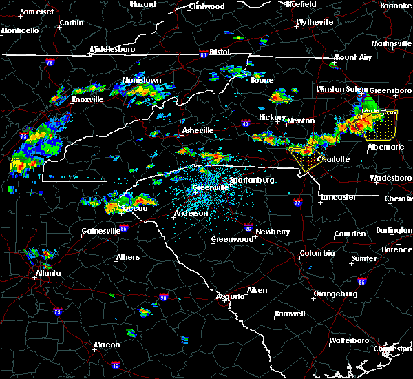 At 351 pm edt, severe thunderstorms were located along a line extending from near huntersville to 8 miles southeast of lincolnton, moving southeast at 10 mph (radar indicated). Hazards include 60 mph wind gusts and quarter size hail. Minor hail damage to vehicles is expected. expect wind damage to trees and power lines. Locations impacted include, uptown charlotte, central charlotte, northeast charlotte, northwest charlotte, mt holly, belmont, stanley, freedom park, reedy creek park and the plaza. At 351 pm edt, severe thunderstorms were located along a line extending from near huntersville to 8 miles southeast of lincolnton, moving southeast at 10 mph (radar indicated). Hazards include 60 mph wind gusts and quarter size hail. Minor hail damage to vehicles is expected. expect wind damage to trees and power lines. Locations impacted include, uptown charlotte, central charlotte, northeast charlotte, northwest charlotte, mt holly, belmont, stanley, freedom park, reedy creek park and the plaza.
|
| 7/1/2017 3:32 PM EDT |
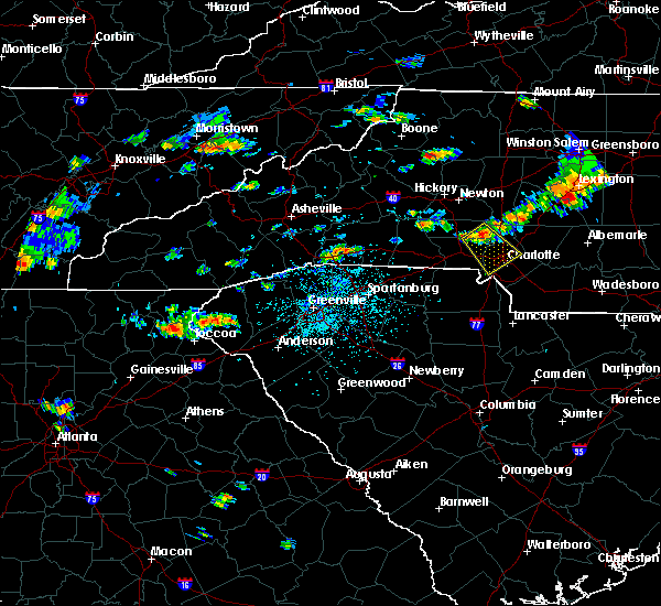 At 332 pm edt, a severe thunderstorm was located 10 miles west of huntersville, or 5 miles northeast of stanley, moving southeast at 15 mph (radar indicated). Hazards include 60 mph wind gusts and quarter size hail. Minor hail damage to vehicles is expected. Expect wind damage to trees and power lines. At 332 pm edt, a severe thunderstorm was located 10 miles west of huntersville, or 5 miles northeast of stanley, moving southeast at 15 mph (radar indicated). Hazards include 60 mph wind gusts and quarter size hail. Minor hail damage to vehicles is expected. Expect wind damage to trees and power lines.
|
| 6/19/2017 11:21 PM EDT |
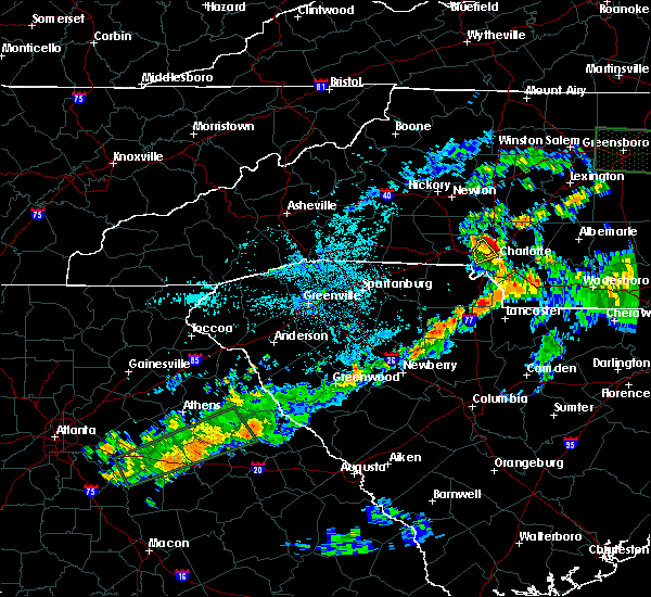 At 1119 pm edt, a severe thunderstorm was located 8 miles northwest of uptown charlotte, or near paw creek, moving northeast at 30 mph (radar indicated). Hazards include up to 60 mph wind gusts. Expect damage to trees and power lines. Locations impacted include, uptown charlotte, northwest charlotte, charlotte douglas airport, paw creek, central charlotte and southwest charlotte. At 1119 pm edt, a severe thunderstorm was located 8 miles northwest of uptown charlotte, or near paw creek, moving northeast at 30 mph (radar indicated). Hazards include up to 60 mph wind gusts. Expect damage to trees and power lines. Locations impacted include, uptown charlotte, northwest charlotte, charlotte douglas airport, paw creek, central charlotte and southwest charlotte.
|
| 6/19/2017 11:00 PM EDT |
 At 1100 pm edt, a severe thunderstorm was located 5 miles east of gastonia, or over cramerton, moving northeast at 20 mph (radar indicated). Hazards include 60 mph wind gusts. Expect damage to trees and power lines. Locations impacted include, uptown charlotte, northwest charlotte, mt holly, belmont, cramerton, lowell, mcadenville, charlotte douglas airport, paw creek and ranlo. At 1100 pm edt, a severe thunderstorm was located 5 miles east of gastonia, or over cramerton, moving northeast at 20 mph (radar indicated). Hazards include 60 mph wind gusts. Expect damage to trees and power lines. Locations impacted include, uptown charlotte, northwest charlotte, mt holly, belmont, cramerton, lowell, mcadenville, charlotte douglas airport, paw creek and ranlo.
|
| 6/19/2017 10:47 PM EDT |
 At 1046 pm edt, a severe thunderstorm was located 4 miles south of gastonia, or near south gastonia, moving northeast at 30 mph (radar indicated). Hazards include 60 mph wind gusts. expect damage to trees and power lines At 1046 pm edt, a severe thunderstorm was located 4 miles south of gastonia, or near south gastonia, moving northeast at 30 mph (radar indicated). Hazards include 60 mph wind gusts. expect damage to trees and power lines
|
| 6/13/2017 6:40 PM EDT |
 At 640 pm edt, a severe thunderstorm was located 11 miles southeast of uptown charlotte, or near south charlotte, moving southeast at 15 mph (radar indicated). Hazards include 60 mph wind gusts and quarter size hail. Minor hail damage to vehicles is expected. expect wind damage to trees and power lines. Locations impacted include, uptown charlotte, central charlotte, south charlotte, northeast charlotte, southwest charlotte, east charlotte, northwest charlotte, matthews, mint hill and indian trail. At 640 pm edt, a severe thunderstorm was located 11 miles southeast of uptown charlotte, or near south charlotte, moving southeast at 15 mph (radar indicated). Hazards include 60 mph wind gusts and quarter size hail. Minor hail damage to vehicles is expected. expect wind damage to trees and power lines. Locations impacted include, uptown charlotte, central charlotte, south charlotte, northeast charlotte, southwest charlotte, east charlotte, northwest charlotte, matthews, mint hill and indian trail.
|
| 6/13/2017 6:20 PM EDT | Tree on power lines on falmouth rd. time estimate in mecklenburg county NC, 5.1 miles W of Charlotte, NC |
| 6/13/2017 6:17 PM EDT |
 At 616 pm edt, a severe thunderstorm was located near uptown charlotte, or near northwest charlotte, moving east at 10 mph. other severe storms were developing over southern mecklenburg county to the west of matthews and west of mint hill (radar indicated). Hazards include 60 mph wind gusts and quarter size hail. Minor hail damage to vehicles is expected. Expect wind damage to trees and power lines. At 616 pm edt, a severe thunderstorm was located near uptown charlotte, or near northwest charlotte, moving east at 10 mph. other severe storms were developing over southern mecklenburg county to the west of matthews and west of mint hill (radar indicated). Hazards include 60 mph wind gusts and quarter size hail. Minor hail damage to vehicles is expected. Expect wind damage to trees and power lines.
|
| 6/13/2017 5:52 PM EDT |
 At 551 pm edt, a severe thunderstorm was located 5 miles southwest of huntersville, or 4 miles north of northwest charlotte, moving east at 10 mph. another severe thunderstorm was located just south of harrisburg (radar indicated). Hazards include 60 mph wind gusts and quarter size hail. Minor hail damage to vehicles is expected. expect wind damage to trees and power lines. Locations impacted include, huntersville, northeast charlotte, east charlotte, west concord, cornelius, mooresville, mint hill, davidson, harrisburg and enochville. At 551 pm edt, a severe thunderstorm was located 5 miles southwest of huntersville, or 4 miles north of northwest charlotte, moving east at 10 mph. another severe thunderstorm was located just south of harrisburg (radar indicated). Hazards include 60 mph wind gusts and quarter size hail. Minor hail damage to vehicles is expected. expect wind damage to trees and power lines. Locations impacted include, huntersville, northeast charlotte, east charlotte, west concord, cornelius, mooresville, mint hill, davidson, harrisburg and enochville.
|
| 6/13/2017 5:29 PM EDT |
 At 529 pm edt, a severe thunderstorm was located 6 miles northwest of huntersville, or near ramsey creek park, moving southeast at 10 mph (radar indicated). Hazards include 60 mph wind gusts and quarter size hail. Minor hail damage to vehicles is expected. Expect wind damage to trees and power lines. At 529 pm edt, a severe thunderstorm was located 6 miles northwest of huntersville, or near ramsey creek park, moving southeast at 10 mph (radar indicated). Hazards include 60 mph wind gusts and quarter size hail. Minor hail damage to vehicles is expected. Expect wind damage to trees and power lines.
|
| 6/13/2017 5:24 PM EDT |
 At 524 pm edt, a severe thunderstorm was located 7 miles northeast of uptown charlotte, or near unc charlotte, moving east at 10 mph (radar indicated). Hazards include 60 mph wind gusts and quarter size hail. Minor hail damage to vehicles is expected. expect wind damage to trees and power lines. Locations impacted include, uptown charlotte, northeast charlotte, east charlotte, reedy creek park, the plaza, unc charlotte, hidden valley, croft, northwest charlotte and harrisburg. At 524 pm edt, a severe thunderstorm was located 7 miles northeast of uptown charlotte, or near unc charlotte, moving east at 10 mph (radar indicated). Hazards include 60 mph wind gusts and quarter size hail. Minor hail damage to vehicles is expected. expect wind damage to trees and power lines. Locations impacted include, uptown charlotte, northeast charlotte, east charlotte, reedy creek park, the plaza, unc charlotte, hidden valley, croft, northwest charlotte and harrisburg.
|
| 6/13/2017 5:06 PM EDT | Tree blown over and a street sign blown dow in mecklenburg county NC, 6 miles SW of Charlotte, NC |
| 6/13/2017 4:59 PM EDT |
 At 459 pm edt, a severe thunderstorm was located near uptown charlotte, or near hidden valley, moving southeast at 10 mph (radar indicated). Hazards include 60 mph wind gusts and quarter size hail. Minor hail damage to vehicles is expected. Expect wind damage to trees and power lines. At 459 pm edt, a severe thunderstorm was located near uptown charlotte, or near hidden valley, moving southeast at 10 mph (radar indicated). Hazards include 60 mph wind gusts and quarter size hail. Minor hail damage to vehicles is expected. Expect wind damage to trees and power lines.
|
| 6/4/2017 4:58 PM EDT |
 At 457 pm edt, severe thunderstorms were located along a line extending from near statesville to 7 miles southeast of huntersville, moving northeast at 25 mph (radar indicated). Hazards include 60 mph wind gusts and nickel size hail. Expect damage to trees and power lines. Locations impacted include, huntersville, kannapolis, downtown concord, statesville, northeast charlotte, west concord, cornelius, mooresville, davidson and harrisburg. At 457 pm edt, severe thunderstorms were located along a line extending from near statesville to 7 miles southeast of huntersville, moving northeast at 25 mph (radar indicated). Hazards include 60 mph wind gusts and nickel size hail. Expect damage to trees and power lines. Locations impacted include, huntersville, kannapolis, downtown concord, statesville, northeast charlotte, west concord, cornelius, mooresville, davidson and harrisburg.
|
| 6/4/2017 4:42 PM EDT | *** 1 inj *** tree on car at intersection of west sugar creek road and conner ridge roa in mecklenburg county NC, 6.8 miles SSW of Charlotte, NC |
| 6/4/2017 4:30 PM EDT |
 At 430 pm edt, severe thunderstorms were located along a line extending from 8 miles southwest of statesville to 4 miles northwest of uptown charlotte, moving northeast at 25 mph (radar indicated). Hazards include 60 mph wind gusts and nickel size hail. expect damage to trees and power lines At 430 pm edt, severe thunderstorms were located along a line extending from 8 miles southwest of statesville to 4 miles northwest of uptown charlotte, moving northeast at 25 mph (radar indicated). Hazards include 60 mph wind gusts and nickel size hail. expect damage to trees and power lines
|
| 6/4/2017 4:20 PM EDT | *** 1 inj *** tree on car at intersection of west sugar creek road and conner ridge roa in mecklenburg county NC, 6.8 miles SSW of Charlotte, NC |
| 6/4/2017 4:09 PM EDT |
 At 409 pm edt, a severe thunderstorm was located 6 miles southeast of gastonia, or 5 miles southwest of cramerton, moving northeast at 20 mph (radar indicated). Hazards include 60 mph wind gusts and nickel size hail. Expect damage to trees and power lines. Locations impacted include, gastonia, central charlotte, southwest charlotte, northwest charlotte, mt holly, belmont, south gastonia, cramerton, lowell and ranlo. At 409 pm edt, a severe thunderstorm was located 6 miles southeast of gastonia, or 5 miles southwest of cramerton, moving northeast at 20 mph (radar indicated). Hazards include 60 mph wind gusts and nickel size hail. Expect damage to trees and power lines. Locations impacted include, gastonia, central charlotte, southwest charlotte, northwest charlotte, mt holly, belmont, south gastonia, cramerton, lowell and ranlo.
|
| 6/4/2017 3:48 PM EDT |
 At 348 pm edt, a severe thunderstorm was located 8 miles north of york, or near clover, moving northeast at 20 mph (radar indicated). Hazards include 60 mph wind gusts and nickel size hail. expect damage to trees and power lines At 348 pm edt, a severe thunderstorm was located 8 miles north of york, or near clover, moving northeast at 20 mph (radar indicated). Hazards include 60 mph wind gusts and nickel size hail. expect damage to trees and power lines
|
| 5/31/2017 5:48 PM EDT |
 At 548 pm edt, severe thunderstorms were located along a line extending from 12 miles south of downtown concord to 9 miles southeast of uptown charlotte, moving southeast at 25 mph (radar indicated). Hazards include 60 mph wind gusts. Expect damage to trees and power lines. Locations impacted include, east charlotte, matthews, mint hill, freedom park, midland, reedy creek park, southpark mall, the plaza, harrisburg and south charlotte. At 548 pm edt, severe thunderstorms were located along a line extending from 12 miles south of downtown concord to 9 miles southeast of uptown charlotte, moving southeast at 25 mph (radar indicated). Hazards include 60 mph wind gusts. Expect damage to trees and power lines. Locations impacted include, east charlotte, matthews, mint hill, freedom park, midland, reedy creek park, southpark mall, the plaza, harrisburg and south charlotte.
|
| 5/31/2017 5:42 PM EDT |
 At 542 pm edt, severe thunderstorms were located along a line extending from 11 miles south of downtown concord to 8 miles southeast of uptown charlotte, moving southeast at 15 mph (radar indicated). Hazards include 60 mph wind gusts. expect damage to trees and power lines At 542 pm edt, severe thunderstorms were located along a line extending from 11 miles south of downtown concord to 8 miles southeast of uptown charlotte, moving southeast at 15 mph (radar indicated). Hazards include 60 mph wind gusts. expect damage to trees and power lines
|
| 5/31/2017 5:28 PM EDT | Trained spotter reports winds between 60 and 70 mph at wt harris blvd and robinson church roa in mecklenburg county NC, 7.3 miles W of Charlotte, NC |
| 5/31/2017 5:28 PM EDT | Trained spotter reports winds between 60 and 70 mph at wt harris blvd and robinson church roa in mecklenburg county NC, 7.3 miles W of Charlotte, NC |
| 5/31/2017 5:21 PM EDT |
 At 521 pm edt, severe thunderstorms were located along a line extending from 7 miles south of downtown concord to 3 miles west of uptown charlotte, moving southeast at 20 mph (radar indicated). Hazards include 60 mph wind gusts. expect damage to trees and power lines At 521 pm edt, severe thunderstorms were located along a line extending from 7 miles south of downtown concord to 3 miles west of uptown charlotte, moving southeast at 20 mph (radar indicated). Hazards include 60 mph wind gusts. expect damage to trees and power lines
|
| 5/31/2017 5:06 PM EDT |
 At 506 pm edt, a severe thunderstorm was located 5 miles northwest of uptown charlotte, or near northwest charlotte, moving southeast at 20 mph (radar indicated). Hazards include 60 mph wind gusts and penny size hail. Expect damage to trees and power lines. Locations impacted include, uptown charlotte, huntersville, central charlotte, south charlotte, northeast charlotte, east charlotte, northwest charlotte, matthews, mint hill and mt holly. At 506 pm edt, a severe thunderstorm was located 5 miles northwest of uptown charlotte, or near northwest charlotte, moving southeast at 20 mph (radar indicated). Hazards include 60 mph wind gusts and penny size hail. Expect damage to trees and power lines. Locations impacted include, uptown charlotte, huntersville, central charlotte, south charlotte, northeast charlotte, east charlotte, northwest charlotte, matthews, mint hill and mt holly.
|
| 5/31/2017 4:29 PM EDT |
 At 428 pm edt, a severe thunderstorm was located 9 miles west of huntersville, or 5 miles northeast of stanley, moving southeast at 30 mph (radar indicated). Hazards include 60 mph wind gusts and quarter size hail. Minor hail damage to vehicles is expected. Expect wind damage to trees and power lines. At 428 pm edt, a severe thunderstorm was located 9 miles west of huntersville, or 5 miles northeast of stanley, moving southeast at 30 mph (radar indicated). Hazards include 60 mph wind gusts and quarter size hail. Minor hail damage to vehicles is expected. Expect wind damage to trees and power lines.
|
| 5/29/2017 6:24 PM EDT |
 At 623 pm edt, a severe thunderstorm was located 4 miles west of huntersville, or 4 miles south of ramsey creek park, moving east at 40 mph (radar indicated). Hazards include 60 mph wind gusts and quarter size hail. Minor hail damage to vehicles is expected. expect wind damage to trees and power lines. Locations impacted include, huntersville, northeast charlotte, cornelius, mooresville, mt holly, davidson, stanley, westport, unc charlotte and denver. At 623 pm edt, a severe thunderstorm was located 4 miles west of huntersville, or 4 miles south of ramsey creek park, moving east at 40 mph (radar indicated). Hazards include 60 mph wind gusts and quarter size hail. Minor hail damage to vehicles is expected. expect wind damage to trees and power lines. Locations impacted include, huntersville, northeast charlotte, cornelius, mooresville, mt holly, davidson, stanley, westport, unc charlotte and denver.
|
| 5/29/2017 6:05 PM EDT |
 At 604 pm edt, a severe thunderstorm was located 8 miles southeast of lincolnton, or near high shoals, moving east at 40 mph (radar indicated). Hazards include 60 mph wind gusts and quarter size hail. Minor hail damage to vehicles is expected. Expect wind damage to trees and power lines. At 604 pm edt, a severe thunderstorm was located 8 miles southeast of lincolnton, or near high shoals, moving east at 40 mph (radar indicated). Hazards include 60 mph wind gusts and quarter size hail. Minor hail damage to vehicles is expected. Expect wind damage to trees and power lines.
|
| 5/28/2017 2:38 AM EDT |
 At 238 am edt, severe thunderstorms were located along a line extending from 6 miles south of yadkinville to 6 miles southwest of uptown charlotte, moving east at 40 mph (radar indicated). Hazards include 60 mph wind gusts. Expect damage to trees and power lines. Locations impacted include, kannapolis, downtown concord, salisbury, mocksville, west concord, harrisburg, china grove, spencer, landis and enochville. At 238 am edt, severe thunderstorms were located along a line extending from 6 miles south of yadkinville to 6 miles southwest of uptown charlotte, moving east at 40 mph (radar indicated). Hazards include 60 mph wind gusts. Expect damage to trees and power lines. Locations impacted include, kannapolis, downtown concord, salisbury, mocksville, west concord, harrisburg, china grove, spencer, landis and enochville.
|
| 5/28/2017 2:24 AM EDT |
 The severe thunderstorm warning for catawba, lincoln, eastern cleveland and gaston counties will expire at 230 am edt, the storms which prompted the warning have moved out of the area. therefore the warning will be allowed to expire. however gusty winds and heavy rain are still possible with these thunderstorms. a severe thunderstorm watch remains in effect until 400 am edt for the piedmont of north carolina. a severe thunderstorm watch also remains in effect until 600 am edt for upstate south carolina. The severe thunderstorm warning for catawba, lincoln, eastern cleveland and gaston counties will expire at 230 am edt, the storms which prompted the warning have moved out of the area. therefore the warning will be allowed to expire. however gusty winds and heavy rain are still possible with these thunderstorms. a severe thunderstorm watch remains in effect until 400 am edt for the piedmont of north carolina. a severe thunderstorm watch also remains in effect until 600 am edt for upstate south carolina.
|
| 5/28/2017 2:05 AM EDT |
 At 204 am edt, severe thunderstorms were located along a line extending from 10 miles southeast of wilkesboro to 9 miles southwest of gastonia, moving east at 40 mph (radar indicated). Hazards include 60 mph wind gusts. expect damage to trees and power lines At 204 am edt, severe thunderstorms were located along a line extending from 10 miles southeast of wilkesboro to 9 miles southwest of gastonia, moving east at 40 mph (radar indicated). Hazards include 60 mph wind gusts. expect damage to trees and power lines
|
| 5/28/2017 1:35 AM EDT |
 The national weather service in greenville-spartanburg has issued a * severe thunderstorm warning for. catawba county in the piedmont of north carolina. lincoln county in the piedmont of north carolina. eastern cleveland county in the piedmont of north carolina. Gaston county in the piedmont of north carolina. The national weather service in greenville-spartanburg has issued a * severe thunderstorm warning for. catawba county in the piedmont of north carolina. lincoln county in the piedmont of north carolina. eastern cleveland county in the piedmont of north carolina. Gaston county in the piedmont of north carolina.
|
| 5/24/2017 4:38 PM EDT |
 The severe thunderstorm warning for western cabarrus and northeastern mecklenburg counties will expire at 445 pm edt, the storm which prompted the warning has weakened below severe limits, and no longer poses an immediate threat to life or property. therefore the warning will be allowed to expire. however heavy rain is still possible with this thunderstorm. a tornado watch remains in effect until 600 pm edt for the piedmont of north carolina. The severe thunderstorm warning for western cabarrus and northeastern mecklenburg counties will expire at 445 pm edt, the storm which prompted the warning has weakened below severe limits, and no longer poses an immediate threat to life or property. therefore the warning will be allowed to expire. however heavy rain is still possible with this thunderstorm. a tornado watch remains in effect until 600 pm edt for the piedmont of north carolina.
|
| 5/24/2017 4:27 PM EDT |
 At 427 pm edt, a severe thunderstorm was located 6 miles southwest of downtown concord, or over charlotte motor speedway, moving northeast at 35 mph (radar indicated). Hazards include 60 mph wind gusts. Expect damage to trees and power lines. locations impacted include, kannapolis, downtown concord, west concord, harrisburg, coddle creek reservoir, charlotte motor speedway, unc charlotte, reedy creek park, northeast charlotte and croft. A tornado watch remains in effect until 600 pm edt for the piedmont of north carolina. At 427 pm edt, a severe thunderstorm was located 6 miles southwest of downtown concord, or over charlotte motor speedway, moving northeast at 35 mph (radar indicated). Hazards include 60 mph wind gusts. Expect damage to trees and power lines. locations impacted include, kannapolis, downtown concord, west concord, harrisburg, coddle creek reservoir, charlotte motor speedway, unc charlotte, reedy creek park, northeast charlotte and croft. A tornado watch remains in effect until 600 pm edt for the piedmont of north carolina.
|
| 5/24/2017 4:04 PM EDT | Large tree down in s. charlotte. time estimated from rada in mecklenburg county NC, 3.2 miles NW of Charlotte, NC |
| 5/24/2017 4:00 PM EDT |
 At 400 pm edt, a severe thunderstorm was located near uptown charlotte, or over freedom park, moving northeast at 25 mph (radar indicated). Hazards include 60 mph wind gusts and penny size hail. expect damage to trees and power lines At 400 pm edt, a severe thunderstorm was located near uptown charlotte, or over freedom park, moving northeast at 25 mph (radar indicated). Hazards include 60 mph wind gusts and penny size hail. expect damage to trees and power lines
|
| 5/5/2017 1:10 AM EDT | Broadcast media reported a small tree snapped and fell on a vehicle at eaves lane and plaza walk dr. no other damage reported in the are in mecklenburg county NC, 4.6 miles WSW of Charlotte, NC |
| 5/1/2017 5:05 PM EDT | Social media reported a tree down on josh birmingham parkway and harlee ave in mecklenburg county NC, 4.1 miles E of Charlotte, NC |
| 5/1/2017 5:05 PM EDT | Social media reported a tree down on billy graham parkway and morris field d in mecklenburg county NC, 3.8 miles ENE of Charlotte, NC |
| 4/3/2017 4:24 PM EDT |
 At 423 pm edt, a severe thunderstorm was located 11 miles southeast of uptown charlotte, or near matthews, moving northeast at 60 mph (radar indicated). Hazards include 60 mph wind gusts and penny size hail. expect damage to trees and minor damage to roofs and siding At 423 pm edt, a severe thunderstorm was located 11 miles southeast of uptown charlotte, or near matthews, moving northeast at 60 mph (radar indicated). Hazards include 60 mph wind gusts and penny size hail. expect damage to trees and minor damage to roofs and siding
|
| 4/3/2017 4:05 PM EDT |
 At 405 pm edt, severe thunderstorms were located along a line extending from 7 miles southwest of uptown charlotte to 5 miles northeast of rock hill, moving northeast at 55 mph (radar indicated). Hazards include 60 mph wind gusts. expect damage to trees and minor damage to roofs and siding At 405 pm edt, severe thunderstorms were located along a line extending from 7 miles southwest of uptown charlotte to 5 miles northeast of rock hill, moving northeast at 55 mph (radar indicated). Hazards include 60 mph wind gusts. expect damage to trees and minor damage to roofs and siding
|
| 4/3/2017 4:05 PM EDT |
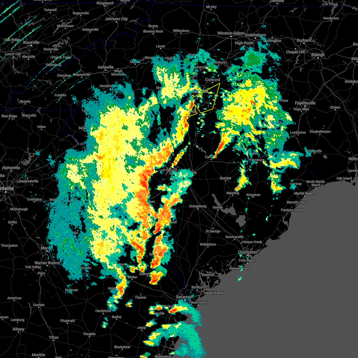 At 405 pm edt, severe thunderstorms were located along a line extending from 7 miles southwest of uptown charlotte to 5 miles northeast of rock hill, moving northeast at 55 mph (radar indicated). Hazards include 60 mph wind gusts. expect damage to trees and minor damage to roofs and siding At 405 pm edt, severe thunderstorms were located along a line extending from 7 miles southwest of uptown charlotte to 5 miles northeast of rock hill, moving northeast at 55 mph (radar indicated). Hazards include 60 mph wind gusts. expect damage to trees and minor damage to roofs and siding
|
| 4/3/2017 4:02 PM EDT |
 At 402 pm edt, severe thunderstorms were located along a line extending from 9 miles east of newton to 10 miles west of huntersville to 4 miles southeast of gastonia, moving east at 45 mph (radar indicated). Hazards include 60 mph wind gusts. Expect damage to trees and minor damage to roofs and siding. locations impacted include, gastonia, uptown charlotte, huntersville, central charlotte, northeast charlotte, southwest charlotte, northwest charlotte, cornelius, mooresville and mt holly. A tornado watch remains in effect until 900 pm edt for the piedmont of north carolina, and upstate south carolina. At 402 pm edt, severe thunderstorms were located along a line extending from 9 miles east of newton to 10 miles west of huntersville to 4 miles southeast of gastonia, moving east at 45 mph (radar indicated). Hazards include 60 mph wind gusts. Expect damage to trees and minor damage to roofs and siding. locations impacted include, gastonia, uptown charlotte, huntersville, central charlotte, northeast charlotte, southwest charlotte, northwest charlotte, cornelius, mooresville and mt holly. A tornado watch remains in effect until 900 pm edt for the piedmont of north carolina, and upstate south carolina.
|
| 4/3/2017 3:52 PM EDT |
 At 351 pm edt, severe thunderstorms were located along a line extending from 5 miles south of newton to 10 miles southeast of lincolnton to 5 miles southwest of gastonia, moving east at 45 mph (radar indicated). Hazards include 60 mph wind gusts. expect damage to trees and minor damage to roofs and siding At 351 pm edt, severe thunderstorms were located along a line extending from 5 miles south of newton to 10 miles southeast of lincolnton to 5 miles southwest of gastonia, moving east at 45 mph (radar indicated). Hazards include 60 mph wind gusts. expect damage to trees and minor damage to roofs and siding
|
| 3/21/2017 8:40 PM EDT | Golf Ball sized hail reported 8.5 miles SW of Charlotte, NC, glof ball size hail at unc charlotte |
| 3/21/2017 8:39 PM EDT |
 At 839 pm edt, a severe thunderstorm was located near kannapolis, moving east at 30 mph (radar indicated). Hazards include 60 mph wind gusts and half dollar size hail. Hail damage to vehicles is expected. Expect wind damage to roofs, siding and trees. At 839 pm edt, a severe thunderstorm was located near kannapolis, moving east at 30 mph (radar indicated). Hazards include 60 mph wind gusts and half dollar size hail. Hail damage to vehicles is expected. Expect wind damage to roofs, siding and trees.
|
| 3/21/2017 8:26 PM EDT |
 At 825 pm edt, another severe thunderstorm was located 5 miles northeast of huntersville, or near coddle creek reservoir, moving east at 30 mph. the first severe thunderstorm was located two miles east of harrisburg, also moving east at 30 mph (radar indicated). Hazards include 60 mph wind gusts and half dollar size hail. Hail damage to vehicles is expected. expect wind damage to roofs, siding and trees. Locations impacted include, huntersville, downtown concord, northeast charlotte, northwest charlotte, west concord, cornelius, mt holly, harrisburg, coddle creek reservoir and hidden valley. At 825 pm edt, another severe thunderstorm was located 5 miles northeast of huntersville, or near coddle creek reservoir, moving east at 30 mph. the first severe thunderstorm was located two miles east of harrisburg, also moving east at 30 mph (radar indicated). Hazards include 60 mph wind gusts and half dollar size hail. Hail damage to vehicles is expected. expect wind damage to roofs, siding and trees. Locations impacted include, huntersville, downtown concord, northeast charlotte, northwest charlotte, west concord, cornelius, mt holly, harrisburg, coddle creek reservoir and hidden valley.
|
| 3/21/2017 8:12 PM EDT | Half Dollar sized hail reported 7.7 miles SW of Charlotte, NC, half dollar size hail at w.wt harris blvd and research dr. |
| 3/21/2017 8:08 PM EDT | Half Dollar sized hail reported 7.4 miles SSW of Charlotte, NC, half dollar hail north of charlotte |
| 3/21/2017 8:05 PM EDT | Half Dollar sized hail reported 8.3 miles SW of Charlotte, NC |
| 3/21/2017 8:02 PM EDT |
 At 802 pm edt, a severe thunderstorm was located 6 miles southeast of huntersville, or over northeast charlotte, moving east at 25 mph (radar indicated). Hazards include 60 mph wind gusts and quarter size hail. Hail damage to vehicles is expected. Expect wind damage to roofs, siding and trees. At 802 pm edt, a severe thunderstorm was located 6 miles southeast of huntersville, or over northeast charlotte, moving east at 25 mph (radar indicated). Hazards include 60 mph wind gusts and quarter size hail. Hail damage to vehicles is expected. Expect wind damage to roofs, siding and trees.
|
| 3/1/2017 8:54 PM EST |
 The severe thunderstorm warning for union and chester counties will expire at 900 pm est, the storms which prompted the warning have weakened below severe limits, and have exited the warned area. therefore the warning will be allowed to expire. if you observed large hail or wind damage, please report it to the national weather service greenville-spartanburg by calling toll free, 1, 800, 2 6 7, 8 1 0 1, or by posting on our facebook page, or tweet it using hashtag nwsgsp. your message should describe the event and the specific location where it occurred. The severe thunderstorm warning for union and chester counties will expire at 900 pm est, the storms which prompted the warning have weakened below severe limits, and have exited the warned area. therefore the warning will be allowed to expire. if you observed large hail or wind damage, please report it to the national weather service greenville-spartanburg by calling toll free, 1, 800, 2 6 7, 8 1 0 1, or by posting on our facebook page, or tweet it using hashtag nwsgsp. your message should describe the event and the specific location where it occurred.
|
| 3/1/2017 8:36 PM EST |
 At 834 pm est, severe thunderstorms were located along a line extending from 9 miles southwest of albemarle north carolina, to 11 miles southwest of monroe, to 11 miles north of winnsboro south carolina, moving east at 65 mph (indicated by radar. some of these storms also have a history of producing damaging winds). Hazards include 60 mph wind gusts and penny size hail. Expect damage to roofs. siding and trees. Locations impacted include, monroe, chester, indian trail, weddington, stallings, unionville, wesley chapel, wingate, waxhaw and marshville. At 834 pm est, severe thunderstorms were located along a line extending from 9 miles southwest of albemarle north carolina, to 11 miles southwest of monroe, to 11 miles north of winnsboro south carolina, moving east at 65 mph (indicated by radar. some of these storms also have a history of producing damaging winds). Hazards include 60 mph wind gusts and penny size hail. Expect damage to roofs. siding and trees. Locations impacted include, monroe, chester, indian trail, weddington, stallings, unionville, wesley chapel, wingate, waxhaw and marshville.
|
| 3/1/2017 8:21 PM EST |
 At 820 pm est, severe thunderstorms were located along a line extending from 9 miles east of uptown charlotte to 3 miles south of rock hill to 16 miles southwest of chester, moving east at 60 mph. several of these storms have already produced damaging winds and large hail (indicated by radar and public reports). Hazards include 60 mph wind gusts and quarter size hail. Hail damage to vehicles is expected. expect wind damage to roofs, siding and trees. Locations impacted include, rock hill, uptown charlotte, monroe, chester, central charlotte, south charlotte, southwest charlotte, east charlotte, matthews and mint hill. At 820 pm est, severe thunderstorms were located along a line extending from 9 miles east of uptown charlotte to 3 miles south of rock hill to 16 miles southwest of chester, moving east at 60 mph. several of these storms have already produced damaging winds and large hail (indicated by radar and public reports). Hazards include 60 mph wind gusts and quarter size hail. Hail damage to vehicles is expected. expect wind damage to roofs, siding and trees. Locations impacted include, rock hill, uptown charlotte, monroe, chester, central charlotte, south charlotte, southwest charlotte, east charlotte, matthews and mint hill.
|
| 3/1/2017 8:00 PM EST | Relayed by broadcast media - numerous trees down in the myers park area. time estimated from rada in mecklenburg county NC, 2.8 miles NW of Charlotte, NC |
| 3/1/2017 7:45 PM EST |
 At 745 pm est, severe thunderstorms were located along a line extending from 11 miles northwest of york to 10 miles northeast of union to 18 miles northeast of newberry, moving east at 55 mph (radar indicated). Hazards include 60 mph wind gusts and quarter size hail. Hail damage to vehicles is expected. Expect wind damage to roofs, siding and trees. At 745 pm est, severe thunderstorms were located along a line extending from 11 miles northwest of york to 10 miles northeast of union to 18 miles northeast of newberry, moving east at 55 mph (radar indicated). Hazards include 60 mph wind gusts and quarter size hail. Hail damage to vehicles is expected. Expect wind damage to roofs, siding and trees.
|
| 3/1/2017 7:41 PM EST |
 At 740 pm est, a severe thunderstorm was located 11 miles east of uptown charlotte, or near mint hill, moving east at 60 mph (radar indicated). Hazards include quarter size hail. Damage to vehicles is expected. Locations impacted include, mint hill, midland, reedy creek park, fairview in union county, matthews, east charlotte, stallings and mt pleasant. At 740 pm est, a severe thunderstorm was located 11 miles east of uptown charlotte, or near mint hill, moving east at 60 mph (radar indicated). Hazards include quarter size hail. Damage to vehicles is expected. Locations impacted include, mint hill, midland, reedy creek park, fairview in union county, matthews, east charlotte, stallings and mt pleasant.
|
| 3/1/2017 7:33 PM EST | Quarter sized hail reported 2.8 miles NW of Charlotte, NC, dime to quarter size hail reported in charlotte |
| 3/1/2017 7:33 PM EST | Quarter sized hail reported 5.3 miles NW of Charlotte, NC, quarter size hail on elder ave. time estimated from radar. |
| 3/1/2017 7:27 PM EST |
 At 726 pm est, a severe thunderstorm was located 4 miles southwest of uptown charlotte, moving east at 60 mph (radar indicated wind. public report of hail). Hazards include 60 mph wind gusts and penny size hail. Expect damage to roofs. siding and trees. Locations impacted include, uptown charlotte, central charlotte, southwest charlotte, east charlotte, matthews, mint hill, freedom park, reedy creek park, the plaza and charlotte douglas airport. At 726 pm est, a severe thunderstorm was located 4 miles southwest of uptown charlotte, moving east at 60 mph (radar indicated wind. public report of hail). Hazards include 60 mph wind gusts and penny size hail. Expect damage to roofs. siding and trees. Locations impacted include, uptown charlotte, central charlotte, southwest charlotte, east charlotte, matthews, mint hill, freedom park, reedy creek park, the plaza and charlotte douglas airport.
|
| 3/1/2017 7:16 PM EST | Barn collapsed in steele creek communit in mecklenburg county NC, 11.2 miles NE of Charlotte, NC |
| 3/1/2017 7:12 PM EST |
 At 712 pm est, a severe thunderstorm was located 9 miles south of gastonia, or 4 miles west of town of lake wylie, moving east at 55 mph (radar indicated). Hazards include 60 mph wind gusts and quarter size hail. Hail damage to vehicles is expected. Expect wind damage to roofs, siding and trees. At 712 pm est, a severe thunderstorm was located 9 miles south of gastonia, or 4 miles west of town of lake wylie, moving east at 55 mph (radar indicated). Hazards include 60 mph wind gusts and quarter size hail. Hail damage to vehicles is expected. Expect wind damage to roofs, siding and trees.
|
| 3/1/2017 6:45 PM EST | Quarter sized hail reported 5.3 miles NW of Charlotte, NC, quarter size hail on elder ave |
| 3/1/2017 6:40 PM EST |
 At 639 pm est, a severe thunderstorm was located over huntersville, moving east at 55 mph (radar indicated). Hazards include 60 mph wind gusts and quarter size hail. Hail damage to vehicles is expected. expect wind damage to roofs, siding and trees. Locations impacted include, huntersville, kannapolis, downtown concord, west concord, cornelius, davidson, landis, enochville, rockwell and mt pleasant. At 639 pm est, a severe thunderstorm was located over huntersville, moving east at 55 mph (radar indicated). Hazards include 60 mph wind gusts and quarter size hail. Hail damage to vehicles is expected. expect wind damage to roofs, siding and trees. Locations impacted include, huntersville, kannapolis, downtown concord, west concord, cornelius, davidson, landis, enochville, rockwell and mt pleasant.
|
| 3/1/2017 6:19 PM EST |
 At 618 pm est, a severe thunderstorm was located 7 miles southeast of lincolnton, or near high shoals, moving east at 50 mph (public). Hazards include 60 mph wind gusts and quarter size hail. Hail damage to vehicles is expected. Expect wind damage to roofs, siding and trees. At 618 pm est, a severe thunderstorm was located 7 miles southeast of lincolnton, or near high shoals, moving east at 50 mph (public). Hazards include 60 mph wind gusts and quarter size hail. Hail damage to vehicles is expected. Expect wind damage to roofs, siding and trees.
|
| 12/18/2016 1:12 PM EST | Two trees down along with a couple powerlines on mountain island drive east. no structural damage reporte in mecklenburg county NC, 8.4 miles SE of Charlotte, NC |
| 11/30/2016 6:57 PM EST |
 The tornado warning for southeastern mecklenburg. northern union and central cabarrus counties will expire at 700 pm est. the storm which prompted the warning has weakened below severe limits. and no longer appears capable of producing a tornado. therefore the warning will be allowed to expire. However strong and gusty winds are still possible with this thunderstorm. The tornado warning for southeastern mecklenburg. northern union and central cabarrus counties will expire at 700 pm est. the storm which prompted the warning has weakened below severe limits. and no longer appears capable of producing a tornado. therefore the warning will be allowed to expire. However strong and gusty winds are still possible with this thunderstorm.
|
| 11/30/2016 6:56 PM EST |
 At 656 pm est, severe thunderstorms were located along a line extending from 5 miles northeast of mocksville to 12 miles south of monroe, moving northeast at 60 mph (radar indicated). Hazards include 60 mph wind gusts. Expect damage to roofs. Siding and trees. At 656 pm est, severe thunderstorms were located along a line extending from 5 miles northeast of mocksville to 12 miles south of monroe, moving northeast at 60 mph (radar indicated). Hazards include 60 mph wind gusts. Expect damage to roofs. Siding and trees.
|
| 11/30/2016 6:46 PM EST |
 At 646 pm est, a severe thunderstorm capable of producing a tornado was located 6 miles east of uptown charlotte, or near east charlotte, moving northeast at 45 mph (radar indicated rotation). Hazards include tornado. Flying debris will be dangerous to those caught without shelter. mobile homes will be damaged or destroyed. damage to roofs, windows and vehicles will occur. tree damage is likely. This dangerous storm will be near, downtown concord, midland, harrisburg and mt pleasant around 700 pm est. At 646 pm est, a severe thunderstorm capable of producing a tornado was located 6 miles east of uptown charlotte, or near east charlotte, moving northeast at 45 mph (radar indicated rotation). Hazards include tornado. Flying debris will be dangerous to those caught without shelter. mobile homes will be damaged or destroyed. damage to roofs, windows and vehicles will occur. tree damage is likely. This dangerous storm will be near, downtown concord, midland, harrisburg and mt pleasant around 700 pm est.
|
| 11/30/2016 6:40 PM EST | Damage to microsoft building located just off arrowwood r in mecklenburg county NC, 7.9 miles NNE of Charlotte, NC |
| 11/30/2016 6:40 PM EST |
 At 639 pm est, severe thunderstorms were located along a line extending from 9 miles southeast of yadkinville to 7 miles southeast of statesville to 10 miles north of huntersville to 10 miles southeast of uptown charlotte to 13 miles south of lancaster, moving east at 25 mph (radar indicated). Hazards include 60 mph wind gusts. Expect damage to roofs. siding and trees. Locations impacted include, uptown charlotte, huntersville, kannapolis, downtown concord, monroe, salisbury, statesville, mocksville, central charlotte and south charlotte. At 639 pm est, severe thunderstorms were located along a line extending from 9 miles southeast of yadkinville to 7 miles southeast of statesville to 10 miles north of huntersville to 10 miles southeast of uptown charlotte to 13 miles south of lancaster, moving east at 25 mph (radar indicated). Hazards include 60 mph wind gusts. Expect damage to roofs. siding and trees. Locations impacted include, uptown charlotte, huntersville, kannapolis, downtown concord, monroe, salisbury, statesville, mocksville, central charlotte and south charlotte.
|
| 11/30/2016 6:35 PM EST |
 At 635 pm est, a severe thunderstorm capable of producing a tornado was located 5 miles south of uptown charlotte, or over southpark mall, moving east at 50 mph (radar indicated rotation). Hazards include tornado. Flying debris will be dangerous to those caught without shelter. mobile homes will be damaged or destroyed. damage to roofs, windows and vehicles will occur. tree damage is likely. this dangerous storm will be near, matthews and east charlotte around 640 pm est. mint hill, stallings, hemby bridge, indian trail and fairview in union county around 650 pm est. Midland and mt pleasant around 700 pm est. At 635 pm est, a severe thunderstorm capable of producing a tornado was located 5 miles south of uptown charlotte, or over southpark mall, moving east at 50 mph (radar indicated rotation). Hazards include tornado. Flying debris will be dangerous to those caught without shelter. mobile homes will be damaged or destroyed. damage to roofs, windows and vehicles will occur. tree damage is likely. this dangerous storm will be near, matthews and east charlotte around 640 pm est. mint hill, stallings, hemby bridge, indian trail and fairview in union county around 650 pm est. Midland and mt pleasant around 700 pm est.
|
| 11/30/2016 6:30 PM EST | Powerlines down near i-77 overpas in mecklenburg county NC, 7.9 miles NNE of Charlotte, NC |
| 11/30/2016 6:30 PM EST | Tractor trailer truck overturned by wind around 2300 block of westinghouse blv in mecklenburg county NC, 8.5 miles NNE of Charlotte, NC |
| 11/30/2016 6:26 PM EST |
 At 626 pm est, a severe thunderstorm capable of producing a tornado was located 8 miles southwest of uptown charlotte, or near carowinds, moving east at 55 mph (radar indicated rotation). Hazards include tornado. Flying debris will be dangerous to those caught without shelter. mobile homes will be damaged or destroyed. damage to roofs, windows and vehicles will occur. tree damage is likely. this dangerous storm will be near, uptown charlotte, southpark mall, the arboretum and freedom park around 630 pm est. matthews, south charlotte, east charlotte, the plaza and reedy creek park around 640 pm est. downtown concord, mint hill, midland and stallings around 650 pm est. Mt pleasant around 700 pm est. At 626 pm est, a severe thunderstorm capable of producing a tornado was located 8 miles southwest of uptown charlotte, or near carowinds, moving east at 55 mph (radar indicated rotation). Hazards include tornado. Flying debris will be dangerous to those caught without shelter. mobile homes will be damaged or destroyed. damage to roofs, windows and vehicles will occur. tree damage is likely. this dangerous storm will be near, uptown charlotte, southpark mall, the arboretum and freedom park around 630 pm est. matthews, south charlotte, east charlotte, the plaza and reedy creek park around 640 pm est. downtown concord, mint hill, midland and stallings around 650 pm est. Mt pleasant around 700 pm est.
|
| 11/30/2016 6:15 PM EST |
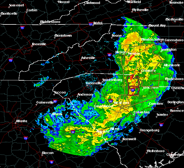 At 615 pm est, a severe thunderstorm capable of producing a tornado was located 5 miles northwest of rock hill, or near newport, moving east at 55 mph (radar indicated rotation). Hazards include tornado. Flying debris will be dangerous to those caught without shelter. mobile homes will be damaged or destroyed. damage to roofs, windows and vehicles will occur. tree damage is likely. this dangerous storm will be near, lesslie and carowinds around 620 pm est. fort mill around 630 pm est. Other locations impacted by this dangerous storm include edgemoor. At 615 pm est, a severe thunderstorm capable of producing a tornado was located 5 miles northwest of rock hill, or near newport, moving east at 55 mph (radar indicated rotation). Hazards include tornado. Flying debris will be dangerous to those caught without shelter. mobile homes will be damaged or destroyed. damage to roofs, windows and vehicles will occur. tree damage is likely. this dangerous storm will be near, lesslie and carowinds around 620 pm est. fort mill around 630 pm est. Other locations impacted by this dangerous storm include edgemoor.
|
| 11/30/2016 6:13 PM EST |
 At 613 pm est, severe thunderstorms were located along a line extending from 6 miles north of mocksville to 9 miles southwest of statesville to 10 miles northeast of lincolnton to 9 miles north of winnsboro, moving east at 35 mph (radar indicated). Hazards include 60 mph wind gusts. Expect damage to roofs. Siding and trees. At 613 pm est, severe thunderstorms were located along a line extending from 6 miles north of mocksville to 9 miles southwest of statesville to 10 miles northeast of lincolnton to 9 miles north of winnsboro, moving east at 35 mph (radar indicated). Hazards include 60 mph wind gusts. Expect damage to roofs. Siding and trees.
|
| 11/30/2016 6:07 PM EST |
 At 606 pm est, severe thunderstorms were located along a line extending from near east bend to 7 miles southwest of statesville to near lincolnton to 6 miles southwest of rock hill to 12 miles south of chester, moving northeast at 55 mph (radar indicated). Hazards include 60 mph wind gusts. Expect damage to roofs. siding and trees. Locations impacted include, gastonia, rock hill, hickory, statesville, newton, lincolnton, york, chester, taylorsville and mt holly. At 606 pm est, severe thunderstorms were located along a line extending from near east bend to 7 miles southwest of statesville to near lincolnton to 6 miles southwest of rock hill to 12 miles south of chester, moving northeast at 55 mph (radar indicated). Hazards include 60 mph wind gusts. Expect damage to roofs. siding and trees. Locations impacted include, gastonia, rock hill, hickory, statesville, newton, lincolnton, york, chester, taylorsville and mt holly.
|
| 11/30/2016 6:03 PM EST |
 At 602 pm est, a confirmed tornado was located 4 miles southwest of york, or near sharon, moving northeast at 40 mph (radar confirmed tornado). Hazards include damaging tornado. Flying debris will be dangerous to those caught without shelter. mobile homes will be damaged or destroyed. damage to roofs, windows and vehicles will occur. tree damage is likely. this tornado will be near, rock hill and newport around 620 pm est. tega cay, carowinds, town of lake wylie and fort mill around 630 pm est. Other locations impacted by this dangerous storm include bullock creek and edgemoor. At 602 pm est, a confirmed tornado was located 4 miles southwest of york, or near sharon, moving northeast at 40 mph (radar confirmed tornado). Hazards include damaging tornado. Flying debris will be dangerous to those caught without shelter. mobile homes will be damaged or destroyed. damage to roofs, windows and vehicles will occur. tree damage is likely. this tornado will be near, rock hill and newport around 620 pm est. tega cay, carowinds, town of lake wylie and fort mill around 630 pm est. Other locations impacted by this dangerous storm include bullock creek and edgemoor.
|
| 11/30/2016 5:53 PM EST |
 At 552 pm est, a severe thunderstorm capable of producing a tornado was located 10 miles southwest of york, or near sharon, moving east at 55 mph (radar indicated rotation). Hazards include tornado. Flying debris will be dangerous to those caught without shelter. mobile homes will be damaged or destroyed. damage to roofs, windows and vehicles will occur. tree damage is likely. this dangerous storm will be near, york and mcconnells around 600 pm est. rock hill and newport around 610 pm est. tega cay, fort mill, carowinds and town of lake wylie around 620 pm est. Other locations impacted by this dangerous thunderstorm include bullock creek and edgemoor. At 552 pm est, a severe thunderstorm capable of producing a tornado was located 10 miles southwest of york, or near sharon, moving east at 55 mph (radar indicated rotation). Hazards include tornado. Flying debris will be dangerous to those caught without shelter. mobile homes will be damaged or destroyed. damage to roofs, windows and vehicles will occur. tree damage is likely. this dangerous storm will be near, york and mcconnells around 600 pm est. rock hill and newport around 610 pm est. tega cay, fort mill, carowinds and town of lake wylie around 620 pm est. Other locations impacted by this dangerous thunderstorm include bullock creek and edgemoor.
|
| 11/30/2016 5:42 PM EST |
 At 542 pm est, severe thunderstorms were located along a line extending from 11 miles southwest of yadkinville to 8 miles southwest of newton to 3 miles northwest of shelby to 10 miles east of union to 6 miles north of newberry, moving northeast at 55 mph (radar indicated). Hazards include 60 mph wind gusts. Expect damage to roofs. siding and trees. Locations impacted include, gastonia, rock hill, hickory, statesville, shelby, newton, gaffney, lincolnton, union and york. At 542 pm est, severe thunderstorms were located along a line extending from 11 miles southwest of yadkinville to 8 miles southwest of newton to 3 miles northwest of shelby to 10 miles east of union to 6 miles north of newberry, moving northeast at 55 mph (radar indicated). Hazards include 60 mph wind gusts. Expect damage to roofs. siding and trees. Locations impacted include, gastonia, rock hill, hickory, statesville, shelby, newton, gaffney, lincolnton, union and york.
|
| 11/30/2016 5:26 PM EST |
 At 526 pm est, severe thunderstorms were located along a line extending from 8 miles east of taylorsville to 14 miles north of shelby to 8 miles southeast of forest city to 5 miles south of union to 8 miles west of newberry, moving northeast at 55 mph (radar indicated). Hazards include 60 mph wind gusts. Expect damage to roofs. Siding and trees. At 526 pm est, severe thunderstorms were located along a line extending from 8 miles east of taylorsville to 14 miles north of shelby to 8 miles southeast of forest city to 5 miles south of union to 8 miles west of newberry, moving northeast at 55 mph (radar indicated). Hazards include 60 mph wind gusts. Expect damage to roofs. Siding and trees.
|
| 9/28/2016 7:21 PM EDT | Amateur radio reported trees down in harris off robinson church rd ne of charlotte in mecklenburg county NC, 10.3 miles SW of Charlotte, NC |
| 9/28/2016 6:41 PM EDT |
 At 640 pm edt, a severe thunderstorm was located 11 miles south of downtown concord, or 5 miles northeast of mint hill, moving northeast at 25 mph (radar indicated). Hazards include 60 mph wind gusts and quarter size hail. Hail damage to vehicles is expected. expect wind damage to roofs, siding and trees. Locations impacted include, downtown concord, harrisburg, midland, charlotte motor speedway, west concord and mt pleasant. At 640 pm edt, a severe thunderstorm was located 11 miles south of downtown concord, or 5 miles northeast of mint hill, moving northeast at 25 mph (radar indicated). Hazards include 60 mph wind gusts and quarter size hail. Hail damage to vehicles is expected. expect wind damage to roofs, siding and trees. Locations impacted include, downtown concord, harrisburg, midland, charlotte motor speedway, west concord and mt pleasant.
|
| 9/28/2016 6:20 PM EDT |
 At 620 pm edt, a severe thunderstorm was located 8 miles east of uptown charlotte, or near mint hill, moving northeast at 25 mph (radar indicated). Hazards include 60 mph wind gusts and quarter size hail. Hail damage to vehicles is expected. Expect wind damage to roofs, siding and trees. At 620 pm edt, a severe thunderstorm was located 8 miles east of uptown charlotte, or near mint hill, moving northeast at 25 mph (radar indicated). Hazards include 60 mph wind gusts and quarter size hail. Hail damage to vehicles is expected. Expect wind damage to roofs, siding and trees.
|
| 9/1/2016 5:13 PM EDT | Trash cans knocked over and small tree limbs blown dow in mecklenburg county NC, 9.3 miles N of Charlotte, NC |
| 8/27/2016 5:15 PM EDT |
 At 515 pm edt, severe thunderstorms were located along a line extending from 10 miles southwest of lincolnton to 4 miles west of gastonia to 8 miles north of rock hill, moving northwest at 20 mph (radar indicated). Hazards include 60 mph wind gusts. Expect damage to roofs. Siding and trees. At 515 pm edt, severe thunderstorms were located along a line extending from 10 miles southwest of lincolnton to 4 miles west of gastonia to 8 miles north of rock hill, moving northwest at 20 mph (radar indicated). Hazards include 60 mph wind gusts. Expect damage to roofs. Siding and trees.
|
| 8/17/2016 7:09 PM EDT |
 The severe thunderstorm warning for north central mecklenburg county will expire at 715 pm edt, the storm which prompted the warning has weakened below severe limits, and no longer poses an immediate threat to life or property. therefore the warning will be allowed to expire. however gusty winds are still possible with this thunderstorm. The severe thunderstorm warning for north central mecklenburg county will expire at 715 pm edt, the storm which prompted the warning has weakened below severe limits, and no longer poses an immediate threat to life or property. therefore the warning will be allowed to expire. however gusty winds are still possible with this thunderstorm.
|
| 8/17/2016 6:47 PM EDT |
 At 646 pm edt, a severe thunderstorm was located 4 miles southeast of huntersville, or near northeast charlotte, moving northeast at 15 mph (radar indicated). Hazards include 60 mph wind gusts. Expect damage to roofs. siding and trees. Locations impacted include, huntersville, northeast charlotte, croft, unc-charlotte, hidden valley, northwest charlotte, davidson and central charlotte. At 646 pm edt, a severe thunderstorm was located 4 miles southeast of huntersville, or near northeast charlotte, moving northeast at 15 mph (radar indicated). Hazards include 60 mph wind gusts. Expect damage to roofs. siding and trees. Locations impacted include, huntersville, northeast charlotte, croft, unc-charlotte, hidden valley, northwest charlotte, davidson and central charlotte.
|
| 8/17/2016 6:24 PM EDT |
 At 623 pm edt, a severe thunderstorm was located near huntersville, moving east at 15 mph (radar indicated). Hazards include 60 mph wind gusts. Expect damage to roofs. siding and trees. Locations impacted include, huntersville, northeast charlotte, northwest charlotte, unc-charlotte, ramsey creek park, paw creek, croft, cornelius, hidden valley and davidson. At 623 pm edt, a severe thunderstorm was located near huntersville, moving east at 15 mph (radar indicated). Hazards include 60 mph wind gusts. Expect damage to roofs. siding and trees. Locations impacted include, huntersville, northeast charlotte, northwest charlotte, unc-charlotte, ramsey creek park, paw creek, croft, cornelius, hidden valley and davidson.
|
| 8/17/2016 6:17 PM EDT |
 At 616 pm edt, a severe thunderstorm was located 11 miles east of uptown charlotte, or near mint hill, moving east at 25 mph (radar indicated). Hazards include 60 mph wind gusts. Expect damage to roofs. siding and trees. Locations impacted include, uptown charlotte, central charlotte, east charlotte, matthews, mint hill, freedom park, hidden valley, the plaza, reedy creek park and unc-charlotte. At 616 pm edt, a severe thunderstorm was located 11 miles east of uptown charlotte, or near mint hill, moving east at 25 mph (radar indicated). Hazards include 60 mph wind gusts. Expect damage to roofs. siding and trees. Locations impacted include, uptown charlotte, central charlotte, east charlotte, matthews, mint hill, freedom park, hidden valley, the plaza, reedy creek park and unc-charlotte.
|
| 8/17/2016 6:08 PM EDT |
 At 608 pm edt, a severe thunderstorm was located 5 miles southwest of huntersville, moving east at 30 mph (radar indicated). Hazards include 60 mph wind gusts and penny size hail. Expect damage to roofs. Siding and trees. At 608 pm edt, a severe thunderstorm was located 5 miles southwest of huntersville, moving east at 30 mph (radar indicated). Hazards include 60 mph wind gusts and penny size hail. Expect damage to roofs. Siding and trees.
|
| 8/17/2016 5:47 PM EDT | Broadcast media reported a tree down on a house on garden terrace in charlotte. house was then struck by lightning. time estimated from rada in mecklenburg county NC, 2.5 miles NNW of Charlotte, NC |
| 8/17/2016 5:47 PM EDT | Social media reported a large tree down on romany rd & dilworth rd in charlotte. time estimated from rada in mecklenburg county NC, 1.7 miles NNW of Charlotte, NC |
| 8/17/2016 5:45 PM EDT | 911 call center reported few trees down in charlotte (center city). time estimated from rada in mecklenburg county NC, 1.1 miles WNW of Charlotte, NC |
| 8/17/2016 5:34 PM EDT |
 At 534 pm edt, a severe thunderstorm was located near uptown charlotte, or near freedom park, moving east at 10 mph (radar indicated). Hazards include 60 mph wind gusts and penny size hail. Expect damage to roofs. Siding and trees. At 534 pm edt, a severe thunderstorm was located near uptown charlotte, or near freedom park, moving east at 10 mph (radar indicated). Hazards include 60 mph wind gusts and penny size hail. Expect damage to roofs. Siding and trees.
|
| 8/15/2016 6:43 PM EDT |
 At 642 pm edt, a severe thunderstorm was located 8 miles west of uptown charlotte, or near charlotte douglas airport, moving north at 30 mph (radar indicated). Hazards include 60 mph wind gusts and penny size hail. Expect damage to roofs. Siding and trees. At 642 pm edt, a severe thunderstorm was located 8 miles west of uptown charlotte, or near charlotte douglas airport, moving north at 30 mph (radar indicated). Hazards include 60 mph wind gusts and penny size hail. Expect damage to roofs. Siding and trees.
|
| 8/2/2016 6:29 PM EDT | Large tree limbs down near the intersection of robinson church road and w.t.harris blv in mecklenburg county NC, 7.3 miles W of Charlotte, NC |
| 7/26/2016 5:58 PM EDT | The severe thunderstorm warning for northeastern mecklenburg and cabarrus counties will expire at 600 pm edt, the storm which prompted the warning has weakened below severe limits, and no longer poses an immediate threat to life or property. therefore the warning will be allowed to expire. however gusty winds are still possible with this thunderstorm. |
| 7/26/2016 5:41 PM EDT |
 At 541 pm edt, a severe thunderstorm was located 8 miles northeast of uptown charlotte, or near unc-charlotte, moving east at 10 mph (radar indicated). Hazards include 60 mph wind gusts. Expect damage to roofs. siding and trees. Locations impacted include, downtown concord, west concord, harrisburg, mt pleasant, charlotte motor speedway, coddle creek reservoir, reedy creek park, unc-charlotte, northeast charlotte and midland. At 541 pm edt, a severe thunderstorm was located 8 miles northeast of uptown charlotte, or near unc-charlotte, moving east at 10 mph (radar indicated). Hazards include 60 mph wind gusts. Expect damage to roofs. siding and trees. Locations impacted include, downtown concord, west concord, harrisburg, mt pleasant, charlotte motor speedway, coddle creek reservoir, reedy creek park, unc-charlotte, northeast charlotte and midland.
|
| 7/26/2016 5:29 PM EDT |
 At 529 pm edt, a severe thunderstorm was located 6 miles west of downtown concord, or near coddle creek reservoir, and is nearly stationary (radar indicated). Hazards include 60 mph wind gusts. Expect damage to roofs. siding and trees. Locations impacted include, downtown concord, west concord, harrisburg, mt pleasant, charlotte motor speedway, coddle creek reservoir, reedy creek park, unc-charlotte, northeast charlotte and midland. At 529 pm edt, a severe thunderstorm was located 6 miles west of downtown concord, or near coddle creek reservoir, and is nearly stationary (radar indicated). Hazards include 60 mph wind gusts. Expect damage to roofs. siding and trees. Locations impacted include, downtown concord, west concord, harrisburg, mt pleasant, charlotte motor speedway, coddle creek reservoir, reedy creek park, unc-charlotte, northeast charlotte and midland.
|
| 7/26/2016 5:14 PM EDT |
 At 514 pm edt, a severe thunderstorm was located 5 miles west of downtown concord, or near west concord, moving southeast at 10 mph (radar indicated). Hazards include 60 mph wind gusts. Expect damage to roofs. Siding and trees. At 514 pm edt, a severe thunderstorm was located 5 miles west of downtown concord, or near west concord, moving southeast at 10 mph (radar indicated). Hazards include 60 mph wind gusts. Expect damage to roofs. Siding and trees.
|
| 7/23/2016 5:58 PM EDT | The severe thunderstorm warning for central mecklenburg and western cabarrus counties will expire at 600 pm edt, the storm which prompted the warning has weakened below severe limits, and no longer poses an immediate threat to life or property. therefore the warning will be allowed to expire. however gusty winds and heavy rain are still possible with this thunderstorm. |
| 7/23/2016 5:45 PM EDT |
 At 543 pm edt, a severe thunderstorm was located 7 miles west of downtown concord, or near charlotte motor speedway, moving east at 10 mph (radar indicated). Hazards include 60 mph wind gusts. Expect damage to roofs. siding and trees. Locations impacted include, uptown charlotte, huntersville, east charlotte, northeast charlotte, west concord, harrisburg, the plaza, hidden valley, charlotte motor speedway and reedy creek park. At 543 pm edt, a severe thunderstorm was located 7 miles west of downtown concord, or near charlotte motor speedway, moving east at 10 mph (radar indicated). Hazards include 60 mph wind gusts. Expect damage to roofs. siding and trees. Locations impacted include, uptown charlotte, huntersville, east charlotte, northeast charlotte, west concord, harrisburg, the plaza, hidden valley, charlotte motor speedway and reedy creek park.
|
| 7/23/2016 5:19 PM EDT |
 At 519 pm edt, a severe thunderstorm was located 5 miles southeast of huntersville, or near northeast charlotte, moving south at 25 mph (radar indicated). Hazards include 60 mph wind gusts. Expect damage to roofs. Siding and trees. At 519 pm edt, a severe thunderstorm was located 5 miles southeast of huntersville, or near northeast charlotte, moving south at 25 mph (radar indicated). Hazards include 60 mph wind gusts. Expect damage to roofs. Siding and trees.
|
| 7/21/2016 3:30 PM EDT | Numerous power outages reported off of hwy 74 near the eastway shopping center in mecklenburg county NC, 2.4 miles WNW of Charlotte, NC |
| 7/21/2016 3:22 PM EDT | Tree limbs down on randolph rd in mecklenburg county NC, 2.8 miles NW of Charlotte, NC |
| 7/21/2016 3:20 PM EDT | Large oak tree down on east martin luther king blvd in mecklenburg county NC, 1.4 miles NW of Charlotte, NC |
| 7/21/2016 3:19 PM EDT | Tree down on beatties ford rd in mecklenburg county NC, 1.1 miles S of Charlotte, NC |
| 7/21/2016 3:10 PM EDT |
 The severe thunderstorm warning for central mecklenburg county will expire at 315 pm edt, the storm which prompted the warning has weakened below severe limits, and no longer poses an immediate threat to life or property. therefore the warning will be allowed to expire. however gusty winds are still possible with this thunderstorm. The severe thunderstorm warning for central mecklenburg county will expire at 315 pm edt, the storm which prompted the warning has weakened below severe limits, and no longer poses an immediate threat to life or property. therefore the warning will be allowed to expire. however gusty winds are still possible with this thunderstorm.
|
| 7/21/2016 3:04 PM EDT |
 At 304 pm edt, a severe thunderstorm was located 4 miles southeast of uptown charlotte, or near east charlotte, moving southeast at 5 mph (radar indicated). Hazards include 60 mph wind gusts and penny size hail. Expect damage to roofs. siding and trees. Locations impacted include, uptown charlotte, east charlotte, matthews, mint hill, freedom park, hidden valley, the plaza, reedy creek park, southpark mall and unc-charlotte. At 304 pm edt, a severe thunderstorm was located 4 miles southeast of uptown charlotte, or near east charlotte, moving southeast at 5 mph (radar indicated). Hazards include 60 mph wind gusts and penny size hail. Expect damage to roofs. siding and trees. Locations impacted include, uptown charlotte, east charlotte, matthews, mint hill, freedom park, hidden valley, the plaza, reedy creek park, southpark mall and unc-charlotte.
|
| 7/21/2016 3:00 PM EDT | Tree down on apartment complex in elizabeth. time estimated from rada in mecklenburg county NC, 1.8 miles WNW of Charlotte, NC |
| 7/21/2016 3:00 PM EDT | Large tree down off of hawthorne ln. time estimated from rada in mecklenburg county NC, 2.8 miles NW of Charlotte, NC |
| 7/21/2016 2:51 PM EDT |
 At 251 pm edt, a severe thunderstorm was located near uptown charlotte, or over the plaza, moving east at 5 mph (radar indicated). Hazards include 60 mph wind gusts and penny size hail. Expect damage to roofs. Siding and trees. At 251 pm edt, a severe thunderstorm was located near uptown charlotte, or over the plaza, moving east at 5 mph (radar indicated). Hazards include 60 mph wind gusts and penny size hail. Expect damage to roofs. Siding and trees.
|
| 7/19/2016 11:35 PM EDT |
 At 1135 pm edt, a severe thunderstorm was located 9 miles south of downtown concord, or 4 miles northwest of midland, moving south at 15 mph (radar indicated). Hazards include 60 mph wind gusts. Expect damage to roofs. siding and trees. Locations impacted include, downtown concord, west concord, mint hill, harrisburg, charlotte motor speedway, reedy creek park, midland, unc-charlotte, matthews and east charlotte. At 1135 pm edt, a severe thunderstorm was located 9 miles south of downtown concord, or 4 miles northwest of midland, moving south at 15 mph (radar indicated). Hazards include 60 mph wind gusts. Expect damage to roofs. siding and trees. Locations impacted include, downtown concord, west concord, mint hill, harrisburg, charlotte motor speedway, reedy creek park, midland, unc-charlotte, matthews and east charlotte.
|
| 7/19/2016 11:19 PM EDT |
 At 1119 pm edt, a severe thunderstorm was located 5 miles south of downtown concord, or 5 miles east of harrisburg, moving south at 25 mph (radar indicated). Hazards include 60 mph wind gusts and penny size hail. Expect damage to roofs. siding and trees. Locations impacted include, downtown concord, west concord, mint hill, harrisburg, charlotte motor speedway, reedy creek park, midland, unc-charlotte, matthews and east charlotte. At 1119 pm edt, a severe thunderstorm was located 5 miles south of downtown concord, or 5 miles east of harrisburg, moving south at 25 mph (radar indicated). Hazards include 60 mph wind gusts and penny size hail. Expect damage to roofs. siding and trees. Locations impacted include, downtown concord, west concord, mint hill, harrisburg, charlotte motor speedway, reedy creek park, midland, unc-charlotte, matthews and east charlotte.
|
| 7/19/2016 10:59 PM EDT |
 At 1059 pm edt, a severe thunderstorm was located 10 miles south of downtown concord, or 5 miles southeast of harrisburg, moving south at 15 mph (radar indicated). Hazards include 60 mph wind gusts and penny size hail. Expect damage to roofs. siding and trees. Locations impacted include, downtown concord, west concord, mint hill, harrisburg, charlotte motor speedway, reedy creek park, midland, unc-charlotte, matthews and east charlotte. At 1059 pm edt, a severe thunderstorm was located 10 miles south of downtown concord, or 5 miles southeast of harrisburg, moving south at 15 mph (radar indicated). Hazards include 60 mph wind gusts and penny size hail. Expect damage to roofs. siding and trees. Locations impacted include, downtown concord, west concord, mint hill, harrisburg, charlotte motor speedway, reedy creek park, midland, unc-charlotte, matthews and east charlotte.
|
| 7/19/2016 10:38 PM EDT |
 At 1037 pm edt, a severe thunderstorm was located 5 miles southwest of downtown concord, or near harrisburg, moving south at 15 mph (radar indicated). Hazards include 60 mph wind gusts and penny size hail. Expect damage to roofs. Siding and trees. At 1037 pm edt, a severe thunderstorm was located 5 miles southwest of downtown concord, or near harrisburg, moving south at 15 mph (radar indicated). Hazards include 60 mph wind gusts and penny size hail. Expect damage to roofs. Siding and trees.
|
| 7/15/2016 6:45 PM EDT |
 At 644 pm edt, severe thunderstorms were located along a line extending from 10 miles east of uptown charlotte to 13 miles northeast of rock hill, moving northeast at 25 mph (radar indicated). Hazards include 60 mph wind gusts. Expect damage to roofs. siding and trees. Locations impacted include, monroe, south charlotte, matthews, mint hill, indian trail, weddington, stallings, unionville, pineville and wesley chapel. At 644 pm edt, severe thunderstorms were located along a line extending from 10 miles east of uptown charlotte to 13 miles northeast of rock hill, moving northeast at 25 mph (radar indicated). Hazards include 60 mph wind gusts. Expect damage to roofs. siding and trees. Locations impacted include, monroe, south charlotte, matthews, mint hill, indian trail, weddington, stallings, unionville, pineville and wesley chapel.
|
| 7/15/2016 6:27 PM EDT |
 At 626 pm edt, a severe thunderstorm was located 9 miles northeast of rock hill, or near fort mill, moving east at 25 mph (radar indicated). Hazards include 60 mph wind gusts and half dollar size hail. Hail damage to vehicles is expected. Expect wind damage to roofs, siding and trees. At 626 pm edt, a severe thunderstorm was located 9 miles northeast of rock hill, or near fort mill, moving east at 25 mph (radar indicated). Hazards include 60 mph wind gusts and half dollar size hail. Hail damage to vehicles is expected. Expect wind damage to roofs, siding and trees.
|
| 7/11/2016 5:50 PM EDT | Quarter sized hail reported 11.4 miles W of Charlotte, NC, report from sam dee road of quarter sized hail. |
| 7/11/2016 5:50 PM EDT | Several reports via social media of trees down on the east side of charlott in mecklenburg county NC, 6.8 miles W of Charlotte, NC |
| 7/11/2016 5:45 PM EDT | Tree down on the roa in mecklenburg county NC, 6.9 miles WSW of Charlotte, NC |
| 7/11/2016 5:43 PM EDT |
 At 543 pm edt, a severe thunderstorm was located 12 miles east of uptown charlotte, or near mint hill, moving east at 15 mph (radar indicated). Hazards include 60 mph wind gusts and quarter size hail. Hail damage to vehicles is expected. Expect wind damage to roofs, siding and trees. At 543 pm edt, a severe thunderstorm was located 12 miles east of uptown charlotte, or near mint hill, moving east at 15 mph (radar indicated). Hazards include 60 mph wind gusts and quarter size hail. Hail damage to vehicles is expected. Expect wind damage to roofs, siding and trees.
|
| 7/8/2016 9:06 PM EDT |
 At 906 pm edt, severe thunderstorms were located along a line extending from 4 miles northwest of albemarle to 11 miles west of monroe, moving southeast at 45 mph (radar indicated). Hazards include 60 mph wind gusts. Expect damage to roofs. Siding and trees. At 906 pm edt, severe thunderstorms were located along a line extending from 4 miles northwest of albemarle to 11 miles west of monroe, moving southeast at 45 mph (radar indicated). Hazards include 60 mph wind gusts. Expect damage to roofs. Siding and trees.
|
| 7/8/2016 8:49 PM EDT |
 At 848 pm edt, severe thunderstorms were located along a line extending from 4 miles east of kannapolis to 5 miles east of uptown charlotte to 13 miles northeast of rock hill, moving east at 40 mph (radar indicated). Hazards include 60 mph wind gusts and quarter size hail. Hail damage to vehicles is expected. expect wind damage to roofs, siding and trees. Locations impacted include, uptown charlotte, huntersville, kannapolis, downtown concord, central charlotte, south charlotte, east charlotte, southwest charlotte, northeast charlotte and northwest charlotte. At 848 pm edt, severe thunderstorms were located along a line extending from 4 miles east of kannapolis to 5 miles east of uptown charlotte to 13 miles northeast of rock hill, moving east at 40 mph (radar indicated). Hazards include 60 mph wind gusts and quarter size hail. Hail damage to vehicles is expected. expect wind damage to roofs, siding and trees. Locations impacted include, uptown charlotte, huntersville, kannapolis, downtown concord, central charlotte, south charlotte, east charlotte, southwest charlotte, northeast charlotte and northwest charlotte.
|
| 7/8/2016 8:42 PM EDT | 2 large trees down on a house in plaza midwoo in mecklenburg county NC, 3.3 miles W of Charlotte, NC |
| 7/8/2016 8:40 PM EDT | Trees down including one on a hous in mecklenburg county NC, 3.9 miles W of Charlotte, NC |
| 7/8/2016 8:38 PM EDT | Scattered trees and utility lines down across northwest charlott in mecklenburg county NC, 4.8 miles ESE of Charlotte, NC |
| 7/8/2016 8:30 PM EDT |
 At 829 pm edt, severe thunderstorms were located along a line extending from 9 miles west of kannapolis to 4 miles south of huntersville to 8 miles southeast of gastonia, moving east at 45 mph (radar indicated). Hazards include 60 mph wind gusts and quarter size hail. Hail damage to vehicles is expected. Expect wind damage to roofs, siding and trees. At 829 pm edt, severe thunderstorms were located along a line extending from 9 miles west of kannapolis to 4 miles south of huntersville to 8 miles southeast of gastonia, moving east at 45 mph (radar indicated). Hazards include 60 mph wind gusts and quarter size hail. Hail damage to vehicles is expected. Expect wind damage to roofs, siding and trees.
|
| 7/8/2016 8:08 PM EDT |
 At 807 pm edt, a severe thunderstorm was located 11 miles west of huntersville, or near stanley, moving southeast at 20 mph (radar indicated). Hazards include 60 mph wind gusts and quarter size hail. Hail damage to vehicles is expected. Expect wind damage to roofs, siding and trees. At 807 pm edt, a severe thunderstorm was located 11 miles west of huntersville, or near stanley, moving southeast at 20 mph (radar indicated). Hazards include 60 mph wind gusts and quarter size hail. Hail damage to vehicles is expected. Expect wind damage to roofs, siding and trees.
|
| 7/5/2016 4:44 PM EDT |
 At 443 pm edt, the leading edge of very strong winds associated with severe thunderstorms were located along a line extending from 11 miles west of albemarle to 7 miles northwest of monroe to 4 miles south of rock hill, moving east at 35 mph (radar indicated). Hazards include 60 mph wind gusts. Expect damage to roofs. Siding and trees. At 443 pm edt, the leading edge of very strong winds associated with severe thunderstorms were located along a line extending from 11 miles west of albemarle to 7 miles northwest of monroe to 4 miles south of rock hill, moving east at 35 mph (radar indicated). Hazards include 60 mph wind gusts. Expect damage to roofs. Siding and trees.
|
| 7/5/2016 4:20 PM EDT | Downed tree on park rd. near princeton av in mecklenburg county NC, 3 miles N of Charlotte, NC |
| 7/5/2016 4:18 PM EDT |
 At 417 pm edt, severe thunderstorms were located along a line extending from 5 miles north of uptown charlotte to 6 miles south of gastonia to 4 miles southwest of gaffney, moving east at 30 mph (law enforcement). Hazards include damaging 60 mph wind gusts. Expect damage to roofs. Siding and trees. At 417 pm edt, severe thunderstorms were located along a line extending from 5 miles north of uptown charlotte to 6 miles south of gastonia to 4 miles southwest of gaffney, moving east at 30 mph (law enforcement). Hazards include damaging 60 mph wind gusts. Expect damage to roofs. Siding and trees.
|
| 6/29/2016 4:46 PM EDT |
 At 446 pm edt, a severe thunderstorm was located 5 miles north of huntersville, or over davidson, moving southeast at 25 mph (radar indicated). Hazards include 60 mph wind gusts and quarter size hail. Hail damage to vehicles is expected. Expect wind damage to roofs, siding and trees. At 446 pm edt, a severe thunderstorm was located 5 miles north of huntersville, or over davidson, moving southeast at 25 mph (radar indicated). Hazards include 60 mph wind gusts and quarter size hail. Hail damage to vehicles is expected. Expect wind damage to roofs, siding and trees.
|
| 6/22/2016 5:27 PM EDT |
 At 527 pm edt, a severe thunderstorm was located 9 miles southeast of downtown concord, or 4 miles north of midland, moving east at 20 mph (radar indicated). Hazards include 60 mph wind gusts and quarter size hail. Hail damage to vehicles is expected. expect wind damage to roofs, siding and trees. Locations impacted include, midland, harrisburg, mt pleasant and downtown concord. At 527 pm edt, a severe thunderstorm was located 9 miles southeast of downtown concord, or 4 miles north of midland, moving east at 20 mph (radar indicated). Hazards include 60 mph wind gusts and quarter size hail. Hail damage to vehicles is expected. expect wind damage to roofs, siding and trees. Locations impacted include, midland, harrisburg, mt pleasant and downtown concord.
|
| 6/22/2016 5:13 PM EDT |
 At 513 pm edt, a severe thunderstorm was located 5 miles south of downtown concord, moving southeast at 20 mph (radar indicated). Hazards include 60 mph wind gusts and quarter size hail. Hail damage to vehicles is expected. Expect wind damage to roofs, siding and trees. At 513 pm edt, a severe thunderstorm was located 5 miles south of downtown concord, moving southeast at 20 mph (radar indicated). Hazards include 60 mph wind gusts and quarter size hail. Hail damage to vehicles is expected. Expect wind damage to roofs, siding and trees.
|
| 6/14/2016 9:06 PM EDT |
 The severe thunderstorm warning for central mecklenburg and western cabarrus counties will expire at 915 pm edt, the storm which prompted the warning has weakened below severe limits, and no longer poses an immediate threat to life or property. therefore the warning will be allowed to expire. however gusty winds and heavy rain are still possible with this thunderstorm. The severe thunderstorm warning for central mecklenburg and western cabarrus counties will expire at 915 pm edt, the storm which prompted the warning has weakened below severe limits, and no longer poses an immediate threat to life or property. therefore the warning will be allowed to expire. however gusty winds and heavy rain are still possible with this thunderstorm.
|
| 6/14/2016 8:40 PM EDT |
 At 839 pm edt, a severe thunderstorm was located 6 miles northeast of uptown charlotte, or near unc charlotte, moving northeast at 10 mph (radar indicated). Hazards include 60 mph wind gusts and penny size hail. Expect damage to roofs. siding and trees. Locations impacted include, uptown charlotte, downtown concord, east charlotte, northeast charlotte, west concord, harrisburg, unc charlotte, freedom park, the plaza and hidden valley. At 839 pm edt, a severe thunderstorm was located 6 miles northeast of uptown charlotte, or near unc charlotte, moving northeast at 10 mph (radar indicated). Hazards include 60 mph wind gusts and penny size hail. Expect damage to roofs. siding and trees. Locations impacted include, uptown charlotte, downtown concord, east charlotte, northeast charlotte, west concord, harrisburg, unc charlotte, freedom park, the plaza and hidden valley.
|
| 6/14/2016 8:15 PM EDT | Fire dept relayed a report of a tree blown down on kistler av in mecklenburg county NC, 5.5 miles WNW of Charlotte, NC |
| 6/14/2016 8:11 PM EDT |
 At 811 pm edt, a severe thunderstorm was located near uptown charlotte, or over the plaza, moving northeast at 15 mph (radar indicated). Hazards include 60 mph wind gusts and quarter size hail. Hail damage to vehicles is expected. Expect wind damage to roofs, siding and trees. At 811 pm edt, a severe thunderstorm was located near uptown charlotte, or over the plaza, moving northeast at 15 mph (radar indicated). Hazards include 60 mph wind gusts and quarter size hail. Hail damage to vehicles is expected. Expect wind damage to roofs, siding and trees.
|
| 6/14/2016 8:05 PM EDT | Fire dept relayed a report of a tree blown down on kistler av in mecklenburg county NC, 5.5 miles WNW of Charlotte, NC |
| 6/14/2016 7:42 PM EDT |
 A severe thunderstorm warning remains in effect until 815 pm edt for southeastern mecklenburg and central union counties. at 742 pm edt. severe thunderstorms were located along a line extending from 14 miles west of wadesboro to 5 miles northeast of monroe to 12 miles southeast of uptown charlotte. Moving northeast at 10 mph. A severe thunderstorm warning remains in effect until 815 pm edt for southeastern mecklenburg and central union counties. at 742 pm edt. severe thunderstorms were located along a line extending from 14 miles west of wadesboro to 5 miles northeast of monroe to 12 miles southeast of uptown charlotte. Moving northeast at 10 mph.
|
| 6/14/2016 7:42 PM EDT |
 At 742 pm edt, severe thunderstorms were located along a line extending from 14 miles west of wadesboro to 5 miles northeast of monroe to 12 miles southeast of uptown charlotte, moving northeast at 10 mph (radar indicated). Hazards include 60 mph wind gusts and penny size hail. Expect damage to roofs. siding and trees. Locations impacted include, monroe, matthews, mint hill, indian trail, stallings, unionville, wesley chapel, wingate, marshville and lake park. At 742 pm edt, severe thunderstorms were located along a line extending from 14 miles west of wadesboro to 5 miles northeast of monroe to 12 miles southeast of uptown charlotte, moving northeast at 10 mph (radar indicated). Hazards include 60 mph wind gusts and penny size hail. Expect damage to roofs. siding and trees. Locations impacted include, monroe, matthews, mint hill, indian trail, stallings, unionville, wesley chapel, wingate, marshville and lake park.
|
| 6/14/2016 7:18 PM EDT |
 At 718 pm edt, severe thunderstorms were located along a line extending from 18 miles west of wadesboro to near monroe to 14 miles south of uptown charlotte, moving northeast at 10 mph (radar indicated). Hazards include 60 mph wind gusts and nickel size hail. Expect damage to roofs. Siding and trees. At 718 pm edt, severe thunderstorms were located along a line extending from 18 miles west of wadesboro to near monroe to 14 miles south of uptown charlotte, moving northeast at 10 mph (radar indicated). Hazards include 60 mph wind gusts and nickel size hail. Expect damage to roofs. Siding and trees.
|
| 6/14/2016 7:18 PM EDT |
 The national weather service in greenville-spartanburg has issued a * severe thunderstorm warning for. southeastern mecklenburg county in the piedmont of north carolina. union county in the piedmont of north carolina. Until 815 pm edt. The national weather service in greenville-spartanburg has issued a * severe thunderstorm warning for. southeastern mecklenburg county in the piedmont of north carolina. union county in the piedmont of north carolina. Until 815 pm edt.
|
| 5/21/2016 7:10 PM EDT | A large tree reported down on the exit ramp of i-77n and west trade s in mecklenburg county NC, 1.7 miles NNW of Charlotte, NC |
| 5/21/2016 7:05 PM EDT | 2 trees down near the intersection of hovis rd and south hoskins r in mecklenburg county NC, 0.7 miles ENE of Charlotte, NC |
| 5/12/2016 7:57 PM EDT |
 At 757 pm edt, a severe thunderstorm was located 10 miles northwest of monroe, or over stallings, moving northeast at 30 mph (radar indicated). Hazards include quarter size hail. damage to vehicles is expected At 757 pm edt, a severe thunderstorm was located 10 miles northwest of monroe, or over stallings, moving northeast at 30 mph (radar indicated). Hazards include quarter size hail. damage to vehicles is expected
|
| 5/12/2016 7:52 PM EDT | Multiple trees down near n.c. 51 and n.c. 16. time estimated by rada in mecklenburg county NC, 10.2 miles NNW of Charlotte, NC |
| 5/12/2016 7:48 PM EDT | Quarter sized hail reported 9.9 miles N of Charlotte, NC |
| 5/12/2016 7:45 PM EDT |
 At 744 pm edt, a severe thunderstorm was located 6 miles south of uptown charlotte, or near southpark mall, moving northeast at 35 mph (radar indicated). Hazards include 60 mph wind gusts and penny size hail. Expect damage to roofs. siding and trees. Locations impacted include, uptown charlotte, the southeast side of charlotte, matthews, pineville, freedom park, the plaza and southpark mall. At 744 pm edt, a severe thunderstorm was located 6 miles south of uptown charlotte, or near southpark mall, moving northeast at 35 mph (radar indicated). Hazards include 60 mph wind gusts and penny size hail. Expect damage to roofs. siding and trees. Locations impacted include, uptown charlotte, the southeast side of charlotte, matthews, pineville, freedom park, the plaza and southpark mall.
|
| 5/12/2016 7:26 PM EDT |
 At 726 pm edt, a severe thunderstorm was located 6 miles north of rock hill, or near tega cay, moving northeast at 30 mph (radar indicated). Hazards include 60 mph wind gusts and penny size hail. Expect damage to roofs. Siding and trees. At 726 pm edt, a severe thunderstorm was located 6 miles north of rock hill, or near tega cay, moving northeast at 30 mph (radar indicated). Hazards include 60 mph wind gusts and penny size hail. Expect damage to roofs. Siding and trees.
|
| 5/3/2016 4:45 PM EDT |
 At 445 pm edt, a severe thunderstorm was located 7 miles southeast of uptown charlotte, or near south charlotte, moving east at 30 mph (radar indicated). Hazards include 60 mph wind gusts and quarter size hail. Hail damage to vehicles is expected. Expect wind damage to roofs, siding and trees. At 445 pm edt, a severe thunderstorm was located 7 miles southeast of uptown charlotte, or near south charlotte, moving east at 30 mph (radar indicated). Hazards include 60 mph wind gusts and quarter size hail. Hail damage to vehicles is expected. Expect wind damage to roofs, siding and trees.
|
| 5/2/2016 5:54 PM EDT |
 At 553 pm edt, severe thunderstorms were located along a line extending from 8 miles north of gastonia to 8 miles southwest of lincolnton, moving northeast at 30 mph (radar indicated). Hazards include 60 mph wind gusts and quarter size hail. Hail damage to vehicles is expected. expect wind damage to roofs, siding and trees. Locations impacted include, gastonia, huntersville, lincolnton, cornelius, mt holly, davidson, cherryville, bessemer city, south gastonia and dallas. At 553 pm edt, severe thunderstorms were located along a line extending from 8 miles north of gastonia to 8 miles southwest of lincolnton, moving northeast at 30 mph (radar indicated). Hazards include 60 mph wind gusts and quarter size hail. Hail damage to vehicles is expected. expect wind damage to roofs, siding and trees. Locations impacted include, gastonia, huntersville, lincolnton, cornelius, mt holly, davidson, cherryville, bessemer city, south gastonia and dallas.
|
| 5/2/2016 5:36 PM EDT |
 At 536 pm edt, severe thunderstorms were located along a line extending from 4 miles northwest of gastonia to 4 miles east of shelby, moving northeast at 25 mph (radar indicated). Hazards include 60 mph wind gusts and quarter size hail. Hail damage to vehicles is expected. Expect wind damage to roofs, siding and trees. At 536 pm edt, severe thunderstorms were located along a line extending from 4 miles northwest of gastonia to 4 miles east of shelby, moving northeast at 25 mph (radar indicated). Hazards include 60 mph wind gusts and quarter size hail. Hail damage to vehicles is expected. Expect wind damage to roofs, siding and trees.
|
| 5/2/2016 3:37 PM EDT |
 At 336 pm edt, a severe thunderstorm was located near huntersville, moving northeast at 15 mph (radar indicated). Hazards include 60 mph wind gusts and quarter size hail. Hail damage to vehicles is expected. Expect wind damage to roofs, siding and trees. At 336 pm edt, a severe thunderstorm was located near huntersville, moving northeast at 15 mph (radar indicated). Hazards include 60 mph wind gusts and quarter size hail. Hail damage to vehicles is expected. Expect wind damage to roofs, siding and trees.
|
| 5/1/2016 7:12 PM EDT |
 At 712 pm edt, a severe thunderstorm was located near shelby, moving east at 30 mph (radar indicated). Hazards include 60 mph wind gusts and quarter size hail. Hail damage to vehicles is expected. Expect wind damage to roofs, siding and trees. At 712 pm edt, a severe thunderstorm was located near shelby, moving east at 30 mph (radar indicated). Hazards include 60 mph wind gusts and quarter size hail. Hail damage to vehicles is expected. Expect wind damage to roofs, siding and trees.
|
| 2/24/2016 1:35 PM EST |
 At 134 pm est, doppler radar indicated a line of severe thunderstorms with a history of producing damaging winds in excess of 60 mph, along with numerous downed trees. these storms were located along a line extending from 8 miles southwest of lexington to 9 miles south of salisbury to 10 miles northeast of lancaster, moving northeast at 50 mph. locations impacted include, kannapolis, downtown concord, monroe, salisbury, west concord, matthews, mint hill, indian trail, weddington and stallings. a tornado watch remains in effect until 700 pm est for central north carolina. At 134 pm est, doppler radar indicated a line of severe thunderstorms with a history of producing damaging winds in excess of 60 mph, along with numerous downed trees. these storms were located along a line extending from 8 miles southwest of lexington to 9 miles south of salisbury to 10 miles northeast of lancaster, moving northeast at 50 mph. locations impacted include, kannapolis, downtown concord, monroe, salisbury, west concord, matthews, mint hill, indian trail, weddington and stallings. a tornado watch remains in effect until 700 pm est for central north carolina.
|
| 2/24/2016 1:14 PM EST |
 At 113 pm est, doppler radar indicated a line of severe thunderstorms with a history of producing hurricane force winds in excess of 70 mph, along with numerous downed trees. these storms were located along a line extending from 8 miles northeast of mocksville to 5 miles southeast of salisbury to near downtown concord to 6 miles north of lancaster, and moving northeast at 80 mph. * locations in the warning include, kannapolis, downtown concord, monroe, salisbury, mocksville, west concord, matthews, mint hill, indian trail and weddington. At 113 pm est, doppler radar indicated a line of severe thunderstorms with a history of producing hurricane force winds in excess of 70 mph, along with numerous downed trees. these storms were located along a line extending from 8 miles northeast of mocksville to 5 miles southeast of salisbury to near downtown concord to 6 miles north of lancaster, and moving northeast at 80 mph. * locations in the warning include, kannapolis, downtown concord, monroe, salisbury, mocksville, west concord, matthews, mint hill, indian trail and weddington.
|
| 2/24/2016 1:03 PM EST |
 At 102 pm est, doppler radar indicated a line of severe thunderstorms with a history of producing hurricane force winds in excess of 70 mph, along with downing numerous trees. these storms were located along a line extending from 8 miles northeast of mocksville to 6 miles northeast of kannapolis to 11 miles east of rock hill, moving northeast at 85 mph. locations impacted include, uptown charlotte, huntersville, kannapolis, downtown concord, monroe, salisbury, mocksville, central charlotte, south charlotte and southwest charlotte. a tornado watch remains in effect until 700 pm est for central north carolina and central south carolina. At 102 pm est, doppler radar indicated a line of severe thunderstorms with a history of producing hurricane force winds in excess of 70 mph, along with downing numerous trees. these storms were located along a line extending from 8 miles northeast of mocksville to 6 miles northeast of kannapolis to 11 miles east of rock hill, moving northeast at 85 mph. locations impacted include, uptown charlotte, huntersville, kannapolis, downtown concord, monroe, salisbury, mocksville, central charlotte, south charlotte and southwest charlotte. a tornado watch remains in effect until 700 pm est for central north carolina and central south carolina.
|
| 2/24/2016 12:55 PM EST |
 At 1255 pm est, doppler radar indicated a line of severe thunderstorms capable of producing damaging winds in excess of 60 mph. these storms were located along a line extending from 4 miles southeast of mocksville to near downtown concord to 7 miles southeast of rock hill, moving northeast at 70 mph. locations impacted include, rock hill, uptown charlotte, huntersville, kannapolis, downtown concord, monroe, salisbury, york, chester and mocksville. a tornado watch remains in effect until 700 pm est for central north carolina and central south carolina. At 1255 pm est, doppler radar indicated a line of severe thunderstorms capable of producing damaging winds in excess of 60 mph. these storms were located along a line extending from 4 miles southeast of mocksville to near downtown concord to 7 miles southeast of rock hill, moving northeast at 70 mph. locations impacted include, rock hill, uptown charlotte, huntersville, kannapolis, downtown concord, monroe, salisbury, york, chester and mocksville. a tornado watch remains in effect until 700 pm est for central north carolina and central south carolina.
|
| 2/24/2016 12:40 PM EST | Tree on a car along woodcrest ave in mecklenburg county NC, 1.6 miles N of Charlotte, NC |
| 2/24/2016 12:40 PM EST | Part of a tree on a condo along vision dr in mecklenburg county NC, 1.7 miles NNE of Charlotte, NC |
| 2/24/2016 12:35 PM EST | Trees down on interstate 277. social media repor in mecklenburg county NC, 2.8 miles NW of Charlotte, NC |
| 2/24/2016 12:30 PM EST | Tree blocking queens road as shown on televisio in mecklenburg county NC, 7 miles NNW of Charlotte, NC |
| 2/24/2016 12:25 PM EST | Tree on house along west blvd in mecklenburg county NC, 3.8 miles ENE of Charlotte, NC |
| 2/24/2016 12:13 PM EST |
 At 1212 pm est, doppler radar indicated a line of severe thunderstorms capable of producing damaging winds in excess of 60 mph. these storms were located along a line extending from 8 miles east of gastonia to 15 miles west of winnsboro, and moving northeast at 85 mph. * locations in the warning include, rock hill, uptown charlotte, huntersville, kannapolis, downtown concord, monroe, salisbury, york, chester and mocksville. At 1212 pm est, doppler radar indicated a line of severe thunderstorms capable of producing damaging winds in excess of 60 mph. these storms were located along a line extending from 8 miles east of gastonia to 15 miles west of winnsboro, and moving northeast at 85 mph. * locations in the warning include, rock hill, uptown charlotte, huntersville, kannapolis, downtown concord, monroe, salisbury, york, chester and mocksville.
|
| 2/3/2016 12:35 PM EST | Few trees dow in mecklenburg county NC, 10.7 miles W of Charlotte, NC |
| 2/3/2016 12:35 PM EST |
 At 1235 pm est, doppler radar indicated a line of severe thunderstorms capable of producing damaging winds in excess of 60 mph. these storms were located along a line extending from 6 miles northeast of downtown concord to 15 miles southeast of huntersville to 10 miles south of uptown charlotte, moving east at 40 mph. locations impacted include, downtown concord, south charlotte, east charlotte, matthews, mint hill, indian trail, weddington, fort mill, stallings and pineville. At 1235 pm est, doppler radar indicated a line of severe thunderstorms capable of producing damaging winds in excess of 60 mph. these storms were located along a line extending from 6 miles northeast of downtown concord to 15 miles southeast of huntersville to 10 miles south of uptown charlotte, moving east at 40 mph. locations impacted include, downtown concord, south charlotte, east charlotte, matthews, mint hill, indian trail, weddington, fort mill, stallings and pineville.
|
| 2/3/2016 12:30 PM EST | Tree down on ardsley road and at sugar creek before nevin roa in mecklenburg county NC, 2.8 miles NW of Charlotte, NC |
| 2/3/2016 12:30 PM EST | Few trees dow in mecklenburg county NC, 10.7 miles W of Charlotte, NC |
| 2/3/2016 12:21 PM EST |
 At 1220 pm est, doppler radar indicated a line of severe thunderstorms capable of producing damaging winds in excess of 60 mph. these storms were located along a line extending from 5 miles west of downtown concord to 4 miles east of uptown charlotte to 7 miles northeast of rock hill, and moving east at 45 mph. * locations in the warning include, downtown concord, south charlotte, southwest charlotte, east charlotte, west concord, matthews, mint hill, indian trail, weddington and fort mill. At 1220 pm est, doppler radar indicated a line of severe thunderstorms capable of producing damaging winds in excess of 60 mph. these storms were located along a line extending from 5 miles west of downtown concord to 4 miles east of uptown charlotte to 7 miles northeast of rock hill, and moving east at 45 mph. * locations in the warning include, downtown concord, south charlotte, southwest charlotte, east charlotte, west concord, matthews, mint hill, indian trail, weddington and fort mill.
|
| 2/3/2016 12:20 PM EST | Two trees down...one on west trade stree in mecklenburg county NC, 2.8 miles NW of Charlotte, NC |
| 9/10/2015 7:09 PM EDT |
 At 708 pm edt, doppler radar indicated a severe thunderstorm capable of producing damaging winds in excess of 60 mph. this storm was located 14 miles north of monroe, or 4 miles northwest of fairview in union county, moving east at 20 mph. locations impacted include, matthews, mint hill, unionville, fairview in union county, midland, hemby bridge, southpark mall, east charlotte, south charlotte and stallings. At 708 pm edt, doppler radar indicated a severe thunderstorm capable of producing damaging winds in excess of 60 mph. this storm was located 14 miles north of monroe, or 4 miles northwest of fairview in union county, moving east at 20 mph. locations impacted include, matthews, mint hill, unionville, fairview in union county, midland, hemby bridge, southpark mall, east charlotte, south charlotte and stallings.
|
| 9/10/2015 6:56 PM EDT |
 At 656 pm edt, doppler radar indicated a severe thunderstorm capable of producing damaging winds in excess of 60 mph. this storm was located 11 miles east of uptown charlotte, or near mint hill, and moving east at 20 mph. * locations in the warning include, matthews, mint hill, unionville, east charlotte, fairview in union county, reedy creek park, midland, hemby bridge, southpark mall and harrisburg. At 656 pm edt, doppler radar indicated a severe thunderstorm capable of producing damaging winds in excess of 60 mph. this storm was located 11 miles east of uptown charlotte, or near mint hill, and moving east at 20 mph. * locations in the warning include, matthews, mint hill, unionville, east charlotte, fairview in union county, reedy creek park, midland, hemby bridge, southpark mall and harrisburg.
|
| 9/10/2015 6:12 PM EDT | The severe thunderstorm warning for central mecklenburg and northwestern cabarrus counties will expire at 615 pm edt, the storm which prompted the warning has weakened below severe limits, and no longer poses an immediate threat to life or property. therefore the warning will be allowed to expire. however, strong thunderstorms were developing to the east of concord in cabarrus county, and over the southeast corner of gaston county south of lowell and belmont. additional warnings may be needed for parts of mecklenburg and cabarrus counties. |
| 9/10/2015 5:51 PM EDT |
 At 550 pm edt, doppler radar indicated a severe thunderstorm capable of producing damaging winds in excess of 60 mph. this storm was located 6 miles north of uptown charlotte, or near northeast charlotte, moving east at 25 mph. locations impacted include, huntersville, harrisburg, hidden valley, northwest charlotte, paw creek, charlotte motor speedway, reedy creek park, northeast charlotte, west concord and unc charlotte. At 550 pm edt, doppler radar indicated a severe thunderstorm capable of producing damaging winds in excess of 60 mph. this storm was located 6 miles north of uptown charlotte, or near northeast charlotte, moving east at 25 mph. locations impacted include, huntersville, harrisburg, hidden valley, northwest charlotte, paw creek, charlotte motor speedway, reedy creek park, northeast charlotte, west concord and unc charlotte.
|
| 9/10/2015 5:28 PM EDT |
 At 527 pm edt, doppler radar indicated a severe thunderstorm capable of producing quarter size hail and damaging winds in excess of 60 mph. this storm was located 10 miles southwest of huntersville, or near mt holly, and moving east at 25 mph. * locations in the warning include, huntersville, mt holly, harrisburg, stanley, hidden valley, northwest charlotte, paw creek, charlotte motor speedway, reedy creek park and northeast charlotte. At 527 pm edt, doppler radar indicated a severe thunderstorm capable of producing quarter size hail and damaging winds in excess of 60 mph. this storm was located 10 miles southwest of huntersville, or near mt holly, and moving east at 25 mph. * locations in the warning include, huntersville, mt holly, harrisburg, stanley, hidden valley, northwest charlotte, paw creek, charlotte motor speedway, reedy creek park and northeast charlotte.
|
| 9/10/2015 5:06 PM EDT |
 At 504 pm edt, doppler radar indicated a severe thunderstorm capable of producing quarter size hail and damaging winds in excess of 60 mph. this storm was located 8 miles southeast of lincolnton, or near stanley, moving east at 30 mph. locations impacted include, mt holly, dallas, stanley, westport, high shoals, iron station, lowesville, lucia, boger city and lincolnton. At 504 pm edt, doppler radar indicated a severe thunderstorm capable of producing quarter size hail and damaging winds in excess of 60 mph. this storm was located 8 miles southeast of lincolnton, or near stanley, moving east at 30 mph. locations impacted include, mt holly, dallas, stanley, westport, high shoals, iron station, lowesville, lucia, boger city and lincolnton.
|
| 9/10/2015 4:49 PM EDT |
 At 449 pm edt, doppler radar indicated a severe thunderstorm capable of producing quarter size hail and damaging winds in excess of 60 mph. this storm was located 6 miles south of lincolnton, or 4 miles west of high shoals, and moving east at 30 mph. * locations in the warning include, mt holly, dallas, stanley, westport, high shoals, boger city, iron station, lowesville, lucia and crouse. At 449 pm edt, doppler radar indicated a severe thunderstorm capable of producing quarter size hail and damaging winds in excess of 60 mph. this storm was located 6 miles south of lincolnton, or 4 miles west of high shoals, and moving east at 30 mph. * locations in the warning include, mt holly, dallas, stanley, westport, high shoals, boger city, iron station, lowesville, lucia and crouse.
|
| 8/11/2015 9:36 PM EDT |
 At 936 pm edt, doppler radar indicated a severe thunderstorm capable of producing damaging winds in excess of 60 mph. this storm was located 8 miles northwest of monroe, or over lake park, moving southeast at 25 mph. locations impacted include, matthews, mint hill, indian trail, weddington, stallings, wesley chapel, lake park, hemby bridge, south charlotte and east charlotte. At 936 pm edt, doppler radar indicated a severe thunderstorm capable of producing damaging winds in excess of 60 mph. this storm was located 8 miles northwest of monroe, or over lake park, moving southeast at 25 mph. locations impacted include, matthews, mint hill, indian trail, weddington, stallings, wesley chapel, lake park, hemby bridge, south charlotte and east charlotte.
|
| 8/11/2015 9:20 PM EDT |
 At 920 pm edt, doppler radar indicated a severe thunderstorm capable of producing damaging winds in excess of 60 mph. this storm was located 9 miles east of uptown charlotte, or near mint hill, moving southeast at 25 mph. locations impacted include, uptown charlotte, matthews, mint hill, indian trail, weddington, stallings, harrisburg, wesley chapel, lake park and hemby bridge. At 920 pm edt, doppler radar indicated a severe thunderstorm capable of producing damaging winds in excess of 60 mph. this storm was located 9 miles east of uptown charlotte, or near mint hill, moving southeast at 25 mph. locations impacted include, uptown charlotte, matthews, mint hill, indian trail, weddington, stallings, harrisburg, wesley chapel, lake park and hemby bridge.
|
| 8/11/2015 9:06 PM EDT |
 At 906 pm edt, doppler radar indicated a severe thunderstorm capable of producing damaging winds in excess of 60 mph. this storm was located 5 miles northeast of uptown charlotte, or near hidden valley, and moving southeast at 25 mph. * locations in the warning include, uptown charlotte, matthews, mint hill, indian trail, weddington, stallings, harrisburg, wesley chapel, lake park and hemby bridge. At 906 pm edt, doppler radar indicated a severe thunderstorm capable of producing damaging winds in excess of 60 mph. this storm was located 5 miles northeast of uptown charlotte, or near hidden valley, and moving southeast at 25 mph. * locations in the warning include, uptown charlotte, matthews, mint hill, indian trail, weddington, stallings, harrisburg, wesley chapel, lake park and hemby bridge.
|
| 8/11/2015 3:29 PM EDT |
 At 328 pm edt, doppler radar indicated a severe thunderstorm capable of producing damaging winds in excess of 60 mph. this storm was located 5 miles west of huntersville, or 4 miles southwest of cornelius, moving southeast at 20 mph. penny size hail may also accompany the damaging winds. another potentially severe thunderstorm was located between lincolnton and iron station, also moving southeast at 20 mph. boaters on mountain island lake should seek shelter. locations impacted include, huntersville, kannapolis, lincolnton, cornelius, davidson, westport, northwest charlotte, boger city, iron station and coddle creek reservoir. At 328 pm edt, doppler radar indicated a severe thunderstorm capable of producing damaging winds in excess of 60 mph. this storm was located 5 miles west of huntersville, or 4 miles southwest of cornelius, moving southeast at 20 mph. penny size hail may also accompany the damaging winds. another potentially severe thunderstorm was located between lincolnton and iron station, also moving southeast at 20 mph. boaters on mountain island lake should seek shelter. locations impacted include, huntersville, kannapolis, lincolnton, cornelius, davidson, westport, northwest charlotte, boger city, iron station and coddle creek reservoir.
|
| 8/11/2015 3:11 PM EDT |
 At 310 pm edt, doppler radar indicated a severe thunderstorm capable of producing damaging winds in excess of 60 mph. this storm was located 10 miles northwest of huntersville, or near westport, and moving east at 20 mph. * locations in the warning include, huntersville, kannapolis, lincolnton, cornelius, davidson, westport, northwest charlotte, boger city, iron station and coddle creek reservoir. At 310 pm edt, doppler radar indicated a severe thunderstorm capable of producing damaging winds in excess of 60 mph. this storm was located 10 miles northwest of huntersville, or near westport, and moving east at 20 mph. * locations in the warning include, huntersville, kannapolis, lincolnton, cornelius, davidson, westport, northwest charlotte, boger city, iron station and coddle creek reservoir.
|
| 8/6/2015 5:02 PM EDT |
 At 501 pm edt, doppler radar indicated a line of severe thunderstorms with a history of producing damaging winds in excess of 60 mph. these storms were located along a line extending from 8 miles northwest of york to 11 miles north of chester to 14 miles southeast of union, moving east at 35 mph. penny size hail may also accompany the damaging winds. locations impacted include, rock hill, york, chester, fort mill, tega cay, clover, newport, town of lake wylie, lesslie and great falls. At 501 pm edt, doppler radar indicated a line of severe thunderstorms with a history of producing damaging winds in excess of 60 mph. these storms were located along a line extending from 8 miles northwest of york to 11 miles north of chester to 14 miles southeast of union, moving east at 35 mph. penny size hail may also accompany the damaging winds. locations impacted include, rock hill, york, chester, fort mill, tega cay, clover, newport, town of lake wylie, lesslie and great falls.
|
| 8/6/2015 4:34 PM EDT |
 At 434 pm edt, doppler radar indicated a line of severe thunderstorms with a history of producing quarter size hail and damaging winds in excess of 60 mph. these storms were located along a line extending from 5 miles northeast of gaffney to 9 miles southwest of union, and moving east at 35 mph. * locations in the warning include, rock hill, york, chester, fort mill, tega cay, clover, newport, town of lake wylie, lesslie and great falls. At 434 pm edt, doppler radar indicated a line of severe thunderstorms with a history of producing quarter size hail and damaging winds in excess of 60 mph. these storms were located along a line extending from 5 miles northeast of gaffney to 9 miles southwest of union, and moving east at 35 mph. * locations in the warning include, rock hill, york, chester, fort mill, tega cay, clover, newport, town of lake wylie, lesslie and great falls.
|
| 7/23/2015 6:38 PM EDT |
 The severe thunderstorm warning for southeastern mecklenburg and northwestern union counties will expire at 645 pm edt, the storm which prompted the warning has weakened below severe limits, and no longer poses an immediate threat to life or property. therefore the warning will be allowed to expire. however heavy rain is still possible with this thunderstorm. The severe thunderstorm warning for southeastern mecklenburg and northwestern union counties will expire at 645 pm edt, the storm which prompted the warning has weakened below severe limits, and no longer poses an immediate threat to life or property. therefore the warning will be allowed to expire. however heavy rain is still possible with this thunderstorm.
|
| 7/23/2015 6:23 PM EDT |
 At 623 pm edt, doppler radar indicated a severe thunderstorm capable of producing quarter size hail and damaging winds in excess of 60 mph. this storm was located 12 miles south of uptown charlotte, or near weddington, moving east at 20 mph. locations impacted include, monroe, matthews, mint hill, indian trail, weddington, stallings, wesley chapel, lake park, hemby bridge and marvin. At 623 pm edt, doppler radar indicated a severe thunderstorm capable of producing quarter size hail and damaging winds in excess of 60 mph. this storm was located 12 miles south of uptown charlotte, or near weddington, moving east at 20 mph. locations impacted include, monroe, matthews, mint hill, indian trail, weddington, stallings, wesley chapel, lake park, hemby bridge and marvin.
|
| 7/23/2015 6:04 PM EDT |
 At 604 pm edt, doppler radar indicated a severe thunderstorm capable of producing quarter size hail and damaging winds in excess of 60 mph. this storm was located 9 miles south of uptown charlotte, or over pineville, and moving east at 20 mph. * locations in the warning include, monroe, matthews, mint hill, indian trail, weddington, fort mill, stallings, pineville, wesley chapel and lake park. At 604 pm edt, doppler radar indicated a severe thunderstorm capable of producing quarter size hail and damaging winds in excess of 60 mph. this storm was located 9 miles south of uptown charlotte, or over pineville, and moving east at 20 mph. * locations in the warning include, monroe, matthews, mint hill, indian trail, weddington, fort mill, stallings, pineville, wesley chapel and lake park.
|
| 7/21/2015 5:39 PM EDT |
 At 539 pm edt, doppler radar indicated a severe thunderstorm capable of producing damaging winds in excess of 60 mph. this storm was located near lincolnton, or near boger city, moving east at 25 mph. locations impacted include, lincolnton, mt holly, maiden, stanley, westport, high shoals, boger city, iron station, denver and lowesville. At 539 pm edt, doppler radar indicated a severe thunderstorm capable of producing damaging winds in excess of 60 mph. this storm was located near lincolnton, or near boger city, moving east at 25 mph. locations impacted include, lincolnton, mt holly, maiden, stanley, westport, high shoals, boger city, iron station, denver and lowesville.
|
| 7/21/2015 5:24 PM EDT |
 At 524 pm edt, doppler radar indicated a severe thunderstorm capable of producing quarter size hail and damaging winds in excess of 60 mph. this storm was located 4 miles northwest of lincolnton, and moving east at 25 mph. * locations in the warning include, lincolnton, mt holly, maiden, stanley, westport, high shoals, boger city, iron station, denver and lowesville. At 524 pm edt, doppler radar indicated a severe thunderstorm capable of producing quarter size hail and damaging winds in excess of 60 mph. this storm was located 4 miles northwest of lincolnton, and moving east at 25 mph. * locations in the warning include, lincolnton, mt holly, maiden, stanley, westport, high shoals, boger city, iron station, denver and lowesville.
|
| 7/18/2015 2:10 PM EDT |
 The severe thunderstorm warning for mecklenburg and northeastern gaston counties will expire at 215 pm edt, the storm which prompted the warning has weakened below severe limits, and no longer poses an immediate threat to life or property. therefore the warning will be allowed to expire. however gusty winds and heavy rain are still possible with this thunderstorm as it moves south across both counties. The severe thunderstorm warning for mecklenburg and northeastern gaston counties will expire at 215 pm edt, the storm which prompted the warning has weakened below severe limits, and no longer poses an immediate threat to life or property. therefore the warning will be allowed to expire. however gusty winds and heavy rain are still possible with this thunderstorm as it moves south across both counties.
|
| 7/18/2015 2:05 PM EDT | Limbs down on power lines in north charlotte. fd also reports trees and power lines down across other portion of the city and count in mecklenburg county NC, 3.5 miles WSW of Charlotte, NC |
| 7/18/2015 1:43 PM EDT |
 At 142 pm edt, doppler radar indicated a severe thunderstorm capable of producing quarter size hail and damaging winds in excess of 60 mph. this storm was located 9 miles southwest of huntersville, or near mt holly, moving south at 15 mph. locations impacted include, uptown charlotte, huntersville, matthews, mint hill, mt holly, stanley, hidden valley, freedom park, northwest charlotte and paw creek. At 142 pm edt, doppler radar indicated a severe thunderstorm capable of producing quarter size hail and damaging winds in excess of 60 mph. this storm was located 9 miles southwest of huntersville, or near mt holly, moving south at 15 mph. locations impacted include, uptown charlotte, huntersville, matthews, mint hill, mt holly, stanley, hidden valley, freedom park, northwest charlotte and paw creek.
|
| 7/18/2015 1:24 PM EDT |
 At 124 pm edt, doppler radar indicated a severe thunderstorm capable of producing quarter size hail and damaging winds in excess of 60 mph. this storm was located 7 miles west of huntersville, or 7 miles northeast of mt holly, and moving southeast at 25 mph. * locations in the warning include, uptown charlotte, huntersville, matthews, mint hill, mt holly, stanley, hidden valley, freedom park, northwest charlotte and paw creek. At 124 pm edt, doppler radar indicated a severe thunderstorm capable of producing quarter size hail and damaging winds in excess of 60 mph. this storm was located 7 miles west of huntersville, or 7 miles northeast of mt holly, and moving southeast at 25 mph. * locations in the warning include, uptown charlotte, huntersville, matthews, mint hill, mt holly, stanley, hidden valley, freedom park, northwest charlotte and paw creek.
|
| 7/13/2015 8:40 PM EDT |
 At 840 pm edt, doppler radar indicated a line of severe thunderstorms capable of producing damaging winds in excess of 60 mph. these storms were located along a line extending from 11 miles north of huntersville to 7 miles south of east concord, moving east at 15 mph. nickel size hail may also accompany the damaging winds. locations impacted include, concord, kannapolis, cornelius, mooresville, davidson, harrisburg, landis, enochville, charlotte motor speedway and coddle creek reservoir. At 840 pm edt, doppler radar indicated a line of severe thunderstorms capable of producing damaging winds in excess of 60 mph. these storms were located along a line extending from 11 miles north of huntersville to 7 miles south of east concord, moving east at 15 mph. nickel size hail may also accompany the damaging winds. locations impacted include, concord, kannapolis, cornelius, mooresville, davidson, harrisburg, landis, enochville, charlotte motor speedway and coddle creek reservoir.
|
| 7/13/2015 8:27 PM EDT |
 At 826 pm edt, doppler radar indicated a line of severe thunderstorms capable of producing damaging winds in excess of 60 mph. these storms were located along a line extending from 11 miles north of huntersville to 6 miles southwest of east concord, and moving east at 15 mph. penny size hail may also accompany the damaging winds. At 826 pm edt, doppler radar indicated a line of severe thunderstorms capable of producing damaging winds in excess of 60 mph. these storms were located along a line extending from 11 miles north of huntersville to 6 miles southwest of east concord, and moving east at 15 mph. penny size hail may also accompany the damaging winds.
|
| 7/8/2015 5:39 PM EDT |
 The severe thunderstorm warning for mecklenburg, southwestern rowan, eastern gaston, northwestern cabarrus, southeastern iredell and southeastern lincoln counties will expire at 545 pm edt, the line of storms which prompted the warning have weakened below severe limits, and no longer poses an immediate threat to life or property. therefore the warning will be allowed to expire. however gusty winds and heavy rain are still possible with these thunderstorms. The severe thunderstorm warning for mecklenburg, southwestern rowan, eastern gaston, northwestern cabarrus, southeastern iredell and southeastern lincoln counties will expire at 545 pm edt, the line of storms which prompted the warning have weakened below severe limits, and no longer poses an immediate threat to life or property. therefore the warning will be allowed to expire. however gusty winds and heavy rain are still possible with these thunderstorms.
|
| 7/8/2015 5:35 PM EDT | Trees down in clt city center and just north of city center. one of the trees fell on a car and the other fell on a hous in mecklenburg county NC, 2.8 miles NW of Charlotte, NC |
| 7/8/2015 5:19 PM EDT |
 At 518 pm edt, doppler radar indicated a line of severe thunderstorms capable of producing damaging winds in excess of 60 mph. these storms were located along a line extending from 7 miles north of huntersville to 8 miles northwest of uptown charlotte, moving east at 25 mph. penny size hail may also accompany the damaging winds. locations impacted include, uptown charlotte, huntersville, kannapolis, cornelius, mt holly, davidson, belmont, harrisburg, landis and cramerton. At 518 pm edt, doppler radar indicated a line of severe thunderstorms capable of producing damaging winds in excess of 60 mph. these storms were located along a line extending from 7 miles north of huntersville to 8 miles northwest of uptown charlotte, moving east at 25 mph. penny size hail may also accompany the damaging winds. locations impacted include, uptown charlotte, huntersville, kannapolis, cornelius, mt holly, davidson, belmont, harrisburg, landis and cramerton.
|
| 7/8/2015 4:51 PM EDT |
 At 450 pm edt, doppler radar indicated a line of severe thunderstorms capable of producing damaging winds in excess of 60 mph. these storms were located along a line extending from 10 miles east of lincolnton to near gastonia, and moving east at 25 mph. penny size hail may also accompany the damaging winds. At 450 pm edt, doppler radar indicated a line of severe thunderstorms capable of producing damaging winds in excess of 60 mph. these storms were located along a line extending from 10 miles east of lincolnton to near gastonia, and moving east at 25 mph. penny size hail may also accompany the damaging winds.
|
| 6/27/2015 6:06 PM EDT | Five or six trees and numerous small branches down near intersection of hwy 51 and carmel rd. time estimated from rada in mecklenburg county NC, 9.9 miles N of Charlotte, NC |
| 6/26/2015 10:23 PM EDT | At 1022 pm edt, doppler radar indicated a severe thunderstorm capable of producing quarter size hail and damaging winds in excess of 60 mph. this storm was located near northeast charlotte, moving northeast at 10 mph. locations impacted include, northwest charlotte, uptown charlotte, northeast charlotte, huntersville, charlotte douglas airport, hidden valley, freedom park, paw creek, the plaza and east charlotte. |
| 6/26/2015 9:47 PM EDT | At 947 pm edt, doppler radar indicated a severe thunderstorm capable of producing quarter size hail and damaging winds in excess of 60 mph. this storm was located near northwest charlotte, or over paw creek, and moving northeast at 10 mph. |
| 6/26/2015 9:05 PM EDT | Large limbs down in the ballantyne are in mecklenburg county NC, 12.7 miles N of Charlotte, NC |
| 6/24/2015 7:42 PM EDT | The severe thunderstorm warning for eastern york county will expire at 745 pm edt, the storm which prompted the warning has weakened below severe limits, and no longer poses an immediate threat to life or property. therefore the warning will be allowed to expire. however gusty winds and heavy rain are still possible with this thunderstorm. |
| 6/24/2015 7:04 PM EDT |
 At 703 pm edt, the public reported a severe thunderstorm producing large hail up to ping pong ball size and damaging winds in excess of 60 mph. this storm was located 8 miles northwest of rock hill, or 4 miles southwest of town of lake wylie, moving southeast at 15 mph. locations impacted include, rock hill, fort mill, tega cay, newport, town of lake wylie, lesslie, catawba, carowinds and york. At 703 pm edt, the public reported a severe thunderstorm producing large hail up to ping pong ball size and damaging winds in excess of 60 mph. this storm was located 8 miles northwest of rock hill, or 4 miles southwest of town of lake wylie, moving southeast at 15 mph. locations impacted include, rock hill, fort mill, tega cay, newport, town of lake wylie, lesslie, catawba, carowinds and york.
|
| 6/24/2015 6:42 PM EDT |
 At 641 pm edt, doppler radar indicated a severe thunderstorm capable of producing damaging winds in excess of 60 mph. this storm was located 5 miles east of york, or near newport, and moving southeast at 15 mph. penny size hail may also accompany the damaging winds. At 641 pm edt, doppler radar indicated a severe thunderstorm capable of producing damaging winds in excess of 60 mph. this storm was located 5 miles east of york, or near newport, and moving southeast at 15 mph. penny size hail may also accompany the damaging winds.
|
| 6/24/2015 6:39 PM EDT |
 The severe thunderstorm warning for gaston and southeastern cleveland counties will expire at 645 pm edt, the storm which prompted the warning has weakened below severe limits, and no longer poses an immediate threat to life or property. therefore the warning will be allowed to expire. however gusty winds and heavy rain are still possible with this thunderstorm. The severe thunderstorm warning for gaston and southeastern cleveland counties will expire at 645 pm edt, the storm which prompted the warning has weakened below severe limits, and no longer poses an immediate threat to life or property. therefore the warning will be allowed to expire. however gusty winds and heavy rain are still possible with this thunderstorm.
|
| 6/24/2015 6:36 PM EDT |
 A severe thunderstorm warning remains in effect until 645 pm edt for southwestern mecklenburg. west central union and east central york counties. at 636 pm edt. doppler radar indicated a severe thunderstorm capable of producing damaging winds in excess of 60 mph. this storm was located 12 miles west of monroe. or near waxhaw. Moving southeast. A severe thunderstorm warning remains in effect until 645 pm edt for southwestern mecklenburg. west central union and east central york counties. at 636 pm edt. doppler radar indicated a severe thunderstorm capable of producing damaging winds in excess of 60 mph. this storm was located 12 miles west of monroe. or near waxhaw. Moving southeast.
|
| 6/24/2015 6:36 PM EDT |
 At 636 pm edt, doppler radar indicated a severe thunderstorm capable of producing damaging winds in excess of 60 mph. this storm was located 12 miles west of monroe, or near waxhaw, moving southeast at 15 mph. penny size hail may also accompany the damaging winds. locations impacted include, weddington, fort mill, pineville, wesley chapel, waxhaw, marvin, the arboretum, south charlotte, carowinds and southpark mall. At 636 pm edt, doppler radar indicated a severe thunderstorm capable of producing damaging winds in excess of 60 mph. this storm was located 12 miles west of monroe, or near waxhaw, moving southeast at 15 mph. penny size hail may also accompany the damaging winds. locations impacted include, weddington, fort mill, pineville, wesley chapel, waxhaw, marvin, the arboretum, south charlotte, carowinds and southpark mall.
|
| 6/24/2015 6:30 PM EDT | Power line down near s park rd and tyvola rd...causing failure of traffic ligh in mecklenburg county NC, 5.8 miles N of Charlotte, NC |
| 6/24/2015 6:12 PM EDT |
 At 612 pm edt, doppler radar indicated a severe thunderstorm capable of producing damaging winds in excess of 60 mph. this storm was located 8 miles northwest of gastonia, or near bessemer city, moving southeast at 10 mph. penny size hail may also accompany the damaging winds. locations impacted include, gastonia, kings mountain, belmont, cherryville, bessemer city, south gastonia, dallas, cramerton, lowell and ranlo. At 612 pm edt, doppler radar indicated a severe thunderstorm capable of producing damaging winds in excess of 60 mph. this storm was located 8 miles northwest of gastonia, or near bessemer city, moving southeast at 10 mph. penny size hail may also accompany the damaging winds. locations impacted include, gastonia, kings mountain, belmont, cherryville, bessemer city, south gastonia, dallas, cramerton, lowell and ranlo.
|
| 6/24/2015 5:56 PM EDT |
 At 555 pm edt, doppler radar indicated a severe thunderstorm capable of producing damaging winds in excess of 60 mph. this storm was located 11 miles northeast of rock hill, or near pineville, and moving southeast at 15 mph. penny size hail may also accompany the damaging winds. At 555 pm edt, doppler radar indicated a severe thunderstorm capable of producing damaging winds in excess of 60 mph. this storm was located 11 miles northeast of rock hill, or near pineville, and moving southeast at 15 mph. penny size hail may also accompany the damaging winds.
|
| 6/24/2015 5:51 PM EDT |
 At 551 pm edt, doppler radar indicated a severe thunderstorm capable of producing damaging winds in excess of 60 mph. this storm was located 9 miles southwest of lincolnton, or near cherryville, and moving southeast at 10 mph. penny size hail may also accompany the damaging winds. At 551 pm edt, doppler radar indicated a severe thunderstorm capable of producing damaging winds in excess of 60 mph. this storm was located 9 miles southwest of lincolnton, or near cherryville, and moving southeast at 10 mph. penny size hail may also accompany the damaging winds.
|
| 6/22/2015 6:41 PM EDT | Tree down south of the speedway in cabarrus county NC, 11.2 miles WSW of Charlotte, NC |
| 6/22/2015 6:32 PM EDT | Trees and power lines down 2 miles south of uncc in mecklenburg county NC, 8.5 miles WSW of Charlotte, NC |
| 6/22/2015 6:25 PM EDT |
 At 625 pm edt, doppler radar indicated a severe thunderstorm capable of producing quarter size hail and damaging winds in excess of 60 mph. this storm was located 6 miles southwest of downtown concord, or near charlotte motor speedway, and moving east at 15 mph. At 625 pm edt, doppler radar indicated a severe thunderstorm capable of producing quarter size hail and damaging winds in excess of 60 mph. this storm was located 6 miles southwest of downtown concord, or near charlotte motor speedway, and moving east at 15 mph.
|
| 6/22/2015 5:56 PM EDT | The severe thunderstorm warning for northwestern mecklenburg, northeastern gaston and eastern lincoln counties will expire at 600 pm edt, the storm which prompted the warning has weakened below severe limits, and no longer poses an immediate threat to life or property. therefore the warning will be allowed to expire. however gusty winds are still possible with this thunderstorm. |
| 6/22/2015 5:31 PM EDT |
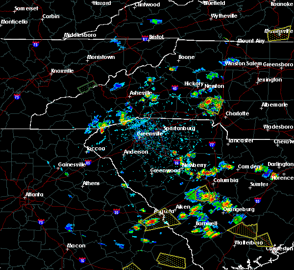 At 531 pm edt, doppler radar indicated a severe thunderstorm capable of producing quarter size hail and damaging winds in excess of 60 mph. this storm was located 9 miles east of lincolnton, or 4 miles northeast of iron station, moving east at 10 mph. locations impacted include, mt holly, stanley, westport, high shoals, iron station, denver, lowesville, lucia, cornelius and paw creek. At 531 pm edt, doppler radar indicated a severe thunderstorm capable of producing quarter size hail and damaging winds in excess of 60 mph. this storm was located 9 miles east of lincolnton, or 4 miles northeast of iron station, moving east at 10 mph. locations impacted include, mt holly, stanley, westport, high shoals, iron station, denver, lowesville, lucia, cornelius and paw creek.
|
| 6/22/2015 5:09 PM EDT |
 At 509 pm edt, doppler radar indicated a severe thunderstorm capable of producing quarter size hail and damaging winds in excess of 60 mph. this storm was located 5 miles east of lincolnton, or near iron station, and moving east at 10 mph. At 509 pm edt, doppler radar indicated a severe thunderstorm capable of producing quarter size hail and damaging winds in excess of 60 mph. this storm was located 5 miles east of lincolnton, or near iron station, and moving east at 10 mph.
|
| 6/19/2015 6:12 PM EDT | The severe thunderstorm warning for southeastern mecklenburg, northeastern union and cabarrus counties will expire at 615 pm edt, the severe thunderstorm which prompted the warning has weakened. therefore the warning will be allowed to expire. |
| 6/19/2015 5:48 PM EDT |
 At 548 pm edt, doppler radar indicated a severe thunderstorm capable of producing quarter size hail and damaging winds in excess of 60 mph. this storm was located 10 miles east of uptown charlotte, or near mint hill, moving east at 25 mph. locations impacted include, downtown concord, mint hill, harrisburg, mt pleasant, fairview in union county, west concord, midland, new salem, hemby bridge and matthews. At 548 pm edt, doppler radar indicated a severe thunderstorm capable of producing quarter size hail and damaging winds in excess of 60 mph. this storm was located 10 miles east of uptown charlotte, or near mint hill, moving east at 25 mph. locations impacted include, downtown concord, mint hill, harrisburg, mt pleasant, fairview in union county, west concord, midland, new salem, hemby bridge and matthews.
|
| 6/19/2015 5:29 PM EDT |
 At 529 pm edt, doppler radar indicated a severe thunderstorm capable of producing quarter size hail and damaging winds in excess of 60 mph. this storm was located 9 miles southeast of northeast charlotte, or near reedy creek park, and moving east at 35 mph. At 529 pm edt, doppler radar indicated a severe thunderstorm capable of producing quarter size hail and damaging winds in excess of 60 mph. this storm was located 9 miles southeast of northeast charlotte, or near reedy creek park, and moving east at 35 mph.
|
| 6/18/2015 7:30 PM EDT | At 730 pm edt, doppler radar indicated a severe thunderstorm capable of producing quarter size hail and damaging winds in excess of 60 mph. this storm was located 6 miles south of york, or near mcconnells, moving east at 10 mph. locations impacted include, rock hill, york, fort mill, tega cay, newport, lesslie, sharon, mcconnells, catawba and carowinds. |
| 6/18/2015 7:19 PM EDT | At 718 pm edt, doppler radar indicated a severe thunderstorm capable of producing quarter size hail and damaging winds in excess of 60 mph. this storm was located 6 miles south of york, or near mcconnells, and moving east at 10 mph. |
| 6/2/2015 3:06 PM EDT | The severe thunderstorm warning for southeastern mecklenburg, northern union and south central cabarrus counties will expire at 315 pm edt, the storm which prompted the warning is weakening below severe limits, and no longer poses an immediate threat to life or property. therefore the warning will be allowed to expire. |
| 6/2/2015 2:59 PM EDT | At 259 pm edt, doppler radar indicated a severe thunderstorm capable of producing quarter size hail and damaging winds in excess of 60 mph. this storm was located 11 miles south of uptown charlotte, or over the arboretum, moving northeast at 15 mph. locations impacted include, matthews, mint hill, indian trail, weddington, stallings, unionville, wesley chapel, lake park, hemby bridge and south charlotte. |
| 6/2/2015 2:42 PM EDT | At least 2 power lines down in the area as storm passed over. a spotter nearby reported very strong wind that blew down lots of small limbs and twig in mecklenburg county NC, 10.1 miles NNW of Charlotte, NC |
| 6/2/2015 2:36 PM EDT | At 235 pm edt, doppler radar indicated a severe thunderstorm capable of producing quarter size hail and damaging winds in excess of 60 mph. this storm was located 10 miles southeast of uptown charlotte, or over the arboretum, and moving northeast at 25 mph. |
| 4/20/2015 6:23 PM EDT | At 622 pm edt, national weather service doppler radar indicated a severe thunderstorm capable of producing destructive winds in excess of 70 mph. this storm was located over york county, or 7 miles southeast of rock hill, and moving east at 50 mph. * the severe thunderstorm will otherwise remain over mainly rural areas of the indicated county. |
| 4/20/2015 5:40 PM EDT | At 531 pm edt, the public reported a severe thunderstorm capable of producing quarter size hail. this storm was located near harrisburg, or near concord, moving east at 45 mph. other locations in the warning include but are not limited to mount pleasant. |
| 4/20/2015 5:20 PM EDT | At 511 pm edt, the public reported a severe thunderstorm capable of producing quarter size hail. this storm was located near paw creek, or near center city charlo, and moving east at 45 mph. * the severe thunderstorm will be near, unc charlotte by 525 pm edt, harrisburg by 530 pm edt, concord and 8 miles south of kannapolis by 535 pm edt, mount pleasant by 550 pm edt,. |
| 4/20/2015 4:31 PM EDT | At 425 pm edt, national weather service doppler radar indicated a severe thunderstorm capable of producing quarter size hail. this storm was located near gaffney, and moving east at 35 mph. * other locations in the warning include but are not limited to hickory grove, kings mountain, clover, lowell, cramerton, belmont, tega cay and lake wylie. |
| 4/20/2015 4:31 PM EDT | At 425 pm edt, national weather service doppler radar indicated a severe thunderstorm capable of producing quarter size hail. this storm was located near gaffney, and moving east at 35 mph. * other locations in the warning include but are not limited to hickory grove, kings mountain, clover, lowell, cramerton, belmont, tega cay and lake wylie. |
| 4/20/2015 3:58 PM EDT | At 350 pm edt, national weather service doppler radar indicated a severe thunderstorm capable of producing quarter size hail. this storm was located near mount holly, or 12 miles northwest of center city charlo, and moving east at 45 mph. * other locations in the warning include but are not limited to huntersville, harrisburg, enochville, concord, kannapolis, landis, mount pleasant and rockwell. |
| 4/20/2015 3:36 PM EDT | At 326 pm edt, national weather service doppler radar continued to indicate a severe thunderstorm capable of producing large damaging hail up to golf ball size. this storm was located near dallas, or near gastonia, moving east at 45 mph. other locations in the warning include but are not limited to mount holly, lucia, lowesville, paw creek, croft, huntersville, cornelius, davidson and unc charlotte. |
| 4/20/2015 3:12 PM EDT | The national weather service in columbia has issued a * severe thunderstorm warning for. cleveland county in north carolina. this includes the city of shelby. gaston county in north carolina. This includes the city of gastonia. |
| 4/20/2015 10:00 AM EDT | At 958 am edt, doppler radar indicated a severe thunderstorm capable of producing damaging winds in excess of 60 mph. this storm was located near northwest charlotte, moving east at 50 mph. locations impacted include, northwest charlotte, uptown charlotte, northeast charlotte, charlotte douglas airport, hidden valley, paw creek, the plaza, reedy creek park, unc charlotte and croft. |
| 4/20/2015 9:30 AM EDT | At 930 am edt, doppler radar indicated a severe thunderstorm capable of producing damaging winds in excess of 60 mph. this storm was located 9 miles west of gastonia, or over kings mountain, and moving east at 50 mph. |
| 8/22/2014 11:15 PM EDT | Half of a large tree fell on a porch to a house...damaging the roof and gutters. report from social medi in mecklenburg county NC, 7.7 miles WSW of Charlotte, NC |
| 8/22/2014 11:15 AM EDT | Half of a large tree fell on a porch to a house...damaging the roof and gutters. report from social medi in mecklenburg county NC, 7.7 miles WSW of Charlotte, NC |
| 7/9/2014 4:03 PM EDT | Power lines down...estimated 1000 feet of line...near the intersection of sadler road and dixie river road. time estimated from radar and utility web sit in mecklenburg county NC, 7.8 miles ENE of Charlotte, NC |
| 6/11/2014 5:45 PM EDT | A tree and several power lines down from win in mecklenburg county NC, 1 miles NNW of Charlotte, NC |
| 5/15/2014 7:00 AM EDT | Social media image of a large tree limb down blocking west morehead s in mecklenburg county NC, 2.4 miles NNE of Charlotte, NC |
| 5/10/2014 4:00 PM EDT | Highway signage blown down by wind at 485 overpas in mecklenburg county NC, 12 miles N of Charlotte, NC |
| 5/10/2014 3:40 PM EDT | Quarter sized hail reported 10.1 miles WSW of Charlotte, NC, social media. hail was also observed in the university area near n. tryon street and university city blvd. |
| 5/10/2014 3:25 PM EDT | Quarter sized hail reported 11.8 miles WNW of Charlotte, NC |
| 5/10/2014 3:10 PM EDT | Quarter sized hail reported 2.8 miles NW of Charlotte, NC, quarter size hail on pruitt street. |
| 9/1/2013 6:12 PM EDT | Tree down on power line on draper lan in mecklenburg county NC, 4 miles WNW of Charlotte, NC |
| 7/24/2013 7:33 PM EDT | Numerous trees down just west of clt fire station 2 in mecklenburg county NC, 8.6 miles NE of Charlotte, NC |
| 7/24/2013 6:51 PM EDT | Power lines down on joyce driv in mecklenburg county NC, 6.7 miles W of Charlotte, NC |
| 7/24/2013 6:40 PM EDT | 1 tree down near the intersection of fairview and colony road in mecklenburg county NC, 4.7 miles NNW of Charlotte, NC |
| 7/24/2013 6:28 PM EDT | Tree through a home on scofield road. several other reports of trees and lines down in this general are in mecklenburg county NC, 5.2 miles NNW of Charlotte, NC |
| 6/13/2013 6:06 PM EDT | Quarter sized hail reported 13.3 miles WNW of Charlotte, NC, observed along lawyers road. |
| 6/13/2013 5:45 PM EDT | Quarter sized hail reported 2.8 miles NW of Charlotte, NC, quarter size hail on woodlawn road. |
| 6/13/2013 5:22 PM EDT | Tree through a house along morningside d in mecklenburg county NC, 3.4 miles WNW of Charlotte, NC |
| 6/13/2013 5:18 PM EDT | Trees down along durham lan in mecklenburg county NC, 4.9 miles SSW of Charlotte, NC |
| 6/10/2013 3:12 PM EDT | Multiple powerlines down at 5200 block of randolph roa in mecklenburg county NC, 7.6 miles NW of Charlotte, NC |
| 6/10/2013 3:10 PM EDT | A smattering of trees and power lines down across greater charlotte...reported between 302 and 316 p in mecklenburg county NC, 2.8 miles NW of Charlotte, NC |
| 5/21/2013 3:36 PM EDT | Two trees down on colony road in the myers park area. report received from social medi in mecklenburg county NC, 6.8 miles NNW of Charlotte, NC |
| 5/21/2013 3:32 PM EDT | Quarter sized hail reported 6.4 miles NNW of Charlotte, NC, quarter sized hail near southpark mall. also had gusty wind and torrential rain causing rapid runoff near mall. |
| 9/8/2012 5:15 PM EDT | One power line down on edgegreen drive near nations ford roa in mecklenburg county NC, 4.4 miles N of Charlotte, NC |
| 8/8/2012 3:26 PM EDT | Broadcast media reported large tree limbs blown down in the plaza are in mecklenburg county NC, 6.1 miles W of Charlotte, NC |
| 7/18/2012 6:14 PM EDT | Tree down along mallard creek church rd just north of odell school r in mecklenburg county NC, 10.7 miles SW of Charlotte, NC |
| 7/16/2012 5:02 PM EDT | Power lines reported down along dakota ave in mecklenburg county NC, 2.8 miles SSE of Charlotte, NC |
| 7/10/2012 6:05 PM EDT | Trees snapped in south charlott in mecklenburg county NC, 6 miles NNW of Charlotte, NC |
| 7/9/2012 3:45 PM EDT | A tree down on power line on lakeside dr and multiple power lines down on high ridge roa in mecklenburg county NC, 7.3 miles NNW of Charlotte, NC |
| 7/9/2012 3:35 PM EDT | Trees down on west arrowood road near south tryon street. time estimated by rada in mecklenburg county NC, 7 miles NE of Charlotte, NC |
| 7/9/2012 3:14 PM EDT | Multiple trees down on south point and reese wilson road in mecklenburg county NC, 12.6 miles NE of Charlotte, NC |
| 7/8/2012 3:45 PM EDT | Two trees blocking johnston rd near hwy 51. other trees down in the same area. reported via social medi in mecklenburg county NC, 10.6 miles N of Charlotte, NC |
| 7/5/2012 6:05 PM EDT | Sheriff department reported trees and powerlines down in indianland around thousand oak road and in black horse ru in lancaster county SC, 16.1 miles N of Charlotte, NC |
| 7/1/2012 6:45 PM EDT | Quarter sized hail reported 9 miles W of Charlotte, NC |
| 3/3/2012 2:36 AM EST | Charlotte-mecklenburg fire marshall reports damage in far eastern mecklenburg there is damage in the plaza road extension area. officials are in the area and will have in mecklenburg county NC, 9.8 miles WSW of Charlotte, NC |
| 1/1/0001 12:00 AM | 1 tree down on blythwood lane and 1 tree down on wild honey lane wnw of mint hil in mecklenburg county NC, 7.6 miles WNW of Charlotte, NC |
| 1/1/0001 12:00 AM | Powerlines blown down 1200 marble roa in mecklenburg county NC, 3 miles SE of Charlotte, NC |
| 1/1/0001 12:00 AM | A few trees and limbs down at tuckaseegee park. time is based on when strongest storm passed over this location. nobody was around on labor day to see this occu in mecklenburg county NC, 2.6 miles ESE of Charlotte, NC |
| 1/1/0001 12:00 AM | Powerlines down along leland st in mecklenburg county NC, 6.1 miles ESE of Charlotte, NC |
| 1/1/0001 12:00 AM | County reports a structure moved off its foundation by wind gusts at abby walk lane near mckee roa in mecklenburg county NC, 12.8 miles NW of Charlotte, NC |
| 1/1/0001 12:00 AM | Quarter sized hail reported 2.8 miles NW of Charlotte, NC, quarter size hail on south blvd in charlotte. |
| 1/1/0001 12:00 AM | Debris in roadway from winds at yorkmont and billy graham parkway near charlotte airpor in mecklenburg county NC, 2.8 miles NW of Charlotte, NC |
| 1/1/0001 12:00 AM | Measured 50 kt gust at clt airpor in mecklenburg county NC, 4.9 miles ENE of Charlotte, NC |
| 1/1/0001 12:00 AM | Charlotte-meck fire dispatch reports power lines down in about a dozen locations throughout the city and at least one tree blown dow in mecklenburg county NC, 2.8 miles NW of Charlotte, NC |
| 1/1/0001 12:00 AM | Tree down on house in charlotte. no injurie in mecklenburg county NC, 2.8 miles NW of Charlotte, NC |
| 1/1/0001 12:00 AM | Multiple reports of power lines down in charlotte area...bradford dr...fairgrounds st...westerly hills d in mecklenburg county NC, 2.8 miles NW of Charlotte, NC |
| 1/1/0001 12:00 AM | Temporary construction wall damaged and shifted into rum bar and grill on concourse d at charlotte-douglas intl airpor in mecklenburg county NC, 2.8 miles NW of Charlotte, NC |
| 1/1/0001 12:00 AM | Tree down near the intersection of w 4th street and poplar s in mecklenburg county NC, 2.8 miles NW of Charlotte, NC |
| 1/1/0001 12:00 AM | Multiple trees down on shopton roa in mecklenburg county NC, 6.2 miles NNE of Charlotte, NC |
| 1/1/0001 12:00 AM | One tree down near the intersection of randolph road and n sharon amity roa in mecklenburg county NC, 4.6 miles NW of Charlotte, NC |
| 1/1/0001 12:00 AM | One tree down at 4718 woodstone driv in mecklenburg county NC, 4.5 miles W of Charlotte, NC |
| 1/1/0001 12:00 AM | Tree down at 813 farmcrest driv in mecklenburg county NC, 3.3 miles W of Charlotte, NC |
| 1/1/0001 12:00 AM | One tree down on the shoulder on the inner loop of i-485...1/2 to 3/4 of a mile east of the johnston road exi in mecklenburg county NC, 11.9 miles NNW of Charlotte, NC |
| 1/1/0001 12:00 AM | Trees down and blocking traffic near the intersection of randolph road and colville roa in mecklenburg county NC, 4.6 miles NW of Charlotte, NC |
| 1/1/0001 12:00 AM | Trees down on monroe road and blocking traffic...between dunn avenue and briar cree in mecklenburg county NC, 5.5 miles NW of Charlotte, NC |
| 1/1/0001 12:00 AM | Relayed report from charlotte fd of lines along 7600 block of park rd in mecklenburg county NC, 7.1 miles N of Charlotte, NC |
| 1/1/0001 12:00 AM | Quarter sized hail reported 3.9 miles NNE of Charlotte, NC, at wcnc studio |
| 1/1/0001 12:00 AM | Quarter sized hail reported 4.4 miles N of Charlotte, NC, up to 1 inch hail at arrowood blvd and i-77. |
| 1/1/0001 12:00 AM | Powerlines down shopton rd and skycrest lane area in mecklenburg county NC, 5.6 miles NE of Charlotte, NC |
| 1/1/0001 12:00 AM | Quarter sized hail reported 5 miles NNE of Charlotte, NC, shopton rd area |
| 1/1/0001 12:00 AM | Golf Ball sized hail reported 5.4 miles NNE of Charlotte, NC, tyvola rd and i-77 |
| 1/1/0001 12:00 AM | Relayed report from charlotte fd of lines along 7600 block of park rd in mecklenburg county NC, 7.1 miles N of Charlotte, NC |
| 1/1/0001 12:00 AM | A few reports of trees...power lines and large limbs down across the cit in mecklenburg county NC, 2.8 miles NW of Charlotte, NC |
| 1/1/0001 12:00 AM | Media relayed report of a tree on a house on dundeen s in mecklenburg county NC, 1 miles NNW of Charlotte, NC |
| 1/1/0001 12:00 AM | Several reports of wind damage throughout the city...a tree on a home on joyce dr...tree on a car on harris bvd...a large tree down across sharon lane...power lines dow in mecklenburg county NC, 2.8 miles NW of Charlotte, NC |
| 1/1/0001 12:00 AM | Power lines down along magnolia ave in mecklenburg county NC, 2.3 miles N of Charlotte, NC |
| 1/1/0001 12:00 AM | Trees down near rocky river and hood roads in mecklenburg county NC, 9.3 miles WSW of Charlotte, NC |
| 1/1/0001 12:00 AM | Trees down along barrington dr in mecklenburg county NC, 6.2 miles W of Charlotte, NC |
| 1/1/0001 12:00 AM | Powerlines down along farmbrook dr in mecklenburg county NC, 5.1 miles N of Charlotte, NC |
| 1/1/0001 12:00 AM | Powerlines down near central ave and st. julien st in mecklenburg county NC, 2.9 miles WNW of Charlotte, NC |
| 1/1/0001 12:00 AM | Public reports a large tree down blocking wilann d in mecklenburg county NC, 6.1 miles W of Charlotte, NC |
| 1/1/0001 12:00 AM | Trees down near tyvola rd and old statesville rd in mecklenburg county NC, 4.5 miles NNE of Charlotte, NC |
| 1/1/0001 12:00 AM | Trees down on east cook st in mecklenburg county NC, 3.2 miles NW of Charlotte, NC |
| 1/1/0001 12:00 AM | Trees down on woodstone dr in mecklenburg county NC, 4.2 miles SW of Charlotte, NC |
| 1/1/0001 12:00 AM | Powerlines down oak drive in mecklenburg county NC, 6.3 miles SSW of Charlotte, NC |
| 1/1/0001 12:00 AM | Charlotte fd reports one small tree down on huntingtowne farms lan in mecklenburg county NC, 7.3 miles NNW of Charlotte, NC |
| 1/1/0001 12:00 AM | Charlotte fd reports one large tree limb...six inches in diameter...dow in mecklenburg county NC, 9.4 miles NW of Charlotte, NC |
| 1/1/0001 12:00 AM | Quarter sized hail reported 6.7 miles NW of Charlotte, NC, a spotter was not at home when the hail fell but arrived about an hour after the hail ended. he found pieces of melting hail that were still as large as nickels. no nei |
| 1/1/0001 12:00 AM | Quarter sized hail reported 4.4 miles N of Charlotte, NC, quarter sized hail on south blvd. |
| 1/1/0001 12:00 AM | Measured at charlotte douglas intl airport in mecklenburg county NC, 5.2 miles ENE of Charlotte, NC |
| 1/1/0001 12:00 AM | Wind sensor measured a wind gust of 67 mph at the charlotte douglas international airpor in mecklenburg county NC, 5.2 miles ENE of Charlotte, NC |
| 1/1/0001 12:00 AM | Tree down on a home on wildlife road. other reports of trees down on homes in the western part of the county as wel in mecklenburg county NC, 6 miles ESE of Charlotte, NC |
| 1/1/0001 12:00 AM | Public reports a metal arborg blown over by the wind in the 500 block of marsh roa in mecklenburg county NC, 3.7 miles N of Charlotte, NC |
| 5/11/2011 12:36 AM EDT | Hen Egg sized hail reported 7.9 miles WSW of Charlotte, NC, numerous reports of golf ball to egg sized hail in the university area northeast of charlotte. |
| 1/1/0001 12:00 AM | 12 inch diameter tree down at the intersection of university city blvd and chancellor park driv in mecklenburg county NC, 6.6 miles WSW of Charlotte, NC |
| 1/1/0001 12:00 AM | Tree down across mallard creek road west of i-8 in mecklenburg county NC, 9.5 miles SSW of Charlotte, NC |
| 4/9/2011 7:20 PM EDT | Golf Ball sized hail reported 9.4 miles NE of Charlotte, NC, i-77/i-485 area |
| 4/9/2011 7:10 PM EDT | Large limbs down from wind in downtown charlott in mecklenburg county NC, 2.8 miles NW of Charlotte, NC |
| 4/9/2011 6:00 PM EDT | Hen Egg sized hail reported 4.7 miles NNW of Charlotte, NC |
| 4/9/2011 5:38 PM EDT | Golf Ball sized hail reported 12.5 miles NE of Charlotte, NC |
| 1/1/0001 12:00 AM | Quarter sized hail reported 6.6 miles SSW of Charlotte, NC |
| 1/1/0001 12:00 AM | Quarter sized hail reported 7.1 miles ESE of Charlotte, NC |
Hail Maps for Charlotte, NC
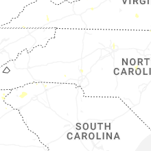


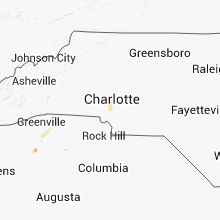


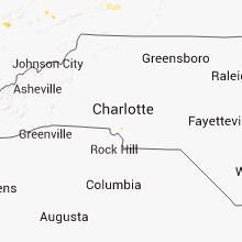


Connect with Interactive Hail Maps