

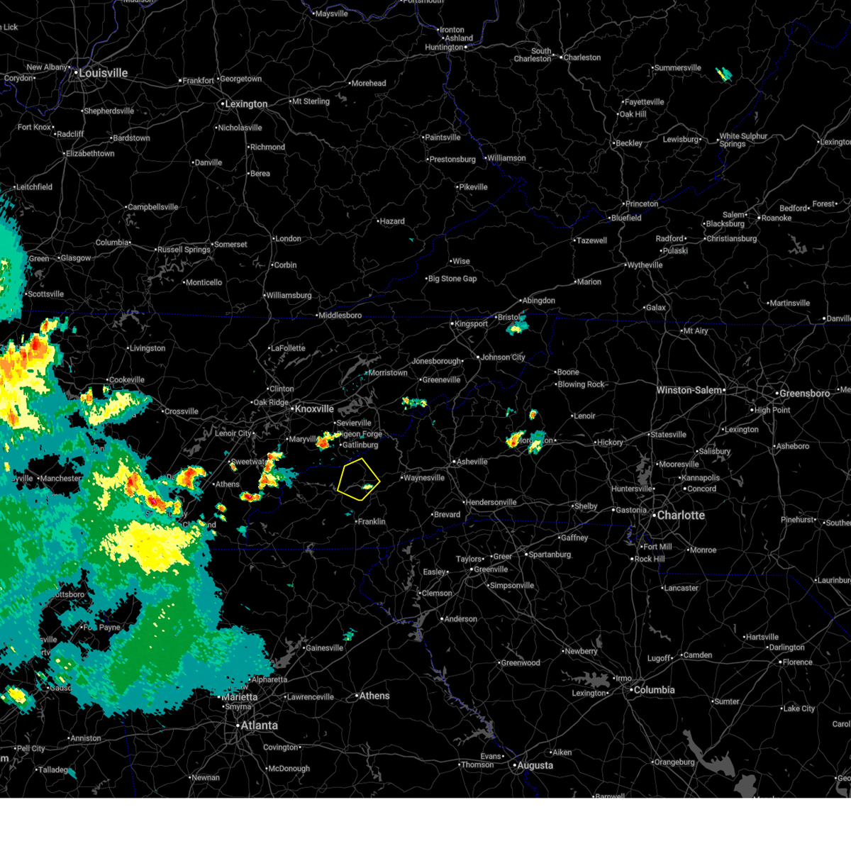
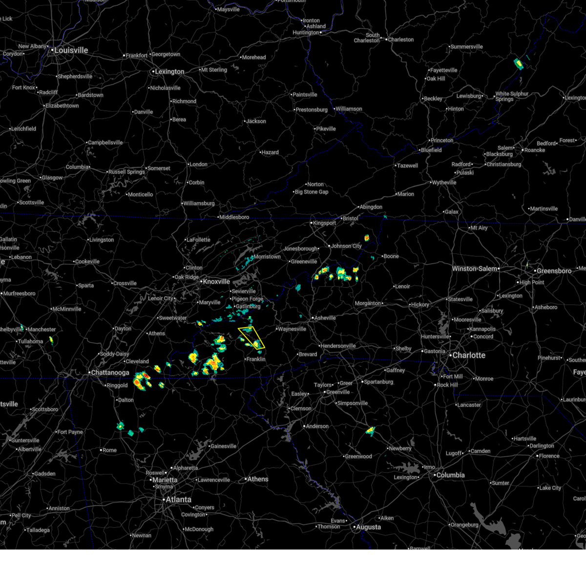
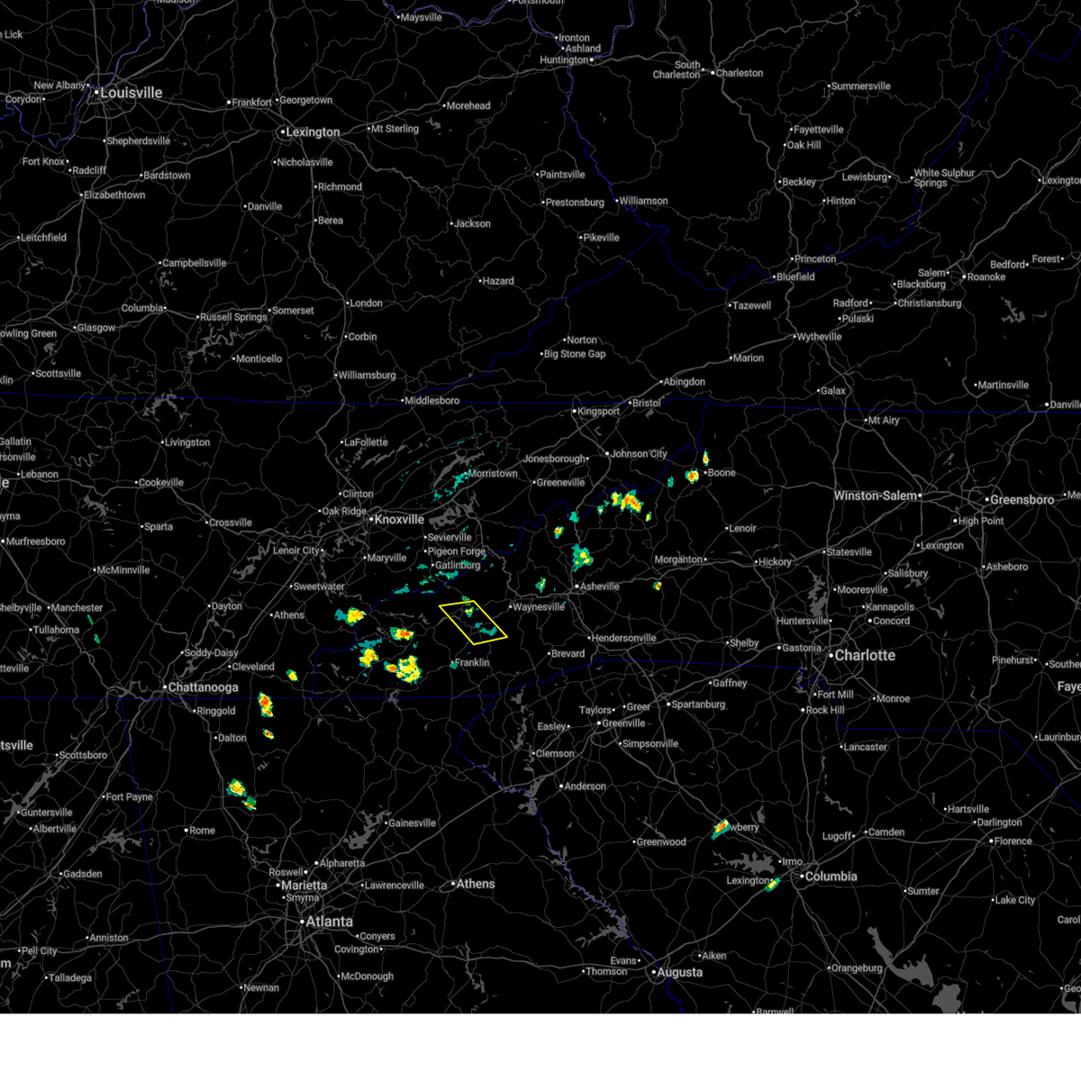
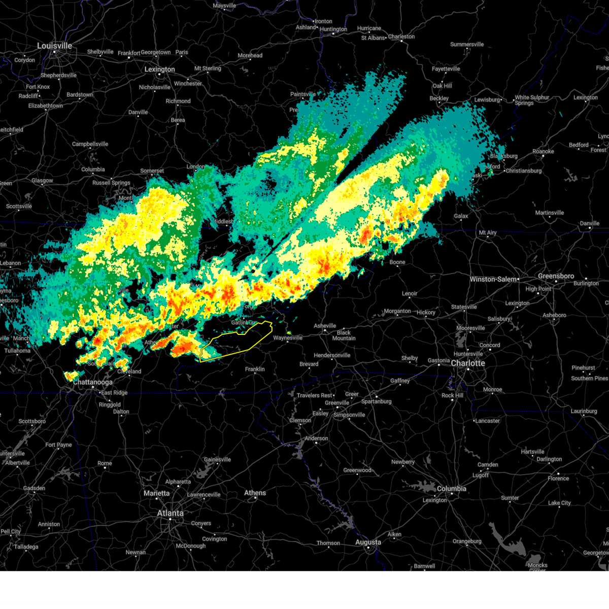
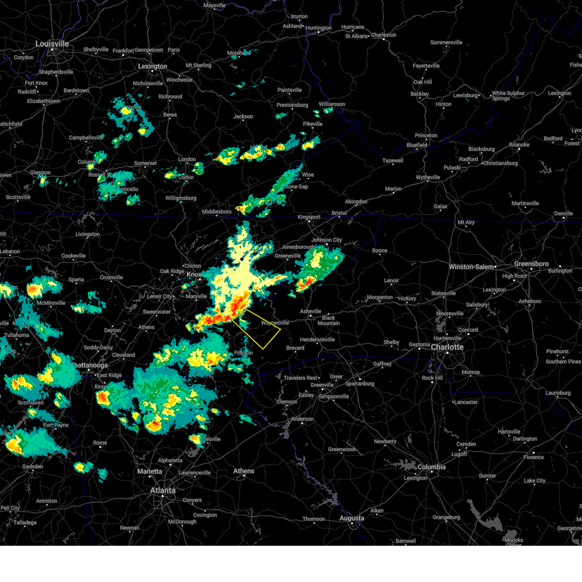
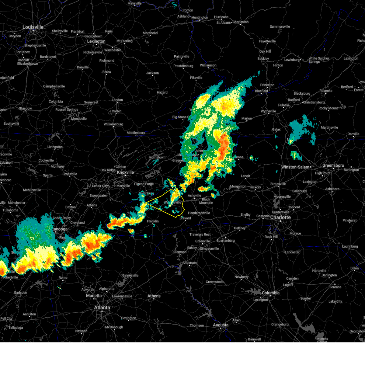
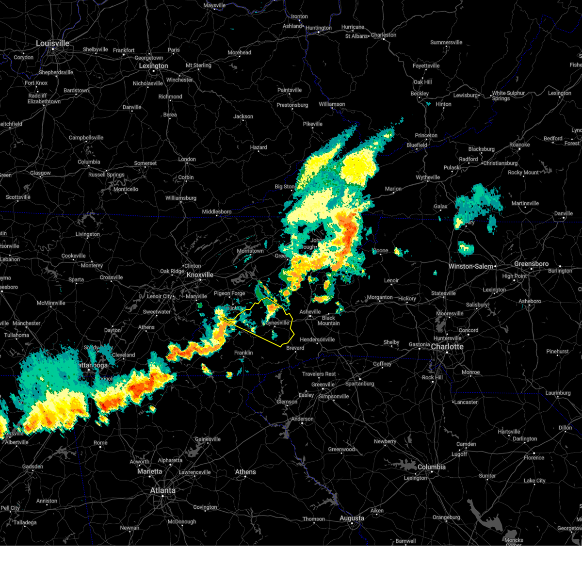
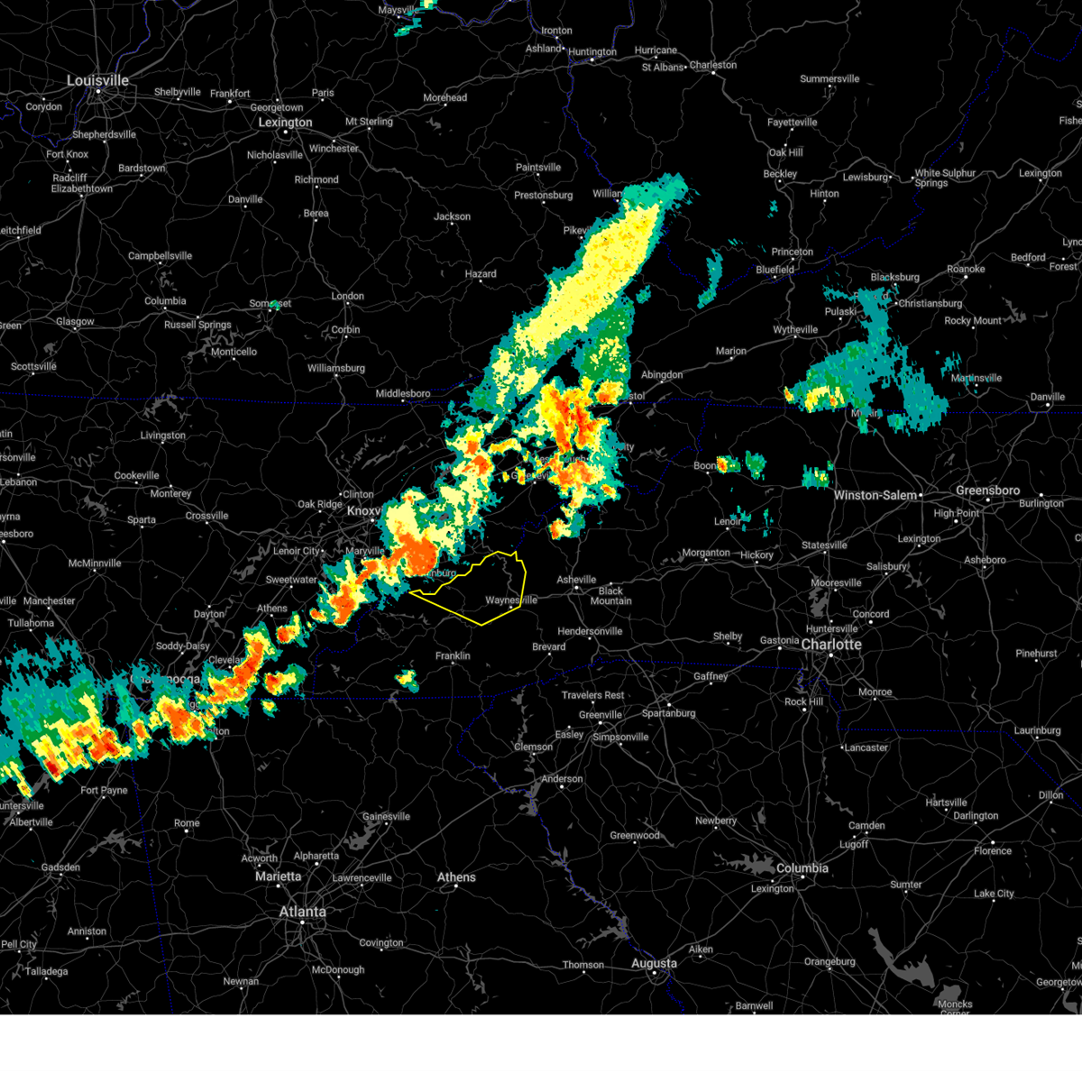
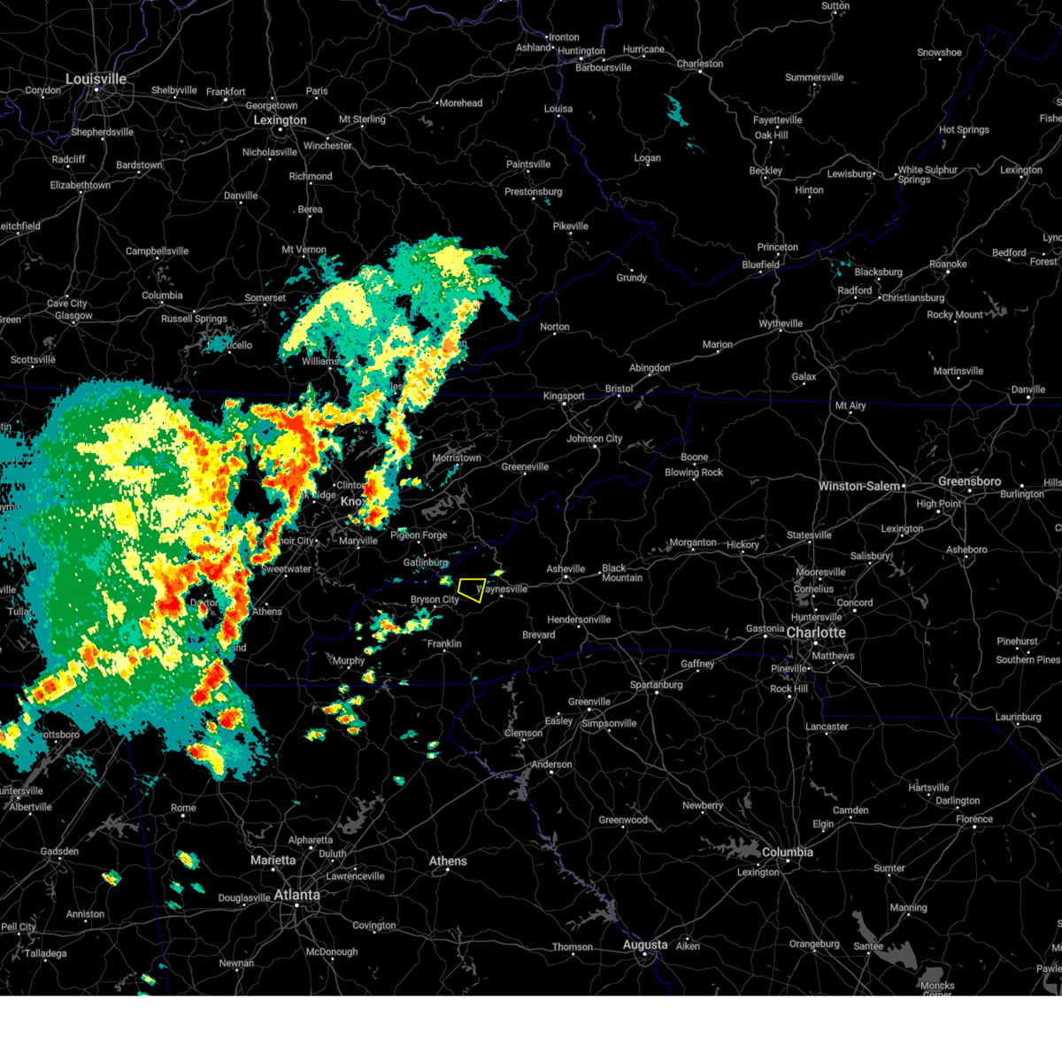
Hail Map for Cherokee, NC
The Cherokee, NC area has had 0 reports of on-the-ground hail by trained spotters, and has been under severe weather warnings 4 times during the past 12 months. Doppler radar has detected hail at or near Cherokee, NC on 7 occasions.
| Name: | Cherokee, NC |
| Where Located: | 48 miles SE of Knoxville, TN |
| Map: | Google Map for Cherokee, NC |
| Population: | 2138 |
| Housing Units: | 1028 |
| More Info: | Search Google for Cherokee, NC |
5
The Top Recent Hail Date for Cherokee, NC is Sunday, July 27, 2014 (1st out of 7)

Hail and Wind Damage Spotted near Cherokee, NC
| Date / Time | Report Details |
|---|---|
| 7/3/2026 5:59 PM EDT | Tree completely blocking snowy owl lane. time estimated based on radar and time of power outage reported in same location by utility compan in jackson county NC, 3.2 miles NNE of Cherokee, NC |
| 7/3/2026 5:59 PM EDT | Power outage near intersection of shoal creek rd and bob hall rd attributed to fallen trees or limb in jackson county NC, 3.5 miles NE of Cherokee, NC |
| 7/3/2026 5:47 PM EDT |
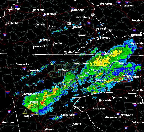
 Svrgsp the national weather service in greenville-spartanburg has issued a * severe thunderstorm warning for, northwestern jackson county in western north carolina, eastern swain county in western north carolina, * until 630 pm edt. * at 546 pm edt, a severe thunderstorm was located 6 miles northwest of sylva, or near cherokee, moving northwest at 10 mph (radar indicated). Hazards include 60 mph wind gusts and nickel size hail. expect damage to trees and power lines Svrgsp the national weather service in greenville-spartanburg has issued a * severe thunderstorm warning for, northwestern jackson county in western north carolina, eastern swain county in western north carolina, * until 630 pm edt. * at 546 pm edt, a severe thunderstorm was located 6 miles northwest of sylva, or near cherokee, moving northwest at 10 mph (radar indicated). Hazards include 60 mph wind gusts and nickel size hail. expect damage to trees and power lines
|
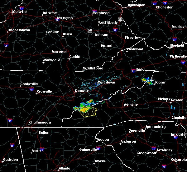
| 3/16/2026 5:36 AM EDT |
 At 535 am edt, a severe thunderstorm was located 4 miles east of sevierville, moving northeast at 50 mph (radar indicated). Hazards include 60 mph wind gusts. Expect damage to trees and power lines. Locations impacted include, bryson city, smoky mountains-newfound gap, smoky mountains-deep creek, smoky mountains-balsam mountain, smoky mountains-oconaluftee, wesser, nantahala, whittier, luada, and almond. At 535 am edt, a severe thunderstorm was located 4 miles east of sevierville, moving northeast at 50 mph (radar indicated). Hazards include 60 mph wind gusts. Expect damage to trees and power lines. Locations impacted include, bryson city, smoky mountains-newfound gap, smoky mountains-deep creek, smoky mountains-balsam mountain, smoky mountains-oconaluftee, wesser, nantahala, whittier, luada, and almond.
|
| 3/16/2026 5:36 AM EDT |
 the severe thunderstorm warning has been cancelled and is no longer in effect the severe thunderstorm warning has been cancelled and is no longer in effect
|
| 3/16/2026 4:41 AM EDT |
 Svrgsp the national weather service in greenville-spartanburg has issued a * severe thunderstorm warning for, swain county in western north carolina, graham county in western north carolina, * until 545 am edt. * at 441 am edt, a severe thunderstorm was located 15 miles southeast of madisonville, or 14 miles west of town of santeetlah, moving northeast at 50 mph (radar indicated). Hazards include 60 mph wind gusts. expect damage to trees and power lines Svrgsp the national weather service in greenville-spartanburg has issued a * severe thunderstorm warning for, swain county in western north carolina, graham county in western north carolina, * until 545 am edt. * at 441 am edt, a severe thunderstorm was located 15 miles southeast of madisonville, or 14 miles west of town of santeetlah, moving northeast at 50 mph (radar indicated). Hazards include 60 mph wind gusts. expect damage to trees and power lines
|
| 6/24/2025 5:26 PM EDT |
 The storms which prompted the warning have moved out of the area. therefore, the warning will be allowed to expire. to report severe weather to the national weather service greenville-spartanburg, call toll free, 1, 800, 2 6 7, 8 1 0 1, or post on our facebook page, or tweet it using hashtag nwsgsp. your message should describe the event and the specific location where it occurred. remember, a severe thunderstorm warning still remains in effect for southwestern swain county until 600 pm edt. The storms which prompted the warning have moved out of the area. therefore, the warning will be allowed to expire. to report severe weather to the national weather service greenville-spartanburg, call toll free, 1, 800, 2 6 7, 8 1 0 1, or post on our facebook page, or tweet it using hashtag nwsgsp. your message should describe the event and the specific location where it occurred. remember, a severe thunderstorm warning still remains in effect for southwestern swain county until 600 pm edt.
|
| 6/24/2025 5:10 PM EDT |
 At 510 pm edt, severe thunderstorms were located along a line extending from 6 miles east of bryson city to 3 miles southwest of sylva, moving west at 10 mph (radar indicated). Hazards include 60 mph wind gusts. Expect damage to trees and power lines. Locations impacted include, sylva, cherokee, cullowhee, webster, dillsboro, smoky mountains at deep creek, whittier, and savannah. At 510 pm edt, severe thunderstorms were located along a line extending from 6 miles east of bryson city to 3 miles southwest of sylva, moving west at 10 mph (radar indicated). Hazards include 60 mph wind gusts. Expect damage to trees and power lines. Locations impacted include, sylva, cherokee, cullowhee, webster, dillsboro, smoky mountains at deep creek, whittier, and savannah.
|
| 6/24/2025 4:46 PM EDT | Multiple trees down on hwy 19 near harrahs casin in jackson county NC, 0.9 miles NNE of Cherokee, NC |
| 6/24/2025 4:46 PM EDT | Tree down across parking lo in swain county NC, 1.4 miles SSE of Cherokee, NC |
| 6/24/2025 4:43 PM EDT |
 Svrgsp the national weather service in greenville-spartanburg has issued a * severe thunderstorm warning for, northern jackson county in western north carolina, southeastern swain county in western north carolina, * until 530 pm edt. * at 442 pm edt, severe thunderstorms were located along a line extending from 10 miles east of bryson city to 6 miles east of sylva, moving west at 10 mph (radar indicated). Hazards include 60 mph wind gusts and penny size hail. expect damage to trees and power lines Svrgsp the national weather service in greenville-spartanburg has issued a * severe thunderstorm warning for, northern jackson county in western north carolina, southeastern swain county in western north carolina, * until 530 pm edt. * at 442 pm edt, severe thunderstorms were located along a line extending from 10 miles east of bryson city to 6 miles east of sylva, moving west at 10 mph (radar indicated). Hazards include 60 mph wind gusts and penny size hail. expect damage to trees and power lines
|
| 5/17/2025 4:16 AM EDT |
 Svrgsp the national weather service in greenville-spartanburg has issued a * severe thunderstorm warning for, central swain county in western north carolina, graham county in western north carolina, * until 500 am edt. * at 416 am edt, severe thunderstorms were located along a line extending from 11 miles north of robbinsville to 16 miles southeast of madisonville, moving east at 50 mph (radar indicated). Hazards include 60 mph wind gusts and quarter size hail. Minor hail damage to vehicles is expected. Expect wind damage to trees and power lines. Svrgsp the national weather service in greenville-spartanburg has issued a * severe thunderstorm warning for, central swain county in western north carolina, graham county in western north carolina, * until 500 am edt. * at 416 am edt, severe thunderstorms were located along a line extending from 11 miles north of robbinsville to 16 miles southeast of madisonville, moving east at 50 mph (radar indicated). Hazards include 60 mph wind gusts and quarter size hail. Minor hail damage to vehicles is expected. Expect wind damage to trees and power lines.
|
| 5/17/2025 3:52 AM EDT |
 Svrgsp the national weather service in greenville-spartanburg has issued a * severe thunderstorm warning for, northwestern macon county in western north carolina, northwestern jackson county in western north carolina, southeastern swain county in western north carolina, southern graham county in western north carolina, southwestern haywood county in western north carolina, * until 500 am edt. * at 352 am edt, severe thunderstorms were located along a line extending from 13 miles northwest of waynesville to 7 miles west of bryson city to 3 miles north of andrews, moving east at 20 mph (radar indicated). Hazards include 60 mph wind gusts and quarter size hail. Minor hail damage to vehicles is expected. Expect wind damage to trees and power lines. Svrgsp the national weather service in greenville-spartanburg has issued a * severe thunderstorm warning for, northwestern macon county in western north carolina, northwestern jackson county in western north carolina, southeastern swain county in western north carolina, southern graham county in western north carolina, southwestern haywood county in western north carolina, * until 500 am edt. * at 352 am edt, severe thunderstorms were located along a line extending from 13 miles northwest of waynesville to 7 miles west of bryson city to 3 miles north of andrews, moving east at 20 mph (radar indicated). Hazards include 60 mph wind gusts and quarter size hail. Minor hail damage to vehicles is expected. Expect wind damage to trees and power lines.
|
| 5/17/2025 3:15 AM EDT |
 Svrgsp the national weather service in greenville-spartanburg has issued a * severe thunderstorm warning for, swain county in western north carolina, northern graham county in western north carolina, * until 415 am edt. * at 315 am edt, severe thunderstorms were located along a line extending from 6 miles northeast of gatlinburg to 13 miles south of sevierville to 7 miles south of maryville, moving southeast at 30 mph (radar indicated). Hazards include 60 mph wind gusts and nickel size hail. expect damage to trees and power lines Svrgsp the national weather service in greenville-spartanburg has issued a * severe thunderstorm warning for, swain county in western north carolina, northern graham county in western north carolina, * until 415 am edt. * at 315 am edt, severe thunderstorms were located along a line extending from 6 miles northeast of gatlinburg to 13 miles south of sevierville to 7 miles south of maryville, moving southeast at 30 mph (radar indicated). Hazards include 60 mph wind gusts and nickel size hail. expect damage to trees and power lines
|
| 5/2/2025 9:40 PM EDT |
 At 939 pm edt, a severe thunderstorm was located 7 miles northeast of franklin, moving east at 40 mph (radar indicated). Hazards include 60 mph wind gusts and penny size hail. Expect damage to trees and power lines. Locations impacted include, dillsboro, franklin, tuckasegee, wolf mountain, whiteside mountain, scaly mountain, sapphire, alarka, sylva, and cullowhee. At 939 pm edt, a severe thunderstorm was located 7 miles northeast of franklin, moving east at 40 mph (radar indicated). Hazards include 60 mph wind gusts and penny size hail. Expect damage to trees and power lines. Locations impacted include, dillsboro, franklin, tuckasegee, wolf mountain, whiteside mountain, scaly mountain, sapphire, alarka, sylva, and cullowhee.
|
| 5/2/2025 9:40 PM EDT |
 the severe thunderstorm warning has been cancelled and is no longer in effect the severe thunderstorm warning has been cancelled and is no longer in effect
|
| 5/2/2025 9:03 PM EDT |
 Svrgsp the national weather service in greenville-spartanburg has issued a * severe thunderstorm warning for, macon county in western north carolina, southwestern transylvania county in western north carolina, jackson county in western north carolina, south central swain county in western north carolina, southeastern graham county in western north carolina, * until 1000 pm edt. * at 902 pm edt, a severe thunderstorm was located 7 miles east of andrews, or near nantahala lake, moving east at 40 mph (radar indicated). Hazards include 60 mph wind gusts and quarter size hail. Minor hail damage to vehicles is expected. Expect wind damage to trees and power lines. Svrgsp the national weather service in greenville-spartanburg has issued a * severe thunderstorm warning for, macon county in western north carolina, southwestern transylvania county in western north carolina, jackson county in western north carolina, south central swain county in western north carolina, southeastern graham county in western north carolina, * until 1000 pm edt. * at 902 pm edt, a severe thunderstorm was located 7 miles east of andrews, or near nantahala lake, moving east at 40 mph (radar indicated). Hazards include 60 mph wind gusts and quarter size hail. Minor hail damage to vehicles is expected. Expect wind damage to trees and power lines.
|
| 4/10/2025 7:26 PM EDT |
 The storm which prompted the warning has weakened below severe limits, and no longer poses an immediate threat to life or property. therefore, the warning will be allowed to expire. a severe thunderstorm watch remains in effect until midnight edt for western north carolina. to report severe weather to the national weather service greenville-spartanburg, call toll free, 1, 800, 2 6 7, 8 1 0 1, or post on our facebook page, or tweet it using hashtag nwsgsp. your message should describe the event and the specific location where it occurred. The storm which prompted the warning has weakened below severe limits, and no longer poses an immediate threat to life or property. therefore, the warning will be allowed to expire. a severe thunderstorm watch remains in effect until midnight edt for western north carolina. to report severe weather to the national weather service greenville-spartanburg, call toll free, 1, 800, 2 6 7, 8 1 0 1, or post on our facebook page, or tweet it using hashtag nwsgsp. your message should describe the event and the specific location where it occurred.
|
| 4/10/2025 6:51 PM EDT |
 Svrgsp the national weather service in greenville-spartanburg has issued a * severe thunderstorm warning for, northern jackson county in western north carolina, northeastern swain county in western north carolina, southwestern haywood county in western north carolina, * until 730 pm edt. * at 649 pm edt, a severe thunderstorm was located 9 miles north of bryson city, or near smoky mountains-newfound gap, moving southeast at 45 mph (radar indicated). Hazards include 60 mph wind gusts and quarter size hail. Minor hail damage to vehicles is expected. Expect wind damage to trees and power lines. Svrgsp the national weather service in greenville-spartanburg has issued a * severe thunderstorm warning for, northern jackson county in western north carolina, northeastern swain county in western north carolina, southwestern haywood county in western north carolina, * until 730 pm edt. * at 649 pm edt, a severe thunderstorm was located 9 miles north of bryson city, or near smoky mountains-newfound gap, moving southeast at 45 mph (radar indicated). Hazards include 60 mph wind gusts and quarter size hail. Minor hail damage to vehicles is expected. Expect wind damage to trees and power lines.
|
| 8/16/2024 6:58 PM EDT |
 At 658 pm edt, severe thunderstorms were located along a line extending from 20 miles southwest of marshall to 3 miles southwest of waynesville to 5 miles southeast of sylva, moving southeast at 30 mph (radar indicated). Hazards include 60 mph wind gusts and penny size hail. Expect damage to trees and power lines. locations impacted include, waynesville, cherokee, canton, lake junaluska, clyde, maggie valley, balsam, graveyard fields, b. r. Parkway-smoky mountains to balsam gap, and smoky mountains-cataloochee. At 658 pm edt, severe thunderstorms were located along a line extending from 20 miles southwest of marshall to 3 miles southwest of waynesville to 5 miles southeast of sylva, moving southeast at 30 mph (radar indicated). Hazards include 60 mph wind gusts and penny size hail. Expect damage to trees and power lines. locations impacted include, waynesville, cherokee, canton, lake junaluska, clyde, maggie valley, balsam, graveyard fields, b. r. Parkway-smoky mountains to balsam gap, and smoky mountains-cataloochee.
|
| 8/16/2024 6:44 PM EDT |
 Svrgsp the national weather service in greenville-spartanburg has issued a * severe thunderstorm warning for, northern jackson county in western north carolina, northeastern swain county in western north carolina, haywood county in western north carolina, * until 730 pm edt. * at 644 pm edt, severe thunderstorms were located along a line extending from 20 miles southwest of marshall to 5 miles west of waynesville to near sylva, moving southeast at 30 mph (radar indicated). Hazards include 60 mph wind gusts and penny size hail. expect damage to trees and power lines Svrgsp the national weather service in greenville-spartanburg has issued a * severe thunderstorm warning for, northern jackson county in western north carolina, northeastern swain county in western north carolina, haywood county in western north carolina, * until 730 pm edt. * at 644 pm edt, severe thunderstorms were located along a line extending from 20 miles southwest of marshall to 5 miles west of waynesville to near sylva, moving southeast at 30 mph (radar indicated). Hazards include 60 mph wind gusts and penny size hail. expect damage to trees and power lines
|
| 8/16/2024 5:56 PM EDT |
 Svrgsp the national weather service in greenville-spartanburg has issued a * severe thunderstorm warning for, northwestern jackson county in western north carolina, northeastern swain county in western north carolina, northwestern haywood county in western north carolina, * until 645 pm edt. * at 555 pm edt, severe thunderstorms were located along a line extending from 7 miles southeast of sevierville to near gatlinburg, moving southeast at 45 mph (radar indicated). Hazards include 60 mph wind gusts and penny size hail. expect damage to trees and power lines Svrgsp the national weather service in greenville-spartanburg has issued a * severe thunderstorm warning for, northwestern jackson county in western north carolina, northeastern swain county in western north carolina, northwestern haywood county in western north carolina, * until 645 pm edt. * at 555 pm edt, severe thunderstorms were located along a line extending from 7 miles southeast of sevierville to near gatlinburg, moving southeast at 45 mph (radar indicated). Hazards include 60 mph wind gusts and penny size hail. expect damage to trees and power lines
|
| 7/16/2024 4:20 PM EDT | 3 trees down near us 441 and highway 1 in swain county NC, 1 miles E of Cherokee, NC |
| 6/17/2024 3:03 PM EDT | *** 1 inj *** a large limb and/or small tree fell onto a car on highway 19 in the qualla boundary. one person in the car experienced a minor injury but refused medical in jackson county NC, 3.1 miles ENE of Cherokee, NC |
| 5/9/2024 12:55 AM EDT |
 the severe thunderstorm warning has been cancelled and is no longer in effect the severe thunderstorm warning has been cancelled and is no longer in effect
|
| 5/9/2024 12:09 AM EDT |
 Svrgsp the national weather service in greenville-spartanburg has issued a * severe thunderstorm warning for, macon county in western north carolina, transylvania county in western north carolina, jackson county in western north carolina, southern haywood county in western north carolina, * until 115 am edt. * at 1209 am edt, severe thunderstorms were located along a line extending from 11 miles northwest of waynesville to 6 miles northeast of franklin to 16 miles northeast of hiawassee, moving east at 40 mph (radar indicated). Hazards include 60 mph wind gusts. expect damage to trees and power lines Svrgsp the national weather service in greenville-spartanburg has issued a * severe thunderstorm warning for, macon county in western north carolina, transylvania county in western north carolina, jackson county in western north carolina, southern haywood county in western north carolina, * until 115 am edt. * at 1209 am edt, severe thunderstorms were located along a line extending from 11 miles northwest of waynesville to 6 miles northeast of franklin to 16 miles northeast of hiawassee, moving east at 40 mph (radar indicated). Hazards include 60 mph wind gusts. expect damage to trees and power lines
|
| 5/8/2024 11:49 PM EDT |
 At 1147 pm edt, severe thunderstorms were located along a line extending from 10 miles east of marshall to near bryson city to 11 miles east of robbinsville to 6 miles southeast of andrews, moving southeast at 40 mph (radar indicated). Hazards include 60 mph wind gusts. Expect damage to trees and power lines. Locations impacted include, sylva, waynesville, bryson city, marshall, cherokee, woodfin, canton, lake junaluska, weaverville, and mars hill. At 1147 pm edt, severe thunderstorms were located along a line extending from 10 miles east of marshall to near bryson city to 11 miles east of robbinsville to 6 miles southeast of andrews, moving southeast at 40 mph (radar indicated). Hazards include 60 mph wind gusts. Expect damage to trees and power lines. Locations impacted include, sylva, waynesville, bryson city, marshall, cherokee, woodfin, canton, lake junaluska, weaverville, and mars hill.
|
| 5/8/2024 11:49 PM EDT |
 the severe thunderstorm warning has been cancelled and is no longer in effect the severe thunderstorm warning has been cancelled and is no longer in effect
|
| 5/8/2024 11:15 PM EDT |
 Svrgsp the national weather service in greenville-spartanburg has issued a * severe thunderstorm warning for, western macon county in western north carolina, northwestern jackson county in western north carolina, madison county in western north carolina, swain county in western north carolina, graham county in western north carolina, haywood county in western north carolina, northern buncombe county in western north carolina, * until 1215 am edt. * at 1114 pm edt, severe thunderstorms were located along a line extending from 13 miles south of greeneville to 17 miles southeast of maryville to 12 miles northwest of robbinsville to 11 miles north of murphy, moving southeast at 35 mph (radar indicated). Hazards include 60 mph wind gusts. expect damage to trees and power lines Svrgsp the national weather service in greenville-spartanburg has issued a * severe thunderstorm warning for, western macon county in western north carolina, northwestern jackson county in western north carolina, madison county in western north carolina, swain county in western north carolina, graham county in western north carolina, haywood county in western north carolina, northern buncombe county in western north carolina, * until 1215 am edt. * at 1114 pm edt, severe thunderstorms were located along a line extending from 13 miles south of greeneville to 17 miles southeast of maryville to 12 miles northwest of robbinsville to 11 miles north of murphy, moving southeast at 35 mph (radar indicated). Hazards include 60 mph wind gusts. expect damage to trees and power lines
|
| 8/12/2023 5:12 PM EDT |
 At 512 pm edt, severe thunderstorms were located along a line extending from 5 miles northwest of waynesville to near sylva to 5 miles northeast of franklin, moving east at 40 mph (radar indicated). Hazards include 60 mph wind gusts. Expect damage to trees and power lines. locations impacted include, sylva, waynesville, cullowhee, lake junaluska, clyde, maggie valley, balsam, webster, dillsboro and b. r. parkway-smoky mountains to balsam gap. hail threat, radar indicated max hail size, <. 75 in wind threat, radar indicated max wind gust, 60 mph. At 512 pm edt, severe thunderstorms were located along a line extending from 5 miles northwest of waynesville to near sylva to 5 miles northeast of franklin, moving east at 40 mph (radar indicated). Hazards include 60 mph wind gusts. Expect damage to trees and power lines. locations impacted include, sylva, waynesville, cullowhee, lake junaluska, clyde, maggie valley, balsam, webster, dillsboro and b. r. parkway-smoky mountains to balsam gap. hail threat, radar indicated max hail size, <. 75 in wind threat, radar indicated max wind gust, 60 mph.
|
| 8/12/2023 5:00 PM EDT |
 At 500 pm edt, severe thunderstorms were located along a line extending from 11 miles northwest of waynesville to 4 miles west of sylva to 9 miles west of franklin, moving east at 45 mph (radar indicated). Hazards include 60 mph wind gusts. Expect damage to trees and power lines. locations impacted include, sylva, waynesville, cherokee, cullowhee, lake junaluska, clyde, maggie valley, balsam, webster and dillsboro. hail threat, radar indicated max hail size, <. 75 in wind threat, radar indicated max wind gust, 60 mph. At 500 pm edt, severe thunderstorms were located along a line extending from 11 miles northwest of waynesville to 4 miles west of sylva to 9 miles west of franklin, moving east at 45 mph (radar indicated). Hazards include 60 mph wind gusts. Expect damage to trees and power lines. locations impacted include, sylva, waynesville, cherokee, cullowhee, lake junaluska, clyde, maggie valley, balsam, webster and dillsboro. hail threat, radar indicated max hail size, <. 75 in wind threat, radar indicated max wind gust, 60 mph.
|
| 8/12/2023 4:34 PM EDT |
 At 434 pm edt, severe thunderstorms were located along a line extending from 5 miles south of gatlinburg to 9 miles west of bryson city to 3 miles northwest of andrews, moving east at 40 mph (radar indicated). Hazards include 60 mph wind gusts. expect damage to trees and power lines At 434 pm edt, severe thunderstorms were located along a line extending from 5 miles south of gatlinburg to 9 miles west of bryson city to 3 miles northwest of andrews, moving east at 40 mph (radar indicated). Hazards include 60 mph wind gusts. expect damage to trees and power lines
|
| 8/12/2023 3:31 PM EDT |
 At 331 pm edt, a severe thunderstorm was located 11 miles north of sylva, or near smoky mountains-oconaluftee, moving east at 10 mph (radar indicated). Hazards include 60 mph wind gusts and nickel size hail. expect damage to trees and power lines At 331 pm edt, a severe thunderstorm was located 11 miles north of sylva, or near smoky mountains-oconaluftee, moving east at 10 mph (radar indicated). Hazards include 60 mph wind gusts and nickel size hail. expect damage to trees and power lines
|
| 8/7/2023 3:28 PM EDT |
 At 328 pm edt, severe thunderstorms were located along a line extending from 12 miles west of marshall to near sylva to 11 miles west of franklin, moving east at 60 mph (radar indicated). Hazards include 70 mph wind gusts and quarter size hail. Minor hail damage to vehicles is expected. expect considerable tree damage. wind damage is also likely to mobile homes, roofs, and outbuildings. locations impacted include, sylva, waynesville, bryson city, robbinsville, cherokee, cullowhee, lake junaluska, maggie valley, balsam and webster. thunderstorm damage threat, considerable hail threat, radar indicated max hail size, 1. 00 in wind threat, radar indicated max wind gust, 70 mph. At 328 pm edt, severe thunderstorms were located along a line extending from 12 miles west of marshall to near sylva to 11 miles west of franklin, moving east at 60 mph (radar indicated). Hazards include 70 mph wind gusts and quarter size hail. Minor hail damage to vehicles is expected. expect considerable tree damage. wind damage is also likely to mobile homes, roofs, and outbuildings. locations impacted include, sylva, waynesville, bryson city, robbinsville, cherokee, cullowhee, lake junaluska, maggie valley, balsam and webster. thunderstorm damage threat, considerable hail threat, radar indicated max hail size, 1. 00 in wind threat, radar indicated max wind gust, 70 mph.
|
| 8/7/2023 3:20 PM EDT | At least 5 different trees down across the qualla boundary. a couple up near nps land and others in cherokee down across roads. no structures impacted at this time. tim in swain county NC, 1 miles E of Cherokee, NC |
| 8/7/2023 3:15 PM EDT | Trees down around whittie in jackson county NC, 4.8 miles NE of Cherokee, NC |
| 8/7/2023 3:05 PM EDT |
 At 305 pm edt, severe thunderstorms were located along a line extending from 13 miles east of gatlinburg to 7 miles west of bryson city to 8 miles northwest of andrews, moving east at 60 mph (radar indicated). Hazards include 70 mph wind gusts and quarter size hail. Minor hail damage to vehicles is expected. expect considerable tree damage. Wind damage is also likely to mobile homes, roofs, and outbuildings. At 305 pm edt, severe thunderstorms were located along a line extending from 13 miles east of gatlinburg to 7 miles west of bryson city to 8 miles northwest of andrews, moving east at 60 mph (radar indicated). Hazards include 70 mph wind gusts and quarter size hail. Minor hail damage to vehicles is expected. expect considerable tree damage. Wind damage is also likely to mobile homes, roofs, and outbuildings.
|
| 7/18/2023 11:59 PM EDT |
 At 1159 pm edt, severe thunderstorms were located along a line extending from near bryson city to 6 miles east of franklin to 8 miles east of clayton, moving east at 30 mph (radar indicated). Hazards include 60 mph wind gusts. expect damage to trees and power lines At 1159 pm edt, severe thunderstorms were located along a line extending from near bryson city to 6 miles east of franklin to 8 miles east of clayton, moving east at 30 mph (radar indicated). Hazards include 60 mph wind gusts. expect damage to trees and power lines
|
| 3/25/2023 5:01 AM EDT |
 At 500 am edt, severe thunderstorms were located along a line extending from 8 miles southeast of greeneville to 13 miles northeast of waynesville to 5 miles east of sylva, moving east at 50 mph (radar indicated). Hazards include 60 mph wind gusts. Expect damage to trees and power lines. locations impacted include, sylva, waynesville, marshall, cherokee, canton, cullowhee, lake junaluska, clyde, maggie valley and hot springs. hail threat, radar indicated max hail size, <. 75 in wind threat, radar indicated max wind gust, 60 mph. At 500 am edt, severe thunderstorms were located along a line extending from 8 miles southeast of greeneville to 13 miles northeast of waynesville to 5 miles east of sylva, moving east at 50 mph (radar indicated). Hazards include 60 mph wind gusts. Expect damage to trees and power lines. locations impacted include, sylva, waynesville, marshall, cherokee, canton, cullowhee, lake junaluska, clyde, maggie valley and hot springs. hail threat, radar indicated max hail size, <. 75 in wind threat, radar indicated max wind gust, 60 mph.
|
| 3/25/2023 4:28 AM EDT |
 At 426 am edt, severe thunderstorms were located along a line extending from 9 miles east of morristown to 9 miles east of gatlinburg to 8 miles west of bryson city, moving east at 50 mph (radar indicated). Hazards include 60 mph wind gusts. expect damage to trees and power lines At 426 am edt, severe thunderstorms were located along a line extending from 9 miles east of morristown to 9 miles east of gatlinburg to 8 miles west of bryson city, moving east at 50 mph (radar indicated). Hazards include 60 mph wind gusts. expect damage to trees and power lines
|
| 3/3/2023 4:51 PM EST |
 At 451 pm est, a severe thunderstorm was located 7 miles southwest of waynesville, or near balsam, moving northeast at 100 mph (radar indicated). Hazards include 60 mph wind gusts. Expect damage to trees and power lines. locations impacted include, sylva, cullowhee, maggie valley, balsam, rosman, webster, dillsboro, cashiers, lake toxaway and b. r. parkway-black balsam to mount pisgah. hail threat, radar indicated max hail size, <. 75 in wind threat, radar indicated max wind gust, 60 mph. At 451 pm est, a severe thunderstorm was located 7 miles southwest of waynesville, or near balsam, moving northeast at 100 mph (radar indicated). Hazards include 60 mph wind gusts. Expect damage to trees and power lines. locations impacted include, sylva, cullowhee, maggie valley, balsam, rosman, webster, dillsboro, cashiers, lake toxaway and b. r. parkway-black balsam to mount pisgah. hail threat, radar indicated max hail size, <. 75 in wind threat, radar indicated max wind gust, 60 mph.
|
| 3/3/2023 4:40 PM EST | Trees down in roadways around the qualla boundar in jackson county NC, 3 miles NNE of Cherokee, NC |
| 3/3/2023 4:37 PM EST |
 At 436 pm est, a severe thunderstorm was located near franklin, moving northeast at 100 mph (radar indicated). Hazards include 60 mph wind gusts. expect damage to trees and power lines At 436 pm est, a severe thunderstorm was located near franklin, moving northeast at 100 mph (radar indicated). Hazards include 60 mph wind gusts. expect damage to trees and power lines
|
| 3/3/2023 4:27 PM EST |
 At 427 pm est, a severe thunderstorm was located 8 miles north of sylva, or near b.r. parkway-smoky mountains to balsam gap, moving northeast at 70 mph (radar indicated). Hazards include 60 mph wind gusts. Expect damage to trees and power lines. Locations impacted include, sylva, waynesville, cherokee, canton, lake junaluska, clyde, maggie valley, balsam, webster and dillsboro. At 427 pm est, a severe thunderstorm was located 8 miles north of sylva, or near b.r. parkway-smoky mountains to balsam gap, moving northeast at 70 mph (radar indicated). Hazards include 60 mph wind gusts. Expect damage to trees and power lines. Locations impacted include, sylva, waynesville, cherokee, canton, lake junaluska, clyde, maggie valley, balsam, webster and dillsboro.
|
| 3/3/2023 4:19 PM EST |
 At 419 pm est, a severe thunderstorm was located 7 miles northwest of sylva, or near cherokee, moving northeast at 80 mph (radar indicated). Hazards include 60 mph wind gusts. Expect damage to trees and power lines. Locations impacted include, sylva, waynesville, bryson city, cherokee, canton, lake junaluska, clyde, maggie valley, balsam and webster. At 419 pm est, a severe thunderstorm was located 7 miles northwest of sylva, or near cherokee, moving northeast at 80 mph (radar indicated). Hazards include 60 mph wind gusts. Expect damage to trees and power lines. Locations impacted include, sylva, waynesville, bryson city, cherokee, canton, lake junaluska, clyde, maggie valley, balsam and webster.
|
| 3/3/2023 4:08 PM EST |
 At 408 pm est, a severe thunderstorm was located 6 miles southwest of bryson city, moving northeast at 50 mph (radar indicated). Hazards include 60 mph wind gusts. expect damage to trees and power lines At 408 pm est, a severe thunderstorm was located 6 miles southwest of bryson city, moving northeast at 50 mph (radar indicated). Hazards include 60 mph wind gusts. expect damage to trees and power lines
|
| 3/3/2023 4:02 PM EST |
 At 402 pm est, severe thunderstorms were located along a line extending from 15 miles northwest of waynesville to 7 miles southeast of robbinsville, moving east at 35 mph (radar indicated). Hazards include 60 mph wind gusts. Expect damage to trees and power lines. Locations impacted include, sylva, bryson city, cherokee, balsam, webster, dillsboro, smoky mountains-newfound gap, smoky mountains-balsam mountain, nantahala lake and smoky mountains-deep creek. At 402 pm est, severe thunderstorms were located along a line extending from 15 miles northwest of waynesville to 7 miles southeast of robbinsville, moving east at 35 mph (radar indicated). Hazards include 60 mph wind gusts. Expect damage to trees and power lines. Locations impacted include, sylva, bryson city, cherokee, balsam, webster, dillsboro, smoky mountains-newfound gap, smoky mountains-balsam mountain, nantahala lake and smoky mountains-deep creek.
|
| 3/3/2023 3:34 PM EST |
 At 334 pm est, severe thunderstorms were located along a line extending from 9 miles northeast of robbinsville to 3 miles northwest of murphy, moving northeast at 75 mph (radar indicated). Hazards include 60 mph wind gusts. expect damage to trees and power lines At 334 pm est, severe thunderstorms were located along a line extending from 9 miles northeast of robbinsville to 3 miles northwest of murphy, moving northeast at 75 mph (radar indicated). Hazards include 60 mph wind gusts. expect damage to trees and power lines
|
| 2/27/2023 6:06 PM EST |
 The severe thunderstorm warning for northwestern jackson, swain, graham and northern haywood counties will expire at 615 pm est, the storms which prompted the warning have weakened below severe limits, and no longer pose an immediate threat to life or property. therefore, the warning will be allowed to expire. however, gusty winds to 40 mph are still possible with these showers and thunderstorms. The severe thunderstorm warning for northwestern jackson, swain, graham and northern haywood counties will expire at 615 pm est, the storms which prompted the warning have weakened below severe limits, and no longer pose an immediate threat to life or property. therefore, the warning will be allowed to expire. however, gusty winds to 40 mph are still possible with these showers and thunderstorms.
|
| 2/27/2023 5:46 PM EST |
 At 544 pm est, severe thunderstorms were located along a line extending from 13 miles east of gatlinburg to 10 miles northwest of bryson city to 10 miles northwest of murphy, moving east at 55 mph (radar indicated). Hazards include 60 mph wind gusts. Expect damage to trees and power lines. locations impacted include, bryson city, robbinsville, cherokee, maggie valley, town of santeetlah, smoky mountains-newfound gap, smoky mountains-fontana area, lake santeetlah, smoky mountains-balsam mountain and fontana lake. hail threat, radar indicated max hail size, <. 75 in wind threat, radar indicated max wind gust, 60 mph. At 544 pm est, severe thunderstorms were located along a line extending from 13 miles east of gatlinburg to 10 miles northwest of bryson city to 10 miles northwest of murphy, moving east at 55 mph (radar indicated). Hazards include 60 mph wind gusts. Expect damage to trees and power lines. locations impacted include, bryson city, robbinsville, cherokee, maggie valley, town of santeetlah, smoky mountains-newfound gap, smoky mountains-fontana area, lake santeetlah, smoky mountains-balsam mountain and fontana lake. hail threat, radar indicated max hail size, <. 75 in wind threat, radar indicated max wind gust, 60 mph.
|
| 2/27/2023 5:31 PM EST |
 At 530 pm est, severe thunderstorms were located along a line extending from 7 miles south of newport to 13 miles southwest of gatlinburg to 16 miles west of robbinsville, moving east at 40 mph (radar indicated). Hazards include 60 mph wind gusts. Expect damage to trees and power lines. locations impacted include, bryson city, robbinsville, cherokee, maggie valley, town of santeetlah, smoky mountains-newfound gap, smoky mountains-fontana area, lake santeetlah, smoky mountains-balsam mountain and fontana lake. hail threat, radar indicated max hail size, <. 75 in wind threat, radar indicated max wind gust, 60 mph. At 530 pm est, severe thunderstorms were located along a line extending from 7 miles south of newport to 13 miles southwest of gatlinburg to 16 miles west of robbinsville, moving east at 40 mph (radar indicated). Hazards include 60 mph wind gusts. Expect damage to trees and power lines. locations impacted include, bryson city, robbinsville, cherokee, maggie valley, town of santeetlah, smoky mountains-newfound gap, smoky mountains-fontana area, lake santeetlah, smoky mountains-balsam mountain and fontana lake. hail threat, radar indicated max hail size, <. 75 in wind threat, radar indicated max wind gust, 60 mph.
|
| 2/27/2023 5:10 PM EST |
 At 509 pm est, severe thunderstorms were located along a line extending from near sevierville to 11 miles south of maryville to 14 miles south of madisonville, moving east at 55 mph (radar indicated). Hazards include 60 mph wind gusts. expect damage to trees and power lines At 509 pm est, severe thunderstorms were located along a line extending from near sevierville to 11 miles south of maryville to 14 miles south of madisonville, moving east at 55 mph (radar indicated). Hazards include 60 mph wind gusts. expect damage to trees and power lines
|
| 1/12/2023 1:44 PM EST |
 At 144 pm est, severe thunderstorms were located along a line extending from 10 miles northwest of greeneville to 16 miles east of newport to 8 miles northeast of bryson city, moving east at 60 mph (radar indicated). Hazards include 70 mph wind gusts. Expect considerable tree damage. Damage is likely to mobile homes, roofs, and outbuildings. At 144 pm est, severe thunderstorms were located along a line extending from 10 miles northwest of greeneville to 16 miles east of newport to 8 miles northeast of bryson city, moving east at 60 mph (radar indicated). Hazards include 70 mph wind gusts. Expect considerable tree damage. Damage is likely to mobile homes, roofs, and outbuildings.
|
| 8/26/2022 7:46 PM EDT | Eastern band of cherokee indians reported 5-7 trees blown down. also... a one-lane service gravel road was washed ou in swain county NC, 6.3 miles SW of Cherokee, NC |
| 6/17/2022 3:46 PM EDT |
 At 346 pm edt, severe thunderstorms were located along a line extending from 5 miles northwest of sylva to 3 miles northeast of andrews, moving east at 35 mph (radar indicated). Hazards include 60 mph wind gusts and nickel size hail. expect damage to trees and power lines At 346 pm edt, severe thunderstorms were located along a line extending from 5 miles northwest of sylva to 3 miles northeast of andrews, moving east at 35 mph (radar indicated). Hazards include 60 mph wind gusts and nickel size hail. expect damage to trees and power lines
|
| 6/17/2022 3:27 PM EDT |
 At 325 pm edt, severe thunderstorms were located along a line extending from 9 miles south of gatlinburg to 13 miles west of robbinsville, moving east at 35 mph (radar indicated, and this storm has a history of producing widespread trees down in monroe and blount counties in tennessee). Hazards include 60 mph wind gusts and quarter size hail. Minor hail damage to vehicles is expected. expect wind damage to trees and power lines. locations impacted include, robbinsville, cherokee, town of santeetlah, smoky mountains-deep creek, smoky mountains-newfound gap, smoky mountains-fontana area, lake santeetlah, smoky mountains-balsam mountain, fontana lake and fontana village. hail threat, radar indicated max hail size, 1. 00 in wind threat, radar indicated max wind gust, 60 mph. At 325 pm edt, severe thunderstorms were located along a line extending from 9 miles south of gatlinburg to 13 miles west of robbinsville, moving east at 35 mph (radar indicated, and this storm has a history of producing widespread trees down in monroe and blount counties in tennessee). Hazards include 60 mph wind gusts and quarter size hail. Minor hail damage to vehicles is expected. expect wind damage to trees and power lines. locations impacted include, robbinsville, cherokee, town of santeetlah, smoky mountains-deep creek, smoky mountains-newfound gap, smoky mountains-fontana area, lake santeetlah, smoky mountains-balsam mountain, fontana lake and fontana village. hail threat, radar indicated max hail size, 1. 00 in wind threat, radar indicated max wind gust, 60 mph.
|
| 6/17/2022 3:08 PM EDT |
 At 308 pm edt, severe thunderstorms were located along a line extending from 14 miles south of newport to 15 miles west of robbinsville, moving east at 30 mph (radar indicated). Hazards include 60 mph wind gusts and quarter size hail. Minor hail damage to vehicles is expected. Expect wind damage to trees and power lines. At 308 pm edt, severe thunderstorms were located along a line extending from 14 miles south of newport to 15 miles west of robbinsville, moving east at 30 mph (radar indicated). Hazards include 60 mph wind gusts and quarter size hail. Minor hail damage to vehicles is expected. Expect wind damage to trees and power lines.
|
| 5/6/2022 2:05 AM EDT |
 At 205 am edt, a severe thunderstorm was located 15 miles northeast of bryson city, or 5 miles north of smoky mountains-oconaluftee, moving northeast at 30 mph (radar indicated). Hazards include 60 mph wind gusts and penny size hail. Expect damage to trees and power lines. locations impacted include, smoky mountains-cataloochee, smoky mountains-big creek, smoky mountains-balsam mountain, cove creek, waterville, fines creek, smoky mountains-newfound gap, b. r. parkway-smoky mountains to balsam gap, smoky mountains-oconaluftee and cherokee. hail threat, radar indicated max hail size, 0. 75 in wind threat, radar indicated max wind gust, 60 mph. At 205 am edt, a severe thunderstorm was located 15 miles northeast of bryson city, or 5 miles north of smoky mountains-oconaluftee, moving northeast at 30 mph (radar indicated). Hazards include 60 mph wind gusts and penny size hail. Expect damage to trees and power lines. locations impacted include, smoky mountains-cataloochee, smoky mountains-big creek, smoky mountains-balsam mountain, cove creek, waterville, fines creek, smoky mountains-newfound gap, b. r. parkway-smoky mountains to balsam gap, smoky mountains-oconaluftee and cherokee. hail threat, radar indicated max hail size, 0. 75 in wind threat, radar indicated max wind gust, 60 mph.
|
| 5/6/2022 1:50 AM EDT |
 At 150 am edt, a severe thunderstorm was located 8 miles northeast of bryson city, or near smoky mountains-oconaluftee, moving northeast at 25 mph (radar indicated). Hazards include 60 mph wind gusts and penny size hail. expect damage to trees and power lines At 150 am edt, a severe thunderstorm was located 8 miles northeast of bryson city, or near smoky mountains-oconaluftee, moving northeast at 25 mph (radar indicated). Hazards include 60 mph wind gusts and penny size hail. expect damage to trees and power lines
|
| 5/4/2021 11:23 AM EDT |
 At 1122 am edt, severe thunderstorms were located along a line extending from 6 miles southeast of dandridge tennessee to 9 miles southeast of gatlinburg to 10 miles northeast of robbinsville to 11 miles northwest of andrews, moving southeast at 35 mph (radar indicated). Hazards include 60 mph wind gusts and penny size hail. Expect damage to trees and power lines. Locations impacted include, bryson city, robbinsville, cherokee, town of santeetlah, smoky mountains-newfound gap, lake santeetlah, smoky mountains-balsam mountain, smoky mountains-big creek, smoky mountains-deep creek and smoky mountains-oconaluftee. At 1122 am edt, severe thunderstorms were located along a line extending from 6 miles southeast of dandridge tennessee to 9 miles southeast of gatlinburg to 10 miles northeast of robbinsville to 11 miles northwest of andrews, moving southeast at 35 mph (radar indicated). Hazards include 60 mph wind gusts and penny size hail. Expect damage to trees and power lines. Locations impacted include, bryson city, robbinsville, cherokee, town of santeetlah, smoky mountains-newfound gap, lake santeetlah, smoky mountains-balsam mountain, smoky mountains-big creek, smoky mountains-deep creek and smoky mountains-oconaluftee.
|
| 5/4/2021 10:57 AM EDT |
 At 1056 am edt, severe thunderstorms were located along a line extending from 10 miles west of jefferson city to 12 miles west of gatlinburg to 13 miles northwest of robbinsville to 10 miles south of madisonville, moving east at 40 mph (radar indicated). Hazards include 60 mph wind gusts and quarter size hail. Minor hail damage to vehicles is expected. Expect wind damage to trees and power lines. At 1056 am edt, severe thunderstorms were located along a line extending from 10 miles west of jefferson city to 12 miles west of gatlinburg to 13 miles northwest of robbinsville to 10 miles south of madisonville, moving east at 40 mph (radar indicated). Hazards include 60 mph wind gusts and quarter size hail. Minor hail damage to vehicles is expected. Expect wind damage to trees and power lines.
|
| 7/21/2020 2:02 PM EDT |
 At 202 pm edt, a severe thunderstorm was located near sylva, or near dillsboro, and is nearly stationary (radar indicated). Hazards include 60 mph wind gusts and quarter size hail. Minor hail damage to vehicles is expected. expect wind damage to trees and power lines. locations impacted include, sylva, cullowhee, webster, dillsboro, savannah, cherokee, whittier and b. r. Parkway-smoky mountains to balsam gap. At 202 pm edt, a severe thunderstorm was located near sylva, or near dillsboro, and is nearly stationary (radar indicated). Hazards include 60 mph wind gusts and quarter size hail. Minor hail damage to vehicles is expected. expect wind damage to trees and power lines. locations impacted include, sylva, cullowhee, webster, dillsboro, savannah, cherokee, whittier and b. r. Parkway-smoky mountains to balsam gap.
|
| 7/21/2020 1:43 PM EDT |
 At 142 pm edt, a severe thunderstorm was located 4 miles northwest of sylva, or near dillsboro, and is nearly stationary (radar indicated). Hazards include 60 mph wind gusts and quarter size hail. Minor hail damage to vehicles is expected. Expect wind damage to trees and power lines. At 142 pm edt, a severe thunderstorm was located 4 miles northwest of sylva, or near dillsboro, and is nearly stationary (radar indicated). Hazards include 60 mph wind gusts and quarter size hail. Minor hail damage to vehicles is expected. Expect wind damage to trees and power lines.
|
| 4/25/2020 7:06 PM EDT |
 At 706 pm edt, a severe thunderstorm was located 7 miles northeast of bryson city, or over cherokee, moving east at 45 mph (radar indicated). Hazards include 60 mph wind gusts and quarter size hail. Minor hail damage to vehicles is expected. Expect wind damage to trees and power lines. At 706 pm edt, a severe thunderstorm was located 7 miles northeast of bryson city, or over cherokee, moving east at 45 mph (radar indicated). Hazards include 60 mph wind gusts and quarter size hail. Minor hail damage to vehicles is expected. Expect wind damage to trees and power lines.
|
| 4/25/2020 7:05 PM EDT | Public reported tree down on house in cherokee. time estimated by rada in swain county NC, 1 miles E of Cherokee, NC |
| 4/9/2020 2:52 AM EDT |
 The severe thunderstorm warning for swain and graham counties will expire at 300 am edt, the storms which prompted the warning are weakening below severe limits as they move across graham and swain counties, and are not expected to pose an immediate threat to life or property after 3 am. therefore the warning will be allowed to expire. however gusty winds are still possible with these thunderstorms. a severe thunderstorm watch remains in effect until 600 am edt for western north carolina. The severe thunderstorm warning for swain and graham counties will expire at 300 am edt, the storms which prompted the warning are weakening below severe limits as they move across graham and swain counties, and are not expected to pose an immediate threat to life or property after 3 am. therefore the warning will be allowed to expire. however gusty winds are still possible with these thunderstorms. a severe thunderstorm watch remains in effect until 600 am edt for western north carolina.
|
| 4/9/2020 2:37 AM EDT |
 At 237 am edt, severe thunderstorms were located along a line extending from 13 miles southwest of gatlinburg to 11 miles northwest of andrews, moving east at 50 mph (radar indicated). Hazards include 60 mph wind gusts and penny size hail. Expect damage to trees and power lines. Locations impacted include, bryson city, robbinsville, town of santeetlah, smoky mountains-newfound gap, smoky mountains-deep creek, smoky mountains-fontana area, lake santeetlah, fontana lake, fontana village and smoky mountains-twentymile creek. At 237 am edt, severe thunderstorms were located along a line extending from 13 miles southwest of gatlinburg to 11 miles northwest of andrews, moving east at 50 mph (radar indicated). Hazards include 60 mph wind gusts and penny size hail. Expect damage to trees and power lines. Locations impacted include, bryson city, robbinsville, town of santeetlah, smoky mountains-newfound gap, smoky mountains-deep creek, smoky mountains-fontana area, lake santeetlah, fontana lake, fontana village and smoky mountains-twentymile creek.
|
| 4/9/2020 2:14 AM EDT |
 At 213 am edt, severe thunderstorms were located along a line extending from 9 miles south of maryville to 16 miles south of madisonville, moving east at 50 mph (radar indicated). Hazards include 60 mph wind gusts and penny size hail. expect damage to trees and power lines At 213 am edt, severe thunderstorms were located along a line extending from 9 miles south of maryville to 16 miles south of madisonville, moving east at 50 mph (radar indicated). Hazards include 60 mph wind gusts and penny size hail. expect damage to trees and power lines
|
| 1/11/2020 6:10 PM EST |
 At 610 pm est, severe thunderstorms were located along a line extending from 10 miles southeast of gatlinburg to 10 miles northwest of clayton, moving northeast at 25 mph (radar indicated). Hazards include 60 mph wind gusts. expect damage to trees and power lines At 610 pm est, severe thunderstorms were located along a line extending from 10 miles southeast of gatlinburg to 10 miles northwest of clayton, moving northeast at 25 mph (radar indicated). Hazards include 60 mph wind gusts. expect damage to trees and power lines
|
| 6/22/2019 12:55 AM EDT |
 The severe thunderstorm warning for western macon, northwestern jackson, swain, graham and northwestern haywood counties will expire at 100 am edt, the storm which prompted the warning has moved out of the area. therefore the warning will be allowed to expire. however gusty winds are still possible with this thunderstorm. a severe thunderstorm watch remains in effect until 500 am edt for western north carolina. The severe thunderstorm warning for western macon, northwestern jackson, swain, graham and northwestern haywood counties will expire at 100 am edt, the storm which prompted the warning has moved out of the area. therefore the warning will be allowed to expire. however gusty winds are still possible with this thunderstorm. a severe thunderstorm watch remains in effect until 500 am edt for western north carolina.
|
| 6/22/2019 12:29 AM EDT |
 At 1229 am edt, a severe thunderstorm was located 14 miles northwest of bryson city, or near smoky mountains-fontana area, moving east at 40 mph (radar indicated). Hazards include 60 mph wind gusts and nickel size hail. Expect damage to trees and power lines. Locations impacted include, franklin, bryson city, robbinsville, cherokee, town of santeetlah, smoky mountains-newfound gap, smoky mountains-fontana area, lake santeetlah, smoky mountains-balsam mountain and fontana lake. At 1229 am edt, a severe thunderstorm was located 14 miles northwest of bryson city, or near smoky mountains-fontana area, moving east at 40 mph (radar indicated). Hazards include 60 mph wind gusts and nickel size hail. Expect damage to trees and power lines. Locations impacted include, franklin, bryson city, robbinsville, cherokee, town of santeetlah, smoky mountains-newfound gap, smoky mountains-fontana area, lake santeetlah, smoky mountains-balsam mountain and fontana lake.
|
| 6/21/2019 11:57 PM EDT |
 At 1157 pm edt, a severe thunderstorm was located 16 miles south of maryville, or 9 miles west of smoky mountains-twentymile creek, moving east at 40 mph (radar indicated). Hazards include 60 mph wind gusts and nickel size hail. expect damage to trees and power lines At 1157 pm edt, a severe thunderstorm was located 16 miles south of maryville, or 9 miles west of smoky mountains-twentymile creek, moving east at 40 mph (radar indicated). Hazards include 60 mph wind gusts and nickel size hail. expect damage to trees and power lines
|
| 8/8/2018 4:41 PM EDT |
 At 441 pm edt, severe thunderstorms were located along a line extending from 15 miles west of waynesville to 5 miles west of sylva to 8 miles southwest of bryson city, moving east at 15 mph (radar indicated). Hazards include 60 mph wind gusts. Expect damage to trees and power lines. Locations impacted include, sylva, bryson city, cherokee, cullowhee, webster, dillsboro, smoky mountains-balsam mountain, savannah, whittier and luada. At 441 pm edt, severe thunderstorms were located along a line extending from 15 miles west of waynesville to 5 miles west of sylva to 8 miles southwest of bryson city, moving east at 15 mph (radar indicated). Hazards include 60 mph wind gusts. Expect damage to trees and power lines. Locations impacted include, sylva, bryson city, cherokee, cullowhee, webster, dillsboro, smoky mountains-balsam mountain, savannah, whittier and luada.
|
| 8/8/2018 4:17 PM EDT |
 At 416 pm edt, a severe thunderstorm was located 4 miles west of bryson city, moving east at 20 mph (radar indicated). Hazards include 60 mph wind gusts and quarter size hail. Minor hail damage to vehicles is expected. Expect wind damage to trees and power lines. At 416 pm edt, a severe thunderstorm was located 4 miles west of bryson city, moving east at 20 mph (radar indicated). Hazards include 60 mph wind gusts and quarter size hail. Minor hail damage to vehicles is expected. Expect wind damage to trees and power lines.
|
| 6/28/2018 6:55 AM EDT |
 At 655 am edt, severe thunderstorms were located along a line extending from 11 miles northwest of waynesville to 8 miles northwest of sylva to 4 miles west of bryson city, moving southeast at 40 mph (radar indicated). Hazards include 60 mph wind gusts and penny size hail. Expect damage to trees and power lines. locations impacted include, bryson city, cherokee, maggie valley, smoky mountains-deep creek, smoky mountains-newfound gap, b. r. Parkway-smoky mountains to balsam gap, smoky mountains-fontana area, smoky mountains-cataloochee, smoky mountains-balsam mountain and smoky mountains-oconaluftee. At 655 am edt, severe thunderstorms were located along a line extending from 11 miles northwest of waynesville to 8 miles northwest of sylva to 4 miles west of bryson city, moving southeast at 40 mph (radar indicated). Hazards include 60 mph wind gusts and penny size hail. Expect damage to trees and power lines. locations impacted include, bryson city, cherokee, maggie valley, smoky mountains-deep creek, smoky mountains-newfound gap, b. r. Parkway-smoky mountains to balsam gap, smoky mountains-fontana area, smoky mountains-cataloochee, smoky mountains-balsam mountain and smoky mountains-oconaluftee.
|
| 6/28/2018 6:30 AM EDT |
 At 629 am edt, severe thunderstorms were located along a line extending from 15 miles southeast of sevierville to 6 miles south of gatlinburg to 17 miles southeast of maryville, moving southeast at 25 mph (radar indicated). Hazards include 60 mph wind gusts and penny size hail. expect damage to trees and power lines At 629 am edt, severe thunderstorms were located along a line extending from 15 miles southeast of sevierville to 6 miles south of gatlinburg to 17 miles southeast of maryville, moving southeast at 25 mph (radar indicated). Hazards include 60 mph wind gusts and penny size hail. expect damage to trees and power lines
|
| 6/26/2018 5:59 PM EDT |
 At 559 pm edt, severe thunderstorms were located along a line extending from 3 miles southeast of newport to 15 miles southeast of dandridge to 3 miles southwest of gatlinburg, moving southeast at 35 mph (radar indicated). Hazards include 60 mph wind gusts. expect damage to trees and power lines At 559 pm edt, severe thunderstorms were located along a line extending from 3 miles southeast of newport to 15 miles southeast of dandridge to 3 miles southwest of gatlinburg, moving southeast at 35 mph (radar indicated). Hazards include 60 mph wind gusts. expect damage to trees and power lines
|
| 6/25/2018 4:42 PM EDT |
 The severe thunderstorm warning for macon, northwestern jackson and eastern swain counties will expire at 445 pm edt, the storms which prompted the warning have moved out of the area. therefore the warning will be allowed to expire. however gusty winds are still possible with these thunderstorms. a severe thunderstorm watch remains in effect until 1000 pm edt for northeastern georgia, and western north carolina. The severe thunderstorm warning for macon, northwestern jackson and eastern swain counties will expire at 445 pm edt, the storms which prompted the warning have moved out of the area. therefore the warning will be allowed to expire. however gusty winds are still possible with these thunderstorms. a severe thunderstorm watch remains in effect until 1000 pm edt for northeastern georgia, and western north carolina.
|
| 6/25/2018 4:28 PM EDT |
 At 427 pm edt, severe thunderstorms were located along a line extending from 3 miles southwest of sylva to 5 miles northeast of hiawassee, moving east at 15 mph (radar indicated). Hazards include 60 mph wind gusts and quarter size hail. Minor hail damage to vehicles is expected. expect wind damage to trees and power lines. Locations impacted include, franklin, bryson city, cherokee, smoky mountains-deep creek, smoky mountains-newfound gap, nantahala lake, smoky mountains-oconaluftee, wesser, burningtown and kyle. At 427 pm edt, severe thunderstorms were located along a line extending from 3 miles southwest of sylva to 5 miles northeast of hiawassee, moving east at 15 mph (radar indicated). Hazards include 60 mph wind gusts and quarter size hail. Minor hail damage to vehicles is expected. expect wind damage to trees and power lines. Locations impacted include, franklin, bryson city, cherokee, smoky mountains-deep creek, smoky mountains-newfound gap, nantahala lake, smoky mountains-oconaluftee, wesser, burningtown and kyle.
|
| 6/25/2018 4:19 PM EDT |
 At 419 pm edt, severe thunderstorms were located along a line extending from 4 miles northwest of waynesville to 6 miles east of hiawassee, moving east at 15 mph (radar indicated). Hazards include 60 mph wind gusts and quarter size hail. Minor hail damage to vehicles is expected. Expect wind damage to trees and power lines. At 419 pm edt, severe thunderstorms were located along a line extending from 4 miles northwest of waynesville to 6 miles east of hiawassee, moving east at 15 mph (radar indicated). Hazards include 60 mph wind gusts and quarter size hail. Minor hail damage to vehicles is expected. Expect wind damage to trees and power lines.
|
| 6/25/2018 4:04 PM EDT |
 At 403 pm edt, severe thunderstorms were located along a line extending from 6 miles southeast of bryson city to 3 miles southeast of hayesville, moving east at 15 mph (radar indicated). Hazards include 60 mph wind gusts and quarter size hail. Minor hail damage to vehicles is expected. expect wind damage to trees and power lines. Locations impacted include, franklin, bryson city, robbinsville, cherokee, town of santeetlah, smoky mountains-newfound gap, smoky mountains-fontana area, lake santeetlah, fontana lake and nantahala lake. At 403 pm edt, severe thunderstorms were located along a line extending from 6 miles southeast of bryson city to 3 miles southeast of hayesville, moving east at 15 mph (radar indicated). Hazards include 60 mph wind gusts and quarter size hail. Minor hail damage to vehicles is expected. expect wind damage to trees and power lines. Locations impacted include, franklin, bryson city, robbinsville, cherokee, town of santeetlah, smoky mountains-newfound gap, smoky mountains-fontana area, lake santeetlah, fontana lake and nantahala lake.
|
| 6/25/2018 3:45 PM EDT |
 At 345 pm edt, severe thunderstorms were located along a line extending from 5 miles south of bryson city to 4 miles southwest of hayesville, moving east at 15 mph (radar indicated). Hazards include 60 mph wind gusts and quarter size hail. Minor hail damage to vehicles is expected. Expect wind damage to trees and power lines. At 345 pm edt, severe thunderstorms were located along a line extending from 5 miles south of bryson city to 4 miles southwest of hayesville, moving east at 15 mph (radar indicated). Hazards include 60 mph wind gusts and quarter size hail. Minor hail damage to vehicles is expected. Expect wind damage to trees and power lines.
|
| 6/3/2018 4:57 PM EDT |
 At 456 pm edt, severe thunderstorms were located along a line extending from 15 miles northwest of bryson city to 10 miles northwest of robbinsville to 12 miles east of madisonville, moving southeast at 20 mph (radar indicated). Hazards include 60 mph wind gusts and quarter size hail. Minor hail damage to vehicles is expected. Expect wind damage to trees and power lines. At 456 pm edt, severe thunderstorms were located along a line extending from 15 miles northwest of bryson city to 10 miles northwest of robbinsville to 12 miles east of madisonville, moving southeast at 20 mph (radar indicated). Hazards include 60 mph wind gusts and quarter size hail. Minor hail damage to vehicles is expected. Expect wind damage to trees and power lines.
|
| 9/5/2017 5:15 PM EDT |
 At 515 pm edt, a severe thunderstorm was located 9 miles north of sylva, or near b.r. parkway-smoky mountains to balsam gap, moving east at 25 mph (radar indicated). Hazards include 60 mph wind gusts and quarter size hail. Minor hail damage to vehicles is expected. Expect wind damage to trees and power lines. At 515 pm edt, a severe thunderstorm was located 9 miles north of sylva, or near b.r. parkway-smoky mountains to balsam gap, moving east at 25 mph (radar indicated). Hazards include 60 mph wind gusts and quarter size hail. Minor hail damage to vehicles is expected. Expect wind damage to trees and power lines.
|
| 5/27/2017 11:30 PM EDT |
 At 1129 pm edt, severe thunderstorms were located along a line extending from 16 miles northwest of waynesville to 5 miles west of sylva to 4 miles south of andrews, moving southeast at 50 mph (radar indicated). Hazards include 60 mph wind gusts and nickel size hail. Expect damage to trees and power lines. Locations impacted include, franklin, sylva, bryson city, cherokee, cullowhee, maggie valley, webster, dillsboro, smoky mountains-newfound gap and smoky mountains-balsam mountain. At 1129 pm edt, severe thunderstorms were located along a line extending from 16 miles northwest of waynesville to 5 miles west of sylva to 4 miles south of andrews, moving southeast at 50 mph (radar indicated). Hazards include 60 mph wind gusts and nickel size hail. Expect damage to trees and power lines. Locations impacted include, franklin, sylva, bryson city, cherokee, cullowhee, maggie valley, webster, dillsboro, smoky mountains-newfound gap and smoky mountains-balsam mountain.
|
| 5/27/2017 10:55 PM EDT |
 At 1054 pm edt, severe thunderstorms were located along a line extending from 4 miles northwest of sevierville to 14 miles southeast of maryville to 10 miles south of madisonville, moving southeast at 50 mph (radar indicated). Hazards include 60 mph wind gusts and quarter size hail. Minor hail damage to vehicles is expected. Expect wind damage to trees and power lines. At 1054 pm edt, severe thunderstorms were located along a line extending from 4 miles northwest of sevierville to 14 miles southeast of maryville to 10 miles south of madisonville, moving southeast at 50 mph (radar indicated). Hazards include 60 mph wind gusts and quarter size hail. Minor hail damage to vehicles is expected. Expect wind damage to trees and power lines.
|
| 3/1/2017 4:53 PM EST |
 The severe thunderstorm warning for swain county will expire at 500 pm est, the storm which prompted the warning has weakened below severe limits, and no longer poses an immediate threat to life or property. therefore the warning will be allowed to expire. a severe thunderstorm watch remains in effect until 1000 pm est for western north carolina. if you observed large hail or wind damage, please report it to the national weather service greenville-spartanburg by calling toll free, 1, 800, 2 6 7, 8 1 0 1, or by posting on our facebook page, or tweet it using hashtag nwsgsp. your message should describe the event and the specific location where it occurred. The severe thunderstorm warning for swain county will expire at 500 pm est, the storm which prompted the warning has weakened below severe limits, and no longer poses an immediate threat to life or property. therefore the warning will be allowed to expire. a severe thunderstorm watch remains in effect until 1000 pm est for western north carolina. if you observed large hail or wind damage, please report it to the national weather service greenville-spartanburg by calling toll free, 1, 800, 2 6 7, 8 1 0 1, or by posting on our facebook page, or tweet it using hashtag nwsgsp. your message should describe the event and the specific location where it occurred.
|
| 3/1/2017 4:44 PM EST |
 At 443 pm est, a severe thunderstorm was located 4 miles north of bryson city, or near smoky mountains-deep creek, moving east at 70 mph (radar indicated). Hazards include 60 mph wind gusts and penny size hail. Expect damage to roofs. siding and trees. Locations impacted include, bryson city, whittier, luada, almond, and much of the eastern portion of great smoky mountains national park. At 443 pm est, a severe thunderstorm was located 4 miles north of bryson city, or near smoky mountains-deep creek, moving east at 70 mph (radar indicated). Hazards include 60 mph wind gusts and penny size hail. Expect damage to roofs. siding and trees. Locations impacted include, bryson city, whittier, luada, almond, and much of the eastern portion of great smoky mountains national park.
|
| 3/1/2017 4:17 PM EST |
 At 417 pm est, a severe thunderstorm was located 16 miles northwest of robbinsville, or 12 miles northwest of town of santeetlah, moving east at 60 mph (radar indicated). Hazards include 60 mph wind gusts and nickel size hail. Expect damage to roofs. Siding and trees. At 417 pm est, a severe thunderstorm was located 16 miles northwest of robbinsville, or 12 miles northwest of town of santeetlah, moving east at 60 mph (radar indicated). Hazards include 60 mph wind gusts and nickel size hail. Expect damage to roofs. Siding and trees.
|
| 7/8/2016 8:37 PM EDT |
 The severe thunderstorm warning for jackson, transylvania, southeastern swain, southern haywood and north central macon counties will expire at 845 pm edt, the storm which prompted the warning has weakened below severe limits, and no longer poses an immediate threat to life or property. therefore the warning will be allowed to expire. a severe thunderstorm watch remains in effect until midnight edt for western north carolina, and upstate south carolina. The severe thunderstorm warning for jackson, transylvania, southeastern swain, southern haywood and north central macon counties will expire at 845 pm edt, the storm which prompted the warning has weakened below severe limits, and no longer poses an immediate threat to life or property. therefore the warning will be allowed to expire. a severe thunderstorm watch remains in effect until midnight edt for western north carolina, and upstate south carolina.
|
| 7/8/2016 8:29 PM EDT |
 At 828 pm edt, a severe thunderstorm was located 4 miles north of brevard, or 4 miles east of looking glass, moving east at 40 mph. radar continues to show strong winds just off the surface, but the hail threat has passed (radar indicated). Hazards include 60 mph wind gusts. Expect damage to roofs. siding and trees. Locations impacted include, brevard, sylva, waynesville, cherokee, cullowhee, lake junaluska, maggie valley, balsam, rosman and webster. At 828 pm edt, a severe thunderstorm was located 4 miles north of brevard, or 4 miles east of looking glass, moving east at 40 mph. radar continues to show strong winds just off the surface, but the hail threat has passed (radar indicated). Hazards include 60 mph wind gusts. Expect damage to roofs. siding and trees. Locations impacted include, brevard, sylva, waynesville, cherokee, cullowhee, lake junaluska, maggie valley, balsam, rosman and webster.
|
| 7/8/2016 7:47 PM EDT |
 At 746 pm edt, a severe thunderstorm was located near sylva, moving east at 40 mph (radar indicated). Hazards include 60 mph wind gusts and quarter size hail. Hail damage to vehicles is expected. Expect wind damage to roofs, siding and trees. At 746 pm edt, a severe thunderstorm was located near sylva, moving east at 40 mph (radar indicated). Hazards include 60 mph wind gusts and quarter size hail. Hail damage to vehicles is expected. Expect wind damage to roofs, siding and trees.
|
| 7/8/2016 7:38 PM EDT |
 At 736 pm edt, a severe thunderstorm was located 9 miles northwest of bryson city, or near smoky mountains-clingmans dome, moving east at 25 mph. hail to a half inch, torrential rain, and strong winds have been reported so far with this storm (radar indicated). Hazards include 60 mph wind gusts and quarter size hail. Hail damage to vehicles is expected. expect wind damage to roofs, siding and trees. Locations impacted include, bryson city, cherokee, fontana lake, smoky mountains-deep creek, smoky mountains-fontana area, smoky mountains-oconaluftee, smoky mountains-twentymile creek, smoky mountains-newfound gap, fontana village and luada. At 736 pm edt, a severe thunderstorm was located 9 miles northwest of bryson city, or near smoky mountains-clingmans dome, moving east at 25 mph. hail to a half inch, torrential rain, and strong winds have been reported so far with this storm (radar indicated). Hazards include 60 mph wind gusts and quarter size hail. Hail damage to vehicles is expected. expect wind damage to roofs, siding and trees. Locations impacted include, bryson city, cherokee, fontana lake, smoky mountains-deep creek, smoky mountains-fontana area, smoky mountains-oconaluftee, smoky mountains-twentymile creek, smoky mountains-newfound gap, fontana village and luada.
|
| 7/8/2016 6:58 PM EDT |
 At 657 pm edt, a severe thunderstorm was located 13 miles north of robbinsville, or near smoky mountains-twentymile creek, moving east at 25 mph (radar indicated). Hazards include 60 mph wind gusts and quarter size hail. Hail damage to vehicles is expected. Expect wind damage to roofs, siding and trees. At 657 pm edt, a severe thunderstorm was located 13 miles north of robbinsville, or near smoky mountains-twentymile creek, moving east at 25 mph (radar indicated). Hazards include 60 mph wind gusts and quarter size hail. Hail damage to vehicles is expected. Expect wind damage to roofs, siding and trees.
|
| 7/7/2016 7:11 PM EDT |
 At 711 pm edt, severe thunderstorms were located along a line extending from 7 miles southwest of sevierville to 14 miles southeast of maryville to 13 miles east of madisonville, moving southeast at 55 mph (radar indicated). Hazards include 60 mph wind gusts and penny size hail. Expect damage to roofs. Siding and trees. At 711 pm edt, severe thunderstorms were located along a line extending from 7 miles southwest of sevierville to 14 miles southeast of maryville to 13 miles east of madisonville, moving southeast at 55 mph (radar indicated). Hazards include 60 mph wind gusts and penny size hail. Expect damage to roofs. Siding and trees.
|
| 6/26/2016 5:44 PM EDT |
 At 543 pm edt, a severe thunderstorm was located 6 miles north of bryson city, or near smoky mountains-deep creek, moving south at 15 mph (radar indicated). Hazards include 60 mph wind gusts and quarter size hail. Hail damage to vehicles is expected. Expect wind damage to roofs, siding and trees. At 543 pm edt, a severe thunderstorm was located 6 miles north of bryson city, or near smoky mountains-deep creek, moving south at 15 mph (radar indicated). Hazards include 60 mph wind gusts and quarter size hail. Hail damage to vehicles is expected. Expect wind damage to roofs, siding and trees.
|
| 6/17/2016 2:30 AM EDT |
 At 229 am edt, a severe thunderstorm was located 10 miles west of bryson city, or over smoky mountains-fontana area, moving southeast at 50 mph (radar indicated). Hazards include 60 mph wind gusts. Expect damage to roofs. siding and trees. Locations impacted include, bryson city, fontana lake, smoky mountains-deep creek, smoky mountains-fontana area, wesser, alarka, luada, almond, nantahala and stecoah. At 229 am edt, a severe thunderstorm was located 10 miles west of bryson city, or over smoky mountains-fontana area, moving southeast at 50 mph (radar indicated). Hazards include 60 mph wind gusts. Expect damage to roofs. siding and trees. Locations impacted include, bryson city, fontana lake, smoky mountains-deep creek, smoky mountains-fontana area, wesser, alarka, luada, almond, nantahala and stecoah.
|
| 6/17/2016 2:11 AM EDT |
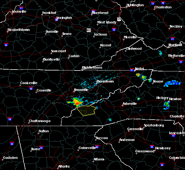 At 210 am edt, a severe thunderstorm was located 13 miles southeast of maryville, or 7 miles north of smoky mountains- twentymile creek, moving southeast at 50 mph (radar indicated). Hazards include ping pong ball size hail and 60 mph wind gusts. People and animals outdoors will be injured. expect hail damage to roofs, siding, windows and vehicles. Expect wind damage to roofs, siding and trees. At 210 am edt, a severe thunderstorm was located 13 miles southeast of maryville, or 7 miles north of smoky mountains- twentymile creek, moving southeast at 50 mph (radar indicated). Hazards include ping pong ball size hail and 60 mph wind gusts. People and animals outdoors will be injured. expect hail damage to roofs, siding, windows and vehicles. Expect wind damage to roofs, siding and trees.
|
| 9/5/2015 2:15 PM EDT |
 At 215 pm edt, doppler radar indicated a severe thunderstorm capable of producing quarter size hail and damaging winds in excess of 60 mph. this storm was located near bryson city, or over deep creek in the smoky mountains. this storm was nearly stationary. * locations in the warning include, bryson city, deep creek, whittier and cherokee. At 215 pm edt, doppler radar indicated a severe thunderstorm capable of producing quarter size hail and damaging winds in excess of 60 mph. this storm was located near bryson city, or over deep creek in the smoky mountains. this storm was nearly stationary. * locations in the warning include, bryson city, deep creek, whittier and cherokee.
|
| 7/14/2015 5:31 PM EDT |
 At 529 pm edt, doppler radar indicated a line of severe thunderstorms capable of producing damaging winds in excess of 60 mph. these storms were located along a line extending from 9 miles north of bryson city to 6 miles west of robbinsville to 12 miles northeast of ducktown, moving southeast at 30 mph. penny size hail may also accompany the damaging winds. locations impacted include, franklin, sylva, bryson city, robbinsville, cherokee, fontana lake, cullowhee, maggie valley, balsam, webster and dillsboro. At 529 pm edt, doppler radar indicated a line of severe thunderstorms capable of producing damaging winds in excess of 60 mph. these storms were located along a line extending from 9 miles north of bryson city to 6 miles west of robbinsville to 12 miles northeast of ducktown, moving southeast at 30 mph. penny size hail may also accompany the damaging winds. locations impacted include, franklin, sylva, bryson city, robbinsville, cherokee, fontana lake, cullowhee, maggie valley, balsam, webster and dillsboro.
|
| 7/14/2015 5:17 PM EDT |
 At 515 pm edt, doppler radar indicated a line of severe thunderstorms capable of producing damaging winds in excess of 60 mph. these storms were located along a line extending from 11 miles northeast of bryson city to 13 miles north of robbinsville to 15 miles southeast of athens, moving southeast at 30 mph. penny size hail may also accompany the damaging winds. locations impacted include, franklin, sylva, bryson city, robbinsville, cherokee, fontana lake, cullowhee, maggie valley, balsam, webster and dillsboro. At 515 pm edt, doppler radar indicated a line of severe thunderstorms capable of producing damaging winds in excess of 60 mph. these storms were located along a line extending from 11 miles northeast of bryson city to 13 miles north of robbinsville to 15 miles southeast of athens, moving southeast at 30 mph. penny size hail may also accompany the damaging winds. locations impacted include, franklin, sylva, bryson city, robbinsville, cherokee, fontana lake, cullowhee, maggie valley, balsam, webster and dillsboro.
|
| 7/14/2015 4:45 PM EDT |
 At 444 pm edt, doppler radar indicated a line of severe thunderstorms capable of producing damaging winds in excess of 60 mph. these storms were located along a line extending from 15 miles southeast of sevierville to 5 miles southwest of sweetwater, and moving southeast at 40 mph. penny size hail may also accompany the damaging winds. At 444 pm edt, doppler radar indicated a line of severe thunderstorms capable of producing damaging winds in excess of 60 mph. these storms were located along a line extending from 15 miles southeast of sevierville to 5 miles southwest of sweetwater, and moving southeast at 40 mph. penny size hail may also accompany the damaging winds.
|
| 7/14/2015 10:45 AM EDT |
 At 1045 am edt, doppler radar indicated a severe thunderstorm capable of producing large damaging hail up to golf ball size and damaging winds in excess of 60 mph. this storm was located 9 miles southwest of bryson city, or 8 miles southeast of fontana lake, moving southeast at 30 mph. locations impacted include, franklin, bryson city, highlands, dillsboro, cashiers, nantahala lake, lake glenville, smoky mountains-deep creek, cowee and cheoah. At 1045 am edt, doppler radar indicated a severe thunderstorm capable of producing large damaging hail up to golf ball size and damaging winds in excess of 60 mph. this storm was located 9 miles southwest of bryson city, or 8 miles southeast of fontana lake, moving southeast at 30 mph. locations impacted include, franklin, bryson city, highlands, dillsboro, cashiers, nantahala lake, lake glenville, smoky mountains-deep creek, cowee and cheoah.
|
| 7/14/2015 10:34 AM EDT |
 The national weather service in greenville-spartanburg has issued a * severe thunderstorm warning for. central jackson county in western north carolina. southeastern swain county in western north carolina. eastern graham county in western north carolina. Macon county in western north carolina. The national weather service in greenville-spartanburg has issued a * severe thunderstorm warning for. central jackson county in western north carolina. southeastern swain county in western north carolina. eastern graham county in western north carolina. Macon county in western north carolina.
|
| 6/24/2015 4:00 PM EDT | Eoc report relayed via social media of multiple trees and lines down on ebci land in northern jackson count in jackson county NC, 1.4 miles WNW of Cherokee, NC |
| 7/27/2014 9:40 PM EDT | Multiple trees down on soco mountain. report from wrgc in sylv in jackson county NC, 4.8 miles NE of Cherokee, NC |
| 2/21/2014 4:52 AM EST | One tree blown down in the whittier are in jackson county NC, 4.1 miles NNE of Cherokee, NC |
| 1/1/0001 12:00 AM | Cherokee dispatch reported tree down on old soco rd. time estimated from rada in swain county NC, 1.3 miles NE of Cherokee, NC |
| 1/1/0001 12:00 AM | County dispatch reported tree down on coopers creek r in swain county NC, 3.9 miles E of Cherokee, NC |
Hail Maps for Cherokee, NC


Connect with Interactive Hail Maps