

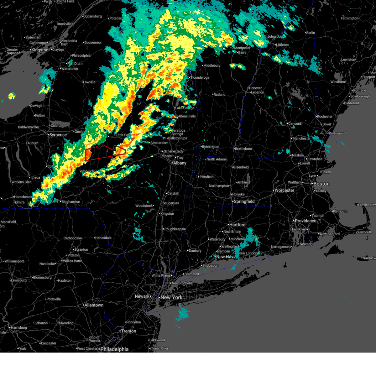
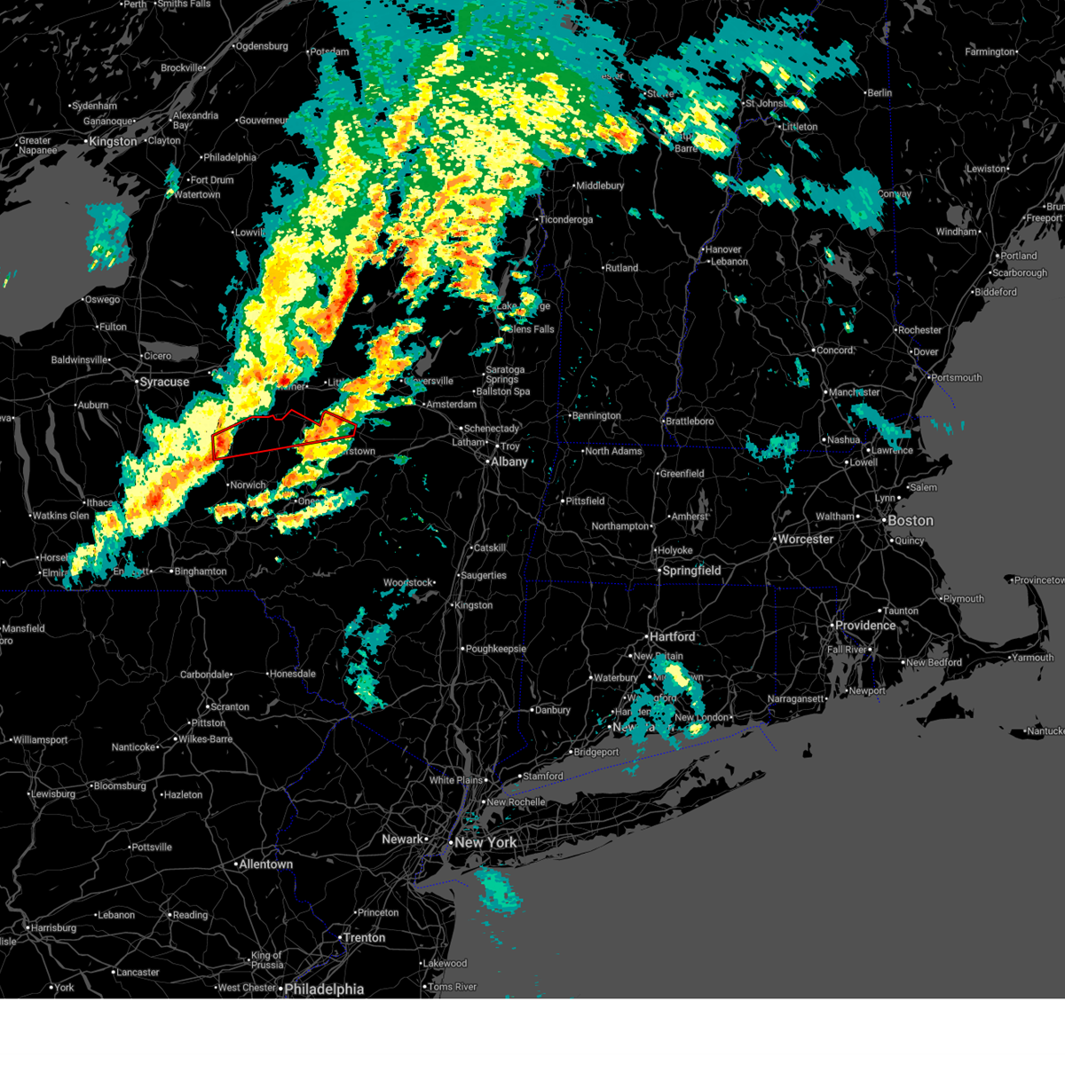
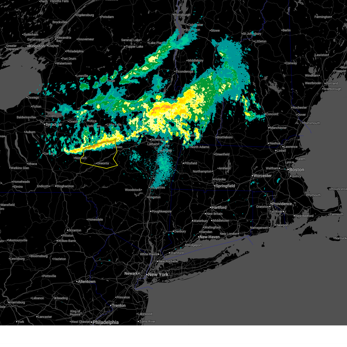
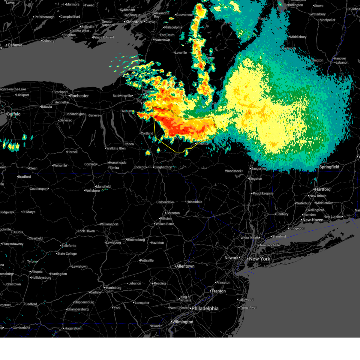
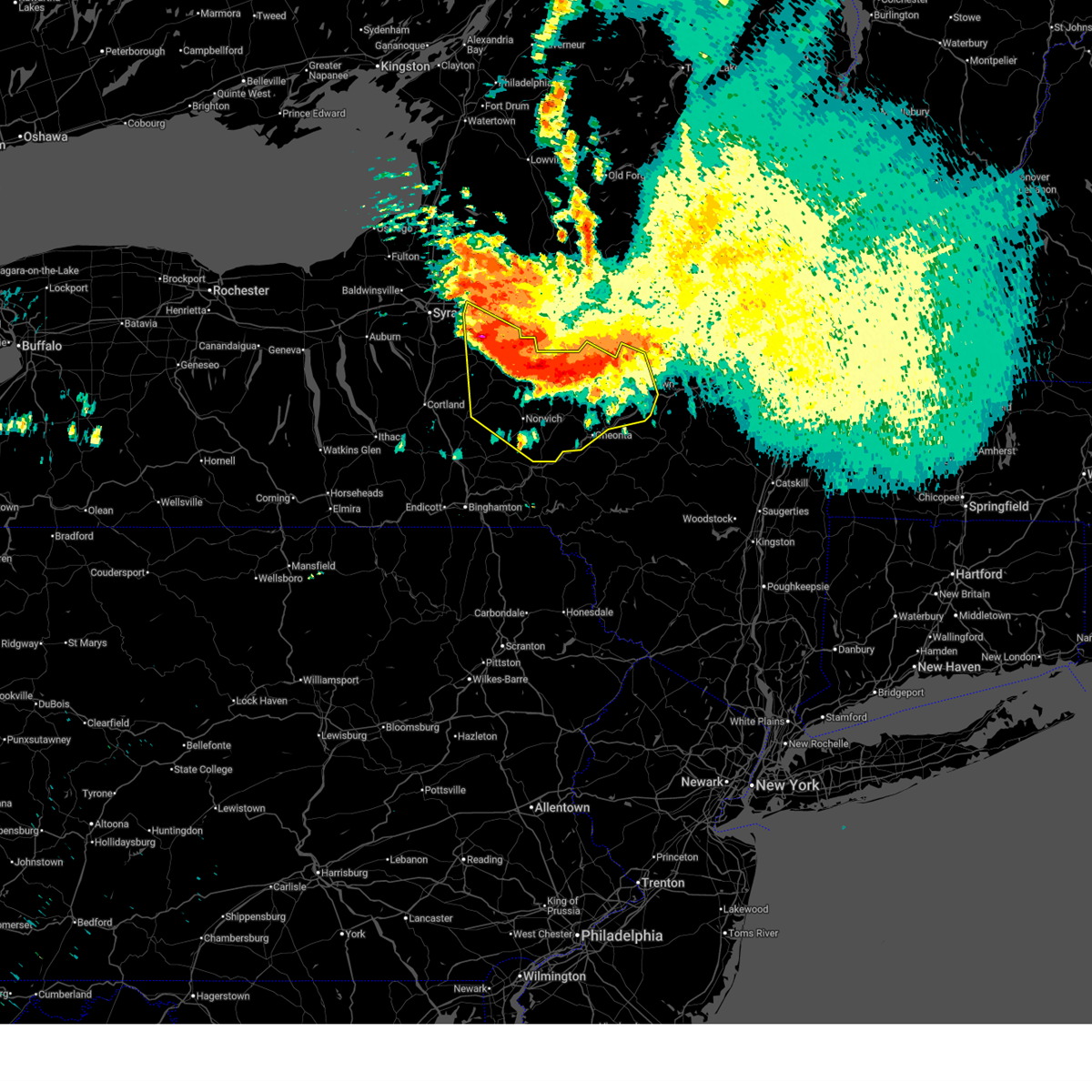
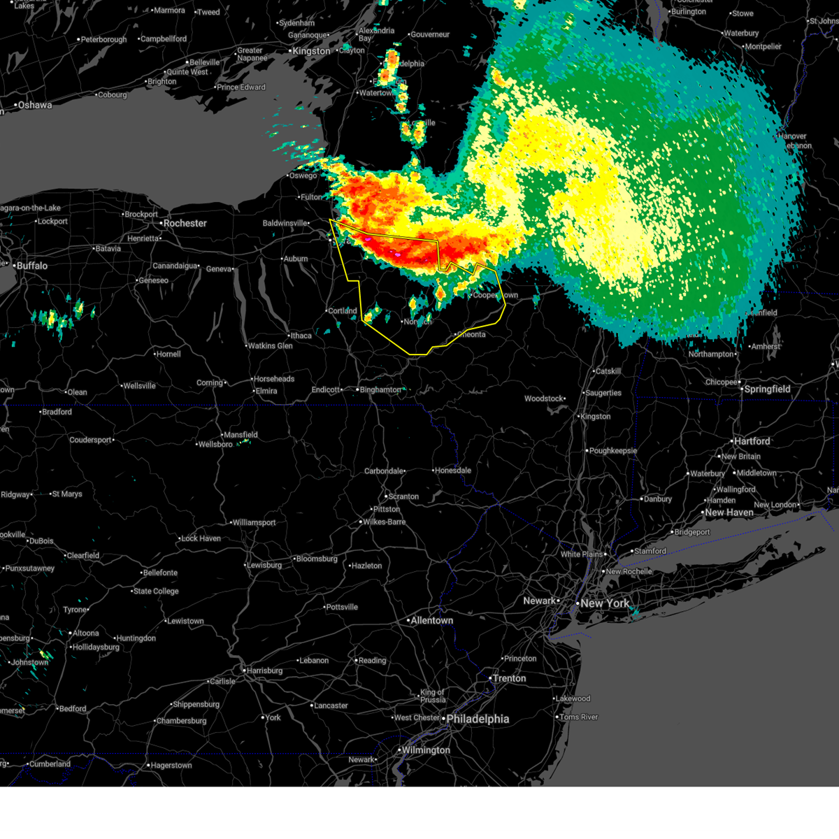
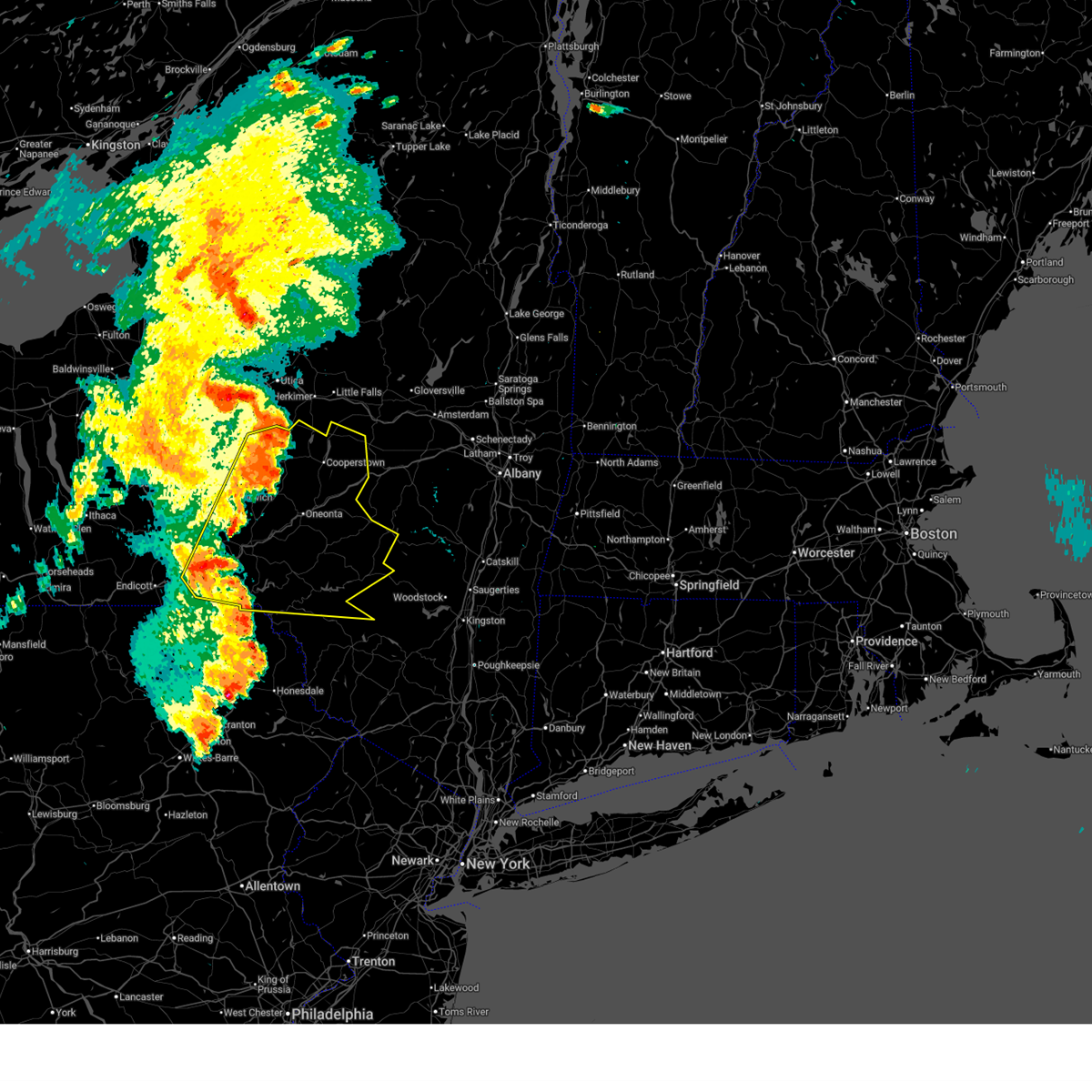
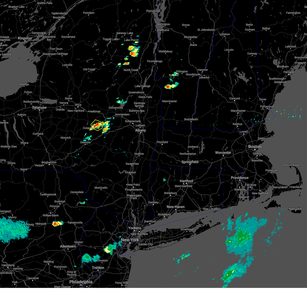
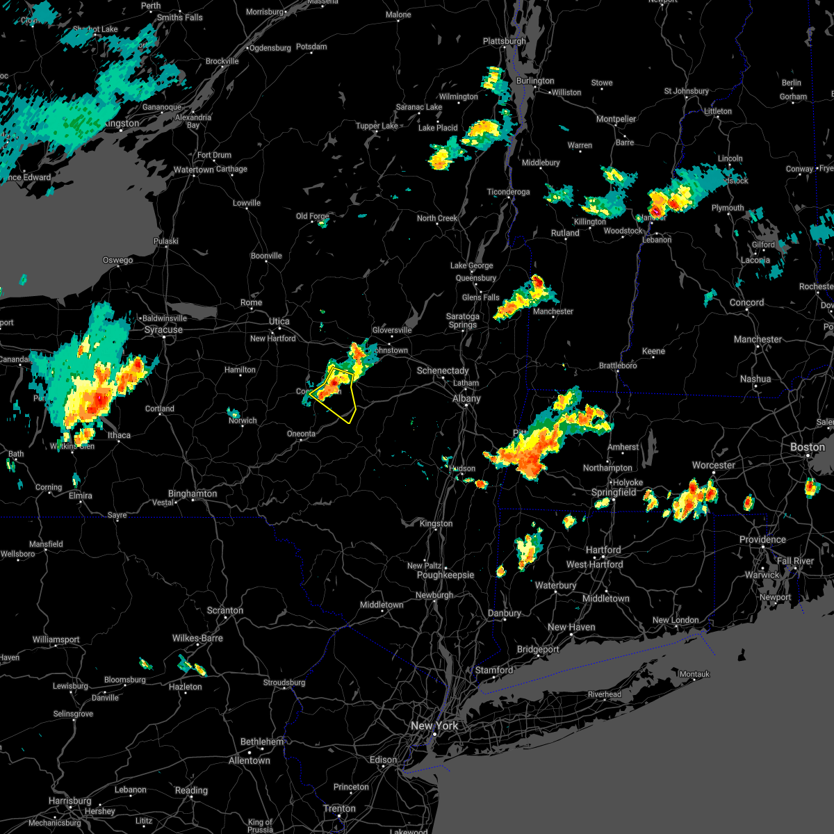
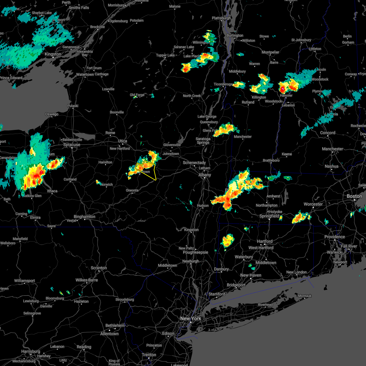
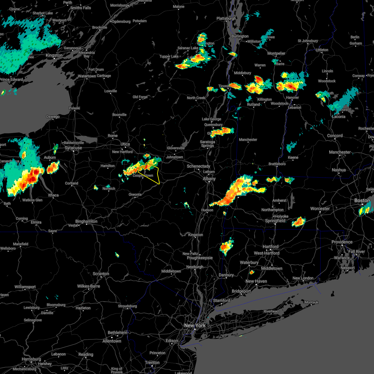
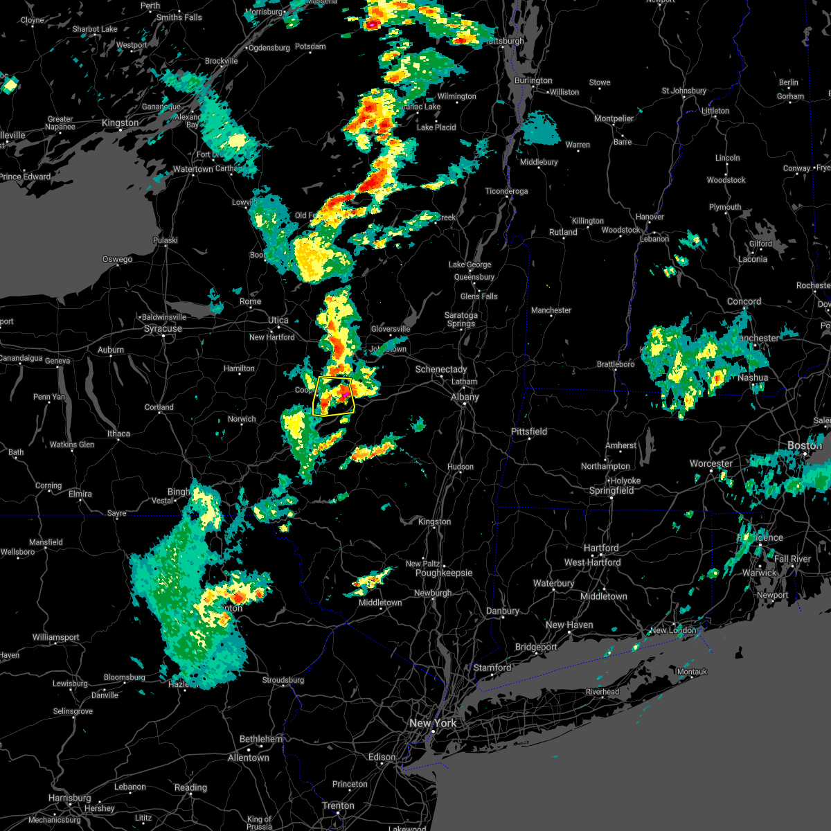
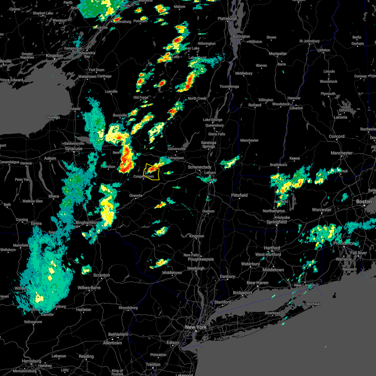
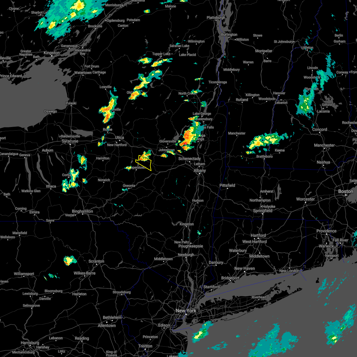
Hail Map for Cherry Valley, NY
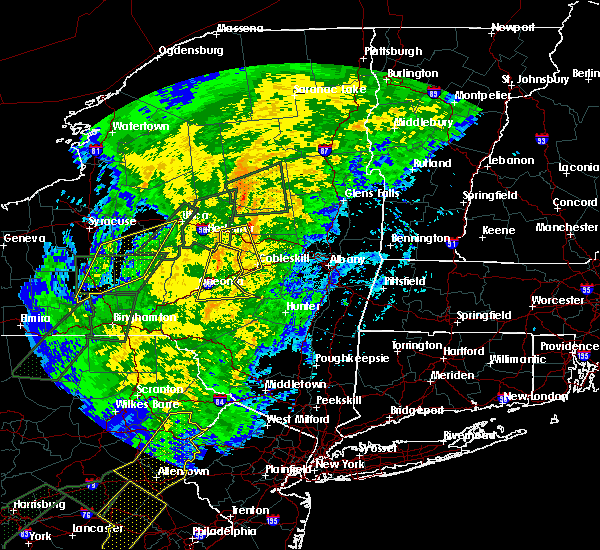
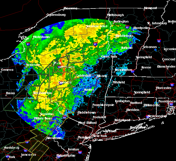
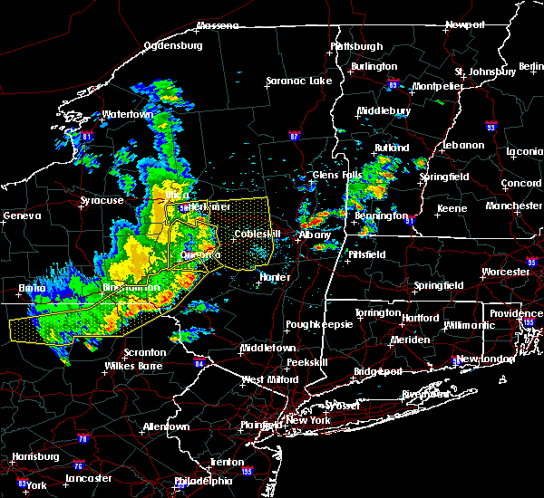
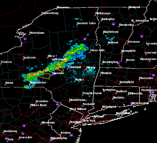
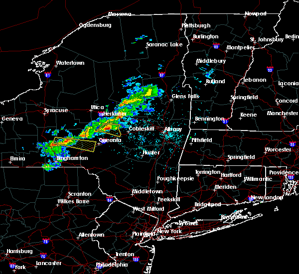
The Cherry Valley, NY area has had 5 reports of on-the-ground hail by trained spotters, and has been under severe weather warnings 13 times during the past 12 months. Doppler radar has detected hail at or near Cherry Valley, NY on 23 occasions.
| Name: | Cherry Valley, NY |
| Where Located: | 41.2 miles W of Schenectady, NY |
| Map: | Google Map for Cherry Valley, NY |
| Population: | 520 |
| Housing Units: | 300 |
| More Info: | Search Google for Cherry Valley, NY |
5
The Top Recent Hail Date for Cherry Valley, NY is Thursday, June 9, 2011 (1st out of 23)

Hail and Wind Damage Spotted near Cherry Valley, NY
| Date / Time | Report Details |
|---|---|
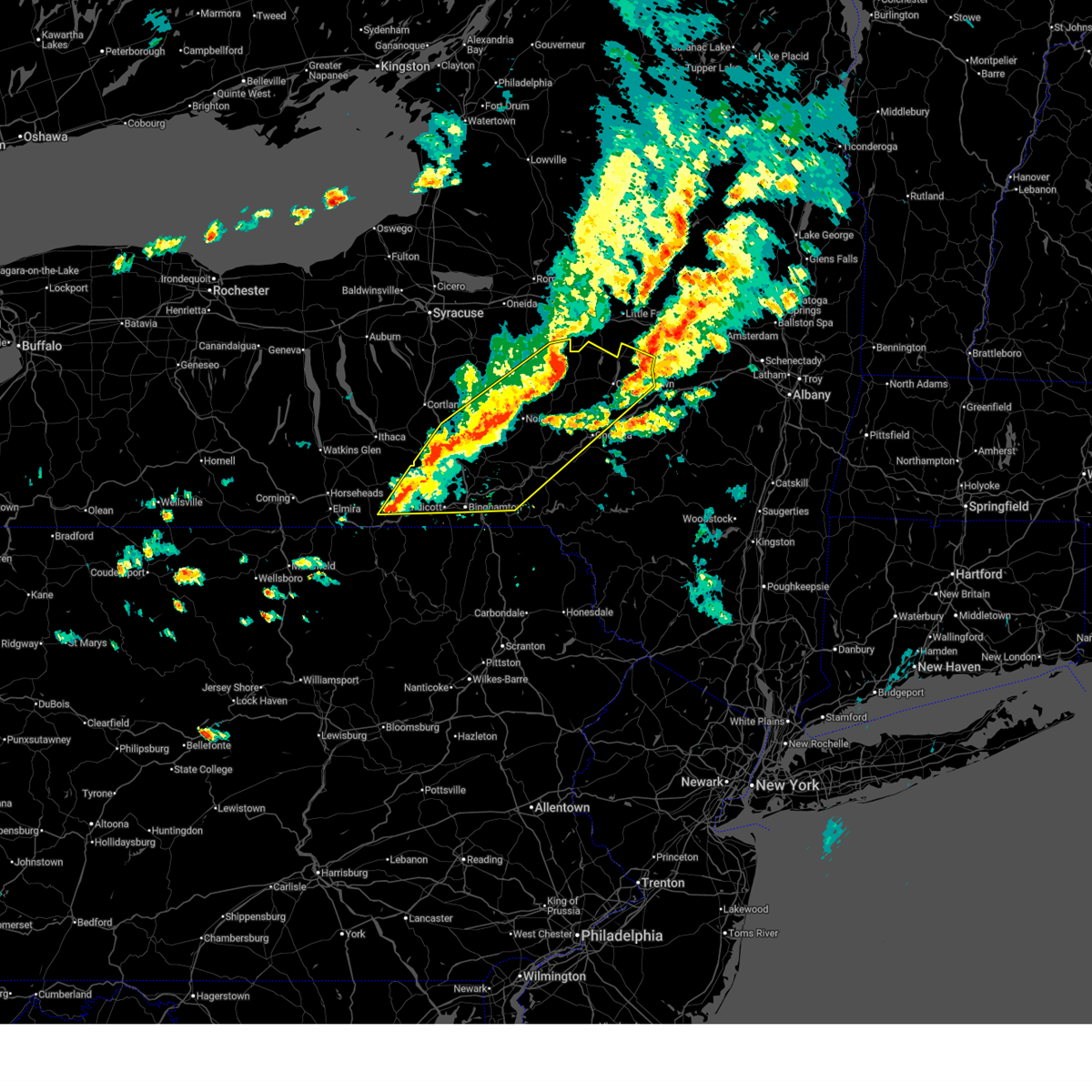
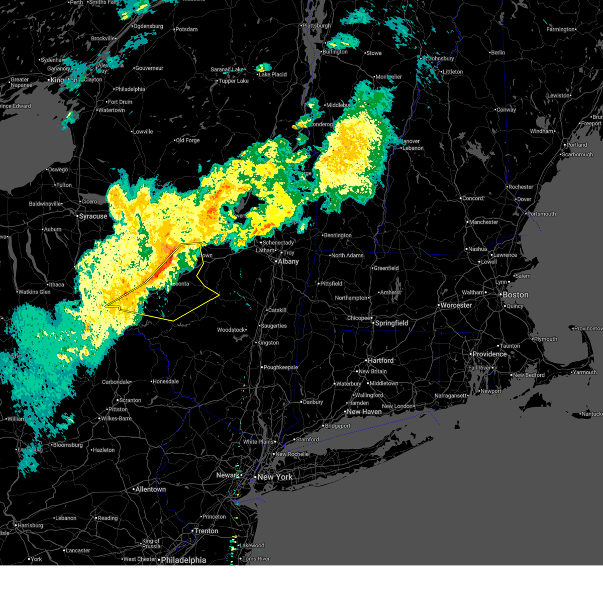
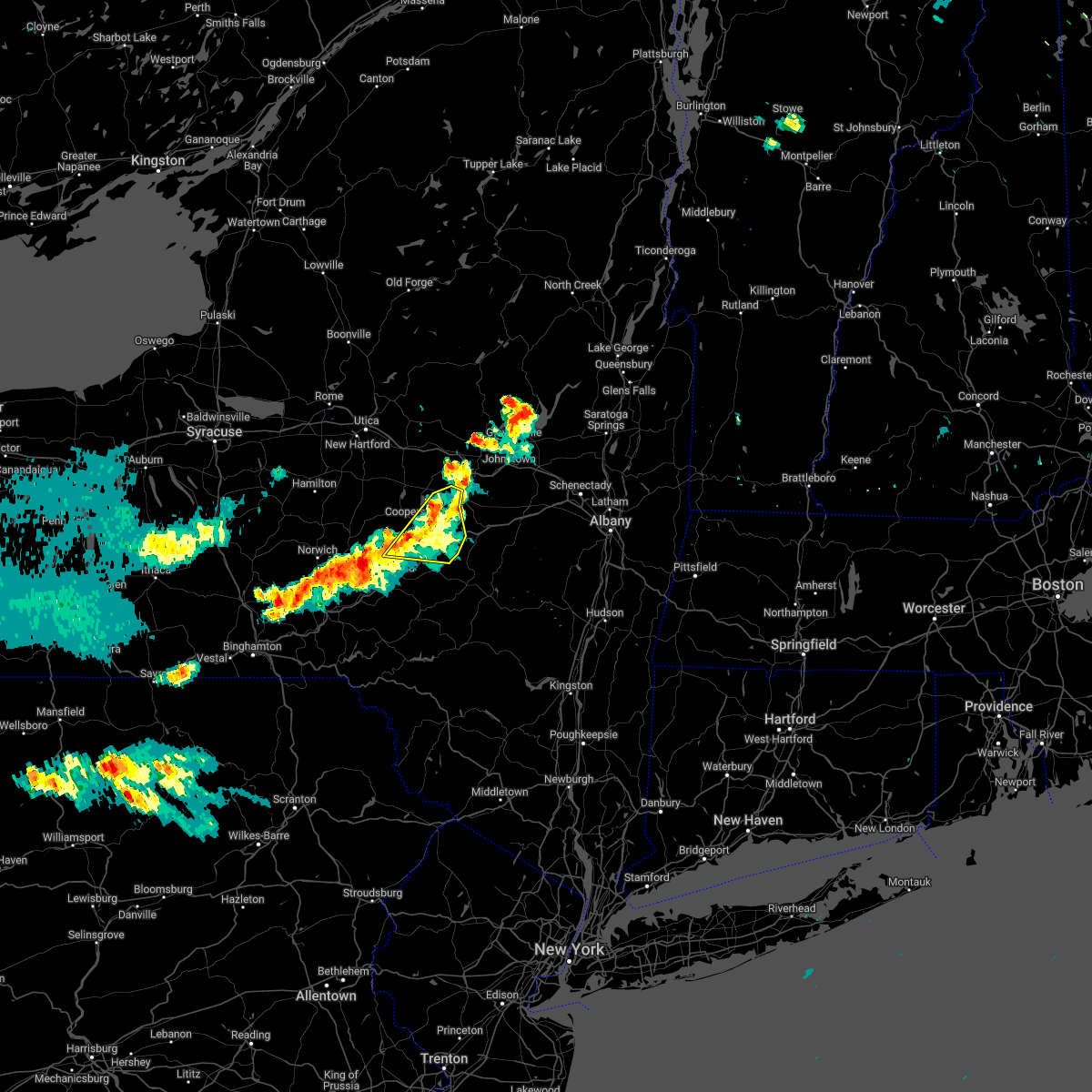
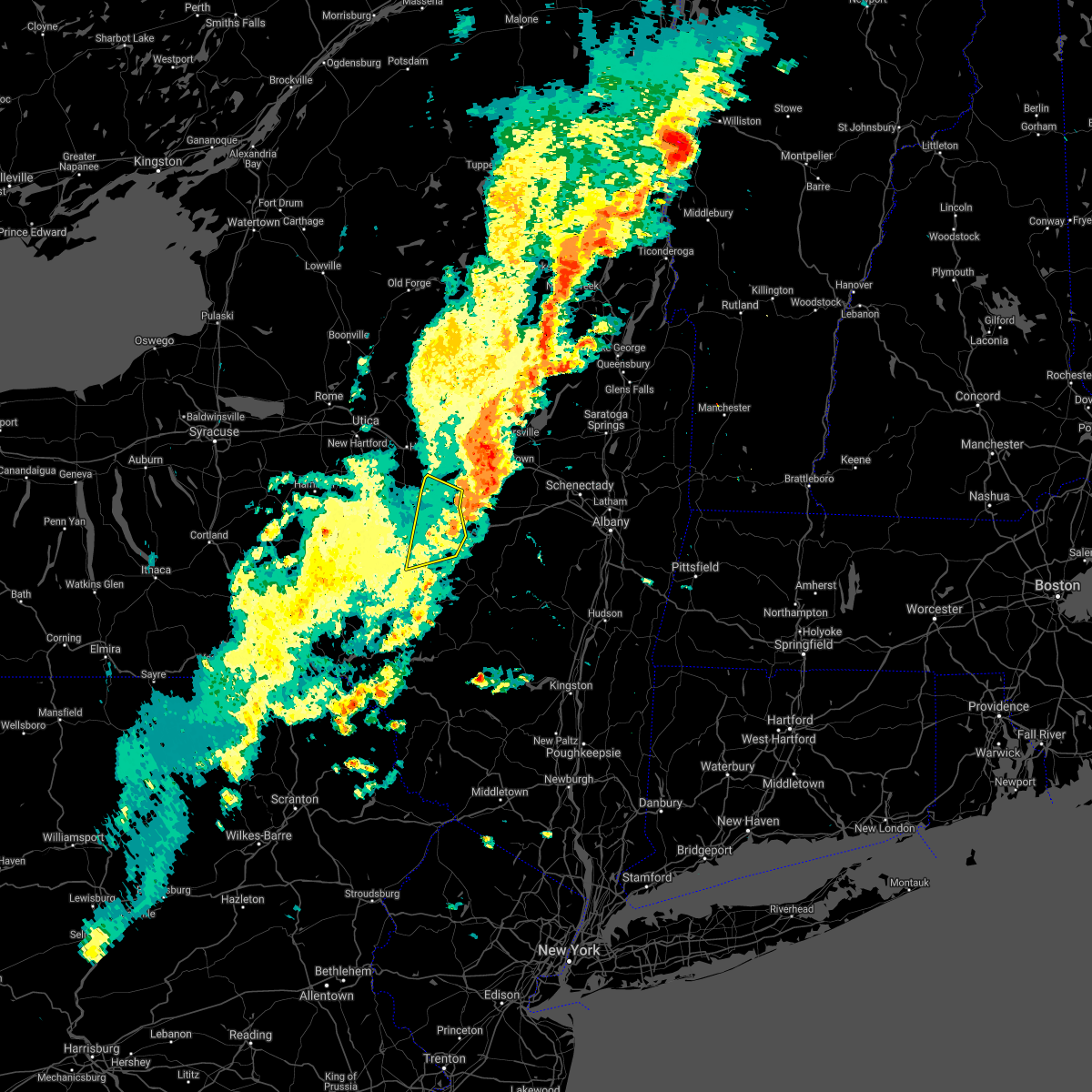
| 6/18/2026 1:15 PM EDT |
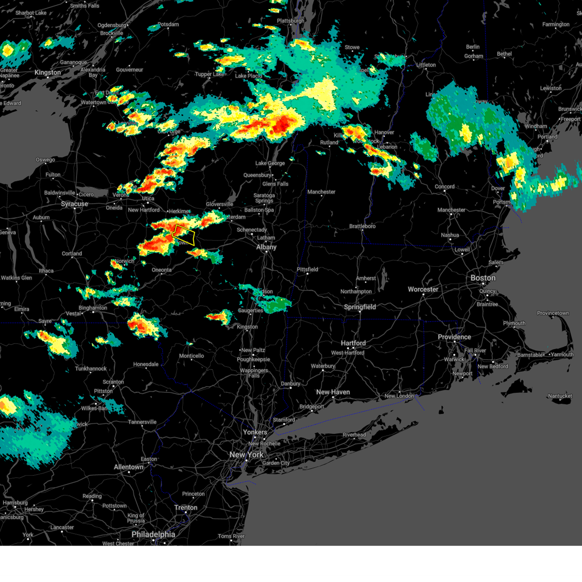
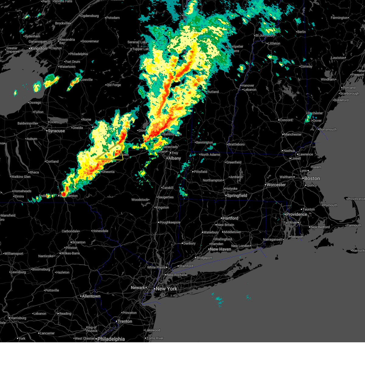 Svrbgm the national weather service in binghamton has issued a * severe thunderstorm warning for, northeastern otsego county in central new york, * until 145 pm edt. * at 115 pm edt, a severe thunderstorm was located over bowerstown, or near cooperstown, moving northeast at 45 mph (radar indicated). Hazards include 60 mph wind gusts and penny size hail. expect damage to roofs, siding, and trees Svrbgm the national weather service in binghamton has issued a * severe thunderstorm warning for, northeastern otsego county in central new york, * until 145 pm edt. * at 115 pm edt, a severe thunderstorm was located over bowerstown, or near cooperstown, moving northeast at 45 mph (radar indicated). Hazards include 60 mph wind gusts and penny size hail. expect damage to roofs, siding, and trees
|
| 6/18/2026 1:10 PM EDT | Tree and wires down on heller roa in otsego county NY, 3.6 miles W of Cherry Valley, NY |
| 6/18/2026 1:10 PM EDT | Tree down on roadwa in otsego county NY, 1.8 miles SW of Cherry Valley, NY |
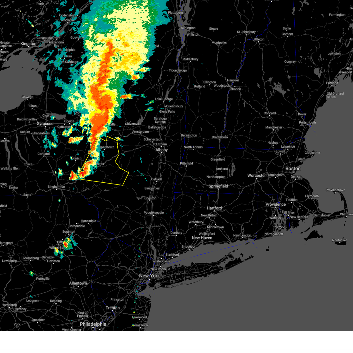
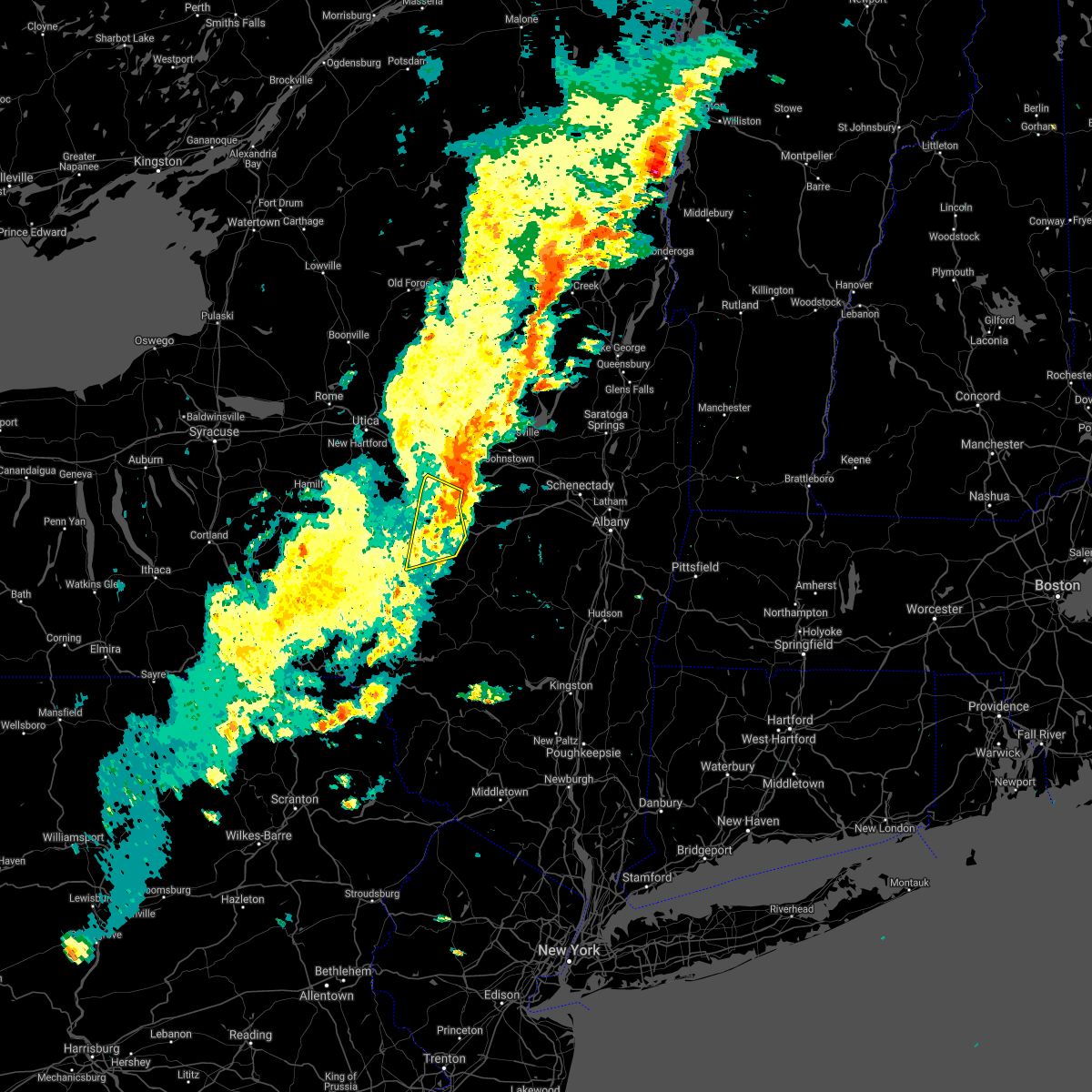
| 6/18/2026 1:01 PM EDT |
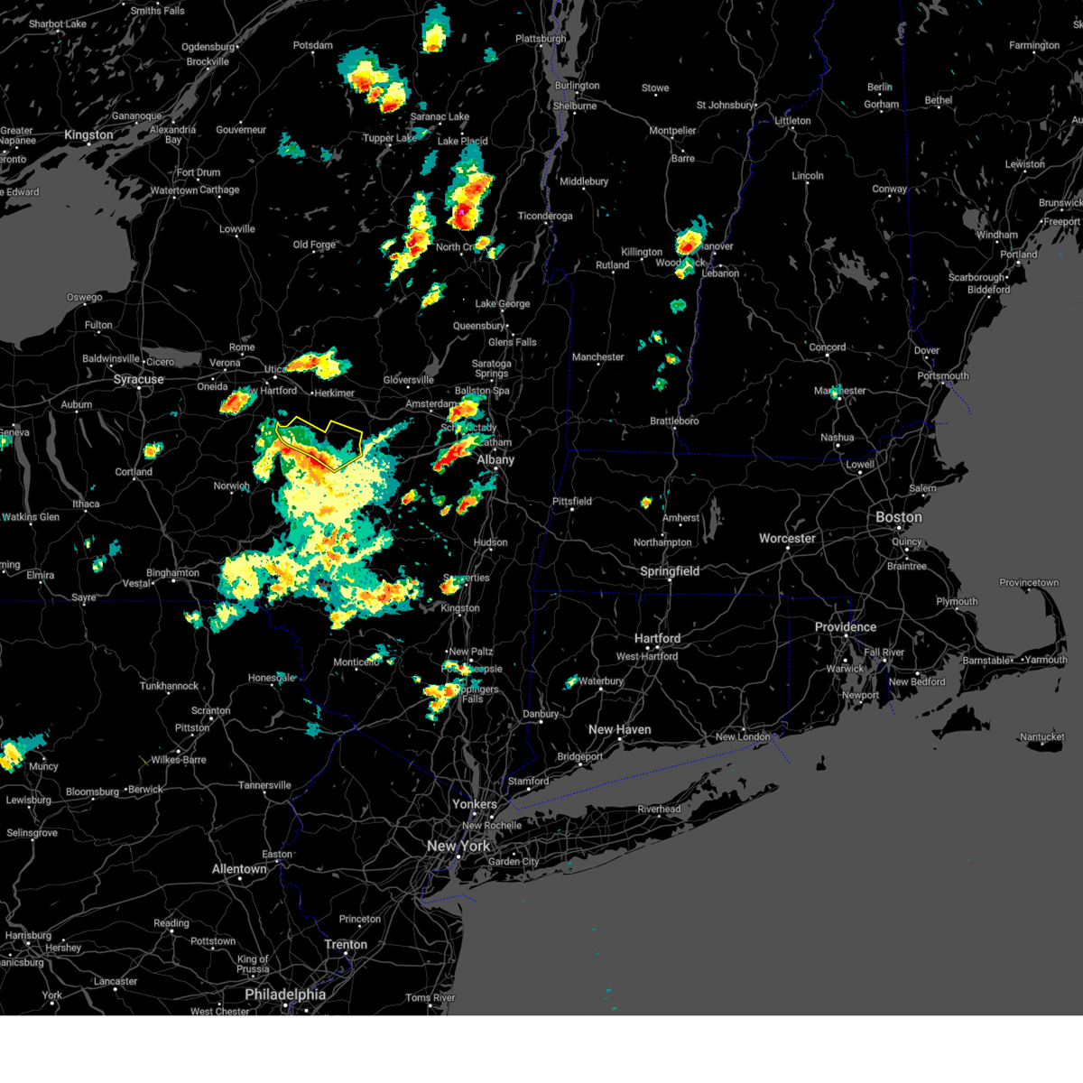
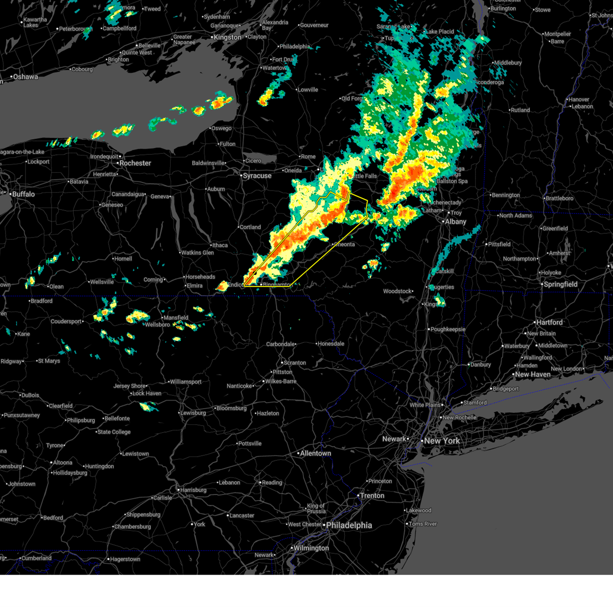 At 101 pm edt, severe thunderstorms were located along a line extending from near fort plain to chenango bridge, moving east at 50 mph (radar indicated). Hazards include 60 mph wind gusts and penny size hail. Expect damage to roofs, siding, and trees. Locations impacted include, binghamton, vestal, johnson city, oneonta, endicott, norwich, sidney, guilford, middlefield, and hartwick. At 101 pm edt, severe thunderstorms were located along a line extending from near fort plain to chenango bridge, moving east at 50 mph (radar indicated). Hazards include 60 mph wind gusts and penny size hail. Expect damage to roofs, siding, and trees. Locations impacted include, binghamton, vestal, johnson city, oneonta, endicott, norwich, sidney, guilford, middlefield, and hartwick.
|
| 6/18/2026 12:54 PM EDT |
 The storm which prompted the warning has weakened below severe limits, and no longer appears capable of producing a tornado. therefore, the warning will be allowed to expire. however, gusty winds are still possible with this thunderstorm. a tornado watch remains in effect until 300 pm edt for central new york. remember, a severe thunderstorm warning still remains in effect for northern otsego county. The storm which prompted the warning has weakened below severe limits, and no longer appears capable of producing a tornado. therefore, the warning will be allowed to expire. however, gusty winds are still possible with this thunderstorm. a tornado watch remains in effect until 300 pm edt for central new york. remember, a severe thunderstorm warning still remains in effect for northern otsego county.
|
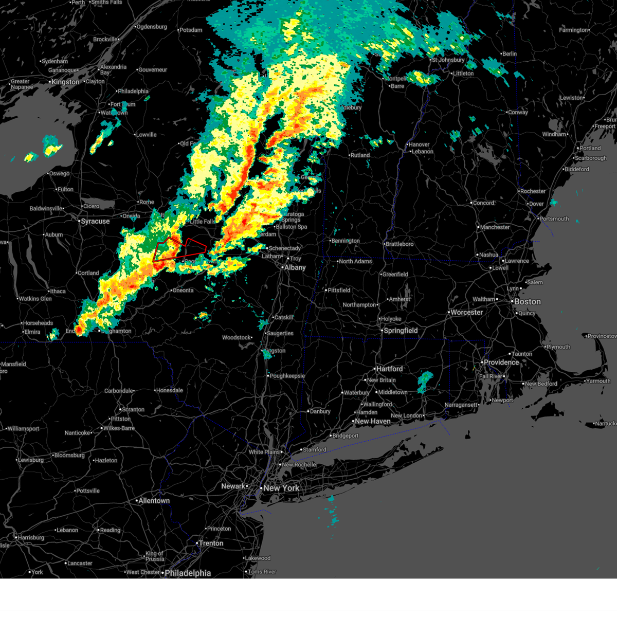
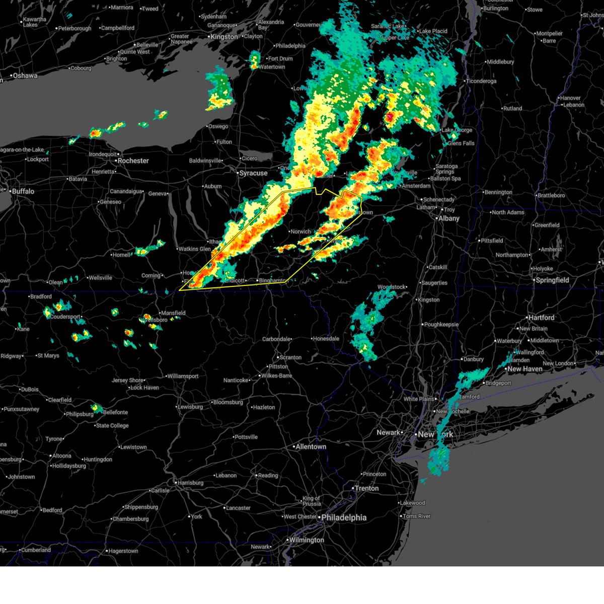
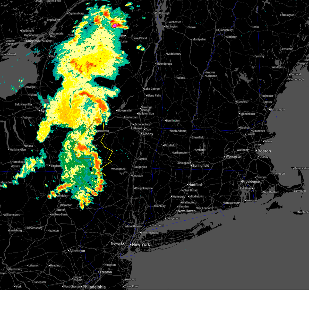
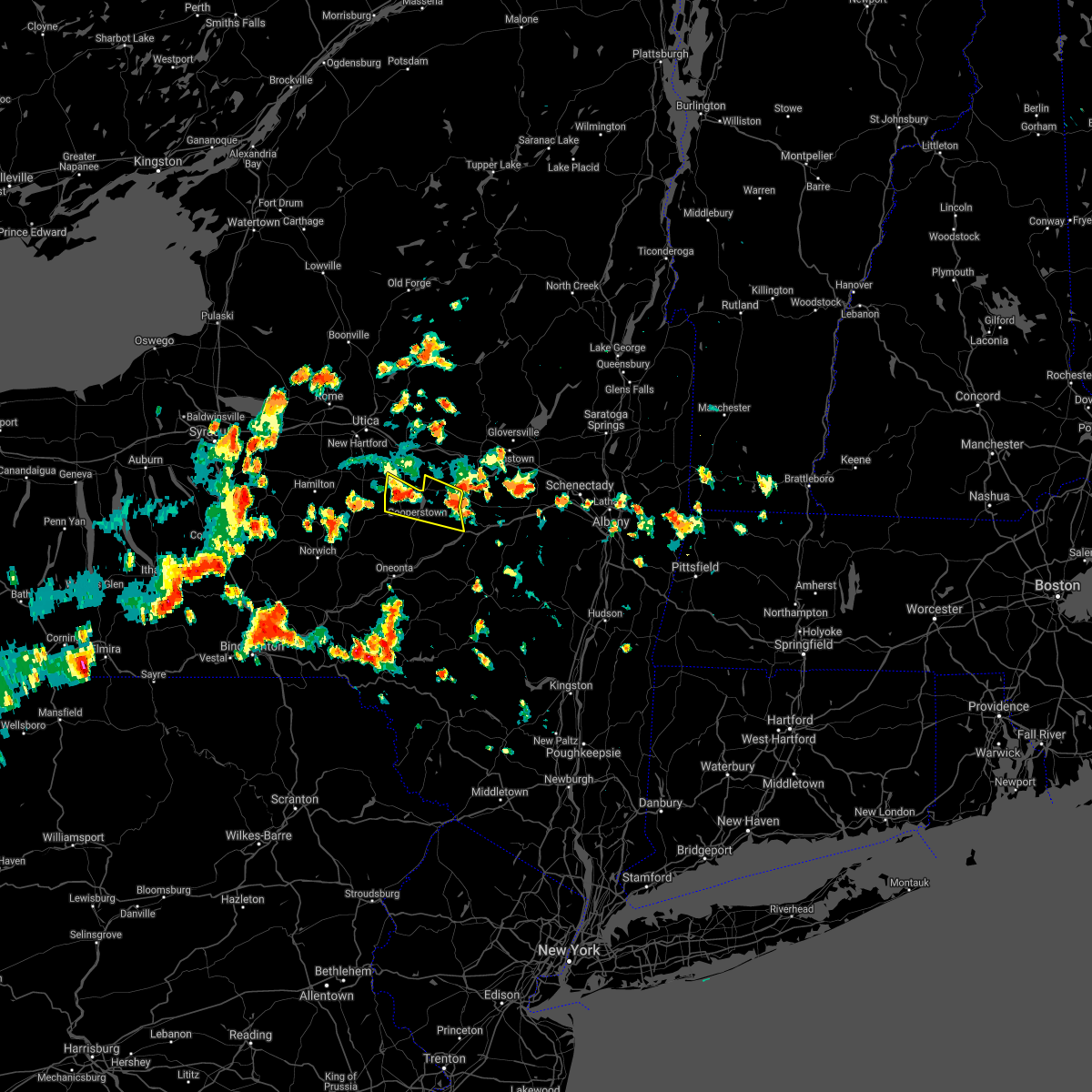
| 6/18/2026 12:44 PM EDT |
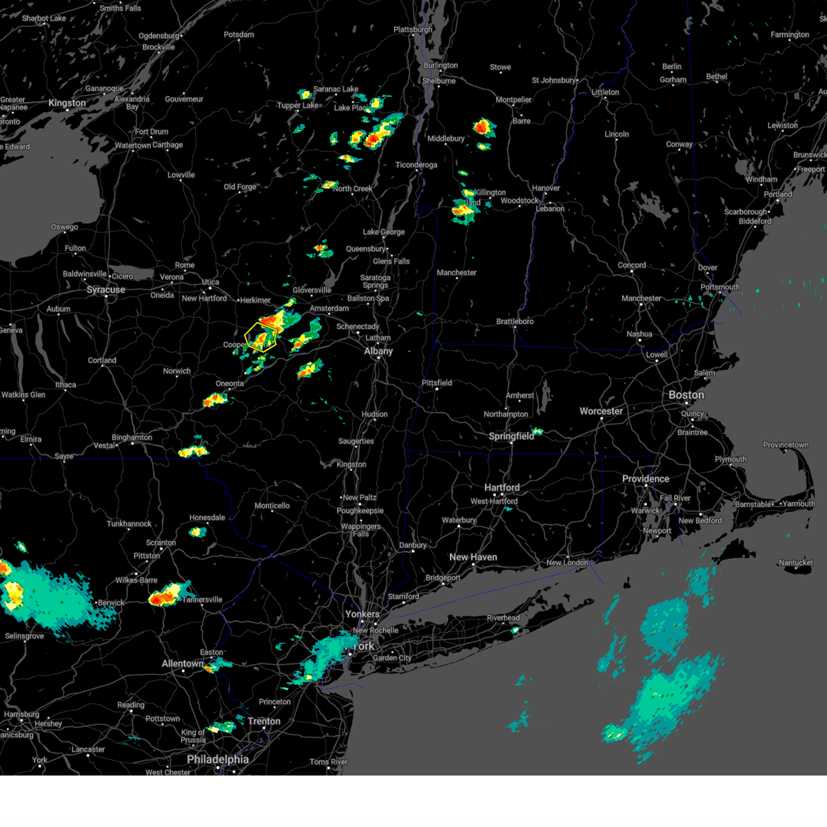
 At 1244 pm edt, a severe thunderstorm capable of producing a tornado was located near exeter center, or 12 miles northwest of cooperstown, moving east at 55 mph (radar indicated rotation). Hazards include tornado. Flying debris will be dangerous to those caught without shelter. mobile homes will be damaged or destroyed. damage to roofs, windows, and vehicles will occur. tree damage is likely. this dangerous storm will be near, richfield springs around 1250 pm edt. Springfield around 1255 pm edt. At 1244 pm edt, a severe thunderstorm capable of producing a tornado was located near exeter center, or 12 miles northwest of cooperstown, moving east at 55 mph (radar indicated rotation). Hazards include tornado. Flying debris will be dangerous to those caught without shelter. mobile homes will be damaged or destroyed. damage to roofs, windows, and vehicles will occur. tree damage is likely. this dangerous storm will be near, richfield springs around 1250 pm edt. Springfield around 1255 pm edt.
|
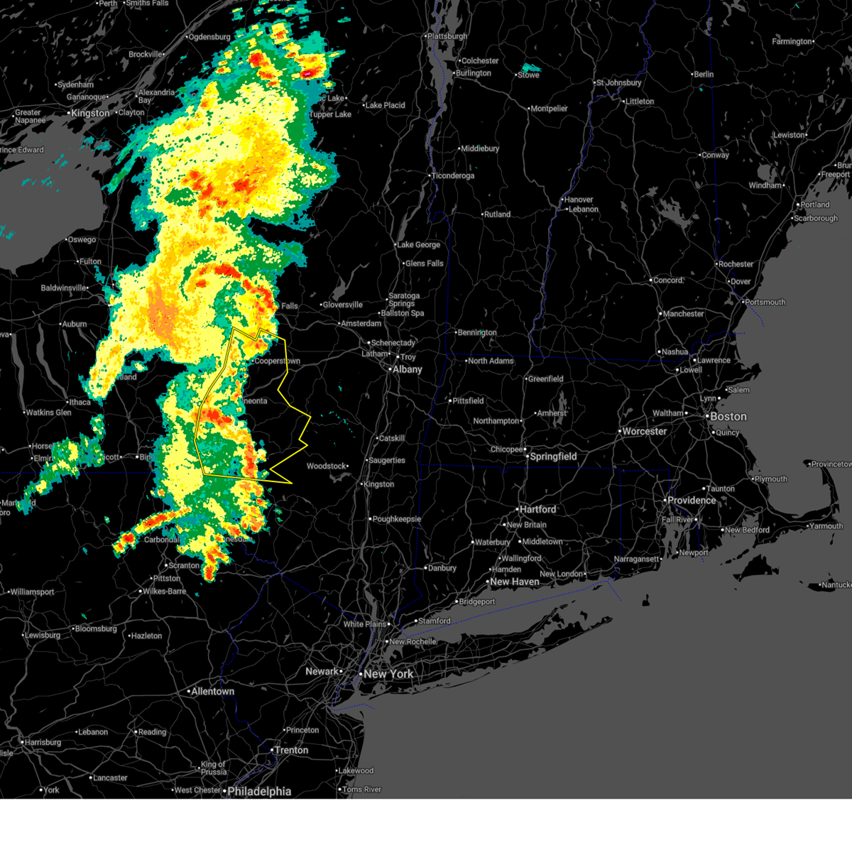
| 6/18/2026 12:35 PM EDT |
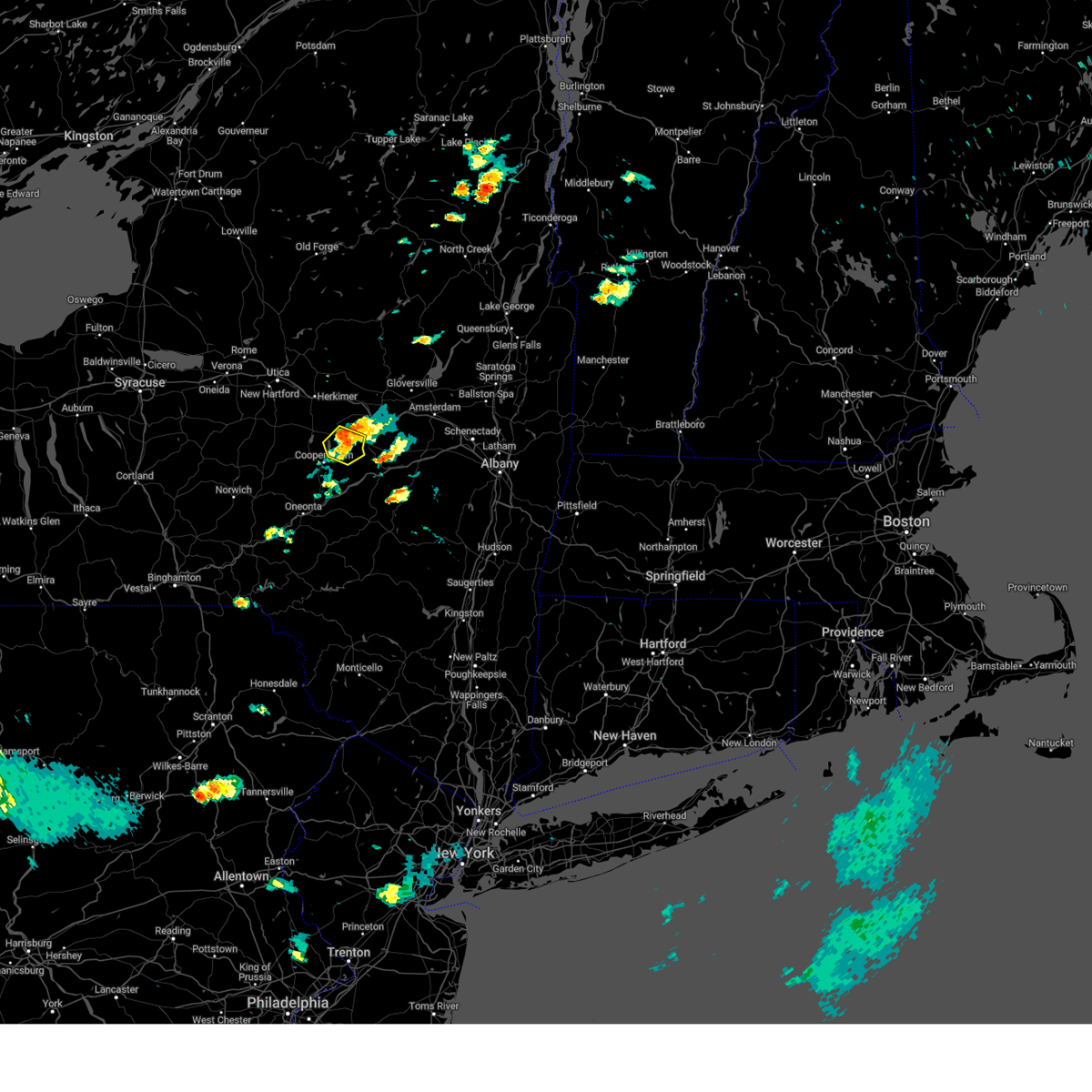
 At 1234 pm edt, severe thunderstorms were located along a line extending from near west winfield to near owego, moving east at 50 mph (radar indicated). Hazards include 60 mph wind gusts and penny size hail. Expect damage to roofs, siding, and trees. Locations impacted include, binghamton, vestal, johnson city, oneonta, endicott, norwich, maine, sidney, owego, and guilford. At 1234 pm edt, severe thunderstorms were located along a line extending from near west winfield to near owego, moving east at 50 mph (radar indicated). Hazards include 60 mph wind gusts and penny size hail. Expect damage to roofs, siding, and trees. Locations impacted include, binghamton, vestal, johnson city, oneonta, endicott, norwich, maine, sidney, owego, and guilford.
|
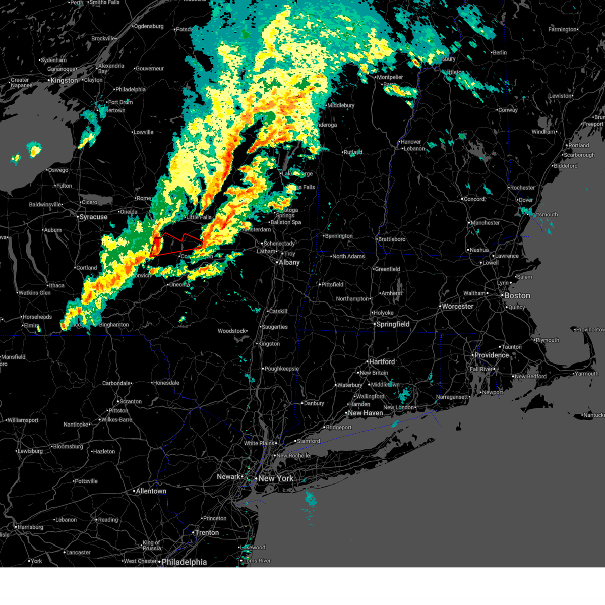
| 6/18/2026 12:29 PM EDT |
 At 1229 pm edt, a severe thunderstorm capable of producing a tornado was located near south brookfield, or 10 miles southeast of hamilton, moving east at 50 mph (radar indicated rotation). Hazards include tornado. Flying debris will be dangerous to those caught without shelter. mobile homes will be damaged or destroyed. damage to roofs, windows, and vehicles will occur. tree damage is likely. this dangerous storm will be near, brookfield, leonardsville, and unadilla forks around 1235 pm edt. exeter center around 1245 pm edt. richfield springs around 1250 pm edt. Springfield around 1255 pm edt. At 1229 pm edt, a severe thunderstorm capable of producing a tornado was located near south brookfield, or 10 miles southeast of hamilton, moving east at 50 mph (radar indicated rotation). Hazards include tornado. Flying debris will be dangerous to those caught without shelter. mobile homes will be damaged or destroyed. damage to roofs, windows, and vehicles will occur. tree damage is likely. this dangerous storm will be near, brookfield, leonardsville, and unadilla forks around 1235 pm edt. exeter center around 1245 pm edt. richfield springs around 1250 pm edt. Springfield around 1255 pm edt.
|
| 6/18/2026 12:18 PM EDT |
 Torbgm the national weather service in binghamton has issued a * tornado warning for, northern otsego county in central new york, southeastern madison county in central new york, northeastern chenango county in central new york, * until 100 pm edt. * at 1218 pm edt, a severe thunderstorm capable of producing a tornado was located over earlville, or near hamilton, moving east at 55 mph (radar indicated rotation). Hazards include tornado. Flying debris will be dangerous to those caught without shelter. mobile homes will be damaged or destroyed. damage to roofs, windows, and vehicles will occur. tree damage is likely. this dangerous storm will be near, brookfield and south brookfield around 1225 pm edt. leonardsville and unadilla forks around 1230 pm edt. exeter center around 1240 pm edt. richfield springs around 1245 pm edt. Springfield around 1255 pm edt. Torbgm the national weather service in binghamton has issued a * tornado warning for, northern otsego county in central new york, southeastern madison county in central new york, northeastern chenango county in central new york, * until 100 pm edt. * at 1218 pm edt, a severe thunderstorm capable of producing a tornado was located over earlville, or near hamilton, moving east at 55 mph (radar indicated rotation). Hazards include tornado. Flying debris will be dangerous to those caught without shelter. mobile homes will be damaged or destroyed. damage to roofs, windows, and vehicles will occur. tree damage is likely. this dangerous storm will be near, brookfield and south brookfield around 1225 pm edt. leonardsville and unadilla forks around 1230 pm edt. exeter center around 1240 pm edt. richfield springs around 1245 pm edt. Springfield around 1255 pm edt.
|
| 6/18/2026 12:15 PM EDT |
 Svrbgm the national weather service in binghamton has issued a * severe thunderstorm warning for, south central oneida county in central new york, otsego county in central new york, broome county in central new york, southeastern madison county in central new york, northwestern delaware county in central new york, southern cortland county in central new york, southeastern chemung county in central new york, tioga county in central new york, southeastern tompkins county in central new york, chenango county in central new york, * until 115 pm edt. * at 1215 pm edt, severe thunderstorms were located along a line extending from near poolville to near chemung, moving east at 50 mph (radar indicated). Hazards include 60 mph wind gusts and penny size hail. expect damage to roofs, siding, and trees Svrbgm the national weather service in binghamton has issued a * severe thunderstorm warning for, south central oneida county in central new york, otsego county in central new york, broome county in central new york, southeastern madison county in central new york, northwestern delaware county in central new york, southern cortland county in central new york, southeastern chemung county in central new york, tioga county in central new york, southeastern tompkins county in central new york, chenango county in central new york, * until 115 pm edt. * at 1215 pm edt, severe thunderstorms were located along a line extending from near poolville to near chemung, moving east at 50 mph (radar indicated). Hazards include 60 mph wind gusts and penny size hail. expect damage to roofs, siding, and trees
|
| 5/29/2026 9:51 PM EDT |
 Svrbgm the national weather service in binghamton has issued a * severe thunderstorm warning for, otsego county in central new york, north central delaware county in central new york, * until 1030 pm edt. * at 950 pm edt, gusty showers were located along a line extending from sharon springs to near pittsfield, moving southeast at 50 mph (law enforcement has received reports of downed trees along with line of showers and isolated thunderstorms). Hazards include 60 mph wind gusts. expect damage to roofs, siding, and trees Svrbgm the national weather service in binghamton has issued a * severe thunderstorm warning for, otsego county in central new york, north central delaware county in central new york, * until 1030 pm edt. * at 950 pm edt, gusty showers were located along a line extending from sharon springs to near pittsfield, moving southeast at 50 mph (law enforcement has received reports of downed trees along with line of showers and isolated thunderstorms). Hazards include 60 mph wind gusts. expect damage to roofs, siding, and trees
|
| 6/22/2025 4:50 AM EDT |
 At 450 am edt, severe thunderstorms were located along a line extending from near worcester to near morris to near otselic to near fabius, moving south at 40 mph (radar indicated). Hazards include 60 mph wind gusts. Expect damage to roofs, siding, and trees. Locations impacted include, oneonta, norwich, eaton, hamilton, guilford, cazenovia, brookfield, worcester, morrisville, and middlefield. At 450 am edt, severe thunderstorms were located along a line extending from near worcester to near morris to near otselic to near fabius, moving south at 40 mph (radar indicated). Hazards include 60 mph wind gusts. Expect damage to roofs, siding, and trees. Locations impacted include, oneonta, norwich, eaton, hamilton, guilford, cazenovia, brookfield, worcester, morrisville, and middlefield.
|
| 6/22/2025 4:36 AM EDT |
 the severe thunderstorm warning has been cancelled and is no longer in effect the severe thunderstorm warning has been cancelled and is no longer in effect
|
| 6/22/2025 4:36 AM EDT |
 At 436 am edt, severe thunderstorms were located along a line extending from near middlefield to near edmeston to georgetown to watervale, moving south at 40 mph (radar indicated). Hazards include 70 mph wind gusts. Expect considerable tree damage. damage is likely to mobile homes, roofs, and outbuildings. Locations impacted include, sullivan, oneonta, norwich, eaton, chittenango, hamilton, guilford, cazenovia, brookfield, and worcester. At 436 am edt, severe thunderstorms were located along a line extending from near middlefield to near edmeston to georgetown to watervale, moving south at 40 mph (radar indicated). Hazards include 70 mph wind gusts. Expect considerable tree damage. damage is likely to mobile homes, roofs, and outbuildings. Locations impacted include, sullivan, oneonta, norwich, eaton, chittenango, hamilton, guilford, cazenovia, brookfield, and worcester.
|
| 6/22/2025 4:13 AM EDT |
 Svrbgm the national weather service in binghamton has issued a * severe thunderstorm warning for, southeastern oneida county in central new york, otsego county in central new york, madison county in central new york, eastern onondaga county in central new york, chenango county in central new york, * until 515 am edt. * at 412 am edt, severe thunderstorms were located along a line extending from near jordanville to near waterville to near cazenovia to near cicero, moving south at 40 mph (radar indicated). Hazards include 70 mph wind gusts. Expect considerable tree damage. Damage is likely to mobile homes, roofs, and outbuildings. Svrbgm the national weather service in binghamton has issued a * severe thunderstorm warning for, southeastern oneida county in central new york, otsego county in central new york, madison county in central new york, eastern onondaga county in central new york, chenango county in central new york, * until 515 am edt. * at 412 am edt, severe thunderstorms were located along a line extending from near jordanville to near waterville to near cazenovia to near cicero, moving south at 40 mph (radar indicated). Hazards include 70 mph wind gusts. Expect considerable tree damage. Damage is likely to mobile homes, roofs, and outbuildings.
|
| 4/29/2025 8:17 PM EDT |
 Svrbgm the national weather service in binghamton has issued a * severe thunderstorm warning for, otsego county in central new york, northern delaware county in central new york, southeastern chenango county in central new york, * until 900 pm edt. * at 816 pm edt, severe thunderstorms were located along a line extending from near cherry valley to near otego to near coventry, moving east at 50 mph (radar indicated). Hazards include 60 mph wind gusts. expect damage to trees and power lines Svrbgm the national weather service in binghamton has issued a * severe thunderstorm warning for, otsego county in central new york, northern delaware county in central new york, southeastern chenango county in central new york, * until 900 pm edt. * at 816 pm edt, severe thunderstorms were located along a line extending from near cherry valley to near otego to near coventry, moving east at 50 mph (radar indicated). Hazards include 60 mph wind gusts. expect damage to trees and power lines
|
| 4/29/2025 7:42 PM EDT |
 Svrbgm the national weather service in binghamton has issued a * severe thunderstorm warning for, otsego county in central new york, broome county in central new york, northwestern delaware county in central new york, tioga county in central new york, chenango county in central new york, * until 830 pm edt. * at 741 pm edt, severe thunderstorms were located along a line extending from unadilla forks to near nanticoke to candor to chemung, moving southeast at 40 mph (radar indicated). Hazards include 60 mph wind gusts. expect damage to roofs, siding, and trees Svrbgm the national weather service in binghamton has issued a * severe thunderstorm warning for, otsego county in central new york, broome county in central new york, northwestern delaware county in central new york, tioga county in central new york, chenango county in central new york, * until 830 pm edt. * at 741 pm edt, severe thunderstorms were located along a line extending from unadilla forks to near nanticoke to candor to chemung, moving southeast at 40 mph (radar indicated). Hazards include 60 mph wind gusts. expect damage to roofs, siding, and trees
|
| 7/16/2024 4:48 PM EDT |
 the severe thunderstorm warning has been cancelled and is no longer in effect the severe thunderstorm warning has been cancelled and is no longer in effect
|
| 7/16/2024 4:48 PM EDT |
 At 448 pm edt, severe thunderstorms were located along a line extending from fonda to near delhi, moving east at 40 mph (law enforcement reported a tree down on a roof in delaware county). Hazards include 60 mph wind gusts and penny size hail. Expect damage to roofs, siding, and trees. Locations impacted include, delhi, davenport, roxbury, worcester, middlefield, maryland, cooperstown, westville, kortright, and meredith. At 448 pm edt, severe thunderstorms were located along a line extending from fonda to near delhi, moving east at 40 mph (law enforcement reported a tree down on a roof in delaware county). Hazards include 60 mph wind gusts and penny size hail. Expect damage to roofs, siding, and trees. Locations impacted include, delhi, davenport, roxbury, worcester, middlefield, maryland, cooperstown, westville, kortright, and meredith.
|
| 7/16/2024 4:02 PM EDT |
 Svrbgm the national weather service in binghamton has issued a * severe thunderstorm warning for, otsego county in central new york, northern delaware county in central new york, southeastern chenango county in central new york, * until 500 pm edt. * at 402 pm edt, severe thunderstorms were located along a line extending from jordanville to near bainbridge, moving east at 40 mph (radar indicated). Hazards include 60 mph wind gusts and penny size hail. expect damage to roofs, siding, and trees Svrbgm the national weather service in binghamton has issued a * severe thunderstorm warning for, otsego county in central new york, northern delaware county in central new york, southeastern chenango county in central new york, * until 500 pm edt. * at 402 pm edt, severe thunderstorms were located along a line extending from jordanville to near bainbridge, moving east at 40 mph (radar indicated). Hazards include 60 mph wind gusts and penny size hail. expect damage to roofs, siding, and trees
|
| 7/15/2024 8:29 PM EDT |
 At 828 pm edt, severe thunderstorms were located along a line extending from near cherry valley to elk creek to near oneonta to bovina center to 9 miles northwest of willowemoc, moving east at 60 mph (radar indicated). Hazards include 60 mph wind gusts and penny size hail. Expect damage to roofs, siding, and trees. Locations impacted include, oneonta, delhi, davenport, roxbury, worcester, middlefield, hartwick, maryland, cooperstown, and westville. At 828 pm edt, severe thunderstorms were located along a line extending from near cherry valley to elk creek to near oneonta to bovina center to 9 miles northwest of willowemoc, moving east at 60 mph (radar indicated). Hazards include 60 mph wind gusts and penny size hail. Expect damage to roofs, siding, and trees. Locations impacted include, oneonta, delhi, davenport, roxbury, worcester, middlefield, hartwick, maryland, cooperstown, and westville.
|
| 7/15/2024 8:17 PM EDT |
 At 817 pm edt, severe thunderstorms were located along a line extending from near springfield to near milford to near east sidney to near delhi to near roscoe, moving east at 50 mph (radar indicated). Hazards include 70 mph wind gusts and penny size hail. Expect considerable tree damage. damage is likely to mobile homes, roofs, and outbuildings. Locations impacted include, oneonta, sidney, walton, delhi, davenport, roxbury, worcester, middlefield, hartwick, and colchester. At 817 pm edt, severe thunderstorms were located along a line extending from near springfield to near milford to near east sidney to near delhi to near roscoe, moving east at 50 mph (radar indicated). Hazards include 70 mph wind gusts and penny size hail. Expect considerable tree damage. damage is likely to mobile homes, roofs, and outbuildings. Locations impacted include, oneonta, sidney, walton, delhi, davenport, roxbury, worcester, middlefield, hartwick, and colchester.
|
| 7/15/2024 8:17 PM EDT |
 the severe thunderstorm warning has been cancelled and is no longer in effect the severe thunderstorm warning has been cancelled and is no longer in effect
|
| 7/15/2024 8:01 PM EDT |
 At 800 pm edt, severe thunderstorms were located along a line extending from near springfield to morris to bainbridge to harvard, moving northeast at 45 mph (radar indicated). Hazards include 70 mph wind gusts and penny size hail. Expect considerable tree damage. damage is likely to mobile homes, roofs, and outbuildings. Locations impacted include, oneonta, norwich, sidney, walton, delhi, davenport, guilford, roxbury, worcester, and middlefield. At 800 pm edt, severe thunderstorms were located along a line extending from near springfield to morris to bainbridge to harvard, moving northeast at 45 mph (radar indicated). Hazards include 70 mph wind gusts and penny size hail. Expect considerable tree damage. damage is likely to mobile homes, roofs, and outbuildings. Locations impacted include, oneonta, norwich, sidney, walton, delhi, davenport, guilford, roxbury, worcester, and middlefield.
|
| 7/15/2024 8:01 PM EDT |
 the severe thunderstorm warning has been cancelled and is no longer in effect the severe thunderstorm warning has been cancelled and is no longer in effect
|
| 7/15/2024 7:43 PM EDT |
 Svrbgm the national weather service in binghamton has issued a * severe thunderstorm warning for, otsego county in central new york, southeastern broome county in central new york, southeastern madison county in central new york, delaware county in central new york, central chenango county in central new york, north central sullivan county in central new york, northern wayne county in northeastern pennsylvania, * until 845 pm edt. * at 742 pm edt, severe thunderstorms were located along a line extending from near leonardsville to near norwich to near harpursville to sherman, moving east at 55 mph (radar indicated). Hazards include 70 mph wind gusts and penny size hail. Expect considerable tree damage. Damage is likely to mobile homes, roofs, and outbuildings. Svrbgm the national weather service in binghamton has issued a * severe thunderstorm warning for, otsego county in central new york, southeastern broome county in central new york, southeastern madison county in central new york, delaware county in central new york, central chenango county in central new york, north central sullivan county in central new york, northern wayne county in northeastern pennsylvania, * until 845 pm edt. * at 742 pm edt, severe thunderstorms were located along a line extending from near leonardsville to near norwich to near harpursville to sherman, moving east at 55 mph (radar indicated). Hazards include 70 mph wind gusts and penny size hail. Expect considerable tree damage. Damage is likely to mobile homes, roofs, and outbuildings.
|
| 6/22/2024 12:35 PM EDT | Trees dow in otsego county NY, 0.5 miles E of Cherry Valley, NY |
| 9/7/2023 4:58 PM EDT |
 At 458 pm edt, a severe thunderstorm was located over elk creek, or near cooperstown, moving northeast at 25 mph (radar indicated). Hazards include 60 mph wind gusts and nickel size hail. Expect damage to roofs, siding, and trees. locations impacted include, worcester, middlefield, cooperstown, westville, westford, cherry valley, bowerstown, elk creek, index, and toddsville. hail threat, radar indicated max hail size, 0. 88 in wind threat, radar indicated max wind gust, 60 mph. At 458 pm edt, a severe thunderstorm was located over elk creek, or near cooperstown, moving northeast at 25 mph (radar indicated). Hazards include 60 mph wind gusts and nickel size hail. Expect damage to roofs, siding, and trees. locations impacted include, worcester, middlefield, cooperstown, westville, westford, cherry valley, bowerstown, elk creek, index, and toddsville. hail threat, radar indicated max hail size, 0. 88 in wind threat, radar indicated max wind gust, 60 mph.
|
| 9/7/2023 4:40 PM EDT |
 At 440 pm edt, a severe thunderstorm was located over milford, or 8 miles northeast of oneonta, moving northeast at 25 mph (radar indicated). Hazards include 60 mph wind gusts and quarter size hail. Hail damage to vehicles is expected. Expect wind damage to roofs, siding, and trees. At 440 pm edt, a severe thunderstorm was located over milford, or 8 miles northeast of oneonta, moving northeast at 25 mph (radar indicated). Hazards include 60 mph wind gusts and quarter size hail. Hail damage to vehicles is expected. Expect wind damage to roofs, siding, and trees.
|
| 8/4/2023 3:28 PM EDT |
 At 328 pm edt, a severe thunderstorm was located over cherry valley, or 9 miles southwest of canajoharie, moving east at 20 mph (radar indicated). Hazards include 60 mph wind gusts and penny size hail. Expect damage to roofs, siding, and trees. locations impacted include, cherry valley. hail threat, radar indicated max hail size, 0. 75 in wind threat, radar indicated max wind gust, 60 mph. At 328 pm edt, a severe thunderstorm was located over cherry valley, or 9 miles southwest of canajoharie, moving east at 20 mph (radar indicated). Hazards include 60 mph wind gusts and penny size hail. Expect damage to roofs, siding, and trees. locations impacted include, cherry valley. hail threat, radar indicated max hail size, 0. 75 in wind threat, radar indicated max wind gust, 60 mph.
|
| 8/4/2023 3:24 PM EDT | Quarter sized hail reported 0.1 miles WSW of Cherry Valley, NY, picture from social media. |
| 8/4/2023 3:08 PM EDT |
 At 308 pm edt, a severe thunderstorm was located over springfield, or 10 miles northeast of cooperstown, moving east at 20 mph (radar indicated). Hazards include 60 mph wind gusts and quarter size hail. Hail damage to vehicles is expected. Expect wind damage to roofs, siding, and trees. At 308 pm edt, a severe thunderstorm was located over springfield, or 10 miles northeast of cooperstown, moving east at 20 mph (radar indicated). Hazards include 60 mph wind gusts and quarter size hail. Hail damage to vehicles is expected. Expect wind damage to roofs, siding, and trees.
|
| 7/24/2023 1:07 PM EDT |
 At 105 pm edt, severe thunderstorms were located along a line extending from west winfield to near springfield to middlefield, moving northeast at 25 mph (radar indicated. trees and wires were reported down in the cooperstown area. three-quarter inch hail was also reported in cooperstown). Hazards include 60 mph wind gusts and quarter size hail. Hail damage to vehicles is expected. expect wind damage to roofs, siding, and trees. locations impacted include, middlefield, cooperstown, springfield, richfield springs, cherry valley, bowerstown, exeter center, oaksville, youngs crossing and east springfield. hail threat, radar indicated max hail size, 1. 00 in wind threat, radar indicated max wind gust, 60 mph. At 105 pm edt, severe thunderstorms were located along a line extending from west winfield to near springfield to middlefield, moving northeast at 25 mph (radar indicated. trees and wires were reported down in the cooperstown area. three-quarter inch hail was also reported in cooperstown). Hazards include 60 mph wind gusts and quarter size hail. Hail damage to vehicles is expected. expect wind damage to roofs, siding, and trees. locations impacted include, middlefield, cooperstown, springfield, richfield springs, cherry valley, bowerstown, exeter center, oaksville, youngs crossing and east springfield. hail threat, radar indicated max hail size, 1. 00 in wind threat, radar indicated max wind gust, 60 mph.
|
| 7/24/2023 12:50 PM EDT |
 At 1250 pm edt, severe thunderstorms were located along a line extending from leonardsville to bowerstown to elk creek, moving northeast at 20 mph (radar indicated). Hazards include 60 mph wind gusts and quarter size hail. Hail damage to vehicles is expected. Expect wind damage to roofs, siding, and trees. At 1250 pm edt, severe thunderstorms were located along a line extending from leonardsville to bowerstown to elk creek, moving northeast at 20 mph (radar indicated). Hazards include 60 mph wind gusts and quarter size hail. Hail damage to vehicles is expected. Expect wind damage to roofs, siding, and trees.
|
| 7/14/2023 5:10 PM EDT |
 The severe thunderstorm warning for northeastern otsego county will expire at 515 pm edt, the storm which prompted the warning has moved out of the area. therefore, the warning will be allowed to expire. however heavy rain is still possible. The severe thunderstorm warning for northeastern otsego county will expire at 515 pm edt, the storm which prompted the warning has moved out of the area. therefore, the warning will be allowed to expire. however heavy rain is still possible.
|
| 7/14/2023 5:01 PM EDT |
 At 500 pm edt, a severe thunderstorm was located near springfield, or 10 miles west of canajoharie, moving northeast at 15 mph. additional thunderstorms stretch back southwest of cherry valley (radar indicated). Hazards include 60 mph wind gusts and penny size hail. Expect damage to roofs, siding, and trees. locations impacted include, springfield, cherry valley, glimmerglass state park, east springfield and salt springville. hail threat, radar indicated max hail size, 0. 75 in wind threat, radar indicated max wind gust, 60 mph. At 500 pm edt, a severe thunderstorm was located near springfield, or 10 miles west of canajoharie, moving northeast at 15 mph. additional thunderstorms stretch back southwest of cherry valley (radar indicated). Hazards include 60 mph wind gusts and penny size hail. Expect damage to roofs, siding, and trees. locations impacted include, springfield, cherry valley, glimmerglass state park, east springfield and salt springville. hail threat, radar indicated max hail size, 0. 75 in wind threat, radar indicated max wind gust, 60 mph.
|
| 7/14/2023 4:31 PM EDT |
 At 431 pm edt, a severe thunderstorm was located over cherry valley, or 10 miles northeast of cooperstown, moving northeast at 20 mph (radar indicated). Hazards include 60 mph wind gusts and quarter size hail. Hail damage to vehicles is expected. Expect wind damage to roofs, siding, and trees. At 431 pm edt, a severe thunderstorm was located over cherry valley, or 10 miles northeast of cooperstown, moving northeast at 20 mph (radar indicated). Hazards include 60 mph wind gusts and quarter size hail. Hail damage to vehicles is expected. Expect wind damage to roofs, siding, and trees.
|
| 7/13/2023 5:52 PM EDT |
 The severe thunderstorm warning for eastern otsego and north central delaware counties will expire at 600 pm edt, the storms which prompted the warning have weakened below severe limits, and no longer pose an immediate threat to life or property. therefore, the warning will be allowed to expire. however gusty winds and heavy rain are still possible with these thunderstorms. a severe thunderstorm watch remains in effect until 800 pm edt for central new york. The severe thunderstorm warning for eastern otsego and north central delaware counties will expire at 600 pm edt, the storms which prompted the warning have weakened below severe limits, and no longer pose an immediate threat to life or property. therefore, the warning will be allowed to expire. however gusty winds and heavy rain are still possible with these thunderstorms. a severe thunderstorm watch remains in effect until 800 pm edt for central new york.
|
| 7/13/2023 5:17 PM EDT |
 At 516 pm edt, severe thunderstorms were located along a line extending from near cooperstown to near west end, moving northeast at 40 mph (radar indicated). Hazards include 60 mph wind gusts and penny size hail. expect damage to roofs, siding, and trees At 516 pm edt, severe thunderstorms were located along a line extending from near cooperstown to near west end, moving northeast at 40 mph (radar indicated). Hazards include 60 mph wind gusts and penny size hail. expect damage to roofs, siding, and trees
|
| 4/22/2023 8:21 PM EDT |
 The severe thunderstorm warning for eastern otsego and north central delaware counties will expire at 830 pm edt, the severe thunderstorm which prompted the warning has weakened and moved out of the warned area. therefore, the warning will be allowed to expire. The severe thunderstorm warning for eastern otsego and north central delaware counties will expire at 830 pm edt, the severe thunderstorm which prompted the warning has weakened and moved out of the warned area. therefore, the warning will be allowed to expire.
|
| 4/22/2023 7:42 PM EDT |
 At 742 pm edt, a severe thunderstorm was located over east meredith, or 7 miles east of oneonta, moving north at 45 mph (radar indicated). Hazards include 60 mph wind gusts and penny size hail. expect damage to roofs, siding, and trees At 742 pm edt, a severe thunderstorm was located over east meredith, or 7 miles east of oneonta, moving north at 45 mph (radar indicated). Hazards include 60 mph wind gusts and penny size hail. expect damage to roofs, siding, and trees
|
| 7/1/2022 8:45 PM EDT |
 At 845 pm edt, severe thunderstorms were located along a line extending from near cherry valley to near cooperstown junction, moving east at 40 mph (radar indicated). Hazards include 60 mph wind gusts and quarter size hail. Hail damage to vehicles is expected. Expect wind damage to roofs, siding, and trees. At 845 pm edt, severe thunderstorms were located along a line extending from near cherry valley to near cooperstown junction, moving east at 40 mph (radar indicated). Hazards include 60 mph wind gusts and quarter size hail. Hail damage to vehicles is expected. Expect wind damage to roofs, siding, and trees.
|
| 7/1/2022 8:43 PM EDT |
 The severe thunderstorm warning for northeastern otsego county will expire at 845 pm edt, the storms which prompted the warning have moved out of the area. therefore, the warning will be allowed to expire but will be reissued. however gusty winds are still possible with these thunderstorms. remember, a severe thunderstorm warning still remains in effect for western otesego county. The severe thunderstorm warning for northeastern otsego county will expire at 845 pm edt, the storms which prompted the warning have moved out of the area. therefore, the warning will be allowed to expire but will be reissued. however gusty winds are still possible with these thunderstorms. remember, a severe thunderstorm warning still remains in effect for western otesego county.
|
| 7/1/2022 8:35 PM EDT |
 At 834 pm edt, severe thunderstorms were located along a line extending from near laurens to near cooperstown, moving east at 30 mph (radar indicated). Hazards include 60 mph wind gusts and quarter size hail. Hail damage to vehicles is expected. expect wind damage to roofs, siding, and trees. locations impacted include, worcester, middlefield, maryland, cooperstown, westville, springfield, westford, cherry valley, milford and bowerstown. hail threat, radar indicated max hail size, 1. 00 in wind threat, radar indicated max wind gust, 60 mph. At 834 pm edt, severe thunderstorms were located along a line extending from near laurens to near cooperstown, moving east at 30 mph (radar indicated). Hazards include 60 mph wind gusts and quarter size hail. Hail damage to vehicles is expected. expect wind damage to roofs, siding, and trees. locations impacted include, worcester, middlefield, maryland, cooperstown, westville, springfield, westford, cherry valley, milford and bowerstown. hail threat, radar indicated max hail size, 1. 00 in wind threat, radar indicated max wind gust, 60 mph.
|
| 7/1/2022 8:04 PM EDT |
 At 804 pm edt, a severe thunderstorm was located near edmeston, or 13 miles west of cooperstown, moving east at 30 mph (radar indicated). Hazards include 60 mph wind gusts and quarter size hail. Hail damage to vehicles is expected. Expect wind damage to roofs, siding, and trees. At 804 pm edt, a severe thunderstorm was located near edmeston, or 13 miles west of cooperstown, moving east at 30 mph (radar indicated). Hazards include 60 mph wind gusts and quarter size hail. Hail damage to vehicles is expected. Expect wind damage to roofs, siding, and trees.
|
| 5/16/2022 3:36 PM EDT |
 The severe thunderstorm warning for otsego county will expire at 345 pm edt, the storm which prompted the warning has weakened below severe limits, and has exited the warned area. therefore, the warning will be allowed to expire. a severe thunderstorm watch remains in effect until 400 pm edt for central new york. to report severe weather, contact your nearest law enforcement agency. they will relay your report to the national weather service binghamton. The severe thunderstorm warning for otsego county will expire at 345 pm edt, the storm which prompted the warning has weakened below severe limits, and has exited the warned area. therefore, the warning will be allowed to expire. a severe thunderstorm watch remains in effect until 400 pm edt for central new york. to report severe weather, contact your nearest law enforcement agency. they will relay your report to the national weather service binghamton.
|
| 5/16/2022 2:57 PM EDT |
 At 257 pm edt, a severe thunderstorm was located over hartwick, or 9 miles southwest of cooperstown, moving northeast at 45 mph (radar indicated). Hazards include 60 mph wind gusts. expect damage to roofs, siding, and trees At 257 pm edt, a severe thunderstorm was located over hartwick, or 9 miles southwest of cooperstown, moving northeast at 45 mph (radar indicated). Hazards include 60 mph wind gusts. expect damage to roofs, siding, and trees
|
| 3/7/2022 7:12 PM EST |
 At 712 pm est, severe thunderstorms were located along a line extending from near richfield springs to near guilford, moving east at 60 mph (radar indicated). Hazards include 60 mph wind gusts. expect damage to roofs, siding, and trees At 712 pm est, severe thunderstorms were located along a line extending from near richfield springs to near guilford, moving east at 60 mph (radar indicated). Hazards include 60 mph wind gusts. expect damage to roofs, siding, and trees
|
| 9/15/2021 12:29 PM EDT |
 At 1228 pm edt, a severe thunderstorm was located near cooperstown, moving east at 25 mph (radar indicated). Hazards include 60 mph wind gusts and half dollar size hail. Hail damage to vehicles is expected. expect wind damage to roofs, siding, and trees. locations impacted include, middlefield, hartwick, cooperstown, springfield, cherry valley, bowerstown, oaksville, index, toddsville and east springfield. hail threat, radar indicated max hail size, 1. 25 in wind threat, radar indicated max wind gust, 60 mph. At 1228 pm edt, a severe thunderstorm was located near cooperstown, moving east at 25 mph (radar indicated). Hazards include 60 mph wind gusts and half dollar size hail. Hail damage to vehicles is expected. expect wind damage to roofs, siding, and trees. locations impacted include, middlefield, hartwick, cooperstown, springfield, cherry valley, bowerstown, oaksville, index, toddsville and east springfield. hail threat, radar indicated max hail size, 1. 25 in wind threat, radar indicated max wind gust, 60 mph.
|
| 9/15/2021 12:15 PM EDT |
 At 1215 pm edt, a severe thunderstorm was located near hartwick, or 9 miles west of cooperstown, moving east at 25 mph (radar indicated). Hazards include 60 mph wind gusts and half dollar size hail. Hail damage to vehicles is expected. Expect wind damage to roofs, siding, and trees. At 1215 pm edt, a severe thunderstorm was located near hartwick, or 9 miles west of cooperstown, moving east at 25 mph (radar indicated). Hazards include 60 mph wind gusts and half dollar size hail. Hail damage to vehicles is expected. Expect wind damage to roofs, siding, and trees.
|
| 9/8/2021 5:37 PM EDT |
 The severe thunderstorm warning for northeastern otsego county will expire at 545 pm edt, the storms which prompted the warning have weakened below severe limits, and have exited the warned area. therefore, the warning will be allowed to expire. to report severe weather, contact your nearest law enforcement agency. they will relay your report to the national weather service binghamton. The severe thunderstorm warning for northeastern otsego county will expire at 545 pm edt, the storms which prompted the warning have weakened below severe limits, and have exited the warned area. therefore, the warning will be allowed to expire. to report severe weather, contact your nearest law enforcement agency. they will relay your report to the national weather service binghamton.
|
| 9/8/2021 5:29 PM EDT |
 At 528 pm edt, severe thunderstorms were located along a line extending from near st. johnsville to near canajoharie to near cobleskill to near richmondville, moving east at 60 mph. the strongest part of the line has shifted east of the area, but localized strong winds are still possible (radar indicated). Hazards include 60 mph wind gusts. Expect damage to roofs, siding, and trees. locations impacted include, worcester, middlefield, maryland, cooperstown, westville, springfield, westford, cherry valley, milford and bowerstown. hail threat, radar indicated max hail size, <. 75 in wind threat, radar indicated max wind gust, 60 mph. At 528 pm edt, severe thunderstorms were located along a line extending from near st. johnsville to near canajoharie to near cobleskill to near richmondville, moving east at 60 mph. the strongest part of the line has shifted east of the area, but localized strong winds are still possible (radar indicated). Hazards include 60 mph wind gusts. Expect damage to roofs, siding, and trees. locations impacted include, worcester, middlefield, maryland, cooperstown, westville, springfield, westford, cherry valley, milford and bowerstown. hail threat, radar indicated max hail size, <. 75 in wind threat, radar indicated max wind gust, 60 mph.
|
| 9/8/2021 5:12 PM EDT |
 At 510 pm edt, severe thunderstorms were located along a line extending from near jordanville to near springfield to near middlefield to near milford, moving east at 60 mph. the strongest part of the line was crossing otsego lake just north of cooperstown, and will reach state highway 166 by 520 pm (radar indicated). Hazards include 60 mph wind gusts. Expect damage to roofs, siding, and trees. locations impacted include, oneonta, worcester, middlefield, hartwick, maryland, cooperstown, westville, springfield, richfield springs and westford. hail threat, radar indicated max hail size, <. 75 in wind threat, radar indicated max wind gust, 60 mph. At 510 pm edt, severe thunderstorms were located along a line extending from near jordanville to near springfield to near middlefield to near milford, moving east at 60 mph. the strongest part of the line was crossing otsego lake just north of cooperstown, and will reach state highway 166 by 520 pm (radar indicated). Hazards include 60 mph wind gusts. Expect damage to roofs, siding, and trees. locations impacted include, oneonta, worcester, middlefield, hartwick, maryland, cooperstown, westville, springfield, richfield springs and westford. hail threat, radar indicated max hail size, <. 75 in wind threat, radar indicated max wind gust, 60 mph.
|
| 9/8/2021 5:02 PM EDT |
 At 502 pm edt, severe thunderstorms were located along a line extending from cedarville to near cooperstown to milford to laurens, moving east at 60 mph (radar indicated). Hazards include 60 mph wind gusts. expect damage to roofs, siding, and trees At 502 pm edt, severe thunderstorms were located along a line extending from cedarville to near cooperstown to milford to laurens, moving east at 60 mph (radar indicated). Hazards include 60 mph wind gusts. expect damage to roofs, siding, and trees
|
| 8/1/2021 4:00 PM EDT |
 At 400 pm edt, a severe thunderstorm was located near middlefield, or 11 miles west of cobleskill, moving east at 45 mph (radar indicated). Hazards include 60 mph wind gusts and penny size hail. expect damage to roofs, siding, and trees At 400 pm edt, a severe thunderstorm was located near middlefield, or 11 miles west of cobleskill, moving east at 45 mph (radar indicated). Hazards include 60 mph wind gusts and penny size hail. expect damage to roofs, siding, and trees
|
| 7/20/2021 8:36 PM EDT |
 At 835 pm edt, severe thunderstorms were located along a line extending from near hartwick to near whitney point, moving east at 25 mph (radar indicated). Hazards include 60 mph wind gusts and quarter size hail. Hail damage to vehicles is expected. expect wind damage to roofs, siding, and trees. Locations impacted include, oneonta, norwich, sidney, walton, delhi, davenport, guilford, roxbury, worcester and middlefield. At 835 pm edt, severe thunderstorms were located along a line extending from near hartwick to near whitney point, moving east at 25 mph (radar indicated). Hazards include 60 mph wind gusts and quarter size hail. Hail damage to vehicles is expected. expect wind damage to roofs, siding, and trees. Locations impacted include, oneonta, norwich, sidney, walton, delhi, davenport, guilford, roxbury, worcester and middlefield.
|
| 7/20/2021 8:05 PM EDT |
 At 805 pm edt, severe thunderstorms were located along a line extending from leonardsville to near marathon, moving east at 70 mph (radar indicated). Hazards include 60 mph wind gusts and quarter size hail. Hail damage to vehicles is expected. Expect wind damage to roofs, siding, and trees. At 805 pm edt, severe thunderstorms were located along a line extending from leonardsville to near marathon, moving east at 70 mph (radar indicated). Hazards include 60 mph wind gusts and quarter size hail. Hail damage to vehicles is expected. Expect wind damage to roofs, siding, and trees.
|
| 7/13/2021 10:57 PM EDT |
 At 1056 pm edt, severe thunderstorms were located along a line extending from near georgetown to 6 miles south of sidney, moving east at 35 mph (radar indicated). Hazards include 70 mph wind gusts. Expect considerable tree damage. Damage is likely to mobile homes, roofs, and outbuildings. At 1056 pm edt, severe thunderstorms were located along a line extending from near georgetown to 6 miles south of sidney, moving east at 35 mph (radar indicated). Hazards include 70 mph wind gusts. Expect considerable tree damage. Damage is likely to mobile homes, roofs, and outbuildings.
|
| 7/7/2021 7:22 PM EDT |
 At 721 pm edt, a severe thunderstorm was located over hartwick, or 7 miles southwest of cooperstown, moving northeast at 20 mph (radar indicated). Hazards include 60 mph wind gusts and quarter size hail. Hail damage to vehicles is expected. expect wind damage to roofs, siding, and trees. Locations impacted include, middlefield, hartwick, cooperstown, westville, westford, cherry valley, milford, bowerstown, elk creek and index. At 721 pm edt, a severe thunderstorm was located over hartwick, or 7 miles southwest of cooperstown, moving northeast at 20 mph (radar indicated). Hazards include 60 mph wind gusts and quarter size hail. Hail damage to vehicles is expected. expect wind damage to roofs, siding, and trees. Locations impacted include, middlefield, hartwick, cooperstown, westville, westford, cherry valley, milford, bowerstown, elk creek and index.
|
| 7/7/2021 7:08 PM EDT |
 At 708 pm edt, a severe thunderstorm was located near hartwick, or 10 miles north of oneonta, moving northeast at 20 mph (radar indicated). Hazards include 60 mph wind gusts and quarter size hail. Hail damage to vehicles is expected. Expect wind damage to roofs, siding, and trees. At 708 pm edt, a severe thunderstorm was located near hartwick, or 10 miles north of oneonta, moving northeast at 20 mph (radar indicated). Hazards include 60 mph wind gusts and quarter size hail. Hail damage to vehicles is expected. Expect wind damage to roofs, siding, and trees.
|
| 7/6/2021 3:12 PM EDT |
 At 312 pm edt, severe thunderstorms were located along a line extending from near cedarville to near exeter center to near morris, moving east at 40 mph (radar indicated). Hazards include 60 mph wind gusts. Expect damage to roofs, siding, and trees. Locations impacted include, oneonta, middlefield, hartwick, maryland, cooperstown, edmeston, westville, pittsfield, springfield and richfield springs. At 312 pm edt, severe thunderstorms were located along a line extending from near cedarville to near exeter center to near morris, moving east at 40 mph (radar indicated). Hazards include 60 mph wind gusts. Expect damage to roofs, siding, and trees. Locations impacted include, oneonta, middlefield, hartwick, maryland, cooperstown, edmeston, westville, pittsfield, springfield and richfield springs.
|
| 7/6/2021 2:44 PM EDT |
 At 244 pm edt, severe thunderstorms were located along a line extending from augusta to near poolville to near norwich, moving east at 40 mph (radar indicated). Hazards include 60 mph wind gusts and penny size hail. expect damage to roofs, siding, and trees At 244 pm edt, severe thunderstorms were located along a line extending from augusta to near poolville to near norwich, moving east at 40 mph (radar indicated). Hazards include 60 mph wind gusts and penny size hail. expect damage to roofs, siding, and trees
|
| 7/6/2021 2:06 PM EDT |
 At 206 pm edt, a severe thunderstorm was located over exeter center, or 9 miles northwest of cooperstown, moving east at 25 mph (radar indicated). Hazards include 60 mph wind gusts and penny size hail. expect damage to roofs, siding, and trees At 206 pm edt, a severe thunderstorm was located over exeter center, or 9 miles northwest of cooperstown, moving east at 25 mph (radar indicated). Hazards include 60 mph wind gusts and penny size hail. expect damage to roofs, siding, and trees
|
| 6/30/2021 4:36 PM EDT |
 At 436 pm edt, a severe thunderstorm was located over milford, or near cooperstown, moving east at 30 mph (radar indicated). Hazards include 60 mph wind gusts and quarter size hail. Hail damage to vehicles is expected. expect wind damage to roofs, siding, and trees. Locations impacted include, norwich, worcester, middlefield, hartwick, maryland, cooperstown, edmeston, westville, pittsfield and burlington. At 436 pm edt, a severe thunderstorm was located over milford, or near cooperstown, moving east at 30 mph (radar indicated). Hazards include 60 mph wind gusts and quarter size hail. Hail damage to vehicles is expected. expect wind damage to roofs, siding, and trees. Locations impacted include, norwich, worcester, middlefield, hartwick, maryland, cooperstown, edmeston, westville, pittsfield and burlington.
|
| 6/30/2021 4:12 PM EDT |
 At 411 pm edt, a severe thunderstorm was located near hartwick, or 12 miles west of cooperstown, moving east at 25 mph (radar indicated). Hazards include 60 mph wind gusts and quarter size hail. Hail damage to vehicles is expected. Expect wind damage to roofs, siding, and trees. At 411 pm edt, a severe thunderstorm was located near hartwick, or 12 miles west of cooperstown, moving east at 25 mph (radar indicated). Hazards include 60 mph wind gusts and quarter size hail. Hail damage to vehicles is expected. Expect wind damage to roofs, siding, and trees.
|
| 6/29/2021 6:00 PM EDT |
 At 600 pm edt, a severe thunderstorm was located over cherry valley, or 9 miles northeast of cooperstown, moving southeast at 20 mph (radar indicated). Hazards include 60 mph wind gusts and penny size hail. expect damage to roofs, siding, and trees At 600 pm edt, a severe thunderstorm was located over cherry valley, or 9 miles northeast of cooperstown, moving southeast at 20 mph (radar indicated). Hazards include 60 mph wind gusts and penny size hail. expect damage to roofs, siding, and trees
|
| 6/29/2021 5:54 PM EDT |
 The severe thunderstorm warning for northeastern otsego county will expire at 600 pm edt, the storm which prompted the warning has weakened below severe limits, and no longer poses an immediate threat to life or property. therefore, the warning will be allowed to expire. however small hail and gusty winds are still possible with this thunderstorm. to report severe weather, contact your nearest law enforcement agency. they will relay your report to the national weather service binghamton. The severe thunderstorm warning for northeastern otsego county will expire at 600 pm edt, the storm which prompted the warning has weakened below severe limits, and no longer poses an immediate threat to life or property. therefore, the warning will be allowed to expire. however small hail and gusty winds are still possible with this thunderstorm. to report severe weather, contact your nearest law enforcement agency. they will relay your report to the national weather service binghamton.
|
| 6/29/2021 5:46 PM EDT |
 At 546 pm edt, a severe thunderstorm was located over cherry valley, or 11 miles southwest of canajoharie, moving southeast at 20 mph (radar indicated). Hazards include 60 mph wind gusts and penny size hail. Expect damage to roofs, siding, and trees. Locations impacted include, springfield, cherry valley, glimmerglass state park and east springfield. At 546 pm edt, a severe thunderstorm was located over cherry valley, or 11 miles southwest of canajoharie, moving southeast at 20 mph (radar indicated). Hazards include 60 mph wind gusts and penny size hail. Expect damage to roofs, siding, and trees. Locations impacted include, springfield, cherry valley, glimmerglass state park and east springfield.
|
| 6/29/2021 5:26 PM EDT |
 At 525 pm edt, a severe thunderstorm was located over springfield, or 10 miles north of cooperstown, moving southeast at 20 mph (radar indicated). Hazards include 60 mph wind gusts and penny size hail. expect damage to roofs, siding, and trees At 525 pm edt, a severe thunderstorm was located over springfield, or 10 miles north of cooperstown, moving southeast at 20 mph (radar indicated). Hazards include 60 mph wind gusts and penny size hail. expect damage to roofs, siding, and trees
|
| 6/14/2021 4:31 PM EDT |
 At 430 pm edt, a severe thunderstorm was located near middlefield, or 11 miles east of cooperstown, moving east at 20 mph. another strong thunderstorm was located near westville (radar indicated). Hazards include 60 mph wind gusts and half dollar size hail. Hail damage to vehicles is expected. expect wind damage to roofs, siding, and trees. Locations impacted include, middlefield, cooperstown, westville, westford, cherry valley, milford, bowerstown, elk creek, toddsville and betty and wilbur davis state park. At 430 pm edt, a severe thunderstorm was located near middlefield, or 11 miles east of cooperstown, moving east at 20 mph. another strong thunderstorm was located near westville (radar indicated). Hazards include 60 mph wind gusts and half dollar size hail. Hail damage to vehicles is expected. expect wind damage to roofs, siding, and trees. Locations impacted include, middlefield, cooperstown, westville, westford, cherry valley, milford, bowerstown, elk creek, toddsville and betty and wilbur davis state park.
|
| 6/14/2021 4:12 PM EDT |
 At 411 pm edt, a severe thunderstorm was located over middlefield, or 7 miles east of cooperstown, moving east at 20 mph (radar indicated). Hazards include 60 mph wind gusts and quarter size hail. Hail damage to vehicles is expected. expect wind damage to roofs, siding, and trees. locations impacted include, middlefield, hartwick, cooperstown, westville, westford, cherry valley, milford, bowerstown, elk creek and oaksville. this storm may further intensify as a broken line of weaker thunderstorms converges from the west. Additional thunderstorm development is also possible within the warning area. At 411 pm edt, a severe thunderstorm was located over middlefield, or 7 miles east of cooperstown, moving east at 20 mph (radar indicated). Hazards include 60 mph wind gusts and quarter size hail. Hail damage to vehicles is expected. expect wind damage to roofs, siding, and trees. locations impacted include, middlefield, hartwick, cooperstown, westville, westford, cherry valley, milford, bowerstown, elk creek and oaksville. this storm may further intensify as a broken line of weaker thunderstorms converges from the west. Additional thunderstorm development is also possible within the warning area.
|
| 6/14/2021 3:55 PM EDT |
 At 355 pm edt, a severe thunderstorm was located over bowerstown, or over cooperstown, moving east at 15 mph (radar indicated). Hazards include 60 mph wind gusts and quarter size hail. Hail damage to vehicles is expected. Expect wind damage to roofs, siding, and trees. At 355 pm edt, a severe thunderstorm was located over bowerstown, or over cooperstown, moving east at 15 mph (radar indicated). Hazards include 60 mph wind gusts and quarter size hail. Hail damage to vehicles is expected. Expect wind damage to roofs, siding, and trees.
|
| 6/14/2021 3:30 PM EDT |
 At 330 pm edt, a severe thunderstorm was located over cherry valley, or 10 miles northeast of cooperstown, moving east at 20 mph (radar indicated). Hazards include 60 mph wind gusts and quarter size hail. Hail damage to vehicles is expected. Expect wind damage to roofs, siding, and trees. At 330 pm edt, a severe thunderstorm was located over cherry valley, or 10 miles northeast of cooperstown, moving east at 20 mph (radar indicated). Hazards include 60 mph wind gusts and quarter size hail. Hail damage to vehicles is expected. Expect wind damage to roofs, siding, and trees.
|
| 6/14/2021 3:00 PM EDT | Golf Ball sized hail reported 6.2 miles S of Cherry Valley, NY, quarter to golf ball size hail at the corner of gros road and jordan road. |
| 6/14/2021 2:47 PM EDT |
 At 247 pm edt, a severe thunderstorm was located over springfield, or 11 miles south of little falls, moving east at 25 mph (radar indicated). Hazards include 60 mph wind gusts and penny size hail. expect damage to roofs, siding, and trees At 247 pm edt, a severe thunderstorm was located over springfield, or 11 miles south of little falls, moving east at 25 mph (radar indicated). Hazards include 60 mph wind gusts and penny size hail. expect damage to roofs, siding, and trees
|
| 10/7/2020 3:28 PM EDT |
 At 327 pm edt, severe thunderstorms were located along a line extending from near ames to willet, moving southeast at 45 mph (radar indicated). Hazards include 60 mph wind gusts. expect damage to roofs, siding, and trees At 327 pm edt, severe thunderstorms were located along a line extending from near ames to willet, moving southeast at 45 mph (radar indicated). Hazards include 60 mph wind gusts. expect damage to roofs, siding, and trees
|
| 10/7/2020 3:22 PM EDT |
 At 321 pm edt, severe thunderstorms were located along a line extending from near ames to morris, moving southeast at 55 mph (law enforcement). Hazards include 60 mph wind gusts. Expect damage to roofs, siding, and trees. Locations impacted include, norwich, middlefield, hartwick, cooperstown, edmeston, westville, plymouth, north norwich, sherburne and pittsfield. At 321 pm edt, severe thunderstorms were located along a line extending from near ames to morris, moving southeast at 55 mph (law enforcement). Hazards include 60 mph wind gusts. Expect damage to roofs, siding, and trees. Locations impacted include, norwich, middlefield, hartwick, cooperstown, edmeston, westville, plymouth, north norwich, sherburne and pittsfield.
|
| 10/7/2020 3:07 PM EDT |
 At 306 pm edt, severe thunderstorms were located along a line extending from near st. johnsville to sherburne, moving southeast at 55 mph (law enforcement reported multiple trees and powerlines down). Hazards include 60 mph wind gusts and penny size hail. Expect damage to roofs, siding, and trees. Locations impacted include, norwich, hamilton, brookfield, middlefield, hartwick, cooperstown, edmeston, westville, plymouth and north norwich. At 306 pm edt, severe thunderstorms were located along a line extending from near st. johnsville to sherburne, moving southeast at 55 mph (law enforcement reported multiple trees and powerlines down). Hazards include 60 mph wind gusts and penny size hail. Expect damage to roofs, siding, and trees. Locations impacted include, norwich, hamilton, brookfield, middlefield, hartwick, cooperstown, edmeston, westville, plymouth and north norwich.
|
| 10/7/2020 2:44 PM EDT |
 At 243 pm edt, severe thunderstorms were located along a line extending from near frankfort to near erieville, moving southeast at 55 mph (radar indicated). Hazards include 60 mph wind gusts and penny size hail. expect damage to roofs, siding, and trees At 243 pm edt, severe thunderstorms were located along a line extending from near frankfort to near erieville, moving southeast at 55 mph (radar indicated). Hazards include 60 mph wind gusts and penny size hail. expect damage to roofs, siding, and trees
|
| 8/29/2020 4:53 PM EDT |
 The severe thunderstorm warning for northeastern otsego county will expire at 500 pm edt, the storm which prompted the warning has moved out of the area. therefore, the warning will be allowed to expire. a severe thunderstorm watch remains in effect until 900 pm edt for central new york. The severe thunderstorm warning for northeastern otsego county will expire at 500 pm edt, the storm which prompted the warning has moved out of the area. therefore, the warning will be allowed to expire. a severe thunderstorm watch remains in effect until 900 pm edt for central new york.
|
| 8/29/2020 4:49 PM EDT | Trees down in otsego county NY, 0.1 miles WSW of Cherry Valley, NY |
| 8/29/2020 4:47 PM EDT |
 At 447 pm edt, a severe thunderstorm was located near cherry valley, or 8 miles southwest of canajoharie, moving east at 30 mph (radar indicated). Hazards include 60 mph wind gusts. Expect damage to roofs, siding, and trees. Locations impacted include, cherry valley and east springfield. At 447 pm edt, a severe thunderstorm was located near cherry valley, or 8 miles southwest of canajoharie, moving east at 30 mph (radar indicated). Hazards include 60 mph wind gusts. Expect damage to roofs, siding, and trees. Locations impacted include, cherry valley and east springfield.
|
| 8/29/2020 4:37 PM EDT | Trees down in otsego county NY, 3.2 miles SE of Cherry Valley, NY |
| 8/29/2020 4:31 PM EDT |
 At 431 pm edt, a severe thunderstorm was located over springfield, or 10 miles north of cooperstown, moving east at 30 mph (radar indicated). Hazards include 60 mph wind gusts. expect damage to roofs, siding, and trees At 431 pm edt, a severe thunderstorm was located over springfield, or 10 miles north of cooperstown, moving east at 30 mph (radar indicated). Hazards include 60 mph wind gusts. expect damage to roofs, siding, and trees
|
| 8/11/2020 8:05 PM EDT |
 At 804 pm edt, severe thunderstorms were located along a line extending from cherry valley to milford to near rockdale, moving east at 40 mph (radar indicated). Hazards include 60 mph wind gusts and penny size hail. Expect damage to roofs, siding, and trees. Locations impacted include, oneonta, davenport, guilford, worcester, middlefield, hartwick, maryland, cooperstown, westville and meredith. At 804 pm edt, severe thunderstorms were located along a line extending from cherry valley to milford to near rockdale, moving east at 40 mph (radar indicated). Hazards include 60 mph wind gusts and penny size hail. Expect damage to roofs, siding, and trees. Locations impacted include, oneonta, davenport, guilford, worcester, middlefield, hartwick, maryland, cooperstown, westville and meredith.
|
| 8/11/2020 7:33 PM EDT |
 At 733 pm edt, severe thunderstorms were located along a line extending from near richfield springs to morris to near guilford, moving east at 35 mph (radar indicated). Hazards include 60 mph wind gusts and penny size hail. expect damage to roofs, siding, and trees At 733 pm edt, severe thunderstorms were located along a line extending from near richfield springs to morris to near guilford, moving east at 35 mph (radar indicated). Hazards include 60 mph wind gusts and penny size hail. expect damage to roofs, siding, and trees
|
| 10/31/2019 10:20 PM EDT |
 The severe thunderstorm warning for northeastern otsego county will expire at 1030 pm edt, the showers which prompted the warning have moved out of the area. therefore, the warning will be allowed to expire. a severe thunderstorm watch remains in effect until 200 am edt for central new york. to report severe weather, contact your nearest law enforcement agency. they will relay your report to the national weather service binghamton. The severe thunderstorm warning for northeastern otsego county will expire at 1030 pm edt, the showers which prompted the warning have moved out of the area. therefore, the warning will be allowed to expire. a severe thunderstorm watch remains in effect until 200 am edt for central new york. to report severe weather, contact your nearest law enforcement agency. they will relay your report to the national weather service binghamton.
|
| 10/31/2019 10:18 PM EDT |
 At 1017 pm edt, severe thunderstorms were located along a line extending from near fonda to prattsville, moving east at 50 mph (radar indicated). Hazards include 60 mph wind gusts. Expect damage to roofs, siding, and trees. Locations impacted include, worcester, middlefield, cooperstown, westville, springfield, westford, cherry valley, milford, bowerstown and elk creek. At 1017 pm edt, severe thunderstorms were located along a line extending from near fonda to prattsville, moving east at 50 mph (radar indicated). Hazards include 60 mph wind gusts. Expect damage to roofs, siding, and trees. Locations impacted include, worcester, middlefield, cooperstown, westville, springfield, westford, cherry valley, milford, bowerstown and elk creek.
|
| 10/31/2019 9:56 PM EDT |
 At 955 pm edt, severe thunderstorms were located along a line extending from near little falls to near east meredith, moving east at 50 mph (radar indicated). Hazards include 60 mph wind gusts. Expect damage to roofs, siding, and trees. Locations impacted include, oneonta, davenport, worcester, middlefield, maryland, cooperstown, westville, kortright, meredith and springfield. At 955 pm edt, severe thunderstorms were located along a line extending from near little falls to near east meredith, moving east at 50 mph (radar indicated). Hazards include 60 mph wind gusts. Expect damage to roofs, siding, and trees. Locations impacted include, oneonta, davenport, worcester, middlefield, maryland, cooperstown, westville, kortright, meredith and springfield.
|
| 10/31/2019 9:29 PM EDT |
 At 928 pm edt, gusty showers were located along a line extending from clayville to near east sidney, moving east at 50 mph. these showers have downed trees and wires throughout the evening so far (radar indicated). Hazards include 60 mph wind gusts. expect damage to roofs, siding, and trees At 928 pm edt, gusty showers were located along a line extending from clayville to near east sidney, moving east at 50 mph. these showers have downed trees and wires throughout the evening so far (radar indicated). Hazards include 60 mph wind gusts. expect damage to roofs, siding, and trees
|
| 10/31/2019 7:33 PM EDT |
 At 732 pm edt, a line of gusty showers was located along a line extending from waterville to near whitney point, moving east at 60 mph. these showers have resulted in downed trees and wires earlier this evening. seek shelter if trick or treating (radar indicated). Hazards include 60 mph wind gusts. expect damage to roofs, siding, and trees At 732 pm edt, a line of gusty showers was located along a line extending from waterville to near whitney point, moving east at 60 mph. these showers have resulted in downed trees and wires earlier this evening. seek shelter if trick or treating (radar indicated). Hazards include 60 mph wind gusts. expect damage to roofs, siding, and trees
|
| 8/8/2019 4:19 PM EDT |
 At 418 pm edt, a severe thunderstorm was located near worcester, or 10 miles west of cobleskill, moving east at 40 mph (law enforcement reported multiple trees down in the hartwick area). Hazards include 60 mph wind gusts and penny size hail. Expect damage to roofs, siding, and trees. Locations impacted include, davenport, worcester, middlefield, maryland, cooperstown, westville, kortright, springfield, stamford and westford. At 418 pm edt, a severe thunderstorm was located near worcester, or 10 miles west of cobleskill, moving east at 40 mph (law enforcement reported multiple trees down in the hartwick area). Hazards include 60 mph wind gusts and penny size hail. Expect damage to roofs, siding, and trees. Locations impacted include, davenport, worcester, middlefield, maryland, cooperstown, westville, kortright, springfield, stamford and westford.
|
| 8/8/2019 3:51 PM EDT |
 At 351 pm edt, a severe thunderstorm was located over hartwick, or 7 miles west of cooperstown, moving east at 40 mph (radar indicated). Hazards include 60 mph wind gusts and penny size hail. expect damage to roofs, siding, and trees At 351 pm edt, a severe thunderstorm was located over hartwick, or 7 miles west of cooperstown, moving east at 40 mph (radar indicated). Hazards include 60 mph wind gusts and penny size hail. expect damage to roofs, siding, and trees
|
| 7/20/2019 8:32 PM EDT |
 At 832 pm edt, a severe thunderstorm was located over bowerstown, or over cooperstown, moving southeast at 30 mph (radar indicated). Hazards include 60 mph wind gusts. Expect damage to roofs, siding, and trees. Locations impacted include, middlefield, hartwick, cooperstown, westville, cherry valley, milford, bowerstown, oaksville, index and toddsville. At 832 pm edt, a severe thunderstorm was located over bowerstown, or over cooperstown, moving southeast at 30 mph (radar indicated). Hazards include 60 mph wind gusts. Expect damage to roofs, siding, and trees. Locations impacted include, middlefield, hartwick, cooperstown, westville, cherry valley, milford, bowerstown, oaksville, index and toddsville.
|
| 7/20/2019 8:14 PM EDT |
 At 814 pm edt, a severe thunderstorm was located near exeter center, or 11 miles northwest of cooperstown, moving southeast at 25 mph (radar indicated). Hazards include 60 mph wind gusts. Expect damage to roofs, siding, and trees. Locations impacted include, middlefield, hartwick, cooperstown, westville, springfield, richfield springs, burlington, cherry valley, milford and bowerstown. At 814 pm edt, a severe thunderstorm was located near exeter center, or 11 miles northwest of cooperstown, moving southeast at 25 mph (radar indicated). Hazards include 60 mph wind gusts. Expect damage to roofs, siding, and trees. Locations impacted include, middlefield, hartwick, cooperstown, westville, springfield, richfield springs, burlington, cherry valley, milford and bowerstown.
|
| 7/20/2019 8:06 PM EDT |
 At 806 pm edt, a severe thunderstorm was located over leonardsville, or 15 miles northwest of cooperstown, moving southeast at 25 mph (radar indicated). Hazards include 60 mph wind gusts and penny size hail. Expect damage to roofs, siding, and trees. Locations impacted include, middlefield, hartwick, cooperstown, westville, waterville, springfield, richfield springs, burlington, oriskany falls and cherry valley. At 806 pm edt, a severe thunderstorm was located over leonardsville, or 15 miles northwest of cooperstown, moving southeast at 25 mph (radar indicated). Hazards include 60 mph wind gusts and penny size hail. Expect damage to roofs, siding, and trees. Locations impacted include, middlefield, hartwick, cooperstown, westville, waterville, springfield, richfield springs, burlington, oriskany falls and cherry valley.
|
| 7/20/2019 7:46 PM EDT |
 At 746 pm edt, a severe thunderstorm was located near waterville, or 11 miles east of hamilton, moving southeast at 25 mph (radar indicated). Hazards include 60 mph wind gusts and quarter size hail. Hail damage to vehicles is expected. Expect wind damage to roofs, siding, and trees. At 746 pm edt, a severe thunderstorm was located near waterville, or 11 miles east of hamilton, moving southeast at 25 mph (radar indicated). Hazards include 60 mph wind gusts and quarter size hail. Hail damage to vehicles is expected. Expect wind damage to roofs, siding, and trees.
|
| 5/10/2019 4:07 PM EDT |
 At 407 pm edt, a severe thunderstorm was located near middlefield, moving east at 35 mph (radar indicated). Hazards include 70 mph wind gusts and half dollar size hail. Hail damage to vehicles is expected. expect considerable tree damage. wind damage is also likely to mobile homes, roofs, and outbuildings. Locations impacted include, middlefield, cooperstown, westford, cherry valley, bowerstown, toddsville, betty and wilbur davis state park and glimmerglass state park. At 407 pm edt, a severe thunderstorm was located near middlefield, moving east at 35 mph (radar indicated). Hazards include 70 mph wind gusts and half dollar size hail. Hail damage to vehicles is expected. expect considerable tree damage. wind damage is also likely to mobile homes, roofs, and outbuildings. Locations impacted include, middlefield, cooperstown, westford, cherry valley, bowerstown, toddsville, betty and wilbur davis state park and glimmerglass state park.
|
| 5/10/2019 3:57 PM EDT |
 At 356 pm edt, a severe thunderstorm was located near cooperstown, moving east at 30 mph (radar indicated). Hazards include 70 mph wind gusts and quarter size hail. Hail damage to vehicles is expected. expect considerable tree damage. wind damage is also likely to mobile homes, roofs, and outbuildings. Locations impacted include, middlefield, cooperstown, springfield, westford, cherry valley, bowerstown, oaksville, toddsville, betty and wilbur davis state park and glimmerglass state park. At 356 pm edt, a severe thunderstorm was located near cooperstown, moving east at 30 mph (radar indicated). Hazards include 70 mph wind gusts and quarter size hail. Hail damage to vehicles is expected. expect considerable tree damage. wind damage is also likely to mobile homes, roofs, and outbuildings. Locations impacted include, middlefield, cooperstown, springfield, westford, cherry valley, bowerstown, oaksville, toddsville, betty and wilbur davis state park and glimmerglass state park.
|
| 5/10/2019 3:44 PM EDT |
 At 343 pm edt, a severe thunderstorm was located over exeter center, or 7 miles northwest of cooperstown, moving east at 35 mph (radar indicated). Hazards include 70 mph wind gusts and quarter size hail. Hail damage to vehicles is expected. expect considerable tree damage. Wind damage is also likely to mobile homes, roofs, and outbuildings. At 343 pm edt, a severe thunderstorm was located over exeter center, or 7 miles northwest of cooperstown, moving east at 35 mph (radar indicated). Hazards include 70 mph wind gusts and quarter size hail. Hail damage to vehicles is expected. expect considerable tree damage. Wind damage is also likely to mobile homes, roofs, and outbuildings.
|
| 6/18/2018 5:17 PM EDT |
 At 515 pm edt, a severe thunderstorm was located near hartwick, or 9 miles west of cooperstown, moving east at 55 mph (radar indicated). Hazards include 60 mph wind gusts and penny size hail. Expect damage to roofs, siding, and trees. Locations impacted include, worcester, middlefield, hartwick, maryland, cooperstown, edmeston, westville, pittsfield, burlington and new lisbon. At 515 pm edt, a severe thunderstorm was located near hartwick, or 9 miles west of cooperstown, moving east at 55 mph (radar indicated). Hazards include 60 mph wind gusts and penny size hail. Expect damage to roofs, siding, and trees. Locations impacted include, worcester, middlefield, hartwick, maryland, cooperstown, edmeston, westville, pittsfield, burlington and new lisbon.
|
| 6/18/2018 5:03 PM EDT |
 At 502 pm edt, severe thunderstorms were located along a line extending from south brookfield to near north norwich, moving east at 45 mph (radar indicated). Hazards include 60 mph wind gusts and quarter size hail. Hail damage to vehicles is expected. expect wind damage to roofs, siding, and trees. Locations impacted include, worcester, middlefield, hartwick, maryland, cooperstown, edmeston, westville, plymouth, north norwich and sherburne. At 502 pm edt, severe thunderstorms were located along a line extending from south brookfield to near north norwich, moving east at 45 mph (radar indicated). Hazards include 60 mph wind gusts and quarter size hail. Hail damage to vehicles is expected. expect wind damage to roofs, siding, and trees. Locations impacted include, worcester, middlefield, hartwick, maryland, cooperstown, edmeston, westville, plymouth, north norwich and sherburne.
|
| 6/18/2018 4:48 PM EDT |
 At 447 pm edt, a severe thunderstorm was located near otselic, or 10 miles southwest of hamilton, moving east at 45 mph (radar indicated). Hazards include 60 mph wind gusts and quarter size hail. Hail damage to vehicles is expected. Expect wind damage to roofs, siding, and trees. At 447 pm edt, a severe thunderstorm was located near otselic, or 10 miles southwest of hamilton, moving east at 45 mph (radar indicated). Hazards include 60 mph wind gusts and quarter size hail. Hail damage to vehicles is expected. Expect wind damage to roofs, siding, and trees.
|
| 5/4/2018 7:32 PM EDT |
 At 731 pm edt, severe thunderstorms were located along a line extending from near springfield to near bowerstown to near west end to near montrose, moving east at 45 mph (radar indicated). Hazards include 70 mph wind gusts. Expect considerable tree damage. damage is likely to mobile homes, roofs, and outbuildings. these severe storms will be near, cooperstown, otego and cherry valley around 735 pm edt. oneonta, middlefield and maryland around 740 pm edt. worcester, colliersville and cooperstown junction around 745 pm edt. davenport, susquehanna and susquehanna depot around 750 pm edt. gibson around 755 pm edt. Stamford, hobart and thompson around 800 pm edt. At 731 pm edt, severe thunderstorms were located along a line extending from near springfield to near bowerstown to near west end to near montrose, moving east at 45 mph (radar indicated). Hazards include 70 mph wind gusts. Expect considerable tree damage. damage is likely to mobile homes, roofs, and outbuildings. these severe storms will be near, cooperstown, otego and cherry valley around 735 pm edt. oneonta, middlefield and maryland around 740 pm edt. worcester, colliersville and cooperstown junction around 745 pm edt. davenport, susquehanna and susquehanna depot around 750 pm edt. gibson around 755 pm edt. Stamford, hobart and thompson around 800 pm edt.
|
| 5/4/2018 7:06 PM EDT |
 At 703 pm edt, severe thunderstorms were located along a line extending from bridgewater to columbus to near oxford to near apalachin, moving southeast at 40 mph (radar indicated). Hazards include 70 mph wind gusts. Expect considerable tree damage. damage is likely to mobile homes, roofs, and outbuildings. severe thunderstorms will be near, norwich, oxford and new berlin around 710 pm edt. guilford, edmeston and pittsfield around 715 pm edt. richfield springs, morris and exeter center around 720 pm edt. sidney, gilbertsville and brackney around 725 pm edt. cooperstown, conklin and hartwick around 730 pm edt. oneonta, kirkwood and otego around 735 pm edt. middlefield, hallstead and great bend around 740 pm edt. maryland, new milford and elk creek around 745 pm edt. A severe thunderstorm watch remains in effect until 900 pm edt for central new york. At 703 pm edt, severe thunderstorms were located along a line extending from bridgewater to columbus to near oxford to near apalachin, moving southeast at 40 mph (radar indicated). Hazards include 70 mph wind gusts. Expect considerable tree damage. damage is likely to mobile homes, roofs, and outbuildings. severe thunderstorms will be near, norwich, oxford and new berlin around 710 pm edt. guilford, edmeston and pittsfield around 715 pm edt. richfield springs, morris and exeter center around 720 pm edt. sidney, gilbertsville and brackney around 725 pm edt. cooperstown, conklin and hartwick around 730 pm edt. oneonta, kirkwood and otego around 735 pm edt. middlefield, hallstead and great bend around 740 pm edt. maryland, new milford and elk creek around 745 pm edt. A severe thunderstorm watch remains in effect until 900 pm edt for central new york.
|
| 8/22/2017 6:50 PM EDT |
 At 650 pm edt, severe thunderstorms were located along a line extending from near cedarville to near edmeston, moving east at 55 mph (radar indicated). Hazards include 60 mph wind gusts. Expect damage to trees, and power lines. these severe storms will be near, exeter center around 700 pm edt. cooperstown, hyde park and richfield springs around 705 pm edt. middlefield and springfield around 710 pm edt. cherry valley around 715 pm edt. A tornado watch remains in effect until 900 pm edt for central new york. At 650 pm edt, severe thunderstorms were located along a line extending from near cedarville to near edmeston, moving east at 55 mph (radar indicated). Hazards include 60 mph wind gusts. Expect damage to trees, and power lines. these severe storms will be near, exeter center around 700 pm edt. cooperstown, hyde park and richfield springs around 705 pm edt. middlefield and springfield around 710 pm edt. cherry valley around 715 pm edt. A tornado watch remains in effect until 900 pm edt for central new york.
|
| 8/22/2017 6:26 PM EDT |
 At 625 pm edt, severe thunderstorms were located along a line extending from hamilton to near plymouth, moving east at 55 mph (radar indicated). Hazards include 60 mph wind gusts. Expect damage to trees, and power lines. severe thunderstorms will be near, hamilton, madison and pecksport around 630 pm edt. sherburne around 635 pm edt. brookfield, waterville and new berlin around 640 pm edt. pittsfield, west winfield and morris around 645 pm edt. edmeston around 650 pm edt. hartwick around 655 pm edt. hyde park and exeter center around 700 pm edt. cooperstown, richfield springs and bowerstown around 705 pm edt. A tornado watch remains in effect until 900 pm edt for central new york. At 625 pm edt, severe thunderstorms were located along a line extending from hamilton to near plymouth, moving east at 55 mph (radar indicated). Hazards include 60 mph wind gusts. Expect damage to trees, and power lines. severe thunderstorms will be near, hamilton, madison and pecksport around 630 pm edt. sherburne around 635 pm edt. brookfield, waterville and new berlin around 640 pm edt. pittsfield, west winfield and morris around 645 pm edt. edmeston around 650 pm edt. hartwick around 655 pm edt. hyde park and exeter center around 700 pm edt. cooperstown, richfield springs and bowerstown around 705 pm edt. A tornado watch remains in effect until 900 pm edt for central new york.
|
| 8/12/2017 3:14 PM EDT |
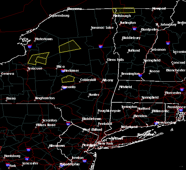 At 314 pm edt, a severe thunderstorm was located near cooperstown, moving east at 30 mph (radar indicated). Hazards include 60 mph wind gusts and quarter size hail. Minor hail damage to vehicles is possible. expect wind to cause damage to trees, and power lines. this severe storm will be near, bowerstown around 320 pm edt. Springfield and cherry valley around 330 pm edt. At 314 pm edt, a severe thunderstorm was located near cooperstown, moving east at 30 mph (radar indicated). Hazards include 60 mph wind gusts and quarter size hail. Minor hail damage to vehicles is possible. expect wind to cause damage to trees, and power lines. this severe storm will be near, bowerstown around 320 pm edt. Springfield and cherry valley around 330 pm edt.
|
| 8/12/2017 2:54 PM EDT |
 At 254 pm edt, a severe thunderstorm was located near edmeston, or 12 miles west of cooperstown, moving east at 30 mph (radar indicated). Hazards include 60 mph wind gusts and quarter size hail. Minor hail damage to vehicles is possible. expect wind to cause damage to trees, and power lines. this severe thunderstorm will be near, exeter center around 305 pm edt. cooperstown and richfield springs around 315 pm edt. Springfield and cherry valley around 330 pm edt. At 254 pm edt, a severe thunderstorm was located near edmeston, or 12 miles west of cooperstown, moving east at 30 mph (radar indicated). Hazards include 60 mph wind gusts and quarter size hail. Minor hail damage to vehicles is possible. expect wind to cause damage to trees, and power lines. this severe thunderstorm will be near, exeter center around 305 pm edt. cooperstown and richfield springs around 315 pm edt. Springfield and cherry valley around 330 pm edt.
|
| 7/24/2017 8:02 PM EDT |
 A severe thunderstorm warning remains in effect until 830 pm edt for otsego county. at 802 pm edt, severe thunderstorms were located along a line extending from near exeter center to near milford to gilbertsville, moving east at 25 mph. hazard. 60 mph wind gusts and nickel size hail. A severe thunderstorm warning remains in effect until 830 pm edt for otsego county. at 802 pm edt, severe thunderstorms were located along a line extending from near exeter center to near milford to gilbertsville, moving east at 25 mph. hazard. 60 mph wind gusts and nickel size hail.
|
| 7/24/2017 7:30 PM EDT |
 At 730 pm edt, severe thunderstorms were located along a line extending from leonardsville to new berlin to 6 miles east of mc donough, moving east at 20 mph (radar indicated). Hazards include 60 mph wind gusts and nickel size hail. Expect damage to trees, and power lines. severe thunderstorms will be near, edmeston, pittsfield and new berlin around 735 pm edt. morris around 745 pm edt. exeter center around 750 pm edt. hartwick, laurens and west end around 805 pm edt. oneonta and mt upton around 810 pm edt. cooperstown and hyde park around 815 pm edt. milford, gilbertsville and bowerstown around 820 pm edt. Cooperstown jct around 825 pm edt. At 730 pm edt, severe thunderstorms were located along a line extending from leonardsville to new berlin to 6 miles east of mc donough, moving east at 20 mph (radar indicated). Hazards include 60 mph wind gusts and nickel size hail. Expect damage to trees, and power lines. severe thunderstorms will be near, edmeston, pittsfield and new berlin around 735 pm edt. morris around 745 pm edt. exeter center around 750 pm edt. hartwick, laurens and west end around 805 pm edt. oneonta and mt upton around 810 pm edt. cooperstown and hyde park around 815 pm edt. milford, gilbertsville and bowerstown around 820 pm edt. Cooperstown jct around 825 pm edt.
|
| 6/5/2017 2:19 PM EDT |
 At 219 pm edt, a severe thunderstorm was located near summit, or 10 miles southwest of cobleskill, moving east at 45 mph (radar indicated). Hazards include 60 mph wind gusts. Expect damage to roofs, siding, and trees. This severe thunderstorm will remain over mainly rural areas of southeastern otsego and northeastern delaware counties. At 219 pm edt, a severe thunderstorm was located near summit, or 10 miles southwest of cobleskill, moving east at 45 mph (radar indicated). Hazards include 60 mph wind gusts. Expect damage to roofs, siding, and trees. This severe thunderstorm will remain over mainly rural areas of southeastern otsego and northeastern delaware counties.
|
| 6/5/2017 1:52 PM EDT |
 At 152 pm edt, a severe thunderstorm was located over hartwick, or 7 miles southwest of cooperstown, moving east at 40 mph (radar indicated). Hazards include 60 mph wind gusts. Expect damage to roofs, siding, and trees. this severe thunderstorm will be near, cooperstown, hyde park and milford around 200 pm edt. middlefield and maryland around 205 pm edt. elk creek and schenevus around 210 pm edt. Worcester around 215 pm edt. At 152 pm edt, a severe thunderstorm was located over hartwick, or 7 miles southwest of cooperstown, moving east at 40 mph (radar indicated). Hazards include 60 mph wind gusts. Expect damage to roofs, siding, and trees. this severe thunderstorm will be near, cooperstown, hyde park and milford around 200 pm edt. middlefield and maryland around 205 pm edt. elk creek and schenevus around 210 pm edt. Worcester around 215 pm edt.
|
| 5/18/2017 6:41 PM EDT | Trees and wires down in herkimer county NY, 8 miles SSE of Cherry Valley, NY |
| 5/18/2017 6:12 PM EDT |
 At 612 pm edt, severe thunderstorms were located along a line extending from near peterboro to near augusta to near brookfield to near poolville to near smyrna, moving east at 50 mph (radar indicated). Hazards include golf ball size hail and 70 mph wind gusts. People and animals outdoors will be injured. expect hail damage to roofs, siding, windows, and vehicles. expect considerable tree damage. wind damage is also likely to mobile homes, roofs, and outbuildings. severe thunderstorms will be near, brookfield around 615 pm edt. waterville, bridgewater and south brookfield around 620 pm edt. columbus, clayville and unadilla forks around 625 pm edt. clinton and new berlin around 630 pm edt. edmeston, pittsfield and exeter center around 635 pm edt. richfield springs around 640 pm edt. hartwick and springfield around 645 pm edt. Milford around 650 pm edt. At 612 pm edt, severe thunderstorms were located along a line extending from near peterboro to near augusta to near brookfield to near poolville to near smyrna, moving east at 50 mph (radar indicated). Hazards include golf ball size hail and 70 mph wind gusts. People and animals outdoors will be injured. expect hail damage to roofs, siding, windows, and vehicles. expect considerable tree damage. wind damage is also likely to mobile homes, roofs, and outbuildings. severe thunderstorms will be near, brookfield around 615 pm edt. waterville, bridgewater and south brookfield around 620 pm edt. columbus, clayville and unadilla forks around 625 pm edt. clinton and new berlin around 630 pm edt. edmeston, pittsfield and exeter center around 635 pm edt. richfield springs around 640 pm edt. hartwick and springfield around 645 pm edt. Milford around 650 pm edt.
|
| 5/1/2017 8:39 PM EDT |
 At 839 pm edt, severe thunderstorms were located along a line extending from near little falls to walton, moving east at 60 mph (radar indicated). Hazards include 70 mph wind gusts. Expect considerable tree damage. damage is likely to mobile homes, roofs, and outbuildings. severe thunderstorms will be near, andes and bovina center around 855 pm edt. margaretville and arkville around 905 pm edt. Fleischmanns around 910 pm edt. At 839 pm edt, severe thunderstorms were located along a line extending from near little falls to walton, moving east at 60 mph (radar indicated). Hazards include 70 mph wind gusts. Expect considerable tree damage. damage is likely to mobile homes, roofs, and outbuildings. severe thunderstorms will be near, andes and bovina center around 855 pm edt. margaretville and arkville around 905 pm edt. Fleischmanns around 910 pm edt.
|
| 3/1/2017 10:09 PM EST |
 At 1008 pm est, a severe thunderstorm was located near hartwick, or 10 miles southwest of cooperstown, moving east at 55 mph (radar indicated). Hazards include 60 mph wind gusts. Expect damage to roofs, siding, and trees. this severe thunderstorm will be near, hyde park and milford around 1015 pm est. cooperstown, bowerstown and elk creek around 1020 pm est. worcester and middlefield around 1025 pm est. Cherry valley around 1030 pm est. At 1008 pm est, a severe thunderstorm was located near hartwick, or 10 miles southwest of cooperstown, moving east at 55 mph (radar indicated). Hazards include 60 mph wind gusts. Expect damage to roofs, siding, and trees. this severe thunderstorm will be near, hyde park and milford around 1015 pm est. cooperstown, bowerstown and elk creek around 1020 pm est. worcester and middlefield around 1025 pm est. Cherry valley around 1030 pm est.
|
| 8/13/2016 6:17 PM EDT |
 At 617 pm edt, a severe thunderstorm was located near springfield, or near cooperstown, moving northeast at 45 mph (radar indicated). Hazards include 70 mph wind gusts. Expect considerable tree damage. damage is likely to mobile homes, roofs, and outbuildings. this severe storm will be near, springfield around 620 pm edt. Cherry valley around 625 pm edt. At 617 pm edt, a severe thunderstorm was located near springfield, or near cooperstown, moving northeast at 45 mph (radar indicated). Hazards include 70 mph wind gusts. Expect considerable tree damage. damage is likely to mobile homes, roofs, and outbuildings. this severe storm will be near, springfield around 620 pm edt. Cherry valley around 625 pm edt.
|
| 8/13/2016 5:56 PM EDT |
 At 555 pm edt, a severe thunderstorm was located near edmeston, or 13 miles west of cooperstown, moving east at 45 mph (radar indicated). Hazards include 70 mph wind gusts. Expect considerable tree damage. damage is likely to mobile homes, roofs, and outbuildings. this severe thunderstorm will be near, hartwick and exeter center around 605 pm edt. hyde park around 610 pm edt. cooperstown and bowerstown around 615 pm edt. middlefield around 620 pm edt. springfield around 625 pm edt. Cherry valley around 630 pm edt. At 555 pm edt, a severe thunderstorm was located near edmeston, or 13 miles west of cooperstown, moving east at 45 mph (radar indicated). Hazards include 70 mph wind gusts. Expect considerable tree damage. damage is likely to mobile homes, roofs, and outbuildings. this severe thunderstorm will be near, hartwick and exeter center around 605 pm edt. hyde park around 610 pm edt. cooperstown and bowerstown around 615 pm edt. middlefield around 620 pm edt. springfield around 625 pm edt. Cherry valley around 630 pm edt.
|
| 7/1/2016 3:53 PM EDT |
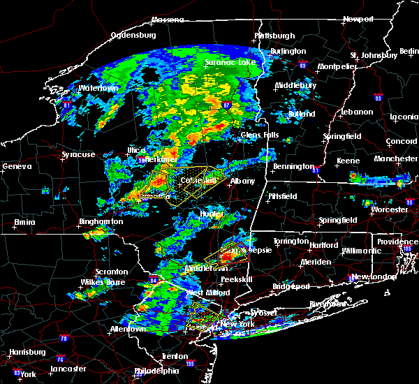 At 353 pm edt, severe thunderstorms were located along a line extending from near fort plain to near cherry valley to near elk creek, moving east at 25 mph (radar indicated). Hazards include 60 mph wind gusts. Expect damage to roofs. siding. and trees. these severe thunderstorms will remain over mainly rural areas of northeastern otsego county. A tornado watch remains in effect until 1000 pm edt for central new york. At 353 pm edt, severe thunderstorms were located along a line extending from near fort plain to near cherry valley to near elk creek, moving east at 25 mph (radar indicated). Hazards include 60 mph wind gusts. Expect damage to roofs. siding. and trees. these severe thunderstorms will remain over mainly rural areas of northeastern otsego county. A tornado watch remains in effect until 1000 pm edt for central new york.
|
| 7/1/2016 3:45 PM EDT | Trees down in otsego county NY, 0.1 miles WSW of Cherry Valley, NY |
| 7/1/2016 3:33 PM EDT |
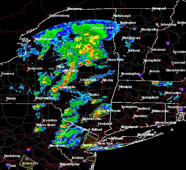 At 333 pm edt, severe thunderstorms were located along a line extending from near springfield to middlefield to near laurens, moving east at 20 mph (radar indicated). Hazards include 60 mph wind gusts. Expect damage to roofs. siding. and trees. severe thunderstorms will be near, middlefield and cherry valley around 340 pm edt. elk creek around 405 pm edt. schenevus around 410 pm edt. worcester around 415 pm edt. A tornado watch remains in effect until 1000 pm edt for central new york. At 333 pm edt, severe thunderstorms were located along a line extending from near springfield to middlefield to near laurens, moving east at 20 mph (radar indicated). Hazards include 60 mph wind gusts. Expect damage to roofs. siding. and trees. severe thunderstorms will be near, middlefield and cherry valley around 340 pm edt. elk creek around 405 pm edt. schenevus around 410 pm edt. worcester around 415 pm edt. A tornado watch remains in effect until 1000 pm edt for central new york.
|
| 6/12/2015 7:07 PM EDT |
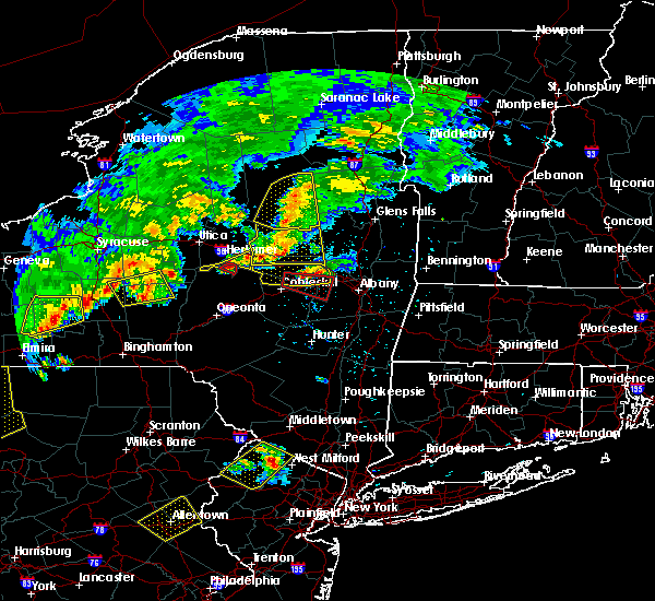 At 707 pm edt, a severe thunderstorm was located over springfield, or 12 miles northeast of cooperstown, moving east at 50 mph (radar indicated). Hazards include 70 mph wind gusts and quarter size hail. Hail damage to vehicles is expected. expect considerable tree damage. wind damage is also likely to mobile homes, roofs and outbuildings. this severe thunderstorm will be near, cherry valley around 710 pm edt. A tornado watch remains in effect until 1100 pm edt for central new york. At 707 pm edt, a severe thunderstorm was located over springfield, or 12 miles northeast of cooperstown, moving east at 50 mph (radar indicated). Hazards include 70 mph wind gusts and quarter size hail. Hail damage to vehicles is expected. expect considerable tree damage. wind damage is also likely to mobile homes, roofs and outbuildings. this severe thunderstorm will be near, cherry valley around 710 pm edt. A tornado watch remains in effect until 1100 pm edt for central new york.
|
| 6/12/2015 6:08 PM EDT |
 At 608 pm edt, a severe thunderstorm was located over cherry valley, or 10 miles northeast of cooperstown, moving east at 40 mph (radar indicated). Hazards include 60 mph wind gusts. Expect damage to roofs. siding and trees. this severe thunderstorm will remain over mainly rural areas of northeastern otsego county. A tornado watch remains in effect until 1100 pm edt for central new york. At 608 pm edt, a severe thunderstorm was located over cherry valley, or 10 miles northeast of cooperstown, moving east at 40 mph (radar indicated). Hazards include 60 mph wind gusts. Expect damage to roofs. siding and trees. this severe thunderstorm will remain over mainly rural areas of northeastern otsego county. A tornado watch remains in effect until 1100 pm edt for central new york.
|
| 6/12/2015 6:03 PM EDT |
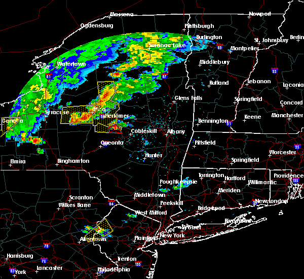 At 602 pm edt, a severe thunderstorm capable of producing a tornado was located near springfield, or 8 miles northeast of cooperstown, moving east at 30 mph (radar indicated rotation). Hazards include tornado and quarter size hail. Flying debris will be dangerous to those caught without shelter. mobile homes will be damaged or destroyed. damage to roofs, windows and vehicles will occur. tree damage is likely. This dangerous storm will be near, cherry valley around 610 pm edt. At 602 pm edt, a severe thunderstorm capable of producing a tornado was located near springfield, or 8 miles northeast of cooperstown, moving east at 30 mph (radar indicated rotation). Hazards include tornado and quarter size hail. Flying debris will be dangerous to those caught without shelter. mobile homes will be damaged or destroyed. damage to roofs, windows and vehicles will occur. tree damage is likely. This dangerous storm will be near, cherry valley around 610 pm edt.
|
| 6/12/2015 5:40 PM EDT |
 At 540 pm edt, a severe thunderstorm capable of producing a tornado was located over exeter center, or 8 miles northwest of cooperstown, moving east at 20 mph (radar indicated rotation). Hazards include tornado and quarter size hail. Flying debris will be dangerous to those caught without shelter. mobile homes will be damaged or destroyed. damage to roofs, windows and vehicles will occur. tree damage is likely. this dangerous storm will be near, richfield springs around 550 pm edt. springfield around 610 pm edt. Cherry valley around 620 pm edt. At 540 pm edt, a severe thunderstorm capable of producing a tornado was located over exeter center, or 8 miles northwest of cooperstown, moving east at 20 mph (radar indicated rotation). Hazards include tornado and quarter size hail. Flying debris will be dangerous to those caught without shelter. mobile homes will be damaged or destroyed. damage to roofs, windows and vehicles will occur. tree damage is likely. this dangerous storm will be near, richfield springs around 550 pm edt. springfield around 610 pm edt. Cherry valley around 620 pm edt.
|
| 6/12/2015 5:29 PM EDT |
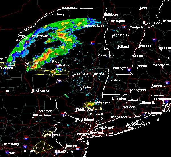 The national weather service in binghamton has issued a * severe thunderstorm warning for. northeastern otsego county in central new york. until 630 pm edt * at 528 pm edt. a severe thunderstorm was located over exeter center. or 9 miles northwest of cooperstown. Moving east at 45. The national weather service in binghamton has issued a * severe thunderstorm warning for. northeastern otsego county in central new york. until 630 pm edt * at 528 pm edt. a severe thunderstorm was located over exeter center. or 9 miles northwest of cooperstown. Moving east at 45.
|
| 8/9/2012 5:50 PM EDT | Trees dow in otsego county NY, 0.1 miles WSW of Cherry Valley, NY |
| 1/1/0001 12:00 AM | Numersous trees down on ziefle road in otsego county NY, 5 miles NNE of Cherry Valley, NY |
| 1/1/0001 12:00 AM | Quarter sized hail reported 0.1 miles WSW of Cherry Valley, NY |
| 1/1/0001 12:00 AM | Quarter sized hail reported 0.1 miles WSW of Cherry Valley, NY |
| 1/1/0001 12:00 AM | Tree down in otsego county NY, 5.4 miles ESE of Cherry Valley, NY |
| 1/1/0001 12:00 AM | Golf Ball sized hail reported 1 miles E of Cherry Valley, NY |
Hail Maps for Cherry Valley, NY


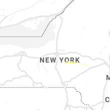


Connect with Interactive Hail Maps