

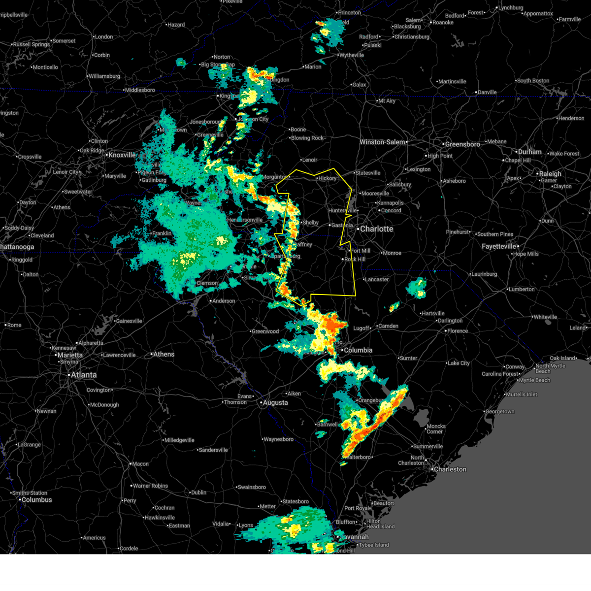
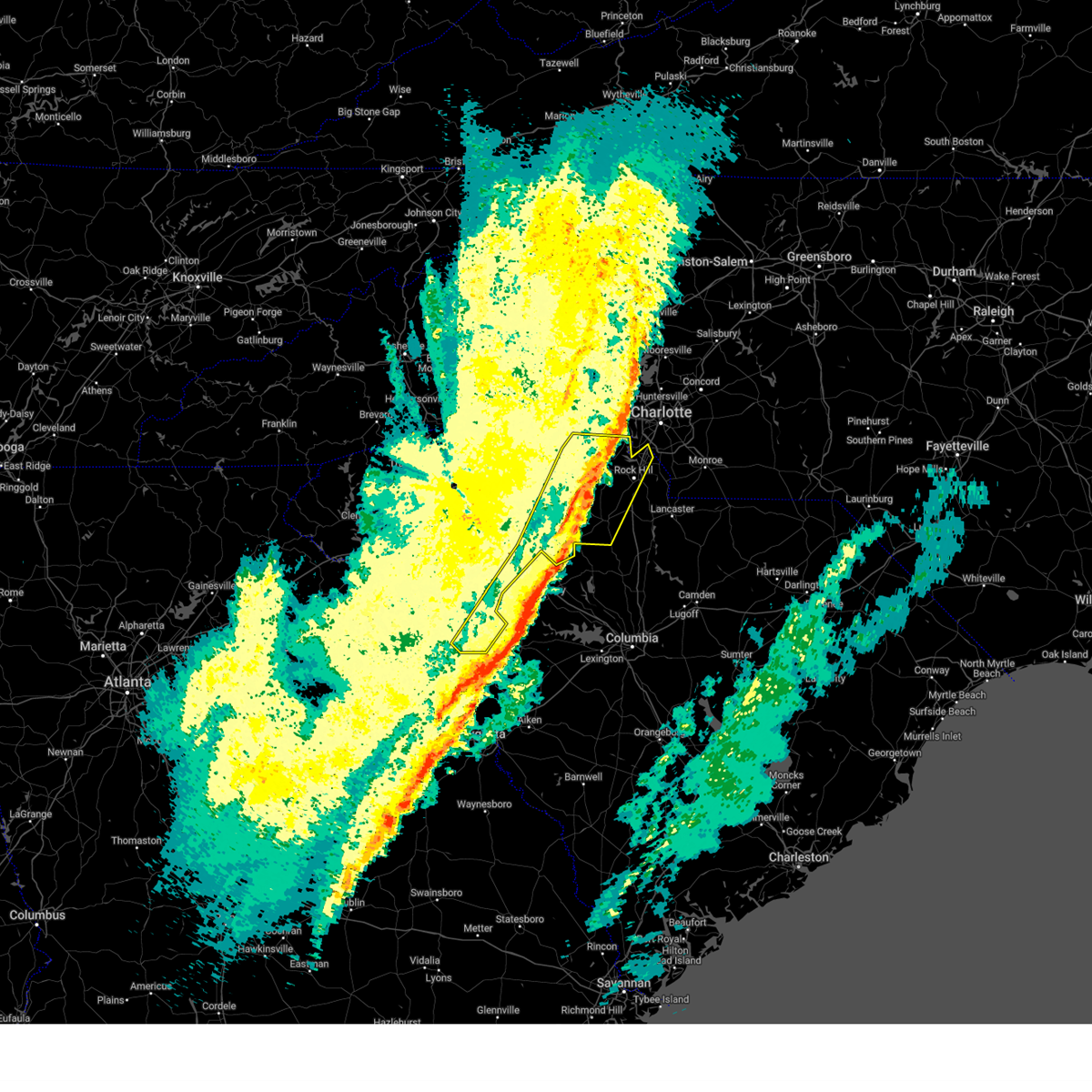
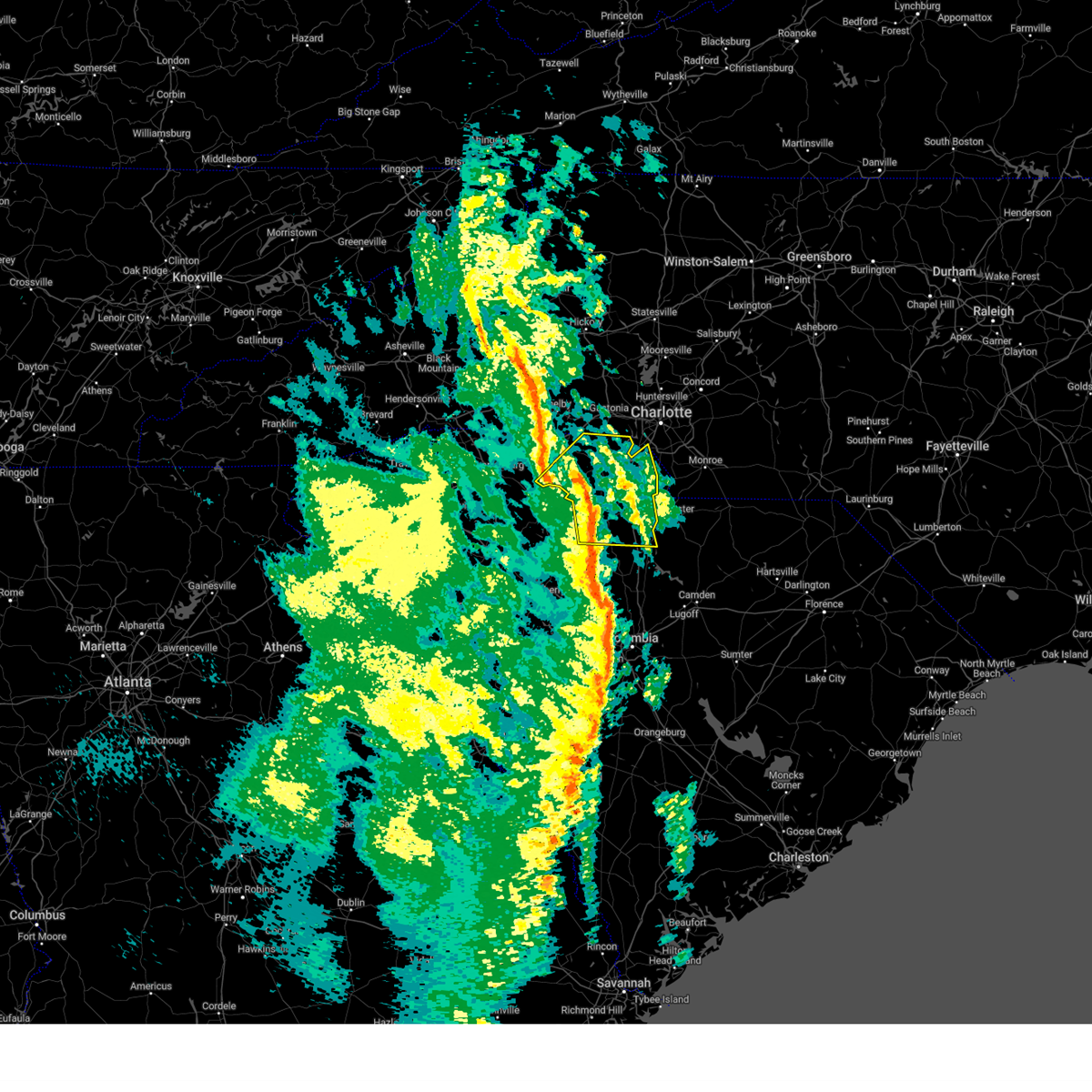
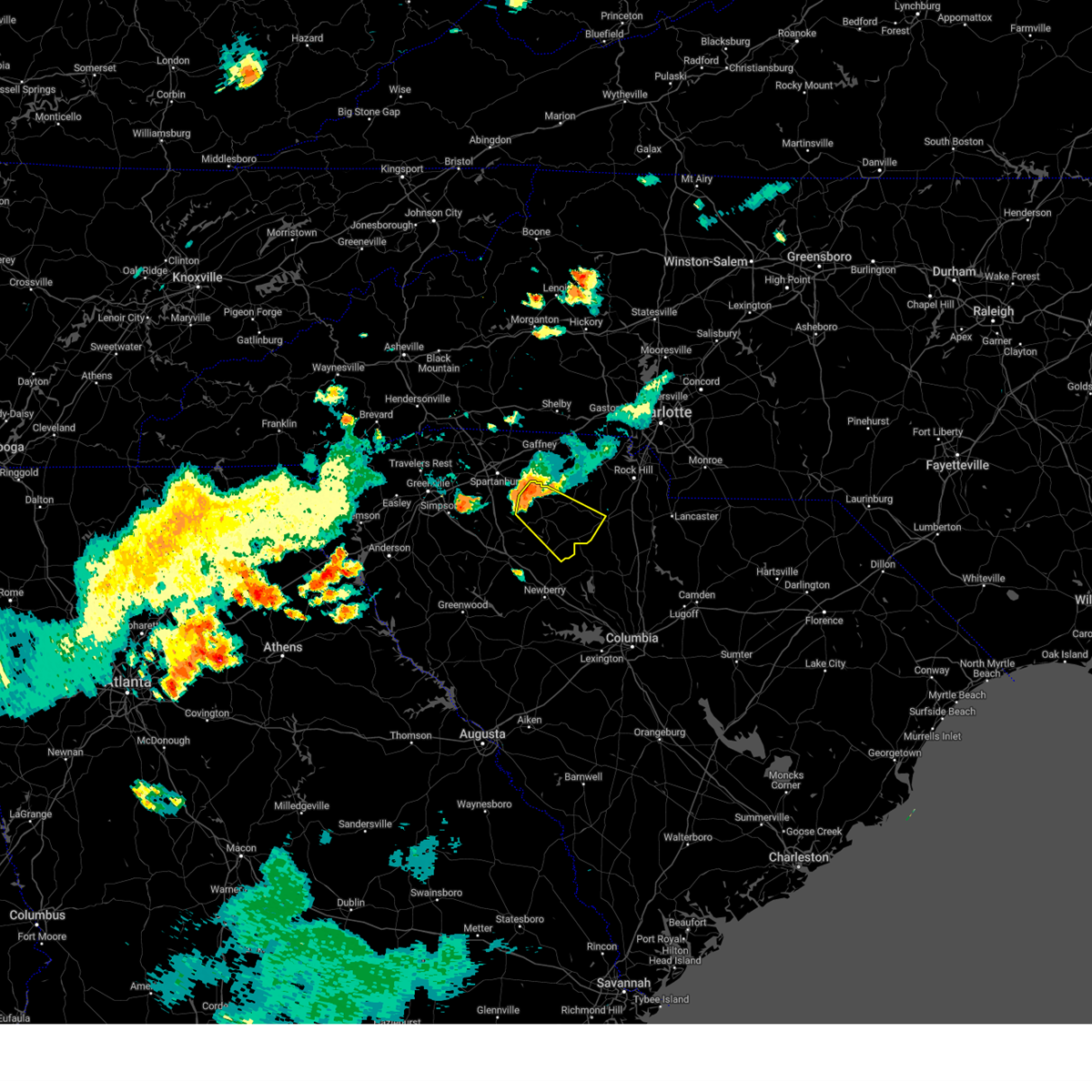
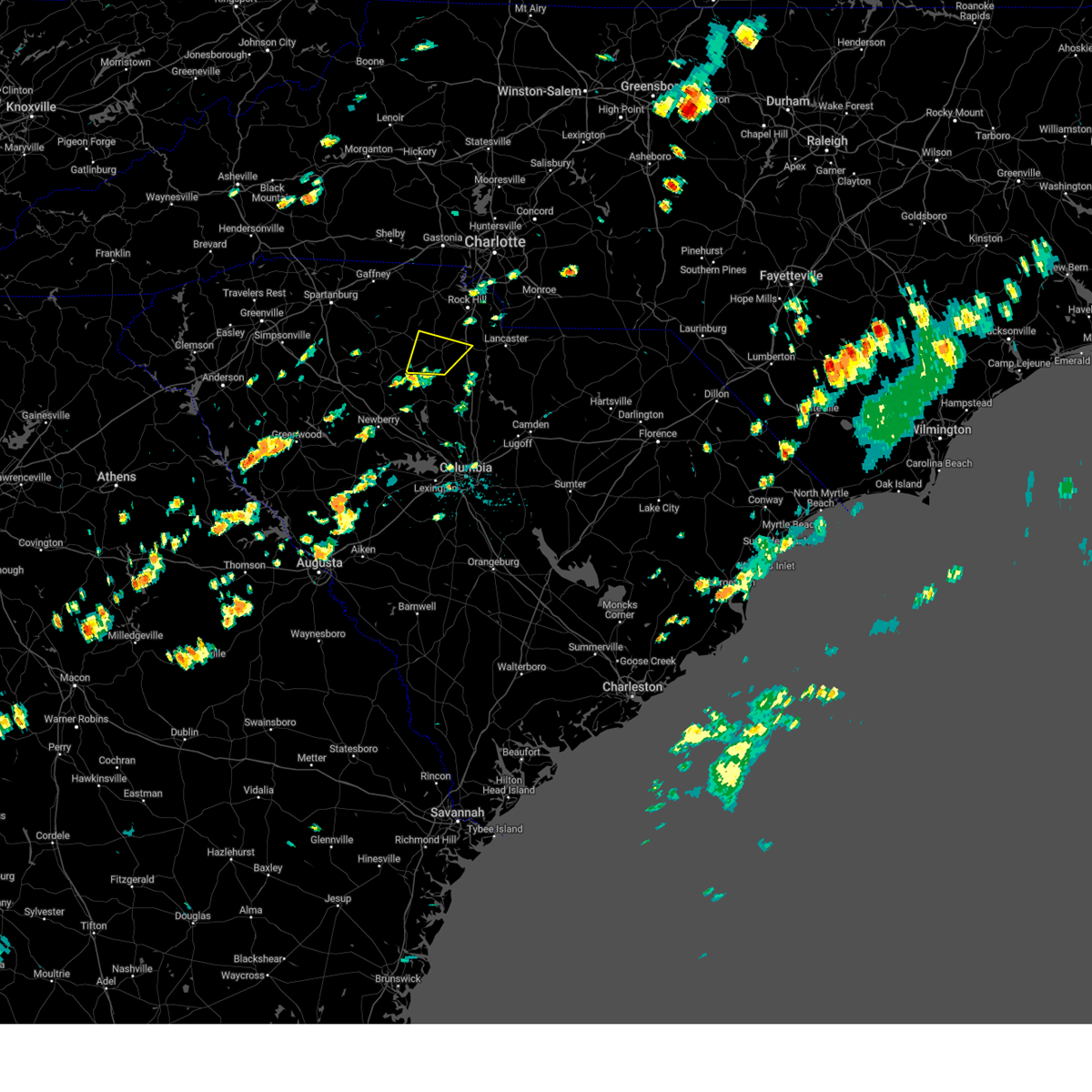
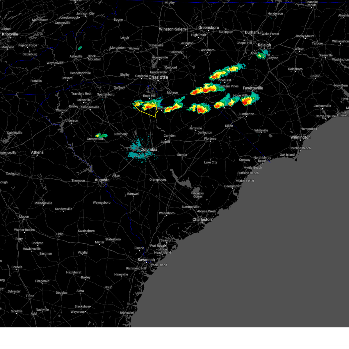
Hail Map for Chester, SC
The Chester, SC area has had 13 reports of on-the-ground hail by trained spotters, and has been under severe weather warnings 10 times during the past 12 months. Doppler radar has detected hail at or near Chester, SC on 40 occasions, including 1 occasion during the past year.
| Name: | Chester, SC |
| Where Located: | 41.3 miles SSW of Charlotte, NC |
| Map: | Google Map for Chester, SC |
| Population: | 5607 |
| Housing Units: | 2596 |
| More Info: | Search Google for Chester, SC |
0
The Top Recent Hail Date for Chester, SC is Tuesday, July 29, 2025 (40th out of 40)

Hail and Wind Damage Spotted near Chester, SC
| Date / Time | Report Details |
|---|---|
| 6/1/2026 6:17 PM EDT |
 At 617 pm edt, a severe thunderstorm was located over chester, moving southeast at 25 mph (radar indicated). Hazards include 60 mph wind gusts and quarter size hail. Minor hail damage to vehicles is expected. expect wind damage to trees and power lines. Locations impacted include, chester, richburg, lowrys, chester state park, and edgemoor. At 617 pm edt, a severe thunderstorm was located over chester, moving southeast at 25 mph (radar indicated). Hazards include 60 mph wind gusts and quarter size hail. Minor hail damage to vehicles is expected. expect wind damage to trees and power lines. Locations impacted include, chester, richburg, lowrys, chester state park, and edgemoor.
|
| 6/1/2026 5:56 PM EDT |
 Svrgsp the national weather service in greenville-spartanburg has issued a * severe thunderstorm warning for, northwestern chester county in upstate south carolina, south central york county in upstate south carolina, * until 645 pm edt. * at 555 pm edt, a severe thunderstorm was located 9 miles north of chester, or near mcconnells, moving southeast at 30 mph (radar indicated). Hazards include 60 mph wind gusts and quarter size hail. Minor hail damage to vehicles is expected. Expect wind damage to trees and power lines. Svrgsp the national weather service in greenville-spartanburg has issued a * severe thunderstorm warning for, northwestern chester county in upstate south carolina, south central york county in upstate south carolina, * until 645 pm edt. * at 555 pm edt, a severe thunderstorm was located 9 miles north of chester, or near mcconnells, moving southeast at 30 mph (radar indicated). Hazards include 60 mph wind gusts and quarter size hail. Minor hail damage to vehicles is expected. Expect wind damage to trees and power lines.
|
| 3/16/2026 9:50 AM EDT | Power outages and utility line damage along hopewell church r in chester county SC, 8.6 miles NNW of Chester, SC |
| 3/16/2026 9:32 AM EDT |
 At 932 am edt, severe thunderstorms were located along a line extending from 6 miles west of uptown charlotte to 5 miles northeast of rock hill to 4 miles northeast of chester, moving east at 50 mph (radar indicated). Hazards include 60 mph wind gusts. Expect damage to trees and power lines. Locations impacted include, rock hill, york, chester, fort mill, tega cay, newport, lesslie, great falls, fort lawn, and lockhart. At 932 am edt, severe thunderstorms were located along a line extending from 6 miles west of uptown charlotte to 5 miles northeast of rock hill to 4 miles northeast of chester, moving east at 50 mph (radar indicated). Hazards include 60 mph wind gusts. Expect damage to trees and power lines. Locations impacted include, rock hill, york, chester, fort mill, tega cay, newport, lesslie, great falls, fort lawn, and lockhart.
|
| 3/16/2026 8:41 AM EDT |
 Svrgsp the national weather service in greenville-spartanburg has issued a * severe thunderstorm warning for, chester county in upstate south carolina, york county in upstate south carolina, * until 1000 am edt. * at 841 am edt, severe thunderstorms were located along a line extending from 7 miles south of shelby to 6 miles southeast of gaffney to 8 miles west of union, moving east at 50 mph (radar indicated). Hazards include 60 mph wind gusts. expect damage to trees and power lines Svrgsp the national weather service in greenville-spartanburg has issued a * severe thunderstorm warning for, chester county in upstate south carolina, york county in upstate south carolina, * until 1000 am edt. * at 841 am edt, severe thunderstorms were located along a line extending from 7 miles south of shelby to 6 miles southeast of gaffney to 8 miles west of union, moving east at 50 mph (radar indicated). Hazards include 60 mph wind gusts. expect damage to trees and power lines
|
| 3/12/2026 9:51 AM EDT |
 The storms which prompted the warning have weakened below severe limits, and no longer pose an immediate threat to life or property. therefore, the warning will be allowed to expire. however, gusty winds are still possible with these thunderstorms. a tornado watch remains in effect until 100 pm edt for upstate south carolina. to report severe weather to the national weather service greenville-spartanburg, call toll free, 1, 800, 2 6 7, 8 1 0 1, or post on our facebook page, or post it to x using hashtag nwsgsp. your message should describe the event and the specific location where it occurred. The storms which prompted the warning have weakened below severe limits, and no longer pose an immediate threat to life or property. therefore, the warning will be allowed to expire. however, gusty winds are still possible with these thunderstorms. a tornado watch remains in effect until 100 pm edt for upstate south carolina. to report severe weather to the national weather service greenville-spartanburg, call toll free, 1, 800, 2 6 7, 8 1 0 1, or post on our facebook page, or post it to x using hashtag nwsgsp. your message should describe the event and the specific location where it occurred.
|
| 3/12/2026 9:27 AM EDT |
 the severe thunderstorm warning has been cancelled and is no longer in effect the severe thunderstorm warning has been cancelled and is no longer in effect
|
| 3/12/2026 9:27 AM EDT |
 At 926 am edt, severe thunderstorms were located along a line extending from 4 miles southwest of york to 8 miles southwest of chester, moving northeast at 45 mph (radar indicated). Hazards include 60 mph wind gusts. Expect damage to trees and power lines. Locations impacted include, rock hill, york, chester, fort mill, tega cay, newport, lesslie, mcconnells, richburg, and lowrys. At 926 am edt, severe thunderstorms were located along a line extending from 4 miles southwest of york to 8 miles southwest of chester, moving northeast at 45 mph (radar indicated). Hazards include 60 mph wind gusts. Expect damage to trees and power lines. Locations impacted include, rock hill, york, chester, fort mill, tega cay, newport, lesslie, mcconnells, richburg, and lowrys.
|
| 3/12/2026 9:08 AM EDT |
 Svrgsp the national weather service in greenville-spartanburg has issued a * severe thunderstorm warning for, chester county in upstate south carolina, york county in upstate south carolina, eastern union county in upstate south carolina, * until 1000 am edt. * at 908 am edt, severe thunderstorms were located along a line extending from 11 miles northeast of union to 17 miles north of newberry, moving northeast at 45 mph (radar indicated). Hazards include 60 mph wind gusts. expect damage to trees and power lines Svrgsp the national weather service in greenville-spartanburg has issued a * severe thunderstorm warning for, chester county in upstate south carolina, york county in upstate south carolina, eastern union county in upstate south carolina, * until 1000 am edt. * at 908 am edt, severe thunderstorms were located along a line extending from 11 miles northeast of union to 17 miles north of newberry, moving northeast at 45 mph (radar indicated). Hazards include 60 mph wind gusts. expect damage to trees and power lines
|
| 9/6/2025 7:28 PM EDT |
 the severe thunderstorm warning has been cancelled and is no longer in effect the severe thunderstorm warning has been cancelled and is no longer in effect
|
| 9/6/2025 7:13 PM EDT | Tree down in roadway on center r in chester county SC, 11.6 miles SE of Chester, SC |
| 9/6/2025 7:00 PM EDT |
 Svrgsp the national weather service in greenville-spartanburg has issued a * severe thunderstorm warning for, northern chester county in upstate south carolina, southwestern york county in upstate south carolina, northeastern union county in upstate south carolina, * until 800 pm edt. * at 659 pm edt, a severe thunderstorm was located 9 miles east of union, or near lockhart, moving east at 30 mph (radar indicated). Hazards include 60 mph wind gusts. expect damage to trees and power lines Svrgsp the national weather service in greenville-spartanburg has issued a * severe thunderstorm warning for, northern chester county in upstate south carolina, southwestern york county in upstate south carolina, northeastern union county in upstate south carolina, * until 800 pm edt. * at 659 pm edt, a severe thunderstorm was located 9 miles east of union, or near lockhart, moving east at 30 mph (radar indicated). Hazards include 60 mph wind gusts. expect damage to trees and power lines
|
| 6/25/2025 8:01 PM EDT |
 the severe thunderstorm warning has been cancelled and is no longer in effect the severe thunderstorm warning has been cancelled and is no longer in effect
|
| 6/25/2025 7:20 PM EDT | Outages near old richburg rd due to fallen trees and/or utility line in chester county SC, 8 miles W of Chester, SC |
| 6/25/2025 7:12 PM EDT |
 Svrgsp the national weather service in greenville-spartanburg has issued a * severe thunderstorm warning for, southwestern mecklenburg county in the piedmont of north carolina, southeastern gaston county in the piedmont of north carolina, eastern chester county in upstate south carolina, eastern york county in upstate south carolina, * until 815 pm edt. * at 712 pm edt, a severe thunderstorm was located near rock hill, moving south at 15 mph (radar indicated). Hazards include ping pong ball size hail and 60 mph wind gusts. People and animals outdoors will be injured. expect hail damage to roofs, siding, windows, and vehicles. Expect wind damage to trees and power lines. Svrgsp the national weather service in greenville-spartanburg has issued a * severe thunderstorm warning for, southwestern mecklenburg county in the piedmont of north carolina, southeastern gaston county in the piedmont of north carolina, eastern chester county in upstate south carolina, eastern york county in upstate south carolina, * until 815 pm edt. * at 712 pm edt, a severe thunderstorm was located near rock hill, moving south at 15 mph (radar indicated). Hazards include ping pong ball size hail and 60 mph wind gusts. People and animals outdoors will be injured. expect hail damage to roofs, siding, windows, and vehicles. Expect wind damage to trees and power lines.
|
| 6/25/2025 6:28 PM EDT |
 Svrgsp the national weather service in greenville-spartanburg has issued a * severe thunderstorm warning for, south central chester county in upstate south carolina, * until 730 pm edt. * at 628 pm edt, a severe thunderstorm was located 4 miles southeast of chester, or 4 miles southeast of chester state park, moving south at 5 mph (radar indicated). Hazards include 60 mph wind gusts and quarter size hail. Minor hail damage to vehicles is expected. Expect wind damage to trees and power lines. Svrgsp the national weather service in greenville-spartanburg has issued a * severe thunderstorm warning for, south central chester county in upstate south carolina, * until 730 pm edt. * at 628 pm edt, a severe thunderstorm was located 4 miles southeast of chester, or 4 miles southeast of chester state park, moving south at 5 mph (radar indicated). Hazards include 60 mph wind gusts and quarter size hail. Minor hail damage to vehicles is expected. Expect wind damage to trees and power lines.
|
| 6/17/2025 10:36 PM EDT |
 The storms which prompted the warning have weakened below severe limits, and no longer pose an immediate threat to life or property. therefore, the warning will be allowed to expire. however, gusty winds are still possible with these thunderstorms. The storms which prompted the warning have weakened below severe limits, and no longer pose an immediate threat to life or property. therefore, the warning will be allowed to expire. however, gusty winds are still possible with these thunderstorms.
|
| 6/17/2025 10:24 PM EDT |
 the severe thunderstorm warning has been cancelled and is no longer in effect the severe thunderstorm warning has been cancelled and is no longer in effect
|
| 6/17/2025 10:24 PM EDT |
 At 1024 pm edt, severe thunderstorms were located along a line extending from 7 miles east of morganton to 6 miles southwest of newton to 8 miles southwest of gastonia to near chester, moving northeast at 45 mph (radar indicated). Hazards include 60 mph wind gusts. Expect damage to trees and power lines. locations impacted include, gastonia, rock hill, hickory, morganton, newton, lincolnton, york, chester, mt holly, and st. Stephens. At 1024 pm edt, severe thunderstorms were located along a line extending from 7 miles east of morganton to 6 miles southwest of newton to 8 miles southwest of gastonia to near chester, moving northeast at 45 mph (radar indicated). Hazards include 60 mph wind gusts. Expect damage to trees and power lines. locations impacted include, gastonia, rock hill, hickory, morganton, newton, lincolnton, york, chester, mt holly, and st. Stephens.
|
| 6/17/2025 10:18 PM EDT |
 At 1018 pm edt, severe thunderstorms were located along a line extending from 4 miles southeast of morganton to 9 miles northwest of lincolnton to 9 miles northwest of york to 5 miles west of chester, moving east at 50 mph (radar indicated). Hazards include 60 mph wind gusts. Expect damage to trees and power lines. Locations impacted include, gastonia, rock hill, hickory, shelby, morganton, newton, gaffney, lincolnton, union, and york. At 1018 pm edt, severe thunderstorms were located along a line extending from 4 miles southeast of morganton to 9 miles northwest of lincolnton to 9 miles northwest of york to 5 miles west of chester, moving east at 50 mph (radar indicated). Hazards include 60 mph wind gusts. Expect damage to trees and power lines. Locations impacted include, gastonia, rock hill, hickory, shelby, morganton, newton, gaffney, lincolnton, union, and york.
|
| 6/17/2025 10:02 PM EDT |
 the severe thunderstorm warning has been cancelled and is no longer in effect the severe thunderstorm warning has been cancelled and is no longer in effect
|
| 6/17/2025 10:02 PM EDT |
 At 1002 pm edt, severe thunderstorms were located along a line extending from 9 miles southwest of morganton to 14 miles north of shelby to 11 miles east of gaffney to 11 miles southeast of union, moving east at 50 mph (radar indicated). Hazards include 60 mph wind gusts. Expect damage to trees and power lines. Locations impacted include, gastonia, rock hill, hickory, shelby, morganton, newton, gaffney, lincolnton, union, and york. At 1002 pm edt, severe thunderstorms were located along a line extending from 9 miles southwest of morganton to 14 miles north of shelby to 11 miles east of gaffney to 11 miles southeast of union, moving east at 50 mph (radar indicated). Hazards include 60 mph wind gusts. Expect damage to trees and power lines. Locations impacted include, gastonia, rock hill, hickory, shelby, morganton, newton, gaffney, lincolnton, union, and york.
|
| 6/17/2025 9:43 PM EDT |
 Svrgsp the national weather service in greenville-spartanburg has issued a * severe thunderstorm warning for, catawba county in the piedmont of north carolina, rutherford county in western north carolina, lincoln county in the piedmont of north carolina, gaston county in the piedmont of north carolina, southeastern mcdowell county in western north carolina, cleveland county in the piedmont of north carolina, southern burke county in western north carolina, southeastern laurens county in upstate south carolina, union county in upstate south carolina, chester county in upstate south carolina, york county in upstate south carolina, eastern spartanburg county in upstate south carolina, cherokee county in upstate south carolina, * until 1045 pm edt. * at 943 pm edt, severe thunderstorms were located along a line extending from 10 miles north of rutherfordton to 10 miles east of forest city to 9 miles south of gaffney to 13 miles south of union, moving northeast at 50 mph (radar indicated). Hazards include 60 mph wind gusts. expect damage to trees and power lines Svrgsp the national weather service in greenville-spartanburg has issued a * severe thunderstorm warning for, catawba county in the piedmont of north carolina, rutherford county in western north carolina, lincoln county in the piedmont of north carolina, gaston county in the piedmont of north carolina, southeastern mcdowell county in western north carolina, cleveland county in the piedmont of north carolina, southern burke county in western north carolina, southeastern laurens county in upstate south carolina, union county in upstate south carolina, chester county in upstate south carolina, york county in upstate south carolina, eastern spartanburg county in upstate south carolina, cherokee county in upstate south carolina, * until 1045 pm edt. * at 943 pm edt, severe thunderstorms were located along a line extending from 10 miles north of rutherfordton to 10 miles east of forest city to 9 miles south of gaffney to 13 miles south of union, moving northeast at 50 mph (radar indicated). Hazards include 60 mph wind gusts. expect damage to trees and power lines
|
| 5/9/2025 12:46 AM EDT |
 The storm which prompted the warning has weakened below severe limits, and no longer poses an immediate threat to life or property. therefore, the warning has been allowed to expire. however, gusty winds and heavy rain are still possible with several thunderstorms that will impact chester county through 130 am. The storm which prompted the warning has weakened below severe limits, and no longer poses an immediate threat to life or property. therefore, the warning has been allowed to expire. however, gusty winds and heavy rain are still possible with several thunderstorms that will impact chester county through 130 am.
|
| 5/9/2025 12:35 AM EDT |
 the severe thunderstorm warning has been cancelled and is no longer in effect the severe thunderstorm warning has been cancelled and is no longer in effect
|
| 5/9/2025 12:35 AM EDT |
 At 1233 am edt, a severe thunderstorm was located 7 miles southwest of chester, or 4 miles southwest of chester state park, moving east at 20 mph. this storm has weakened significantly. unless it strengthens again, the warning will be allowed to expire on time at 1245 am (radar indicated). Hazards include 60 mph wind gusts and penny size hail. Expect damage to trees and power lines. Locations impacted include, chester state park, cornwell, and chester. At 1233 am edt, a severe thunderstorm was located 7 miles southwest of chester, or 4 miles southwest of chester state park, moving east at 20 mph. this storm has weakened significantly. unless it strengthens again, the warning will be allowed to expire on time at 1245 am (radar indicated). Hazards include 60 mph wind gusts and penny size hail. Expect damage to trees and power lines. Locations impacted include, chester state park, cornwell, and chester.
|
| 5/9/2025 12:16 AM EDT |
 At 1216 am edt, a severe thunderstorm was located 12 miles southwest of chester, or near carlisle, moving east at 20 mph (radar indicated). Hazards include 60 mph wind gusts and quarter size hail. Minor hail damage to vehicles is expected. expect wind damage to trees and power lines. Locations impacted include, chester state park, carlisle, leeds, santuc, cornwell, and chester. At 1216 am edt, a severe thunderstorm was located 12 miles southwest of chester, or near carlisle, moving east at 20 mph (radar indicated). Hazards include 60 mph wind gusts and quarter size hail. Minor hail damage to vehicles is expected. expect wind damage to trees and power lines. Locations impacted include, chester state park, carlisle, leeds, santuc, cornwell, and chester.
|
| 5/9/2025 12:05 AM EDT |
 At 1204 am edt, a severe thunderstorm was located 12 miles southeast of union, or near carlisle, moving east at 20 mph (radar indicated). Hazards include two inch hail and 60 mph wind gusts. People and animals outdoors will be injured. expect hail damage to roofs, siding, windows, and vehicles. expect wind damage to trees and power lines. Locations impacted include, chester state park, leeds, monarch mill, carlisle, santuc, cornwell, union, and chester. At 1204 am edt, a severe thunderstorm was located 12 miles southeast of union, or near carlisle, moving east at 20 mph (radar indicated). Hazards include two inch hail and 60 mph wind gusts. People and animals outdoors will be injured. expect hail damage to roofs, siding, windows, and vehicles. expect wind damage to trees and power lines. Locations impacted include, chester state park, leeds, monarch mill, carlisle, santuc, cornwell, union, and chester.
|
| 5/8/2025 11:51 PM EDT |
 Svrgsp the national weather service in greenville-spartanburg has issued a * severe thunderstorm warning for, western chester county in upstate south carolina, southeastern union county in upstate south carolina, * until 1245 am edt. * at 1150 pm edt, a severe thunderstorm was located 9 miles southeast of union, or 4 miles west of carlisle, moving east at 20 mph (radar indicated). Hazards include 60 mph wind gusts and half dollar size hail. Minor hail damage to vehicles is expected. Expect wind damage to trees and power lines. Svrgsp the national weather service in greenville-spartanburg has issued a * severe thunderstorm warning for, western chester county in upstate south carolina, southeastern union county in upstate south carolina, * until 1245 am edt. * at 1150 pm edt, a severe thunderstorm was located 9 miles southeast of union, or 4 miles west of carlisle, moving east at 20 mph (radar indicated). Hazards include 60 mph wind gusts and half dollar size hail. Minor hail damage to vehicles is expected. Expect wind damage to trees and power lines.
|
| 4/22/2025 4:56 PM EDT |
 the severe thunderstorm warning has been cancelled and is no longer in effect the severe thunderstorm warning has been cancelled and is no longer in effect
|
| 4/22/2025 4:56 PM EDT |
 At 455 pm edt, a severe thunderstorm was located 7 miles southwest of chester, or 5 miles southwest of chester state park, moving east at 20 mph (radar indicated). Hazards include 60 mph wind gusts and quarter size hail. Minor hail damage to vehicles is expected. expect wind damage to trees and power lines. Locations impacted include, chester, chester state park, richburg, leeds, cornwell, and lowrys. At 455 pm edt, a severe thunderstorm was located 7 miles southwest of chester, or 5 miles southwest of chester state park, moving east at 20 mph (radar indicated). Hazards include 60 mph wind gusts and quarter size hail. Minor hail damage to vehicles is expected. expect wind damage to trees and power lines. Locations impacted include, chester, chester state park, richburg, leeds, cornwell, and lowrys.
|
| 4/22/2025 4:46 PM EDT |
 Svrgsp the national weather service in greenville-spartanburg has issued a * severe thunderstorm warning for, chester county in upstate south carolina, east central union county in upstate south carolina, * until 545 pm edt. * at 445 pm edt, a severe thunderstorm was located 10 miles southwest of chester, or 5 miles northeast of carlisle, moving east at 20 mph (radar indicated). Hazards include ping pong ball size hail and 60 mph wind gusts. People and animals outdoors will be injured. expect hail damage to roofs, siding, windows, and vehicles. Expect wind damage to trees and power lines. Svrgsp the national weather service in greenville-spartanburg has issued a * severe thunderstorm warning for, chester county in upstate south carolina, east central union county in upstate south carolina, * until 545 pm edt. * at 445 pm edt, a severe thunderstorm was located 10 miles southwest of chester, or 5 miles northeast of carlisle, moving east at 20 mph (radar indicated). Hazards include ping pong ball size hail and 60 mph wind gusts. People and animals outdoors will be injured. expect hail damage to roofs, siding, windows, and vehicles. Expect wind damage to trees and power lines.
|
| 4/22/2025 4:15 PM EDT |
 Svrgsp the national weather service in greenville-spartanburg has issued a * severe thunderstorm warning for, northwestern chester county in upstate south carolina, southwestern york county in upstate south carolina, central union county in upstate south carolina, * until 515 pm edt. * at 415 pm edt, a severe thunderstorm was located 5 miles southeast of union, or near monarch mill, moving northeast at 35 mph (radar indicated). Hazards include 60 mph wind gusts and quarter size hail. Minor hail damage to vehicles is expected. Expect wind damage to trees and power lines. Svrgsp the national weather service in greenville-spartanburg has issued a * severe thunderstorm warning for, northwestern chester county in upstate south carolina, southwestern york county in upstate south carolina, central union county in upstate south carolina, * until 515 pm edt. * at 415 pm edt, a severe thunderstorm was located 5 miles southeast of union, or near monarch mill, moving northeast at 35 mph (radar indicated). Hazards include 60 mph wind gusts and quarter size hail. Minor hail damage to vehicles is expected. Expect wind damage to trees and power lines.
|
| 3/31/2025 4:44 PM EDT |
 At 444 pm edt, severe thunderstorms were located along a line extending from 17 miles east of gaffney to 7 miles southeast of york to 4 miles northwest of winnsboro, moving northeast at 55 mph (radar indicated). Hazards include 60 mph wind gusts. Expect damage to trees and power lines. Locations impacted include, newport, chester state park, richburg, york, cornwell, edgemoor, clover, tega cay, fort mill, and sharon. At 444 pm edt, severe thunderstorms were located along a line extending from 17 miles east of gaffney to 7 miles southeast of york to 4 miles northwest of winnsboro, moving northeast at 55 mph (radar indicated). Hazards include 60 mph wind gusts. Expect damage to trees and power lines. Locations impacted include, newport, chester state park, richburg, york, cornwell, edgemoor, clover, tega cay, fort mill, and sharon.
|
| 3/31/2025 4:40 PM EDT | Social media report of a couple trees down around cheste in chester county SC, 0.5 miles N of Chester, SC |
| 3/31/2025 4:23 PM EDT |
 Svrgsp the national weather service in greenville-spartanburg has issued a * severe thunderstorm warning for, chester county in upstate south carolina, york county in upstate south carolina, * until 515 pm edt. * at 422 pm edt, severe thunderstorms were located along a line extending from 7 miles south of gaffney to 11 miles northeast of union to 7 miles west of vc summer nuclear station, moving northeast at 60 mph (radar indicated). Hazards include 60 mph wind gusts. expect damage to trees and power lines Svrgsp the national weather service in greenville-spartanburg has issued a * severe thunderstorm warning for, chester county in upstate south carolina, york county in upstate south carolina, * until 515 pm edt. * at 422 pm edt, severe thunderstorms were located along a line extending from 7 miles south of gaffney to 11 miles northeast of union to 7 miles west of vc summer nuclear station, moving northeast at 60 mph (radar indicated). Hazards include 60 mph wind gusts. expect damage to trees and power lines
|
| 3/5/2025 7:45 AM EST |
 Svrgsp the national weather service in greenville-spartanburg has issued a * severe thunderstorm warning for, western mecklenburg county in the piedmont of north carolina, southeastern gaston county in the piedmont of north carolina, eastern chester county in upstate south carolina, eastern york county in upstate south carolina, * until 815 am est. * at 745 am est, severe thunderstorms were located along a line extending from 7 miles east of gastonia to 5 miles southeast of chester, moving northeast at 40 mph (radar indicated). Hazards include 60 mph wind gusts. expect damage to trees and power lines Svrgsp the national weather service in greenville-spartanburg has issued a * severe thunderstorm warning for, western mecklenburg county in the piedmont of north carolina, southeastern gaston county in the piedmont of north carolina, eastern chester county in upstate south carolina, eastern york county in upstate south carolina, * until 815 am est. * at 745 am est, severe thunderstorms were located along a line extending from 7 miles east of gastonia to 5 miles southeast of chester, moving northeast at 40 mph (radar indicated). Hazards include 60 mph wind gusts. expect damage to trees and power lines
|
| 3/5/2025 7:22 AM EST |
 Torgsp the national weather service in greenville-spartanburg has issued a * tornado warning for, chester county in upstate south carolina, * until 745 am est. * at 721 am est, a severe thunderstorm capable of producing a tornado was located 11 miles southwest of chester, or 6 miles east of carlisle, moving northeast at 40 mph (radar indicated rotation). Hazards include tornado. Flying debris will be dangerous to those caught without shelter. mobile homes will be damaged or destroyed. damage to roofs, windows, and vehicles will occur. tree damage is likely. this dangerous storm will be near, chester state park around 730 am est. chester around 740 am est. Other locations impacted by this dangerous thunderstorm include leeds, cornwell, and edgemoor. Torgsp the national weather service in greenville-spartanburg has issued a * tornado warning for, chester county in upstate south carolina, * until 745 am est. * at 721 am est, a severe thunderstorm capable of producing a tornado was located 11 miles southwest of chester, or 6 miles east of carlisle, moving northeast at 40 mph (radar indicated rotation). Hazards include tornado. Flying debris will be dangerous to those caught without shelter. mobile homes will be damaged or destroyed. damage to roofs, windows, and vehicles will occur. tree damage is likely. this dangerous storm will be near, chester state park around 730 am est. chester around 740 am est. Other locations impacted by this dangerous thunderstorm include leeds, cornwell, and edgemoor.
|
| 2/16/2025 6:56 AM EST |
 The storms which prompted the warning have weakened below severe limits, and no longer pose an immediate threat to life or property. therefore, the warning will be allowed to expire. The storms which prompted the warning have weakened below severe limits, and no longer pose an immediate threat to life or property. therefore, the warning will be allowed to expire.
|
| 2/16/2025 6:46 AM EST |
 the severe thunderstorm warning has been cancelled and is no longer in effect the severe thunderstorm warning has been cancelled and is no longer in effect
|
| 2/16/2025 6:46 AM EST |
 At 646 am est, severe thunderstorms were located along a line extending from 11 miles northwest of york to 9 miles south of union to 16 miles south of greenwood, moving east at 65 mph (radar indicated). Hazards include 60 mph wind gusts. Expect damage to trees and power lines. Locations impacted include, rock hill, union, york, chester, fort mill, clinton, tega cay, clover, newport, and monarch mill. At 646 am est, severe thunderstorms were located along a line extending from 11 miles northwest of york to 9 miles south of union to 16 miles south of greenwood, moving east at 65 mph (radar indicated). Hazards include 60 mph wind gusts. Expect damage to trees and power lines. Locations impacted include, rock hill, union, york, chester, fort mill, clinton, tega cay, clover, newport, and monarch mill.
|
| 2/16/2025 6:28 AM EST |
 Svrgsp the national weather service in greenville-spartanburg has issued a * severe thunderstorm warning for, laurens county in upstate south carolina, western chester county in upstate south carolina, york county in upstate south carolina, southeastern spartanburg county in upstate south carolina, cherokee county in upstate south carolina, southeastern abbeville county in upstate south carolina, union county in upstate south carolina, greenwood county in upstate south carolina, * until 700 am est. * at 628 am est, severe thunderstorms were located along a line extending from near gaffney to 14 miles southeast of abbeville, moving east at 80 mph (radar indicated). Hazards include 60 mph wind gusts. expect damage to trees and power lines Svrgsp the national weather service in greenville-spartanburg has issued a * severe thunderstorm warning for, laurens county in upstate south carolina, western chester county in upstate south carolina, york county in upstate south carolina, southeastern spartanburg county in upstate south carolina, cherokee county in upstate south carolina, southeastern abbeville county in upstate south carolina, union county in upstate south carolina, greenwood county in upstate south carolina, * until 700 am est. * at 628 am est, severe thunderstorms were located along a line extending from near gaffney to 14 miles southeast of abbeville, moving east at 80 mph (radar indicated). Hazards include 60 mph wind gusts. expect damage to trees and power lines
|
| 12/29/2024 9:16 AM EST | Report from mping: trees uprooted or snapped; roof blown of in chester county SC, 9.5 miles WSW of Chester, SC |
| 12/29/2024 8:54 AM EST |
 At 854 am est, severe thunderstorms were located along a line extending from 3 miles northwest of york to 8 miles west of rock hill to 10 miles south of chester, moving northeast at 55 mph (radar indicated). Hazards include 60 mph wind gusts. Expect damage to trees and power lines. Locations impacted include, rock hill, york, chester, fort mill, tega cay, clover, newport, lesslie, great falls, and fort lawn. At 854 am est, severe thunderstorms were located along a line extending from 3 miles northwest of york to 8 miles west of rock hill to 10 miles south of chester, moving northeast at 55 mph (radar indicated). Hazards include 60 mph wind gusts. Expect damage to trees and power lines. Locations impacted include, rock hill, york, chester, fort mill, tega cay, clover, newport, lesslie, great falls, and fort lawn.
|
| 12/29/2024 8:45 AM EST |
 At 845 am est, severe thunderstorms were located along a line extending from 13 miles east of gaffney to 6 miles southwest of york to 9 miles southwest of chester, moving northeast at 60 mph (radar indicated). Hazards include 60 mph wind gusts. Expect damage to trees and power lines. Locations impacted include, rock hill, york, chester, fort mill, tega cay, clover, newport, lesslie, great falls, and fort lawn. At 845 am est, severe thunderstorms were located along a line extending from 13 miles east of gaffney to 6 miles southwest of york to 9 miles southwest of chester, moving northeast at 60 mph (radar indicated). Hazards include 60 mph wind gusts. Expect damage to trees and power lines. Locations impacted include, rock hill, york, chester, fort mill, tega cay, clover, newport, lesslie, great falls, and fort lawn.
|
| 12/29/2024 8:45 AM EST |
 the severe thunderstorm warning has been cancelled and is no longer in effect the severe thunderstorm warning has been cancelled and is no longer in effect
|
| 12/29/2024 8:17 AM EST |
 Svrgsp the national weather service in greenville-spartanburg has issued a * severe thunderstorm warning for, chester county in upstate south carolina, york county in upstate south carolina, southeastern cherokee county in upstate south carolina, union county in upstate south carolina, * until 930 am est. * at 817 am est, severe thunderstorms were located along a line extending from 16 miles southeast of spartanburg to 6 miles south of union to near newberry, moving northeast at 60 mph (radar indicated). Hazards include 60 mph wind gusts. expect damage to trees and power lines Svrgsp the national weather service in greenville-spartanburg has issued a * severe thunderstorm warning for, chester county in upstate south carolina, york county in upstate south carolina, southeastern cherokee county in upstate south carolina, union county in upstate south carolina, * until 930 am est. * at 817 am est, severe thunderstorms were located along a line extending from 16 miles southeast of spartanburg to 6 miles south of union to near newberry, moving northeast at 60 mph (radar indicated). Hazards include 60 mph wind gusts. expect damage to trees and power lines
|
| 8/17/2024 7:30 PM EDT |
 At 729 pm edt, severe thunderstorms were located along a line extending from 18 miles west of chester to 6 miles southwest of union, moving southeast at 25 mph (radar indicated). Hazards include 60 mph wind gusts and quarter size hail. Minor hail damage to vehicles is expected. expect wind damage to trees and power lines. Locations impacted include, union, chester, monarch mill, buffalo, lockhart, carlisle, rose hill state park, chester state park, leeds, and adamsburg. At 729 pm edt, severe thunderstorms were located along a line extending from 18 miles west of chester to 6 miles southwest of union, moving southeast at 25 mph (radar indicated). Hazards include 60 mph wind gusts and quarter size hail. Minor hail damage to vehicles is expected. expect wind damage to trees and power lines. Locations impacted include, union, chester, monarch mill, buffalo, lockhart, carlisle, rose hill state park, chester state park, leeds, and adamsburg.
|
| 8/17/2024 7:10 PM EDT |
 Svrgsp the national weather service in greenville-spartanburg has issued a * severe thunderstorm warning for, western chester county in upstate south carolina, union county in upstate south carolina, * until 815 pm edt. * at 710 pm edt, a severe thunderstorm was located 7 miles northwest of union, or near jonesville, moving southeast at 25 mph (radar indicated. this storm has a history of producing wind damage in spartanburg county). Hazards include 60 mph wind gusts and penny size hail. expect damage to trees and power lines Svrgsp the national weather service in greenville-spartanburg has issued a * severe thunderstorm warning for, western chester county in upstate south carolina, union county in upstate south carolina, * until 815 pm edt. * at 710 pm edt, a severe thunderstorm was located 7 miles northwest of union, or near jonesville, moving southeast at 25 mph (radar indicated. this storm has a history of producing wind damage in spartanburg county). Hazards include 60 mph wind gusts and penny size hail. expect damage to trees and power lines
|
| 8/4/2024 7:14 PM EDT |
 the severe thunderstorm warning has been cancelled and is no longer in effect the severe thunderstorm warning has been cancelled and is no longer in effect
|
| 8/4/2024 7:05 PM EDT |
 At 705 pm edt, a severe thunderstorm was located 5 miles west of chester, or 5 miles northwest of chester state park, moving northwest at 10 mph (radar indicated). Hazards include 60 mph wind gusts. Expect damage to trees and power lines. Locations impacted include, chester. At 705 pm edt, a severe thunderstorm was located 5 miles west of chester, or 5 miles northwest of chester state park, moving northwest at 10 mph (radar indicated). Hazards include 60 mph wind gusts. Expect damage to trees and power lines. Locations impacted include, chester.
|
| 8/4/2024 6:46 PM EDT |
 Svrgsp the national weather service in greenville-spartanburg has issued a * severe thunderstorm warning for, northwestern chester county in upstate south carolina, * until 730 pm edt. * at 646 pm edt, a severe thunderstorm was located near chester, or near chester state park, moving northwest at 15 mph (radar indicated). Hazards include 60 mph wind gusts. expect damage to trees and power lines Svrgsp the national weather service in greenville-spartanburg has issued a * severe thunderstorm warning for, northwestern chester county in upstate south carolina, * until 730 pm edt. * at 646 pm edt, a severe thunderstorm was located near chester, or near chester state park, moving northwest at 15 mph (radar indicated). Hazards include 60 mph wind gusts. expect damage to trees and power lines
|
| 8/3/2024 2:18 PM EDT | Tree down across power line in chester county SC, 1.5 miles SE of Chester, SC |
| 8/3/2024 1:48 PM EDT |
 Svrgsp the national weather service in greenville-spartanburg has issued a * severe thunderstorm warning for, central chester county in upstate south carolina, * until 230 pm edt. * at 148 pm edt, a severe thunderstorm was located 11 miles southwest of chester, or 7 miles east of carlisle, moving northeast at 20 mph (radar indicated). Hazards include 60 mph wind gusts. expect damage to trees and power lines Svrgsp the national weather service in greenville-spartanburg has issued a * severe thunderstorm warning for, central chester county in upstate south carolina, * until 230 pm edt. * at 148 pm edt, a severe thunderstorm was located 11 miles southwest of chester, or 7 miles east of carlisle, moving northeast at 20 mph (radar indicated). Hazards include 60 mph wind gusts. expect damage to trees and power lines
|
| 7/30/2024 10:24 PM EDT |
 The storm which prompted the warning has weakened below severe limits, and no longer poses an immediate threat to life or property. therefore, the warning will be allowed to expire. however, gusty winds are still possible with this thunderstorm. The storm which prompted the warning has weakened below severe limits, and no longer poses an immediate threat to life or property. therefore, the warning will be allowed to expire. however, gusty winds are still possible with this thunderstorm.
|
| 7/30/2024 10:00 PM EDT |
 At 1000 pm edt, a severe thunderstorm was located 4 miles northwest of chester, or 4 miles southwest of lowrys, moving east at 40 mph (radar indicated). Hazards include 60 mph wind gusts. Expect damage to trees and power lines. Locations impacted include, chester, fort lawn, richburg, edgemoor, and fishing creek reservoir. At 1000 pm edt, a severe thunderstorm was located 4 miles northwest of chester, or 4 miles southwest of lowrys, moving east at 40 mph (radar indicated). Hazards include 60 mph wind gusts. Expect damage to trees and power lines. Locations impacted include, chester, fort lawn, richburg, edgemoor, and fishing creek reservoir.
|
| 7/30/2024 10:00 PM EDT |
 the severe thunderstorm warning has been cancelled and is no longer in effect the severe thunderstorm warning has been cancelled and is no longer in effect
|
| 7/30/2024 9:46 PM EDT |
 Svrgsp the national weather service in greenville-spartanburg has issued a * severe thunderstorm warning for, chester county in upstate south carolina, south central york county in upstate south carolina, northeastern union county in upstate south carolina, * until 1030 pm edt. * at 945 pm edt, a severe thunderstorm was located 10 miles east of union, or near lockhart, moving east at 40 mph (radar indicated). Hazards include 60 mph wind gusts and penny size hail. expect damage to trees and power lines Svrgsp the national weather service in greenville-spartanburg has issued a * severe thunderstorm warning for, chester county in upstate south carolina, south central york county in upstate south carolina, northeastern union county in upstate south carolina, * until 1030 pm edt. * at 945 pm edt, a severe thunderstorm was located 10 miles east of union, or near lockhart, moving east at 40 mph (radar indicated). Hazards include 60 mph wind gusts and penny size hail. expect damage to trees and power lines
|
| 6/9/2024 9:35 PM EDT | The storms which prompted the warning have moved out of the area. therefore, the warning will be allowed to expire. to report severe weather to the national weather service greenville-spartanburg, call toll free, 1, 800, 2 6 7, 8 1 0 1, or post on our facebook page, or tweet it using hashtag nwsgsp. your message should describe the event and the specific location where it occurred. |
| 6/9/2024 8:51 PM EDT |
 Svrgsp the national weather service in greenville-spartanburg has issued a * severe thunderstorm warning for, chester county in upstate south carolina, southeastern york county in upstate south carolina, * until 945 pm edt. * at 851 pm edt, severe thunderstorms were located along a line extending from 8 miles northwest of lancaster to 13 miles southeast of union, moving southeast at 40 mph (radar indicated). Hazards include 60 mph wind gusts and quarter size hail. Minor hail damage to vehicles is expected. Expect wind damage to trees and power lines. Svrgsp the national weather service in greenville-spartanburg has issued a * severe thunderstorm warning for, chester county in upstate south carolina, southeastern york county in upstate south carolina, * until 945 pm edt. * at 851 pm edt, severe thunderstorms were located along a line extending from 8 miles northwest of lancaster to 13 miles southeast of union, moving southeast at 40 mph (radar indicated). Hazards include 60 mph wind gusts and quarter size hail. Minor hail damage to vehicles is expected. Expect wind damage to trees and power lines.
|
| 5/10/2024 4:35 PM EDT |
 At 435 pm edt, a severe thunderstorm was located 6 miles southeast of chester, or 5 miles north of blackstock, moving southeast at 35 mph (radar indicated). Hazards include 60 mph wind gusts and quarter size hail. Minor hail damage to vehicles is expected. expect wind damage to trees and power lines. Locations impacted include, chester, great falls, fort lawn, richburg, chester state park, blackstock, cornwell, and fishing creek reservoir. At 435 pm edt, a severe thunderstorm was located 6 miles southeast of chester, or 5 miles north of blackstock, moving southeast at 35 mph (radar indicated). Hazards include 60 mph wind gusts and quarter size hail. Minor hail damage to vehicles is expected. expect wind damage to trees and power lines. Locations impacted include, chester, great falls, fort lawn, richburg, chester state park, blackstock, cornwell, and fishing creek reservoir.
|
| 5/10/2024 4:19 PM EDT |
 Svrgsp the national weather service in greenville-spartanburg has issued a * severe thunderstorm warning for, chester county in upstate south carolina, * until 515 pm edt. * at 418 pm edt, a severe thunderstorm was located 5 miles west of chester, or 4 miles northwest of chester state park, moving east at 30 mph (radar indicated). Hazards include 60 mph wind gusts and quarter size hail. Minor hail damage to vehicles is expected. Expect wind damage to trees and power lines. Svrgsp the national weather service in greenville-spartanburg has issued a * severe thunderstorm warning for, chester county in upstate south carolina, * until 515 pm edt. * at 418 pm edt, a severe thunderstorm was located 5 miles west of chester, or 4 miles northwest of chester state park, moving east at 30 mph (radar indicated). Hazards include 60 mph wind gusts and quarter size hail. Minor hail damage to vehicles is expected. Expect wind damage to trees and power lines.
|
| 5/10/2024 3:09 PM EDT |
 At 309 pm edt, a severe thunderstorm was located 11 miles east of chester, or near richburg, moving east at 35 mph (radar indicated). Hazards include ping pong ball size hail and 60 mph wind gusts. People and animals outdoors will be injured. expect hail damage to roofs, siding, windows, and vehicles. expect wind damage to trees and power lines. Locations impacted include, fort lawn, richburg, lowrys, edgemoor, fishing creek reservoir, mcconnells, and chester. At 309 pm edt, a severe thunderstorm was located 11 miles east of chester, or near richburg, moving east at 35 mph (radar indicated). Hazards include ping pong ball size hail and 60 mph wind gusts. People and animals outdoors will be injured. expect hail damage to roofs, siding, windows, and vehicles. expect wind damage to trees and power lines. Locations impacted include, fort lawn, richburg, lowrys, edgemoor, fishing creek reservoir, mcconnells, and chester.
|
| 5/10/2024 3:00 PM EDT | Quarter sized hail reported 7.3 miles SSE of Chester, SC |
| 5/10/2024 2:57 PM EDT |
 At 256 pm edt, a severe thunderstorm was located 7 miles northeast of chester, or 4 miles east of lowrys, moving east at 35 mph (radar indicated). Hazards include golf ball size hail and 60 mph wind gusts. People and animals outdoors will be injured. expect hail damage to roofs, siding, windows, and vehicles. expect wind damage to trees and power lines. Locations impacted include, chester, fort lawn, mcconnells, richburg, lowrys, catawba, edgemoor, bullock creek, fishing creek reservoir, and lesslie. At 256 pm edt, a severe thunderstorm was located 7 miles northeast of chester, or 4 miles east of lowrys, moving east at 35 mph (radar indicated). Hazards include golf ball size hail and 60 mph wind gusts. People and animals outdoors will be injured. expect hail damage to roofs, siding, windows, and vehicles. expect wind damage to trees and power lines. Locations impacted include, chester, fort lawn, mcconnells, richburg, lowrys, catawba, edgemoor, bullock creek, fishing creek reservoir, and lesslie.
|
| 5/10/2024 2:55 PM EDT | Golf Ball sized hail reported 6.5 miles S of Chester, SC, golf ball hail. |
| 5/10/2024 2:52 PM EDT |
 Svrgsp the national weather service in greenville-spartanburg has issued a * severe thunderstorm warning for, northern chester county in upstate south carolina, southern york county in upstate south carolina, * until 345 pm edt. * at 252 pm edt, a severe thunderstorm was located 7 miles north of chester, or near lowrys, moving east at 35 mph. another cell moving into york and chester counties from the west may also become severe (radar indicated). Hazards include 60 mph wind gusts and half dollar size hail. Minor hail damage to vehicles is expected. Expect wind damage to trees and power lines. Svrgsp the national weather service in greenville-spartanburg has issued a * severe thunderstorm warning for, northern chester county in upstate south carolina, southern york county in upstate south carolina, * until 345 pm edt. * at 252 pm edt, a severe thunderstorm was located 7 miles north of chester, or near lowrys, moving east at 35 mph. another cell moving into york and chester counties from the west may also become severe (radar indicated). Hazards include 60 mph wind gusts and half dollar size hail. Minor hail damage to vehicles is expected. Expect wind damage to trees and power lines.
|
| 5/8/2024 5:05 PM EDT | County official reports many trees down across the count in chester county SC, 0.5 miles N of Chester, SC |
| 5/8/2024 4:45 PM EDT | Corrects previous tstm wnd dmg report from chester. county official reports many trees down across the count in chester county SC, 0.5 miles N of Chester, SC |
| 5/8/2024 4:40 PM EDT |
 the severe thunderstorm warning has been cancelled and is no longer in effect the severe thunderstorm warning has been cancelled and is no longer in effect
|
| 5/8/2024 4:40 PM EDT |
 At 440 pm edt, severe thunderstorms were located along a line extending from 5 miles south of rock hill to 5 miles north of chester to 7 miles east of union, moving southeast at 30 mph (radar indicated). Hazards include 60 mph wind gusts and quarter size hail. Minor hail damage to vehicles is expected. expect wind damage to trees and power lines. Locations impacted include, rock hill, chester, newport, lesslie, mcconnells, richburg, lowrys, chester state park, edgemoor, and bullock creek. At 440 pm edt, severe thunderstorms were located along a line extending from 5 miles south of rock hill to 5 miles north of chester to 7 miles east of union, moving southeast at 30 mph (radar indicated). Hazards include 60 mph wind gusts and quarter size hail. Minor hail damage to vehicles is expected. expect wind damage to trees and power lines. Locations impacted include, rock hill, chester, newport, lesslie, mcconnells, richburg, lowrys, chester state park, edgemoor, and bullock creek.
|
| 5/8/2024 4:16 PM EDT |
 the severe thunderstorm warning has been cancelled and is no longer in effect the severe thunderstorm warning has been cancelled and is no longer in effect
|
| 5/8/2024 4:16 PM EDT |
 At 416 pm edt, severe thunderstorms were located along a line extending from 5 miles southeast of york to 13 miles northwest of chester to 7 miles north of union, moving southeast at 30 mph (radar indicated). Hazards include 60 mph wind gusts and quarter size hail. Minor hail damage to vehicles is expected. expect wind damage to trees and power lines. Locations impacted include, rock hill, york, chester, newport, lesslie, lockhart, sharon, hickory grove, mcconnells, and richburg. At 416 pm edt, severe thunderstorms were located along a line extending from 5 miles southeast of york to 13 miles northwest of chester to 7 miles north of union, moving southeast at 30 mph (radar indicated). Hazards include 60 mph wind gusts and quarter size hail. Minor hail damage to vehicles is expected. expect wind damage to trees and power lines. Locations impacted include, rock hill, york, chester, newport, lesslie, lockhart, sharon, hickory grove, mcconnells, and richburg.
|
| 5/8/2024 3:56 PM EDT |
 Svrgsp the national weather service in greenville-spartanburg has issued a * severe thunderstorm warning for, northern chester county in upstate south carolina, york county in upstate south carolina, east central spartanburg county in upstate south carolina, cherokee county in upstate south carolina, northeastern union county in upstate south carolina, * until 500 pm edt. * at 356 pm edt, severe thunderstorms were located along a line extending from 3 miles northwest of york to 13 miles southeast of gaffney to 8 miles east of spartanburg, moving southeast at 30 mph (radar indicated). Hazards include 60 mph wind gusts and quarter size hail. Minor hail damage to vehicles is expected. Expect wind damage to trees and power lines. Svrgsp the national weather service in greenville-spartanburg has issued a * severe thunderstorm warning for, northern chester county in upstate south carolina, york county in upstate south carolina, east central spartanburg county in upstate south carolina, cherokee county in upstate south carolina, northeastern union county in upstate south carolina, * until 500 pm edt. * at 356 pm edt, severe thunderstorms were located along a line extending from 3 miles northwest of york to 13 miles southeast of gaffney to 8 miles east of spartanburg, moving southeast at 30 mph (radar indicated). Hazards include 60 mph wind gusts and quarter size hail. Minor hail damage to vehicles is expected. Expect wind damage to trees and power lines.
|
| 2/28/2024 4:54 PM EST | The storms which prompted the warning have moved out of the area. therefore, the warning will be allowed to expire. however, gusty winds are still possible with these thunderstorms. to report severe weather to the national weather service greenville-spartanburg, call toll free, 1, 800, 2 6 7, 8 1 0 1, or post on our facebook page, or tweet it using hashtag nwsgsp. your message should describe the event and the specific location where it occurred. remember, a severe thunderstorm warning still remains in effect for for extreme southeastern union, most of chester, and eastern york counties in south carolina until 530 pm est. |
| 2/28/2024 4:52 PM EST | Svrgsp the national weather service in greenville-spartanburg has issued a * severe thunderstorm warning for, south central mecklenburg county in the piedmont of north carolina, union county in the piedmont of north carolina, chester county in upstate south carolina, southeastern york county in upstate south carolina, southeastern union county in upstate south carolina, * until 530 pm est. * at 452 pm est, severe thunderstorms were located along a line extending from 5 miles west of indian land to 15 miles north of newberry, moving east at 45 mph (radar indicated). Hazards include 60 mph wind gusts. expect damage to trees and power lines |
| 2/28/2024 4:50 PM EST | Trees and power lines down across chester count in chester county SC, 1.8 miles N of Chester, SC |
| 2/28/2024 4:32 PM EST |
 At 431 pm est, severe thunderstorms were located along a line extending from 3 miles southeast of union to 5 miles southeast of laurens, moving east at 50 mph (radar indicated). Hazards include 60 mph wind gusts. Expect damage to trees and power lines. Locations impacted include, union, clinton, monarch mill, joanna, carlisle, rose hill state park, leeds, santuc, cross keys, and sedalia. At 431 pm est, severe thunderstorms were located along a line extending from 3 miles southeast of union to 5 miles southeast of laurens, moving east at 50 mph (radar indicated). Hazards include 60 mph wind gusts. Expect damage to trees and power lines. Locations impacted include, union, clinton, monarch mill, joanna, carlisle, rose hill state park, leeds, santuc, cross keys, and sedalia.
|
| 2/28/2024 4:28 PM EST | Svrgsp the national weather service in greenville-spartanburg has issued a * severe thunderstorm warning for, east central laurens county in upstate south carolina, chester county in upstate south carolina, southern york county in upstate south carolina, southeastern union county in upstate south carolina, * until 500 pm est. * at 428 pm est, severe thunderstorms were located along a line extending from 7 miles southwest of york to 5 miles southeast of laurens, moving east at 60 mph (radar indicated). Hazards include 60 mph wind gusts. expect damage to trees and power lines |
| 2/28/2024 3:59 PM EST |
 Svrgsp the national weather service in greenville-spartanburg has issued a * severe thunderstorm warning for, laurens county in upstate south carolina, west central chester county in upstate south carolina, southeastern greenville county in upstate south carolina, southeastern spartanburg county in upstate south carolina, east central anderson county in upstate south carolina, northeastern abbeville county in upstate south carolina, union county in upstate south carolina, * until 445 pm est. * at 359 pm est, severe thunderstorms were located along a line extending from 12 miles northwest of laurens to 10 miles southeast of anderson, moving east at 65 mph (radar indicated). Hazards include 60 mph wind gusts. expect damage to trees and power lines Svrgsp the national weather service in greenville-spartanburg has issued a * severe thunderstorm warning for, laurens county in upstate south carolina, west central chester county in upstate south carolina, southeastern greenville county in upstate south carolina, southeastern spartanburg county in upstate south carolina, east central anderson county in upstate south carolina, northeastern abbeville county in upstate south carolina, union county in upstate south carolina, * until 445 pm est. * at 359 pm est, severe thunderstorms were located along a line extending from 12 miles northwest of laurens to 10 miles southeast of anderson, moving east at 65 mph (radar indicated). Hazards include 60 mph wind gusts. expect damage to trees and power lines
|
| 1/9/2024 1:57 PM EST |
 At 157 pm est, severe thunderstorms were located along a line extending from 6 miles north of indian land to 10 miles northwest of winnsboro, moving northeast at 40 mph (radar indicated). Hazards include 60 mph wind gusts. expect damage to trees and power lines At 157 pm est, severe thunderstorms were located along a line extending from 6 miles north of indian land to 10 miles northwest of winnsboro, moving northeast at 40 mph (radar indicated). Hazards include 60 mph wind gusts. expect damage to trees and power lines
|
| 1/9/2024 1:30 PM EST |
 At 130 pm est, severe thunderstorms were located along a line extending from 7 miles northwest of indian land to 11 miles south of chester, moving northeast at 50 mph (radar indicated). Hazards include 60 mph wind gusts. Expect damage to trees and power lines. locations impacted include, rock hill, chester, fort mill, tega cay, newport, lesslie, great falls, fort lawn, richburg, and chester state park. hail threat, radar indicated max hail size, <. 75 in wind threat, radar indicated max wind gust, 60 mph. At 130 pm est, severe thunderstorms were located along a line extending from 7 miles northwest of indian land to 11 miles south of chester, moving northeast at 50 mph (radar indicated). Hazards include 60 mph wind gusts. Expect damage to trees and power lines. locations impacted include, rock hill, chester, fort mill, tega cay, newport, lesslie, great falls, fort lawn, richburg, and chester state park. hail threat, radar indicated max hail size, <. 75 in wind threat, radar indicated max wind gust, 60 mph.
|
| 1/9/2024 12:42 PM EST |
 At 1242 pm est, severe thunderstorms were located along a line extending from 6 miles west of york to 12 miles north of newberry, moving northeast at 50 mph (radar indicated). Hazards include 60 mph wind gusts. expect damage to trees and power lines At 1242 pm est, severe thunderstorms were located along a line extending from 6 miles west of york to 12 miles north of newberry, moving northeast at 50 mph (radar indicated). Hazards include 60 mph wind gusts. expect damage to trees and power lines
|
| 9/7/2023 4:22 PM EDT |
 At 422 pm edt, a severe thunderstorm was located 5 miles southwest of lowrys, or 6 miles northwest of chester, moving east at 20 mph (radar indicated). Hazards include 60 mph wind gusts and quarter size hail. Minor hail damage to vehicles is expected. Expect wind damage to trees and power lines. At 422 pm edt, a severe thunderstorm was located 5 miles southwest of lowrys, or 6 miles northwest of chester, moving east at 20 mph (radar indicated). Hazards include 60 mph wind gusts and quarter size hail. Minor hail damage to vehicles is expected. Expect wind damage to trees and power lines.
|
| 8/15/2023 4:25 PM EDT | County reports multiple trees blown down from chester east to great fall in chester county SC, 0.2 miles SSE of Chester, SC |
| 8/15/2023 4:14 PM EDT |
 At 414 pm edt, a severe thunderstorm was located 6 miles south of chester, or 4 miles north of blackstock, moving east at 30 mph (radar indicated). Hazards include 60 mph wind gusts and quarter size hail. Minor hail damage to vehicles is expected. Expect wind damage to trees and power lines. At 414 pm edt, a severe thunderstorm was located 6 miles south of chester, or 4 miles north of blackstock, moving east at 30 mph (radar indicated). Hazards include 60 mph wind gusts and quarter size hail. Minor hail damage to vehicles is expected. Expect wind damage to trees and power lines.
|
| 8/7/2023 6:29 PM EDT |
 The severe thunderstorm warning for eastern chester and southeastern york counties will expire at 630 pm edt, the storms which prompted the warning have moved out of the area. therefore, the warning will be allowed to expire. a severe thunderstorm watch remains in effect until 900 pm edt for upstate south carolina. The severe thunderstorm warning for eastern chester and southeastern york counties will expire at 630 pm edt, the storms which prompted the warning have moved out of the area. therefore, the warning will be allowed to expire. a severe thunderstorm watch remains in effect until 900 pm edt for upstate south carolina.
|
| 8/7/2023 6:19 PM EDT |
 At 618 pm edt, severe thunderstorms were located along a line extending from 5 miles northeast of rock hill to 10 miles west of lancaster to 13 miles south of chester, moving east at 45 mph (radar indicated). Hazards include 60 mph wind gusts and quarter size hail. Minor hail damage to vehicles is expected. expect wind damage to trees and power lines. locations impacted include, rock hill, newport, lesslie, great falls, fort lawn, richburg, catawba, blackstock, cornwell and edgemoor. hail threat, radar indicated max hail size, 1. 00 in wind threat, radar indicated max wind gust, 60 mph. At 618 pm edt, severe thunderstorms were located along a line extending from 5 miles northeast of rock hill to 10 miles west of lancaster to 13 miles south of chester, moving east at 45 mph (radar indicated). Hazards include 60 mph wind gusts and quarter size hail. Minor hail damage to vehicles is expected. expect wind damage to trees and power lines. locations impacted include, rock hill, newport, lesslie, great falls, fort lawn, richburg, catawba, blackstock, cornwell and edgemoor. hail threat, radar indicated max hail size, 1. 00 in wind threat, radar indicated max wind gust, 60 mph.
|
| 8/7/2023 5:55 PM EDT | 911 call center reports trees and powerlines down across all of chester count in chester county SC, 10.7 miles ESE of Chester, SC |
| 8/7/2023 5:37 PM EDT |
 At 537 pm edt, severe thunderstorms were located along a line extending from 10 miles west of york to 11 miles east of union to 16 miles east of laurens, moving east at 45 mph (radar indicated). Hazards include 60 mph wind gusts and quarter size hail. Minor hail damage to vehicles is expected. Expect wind damage to trees and power lines. At 537 pm edt, severe thunderstorms were located along a line extending from 10 miles west of york to 11 miles east of union to 16 miles east of laurens, moving east at 45 mph (radar indicated). Hazards include 60 mph wind gusts and quarter size hail. Minor hail damage to vehicles is expected. Expect wind damage to trees and power lines.
|
| 7/14/2023 7:40 PM EDT | Around 10 trees down and a few powerlines down in south cheste in chester county SC, 1.2 miles N of Chester, SC |
| 3/3/2023 8:23 PM EST |
 At 822 pm est, severe thunderstorms were located along a line extending from 5 miles east of york to 3 miles north of chester to 11 miles southeast of union, moving east at 55 mph (radar indicated). Hazards include 60 mph wind gusts. Expect damage to trees and power lines. Locations impacted include, rock hill, chester, fort mill, tega cay, newport, lesslie, fort lawn, carlisle, mcconnells and richburg. At 822 pm est, severe thunderstorms were located along a line extending from 5 miles east of york to 3 miles north of chester to 11 miles southeast of union, moving east at 55 mph (radar indicated). Hazards include 60 mph wind gusts. Expect damage to trees and power lines. Locations impacted include, rock hill, chester, fort mill, tega cay, newport, lesslie, fort lawn, carlisle, mcconnells and richburg.
|
| 3/3/2023 8:16 PM EST |
 At 816 pm est, severe thunderstorms were located along a line extending from 5 miles southeast of york to 3 miles northwest of chester to 11 miles southeast of union, moving east at 55 mph (radar indicated). Hazards include 60 mph wind gusts. Expect damage to trees and power lines. Locations impacted include, rock hill, york, chester, fort mill, tega cay, newport, lesslie, great falls, joanna and fort lawn. At 816 pm est, severe thunderstorms were located along a line extending from 5 miles southeast of york to 3 miles northwest of chester to 11 miles southeast of union, moving east at 55 mph (radar indicated). Hazards include 60 mph wind gusts. Expect damage to trees and power lines. Locations impacted include, rock hill, york, chester, fort mill, tega cay, newport, lesslie, great falls, joanna and fort lawn.
|
| 3/3/2023 7:51 PM EST |
 At 751 pm est, severe thunderstorms were located along a line extending from 12 miles south of gaffney to 5 miles southwest of union to 6 miles east of laurens, moving east at 55 mph (radar indicated). Hazards include 60 mph wind gusts. Expect damage to trees and power lines. Locations impacted include, rock hill, union, york, chester, fort mill, clinton, tega cay, newport, lesslie and great falls. At 751 pm est, severe thunderstorms were located along a line extending from 12 miles south of gaffney to 5 miles southwest of union to 6 miles east of laurens, moving east at 55 mph (radar indicated). Hazards include 60 mph wind gusts. Expect damage to trees and power lines. Locations impacted include, rock hill, union, york, chester, fort mill, clinton, tega cay, newport, lesslie and great falls.
|
| 3/3/2023 7:44 PM EST |
 At 744 pm est, severe thunderstorms were located along a line extending from 8 miles southeast of spartanburg to 16 miles west of union to 3 miles west of laurens, moving east at 55 mph (radar indicated). Hazards include 60 mph wind gusts. expect damage to trees and power lines At 744 pm est, severe thunderstorms were located along a line extending from 8 miles southeast of spartanburg to 16 miles west of union to 3 miles west of laurens, moving east at 55 mph (radar indicated). Hazards include 60 mph wind gusts. expect damage to trees and power lines
|
| 1/12/2023 6:57 PM EST |
 The severe thunderstorm warning for southeastern laurens, southwestern chester, southern union and greenwood counties will expire at 700 pm est, the storms which prompted the warning have weakened below severe limits, and have exited the warned area. therefore, the warning will be allowed to expire. a tornado watch remains in effect until 1000 pm est for upstate south carolina. The severe thunderstorm warning for southeastern laurens, southwestern chester, southern union and greenwood counties will expire at 700 pm est, the storms which prompted the warning have weakened below severe limits, and have exited the warned area. therefore, the warning will be allowed to expire. a tornado watch remains in effect until 1000 pm est for upstate south carolina.
|
| 1/12/2023 6:32 PM EST |
 At 632 pm est, severe thunderstorms were located along a line extending from 9 miles east of laurens to 10 miles south of greenwood, moving east at 45 mph (radar indicated). Hazards include 60 mph wind gusts and nickel size hail. expect damage to trees and power lines At 632 pm est, severe thunderstorms were located along a line extending from 9 miles east of laurens to 10 miles south of greenwood, moving east at 45 mph (radar indicated). Hazards include 60 mph wind gusts and nickel size hail. expect damage to trees and power lines
|
| 1/4/2023 9:10 AM EST | Trees and branche in chester county SC, 9.9 miles WNW of Chester, SC |
| 1/4/2023 9:07 AM EST | Trees and branches. time estimated from rada in chester county SC, 8.2 miles SW of Chester, SC |
| 1/4/2023 9:05 AM EST | Trees and branches dow in chester county SC, 6.8 miles SW of Chester, SC |
| 1/4/2023 9:05 AM EST | Trees and branches dow in chester county SC, 6.8 miles SW of Chester, SC |
| 1/4/2023 9:00 AM EST | Trees and branches dow in chester county SC, 6.7 miles N of Chester, SC |
| 7/6/2022 7:28 PM EDT |
 The severe thunderstorm warning for chester, southeastern york and east central union counties will expire at 730 pm edt, the storms which prompted the warning have weakened below severe limits, and no longer pose an immediate threat to life or property. therefore, the warning will be allowed to expire. a severe thunderstorm watch remains in effect until 1100 pm edt for upstate south carolina. to report severe weather to the national weather service greenville-spartanburg, call toll free, 1, 800, 2 6 7, 8 1 0 1, or post on our facebook page, or tweet it using hashtag nwsgsp. your message should describe the event and the specific location where it occurred. The severe thunderstorm warning for chester, southeastern york and east central union counties will expire at 730 pm edt, the storms which prompted the warning have weakened below severe limits, and no longer pose an immediate threat to life or property. therefore, the warning will be allowed to expire. a severe thunderstorm watch remains in effect until 1100 pm edt for upstate south carolina. to report severe weather to the national weather service greenville-spartanburg, call toll free, 1, 800, 2 6 7, 8 1 0 1, or post on our facebook page, or tweet it using hashtag nwsgsp. your message should describe the event and the specific location where it occurred.
|
| 7/6/2022 6:52 PM EDT |
 At 652 pm edt, severe thunderstorms were located along a line extending from 6 miles west of rock hill to 8 miles northwest of chester to 6 miles east of union, moving southeast at 15 mph (radar indicated). Hazards include 60 mph wind gusts. expect damage to trees and power lines At 652 pm edt, severe thunderstorms were located along a line extending from 6 miles west of rock hill to 8 miles northwest of chester to 6 miles east of union, moving southeast at 15 mph (radar indicated). Hazards include 60 mph wind gusts. expect damage to trees and power lines
|
| 6/16/2022 4:51 PM EDT | Trees and power lines down county wid in chester county SC, 8.7 miles WSW of Chester, SC |
| 6/16/2022 4:30 PM EDT | Trees and power lines down county wid in chester county SC, 6.9 miles E of Chester, SC |
| 6/16/2022 4:26 PM EDT |
 At 426 pm edt, a severe thunderstorm was located 8 miles southeast of union, or 5 miles northwest of carlisle, moving southeast at 10 mph (radar indicated). Hazards include 60 mph wind gusts and quarter size hail. Minor hail damage to vehicles is expected. Expect wind damage to trees and power lines. At 426 pm edt, a severe thunderstorm was located 8 miles southeast of union, or 5 miles northwest of carlisle, moving southeast at 10 mph (radar indicated). Hazards include 60 mph wind gusts and quarter size hail. Minor hail damage to vehicles is expected. Expect wind damage to trees and power lines.
|
| 6/14/2022 9:24 AM EDT | Numerous trees down around city of chester. tree fell on high tension power lines near chester sr high school and caused widespread outage in chester county SC, 0.2 miles SSE of Chester, SC |
| 5/21/2022 2:36 PM EDT |
 The severe thunderstorm warning for central chester county will expire at 245 pm edt, the storm which prompted the warning has weakened below severe limits, and no longer poses an immediate threat to life or property. therefore, the warning will be allowed to expire. The severe thunderstorm warning for central chester county will expire at 245 pm edt, the storm which prompted the warning has weakened below severe limits, and no longer poses an immediate threat to life or property. therefore, the warning will be allowed to expire.
|
| 5/21/2022 2:28 PM EDT |
 At 228 pm edt, a severe thunderstorm was located near chester, moving northeast at 40 mph (radar indicated). Hazards include 60 mph wind gusts. Expect damage to trees and power lines. locations impacted include, chester, richburg, lowrys, chester state park and cornwell. hail threat, radar indicated max hail size, <. 75 in wind threat, radar indicated max wind gust, 60 mph. At 228 pm edt, a severe thunderstorm was located near chester, moving northeast at 40 mph (radar indicated). Hazards include 60 mph wind gusts. Expect damage to trees and power lines. locations impacted include, chester, richburg, lowrys, chester state park and cornwell. hail threat, radar indicated max hail size, <. 75 in wind threat, radar indicated max wind gust, 60 mph.
|
| 5/21/2022 2:11 PM EDT |
 At 211 pm edt, a severe thunderstorm was located 7 miles southwest of chester, or 5 miles southwest of chester state park, moving northeast at 40 mph (radar indicated). Hazards include 60 mph wind gusts. expect damage to trees and power lines At 211 pm edt, a severe thunderstorm was located 7 miles southwest of chester, or 5 miles southwest of chester state park, moving northeast at 40 mph (radar indicated). Hazards include 60 mph wind gusts. expect damage to trees and power lines
|
| 5/6/2022 6:25 PM EDT |
 The severe thunderstorm warning for western lincoln, western mecklenburg, gaston, north central chester and central york counties will expire at 630 pm edt, the storms which prompted the warning have exited the warned area. therefore, the warning will be allowed to expire. a tornado watch remains in effect until 800 pm edt for the piedmont of north carolina, and upstate south carolina. The severe thunderstorm warning for western lincoln, western mecklenburg, gaston, north central chester and central york counties will expire at 630 pm edt, the storms which prompted the warning have exited the warned area. therefore, the warning will be allowed to expire. a tornado watch remains in effect until 800 pm edt for the piedmont of north carolina, and upstate south carolina.
|
| 5/6/2022 6:04 PM EDT |
 At 604 pm edt, severe thunderstorms were located along a line extending from 3 miles southwest of shelby to 9 miles west of york to 9 miles southeast of union, moving east at 20 mph (radar indicated). Hazards include golf ball size hail and 60 mph wind gusts. People and animals outdoors will be injured. expect hail damage to roofs, siding, windows, and vehicles. expect wind damage to trees and power lines. Locations impacted include, gastonia, lincolnton, york, cherryville, bessemer city, south gastonia, tega cay, clover, newport and dallas. At 604 pm edt, severe thunderstorms were located along a line extending from 3 miles southwest of shelby to 9 miles west of york to 9 miles southeast of union, moving east at 20 mph (radar indicated). Hazards include golf ball size hail and 60 mph wind gusts. People and animals outdoors will be injured. expect hail damage to roofs, siding, windows, and vehicles. expect wind damage to trees and power lines. Locations impacted include, gastonia, lincolnton, york, cherryville, bessemer city, south gastonia, tega cay, clover, newport and dallas.
|
| 5/6/2022 5:56 PM EDT |
 At 555 pm edt, severe thunderstorms were located along a line extending from 4 miles west of shelby to 11 miles west of york to 7 miles southeast of union, moving east at 20 mph (radar indicated). Hazards include golf ball size hail and 60 mph wind gusts. People and animals outdoors will be injured. expect hail damage to roofs, siding, windows, and vehicles. expect wind damage to trees and power lines. Locations impacted include, gastonia, lincolnton, york, kings mountain, cherryville, bessemer city, south gastonia, tega cay, clover and newport. At 555 pm edt, severe thunderstorms were located along a line extending from 4 miles west of shelby to 11 miles west of york to 7 miles southeast of union, moving east at 20 mph (radar indicated). Hazards include golf ball size hail and 60 mph wind gusts. People and animals outdoors will be injured. expect hail damage to roofs, siding, windows, and vehicles. expect wind damage to trees and power lines. Locations impacted include, gastonia, lincolnton, york, kings mountain, cherryville, bessemer city, south gastonia, tega cay, clover and newport.
|
| 5/6/2022 5:41 PM EDT |
 At 540 pm edt, severe thunderstorms were located along a line extending from 9 miles west of shelby to 7 miles east of gaffney to 4 miles south of union, moving east at 20 mph (radar indicated). Hazards include golf ball size hail and 60 mph wind gusts. People and animals outdoors will be injured. expect hail damage to roofs, siding, windows, and vehicles. Expect wind damage to trees and power lines. At 540 pm edt, severe thunderstorms were located along a line extending from 9 miles west of shelby to 7 miles east of gaffney to 4 miles south of union, moving east at 20 mph (radar indicated). Hazards include golf ball size hail and 60 mph wind gusts. People and animals outdoors will be injured. expect hail damage to roofs, siding, windows, and vehicles. Expect wind damage to trees and power lines.
|
| 5/4/2022 5:00 PM EDT |
 At 500 pm edt, a severe thunderstorm was located 6 miles southwest of york, or over sharon, moving southeast at 20 mph (radar indicated). Hazards include 60 mph wind gusts and quarter size hail. Minor hail damage to vehicles is expected. Expect wind damage to trees and power lines. At 500 pm edt, a severe thunderstorm was located 6 miles southwest of york, or over sharon, moving southeast at 20 mph (radar indicated). Hazards include 60 mph wind gusts and quarter size hail. Minor hail damage to vehicles is expected. Expect wind damage to trees and power lines.
|
| 4/5/2022 3:00 PM EDT |
 At 300 pm edt, a severe thunderstorm capable of producing a tornado was located 7 miles west of chester, or 6 miles northwest of chester state park, moving northeast at 25 mph (radar indicated rotation). Hazards include tornado. Expect damage to mobile homes, roofs, and vehicles. this dangerous storm will be near, chester around 310 pm edt. Lowrys and mcconnells around 320 pm edt. At 300 pm edt, a severe thunderstorm capable of producing a tornado was located 7 miles west of chester, or 6 miles northwest of chester state park, moving northeast at 25 mph (radar indicated rotation). Hazards include tornado. Expect damage to mobile homes, roofs, and vehicles. this dangerous storm will be near, chester around 310 pm edt. Lowrys and mcconnells around 320 pm edt.
|
| 8/17/2021 5:53 PM EDT |
 At 553 pm edt, a severe thunderstorm capable of producing a tornado was located 7 miles north of chester, or over lowrys, moving north at 40 mph (radar indicated rotation). Hazards include tornado. Flying debris will be dangerous to those caught without shelter. mobile homes will be damaged or destroyed. damage to roofs, windows, and vehicles will occur. tree damage is likely. this dangerous storm will be near, mcconnells around 600 pm edt. york around 620 pm edt. Clover around 630 pm edt. At 553 pm edt, a severe thunderstorm capable of producing a tornado was located 7 miles north of chester, or over lowrys, moving north at 40 mph (radar indicated rotation). Hazards include tornado. Flying debris will be dangerous to those caught without shelter. mobile homes will be damaged or destroyed. damage to roofs, windows, and vehicles will occur. tree damage is likely. this dangerous storm will be near, mcconnells around 600 pm edt. york around 620 pm edt. Clover around 630 pm edt.
|
| 8/17/2021 5:37 PM EDT |
 At 536 pm edt, a severe thunderstorm capable of producing a tornado was located 5 miles south of chester, or near chester state park, moving north at 40 mph (radar indicated rotation). Hazards include tornado. Flying debris will be dangerous to those caught without shelter. mobile homes will be damaged or destroyed. damage to roofs, windows, and vehicles will occur. tree damage is likely. this dangerous storm will be near, chester and chester state park around 540 pm edt. mcconnells and lowrys around 600 pm edt. rock hill, york and newport around 610 pm edt. Other locations impacted by this dangerous thunderstorm include blackstock and cornwell. At 536 pm edt, a severe thunderstorm capable of producing a tornado was located 5 miles south of chester, or near chester state park, moving north at 40 mph (radar indicated rotation). Hazards include tornado. Flying debris will be dangerous to those caught without shelter. mobile homes will be damaged or destroyed. damage to roofs, windows, and vehicles will occur. tree damage is likely. this dangerous storm will be near, chester and chester state park around 540 pm edt. mcconnells and lowrys around 600 pm edt. rock hill, york and newport around 610 pm edt. Other locations impacted by this dangerous thunderstorm include blackstock and cornwell.
|
| 8/14/2021 4:10 PM EDT |
 At 410 pm edt, severe thunderstorms were located along a line extending from 6 miles northeast of chester to 16 miles northwest of winnsboro, moving north at 10 mph (radar indicated). Hazards include 60 mph wind gusts and quarter size hail. Minor hail damage to vehicles is expected. expect wind damage to trees and power lines. locations impacted include, chester, richburg, chester state park, blackstock, cornwell and lowrys. hail threat, radar indicated max hail size, 1. 00 in wind threat, radar indicated max wind gust, 60 mph. At 410 pm edt, severe thunderstorms were located along a line extending from 6 miles northeast of chester to 16 miles northwest of winnsboro, moving north at 10 mph (radar indicated). Hazards include 60 mph wind gusts and quarter size hail. Minor hail damage to vehicles is expected. expect wind damage to trees and power lines. locations impacted include, chester, richburg, chester state park, blackstock, cornwell and lowrys. hail threat, radar indicated max hail size, 1. 00 in wind threat, radar indicated max wind gust, 60 mph.
|
| 8/14/2021 3:56 PM EDT |
 At 356 pm edt, a severe thunderstorm was located 8 miles south of chester, or 5 miles northwest of blackstock, moving north at 5 mph (radar indicated). Hazards include 60 mph wind gusts and quarter size hail. Minor hail damage to vehicles is expected. Expect wind damage to trees and power lines. At 356 pm edt, a severe thunderstorm was located 8 miles south of chester, or 5 miles northwest of blackstock, moving north at 5 mph (radar indicated). Hazards include 60 mph wind gusts and quarter size hail. Minor hail damage to vehicles is expected. Expect wind damage to trees and power lines.
|
| 3/26/2021 4:44 AM EDT |
 At 443 am edt, a severe thunderstorm was located 4 miles south of chester, or near chester state park, moving east at 65 mph (radar indicated). Hazards include 60 mph wind gusts and quarter size hail. Minor hail damage to vehicles is expected. Expect wind damage to trees and power lines. At 443 am edt, a severe thunderstorm was located 4 miles south of chester, or near chester state park, moving east at 65 mph (radar indicated). Hazards include 60 mph wind gusts and quarter size hail. Minor hail damage to vehicles is expected. Expect wind damage to trees and power lines.
|
| 3/25/2021 5:35 PM EDT | Public reported several trees down and nickel size hail on ashford road. time estimated based on rada in fairfield county SC, 10.7 miles NNW of Chester, SC |
| 3/25/2021 5:29 PM EDT | Quarter sized hail reported 11 miles NNE of Chester, SC, public reported via social media up to one inch hail along old douglas road. time estimated based on radar. |
| 3/25/2021 5:27 PM EDT |
 At 527 pm edt, a severe thunderstorm capable of producing a tornado was located 8 miles south of chester, or 5 miles west of blackstock, moving east at 50 mph (radar indicated rotation). Hazards include tornado and golf ball size hail. Flying debris will be dangerous to those caught without shelter. mobile homes will be damaged or destroyed. damage to roofs, windows, and vehicles will occur. tree damage is likely. this dangerous storm will be near, blackstock around 530 pm edt. Other locations impacted by this dangerous storm include cornwell. At 527 pm edt, a severe thunderstorm capable of producing a tornado was located 8 miles south of chester, or 5 miles west of blackstock, moving east at 50 mph (radar indicated rotation). Hazards include tornado and golf ball size hail. Flying debris will be dangerous to those caught without shelter. mobile homes will be damaged or destroyed. damage to roofs, windows, and vehicles will occur. tree damage is likely. this dangerous storm will be near, blackstock around 530 pm edt. Other locations impacted by this dangerous storm include cornwell.
|
| 3/25/2021 5:09 PM EDT |
 At 508 pm edt, a severe thunderstorm capable of producing a tornado was located 11 miles south of union, or 4 miles northeast of whitmire, moving east at 50 mph (radar indicated rotation). Hazards include tornado and golf ball size hail. Flying debris will be dangerous to those caught without shelter. mobile homes will be damaged or destroyed. damage to roofs, windows, and vehicles will occur. tree damage is likely. this dangerous storm will be near, carlisle around 520 pm edt. chester state park around 530 pm edt. chester and blackstock around 540 pm edt. Other locations impacted by this dangerous storm include sedalia, blackstock, leeds and cornwell. At 508 pm edt, a severe thunderstorm capable of producing a tornado was located 11 miles south of union, or 4 miles northeast of whitmire, moving east at 50 mph (radar indicated rotation). Hazards include tornado and golf ball size hail. Flying debris will be dangerous to those caught without shelter. mobile homes will be damaged or destroyed. damage to roofs, windows, and vehicles will occur. tree damage is likely. this dangerous storm will be near, carlisle around 520 pm edt. chester state park around 530 pm edt. chester and blackstock around 540 pm edt. Other locations impacted by this dangerous storm include sedalia, blackstock, leeds and cornwell.
|
| 3/25/2021 4:54 PM EDT |
 At 454 pm edt, a severe thunderstorm capable of producing a tornado was located 15 miles east of laurens, or 6 miles east of clinton, moving east at 50 mph (radar indicated rotation). Hazards include tornado and quarter size hail. Flying debris will be dangerous to those caught without shelter. mobile homes will be damaged or destroyed. damage to roofs, windows, and vehicles will occur. tree damage is likely. this dangerous storm will be near, rose hill state park around 500 pm edt. carlisle around 520 pm edt. chester state park around 530 pm edt. chester and blackstock around 540 pm edt. Other locations impacted by this dangerous thunderstorm include cross keys, leeds, cornwell, sedalia and tuckertown. At 454 pm edt, a severe thunderstorm capable of producing a tornado was located 15 miles east of laurens, or 6 miles east of clinton, moving east at 50 mph (radar indicated rotation). Hazards include tornado and quarter size hail. Flying debris will be dangerous to those caught without shelter. mobile homes will be damaged or destroyed. damage to roofs, windows, and vehicles will occur. tree damage is likely. this dangerous storm will be near, rose hill state park around 500 pm edt. carlisle around 520 pm edt. chester state park around 530 pm edt. chester and blackstock around 540 pm edt. Other locations impacted by this dangerous thunderstorm include cross keys, leeds, cornwell, sedalia and tuckertown.
|
| 10/11/2020 5:10 PM EDT |
 At 510 pm edt, a severe thunderstorm capable of producing a tornado was located 6 miles northwest of chester, or 5 miles southwest of lowrys, moving northeast at 25 mph (radar indicated rotation). Hazards include tornado. Expect damage to mobile homes, roofs, and vehicles. this dangerous storm will be near, lowrys around 520 pm edt. Mcconnells around 530 pm edt. At 510 pm edt, a severe thunderstorm capable of producing a tornado was located 6 miles northwest of chester, or 5 miles southwest of lowrys, moving northeast at 25 mph (radar indicated rotation). Hazards include tornado. Expect damage to mobile homes, roofs, and vehicles. this dangerous storm will be near, lowrys around 520 pm edt. Mcconnells around 530 pm edt.
|
| 8/31/2020 1:04 PM EDT |
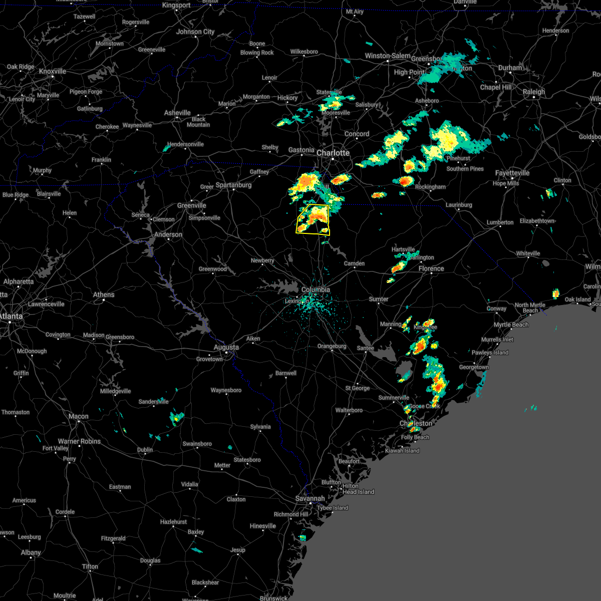 At 1240 pm edt, a severe thunderstorm was located 8 miles east of chester, or near richburg, moving east at 20 mph (radar indicated). Hazards include 60 mph wind gusts and nickel size hail. expect damage to trees and power lines At 1240 pm edt, a severe thunderstorm was located 8 miles east of chester, or near richburg, moving east at 20 mph (radar indicated). Hazards include 60 mph wind gusts and nickel size hail. expect damage to trees and power lines
|
| 8/31/2020 12:40 PM EDT |
 At 1240 pm edt, a severe thunderstorm was located 8 miles east of chester, or near richburg, moving east at 20 mph (radar indicated). Hazards include 60 mph wind gusts and nickel size hail. expect damage to trees and power lines At 1240 pm edt, a severe thunderstorm was located 8 miles east of chester, or near richburg, moving east at 20 mph (radar indicated). Hazards include 60 mph wind gusts and nickel size hail. expect damage to trees and power lines
|
| 7/24/2020 4:25 PM EDT |
 At 425 pm edt, a severe thunderstorm was located 7 miles north of chester, or over lowrys, moving east at 15 mph (radar indicated). Hazards include 60 mph wind gusts. Expect damage to trees and power lines. Locations impacted include, chester, mcconnells, lowrys, chester state park and bullock creek. At 425 pm edt, a severe thunderstorm was located 7 miles north of chester, or over lowrys, moving east at 15 mph (radar indicated). Hazards include 60 mph wind gusts. Expect damage to trees and power lines. Locations impacted include, chester, mcconnells, lowrys, chester state park and bullock creek.
|
| 7/24/2020 4:05 PM EDT |
 At 405 pm edt, a severe thunderstorm was located 11 miles northwest of chester, or near lockhart, moving east at 10 mph (radar indicated). Hazards include 60 mph wind gusts. expect damage to trees and power lines At 405 pm edt, a severe thunderstorm was located 11 miles northwest of chester, or near lockhart, moving east at 10 mph (radar indicated). Hazards include 60 mph wind gusts. expect damage to trees and power lines
|
| 5/28/2020 10:32 PM EDT |
 At 1032 pm edt, a severe thunderstorm was located 9 miles north of chester, or near mcconnells, moving northeast at 20 mph (radar indicated). Hazards include 60 mph wind gusts and quarter size hail. Minor hail damage to vehicles is expected. expect wind damage to trees and power lines. Locations impacted include, rock hill, york, chester, newport, mcconnells, lowrys, tega cay, bullock creek, lesslie and lake wylie. At 1032 pm edt, a severe thunderstorm was located 9 miles north of chester, or near mcconnells, moving northeast at 20 mph (radar indicated). Hazards include 60 mph wind gusts and quarter size hail. Minor hail damage to vehicles is expected. expect wind damage to trees and power lines. Locations impacted include, rock hill, york, chester, newport, mcconnells, lowrys, tega cay, bullock creek, lesslie and lake wylie.
|
| 5/28/2020 10:19 PM EDT |
 At 1018 pm edt, a severe thunderstorm was located 6 miles north of chester, or near lowrys, moving northeast at 20 mph (radar indicated). Hazards include 60 mph wind gusts and quarter size hail. Minor hail damage to vehicles is expected. Expect wind damage to trees and power lines. At 1018 pm edt, a severe thunderstorm was located 6 miles north of chester, or near lowrys, moving northeast at 20 mph (radar indicated). Hazards include 60 mph wind gusts and quarter size hail. Minor hail damage to vehicles is expected. Expect wind damage to trees and power lines.
|
| 5/22/2020 4:11 PM EDT | Trees down on sc 72 and 193 s. time esimated from rada in chester county SC, 8.2 miles SW of Chester, SC |
| 5/22/2020 4:08 PM EDT | Trees down on us 321 at sky line dr. time estimated from rada in chester county SC, 2.8 miles NNW of Chester, SC |
| 5/22/2020 4:02 PM EDT |
 At 402 pm edt, severe thunderstorms were located along a line extending from 8 miles southwest of chester to 8 miles northeast of newberry, moving southeast at 45 mph (radar indicated). Hazards include 60 mph wind gusts and quarter size hail. Minor hail damage to vehicles is expected. expect wind damage to trees and power lines. Locations impacted include, chester, great falls, fort lawn, carlisle, mcconnells, richburg, lowrys, chester state park, blackstock and leeds. At 402 pm edt, severe thunderstorms were located along a line extending from 8 miles southwest of chester to 8 miles northeast of newberry, moving southeast at 45 mph (radar indicated). Hazards include 60 mph wind gusts and quarter size hail. Minor hail damage to vehicles is expected. expect wind damage to trees and power lines. Locations impacted include, chester, great falls, fort lawn, carlisle, mcconnells, richburg, lowrys, chester state park, blackstock and leeds.
|
| 5/22/2020 3:37 PM EDT |
 At 337 pm edt, severe thunderstorms were located along a line extending from 10 miles northeast of union to 18 miles east of laurens, moving east at 45 mph (radar indicated). Hazards include 60 mph wind gusts and penny size hail. expect damage to trees and power lines At 337 pm edt, severe thunderstorms were located along a line extending from 10 miles northeast of union to 18 miles east of laurens, moving east at 45 mph (radar indicated). Hazards include 60 mph wind gusts and penny size hail. expect damage to trees and power lines
|
| 5/5/2020 7:50 PM EDT |
 At 749 pm edt, severe thunderstorms were located along a line extending from 10 miles southeast of gaffney to 5 miles northwest of union to 10 miles northeast of laurens, moving east at 45 mph (radar indicated). Hazards include 60 mph wind gusts and penny size hail. expect damage to trees and power lines At 749 pm edt, severe thunderstorms were located along a line extending from 10 miles southeast of gaffney to 5 miles northwest of union to 10 miles northeast of laurens, moving east at 45 mph (radar indicated). Hazards include 60 mph wind gusts and penny size hail. expect damage to trees and power lines
|
| 5/5/2020 6:35 PM EDT | Golf Ball sized hail reported 2.4 miles WSW of Chester, SC, amateur radio reported golf ball (1.75") size hail along highway 9 east of chester. |
| 5/5/2020 6:31 PM EDT |
 At 630 pm edt, a severe thunderstorm was located 7 miles northeast of chester, or 6 miles east of lowrys, moving east at 55 mph (radar indicated). Hazards include ping pong ball size hail and 60 mph wind gusts. People and animals outdoors will be injured. expect hail damage to roofs, siding, windows, and vehicles. expect wind damage to trees and power lines. Locations impacted include, chester, lesslie, great falls, fort lawn, mcconnells, richburg, lowrys, chester state park, catawba and edgemoor. At 630 pm edt, a severe thunderstorm was located 7 miles northeast of chester, or 6 miles east of lowrys, moving east at 55 mph (radar indicated). Hazards include ping pong ball size hail and 60 mph wind gusts. People and animals outdoors will be injured. expect hail damage to roofs, siding, windows, and vehicles. expect wind damage to trees and power lines. Locations impacted include, chester, lesslie, great falls, fort lawn, mcconnells, richburg, lowrys, chester state park, catawba and edgemoor.
|
| 5/5/2020 6:11 PM EDT |
 At 611 pm edt, a severe thunderstorm was located 10 miles east of union, or near lockhart, moving east at 55 mph (radar indicated). Hazards include ping pong ball size hail and 60 mph wind gusts. People and animals outdoors will be injured. expect hail damage to roofs, siding, windows, and vehicles. Expect wind damage to trees and power lines. At 611 pm edt, a severe thunderstorm was located 10 miles east of union, or near lockhart, moving east at 55 mph (radar indicated). Hazards include ping pong ball size hail and 60 mph wind gusts. People and animals outdoors will be injured. expect hail damage to roofs, siding, windows, and vehicles. Expect wind damage to trees and power lines.
|
| 5/5/2020 4:13 AM EDT |
 At 413 am edt, severe thunderstorms were located along a line extending from 11 miles northwest of indian land to 8 miles southeast of rock hill to 12 miles southeast of chester, moving east at 55 mph (radar indicated). Hazards include 60 mph wind gusts and quarter size hail. Minor hail damage to vehicles is expected. expect wind damage to trees and power lines. Locations impacted include, rock hill, york, chester, south charlotte, indian trail, weddington, fort mill, stallings, pineville and tega cay. At 413 am edt, severe thunderstorms were located along a line extending from 11 miles northwest of indian land to 8 miles southeast of rock hill to 12 miles southeast of chester, moving east at 55 mph (radar indicated). Hazards include 60 mph wind gusts and quarter size hail. Minor hail damage to vehicles is expected. expect wind damage to trees and power lines. Locations impacted include, rock hill, york, chester, south charlotte, indian trail, weddington, fort mill, stallings, pineville and tega cay.
|
| 5/5/2020 3:57 AM EDT |
 At 356 am edt, severe thunderstorms were located along a line extending from 6 miles north of york to 9 miles southwest of rock hill to 8 miles southwest of chester, moving east at 55 mph (radar indicated). Hazards include 60 mph wind gusts and quarter size hail. Minor hail damage to vehicles is expected. Expect wind damage to trees and power lines. At 356 am edt, severe thunderstorms were located along a line extending from 6 miles north of york to 9 miles southwest of rock hill to 8 miles southwest of chester, moving east at 55 mph (radar indicated). Hazards include 60 mph wind gusts and quarter size hail. Minor hail damage to vehicles is expected. Expect wind damage to trees and power lines.
|
| 5/5/2020 3:49 AM EDT |
 At 348 am edt, severe thunderstorms were located along a line extending from 11 miles northwest of york to 9 miles northwest of chester to 16 miles northwest of vc summer nuclear station, moving east at 55 mph (radar indicated). Hazards include 60 mph wind gusts and quarter size hail. Minor hail damage to vehicles is expected. expect wind damage to trees and power lines. Locations impacted include, spartanburg, gaffney, union, york, chester, clinton, clover, boiling springs sc, pacolet and cowpens. At 348 am edt, severe thunderstorms were located along a line extending from 11 miles northwest of york to 9 miles northwest of chester to 16 miles northwest of vc summer nuclear station, moving east at 55 mph (radar indicated). Hazards include 60 mph wind gusts and quarter size hail. Minor hail damage to vehicles is expected. expect wind damage to trees and power lines. Locations impacted include, spartanburg, gaffney, union, york, chester, clinton, clover, boiling springs sc, pacolet and cowpens.
|
| 5/5/2020 3:22 AM EDT |
 At 321 am edt, severe thunderstorms were located along a line extending from 7 miles northeast of spartanburg to 5 miles west of union to 10 miles southeast of laurens, moving east at 55 mph (radar indicated). Hazards include 60 mph wind gusts and quarter size hail. Minor hail damage to vehicles is expected. Expect wind damage to trees and power lines. At 321 am edt, severe thunderstorms were located along a line extending from 7 miles northeast of spartanburg to 5 miles west of union to 10 miles southeast of laurens, moving east at 55 mph (radar indicated). Hazards include 60 mph wind gusts and quarter size hail. Minor hail damage to vehicles is expected. Expect wind damage to trees and power lines.
|
| 4/13/2020 5:51 AM EDT |
 The severe thunderstorm warning for cabarrus, central davie, mecklenburg, rowan, union, chester and southeastern york counties will expire at 600 am edt, the storms which prompted the warning have moved out of the area. therefore the warning will be allowed to expire. a tornado watch remains in effect until 800 am edt for the piedmont of north carolina, and upstate south carolina. if you observed large hail or wind damage, please report it to the national weather service greenville-spartanburg by calling toll free, 1, 800, 2 6 7, 8 1 0 1, or by posting on our facebook page, or tweet it using hashtag nwsgsp. your message should describe the event and the specific location where it occurred. remember, a severe thunderstorm warning still remains in effect for central and eastern union county in north carolina until 630 am edt. The severe thunderstorm warning for cabarrus, central davie, mecklenburg, rowan, union, chester and southeastern york counties will expire at 600 am edt, the storms which prompted the warning have moved out of the area. therefore the warning will be allowed to expire. a tornado watch remains in effect until 800 am edt for the piedmont of north carolina, and upstate south carolina. if you observed large hail or wind damage, please report it to the national weather service greenville-spartanburg by calling toll free, 1, 800, 2 6 7, 8 1 0 1, or by posting on our facebook page, or tweet it using hashtag nwsgsp. your message should describe the event and the specific location where it occurred. remember, a severe thunderstorm warning still remains in effect for central and eastern union county in north carolina until 630 am edt.
|
| 4/13/2020 5:10 AM EDT |
 At 509 am edt, severe thunderstorms were located along a line extending from 5 miles east of mocksville to 9 miles southeast of chester, moving northeast at 60 mph (radar indicated). Hazards include 60 mph wind gusts. expect damage to trees and power lines At 509 am edt, severe thunderstorms were located along a line extending from 5 miles east of mocksville to 9 miles southeast of chester, moving northeast at 60 mph (radar indicated). Hazards include 60 mph wind gusts. expect damage to trees and power lines
|
| 4/13/2020 4:59 AM EDT |
 A severe thunderstorm warning remains in effect until 515 am edt for central chester and central york counties. at 458 am edt, severe thunderstorms were located along a line extending from 10 miles southeast of gastonia to 12 miles north of vc summer nuclear station, moving east at 35 mph. hazard. 60 mph wind gusts. A severe thunderstorm warning remains in effect until 515 am edt for central chester and central york counties. at 458 am edt, severe thunderstorms were located along a line extending from 10 miles southeast of gastonia to 12 miles north of vc summer nuclear station, moving east at 35 mph. hazard. 60 mph wind gusts.
|
| 4/13/2020 4:13 AM EDT |
 At 413 am edt, severe thunderstorms were located along a line extending from 10 miles southeast of shelby to 13 miles west of newberry, moving northeast at 30 mph (radar indicated). Hazards include 60 mph wind gusts. expect damage to trees and power lines At 413 am edt, severe thunderstorms were located along a line extending from 10 miles southeast of shelby to 13 miles west of newberry, moving northeast at 30 mph (radar indicated). Hazards include 60 mph wind gusts. expect damage to trees and power lines
|
| 2/6/2020 2:20 PM EST |
 At 219 pm est, severe thunderstorms were located along a line extending from 9 miles south of rock hill to 13 miles southwest of chester, moving east at 55 mph (radar indicated). Hazards include 60 mph wind gusts. expect damage to trees and power lines At 219 pm est, severe thunderstorms were located along a line extending from 9 miles south of rock hill to 13 miles southwest of chester, moving east at 55 mph (radar indicated). Hazards include 60 mph wind gusts. expect damage to trees and power lines
|
| 1/11/2020 9:46 PM EST |
 At 945 pm est, a severe thunderstorm capable of producing a tornado was located 6 miles southwest of chester, or near chester state park, moving northeast at 55 mph (radar indicated rotation). Hazards include tornado. Flying debris will be dangerous to those caught without shelter. mobile homes will be damaged or destroyed. damage to roofs, windows, and vehicles will occur. tree damage is likely. this dangerous storm will be near, chester and chester state park around 950 pm est. richburg around 1000 pm est. Other locations impacted by this dangerous storm include leeds, cornwell and edgemoor. At 945 pm est, a severe thunderstorm capable of producing a tornado was located 6 miles southwest of chester, or near chester state park, moving northeast at 55 mph (radar indicated rotation). Hazards include tornado. Flying debris will be dangerous to those caught without shelter. mobile homes will be damaged or destroyed. damage to roofs, windows, and vehicles will occur. tree damage is likely. this dangerous storm will be near, chester and chester state park around 950 pm est. richburg around 1000 pm est. Other locations impacted by this dangerous storm include leeds, cornwell and edgemoor.
|
| 1/11/2020 9:45 PM EST | Chester county emergency management relayed report of numerous trees down near baton rouge road... west chester school road and slick rock road. trees were down on a co in chester county SC, 7.5 miles ESE of Chester, SC |
| 1/11/2020 9:36 PM EST |
 At 935 pm est, a severe thunderstorm capable of producing a tornado was located 14 miles southwest of chester, or near carlisle, moving northeast at 65 mph (radar indicated rotation). Hazards include tornado. Flying debris will be dangerous to those caught without shelter. mobile homes will be damaged or destroyed. damage to roofs, windows, and vehicles will occur. tree damage is likely. this dangerous storm will be near, chester, chester state park and lowrys around 950 pm est. richburg around 1000 pm est. Other locations impacted by this dangerous thunderstorm include leeds, cornwell and edgemoor. At 935 pm est, a severe thunderstorm capable of producing a tornado was located 14 miles southwest of chester, or near carlisle, moving northeast at 65 mph (radar indicated rotation). Hazards include tornado. Flying debris will be dangerous to those caught without shelter. mobile homes will be damaged or destroyed. damage to roofs, windows, and vehicles will occur. tree damage is likely. this dangerous storm will be near, chester, chester state park and lowrys around 950 pm est. richburg around 1000 pm est. Other locations impacted by this dangerous thunderstorm include leeds, cornwell and edgemoor.
|
| 1/11/2020 9:21 PM EST |
 At 920 pm est, severe thunderstorms were located along a line extending from 7 miles north of gaffney to 14 miles south of union, moving east at 45 mph (radar indicated). Hazards include 60 mph wind gusts. expect damage to trees and power lines At 920 pm est, severe thunderstorms were located along a line extending from 7 miles north of gaffney to 14 miles south of union, moving east at 45 mph (radar indicated). Hazards include 60 mph wind gusts. expect damage to trees and power lines
|
| 9/13/2019 3:57 PM EDT |
 A severe thunderstorm warning remains in effect until 445 pm edt for eastern chester county. at 357 pm edt, a severe thunderstorm was located 11 miles east of chester, or near richburg, moving southwest at 10 mph. hazard. 60 mph wind gusts and penny size hail. source. Radar indicated. A severe thunderstorm warning remains in effect until 445 pm edt for eastern chester county. at 357 pm edt, a severe thunderstorm was located 11 miles east of chester, or near richburg, moving southwest at 10 mph. hazard. 60 mph wind gusts and penny size hail. source. Radar indicated.
|
| 9/13/2019 3:38 PM EDT |
 At 338 pm edt, a severe thunderstorm was located 11 miles south of rock hill, or near richburg, moving southwest at 10 mph (radar indicated). Hazards include 60 mph wind gusts and penny size hail. expect damage to trees and power lines At 338 pm edt, a severe thunderstorm was located 11 miles south of rock hill, or near richburg, moving southwest at 10 mph (radar indicated). Hazards include 60 mph wind gusts and penny size hail. expect damage to trees and power lines
|
| 8/13/2019 5:13 PM EDT |
 The severe thunderstorm warning for western chester county will expire at 515 pm edt, the storm which prompted the warning has weakened below severe limits, and no longer poses an immediate threat to life or property. therefore the warning will be allowed to expire. The severe thunderstorm warning for western chester county will expire at 515 pm edt, the storm which prompted the warning has weakened below severe limits, and no longer poses an immediate threat to life or property. therefore the warning will be allowed to expire.
|
| 8/13/2019 4:54 PM EDT |
 At 452 pm edt, a severe thunderstorm was located 8 miles northwest of chester, or 6 miles southeast of lockhart, moving southeast at 20 mph (radar indicated). Hazards include 60 mph wind gusts and penny size hail. Expect damage to trees and power lines. Locations impacted include, chester, lowrys, chester state park and cornwell. At 452 pm edt, a severe thunderstorm was located 8 miles northwest of chester, or 6 miles southeast of lockhart, moving southeast at 20 mph (radar indicated). Hazards include 60 mph wind gusts and penny size hail. Expect damage to trees and power lines. Locations impacted include, chester, lowrys, chester state park and cornwell.
|
| 8/13/2019 4:28 PM EDT |
 The national weather service in greenville-spartanburg has issued a * severe thunderstorm warning for. western chester county in upstate south carolina. southwestern york county in upstate south carolina. northeastern union county in upstate south carolina. Until 515 pm edt. The national weather service in greenville-spartanburg has issued a * severe thunderstorm warning for. western chester county in upstate south carolina. southwestern york county in upstate south carolina. northeastern union county in upstate south carolina. Until 515 pm edt.
|
| 7/13/2019 4:40 PM EDT |
 At 440 pm edt, a severe thunderstorm was located 4 miles south of chester, or near chester state park, moving east at 20 mph (radar indicated). Hazards include 60 mph wind gusts and quarter size hail. Minor hail damage to vehicles is expected. expect wind damage to trees and power lines. Locations impacted include, chester, chester state park, cornwell and blackstock. At 440 pm edt, a severe thunderstorm was located 4 miles south of chester, or near chester state park, moving east at 20 mph (radar indicated). Hazards include 60 mph wind gusts and quarter size hail. Minor hail damage to vehicles is expected. expect wind damage to trees and power lines. Locations impacted include, chester, chester state park, cornwell and blackstock.
|
| 7/13/2019 4:19 PM EDT |
 At 419 pm edt, a severe thunderstorm was located 6 miles southwest of chester, or 4 miles southwest of chester state park, moving east at 15 mph (radar indicated). Hazards include 60 mph wind gusts and quarter size hail. Minor hail damage to vehicles is expected. Expect wind damage to trees and power lines. At 419 pm edt, a severe thunderstorm was located 6 miles southwest of chester, or 4 miles southwest of chester state park, moving east at 15 mph (radar indicated). Hazards include 60 mph wind gusts and quarter size hail. Minor hail damage to vehicles is expected. Expect wind damage to trees and power lines.
|
| 7/4/2019 2:55 PM EDT |
 The severe thunderstorm warning for central chester and southeastern york counties will expire at 300 pm edt, the storms which prompted the warning have weakened below severe limits, and no longer pose an immediate threat to life or property. therefore the warning will be allowed to expire. if you observed large hail or wind damage, please report it to the national weather service greenville-spartanburg by calling toll free, 1, 800, 2 6 7, 8 1 0 1, or by posting on our facebook page, or tweet it using hashtag nwsgsp. your message should describe the event and the specific location where it occurred. The severe thunderstorm warning for central chester and southeastern york counties will expire at 300 pm edt, the storms which prompted the warning have weakened below severe limits, and no longer pose an immediate threat to life or property. therefore the warning will be allowed to expire. if you observed large hail or wind damage, please report it to the national weather service greenville-spartanburg by calling toll free, 1, 800, 2 6 7, 8 1 0 1, or by posting on our facebook page, or tweet it using hashtag nwsgsp. your message should describe the event and the specific location where it occurred.
|
| 7/4/2019 2:20 PM EDT | Multiple trees down in the lower part and upper part of the county. a more specific report will come late in chester county SC, 8.1 miles SW of Chester, SC |
| 7/4/2019 2:12 PM EDT |
 At 211 pm edt, severe thunderstorms were located along a line extending from 7 miles southwest of rock hill to 3 miles south of chester, moving east at 10 mph (radar indicated). Hazards include 70 mph wind gusts and quarter size hail. Minor hail damage to vehicles is expected. expect considerable tree damage. Wind damage is also likely to mobile homes, roofs, and outbuildings. At 211 pm edt, severe thunderstorms were located along a line extending from 7 miles southwest of rock hill to 3 miles south of chester, moving east at 10 mph (radar indicated). Hazards include 70 mph wind gusts and quarter size hail. Minor hail damage to vehicles is expected. expect considerable tree damage. Wind damage is also likely to mobile homes, roofs, and outbuildings.
|
| 6/24/2019 10:17 PM EDT |
 At 1016 pm edt, severe thunderstorms were located along a line extending from 7 miles southwest of winston-salem to 6 miles west of lexington to 11 miles north of badin lake to 9 miles east of downtown concord to 13 miles south of albemarle to 8 miles south of monroe to 14 miles northeast of lake wateree dam, moving east at 40 mph (radar indicated). Hazards include 60 mph wind gusts. Expect damage to trees and power lines. Locations impacted include, monroe, chester, indian trail, weddington, stallings, unionville, wesley chapel, wingate, waxhaw and marshville. At 1016 pm edt, severe thunderstorms were located along a line extending from 7 miles southwest of winston-salem to 6 miles west of lexington to 11 miles north of badin lake to 9 miles east of downtown concord to 13 miles south of albemarle to 8 miles south of monroe to 14 miles northeast of lake wateree dam, moving east at 40 mph (radar indicated). Hazards include 60 mph wind gusts. Expect damage to trees and power lines. Locations impacted include, monroe, chester, indian trail, weddington, stallings, unionville, wesley chapel, wingate, waxhaw and marshville.
|
| 6/24/2019 10:03 PM EDT |
 At 1003 pm edt, severe thunderstorms were located along a line extending from 12 miles southwest of winston-salem to 5 miles southeast of mocksville to 12 miles south of lexington to near downtown concord to 16 miles southwest of albemarle to 11 miles southwest of monroe to 13 miles south of lancaster, moving east at 40 mph (radar indicated). Hazards include 60 mph wind gusts. Expect damage to trees and power lines. Locations impacted include, rock hill, kannapolis, downtown concord, monroe, salisbury, mocksville, central charlotte, south charlotte, southwest charlotte and east charlotte. At 1003 pm edt, severe thunderstorms were located along a line extending from 12 miles southwest of winston-salem to 5 miles southeast of mocksville to 12 miles south of lexington to near downtown concord to 16 miles southwest of albemarle to 11 miles southwest of monroe to 13 miles south of lancaster, moving east at 40 mph (radar indicated). Hazards include 60 mph wind gusts. Expect damage to trees and power lines. Locations impacted include, rock hill, kannapolis, downtown concord, monroe, salisbury, mocksville, central charlotte, south charlotte, southwest charlotte and east charlotte.
|
| 6/24/2019 9:48 PM EDT |
 At 948 pm edt, severe thunderstorms were located along a line extending from 7 miles south of yadkinville to 7 miles southwest of mocksville to 4 miles east of salisbury to 6 miles east of huntersville to 14 miles north of monroe to 8 miles south of indian land to 14 miles southwest of lancaster, moving east at 25 mph (radar indicated). Hazards include 60 mph wind gusts. Expect damage to trees and power lines. Locations impacted include, rock hill, uptown charlotte, huntersville, kannapolis, downtown concord, monroe, salisbury, chester, mocksville and central charlotte. At 948 pm edt, severe thunderstorms were located along a line extending from 7 miles south of yadkinville to 7 miles southwest of mocksville to 4 miles east of salisbury to 6 miles east of huntersville to 14 miles north of monroe to 8 miles south of indian land to 14 miles southwest of lancaster, moving east at 25 mph (radar indicated). Hazards include 60 mph wind gusts. Expect damage to trees and power lines. Locations impacted include, rock hill, uptown charlotte, huntersville, kannapolis, downtown concord, monroe, salisbury, chester, mocksville and central charlotte.
|
| 6/24/2019 9:27 PM EDT |
 At 927 pm edt, severe thunderstorms were located along a line extending from 6 miles south of yadkinville to 4 miles north of statesville to 8 miles north of kannapolis to near huntersville to 7 miles northeast of indian land to 4 miles southwest of rock hill to 11 miles north of winnsboro, moving east at 40 mph (radar indicated). Hazards include 70 mph wind gusts. Expect considerable tree damage. Damage is likely to mobile homes, roofs, and outbuildings. At 927 pm edt, severe thunderstorms were located along a line extending from 6 miles south of yadkinville to 4 miles north of statesville to 8 miles north of kannapolis to near huntersville to 7 miles northeast of indian land to 4 miles southwest of rock hill to 11 miles north of winnsboro, moving east at 40 mph (radar indicated). Hazards include 70 mph wind gusts. Expect considerable tree damage. Damage is likely to mobile homes, roofs, and outbuildings.
|
| 6/24/2019 9:16 PM EDT |
 At 916 pm edt, severe thunderstorms were located along a line extending from 15 miles east of taylorsville to 7 miles northwest of statesville to 14 miles northwest of kannapolis to 5 miles west of huntersville to 6 miles southwest of uptown charlotte to 7 miles south of york to 6 miles south of chester, moving northeast at 70 mph (radar indicated). Hazards include 70 mph wind gusts. Expect considerable tree damage. damage is likely to mobile homes, roofs, and outbuildings. Locations impacted include, gastonia, rock hill, uptown charlotte, huntersville, statesville, lincolnton, york, chester, mocksville and central charlotte. At 916 pm edt, severe thunderstorms were located along a line extending from 15 miles east of taylorsville to 7 miles northwest of statesville to 14 miles northwest of kannapolis to 5 miles west of huntersville to 6 miles southwest of uptown charlotte to 7 miles south of york to 6 miles south of chester, moving northeast at 70 mph (radar indicated). Hazards include 70 mph wind gusts. Expect considerable tree damage. damage is likely to mobile homes, roofs, and outbuildings. Locations impacted include, gastonia, rock hill, uptown charlotte, huntersville, statesville, lincolnton, york, chester, mocksville and central charlotte.
|
| 6/24/2019 9:00 PM EDT |
 At 859 pm edt, severe thunderstorms were located along a line extending from 4 miles southeast of taylorsville to 10 miles southwest of statesville to 7 miles southeast of lincolnton to 8 miles southeast of gastonia to 7 miles southwest of york to 16 miles southeast of union, moving northeast at 50 mph (radar indicated). Hazards include 70 mph wind gusts. Expect considerable tree damage. Damage is likely to mobile homes, roofs, and outbuildings. At 859 pm edt, severe thunderstorms were located along a line extending from 4 miles southeast of taylorsville to 10 miles southwest of statesville to 7 miles southeast of lincolnton to 8 miles southeast of gastonia to 7 miles southwest of york to 16 miles southeast of union, moving northeast at 50 mph (radar indicated). Hazards include 70 mph wind gusts. Expect considerable tree damage. Damage is likely to mobile homes, roofs, and outbuildings.
|
| 8/8/2018 6:00 PM EDT | Amateur radio reported trees down along harris and hardin street in chester county SC, 0.7 miles NW of Chester, SC |
| 8/6/2018 7:14 PM EDT |
 At 714 pm edt, a severe thunderstorm was located 14 miles southeast of union, or near carlisle, moving south at 10 mph (radar indicated). Hazards include 60 mph wind gusts and quarter size hail. Minor hail damage to vehicles is expected. expect wind damage to trees and power lines. Locations impacted include, chester, carlisle, chester state park, leeds, cornwell, santuc and blackstock. At 714 pm edt, a severe thunderstorm was located 14 miles southeast of union, or near carlisle, moving south at 10 mph (radar indicated). Hazards include 60 mph wind gusts and quarter size hail. Minor hail damage to vehicles is expected. expect wind damage to trees and power lines. Locations impacted include, chester, carlisle, chester state park, leeds, cornwell, santuc and blackstock.
|
| 8/6/2018 6:53 PM EDT |
 At 653 pm edt, a severe thunderstorm was located 9 miles southwest of chester, or 6 miles northeast of carlisle, moving southeast at 15 mph (radar indicated). Hazards include 60 mph wind gusts and quarter size hail. Minor hail damage to vehicles is expected. Expect wind damage to trees and power lines. At 653 pm edt, a severe thunderstorm was located 9 miles southwest of chester, or 6 miles northeast of carlisle, moving southeast at 15 mph (radar indicated). Hazards include 60 mph wind gusts and quarter size hail. Minor hail damage to vehicles is expected. Expect wind damage to trees and power lines.
|
| 6/27/2018 6:07 PM EDT |
 At 607 pm edt, severe thunderstorms were located along a line extending from 7 miles west of lancaster to 6 miles east of chester to 14 miles north of winnsboro to 17 miles northeast of newberry, moving east at 35 mph (radar indicated). Hazards include golf ball size hail and 60 mph wind gusts. People and animals outdoors will be injured. expect hail damage to roofs, siding, windows, and vehicles. expect wind damage to trees and power lines. Locations impacted include, chester, great falls, fort lawn, richburg, lowrys, chester state park, blackstock, leeds, cornwell and edgemoor. At 607 pm edt, severe thunderstorms were located along a line extending from 7 miles west of lancaster to 6 miles east of chester to 14 miles north of winnsboro to 17 miles northeast of newberry, moving east at 35 mph (radar indicated). Hazards include golf ball size hail and 60 mph wind gusts. People and animals outdoors will be injured. expect hail damage to roofs, siding, windows, and vehicles. expect wind damage to trees and power lines. Locations impacted include, chester, great falls, fort lawn, richburg, lowrys, chester state park, blackstock, leeds, cornwell and edgemoor.
|
| 6/27/2018 5:47 PM EDT |
 At 547 pm edt, severe thunderstorms were located along a line extending from 8 miles south of rock hill to 7 miles west of chester to 16 miles southeast of union to 13 miles north of newberry, moving southeast at 35 mph (radar indicated). Hazards include golf ball size hail and 60 mph wind gusts. People and animals outdoors will be injured. expect hail damage to roofs, siding, windows, and vehicles. Expect wind damage to trees and power lines. At 547 pm edt, severe thunderstorms were located along a line extending from 8 miles south of rock hill to 7 miles west of chester to 16 miles southeast of union to 13 miles north of newberry, moving southeast at 35 mph (radar indicated). Hazards include golf ball size hail and 60 mph wind gusts. People and animals outdoors will be injured. expect hail damage to roofs, siding, windows, and vehicles. Expect wind damage to trees and power lines.
|
| 6/27/2018 5:45 PM EDT | Schp reported a tree down at highway 72 and cedar grove ch rd in chester county SC, 8.7 miles SW of Chester, SC |
| 6/27/2018 5:31 PM EDT |
 At 531 pm edt, a severe thunderstorm was located 9 miles north of chester, or near mcconnells, moving east at 25 mph (radar indicated). Hazards include golf ball size hail and 60 mph wind gusts. People and animals outdoors will be injured. expect hail damage to roofs, siding, windows, and vehicles. expect wind damage to trees and power lines. Locations impacted include, rock hill, chester, lesslie, fort lawn, sharon, mcconnells, richburg, lowrys, catawba and edgemoor. At 531 pm edt, a severe thunderstorm was located 9 miles north of chester, or near mcconnells, moving east at 25 mph (radar indicated). Hazards include golf ball size hail and 60 mph wind gusts. People and animals outdoors will be injured. expect hail damage to roofs, siding, windows, and vehicles. expect wind damage to trees and power lines. Locations impacted include, rock hill, chester, lesslie, fort lawn, sharon, mcconnells, richburg, lowrys, catawba and edgemoor.
|
| 6/27/2018 5:13 PM EDT |
 At 513 pm edt, a severe thunderstorm was located 7 miles south of york, or near mcconnells, moving east at 30 mph (radar indicated). Hazards include 60 mph wind gusts and quarter size hail. Minor hail damage to vehicles is expected. Expect wind damage to trees and power lines. At 513 pm edt, a severe thunderstorm was located 7 miles south of york, or near mcconnells, moving east at 30 mph (radar indicated). Hazards include 60 mph wind gusts and quarter size hail. Minor hail damage to vehicles is expected. Expect wind damage to trees and power lines.
|
| 6/25/2018 7:48 PM EDT |
 At 747 pm edt, severe thunderstorms were located along a line extending from 3 miles northeast of rock hill to 15 miles northwest of batesburg, moving east at 45 mph (radar indicated). Hazards include 60 mph wind gusts and quarter size hail. Minor hail damage to vehicles is expected. expect wind damage to trees and power lines. Locations impacted include, rock hill, chester, lesslie, great falls, monarch mill, fort lawn, lockhart, sharon, carlisle and mcconnells. At 747 pm edt, severe thunderstorms were located along a line extending from 3 miles northeast of rock hill to 15 miles northwest of batesburg, moving east at 45 mph (radar indicated). Hazards include 60 mph wind gusts and quarter size hail. Minor hail damage to vehicles is expected. expect wind damage to trees and power lines. Locations impacted include, rock hill, chester, lesslie, great falls, monarch mill, fort lawn, lockhart, sharon, carlisle and mcconnells.
|
| 6/25/2018 7:35 PM EDT |
 At 734 pm edt, severe thunderstorms were located along a line extending from 4 miles northwest of rock hill to 19 miles southeast of greenwood, moving east at 45 mph (radar indicated). Hazards include 60 mph wind gusts and quarter size hail. Minor hail damage to vehicles is expected. expect wind damage to trees and power lines. Locations impacted include, rock hill, greenwood, union, chester, clinton, lesslie, great falls, monarch mill, ninety six and joanna. At 734 pm edt, severe thunderstorms were located along a line extending from 4 miles northwest of rock hill to 19 miles southeast of greenwood, moving east at 45 mph (radar indicated). Hazards include 60 mph wind gusts and quarter size hail. Minor hail damage to vehicles is expected. expect wind damage to trees and power lines. Locations impacted include, rock hill, greenwood, union, chester, clinton, lesslie, great falls, monarch mill, ninety six and joanna.
|
| 6/25/2018 7:24 PM EDT |
 At 723 pm edt, severe thunderstorms were located along a line extending from near york to 12 miles southeast of greenwood, moving east at 45 mph (radar indicated). Hazards include 60 mph wind gusts and quarter size hail. Minor hail damage to vehicles is expected. expect wind damage to trees and power lines. Locations impacted include, rock hill, greenwood, laurens, union, york, chester, abbeville, clinton, newport and pacolet. At 723 pm edt, severe thunderstorms were located along a line extending from near york to 12 miles southeast of greenwood, moving east at 45 mph (radar indicated). Hazards include 60 mph wind gusts and quarter size hail. Minor hail damage to vehicles is expected. expect wind damage to trees and power lines. Locations impacted include, rock hill, greenwood, laurens, union, york, chester, abbeville, clinton, newport and pacolet.
|
| 6/25/2018 6:58 PM EDT |
 The national weather service in greenville-spartanburg has issued a * severe thunderstorm warning for. southeastern elbert county in northeastern georgia. laurens county in upstate south carolina. chester county in upstate south carolina. Southern york county in upstate south carolina. The national weather service in greenville-spartanburg has issued a * severe thunderstorm warning for. southeastern elbert county in northeastern georgia. laurens county in upstate south carolina. chester county in upstate south carolina. Southern york county in upstate south carolina.
|
| 6/25/2018 6:58 PM EDT |
 At 658 pm edt, severe thunderstorms were located along a line extending from 10 miles southeast of gaffney to 10 miles southeast of abbeville, moving east at 45 mph (radar indicated). Hazards include 60 mph wind gusts and quarter size hail. Minor hail damage to vehicles is expected. Expect wind damage to trees and power lines. At 658 pm edt, severe thunderstorms were located along a line extending from 10 miles southeast of gaffney to 10 miles southeast of abbeville, moving east at 45 mph (radar indicated). Hazards include 60 mph wind gusts and quarter size hail. Minor hail damage to vehicles is expected. Expect wind damage to trees and power lines.
|
| 6/24/2018 7:12 PM EDT | A tree and power line down on meadowbrook roa in chester county SC, 3 miles NE of Chester, SC |
| 6/24/2018 7:12 PM EDT |
 At 711 pm edt, severe thunderstorms were located along a line extending from 5 miles northwest of chester to 21 miles southeast of union to 14 miles northwest of winnsboro, moving southeast at 35 mph (radar indicated). Hazards include 60 mph wind gusts and penny size hail. Expect damage to trees and power lines. Locations impacted include, chester, great falls, fort lawn, richburg, chester state park, leeds, cornwell, blackstock, lowrys and fishing creek reservoir. At 711 pm edt, severe thunderstorms were located along a line extending from 5 miles northwest of chester to 21 miles southeast of union to 14 miles northwest of winnsboro, moving southeast at 35 mph (radar indicated). Hazards include 60 mph wind gusts and penny size hail. Expect damage to trees and power lines. Locations impacted include, chester, great falls, fort lawn, richburg, chester state park, leeds, cornwell, blackstock, lowrys and fishing creek reservoir.
|
| 6/24/2018 6:52 PM EDT |
 At 652 pm edt, severe thunderstorms were located along a line extending from 12 miles northwest of chester to 9 miles southeast of union to 20 miles north of newberry, moving southeast at 30 mph (radar indicated). Hazards include 60 mph wind gusts and penny size hail. expect damage to trees and power lines At 652 pm edt, severe thunderstorms were located along a line extending from 12 miles northwest of chester to 9 miles southeast of union to 20 miles north of newberry, moving southeast at 30 mph (radar indicated). Hazards include 60 mph wind gusts and penny size hail. expect damage to trees and power lines
|
| 6/24/2018 5:25 PM EDT |
 The severe thunderstorm warning for western chester and southwestern york counties will expire at 530 pm edt, the storm which prompted the warning has weakened below severe limits, and no longer poses an immediate threat to life or property. therefore the warning will be allowed to expire. however, gusty winds to 35 mph are still possible with this thunderstorm. The severe thunderstorm warning for western chester and southwestern york counties will expire at 530 pm edt, the storm which prompted the warning has weakened below severe limits, and no longer poses an immediate threat to life or property. therefore the warning will be allowed to expire. however, gusty winds to 35 mph are still possible with this thunderstorm.
|
| 6/24/2018 5:00 PM EDT |
 At 459 pm edt, a severe thunderstorm was located 13 miles northeast of union, or near lockhart, moving southeast at 15 mph (radar indicated). Hazards include 60 mph wind gusts and quarter size hail. Minor hail damage to vehicles is expected. expect wind damage to trees and power lines. Locations impacted include, chester, lockhart, lowrys, chester state park and bullock creek. At 459 pm edt, a severe thunderstorm was located 13 miles northeast of union, or near lockhart, moving southeast at 15 mph (radar indicated). Hazards include 60 mph wind gusts and quarter size hail. Minor hail damage to vehicles is expected. expect wind damage to trees and power lines. Locations impacted include, chester, lockhart, lowrys, chester state park and bullock creek.
|
| 6/24/2018 4:39 PM EDT |
 At 439 pm edt, a severe thunderstorm was located 10 miles northeast of union, or near lockhart, moving southeast at 15 mph (radar indicated). Hazards include 60 mph wind gusts and quarter size hail. Minor hail damage to vehicles is expected. Expect wind damage to trees and power lines. At 439 pm edt, a severe thunderstorm was located 10 miles northeast of union, or near lockhart, moving southeast at 15 mph (radar indicated). Hazards include 60 mph wind gusts and quarter size hail. Minor hail damage to vehicles is expected. Expect wind damage to trees and power lines.
|
| 6/22/2018 9:37 PM EDT |
 The severe thunderstorm warning for western chester, southwestern york, southeastern cherokee and eastern union counties will expire at 945 pm edt, the storms which prompted the warning have weakened below severe limits, and no longer pose an immediate threat to life or property. therefore the warning will be allowed to expire. however, gusty winds to 35 mph are still possible with these thunderstorms. The severe thunderstorm warning for western chester, southwestern york, southeastern cherokee and eastern union counties will expire at 945 pm edt, the storms which prompted the warning have weakened below severe limits, and no longer pose an immediate threat to life or property. therefore the warning will be allowed to expire. however, gusty winds to 35 mph are still possible with these thunderstorms.
|
| 6/22/2018 9:13 PM EDT |
 At 912 pm edt, severe thunderstorms were located along a line extending from 11 miles south of gaffney to 7 miles northeast of union to 15 miles west of chester, moving east at 45 mph (radar indicated). Hazards include 60 mph wind gusts. Expect damage to trees and power lines. Locations impacted include, chester, lockhart, sharon, carlisle, hickory grove, mcconnells, lowrys, smyrna, chester state park and leeds. At 912 pm edt, severe thunderstorms were located along a line extending from 11 miles south of gaffney to 7 miles northeast of union to 15 miles west of chester, moving east at 45 mph (radar indicated). Hazards include 60 mph wind gusts. Expect damage to trees and power lines. Locations impacted include, chester, lockhart, sharon, carlisle, hickory grove, mcconnells, lowrys, smyrna, chester state park and leeds.
|
| 6/22/2018 9:02 PM EDT |
 At 901 pm edt, severe thunderstorms were located along a line extending from 9 miles southeast of spartanburg to 3 miles northwest of union to 22 miles north of newberry, moving east at 45 mph (radar indicated). Hazards include 60 mph wind gusts. expect damage to trees and power lines At 901 pm edt, severe thunderstorms were located along a line extending from 9 miles southeast of spartanburg to 3 miles northwest of union to 22 miles north of newberry, moving east at 45 mph (radar indicated). Hazards include 60 mph wind gusts. expect damage to trees and power lines
|
| 6/1/2018 7:15 PM EDT |
 At 714 pm edt, a severe thunderstorm was located 13 miles south of union, or 5 miles southwest of carlisle, moving northeast at 55 mph (radar indicated). Hazards include 60 mph wind gusts. expect damage to trees and power lines At 714 pm edt, a severe thunderstorm was located 13 miles south of union, or 5 miles southwest of carlisle, moving northeast at 55 mph (radar indicated). Hazards include 60 mph wind gusts. expect damage to trees and power lines
|
| 4/15/2018 3:10 PM EDT |
 The severe thunderstorm warning for western chester and western york counties will expire at 315 pm edt. the storm which prompted the warning has weakened below severe limits, and has exited the warned area. therefore the warning will be allowed to expire. A tornado watch remains in effect until 700 pm edt for the piedmont. The severe thunderstorm warning for western chester and western york counties will expire at 315 pm edt. the storm which prompted the warning has weakened below severe limits, and has exited the warned area. therefore the warning will be allowed to expire. A tornado watch remains in effect until 700 pm edt for the piedmont.
|
| 4/15/2018 2:53 PM EDT |
 At 252 pm edt, a severe thunderstorm was located 7 miles southeast of gaffney, or 7 miles west of smyrna, moving north at 35 mph (radar indicated). Hazards include 60 mph wind gusts and quarter size hail. Minor hail damage to vehicles is expected. expect wind damage to trees and power lines. locations impacted include, york, clover, sharon, mcconnells, lowrys, kings mountain state park, bethany and chester state park. A tornado watch remains in effect until 700 pm edt for the piedmont of north carolina, and upstate south carolina. At 252 pm edt, a severe thunderstorm was located 7 miles southeast of gaffney, or 7 miles west of smyrna, moving north at 35 mph (radar indicated). Hazards include 60 mph wind gusts and quarter size hail. Minor hail damage to vehicles is expected. expect wind damage to trees and power lines. locations impacted include, york, clover, sharon, mcconnells, lowrys, kings mountain state park, bethany and chester state park. A tornado watch remains in effect until 700 pm edt for the piedmont of north carolina, and upstate south carolina.
|
| 4/15/2018 2:44 PM EDT |
 At 243 pm edt, a severe thunderstorm was located 10 miles northwest of chester, or 4 miles northwest of lowrys, moving north at 65 mph (radar indicated). Hazards include 60 mph wind gusts and quarter size hail. Minor hail damage to vehicles is expected. Expect wind damage to trees and power lines. At 243 pm edt, a severe thunderstorm was located 10 miles northwest of chester, or 4 miles northwest of lowrys, moving north at 65 mph (radar indicated). Hazards include 60 mph wind gusts and quarter size hail. Minor hail damage to vehicles is expected. Expect wind damage to trees and power lines.
|
| 4/15/2018 2:29 PM EDT |
 At 228 pm edt, a severe thunderstorm was located 6 miles northeast of union, or 5 miles north of monarch mill, moving north at 35 mph (radar indicated). Hazards include 60 mph wind gusts and quarter size hail. Minor hail damage to vehicles is expected. Expect wind damage to trees and power lines. At 228 pm edt, a severe thunderstorm was located 6 miles northeast of union, or 5 miles north of monarch mill, moving north at 35 mph (radar indicated). Hazards include 60 mph wind gusts and quarter size hail. Minor hail damage to vehicles is expected. Expect wind damage to trees and power lines.
|
| 7/28/2017 4:04 PM EDT |
 At 404 pm edt, severe thunderstorms were located along a line extending from 4 miles north of lincolnton to 10 miles west of gastonia to 9 miles east of chester, moving east at 15 mph (radar indicated). Hazards include 60 mph wind gusts. Expect damage to trees and power lines. Locations impacted include, gastonia, rock hill, shelby, gaffney, lincolnton, york, chester, kings mountain, mt holly and fort mill. At 404 pm edt, severe thunderstorms were located along a line extending from 4 miles north of lincolnton to 10 miles west of gastonia to 9 miles east of chester, moving east at 15 mph (radar indicated). Hazards include 60 mph wind gusts. Expect damage to trees and power lines. Locations impacted include, gastonia, rock hill, shelby, gaffney, lincolnton, york, chester, kings mountain, mt holly and fort mill.
|
| 7/28/2017 3:55 PM EDT |
 At 355 pm edt, severe thunderstorms were located along a line extending from 3 miles north of lincolnton to 9 miles southeast of shelby to 8 miles southeast of chester, moving northeast at 15 mph (radar indicated). Hazards include 60 mph wind gusts. expect damage to trees and power lines At 355 pm edt, severe thunderstorms were located along a line extending from 3 miles north of lincolnton to 9 miles southeast of shelby to 8 miles southeast of chester, moving northeast at 15 mph (radar indicated). Hazards include 60 mph wind gusts. expect damage to trees and power lines
|
| 7/23/2017 4:51 PM EDT |
 At 450 pm edt, severe thunderstorms were located along a line extending from 13 miles west of monroe to 12 miles southeast of union, moving east at 15 mph (radar indicated). Hazards include 60 mph wind gusts and quarter size hail. Minor hail damage to vehicles is expected. expect wind damage to trees and power lines. Locations impacted include, rock hill, chester, fort mill, waxhaw, mineral springs, lesslie, great falls, marvin, fort lawn and carlisle. At 450 pm edt, severe thunderstorms were located along a line extending from 13 miles west of monroe to 12 miles southeast of union, moving east at 15 mph (radar indicated). Hazards include 60 mph wind gusts and quarter size hail. Minor hail damage to vehicles is expected. expect wind damage to trees and power lines. Locations impacted include, rock hill, chester, fort mill, waxhaw, mineral springs, lesslie, great falls, marvin, fort lawn and carlisle.
|
| 7/23/2017 4:20 PM EDT |
 At 419 pm edt, severe thunderstorms were located along a line extending from 11 miles south of uptown charlotte to 6 miles south of union, moving east at 15 mph (radar indicated). Hazards include 60 mph wind gusts and quarter size hail. Minor hail damage to vehicles is expected. Expect wind damage to trees and power lines. At 419 pm edt, severe thunderstorms were located along a line extending from 11 miles south of uptown charlotte to 6 miles south of union, moving east at 15 mph (radar indicated). Hazards include 60 mph wind gusts and quarter size hail. Minor hail damage to vehicles is expected. Expect wind damage to trees and power lines.
|
| 7/23/2017 3:52 PM EDT | Trees reported down just north of downtown cornwell... s in chester county SC, 6.2 miles NNW of Chester, SC |
| 7/15/2017 4:59 PM EDT | Trees down along firetower roa in chester county SC, 7.3 miles WNW of Chester, SC |
| 7/15/2017 4:55 PM EDT | Trees down on rambo roa in chester county SC, 9.8 miles NNW of Chester, SC |
| 7/15/2017 4:49 PM EDT |
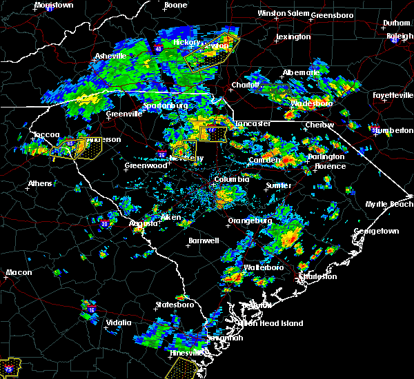 At 449 pm edt, a severe thunderstorm was located 10 miles southeast of chester, or near blackstock, moving east at 10 mph (radar indicated). Hazards include 60 mph wind gusts and quarter size hail. Minor hail damage to vehicles is expected. Expect wind damage to trees and power lines. At 449 pm edt, a severe thunderstorm was located 10 miles southeast of chester, or near blackstock, moving east at 10 mph (radar indicated). Hazards include 60 mph wind gusts and quarter size hail. Minor hail damage to vehicles is expected. Expect wind damage to trees and power lines.
|
| 6/15/2017 6:31 PM EDT |
 At 631 pm edt, a severe thunderstorm was located 10 miles southwest of chester, or 5 miles northeast of carlisle, and is nearly stationary (radar indicated). Hazards include 60 mph wind gusts and nickel size hail. expect damage to trees and power lines At 631 pm edt, a severe thunderstorm was located 10 miles southwest of chester, or 5 miles northeast of carlisle, and is nearly stationary (radar indicated). Hazards include 60 mph wind gusts and nickel size hail. expect damage to trees and power lines
|
| 4/6/2017 1:20 AM EDT |
 At 119 am edt, severe thunderstorms were located along a line extending from 10 miles east of gaffney to 9 miles northeast of union to 17 miles north of newberry, moving east at 65 mph (radar indicated). Hazards include 60 mph wind gusts and quarter size hail. Hail damage to vehicles is expected. expect wind damage to roofs, siding, and trees. Locations impacted include, gaffney, union, york, chester, clover, monarch mill, blacksburg, buffalo, jonesville and lockhart. At 119 am edt, severe thunderstorms were located along a line extending from 10 miles east of gaffney to 9 miles northeast of union to 17 miles north of newberry, moving east at 65 mph (radar indicated). Hazards include 60 mph wind gusts and quarter size hail. Hail damage to vehicles is expected. expect wind damage to roofs, siding, and trees. Locations impacted include, gaffney, union, york, chester, clover, monarch mill, blacksburg, buffalo, jonesville and lockhart.
|
| 4/6/2017 1:00 AM EDT |
 At 1259 am edt, severe thunderstorms were located along a line extending from 11 miles south of columbus to 15 miles southeast of greenville downtown to 14 miles west of laurens, moving east at 55 mph (radar indicated). Hazards include 60 mph wind gusts and quarter size hail. Hail damage to vehicles is expected. Expect wind damage to roofs, siding, and trees. At 1259 am edt, severe thunderstorms were located along a line extending from 11 miles south of columbus to 15 miles southeast of greenville downtown to 14 miles west of laurens, moving east at 55 mph (radar indicated). Hazards include 60 mph wind gusts and quarter size hail. Hail damage to vehicles is expected. Expect wind damage to roofs, siding, and trees.
|
| 4/3/2017 3:58 PM EDT |
 At 358 pm edt, severe thunderstorms were located along a line extending from 6 miles southeast of york to 7 miles northeast of chester to 15 miles north of winnsboro, moving northeast at 50 mph (radar indicated). Hazards include 60 mph wind gusts. Expect damage to trees and minor damage to roofs and siding. locations impacted include, rock hill, chester, fort mill, tega cay, newport, lesslie, great falls, fort lawn, richburg and chester state park. A tornado watch remains in effect until 900 pm edt for upstate south carolina. At 358 pm edt, severe thunderstorms were located along a line extending from 6 miles southeast of york to 7 miles northeast of chester to 15 miles north of winnsboro, moving northeast at 50 mph (radar indicated). Hazards include 60 mph wind gusts. Expect damage to trees and minor damage to roofs and siding. locations impacted include, rock hill, chester, fort mill, tega cay, newport, lesslie, great falls, fort lawn, richburg and chester state park. A tornado watch remains in effect until 900 pm edt for upstate south carolina.
|
| 4/3/2017 3:51 PM EDT | Metal roof peeled off of shop on beltline rd. time estimated from rada in chester county SC, 1.1 miles WSW of Chester, SC |
| 4/3/2017 3:51 PM EDT | Numerous trees down in the town of chester. time estimated from rada in chester county SC, 0.2 miles SSE of Chester, SC |
| 4/3/2017 3:51 PM EDT | Roof torn off of first citizens bank on church st. time estimated from rada in chester county SC, 0.5 miles N of Chester, SC |
| 4/3/2017 3:46 PM EDT |
 At 345 pm edt, severe thunderstorms were located along a line extending from 10 miles southwest of york to near chester to 19 miles northwest of winnsboro, moving northeast at 50 mph (radar indicated). Hazards include 60 mph wind gusts. expect damage to trees and minor damage to roofs and siding At 345 pm edt, severe thunderstorms were located along a line extending from 10 miles southwest of york to near chester to 19 miles northwest of winnsboro, moving northeast at 50 mph (radar indicated). Hazards include 60 mph wind gusts. expect damage to trees and minor damage to roofs and siding
|
| 3/1/2017 8:54 PM EST |
 The severe thunderstorm warning for union and chester counties will expire at 900 pm est, the storms which prompted the warning have weakened below severe limits, and have exited the warned area. therefore the warning will be allowed to expire. if you observed large hail or wind damage, please report it to the national weather service greenville-spartanburg by calling toll free, 1, 800, 2 6 7, 8 1 0 1, or by posting on our facebook page, or tweet it using hashtag nwsgsp. your message should describe the event and the specific location where it occurred. The severe thunderstorm warning for union and chester counties will expire at 900 pm est, the storms which prompted the warning have weakened below severe limits, and have exited the warned area. therefore the warning will be allowed to expire. if you observed large hail or wind damage, please report it to the national weather service greenville-spartanburg by calling toll free, 1, 800, 2 6 7, 8 1 0 1, or by posting on our facebook page, or tweet it using hashtag nwsgsp. your message should describe the event and the specific location where it occurred.
|
| 3/1/2017 8:36 PM EST |
 At 834 pm est, severe thunderstorms were located along a line extending from 9 miles southwest of albemarle north carolina, to 11 miles southwest of monroe, to 11 miles north of winnsboro south carolina, moving east at 65 mph (indicated by radar. some of these storms also have a history of producing damaging winds). Hazards include 60 mph wind gusts and penny size hail. Expect damage to roofs. siding and trees. Locations impacted include, monroe, chester, indian trail, weddington, stallings, unionville, wesley chapel, wingate, waxhaw and marshville. At 834 pm est, severe thunderstorms were located along a line extending from 9 miles southwest of albemarle north carolina, to 11 miles southwest of monroe, to 11 miles north of winnsboro south carolina, moving east at 65 mph (indicated by radar. some of these storms also have a history of producing damaging winds). Hazards include 60 mph wind gusts and penny size hail. Expect damage to roofs. siding and trees. Locations impacted include, monroe, chester, indian trail, weddington, stallings, unionville, wesley chapel, wingate, waxhaw and marshville.
|
| 3/1/2017 8:21 PM EST |
 At 820 pm est, severe thunderstorms were located along a line extending from 9 miles east of uptown charlotte to 3 miles south of rock hill to 16 miles southwest of chester, moving east at 60 mph. several of these storms have already produced damaging winds and large hail (indicated by radar and public reports). Hazards include 60 mph wind gusts and quarter size hail. Hail damage to vehicles is expected. expect wind damage to roofs, siding and trees. Locations impacted include, rock hill, uptown charlotte, monroe, chester, central charlotte, south charlotte, southwest charlotte, east charlotte, matthews and mint hill. At 820 pm est, severe thunderstorms were located along a line extending from 9 miles east of uptown charlotte to 3 miles south of rock hill to 16 miles southwest of chester, moving east at 60 mph. several of these storms have already produced damaging winds and large hail (indicated by radar and public reports). Hazards include 60 mph wind gusts and quarter size hail. Hail damage to vehicles is expected. expect wind damage to roofs, siding and trees. Locations impacted include, rock hill, uptown charlotte, monroe, chester, central charlotte, south charlotte, southwest charlotte, east charlotte, matthews and mint hill.
|
| 3/1/2017 7:45 PM EST |
 At 745 pm est, severe thunderstorms were located along a line extending from 11 miles northwest of york to 10 miles northeast of union to 18 miles northeast of newberry, moving east at 55 mph (radar indicated). Hazards include 60 mph wind gusts and quarter size hail. Hail damage to vehicles is expected. Expect wind damage to roofs, siding and trees. At 745 pm est, severe thunderstorms were located along a line extending from 11 miles northwest of york to 10 miles northeast of union to 18 miles northeast of newberry, moving east at 55 mph (radar indicated). Hazards include 60 mph wind gusts and quarter size hail. Hail damage to vehicles is expected. Expect wind damage to roofs, siding and trees.
|
| 11/30/2016 6:13 PM EST |
 At 613 pm est, severe thunderstorms were located along a line extending from 6 miles north of mocksville to 9 miles southwest of statesville to 10 miles northeast of lincolnton to 9 miles north of winnsboro, moving east at 35 mph (radar indicated). Hazards include 60 mph wind gusts. Expect damage to roofs. Siding and trees. At 613 pm est, severe thunderstorms were located along a line extending from 6 miles north of mocksville to 9 miles southwest of statesville to 10 miles northeast of lincolnton to 9 miles north of winnsboro, moving east at 35 mph (radar indicated). Hazards include 60 mph wind gusts. Expect damage to roofs. Siding and trees.
|
| 11/30/2016 6:07 PM EST |
 At 606 pm est, severe thunderstorms were located along a line extending from near east bend to 7 miles southwest of statesville to near lincolnton to 6 miles southwest of rock hill to 12 miles south of chester, moving northeast at 55 mph (radar indicated). Hazards include 60 mph wind gusts. Expect damage to roofs. siding and trees. Locations impacted include, gastonia, rock hill, hickory, statesville, newton, lincolnton, york, chester, taylorsville and mt holly. At 606 pm est, severe thunderstorms were located along a line extending from near east bend to 7 miles southwest of statesville to near lincolnton to 6 miles southwest of rock hill to 12 miles south of chester, moving northeast at 55 mph (radar indicated). Hazards include 60 mph wind gusts. Expect damage to roofs. siding and trees. Locations impacted include, gastonia, rock hill, hickory, statesville, newton, lincolnton, york, chester, taylorsville and mt holly.
|
| 11/30/2016 6:00 PM EST |
 At 600 pm est, a severe thunderstorm capable of producing a tornado was located 8 miles southwest of chester, or 5 miles southwest of chester state park, moving east at 50 mph (radar indicated rotation). Hazards include tornado. Flying debris will be dangerous to those caught without shelter. mobile homes will be damaged or destroyed. damage to roofs, windows and vehicles will occur. tree damage is likely. this dangerous storm will be near, richburg around 620 pm est. fort lawn around 630 pm est. Other locations impacted by this dangerous storm include leeds, edgemoor, cornwell and blackstock. At 600 pm est, a severe thunderstorm capable of producing a tornado was located 8 miles southwest of chester, or 5 miles southwest of chester state park, moving east at 50 mph (radar indicated rotation). Hazards include tornado. Flying debris will be dangerous to those caught without shelter. mobile homes will be damaged or destroyed. damage to roofs, windows and vehicles will occur. tree damage is likely. this dangerous storm will be near, richburg around 620 pm est. fort lawn around 630 pm est. Other locations impacted by this dangerous storm include leeds, edgemoor, cornwell and blackstock.
|
| 11/30/2016 5:50 PM EST |
 At 550 pm est, a severe thunderstorm capable of producing a tornado was located 15 miles southeast of union, or near carlisle, moving east at 55 mph (radar indicated rotation). Hazards include tornado. Flying debris will be dangerous to those caught without shelter. mobile homes will be damaged or destroyed. damage to roofs, windows and vehicles will occur. tree damage is likely. this dangerous storm will be near, chester state park around 600 pm est. chester and blackstock around 610 pm est. richburg and fort lawn around 620 pm est. Other locations impacted by this dangerous thunderstorm include leeds, edgemoor, cornwell and blackstock. At 550 pm est, a severe thunderstorm capable of producing a tornado was located 15 miles southeast of union, or near carlisle, moving east at 55 mph (radar indicated rotation). Hazards include tornado. Flying debris will be dangerous to those caught without shelter. mobile homes will be damaged or destroyed. damage to roofs, windows and vehicles will occur. tree damage is likely. this dangerous storm will be near, chester state park around 600 pm est. chester and blackstock around 610 pm est. richburg and fort lawn around 620 pm est. Other locations impacted by this dangerous thunderstorm include leeds, edgemoor, cornwell and blackstock.
|
| 11/30/2016 5:42 PM EST |
 At 542 pm est, severe thunderstorms were located along a line extending from 11 miles southwest of yadkinville to 8 miles southwest of newton to 3 miles northwest of shelby to 10 miles east of union to 6 miles north of newberry, moving northeast at 55 mph (radar indicated). Hazards include 60 mph wind gusts. Expect damage to roofs. siding and trees. Locations impacted include, gastonia, rock hill, hickory, statesville, shelby, newton, gaffney, lincolnton, union and york. At 542 pm est, severe thunderstorms were located along a line extending from 11 miles southwest of yadkinville to 8 miles southwest of newton to 3 miles northwest of shelby to 10 miles east of union to 6 miles north of newberry, moving northeast at 55 mph (radar indicated). Hazards include 60 mph wind gusts. Expect damage to roofs. siding and trees. Locations impacted include, gastonia, rock hill, hickory, statesville, shelby, newton, gaffney, lincolnton, union and york.
|
| 11/30/2016 5:26 PM EST |
 At 526 pm est, severe thunderstorms were located along a line extending from 8 miles east of taylorsville to 14 miles north of shelby to 8 miles southeast of forest city to 5 miles south of union to 8 miles west of newberry, moving northeast at 55 mph (radar indicated). Hazards include 60 mph wind gusts. Expect damage to roofs. Siding and trees. At 526 pm est, severe thunderstorms were located along a line extending from 8 miles east of taylorsville to 14 miles north of shelby to 8 miles southeast of forest city to 5 miles south of union to 8 miles west of newberry, moving northeast at 55 mph (radar indicated). Hazards include 60 mph wind gusts. Expect damage to roofs. Siding and trees.
|
| 7/16/2016 6:51 PM EDT | Schp reported a tree down on highway 72 in chester county SC, 4.8 miles ENE of Chester, SC |
| 7/16/2016 6:50 PM EDT | Schp reported a tree down at lancaster highway and old richburg rd in chester county SC, 3.5 miles WSW of Chester, SC |
| 7/15/2016 7:25 PM EDT | Schp reported a tree down at darby rd and henry rd in chester county SC, 4.5 miles SSW of Chester, SC |
| 7/11/2016 4:13 PM EDT |
 At 413 pm edt, a severe thunderstorm was located near chester, moving east at 15 mph (radar indicated). Hazards include 70 mph wind gusts and half dollar size hail. Hail damage to vehicles is expected. expect considerable tree damage. wind damage is also likely to mobile homes, roofs and outbuildings. Locations impacted include, chester, richburg, lowrys, chester state park, cornwell, leeds and edgemoor. At 413 pm edt, a severe thunderstorm was located near chester, moving east at 15 mph (radar indicated). Hazards include 70 mph wind gusts and half dollar size hail. Hail damage to vehicles is expected. expect considerable tree damage. wind damage is also likely to mobile homes, roofs and outbuildings. Locations impacted include, chester, richburg, lowrys, chester state park, cornwell, leeds and edgemoor.
|
| 7/11/2016 4:05 PM EDT | Spotter heard over scanner that trees were down from the storm on baton rouge roa in chester county SC, 5.2 miles E of Chester, SC |
| 7/11/2016 3:55 PM EDT |
 At 355 pm edt, a severe thunderstorm was located 6 miles west of chester, or 5 miles northwest of chester state park, moving east at 15 mph (radar indicated). Hazards include 60 mph wind gusts and quarter size hail. Hail damage to vehicles is expected. Expect wind damage to roofs, siding and trees. At 355 pm edt, a severe thunderstorm was located 6 miles west of chester, or 5 miles northwest of chester state park, moving east at 15 mph (radar indicated). Hazards include 60 mph wind gusts and quarter size hail. Hail damage to vehicles is expected. Expect wind damage to roofs, siding and trees.
|
| 7/7/2016 9:07 PM EDT | Scattered trees downed between leeds...cornwell and blackstoc in chester county SC, 10.2 miles NE of Chester, SC |
| 7/7/2016 9:03 PM EDT | Schp reported tree down along blackstock road in chester county SC, 10.7 miles NNW of Chester, SC |
| 7/7/2016 8:38 PM EDT |
 The severe thunderstorm warning for southern chester county will expire at 845 pm edt, the storm which prompted the warning has moved out of the area. therefore the warning will be allowed to expire. The severe thunderstorm warning for southern chester county will expire at 845 pm edt, the storm which prompted the warning has moved out of the area. therefore the warning will be allowed to expire.
|
| 7/7/2016 8:13 PM EDT | Reported numerous trees down and power outages in the blackstock area with several roads blocked. in fairfield county SC, 11.3 miles NNW of Chester, SC |
| 7/7/2016 8:08 PM EDT | Trees down along hwy. 321 near the county line. in fairfield county SC, 10.4 miles NNW of Chester, SC |
| 7/7/2016 8:07 PM EDT |
 At 806 pm edt, a severe thunderstorm was located 7 miles south of chester, or 4 miles northwest of blackstock, moving southeast at 30 mph (radar indicated). Hazards include 60 mph wind gusts and quarter size hail. Hail damage to vehicles is expected. Expect wind damage to roofs, siding and trees. At 806 pm edt, a severe thunderstorm was located 7 miles south of chester, or 4 miles northwest of blackstock, moving southeast at 30 mph (radar indicated). Hazards include 60 mph wind gusts and quarter size hail. Hail damage to vehicles is expected. Expect wind damage to roofs, siding and trees.
|
| 7/7/2016 7:24 PM EDT |
 At 723 pm edt, a severe thunderstorm was located near chester, moving southeast at 25 mph (radar indicated). Hazards include 60 mph wind gusts and quarter size hail. Hail damage to vehicles is expected. expect wind damage to roofs, siding and trees. Locations impacted include, chester, great falls, fort lawn, richburg, lowrys, edgemoor and fishing creek reservoir. At 723 pm edt, a severe thunderstorm was located near chester, moving southeast at 25 mph (radar indicated). Hazards include 60 mph wind gusts and quarter size hail. Hail damage to vehicles is expected. expect wind damage to roofs, siding and trees. Locations impacted include, chester, great falls, fort lawn, richburg, lowrys, edgemoor and fishing creek reservoir.
|
| 7/7/2016 7:11 PM EDT | County comms reports scattered trees and power lines down across the eastern half of the county...including locales near edgemoor...richburg and great fall in chester county SC, 8 miles W of Chester, SC |
| 7/7/2016 6:56 PM EDT |
 At 656 pm edt, a severe thunderstorm was located near chester, moving southeast at 40 mph (radar indicated). Hazards include 60 mph wind gusts and quarter size hail. Hail damage to vehicles is expected. Expect wind damage to roofs, siding and trees. At 656 pm edt, a severe thunderstorm was located near chester, moving southeast at 40 mph (radar indicated). Hazards include 60 mph wind gusts and quarter size hail. Hail damage to vehicles is expected. Expect wind damage to roofs, siding and trees.
|
| 7/7/2016 6:06 PM EDT |
 At 606 pm edt, severe thunderstorms were located along a line extending from 15 miles west of york to 9 miles southwest of gaffney, moving southeast at 40 mph (radar indicated). Hazards include 60 mph wind gusts and quarter size hail. Hail damage to vehicles is expected. Expect wind damage to roofs, siding and trees. At 606 pm edt, severe thunderstorms were located along a line extending from 15 miles west of york to 9 miles southwest of gaffney, moving southeast at 40 mph (radar indicated). Hazards include 60 mph wind gusts and quarter size hail. Hail damage to vehicles is expected. Expect wind damage to roofs, siding and trees.
|
| 6/14/2016 6:43 PM EDT |
 At 643 pm edt, severe thunderstorms were located along a line extending from 11 miles east of union to 5 miles north of chester to 13 miles west of lancaster, moving northeast at 10 mph (radar indicated). Hazards include 60 mph wind gusts. Expect damage to roofs. siding and trees. Locations impacted include, chester, lockhart, mcconnells, richburg, lowrys, catawba, edgemoor, bullock creek, lesslie and chester state park. At 643 pm edt, severe thunderstorms were located along a line extending from 11 miles east of union to 5 miles north of chester to 13 miles west of lancaster, moving northeast at 10 mph (radar indicated). Hazards include 60 mph wind gusts. Expect damage to roofs. siding and trees. Locations impacted include, chester, lockhart, mcconnells, richburg, lowrys, catawba, edgemoor, bullock creek, lesslie and chester state park.
|
| 6/14/2016 6:42 PM EDT | Tree down at hardin staigt rd and yor in chester county SC, 4.4 miles S of Chester, SC |
| 6/14/2016 6:24 PM EDT | Tree down at 524 brendale d in chester county SC, 0.9 miles S of Chester, SC |
| 6/14/2016 6:24 PM EDT | Tree down at beltline rd and hamilton r in chester county SC, 2.3 miles WNW of Chester, SC |
| 6/14/2016 6:16 PM EDT |
 At 616 pm edt, severe thunderstorms were located along a line extending from 7 miles east of union to near chester to 9 miles southwest of lancaster, moving northeast at 15 mph (radar indicated). Hazards include 60 mph wind gusts and quarter size hail. Hail damage to vehicles is expected. Expect wind damage to roofs, siding and trees. At 616 pm edt, severe thunderstorms were located along a line extending from 7 miles east of union to near chester to 9 miles southwest of lancaster, moving northeast at 15 mph (radar indicated). Hazards include 60 mph wind gusts and quarter size hail. Hail damage to vehicles is expected. Expect wind damage to roofs, siding and trees.
|
| 5/31/2016 6:50 PM EDT |
 At 650 pm edt, a severe thunderstorm was located 8 miles southwest of rock hill, or 5 miles east of mcconnells, moving south at 5 mph (radar indicated). Hazards include 60 mph wind gusts and quarter size hail. Hail damage to vehicles is expected. Expect wind damage to roofs, siding and trees. At 650 pm edt, a severe thunderstorm was located 8 miles southwest of rock hill, or 5 miles east of mcconnells, moving south at 5 mph (radar indicated). Hazards include 60 mph wind gusts and quarter size hail. Hail damage to vehicles is expected. Expect wind damage to roofs, siding and trees.
|
| 5/11/2016 5:10 PM EDT |
 At 510 pm edt, a severe thunderstorm was located 9 miles southwest of york, or 4 miles south of sharon, moving east at 15 mph (radar indicated). Hazards include 60 mph wind gusts and quarter size hail. Hail damage to vehicles is expected. Expect wind damage to roofs, siding and trees. At 510 pm edt, a severe thunderstorm was located 9 miles southwest of york, or 4 miles south of sharon, moving east at 15 mph (radar indicated). Hazards include 60 mph wind gusts and quarter size hail. Hail damage to vehicles is expected. Expect wind damage to roofs, siding and trees.
|
| 5/2/2016 4:00 PM EDT | Quarter sized hail reported 10 miles NNW of Chester, SC, 1 inch hail reported. |
| 5/2/2016 3:32 PM EDT |
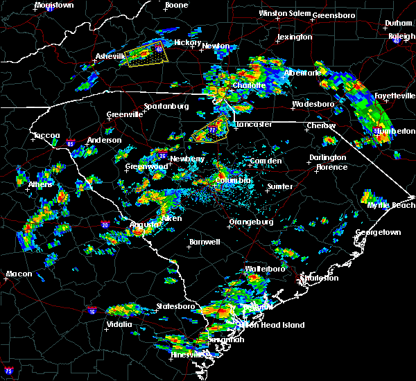 At 332 pm edt, a severe thunderstorm was located 6 miles south of chester, or 4 miles northwest of blackstock, moving northeast at 25 mph (radar indicated). Hazards include 60 mph wind gusts and quarter size hail. Hail damage to vehicles is expected. Expect wind damage to roofs, siding and trees. At 332 pm edt, a severe thunderstorm was located 6 miles south of chester, or 4 miles northwest of blackstock, moving northeast at 25 mph (radar indicated). Hazards include 60 mph wind gusts and quarter size hail. Hail damage to vehicles is expected. Expect wind damage to roofs, siding and trees.
|
| 3/14/2016 9:41 PM EDT |
 The severe thunderstorm warning for southern union, southeastern york and chester counties will expire at 945 pm edt, the line of storms which prompted the warning have moved out of the area. therefore the warning will be allowed to expire. however gusty winds are still possible with these thunderstorms. The severe thunderstorm warning for southern union, southeastern york and chester counties will expire at 945 pm edt, the line of storms which prompted the warning have moved out of the area. therefore the warning will be allowed to expire. however gusty winds are still possible with these thunderstorms.
|
| 3/14/2016 9:11 PM EDT |
 At 911 pm edt, doppler radar indicated a line of severe thunderstorms capable of producing quarter size hail and damaging winds in excess of 60 mph. these storms were located along a line extending from 8 miles east of rock hill to 13 miles southwest of union, moving east at 25 mph. locations impacted include, chester, lesslie, great falls, monarch mill, fort lawn, lockhart, carlisle, richburg, lowrys and chester state park. At 911 pm edt, doppler radar indicated a line of severe thunderstorms capable of producing quarter size hail and damaging winds in excess of 60 mph. these storms were located along a line extending from 8 miles east of rock hill to 13 miles southwest of union, moving east at 25 mph. locations impacted include, chester, lesslie, great falls, monarch mill, fort lawn, lockhart, carlisle, richburg, lowrys and chester state park.
|
| 3/14/2016 8:40 PM EDT |
 At 839 pm edt, doppler radar indicated a line of severe thunderstorms capable of producing quarter size hail and damaging winds in excess of 60 mph. these storms were located along a line extending from 9 miles south of york to 8 miles south of union, and moving east at 30 mph. * locations in the warning include, rock hill, chester, lesslie, great falls, monarch mill, fort lawn, lockhart, carlisle, mcconnells and richburg. At 839 pm edt, doppler radar indicated a line of severe thunderstorms capable of producing quarter size hail and damaging winds in excess of 60 mph. these storms were located along a line extending from 9 miles south of york to 8 miles south of union, and moving east at 30 mph. * locations in the warning include, rock hill, chester, lesslie, great falls, monarch mill, fort lawn, lockhart, carlisle, mcconnells and richburg.
|
| 2/24/2016 12:55 PM EST |
 At 1255 pm est, doppler radar indicated a line of severe thunderstorms capable of producing damaging winds in excess of 60 mph. these storms were located along a line extending from 4 miles southeast of mocksville to near downtown concord to 7 miles southeast of rock hill, moving northeast at 70 mph. locations impacted include, rock hill, uptown charlotte, huntersville, kannapolis, downtown concord, monroe, salisbury, york, chester and mocksville. a tornado watch remains in effect until 700 pm est for central north carolina and central south carolina. At 1255 pm est, doppler radar indicated a line of severe thunderstorms capable of producing damaging winds in excess of 60 mph. these storms were located along a line extending from 4 miles southeast of mocksville to near downtown concord to 7 miles southeast of rock hill, moving northeast at 70 mph. locations impacted include, rock hill, uptown charlotte, huntersville, kannapolis, downtown concord, monroe, salisbury, york, chester and mocksville. a tornado watch remains in effect until 700 pm est for central north carolina and central south carolina.
|
| 2/24/2016 12:13 PM EST |
 At 1212 pm est, doppler radar indicated a line of severe thunderstorms capable of producing damaging winds in excess of 60 mph. these storms were located along a line extending from 8 miles east of gastonia to 15 miles west of winnsboro, and moving northeast at 85 mph. * locations in the warning include, rock hill, uptown charlotte, huntersville, kannapolis, downtown concord, monroe, salisbury, york, chester and mocksville. At 1212 pm est, doppler radar indicated a line of severe thunderstorms capable of producing damaging winds in excess of 60 mph. these storms were located along a line extending from 8 miles east of gastonia to 15 miles west of winnsboro, and moving northeast at 85 mph. * locations in the warning include, rock hill, uptown charlotte, huntersville, kannapolis, downtown concord, monroe, salisbury, york, chester and mocksville.
|
| 9/4/2015 8:36 PM EDT |
 At 836 pm edt, doppler radar indicated a severe thunderstorm capable of producing quarter size hail and damaging winds in excess of 60 mph. this storm was located 6 miles northwest of chester, or near lowrys, moving south at 15 mph. locations impacted include, chester, lowrys and chester state park. At 836 pm edt, doppler radar indicated a severe thunderstorm capable of producing quarter size hail and damaging winds in excess of 60 mph. this storm was located 6 miles northwest of chester, or near lowrys, moving south at 15 mph. locations impacted include, chester, lowrys and chester state park.
|
| 9/4/2015 8:22 PM EDT |
 At 822 pm edt, doppler radar indicated a severe thunderstorm capable of producing quarter size hail and damaging winds in excess of 60 mph. this storm was located 8 miles north of chester, or near lowrys, and moving south at 15 mph. * locations in the warning include, chester, lowrys, chester state park and mcconnells. At 822 pm edt, doppler radar indicated a severe thunderstorm capable of producing quarter size hail and damaging winds in excess of 60 mph. this storm was located 8 miles north of chester, or near lowrys, and moving south at 15 mph. * locations in the warning include, chester, lowrys, chester state park and mcconnells.
|
| 8/6/2015 5:36 PM EDT |
 The severe thunderstorm warning for southeastern union and southern chester counties will expire at 545 pm edt, the storm which prompted the warning has moved out of the area. therefore the warning will be allowed to expire. The severe thunderstorm warning for southeastern union and southern chester counties will expire at 545 pm edt, the storm which prompted the warning has moved out of the area. therefore the warning will be allowed to expire.
|
| 8/6/2015 5:24 PM EDT |
 At 523 pm edt, doppler radar indicated a severe thunderstorm with a history of producing damaging winds in excess of 60 mph. this storm was located 14 miles southeast of union, or near carlisle, moving east at 35 mph. locations impacted include, chester, great falls, carlisle, chester state park, blackstock, blackstock, santuc, cornwell, leeds and fishing creek reservoir. At 523 pm edt, doppler radar indicated a severe thunderstorm with a history of producing damaging winds in excess of 60 mph. this storm was located 14 miles southeast of union, or near carlisle, moving east at 35 mph. locations impacted include, chester, great falls, carlisle, chester state park, blackstock, blackstock, santuc, cornwell, leeds and fishing creek reservoir.
|
| 8/6/2015 5:02 PM EDT |
 At 501 pm edt, doppler radar indicated a line of severe thunderstorms with a history of producing damaging winds in excess of 60 mph. these storms were located along a line extending from 8 miles northwest of york to 11 miles north of chester to 14 miles southeast of union, moving east at 35 mph. penny size hail may also accompany the damaging winds. locations impacted include, rock hill, york, chester, fort mill, tega cay, clover, newport, town of lake wylie, lesslie and great falls. At 501 pm edt, doppler radar indicated a line of severe thunderstorms with a history of producing damaging winds in excess of 60 mph. these storms were located along a line extending from 8 miles northwest of york to 11 miles north of chester to 14 miles southeast of union, moving east at 35 mph. penny size hail may also accompany the damaging winds. locations impacted include, rock hill, york, chester, fort mill, tega cay, clover, newport, town of lake wylie, lesslie and great falls.
|
| 8/6/2015 4:34 PM EDT |
 At 434 pm edt, doppler radar indicated a line of severe thunderstorms with a history of producing quarter size hail and damaging winds in excess of 60 mph. these storms were located along a line extending from 5 miles northeast of gaffney to 9 miles southwest of union, and moving east at 35 mph. * locations in the warning include, rock hill, york, chester, fort mill, tega cay, clover, newport, town of lake wylie, lesslie and great falls. At 434 pm edt, doppler radar indicated a line of severe thunderstorms with a history of producing quarter size hail and damaging winds in excess of 60 mph. these storms were located along a line extending from 5 miles northeast of gaffney to 9 miles southwest of union, and moving east at 35 mph. * locations in the warning include, rock hill, york, chester, fort mill, tega cay, clover, newport, town of lake wylie, lesslie and great falls.
|
| 7/19/2015 5:49 PM EDT | Sc hwy patrol reported a tree fallen onto lewis store road near old douglass road. this is near the community of blackstoc in fairfield county SC, 12.4 miles N of Chester, SC |
| 7/13/2015 9:44 PM EDT |
 At 943 pm edt, doppler radar indicated a line of severe thunderstorms capable of producing damaging winds in excess of 60 mph. these storms were located along a line extending from 4 miles southwest of monroe to 7 miles northeast of chester to 13 miles southwest of union to 15 miles north of laurens, moving southeast at 20 mph. penny size hail may also accompany the damaging winds. locations impacted include, rock hill, union, chester, weddington, waxhaw, mineral springs, lesslie, great falls, monarch mill and marvin. At 943 pm edt, doppler radar indicated a line of severe thunderstorms capable of producing damaging winds in excess of 60 mph. these storms were located along a line extending from 4 miles southwest of monroe to 7 miles northeast of chester to 13 miles southwest of union to 15 miles north of laurens, moving southeast at 20 mph. penny size hail may also accompany the damaging winds. locations impacted include, rock hill, union, chester, weddington, waxhaw, mineral springs, lesslie, great falls, monarch mill and marvin.
|
| 7/13/2015 9:24 PM EDT |
 At 923 pm edt, doppler radar indicated a line of severe thunderstorms capable of producing quarter size hail and damaging winds in excess of 60 mph. these storms were located along a line extending from 13 miles west of monroe to 6 miles southwest of york to 4 miles southwest of union to 15 miles south of spartanburg, and moving southeast at 25 mph. At 923 pm edt, doppler radar indicated a line of severe thunderstorms capable of producing quarter size hail and damaging winds in excess of 60 mph. these storms were located along a line extending from 13 miles west of monroe to 6 miles southwest of york to 4 miles southwest of union to 15 miles south of spartanburg, and moving southeast at 25 mph.
|
| 4/20/2015 6:15 PM EDT | At 614 pm edt, national weather service doppler radar continued to indicate a severe thunderstorm capable of producing quarter size. |
| 4/20/2015 6:02 PM EDT | At 602 pm edt, national weather service doppler radar indicated a severe thunderstorm capable of producing a tornado near lowrys, or 6 miles north of chester, moving east at 45 mph. * the tornado will be near, richburg by 615 pm edt, catawba and 7 miles north of fort lawn by 620 pm edt,. |
| 4/20/2015 5:39 PM EDT | At 538 pm edt, national weather service doppler radar indicated a severe thunderstorm capable of producing quarter size hail, and destructive winds in excess of 70 mph. this storm was located near lockhart, or 9 miles east of union, and moving east at 45 mph. * the severe thunderstorm will be near, lowrys, mcconnells and 6 miles north of chester by 555 pm edt, 8 miles north of richburg by 610 pm edt, 8 miles south of rock hill by 615 pm edt, catawba by 620 pm edt,. |
| 4/20/2015 5:01 PM EDT | At 500 pm edt, national weather service doppler radar indicated a severe thunderstorm capable of producing golf ball size hail, and destructive winds in excess of 70 mph. this storm was located 8 miles northwest of cross keys, or 15 miles northeast of laurens, and moving east at 55 mph. * the severe thunderstorm will be near, buffalo and 8 miles south of jonesville by 510 pm edt, union by 515 pm edt, lockhart by 525 pm edt, lowrys and chester by 540 pm edt,. |
| 4/7/2015 7:50 PM EDT | A severe thunderstorm warning remains in effect until 815 pm edt for southern chester county. at 750 pm edt. doppler radar indicated a severe thunderstorm capable of producing quarter size hail and damaging winds in excess of 60 mph. this storm was located 8 miles south of chester. or near blackstock. Moving southeast at 25 mph. |
| 4/7/2015 7:29 PM EDT | The national weather service in greenville-spartanburg has issued a * severe thunderstorm warning for. chester county in upstate south carolina. until 815 pm edt * at 729 pm edt. Doppler radar indicated a severe thunderstorm capable of producing quarter size hail and damaging winds in excess. |
| 4/7/2015 7:20 PM EDT | A severe thunderstorm warning remains in effect until 730 pm edt for western chester county. at 718 pm edt. doppler radar and confirmed reports indicated a severe thunderstorm producing large hail up to ping pong ball size and capable of producing damaging winds in excess of 60 mph. this storm was located 11 miles west of chester. Or 6 miles northeast of. |
| 4/7/2015 6:43 PM EDT | The national weather service in greenville-spartanburg has issued a * severe thunderstorm warning for. northeastern union county in upstate south carolina. southwestern york county in upstate south carolina. western chester county in upstate south carolina. Until 730 pm edt. |
| 8/2/2012 8:54 PM EDT | Trees down on boyd road betweeen the intersection of motes drive and the intersection of wallace road. time determined from rada in chester county SC, 6.6 miles NW of Chester, SC |
| 4/27/2012 7:30 PM EDT | Quarter sized hail reported 11.3 miles NNW of Chester, SC, public reported penny to quarter size hail at blackstock. |
| 4/27/2012 7:25 PM EDT | Quarter sized hail reported 10.7 miles NNW of Chester, SC |
| 4/3/2012 10:06 PM EDT | A couple trees down on ashford roa in chester county SC, 5.3 miles N of Chester, SC |
| 8/29/2011 4:20 PM EDT | Quarter sized hail reported 2.8 miles SW of Chester, SC, dime to quarter sized hail fell for a short time on langley drive. strong wind with the storm but not enough to blow down any limbs. |
| 1/1/0001 12:00 AM | Tree down at hwy 321 and columbia roa in chester county SC, 6.9 miles NNW of Chester, SC |
| 1/1/0001 12:00 AM | Tree down on cornwell road just west of cornwel in chester county SC, 6.7 miles N of Chester, SC |
| 1/1/0001 12:00 AM | Tree down on hilltop dr near high s in chester county SC, 0.2 miles SSE of Chester, SC |
| 1/1/0001 12:00 AM | Ham radio operator reported power lines down on dawson dr. other power lines are down in the western part of the count in chester county SC, 0.2 miles SSE of Chester, SC |
| 1/1/0001 12:00 AM | Quarter sized hail reported 7.1 miles SSE of Chester, SC, quarter sized hail near lowrys relayed from public through ham radio. |
| 4/9/2011 10:30 PM EDT | Half Dollar sized hail reported 3.3 miles WNW of Chester, SC |
| 4/9/2011 10:25 PM EDT | Ping Pong Ball sized hail reported 0.2 miles SSE of Chester, SC |
| 4/9/2011 9:23 PM EDT | Quarter sized hail reported 1.9 miles WSW of Chester, SC |
| 1/1/0001 12:00 AM | Quarter sized hail reported 3.9 miles SSE of Chester, SC |
Hail Maps for Chester, SC
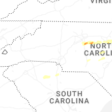


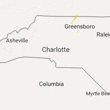


Connect with Interactive Hail Maps