

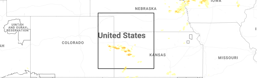
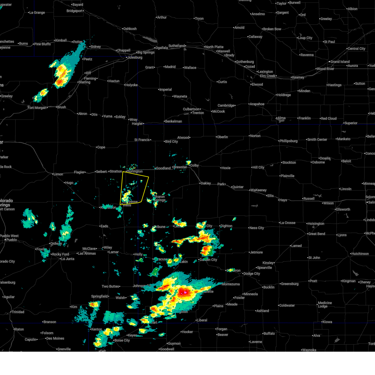
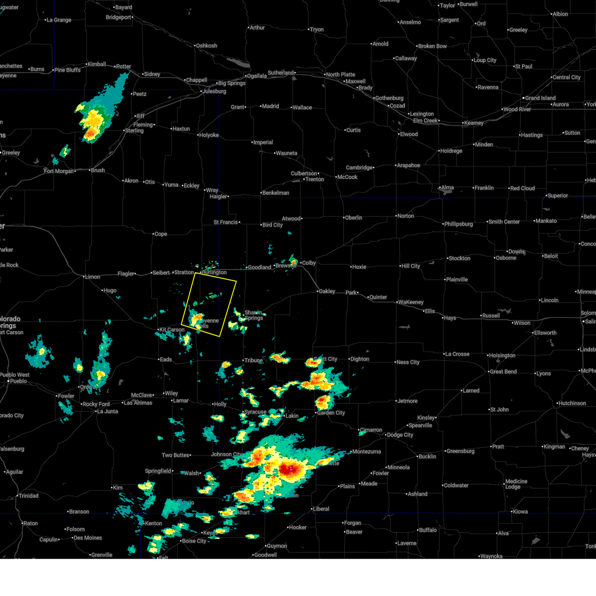
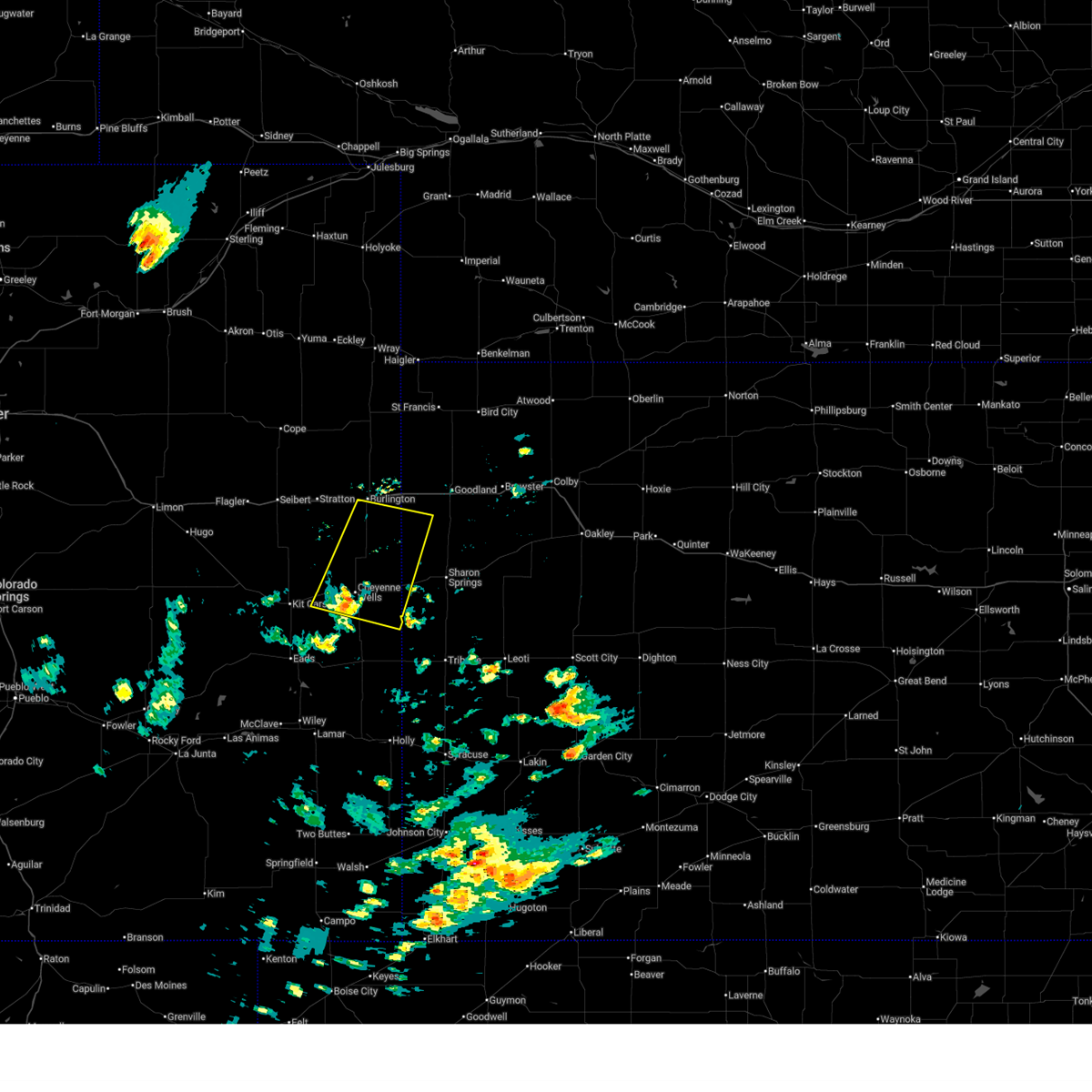
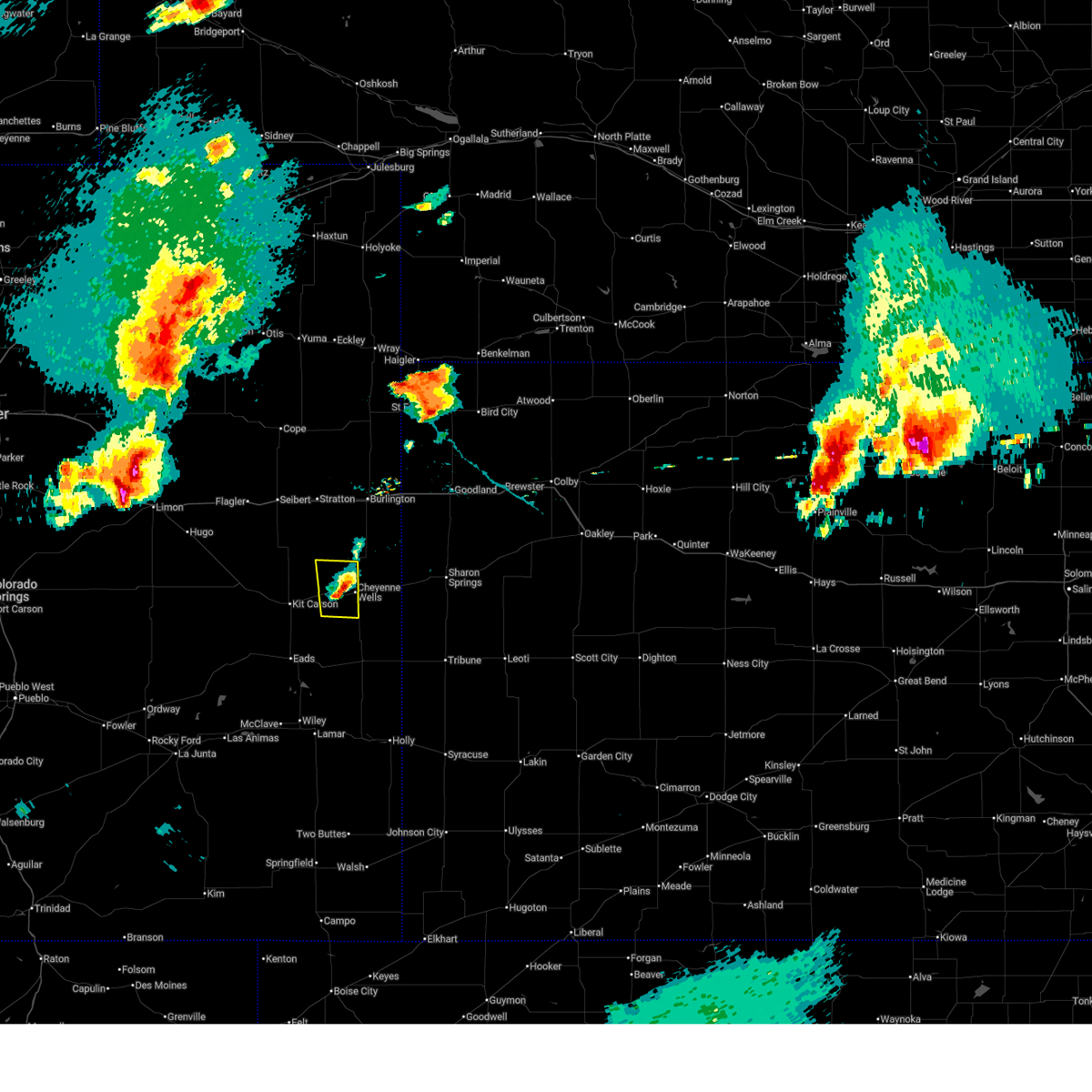
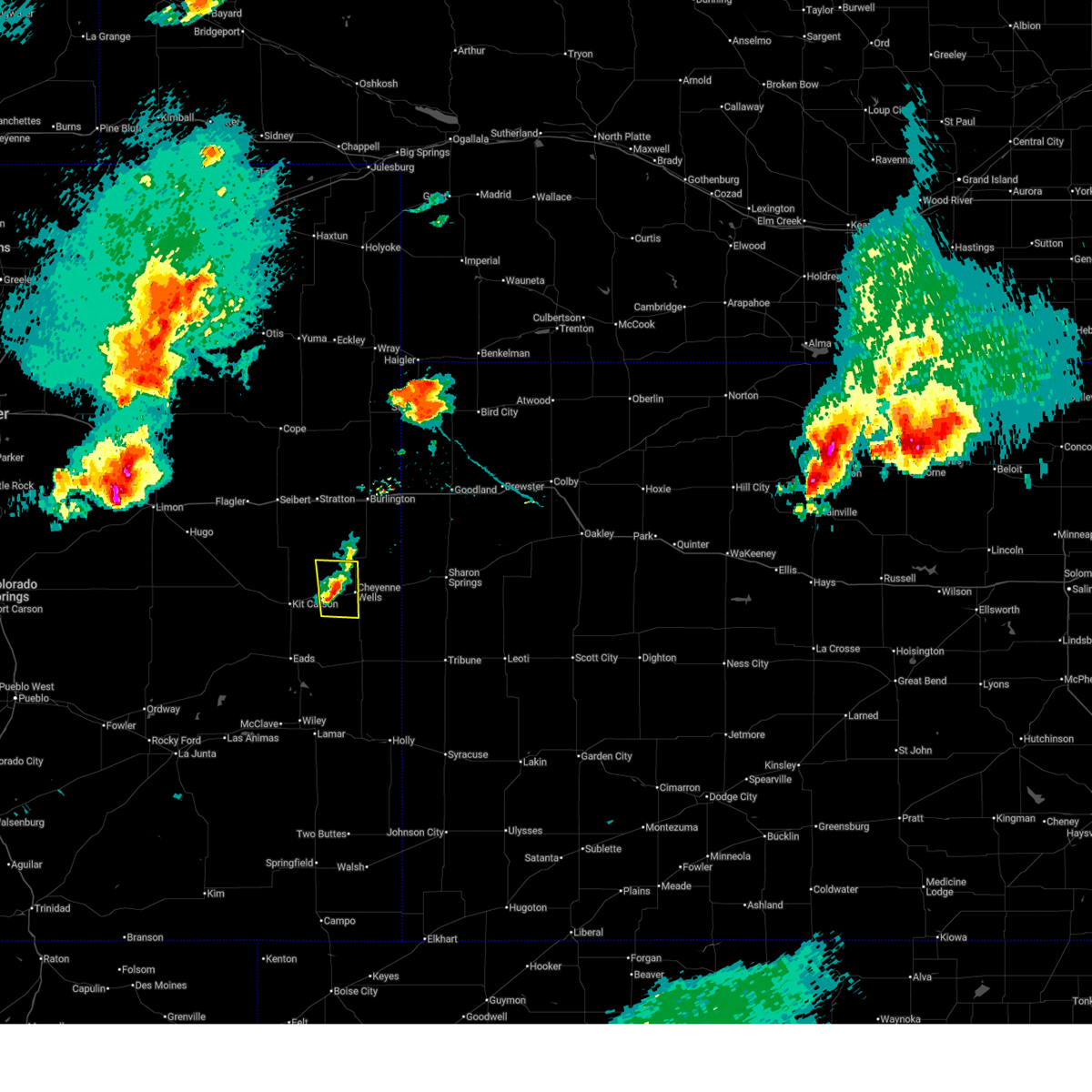
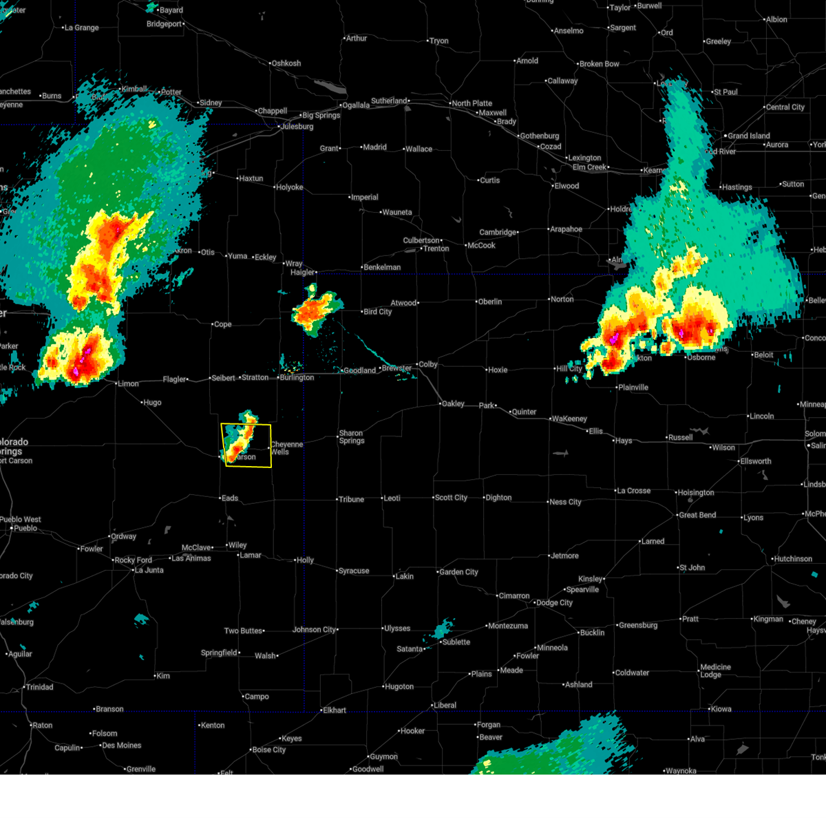
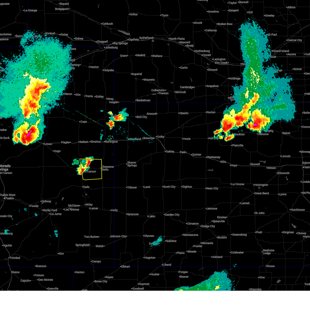
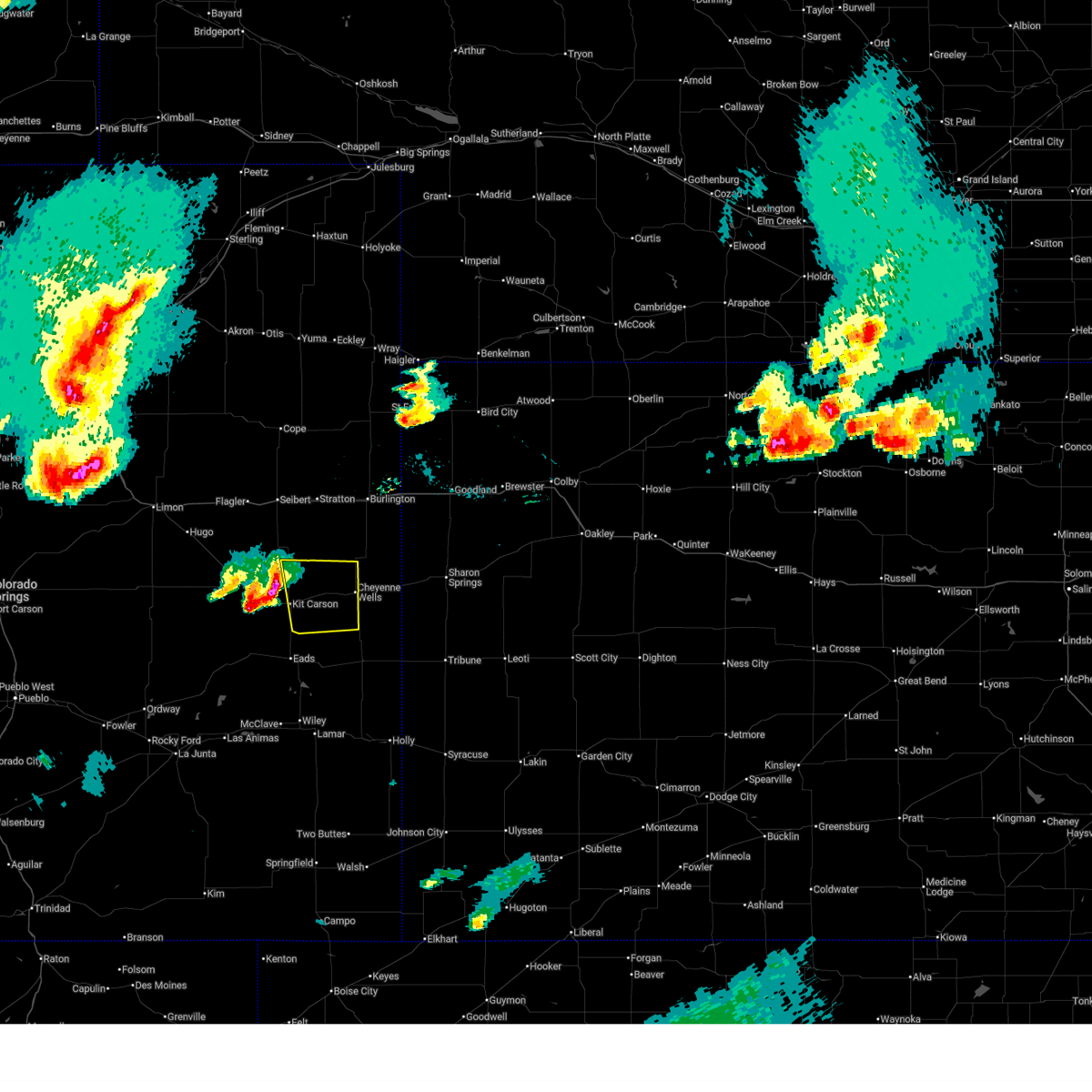
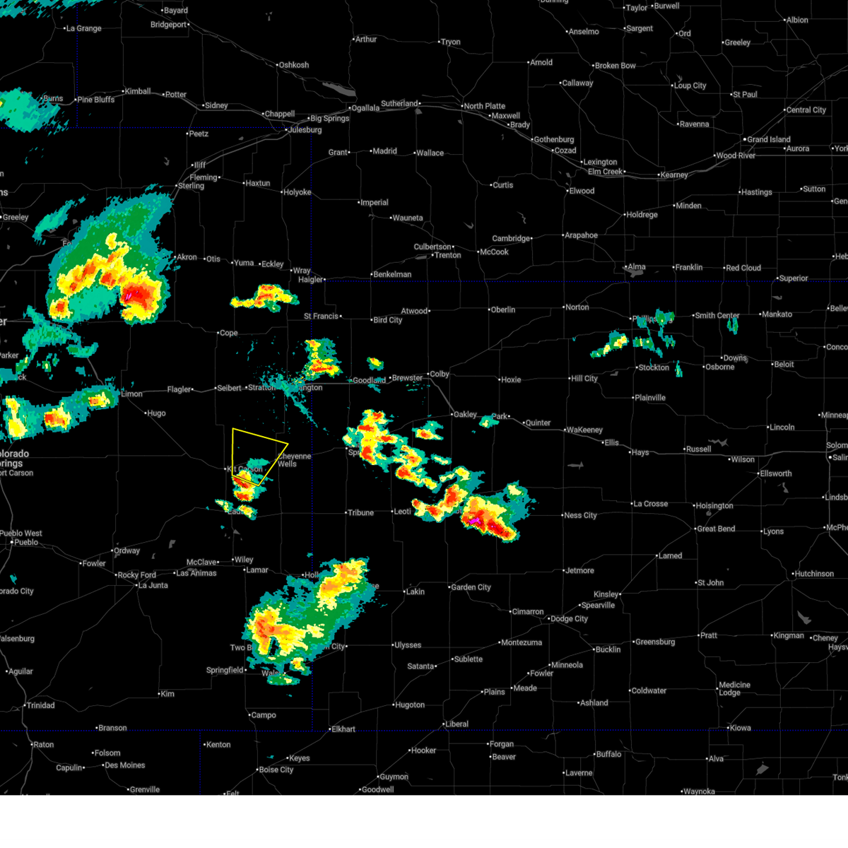
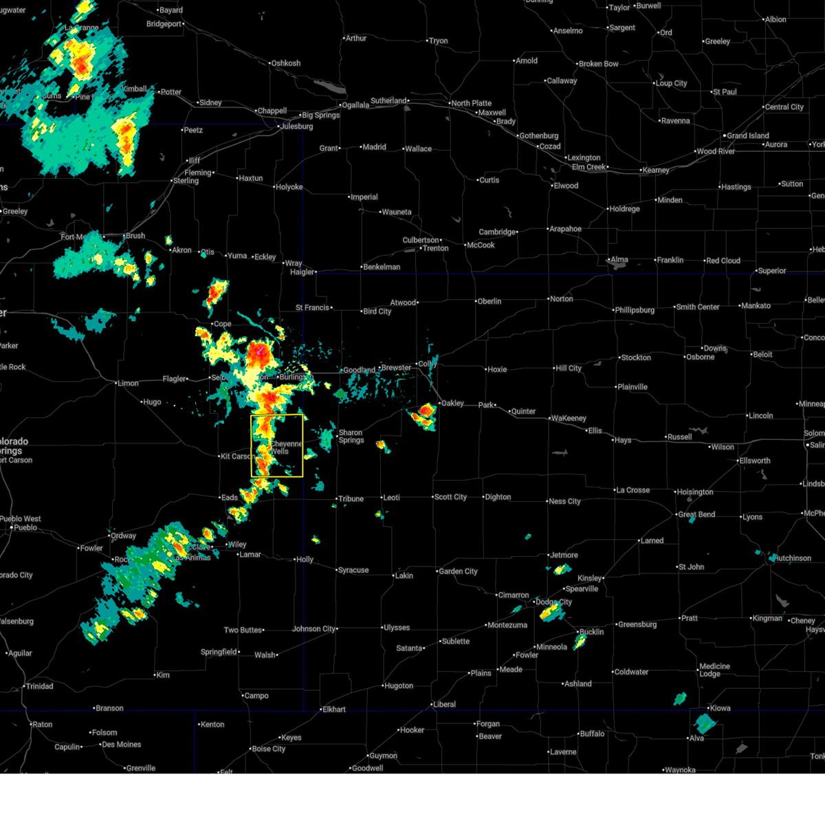
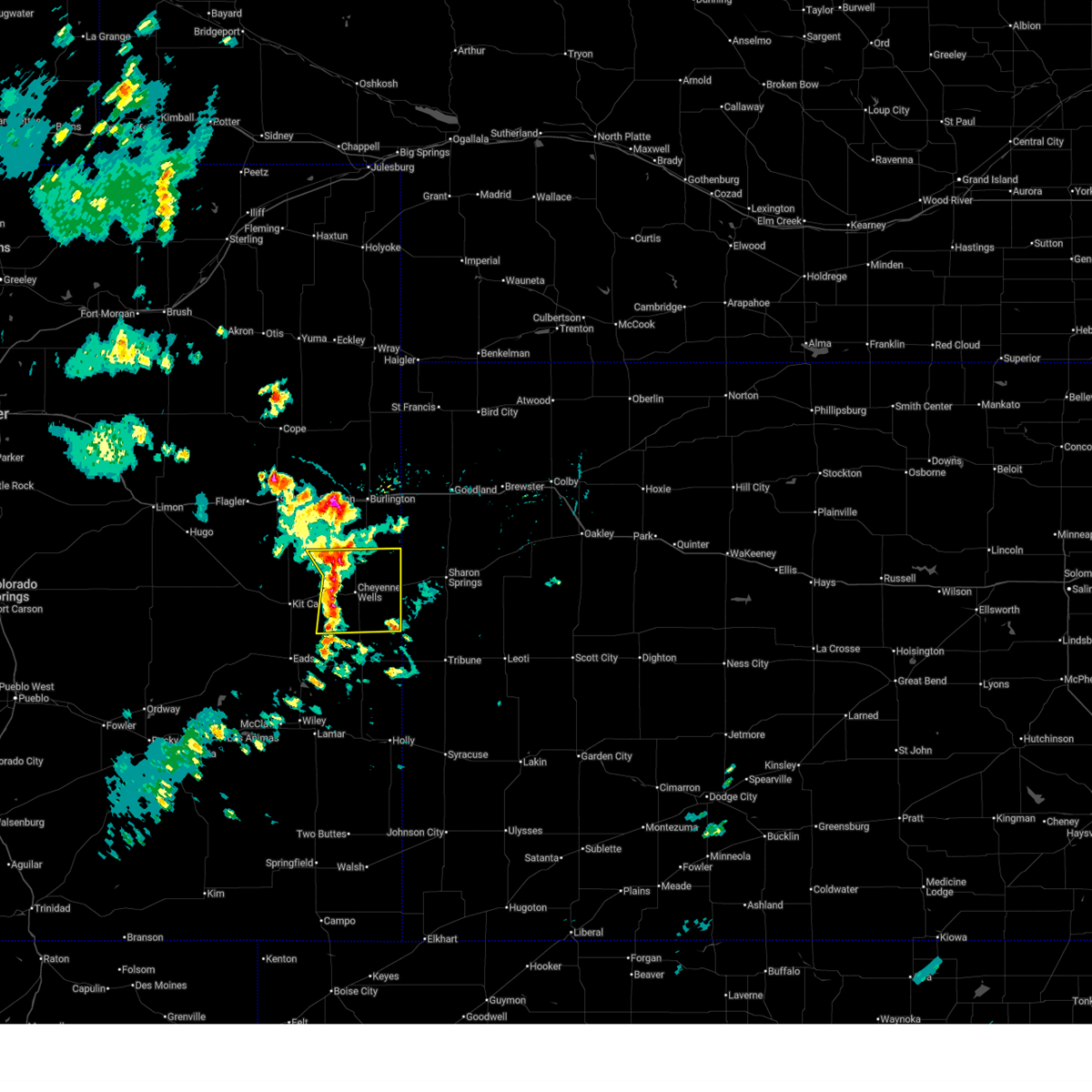
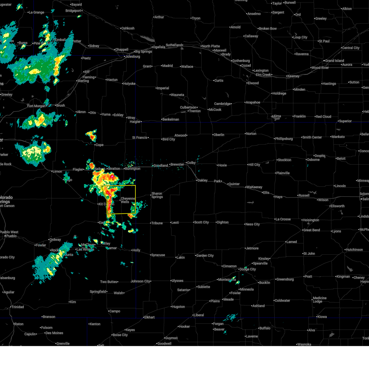
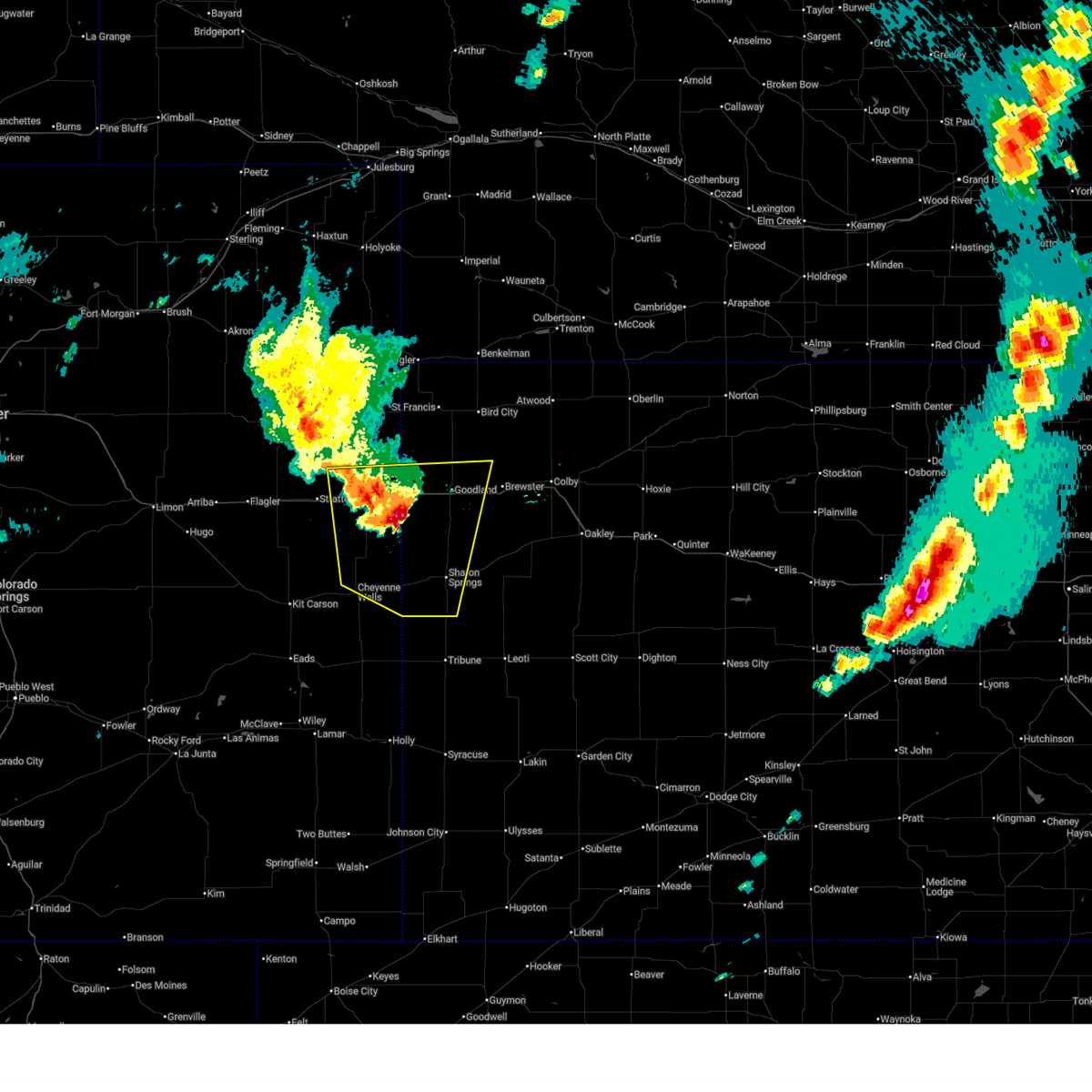
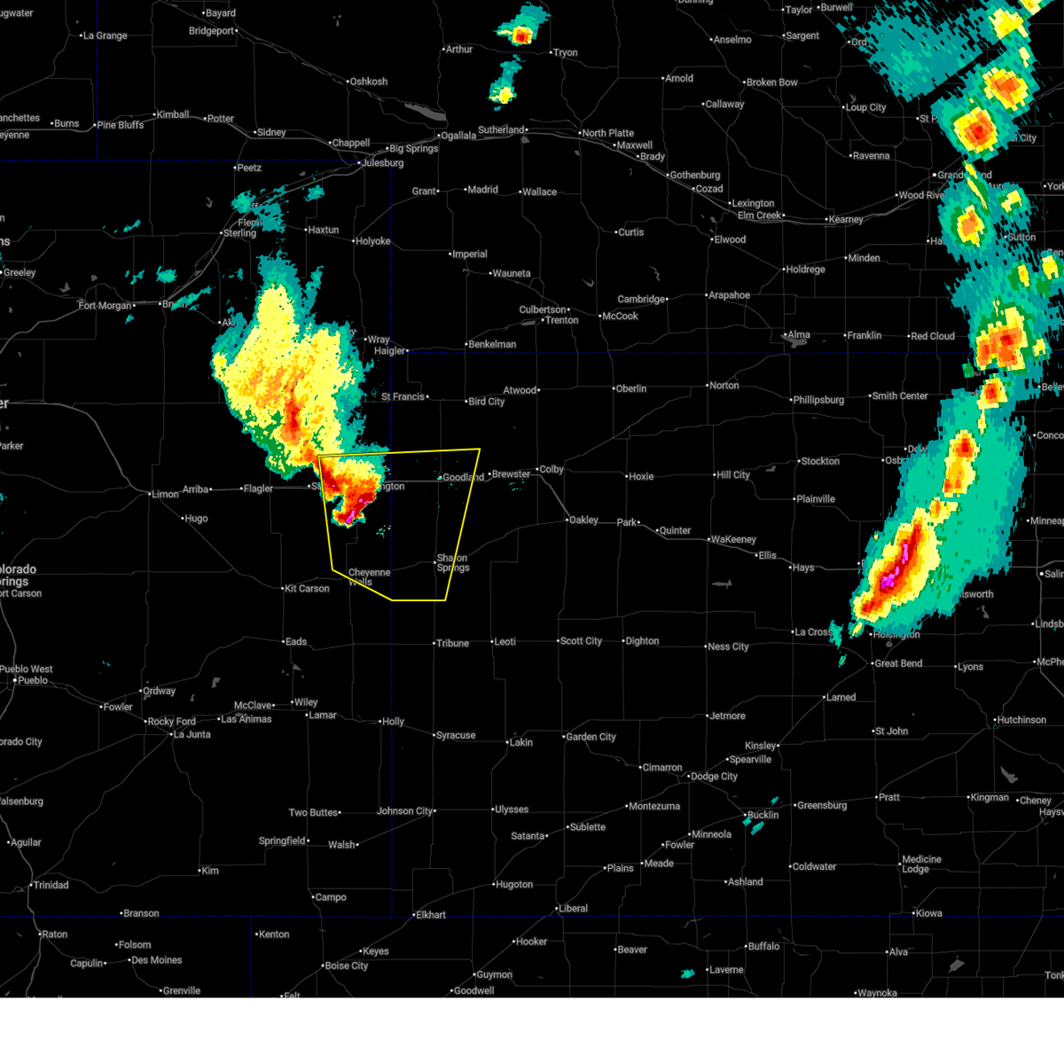
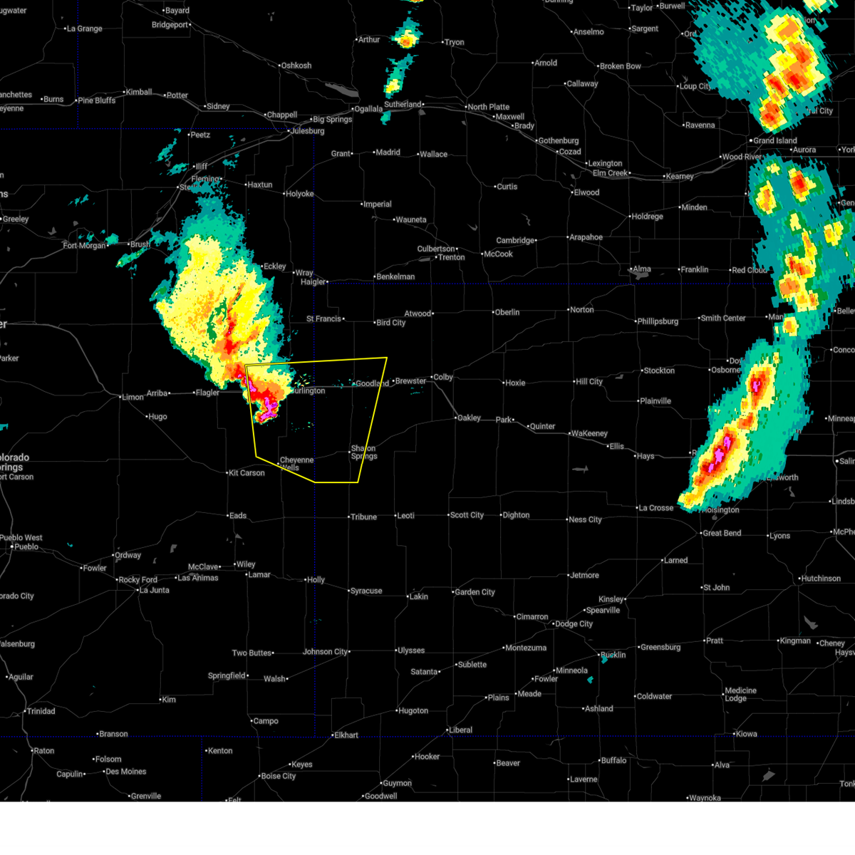
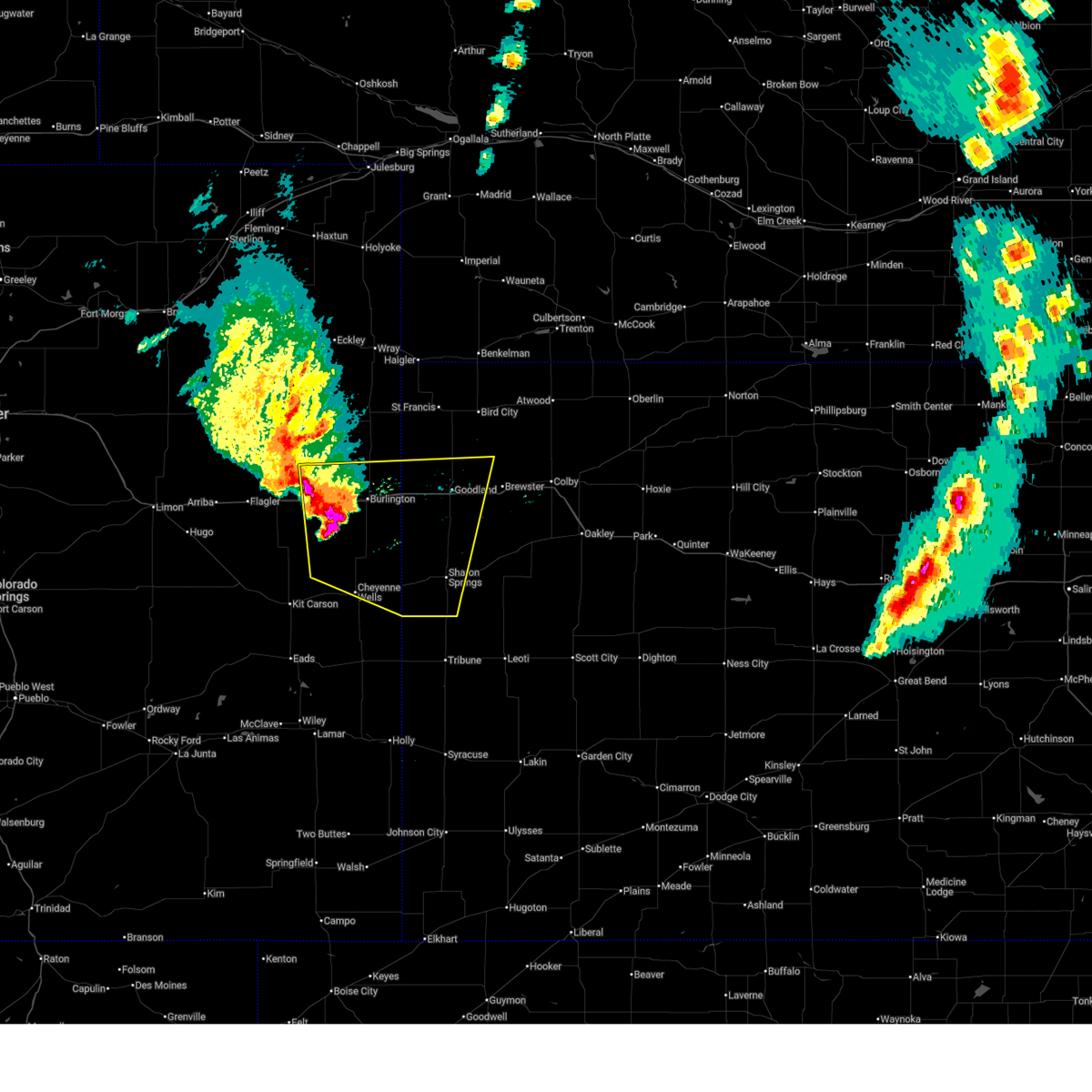
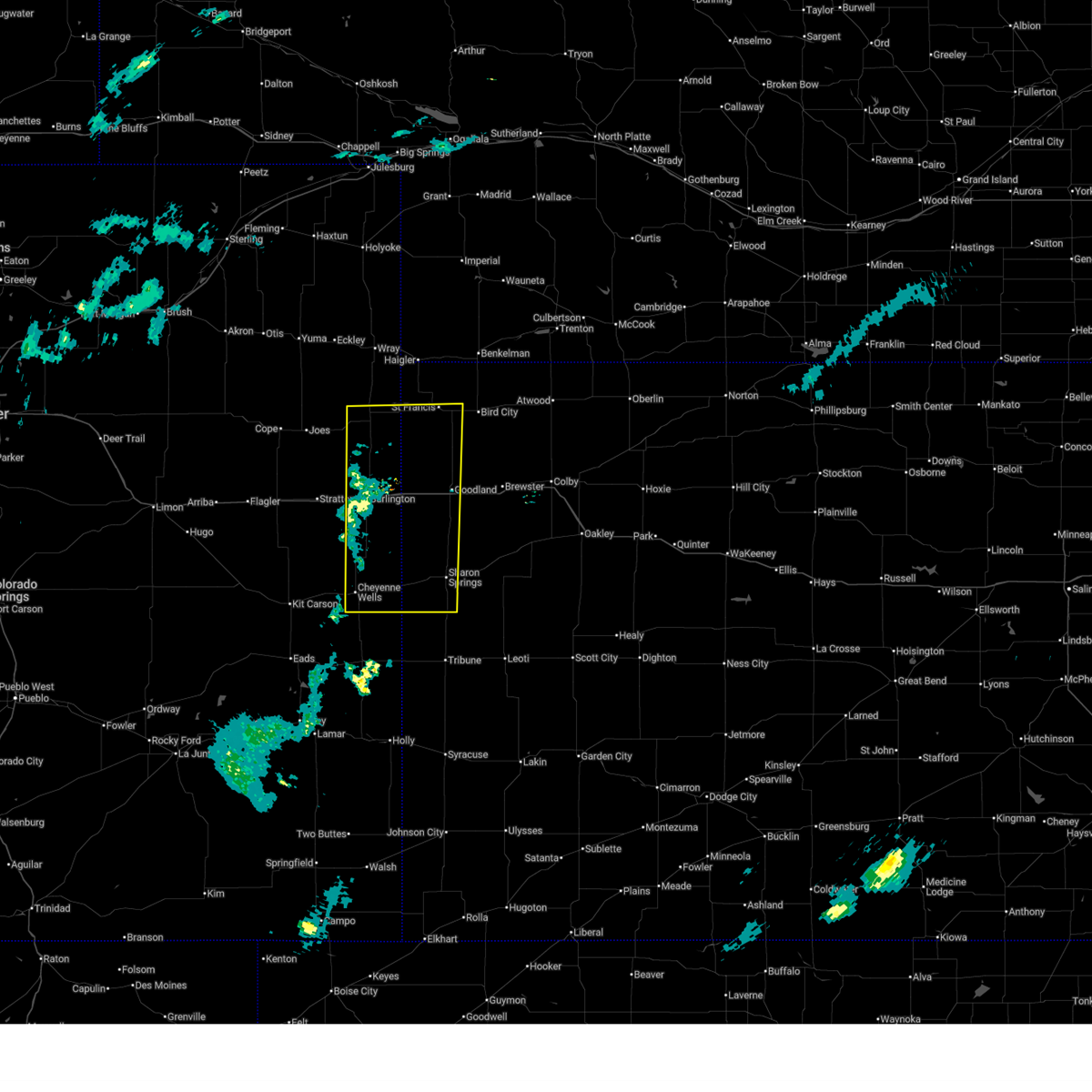
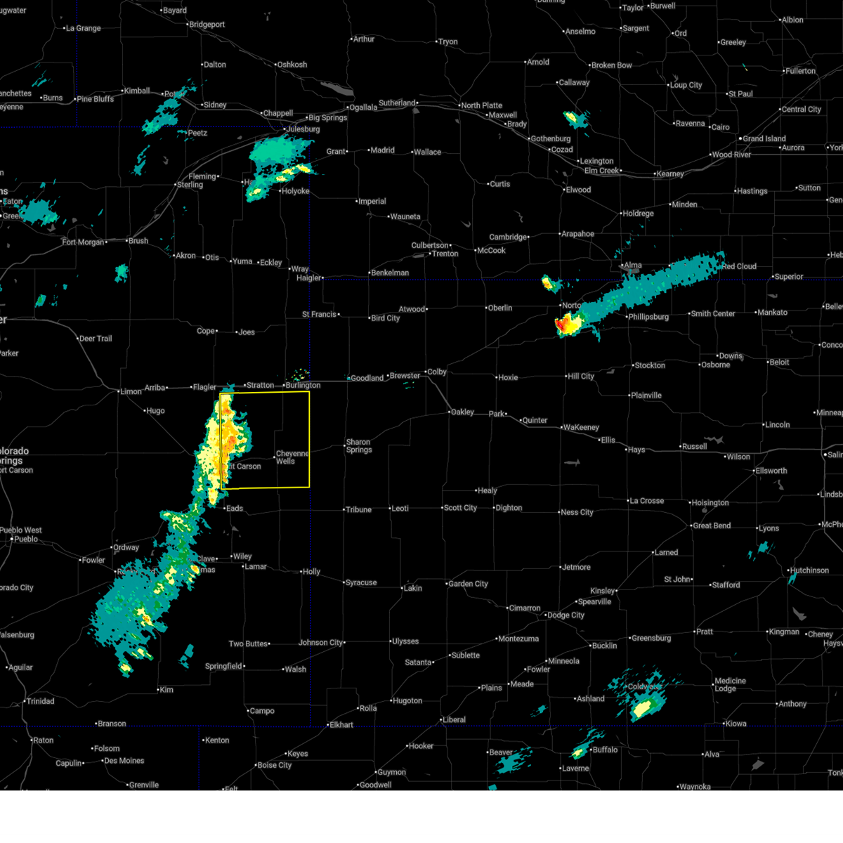
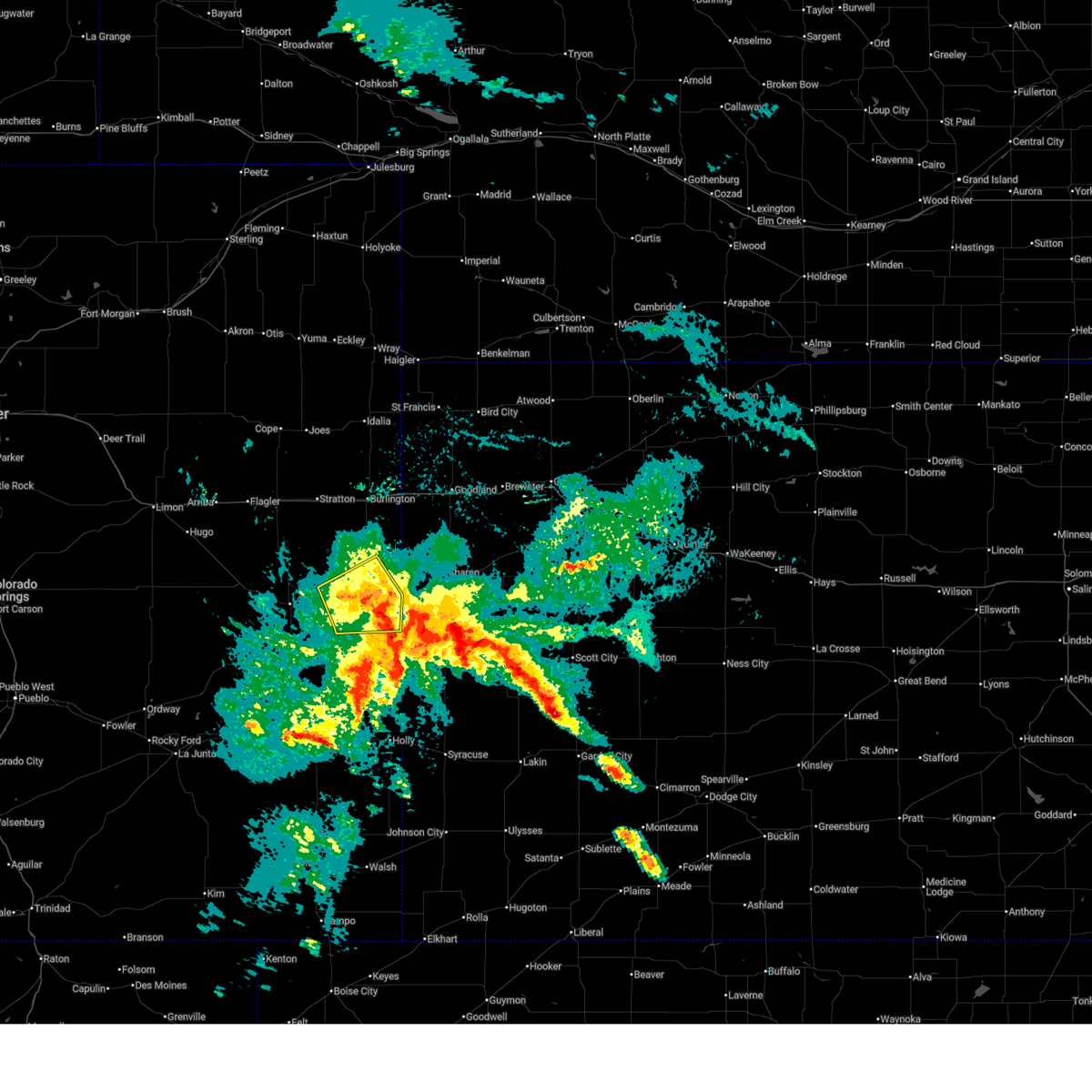
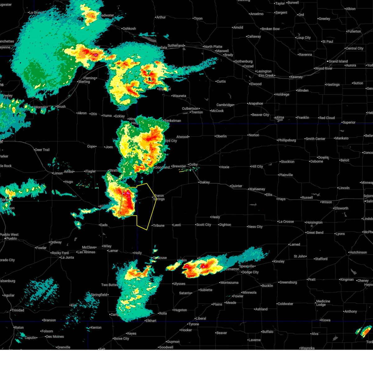
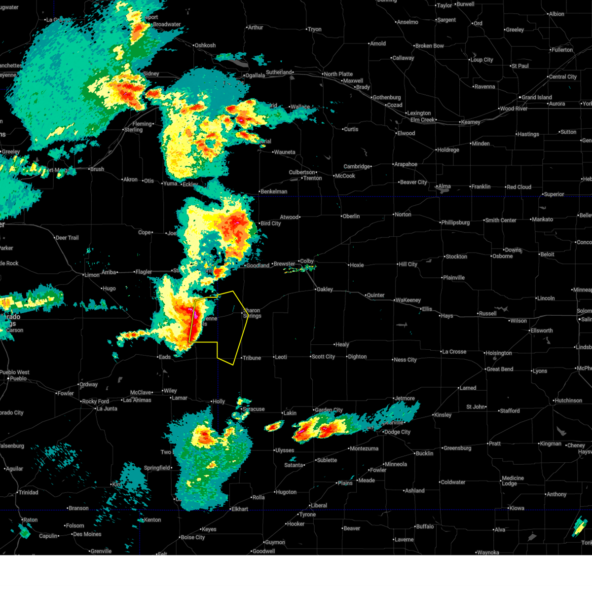
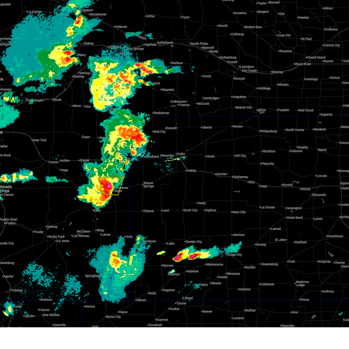
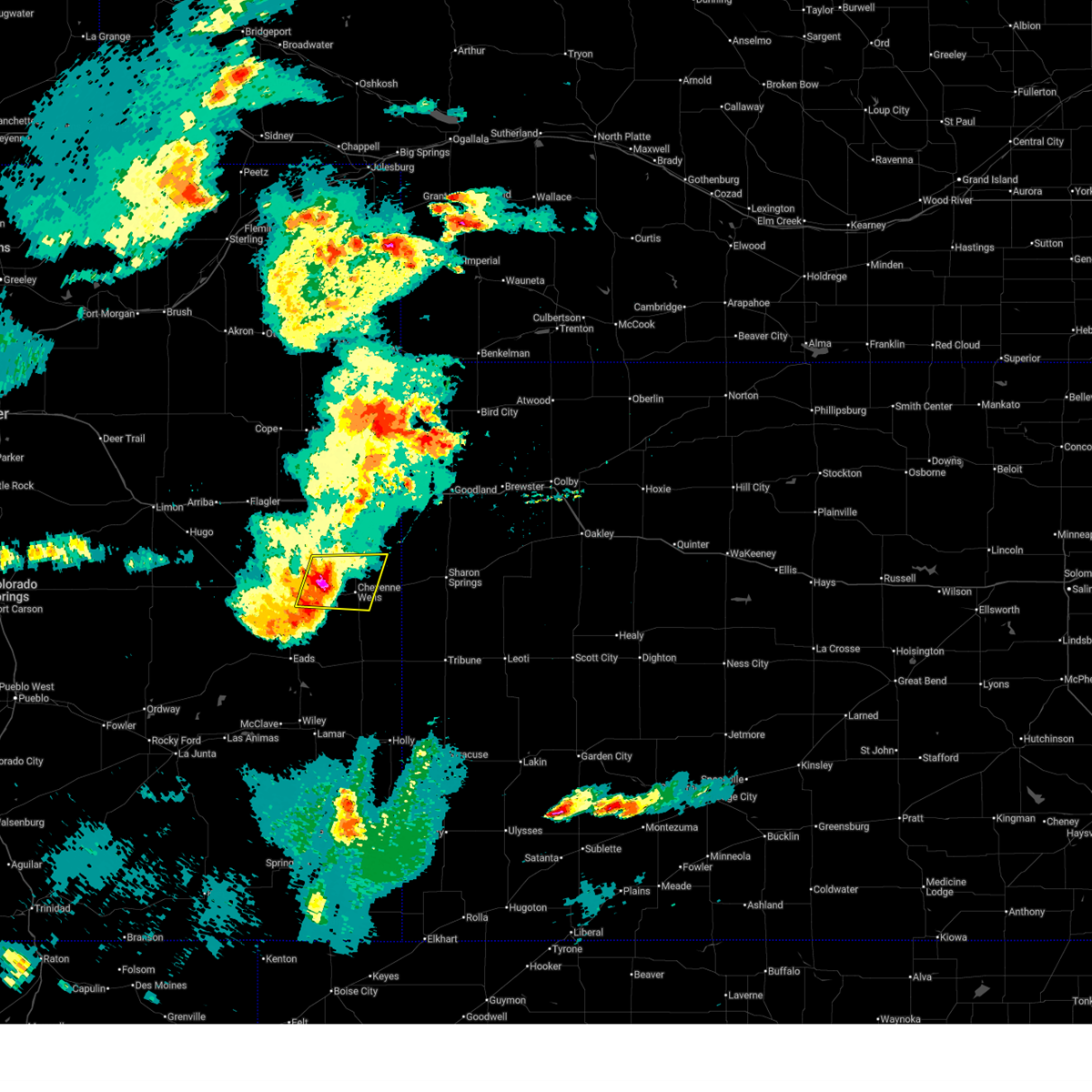
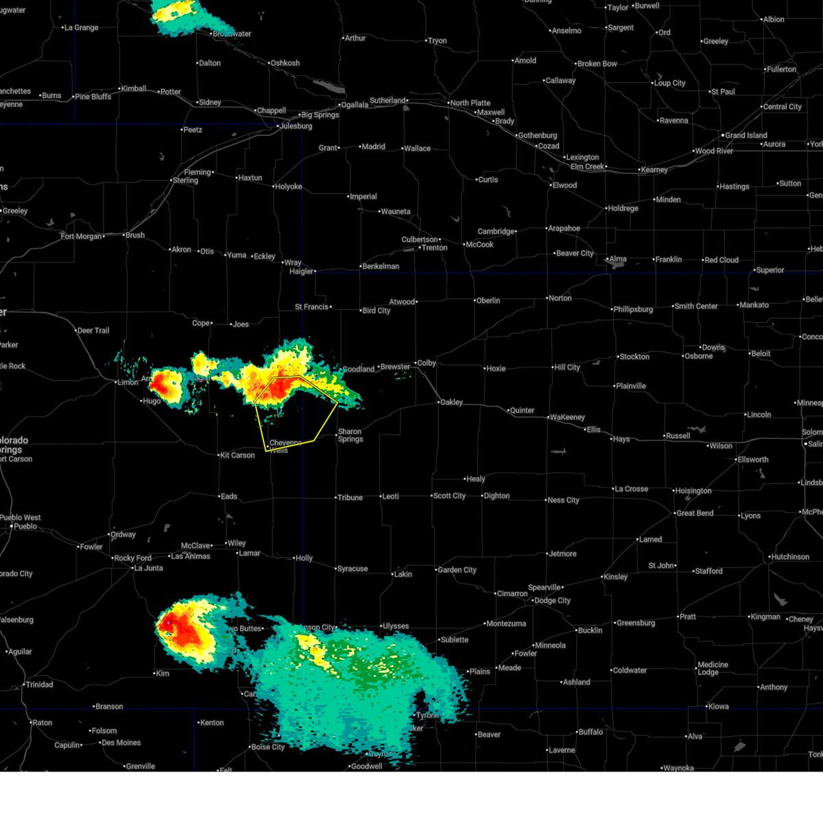
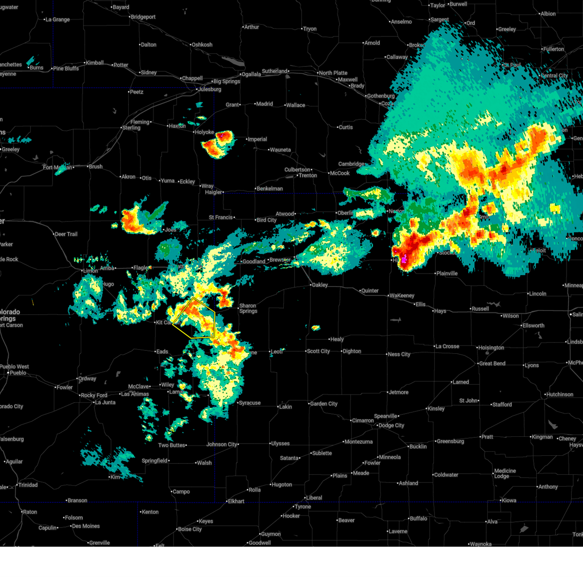
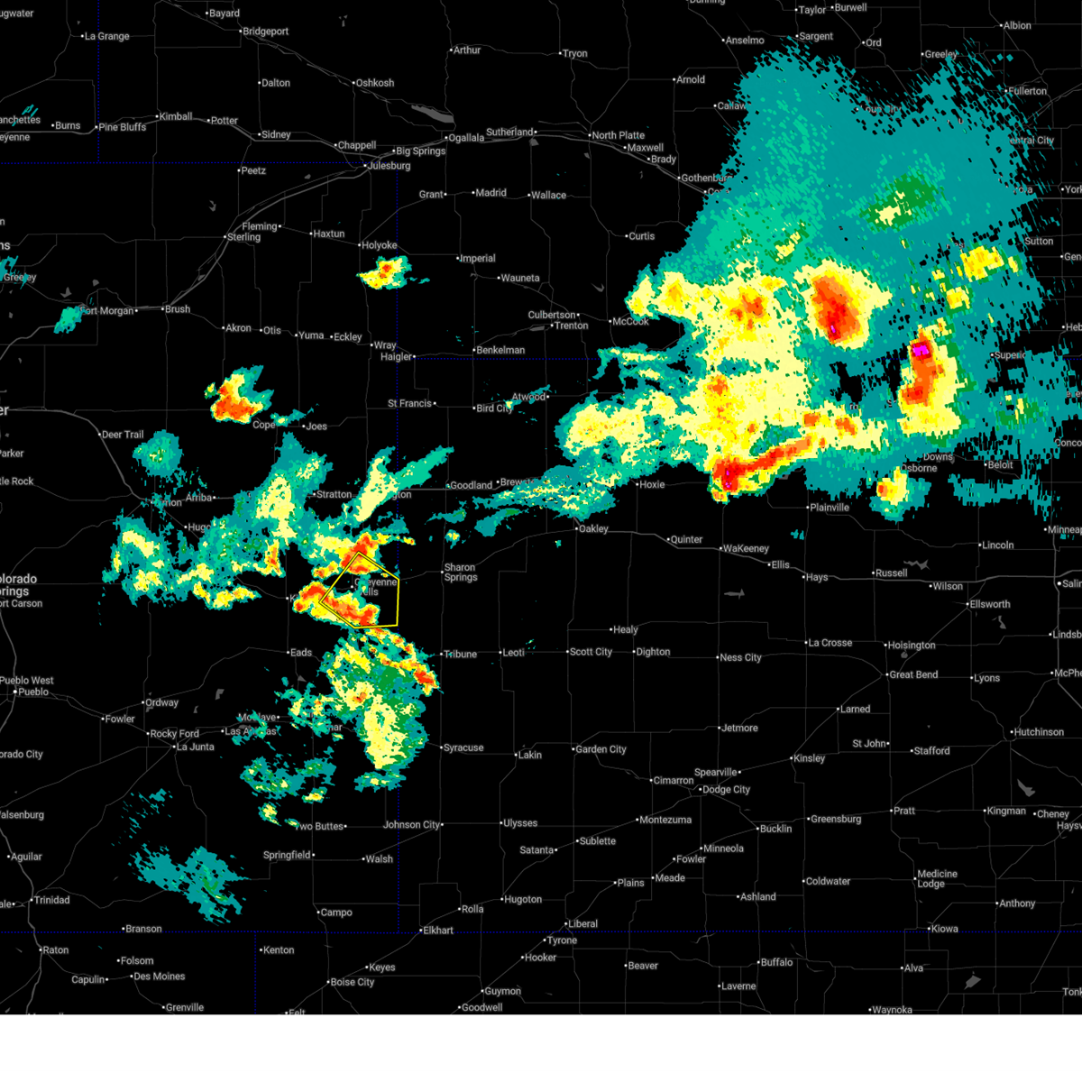
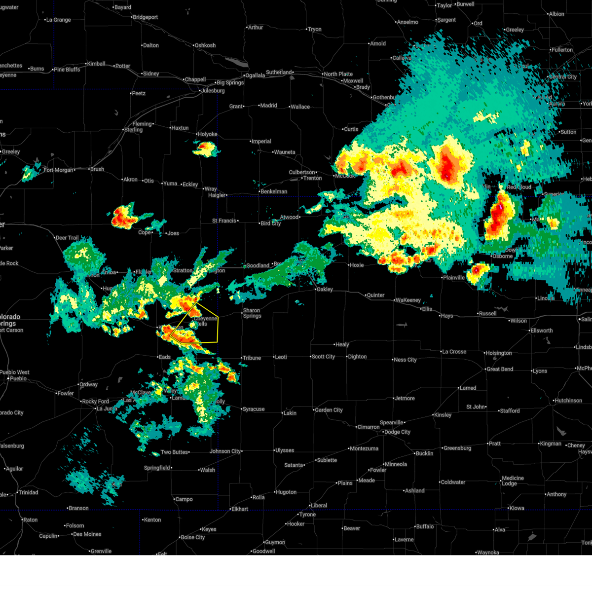
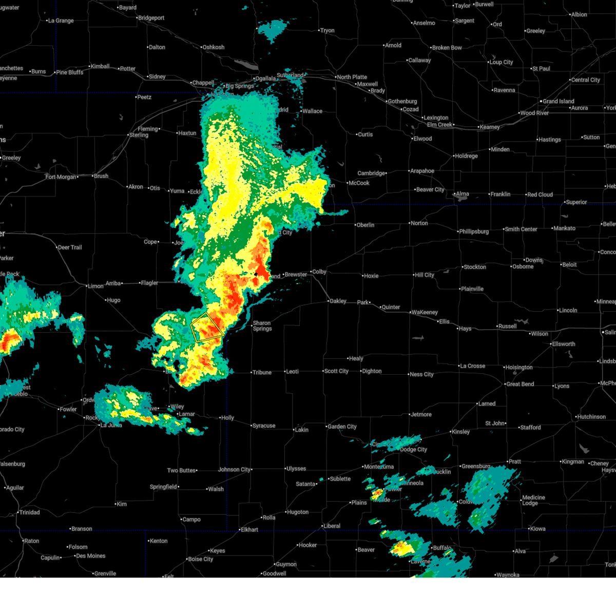
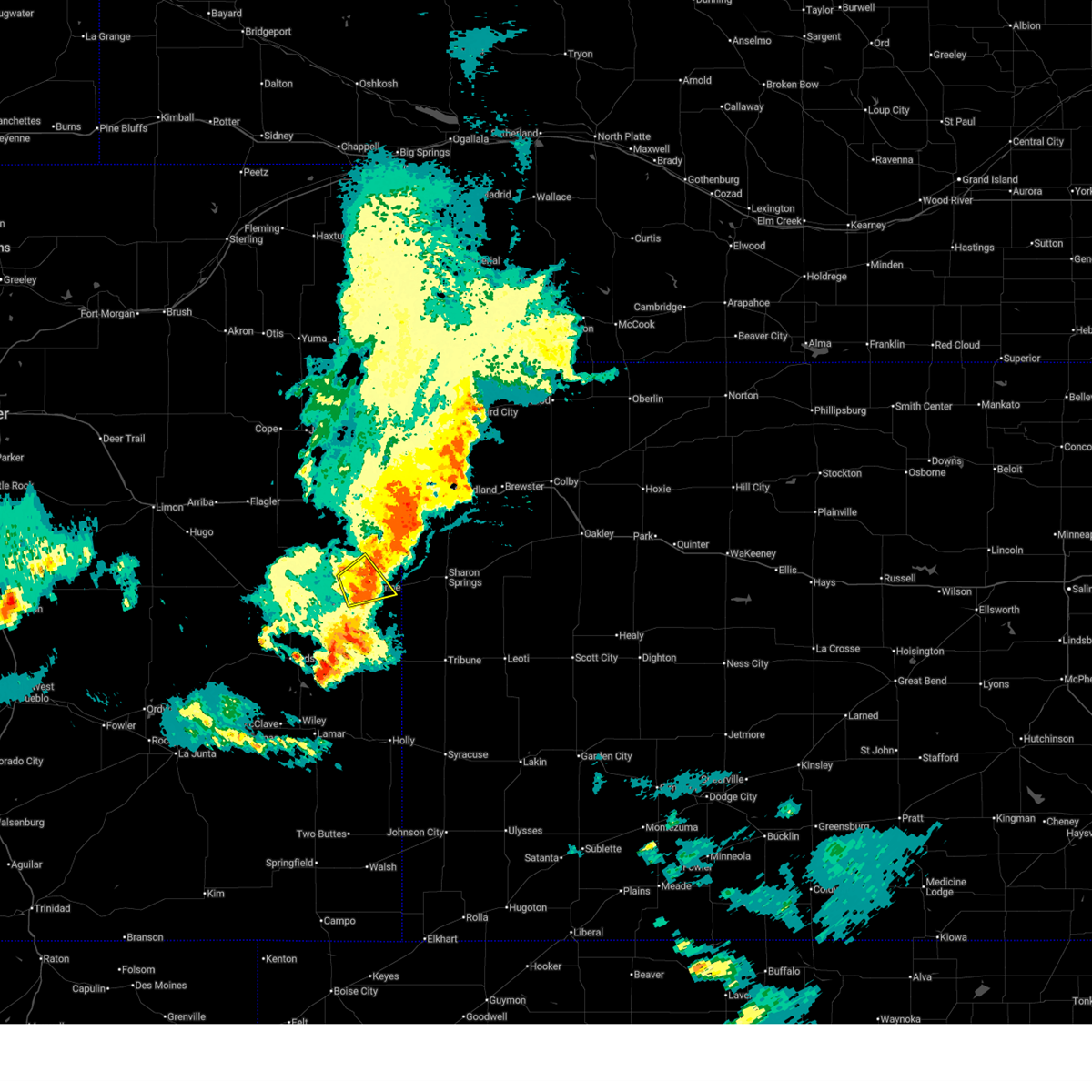
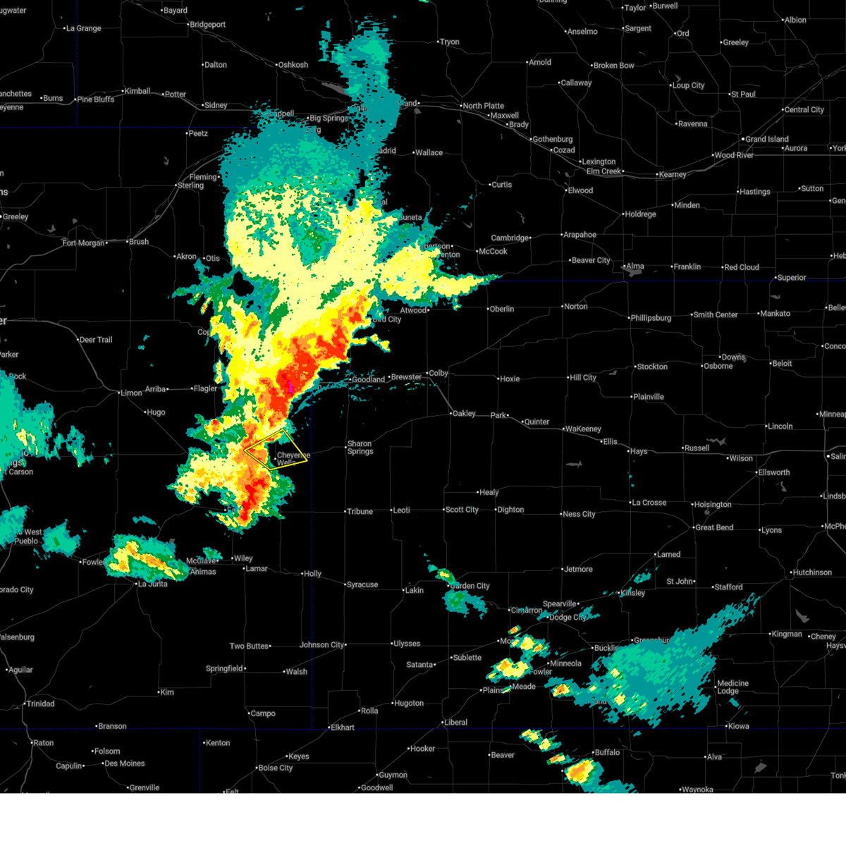
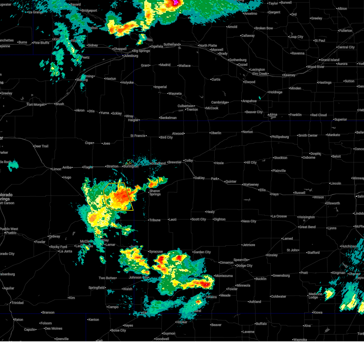
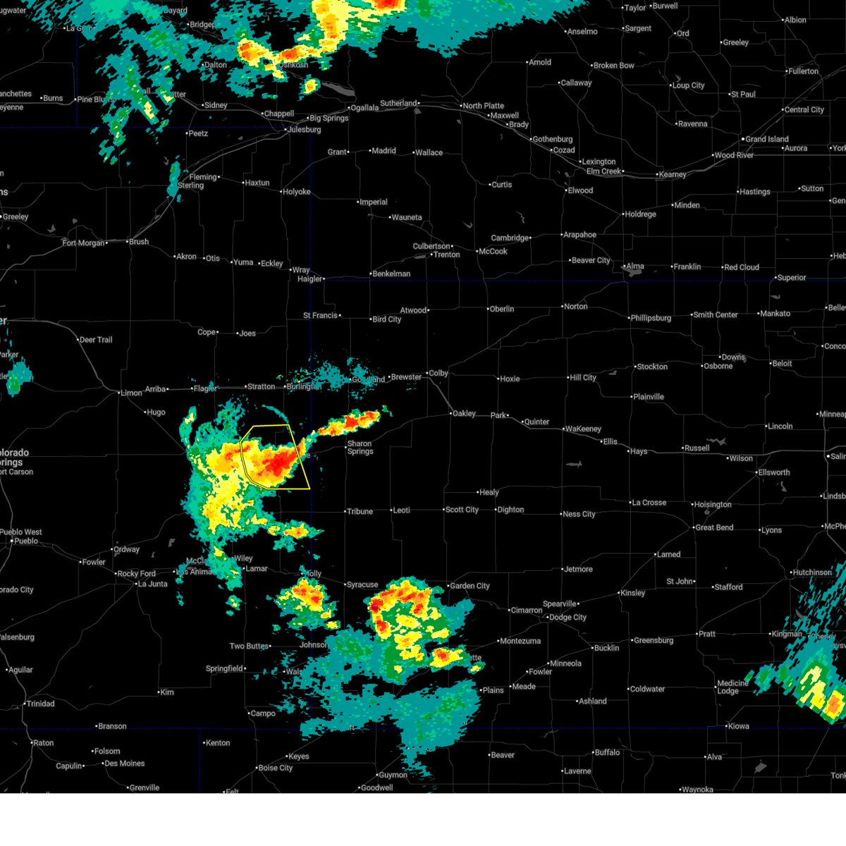
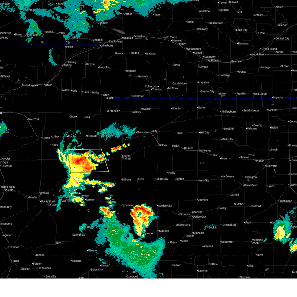
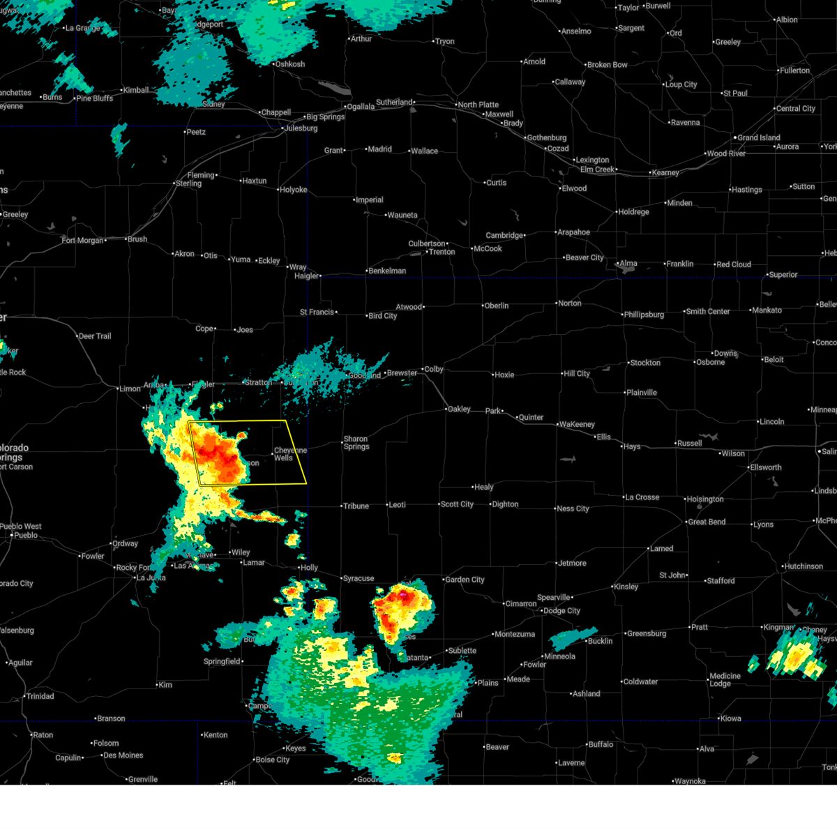
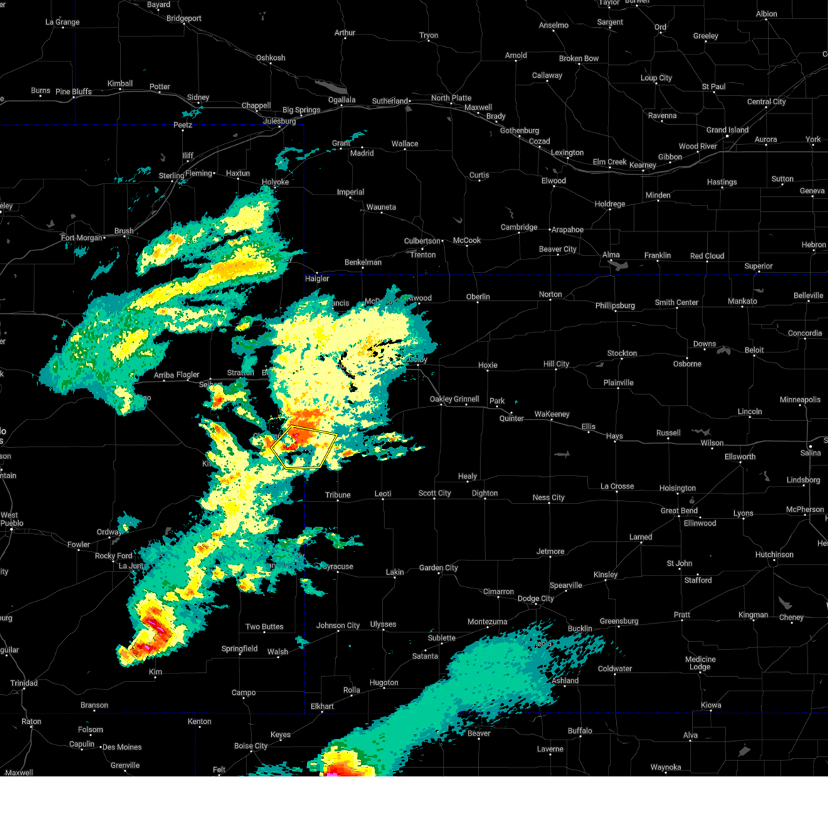
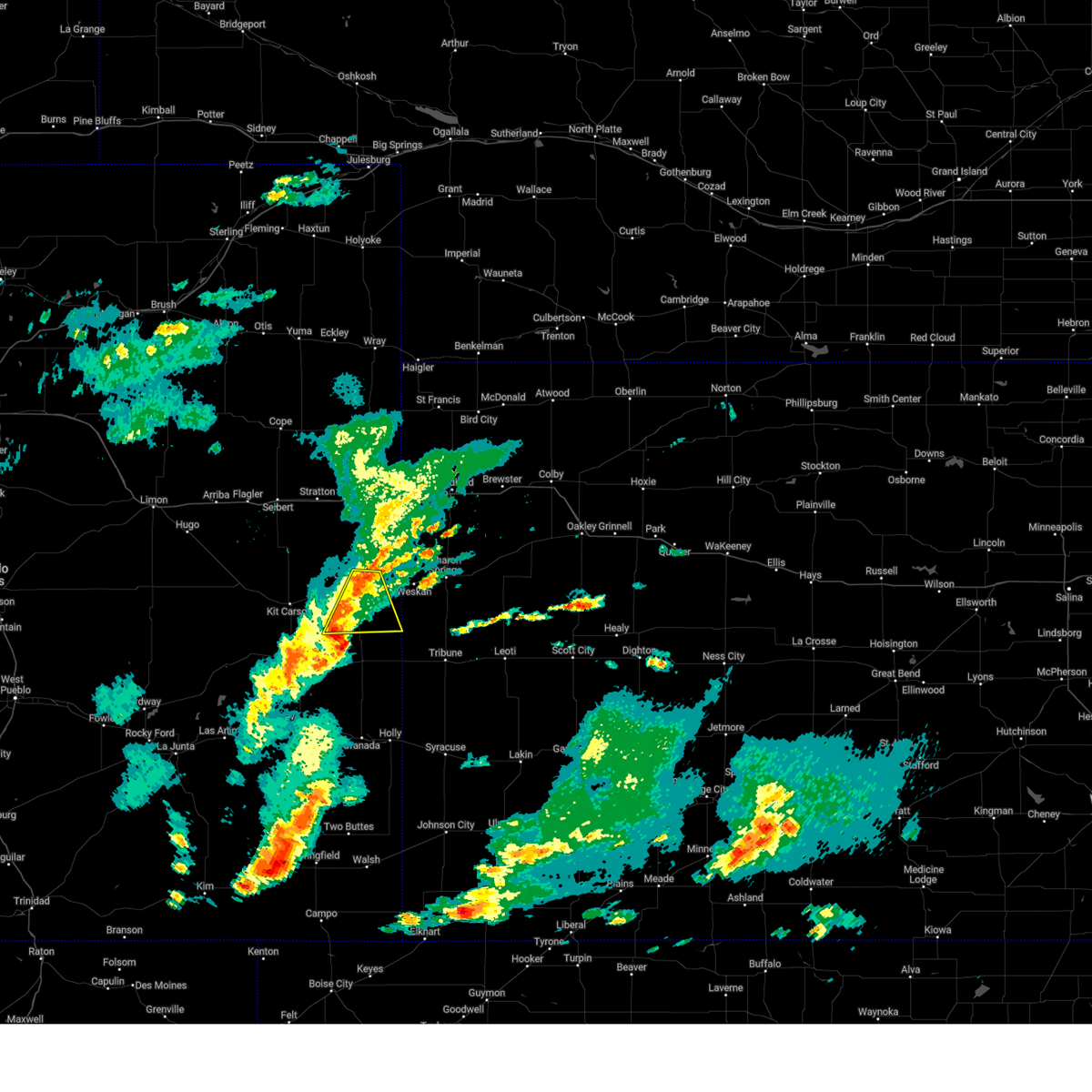
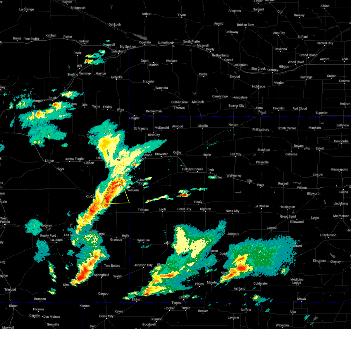
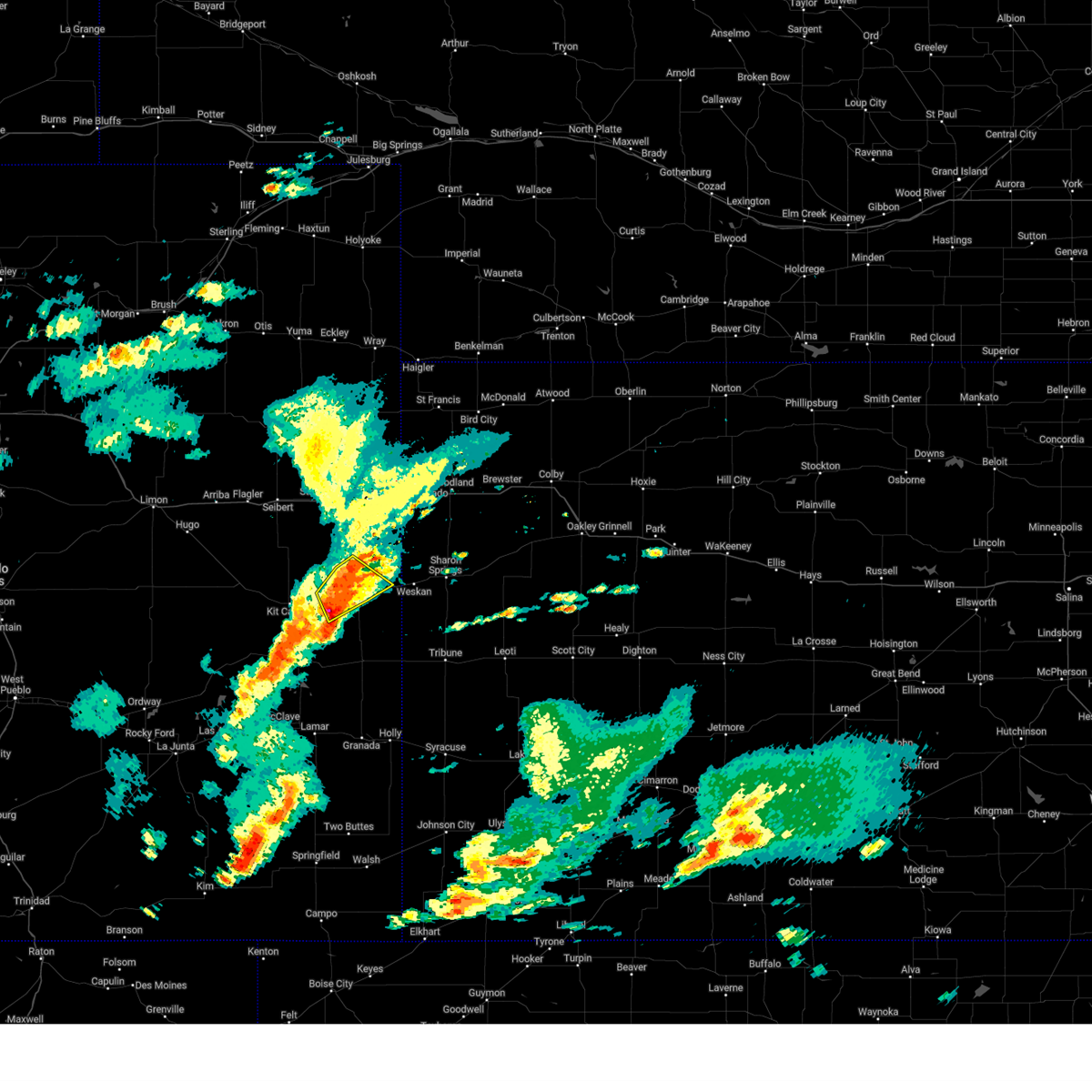
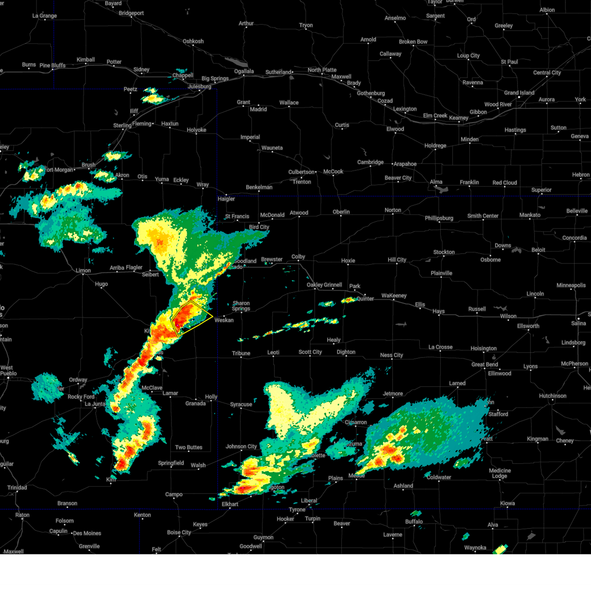
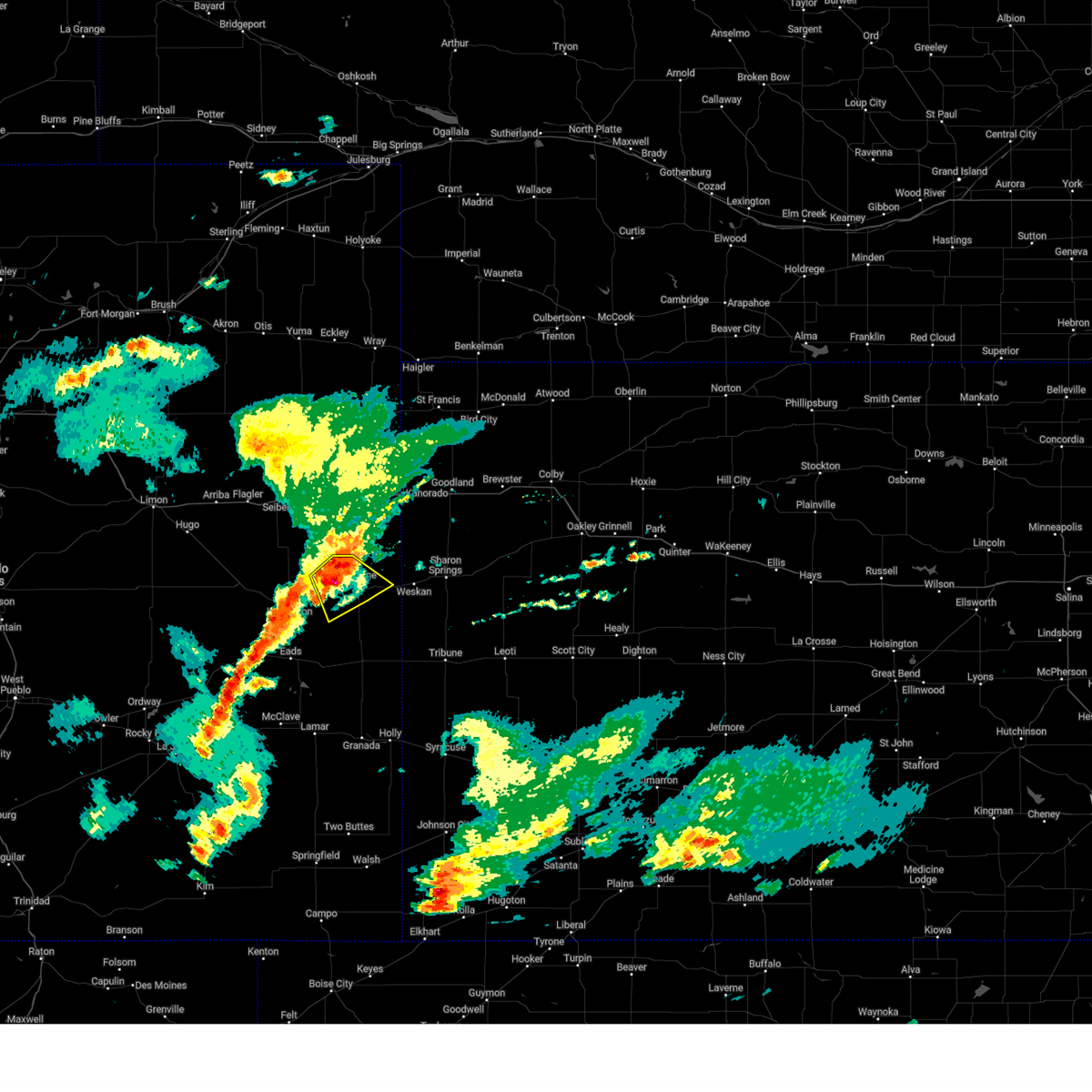
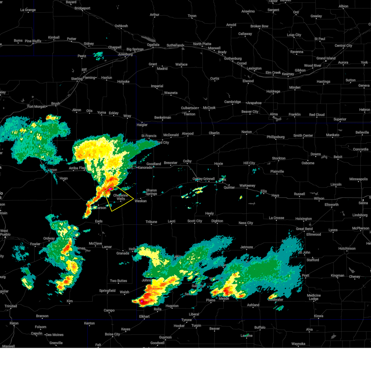
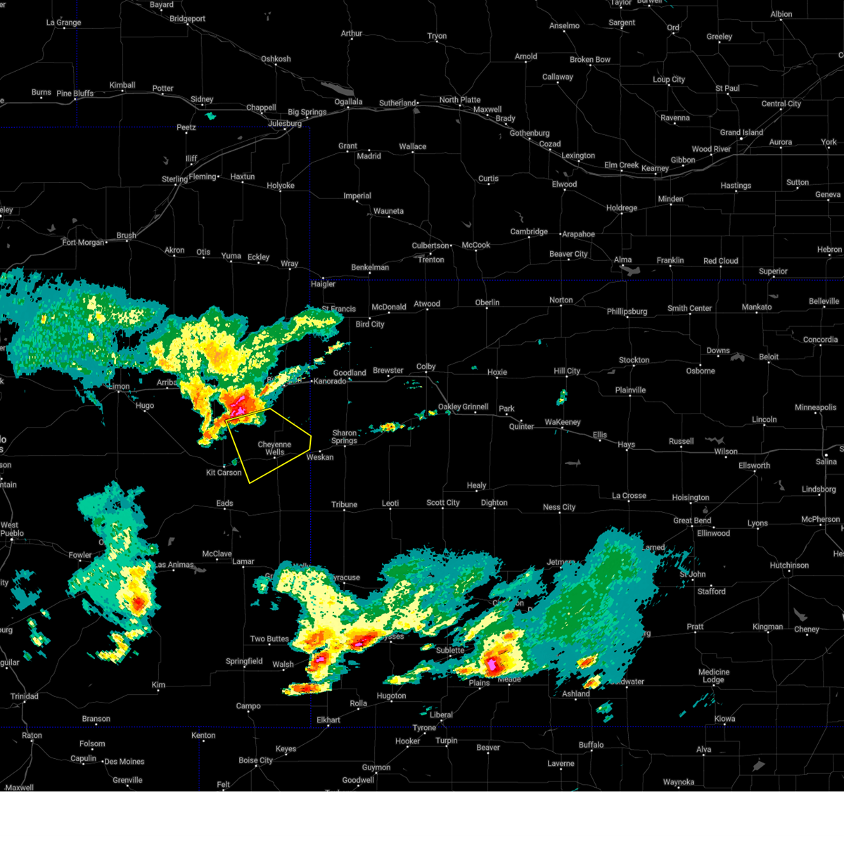
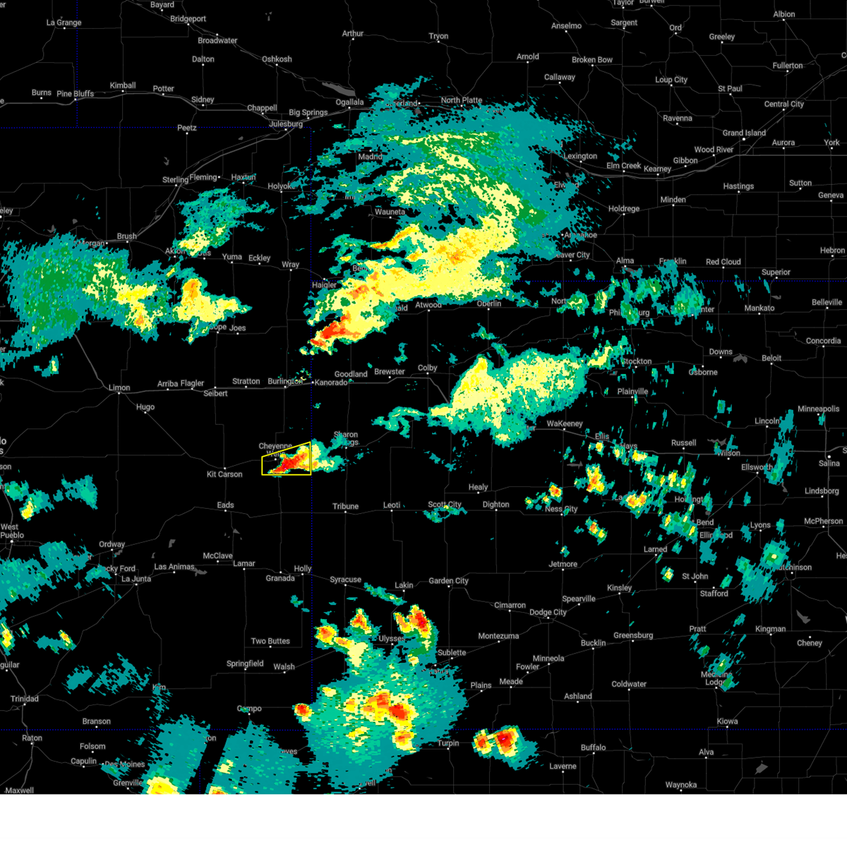
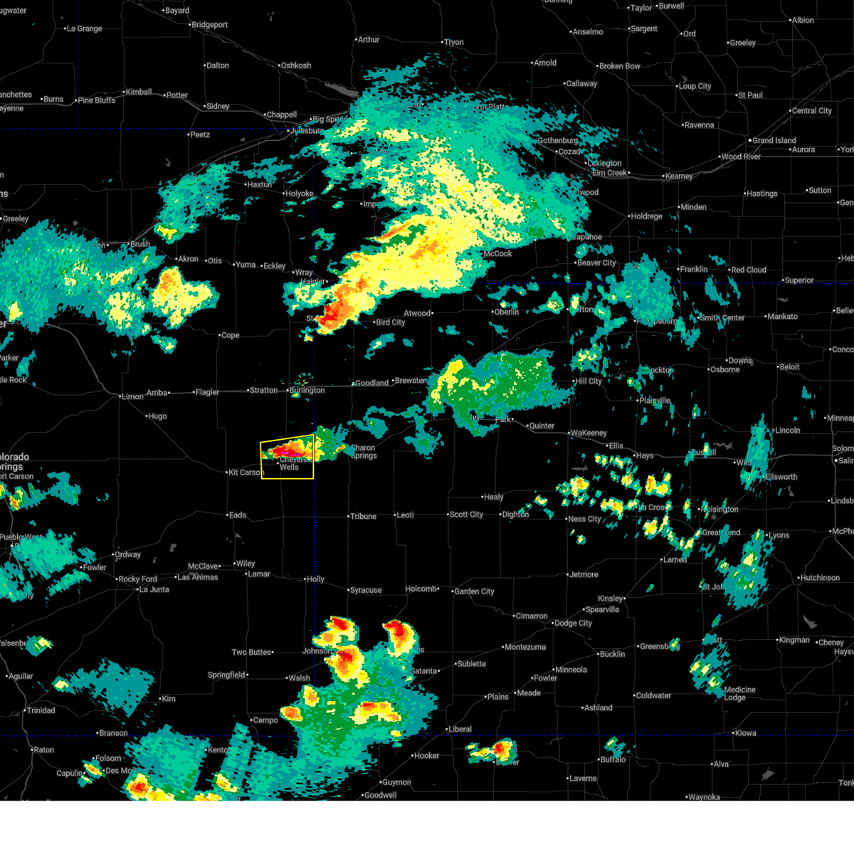
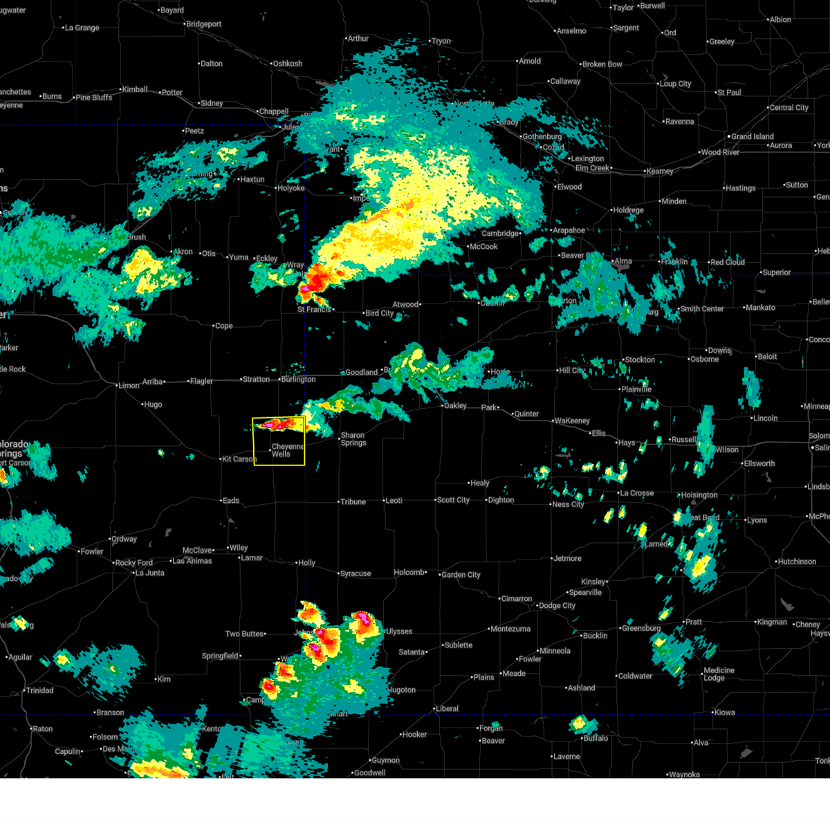
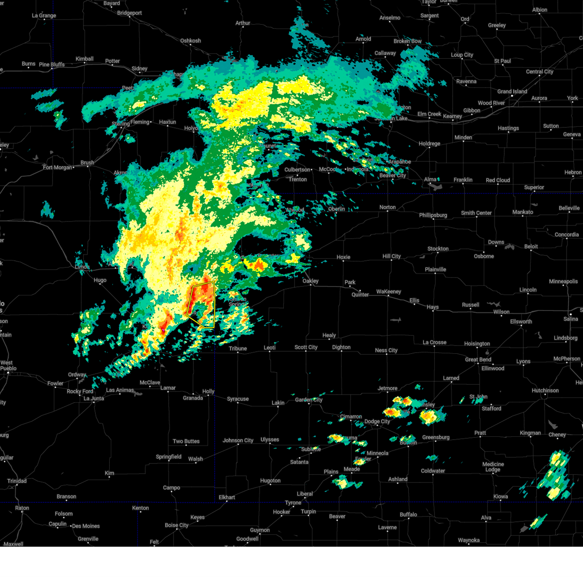
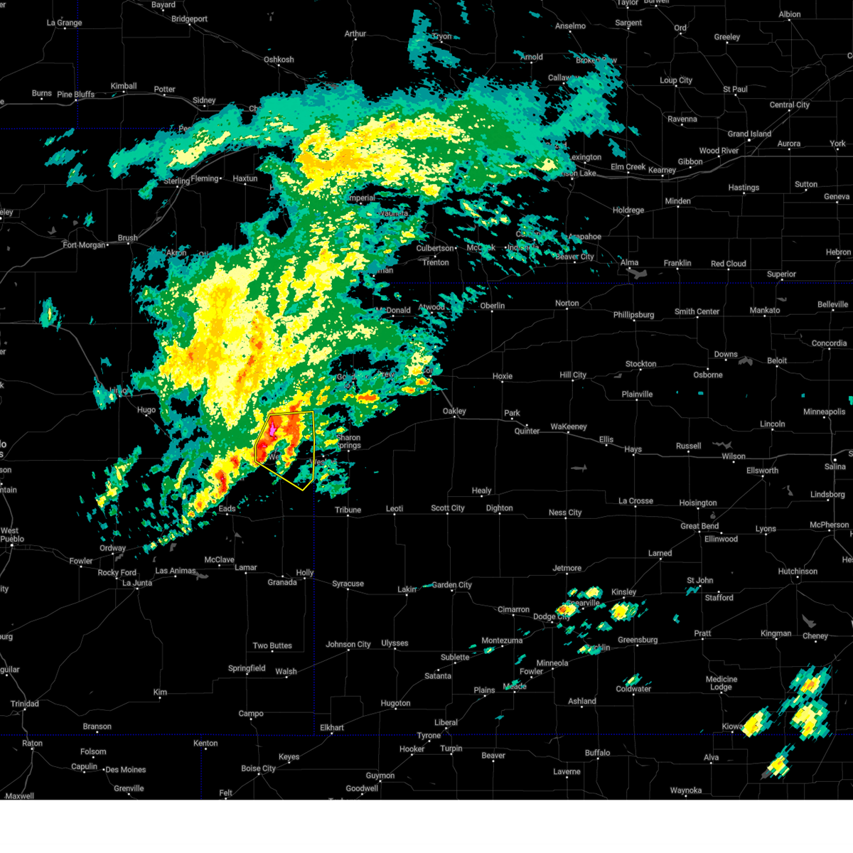
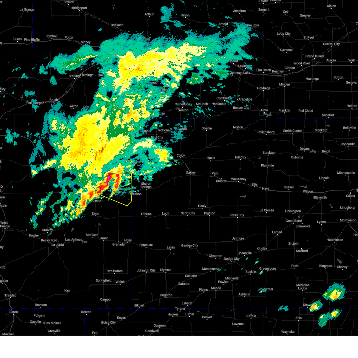
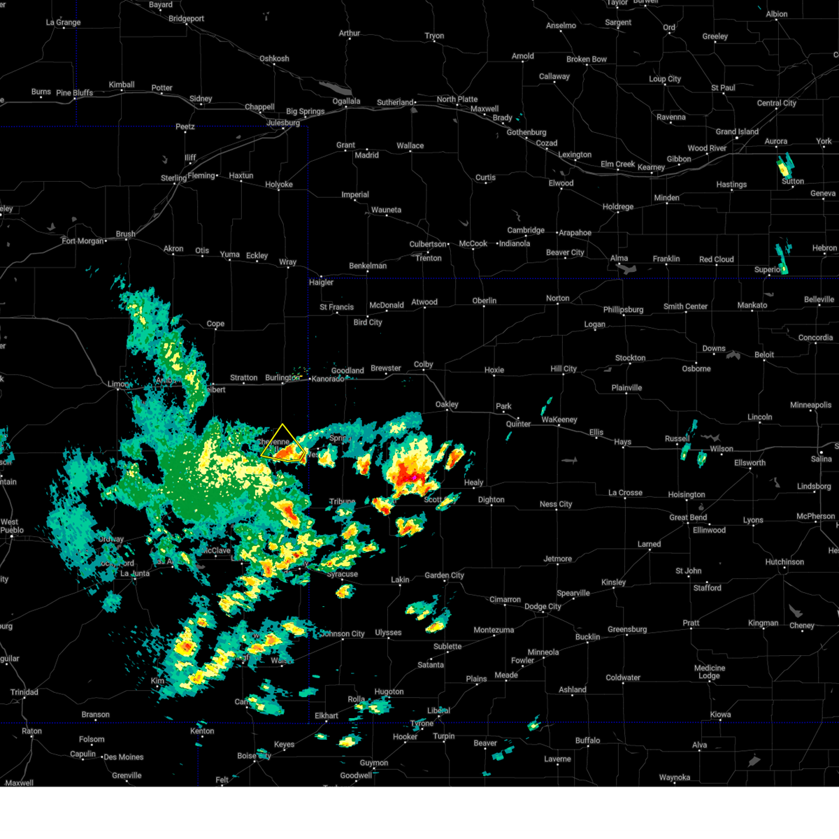
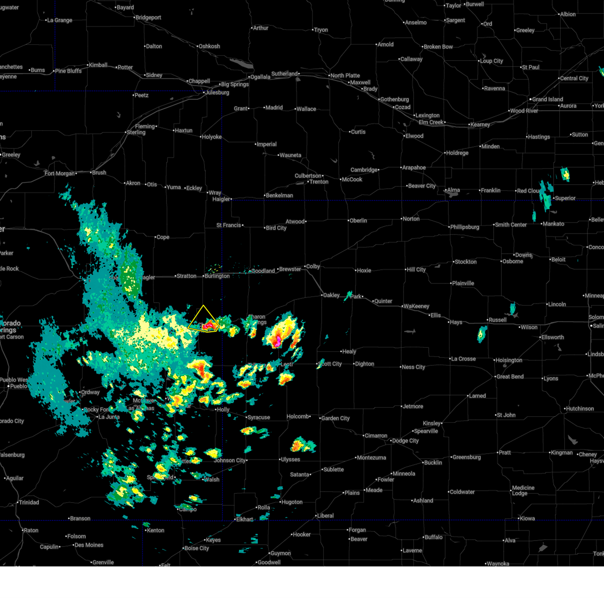
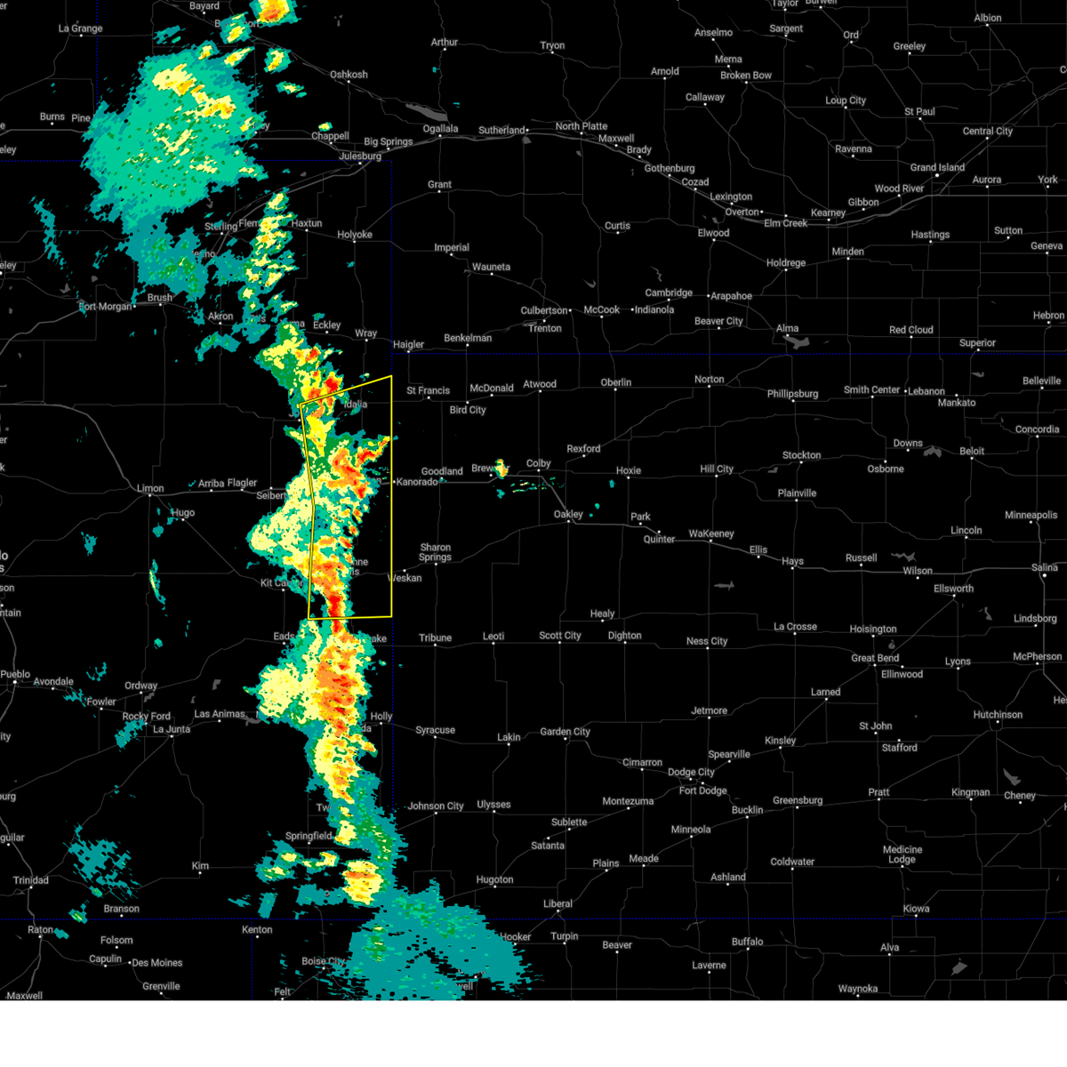
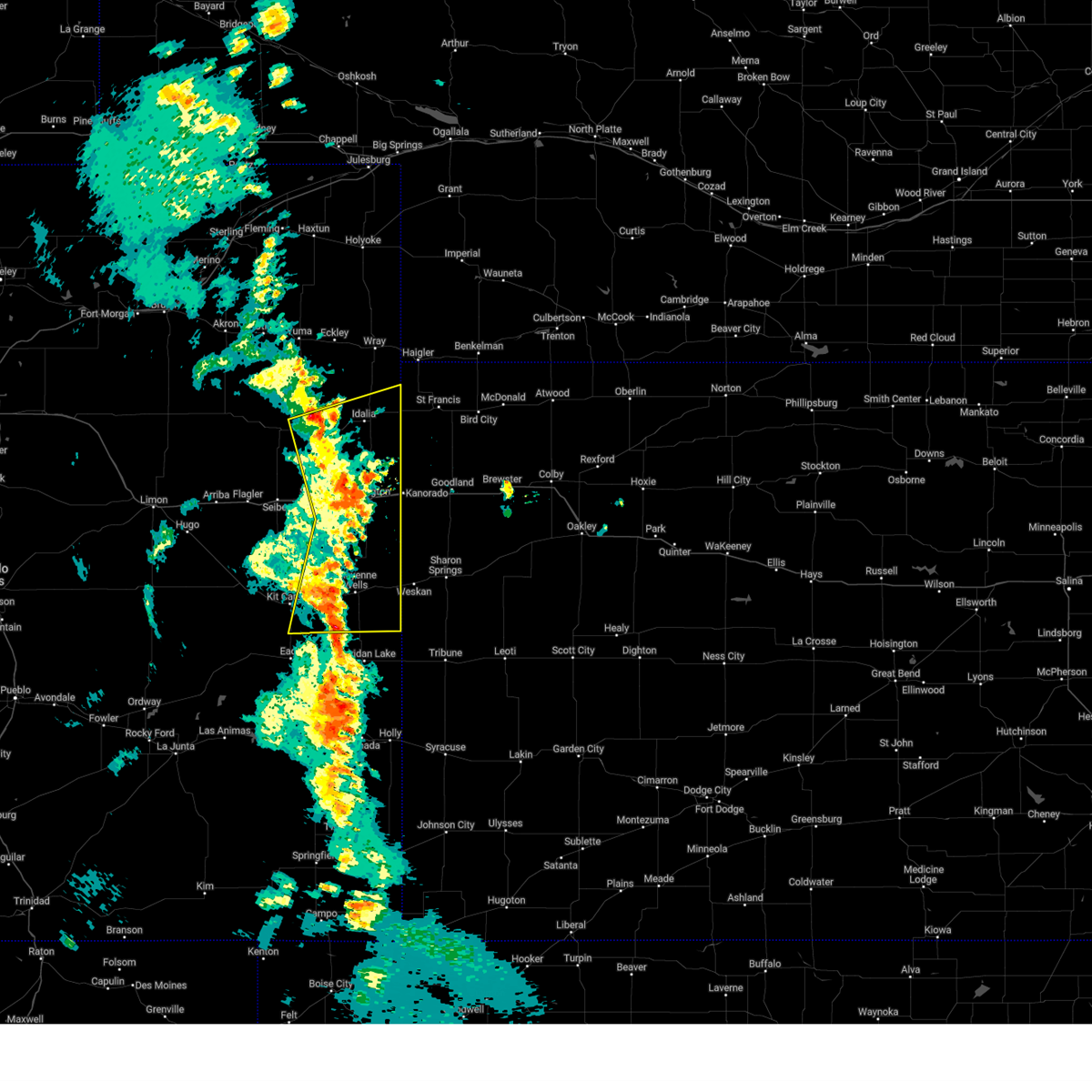
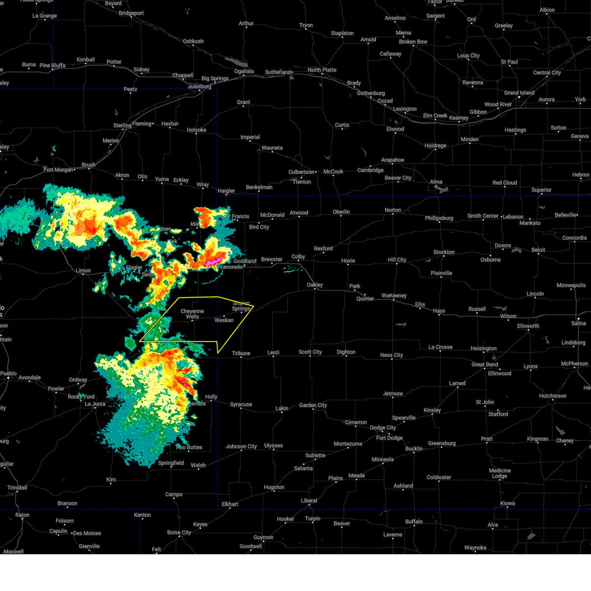
Hail Map for Cheyenne Wells, CO
The Cheyenne Wells, CO area has had 44 reports of on-the-ground hail by trained spotters, and has been under severe weather warnings 45 times during the past 12 months. Doppler radar has detected hail at or near Cheyenne Wells, CO on 112 occasions, including 7 occasions during the past year.
| Name: | Cheyenne Wells, CO |
| Where Located: | 80.8 miles WSW of Colby, KS |
| Map: | Google Map for Cheyenne Wells, CO |
| Population: | 846 |
| Housing Units: | 429 |
| More Info: | Search Google for Cheyenne Wells, CO |
1
The Top Recent Hail Date for Cheyenne Wells, CO is Monday, September 22, 2025 (20th out of 112)
Hail and Wind Damage Spotted near Cheyenne Wells, CO
| Date / Time | Report Details |
|---|---|
| 6/9/2026 3:03 PM MDT |
 At 302 pm mdt, a severe thunderstorm was located 16 miles northwest of weskan, or 18 miles south of burlington, moving northeast at 45 mph (radar indicated). Hazards include 70 mph wind gusts and nickel size hail. Expect considerable tree damage. damage is likely to mobile homes, roofs, and outbuildings. locations impacted include, cheyenne wells and arapahoe. this includes the following highways, interstate 70 in colorado between mile markers 434 and 438. Highway 385 between mile markers 149 and 186. At 302 pm mdt, a severe thunderstorm was located 16 miles northwest of weskan, or 18 miles south of burlington, moving northeast at 45 mph (radar indicated). Hazards include 70 mph wind gusts and nickel size hail. Expect considerable tree damage. damage is likely to mobile homes, roofs, and outbuildings. locations impacted include, cheyenne wells and arapahoe. this includes the following highways, interstate 70 in colorado between mile markers 434 and 438. Highway 385 between mile markers 149 and 186.
|
| 6/9/2026 2:54 PM MDT |
 At 254 pm mdt, a severe thunderstorm was located 12 miles northeast of cheyenne wells, moving northeast at 45 mph (radar indicated). Hazards include 60 mph wind gusts and nickel size hail. Expect damage to roofs, siding, and trees. locations impacted include, cheyenne wells and arapahoe. this includes the following highways, interstate 70 in colorado between mile markers 434 and 438. Highway 385 between mile markers 146 and 186. At 254 pm mdt, a severe thunderstorm was located 12 miles northeast of cheyenne wells, moving northeast at 45 mph (radar indicated). Hazards include 60 mph wind gusts and nickel size hail. Expect damage to roofs, siding, and trees. locations impacted include, cheyenne wells and arapahoe. this includes the following highways, interstate 70 in colorado between mile markers 434 and 438. Highway 385 between mile markers 146 and 186.
|
| 6/9/2026 2:40 PM MDT |
 Svrgld the national weather service in goodland has issued a * severe thunderstorm warning for, eastern cheyenne county in east central colorado, southeastern kit carson county in east central colorado, western wallace county in west central kansas, southwestern sherman county in northwestern kansas, * until 330 pm mdt. * at 240 pm mdt, a severe thunderstorm was located near cheyenne wells, moving northeast at 40 mph (radar indicated). Hazards include 60 mph wind gusts and nickel size hail. Expect damage to roofs, siding, and trees. this severe thunderstorm will remain over mainly rural areas of eastern cheyenne and southeastern kit carson counties in east central colorado, western wallace county in west central kansas and southwestern sherman counties in northwestern kansas, including the following locations, arapahoe and firstview. this includes the following highways, interstate 70 in colorado between mile markers 434 and 438. Highway 385 between mile markers 141 and 186. Svrgld the national weather service in goodland has issued a * severe thunderstorm warning for, eastern cheyenne county in east central colorado, southeastern kit carson county in east central colorado, western wallace county in west central kansas, southwestern sherman county in northwestern kansas, * until 330 pm mdt. * at 240 pm mdt, a severe thunderstorm was located near cheyenne wells, moving northeast at 40 mph (radar indicated). Hazards include 60 mph wind gusts and nickel size hail. Expect damage to roofs, siding, and trees. this severe thunderstorm will remain over mainly rural areas of eastern cheyenne and southeastern kit carson counties in east central colorado, western wallace county in west central kansas and southwestern sherman counties in northwestern kansas, including the following locations, arapahoe and firstview. this includes the following highways, interstate 70 in colorado between mile markers 434 and 438. Highway 385 between mile markers 141 and 186.
|
| 6/8/2026 5:58 PM MDT |
 The storm which prompted the warning has weakened below severe limits, and no longer poses an immediate threat to life or property. therefore, the warning will be allowed to expire. however, heavy rain is still possible with this thunderstorm. a tornado watch remains in effect until 900 pm mdt for east central colorado. to report severe weather, contact your nearest law enforcement agency. they will relay your report to the national weather service goodland. The storm which prompted the warning has weakened below severe limits, and no longer poses an immediate threat to life or property. therefore, the warning will be allowed to expire. however, heavy rain is still possible with this thunderstorm. a tornado watch remains in effect until 900 pm mdt for east central colorado. to report severe weather, contact your nearest law enforcement agency. they will relay your report to the national weather service goodland.
|
| 6/8/2026 5:51 PM MDT |
 At 551 pm mdt, a severe thunderstorm was located 7 miles west of cheyenne wells, moving east at 25 mph (radar indicated). Hazards include 60 mph wind gusts and quarter size hail. Hail damage to vehicles is expected. expect wind damage to roofs, siding, and trees. locations impacted include, cheyenne wells and firstview. This includes highway 385 between mile markers 141 and 142, and between mile markers 150 and 161. At 551 pm mdt, a severe thunderstorm was located 7 miles west of cheyenne wells, moving east at 25 mph (radar indicated). Hazards include 60 mph wind gusts and quarter size hail. Hail damage to vehicles is expected. expect wind damage to roofs, siding, and trees. locations impacted include, cheyenne wells and firstview. This includes highway 385 between mile markers 141 and 142, and between mile markers 150 and 161.
|
| 6/8/2026 5:44 PM MDT |
 At 543 pm mdt, a severe thunderstorm was located 11 miles west of cheyenne wells, moving east at 30 mph (trained weather spotters. ping pong ball size hail was reported in kit carson and 10 miles north of kit carson). Hazards include ping pong ball size hail and 60 mph wind gusts. People and animals outdoors will be injured. expect hail damage to roofs, siding, windows, and vehicles. expect wind damage to roofs, siding, and trees. locations impacted include, cheyenne wells and firstview. This includes highway 385 between mile markers 141 and 142, and between mile markers 150 and 161. At 543 pm mdt, a severe thunderstorm was located 11 miles west of cheyenne wells, moving east at 30 mph (trained weather spotters. ping pong ball size hail was reported in kit carson and 10 miles north of kit carson). Hazards include ping pong ball size hail and 60 mph wind gusts. People and animals outdoors will be injured. expect hail damage to roofs, siding, windows, and vehicles. expect wind damage to roofs, siding, and trees. locations impacted include, cheyenne wells and firstview. This includes highway 385 between mile markers 141 and 142, and between mile markers 150 and 161.
|
| 6/8/2026 5:29 PM MDT |
 At 529 pm mdt, a severe thunderstorm was located 4 miles east of kit carson, or 20 miles west of cheyenne wells, moving east at 30 mph (trained weather spotters. ping pong ball size hail was reported in the town of kit carson). Hazards include ping pong ball size hail and 60 mph wind gusts. People and animals outdoors will be injured. expect hail damage to roofs, siding, windows, and vehicles. expect wind damage to roofs, siding, and trees. locations impacted include, cheyenne wells, kit carson, and firstview. This includes highway 385 between mile markers 150 and 161. At 529 pm mdt, a severe thunderstorm was located 4 miles east of kit carson, or 20 miles west of cheyenne wells, moving east at 30 mph (trained weather spotters. ping pong ball size hail was reported in the town of kit carson). Hazards include ping pong ball size hail and 60 mph wind gusts. People and animals outdoors will be injured. expect hail damage to roofs, siding, windows, and vehicles. expect wind damage to roofs, siding, and trees. locations impacted include, cheyenne wells, kit carson, and firstview. This includes highway 385 between mile markers 150 and 161.
|
| 6/8/2026 5:01 PM MDT |
 Svrgld the national weather service in goodland has issued a * severe thunderstorm warning for, central cheyenne county in east central colorado, * until 600 pm mdt. * at 501 pm mdt, a severe thunderstorm was located 5 miles north of kit carson, or 25 miles west of cheyenne wells, moving east at 30 mph (radar indicated). Hazards include 60 mph wind gusts and quarter size hail. Hail damage to vehicles is expected. Expect wind damage to roofs, siding, and trees. Svrgld the national weather service in goodland has issued a * severe thunderstorm warning for, central cheyenne county in east central colorado, * until 600 pm mdt. * at 501 pm mdt, a severe thunderstorm was located 5 miles north of kit carson, or 25 miles west of cheyenne wells, moving east at 30 mph (radar indicated). Hazards include 60 mph wind gusts and quarter size hail. Hail damage to vehicles is expected. Expect wind damage to roofs, siding, and trees.
|
| 6/1/2026 4:08 PM MDT |
 Svrgld the national weather service in goodland has issued a * severe thunderstorm warning for, central cheyenne county in east central colorado, * until 500 pm mdt. * at 407 pm mdt, a severe thunderstorm was located 7 miles east of kit carson, or 16 miles west of cheyenne wells, moving northeast at 25 mph (radar indicated). Hazards include 60 mph wind gusts and half dollar size hail. Hail damage to vehicles is expected. expect wind damage to roofs, siding, and trees. this severe thunderstorm will remain over mainly rural areas of central cheyenne county in east central colorado, including the following locations, firstview. This includes highway 385 between mile markers 151 and 159. Svrgld the national weather service in goodland has issued a * severe thunderstorm warning for, central cheyenne county in east central colorado, * until 500 pm mdt. * at 407 pm mdt, a severe thunderstorm was located 7 miles east of kit carson, or 16 miles west of cheyenne wells, moving northeast at 25 mph (radar indicated). Hazards include 60 mph wind gusts and half dollar size hail. Hail damage to vehicles is expected. expect wind damage to roofs, siding, and trees. this severe thunderstorm will remain over mainly rural areas of central cheyenne county in east central colorado, including the following locations, firstview. This includes highway 385 between mile markers 151 and 159.
|
| 5/29/2026 4:41 PM MDT |
 At 441 pm mdt, severe thunderstorms were located along a line extending from 19 miles south of bethune to 12 miles south of cheyenne wells, moving east at 20 mph (radar indicated). Hazards include 60 mph wind gusts and quarter size hail. Hail damage to vehicles is expected. expect wind damage to roofs, siding, and trees. these severe storms will be near, cheyenne wells around 445 pm mdt. other locations impacted by these severe thunderstorms include arapahoe. This includes highway 385 between mile markers 136 and 169. At 441 pm mdt, severe thunderstorms were located along a line extending from 19 miles south of bethune to 12 miles south of cheyenne wells, moving east at 20 mph (radar indicated). Hazards include 60 mph wind gusts and quarter size hail. Hail damage to vehicles is expected. expect wind damage to roofs, siding, and trees. these severe storms will be near, cheyenne wells around 445 pm mdt. other locations impacted by these severe thunderstorms include arapahoe. This includes highway 385 between mile markers 136 and 169.
|
| 5/29/2026 4:19 PM MDT |
 At 418 pm mdt, severe thunderstorms were located along a line extending from 19 miles south of stratton to 10 miles northwest of cheyenne wells to 17 miles east of kit carson, moving northeast at 20 mph (radar indicated). Hazards include 60 mph wind gusts and quarter size hail. Hail damage to vehicles is expected. expect wind damage to roofs, siding, and trees. these severe storms will be near, cheyenne wells around 430 pm mdt. other locations impacted by these severe thunderstorms include arapahoe and firstview. This includes highway 385 between mile markers 136 and 169. At 418 pm mdt, severe thunderstorms were located along a line extending from 19 miles south of stratton to 10 miles northwest of cheyenne wells to 17 miles east of kit carson, moving northeast at 20 mph (radar indicated). Hazards include 60 mph wind gusts and quarter size hail. Hail damage to vehicles is expected. expect wind damage to roofs, siding, and trees. these severe storms will be near, cheyenne wells around 430 pm mdt. other locations impacted by these severe thunderstorms include arapahoe and firstview. This includes highway 385 between mile markers 136 and 169.
|
| 5/29/2026 4:08 PM MDT |
 Svrgld the national weather service in goodland has issued a * severe thunderstorm warning for, eastern cheyenne county in east central colorado, * until 530 pm mdt. * at 407 pm mdt, severe thunderstorms were located along a line extending from 17 miles northeast of kit carson to 8 miles northwest of cheyenne wells to 14 miles north of chivington, moving northeast at 25 mph (radar indicated). Hazards include 60 mph wind gusts and quarter size hail. Hail damage to vehicles is expected. expect wind damage to roofs, siding, and trees. severe thunderstorms will be near, cheyenne wells around 420 pm mdt. This includes highway 385 between mile markers 136 and 169. Svrgld the national weather service in goodland has issued a * severe thunderstorm warning for, eastern cheyenne county in east central colorado, * until 530 pm mdt. * at 407 pm mdt, severe thunderstorms were located along a line extending from 17 miles northeast of kit carson to 8 miles northwest of cheyenne wells to 14 miles north of chivington, moving northeast at 25 mph (radar indicated). Hazards include 60 mph wind gusts and quarter size hail. Hail damage to vehicles is expected. expect wind damage to roofs, siding, and trees. severe thunderstorms will be near, cheyenne wells around 420 pm mdt. This includes highway 385 between mile markers 136 and 169.
|
| 5/29/2026 3:46 PM MDT | Quarter sized hail reported 20.7 miles SE of Cheyenne Wells, CO, spotter call; time estimated from radar. |
| 5/17/2026 5:27 PM MDT |
 The severe thunderstorm warning that was previously in effect has been reissued for kit carson, sherman, and wallace counties. please refer to that bulletin for the latest severe weather information. a severe thunderstorm watch remains in effect until 800 pm mdt for east central colorado, and northwestern and west central kansas. to report severe weather, contact your nearest law enforcement agency. they will relay your report to the national weather service goodland. remember, a severe thunderstorm warning still remains in effect for kit carson, sherman, and wallace counties. The severe thunderstorm warning that was previously in effect has been reissued for kit carson, sherman, and wallace counties. please refer to that bulletin for the latest severe weather information. a severe thunderstorm watch remains in effect until 800 pm mdt for east central colorado, and northwestern and west central kansas. to report severe weather, contact your nearest law enforcement agency. they will relay your report to the national weather service goodland. remember, a severe thunderstorm warning still remains in effect for kit carson, sherman, and wallace counties.
|
| 5/17/2026 5:14 PM MDT |
 At 514 pm mdt, severe thunderstorms were located along a line extending from 3 miles northeast of bethune to 7 miles south of kanorado to 14 miles southeast of burlington to near cheyenne wells, moving east at 45 mph (trained weather spotter reported 74 mph gust 13 miles south of burlington). Hazards include 70 mph wind gusts and ping pong ball size hail. People and animals outdoors will be injured. expect hail damage to roofs, siding, windows, and vehicles. expect considerable tree damage. wind damage is also likely to mobile homes, roofs, and outbuildings. these severe storms will be near, burlington around 520 pm mdt. kanorado around 525 pm mdt. other locations impacted by these severe thunderstorms include edson and arapahoe. this includes the following highways, interstate 70 in kansas between mile markers 0 and 29. interstate 70 in colorado between mile markers 425 and 450. Highway 385 between mile markers 150 and 199. At 514 pm mdt, severe thunderstorms were located along a line extending from 3 miles northeast of bethune to 7 miles south of kanorado to 14 miles southeast of burlington to near cheyenne wells, moving east at 45 mph (trained weather spotter reported 74 mph gust 13 miles south of burlington). Hazards include 70 mph wind gusts and ping pong ball size hail. People and animals outdoors will be injured. expect hail damage to roofs, siding, windows, and vehicles. expect considerable tree damage. wind damage is also likely to mobile homes, roofs, and outbuildings. these severe storms will be near, burlington around 520 pm mdt. kanorado around 525 pm mdt. other locations impacted by these severe thunderstorms include edson and arapahoe. this includes the following highways, interstate 70 in kansas between mile markers 0 and 29. interstate 70 in colorado between mile markers 425 and 450. Highway 385 between mile markers 150 and 199.
|
| 5/17/2026 5:03 PM MDT |
 At 502 pm mdt, severe thunderstorms were located along a line extending from 6 miles northeast of stratton to 4 miles southeast of burlington to 13 miles southeast of bethune to 9 miles northwest of cheyenne wells, moving east at 50 mph (automated weather station at burlington airport measured 65 mph gust). Hazards include golf ball size hail and 70 mph wind gusts. People and animals outdoors will be injured. expect hail damage to roofs, siding, windows, and vehicles. expect considerable tree damage. wind damage is also likely to mobile homes, roofs, and outbuildings. these severe storms will be near, burlington and bethune around 505 pm mdt. cheyenne wells around 510 pm mdt. kanorado around 520 pm mdt. other locations impacted by these severe thunderstorms include edson and arapahoe. this includes the following highways, interstate 70 in kansas between mile markers 0 and 30. interstate 70 in colorado between mile markers 420 and 450. Highway 385 between mile markers 149 and 200. At 502 pm mdt, severe thunderstorms were located along a line extending from 6 miles northeast of stratton to 4 miles southeast of burlington to 13 miles southeast of bethune to 9 miles northwest of cheyenne wells, moving east at 50 mph (automated weather station at burlington airport measured 65 mph gust). Hazards include golf ball size hail and 70 mph wind gusts. People and animals outdoors will be injured. expect hail damage to roofs, siding, windows, and vehicles. expect considerable tree damage. wind damage is also likely to mobile homes, roofs, and outbuildings. these severe storms will be near, burlington and bethune around 505 pm mdt. cheyenne wells around 510 pm mdt. kanorado around 520 pm mdt. other locations impacted by these severe thunderstorms include edson and arapahoe. this includes the following highways, interstate 70 in kansas between mile markers 0 and 30. interstate 70 in colorado between mile markers 420 and 450. Highway 385 between mile markers 149 and 200.
|
| 5/17/2026 4:55 PM MDT |
 Svrgld the national weather service in goodland has issued a * severe thunderstorm warning for, northeastern cheyenne county in east central colorado, eastern kit carson county in east central colorado, wallace county in west central kansas, sherman county in northwestern kansas, * until 530 pm mdt. * at 455 pm mdt, severe thunderstorms were located along a line extending from 5 miles north of stratton to 7 miles south of burlington to 14 miles west of cheyenne wells, moving east at 45 mph (accumulation 1 inch hail and 62 mph winds have been reported). Hazards include golf ball size hail and 70 mph wind gusts. People and animals outdoors will be injured. expect hail damage to roofs, siding, windows, and vehicles. expect considerable tree damage. wind damage is also likely to mobile homes, roofs, and outbuildings. severe thunderstorms will be near, bethune around 500 pm mdt. burlington around 505 pm mdt. cheyenne wells around 510 pm mdt. this includes the following highways, interstate 70 in kansas between mile markers 0 and 30. interstate 70 in colorado between mile markers 415 and 450. Highway 385 between mile markers 148 and 201. Svrgld the national weather service in goodland has issued a * severe thunderstorm warning for, northeastern cheyenne county in east central colorado, eastern kit carson county in east central colorado, wallace county in west central kansas, sherman county in northwestern kansas, * until 530 pm mdt. * at 455 pm mdt, severe thunderstorms were located along a line extending from 5 miles north of stratton to 7 miles south of burlington to 14 miles west of cheyenne wells, moving east at 45 mph (accumulation 1 inch hail and 62 mph winds have been reported). Hazards include golf ball size hail and 70 mph wind gusts. People and animals outdoors will be injured. expect hail damage to roofs, siding, windows, and vehicles. expect considerable tree damage. wind damage is also likely to mobile homes, roofs, and outbuildings. severe thunderstorms will be near, bethune around 500 pm mdt. burlington around 505 pm mdt. cheyenne wells around 510 pm mdt. this includes the following highways, interstate 70 in kansas between mile markers 0 and 30. interstate 70 in colorado between mile markers 415 and 450. Highway 385 between mile markers 148 and 201.
|
| 4/11/2026 6:45 PM MDT |
 Svrgld the national weather service in goodland has issued a * severe thunderstorm warning for, northeastern cheyenne county in east central colorado, southeastern yuma county in northeastern colorado, eastern kit carson county in east central colorado, wallace county in west central kansas, southwestern cheyenne county in northwestern kansas, western sherman county in northwestern kansas, * until 730 pm mdt/830 pm cdt/. * at 643 pm mdt/743 pm cdt/, severe thunderstorms were located along a line extending from near burlington to near cheyenne wells, moving east at 35 mph (radar indicated). Hazards include 60 mph wind gusts. expect damage to roofs, siding, and trees Svrgld the national weather service in goodland has issued a * severe thunderstorm warning for, northeastern cheyenne county in east central colorado, southeastern yuma county in northeastern colorado, eastern kit carson county in east central colorado, wallace county in west central kansas, southwestern cheyenne county in northwestern kansas, western sherman county in northwestern kansas, * until 730 pm mdt/830 pm cdt/. * at 643 pm mdt/743 pm cdt/, severe thunderstorms were located along a line extending from near burlington to near cheyenne wells, moving east at 35 mph (radar indicated). Hazards include 60 mph wind gusts. expect damage to roofs, siding, and trees
|
| 4/11/2026 6:45 PM MDT |
 Svrgld the national weather service in goodland has issued a * severe thunderstorm warning for, northeastern cheyenne county in east central colorado, southeastern yuma county in northeastern colorado, eastern kit carson county in east central colorado, wallace county in west central kansas, southwestern cheyenne county in northwestern kansas, western sherman county in northwestern kansas, * until 730 pm mdt/830 pm cdt/. * at 644 pm mdt/744 pm cdt/, severe thunderstorms were located along a line extending from near burlington to near cheyenne wells, moving east at 35 mph (radar indicated). Hazards include 60 mph wind gusts. expect damage to roofs, siding, and trees Svrgld the national weather service in goodland has issued a * severe thunderstorm warning for, northeastern cheyenne county in east central colorado, southeastern yuma county in northeastern colorado, eastern kit carson county in east central colorado, wallace county in west central kansas, southwestern cheyenne county in northwestern kansas, western sherman county in northwestern kansas, * until 730 pm mdt/830 pm cdt/. * at 644 pm mdt/744 pm cdt/, severe thunderstorms were located along a line extending from near burlington to near cheyenne wells, moving east at 35 mph (radar indicated). Hazards include 60 mph wind gusts. expect damage to roofs, siding, and trees
|
| 4/11/2026 5:39 PM MDT | Mesonet station co068 040w460 u40-firstvie in cheyenne county CO, 10 miles E of Cheyenne Wells, CO |
| 4/11/2026 5:36 PM MDT |
 Svrgld the national weather service in goodland has issued a * severe thunderstorm warning for, cheyenne county in east central colorado, southeastern kit carson county in east central colorado, * until 615 pm mdt. * at 535 pm mdt, severe thunderstorms were located along a line extending from near vona to kit carson, moving northeast at 40 mph (trained weather spotters). Hazards include 70 mph wind gusts. Expect considerable tree damage. damage is likely to mobile homes, roofs, and outbuildings. these severe thunderstorms will remain over mainly rural areas of cheyenne and southeastern kit carson counties in east central colorado, including the following locations, arapahoe and firstview. This includes highway 385 between mile markers 136 and 184. Svrgld the national weather service in goodland has issued a * severe thunderstorm warning for, cheyenne county in east central colorado, southeastern kit carson county in east central colorado, * until 615 pm mdt. * at 535 pm mdt, severe thunderstorms were located along a line extending from near vona to kit carson, moving northeast at 40 mph (trained weather spotters). Hazards include 70 mph wind gusts. Expect considerable tree damage. damage is likely to mobile homes, roofs, and outbuildings. these severe thunderstorms will remain over mainly rural areas of cheyenne and southeastern kit carson counties in east central colorado, including the following locations, arapahoe and firstview. This includes highway 385 between mile markers 136 and 184.
|
| 9/9/2025 11:07 PM MDT |
 The severe thunderstorm warning that was previously in effect has been reissued for cheyenne, wallace, and greeley counties and is in effect until 1145 pm mdt. please refer to that bulletin for the latest severe weather information. The severe thunderstorm warning that was previously in effect has been reissued for cheyenne, wallace, and greeley counties and is in effect until 1145 pm mdt. please refer to that bulletin for the latest severe weather information.
|
| 9/9/2025 10:55 PM MDT | At 1054 pm mdt, severe thunderstorms were located along a line extending from 8 miles north of cheyenne wells to 15 miles southwest of weskan to 5 miles west of towner, moving east at 40 mph (radar indicated). Hazards include 70 mph wind gusts and quarter size hail. Hail damage to vehicles is expected. expect considerable tree damage. wind damage is also likely to mobile homes, roofs, and outbuildings. these severe thunderstorms will remain over mainly rural areas of eastern cheyenne county in east central colorado, including the following locations, arapahoe and firstview. This includes highway 385 between mile markers 136 and 159. |
| 9/9/2025 10:29 PM MDT | Svrgld the national weather service in goodland has issued a * severe thunderstorm warning for, eastern cheyenne county in east central colorado, * until 1115 pm mdt. * at 1028 pm mdt, severe thunderstorms were located along a line extending from 12 miles northeast of kit carson to 12 miles southwest of cheyenne wells to near brandon, moving east at 35 mph (radar indicated). Hazards include 70 mph wind gusts and quarter size hail. Hail damage to vehicles is expected. expect considerable tree damage. wind damage is also likely to mobile homes, roofs, and outbuildings. severe thunderstorms will be near, cheyenne wells around 1040 pm mdt. This includes highway 385 between mile markers 136 and 169. |
| 9/9/2025 10:21 PM MDT | The storm which prompted the warning has weakened below severe limits, and no longer poses an immediate threat to life or property. therefore, the warning will be allowed to expire. however, gusty winds and heavy rain are still possible with this thunderstorm. |
| 9/9/2025 10:14 PM MDT | At 1013 pm mdt, a severe thunderstorm was located 6 miles west of cheyenne wells, and is nearly stationary (radar indicated). Hazards include 60 mph wind gusts and half dollar size hail. Hail damage to vehicles is expected. expect wind damage to roofs, siding, and trees. locations impacted include, cheyenne wells and firstview. This includes highway 385 between mile markers 152 and 157. |
| 9/9/2025 10:04 PM MDT | At 1004 pm mdt, a severe thunderstorm was located 5 miles southwest of cheyenne wells, moving southeast at 10 mph (radar indicated). Hazards include ping pong ball size hail and 60 mph wind gusts. People and animals outdoors will be injured. expect hail damage to roofs, siding, windows, and vehicles. expect wind damage to roofs, siding, and trees. locations impacted include, cheyenne wells and firstview. This includes highway 385 between mile markers 139 and 157. |
| 9/9/2025 9:54 PM MDT | Svrgld the national weather service in goodland has issued a * severe thunderstorm warning for, southeastern cheyenne county in east central colorado, * until 1030 pm mdt. * at 954 pm mdt, a severe thunderstorm was located 6 miles west of cheyenne wells, moving southeast at 15 mph (radar indicated). Hazards include 60 mph wind gusts and half dollar size hail. Hail damage to vehicles is expected. expect wind damage to roofs, siding, and trees. this severe thunderstorm will remain over mainly rural areas of southeastern cheyenne county in east central colorado, including the following locations, firstview. This includes highway 385 between mile markers 139 and 157. |
| 8/10/2025 8:15 PM MDT |
 the severe thunderstorm warning has been cancelled and is no longer in effect the severe thunderstorm warning has been cancelled and is no longer in effect
|
| 8/10/2025 8:11 PM MDT |
 At 809 pm mdt, severe thunderstorms were located along a line extending from 11 miles north of cheyenne wells to 11 miles northwest of weskan to 17 miles north of towner to 5 miles north of sheridan lake, moving east at 35 mph (automated report of 58 mph wind gust in cheyenne wells). Hazards include 60 mph wind gusts and half dollar size hail. Hail damage to vehicles is expected. expect wind damage to roofs, siding, and trees. locations impacted include, cheyenne wells, sharon springs, weskan, and arapahoe. This includes highway 385 between mile markers 136 and 153, and between mile markers 165 and 168. At 809 pm mdt, severe thunderstorms were located along a line extending from 11 miles north of cheyenne wells to 11 miles northwest of weskan to 17 miles north of towner to 5 miles north of sheridan lake, moving east at 35 mph (automated report of 58 mph wind gust in cheyenne wells). Hazards include 60 mph wind gusts and half dollar size hail. Hail damage to vehicles is expected. expect wind damage to roofs, siding, and trees. locations impacted include, cheyenne wells, sharon springs, weskan, and arapahoe. This includes highway 385 between mile markers 136 and 153, and between mile markers 165 and 168.
|
| 8/10/2025 8:05 PM MDT |
 At 804 pm mdt, severe thunderstorms were located along a line extending from 23 miles west of weskan to 9 miles northeast of cheyenne wells to 16 miles north of sheridan lake to 5 miles north of brandon, moving east at 30 mph (radar indicated). Hazards include 60 mph wind gusts and half dollar size hail. Hail damage to vehicles is expected. expect wind damage to roofs, siding, and trees. locations impacted include, cheyenne wells, sharon springs, weskan, and arapahoe. This includes highway 385 between mile markers 136 and 153, and between mile markers 165 and 168. At 804 pm mdt, severe thunderstorms were located along a line extending from 23 miles west of weskan to 9 miles northeast of cheyenne wells to 16 miles north of sheridan lake to 5 miles north of brandon, moving east at 30 mph (radar indicated). Hazards include 60 mph wind gusts and half dollar size hail. Hail damage to vehicles is expected. expect wind damage to roofs, siding, and trees. locations impacted include, cheyenne wells, sharon springs, weskan, and arapahoe. This includes highway 385 between mile markers 136 and 153, and between mile markers 165 and 168.
|
| 8/10/2025 7:56 PM MDT |
 At 756 pm mdt, severe thunderstorms were located along a line extending from 22 miles west of weskan to 4 miles northeast of cheyenne wells to 18 miles north of sheridan lake, moving east at 30 mph (radar indicated). Hazards include 60 mph wind gusts and half dollar size hail. Hail damage to vehicles is expected. expect wind damage to roofs, siding, and trees. locations impacted include, cheyenne wells. This includes highway 385 between mile markers 150 and 166. At 756 pm mdt, severe thunderstorms were located along a line extending from 22 miles west of weskan to 4 miles northeast of cheyenne wells to 18 miles north of sheridan lake, moving east at 30 mph (radar indicated). Hazards include 60 mph wind gusts and half dollar size hail. Hail damage to vehicles is expected. expect wind damage to roofs, siding, and trees. locations impacted include, cheyenne wells. This includes highway 385 between mile markers 150 and 166.
|
| 8/10/2025 7:54 PM MDT |
 Svrgld the national weather service in goodland has issued a * severe thunderstorm warning for, eastern cheyenne county in east central colorado, western wallace county in west central kansas, northwestern greeley county in west central kansas, * until 900 pm mdt. * at 754 pm mdt, severe thunderstorms were located along a line extending from 22 miles northeast of kit carson to 6 miles north of cheyenne wells to 14 miles north of sheridan lake to 4 miles northwest of brandon, moving east at 30 mph (radar indicated). Hazards include 60 mph wind gusts and half dollar size hail. Hail damage to vehicles is expected. Expect wind damage to roofs, siding, and trees. Svrgld the national weather service in goodland has issued a * severe thunderstorm warning for, eastern cheyenne county in east central colorado, western wallace county in west central kansas, northwestern greeley county in west central kansas, * until 900 pm mdt. * at 754 pm mdt, severe thunderstorms were located along a line extending from 22 miles northeast of kit carson to 6 miles north of cheyenne wells to 14 miles north of sheridan lake to 4 miles northwest of brandon, moving east at 30 mph (radar indicated). Hazards include 60 mph wind gusts and half dollar size hail. Hail damage to vehicles is expected. Expect wind damage to roofs, siding, and trees.
|
| 8/10/2025 7:48 PM MDT | Site kemp well servic in cheyenne county CO, 1.3 miles W of Cheyenne Wells, CO |
| 8/10/2025 7:46 PM MDT |
 At 745 pm mdt, severe thunderstorms were located along a line extending from 22 miles south of bethune to 22 miles northeast of kit carson to 5 miles southwest of cheyenne wells, moving east at 30 mph (public report of 1 inch hail around 7:30 pm). Hazards include 60 mph wind gusts and half dollar size hail. Hail damage to vehicles is expected. expect wind damage to roofs, siding, and trees. locations impacted include, cheyenne wells and firstview. This includes highway 385 between mile markers 144 and 167. At 745 pm mdt, severe thunderstorms were located along a line extending from 22 miles south of bethune to 22 miles northeast of kit carson to 5 miles southwest of cheyenne wells, moving east at 30 mph (public report of 1 inch hail around 7:30 pm). Hazards include 60 mph wind gusts and half dollar size hail. Hail damage to vehicles is expected. expect wind damage to roofs, siding, and trees. locations impacted include, cheyenne wells and firstview. This includes highway 385 between mile markers 144 and 167.
|
| 8/10/2025 7:44 PM MDT | Mesonet station co068 040w460 u40-firstvie in cheyenne county CO, 10 miles E of Cheyenne Wells, CO |
| 8/10/2025 7:32 PM MDT |
 Svrgld the national weather service in goodland has issued a * severe thunderstorm warning for, northeastern cheyenne county in east central colorado, * until 830 pm mdt. * at 732 pm mdt, a severe thunderstorm was located 10 miles west of cheyenne wells, moving east at 20 mph (radar indicated). Hazards include 60 mph wind gusts and half dollar size hail. Hail damage to vehicles is expected. Expect wind damage to roofs, siding, and trees. Svrgld the national weather service in goodland has issued a * severe thunderstorm warning for, northeastern cheyenne county in east central colorado, * until 830 pm mdt. * at 732 pm mdt, a severe thunderstorm was located 10 miles west of cheyenne wells, moving east at 20 mph (radar indicated). Hazards include 60 mph wind gusts and half dollar size hail. Hail damage to vehicles is expected. Expect wind damage to roofs, siding, and trees.
|
| 8/10/2025 7:28 PM MDT | Quarter sized hail reported 10.4 miles SE of Cheyenne Wells, CO, public report of quarter size hail falling north of cheyenne wells. |
| 8/10/2025 7:28 PM MDT | Quarter sized hail reported 15.3 miles ESE of Cheyenne Wells, CO, corrects previous hail report from 6 n firstview. public report of quarter size hail falling north of cheyenne wells. location estimated. |
| 8/4/2025 7:24 PM MDT |
 Svrgld the national weather service in goodland has issued a * severe thunderstorm warning for, northeastern cheyenne county in east central colorado, southeastern kit carson county in east central colorado, northwestern wallace county in west central kansas, southwestern sherman county in northwestern kansas, * until 815 pm mdt. * at 724 pm mdt, severe thunderstorms were located along a line extending from 5 miles southwest of kanorado to 11 miles south of burlington to 13 miles south of bethune, moving southeast at 20 mph (radar indicated). Hazards include 60 mph wind gusts and penny size hail. Expect damage to roofs, siding, and trees. these severe thunderstorms will remain over mainly rural areas of northeastern cheyenne and southeastern kit carson counties in east central colorado, northwestern wallace county in west central kansas and southwestern sherman counties in northwestern kansas, including the following locations, arapahoe. this includes the following highways, interstate 70 in colorado between mile markers 436 and 439. Highway 385 between mile markers 148 and 186. Svrgld the national weather service in goodland has issued a * severe thunderstorm warning for, northeastern cheyenne county in east central colorado, southeastern kit carson county in east central colorado, northwestern wallace county in west central kansas, southwestern sherman county in northwestern kansas, * until 815 pm mdt. * at 724 pm mdt, severe thunderstorms were located along a line extending from 5 miles southwest of kanorado to 11 miles south of burlington to 13 miles south of bethune, moving southeast at 20 mph (radar indicated). Hazards include 60 mph wind gusts and penny size hail. Expect damage to roofs, siding, and trees. these severe thunderstorms will remain over mainly rural areas of northeastern cheyenne and southeastern kit carson counties in east central colorado, northwestern wallace county in west central kansas and southwestern sherman counties in northwestern kansas, including the following locations, arapahoe. this includes the following highways, interstate 70 in colorado between mile markers 436 and 439. Highway 385 between mile markers 148 and 186.
|
| 7/20/2025 11:16 PM MDT | Site kemp well service measured 62 mph wind gus in cheyenne county CO, 1.3 miles W of Cheyenne Wells, CO |
| 7/19/2025 8:23 PM MDT |
 The storms which prompted the warning have weakened below severe limits, and no longer pose an immediate threat to life or property. therefore, the warning will be allowed to expire. however, gusty winds and heavy rain are still possible with these thunderstorms. to report severe weather, contact your nearest law enforcement agency. they will relay your report to the national weather service goodland. The storms which prompted the warning have weakened below severe limits, and no longer pose an immediate threat to life or property. therefore, the warning will be allowed to expire. however, gusty winds and heavy rain are still possible with these thunderstorms. to report severe weather, contact your nearest law enforcement agency. they will relay your report to the national weather service goodland.
|
| 7/19/2025 8:04 PM MDT |
 At 804 pm mdt, severe thunderstorms were located along a line extending from 4 miles southwest of cheyenne wells to 12 miles north of towner, moving northeast at 25 mph (radar indicated). Hazards include 60 mph wind gusts and nickel size hail. Expect damage to roofs, siding, and trees. these severe storms will be near, cheyenne wells around 810 pm mdt. other locations impacted by these severe thunderstorms include arapahoe. This includes highway 385 between mile markers 136 and 160. At 804 pm mdt, severe thunderstorms were located along a line extending from 4 miles southwest of cheyenne wells to 12 miles north of towner, moving northeast at 25 mph (radar indicated). Hazards include 60 mph wind gusts and nickel size hail. Expect damage to roofs, siding, and trees. these severe storms will be near, cheyenne wells around 810 pm mdt. other locations impacted by these severe thunderstorms include arapahoe. This includes highway 385 between mile markers 136 and 160.
|
| 7/19/2025 7:45 PM MDT |
 Svrgld the national weather service in goodland has issued a * severe thunderstorm warning for, eastern cheyenne county in east central colorado, * until 830 pm mdt. * at 745 pm mdt, severe thunderstorms were located along a line extending from 12 miles southwest of cheyenne wells to 8 miles north of sheridan lake, moving northeast at 25 mph (radar indicated). Hazards include 60 mph wind gusts and nickel size hail. Expect damage to roofs, siding, and trees. severe thunderstorms will be near, cheyenne wells around 805 pm mdt. This includes highway 385 between mile markers 136 and 160. Svrgld the national weather service in goodland has issued a * severe thunderstorm warning for, eastern cheyenne county in east central colorado, * until 830 pm mdt. * at 745 pm mdt, severe thunderstorms were located along a line extending from 12 miles southwest of cheyenne wells to 8 miles north of sheridan lake, moving northeast at 25 mph (radar indicated). Hazards include 60 mph wind gusts and nickel size hail. Expect damage to roofs, siding, and trees. severe thunderstorms will be near, cheyenne wells around 805 pm mdt. This includes highway 385 between mile markers 136 and 160.
|
| 7/6/2025 9:58 PM MDT |
 The storm which prompted the warning has moved out of the area. therefore, the warning will be allowed to expire. to report severe weather, contact your nearest law enforcement agency. they will relay your report to the national weather service goodland. remember, a severe thunderstorm warning still remains in effect for eastern cheyenne county. The storm which prompted the warning has moved out of the area. therefore, the warning will be allowed to expire. to report severe weather, contact your nearest law enforcement agency. they will relay your report to the national weather service goodland. remember, a severe thunderstorm warning still remains in effect for eastern cheyenne county.
|
| 7/6/2025 9:43 PM MDT |
 At 943 pm mdt, a severe thunderstorm was located 8 miles east of cheyenne wells, moving east at 35 mph (radar indicated). Hazards include 60 mph wind gusts and nickel size hail. Expect damage to roofs, siding, and trees. this severe thunderstorm will remain over mainly rural areas of northeastern cheyenne county in east central colorado, including the following locations, arapahoe. This includes highway 385 between mile markers 146 and 161, and between mile markers 165 and 167. At 943 pm mdt, a severe thunderstorm was located 8 miles east of cheyenne wells, moving east at 35 mph (radar indicated). Hazards include 60 mph wind gusts and nickel size hail. Expect damage to roofs, siding, and trees. this severe thunderstorm will remain over mainly rural areas of northeastern cheyenne county in east central colorado, including the following locations, arapahoe. This includes highway 385 between mile markers 146 and 161, and between mile markers 165 and 167.
|
| 7/6/2025 9:21 PM MDT |
 Svrgld the national weather service in goodland has issued a * severe thunderstorm warning for, northeastern cheyenne county in east central colorado, * until 1000 pm mdt. * at 921 pm mdt, a severe thunderstorm was located near cheyenne wells, moving east at 50 mph (radar indicated). Hazards include 60 mph wind gusts and nickel size hail. Expect damage to roofs, siding, and trees. this severe thunderstorm will be near, cheyenne wells around 925 pm mdt. This includes highway 385 between mile markers 146 and 162, and between mile markers 164 and 167. Svrgld the national weather service in goodland has issued a * severe thunderstorm warning for, northeastern cheyenne county in east central colorado, * until 1000 pm mdt. * at 921 pm mdt, a severe thunderstorm was located near cheyenne wells, moving east at 50 mph (radar indicated). Hazards include 60 mph wind gusts and nickel size hail. Expect damage to roofs, siding, and trees. this severe thunderstorm will be near, cheyenne wells around 925 pm mdt. This includes highway 385 between mile markers 146 and 162, and between mile markers 164 and 167.
|
| 7/5/2025 7:52 PM MDT | Site co068 reports 61 mph wind gus in cheyenne county CO, 10 miles E of Cheyenne Wells, CO |
| 7/5/2025 7:46 PM MDT | Site kcocheye8 reports 62 mph wind gus in cheyenne county CO, 10.7 miles E of Cheyenne Wells, CO |
| 6/29/2025 10:15 PM MDT |
 The storm which prompted the warning has weakened and no longer poses an immediate threat to life or property. therefore, the warning will be allowed to expire. wind gusts up to 55 mph, torrential rainfall and frequent cloud to ground lightning can be expected with this storm as it tracks eastward into wallace county, kansas through 1030 pm mdt. The storm which prompted the warning has weakened and no longer poses an immediate threat to life or property. therefore, the warning will be allowed to expire. wind gusts up to 55 mph, torrential rainfall and frequent cloud to ground lightning can be expected with this storm as it tracks eastward into wallace county, kansas through 1030 pm mdt.
|
| 6/29/2025 10:07 PM MDT |
 At 1007 pm mdt, a severe thunderstorm was located 8 miles east of cheyenne wells, moving east at 20 mph (radar indicated). Hazards include 60 mph wind gusts. Expect damage to roofs, siding, and trees. locations impacted include, cheyenne wells, arapahoe, and firstview. This includes highway 385 between mile markers 136 and 169. At 1007 pm mdt, a severe thunderstorm was located 8 miles east of cheyenne wells, moving east at 20 mph (radar indicated). Hazards include 60 mph wind gusts. Expect damage to roofs, siding, and trees. locations impacted include, cheyenne wells, arapahoe, and firstview. This includes highway 385 between mile markers 136 and 169.
|
| 6/29/2025 9:56 PM MDT |
 At 955 pm mdt, a severe thunderstorm was located near cheyenne wells, moving east at 15 mph (radar indicated). Hazards include 60 mph wind gusts. Expect damage to roofs, siding, and trees. locations impacted include, cheyenne wells, kit carson, firstview, and arapahoe. This includes highway 385 between mile markers 136 and 169. At 955 pm mdt, a severe thunderstorm was located near cheyenne wells, moving east at 15 mph (radar indicated). Hazards include 60 mph wind gusts. Expect damage to roofs, siding, and trees. locations impacted include, cheyenne wells, kit carson, firstview, and arapahoe. This includes highway 385 between mile markers 136 and 169.
|
| 6/29/2025 9:39 PM MDT | Site kemp well service reports 61 mph wind gus in cheyenne county CO, 0.8 miles W of Cheyenne Wells, CO |
| 6/29/2025 9:36 PM MDT |
 At 934 pm mdt, severe thunderstorms were located along a line extending from 18 miles south of stratton to 3 miles west of cheyenne wells to 10 miles north of sheridan lake, moving east at 30 mph (radar indicated). Hazards include 60 mph wind gusts. Expect damage to roofs, siding, and trees. locations impacted include, cheyenne wells, kit carson, firstview, wild horse, and arapahoe. This includes highway 385 between mile markers 136 and 169. At 934 pm mdt, severe thunderstorms were located along a line extending from 18 miles south of stratton to 3 miles west of cheyenne wells to 10 miles north of sheridan lake, moving east at 30 mph (radar indicated). Hazards include 60 mph wind gusts. Expect damage to roofs, siding, and trees. locations impacted include, cheyenne wells, kit carson, firstview, wild horse, and arapahoe. This includes highway 385 between mile markers 136 and 169.
|
| 6/29/2025 9:20 PM MDT | Site up723 reports 59 mph wind gus in cheyenne county CO, 5.8 miles E of Cheyenne Wells, CO |
| 6/29/2025 9:15 PM MDT |
 Svrgld the national weather service in goodland has issued a * severe thunderstorm warning for, cheyenne county in east central colorado, * until 1015 pm mdt. * at 914 pm mdt, severe thunderstorms were located along a line extending from 18 miles south of vona to 8 miles northeast of kit carson to 12 miles north of chivington, moving east at 25 mph (radar indicated). Hazards include 60 mph wind gusts and penny size hail. expect damage to roofs, siding, and trees Svrgld the national weather service in goodland has issued a * severe thunderstorm warning for, cheyenne county in east central colorado, * until 1015 pm mdt. * at 914 pm mdt, severe thunderstorms were located along a line extending from 18 miles south of vona to 8 miles northeast of kit carson to 12 miles north of chivington, moving east at 25 mph (radar indicated). Hazards include 60 mph wind gusts and penny size hail. expect damage to roofs, siding, and trees
|
| 6/29/2025 9:14 PM MDT | Site co068 reports 60 mph wind gus in cheyenne county CO, 10 miles E of Cheyenne Wells, CO |
| 6/6/2025 6:50 PM MDT |
 At 650 pm mdt, a severe thunderstorm was located 9 miles west of weskan, or 12 miles east of cheyenne wells, moving southeast at 30 mph (radar indicated). Hazards include 70 mph wind gusts and quarter size hail. Hail damage to vehicles is expected. expect considerable tree damage. wind damage is also likely to mobile homes, roofs, and outbuildings. Locations impacted include, weskan and arapahoe. At 650 pm mdt, a severe thunderstorm was located 9 miles west of weskan, or 12 miles east of cheyenne wells, moving southeast at 30 mph (radar indicated). Hazards include 70 mph wind gusts and quarter size hail. Hail damage to vehicles is expected. expect considerable tree damage. wind damage is also likely to mobile homes, roofs, and outbuildings. Locations impacted include, weskan and arapahoe.
|
| 6/5/2025 8:05 PM MDT |
 At 805 pm mdt, severe thunderstorms were located along a line extending from 5 miles east of cheyenne wells to 11 miles north of chivington, moving south at 20 mph (public report of estimated 70 mph winds in cheyenne wells). Hazards include 70 mph wind gusts and quarter size hail. Hail damage to vehicles is expected. expect considerable tree damage. wind damage is also likely to mobile homes, roofs, and outbuildings. these severe thunderstorms will remain over mainly rural areas of southeastern cheyenne county in east central colorado, including the following locations, arapahoe. This includes highway 385 between mile markers 136 and 158. At 805 pm mdt, severe thunderstorms were located along a line extending from 5 miles east of cheyenne wells to 11 miles north of chivington, moving south at 20 mph (public report of estimated 70 mph winds in cheyenne wells). Hazards include 70 mph wind gusts and quarter size hail. Hail damage to vehicles is expected. expect considerable tree damage. wind damage is also likely to mobile homes, roofs, and outbuildings. these severe thunderstorms will remain over mainly rural areas of southeastern cheyenne county in east central colorado, including the following locations, arapahoe. This includes highway 385 between mile markers 136 and 158.
|
| 6/5/2025 7:54 PM MDT | Report via social medi in cheyenne county CO, 0.3 miles WNW of Cheyenne Wells, CO |
| 6/5/2025 7:46 PM MDT |
 Svrgld the national weather service in goodland has issued a * severe thunderstorm warning for, eastern cheyenne county in east central colorado, * until 845 pm mdt. * at 746 pm mdt, severe thunderstorms were located along a line extending from 7 miles northeast of cheyenne wells to 15 miles north of chivington, moving south at 25 mph (automated weather station at firstview reported a 68 mph gust at 7:23 pm mt). Hazards include 70 mph wind gusts and quarter size hail. Hail damage to vehicles is expected. expect considerable tree damage. wind damage is also likely to mobile homes, roofs, and outbuildings. severe thunderstorms will be near, cheyenne wells around 750 pm mdt. This includes highway 385 between mile markers 136 and 161. Svrgld the national weather service in goodland has issued a * severe thunderstorm warning for, eastern cheyenne county in east central colorado, * until 845 pm mdt. * at 746 pm mdt, severe thunderstorms were located along a line extending from 7 miles northeast of cheyenne wells to 15 miles north of chivington, moving south at 25 mph (automated weather station at firstview reported a 68 mph gust at 7:23 pm mt). Hazards include 70 mph wind gusts and quarter size hail. Hail damage to vehicles is expected. expect considerable tree damage. wind damage is also likely to mobile homes, roofs, and outbuildings. severe thunderstorms will be near, cheyenne wells around 750 pm mdt. This includes highway 385 between mile markers 136 and 161.
|
| 6/5/2025 7:41 PM MDT |
 The storm which prompted the warning has weakened below severe limits, and has exited the warned area. therefore, the warning will be allowed to expire. a severe thunderstorm watch remains in effect until 1000 pm mdt for east central colorado. to report severe weather, contact your nearest law enforcement agency. they will relay your report to the national weather service goodland. The storm which prompted the warning has weakened below severe limits, and has exited the warned area. therefore, the warning will be allowed to expire. a severe thunderstorm watch remains in effect until 1000 pm mdt for east central colorado. to report severe weather, contact your nearest law enforcement agency. they will relay your report to the national weather service goodland.
|
| 6/5/2025 7:29 PM MDT |
 At 728 pm mdt, a severe thunderstorm was located 9 miles southwest of cheyenne wells, moving southeast at 20 mph (radar indicated). Hazards include 60 mph wind gusts and quarter size hail. Hail damage to vehicles is expected. expect wind damage to roofs, siding, and trees. locations impacted include, cheyenne wells, arapahoe, and firstview. This includes highway 385 between mile markers 145 and 163. At 728 pm mdt, a severe thunderstorm was located 9 miles southwest of cheyenne wells, moving southeast at 20 mph (radar indicated). Hazards include 60 mph wind gusts and quarter size hail. Hail damage to vehicles is expected. expect wind damage to roofs, siding, and trees. locations impacted include, cheyenne wells, arapahoe, and firstview. This includes highway 385 between mile markers 145 and 163.
|
| 6/5/2025 7:23 PM MDT | Mesonet station co068 040w460 u40-firstvie in cheyenne county CO, 10 miles E of Cheyenne Wells, CO |
| 6/5/2025 7:15 PM MDT |
 At 714 pm mdt, a severe thunderstorm was located 7 miles northwest of cheyenne wells, moving southeast at 25 mph (radar indicated). Hazards include 60 mph wind gusts and quarter size hail. Hail damage to vehicles is expected. expect wind damage to roofs, siding, and trees. locations impacted include, cheyenne wells, arapahoe, and firstview. This includes highway 385 between mile markers 145 and 163. At 714 pm mdt, a severe thunderstorm was located 7 miles northwest of cheyenne wells, moving southeast at 25 mph (radar indicated). Hazards include 60 mph wind gusts and quarter size hail. Hail damage to vehicles is expected. expect wind damage to roofs, siding, and trees. locations impacted include, cheyenne wells, arapahoe, and firstview. This includes highway 385 between mile markers 145 and 163.
|
| 6/5/2025 7:01 PM MDT |
 At 700 pm mdt, a severe thunderstorm was located 13 miles northwest of cheyenne wells, moving southeast at 25 mph (automated weather station in north central cheyenne county reported a 58 mph gust). Hazards include ping pong ball size hail and 60 mph wind gusts. People and animals outdoors will be injured. expect hail damage to roofs, siding, windows, and vehicles. expect wind damage to roofs, siding, and trees. locations impacted include, cheyenne wells, arapahoe, and firstview. This includes highway 385 between mile markers 145 and 163. At 700 pm mdt, a severe thunderstorm was located 13 miles northwest of cheyenne wells, moving southeast at 25 mph (automated weather station in north central cheyenne county reported a 58 mph gust). Hazards include ping pong ball size hail and 60 mph wind gusts. People and animals outdoors will be injured. expect hail damage to roofs, siding, windows, and vehicles. expect wind damage to roofs, siding, and trees. locations impacted include, cheyenne wells, arapahoe, and firstview. This includes highway 385 between mile markers 145 and 163.
|
| 6/5/2025 7:01 PM MDT |
 the severe thunderstorm warning has been cancelled and is no longer in effect the severe thunderstorm warning has been cancelled and is no longer in effect
|
| 6/5/2025 6:51 PM MDT | Site cr in cheyenne county CO, 17.7 miles SE of Cheyenne Wells, CO |
| 6/5/2025 6:35 PM MDT |
 Svrgld the national weather service in goodland has issued a * severe thunderstorm warning for, eastern cheyenne county in east central colorado, south central kit carson county in east central colorado, * until 745 pm mdt. * at 634 pm mdt, a severe thunderstorm was located 16 miles south of stratton, moving southeast at 25 mph (radar indicated). Hazards include ping pong ball size hail and 60 mph wind gusts. People and animals outdoors will be injured. expect hail damage to roofs, siding, windows, and vehicles. Expect wind damage to roofs, siding, and trees. Svrgld the national weather service in goodland has issued a * severe thunderstorm warning for, eastern cheyenne county in east central colorado, south central kit carson county in east central colorado, * until 745 pm mdt. * at 634 pm mdt, a severe thunderstorm was located 16 miles south of stratton, moving southeast at 25 mph (radar indicated). Hazards include ping pong ball size hail and 60 mph wind gusts. People and animals outdoors will be injured. expect hail damage to roofs, siding, windows, and vehicles. Expect wind damage to roofs, siding, and trees.
|
| 5/28/2025 4:11 PM MDT |
 At 411 pm mdt, a severe thunderstorm was located 6 miles southeast of cheyenne wells, moving south at 25 mph (radar indicated). Hazards include half dollar size hail. Damage to vehicles is expected. this severe thunderstorm will remain over mainly rural areas of east central cheyenne county in east central colorado, including the following locations, arapahoe. This includes highway 385 between mile markers 143 and 154. At 411 pm mdt, a severe thunderstorm was located 6 miles southeast of cheyenne wells, moving south at 25 mph (radar indicated). Hazards include half dollar size hail. Damage to vehicles is expected. this severe thunderstorm will remain over mainly rural areas of east central cheyenne county in east central colorado, including the following locations, arapahoe. This includes highway 385 between mile markers 143 and 154.
|
| 5/28/2025 3:52 PM MDT |
 At 352 pm mdt, a severe thunderstorm was located 4 miles northeast of cheyenne wells, moving south at 20 mph (radar indicated). Hazards include 60 mph wind gusts and half dollar size hail. Hail damage to vehicles is expected. expect wind damage to roofs, siding, and trees. this severe storm will be near, cheyenne wells around 355 pm mdt. other locations impacted by this severe thunderstorm include arapahoe. This includes highway 385 between mile markers 143 and 161. At 352 pm mdt, a severe thunderstorm was located 4 miles northeast of cheyenne wells, moving south at 20 mph (radar indicated). Hazards include 60 mph wind gusts and half dollar size hail. Hail damage to vehicles is expected. expect wind damage to roofs, siding, and trees. this severe storm will be near, cheyenne wells around 355 pm mdt. other locations impacted by this severe thunderstorm include arapahoe. This includes highway 385 between mile markers 143 and 161.
|
| 5/28/2025 3:32 PM MDT |
 Svrgld the national weather service in goodland has issued a * severe thunderstorm warning for, northeastern cheyenne county in east central colorado, * until 430 pm mdt. * at 332 pm mdt, a severe thunderstorm was located 10 miles north of cheyenne wells, moving south at 20 mph (radar indicated). Hazards include 60 mph wind gusts and half dollar size hail. Hail damage to vehicles is expected. expect wind damage to roofs, siding, and trees. this severe thunderstorm will be near, cheyenne wells around 350 pm mdt. This includes highway 385 between mile markers 143 and 169. Svrgld the national weather service in goodland has issued a * severe thunderstorm warning for, northeastern cheyenne county in east central colorado, * until 430 pm mdt. * at 332 pm mdt, a severe thunderstorm was located 10 miles north of cheyenne wells, moving south at 20 mph (radar indicated). Hazards include 60 mph wind gusts and half dollar size hail. Hail damage to vehicles is expected. expect wind damage to roofs, siding, and trees. this severe thunderstorm will be near, cheyenne wells around 350 pm mdt. This includes highway 385 between mile markers 143 and 169.
|
| 5/24/2025 11:53 PM MDT |
 At 1153 pm mdt, severe thunderstorms were located along a line extending from 15 miles south of burlington to 18 miles northwest of weskan to near cheyenne wells, moving east at 20 mph (radar indicated). Hazards include 60 mph wind gusts and quarter size hail. Hail damage to vehicles is expected. expect wind damage to roofs, siding, and trees. locations impacted include, cheyenne wells and arapahoe. This includes highway 385 between mile markers 148 and 160, and between mile markers 164 and 174. At 1153 pm mdt, severe thunderstorms were located along a line extending from 15 miles south of burlington to 18 miles northwest of weskan to near cheyenne wells, moving east at 20 mph (radar indicated). Hazards include 60 mph wind gusts and quarter size hail. Hail damage to vehicles is expected. expect wind damage to roofs, siding, and trees. locations impacted include, cheyenne wells and arapahoe. This includes highway 385 between mile markers 148 and 160, and between mile markers 164 and 174.
|
| 5/24/2025 11:39 PM MDT |
 At 1138 pm mdt, severe thunderstorms were located along a line extending from 14 miles south of burlington to 8 miles north of cheyenne wells to 14 miles northeast of kit carson, moving east at 25 mph (radar indicated). Hazards include 60 mph wind gusts and quarter size hail. Hail damage to vehicles is expected. expect wind damage to roofs, siding, and trees. locations impacted include, cheyenne wells and arapahoe. This includes highway 385 between mile markers 144 and 176. At 1138 pm mdt, severe thunderstorms were located along a line extending from 14 miles south of burlington to 8 miles north of cheyenne wells to 14 miles northeast of kit carson, moving east at 25 mph (radar indicated). Hazards include 60 mph wind gusts and quarter size hail. Hail damage to vehicles is expected. expect wind damage to roofs, siding, and trees. locations impacted include, cheyenne wells and arapahoe. This includes highway 385 between mile markers 144 and 176.
|
| 5/24/2025 11:18 PM MDT |
 Svrgld the national weather service in goodland has issued a * severe thunderstorm warning for, eastern cheyenne county in east central colorado, southeastern kit carson county in east central colorado, * until 1215 am mdt. * at 1118 pm mdt, severe thunderstorms were located along a line extending from 12 miles south of bethune to 14 miles northwest of cheyenne wells to 8 miles northeast of kit carson, moving east at 30 mph (radar indicated). Hazards include quarter size hail. damage to vehicles is expected Svrgld the national weather service in goodland has issued a * severe thunderstorm warning for, eastern cheyenne county in east central colorado, southeastern kit carson county in east central colorado, * until 1215 am mdt. * at 1118 pm mdt, severe thunderstorms were located along a line extending from 12 miles south of bethune to 14 miles northwest of cheyenne wells to 8 miles northeast of kit carson, moving east at 30 mph (radar indicated). Hazards include quarter size hail. damage to vehicles is expected
|
| 5/19/2025 4:14 PM MDT |
 the severe thunderstorm warning has been cancelled and is no longer in effect the severe thunderstorm warning has been cancelled and is no longer in effect
|
| 5/19/2025 3:47 PM MDT |
 Svrgld the national weather service in goodland has issued a * severe thunderstorm warning for, northeastern cheyenne county in east central colorado, * until 445 pm mdt. * at 347 pm mdt, a severe thunderstorm was located 6 miles east of cheyenne wells, moving northwest at 10 mph (radar indicated). Hazards include 60 mph wind gusts and quarter size hail. Hail damage to vehicles is expected. expect wind damage to roofs, siding, and trees. this severe thunderstorm will remain over mainly rural areas of northeastern cheyenne county in east central colorado, including the following locations, arapahoe. This includes highway 385 between mile markers 148 and 159, and between mile markers 166 and 168. Svrgld the national weather service in goodland has issued a * severe thunderstorm warning for, northeastern cheyenne county in east central colorado, * until 445 pm mdt. * at 347 pm mdt, a severe thunderstorm was located 6 miles east of cheyenne wells, moving northwest at 10 mph (radar indicated). Hazards include 60 mph wind gusts and quarter size hail. Hail damage to vehicles is expected. expect wind damage to roofs, siding, and trees. this severe thunderstorm will remain over mainly rural areas of northeastern cheyenne county in east central colorado, including the following locations, arapahoe. This includes highway 385 between mile markers 148 and 159, and between mile markers 166 and 168.
|
| 5/14/2025 7:15 PM MDT | Up69 in cheyenne county CO, 9.6 miles WSW of Cheyenne Wells, CO |
| 10/21/2024 12:00 AM MDT | Personal weather station kcocheye in cheyenne county CO, 1.3 miles W of Cheyenne Wells, CO |
| 9/17/2024 6:03 PM MDT |
 At 602 pm mdt, a line of thunderstorms located along a line extending from 11 miles northwest of bonny reservoir to 8 miles north of kanorado to 12 miles southeast of burlington, moving northeast at 55 mph (asos. at 0547 pm mdt, a 66 mph wind gust was reported in burlington, colorado). Hazards include 70 mph wind gusts and nickel size hail. Expect considerable tree damage. damage is likely to mobile homes, roofs, and outbuildings. these severe thunderstorms will remain over mainly rural areas of eastern cheyenne county in east central colorado, southern yuma county in northeastern colorado and eastern kit carson counties in east central colorado, including the following locations, hale, firstview, kirk, arapahoe, and idalia. this includes the following highways, interstate 70 in colorado between mile markers 421 and 450. Highway 385 between mile markers 136 and 226. At 602 pm mdt, a line of thunderstorms located along a line extending from 11 miles northwest of bonny reservoir to 8 miles north of kanorado to 12 miles southeast of burlington, moving northeast at 55 mph (asos. at 0547 pm mdt, a 66 mph wind gust was reported in burlington, colorado). Hazards include 70 mph wind gusts and nickel size hail. Expect considerable tree damage. damage is likely to mobile homes, roofs, and outbuildings. these severe thunderstorms will remain over mainly rural areas of eastern cheyenne county in east central colorado, southern yuma county in northeastern colorado and eastern kit carson counties in east central colorado, including the following locations, hale, firstview, kirk, arapahoe, and idalia. this includes the following highways, interstate 70 in colorado between mile markers 421 and 450. Highway 385 between mile markers 136 and 226.
|
| 9/17/2024 5:51 PM MDT |
 At 549 pm mdt, severe thunderstorms were located along a line extending from 15 miles west of bonny reservoir to 5 miles north of burlington to 17 miles south of bethune, moving east at 35 mph (asos. at 0547 pm mdt, a 66 mph gust was reported in burlington). Hazards include 70 mph wind gusts and nickel size hail. Expect considerable tree damage. damage is likely to mobile homes, roofs, and outbuildings. these severe storms will be near, bonny reservoir around 600 pm mdt. other locations impacted by these severe thunderstorms include joes, hale, firstview, kirk, arapahoe, and idalia. this includes the following highways, interstate 70 in colorado between mile markers 418 and 450. Highway 385 between mile markers 136 and 226. At 549 pm mdt, severe thunderstorms were located along a line extending from 15 miles west of bonny reservoir to 5 miles north of burlington to 17 miles south of bethune, moving east at 35 mph (asos. at 0547 pm mdt, a 66 mph gust was reported in burlington). Hazards include 70 mph wind gusts and nickel size hail. Expect considerable tree damage. damage is likely to mobile homes, roofs, and outbuildings. these severe storms will be near, bonny reservoir around 600 pm mdt. other locations impacted by these severe thunderstorms include joes, hale, firstview, kirk, arapahoe, and idalia. this includes the following highways, interstate 70 in colorado between mile markers 418 and 450. Highway 385 between mile markers 136 and 226.
|
| 9/17/2024 5:39 PM MDT |
 Svrgld the national weather service in goodland has issued a * severe thunderstorm warning for, cheyenne county in east central colorado, southern yuma county in northeastern colorado, kit carson county in east central colorado, * until 615 pm mdt. * at 538 pm mdt, severe thunderstorms were located along a line extending from 14 miles east of cope to near bethune to 12 miles north of cheyenne wells, moving northeast at 55 mph (radar indicated). Hazards include 60 mph wind gusts and nickel size hail. Expect damage to roofs, siding, and trees. severe thunderstorms will be near, burlington around 545 pm mdt. bonny reservoir around 555 pm mdt. other locations impacted by these severe thunderstorms include joes, hale, firstview, kirk, arapahoe, and idalia. this includes the following highways, interstate 70 in colorado between mile markers 414 and 450. Highway 385 between mile markers 136 and 226. Svrgld the national weather service in goodland has issued a * severe thunderstorm warning for, cheyenne county in east central colorado, southern yuma county in northeastern colorado, kit carson county in east central colorado, * until 615 pm mdt. * at 538 pm mdt, severe thunderstorms were located along a line extending from 14 miles east of cope to near bethune to 12 miles north of cheyenne wells, moving northeast at 55 mph (radar indicated). Hazards include 60 mph wind gusts and nickel size hail. Expect damage to roofs, siding, and trees. severe thunderstorms will be near, burlington around 545 pm mdt. bonny reservoir around 555 pm mdt. other locations impacted by these severe thunderstorms include joes, hale, firstview, kirk, arapahoe, and idalia. this includes the following highways, interstate 70 in colorado between mile markers 414 and 450. Highway 385 between mile markers 136 and 226.
|
| 9/17/2024 5:22 PM MDT |
 Svrgld the national weather service in goodland has issued a * severe thunderstorm warning for, cheyenne county in east central colorado, southern yuma county in northeastern colorado, kit carson county in east central colorado, * until 545 pm mdt. * at 521 pm mdt, severe thunderstorms were located along a line extending from 12 miles south of cope to 7 miles south of stratton to 12 miles northwest of cheyenne wells, moving northeast at 55 mph (radar indicated). Hazards include 60 mph wind gusts and nickel size hail. Expect damage to roofs, siding, and trees. severe thunderstorms will be near, stratton around 525 pm mdt. bethune around 530 pm mdt. burlington around 540 pm mdt. other locations impacted by these severe thunderstorms include joes, hale, firstview, kirk, arapahoe, and idalia. this includes the following highways, interstate 70 in colorado between mile markers 405 and 450. Highway 385 between mile markers 136 and 226. Svrgld the national weather service in goodland has issued a * severe thunderstorm warning for, cheyenne county in east central colorado, southern yuma county in northeastern colorado, kit carson county in east central colorado, * until 545 pm mdt. * at 521 pm mdt, severe thunderstorms were located along a line extending from 12 miles south of cope to 7 miles south of stratton to 12 miles northwest of cheyenne wells, moving northeast at 55 mph (radar indicated). Hazards include 60 mph wind gusts and nickel size hail. Expect damage to roofs, siding, and trees. severe thunderstorms will be near, stratton around 525 pm mdt. bethune around 530 pm mdt. burlington around 540 pm mdt. other locations impacted by these severe thunderstorms include joes, hale, firstview, kirk, arapahoe, and idalia. this includes the following highways, interstate 70 in colorado between mile markers 405 and 450. Highway 385 between mile markers 136 and 226.
|
| 8/22/2024 7:03 PM MDT |
 At 702 pm mdt, severe thunderstorms were located along a line extending from 12 miles northeast of kit carson to 6 miles northeast of cheyenne wells to 11 miles north of towner, moving northeast at 50 mph (mesonet. at 7 pm mdt, a 60 mph wind gust was reported in cheyenne wells). Hazards include 60 mph wind gusts and quarter size hail. Hail damage to vehicles is expected. expect wind damage to roofs, siding, and trees. these severe storms will be near, weskan around 715 pm mdt. sharon springs around 730 pm mdt. other locations impacted by these severe thunderstorms include arapahoe and firstview. This includes highway 385 between mile markers 136 and 169. At 702 pm mdt, severe thunderstorms were located along a line extending from 12 miles northeast of kit carson to 6 miles northeast of cheyenne wells to 11 miles north of towner, moving northeast at 50 mph (mesonet. at 7 pm mdt, a 60 mph wind gust was reported in cheyenne wells). Hazards include 60 mph wind gusts and quarter size hail. Hail damage to vehicles is expected. expect wind damage to roofs, siding, and trees. these severe storms will be near, weskan around 715 pm mdt. sharon springs around 730 pm mdt. other locations impacted by these severe thunderstorms include arapahoe and firstview. This includes highway 385 between mile markers 136 and 169.
|
| 8/22/2024 7:00 PM MDT | Reported via weather underground station kcocheye in cheyenne county CO, 1.3 miles W of Cheyenne Wells, CO |
| 8/22/2024 6:54 PM MDT | Reported via weather underground station kcocheye in cheyenne county CO, 10.7 miles E of Cheyenne Wells, CO |
| 8/22/2024 6:39 PM MDT |
 Svrgld the national weather service in goodland has issued a * severe thunderstorm warning for, cheyenne county in east central colorado, southern wallace county in west central kansas, northwestern greeley county in west central kansas, * until 730 pm mdt. * at 639 pm mdt, severe thunderstorms were located along a line extending from 8 miles northwest of eads to 10 miles north of chivington to 11 miles south of brandon, moving northeast at 80 mph (radar indicated). Hazards include 60 mph wind gusts and quarter size hail. Hail damage to vehicles is expected. expect wind damage to roofs, siding, and trees. severe thunderstorms will be near, cheyenne wells and kit carson around 650 pm mdt. weskan around 710 pm mdt. sharon springs around 720 pm mdt. other locations impacted by these severe thunderstorms include arapahoe and firstview. This includes highway 385 between mile markers 136 and 169. Svrgld the national weather service in goodland has issued a * severe thunderstorm warning for, cheyenne county in east central colorado, southern wallace county in west central kansas, northwestern greeley county in west central kansas, * until 730 pm mdt. * at 639 pm mdt, severe thunderstorms were located along a line extending from 8 miles northwest of eads to 10 miles north of chivington to 11 miles south of brandon, moving northeast at 80 mph (radar indicated). Hazards include 60 mph wind gusts and quarter size hail. Hail damage to vehicles is expected. expect wind damage to roofs, siding, and trees. severe thunderstorms will be near, cheyenne wells and kit carson around 650 pm mdt. weskan around 710 pm mdt. sharon springs around 720 pm mdt. other locations impacted by these severe thunderstorms include arapahoe and firstview. This includes highway 385 between mile markers 136 and 169.
|
| 7/19/2024 10:01 PM MDT |
 Svrgld the national weather service in goodland has issued a * severe thunderstorm warning for, northeastern cheyenne county in east central colorado, eastern kit carson county in east central colorado, wichita county in west central kansas, wallace county in west central kansas, southwestern thomas county in northwestern kansas, logan county in west central kansas, northern greeley county in west central kansas, sherman county in northwestern kansas, * until 1100 pm mdt/midnight cdt/. * at 1000 pm mdt/1100 pm cdt/, severe thunderstorms were located along a line extending from 13 miles north of ruleton to 3 miles southwest of oakley, moving south at 60 mph (the national weather service in goodland measured a 67 mph wind gust at 958 pm mdt). Hazards include 70 mph wind gusts. Expect considerable tree damage. damage is likely to mobile homes, roofs, and outbuildings. severe thunderstorms will be near, monument around 1105 pm cdt. goodland and ruleton around 1005 pm mdt. winona around 1110 pm cdt. russell springs around 1115 pm cdt. kanorado around 1015 pm mdt. other locations in the path of these severe thunderstorms include wallace, sharon springs, weskan and leoti. this includes the following highways, interstate 70 in kansas between mile markers 0 and 34. interstate 70 in colorado between mile markers 422 and 450. Highway 385 between mile markers 147 and 206, and near mile marker 211. Svrgld the national weather service in goodland has issued a * severe thunderstorm warning for, northeastern cheyenne county in east central colorado, eastern kit carson county in east central colorado, wichita county in west central kansas, wallace county in west central kansas, southwestern thomas county in northwestern kansas, logan county in west central kansas, northern greeley county in west central kansas, sherman county in northwestern kansas, * until 1100 pm mdt/midnight cdt/. * at 1000 pm mdt/1100 pm cdt/, severe thunderstorms were located along a line extending from 13 miles north of ruleton to 3 miles southwest of oakley, moving south at 60 mph (the national weather service in goodland measured a 67 mph wind gust at 958 pm mdt). Hazards include 70 mph wind gusts. Expect considerable tree damage. damage is likely to mobile homes, roofs, and outbuildings. severe thunderstorms will be near, monument around 1105 pm cdt. goodland and ruleton around 1005 pm mdt. winona around 1110 pm cdt. russell springs around 1115 pm cdt. kanorado around 1015 pm mdt. other locations in the path of these severe thunderstorms include wallace, sharon springs, weskan and leoti. this includes the following highways, interstate 70 in kansas between mile markers 0 and 34. interstate 70 in colorado between mile markers 422 and 450. Highway 385 between mile markers 147 and 206, and near mile marker 211.
|
| 7/14/2024 8:40 PM MDT |
 At 838 pm mdt, severe thunderstorms were located along a line extending from 6 miles northwest of brewster to 8 miles southeast of goodland to 15 miles north of wallace to 6 miles northwest of sharon springs to weskan to 9 miles east of cheyenne wells, moving southeast at 35 mph (the automated surface observation site in burlington, colorado measured sustained winds at 48 mph and gusts to 64 mph at 800 pm mdt in association with outflow in advance of approaching thunderstorms. the national weather service in goodland measured a wind gust of 53 mph at 828 pm mdt). Hazards include 60 to 70 mph wind gusts and localized reductions in visibility associated with blowing dust. Expect considerable tree damage. damage is likely to mobile homes, roofs, and outbuildings. these severe thunderstorms will remain over mainly rural areas of northeastern cheyenne and southeastern kit carson counties in east central colorado, western wallace county in west central kansas and sherman counties in northwestern kansas, including the following locations, edson and arapahoe. this includes the following highways, interstate 70 in kansas between mile markers 1 and 31. Highway 385 between mile markers 145 and 176. At 838 pm mdt, severe thunderstorms were located along a line extending from 6 miles northwest of brewster to 8 miles southeast of goodland to 15 miles north of wallace to 6 miles northwest of sharon springs to weskan to 9 miles east of cheyenne wells, moving southeast at 35 mph (the automated surface observation site in burlington, colorado measured sustained winds at 48 mph and gusts to 64 mph at 800 pm mdt in association with outflow in advance of approaching thunderstorms. the national weather service in goodland measured a wind gust of 53 mph at 828 pm mdt). Hazards include 60 to 70 mph wind gusts and localized reductions in visibility associated with blowing dust. Expect considerable tree damage. damage is likely to mobile homes, roofs, and outbuildings. these severe thunderstorms will remain over mainly rural areas of northeastern cheyenne and southeastern kit carson counties in east central colorado, western wallace county in west central kansas and sherman counties in northwestern kansas, including the following locations, edson and arapahoe. this includes the following highways, interstate 70 in kansas between mile markers 1 and 31. Highway 385 between mile markers 145 and 176.
|
| 7/14/2024 8:18 PM MDT |
 At 813 pm mdt, severe thunderstorms were located along a line extending from 15 miles southwest of bird city to 5 miles northwest of goodland to 4 miles south of ruleton to 15 miles south of kanorado to 14 miles northwest of weskan to 7 miles north of cheyenne wells, moving southeast at 15 mph (the automated surface observation site in burlington, colorado measured sustained winds at 48 mph and gusts to 64 mph at 8 pm mdt in association with outflow in advance of approaching thunderstorms). Hazards include 60 to 70 mph wind gusts and localized reductions in visibility associated with blowing dust. Expect considerable tree damage. damage is likely to mobile homes, roofs, and outbuildings. these severe storms will be near, goodland around 820 pm mdt. cheyenne wells around 830 pm mdt. other locations impacted by these severe thunderstorms include edson and arapahoe. this includes the following highways, interstate 70 in kansas between mile markers 1 and 31. Highway 385 between mile markers 145 and 176. At 813 pm mdt, severe thunderstorms were located along a line extending from 15 miles southwest of bird city to 5 miles northwest of goodland to 4 miles south of ruleton to 15 miles south of kanorado to 14 miles northwest of weskan to 7 miles north of cheyenne wells, moving southeast at 15 mph (the automated surface observation site in burlington, colorado measured sustained winds at 48 mph and gusts to 64 mph at 8 pm mdt in association with outflow in advance of approaching thunderstorms). Hazards include 60 to 70 mph wind gusts and localized reductions in visibility associated with blowing dust. Expect considerable tree damage. damage is likely to mobile homes, roofs, and outbuildings. these severe storms will be near, goodland around 820 pm mdt. cheyenne wells around 830 pm mdt. other locations impacted by these severe thunderstorms include edson and arapahoe. this includes the following highways, interstate 70 in kansas between mile markers 1 and 31. Highway 385 between mile markers 145 and 176.
|
| 7/14/2024 8:10 PM MDT |
 Svrgld the national weather service in goodland has issued a * severe thunderstorm warning for, northeastern cheyenne county in east central colorado, southeastern kit carson county in east central colorado, western wallace county in west central kansas, sherman county in northwestern kansas, * until 915 pm mdt. * at 809 pm mdt, severe thunderstorms were located along a line extending from 16 miles south of st. francis to 5 miles northwest of goodland to 5 miles south of ruleton to 14 miles south of kanorado to 15 miles northwest of weskan to 8 miles north of cheyenne wells, moving southeast at 15 mph (radar indicated). Hazards include 70 mph wind gusts. the automated surface observation site in burlington, colorado measured sustained winds at 46 mph and gusts to 64 mph at 8 pm mdt. Expect considerable tree damage. damage is likely to mobile homes, roofs, and outbuildings. severe thunderstorms will be near, goodland around 815 pm mdt. other locations in the path of these severe thunderstorms include cheyenne wells. this includes the following highways, interstate 70 in kansas between mile markers 1 and 31. Highway 385 between mile markers 145 and 176. Svrgld the national weather service in goodland has issued a * severe thunderstorm warning for, northeastern cheyenne county in east central colorado, southeastern kit carson county in east central colorado, western wallace county in west central kansas, sherman county in northwestern kansas, * until 915 pm mdt. * at 809 pm mdt, severe thunderstorms were located along a line extending from 16 miles south of st. francis to 5 miles northwest of goodland to 5 miles south of ruleton to 14 miles south of kanorado to 15 miles northwest of weskan to 8 miles north of cheyenne wells, moving southeast at 15 mph (radar indicated). Hazards include 70 mph wind gusts. the automated surface observation site in burlington, colorado measured sustained winds at 46 mph and gusts to 64 mph at 8 pm mdt. Expect considerable tree damage. damage is likely to mobile homes, roofs, and outbuildings. severe thunderstorms will be near, goodland around 815 pm mdt. other locations in the path of these severe thunderstorms include cheyenne wells. this includes the following highways, interstate 70 in kansas between mile markers 1 and 31. Highway 385 between mile markers 145 and 176.
|
| 7/7/2024 6:27 PM MDT |
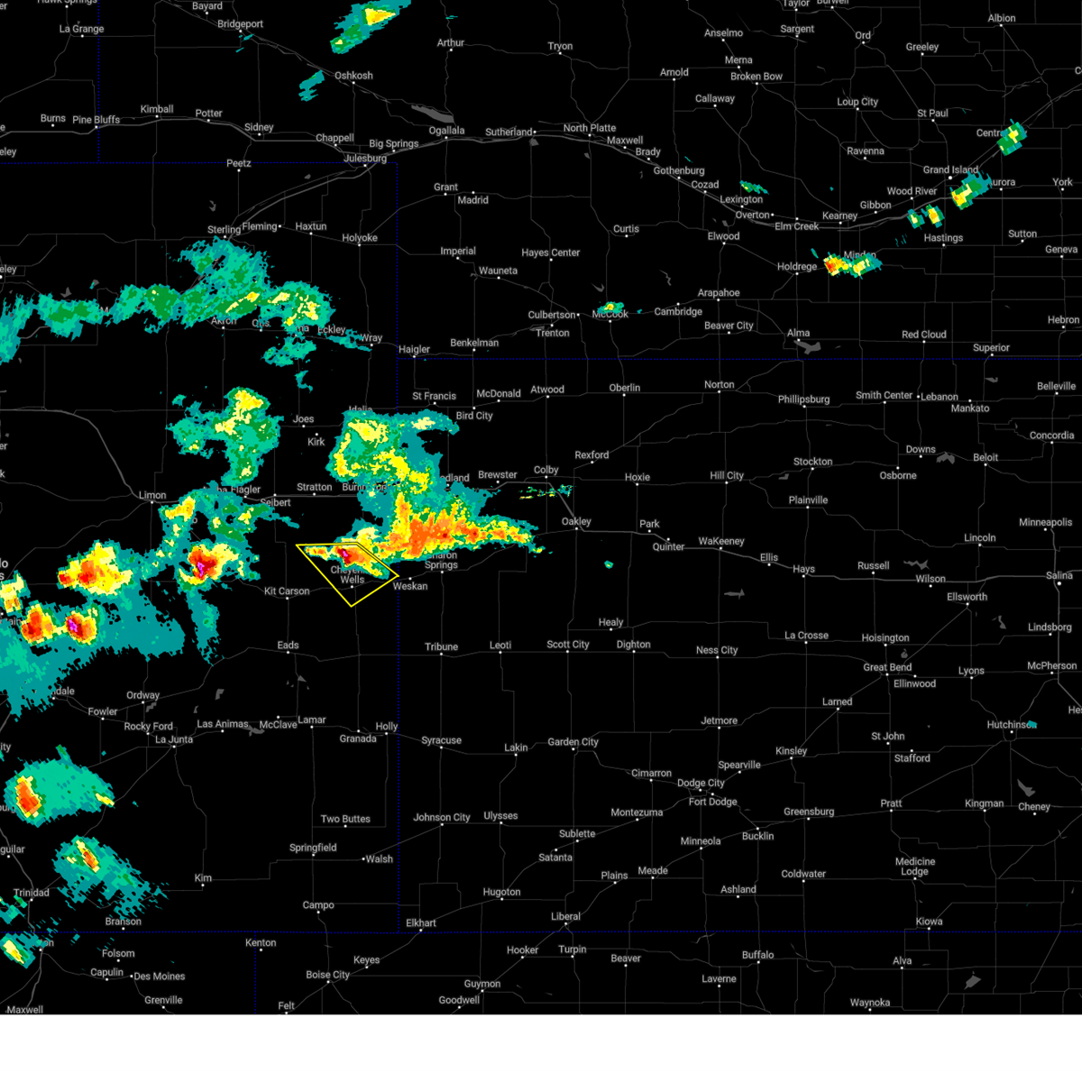 At 627 pm mdt, a severe thunderstorm was located 10 miles north of cheyenne wells, moving southeast at 30 mph (radar indicated). Hazards include ping pong ball size hail and 60 mph wind gusts. People and animals outdoors will be injured. expect hail damage to roofs, siding, windows, and vehicles. expect wind damage to roofs, siding, and trees. locations impacted include, cheyenne wells and arapahoe. This includes highway 385 between mile markers 144 and 168. At 627 pm mdt, a severe thunderstorm was located 10 miles north of cheyenne wells, moving southeast at 30 mph (radar indicated). Hazards include ping pong ball size hail and 60 mph wind gusts. People and animals outdoors will be injured. expect hail damage to roofs, siding, windows, and vehicles. expect wind damage to roofs, siding, and trees. locations impacted include, cheyenne wells and arapahoe. This includes highway 385 between mile markers 144 and 168.
|
| 7/7/2024 6:14 PM MDT |
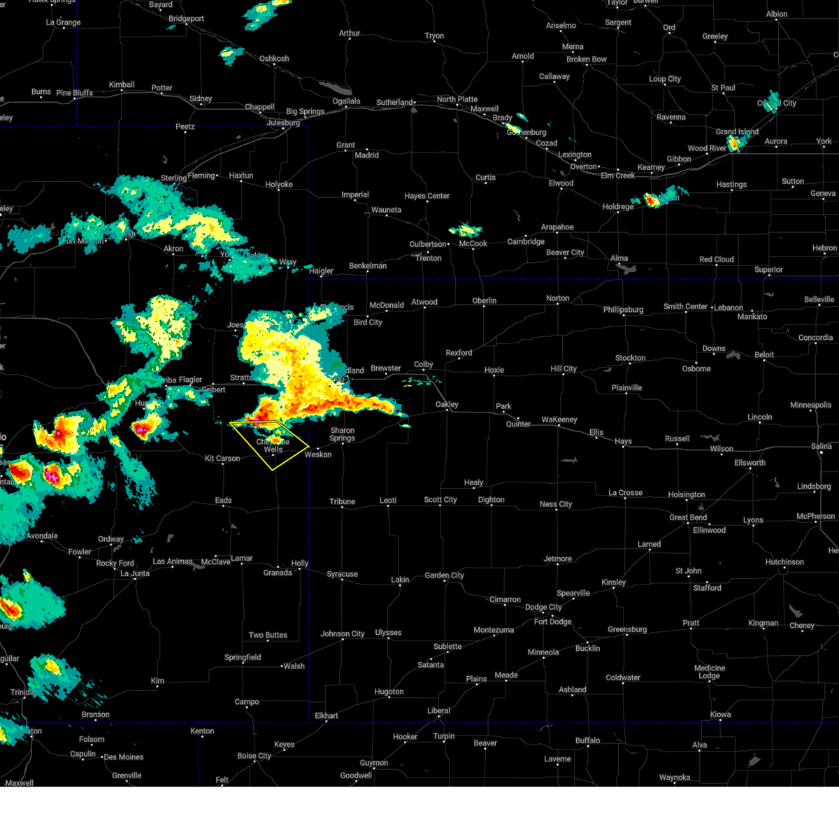 Svrgld the national weather service in goodland has issued a * severe thunderstorm warning for, northeastern cheyenne county in east central colorado, * until 645 pm mdt. * at 613 pm mdt, a severe thunderstorm was located 15 miles north of cheyenne wells, moving southeast at 30 mph (radar indicated). Hazards include ping pong ball size hail and 60 mph wind gusts. People and animals outdoors will be injured. expect hail damage to roofs, siding, windows, and vehicles. expect wind damage to roofs, siding, and trees. this severe thunderstorm will remain over mainly rural areas of northeastern cheyenne county in east central colorado, including the following locations, arapahoe. This includes highway 385 between mile markers 144 and 168. Svrgld the national weather service in goodland has issued a * severe thunderstorm warning for, northeastern cheyenne county in east central colorado, * until 645 pm mdt. * at 613 pm mdt, a severe thunderstorm was located 15 miles north of cheyenne wells, moving southeast at 30 mph (radar indicated). Hazards include ping pong ball size hail and 60 mph wind gusts. People and animals outdoors will be injured. expect hail damage to roofs, siding, windows, and vehicles. expect wind damage to roofs, siding, and trees. this severe thunderstorm will remain over mainly rural areas of northeastern cheyenne county in east central colorado, including the following locations, arapahoe. This includes highway 385 between mile markers 144 and 168.
|
| 6/27/2024 5:42 PM MDT | Site up723 reported 61 mph wind gus in cheyenne county CO, 5.8 miles E of Cheyenne Wells, CO |
| 6/27/2024 5:30 PM MDT | Site co068 reports 65 mph wind gust near firstvie in cheyenne county CO, 10 miles E of Cheyenne Wells, CO |
| 6/15/2024 7:30 PM MDT |
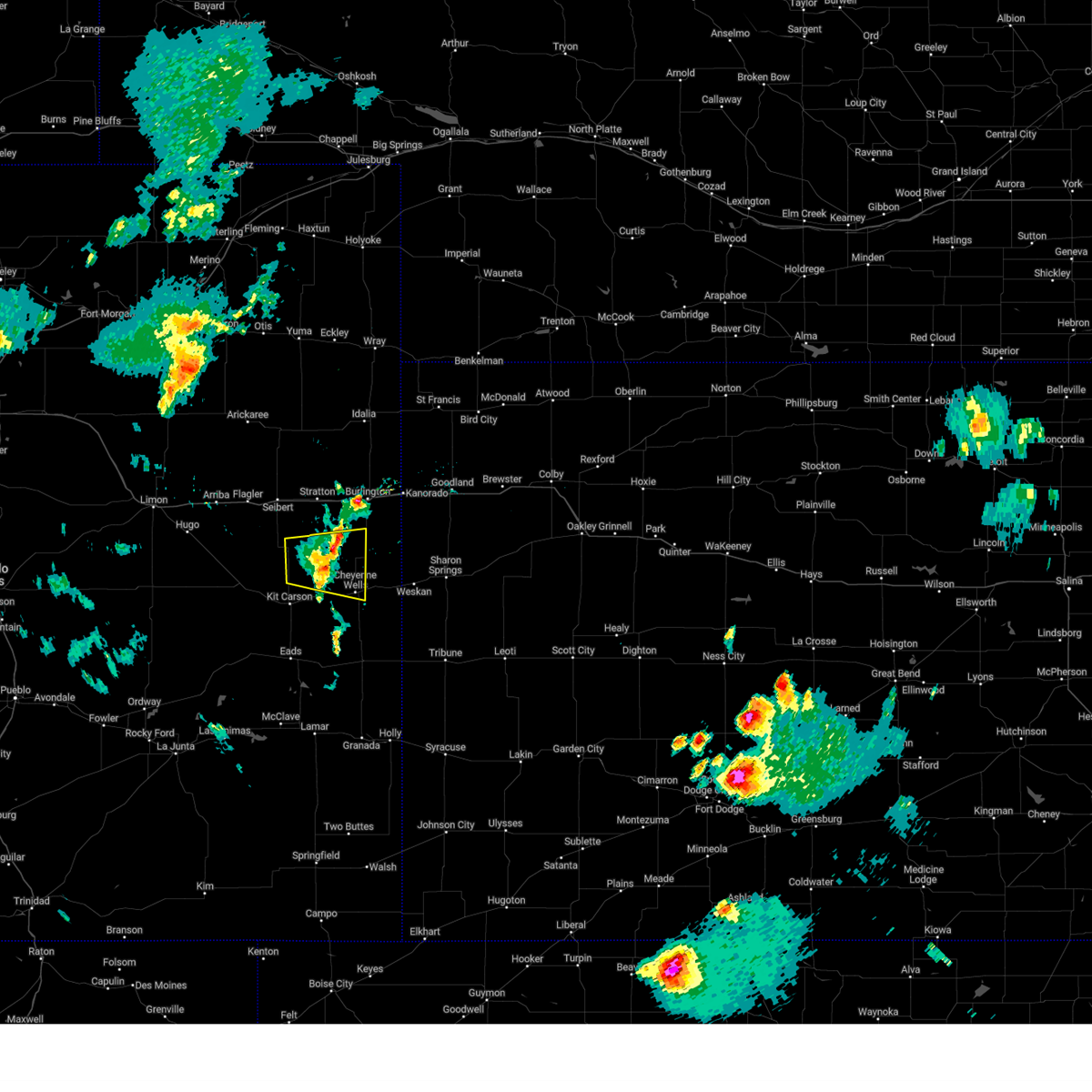 the severe thunderstorm warning has been cancelled and is no longer in effect the severe thunderstorm warning has been cancelled and is no longer in effect
|
| 6/15/2024 7:15 PM MDT |
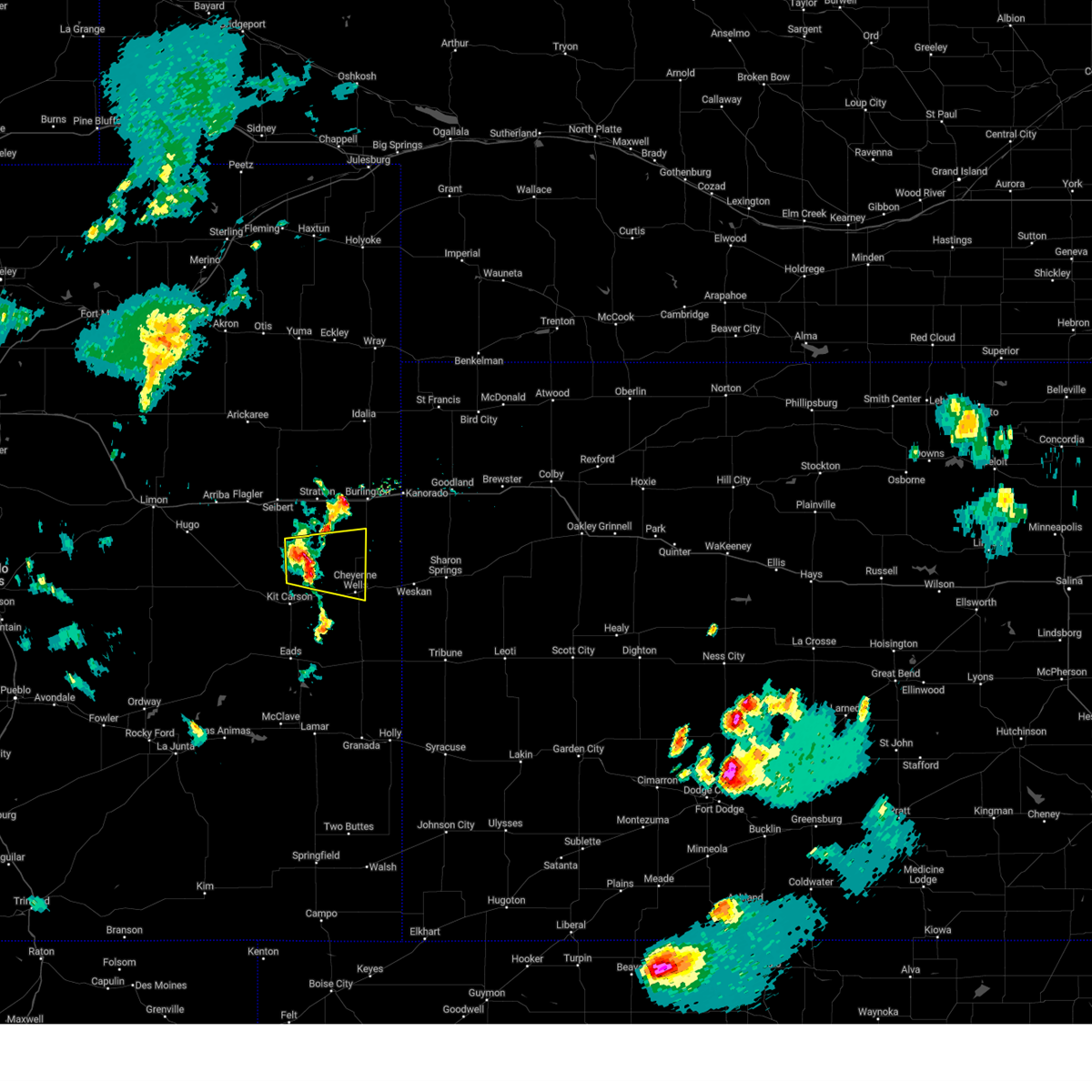 At 715 pm mdt, a severe thunderstorm was located 17 miles northwest of cheyenne wells, moving east at 30 mph (radar indicated). Hazards include 60 mph wind gusts and areas of blowing dust. Expect damage to roofs, siding, and trees. locations impacted include, cheyenne wells. This includes highway 385 between mile markers 148 and 166. At 715 pm mdt, a severe thunderstorm was located 17 miles northwest of cheyenne wells, moving east at 30 mph (radar indicated). Hazards include 60 mph wind gusts and areas of blowing dust. Expect damage to roofs, siding, and trees. locations impacted include, cheyenne wells. This includes highway 385 between mile markers 148 and 166.
|
| 6/15/2024 7:04 PM MDT |
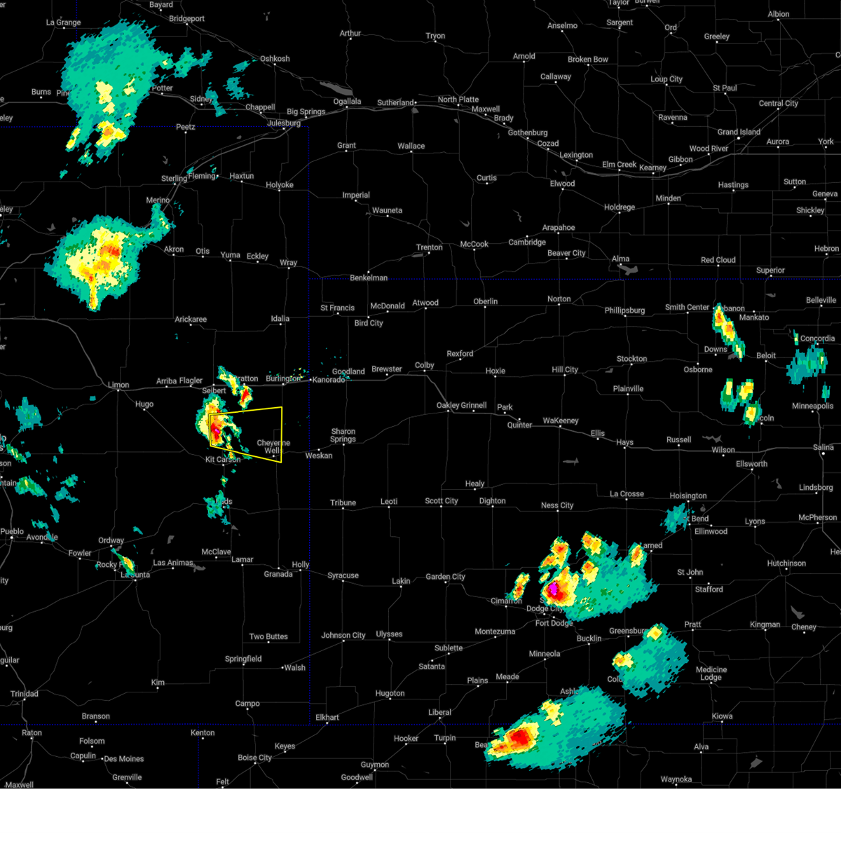 Svrgld the national weather service in goodland has issued a * severe thunderstorm warning for, northeastern cheyenne county in east central colorado, southeastern kit carson county in east central colorado, * until 745 pm mdt. * at 704 pm mdt, a severe thunderstorm was located 16 miles north of kit carson, or 21 miles northwest of cheyenne wells, moving east at 30 mph (radar indicated). Hazards include 60 mph wind gusts. Expect damage to roofs, siding, and trees. this severe thunderstorm will remain over mainly rural areas of northeastern cheyenne and southeastern kit carson counties in east central colorado. This includes highway 385 between mile markers 148 and 166. Svrgld the national weather service in goodland has issued a * severe thunderstorm warning for, northeastern cheyenne county in east central colorado, southeastern kit carson county in east central colorado, * until 745 pm mdt. * at 704 pm mdt, a severe thunderstorm was located 16 miles north of kit carson, or 21 miles northwest of cheyenne wells, moving east at 30 mph (radar indicated). Hazards include 60 mph wind gusts. Expect damage to roofs, siding, and trees. this severe thunderstorm will remain over mainly rural areas of northeastern cheyenne and southeastern kit carson counties in east central colorado. This includes highway 385 between mile markers 148 and 166.
|
| 6/14/2024 5:47 PM MDT |
 The storms which prompted the warning have weakened below severe limits, and no longer pose an immediate threat to life or property. therefore, the warning has been allowed to expire. however, gusty winds are still possible with these thunderstorms. a severe thunderstorm watch remains in effect until 900 pm mdt for east central colorado, and west central kansas. a severe thunderstorm watch also remains in effect until 100 am mdt for west central kansas. to report severe weather, contact your nearest law enforcement agency. they will relay your report to the national weather service goodland. The storms which prompted the warning have weakened below severe limits, and no longer pose an immediate threat to life or property. therefore, the warning has been allowed to expire. however, gusty winds are still possible with these thunderstorms. a severe thunderstorm watch remains in effect until 900 pm mdt for east central colorado, and west central kansas. a severe thunderstorm watch also remains in effect until 100 am mdt for west central kansas. to report severe weather, contact your nearest law enforcement agency. they will relay your report to the national weather service goodland.
|
| 6/14/2024 5:29 PM MDT |
 At 528 pm mdt, severe thunderstorms were located along a line extending from 12 miles southeast of cheyenne wells to 8 miles south of horace to 3 miles northwest of syracuse, moving east at 55 mph (radar indicated. storms do have a history of producing 60 to 70 mph winds near lamar, colorado). Hazards include 60 mph wind gusts and areas of blowing dust,. Expect damage to roofs, siding, and trees. poor visibility and possible brownout conditions due to blowing dust. locations impacted include, cheyenne wells, sharon springs, tribune, weskan, horace, wallace, and arapahoe. This includes highway 385 between mile markers 136 and 159, and between mile markers 165 and 169. At 528 pm mdt, severe thunderstorms were located along a line extending from 12 miles southeast of cheyenne wells to 8 miles south of horace to 3 miles northwest of syracuse, moving east at 55 mph (radar indicated. storms do have a history of producing 60 to 70 mph winds near lamar, colorado). Hazards include 60 mph wind gusts and areas of blowing dust,. Expect damage to roofs, siding, and trees. poor visibility and possible brownout conditions due to blowing dust. locations impacted include, cheyenne wells, sharon springs, tribune, weskan, horace, wallace, and arapahoe. This includes highway 385 between mile markers 136 and 159, and between mile markers 165 and 169.
|
| 6/14/2024 5:26 PM MDT |
 the severe thunderstorm warning has been cancelled and is no longer in effect the severe thunderstorm warning has been cancelled and is no longer in effect
|
| 6/14/2024 5:18 PM MDT |
 At 516 pm mdt, severe thunderstorms were located along a line extending from 9 miles southeast of cheyenne wells to 12 miles southeast of towner to 7 miles southeast of coolidge, moving east at 60 mph (radar indicated). Hazards include 60 mph wind gusts and areas of blowing dust. Expect damage to roofs, siding, and trees. poor visibility due to blowing dust. locations impacted include, cheyenne wells, sharon springs, tribune, weskan, horace, wallace, and arapahoe. This includes highway 385 between mile markers 136 and 159, and between mile markers 165 and 169. At 516 pm mdt, severe thunderstorms were located along a line extending from 9 miles southeast of cheyenne wells to 12 miles southeast of towner to 7 miles southeast of coolidge, moving east at 60 mph (radar indicated). Hazards include 60 mph wind gusts and areas of blowing dust. Expect damage to roofs, siding, and trees. poor visibility due to blowing dust. locations impacted include, cheyenne wells, sharon springs, tribune, weskan, horace, wallace, and arapahoe. This includes highway 385 between mile markers 136 and 159, and between mile markers 165 and 169.
|
| 6/14/2024 5:03 PM MDT |
 Svrgld the national weather service in goodland has issued a * severe thunderstorm warning for, eastern cheyenne county in east central colorado, wallace county in west central kansas, greeley county in west central kansas, * until 545 pm mdt. * at 502 pm mdt, severe thunderstorms were located along a line extending from 13 miles southwest of cheyenne wells to 10 miles north of hartman to 9 miles south of holly, moving east at 60 mph (radar indicated). Hazards include 60 mph wind gusts and penny size hail. expect damage to roofs, siding, and trees Svrgld the national weather service in goodland has issued a * severe thunderstorm warning for, eastern cheyenne county in east central colorado, wallace county in west central kansas, greeley county in west central kansas, * until 545 pm mdt. * at 502 pm mdt, severe thunderstorms were located along a line extending from 13 miles southwest of cheyenne wells to 10 miles north of hartman to 9 miles south of holly, moving east at 60 mph (radar indicated). Hazards include 60 mph wind gusts and penny size hail. expect damage to roofs, siding, and trees
|
| 6/14/2024 4:55 PM MDT |
 At 454 pm mdt, severe thunderstorms were located along a line extending from 16 miles southeast of boyero to 4 miles west of kit carson to 6 miles northeast of eads, moving northeast at 30 mph (radar indicated). Hazards include 60 mph wind gusts and penny size hail. blowing dust is also expected. Expect damage to roofs, siding, and trees. low visibility due to blowing dust. these severe storms will be near, kit carson around 500 pm mdt. other locations impacted by these severe thunderstorms include wild horse, firstview, and aroya. This includes highway 385 between mile markers 150 and 169. At 454 pm mdt, severe thunderstorms were located along a line extending from 16 miles southeast of boyero to 4 miles west of kit carson to 6 miles northeast of eads, moving northeast at 30 mph (radar indicated). Hazards include 60 mph wind gusts and penny size hail. blowing dust is also expected. Expect damage to roofs, siding, and trees. low visibility due to blowing dust. these severe storms will be near, kit carson around 500 pm mdt. other locations impacted by these severe thunderstorms include wild horse, firstview, and aroya. This includes highway 385 between mile markers 150 and 169.
|
| 6/14/2024 4:46 PM MDT |
 Svrgld the national weather service in goodland has issued a * severe thunderstorm warning for, cheyenne county in east central colorado, * until 545 pm mdt. * at 446 pm mdt, severe thunderstorms were located along a line extending from 17 miles southeast of boyero to 7 miles southwest of kit carson to 3 miles northeast of eads, moving northeast at 30 mph (radar indicated). Hazards include 60 mph wind gusts and penny size hail. Expect damage to roofs, siding, and trees. severe thunderstorms will be near, kit carson around 450 pm mdt. This includes highway 385 between mile markers 150 and 169. Svrgld the national weather service in goodland has issued a * severe thunderstorm warning for, cheyenne county in east central colorado, * until 545 pm mdt. * at 446 pm mdt, severe thunderstorms were located along a line extending from 17 miles southeast of boyero to 7 miles southwest of kit carson to 3 miles northeast of eads, moving northeast at 30 mph (radar indicated). Hazards include 60 mph wind gusts and penny size hail. Expect damage to roofs, siding, and trees. severe thunderstorms will be near, kit carson around 450 pm mdt. This includes highway 385 between mile markers 150 and 169.
|
| 6/8/2024 7:38 PM MDT | U40 firstvie in cheyenne county CO, 12.8 miles E of Cheyenne Wells, CO |
| 6/8/2024 7:17 PM MDT | Mesonet station co068 040w460 u40-firstvie in cheyenne county CO, 10 miles E of Cheyenne Wells, CO |
| 6/8/2024 7:14 PM MDT | Kcocheye8 reports of a gust of 58 mp in cheyenne county CO, 10.7 miles E of Cheyenne Wells, CO |
| 6/8/2024 7:14 PM MDT | Kcoarapa3 reports 58 mph gus in cheyenne county CO, 10.7 miles SW of Cheyenne Wells, CO |
| 6/8/2024 6:35 PM MDT |
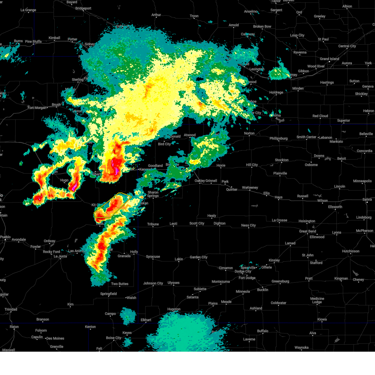 At 634 pm mdt, severe thunderstorms were located along a line extending from 10 miles east of cheyenne wells to near chivington, moving southeast at 35 mph (radar indicated). Hazards include golf ball size hail and 60 mph wind gusts. People and animals outdoors will be injured. expect hail damage to roofs, siding, windows, and vehicles. expect wind damage to roofs, siding, and trees. locations impacted include, cheyenne wells and firstview. This includes highway 385 between mile markers 149 and 161. At 634 pm mdt, severe thunderstorms were located along a line extending from 10 miles east of cheyenne wells to near chivington, moving southeast at 35 mph (radar indicated). Hazards include golf ball size hail and 60 mph wind gusts. People and animals outdoors will be injured. expect hail damage to roofs, siding, windows, and vehicles. expect wind damage to roofs, siding, and trees. locations impacted include, cheyenne wells and firstview. This includes highway 385 between mile markers 149 and 161.
|
| 6/8/2024 6:23 PM MDT | Quarter sized hail reported 13.9 miles E of Cheyenne Wells, CO, report from mping: quarter (1.00 in.). |
| 6/8/2024 6:22 PM MDT |
 At 622 pm mdt, severe thunderstorms were located along a line extending from 5 miles east of cheyenne wells to 7 miles northwest of chivington, moving southeast at 35 mph (radar indicated). Hazards include golf ball size hail and 60 mph wind gusts. People and animals outdoors will be injured. expect hail damage to roofs, siding, windows, and vehicles. expect wind damage to roofs, siding, and trees. locations impacted include, cheyenne wells, kit carson, and firstview. This includes highway 385 between mile markers 148 and 166. At 622 pm mdt, severe thunderstorms were located along a line extending from 5 miles east of cheyenne wells to 7 miles northwest of chivington, moving southeast at 35 mph (radar indicated). Hazards include golf ball size hail and 60 mph wind gusts. People and animals outdoors will be injured. expect hail damage to roofs, siding, windows, and vehicles. expect wind damage to roofs, siding, and trees. locations impacted include, cheyenne wells, kit carson, and firstview. This includes highway 385 between mile markers 148 and 166.
|
| 6/8/2024 6:16 PM MDT |
 At 615 pm mdt, severe thunderstorms were located along a line extending from 4 miles northeast of cheyenne wells to 7 miles northeast of eads, moving southeast at 35 mph (radar indicated). Hazards include golf ball size hail and 60 mph wind gusts. People and animals outdoors will be injured. expect hail damage to roofs, siding, windows, and vehicles. expect wind damage to roofs, siding, and trees. these severe thunderstorms will remain over mainly rural areas of central cheyenne county in east central colorado, including the following locations, firstview. This includes highway 385 between mile markers 148 and 166. At 615 pm mdt, severe thunderstorms were located along a line extending from 4 miles northeast of cheyenne wells to 7 miles northeast of eads, moving southeast at 35 mph (radar indicated). Hazards include golf ball size hail and 60 mph wind gusts. People and animals outdoors will be injured. expect hail damage to roofs, siding, windows, and vehicles. expect wind damage to roofs, siding, and trees. these severe thunderstorms will remain over mainly rural areas of central cheyenne county in east central colorado, including the following locations, firstview. This includes highway 385 between mile markers 148 and 166.
|
| 6/8/2024 6:16 PM MDT |
 the severe thunderstorm warning has been cancelled and is no longer in effect the severe thunderstorm warning has been cancelled and is no longer in effect
|
| 6/8/2024 5:57 PM MDT |
 At 556 pm mdt, severe thunderstorms were located along a line extending from 11 miles northwest of cheyenne wells to 8 miles south of kit carson, moving southeast at 35 mph (radar indicated). Hazards include golf ball size hail and 60 mph wind gusts. People and animals outdoors will be injured. expect hail damage to roofs, siding, windows, and vehicles. expect wind damage to roofs, siding, and trees. these severe storms will be near, cheyenne wells around 605 pm mdt. other locations impacted by these severe thunderstorms include firstview. This includes highway 385 between mile markers 148 and 167. At 556 pm mdt, severe thunderstorms were located along a line extending from 11 miles northwest of cheyenne wells to 8 miles south of kit carson, moving southeast at 35 mph (radar indicated). Hazards include golf ball size hail and 60 mph wind gusts. People and animals outdoors will be injured. expect hail damage to roofs, siding, windows, and vehicles. expect wind damage to roofs, siding, and trees. these severe storms will be near, cheyenne wells around 605 pm mdt. other locations impacted by these severe thunderstorms include firstview. This includes highway 385 between mile markers 148 and 167.
|
| 6/8/2024 5:38 PM MDT |
 Svrgld the national weather service in goodland has issued a * severe thunderstorm warning for, central cheyenne county in east central colorado, south central kit carson county in east central colorado, * until 645 pm mdt. * at 538 pm mdt, severe thunderstorms were located along a line extending from 17 miles south of stratton to 8 miles west of kit carson, moving southeast at 35 mph (radar indicated). Hazards include golf ball size hail and 60 mph wind gusts. People and animals outdoors will be injured. expect hail damage to roofs, siding, windows, and vehicles. expect wind damage to roofs, siding, and trees. severe thunderstorms will be near, kit carson around 545 pm mdt. other locations in the path of these severe thunderstorms include cheyenne wells. This includes highway 385 between mile markers 148 and 168. Svrgld the national weather service in goodland has issued a * severe thunderstorm warning for, central cheyenne county in east central colorado, south central kit carson county in east central colorado, * until 645 pm mdt. * at 538 pm mdt, severe thunderstorms were located along a line extending from 17 miles south of stratton to 8 miles west of kit carson, moving southeast at 35 mph (radar indicated). Hazards include golf ball size hail and 60 mph wind gusts. People and animals outdoors will be injured. expect hail damage to roofs, siding, windows, and vehicles. expect wind damage to roofs, siding, and trees. severe thunderstorms will be near, kit carson around 545 pm mdt. other locations in the path of these severe thunderstorms include cheyenne wells. This includes highway 385 between mile markers 148 and 168.
|
| 5/28/2024 6:39 PM MDT |
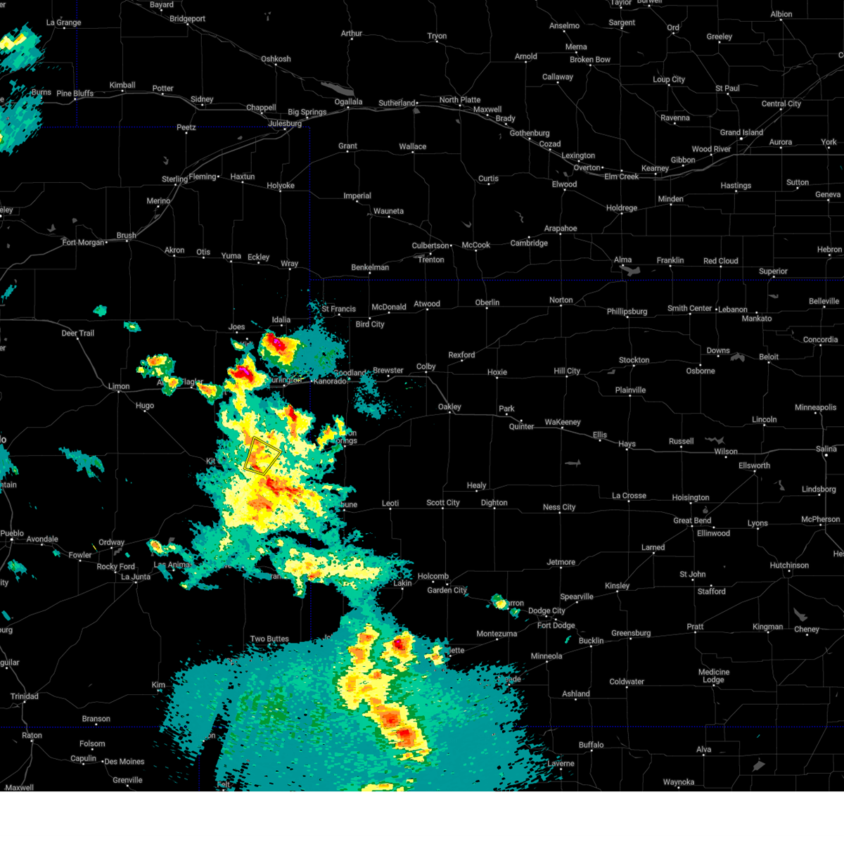 The storm which prompted the warning has weakened below severe limits, and no longer poses an immediate threat to life or property. therefore, the warning will be allowed to expire. a severe thunderstorm watch remains in effect until 900 pm mdt for east central colorado. The storm which prompted the warning has weakened below severe limits, and no longer poses an immediate threat to life or property. therefore, the warning will be allowed to expire. a severe thunderstorm watch remains in effect until 900 pm mdt for east central colorado.
|
| 5/28/2024 6:23 PM MDT |
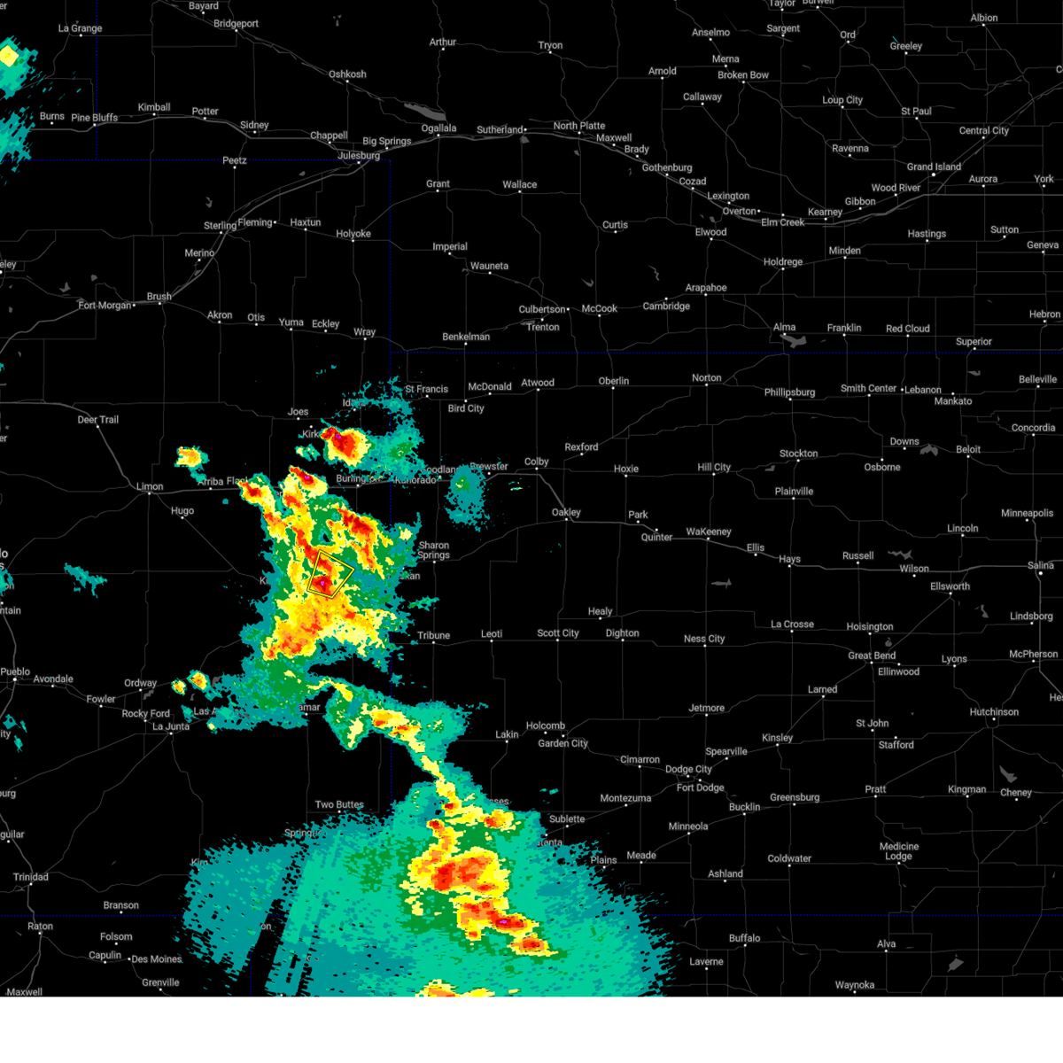 At 623 pm mdt, a severe thunderstorm was located 8 miles west of cheyenne wells, moving north at 20 mph (radar indicated). Hazards include 60 mph wind gusts and quarter size hail. Hail damage to vehicles is expected. expect wind damage to roofs, siding, and trees. locations impacted include, cheyenne wells and firstview. This includes highway 385 between mile markers 151 and 155. At 623 pm mdt, a severe thunderstorm was located 8 miles west of cheyenne wells, moving north at 20 mph (radar indicated). Hazards include 60 mph wind gusts and quarter size hail. Hail damage to vehicles is expected. expect wind damage to roofs, siding, and trees. locations impacted include, cheyenne wells and firstview. This includes highway 385 between mile markers 151 and 155.
|
| 5/28/2024 5:56 PM MDT |
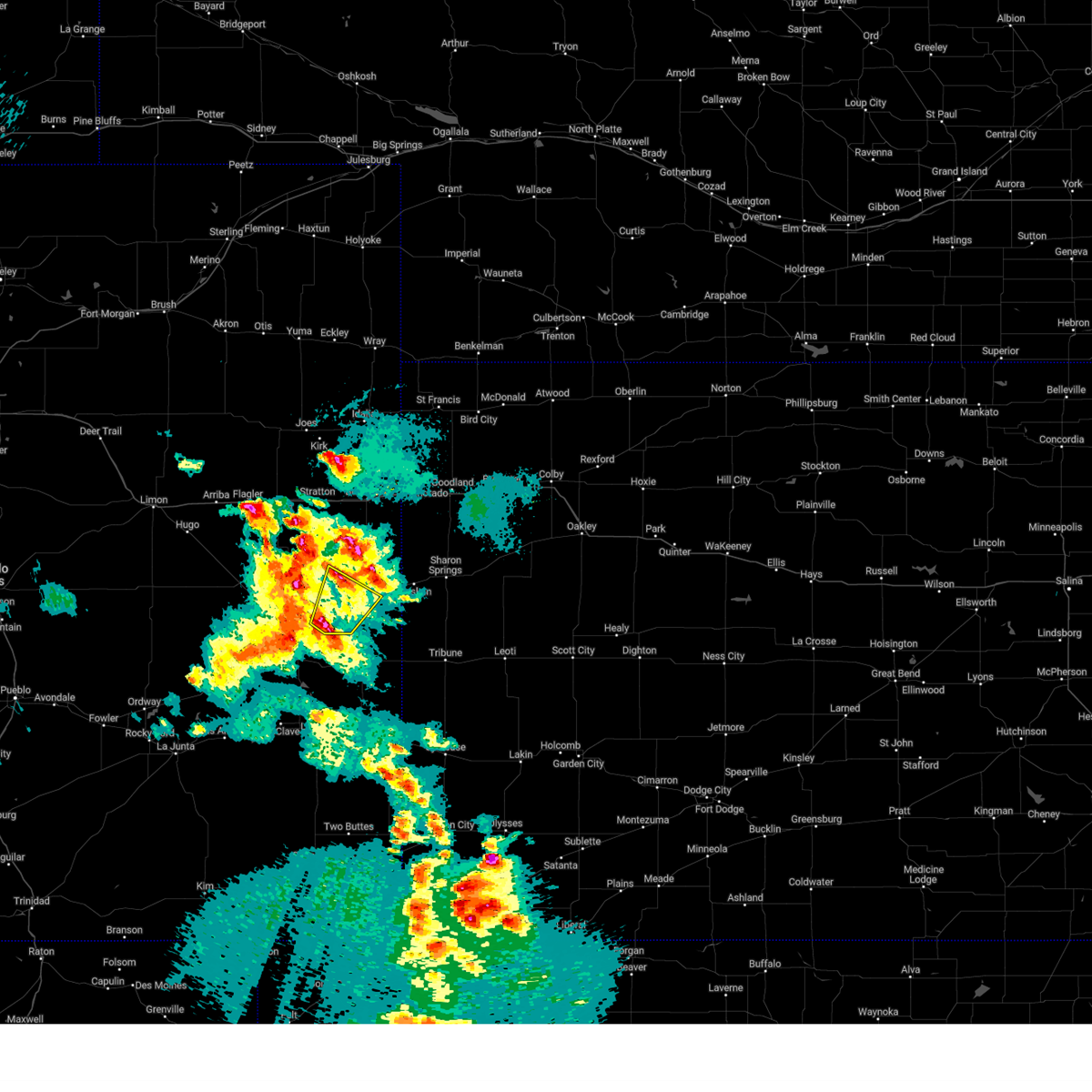 Svrgld the national weather service in goodland has issued a * severe thunderstorm warning for, eastern cheyenne county in east central colorado, * until 645 pm mdt. * at 556 pm mdt, a severe thunderstorm was located 14 miles southwest of cheyenne wells, moving northeast at 20 mph (radar indicated). Hazards include ping pong ball size hail and 60 mph wind gusts. People and animals outdoors will be injured. expect hail damage to roofs, siding, windows, and vehicles. Expect wind damage to roofs, siding, and trees. Svrgld the national weather service in goodland has issued a * severe thunderstorm warning for, eastern cheyenne county in east central colorado, * until 645 pm mdt. * at 556 pm mdt, a severe thunderstorm was located 14 miles southwest of cheyenne wells, moving northeast at 20 mph (radar indicated). Hazards include ping pong ball size hail and 60 mph wind gusts. People and animals outdoors will be injured. expect hail damage to roofs, siding, windows, and vehicles. Expect wind damage to roofs, siding, and trees.
|
| 5/18/2024 10:20 PM MDT |
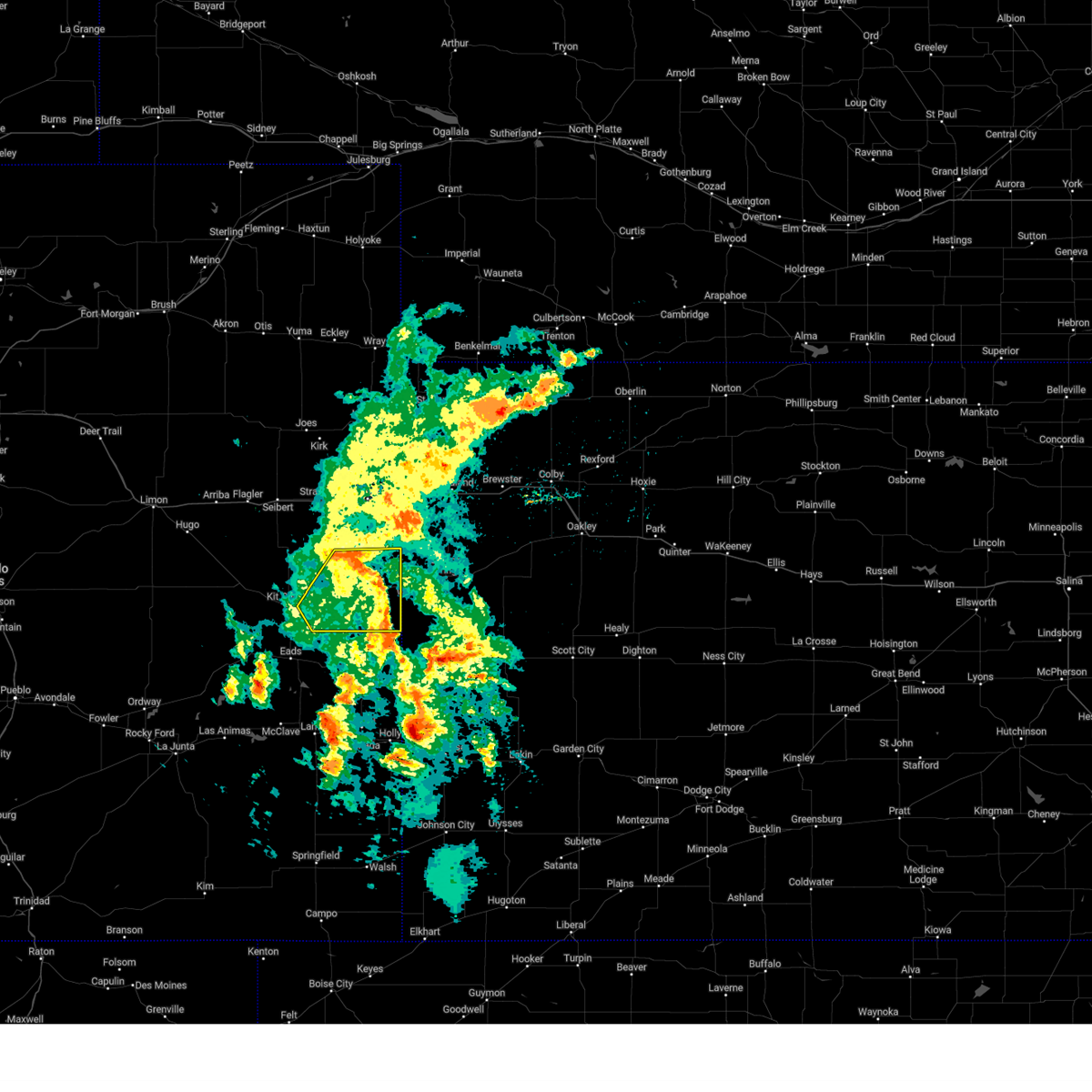 the severe thunderstorm warning has been cancelled and is no longer in effect the severe thunderstorm warning has been cancelled and is no longer in effect
|
| 5/18/2024 10:00 PM MDT |
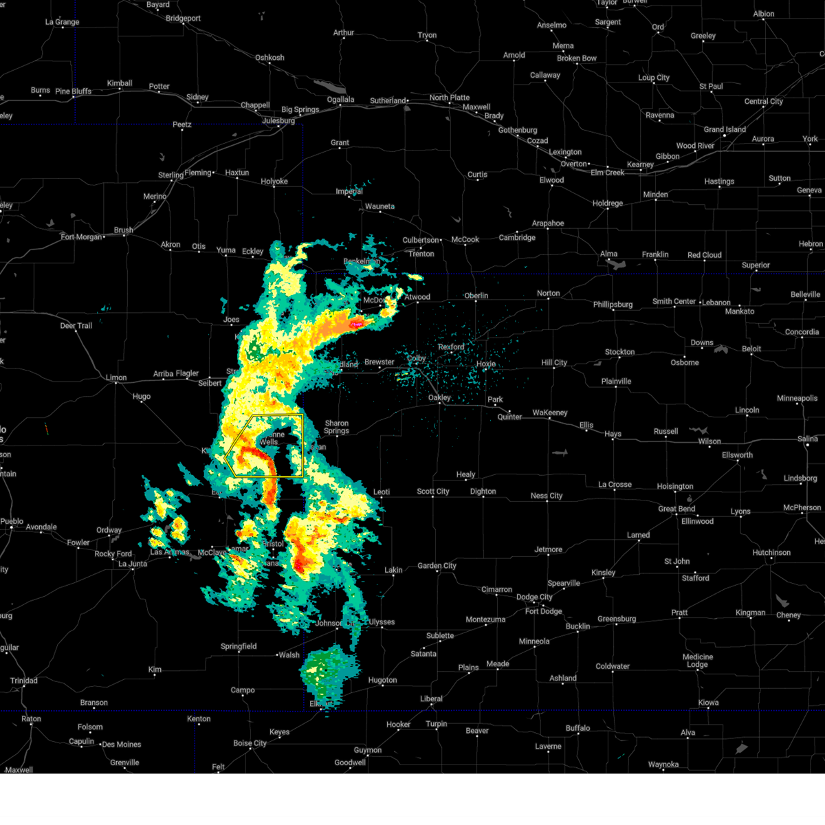 At 1000 pm mdt, severe thunderstorms were located along a line extending from 11 miles east of kit carson to 3 miles south of cheyenne wells to 8 miles north of sheridan lake, moving northeast at 35 mph (radar indicated). Hazards include 60 mph wind gusts and penny size hail. Expect damage to roofs, siding, and trees. locations impacted include, cheyenne wells, arapahoe, and firstview. This includes highway 385 between mile markers 136 and 169. At 1000 pm mdt, severe thunderstorms were located along a line extending from 11 miles east of kit carson to 3 miles south of cheyenne wells to 8 miles north of sheridan lake, moving northeast at 35 mph (radar indicated). Hazards include 60 mph wind gusts and penny size hail. Expect damage to roofs, siding, and trees. locations impacted include, cheyenne wells, arapahoe, and firstview. This includes highway 385 between mile markers 136 and 169.
|
| 5/18/2024 9:40 PM MDT |
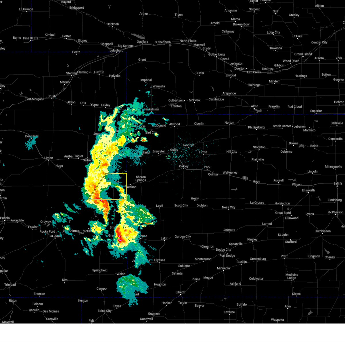 Svrgld the national weather service in goodland has issued a * severe thunderstorm warning for, eastern cheyenne county in east central colorado, * until 1045 pm mdt. * at 939 pm mdt, severe thunderstorms were located along a line extending from 8 miles southeast of kit carson to 13 miles north of chivington to brandon, moving northeast at 30 mph (radar indicated). Hazards include 60 mph wind gusts and quarter size hail. Hail damage to vehicles is expected. Expect wind damage to roofs, siding, and trees. Svrgld the national weather service in goodland has issued a * severe thunderstorm warning for, eastern cheyenne county in east central colorado, * until 1045 pm mdt. * at 939 pm mdt, severe thunderstorms were located along a line extending from 8 miles southeast of kit carson to 13 miles north of chivington to brandon, moving northeast at 30 mph (radar indicated). Hazards include 60 mph wind gusts and quarter size hail. Hail damage to vehicles is expected. Expect wind damage to roofs, siding, and trees.
|
| 5/3/2024 7:42 PM MDT |
 The storms which prompted the warning have weakened below severe limits, and have exited the warned area. therefore, the warning will be allowed to expire. however, gusty winds are still possible with these thunderstorms. a severe thunderstorm watch remains in effect until 1000 pm mdt/1100 pm cdt/ for east central colorado, and west central kansas. a severe thunderstorm watch also remains in effect until 1100 pm mdt/midnight cdt/ for east central colorado, and northwestern kansas. The storms which prompted the warning have weakened below severe limits, and have exited the warned area. therefore, the warning will be allowed to expire. however, gusty winds are still possible with these thunderstorms. a severe thunderstorm watch remains in effect until 1000 pm mdt/1100 pm cdt/ for east central colorado, and west central kansas. a severe thunderstorm watch also remains in effect until 1100 pm mdt/midnight cdt/ for east central colorado, and northwestern kansas.
|
| 5/3/2024 7:12 PM MDT |
 At 712 pm mdt/812 pm cdt/, severe thunderstorms were located along a line extending from near brewster to 13 miles south of goodland to 8 miles north of cheyenne wells to 6 miles west of kit carson, moving east at 40 mph (radar indicated). Hazards include 60 mph wind gusts and quarter size hail. Hail damage to vehicles is expected. expect wind damage to roofs, siding, and trees. these severe storms will be near, brewster around 815 pm cdt. kit carson around 715 pm mdt. levant around 820 pm cdt. cheyenne wells around 725 pm mdt. colby around 830 pm cdt. gem around 845 pm cdt. other locations impacted by these severe thunderstorms include edson, firstview, wild horse, arapahoe, halford, and aroya. this includes the following highways, interstate 70 in kansas between mile markers 0 and 61. interstate 70 in colorado between mile markers 391 and 450. Highway 385 between mile markers 144 and 198. At 712 pm mdt/812 pm cdt/, severe thunderstorms were located along a line extending from near brewster to 13 miles south of goodland to 8 miles north of cheyenne wells to 6 miles west of kit carson, moving east at 40 mph (radar indicated). Hazards include 60 mph wind gusts and quarter size hail. Hail damage to vehicles is expected. expect wind damage to roofs, siding, and trees. these severe storms will be near, brewster around 815 pm cdt. kit carson around 715 pm mdt. levant around 820 pm cdt. cheyenne wells around 725 pm mdt. colby around 830 pm cdt. gem around 845 pm cdt. other locations impacted by these severe thunderstorms include edson, firstview, wild horse, arapahoe, halford, and aroya. this includes the following highways, interstate 70 in kansas between mile markers 0 and 61. interstate 70 in colorado between mile markers 391 and 450. Highway 385 between mile markers 144 and 198.
|
| 5/3/2024 6:57 PM MDT |
 At 656 pm mdt/756 pm cdt/, severe thunderstorms were located along a line extending from 11 miles north of brewster to 4 miles south of goodland to 15 miles south of burlington to 11 miles northwest of kit carson, moving east at 40 mph (radar indicated). Hazards include 70 mph wind gusts and quarter size hail. Hail damage to vehicles is expected. expect considerable tree damage. wind damage is also likely to mobile homes, roofs, and outbuildings. these severe storms will be near, brewster around 800 pm cdt. levant around 815 pm cdt. colby around 825 pm cdt. gem around 835 pm cdt. rexford around 840 pm cdt. other locations impacted by these severe thunderstorms include edson, firstview, wild horse, arapahoe, halford, and aroya. this includes the following highways, interstate 70 in kansas between mile markers 0 and 61. interstate 70 in colorado between mile markers 391 and 450. Highway 385 between mile markers 144 and 198. At 656 pm mdt/756 pm cdt/, severe thunderstorms were located along a line extending from 11 miles north of brewster to 4 miles south of goodland to 15 miles south of burlington to 11 miles northwest of kit carson, moving east at 40 mph (radar indicated). Hazards include 70 mph wind gusts and quarter size hail. Hail damage to vehicles is expected. expect considerable tree damage. wind damage is also likely to mobile homes, roofs, and outbuildings. these severe storms will be near, brewster around 800 pm cdt. levant around 815 pm cdt. colby around 825 pm cdt. gem around 835 pm cdt. rexford around 840 pm cdt. other locations impacted by these severe thunderstorms include edson, firstview, wild horse, arapahoe, halford, and aroya. this includes the following highways, interstate 70 in kansas between mile markers 0 and 61. interstate 70 in colorado between mile markers 391 and 450. Highway 385 between mile markers 144 and 198.
|
| 5/3/2024 6:38 PM MDT |
 Svrgld the national weather service in goodland has issued a * severe thunderstorm warning for, cheyenne county in east central colorado, kit carson county in east central colorado, northern wallace county in west central kansas, thomas county in northwestern kansas, sherman county in northwestern kansas, * until 745 pm mdt/845 pm cdt/. * at 638 pm mdt/738 pm cdt/, severe thunderstorms were located along a line extending from 8 miles southeast of mcdonald to 7 miles north of goodland to 4 miles south of burlington to 15 miles south of seibert, moving south at 40 mph (radar indicated). Hazards include 70 mph wind gusts and nickel size hail. Expect considerable tree damage. damage is likely to mobile homes, roofs, and outbuildings. severe thunderstorms will be near, goodland and ruleton around 645 pm mdt. other locations in the path of these severe thunderstorms include brewster, kit carson and cheyenne wells. this includes the following highways, interstate 70 in kansas between mile markers 0 and 61. interstate 70 in colorado between mile markers 391 and 450. Highway 385 between mile markers 144 and 198. Svrgld the national weather service in goodland has issued a * severe thunderstorm warning for, cheyenne county in east central colorado, kit carson county in east central colorado, northern wallace county in west central kansas, thomas county in northwestern kansas, sherman county in northwestern kansas, * until 745 pm mdt/845 pm cdt/. * at 638 pm mdt/738 pm cdt/, severe thunderstorms were located along a line extending from 8 miles southeast of mcdonald to 7 miles north of goodland to 4 miles south of burlington to 15 miles south of seibert, moving south at 40 mph (radar indicated). Hazards include 70 mph wind gusts and nickel size hail. Expect considerable tree damage. damage is likely to mobile homes, roofs, and outbuildings. severe thunderstorms will be near, goodland and ruleton around 645 pm mdt. other locations in the path of these severe thunderstorms include brewster, kit carson and cheyenne wells. this includes the following highways, interstate 70 in kansas between mile markers 0 and 61. interstate 70 in colorado between mile markers 391 and 450. Highway 385 between mile markers 144 and 198.
|
| 8/3/2023 8:57 PM MDT | Home site measured a max gust of 60.6 mp in cheyenne county CO, 1.1 miles NW of Cheyenne Wells, CO |
| 8/3/2023 8:48 PM MDT |
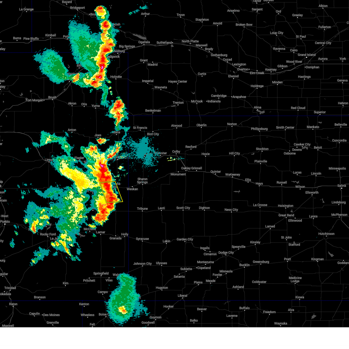 At 847 pm mdt, severe thunderstorms were located along a line extending from 8 miles northwest of cheyenne wells to 11 miles north of sheridan lake, moving east at 25 mph (radar indicated). Hazards include 70 mph wind gusts and quarter size hail. Hail damage to vehicles is expected. expect considerable tree damage. wind damage is also likely to mobile homes, roofs, and outbuildings. locations impacted include, cheyenne wells and firstview. this includes highway 385 between mile markers 136 and 159. thunderstorm damage threat, considerable hail threat, radar indicated max hail size, 1. 00 in wind threat, radar indicated max wind gust, 70 mph. At 847 pm mdt, severe thunderstorms were located along a line extending from 8 miles northwest of cheyenne wells to 11 miles north of sheridan lake, moving east at 25 mph (radar indicated). Hazards include 70 mph wind gusts and quarter size hail. Hail damage to vehicles is expected. expect considerable tree damage. wind damage is also likely to mobile homes, roofs, and outbuildings. locations impacted include, cheyenne wells and firstview. this includes highway 385 between mile markers 136 and 159. thunderstorm damage threat, considerable hail threat, radar indicated max hail size, 1. 00 in wind threat, radar indicated max wind gust, 70 mph.
|
| 8/3/2023 8:29 PM MDT |
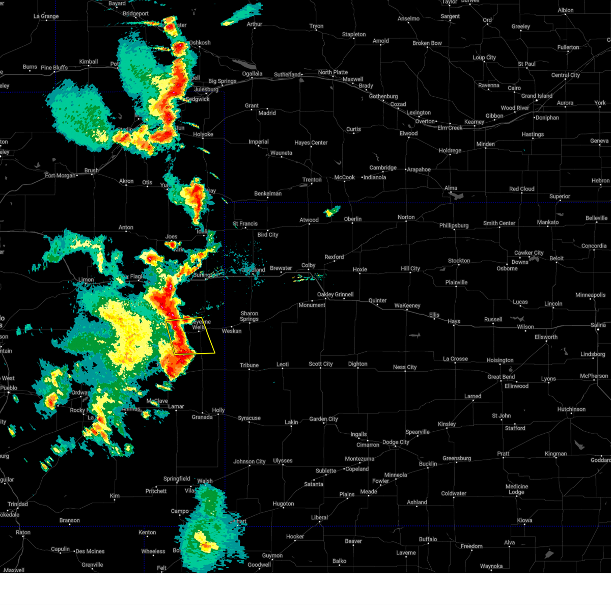 At 829 pm mdt, severe thunderstorms were located along a line extending from 12 miles northwest of cheyenne wells to 11 miles north of brandon, moving east at 25 mph (radar indicated). Hazards include 70 mph wind gusts and quarter size hail. Hail damage to vehicles is expected. expect considerable tree damage. Wind damage is also likely to mobile homes, roofs, and outbuildings. At 829 pm mdt, severe thunderstorms were located along a line extending from 12 miles northwest of cheyenne wells to 11 miles north of brandon, moving east at 25 mph (radar indicated). Hazards include 70 mph wind gusts and quarter size hail. Hail damage to vehicles is expected. expect considerable tree damage. Wind damage is also likely to mobile homes, roofs, and outbuildings.
|
| 7/13/2023 3:50 PM MDT |
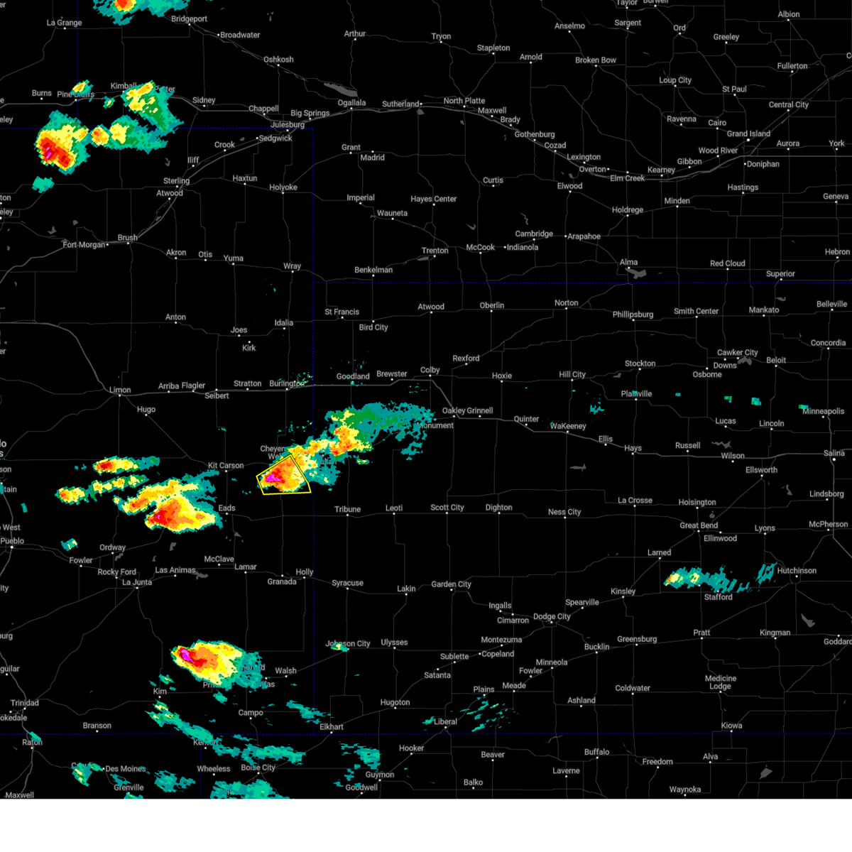 At 350 pm mdt, a severe thunderstorm was located 9 miles south of cheyenne wells, moving southeast at 30 mph (radar indicated). Hazards include tennis ball size hail and 60 mph wind gusts. People and animals outdoors will be injured. expect hail damage to roofs, siding, windows, and vehicles. expect wind damage to roofs, siding, and trees. locations impacted include, cheyenne wells. this includes highway 385 between mile markers 136 and 150. thunderstorm damage threat, considerable hail threat, radar indicated max hail size, 2. 50 in wind threat, radar indicated max wind gust, 60 mph. At 350 pm mdt, a severe thunderstorm was located 9 miles south of cheyenne wells, moving southeast at 30 mph (radar indicated). Hazards include tennis ball size hail and 60 mph wind gusts. People and animals outdoors will be injured. expect hail damage to roofs, siding, windows, and vehicles. expect wind damage to roofs, siding, and trees. locations impacted include, cheyenne wells. this includes highway 385 between mile markers 136 and 150. thunderstorm damage threat, considerable hail threat, radar indicated max hail size, 2. 50 in wind threat, radar indicated max wind gust, 60 mph.
|
| 7/13/2023 3:39 PM MDT |
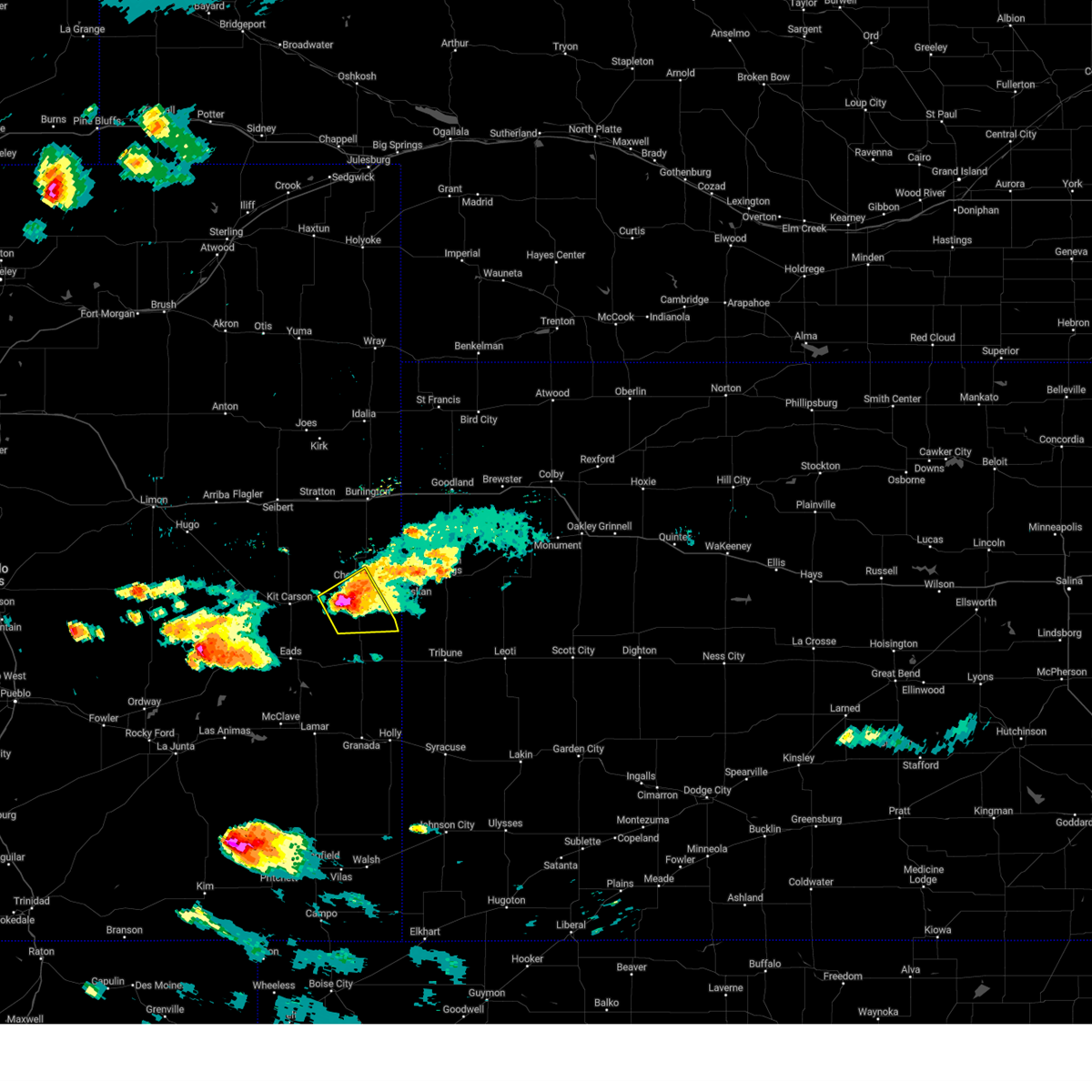 At 339 pm mdt, a severe thunderstorm was located 6 miles southwest of cheyenne wells, moving south at 35 mph (radar indicated). Hazards include two inch hail and 60 mph wind gusts. People and animals outdoors will be injured. expect hail damage to roofs, siding, windows, and vehicles. expect wind damage to roofs, siding, and trees. locations impacted include, cheyenne wells and firstview. this includes highway 385 between mile markers 136 and 157. thunderstorm damage threat, considerable hail threat, radar indicated max hail size, 2. 00 in wind threat, radar indicated max wind gust, 60 mph. At 339 pm mdt, a severe thunderstorm was located 6 miles southwest of cheyenne wells, moving south at 35 mph (radar indicated). Hazards include two inch hail and 60 mph wind gusts. People and animals outdoors will be injured. expect hail damage to roofs, siding, windows, and vehicles. expect wind damage to roofs, siding, and trees. locations impacted include, cheyenne wells and firstview. this includes highway 385 between mile markers 136 and 157. thunderstorm damage threat, considerable hail threat, radar indicated max hail size, 2. 00 in wind threat, radar indicated max wind gust, 60 mph.
|
| 7/13/2023 3:32 PM MDT |
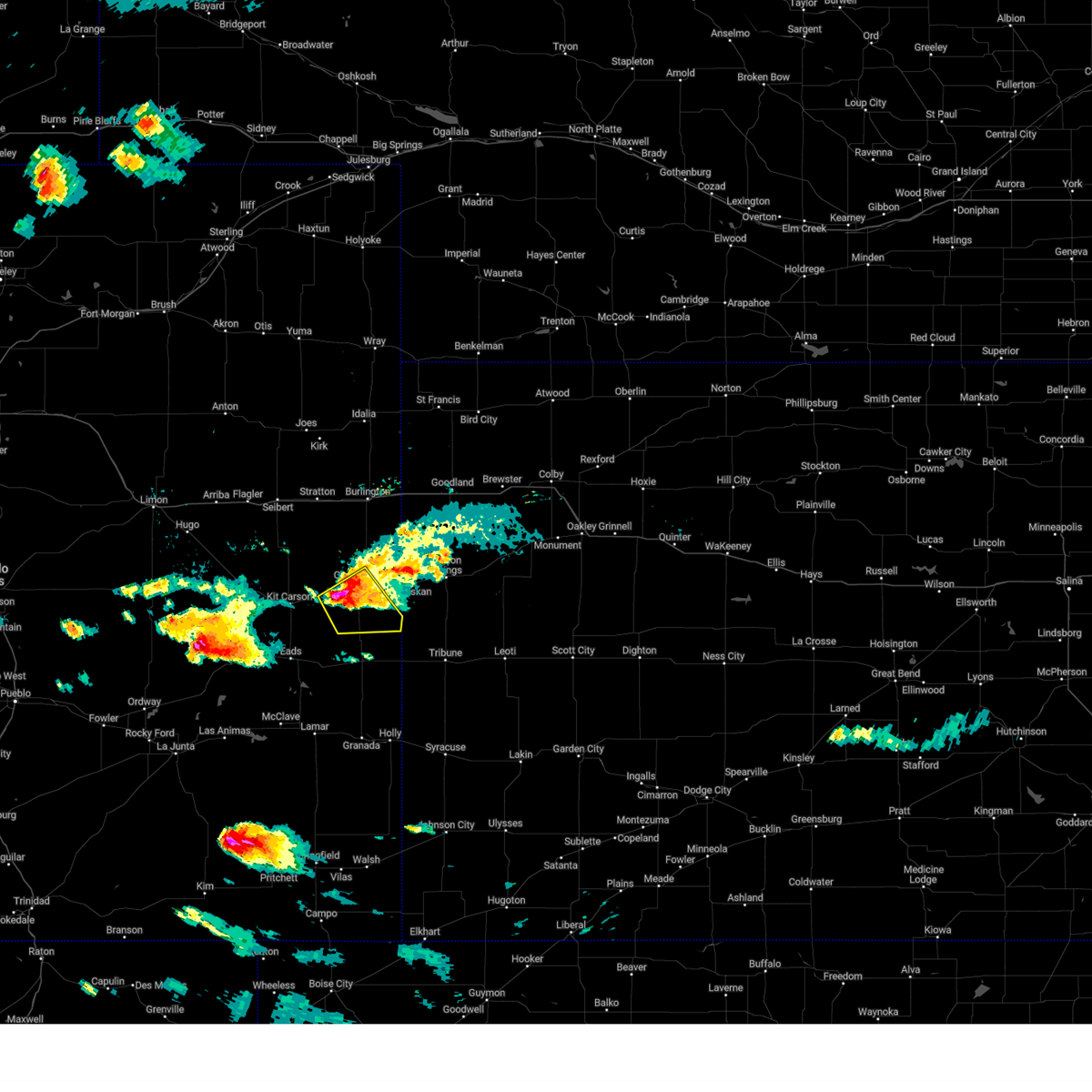 At 332 pm mdt, a severe thunderstorm was located 5 miles west of cheyenne wells, moving southeast at 25 mph (radar indicated). Hazards include golf ball size hail and 60 mph wind gusts. People and animals outdoors will be injured. expect hail damage to roofs, siding, windows, and vehicles. expect wind damage to roofs, siding, and trees. this severe thunderstorm will remain over mainly rural areas of southeastern cheyenne county in east central colorado, including the following locations, firstview. this includes highway 385 between mile markers 136 and 157. thunderstorm damage threat, considerable hail threat, radar indicated max hail size, 1. 75 in wind threat, radar indicated max wind gust, 60 mph. At 332 pm mdt, a severe thunderstorm was located 5 miles west of cheyenne wells, moving southeast at 25 mph (radar indicated). Hazards include golf ball size hail and 60 mph wind gusts. People and animals outdoors will be injured. expect hail damage to roofs, siding, windows, and vehicles. expect wind damage to roofs, siding, and trees. this severe thunderstorm will remain over mainly rural areas of southeastern cheyenne county in east central colorado, including the following locations, firstview. this includes highway 385 between mile markers 136 and 157. thunderstorm damage threat, considerable hail threat, radar indicated max hail size, 1. 75 in wind threat, radar indicated max wind gust, 60 mph.
|
| 7/13/2023 3:18 PM MDT |
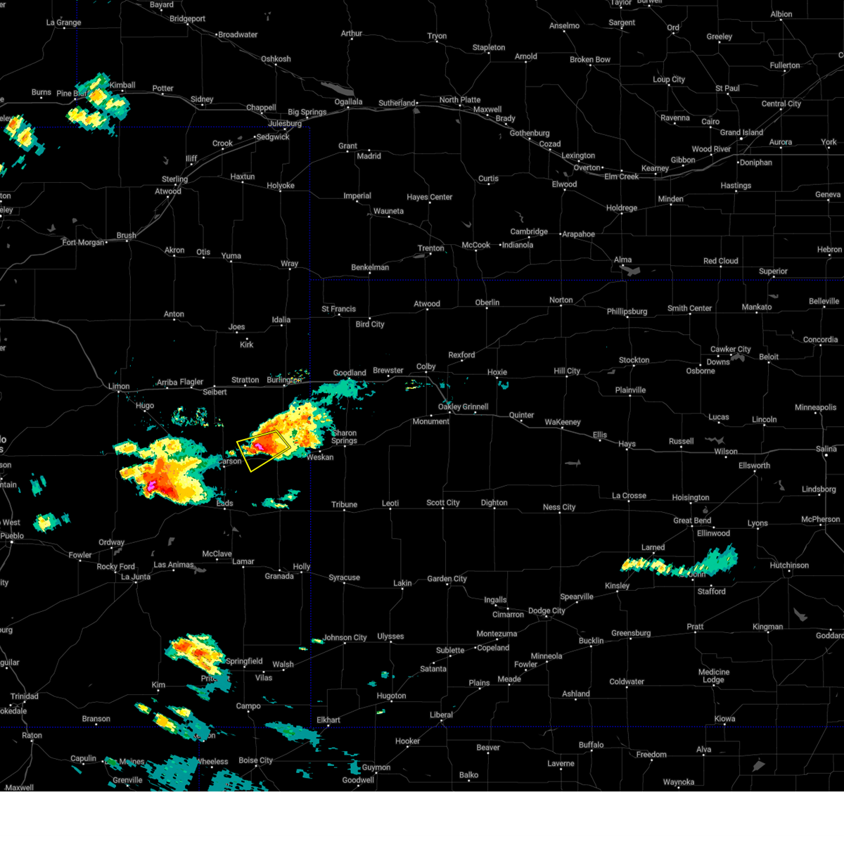 At 318 pm mdt, a severe thunderstorm was located 7 miles northwest of cheyenne wells, moving southeast at 30 mph (radar indicated). Hazards include ping pong ball size hail and 60 mph wind gusts. People and animals outdoors will be injured. expect hail damage to roofs, siding, windows, and vehicles. expect wind damage to roofs, siding, and trees. locations impacted include, cheyenne wells and firstview. this includes highway 385 between mile markers 152 and 162. hail threat, radar indicated max hail size, 1. 50 in wind threat, radar indicated max wind gust, 60 mph. At 318 pm mdt, a severe thunderstorm was located 7 miles northwest of cheyenne wells, moving southeast at 30 mph (radar indicated). Hazards include ping pong ball size hail and 60 mph wind gusts. People and animals outdoors will be injured. expect hail damage to roofs, siding, windows, and vehicles. expect wind damage to roofs, siding, and trees. locations impacted include, cheyenne wells and firstview. this includes highway 385 between mile markers 152 and 162. hail threat, radar indicated max hail size, 1. 50 in wind threat, radar indicated max wind gust, 60 mph.
|
| 7/13/2023 3:16 PM MDT |
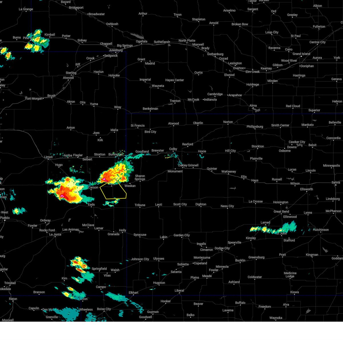 At 316 pm mdt, a severe thunderstorm was located 7 miles northwest of cheyenne wells, moving southeast at 35 mph (radar indicated). Hazards include ping pong ball size hail and 60 mph wind gusts. People and animals outdoors will be injured. expect hail damage to roofs, siding, windows, and vehicles. expect wind damage to roofs, siding, and trees. this severe thunderstorm will be near, cheyenne wells around 330 pm mdt. this includes highway 385 between mile markers 136 and 157. hail threat, radar indicated max hail size, 1. 50 in wind threat, radar indicated max wind gust, 60 mph. At 316 pm mdt, a severe thunderstorm was located 7 miles northwest of cheyenne wells, moving southeast at 35 mph (radar indicated). Hazards include ping pong ball size hail and 60 mph wind gusts. People and animals outdoors will be injured. expect hail damage to roofs, siding, windows, and vehicles. expect wind damage to roofs, siding, and trees. this severe thunderstorm will be near, cheyenne wells around 330 pm mdt. this includes highway 385 between mile markers 136 and 157. hail threat, radar indicated max hail size, 1. 50 in wind threat, radar indicated max wind gust, 60 mph.
|
| 7/13/2023 3:07 PM MDT |
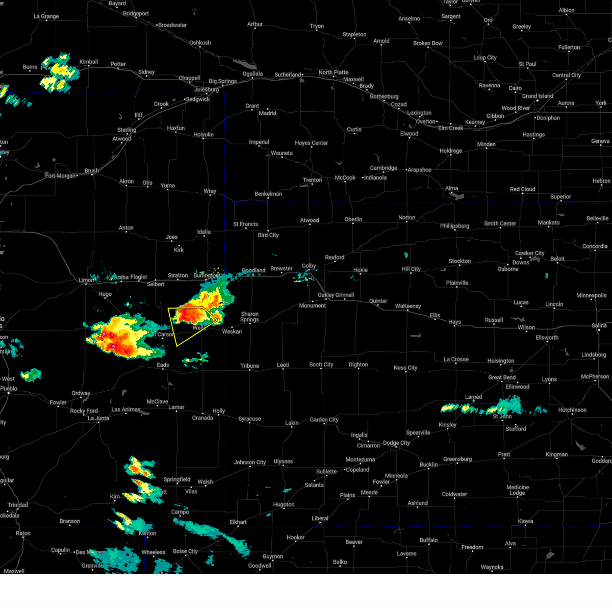 At 306 pm mdt, a severe thunderstorm was located 10 miles northwest of cheyenne wells, moving southeast at 35 mph (radar indicated). Hazards include 60 mph wind gusts and half dollar size hail. Hail damage to vehicles is expected. expect wind damage to roofs, siding, and trees. locations impacted include, cheyenne wells and firstview. this includes highway 385 between mile markers 152 and 168. hail threat, radar indicated max hail size, 1. 25 in wind threat, radar indicated max wind gust, 60 mph. At 306 pm mdt, a severe thunderstorm was located 10 miles northwest of cheyenne wells, moving southeast at 35 mph (radar indicated). Hazards include 60 mph wind gusts and half dollar size hail. Hail damage to vehicles is expected. expect wind damage to roofs, siding, and trees. locations impacted include, cheyenne wells and firstview. this includes highway 385 between mile markers 152 and 168. hail threat, radar indicated max hail size, 1. 25 in wind threat, radar indicated max wind gust, 60 mph.
|
| 7/13/2023 2:53 PM MDT |
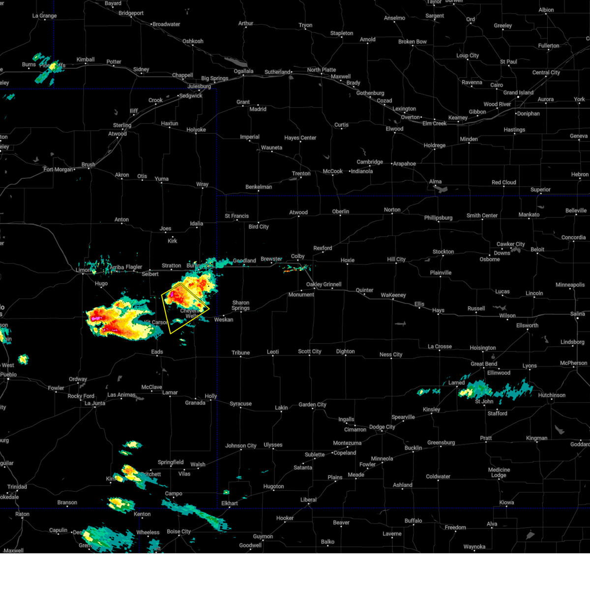 At 253 pm mdt, a severe thunderstorm was located 18 miles northwest of cheyenne wells, moving southeast at 35 mph (radar indicated). Hazards include ping pong ball size hail and 60 mph wind gusts. People and animals outdoors will be injured. expect hail damage to roofs, siding, windows, and vehicles. Expect wind damage to roofs, siding, and trees. At 253 pm mdt, a severe thunderstorm was located 18 miles northwest of cheyenne wells, moving southeast at 35 mph (radar indicated). Hazards include ping pong ball size hail and 60 mph wind gusts. People and animals outdoors will be injured. expect hail damage to roofs, siding, windows, and vehicles. Expect wind damage to roofs, siding, and trees.
|
| 5/30/2023 5:26 PM MDT | Quarter sized hail reported 6.8 miles S of Cheyenne Wells, CO, report from mping: quarter (1.00 in.). |
| 5/10/2023 6:28 PM MDT |
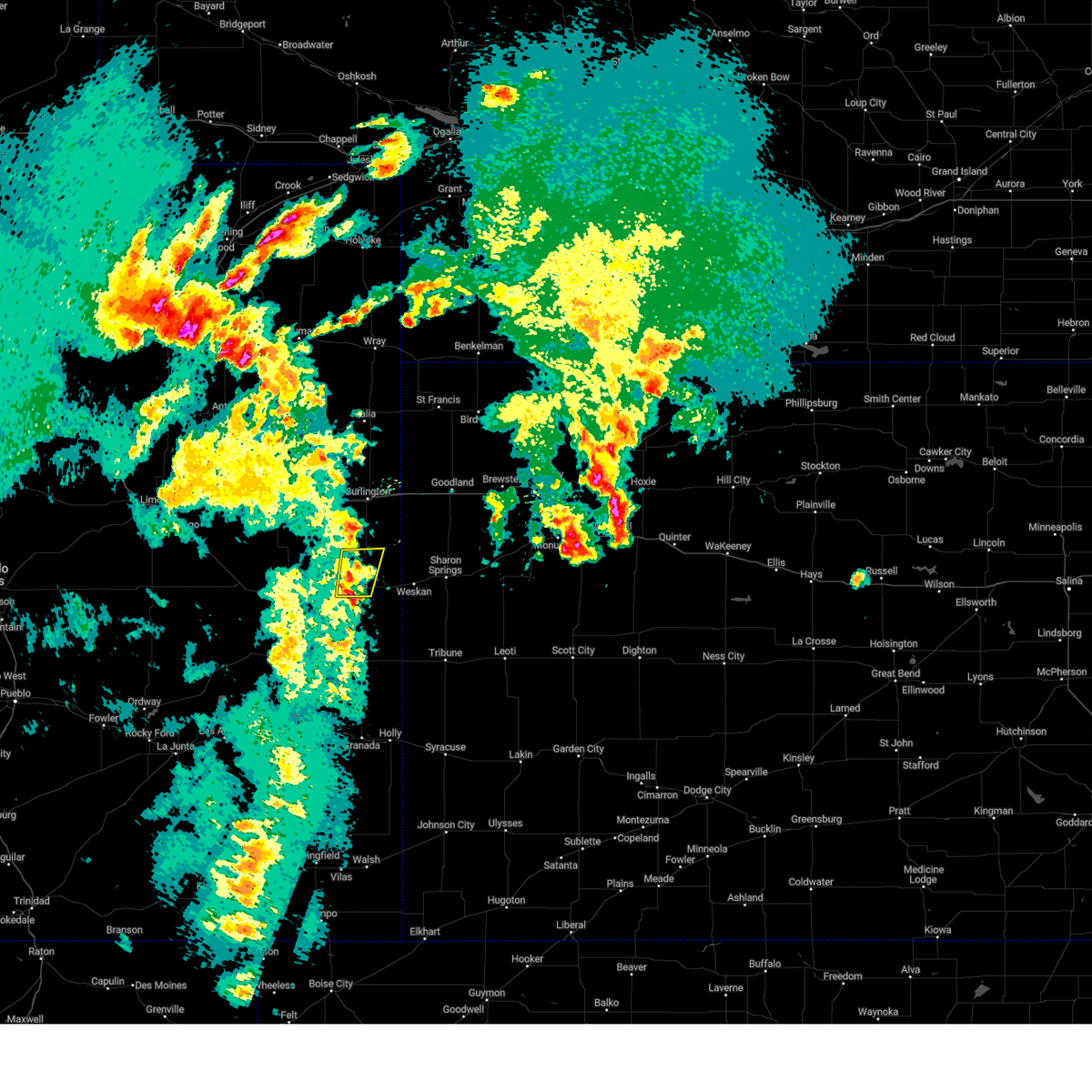 At 627 pm mdt, a severe thunderstorm was located 7 miles north of cheyenne wells, moving east at 45 mph (radar indicated). Hazards include 60 mph wind gusts and half dollar size hail. Hail damage to vehicles is expected. expect wind damage to roofs, siding, and trees. locations impacted include, cheyenne wells. this includes highway 385 between mile markers 149 and 169. hail threat, radar indicated max hail size, 1. 25 in wind threat, radar indicated max wind gust, 60 mph. At 627 pm mdt, a severe thunderstorm was located 7 miles north of cheyenne wells, moving east at 45 mph (radar indicated). Hazards include 60 mph wind gusts and half dollar size hail. Hail damage to vehicles is expected. expect wind damage to roofs, siding, and trees. locations impacted include, cheyenne wells. this includes highway 385 between mile markers 149 and 169. hail threat, radar indicated max hail size, 1. 25 in wind threat, radar indicated max wind gust, 60 mph.
|
| 5/10/2023 6:18 PM MDT |
 At 617 pm mdt, a severe thunderstorm was located over cheyenne wells, moving north at 35 mph (radar indicated). Hazards include 60 mph wind gusts and quarter size hail. Hail damage to vehicles is expected. expect wind damage to roofs, siding, and trees. this severe thunderstorm will remain over mainly rural areas of northeastern cheyenne county in east central colorado. this includes highway 385 between mile markers 144 and 169. hail threat, radar indicated max hail size, 1. 00 in wind threat, radar indicated max wind gust, 60 mph. At 617 pm mdt, a severe thunderstorm was located over cheyenne wells, moving north at 35 mph (radar indicated). Hazards include 60 mph wind gusts and quarter size hail. Hail damage to vehicles is expected. expect wind damage to roofs, siding, and trees. this severe thunderstorm will remain over mainly rural areas of northeastern cheyenne county in east central colorado. this includes highway 385 between mile markers 144 and 169. hail threat, radar indicated max hail size, 1. 00 in wind threat, radar indicated max wind gust, 60 mph.
|
| 7/24/2022 9:10 PM MDT |
 The severe thunderstorm warning for southeastern cheyenne county in east central colorado will expire at 915 pm mdt, the storm which prompted the warning has weakened below severe limits, and no longer poses an immediate threat to life or property. therefore, the warning will be allowed to expire. however gusty winds and heavy rain are still possible with this thunderstorm. The severe thunderstorm warning for southeastern cheyenne county in east central colorado will expire at 915 pm mdt, the storm which prompted the warning has weakened below severe limits, and no longer poses an immediate threat to life or property. therefore, the warning will be allowed to expire. however gusty winds and heavy rain are still possible with this thunderstorm.
|
| 7/24/2022 8:58 PM MDT |
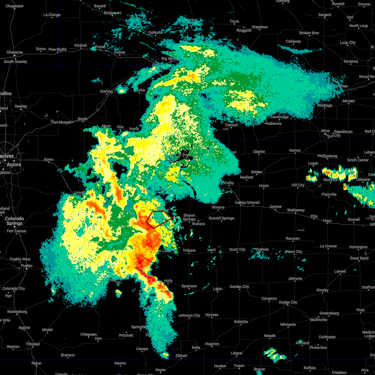 At 858 pm mdt, a severe thunderstorm capable of producing a tornado was located near cheyenne wells, moving northeast at 30 mph (radar indicated rotation). Hazards include tornado. Flying debris will be dangerous to those caught without shelter. mobile homes will be damaged or destroyed. damage to roofs, windows, and vehicles will occur. tree damage is likely. this tornadic thunderstorm will remain over mainly rural areas of northeastern cheyenne county in east central colorado. This includes highway 385 between mile markers 151 and 169. At 858 pm mdt, a severe thunderstorm capable of producing a tornado was located near cheyenne wells, moving northeast at 30 mph (radar indicated rotation). Hazards include tornado. Flying debris will be dangerous to those caught without shelter. mobile homes will be damaged or destroyed. damage to roofs, windows, and vehicles will occur. tree damage is likely. this tornadic thunderstorm will remain over mainly rural areas of northeastern cheyenne county in east central colorado. This includes highway 385 between mile markers 151 and 169.
|
| 7/24/2022 8:56 PM MDT |
 At 856 pm mdt, a severe thunderstorm was located 9 miles southeast of cheyenne wells, moving east at 45 mph (radar indicated). Hazards include 70 mph wind gusts. Expect considerable tree damage. damage is likely to mobile homes, roofs, and outbuildings. locations impacted include, cheyenne wells, arapahoe and firstview. This includes highway 385 between mile markers 136 and 155. At 856 pm mdt, a severe thunderstorm was located 9 miles southeast of cheyenne wells, moving east at 45 mph (radar indicated). Hazards include 70 mph wind gusts. Expect considerable tree damage. damage is likely to mobile homes, roofs, and outbuildings. locations impacted include, cheyenne wells, arapahoe and firstview. This includes highway 385 between mile markers 136 and 155.
|
| 7/24/2022 8:47 PM MDT |
 At 847 pm mdt, a severe thunderstorm was located 7 miles south of cheyenne wells, moving east at 45 mph (radar indicated). Hazards include 70 mph wind gusts and quarter size hail. Hail damage to vehicles is expected. expect considerable tree damage. wind damage is also likely to mobile homes, roofs, and outbuildings. locations impacted include, cheyenne wells, arapahoe and firstview. this includes highway 385 between mile markers 136 and 155. thunderstorm damage threat, considerable hail threat, radar indicated max hail size, 1. 00 in wind threat, observed max wind gust, 70 mph. At 847 pm mdt, a severe thunderstorm was located 7 miles south of cheyenne wells, moving east at 45 mph (radar indicated). Hazards include 70 mph wind gusts and quarter size hail. Hail damage to vehicles is expected. expect considerable tree damage. wind damage is also likely to mobile homes, roofs, and outbuildings. locations impacted include, cheyenne wells, arapahoe and firstview. this includes highway 385 between mile markers 136 and 155. thunderstorm damage threat, considerable hail threat, radar indicated max hail size, 1. 00 in wind threat, observed max wind gust, 70 mph.
|
| 7/24/2022 8:45 PM MDT | Corrects previous tstm wnd gst report from 2 sw firstvie in cheyenne county CO, 10.7 miles E of Cheyenne Wells, CO |
| 7/24/2022 8:30 PM MDT |
 At 830 pm mdt, a severe thunderstorm was located 9 miles southeast of kit carson, or 17 miles southwest of cheyenne wells, moving east at 45 mph (radar indicated). Hazards include 60 mph wind gusts and quarter size hail. Hail damage to vehicles is expected. expect wind damage to roofs, siding, and trees. this severe thunderstorm will remain over mainly rural areas of southeastern cheyenne county in east central colorado, including the following locations, arapahoe and firstview. this includes highway 385 between mile markers 136 and 155. hail threat, radar indicated max hail size, 1. 00 in wind threat, radar indicated max wind gust, 60 mph. At 830 pm mdt, a severe thunderstorm was located 9 miles southeast of kit carson, or 17 miles southwest of cheyenne wells, moving east at 45 mph (radar indicated). Hazards include 60 mph wind gusts and quarter size hail. Hail damage to vehicles is expected. expect wind damage to roofs, siding, and trees. this severe thunderstorm will remain over mainly rural areas of southeastern cheyenne county in east central colorado, including the following locations, arapahoe and firstview. this includes highway 385 between mile markers 136 and 155. hail threat, radar indicated max hail size, 1. 00 in wind threat, radar indicated max wind gust, 60 mph.
|
| 7/6/2022 8:27 PM MDT |
 At 827 pm mdt, a severe thunderstorm was located 10 miles east of kit carson, or 13 miles west of cheyenne wells, moving southeast at 35 mph (radar indicated). Hazards include 60 mph wind gusts and quarter size hail. Hail damage to vehicles is expected. expect wind damage to roofs, siding, and trees. this severe thunderstorm will remain over mainly rural areas of southeastern cheyenne county in east central colorado, including the following locations, firstview. this includes highway 385 between mile markers 136 and 148. hail threat, radar indicated max hail size, 1. 00 in wind threat, radar indicated max wind gust, 60 mph. At 827 pm mdt, a severe thunderstorm was located 10 miles east of kit carson, or 13 miles west of cheyenne wells, moving southeast at 35 mph (radar indicated). Hazards include 60 mph wind gusts and quarter size hail. Hail damage to vehicles is expected. expect wind damage to roofs, siding, and trees. this severe thunderstorm will remain over mainly rural areas of southeastern cheyenne county in east central colorado, including the following locations, firstview. this includes highway 385 between mile markers 136 and 148. hail threat, radar indicated max hail size, 1. 00 in wind threat, radar indicated max wind gust, 60 mph.
|
| 6/24/2022 4:21 PM MDT |
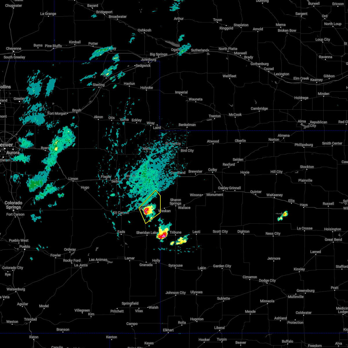 At 421 pm mdt, a severe thunderstorm was located near cheyenne wells, moving northeast at 20 mph (radar indicated). Hazards include 60 mph wind gusts and quarter size hail. Hail damage to vehicles is expected. expect wind damage to roofs, siding, and trees. locations impacted include, cheyenne wells and arapahoe. this includes highway 385 between mile markers 138 and 159, and near mile marker 167. hail threat, radar indicated max hail size, 1. 00 in wind threat, radar indicated max wind gust, 60 mph. At 421 pm mdt, a severe thunderstorm was located near cheyenne wells, moving northeast at 20 mph (radar indicated). Hazards include 60 mph wind gusts and quarter size hail. Hail damage to vehicles is expected. expect wind damage to roofs, siding, and trees. locations impacted include, cheyenne wells and arapahoe. this includes highway 385 between mile markers 138 and 159, and near mile marker 167. hail threat, radar indicated max hail size, 1. 00 in wind threat, radar indicated max wind gust, 60 mph.
|
| 6/24/2022 4:14 PM MDT |
 At 414 pm mdt, a severe thunderstorm was located over cheyenne wells, moving northeast at 20 mph (radar indicated). Hazards include 60 mph wind gusts and quarter size hail. Hail damage to vehicles is expected. expect wind damage to roofs, siding, and trees. this severe thunderstorm will remain over mainly rural areas of eastern cheyenne and southeastern kit carson counties in east central colorado, including the following locations, arapahoe. this includes highway 385 between mile markers 137 and 160, and between mile markers 166 and 167. hail threat, radar indicated max hail size, 1. 00 in wind threat, radar indicated max wind gust, 60 mph. At 414 pm mdt, a severe thunderstorm was located over cheyenne wells, moving northeast at 20 mph (radar indicated). Hazards include 60 mph wind gusts and quarter size hail. Hail damage to vehicles is expected. expect wind damage to roofs, siding, and trees. this severe thunderstorm will remain over mainly rural areas of eastern cheyenne and southeastern kit carson counties in east central colorado, including the following locations, arapahoe. this includes highway 385 between mile markers 137 and 160, and between mile markers 166 and 167. hail threat, radar indicated max hail size, 1. 00 in wind threat, radar indicated max wind gust, 60 mph.
|
| 6/24/2022 4:01 PM MDT |
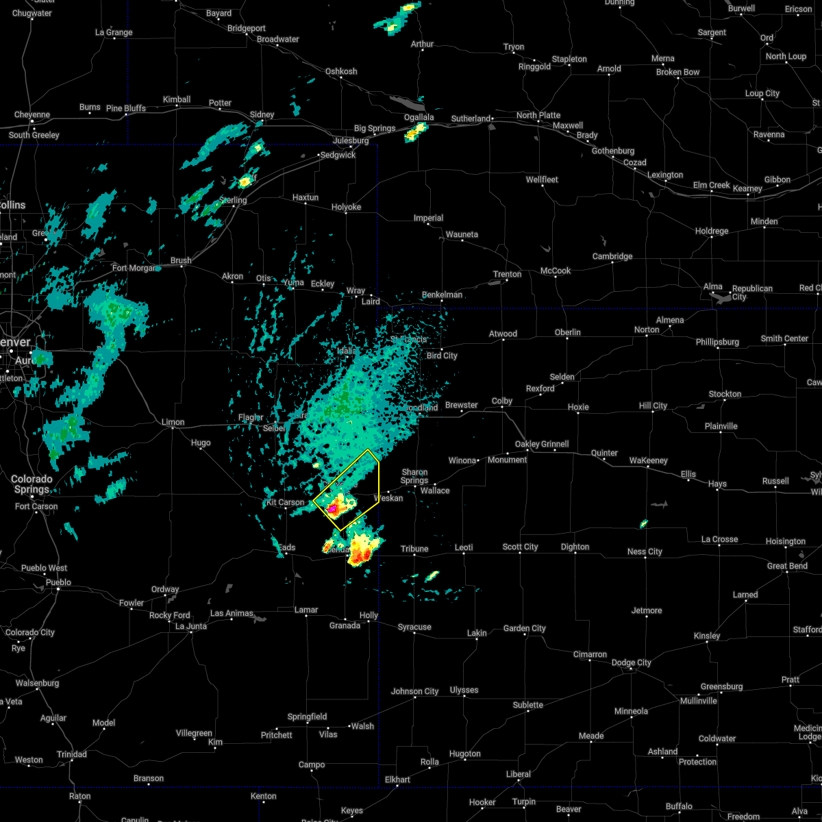 At 401 pm mdt, a severe thunderstorm was located near cheyenne wells, moving northeast at 20 mph (radar indicated). Hazards include 60 mph wind gusts and half dollar size hail. Hail damage to vehicles is expected. expect wind damage to roofs, siding, and trees. this severe thunderstorm will be near, cheyenne wells around 415 pm mdt. this includes highway 385 between mile markers 137 and 160, and between mile markers 166 and 168. hail threat, radar indicated max hail size, 1. 25 in wind threat, radar indicated max wind gust, 60 mph. At 401 pm mdt, a severe thunderstorm was located near cheyenne wells, moving northeast at 20 mph (radar indicated). Hazards include 60 mph wind gusts and half dollar size hail. Hail damage to vehicles is expected. expect wind damage to roofs, siding, and trees. this severe thunderstorm will be near, cheyenne wells around 415 pm mdt. this includes highway 385 between mile markers 137 and 160, and between mile markers 166 and 168. hail threat, radar indicated max hail size, 1. 25 in wind threat, radar indicated max wind gust, 60 mph.
|
| 6/6/2022 5:53 PM MDT |
 The severe thunderstorm warning for northeastern cheyenne county in east central colorado will expire at 600 pm mdt, the storm which prompted the warning has weakened below severe limits, and no longer poses an immediate threat to life or property. therefore, the warning will be allowed to expire. a severe thunderstorm watch remains in effect until 1000 pm mdt for east central colorado. The severe thunderstorm warning for northeastern cheyenne county in east central colorado will expire at 600 pm mdt, the storm which prompted the warning has weakened below severe limits, and no longer poses an immediate threat to life or property. therefore, the warning will be allowed to expire. a severe thunderstorm watch remains in effect until 1000 pm mdt for east central colorado.
|
| 6/6/2022 5:46 PM MDT |
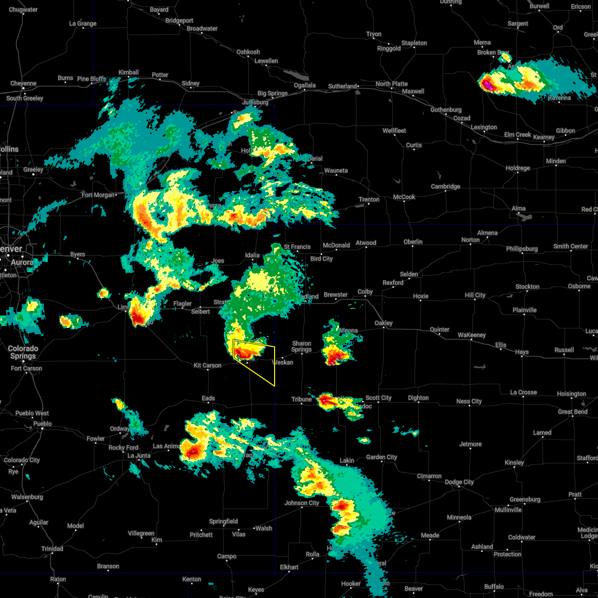 At 546 pm mdt, a severe thunderstorm was located near cheyenne wells, moving southeast at 45 mph (radar indicated). Hazards include 60 mph wind gusts and quarter size hail. Hail damage to vehicles is expected. expect wind damage to roofs, siding, and trees. locations impacted include, cheyenne wells and arapahoe. this includes highway 385 between mile markers 147 and 163. hail threat, radar indicated max hail size, 1. 00 in wind threat, radar indicated max wind gust, 60 mph. At 546 pm mdt, a severe thunderstorm was located near cheyenne wells, moving southeast at 45 mph (radar indicated). Hazards include 60 mph wind gusts and quarter size hail. Hail damage to vehicles is expected. expect wind damage to roofs, siding, and trees. locations impacted include, cheyenne wells and arapahoe. this includes highway 385 between mile markers 147 and 163. hail threat, radar indicated max hail size, 1. 00 in wind threat, radar indicated max wind gust, 60 mph.
|
| 6/6/2022 5:35 PM MDT |
 At 535 pm mdt, a severe thunderstorm was located 7 miles northwest of cheyenne wells, moving southeast at 55 mph (radar indicated). Hazards include 60 mph wind gusts and quarter size hail. Hail damage to vehicles is expected. expect wind damage to roofs, siding, and trees. locations impacted include, cheyenne wells, arapahoe and firstview. this includes highway 385 between mile markers 139 and 163. hail threat, observed max hail size, 1. 00 in wind threat, radar indicated max wind gust, 60 mph. At 535 pm mdt, a severe thunderstorm was located 7 miles northwest of cheyenne wells, moving southeast at 55 mph (radar indicated). Hazards include 60 mph wind gusts and quarter size hail. Hail damage to vehicles is expected. expect wind damage to roofs, siding, and trees. locations impacted include, cheyenne wells, arapahoe and firstview. this includes highway 385 between mile markers 139 and 163. hail threat, observed max hail size, 1. 00 in wind threat, radar indicated max wind gust, 60 mph.
|
| 6/6/2022 5:25 PM MDT |
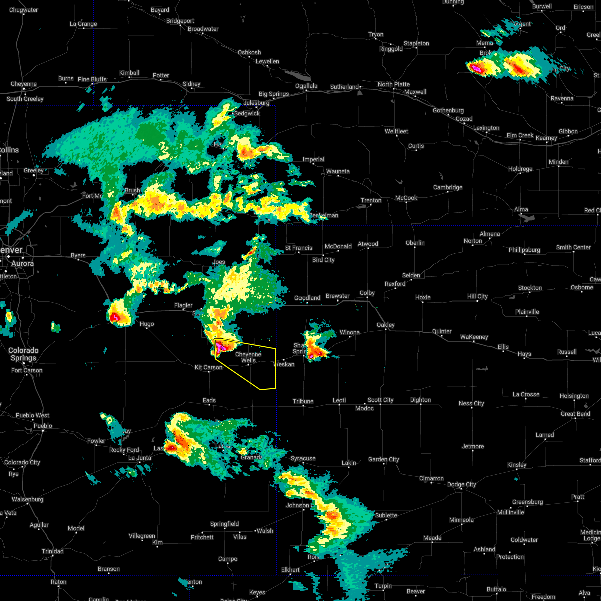 At 525 pm mdt, a severe thunderstorm was located 16 miles northeast of kit carson, or 16 miles northwest of cheyenne wells, moving southeast at 45 mph (radar indicated). Hazards include 60 mph wind gusts and quarter size hail. Hail damage to vehicles is expected. expect wind damage to roofs, siding, and trees. locations impacted include, cheyenne wells, arapahoe and firstview. this includes highway 385 between mile markers 139 and 163. hail threat, radar indicated max hail size, 1. 00 in wind threat, radar indicated max wind gust, 60 mph. At 525 pm mdt, a severe thunderstorm was located 16 miles northeast of kit carson, or 16 miles northwest of cheyenne wells, moving southeast at 45 mph (radar indicated). Hazards include 60 mph wind gusts and quarter size hail. Hail damage to vehicles is expected. expect wind damage to roofs, siding, and trees. locations impacted include, cheyenne wells, arapahoe and firstview. this includes highway 385 between mile markers 139 and 163. hail threat, radar indicated max hail size, 1. 00 in wind threat, radar indicated max wind gust, 60 mph.
|
| 6/6/2022 5:15 PM MDT |
 At 515 pm mdt, a severe thunderstorm was located 15 miles north of kit carson, or 21 miles northwest of cheyenne wells, moving southeast at 55 mph (radar indicated). Hazards include 60 mph wind gusts and quarter size hail. Hail damage to vehicles is expected. Expect wind damage to roofs, siding, and trees. At 515 pm mdt, a severe thunderstorm was located 15 miles north of kit carson, or 21 miles northwest of cheyenne wells, moving southeast at 55 mph (radar indicated). Hazards include 60 mph wind gusts and quarter size hail. Hail damage to vehicles is expected. Expect wind damage to roofs, siding, and trees.
|
| 6/3/2022 6:25 PM MDT | Dispatch relayed a report of near zero visibility in rain with estimated 60 to 70 mph wind gust in cheyenne county CO, 7.1 miles N of Cheyenne Wells, CO |
| 6/3/2022 6:16 PM MDT |
 At 616 pm mdt, severe thunderstorms were located along a line extending from 5 miles east of cheyenne wells to 11 miles north of sheridan lake, moving east at 25 mph (radar indicated). Hazards include 60 mph wind gusts and quarter size hail. Hail damage to vehicles is expected. expect wind damage to roofs, siding, and trees. these severe thunderstorms will remain over mainly rural areas of southeastern cheyenne county in east central colorado, including the following locations, arapahoe. This includes highway 385 between mile markers 136 and 155. At 616 pm mdt, severe thunderstorms were located along a line extending from 5 miles east of cheyenne wells to 11 miles north of sheridan lake, moving east at 25 mph (radar indicated). Hazards include 60 mph wind gusts and quarter size hail. Hail damage to vehicles is expected. expect wind damage to roofs, siding, and trees. these severe thunderstorms will remain over mainly rural areas of southeastern cheyenne county in east central colorado, including the following locations, arapahoe. This includes highway 385 between mile markers 136 and 155.
|
| 6/3/2022 5:55 PM MDT |
 At 555 pm mdt, severe thunderstorms were located along a line extending from near cheyenne wells to 12 miles north of brandon, moving east at 25 mph (radar indicated). Hazards include 60 mph wind gusts and quarter size hail. Hail damage to vehicles is expected. expect wind damage to roofs, siding, and trees. severe thunderstorms will be near, cheyenne wells around 600 pm mdt. This includes highway 385 between mile markers 136 and 159. At 555 pm mdt, severe thunderstorms were located along a line extending from near cheyenne wells to 12 miles north of brandon, moving east at 25 mph (radar indicated). Hazards include 60 mph wind gusts and quarter size hail. Hail damage to vehicles is expected. expect wind damage to roofs, siding, and trees. severe thunderstorms will be near, cheyenne wells around 600 pm mdt. This includes highway 385 between mile markers 136 and 159.
|
| 6/3/2022 5:47 PM MDT |
 At 547 pm mdt, severe thunderstorms were located along a line extending from near bethune to 12 miles north of chivington, moving east at 30 mph (radar indicated). Hazards include golf ball size hail and 60 mph wind gusts. People and animals outdoors will be injured. expect hail damage to roofs, siding, windows, and vehicles. expect wind damage to roofs, siding, and trees. locations impacted include, burlington, cheyenne wells, stratton, bethune and firstview. this includes the following highways, interstate 70 in colorado between mile markers 418 and 442. highway 385 between mile markers 136 and 191. thunderstorm damage threat, considerable hail threat, radar indicated max hail size, 1. 75 in wind threat, radar indicated max wind gust, 60 mph. At 547 pm mdt, severe thunderstorms were located along a line extending from near bethune to 12 miles north of chivington, moving east at 30 mph (radar indicated). Hazards include golf ball size hail and 60 mph wind gusts. People and animals outdoors will be injured. expect hail damage to roofs, siding, windows, and vehicles. expect wind damage to roofs, siding, and trees. locations impacted include, burlington, cheyenne wells, stratton, bethune and firstview. this includes the following highways, interstate 70 in colorado between mile markers 418 and 442. highway 385 between mile markers 136 and 191. thunderstorm damage threat, considerable hail threat, radar indicated max hail size, 1. 75 in wind threat, radar indicated max wind gust, 60 mph.
|
| 6/3/2022 5:32 PM MDT |
 At 532 pm mdt, severe thunderstorms were located along a line extending from 4 miles east of stratton to 11 miles northeast of eads, moving east at 30 mph (radar indicated). Hazards include golf ball size hail and 60 mph wind gusts. People and animals outdoors will be injured. expect hail damage to roofs, siding, windows, and vehicles. expect wind damage to roofs, siding, and trees. locations impacted include, burlington, cheyenne wells, stratton, bethune, kit carson and firstview. this includes the following highways, interstate 70 in colorado between mile markers 416 and 442. highway 385 between mile markers 136 and 191. thunderstorm damage threat, considerable hail threat, radar indicated max hail size, 1. 75 in wind threat, radar indicated max wind gust, 60 mph. At 532 pm mdt, severe thunderstorms were located along a line extending from 4 miles east of stratton to 11 miles northeast of eads, moving east at 30 mph (radar indicated). Hazards include golf ball size hail and 60 mph wind gusts. People and animals outdoors will be injured. expect hail damage to roofs, siding, windows, and vehicles. expect wind damage to roofs, siding, and trees. locations impacted include, burlington, cheyenne wells, stratton, bethune, kit carson and firstview. this includes the following highways, interstate 70 in colorado between mile markers 416 and 442. highway 385 between mile markers 136 and 191. thunderstorm damage threat, considerable hail threat, radar indicated max hail size, 1. 75 in wind threat, radar indicated max wind gust, 60 mph.
|
| 6/3/2022 5:22 PM MDT |
 At 522 pm mdt, severe thunderstorms were located along a line extending from stratton to 9 miles north of eads, moving east at 30 mph (radar indicated). Hazards include golf ball size hail and 60 mph wind gusts. People and animals outdoors will be injured. expect hail damage to roofs, siding, windows, and vehicles. expect wind damage to roofs, siding, and trees. locations impacted include, burlington, cheyenne wells, stratton, bethune, kit carson and firstview. this includes the following highways, interstate 70 in colorado between mile markers 410 and 442. highway 385 between mile markers 136 and 191. thunderstorm damage threat, considerable hail threat, radar indicated max hail size, 1. 75 in wind threat, radar indicated max wind gust, 60 mph. At 522 pm mdt, severe thunderstorms were located along a line extending from stratton to 9 miles north of eads, moving east at 30 mph (radar indicated). Hazards include golf ball size hail and 60 mph wind gusts. People and animals outdoors will be injured. expect hail damage to roofs, siding, windows, and vehicles. expect wind damage to roofs, siding, and trees. locations impacted include, burlington, cheyenne wells, stratton, bethune, kit carson and firstview. this includes the following highways, interstate 70 in colorado between mile markers 410 and 442. highway 385 between mile markers 136 and 191. thunderstorm damage threat, considerable hail threat, radar indicated max hail size, 1. 75 in wind threat, radar indicated max wind gust, 60 mph.
|
| 6/3/2022 5:12 PM MDT |
 At 511 pm mdt, severe thunderstorms were located along a line extending from near vona to 9 miles north of eads, moving east at 25 mph (radar indicated). Hazards include golf ball size hail and 60 mph wind gusts. People and animals outdoors will be injured. expect hail damage to roofs, siding, windows, and vehicles. expect wind damage to roofs, siding, and trees. locations impacted include, stratton, bethune and burlington. this includes the following highways, interstate 70 in colorado between mile markers 410 and 442. highway 385 between mile markers 136 and 191. thunderstorm damage threat, considerable hail threat, radar indicated max hail size, 1. 75 in wind threat, radar indicated max wind gust, 60 mph. At 511 pm mdt, severe thunderstorms were located along a line extending from near vona to 9 miles north of eads, moving east at 25 mph (radar indicated). Hazards include golf ball size hail and 60 mph wind gusts. People and animals outdoors will be injured. expect hail damage to roofs, siding, windows, and vehicles. expect wind damage to roofs, siding, and trees. locations impacted include, stratton, bethune and burlington. this includes the following highways, interstate 70 in colorado between mile markers 410 and 442. highway 385 between mile markers 136 and 191. thunderstorm damage threat, considerable hail threat, radar indicated max hail size, 1. 75 in wind threat, radar indicated max wind gust, 60 mph.
|
| 6/3/2022 4:59 PM MDT |
 At 459 pm mdt, severe thunderstorms were located along a line extending from 4 miles south of vona to 9 miles northwest of eads, moving east at 30 mph (radar indicated). Hazards include 60 mph wind gusts and quarter size hail. Hail damage to vehicles is expected. expect wind damage to roofs, siding, and trees. severe thunderstorms will be near, stratton around 515 pm mdt. other locations in the path of these severe thunderstorms include bethune and burlington. this includes the following highways, interstate 70 in colorado between mile markers 411 and 442. highway 385 between mile markers 136 and 191. hail threat, radar indicated max hail size, 1. 00 in wind threat, radar indicated max wind gust, 60 mph. At 459 pm mdt, severe thunderstorms were located along a line extending from 4 miles south of vona to 9 miles northwest of eads, moving east at 30 mph (radar indicated). Hazards include 60 mph wind gusts and quarter size hail. Hail damage to vehicles is expected. expect wind damage to roofs, siding, and trees. severe thunderstorms will be near, stratton around 515 pm mdt. other locations in the path of these severe thunderstorms include bethune and burlington. this includes the following highways, interstate 70 in colorado between mile markers 411 and 442. highway 385 between mile markers 136 and 191. hail threat, radar indicated max hail size, 1. 00 in wind threat, radar indicated max wind gust, 60 mph.
|
| 5/17/2022 6:44 PM MDT | Storm damage reported in cheyenne county CO, 10.7 miles E of Cheyenne Wells, CO |
| 4/22/2022 9:56 PM MDT |
 At 956 pm mdt/1056 pm cdt/, severe thunderstorms were located along a line extending from 4 miles northeast of burlington to 11 miles northeast of sheridan lake, moving east at 45 mph (radar indicated). Hazards include 60 mph wind gusts and nickel size hail. Expect damage to roofs, siding, and trees. severe thunderstorms will be near, kanorado around 1010 pm mdt. other locations in the path of these severe thunderstorms include ruleton, goodland and brewster. this includes the following highways, interstate 70 in kansas between mile markers 0 and 41. interstate 70 in colorado between mile markers 430 and 450. highway 385 between mile markers 136 and 198. hail threat, radar indicated max hail size, 0. 88 in wind threat, radar indicated max wind gust, 60 mph. At 956 pm mdt/1056 pm cdt/, severe thunderstorms were located along a line extending from 4 miles northeast of burlington to 11 miles northeast of sheridan lake, moving east at 45 mph (radar indicated). Hazards include 60 mph wind gusts and nickel size hail. Expect damage to roofs, siding, and trees. severe thunderstorms will be near, kanorado around 1010 pm mdt. other locations in the path of these severe thunderstorms include ruleton, goodland and brewster. this includes the following highways, interstate 70 in kansas between mile markers 0 and 41. interstate 70 in colorado between mile markers 430 and 450. highway 385 between mile markers 136 and 198. hail threat, radar indicated max hail size, 0. 88 in wind threat, radar indicated max wind gust, 60 mph.
|
| 9/12/2021 7:26 PM MDT |
 The severe thunderstorm warning for southeastern cheyenne county in east central colorado will expire at 730 pm mdt, the storm which prompted the warning has weakened below severe limits, and no longer poses an immediate threat to life or property. therefore, the warning will be allowed to expire. however gusty winds are still possible with this thunderstorm. The severe thunderstorm warning for southeastern cheyenne county in east central colorado will expire at 730 pm mdt, the storm which prompted the warning has weakened below severe limits, and no longer poses an immediate threat to life or property. therefore, the warning will be allowed to expire. however gusty winds are still possible with this thunderstorm.
|
| 9/12/2021 7:19 PM MDT |
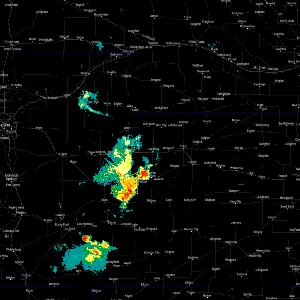 At 718 pm mdt, a severe thunderstorm was located 13 miles northwest of towner, or 15 miles southeast of cheyenne wells, moving southeast at 35 mph (radar indicated). Hazards include 60 mph wind gusts. Expect damage to roofs, siding, and trees. locations impacted include, cheyenne wells and arapahoe. this includes highway 385 between mile markers 136 and 154. hail threat, radar indicated max hail size, <. 75 in wind threat, radar indicated max wind gust, 60 mph. At 718 pm mdt, a severe thunderstorm was located 13 miles northwest of towner, or 15 miles southeast of cheyenne wells, moving southeast at 35 mph (radar indicated). Hazards include 60 mph wind gusts. Expect damage to roofs, siding, and trees. locations impacted include, cheyenne wells and arapahoe. this includes highway 385 between mile markers 136 and 154. hail threat, radar indicated max hail size, <. 75 in wind threat, radar indicated max wind gust, 60 mph.
|
| 9/12/2021 7:05 PM MDT |
 At 704 pm mdt, a severe thunderstorm was located 10 miles west of weskan, or 10 miles east of cheyenne wells, moving east at 40 mph (radar indicated). Hazards include 60 mph wind gusts and penny size hail. Expect damage to roofs, siding, and trees. locations impacted include, cheyenne wells, arapahoe and firstview. this includes highway 385 between mile markers 136 and 160. hail threat, radar indicated max hail size, 0. 75 in wind threat, radar indicated max wind gust, 60 mph. At 704 pm mdt, a severe thunderstorm was located 10 miles west of weskan, or 10 miles east of cheyenne wells, moving east at 40 mph (radar indicated). Hazards include 60 mph wind gusts and penny size hail. Expect damage to roofs, siding, and trees. locations impacted include, cheyenne wells, arapahoe and firstview. this includes highway 385 between mile markers 136 and 160. hail threat, radar indicated max hail size, 0. 75 in wind threat, radar indicated max wind gust, 60 mph.
|
| 9/12/2021 6:52 PM MDT |
 At 652 pm mdt, a severe thunderstorm was located near cheyenne wells, moving east at 35 mph (radar indicated). Hazards include 60 mph wind gusts and quarter size hail. Hail damage to vehicles is expected. expect wind damage to roofs, siding, and trees. this severe thunderstorm will remain over mainly rural areas of cheyenne county in east central colorado, including the following locations, arapahoe and firstview. this includes highway 385 between mile markers 136 and 169. hail threat, radar indicated max hail size, 1. 00 in wind threat, radar indicated max wind gust, 60 mph. At 652 pm mdt, a severe thunderstorm was located near cheyenne wells, moving east at 35 mph (radar indicated). Hazards include 60 mph wind gusts and quarter size hail. Hail damage to vehicles is expected. expect wind damage to roofs, siding, and trees. this severe thunderstorm will remain over mainly rural areas of cheyenne county in east central colorado, including the following locations, arapahoe and firstview. this includes highway 385 between mile markers 136 and 169. hail threat, radar indicated max hail size, 1. 00 in wind threat, radar indicated max wind gust, 60 mph.
|
| 9/12/2021 6:37 PM MDT |
 At 637 pm mdt, a severe thunderstorm was located 12 miles northeast of kit carson, or 13 miles west of cheyenne wells, moving east at 40 mph (radar indicated). Hazards include 60 mph wind gusts and quarter size hail. Hail damage to vehicles is expected. expect wind damage to roofs, siding, and trees. this severe thunderstorm will be near, cheyenne wells around 655 pm mdt. this includes highway 385 between mile markers 136 and 169. hail threat, radar indicated max hail size, 1. 00 in wind threat, radar indicated max wind gust, 60 mph. At 637 pm mdt, a severe thunderstorm was located 12 miles northeast of kit carson, or 13 miles west of cheyenne wells, moving east at 40 mph (radar indicated). Hazards include 60 mph wind gusts and quarter size hail. Hail damage to vehicles is expected. expect wind damage to roofs, siding, and trees. this severe thunderstorm will be near, cheyenne wells around 655 pm mdt. this includes highway 385 between mile markers 136 and 169. hail threat, radar indicated max hail size, 1. 00 in wind threat, radar indicated max wind gust, 60 mph.
|
| 8/12/2021 3:46 PM MDT | Dispatch relayed from on patrol deputy of 50-60 mph winds in town in cheyenne county CO, 0.3 miles WNW of Cheyenne Wells, CO |
| 8/10/2021 6:27 PM MDT |
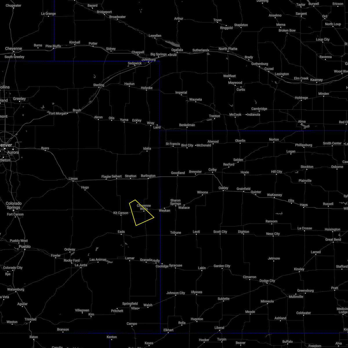 At 627 pm mdt, a severe thunderstorm was located 10 miles northwest of cheyenne wells, moving southeast at 20 mph (radar indicated). Hazards include quarter size hail. damage to vehicles is expected At 627 pm mdt, a severe thunderstorm was located 10 miles northwest of cheyenne wells, moving southeast at 20 mph (radar indicated). Hazards include quarter size hail. damage to vehicles is expected
|
| 7/18/2021 1:59 PM MDT |
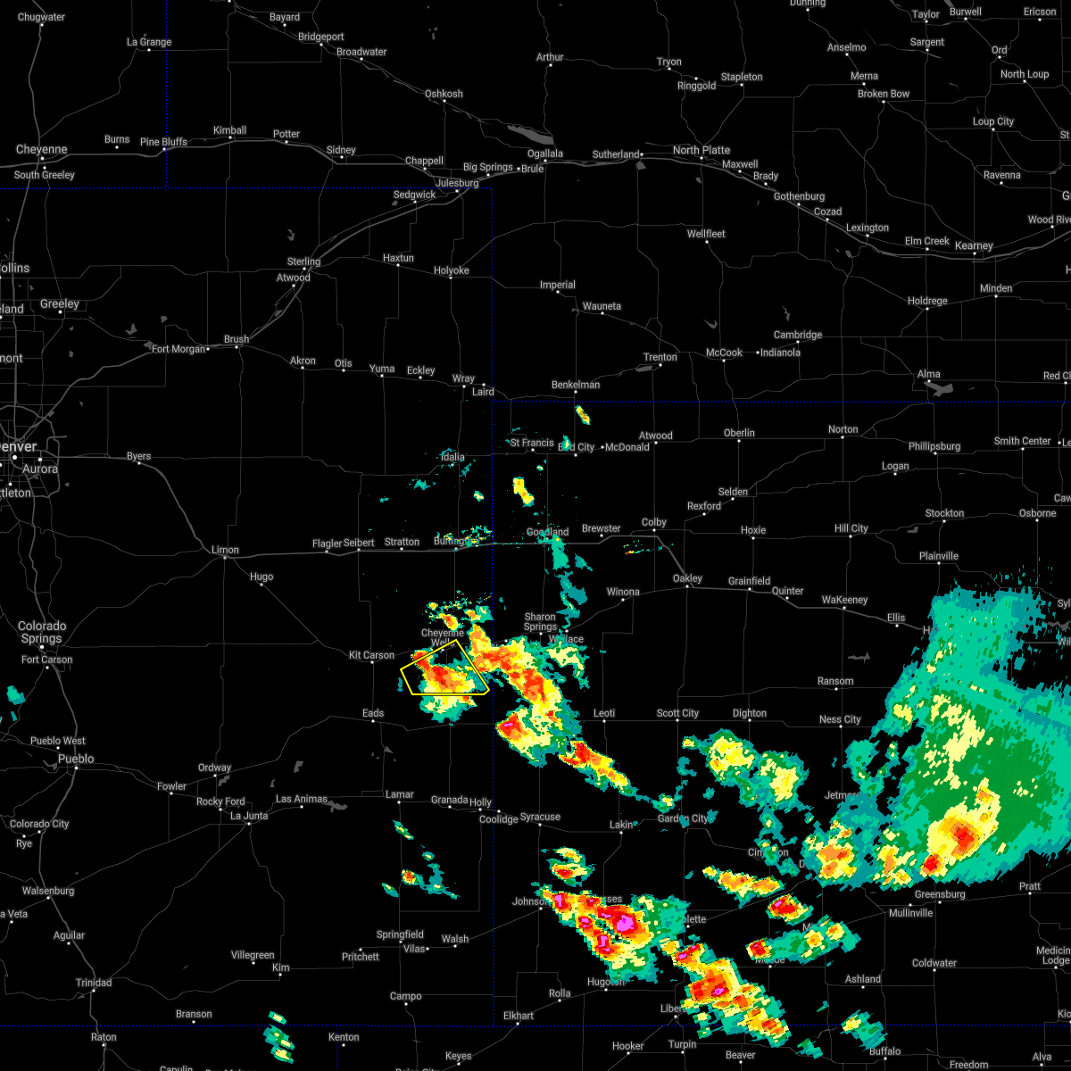 At 158 pm mdt, a severe thunderstorm was located 8 miles south of cheyenne wells, moving southeast at 10 mph (radar indicated). Hazards include 60 mph wind gusts and quarter size hail. Hail damage to vehicles is expected. expect wind damage to roofs, siding, and trees. locations impacted include, cheyenne wells. People attending cheyenne county fairgrounds should seek safe shelter immediately! this includes highway 385 between mile markers 136 and 151. At 158 pm mdt, a severe thunderstorm was located 8 miles south of cheyenne wells, moving southeast at 10 mph (radar indicated). Hazards include 60 mph wind gusts and quarter size hail. Hail damage to vehicles is expected. expect wind damage to roofs, siding, and trees. locations impacted include, cheyenne wells. People attending cheyenne county fairgrounds should seek safe shelter immediately! this includes highway 385 between mile markers 136 and 151.
|
| 7/18/2021 1:39 PM MDT |
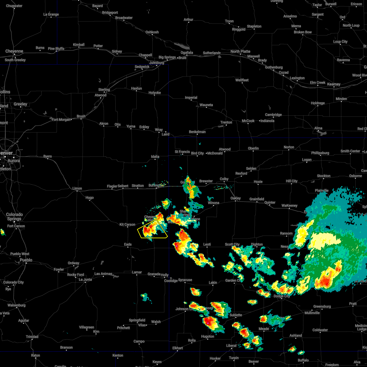 At 139 pm mdt, a severe thunderstorm was located 8 miles southwest of cheyenne wells, moving southeast at 5 mph (radar indicated). Hazards include 60 mph wind gusts and half dollar size hail. Hail damage to vehicles is expected. expect wind damage to roofs, siding, and trees. this severe thunderstorm will remain over mainly rural areas of southeastern cheyenne county in east central colorado. People attending cheyenne county fairgrounds should seek safe shelter immediately! this includes highway 385 between mile markers 136 and 151. At 139 pm mdt, a severe thunderstorm was located 8 miles southwest of cheyenne wells, moving southeast at 5 mph (radar indicated). Hazards include 60 mph wind gusts and half dollar size hail. Hail damage to vehicles is expected. expect wind damage to roofs, siding, and trees. this severe thunderstorm will remain over mainly rural areas of southeastern cheyenne county in east central colorado. People attending cheyenne county fairgrounds should seek safe shelter immediately! this includes highway 385 between mile markers 136 and 151.
|
| 6/24/2021 8:12 PM MDT |
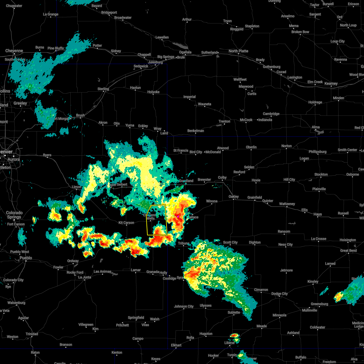 The severe thunderstorm warning for eastern cheyenne county in east central colorado will expire at 815 pm mdt, the storms which prompted the warning have moved out of the area. therefore, the warning will be allowed to expire. however gusty winds are still possible with these thunderstorms. a severe thunderstorm watch remains in effect until 1000 pm mdt for east central colorado. The severe thunderstorm warning for eastern cheyenne county in east central colorado will expire at 815 pm mdt, the storms which prompted the warning have moved out of the area. therefore, the warning will be allowed to expire. however gusty winds are still possible with these thunderstorms. a severe thunderstorm watch remains in effect until 1000 pm mdt for east central colorado.
|
| 6/24/2021 7:59 PM MDT |
 At 744 pm mdt, severe thunderstorms were located along a line extending from 17 miles northeast of kit carson to 3 miles southwest of cheyenne wells to 14 miles north of sheridan lake, moving east at 35 mph (radar indicated). Hazards include two inch hail and 60 mph wind gusts. People and animals outdoors will be injured. expect hail damage to roofs, siding, windows, and vehicles. expect wind damage to roofs, siding, and trees. locations impacted include, cheyenne wells, arapahoe and firstview. This includes highway 385 between mile markers 136 and 169. At 744 pm mdt, severe thunderstorms were located along a line extending from 17 miles northeast of kit carson to 3 miles southwest of cheyenne wells to 14 miles north of sheridan lake, moving east at 35 mph (radar indicated). Hazards include two inch hail and 60 mph wind gusts. People and animals outdoors will be injured. expect hail damage to roofs, siding, windows, and vehicles. expect wind damage to roofs, siding, and trees. locations impacted include, cheyenne wells, arapahoe and firstview. This includes highway 385 between mile markers 136 and 169.
|
| 6/24/2021 7:44 PM MDT |
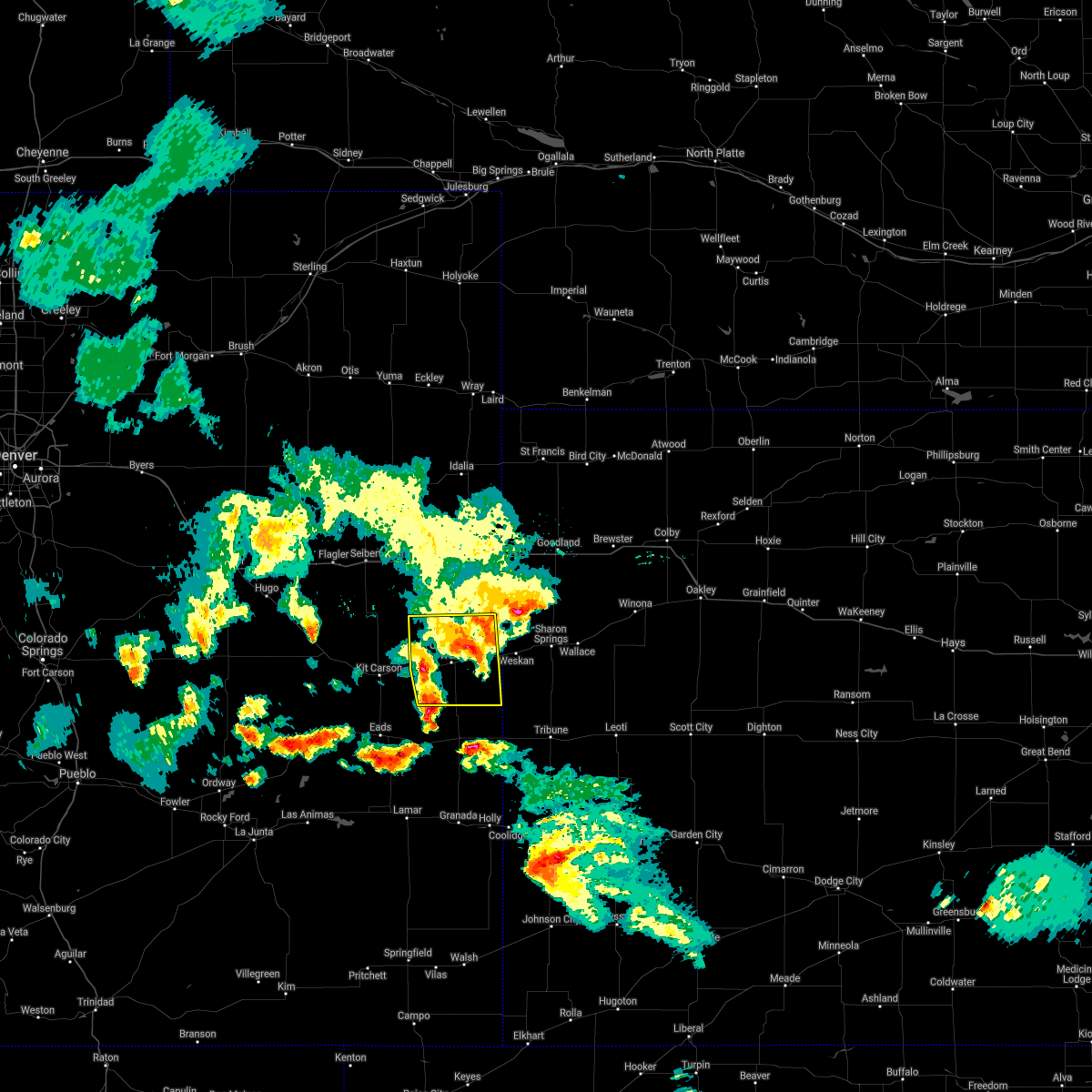 At 744 pm mdt, severe thunderstorms were located along a line extending from 17 miles northeast of kit carson to 3 miles southwest of cheyenne wells to 14 miles north of sheridan lake, moving east at 35 mph (radar indicated). Hazards include two inch hail and 60 mph wind gusts. People and animals outdoors will be injured. expect hail damage to roofs, siding, windows, and vehicles. expect wind damage to roofs, siding, and trees. locations impacted include, cheyenne wells, arapahoe and firstview. This includes highway 385 between mile markers 136 and 169. At 744 pm mdt, severe thunderstorms were located along a line extending from 17 miles northeast of kit carson to 3 miles southwest of cheyenne wells to 14 miles north of sheridan lake, moving east at 35 mph (radar indicated). Hazards include two inch hail and 60 mph wind gusts. People and animals outdoors will be injured. expect hail damage to roofs, siding, windows, and vehicles. expect wind damage to roofs, siding, and trees. locations impacted include, cheyenne wells, arapahoe and firstview. This includes highway 385 between mile markers 136 and 169.
|
| 6/24/2021 7:30 PM MDT |
 At 730 pm mdt, severe thunderstorms were located along a line extending from 10 miles northeast of kit carson to 10 miles west of cheyenne wells to 14 miles north of chivington, moving east at 35 mph (radar indicated). Hazards include two inch hail and 60 mph wind gusts. People and animals outdoors will be injured. expect hail damage to roofs, siding, windows, and vehicles. expect wind damage to roofs, siding, and trees. locations impacted include, cheyenne wells, arapahoe and firstview. This includes highway 385 between mile markers 136 and 169. At 730 pm mdt, severe thunderstorms were located along a line extending from 10 miles northeast of kit carson to 10 miles west of cheyenne wells to 14 miles north of chivington, moving east at 35 mph (radar indicated). Hazards include two inch hail and 60 mph wind gusts. People and animals outdoors will be injured. expect hail damage to roofs, siding, windows, and vehicles. expect wind damage to roofs, siding, and trees. locations impacted include, cheyenne wells, arapahoe and firstview. This includes highway 385 between mile markers 136 and 169.
|
| 6/24/2021 7:13 PM MDT |
 The severe thunderstorm warning for cheyenne county in east central colorado will expire at 715 pm mdt, the storms which prompted the warning have moved out of the area. therefore, the warning will be allowed to expire. however small hail is still possible with these thunderstorms. a severe thunderstorm watch remains in effect until 1000 pm mdt for east central colorado. remember, a severe thunderstorm warning still remains in effect for cheyenne county until 815 pm mdt!. The severe thunderstorm warning for cheyenne county in east central colorado will expire at 715 pm mdt, the storms which prompted the warning have moved out of the area. therefore, the warning will be allowed to expire. however small hail is still possible with these thunderstorms. a severe thunderstorm watch remains in effect until 1000 pm mdt for east central colorado. remember, a severe thunderstorm warning still remains in effect for cheyenne county until 815 pm mdt!.
|
| 6/24/2021 7:11 PM MDT |
 At 710 pm mdt, severe thunderstorms were located along a line extending from 22 miles east of boyero to near kit carson to 11 miles north of eads, moving east at 35 mph (radar indicated). Hazards include two inch hail and 60 mph wind gusts. People and animals outdoors will be injured. expect hail damage to roofs, siding, windows, and vehicles. Expect wind damage to roofs, siding, and trees. At 710 pm mdt, severe thunderstorms were located along a line extending from 22 miles east of boyero to near kit carson to 11 miles north of eads, moving east at 35 mph (radar indicated). Hazards include two inch hail and 60 mph wind gusts. People and animals outdoors will be injured. expect hail damage to roofs, siding, windows, and vehicles. Expect wind damage to roofs, siding, and trees.
|
| 6/24/2021 7:00 PM MDT |
 At 659 pm mdt, severe thunderstorms were located along a line extending from 24 miles west of cheyenne wells to 7 miles east of kit carson to 13 miles north of eads, moving east at 45 mph (radar indicated). Hazards include two inch hail and 60 mph wind gusts. People and animals outdoors will be injured. expect hail damage to roofs, siding, windows, and vehicles. expect wind damage to roofs, siding, and trees. locations impacted include, cheyenne wells, kit carson, firstview and wild horse. This includes highway 385 between mile markers 136 and 166. At 659 pm mdt, severe thunderstorms were located along a line extending from 24 miles west of cheyenne wells to 7 miles east of kit carson to 13 miles north of eads, moving east at 45 mph (radar indicated). Hazards include two inch hail and 60 mph wind gusts. People and animals outdoors will be injured. expect hail damage to roofs, siding, windows, and vehicles. expect wind damage to roofs, siding, and trees. locations impacted include, cheyenne wells, kit carson, firstview and wild horse. This includes highway 385 between mile markers 136 and 166.
|
| 6/24/2021 6:44 PM MDT |
 At 644 pm mdt, severe thunderstorms were located along a line extending from 16 miles east of boyero to near kit carson to 13 miles north of eads, moving east at 45 mph (radar indicated). Hazards include two inch hail and 60 mph wind gusts. People and animals outdoors will be injured. expect hail damage to roofs, siding, windows, and vehicles. expect wind damage to roofs, siding, and trees. locations impacted include, cheyenne wells, kit carson, firstview, wild horse and aroya. This includes highway 385 between mile markers 136 and 166. At 644 pm mdt, severe thunderstorms were located along a line extending from 16 miles east of boyero to near kit carson to 13 miles north of eads, moving east at 45 mph (radar indicated). Hazards include two inch hail and 60 mph wind gusts. People and animals outdoors will be injured. expect hail damage to roofs, siding, windows, and vehicles. expect wind damage to roofs, siding, and trees. locations impacted include, cheyenne wells, kit carson, firstview, wild horse and aroya. This includes highway 385 between mile markers 136 and 166.
|
| 6/24/2021 6:29 PM MDT |
 At 629 pm mdt, severe thunderstorms were located along a line extending from 6 miles east of boyero to 11 miles west of kit carson to 15 miles north of haswell, moving east at 45 mph (radar indicated). Hazards include golf ball size hail and 60 mph wind gusts. People and animals outdoors will be injured. expect hail damage to roofs, siding, windows, and vehicles. expect wind damage to roofs, siding, and trees. locations impacted include, kit carson and cheyenne wells. This includes highway 385 between mile markers 136 and 166. At 629 pm mdt, severe thunderstorms were located along a line extending from 6 miles east of boyero to 11 miles west of kit carson to 15 miles north of haswell, moving east at 45 mph (radar indicated). Hazards include golf ball size hail and 60 mph wind gusts. People and animals outdoors will be injured. expect hail damage to roofs, siding, windows, and vehicles. expect wind damage to roofs, siding, and trees. locations impacted include, kit carson and cheyenne wells. This includes highway 385 between mile markers 136 and 166.
|
| 6/24/2021 6:22 PM MDT |
 At 622 pm mdt, severe thunderstorms were located along a line extending from 4 miles east of boyero to 13 miles west of kit carson to 14 miles north of haswell, moving east at 45 mph (radar indicated). Hazards include 60 mph wind gusts and quarter size hail. Hail damage to vehicles is expected. expect wind damage to roofs, siding, and trees. severe thunderstorms will be near, kit carson around 640 pm mdt. other locations in the path of these severe thunderstorms include cheyenne wells. This includes highway 385 between mile markers 136 and 166. At 622 pm mdt, severe thunderstorms were located along a line extending from 4 miles east of boyero to 13 miles west of kit carson to 14 miles north of haswell, moving east at 45 mph (radar indicated). Hazards include 60 mph wind gusts and quarter size hail. Hail damage to vehicles is expected. expect wind damage to roofs, siding, and trees. severe thunderstorms will be near, kit carson around 640 pm mdt. other locations in the path of these severe thunderstorms include cheyenne wells. This includes highway 385 between mile markers 136 and 166.
|
| 6/24/2021 5:20 PM MDT | Quarter sized hail reported 13.9 miles NW of Cheyenne Wells, CO, delayed report. trained spotter reported sporadic quarter sized hail. |
| 6/24/2021 5:10 PM MDT |
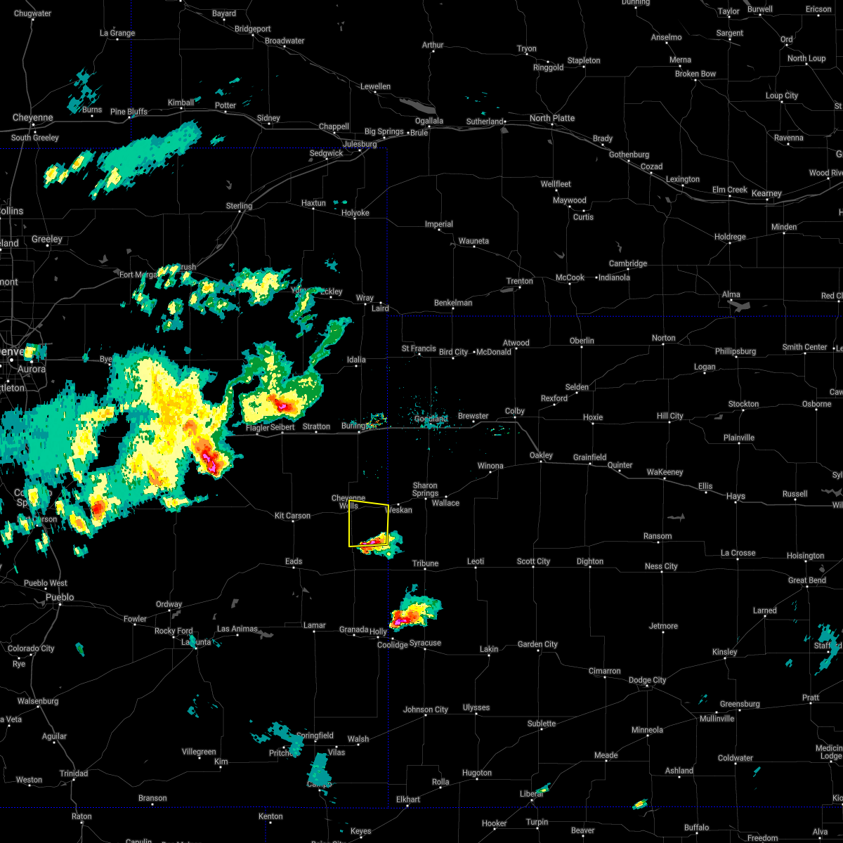 At 510 pm mdt, a severe thunderstorm was located 12 miles northwest of towner, or 15 miles southeast of cheyenne wells, moving north at 15 mph. this is a very dangerous storm (trained weather spotters). Hazards include three inch hail and 60 mph wind gusts. People and animals outdoors will be severely injured. expect shattered windows, extensive damage to roofs, siding, and vehicles. locations impacted include, cheyenne wells and arapahoe. This includes highway 385 between mile markers 136 and 152. At 510 pm mdt, a severe thunderstorm was located 12 miles northwest of towner, or 15 miles southeast of cheyenne wells, moving north at 15 mph. this is a very dangerous storm (trained weather spotters). Hazards include three inch hail and 60 mph wind gusts. People and animals outdoors will be severely injured. expect shattered windows, extensive damage to roofs, siding, and vehicles. locations impacted include, cheyenne wells and arapahoe. This includes highway 385 between mile markers 136 and 152.
|
| 6/24/2021 4:49 PM MDT |
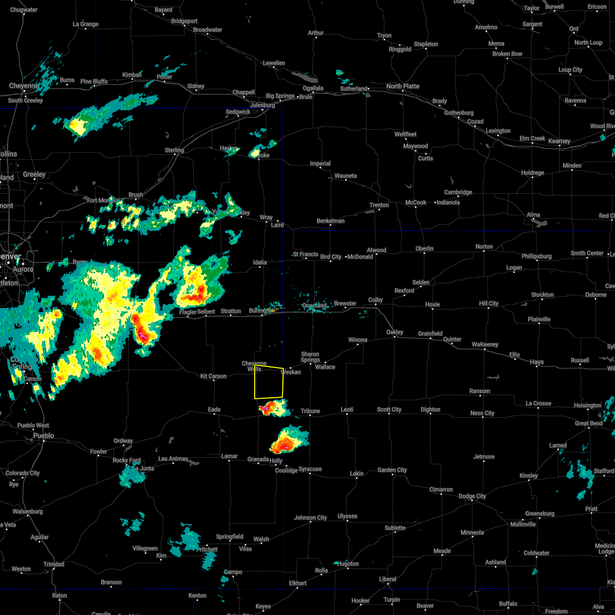 At 449 pm mdt, a severe thunderstorm was located 7 miles northeast of sheridan lake, or 18 miles south of cheyenne wells, moving north at 15 mph. this is a very dangerous storm (trained weather spotters). Hazards include softball size hail and 60 mph wind gusts. People and animals outdoors will be severely injured. expect shattered windows, extensive damage to roofs, siding, and vehicles. this severe thunderstorm will remain over mainly rural areas of southeastern cheyenne county in east central colorado, including the following locations, arapahoe. This includes highway 385 between mile markers 136 and 152. At 449 pm mdt, a severe thunderstorm was located 7 miles northeast of sheridan lake, or 18 miles south of cheyenne wells, moving north at 15 mph. this is a very dangerous storm (trained weather spotters). Hazards include softball size hail and 60 mph wind gusts. People and animals outdoors will be severely injured. expect shattered windows, extensive damage to roofs, siding, and vehicles. this severe thunderstorm will remain over mainly rural areas of southeastern cheyenne county in east central colorado, including the following locations, arapahoe. This includes highway 385 between mile markers 136 and 152.
|
| 6/19/2021 6:00 PM MDT |
 At 600 pm mdt, severe thunderstorms were located along a line extending from 17 miles east of cope to 3 miles west of bethune to 14 miles north of kit carson, moving east at 40 mph (radar indicated). Hazards include 60 mph wind gusts. Expect damage to roofs, siding, and trees. severe thunderstorms will be near, burlington around 620 pm mdt. other locations in the path of these severe thunderstorms include kanorado, ruleton and weskan. people attending parmer park should seek safe shelter immediately! this includes the following highways, interstate 70 in kansas between mile markers 0 and 35. interstate 70 in colorado between mile markers 432 and 450. Highway 385 between mile markers 141 and 206, and near mile marker 211. At 600 pm mdt, severe thunderstorms were located along a line extending from 17 miles east of cope to 3 miles west of bethune to 14 miles north of kit carson, moving east at 40 mph (radar indicated). Hazards include 60 mph wind gusts. Expect damage to roofs, siding, and trees. severe thunderstorms will be near, burlington around 620 pm mdt. other locations in the path of these severe thunderstorms include kanorado, ruleton and weskan. people attending parmer park should seek safe shelter immediately! this includes the following highways, interstate 70 in kansas between mile markers 0 and 35. interstate 70 in colorado between mile markers 432 and 450. Highway 385 between mile markers 141 and 206, and near mile marker 211.
|
| 6/19/2021 5:55 PM MDT | Up723 reported 60mph gus in cheyenne county CO, 5.8 miles E of Cheyenne Wells, CO |
| 5/23/2021 7:50 PM MDT |
 At 750 pm mdt/850 pm cdt/, severe thunderstorms were located along a line extending from 9 miles east of bonny reservoir to 13 miles southwest of cheyenne wells, moving northeast at 55 mph (radar indicated). Hazards include 60 mph wind gusts and quarter size hail. Hail damage to vehicles is expected. Expect wind damage to roofs, siding, and trees. At 750 pm mdt/850 pm cdt/, severe thunderstorms were located along a line extending from 9 miles east of bonny reservoir to 13 miles southwest of cheyenne wells, moving northeast at 55 mph (radar indicated). Hazards include 60 mph wind gusts and quarter size hail. Hail damage to vehicles is expected. Expect wind damage to roofs, siding, and trees.
|
| 5/23/2021 7:41 PM MDT |
 At 741 pm mdt, severe thunderstorms were located along a line extending from 10 miles south of bonny reservoir to 10 miles southwest of cheyenne wells, moving northeast at 30 mph (radar indicated). Hazards include 70 mph wind gusts and half dollar size hail. Hail damage to vehicles is expected. expect considerable tree damage. wind damage is also likely to mobile homes, roofs, and outbuildings. locations impacted include, cheyenne wells. this includes the following highways, interstate 70 in colorado between mile markers 423 and 450. highway 385 between mile markers 140 and 204, and near mile marker 211. A tornado watch remains in effect until 800 pm mdt for northeastern and east central colorado. At 741 pm mdt, severe thunderstorms were located along a line extending from 10 miles south of bonny reservoir to 10 miles southwest of cheyenne wells, moving northeast at 30 mph (radar indicated). Hazards include 70 mph wind gusts and half dollar size hail. Hail damage to vehicles is expected. expect considerable tree damage. wind damage is also likely to mobile homes, roofs, and outbuildings. locations impacted include, cheyenne wells. this includes the following highways, interstate 70 in colorado between mile markers 423 and 450. highway 385 between mile markers 140 and 204, and near mile marker 211. A tornado watch remains in effect until 800 pm mdt for northeastern and east central colorado.
|
| 5/23/2021 7:10 PM MDT |
 At 710 pm mdt, severe thunderstorms were located along a line extending from 5 miles north of bethune to 9 miles south of kit carson, moving northeast at 30 mph (radar indicated). Hazards include 70 mph wind gusts and quarter size hail. Hail damage to vehicles is expected. expect considerable tree damage. wind damage is also likely to mobile homes, roofs, and outbuildings. severe thunderstorms will be near, bethune around 715 pm mdt. burlington around 725 pm mdt. other locations in the path of these severe thunderstorms include cheyenne wells. this includes the following highways, interstate 70 in colorado between mile markers 419 and 450. highway 385 between mile markers 140 and 204, and near mile marker 211. A tornado watch remains in effect until 800 pm mdt for northeastern and east central colorado. At 710 pm mdt, severe thunderstorms were located along a line extending from 5 miles north of bethune to 9 miles south of kit carson, moving northeast at 30 mph (radar indicated). Hazards include 70 mph wind gusts and quarter size hail. Hail damage to vehicles is expected. expect considerable tree damage. wind damage is also likely to mobile homes, roofs, and outbuildings. severe thunderstorms will be near, bethune around 715 pm mdt. burlington around 725 pm mdt. other locations in the path of these severe thunderstorms include cheyenne wells. this includes the following highways, interstate 70 in colorado between mile markers 419 and 450. highway 385 between mile markers 140 and 204, and near mile marker 211. A tornado watch remains in effect until 800 pm mdt for northeastern and east central colorado.
|
| 8/16/2020 6:48 PM MDT |
 At 646 pm mdt/746 pm cdt/, severe thunderstorms were located along a line extending from 8 miles southeast of burlington to 4 miles northeast of russell springs, moving south at 25 mph (these storms have a history of producing wind gusts up to 70 mph. an automated weather observation site in st. francis reported a 67 mph wind gust at 535 pm mdt. the national weather service in goodland measured a 62 mph wind gust at 620 pm mdt). Hazards include 70 mph wind gusts and penny size hail. Expect considerable tree damage. damage is likely to mobile homes, roofs, and outbuildings. locations impacted include, goodland, burlington, cheyenne wells, kanorado, ruleton, bethune and edson. this includes the following highways, interstate 70 in kansas between mile markers 0 and 36. interstate 70 in colorado between mile markers 422 and 450. Highway 385 between mile markers 136 and 206, and near mile marker 211. At 646 pm mdt/746 pm cdt/, severe thunderstorms were located along a line extending from 8 miles southeast of burlington to 4 miles northeast of russell springs, moving south at 25 mph (these storms have a history of producing wind gusts up to 70 mph. an automated weather observation site in st. francis reported a 67 mph wind gust at 535 pm mdt. the national weather service in goodland measured a 62 mph wind gust at 620 pm mdt). Hazards include 70 mph wind gusts and penny size hail. Expect considerable tree damage. damage is likely to mobile homes, roofs, and outbuildings. locations impacted include, goodland, burlington, cheyenne wells, kanorado, ruleton, bethune and edson. this includes the following highways, interstate 70 in kansas between mile markers 0 and 36. interstate 70 in colorado between mile markers 422 and 450. Highway 385 between mile markers 136 and 206, and near mile marker 211.
|
| 8/16/2020 6:28 PM MDT |
 At 627 pm mdt/727 pm cdt/, severe thunderstorms were located along a line extending from 6 miles west of kanorado to 6 miles west of monument, moving south at 25 mph (these storms have a history of producing wind gusts up to 70 mph. the national weather service in goodland measured a wind gust of 62 mph at 620 pm mdt). Hazards include 70 mph wind gusts and penny size hail. Expect considerable tree damage. Damage is likely to mobile homes, roofs, and outbuildings. At 627 pm mdt/727 pm cdt/, severe thunderstorms were located along a line extending from 6 miles west of kanorado to 6 miles west of monument, moving south at 25 mph (these storms have a history of producing wind gusts up to 70 mph. the national weather service in goodland measured a wind gust of 62 mph at 620 pm mdt). Hazards include 70 mph wind gusts and penny size hail. Expect considerable tree damage. Damage is likely to mobile homes, roofs, and outbuildings.
|
| 7/26/2020 5:54 PM MDT |
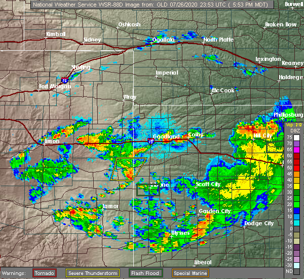 The severe thunderstorm warning for eastern cheyenne county in east central colorado and southwestern wallace counties in west central kansas will expire at 600 pm mdt, the storms which prompted the warning have weakened below severe limits, and no longer pose an immediate threat to life or property. therefore, the warning will be allowed to expire. however gusty winds and heavy rain are still possible with these thunderstorms. The severe thunderstorm warning for eastern cheyenne county in east central colorado and southwestern wallace counties in west central kansas will expire at 600 pm mdt, the storms which prompted the warning have weakened below severe limits, and no longer pose an immediate threat to life or property. therefore, the warning will be allowed to expire. however gusty winds and heavy rain are still possible with these thunderstorms.
|
| 7/26/2020 5:28 PM MDT |
 At 528 pm mdt, severe thunderstorms were located along a line extending from 6 miles northwest of weskan to 11 miles southeast of cheyenne wells, moving southeast at 35 mph (radar indicated). Hazards include 60 mph wind gusts and quarter size hail. Hail damage to vehicles is expected. expect wind damage to roofs, siding, and trees. locations impacted include, cheyenne wells, weskan and arapahoe. This includes highway 385 between mile markers 137 and 168. At 528 pm mdt, severe thunderstorms were located along a line extending from 6 miles northwest of weskan to 11 miles southeast of cheyenne wells, moving southeast at 35 mph (radar indicated). Hazards include 60 mph wind gusts and quarter size hail. Hail damage to vehicles is expected. expect wind damage to roofs, siding, and trees. locations impacted include, cheyenne wells, weskan and arapahoe. This includes highway 385 between mile markers 137 and 168.
|
| 7/26/2020 5:28 PM MDT |
 A severe thunderstorm warning remains in effect until 600 pm mdt for eastern cheyenne county in east central colorado and southwestern wallace counties in west central kansas. At 528 pm mdt, severe thunderstorms were located along a line extending from 6 miles northwest of weskan to 11 miles southeast of cheyenne wells, moving southeast at 35 mph. A severe thunderstorm warning remains in effect until 600 pm mdt for eastern cheyenne county in east central colorado and southwestern wallace counties in west central kansas. At 528 pm mdt, severe thunderstorms were located along a line extending from 6 miles northwest of weskan to 11 miles southeast of cheyenne wells, moving southeast at 35 mph.
|
| 7/26/2020 5:02 PM MDT |
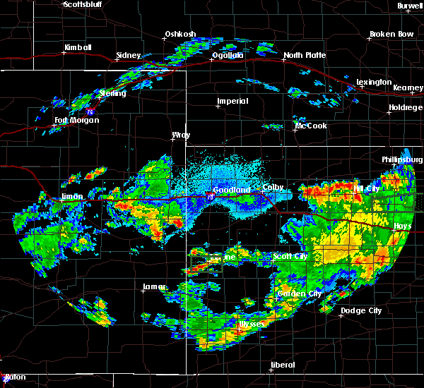 At 502 pm mdt, a severe thunderstorm was located 9 miles northwest of weskan, or 15 miles northeast of cheyenne wells, moving southeast at 40 mph. another severe thunderstorm was located near cheyenne wells (radar indicated). Hazards include 60 mph wind gusts and half dollar size hail. Hail damage to vehicles is expected. Expect wind damage to roofs, siding, and trees. At 502 pm mdt, a severe thunderstorm was located 9 miles northwest of weskan, or 15 miles northeast of cheyenne wells, moving southeast at 40 mph. another severe thunderstorm was located near cheyenne wells (radar indicated). Hazards include 60 mph wind gusts and half dollar size hail. Hail damage to vehicles is expected. Expect wind damage to roofs, siding, and trees.
|
| 7/20/2020 6:06 PM MDT |
 At 606 pm mdt, a severe thunderstorm was located 10 miles northeast of cheyenne wells, moving southeast at 5 mph (radar indicated). Hazards include 60 mph wind gusts and quarter size hail. Hail damage to vehicles is expected. expect wind damage to roofs, siding, and trees. locations impacted include, cheyenne wells and arapahoe. This includes highway 385 between mile markers 136 and 152. At 606 pm mdt, a severe thunderstorm was located 10 miles northeast of cheyenne wells, moving southeast at 5 mph (radar indicated). Hazards include 60 mph wind gusts and quarter size hail. Hail damage to vehicles is expected. expect wind damage to roofs, siding, and trees. locations impacted include, cheyenne wells and arapahoe. This includes highway 385 between mile markers 136 and 152.
|
| 7/20/2020 5:58 PM MDT |
 At 557 pm mdt, a severe thunderstorm was located 10 miles northeast of cheyenne wells, moving southeast at 5 mph. additional severe thunderstorms were located south of highway 40 and east of highway 287, moving southeast at 15 mph (radar indicated). Hazards include 60 mph wind gusts and quarter size hail. Hail damage to vehicles is expected. expect wind damage to roofs, siding, and trees. locations impacted include, cheyenne wells, kit carson, firstview and arapahoe. This includes highway 385 between mile markers 136 and 157. At 557 pm mdt, a severe thunderstorm was located 10 miles northeast of cheyenne wells, moving southeast at 5 mph. additional severe thunderstorms were located south of highway 40 and east of highway 287, moving southeast at 15 mph (radar indicated). Hazards include 60 mph wind gusts and quarter size hail. Hail damage to vehicles is expected. expect wind damage to roofs, siding, and trees. locations impacted include, cheyenne wells, kit carson, firstview and arapahoe. This includes highway 385 between mile markers 136 and 157.
|
| 7/20/2020 5:52 PM MDT |
 At 552 pm mdt, a severe thunderstorm was located 9 miles east of cheyenne wells, moving southeast at 15 mph. additional severe thunderstorms were located south of highway 40 and east of highway 287, moving southeast at 15 mph (radar indicated). Hazards include 60 mph wind gusts and quarter size hail. Hail damage to vehicles is expected. expect wind damage to roofs, siding, and trees. locations impacted include, cheyenne wells, kit carson, firstview, wild horse, arapahoe and aroya. This includes highway 385 between mile markers 136 and 160. At 552 pm mdt, a severe thunderstorm was located 9 miles east of cheyenne wells, moving southeast at 15 mph. additional severe thunderstorms were located south of highway 40 and east of highway 287, moving southeast at 15 mph (radar indicated). Hazards include 60 mph wind gusts and quarter size hail. Hail damage to vehicles is expected. expect wind damage to roofs, siding, and trees. locations impacted include, cheyenne wells, kit carson, firstview, wild horse, arapahoe and aroya. This includes highway 385 between mile markers 136 and 160.
|
| 7/20/2020 5:49 PM MDT |
 At 548 pm mdt, a severe thunderstorm was located 6 miles east of cheyenne wells, moving southeast at 15 mph. additional severe thunderstorms were located south of highway 40 and east of highway 287, moving southeast at 15 mph (radar indicated). Hazards include 60 mph wind gusts and quarter size hail. Hail damage to vehicles is expected. expect wind damage to roofs, siding, and trees. locations impacted include, cheyenne wells, kit carson, firstview, wild horse, arapahoe and aroya. This includes highway 385 between mile markers 136 and 169. At 548 pm mdt, a severe thunderstorm was located 6 miles east of cheyenne wells, moving southeast at 15 mph. additional severe thunderstorms were located south of highway 40 and east of highway 287, moving southeast at 15 mph (radar indicated). Hazards include 60 mph wind gusts and quarter size hail. Hail damage to vehicles is expected. expect wind damage to roofs, siding, and trees. locations impacted include, cheyenne wells, kit carson, firstview, wild horse, arapahoe and aroya. This includes highway 385 between mile markers 136 and 169.
|
| 7/20/2020 5:39 PM MDT |
 At 527 pm mdt, a severe thunderstorm was located 10 miles west of kit carson, or 34 miles west of cheyenne wells, and is nearly stationary. additional severe thunderstorms were developing across central and eastern portions of cheyenne county (radar indicated). Hazards include 60 mph wind gusts and quarter size hail. Hail damage to vehicles is expected. Expect wind damage to roofs, siding, and trees. At 527 pm mdt, a severe thunderstorm was located 10 miles west of kit carson, or 34 miles west of cheyenne wells, and is nearly stationary. additional severe thunderstorms were developing across central and eastern portions of cheyenne county (radar indicated). Hazards include 60 mph wind gusts and quarter size hail. Hail damage to vehicles is expected. Expect wind damage to roofs, siding, and trees.
|
| 7/20/2020 5:27 PM MDT |
 At 527 pm mdt, a severe thunderstorm was located 10 miles west of kit carson, or 34 miles west of cheyenne wells, and is nearly stationary. additional severe thunderstorms were developing across central and eastern portions of cheyenne county (radar indicated). Hazards include 60 mph wind gusts and quarter size hail. Hail damage to vehicles is expected. Expect wind damage to roofs, siding, and trees. At 527 pm mdt, a severe thunderstorm was located 10 miles west of kit carson, or 34 miles west of cheyenne wells, and is nearly stationary. additional severe thunderstorms were developing across central and eastern portions of cheyenne county (radar indicated). Hazards include 60 mph wind gusts and quarter size hail. Hail damage to vehicles is expected. Expect wind damage to roofs, siding, and trees.
|
| 7/20/2020 5:10 PM MDT | Report of semi blown over on highway 40 at mile marker 463. time is estimate in cheyenne county CO, 6.8 miles E of Cheyenne Wells, CO |
| 7/12/2020 6:43 PM MDT |
 At 635 pm mdt, a severe thunderstorm was located 10 miles south of cheyenne wells, moving south at 20 mph (radar indicated). Hazards include 70 mph wind gusts and ping pong ball size hail. People and animals outdoors will be injured. expect hail damage to roofs, siding, windows, and vehicles. expect considerable tree damage. Wind damage is also likely to mobile homes, roofs, and outbuildings. At 635 pm mdt, a severe thunderstorm was located 10 miles south of cheyenne wells, moving south at 20 mph (radar indicated). Hazards include 70 mph wind gusts and ping pong ball size hail. People and animals outdoors will be injured. expect hail damage to roofs, siding, windows, and vehicles. expect considerable tree damage. Wind damage is also likely to mobile homes, roofs, and outbuildings.
|
| 7/12/2020 6:36 PM MDT |
 At 635 pm mdt, a severe thunderstorm was located 10 miles south of cheyenne wells, moving south at 20 mph (radar indicated). Hazards include 70 mph wind gusts and ping pong ball size hail. People and animals outdoors will be injured. expect hail damage to roofs, siding, windows, and vehicles. expect considerable tree damage. Wind damage is also likely to mobile homes, roofs, and outbuildings. At 635 pm mdt, a severe thunderstorm was located 10 miles south of cheyenne wells, moving south at 20 mph (radar indicated). Hazards include 70 mph wind gusts and ping pong ball size hail. People and animals outdoors will be injured. expect hail damage to roofs, siding, windows, and vehicles. expect considerable tree damage. Wind damage is also likely to mobile homes, roofs, and outbuildings.
|
| 7/12/2020 6:35 PM MDT | Half Dollar sized hail reported 0.8 miles W of Cheyenne Wells, CO |
| 7/12/2020 6:23 PM MDT |
 At 623 pm mdt, a severe thunderstorm was located 6 miles south of cheyenne wells, moving southeast at 15 mph. this is a very dangerous storm (radar indicated). Hazards include 80 mph wind gusts and two inch hail. Flying debris will be dangerous to those caught without shelter. mobile homes will be heavily damaged. expect considerable damage to roofs, windows, and vehicles. extensive tree damage and power outages are likely. locations impacted include, cheyenne wells, arapahoe and firstview. This includes highway 385 between mile markers 136 and 157. At 623 pm mdt, a severe thunderstorm was located 6 miles south of cheyenne wells, moving southeast at 15 mph. this is a very dangerous storm (radar indicated). Hazards include 80 mph wind gusts and two inch hail. Flying debris will be dangerous to those caught without shelter. mobile homes will be heavily damaged. expect considerable damage to roofs, windows, and vehicles. extensive tree damage and power outages are likely. locations impacted include, cheyenne wells, arapahoe and firstview. This includes highway 385 between mile markers 136 and 157.
|
| 7/12/2020 6:15 PM MDT | Quarter sized hail reported 0.3 miles WNW of Cheyenne Wells, CO, estimated time of report from radar. |
| 7/12/2020 6:11 PM MDT |
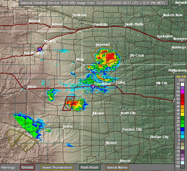 At 611 pm mdt, a severe thunderstorm was located near cheyenne wells, moving southeast at 25 mph. this is a very dangerous storm (radar indicated). Hazards include 80 mph wind gusts and two inch hail. Flying debris will be dangerous to those caught without shelter. mobile homes will be heavily damaged. expect considerable damage to roofs, windows, and vehicles. extensive tree damage and power outages are likely. locations impacted include, cheyenne wells, arapahoe and firstview. This includes highway 385 between mile markers 136 and 158. At 611 pm mdt, a severe thunderstorm was located near cheyenne wells, moving southeast at 25 mph. this is a very dangerous storm (radar indicated). Hazards include 80 mph wind gusts and two inch hail. Flying debris will be dangerous to those caught without shelter. mobile homes will be heavily damaged. expect considerable damage to roofs, windows, and vehicles. extensive tree damage and power outages are likely. locations impacted include, cheyenne wells, arapahoe and firstview. This includes highway 385 between mile markers 136 and 158.
|
| 7/12/2020 6:02 PM MDT |
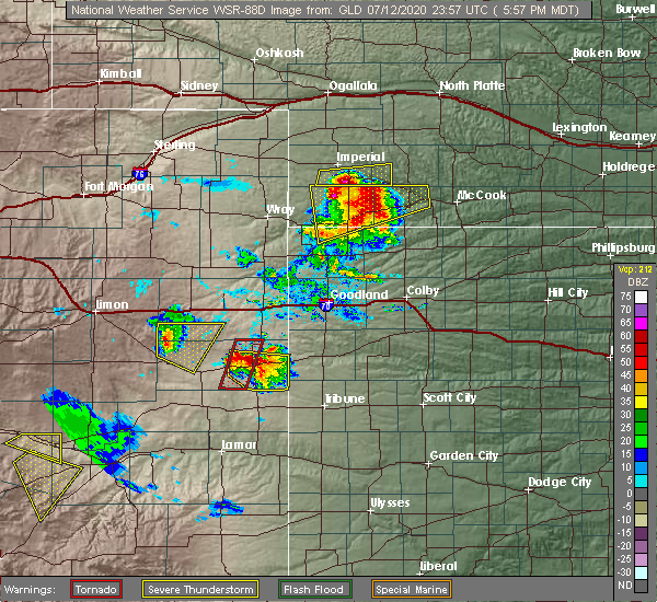 At 602 pm mdt, a severe thunderstorm was located over cheyenne wells, moving southeast at 10 mph (radar indicated). Hazards include two inch hail and 70 mph wind gusts. People and animals outdoors will be injured. expect hail damage to roofs, siding, windows, and vehicles. expect considerable tree damage. wind damage is also likely to mobile homes, roofs, and outbuildings. locations impacted include, cheyenne wells, arapahoe and firstview. This includes highway 385 between mile markers 136 and 158. At 602 pm mdt, a severe thunderstorm was located over cheyenne wells, moving southeast at 10 mph (radar indicated). Hazards include two inch hail and 70 mph wind gusts. People and animals outdoors will be injured. expect hail damage to roofs, siding, windows, and vehicles. expect considerable tree damage. wind damage is also likely to mobile homes, roofs, and outbuildings. locations impacted include, cheyenne wells, arapahoe and firstview. This includes highway 385 between mile markers 136 and 158.
|
| 7/12/2020 5:53 PM MDT |
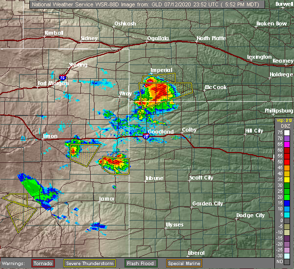 At 553 pm mdt, a confirmed tornado was located 6 miles west of cheyenne wells, and is nearly stationary (public confirmed tornado). Hazards include tornado and hail up to two inches in diameter. expect damage to mobile homes, roofs, and vehicles At 553 pm mdt, a confirmed tornado was located 6 miles west of cheyenne wells, and is nearly stationary (public confirmed tornado). Hazards include tornado and hail up to two inches in diameter. expect damage to mobile homes, roofs, and vehicles
|
| 7/12/2020 5:51 PM MDT |
 At 551 pm mdt, a severe thunderstorm was located over cheyenne wells, and is nearly stationary (radar indicated). Hazards include two inch hail and 60 mph wind gusts. People and animals outdoors will be injured. expect hail damage to roofs, siding, windows, and vehicles. expect wind damage to roofs, siding, and trees. locations impacted include, cheyenne wells, arapahoe and firstview. This includes highway 385 between mile markers 136 and 158. At 551 pm mdt, a severe thunderstorm was located over cheyenne wells, and is nearly stationary (radar indicated). Hazards include two inch hail and 60 mph wind gusts. People and animals outdoors will be injured. expect hail damage to roofs, siding, windows, and vehicles. expect wind damage to roofs, siding, and trees. locations impacted include, cheyenne wells, arapahoe and firstview. This includes highway 385 between mile markers 136 and 158.
|
| 7/12/2020 5:41 PM MDT |
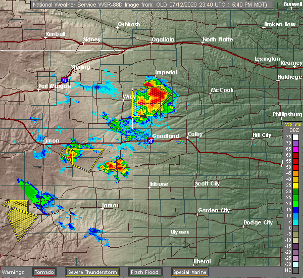 At 541 pm mdt, a severe thunderstorm was located over cheyenne wells, moving east at 5 mph (radar indicated). Hazards include 60 mph wind gusts and half dollar size hail. Hail damage to vehicles is expected. Expect wind damage to roofs, siding, and trees. At 541 pm mdt, a severe thunderstorm was located over cheyenne wells, moving east at 5 mph (radar indicated). Hazards include 60 mph wind gusts and half dollar size hail. Hail damage to vehicles is expected. Expect wind damage to roofs, siding, and trees.
|
| 7/3/2020 11:53 PM MDT |
 The tornado warning for southeastern cheyenne county in east central colorado will expire at midnight mdt, the storm which prompted the warning has weakened below severe limits, and no longer appears capable of producing a tornado. therefore, the warning will be allowed to expire. The tornado warning for southeastern cheyenne county in east central colorado will expire at midnight mdt, the storm which prompted the warning has weakened below severe limits, and no longer appears capable of producing a tornado. therefore, the warning will be allowed to expire.
|
| 7/3/2020 11:47 PM MDT |
 At 1147 pm mdt, a severe thunderstorm capable of producing a tornado was located 4 miles southwest of cheyenne wells, moving west at 35 mph (radar indicated rotation). Hazards include tornado and two inch hail. Flying debris will be dangerous to those caught without shelter. mobile homes will be damaged or destroyed. damage to roofs, windows, and vehicles will occur. tree damage is likely. locations impacted include, cheyenne wells. This includes highway 385 between mile markers 139 and 148. At 1147 pm mdt, a severe thunderstorm capable of producing a tornado was located 4 miles southwest of cheyenne wells, moving west at 35 mph (radar indicated rotation). Hazards include tornado and two inch hail. Flying debris will be dangerous to those caught without shelter. mobile homes will be damaged or destroyed. damage to roofs, windows, and vehicles will occur. tree damage is likely. locations impacted include, cheyenne wells. This includes highway 385 between mile markers 139 and 148.
|
| 7/3/2020 11:36 PM MDT |
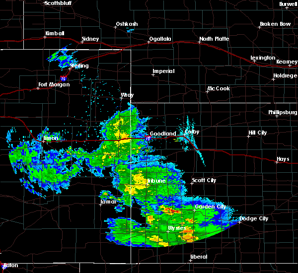 At 1135 pm mdt, a severe thunderstorm capable of producing a tornado was located 7 miles southeast of cheyenne wells, moving west at 35 mph (radar indicated rotation). Hazards include tornado and hail up to two inches in diameter. Flying debris will be dangerous to those caught without shelter. mobile homes will be damaged or destroyed. damage to roofs, windows, and vehicles will occur. Tree damage is likely. At 1135 pm mdt, a severe thunderstorm capable of producing a tornado was located 7 miles southeast of cheyenne wells, moving west at 35 mph (radar indicated rotation). Hazards include tornado and hail up to two inches in diameter. Flying debris will be dangerous to those caught without shelter. mobile homes will be damaged or destroyed. damage to roofs, windows, and vehicles will occur. Tree damage is likely.
|
| 7/3/2020 7:02 PM MDT | Ping Pong Ball sized hail reported 20.7 miles SE of Cheyenne Wells, CO, quarter to ping pong ball hail. |
| 7/3/2020 6:02 PM MDT |
 At 602 pm mdt, a severe thunderstorm was located 10 miles east of kit carson, or 16 miles southwest of cheyenne wells, moving west at 5 mph (radar indicated). Hazards include tennis ball size hail and 60 mph wind gusts. People and animals outdoors will be injured. expect hail damage to roofs, siding, windows, and vehicles. expect wind damage to roofs, siding, and trees. locations impacted include, cheyenne wells, kit carson and firstview. This includes highway 385 between mile markers 136 and 156. At 602 pm mdt, a severe thunderstorm was located 10 miles east of kit carson, or 16 miles southwest of cheyenne wells, moving west at 5 mph (radar indicated). Hazards include tennis ball size hail and 60 mph wind gusts. People and animals outdoors will be injured. expect hail damage to roofs, siding, windows, and vehicles. expect wind damage to roofs, siding, and trees. locations impacted include, cheyenne wells, kit carson and firstview. This includes highway 385 between mile markers 136 and 156.
|
| 7/3/2020 5:56 PM MDT |
 At 555 pm mdt, a severe thunderstorm was located 11 miles east of kit carson, or 15 miles southwest of cheyenne wells, moving west at 15 mph. another severe thunderstorm was located 5 miles southwest of kit carson (radar indicated). Hazards include golf ball size hail and 60 mph wind gusts. People and animals outdoors will be injured. expect hail damage to roofs, siding, windows, and vehicles. expect wind damage to roofs, siding, and trees. locations impacted include, cheyenne wells, kit carson and firstview. This includes highway 385 between mile markers 136 and 156. At 555 pm mdt, a severe thunderstorm was located 11 miles east of kit carson, or 15 miles southwest of cheyenne wells, moving west at 15 mph. another severe thunderstorm was located 5 miles southwest of kit carson (radar indicated). Hazards include golf ball size hail and 60 mph wind gusts. People and animals outdoors will be injured. expect hail damage to roofs, siding, windows, and vehicles. expect wind damage to roofs, siding, and trees. locations impacted include, cheyenne wells, kit carson and firstview. This includes highway 385 between mile markers 136 and 156.
|
| 7/3/2020 5:51 PM MDT |
 At 551 pm mdt, a severe thunderstorm was located 8 miles southwest of kit carson, or 29 miles west of cheyenne wells, moving northeast at 30 mph (radar indicated). Hazards include golf ball size hail and 60 mph wind gusts. People and animals outdoors will be injured. expect hail damage to roofs, siding, windows, and vehicles. expect wind damage to roofs, siding, and trees. locations impacted include, cheyenne wells, kit carson and firstview. This includes highway 385 between mile markers 136 and 156. At 551 pm mdt, a severe thunderstorm was located 8 miles southwest of kit carson, or 29 miles west of cheyenne wells, moving northeast at 30 mph (radar indicated). Hazards include golf ball size hail and 60 mph wind gusts. People and animals outdoors will be injured. expect hail damage to roofs, siding, windows, and vehicles. expect wind damage to roofs, siding, and trees. locations impacted include, cheyenne wells, kit carson and firstview. This includes highway 385 between mile markers 136 and 156.
|
| 7/3/2020 5:43 PM MDT |
 At 543 pm mdt, a severe thunderstorm was located 10 miles southwest of kit carson, or 31 miles southwest of cheyenne wells, moving northeast at 15 mph (radar indicated). Hazards include 60 mph wind gusts and half dollar size hail. Hail damage to vehicles is expected. Expect wind damage to roofs, siding, and trees. At 543 pm mdt, a severe thunderstorm was located 10 miles southwest of kit carson, or 31 miles southwest of cheyenne wells, moving northeast at 15 mph (radar indicated). Hazards include 60 mph wind gusts and half dollar size hail. Hail damage to vehicles is expected. Expect wind damage to roofs, siding, and trees.
|
| 6/27/2020 7:30 PM MDT | Mesonet station fw2420 arapaho in cheyenne county CO, 7.4 miles WNW of Cheyenne Wells, CO |
| 6/23/2020 2:36 PM MDT |
 At 236 pm mdt, a severe thunderstorm was located 5 miles east of cheyenne wells, moving south at 10 mph (radar indicated). Hazards include 60 mph wind gusts and quarter size hail. Hail damage to vehicles is expected. expect wind damage to roofs, siding, and trees. locations impacted include, cheyenne wells and arapahoe. This includes highway 385 between mile markers 142 and 162, and near mile marker 166. At 236 pm mdt, a severe thunderstorm was located 5 miles east of cheyenne wells, moving south at 10 mph (radar indicated). Hazards include 60 mph wind gusts and quarter size hail. Hail damage to vehicles is expected. expect wind damage to roofs, siding, and trees. locations impacted include, cheyenne wells and arapahoe. This includes highway 385 between mile markers 142 and 162, and near mile marker 166.
|
| 6/23/2020 2:21 PM MDT |
 At 220 pm mdt, a severe thunderstorm was located 6 miles east of cheyenne wells, moving south at 15 mph (radar indicated). Hazards include 60 mph wind gusts and quarter size hail. Hail damage to vehicles is expected. expect wind damage to roofs, siding, and trees. locations impacted include, cheyenne wells and arapahoe. This includes highway 385 between mile markers 142 and 169. At 220 pm mdt, a severe thunderstorm was located 6 miles east of cheyenne wells, moving south at 15 mph (radar indicated). Hazards include 60 mph wind gusts and quarter size hail. Hail damage to vehicles is expected. expect wind damage to roofs, siding, and trees. locations impacted include, cheyenne wells and arapahoe. This includes highway 385 between mile markers 142 and 169.
|
| 6/23/2020 2:09 PM MDT |
 At 209 pm mdt, a severe thunderstorm was located 6 miles north of cheyenne wells, moving south at 10 mph (radar indicated). Hazards include 60 mph wind gusts and quarter size hail. Hail damage to vehicles is expected. expect wind damage to roofs, siding, and trees. locations impacted include, cheyenne wells and arapahoe. This includes highway 385 between mile markers 142 and 169. At 209 pm mdt, a severe thunderstorm was located 6 miles north of cheyenne wells, moving south at 10 mph (radar indicated). Hazards include 60 mph wind gusts and quarter size hail. Hail damage to vehicles is expected. expect wind damage to roofs, siding, and trees. locations impacted include, cheyenne wells and arapahoe. This includes highway 385 between mile markers 142 and 169.
|
| 6/23/2020 1:57 PM MDT |
 At 157 pm mdt, a severe thunderstorm was located 8 miles north of cheyenne wells, moving south at 15 mph (radar indicated). Hazards include 60 mph wind gusts and quarter size hail. Hail damage to vehicles is expected. expect wind damage to roofs, siding, and trees. locations impacted include, cheyenne wells and arapahoe. This includes highway 385 between mile markers 142 and 169. At 157 pm mdt, a severe thunderstorm was located 8 miles north of cheyenne wells, moving south at 15 mph (radar indicated). Hazards include 60 mph wind gusts and quarter size hail. Hail damage to vehicles is expected. expect wind damage to roofs, siding, and trees. locations impacted include, cheyenne wells and arapahoe. This includes highway 385 between mile markers 142 and 169.
|
| 6/23/2020 1:45 PM MDT |
 At 145 pm mdt, a severe thunderstorm was located 12 miles north of cheyenne wells, moving southeast at 20 mph (radar indicated). Hazards include 60 mph wind gusts and quarter size hail. Hail damage to vehicles is expected. Expect wind damage to roofs, siding, and trees. At 145 pm mdt, a severe thunderstorm was located 12 miles north of cheyenne wells, moving southeast at 20 mph (radar indicated). Hazards include 60 mph wind gusts and quarter size hail. Hail damage to vehicles is expected. Expect wind damage to roofs, siding, and trees.
|
| 6/14/2020 6:02 PM MDT | Mesonet station fw2420 arapaho in cheyenne county CO, 7.4 miles WNW of Cheyenne Wells, CO |
| 6/4/2020 4:00 PM MDT | Mesonet station fw2420 arapaho in cheyenne county CO, 7.4 miles WNW of Cheyenne Wells, CO |
| 6/3/2020 4:45 PM MDT | Quarter sized hail reported 10.1 miles W of Cheyenne Wells, CO |
| 6/3/2020 4:36 PM MDT |
 At 436 pm mdt, a severe thunderstorm was located 6 miles east of cheyenne wells, moving southeast at 20 mph (radar indicated). Hazards include 60 mph wind gusts and quarter size hail. Hail damage to vehicles is expected. expect wind damage to roofs, siding, and trees. locations impacted include, cheyenne wells and arapahoe. This includes highway 385 between mile markers 149 and 155. At 436 pm mdt, a severe thunderstorm was located 6 miles east of cheyenne wells, moving southeast at 20 mph (radar indicated). Hazards include 60 mph wind gusts and quarter size hail. Hail damage to vehicles is expected. expect wind damage to roofs, siding, and trees. locations impacted include, cheyenne wells and arapahoe. This includes highway 385 between mile markers 149 and 155.
|
| 6/3/2020 4:25 PM MDT |
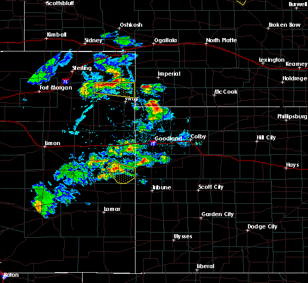 At 425 pm mdt, a severe thunderstorm was located near cheyenne wells, moving southeast at 20 mph (radar indicated). Hazards include 60 mph wind gusts and quarter size hail. Hail damage to vehicles is expected. expect wind damage to roofs, siding, and trees. locations impacted include, cheyenne wells and arapahoe. This includes highway 385 between mile markers 136 and 158. At 425 pm mdt, a severe thunderstorm was located near cheyenne wells, moving southeast at 20 mph (radar indicated). Hazards include 60 mph wind gusts and quarter size hail. Hail damage to vehicles is expected. expect wind damage to roofs, siding, and trees. locations impacted include, cheyenne wells and arapahoe. This includes highway 385 between mile markers 136 and 158.
|
| 6/3/2020 4:04 PM MDT |
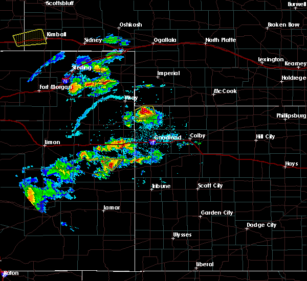 At 404 pm mdt, a severe thunderstorm was located 8 miles northwest of cheyenne wells, moving southeast at 20 mph (radar indicated). Hazards include 60 mph wind gusts and quarter size hail. Hail damage to vehicles is expected. Expect wind damage to roofs, siding, and trees. At 404 pm mdt, a severe thunderstorm was located 8 miles northwest of cheyenne wells, moving southeast at 20 mph (radar indicated). Hazards include 60 mph wind gusts and quarter size hail. Hail damage to vehicles is expected. Expect wind damage to roofs, siding, and trees.
|
| 5/24/2020 7:42 PM MDT |
 At 741 pm mdt, severe thunderstorms were located along a line extending from 16 miles south of stratton to 21 miles west of weskan to 8 miles southeast of cheyenne wells, moving east at 40 mph (radar indicated). Hazards include 60 mph wind gusts and pea size hail. expect damage to roofs, siding, and trees At 741 pm mdt, severe thunderstorms were located along a line extending from 16 miles south of stratton to 21 miles west of weskan to 8 miles southeast of cheyenne wells, moving east at 40 mph (radar indicated). Hazards include 60 mph wind gusts and pea size hail. expect damage to roofs, siding, and trees
|
| 5/24/2020 7:40 PM MDT | Mesonet station up723 3.7 e firstview (upr in cheyenne county CO, 5.8 miles E of Cheyenne Wells, CO |
| 5/24/2020 7:31 PM MDT |
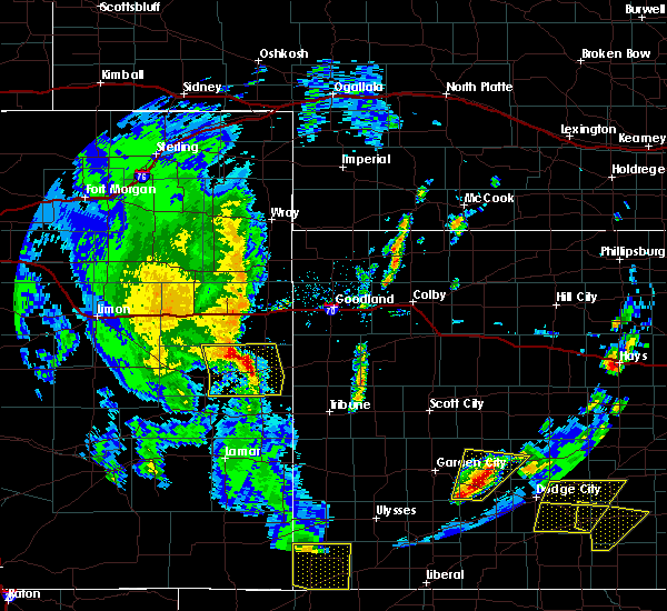 At 731 pm mdt, severe thunderstorms were located along a line extending from 18 miles south of bethune to near cheyenne wells to 9 miles north of sheridan lake, moving east at 40 mph (radar indicated). Hazards include 60 mph wind gusts and pea size hail. Expect damage to roofs, siding, and trees. locations impacted include, cheyenne wells and arapahoe. This includes highway 385 between mile markers 141 and 169. At 731 pm mdt, severe thunderstorms were located along a line extending from 18 miles south of bethune to near cheyenne wells to 9 miles north of sheridan lake, moving east at 40 mph (radar indicated). Hazards include 60 mph wind gusts and pea size hail. Expect damage to roofs, siding, and trees. locations impacted include, cheyenne wells and arapahoe. This includes highway 385 between mile markers 141 and 169.
|
| 5/24/2020 7:10 PM MDT | Storm damage reported in cheyenne county CO, 10.7 miles E of Cheyenne Wells, CO |
| 5/24/2020 7:05 PM MDT |
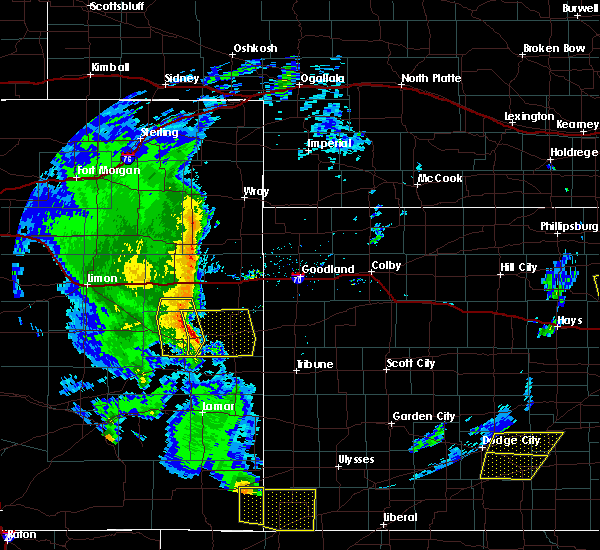 At 705 pm mdt, severe thunderstorms were located along a line extending from 18 miles south of vona to 8 miles east of kit carson to 10 miles northeast of eads, moving east at 40 mph (radar indicated). Hazards include 60 mph wind gusts and pea size hail. expect damage to roofs, siding, and trees At 705 pm mdt, severe thunderstorms were located along a line extending from 18 miles south of vona to 8 miles east of kit carson to 10 miles northeast of eads, moving east at 40 mph (radar indicated). Hazards include 60 mph wind gusts and pea size hail. expect damage to roofs, siding, and trees
|
| 8/23/2019 5:57 PM MDT |
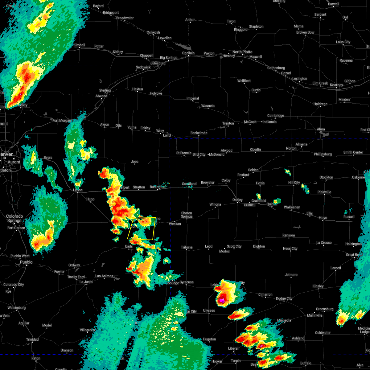 The severe thunderstorm warning for south central cheyenne county in east central colorado will expire at 600 pm mdt, the storm which prompted the warning has weakened below severe limits, and no longer poses an immediate threat to life or property. therefore, the warning will be allowed to expire. however small hail and gusty winds are still possible with this thunderstorm. a severe thunderstorm watch remains in effect until 1000 pm mdt for east central colorado. The severe thunderstorm warning for south central cheyenne county in east central colorado will expire at 600 pm mdt, the storm which prompted the warning has weakened below severe limits, and no longer poses an immediate threat to life or property. therefore, the warning will be allowed to expire. however small hail and gusty winds are still possible with this thunderstorm. a severe thunderstorm watch remains in effect until 1000 pm mdt for east central colorado.
|
| 8/23/2019 5:43 PM MDT |
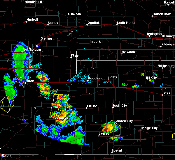 At 543 pm mdt, a severe thunderstorm was located 10 miles west of cheyenne wells, moving north at 20 mph (radar indicated). Hazards include 60 mph wind gusts and quarter size hail. Hail damage to vehicles is expected. expect wind damage to roofs, siding, and trees. locations impacted include, cheyenne wells and firstview. This includes highway 385 between mile markers 148 and 157. At 543 pm mdt, a severe thunderstorm was located 10 miles west of cheyenne wells, moving north at 20 mph (radar indicated). Hazards include 60 mph wind gusts and quarter size hail. Hail damage to vehicles is expected. expect wind damage to roofs, siding, and trees. locations impacted include, cheyenne wells and firstview. This includes highway 385 between mile markers 148 and 157.
|
| 8/23/2019 5:30 PM MDT |
 At 529 pm mdt, a severe thunderstorm was located 11 miles west of cheyenne wells, moving north at 20 mph (radar indicated). Hazards include 60 mph wind gusts and half dollar size hail. Hail damage to vehicles is expected. expect wind damage to roofs, siding, and trees. locations impacted include, cheyenne wells and firstview. This includes highway 385 between mile markers 148 and 157. At 529 pm mdt, a severe thunderstorm was located 11 miles west of cheyenne wells, moving north at 20 mph (radar indicated). Hazards include 60 mph wind gusts and half dollar size hail. Hail damage to vehicles is expected. expect wind damage to roofs, siding, and trees. locations impacted include, cheyenne wells and firstview. This includes highway 385 between mile markers 148 and 157.
|
| 8/23/2019 5:14 PM MDT |
 At 514 pm mdt, a severe thunderstorm was located 13 miles east of kit carson, or 14 miles southwest of cheyenne wells, moving north at 20 mph (radar indicated). Hazards include ping pong ball size hail and 60 mph wind gusts. People and animals outdoors will be injured. expect hail damage to roofs, siding, windows, and vehicles. expect wind damage to roofs, siding, and trees. locations impacted include, cheyenne wells, kit carson and firstview. This includes highway 385 between mile markers 148 and 157. At 514 pm mdt, a severe thunderstorm was located 13 miles east of kit carson, or 14 miles southwest of cheyenne wells, moving north at 20 mph (radar indicated). Hazards include ping pong ball size hail and 60 mph wind gusts. People and animals outdoors will be injured. expect hail damage to roofs, siding, windows, and vehicles. expect wind damage to roofs, siding, and trees. locations impacted include, cheyenne wells, kit carson and firstview. This includes highway 385 between mile markers 148 and 157.
|
| 8/23/2019 5:05 PM MDT |
 The national weather service in goodland has issued a * severe thunderstorm warning for. south central cheyenne county in east central colorado. until 600 pm mdt. At 505 pm mdt, a severe thunderstorm was located 12 miles southeast of kit carson, or 18 miles southwest of cheyenne wells, moving. The national weather service in goodland has issued a * severe thunderstorm warning for. south central cheyenne county in east central colorado. until 600 pm mdt. At 505 pm mdt, a severe thunderstorm was located 12 miles southeast of kit carson, or 18 miles southwest of cheyenne wells, moving.
|
| 8/17/2019 11:20 PM MDT |
 The severe thunderstorm warning for northeastern cheyenne county in east central colorado will expire at 1130 pm mdt, the storm which prompted the warning has weakened below severe limits, and no longer poses an immediate threat to life or property. therefore, the warning will be allowed to expire. however small hail is still possible with this thunderstorm. to report severe weather, contact your nearest law enforcement agency. they will relay your report to the national weather service goodland. The severe thunderstorm warning for northeastern cheyenne county in east central colorado will expire at 1130 pm mdt, the storm which prompted the warning has weakened below severe limits, and no longer poses an immediate threat to life or property. therefore, the warning will be allowed to expire. however small hail is still possible with this thunderstorm. to report severe weather, contact your nearest law enforcement agency. they will relay your report to the national weather service goodland.
|
| 8/17/2019 10:55 PM MDT |
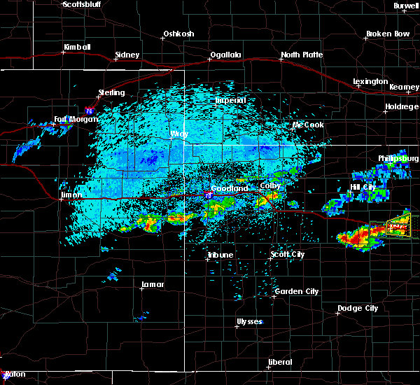 A severe thunderstorm warning remains in effect until 1130 pm mdt for northeastern cheyenne county in east central colorado. at 1054 pm mdt, a severe thunderstorm was located 10 miles northwest of cheyenne wells, moving east at 20 mph. hazard. 60 mph wind gusts and half dollar size hail. source. Radar indicated. A severe thunderstorm warning remains in effect until 1130 pm mdt for northeastern cheyenne county in east central colorado. at 1054 pm mdt, a severe thunderstorm was located 10 miles northwest of cheyenne wells, moving east at 20 mph. hazard. 60 mph wind gusts and half dollar size hail. source. Radar indicated.
|
| 8/17/2019 10:33 PM MDT |
 The national weather service in goodland has issued a * severe thunderstorm warning for. northeastern cheyenne county in east central colorado. until 1130 pm mdt. At 1033 pm mdt, a severe thunderstorm was located 12 miles northeast of kit carson, or 17 miles west of cheyenne wells, moving. The national weather service in goodland has issued a * severe thunderstorm warning for. northeastern cheyenne county in east central colorado. until 1130 pm mdt. At 1033 pm mdt, a severe thunderstorm was located 12 miles northeast of kit carson, or 17 miles west of cheyenne wells, moving.
|
| 8/14/2019 8:46 PM MDT | Quarter sized hail reported 4.2 miles ENE of Cheyenne Wells, CO |
| 8/14/2019 8:28 PM MDT | Ping Pong Ball sized hail reported 3.2 miles WSW of Cheyenne Wells, CO |
| 8/14/2019 8:26 PM MDT |
 At 825 pm mdt, a severe thunderstorm was located 4 miles southwest of cheyenne wells, moving south at 35 mph. cheyenne county sheriff reported possible funnel cloud with this storm in central cheyenne county. this is a very dangerous storm (radar indicated). Hazards include baseball size hail and 70 mph wind gusts. People and animals outdoors will be severely injured. Expect shattered windows, extensive damage to roofs, siding, and vehicles. At 825 pm mdt, a severe thunderstorm was located 4 miles southwest of cheyenne wells, moving south at 35 mph. cheyenne county sheriff reported possible funnel cloud with this storm in central cheyenne county. this is a very dangerous storm (radar indicated). Hazards include baseball size hail and 70 mph wind gusts. People and animals outdoors will be severely injured. Expect shattered windows, extensive damage to roofs, siding, and vehicles.
|
| 8/14/2019 8:21 PM MDT | Golf Ball sized hail reported 0.3 miles ENE of Cheyenne Wells, CO |
| 8/14/2019 8:15 PM MDT | Golf Ball sized hail reported 0.6 miles SSW of Cheyenne Wells, CO, golf ball size hail falling for about ten minutes and still going. |
| 8/14/2019 8:13 PM MDT |
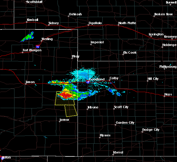 At 813 pm mdt, a severe thunderstorm was located 6 miles west of cheyenne wells, moving south at 35 mph. this storm has a history of producing hail up to 3 inches in diameter. this is a very dangerous storm (radar indicated). Hazards include baseball size hail and 70 mph wind gusts. People and animals outdoors will be severely injured. expect shattered windows, extensive damage to roofs, siding, and vehicles. locations impacted include, cheyenne wells and firstview. This includes highway 385 between mile markers 136 and 161. At 813 pm mdt, a severe thunderstorm was located 6 miles west of cheyenne wells, moving south at 35 mph. this storm has a history of producing hail up to 3 inches in diameter. this is a very dangerous storm (radar indicated). Hazards include baseball size hail and 70 mph wind gusts. People and animals outdoors will be severely injured. expect shattered windows, extensive damage to roofs, siding, and vehicles. locations impacted include, cheyenne wells and firstview. This includes highway 385 between mile markers 136 and 161.
|
| 8/14/2019 7:50 PM MDT |
 At 749 pm mdt, a severe thunderstorm was located 16 miles northwest of cheyenne wells, moving south at 35 mph. this storm has previously produced 70 mph winds and golf ball size hail (radar indicated). Hazards include two inch hail and 70 mph wind gusts. People and animals outdoors will be injured. expect hail damage to roofs, siding, windows, and vehicles. expect considerable tree damage. Wind damage is also likely to mobile homes, roofs, and outbuildings. At 749 pm mdt, a severe thunderstorm was located 16 miles northwest of cheyenne wells, moving south at 35 mph. this storm has previously produced 70 mph winds and golf ball size hail (radar indicated). Hazards include two inch hail and 70 mph wind gusts. People and animals outdoors will be injured. expect hail damage to roofs, siding, windows, and vehicles. expect considerable tree damage. Wind damage is also likely to mobile homes, roofs, and outbuildings.
|
| 8/11/2019 7:32 PM MDT |
 At 732 pm mdt/832 pm cdt/, severe thunderstorms were located along a line extending from 13 miles north of goodland to 12 miles north of towner, moving east at 70 mph. these are very dangerous storms (radar indicated). Hazards include 80 mph wind gusts and quarter size hail. Flying debris will be dangerous to those caught without shelter. mobile homes will be heavily damaged. expect considerable damage to roofs, windows, and vehicles. Extensive tree damage and power outages are likely. At 732 pm mdt/832 pm cdt/, severe thunderstorms were located along a line extending from 13 miles north of goodland to 12 miles north of towner, moving east at 70 mph. these are very dangerous storms (radar indicated). Hazards include 80 mph wind gusts and quarter size hail. Flying debris will be dangerous to those caught without shelter. mobile homes will be heavily damaged. expect considerable damage to roofs, windows, and vehicles. Extensive tree damage and power outages are likely.
|
| 8/11/2019 7:12 PM MDT | A building was blown down and power is out in arapaho in cheyenne county CO, 10.1 miles W of Cheyenne Wells, CO |
| 8/7/2019 9:13 PM MDT |
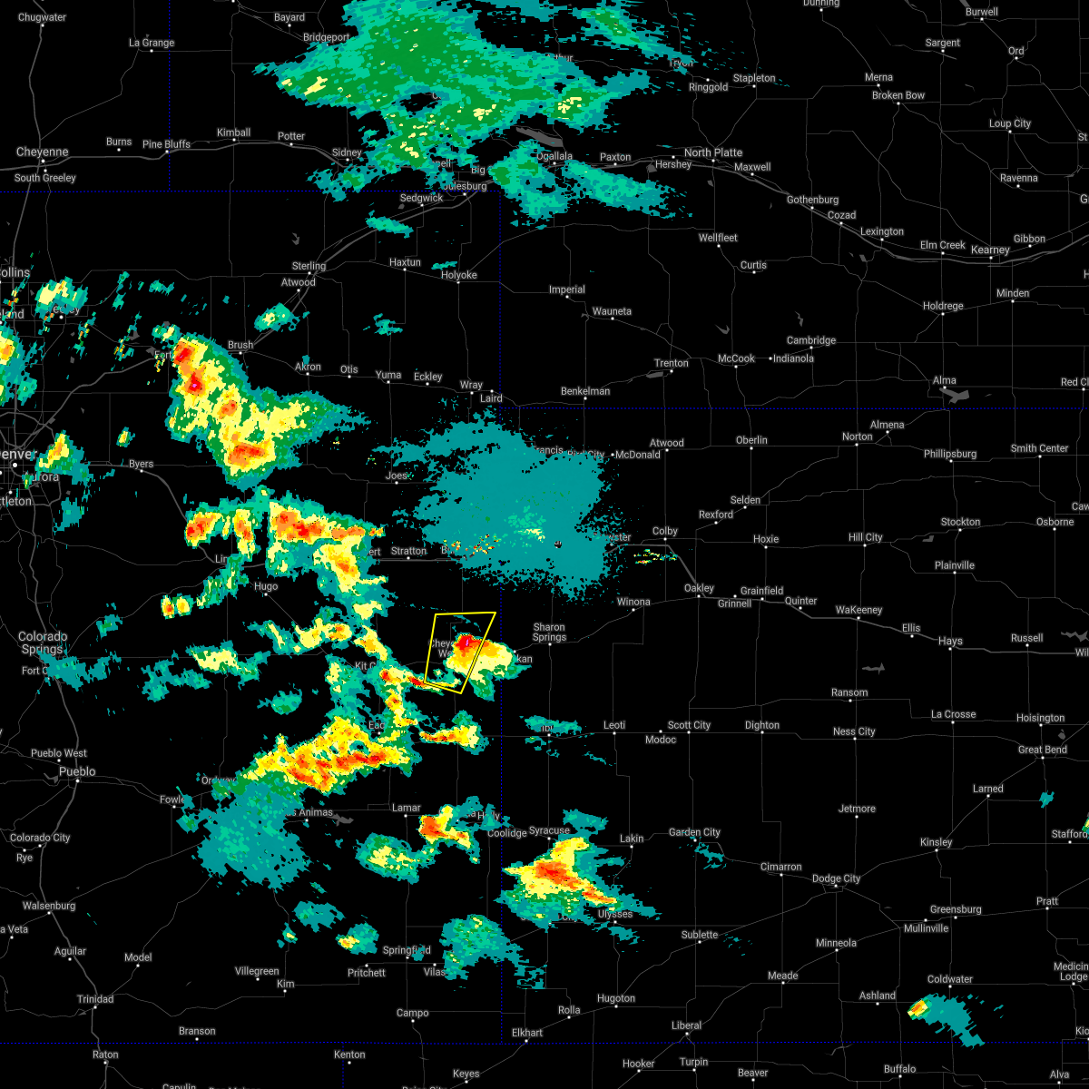 The severe thunderstorm warning for eastern cheyenne county in east central colorado will expire at 915 pm mdt, the storm which prompted the warning has weakened below severe limits, and no longer poses an immediate threat to life or property. therefore, the warning will be allowed to expire. however hail and heavy rain are still possible with this thunderstorm. The severe thunderstorm warning for eastern cheyenne county in east central colorado will expire at 915 pm mdt, the storm which prompted the warning has weakened below severe limits, and no longer poses an immediate threat to life or property. therefore, the warning will be allowed to expire. however hail and heavy rain are still possible with this thunderstorm.
|
| 8/7/2019 8:57 PM MDT |
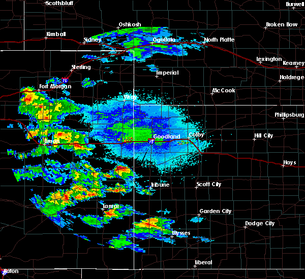 At 857 pm mdt, a severe thunderstorm was located 4 miles north of cheyenne wells, moving north at 20 mph (radar indicated). Hazards include golf ball size hail and 60 mph wind gusts. People and animals outdoors will be injured. expect hail damage to roofs, siding, windows, and vehicles. expect wind damage to roofs, siding, and trees. locations impacted include, cheyenne wells. This includes highway 385 between mile markers 140 and 169. At 857 pm mdt, a severe thunderstorm was located 4 miles north of cheyenne wells, moving north at 20 mph (radar indicated). Hazards include golf ball size hail and 60 mph wind gusts. People and animals outdoors will be injured. expect hail damage to roofs, siding, windows, and vehicles. expect wind damage to roofs, siding, and trees. locations impacted include, cheyenne wells. This includes highway 385 between mile markers 140 and 169.
|
| 8/7/2019 8:35 PM MDT |
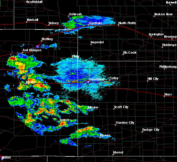 At 835 pm mdt, a severe thunderstorm was located near cheyenne wells, moving north at 20 mph (radar indicated). Hazards include golf ball size hail and 60 mph wind gusts. People and animals outdoors will be injured. expect hail damage to roofs, siding, windows, and vehicles. Expect wind damage to roofs, siding, and trees. At 835 pm mdt, a severe thunderstorm was located near cheyenne wells, moving north at 20 mph (radar indicated). Hazards include golf ball size hail and 60 mph wind gusts. People and animals outdoors will be injured. expect hail damage to roofs, siding, windows, and vehicles. Expect wind damage to roofs, siding, and trees.
|
| 7/29/2019 6:28 PM MDT |
 At 628 pm mdt, a severe thunderstorm was located 5 miles south of cheyenne wells, moving southeast at 20 mph (radar indicated). Hazards include 60 mph wind gusts and quarter size hail. Hail damage to vehicles is expected. expect wind damage to roofs, siding, and trees. locations impacted include, cheyenne wells. This includes highway 385 between mile markers 136 and 152. At 628 pm mdt, a severe thunderstorm was located 5 miles south of cheyenne wells, moving southeast at 20 mph (radar indicated). Hazards include 60 mph wind gusts and quarter size hail. Hail damage to vehicles is expected. expect wind damage to roofs, siding, and trees. locations impacted include, cheyenne wells. This includes highway 385 between mile markers 136 and 152.
|
| 7/29/2019 6:10 PM MDT |
 At 610 pm mdt, a severe thunderstorm was located over cheyenne wells, moving southeast at 20 mph (radar indicated). Hazards include golf ball size hail and 70 mph wind gusts. People and animals outdoors will be injured. expect hail damage to roofs, siding, windows, and vehicles. expect considerable tree damage. Wind damage is also likely to mobile homes, roofs, and outbuildings. At 610 pm mdt, a severe thunderstorm was located over cheyenne wells, moving southeast at 20 mph (radar indicated). Hazards include golf ball size hail and 70 mph wind gusts. People and animals outdoors will be injured. expect hail damage to roofs, siding, windows, and vehicles. expect considerable tree damage. Wind damage is also likely to mobile homes, roofs, and outbuildings.
|
| 7/29/2019 5:52 PM MDT |
 At 552 pm mdt, a severe thunderstorm was located 7 miles northwest of cheyenne wells, moving south at 20 mph (radar indicated). Hazards include 60 mph wind gusts and quarter size hail. Hail damage to vehicles is expected. expect wind damage to roofs, siding, and trees. locations impacted include, cheyenne wells and firstview. This includes highway 385 between mile markers 149 and 164. At 552 pm mdt, a severe thunderstorm was located 7 miles northwest of cheyenne wells, moving south at 20 mph (radar indicated). Hazards include 60 mph wind gusts and quarter size hail. Hail damage to vehicles is expected. expect wind damage to roofs, siding, and trees. locations impacted include, cheyenne wells and firstview. This includes highway 385 between mile markers 149 and 164.
|
| 7/29/2019 5:37 PM MDT |
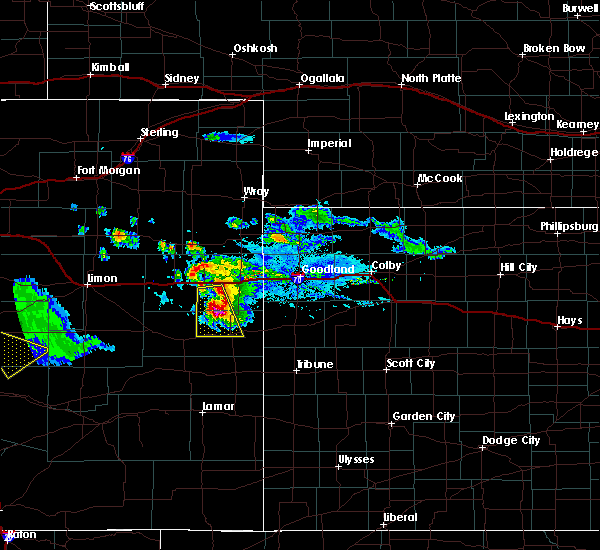 At 536 pm mdt, a severe thunderstorm was located 12 miles northwest of cheyenne wells, moving south at 20 mph (radar indicated). Hazards include ping pong ball size hail and 60 mph wind gusts. People and animals outdoors will be injured. expect hail damage to roofs, siding, windows, and vehicles. expect wind damage to roofs, siding, and trees. locations impacted include, cheyenne wells and firstview. This includes highway 385 between mile markers 149 and 165. At 536 pm mdt, a severe thunderstorm was located 12 miles northwest of cheyenne wells, moving south at 20 mph (radar indicated). Hazards include ping pong ball size hail and 60 mph wind gusts. People and animals outdoors will be injured. expect hail damage to roofs, siding, windows, and vehicles. expect wind damage to roofs, siding, and trees. locations impacted include, cheyenne wells and firstview. This includes highway 385 between mile markers 149 and 165.
|
| 7/29/2019 5:13 PM MDT |
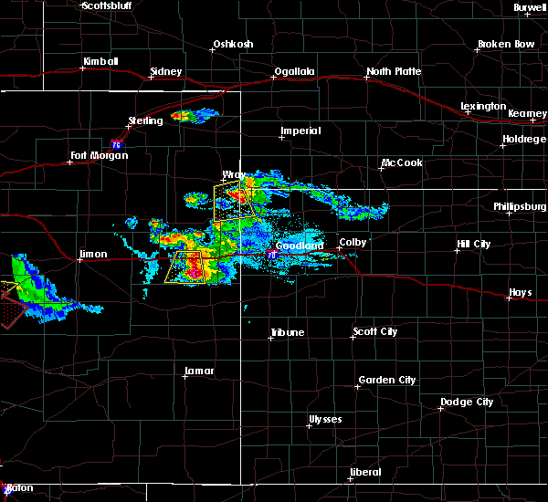 At 513 pm mdt, a severe thunderstorm was located 14 miles south of bethune, or 15 miles southeast of stratton, moving south at 20 mph (radar indicated). Hazards include ping pong ball size hail and 60 mph wind gusts. People and animals outdoors will be injured. expect hail damage to roofs, siding, windows, and vehicles. Expect wind damage to roofs, siding, and trees. At 513 pm mdt, a severe thunderstorm was located 14 miles south of bethune, or 15 miles southeast of stratton, moving south at 20 mph (radar indicated). Hazards include ping pong ball size hail and 60 mph wind gusts. People and animals outdoors will be injured. expect hail damage to roofs, siding, windows, and vehicles. Expect wind damage to roofs, siding, and trees.
|
| 6/21/2019 8:07 PM MDT |
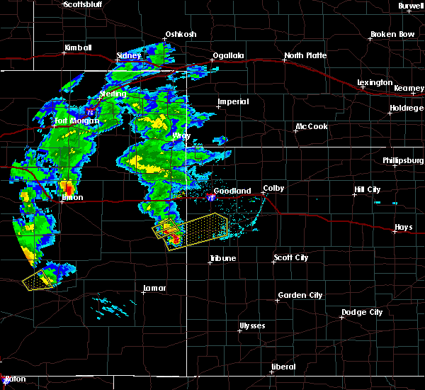 The severe thunderstorm warning for northeastern cheyenne county in east central colorado will expire at 815 pm mdt, the storms which prompted the warning have moved out of the area. therefore, the warning will be allowed to expire. a severe thunderstorm watch remains in effect until 1100 pm mdt for east central colorado. remember, a severe thunderstorm warning still remains in effect for eastern cheyenne county colorado until 845 pm mdt. The severe thunderstorm warning for northeastern cheyenne county in east central colorado will expire at 815 pm mdt, the storms which prompted the warning have moved out of the area. therefore, the warning will be allowed to expire. a severe thunderstorm watch remains in effect until 1100 pm mdt for east central colorado. remember, a severe thunderstorm warning still remains in effect for eastern cheyenne county colorado until 845 pm mdt.
|
| 6/21/2019 8:00 PM MDT | Mesonet station fw2420 arapaho in cheyenne county CO, 7.4 miles WNW of Cheyenne Wells, CO |
| 6/21/2019 8:00 PM MDT |
 At 800 pm mdt, severe thunderstorms were located along a line extending from 7 miles north of cheyenne wells to 12 miles west of weskan to 19 miles north of sheridan lake, moving northeast at 40 mph. these are very dangerous storms (radar indicated). Hazards include 80 mph wind gusts and quarter size hail. Flying debris will be dangerous to those caught without shelter. mobile homes will be heavily damaged. expect considerable damage to roofs, windows, and vehicles. Extensive tree damage and power outages are likely. At 800 pm mdt, severe thunderstorms were located along a line extending from 7 miles north of cheyenne wells to 12 miles west of weskan to 19 miles north of sheridan lake, moving northeast at 40 mph. these are very dangerous storms (radar indicated). Hazards include 80 mph wind gusts and quarter size hail. Flying debris will be dangerous to those caught without shelter. mobile homes will be heavily damaged. expect considerable damage to roofs, windows, and vehicles. Extensive tree damage and power outages are likely.
|
| 6/21/2019 7:56 PM MDT | Storm damage reported in cheyenne county CO, 0.3 miles WNW of Cheyenne Wells, CO |
| 6/21/2019 7:56 PM MDT | Quarter sized hail reported 2.2 miles N of Cheyenne Wells, CO |
| 6/21/2019 7:56 PM MDT |
 At 756 pm mdt, severe thunderstorms were located along a line extending from 3 miles southeast of bethune to 11 miles south of burlington to 12 miles northeast of cheyenne wells, moving northeast at 55 mph. these are very dangerous storms (trained weather spotters). Hazards include 80 mph wind gusts and ping pong ball size hail. Flying debris will be dangerous to those caught without shelter. mobile homes will be heavily damaged. expect considerable damage to roofs, windows, and vehicles. extensive tree damage and power outages are likely. locations impacted include, cheyenne wells. This includes highway 385 between mile markers 151 and 162, and between mile markers 164 and 168. At 756 pm mdt, severe thunderstorms were located along a line extending from 3 miles southeast of bethune to 11 miles south of burlington to 12 miles northeast of cheyenne wells, moving northeast at 55 mph. these are very dangerous storms (trained weather spotters). Hazards include 80 mph wind gusts and ping pong ball size hail. Flying debris will be dangerous to those caught without shelter. mobile homes will be heavily damaged. expect considerable damage to roofs, windows, and vehicles. extensive tree damage and power outages are likely. locations impacted include, cheyenne wells. This includes highway 385 between mile markers 151 and 162, and between mile markers 164 and 168.
|
| 6/21/2019 7:51 PM MDT |
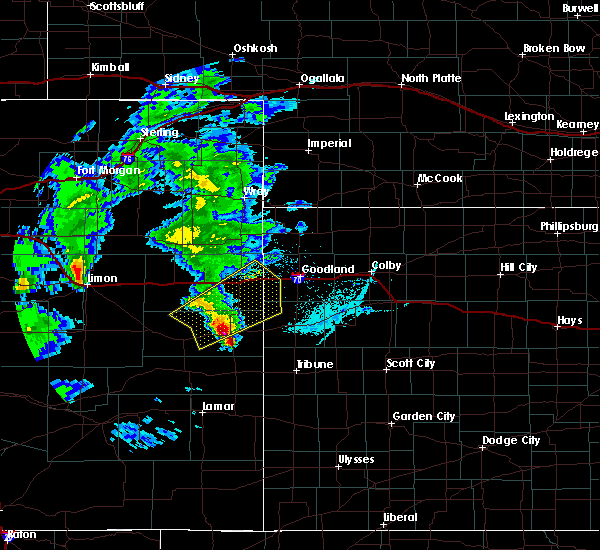 At 751 pm mdt, a severe thunderstorm was located 4 miles southeast of cheyenne wells, moving northeast at 45 mph (radar indicated). Hazards include 60 mph wind gusts and quarter size hail. Hail damage to vehicles is expected. Expect wind damage to roofs, siding, and trees. At 751 pm mdt, a severe thunderstorm was located 4 miles southeast of cheyenne wells, moving northeast at 45 mph (radar indicated). Hazards include 60 mph wind gusts and quarter size hail. Hail damage to vehicles is expected. Expect wind damage to roofs, siding, and trees.
|
| 6/21/2019 7:50 PM MDT | Storm damage reported in cheyenne county CO, 8.4 miles N of Cheyenne Wells, CO |
| 6/21/2019 7:50 PM MDT | Quarter sized hail reported 6.3 miles WNW of Cheyenne Wells, CO |
| 6/21/2019 7:48 PM MDT | Measured with a davis vantage vue while stationar in cheyenne county CO, 9.1 miles N of Cheyenne Wells, CO |
| 6/21/2019 7:46 PM MDT | Quarter sized hail reported 0.3 miles WNW of Cheyenne Wells, CO, est 60 plus mph winds. public sent picture of damage to house. |
| 6/21/2019 7:45 PM MDT | Parts of a house was stripped to the concret in cheyenne county CO, 10.1 miles W of Cheyenne Wells, CO |
| 6/21/2019 7:37 PM MDT |
 At 736 pm mdt, severe thunderstorms were located along a line extending from 12 miles south of stratton to 21 miles south of bethune to 8 miles west of cheyenne wells, moving northeast at 55 mph. at 7:30 pm mdt, a trained weather spotter reported half dollar size hail 1 mile north of kit carson (trained weather spotters reported half dollar size hail and 60 mph winds). Hazards include ping pong ball size hail and 60 mph wind gusts. People and animals outdoors will be injured. expect hail damage to roofs, siding, windows, and vehicles. expect wind damage to roofs, siding, and trees. locations impacted include, burlington, cheyenne wells, kanorado, bethune and firstview. this includes the following highways, interstate 70 in kansas between mile markers 0 and 8. interstate 70 in colorado between mile markers 427 and 450. Highway 385 between mile markers 150 and 196. At 736 pm mdt, severe thunderstorms were located along a line extending from 12 miles south of stratton to 21 miles south of bethune to 8 miles west of cheyenne wells, moving northeast at 55 mph. at 7:30 pm mdt, a trained weather spotter reported half dollar size hail 1 mile north of kit carson (trained weather spotters reported half dollar size hail and 60 mph winds). Hazards include ping pong ball size hail and 60 mph wind gusts. People and animals outdoors will be injured. expect hail damage to roofs, siding, windows, and vehicles. expect wind damage to roofs, siding, and trees. locations impacted include, burlington, cheyenne wells, kanorado, bethune and firstview. this includes the following highways, interstate 70 in kansas between mile markers 0 and 8. interstate 70 in colorado between mile markers 427 and 450. Highway 385 between mile markers 150 and 196.
|
| 6/21/2019 7:34 PM MDT | Storm damage reported in cheyenne county CO, 10.6 miles E of Cheyenne Wells, CO |
| 6/21/2019 7:24 PM MDT |
 At 723 pm mdt, severe thunderstorms were located along a line extending from 17 miles south of vona to 17 miles northwest of cheyenne wells to 8 miles east of kit carson, moving northeast at 55 mph (radar indicated). Hazards include ping pong ball size hail and 60 mph wind gusts. People and animals outdoors will be injured. expect hail damage to roofs, siding, windows, and vehicles. Expect wind damage to roofs, siding, and trees. At 723 pm mdt, severe thunderstorms were located along a line extending from 17 miles south of vona to 17 miles northwest of cheyenne wells to 8 miles east of kit carson, moving northeast at 55 mph (radar indicated). Hazards include ping pong ball size hail and 60 mph wind gusts. People and animals outdoors will be injured. expect hail damage to roofs, siding, windows, and vehicles. Expect wind damage to roofs, siding, and trees.
|
| 6/17/2019 1:52 PM MDT |
 The severe thunderstorm warning for eastern cheyenne county in east central colorado will expire at 200 pm mdt, the storm which prompted the warning has weakened below severe limits, and no longer poses an immediate threat to life or property. therefore, the warning will be allowed to expire. however small hail is still possible with this thunderstorm. The severe thunderstorm warning for eastern cheyenne county in east central colorado will expire at 200 pm mdt, the storm which prompted the warning has weakened below severe limits, and no longer poses an immediate threat to life or property. therefore, the warning will be allowed to expire. however small hail is still possible with this thunderstorm.
|
| 6/17/2019 1:30 PM MDT |
 At 129 pm mdt, a severe thunderstorm was located 12 miles southeast of kit carson, or 20 miles southwest of cheyenne wells, moving northeast at 10 mph (radar indicated). Hazards include half dollar size hail. Damage to vehicles is expected. locations impacted include, cheyenne wells, kit carson, firstview and arapahoe. This includes highway 385 between mile markers 136 and 160. At 129 pm mdt, a severe thunderstorm was located 12 miles southeast of kit carson, or 20 miles southwest of cheyenne wells, moving northeast at 10 mph (radar indicated). Hazards include half dollar size hail. Damage to vehicles is expected. locations impacted include, cheyenne wells, kit carson, firstview and arapahoe. This includes highway 385 between mile markers 136 and 160.
|
| 6/17/2019 1:14 PM MDT |
 At 114 pm mdt, a severe thunderstorm was located 10 miles northeast of eads, or 22 miles southwest of cheyenne wells, and is nearly stationary (radar indicated). Hazards include half dollar size hail. damage to vehicles is expected At 114 pm mdt, a severe thunderstorm was located 10 miles northeast of eads, or 22 miles southwest of cheyenne wells, and is nearly stationary (radar indicated). Hazards include half dollar size hail. damage to vehicles is expected
|
| 6/14/2019 4:30 PM MDT | Winds were atleast 50 mph... maybe 60 mp in cheyenne county CO, 0.3 miles WNW of Cheyenne Wells, CO |
| 6/8/2019 9:03 PM MDT |
 At 903 pm mdt, a severe thunderstorm was located 9 miles south of cheyenne wells, moving southeast at 50 mph (radar indicated). Hazards include golf ball size hail and 70 mph wind gusts. People and animals outdoors will be injured. expect hail damage to roofs, siding, windows, and vehicles. expect considerable tree damage. wind damage is also likely to mobile homes, roofs, and outbuildings. locations impacted include, cheyenne wells and firstview. This includes highway 385 between mile markers 136 and 152. At 903 pm mdt, a severe thunderstorm was located 9 miles south of cheyenne wells, moving southeast at 50 mph (radar indicated). Hazards include golf ball size hail and 70 mph wind gusts. People and animals outdoors will be injured. expect hail damage to roofs, siding, windows, and vehicles. expect considerable tree damage. wind damage is also likely to mobile homes, roofs, and outbuildings. locations impacted include, cheyenne wells and firstview. This includes highway 385 between mile markers 136 and 152.
|
| 6/8/2019 8:52 PM MDT | Storm damage reported in cheyenne county CO, 10.1 miles E of Cheyenne Wells, CO |
| 6/8/2019 8:45 PM MDT |
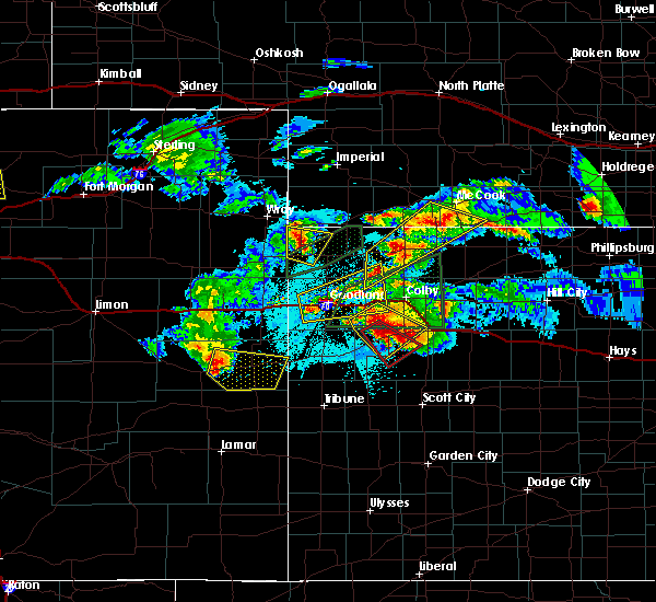 At 845 pm mdt, a severe thunderstorm was located 11 miles east of kit carson, or 12 miles west of cheyenne wells, moving southeast at 55 mph (radar indicated). Hazards include 60 mph wind gusts and quarter size hail. Hail damage to vehicles is expected. Expect wind damage to roofs, siding, and trees. At 845 pm mdt, a severe thunderstorm was located 11 miles east of kit carson, or 12 miles west of cheyenne wells, moving southeast at 55 mph (radar indicated). Hazards include 60 mph wind gusts and quarter size hail. Hail damage to vehicles is expected. Expect wind damage to roofs, siding, and trees.
|
| 6/3/2019 7:02 PM MDT | Storm damage reported in cheyenne county CO, 9.5 miles E of Cheyenne Wells, CO |
| 6/2/2019 6:28 PM MDT |
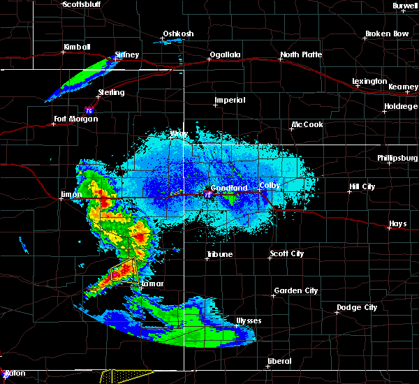 At 628 pm mdt, a severe thunderstorm was located 9 miles west of cheyenne wells, moving northeast at 40 mph (radar indicated). Hazards include 70 mph wind gusts and quarter size hail. Hail damage to vehicles is expected. expect considerable tree damage. Wind damage is also likely to mobile homes, roofs, and outbuildings. At 628 pm mdt, a severe thunderstorm was located 9 miles west of cheyenne wells, moving northeast at 40 mph (radar indicated). Hazards include 70 mph wind gusts and quarter size hail. Hail damage to vehicles is expected. expect considerable tree damage. Wind damage is also likely to mobile homes, roofs, and outbuildings.
|
| 6/2/2019 6:22 PM MDT | Storm damage reported in cheyenne county CO, 10 miles E of Cheyenne Wells, CO |
| 5/28/2019 3:23 PM MDT | Half Dollar sized hail reported 5.2 miles E of Cheyenne Wells, CO |
| 5/28/2019 3:15 PM MDT |
 At 315 pm mdt, a severe thunderstorm was located 10 miles south of cheyenne wells, moving east at 25 mph (radar indicated). Hazards include 60 mph wind gusts and quarter size hail. Hail damage to vehicles is expected. expect wind damage to roofs, siding, and trees. locations impacted include, cheyenne wells. This includes highway 385 between mile markers 136 and 153. At 315 pm mdt, a severe thunderstorm was located 10 miles south of cheyenne wells, moving east at 25 mph (radar indicated). Hazards include 60 mph wind gusts and quarter size hail. Hail damage to vehicles is expected. expect wind damage to roofs, siding, and trees. locations impacted include, cheyenne wells. This includes highway 385 between mile markers 136 and 153.
|
| 5/28/2019 3:09 PM MDT |
 At 308 pm mdt, a severe thunderstorm was located 12 miles southwest of cheyenne wells, moving east at 25 mph (radar indicated). Hazards include 60 mph wind gusts and quarter size hail. Hail damage to vehicles is expected. expect wind damage to roofs, siding, and trees. locations impacted include, cheyenne wells. This includes highway 385 between mile markers 136 and 153. At 308 pm mdt, a severe thunderstorm was located 12 miles southwest of cheyenne wells, moving east at 25 mph (radar indicated). Hazards include 60 mph wind gusts and quarter size hail. Hail damage to vehicles is expected. expect wind damage to roofs, siding, and trees. locations impacted include, cheyenne wells. This includes highway 385 between mile markers 136 and 153.
|
| 5/28/2019 3:02 PM MDT |
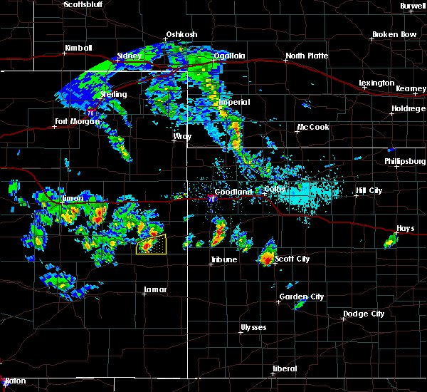 At 301 pm mdt, a severe thunderstorm was located 14 miles southwest of cheyenne wells, moving east at 15 mph (radar indicated). Hazards include 60 mph wind gusts and quarter size hail. Hail damage to vehicles is expected. expect wind damage to roofs, siding, and trees. locations impacted include, cheyenne wells and firstview. This includes highway 385 between mile markers 136 and 153. At 301 pm mdt, a severe thunderstorm was located 14 miles southwest of cheyenne wells, moving east at 15 mph (radar indicated). Hazards include 60 mph wind gusts and quarter size hail. Hail damage to vehicles is expected. expect wind damage to roofs, siding, and trees. locations impacted include, cheyenne wells and firstview. This includes highway 385 between mile markers 136 and 153.
|
| 5/28/2019 2:59 PM MDT |
 At 259 pm mdt, a severe thunderstorm was located 14 miles southeast of kit carson, or 14 miles southwest of cheyenne wells, moving east at 20 mph (radar indicated). Hazards include 60 mph wind gusts and quarter size hail. Hail damage to vehicles is expected. expect wind damage to roofs, siding, and trees. locations impacted include, cheyenne wells and firstview. This includes highway 385 between mile markers 136 and 153. At 259 pm mdt, a severe thunderstorm was located 14 miles southeast of kit carson, or 14 miles southwest of cheyenne wells, moving east at 20 mph (radar indicated). Hazards include 60 mph wind gusts and quarter size hail. Hail damage to vehicles is expected. expect wind damage to roofs, siding, and trees. locations impacted include, cheyenne wells and firstview. This includes highway 385 between mile markers 136 and 153.
|
| 5/28/2019 2:53 PM MDT |
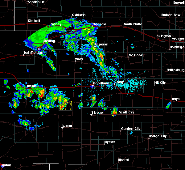 At 252 pm mdt, a severe thunderstorm was located 12 miles southeast of kit carson, or 17 miles southwest of cheyenne wells, moving east at 10 mph (radar indicated). Hazards include 60 mph wind gusts and quarter size hail. Hail damage to vehicles is expected. expect wind damage to roofs, siding, and trees. locations impacted include, cheyenne wells and firstview. This includes highway 385 between mile markers 136 and 153. At 252 pm mdt, a severe thunderstorm was located 12 miles southeast of kit carson, or 17 miles southwest of cheyenne wells, moving east at 10 mph (radar indicated). Hazards include 60 mph wind gusts and quarter size hail. Hail damage to vehicles is expected. expect wind damage to roofs, siding, and trees. locations impacted include, cheyenne wells and firstview. This includes highway 385 between mile markers 136 and 153.
|
| 5/28/2019 2:46 PM MDT |
 At 246 pm mdt, a severe thunderstorm was located 10 miles southeast of kit carson, or 18 miles southwest of cheyenne wells, moving east at 10 mph (radar indicated). Hazards include 60 mph wind gusts and quarter size hail. Hail damage to vehicles is expected. Expect wind damage to roofs, siding, and trees. At 246 pm mdt, a severe thunderstorm was located 10 miles southeast of kit carson, or 18 miles southwest of cheyenne wells, moving east at 10 mph (radar indicated). Hazards include 60 mph wind gusts and quarter size hail. Hail damage to vehicles is expected. Expect wind damage to roofs, siding, and trees.
|
| 5/26/2019 6:31 PM MDT |
 At 631 pm mdt, a severe thunderstorm capable of producing a tornado was located 9 miles southeast of cheyenne wells, moving northeast at 50 mph (radar indicated rotation). Hazards include tornado. Flying debris will be dangerous to those caught without shelter. mobile homes will be damaged or destroyed. damage to roofs, windows, and vehicles will occur. tree damage is likely. locations impacted include, cheyenne wells. This includes highway 385 between mile markers 136 and 153. At 631 pm mdt, a severe thunderstorm capable of producing a tornado was located 9 miles southeast of cheyenne wells, moving northeast at 50 mph (radar indicated rotation). Hazards include tornado. Flying debris will be dangerous to those caught without shelter. mobile homes will be damaged or destroyed. damage to roofs, windows, and vehicles will occur. tree damage is likely. locations impacted include, cheyenne wells. This includes highway 385 between mile markers 136 and 153.
|
| 5/26/2019 6:24 PM MDT |
 At 624 pm mdt, a confirmed tornado was located 12 miles north of sheridan lake, or 12 miles south of cheyenne wells, moving northeast at 50 mph (weather spotters confirmed tornado). Hazards include damaging tornado. Flying debris will be dangerous to those caught without shelter. mobile homes will be damaged or destroyed. damage to roofs, windows, and vehicles will occur. Tree damage is likely. At 624 pm mdt, a confirmed tornado was located 12 miles north of sheridan lake, or 12 miles south of cheyenne wells, moving northeast at 50 mph (weather spotters confirmed tornado). Hazards include damaging tornado. Flying debris will be dangerous to those caught without shelter. mobile homes will be damaged or destroyed. damage to roofs, windows, and vehicles will occur. Tree damage is likely.
|
| 5/26/2019 6:12 PM MDT |
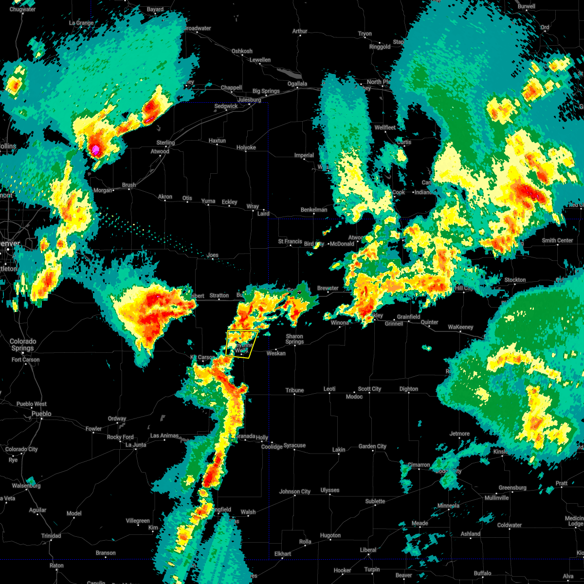 The severe thunderstorm warning for northeastern cheyenne county in east central colorado will expire at 615 pm mdt, the storm which prompted the warning has weakened below severe limits, and no longer poses an immediate threat to life or property. therefore, the warning will be allowed to expire. however gusty winds and heavy rain are still possible with this thunderstorm. a tornado watch remains in effect until 900 pm mdt for east central colorado. The severe thunderstorm warning for northeastern cheyenne county in east central colorado will expire at 615 pm mdt, the storm which prompted the warning has weakened below severe limits, and no longer poses an immediate threat to life or property. therefore, the warning will be allowed to expire. however gusty winds and heavy rain are still possible with this thunderstorm. a tornado watch remains in effect until 900 pm mdt for east central colorado.
|
| 5/26/2019 5:46 PM MDT |
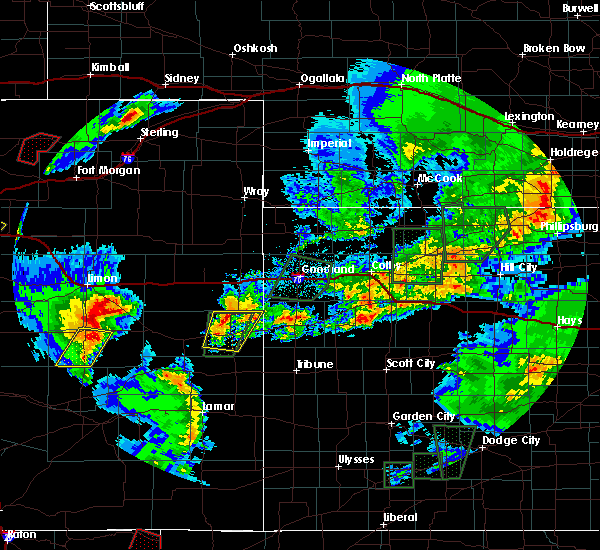 At 546 pm mdt, a severe thunderstorm was located 6 miles north of cheyenne wells, moving northeast at 25 mph (radar indicated). Hazards include 60 mph wind gusts and quarter size hail. Hail damage to vehicles is expected. expect wind damage to roofs, siding, and trees. locations impacted include, cheyenne wells and firstview. this includes highway 385 between mile markers 148 and 168. A tornado watch remains in effect until 900 pm mdt for east central colorado. At 546 pm mdt, a severe thunderstorm was located 6 miles north of cheyenne wells, moving northeast at 25 mph (radar indicated). Hazards include 60 mph wind gusts and quarter size hail. Hail damage to vehicles is expected. expect wind damage to roofs, siding, and trees. locations impacted include, cheyenne wells and firstview. this includes highway 385 between mile markers 148 and 168. A tornado watch remains in effect until 900 pm mdt for east central colorado.
|
| 5/26/2019 5:25 PM MDT |
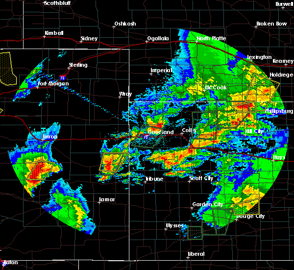 At 525 pm mdt, a severe thunderstorm was located 4 miles southwest of cheyenne wells, moving northeast at 30 mph (radar indicated). Hazards include 60 mph wind gusts and quarter size hail. Hail damage to vehicles is expected. Expect wind damage to roofs, siding, and trees. At 525 pm mdt, a severe thunderstorm was located 4 miles southwest of cheyenne wells, moving northeast at 30 mph (radar indicated). Hazards include 60 mph wind gusts and quarter size hail. Hail damage to vehicles is expected. Expect wind damage to roofs, siding, and trees.
|
| 5/26/2019 4:57 PM MDT |
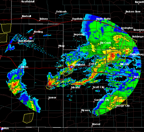 At 456 pm mdt, a severe thunderstorm capable of producing a tornado was located 13 miles north of brandon, or 14 miles southwest of cheyenne wells, moving northeast at 30 mph (radar indicated rotation). Hazards include tornado and golf ball size hail. Flying debris will be dangerous to those caught without shelter. mobile homes will be damaged or destroyed. damage to roofs, windows, and vehicles will occur. tree damage is likely. locations impacted include, cheyenne wells, arapahoe and firstview. This includes highway 385 between mile markers 136 and 153. At 456 pm mdt, a severe thunderstorm capable of producing a tornado was located 13 miles north of brandon, or 14 miles southwest of cheyenne wells, moving northeast at 30 mph (radar indicated rotation). Hazards include tornado and golf ball size hail. Flying debris will be dangerous to those caught without shelter. mobile homes will be damaged or destroyed. damage to roofs, windows, and vehicles will occur. tree damage is likely. locations impacted include, cheyenne wells, arapahoe and firstview. This includes highway 385 between mile markers 136 and 153.
|
| 5/26/2019 4:44 PM MDT |
 At 444 pm mdt, a severe thunderstorm capable of producing a tornado was located 8 miles north of chivington, or 22 miles southwest of cheyenne wells, moving northeast at 25 mph (radar indicated rotation). Hazards include tornado and golf ball size hail. Flying debris will be dangerous to those caught without shelter. mobile homes will be damaged or destroyed. damage to roofs, windows, and vehicles will occur. Tree damage is likely. At 444 pm mdt, a severe thunderstorm capable of producing a tornado was located 8 miles north of chivington, or 22 miles southwest of cheyenne wells, moving northeast at 25 mph (radar indicated rotation). Hazards include tornado and golf ball size hail. Flying debris will be dangerous to those caught without shelter. mobile homes will be damaged or destroyed. damage to roofs, windows, and vehicles will occur. Tree damage is likely.
|
| 5/6/2019 9:13 PM MDT |
 At 912 pm mdt, severe thunderstorms were located along a line extending from 17 miles south of stratton to 19 miles northwest of cheyenne wells to 10 miles northeast of kit carson, moving east at 25 mph (radar indicated). Hazards include 60 mph wind gusts and quarter size hail. Hail damage to vehicles is expected. expect wind damage to roofs, siding, and trees. locations impacted include, cheyenne wells and firstview. This includes highway 385 between mile markers 138 and 166. At 912 pm mdt, severe thunderstorms were located along a line extending from 17 miles south of stratton to 19 miles northwest of cheyenne wells to 10 miles northeast of kit carson, moving east at 25 mph (radar indicated). Hazards include 60 mph wind gusts and quarter size hail. Hail damage to vehicles is expected. expect wind damage to roofs, siding, and trees. locations impacted include, cheyenne wells and firstview. This includes highway 385 between mile markers 138 and 166.
|
| 5/6/2019 8:52 PM MDT |
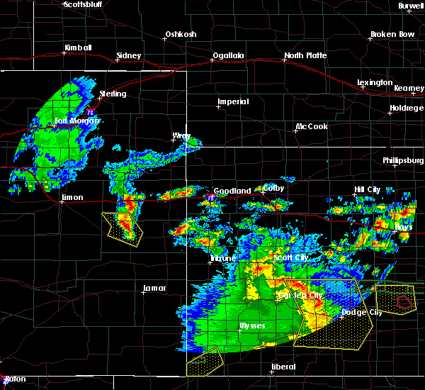 At 852 pm mdt, severe thunderstorms were located along a line extending from 16 miles south of vona to 22 miles west of cheyenne wells to 7 miles north of kit carson, moving east at 25 mph (radar indicated). Hazards include 60 mph wind gusts and quarter size hail. Hail damage to vehicles is expected. Expect wind damage to roofs, siding, and trees. At 852 pm mdt, severe thunderstorms were located along a line extending from 16 miles south of vona to 22 miles west of cheyenne wells to 7 miles north of kit carson, moving east at 25 mph (radar indicated). Hazards include 60 mph wind gusts and quarter size hail. Hail damage to vehicles is expected. Expect wind damage to roofs, siding, and trees.
|
| 1/1/0001 12:00 AM | Report of winds up to 60 mph via a trained spotte in cheyenne county CO, 10.3 miles WSW of Cheyenne Wells, CO |
| 7/21/2018 9:52 PM MDT | Corrects previous non-tstm wnd gst report from firstview. mesonet station co068... firstvie in cheyenne county CO, 10 miles E of Cheyenne Wells, CO |
| 7/21/2018 9:49 PM MDT |
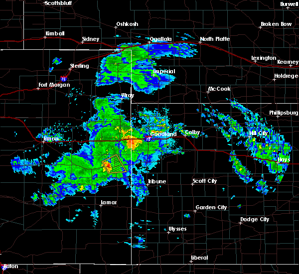 At 949 pm mdt, a severe thunderstorm was located near cheyenne wells, moving northeast at 35 mph (radar indicated). Hazards include 60 mph wind gusts. Expect damage to roofs, siding, and trees. locations impacted include, cheyenne wells and firstview. This includes highway 385 between mile markers 142 and 165. At 949 pm mdt, a severe thunderstorm was located near cheyenne wells, moving northeast at 35 mph (radar indicated). Hazards include 60 mph wind gusts. Expect damage to roofs, siding, and trees. locations impacted include, cheyenne wells and firstview. This includes highway 385 between mile markers 142 and 165.
|
| 7/21/2018 9:31 PM MDT |
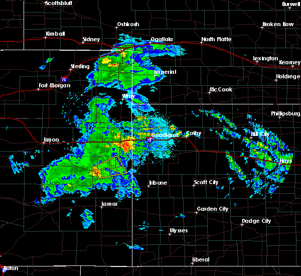 At 931 pm mdt, a severe thunderstorm was located 9 miles east of kit carson, or 14 miles west of cheyenne wells, moving northeast at 30 mph (radar indicated). Hazards include 60 mph wind gusts. expect damage to roofs, siding, and trees At 931 pm mdt, a severe thunderstorm was located 9 miles east of kit carson, or 14 miles west of cheyenne wells, moving northeast at 30 mph (radar indicated). Hazards include 60 mph wind gusts. expect damage to roofs, siding, and trees
|
| 7/4/2018 6:18 PM MDT |
 At 618 pm mdt, severe thunderstorms were located along a line extending from 6 miles northeast of cheyenne wells to 12 miles east of kit carson, moving north at 10 mph (radar indicated). Hazards include 70 mph wind gusts and half dollar size hail. Hail damage to vehicles is expected. expect considerable tree damage. wind damage is also likely to mobile homes, roofs, and outbuildings. locations impacted include, cheyenne wells and firstview. This includes highway 385 between mile markers 151 and 176. At 618 pm mdt, severe thunderstorms were located along a line extending from 6 miles northeast of cheyenne wells to 12 miles east of kit carson, moving north at 10 mph (radar indicated). Hazards include 70 mph wind gusts and half dollar size hail. Hail damage to vehicles is expected. expect considerable tree damage. wind damage is also likely to mobile homes, roofs, and outbuildings. locations impacted include, cheyenne wells and firstview. This includes highway 385 between mile markers 151 and 176.
|
| 7/4/2018 6:02 PM MDT |
 At 602 pm mdt, severe thunderstorms were located along a line extending from 5 miles northeast of cheyenne wells to 12 miles east of kit carson, moving north at 10 mph (radar indicated). Hazards include 70 mph wind gusts and half dollar size hail. Hail damage to vehicles is expected. expect considerable tree damage. Wind damage is also likely to mobile homes, roofs, and outbuildings. At 602 pm mdt, severe thunderstorms were located along a line extending from 5 miles northeast of cheyenne wells to 12 miles east of kit carson, moving north at 10 mph (radar indicated). Hazards include 70 mph wind gusts and half dollar size hail. Hail damage to vehicles is expected. expect considerable tree damage. Wind damage is also likely to mobile homes, roofs, and outbuildings.
|
| 6/23/2018 5:28 PM MDT |
 At 528 pm mdt, a severe thunderstorm was located 7 miles northeast of cheyenne wells, moving east at 40 mph (radar indicated). Hazards include ping pong ball size hail and 60 mph wind gusts. People and animals outdoors will be injured. expect hail damage to roofs, siding, windows, and vehicles. expect wind damage to roofs, siding, and trees. locations impacted include, cheyenne wells, sharon springs, weskan and arapahoe. This includes highway 385 between mile markers 149 and 175. At 528 pm mdt, a severe thunderstorm was located 7 miles northeast of cheyenne wells, moving east at 40 mph (radar indicated). Hazards include ping pong ball size hail and 60 mph wind gusts. People and animals outdoors will be injured. expect hail damage to roofs, siding, windows, and vehicles. expect wind damage to roofs, siding, and trees. locations impacted include, cheyenne wells, sharon springs, weskan and arapahoe. This includes highway 385 between mile markers 149 and 175.
|
| 6/23/2018 5:20 PM MDT |
 At 520 pm mdt, a severe thunderstorm was located 10 miles northwest of weskan, or 17 miles west of sharon springs, moving east at 35 mph (radar indicated). Hazards include 60 mph wind gusts and quarter size hail. Hail damage to vehicles is expected. expect wind damage to roofs, siding, and trees. locations impacted include, cheyenne wells, sharon springs, weskan and arapahoe. This includes highway 385 between mile markers 149 and 175. At 520 pm mdt, a severe thunderstorm was located 10 miles northwest of weskan, or 17 miles west of sharon springs, moving east at 35 mph (radar indicated). Hazards include 60 mph wind gusts and quarter size hail. Hail damage to vehicles is expected. expect wind damage to roofs, siding, and trees. locations impacted include, cheyenne wells, sharon springs, weskan and arapahoe. This includes highway 385 between mile markers 149 and 175.
|
| 6/23/2018 5:08 PM MDT |
 At 508 pm mdt, a severe thunderstorm was located 16 miles northeast of cheyenne wells, moving east at 35 mph (radar indicated). Hazards include 60 mph wind gusts and half dollar size hail. Hail damage to vehicles is expected. Expect wind damage to roofs, siding, and trees. At 508 pm mdt, a severe thunderstorm was located 16 miles northeast of cheyenne wells, moving east at 35 mph (radar indicated). Hazards include 60 mph wind gusts and half dollar size hail. Hail damage to vehicles is expected. Expect wind damage to roofs, siding, and trees.
|
| 6/22/2018 3:25 PM MDT | Estimated 60-70 mph wind gusts accompanied with pea to nickel size hail and torrential rainfal in cheyenne county CO, 10.1 miles W of Cheyenne Wells, CO |
| 6/22/2018 3:23 PM MDT |
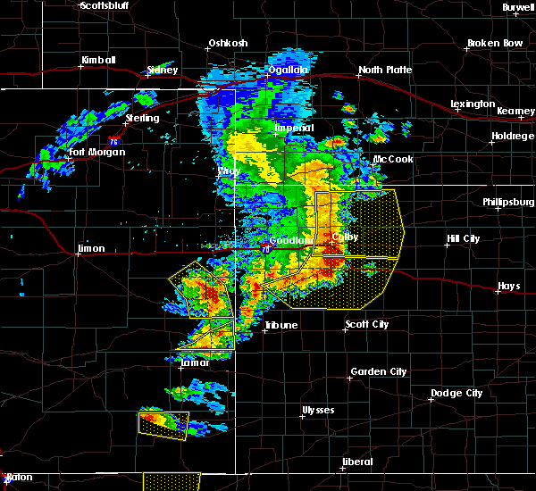 At 312 pm mdt, severe thunderstorms were located along a line extending from 19 miles northeast of kit carson to 7 miles south of cheyenne wells, moving east at 55 mph (radar indicated). Hazards include 60 mph wind gusts and half dollar size hail. Hail damage to vehicles is expected. expect wind damage to roofs, siding, and trees. locations impacted include, cheyenne wells, arapahoe and firstview. This includes highway 385 between mile markers 136 and 170. At 312 pm mdt, severe thunderstorms were located along a line extending from 19 miles northeast of kit carson to 7 miles south of cheyenne wells, moving east at 55 mph (radar indicated). Hazards include 60 mph wind gusts and half dollar size hail. Hail damage to vehicles is expected. expect wind damage to roofs, siding, and trees. locations impacted include, cheyenne wells, arapahoe and firstview. This includes highway 385 between mile markers 136 and 170.
|
| 6/22/2018 3:12 PM MDT | Mesonet station co068... firstvie in cheyenne county CO, 10 miles E of Cheyenne Wells, CO |
| 6/22/2018 3:12 PM MDT |
 At 312 pm mdt, severe thunderstorms were located along a line extending from 19 miles northeast of kit carson to 7 miles south of cheyenne wells, moving east at 55 mph (radar indicated). Hazards include 60 mph wind gusts and half dollar size hail. Hail damage to vehicles is expected. expect wind damage to roofs, siding, and trees. locations impacted include, cheyenne wells, arapahoe and firstview. This includes highway 385 between mile markers 136 and 170. At 312 pm mdt, severe thunderstorms were located along a line extending from 19 miles northeast of kit carson to 7 miles south of cheyenne wells, moving east at 55 mph (radar indicated). Hazards include 60 mph wind gusts and half dollar size hail. Hail damage to vehicles is expected. expect wind damage to roofs, siding, and trees. locations impacted include, cheyenne wells, arapahoe and firstview. This includes highway 385 between mile markers 136 and 170.
|
| 6/22/2018 3:10 PM MDT | Winds gusting to atleast 60 mph. also had pea size hai in cheyenne county CO, 3.8 miles NE of Cheyenne Wells, CO |
| 6/22/2018 2:54 PM MDT |
 At 254 pm mdt, severe thunderstorms were located along a line extending from 10 miles northwest of kit carson to 13 miles northeast of eads, moving northeast at 35 mph (radar indicated). Hazards include 60 mph wind gusts and quarter size hail. Hail damage to vehicles is expected. Expect wind damage to roofs, siding, and trees. At 254 pm mdt, severe thunderstorms were located along a line extending from 10 miles northwest of kit carson to 13 miles northeast of eads, moving northeast at 35 mph (radar indicated). Hazards include 60 mph wind gusts and quarter size hail. Hail damage to vehicles is expected. Expect wind damage to roofs, siding, and trees.
|
| 6/19/2018 7:12 PM MDT |
 At 711 pm mdt/811 pm cdt/, severe thunderstorms were located along a line extending from 9 miles southwest of winona to 14 miles north of horace to 5 miles northeast of sheridan lake, moving southeast at 30 mph. this line of storms has produced numerous measured wind gusts between 60 and 65 mph (radar indicated). Hazards include 60 mph wind gusts and nickel size hail. Expect damage to roofs, siding, and trees. locations impacted include, leoti, cheyenne wells, sharon springs, tribune, weskan, horace and wallace. This includes highway 385 between mile markers 136 and 157. At 711 pm mdt/811 pm cdt/, severe thunderstorms were located along a line extending from 9 miles southwest of winona to 14 miles north of horace to 5 miles northeast of sheridan lake, moving southeast at 30 mph. this line of storms has produced numerous measured wind gusts between 60 and 65 mph (radar indicated). Hazards include 60 mph wind gusts and nickel size hail. Expect damage to roofs, siding, and trees. locations impacted include, leoti, cheyenne wells, sharon springs, tribune, weskan, horace and wallace. This includes highway 385 between mile markers 136 and 157.
|
| 6/19/2018 6:56 PM MDT |
 At 655 pm mdt/755 pm cdt/, severe thunderstorms were located along a line extending from 7 miles northeast of wallace to 13 miles southeast of weskan to near sheridan lake, moving south at 75 mph (radar indicated). Hazards include 60 mph wind gusts and nickel size hail. expect damage to roofs, siding, and trees At 655 pm mdt/755 pm cdt/, severe thunderstorms were located along a line extending from 7 miles northeast of wallace to 13 miles southeast of weskan to near sheridan lake, moving south at 75 mph (radar indicated). Hazards include 60 mph wind gusts and nickel size hail. expect damage to roofs, siding, and trees
|
| 6/19/2018 6:43 PM MDT |
 At 620 pm mdt, severe thunderstorms were located along a line extending from 7 miles north of goodland to 12 miles south of kanorado, moving southeast at 70 mph (radar indicated). Hazards include 70 mph wind gusts and nickel size hail. Expect considerable tree damage. Damage is likely to mobile homes, roofs, and outbuildings. At 620 pm mdt, severe thunderstorms were located along a line extending from 7 miles north of goodland to 12 miles south of kanorado, moving southeast at 70 mph (radar indicated). Hazards include 70 mph wind gusts and nickel size hail. Expect considerable tree damage. Damage is likely to mobile homes, roofs, and outbuildings.
|
| 6/19/2018 6:43 PM MDT |
 At 643 pm mdt, severe thunderstorms were located along a line extending from 14 miles southeast of goodland to 7 miles northwest of sharon springs to 3 miles southeast of cheyenne wells, moving south at 75 mph (radar indicated). Hazards include 60 mph wind gusts and nickel size hail. Expect damage to roofs, siding, and trees. locations impacted include, goodland, burlington, cheyenne wells, sharon springs, kanorado, ruleton and weskan. this includes the following highways, interstate 70 in kansas between mile markers 0 and 29. interstate 70 in colorado between mile markers 437 and 450. highway 385 between mile markers 139 and 156, and between mile markers 164 and 200. A tornado watch remains in effect until 700 pm mdt for east central colorado. At 643 pm mdt, severe thunderstorms were located along a line extending from 14 miles southeast of goodland to 7 miles northwest of sharon springs to 3 miles southeast of cheyenne wells, moving south at 75 mph (radar indicated). Hazards include 60 mph wind gusts and nickel size hail. Expect damage to roofs, siding, and trees. locations impacted include, goodland, burlington, cheyenne wells, sharon springs, kanorado, ruleton and weskan. this includes the following highways, interstate 70 in kansas between mile markers 0 and 29. interstate 70 in colorado between mile markers 437 and 450. highway 385 between mile markers 139 and 156, and between mile markers 164 and 200. A tornado watch remains in effect until 700 pm mdt for east central colorado.
|
| 6/19/2018 6:20 PM MDT |
 At 620 pm mdt, severe thunderstorms were located along a line extending from 7 miles north of goodland to 12 miles south of kanorado, moving southeast at 70 mph (radar indicated). Hazards include 70 mph wind gusts and nickel size hail. Expect considerable tree damage. Damage is likely to mobile homes, roofs, and outbuildings. At 620 pm mdt, severe thunderstorms were located along a line extending from 7 miles north of goodland to 12 miles south of kanorado, moving southeast at 70 mph (radar indicated). Hazards include 70 mph wind gusts and nickel size hail. Expect considerable tree damage. Damage is likely to mobile homes, roofs, and outbuildings.
|
| 5/24/2018 4:43 PM MDT |
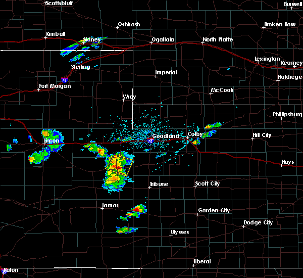 At 442 pm mdt, a severe thunderstorm was located 7 miles east of cheyenne wells, moving east at 30 mph (radar indicated). Hazards include 60 mph wind gusts and quarter size hail. Hail damage to vehicles is expected. expect wind damage to roofs, siding, and trees. locations impacted include, cheyenne wells, arapahoe and firstview. This includes highway 385 between mile markers 145 and 169. At 442 pm mdt, a severe thunderstorm was located 7 miles east of cheyenne wells, moving east at 30 mph (radar indicated). Hazards include 60 mph wind gusts and quarter size hail. Hail damage to vehicles is expected. expect wind damage to roofs, siding, and trees. locations impacted include, cheyenne wells, arapahoe and firstview. This includes highway 385 between mile markers 145 and 169.
|
| 5/24/2018 4:29 PM MDT |
 At 428 pm mdt, a severe thunderstorm was located 4 miles north of cheyenne wells, moving southeast at 30 mph (radar indicated). Hazards include 60 mph wind gusts and quarter size hail. Hail damage to vehicles is expected. Expect wind damage to roofs, siding, and trees. At 428 pm mdt, a severe thunderstorm was located 4 miles north of cheyenne wells, moving southeast at 30 mph (radar indicated). Hazards include 60 mph wind gusts and quarter size hail. Hail damage to vehicles is expected. Expect wind damage to roofs, siding, and trees.
|
| 5/24/2018 4:14 PM MDT |
 At 413 pm mdt, a severe thunderstorm was located 14 miles north of brandon, or 14 miles southwest of cheyenne wells, moving east at 35 mph (radar indicated). Hazards include 60 mph wind gusts and quarter size hail. Hail damage to vehicles is expected. Expect wind damage to roofs, siding, and trees. At 413 pm mdt, a severe thunderstorm was located 14 miles north of brandon, or 14 miles southwest of cheyenne wells, moving east at 35 mph (radar indicated). Hazards include 60 mph wind gusts and quarter size hail. Hail damage to vehicles is expected. Expect wind damage to roofs, siding, and trees.
|
| 5/18/2018 7:56 PM MDT |
 At 755 pm mdt, severe thunderstorms were located along a line extending from 5 miles northeast of cheyenne wells to 9 miles southeast of weskan to 11 miles south of horace, moving northeast at 40 mph. these are very dangerous storms (radar indicated). Hazards include 80 mph wind gusts and quarter size hail. Flying debris will be dangerous to those caught without shelter. mobile homes will be heavily damaged. expect considerable damage to roofs, windows, and vehicles. extensive tree damage and power outages are likely. locations impacted include, cheyenne wells, sharon springs, tribune, weskan, horace and arapahoe. This includes highway 385 between mile markers 137 and 153, and near mile marker 167. At 755 pm mdt, severe thunderstorms were located along a line extending from 5 miles northeast of cheyenne wells to 9 miles southeast of weskan to 11 miles south of horace, moving northeast at 40 mph. these are very dangerous storms (radar indicated). Hazards include 80 mph wind gusts and quarter size hail. Flying debris will be dangerous to those caught without shelter. mobile homes will be heavily damaged. expect considerable damage to roofs, windows, and vehicles. extensive tree damage and power outages are likely. locations impacted include, cheyenne wells, sharon springs, tribune, weskan, horace and arapahoe. This includes highway 385 between mile markers 137 and 153, and near mile marker 167.
|
| 5/18/2018 7:47 PM MDT |
 At 747 pm mdt, severe thunderstorms were located along a line extending from near cheyenne wells to 11 miles south of weskan to 15 miles south of horace, moving northeast at 40 mph. these are very dangerous storms (radar indicated). Hazards include 80 mph wind gusts and quarter size hail. Flying debris will be dangerous to those caught without shelter. mobile homes will be heavily damaged. expect considerable damage to roofs, windows, and vehicles. extensive tree damage and power outages are likely. locations impacted include, cheyenne wells, sharon springs, tribune, weskan, horace and arapahoe. This includes highway 385 between mile markers 136 and 160, and between mile markers 166 and 167. At 747 pm mdt, severe thunderstorms were located along a line extending from near cheyenne wells to 11 miles south of weskan to 15 miles south of horace, moving northeast at 40 mph. these are very dangerous storms (radar indicated). Hazards include 80 mph wind gusts and quarter size hail. Flying debris will be dangerous to those caught without shelter. mobile homes will be heavily damaged. expect considerable damage to roofs, windows, and vehicles. extensive tree damage and power outages are likely. locations impacted include, cheyenne wells, sharon springs, tribune, weskan, horace and arapahoe. This includes highway 385 between mile markers 136 and 160, and between mile markers 166 and 167.
|
| 5/18/2018 7:29 PM MDT |
 At 717 pm mdt, severe thunderstorms were located along a line extending from 10 miles northeast of eads to near sheridan lake to 4 miles southwest of holly, moving northeast at 40 mph (radar indicated). Hazards include 70 mph wind gusts and quarter size hail. Hail damage to vehicles is expected. expect considerable tree damage. Wind damage is also likely to mobile homes, roofs, and outbuildings. At 717 pm mdt, severe thunderstorms were located along a line extending from 10 miles northeast of eads to near sheridan lake to 4 miles southwest of holly, moving northeast at 40 mph (radar indicated). Hazards include 70 mph wind gusts and quarter size hail. Hail damage to vehicles is expected. expect considerable tree damage. Wind damage is also likely to mobile homes, roofs, and outbuildings.
|
| 5/18/2018 7:17 PM MDT |
 At 717 pm mdt, severe thunderstorms were located along a line extending from 10 miles northeast of eads to near sheridan lake to 4 miles southwest of holly, moving northeast at 40 mph (radar indicated). Hazards include 70 mph wind gusts and quarter size hail. Hail damage to vehicles is expected. expect considerable tree damage. Wind damage is also likely to mobile homes, roofs, and outbuildings. At 717 pm mdt, severe thunderstorms were located along a line extending from 10 miles northeast of eads to near sheridan lake to 4 miles southwest of holly, moving northeast at 40 mph (radar indicated). Hazards include 70 mph wind gusts and quarter size hail. Hail damage to vehicles is expected. expect considerable tree damage. Wind damage is also likely to mobile homes, roofs, and outbuildings.
|
| 5/14/2018 5:32 PM MDT | Storm damage reported in cheyenne county CO, 13 miles S of Cheyenne Wells, CO |
| 5/14/2018 5:32 PM MDT | Tennis Ball sized hail reported 13 miles S of Cheyenne Wells, CO |
| 5/14/2018 5:28 PM MDT |
 At 527 pm mdt, a severe thunderstorm was located 9 miles north of cheyenne wells, moving southeast at 40 mph (radar indicated). Hazards include two inch hail and 60 mph wind gusts. People and animals outdoors will be injured. expect hail damage to roofs, siding, windows, and vehicles. expect wind damage to roofs, siding, and trees. locations impacted include, cheyenne wells and arapahoe. This includes highway 385 between mile markers 144 and 172. At 527 pm mdt, a severe thunderstorm was located 9 miles north of cheyenne wells, moving southeast at 40 mph (radar indicated). Hazards include two inch hail and 60 mph wind gusts. People and animals outdoors will be injured. expect hail damage to roofs, siding, windows, and vehicles. expect wind damage to roofs, siding, and trees. locations impacted include, cheyenne wells and arapahoe. This includes highway 385 between mile markers 144 and 172.
|
| 5/14/2018 5:13 PM MDT |
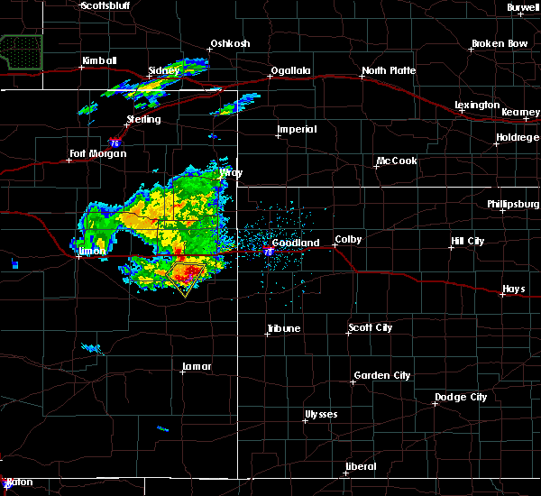 At 513 pm mdt, a severe thunderstorm was located 15 miles northwest of cheyenne wells, moving southeast at 40 mph (radar indicated). Hazards include ping pong ball size hail and 60 mph wind gusts. People and animals outdoors will be injured. expect hail damage to roofs, siding, windows, and vehicles. Expect wind damage to roofs, siding, and trees. At 513 pm mdt, a severe thunderstorm was located 15 miles northwest of cheyenne wells, moving southeast at 40 mph (radar indicated). Hazards include ping pong ball size hail and 60 mph wind gusts. People and animals outdoors will be injured. expect hail damage to roofs, siding, windows, and vehicles. Expect wind damage to roofs, siding, and trees.
|
| 10/6/2017 3:38 PM MDT | Ping Pong Ball sized hail reported 10.1 miles W of Cheyenne Wells, CO, numerous reports of ping pong size hail or larger. many windows broken on houses in town |
| 10/6/2017 3:36 PM MDT | Quarter sized hail reported 10.1 miles W of Cheyenne Wells, CO |
| 10/6/2017 3:30 PM MDT | Quarter sized hail reported 6.8 miles S of Cheyenne Wells, CO |
| 10/6/2017 3:24 PM MDT | Tree limbs down. 3-4 inches in diameter in cheyenne county CO, 0.3 miles WNW of Cheyenne Wells, CO |
| 10/6/2017 3:23 PM MDT |
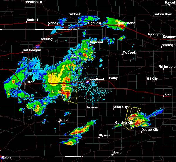 At 323 pm mdt, a severe thunderstorm was located 9 miles north of cheyenne wells, moving east at 50 mph (radar indicated). Hazards include 60 mph wind gusts and half dollar size hail. Hail damage to vehicles is expected. expect wind damage to roofs, siding, and trees. locations impacted include, cheyenne wells and arapahoe. This includes highway 385 between mile markers 144 and 179. At 323 pm mdt, a severe thunderstorm was located 9 miles north of cheyenne wells, moving east at 50 mph (radar indicated). Hazards include 60 mph wind gusts and half dollar size hail. Hail damage to vehicles is expected. expect wind damage to roofs, siding, and trees. locations impacted include, cheyenne wells and arapahoe. This includes highway 385 between mile markers 144 and 179.
|
| 10/6/2017 3:08 PM MDT |
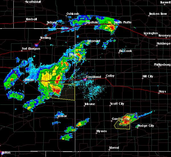 At 307 pm mdt, a severe thunderstorm was located 11 miles northwest of cheyenne wells, moving east at 50 mph (radar indicated). Hazards include 60 mph wind gusts and half dollar size hail. Hail damage to vehicles is expected. expect wind damage to roofs, siding, and trees. locations impacted include, cheyenne wells, arapahoe and firstview. This includes highway 385 between mile markers 144 and 179. At 307 pm mdt, a severe thunderstorm was located 11 miles northwest of cheyenne wells, moving east at 50 mph (radar indicated). Hazards include 60 mph wind gusts and half dollar size hail. Hail damage to vehicles is expected. expect wind damage to roofs, siding, and trees. locations impacted include, cheyenne wells, arapahoe and firstview. This includes highway 385 between mile markers 144 and 179.
|
| 10/6/2017 2:56 PM MDT |
 At 255 pm mdt, a severe thunderstorm was located 9 miles north of kit carson, or 21 miles west of cheyenne wells, moving east at 50 mph (radar indicated). Hazards include 60 mph wind gusts and quarter size hail. Hail damage to vehicles is expected. Expect wind damage to roofs, siding, and trees. At 255 pm mdt, a severe thunderstorm was located 9 miles north of kit carson, or 21 miles west of cheyenne wells, moving east at 50 mph (radar indicated). Hazards include 60 mph wind gusts and quarter size hail. Hail damage to vehicles is expected. Expect wind damage to roofs, siding, and trees.
|
| 8/13/2017 8:09 PM MDT |
 The severe thunderstorm warning for eastern cheyenne and eastern kit carson counties in east central colorado, wallace county in west central kansas and western sherman counties in northwestern kansas will expire at 815 pm mdt, the storm which prompted the warning has weakened below severe limits, and no longer poses an immediate threat to life or property. therefore the warning will be allowed to expire. however gusty winds and heavy rain are still possible with this thunderstorm. a severe thunderstorm watch remains in effect until 1100 pm mdt for east central colorado, and northwestern and west central kansas. The severe thunderstorm warning for eastern cheyenne and eastern kit carson counties in east central colorado, wallace county in west central kansas and western sherman counties in northwestern kansas will expire at 815 pm mdt, the storm which prompted the warning has weakened below severe limits, and no longer poses an immediate threat to life or property. therefore the warning will be allowed to expire. however gusty winds and heavy rain are still possible with this thunderstorm. a severe thunderstorm watch remains in effect until 1100 pm mdt for east central colorado, and northwestern and west central kansas.
|
| 8/13/2017 8:00 PM MDT |
 At 800 pm mdt, a severe thunderstorm was located near ruleton, moving southeast at 30 mph (radar indicated). Hazards include 70 mph wind gusts and ping pong ball size hail. People and animals outdoors will be injured. expect hail damage to roofs, siding, windows, and vehicles. expect considerable tree damage. wind damage is also likely to mobile homes, roofs, and outbuildings. locations impacted include, burlington, cheyenne wells, sharon springs, kanorado, ruleton, weskan and bethune. this includes the following highways, interstate 70 in kansas between mile markers 0 and 16. interstate 70 in colorado between mile markers 423 and 450. Highway 385 between mile markers 148 and 150, and between mile markers 152 and 201. At 800 pm mdt, a severe thunderstorm was located near ruleton, moving southeast at 30 mph (radar indicated). Hazards include 70 mph wind gusts and ping pong ball size hail. People and animals outdoors will be injured. expect hail damage to roofs, siding, windows, and vehicles. expect considerable tree damage. wind damage is also likely to mobile homes, roofs, and outbuildings. locations impacted include, burlington, cheyenne wells, sharon springs, kanorado, ruleton, weskan and bethune. this includes the following highways, interstate 70 in kansas between mile markers 0 and 16. interstate 70 in colorado between mile markers 423 and 450. Highway 385 between mile markers 148 and 150, and between mile markers 152 and 201.
|
| 8/13/2017 7:48 PM MDT |
 At 748 pm mdt, a severe thunderstorm was located 7 miles north of kanorado, moving southeast at 10 mph. this is a very dangerous storm (radar indicated). Hazards include baseball size hail and 70 mph wind gusts. People and animals outdoors will be severely injured. expect shattered windows, extensive damage to roofs, siding, and vehicles. locations impacted include, burlington, cheyenne wells, sharon springs, kanorado, ruleton, weskan and bethune. this includes the following highways, interstate 70 in kansas between mile markers 0 and 16. interstate 70 in colorado between mile markers 423 and 450. Highway 385 between mile markers 148 and 150, and between mile markers 152 and 201. At 748 pm mdt, a severe thunderstorm was located 7 miles north of kanorado, moving southeast at 10 mph. this is a very dangerous storm (radar indicated). Hazards include baseball size hail and 70 mph wind gusts. People and animals outdoors will be severely injured. expect shattered windows, extensive damage to roofs, siding, and vehicles. locations impacted include, burlington, cheyenne wells, sharon springs, kanorado, ruleton, weskan and bethune. this includes the following highways, interstate 70 in kansas between mile markers 0 and 16. interstate 70 in colorado between mile markers 423 and 450. Highway 385 between mile markers 148 and 150, and between mile markers 152 and 201.
|
| 8/13/2017 7:35 PM MDT |
 At 734 pm mdt, a severe thunderstorm was located 4 miles south of burlington, moving southeast at 45 mph. this is a very dangerous storm (radar indicated). Hazards include baseball size hail and 70 mph wind gusts. People and animals outdoors will be severely injured. expect shattered windows, extensive damage to roofs, siding, and vehicles. locations impacted include, burlington, cheyenne wells, sharon springs, kanorado, ruleton, weskan and bethune. this includes the following highways, interstate 70 in kansas between mile markers 0 and 16. interstate 70 in colorado between mile markers 423 and 450. Highway 385 between mile markers 148 and 150, and between mile markers 152 and 201. At 734 pm mdt, a severe thunderstorm was located 4 miles south of burlington, moving southeast at 45 mph. this is a very dangerous storm (radar indicated). Hazards include baseball size hail and 70 mph wind gusts. People and animals outdoors will be severely injured. expect shattered windows, extensive damage to roofs, siding, and vehicles. locations impacted include, burlington, cheyenne wells, sharon springs, kanorado, ruleton, weskan and bethune. this includes the following highways, interstate 70 in kansas between mile markers 0 and 16. interstate 70 in colorado between mile markers 423 and 450. Highway 385 between mile markers 148 and 150, and between mile markers 152 and 201.
|
| 8/13/2017 7:28 PM MDT |
 At 728 pm mdt, a severe thunderstorm was located near burlington, moving southeast at 45 mph (radar indicated). Hazards include two inch hail and 60 mph wind gusts. People and animals outdoors will be injured. expect hail damage to roofs, siding, windows, and vehicles. Expect wind damage to roofs, siding, and trees. At 728 pm mdt, a severe thunderstorm was located near burlington, moving southeast at 45 mph (radar indicated). Hazards include two inch hail and 60 mph wind gusts. People and animals outdoors will be injured. expect hail damage to roofs, siding, windows, and vehicles. Expect wind damage to roofs, siding, and trees.
|
| 7/11/2017 8:14 PM MDT |
 At 813 pm mdt, a severe thunderstorm was located 5 miles north of cheyenne wells, moving north at 20 mph (radar indicated). Hazards include 60 mph wind gusts and quarter size hail. Hail damage to vehicles is expected. Expect wind damage to roofs, siding, and trees. At 813 pm mdt, a severe thunderstorm was located 5 miles north of cheyenne wells, moving north at 20 mph (radar indicated). Hazards include 60 mph wind gusts and quarter size hail. Hail damage to vehicles is expected. Expect wind damage to roofs, siding, and trees.
|
| 7/11/2017 7:53 PM MDT |
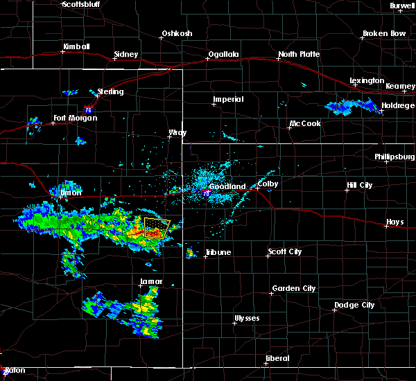 At 752 pm mdt, a severe thunderstorm was located near cheyenne wells, moving north at 15 mph (radar indicated). Hazards include 60 mph wind gusts and quarter size hail. Hail damage to vehicles is expected. expect wind damage to roofs, siding, and trees. locations impacted include, cheyenne wells and firstview. This includes highway 385 between mile markers 143 and 161. At 752 pm mdt, a severe thunderstorm was located near cheyenne wells, moving north at 15 mph (radar indicated). Hazards include 60 mph wind gusts and quarter size hail. Hail damage to vehicles is expected. expect wind damage to roofs, siding, and trees. locations impacted include, cheyenne wells and firstview. This includes highway 385 between mile markers 143 and 161.
|
| 7/11/2017 7:29 PM MDT |
 At 728 pm mdt, a severe thunderstorm was located 6 miles southwest of cheyenne wells, moving north at 15 mph (radar indicated). Hazards include 60 mph wind gusts and quarter size hail. Hail damage to vehicles is expected. Expect wind damage to roofs, siding, and trees. At 728 pm mdt, a severe thunderstorm was located 6 miles southwest of cheyenne wells, moving north at 15 mph (radar indicated). Hazards include 60 mph wind gusts and quarter size hail. Hail damage to vehicles is expected. Expect wind damage to roofs, siding, and trees.
|
| 5/15/2017 5:40 PM MDT |
 The severe thunderstorm warning for central cheyenne county in east central colorado will expire at 545 pm mdt, the storm which prompted the warning has weakened below severe limits, and no longer poses an immediate threat to life or property. therefore the warning will be allowed to expire. however small hail and gusty winds are still possible with this thunderstorm. The severe thunderstorm warning for central cheyenne county in east central colorado will expire at 545 pm mdt, the storm which prompted the warning has weakened below severe limits, and no longer poses an immediate threat to life or property. therefore the warning will be allowed to expire. however small hail and gusty winds are still possible with this thunderstorm.
|
| 5/15/2017 5:27 PM MDT |
 At 527 pm mdt, a severe thunderstorm was located 12 miles east of kit carson, or 14 miles southwest of cheyenne wells, moving northeast at 25 mph (radar indicated). Hazards include 60 mph wind gusts and quarter size hail. Hail damage to vehicles is expected. expect wind damage to roofs, siding, and trees. locations impacted include, cheyenne wells and firstview. This includes highway 385 between mile markers 150 and 157. At 527 pm mdt, a severe thunderstorm was located 12 miles east of kit carson, or 14 miles southwest of cheyenne wells, moving northeast at 25 mph (radar indicated). Hazards include 60 mph wind gusts and quarter size hail. Hail damage to vehicles is expected. expect wind damage to roofs, siding, and trees. locations impacted include, cheyenne wells and firstview. This includes highway 385 between mile markers 150 and 157.
|
| 5/15/2017 4:58 PM MDT |
 At 458 pm mdt, a severe thunderstorm was located 6 miles north of eads, or 28 miles southwest of cheyenne wells, moving northeast at 40 mph (radar indicated). Hazards include 60 mph wind gusts and half dollar size hail. Hail damage to vehicles is expected. Expect wind damage to roofs, siding, and trees. At 458 pm mdt, a severe thunderstorm was located 6 miles north of eads, or 28 miles southwest of cheyenne wells, moving northeast at 40 mph (radar indicated). Hazards include 60 mph wind gusts and half dollar size hail. Hail damage to vehicles is expected. Expect wind damage to roofs, siding, and trees.
|
| 5/15/2017 4:32 PM MDT | Quarter sized hail reported 0.6 miles SSW of Cheyenne Wells, CO, a lot of hail pounding against house. most appears to be quarter size. |
| 5/15/2017 4:31 PM MDT |
 At 430 pm mdt, a severe thunderstorm was located near cheyenne wells, moving north at 35 mph (trained weather spotters. at 430 pm mdt, quarter size hail was reported in cheyenne wells). Hazards include 60 mph wind gusts and quarter size hail. Hail damage to vehicles is expected. Expect wind damage to roofs, siding, and trees. At 430 pm mdt, a severe thunderstorm was located near cheyenne wells, moving north at 35 mph (trained weather spotters. at 430 pm mdt, quarter size hail was reported in cheyenne wells). Hazards include 60 mph wind gusts and quarter size hail. Hail damage to vehicles is expected. Expect wind damage to roofs, siding, and trees.
|
| 5/15/2017 4:00 PM MDT |
 At 400 pm mdt, a severe thunderstorm was located 10 miles north of brandon, or 15 miles south of cheyenne wells, moving northeast at 35 mph (radar indicated). Hazards include 60 mph wind gusts and quarter size hail. Hail damage to vehicles is expected. Expect wind damage to roofs, siding, and trees. At 400 pm mdt, a severe thunderstorm was located 10 miles north of brandon, or 15 miles south of cheyenne wells, moving northeast at 35 mph (radar indicated). Hazards include 60 mph wind gusts and quarter size hail. Hail damage to vehicles is expected. Expect wind damage to roofs, siding, and trees.
|
| 5/9/2017 6:59 PM MDT |
 At 659 pm mdt, a severe thunderstorm was located 4 miles southeast of cheyenne wells, moving north at 35 mph (radar indicated). Hazards include 60 mph wind gusts and quarter size hail. Hail damage to vehicles is expected. expect wind damage to roofs, siding, and trees. locations impacted include, cheyenne wells and arapahoe. This includes highway 385 between mile markers 141 and 161. At 659 pm mdt, a severe thunderstorm was located 4 miles southeast of cheyenne wells, moving north at 35 mph (radar indicated). Hazards include 60 mph wind gusts and quarter size hail. Hail damage to vehicles is expected. expect wind damage to roofs, siding, and trees. locations impacted include, cheyenne wells and arapahoe. This includes highway 385 between mile markers 141 and 161.
|
| 5/9/2017 6:46 PM MDT |
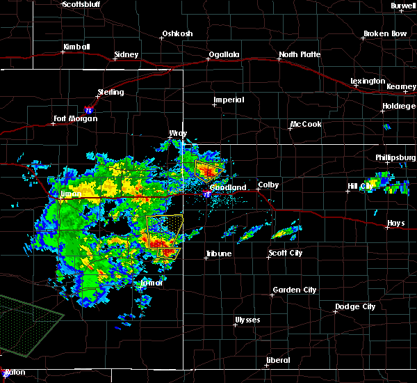 At 645 pm mdt, a severe thunderstorm was located 12 miles north of sheridan lake, or 12 miles south of cheyenne wells, moving northeast at 30 mph (radar indicated). Hazards include 60 mph wind gusts and half dollar size hail. Hail damage to vehicles is expected. expect wind damage to roofs, siding, and trees. locations impacted include, cheyenne wells and arapahoe. This includes highway 385 between mile markers 136 and 169. At 645 pm mdt, a severe thunderstorm was located 12 miles north of sheridan lake, or 12 miles south of cheyenne wells, moving northeast at 30 mph (radar indicated). Hazards include 60 mph wind gusts and half dollar size hail. Hail damage to vehicles is expected. expect wind damage to roofs, siding, and trees. locations impacted include, cheyenne wells and arapahoe. This includes highway 385 between mile markers 136 and 169.
|
| 5/9/2017 6:33 PM MDT |
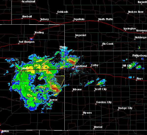 At 633 pm mdt, severe thunderstorms were located along a line extending from 9 miles north of brandon to 6 miles north of sheridan lake, moving north at 35 mph (radar indicated). Hazards include 60 mph wind gusts and half dollar size hail. Hail damage to vehicles is expected. Expect wind damage to roofs, siding, and trees. At 633 pm mdt, severe thunderstorms were located along a line extending from 9 miles north of brandon to 6 miles north of sheridan lake, moving north at 35 mph (radar indicated). Hazards include 60 mph wind gusts and half dollar size hail. Hail damage to vehicles is expected. Expect wind damage to roofs, siding, and trees.
|
| 7/24/2016 7:10 PM MDT |
 At 710 pm mdt, a severe thunderstorm was located 8 miles east of kit carson, or 15 miles west of cheyenne wells, moving east at 30 mph (radar indicated). Hazards include 60 mph wind gusts and quarter size hail. Hail damage to vehicles is expected. expect wind damage to roofs, siding, and trees. locations impacted include, cheyenne wells, kit carson and firstview. This includes highway 385 between mile markers 136 and 155. At 710 pm mdt, a severe thunderstorm was located 8 miles east of kit carson, or 15 miles west of cheyenne wells, moving east at 30 mph (radar indicated). Hazards include 60 mph wind gusts and quarter size hail. Hail damage to vehicles is expected. expect wind damage to roofs, siding, and trees. locations impacted include, cheyenne wells, kit carson and firstview. This includes highway 385 between mile markers 136 and 155.
|
| 7/24/2016 6:53 PM MDT |
 At 653 pm mdt, a severe thunderstorm was located over kit carson, or 25 miles west of cheyenne wells, moving east at 30 mph (radar indicated). Hazards include 60 mph wind gusts and quarter size hail. Hail damage to vehicles is expected. Expect wind damage to roofs, siding, and trees. At 653 pm mdt, a severe thunderstorm was located over kit carson, or 25 miles west of cheyenne wells, moving east at 30 mph (radar indicated). Hazards include 60 mph wind gusts and quarter size hail. Hail damage to vehicles is expected. Expect wind damage to roofs, siding, and trees.
|
| 7/15/2016 3:01 PM MDT | Baseball sized hail reported 14 miles NW of Cheyenne Wells, CO, damaged car windows |
| 7/15/2016 3:01 PM MDT | Broke tree branches and striped tree bark in cheyenne county CO, 14 miles NW of Cheyenne Wells, CO |
| 7/15/2016 2:19 PM MDT | Tennis Ball sized hail reported 10.1 miles W of Cheyenne Wells, CO |
| 7/15/2016 2:14 PM MDT |
 At 213 pm mdt, a severe thunderstorm was located 9 miles southwest of weskan, or 16 miles east of cheyenne wells, moving south at 20 mph. this is a very dangerous storm (radar indicated). Hazards include three inch hail and 70 mph wind gusts. People and animals outdoors will be severely injured. Expect shattered windows, extensive damage to roofs, siding, and vehicles. At 213 pm mdt, a severe thunderstorm was located 9 miles southwest of weskan, or 16 miles east of cheyenne wells, moving south at 20 mph. this is a very dangerous storm (radar indicated). Hazards include three inch hail and 70 mph wind gusts. People and animals outdoors will be severely injured. Expect shattered windows, extensive damage to roofs, siding, and vehicles.
|
| 7/15/2016 2:14 PM MDT |
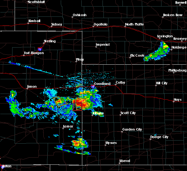 At 213 pm mdt, a severe thunderstorm was located 9 miles southwest of weskan, or 16 miles east of cheyenne wells, moving south at 20 mph. this is a very dangerous storm (radar indicated). Hazards include three inch hail and 70 mph wind gusts. People and animals outdoors will be severely injured. Expect shattered windows, extensive damage to roofs, siding, and vehicles. At 213 pm mdt, a severe thunderstorm was located 9 miles southwest of weskan, or 16 miles east of cheyenne wells, moving south at 20 mph. this is a very dangerous storm (radar indicated). Hazards include three inch hail and 70 mph wind gusts. People and animals outdoors will be severely injured. Expect shattered windows, extensive damage to roofs, siding, and vehicles.
|
| 7/14/2016 3:15 PM MDT |
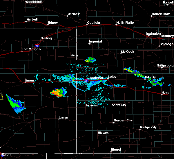 At 314 pm mdt, a severe thunderstorm was located 12 miles northeast of kit carson, or 13 miles west of cheyenne wells, moving southeast at 35 mph (radar indicated). Hazards include 60 mph wind gusts and half dollar size hail. Hail damage to vehicles is expected. Expect wind damage to roofs, siding, and trees. At 314 pm mdt, a severe thunderstorm was located 12 miles northeast of kit carson, or 13 miles west of cheyenne wells, moving southeast at 35 mph (radar indicated). Hazards include 60 mph wind gusts and half dollar size hail. Hail damage to vehicles is expected. Expect wind damage to roofs, siding, and trees.
|
| 7/12/2016 2:00 AM MDT |
 At 200 am mdt, a severe thunderstorm was located 9 miles northwest of cheyenne wells, and is nearly stationary (radar indicated). Hazards include 60 mph wind gusts and half dollar size hail. Hail damage to vehicles is expected. Expect wind damage to roofs, siding, and trees. At 200 am mdt, a severe thunderstorm was located 9 miles northwest of cheyenne wells, and is nearly stationary (radar indicated). Hazards include 60 mph wind gusts and half dollar size hail. Hail damage to vehicles is expected. Expect wind damage to roofs, siding, and trees.
|
| 6/6/2016 2:35 PM MDT | Golf Ball sized hail reported 7.4 miles NNE of Cheyenne Wells, CO, reported at cr k/cr 43 intersection |
| 6/6/2016 2:34 PM MDT |
 At 234 pm mdt, a severe thunderstorm was located 6 miles south of cheyenne wells, moving east at 35 mph (radar indicated). Hazards include 60 mph wind gusts and quarter size hail. Hail damage to vehicles is expected. Expect wind damage to roofs, siding, and trees. At 234 pm mdt, a severe thunderstorm was located 6 miles south of cheyenne wells, moving east at 35 mph (radar indicated). Hazards include 60 mph wind gusts and quarter size hail. Hail damage to vehicles is expected. Expect wind damage to roofs, siding, and trees.
|
| 5/30/2016 6:20 PM MDT | Power outage lasted 15-25 minute in cheyenne county CO, 0.3 miles WNW of Cheyenne Wells, CO |
| 5/26/2016 5:50 PM MDT | Storm damage reported in cheyenne county CO, 0.3 miles WNW of Cheyenne Wells, CO |
| 5/26/2016 5:30 PM MDT |
 At 530 pm mdt, severe thunderstorms were located along a line extending from 14 miles south of seibert to 11 miles south of cheyenne wells, moving northeast at 40 mph. these are very dangerous storms (radar indicated). Hazards include 80 mph wind gusts and quarter size hail. Flying debris will be dangerous to those caught without shelter. mobile homes will be heavily damaged. expect considerable damage to roofs, windows, and vehicles. extensive tree damage and power outages are likely. locations impacted include, cheyenne wells, kit carson and firstview. this includes highway 385 between mile markers 137 and 163. a tornado watch remains in effect until 700 pm mdt for east central colorado. A tornado watch also remains in effect until 900 pm mdt for west central kansas. At 530 pm mdt, severe thunderstorms were located along a line extending from 14 miles south of seibert to 11 miles south of cheyenne wells, moving northeast at 40 mph. these are very dangerous storms (radar indicated). Hazards include 80 mph wind gusts and quarter size hail. Flying debris will be dangerous to those caught without shelter. mobile homes will be heavily damaged. expect considerable damage to roofs, windows, and vehicles. extensive tree damage and power outages are likely. locations impacted include, cheyenne wells, kit carson and firstview. this includes highway 385 between mile markers 137 and 163. a tornado watch remains in effect until 700 pm mdt for east central colorado. A tornado watch also remains in effect until 900 pm mdt for west central kansas.
|
| 5/26/2016 5:20 PM MDT |
 At 520 pm mdt, severe thunderstorms were located along a line extending from 16 miles north of kit carson to 14 miles north of chivington, moving east at 45 mph (radar indicated). Hazards include 70 mph wind gusts and quarter size hail. Hail damage to vehicles is expected. expect considerable tree damage. Wind damage is also likely to mobile homes, roofs, and outbuildings. At 520 pm mdt, severe thunderstorms were located along a line extending from 16 miles north of kit carson to 14 miles north of chivington, moving east at 45 mph (radar indicated). Hazards include 70 mph wind gusts and quarter size hail. Hail damage to vehicles is expected. expect considerable tree damage. Wind damage is also likely to mobile homes, roofs, and outbuildings.
|
| 8/8/2015 4:28 PM MDT | Quarter sized hail reported 13.7 miles SSW of Cheyenne Wells, CO, some quarter along with penny sized hail...lasted about 10 minutes. |
| 7/19/2015 5:56 PM MDT |
 At 556 pm mdt, severe thunderstorms were located along a line extending from 10 miles west of weskan to 16 miles southeast of cheyenne wells to 9 miles north of towner, moving east at 30 mph (radar indicated). Hazards include 60 mph wind gusts and half dollar size hail. Hail damage to vehicles is expected. expect wind damage to roofs, siding and trees. locations impacted include, cheyenne wells and arapahoe. This includes highway 385 between mile markers 136 and 161. At 556 pm mdt, severe thunderstorms were located along a line extending from 10 miles west of weskan to 16 miles southeast of cheyenne wells to 9 miles north of towner, moving east at 30 mph (radar indicated). Hazards include 60 mph wind gusts and half dollar size hail. Hail damage to vehicles is expected. expect wind damage to roofs, siding and trees. locations impacted include, cheyenne wells and arapahoe. This includes highway 385 between mile markers 136 and 161.
|
| 7/19/2015 5:29 PM MDT |
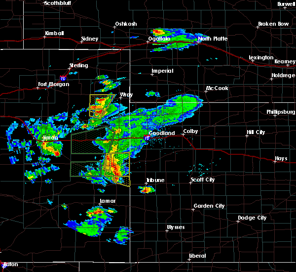 At 529 pm mdt, severe thunderstorms were located along a line extending from 19 miles south of bethune to near cheyenne wells to 12 miles north of sheridan lake, moving east at 20 mph (radar indicated). Hazards include two inch hail and 60 mph wind gusts. People and animals outdoors will be injured. expect hail damage to roofs, siding, windows and vehicles. expect wind damage to roofs, siding and trees. locations impacted include, cheyenne wells and arapahoe. This includes highway 385 between mile markers 136 and 169. At 529 pm mdt, severe thunderstorms were located along a line extending from 19 miles south of bethune to near cheyenne wells to 12 miles north of sheridan lake, moving east at 20 mph (radar indicated). Hazards include two inch hail and 60 mph wind gusts. People and animals outdoors will be injured. expect hail damage to roofs, siding, windows and vehicles. expect wind damage to roofs, siding and trees. locations impacted include, cheyenne wells and arapahoe. This includes highway 385 between mile markers 136 and 169.
|
| 7/19/2015 5:11 PM MDT |
 At 510 pm mdt, severe thunderstorms were located along a line extending from 17 miles south of bethune to 7 miles northwest of cheyenne wells to 11 miles north of brandon, moving east at 20 mph (radar indicated). Hazards include two inch hail and 60 mph wind gusts. People and animals outdoors will be injured. expect hail damage to roofs, siding, windows and vehicles. Expect wind damage to roofs, siding and trees. At 510 pm mdt, severe thunderstorms were located along a line extending from 17 miles south of bethune to 7 miles northwest of cheyenne wells to 11 miles north of brandon, moving east at 20 mph (radar indicated). Hazards include two inch hail and 60 mph wind gusts. People and animals outdoors will be injured. expect hail damage to roofs, siding, windows and vehicles. Expect wind damage to roofs, siding and trees.
|
| 7/14/2015 7:52 PM MDT |
 At 751 pm mdt, severe thunderstorms were located along a line extending from 21 miles east of cope to 14 miles northeast of bethune to 10 miles southeast of burlington to 11 miles northwest of weskan, moving northeast at 30 mph (trained weather spotters). Hazards include 50-60 mph wind gusts reported in burlington colorado. Expect damage to roofs. siding and trees. locations impacted include, burlington, cheyenne wells, kanorado, ruleton, weskan, bethune, bonny reservoir, kirk, arapahoe and hale. this includes the following highways, interstate 70 in kansas between mile markers 0 and 11. interstate 70 in colorado between mile markers 427 and 450. Highway 385 between mile markers 147 and 223. At 751 pm mdt, severe thunderstorms were located along a line extending from 21 miles east of cope to 14 miles northeast of bethune to 10 miles southeast of burlington to 11 miles northwest of weskan, moving northeast at 30 mph (trained weather spotters). Hazards include 50-60 mph wind gusts reported in burlington colorado. Expect damage to roofs. siding and trees. locations impacted include, burlington, cheyenne wells, kanorado, ruleton, weskan, bethune, bonny reservoir, kirk, arapahoe and hale. this includes the following highways, interstate 70 in kansas between mile markers 0 and 11. interstate 70 in colorado between mile markers 427 and 450. Highway 385 between mile markers 147 and 223.
|
| 7/14/2015 7:27 PM MDT |
 At 727 pm mdt, severe thunderstorms were located along a line extending from 13 miles southeast of cope to 5 miles north of bethune to 12 miles south of burlington to 4 miles northeast of cheyenne wells, moving northeast at 40 mph (radar indicated). Hazards include 60 mph wind gusts and quarter size hail. Hail damage to vehicles is expected. Expect wind damage to roofs, siding and trees. At 727 pm mdt, severe thunderstorms were located along a line extending from 13 miles southeast of cope to 5 miles north of bethune to 12 miles south of burlington to 4 miles northeast of cheyenne wells, moving northeast at 40 mph (radar indicated). Hazards include 60 mph wind gusts and quarter size hail. Hail damage to vehicles is expected. Expect wind damage to roofs, siding and trees.
|
| 6/25/2015 11:54 PM MDT |
 At 1154 pm mdt, a severe thunderstorm was located 4 miles northeast of cheyenne wells, moving south at 45 mph (radar indicated). Hazards include 60 mph wind gusts and quarter size hail. Hail damage to vehicles is expected. Expect wind damage to roofs, siding and trees. At 1154 pm mdt, a severe thunderstorm was located 4 miles northeast of cheyenne wells, moving south at 45 mph (radar indicated). Hazards include 60 mph wind gusts and quarter size hail. Hail damage to vehicles is expected. Expect wind damage to roofs, siding and trees.
|
| 6/25/2015 11:25 PM MDT |
 At 1125 pm mdt, a severe thunderstorm was located 11 miles north of sheridan lake, or 13 miles south of cheyenne wells, moving southeast at 25 mph (radar indicated). Hazards include 60 mph wind gusts and quarter size hail. Hail damage to vehicles is expected. expect wind damage to roofs, siding and trees. locations impacted include, cheyenne wells and firstview. This includes highway 385 between mile markers 136 and 157. At 1125 pm mdt, a severe thunderstorm was located 11 miles north of sheridan lake, or 13 miles south of cheyenne wells, moving southeast at 25 mph (radar indicated). Hazards include 60 mph wind gusts and quarter size hail. Hail damage to vehicles is expected. expect wind damage to roofs, siding and trees. locations impacted include, cheyenne wells and firstview. This includes highway 385 between mile markers 136 and 157.
|
| 6/25/2015 11:08 PM MDT |
 At 1108 pm mdt, a severe thunderstorm was located 8 miles southwest of cheyenne wells, moving southeast at 25 mph (radar indicated). Hazards include 60 mph wind gusts and quarter size hail. Hail damage to vehicles is expected. Expect wind damage to roofs, siding and trees. At 1108 pm mdt, a severe thunderstorm was located 8 miles southwest of cheyenne wells, moving southeast at 25 mph (radar indicated). Hazards include 60 mph wind gusts and quarter size hail. Hail damage to vehicles is expected. Expect wind damage to roofs, siding and trees.
|
| 6/10/2015 3:14 PM MDT | Center pivot tipped over from thunderstorm wind gust in cheyenne county CO, 10.8 miles SW of Cheyenne Wells, CO |
| 6/6/2015 7:08 PM MDT | At 707 pm mdt, severe thunderstorms were located along a line extending from 10 miles south of stratton to 13 miles southeast of cheyenne wells, moving northeast at 30 mph (radar indicated). Hazards include 60 mph wind gusts and nickel size hail. Expect damage to roofs. Siding and trees. |
| 6/5/2015 5:56 PM MDT | At 555 pm mdt, a severe thunderstorm was located 5 miles northeast of cheyenne wells, moving northeast at 30 mph (radar indicated). Hazards include 60 mph wind gusts and quarter size hail. Hail damage to vehicles is expected. Expect wind damage to roofs, siding and trees. |
| 6/5/2015 5:56 PM MDT | At 555 pm mdt, a severe thunderstorm was located 5 miles northeast of cheyenne wells, moving northeast at 30 mph (radar indicated). Hazards include 60 mph wind gusts and quarter size hail. Hail damage to vehicles is expected. Expect wind damage to roofs, siding and trees. |
| 6/5/2015 5:55 PM MDT | Quarter sized hail reported 6.1 miles WSW of Cheyenne Wells, CO |
| 5/31/2015 6:50 PM MDT | At 649 pm mdt, a severe thunderstorm was located 12 miles north of cheyenne wells, moving east at 15 mph (radar indicated). Hazards include quarter size hail. Damage to vehicles is expected. locations impacted include, cheyenne wells and arapahoe. This includes highway 385 between mile markers 138 and 169. |
| 5/31/2015 6:09 PM MDT | At 608 pm mdt, a severe thunderstorm was located 13 miles northeast of kit carson, or 15 miles west of cheyenne wells, moving east at 45 mph (radar indicated). Hazards include 60 mph wind gusts and quarter size hail. Hail damage to vehicles is expected. Expect wind damage to roofs, siding and trees. |
| 5/31/2015 5:47 PM MDT | At 547 pm mdt, a severe thunderstorm was located 5 miles southwest of cheyenne wells, moving south at 15 mph (radar indicated). Hazards include quarter size hail. Damage to vehicles is expected. locations impacted include, cheyenne wells. This includes highway 385 between mile markers 140 and 156. |
| 5/31/2015 5:10 PM MDT | At 509 pm mdt, a severe thunderstorm was located 8 miles northwest of cheyenne wells, moving southeast at 5 mph (radar indicated). Hazards include quarter size hail. damage to vehicles is expected |
| 5/24/2015 12:11 AM MDT | At 1211 am mdt, a severe thunderstorm was located 11 miles northeast of cheyenne wells, moving northeast at 25 mph (radar indicated). Hazards include 60 mph wind gusts and quarter size hail. Hail damage to vehicles is expected. expect wind damage to roofs, siding and trees. locations impacted include, cheyenne wells, weskan and arapahoe. This includes highway 385 between mile markers 148 and 183. |
| 5/24/2015 12:11 AM MDT | At 1211 am mdt, a severe thunderstorm was located 11 miles northeast of cheyenne wells, moving northeast at 25 mph (radar indicated). Hazards include 60 mph wind gusts and quarter size hail. Hail damage to vehicles is expected. expect wind damage to roofs, siding and trees. locations impacted include, cheyenne wells, weskan and arapahoe. This includes highway 385 between mile markers 148 and 183. |
| 5/23/2015 11:55 PM MDT | At 1155 pm mdt, a severe thunderstorm was located 5 miles north of cheyenne wells, moving northeast at 25 mph (radar indicated). Hazards include 60 mph wind gusts and quarter size hail. Hail damage to vehicles is expected. Expect wind damage to roofs, siding and trees. |
| 5/23/2015 11:55 PM MDT | At 1155 pm mdt, a severe thunderstorm was located 5 miles north of cheyenne wells, moving northeast at 25 mph (radar indicated). Hazards include 60 mph wind gusts and quarter size hail. Hail damage to vehicles is expected. Expect wind damage to roofs, siding and trees. |
| 5/23/2015 11:21 PM MDT | At 1121 pm mdt, a severe thunderstorm was located 5 miles west of cheyenne wells, moving northeast at 25 mph (radar indicated). Hazards include 60 mph wind gusts and quarter size hail. Hail damage to vehicles is expected. Expect wind damage to roofs, siding and trees. |
| 5/23/2015 5:43 PM MDT | The severe thunderstorm warning for southeastern cheyenne county will expire at 545 pm mdt, the storm which prompted the warning has weakened below severe limits, and no longer pose an immediate threat to life or property. therefore the warning will be allowed to expire. however gusty winds and heavy rain are still possible with this thunderstorm. a tornado watch remains in effect until 700 pm mdt for east central colorado. |
| 5/23/2015 5:15 PM MDT | At 514 pm mdt, a severe thunderstorm was located 12 miles east of kit carson, or 14 miles southwest of cheyenne wells, moving northeast at 25 mph (radar indicated. at 451 pm mdt...quarter size hail was reported 4 miles south of kit carson). Hazards include 60 mph wind gusts and quarter size hail. Hail damage to vehicles is expected. expect wind damage to roofs, siding and trees. locations impacted include, cheyenne wells and firstview. this includes highway 385 between mile markers 141 and 153. A tornado watch remains in effect until 700 pm mdt for east central colorado. |
| 5/23/2015 4:54 PM MDT | At 453 pm mdt, a severe thunderstorm was located 8 miles southeast of kit carson, or 22 miles southwest of cheyenne wells, moving northeast at 25 mph (trained weather spotters. at 451 pm mdt...quarter size hail was reported 4 miles south of kit carson). Hazards include 60 mph wind gusts and quarter size hail. Hail damage to vehicles is expected. Expect wind damage to roofs, siding and trees. |
| 5/9/2015 5:26 PM MDT | Hen Egg sized hail reported 7.3 miles E of Cheyenne Wells, CO |
| 5/7/2015 7:08 PM MDT | At 708 pm mdt, a severe thunderstorm was located 8 miles south of cheyenne wells, moving east at 20 mph (public). Hazards include golf ball size hail and 60 mph wind gusts. People and animals outdoors will be injured. expect hail damage to roofs, siding, windows and vehicles. expect wind damage to roofs, siding and trees. locations impacted include, cheyenne wells. this includes highway 385 between mile markers 139 and 149. 1. 75in. |
| 5/7/2015 6:56 PM MDT | At 656 pm mdt, severe thunderstorms were located along a line extending from 7 miles west of cheyenne wells to 13 miles north of chivington, moving east at 20 mph (public). Hazards include golf ball size hail and 60 mph wind gusts. People and animals outdoors will be injured. expect hail damage to roofs, siding, windows and vehicles. expect wind damage to roofs, siding and trees. locations impacted include, cheyenne wells and firstview. this includes highway 385 between mile markers 139 and 157. 1. 75in. |
| 5/7/2015 6:55 PM MDT | Golf Ball sized hail reported 9.9 miles ENE of Cheyenne Wells, CO, mostly pea sized hail... some quarter and golf ball sized hail mixed in. |
| 5/7/2015 6:31 PM MDT | At 631 pm mdt, severe thunderstorms were located along a line extending from 8 miles northeast of kit carson to 11 miles north of eads, moving east at 20 mph (radar indicated). Hazards include 60 mph wind gusts and half dollar size hail. Hail damage to vehicles is expected. Expect wind damage to roofs, siding and trees. |
| 4/2/2015 6:42 PM MDT | The tornado warning for southeastern cheyenne. northwestern greeley and southwestern wallace counties will expire at 645 pm mdt. the storm which prompted the warning has weakened below severe limits. and no longer appears capable of producing a tornado. therefore the warning will be allowed to expire. However gusty winds. |
| 4/2/2015 6:42 PM MDT | The tornado warning for southeastern cheyenne. northwestern greeley and southwestern wallace counties will expire at 645 pm mdt. the storm which prompted the warning has weakened below severe limits. and no longer appears capable of producing a tornado. therefore the warning will be allowed to expire. However gusty winds. |
| 4/2/2015 6:37 PM MDT | A tornado warning remains in effect until 645 pm mdt for southeastern cheyenne. northwestern greeley and southwestern wallace counties. at 636 pm mdt. a severe thunderstorm capable of producing a tornado was located near cheyenne wells. moving east at 35 mph. hazard. Tornado and quarter size hail. |
| 4/2/2015 6:37 PM MDT | A tornado warning remains in effect until 645 pm mdt for southeastern cheyenne. northwestern greeley and southwestern wallace counties. at 636 pm mdt. a severe thunderstorm capable of producing a tornado was located near cheyenne wells. moving east at 35 mph. hazard. Tornado and quarter size hail. |
| 4/2/2015 6:24 PM MDT | A tornado warning remains in effect until 645 pm mdt for southeastern cheyenne. northwestern greeley and southwestern wallace counties. at 624 pm mdt. a severe thunderstorm capable of producing a tornado was located over cheyenne wells. moving east at 40 mph. hazard. Tornado and quarter size hail. |
| 4/2/2015 6:24 PM MDT | A tornado warning remains in effect until 645 pm mdt for southeastern cheyenne. northwestern greeley and southwestern wallace counties. at 624 pm mdt. a severe thunderstorm capable of producing a tornado was located over cheyenne wells. moving east at 40 mph. hazard. Tornado and quarter size hail. |
| 4/2/2015 6:16 PM MDT | The national weather service in goodland has issued a * tornado warning for. southeastern cheyenne county in east central colorado. northwestern greeley county in west central kansas. southwestern wallace county in west central kansas. Until 645 pm mdt. |
| 4/2/2015 6:16 PM MDT | The national weather service in goodland has issued a * tornado warning for. southeastern cheyenne county in east central colorado. northwestern greeley county in west central kansas. southwestern wallace county in west central kansas. Until 645 pm mdt. |
| 4/2/2015 6:02 PM MDT | A tornado warning remains in effect until 615 pm mdt for central cheyenne county. at 602 pm mdt. a severe thunderstorm capable of producing a tornado was located 8 miles east of kit carson. or 15 miles west of cheyenne wells. moving east at 35 mph. hazard. Tornado. |
| 4/2/2015 5:52 PM MDT | The national weather service in goodland has issued a * tornado warning for. central cheyenne county in east central colorado. until 615 pm mdt * at 552 pm mdt. a severe thunderstorm capable of producing a tornado was located near kit carson. Or 21 miles west of cheyenne. |
| 8/22/2014 3:42 PM MDT | Quarter sized hail reported 11.6 miles S of Cheyenne Wells, CO, quarter size hail covering the ground. |
| 6/27/2014 3:45 PM MDT | Golf Ball sized hail reported 10.3 miles WSW of Cheyenne Wells, CO |
| 6/27/2014 3:42 PM MDT | Quarter sized hail reported 9 miles WSW of Cheyenne Wells, CO, some stones nickel to quarter size...most smaller. has been going on for past 15 minutes. |
| 6/1/2014 2:18 PM MDT | Quarter sized hail reported 6.3 miles N of Cheyenne Wells, CO |
| 10/10/2013 5:08 PM MDT | Storm damage reported in cheyenne county CO, 9.5 miles E of Cheyenne Wells, CO |
| 8/31/2013 7:45 PM MDT | Large tree about 18 ft long down and blocking part of the road at the intersection of s 2nd and 10th stree in cheyenne county CO, 0.3 miles WNW of Cheyenne Wells, CO |
| 8/31/2013 7:38 PM MDT | Storm damage reported in cheyenne county CO, 0.3 miles WNW of Cheyenne Wells, CO |
| 8/6/2013 1:34 PM MDT | Golf Ball sized hail reported 14 miles NW of Cheyenne Wells, CO |
| 6/18/2013 7:35 PM MDT | Quarter sized hail reported 0.3 miles WNW of Cheyenne Wells, CO, hail was covering the ground. lasted maybe five minutes. |
| 6/17/2013 6:26 PM MDT | Quarter sized hail reported 12.5 miles SSW of Cheyenne Wells, CO, quarter size hail 22 s of burlington. hail is covering the ground. |
| 6/17/2013 5:15 PM MDT | Quarter sized hail reported 4 miles S of Cheyenne Wells, CO, hail has been falling for 5 minutes |
| 6/13/2013 5:29 PM MDT | Storm damage reported in cheyenne county CO, 9.5 miles E of Cheyenne Wells, CO |
| 5/29/2013 3:40 PM MDT | Golf Ball sized hail reported 21.5 miles SE of Cheyenne Wells, CO, at county road ff and road 28. |
| 5/29/2013 3:15 PM MDT | Golf Ball sized hail reported 21.5 miles SE of Cheyenne Wells, CO, at county road ff and road 28. |
| 5/29/2013 2:30 PM MDT | Trees down in cheyenne wells. dispatcher estimated 70 mph winds with the storm. time estimate in cheyenne county CO, 0.3 miles WNW of Cheyenne Wells, CO |
| 5/27/2013 4:15 PM MDT | Quarter sized hail reported 10.9 miles S of Cheyenne Wells, CO, time estimated by radar. |
| 1/1/0001 12:00 AM | Golf Ball sized hail reported 10.1 miles W of Cheyenne Wells, CO |
| 1/1/0001 12:00 AM | Dime to quarter size hail falling also in cheyenne county CO, 8.4 miles N of Cheyenne Wells, CO |
| 1/1/0001 12:00 AM | Grapefruit sized hail reported 4.3 miles N of Cheyenne Wells, CO |
| 1/1/0001 12:00 AM | Quarter sized hail reported 9.5 miles E of Cheyenne Wells, CO |
Hail Maps for Cheyenne Wells, CO
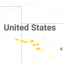
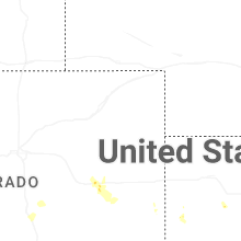
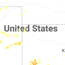
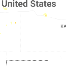
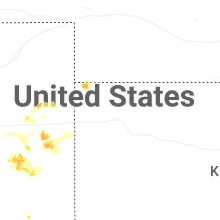
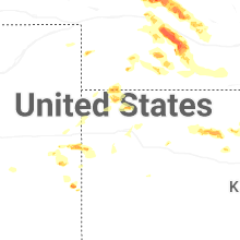
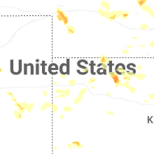
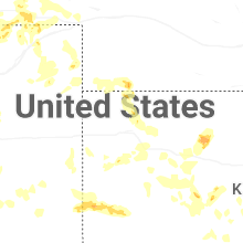
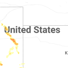
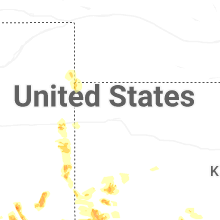
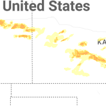
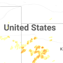


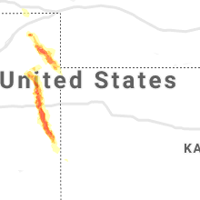


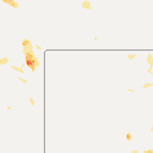
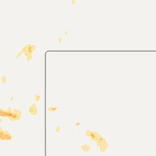


Connect with Interactive Hail Maps