

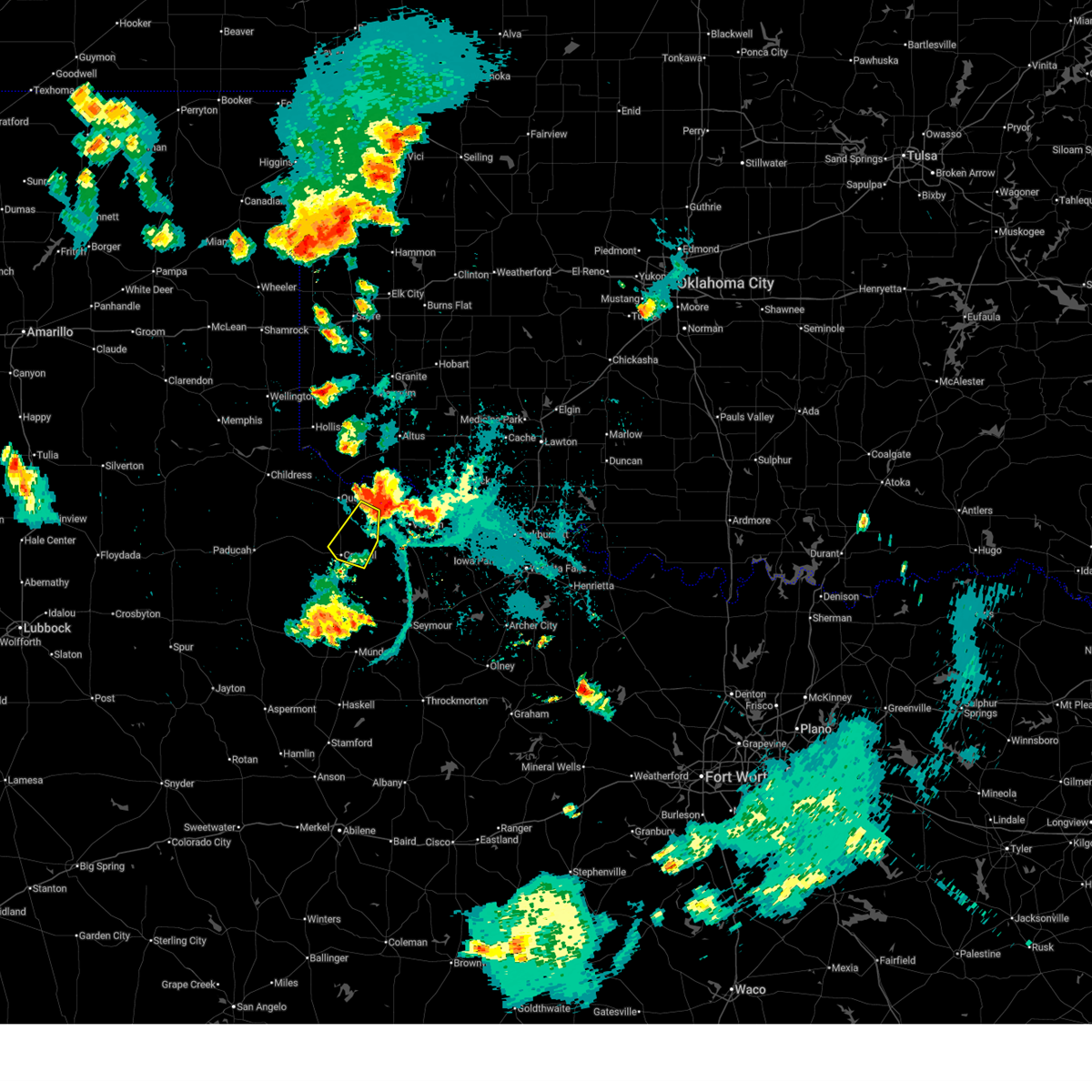
Hail Map for Chillicothe, TX
The Chillicothe, TX area has had 17 reports of on-the-ground hail by trained spotters, and has been under severe weather warnings 34 times during the past 12 months. Doppler radar has detected hail at or near Chillicothe, TX on 97 occasions, including 7 occasions during the past year.
| Name: | Chillicothe, TX |
| Where Located: | 41.7 miles ESE of Childress, TX |
| Map: | Google Map for Chillicothe, TX |
| Population: | 707 |
| Housing Units: | 355 |
| More Info: | Search Google for Chillicothe, TX |
1
The Top Recent Hail Date for Chillicothe, TX is Friday, May 8, 2026 (15th out of 97)
Hail and Wind Damage Spotted near Chillicothe, TX
| Date / Time | Report Details |
|---|---|
| 7/5/2026 4:45 PM CDT |
 At 445 pm cdt, severe thunderstorms were located along a line extending from 9 miles northwest of margaret to 9 miles northwest of lake kemp to 4 miles west of wichita falls, moving southeast at 10 mph (radar indicated). Hazards include 60 mph wind gusts and penny size hail. Expect damage to roofs, siding, and trees. Locations impacted include, western wichita falls, vernon, quanah, iowa park, electra, chillicothe, thalia, harrold, margaret, lockett, medicine mound, oklaunion, grayback, pleasant valley, rayland, and copper breaks state park. At 445 pm cdt, severe thunderstorms were located along a line extending from 9 miles northwest of margaret to 9 miles northwest of lake kemp to 4 miles west of wichita falls, moving southeast at 10 mph (radar indicated). Hazards include 60 mph wind gusts and penny size hail. Expect damage to roofs, siding, and trees. Locations impacted include, western wichita falls, vernon, quanah, iowa park, electra, chillicothe, thalia, harrold, margaret, lockett, medicine mound, oklaunion, grayback, pleasant valley, rayland, and copper breaks state park.
|
| 7/5/2026 4:11 PM CDT |
 Svroun the national weather service in norman has issued a * severe thunderstorm warning for, wichita county in northern texas, northeastern foard county in northern texas, wilbarger county in northern texas, southeastern hardeman county in northern texas, * until 500 pm cdt. * at 411 pm cdt, severe thunderstorms were located along a line extending from 3 miles south of quanah to 4 miles west of grayback to 3 miles west of burkburnett, moving south at 10 mph (radar indicated). Hazards include 60 mph wind gusts and quarter size hail. Hail damage to vehicles is expected. Expect wind damage to roofs, siding, and trees. Svroun the national weather service in norman has issued a * severe thunderstorm warning for, wichita county in northern texas, northeastern foard county in northern texas, wilbarger county in northern texas, southeastern hardeman county in northern texas, * until 500 pm cdt. * at 411 pm cdt, severe thunderstorms were located along a line extending from 3 miles south of quanah to 4 miles west of grayback to 3 miles west of burkburnett, moving south at 10 mph (radar indicated). Hazards include 60 mph wind gusts and quarter size hail. Hail damage to vehicles is expected. Expect wind damage to roofs, siding, and trees.
|
| 7/5/2026 3:47 PM CDT |
 At 347 pm cdt, a severe thunderstorm was located near fargo, and is nearly stationary (radar indicated). Hazards include 60 mph wind gusts and penny size hail. Expect damage to roofs, siding, and trees. Locations impacted include, chillicothe, odell, and fargo. At 347 pm cdt, a severe thunderstorm was located near fargo, and is nearly stationary (radar indicated). Hazards include 60 mph wind gusts and penny size hail. Expect damage to roofs, siding, and trees. Locations impacted include, chillicothe, odell, and fargo.
|
| 7/5/2026 3:24 PM CDT |
 Svroun the national weather service in norman has issued a * severe thunderstorm warning for, south central jackson county in southwestern oklahoma, west central tillman county in southwestern oklahoma, northwestern wilbarger county in northern texas, east central hardeman county in northern texas, * until 415 pm cdt. * at 324 pm cdt, a severe thunderstorm was located near odell, and is nearly stationary (radar indicated). Hazards include 60 mph wind gusts and penny size hail. expect damage to roofs, siding, and trees Svroun the national weather service in norman has issued a * severe thunderstorm warning for, south central jackson county in southwestern oklahoma, west central tillman county in southwestern oklahoma, northwestern wilbarger county in northern texas, east central hardeman county in northern texas, * until 415 pm cdt. * at 324 pm cdt, a severe thunderstorm was located near odell, and is nearly stationary (radar indicated). Hazards include 60 mph wind gusts and penny size hail. expect damage to roofs, siding, and trees
|
| 6/23/2026 2:12 PM CDT |
 the severe thunderstorm warning has been cancelled and is no longer in effect the severe thunderstorm warning has been cancelled and is no longer in effect
|
| 6/23/2026 2:12 PM CDT |
 At 210 pm cdt, severe thunderstorms were located along a line extending from 10 miles northeast of chalk to 6 miles southeast of medicine mound, moving southeast at 30 mph (broadcast media. at 202 pm cdt, a 60 mph wind gust was measured at lake pauline). Hazards include 70 mph wind gusts and quarter size hail. Hail damage to vehicles is expected. expect considerable tree damage. wind damage is also likely to mobile homes, roofs, and outbuildings. Locations impacted include, quanah, crowell, chillicothe, margaret, medicine mound, thalia, truscott, rayland, copper breaks state park, and lazare. At 210 pm cdt, severe thunderstorms were located along a line extending from 10 miles northeast of chalk to 6 miles southeast of medicine mound, moving southeast at 30 mph (broadcast media. at 202 pm cdt, a 60 mph wind gust was measured at lake pauline). Hazards include 70 mph wind gusts and quarter size hail. Hail damage to vehicles is expected. expect considerable tree damage. wind damage is also likely to mobile homes, roofs, and outbuildings. Locations impacted include, quanah, crowell, chillicothe, margaret, medicine mound, thalia, truscott, rayland, copper breaks state park, and lazare.
|
| 6/23/2026 1:43 PM CDT |
 Svroun the national weather service in norman has issued a * severe thunderstorm warning for, southwestern jackson county in southwestern oklahoma, foard county in northern texas, northwestern knox county in northern texas, southwestern wilbarger county in northern texas, hardeman county in northern texas, * until 230 pm cdt. * at 143 pm cdt, severe thunderstorms were located along a line extending from near swearingen to 7 miles northwest of chillicothe, moving south at 35 mph (radar indicated). Hazards include 70 mph wind gusts and quarter size hail. Hail damage to vehicles is expected. expect considerable tree damage. Wind damage is also likely to mobile homes, roofs, and outbuildings. Svroun the national weather service in norman has issued a * severe thunderstorm warning for, southwestern jackson county in southwestern oklahoma, foard county in northern texas, northwestern knox county in northern texas, southwestern wilbarger county in northern texas, hardeman county in northern texas, * until 230 pm cdt. * at 143 pm cdt, severe thunderstorms were located along a line extending from near swearingen to 7 miles northwest of chillicothe, moving south at 35 mph (radar indicated). Hazards include 70 mph wind gusts and quarter size hail. Hail damage to vehicles is expected. expect considerable tree damage. Wind damage is also likely to mobile homes, roofs, and outbuildings.
|
| 6/23/2026 1:22 PM CDT |
 At 121 pm cdt, severe thunderstorms were located along a line extending from near eldorado to near tell, moving south at 20 mph (radar indicated). Hazards include 70 mph wind gusts and quarter size hail. Hail damage to vehicles is expected. expect considerable tree damage. wind damage is also likely to mobile homes, roofs, and outbuildings. Locations impacted include, quanah, chillicothe, eldorado, margaret, goodlett, medicine mound, rayland, copper breaks state park, and lazare. At 121 pm cdt, severe thunderstorms were located along a line extending from near eldorado to near tell, moving south at 20 mph (radar indicated). Hazards include 70 mph wind gusts and quarter size hail. Hail damage to vehicles is expected. expect considerable tree damage. wind damage is also likely to mobile homes, roofs, and outbuildings. Locations impacted include, quanah, chillicothe, eldorado, margaret, goodlett, medicine mound, rayland, copper breaks state park, and lazare.
|
| 5/24/2026 12:58 AM CDT |
 Svroun the national weather service in norman has issued a * severe thunderstorm warning for, southwestern jackson county in southwestern oklahoma, southwestern tillman county in southwestern oklahoma, foard county in northern texas, knox county in northern texas, wilbarger county in northern texas, baylor county in northern texas, hardeman county in northern texas, * until 145 am cdt. * at 1258 am cdt, severe thunderstorms were located along a line extending from 5 miles south of eldorado to near rhineland, moving east at 35 mph (radar indicated). Hazards include 60 mph wind gusts and penny size hail. expect damage to roofs, siding, and trees Svroun the national weather service in norman has issued a * severe thunderstorm warning for, southwestern jackson county in southwestern oklahoma, southwestern tillman county in southwestern oklahoma, foard county in northern texas, knox county in northern texas, wilbarger county in northern texas, baylor county in northern texas, hardeman county in northern texas, * until 145 am cdt. * at 1258 am cdt, severe thunderstorms were located along a line extending from 5 miles south of eldorado to near rhineland, moving east at 35 mph (radar indicated). Hazards include 60 mph wind gusts and penny size hail. expect damage to roofs, siding, and trees
|
| 5/24/2026 12:48 AM CDT |
 At 1248 am cdt, severe thunderstorms were located along a line extending from 5 miles north of quanah to 6 miles southwest of benjamin, moving east at 35 mph (radar indicated). Hazards include 60 mph wind gusts and penny size hail. Expect damage to roofs, siding, and trees. Locations impacted include, quanah, munday, knox city, crowell, benjamin, chillicothe, eldorado, goree, elmer, thalia, gilliland, margaret, goodlett, vera, medicine mound, odell, truscott, rhineland, lazare, and rayland. At 1248 am cdt, severe thunderstorms were located along a line extending from 5 miles north of quanah to 6 miles southwest of benjamin, moving east at 35 mph (radar indicated). Hazards include 60 mph wind gusts and penny size hail. Expect damage to roofs, siding, and trees. Locations impacted include, quanah, munday, knox city, crowell, benjamin, chillicothe, eldorado, goree, elmer, thalia, gilliland, margaret, goodlett, vera, medicine mound, odell, truscott, rhineland, lazare, and rayland.
|
| 5/24/2026 12:30 AM CDT |
 At 1230 am cdt, severe thunderstorms were located along a line extending from 6 miles west of eldorado to 14 miles east of guthrie, moving east at 35 mph (radar indicated). Hazards include 70 mph wind gusts and quarter size hail. Hail damage to vehicles is expected. expect considerable tree damage. wind damage is also likely to mobile homes, roofs, and outbuildings. Locations impacted include, quanah, munday, knox city, crowell, benjamin, chillicothe, eldorado, goree, elmer, thalia, gilliland, margaret, goodlett, vera, medicine mound, odell, truscott, rhineland, lazare, and rayland. At 1230 am cdt, severe thunderstorms were located along a line extending from 6 miles west of eldorado to 14 miles east of guthrie, moving east at 35 mph (radar indicated). Hazards include 70 mph wind gusts and quarter size hail. Hail damage to vehicles is expected. expect considerable tree damage. wind damage is also likely to mobile homes, roofs, and outbuildings. Locations impacted include, quanah, munday, knox city, crowell, benjamin, chillicothe, eldorado, goree, elmer, thalia, gilliland, margaret, goodlett, vera, medicine mound, odell, truscott, rhineland, lazare, and rayland.
|
| 5/24/2026 12:09 AM CDT |
 Svroun the national weather service in norman has issued a * severe thunderstorm warning for, southwestern jackson county in southwestern oklahoma, foard county in northern texas, knox county in northern texas, western wilbarger county in northern texas, northwestern baylor county in northern texas, hardeman county in northern texas, * until 100 am cdt. * at 1208 am cdt, severe thunderstorms were located along a line extending from 7 miles northeast of kirkland to near guthrie, moving east at 35 mph (radar indicated). Hazards include 60 mph wind gusts and quarter size hail. Hail damage to vehicles is expected. Expect wind damage to roofs, siding, and trees. Svroun the national weather service in norman has issued a * severe thunderstorm warning for, southwestern jackson county in southwestern oklahoma, foard county in northern texas, knox county in northern texas, western wilbarger county in northern texas, northwestern baylor county in northern texas, hardeman county in northern texas, * until 100 am cdt. * at 1208 am cdt, severe thunderstorms were located along a line extending from 7 miles northeast of kirkland to near guthrie, moving east at 35 mph (radar indicated). Hazards include 60 mph wind gusts and quarter size hail. Hail damage to vehicles is expected. Expect wind damage to roofs, siding, and trees.
|
| 5/22/2026 10:42 PM CDT |
 The storms which prompted the warning have weakened below severe limits, therefore the warning will be allowed to expire. however, small hail, gusty winds and heavy rain are still possible with these thunderstorms. The storms which prompted the warning have weakened below severe limits, therefore the warning will be allowed to expire. however, small hail, gusty winds and heavy rain are still possible with these thunderstorms.
|
| 5/22/2026 10:33 PM CDT |
 At 1033 pm cdt, severe thunderstorms were located along a line extending from 7 miles north of gould to 3 miles northwest of olustee to near lockett, moving east at 30 mph (radar indicated). Hazards include 60 mph wind gusts and nickel size hail. Expect damage to roofs, siding, and trees. Locations impacted include, vernon, quanah, hollis, chillicothe, olustee, eldorado, gould, elmer, thalia, duke, margaret, lockett, medicine mound, odell, mcqueen, rayland, and mcknight. At 1033 pm cdt, severe thunderstorms were located along a line extending from 7 miles north of gould to 3 miles northwest of olustee to near lockett, moving east at 30 mph (radar indicated). Hazards include 60 mph wind gusts and nickel size hail. Expect damage to roofs, siding, and trees. Locations impacted include, vernon, quanah, hollis, chillicothe, olustee, eldorado, gould, elmer, thalia, duke, margaret, lockett, medicine mound, odell, mcqueen, rayland, and mcknight.
|
| 5/22/2026 9:54 PM CDT |
 Svroun the national weather service in norman has issued a * severe thunderstorm warning for, southwestern jackson county in southwestern oklahoma, harmon county in southwestern oklahoma, southwestern greer county in southwestern oklahoma, foard county in northern texas, western wilbarger county in northern texas, hardeman county in northern texas, * until 1045 pm cdt. * at 954 pm cdt, severe thunderstorms were located along a line extending from 8 miles southwest of hollis to 5 miles northeast of quanah to 7 miles south of thalia, moving northeast at 30 mph (radar indicated). Hazards include 60 mph wind gusts. expect damage to roofs, siding, and trees Svroun the national weather service in norman has issued a * severe thunderstorm warning for, southwestern jackson county in southwestern oklahoma, harmon county in southwestern oklahoma, southwestern greer county in southwestern oklahoma, foard county in northern texas, western wilbarger county in northern texas, hardeman county in northern texas, * until 1045 pm cdt. * at 954 pm cdt, severe thunderstorms were located along a line extending from 8 miles southwest of hollis to 5 miles northeast of quanah to 7 miles south of thalia, moving northeast at 30 mph (radar indicated). Hazards include 60 mph wind gusts. expect damage to roofs, siding, and trees
|
| 5/15/2026 8:55 PM CDT |
 The storms which prompted the warning have weakened below severe limits, therefore the warning will be allowed to expire. however, gusty winds of 50 mph are still possible with these thunderstorms. The storms which prompted the warning have weakened below severe limits, therefore the warning will be allowed to expire. however, gusty winds of 50 mph are still possible with these thunderstorms.
|
| 5/15/2026 8:11 PM CDT |
 Svroun the national weather service in norman has issued a * severe thunderstorm warning for, central jackson county in southwestern oklahoma, southern harmon county in southwestern oklahoma, foard county in northern texas, hardeman county in northern texas, * until 900 pm cdt. * at 810 pm cdt, severe thunderstorms were located along a line extending from 8 miles south of gould to 3 miles northeast of chalk, moving east at 25 mph. the strongest storm will move across hardeman and southern harmon counties into jackson county, however strong winds will be possible anywhere along this line of storms (radar indicated). Hazards include 60 mph wind gusts and quarter size hail. Hail damage to vehicles is expected. Expect wind damage to roofs, siding, and trees. Svroun the national weather service in norman has issued a * severe thunderstorm warning for, central jackson county in southwestern oklahoma, southern harmon county in southwestern oklahoma, foard county in northern texas, hardeman county in northern texas, * until 900 pm cdt. * at 810 pm cdt, severe thunderstorms were located along a line extending from 8 miles south of gould to 3 miles northeast of chalk, moving east at 25 mph. the strongest storm will move across hardeman and southern harmon counties into jackson county, however strong winds will be possible anywhere along this line of storms (radar indicated). Hazards include 60 mph wind gusts and quarter size hail. Hail damage to vehicles is expected. Expect wind damage to roofs, siding, and trees.
|
| 5/14/2026 8:14 PM CDT |
 The storms which prompted the warning have weakened below severe limits, therefore the warning will be allowed to expire. however, gusty winds of 50 mph are still possible with these thunderstorms. The storms which prompted the warning have weakened below severe limits, therefore the warning will be allowed to expire. however, gusty winds of 50 mph are still possible with these thunderstorms.
|
| 5/14/2026 8:00 PM CDT |
 At 759 pm cdt, severe thunderstorms were located 6 miles northwest of duke, 5 miles northwest of eldorado, 3 miles northwest of quanah and 11 miles east of swearingen. these storms are moving east at 40 mph (radar indicated). Hazards include 60 mph wind gusts. Expect damage to roofs, siding, and trees. Locations impacted include, mangum, quanah, hollis, crowell, chillicothe, olustee, eldorado, gould, duke, margaret, goodlett, medicine mound, hester, lazare, mcqueen, copper breaks state park, and mcknight. At 759 pm cdt, severe thunderstorms were located 6 miles northwest of duke, 5 miles northwest of eldorado, 3 miles northwest of quanah and 11 miles east of swearingen. these storms are moving east at 40 mph (radar indicated). Hazards include 60 mph wind gusts. Expect damage to roofs, siding, and trees. Locations impacted include, mangum, quanah, hollis, crowell, chillicothe, olustee, eldorado, gould, duke, margaret, goodlett, medicine mound, hester, lazare, mcqueen, copper breaks state park, and mcknight.
|
| 5/14/2026 7:30 PM CDT |
 Svroun the national weather service in norman has issued a * severe thunderstorm warning for, western jackson county in southwestern oklahoma, harmon county in southwestern oklahoma, southwestern greer county in southwestern oklahoma, foard county in northern texas, western wilbarger county in northern texas, hardeman county in northern texas, * until 815 pm cdt. * at 729 pm cdt, severe thunderstorms were located along a line extending from 6 miles north of hollis to 4 miles northeast of paducah, moving east at 40 mph. a wind gust of 62 mph was measured near childress texas with this line of storms (radar indicated). Hazards include 60 mph wind gusts. expect damage to roofs, siding, and trees Svroun the national weather service in norman has issued a * severe thunderstorm warning for, western jackson county in southwestern oklahoma, harmon county in southwestern oklahoma, southwestern greer county in southwestern oklahoma, foard county in northern texas, western wilbarger county in northern texas, hardeman county in northern texas, * until 815 pm cdt. * at 729 pm cdt, severe thunderstorms were located along a line extending from 6 miles north of hollis to 4 miles northeast of paducah, moving east at 40 mph. a wind gust of 62 mph was measured near childress texas with this line of storms (radar indicated). Hazards include 60 mph wind gusts. expect damage to roofs, siding, and trees
|
| 5/14/2026 6:52 PM CDT |
 Svroun the national weather service in norman has issued a * severe thunderstorm warning for, western jackson county in southwestern oklahoma, harmon county in southwestern oklahoma, greer county in southwestern oklahoma, foard county in northern texas, western wilbarger county in northern texas, hardeman county in northern texas, * until 730 pm cdt. * at 652 pm cdt, severe thunderstorms were located along a line extending from 3 miles northwest of wellington to 3 miles northwest of childress to 11 miles east of matador, moving east at 20 mph (radar indicated). Hazards include 60 mph wind gusts. expect damage to roofs, siding, and trees Svroun the national weather service in norman has issued a * severe thunderstorm warning for, western jackson county in southwestern oklahoma, harmon county in southwestern oklahoma, greer county in southwestern oklahoma, foard county in northern texas, western wilbarger county in northern texas, hardeman county in northern texas, * until 730 pm cdt. * at 652 pm cdt, severe thunderstorms were located along a line extending from 3 miles northwest of wellington to 3 miles northwest of childress to 11 miles east of matador, moving east at 20 mph (radar indicated). Hazards include 60 mph wind gusts. expect damage to roofs, siding, and trees
|
| 5/8/2026 9:35 PM CDT |
 At 934 pm cdt, a severe thunderstorm was located 4 miles southeast of chillicothe, moving south at 20 mph (radar indicated). Hazards include 60 mph wind gusts and half dollar size hail. Hail damage to vehicles is expected. expect wind damage to roofs, siding, and trees. Locations impacted include, chillicothe, lockett, and rayland. At 934 pm cdt, a severe thunderstorm was located 4 miles southeast of chillicothe, moving south at 20 mph (radar indicated). Hazards include 60 mph wind gusts and half dollar size hail. Hail damage to vehicles is expected. expect wind damage to roofs, siding, and trees. Locations impacted include, chillicothe, lockett, and rayland.
|
| 5/8/2026 9:15 PM CDT |
 Svroun the national weather service in norman has issued a * severe thunderstorm warning for, west central tillman county in southwestern oklahoma, northeastern foard county in northern texas, northwestern wilbarger county in northern texas, southeastern hardeman county in northern texas, * until 1000 pm cdt. * at 915 pm cdt, a severe thunderstorm was located 5 miles south of odell, moving south at 20 mph (radar indicated). Hazards include tennis ball size hail and 60 mph wind gusts. People and animals outdoors will be injured. expect hail damage to roofs, siding, windows, and vehicles. Expect wind damage to roofs, siding, and trees. Svroun the national weather service in norman has issued a * severe thunderstorm warning for, west central tillman county in southwestern oklahoma, northeastern foard county in northern texas, northwestern wilbarger county in northern texas, southeastern hardeman county in northern texas, * until 1000 pm cdt. * at 915 pm cdt, a severe thunderstorm was located 5 miles south of odell, moving south at 20 mph (radar indicated). Hazards include tennis ball size hail and 60 mph wind gusts. People and animals outdoors will be injured. expect hail damage to roofs, siding, windows, and vehicles. Expect wind damage to roofs, siding, and trees.
|
| 5/8/2026 9:14 PM CDT | Hen Egg sized hail reported 0.4 miles SSW of Chillicothe, TX, time estimated from radar. |
| 5/8/2026 9:03 PM CDT |
 Svroun the national weather service in norman has issued a * severe thunderstorm warning for, northwestern wilbarger county in northern texas, southeastern hardeman county in northern texas, * until 915 pm cdt. * at 903 pm cdt, a severe thunderstorm was located near odell, moving southeast at 25 mph (radar indicated). Hazards include ping pong ball size hail and 60 mph wind gusts. People and animals outdoors will be injured. expect hail damage to roofs, siding, windows, and vehicles. Expect wind damage to roofs, siding, and trees. Svroun the national weather service in norman has issued a * severe thunderstorm warning for, northwestern wilbarger county in northern texas, southeastern hardeman county in northern texas, * until 915 pm cdt. * at 903 pm cdt, a severe thunderstorm was located near odell, moving southeast at 25 mph (radar indicated). Hazards include ping pong ball size hail and 60 mph wind gusts. People and animals outdoors will be injured. expect hail damage to roofs, siding, windows, and vehicles. Expect wind damage to roofs, siding, and trees.
|
| 4/4/2026 12:43 AM CDT |
 the severe thunderstorm warning has been cancelled and is no longer in effect the severe thunderstorm warning has been cancelled and is no longer in effect
|
| 4/4/2026 12:23 AM CDT |
 Svroun the national weather service in norman has issued a * severe thunderstorm warning for, southeastern jackson county in southwestern oklahoma, western tillman county in southwestern oklahoma, northwestern wilbarger county in northern texas, east central hardeman county in northern texas, * until 115 am cdt. * at 1222 am cdt, severe thunderstorms were located along a line extending from 6 miles northeast of eldorado to 6 miles northwest of odell to 3 miles east of chillicothe, moving east at 30 mph (radar indicated). Hazards include 60 mph wind gusts. expect damage to roofs, siding, and trees Svroun the national weather service in norman has issued a * severe thunderstorm warning for, southeastern jackson county in southwestern oklahoma, western tillman county in southwestern oklahoma, northwestern wilbarger county in northern texas, east central hardeman county in northern texas, * until 115 am cdt. * at 1222 am cdt, severe thunderstorms were located along a line extending from 6 miles northeast of eldorado to 6 miles northwest of odell to 3 miles east of chillicothe, moving east at 30 mph (radar indicated). Hazards include 60 mph wind gusts. expect damage to roofs, siding, and trees
|
| 4/3/2026 11:56 PM CDT |
 Svroun the national weather service in norman has issued a * severe thunderstorm warning for, southwestern jackson county in southwestern oklahoma, west central tillman county in southwestern oklahoma, northwestern wilbarger county in northern texas, east central hardeman county in northern texas, * until 1230 am cdt. * at 1155 pm cdt, a severe thunderstorm was located 4 miles east of quanah, moving east at 40 mph (radar indicated). Hazards include 70 mph wind gusts and quarter size hail. Hail damage to vehicles is expected. expect considerable tree damage. Wind damage is also likely to mobile homes, roofs, and outbuildings. Svroun the national weather service in norman has issued a * severe thunderstorm warning for, southwestern jackson county in southwestern oklahoma, west central tillman county in southwestern oklahoma, northwestern wilbarger county in northern texas, east central hardeman county in northern texas, * until 1230 am cdt. * at 1155 pm cdt, a severe thunderstorm was located 4 miles east of quanah, moving east at 40 mph (radar indicated). Hazards include 70 mph wind gusts and quarter size hail. Hail damage to vehicles is expected. expect considerable tree damage. Wind damage is also likely to mobile homes, roofs, and outbuildings.
|
| 4/1/2026 6:52 PM CDT |
 Svroun the national weather service in norman has issued a * severe thunderstorm warning for, southern washita county in western oklahoma, western comanche county in southwestern oklahoma, southwestern caddo county in southwestern oklahoma, jackson county in southwestern oklahoma, kiowa county in southwestern oklahoma, tillman county in southwestern oklahoma, greer county in southwestern oklahoma, southeastern beckham county in western oklahoma, central foard county in northern texas, northern wilbarger county in northern texas, southeastern hardeman county in northern texas, * until 730 pm cdt. * at 652 pm cdt, severe thunderstorms were located along a line extending from 6 miles north of granite to 5 miles north of warren to near humphreys to 3 miles west of vernon, moving northeast at 55 mph (radar indicated). Hazards include 70 mph wind gusts and quarter size hail. Hail damage to vehicles is expected. expect considerable tree damage. Wind damage is also likely to mobile homes, roofs, and outbuildings. Svroun the national weather service in norman has issued a * severe thunderstorm warning for, southern washita county in western oklahoma, western comanche county in southwestern oklahoma, southwestern caddo county in southwestern oklahoma, jackson county in southwestern oklahoma, kiowa county in southwestern oklahoma, tillman county in southwestern oklahoma, greer county in southwestern oklahoma, southeastern beckham county in western oklahoma, central foard county in northern texas, northern wilbarger county in northern texas, southeastern hardeman county in northern texas, * until 730 pm cdt. * at 652 pm cdt, severe thunderstorms were located along a line extending from 6 miles north of granite to 5 miles north of warren to near humphreys to 3 miles west of vernon, moving northeast at 55 mph (radar indicated). Hazards include 70 mph wind gusts and quarter size hail. Hail damage to vehicles is expected. expect considerable tree damage. Wind damage is also likely to mobile homes, roofs, and outbuildings.
|
| 4/1/2026 6:18 PM CDT |
 Svroun the national weather service in norman has issued a * severe thunderstorm warning for, southwestern washita county in western oklahoma, jackson county in southwestern oklahoma, western kiowa county in southwestern oklahoma, western tillman county in southwestern oklahoma, harmon county in southwestern oklahoma, greer county in southwestern oklahoma, southeastern beckham county in western oklahoma, northeastern foard county in northern texas, northwestern wilbarger county in northern texas, hardeman county in northern texas, * until 700 pm cdt. * at 618 pm cdt, severe thunderstorms were located along a line extending from 3 miles east of vinson to 5 miles east of gould to near eldorado to 6 miles northwest of margaret, moving northeast at 45 mph (radar indicated). Hazards include 70 mph wind gusts and half dollar size hail. Hail damage to vehicles is expected. expect considerable tree damage. Wind damage is also likely to mobile homes, roofs, and outbuildings. Svroun the national weather service in norman has issued a * severe thunderstorm warning for, southwestern washita county in western oklahoma, jackson county in southwestern oklahoma, western kiowa county in southwestern oklahoma, western tillman county in southwestern oklahoma, harmon county in southwestern oklahoma, greer county in southwestern oklahoma, southeastern beckham county in western oklahoma, northeastern foard county in northern texas, northwestern wilbarger county in northern texas, hardeman county in northern texas, * until 700 pm cdt. * at 618 pm cdt, severe thunderstorms were located along a line extending from 3 miles east of vinson to 5 miles east of gould to near eldorado to 6 miles northwest of margaret, moving northeast at 45 mph (radar indicated). Hazards include 70 mph wind gusts and half dollar size hail. Hail damage to vehicles is expected. expect considerable tree damage. Wind damage is also likely to mobile homes, roofs, and outbuildings.
|
| 7/8/2025 10:42 PM CDT |
 Svroun the national weather service in norman has issued a * severe thunderstorm warning for, east central foard county in northern texas, southeastern hardeman county in northern texas, * until 1100 pm cdt. * at 1041 pm cdt, a severe thunderstorm was located near medicine mound, moving southwest at 30 mph. this is a destructive storm for crowell (radar indicated). Hazards include 80 mph wind gusts. Flying debris will be dangerous to those caught without shelter. mobile homes will be heavily damaged. expect considerable damage to roofs, windows, and vehicles. Extensive tree damage and power outages are likely. Svroun the national weather service in norman has issued a * severe thunderstorm warning for, east central foard county in northern texas, southeastern hardeman county in northern texas, * until 1100 pm cdt. * at 1041 pm cdt, a severe thunderstorm was located near medicine mound, moving southwest at 30 mph. this is a destructive storm for crowell (radar indicated). Hazards include 80 mph wind gusts. Flying debris will be dangerous to those caught without shelter. mobile homes will be heavily damaged. expect considerable damage to roofs, windows, and vehicles. Extensive tree damage and power outages are likely.
|
| 7/8/2025 10:36 PM CDT |
 At 1035 pm cdt, severe thunderstorms were located along a line extending from 3 miles southeast of eldorado to near fargo, moving south at 30 mph (radar indicated). Hazards include 70 mph wind gusts. Expect considerable tree damage. damage is likely to mobile homes, roofs, and outbuildings. Locations impacted include, chillicothe, odell, and fargo. At 1035 pm cdt, severe thunderstorms were located along a line extending from 3 miles southeast of eldorado to near fargo, moving south at 30 mph (radar indicated). Hazards include 70 mph wind gusts. Expect considerable tree damage. damage is likely to mobile homes, roofs, and outbuildings. Locations impacted include, chillicothe, odell, and fargo.
|
| 7/8/2025 10:36 PM CDT |
 the severe thunderstorm warning has been cancelled and is no longer in effect the severe thunderstorm warning has been cancelled and is no longer in effect
|
| 7/8/2025 10:34 PM CDT |
 Svroun the national weather service in norman has issued a * severe thunderstorm warning for, central foard county in northern texas, west central wilbarger county in northern texas, southern hardeman county in northern texas, * until 1115 pm cdt. * at 1034 pm cdt, a severe thunderstorm was located over chillicothe, moving southwest at 25 mph (radar indicated). Hazards include 70 mph wind gusts and quarter size hail. Hail damage to vehicles is expected. expect considerable tree damage. Wind damage is also likely to mobile homes, roofs, and outbuildings. Svroun the national weather service in norman has issued a * severe thunderstorm warning for, central foard county in northern texas, west central wilbarger county in northern texas, southern hardeman county in northern texas, * until 1115 pm cdt. * at 1034 pm cdt, a severe thunderstorm was located over chillicothe, moving southwest at 25 mph (radar indicated). Hazards include 70 mph wind gusts and quarter size hail. Hail damage to vehicles is expected. expect considerable tree damage. Wind damage is also likely to mobile homes, roofs, and outbuildings.
|
| 7/8/2025 10:10 PM CDT |
 Svroun the national weather service in norman has issued a * severe thunderstorm warning for, southwestern jackson county in southwestern oklahoma, southwestern tillman county in southwestern oklahoma, southeastern harmon county in southwestern oklahoma, northwestern wilbarger county in northern texas, northeastern hardeman county in northern texas, * until 1100 pm cdt. * at 1010 pm cdt, severe thunderstorms were located along a line extending from 4 miles south of duke to 4 miles west of frederick, moving south at 30 mph (radar indicated). Hazards include 70 mph wind gusts. Expect considerable tree damage. Damage is likely to mobile homes, roofs, and outbuildings. Svroun the national weather service in norman has issued a * severe thunderstorm warning for, southwestern jackson county in southwestern oklahoma, southwestern tillman county in southwestern oklahoma, southeastern harmon county in southwestern oklahoma, northwestern wilbarger county in northern texas, northeastern hardeman county in northern texas, * until 1100 pm cdt. * at 1010 pm cdt, severe thunderstorms were located along a line extending from 4 miles south of duke to 4 miles west of frederick, moving south at 30 mph (radar indicated). Hazards include 70 mph wind gusts. Expect considerable tree damage. Damage is likely to mobile homes, roofs, and outbuildings.
|
| 6/8/2025 3:34 PM CDT |
 the severe thunderstorm warning has been cancelled and is no longer in effect the severe thunderstorm warning has been cancelled and is no longer in effect
|
| 6/8/2025 3:21 PM CDT |
 Svroun the national weather service in norman has issued a * severe thunderstorm warning for, southwestern jackson county in southwestern oklahoma, southwestern harmon county in southwestern oklahoma, west central wilbarger county in northern texas, hardeman county in northern texas, * until 400 pm cdt. * at 321 pm cdt, a severe thunderstorm was located near kirkland, moving southeast at 40 mph (radar indicated). Hazards include 60 mph wind gusts and quarter size hail. Hail damage to vehicles is expected. Expect wind damage to roofs, siding, and trees. Svroun the national weather service in norman has issued a * severe thunderstorm warning for, southwestern jackson county in southwestern oklahoma, southwestern harmon county in southwestern oklahoma, west central wilbarger county in northern texas, hardeman county in northern texas, * until 400 pm cdt. * at 321 pm cdt, a severe thunderstorm was located near kirkland, moving southeast at 40 mph (radar indicated). Hazards include 60 mph wind gusts and quarter size hail. Hail damage to vehicles is expected. Expect wind damage to roofs, siding, and trees.
|
| 6/3/2025 3:52 PM CDT |
 Svroun the national weather service in norman has issued a * severe thunderstorm warning for, southeastern jackson county in southwestern oklahoma, northern tillman county in southwestern oklahoma, northwestern wilbarger county in northern texas, east central hardeman county in northern texas, * until 445 pm cdt. * at 352 pm cdt, severe thunderstorms were located along a line extending from tipton to 5 miles west of odell, moving southeast at 15 mph (radar indicated). Hazards include 60 mph wind gusts. Expect damage to roofs, siding, and trees. Locations in or near the path include, frederick, chillicothe, fargo, humphreys, odell, headrick, tipton, elmer, manitou, hess,. Svroun the national weather service in norman has issued a * severe thunderstorm warning for, southeastern jackson county in southwestern oklahoma, northern tillman county in southwestern oklahoma, northwestern wilbarger county in northern texas, east central hardeman county in northern texas, * until 445 pm cdt. * at 352 pm cdt, severe thunderstorms were located along a line extending from tipton to 5 miles west of odell, moving southeast at 15 mph (radar indicated). Hazards include 60 mph wind gusts. Expect damage to roofs, siding, and trees. Locations in or near the path include, frederick, chillicothe, fargo, humphreys, odell, headrick, tipton, elmer, manitou, hess,.
|
| 5/2/2025 12:47 AM CDT |
 Svroun the national weather service in norman has issued a * severe thunderstorm warning for, southwestern comanche county in southwestern oklahoma, northern cotton county in southwestern oklahoma, south central jackson county in southwestern oklahoma, tillman county in southwestern oklahoma, northern foard county in northern texas, northern wilbarger county in northern texas, hardeman county in northern texas, * until 130 am cdt. * at 1246 am cdt, severe thunderstorms were located along a line extending from near chattanooga to near fargo to 8 miles east of swearingen, moving southeast at 15 mph (radar indicated). Hazards include two inch hail and 60 mph wind gusts. People and animals outdoors will be injured. expect hail damage to roofs, siding, windows, and vehicles. Expect wind damage to roofs, siding, and trees. Svroun the national weather service in norman has issued a * severe thunderstorm warning for, southwestern comanche county in southwestern oklahoma, northern cotton county in southwestern oklahoma, south central jackson county in southwestern oklahoma, tillman county in southwestern oklahoma, northern foard county in northern texas, northern wilbarger county in northern texas, hardeman county in northern texas, * until 130 am cdt. * at 1246 am cdt, severe thunderstorms were located along a line extending from near chattanooga to near fargo to 8 miles east of swearingen, moving southeast at 15 mph (radar indicated). Hazards include two inch hail and 60 mph wind gusts. People and animals outdoors will be injured. expect hail damage to roofs, siding, windows, and vehicles. Expect wind damage to roofs, siding, and trees.
|
| 4/30/2025 7:24 PM CDT |
 The storms which prompted the warning have weakened below severe limits, therefore the warning will be allowed to expire. however, gusty winds are still possible with these thunderstorms. The storms which prompted the warning have weakened below severe limits, therefore the warning will be allowed to expire. however, gusty winds are still possible with these thunderstorms.
|
| 4/30/2025 7:20 PM CDT |
 At 719 pm cdt, severe thunderstorms were located along a line extending from 7 miles northwest of eldorado to 3 miles northwest of lockett, moving east at 45 mph (radar indicated). Hazards include 60 mph wind gusts. Expect damage to roofs, siding, and trees. Locations impacted include, vernon, quanah, chillicothe, olustee, eldorado, fargo, medicine mound, and odell. At 719 pm cdt, severe thunderstorms were located along a line extending from 7 miles northwest of eldorado to 3 miles northwest of lockett, moving east at 45 mph (radar indicated). Hazards include 60 mph wind gusts. Expect damage to roofs, siding, and trees. Locations impacted include, vernon, quanah, chillicothe, olustee, eldorado, fargo, medicine mound, and odell.
|
| 4/30/2025 7:10 PM CDT |
 the severe thunderstorm warning has been cancelled and is no longer in effect the severe thunderstorm warning has been cancelled and is no longer in effect
|
| 4/30/2025 7:10 PM CDT |
 At 710 pm cdt, severe thunderstorms were located along a line extending from 12 miles southwest of gould to 7 miles west of lockett, moving east at 40 mph (radar indicated). Hazards include 60 mph wind gusts. Expect damage to roofs, siding, and trees. Locations impacted include, vernon, quanah, chillicothe, olustee, eldorado, goodlett, fargo, medicine mound, and odell. At 710 pm cdt, severe thunderstorms were located along a line extending from 12 miles southwest of gould to 7 miles west of lockett, moving east at 40 mph (radar indicated). Hazards include 60 mph wind gusts. Expect damage to roofs, siding, and trees. Locations impacted include, vernon, quanah, chillicothe, olustee, eldorado, goodlett, fargo, medicine mound, and odell.
|
| 4/30/2025 6:57 PM CDT |
 Svroun the national weather service in norman has issued a * severe thunderstorm warning for, southwestern jackson county in southwestern oklahoma, southeastern harmon county in southwestern oklahoma, north central foard county in northern texas, northwestern wilbarger county in northern texas, hardeman county in northern texas, * until 730 pm cdt. * at 656 pm cdt, severe thunderstorms were located along a line extending from 4 miles northwest of goodlett to 5 miles southwest of medicine mound, moving east at 45 mph (radar indicated). Hazards include 60 mph wind gusts. expect damage to roofs, siding, and trees Svroun the national weather service in norman has issued a * severe thunderstorm warning for, southwestern jackson county in southwestern oklahoma, southeastern harmon county in southwestern oklahoma, north central foard county in northern texas, northwestern wilbarger county in northern texas, hardeman county in northern texas, * until 730 pm cdt. * at 656 pm cdt, severe thunderstorms were located along a line extending from 4 miles northwest of goodlett to 5 miles southwest of medicine mound, moving east at 45 mph (radar indicated). Hazards include 60 mph wind gusts. expect damage to roofs, siding, and trees
|
| 4/28/2025 8:11 PM CDT |
 At 810 pm cdt, severe thunderstorms were located along a line extending from near duke to 5 miles west of chillicothe, moving northeast at 50 mph (radar indicated). Hazards include golf ball size hail and 70 mph wind gusts. People and animals outdoors will be injured. expect hail damage to roofs, siding, windows, and vehicles. expect considerable tree damage. wind damage is also likely to mobile homes, roofs, and outbuildings. Locations impacted include, altus, frederick, quanah, snyder, tipton, blair, chillicothe, olustee, eldorado, mountain park, roosevelt, manitou, martha, elmer, headrick, friendship, cooperton, altus air force base, tom steed reservoir, and warren. At 810 pm cdt, severe thunderstorms were located along a line extending from near duke to 5 miles west of chillicothe, moving northeast at 50 mph (radar indicated). Hazards include golf ball size hail and 70 mph wind gusts. People and animals outdoors will be injured. expect hail damage to roofs, siding, windows, and vehicles. expect considerable tree damage. wind damage is also likely to mobile homes, roofs, and outbuildings. Locations impacted include, altus, frederick, quanah, snyder, tipton, blair, chillicothe, olustee, eldorado, mountain park, roosevelt, manitou, martha, elmer, headrick, friendship, cooperton, altus air force base, tom steed reservoir, and warren.
|
| 4/28/2025 8:07 PM CDT |
 Svroun the national weather service in norman has issued a * severe thunderstorm warning for, jackson county in southwestern oklahoma, central kiowa county in southwestern oklahoma, northwestern tillman county in southwestern oklahoma, southeastern harmon county in southwestern oklahoma, southeastern greer county in southwestern oklahoma, northwestern wilbarger county in northern texas, central hardeman county in northern texas, * until 845 pm cdt. * at 806 pm cdt, severe thunderstorms were located along a line extending from 3 miles northeast of friendship to 5 miles southeast of quanah, moving northeast at 40 mph (radar indicated). Hazards include ping pong ball size hail and 60 mph wind gusts. People and animals outdoors will be injured. expect hail damage to roofs, siding, windows, and vehicles. Expect wind damage to roofs, siding, and trees. Svroun the national weather service in norman has issued a * severe thunderstorm warning for, jackson county in southwestern oklahoma, central kiowa county in southwestern oklahoma, northwestern tillman county in southwestern oklahoma, southeastern harmon county in southwestern oklahoma, southeastern greer county in southwestern oklahoma, northwestern wilbarger county in northern texas, central hardeman county in northern texas, * until 845 pm cdt. * at 806 pm cdt, severe thunderstorms were located along a line extending from 3 miles northeast of friendship to 5 miles southeast of quanah, moving northeast at 40 mph (radar indicated). Hazards include ping pong ball size hail and 60 mph wind gusts. People and animals outdoors will be injured. expect hail damage to roofs, siding, windows, and vehicles. Expect wind damage to roofs, siding, and trees.
|
| 4/28/2025 8:01 PM CDT |
 At 801 pm cdt, a severe thunderstorm was located 6 miles northwest of chillicothe, moving northeast at 40 mph (radar indicated). Hazards include 60 mph wind gusts and quarter size hail. Hail damage to vehicles is expected. expect wind damage to roofs, siding, and trees. Locations impacted include, quanah, chillicothe, odell, and medicine mound. At 801 pm cdt, a severe thunderstorm was located 6 miles northwest of chillicothe, moving northeast at 40 mph (radar indicated). Hazards include 60 mph wind gusts and quarter size hail. Hail damage to vehicles is expected. expect wind damage to roofs, siding, and trees. Locations impacted include, quanah, chillicothe, odell, and medicine mound.
|
| 4/28/2025 8:01 PM CDT |
 the severe thunderstorm warning has been cancelled and is no longer in effect the severe thunderstorm warning has been cancelled and is no longer in effect
|
| 4/28/2025 7:34 PM CDT |
 Svroun the national weather service in norman has issued a * severe thunderstorm warning for, southwestern jackson county in southwestern oklahoma, northeastern foard county in northern texas, northwestern wilbarger county in northern texas, southeastern hardeman county in northern texas, * until 815 pm cdt. * at 733 pm cdt, a severe thunderstorm was located 5 miles northwest of margaret, moving northeast at 40 mph (radar indicated). Hazards include golf ball size hail and 60 mph wind gusts. People and animals outdoors will be injured. expect hail damage to roofs, siding, windows, and vehicles. Expect wind damage to roofs, siding, and trees. Svroun the national weather service in norman has issued a * severe thunderstorm warning for, southwestern jackson county in southwestern oklahoma, northeastern foard county in northern texas, northwestern wilbarger county in northern texas, southeastern hardeman county in northern texas, * until 815 pm cdt. * at 733 pm cdt, a severe thunderstorm was located 5 miles northwest of margaret, moving northeast at 40 mph (radar indicated). Hazards include golf ball size hail and 60 mph wind gusts. People and animals outdoors will be injured. expect hail damage to roofs, siding, windows, and vehicles. Expect wind damage to roofs, siding, and trees.
|
| 4/28/2025 6:09 PM CDT |
 At 608 pm cdt, a severe thunderstorm was located near chillicothe, moving northeast at 45 mph (trained weather spotters). Hazards include golf ball size hail and 70 mph wind gusts. People and animals outdoors will be injured. expect hail damage to roofs, siding, windows, and vehicles. expect considerable tree damage. wind damage is also likely to mobile homes, roofs, and outbuildings. Locations impacted include, chillicothe, eldorado, odell, fargo, and medicine mound. At 608 pm cdt, a severe thunderstorm was located near chillicothe, moving northeast at 45 mph (trained weather spotters). Hazards include golf ball size hail and 70 mph wind gusts. People and animals outdoors will be injured. expect hail damage to roofs, siding, windows, and vehicles. expect considerable tree damage. wind damage is also likely to mobile homes, roofs, and outbuildings. Locations impacted include, chillicothe, eldorado, odell, fargo, and medicine mound.
|
| 4/28/2025 6:08 PM CDT | Golf Ball sized hail reported 0.4 miles SSW of Chillicothe, TX |
| 4/28/2025 6:07 PM CDT | Golf Ball sized hail reported 2.5 miles NNW of Chillicothe, TX |
| 4/28/2025 6:02 PM CDT |
 At 601 pm cdt, a severe thunderstorm was located near medicine mound, moving northeast at 30 mph. another severe thunderstorm was located about 5 miles east of quanah, moving north at 30 mph (radar indicated). Hazards include golf ball size hail and 70 mph wind gusts. People and animals outdoors will be injured. expect hail damage to roofs, siding, windows, and vehicles. expect considerable tree damage. wind damage is also likely to mobile homes, roofs, and outbuildings. Locations impacted include, quanah, chillicothe, eldorado, odell, fargo, and medicine mound. At 601 pm cdt, a severe thunderstorm was located near medicine mound, moving northeast at 30 mph. another severe thunderstorm was located about 5 miles east of quanah, moving north at 30 mph (radar indicated). Hazards include golf ball size hail and 70 mph wind gusts. People and animals outdoors will be injured. expect hail damage to roofs, siding, windows, and vehicles. expect considerable tree damage. wind damage is also likely to mobile homes, roofs, and outbuildings. Locations impacted include, quanah, chillicothe, eldorado, odell, fargo, and medicine mound.
|
| 4/28/2025 6:01 PM CDT | Quarter sized hail reported 2.4 miles N of Chillicothe, TX |
| 4/28/2025 5:52 PM CDT |
 At 551 pm cdt, a severe thunderstorm was located near medicine mound, moving northeast at 35 mph (radar indicated). Hazards include golf ball size hail and 70 mph wind gusts. People and animals outdoors will be injured. expect hail damage to roofs, siding, windows, and vehicles. expect considerable tree damage. wind damage is also likely to mobile homes, roofs, and outbuildings. Locations impacted include, quanah, chillicothe, eldorado, fargo, medicine mound, odell, and copper breaks state park. At 551 pm cdt, a severe thunderstorm was located near medicine mound, moving northeast at 35 mph (radar indicated). Hazards include golf ball size hail and 70 mph wind gusts. People and animals outdoors will be injured. expect hail damage to roofs, siding, windows, and vehicles. expect considerable tree damage. wind damage is also likely to mobile homes, roofs, and outbuildings. Locations impacted include, quanah, chillicothe, eldorado, fargo, medicine mound, odell, and copper breaks state park.
|
| 4/28/2025 5:52 PM CDT |
 the severe thunderstorm warning has been cancelled and is no longer in effect the severe thunderstorm warning has been cancelled and is no longer in effect
|
| 4/28/2025 5:45 PM CDT |
 At 545 pm cdt, a severe thunderstorm was located 7 miles northwest of margaret, moving northeast at 35 mph (radar indicated). Hazards include ping pong ball size hail and 60 mph wind gusts. People and animals outdoors will be injured. expect hail damage to roofs, siding, windows, and vehicles. expect wind damage to roofs, siding, and trees. Locations impacted include, quanah, chillicothe, eldorado, fargo, medicine mound, odell, goodlett, and copper breaks state park. At 545 pm cdt, a severe thunderstorm was located 7 miles northwest of margaret, moving northeast at 35 mph (radar indicated). Hazards include ping pong ball size hail and 60 mph wind gusts. People and animals outdoors will be injured. expect hail damage to roofs, siding, windows, and vehicles. expect wind damage to roofs, siding, and trees. Locations impacted include, quanah, chillicothe, eldorado, fargo, medicine mound, odell, goodlett, and copper breaks state park.
|
| 4/28/2025 5:38 PM CDT |
 Svroun the national weather service in norman has issued a * severe thunderstorm warning for, southwestern jackson county in southwestern oklahoma, central foard county in northern texas, northwestern wilbarger county in northern texas, hardeman county in northern texas, * until 630 pm cdt. * at 538 pm cdt, a severe thunderstorm was located 5 miles northwest of margaret, moving northeast at 40 mph (radar indicated). Hazards include 60 mph wind gusts and quarter size hail. Hail damage to vehicles is expected. Expect wind damage to roofs, siding, and trees. Svroun the national weather service in norman has issued a * severe thunderstorm warning for, southwestern jackson county in southwestern oklahoma, central foard county in northern texas, northwestern wilbarger county in northern texas, hardeman county in northern texas, * until 630 pm cdt. * at 538 pm cdt, a severe thunderstorm was located 5 miles northwest of margaret, moving northeast at 40 mph (radar indicated). Hazards include 60 mph wind gusts and quarter size hail. Hail damage to vehicles is expected. Expect wind damage to roofs, siding, and trees.
|
| 4/26/2025 6:25 AM CDT |
 Svroun the national weather service in norman has issued a * severe thunderstorm warning for, southern jackson county in southwestern oklahoma, west central tillman county in southwestern oklahoma, northwestern wilbarger county in northern texas, southeastern hardeman county in northern texas, * until 715 am cdt. * at 625 am cdt, severe thunderstorms were located along a line extending from near olustee to 5 miles north of chillicothe to 6 miles west of medicine mound, moving east at 25 mph (radar indicated). Hazards include 70 mph wind gusts and penny size hail. Expect considerable tree damage. Damage is likely to mobile homes, roofs, and outbuildings. Svroun the national weather service in norman has issued a * severe thunderstorm warning for, southern jackson county in southwestern oklahoma, west central tillman county in southwestern oklahoma, northwestern wilbarger county in northern texas, southeastern hardeman county in northern texas, * until 715 am cdt. * at 625 am cdt, severe thunderstorms were located along a line extending from near olustee to 5 miles north of chillicothe to 6 miles west of medicine mound, moving east at 25 mph (radar indicated). Hazards include 70 mph wind gusts and penny size hail. Expect considerable tree damage. Damage is likely to mobile homes, roofs, and outbuildings.
|
| 4/24/2025 1:15 AM CDT |
 At 114 am cdt, severe thunderstorms were located along a line extending from 8 miles east of vinson to 5 miles north of olustee to near chillicothe, moving east at 35 mph (radar indicated). Hazards include 60 mph wind gusts and nickel size hail. Expect damage to roofs, siding, and trees. Locations impacted include, altus, mangum, quanah, granite, tipton, blair, chillicothe, olustee, eldorado, lone wolf, martha, gould, elmer, headrick, friendship, altus air force base, vinson, warren, fargo, and humphreys. At 114 am cdt, severe thunderstorms were located along a line extending from 8 miles east of vinson to 5 miles north of olustee to near chillicothe, moving east at 35 mph (radar indicated). Hazards include 60 mph wind gusts and nickel size hail. Expect damage to roofs, siding, and trees. Locations impacted include, altus, mangum, quanah, granite, tipton, blair, chillicothe, olustee, eldorado, lone wolf, martha, gould, elmer, headrick, friendship, altus air force base, vinson, warren, fargo, and humphreys.
|
| 4/24/2025 12:56 AM CDT |
 Svroun the national weather service in norman has issued a * severe thunderstorm warning for, jackson county in southwestern oklahoma, western kiowa county in southwestern oklahoma, northwestern tillman county in southwestern oklahoma, harmon county in southwestern oklahoma, greer county in southwestern oklahoma, northwestern wilbarger county in northern texas, central hardeman county in northern texas, * until 145 am cdt. * at 1255 am cdt, severe thunderstorms were located along a line extending from 4 miles east of vinson to 6 miles north of eldorado to 5 miles south of quanah, moving east at 30 mph (radar indicated). Hazards include 60 mph wind gusts and quarter size hail. Hail damage to vehicles is expected. Expect wind damage to roofs, siding, and trees. Svroun the national weather service in norman has issued a * severe thunderstorm warning for, jackson county in southwestern oklahoma, western kiowa county in southwestern oklahoma, northwestern tillman county in southwestern oklahoma, harmon county in southwestern oklahoma, greer county in southwestern oklahoma, northwestern wilbarger county in northern texas, central hardeman county in northern texas, * until 145 am cdt. * at 1255 am cdt, severe thunderstorms were located along a line extending from 4 miles east of vinson to 6 miles north of eldorado to 5 miles south of quanah, moving east at 30 mph (radar indicated). Hazards include 60 mph wind gusts and quarter size hail. Hail damage to vehicles is expected. Expect wind damage to roofs, siding, and trees.
|
| 4/23/2025 1:21 AM CDT |
 At 120 am cdt, severe thunderstorms were located along a line extending from near fargo to 4 miles west of davidson to 8 miles northwest of lake diversion to 7 miles southeast of seymour, moving northeast at 55 mph (radar indicated). Hazards include an area of 65 to 70 mph wind gusts and quarter size hail are approaching davidson, south of frederick. down the remaining line, wind gusts up to 60 mph are possible with nickel size hail. Hail damage to vehicles is expected. expect considerable tree damage. wind damage is also likely to mobile homes, roofs, and outbuildings. Locations impacted include, vernon, seymour, electra, tipton, chillicothe, davidson, megargel, elmer, lake diversion, dundee, westover, harrold, lake kemp, mabelle, fargo, humphreys, odell, oklaunion, grayback, and lake kickapoo. At 120 am cdt, severe thunderstorms were located along a line extending from near fargo to 4 miles west of davidson to 8 miles northwest of lake diversion to 7 miles southeast of seymour, moving northeast at 55 mph (radar indicated). Hazards include an area of 65 to 70 mph wind gusts and quarter size hail are approaching davidson, south of frederick. down the remaining line, wind gusts up to 60 mph are possible with nickel size hail. Hail damage to vehicles is expected. expect considerable tree damage. wind damage is also likely to mobile homes, roofs, and outbuildings. Locations impacted include, vernon, seymour, electra, tipton, chillicothe, davidson, megargel, elmer, lake diversion, dundee, westover, harrold, lake kemp, mabelle, fargo, humphreys, odell, oklaunion, grayback, and lake kickapoo.
|
| 4/23/2025 12:55 AM CDT |
 Svroun the national weather service in norman has issued a * severe thunderstorm warning for, southeastern jackson county in southwestern oklahoma, southwestern tillman county in southwestern oklahoma, western archer county in northern texas, western wichita county in northern texas, wilbarger county in northern texas, baylor county in northern texas, east central hardeman county in northern texas, * until 145 am cdt. * at 1255 am cdt, severe thunderstorms were located along a line extending from near chillicothe to 7 miles southwest of grayback to 3 miles southeast of bomarton, moving northeast at 20 mph (radar indicated). Hazards include 60 mph wind gusts and quarter size hail. Hail damage to vehicles is expected. Expect wind damage to roofs, siding, and trees. Svroun the national weather service in norman has issued a * severe thunderstorm warning for, southeastern jackson county in southwestern oklahoma, southwestern tillman county in southwestern oklahoma, western archer county in northern texas, western wichita county in northern texas, wilbarger county in northern texas, baylor county in northern texas, east central hardeman county in northern texas, * until 145 am cdt. * at 1255 am cdt, severe thunderstorms were located along a line extending from near chillicothe to 7 miles southwest of grayback to 3 miles southeast of bomarton, moving northeast at 20 mph (radar indicated). Hazards include 60 mph wind gusts and quarter size hail. Hail damage to vehicles is expected. Expect wind damage to roofs, siding, and trees.
|
| 4/23/2025 12:09 AM CDT |
 Svroun the national weather service in norman has issued a * severe thunderstorm warning for, southeastern jackson county in southwestern oklahoma, southwestern tillman county in southwestern oklahoma, southeastern foard county in northern texas, eastern knox county in northern texas, wilbarger county in northern texas, baylor county in northern texas, southeastern hardeman county in northern texas, * until 100 am cdt. * at 1209 am cdt, severe thunderstorms were located along a line extending from 3 miles southwest of medicine mound to 3 miles southwest of thalia to 4 miles west of vera to 5 miles northeast of knox city, moving northeast at 35 mph (radar indicated). Hazards include 60 mph wind gusts and nickel size hail. expect damage to roofs, siding, and trees Svroun the national weather service in norman has issued a * severe thunderstorm warning for, southeastern jackson county in southwestern oklahoma, southwestern tillman county in southwestern oklahoma, southeastern foard county in northern texas, eastern knox county in northern texas, wilbarger county in northern texas, baylor county in northern texas, southeastern hardeman county in northern texas, * until 100 am cdt. * at 1209 am cdt, severe thunderstorms were located along a line extending from 3 miles southwest of medicine mound to 3 miles southwest of thalia to 4 miles west of vera to 5 miles northeast of knox city, moving northeast at 35 mph (radar indicated). Hazards include 60 mph wind gusts and nickel size hail. expect damage to roofs, siding, and trees
|
| 4/22/2025 10:47 PM CDT |
 At 1046 pm cdt, a severe thunderstorm was located 5 miles south of medicine mound, moving northeast at 20 mph (radar indicated). Hazards include 60 mph wind gusts and quarter size hail. Hail damage to vehicles is expected. expect wind damage to roofs, siding, and trees. Locations impacted include, chillicothe, margaret, medicine mound, and rayland. At 1046 pm cdt, a severe thunderstorm was located 5 miles south of medicine mound, moving northeast at 20 mph (radar indicated). Hazards include 60 mph wind gusts and quarter size hail. Hail damage to vehicles is expected. expect wind damage to roofs, siding, and trees. Locations impacted include, chillicothe, margaret, medicine mound, and rayland.
|
| 4/22/2025 10:12 PM CDT |
 Svroun the national weather service in norman has issued a * severe thunderstorm warning for, east central foard county in northern texas, west central wilbarger county in northern texas, southeastern hardeman county in northern texas, * until 1100 pm cdt. * at 1012 pm cdt, a severe thunderstorm was located near margaret, moving northeast at 15 mph (radar indicated). Hazards include 60 mph wind gusts and quarter size hail. Hail damage to vehicles is expected. Expect wind damage to roofs, siding, and trees. Svroun the national weather service in norman has issued a * severe thunderstorm warning for, east central foard county in northern texas, west central wilbarger county in northern texas, southeastern hardeman county in northern texas, * until 1100 pm cdt. * at 1012 pm cdt, a severe thunderstorm was located near margaret, moving northeast at 15 mph (radar indicated). Hazards include 60 mph wind gusts and quarter size hail. Hail damage to vehicles is expected. Expect wind damage to roofs, siding, and trees.
|
| 11/18/2024 4:03 AM CST |
 At 402 am cst, severe thunderstorms were located along a line extending from 5 miles north of fargo to near munday, moving northeast at 65 mph (radar indicated). Hazards include 60 mph wind gusts and penny size hail. Expect damage to roofs, siding, and trees. Locations impacted include, vernon, seymour, munday, knox city, crowell, benjamin, chillicothe, goree, lake diversion, westover, bomarton, margaret, lockett, mabelle, vera, medicine mound, fargo, odell, red springs, and thalia. At 402 am cst, severe thunderstorms were located along a line extending from 5 miles north of fargo to near munday, moving northeast at 65 mph (radar indicated). Hazards include 60 mph wind gusts and penny size hail. Expect damage to roofs, siding, and trees. Locations impacted include, vernon, seymour, munday, knox city, crowell, benjamin, chillicothe, goree, lake diversion, westover, bomarton, margaret, lockett, mabelle, vera, medicine mound, fargo, odell, red springs, and thalia.
|
| 11/18/2024 3:47 AM CST |
 Svroun the national weather service in norman has issued a * severe thunderstorm warning for, southeastern foard county in northern texas, knox county in northern texas, wilbarger county in northern texas, baylor county in northern texas, southeastern hardeman county in northern texas, * until 445 am cst. * at 347 am cst, severe thunderstorms were located along a line extending from 4 miles east of odell to 3 miles east of knox city, moving northeast at 90 mph (radar indicated). Hazards include 60 mph wind gusts and penny size hail. expect damage to roofs, siding, and trees Svroun the national weather service in norman has issued a * severe thunderstorm warning for, southeastern foard county in northern texas, knox county in northern texas, wilbarger county in northern texas, baylor county in northern texas, southeastern hardeman county in northern texas, * until 445 am cst. * at 347 am cst, severe thunderstorms were located along a line extending from 4 miles east of odell to 3 miles east of knox city, moving northeast at 90 mph (radar indicated). Hazards include 60 mph wind gusts and penny size hail. expect damage to roofs, siding, and trees
|
| 11/18/2024 3:19 AM CST |
 Svroun the national weather service in norman has issued a * severe thunderstorm warning for, western washita county in western oklahoma, jackson county in southwestern oklahoma, south central custer county in western oklahoma, kiowa county in southwestern oklahoma, northwestern tillman county in southwestern oklahoma, greer county in southwestern oklahoma, southeastern beckham county in western oklahoma, northwestern wilbarger county in northern texas, southeastern hardeman county in northern texas, * until 400 am cst. * at 319 am cst, severe thunderstorms were located along a line extending from 3 miles south of willow to 3 miles southwest of martha to near medicine mound, moving northeast at 45 mph (radar indicated). Hazards include 70 mph wind gusts and quarter size hail. Hail damage to vehicles is expected. expect considerable tree damage. Wind damage is also likely to mobile homes, roofs, and outbuildings. Svroun the national weather service in norman has issued a * severe thunderstorm warning for, western washita county in western oklahoma, jackson county in southwestern oklahoma, south central custer county in western oklahoma, kiowa county in southwestern oklahoma, northwestern tillman county in southwestern oklahoma, greer county in southwestern oklahoma, southeastern beckham county in western oklahoma, northwestern wilbarger county in northern texas, southeastern hardeman county in northern texas, * until 400 am cst. * at 319 am cst, severe thunderstorms were located along a line extending from 3 miles south of willow to 3 miles southwest of martha to near medicine mound, moving northeast at 45 mph (radar indicated). Hazards include 70 mph wind gusts and quarter size hail. Hail damage to vehicles is expected. expect considerable tree damage. Wind damage is also likely to mobile homes, roofs, and outbuildings.
|
| 11/18/2024 2:54 AM CST |
 At 254 am cst, severe thunderstorms were located along a line extending from 3 miles southwest of gould to near eldorado to 4 miles northwest of crowell, moving northeast at 50 mph (radar indicated). Hazards include ping pong ball size hail and 60 mph wind gusts. People and animals outdoors will be injured. expect hail damage to roofs, siding, windows, and vehicles. expect wind damage to roofs, siding, and trees. Locations impacted include, altus, mangum, quanah, hollis, crowell, granite, blair, chillicothe, olustee, eldorado, martha, willow, gould, elmer, altus air force base, margaret, medicine mound, odell, duke, and lockett. At 254 am cst, severe thunderstorms were located along a line extending from 3 miles southwest of gould to near eldorado to 4 miles northwest of crowell, moving northeast at 50 mph (radar indicated). Hazards include ping pong ball size hail and 60 mph wind gusts. People and animals outdoors will be injured. expect hail damage to roofs, siding, windows, and vehicles. expect wind damage to roofs, siding, and trees. Locations impacted include, altus, mangum, quanah, hollis, crowell, granite, blair, chillicothe, olustee, eldorado, martha, willow, gould, elmer, altus air force base, margaret, medicine mound, odell, duke, and lockett.
|
| 11/18/2024 2:41 AM CST |
 Svroun the national weather service in norman has issued a * severe thunderstorm warning for, jackson county in southwestern oklahoma, harmon county in southwestern oklahoma, greer county in southwestern oklahoma, central foard county in northern texas, northwestern wilbarger county in northern texas, hardeman county in northern texas, * until 330 am cst. * at 241 am cst, severe thunderstorms were located along a line extending from 10 miles northeast of kirkland to 4 miles east of goodlett to 12 miles west of crowell, moving northeast at 45 mph (goodlett mesonet site reported 62 mph wind gust). Hazards include 60 mph wind gusts and quarter size hail. Hail damage to vehicles is expected. Expect wind damage to roofs, siding, and trees. Svroun the national weather service in norman has issued a * severe thunderstorm warning for, jackson county in southwestern oklahoma, harmon county in southwestern oklahoma, greer county in southwestern oklahoma, central foard county in northern texas, northwestern wilbarger county in northern texas, hardeman county in northern texas, * until 330 am cst. * at 241 am cst, severe thunderstorms were located along a line extending from 10 miles northeast of kirkland to 4 miles east of goodlett to 12 miles west of crowell, moving northeast at 45 mph (goodlett mesonet site reported 62 mph wind gust). Hazards include 60 mph wind gusts and quarter size hail. Hail damage to vehicles is expected. Expect wind damage to roofs, siding, and trees.
|
| 11/18/2024 2:32 AM CST |
 the severe thunderstorm warning has been cancelled and is no longer in effect the severe thunderstorm warning has been cancelled and is no longer in effect
|
| 11/18/2024 2:32 AM CST |
 At 231 am cst, severe thunderstorms were located along a line extending from 7 miles northeast of kirkland to 3 miles southeast of goodlett to 8 miles west of truscott, moving northeast at 70 mph (radar indicated). Hazards include 70 mph wind gusts and quarter size hail. Hail damage to vehicles is expected. expect considerable tree damage. wind damage is also likely to mobile homes, roofs, and outbuildings. Locations impacted include, quanah, crowell, chillicothe, eldorado, margaret, goodlett, medicine mound, thalia, copper breaks state park, and lazare. At 231 am cst, severe thunderstorms were located along a line extending from 7 miles northeast of kirkland to 3 miles southeast of goodlett to 8 miles west of truscott, moving northeast at 70 mph (radar indicated). Hazards include 70 mph wind gusts and quarter size hail. Hail damage to vehicles is expected. expect considerable tree damage. wind damage is also likely to mobile homes, roofs, and outbuildings. Locations impacted include, quanah, crowell, chillicothe, eldorado, margaret, goodlett, medicine mound, thalia, copper breaks state park, and lazare.
|
| 11/18/2024 2:15 AM CST |
 At 213 am cst, severe thunderstorms were located along a line extending from 8 miles south of childress to near swearingen to 5 miles southeast of guthrie, moving northeast at 45 mph (west texas mesonet site near paducuh reported 65 mph wind gust). Hazards include 70 mph wind gusts and ping pong ball size hail. People and animals outdoors will be injured. expect hail damage to roofs, siding, windows, and vehicles. expect considerable tree damage. wind damage is also likely to mobile homes, roofs, and outbuildings. Locations impacted include, quanah, crowell, benjamin, chillicothe, eldorado, thalia, gilliland, margaret, goodlett, vera, medicine mound, truscott, lazare, and copper breaks state park. At 213 am cst, severe thunderstorms were located along a line extending from 8 miles south of childress to near swearingen to 5 miles southeast of guthrie, moving northeast at 45 mph (west texas mesonet site near paducuh reported 65 mph wind gust). Hazards include 70 mph wind gusts and ping pong ball size hail. People and animals outdoors will be injured. expect hail damage to roofs, siding, windows, and vehicles. expect considerable tree damage. wind damage is also likely to mobile homes, roofs, and outbuildings. Locations impacted include, quanah, crowell, benjamin, chillicothe, eldorado, thalia, gilliland, margaret, goodlett, vera, medicine mound, truscott, lazare, and copper breaks state park.
|
| 11/18/2024 1:59 AM CST |
 Svroun the national weather service in norman has issued a * severe thunderstorm warning for, southwestern jackson county in southwestern oklahoma, southwestern harmon county in southwestern oklahoma, foard county in northern texas, knox county in northern texas, hardeman county in northern texas, * until 245 am cst. * at 158 am cst, severe thunderstorms were located along a line extending from 7 miles southeast of cee vee to 4 miles north of chalk to 14 miles south of guthrie, moving northeast at 45 mph (west texas mesonet site in paducah measured 65 mph wind gust). Hazards include 70 mph wind gusts and quarter size hail. Hail damage to vehicles is expected. expect considerable tree damage. Wind damage is also likely to mobile homes, roofs, and outbuildings. Svroun the national weather service in norman has issued a * severe thunderstorm warning for, southwestern jackson county in southwestern oklahoma, southwestern harmon county in southwestern oklahoma, foard county in northern texas, knox county in northern texas, hardeman county in northern texas, * until 245 am cst. * at 158 am cst, severe thunderstorms were located along a line extending from 7 miles southeast of cee vee to 4 miles north of chalk to 14 miles south of guthrie, moving northeast at 45 mph (west texas mesonet site in paducah measured 65 mph wind gust). Hazards include 70 mph wind gusts and quarter size hail. Hail damage to vehicles is expected. expect considerable tree damage. Wind damage is also likely to mobile homes, roofs, and outbuildings.
|
| 11/3/2024 12:58 PM CST |
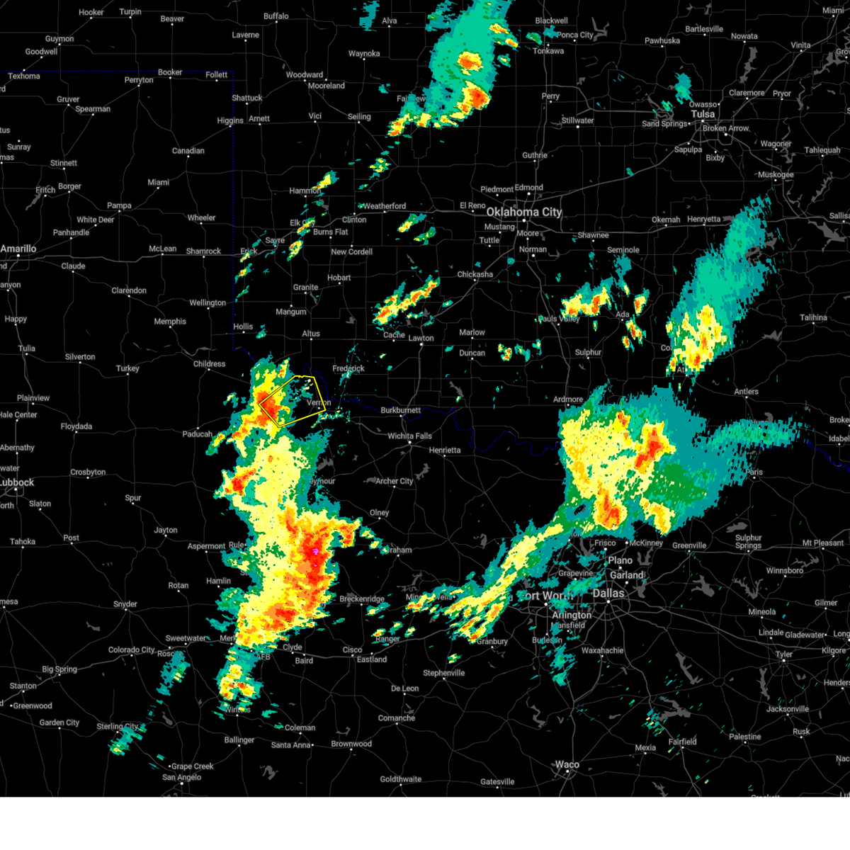 Svroun the national weather service in norman has issued a * severe thunderstorm warning for, east central foard county in northern texas, northwestern wilbarger county in northern texas, southeastern hardeman county in northern texas, * until 145 pm cst. * at 1258 pm cst, a severe thunderstorm was located near medicine mound, moving northeast at 30 mph (radar indicated). Hazards include 70 mph wind gusts and quarter size hail. Hail damage to vehicles is expected. expect considerable tree damage. Wind damage is also likely to mobile homes, roofs, and outbuildings. Svroun the national weather service in norman has issued a * severe thunderstorm warning for, east central foard county in northern texas, northwestern wilbarger county in northern texas, southeastern hardeman county in northern texas, * until 145 pm cst. * at 1258 pm cst, a severe thunderstorm was located near medicine mound, moving northeast at 30 mph (radar indicated). Hazards include 70 mph wind gusts and quarter size hail. Hail damage to vehicles is expected. expect considerable tree damage. Wind damage is also likely to mobile homes, roofs, and outbuildings.
|
| 11/3/2024 12:32 PM CST |
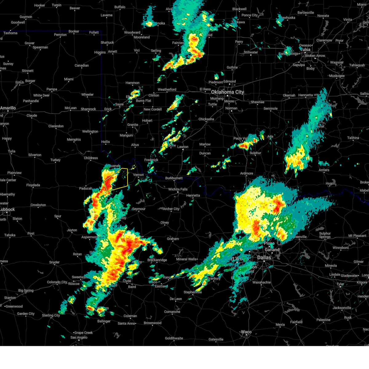 Svroun the national weather service in norman has issued a * severe thunderstorm warning for, central foard county in northern texas, southeastern hardeman county in northern texas, * until 115 pm cst. * at 1232 pm cst, a severe thunderstorm was located 5 miles northwest of crowell, moving northeast at 35 mph (radar indicated). Hazards include 70 mph wind gusts and half dollar size hail. Hail damage to vehicles is expected. expect considerable tree damage. Wind damage is also likely to mobile homes, roofs, and outbuildings. Svroun the national weather service in norman has issued a * severe thunderstorm warning for, central foard county in northern texas, southeastern hardeman county in northern texas, * until 115 pm cst. * at 1232 pm cst, a severe thunderstorm was located 5 miles northwest of crowell, moving northeast at 35 mph (radar indicated). Hazards include 70 mph wind gusts and half dollar size hail. Hail damage to vehicles is expected. expect considerable tree damage. Wind damage is also likely to mobile homes, roofs, and outbuildings.
|
| 5/30/2024 10:22 PM CDT |
 At 1022 pm cdt, severe thunderstorms were located along a line extending from 4 miles southwest of mangum to 4 miles southwest of olustee to near quanah, moving east at 35 mph (radar indicated). Hazards include 60 mph wind gusts and nickel size hail. Expect damage to roofs, siding, and trees. Locations impacted include, altus, mangum, quanah, blair, chillicothe, olustee, eldorado, martha, gould, elmer, altus air force base, duke, goodlett, odell, hester, mcqueen, and hess. At 1022 pm cdt, severe thunderstorms were located along a line extending from 4 miles southwest of mangum to 4 miles southwest of olustee to near quanah, moving east at 35 mph (radar indicated). Hazards include 60 mph wind gusts and nickel size hail. Expect damage to roofs, siding, and trees. Locations impacted include, altus, mangum, quanah, blair, chillicothe, olustee, eldorado, martha, gould, elmer, altus air force base, duke, goodlett, odell, hester, mcqueen, and hess.
|
| 5/30/2024 9:56 PM CDT |
 Svroun the national weather service in norman has issued a * severe thunderstorm warning for, jackson county in southwestern oklahoma, harmon county in southwestern oklahoma, southeastern greer county in southwestern oklahoma, northwestern wilbarger county in northern texas, central hardeman county in northern texas, * until 1045 pm cdt. * at 956 pm cdt, severe thunderstorms were located along a line extending from 4 miles east of vinson to 7 miles northwest of eldorado to 3 miles west of goodlett, moving east at 35 mph (radar indicated). Hazards include 60 mph wind gusts and nickel size hail. expect damage to roofs, siding, and trees Svroun the national weather service in norman has issued a * severe thunderstorm warning for, jackson county in southwestern oklahoma, harmon county in southwestern oklahoma, southeastern greer county in southwestern oklahoma, northwestern wilbarger county in northern texas, central hardeman county in northern texas, * until 1045 pm cdt. * at 956 pm cdt, severe thunderstorms were located along a line extending from 4 miles east of vinson to 7 miles northwest of eldorado to 3 miles west of goodlett, moving east at 35 mph (radar indicated). Hazards include 60 mph wind gusts and nickel size hail. expect damage to roofs, siding, and trees
|
| 5/30/2024 5:30 AM CDT |
 At 530 am cdt, severe thunderstorms were located along a line extending from near olustee to near fargo to 6 miles north of lockett, moving east at 25 mph (radar indicated). Hazards include 60 mph wind gusts. Expect damage to roofs, siding, and trees. Locations impacted include, chillicothe, olustee, eldorado, elmer, medicine mound, odell, and rayland. At 530 am cdt, severe thunderstorms were located along a line extending from near olustee to near fargo to 6 miles north of lockett, moving east at 25 mph (radar indicated). Hazards include 60 mph wind gusts. Expect damage to roofs, siding, and trees. Locations impacted include, chillicothe, olustee, eldorado, elmer, medicine mound, odell, and rayland.
|
| 5/30/2024 4:58 AM CDT |
 Svroun the national weather service in norman has issued a * severe thunderstorm warning for, southwestern jackson county in southwestern oklahoma, northwestern wilbarger county in northern texas, southeastern hardeman county in northern texas, * until 545 am cdt. * at 458 am cdt, severe thunderstorms were located along a line extending from near eldorado to 3 miles north of medicine mound to 5 miles northwest of margaret, moving northeast at 20 mph (radar indicated). Hazards include 60 mph wind gusts. expect damage to roofs, siding, and trees Svroun the national weather service in norman has issued a * severe thunderstorm warning for, southwestern jackson county in southwestern oklahoma, northwestern wilbarger county in northern texas, southeastern hardeman county in northern texas, * until 545 am cdt. * at 458 am cdt, severe thunderstorms were located along a line extending from near eldorado to 3 miles north of medicine mound to 5 miles northwest of margaret, moving northeast at 20 mph (radar indicated). Hazards include 60 mph wind gusts. expect damage to roofs, siding, and trees
|
| 5/25/2024 3:34 PM CDT |
 At 334 pm cdt, a severe thunderstorm was located 5 miles south of odell, moving northeast at 40 mph (radar indicated). Hazards include ping pong ball size hail and 60 mph wind gusts. People and animals outdoors will be injured. expect hail damage to roofs, siding, windows, and vehicles. expect wind damage to roofs, siding, and trees. Locations impacted include, altus, frederick, tipton, chillicothe, olustee, elmer, fargo, humphreys, odell, and hess. At 334 pm cdt, a severe thunderstorm was located 5 miles south of odell, moving northeast at 40 mph (radar indicated). Hazards include ping pong ball size hail and 60 mph wind gusts. People and animals outdoors will be injured. expect hail damage to roofs, siding, windows, and vehicles. expect wind damage to roofs, siding, and trees. Locations impacted include, altus, frederick, tipton, chillicothe, olustee, elmer, fargo, humphreys, odell, and hess.
|
| 5/25/2024 3:25 PM CDT |
 Svroun the national weather service in norman has issued a * severe thunderstorm warning for, southeastern jackson county in southwestern oklahoma, northwestern tillman county in southwestern oklahoma, northwestern wilbarger county in northern texas, southeastern hardeman county in northern texas, * until 415 pm cdt. * at 324 pm cdt, a severe thunderstorm was located 4 miles southeast of chillicothe, moving northeast at 40 mph (radar indicated). Hazards include 60 mph wind gusts and half dollar size hail. Hail damage to vehicles is expected. Expect wind damage to roofs, siding, and trees. Svroun the national weather service in norman has issued a * severe thunderstorm warning for, southeastern jackson county in southwestern oklahoma, northwestern tillman county in southwestern oklahoma, northwestern wilbarger county in northern texas, southeastern hardeman county in northern texas, * until 415 pm cdt. * at 324 pm cdt, a severe thunderstorm was located 4 miles southeast of chillicothe, moving northeast at 40 mph (radar indicated). Hazards include 60 mph wind gusts and half dollar size hail. Hail damage to vehicles is expected. Expect wind damage to roofs, siding, and trees.
|
| 5/16/2024 3:28 AM CDT |
 Svroun the national weather service in norman has issued a * severe thunderstorm warning for, southeastern jackson county in southwestern oklahoma, southwestern tillman county in southwestern oklahoma, east central foard county in northern texas, wilbarger county in northern texas, southeastern hardeman county in northern texas, * until 415 am cdt. * at 328 am cdt, severe thunderstorms were located along a line extending from 3 miles northwest of frederick to 6 miles northeast of thalia to near crowell, moving northeast at 35 mph (radar indicated). Hazards include ping pong ball size hail and 60 mph wind gusts. People and animals outdoors will be injured. expect hail damage to roofs, siding, windows, and vehicles. Expect wind damage to roofs, siding, and trees. Svroun the national weather service in norman has issued a * severe thunderstorm warning for, southeastern jackson county in southwestern oklahoma, southwestern tillman county in southwestern oklahoma, east central foard county in northern texas, wilbarger county in northern texas, southeastern hardeman county in northern texas, * until 415 am cdt. * at 328 am cdt, severe thunderstorms were located along a line extending from 3 miles northwest of frederick to 6 miles northeast of thalia to near crowell, moving northeast at 35 mph (radar indicated). Hazards include ping pong ball size hail and 60 mph wind gusts. People and animals outdoors will be injured. expect hail damage to roofs, siding, windows, and vehicles. Expect wind damage to roofs, siding, and trees.
|
| 5/1/2024 10:52 PM CDT |
 At 1052 pm cdt, severe thunderstorms were located along a line extending from 4 miles northeast of blair to near altus to 5 miles southwest of olustee to 3 miles west of odell, moving east at 45 mph (radar indicated). Hazards include 70 mph wind gusts and penny size hail. Expect considerable tree damage. damage is likely to mobile homes, roofs, and outbuildings. Locations impacted include, altus, frederick, mangum, hollis, granite, snyder, tipton, blair, chillicothe, olustee, eldorado, lone wolf, mountain park, roosevelt, manitou, martha, gould, elmer, headrick, and friendship. At 1052 pm cdt, severe thunderstorms were located along a line extending from 4 miles northeast of blair to near altus to 5 miles southwest of olustee to 3 miles west of odell, moving east at 45 mph (radar indicated). Hazards include 70 mph wind gusts and penny size hail. Expect considerable tree damage. damage is likely to mobile homes, roofs, and outbuildings. Locations impacted include, altus, frederick, mangum, hollis, granite, snyder, tipton, blair, chillicothe, olustee, eldorado, lone wolf, mountain park, roosevelt, manitou, martha, gould, elmer, headrick, and friendship.
|
| 5/1/2024 10:34 PM CDT |
 Svroun the national weather service in norman has issued a * severe thunderstorm warning for, jackson county in southwestern oklahoma, western kiowa county in southwestern oklahoma, northwestern tillman county in southwestern oklahoma, southern harmon county in southwestern oklahoma, greer county in southwestern oklahoma, northwestern wilbarger county in northern texas, east central hardeman county in northern texas, * until 1130 pm cdt. * at 1034 pm cdt, severe thunderstorms were located along a line extending from 3 miles northwest of gould to 6 miles southwest of duke to 3 miles northeast of eldorado to near medicine mound, moving northeast at 30 mph (radar indicated). Hazards include 60 mph wind gusts and penny size hail. expect damage to roofs, siding, and trees Svroun the national weather service in norman has issued a * severe thunderstorm warning for, jackson county in southwestern oklahoma, western kiowa county in southwestern oklahoma, northwestern tillman county in southwestern oklahoma, southern harmon county in southwestern oklahoma, greer county in southwestern oklahoma, northwestern wilbarger county in northern texas, east central hardeman county in northern texas, * until 1130 pm cdt. * at 1034 pm cdt, severe thunderstorms were located along a line extending from 3 miles northwest of gould to 6 miles southwest of duke to 3 miles northeast of eldorado to near medicine mound, moving northeast at 30 mph (radar indicated). Hazards include 60 mph wind gusts and penny size hail. expect damage to roofs, siding, and trees
|
| 4/15/2024 7:11 PM CDT |
 At 711 pm cdt, severe thunderstorms were located along a line extending from 5 miles southeast of quanah to 4 miles north of medicine mound, moving northeast at 75 mph (public). Hazards include golf ball size hail and 60 mph wind gusts. People and animals outdoors will be injured. expect hail damage to roofs, siding, windows, and vehicles. expect wind damage to roofs, siding, and trees. Locations impacted include, quanah, chillicothe, eldorado, odell, medicine mound, and hess. At 711 pm cdt, severe thunderstorms were located along a line extending from 5 miles southeast of quanah to 4 miles north of medicine mound, moving northeast at 75 mph (public). Hazards include golf ball size hail and 60 mph wind gusts. People and animals outdoors will be injured. expect hail damage to roofs, siding, windows, and vehicles. expect wind damage to roofs, siding, and trees. Locations impacted include, quanah, chillicothe, eldorado, odell, medicine mound, and hess.
|
| 4/15/2024 7:07 PM CDT |
 the severe thunderstorm warning has been cancelled and is no longer in effect the severe thunderstorm warning has been cancelled and is no longer in effect
|
| 4/15/2024 7:07 PM CDT |
 At 707 pm cdt, severe thunderstorms were located along a line extending from 8 miles south of quanah to 4 miles west of medicine mound, moving northeast at 70 mph (radar indicated). Hazards include ping pong ball size hail and 60 mph wind gusts. People and animals outdoors will be injured. expect hail damage to roofs, siding, windows, and vehicles. expect wind damage to roofs, siding, and trees. Locations impacted include, quanah, chillicothe, eldorado, medicine mound, odell, hess, and copper breaks state park. At 707 pm cdt, severe thunderstorms were located along a line extending from 8 miles south of quanah to 4 miles west of medicine mound, moving northeast at 70 mph (radar indicated). Hazards include ping pong ball size hail and 60 mph wind gusts. People and animals outdoors will be injured. expect hail damage to roofs, siding, windows, and vehicles. expect wind damage to roofs, siding, and trees. Locations impacted include, quanah, chillicothe, eldorado, medicine mound, odell, hess, and copper breaks state park.
|
| 4/15/2024 6:55 PM CDT |
 Svroun the national weather service in norman has issued a * severe thunderstorm warning for, southwestern jackson county in southwestern oklahoma, central foard county in northern texas, northwestern wilbarger county in northern texas, hardeman county in northern texas, * until 730 pm cdt. * at 655 pm cdt, severe thunderstorms were located along a line extending from 11 miles west of margaret to 5 miles northwest of crowell, moving northeast at 65 mph (radar indicated). Hazards include 60 mph wind gusts and half dollar size hail. Hail damage to vehicles is expected. Expect wind damage to roofs, siding, and trees. Svroun the national weather service in norman has issued a * severe thunderstorm warning for, southwestern jackson county in southwestern oklahoma, central foard county in northern texas, northwestern wilbarger county in northern texas, hardeman county in northern texas, * until 730 pm cdt. * at 655 pm cdt, severe thunderstorms were located along a line extending from 11 miles west of margaret to 5 miles northwest of crowell, moving northeast at 65 mph (radar indicated). Hazards include 60 mph wind gusts and half dollar size hail. Hail damage to vehicles is expected. Expect wind damage to roofs, siding, and trees.
|
| 3/7/2024 5:20 PM CST |
 Svroun the national weather service in norman has issued a * severe thunderstorm warning for, central jackson county in southwestern oklahoma, northwestern wilbarger county in northern texas, east central hardeman county in northern texas, * until 600 pm cst. * at 520 pm cst, a severe thunderstorm was located 7 miles southeast of eldorado, moving north at 35 mph (radar indicated). Hazards include golf ball size hail and 60 mph wind gusts. People and animals outdoors will be injured. expect hail damage to roofs, siding, windows, and vehicles. Expect wind damage to roofs, siding, and trees. Svroun the national weather service in norman has issued a * severe thunderstorm warning for, central jackson county in southwestern oklahoma, northwestern wilbarger county in northern texas, east central hardeman county in northern texas, * until 600 pm cst. * at 520 pm cst, a severe thunderstorm was located 7 miles southeast of eldorado, moving north at 35 mph (radar indicated). Hazards include golf ball size hail and 60 mph wind gusts. People and animals outdoors will be injured. expect hail damage to roofs, siding, windows, and vehicles. Expect wind damage to roofs, siding, and trees.
|
| 3/7/2024 5:12 PM CST |
 At 512 pm cst, a severe thunderstorm was located 4 miles northwest of chillicothe, moving northeast at 45 mph (radar indicated). Hazards include golf ball size hail and 60 mph wind gusts. People and animals outdoors will be injured. expect hail damage to roofs, siding, windows, and vehicles. expect wind damage to roofs, siding, and trees. Locations impacted include, quanah, chillicothe, odell, and medicine mound. At 512 pm cst, a severe thunderstorm was located 4 miles northwest of chillicothe, moving northeast at 45 mph (radar indicated). Hazards include golf ball size hail and 60 mph wind gusts. People and animals outdoors will be injured. expect hail damage to roofs, siding, windows, and vehicles. expect wind damage to roofs, siding, and trees. Locations impacted include, quanah, chillicothe, odell, and medicine mound.
|
| 3/7/2024 5:03 PM CST |
 the severe thunderstorm warning has been cancelled and is no longer in effect the severe thunderstorm warning has been cancelled and is no longer in effect
|
| 3/7/2024 5:03 PM CST |
 At 503 pm cst, a severe thunderstorm was located near medicine mound, moving north at 35 mph (radar indicated). Hazards include 60 mph wind gusts and half dollar size hail. Hail damage to vehicles is expected. expect wind damage to roofs, siding, and trees. Locations impacted include, quanah, chillicothe, odell, medicine mound, and copper breaks state park. At 503 pm cst, a severe thunderstorm was located near medicine mound, moving north at 35 mph (radar indicated). Hazards include 60 mph wind gusts and half dollar size hail. Hail damage to vehicles is expected. expect wind damage to roofs, siding, and trees. Locations impacted include, quanah, chillicothe, odell, medicine mound, and copper breaks state park.
|
| 3/7/2024 4:40 PM CST |
 Svroun the national weather service in norman has issued a * severe thunderstorm warning for, east central foard county in northern texas, northwestern wilbarger county in northern texas, southeastern hardeman county in northern texas, * until 530 pm cst. * at 439 pm cst, a severe thunderstorm was located near crowell, moving northeast at 45 mph (radar indicated). Hazards include 60 mph wind gusts and half dollar size hail. Hail damage to vehicles is expected. Expect wind damage to roofs, siding, and trees. Svroun the national weather service in norman has issued a * severe thunderstorm warning for, east central foard county in northern texas, northwestern wilbarger county in northern texas, southeastern hardeman county in northern texas, * until 530 pm cst. * at 439 pm cst, a severe thunderstorm was located near crowell, moving northeast at 45 mph (radar indicated). Hazards include 60 mph wind gusts and half dollar size hail. Hail damage to vehicles is expected. Expect wind damage to roofs, siding, and trees.
|
| 10/4/2023 3:47 PM CDT |
 At 347 pm cdt, severe thunderstorms were located along a line extending from near quanah to near margaret to 5 miles northeast of truscott, moving east at 40 mph (radar indicated). Hazards include two inch hail and 70 mph wind gusts. People and animals outdoors will be injured. expect hail damage to roofs, siding, windows, and vehicles. expect considerable tree damage. Wind damage is also likely to mobile homes, roofs, and outbuildings. At 347 pm cdt, severe thunderstorms were located along a line extending from near quanah to near margaret to 5 miles northeast of truscott, moving east at 40 mph (radar indicated). Hazards include two inch hail and 70 mph wind gusts. People and animals outdoors will be injured. expect hail damage to roofs, siding, windows, and vehicles. expect considerable tree damage. Wind damage is also likely to mobile homes, roofs, and outbuildings.
|
| 10/4/2023 2:47 PM CDT |
 At 247 pm cdt, a severe thunderstorm was located near chillicothe, moving northeast at 20 mph (radar indicated). Hazards include two inch hail and 70 mph wind gusts. People and animals outdoors will be injured. expect hail damage to roofs, siding, windows, and vehicles. expect considerable tree damage. wind damage is also likely to mobile homes, roofs, and outbuildings. locations impacted include, chillicothe, elmer, odell, fargo, and hess. thunderstorm damage threat, considerable hail threat, radar indicated max hail size, 2. 00 in wind threat, radar indicated max wind gust, 70 mph. At 247 pm cdt, a severe thunderstorm was located near chillicothe, moving northeast at 20 mph (radar indicated). Hazards include two inch hail and 70 mph wind gusts. People and animals outdoors will be injured. expect hail damage to roofs, siding, windows, and vehicles. expect considerable tree damage. wind damage is also likely to mobile homes, roofs, and outbuildings. locations impacted include, chillicothe, elmer, odell, fargo, and hess. thunderstorm damage threat, considerable hail threat, radar indicated max hail size, 2. 00 in wind threat, radar indicated max wind gust, 70 mph.
|
| 10/4/2023 2:23 PM CDT |
 At 222 pm cdt, a severe thunderstorm was located near quanah, moving east at 35 mph (radar indicated). Hazards include two inch hail and 70 mph wind gusts. People and animals outdoors will be injured. expect hail damage to roofs, siding, windows, and vehicles. expect considerable tree damage. Wind damage is also likely to mobile homes, roofs, and outbuildings. At 222 pm cdt, a severe thunderstorm was located near quanah, moving east at 35 mph (radar indicated). Hazards include two inch hail and 70 mph wind gusts. People and animals outdoors will be injured. expect hail damage to roofs, siding, windows, and vehicles. expect considerable tree damage. Wind damage is also likely to mobile homes, roofs, and outbuildings.
|
| 9/19/2023 7:13 PM CDT |
 At 713 pm cdt, a severe thunderstorm was located 4 miles east of chillicothe, moving east at 30 mph (radar indicated). Hazards include 60 mph wind gusts and half dollar size hail. Hail damage to vehicles is expected. expect wind damage to roofs, siding, and trees. locations impacted include, vernon, chillicothe, davidson, oklaunion, and fargo. hail threat, radar indicated max hail size, 1. 25 in wind threat, radar indicated max wind gust, 60 mph. At 713 pm cdt, a severe thunderstorm was located 4 miles east of chillicothe, moving east at 30 mph (radar indicated). Hazards include 60 mph wind gusts and half dollar size hail. Hail damage to vehicles is expected. expect wind damage to roofs, siding, and trees. locations impacted include, vernon, chillicothe, davidson, oklaunion, and fargo. hail threat, radar indicated max hail size, 1. 25 in wind threat, radar indicated max wind gust, 60 mph.
|
| 9/19/2023 7:02 PM CDT | Golf Ball sized hail reported 0.5 miles SE of Chillicothe, TX |
| 9/19/2023 6:53 PM CDT |
 At 653 pm cdt, a severe thunderstorm was located 4 miles west of chillicothe, moving east at 30 mph (radar indicated). Hazards include two inch hail and 60 mph wind gusts. People and animals outdoors will be injured. expect hail damage to roofs, siding, windows, and vehicles. Expect wind damage to roofs, siding, and trees. At 653 pm cdt, a severe thunderstorm was located 4 miles west of chillicothe, moving east at 30 mph (radar indicated). Hazards include two inch hail and 60 mph wind gusts. People and animals outdoors will be injured. expect hail damage to roofs, siding, windows, and vehicles. Expect wind damage to roofs, siding, and trees.
|
| 9/19/2023 6:42 PM CDT |
 At 641 pm cdt, a severe thunderstorm was located 5 miles east of quanah, moving east at 30 mph (radar indicated). Hazards include golf ball size hail and 70 mph wind gusts. People and animals outdoors will be injured. expect hail damage to roofs, siding, windows, and vehicles. expect considerable tree damage. wind damage is also likely to mobile homes, roofs, and outbuildings. locations impacted include, quanah, chillicothe, and medicine mound. thunderstorm damage threat, considerable hail threat, radar indicated max hail size, 1. 75 in wind threat, radar indicated max wind gust, 70 mph. At 641 pm cdt, a severe thunderstorm was located 5 miles east of quanah, moving east at 30 mph (radar indicated). Hazards include golf ball size hail and 70 mph wind gusts. People and animals outdoors will be injured. expect hail damage to roofs, siding, windows, and vehicles. expect considerable tree damage. wind damage is also likely to mobile homes, roofs, and outbuildings. locations impacted include, quanah, chillicothe, and medicine mound. thunderstorm damage threat, considerable hail threat, radar indicated max hail size, 1. 75 in wind threat, radar indicated max wind gust, 70 mph.
|
| 9/19/2023 6:23 PM CDT |
 At 622 pm cdt, a severe thunderstorm was located near goodlett, moving southeast at 20 mph. this is a destructive storm for quanah (spotters reported baseball size hail in quanah). Hazards include baseball size hail and 70 mph wind gusts. People and animals outdoors will be severely injured. Expect shattered windows, extensive damage to roofs, siding, and vehicles. At 622 pm cdt, a severe thunderstorm was located near goodlett, moving southeast at 20 mph. this is a destructive storm for quanah (spotters reported baseball size hail in quanah). Hazards include baseball size hail and 70 mph wind gusts. People and animals outdoors will be severely injured. Expect shattered windows, extensive damage to roofs, siding, and vehicles.
|
| 8/12/2023 5:57 PM CDT |
 The severe thunderstorm warning for western comanche, jackson, southeastern kiowa, northern tillman, southern harmon, northwestern foard, northwestern wilbarger and hardeman counties will expire at 600 pm cdt, the storms which prompted the warning have weakened below severe limits, therefore the warning will be allowed to expire. however, gusty winds are still possible with these thunderstorms. The severe thunderstorm warning for western comanche, jackson, southeastern kiowa, northern tillman, southern harmon, northwestern foard, northwestern wilbarger and hardeman counties will expire at 600 pm cdt, the storms which prompted the warning have weakened below severe limits, therefore the warning will be allowed to expire. however, gusty winds are still possible with these thunderstorms.
|
| 8/12/2023 5:13 PM CDT |
 At 512 pm cdt, severe thunderstorms were located along a line extending from 6 miles east of mountain park to 7 miles southeast of eldorado, moving east at 35 mph (radar indicated). Hazards include 60 mph wind gusts. expect damage to roofs, siding, and trees At 512 pm cdt, severe thunderstorms were located along a line extending from 6 miles east of mountain park to 7 miles southeast of eldorado, moving east at 35 mph (radar indicated). Hazards include 60 mph wind gusts. expect damage to roofs, siding, and trees
|
| 7/7/2023 9:28 PM CDT |
 At 927 pm cdt, severe thunderstorms were located along a line extending from near warren to 5 miles east of elmer to near chillicothe, moving east at 40 mph (radar indicated). Hazards include 60 mph wind gusts and quarter size hail. Hail damage to vehicles is expected. Expect wind damage to roofs, siding, and trees. At 927 pm cdt, severe thunderstorms were located along a line extending from near warren to 5 miles east of elmer to near chillicothe, moving east at 40 mph (radar indicated). Hazards include 60 mph wind gusts and quarter size hail. Hail damage to vehicles is expected. Expect wind damage to roofs, siding, and trees.
|
| 6/23/2023 9:24 PM CDT |
 At 923 pm cdt, severe thunderstorms were located along a line extending from near odell to 3 miles south of chillicothe to 4 miles northeast of margaret, moving east at 30 mph (radar indicated). Hazards include golf ball size hail and 70 mph wind gusts. the greatest hail threat exists near chillicothe and medicine mound. People and animals outdoors will be injured. expect hail damage to roofs, siding, windows, and vehicles. expect considerable tree damage. wind damage is also likely to mobile homes, roofs, and outbuildings. locations impacted include, vernon, chillicothe, margaret, fargo, medicine mound, odell, rayland, and copper breaks state park. thunderstorm damage threat, considerable hail threat, radar indicated max hail size, 1. 75 in wind threat, radar indicated max wind gust, 70 mph. At 923 pm cdt, severe thunderstorms were located along a line extending from near odell to 3 miles south of chillicothe to 4 miles northeast of margaret, moving east at 30 mph (radar indicated). Hazards include golf ball size hail and 70 mph wind gusts. the greatest hail threat exists near chillicothe and medicine mound. People and animals outdoors will be injured. expect hail damage to roofs, siding, windows, and vehicles. expect considerable tree damage. wind damage is also likely to mobile homes, roofs, and outbuildings. locations impacted include, vernon, chillicothe, margaret, fargo, medicine mound, odell, rayland, and copper breaks state park. thunderstorm damage threat, considerable hail threat, radar indicated max hail size, 1. 75 in wind threat, radar indicated max wind gust, 70 mph.
|
| 6/23/2023 9:16 PM CDT |
 At 914 pm cdt, severe thunderstorms were located along a line extending from 5 miles west of odell to near medicine mound to 4 miles northwest of margaret, moving east at 30 mph (radar indicated). Hazards include ping pong ball size hail and 60 mph wind gusts. the threat for large hail is highest between chillicothe and medicine mound. People and animals outdoors will be injured. expect hail damage to roofs, siding, windows, and vehicles. expect wind damage to roofs, siding, and trees. locations impacted include, vernon, chillicothe, margaret, fargo, medicine mound, odell, rayland, and copper breaks state park. hail threat, radar indicated max hail size, 1. 50 in wind threat, radar indicated max wind gust, 60 mph. At 914 pm cdt, severe thunderstorms were located along a line extending from 5 miles west of odell to near medicine mound to 4 miles northwest of margaret, moving east at 30 mph (radar indicated). Hazards include ping pong ball size hail and 60 mph wind gusts. the threat for large hail is highest between chillicothe and medicine mound. People and animals outdoors will be injured. expect hail damage to roofs, siding, windows, and vehicles. expect wind damage to roofs, siding, and trees. locations impacted include, vernon, chillicothe, margaret, fargo, medicine mound, odell, rayland, and copper breaks state park. hail threat, radar indicated max hail size, 1. 50 in wind threat, radar indicated max wind gust, 60 mph.
|
| 6/23/2023 9:09 PM CDT |
 At 909 pm cdt, severe thunderstorms were located along a line extending from 7 miles north of chillicothe to near medicine mound to 5 miles northwest of margaret, moving east at 30 mph (radar indicated). Hazards include 60 mph wind gusts and quarter size hail. Hail damage to vehicles is expected. Expect wind damage to roofs, siding, and trees. At 909 pm cdt, severe thunderstorms were located along a line extending from 7 miles north of chillicothe to near medicine mound to 5 miles northwest of margaret, moving east at 30 mph (radar indicated). Hazards include 60 mph wind gusts and quarter size hail. Hail damage to vehicles is expected. Expect wind damage to roofs, siding, and trees.
|
| 6/2/2023 8:25 PM CDT |
 The severe thunderstorm warning for foard, knox and southern hardeman counties will expire at 830 pm cdt, the storms which prompted the warning have weakened below severe limits, therefore the warning will be allowed to expire. however, gusty winds and heavy rain are still possible with these thunderstorms. The severe thunderstorm warning for foard, knox and southern hardeman counties will expire at 830 pm cdt, the storms which prompted the warning have weakened below severe limits, therefore the warning will be allowed to expire. however, gusty winds and heavy rain are still possible with these thunderstorms.
|
| 6/2/2023 8:01 PM CDT |
 At 801 pm cdt, severe thunderstorms were located along a line extending from 5 miles southwest of quanah to 4 miles northeast of truscott to 4 miles northwest of knox city, moving east at 35 mph (radar indicated). Hazards include 60 mph wind gusts and penny size hail. expect damage to roofs, siding, and trees At 801 pm cdt, severe thunderstorms were located along a line extending from 5 miles southwest of quanah to 4 miles northeast of truscott to 4 miles northwest of knox city, moving east at 35 mph (radar indicated). Hazards include 60 mph wind gusts and penny size hail. expect damage to roofs, siding, and trees
|
| 5/23/2023 11:04 PM CDT |
 At 1103 pm cdt, severe thunderstorms were located along a line extending from 5 miles northwest of chillicothe to 4 miles south of lockett to near vera, moving east at 45 mph (radar indicated). Hazards include 60 mph wind gusts and penny size hail. Expect damage to roofs, siding, and trees. locations impacted include, vernon, quanah, chillicothe, red springs, thalia, gilliland, margaret, lockett, lake kemp, vera, medicine mound, oklaunion, grayback, and rayland. hail threat, radar indicated max hail size, 0. 75 in wind threat, radar indicated max wind gust, 60 mph. At 1103 pm cdt, severe thunderstorms were located along a line extending from 5 miles northwest of chillicothe to 4 miles south of lockett to near vera, moving east at 45 mph (radar indicated). Hazards include 60 mph wind gusts and penny size hail. Expect damage to roofs, siding, and trees. locations impacted include, vernon, quanah, chillicothe, red springs, thalia, gilliland, margaret, lockett, lake kemp, vera, medicine mound, oklaunion, grayback, and rayland. hail threat, radar indicated max hail size, 0. 75 in wind threat, radar indicated max wind gust, 60 mph.
|
| 5/23/2023 10:47 PM CDT |
 At 1047 pm cdt, severe thunderstorms were located along a line extending from near quanah to near thalia to 5 miles north of benjamin, moving east at 30 mph (radar indicated). Hazards include 60 mph wind gusts and penny size hail. Expect damage to roofs, siding, and trees. locations impacted include, vernon, quanah, crowell, chillicothe, red springs, thalia, gilliland, margaret, lockett, lake kemp, vera, fargo, medicine mound, oklaunion, truscott, grayback, rayland, and copper breaks state park. hail threat, radar indicated max hail size, 0. 75 in wind threat, radar indicated max wind gust, 60 mph. At 1047 pm cdt, severe thunderstorms were located along a line extending from near quanah to near thalia to 5 miles north of benjamin, moving east at 30 mph (radar indicated). Hazards include 60 mph wind gusts and penny size hail. Expect damage to roofs, siding, and trees. locations impacted include, vernon, quanah, crowell, chillicothe, red springs, thalia, gilliland, margaret, lockett, lake kemp, vera, fargo, medicine mound, oklaunion, truscott, grayback, rayland, and copper breaks state park. hail threat, radar indicated max hail size, 0. 75 in wind threat, radar indicated max wind gust, 60 mph.
|
| 5/23/2023 10:32 PM CDT |
 At 1031 pm cdt, severe thunderstorms were located along a line extending from near goodlett to near margaret to 7 miles west of truscott, moving east at 45 mph (radar indicated). Hazards include 70 mph wind gusts and quarter size hail. Hail damage to vehicles is expected. expect considerable tree damage. Wind damage is also likely to mobile homes, roofs, and outbuildings. At 1031 pm cdt, severe thunderstorms were located along a line extending from near goodlett to near margaret to 7 miles west of truscott, moving east at 45 mph (radar indicated). Hazards include 70 mph wind gusts and quarter size hail. Hail damage to vehicles is expected. expect considerable tree damage. Wind damage is also likely to mobile homes, roofs, and outbuildings.
|
| 4/9/2023 4:20 PM CDT |
 At 420 pm cdt, a severe thunderstorm was located 6 miles northeast of quanah, moving southeast at 20 mph (radar indicated). Hazards include quarter size hail. Damage to vehicles is expected. locations impacted include, quanah, chillicothe, and medicine mound. hail threat, radar indicated max hail size, 1. 00 in wind threat, radar indicated max wind gust, <50 mph. At 420 pm cdt, a severe thunderstorm was located 6 miles northeast of quanah, moving southeast at 20 mph (radar indicated). Hazards include quarter size hail. Damage to vehicles is expected. locations impacted include, quanah, chillicothe, and medicine mound. hail threat, radar indicated max hail size, 1. 00 in wind threat, radar indicated max wind gust, <50 mph.
|
| 4/9/2023 3:58 PM CDT |
 At 358 pm cdt, a severe thunderstorm was located 6 miles north of quanah, moving southeast at 20 mph (radar indicated). Hazards include half dollar size hail. damage to vehicles is expected At 358 pm cdt, a severe thunderstorm was located 6 miles north of quanah, moving southeast at 20 mph (radar indicated). Hazards include half dollar size hail. damage to vehicles is expected
|
| 2/26/2023 7:45 PM CST |
 At 744 pm cst, severe thunderstorms were located along a line extending from 4 miles northeast of eldorado to 5 miles south of quanah to 14 miles east of chalk, moving east at 80 mph (several weather observation sites have recorded winds over 60 mph with these storms). Hazards include 70 mph wind gusts and quarter size hail. Hail damage to vehicles is expected. expect considerable tree damage. wind damage is also likely to mobile homes, roofs, and outbuildings. Locations impacted include, vernon, quanah, crowell, tipton, chillicothe, olustee, eldorado, elmer, thalia, margaret, goodlett, lockett, fargo, medicine mound, humphreys, odell, lazare, rayland, copper breaks state park and hess. At 744 pm cst, severe thunderstorms were located along a line extending from 4 miles northeast of eldorado to 5 miles south of quanah to 14 miles east of chalk, moving east at 80 mph (several weather observation sites have recorded winds over 60 mph with these storms). Hazards include 70 mph wind gusts and quarter size hail. Hail damage to vehicles is expected. expect considerable tree damage. wind damage is also likely to mobile homes, roofs, and outbuildings. Locations impacted include, vernon, quanah, crowell, tipton, chillicothe, olustee, eldorado, elmer, thalia, margaret, goodlett, lockett, fargo, medicine mound, humphreys, odell, lazare, rayland, copper breaks state park and hess.
|
| 2/26/2023 7:29 PM CST |
 At 729 pm cst, severe thunderstorms were located along a line extending from 11 miles north of goodlett to 5 miles east of swearingen to 5 miles northeast of chalk, moving east at 75 mph (radar indicated). Hazards include 70 mph wind gusts and quarter size hail. Hail damage to vehicles is expected. expect considerable tree damage. Wind damage is also likely to mobile homes, roofs, and outbuildings. At 729 pm cst, severe thunderstorms were located along a line extending from 11 miles north of goodlett to 5 miles east of swearingen to 5 miles northeast of chalk, moving east at 75 mph (radar indicated). Hazards include 70 mph wind gusts and quarter size hail. Hail damage to vehicles is expected. expect considerable tree damage. Wind damage is also likely to mobile homes, roofs, and outbuildings.
|
| 10/27/2022 10:40 PM CDT |
 The severe thunderstorm warning for foard, knox and hardeman counties will expire at 1045 pm cdt, the storms which prompted the warning have weakened below severe limits, therefore the warning will be allowed to expire. however gusty winds and heavy rain are still possible with these thunderstorms. The severe thunderstorm warning for foard, knox and hardeman counties will expire at 1045 pm cdt, the storms which prompted the warning have weakened below severe limits, therefore the warning will be allowed to expire. however gusty winds and heavy rain are still possible with these thunderstorms.
|
| 10/27/2022 10:25 PM CDT |
 The severe thunderstorm warning for northeastern foard, northwestern wilbarger and southeastern hardeman counties will expire at 1030 pm cdt, the storms which prompted the warning have weakened below severe limits, therefore the warning will be allowed to expire. however gusty winds and heavy rain are still possible with these thunderstorms. The severe thunderstorm warning for northeastern foard, northwestern wilbarger and southeastern hardeman counties will expire at 1030 pm cdt, the storms which prompted the warning have weakened below severe limits, therefore the warning will be allowed to expire. however gusty winds and heavy rain are still possible with these thunderstorms.
|
| 10/27/2022 10:17 PM CDT |
 At 1017 pm cdt, severe thunderstorms were located along a line extending from 4 miles east of chillicothe to 4 miles northwest of lockett, moving northeast at 15 mph (radar indicated). Hazards include 60 mph wind gusts and quarter size hail. Hail damage to vehicles is expected. expect wind damage to roofs, siding, and trees. locations impacted include, vernon, chillicothe, lockett, fargo and rayland. hail threat, radar indicated max hail size, 1. 00 in wind threat, radar indicated max wind gust, 60 mph. At 1017 pm cdt, severe thunderstorms were located along a line extending from 4 miles east of chillicothe to 4 miles northwest of lockett, moving northeast at 15 mph (radar indicated). Hazards include 60 mph wind gusts and quarter size hail. Hail damage to vehicles is expected. expect wind damage to roofs, siding, and trees. locations impacted include, vernon, chillicothe, lockett, fargo and rayland. hail threat, radar indicated max hail size, 1. 00 in wind threat, radar indicated max wind gust, 60 mph.
|
| 10/27/2022 9:57 PM CDT |
 At 957 pm cdt, severe thunderstorms were located along a line extending from 8 miles southwest of goodlett to 10 miles northwest of truscott to 10 miles northwest of benjamin, moving northeast at 35 mph (radar indicated). Hazards include 60 mph wind gusts and quarter size hail. Hail damage to vehicles is expected. Expect wind damage to roofs, siding, and trees. At 957 pm cdt, severe thunderstorms were located along a line extending from 8 miles southwest of goodlett to 10 miles northwest of truscott to 10 miles northwest of benjamin, moving northeast at 35 mph (radar indicated). Hazards include 60 mph wind gusts and quarter size hail. Hail damage to vehicles is expected. Expect wind damage to roofs, siding, and trees.
|
| 10/27/2022 9:46 PM CDT |
 At 946 pm cdt, severe thunderstorms were located along a line extending from 4 miles southeast of medicine mound to 3 miles west of thalia, moving northeast at 25 mph (radar indicated). Hazards include 60 mph wind gusts and half dollar size hail. Hail damage to vehicles is expected. Expect wind damage to roofs, siding, and trees. At 946 pm cdt, severe thunderstorms were located along a line extending from 4 miles southeast of medicine mound to 3 miles west of thalia, moving northeast at 25 mph (radar indicated). Hazards include 60 mph wind gusts and half dollar size hail. Hail damage to vehicles is expected. Expect wind damage to roofs, siding, and trees.
|
| 10/27/2022 8:16 PM CDT |
 At 815 pm cdt, a severe thunderstorm was located 6 miles southwest of quanah, moving east at 25 mph (radar indicated). Hazards include 60 mph wind gusts and quarter size hail. Hail damage to vehicles is expected. Expect wind damage to roofs, siding, and trees. At 815 pm cdt, a severe thunderstorm was located 6 miles southwest of quanah, moving east at 25 mph (radar indicated). Hazards include 60 mph wind gusts and quarter size hail. Hail damage to vehicles is expected. Expect wind damage to roofs, siding, and trees.
|
| 6/10/2022 12:22 AM CDT |
 At 1221 am cdt, severe thunderstorms were located along a line extending from near hobart to near tom steed reservoir to 6 miles northeast of headrick to 4 miles south of humphreys to near odell to 3 miles west of quanah, moving east at 60 mph (the altus mesonet measured a 71 mph wind gust). Hazards include 70 mph wind gusts and penny size hail. Expect considerable tree damage. damage is likely to mobile homes, roofs, and outbuildings. locations impacted include, altus, vernon, frederick, hobart, quanah, cache, snyder, tipton, blair, chillicothe, olustee, eldorado, mountain park, medicine park, indiahoma, davidson, roosevelt, gotebo, manitou and martha. thunderstorm damage threat, considerable hail threat, radar indicated max hail size, 0. 75 in wind threat, observed max wind gust, 70 mph. At 1221 am cdt, severe thunderstorms were located along a line extending from near hobart to near tom steed reservoir to 6 miles northeast of headrick to 4 miles south of humphreys to near odell to 3 miles west of quanah, moving east at 60 mph (the altus mesonet measured a 71 mph wind gust). Hazards include 70 mph wind gusts and penny size hail. Expect considerable tree damage. damage is likely to mobile homes, roofs, and outbuildings. locations impacted include, altus, vernon, frederick, hobart, quanah, cache, snyder, tipton, blair, chillicothe, olustee, eldorado, mountain park, medicine park, indiahoma, davidson, roosevelt, gotebo, manitou and martha. thunderstorm damage threat, considerable hail threat, radar indicated max hail size, 0. 75 in wind threat, observed max wind gust, 70 mph.
|
| 6/10/2022 12:08 AM CDT |
 At 1208 am cdt, severe thunderstorms were located along a line extending from 5 miles northeast of hobart to near tom steed reservoir to near friendship to 3 miles west of olustee to 5 miles southwest of eldorado to near goodlett, moving east at 60 mph (radar indicated). Hazards include 70 mph wind gusts and penny size hail. Expect considerable tree damage. Damage is likely to mobile homes, roofs, and outbuildings. At 1208 am cdt, severe thunderstorms were located along a line extending from 5 miles northeast of hobart to near tom steed reservoir to near friendship to 3 miles west of olustee to 5 miles southwest of eldorado to near goodlett, moving east at 60 mph (radar indicated). Hazards include 70 mph wind gusts and penny size hail. Expect considerable tree damage. Damage is likely to mobile homes, roofs, and outbuildings.
|
| 6/9/2022 11:59 PM CDT |
 At 1159 pm cdt, severe thunderstorms were located along a line extending from near martha to 3 miles northwest of quanah, moving east at 60 mph (the gould mesonet measured a 62 mph wind gust). Hazards include 70 mph wind gusts and penny size hail. Expect considerable tree damage. damage is likely to mobile homes, roofs, and outbuildings. locations impacted include, altus, mangum, quanah, hollis, granite, blair, chillicothe, olustee, eldorado, martha, gould, elmer, friendship, altus air force base, vinson, warren, medicine mound, humphreys, odell and duke. thunderstorm damage threat, considerable hail threat, radar indicated max hail size, 0. 75 in wind threat, observed max wind gust, 70 mph. At 1159 pm cdt, severe thunderstorms were located along a line extending from near martha to 3 miles northwest of quanah, moving east at 60 mph (the gould mesonet measured a 62 mph wind gust). Hazards include 70 mph wind gusts and penny size hail. Expect considerable tree damage. damage is likely to mobile homes, roofs, and outbuildings. locations impacted include, altus, mangum, quanah, hollis, granite, blair, chillicothe, olustee, eldorado, martha, gould, elmer, friendship, altus air force base, vinson, warren, medicine mound, humphreys, odell and duke. thunderstorm damage threat, considerable hail threat, radar indicated max hail size, 0. 75 in wind threat, observed max wind gust, 70 mph.
|
| 6/9/2022 11:30 PM CDT |
 At 1130 pm cdt, severe thunderstorms were located along a line extending from 4 miles west of vinson to 5 miles northwest of childress, moving southeast at 50 mph (radar indicated). Hazards include 70 mph wind gusts and penny size hail. Expect considerable tree damage. Damage is likely to mobile homes, roofs, and outbuildings. At 1130 pm cdt, severe thunderstorms were located along a line extending from 4 miles west of vinson to 5 miles northwest of childress, moving southeast at 50 mph (radar indicated). Hazards include 70 mph wind gusts and penny size hail. Expect considerable tree damage. Damage is likely to mobile homes, roofs, and outbuildings.
|
| 6/8/2022 8:39 AM CDT |
 At 838 am cdt, severe thunderstorms were located along a line extending from near lake ellsworth to 4 miles southeast of goodlett, moving southeast at 50 mph (there have been several wind gusts of 60 mph or higher). Hazards include 60 mph wind gusts. expect damage to roofs, siding, and trees At 838 am cdt, severe thunderstorms were located along a line extending from near lake ellsworth to 4 miles southeast of goodlett, moving southeast at 50 mph (there have been several wind gusts of 60 mph or higher). Hazards include 60 mph wind gusts. expect damage to roofs, siding, and trees
|
| 6/1/2022 2:20 AM CDT |
 At 220 am cdt, severe thunderstorms were located along a line extending from near elmer to near odell to 3 miles south of medicine mound, moving east at 45 mph (radar indicated). Hazards include 60 mph wind gusts and half dollar size hail. Hail damage to vehicles is expected. Expect wind damage to roofs, siding, and trees. At 220 am cdt, severe thunderstorms were located along a line extending from near elmer to near odell to 3 miles south of medicine mound, moving east at 45 mph (radar indicated). Hazards include 60 mph wind gusts and half dollar size hail. Hail damage to vehicles is expected. Expect wind damage to roofs, siding, and trees.
|
| 6/1/2022 2:18 AM CDT |
 At 218 am cdt, severe thunderstorms were located along a line extending from near elmer to 3 miles west of odell to near medicine mound, moving east at 50 mph (radar indicated). Hazards include 60 mph wind gusts and half dollar size hail. Hail damage to vehicles is expected. expect wind damage to roofs, siding, and trees. locations impacted include, chillicothe, eldorado, odell and medicine mound. hail threat, radar indicated max hail size, 1. 25 in wind threat, radar indicated max wind gust, 60 mph. At 218 am cdt, severe thunderstorms were located along a line extending from near elmer to 3 miles west of odell to near medicine mound, moving east at 50 mph (radar indicated). Hazards include 60 mph wind gusts and half dollar size hail. Hail damage to vehicles is expected. expect wind damage to roofs, siding, and trees. locations impacted include, chillicothe, eldorado, odell and medicine mound. hail threat, radar indicated max hail size, 1. 25 in wind threat, radar indicated max wind gust, 60 mph.
|
| 6/1/2022 1:53 AM CDT |
 At 153 am cdt, severe thunderstorms were located along a line extending from 6 miles northeast of goodlett to 6 miles southwest of quanah to 11 miles northwest of crowell, moving east at 35 mph (radar indicated). Hazards include 60 mph wind gusts and quarter size hail. Hail damage to vehicles is expected. Expect wind damage to roofs, siding, and trees. At 153 am cdt, severe thunderstorms were located along a line extending from 6 miles northeast of goodlett to 6 miles southwest of quanah to 11 miles northwest of crowell, moving east at 35 mph (radar indicated). Hazards include 60 mph wind gusts and quarter size hail. Hail damage to vehicles is expected. Expect wind damage to roofs, siding, and trees.
|
| 5/31/2022 11:56 PM CDT |
 At 1156 pm cdt, a severe thunderstorm was located 5 miles southeast of medicine mound, moving east at 20 mph (radar indicated). Hazards include 60 mph wind gusts and half dollar size hail. Hail damage to vehicles is expected. Expect wind damage to roofs, siding, and trees. At 1156 pm cdt, a severe thunderstorm was located 5 miles southeast of medicine mound, moving east at 20 mph (radar indicated). Hazards include 60 mph wind gusts and half dollar size hail. Hail damage to vehicles is expected. Expect wind damage to roofs, siding, and trees.
|
| 5/31/2022 11:52 PM CDT |
 At 1152 pm cdt, a severe thunderstorm was located 5 miles southeast of medicine mound, moving northeast at 20 mph (radar indicated). Hazards include ping pong ball size hail and 60 mph wind gusts. People and animals outdoors will be injured. expect hail damage to roofs, siding, windows, and vehicles. expect wind damage to roofs, siding, and trees. locations impacted include, chillicothe, medicine mound and rayland. hail threat, radar indicated max hail size, 1. 50 in wind threat, radar indicated max wind gust, 60 mph. At 1152 pm cdt, a severe thunderstorm was located 5 miles southeast of medicine mound, moving northeast at 20 mph (radar indicated). Hazards include ping pong ball size hail and 60 mph wind gusts. People and animals outdoors will be injured. expect hail damage to roofs, siding, windows, and vehicles. expect wind damage to roofs, siding, and trees. locations impacted include, chillicothe, medicine mound and rayland. hail threat, radar indicated max hail size, 1. 50 in wind threat, radar indicated max wind gust, 60 mph.
|
| 5/31/2022 11:40 PM CDT |
 At 1140 pm cdt, a severe thunderstorm was located 12 miles southeast of swearingen, moving east at 35 mph (radar indicated). Hazards include 60 mph wind gusts and half dollar size hail. Hail damage to vehicles is expected. Expect wind damage to roofs, siding, and trees. At 1140 pm cdt, a severe thunderstorm was located 12 miles southeast of swearingen, moving east at 35 mph (radar indicated). Hazards include 60 mph wind gusts and half dollar size hail. Hail damage to vehicles is expected. Expect wind damage to roofs, siding, and trees.
|
| 5/31/2022 10:35 PM CDT |
 At 1035 pm cdt, a severe thunderstorm was located 6 miles west of vernon, moving east at 30 mph (radar indicated). Hazards include 60 mph wind gusts and quarter size hail. Hail damage to vehicles is expected. expect wind damage to roofs, siding, and trees. locations impacted include, vernon, chillicothe, lockett and fargo. hail threat, radar indicated max hail size, 1. 00 in wind threat, radar indicated max wind gust, 60 mph. At 1035 pm cdt, a severe thunderstorm was located 6 miles west of vernon, moving east at 30 mph (radar indicated). Hazards include 60 mph wind gusts and quarter size hail. Hail damage to vehicles is expected. expect wind damage to roofs, siding, and trees. locations impacted include, vernon, chillicothe, lockett and fargo. hail threat, radar indicated max hail size, 1. 00 in wind threat, radar indicated max wind gust, 60 mph.
|
| 5/31/2022 10:13 PM CDT |
 At 1012 pm cdt, a severe thunderstorm was located near medicine mound, moving east at 30 mph (radar indicated). Hazards include 60 mph wind gusts and quarter size hail. Hail damage to vehicles is expected. Expect wind damage to roofs, siding, and trees. At 1012 pm cdt, a severe thunderstorm was located near medicine mound, moving east at 30 mph (radar indicated). Hazards include 60 mph wind gusts and quarter size hail. Hail damage to vehicles is expected. Expect wind damage to roofs, siding, and trees.
|
| 5/31/2022 9:30 PM CDT |
 At 930 pm cdt, severe thunderstorms were located along a line extending from 3 miles northeast of odell to 11 miles west of crowell, moving east at 35 mph (radar indicated). Hazards include 70 mph wind gusts and half dollar size hail. Hail damage to vehicles is expected. expect considerable tree damage. Wind damage is also likely to mobile homes, roofs, and outbuildings. At 930 pm cdt, severe thunderstorms were located along a line extending from 3 miles northeast of odell to 11 miles west of crowell, moving east at 35 mph (radar indicated). Hazards include 70 mph wind gusts and half dollar size hail. Hail damage to vehicles is expected. expect considerable tree damage. Wind damage is also likely to mobile homes, roofs, and outbuildings.
|
| 5/31/2022 8:45 PM CDT |
 At 844 pm cdt, severe thunderstorms were located along a line extending from near warren to 3 miles north of odell to 11 miles southeast of swearingen, moving east at 20 mph. isolated wind gusts over 70 mph were recently reported in altus (radar indicated). Hazards include 70 mph wind gusts and half dollar size hail. Hail damage to vehicles is expected. expect considerable tree damage. Wind damage is also likely to mobile homes, roofs, and outbuildings. At 844 pm cdt, severe thunderstorms were located along a line extending from near warren to 3 miles north of odell to 11 miles southeast of swearingen, moving east at 20 mph. isolated wind gusts over 70 mph were recently reported in altus (radar indicated). Hazards include 70 mph wind gusts and half dollar size hail. Hail damage to vehicles is expected. expect considerable tree damage. Wind damage is also likely to mobile homes, roofs, and outbuildings.
|
| 5/31/2022 8:34 PM CDT |
 At 833 pm cdt, severe thunderstorms were located along a line extending from 3 miles east of blair to 6 miles northwest of odell to 10 miles southwest of quanah, moving southeast at 20 mph. a wind gust of 65 mph was reported recently in altus (radar indicated). Hazards include 70 mph wind gusts and ping pong ball size hail. People and animals outdoors will be injured. expect hail damage to roofs, siding, windows, and vehicles. expect considerable tree damage. wind damage is also likely to mobile homes, roofs, and outbuildings. locations impacted include, altus, quanah, crowell, tipton, blair, chillicothe, olustee, eldorado, martha, elmer, headrick, friendship, altus air force base, margaret, warren, goodlett, fargo, medicine mound, humphreys and odell. thunderstorm damage threat, considerable hail threat, radar indicated max hail size, 1. 50 in wind threat, radar indicated max wind gust, 70 mph. At 833 pm cdt, severe thunderstorms were located along a line extending from 3 miles east of blair to 6 miles northwest of odell to 10 miles southwest of quanah, moving southeast at 20 mph. a wind gust of 65 mph was reported recently in altus (radar indicated). Hazards include 70 mph wind gusts and ping pong ball size hail. People and animals outdoors will be injured. expect hail damage to roofs, siding, windows, and vehicles. expect considerable tree damage. wind damage is also likely to mobile homes, roofs, and outbuildings. locations impacted include, altus, quanah, crowell, tipton, blair, chillicothe, olustee, eldorado, martha, elmer, headrick, friendship, altus air force base, margaret, warren, goodlett, fargo, medicine mound, humphreys and odell. thunderstorm damage threat, considerable hail threat, radar indicated max hail size, 1. 50 in wind threat, radar indicated max wind gust, 70 mph.
|
| 5/31/2022 8:13 PM CDT |
 At 812 pm cdt, severe thunderstorms were located along a line extending from 4 miles northwest of blair to 3 miles east of eldorado to 9 miles southwest of goodlett, moving southeast at 20 mph (radar indicated). Hazards include 70 mph wind gusts and ping pong ball size hail. People and animals outdoors will be injured. expect hail damage to roofs, siding, windows, and vehicles. expect considerable tree damage. Wind damage is also likely to mobile homes, roofs, and outbuildings. At 812 pm cdt, severe thunderstorms were located along a line extending from 4 miles northwest of blair to 3 miles east of eldorado to 9 miles southwest of goodlett, moving southeast at 20 mph (radar indicated). Hazards include 70 mph wind gusts and ping pong ball size hail. People and animals outdoors will be injured. expect hail damage to roofs, siding, windows, and vehicles. expect considerable tree damage. Wind damage is also likely to mobile homes, roofs, and outbuildings.
|
| 5/28/2022 6:43 PM CDT |
 The severe thunderstorm warning for south central jackson, northwestern wilbarger and east central hardeman counties will expire at 645 pm cdt, the storm which prompted the warning has weakened below severe limits, and has exited the warned area. therefore, the warning will be allowed to expire. however gusty winds are still possible with this thunderstorm. The severe thunderstorm warning for south central jackson, northwestern wilbarger and east central hardeman counties will expire at 645 pm cdt, the storm which prompted the warning has weakened below severe limits, and has exited the warned area. therefore, the warning will be allowed to expire. however gusty winds are still possible with this thunderstorm.
|
| 5/28/2022 6:24 PM CDT |
 At 624 pm cdt, a severe thunderstorm was located 4 miles northwest of chillicothe, moving northeast at 35 mph (radar indicated). Hazards include 60 mph wind gusts and penny size hail. Expect damage to roofs, siding, and trees. locations impacted include, chillicothe, odell and fargo. hail threat, radar indicated max hail size, 0. 75 in wind threat, radar indicated max wind gust, 60 mph. At 624 pm cdt, a severe thunderstorm was located 4 miles northwest of chillicothe, moving northeast at 35 mph (radar indicated). Hazards include 60 mph wind gusts and penny size hail. Expect damage to roofs, siding, and trees. locations impacted include, chillicothe, odell and fargo. hail threat, radar indicated max hail size, 0. 75 in wind threat, radar indicated max wind gust, 60 mph.
|
| 5/28/2022 6:12 PM CDT |
 At 611 pm cdt, a severe thunderstorm was located 4 miles southeast of quanah, moving northeast at 35 mph (radar indicated). Hazards include 60 mph wind gusts and nickel size hail. expect damage to roofs, siding, and trees At 611 pm cdt, a severe thunderstorm was located 4 miles southeast of quanah, moving northeast at 35 mph (radar indicated). Hazards include 60 mph wind gusts and nickel size hail. expect damage to roofs, siding, and trees
|
| 5/16/2022 11:58 PM CDT |
 At 1158 pm cdt, severe thunderstorms were located along a line extending from near altus air force base to 6 miles west of frederick to 4 miles east of grayback to 4 miles northwest of seymour, moving east at 50 mph (radar indicated). Hazards include 60 mph wind gusts and penny size hail. Expect damage to roofs, siding, and trees. locations impacted include, altus, vernon, frederick, electra, snyder, grandfield, tipton, chillicothe, olustee, mountain park, indiahoma, davidson, manitou, elmer, headrick, hollister, friendship, loveland, altus air force base and lake diversion. hail threat, radar indicated max hail size, 0. 75 in wind threat, radar indicated max wind gust, 60 mph. At 1158 pm cdt, severe thunderstorms were located along a line extending from near altus air force base to 6 miles west of frederick to 4 miles east of grayback to 4 miles northwest of seymour, moving east at 50 mph (radar indicated). Hazards include 60 mph wind gusts and penny size hail. Expect damage to roofs, siding, and trees. locations impacted include, altus, vernon, frederick, electra, snyder, grandfield, tipton, chillicothe, olustee, mountain park, indiahoma, davidson, manitou, elmer, headrick, hollister, friendship, loveland, altus air force base and lake diversion. hail threat, radar indicated max hail size, 0. 75 in wind threat, radar indicated max wind gust, 60 mph.
|
| 5/16/2022 11:40 PM CDT |
 At 1140 pm cdt, severe thunderstorms were located along a line extending from 4 miles northwest of olustee to near fargo to 7 miles southwest of grayback to 4 miles southwest of red springs, moving east at 50 mph (radar indicated). Hazards include 60 mph wind gusts and penny size hail. expect damage to roofs, siding, and trees At 1140 pm cdt, severe thunderstorms were located along a line extending from 4 miles northwest of olustee to near fargo to 7 miles southwest of grayback to 4 miles southwest of red springs, moving east at 50 mph (radar indicated). Hazards include 60 mph wind gusts and penny size hail. expect damage to roofs, siding, and trees
|
| 5/16/2022 11:37 PM CDT |
 At 1137 pm cdt, severe thunderstorms were located along a line extending from 5 miles northwest of olustee to 4 miles south of elmer to 4 miles northeast of vernon to 6 miles west of grayback to 7 miles north of red springs, moving east at 50 mph (radar indicated). Hazards include 60 mph wind gusts and penny size hail. Expect damage to roofs, siding, and trees. locations impacted include, altus, vernon, quanah, crowell, benjamin, tipton, chillicothe, olustee, eldorado, davidson, elmer, altus air force base, margaret, lockett, vera, fargo, medicine mound, humphreys, odell and red springs. hail threat, radar indicated max hail size, 0. 75 in wind threat, radar indicated max wind gust, 60 mph. At 1137 pm cdt, severe thunderstorms were located along a line extending from 5 miles northwest of olustee to 4 miles south of elmer to 4 miles northeast of vernon to 6 miles west of grayback to 7 miles north of red springs, moving east at 50 mph (radar indicated). Hazards include 60 mph wind gusts and penny size hail. Expect damage to roofs, siding, and trees. locations impacted include, altus, vernon, quanah, crowell, benjamin, tipton, chillicothe, olustee, eldorado, davidson, elmer, altus air force base, margaret, lockett, vera, fargo, medicine mound, humphreys, odell and red springs. hail threat, radar indicated max hail size, 0. 75 in wind threat, radar indicated max wind gust, 60 mph.
|
| 5/16/2022 11:07 PM CDT |
 At 1107 pm cdt, severe thunderstorms were located along a line extending from 11 miles south of hollis to near quanah to 5 miles northwest of margaret to 6 miles south of crowell to 3 miles northwest of benjamin, moving east at 50 mph (radar indicated). Hazards include 70 mph wind gusts and penny size hail. Expect considerable tree damage. Damage is likely to mobile homes, roofs, and outbuildings. At 1107 pm cdt, severe thunderstorms were located along a line extending from 11 miles south of hollis to near quanah to 5 miles northwest of margaret to 6 miles south of crowell to 3 miles northwest of benjamin, moving east at 50 mph (radar indicated). Hazards include 70 mph wind gusts and penny size hail. Expect considerable tree damage. Damage is likely to mobile homes, roofs, and outbuildings.
|
| 5/10/2022 11:56 PM CDT |
 At 1155 pm cdt, severe thunderstorms were located along a line extending from near rocky to near blair to 4 miles southeast of eldorado to 10 miles west of crowell, moving east at 40 mph (radar indicated). Hazards include 60 mph wind gusts and nickel size hail. expect damage to roofs, siding, and trees At 1155 pm cdt, severe thunderstorms were located along a line extending from near rocky to near blair to 4 miles southeast of eldorado to 10 miles west of crowell, moving east at 40 mph (radar indicated). Hazards include 60 mph wind gusts and nickel size hail. expect damage to roofs, siding, and trees
|
| 5/10/2022 11:44 PM CDT |
 At 1144 pm cdt, severe thunderstorms were located along a line extending from 6 miles west of mangum to 7 miles northwest of eldorado to 11 miles northwest of margaret, moving northeast at 50 mph (radar indicated). Hazards include 60 mph wind gusts. Expect damage to roofs, siding, and trees. locations impacted include, mangum, quanah, hollis, crowell, chillicothe, eldorado, willow, gould, thalia, vinson, duke, margaret, goodlett, medicine mound, madge, brinkman, mcqueen, lazare, copper breaks state park and mcknight. hail threat, radar indicated max hail size, <. 75 in wind threat, radar indicated max wind gust, 60 mph. At 1144 pm cdt, severe thunderstorms were located along a line extending from 6 miles west of mangum to 7 miles northwest of eldorado to 11 miles northwest of margaret, moving northeast at 50 mph (radar indicated). Hazards include 60 mph wind gusts. Expect damage to roofs, siding, and trees. locations impacted include, mangum, quanah, hollis, crowell, chillicothe, eldorado, willow, gould, thalia, vinson, duke, margaret, goodlett, medicine mound, madge, brinkman, mcqueen, lazare, copper breaks state park and mcknight. hail threat, radar indicated max hail size, <. 75 in wind threat, radar indicated max wind gust, 60 mph.
|
| 5/10/2022 11:09 PM CDT |
 At 1109 pm cdt, severe thunderstorms were located along a line extending from 6 miles southwest of dodson to 4 miles west of kirkland to 6 miles east of paducah, moving northeast at 55 mph (radar indicated). Hazards include 70 mph wind gusts and quarter size hail. Hail damage to vehicles is expected. expect considerable tree damage. Wind damage is also likely to mobile homes, roofs, and outbuildings. At 1109 pm cdt, severe thunderstorms were located along a line extending from 6 miles southwest of dodson to 4 miles west of kirkland to 6 miles east of paducah, moving northeast at 55 mph (radar indicated). Hazards include 70 mph wind gusts and quarter size hail. Hail damage to vehicles is expected. expect considerable tree damage. Wind damage is also likely to mobile homes, roofs, and outbuildings.
|
| 4/23/2022 9:10 PM CDT |
 At 907 pm cdt, a severe thunderstorm was located 7 miles northwest of lockett, moving northeast at 35 mph (radar indicated). Hazards include 60 mph wind gusts and quarter size hail. Hail damage to vehicles is expected. Expect wind damage to roofs, siding, and trees. At 907 pm cdt, a severe thunderstorm was located 7 miles northwest of lockett, moving northeast at 35 mph (radar indicated). Hazards include 60 mph wind gusts and quarter size hail. Hail damage to vehicles is expected. Expect wind damage to roofs, siding, and trees.
|
| 3/29/2022 8:10 PM CDT |
 The severe thunderstorm warning for south central jackson, west central tillman, northwestern wilbarger and southeastern hardeman counties will expire at 815 pm cdt, the storms which prompted the warning have weakened below severe limits, therefore the warning will be allowed to expire. however gusty winds are still possible with these thunderstorms. The severe thunderstorm warning for south central jackson, west central tillman, northwestern wilbarger and southeastern hardeman counties will expire at 815 pm cdt, the storms which prompted the warning have weakened below severe limits, therefore the warning will be allowed to expire. however gusty winds are still possible with these thunderstorms.
|
| 3/29/2022 7:56 PM CDT |
 At 756 pm cdt, severe thunderstorms were located along a line extending from near chillicothe to 5 miles north of davidson, moving northeast at 25 mph (radar indicated). Hazards include 60 mph wind gusts and penny size hail. Expect damage to roofs, siding, and trees. locations impacted include, frederick, chillicothe, davidson, odell, fargo and medicine mound. hail threat, radar indicated max hail size, 0. 75 in wind threat, radar indicated max wind gust, 60 mph. At 756 pm cdt, severe thunderstorms were located along a line extending from near chillicothe to 5 miles north of davidson, moving northeast at 25 mph (radar indicated). Hazards include 60 mph wind gusts and penny size hail. Expect damage to roofs, siding, and trees. locations impacted include, frederick, chillicothe, davidson, odell, fargo and medicine mound. hail threat, radar indicated max hail size, 0. 75 in wind threat, radar indicated max wind gust, 60 mph.
|
| 3/29/2022 7:36 PM CDT |
 At 735 pm cdt, severe thunderstorms were located along a line extending from 3 miles southwest of medicine mound to 6 miles southeast of fargo, moving northeast at 25 mph (radar indicated). Hazards include 60 mph wind gusts and quarter size hail. Hail damage to vehicles is expected. Expect wind damage to roofs, siding, and trees. At 735 pm cdt, severe thunderstorms were located along a line extending from 3 miles southwest of medicine mound to 6 miles southeast of fargo, moving northeast at 25 mph (radar indicated). Hazards include 60 mph wind gusts and quarter size hail. Hail damage to vehicles is expected. Expect wind damage to roofs, siding, and trees.
|
| 10/26/2021 9:42 PM CDT |
 At 941 pm cdt, a severe thunderstorm was located near fargo, moving northeast at 60 mph. this is a destructive storm for vernon, lockett, and fargo (trained weather spotters). Hazards include 80 mph wind gusts and quarter size hail. Flying debris will be dangerous to those caught without shelter. mobile homes will be heavily damaged. expect considerable damage to roofs, windows, and vehicles. extensive tree damage and power outages are likely. locations impacted include, vernon, frederick, electra, chillicothe, davidson, manitou, hollister, thalia, harrold, lockett, fargo, odell, oklaunion, grayback, haynesville and rayland. thunderstorm damage threat, destructive hail threat, radar indicated max hail size, 1. 00 in wind threat, radar indicated max wind gust, 80 mph. At 941 pm cdt, a severe thunderstorm was located near fargo, moving northeast at 60 mph. this is a destructive storm for vernon, lockett, and fargo (trained weather spotters). Hazards include 80 mph wind gusts and quarter size hail. Flying debris will be dangerous to those caught without shelter. mobile homes will be heavily damaged. expect considerable damage to roofs, windows, and vehicles. extensive tree damage and power outages are likely. locations impacted include, vernon, frederick, electra, chillicothe, davidson, manitou, hollister, thalia, harrold, lockett, fargo, odell, oklaunion, grayback, haynesville and rayland. thunderstorm damage threat, destructive hail threat, radar indicated max hail size, 1. 00 in wind threat, radar indicated max wind gust, 80 mph.
|
| 10/26/2021 9:34 PM CDT |
 At 933 pm cdt, a severe thunderstorm was located 4 miles northwest of vernon, moving northeast at 60 mph. this is a destructive storm for odell, fargo, and vernon (trained weather spotters reported 72 mph at medicine mound). Hazards include 80 mph wind gusts and quarter size hail. Flying debris will be dangerous to those caught without shelter. mobile homes will be heavily damaged. expect considerable damage to roofs, windows, and vehicles. extensive tree damage and power outages are likely. locations impacted include, vernon, frederick, quanah, crowell, electra, chillicothe, davidson, manitou, hollister, thalia, harrold, margaret, lockett, fargo, medicine mound, odell, oklaunion, grayback, haynesville and rayland. thunderstorm damage threat, destructive hail threat, radar indicated max hail size, 1. 00 in wind threat, radar indicated max wind gust, 80 mph. At 933 pm cdt, a severe thunderstorm was located 4 miles northwest of vernon, moving northeast at 60 mph. this is a destructive storm for odell, fargo, and vernon (trained weather spotters reported 72 mph at medicine mound). Hazards include 80 mph wind gusts and quarter size hail. Flying debris will be dangerous to those caught without shelter. mobile homes will be heavily damaged. expect considerable damage to roofs, windows, and vehicles. extensive tree damage and power outages are likely. locations impacted include, vernon, frederick, quanah, crowell, electra, chillicothe, davidson, manitou, hollister, thalia, harrold, margaret, lockett, fargo, medicine mound, odell, oklaunion, grayback, haynesville and rayland. thunderstorm damage threat, destructive hail threat, radar indicated max hail size, 1. 00 in wind threat, radar indicated max wind gust, 80 mph.
|
| 10/26/2021 9:10 PM CDT |
 At 908 pm cdt, a severe thunderstorm was located near crowell, moving northeast at 55 mph. this is a destructive storm for crowell, margaret, and rayland (radar indicated). Hazards include 80 mph wind gusts and quarter size hail. Flying debris will be dangerous to those caught without shelter. mobile homes will be heavily damaged. expect considerable damage to roofs, windows, and vehicles. Extensive tree damage and power outages are likely. At 908 pm cdt, a severe thunderstorm was located near crowell, moving northeast at 55 mph. this is a destructive storm for crowell, margaret, and rayland (radar indicated). Hazards include 80 mph wind gusts and quarter size hail. Flying debris will be dangerous to those caught without shelter. mobile homes will be heavily damaged. expect considerable damage to roofs, windows, and vehicles. Extensive tree damage and power outages are likely.
|
| 10/26/2021 8:55 PM CDT |
 At 854 pm cdt, severe thunderstorms were located along a line extending from 11 miles southwest of quanah to 7 miles north of truscott to 8 miles west of benjamin, moving northeast at 60 mph. these are destructive storms for foard, crowell, and truscott cities (radar indicated. a wind gust of 96 mph was measured at hackberry mesonet). Hazards include 90 mph wind gusts and quarter size hail. You are in a life-threatening situation. flying debris may be deadly to those caught without shelter. mobile homes will be heavily damaged or destroyed. homes and businesses will have substantial roof and window damage. expect extensive tree damage and power outages. locations impacted include, quanah, munday, knox city, crowell, benjamin, chillicothe, goree, thalia, gilliland, margaret, vera, medicine mound, truscott, rhineland, rayland and copper breaks state park. thunderstorm damage threat, destructive hail threat, radar indicated max hail size, 1. 00 in wind threat, radar indicated max wind gust, 90 mph. At 854 pm cdt, severe thunderstorms were located along a line extending from 11 miles southwest of quanah to 7 miles north of truscott to 8 miles west of benjamin, moving northeast at 60 mph. these are destructive storms for foard, crowell, and truscott cities (radar indicated. a wind gust of 96 mph was measured at hackberry mesonet). Hazards include 90 mph wind gusts and quarter size hail. You are in a life-threatening situation. flying debris may be deadly to those caught without shelter. mobile homes will be heavily damaged or destroyed. homes and businesses will have substantial roof and window damage. expect extensive tree damage and power outages. locations impacted include, quanah, munday, knox city, crowell, benjamin, chillicothe, goree, thalia, gilliland, margaret, vera, medicine mound, truscott, rhineland, rayland and copper breaks state park. thunderstorm damage threat, destructive hail threat, radar indicated max hail size, 1. 00 in wind threat, radar indicated max wind gust, 90 mph.
|
| 10/26/2021 8:42 PM CDT |
 At 842 pm cdt, severe thunderstorms were located along a line extending from 8 miles southeast of swearingen to 10 miles west of truscott to 14 miles southeast of guthrie, moving northeast at 60 mph (radar indicated). Hazards include 70 mph wind gusts and quarter size hail. Hail damage to vehicles is expected. expect considerable tree damage. Wind damage is also likely to mobile homes, roofs, and outbuildings. At 842 pm cdt, severe thunderstorms were located along a line extending from 8 miles southeast of swearingen to 10 miles west of truscott to 14 miles southeast of guthrie, moving northeast at 60 mph (radar indicated). Hazards include 70 mph wind gusts and quarter size hail. Hail damage to vehicles is expected. expect considerable tree damage. Wind damage is also likely to mobile homes, roofs, and outbuildings.
|
| 7/11/2021 12:48 AM CDT |
 At 1248 am cdt, severe thunderstorms were located along a line extending from 6 miles southwest of duke to 3 miles west of olustee to 5 miles east of manitou, moving south at 25 mph (radar indicated). Hazards include 60 mph wind gusts and penny size hail. expect damage to roofs, siding, and trees At 1248 am cdt, severe thunderstorms were located along a line extending from 6 miles southwest of duke to 3 miles west of olustee to 5 miles east of manitou, moving south at 25 mph (radar indicated). Hazards include 60 mph wind gusts and penny size hail. expect damage to roofs, siding, and trees
|
| 6/27/2021 1:20 AM CDT |
 At 120 am cdt, severe thunderstorms were located along a line extending from 7 miles southeast of eldorado to 3 miles northwest of vernon, moving northeast at 35 mph (radar indicated). Hazards include 60 mph wind gusts. Expect damage to roofs, siding, and trees. Locations impacted include, vernon, quanah, chillicothe, odell, lockett and fargo. At 120 am cdt, severe thunderstorms were located along a line extending from 7 miles southeast of eldorado to 3 miles northwest of vernon, moving northeast at 35 mph (radar indicated). Hazards include 60 mph wind gusts. Expect damage to roofs, siding, and trees. Locations impacted include, vernon, quanah, chillicothe, odell, lockett and fargo.
|
| 6/27/2021 1:06 AM CDT |
 At 106 am cdt, severe thunderstorms were located along a line extending from 4 miles east of quanah to 3 miles west of lockett, moving northeast at 35 mph (radar indicated). Hazards include 70 mph wind gusts. Expect considerable tree damage. damage is likely to mobile homes, roofs, and outbuildings. Locations impacted include, vernon, quanah, chillicothe, lockett, fargo, medicine mound and odell. At 106 am cdt, severe thunderstorms were located along a line extending from 4 miles east of quanah to 3 miles west of lockett, moving northeast at 35 mph (radar indicated). Hazards include 70 mph wind gusts. Expect considerable tree damage. damage is likely to mobile homes, roofs, and outbuildings. Locations impacted include, vernon, quanah, chillicothe, lockett, fargo, medicine mound and odell.
|
| 6/27/2021 12:49 AM CDT |
 At 1249 am cdt, severe thunderstorms were located along a line extending from 5 miles south of quanah to 6 miles southeast of thalia, moving northeast at 35 mph (radar indicated). Hazards include 60 mph wind gusts. expect damage to roofs, siding, and trees At 1249 am cdt, severe thunderstorms were located along a line extending from 5 miles south of quanah to 6 miles southeast of thalia, moving northeast at 35 mph (radar indicated). Hazards include 60 mph wind gusts. expect damage to roofs, siding, and trees
|
| 6/27/2021 12:44 AM CDT |
 At 1244 am cdt, severe thunderstorms were located along a line extending from 8 miles northwest of margaret to 6 miles south of thalia, moving northeast at 35 mph (radar indicated). Hazards include 60 mph wind gusts. Expect damage to roofs, siding, and trees. Locations impacted include, crowell, chillicothe, margaret, medicine mound, thalia, copper breaks state park and rayland. At 1244 am cdt, severe thunderstorms were located along a line extending from 8 miles northwest of margaret to 6 miles south of thalia, moving northeast at 35 mph (radar indicated). Hazards include 60 mph wind gusts. Expect damage to roofs, siding, and trees. Locations impacted include, crowell, chillicothe, margaret, medicine mound, thalia, copper breaks state park and rayland.
|
| 6/27/2021 12:14 AM CDT |
 At 1213 am cdt, severe thunderstorms were located along a line extending from 13 miles west of crowell to 3 miles northwest of truscott, moving northeast at 40 mph (radar indicated). Hazards include 60 mph wind gusts. Expect damage to roofs, siding, and trees. Locations impacted include, crowell, chillicothe, margaret, medicine mound, thalia, truscott, copper breaks state park and rayland. At 1213 am cdt, severe thunderstorms were located along a line extending from 13 miles west of crowell to 3 miles northwest of truscott, moving northeast at 40 mph (radar indicated). Hazards include 60 mph wind gusts. Expect damage to roofs, siding, and trees. Locations impacted include, crowell, chillicothe, margaret, medicine mound, thalia, truscott, copper breaks state park and rayland.
|
| 6/27/2021 12:08 AM CDT |
 At 1207 am cdt, severe thunderstorms were located along a line extending from 14 miles east of chalk to 5 miles west of truscott, moving northeast at 40 mph (radar indicated). Hazards include 60 mph wind gusts and quarter size hail. Hail damage to vehicles is expected. Expect wind damage to roofs, siding, and trees. At 1207 am cdt, severe thunderstorms were located along a line extending from 14 miles east of chalk to 5 miles west of truscott, moving northeast at 40 mph (radar indicated). Hazards include 60 mph wind gusts and quarter size hail. Hail damage to vehicles is expected. Expect wind damage to roofs, siding, and trees.
|
| 6/7/2021 3:47 AM CDT |
 At 346 am cdt, severe thunderstorms were located along a line extending from near lockett to 8 miles southwest of grayback to near red springs, moving east at 60 mph (radar indicated). Hazards include ping pong ball size hail and 60 mph wind gusts. People and animals outdoors will be injured. expect hail damage to roofs, siding, windows, and vehicles. Expect wind damage to roofs, siding, and trees. At 346 am cdt, severe thunderstorms were located along a line extending from near lockett to 8 miles southwest of grayback to near red springs, moving east at 60 mph (radar indicated). Hazards include ping pong ball size hail and 60 mph wind gusts. People and animals outdoors will be injured. expect hail damage to roofs, siding, windows, and vehicles. Expect wind damage to roofs, siding, and trees.
|
| 6/7/2021 3:19 AM CDT |
 At 319 am cdt, severe thunderstorms were located along a line extending from 10 miles west of odell to 5 miles southwest of eldorado, moving southeast at 15 mph (radar indicated). Hazards include 60 mph wind gusts and quarter size hail. Hail damage to vehicles is expected. Expect wind damage to roofs, siding, and trees. At 319 am cdt, severe thunderstorms were located along a line extending from 10 miles west of odell to 5 miles southwest of eldorado, moving southeast at 15 mph (radar indicated). Hazards include 60 mph wind gusts and quarter size hail. Hail damage to vehicles is expected. Expect wind damage to roofs, siding, and trees.
|
| 5/27/2021 8:55 PM CDT |
 At 855 pm cdt, a severe thunderstorm was located 4 miles southeast of chillicothe, moving southeast at 20 mph (radar indicated). Hazards include ping pong ball size hail and 60 mph wind gusts. People and animals outdoors will be injured. expect hail damage to roofs, siding, windows, and vehicles. expect wind damage to roofs, siding, and trees. Locations impacted include, chillicothe. At 855 pm cdt, a severe thunderstorm was located 4 miles southeast of chillicothe, moving southeast at 20 mph (radar indicated). Hazards include ping pong ball size hail and 60 mph wind gusts. People and animals outdoors will be injured. expect hail damage to roofs, siding, windows, and vehicles. expect wind damage to roofs, siding, and trees. Locations impacted include, chillicothe.
|
| 5/27/2021 8:26 PM CDT |
 At 825 pm cdt, a severe thunderstorm was located 6 miles west of chillicothe, moving east-southeast at 25 mph. hail to the size of tennis balls has been reported at quanah. this storm will affect motorists along u.s. highway 287 between quanah and vernon (radar indicated). Hazards include tennis ball size hail and 60 mph wind gusts. People and animals outdoors will be injured. expect hail damage to roofs, siding, windows, and vehicles. Expect wind damage to roofs, siding, and trees. At 825 pm cdt, a severe thunderstorm was located 6 miles west of chillicothe, moving east-southeast at 25 mph. hail to the size of tennis balls has been reported at quanah. this storm will affect motorists along u.s. highway 287 between quanah and vernon (radar indicated). Hazards include tennis ball size hail and 60 mph wind gusts. People and animals outdoors will be injured. expect hail damage to roofs, siding, windows, and vehicles. Expect wind damage to roofs, siding, and trees.
|
| 5/16/2021 10:56 PM CDT |
 At 1055 pm cdt, severe thunderstorms were located along a line extending from 3 miles north of eldorado to near medicine mound to 12 miles northwest of truscott, moving east at 30 mph (radar indicated). Hazards include 60 mph wind gusts and penny size hail. Expect damage to roofs, siding, and trees. Locations impacted include, quanah, crowell, chillicothe, eldorado, margaret, goodlett, medicine mound, thalia, truscott, copper breaks state park, lazare and rayland. At 1055 pm cdt, severe thunderstorms were located along a line extending from 3 miles north of eldorado to near medicine mound to 12 miles northwest of truscott, moving east at 30 mph (radar indicated). Hazards include 60 mph wind gusts and penny size hail. Expect damage to roofs, siding, and trees. Locations impacted include, quanah, crowell, chillicothe, eldorado, margaret, goodlett, medicine mound, thalia, truscott, copper breaks state park, lazare and rayland.
|
| 5/16/2021 10:35 PM CDT |
 At 1033 pm cdt, the leading edge of winds from severe thunderstorms was located along a line extending from 6 miles southwest of gould to 3 miles west of quanah to 4 miles northeast of chalk, moving east at 45 mph. rain and any hail, along with the potential for stronger winds, will lag at least 10 minutes behind the initial wind shift (radar indicated). Hazards include 60 mph wind gusts and penny size hail. Expect damage to roofs, siding, and trees. Locations impacted include, quanah, hollis, crowell, chillicothe, eldorado, gould, thalia, margaret, goodlett, medicine mound, truscott, lazare, copper breaks state park and rayland. At 1033 pm cdt, the leading edge of winds from severe thunderstorms was located along a line extending from 6 miles southwest of gould to 3 miles west of quanah to 4 miles northeast of chalk, moving east at 45 mph. rain and any hail, along with the potential for stronger winds, will lag at least 10 minutes behind the initial wind shift (radar indicated). Hazards include 60 mph wind gusts and penny size hail. Expect damage to roofs, siding, and trees. Locations impacted include, quanah, hollis, crowell, chillicothe, eldorado, gould, thalia, margaret, goodlett, medicine mound, truscott, lazare, copper breaks state park and rayland.
|
| 5/16/2021 9:59 PM CDT |
 At 959 pm cdt, severe thunderstorms were located along a line extending from 11 miles east of memphis to 4 miles west of childress to 10 miles south of northfield, moving southeast at 30 mph (radar indicated). Hazards include 60 to 70 mph wind gusts and quarter size hail. Hail damage to vehicles is expected. expect considerable tree damage. Wind damage is also likely to mobile homes, roofs, and outbuildings. At 959 pm cdt, severe thunderstorms were located along a line extending from 11 miles east of memphis to 4 miles west of childress to 10 miles south of northfield, moving southeast at 30 mph (radar indicated). Hazards include 60 to 70 mph wind gusts and quarter size hail. Hail damage to vehicles is expected. expect considerable tree damage. Wind damage is also likely to mobile homes, roofs, and outbuildings.
|
| 5/16/2021 5:44 PM CDT |
 At 544 pm cdt, a severe thunderstorm was located over medicine mound, moving east at 10 mph (radar indicated). Hazards include golf ball size hail and 60 mph wind gusts. People and animals outdoors will be injured. expect hail damage to roofs, siding, windows, and vehicles. expect wind damage to roofs, siding, and trees. Locations impacted include, chillicothe and medicine mound. At 544 pm cdt, a severe thunderstorm was located over medicine mound, moving east at 10 mph (radar indicated). Hazards include golf ball size hail and 60 mph wind gusts. People and animals outdoors will be injured. expect hail damage to roofs, siding, windows, and vehicles. expect wind damage to roofs, siding, and trees. Locations impacted include, chillicothe and medicine mound.
|
| 5/16/2021 5:33 PM CDT |
 At 533 pm cdt, a severe thunderstorm was located near medicine mound, moving east at 10 mph (radar indicated). Hazards include golf ball size hail and 60 mph wind gusts. People and animals outdoors will be injured. expect hail damage to roofs, siding, windows, and vehicles. expect wind damage to roofs, siding, and trees. Locations impacted include, chillicothe and medicine mound. At 533 pm cdt, a severe thunderstorm was located near medicine mound, moving east at 10 mph (radar indicated). Hazards include golf ball size hail and 60 mph wind gusts. People and animals outdoors will be injured. expect hail damage to roofs, siding, windows, and vehicles. expect wind damage to roofs, siding, and trees. Locations impacted include, chillicothe and medicine mound.
|
| 5/16/2021 5:26 PM CDT |
 At 526 pm cdt, a severe thunderstorm was located near medicine mound, moving east at 5 mph (radar indicated). Hazards include ping pong ball size hail and 60 mph wind gusts. People and animals outdoors will be injured. expect hail damage to roofs, siding, windows, and vehicles. Expect wind damage to roofs, siding, and trees. At 526 pm cdt, a severe thunderstorm was located near medicine mound, moving east at 5 mph (radar indicated). Hazards include ping pong ball size hail and 60 mph wind gusts. People and animals outdoors will be injured. expect hail damage to roofs, siding, windows, and vehicles. Expect wind damage to roofs, siding, and trees.
|
| 5/3/2021 10:54 PM CDT |
 At 1054 pm cdt, a severe thunderstorm was located 4 miles northwest of chillicothe, moving east at 30 mph (radar indicated). Hazards include 60 mph wind gusts and penny size hail. Expect damage to roofs, siding, and trees. Locations impacted include, chillicothe and odell. At 1054 pm cdt, a severe thunderstorm was located 4 miles northwest of chillicothe, moving east at 30 mph (radar indicated). Hazards include 60 mph wind gusts and penny size hail. Expect damage to roofs, siding, and trees. Locations impacted include, chillicothe and odell.
|
| 5/3/2021 10:36 PM CDT |
 At 1036 pm cdt, a severe thunderstorm was located near quanah, moving east at 25 mph (radar indicated). Hazards include 60 mph wind gusts and nickel size hail. expect damage to roofs, siding, and trees At 1036 pm cdt, a severe thunderstorm was located near quanah, moving east at 25 mph (radar indicated). Hazards include 60 mph wind gusts and nickel size hail. expect damage to roofs, siding, and trees
|
| 4/23/2021 6:17 PM CDT |
 At 617 pm cdt, a confirmed large and extremely dangerous tornado was located 5 miles west of lockett, moving east at 25 mph. this is a particularly dangerous situation. take cover now! (weather spotters confirmed tornado). Hazards include damaging tornado. You are in a life-threatening situation. flying debris may be deadly to those caught without shelter. mobile homes will be destroyed. considerable damage to homes, businesses, and vehicles is likely and complete destruction is possible. Locations impacted include, chillicothe, lockett, medicine mound and rayland. At 617 pm cdt, a confirmed large and extremely dangerous tornado was located 5 miles west of lockett, moving east at 25 mph. this is a particularly dangerous situation. take cover now! (weather spotters confirmed tornado). Hazards include damaging tornado. You are in a life-threatening situation. flying debris may be deadly to those caught without shelter. mobile homes will be destroyed. considerable damage to homes, businesses, and vehicles is likely and complete destruction is possible. Locations impacted include, chillicothe, lockett, medicine mound and rayland.
|
| 4/23/2021 6:11 PM CDT |
 At 611 pm cdt, a confirmed tornado was located 7 miles southeast of medicine mound, moving east at 25 mph (weather spotters confirmed tornado). Hazards include damaging tornado and golf ball size hail. Flying debris will be dangerous to those caught without shelter. mobile homes will be damaged or destroyed. damage to roofs, windows, and vehicles will occur. tree damage is likely. Locations impacted include, chillicothe, lockett, medicine mound and rayland. At 611 pm cdt, a confirmed tornado was located 7 miles southeast of medicine mound, moving east at 25 mph (weather spotters confirmed tornado). Hazards include damaging tornado and golf ball size hail. Flying debris will be dangerous to those caught without shelter. mobile homes will be damaged or destroyed. damage to roofs, windows, and vehicles will occur. tree damage is likely. Locations impacted include, chillicothe, lockett, medicine mound and rayland.
|
| 4/23/2021 5:59 PM CDT |
 At 558 pm cdt, a confirmed tornado was located 4 miles southwest of medicine mound, moving east at 25 mph (weather spotters confirmed tornado). Hazards include damaging tornado and golf ball size hail. Flying debris will be dangerous to those caught without shelter. mobile homes will be damaged or destroyed. damage to roofs, windows, and vehicles will occur. Tree damage is likely. At 558 pm cdt, a confirmed tornado was located 4 miles southwest of medicine mound, moving east at 25 mph (weather spotters confirmed tornado). Hazards include damaging tornado and golf ball size hail. Flying debris will be dangerous to those caught without shelter. mobile homes will be damaged or destroyed. damage to roofs, windows, and vehicles will occur. Tree damage is likely.
|
| 4/23/2021 5:28 PM CDT |
 At 528 pm cdt, a severe thunderstorm was located 11 miles southwest of quanah, moving southeast at 25 mph (radar indicated). Hazards include golf ball size hail and 70 mph wind gusts. People and animals outdoors will be injured. expect hail damage to roofs, siding, windows, and vehicles. expect considerable tree damage. Wind damage is also likely to mobile homes, roofs, and outbuildings. At 528 pm cdt, a severe thunderstorm was located 11 miles southwest of quanah, moving southeast at 25 mph (radar indicated). Hazards include golf ball size hail and 70 mph wind gusts. People and animals outdoors will be injured. expect hail damage to roofs, siding, windows, and vehicles. expect considerable tree damage. Wind damage is also likely to mobile homes, roofs, and outbuildings.
|
| 8/31/2020 4:22 PM CDT |
 The severe thunderstorm warning for central foard, west central wilbarger and southeastern hardeman counties will expire at 430 pm cdt, the storm which prompted the warning has weakened below severe limits, therefore the warning will be allowed to expire. however small hail, gusty winds and heavy rain are still possible with this thunderstorm. The severe thunderstorm warning for central foard, west central wilbarger and southeastern hardeman counties will expire at 430 pm cdt, the storm which prompted the warning has weakened below severe limits, therefore the warning will be allowed to expire. however small hail, gusty winds and heavy rain are still possible with this thunderstorm.
|
| 8/31/2020 3:49 PM CDT |
 At 349 pm cdt, a severe thunderstorm was located near margaret, moving northeast at 15 mph (radar indicated). Hazards include 60 mph wind gusts and quarter size hail. Hail damage to vehicles is expected. Expect wind damage to roofs, siding, and trees. At 349 pm cdt, a severe thunderstorm was located near margaret, moving northeast at 15 mph (radar indicated). Hazards include 60 mph wind gusts and quarter size hail. Hail damage to vehicles is expected. Expect wind damage to roofs, siding, and trees.
|
| 8/30/2020 12:52 AM CDT |
 The severe thunderstorm warning for southwestern jackson, east central foard and hardeman counties will expire at 100 am cdt, the storms which prompted the warning have weakened below severe limits, therefore the warning will be allowed to expire. however gusty winds over 50 mph are still possible with these thunderstorms. The severe thunderstorm warning for southwestern jackson, east central foard and hardeman counties will expire at 100 am cdt, the storms which prompted the warning have weakened below severe limits, therefore the warning will be allowed to expire. however gusty winds over 50 mph are still possible with these thunderstorms.
|
| 8/30/2020 12:41 AM CDT |
 At 1240 am cdt, severe thunderstorms were located along a line extending from 7 miles northeast of goodlett to near medicine mound, moving east at 40 mph (radar indicated). Hazards include up to 60 mph wind gusts and penny size hail. Expect damage to roofs, siding, and trees. Locations impacted include, quanah, chillicothe, eldorado, goodlett, medicine mound, copper breaks state park and rayland. At 1240 am cdt, severe thunderstorms were located along a line extending from 7 miles northeast of goodlett to near medicine mound, moving east at 40 mph (radar indicated). Hazards include up to 60 mph wind gusts and penny size hail. Expect damage to roofs, siding, and trees. Locations impacted include, quanah, chillicothe, eldorado, goodlett, medicine mound, copper breaks state park and rayland.
|
| 8/30/2020 12:26 AM CDT |
 At 1225 am cdt, a severe thunderstorm was located 4 miles south of goodlett, moving east at 35 mph (radar indicated). Hazards include 60 mph wind gusts and up to quarter size hail. Expect wind damage to roofs, siding, and trees. Locations impacted include, quanah, chillicothe, eldorado, goodlett, medicine mound, margaret, copper breaks state park, lazare and rayland. At 1225 am cdt, a severe thunderstorm was located 4 miles south of goodlett, moving east at 35 mph (radar indicated). Hazards include 60 mph wind gusts and up to quarter size hail. Expect wind damage to roofs, siding, and trees. Locations impacted include, quanah, chillicothe, eldorado, goodlett, medicine mound, margaret, copper breaks state park, lazare and rayland.
|
| 8/30/2020 12:08 AM CDT |
 At 1207 am cdt, a severe thunderstorm was located 4 miles south of kirkland, moving east at 35 mph (radar indicated). Hazards include 60 mph wind gusts and quarter size hail. Hail damage to vehicles is expected. Expect wind damage to roofs, siding, and trees. At 1207 am cdt, a severe thunderstorm was located 4 miles south of kirkland, moving east at 35 mph (radar indicated). Hazards include 60 mph wind gusts and quarter size hail. Hail damage to vehicles is expected. Expect wind damage to roofs, siding, and trees.
|
| 8/16/2020 6:33 PM CDT |
 At 632 pm cdt, severe thunderstorms were located along a line extending from 5 miles northeast of eldorado to 6 miles northwest of chillicothe to 4 miles northwest of margaret, moving east at 45 mph (radar indicated). Hazards include 70 mph wind gusts and quarter size hail. Hail damage to vehicles is expected. expect considerable tree damage. Wind damage is also likely to mobile homes, roofs, and outbuildings. At 632 pm cdt, severe thunderstorms were located along a line extending from 5 miles northeast of eldorado to 6 miles northwest of chillicothe to 4 miles northwest of margaret, moving east at 45 mph (radar indicated). Hazards include 70 mph wind gusts and quarter size hail. Hail damage to vehicles is expected. expect considerable tree damage. Wind damage is also likely to mobile homes, roofs, and outbuildings.
|
| 8/16/2020 6:09 PM CDT |
 At 609 pm cdt, severe thunderstorms were located along a line extending from 6 miles south of hollis to 6 miles southwest of goodlett to 12 miles southeast of swearingen, moving east at 25 mph (radar indicated). Hazards include 70 mph wind gusts and quarter size hail. Hail damage to vehicles is expected. expect considerable tree damage. Wind damage is also likely to mobile homes, roofs, and outbuildings. At 609 pm cdt, severe thunderstorms were located along a line extending from 6 miles south of hollis to 6 miles southwest of goodlett to 12 miles southeast of swearingen, moving east at 25 mph (radar indicated). Hazards include 70 mph wind gusts and quarter size hail. Hail damage to vehicles is expected. expect considerable tree damage. Wind damage is also likely to mobile homes, roofs, and outbuildings.
|
| 8/16/2020 5:51 PM CDT |
 At 551 pm cdt, the leading edge of winds from a line of severe thunderstorms was located along a line extending from 3 miles north of hobart to 3 miles west of martha to 5 miles northwest of goodlett, moving southeast at 40 mph (a 67 mph wind gust was measured at the gould mesonet along the gust front). Hazards include 60 mph wind gusts. expect damage to roofs, siding, and trees At 551 pm cdt, the leading edge of winds from a line of severe thunderstorms was located along a line extending from 3 miles north of hobart to 3 miles west of martha to 5 miles northwest of goodlett, moving southeast at 40 mph (a 67 mph wind gust was measured at the gould mesonet along the gust front). Hazards include 60 mph wind gusts. expect damage to roofs, siding, and trees
|
| 7/21/2020 1:16 PM CDT |
 At 116 pm cdt, severe thunderstorms were located along a line extending from near chillicothe to 4 miles south of medicine mound, moving east at 5 mph (radar indicated). Hazards include 60 mph wind gusts and quarter size hail. Hail damage to vehicles is expected. expect wind damage to roofs, siding, and trees. Locations impacted include, chillicothe and medicine mound. At 116 pm cdt, severe thunderstorms were located along a line extending from near chillicothe to 4 miles south of medicine mound, moving east at 5 mph (radar indicated). Hazards include 60 mph wind gusts and quarter size hail. Hail damage to vehicles is expected. expect wind damage to roofs, siding, and trees. Locations impacted include, chillicothe and medicine mound.
|
| 7/21/2020 12:56 PM CDT |
 At 1256 pm cdt, a severe thunderstorm was located near medicine mound, moving southeast at 5 mph (radar indicated). Hazards include 60 mph wind gusts and quarter size hail. Hail damage to vehicles is expected. Expect wind damage to roofs, siding, and trees. At 1256 pm cdt, a severe thunderstorm was located near medicine mound, moving southeast at 5 mph (radar indicated). Hazards include 60 mph wind gusts and quarter size hail. Hail damage to vehicles is expected. Expect wind damage to roofs, siding, and trees.
|
| 7/4/2020 5:43 PM CDT |
 At 541 pm cdt, a severe thunderstorm was located 5 miles southeast of chillicothe, moving southeast at 10 mph. another strong to severe storm was located 4 miles southeast of odell. the storm southeast of eldorado has the potential to produce wind gusts to 50 mph (radar indicated). Hazards include 60 mph wind gusts and penny size hail. Expect damage to roofs, siding, and trees. Locations impacted include, vernon, chillicothe, eldorado, odell and fargo. At 541 pm cdt, a severe thunderstorm was located 5 miles southeast of chillicothe, moving southeast at 10 mph. another strong to severe storm was located 4 miles southeast of odell. the storm southeast of eldorado has the potential to produce wind gusts to 50 mph (radar indicated). Hazards include 60 mph wind gusts and penny size hail. Expect damage to roofs, siding, and trees. Locations impacted include, vernon, chillicothe, eldorado, odell and fargo.
|
| 7/4/2020 5:16 PM CDT |
 At 515 pm cdt, a severe thunderstorm was located near odell, moving southeast at 15 mph. another strong to severe storm is developing over eldorado (radar indicated). Hazards include 60 to 70 mph wind gusts and quarter size hail. Hail damage to vehicles is expected. expect considerable tree damage. Wind damage is also likely to mobile homes, roofs, and outbuildings. At 515 pm cdt, a severe thunderstorm was located near odell, moving southeast at 15 mph. another strong to severe storm is developing over eldorado (radar indicated). Hazards include 60 to 70 mph wind gusts and quarter size hail. Hail damage to vehicles is expected. expect considerable tree damage. Wind damage is also likely to mobile homes, roofs, and outbuildings.
|
| 7/1/2020 5:14 PM CDT |
 At 514 pm cdt, a severe thunderstorm was located 6 miles northwest of margaret, or over the copper breaks state park, moving east at 10 mph (radar indicated). Hazards include 70 mph wind gusts and quarter size hail. Hail damage to vehicles is expected. expect considerable tree damage. wind damage is also likely to mobile homes, roofs, and outbuildings. Locations impacted include, chillicothe, margaret, medicine mound, copper breaks state park and rayland. At 514 pm cdt, a severe thunderstorm was located 6 miles northwest of margaret, or over the copper breaks state park, moving east at 10 mph (radar indicated). Hazards include 70 mph wind gusts and quarter size hail. Hail damage to vehicles is expected. expect considerable tree damage. wind damage is also likely to mobile homes, roofs, and outbuildings. Locations impacted include, chillicothe, margaret, medicine mound, copper breaks state park and rayland.
|
| 7/1/2020 5:00 PM CDT |
 At 458 pm cdt, a severe thunderstorm was located 7 miles northwest of margaret, moving northeast at 15 mph. the most dangerous part of this storm will move over copper breaks state park (radar indicated). Hazards include golf ball size hail and 70 mph wind gusts. People and animals outdoors will be injured. expect hail damage to roofs, siding, windows, and vehicles. expect considerable tree damage. wind damage is also likely to mobile homes, roofs, and outbuildings. Locations impacted include, chillicothe, margaret, medicine mound, copper breaks state park and rayland. At 458 pm cdt, a severe thunderstorm was located 7 miles northwest of margaret, moving northeast at 15 mph. the most dangerous part of this storm will move over copper breaks state park (radar indicated). Hazards include golf ball size hail and 70 mph wind gusts. People and animals outdoors will be injured. expect hail damage to roofs, siding, windows, and vehicles. expect considerable tree damage. wind damage is also likely to mobile homes, roofs, and outbuildings. Locations impacted include, chillicothe, margaret, medicine mound, copper breaks state park and rayland.
|
| 7/1/2020 4:47 PM CDT |
 At 446 pm cdt, a severe thunderstorm was located 9 miles northwest of margaret, moving northeast at 15 mph (radar indicated). Hazards include 70 mph wind gusts and quarter size hail. Hail damage to vehicles is expected. expect considerable tree damage. Wind damage is also likely to mobile homes, roofs, and outbuildings. At 446 pm cdt, a severe thunderstorm was located 9 miles northwest of margaret, moving northeast at 15 mph (radar indicated). Hazards include 70 mph wind gusts and quarter size hail. Hail damage to vehicles is expected. expect considerable tree damage. Wind damage is also likely to mobile homes, roofs, and outbuildings.
|
| 5/23/2020 9:40 PM CDT |
 At 940 pm cdt, a severe thunderstorm was located near elmer, moving northeast at 45 mph (radar indicated). Hazards include 60 mph wind gusts and nickel size hail. Expect damage to roofs, siding, and trees. Locations impacted include, altus, quanah, tipton, chillicothe, olustee, eldorado, elmer, goodlett, medicine mound, fargo, humphreys, odell, duke, rayland and hess. At 940 pm cdt, a severe thunderstorm was located near elmer, moving northeast at 45 mph (radar indicated). Hazards include 60 mph wind gusts and nickel size hail. Expect damage to roofs, siding, and trees. Locations impacted include, altus, quanah, tipton, chillicothe, olustee, eldorado, elmer, goodlett, medicine mound, fargo, humphreys, odell, duke, rayland and hess.
|
| 5/23/2020 9:13 PM CDT |
 At 913 pm cdt, severe thunderstorms were located along a line extending from 9 miles west of crowell to 6 miles west of o`brien, moving east at 20 mph (radar indicated). Hazards include 60 mph wind gusts and nickel size hail. Expect damage to roofs, siding, and trees. Locations impacted include, quanah, munday, knox city, crowell, benjamin, chillicothe, thalia, gilliland, margaret, medicine mound, truscott, rhineland, lazare and copper breaks state park. At 913 pm cdt, severe thunderstorms were located along a line extending from 9 miles west of crowell to 6 miles west of o`brien, moving east at 20 mph (radar indicated). Hazards include 60 mph wind gusts and nickel size hail. Expect damage to roofs, siding, and trees. Locations impacted include, quanah, munday, knox city, crowell, benjamin, chillicothe, thalia, gilliland, margaret, medicine mound, truscott, rhineland, lazare and copper breaks state park.
|
| 5/23/2020 9:08 PM CDT |
 At 908 pm cdt, a severe thunderstorm was located near medicine mound, moving northeast at 45 mph (radar indicated). Hazards include 60 mph wind gusts and nickel size hail. expect damage to roofs, siding, and trees At 908 pm cdt, a severe thunderstorm was located near medicine mound, moving northeast at 45 mph (radar indicated). Hazards include 60 mph wind gusts and nickel size hail. expect damage to roofs, siding, and trees
|
| 5/23/2020 8:46 PM CDT |
 At 845 pm cdt, severe thunderstorms were located along a line extending from 13 miles southeast of swearingen to 14 miles west of o`brien, moving east at 20 mph (radar indicated). Hazards include 60 mph wind gusts and nickel size hail. expect damage to roofs, siding, and trees At 845 pm cdt, severe thunderstorms were located along a line extending from 13 miles southeast of swearingen to 14 miles west of o`brien, moving east at 20 mph (radar indicated). Hazards include 60 mph wind gusts and nickel size hail. expect damage to roofs, siding, and trees
|
| 5/15/2020 7:17 PM CDT |
 At 717 pm cdt, severe thunderstorms were located along a line extending from 3 miles north of chillicothe to 4 miles south of lockett to 12 miles north of red springs, moving east at 45 mph. these are very dangerous storms (radar indicated). Hazards include 80 mph wind gusts and quarter size hail. Flying debris will be dangerous to those caught without shelter. mobile homes will be heavily damaged. expect considerable damage to roofs, windows, and vehicles. extensive tree damage and power outages are likely. Locations impacted include, altus, vernon, frederick, tipton, chillicothe, olustee, eldorado, davidson, elmer, headrick, thalia, harrold, margaret, lockett, medicine mound, fargo, humphreys, odell, oklaunion and grayback. At 717 pm cdt, severe thunderstorms were located along a line extending from 3 miles north of chillicothe to 4 miles south of lockett to 12 miles north of red springs, moving east at 45 mph. these are very dangerous storms (radar indicated). Hazards include 80 mph wind gusts and quarter size hail. Flying debris will be dangerous to those caught without shelter. mobile homes will be heavily damaged. expect considerable damage to roofs, windows, and vehicles. extensive tree damage and power outages are likely. Locations impacted include, altus, vernon, frederick, tipton, chillicothe, olustee, eldorado, davidson, elmer, headrick, thalia, harrold, margaret, lockett, medicine mound, fargo, humphreys, odell, oklaunion and grayback.
|
| 5/15/2020 6:58 PM CDT |
 At 657 pm cdt, severe thunderstorms were located along a line extending from near humphreys to 7 miles southeast of eldorado to 7 miles northwest of margaret to 3 miles east of gilliland, generally moving east at 10 mph (radar indicated). Hazards include 60 mph wind gusts and quarter size hail. Hail damage to vehicles is expected. Expect wind damage to roofs, siding, and trees. At 657 pm cdt, severe thunderstorms were located along a line extending from near humphreys to 7 miles southeast of eldorado to 7 miles northwest of margaret to 3 miles east of gilliland, generally moving east at 10 mph (radar indicated). Hazards include 60 mph wind gusts and quarter size hail. Hail damage to vehicles is expected. Expect wind damage to roofs, siding, and trees.
|
| 5/13/2020 10:20 PM CDT |
 The severe thunderstorm warning for southeastern jackson, western tillman, northeastern foard, northern wilbarger and southeastern hardeman counties will expire at 1030 pm cdt, the storm which prompted the warning has weakened below severe limits, therefore the warning will be allowed to expire. however small hail, gusty winds and heavy rain are still possible with this thunderstorm. The severe thunderstorm warning for southeastern jackson, western tillman, northeastern foard, northern wilbarger and southeastern hardeman counties will expire at 1030 pm cdt, the storm which prompted the warning has weakened below severe limits, therefore the warning will be allowed to expire. however small hail, gusty winds and heavy rain are still possible with this thunderstorm.
|
| 5/13/2020 10:06 PM CDT |
 At 1005 pm cdt, a severe thunderstorm was located 5 miles southeast of elmer, moving northeast at 35 mph. another severe storm was located near tipton, moving north at 20 mph (radar indicated). Hazards include 60 mph wind gusts and quarter size hail. Hail damage to vehicles is expected. expect wind damage to roofs, siding, and trees. Locations impacted include, vernon, tipton, chillicothe, davidson, elmer, headrick, fargo, humphreys, odell, oklaunion, lockett, hess and rayland. At 1005 pm cdt, a severe thunderstorm was located 5 miles southeast of elmer, moving northeast at 35 mph. another severe storm was located near tipton, moving north at 20 mph (radar indicated). Hazards include 60 mph wind gusts and quarter size hail. Hail damage to vehicles is expected. expect wind damage to roofs, siding, and trees. Locations impacted include, vernon, tipton, chillicothe, davidson, elmer, headrick, fargo, humphreys, odell, oklaunion, lockett, hess and rayland.
|
| 5/13/2020 9:44 PM CDT |
 At 944 pm cdt, a severe thunderstorm was located near chillicothe, moving east at 35 mph (radar indicated). Hazards include 60 mph wind gusts and quarter size hail. Hail damage to vehicles is expected. Expect wind damage to roofs, siding, and trees. At 944 pm cdt, a severe thunderstorm was located near chillicothe, moving east at 35 mph (radar indicated). Hazards include 60 mph wind gusts and quarter size hail. Hail damage to vehicles is expected. Expect wind damage to roofs, siding, and trees.
|
| 5/13/2020 9:02 PM CDT |
 At 902 pm cdt, a severe thunderstorm was located 5 miles southwest of tipton, moving northeast at 40 mph (radar indicated). Hazards include 60 mph wind gusts and penny size hail. Expect damage to roofs, siding, and trees. Locations impacted include, tipton, chillicothe, elmer, fargo, humphreys, odell and hess. At 902 pm cdt, a severe thunderstorm was located 5 miles southwest of tipton, moving northeast at 40 mph (radar indicated). Hazards include 60 mph wind gusts and penny size hail. Expect damage to roofs, siding, and trees. Locations impacted include, tipton, chillicothe, elmer, fargo, humphreys, odell and hess.
|
| 5/13/2020 8:30 PM CDT |
 At 830 pm cdt, a severe thunderstorm was located 6 miles north of chillicothe, moving northeast at 35 mph (radar indicated). Hazards include 60 mph wind gusts and nickel size hail. expect damage to roofs, siding, and trees At 830 pm cdt, a severe thunderstorm was located 6 miles north of chillicothe, moving northeast at 35 mph (radar indicated). Hazards include 60 mph wind gusts and nickel size hail. expect damage to roofs, siding, and trees
|
| 5/7/2020 7:09 PM CDT |
 At 709 pm cdt, a severe thunderstorm was located near chillicothe, moving southeast at 25 mph. this is a very dangerous storm (radar indicated). Hazards include three inch hail and 70 mph wind gusts. People and animals outdoors will be severely injured. expect shattered windows, extensive damage to roofs, siding, and vehicles. Locations impacted include, vernon, chillicothe, lockett, medicine mound, odell, thalia, oklaunion, grayback and rayland. At 709 pm cdt, a severe thunderstorm was located near chillicothe, moving southeast at 25 mph. this is a very dangerous storm (radar indicated). Hazards include three inch hail and 70 mph wind gusts. People and animals outdoors will be severely injured. expect shattered windows, extensive damage to roofs, siding, and vehicles. Locations impacted include, vernon, chillicothe, lockett, medicine mound, odell, thalia, oklaunion, grayback and rayland.
|
| 5/7/2020 6:59 PM CDT | Baseball sized hail reported 6.6 miles N of Chillicothe, TX, spotternetwork report. |
| 5/7/2020 6:48 PM CDT |
 At 648 pm cdt, a severe thunderstorm was located 5 miles east of quanah, moving southeast at 25 mph. this is a very dangerous storm (radar indicated). Hazards include three inch hail and 70 mph wind gusts. People and animals outdoors will be severely injured. Expect shattered windows, extensive damage to roofs, siding, and vehicles. At 648 pm cdt, a severe thunderstorm was located 5 miles east of quanah, moving southeast at 25 mph. this is a very dangerous storm (radar indicated). Hazards include three inch hail and 70 mph wind gusts. People and animals outdoors will be severely injured. Expect shattered windows, extensive damage to roofs, siding, and vehicles.
|
| 5/7/2020 6:28 PM CDT |
 At 627 pm cdt, a severe thunderstorm was located 8 miles north of goodlett, moving southeast at 20 mph. this is a very dangerous storm (radar indicated). Hazards include softball size hail and 70 mph wind gusts. People and animals outdoors will be severely injured. expect shattered windows, extensive damage to roofs, siding, and vehicles. Locations impacted include, quanah, chillicothe, eldorado, goodlett and copper breaks state park. At 627 pm cdt, a severe thunderstorm was located 8 miles north of goodlett, moving southeast at 20 mph. this is a very dangerous storm (radar indicated). Hazards include softball size hail and 70 mph wind gusts. People and animals outdoors will be severely injured. expect shattered windows, extensive damage to roofs, siding, and vehicles. Locations impacted include, quanah, chillicothe, eldorado, goodlett and copper breaks state park.
|
| 5/7/2020 6:20 PM CDT |
 At 620 pm cdt, a severe thunderstorm was located 10 miles north of goodlett, moving southeast at 20 mph. this is a very dangerous storm (radar indicated). Hazards include three inch hail and 70 mph wind gusts. People and animals outdoors will be severely injured. Expect shattered windows, extensive damage to roofs, siding, and vehicles. At 620 pm cdt, a severe thunderstorm was located 10 miles north of goodlett, moving southeast at 20 mph. this is a very dangerous storm (radar indicated). Hazards include three inch hail and 70 mph wind gusts. People and animals outdoors will be severely injured. Expect shattered windows, extensive damage to roofs, siding, and vehicles.
|
| 4/11/2020 8:12 PM CDT |
 At 812 pm cdt, severe thunderstorms were located along a line extending from 3 miles northwest of cooperton to near manitou to near fargo to near chillicothe, moving east at 40 mph (trained weather spotters reported golf ball sized hail 3 miles west of manitou at 807 pm). Hazards include golf ball size hail and 70 mph wind gusts. People and animals outdoors will be injured. expect hail damage to roofs, siding, windows, and vehicles. expect considerable tree damage. wind damage is also likely to mobile homes, roofs, and outbuildings. Locations impacted include, frederick, quanah, snyder, tipton, chillicothe, mountain park, roosevelt, manitou, elmer, headrick, cooperton, tom steed reservoir, medicine mound, fargo, humphreys, odell and hess. At 812 pm cdt, severe thunderstorms were located along a line extending from 3 miles northwest of cooperton to near manitou to near fargo to near chillicothe, moving east at 40 mph (trained weather spotters reported golf ball sized hail 3 miles west of manitou at 807 pm). Hazards include golf ball size hail and 70 mph wind gusts. People and animals outdoors will be injured. expect hail damage to roofs, siding, windows, and vehicles. expect considerable tree damage. wind damage is also likely to mobile homes, roofs, and outbuildings. Locations impacted include, frederick, quanah, snyder, tipton, chillicothe, mountain park, roosevelt, manitou, elmer, headrick, cooperton, tom steed reservoir, medicine mound, fargo, humphreys, odell and hess.
|
| 4/11/2020 7:54 PM CDT |
 At 753 pm cdt, severe thunderstorms were located along a line extending from 5 miles northwest of roosevelt to near humphreys to 4 miles southeast of quanah, moving east at 45 mph (trained weather spotters reported golf ball sized hail 5 miles west of tipton at 748 pm). Hazards include golf ball size hail and 70 mph wind gusts. People and animals outdoors will be injured. expect hail damage to roofs, siding, windows, and vehicles. expect considerable tree damage. wind damage is also likely to mobile homes, roofs, and outbuildings. Locations impacted include, altus, frederick, hobart, quanah, snyder, tipton, chillicothe, olustee, lone wolf, mountain park, roosevelt, manitou, elmer, headrick, friendship, cooperton, altus air force base, tom steed reservoir, warren and medicine mound. At 753 pm cdt, severe thunderstorms were located along a line extending from 5 miles northwest of roosevelt to near humphreys to 4 miles southeast of quanah, moving east at 45 mph (trained weather spotters reported golf ball sized hail 5 miles west of tipton at 748 pm). Hazards include golf ball size hail and 70 mph wind gusts. People and animals outdoors will be injured. expect hail damage to roofs, siding, windows, and vehicles. expect considerable tree damage. wind damage is also likely to mobile homes, roofs, and outbuildings. Locations impacted include, altus, frederick, hobart, quanah, snyder, tipton, chillicothe, olustee, lone wolf, mountain park, roosevelt, manitou, elmer, headrick, friendship, cooperton, altus air force base, tom steed reservoir, warren and medicine mound.
|
| 4/11/2020 7:43 PM CDT |
 At 743 pm cdt, severe thunderstorms were located along a line extending from 7 miles southeast of lone wolf to 4 miles southwest of humphreys to 3 miles south of goodlett, moving east at 40 mph (radar indicated). Hazards include golf ball size hail and 70 mph wind gusts. People and animals outdoors will be injured. expect hail damage to roofs, siding, windows, and vehicles. expect considerable tree damage. wind damage is also likely to mobile homes, roofs, and outbuildings. Locations impacted include, altus, frederick, hobart, quanah, snyder, tipton, blair, chillicothe, olustee, eldorado, lone wolf, mountain park, roosevelt, manitou, martha, elmer, headrick, friendship, cooperton and altus air force base. At 743 pm cdt, severe thunderstorms were located along a line extending from 7 miles southeast of lone wolf to 4 miles southwest of humphreys to 3 miles south of goodlett, moving east at 40 mph (radar indicated). Hazards include golf ball size hail and 70 mph wind gusts. People and animals outdoors will be injured. expect hail damage to roofs, siding, windows, and vehicles. expect considerable tree damage. wind damage is also likely to mobile homes, roofs, and outbuildings. Locations impacted include, altus, frederick, hobart, quanah, snyder, tipton, blair, chillicothe, olustee, eldorado, lone wolf, mountain park, roosevelt, manitou, martha, elmer, headrick, friendship, cooperton and altus air force base.
|
| 4/11/2020 7:28 PM CDT |
 At 727 pm cdt, severe thunderstorms were located along a line extending from 3 miles south of lone wolf to near friendship to 3 miles south of olustee to 4 miles south of eldorado to 4 miles southwest of goodlett, moving east at 45 mph (radar indicated). Hazards include 70 mph wind gusts and ping pong ball size hail. People and animals outdoors will be injured. expect hail damage to roofs, siding, windows, and vehicles. expect considerable tree damage. Wind damage is also likely to mobile homes, roofs, and outbuildings. At 727 pm cdt, severe thunderstorms were located along a line extending from 3 miles south of lone wolf to near friendship to 3 miles south of olustee to 4 miles south of eldorado to 4 miles southwest of goodlett, moving east at 45 mph (radar indicated). Hazards include 70 mph wind gusts and ping pong ball size hail. People and animals outdoors will be injured. expect hail damage to roofs, siding, windows, and vehicles. expect considerable tree damage. Wind damage is also likely to mobile homes, roofs, and outbuildings.
|
| 8/18/2019 9:21 PM CDT |
 The severe thunderstorm warning for western wilbarger and central hardeman counties will expire at 930 pm cdt. the storm which prompted the warning has weakened below severe limits, and no longer poses an immediate threat to life or property. therefore, the warning will be allowed to expire. However gusty winds are still possible with this thunderstorm. The severe thunderstorm warning for western wilbarger and central hardeman counties will expire at 930 pm cdt. the storm which prompted the warning has weakened below severe limits, and no longer poses an immediate threat to life or property. therefore, the warning will be allowed to expire. However gusty winds are still possible with this thunderstorm.
|
| 8/18/2019 8:47 PM CDT |
 At 847 pm cdt, a severe thunderstorm was located over quanah, moving east at 25 mph (radar indicated). Hazards include 70 mph wind gusts and nickel size hail. Expect considerable tree damage. Damage is likely to mobile homes, roofs, and outbuildings. At 847 pm cdt, a severe thunderstorm was located over quanah, moving east at 25 mph (radar indicated). Hazards include 70 mph wind gusts and nickel size hail. Expect considerable tree damage. Damage is likely to mobile homes, roofs, and outbuildings.
|
| 6/15/2019 9:18 PM CDT |
 At 917 pm cdt, severe thunderstorms were located along a line extending from 4 miles southeast of lone wolf to 4 miles southeast of headrick to 6 miles west of davidson, moving east at 45 mph (radar indicated). Hazards include 70 mph wind gusts and quarter size hail. Hail damage to vehicles is expected. expect considerable tree damage. wind damage is also likely to mobile homes, roofs, and outbuildings. Locations impacted include, altus, vernon, frederick, hobart, mangum, quanah, granite, snyder, tipton, blair, chillicothe, olustee, eldorado, lone wolf, mountain park, indiahoma, davidson, roosevelt, gotebo and manitou. At 917 pm cdt, severe thunderstorms were located along a line extending from 4 miles southeast of lone wolf to 4 miles southeast of headrick to 6 miles west of davidson, moving east at 45 mph (radar indicated). Hazards include 70 mph wind gusts and quarter size hail. Hail damage to vehicles is expected. expect considerable tree damage. wind damage is also likely to mobile homes, roofs, and outbuildings. Locations impacted include, altus, vernon, frederick, hobart, mangum, quanah, granite, snyder, tipton, blair, chillicothe, olustee, eldorado, lone wolf, mountain park, indiahoma, davidson, roosevelt, gotebo and manitou.
|
| 6/15/2019 8:56 PM CDT |
 At 854 pm cdt, severe thunderstorms were located along a line extending from near mangum to near elmer to 5 miles southeast of chillicothe, moving east at 45 mph (radar indicated). Hazards include 70 mph wind gusts and quarter size hail. Hail damage to vehicles is expected. expect considerable tree damage. Wind damage is also likely to mobile homes, roofs, and outbuildings. At 854 pm cdt, severe thunderstorms were located along a line extending from near mangum to near elmer to 5 miles southeast of chillicothe, moving east at 45 mph (radar indicated). Hazards include 70 mph wind gusts and quarter size hail. Hail damage to vehicles is expected. expect considerable tree damage. Wind damage is also likely to mobile homes, roofs, and outbuildings.
|
| 6/15/2019 8:27 PM CDT |
 At 826 pm cdt, severe thunderstorms were located along a line extending from near hollis to 4 miles south of gould to 4 miles north of quanah to 8 miles northwest of crowell, moving east at 55 mph. these are very dangerous storms (radar indicated). Hazards include 80 mph wind gusts and quarter size hail. Flying debris will be dangerous to those caught without shelter. mobile homes will be heavily damaged. expect considerable damage to roofs, windows, and vehicles. Extensive tree damage and power outages are likely. At 826 pm cdt, severe thunderstorms were located along a line extending from near hollis to 4 miles south of gould to 4 miles north of quanah to 8 miles northwest of crowell, moving east at 55 mph. these are very dangerous storms (radar indicated). Hazards include 80 mph wind gusts and quarter size hail. Flying debris will be dangerous to those caught without shelter. mobile homes will be heavily damaged. expect considerable damage to roofs, windows, and vehicles. Extensive tree damage and power outages are likely.
|
| 6/5/2019 9:50 PM CDT |
 At 950 pm cdt, severe thunderstorms were located along a line extending from 5 miles west of blair to 6 miles southeast of elmer to near thalia, moving east at 40 mph (radar indicated). Hazards include 70 mph wind gusts and quarter size hail. Hail damage to vehicles is expected. expect considerable tree damage. wind damage is also likely to mobile homes, roofs, and outbuildings. Locations impacted include, altus, vernon, frederick, quanah, crowell, tipton, blair, chillicothe, olustee, eldorado, martha, elmer, headrick, friendship, altus air force base, warren, margaret, lockett, medicine mound and fargo. At 950 pm cdt, severe thunderstorms were located along a line extending from 5 miles west of blair to 6 miles southeast of elmer to near thalia, moving east at 40 mph (radar indicated). Hazards include 70 mph wind gusts and quarter size hail. Hail damage to vehicles is expected. expect considerable tree damage. wind damage is also likely to mobile homes, roofs, and outbuildings. Locations impacted include, altus, vernon, frederick, quanah, crowell, tipton, blair, chillicothe, olustee, eldorado, martha, elmer, headrick, friendship, altus air force base, warren, margaret, lockett, medicine mound and fargo.
|
| 6/5/2019 9:23 PM CDT |
 At 923 pm cdt, severe thunderstorms were located along a line extending from 6 miles northeast of gould to 7 miles west of odell to 5 miles southwest of crowell, moving east at 40 mph (radar indicated). Hazards include 70 mph wind gusts and quarter size hail. Hail damage to vehicles is expected. expect considerable tree damage. Wind damage is also likely to mobile homes, roofs, and outbuildings. At 923 pm cdt, severe thunderstorms were located along a line extending from 6 miles northeast of gould to 7 miles west of odell to 5 miles southwest of crowell, moving east at 40 mph (radar indicated). Hazards include 70 mph wind gusts and quarter size hail. Hail damage to vehicles is expected. expect considerable tree damage. Wind damage is also likely to mobile homes, roofs, and outbuildings.
|
| 6/5/2019 8:43 PM CDT |
 At 843 pm cdt, severe thunderstorms were located along a line extending from 7 miles southwest of dodson to 7 miles south of kirkland to 9 miles east of chalk, moving east at 50 mph (radar indicated). Hazards include 70 mph wind gusts and quarter size hail. Hail damage to vehicles is expected. expect considerable tree damage. Wind damage is also likely to mobile homes, roofs, and outbuildings. At 843 pm cdt, severe thunderstorms were located along a line extending from 7 miles southwest of dodson to 7 miles south of kirkland to 9 miles east of chalk, moving east at 50 mph (radar indicated). Hazards include 70 mph wind gusts and quarter size hail. Hail damage to vehicles is expected. expect considerable tree damage. Wind damage is also likely to mobile homes, roofs, and outbuildings.
|
| 5/24/2019 6:39 PM CDT |
 At 638 pm cdt, a severe thunderstorm was located near chillicothe, moving east at 30 mph (trained weather spotters reported baseball size hail 4 miles east-southesat of quannah). Hazards include tennis ball size hail and 60 mph wind gusts. People and animals outdoors will be injured. expect hail damage to roofs, siding, windows, and vehicles. expect wind damage to roofs, siding, and trees. Locations impacted include, chillicothe, odell, medicine mound, fargo and hess. At 638 pm cdt, a severe thunderstorm was located near chillicothe, moving east at 30 mph (trained weather spotters reported baseball size hail 4 miles east-southesat of quannah). Hazards include tennis ball size hail and 60 mph wind gusts. People and animals outdoors will be injured. expect hail damage to roofs, siding, windows, and vehicles. expect wind damage to roofs, siding, and trees. Locations impacted include, chillicothe, odell, medicine mound, fargo and hess.
|
| 5/24/2019 6:31 PM CDT |
 At 631 pm cdt, a severe thunderstorm was located 4 miles west of chillicothe, moving east at 35 mph (radar indicated). Hazards include tennis ball size hail and 60 mph wind gusts. People and animals outdoors will be injured. expect hail damage to roofs, siding, windows, and vehicles. Expect wind damage to roofs, siding, and trees. At 631 pm cdt, a severe thunderstorm was located 4 miles west of chillicothe, moving east at 35 mph (radar indicated). Hazards include tennis ball size hail and 60 mph wind gusts. People and animals outdoors will be injured. expect hail damage to roofs, siding, windows, and vehicles. Expect wind damage to roofs, siding, and trees.
|
| 5/24/2019 6:18 PM CDT |
 At 617 pm cdt, severe thunderstorms were located along a line extending from 6 miles north of duke to near olustee to 7 miles west of odell to 3 miles south of quanah, moving northeast at 35 mph (radar indicated). Hazards include 70 mph wind gusts and ping pong ball size hail. the greatest threat of large hail is with the section of the line that is near and south of the red river. People and animals outdoors will be injured. expect hail damage to roofs, siding, windows, and vehicles. expect considerable tree damage. wind damage is also likely to mobile homes, roofs, and outbuildings. Locations impacted include, altus, vernon, mangum, quanah, granite, tipton, blair, chillicothe, olustee, eldorado, lone wolf, martha, gould, elmer, headrick, friendship, altus air force base, warren, lockett and medicine mound. At 617 pm cdt, severe thunderstorms were located along a line extending from 6 miles north of duke to near olustee to 7 miles west of odell to 3 miles south of quanah, moving northeast at 35 mph (radar indicated). Hazards include 70 mph wind gusts and ping pong ball size hail. the greatest threat of large hail is with the section of the line that is near and south of the red river. People and animals outdoors will be injured. expect hail damage to roofs, siding, windows, and vehicles. expect considerable tree damage. wind damage is also likely to mobile homes, roofs, and outbuildings. Locations impacted include, altus, vernon, mangum, quanah, granite, tipton, blair, chillicothe, olustee, eldorado, lone wolf, martha, gould, elmer, headrick, friendship, altus air force base, warren, lockett and medicine mound.
|
| 5/24/2019 5:59 PM CDT |
 At 558 pm cdt, severe thunderstorms were located along a line extending from near gould to near eldorado to near quanah to 11 miles south of goodlett, moving northeast at 35 mph (radar indicated). Hazards include 70 mph wind gusts and quarter size hail. Hail damage to vehicles is expected. expect considerable tree damage. Wind damage is also likely to mobile homes, roofs, and outbuildings. At 558 pm cdt, severe thunderstorms were located along a line extending from near gould to near eldorado to near quanah to 11 miles south of goodlett, moving northeast at 35 mph (radar indicated). Hazards include 70 mph wind gusts and quarter size hail. Hail damage to vehicles is expected. expect considerable tree damage. Wind damage is also likely to mobile homes, roofs, and outbuildings.
|
| 5/24/2019 5:38 PM CDT |
 At 537 pm cdt, severe thunderstorms were located along a line extending from near hollis to 9 miles west of eldorado to near goodlett to 11 miles southeast of swearingen, moving northeast at 40 mph (radar indicated). Hazards include 70 mph wind gusts and quarter size hail. Expect considerable tree damage. wind damage is also likely to mobile homes, roofs, and outbuildings. Locations impacted include, altus, mangum, quanah, hollis, chillicothe, olustee, eldorado, martha, gould, elmer, duke, goodlett, medicine mound, odell, hester, mcqueen, lazare and copper breaks state park. At 537 pm cdt, severe thunderstorms were located along a line extending from near hollis to 9 miles west of eldorado to near goodlett to 11 miles southeast of swearingen, moving northeast at 40 mph (radar indicated). Hazards include 70 mph wind gusts and quarter size hail. Expect considerable tree damage. wind damage is also likely to mobile homes, roofs, and outbuildings. Locations impacted include, altus, mangum, quanah, hollis, chillicothe, olustee, eldorado, martha, gould, elmer, duke, goodlett, medicine mound, odell, hester, mcqueen, lazare and copper breaks state park.
|
| 5/24/2019 5:23 PM CDT |
 At 523 pm cdt, severe thunderstorms were located along a line extending from 7 miles north of childress to 6 miles east of kirkland to 7 miles southwest of goodlett to 4 miles east of swearingen, moving northeast at 40 mph (radar indicated). Hazards include 70 mph wind gusts and ping pong ball size hail. People and animals outdoors will be injured. expect hail damage to roofs, siding, windows, and vehicles. expect considerable tree damage. wind damage is also likely to mobile homes, roofs, and outbuildings. Locations impacted include, altus, mangum, quanah, hollis, chillicothe, olustee, eldorado, martha, gould, elmer, duke, goodlett, medicine mound, odell, hester, mcqueen, lazare, copper breaks state park and mcknight. At 523 pm cdt, severe thunderstorms were located along a line extending from 7 miles north of childress to 6 miles east of kirkland to 7 miles southwest of goodlett to 4 miles east of swearingen, moving northeast at 40 mph (radar indicated). Hazards include 70 mph wind gusts and ping pong ball size hail. People and animals outdoors will be injured. expect hail damage to roofs, siding, windows, and vehicles. expect considerable tree damage. wind damage is also likely to mobile homes, roofs, and outbuildings. Locations impacted include, altus, mangum, quanah, hollis, chillicothe, olustee, eldorado, martha, gould, elmer, duke, goodlett, medicine mound, odell, hester, mcqueen, lazare, copper breaks state park and mcknight.
|
| 5/24/2019 5:06 PM CDT |
 At 506 pm cdt, severe thunderstorms were located along a line extending from 5 miles north of childress to 3 miles south of kirkland to 7 miles northeast of chalk, moving northeast at 40 mph (radar indicated). Hazards include 70 mph wind gusts and ping pong ball size hail. People and animals outdoors will be injured. expect hail damage to roofs, siding, windows, and vehicles. expect considerable tree damage. Wind damage is also likely to mobile homes, roofs, and outbuildings. At 506 pm cdt, severe thunderstorms were located along a line extending from 5 miles north of childress to 3 miles south of kirkland to 7 miles northeast of chalk, moving northeast at 40 mph (radar indicated). Hazards include 70 mph wind gusts and ping pong ball size hail. People and animals outdoors will be injured. expect hail damage to roofs, siding, windows, and vehicles. expect considerable tree damage. Wind damage is also likely to mobile homes, roofs, and outbuildings.
|
| 12/26/2018 5:40 PM CST |
 At 540 pm cst, severe thunderstorms were located along a line extending from 4 miles southwest of erick to 8 miles east of vinson to 5 miles northwest of olustee to 5 miles south of odell, moving northeast at 50 mph (radar indicated). Hazards include 60 mph wind gusts. expect damage to roofs, siding, and trees At 540 pm cst, severe thunderstorms were located along a line extending from 4 miles southwest of erick to 8 miles east of vinson to 5 miles northwest of olustee to 5 miles south of odell, moving northeast at 50 mph (radar indicated). Hazards include 60 mph wind gusts. expect damage to roofs, siding, and trees
|
| 12/26/2018 5:25 PM CST |
 At 525 pm cst, severe thunderstorms were located along a line extending from 7 miles south of vinson to 5 miles south of eldorado to 5 miles southwest of lockett, moving east at 45 mph (radar indicated). Hazards include 60 mph wind gusts and nickel size hail. Expect damage to roofs, siding, and trees. Locations impacted include, vernon, quanah, hollis, crowell, chillicothe, eldorado, gould, thalia, vinson, duke, margaret, goodlett, lockett, medicine mound, odell, mcqueen, lazare, rayland, copper breaks state park and mcknight. At 525 pm cst, severe thunderstorms were located along a line extending from 7 miles south of vinson to 5 miles south of eldorado to 5 miles southwest of lockett, moving east at 45 mph (radar indicated). Hazards include 60 mph wind gusts and nickel size hail. Expect damage to roofs, siding, and trees. Locations impacted include, vernon, quanah, hollis, crowell, chillicothe, eldorado, gould, thalia, vinson, duke, margaret, goodlett, lockett, medicine mound, odell, mcqueen, lazare, rayland, copper breaks state park and mcknight.
|
| 12/26/2018 5:00 PM CST |
 At 500 pm cst, severe thunderstorms were located along a line extending from 7 miles southwest of dodson to 3 miles southwest of goodlett to 6 miles southeast of crowell, moving northeast at 40 mph (radar indicated). Hazards include 60 mph wind gusts and quarter size hail. Hail damage to vehicles is expected. Expect wind damage to roofs, siding, and trees. At 500 pm cst, severe thunderstorms were located along a line extending from 7 miles southwest of dodson to 3 miles southwest of goodlett to 6 miles southeast of crowell, moving northeast at 40 mph (radar indicated). Hazards include 60 mph wind gusts and quarter size hail. Hail damage to vehicles is expected. Expect wind damage to roofs, siding, and trees.
|
| 8/17/2018 4:41 PM CDT |
 At 424 pm cdt, a cluster of strong to severe thunderstorm was located over southwestern jackson county east of eldorado extending into northeastern hardeman county north of chillicothe (radar indicated). Hazards include 60 mph wind gusts and quarter size hail. Hail damage to vehicles is expected. expect wind damage to roofs, siding, and trees. Locations impacted include, quanah, chillicothe and eldorado. At 424 pm cdt, a cluster of strong to severe thunderstorm was located over southwestern jackson county east of eldorado extending into northeastern hardeman county north of chillicothe (radar indicated). Hazards include 60 mph wind gusts and quarter size hail. Hail damage to vehicles is expected. expect wind damage to roofs, siding, and trees. Locations impacted include, quanah, chillicothe and eldorado.
|
| 8/17/2018 4:26 PM CDT |
 At 424 pm cdt, a cluster of strong to severe thunderstorm was located over southwestern jackson county east of eldorado extending into northeastern hardeman county north of chillicothe (radar indicated). Hazards include 60 mph wind gusts and quarter size hail. Hail damage to vehicles is expected. expect wind damage to roofs, siding, and trees. Locations impacted include, quanah, chillicothe and eldorado. At 424 pm cdt, a cluster of strong to severe thunderstorm was located over southwestern jackson county east of eldorado extending into northeastern hardeman county north of chillicothe (radar indicated). Hazards include 60 mph wind gusts and quarter size hail. Hail damage to vehicles is expected. expect wind damage to roofs, siding, and trees. Locations impacted include, quanah, chillicothe and eldorado.
|
| 8/17/2018 3:54 PM CDT |
 At 354 pm cdt, a severe thunderstorm was located 5 miles south of eldorado, and is nearly stationary (radar indicated). Hazards include 60 mph wind gusts and quarter size hail. Hail damage to vehicles is expected. Expect wind damage to roofs, siding, and trees. At 354 pm cdt, a severe thunderstorm was located 5 miles south of eldorado, and is nearly stationary (radar indicated). Hazards include 60 mph wind gusts and quarter size hail. Hail damage to vehicles is expected. Expect wind damage to roofs, siding, and trees.
|
| 7/7/2018 6:42 PM CDT |
 At 642 pm cdt, a severe thunderstorm was located 6 miles northwest of odell, moving southwest at 20 mph (radar indicated). Hazards include 60 mph wind gusts and quarter size hail. Hail damage to vehicles is expected. Expect wind damage to roofs, siding, and trees. At 642 pm cdt, a severe thunderstorm was located 6 miles northwest of odell, moving southwest at 20 mph (radar indicated). Hazards include 60 mph wind gusts and quarter size hail. Hail damage to vehicles is expected. Expect wind damage to roofs, siding, and trees.
|
| 6/25/2018 2:47 AM CDT |
 At 246 am cdt, severe thunderstorms were located along a line extending from 4 miles northeast of cement to 6 miles north of faxon to 3 miles southeast of quanah, moving southeast at 65 mph (radar indicated). Hazards include 70 mph wind gusts and quarter size hail. Hail damage to vehicles is expected. expect considerable tree damage. Wind damage is also likely to mobile homes, roofs, and outbuildings. At 246 am cdt, severe thunderstorms were located along a line extending from 4 miles northeast of cement to 6 miles north of faxon to 3 miles southeast of quanah, moving southeast at 65 mph (radar indicated). Hazards include 70 mph wind gusts and quarter size hail. Hail damage to vehicles is expected. expect considerable tree damage. Wind damage is also likely to mobile homes, roofs, and outbuildings.
|
| 6/25/2018 2:16 AM CDT |
 At 216 am cdt, severe thunderstorms were located along a line extending from 5 miles southwest of gracemont to 3 miles northwest of quanah, moving southeast at 60 mph. these are very dangerous storms (radar indicated). Hazards include 80 mph wind gusts and quarter size hail. Flying debris will be dangerous to those caught without shelter. mobile homes will be heavily damaged. expect considerable damage to roofs, windows, and vehicles. extensive tree damage and power outages are likely. locations impacted include, lawton, altus, vernon, anadarko, frederick, hobart, mangum, cordell, quanah, hollis, crowell, cache, elgin, granite, burns flat, carnegie, apache, snyder, geronimo and fletcher. this includes the following highways, interstate 40 between mile markers 8 and 15, and between mile markers 19 and 22, and near mile marker 91. Interstate 44 between mile markers 23 and 72. At 216 am cdt, severe thunderstorms were located along a line extending from 5 miles southwest of gracemont to 3 miles northwest of quanah, moving southeast at 60 mph. these are very dangerous storms (radar indicated). Hazards include 80 mph wind gusts and quarter size hail. Flying debris will be dangerous to those caught without shelter. mobile homes will be heavily damaged. expect considerable damage to roofs, windows, and vehicles. extensive tree damage and power outages are likely. locations impacted include, lawton, altus, vernon, anadarko, frederick, hobart, mangum, cordell, quanah, hollis, crowell, cache, elgin, granite, burns flat, carnegie, apache, snyder, geronimo and fletcher. this includes the following highways, interstate 40 between mile markers 8 and 15, and between mile markers 19 and 22, and near mile marker 91. Interstate 44 between mile markers 23 and 72.
|
| 6/25/2018 1:56 AM CDT |
 At 156 am cdt, severe thunderstorms were located along a line extending from 6 miles west of lookeba to 9 miles south of hollis, moving southeast at 60 mph. these are very dangerous storms (radar indicated). Hazards include 80 mph wind gusts and quarter size hail. Flying debris will be dangerous to those caught without shelter. mobile homes will be heavily damaged. expect considerable damage to roofs, windows, and vehicles. Extensive tree damage and power outages are likely. At 156 am cdt, severe thunderstorms were located along a line extending from 6 miles west of lookeba to 9 miles south of hollis, moving southeast at 60 mph. these are very dangerous storms (radar indicated). Hazards include 80 mph wind gusts and quarter size hail. Flying debris will be dangerous to those caught without shelter. mobile homes will be heavily damaged. expect considerable damage to roofs, windows, and vehicles. Extensive tree damage and power outages are likely.
|
| 5/19/2018 6:53 PM CDT |
 At 624 pm cdt, severe thunderstorms were located along a line extending from 3 miles west of eldorado to 5 miles south of chillicothe to 8 miles southeast of crowell, moving east at 25 mph (radar indicated). Hazards include golf ball size hail and 70 mph wind gusts. People and animals outdoors will be injured. expect hail damage to roofs, siding, windows, and vehicles. expect considerable tree damage. Wind damage is also likely to mobile homes, roofs, and outbuildings. At 624 pm cdt, severe thunderstorms were located along a line extending from 3 miles west of eldorado to 5 miles south of chillicothe to 8 miles southeast of crowell, moving east at 25 mph (radar indicated). Hazards include golf ball size hail and 70 mph wind gusts. People and animals outdoors will be injured. expect hail damage to roofs, siding, windows, and vehicles. expect considerable tree damage. Wind damage is also likely to mobile homes, roofs, and outbuildings.
|
| 5/19/2018 6:53 PM CDT |
 At 652 pm cdt, severe thunderstorms were located along a line extending from 3 miles northeast of odell to 4 miles north of vernon to 7 miles south of thalia, moving east at 30 mph (radar indicated). Hazards include golf ball size hail and 70 mph wind gusts. People and animals outdoors will be injured. expect hail damage to roofs, siding, windows, and vehicles. expect considerable tree damage. wind damage is also likely to mobile homes, roofs, and outbuildings. Locations impacted include, vernon, chillicothe, lockett, fargo, odell, thalia, oklaunion, grayback, rayland and hess. At 652 pm cdt, severe thunderstorms were located along a line extending from 3 miles northeast of odell to 4 miles north of vernon to 7 miles south of thalia, moving east at 30 mph (radar indicated). Hazards include golf ball size hail and 70 mph wind gusts. People and animals outdoors will be injured. expect hail damage to roofs, siding, windows, and vehicles. expect considerable tree damage. wind damage is also likely to mobile homes, roofs, and outbuildings. Locations impacted include, vernon, chillicothe, lockett, fargo, odell, thalia, oklaunion, grayback, rayland and hess.
|
| 5/19/2018 6:51 PM CDT |
 At 651 pm cdt, severe thunderstorms were located along a line extending from 5 miles southeast of chillicothe to 5 miles west of lockett to 8 miles south of crowell, moving east at 15 mph (radar indicated). Hazards include golf ball size hail and 70 mph wind gusts. People and animals outdoors will be injured. expect hail damage to roofs, siding, windows, and vehicles. expect considerable tree damage. wind damage is also likely to mobile homes, roofs, and outbuildings. Locations impacted include, crowell, chillicothe, margaret, thalia and rayland. At 651 pm cdt, severe thunderstorms were located along a line extending from 5 miles southeast of chillicothe to 5 miles west of lockett to 8 miles south of crowell, moving east at 15 mph (radar indicated). Hazards include golf ball size hail and 70 mph wind gusts. People and animals outdoors will be injured. expect hail damage to roofs, siding, windows, and vehicles. expect considerable tree damage. wind damage is also likely to mobile homes, roofs, and outbuildings. Locations impacted include, crowell, chillicothe, margaret, thalia and rayland.
|
| 5/19/2018 6:40 PM CDT |
 At 640 pm cdt, severe thunderstorms were located along a line extending from near eldorado to near chillicothe to 4 miles east of crowell, moving northeast at 20 mph (radar indicated). Hazards include golf ball size hail and 70 mph wind gusts. People and animals outdoors will be injured. expect hail damage to roofs, siding, windows, and vehicles. expect considerable tree damage. wind damage is also likely to mobile homes, roofs, and outbuildings. Locations impacted include, crowell, chillicothe, eldorado, margaret, medicine mound, thalia and rayland. At 640 pm cdt, severe thunderstorms were located along a line extending from near eldorado to near chillicothe to 4 miles east of crowell, moving northeast at 20 mph (radar indicated). Hazards include golf ball size hail and 70 mph wind gusts. People and animals outdoors will be injured. expect hail damage to roofs, siding, windows, and vehicles. expect considerable tree damage. wind damage is also likely to mobile homes, roofs, and outbuildings. Locations impacted include, crowell, chillicothe, eldorado, margaret, medicine mound, thalia and rayland.
|
| 5/19/2018 6:24 PM CDT |
 At 624 pm cdt, severe thunderstorms were located along a line extending from 3 miles west of eldorado to 5 miles south of chillicothe to 8 miles southeast of crowell, moving east at 25 mph (radar indicated). Hazards include golf ball size hail and 70 mph wind gusts. People and animals outdoors will be injured. expect hail damage to roofs, siding, windows, and vehicles. expect considerable tree damage. Wind damage is also likely to mobile homes, roofs, and outbuildings. At 624 pm cdt, severe thunderstorms were located along a line extending from 3 miles west of eldorado to 5 miles south of chillicothe to 8 miles southeast of crowell, moving east at 25 mph (radar indicated). Hazards include golf ball size hail and 70 mph wind gusts. People and animals outdoors will be injured. expect hail damage to roofs, siding, windows, and vehicles. expect considerable tree damage. Wind damage is also likely to mobile homes, roofs, and outbuildings.
|
| 5/19/2018 6:17 PM CDT |
 At 617 pm cdt, severe thunderstorms were located along a line extending from 5 miles north of quanah to near medicine mound to 4 miles south of crowell, moving northeast at 25 mph (radar indicated). Hazards include golf ball size hail and 70 mph wind gusts. People and animals outdoors will be injured. expect hail damage to roofs, siding, windows, and vehicles. expect considerable tree damage. wind damage is also likely to mobile homes, roofs, and outbuildings. Locations impacted include, quanah, crowell, chillicothe, eldorado, margaret, goodlett, medicine mound, thalia, rayland and copper breaks state park. At 617 pm cdt, severe thunderstorms were located along a line extending from 5 miles north of quanah to near medicine mound to 4 miles south of crowell, moving northeast at 25 mph (radar indicated). Hazards include golf ball size hail and 70 mph wind gusts. People and animals outdoors will be injured. expect hail damage to roofs, siding, windows, and vehicles. expect considerable tree damage. wind damage is also likely to mobile homes, roofs, and outbuildings. Locations impacted include, quanah, crowell, chillicothe, eldorado, margaret, goodlett, medicine mound, thalia, rayland and copper breaks state park.
|
| 5/19/2018 6:14 PM CDT |
 At 614 pm cdt, severe thunderstorms were located along a line extending from near goodlett to 5 miles north of margaret to 8 miles southwest of crowell, moving northeast at 20 mph (radar indicated). Hazards include golf ball size hail and 70 mph wind gusts. People and animals outdoors will be injured. expect hail damage to roofs, siding, windows, and vehicles. expect considerable tree damage. wind damage is also likely to mobile homes, roofs, and outbuildings. Locations impacted include, quanah, crowell, chillicothe, eldorado, margaret, goodlett, medicine mound, thalia, rayland, copper breaks state park and lazare. At 614 pm cdt, severe thunderstorms were located along a line extending from near goodlett to 5 miles north of margaret to 8 miles southwest of crowell, moving northeast at 20 mph (radar indicated). Hazards include golf ball size hail and 70 mph wind gusts. People and animals outdoors will be injured. expect hail damage to roofs, siding, windows, and vehicles. expect considerable tree damage. wind damage is also likely to mobile homes, roofs, and outbuildings. Locations impacted include, quanah, crowell, chillicothe, eldorado, margaret, goodlett, medicine mound, thalia, rayland, copper breaks state park and lazare.
|
| 5/19/2018 6:09 PM CDT |
 At 609 pm cdt, severe thunderstorms were located along a line extending from near goodlett to 5 miles northwest of margaret to 8 miles north of truscott, moving northeast at 20 mph (radar indicated). Hazards include ping pong ball size hail and 60 mph wind gusts. People and animals outdoors will be injured. expect hail damage to roofs, siding, windows, and vehicles. Expect wind damage to roofs, siding, and trees. At 609 pm cdt, severe thunderstorms were located along a line extending from near goodlett to 5 miles northwest of margaret to 8 miles north of truscott, moving northeast at 20 mph (radar indicated). Hazards include ping pong ball size hail and 60 mph wind gusts. People and animals outdoors will be injured. expect hail damage to roofs, siding, windows, and vehicles. Expect wind damage to roofs, siding, and trees.
|
| 5/19/2018 6:09 PM CDT |
 The national weather service in norman has issued a * severe thunderstorm warning for. southwestern jackson county in southwestern oklahoma. central foard county in northern texas. hardeman county in northern texas. Until 700 pm cdt. The national weather service in norman has issued a * severe thunderstorm warning for. southwestern jackson county in southwestern oklahoma. central foard county in northern texas. hardeman county in northern texas. Until 700 pm cdt.
|
| 5/18/2018 7:11 PM CDT |
 The severe thunderstorm warning for south central jackson, northwestern wilbarger and southeastern hardeman counties will expire at 715 pm cdt, the storm which prompted the warning has weakened below severe limits, therefore the warning will be allowed to expire. a severe thunderstorm watch remains in effect for the area. The severe thunderstorm warning for south central jackson, northwestern wilbarger and southeastern hardeman counties will expire at 715 pm cdt, the storm which prompted the warning has weakened below severe limits, therefore the warning will be allowed to expire. a severe thunderstorm watch remains in effect for the area.
|
| 5/18/2018 6:51 PM CDT |
 At 650 pm cdt, a severe thunderstorm was located near medicine mound, moving northeast at 30 mph (radar indicated). Hazards include 60 mph wind gusts and quarter size hail. Hail damage to vehicles is expected. expect wind damage to roofs, siding, and trees. Locations impacted include, chillicothe, odell and medicine mound. At 650 pm cdt, a severe thunderstorm was located near medicine mound, moving northeast at 30 mph (radar indicated). Hazards include 60 mph wind gusts and quarter size hail. Hail damage to vehicles is expected. expect wind damage to roofs, siding, and trees. Locations impacted include, chillicothe, odell and medicine mound.
|
| 5/18/2018 6:26 PM CDT |
 At 625 pm cdt, a severe thunderstorm was located 9 miles northwest of margaret, moving northeast at 40 mph (radar indicated). Hazards include 60 mph wind gusts and quarter size hail. Hail damage to vehicles is expected. Expect wind damage to roofs, siding, and trees. At 625 pm cdt, a severe thunderstorm was located 9 miles northwest of margaret, moving northeast at 40 mph (radar indicated). Hazards include 60 mph wind gusts and quarter size hail. Hail damage to vehicles is expected. Expect wind damage to roofs, siding, and trees.
|
| 5/3/2018 4:54 AM CDT |
 At 453 am cdt, severe thunderstorms were located along a line extending from near chillicothe to near vera, moving east at 45 mph (radar indicated). Hazards include 60 mph wind gusts and quarter size hail. Hail damage to vehicles is expected. Expect wind damage to roofs, siding, and trees. At 453 am cdt, severe thunderstorms were located along a line extending from near chillicothe to near vera, moving east at 45 mph (radar indicated). Hazards include 60 mph wind gusts and quarter size hail. Hail damage to vehicles is expected. Expect wind damage to roofs, siding, and trees.
|
| 5/2/2018 5:07 PM CDT |
 At 507 pm cdt, a severe thunderstorm was located near chillicothe, moving northeast at 40 mph (radar indicated). Hazards include two inch hail and 60 mph wind gusts. People and animals outdoors will be injured. expect hail damage to roofs, siding, windows, and vehicles. expect wind damage to roofs, siding, and trees. Locations impacted include, chillicothe, odell, medicine mound and fargo. At 507 pm cdt, a severe thunderstorm was located near chillicothe, moving northeast at 40 mph (radar indicated). Hazards include two inch hail and 60 mph wind gusts. People and animals outdoors will be injured. expect hail damage to roofs, siding, windows, and vehicles. expect wind damage to roofs, siding, and trees. Locations impacted include, chillicothe, odell, medicine mound and fargo.
|
| 5/2/2018 4:55 PM CDT |
 At 455 pm cdt, a severe thunderstorm was located near medicine mound, moving northeast at 30 mph (trained weather spotters). Hazards include golf ball size hail. People and animals outdoors will be injured. expect damage to roofs, siding, windows, and vehicles. Locations impacted include, quanah, chillicothe, eldorado, odell, medicine mound and fargo. At 455 pm cdt, a severe thunderstorm was located near medicine mound, moving northeast at 30 mph (trained weather spotters). Hazards include golf ball size hail. People and animals outdoors will be injured. expect damage to roofs, siding, windows, and vehicles. Locations impacted include, quanah, chillicothe, eldorado, odell, medicine mound and fargo.
|
| 5/2/2018 4:43 PM CDT |
 At 442 pm cdt, a severe thunderstorm was located 6 miles southwest of medicine mound, moving northeast at 30 mph (radar indicated). Hazards include golf ball size hail and 60 mph wind gusts. People and animals outdoors will be injured. expect hail damage to roofs, siding, windows, and vehicles. Expect wind damage to roofs, siding, and trees. At 442 pm cdt, a severe thunderstorm was located 6 miles southwest of medicine mound, moving northeast at 30 mph (radar indicated). Hazards include golf ball size hail and 60 mph wind gusts. People and animals outdoors will be injured. expect hail damage to roofs, siding, windows, and vehicles. Expect wind damage to roofs, siding, and trees.
|
| 5/2/2018 4:27 PM CDT |
 The national weather service in norman has issued a * severe thunderstorm warning for. central jackson county in southwestern oklahoma. northwestern tillman county in southwestern oklahoma. northwestern wilbarger county in northern texas. East central hardeman county in northern texas. The national weather service in norman has issued a * severe thunderstorm warning for. central jackson county in southwestern oklahoma. northwestern tillman county in southwestern oklahoma. northwestern wilbarger county in northern texas. East central hardeman county in northern texas.
|
| 5/2/2018 4:27 PM CDT |
 At 427 pm cdt, a severe thunderstorm was located 6 miles north of chillicothe, moving northeast at 30 mph (radar indicated). Hazards include ping pong ball size hail and 60 mph wind gusts. People and animals outdoors will be injured. expect hail damage to roofs, siding, windows, and vehicles. Expect wind damage to roofs, siding, and trees. At 427 pm cdt, a severe thunderstorm was located 6 miles north of chillicothe, moving northeast at 30 mph (radar indicated). Hazards include ping pong ball size hail and 60 mph wind gusts. People and animals outdoors will be injured. expect hail damage to roofs, siding, windows, and vehicles. Expect wind damage to roofs, siding, and trees.
|
| 5/2/2018 4:12 PM CDT |
 At 412 pm cdt, a severe thunderstorm was located near medicine mound, moving northeast at 35 mph (radar indicated). Hazards include 60 mph wind gusts and half dollar size hail. Hail damage to vehicles is expected. expect wind damage to roofs, siding, and trees. Locations impacted include, chillicothe and medicine mound. At 412 pm cdt, a severe thunderstorm was located near medicine mound, moving northeast at 35 mph (radar indicated). Hazards include 60 mph wind gusts and half dollar size hail. Hail damage to vehicles is expected. expect wind damage to roofs, siding, and trees. Locations impacted include, chillicothe and medicine mound.
|
| 5/2/2018 4:09 PM CDT |
 At 408 pm cdt, a severe thunderstorm was located near medicine mound, moving northeast at 35 mph (radar indicated). Hazards include 60 mph wind gusts and half dollar size hail. Hail damage to vehicles is expected. expect wind damage to roofs, siding, and trees. Locations impacted include, quanah, chillicothe, medicine mound, margaret and copper breaks state park. At 408 pm cdt, a severe thunderstorm was located near medicine mound, moving northeast at 35 mph (radar indicated). Hazards include 60 mph wind gusts and half dollar size hail. Hail damage to vehicles is expected. expect wind damage to roofs, siding, and trees. Locations impacted include, quanah, chillicothe, medicine mound, margaret and copper breaks state park.
|
| 5/2/2018 3:57 PM CDT |
 At 356 pm cdt, severe thunderstorms were located along a line extending from 13 miles northwest of crowell to 4 miles northeast of margaret, moving northeast at 50 mph (radar indicated). Hazards include 60 mph wind gusts. Expect damage to roofs, siding, and trees. Locations impacted include, quanah, chillicothe, margaret, goodlett, medicine mound and copper breaks state park. At 356 pm cdt, severe thunderstorms were located along a line extending from 13 miles northwest of crowell to 4 miles northeast of margaret, moving northeast at 50 mph (radar indicated). Hazards include 60 mph wind gusts. Expect damage to roofs, siding, and trees. Locations impacted include, quanah, chillicothe, margaret, goodlett, medicine mound and copper breaks state park.
|
| 5/2/2018 3:41 PM CDT |
 At 340 pm cdt, a severe thunderstorm was located 14 miles southeast of swearingen, moving northeast at 35 mph (radar indicated). Hazards include 60 mph wind gusts and half dollar size hail. Hail damage to vehicles is expected. Expect wind damage to roofs, siding, and trees. At 340 pm cdt, a severe thunderstorm was located 14 miles southeast of swearingen, moving northeast at 35 mph (radar indicated). Hazards include 60 mph wind gusts and half dollar size hail. Hail damage to vehicles is expected. Expect wind damage to roofs, siding, and trees.
|
| 10/21/2017 6:49 PM CDT |
 At 647 pm cdt, a severe thunderstorm was located 5 miles south of chillicothe, moving northeast at 50 mph (radar indicated). Hazards include golf ball size hail and 60 mph wind gusts. People and animals outdoors will be injured. expect hail damage to roofs, siding, windows, and vehicles. expect wind damage to roofs, siding, and trees. Locations impacted include, chillicothe, odell, medicine mound and fargo. At 647 pm cdt, a severe thunderstorm was located 5 miles south of chillicothe, moving northeast at 50 mph (radar indicated). Hazards include golf ball size hail and 60 mph wind gusts. People and animals outdoors will be injured. expect hail damage to roofs, siding, windows, and vehicles. expect wind damage to roofs, siding, and trees. Locations impacted include, chillicothe, odell, medicine mound and fargo.
|
| 10/21/2017 6:31 PM CDT |
 At 631 pm cdt, a severe thunderstorm was located near margaret, moving northeast at 50 mph (radar indicated). Hazards include golf ball size hail and 60 mph wind gusts. People and animals outdoors will be injured. expect hail damage to roofs, siding, windows, and vehicles. Expect wind damage to roofs, siding, and trees. At 631 pm cdt, a severe thunderstorm was located near margaret, moving northeast at 50 mph (radar indicated). Hazards include golf ball size hail and 60 mph wind gusts. People and animals outdoors will be injured. expect hail damage to roofs, siding, windows, and vehicles. Expect wind damage to roofs, siding, and trees.
|
| 10/21/2017 5:49 PM CDT |
 At 549 pm cdt, a severe thunderstorm was located 6 miles southeast of chillicothe, moving northeast at 35 mph (radar indicated). Hazards include golf ball size hail and 70 mph wind gusts. People and animals outdoors will be injured. expect hail damage to roofs, siding, windows, and vehicles. expect considerable tree damage. Wind damage is also likely to mobile homes, roofs, and outbuildings. At 549 pm cdt, a severe thunderstorm was located 6 miles southeast of chillicothe, moving northeast at 35 mph (radar indicated). Hazards include golf ball size hail and 70 mph wind gusts. People and animals outdoors will be injured. expect hail damage to roofs, siding, windows, and vehicles. expect considerable tree damage. Wind damage is also likely to mobile homes, roofs, and outbuildings.
|
| 8/16/2017 8:55 PM CDT |
 The severe thunderstorm warning for south central jackson, northwestern wilbarger and east central hardeman counties will expire at 900 pm cdt, the storm which prompted the warning has weakened below severe limits, and no longer poses an immediate threat to life or property. therefore the warning will be allowed to expire. The severe thunderstorm warning for south central jackson, northwestern wilbarger and east central hardeman counties will expire at 900 pm cdt, the storm which prompted the warning has weakened below severe limits, and no longer poses an immediate threat to life or property. therefore the warning will be allowed to expire.
|
| 8/16/2017 8:41 PM CDT |
 At 840 pm cdt, a severe thunderstorm was located near odell, moving northeast at 30 mph (radar indicated). Hazards include 60 mph wind gusts and quarter size hail. Hail damage to vehicles is expected. expect wind damage to roofs, siding, and trees. Locations impacted include, chillicothe, elmer, odell and fargo. At 840 pm cdt, a severe thunderstorm was located near odell, moving northeast at 30 mph (radar indicated). Hazards include 60 mph wind gusts and quarter size hail. Hail damage to vehicles is expected. expect wind damage to roofs, siding, and trees. Locations impacted include, chillicothe, elmer, odell and fargo.
|
| 8/16/2017 8:20 PM CDT |
 At 820 pm cdt, a severe thunderstorm was located 4 miles west of chillicothe, moving northeast at 30 mph (radar indicated). Hazards include 60 mph wind gusts and quarter size hail. Hail damage to vehicles is expected. Expect wind damage to roofs, siding, and trees. At 820 pm cdt, a severe thunderstorm was located 4 miles west of chillicothe, moving northeast at 30 mph (radar indicated). Hazards include 60 mph wind gusts and quarter size hail. Hail damage to vehicles is expected. Expect wind damage to roofs, siding, and trees.
|
| 8/13/2017 11:34 PM CDT |
 At 1133 pm cdt, the leading edge of severe thunderstorms was located along a line extending from 4 miles west of odell to 7 miles southeast of medicine mound, moving east at 20 mph (radar indicated). Hazards include 60 mph wind gusts and quarter size hail. Hail damage to vehicles is expected. expect wind damage to roofs, siding, and trees. Locations impacted include, chillicothe and medicine mound. At 1133 pm cdt, the leading edge of severe thunderstorms was located along a line extending from 4 miles west of odell to 7 miles southeast of medicine mound, moving east at 20 mph (radar indicated). Hazards include 60 mph wind gusts and quarter size hail. Hail damage to vehicles is expected. expect wind damage to roofs, siding, and trees. Locations impacted include, chillicothe and medicine mound.
|
| 8/13/2017 11:02 PM CDT |
 At 1101 pm cdt, a severe thunderstorm was located 6 miles northwest of chillicothe, moving southeast at 5 mph. another strong to severe storm is developing near medicine mound (radar indicated). Hazards include 60 mph wind gusts and half dollar size hail. Hail damage to vehicles is expected. Expect wind damage to roofs, siding, and trees. At 1101 pm cdt, a severe thunderstorm was located 6 miles northwest of chillicothe, moving southeast at 5 mph. another strong to severe storm is developing near medicine mound (radar indicated). Hazards include 60 mph wind gusts and half dollar size hail. Hail damage to vehicles is expected. Expect wind damage to roofs, siding, and trees.
|
| 7/3/2017 10:40 PM CDT |
 At 1040 pm cdt, severe thunderstorms were located along a line extending from 5 miles southwest of manitou to 4 miles southeast of fargo to 3 miles west of lockett, moving east at 35 mph (radar indicated). Hazards include 60 mph wind gusts and nickel size hail. Expect damage to roofs, siding, and trees. Locations impacted include, vernon, frederick, grandfield, tipton, chillicothe, davidson, manitou, hollister, loveland, lockett, medicine mound, fargo, odell, oklaunion, harrold and rayland. At 1040 pm cdt, severe thunderstorms were located along a line extending from 5 miles southwest of manitou to 4 miles southeast of fargo to 3 miles west of lockett, moving east at 35 mph (radar indicated). Hazards include 60 mph wind gusts and nickel size hail. Expect damage to roofs, siding, and trees. Locations impacted include, vernon, frederick, grandfield, tipton, chillicothe, davidson, manitou, hollister, loveland, lockett, medicine mound, fargo, odell, oklaunion, harrold and rayland.
|
| 7/3/2017 10:33 PM CDT |
 At 1032 pm cdt, severe thunderstorms were located along a line extending from 7 miles northeast of manitou to near davidson to near margaret, moving south at 25 mph (radar indicated). Hazards include 60 mph wind gusts and nickel size hail. Expect damage to roofs, siding, and trees. Locations impacted include, altus, vernon, frederick, quanah, snyder, grandfield, tipton, chillicothe, olustee, eldorado, mountain park, davidson, manitou, elmer, headrick, hollister, loveland, altus air force base, margaret and lockett. At 1032 pm cdt, severe thunderstorms were located along a line extending from 7 miles northeast of manitou to near davidson to near margaret, moving south at 25 mph (radar indicated). Hazards include 60 mph wind gusts and nickel size hail. Expect damage to roofs, siding, and trees. Locations impacted include, altus, vernon, frederick, quanah, snyder, grandfield, tipton, chillicothe, olustee, eldorado, mountain park, davidson, manitou, elmer, headrick, hollister, loveland, altus air force base, margaret and lockett.
|
| 7/3/2017 10:02 PM CDT |
 At 1002 pm cdt, the leading edge of winds from a line of severe thunderstorms was located along a line extending from 6 miles south of indiahoma to 8 miles northeast of fargo to near goodlett, moving south at 25 mph (radar indicated). Hazards include 60 mph wind gusts. expect damage to roofs, siding, and trees At 1002 pm cdt, the leading edge of winds from a line of severe thunderstorms was located along a line extending from 6 miles south of indiahoma to 8 miles northeast of fargo to near goodlett, moving south at 25 mph (radar indicated). Hazards include 60 mph wind gusts. expect damage to roofs, siding, and trees
|
| 5/18/2017 3:43 PM CDT |
 At 343 pm cdt, a severe thunderstorm was located 5 miles southeast of medicine mound, moving northeast at 30 mph (radar indicated). Hazards include golf ball size hail and 60 mph wind gusts. People and animals outdoors will be injured. expect hail damage to roofs, siding, windows, and vehicles. Expect wind damage to roofs, siding, and trees. At 343 pm cdt, a severe thunderstorm was located 5 miles southeast of medicine mound, moving northeast at 30 mph (radar indicated). Hazards include golf ball size hail and 60 mph wind gusts. People and animals outdoors will be injured. expect hail damage to roofs, siding, windows, and vehicles. Expect wind damage to roofs, siding, and trees.
|
| 5/18/2017 3:23 PM CDT |
 At 323 pm cdt, a severe thunderstorm was located near margaret, moving northeast at 30 mph. this is a very dangerous storm (radar indicated). Hazards include three inch hail and 70 mph wind gusts. People and animals outdoors will be severely injured. expect shattered windows, extensive damage to roofs, siding, and vehicles. Locations impacted include, crowell, chillicothe, margaret, medicine mound and copper breaks state park. At 323 pm cdt, a severe thunderstorm was located near margaret, moving northeast at 30 mph. this is a very dangerous storm (radar indicated). Hazards include three inch hail and 70 mph wind gusts. People and animals outdoors will be severely injured. expect shattered windows, extensive damage to roofs, siding, and vehicles. Locations impacted include, crowell, chillicothe, margaret, medicine mound and copper breaks state park.
|
| 5/18/2017 3:10 PM CDT |
 At 310 pm cdt, a severe thunderstorm was located near crowell, moving northeast at 35 mph. this is a very dangerous storm (radar indicated). Hazards include three inch hail and 70 mph wind gusts. People and animals outdoors will be severely injured. Expect shattered windows, extensive damage to roofs, siding, and vehicles. At 310 pm cdt, a severe thunderstorm was located near crowell, moving northeast at 35 mph. this is a very dangerous storm (radar indicated). Hazards include three inch hail and 70 mph wind gusts. People and animals outdoors will be severely injured. Expect shattered windows, extensive damage to roofs, siding, and vehicles.
|
| 5/10/2017 7:09 PM CDT | Quarter sized hail reported 2.1 miles E of Chillicothe, TX |
| 5/10/2017 7:08 PM CDT | Quarter sized hail reported 7 miles SW of Chillicothe, TX |
| 5/10/2017 7:06 PM CDT |
 At 636 pm cdt, a severe thunderstorm was located 6 miles south of quanah, moving northeast at 25 mph (radar indicated). Hazards include golf ball size hail and 60 mph wind gusts. People and animals outdoors will be injured. expect hail damage to roofs, siding, windows, and vehicles. expect wind damage to roofs, siding, and trees. Locations impacted include, quanah, chillicothe, medicine mound and copper breaks state park. At 636 pm cdt, a severe thunderstorm was located 6 miles south of quanah, moving northeast at 25 mph (radar indicated). Hazards include golf ball size hail and 60 mph wind gusts. People and animals outdoors will be injured. expect hail damage to roofs, siding, windows, and vehicles. expect wind damage to roofs, siding, and trees. Locations impacted include, quanah, chillicothe, medicine mound and copper breaks state park.
|
| 5/10/2017 6:54 PM CDT |
 At 654 pm cdt, a severe thunderstorm was located near chillicothe, moving east at 35 mph (radar indicated). Hazards include golf ball size hail and 60 mph wind gusts. People and animals outdoors will be injured. expect hail damage to roofs, siding, windows, and vehicles. Expect wind damage to roofs, siding, and trees. At 654 pm cdt, a severe thunderstorm was located near chillicothe, moving east at 35 mph (radar indicated). Hazards include golf ball size hail and 60 mph wind gusts. People and animals outdoors will be injured. expect hail damage to roofs, siding, windows, and vehicles. Expect wind damage to roofs, siding, and trees.
|
| 5/10/2017 6:37 PM CDT |
 At 636 pm cdt, a severe thunderstorm was located 6 miles south of quanah, moving northeast at 25 mph (radar indicated). Hazards include golf ball size hail and 60 mph wind gusts. People and animals outdoors will be injured. expect hail damage to roofs, siding, windows, and vehicles. expect wind damage to roofs, siding, and trees. Locations impacted include, quanah, chillicothe, medicine mound and copper breaks state park. At 636 pm cdt, a severe thunderstorm was located 6 miles south of quanah, moving northeast at 25 mph (radar indicated). Hazards include golf ball size hail and 60 mph wind gusts. People and animals outdoors will be injured. expect hail damage to roofs, siding, windows, and vehicles. expect wind damage to roofs, siding, and trees. Locations impacted include, quanah, chillicothe, medicine mound and copper breaks state park.
|
| 5/10/2017 6:26 PM CDT |
 At 626 pm cdt, a severe thunderstorm was located 8 miles south of quanah, moving northeast at 25 mph (radar indicated). Hazards include golf ball size hail and 60 mph wind gusts. People and animals outdoors will be injured. expect hail damage to roofs, siding, windows, and vehicles. expect wind damage to roofs, siding, and trees. Locations impacted include, quanah, chillicothe, eldorado, medicine mound and copper breaks state park. At 626 pm cdt, a severe thunderstorm was located 8 miles south of quanah, moving northeast at 25 mph (radar indicated). Hazards include golf ball size hail and 60 mph wind gusts. People and animals outdoors will be injured. expect hail damage to roofs, siding, windows, and vehicles. expect wind damage to roofs, siding, and trees. Locations impacted include, quanah, chillicothe, eldorado, medicine mound and copper breaks state park.
|
| 5/10/2017 6:20 PM CDT |
 At 619 pm cdt, a severe thunderstorm was located 8 miles southwest of quanah, moving northeast at 30 mph (radar indicated). Hazards include 60 mph wind gusts and half dollar size hail. Hail damage to vehicles is expected. Expect wind damage to roofs, siding, and trees. At 619 pm cdt, a severe thunderstorm was located 8 miles southwest of quanah, moving northeast at 30 mph (radar indicated). Hazards include 60 mph wind gusts and half dollar size hail. Hail damage to vehicles is expected. Expect wind damage to roofs, siding, and trees.
|
| 4/20/2017 10:37 PM CDT |
 At 1037 pm cdt, a severe thunderstorm was located 7 miles northwest of chillicothe, moving east at 25 mph (radar indicated). Hazards include two inch hail and 60 mph wind gusts. People and animals outdoors will be injured. expect hail damage to roofs, siding, windows, and vehicles. Expect wind damage to roofs, siding, and trees. At 1037 pm cdt, a severe thunderstorm was located 7 miles northwest of chillicothe, moving east at 25 mph (radar indicated). Hazards include two inch hail and 60 mph wind gusts. People and animals outdoors will be injured. expect hail damage to roofs, siding, windows, and vehicles. Expect wind damage to roofs, siding, and trees.
|
| 3/28/2017 6:41 PM CDT |
 At 641 pm cdt, severe thunderstorms were located along a line extending from 7 miles east of eldorado to 3 miles southwest of fargo to near vera, moving north-northeast at 55 mph (radar indicated). Hazards include 70 mph wind gusts and ping pong ball size hail. People and animals outdoors will be injured. expect hail damage to roofs, siding, windows, and vehicles. expect considerable tree damage. Wind damage is also likely to mobile homes, roofs, and outbuildings. At 641 pm cdt, severe thunderstorms were located along a line extending from 7 miles east of eldorado to 3 miles southwest of fargo to near vera, moving north-northeast at 55 mph (radar indicated). Hazards include 70 mph wind gusts and ping pong ball size hail. People and animals outdoors will be injured. expect hail damage to roofs, siding, windows, and vehicles. expect considerable tree damage. Wind damage is also likely to mobile homes, roofs, and outbuildings.
|
| 3/28/2017 6:30 PM CDT |
 At 630 pm cdt, a severe thunderstorm was located 5 miles east of quanah. this storm is capable of producing 70 mph winds and quarter size hail. another severe thunderstorm is located 5 miles north of knox city. this storm is capable of producing golf ball size hail and 70 mph winds. in between these storms, a line of severe storms extends across eastern hardeman, eastern foard, and knox counties. these storms were moving northeast at 60 mph (radar indicated). Hazards include golf ball size hail and 70 mph wind gusts. People and animals outdoors will be injured. expect hail damage to roofs, siding, windows, and vehicles. expect considerable tree damage. wind damage is also likely to mobile homes, roofs, and outbuildings. Locations impacted include, quanah, munday, knox city, crowell, benjamin, chillicothe, goree, thalia, gilliland, margaret, goodlett, vera, medicine mound, truscott, rhineland, rayland and copper breaks state park. At 630 pm cdt, a severe thunderstorm was located 5 miles east of quanah. this storm is capable of producing 70 mph winds and quarter size hail. another severe thunderstorm is located 5 miles north of knox city. this storm is capable of producing golf ball size hail and 70 mph winds. in between these storms, a line of severe storms extends across eastern hardeman, eastern foard, and knox counties. these storms were moving northeast at 60 mph (radar indicated). Hazards include golf ball size hail and 70 mph wind gusts. People and animals outdoors will be injured. expect hail damage to roofs, siding, windows, and vehicles. expect considerable tree damage. wind damage is also likely to mobile homes, roofs, and outbuildings. Locations impacted include, quanah, munday, knox city, crowell, benjamin, chillicothe, goree, thalia, gilliland, margaret, goodlett, vera, medicine mound, truscott, rhineland, rayland and copper breaks state park.
|
| 3/28/2017 6:12 PM CDT |
 At 611 pm cdt, a severe thunderstorm capable of producing a tornado was located 8 miles northwest of margaret, moving northeast at 55 mph (radar indicated rotation). Hazards include tornado and ping pong ball size hail. Flying debris will be dangerous to those caught without shelter. mobile homes will be damaged or destroyed. damage to roofs, windows, and vehicles will occur. tree damage is likely. Locations impacted include, chillicothe, medicine mound and copper breaks state park. At 611 pm cdt, a severe thunderstorm capable of producing a tornado was located 8 miles northwest of margaret, moving northeast at 55 mph (radar indicated rotation). Hazards include tornado and ping pong ball size hail. Flying debris will be dangerous to those caught without shelter. mobile homes will be damaged or destroyed. damage to roofs, windows, and vehicles will occur. tree damage is likely. Locations impacted include, chillicothe, medicine mound and copper breaks state park.
|
| 3/28/2017 6:09 PM CDT |
 At 609 pm cdt, severe thunderstorms were located along a line extending from 6 miles south of quanah to near margaret to near knox city, moving northeast at 35 mph (radar indicated). Hazards include 70 mph wind gusts and half dollar size hail. Hail damage to vehicles is expected. expect considerable tree damage. wind damage is also likely to mobile homes, roofs, and outbuildings. Locations impacted include, quanah, munday, knox city, crowell, benjamin, chillicothe, goree, thalia, gilliland, margaret, goodlett, vera, medicine mound, truscott, rhineland, rayland and copper breaks state park. At 609 pm cdt, severe thunderstorms were located along a line extending from 6 miles south of quanah to near margaret to near knox city, moving northeast at 35 mph (radar indicated). Hazards include 70 mph wind gusts and half dollar size hail. Hail damage to vehicles is expected. expect considerable tree damage. wind damage is also likely to mobile homes, roofs, and outbuildings. Locations impacted include, quanah, munday, knox city, crowell, benjamin, chillicothe, goree, thalia, gilliland, margaret, goodlett, vera, medicine mound, truscott, rhineland, rayland and copper breaks state park.
|
| 3/28/2017 5:59 PM CDT |
 At 559 pm cdt, a severe thunderstorm capable of producing a tornado was located 9 miles west of crowell, moving northeast at 45 mph (radar indicated rotation). Hazards include tornado and golf ball size hail. Flying debris will be dangerous to those caught without shelter. mobile homes will be damaged or destroyed. damage to roofs, windows, and vehicles will occur. Tree damage is likely. At 559 pm cdt, a severe thunderstorm capable of producing a tornado was located 9 miles west of crowell, moving northeast at 45 mph (radar indicated rotation). Hazards include tornado and golf ball size hail. Flying debris will be dangerous to those caught without shelter. mobile homes will be damaged or destroyed. damage to roofs, windows, and vehicles will occur. Tree damage is likely.
|
| 3/28/2017 5:54 PM CDT |
 At 554 pm cdt, severe thunderstorms were located along a line extending from 6 miles west of crowell to near knox city, moving north-northeast at 50 mph (radar indicated). Hazards include 60 mph wind gusts and half dollar size hail. Hail damage to vehicles is expected. Expect wind damage to roofs, siding, and trees. At 554 pm cdt, severe thunderstorms were located along a line extending from 6 miles west of crowell to near knox city, moving north-northeast at 50 mph (radar indicated). Hazards include 60 mph wind gusts and half dollar size hail. Hail damage to vehicles is expected. Expect wind damage to roofs, siding, and trees.
|
| 12/25/2016 11:37 AM CST |
 At 1137 am cst, severe thunderstorms were located along a line extending from 3 miles northeast of olustee to near chillicothe, moving northeast at 55 mph (radar indicated). Hazards include 60 mph wind gusts. expect damage to roofs, siding, and trees At 1137 am cst, severe thunderstorms were located along a line extending from 3 miles northeast of olustee to near chillicothe, moving northeast at 55 mph (radar indicated). Hazards include 60 mph wind gusts. expect damage to roofs, siding, and trees
|
| 10/6/2016 7:13 PM CDT |
 At 713 pm cdt, a severe thunderstorm was located near chillicothe, moving east at 30 mph. other strong to severe thunderstorms were located in western hardeman county near goodlett (radar indicated). Hazards include 60 mph wind gusts and quarter size hail. Hail damage to vehicles is expected. Expect wind damage to roofs, siding, and trees. At 713 pm cdt, a severe thunderstorm was located near chillicothe, moving east at 30 mph. other strong to severe thunderstorms were located in western hardeman county near goodlett (radar indicated). Hazards include 60 mph wind gusts and quarter size hail. Hail damage to vehicles is expected. Expect wind damage to roofs, siding, and trees.
|
| 10/6/2016 6:29 PM CDT |
 At 629 pm cdt, severe thunderstorms were located along a line extending from near chillicothe to 7 miles north of swearingen, moving east at 10 mph (radar indicated). Hazards include 60 mph wind gusts and half dollar size hail. Hail damage to vehicles is expected. Expect wind damage to roofs, siding, and trees. At 629 pm cdt, severe thunderstorms were located along a line extending from near chillicothe to 7 miles north of swearingen, moving east at 10 mph (radar indicated). Hazards include 60 mph wind gusts and half dollar size hail. Hail damage to vehicles is expected. Expect wind damage to roofs, siding, and trees.
|
| 10/6/2016 6:22 PM CDT | Quarter sized hail reported 0.4 miles SSW of Chillicothe, TX |
| 10/6/2016 6:05 PM CDT |
 At 604 pm cdt, a severe thunderstorm was located near fargo, moving east at 30 mph. very strong winds will affect areas near fargo and north of vernon. other severe storms are located near quanah and near goodlett (radar indicated). Hazards include golf ball size hail and 70 mph wind gusts. People and animals outdoors will be injured. expect hail damage to roofs, siding, windows, and vehicles. expect considerable tree damage. wind damage is also likely to mobile homes, roofs, and outbuildings. Locations impacted include, vernon, quanah, tipton, chillicothe, eldorado, elmer, goodlett, lockett, fargo, medicine mound, odell, oklaunion, rayland, hess, copper breaks state park and lazare. At 604 pm cdt, a severe thunderstorm was located near fargo, moving east at 30 mph. very strong winds will affect areas near fargo and north of vernon. other severe storms are located near quanah and near goodlett (radar indicated). Hazards include golf ball size hail and 70 mph wind gusts. People and animals outdoors will be injured. expect hail damage to roofs, siding, windows, and vehicles. expect considerable tree damage. wind damage is also likely to mobile homes, roofs, and outbuildings. Locations impacted include, vernon, quanah, tipton, chillicothe, eldorado, elmer, goodlett, lockett, fargo, medicine mound, odell, oklaunion, rayland, hess, copper breaks state park and lazare.
|
| 10/6/2016 5:46 PM CDT | Quarter sized hail reported 5.2 miles SW of Chillicothe, TX |
| 10/6/2016 5:44 PM CDT |
 At 543 pm cdt, a severe thunderstorm was located near odell, moving east at 20 mph. other severe thunderstorms were located near goodlett, and along the hardeman-childress county line. strong and potentially damaging winds may occur well ahead of the storms (radar indicated). Hazards include two inch hail and 70 mph wind gusts. People and animals outdoors will be injured. expect hail damage to roofs, siding, windows, and vehicles. expect considerable tree damage. Wind damage is also likely to mobile homes, roofs, and outbuildings. At 543 pm cdt, a severe thunderstorm was located near odell, moving east at 20 mph. other severe thunderstorms were located near goodlett, and along the hardeman-childress county line. strong and potentially damaging winds may occur well ahead of the storms (radar indicated). Hazards include two inch hail and 70 mph wind gusts. People and animals outdoors will be injured. expect hail damage to roofs, siding, windows, and vehicles. expect considerable tree damage. Wind damage is also likely to mobile homes, roofs, and outbuildings.
|
| 7/15/2016 11:59 PM CDT |
 At 1159 pm cdt, the leading edge of winds from a line of severe thunderstorms was located along a line extending from 5 miles east of manitou to 5 miles northwest of oklaunion to 11 miles northwest of truscott, moving southeast at 45 mph (radar indicated). Hazards include 60 mph wind gusts and nickel size hail. Expect damage to roofs. siding. And trees. At 1159 pm cdt, the leading edge of winds from a line of severe thunderstorms was located along a line extending from 5 miles east of manitou to 5 miles northwest of oklaunion to 11 miles northwest of truscott, moving southeast at 45 mph (radar indicated). Hazards include 60 mph wind gusts and nickel size hail. Expect damage to roofs. siding. And trees.
|
| 7/15/2016 11:13 PM CDT |
 At 1113 pm cdt, severe thunderstorms were located along a line extending from 3 miles northwest of warren to 5 miles southwest of eldorado, moving southeast at 50 mph (radar indicated). Hazards include 70 mph wind gusts and quarter size hail. Hail damage to vehicles is expected. expect considerable tree damage. Wind damage is also likely to mobile homes, roofs, and outbuildings. At 1113 pm cdt, severe thunderstorms were located along a line extending from 3 miles northwest of warren to 5 miles southwest of eldorado, moving southeast at 50 mph (radar indicated). Hazards include 70 mph wind gusts and quarter size hail. Hail damage to vehicles is expected. expect considerable tree damage. Wind damage is also likely to mobile homes, roofs, and outbuildings.
|
| 7/14/2016 10:13 PM CDT |
 At 1013 pm cdt, a severe thunderstorm was located 4 miles west of elmer, moving east at 55 mph (radar indicated). Hazards include 70 mph wind gusts and quarter size hail. Hail damage to vehicles is expected. expect considerable tree damage. Wind damage is also likely to mobile homes, roofs, and outbuildings. At 1013 pm cdt, a severe thunderstorm was located 4 miles west of elmer, moving east at 55 mph (radar indicated). Hazards include 70 mph wind gusts and quarter size hail. Hail damage to vehicles is expected. expect considerable tree damage. Wind damage is also likely to mobile homes, roofs, and outbuildings.
|
| 7/14/2016 9:48 PM CDT |
 At 948 pm cdt, a severe thunderstorm was located 6 miles west of eldorado, moving east at 30 mph (radar indicated). Hazards include golf ball size hail and 70 mph wind gusts. People and animals outdoors will be injured. expect hail damage to roofs, siding, windows, and vehicles. expect considerable tree damage. wind damage is also likely to mobile homes, roofs, and outbuildings. Locations impacted include, quanah, hollis, chillicothe, eldorado, gould, duke, goodlett, mcqueen and mcknight. At 948 pm cdt, a severe thunderstorm was located 6 miles west of eldorado, moving east at 30 mph (radar indicated). Hazards include golf ball size hail and 70 mph wind gusts. People and animals outdoors will be injured. expect hail damage to roofs, siding, windows, and vehicles. expect considerable tree damage. wind damage is also likely to mobile homes, roofs, and outbuildings. Locations impacted include, quanah, hollis, chillicothe, eldorado, gould, duke, goodlett, mcqueen and mcknight.
|
| 7/14/2016 9:31 PM CDT |
 At 931 pm cdt, a severe thunderstorm was located 11 miles south of hollis, moving east at 30 mph (radar indicated). Hazards include golf ball size hail and 70 mph wind gusts. People and animals outdoors will be injured. expect hail damage to roofs, siding, windows, and vehicles. expect considerable tree damage. Wind damage is also likely to mobile homes, roofs, and outbuildings. At 931 pm cdt, a severe thunderstorm was located 11 miles south of hollis, moving east at 30 mph (radar indicated). Hazards include golf ball size hail and 70 mph wind gusts. People and animals outdoors will be injured. expect hail damage to roofs, siding, windows, and vehicles. expect considerable tree damage. Wind damage is also likely to mobile homes, roofs, and outbuildings.
|
| 7/6/2016 9:59 PM CDT |
 At 957 pm cdt, the leading edge of winds from severe thunderstorms was located along a line extending from electra to lake kemp to truscott, moving southeast at 40 mph. winds of 60 mph will be possible. the severe storms are located near copper breaks state park and crowell where quarter size hail is also possible (radar indicated). Hazards include 60 mph wind gusts and quarter size hail. Hail damage to vehicles is expected. expect wind damage to roofs, siding, and trees. Locations impacted include, wichita falls, vernon, burkburnett, seymour, quanah, crowell, benjamin, iowa park, electra, holliday, chillicothe, kamay, harrold, truscott, mankins, red springs, vera, margaret, fargo and odell. At 957 pm cdt, the leading edge of winds from severe thunderstorms was located along a line extending from electra to lake kemp to truscott, moving southeast at 40 mph. winds of 60 mph will be possible. the severe storms are located near copper breaks state park and crowell where quarter size hail is also possible (radar indicated). Hazards include 60 mph wind gusts and quarter size hail. Hail damage to vehicles is expected. expect wind damage to roofs, siding, and trees. Locations impacted include, wichita falls, vernon, burkburnett, seymour, quanah, crowell, benjamin, iowa park, electra, holliday, chillicothe, kamay, harrold, truscott, mankins, red springs, vera, margaret, fargo and odell.
|
| 7/6/2016 9:39 PM CDT |
 At 938 pm cdt, the leading edge of winds from a line of severe thunderstorms was located along a line extending from 4 miles southeast of davidson to 9 miles south of lockett to 12 miles northwest of truscott, moving southeast at 50 mph. winds of 70 mph have been measured with these storms. the winds will occur well before the arrival of the thunderstorms (radar indicated). Hazards include 70 mph wind gusts and quarter size hail. Hail damage to vehicles is expected. expect considerable tree damage. Wind damage is also likely to mobile homes, roofs, and outbuildings. At 938 pm cdt, the leading edge of winds from a line of severe thunderstorms was located along a line extending from 4 miles southeast of davidson to 9 miles south of lockett to 12 miles northwest of truscott, moving southeast at 50 mph. winds of 70 mph have been measured with these storms. the winds will occur well before the arrival of the thunderstorms (radar indicated). Hazards include 70 mph wind gusts and quarter size hail. Hail damage to vehicles is expected. expect considerable tree damage. Wind damage is also likely to mobile homes, roofs, and outbuildings.
|
| 7/6/2016 8:58 PM CDT |
 At 857 pm cdt, the leading edge of winds from a line of severe thunderstorms was located along a line extending from 7 miles south of eldorado to 8 miles southeast of swearingen, moving east at 45 mph. winds of 75 mph were recorded by the west texas mesonet station near goodlett. these are very dangerous storms (radar indicated). Hazards include 80 mph wind gusts and quarter size hail. Flying debris will be dangerous to those caught without shelter. mobile homes will be heavily damaged. expect considerable damage to roofs, windows, and vehicles. Extensive tree damage and power outages are likely. At 857 pm cdt, the leading edge of winds from a line of severe thunderstorms was located along a line extending from 7 miles south of eldorado to 8 miles southeast of swearingen, moving east at 45 mph. winds of 75 mph were recorded by the west texas mesonet station near goodlett. these are very dangerous storms (radar indicated). Hazards include 80 mph wind gusts and quarter size hail. Flying debris will be dangerous to those caught without shelter. mobile homes will be heavily damaged. expect considerable damage to roofs, windows, and vehicles. Extensive tree damage and power outages are likely.
|
| 7/2/2016 7:10 PM CDT |
 The severe thunderstorm warning for southeastern hardeman, west central wilbarger and northeastern foard counties will expire at 715 pm cdt, the storm which prompted the warning has weakened below severe limits, and no longer pose an immediate threat to life or property. therefore the warning will be allowed to expire. however gusty winds are still possible with this thunderstorm. The severe thunderstorm warning for southeastern hardeman, west central wilbarger and northeastern foard counties will expire at 715 pm cdt, the storm which prompted the warning has weakened below severe limits, and no longer pose an immediate threat to life or property. therefore the warning will be allowed to expire. however gusty winds are still possible with this thunderstorm.
|
| 7/2/2016 7:06 PM CDT |
 At 706 pm cdt, a severe thunderstorm was located 6 miles southeast of medicine mound, moving east at 35 mph (radar indicated). Hazards include 60 mph wind gusts. Expect damage to roofs. siding. and trees. Locations impacted include, medicine mound, lockett and rayland. At 706 pm cdt, a severe thunderstorm was located 6 miles southeast of medicine mound, moving east at 35 mph (radar indicated). Hazards include 60 mph wind gusts. Expect damage to roofs. siding. and trees. Locations impacted include, medicine mound, lockett and rayland.
|
| 7/2/2016 6:54 PM CDT |
 At 654 pm cdt, a severe thunderstorm was located near margaret, moving northeast at 35 mph (radar indicated). Hazards include 60 mph wind gusts and penny size hail. Expect damage to roofs. siding. and trees. Locations impacted include, thalia, lockett, margaret, medicine mound, rayland and copper breaks state park. At 654 pm cdt, a severe thunderstorm was located near margaret, moving northeast at 35 mph (radar indicated). Hazards include 60 mph wind gusts and penny size hail. Expect damage to roofs. siding. and trees. Locations impacted include, thalia, lockett, margaret, medicine mound, rayland and copper breaks state park.
|
| 7/2/2016 6:44 PM CDT |
 At 643 pm cdt, a severe thunderstorm was located near crowell, moving northeast at 35 mph (radar indicated). Hazards include 60 mph wind gusts and quarter size hail. Hail damage to vehicles is expected. Expect wind damage to roofs, siding, and trees. At 643 pm cdt, a severe thunderstorm was located near crowell, moving northeast at 35 mph (radar indicated). Hazards include 60 mph wind gusts and quarter size hail. Hail damage to vehicles is expected. Expect wind damage to roofs, siding, and trees.
|
| 6/28/2016 10:15 PM CDT |
 At 1013 pm cdt, severe thunderstorms were located along a line extending from near oklaunion to 10 miles southwest of goodlett, moving south at 30 mph (radar indicated). Hazards include 70 mph wind gusts and quarter size hail. Hail damage to vehicles is expected. expect considerable tree damage. wind damage is also likely to mobile homes, roofs, and outbuildings. Locations impacted include, vernon, quanah, crowell, chillicothe, davidson, grayback, harrold, truscott, goodlett, lockett, margaret, fargo, medicine mound, lake kemp, thalia, gilliland, oklaunion, southwestern lake diversion, lazare and rayland. At 1013 pm cdt, severe thunderstorms were located along a line extending from near oklaunion to 10 miles southwest of goodlett, moving south at 30 mph (radar indicated). Hazards include 70 mph wind gusts and quarter size hail. Hail damage to vehicles is expected. expect considerable tree damage. wind damage is also likely to mobile homes, roofs, and outbuildings. Locations impacted include, vernon, quanah, crowell, chillicothe, davidson, grayback, harrold, truscott, goodlett, lockett, margaret, fargo, medicine mound, lake kemp, thalia, gilliland, oklaunion, southwestern lake diversion, lazare and rayland.
|
| 6/28/2016 9:45 PM CDT |
 At 943 pm cdt, severe thunderstorms were located along a line extending from 6 miles southeast of manitou to near goodlett, moving south at 35 mph (radar indicated). Hazards include 70 mph wind gusts and half dollar size hail. Hail damage to vehicles is expected. expect considerable tree damage. wind damage is also likely to mobile homes, roofs, and outbuildings. Locations impacted include, vernon, frederick, quanah, crowell, tipton, chillicothe, eldorado, davidson, manitou, elmer, hollister, humphreys, goodlett, lockett, margaret, fargo, medicine mound, odell, oklaunion and lazare. At 943 pm cdt, severe thunderstorms were located along a line extending from 6 miles southeast of manitou to near goodlett, moving south at 35 mph (radar indicated). Hazards include 70 mph wind gusts and half dollar size hail. Hail damage to vehicles is expected. expect considerable tree damage. wind damage is also likely to mobile homes, roofs, and outbuildings. Locations impacted include, vernon, frederick, quanah, crowell, tipton, chillicothe, eldorado, davidson, manitou, elmer, hollister, humphreys, goodlett, lockett, margaret, fargo, medicine mound, odell, oklaunion and lazare.
|
| 6/28/2016 9:36 PM CDT |
 At 935 pm cdt, severe thunderstorms were located along a line extending from 8 miles west of chattanooga to 4 miles southwest of quanah, moving south at 40 mph (radar indicated). Hazards include 70 mph wind gusts and half dollar size hail. Hail damage to vehicles is expected. expect considerable tree damage. wind damage is also likely to mobile homes, roofs, and outbuildings. Locations impacted include, altus, vernon, frederick, quanah, hollis, crowell, snyder, tipton, chillicothe, olustee, eldorado, mountain park, davidson, manitou, martha, gould, elmer, headrick, hollister and friendship. At 935 pm cdt, severe thunderstorms were located along a line extending from 8 miles west of chattanooga to 4 miles southwest of quanah, moving south at 40 mph (radar indicated). Hazards include 70 mph wind gusts and half dollar size hail. Hail damage to vehicles is expected. expect considerable tree damage. wind damage is also likely to mobile homes, roofs, and outbuildings. Locations impacted include, altus, vernon, frederick, quanah, hollis, crowell, snyder, tipton, chillicothe, olustee, eldorado, mountain park, davidson, manitou, martha, gould, elmer, headrick, hollister and friendship.
|
| 6/28/2016 9:31 PM CDT |
 At 929 pm cdt, severe thunderstorms were located along a line extending from 5 miles northeast of manitou to 6 miles northeast of goodlett, moving south at 30 mph (radar indicated). Hazards include 70 mph wind gusts and half dollar size hail. Hail damage to vehicles is expected. expect considerable tree damage. Wind damage is also likely to mobile homes, roofs, and outbuildings. At 929 pm cdt, severe thunderstorms were located along a line extending from 5 miles northeast of manitou to 6 miles northeast of goodlett, moving south at 30 mph (radar indicated). Hazards include 70 mph wind gusts and half dollar size hail. Hail damage to vehicles is expected. expect considerable tree damage. Wind damage is also likely to mobile homes, roofs, and outbuildings.
|
| 6/28/2016 9:27 PM CDT | Storm damage reported in hardeman county TX, 3.1 miles S of Chillicothe, TX |
| 6/28/2016 9:19 PM CDT |
 At 917 pm cdt, severe thunderstorms were located along a line extending from near indiahoma to 7 miles southwest of eldorado, moving south at 40 mph (radar indicated. at 910 pm...a wind gust of 59 mph was observed by oklahoma mesonet in tipton). Hazards include 70 mph wind gusts and half dollar size hail. Hail damage to vehicles is expected. expect considerable tree damage. wind damage is also likely to mobile homes, roofs, and outbuildings. Locations impacted include, altus, vernon, frederick, quanah, hollis, crowell, cache, snyder, grandfield, tipton, chillicothe, olustee, chattanooga, eldorado, mountain park, indiahoma, davidson, manitou, martha and devol. At 917 pm cdt, severe thunderstorms were located along a line extending from near indiahoma to 7 miles southwest of eldorado, moving south at 40 mph (radar indicated. at 910 pm...a wind gust of 59 mph was observed by oklahoma mesonet in tipton). Hazards include 70 mph wind gusts and half dollar size hail. Hail damage to vehicles is expected. expect considerable tree damage. wind damage is also likely to mobile homes, roofs, and outbuildings. Locations impacted include, altus, vernon, frederick, quanah, hollis, crowell, cache, snyder, grandfield, tipton, chillicothe, olustee, chattanooga, eldorado, mountain park, indiahoma, davidson, manitou, martha and devol.
|
| 6/28/2016 9:03 PM CDT |
 At 902 pm cdt, severe thunderstorms were located along a line extending from 8 miles north of indiahoma to 6 miles northwest of eldorado, moving south at 45 mph (trained spotters and radar indicated). Hazards include 70 mph wind gusts and half dollar size hail. Hail damage to vehicles is expected. expect considerable tree damage. wind damage is also likely to mobile homes, roofs, and outbuildings. locations impacted include, altus, vernon, frederick, quanah, hollis, crowell, cache, snyder, grandfield, tipton, chillicothe, olustee, chattanooga, eldorado, mountain park, indiahoma, davidson, manitou, martha and devol. This includes interstate 44 between mile markers 5 and 7. At 902 pm cdt, severe thunderstorms were located along a line extending from 8 miles north of indiahoma to 6 miles northwest of eldorado, moving south at 45 mph (trained spotters and radar indicated). Hazards include 70 mph wind gusts and half dollar size hail. Hail damage to vehicles is expected. expect considerable tree damage. wind damage is also likely to mobile homes, roofs, and outbuildings. locations impacted include, altus, vernon, frederick, quanah, hollis, crowell, cache, snyder, grandfield, tipton, chillicothe, olustee, chattanooga, eldorado, mountain park, indiahoma, davidson, manitou, martha and devol. This includes interstate 44 between mile markers 5 and 7.
|
| 6/28/2016 8:45 PM CDT |
 At 844 pm cdt, severe thunderstorms were located along a line extending from 6 miles northwest of boone to 7 miles northwest of martha, moving south at 40 mph. these are very dangerous storms (radar indicated). Hazards include 80 mph wind gusts and ping pong ball size hail. Flying debris will be dangerous to those caught without shelter. mobile homes will be heavily damaged. expect considerable damage to roofs, windows, and vehicles. Extensive tree damage and power outages are likely. At 844 pm cdt, severe thunderstorms were located along a line extending from 6 miles northwest of boone to 7 miles northwest of martha, moving south at 40 mph. these are very dangerous storms (radar indicated). Hazards include 80 mph wind gusts and ping pong ball size hail. Flying debris will be dangerous to those caught without shelter. mobile homes will be heavily damaged. expect considerable damage to roofs, windows, and vehicles. Extensive tree damage and power outages are likely.
|
| 5/29/2016 5:23 PM CDT |
 At 522 pm cdt, a severe thunderstorm was located near crowell, moving northeast at 25 mph (radar indicated). Hazards include golf ball size hail and 60 mph wind gusts. People and animals outdoors will be injured. expect hail damage to roofs, siding, windows, and vehicles. Expect wind damage to roofs, siding, and trees. At 522 pm cdt, a severe thunderstorm was located near crowell, moving northeast at 25 mph (radar indicated). Hazards include golf ball size hail and 60 mph wind gusts. People and animals outdoors will be injured. expect hail damage to roofs, siding, windows, and vehicles. Expect wind damage to roofs, siding, and trees.
|
| 5/26/2016 8:19 PM CDT |
 At 818 pm cdt, a severe thunderstorm was located 4 miles east of quanah to 13 miles west of crowell, moving northeast at 55 mph. tennis ball size hail is possible with this storm. another severe storm was located about 13 miles west of crowell, moving east-northeast at 40 mph. golf ball size hail is possible with this storm (radar indicated). Hazards include tennis ball size hail and 60 mph wind gusts. People and animals outdoors will be injured. expect hail damage to roofs, siding, windows, and vehicles. expect wind damage to roofs, siding, and trees. Locations impacted include, quanah, crowell, chillicothe, goodlett, margaret, medicine mound, truscott and copper breaks state park. At 818 pm cdt, a severe thunderstorm was located 4 miles east of quanah to 13 miles west of crowell, moving northeast at 55 mph. tennis ball size hail is possible with this storm. another severe storm was located about 13 miles west of crowell, moving east-northeast at 40 mph. golf ball size hail is possible with this storm (radar indicated). Hazards include tennis ball size hail and 60 mph wind gusts. People and animals outdoors will be injured. expect hail damage to roofs, siding, windows, and vehicles. expect wind damage to roofs, siding, and trees. Locations impacted include, quanah, crowell, chillicothe, goodlett, margaret, medicine mound, truscott and copper breaks state park.
|
| 5/26/2016 7:58 PM CDT |
 At 755 pm cdt, a severe thunderstorm was located 10 miles northwest of crowell, moving northeast at 55 mph. tennis ball size hail is possible with this storm. another severe storm was located in extreme southwestern foard county that is moving east-northeast. ping pong ball size hail is possible with this storm (radar indicated). Hazards include tennis ball size hail and 60 mph wind gusts. People and animals outdoors will be injured. expect hail damage to roofs, siding, windows, and vehicles. expect wind damage to roofs, siding, and trees. Locations impacted include, quanah, crowell, chillicothe, goodlett, margaret, medicine mound, truscott and copper breaks state park. At 755 pm cdt, a severe thunderstorm was located 10 miles northwest of crowell, moving northeast at 55 mph. tennis ball size hail is possible with this storm. another severe storm was located in extreme southwestern foard county that is moving east-northeast. ping pong ball size hail is possible with this storm (radar indicated). Hazards include tennis ball size hail and 60 mph wind gusts. People and animals outdoors will be injured. expect hail damage to roofs, siding, windows, and vehicles. expect wind damage to roofs, siding, and trees. Locations impacted include, quanah, crowell, chillicothe, goodlett, margaret, medicine mound, truscott and copper breaks state park.
|
| 5/26/2016 7:45 PM CDT |
 At 744 pm cdt, a severe thunderstorm was located 13 miles west of crowell, moving northeast at 55 mph. another severe storm was located 15 miles west of truscott moving east-northeast at 40 mph (radar indicated). Hazards include ping pong ball size hail and 60 mph wind gusts. People and animals outdoors will be injured. expect hail damage to roofs, siding, windows, and vehicles. Expect wind damage to roofs, siding, and trees. At 744 pm cdt, a severe thunderstorm was located 13 miles west of crowell, moving northeast at 55 mph. another severe storm was located 15 miles west of truscott moving east-northeast at 40 mph (radar indicated). Hazards include ping pong ball size hail and 60 mph wind gusts. People and animals outdoors will be injured. expect hail damage to roofs, siding, windows, and vehicles. Expect wind damage to roofs, siding, and trees.
|
| 5/26/2016 6:31 PM CDT |
 At 628 pm cdt, a severe thunderstorm was located 5 miles southeast of chillicothe. this storm is capable of producing hail larger than baseball size hail as it moves just east of chillicothe and toward odell as it moves northeast at 50 mph. another potentially severe storm was located 6 miles west of lockett moving east-northeast at 40 mph. hail to the size of golfballs is likely with this storm. these are very dangerous storms (radar indicated). Hazards include baseball size hail and 60 mph wind gusts. People and animals outdoors will be severely injured. expect shattered windows, extensive damage to roofs, siding, and vehicles. Locations impacted include, vernon, chillicothe, odell, thalia, lockett, margaret, fargo, medicine mound and rayland. At 628 pm cdt, a severe thunderstorm was located 5 miles southeast of chillicothe. this storm is capable of producing hail larger than baseball size hail as it moves just east of chillicothe and toward odell as it moves northeast at 50 mph. another potentially severe storm was located 6 miles west of lockett moving east-northeast at 40 mph. hail to the size of golfballs is likely with this storm. these are very dangerous storms (radar indicated). Hazards include baseball size hail and 60 mph wind gusts. People and animals outdoors will be severely injured. expect shattered windows, extensive damage to roofs, siding, and vehicles. Locations impacted include, vernon, chillicothe, odell, thalia, lockett, margaret, fargo, medicine mound and rayland.
|
| 5/26/2016 6:21 PM CDT |
 At 620 pm cdt, a severe thunderstorm was located 7 miles southeast of medicine mound, moving northeast at 40 mph (radar indicated). Hazards include golf ball size hail and 60 mph wind gusts. People and animals outdoors will be injured. expect hail damage to roofs, siding, windows, and vehicles. Expect wind damage to roofs, siding, and trees. At 620 pm cdt, a severe thunderstorm was located 7 miles southeast of medicine mound, moving northeast at 40 mph (radar indicated). Hazards include golf ball size hail and 60 mph wind gusts. People and animals outdoors will be injured. expect hail damage to roofs, siding, windows, and vehicles. Expect wind damage to roofs, siding, and trees.
|
| 5/23/2016 12:32 AM CDT | A severe thunderstorm warning remains in effect until 100 am cdt for south central jackson. southeastern hardeman and northwestern wilbarger counties. at 1232 am cdt. severe thunderstorms were located along a line extending from 4 miles southeast of eldorado to 3 miles northwest of chillicothe to 4 miles southwest of medicine mound. Moving east at 35. |
| 5/23/2016 12:32 AM CDT | A severe thunderstorm warning remains in effect until 100 am cdt for south central jackson. southeastern hardeman and northwestern wilbarger counties. at 1232 am cdt. severe thunderstorms were located along a line extending from 4 miles southeast of eldorado to 3 miles northwest of chillicothe to 4 miles southwest of medicine mound. Moving east at 35. |
| 5/13/2016 8:09 PM CDT |
 At 808 pm cdt, severe thunderstorms were located along a line extending from 6 miles south of goodlett to 12 miles east of swearingen to 3 miles southeast of grow, moving southeast at 40 mph (radar indicated). Hazards include golf ball size hail and 70 mph wind gusts. People and animals outdoors will be injured. expect hail damage to roofs, siding, windows, and vehicles. expect considerable tree damage. Wind damage is also likely to mobile homes, roofs, and outbuildings. At 808 pm cdt, severe thunderstorms were located along a line extending from 6 miles south of goodlett to 12 miles east of swearingen to 3 miles southeast of grow, moving southeast at 40 mph (radar indicated). Hazards include golf ball size hail and 70 mph wind gusts. People and animals outdoors will be injured. expect hail damage to roofs, siding, windows, and vehicles. expect considerable tree damage. Wind damage is also likely to mobile homes, roofs, and outbuildings.
|
| 5/12/2016 1:30 AM CDT |
 At 129 am cdt, severe thunderstorms were located along a line extending from 6 miles west of olustee to 4 miles northwest of odell to 3 miles northwest of chillicothe, moving southeast at 45 mph (radar indicated). Hazards include golf ball size hail and 60 mph wind gusts. People and animals outdoors will be injured. expect hail damage to roofs, siding, windows, and vehicles. expect wind damage to roofs, siding, and trees. Locations impacted include, vernon, chillicothe, olustee, eldorado, davidson, elmer, odell, fargo and hess. At 129 am cdt, severe thunderstorms were located along a line extending from 6 miles west of olustee to 4 miles northwest of odell to 3 miles northwest of chillicothe, moving southeast at 45 mph (radar indicated). Hazards include golf ball size hail and 60 mph wind gusts. People and animals outdoors will be injured. expect hail damage to roofs, siding, windows, and vehicles. expect wind damage to roofs, siding, and trees. Locations impacted include, vernon, chillicothe, olustee, eldorado, davidson, elmer, odell, fargo and hess.
|
| 5/12/2016 1:13 AM CDT |
 At 113 am cdt, severe thunderstorms were located along a line extending from 3 miles south of gould to near eldorado to 4 miles north of quanah, moving southeast at 45 mph (radar indicated). Hazards include tennis ball size hail and 60 mph wind gusts. People and animals outdoors will be injured. expect hail damage to roofs, siding, windows, and vehicles. Expect wind damage to roofs, siding, and trees. At 113 am cdt, severe thunderstorms were located along a line extending from 3 miles south of gould to near eldorado to 4 miles north of quanah, moving southeast at 45 mph (radar indicated). Hazards include tennis ball size hail and 60 mph wind gusts. People and animals outdoors will be injured. expect hail damage to roofs, siding, windows, and vehicles. Expect wind damage to roofs, siding, and trees.
|
| 4/26/2016 6:26 PM CDT |
 At 625 pm cdt, severe thunderstorms were located along a line extending from 3 miles northwest of odell to 3 miles northwest of lockett to 12 miles southeast of thalia to near red springs to 3 miles northwest of millers creek reservoir, moving east at 45 mph (radar indicated). Hazards include 60 to 65 mph wind gusts and half dollar to ping pong size hail. Hail damage to vehicles is expected. Expect wind damage to roofs, siding, and trees. At 625 pm cdt, severe thunderstorms were located along a line extending from 3 miles northwest of odell to 3 miles northwest of lockett to 12 miles southeast of thalia to near red springs to 3 miles northwest of millers creek reservoir, moving east at 45 mph (radar indicated). Hazards include 60 to 65 mph wind gusts and half dollar to ping pong size hail. Hail damage to vehicles is expected. Expect wind damage to roofs, siding, and trees.
|
| 4/26/2016 5:35 PM CDT |
 At 534 pm cdt, a severe thunderstorm was located near odell, moving northeast at 30 mph (radar indicated). Hazards include golf ball to tennis ball size hail and 60 mph wind gusts. People and animals outdoors will be injured. expect hail damage to roofs, siding, windows, and vehicles. expect wind damage to roofs, siding, and trees. Locations impacted include, chillicothe, elmer, odell and fargo. At 534 pm cdt, a severe thunderstorm was located near odell, moving northeast at 30 mph (radar indicated). Hazards include golf ball to tennis ball size hail and 60 mph wind gusts. People and animals outdoors will be injured. expect hail damage to roofs, siding, windows, and vehicles. expect wind damage to roofs, siding, and trees. Locations impacted include, chillicothe, elmer, odell and fargo.
|
| 4/26/2016 5:19 PM CDT |
 At 519 pm cdt, a severe thunderstorm was located near chillicothe, moving northeast at 25 to 35 mph (radar indicated). Hazards include golf ball size hail and 60 mph wind gusts. People and animals outdoors will be injured. expect hail damage to roofs, siding, windows, and vehicles. Expect wind damage to roofs, siding, and trees. At 519 pm cdt, a severe thunderstorm was located near chillicothe, moving northeast at 25 to 35 mph (radar indicated). Hazards include golf ball size hail and 60 mph wind gusts. People and animals outdoors will be injured. expect hail damage to roofs, siding, windows, and vehicles. Expect wind damage to roofs, siding, and trees.
|
| 4/26/2016 5:17 PM CDT | Golf Ball sized hail reported 3.1 miles SW of Chillicothe, TX |
| 4/26/2016 5:17 PM CDT | Golf Ball sized hail reported 3.1 miles N of Chillicothe, TX |
| 4/26/2016 4:19 PM CDT |
 At 419 pm cdt, a severe thunderstorm was located near fargo, moving northeast at 35 mph (radar indicated). Hazards include tennis ball size hail and 60 mph wind gusts. People and animals outdoors will be injured. expect hail damage to roofs, siding, windows, and vehicles. expect wind damage to roofs, siding, and trees. Locations impacted include, chillicothe, elmer, odell and fargo. At 419 pm cdt, a severe thunderstorm was located near fargo, moving northeast at 35 mph (radar indicated). Hazards include tennis ball size hail and 60 mph wind gusts. People and animals outdoors will be injured. expect hail damage to roofs, siding, windows, and vehicles. expect wind damage to roofs, siding, and trees. Locations impacted include, chillicothe, elmer, odell and fargo.
|
| 4/26/2016 4:05 PM CDT |
 At 404 pm cdt, a severe thunderstorm was located 4 miles southeast of chillicothe, moving northeast at 25 mph. another severe storm was forming 10 miles southeast of chillicothe (radar indicated). Hazards include two inch hail and 60 mph wind gusts. People and animals outdoors will be injured. expect hail damage to roofs, siding, windows, and vehicles. Expect wind damage to roofs, siding, and trees. At 404 pm cdt, a severe thunderstorm was located 4 miles southeast of chillicothe, moving northeast at 25 mph. another severe storm was forming 10 miles southeast of chillicothe (radar indicated). Hazards include two inch hail and 60 mph wind gusts. People and animals outdoors will be injured. expect hail damage to roofs, siding, windows, and vehicles. Expect wind damage to roofs, siding, and trees.
|
| 4/26/2016 3:55 PM CDT |
 At 354 pm cdt, a severe thunderstorm was located 4 miles south of medicine mound, moving northeast at 35 mph. this storm is generally moving in the direction of chillicothe (radar indicated). Hazards include golf ball to tennis ball size hail and 60 mph wind gusts. People and animals outdoors will be injured. expect hail damage to roofs, siding, windows, and vehicles. expect wind damage to roofs, siding, and trees. Locations impacted include, chillicothe, margaret, medicine mound and copper breaks state park. At 354 pm cdt, a severe thunderstorm was located 4 miles south of medicine mound, moving northeast at 35 mph. this storm is generally moving in the direction of chillicothe (radar indicated). Hazards include golf ball to tennis ball size hail and 60 mph wind gusts. People and animals outdoors will be injured. expect hail damage to roofs, siding, windows, and vehicles. expect wind damage to roofs, siding, and trees. Locations impacted include, chillicothe, margaret, medicine mound and copper breaks state park.
|
| 4/26/2016 3:40 PM CDT |
 At 338 pm cdt, a severe thunderstorm was located 5 miles north of crowell or near margaret, moving north at 30 mph. golf ball sized hail has been repported with this storm (radar indicated). Hazards include golf ball to tennis ball size hail and 60 mph wind gusts. People and animals outdoors will be injured. expect hail damage to roofs, siding, windows, and vehicles. expect wind damage to roofs, siding, and trees. Locations impacted include, crowell, chillicothe, margaret, medicine mound and copper breaks state park. At 338 pm cdt, a severe thunderstorm was located 5 miles north of crowell or near margaret, moving north at 30 mph. golf ball sized hail has been repported with this storm (radar indicated). Hazards include golf ball to tennis ball size hail and 60 mph wind gusts. People and animals outdoors will be injured. expect hail damage to roofs, siding, windows, and vehicles. expect wind damage to roofs, siding, and trees. Locations impacted include, crowell, chillicothe, margaret, medicine mound and copper breaks state park.
|
| 4/26/2016 3:32 PM CDT |
 At 331 pm cdt, a severe thunderstorm was located over crowell, moving north at 30 mph (radar indicated). Hazards include ping pong ball size hail and 60 mph wind gusts. People and animals outdoors will be injured. expect hail damage to roofs, siding, windows, and vehicles. Expect wind damage to roofs, siding, and trees. At 331 pm cdt, a severe thunderstorm was located over crowell, moving north at 30 mph (radar indicated). Hazards include ping pong ball size hail and 60 mph wind gusts. People and animals outdoors will be injured. expect hail damage to roofs, siding, windows, and vehicles. Expect wind damage to roofs, siding, and trees.
|
| 4/10/2016 9:52 PM CDT |
 At 952 pm cdt, a severe thunderstorm was located near goodlett, moving east at 55 mph (radar indicated). Hazards include 60 mph wind gusts and half dollar size hail. Hail damage to vehicles is expected. Expect wind damage to roofs, siding, and trees. At 952 pm cdt, a severe thunderstorm was located near goodlett, moving east at 55 mph (radar indicated). Hazards include 60 mph wind gusts and half dollar size hail. Hail damage to vehicles is expected. Expect wind damage to roofs, siding, and trees.
|
| 4/10/2016 5:33 PM CDT |
 At 531 pm cdt, a severe thunderstorm was located 6 miles southwest of olustee, moving north at 50 mph. another severe thunderstorm was located 9 miles northwest of chillicothe moving north northeast at 45 mph (radar indicated). Hazards include 60 mph wind gusts and quarter size hail. Hail damage to vehicles is expected. expect wind damage to roofs, siding, and trees. Locations impacted include, quanah, chillicothe, olustee, eldorado, elmer and odell. At 531 pm cdt, a severe thunderstorm was located 6 miles southwest of olustee, moving north at 50 mph. another severe thunderstorm was located 9 miles northwest of chillicothe moving north northeast at 45 mph (radar indicated). Hazards include 60 mph wind gusts and quarter size hail. Hail damage to vehicles is expected. expect wind damage to roofs, siding, and trees. Locations impacted include, quanah, chillicothe, olustee, eldorado, elmer and odell.
|
| 4/10/2016 5:08 PM CDT |
 At 508 pm cdt, a severe thunderstorm was located 4 miles northwest of medicine mound, moving north at 25 mph (radar indicated). Hazards include ping pong ball size hail and 60 mph wind gusts. People and animals outdoors will be injured. expect hail damage to roofs, siding, windows, and vehicles. Expect wind damage to roofs, siding, and trees. At 508 pm cdt, a severe thunderstorm was located 4 miles northwest of medicine mound, moving north at 25 mph (radar indicated). Hazards include ping pong ball size hail and 60 mph wind gusts. People and animals outdoors will be injured. expect hail damage to roofs, siding, windows, and vehicles. Expect wind damage to roofs, siding, and trees.
|
| 12/26/2015 11:39 AM CST |
 At 1139 am cst, a severe thunderstorm was located near odell, moving north at 45 mph (radar indicated). Hazards include 60 mph wind gusts and half dollar size hail. Hail damage to vehicles is expected. expect wind damage to roofs, siding, and trees. Locations impacted include, chillicothe, olustee, elmer, odell and hess. At 1139 am cst, a severe thunderstorm was located near odell, moving north at 45 mph (radar indicated). Hazards include 60 mph wind gusts and half dollar size hail. Hail damage to vehicles is expected. expect wind damage to roofs, siding, and trees. Locations impacted include, chillicothe, olustee, elmer, odell and hess.
|
| 12/26/2015 11:39 AM CST |
 A severe thunderstorm warning remains in effect until noon cst for south central jackson. east central hardeman and northwestern wilbarger counties. at 1139 am cst. a severe thunderstorm was located near odell. moving north at 45 mph. hazard. 60 mph wind gusts and half dollar size hail. A severe thunderstorm warning remains in effect until noon cst for south central jackson. east central hardeman and northwestern wilbarger counties. at 1139 am cst. a severe thunderstorm was located near odell. moving north at 45 mph. hazard. 60 mph wind gusts and half dollar size hail.
|
| 12/26/2015 11:19 AM CST |
 At 1119 am cst, a severe thunderstorm was located 6 miles southeast of medicine mound, moving north at 40 mph (radar indicated). Hazards include 60 mph wind gusts and half dollar size hail. Hail damage to vehicles is expected. Expect wind damage to roofs, siding, and trees. At 1119 am cst, a severe thunderstorm was located 6 miles southeast of medicine mound, moving north at 40 mph (radar indicated). Hazards include 60 mph wind gusts and half dollar size hail. Hail damage to vehicles is expected. Expect wind damage to roofs, siding, and trees.
|
| 6/12/2015 9:10 PM CDT |
 At 907 pm cdt, a severe thunderstorm was located 4 miles northwest of quanah, moving east at 40 mph. the west texas mesonet measured winds near 55 mph near goodlett at 9 pm (radar indicated). Hazards include 70 mph wind gusts and quarter size hail. Hail damage to vehicles is expected. expect considerable tree damage. wind damage is also likely to mobile homes, roofs and outbuildings. Locations impacted include, quanah, chillicothe, eldorado, goodlett and medicine mound. At 907 pm cdt, a severe thunderstorm was located 4 miles northwest of quanah, moving east at 40 mph. the west texas mesonet measured winds near 55 mph near goodlett at 9 pm (radar indicated). Hazards include 70 mph wind gusts and quarter size hail. Hail damage to vehicles is expected. expect considerable tree damage. wind damage is also likely to mobile homes, roofs and outbuildings. Locations impacted include, quanah, chillicothe, eldorado, goodlett and medicine mound.
|
| 6/12/2015 8:59 PM CDT |
 At 859 pm cdt, a severe thunderstorm was located near goodlett, moving east at 45 mph (radar indicated). Hazards include 60 to 65 mph wind gusts and quarter size hail. Hail damage to vehicles is expected. Expect wind damage to roofs, siding and trees. At 859 pm cdt, a severe thunderstorm was located near goodlett, moving east at 45 mph (radar indicated). Hazards include 60 to 65 mph wind gusts and quarter size hail. Hail damage to vehicles is expected. Expect wind damage to roofs, siding and trees.
|
| 5/28/2015 2:14 AM CDT | At 213 am cdt, severe thunderstorms were located along a line extending from 3 miles northeast of mangum to near martha to 6 miles east of eldorado to near quanah, moving east at 45 mph (radar indicated). Hazards include 60 mph wind gusts and nickel size hail. Expect damage to roofs. siding and trees. Locations impacted include, altus, mangum, quanah, hollis, granite, blair, chillicothe, olustee, eldorado, martha, gould, elmer, duke, goodlett, altus air force base, odell, hester, lazare, mcqueen and mcknight. |
| 5/28/2015 2:14 AM CDT | At 213 am cdt, severe thunderstorms were located along a line extending from 3 miles northeast of mangum to near martha to 6 miles east of eldorado to near quanah, moving east at 45 mph (radar indicated). Hazards include 60 mph wind gusts and nickel size hail. Expect damage to roofs. siding and trees. Locations impacted include, altus, mangum, quanah, hollis, granite, blair, chillicothe, olustee, eldorado, martha, gould, elmer, duke, goodlett, altus air force base, odell, hester, lazare, mcqueen and mcknight. |
| 5/28/2015 2:05 AM CDT | At 204 am cdt, severe thunderstorms were located along a line extending from near mangum to 4 miles east of duke to near eldorado to 3 miles southeast of goodlett, moving east at 50 mph (mesonet observation). Hazards include 70 mph wind gusts and quarter size hail. Hail damage to vehicles is expected. expect considerable tree damage. wind damage is also likely to mobile homes, roofs and outbuildings. Locations impacted include, altus, mangum, quanah, hollis, granite, blair, chillicothe, olustee, eldorado, martha, gould, elmer, duke, goodlett, altus air force base, odell, hester, lazare, mcqueen and mcknight. |
| 5/28/2015 2:05 AM CDT | At 204 am cdt, severe thunderstorms were located along a line extending from near mangum to 4 miles east of duke to near eldorado to 3 miles southeast of goodlett, moving east at 50 mph (mesonet observation). Hazards include 70 mph wind gusts and quarter size hail. Hail damage to vehicles is expected. expect considerable tree damage. wind damage is also likely to mobile homes, roofs and outbuildings. Locations impacted include, altus, mangum, quanah, hollis, granite, blair, chillicothe, olustee, eldorado, martha, gould, elmer, duke, goodlett, altus air force base, odell, hester, lazare, mcqueen and mcknight. |
| 5/28/2015 2:00 AM CDT | At 159 am cdt, severe thunderstorms were located along a line extending from 5 miles southwest of dodson to 8 miles south of hollis to 5 miles northeast of kirkland to 7 miles north of swearingen, moving northeast at 50 mph (mesonet observation). Hazards include 70 mph wind gusts and quarter size hail. Hail damage to vehicles is expected. expect considerable tree damage. wind damage is also likely to mobile homes, roofs and outbuildings. Locations impacted include, altus, mangum, quanah, hollis, granite, blair, chillicothe, olustee, eldorado, martha, gould, elmer, duke, goodlett, altus air force base, odell, hester, lazare, mcqueen and mcknight. |
| 5/28/2015 2:00 AM CDT | At 159 am cdt, severe thunderstorms were located along a line extending from 5 miles southwest of dodson to 8 miles south of hollis to 5 miles northeast of kirkland to 7 miles north of swearingen, moving northeast at 50 mph (mesonet observation). Hazards include 70 mph wind gusts and quarter size hail. Hail damage to vehicles is expected. expect considerable tree damage. wind damage is also likely to mobile homes, roofs and outbuildings. Locations impacted include, altus, mangum, quanah, hollis, granite, blair, chillicothe, olustee, eldorado, martha, gould, elmer, duke, goodlett, altus air force base, odell, hester, lazare, mcqueen and mcknight. |
| 5/28/2015 1:53 AM CDT | At 153 am cdt, severe thunderstorms were located along a line extending from 7 miles southwest of dodson to 10 miles southwest of hollis to 3 miles northeast of kirkland to 5 miles north of swearingen, moving northeast at 50 mph (radar indicated). Hazards include 70 mph wind gusts and half dollar size hail. Hail damage to vehicles is expected. expect considerable tree damage. Wind damage is also likely to mobile homes, roofs and outbuildings. |
| 5/28/2015 1:53 AM CDT | At 153 am cdt, severe thunderstorms were located along a line extending from 7 miles southwest of dodson to 10 miles southwest of hollis to 3 miles northeast of kirkland to 5 miles north of swearingen, moving northeast at 50 mph (radar indicated). Hazards include 70 mph wind gusts and half dollar size hail. Hail damage to vehicles is expected. expect considerable tree damage. Wind damage is also likely to mobile homes, roofs and outbuildings. |
| 5/19/2015 10:43 PM CDT | At 1043 pm cdt, severe thunderstorms were located along a line extending from 5 miles east of cooperton to 5 miles west of indiahoma to 4 miles northwest of davidson to 6 miles east of medicine mound to 4 miles northwest of margaret, moving east at 25 mph (radar indicated). Hazards include 60 mph wind gusts and quarter size hail. Hail damage to vehicles is expected. Expect wind damage to roofs, siding and trees. |
| 5/19/2015 10:43 PM CDT | At 1043 pm cdt, severe thunderstorms were located along a line extending from 5 miles east of cooperton to 5 miles west of indiahoma to 4 miles northwest of davidson to 6 miles east of medicine mound to 4 miles northwest of margaret, moving east at 25 mph (radar indicated). Hazards include 60 mph wind gusts and quarter size hail. Hail damage to vehicles is expected. Expect wind damage to roofs, siding and trees. |
| 5/19/2015 10:10 PM CDT | At 1010 pm cdt, severe thunderstorms were located along a line extending from near humphreys to near elmer to 4 miles west of odell to 4 miles west of chillicothe to 6 miles south of quanah to 13 miles east of swearingen, moving east at 40 mph (radar indicated). Hazards include ping pong ball size hail and 60 mph wind gusts. People and animals outdoors will be injured. expect hail damage to roofs, siding, windows and vehicles. Expect wind damage to roofs, siding and trees. |
| 5/19/2015 10:10 PM CDT | At 1010 pm cdt, severe thunderstorms were located along a line extending from near humphreys to near elmer to 4 miles west of odell to 4 miles west of chillicothe to 6 miles south of quanah to 13 miles east of swearingen, moving east at 40 mph (radar indicated). Hazards include ping pong ball size hail and 60 mph wind gusts. People and animals outdoors will be injured. expect hail damage to roofs, siding, windows and vehicles. Expect wind damage to roofs, siding and trees. |
| 5/16/2015 5:44 PM CDT | At 544 pm cdt, severe thunderstorms were located along a line extending from 4 miles west of medicine mound to 9 miles northeast of gilliland, moving northeast at 50 mph (radar indicated). Hazards include 60 mph wind gusts and half dollar size hail. Hail damage to vehicles is expected. Expect wind damage to roofs, siding and trees. |
| 5/16/2015 4:50 PM CDT | At 450 pm cdt, a severe thunderstorm was located near quanah, moving northeast at 40 mph. this is a very dangerous storm (radar indicated). Hazards include baseball size hail and 70 mph wind gusts. People and animals outdoors will be severely injured. expect shattered windows, extensive damage to roofs, siding and vehicles. locations impacted include, quanah, chillicothe, eldorado, duke, goodlett, medicine mound and lazare. 2. 75in. |
| 5/16/2015 4:50 PM CDT | At 450 pm cdt, a severe thunderstorm was located near quanah, moving northeast at 40 mph. this is a very dangerous storm (radar indicated). Hazards include baseball size hail and 70 mph wind gusts. People and animals outdoors will be severely injured. expect shattered windows, extensive damage to roofs, siding and vehicles. locations impacted include, quanah, chillicothe, eldorado, duke, goodlett, medicine mound and lazare. 2. 75in. |
| 5/16/2015 4:43 PM CDT | At 442 pm cdt, a severe thunderstorm was located 4 miles east of goodlett, moving northeast at 40 mph (radar indicated). Hazards include two inch hail and 70 mph wind gusts. People and animals outdoors will be injured. expect hail damage to roofs, siding, windows and vehicles. expect considerable tree damage. wind damage is also likely to mobile homes, roofs and outbuildings. locations impacted include, quanah, chillicothe, eldorado, duke, goodlett, medicine mound and lazare. 2. 00in. |
| 5/16/2015 4:43 PM CDT | At 442 pm cdt, a severe thunderstorm was located 4 miles east of goodlett, moving northeast at 40 mph (radar indicated). Hazards include two inch hail and 70 mph wind gusts. People and animals outdoors will be injured. expect hail damage to roofs, siding, windows and vehicles. expect considerable tree damage. wind damage is also likely to mobile homes, roofs and outbuildings. locations impacted include, quanah, chillicothe, eldorado, duke, goodlett, medicine mound and lazare. 2. 00in. |
| 5/16/2015 4:28 PM CDT | At 428 pm cdt, a severe thunderstorm was located 5 miles southwest of goodlett, moving northeast at 50 mph (radar indicated). Hazards include ping pong ball size hail and 60 mph wind gusts. People and animals outdoors will be injured. expect hail damage to roofs, siding, windows and vehicles. Expect wind damage to roofs, siding and trees. |
| 5/16/2015 4:28 PM CDT | At 428 pm cdt, a severe thunderstorm was located 5 miles southwest of goodlett, moving northeast at 50 mph (radar indicated). Hazards include ping pong ball size hail and 60 mph wind gusts. People and animals outdoors will be injured. expect hail damage to roofs, siding, windows and vehicles. Expect wind damage to roofs, siding and trees. |
| 5/15/2015 1:59 AM CDT | At 158 am cdt, severe thunderstorms were located along a line extending from 4 miles west of odell to 5 miles northwest of vernon to 9 miles southeast of thalia, moving east at 30 mph (radar indicated). Hazards include 60 to 65 mph wind gusts and nickel size hail. Expect damage to roofs. siding and trees. locations impacted include, vernon, quanah, chillicothe, odell, thalia, margaret, lockett, medicine mound and rayland. 0. 88in. |
| 5/15/2015 1:40 AM CDT | At 139 am cdt, a severe thunderstorm was located near medicine mound, moving northeast at 55 mph (radar indicated). Hazards include 60 to 70 mph wind gusts and penny size hail. Expect damage to roofs. Siding and trees. |
| 5/13/2015 7:24 PM CDT | The severe thunderstorm warning for southeastern hardeman and east central foard counties will expire at 730 pm cdt, the storms which prompted the warning have weakened below severe limits, and no longer pose an immediate threat to life or property. therefore the warning will be allowed to expire. however winds gusts to near 50 mph and heavy rain are still possible with these thunderstorms. |
| 5/13/2015 7:02 PM CDT | At 702 pm cdt, severe thunderstorms were located along a line extending from 4 miles southeast of quanah to near margaret, moving northeast at 35 mph (radar indicated). Hazards include 60 mph wind gusts and quarter size hail. Hail damage to vehicles is expected. expect wind damage to roofs, siding and trees. locations impacted include, chillicothe, margaret, medicine mound, copper breaks state park and rayland. 1. 00in. |
| 5/13/2015 6:45 PM CDT | At 645 pm cdt, a severe thunderstorm was located 7 miles northwest of crowell, moving northeast at 35 mph (radar indicated). Hazards include 60 mph wind gusts and quarter size hail. Hail damage to vehicles is expected. Expect wind damage to roofs, siding and trees. |
| 5/8/2015 4:22 PM CDT | Storm damage reported in hardeman county TX, 8.6 miles N of Chillicothe, TX |
| 5/8/2015 4:16 PM CDT | At 415 pm cdt, a severe thunderstorm capable of producing a tornado was located 4 miles south of chillicothe, moving east at 25 mph (radar indicated rotation). Hazards include tornado and tennis ball size hail. Flying debris will be dangerous to those caught without shelter. mobile homes will be damaged or destroyed. damage to roofs, windows and vehicles will occur. tree damage is likely. locations impacted include, vernon, chillicothe, fargo and medicine mound. Radar indicated. |
| 5/8/2015 4:04 PM CDT | At 404 pm cdt, a severe thunderstorm capable of producing a tornado was located near medicine mound, moving east at 35 mph (radar indicated rotation). Hazards include tornado and tennis ball size hail. Flying debris will be dangerous to those caught without shelter. mobile homes will be damaged or destroyed. damage to roofs, windows and vehicles will occur. tree damage is likely. locations impacted include, vernon, chillicothe, odell, fargo and medicine mound. Radar indicated. |
| 5/8/2015 4:04 PM CDT | At 404 pm cdt, a severe thunderstorm capable of producing a tornado was located near medicine mound, moving east at 35 mph (radar indicated rotation). Hazards include tornado and tennis ball size hail. Flying debris will be dangerous to those caught without shelter. mobile homes will be damaged or destroyed. damage to roofs, windows and vehicles will occur. tree damage is likely. locations impacted include, vernon, chillicothe, odell, fargo and medicine mound. Radar indicated. |
| 5/8/2015 3:55 PM CDT | At 355 pm cdt, a severe thunderstorm capable of producing a tornado was located near medicine mound, moving east at 40 mph (radar indicated rotation). Hazards include tornado and golf ball size hail. Flying debris will be dangerous to those caught without shelter. mobile homes will be damaged or destroyed. damage to roofs, windows and vehicles will occur. Tree damage is likely. |
| 5/8/2015 3:55 PM CDT | At 355 pm cdt, a severe thunderstorm capable of producing a tornado was located near medicine mound, moving east at 40 mph (radar indicated rotation). Hazards include tornado and golf ball size hail. Flying debris will be dangerous to those caught without shelter. mobile homes will be damaged or destroyed. damage to roofs, windows and vehicles will occur. Tree damage is likely. |
| 5/7/2015 2:09 PM CDT | At 208 pm cdt, severe thunderstorms were located along a line extending from 4 miles west of olustee to 3 miles northwest of chillicothe, moving northeast at 25 mph (radar indicated). Hazards include 60 mph wind gusts and quarter size hail. Hail damage to vehicles is expected. Expect wind damage to roofs, siding and trees. |
| 5/7/2015 2:09 PM CDT | At 208 pm cdt, severe thunderstorms were located along a line extending from 4 miles west of olustee to 3 miles northwest of chillicothe, moving northeast at 25 mph (radar indicated). Hazards include 60 mph wind gusts and quarter size hail. Hail damage to vehicles is expected. Expect wind damage to roofs, siding and trees. |
| 5/6/2015 11:31 PM CDT | At 1130 pm cdt, severe thunderstorms were located along a line extending from 4 miles east of gould to 11 miles south of hollis to 9 miles northwest of crowell to 13 miles northwest of truscott, moving northeast at 25 mph (radar indicated). Hazards include golf ball size hail and 60 mph wind gusts. People and animals outdoors will be injured. expect hail damage to roofs, siding, windows and vehicles. expect wind damage to roofs, siding and trees. locations impacted include, quanah, hollis, crowell, chillicothe, olustee, eldorado, gould, elmer, duke, goodlett, margaret, medicine mound, odell, thalia, rayland, mcqueen and copper breaks state park. 1. 75in. |
| 5/6/2015 11:31 PM CDT | At 1130 pm cdt, severe thunderstorms were located along a line extending from 4 miles east of gould to 11 miles south of hollis to 9 miles northwest of crowell to 13 miles northwest of truscott, moving northeast at 25 mph (radar indicated). Hazards include golf ball size hail and 60 mph wind gusts. People and animals outdoors will be injured. expect hail damage to roofs, siding, windows and vehicles. expect wind damage to roofs, siding and trees. locations impacted include, quanah, hollis, crowell, chillicothe, olustee, eldorado, gould, elmer, duke, goodlett, margaret, medicine mound, odell, thalia, rayland, mcqueen and copper breaks state park. 1. 75in. |
| 5/6/2015 11:00 PM CDT | At 1100 pm cdt, severe thunderstorms were located along a line extending from 6 miles south of gould to 5 miles northeast of kirkland to 10 miles southeast of swearingen to 13 miles northwest of truscott, moving northeast at 35 mph (radar indicated). Hazards include golf ball size hail and 60 mph wind gusts. People and animals outdoors will be injured. expect hail damage to roofs, siding, windows and vehicles. Expect wind damage to roofs, siding and trees. |
| 5/6/2015 11:00 PM CDT | At 1100 pm cdt, severe thunderstorms were located along a line extending from 6 miles south of gould to 5 miles northeast of kirkland to 10 miles southeast of swearingen to 13 miles northwest of truscott, moving northeast at 35 mph (radar indicated). Hazards include golf ball size hail and 60 mph wind gusts. People and animals outdoors will be injured. expect hail damage to roofs, siding, windows and vehicles. Expect wind damage to roofs, siding and trees. |
| 5/6/2015 5:55 PM CDT | At 555 pm cdt, a severe thunderstorm was located 6 miles east of medicine mound, moving north at 30 mph (radar indicated). Hazards include golf ball size hail and 60 mph wind gusts. People and animals outdoors will be injured. expect hail damage to roofs, siding, windows and vehicles. Expect wind damage to roofs, siding and trees. |
| 5/6/2015 5:55 PM CDT | At 555 pm cdt, a severe thunderstorm was located 6 miles east of medicine mound, moving north at 30 mph (radar indicated). Hazards include golf ball size hail and 60 mph wind gusts. People and animals outdoors will be injured. expect hail damage to roofs, siding, windows and vehicles. Expect wind damage to roofs, siding and trees. |
| 5/5/2015 11:30 PM CDT | At 1130 pm cdt, severe thunderstorms were located 6 miles west of margaret and 6 miles west of crowell, moving east at 35 mph (radar indicated). Hazards include 60 mph wind gusts and quarter size hail. Hail damage to vehicles is expected. expect wind damage to roofs, siding and trees. locations impacted include, crowell, chillicothe, thalia, margaret, medicine mound, copper breaks state park and rayland. 1. 00in. |
| 5/5/2015 11:05 PM CDT | At 1104 pm cdt, severe thunderstorms were located 14 miles southeast of swearingen and 9 miles east of chalk, moving northeast at 35 mph (radar indicated). Hazards include 60 mph wind gusts and half dollar size hail. Hail damage to vehicles is expected. Expect wind damage to roofs, siding and trees. |
| 4/26/2015 3:20 PM CDT | Quarter sized hail reported 5.3 miles W of Chillicothe, TX |
| 4/17/2015 12:21 PM CDT | Quarter sized hail reported 6.3 miles NE of Chillicothe, TX |
| 4/8/2015 9:32 PM CDT | A severe thunderstorm warning remains in effect until 1000 pm cdt for southern hardeman. western baylor. knox. southwestern wilbarger and foard counties. at 931 pm cdt. severe thunderstorms were located along a line extending from 12 miles northwest of crowell to near truscott to 6 miles northwest of o`brien. Moving northeast at 60 mph. |
| 4/8/2015 9:04 PM CDT | The national weather service in norman has issued a * severe thunderstorm warning for. southern hardeman county in northern texas. western baylor county in northern texas. knox county in northern texas. Southwestern wilbarger county in northern texas. |
| 3/31/2015 8:52 PM CDT | The national weather service in norman has issued a * severe thunderstorm warning for. south central jackson county in southwestern oklahoma. east central hardeman county in northern texas. northwestern wilbarger county in northern texas. Until 915 pm cdt. |
| 3/31/2015 8:52 PM CDT | The national weather service in norman has issued a * severe thunderstorm warning for. south central jackson county in southwestern oklahoma. east central hardeman county in northern texas. northwestern wilbarger county in northern texas. Until 915 pm cdt. |
| 4/20/2014 9:55 PM CDT | Quarter sized hail reported 0.4 miles SSW of Chillicothe, TX |
| 1/1/0001 12:00 AM | Quarter sized hail reported 0.4 miles SSW of Chillicothe, TX |
| 1/1/0001 12:00 AM | Golf Ball sized hail reported 5.9 miles N of Chillicothe, TX |
Hail Maps for Chillicothe, TX
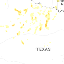
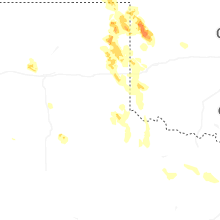
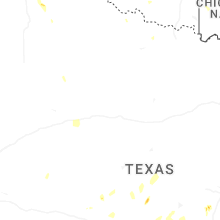
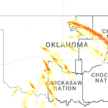
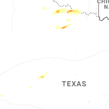
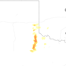

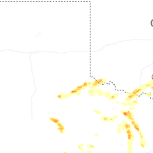
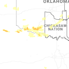
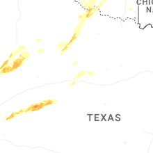
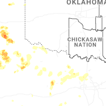


Connect with Interactive Hail Maps