

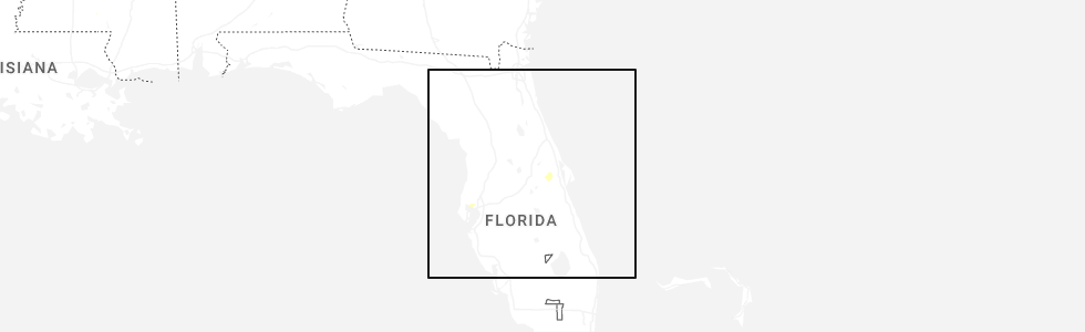
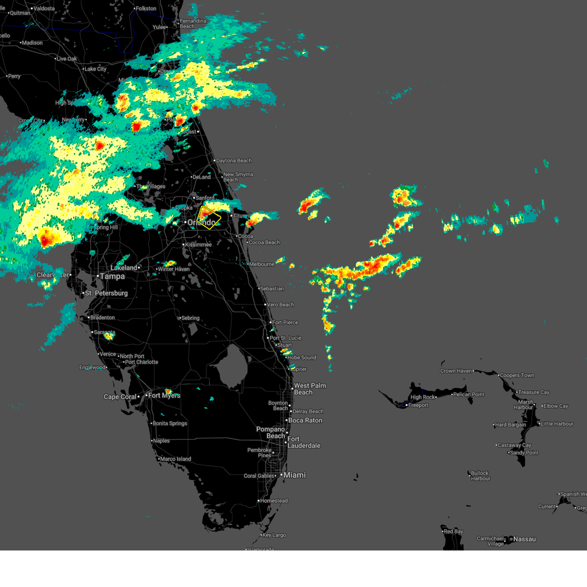
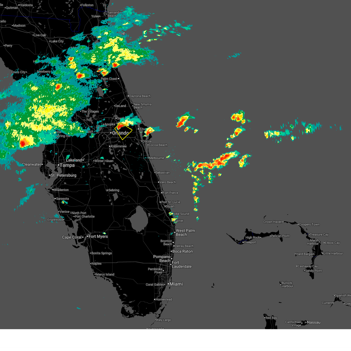
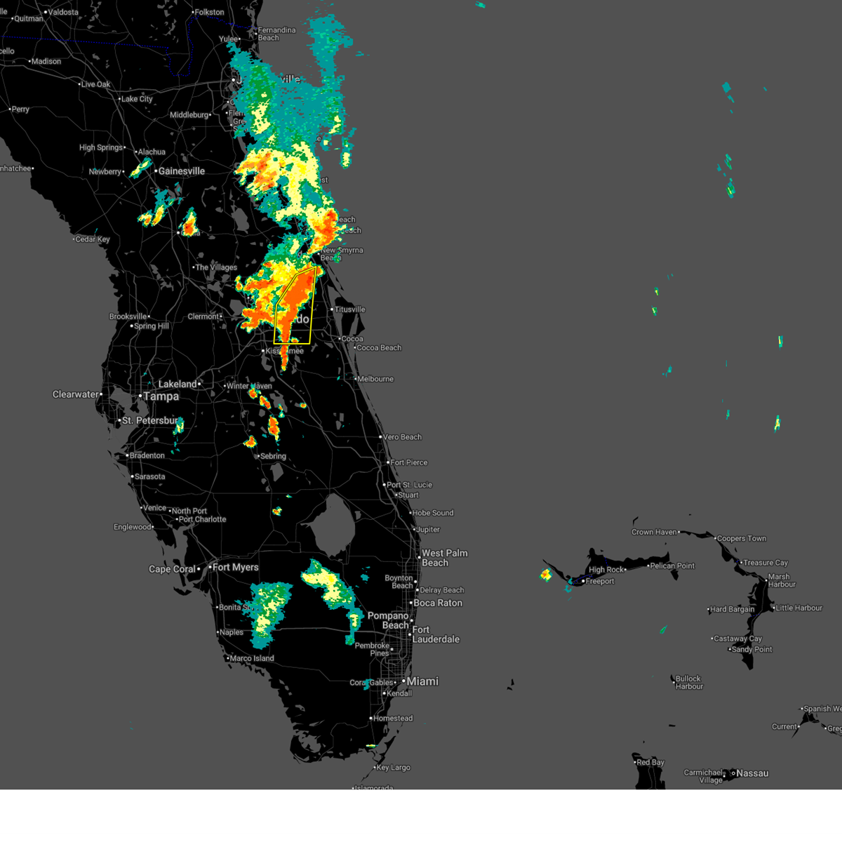
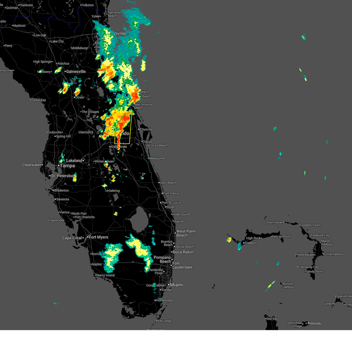
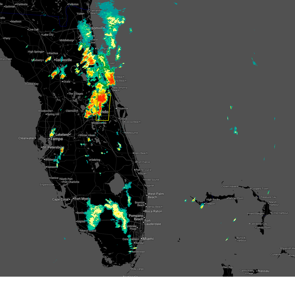
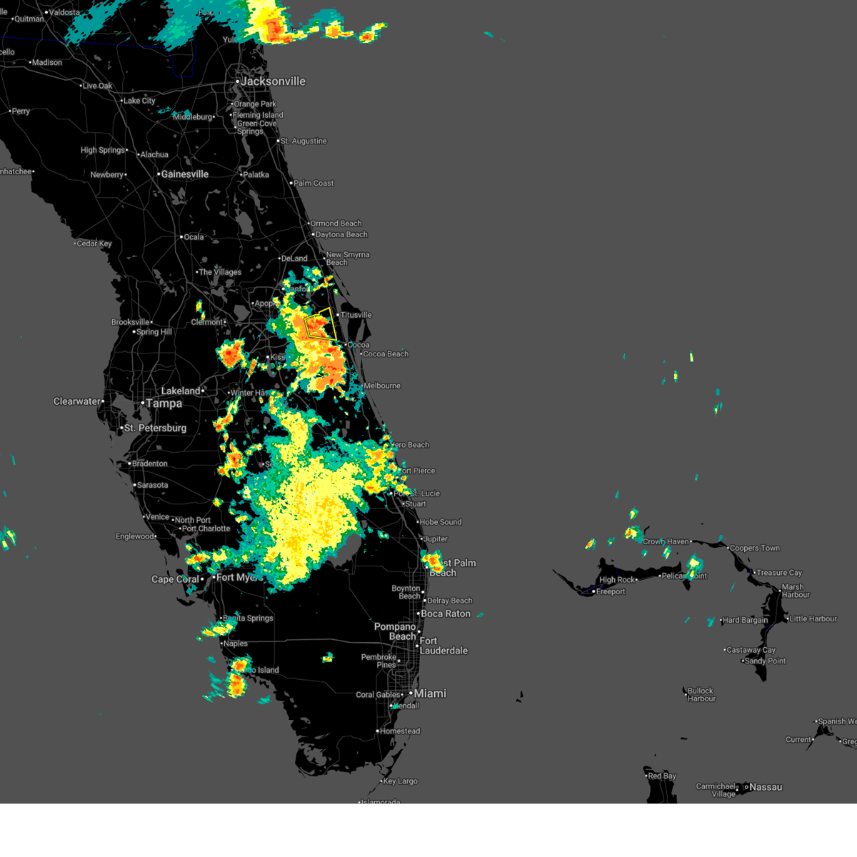
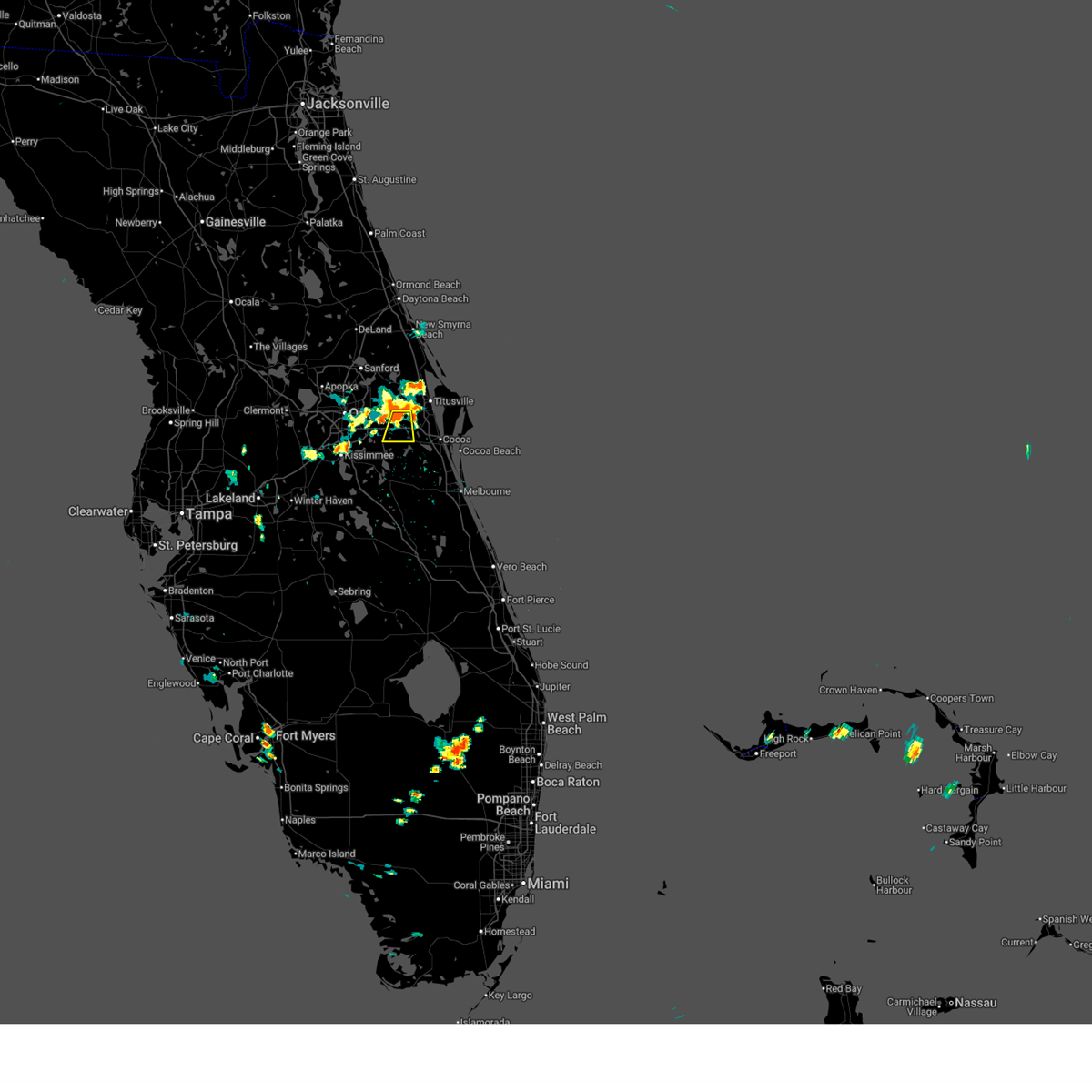
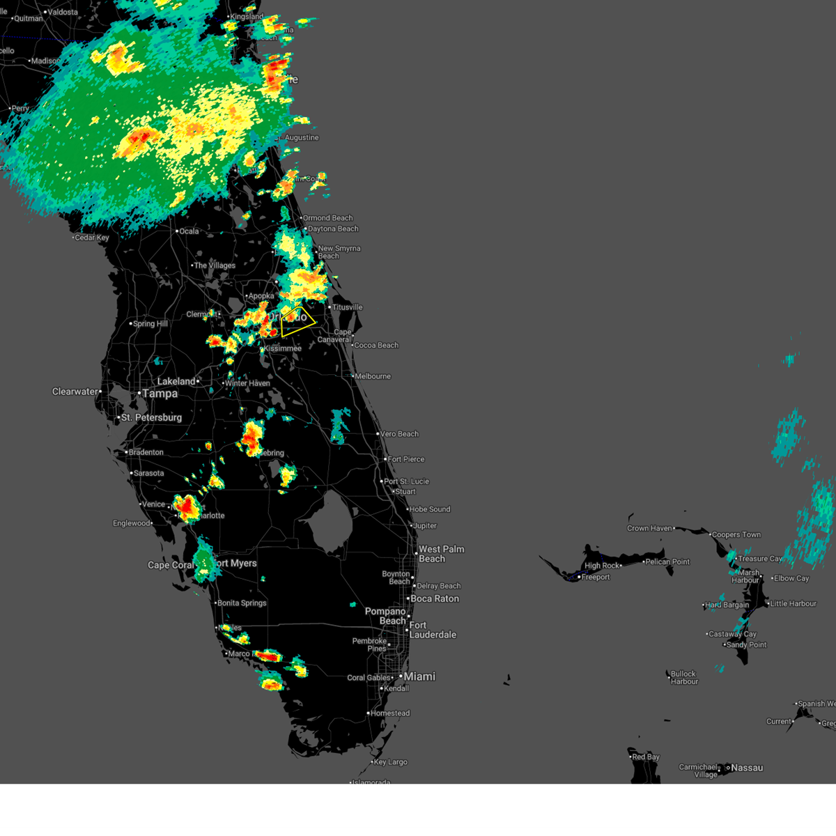
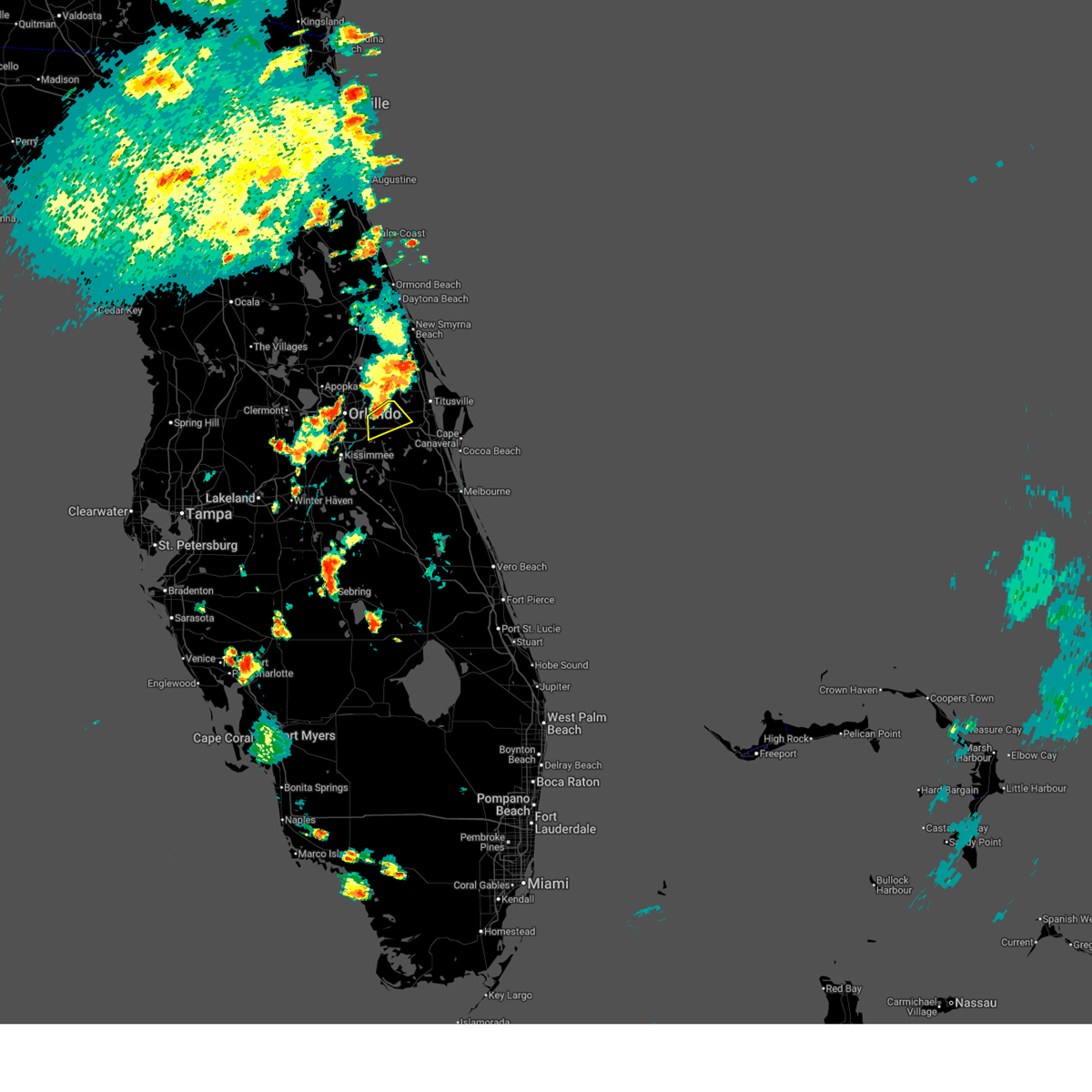
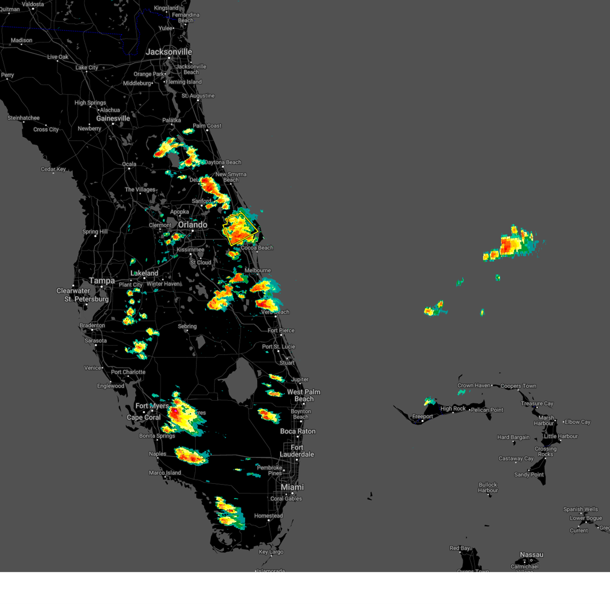
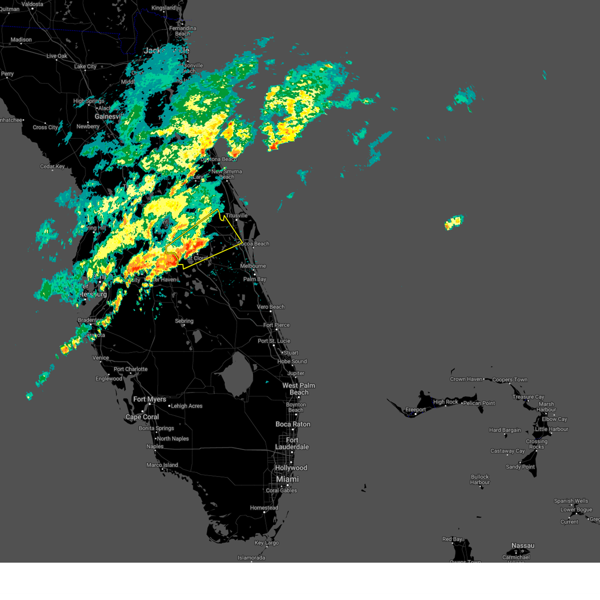
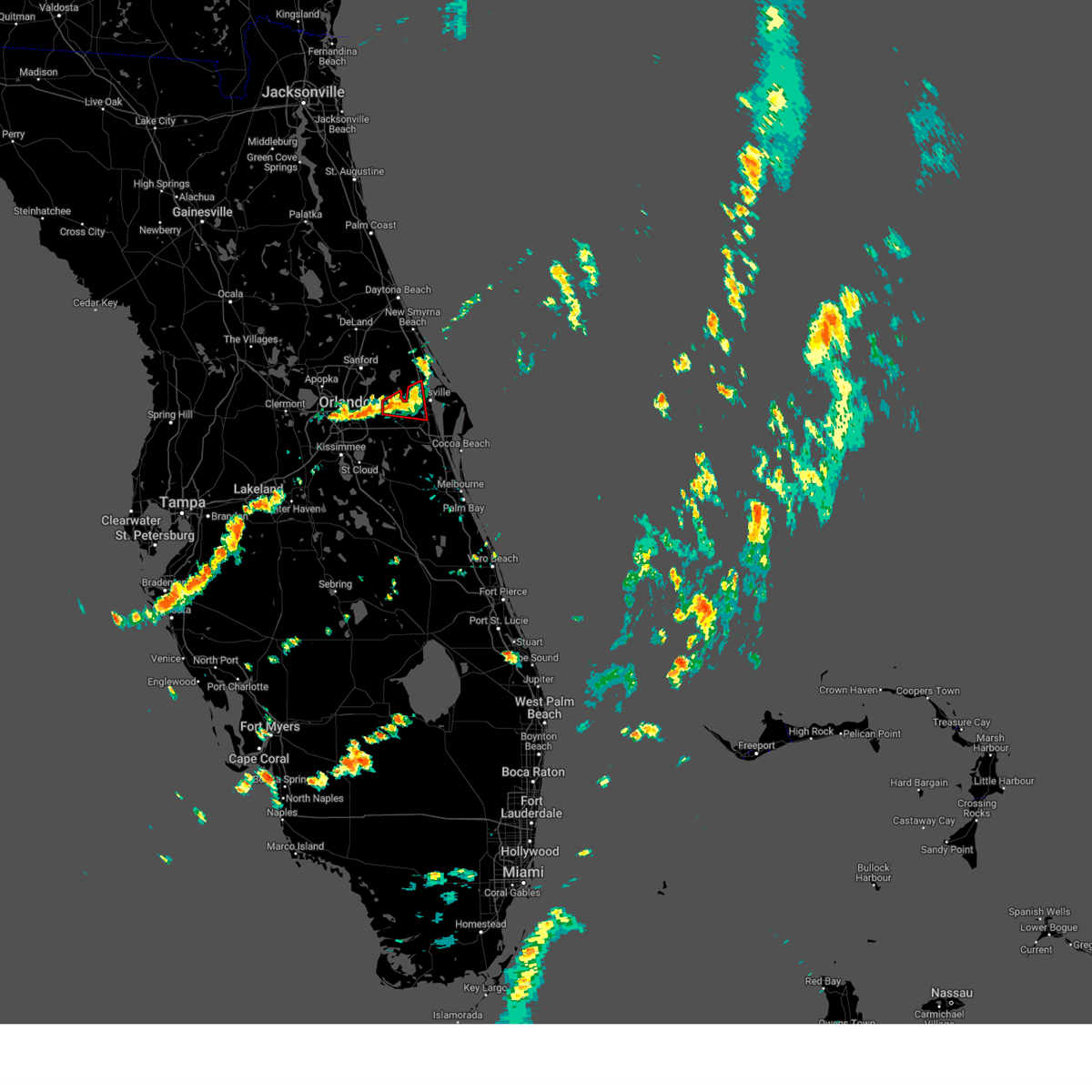
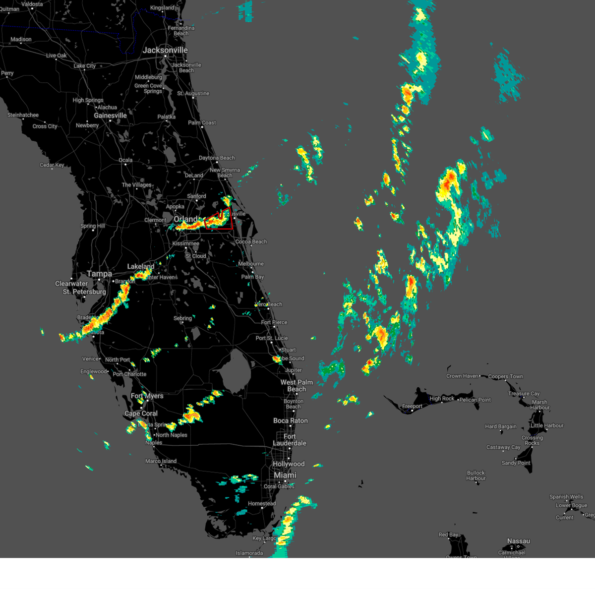
Hail Map for Christmas, FL
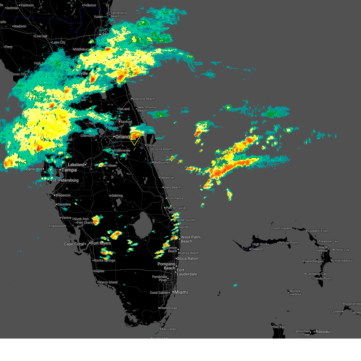
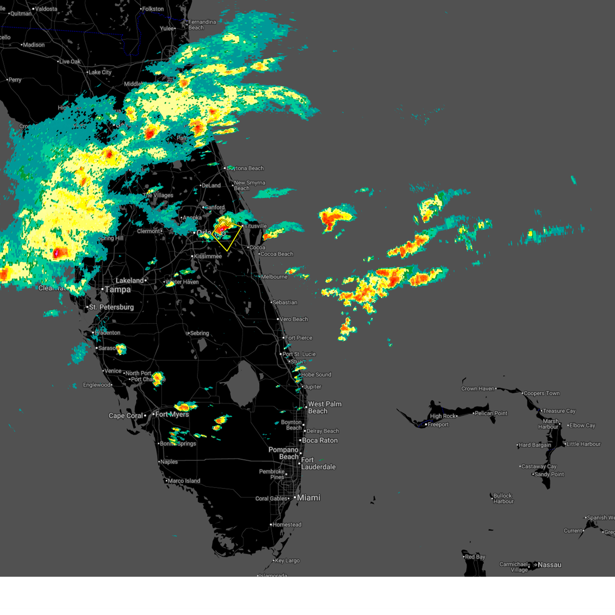
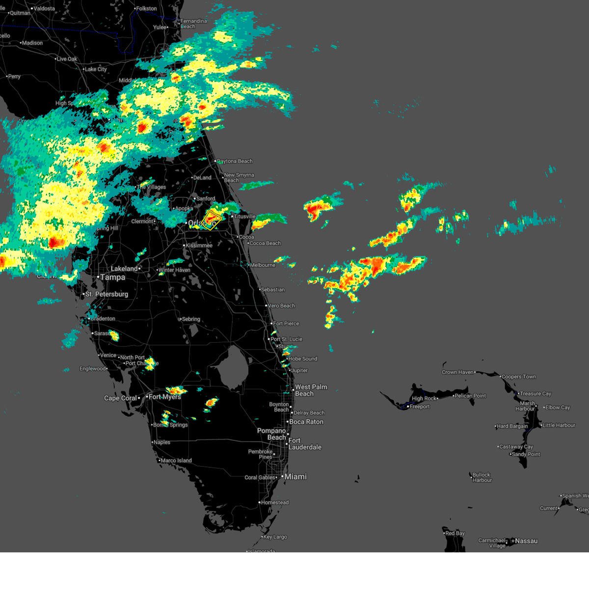
The Christmas, FL area has had 3 reports of on-the-ground hail by trained spotters, and has been under severe weather warnings 16 times during the past 12 months. Doppler radar has detected hail at or near Christmas, FL on 83 occasions, including 2 occasions during the past year.
| Name: | Christmas, FL |
| Where Located: | 22.9 miles E of Orlando, FL |
| Map: | Google Map for Christmas, FL |
| Population: | 1146 |
| Housing Units: | 492 |
| More Info: | Search Google for Christmas, FL |
2
The Top Recent Hail Date for Christmas, FL is Sunday, July 20, 2025 (10th out of 83)
Hail and Wind Damage Spotted near Christmas, FL
| Date / Time | Report Details |
|---|---|
| 5/12/2026 1:27 PM EDT |
 Svrmlb the national weather service in melbourne has issued a * severe thunderstorm warning for, northwestern brevard county in east central florida, southeastern orange county in east central florida, * until 215 pm edt. * at 126 pm edt, a severe thunderstorm was located over christmas, moving southeast at 15 mph (radar indicated). Hazards include 60 mph wind gusts and quarter size hail. Hail damage to vehicles is expected. Expect wind damage to roofs, siding, and trees. Svrmlb the national weather service in melbourne has issued a * severe thunderstorm warning for, northwestern brevard county in east central florida, southeastern orange county in east central florida, * until 215 pm edt. * at 126 pm edt, a severe thunderstorm was located over christmas, moving southeast at 15 mph (radar indicated). Hazards include 60 mph wind gusts and quarter size hail. Hail damage to vehicles is expected. Expect wind damage to roofs, siding, and trees.
|
| 5/12/2026 1:21 PM EDT |
 At 120 pm edt, a severe thunderstorm was located over christmas, moving southeast at 15 mph (radar indicated). Hazards include 60 mph wind gusts and quarter size hail. Hail damage to vehicles is expected. expect wind damage to roofs, siding, and trees. Locations impacted include, titusville, wedgefield, and christmas. At 120 pm edt, a severe thunderstorm was located over christmas, moving southeast at 15 mph (radar indicated). Hazards include 60 mph wind gusts and quarter size hail. Hail damage to vehicles is expected. expect wind damage to roofs, siding, and trees. Locations impacted include, titusville, wedgefield, and christmas.
|
| 5/12/2026 12:56 PM EDT |
 Svrmlb the national weather service in melbourne has issued a * severe thunderstorm warning for, southeastern seminole county in east central florida, northwestern brevard county in east central florida, southeastern orange county in east central florida, * until 130 pm edt. * at 1256 pm edt, a severe thunderstorm was located near christmas, moving southeast at 15 mph (radar indicated). Hazards include 60 mph wind gusts and quarter size hail. Hail damage to vehicles is expected. Expect wind damage to roofs, siding, and trees. Svrmlb the national weather service in melbourne has issued a * severe thunderstorm warning for, southeastern seminole county in east central florida, northwestern brevard county in east central florida, southeastern orange county in east central florida, * until 130 pm edt. * at 1256 pm edt, a severe thunderstorm was located near christmas, moving southeast at 15 mph (radar indicated). Hazards include 60 mph wind gusts and quarter size hail. Hail damage to vehicles is expected. Expect wind damage to roofs, siding, and trees.
|
| 5/12/2026 12:48 PM EDT |
 At 1248 pm edt, a severe thunderstorm was located over bithlo, moving southeast at 15 mph (radar indicated). Hazards include 60 mph wind gusts and quarter size hail. Hail damage to vehicles is expected. expect wind damage to roofs, siding, and trees. Locations impacted include, wedgefield, bithlo, chuluota, and christmas. At 1248 pm edt, a severe thunderstorm was located over bithlo, moving southeast at 15 mph (radar indicated). Hazards include 60 mph wind gusts and quarter size hail. Hail damage to vehicles is expected. expect wind damage to roofs, siding, and trees. Locations impacted include, wedgefield, bithlo, chuluota, and christmas.
|
| 5/12/2026 12:32 PM EDT |
 At 1231 pm edt, a severe thunderstorm was located over chuluota, moving east at 15 mph (trained weather spotters. at 1221 pm edt, trained spotters reported hail up quarter size in oviedo). Hazards include 60 mph wind gusts and quarter size hail. Hail damage to vehicles is expected. expect wind damage to roofs, siding, and trees. Locations impacted include, oviedo, wedgefield, university of central florida, bithlo, and chuluota. At 1231 pm edt, a severe thunderstorm was located over chuluota, moving east at 15 mph (trained weather spotters. at 1221 pm edt, trained spotters reported hail up quarter size in oviedo). Hazards include 60 mph wind gusts and quarter size hail. Hail damage to vehicles is expected. expect wind damage to roofs, siding, and trees. Locations impacted include, oviedo, wedgefield, university of central florida, bithlo, and chuluota.
|
| 5/12/2026 12:18 PM EDT |
 Svrmlb the national weather service in melbourne has issued a * severe thunderstorm warning for, southeastern seminole county in east central florida, southeastern orange county in east central florida, * until 100 pm edt. * at 1218 pm edt, a severe thunderstorm was located over university of central florida, moving southeast at 15 mph (radar indicated). Hazards include 60 mph wind gusts and quarter size hail. Hail damage to vehicles is expected. Expect wind damage to roofs, siding, and trees. Svrmlb the national weather service in melbourne has issued a * severe thunderstorm warning for, southeastern seminole county in east central florida, southeastern orange county in east central florida, * until 100 pm edt. * at 1218 pm edt, a severe thunderstorm was located over university of central florida, moving southeast at 15 mph (radar indicated). Hazards include 60 mph wind gusts and quarter size hail. Hail damage to vehicles is expected. Expect wind damage to roofs, siding, and trees.
|
| 10/27/2025 5:37 PM EDT | The storm which prompted the warning has weakened below severe limits, and no longer poses an immediate threat to life or property. therefore, the warning will be allowed to expire. |
| 10/27/2025 5:19 PM EDT | Svrmlb the national weather service in melbourne has issued a * severe thunderstorm warning for, northwestern brevard county in east central florida, southeastern orange county in east central florida, * until 545 pm edt. * at 518 pm edt, a severe thunderstorm was located over wedgefield, moving east at 25 mph (radar indicated). Hazards include 60 mph wind gusts. expect damage to roofs, siding, and trees |
| 8/5/2025 8:01 PM EDT |
 The storms which prompted the warning have weakened below severe limits. therefore, the warning has been allowed to expire. however gusty winds and heavy rain are still possible with these thunderstorms. The storms which prompted the warning have weakened below severe limits. therefore, the warning has been allowed to expire. however gusty winds and heavy rain are still possible with these thunderstorms.
|
| 8/5/2025 7:46 PM EDT |
 At 746 pm edt, severe thunderstorms were located along a line extending from near maytown to lake hart, moving east at 10 mph (radar indicated). Hazards include 60 mph wind gusts and penny size hail. Expect damage to roofs, siding, and trees. Locations impacted include, orlando, oviedo, winter springs, wedgefield, and avalon park. At 746 pm edt, severe thunderstorms were located along a line extending from near maytown to lake hart, moving east at 10 mph (radar indicated). Hazards include 60 mph wind gusts and penny size hail. Expect damage to roofs, siding, and trees. Locations impacted include, orlando, oviedo, winter springs, wedgefield, and avalon park.
|
| 8/5/2025 7:34 PM EDT |
 Svrmlb the national weather service in melbourne has issued a * severe thunderstorm warning for, eastern seminole county in east central florida, southeastern orange county in east central florida, south central volusia county in east central florida, * until 800 pm edt. * at 734 pm edt, severe thunderstorms were located along a line extending from near osteen to near lake hart, moving east at 10 mph (radar indicated). Hazards include 60 mph wind gusts and penny size hail. expect damage to roofs, siding, and trees Svrmlb the national weather service in melbourne has issued a * severe thunderstorm warning for, eastern seminole county in east central florida, southeastern orange county in east central florida, south central volusia county in east central florida, * until 800 pm edt. * at 734 pm edt, severe thunderstorms were located along a line extending from near osteen to near lake hart, moving east at 10 mph (radar indicated). Hazards include 60 mph wind gusts and penny size hail. expect damage to roofs, siding, and trees
|
| 8/4/2025 8:35 PM EDT |
 Svrmlb the national weather service in melbourne has issued a * severe thunderstorm warning for, northwestern brevard county in east central florida, east central orange county in east central florida, * until 900 pm edt. * at 835 pm edt, a severe thunderstorm was located over christmas, moving east at 10 mph (radar indicated). Hazards include 60 mph wind gusts. expect damage to roofs, siding, and trees Svrmlb the national weather service in melbourne has issued a * severe thunderstorm warning for, northwestern brevard county in east central florida, east central orange county in east central florida, * until 900 pm edt. * at 835 pm edt, a severe thunderstorm was located over christmas, moving east at 10 mph (radar indicated). Hazards include 60 mph wind gusts. expect damage to roofs, siding, and trees
|
| 7/20/2025 5:41 PM EDT |
 Svrmlb the national weather service in melbourne has issued a * severe thunderstorm warning for, eastern orange county in east central florida, * until 630 pm edt. * at 541 pm edt, a severe thunderstorm was located over christmas, moving south at 10 mph (radar indicated). Hazards include 60 mph wind gusts and nickel size hail. expect damage to roofs, siding, and trees Svrmlb the national weather service in melbourne has issued a * severe thunderstorm warning for, eastern orange county in east central florida, * until 630 pm edt. * at 541 pm edt, a severe thunderstorm was located over christmas, moving south at 10 mph (radar indicated). Hazards include 60 mph wind gusts and nickel size hail. expect damage to roofs, siding, and trees
|
| 7/9/2025 6:10 PM EDT |
 The severe thunderstorm which prompted the warning has weakened. therefore, the warning will be allowed to expire. The severe thunderstorm which prompted the warning has weakened. therefore, the warning will be allowed to expire.
|
| 7/9/2025 6:01 PM EDT |
 At 601 pm edt, a severe thunderstorm was located over avalon park, moving south at 10 mph (radar indicated). Hazards include 60 mph wind gusts and quarter size hail. Hail damage to vehicles is expected. expect wind damage to roofs, siding, and trees. Locations impacted include, wedgefield, avalon park, bithlo, and christmas. At 601 pm edt, a severe thunderstorm was located over avalon park, moving south at 10 mph (radar indicated). Hazards include 60 mph wind gusts and quarter size hail. Hail damage to vehicles is expected. expect wind damage to roofs, siding, and trees. Locations impacted include, wedgefield, avalon park, bithlo, and christmas.
|
| 7/9/2025 5:44 PM EDT |
 Svrmlb the national weather service in melbourne has issued a * severe thunderstorm warning for, southeastern orange county in east central florida, * until 615 pm edt. * at 544 pm edt, a severe thunderstorm was located over avalon park, moving south at 15 mph (radar indicated). Hazards include 60 mph wind gusts and half dollar size hail. Hail damage to vehicles is expected. Expect wind damage to roofs, siding, and trees. Svrmlb the national weather service in melbourne has issued a * severe thunderstorm warning for, southeastern orange county in east central florida, * until 615 pm edt. * at 544 pm edt, a severe thunderstorm was located over avalon park, moving south at 15 mph (radar indicated). Hazards include 60 mph wind gusts and half dollar size hail. Hail damage to vehicles is expected. Expect wind damage to roofs, siding, and trees.
|
| 5/30/2025 4:49 PM EDT |
 At 449 pm edt, a severe thunderstorm was located near titusville airport, moving east at 35 mph (radar indicated). Hazards include 60 mph wind gusts. Expect damage to roofs, siding, and trees. Locations impacted include, titusville, cocoa, cape canaveral, port saint john, and christmas. At 449 pm edt, a severe thunderstorm was located near titusville airport, moving east at 35 mph (radar indicated). Hazards include 60 mph wind gusts. Expect damage to roofs, siding, and trees. Locations impacted include, titusville, cocoa, cape canaveral, port saint john, and christmas.
|
| 5/30/2025 4:35 PM EDT |
 Svrmlb the national weather service in melbourne has issued a * severe thunderstorm warning for, northern brevard county in east central florida, southeastern orange county in east central florida, * until 515 pm edt. * at 435 pm edt, a severe thunderstorm was located over christmas, moving east at 35 mph (radar indicated). Hazards include 60 mph wind gusts. expect damage to roofs, siding, and trees Svrmlb the national weather service in melbourne has issued a * severe thunderstorm warning for, northern brevard county in east central florida, southeastern orange county in east central florida, * until 515 pm edt. * at 435 pm edt, a severe thunderstorm was located over christmas, moving east at 35 mph (radar indicated). Hazards include 60 mph wind gusts. expect damage to roofs, siding, and trees
|
| 5/24/2025 3:35 PM EDT |
 the severe thunderstorm warning has been cancelled and is no longer in effect the severe thunderstorm warning has been cancelled and is no longer in effect
|
| 5/24/2025 3:35 PM EDT |
 At 335 pm edt, a severe thunderstorm was located over titusville airport, moving southeast at 20 mph (radar indicated). Hazards include ping pong ball size hail and 60 mph wind gusts. People and animals outdoors will be injured. expect hail damage to roofs, siding, windows, and vehicles. expect wind damage to roofs, siding, and trees. Locations impacted include, titusville, port saint john, mims, titusville airport, and christmas. At 335 pm edt, a severe thunderstorm was located over titusville airport, moving southeast at 20 mph (radar indicated). Hazards include ping pong ball size hail and 60 mph wind gusts. People and animals outdoors will be injured. expect hail damage to roofs, siding, windows, and vehicles. expect wind damage to roofs, siding, and trees. Locations impacted include, titusville, port saint john, mims, titusville airport, and christmas.
|
| 5/24/2025 3:08 PM EDT |
 Svrmlb the national weather service in melbourne has issued a * severe thunderstorm warning for, southeastern seminole county in east central florida, northwestern brevard county in east central florida, east central orange county in east central florida, * until 400 pm edt. * at 308 pm edt, a severe thunderstorm was located near mims, moving southeast at 20 mph (radar indicated). Hazards include ping pong ball size hail and 60 mph wind gusts. People and animals outdoors will be injured. expect hail damage to roofs, siding, windows, and vehicles. Expect wind damage to roofs, siding, and trees. Svrmlb the national weather service in melbourne has issued a * severe thunderstorm warning for, southeastern seminole county in east central florida, northwestern brevard county in east central florida, east central orange county in east central florida, * until 400 pm edt. * at 308 pm edt, a severe thunderstorm was located near mims, moving southeast at 20 mph (radar indicated). Hazards include ping pong ball size hail and 60 mph wind gusts. People and animals outdoors will be injured. expect hail damage to roofs, siding, windows, and vehicles. Expect wind damage to roofs, siding, and trees.
|
| 1/19/2025 1:25 PM EST |
 At 125 pm est, a severe thunderstorm was located over sharpes, moving northeast at 50 mph (radar indicated). Hazards include 60 mph wind gusts and nickel size hail. Expect damage to roofs, siding, and trees. Locations impacted include, titusville, rockledge, cocoa, cocoa beach, and cape canaveral. At 125 pm est, a severe thunderstorm was located over sharpes, moving northeast at 50 mph (radar indicated). Hazards include 60 mph wind gusts and nickel size hail. Expect damage to roofs, siding, and trees. Locations impacted include, titusville, rockledge, cocoa, cocoa beach, and cape canaveral.
|
| 1/19/2025 1:07 PM EST |
 Svrmlb the national weather service in melbourne has issued a * severe thunderstorm warning for, northern brevard county in east central florida, southeastern orange county in east central florida, northeastern osceola county in east central florida, * until 145 pm est. * at 107 pm est, a severe thunderstorm was located 7 miles west of lone cabbage fish camp, moving northeast at 50 mph (radar indicated). Hazards include 60 mph wind gusts and nickel size hail. expect damage to roofs, siding, and trees Svrmlb the national weather service in melbourne has issued a * severe thunderstorm warning for, northern brevard county in east central florida, southeastern orange county in east central florida, northeastern osceola county in east central florida, * until 145 pm est. * at 107 pm est, a severe thunderstorm was located 7 miles west of lone cabbage fish camp, moving northeast at 50 mph (radar indicated). Hazards include 60 mph wind gusts and nickel size hail. expect damage to roofs, siding, and trees
|
| 1/19/2025 12:42 PM EST |
 Svrmlb the national weather service in melbourne has issued a * severe thunderstorm warning for, southeastern seminole county in east central florida, west central brevard county in east central florida, southern orange county in east central florida, northern osceola county in east central florida, * until 130 pm est. * at 1242 pm est, a severe thunderstorm was located over campbell, or near west lake toho, moving northeast at 55 mph (radar indicated). Hazards include 60 mph wind gusts. expect damage to roofs, siding, and trees Svrmlb the national weather service in melbourne has issued a * severe thunderstorm warning for, southeastern seminole county in east central florida, west central brevard county in east central florida, southern orange county in east central florida, northern osceola county in east central florida, * until 130 pm est. * at 1242 pm est, a severe thunderstorm was located over campbell, or near west lake toho, moving northeast at 55 mph (radar indicated). Hazards include 60 mph wind gusts. expect damage to roofs, siding, and trees
|
| 8/6/2024 6:59 AM EDT |
 The tornadic thunderstorm which prompted the warning has weakened. therefore, the warning will be allowed to expire. The tornadic thunderstorm which prompted the warning has weakened. therefore, the warning will be allowed to expire.
|
| 8/6/2024 6:53 AM EDT |
 At 653 am edt, a severe thunderstorm capable of producing a tornado was located over bithlo, moving northeast at 30 mph (radar indicated rotation). Hazards include tornado. Flying debris will be dangerous to those caught without shelter. mobile homes will be damaged or destroyed. damage to roofs, windows, and vehicles will occur. tree damage is likely. This dangerous storm will be near, christmas around 700 am edt. At 653 am edt, a severe thunderstorm capable of producing a tornado was located over bithlo, moving northeast at 30 mph (radar indicated rotation). Hazards include tornado. Flying debris will be dangerous to those caught without shelter. mobile homes will be damaged or destroyed. damage to roofs, windows, and vehicles will occur. tree damage is likely. This dangerous storm will be near, christmas around 700 am edt.
|
| 8/6/2024 6:48 AM EDT |
 At 648 am edt, a severe thunderstorm capable of producing a tornado was located over bithlo, moving east at 35 mph (radar indicated rotation). Hazards include tornado. Flying debris will be dangerous to those caught without shelter. mobile homes will be damaged or destroyed. damage to roofs, windows, and vehicles will occur. tree damage is likely. This dangerous storm will be near, wedgefield, bithlo, and christmas around 650 am edt. At 648 am edt, a severe thunderstorm capable of producing a tornado was located over bithlo, moving east at 35 mph (radar indicated rotation). Hazards include tornado. Flying debris will be dangerous to those caught without shelter. mobile homes will be damaged or destroyed. damage to roofs, windows, and vehicles will occur. tree damage is likely. This dangerous storm will be near, wedgefield, bithlo, and christmas around 650 am edt.
|
| 8/6/2024 6:44 AM EDT |
 Tormlb the national weather service in melbourne has issued a * tornado warning for, southeastern seminole county in east central florida, northwestern brevard county in east central florida, east central orange county in east central florida, * until 700 am edt. * at 644 am edt, a severe thunderstorm capable of producing a tornado was located over bithlo, moving east at 35 mph (radar indicated rotation). Hazards include tornado. Flying debris will be dangerous to those caught without shelter. mobile homes will be damaged or destroyed. damage to roofs, windows, and vehicles will occur. tree damage is likely. This dangerous storm will be near, wedgefield, bithlo, and christmas around 650 am edt. Tormlb the national weather service in melbourne has issued a * tornado warning for, southeastern seminole county in east central florida, northwestern brevard county in east central florida, east central orange county in east central florida, * until 700 am edt. * at 644 am edt, a severe thunderstorm capable of producing a tornado was located over bithlo, moving east at 35 mph (radar indicated rotation). Hazards include tornado. Flying debris will be dangerous to those caught without shelter. mobile homes will be damaged or destroyed. damage to roofs, windows, and vehicles will occur. tree damage is likely. This dangerous storm will be near, wedgefield, bithlo, and christmas around 650 am edt.
|
| 7/16/2024 4:45 PM EDT |
 At 445 pm edt, a severe thunderstorm was located over avalon park, moving southeast at 5 mph (radar indicated). Hazards include 60 mph wind gusts and quarter size hail. Hail damage to vehicles is expected. expect wind damage to roofs, siding, and trees. Locations impacted include, wedgefield, bithlo, and christmas. At 445 pm edt, a severe thunderstorm was located over avalon park, moving southeast at 5 mph (radar indicated). Hazards include 60 mph wind gusts and quarter size hail. Hail damage to vehicles is expected. expect wind damage to roofs, siding, and trees. Locations impacted include, wedgefield, bithlo, and christmas.
|
| 7/16/2024 4:27 PM EDT |
 Svrmlb the national weather service in melbourne has issued a * severe thunderstorm warning for, southeastern seminole county in east central florida, southeastern orange county in east central florida, * until 500 pm edt. * at 427 pm edt, a severe thunderstorm was located over avalon park, moving southeast at 5 mph (radar indicated). Hazards include 60 mph wind gusts and quarter size hail. Hail damage to vehicles is expected. Expect wind damage to roofs, siding, and trees. Svrmlb the national weather service in melbourne has issued a * severe thunderstorm warning for, southeastern seminole county in east central florida, southeastern orange county in east central florida, * until 500 pm edt. * at 427 pm edt, a severe thunderstorm was located over avalon park, moving southeast at 5 mph (radar indicated). Hazards include 60 mph wind gusts and quarter size hail. Hail damage to vehicles is expected. Expect wind damage to roofs, siding, and trees.
|
| 6/6/2024 7:31 PM EDT |
 At 730 pm edt, severe thunderstorms were located along a line extending from wekiva springs to near lake jessup to near christmas, moving northeast at 25 mph (radar indicated). Hazards include 60 mph wind gusts and quarter size hail. Hail damage to vehicles is expected. expect wind damage to roofs, siding, and trees. Locations impacted include, orlando, deltona, sanford, apopka, and altamonte springs. At 730 pm edt, severe thunderstorms were located along a line extending from wekiva springs to near lake jessup to near christmas, moving northeast at 25 mph (radar indicated). Hazards include 60 mph wind gusts and quarter size hail. Hail damage to vehicles is expected. expect wind damage to roofs, siding, and trees. Locations impacted include, orlando, deltona, sanford, apopka, and altamonte springs.
|
| 6/6/2024 7:26 PM EDT |
 Svrmlb the national weather service in melbourne has issued a * severe thunderstorm warning for, seminole county in east central florida, east central lake county in east central florida, central orange county in east central florida, south central volusia county in east central florida, * until 800 pm edt. * at 725 pm edt, severe thunderstorms were located along a line extending from wekiva springs to near oviedo to near christmas, moving northeast at 25 mph (radar indicated). Hazards include 60 mph wind gusts and quarter size hail. Hail damage to vehicles is expected. Expect wind damage to roofs, siding, and trees. Svrmlb the national weather service in melbourne has issued a * severe thunderstorm warning for, seminole county in east central florida, east central lake county in east central florida, central orange county in east central florida, south central volusia county in east central florida, * until 800 pm edt. * at 725 pm edt, severe thunderstorms were located along a line extending from wekiva springs to near oviedo to near christmas, moving northeast at 25 mph (radar indicated). Hazards include 60 mph wind gusts and quarter size hail. Hail damage to vehicles is expected. Expect wind damage to roofs, siding, and trees.
|
| 6/6/2024 7:04 PM EDT |
 At 704 pm edt, severe thunderstorms were located along a line extending from pine hills to union park to near wedgefield, moving north at 35 mph (radar indicated). Hazards include 60 mph wind gusts and half dollar size hail. Hail damage to vehicles is expected. expect wind damage to roofs, siding, and trees. Locations impacted include, orlando, sanford, apopka, altamonte springs, and oviedo. At 704 pm edt, severe thunderstorms were located along a line extending from pine hills to union park to near wedgefield, moving north at 35 mph (radar indicated). Hazards include 60 mph wind gusts and half dollar size hail. Hail damage to vehicles is expected. expect wind damage to roofs, siding, and trees. Locations impacted include, orlando, sanford, apopka, altamonte springs, and oviedo.
|
| 6/6/2024 7:04 PM EDT |
 the severe thunderstorm warning has been cancelled and is no longer in effect the severe thunderstorm warning has been cancelled and is no longer in effect
|
| 6/6/2024 6:59 PM EDT |
 Svrmlb the national weather service in melbourne has issued a * severe thunderstorm warning for, seminole county in east central florida, northwestern brevard county in east central florida, orange county in east central florida, north central osceola county in east central florida, * until 730 pm edt. * at 658 pm edt, severe thunderstorms were located along a line extending from oak ridge to near lake nona to 7 miles west of lone cabbage fish camp, moving north at 35 mph (radar indicated. a wind gust to 58 mph recently occurred at orlando international airport with this storm!). Hazards include 60 mph wind gusts and half dollar size hail. Hail damage to vehicles is expected. Expect wind damage to roofs, siding, and trees. Svrmlb the national weather service in melbourne has issued a * severe thunderstorm warning for, seminole county in east central florida, northwestern brevard county in east central florida, orange county in east central florida, north central osceola county in east central florida, * until 730 pm edt. * at 658 pm edt, severe thunderstorms were located along a line extending from oak ridge to near lake nona to 7 miles west of lone cabbage fish camp, moving north at 35 mph (radar indicated. a wind gust to 58 mph recently occurred at orlando international airport with this storm!). Hazards include 60 mph wind gusts and half dollar size hail. Hail damage to vehicles is expected. Expect wind damage to roofs, siding, and trees.
|
| 2/4/2024 8:44 PM EST |
 At 844 pm est, severe thunderstorms were located along a line extending from near mims to near canaveral groves to 7 miles east of holopaw, moving northeast at 40 mph (radar indicated). Hazards include 60 mph wind gusts and quarter size hail. Hail damage to vehicles is expected. Expect wind damage to roofs, siding, and trees. At 844 pm est, severe thunderstorms were located along a line extending from near mims to near canaveral groves to 7 miles east of holopaw, moving northeast at 40 mph (radar indicated). Hazards include 60 mph wind gusts and quarter size hail. Hail damage to vehicles is expected. Expect wind damage to roofs, siding, and trees.
|
| 2/4/2024 8:04 PM EST |
 At 803 pm est, a severe thunderstorm was located over university of central florida, moving northeast at 35 mph (radar indicated). Hazards include 60 mph wind gusts and quarter size hail. Hail damage to vehicles is expected. Expect wind damage to roofs, siding, and trees. At 803 pm est, a severe thunderstorm was located over university of central florida, moving northeast at 35 mph (radar indicated). Hazards include 60 mph wind gusts and quarter size hail. Hail damage to vehicles is expected. Expect wind damage to roofs, siding, and trees.
|
| 1/9/2024 6:48 PM EST |
 A severe thunderstorm warning remains in effect until 715 pm est for northwestern brevard and southeastern orange counties. at 648 pm est, severe thunderstorms were located along a line extending from 19 miles northeast of bethune beach to 10 miles east of apollo beach to near mims, moving northeast at 65 mph. hazard. 60 mph wind gusts. A severe thunderstorm warning remains in effect until 715 pm est for northwestern brevard and southeastern orange counties. at 648 pm est, severe thunderstorms were located along a line extending from 19 miles northeast of bethune beach to 10 miles east of apollo beach to near mims, moving northeast at 65 mph. hazard. 60 mph wind gusts.
|
| 1/9/2024 6:31 PM EST |
 A tornado warning remains in effect until 645 pm est for northwestern brevard. southeastern orange and southeastern volusia counties. At 631 pm est, severe thunderstorms capable of producing tornadoes were located along a line extending from oak hill to near mims to near wedgefield, moving northeast at 50 mph. A tornado warning remains in effect until 645 pm est for northwestern brevard. southeastern orange and southeastern volusia counties. At 631 pm est, severe thunderstorms capable of producing tornadoes were located along a line extending from oak hill to near mims to near wedgefield, moving northeast at 50 mph.
|
| 1/9/2024 6:24 PM EST |
 The national weather service in melbourne has issued a * severe thunderstorm warning for. southeastern seminole county in east central florida. northwestern brevard county in east central florida. southeastern orange county in east central florida. Southeastern volusia county in east central florida. The national weather service in melbourne has issued a * severe thunderstorm warning for. southeastern seminole county in east central florida. northwestern brevard county in east central florida. southeastern orange county in east central florida. Southeastern volusia county in east central florida.
|
| 1/9/2024 6:18 PM EST |
 At 617 pm est, severe thunderstorms capable of producing tornadoes were located along a line extending from near osteen to bithlo to lake hart, moving northeast at 70 mph (radar indicated rotation). Hazards include tornado. Flying debris will be dangerous to those caught without shelter. mobile homes will be damaged or destroyed. damage to roofs, windows, and vehicles will occur. tree damage is likely. these dangerous storms will be near, orlando, oviedo, and new smyrna beach around 620 pm est. titusville, oak hill, and scottsmoor around 630 pm est. merritt island wildlife refuge and klondike beach around 640 pm est. playalinda beach around 650 pm est. Other locations impacted by these tornadic storms include turnbull. At 617 pm est, severe thunderstorms capable of producing tornadoes were located along a line extending from near osteen to bithlo to lake hart, moving northeast at 70 mph (radar indicated rotation). Hazards include tornado. Flying debris will be dangerous to those caught without shelter. mobile homes will be damaged or destroyed. damage to roofs, windows, and vehicles will occur. tree damage is likely. these dangerous storms will be near, orlando, oviedo, and new smyrna beach around 620 pm est. titusville, oak hill, and scottsmoor around 630 pm est. merritt island wildlife refuge and klondike beach around 640 pm est. playalinda beach around 650 pm est. Other locations impacted by these tornadic storms include turnbull.
|
| 1/9/2024 6:08 PM EST |
 At 607 pm est, severe thunderstorms were located along a line extending from near daytona beach shores to near geneva to near orlando international airport, moving northeast at 65 mph (radar indicated). Hazards include 60 mph wind gusts and nickel size hail. Expect damage to roofs, siding, and trees. Locations impacted include, orlando, deltona, kissimmee, port orange, and sanford. At 607 pm est, severe thunderstorms were located along a line extending from near daytona beach shores to near geneva to near orlando international airport, moving northeast at 65 mph (radar indicated). Hazards include 60 mph wind gusts and nickel size hail. Expect damage to roofs, siding, and trees. Locations impacted include, orlando, deltona, kissimmee, port orange, and sanford.
|
| 1/9/2024 6:08 PM EST |
 At 607 pm est, a severe thunderstorm capable of producing a tornado was located over oviedo, moving northeast at 75 mph (radar indicated rotation). Hazards include tornado. Flying debris will be dangerous to those caught without shelter. mobile homes will be damaged or destroyed. damage to roofs, windows, and vehicles will occur. tree damage is likely. this dangerous storm will be near, oviedo, winter springs, and bithlo around 610 pm est. scottsmoor and mims around 620 pm est. haulover canal around 630 pm est. Other locations impacted by this tornadic thunderstorm include turnbull. At 607 pm est, a severe thunderstorm capable of producing a tornado was located over oviedo, moving northeast at 75 mph (radar indicated rotation). Hazards include tornado. Flying debris will be dangerous to those caught without shelter. mobile homes will be damaged or destroyed. damage to roofs, windows, and vehicles will occur. tree damage is likely. this dangerous storm will be near, oviedo, winter springs, and bithlo around 610 pm est. scottsmoor and mims around 620 pm est. haulover canal around 630 pm est. Other locations impacted by this tornadic thunderstorm include turnbull.
|
| 1/9/2024 5:55 PM EST |
 The national weather service in melbourne has issued a * severe thunderstorm warning for. seminole county in east central florida. orange county in east central florida. central volusia county in east central florida. northwestern osceola county in east central florida. Until 645 pm est. The national weather service in melbourne has issued a * severe thunderstorm warning for. seminole county in east central florida. orange county in east central florida. central volusia county in east central florida. northwestern osceola county in east central florida. Until 645 pm est.
|
| 9/25/2023 6:25 PM EDT |
 At 624 pm edt, a severe thunderstorm was located over christmas, moving north at 20 mph (radar indicated). Hazards include 60 mph wind gusts and quarter size hail. Hail damage to vehicles is expected. Expect wind damage to roofs, siding, and trees. At 624 pm edt, a severe thunderstorm was located over christmas, moving north at 20 mph (radar indicated). Hazards include 60 mph wind gusts and quarter size hail. Hail damage to vehicles is expected. Expect wind damage to roofs, siding, and trees.
|
| 9/8/2023 12:26 PM EDT |
 At 1226 pm edt, a severe thunderstorm was located near titusville, moving northeast at 15 mph (radar indicated). Hazards include 60 mph wind gusts and penny size hail. Expect damage to roofs, siding, and trees. Locations impacted include, titusville, wedgefield, christmas, titusville airport, and mims. At 1226 pm edt, a severe thunderstorm was located near titusville, moving northeast at 15 mph (radar indicated). Hazards include 60 mph wind gusts and penny size hail. Expect damage to roofs, siding, and trees. Locations impacted include, titusville, wedgefield, christmas, titusville airport, and mims.
|
| 9/8/2023 12:14 PM EDT |
 At 1214 pm edt, a severe thunderstorm was located near christmas, moving east at 20 mph (radar indicated). Hazards include 60 mph wind gusts and quarter size hail. Hail damage to vehicles is expected. Expect wind damage to roofs, siding, and trees. At 1214 pm edt, a severe thunderstorm was located near christmas, moving east at 20 mph (radar indicated). Hazards include 60 mph wind gusts and quarter size hail. Hail damage to vehicles is expected. Expect wind damage to roofs, siding, and trees.
|
| 8/30/2023 4:20 AM EDT |
 At 419 am edt, a severe thunderstorm capable of producing a tornado was located near lake hart, or 8 miles southwest of wedgefield, moving north at 35 mph (radar indicated rotation). Hazards include tornado. Flying debris will be dangerous to those caught without shelter. mobile homes will be damaged or destroyed. damage to roofs, windows, and vehicles will occur. tree damage is likely. this dangerous storm will be near, wedgefield and lake hart around 420 am edt. bithlo and avalon park around 430 am edt. Christmas around 440 am edt. At 419 am edt, a severe thunderstorm capable of producing a tornado was located near lake hart, or 8 miles southwest of wedgefield, moving north at 35 mph (radar indicated rotation). Hazards include tornado. Flying debris will be dangerous to those caught without shelter. mobile homes will be damaged or destroyed. damage to roofs, windows, and vehicles will occur. tree damage is likely. this dangerous storm will be near, wedgefield and lake hart around 420 am edt. bithlo and avalon park around 430 am edt. Christmas around 440 am edt.
|
| 8/30/2023 4:06 AM EDT |
 At 405 am edt, a severe thunderstorm capable of producing a tornado was located near narcoossee, moving north at 35 mph (radar indicated rotation). Hazards include tornado. Flying debris will be dangerous to those caught without shelter. mobile homes will be damaged or destroyed. damage to roofs, windows, and vehicles will occur. tree damage is likely. this dangerous storm will be near, narcoossee and lake hart around 410 am edt. wedgefield around 420 am edt. avalon park around 430 am edt. Other locations impacted by this tornadic thunderstorm include alligator lake. At 405 am edt, a severe thunderstorm capable of producing a tornado was located near narcoossee, moving north at 35 mph (radar indicated rotation). Hazards include tornado. Flying debris will be dangerous to those caught without shelter. mobile homes will be damaged or destroyed. damage to roofs, windows, and vehicles will occur. tree damage is likely. this dangerous storm will be near, narcoossee and lake hart around 410 am edt. wedgefield around 420 am edt. avalon park around 430 am edt. Other locations impacted by this tornadic thunderstorm include alligator lake.
|
| 8/15/2023 7:39 PM EDT |
 At 739 pm edt, a severe thunderstorm was located near christmas, moving northeast at 15 mph (radar indicated). Hazards include 60 mph wind gusts. expect damage to roofs, siding, and trees At 739 pm edt, a severe thunderstorm was located near christmas, moving northeast at 15 mph (radar indicated). Hazards include 60 mph wind gusts. expect damage to roofs, siding, and trees
|
| 7/5/2023 4:18 PM EDT |
 At 416 pm edt, severe thunderstorms were located along a line extending from near titusville to near harmony, moving southeast at 15 mph (radar indicated). Hazards include 60 mph wind gusts and penny size hail. Expect damage to roofs, siding, and trees. locations impacted include, wedgefield, christmas and bithlo. hail threat, radar indicated max hail size, 0. 75 in wind threat, radar indicated max wind gust, 60 mph. At 416 pm edt, severe thunderstorms were located along a line extending from near titusville to near harmony, moving southeast at 15 mph (radar indicated). Hazards include 60 mph wind gusts and penny size hail. Expect damage to roofs, siding, and trees. locations impacted include, wedgefield, christmas and bithlo. hail threat, radar indicated max hail size, 0. 75 in wind threat, radar indicated max wind gust, 60 mph.
|
| 7/5/2023 4:06 PM EDT |
 At 404 pm edt, strong to severe thunderstorms were located along a line extending from near titusville to near harmony, moving southeast at 10 mph. the strongest cells are over eastern orange county (radar indicated). Hazards include 60 mph wind gusts and penny size hail. Expect damage to roofs, siding, and trees. locations impacted include, orlando, titusville, oviedo, wedgefield and avalon park. hail threat, radar indicated max hail size, 0. 75 in wind threat, radar indicated max wind gust, 60 mph. At 404 pm edt, strong to severe thunderstorms were located along a line extending from near titusville to near harmony, moving southeast at 10 mph. the strongest cells are over eastern orange county (radar indicated). Hazards include 60 mph wind gusts and penny size hail. Expect damage to roofs, siding, and trees. locations impacted include, orlando, titusville, oviedo, wedgefield and avalon park. hail threat, radar indicated max hail size, 0. 75 in wind threat, radar indicated max wind gust, 60 mph.
|
| 7/5/2023 3:56 PM EDT |
 At 355 pm edt, severe thunderstorms were located along a line extending from 7 miles west of mims to near lake hart, moving southeast at 25 mph (radar indicated). Hazards include 60 mph wind gusts. expect damage to roofs, siding, and trees At 355 pm edt, severe thunderstorms were located along a line extending from 7 miles west of mims to near lake hart, moving southeast at 25 mph (radar indicated). Hazards include 60 mph wind gusts. expect damage to roofs, siding, and trees
|
| 6/22/2023 3:52 PM EDT |
 The severe thunderstorm warning for seminole, northwestern brevard, southeastern orange and south central volusia counties will expire at 400 pm edt, the storm which prompted the warning has moved out of the area. therefore, the warning will be allowed to expire. however heavy rain is still possible with this thunderstorm. remember, a severe thunderstorm warning still remains in effect for extreme northern brevard and southern volusia counties until 415 pm. The severe thunderstorm warning for seminole, northwestern brevard, southeastern orange and south central volusia counties will expire at 400 pm edt, the storm which prompted the warning has moved out of the area. therefore, the warning will be allowed to expire. however heavy rain is still possible with this thunderstorm. remember, a severe thunderstorm warning still remains in effect for extreme northern brevard and southern volusia counties until 415 pm.
|
| 6/22/2023 3:19 PM EDT |
 At 319 pm edt, a severe thunderstorm was located over chuluota, moving northeast at 35 mph. the storm earlier produced a gust of 58 mph at orlando executive airport (radar indicated). Hazards include 60 mph wind gusts. Expect damage to roofs, siding, and trees. locations impacted include, deltona, sanford, altamonte springs, oviedo and winter springs. hail threat, radar indicated max hail size, <. 75 in wind threat, observed max wind gust, 60 mph. At 319 pm edt, a severe thunderstorm was located over chuluota, moving northeast at 35 mph. the storm earlier produced a gust of 58 mph at orlando executive airport (radar indicated). Hazards include 60 mph wind gusts. Expect damage to roofs, siding, and trees. locations impacted include, deltona, sanford, altamonte springs, oviedo and winter springs. hail threat, radar indicated max hail size, <. 75 in wind threat, observed max wind gust, 60 mph.
|
| 6/22/2023 3:09 PM EDT |
 At 309 pm edt, a severe thunderstorm was located over union park, or over university of central florida, moving northeast at 35 mph (radar indicated). Hazards include 60 mph wind gusts. expect damage to roofs, siding, and trees At 309 pm edt, a severe thunderstorm was located over union park, or over university of central florida, moving northeast at 35 mph (radar indicated). Hazards include 60 mph wind gusts. expect damage to roofs, siding, and trees
|
| 6/20/2023 1:16 PM EDT |
 At 113 pm edt, severe thunderstorms were located along a line extending from maytown to near christmas to near lone cabbage fish camp, moving east at 40 mph (radar indicated). Hazards include 60 mph wind gusts. expect damage to roofs, siding, and trees At 113 pm edt, severe thunderstorms were located along a line extending from maytown to near christmas to near lone cabbage fish camp, moving east at 40 mph (radar indicated). Hazards include 60 mph wind gusts. expect damage to roofs, siding, and trees
|
| 6/19/2023 9:19 PM EDT |
 At 917 pm edt, severe thunderstorms were located along a line extending from near apollo beach to near titusville airport to just east of wedgefield, moving east at 25 mph (radar indicated). Hazards include 70 mph wind gusts and quarter size hail. Hail damage to vehicles is expected. expect considerable tree damage. wind damage is also likely to mobile homes, roofs, and outbuildings. Locations impacted include, titusville, wedgefield, oak hill, port saint john and christmas. At 917 pm edt, severe thunderstorms were located along a line extending from near apollo beach to near titusville airport to just east of wedgefield, moving east at 25 mph (radar indicated). Hazards include 70 mph wind gusts and quarter size hail. Hail damage to vehicles is expected. expect considerable tree damage. wind damage is also likely to mobile homes, roofs, and outbuildings. Locations impacted include, titusville, wedgefield, oak hill, port saint john and christmas.
|
| 6/19/2023 9:03 PM EDT |
 At 902 pm edt, severe thunderstorms were located along a line extending from near oak hill to near christmas, moving east at 30 mph (radar indicated). Hazards include 60 mph wind gusts and quarter size hail. Hail damage to vehicles is expected. Expect wind damage to roofs, siding, and trees. At 902 pm edt, severe thunderstorms were located along a line extending from near oak hill to near christmas, moving east at 30 mph (radar indicated). Hazards include 60 mph wind gusts and quarter size hail. Hail damage to vehicles is expected. Expect wind damage to roofs, siding, and trees.
|
| 6/19/2023 8:58 PM EDT |
 At 857 pm edt, severe thunderstorms were located along a line extending from avalon park to near christmas to 8 miles southeast of geneva, moving east at 20 mph (radar indicated). Hazards include 60 mph wind gusts and quarter size hail. Hail damage to vehicles is expected. expect wind damage to roofs, siding, and trees. Locations impacted include, orlando, titusville, oviedo, wedgefield and avalon park. At 857 pm edt, severe thunderstorms were located along a line extending from avalon park to near christmas to 8 miles southeast of geneva, moving east at 20 mph (radar indicated). Hazards include 60 mph wind gusts and quarter size hail. Hail damage to vehicles is expected. expect wind damage to roofs, siding, and trees. Locations impacted include, orlando, titusville, oviedo, wedgefield and avalon park.
|
| 6/19/2023 8:44 PM EDT |
 At 844 pm edt, severe thunderstorms were located along a line extending from near avalon park to bithlo to near geneva, moving east at 20 mph (radar indicated). Hazards include 60 mph wind gusts and penny size hail. expect damage to roofs, siding, and trees At 844 pm edt, severe thunderstorms were located along a line extending from near avalon park to bithlo to near geneva, moving east at 20 mph (radar indicated). Hazards include 60 mph wind gusts and penny size hail. expect damage to roofs, siding, and trees
|
| 4/30/2023 7:55 AM EDT |
 The severe thunderstorm warning for northern brevard, southeastern orange and northeastern osceola counties will expire at 800 am edt, the storm which prompted the warning has weakened below severe limits, and has exited the warned area. therefore, the warning will be allowed to expire. a tornado watch remains in effect until 200 pm edt for east central florida. The severe thunderstorm warning for northern brevard, southeastern orange and northeastern osceola counties will expire at 800 am edt, the storm which prompted the warning has weakened below severe limits, and has exited the warned area. therefore, the warning will be allowed to expire. a tornado watch remains in effect until 200 pm edt for east central florida.
|
| 4/30/2023 7:39 AM EDT |
 At 738 am edt, a severe thunderstorm was located near port canaveral, moving northeast at 65 mph (radar indicated). Hazards include 60 mph wind gusts and penny size hail. Expect damage to roofs, siding, and trees. Locations impacted include, melbourne, titusville, rockledge, cocoa and cocoa beach. At 738 am edt, a severe thunderstorm was located near port canaveral, moving northeast at 65 mph (radar indicated). Hazards include 60 mph wind gusts and penny size hail. Expect damage to roofs, siding, and trees. Locations impacted include, melbourne, titusville, rockledge, cocoa and cocoa beach.
|
| 4/30/2023 7:11 AM EDT |
 At 711 am edt, a severe thunderstorm was located near holopaw, moving northeast at 65 mph (radar indicated). Hazards include 60 mph wind gusts and penny size hail. expect damage to roofs, siding, and trees At 711 am edt, a severe thunderstorm was located near holopaw, moving northeast at 65 mph (radar indicated). Hazards include 60 mph wind gusts and penny size hail. expect damage to roofs, siding, and trees
|
| 4/30/2023 6:41 AM EDT |
 At 641 am edt, a severe thunderstorm was located near harmony, or near narcoossee, moving northeast at 60 mph (radar indicated). Hazards include 60 mph wind gusts and penny size hail. Expect damage to roofs, siding, and trees. Locations impacted include, orlando, kissimmee, saint cloud, wedgefield and avalon park. At 641 am edt, a severe thunderstorm was located near harmony, or near narcoossee, moving northeast at 60 mph (radar indicated). Hazards include 60 mph wind gusts and penny size hail. Expect damage to roofs, siding, and trees. Locations impacted include, orlando, kissimmee, saint cloud, wedgefield and avalon park.
|
| 4/30/2023 6:21 AM EDT |
 The national weather service in melbourne has issued a * severe thunderstorm warning for. southeastern orange county in east central florida. northern osceola county in east central florida. until 700 am edt. At 621 am edt, a severe thunderstorm was located near poinciana, or. The national weather service in melbourne has issued a * severe thunderstorm warning for. southeastern orange county in east central florida. northern osceola county in east central florida. until 700 am edt. At 621 am edt, a severe thunderstorm was located near poinciana, or.
|
| 4/29/2023 5:54 PM EDT |
 At 554 pm edt, a severe thunderstorm was located over avalon park, moving northeast at 30 mph (radar indicated). Hazards include 60 mph wind gusts and penny size hail. expect damage to roofs, siding, and trees At 554 pm edt, a severe thunderstorm was located over avalon park, moving northeast at 30 mph (radar indicated). Hazards include 60 mph wind gusts and penny size hail. expect damage to roofs, siding, and trees
|
| 4/29/2023 4:45 PM EDT |
 At 445 pm edt, a severe thunderstorm was located over wedgefield, moving northeast at 35 mph (radar indicated). Hazards include 60 mph wind gusts and nickel size hail. expect damage to roofs, siding, and trees At 445 pm edt, a severe thunderstorm was located over wedgefield, moving northeast at 35 mph (radar indicated). Hazards include 60 mph wind gusts and nickel size hail. expect damage to roofs, siding, and trees
|
| 4/29/2023 4:35 PM EDT |
 At 434 pm edt, a severe thunderstorm was located near wedgefield, moving north at 30 mph (radar indicated). Hazards include 60 mph wind gusts and quarter size hail. Hail damage to vehicles is expected. expect wind damage to roofs, siding, and trees. locations impacted include, wedgefield, avalon park, christmas and bithlo. hail threat, radar indicated max hail size, 1. 00 in wind threat, radar indicated max wind gust, 60 mph. At 434 pm edt, a severe thunderstorm was located near wedgefield, moving north at 30 mph (radar indicated). Hazards include 60 mph wind gusts and quarter size hail. Hail damage to vehicles is expected. expect wind damage to roofs, siding, and trees. locations impacted include, wedgefield, avalon park, christmas and bithlo. hail threat, radar indicated max hail size, 1. 00 in wind threat, radar indicated max wind gust, 60 mph.
|
| 4/29/2023 4:18 PM EDT |
 At 417 pm edt, a severe thunderstorm was located 10 miles west of lone cabbage fish camp, moving north at 40 mph (radar indicated). Hazards include 60 mph wind gusts and quarter size hail. Hail damage to vehicles is expected. expect wind damage to roofs, siding, and trees. locations impacted include, wedgefield, avalon park, christmas and bithlo. hail threat, radar indicated max hail size, 1. 00 in wind threat, radar indicated max wind gust, 60 mph. At 417 pm edt, a severe thunderstorm was located 10 miles west of lone cabbage fish camp, moving north at 40 mph (radar indicated). Hazards include 60 mph wind gusts and quarter size hail. Hail damage to vehicles is expected. expect wind damage to roofs, siding, and trees. locations impacted include, wedgefield, avalon park, christmas and bithlo. hail threat, radar indicated max hail size, 1. 00 in wind threat, radar indicated max wind gust, 60 mph.
|
| 4/29/2023 4:03 PM EDT |
 At 403 pm edt, a severe thunderstorm was located near harmony, or near holopaw, moving north at 30 mph (radar indicated). Hazards include 60 mph wind gusts and quarter size hail. Hail damage to vehicles is expected. Expect wind damage to roofs, siding, and trees. At 403 pm edt, a severe thunderstorm was located near harmony, or near holopaw, moving north at 30 mph (radar indicated). Hazards include 60 mph wind gusts and quarter size hail. Hail damage to vehicles is expected. Expect wind damage to roofs, siding, and trees.
|
| 4/26/2023 5:42 PM EDT |
 At 539 pm edt, a severe thunderstorm was located near christmas, moving southeast at 20 mph (trained weather spotters. at 526 pm a trained weather spotter reported 1 inch hail, downed tree limbs, and damaged road signs were reported 2 miles north of christmas). Hazards include 60 mph wind gusts and quarter size hail. Hail damage to vehicles is expected. expect wind damage to roofs, siding, and trees. Locations impacted include, titusville, wedgefield and christmas. At 539 pm edt, a severe thunderstorm was located near christmas, moving southeast at 20 mph (trained weather spotters. at 526 pm a trained weather spotter reported 1 inch hail, downed tree limbs, and damaged road signs were reported 2 miles north of christmas). Hazards include 60 mph wind gusts and quarter size hail. Hail damage to vehicles is expected. expect wind damage to roofs, siding, and trees. Locations impacted include, titusville, wedgefield and christmas.
|
| 4/26/2023 5:34 PM EDT | Trained spotter reports tree branches down across roads and damage to street signs in christma in orange county FL, 3.4 miles SSE of Christmas, FL |
| 4/26/2023 5:26 PM EDT | Quarter sized hail reported 3.4 miles SSE of Christmas, FL, trained spotter reports hail around 1 inch near the intersection of fort christmas rd and wheeler rd. |
| 4/26/2023 5:23 PM EDT |
 At 523 pm edt, a severe thunderstorm was located near christmas, moving southeast at 20 mph (radar indicated). Hazards include 60 mph wind gusts and quarter size hail. Hail damage to vehicles is expected. expect wind damage to roofs, siding, and trees. Locations impacted include, titusville, wedgefield, christmas, titusville airport and port saint john. At 523 pm edt, a severe thunderstorm was located near christmas, moving southeast at 20 mph (radar indicated). Hazards include 60 mph wind gusts and quarter size hail. Hail damage to vehicles is expected. expect wind damage to roofs, siding, and trees. Locations impacted include, titusville, wedgefield, christmas, titusville airport and port saint john.
|
| 4/26/2023 5:17 PM EDT |
 At 516 pm edt, a severe thunderstorm was located near christmas, moving southeast at 20 mph (radar indicated). Hazards include 60 mph wind gusts and quarter size hail. Hail damage to vehicles is expected. Expect wind damage to roofs, siding, and trees. At 516 pm edt, a severe thunderstorm was located near christmas, moving southeast at 20 mph (radar indicated). Hazards include 60 mph wind gusts and quarter size hail. Hail damage to vehicles is expected. Expect wind damage to roofs, siding, and trees.
|
| 9/9/2022 3:50 PM EDT |
 At 350 pm edt, a severe thunderstorm was located near bithlo, moving northeast at 20 mph (radar indicated). Hazards include 60 mph wind gusts. Expect damage to roofs, siding, and trees. locations impacted include, wedgefield, avalon park, bithlo, christmas and chuluota. hail threat, radar indicated max hail size, <. 75 in wind threat, radar indicated max wind gust, 60 mph. At 350 pm edt, a severe thunderstorm was located near bithlo, moving northeast at 20 mph (radar indicated). Hazards include 60 mph wind gusts. Expect damage to roofs, siding, and trees. locations impacted include, wedgefield, avalon park, bithlo, christmas and chuluota. hail threat, radar indicated max hail size, <. 75 in wind threat, radar indicated max wind gust, 60 mph.
|
| 9/9/2022 3:31 PM EDT |
 At 330 pm edt, a severe thunderstorm was located near avalon park, moving northeast at 20 mph (radar indicated). Hazards include 60 mph wind gusts. expect damage to roofs, siding, and trees At 330 pm edt, a severe thunderstorm was located near avalon park, moving northeast at 20 mph (radar indicated). Hazards include 60 mph wind gusts. expect damage to roofs, siding, and trees
|
| 9/8/2022 5:24 PM EDT |
 The severe thunderstorm warning for southeastern orange county will expire at 530 pm edt, the storm which prompted the warning has weakened below severe limits, and no longer poses an immediate threat to life or property. therefore, the warning will be allowed to expire. however gusty winds and heavy rain are still possible with this thunderstorm. to report severe weather, contact your nearest law enforcement agency. they will relay your report to the national weather service melbourne. The severe thunderstorm warning for southeastern orange county will expire at 530 pm edt, the storm which prompted the warning has weakened below severe limits, and no longer poses an immediate threat to life or property. therefore, the warning will be allowed to expire. however gusty winds and heavy rain are still possible with this thunderstorm. to report severe weather, contact your nearest law enforcement agency. they will relay your report to the national weather service melbourne.
|
| 9/8/2022 5:15 PM EDT |
 At 515 pm edt, a severe thunderstorm was located near christmas, moving north at 30 mph (radar indicated). Hazards include 60 mph wind gusts. Expect damage to roofs, siding, and trees. locations impacted include, wedgefield, bithlo and christmas. hail threat, radar indicated max hail size, <. 75 in wind threat, radar indicated max wind gust, 60 mph. At 515 pm edt, a severe thunderstorm was located near christmas, moving north at 30 mph (radar indicated). Hazards include 60 mph wind gusts. Expect damage to roofs, siding, and trees. locations impacted include, wedgefield, bithlo and christmas. hail threat, radar indicated max hail size, <. 75 in wind threat, radar indicated max wind gust, 60 mph.
|
| 9/8/2022 5:04 PM EDT |
 At 503 pm edt, a severe thunderstorm was located south of christmas, moving north at 30 mph (radar indicated). Hazards include 60 mph wind gusts. Expect damage to roofs, siding, and trees. locations impacted include, wedgefield, bithlo and christmas. hail threat, radar indicated max hail size, <. 75 in wind threat, radar indicated max wind gust, 60 mph. At 503 pm edt, a severe thunderstorm was located south of christmas, moving north at 30 mph (radar indicated). Hazards include 60 mph wind gusts. Expect damage to roofs, siding, and trees. locations impacted include, wedgefield, bithlo and christmas. hail threat, radar indicated max hail size, <. 75 in wind threat, radar indicated max wind gust, 60 mph.
|
| 9/8/2022 4:57 PM EDT |
 At 457 pm edt, a severe thunderstorm was located south of christmas in eastern orange county, moving north at 30 mph (radar indicated). Hazards include 60 mph wind gusts. expect damage to roofs, siding, and trees At 457 pm edt, a severe thunderstorm was located south of christmas in eastern orange county, moving north at 30 mph (radar indicated). Hazards include 60 mph wind gusts. expect damage to roofs, siding, and trees
|
| 5/7/2022 4:56 AM EDT |
 The tornado warning for southeastern orange county will expire at 500 am edt, the storm which prompted the warning has weakened below severe limits, and no longer appears capable of producing a tornado. therefore, the warning will be allowed to expire. however gusty winds are still possible with this thunderstorm. The tornado warning for southeastern orange county will expire at 500 am edt, the storm which prompted the warning has weakened below severe limits, and no longer appears capable of producing a tornado. therefore, the warning will be allowed to expire. however gusty winds are still possible with this thunderstorm.
|
| 5/7/2022 4:46 AM EDT |
 At 446 am edt, a severe thunderstorm capable of producing a tornado was located over wedgefield, moving east at 35 mph (radar indicated rotation). Hazards include tornado. Flying debris will be dangerous to those caught without shelter. mobile homes will be damaged or destroyed. damage to roofs, windows, and vehicles will occur. tree damage is likely. This tornadic thunderstorm will remain over mainly rural areas of southeastern orange county. At 446 am edt, a severe thunderstorm capable of producing a tornado was located over wedgefield, moving east at 35 mph (radar indicated rotation). Hazards include tornado. Flying debris will be dangerous to those caught without shelter. mobile homes will be damaged or destroyed. damage to roofs, windows, and vehicles will occur. tree damage is likely. This tornadic thunderstorm will remain over mainly rural areas of southeastern orange county.
|
| 5/7/2022 4:33 AM EDT |
 At 433 am edt, a severe thunderstorm capable of producing a tornado was located near avalon park, moving east at 25 mph (radar indicated rotation). Hazards include tornado. Flying debris will be dangerous to those caught without shelter. mobile homes will be damaged or destroyed. damage to roofs, windows, and vehicles will occur. tree damage is likely. This dangerous storm will be near, wedgefield around 440 am edt. At 433 am edt, a severe thunderstorm capable of producing a tornado was located near avalon park, moving east at 25 mph (radar indicated rotation). Hazards include tornado. Flying debris will be dangerous to those caught without shelter. mobile homes will be damaged or destroyed. damage to roofs, windows, and vehicles will occur. tree damage is likely. This dangerous storm will be near, wedgefield around 440 am edt.
|
| 5/7/2022 4:22 AM EDT |
 At 422 am edt, a severe thunderstorm capable of producing a tornado was located near orlando international airport, moving east at 30 mph (radar indicated rotation). Hazards include tornado. Flying debris will be dangerous to those caught without shelter. mobile homes will be damaged or destroyed. damage to roofs, windows, and vehicles will occur. tree damage is likely. this dangerous storm will be near, avalon park around 430 am edt. wedgefield around 440 am edt. Other locations impacted by this tornadic thunderstorm include meadow woods. At 422 am edt, a severe thunderstorm capable of producing a tornado was located near orlando international airport, moving east at 30 mph (radar indicated rotation). Hazards include tornado. Flying debris will be dangerous to those caught without shelter. mobile homes will be damaged or destroyed. damage to roofs, windows, and vehicles will occur. tree damage is likely. this dangerous storm will be near, avalon park around 430 am edt. wedgefield around 440 am edt. Other locations impacted by this tornadic thunderstorm include meadow woods.
|
| 4/2/2022 3:40 PM EDT |
 At 340 pm edt, severe thunderstorms were located along a line extending from near lake nona to narcoossee to 8 miles southeast of west lake toho, moving east at 30 mph. the strongest storm is near west lake toho and saint cloud (radar indicated). Hazards include 60 mph wind gusts and quarter size hail. Hail damage to vehicles is expected. Expect wind damage to roofs, siding, and trees. At 340 pm edt, severe thunderstorms were located along a line extending from near lake nona to narcoossee to 8 miles southeast of west lake toho, moving east at 30 mph. the strongest storm is near west lake toho and saint cloud (radar indicated). Hazards include 60 mph wind gusts and quarter size hail. Hail damage to vehicles is expected. Expect wind damage to roofs, siding, and trees.
|
| 3/16/2022 12:03 AM EDT |
 At 1202 am edt, a severe thunderstorm capable of producing a tornado was located over christmas, moving northeast at 15 mph (radar indicated rotation). Hazards include tornado. Flying debris will be dangerous to those caught without shelter. mobile homes will be damaged or destroyed. damage to roofs, windows, and vehicles will occur. tree damage is likely. This tornadic thunderstorm will remain over mainly rural areas of northwestern brevard and east central orange counties. At 1202 am edt, a severe thunderstorm capable of producing a tornado was located over christmas, moving northeast at 15 mph (radar indicated rotation). Hazards include tornado. Flying debris will be dangerous to those caught without shelter. mobile homes will be damaged or destroyed. damage to roofs, windows, and vehicles will occur. tree damage is likely. This tornadic thunderstorm will remain over mainly rural areas of northwestern brevard and east central orange counties.
|
| 3/15/2022 11:44 PM EDT |
 At 1144 pm edt, a severe thunderstorm was located over wedgefield, moving northeast at 15 mph (radar indicated). Hazards include 60 mph wind gusts and penny size hail. expect damage to roofs, siding, and trees At 1144 pm edt, a severe thunderstorm was located over wedgefield, moving northeast at 15 mph (radar indicated). Hazards include 60 mph wind gusts and penny size hail. expect damage to roofs, siding, and trees
|
| 3/12/2022 10:58 AM EST |
 The severe thunderstorm warning for southeastern seminole, northwestern brevard, southeastern orange and southeastern volusia counties will expire at 1100 am est, the storms which prompted the warning have weakened below severe limits, and no longer pose an immediate threat to life or property. therefore, the warning will be allowed to expire. however small hail, gusty winds and heavy rain are still possible with these thunderstorms. a tornado watch remains in effect until 1100 am est for east central florida. The severe thunderstorm warning for southeastern seminole, northwestern brevard, southeastern orange and southeastern volusia counties will expire at 1100 am est, the storms which prompted the warning have weakened below severe limits, and no longer pose an immediate threat to life or property. therefore, the warning will be allowed to expire. however small hail, gusty winds and heavy rain are still possible with these thunderstorms. a tornado watch remains in effect until 1100 am est for east central florida.
|
| 3/12/2022 10:43 AM EST |
 At 1043 am est, severe thunderstorms were located along a line extending from 15 miles east of apollo beach to near lake nona, moving northeast at 95 mph (radar indicated). Hazards include 60 mph wind gusts and penny size hail. Expect damage to roofs, siding, and trees. Locations impacted include, orlando, titusville, oviedo, wedgefield and oak hill. At 1043 am est, severe thunderstorms were located along a line extending from 15 miles east of apollo beach to near lake nona, moving northeast at 95 mph (radar indicated). Hazards include 60 mph wind gusts and penny size hail. Expect damage to roofs, siding, and trees. Locations impacted include, orlando, titusville, oviedo, wedgefield and oak hill.
|
| 3/12/2022 10:15 AM EST |
 At 1015 am est, severe thunderstorms were located along a line extending from near bethune beach to maytown to near champions gate, moving east at 60 mph (radar indicated). Hazards include 60 mph wind gusts and penny size hail. expect damage to roofs, siding, and trees At 1015 am est, severe thunderstorms were located along a line extending from near bethune beach to maytown to near champions gate, moving east at 60 mph (radar indicated). Hazards include 60 mph wind gusts and penny size hail. expect damage to roofs, siding, and trees
|
| 3/12/2022 9:49 AM EST |
 At 948 am est, severe thunderstorms were located along a line extending from near ormond beach to altamonte springs to near lake louisa, moving east at 35 mph (radar indicated). Hazards include 60 mph wind gusts and penny size hail. Expect damage to roofs, siding, and trees. Locations impacted include, orlando, deltona, daytona beach, port orange and sanford. At 948 am est, severe thunderstorms were located along a line extending from near ormond beach to altamonte springs to near lake louisa, moving east at 35 mph (radar indicated). Hazards include 60 mph wind gusts and penny size hail. Expect damage to roofs, siding, and trees. Locations impacted include, orlando, deltona, daytona beach, port orange and sanford.
|
| 3/12/2022 9:30 AM EST |
 At 930 am est, severe thunderstorms were located along a line extending from 6 miles northeast of ormond-by-the-sea to near ocoee to 9 miles southwest of lake louisa, moving east at 60 mph (radar indicated). Hazards include 60 mph wind gusts and penny size hail. expect damage to roofs, siding, and trees At 930 am est, severe thunderstorms were located along a line extending from 6 miles northeast of ormond-by-the-sea to near ocoee to 9 miles southwest of lake louisa, moving east at 60 mph (radar indicated). Hazards include 60 mph wind gusts and penny size hail. expect damage to roofs, siding, and trees
|
| 8/2/2021 2:30 PM EDT |
 At 229 pm edt, a severe thunderstorm was located near avalon park, moving east at 15 mph (radar indicated). Hazards include 60 mph wind gusts and penny size hail. expect damage to roofs, siding, and trees At 229 pm edt, a severe thunderstorm was located near avalon park, moving east at 15 mph (radar indicated). Hazards include 60 mph wind gusts and penny size hail. expect damage to roofs, siding, and trees
|
| 5/30/2021 5:38 PM EDT |
 At 538 pm edt, a severe thunderstorm was located over wedgefield, moving southeast at 10 mph (radar indicated). Hazards include quarter size hail. damage to vehicles is expected At 538 pm edt, a severe thunderstorm was located over wedgefield, moving southeast at 10 mph (radar indicated). Hazards include quarter size hail. damage to vehicles is expected
|
| 2/15/2021 6:31 PM EST |
 At 630 pm est, a severe thunderstorm was located over avalon park, moving northeast at 40 mph (radar indicated). Hazards include 60 mph wind gusts. expect damage to roofs, siding, and trees At 630 pm est, a severe thunderstorm was located over avalon park, moving northeast at 40 mph (radar indicated). Hazards include 60 mph wind gusts. expect damage to roofs, siding, and trees
|
| 2/15/2021 6:17 PM EST |
 At 617 pm est, a severe thunderstorm was located over lake nona, or near orlando international airport, moving northeast at 40 mph (radar indicated). Hazards include 60 mph wind gusts. Expect damage to roofs, siding, and trees. Locations impacted include, orlando, wedgefield, orlando international airport, avalon park and bithlo. At 617 pm est, a severe thunderstorm was located over lake nona, or near orlando international airport, moving northeast at 40 mph (radar indicated). Hazards include 60 mph wind gusts. Expect damage to roofs, siding, and trees. Locations impacted include, orlando, wedgefield, orlando international airport, avalon park and bithlo.
|
| 2/15/2021 5:59 PM EST |
 The national weather service in melbourne has issued a * severe thunderstorm warning for. southeastern orange county in east central florida. north central osceola county in east central florida. until 645 pm est. At 558 pm est, a severe thunderstorm was located over saint cloud,. The national weather service in melbourne has issued a * severe thunderstorm warning for. southeastern orange county in east central florida. north central osceola county in east central florida. until 645 pm est. At 558 pm est, a severe thunderstorm was located over saint cloud,.
|
| 2/7/2020 12:54 AM EST |
 At 1253 am est, strong to severe thunderstorms were located along a line extending from edgewater to christmas and lake kissimmee, moving east at 40 mph (radar indicated). Hazards include 60 mph wind gusts. expect damage to roofs, siding, and trees At 1253 am est, strong to severe thunderstorms were located along a line extending from edgewater to christmas and lake kissimmee, moving east at 40 mph (radar indicated). Hazards include 60 mph wind gusts. expect damage to roofs, siding, and trees
|
| 2/7/2020 12:07 AM EST |
 At 1206 am est, severe thunderstorms were located along a line extending from 10 miles east of daytona beach shores to near lone cabbage fish camp, moving east at 50 mph (radar indicated). Hazards include 60 mph wind gusts. expect damage to roofs, siding, and trees At 1206 am est, severe thunderstorms were located along a line extending from 10 miles east of daytona beach shores to near lone cabbage fish camp, moving east at 50 mph (radar indicated). Hazards include 60 mph wind gusts. expect damage to roofs, siding, and trees
|
| 6/19/2019 4:07 PM EDT |
 At 407 pm edt, a severe thunderstorm was located 7 miles west of lone cabbage fish camp, moving east at 35 mph (radar indicated). Hazards include 60 mph wind gusts. Expect damage to roofs, siding, and trees. Locations impacted include, orlando, titusville, rockledge, cocoa and cocoa beach. At 407 pm edt, a severe thunderstorm was located 7 miles west of lone cabbage fish camp, moving east at 35 mph (radar indicated). Hazards include 60 mph wind gusts. Expect damage to roofs, siding, and trees. Locations impacted include, orlando, titusville, rockledge, cocoa and cocoa beach.
|
| 6/19/2019 3:53 PM EDT |
 At 353 pm edt, a severe thunderstorm was located near narcoossee, moving east at 30 mph (radar indicated). Hazards include 60 mph wind gusts. expect damage to roofs, siding, and trees At 353 pm edt, a severe thunderstorm was located near narcoossee, moving east at 30 mph (radar indicated). Hazards include 60 mph wind gusts. expect damage to roofs, siding, and trees
|
| 5/5/2019 2:39 PM EDT |
 At 239 pm edt, a severe thunderstorm was located over titusville, moving northeast at 45 mph (radar indicated). Hazards include 60 mph wind gusts and quarter size hail. Hail damage to vehicles is expected. Expect wind damage to roofs, siding, and trees. At 239 pm edt, a severe thunderstorm was located over titusville, moving northeast at 45 mph (radar indicated). Hazards include 60 mph wind gusts and quarter size hail. Hail damage to vehicles is expected. Expect wind damage to roofs, siding, and trees.
|
| 3/27/2019 9:13 AM EDT |
 At 913 am edt, a severe thunderstorm was located 7 miles northwest of canaveral groves, or 7 miles southeast of christmas, moving southeast at 15 mph (radar indicated). Hazards include quarter size hail. damage to vehicles is expected At 913 am edt, a severe thunderstorm was located 7 miles northwest of canaveral groves, or 7 miles southeast of christmas, moving southeast at 15 mph (radar indicated). Hazards include quarter size hail. damage to vehicles is expected
|
| 12/20/2018 12:57 PM EST |
 At 1256 pm est, severe thunderstorms were located along a line extending from sea world to near lake wales, moving northeast at 50 mph (radar indicated). Hazards include 70 mph wind gusts. Expect considerable tree damage. Damage is likely to mobile homes, roofs, and outbuildings. At 1256 pm est, severe thunderstorms were located along a line extending from sea world to near lake wales, moving northeast at 50 mph (radar indicated). Hazards include 70 mph wind gusts. Expect considerable tree damage. Damage is likely to mobile homes, roofs, and outbuildings.
|
| 12/20/2018 12:24 PM EST |
 The severe thunderstorm warning for southeastern seminole, northern brevard, southeastern orange, southeastern volusia and northern osceola counties will expire at 1230 pm est, the storms which prompted the warning will be moving offshore, and will no longer pose an immediate threat to life or property. therefore, the warning will be allowed to expireas scheduled for now. a tornado watch remains in effect until 400 pm est for east central florida. The severe thunderstorm warning for southeastern seminole, northern brevard, southeastern orange, southeastern volusia and northern osceola counties will expire at 1230 pm est, the storms which prompted the warning will be moving offshore, and will no longer pose an immediate threat to life or property. therefore, the warning will be allowed to expireas scheduled for now. a tornado watch remains in effect until 400 pm est for east central florida.
|
| 12/20/2018 11:35 AM EST |
 At 1133 am est, severe thunderstorms were located along a line extending from near geneva to 7 miles southeast of poinciana, moving northeast at 40 mph (radar indicated). Hazards include 70 mph wind gusts. Expect considerable tree damage. Damage is likely to mobile homes, roofs, and outbuildings. At 1133 am est, severe thunderstorms were located along a line extending from near geneva to 7 miles southeast of poinciana, moving northeast at 40 mph (radar indicated). Hazards include 70 mph wind gusts. Expect considerable tree damage. Damage is likely to mobile homes, roofs, and outbuildings.
|
| 11/2/2018 5:33 PM EDT |
 At 533 pm edt, a line of severe thunderstorms was located from deland, to deltona, to east of sanford, to christmas, to northeastern osceola county, moving northeast at 45 mph (radar indicated). Hazards include 60 mph wind gusts. expect damage to roofs, siding, and trees At 533 pm edt, a line of severe thunderstorms was located from deland, to deltona, to east of sanford, to christmas, to northeastern osceola county, moving northeast at 45 mph (radar indicated). Hazards include 60 mph wind gusts. expect damage to roofs, siding, and trees
|
| 6/16/2018 4:59 PM EDT |
 At 453 pm edt, severe thunderstorms were located from geneva to near chuluota, moving southeast at 5 to 10 mph. a brief funnel cloud was reported by a seminole county sheriff`s deputy near chuluota at 447 pm. persons driving on state road 46 westward from the volusia- seminole county line, and on seminole county road 426 near geneva should use extreme caution in these areas!! excessive lightning and torrential rainfall are occurring with these storms. in addition, significant ponding and temporary inundation on local roadways is expected (radar indicated). Hazards include 60 mph wind gusts and quarter size hail. Hail damage to vehicles is expected. expect wind damage to roofs, siding, and trees. Locations impacted include, deltona, sanford, oviedo, winter springs and wedgefield. At 453 pm edt, severe thunderstorms were located from geneva to near chuluota, moving southeast at 5 to 10 mph. a brief funnel cloud was reported by a seminole county sheriff`s deputy near chuluota at 447 pm. persons driving on state road 46 westward from the volusia- seminole county line, and on seminole county road 426 near geneva should use extreme caution in these areas!! excessive lightning and torrential rainfall are occurring with these storms. in addition, significant ponding and temporary inundation on local roadways is expected (radar indicated). Hazards include 60 mph wind gusts and quarter size hail. Hail damage to vehicles is expected. expect wind damage to roofs, siding, and trees. Locations impacted include, deltona, sanford, oviedo, winter springs and wedgefield.
|
| 6/16/2018 4:41 PM EDT |
 At 440 pm edt, a severe thunderstorm was located over geneva, moving southeast at 5 to 10 mph. another strong storm was near chuluota, and also has the potential to become severe (radar indicated). Hazards include 60 mph wind gusts and quarter size hail. Hail damage to vehicles is expected. Expect wind damage to roofs, siding, and trees. At 440 pm edt, a severe thunderstorm was located over geneva, moving southeast at 5 to 10 mph. another strong storm was near chuluota, and also has the potential to become severe (radar indicated). Hazards include 60 mph wind gusts and quarter size hail. Hail damage to vehicles is expected. Expect wind damage to roofs, siding, and trees.
|
| 6/14/2018 8:10 PM EDT |
 The severe thunderstorm warning for central brevard. southeastern orange and northeastern osceola counties will expire at 815 pm edt. the storm which prompted the warning has weakened below severe limits, and no longer poses an immediate threat to life or property. therefore, the warning will be allowed to expire. However gusty winds and heavy rain are still possible with this thunderstorm. The severe thunderstorm warning for central brevard. southeastern orange and northeastern osceola counties will expire at 815 pm edt. the storm which prompted the warning has weakened below severe limits, and no longer poses an immediate threat to life or property. therefore, the warning will be allowed to expire. However gusty winds and heavy rain are still possible with this thunderstorm.
|
| 6/14/2018 7:46 PM EDT |
 At 745 pm edt, a severe thunderstorm was located over sharpes, moving east at 15 mph. the strongest part of this storm is moving over canaveral groves, cocoa, and rockledge, this storm will continue east across the intracoastal waters (radar indicated). Hazards include 60 mph wind gusts and quarter size hail. Hail damage to vehicles is expected. expect wind damage to roofs, siding, and trees. Locations impacted include, titusville, rockledge, cocoa, cocoa beach and cape canaveral. At 745 pm edt, a severe thunderstorm was located over sharpes, moving east at 15 mph. the strongest part of this storm is moving over canaveral groves, cocoa, and rockledge, this storm will continue east across the intracoastal waters (radar indicated). Hazards include 60 mph wind gusts and quarter size hail. Hail damage to vehicles is expected. expect wind damage to roofs, siding, and trees. Locations impacted include, titusville, rockledge, cocoa, cocoa beach and cape canaveral.
|
| 6/14/2018 7:21 PM EDT |
 The national weather service in melbourne has issued a * severe thunderstorm warning for. central brevard county in florida. southeastern orange county in east central florida. northeastern osceola county in east central florida. Until 815 pm edt. The national weather service in melbourne has issued a * severe thunderstorm warning for. central brevard county in florida. southeastern orange county in east central florida. northeastern osceola county in east central florida. Until 815 pm edt.
|
| 6/7/2018 6:21 PM EDT |
 The severe thunderstorm warning for southeastern seminole and east central orange counties will expire at 630 pm edt, the storm which prompted the warning has weakened below severe limits, and no longer poses an immediate threat to life or property. therefore, the warning will be allowed to expire. however gusty winds and heavy rain are still possible with this thunderstorm cluster. to report severe weather, contact your nearest law enforcement agency. they will relay your report to the national weather service melbourne. The severe thunderstorm warning for southeastern seminole and east central orange counties will expire at 630 pm edt, the storm which prompted the warning has weakened below severe limits, and no longer poses an immediate threat to life or property. therefore, the warning will be allowed to expire. however gusty winds and heavy rain are still possible with this thunderstorm cluster. to report severe weather, contact your nearest law enforcement agency. they will relay your report to the national weather service melbourne.
|
| 6/7/2018 6:01 PM EDT |
 At 600 pm edt, a severe thunderstorm was located near bithlo, moving south at 10 mph (radar indicated). Hazards include 60 mph wind gusts and quarter size hail. Hail damage to vehicles is expected. expect wind damage to roofs, siding, and trees. Locations impacted include, wedgefield, bithlo, christmas and chuluota. At 600 pm edt, a severe thunderstorm was located near bithlo, moving south at 10 mph (radar indicated). Hazards include 60 mph wind gusts and quarter size hail. Hail damage to vehicles is expected. expect wind damage to roofs, siding, and trees. Locations impacted include, wedgefield, bithlo, christmas and chuluota.
|
| 6/7/2018 5:44 PM EDT |
 At 543 pm edt, a severe thunderstorm was located near chuluota, moving southeast at 10 mph (radar indicated). Hazards include 60 mph wind gusts and quarter size hail. Hail damage to vehicles is expected. Expect wind damage to roofs, siding, and trees. At 543 pm edt, a severe thunderstorm was located near chuluota, moving southeast at 10 mph (radar indicated). Hazards include 60 mph wind gusts and quarter size hail. Hail damage to vehicles is expected. Expect wind damage to roofs, siding, and trees.
|
| 4/10/2018 12:11 PM EDT |
 The severe thunderstorm warning for southeastern orange and northeastern osceola counties will expire at 1215 pm edt, the storm which prompted the warning is weakening and moving out of the warning area; however, the storm is still strong and capable of producing wind gusts between 40 to 50 mph and small hail up the size of pennys. The severe thunderstorm warning for southeastern orange and northeastern osceola counties will expire at 1215 pm edt, the storm which prompted the warning is weakening and moving out of the warning area; however, the storm is still strong and capable of producing wind gusts between 40 to 50 mph and small hail up the size of pennys.
|
| 4/10/2018 11:59 AM EDT |
 At 1159 am edt, a severe thunderstorm was located near wedgefield and narcoossee, moving east at 20 mph (radar indicated). Hazards include 60 mph wind gusts and quarter size hail. Hail damage to vehicles is expected. expect wind damage to roofs, siding, and trees. Locations impacted include, orlando, wedgefield, avalon park, christmas and narcoossee. At 1159 am edt, a severe thunderstorm was located near wedgefield and narcoossee, moving east at 20 mph (radar indicated). Hazards include 60 mph wind gusts and quarter size hail. Hail damage to vehicles is expected. expect wind damage to roofs, siding, and trees. Locations impacted include, orlando, wedgefield, avalon park, christmas and narcoossee.
|
| 4/10/2018 11:46 AM EDT |
 At 1145 am edt, a severe thunderstorm was located near lake nona, or just south of avalon park, moving east at 20 mph. another severe thunderstorm was located near buena ventura lakes moving east at 20 mph. storm spotters near lake nona recently reported hail up to the size of nickels (radar indicated). Hazards include 60 mph wind gusts and quarter size hail. Hail damage to vehicles is expected. expect wind damage to roofs, siding, and trees. Locations impacted include, orlando, kissimmee, wedgefield, avalon park and orlando international airport. At 1145 am edt, a severe thunderstorm was located near lake nona, or just south of avalon park, moving east at 20 mph. another severe thunderstorm was located near buena ventura lakes moving east at 20 mph. storm spotters near lake nona recently reported hail up to the size of nickels (radar indicated). Hazards include 60 mph wind gusts and quarter size hail. Hail damage to vehicles is expected. expect wind damage to roofs, siding, and trees. Locations impacted include, orlando, kissimmee, wedgefield, avalon park and orlando international airport.
|
| 4/10/2018 11:35 AM EDT |
 At 1134 am edt, a severe thunderstorm was located over lake nona, or near orlando international airport, moving east at 20 mph. there was another potentially severe thunderstorm near kissimmee and doctor phillips (radar indicated). Hazards include 60 mph wind gusts and quarter size hail. Hail damage to vehicles is expected. Expect wind damage to roofs, siding, and trees. At 1134 am edt, a severe thunderstorm was located over lake nona, or near orlando international airport, moving east at 20 mph. there was another potentially severe thunderstorm near kissimmee and doctor phillips (radar indicated). Hazards include 60 mph wind gusts and quarter size hail. Hail damage to vehicles is expected. Expect wind damage to roofs, siding, and trees.
|
| 9/10/2017 10:21 PM EDT |
 At 1020 pm edt, a severe thunderstorm capable of producing a tornado was located over cape canaveral, moving northwest at 90 mph (radar indicated rotation). Hazards include tornado. Flying debris will be dangerous to those caught without shelter. mobile homes will be damaged or destroyed. damage to roofs, windows, and vehicles will occur. Tree damage is likely. At 1020 pm edt, a severe thunderstorm capable of producing a tornado was located over cape canaveral, moving northwest at 90 mph (radar indicated rotation). Hazards include tornado. Flying debris will be dangerous to those caught without shelter. mobile homes will be damaged or destroyed. damage to roofs, windows, and vehicles will occur. Tree damage is likely.
|
| 6/27/2017 1:24 PM EDT |
 The severe thunderstorm warning for northwestern brevard and southeastern orange counties will expire at 530 pm edt, the storms which prompted the warning have been weakening, with the strongest storms over south central and southeast orange county, and spreading into north central and northeast osceola county. therefore the warning will be allowed to expire. however heavy rain and frequent lightning will continue with these thunderstorms. The severe thunderstorm warning for northwestern brevard and southeastern orange counties will expire at 530 pm edt, the storms which prompted the warning have been weakening, with the strongest storms over south central and southeast orange county, and spreading into north central and northeast osceola county. therefore the warning will be allowed to expire. however heavy rain and frequent lightning will continue with these thunderstorms.
|
| 6/27/2017 12:41 PM EDT |
 At 441 pm edt, severe thunderstorms were located along a line extending from near titusville airport to near canaveral groves to near wedgefield, moving southeast at 10 mph (radar indicated). Hazards include 60 mph wind gusts and quarter size hail. Hail damage to vehicles is expected. expect wind damage to roofs, siding, and trees. Locations impacted include, titusville, wedgefield, port saint john, titusville airport and sharpes. At 441 pm edt, severe thunderstorms were located along a line extending from near titusville airport to near canaveral groves to near wedgefield, moving southeast at 10 mph (radar indicated). Hazards include 60 mph wind gusts and quarter size hail. Hail damage to vehicles is expected. expect wind damage to roofs, siding, and trees. Locations impacted include, titusville, wedgefield, port saint john, titusville airport and sharpes.
|
| 6/27/2017 12:37 PM EDT |
 At 437 pm edt, a severe thunderstorm was located near canaveral groves, or near port saint john, moving southeast at 10 mph (radar indicated). Hazards include 60 mph wind gusts. expect damage to roofs, siding, and trees At 437 pm edt, a severe thunderstorm was located near canaveral groves, or near port saint john, moving southeast at 10 mph (radar indicated). Hazards include 60 mph wind gusts. expect damage to roofs, siding, and trees
|
| 5/24/2017 4:12 PM EDT |
 At 410 pm edt, severe thunderstorms were located along a line extending from near cassia to oviedo to near lake hart, moving northeast at 45 mph. other strong to severe storms were moving into saint cloud and southern orange county near orlando international airport (radar indicated). Hazards include 60 mph wind gusts. Expect damage to roofs, siding, and trees. Locations impacted include, orlando, deltona, saint cloud and sanford. At 410 pm edt, severe thunderstorms were located along a line extending from near cassia to oviedo to near lake hart, moving northeast at 45 mph. other strong to severe storms were moving into saint cloud and southern orange county near orlando international airport (radar indicated). Hazards include 60 mph wind gusts. Expect damage to roofs, siding, and trees. Locations impacted include, orlando, deltona, saint cloud and sanford.
|
| 5/24/2017 3:48 PM EDT |
 At 347 pm edt, severe thunderstorms were located along a line extending from near lake apopka to near oak ridge to near west lake toho, moving northeast at 45 mph (radar indicated). Hazards include 60 mph wind gusts. expect damage to roofs, siding, and trees At 347 pm edt, severe thunderstorms were located along a line extending from near lake apopka to near oak ridge to near west lake toho, moving northeast at 45 mph (radar indicated). Hazards include 60 mph wind gusts. expect damage to roofs, siding, and trees
|
| 1/22/2017 8:55 PM EST |
 At 852 pm est, strong to severe thunderstorms were located over north brevard county near titusville, moving northeast at 55 mph (radar indicated). Hazards include 60 mph wind gusts and penny size hail. Expect damage to roofs, siding, and trees. locations impacted include, titusville, cocoa, cocoa beach, cape canaveral and wedgefield. A tornado watch remains in effect until 1000 pm est for east central florida. At 852 pm est, strong to severe thunderstorms were located over north brevard county near titusville, moving northeast at 55 mph (radar indicated). Hazards include 60 mph wind gusts and penny size hail. Expect damage to roofs, siding, and trees. locations impacted include, titusville, cocoa, cocoa beach, cape canaveral and wedgefield. A tornado watch remains in effect until 1000 pm est for east central florida.
|
| 1/22/2017 8:29 PM EST |
 At 828 pm est, severe thunderstorms were located near port orange, wedgefield, and mims, moving northeast at 55 mph (radar indicated). Hazards include 60 mph wind gusts and nickel size hail. expect damage to roofs, siding, and trees At 828 pm est, severe thunderstorms were located near port orange, wedgefield, and mims, moving northeast at 55 mph (radar indicated). Hazards include 60 mph wind gusts and nickel size hail. expect damage to roofs, siding, and trees
|
| 1/22/2017 8:10 PM EST |
 At 807 pm est, severe thunderstorms still capable of producing a tornado were located over bithlo and just north of the orlando international airport, moving northeast at 55 mph (radar indicated rotation). Hazards include tornado and quarter size hail. Flying debris will be dangerous to those caught without shelter. mobile homes will be damaged or destroyed. damage to roofs, windows, and vehicles will occur. tree damage is likely. these dangerous storms will be near, scottsmoor around 820 pm est, then haulover canal and mims around 830 pm est. Other locations impacted by these tornadic thunderstorms include edgewood. At 807 pm est, severe thunderstorms still capable of producing a tornado were located over bithlo and just north of the orlando international airport, moving northeast at 55 mph (radar indicated rotation). Hazards include tornado and quarter size hail. Flying debris will be dangerous to those caught without shelter. mobile homes will be damaged or destroyed. damage to roofs, windows, and vehicles will occur. tree damage is likely. these dangerous storms will be near, scottsmoor around 820 pm est, then haulover canal and mims around 830 pm est. Other locations impacted by these tornadic thunderstorms include edgewood.
|
| 1/22/2017 7:51 PM EST |
 At 750 pm est, a severe thunderstorm capable of producing a tornado was located over conway, moving northeast at 55 mph (radar indicated rotation). Hazards include tornado and quarter size hail. Flying debris will be dangerous to those caught without shelter. mobile homes will be damaged or destroyed. damage to roofs, windows, and vehicles will occur. tree damage is likely. this dangerous storm will be near, wedgefield around 800 pm est. bithlo and chuluota around 810 pm est. haulover canal and mims around 830 pm est. Other locations impacted by this tornadic thunderstorm include edgewood. At 750 pm est, a severe thunderstorm capable of producing a tornado was located over conway, moving northeast at 55 mph (radar indicated rotation). Hazards include tornado and quarter size hail. Flying debris will be dangerous to those caught without shelter. mobile homes will be damaged or destroyed. damage to roofs, windows, and vehicles will occur. tree damage is likely. this dangerous storm will be near, wedgefield around 800 pm est. bithlo and chuluota around 810 pm est. haulover canal and mims around 830 pm est. Other locations impacted by this tornadic thunderstorm include edgewood.
|
| 1/22/2017 7:00 PM EST |
 At 658 pm est, severe thunderstorms were located over bay hill, near bay lake, and near maitland, moving east at 55 mph (radar indicated). Hazards include 70 mph wind gusts and quarter size hail. Hail damage to vehicles is expected. expect considerable tree damage. Wind damage is also likely to mobile homes, roofs, and outbuildings. At 658 pm est, severe thunderstorms were located over bay hill, near bay lake, and near maitland, moving east at 55 mph (radar indicated). Hazards include 70 mph wind gusts and quarter size hail. Hail damage to vehicles is expected. expect considerable tree damage. Wind damage is also likely to mobile homes, roofs, and outbuildings.
|
| 3/25/2016 3:53 PM EDT |
 The severe thunderstorm warning for southeastern orange, northeastern osceola and northern brevard counties will expire at 400 pm edt, the storms which prompted the warning have weakened below severe limits, and no longer pose an immediate threat to life or property. therefore the warning will be allowed to expire. however gusty winds are still possible with these thunderstorms. The severe thunderstorm warning for southeastern orange, northeastern osceola and northern brevard counties will expire at 400 pm edt, the storms which prompted the warning have weakened below severe limits, and no longer pose an immediate threat to life or property. therefore the warning will be allowed to expire. however gusty winds are still possible with these thunderstorms.
|
| 3/25/2016 3:29 PM EDT |
 At 329 pm edt, severe thunderstorms were located along a line extending from 6 miles south of maytown to 6 miles west of titusville to near christmas, moving northeast at 60 mph (radar indicated). Hazards include 60 mph wind gusts and penny size hail. Expect damage to roofs. siding. and trees. Locations impacted include, titusville, cocoa, wedgefield, playalinda beach and christmas. At 329 pm edt, severe thunderstorms were located along a line extending from 6 miles south of maytown to 6 miles west of titusville to near christmas, moving northeast at 60 mph (radar indicated). Hazards include 60 mph wind gusts and penny size hail. Expect damage to roofs. siding. and trees. Locations impacted include, titusville, cocoa, wedgefield, playalinda beach and christmas.
|
| 3/25/2016 2:57 PM EDT |
 At 256 pm edt, severe thunderstorms were located along a line extending from doctor phillips to near kissimmee to near campbell, moving northeast at 60 mph (radar indicated). Hazards include 60 mph wind gusts and penny size hail. Expect damage to roofs. siding. And trees. At 256 pm edt, severe thunderstorms were located along a line extending from doctor phillips to near kissimmee to near campbell, moving northeast at 60 mph (radar indicated). Hazards include 60 mph wind gusts and penny size hail. Expect damage to roofs. siding. And trees.
|
| 1/17/2016 5:40 AM EST |
 At 538 am est, a severe thunderstorm was located near lone cabbage fish camp, moving east at 50 mph (radar indicated). Hazards include 60 mph wind gusts. Expect damage to roofs. Siding and trees. At 538 am est, a severe thunderstorm was located near lone cabbage fish camp, moving east at 50 mph (radar indicated). Hazards include 60 mph wind gusts. Expect damage to roofs. Siding and trees.
|
| 1/15/2016 11:52 AM EST |
 The severe thunderstorm warning for orange, seminole and northwestern osceola counties will expire at 1200 pm est, the storm which prompted the warning has moved out of the area. therefore the warning will be allowed to expire. however gusty winds are still possible this afternoon. to report severe weather, contact your nearest law enforcement agency. they will relay your report to the national weather service melbourne. The severe thunderstorm warning for orange, seminole and northwestern osceola counties will expire at 1200 pm est, the storm which prompted the warning has moved out of the area. therefore the warning will be allowed to expire. however gusty winds are still possible this afternoon. to report severe weather, contact your nearest law enforcement agency. they will relay your report to the national weather service melbourne.
|
| 1/15/2016 10:54 AM EST |
 At 1053 am est, a severe thunderstorm was located near horizon west, moving east at 30 mph (radar indicated). Hazards include 60 mph wind gusts. Expect damage to roofs. Siding and trees. At 1053 am est, a severe thunderstorm was located near horizon west, moving east at 30 mph (radar indicated). Hazards include 60 mph wind gusts. Expect damage to roofs. Siding and trees.
|
| 5/20/2015 6:21 PM EDT | At 619 pm edt, doppler radar indicated a severe thunderstorm capable of producing quarter size hail and damaging winds in excess of 60 mph. this storm was located over chuluota, moving east to southeast at 15 mph. locations impacted include, oviedo, chuluota, bithlo and christmas. |
| 5/20/2015 6:07 PM EDT | At 605 pm edt, doppler radar indicated a severe thunderstorm capable of producing quarter size hail and damaging winds in excess of 60 mph. this storm was located over chuluota, and moving east at 10 mph. |
| 4/19/2015 6:13 PM EDT | At 610 pm edt, doppler radar continue to indicate a severe thunderstorm capable of producing quarter size hail and damaging winds in excess of 60 mph. this storm was located near haulover canal, moving northeast at 45 mph. an additional strong storm was also moving across southeastern orange county. locations impacted include, titusville, oak hill, mims..scottsmoor, shiloh, apollo beach and haulover canal. |
| 4/19/2015 5:54 PM EDT | At 553 pm edt, doppler radar indicated a severe thunderstorm capable of producing quarter size hail and damaging winds in excess of 60 mph. this storm was located near christmas, and moving northeast at 45 mph. |
| 4/19/2015 5:36 PM EDT | At 535 pm edt, doppler radar continue to indicate a severe thunderstorm capable of producing quarter size hail and damaging winds in excess of 60 mph. this storm was located over avalon park, moving northeast at 30 mph. locations impacted include, wedgefield, christmas, avalon park and bithlo. |
| 4/19/2015 5:26 PM EDT | At 525 pm edt, doppler radar indicated a severe thunderstorm capable of producing quarter size hail and damaging winds in excess of 60 mph. this storm was located just northeast of lake nona, or just southwest of avalon park, moving northeast at 25 mph. locations impacted include, state road 528, wedgefield, christmas, avalon park and bithlo. |
| 4/19/2015 5:12 PM EDT | At 512 pm edt, doppler radar indicated a severe thunderstorm capable of producing quarter size hail and damaging winds in excess of 60 mph. this storm was located over lake nona, or near orlando international airport, and moving east at 25 mph. |
| 7/9/2014 5:05 PM EDT | Skywarn spotter reported power lines down on wheeler rd. in christmas f in orange county FL, 3.3 miles S of Christmas, FL |
| 5/23/2013 6:50 PM EDT | Ping Pong Ball sized hail reported 3 miles NNW of Christmas, FL, observation from nssl shave program reports 1.5 inch hail. |
| 5/23/2013 6:45 PM EDT | Quarter sized hail reported 0.5 miles S of Christmas, FL, observation from nssl shave program reports 1 inch hail |
| 4/30/2013 7:06 PM EDT | Quarter mile long path of pronounced damage to vegetation from sw to ne near christmas rv park in 25000 block of sr 50. 2 inch diameter palm fronds and pine branches do in orange county FL, 1.3 miles SSW of Christmas, FL |
Hail Maps for Christmas, FL
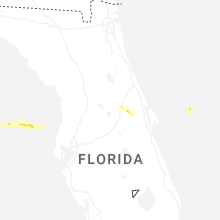
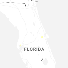


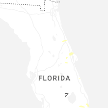
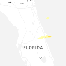


Connect with Interactive Hail Maps