

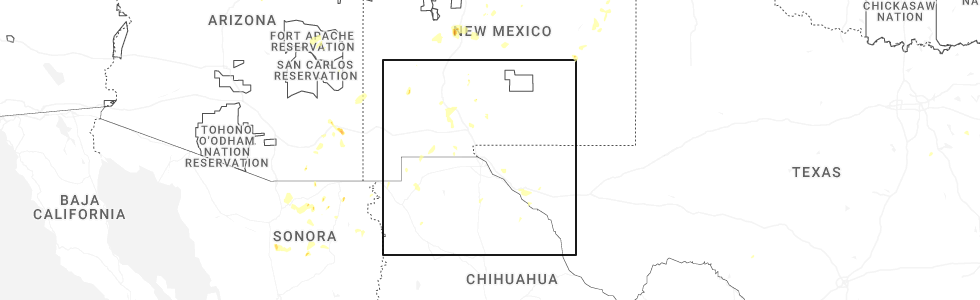
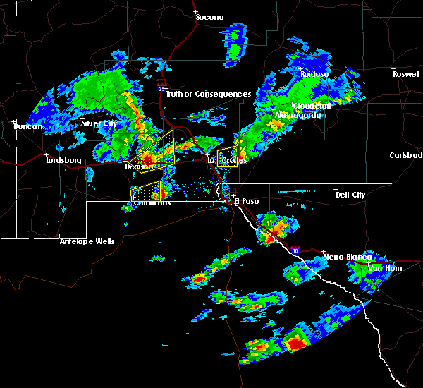
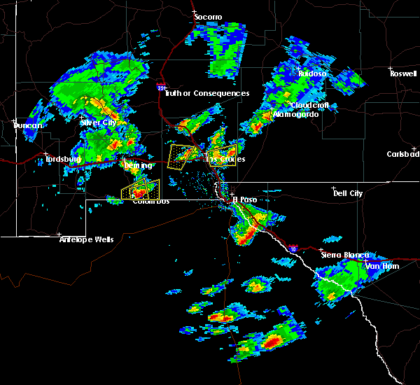
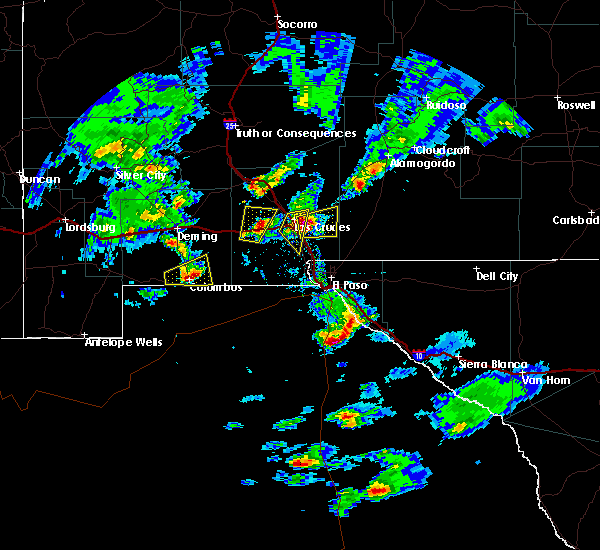
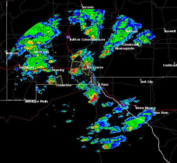
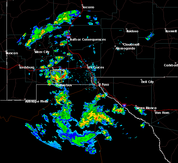
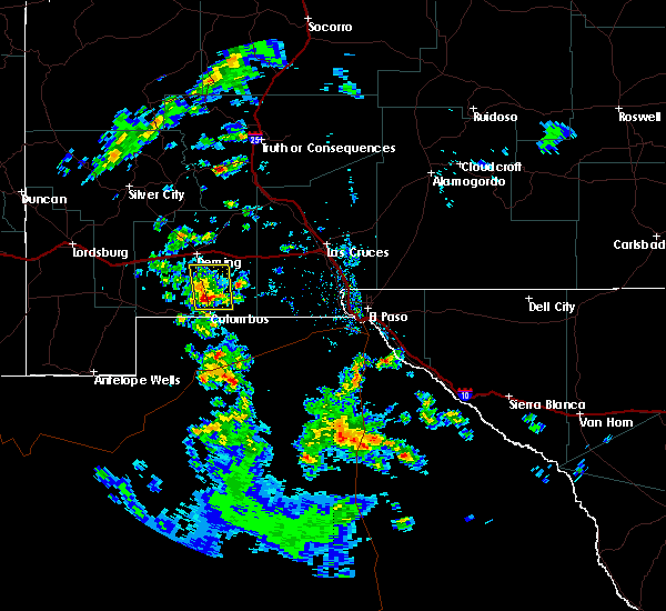
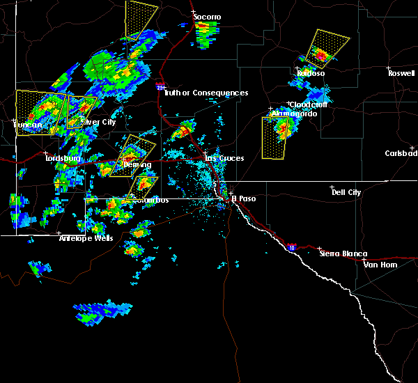
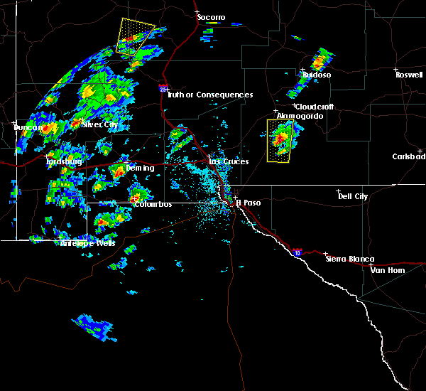
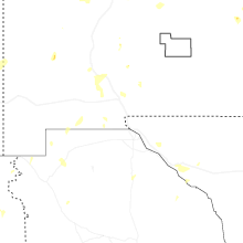
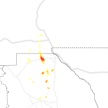
Hail Map for City of the Sun, NM
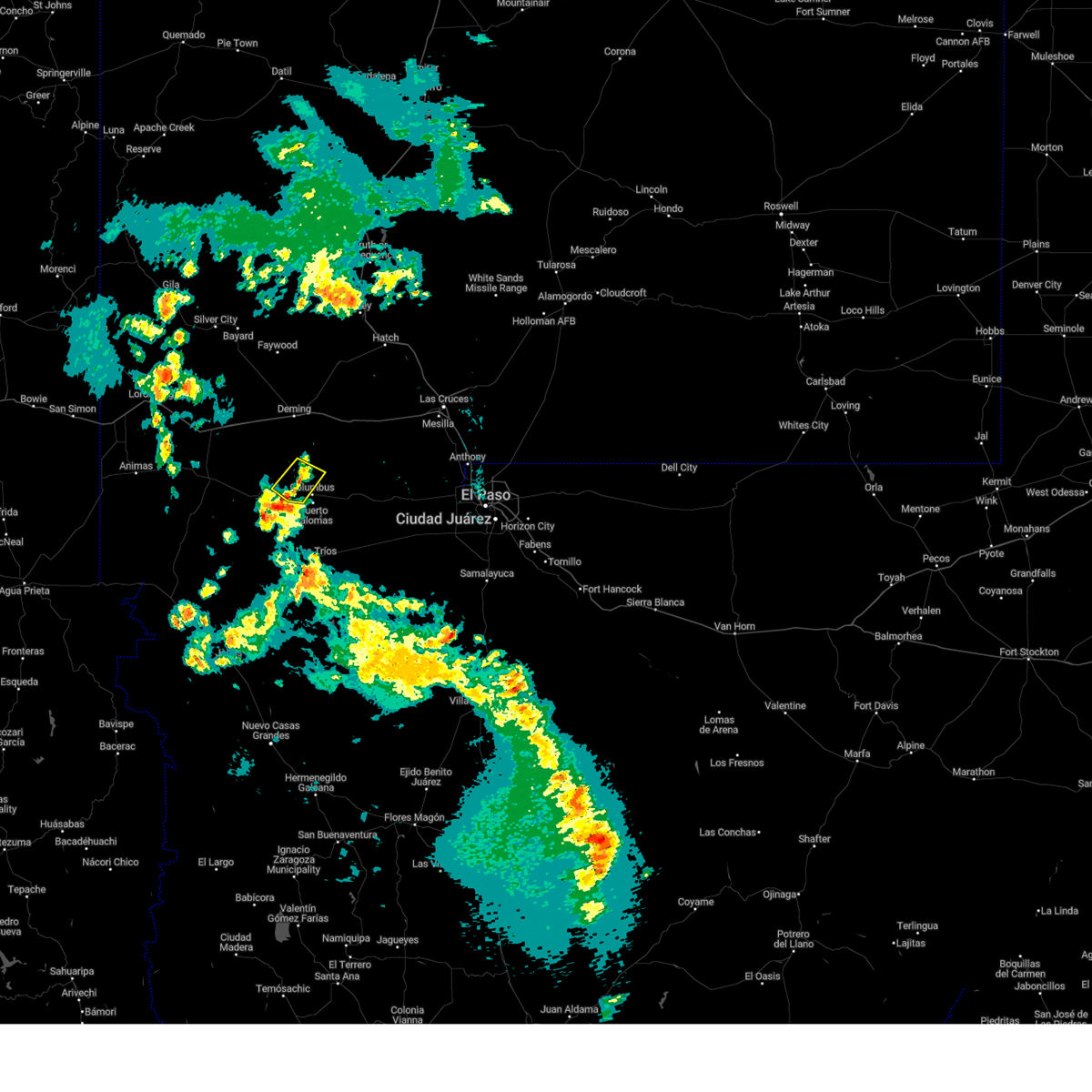
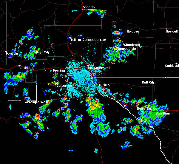
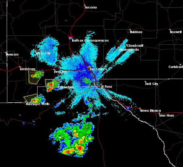
The City of the Sun, NM area has had 0 reports of on-the-ground hail by trained spotters, and has been under severe weather warnings 0 times during the past 12 months. Doppler radar has detected hail at or near City of the Sun, NM on 6 occasions, including 1 occasion during the past year.
| Name: | City of the Sun, NM |
| Where Located: | 68.7 miles W of El Paso, TX |
| Map: | Google Map for City of the Sun, NM |
| Population: | 31 |
| Housing Units: | 48 |
| More Info: | Search Google for City of the Sun, NM |
0
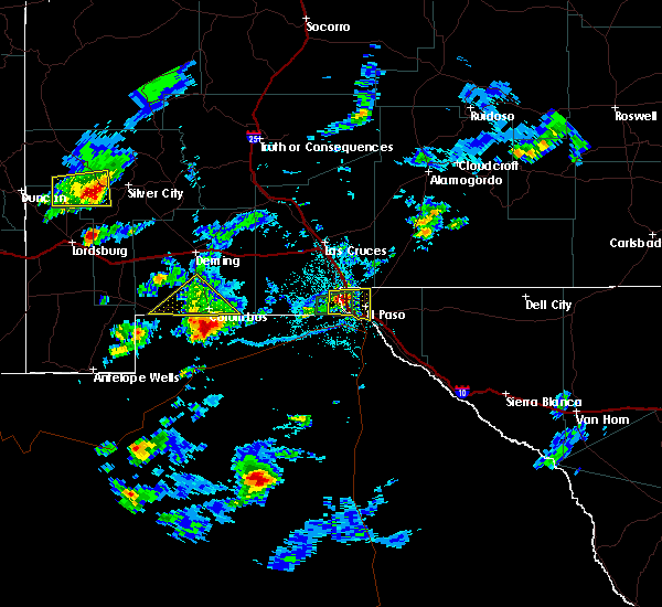
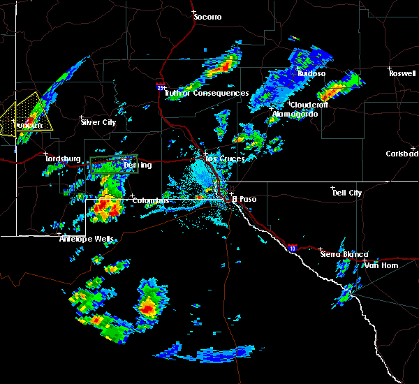
The Top Recent Hail Date for City of the Sun, NM is Sunday, July 13, 2025 (6th out of 6)
Hail and Wind Damage Spotted near City of the Sun, NM
| Date / Time | Report Details |
|---|---|
| 5/13/2023 7:02 PM MDT |
 At 701 pm mdt, a severe thunderstorm was located 6 miles northwest of columbus, and is nearly stationary (radar indicated). Hazards include 60 mph wind gusts and quarter size hail. Hail damage to vehicles is expected. Expect wind damage to roofs, siding, and trees. At 701 pm mdt, a severe thunderstorm was located 6 miles northwest of columbus, and is nearly stationary (radar indicated). Hazards include 60 mph wind gusts and quarter size hail. Hail damage to vehicles is expected. Expect wind damage to roofs, siding, and trees.
|
| 7/16/2018 2:39 PM MDT |
 At 238 pm mdt, a severe thunderstorm was located over columbus, moving southwest at 5 mph (radar indicated). Hazards include 60 mph wind gusts and quarter size hail. Hail damage to vehicles is expected. expect wind damage to roofs, siding, and trees. Heavy rainfall and isolated flash flooding also possible. At 238 pm mdt, a severe thunderstorm was located over columbus, moving southwest at 5 mph (radar indicated). Hazards include 60 mph wind gusts and quarter size hail. Hail damage to vehicles is expected. expect wind damage to roofs, siding, and trees. Heavy rainfall and isolated flash flooding also possible.
|
| 9/28/2017 9:10 PM MDT |
 At 910 pm mdt, a severe thunderstorm was located 5 miles east of hermanas, or 12 miles west of columbus, moving north at 10 mph (radar indicated). Hazards include 60 mph wind gusts and quarter size hail. Hail damage to vehicles is expected. Expect wind damage to roofs, siding, and trees. At 910 pm mdt, a severe thunderstorm was located 5 miles east of hermanas, or 12 miles west of columbus, moving north at 10 mph (radar indicated). Hazards include 60 mph wind gusts and quarter size hail. Hail damage to vehicles is expected. Expect wind damage to roofs, siding, and trees.
|
| 7/19/2017 5:12 PM MDT |
 At 511 pm mdt, severe thunderstorms were moving toward the deming area at 40 mph (radar indicated). Hazards include 60 mph wind gusts and quarter size hail. Hail damage to vehicles is expected. expect wind damage to roofs, siding, and trees. Blowing dust may lower the visibility to less than a mile. At 511 pm mdt, severe thunderstorms were moving toward the deming area at 40 mph (radar indicated). Hazards include 60 mph wind gusts and quarter size hail. Hail damage to vehicles is expected. expect wind damage to roofs, siding, and trees. Blowing dust may lower the visibility to less than a mile.
|
| 5/18/2016 5:09 PM MDT |
 The severe thunderstorm warning for southeastern luna county will expire at 515 pm mdt, the storm which prompted the warning has moved out of the area. therefore the warning will be allowed to expire. to report severe weather, contact your nearest law enforcement agency. they will relay your report to the national weather service el paso. The severe thunderstorm warning for southeastern luna county will expire at 515 pm mdt, the storm which prompted the warning has moved out of the area. therefore the warning will be allowed to expire. to report severe weather, contact your nearest law enforcement agency. they will relay your report to the national weather service el paso.
|
| 5/18/2016 4:37 PM MDT |
 At 437 pm mdt, a severe thunderstorm was located 5 miles east of columbus, moving east at 25 mph (radar indicated). Hazards include quarter size hail. damage to vehicles is expected At 437 pm mdt, a severe thunderstorm was located 5 miles east of columbus, moving east at 25 mph (radar indicated). Hazards include quarter size hail. damage to vehicles is expected
|
| 5/18/2016 4:26 PM MDT |
 At 426 pm mdt, a severe thunderstorm was located near columbus, moving east at 20 mph (radar indicated). Hazards include 60 mph wind gusts and quarter size hail. Hail damage to vehicles is expected. expect wind damage to roofs, siding, and trees. Locations impacted include, columbus. At 426 pm mdt, a severe thunderstorm was located near columbus, moving east at 20 mph (radar indicated). Hazards include 60 mph wind gusts and quarter size hail. Hail damage to vehicles is expected. expect wind damage to roofs, siding, and trees. Locations impacted include, columbus.
|
| 5/18/2016 4:05 PM MDT |
 At 404 pm mdt, a severe thunderstorm was located 6 miles west of columbus, moving east at 25 mph (radar indicated). Hazards include 60 mph wind gusts and quarter size hail. Hail damage to vehicles is expected. Expect wind damage to roofs, siding, and trees. At 404 pm mdt, a severe thunderstorm was located 6 miles west of columbus, moving east at 25 mph (radar indicated). Hazards include 60 mph wind gusts and quarter size hail. Hail damage to vehicles is expected. Expect wind damage to roofs, siding, and trees.
|
| 4/22/2016 4:38 PM MDT |
 At 436 pm mdt, a severe thunderstorm was across highway 11 about 5 miles north of columbus (radar indicated). Hazards include 60 mph wind gusts and quarter size hail. Hail damage to vehicles is expected. expect wind damage to roofs, siding, and trees. Locations impacted include, sunshine, spring canyon state park, rock hound state park. At 436 pm mdt, a severe thunderstorm was across highway 11 about 5 miles north of columbus (radar indicated). Hazards include 60 mph wind gusts and quarter size hail. Hail damage to vehicles is expected. expect wind damage to roofs, siding, and trees. Locations impacted include, sunshine, spring canyon state park, rock hound state park.
|
| 4/22/2016 4:21 PM MDT |
 At 420 pm mdt, a severe thunderstorm was located 9 miles southeast of sunshine, or 15 miles north of columbus, moving northeast at 20 mph (radar indicated). Hazards include 60 mph wind gusts and quarter size hail. Hail damage to vehicles is expected. Expect wind damage to roofs, siding, and trees. At 420 pm mdt, a severe thunderstorm was located 9 miles southeast of sunshine, or 15 miles north of columbus, moving northeast at 20 mph (radar indicated). Hazards include 60 mph wind gusts and quarter size hail. Hail damage to vehicles is expected. Expect wind damage to roofs, siding, and trees.
|
| 10/20/2015 2:10 PM MDT |
 At 209 pm mdt, a severe thunderstorm was located 17 miles southwest of corralitos, or 27 miles southwest of las cruces, moving northeast at 55 mph (at 208 pm...trained weather spotters in pinos altos reported quarter size hail). Hazards include quarter size hail. Damage to vehicles is expected. Locations impacted include, columbus. At 209 pm mdt, a severe thunderstorm was located 17 miles southwest of corralitos, or 27 miles southwest of las cruces, moving northeast at 55 mph (at 208 pm...trained weather spotters in pinos altos reported quarter size hail). Hazards include quarter size hail. Damage to vehicles is expected. Locations impacted include, columbus.
|
| 10/20/2015 1:45 PM MDT |
 At 145 pm mdt, a severe thunderstorm was located near columbus, moving northeast at 40 mph (radar indicated). Hazards include 60 mph wind gusts and quarter size hail. Hail damage to vehicles is expected. Expect wind damage to roofs, siding and trees. At 145 pm mdt, a severe thunderstorm was located near columbus, moving northeast at 40 mph (radar indicated). Hazards include 60 mph wind gusts and quarter size hail. Hail damage to vehicles is expected. Expect wind damage to roofs, siding and trees.
|
| 7/10/2015 5:09 PM MDT |
 The severe thunderstorm warning for south central luna county will expire at 515 pm mdt, the storms which prompted the warning have weakened below severe limits, and no longer pose an immediate threat to life or property. therefore the warning will be allowed to expire. however gusty winds and heavy rain are still possible with these thunderstorms. The severe thunderstorm warning for south central luna county will expire at 515 pm mdt, the storms which prompted the warning have weakened below severe limits, and no longer pose an immediate threat to life or property. therefore the warning will be allowed to expire. however gusty winds and heavy rain are still possible with these thunderstorms.
|
| 7/10/2015 4:25 PM MDT |
 At 424 pm mdt, severe thunderstorms were located along a line extending from 6 miles southwest of hermanas to 19 miles southwest of columbus, moving northeast at 35 mph (radar indicated). Hazards include 60 mph wind gusts and nickel size hail. Expect damage to roofs. Siding and trees. At 424 pm mdt, severe thunderstorms were located along a line extending from 6 miles southwest of hermanas to 19 miles southwest of columbus, moving northeast at 35 mph (radar indicated). Hazards include 60 mph wind gusts and nickel size hail. Expect damage to roofs. Siding and trees.
|
Hail Maps for City of the Sun, NM


Connect with Interactive Hail Maps