

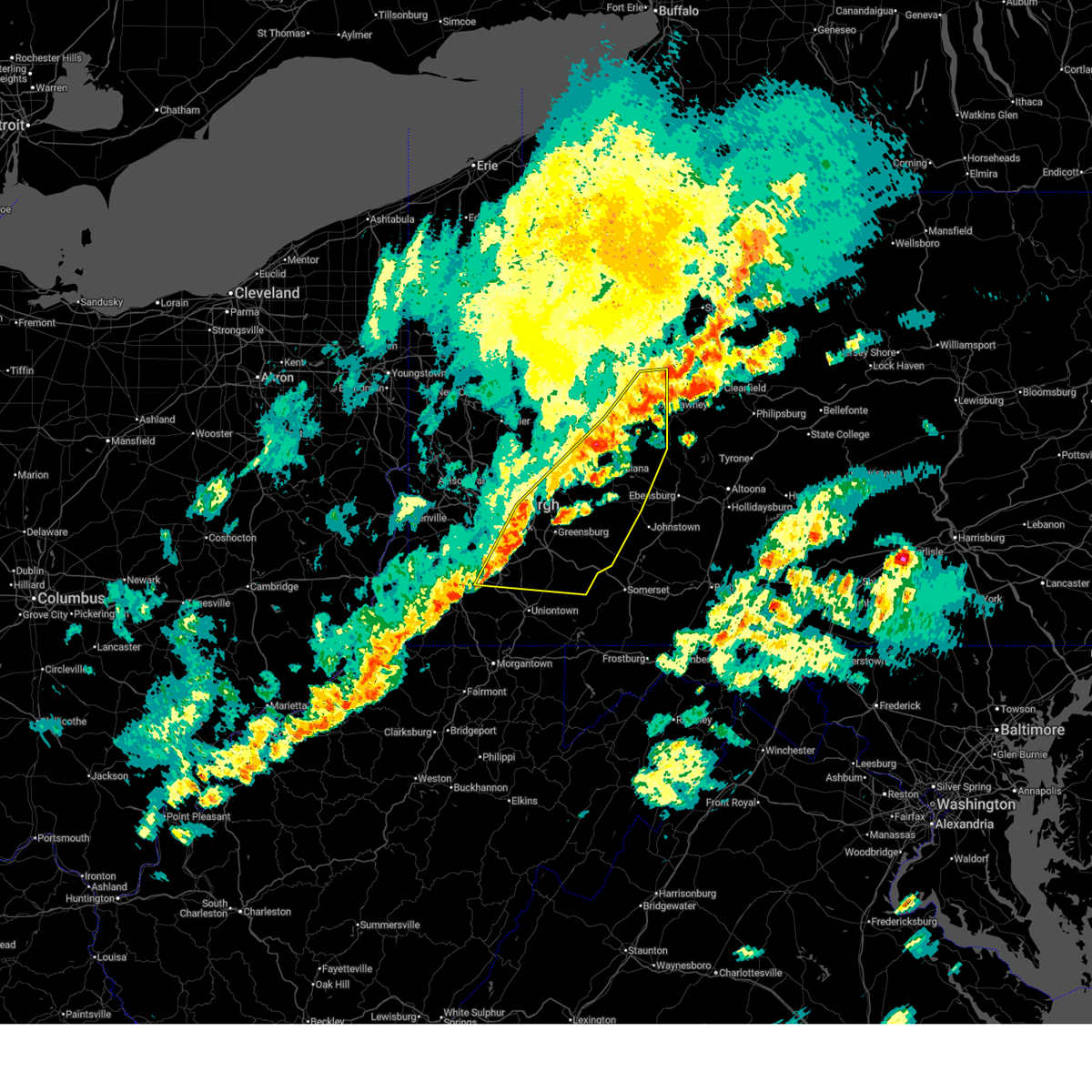
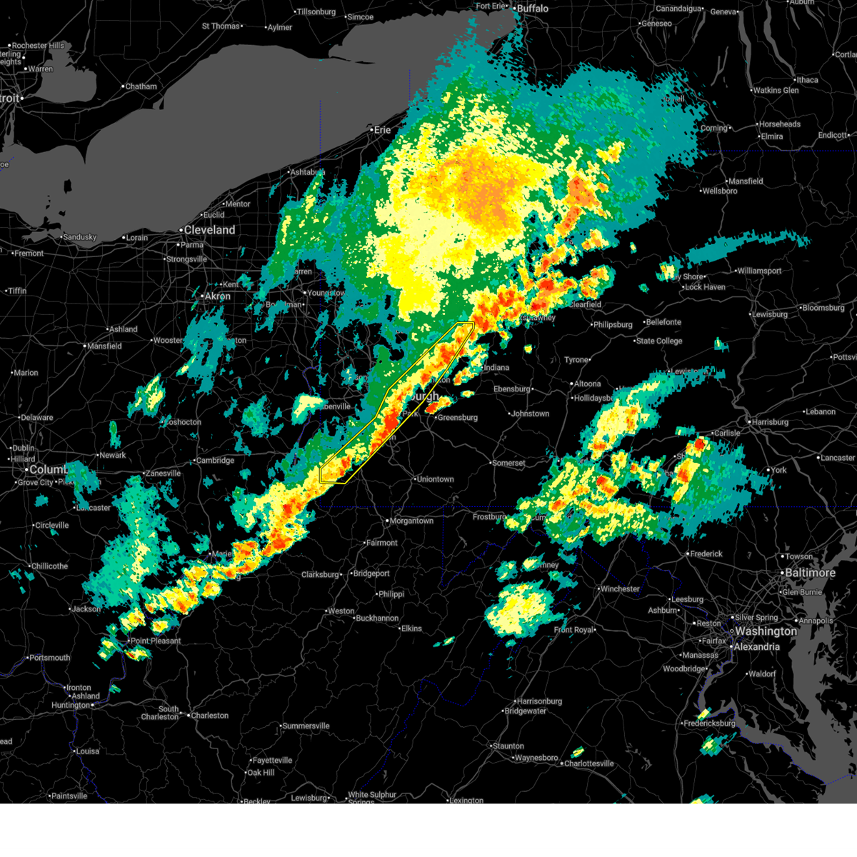
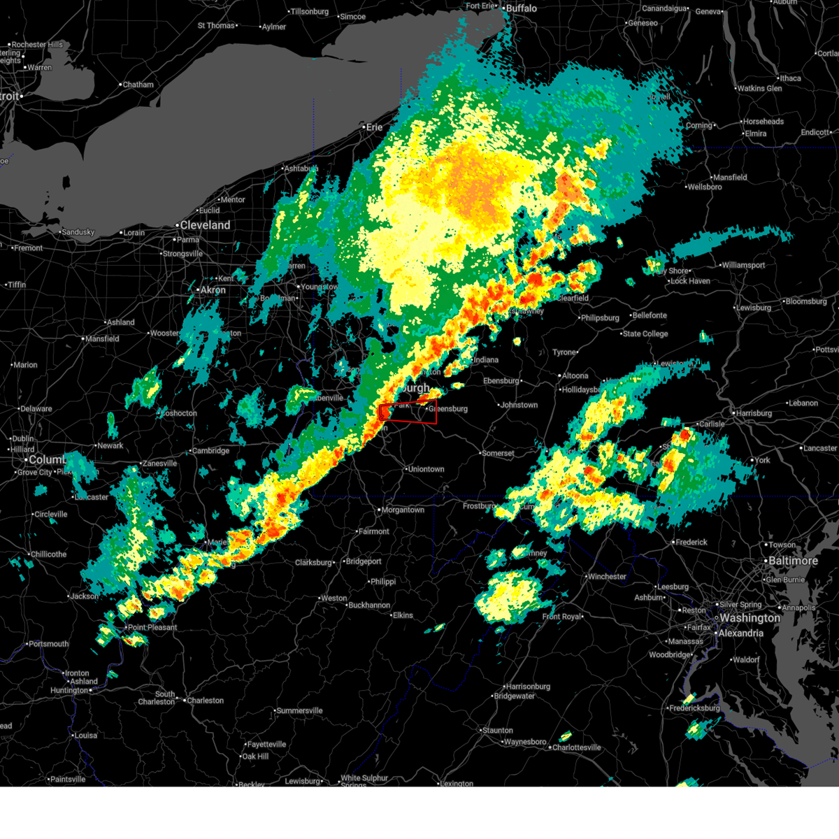
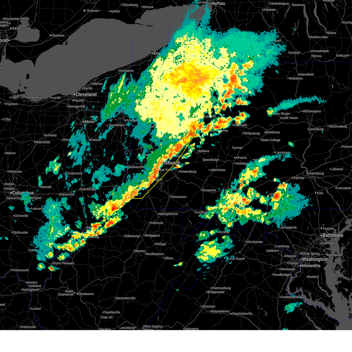
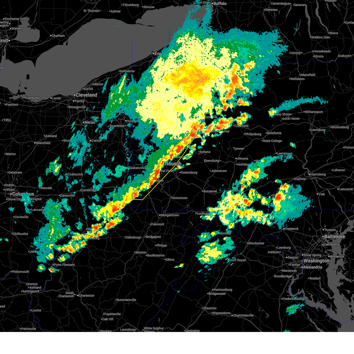
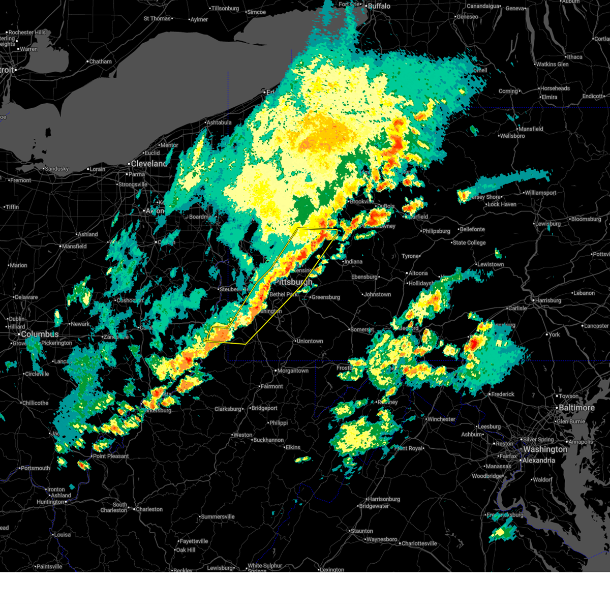
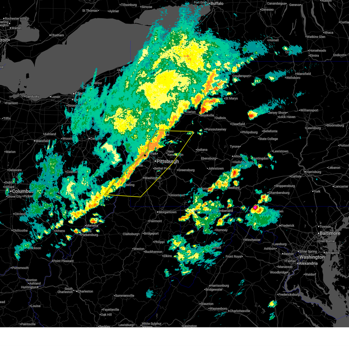
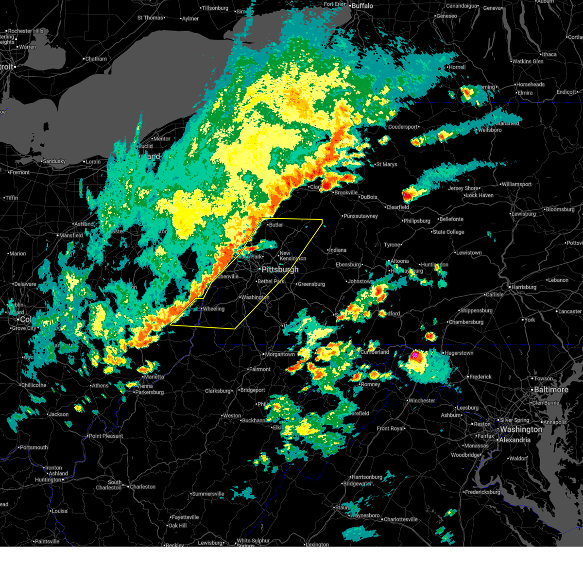
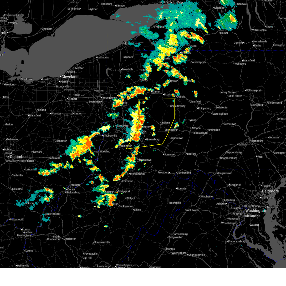
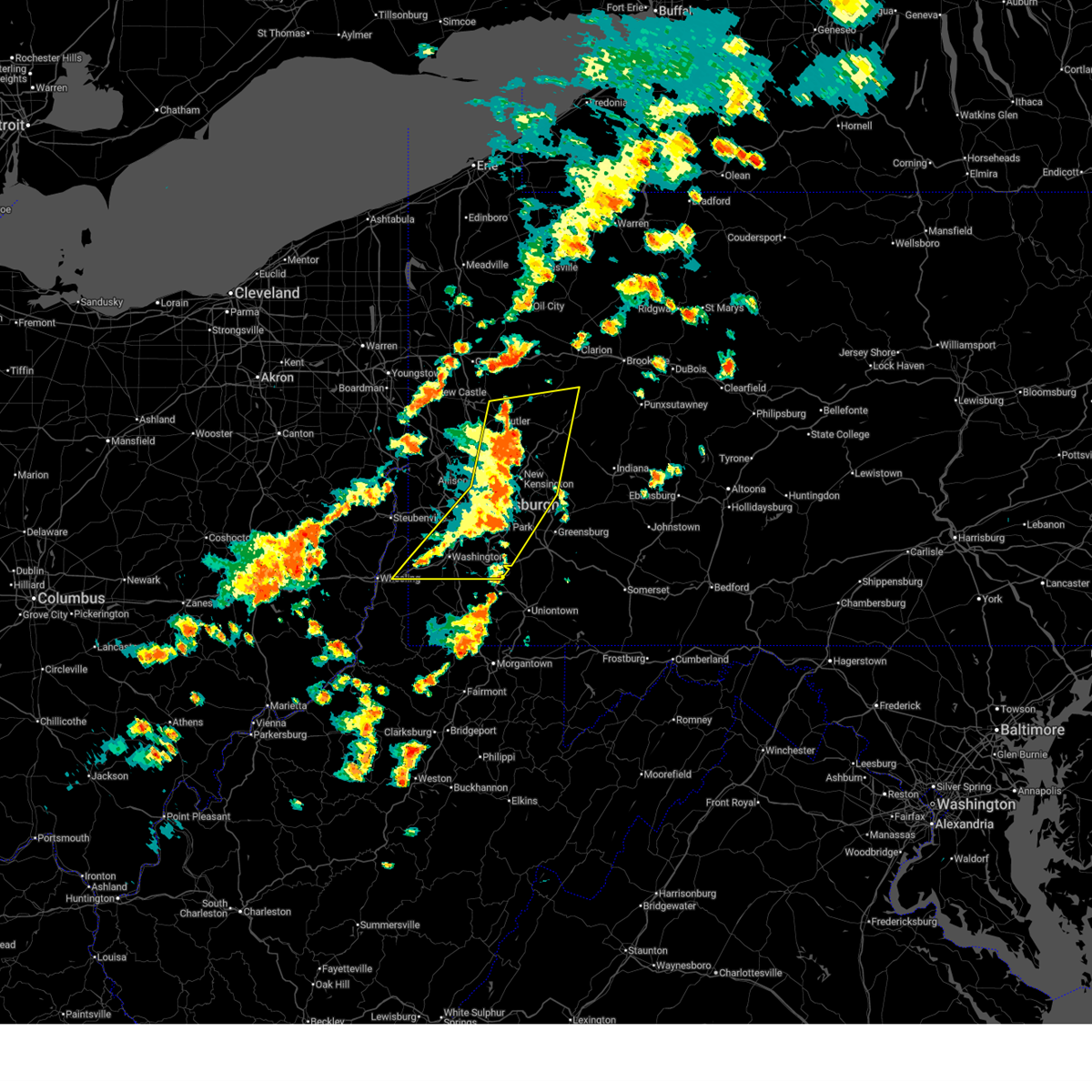
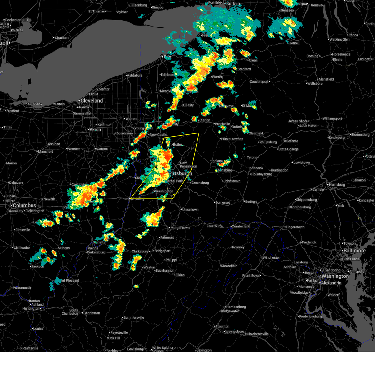
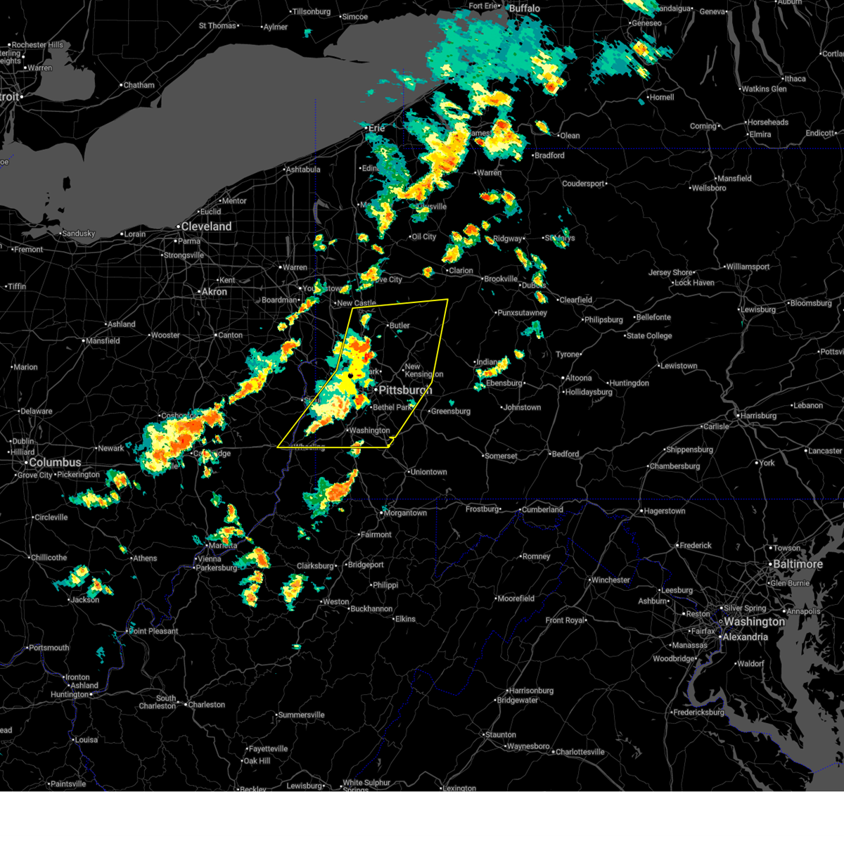
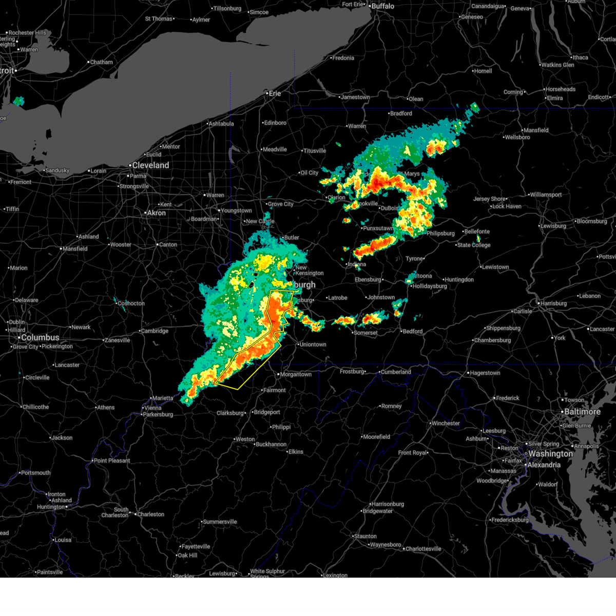
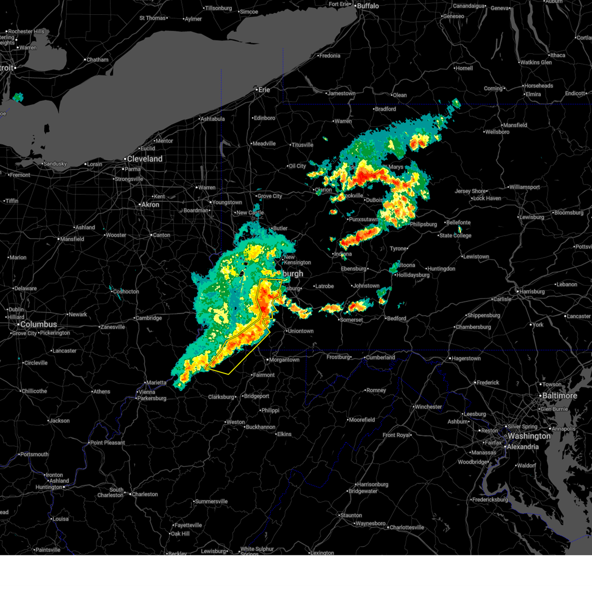
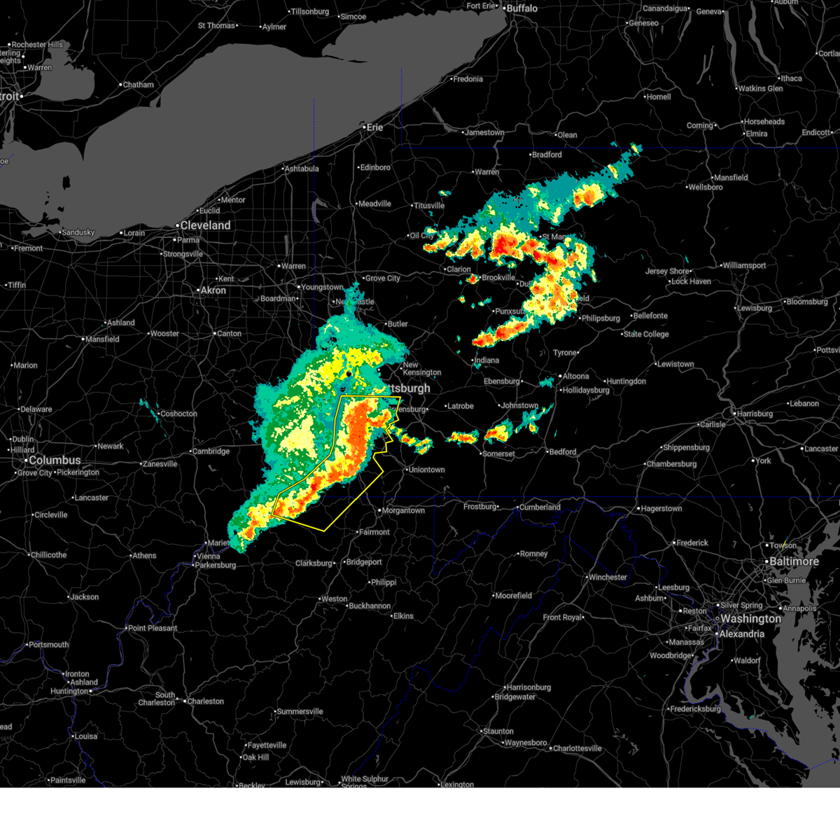
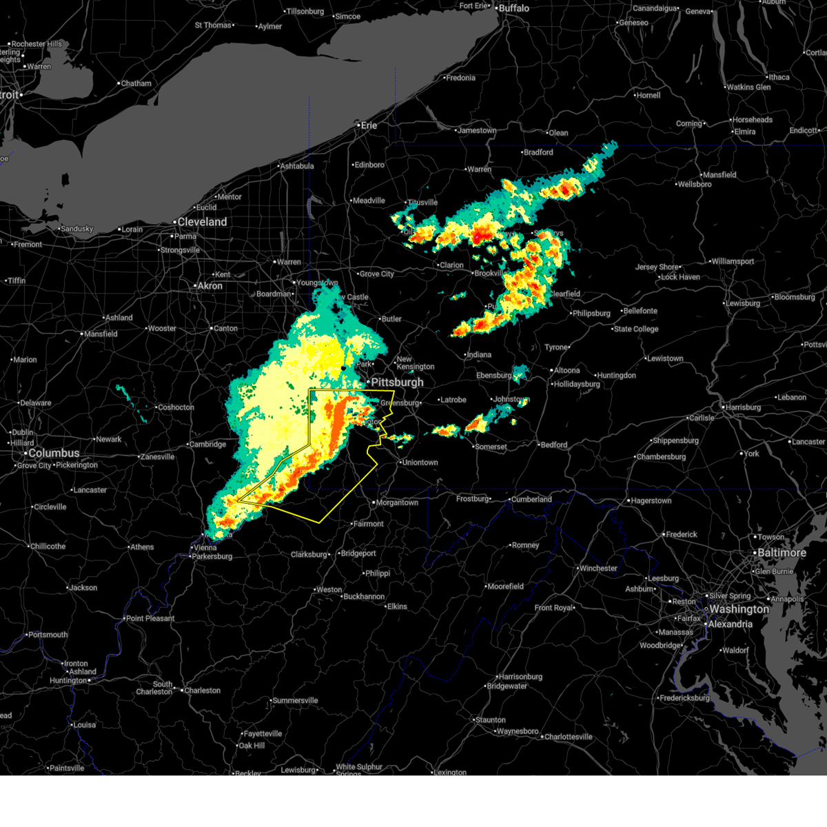
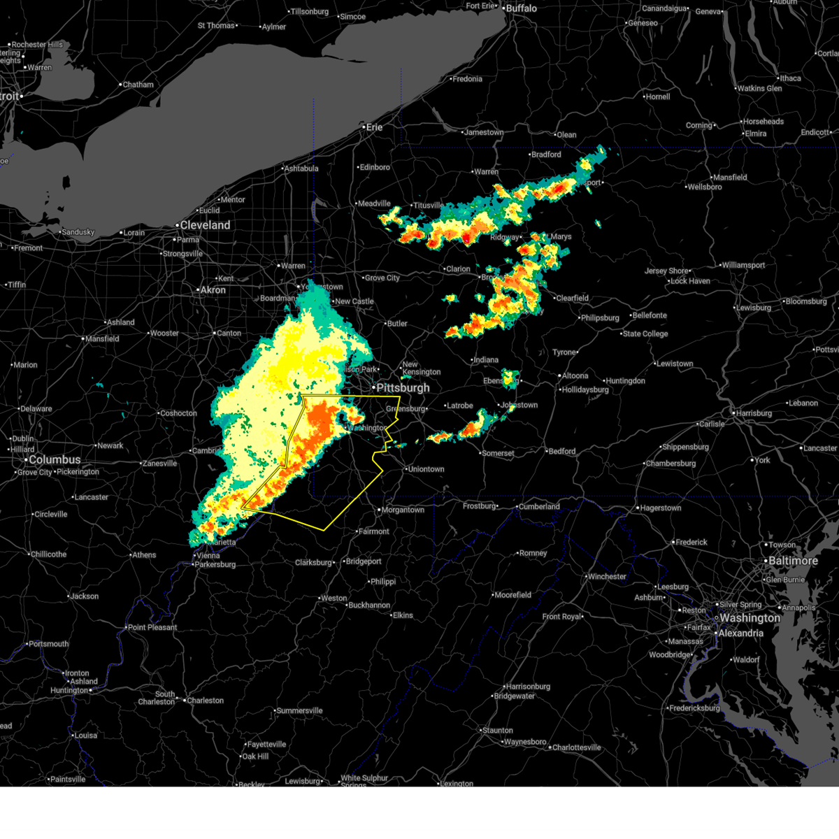
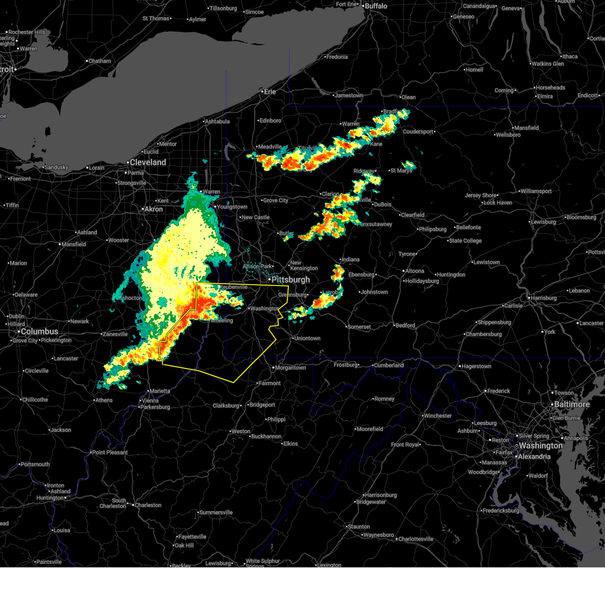
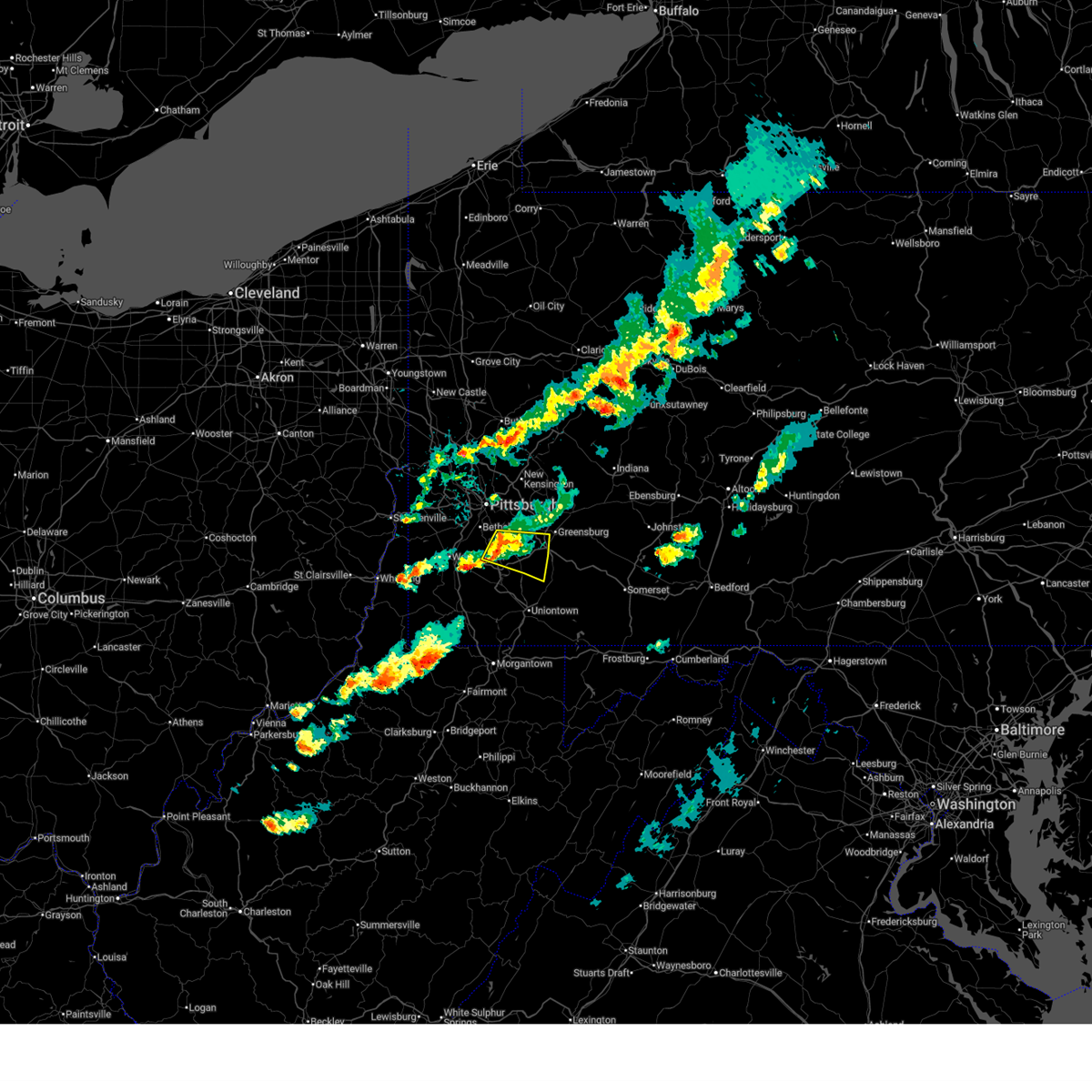
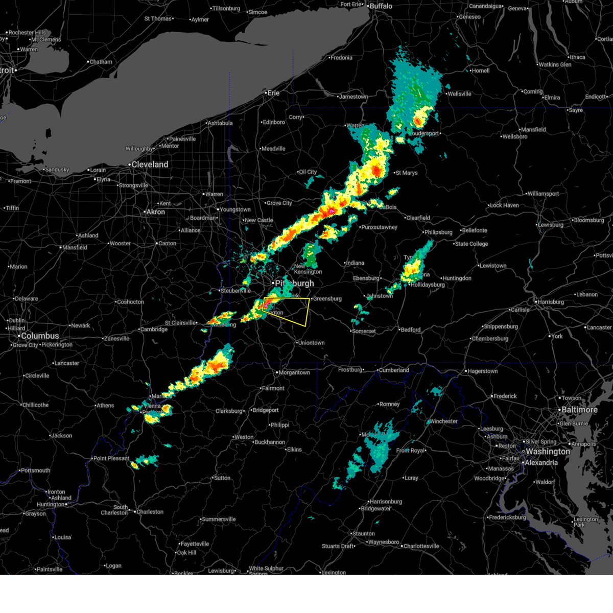
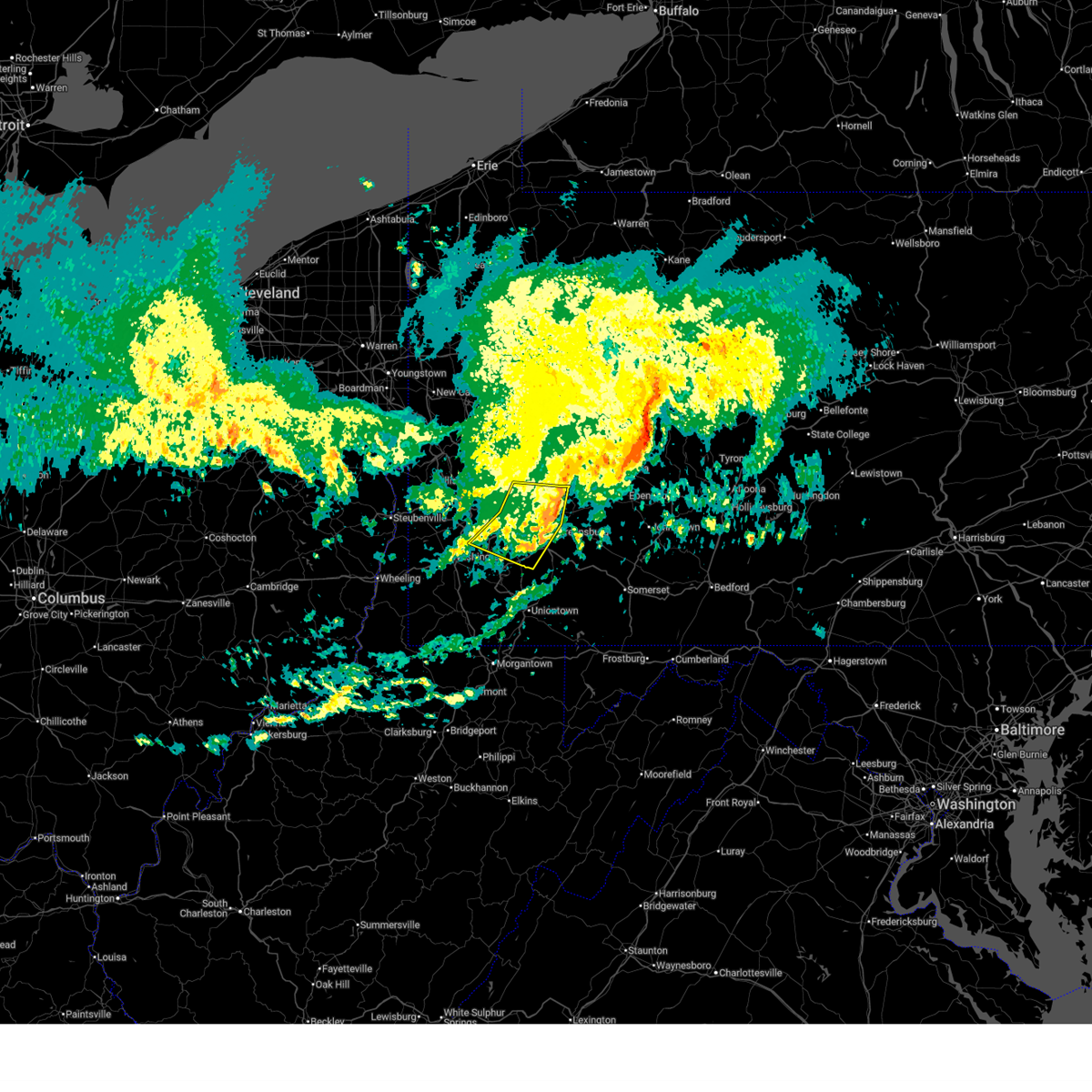
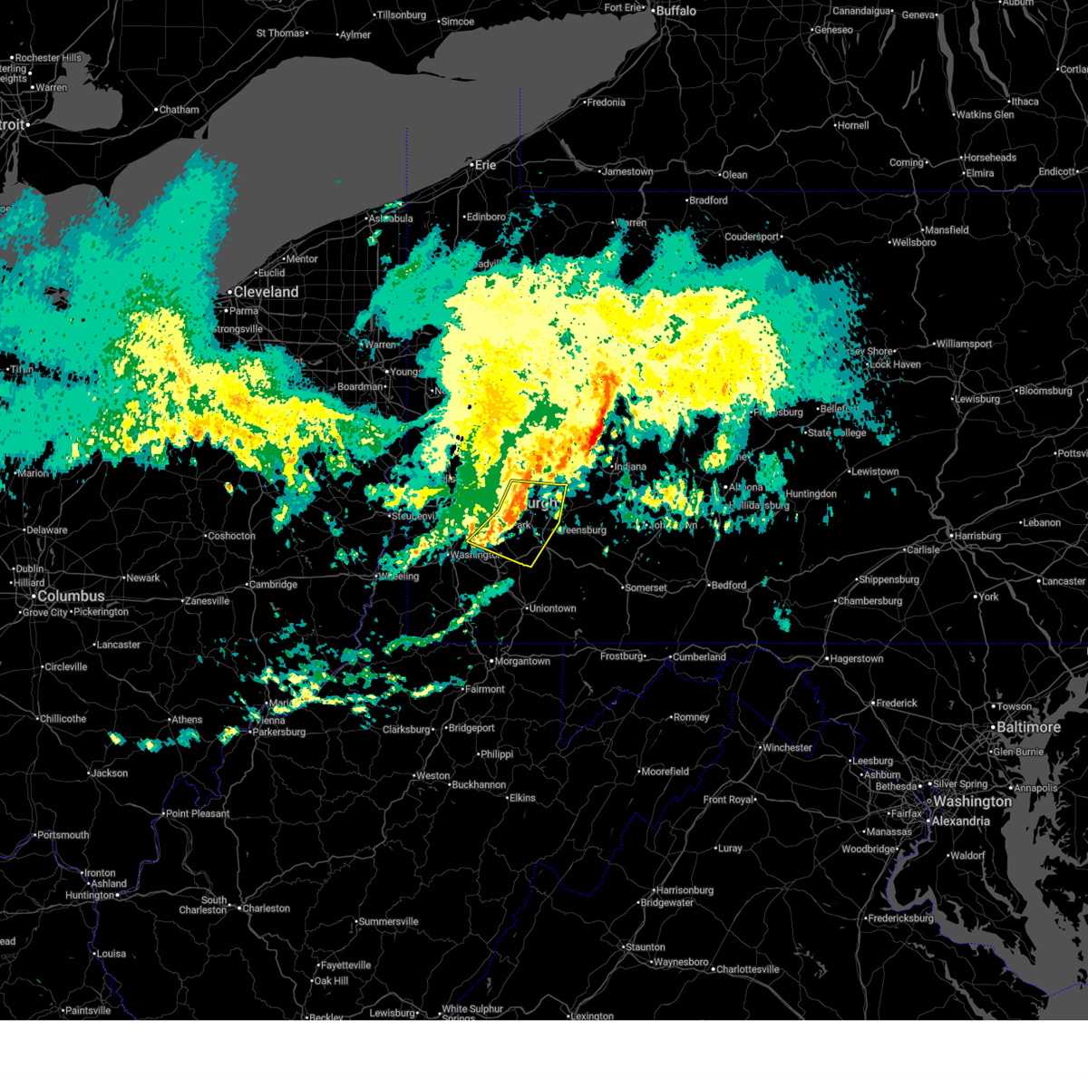
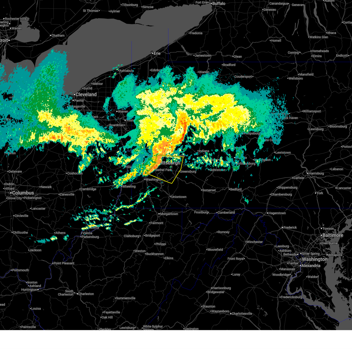
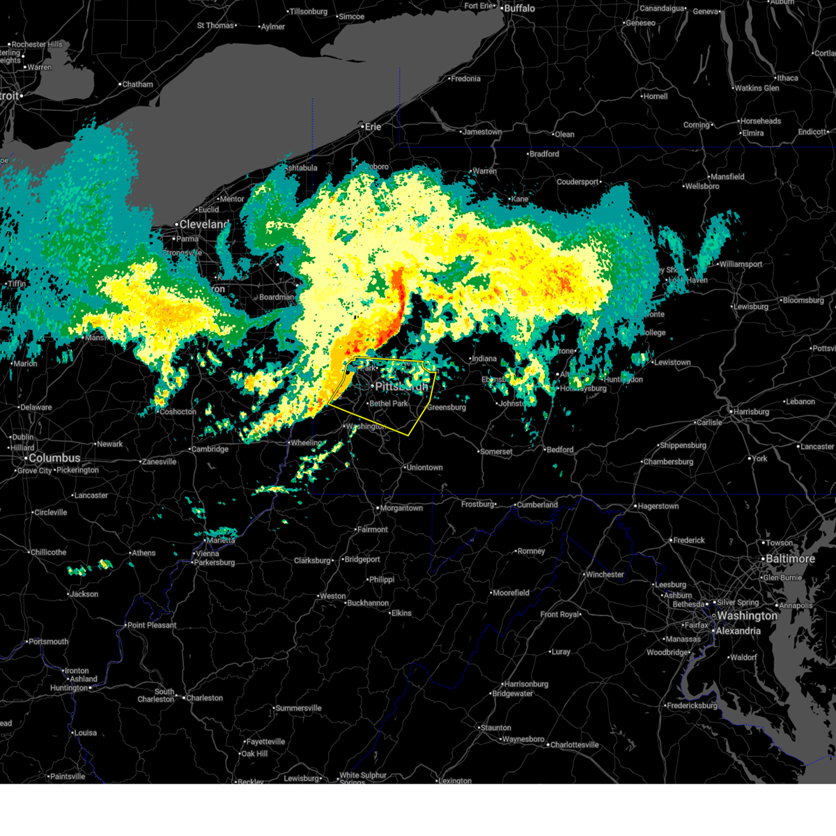
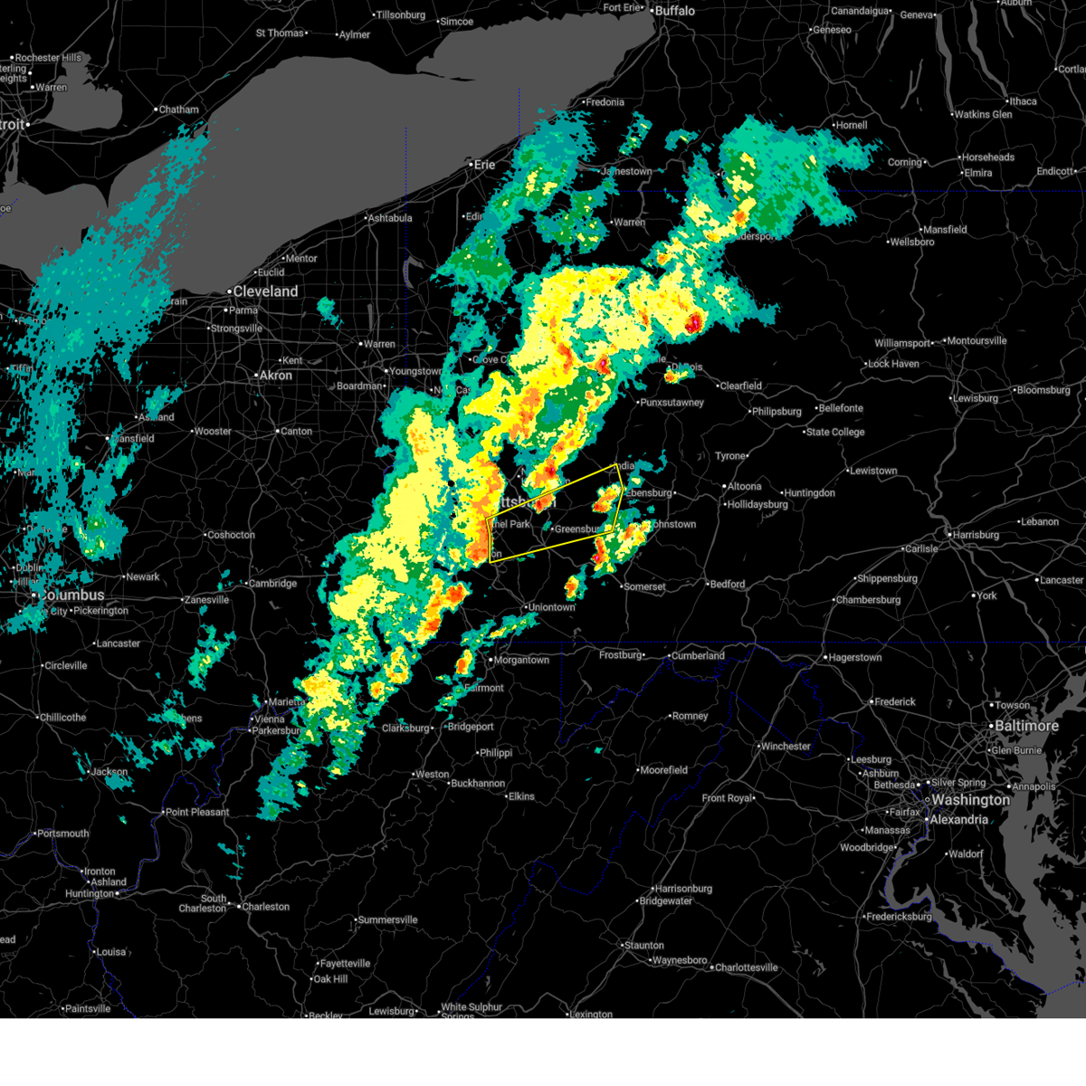
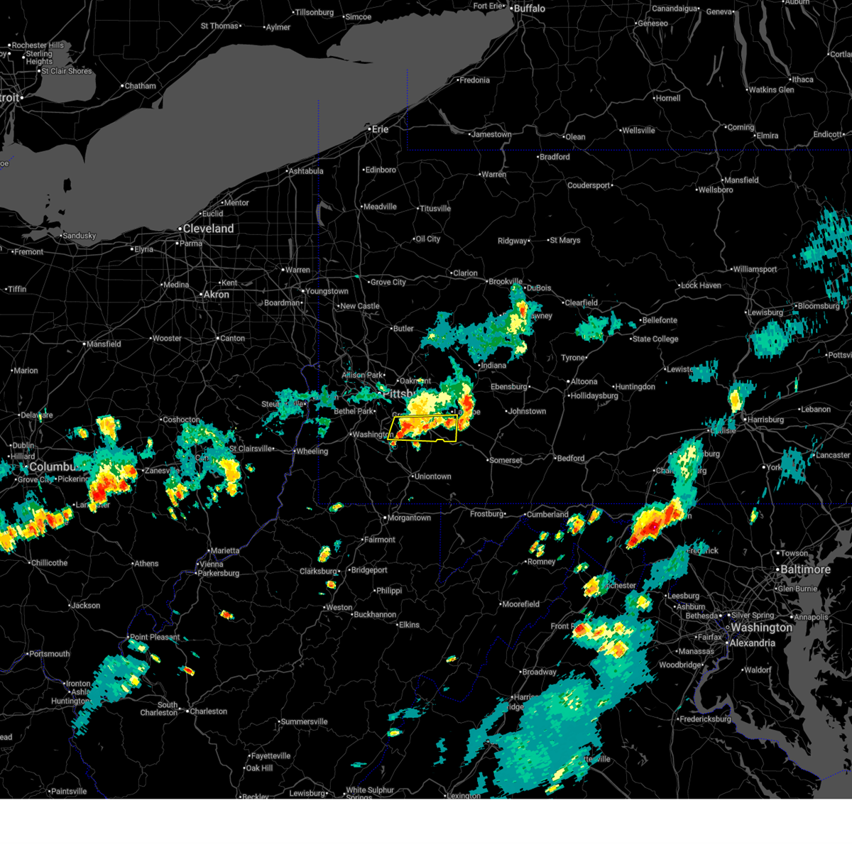
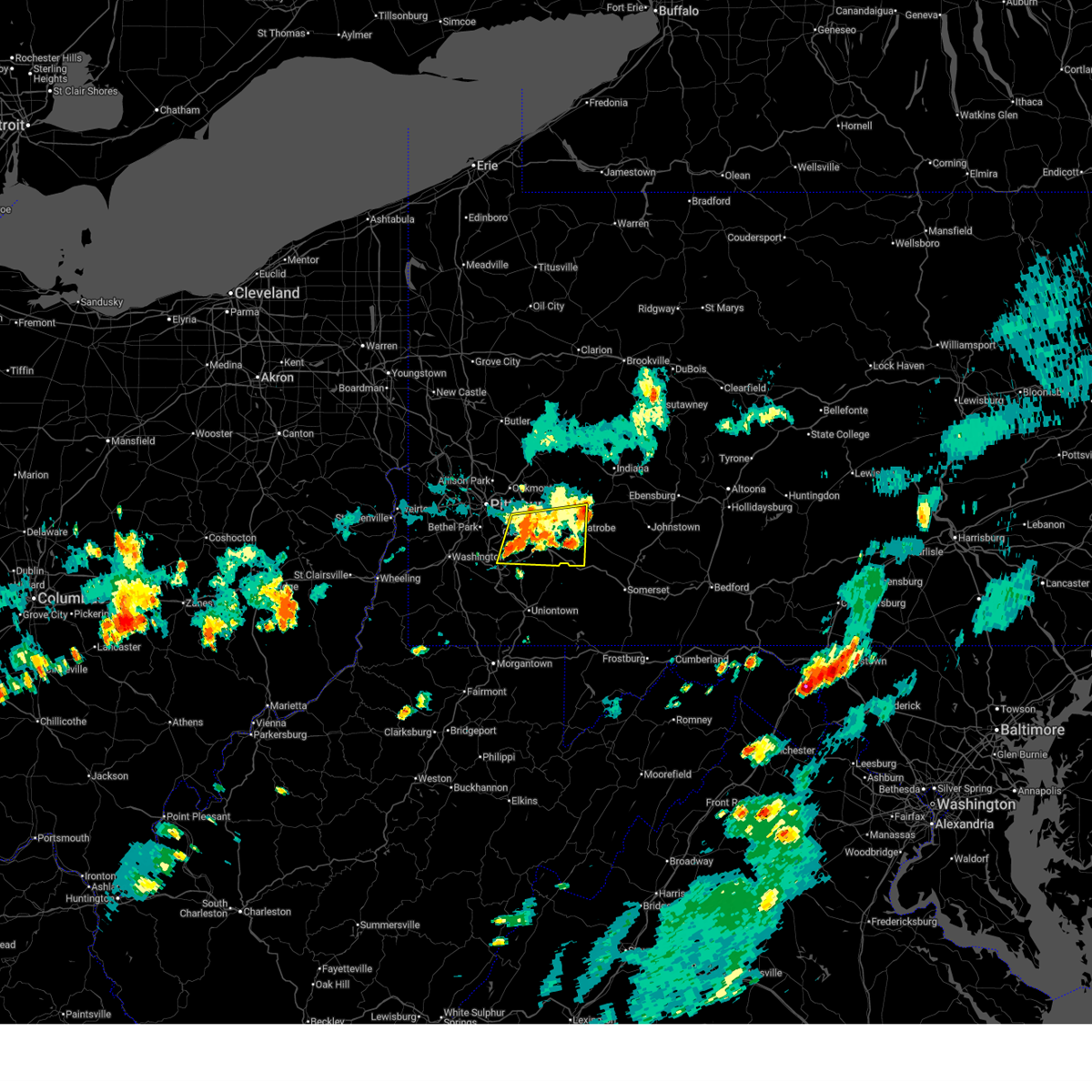
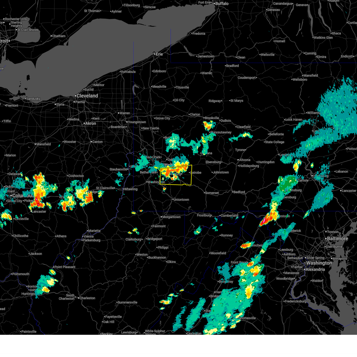
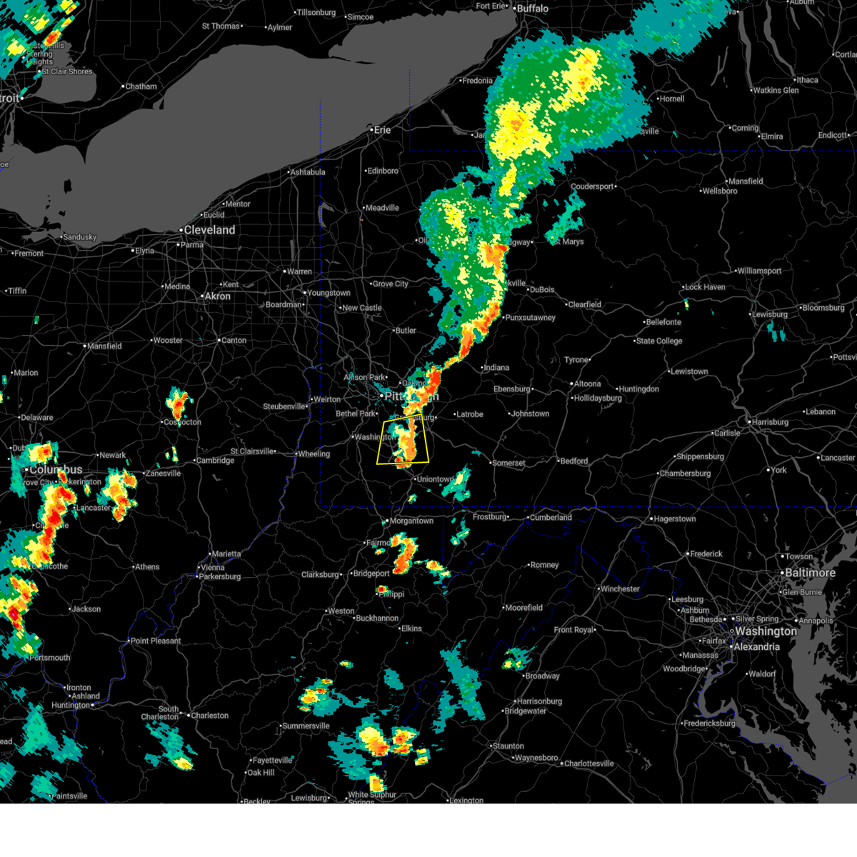
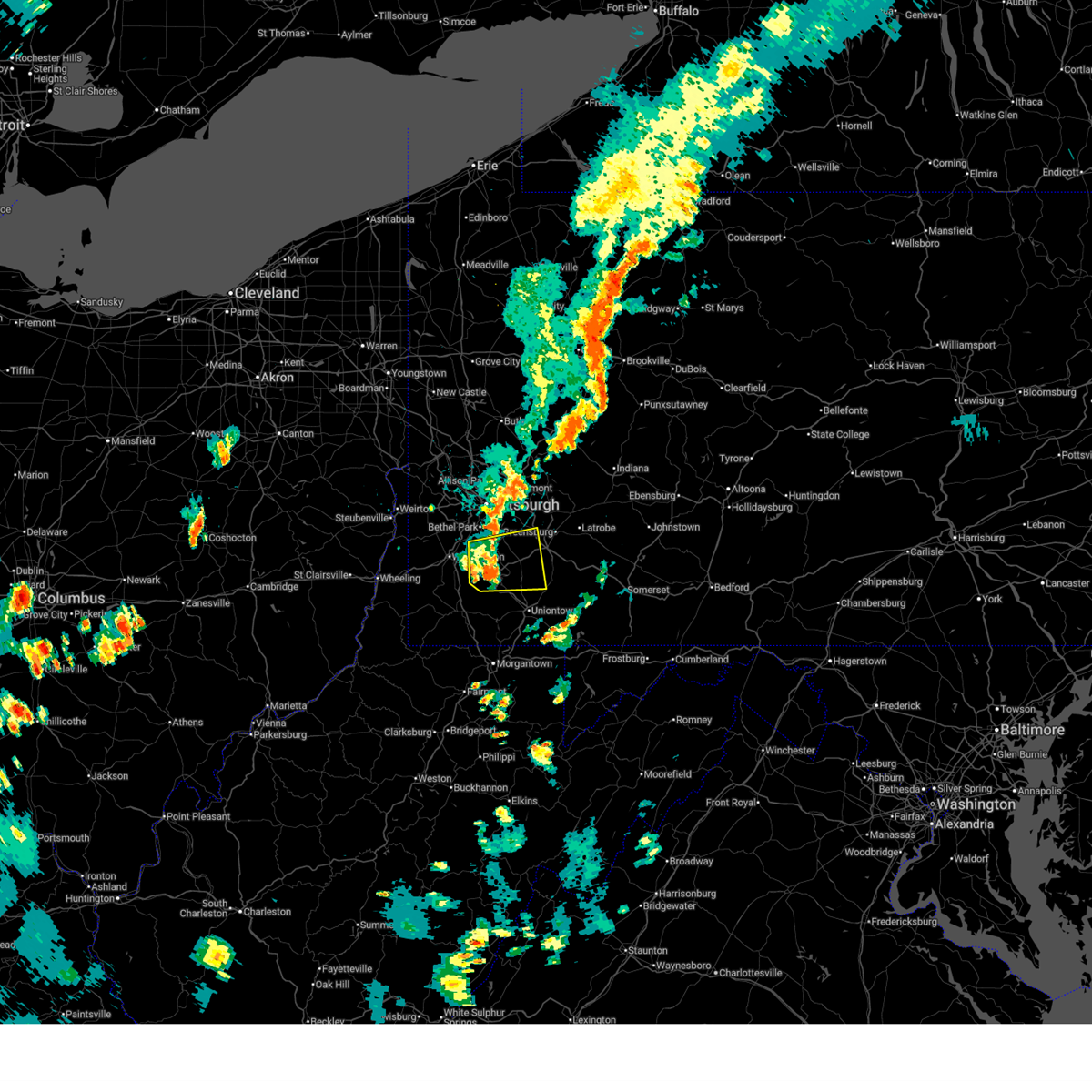
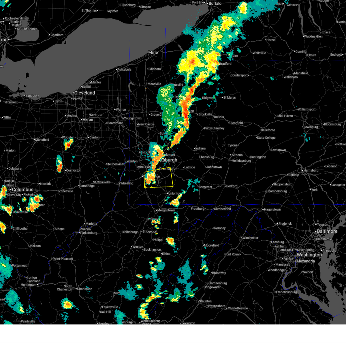
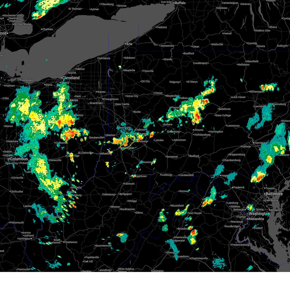
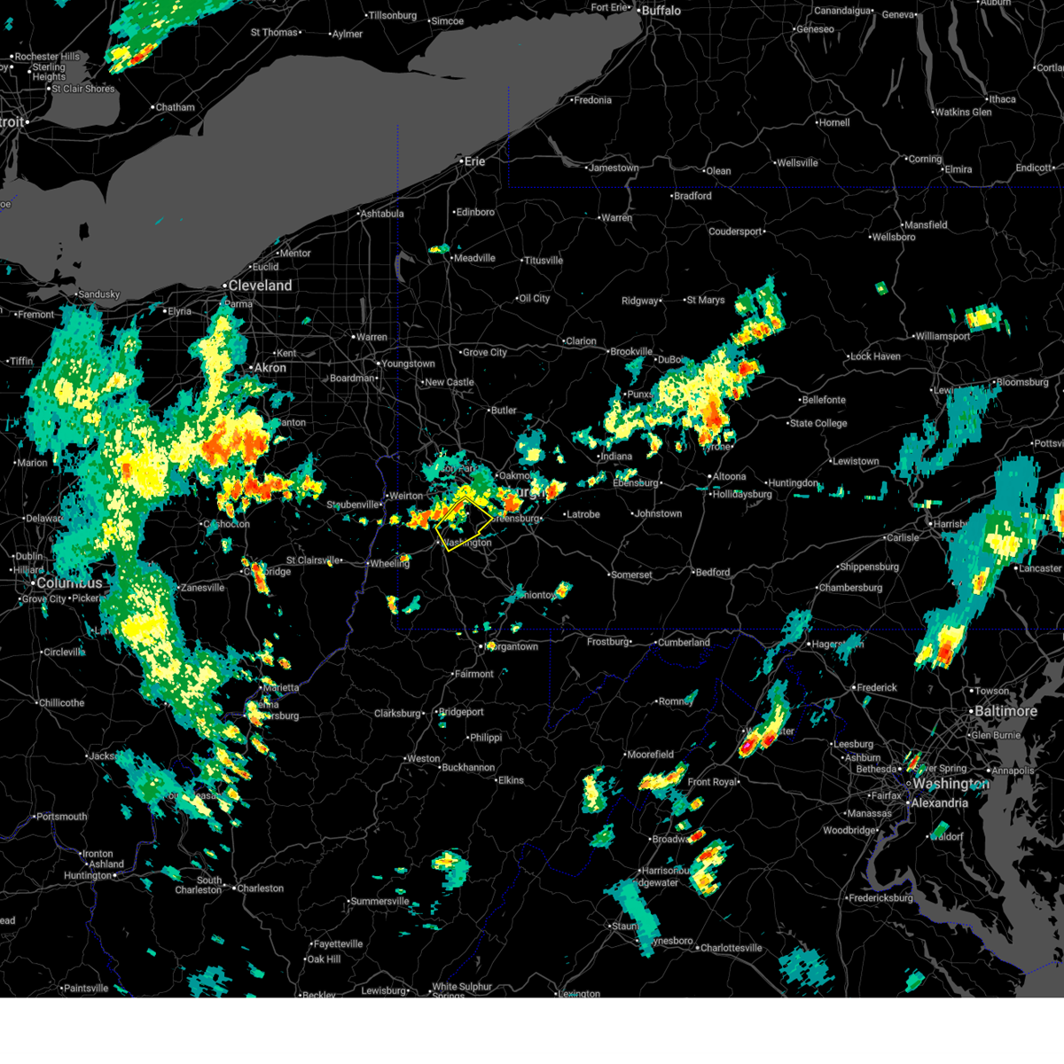
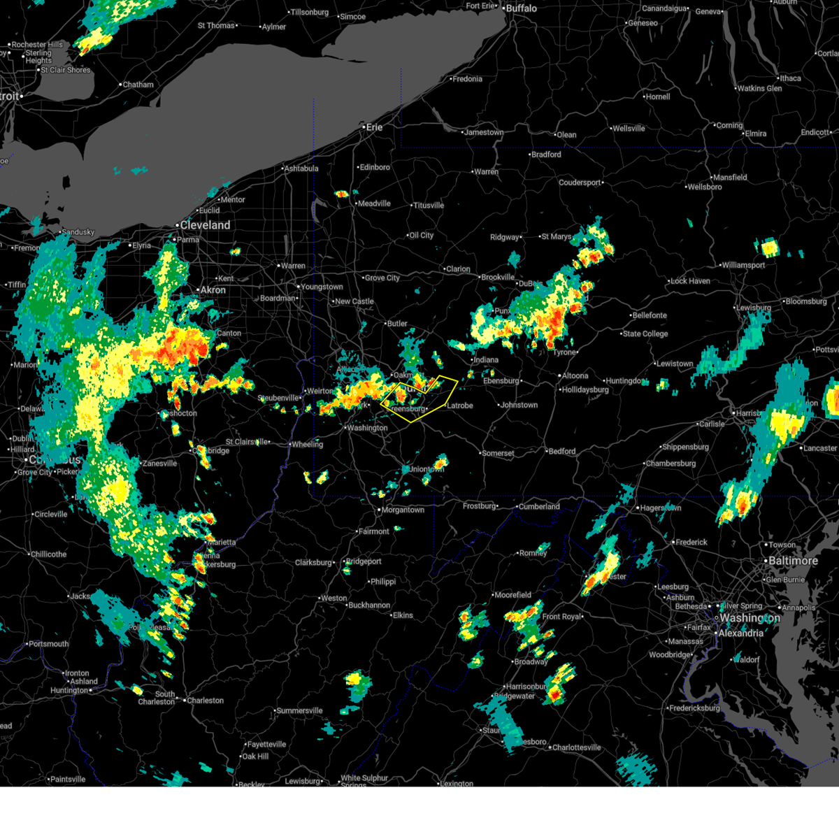
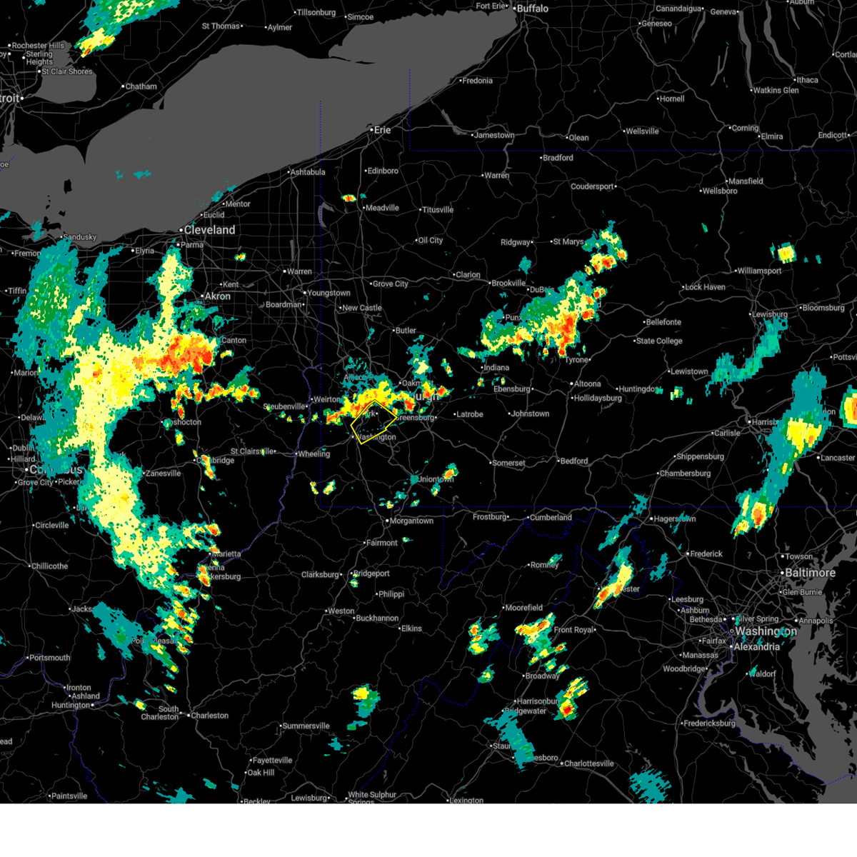
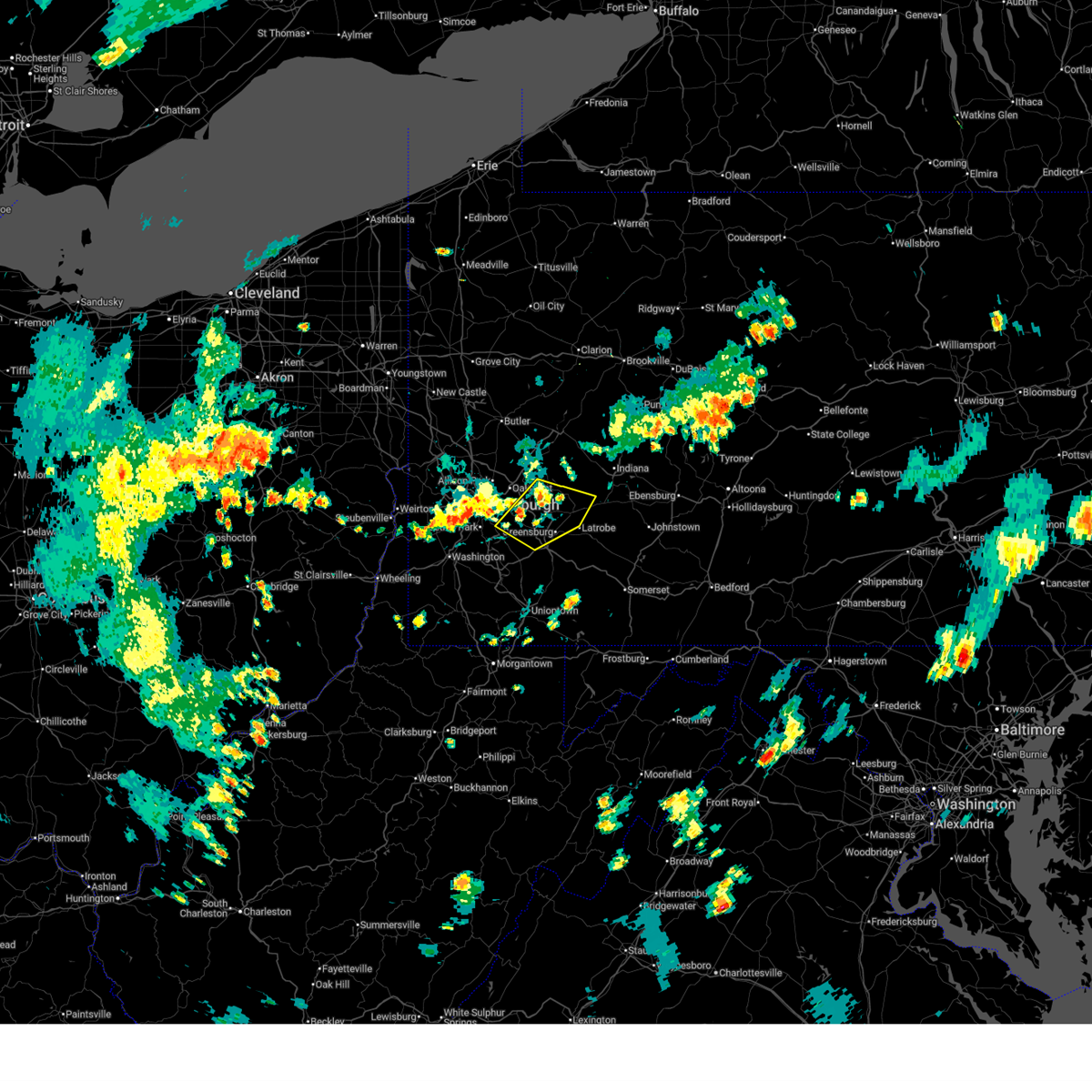
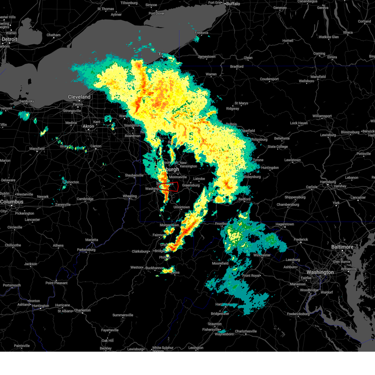
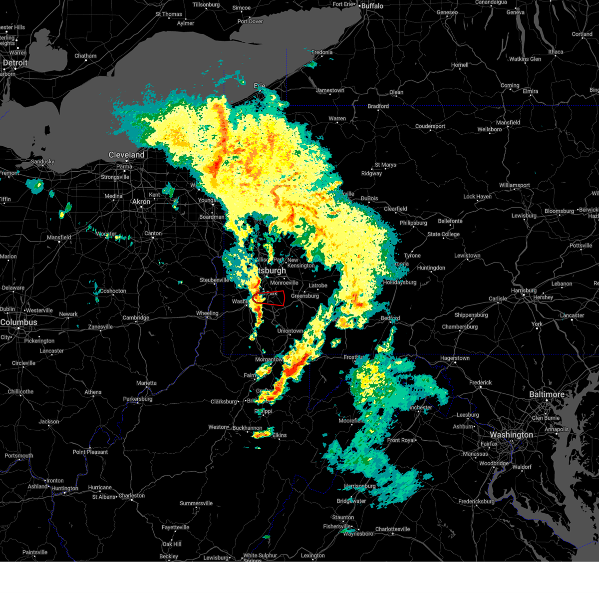
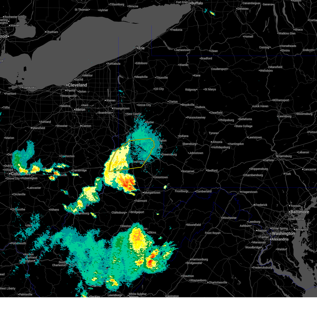
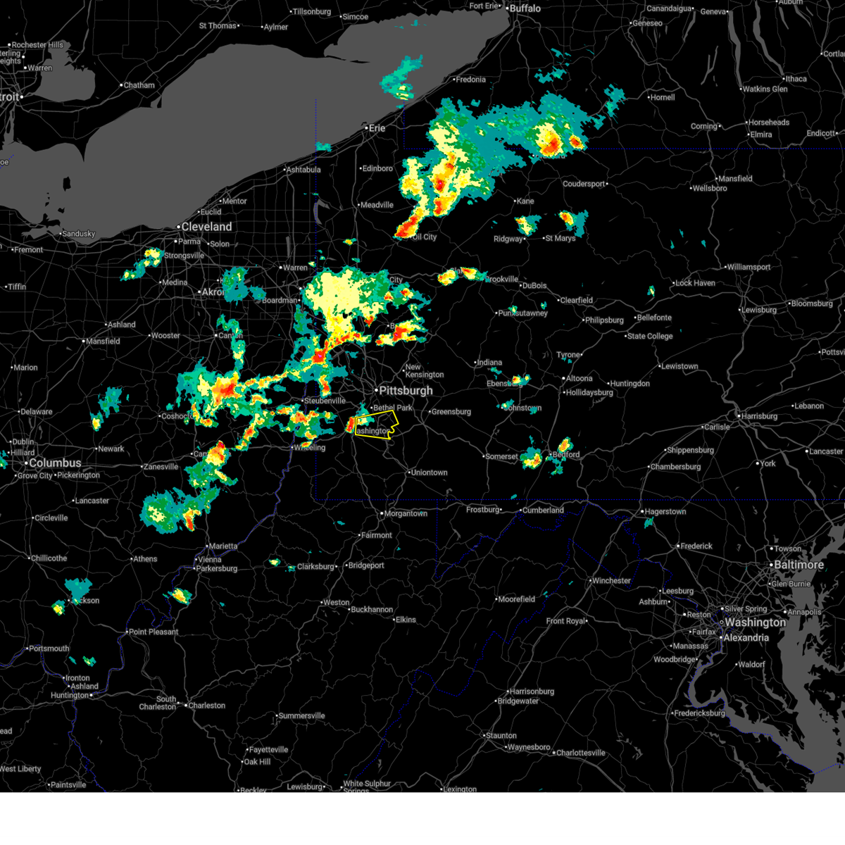
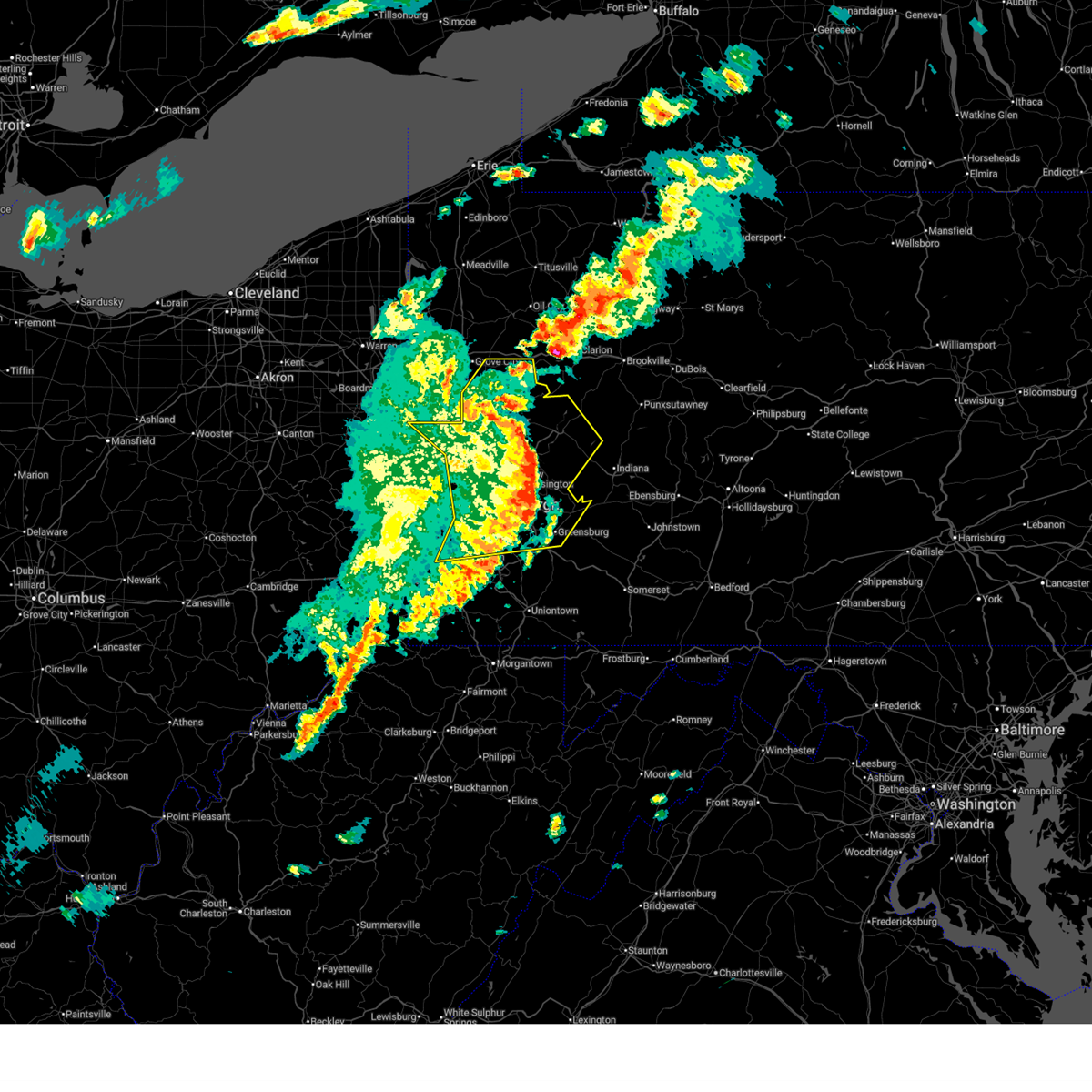
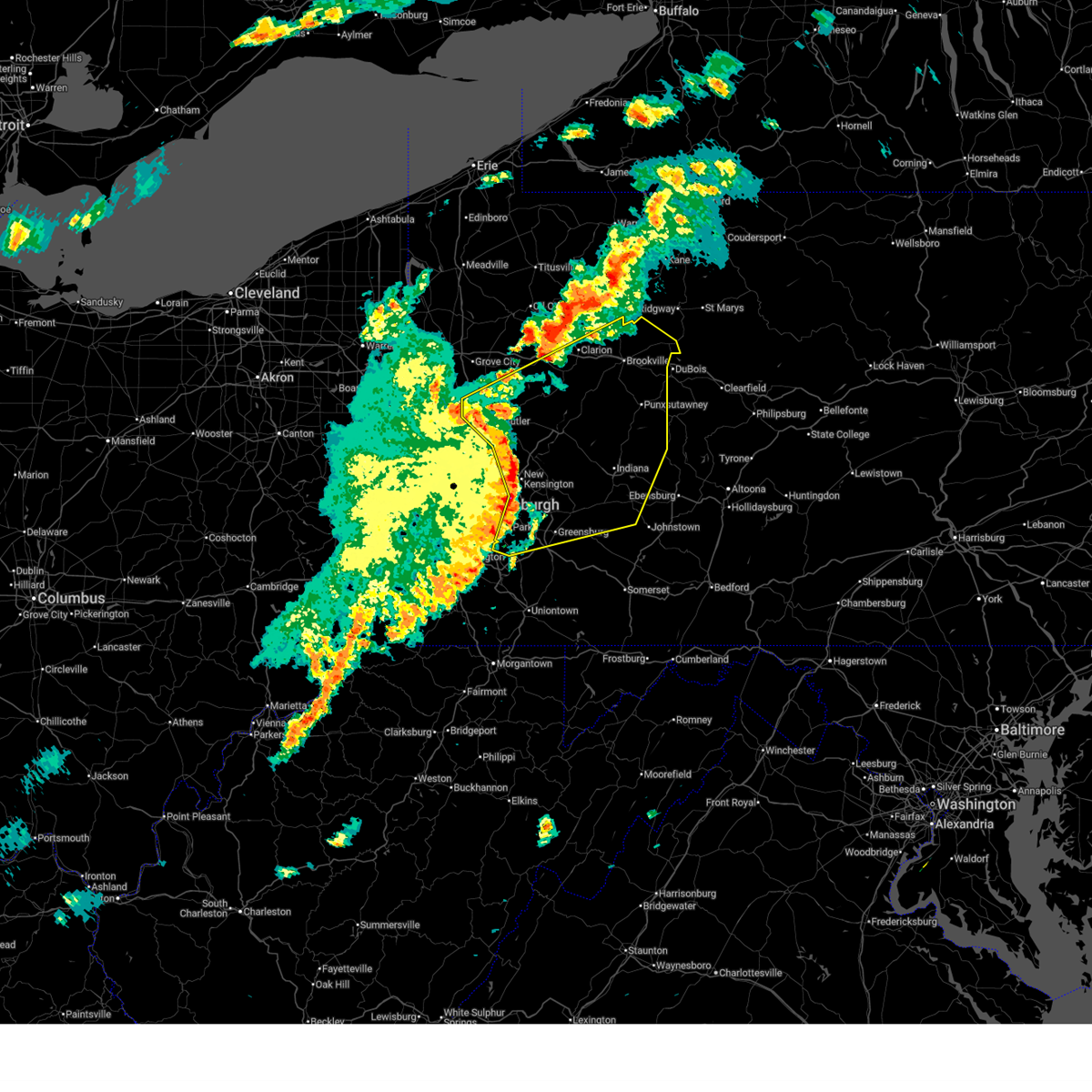
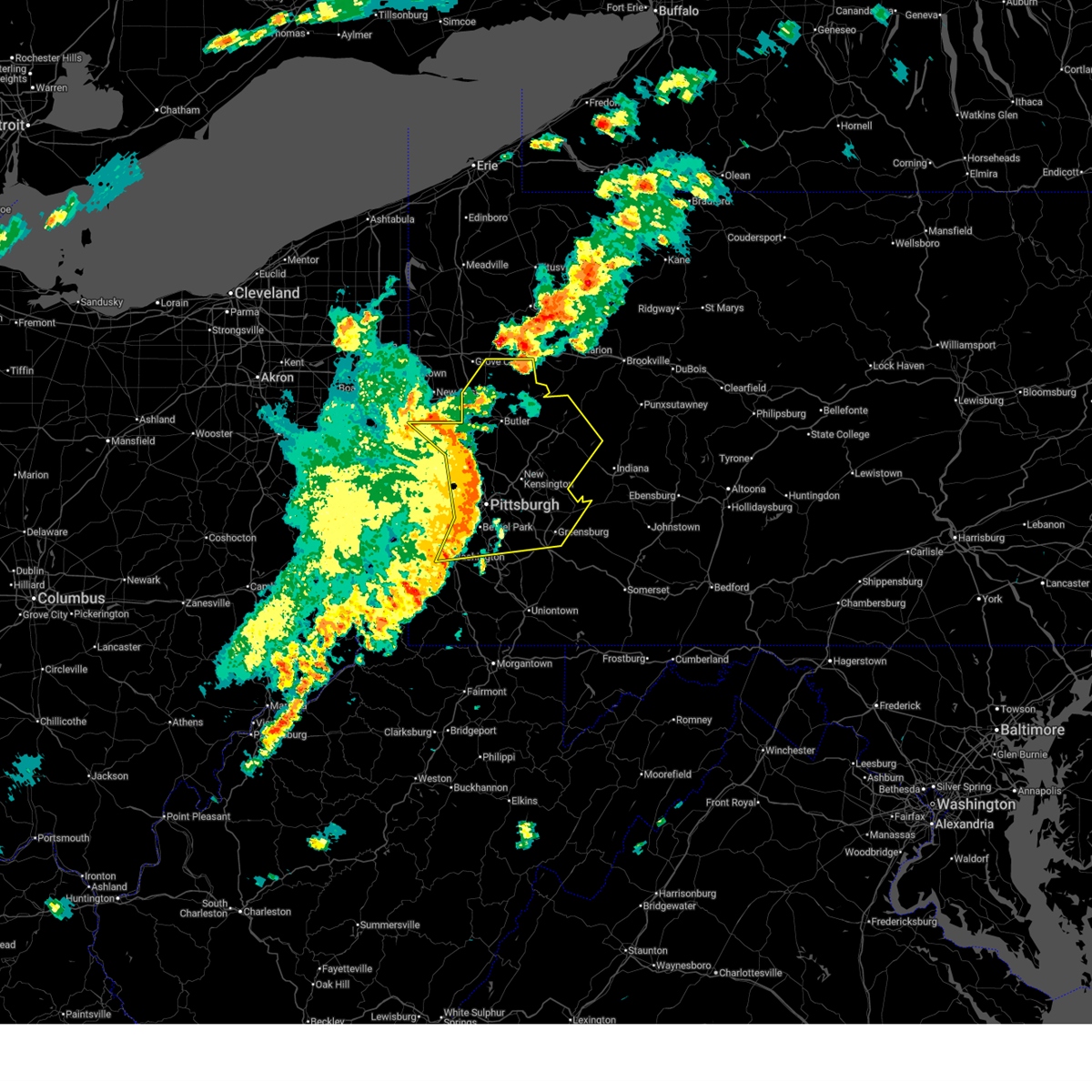
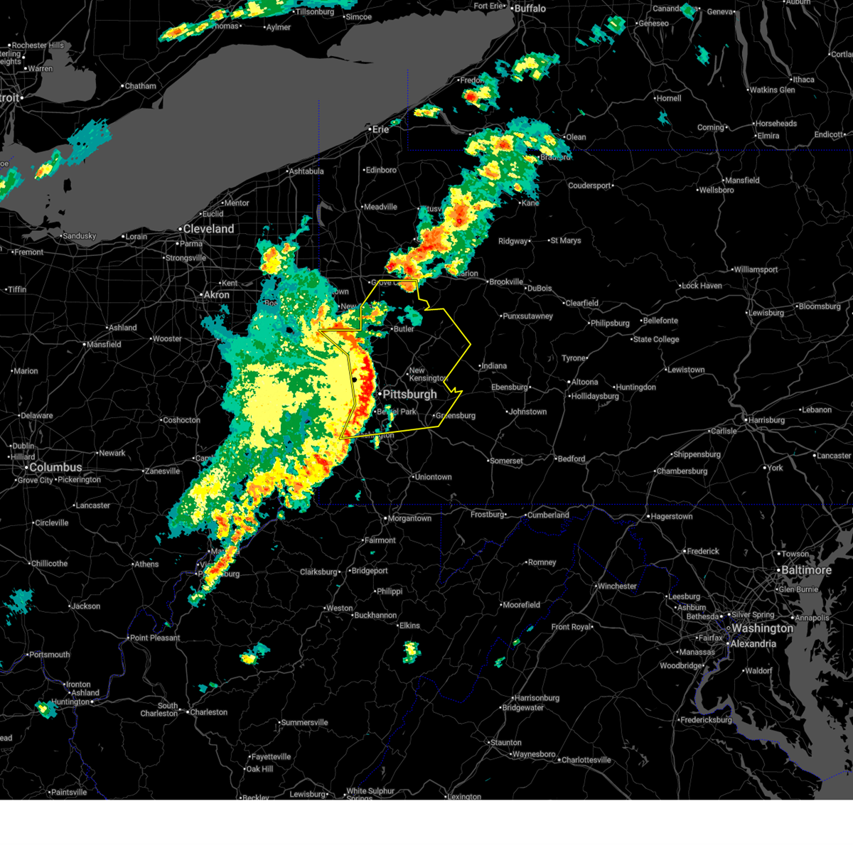
Hail Map for Clairton, PA
The Clairton, PA area has had 0 reports of on-the-ground hail by trained spotters, and has been under severe weather warnings 40 times during the past 12 months. Doppler radar has detected hail at or near Clairton, PA on 48 occasions, including 3 occasions during the past year.
| Name: | Clairton, PA |
| Where Located: | 11 miles SSE of Pittsburgh, PA |
| Map: | Google Map for Clairton, PA |
| Population: | 6796 |
| Housing Units: | 3889 |
| More Info: | Search Google for Clairton, PA |
0
The Top Recent Hail Date for Clairton, PA is Wednesday, May 13, 2026 (25th out of 48)

Hail and Wind Damage Spotted near Clairton, PA
| Date / Time | Report Details |
|---|---|
| 6/14/2026 6:59 PM EDT |
 At 659 pm edt, severe thunderstorms were located along a line from near punxsutawney to over fredericktown-millsboro, or along a line from near punxsutawney to 14 miles northeast of waynesburg, moving east at 40 mph (radar indicated). Hazards include 60 mph wind gusts and small hail. Expect damage to roofs, siding, and trees. Locations impacted include, monroeville, greensburg, mckeesport, indiana, jeannette, latrobe, connellsville, punxsutawney, vandergrift, homer city, apollo, plum, murrysville, jefferson hills, north versailles, white oak, monessen, clairton and california. At 659 pm edt, severe thunderstorms were located along a line from near punxsutawney to over fredericktown-millsboro, or along a line from near punxsutawney to 14 miles northeast of waynesburg, moving east at 40 mph (radar indicated). Hazards include 60 mph wind gusts and small hail. Expect damage to roofs, siding, and trees. Locations impacted include, monroeville, greensburg, mckeesport, indiana, jeannette, latrobe, connellsville, punxsutawney, vandergrift, homer city, apollo, plum, murrysville, jefferson hills, north versailles, white oak, monessen, clairton and california.
|
| 6/14/2026 6:52 PM EDT |
 The severe thunderstorm warning that was previously in effect has been reissued for westmoreland, armstrong, allegheny, and washington counties and is in effect until 800 pm edt. please refer to that bulletin for the latest severe weather information. to report severe weather, contact your nearest law enforcement agency. they will send your report to the national weather service office. a severe thunderstorm watch remains in effect until 900 pm edt for a portion of southwest pennsylvania. a tornado watch remains in effect until 1000 pm edt for portions of southwest and west central pennsylvania. The severe thunderstorm warning that was previously in effect has been reissued for westmoreland, armstrong, allegheny, and washington counties and is in effect until 800 pm edt. please refer to that bulletin for the latest severe weather information. to report severe weather, contact your nearest law enforcement agency. they will send your report to the national weather service office. a severe thunderstorm watch remains in effect until 900 pm edt for a portion of southwest pennsylvania. a tornado watch remains in effect until 1000 pm edt for portions of southwest and west central pennsylvania.
|
| 6/14/2026 6:51 PM EDT |
 At 651 pm edt, severe thunderstorms were located along a line from 6 miles southwest of punxsutawney to near fredericktown-millsboro, or along a line from 6 miles southwest of punxsutawney to 11 miles northeast of waynesburg, moving east at 40 mph (radar indicated). Hazards include 60 mph wind gusts and small hail. Expect damage to roofs, siding, and trees. Locations impacted include, penn hills, monroeville, greensburg, mckeesport, indiana, jeannette, latrobe, connellsville, punxsutawney, vandergrift, homer city, apollo, gastonville, plum, west mifflin, murrysville, wilkinsburg and south park township. At 651 pm edt, severe thunderstorms were located along a line from 6 miles southwest of punxsutawney to near fredericktown-millsboro, or along a line from 6 miles southwest of punxsutawney to 11 miles northeast of waynesburg, moving east at 40 mph (radar indicated). Hazards include 60 mph wind gusts and small hail. Expect damage to roofs, siding, and trees. Locations impacted include, penn hills, monroeville, greensburg, mckeesport, indiana, jeannette, latrobe, connellsville, punxsutawney, vandergrift, homer city, apollo, gastonville, plum, west mifflin, murrysville, wilkinsburg and south park township.
|
| 6/14/2026 6:48 PM EDT |
 Torpbz the national weather service in pittsburgh has issued a * tornado warning for, southeastern allegheny county in southwestern pennsylvania, west central westmoreland county in southwestern pennsylvania, * until 715 pm edt. * at 648 pm edt, a severe thunderstorm capable of producing a tornado was located over clairton, or near mckeesport, moving east at 45 mph (radar indicated rotation). Hazards include tornado. Flying debris will be dangerous to those caught without shelter. mobile homes will be damaged or destroyed. damage to roofs, windows and vehicles will occur. Tree damage is likely. Torpbz the national weather service in pittsburgh has issued a * tornado warning for, southeastern allegheny county in southwestern pennsylvania, west central westmoreland county in southwestern pennsylvania, * until 715 pm edt. * at 648 pm edt, a severe thunderstorm capable of producing a tornado was located over clairton, or near mckeesport, moving east at 45 mph (radar indicated rotation). Hazards include tornado. Flying debris will be dangerous to those caught without shelter. mobile homes will be damaged or destroyed. damage to roofs, windows and vehicles will occur. Tree damage is likely.
|
| 6/14/2026 6:46 PM EDT |
 At 646 pm edt, severe thunderstorms were located along a line from near kittanning to 7 miles northeast of cameron, or along a line from near kittanning to 13 miles southeast of triadelphia, moving east at 35 mph (radar indicated). Hazards include 60 mph wind gusts and small hail. Expect damage to roofs, siding, and trees. Locations impacted include, pittsburgh, penn hills, bethel park, monroeville, mcmurray, mckeesport, washington, vandergrift, apollo, gastonville, plum, west mifflin, baldwin, murrysville, wilkinsburg, whitehall, south park township, new kensington, lower burrell and munhall. At 646 pm edt, severe thunderstorms were located along a line from near kittanning to 7 miles northeast of cameron, or along a line from near kittanning to 13 miles southeast of triadelphia, moving east at 35 mph (radar indicated). Hazards include 60 mph wind gusts and small hail. Expect damage to roofs, siding, and trees. Locations impacted include, pittsburgh, penn hills, bethel park, monroeville, mcmurray, mckeesport, washington, vandergrift, apollo, gastonville, plum, west mifflin, baldwin, murrysville, wilkinsburg, whitehall, south park township, new kensington, lower burrell and munhall.
|
| 6/14/2026 6:46 PM EDT |
 the severe thunderstorm warning has been cancelled and is no longer in effect the severe thunderstorm warning has been cancelled and is no longer in effect
|
| 6/14/2026 6:33 PM EDT |
 At 633 pm edt, severe thunderstorms were located along a line from near west kittanning to 7 miles north of cameron, or along a line from near kittanning to 7 miles east of moundsville, moving east at 35 mph (radar indicated). Hazards include 60 mph wind gusts and small hail. Expect damage to roofs, siding, and trees. Locations impacted include, pittsburgh, penn hills, mount lebanon, bethel park, ross township, monroeville, mcmurray, mckeesport, washington, moundsville, canonsburg, vandergrift, kittanning, apollo, gastonville, shaler township, plum, west mifflin and north side pittsburgh. At 633 pm edt, severe thunderstorms were located along a line from near west kittanning to 7 miles north of cameron, or along a line from near kittanning to 7 miles east of moundsville, moving east at 35 mph (radar indicated). Hazards include 60 mph wind gusts and small hail. Expect damage to roofs, siding, and trees. Locations impacted include, pittsburgh, penn hills, mount lebanon, bethel park, ross township, monroeville, mcmurray, mckeesport, washington, moundsville, canonsburg, vandergrift, kittanning, apollo, gastonville, shaler township, plum, west mifflin and north side pittsburgh.
|
| 6/14/2026 6:17 PM EDT |
 the severe thunderstorm warning has been cancelled and is no longer in effect the severe thunderstorm warning has been cancelled and is no longer in effect
|
| 6/14/2026 6:17 PM EDT |
 At 617 pm edt, severe thunderstorms were located along a line from 6 miles east of meadowood to over glen dale, or along a line from 6 miles east of butler to over moundsville, moving east at 35 mph (radar indicated). Hazards include 60 mph wind gusts and small hail. Expect damage to roofs, siding, and trees. Locations impacted include, pittsburgh, penn hills, mount lebanon, bethel park, ross township, wheeling, mccandless township, monroeville, cranberry, moon township, mcmurray, mckeesport, butler, washington, franklin park, moundsville, canonsburg, martins ferry and vandergrift. At 617 pm edt, severe thunderstorms were located along a line from 6 miles east of meadowood to over glen dale, or along a line from 6 miles east of butler to over moundsville, moving east at 35 mph (radar indicated). Hazards include 60 mph wind gusts and small hail. Expect damage to roofs, siding, and trees. Locations impacted include, pittsburgh, penn hills, mount lebanon, bethel park, ross township, wheeling, mccandless township, monroeville, cranberry, moon township, mcmurray, mckeesport, butler, washington, franklin park, moundsville, canonsburg, martins ferry and vandergrift.
|
| 6/14/2026 6:01 PM EDT |
 Svrpbz the national weather service in pittsburgh has issued a * severe thunderstorm warning for, eastern belmont county in east central ohio, allegheny county in southwestern pennsylvania, northwestern greene county in southwestern pennsylvania, washington county in southwestern pennsylvania, northwestern westmoreland county in southwestern pennsylvania, armstrong county in west central pennsylvania, southern butler county in west central pennsylvania, southeastern beaver county in western pennsylvania, brooke county in northern west virginia, marshall county in northern west virginia, ohio county in northern west virginia, * until 700 pm edt. * at 601 pm edt, severe thunderstorms were located along a line from over meridian to 9 miles southwest of st. clairsville, or along a line from near butler to 9 miles southwest of st. clairsville, moving east at 35 mph (radar indicated). Hazards include 60 mph wind gusts and small hail. expect damage to roofs, siding, and trees Svrpbz the national weather service in pittsburgh has issued a * severe thunderstorm warning for, eastern belmont county in east central ohio, allegheny county in southwestern pennsylvania, northwestern greene county in southwestern pennsylvania, washington county in southwestern pennsylvania, northwestern westmoreland county in southwestern pennsylvania, armstrong county in west central pennsylvania, southern butler county in west central pennsylvania, southeastern beaver county in western pennsylvania, brooke county in northern west virginia, marshall county in northern west virginia, ohio county in northern west virginia, * until 700 pm edt. * at 601 pm edt, severe thunderstorms were located along a line from over meridian to 9 miles southwest of st. clairsville, or along a line from near butler to 9 miles southwest of st. clairsville, moving east at 35 mph (radar indicated). Hazards include 60 mph wind gusts and small hail. expect damage to roofs, siding, and trees
|
| 6/11/2026 3:46 PM EDT |
 Svrpbz the national weather service in pittsburgh has issued a * severe thunderstorm warning for, eastern allegheny county in southwestern pennsylvania, east central washington county in southwestern pennsylvania, westmoreland county in southwestern pennsylvania, armstrong county in west central pennsylvania, southeastern butler county in west central pennsylvania, southern clarion county in west central pennsylvania, indiana county in west central pennsylvania, southern jefferson pa county in west central pennsylvania, * until 445 pm edt. * at 346 pm edt, severe thunderstorms were located along a line from 6 miles southwest of rimersburg to over monessen, or along a line from 6 miles southwest of rimersburg to 13 miles southeast of gastonville, moving east at 35 mph (law enforcement reported). Hazards include 70 mph wind gusts. Expect considerable tree damage. Damage is likely to mobile homes, roofs, and outbuildings. Svrpbz the national weather service in pittsburgh has issued a * severe thunderstorm warning for, eastern allegheny county in southwestern pennsylvania, east central washington county in southwestern pennsylvania, westmoreland county in southwestern pennsylvania, armstrong county in west central pennsylvania, southeastern butler county in west central pennsylvania, southern clarion county in west central pennsylvania, indiana county in west central pennsylvania, southern jefferson pa county in west central pennsylvania, * until 445 pm edt. * at 346 pm edt, severe thunderstorms were located along a line from 6 miles southwest of rimersburg to over monessen, or along a line from 6 miles southwest of rimersburg to 13 miles southeast of gastonville, moving east at 35 mph (law enforcement reported). Hazards include 70 mph wind gusts. Expect considerable tree damage. Damage is likely to mobile homes, roofs, and outbuildings.
|
| 6/11/2026 3:34 PM EDT |
 At 334 pm edt, severe thunderstorms were located along a line from over butler to 9 miles southwest of wolfdale, or along a line from over butler to 8 miles east of valley grove, moving east at 30 mph (law enforcement reported). Hazards include 70 mph wind gusts. Expect considerable tree damage. damage is likely to mobile homes, roofs, and outbuildings. locations impacted include, pittsburgh, penn hills, mount lebanon, bethel park, ross township, mccandless township, monroeville, mcmurray, mckeesport, butler, washington, franklin park, canonsburg, vandergrift, kittanning, apollo, valley grove, gastonville and shaler township. numerous trees and power lines have been reported down with these storms. Areas including fox chapel and oakmont should expect considerable wind damage. At 334 pm edt, severe thunderstorms were located along a line from over butler to 9 miles southwest of wolfdale, or along a line from over butler to 8 miles east of valley grove, moving east at 30 mph (law enforcement reported). Hazards include 70 mph wind gusts. Expect considerable tree damage. damage is likely to mobile homes, roofs, and outbuildings. locations impacted include, pittsburgh, penn hills, mount lebanon, bethel park, ross township, mccandless township, monroeville, mcmurray, mckeesport, butler, washington, franklin park, canonsburg, vandergrift, kittanning, apollo, valley grove, gastonville and shaler township. numerous trees and power lines have been reported down with these storms. Areas including fox chapel and oakmont should expect considerable wind damage.
|
| 6/11/2026 3:24 PM EDT |
 At 324 pm edt, severe thunderstorms were located along a line from over meridian to near valley grove, or along a line from near butler to near valley grove, moving east at 30 mph (law enforcement reported). Hazards include 70 mph wind gusts. Expect considerable tree damage. damage is likely to mobile homes, roofs, and outbuildings. locations impacted include, pittsburgh, penn hills, mount lebanon, bethel park, ross township, wheeling, mccandless township, monroeville, cranberry, moon township, mcmurray, mckeesport, butler, washington, franklin park, canonsburg, vandergrift, kittanning and apollo. Numerous trees and power lines have been reported down with this line of storms. At 324 pm edt, severe thunderstorms were located along a line from over meridian to near valley grove, or along a line from near butler to near valley grove, moving east at 30 mph (law enforcement reported). Hazards include 70 mph wind gusts. Expect considerable tree damage. damage is likely to mobile homes, roofs, and outbuildings. locations impacted include, pittsburgh, penn hills, mount lebanon, bethel park, ross township, wheeling, mccandless township, monroeville, cranberry, moon township, mcmurray, mckeesport, butler, washington, franklin park, canonsburg, vandergrift, kittanning and apollo. Numerous trees and power lines have been reported down with this line of storms.
|
| 6/11/2026 3:10 PM EDT |
 Svrpbz the national weather service in pittsburgh has issued a * severe thunderstorm warning for, northeastern belmont county in east central ohio, southeastern jefferson oh county in east central ohio, allegheny county in southwestern pennsylvania, washington county in southwestern pennsylvania, northwestern westmoreland county in southwestern pennsylvania, southwestern armstrong county in west central pennsylvania, butler county in west central pennsylvania, south central clarion county in west central pennsylvania, eastern beaver county in western pennsylvania, southeastern lawrence county in western pennsylvania, brooke county in northern west virginia, ohio county in northern west virginia, * until 415 pm edt. * at 310 pm edt, severe thunderstorms were located along a line from 7 miles north of zelienople to near west liberty, or along a line from 11 miles west of butler to near clearview, moving east at 30 mph (law enforcement reported). Hazards include 70 mph wind gusts. Expect considerable tree damage. Damage is likely to mobile homes, roofs, and outbuildings. Svrpbz the national weather service in pittsburgh has issued a * severe thunderstorm warning for, northeastern belmont county in east central ohio, southeastern jefferson oh county in east central ohio, allegheny county in southwestern pennsylvania, washington county in southwestern pennsylvania, northwestern westmoreland county in southwestern pennsylvania, southwestern armstrong county in west central pennsylvania, butler county in west central pennsylvania, south central clarion county in west central pennsylvania, eastern beaver county in western pennsylvania, southeastern lawrence county in western pennsylvania, brooke county in northern west virginia, ohio county in northern west virginia, * until 415 pm edt. * at 310 pm edt, severe thunderstorms were located along a line from 7 miles north of zelienople to near west liberty, or along a line from 11 miles west of butler to near clearview, moving east at 30 mph (law enforcement reported). Hazards include 70 mph wind gusts. Expect considerable tree damage. Damage is likely to mobile homes, roofs, and outbuildings.
|
| 6/6/2026 2:55 PM EDT |
 The severe thunderstorm warning that was previously in effect has been reissued for marion, monongalia, greene, wetzel, allegheny, and washington counties and is in effect until 345 pm edt. please refer to that bulletin for the latest severe weather information. to report severe weather, contact your nearest law enforcement agency. they will send your report to the national weather service office. a severe thunderstorm watch remains in effect until 600 pm edt for portions of southwest pennsylvania and northern west virginia. The severe thunderstorm warning that was previously in effect has been reissued for marion, monongalia, greene, wetzel, allegheny, and washington counties and is in effect until 345 pm edt. please refer to that bulletin for the latest severe weather information. to report severe weather, contact your nearest law enforcement agency. they will send your report to the national weather service office. a severe thunderstorm watch remains in effect until 600 pm edt for portions of southwest pennsylvania and northern west virginia.
|
| 6/6/2026 2:51 PM EDT |
 At 251 pm edt, severe thunderstorms were located along a line from over west newton to 8 miles southeast of jacksonburg, or along a line from 8 miles south of mckeesport to 12 miles southwest of mannington, moving east at 55 mph (law enforcement reported tree and power pole damage across belmont county and washington county). Hazards include 70 mph wind gusts and small hail. Expect considerable tree damage. damage is likely to mobile homes, roofs, and outbuildings. Locations impacted include, mount lebanon, bethel park, mckeesport, waynesburg, gastonville, west mifflin, baldwin, whitehall, south park township, munhall, jefferson hills, north versailles, brentwood, dormont, castle shannon, pleasant hills, white oak and monessen. At 251 pm edt, severe thunderstorms were located along a line from over west newton to 8 miles southeast of jacksonburg, or along a line from 8 miles south of mckeesport to 12 miles southwest of mannington, moving east at 55 mph (law enforcement reported tree and power pole damage across belmont county and washington county). Hazards include 70 mph wind gusts and small hail. Expect considerable tree damage. damage is likely to mobile homes, roofs, and outbuildings. Locations impacted include, mount lebanon, bethel park, mckeesport, waynesburg, gastonville, west mifflin, baldwin, whitehall, south park township, munhall, jefferson hills, north versailles, brentwood, dormont, castle shannon, pleasant hills, white oak and monessen.
|
| 6/6/2026 2:47 PM EDT |
 Svrpbz the national weather service in pittsburgh has issued a * severe thunderstorm warning for, southeastern allegheny county in southwestern pennsylvania, fayette county in southwestern pennsylvania, greene county in southwestern pennsylvania, southeastern washington county in southwestern pennsylvania, southern westmoreland county in southwestern pennsylvania, preston county in northeastern west virginia, marion county in northern west virginia, monongalia county in northern west virginia, eastern wetzel county in northern west virginia, * until 345 pm edt. * at 247 pm edt, severe thunderstorms were located along a line from near white oak to near jacksonburg, or along a line from 5 miles southeast of mckeesport to 13 miles west of mannington, moving southeast at 35 mph (radar indicated). Hazards include 70 mph wind gusts. Expect considerable tree damage. Damage is likely to mobile homes, roofs, and outbuildings. Svrpbz the national weather service in pittsburgh has issued a * severe thunderstorm warning for, southeastern allegheny county in southwestern pennsylvania, fayette county in southwestern pennsylvania, greene county in southwestern pennsylvania, southeastern washington county in southwestern pennsylvania, southern westmoreland county in southwestern pennsylvania, preston county in northeastern west virginia, marion county in northern west virginia, monongalia county in northern west virginia, eastern wetzel county in northern west virginia, * until 345 pm edt. * at 247 pm edt, severe thunderstorms were located along a line from near white oak to near jacksonburg, or along a line from 5 miles southeast of mckeesport to 13 miles west of mannington, moving southeast at 35 mph (radar indicated). Hazards include 70 mph wind gusts. Expect considerable tree damage. Damage is likely to mobile homes, roofs, and outbuildings.
|
| 6/6/2026 2:38 PM EDT |
 At 238 pm edt, severe thunderstorms were located along a line from over gastonville to 7 miles southwest of pine grove, or along a line from over gastonville to 15 miles southeast of new martinsville, moving east at 55 mph (law enforcement reported). Hazards include 70 mph wind gusts and small hail. Law enforcement reported tree and power pole damage across belmont county and washington county. locations impacted include, mount lebanon, bethel park, mcmurray, mckeesport, washington, canonsburg, new martinsville, waynesburg, gastonville, west mifflin, baldwin, upper st. Clair, scott township, whitehall, south park township, munhall, cecil-bishop, jefferson hills and north versailles. At 238 pm edt, severe thunderstorms were located along a line from over gastonville to 7 miles southwest of pine grove, or along a line from over gastonville to 15 miles southeast of new martinsville, moving east at 55 mph (law enforcement reported). Hazards include 70 mph wind gusts and small hail. Law enforcement reported tree and power pole damage across belmont county and washington county. locations impacted include, mount lebanon, bethel park, mcmurray, mckeesport, washington, canonsburg, new martinsville, waynesburg, gastonville, west mifflin, baldwin, upper st. Clair, scott township, whitehall, south park township, munhall, cecil-bishop, jefferson hills and north versailles.
|
| 6/6/2026 2:27 PM EDT |
 At 227 pm edt, severe thunderstorms were located along a line from over canonsburg to 12 miles south of new martinsville, moving east at 55 mph (law enforcement reported tree and power pole damage across belmont county and washington county). Hazards include 70 mph wind gusts and small hail. Expect considerable tree damage. damage is likely to mobile homes, roofs, and outbuildings. locations impacted include, mount lebanon, bethel park, mcmurray, mckeesport, washington, moundsville, canonsburg, new martinsville, waynesburg, avella, gastonville, west mifflin, baldwin, upper st. Clair, scott township, whitehall, south park township and munhall. At 227 pm edt, severe thunderstorms were located along a line from over canonsburg to 12 miles south of new martinsville, moving east at 55 mph (law enforcement reported tree and power pole damage across belmont county and washington county). Hazards include 70 mph wind gusts and small hail. Expect considerable tree damage. damage is likely to mobile homes, roofs, and outbuildings. locations impacted include, mount lebanon, bethel park, mcmurray, mckeesport, washington, moundsville, canonsburg, new martinsville, waynesburg, avella, gastonville, west mifflin, baldwin, upper st. Clair, scott township, whitehall, south park township and munhall.
|
| 6/6/2026 2:18 PM EDT |
 At 218 pm edt, severe thunderstorms were located along a line from 8 miles north of wolfdale to 17 miles south of woodsfield, or along a line from 7 miles east of avella to 15 miles southwest of new martinsville, moving east at 55 mph (law enforcement reported tree and power line damage across the warned area). Hazards include 60 mph wind gusts and small hail. Expect damage to roofs, siding, and trees. Locations impacted include, mount lebanon, bethel park, wheeling, mcmurray, weirton, mckeesport, washington, moundsville, canonsburg, martins ferry, new martinsville, bellaire, waynesburg, warwood, wellsburg, bethlehem, west liberty and triadelphia. At 218 pm edt, severe thunderstorms were located along a line from 8 miles north of wolfdale to 17 miles south of woodsfield, or along a line from 7 miles east of avella to 15 miles southwest of new martinsville, moving east at 55 mph (law enforcement reported tree and power line damage across the warned area). Hazards include 60 mph wind gusts and small hail. Expect damage to roofs, siding, and trees. Locations impacted include, mount lebanon, bethel park, wheeling, mcmurray, weirton, mckeesport, washington, moundsville, canonsburg, martins ferry, new martinsville, bellaire, waynesburg, warwood, wellsburg, bethlehem, west liberty and triadelphia.
|
| 6/6/2026 1:55 PM EDT |
 Svrpbz the national weather service in pittsburgh has issued a * severe thunderstorm warning for, belmont county in east central ohio, southern jefferson oh county in east central ohio, monroe county in east central ohio, southern allegheny county in southwestern pennsylvania, greene county in southwestern pennsylvania, washington county in southwestern pennsylvania, brooke county in northern west virginia, northwestern marion county in northern west virginia, marshall county in northern west virginia, northwestern monongalia county in northern west virginia, ohio county in northern west virginia, wetzel county in northern west virginia, * until 300 pm edt. * at 155 pm edt, severe thunderstorms were located along a line from over wintersville to 13 miles south of caldwell, or along a line from near steubenville to 13 miles south of caldwell, moving east at 55 mph (law enforcement reported tree and power line damage across the warned area). Hazards include 60 mph wind gusts and small hail. expect damage to roofs, siding, and trees Svrpbz the national weather service in pittsburgh has issued a * severe thunderstorm warning for, belmont county in east central ohio, southern jefferson oh county in east central ohio, monroe county in east central ohio, southern allegheny county in southwestern pennsylvania, greene county in southwestern pennsylvania, washington county in southwestern pennsylvania, brooke county in northern west virginia, northwestern marion county in northern west virginia, marshall county in northern west virginia, northwestern monongalia county in northern west virginia, ohio county in northern west virginia, wetzel county in northern west virginia, * until 300 pm edt. * at 155 pm edt, severe thunderstorms were located along a line from over wintersville to 13 miles south of caldwell, or along a line from near steubenville to 13 miles south of caldwell, moving east at 55 mph (law enforcement reported tree and power line damage across the warned area). Hazards include 60 mph wind gusts and small hail. expect damage to roofs, siding, and trees
|
| 5/13/2026 3:34 PM EDT |
 At 334 pm edt, a severe thunderstorm was located over monongahela, or 7 miles southeast of gastonville, moving east at 25 mph (trained spotters reported). Hazards include 60 mph wind gusts and quarter size hail. Hail damage to vehicles is expected. expect wind damage to roofs, siding, and trees. locations impacted include, jefferson hills, monessen, clairton, donora, monongahela, charleroi, youngwood, west newton, new stanton, perryopolis, new eagle, north belle vernon, wickerham manor-fisher, baidland, elizabeth, north charleroi, speers, belle vernon, lincoln and lynnwood-pricedale. Trained spotters reported one inch hail near finleyville. At 334 pm edt, a severe thunderstorm was located over monongahela, or 7 miles southeast of gastonville, moving east at 25 mph (trained spotters reported). Hazards include 60 mph wind gusts and quarter size hail. Hail damage to vehicles is expected. expect wind damage to roofs, siding, and trees. locations impacted include, jefferson hills, monessen, clairton, donora, monongahela, charleroi, youngwood, west newton, new stanton, perryopolis, new eagle, north belle vernon, wickerham manor-fisher, baidland, elizabeth, north charleroi, speers, belle vernon, lincoln and lynnwood-pricedale. Trained spotters reported one inch hail near finleyville.
|
| 5/13/2026 3:22 PM EDT |
 At 322 pm edt, a severe thunderstorm was located near gastonville, moving east at 25 mph (trained spotters reported). Hazards include 60 mph wind gusts and quarter size hail. Hail damage to vehicles is expected. expect wind damage to roofs, siding, and trees. locations impacted include, gastonville, south park township, jefferson hills, monessen, clairton, donora, monongahela, charleroi, youngwood, west newton, new stanton, perryopolis, new eagle, north belle vernon, wickerham manor-fisher, baidland, elizabeth, north charleroi and speers. Trained spotters reported one inch hail near finleyville. At 322 pm edt, a severe thunderstorm was located near gastonville, moving east at 25 mph (trained spotters reported). Hazards include 60 mph wind gusts and quarter size hail. Hail damage to vehicles is expected. expect wind damage to roofs, siding, and trees. locations impacted include, gastonville, south park township, jefferson hills, monessen, clairton, donora, monongahela, charleroi, youngwood, west newton, new stanton, perryopolis, new eagle, north belle vernon, wickerham manor-fisher, baidland, elizabeth, north charleroi and speers. Trained spotters reported one inch hail near finleyville.
|
| 5/13/2026 3:10 PM EDT |
 Svrpbz the national weather service in pittsburgh has issued a * severe thunderstorm warning for, southeastern allegheny county in southwestern pennsylvania, north central fayette county in southwestern pennsylvania, east central washington county in southwestern pennsylvania, southwestern westmoreland county in southwestern pennsylvania, * until 400 pm edt. * at 310 pm edt, a severe thunderstorm was located near mcmurray, moving east at 25 mph (radar indicated). Hazards include 60 mph wind gusts and quarter size hail. Hail damage to vehicles is expected. Expect wind damage to roofs, siding, and trees. Svrpbz the national weather service in pittsburgh has issued a * severe thunderstorm warning for, southeastern allegheny county in southwestern pennsylvania, north central fayette county in southwestern pennsylvania, east central washington county in southwestern pennsylvania, southwestern westmoreland county in southwestern pennsylvania, * until 400 pm edt. * at 310 pm edt, a severe thunderstorm was located near mcmurray, moving east at 25 mph (radar indicated). Hazards include 60 mph wind gusts and quarter size hail. Hail damage to vehicles is expected. Expect wind damage to roofs, siding, and trees.
|
| 4/1/2026 12:23 AM EDT |
 The storms which prompted the warning have weakened below severe limits, and no longer pose an immediate threat to life or property. therefore, the warning will be allowed to expire. The storms which prompted the warning have weakened below severe limits, and no longer pose an immediate threat to life or property. therefore, the warning will be allowed to expire.
|
| 4/1/2026 12:08 AM EDT |
 At 1208 am edt, severe thunderstorms were located along a line from near murrysville to over monongahela, or along a line from 8 miles south of apollo to 8 miles southeast of gastonville, moving east at 50 mph (radar indicated). Hazards include 60 mph wind gusts. Expect damage to roofs, siding, and trees. Locations impacted include, penn hills, bethel park, monroeville, greensburg, mckeesport, jeannette, gastonville, plum, west mifflin, baldwin, murrysville, wilkinsburg, south park township, munhall, jefferson hills and north versailles. At 1208 am edt, severe thunderstorms were located along a line from near murrysville to over monongahela, or along a line from 8 miles south of apollo to 8 miles southeast of gastonville, moving east at 50 mph (radar indicated). Hazards include 60 mph wind gusts. Expect damage to roofs, siding, and trees. Locations impacted include, penn hills, bethel park, monroeville, greensburg, mckeesport, jeannette, gastonville, plum, west mifflin, baldwin, murrysville, wilkinsburg, south park township, munhall, jefferson hills and north versailles.
|
| 3/31/2026 11:57 PM EDT |
 At 1157 pm edt, severe thunderstorms were located along a line from over oakmont to over gastonville, or along a line from near penn hills to over gastonville, moving east at 50 mph (radar indicated). Hazards include 60 mph wind gusts. Expect damage to roofs, siding, and trees. locations impacted include, pittsburgh, penn hills, mount lebanon, bethel park, ross township, monroeville, mcmurray, greensburg, mckeesport, jeannette, canonsburg, gastonville, shaler township, plum, west mifflin, north side pittsburgh, baldwin, upper st. Clair and murrysville. At 1157 pm edt, severe thunderstorms were located along a line from over oakmont to over gastonville, or along a line from near penn hills to over gastonville, moving east at 50 mph (radar indicated). Hazards include 60 mph wind gusts. Expect damage to roofs, siding, and trees. locations impacted include, pittsburgh, penn hills, mount lebanon, bethel park, ross township, monroeville, mcmurray, greensburg, mckeesport, jeannette, canonsburg, gastonville, shaler township, plum, west mifflin, north side pittsburgh, baldwin, upper st. Clair and murrysville.
|
| 3/31/2026 11:41 PM EDT |
 Svrpbz the national weather service in pittsburgh has issued a * severe thunderstorm warning for, allegheny county in southwestern pennsylvania, central washington county in southwestern pennsylvania, western westmoreland county in southwestern pennsylvania, * until 1230 am edt. * at 1141 pm edt, severe thunderstorms were located along a line from over franklin park to near mcdonald, or along a line from over franklin park to near canonsburg, moving east at 50 mph (radar indicated). Hazards include 60 mph wind gusts. expect damage to roofs, siding, and trees Svrpbz the national weather service in pittsburgh has issued a * severe thunderstorm warning for, allegheny county in southwestern pennsylvania, central washington county in southwestern pennsylvania, western westmoreland county in southwestern pennsylvania, * until 1230 am edt. * at 1141 pm edt, severe thunderstorms were located along a line from over franklin park to near mcdonald, or along a line from over franklin park to near canonsburg, moving east at 50 mph (radar indicated). Hazards include 60 mph wind gusts. expect damage to roofs, siding, and trees
|
| 3/7/2026 4:45 PM EST |
 The severe thunderstorm warning that was previously in effect has been reissued for allegheny, westmoreland, and washington counties and is in effect until 530 pm est. please refer to that bulletin for the latest severe weather information. The severe thunderstorm warning that was previously in effect has been reissued for allegheny, westmoreland, and washington counties and is in effect until 530 pm est. please refer to that bulletin for the latest severe weather information.
|
| 3/7/2026 4:45 PM EST |
 Svrpbz the national weather service in pittsburgh has issued a * severe thunderstorm warning for, southeastern allegheny county in southwestern pennsylvania, east central washington county in southwestern pennsylvania, central westmoreland county in southwestern pennsylvania, southwestern indiana county in west central pennsylvania, * until 530 pm est. * at 445 pm est, severe thunderstorms were located along a line from over north braddock to over donora, or along a line from near mckeesport to 9 miles southeast of gastonville, moving northeast at 65 mph (radar indicated). Hazards include 60 mph wind gusts. expect damage to roofs, siding, and trees Svrpbz the national weather service in pittsburgh has issued a * severe thunderstorm warning for, southeastern allegheny county in southwestern pennsylvania, east central washington county in southwestern pennsylvania, central westmoreland county in southwestern pennsylvania, southwestern indiana county in west central pennsylvania, * until 530 pm est. * at 445 pm est, severe thunderstorms were located along a line from over north braddock to over donora, or along a line from near mckeesport to 9 miles southeast of gastonville, moving northeast at 65 mph (radar indicated). Hazards include 60 mph wind gusts. expect damage to roofs, siding, and trees
|
| 3/7/2026 4:34 PM EST |
 At 434 pm est, a severe thunderstorm was located over gastonville, moving east at 55 mph (radar indicated). Hazards include 60 mph wind gusts and small hail. Expect damage to roofs, siding, and trees. locations impacted include, bethel park, mcmurray, mckeesport, gastonville, west mifflin, baldwin, upper st. Clair, whitehall, south park township, munhall, jefferson hills, north versailles, pleasant hills, white oak, clairton, duquesne, turtle creek and north braddock. At 434 pm est, a severe thunderstorm was located over gastonville, moving east at 55 mph (radar indicated). Hazards include 60 mph wind gusts and small hail. Expect damage to roofs, siding, and trees. locations impacted include, bethel park, mcmurray, mckeesport, gastonville, west mifflin, baldwin, upper st. Clair, whitehall, south park township, munhall, jefferson hills, north versailles, pleasant hills, white oak, clairton, duquesne, turtle creek and north braddock.
|
| 3/7/2026 4:14 PM EST |
 At 414 pm est, a severe thunderstorm was located over gastonville, moving east at 50 mph (radar indicated). Hazards include 60 mph wind gusts and half dollar size hail. Hail damage to vehicles is expected. expect wind damage to roofs, siding, and trees. locations impacted include, pittsburgh, mount lebanon, bethel park, mcmurray, mckeesport, gastonville, west mifflin, baldwin, upper st. Clair, wilkinsburg, whitehall, south park township, munhall, jefferson hills, north versailles, brentwood, swissvale and castle shannon. At 414 pm est, a severe thunderstorm was located over gastonville, moving east at 50 mph (radar indicated). Hazards include 60 mph wind gusts and half dollar size hail. Hail damage to vehicles is expected. expect wind damage to roofs, siding, and trees. locations impacted include, pittsburgh, mount lebanon, bethel park, mcmurray, mckeesport, gastonville, west mifflin, baldwin, upper st. Clair, wilkinsburg, whitehall, south park township, munhall, jefferson hills, north versailles, brentwood, swissvale and castle shannon.
|
| 3/7/2026 3:53 PM EST |
 Svrpbz the national weather service in pittsburgh has issued a * severe thunderstorm warning for, southeastern allegheny county in southwestern pennsylvania, central washington county in southwestern pennsylvania, west central westmoreland county in southwestern pennsylvania, * until 445 pm est. * at 353 pm est, a severe thunderstorm was located over wolfdale, or near washington, moving east at 50 mph (radar indicated). Hazards include 60 mph wind gusts and quarter size hail. Hail damage to vehicles is expected. Expect wind damage to roofs, siding, and trees. Svrpbz the national weather service in pittsburgh has issued a * severe thunderstorm warning for, southeastern allegheny county in southwestern pennsylvania, central washington county in southwestern pennsylvania, west central westmoreland county in southwestern pennsylvania, * until 445 pm est. * at 353 pm est, a severe thunderstorm was located over wolfdale, or near washington, moving east at 50 mph (radar indicated). Hazards include 60 mph wind gusts and quarter size hail. Hail damage to vehicles is expected. Expect wind damage to roofs, siding, and trees.
|
| 6/28/2025 5:58 PM EDT |
 At 558 pm edt, a severe thunderstorm was located near new stanton, or 11 miles south of jeannette, moving east at 20 mph (radar indicated). Hazards include 60 mph wind gusts. Expect damage to roofs, siding, and trees. Locations impacted include, greensburg, latrobe, monessen, clairton, donora, mount pleasant, monongahela, charleroi, mcchesneytown-loyalhanna, youngwood, west newton, lawson heights, new stanton, north belle vernon, wickerham manor-fisher, calumet-norvelt, north charleroi, lincoln, lynnwood-pricedale and sutersville. At 558 pm edt, a severe thunderstorm was located near new stanton, or 11 miles south of jeannette, moving east at 20 mph (radar indicated). Hazards include 60 mph wind gusts. Expect damage to roofs, siding, and trees. Locations impacted include, greensburg, latrobe, monessen, clairton, donora, mount pleasant, monongahela, charleroi, mcchesneytown-loyalhanna, youngwood, west newton, lawson heights, new stanton, north belle vernon, wickerham manor-fisher, calumet-norvelt, north charleroi, lincoln, lynnwood-pricedale and sutersville.
|
| 6/28/2025 5:47 PM EDT |
 At 547 pm edt, a severe thunderstorm was located over irwin, or near jeannette, moving east at 25 mph (radar indicated). Hazards include 60 mph wind gusts. Expect damage to roofs, siding, and trees. Locations impacted include, monroeville, greensburg, mckeesport, jeannette, latrobe, murrysville, north versailles, white oak, monessen, clairton, duquesne, donora, mount pleasant, monongahela, charleroi, irwin, mcchesneytown-loyalhanna, manor, trafford and youngwood. At 547 pm edt, a severe thunderstorm was located over irwin, or near jeannette, moving east at 25 mph (radar indicated). Hazards include 60 mph wind gusts. Expect damage to roofs, siding, and trees. Locations impacted include, monroeville, greensburg, mckeesport, jeannette, latrobe, murrysville, north versailles, white oak, monessen, clairton, duquesne, donora, mount pleasant, monongahela, charleroi, irwin, mcchesneytown-loyalhanna, manor, trafford and youngwood.
|
| 6/28/2025 5:28 PM EDT |
 Svrpbz the national weather service in pittsburgh has issued a * severe thunderstorm warning for, southeastern allegheny county in southwestern pennsylvania, east central washington county in southwestern pennsylvania, southwestern westmoreland county in southwestern pennsylvania, * until 615 pm edt. * at 528 pm edt, a severe thunderstorm was located near white oak, or near mckeesport, moving east at 25 mph (radar indicated). Hazards include 60 mph wind gusts. expect damage to roofs, siding, and trees Svrpbz the national weather service in pittsburgh has issued a * severe thunderstorm warning for, southeastern allegheny county in southwestern pennsylvania, east central washington county in southwestern pennsylvania, southwestern westmoreland county in southwestern pennsylvania, * until 615 pm edt. * at 528 pm edt, a severe thunderstorm was located near white oak, or near mckeesport, moving east at 25 mph (radar indicated). Hazards include 60 mph wind gusts. expect damage to roofs, siding, and trees
|
| 6/27/2025 6:39 PM EDT |
 The storm which prompted the warning has weakened below severe limits, and no longer poses an immediate threat to life or property. therefore, the warning will be allowed to expire. however, gusty winds and heavy rain are still possible with this thunderstorm. The storm which prompted the warning has weakened below severe limits, and no longer poses an immediate threat to life or property. therefore, the warning will be allowed to expire. however, gusty winds and heavy rain are still possible with this thunderstorm.
|
| 6/27/2025 6:14 PM EDT |
 At 614 pm edt, a severe thunderstorm was located near perryopolis, or 13 miles west of connellsville, moving east at 20 mph (radar indicated). Hazards include 60 mph wind gusts. Expect damage to roofs, siding, and trees. Locations impacted include, connellsville, south park township, jefferson hills, monessen, clairton, california, donora, monongahela, charleroi, irwin, west newton, bentleyville, brownsville, fredericktown-millsboro, perryopolis, new eagle, north belle vernon, wickerham manor-fisher, baidland and elizabeth. At 614 pm edt, a severe thunderstorm was located near perryopolis, or 13 miles west of connellsville, moving east at 20 mph (radar indicated). Hazards include 60 mph wind gusts. Expect damage to roofs, siding, and trees. Locations impacted include, connellsville, south park township, jefferson hills, monessen, clairton, california, donora, monongahela, charleroi, irwin, west newton, bentleyville, brownsville, fredericktown-millsboro, perryopolis, new eagle, north belle vernon, wickerham manor-fisher, baidland and elizabeth.
|
| 6/27/2025 6:04 PM EDT |
 At 604 pm edt, a severe thunderstorm was located over california, or 14 miles southeast of gastonville, moving east at 20 mph (radar indicated). Hazards include 60 mph wind gusts. Expect damage to roofs, siding, and trees. Locations impacted include, connellsville, gastonville, south park township, jefferson hills, monessen, clairton, california, donora, monongahela, charleroi, irwin, west newton, bentleyville, brownsville, fredericktown-millsboro, perryopolis, new eagle, north belle vernon, wickerham manor-fisher and baidland. At 604 pm edt, a severe thunderstorm was located over california, or 14 miles southeast of gastonville, moving east at 20 mph (radar indicated). Hazards include 60 mph wind gusts. Expect damage to roofs, siding, and trees. Locations impacted include, connellsville, gastonville, south park township, jefferson hills, monessen, clairton, california, donora, monongahela, charleroi, irwin, west newton, bentleyville, brownsville, fredericktown-millsboro, perryopolis, new eagle, north belle vernon, wickerham manor-fisher and baidland.
|
| 6/27/2025 5:54 PM EDT |
 Svrpbz the national weather service in pittsburgh has issued a * severe thunderstorm warning for, southeastern allegheny county in southwestern pennsylvania, northwestern fayette county in southwestern pennsylvania, southeastern washington county in southwestern pennsylvania, southwestern westmoreland county in southwestern pennsylvania, * until 645 pm edt. * at 554 pm edt, a severe thunderstorm was located near bentleyville, or 14 miles south of gastonville, moving east at 20 mph (radar indicated). Hazards include 60 mph wind gusts. expect damage to roofs, siding, and trees Svrpbz the national weather service in pittsburgh has issued a * severe thunderstorm warning for, southeastern allegheny county in southwestern pennsylvania, northwestern fayette county in southwestern pennsylvania, southeastern washington county in southwestern pennsylvania, southwestern westmoreland county in southwestern pennsylvania, * until 645 pm edt. * at 554 pm edt, a severe thunderstorm was located near bentleyville, or 14 miles south of gastonville, moving east at 20 mph (radar indicated). Hazards include 60 mph wind gusts. expect damage to roofs, siding, and trees
|
| 6/26/2025 6:22 PM EDT |
 At 622 pm edt, a severe thunderstorm was located near mcmurray, moving southeast at 10 mph (radar indicated). Hazards include 60 mph wind gusts and small hail. Expect damage to roofs, siding, and trees. Locations impacted include, pittsburgh, mount lebanon, bethel park, mcmurray, gastonville, west mifflin, baldwin, whitehall, south park township, jefferson hills, brentwood, castle shannon, pleasant hills, clairton, eighty four and finleyville. At 622 pm edt, a severe thunderstorm was located near mcmurray, moving southeast at 10 mph (radar indicated). Hazards include 60 mph wind gusts and small hail. Expect damage to roofs, siding, and trees. Locations impacted include, pittsburgh, mount lebanon, bethel park, mcmurray, gastonville, west mifflin, baldwin, whitehall, south park township, jefferson hills, brentwood, castle shannon, pleasant hills, clairton, eighty four and finleyville.
|
| 6/26/2025 6:16 PM EDT |
 At 616 pm edt, a severe thunderstorm was located near mcmurray, moving southeast at 10 mph (radar indicated). Hazards include 60 mph wind gusts and small hail. Expect damage to roofs, siding, and trees. locations impacted include, pittsburgh, mount lebanon, bethel park, mcmurray, canonsburg, gastonville, west mifflin, baldwin, upper st. Clair, scott township, whitehall, south park township, cecil-bishop, jefferson hills, brentwood, dormont, castle shannon, pleasant hills, carnegie and clairton. At 616 pm edt, a severe thunderstorm was located near mcmurray, moving southeast at 10 mph (radar indicated). Hazards include 60 mph wind gusts and small hail. Expect damage to roofs, siding, and trees. locations impacted include, pittsburgh, mount lebanon, bethel park, mcmurray, canonsburg, gastonville, west mifflin, baldwin, upper st. Clair, scott township, whitehall, south park township, cecil-bishop, jefferson hills, brentwood, dormont, castle shannon, pleasant hills, carnegie and clairton.
|
| 6/26/2025 6:08 PM EDT |
 At 608 pm edt, a severe thunderstorm was located over irwin, or 5 miles south of monroeville, moving southeast at 10 mph (radar indicated). Hazards include 60 mph wind gusts and small hail. Expect damage to roofs, siding, and trees. Locations impacted include, penn hills, monroeville, greensburg, mckeesport, jeannette, latrobe, plum, west mifflin, murrysville, jefferson hills, north versailles, pleasant hills, white oak, clairton, forest hills, wilkins township, duquesne, turtle creek, north braddock and glassport. At 608 pm edt, a severe thunderstorm was located over irwin, or 5 miles south of monroeville, moving southeast at 10 mph (radar indicated). Hazards include 60 mph wind gusts and small hail. Expect damage to roofs, siding, and trees. Locations impacted include, penn hills, monroeville, greensburg, mckeesport, jeannette, latrobe, plum, west mifflin, murrysville, jefferson hills, north versailles, pleasant hills, white oak, clairton, forest hills, wilkins township, duquesne, turtle creek, north braddock and glassport.
|
| 6/26/2025 6:05 PM EDT |
 Svrpbz the national weather service in pittsburgh has issued a * severe thunderstorm warning for, south central allegheny county in southwestern pennsylvania, central washington county in southwestern pennsylvania, * until 645 pm edt. * at 605 pm edt, a severe thunderstorm was located near mcmurray, or over canonsburg, moving southeast at 10 mph (radar indicated). Hazards include 60 mph wind gusts and small hail. expect damage to roofs, siding, and trees Svrpbz the national weather service in pittsburgh has issued a * severe thunderstorm warning for, south central allegheny county in southwestern pennsylvania, central washington county in southwestern pennsylvania, * until 645 pm edt. * at 605 pm edt, a severe thunderstorm was located near mcmurray, or over canonsburg, moving southeast at 10 mph (radar indicated). Hazards include 60 mph wind gusts and small hail. expect damage to roofs, siding, and trees
|
| 6/26/2025 5:56 PM EDT |
 Svrpbz the national weather service in pittsburgh has issued a * severe thunderstorm warning for, southeastern allegheny county in southwestern pennsylvania, northwestern westmoreland county in southwestern pennsylvania, southwestern indiana county in west central pennsylvania, * until 645 pm edt. * at 556 pm edt, a severe thunderstorm was located over trafford, or near monroeville, moving southeast at 10 mph (radar indicated). Hazards include 60 mph wind gusts. expect damage to roofs, siding, and trees Svrpbz the national weather service in pittsburgh has issued a * severe thunderstorm warning for, southeastern allegheny county in southwestern pennsylvania, northwestern westmoreland county in southwestern pennsylvania, southwestern indiana county in west central pennsylvania, * until 645 pm edt. * at 556 pm edt, a severe thunderstorm was located over trafford, or near monroeville, moving southeast at 10 mph (radar indicated). Hazards include 60 mph wind gusts. expect damage to roofs, siding, and trees
|
| 6/18/2025 11:59 PM EDT |
 The storms which prompted the warning have moved out of a portion of the area. a new severe thunderstorm warning has been issued for this line of storms to the east. The storms which prompted the warning have moved out of a portion of the area. a new severe thunderstorm warning has been issued for this line of storms to the east.
|
| 6/18/2025 11:42 PM EDT |
 the severe thunderstorm warning has been cancelled and is no longer in effect the severe thunderstorm warning has been cancelled and is no longer in effect
|
| 6/18/2025 11:42 PM EDT |
 At 1142 pm edt, severe thunderstorms were located along a line from over tionesta to over monongahela, or along a line from 11 miles east of oil city to 5 miles southeast of gastonville, moving east at 45 mph (law enforcement reported trees down with this line of storms). Hazards include 60 mph wind gusts. Expect damage to roofs, siding, and trees. Locations impacted include, pittsburgh, penn hills, mount lebanon, bethel park, ross township, mccandless township, monroeville, mcmurray, mckeesport, butler, franklin park, oil city, jeannette, canonsburg, franklin, clarion, vandergrift, kittanning, apollo and knox. At 1142 pm edt, severe thunderstorms were located along a line from over tionesta to over monongahela, or along a line from 11 miles east of oil city to 5 miles southeast of gastonville, moving east at 45 mph (law enforcement reported trees down with this line of storms). Hazards include 60 mph wind gusts. Expect damage to roofs, siding, and trees. Locations impacted include, pittsburgh, penn hills, mount lebanon, bethel park, ross township, mccandless township, monroeville, mcmurray, mckeesport, butler, franklin park, oil city, jeannette, canonsburg, franklin, clarion, vandergrift, kittanning, apollo and knox.
|
| 6/18/2025 11:29 PM EDT |
 the severe thunderstorm warning has been cancelled and is no longer in effect the severe thunderstorm warning has been cancelled and is no longer in effect
|
| 6/18/2025 11:29 PM EDT |
 At 1129 pm edt, severe thunderstorms were located along a line from near oil city to near canonsburg, moving east at 45 mph (law enforcement reported trees down with this line of storms). Hazards include 60 mph wind gusts. Expect damage to roofs, siding, and trees. Locations impacted include, pittsburgh, penn hills, mount lebanon, bethel park, ross township, mccandless township, monroeville, cranberry, moon township, new castle, mcmurray, mckeesport, butler, washington, franklin park, oil city, jeannette, aliquippa, canonsburg and grove city. At 1129 pm edt, severe thunderstorms were located along a line from near oil city to near canonsburg, moving east at 45 mph (law enforcement reported trees down with this line of storms). Hazards include 60 mph wind gusts. Expect damage to roofs, siding, and trees. Locations impacted include, pittsburgh, penn hills, mount lebanon, bethel park, ross township, mccandless township, monroeville, cranberry, moon township, new castle, mcmurray, mckeesport, butler, washington, franklin park, oil city, jeannette, aliquippa, canonsburg and grove city.
|
| 6/18/2025 11:16 PM EDT |
 At 1116 pm edt, severe thunderstorms were located along a line from near sugarcreek to over wolfdale, or along a line from 6 miles north of franklin to near washington, moving east at 45 mph (law enforcement reported trees down with this line of storms). Hazards include 60 mph wind gusts. Expect damage to roofs, siding, and trees. Locations impacted include, pittsburgh, penn hills, mount lebanon, bethel park, ross township, mccandless township, monroeville, cranberry, moon township, new castle, mcmurray, weirton, mckeesport, steubenville, butler, franklin park, oil city, jeannette, aliquippa and canonsburg. At 1116 pm edt, severe thunderstorms were located along a line from near sugarcreek to over wolfdale, or along a line from 6 miles north of franklin to near washington, moving east at 45 mph (law enforcement reported trees down with this line of storms). Hazards include 60 mph wind gusts. Expect damage to roofs, siding, and trees. Locations impacted include, pittsburgh, penn hills, mount lebanon, bethel park, ross township, mccandless township, monroeville, cranberry, moon township, new castle, mcmurray, weirton, mckeesport, steubenville, butler, franklin park, oil city, jeannette, aliquippa and canonsburg.
|
| 6/18/2025 11:16 PM EDT |
 the severe thunderstorm warning has been cancelled and is no longer in effect the severe thunderstorm warning has been cancelled and is no longer in effect
|
| 6/18/2025 10:54 PM EDT |
 Svrpbz the national weather service in pittsburgh has issued a * severe thunderstorm warning for, eastern columbiana county in east central ohio, eastern jefferson oh county in east central ohio, western forest county in northwestern pennsylvania, mercer county in northwestern pennsylvania, venango county in northwestern pennsylvania, allegheny county in southwestern pennsylvania, northern washington county in southwestern pennsylvania, northwestern westmoreland county in southwestern pennsylvania, western armstrong county in west central pennsylvania, butler county in west central pennsylvania, clarion county in west central pennsylvania, beaver county in western pennsylvania, lawrence county in western pennsylvania, brooke county in northern west virginia, hancock county in northern west virginia, * until midnight edt. * at 1054 pm edt, severe thunderstorms were located along a line from 11 miles northeast of greenville to near west liberty, or along a line from 18 miles west of franklin to near west liberty, moving east at 45 mph (law enforcement reported trees were reported down with this line of storms). Hazards include 60 mph wind gusts. expect damage to roofs, siding, and trees Svrpbz the national weather service in pittsburgh has issued a * severe thunderstorm warning for, eastern columbiana county in east central ohio, eastern jefferson oh county in east central ohio, western forest county in northwestern pennsylvania, mercer county in northwestern pennsylvania, venango county in northwestern pennsylvania, allegheny county in southwestern pennsylvania, northern washington county in southwestern pennsylvania, northwestern westmoreland county in southwestern pennsylvania, western armstrong county in west central pennsylvania, butler county in west central pennsylvania, clarion county in west central pennsylvania, beaver county in western pennsylvania, lawrence county in western pennsylvania, brooke county in northern west virginia, hancock county in northern west virginia, * until midnight edt. * at 1054 pm edt, severe thunderstorms were located along a line from 11 miles northeast of greenville to near west liberty, or along a line from 18 miles west of franklin to near west liberty, moving east at 45 mph (law enforcement reported trees were reported down with this line of storms). Hazards include 60 mph wind gusts. expect damage to roofs, siding, and trees
|
| 5/21/2025 5:20 PM EDT |
 The storm which prompted the warning has weakened below severe limits, and no longer appears capable of producing a tornado. therefore, the warning will be allowed to expire. a tornado watch remains in effect until 800 pm edt for a portion of southwest pennsylvania. The storm which prompted the warning has weakened below severe limits, and no longer appears capable of producing a tornado. therefore, the warning will be allowed to expire. a tornado watch remains in effect until 800 pm edt for a portion of southwest pennsylvania.
|
| 5/21/2025 5:09 PM EDT |
 At 509 pm edt, a severe thunderstorm capable of producing a tornado was located near mcmurray, moving east at 30 mph (radar indicated rotation). Hazards include tornado. Flying debris will be dangerous to those caught without shelter. mobile homes will be damaged or destroyed. damage to roofs, windows and vehicles will occur. tree damage is likely. Locations impacted include, bethel park, mcmurray, gastonville, south park township, jefferson hills, clairton, donora, monongahela, new eagle, wickerham manor-fisher, baidland, elizabeth, lincoln, sutersville, west elizabeth and finleyville. At 509 pm edt, a severe thunderstorm capable of producing a tornado was located near mcmurray, moving east at 30 mph (radar indicated rotation). Hazards include tornado. Flying debris will be dangerous to those caught without shelter. mobile homes will be damaged or destroyed. damage to roofs, windows and vehicles will occur. tree damage is likely. Locations impacted include, bethel park, mcmurray, gastonville, south park township, jefferson hills, clairton, donora, monongahela, new eagle, wickerham manor-fisher, baidland, elizabeth, lincoln, sutersville, west elizabeth and finleyville.
|
| 5/21/2025 5:00 PM EDT |
 Torpbz the national weather service in pittsburgh has issued a * tornado warning for, southeastern allegheny county in southwestern pennsylvania, central washington county in southwestern pennsylvania, western westmoreland county in southwestern pennsylvania, * until 530 pm edt. * at 500 pm edt, a severe thunderstorm capable of producing a tornado was located over mcgovern, or over canonsburg, moving east at 40 mph (radar indicated rotation). Hazards include tornado. Flying debris will be dangerous to those caught without shelter. mobile homes will be damaged or destroyed. damage to roofs, windows and vehicles will occur. Tree damage is likely. Torpbz the national weather service in pittsburgh has issued a * tornado warning for, southeastern allegheny county in southwestern pennsylvania, central washington county in southwestern pennsylvania, western westmoreland county in southwestern pennsylvania, * until 530 pm edt. * at 500 pm edt, a severe thunderstorm capable of producing a tornado was located over mcgovern, or over canonsburg, moving east at 40 mph (radar indicated rotation). Hazards include tornado. Flying debris will be dangerous to those caught without shelter. mobile homes will be damaged or destroyed. damage to roofs, windows and vehicles will occur. Tree damage is likely.
|
| 5/17/2025 1:26 AM EDT |
 The storms which prompted the warning have weakened below severe limits, and no longer pose an immediate threat to life or property. therefore, the warning will be allowed to expire. however, gusty winds are still possible with these thunderstorms. to report severe weather, contact your nearest law enforcement agency. they will send your report to the national weather service office. a severe thunderstorm watch remains in effect until 400 am edt saturday for a portion of southwest pennsylvania. The storms which prompted the warning have weakened below severe limits, and no longer pose an immediate threat to life or property. therefore, the warning will be allowed to expire. however, gusty winds are still possible with these thunderstorms. to report severe weather, contact your nearest law enforcement agency. they will send your report to the national weather service office. a severe thunderstorm watch remains in effect until 400 am edt saturday for a portion of southwest pennsylvania.
|
| 5/17/2025 1:12 AM EDT |
 At 112 am edt, severe thunderstorms were located along a line from over mccandless township to 7 miles south of washington, moving east at 50 mph (radar indicated). Hazards include 60 mph wind gusts. Expect damage to roofs, siding, and trees. Locations impacted include, pittsburgh, penn hills, mount lebanon, bethel park, ross township, mccandless township, monroeville, moon township, mcmurray, mckeesport, washington, franklin park, canonsburg, avella, gastonville, shaler township, plum, west mifflin, north side pittsburgh and baldwin. At 112 am edt, severe thunderstorms were located along a line from over mccandless township to 7 miles south of washington, moving east at 50 mph (radar indicated). Hazards include 60 mph wind gusts. Expect damage to roofs, siding, and trees. Locations impacted include, pittsburgh, penn hills, mount lebanon, bethel park, ross township, mccandless township, monroeville, moon township, mcmurray, mckeesport, washington, franklin park, canonsburg, avella, gastonville, shaler township, plum, west mifflin, north side pittsburgh and baldwin.
|
| 5/17/2025 1:12 AM EDT |
 the severe thunderstorm warning has been cancelled and is no longer in effect the severe thunderstorm warning has been cancelled and is no longer in effect
|
| 5/17/2025 1:03 AM EDT |
 At 103 am edt, severe thunderstorms were located along a line from over franklin park to 11 miles southwest of wolfdale, or along a line from over franklin park to 10 miles east of valley grove, moving east at 50 mph (radar indicated). Hazards include 60 mph wind gusts. Expect damage to roofs, siding, and trees. Locations impacted include, pittsburgh, penn hills, mount lebanon, bethel park, ross township, wheeling, mccandless township, monroeville, moon township, mcmurray, weirton, mckeesport, washington, franklin park, canonsburg, martins ferry, warwood, wellsburg, bethlehem and west liberty. At 103 am edt, severe thunderstorms were located along a line from over franklin park to 11 miles southwest of wolfdale, or along a line from over franklin park to 10 miles east of valley grove, moving east at 50 mph (radar indicated). Hazards include 60 mph wind gusts. Expect damage to roofs, siding, and trees. Locations impacted include, pittsburgh, penn hills, mount lebanon, bethel park, ross township, wheeling, mccandless township, monroeville, moon township, mcmurray, weirton, mckeesport, washington, franklin park, canonsburg, martins ferry, warwood, wellsburg, bethlehem and west liberty.
|
| 5/17/2025 1:03 AM EDT |
 the severe thunderstorm warning has been cancelled and is no longer in effect the severe thunderstorm warning has been cancelled and is no longer in effect
|
| 5/17/2025 12:42 AM EDT |
 Svrpbz the national weather service in pittsburgh has issued a * severe thunderstorm warning for, northeastern belmont county in east central ohio, southeastern jefferson oh county in east central ohio, allegheny county in southwestern pennsylvania, washington county in southwestern pennsylvania, southwestern beaver county in western pennsylvania, brooke county in northern west virginia, hancock county in northern west virginia, marshall county in northern west virginia, ohio county in northern west virginia, * until 130 am edt. * at 1242 am edt, severe thunderstorms were located along a line from 7 miles south of shippingport to over bellaire, or along a line from 9 miles southeast of east liverpool to over bellaire, moving east at 50 mph (radar indicated). Hazards include 60 mph wind gusts. expect damage to roofs, siding, and trees Svrpbz the national weather service in pittsburgh has issued a * severe thunderstorm warning for, northeastern belmont county in east central ohio, southeastern jefferson oh county in east central ohio, allegheny county in southwestern pennsylvania, washington county in southwestern pennsylvania, southwestern beaver county in western pennsylvania, brooke county in northern west virginia, hancock county in northern west virginia, marshall county in northern west virginia, ohio county in northern west virginia, * until 130 am edt. * at 1242 am edt, severe thunderstorms were located along a line from 7 miles south of shippingport to over bellaire, or along a line from 9 miles southeast of east liverpool to over bellaire, moving east at 50 mph (radar indicated). Hazards include 60 mph wind gusts. expect damage to roofs, siding, and trees
|
| 5/2/2025 5:41 PM EDT |
 The storm which prompted the warning has weakened below severe limits, and no longer poses an immediate threat to life or property. therefore, the warning will be allowed to expire. however, gusty winds are still possible with this thunderstorm. to report severe weather, contact your nearest law enforcement agency. they will send your report to the national weather service office. a severe thunderstorm watch remains in effect until 700 pm edt for a portion of southwest pennsylvania. The storm which prompted the warning has weakened below severe limits, and no longer poses an immediate threat to life or property. therefore, the warning will be allowed to expire. however, gusty winds are still possible with this thunderstorm. to report severe weather, contact your nearest law enforcement agency. they will send your report to the national weather service office. a severe thunderstorm watch remains in effect until 700 pm edt for a portion of southwest pennsylvania.
|
| 5/2/2025 5:28 PM EDT |
 At 528 pm edt, a severe thunderstorm was located near gastonville, moving east at 30 mph (radar indicated). Hazards include 60 mph wind gusts and small hail. Expect damage to roofs, siding, and trees. Locations impacted include, mcmurray, gastonville, south park township, jefferson hills, clairton, monongahela, new eagle, elizabeth, lincoln, west elizabeth and finleyville. At 528 pm edt, a severe thunderstorm was located near gastonville, moving east at 30 mph (radar indicated). Hazards include 60 mph wind gusts and small hail. Expect damage to roofs, siding, and trees. Locations impacted include, mcmurray, gastonville, south park township, jefferson hills, clairton, monongahela, new eagle, elizabeth, lincoln, west elizabeth and finleyville.
|
| 5/2/2025 5:09 PM EDT |
 Svrpbz the national weather service in pittsburgh has issued a * severe thunderstorm warning for, south central allegheny county in southwestern pennsylvania, east central washington county in southwestern pennsylvania, * until 545 pm edt. * at 509 pm edt, a severe thunderstorm was located near canonsburg, or near washington, moving east at 30 mph (radar indicated). Hazards include 60 mph wind gusts and small hail. expect damage to roofs, siding, and trees Svrpbz the national weather service in pittsburgh has issued a * severe thunderstorm warning for, south central allegheny county in southwestern pennsylvania, east central washington county in southwestern pennsylvania, * until 545 pm edt. * at 509 pm edt, a severe thunderstorm was located near canonsburg, or near washington, moving east at 30 mph (radar indicated). Hazards include 60 mph wind gusts and small hail. expect damage to roofs, siding, and trees
|
| 4/29/2025 5:26 PM EDT |
 The storms which prompted the warning have moved out of the area. therefore, the warning will be allowed to expire. however, gusty winds are still possible with these thunderstorms. a severe thunderstorm watch remains in effect until 1000 pm edt for western, southwestern and west central pennsylvania. remember, a severe thunderstorm warning still remains in effect for butler, armstrong, and westmoreland counties. The storms which prompted the warning have moved out of the area. therefore, the warning will be allowed to expire. however, gusty winds are still possible with these thunderstorms. a severe thunderstorm watch remains in effect until 1000 pm edt for western, southwestern and west central pennsylvania. remember, a severe thunderstorm warning still remains in effect for butler, armstrong, and westmoreland counties.
|
| 4/29/2025 5:21 PM EDT |
 Svrpbz the national weather service in pittsburgh has issued a * severe thunderstorm warning for, east central washington county in southwestern pennsylvania, southeastern lawrence county in western pennsylvania, butler county in west central pennsylvania, indiana county in west central pennsylvania, eastern allegheny county in southwestern pennsylvania, jefferson county in west central pennsylvania, westmoreland county in southwestern pennsylvania, armstrong county in west central pennsylvania, clarion county in west central pennsylvania, south central forest county in northwestern pennsylvania, * until 615 pm edt. * at 520 pm edt, severe thunderstorms were located along a line extending from 7 miles west of shanor-northvue to near meadowood to near new kensington to near clairton, moving northeast at 70 mph. these are destructive storms for butler, armstrong, and westmoreland counties (radar indicated). Hazards include 80 mph wind gusts. Extensive tree damage and widespread power outages. mobile homes will be heavily damaged. Expect considerable damage to roofs, windows and vehicles. Svrpbz the national weather service in pittsburgh has issued a * severe thunderstorm warning for, east central washington county in southwestern pennsylvania, southeastern lawrence county in western pennsylvania, butler county in west central pennsylvania, indiana county in west central pennsylvania, eastern allegheny county in southwestern pennsylvania, jefferson county in west central pennsylvania, westmoreland county in southwestern pennsylvania, armstrong county in west central pennsylvania, clarion county in west central pennsylvania, south central forest county in northwestern pennsylvania, * until 615 pm edt. * at 520 pm edt, severe thunderstorms were located along a line extending from 7 miles west of shanor-northvue to near meadowood to near new kensington to near clairton, moving northeast at 70 mph. these are destructive storms for butler, armstrong, and westmoreland counties (radar indicated). Hazards include 80 mph wind gusts. Extensive tree damage and widespread power outages. mobile homes will be heavily damaged. Expect considerable damage to roofs, windows and vehicles.
|
| 4/29/2025 5:10 PM EDT |
 At 509 pm edt, severe thunderstorms were located along a line extending from near ellwood city to near gibsonia to brentwood to mcmurray, moving east at 65 mph. these are destructive storms for allegheny, butler, and armstrong counties (radar indicated). Hazards include 80 mph wind gusts. Extensive tree damage and widespread power outages. mobile homes will be heavily damaged. expect considerable damage to roofs, windows and vehicles. Locations impacted include, pittsburgh, penn hills, mount lebanon, bethel park, ross township, mccandless township, monroeville, cranberry, moon township, mcmurray, greensburg, mckeesport, butler, washington, franklin park, jeannette, aliquippa, canonsburg, beaver falls, and monaca. At 509 pm edt, severe thunderstorms were located along a line extending from near ellwood city to near gibsonia to brentwood to mcmurray, moving east at 65 mph. these are destructive storms for allegheny, butler, and armstrong counties (radar indicated). Hazards include 80 mph wind gusts. Extensive tree damage and widespread power outages. mobile homes will be heavily damaged. expect considerable damage to roofs, windows and vehicles. Locations impacted include, pittsburgh, penn hills, mount lebanon, bethel park, ross township, mccandless township, monroeville, cranberry, moon township, mcmurray, greensburg, mckeesport, butler, washington, franklin park, jeannette, aliquippa, canonsburg, beaver falls, and monaca.
|
| 4/29/2025 5:10 PM EDT |
 the severe thunderstorm warning has been cancelled and is no longer in effect the severe thunderstorm warning has been cancelled and is no longer in effect
|
| 4/29/2025 4:46 PM EDT |
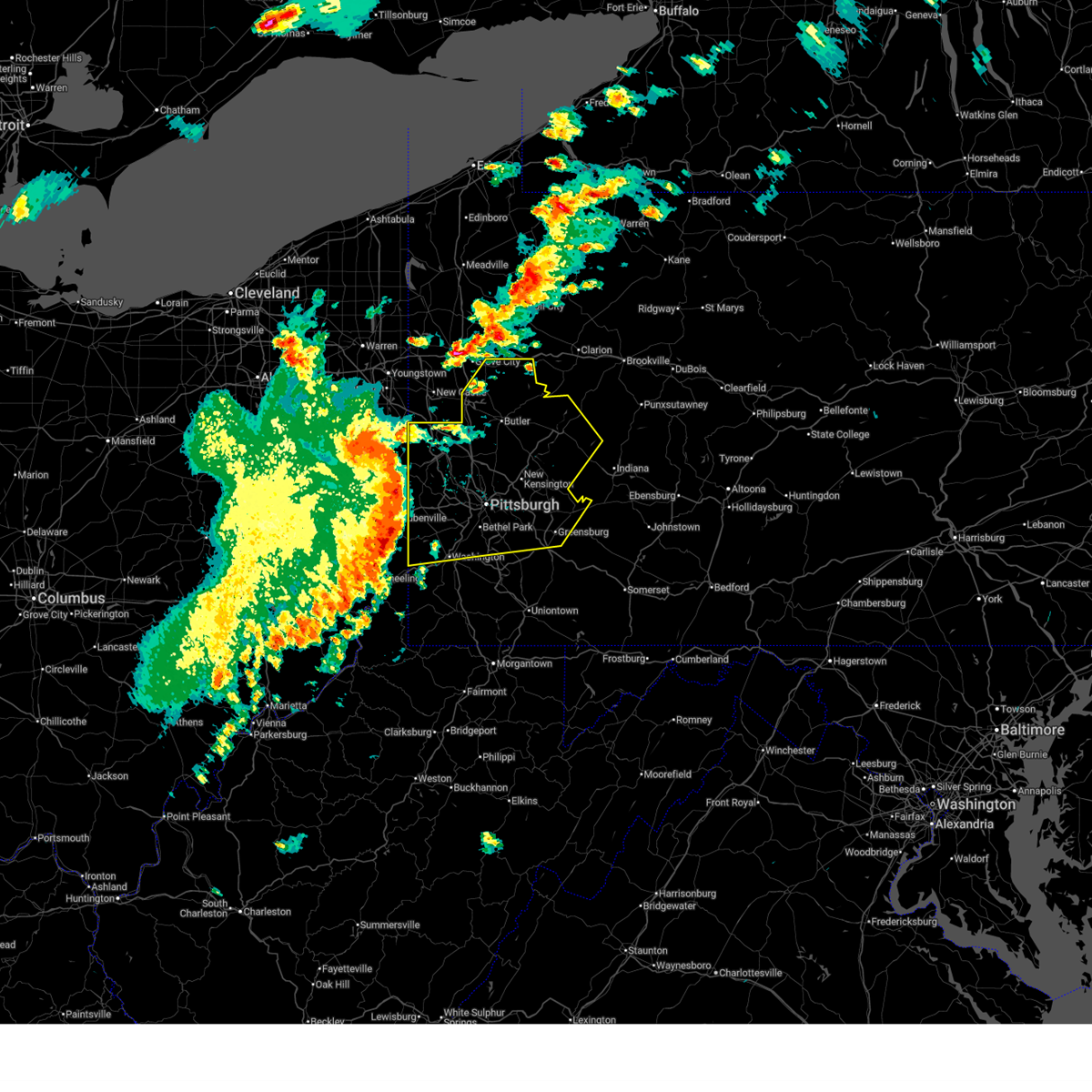 Svrpbz the national weather service in pittsburgh has issued a * severe thunderstorm warning for, eastern columbiana county in east central ohio, beaver county in western pennsylvania, northern washington county in southwestern pennsylvania, southeastern lawrence county in western pennsylvania, butler county in west central pennsylvania, southwestern indiana county in west central pennsylvania, allegheny county in southwestern pennsylvania, northwestern westmoreland county in southwestern pennsylvania, armstrong county in west central pennsylvania, ohio county in northern west virginia, brooke county in northern west virginia, hancock county in northern west virginia, * until 530 pm edt. * at 445 pm edt, severe thunderstorms were located along a line extending from lisbon to near shippingport to near avella to west liberty, moving east at 75 mph. these are destructive storms for southern beaver, northern washington, and allegheny counties (radar indicated). Hazards include 80 mph wind gusts. Extensive tree damage and widespread power outages. mobile homes will be heavily damaged. Expect considerable damage to roofs, windows and vehicles. Svrpbz the national weather service in pittsburgh has issued a * severe thunderstorm warning for, eastern columbiana county in east central ohio, beaver county in western pennsylvania, northern washington county in southwestern pennsylvania, southeastern lawrence county in western pennsylvania, butler county in west central pennsylvania, southwestern indiana county in west central pennsylvania, allegheny county in southwestern pennsylvania, northwestern westmoreland county in southwestern pennsylvania, armstrong county in west central pennsylvania, ohio county in northern west virginia, brooke county in northern west virginia, hancock county in northern west virginia, * until 530 pm edt. * at 445 pm edt, severe thunderstorms were located along a line extending from lisbon to near shippingport to near avella to west liberty, moving east at 75 mph. these are destructive storms for southern beaver, northern washington, and allegheny counties (radar indicated). Hazards include 80 mph wind gusts. Extensive tree damage and widespread power outages. mobile homes will be heavily damaged. Expect considerable damage to roofs, windows and vehicles.
|
| 4/19/2025 6:53 PM EDT |
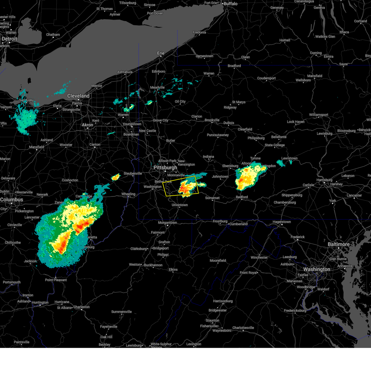 the severe thunderstorm warning has been cancelled and is no longer in effect the severe thunderstorm warning has been cancelled and is no longer in effect
|
| 4/19/2025 6:43 PM EDT |
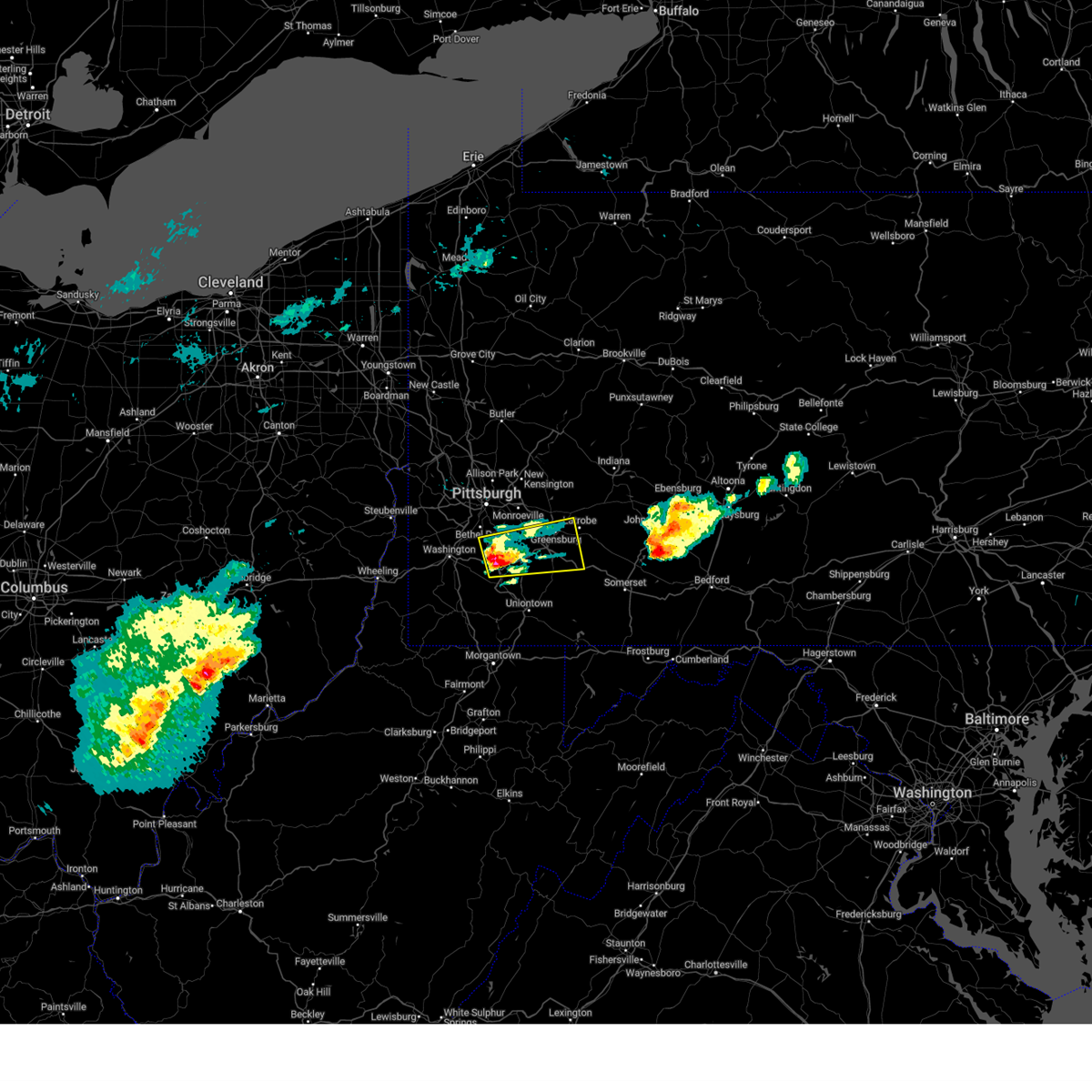 At 643 pm edt, a severe thunderstorm was located over donora, or 10 miles southeast of gastonville, moving east at 60 mph (radar indicated). Hazards include 60 mph wind gusts and quarter size hail. Hail damage to vehicles is expected. expect wind damage to roofs, siding, and trees. Locations impacted include, greensburg, jeannette, gastonville, south park township, jefferson hills, monessen, clairton, california, donora, mount pleasant, scottdale, monongahela, charleroi, irwin, manor, youngwood, west newton, bentleyville, lawson heights and new stanton. At 643 pm edt, a severe thunderstorm was located over donora, or 10 miles southeast of gastonville, moving east at 60 mph (radar indicated). Hazards include 60 mph wind gusts and quarter size hail. Hail damage to vehicles is expected. expect wind damage to roofs, siding, and trees. Locations impacted include, greensburg, jeannette, gastonville, south park township, jefferson hills, monessen, clairton, california, donora, mount pleasant, scottdale, monongahela, charleroi, irwin, manor, youngwood, west newton, bentleyville, lawson heights and new stanton.
|
| 4/19/2025 6:33 PM EDT |
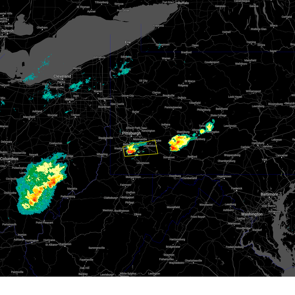 At 633 pm edt, a severe thunderstorm was located near bentleyville, or 7 miles south of gastonville, moving east at 75 mph (radar indicated). Hazards include 60 mph wind gusts and quarter size hail. Hail damage to vehicles is expected. expect wind damage to roofs, siding, and trees. Locations impacted include, greensburg, jeannette, gastonville, south park township, jefferson hills, monessen, clairton, california, donora, mount pleasant, scottdale, monongahela, charleroi, irwin, manor, youngwood, west newton, bentleyville, lawson heights and new stanton. At 633 pm edt, a severe thunderstorm was located near bentleyville, or 7 miles south of gastonville, moving east at 75 mph (radar indicated). Hazards include 60 mph wind gusts and quarter size hail. Hail damage to vehicles is expected. expect wind damage to roofs, siding, and trees. Locations impacted include, greensburg, jeannette, gastonville, south park township, jefferson hills, monessen, clairton, california, donora, mount pleasant, scottdale, monongahela, charleroi, irwin, manor, youngwood, west newton, bentleyville, lawson heights and new stanton.
|
| 4/19/2025 6:22 PM EDT |
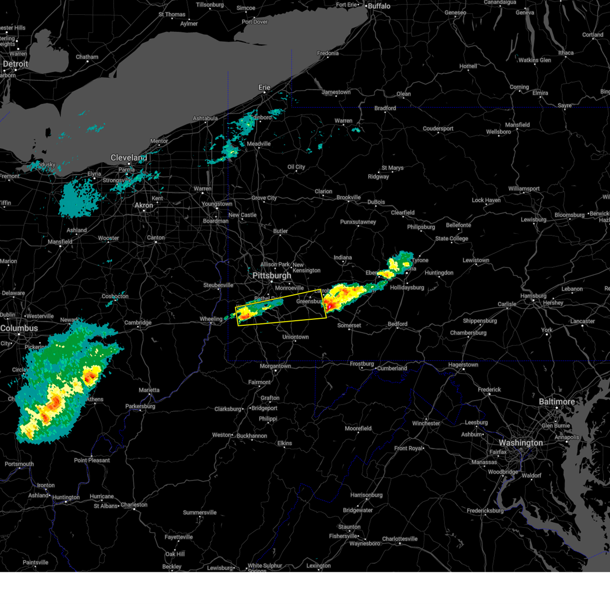 Svrpbz the national weather service in pittsburgh has issued a * severe thunderstorm warning for, southeastern allegheny county in southwestern pennsylvania, northwestern fayette county in southwestern pennsylvania, central washington county in southwestern pennsylvania, southwestern westmoreland county in southwestern pennsylvania, * until 700 pm edt. * at 622 pm edt, a severe thunderstorm was located near washington, moving east at 60 mph (radar indicated). Hazards include 60 mph wind gusts and quarter size hail. Hail damage to vehicles is expected. Expect wind damage to roofs, siding, and trees. Svrpbz the national weather service in pittsburgh has issued a * severe thunderstorm warning for, southeastern allegheny county in southwestern pennsylvania, northwestern fayette county in southwestern pennsylvania, central washington county in southwestern pennsylvania, southwestern westmoreland county in southwestern pennsylvania, * until 700 pm edt. * at 622 pm edt, a severe thunderstorm was located near washington, moving east at 60 mph (radar indicated). Hazards include 60 mph wind gusts and quarter size hail. Hail damage to vehicles is expected. Expect wind damage to roofs, siding, and trees.
|
| 4/19/2025 6:12 PM EDT |
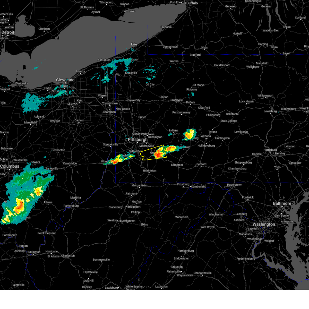 The severe thunderstorm warning that was previously in effect has been reissued for westmoreland county and is in effect until 700 pm edt. please refer to that bulletin for the latest severe weather information. The severe thunderstorm warning that was previously in effect has been reissued for westmoreland county and is in effect until 700 pm edt. please refer to that bulletin for the latest severe weather information.
|
| 4/19/2025 5:57 PM EDT |
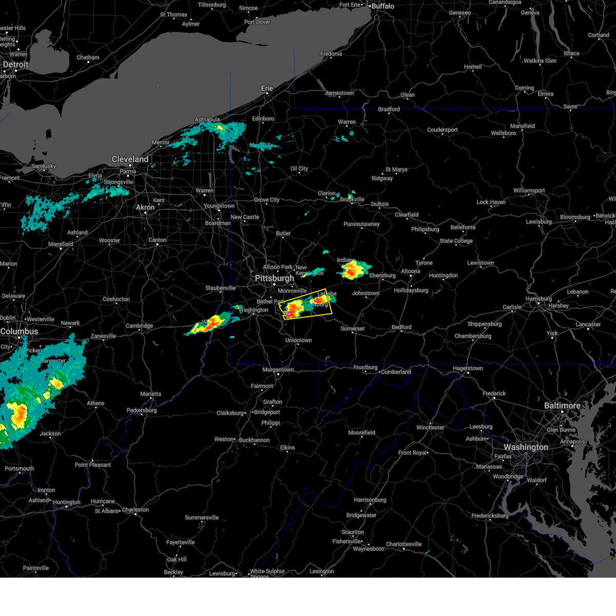 the severe thunderstorm warning has been cancelled and is no longer in effect the severe thunderstorm warning has been cancelled and is no longer in effect
|
| 4/19/2025 5:57 PM EDT |
 At 557 pm edt, a severe thunderstorm was located over west newton, or 9 miles south of mckeesport, moving east at 60 mph (radar indicated). Hazards include 60 mph wind gusts and quarter size hail. Hail damage to vehicles is expected. expect wind damage to roofs, siding, and trees. Locations impacted include, greensburg, jeannette, latrobe, jefferson hills, monessen, clairton, donora, mount pleasant, monongahela, irwin, mcchesneytown-loyalhanna, manor, youngwood, west newton, lawson heights, new stanton, north belle vernon, wickerham manor-fisher, elizabeth and calumet-norvelt. At 557 pm edt, a severe thunderstorm was located over west newton, or 9 miles south of mckeesport, moving east at 60 mph (radar indicated). Hazards include 60 mph wind gusts and quarter size hail. Hail damage to vehicles is expected. expect wind damage to roofs, siding, and trees. Locations impacted include, greensburg, jeannette, latrobe, jefferson hills, monessen, clairton, donora, mount pleasant, monongahela, irwin, mcchesneytown-loyalhanna, manor, youngwood, west newton, lawson heights, new stanton, north belle vernon, wickerham manor-fisher, elizabeth and calumet-norvelt.
|
| 4/19/2025 5:43 PM EDT |
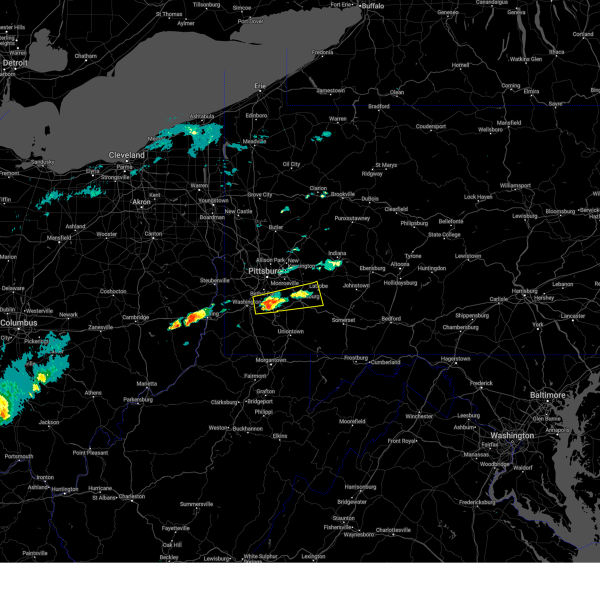 At 543 pm edt, a severe thunderstorm was located near bentleyville, or 6 miles south of gastonville, moving east at 60 mph (radar indicated). Hazards include 60 mph wind gusts and quarter size hail. Hail damage to vehicles is expected. expect wind damage to roofs, siding, and trees. Locations impacted include, mcmurray, greensburg, mckeesport, jeannette, latrobe, gastonville, south park township, jefferson hills, white oak, monessen, clairton, donora, mount pleasant, monongahela, charleroi, irwin, mcchesneytown-loyalhanna, manor, youngwood and west newton. At 543 pm edt, a severe thunderstorm was located near bentleyville, or 6 miles south of gastonville, moving east at 60 mph (radar indicated). Hazards include 60 mph wind gusts and quarter size hail. Hail damage to vehicles is expected. expect wind damage to roofs, siding, and trees. Locations impacted include, mcmurray, greensburg, mckeesport, jeannette, latrobe, gastonville, south park township, jefferson hills, white oak, monessen, clairton, donora, mount pleasant, monongahela, charleroi, irwin, mcchesneytown-loyalhanna, manor, youngwood and west newton.
|
| 4/19/2025 5:36 PM EDT |
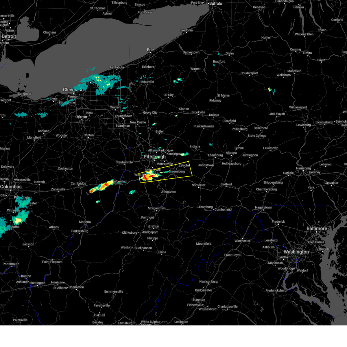 Svrpbz the national weather service in pittsburgh has issued a * severe thunderstorm warning for, southeastern allegheny county in southwestern pennsylvania, central washington county in southwestern pennsylvania, southwestern westmoreland county in southwestern pennsylvania, * until 615 pm edt. * at 536 pm edt, a severe thunderstorm was located near east washington, or near washington, moving east at 65 mph (radar indicated). Hazards include 60 mph wind gusts and quarter size hail. Hail damage to vehicles is expected. Expect wind damage to roofs, siding, and trees. Svrpbz the national weather service in pittsburgh has issued a * severe thunderstorm warning for, southeastern allegheny county in southwestern pennsylvania, central washington county in southwestern pennsylvania, southwestern westmoreland county in southwestern pennsylvania, * until 615 pm edt. * at 536 pm edt, a severe thunderstorm was located near east washington, or near washington, moving east at 65 mph (radar indicated). Hazards include 60 mph wind gusts and quarter size hail. Hail damage to vehicles is expected. Expect wind damage to roofs, siding, and trees.
|
| 4/2/2025 2:51 PM EDT |
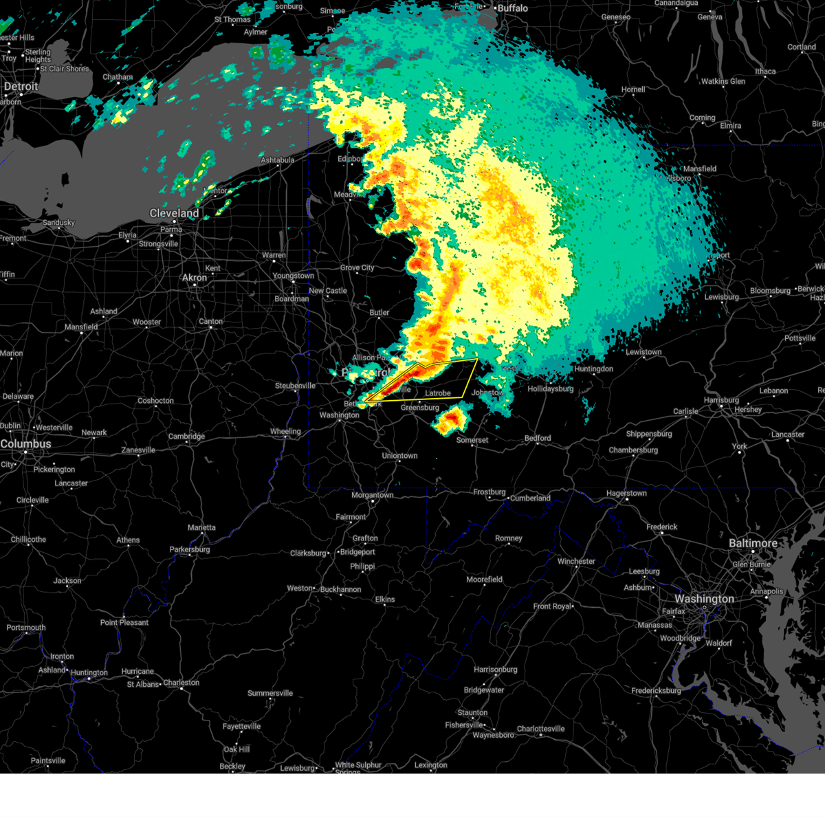 At 251 pm edt, severe thunderstorms were located along a line from 7 miles southeast of apollo to over mckeesport, moving east at 65 mph (public reported). Hazards include quarter size hail. Damage to vehicles is expected. Locations impacted include, pittsburgh, monroeville, greensburg, mckeesport, jeannette, latrobe, homer city, plum, west mifflin, murrysville, south park township, jefferson hills, north versailles, pleasant hills, white oak, clairton, wilkins township, duquesne, turtle creek and north braddock. At 251 pm edt, severe thunderstorms were located along a line from 7 miles southeast of apollo to over mckeesport, moving east at 65 mph (public reported). Hazards include quarter size hail. Damage to vehicles is expected. Locations impacted include, pittsburgh, monroeville, greensburg, mckeesport, jeannette, latrobe, homer city, plum, west mifflin, murrysville, south park township, jefferson hills, north versailles, pleasant hills, white oak, clairton, wilkins township, duquesne, turtle creek and north braddock.
|
| 4/2/2025 2:51 PM EDT |
 the severe thunderstorm warning has been cancelled and is no longer in effect the severe thunderstorm warning has been cancelled and is no longer in effect
|
| 4/2/2025 2:45 PM EDT |
 At 245 pm edt, severe thunderstorms were located along a line from over vandergrift to over wilkins township, or along a line from over vandergrift to near monroeville, moving east at 70 mph (radar indicated). Hazards include quarter size hail. Damage to vehicles is expected. locations impacted include, pittsburgh, penn hills, bethel park, monroeville, greensburg, mckeesport, indiana, jeannette, latrobe, vandergrift, homer city, apollo, plum, west mifflin, baldwin, upper st. Clair, murrysville, wilkinsburg, whitehall and south park township. At 245 pm edt, severe thunderstorms were located along a line from over vandergrift to over wilkins township, or along a line from over vandergrift to near monroeville, moving east at 70 mph (radar indicated). Hazards include quarter size hail. Damage to vehicles is expected. locations impacted include, pittsburgh, penn hills, bethel park, monroeville, greensburg, mckeesport, indiana, jeannette, latrobe, vandergrift, homer city, apollo, plum, west mifflin, baldwin, upper st. Clair, murrysville, wilkinsburg, whitehall and south park township.
|
| 4/2/2025 2:45 PM EDT |
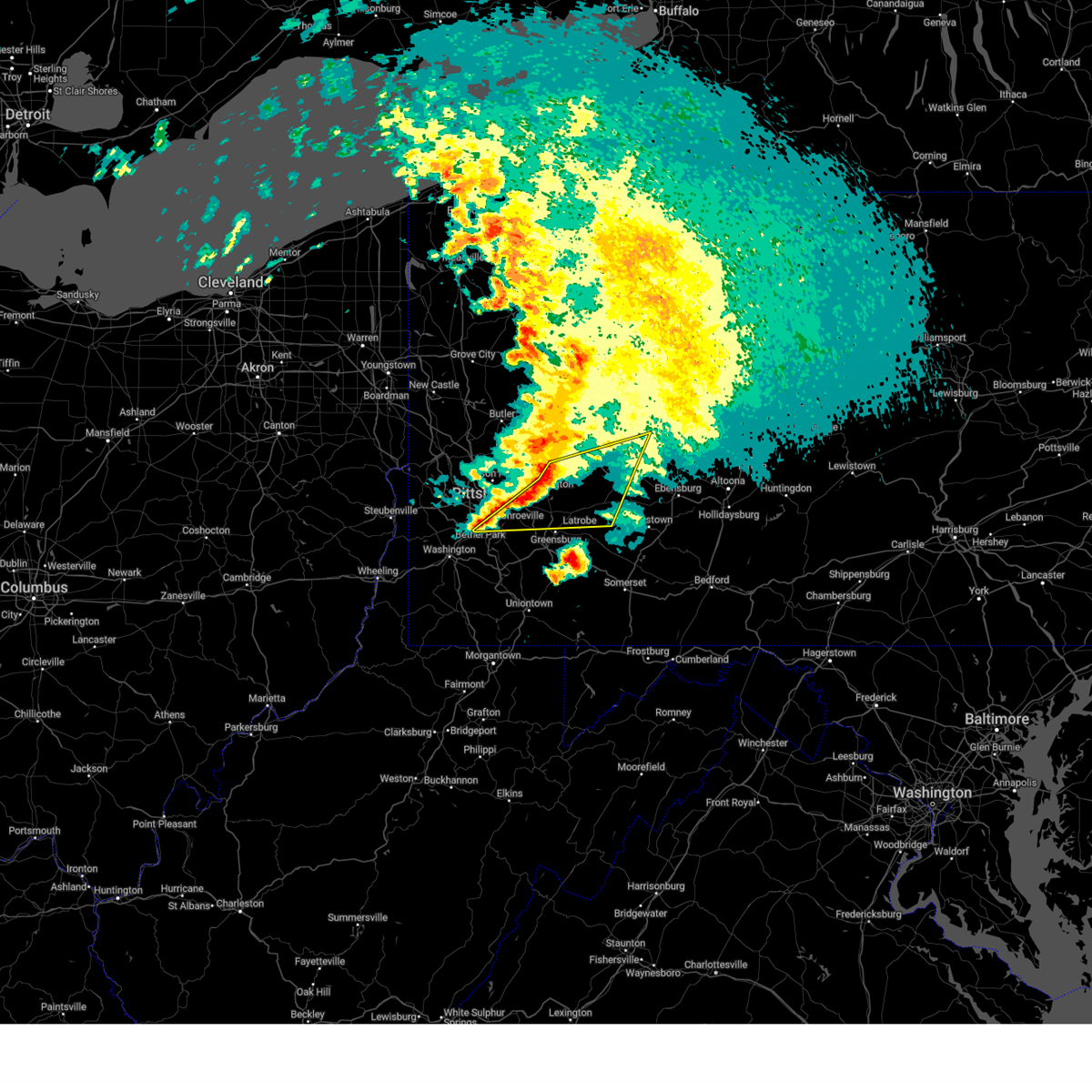 the severe thunderstorm warning has been cancelled and is no longer in effect the severe thunderstorm warning has been cancelled and is no longer in effect
|
| 4/2/2025 2:33 PM EDT |
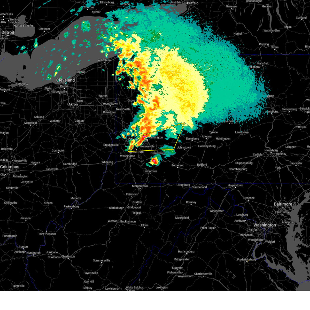 Svrpbz the national weather service in pittsburgh has issued a * severe thunderstorm warning for, eastern allegheny county in southwestern pennsylvania, central washington county in southwestern pennsylvania, central westmoreland county in southwestern pennsylvania, southern armstrong county in west central pennsylvania, central indiana county in west central pennsylvania, * until 315 pm edt. * at 233 pm edt, severe thunderstorms were located along a line from over arnold to over scott township, or along a line from 8 miles north of penn hills to over mount lebanon, moving east at 70 mph (radar indicated). Hazards include half dollar size hail. damage to vehicles is expected Svrpbz the national weather service in pittsburgh has issued a * severe thunderstorm warning for, eastern allegheny county in southwestern pennsylvania, central washington county in southwestern pennsylvania, central westmoreland county in southwestern pennsylvania, southern armstrong county in west central pennsylvania, central indiana county in west central pennsylvania, * until 315 pm edt. * at 233 pm edt, severe thunderstorms were located along a line from over arnold to over scott township, or along a line from 8 miles north of penn hills to over mount lebanon, moving east at 70 mph (radar indicated). Hazards include half dollar size hail. damage to vehicles is expected
|
| 3/16/2025 12:56 PM EDT |
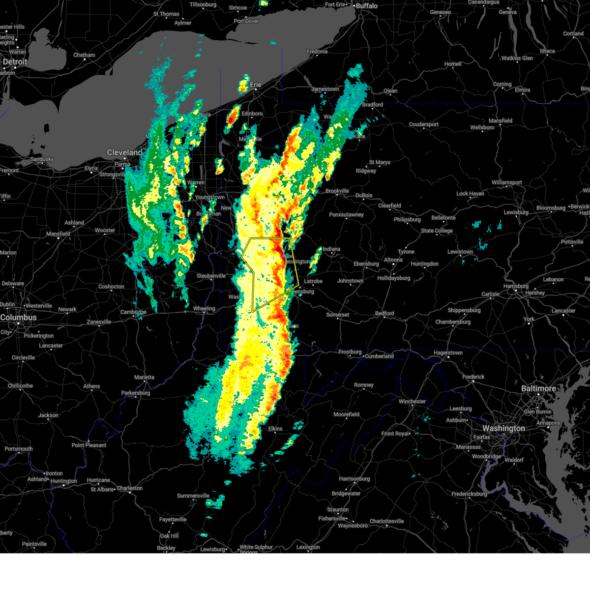 The severe thunderstorm warning that was previously in effect has been reissued for allegheny, butler, armstrong, and westmoreland counties. please refer to those bulletins for the latest severe weather information. to report severe weather, contact your nearest law enforcement agency. they will send your report to the national weather service office. The severe thunderstorm warning that was previously in effect has been reissued for allegheny, butler, armstrong, and westmoreland counties. please refer to those bulletins for the latest severe weather information. to report severe weather, contact your nearest law enforcement agency. they will send your report to the national weather service office.
|
| 3/16/2025 12:43 PM EDT |
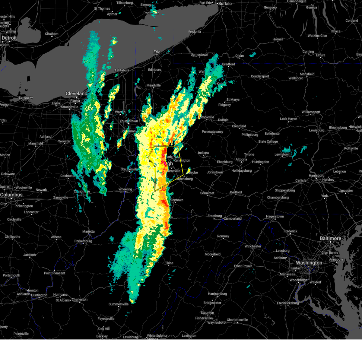 At 1243 pm edt, a severe thunderstorm was located over pittsburgh, moving northeast at 45 mph (radar indicated). Hazards include 70 mph wind gusts and small hail. Expect considerable tree damage. damage is likely to mobile homes, roofs, and outbuildings. Locations impacted include, pittsburgh, penn hills, mount lebanon, bethel park, ross township, mccandless township, monroeville, cranberry, moon township, mcmurray, mckeesport, franklin park, jeannette, aliquippa, gastonville, shaler township, plum, west mifflin, north side pittsburgh and baldwin. At 1243 pm edt, a severe thunderstorm was located over pittsburgh, moving northeast at 45 mph (radar indicated). Hazards include 70 mph wind gusts and small hail. Expect considerable tree damage. damage is likely to mobile homes, roofs, and outbuildings. Locations impacted include, pittsburgh, penn hills, mount lebanon, bethel park, ross township, mccandless township, monroeville, cranberry, moon township, mcmurray, mckeesport, franklin park, jeannette, aliquippa, gastonville, shaler township, plum, west mifflin, north side pittsburgh and baldwin.
|
| 3/16/2025 12:34 PM EDT |
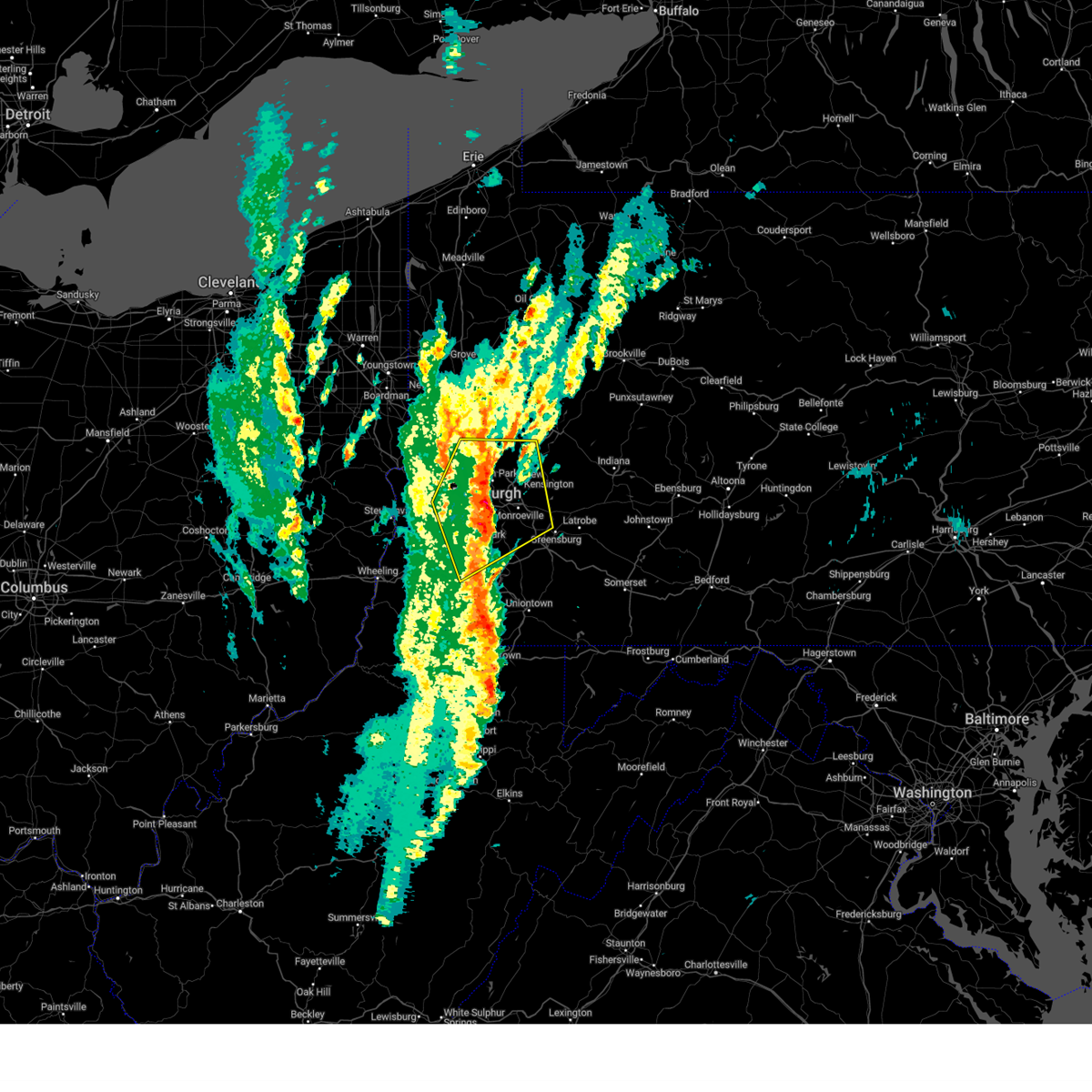 At 1234 pm edt, a severe thunderstorm was located over mount lebanon, moving northeast at 45 mph (radar indicated). Hazards include 70 mph wind gusts and small hail. Expect considerable tree damage. damage is likely to mobile homes, roofs, and outbuildings. Locations impacted include, pittsburgh, penn hills, mount lebanon, bethel park, ross township, mccandless township, monroeville, cranberry, moon township, mcmurray, mckeesport, washington, franklin park, jeannette, aliquippa, canonsburg, gastonville, shaler township, plum and west mifflin. At 1234 pm edt, a severe thunderstorm was located over mount lebanon, moving northeast at 45 mph (radar indicated). Hazards include 70 mph wind gusts and small hail. Expect considerable tree damage. damage is likely to mobile homes, roofs, and outbuildings. Locations impacted include, pittsburgh, penn hills, mount lebanon, bethel park, ross township, mccandless township, monroeville, cranberry, moon township, mcmurray, mckeesport, washington, franklin park, jeannette, aliquippa, canonsburg, gastonville, shaler township, plum and west mifflin.
|
| 3/16/2025 12:34 PM EDT |
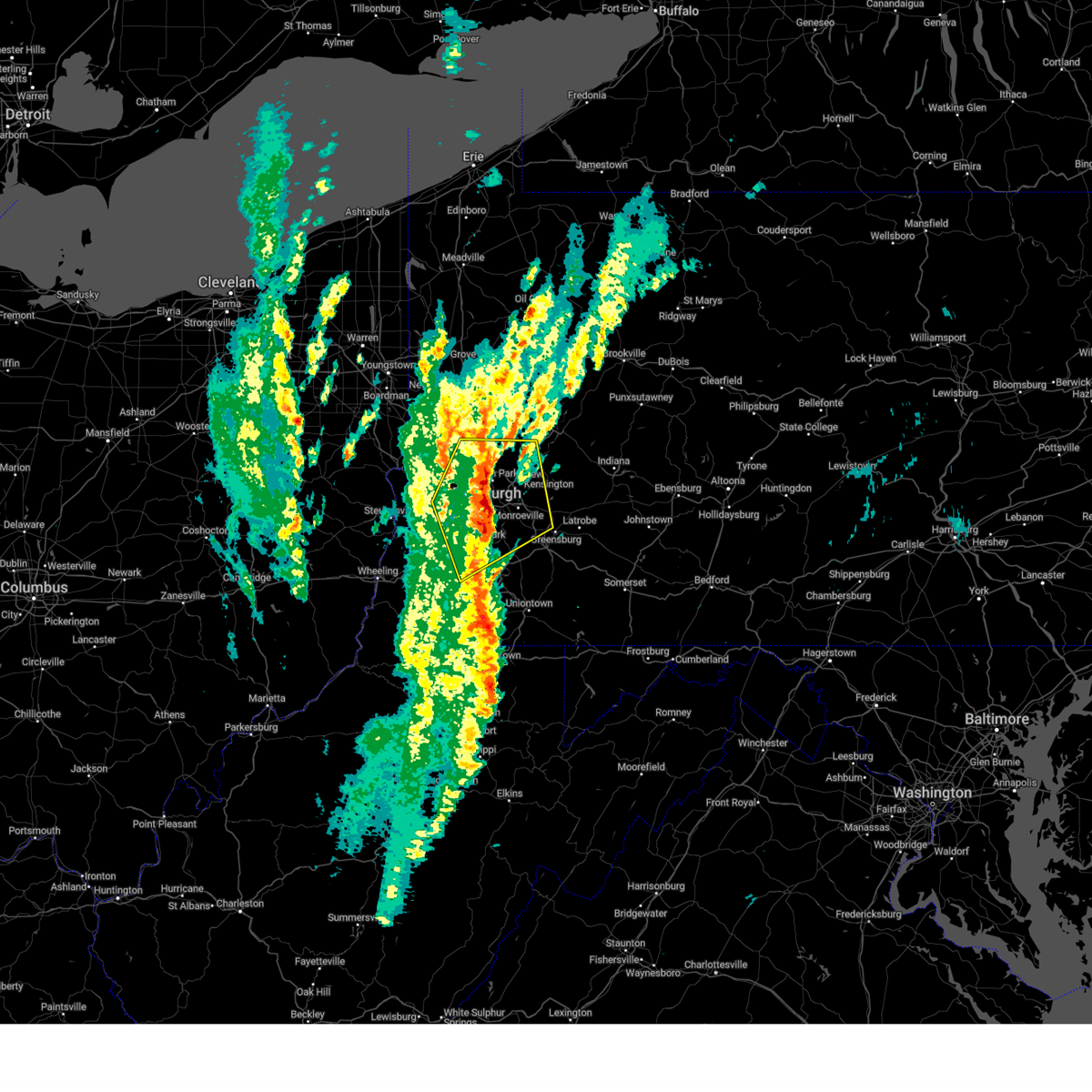 the severe thunderstorm warning has been cancelled and is no longer in effect the severe thunderstorm warning has been cancelled and is no longer in effect
|
| 3/16/2025 12:16 PM EDT |
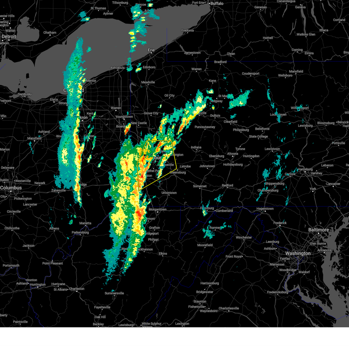 Svrpbz the national weather service in pittsburgh has issued a * severe thunderstorm warning for, allegheny county in southwestern pennsylvania, north central greene county in southwestern pennsylvania, central washington county in southwestern pennsylvania, northwestern westmoreland county in southwestern pennsylvania, southwestern armstrong county in west central pennsylvania, southern butler county in west central pennsylvania, southeastern beaver county in western pennsylvania, * until 100 pm edt. * at 1216 pm edt, a severe thunderstorm was located over mcgovern, or over canonsburg, moving northeast at 45 mph (radar indicated). Hazards include 60 mph wind gusts. expect damage to roofs, siding, and trees Svrpbz the national weather service in pittsburgh has issued a * severe thunderstorm warning for, allegheny county in southwestern pennsylvania, north central greene county in southwestern pennsylvania, central washington county in southwestern pennsylvania, northwestern westmoreland county in southwestern pennsylvania, southwestern armstrong county in west central pennsylvania, southern butler county in west central pennsylvania, southeastern beaver county in western pennsylvania, * until 100 pm edt. * at 1216 pm edt, a severe thunderstorm was located over mcgovern, or over canonsburg, moving northeast at 45 mph (radar indicated). Hazards include 60 mph wind gusts. expect damage to roofs, siding, and trees
|
| 11/20/2024 5:11 PM EST |
 Portions of the warning have been replaced with a new warning. gusty winds are still possible with these thunderstorms. Portions of the warning have been replaced with a new warning. gusty winds are still possible with these thunderstorms.
|
| 11/20/2024 5:10 PM EST |
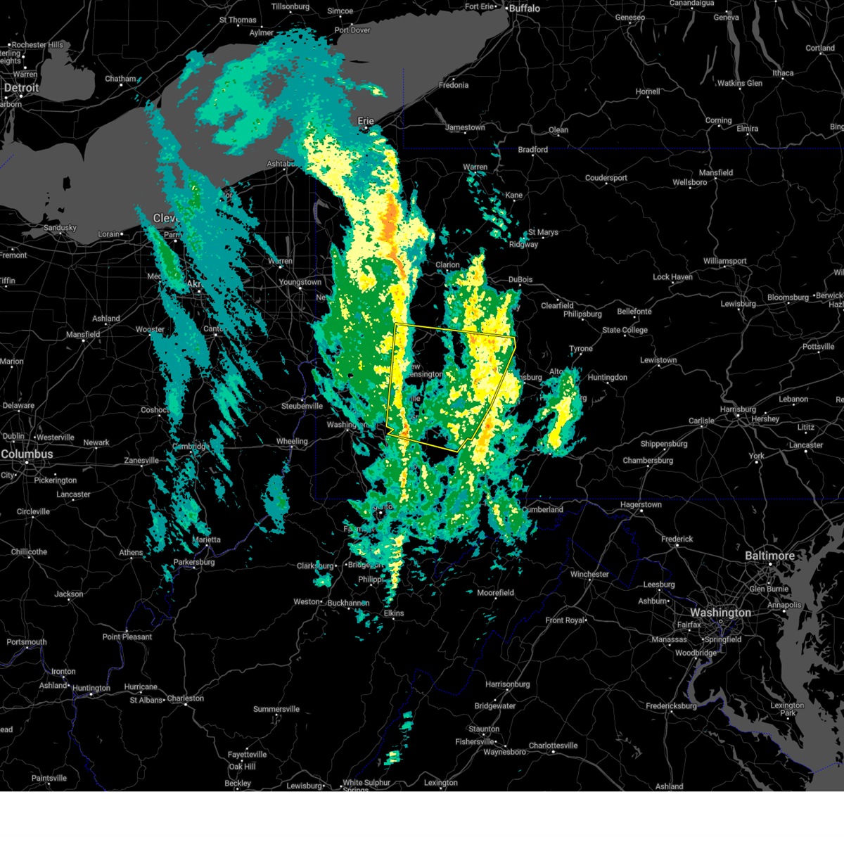 Svrpbz the national weather service in pittsburgh has issued a * severe thunderstorm warning for, eastern allegheny county in southwestern pennsylvania, northeastern fayette county in southwestern pennsylvania, westmoreland county in southwestern pennsylvania, southern armstrong county in west central pennsylvania, southeastern butler county in west central pennsylvania, indiana county in west central pennsylvania, * until 615 pm est. * at 510 pm est, severe thunderstorms were located along a line from 10 miles north of sarver to near perryopolis, or along a line from 8 miles east of butler to 10 miles northwest of connellsville, moving east at 40 mph (radar indicated). Hazards include 60 mph wind gusts. expect damage to roofs, siding, and trees Svrpbz the national weather service in pittsburgh has issued a * severe thunderstorm warning for, eastern allegheny county in southwestern pennsylvania, northeastern fayette county in southwestern pennsylvania, westmoreland county in southwestern pennsylvania, southern armstrong county in west central pennsylvania, southeastern butler county in west central pennsylvania, indiana county in west central pennsylvania, * until 615 pm est. * at 510 pm est, severe thunderstorms were located along a line from 10 miles north of sarver to near perryopolis, or along a line from 8 miles east of butler to 10 miles northwest of connellsville, moving east at 40 mph (radar indicated). Hazards include 60 mph wind gusts. expect damage to roofs, siding, and trees
|
| 11/20/2024 4:59 PM EST |
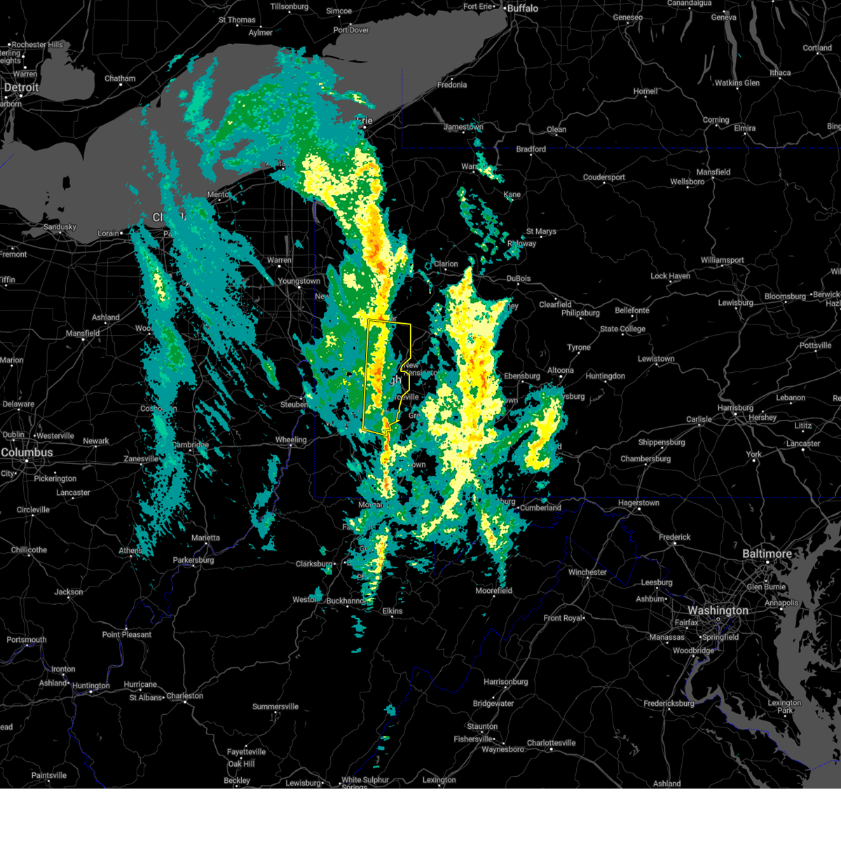 the severe thunderstorm warning has been cancelled and is no longer in effect the severe thunderstorm warning has been cancelled and is no longer in effect
|
| 11/20/2024 4:59 PM EST |
 At 459 pm est, severe thunderstorms were located along a line from 5 miles southeast of oak hills to over gastonville, or along a line from 7 miles south of butler to over gastonville, moving east at 35 mph (measured wind gust). Hazards include 60 mph wind gusts. Expect damage to roofs, siding, and trees. locations impacted include, pittsburgh, penn hills, mount lebanon, bethel park, ross township, mccandless township, monroeville, mcmurray, mckeesport, butler, franklin park, gastonville, shaler township, plum, west mifflin, north side pittsburgh, baldwin, upper st. Clair, murrysville and hampton township. At 459 pm est, severe thunderstorms were located along a line from 5 miles southeast of oak hills to over gastonville, or along a line from 7 miles south of butler to over gastonville, moving east at 35 mph (measured wind gust). Hazards include 60 mph wind gusts. Expect damage to roofs, siding, and trees. locations impacted include, pittsburgh, penn hills, mount lebanon, bethel park, ross township, mccandless township, monroeville, mcmurray, mckeesport, butler, franklin park, gastonville, shaler township, plum, west mifflin, north side pittsburgh, baldwin, upper st. Clair, murrysville and hampton township.
|
| 11/20/2024 4:55 PM EST | Two power poles down near the old high schoo in allegheny county PA, 2.3 miles ENE of Clairton, PA |
| 11/20/2024 4:43 PM EST |
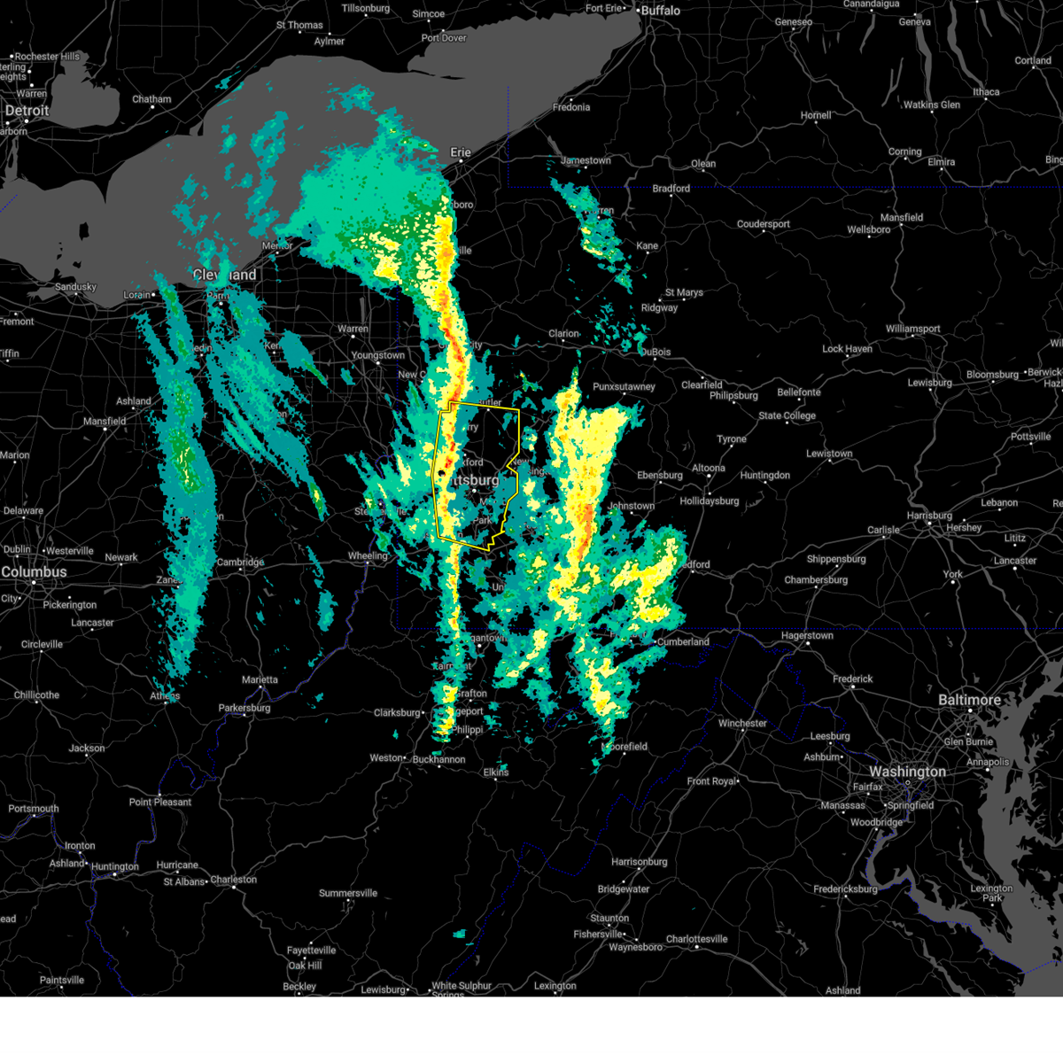 At 443 pm est, severe thunderstorms were located along a line from over evans city to over canonsburg, or along a line from 7 miles northeast of cranberry to over mcmurray, moving east at 35 mph (radar indicated). Hazards include 60 mph wind gusts. Expect damage to roofs, siding, and trees. Locations impacted include, pittsburgh, penn hills, mount lebanon, bethel park, ross township, mccandless township, monroeville, cranberry, moon township, mcmurray, mckeesport, butler, franklin park, aliquippa, canonsburg, gastonville, shaler township, plum, west mifflin and north side pittsburgh. At 443 pm est, severe thunderstorms were located along a line from over evans city to over canonsburg, or along a line from 7 miles northeast of cranberry to over mcmurray, moving east at 35 mph (radar indicated). Hazards include 60 mph wind gusts. Expect damage to roofs, siding, and trees. Locations impacted include, pittsburgh, penn hills, mount lebanon, bethel park, ross township, mccandless township, monroeville, cranberry, moon township, mcmurray, mckeesport, butler, franklin park, aliquippa, canonsburg, gastonville, shaler township, plum, west mifflin and north side pittsburgh.
|
| 11/20/2024 4:24 PM EST |
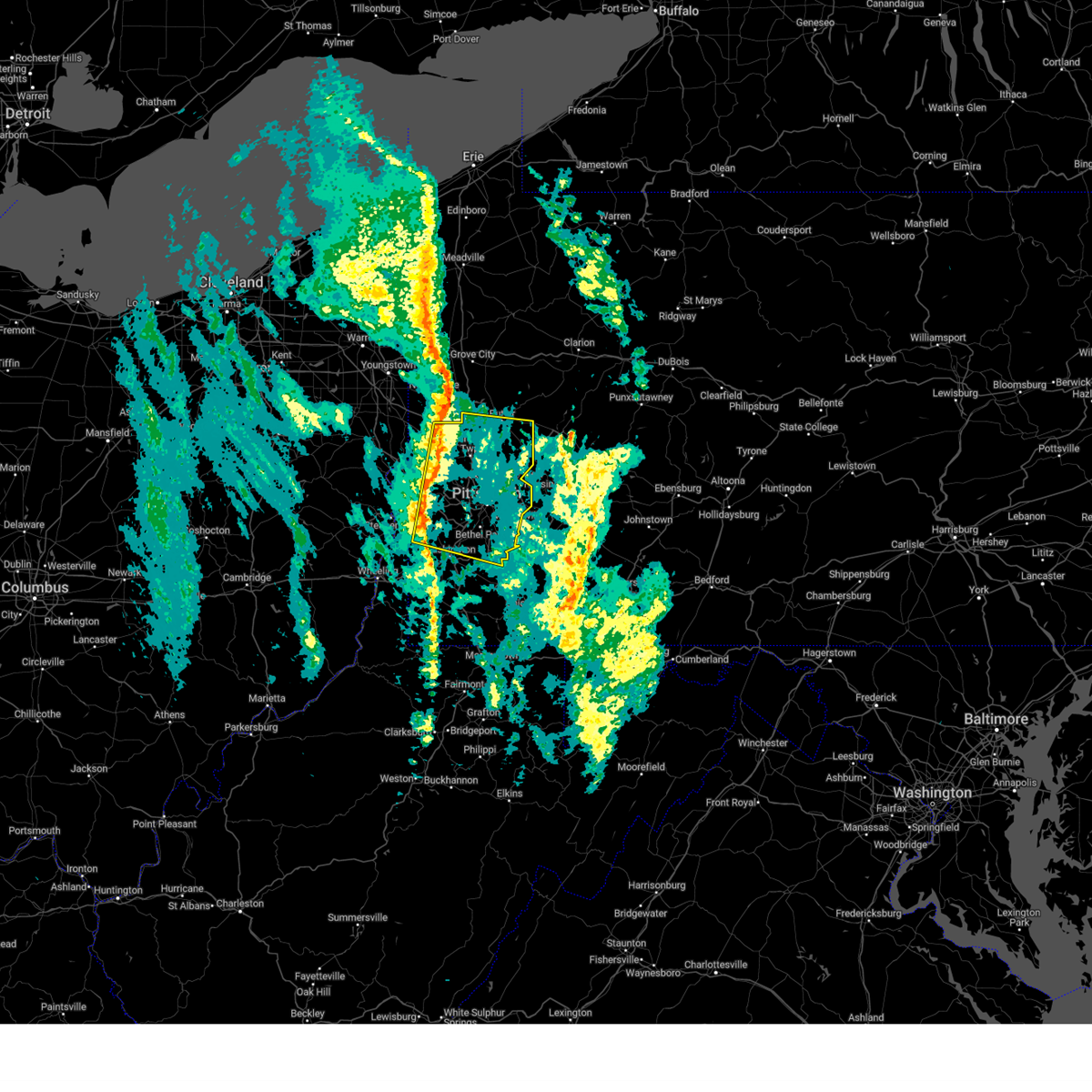 Svrpbz the national weather service in pittsburgh has issued a * severe thunderstorm warning for, allegheny county in southwestern pennsylvania, central washington county in southwestern pennsylvania, southern butler county in west central pennsylvania, beaver county in western pennsylvania, * until 515 pm est. * at 424 pm est, severe thunderstorms were located along a line from near ellwood city to 8 miles north of wolfdale, or along a line from 6 miles northeast of beaver falls to 7 miles east of avella, moving east at 35 mph (radar indicated). Hazards include 60 mph wind gusts. expect damage to roofs, siding, and trees Svrpbz the national weather service in pittsburgh has issued a * severe thunderstorm warning for, allegheny county in southwestern pennsylvania, central washington county in southwestern pennsylvania, southern butler county in west central pennsylvania, beaver county in western pennsylvania, * until 515 pm est. * at 424 pm est, severe thunderstorms were located along a line from near ellwood city to 8 miles north of wolfdale, or along a line from 6 miles northeast of beaver falls to 7 miles east of avella, moving east at 35 mph (radar indicated). Hazards include 60 mph wind gusts. expect damage to roofs, siding, and trees
|
| 8/29/2024 4:37 PM EDT |
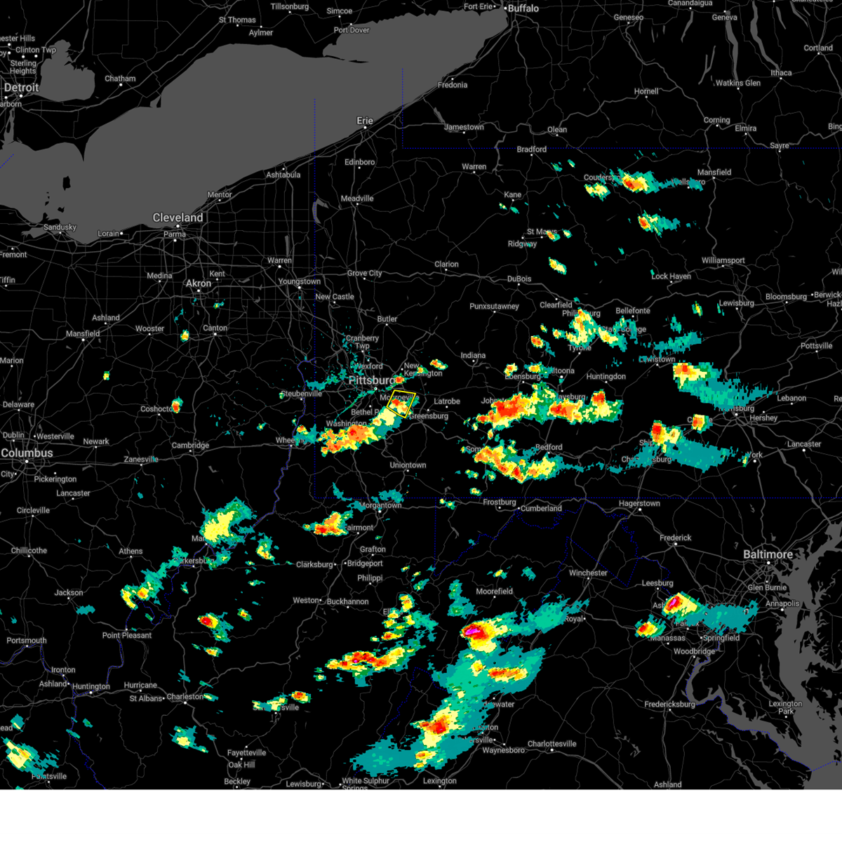 At 437 pm edt, a severe thunderstorm was located over white oak, or near mckeesport, moving southeast at 5 mph (radar indicated). Hazards include 60 mph wind gusts. Expect damage to roofs, siding, and trees. Locations impacted include, monroeville, mckeesport, west mifflin, murrysville, north versailles, white oak, clairton, forest hills, wilkins township, duquesne, turtle creek, north braddock, glassport, irwin, pitcairn, manor, trafford, churchill, liberty and wilmerding. At 437 pm edt, a severe thunderstorm was located over white oak, or near mckeesport, moving southeast at 5 mph (radar indicated). Hazards include 60 mph wind gusts. Expect damage to roofs, siding, and trees. Locations impacted include, monroeville, mckeesport, west mifflin, murrysville, north versailles, white oak, clairton, forest hills, wilkins township, duquesne, turtle creek, north braddock, glassport, irwin, pitcairn, manor, trafford, churchill, liberty and wilmerding.
|
| 8/29/2024 4:22 PM EDT |
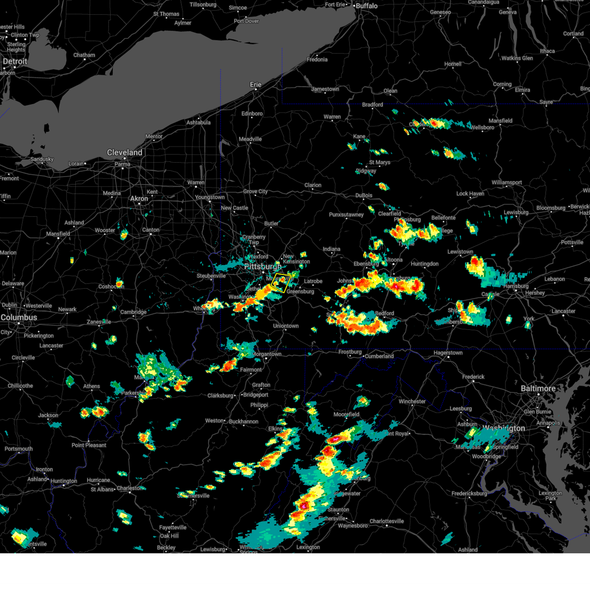 Svrpbz the national weather service in pittsburgh has issued a * severe thunderstorm warning for, southeastern allegheny county in southwestern pennsylvania, west central westmoreland county in southwestern pennsylvania, * until 500 pm edt. * at 422 pm edt, a severe thunderstorm was located over white oak, or over mckeesport, moving southeast at 5 mph (radar indicated). Hazards include 60 mph wind gusts. expect damage to roofs, siding, and trees Svrpbz the national weather service in pittsburgh has issued a * severe thunderstorm warning for, southeastern allegheny county in southwestern pennsylvania, west central westmoreland county in southwestern pennsylvania, * until 500 pm edt. * at 422 pm edt, a severe thunderstorm was located over white oak, or over mckeesport, moving southeast at 5 mph (radar indicated). Hazards include 60 mph wind gusts. expect damage to roofs, siding, and trees
|
| 8/29/2024 4:17 PM EDT |
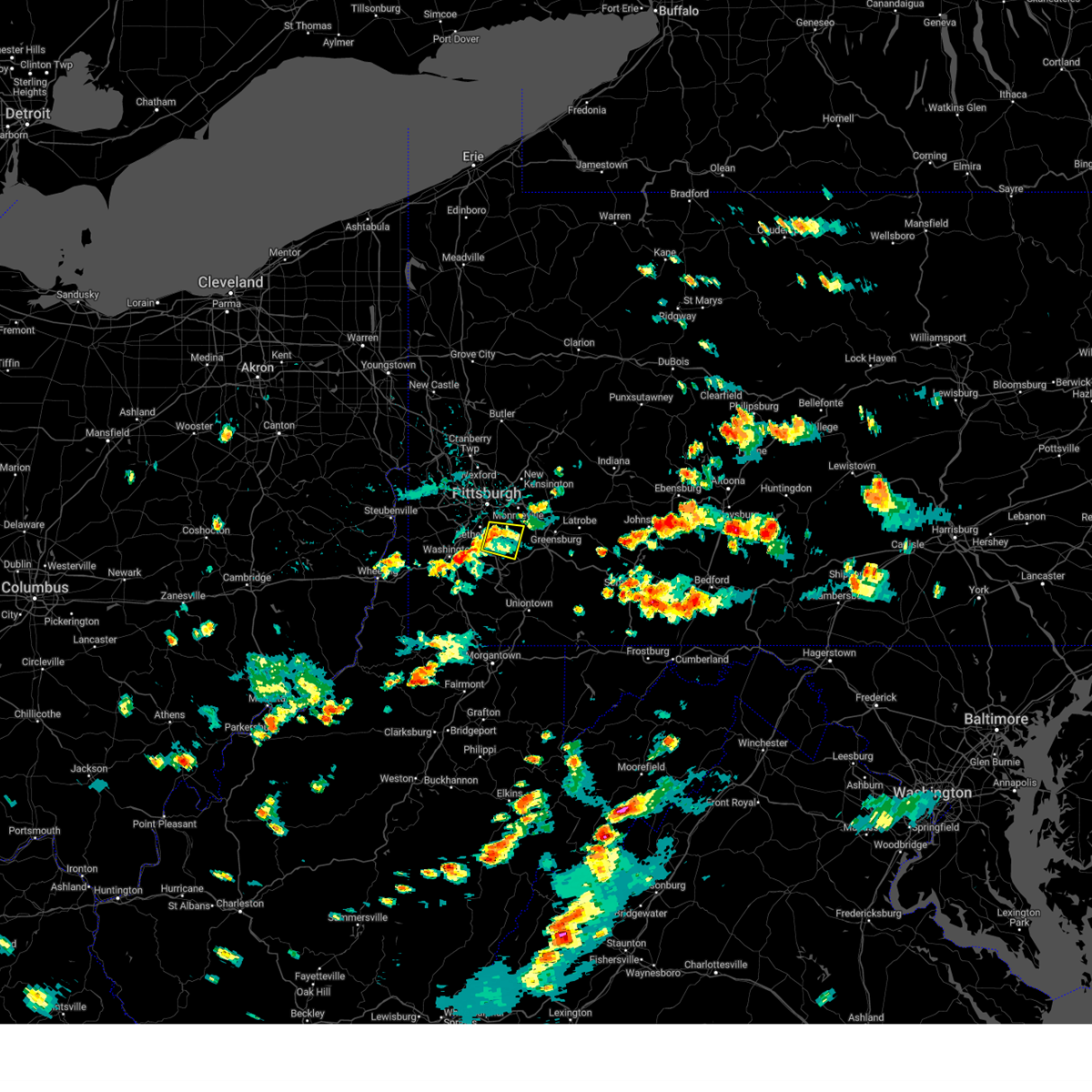 The storm which prompted the warning has weakened below severe limits, and no longer poses an immediate threat to life or property. therefore, the warning has been allowed to expire. however, gusty winds are still possible with this thunderstorm. The storm which prompted the warning has weakened below severe limits, and no longer poses an immediate threat to life or property. therefore, the warning has been allowed to expire. however, gusty winds are still possible with this thunderstorm.
|
| 8/29/2024 3:44 PM EDT |
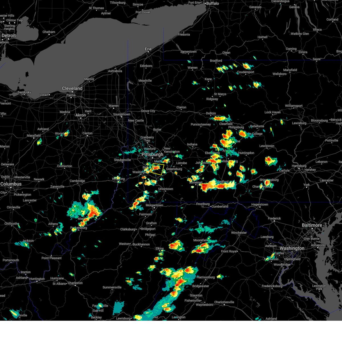 At 344 pm edt, a severe thunderstorm was located over clairton, or near mckeesport, moving east at 10 mph (radar indicated). Hazards include 60 mph wind gusts. Expect damage to roofs, siding, and trees. Locations impacted include, mckeesport, gastonville, west mifflin, baldwin, whitehall, south park township, jefferson hills, pleasant hills, white oak, clairton, donora, glassport, monongahela, liberty, port vue, new eagle, dravosburg, wickerham manor-fisher, baidland and versailles. At 344 pm edt, a severe thunderstorm was located over clairton, or near mckeesport, moving east at 10 mph (radar indicated). Hazards include 60 mph wind gusts. Expect damage to roofs, siding, and trees. Locations impacted include, mckeesport, gastonville, west mifflin, baldwin, whitehall, south park township, jefferson hills, pleasant hills, white oak, clairton, donora, glassport, monongahela, liberty, port vue, new eagle, dravosburg, wickerham manor-fisher, baidland and versailles.
|
| 8/29/2024 3:35 PM EDT | Tree down on wray large road and state route 5 in allegheny county PA, 1.6 miles E of Clairton, PA |
| 8/29/2024 3:35 PM EDT | Tree down on chamberlin roa in allegheny county PA, 3.2 miles E of Clairton, PA |
| 8/29/2024 3:33 PM EDT | Wires down on gill hall road in allegheny county PA, 3.8 miles ENE of Clairton, PA |
| 8/29/2024 3:26 PM EDT |
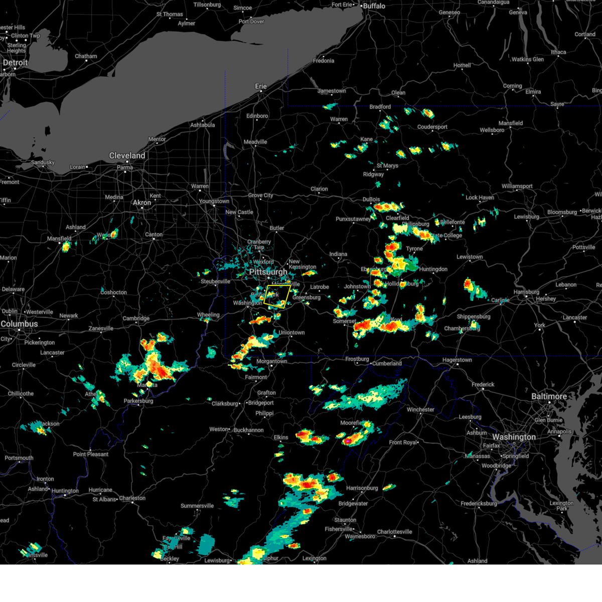 Svrpbz the national weather service in pittsburgh has issued a * severe thunderstorm warning for, southeastern allegheny county in southwestern pennsylvania, east central washington county in southwestern pennsylvania, west central westmoreland county in southwestern pennsylvania, * until 415 pm edt. * at 326 pm edt, a severe thunderstorm was located over jefferson hills, or near gastonville, moving east at 10 mph (radar indicated). Hazards include 60 mph wind gusts. expect damage to roofs, siding, and trees Svrpbz the national weather service in pittsburgh has issued a * severe thunderstorm warning for, southeastern allegheny county in southwestern pennsylvania, east central washington county in southwestern pennsylvania, west central westmoreland county in southwestern pennsylvania, * until 415 pm edt. * at 326 pm edt, a severe thunderstorm was located over jefferson hills, or near gastonville, moving east at 10 mph (radar indicated). Hazards include 60 mph wind gusts. expect damage to roofs, siding, and trees
|
| 8/17/2024 4:29 PM EDT |
 At 429 pm edt, a severe thunderstorm was located over murrysville, or near monroeville, moving east at 40 mph (radar indicated). Hazards include 60 mph wind gusts and quarter size hail. Hail damage to vehicles is expected. expect wind damage to roofs, siding, and trees. Locations impacted include, pittsburgh, penn hills, monroeville, greensburg, mckeesport, jeannette, latrobe, vandergrift, kittanning, apollo, plum, west mifflin, murrysville, wilkinsburg, new kensington, lower burrell, munhall, harrison township, north versailles and swissvale. At 429 pm edt, a severe thunderstorm was located over murrysville, or near monroeville, moving east at 40 mph (radar indicated). Hazards include 60 mph wind gusts and quarter size hail. Hail damage to vehicles is expected. expect wind damage to roofs, siding, and trees. Locations impacted include, pittsburgh, penn hills, monroeville, greensburg, mckeesport, jeannette, latrobe, vandergrift, kittanning, apollo, plum, west mifflin, murrysville, wilkinsburg, new kensington, lower burrell, munhall, harrison township, north versailles and swissvale.
|
| 8/17/2024 4:19 PM EDT |
 Svrpbz the national weather service in pittsburgh has issued a * severe thunderstorm warning for, eastern allegheny county in southwestern pennsylvania, central westmoreland county in southwestern pennsylvania, southern armstrong county in west central pennsylvania, southeastern butler county in west central pennsylvania, southwestern indiana county in west central pennsylvania, * until 500 pm edt. * at 419 pm edt, a severe thunderstorm was located over wilkins township, or over monroeville, moving east at 40 mph (radar indicated). Hazards include 60 mph wind gusts and quarter size hail. Hail damage to vehicles is expected. Expect wind damage to roofs, siding, and trees. Svrpbz the national weather service in pittsburgh has issued a * severe thunderstorm warning for, eastern allegheny county in southwestern pennsylvania, central westmoreland county in southwestern pennsylvania, southern armstrong county in west central pennsylvania, southeastern butler county in west central pennsylvania, southwestern indiana county in west central pennsylvania, * until 500 pm edt. * at 419 pm edt, a severe thunderstorm was located over wilkins township, or over monroeville, moving east at 40 mph (radar indicated). Hazards include 60 mph wind gusts and quarter size hail. Hail damage to vehicles is expected. Expect wind damage to roofs, siding, and trees.
|
| 8/6/2024 7:43 PM EDT |
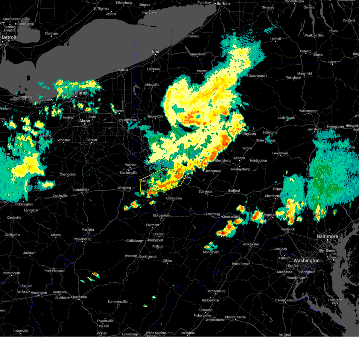 The storms which prompted the warning have moved out of the area. therefore, the warning will be allowed to expire. to report severe weather, contact your nearest law enforcement agency. they will relay your report to the national weather service pittsburgh. remember, a severe thunderstorm warning still remains in effect for washington, fayette, and westmoreland counties until 8:30 pm edt. The storms which prompted the warning have moved out of the area. therefore, the warning will be allowed to expire. to report severe weather, contact your nearest law enforcement agency. they will relay your report to the national weather service pittsburgh. remember, a severe thunderstorm warning still remains in effect for washington, fayette, and westmoreland counties until 8:30 pm edt.
|
| 8/6/2024 7:32 PM EDT |
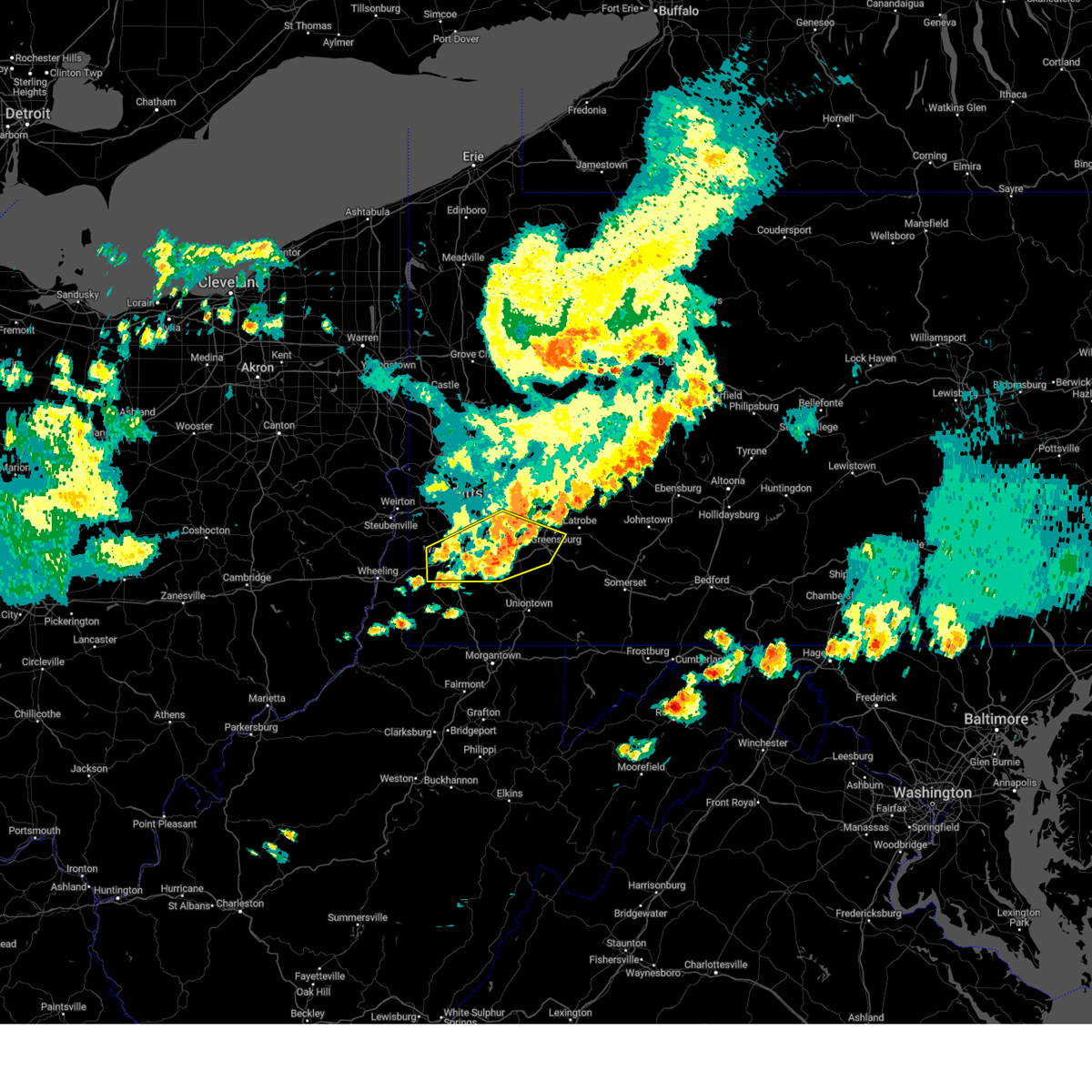 At 732 pm edt, severe thunderstorms were located along a line extending from jeannette to west newton to near east washington, moving east at 50 mph (law enforcement reported wind damage in washington). Hazards include 60 mph wind gusts. Expect damage to trees and power lines, resulting in some power outages. locations impacted include, pittsburgh, bethel park, mcmurray, greensburg, mckeesport, washington, jeannette, canonsburg, gastonville, west mifflin, baldwin, upper st. Clair, whitehall, south park township, munhall, jefferson hills, north versailles, brentwood, castle shannon, and pleasant hills. At 732 pm edt, severe thunderstorms were located along a line extending from jeannette to west newton to near east washington, moving east at 50 mph (law enforcement reported wind damage in washington). Hazards include 60 mph wind gusts. Expect damage to trees and power lines, resulting in some power outages. locations impacted include, pittsburgh, bethel park, mcmurray, greensburg, mckeesport, washington, jeannette, canonsburg, gastonville, west mifflin, baldwin, upper st. Clair, whitehall, south park township, munhall, jefferson hills, north versailles, brentwood, castle shannon, and pleasant hills.
|
| 8/6/2024 7:21 PM EDT |
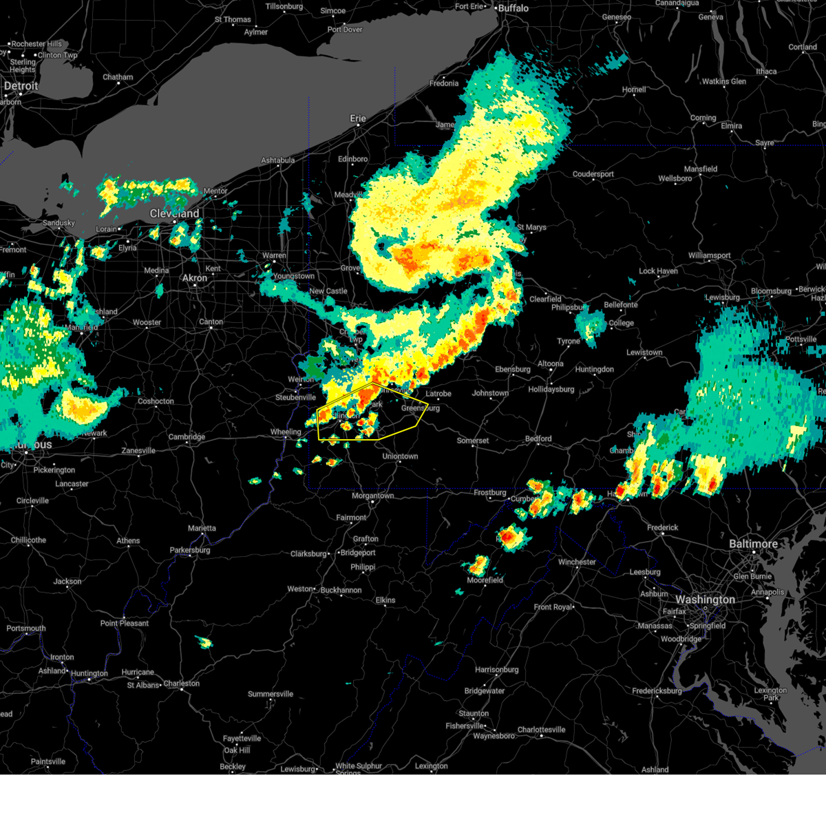 the severe thunderstorm warning has been cancelled and is no longer in effect the severe thunderstorm warning has been cancelled and is no longer in effect
|
| 8/6/2024 7:21 PM EDT |
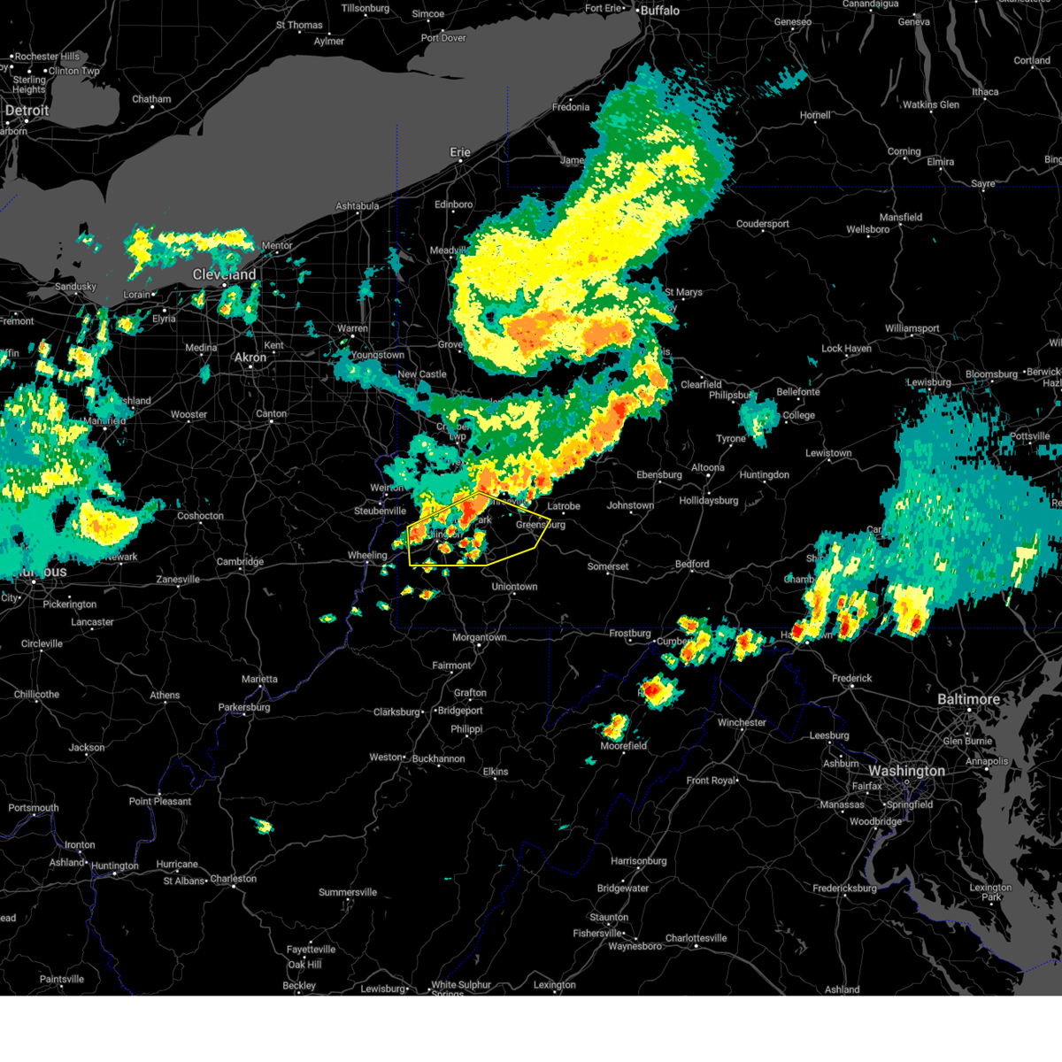 At 721 pm edt, severe thunderstorms were located along a line extending from white oak to near jefferson hills to wolfdale, moving east at 50 mph (radar indicated). Hazards include 60 mph wind gusts. Expect damage to trees and power lines, resulting in some power outages. locations impacted include, pittsburgh, mount lebanon, bethel park, mcmurray, greensburg, mckeesport, washington, jeannette, canonsburg, gastonville, west mifflin, baldwin, upper st. Clair, scott township, whitehall, south park township, munhall, cecil-bishop, jefferson hills, and north versailles. At 721 pm edt, severe thunderstorms were located along a line extending from white oak to near jefferson hills to wolfdale, moving east at 50 mph (radar indicated). Hazards include 60 mph wind gusts. Expect damage to trees and power lines, resulting in some power outages. locations impacted include, pittsburgh, mount lebanon, bethel park, mcmurray, greensburg, mckeesport, washington, jeannette, canonsburg, gastonville, west mifflin, baldwin, upper st. Clair, scott township, whitehall, south park township, munhall, cecil-bishop, jefferson hills, and north versailles.
|
| 8/6/2024 7:06 PM EDT |
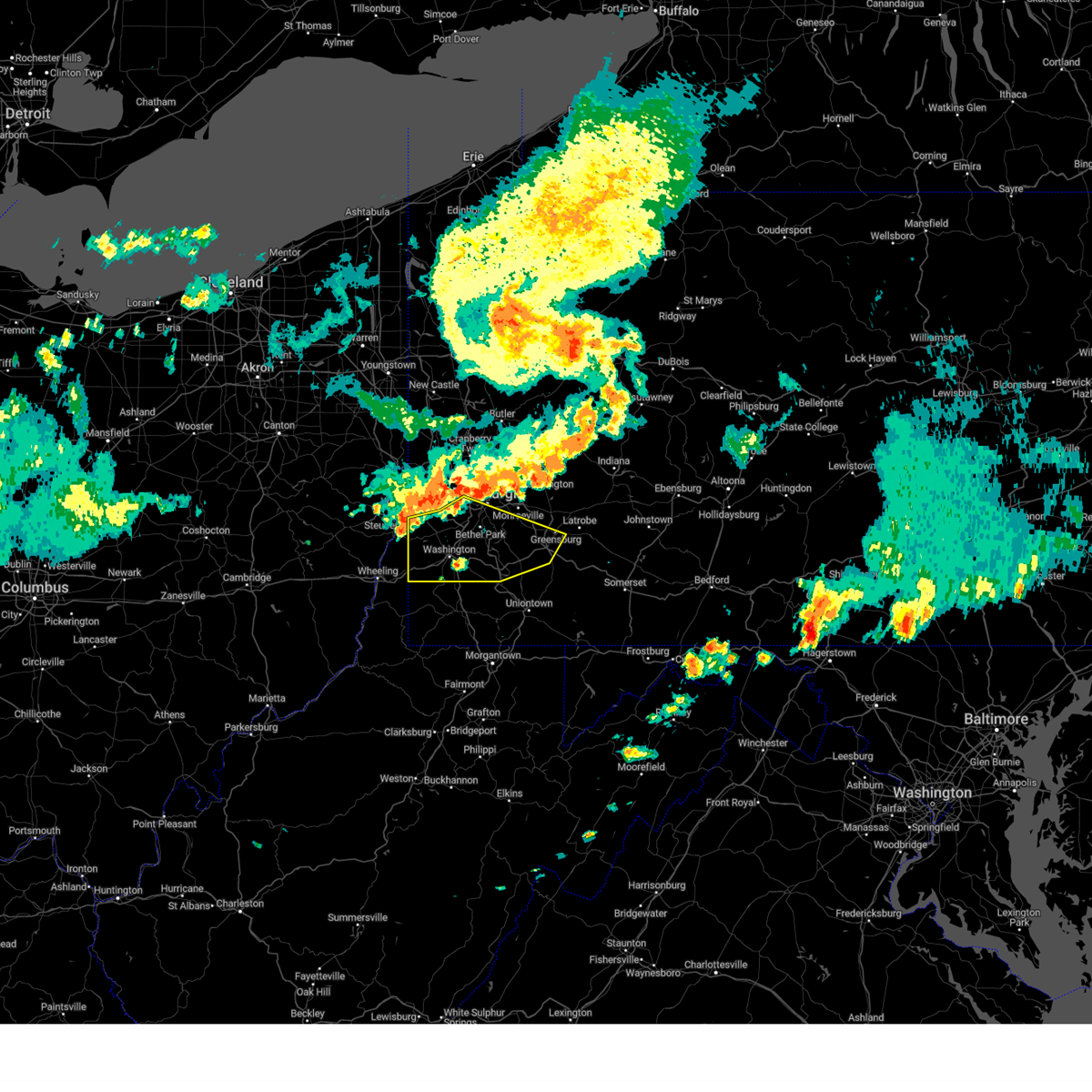 Svrpbz the national weather service in pittsburgh has issued a * severe thunderstorm warning for, washington county in southwestern pennsylvania, southern allegheny county in southwestern pennsylvania, southwestern westmoreland county in southwestern pennsylvania, northwestern fayette county in southwestern pennsylvania, ohio county in northern west virginia, * until 745 pm edt. * at 706 pm edt, severe thunderstorms were located along a line extending from mount oliver to near cecil-bishop to near avella, moving east at 50 mph (radar indicated). Hazards include 60 mph wind gusts. expect damage to trees and power lines, resulting in some power outages Svrpbz the national weather service in pittsburgh has issued a * severe thunderstorm warning for, washington county in southwestern pennsylvania, southern allegheny county in southwestern pennsylvania, southwestern westmoreland county in southwestern pennsylvania, northwestern fayette county in southwestern pennsylvania, ohio county in northern west virginia, * until 745 pm edt. * at 706 pm edt, severe thunderstorms were located along a line extending from mount oliver to near cecil-bishop to near avella, moving east at 50 mph (radar indicated). Hazards include 60 mph wind gusts. expect damage to trees and power lines, resulting in some power outages
|
| 6/26/2024 8:11 PM EDT |
 The storms which prompted the warning have moved out of the area. therefore, the warning will be allowed to expire. however, heavy rain is still possible with these thunderstorms and flash flooding remains possible. severe thunderstorm and tornado warnings remain in effect for central and eastern westmoreland counties until 830 pm. The storms which prompted the warning have moved out of the area. therefore, the warning will be allowed to expire. however, heavy rain is still possible with these thunderstorms and flash flooding remains possible. severe thunderstorm and tornado warnings remain in effect for central and eastern westmoreland counties until 830 pm.
|
| 6/26/2024 8:00 PM EDT |
 Svrpbz the national weather service in pittsburgh has issued a * severe thunderstorm warning for, southeastern allegheny county in southwestern pennsylvania, southwestern westmoreland county in southwestern pennsylvania, * until 830 pm edt. * at 800 pm edt, severe thunderstorms were located along a line from near murrysville to over jefferson hills, or along a line from 7 miles northeast of monroeville to near gastonville, moving east at 40 mph (radar indicated). Hazards include 70 mph wind gusts. Expect considerable tree damage. Damage is likely to mobile homes, roofs, and outbuildings. Svrpbz the national weather service in pittsburgh has issued a * severe thunderstorm warning for, southeastern allegheny county in southwestern pennsylvania, southwestern westmoreland county in southwestern pennsylvania, * until 830 pm edt. * at 800 pm edt, severe thunderstorms were located along a line from near murrysville to over jefferson hills, or along a line from 7 miles northeast of monroeville to near gastonville, moving east at 40 mph (radar indicated). Hazards include 70 mph wind gusts. Expect considerable tree damage. Damage is likely to mobile homes, roofs, and outbuildings.
|
| 6/26/2024 7:56 PM EDT |
 the severe thunderstorm warning has been cancelled and is no longer in effect the severe thunderstorm warning has been cancelled and is no longer in effect
|
| 6/26/2024 7:56 PM EDT |
 At 756 pm edt, severe thunderstorms were located along a line from over plum to over south park township, or along a line from 5 miles northeast of penn hills to over gastonville, moving east at 35 mph (radar indicated). Hazards include 70 mph wind gusts. Expect considerable tree damage. damage is likely to mobile homes, roofs, and outbuildings. Locations impacted include, pittsburgh, penn hills, bethel park, monroeville, mckeesport, gastonville, plum, west mifflin, baldwin, murrysville, wilkinsburg, whitehall, south park township, new kensington, lower burrell, munhall, jefferson hills, north versailles, swissvale and o'hara township. At 756 pm edt, severe thunderstorms were located along a line from over plum to over south park township, or along a line from 5 miles northeast of penn hills to over gastonville, moving east at 35 mph (radar indicated). Hazards include 70 mph wind gusts. Expect considerable tree damage. damage is likely to mobile homes, roofs, and outbuildings. Locations impacted include, pittsburgh, penn hills, bethel park, monroeville, mckeesport, gastonville, plum, west mifflin, baldwin, murrysville, wilkinsburg, whitehall, south park township, new kensington, lower burrell, munhall, jefferson hills, north versailles, swissvale and o'hara township.
|
| 6/26/2024 7:43 PM EDT |
 At 743 pm edt, severe thunderstorms were located along a line from over fox chapel to over cecil-bishop, or along a line from 6 miles northwest of penn hills to near canonsburg, moving east at 25 mph (radar indicated). Hazards include 60 mph wind gusts and possible tornado. Expect damage to roofs, siding, and trees. locations impacted include, pittsburgh, penn hills, mount lebanon, bethel park, ross township, monroeville, mcmurray, mckeesport, gastonville, shaler township, plum, west mifflin, north side pittsburgh, baldwin, upper st. Clair, murrysville, hampton township, scott township, wilkinsburg and whitehall. At 743 pm edt, severe thunderstorms were located along a line from over fox chapel to over cecil-bishop, or along a line from 6 miles northwest of penn hills to near canonsburg, moving east at 25 mph (radar indicated). Hazards include 60 mph wind gusts and possible tornado. Expect damage to roofs, siding, and trees. locations impacted include, pittsburgh, penn hills, mount lebanon, bethel park, ross township, monroeville, mcmurray, mckeesport, gastonville, shaler township, plum, west mifflin, north side pittsburgh, baldwin, upper st. Clair, murrysville, hampton township, scott township, wilkinsburg and whitehall.
|
| 6/26/2024 7:34 PM EDT |
 At 734 pm edt, severe thunderstorms were located along a line from over hampton township to 6 miles northwest of mcgovern, or along a line from over mccandless township to 7 miles west of canonsburg, moving east at 25 mph (radar indicated). Hazards include 70 mph wind gusts and possible tornado. Expect considerable tree damage. damage is likely to mobile homes, roofs, and outbuildings. locations impacted include, pittsburgh, penn hills, mount lebanon, bethel park, ross township, mccandless township, monroeville, mcmurray, mckeesport, franklin park, canonsburg, gastonville, shaler township, plum, west mifflin, north side pittsburgh, baldwin, upper st. Clair, murrysville and hampton township. At 734 pm edt, severe thunderstorms were located along a line from over hampton township to 6 miles northwest of mcgovern, or along a line from over mccandless township to 7 miles west of canonsburg, moving east at 25 mph (radar indicated). Hazards include 70 mph wind gusts and possible tornado. Expect considerable tree damage. damage is likely to mobile homes, roofs, and outbuildings. locations impacted include, pittsburgh, penn hills, mount lebanon, bethel park, ross township, mccandless township, monroeville, mcmurray, mckeesport, franklin park, canonsburg, gastonville, shaler township, plum, west mifflin, north side pittsburgh, baldwin, upper st. Clair, murrysville and hampton township.
|
| 6/26/2024 7:25 PM EDT |
 Svrpbz the national weather service in pittsburgh has issued a * severe thunderstorm warning for, allegheny county in southwestern pennsylvania, northern washington county in southwestern pennsylvania, northwestern westmoreland county in southwestern pennsylvania, * until 815 pm edt. * at 725 pm edt, severe thunderstorms were located along a line from near sewickley to near avella, or along a line from over franklin park to near avella, moving east at 25 mph (radar indicated). Hazards include 60 mph wind gusts. expect damage to roofs, siding, and trees Svrpbz the national weather service in pittsburgh has issued a * severe thunderstorm warning for, allegheny county in southwestern pennsylvania, northern washington county in southwestern pennsylvania, northwestern westmoreland county in southwestern pennsylvania, * until 815 pm edt. * at 725 pm edt, severe thunderstorms were located along a line from near sewickley to near avella, or along a line from over franklin park to near avella, moving east at 25 mph (radar indicated). Hazards include 60 mph wind gusts. expect damage to roofs, siding, and trees
|
| 6/17/2024 6:01 PM EDT |
 The storms which prompted the warning have weakened below severe limits, and have exited the warned area. therefore, the warning has been allowed to expire. however, gusty winds are still possible with these thunderstorms. to report severe weather, contact your nearest law enforcement agency. they will relay your report to the national weather service pittsburgh. The storms which prompted the warning have weakened below severe limits, and have exited the warned area. therefore, the warning has been allowed to expire. however, gusty winds are still possible with these thunderstorms. to report severe weather, contact your nearest law enforcement agency. they will relay your report to the national weather service pittsburgh.
|
| 6/17/2024 5:44 PM EDT |
 At 543 pm edt, severe thunderstorms were located along a line extending from 8 miles west of indiana to near greensburg to near avella, moving southeast at 20 mph (law enforcement and trained spotters). Hazards include 70 mph wind gusts and nickel size hail. Trees snapped and uprooted. power outages can be expected. Locations impacted include, pittsburgh, penn hills, mount lebanon, bethel park, ross township, monroeville, moon township, mcmurray, greensburg, weirton, mckeesport, jeannette, canonsburg, vandergrift, kittanning, apollo, gastonville, shaler township, plum, and west mifflin. At 543 pm edt, severe thunderstorms were located along a line extending from 8 miles west of indiana to near greensburg to near avella, moving southeast at 20 mph (law enforcement and trained spotters). Hazards include 70 mph wind gusts and nickel size hail. Trees snapped and uprooted. power outages can be expected. Locations impacted include, pittsburgh, penn hills, mount lebanon, bethel park, ross township, monroeville, moon township, mcmurray, greensburg, weirton, mckeesport, jeannette, canonsburg, vandergrift, kittanning, apollo, gastonville, shaler township, plum, and west mifflin.
|
| 6/17/2024 5:23 PM EDT |
 Svrpbz the national weather service in pittsburgh has issued a * severe thunderstorm warning for, southern beaver county in western pennsylvania, northern washington county in southwestern pennsylvania, southeastern butler county in west central pennsylvania, western indiana county in west central pennsylvania, allegheny county in southwestern pennsylvania, northwestern westmoreland county in southwestern pennsylvania, southern armstrong county in west central pennsylvania, brooke county in northern west virginia, hancock county in northern west virginia, * until 600 pm edt. * at 522 pm edt, severe thunderstorms were located along a line extending from 8 miles east of ford city to murrysville to near avella, moving southeast at 20 mph (law enforcement and trained spotters reported widespread wind damage across the warned area). Hazards include 70 mph wind gusts and nickel size hail. Trees snapped and uprooted. Power outages can be expected. Svrpbz the national weather service in pittsburgh has issued a * severe thunderstorm warning for, southern beaver county in western pennsylvania, northern washington county in southwestern pennsylvania, southeastern butler county in west central pennsylvania, western indiana county in west central pennsylvania, allegheny county in southwestern pennsylvania, northwestern westmoreland county in southwestern pennsylvania, southern armstrong county in west central pennsylvania, brooke county in northern west virginia, hancock county in northern west virginia, * until 600 pm edt. * at 522 pm edt, severe thunderstorms were located along a line extending from 8 miles east of ford city to murrysville to near avella, moving southeast at 20 mph (law enforcement and trained spotters reported widespread wind damage across the warned area). Hazards include 70 mph wind gusts and nickel size hail. Trees snapped and uprooted. Power outages can be expected.
|
| 5/26/2024 8:00 PM EDT |
 the severe thunderstorm warning has been cancelled and is no longer in effect the severe thunderstorm warning has been cancelled and is no longer in effect
|
| 5/26/2024 8:00 PM EDT |
 At 800 pm edt, severe thunderstorms were located along a line extending from pleasant hills to 6 miles west of farmington, moving northeast at 40 mph (radar indicated). Hazards include 60 mph wind gusts. Expect damage to trees and power lines, resulting in some power outages. Locations impacted include, monroeville, greensburg, mckeesport, uniontown, jeannette, latrobe, connellsville, plum, west mifflin, murrysville, south park township, jefferson hills, north versailles, pleasant hills, white oak, monessen, clairton, duquesne, turtle creek, and north braddock. At 800 pm edt, severe thunderstorms were located along a line extending from pleasant hills to 6 miles west of farmington, moving northeast at 40 mph (radar indicated). Hazards include 60 mph wind gusts. Expect damage to trees and power lines, resulting in some power outages. Locations impacted include, monroeville, greensburg, mckeesport, uniontown, jeannette, latrobe, connellsville, plum, west mifflin, murrysville, south park township, jefferson hills, north versailles, pleasant hills, white oak, monessen, clairton, duquesne, turtle creek, and north braddock.
|
| 5/26/2024 7:50 PM EDT |
 At 750 pm edt, severe thunderstorms were located along a line extending from south park township to 7 miles east of point marion, moving northeast at 40 mph (radar indicated). Hazards include 60 mph wind gusts. Expect damage to trees and power lines, resulting in some power outages. Locations impacted include, bethel park, monroeville, mcmurray, greensburg, mckeesport, uniontown, jeannette, latrobe, connellsville, gastonville, plum, west mifflin, murrysville, south park township, jefferson hills, north versailles, pleasant hills, white oak, monessen, and clairton. At 750 pm edt, severe thunderstorms were located along a line extending from south park township to 7 miles east of point marion, moving northeast at 40 mph (radar indicated). Hazards include 60 mph wind gusts. Expect damage to trees and power lines, resulting in some power outages. Locations impacted include, bethel park, monroeville, mcmurray, greensburg, mckeesport, uniontown, jeannette, latrobe, connellsville, gastonville, plum, west mifflin, murrysville, south park township, jefferson hills, north versailles, pleasant hills, white oak, monessen, and clairton.
|
| 5/26/2024 7:29 PM EDT |
 Svrpbz the national weather service in pittsburgh has issued a * severe thunderstorm warning for, southeastern washington county in southwestern pennsylvania, southeastern allegheny county in southwestern pennsylvania, westmoreland county in southwestern pennsylvania, eastern greene county in southwestern pennsylvania, fayette county in southwestern pennsylvania, northern monongalia county in northern west virginia, northern preston county in northeastern west virginia, * until 830 pm edt. * at 729 pm edt, severe thunderstorms were located along a line extending from canonsburg to near cassville, moving northeast at 40 mph (radar indicated). Hazards include 60 mph wind gusts. expect damage to trees and power lines, resulting in some power outages Svrpbz the national weather service in pittsburgh has issued a * severe thunderstorm warning for, southeastern washington county in southwestern pennsylvania, southeastern allegheny county in southwestern pennsylvania, westmoreland county in southwestern pennsylvania, eastern greene county in southwestern pennsylvania, fayette county in southwestern pennsylvania, northern monongalia county in northern west virginia, northern preston county in northeastern west virginia, * until 830 pm edt. * at 729 pm edt, severe thunderstorms were located along a line extending from canonsburg to near cassville, moving northeast at 40 mph (radar indicated). Hazards include 60 mph wind gusts. expect damage to trees and power lines, resulting in some power outages
|
| 5/25/2024 6:37 PM EDT |
 The storm which prompted the warning has weakened below severe limits, and has exited the warned area. therefore, the warning will be allowed to expire. to report severe weather, contact your nearest law enforcement agency. they will relay your report to the national weather service pittsburgh. The storm which prompted the warning has weakened below severe limits, and has exited the warned area. therefore, the warning will be allowed to expire. to report severe weather, contact your nearest law enforcement agency. they will relay your report to the national weather service pittsburgh.
|
| 5/25/2024 6:13 PM EDT |
 At 611 pm edt, a severe thunderstorm was located over pleasant hills, or near bethel park, moving southeast at 25 mph (trained weather spotters). Hazards include 60 mph wind gusts and half dollar size hail. Minor hail damage to vehicles is possible. expect wind damage to trees and power lines, resulting in some power outages. locations impacted include, pittsburgh, bethel park, mcmurray, mckeesport, gastonville, west mifflin, baldwin, upper st. Clair, whitehall, south park township, munhall, jefferson hills, north versailles, brentwood, swissvale, pleasant hills, white oak, monessen, clairton, and california. At 611 pm edt, a severe thunderstorm was located over pleasant hills, or near bethel park, moving southeast at 25 mph (trained weather spotters). Hazards include 60 mph wind gusts and half dollar size hail. Minor hail damage to vehicles is possible. expect wind damage to trees and power lines, resulting in some power outages. locations impacted include, pittsburgh, bethel park, mcmurray, mckeesport, gastonville, west mifflin, baldwin, upper st. Clair, whitehall, south park township, munhall, jefferson hills, north versailles, brentwood, swissvale, pleasant hills, white oak, monessen, clairton, and california.
|
| 5/25/2024 5:58 PM EDT |
 At 557 pm edt, a severe thunderstorm was located over mount lebanon, moving southeast at 25 mph (trained weather spotters reported hail up to golf ball size across allegheny county). Hazards include golf ball size hail and 60 mph wind gusts. People and animals outdoors will be injured. expect hail damage to roofs, siding, windows, and vehicles. expect wind damage to trees and power lines, resulting in some power outages. locations impacted include, pittsburgh, penn hills, mount lebanon, bethel park, monroeville, mcmurray, mckeesport, jeannette, canonsburg, gastonville, shaler township, west mifflin, north side pittsburgh, baldwin, upper st. Clair, murrysville, scott township, wilkinsburg, whitehall, and south park township. At 557 pm edt, a severe thunderstorm was located over mount lebanon, moving southeast at 25 mph (trained weather spotters reported hail up to golf ball size across allegheny county). Hazards include golf ball size hail and 60 mph wind gusts. People and animals outdoors will be injured. expect hail damage to roofs, siding, windows, and vehicles. expect wind damage to trees and power lines, resulting in some power outages. locations impacted include, pittsburgh, penn hills, mount lebanon, bethel park, monroeville, mcmurray, mckeesport, jeannette, canonsburg, gastonville, shaler township, west mifflin, north side pittsburgh, baldwin, upper st. Clair, murrysville, scott township, wilkinsburg, whitehall, and south park township.
|
| 5/25/2024 5:44 PM EDT |
 Svrpbz the national weather service in pittsburgh has issued a * severe thunderstorm warning for, northeastern washington county in southwestern pennsylvania, central allegheny county in southwestern pennsylvania, west central westmoreland county in southwestern pennsylvania, * until 645 pm edt. * at 543 pm edt, a severe thunderstorm was located over robinson township, or near mount lebanon, moving southeast at 25 mph (trained weather spotters reported quarter size hail across allegheny county). Hazards include golf ball size hail and 60 mph wind gusts. People and animals outdoors will be injured. expect hail damage to roofs, siding, windows, and vehicles. Expect wind damage to trees and power lines, resulting in some power outages. Svrpbz the national weather service in pittsburgh has issued a * severe thunderstorm warning for, northeastern washington county in southwestern pennsylvania, central allegheny county in southwestern pennsylvania, west central westmoreland county in southwestern pennsylvania, * until 645 pm edt. * at 543 pm edt, a severe thunderstorm was located over robinson township, or near mount lebanon, moving southeast at 25 mph (trained weather spotters reported quarter size hail across allegheny county). Hazards include golf ball size hail and 60 mph wind gusts. People and animals outdoors will be injured. expect hail damage to roofs, siding, windows, and vehicles. Expect wind damage to trees and power lines, resulting in some power outages.
|
| 5/25/2024 4:35 PM EDT |
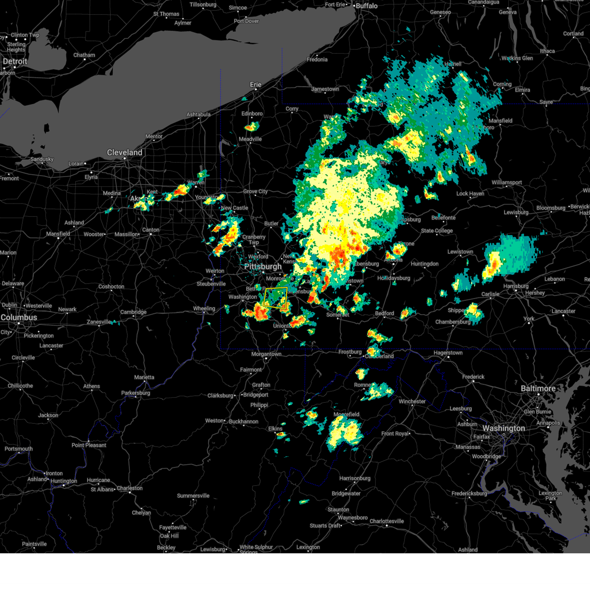 The storm which prompted the warning has weakened below severe limits, and has exited the warned area. therefore, the warning will be allowed to expire. to report severe weather, contact your nearest law enforcement agency. they will relay your report to the national weather service pittsburgh. The storm which prompted the warning has weakened below severe limits, and has exited the warned area. therefore, the warning will be allowed to expire. to report severe weather, contact your nearest law enforcement agency. they will relay your report to the national weather service pittsburgh.
|
| 5/25/2024 4:18 PM EDT |
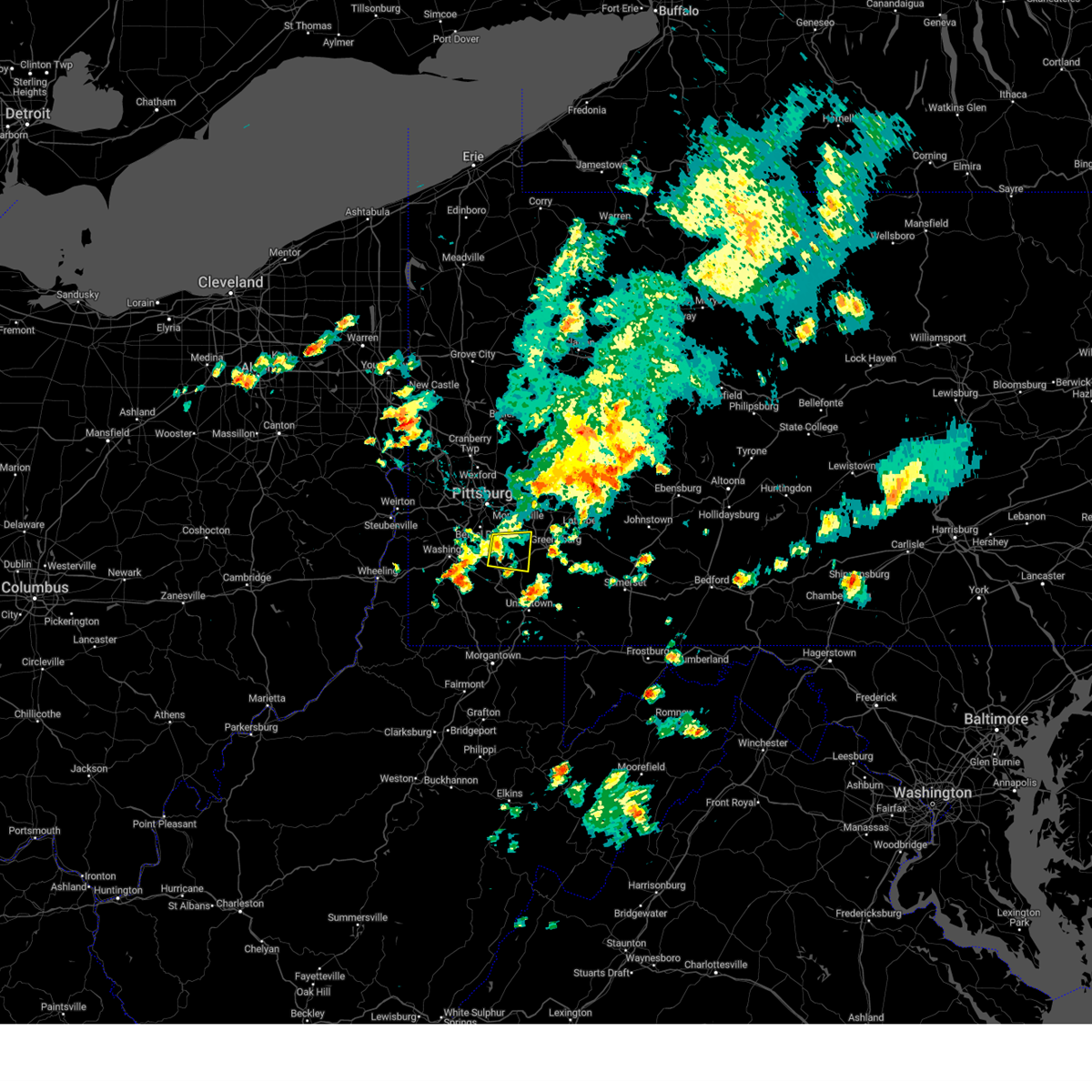 At 418 pm edt, a severe thunderstorm was located over monongahela, or 7 miles southeast of gastonville, moving east at 25 mph (radar indicated). Hazards include 60 mph wind gusts. Expect damage to trees and power lines, resulting in some power outages. Locations impacted include, south park township, jefferson hills, monessen, clairton, donora, monongahela, charleroi, west newton, new eagle, north belle vernon, wickerham manor-fisher, baidland, elizabeth, north charleroi, speers, belle vernon, lincoln, lynnwood-pricedale, sutersville, and west elizabeth. At 418 pm edt, a severe thunderstorm was located over monongahela, or 7 miles southeast of gastonville, moving east at 25 mph (radar indicated). Hazards include 60 mph wind gusts. Expect damage to trees and power lines, resulting in some power outages. Locations impacted include, south park township, jefferson hills, monessen, clairton, donora, monongahela, charleroi, west newton, new eagle, north belle vernon, wickerham manor-fisher, baidland, elizabeth, north charleroi, speers, belle vernon, lincoln, lynnwood-pricedale, sutersville, and west elizabeth.
|
| 5/25/2024 3:59 PM EDT |
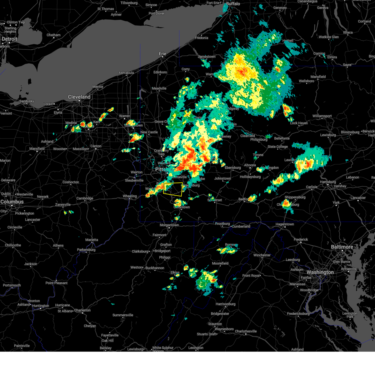 Svrpbz the national weather service in pittsburgh has issued a * severe thunderstorm warning for, east central washington county in southwestern pennsylvania, southeastern allegheny county in southwestern pennsylvania, southwestern westmoreland county in southwestern pennsylvania, north central fayette county in southwestern pennsylvania, * until 445 pm edt. * at 359 pm edt, a severe thunderstorm was located near gastonville, moving east at 25 mph (radar indicated). Hazards include 60 mph wind gusts. expect damage to trees and power lines, resulting in some power outages Svrpbz the national weather service in pittsburgh has issued a * severe thunderstorm warning for, east central washington county in southwestern pennsylvania, southeastern allegheny county in southwestern pennsylvania, southwestern westmoreland county in southwestern pennsylvania, north central fayette county in southwestern pennsylvania, * until 445 pm edt. * at 359 pm edt, a severe thunderstorm was located near gastonville, moving east at 25 mph (radar indicated). Hazards include 60 mph wind gusts. expect damage to trees and power lines, resulting in some power outages
|
| 5/25/2024 3:04 PM EDT |
 Svrpbz the national weather service in pittsburgh has issued a * severe thunderstorm warning for, east central allegheny county in southwestern pennsylvania, northwestern westmoreland county in southwestern pennsylvania, * until 345 pm edt. * at 304 pm edt, a severe thunderstorm was located over munhall, or near pittsburgh, moving northeast at 30 mph (radar indicated). Hazards include 60 mph wind gusts. expect damage to trees and power lines, resulting in some power outages Svrpbz the national weather service in pittsburgh has issued a * severe thunderstorm warning for, east central allegheny county in southwestern pennsylvania, northwestern westmoreland county in southwestern pennsylvania, * until 345 pm edt. * at 304 pm edt, a severe thunderstorm was located over munhall, or near pittsburgh, moving northeast at 30 mph (radar indicated). Hazards include 60 mph wind gusts. expect damage to trees and power lines, resulting in some power outages
|
| 5/11/2024 6:21 PM EDT |
 Torpbz the national weather service in pittsburgh has issued a * tornado warning for, east central washington county in southwestern pennsylvania, southeastern allegheny county in southwestern pennsylvania, west central westmoreland county in southwestern pennsylvania, * until 645 pm edt. * at 620 pm edt, a tornado producing storm was located over jefferson hills, or near gastonville, moving east at 25 mph (radar confirmed tornado). Hazards include damaging tornado. Flying debris will be dangerous to those caught without shelter. mobile homes will be damaged or destroyed. damage to roofs, windows, and vehicles will occur. tree damage is likely. this tornadic storm will be near, jefferson hills and clairton around 625 pm edt. west newton around 635 pm edt. Other locations impacted by this tornadic thunderstorm include elizabeth, finleyville, lincoln, sutersville, and west elizabeth. Torpbz the national weather service in pittsburgh has issued a * tornado warning for, east central washington county in southwestern pennsylvania, southeastern allegheny county in southwestern pennsylvania, west central westmoreland county in southwestern pennsylvania, * until 645 pm edt. * at 620 pm edt, a tornado producing storm was located over jefferson hills, or near gastonville, moving east at 25 mph (radar confirmed tornado). Hazards include damaging tornado. Flying debris will be dangerous to those caught without shelter. mobile homes will be damaged or destroyed. damage to roofs, windows, and vehicles will occur. tree damage is likely. this tornadic storm will be near, jefferson hills and clairton around 625 pm edt. west newton around 635 pm edt. Other locations impacted by this tornadic thunderstorm include elizabeth, finleyville, lincoln, sutersville, and west elizabeth.
|
| 5/11/2024 6:15 PM EDT |
 Torpbz the national weather service in pittsburgh has issued a * tornado warning for, east central washington county in southwestern pennsylvania, southeastern allegheny county in southwestern pennsylvania, west central westmoreland county in southwestern pennsylvania, * until 645 pm edt. * at 615 pm edt, a severe thunderstorm capable of producing a tornado was located over gastonville, moving east at 25 mph (radar indicated rotation). Hazards include tornado. Flying debris will be dangerous to those caught without shelter. mobile homes will be damaged or destroyed. damage to roofs, windows, and vehicles will occur. tree damage is likely. this dangerous storm will be near, south park township, jefferson hills, and clairton around 620 pm edt. west newton around 635 pm edt. Other locations impacted by this tornadic thunderstorm include elizabeth, finleyville, lincoln, sutersville, and west elizabeth. Torpbz the national weather service in pittsburgh has issued a * tornado warning for, east central washington county in southwestern pennsylvania, southeastern allegheny county in southwestern pennsylvania, west central westmoreland county in southwestern pennsylvania, * until 645 pm edt. * at 615 pm edt, a severe thunderstorm capable of producing a tornado was located over gastonville, moving east at 25 mph (radar indicated rotation). Hazards include tornado. Flying debris will be dangerous to those caught without shelter. mobile homes will be damaged or destroyed. damage to roofs, windows, and vehicles will occur. tree damage is likely. this dangerous storm will be near, south park township, jefferson hills, and clairton around 620 pm edt. west newton around 635 pm edt. Other locations impacted by this tornadic thunderstorm include elizabeth, finleyville, lincoln, sutersville, and west elizabeth.
|
| 5/8/2024 2:15 AM EDT |
 The storm which prompted the warning has weakened below severe limits, and no longer poses an immediate threat to life or property. therefore, the warning has been allowed to expire. however, gusty winds and heavy rain are still possible with this thunderstorm. a tornado watch remains in effect until 400 am edt for southwestern pennsylvania. The storm which prompted the warning has weakened below severe limits, and no longer poses an immediate threat to life or property. therefore, the warning has been allowed to expire. however, gusty winds and heavy rain are still possible with this thunderstorm. a tornado watch remains in effect until 400 am edt for southwestern pennsylvania.
|
| 5/8/2024 2:06 AM EDT |
 At 206 am edt, a severe thunderstorm was located over pleasant hills, or near bethel park, moving east at 40 mph (radar indicated). Hazards include 60 mph wind gusts. Expect damage to trees and power lines, resulting in some power outages. locations impacted include, pittsburgh, bethel park, mckeesport, jeannette, gastonville, west mifflin, baldwin, upper st. Clair, whitehall, south park township, munhall, jefferson hills, north versailles, brentwood, castle shannon, pleasant hills, white oak, clairton, duquesne, and donora. At 206 am edt, a severe thunderstorm was located over pleasant hills, or near bethel park, moving east at 40 mph (radar indicated). Hazards include 60 mph wind gusts. Expect damage to trees and power lines, resulting in some power outages. locations impacted include, pittsburgh, bethel park, mckeesport, jeannette, gastonville, west mifflin, baldwin, upper st. Clair, whitehall, south park township, munhall, jefferson hills, north versailles, brentwood, castle shannon, pleasant hills, white oak, clairton, duquesne, and donora.
|
| 5/8/2024 2:00 AM EDT |
 At 200 am edt, a severe thunderstorm was located over bethel park, moving east at 45 mph (radar indicated). Hazards include 60 mph wind gusts. Expect damage to trees and power lines, resulting in some power outages. locations impacted include, pittsburgh, mount lebanon, bethel park, mckeesport, jeannette, gastonville, west mifflin, baldwin, upper st. Clair, scott township, whitehall, south park township, munhall, jefferson hills, north versailles, brentwood, dormont, castle shannon, pleasant hills, and carnegie. At 200 am edt, a severe thunderstorm was located over bethel park, moving east at 45 mph (radar indicated). Hazards include 60 mph wind gusts. Expect damage to trees and power lines, resulting in some power outages. locations impacted include, pittsburgh, mount lebanon, bethel park, mckeesport, jeannette, gastonville, west mifflin, baldwin, upper st. Clair, scott township, whitehall, south park township, munhall, jefferson hills, north versailles, brentwood, dormont, castle shannon, pleasant hills, and carnegie.
|
| 5/8/2024 1:49 AM EDT |
 the severe thunderstorm warning has been cancelled and is no longer in effect the severe thunderstorm warning has been cancelled and is no longer in effect
|
| 5/8/2024 1:49 AM EDT |
 At 149 am edt, a severe thunderstorm was located over sturgeon-noblestown, or near mount lebanon, moving east at 45 mph (radar indicated). Hazards include 60 mph wind gusts. Expect damage to trees and power lines, resulting in some power outages. locations impacted include, pittsburgh, mount lebanon, bethel park, mcmurray, mckeesport, jeannette, gastonville, west mifflin, baldwin, upper st. Clair, scott township, whitehall, south park township, robinson township, munhall, cecil-bishop, jefferson hills, north versailles, brentwood, and dormont. At 149 am edt, a severe thunderstorm was located over sturgeon-noblestown, or near mount lebanon, moving east at 45 mph (radar indicated). Hazards include 60 mph wind gusts. Expect damage to trees and power lines, resulting in some power outages. locations impacted include, pittsburgh, mount lebanon, bethel park, mcmurray, mckeesport, jeannette, gastonville, west mifflin, baldwin, upper st. Clair, scott township, whitehall, south park township, robinson township, munhall, cecil-bishop, jefferson hills, north versailles, brentwood, and dormont.
|
| 5/8/2024 1:38 AM EDT |
 Svrpbz the national weather service in pittsburgh has issued a * severe thunderstorm warning for, southern beaver county in western pennsylvania, northern washington county in southwestern pennsylvania, southern allegheny county in southwestern pennsylvania, southwestern westmoreland county in southwestern pennsylvania, north central fayette county in southwestern pennsylvania, * until 215 am edt. * at 137 am edt, a severe thunderstorm was located near imperial, or 9 miles southwest of moon township, moving east at 45 mph (radar indicated). Hazards include 70 mph wind gusts. Trees snapped and uprooted. Power outages can be expected. Svrpbz the national weather service in pittsburgh has issued a * severe thunderstorm warning for, southern beaver county in western pennsylvania, northern washington county in southwestern pennsylvania, southern allegheny county in southwestern pennsylvania, southwestern westmoreland county in southwestern pennsylvania, north central fayette county in southwestern pennsylvania, * until 215 am edt. * at 137 am edt, a severe thunderstorm was located near imperial, or 9 miles southwest of moon township, moving east at 45 mph (radar indicated). Hazards include 70 mph wind gusts. Trees snapped and uprooted. Power outages can be expected.
|
| 4/17/2024 7:14 PM EDT |
 At 713 pm edt, severe thunderstorms were located along a line extending from 6 miles southwest of new castle to near chester to near wintersville, moving east at 45 mph (law enforcement). Hazards include 70 mph wind gusts. Trees snapped and uprooted. power outages can be expected. locations impacted include, pittsburgh, penn hills, mount lebanon, bethel park, ross township, mccandless township, monroeville, cranberry, moon township, new castle, mcmurray, weirton, mckeesport, steubenville, butler, franklin park, east liverpool, aliquippa, canonsburg, and beaver falls. These storms have a history of damaging wind with trees down. At 713 pm edt, severe thunderstorms were located along a line extending from 6 miles southwest of new castle to near chester to near wintersville, moving east at 45 mph (law enforcement). Hazards include 70 mph wind gusts. Trees snapped and uprooted. power outages can be expected. locations impacted include, pittsburgh, penn hills, mount lebanon, bethel park, ross township, mccandless township, monroeville, cranberry, moon township, new castle, mcmurray, weirton, mckeesport, steubenville, butler, franklin park, east liverpool, aliquippa, canonsburg, and beaver falls. These storms have a history of damaging wind with trees down.
|
| 4/17/2024 7:10 PM EDT |
 At 710 pm edt, severe thunderstorms were located along a line extending from 7 miles northeast of east palestine to near chester to near wintersville, moving east at 45 mph (radar indicated). Hazards include 70 mph wind gusts. Trees snapped and uprooted. power outages can be expected. Locations impacted include, pittsburgh, penn hills, mount lebanon, bethel park, ross township, mccandless township, monroeville, cranberry, moon township, new castle, mcmurray, weirton, mckeesport, steubenville, butler, franklin park, east liverpool, aliquippa, canonsburg, and beaver falls. At 710 pm edt, severe thunderstorms were located along a line extending from 7 miles northeast of east palestine to near chester to near wintersville, moving east at 45 mph (radar indicated). Hazards include 70 mph wind gusts. Trees snapped and uprooted. power outages can be expected. Locations impacted include, pittsburgh, penn hills, mount lebanon, bethel park, ross township, mccandless township, monroeville, cranberry, moon township, new castle, mcmurray, weirton, mckeesport, steubenville, butler, franklin park, east liverpool, aliquippa, canonsburg, and beaver falls.
|
| 4/17/2024 6:53 PM EDT |
 Svrpbz the national weather service in pittsburgh has issued a * severe thunderstorm warning for, northeastern harrison county in east central ohio, jefferson county in east central ohio, eastern columbiana county in east central ohio, beaver county in western pennsylvania, butler county in west central pennsylvania, allegheny county in southwestern pennsylvania, west central armstrong county in west central pennsylvania, southwestern clarion county in west central pennsylvania, northern washington county in southwestern pennsylvania, southern lawrence county in western pennsylvania, northwestern westmoreland county in southwestern pennsylvania, brooke county in northern west virginia, hancock county in northern west virginia, * until 800 pm edt. * at 653 pm edt, severe thunderstorms were located along a line extending from columbiana to near wellsville to near cadiz, moving east at 50 mph (radar indicated). Hazards include 70 mph wind gusts. Trees snapped and uprooted. Power outages can be expected. Svrpbz the national weather service in pittsburgh has issued a * severe thunderstorm warning for, northeastern harrison county in east central ohio, jefferson county in east central ohio, eastern columbiana county in east central ohio, beaver county in western pennsylvania, butler county in west central pennsylvania, allegheny county in southwestern pennsylvania, west central armstrong county in west central pennsylvania, southwestern clarion county in west central pennsylvania, northern washington county in southwestern pennsylvania, southern lawrence county in western pennsylvania, northwestern westmoreland county in southwestern pennsylvania, brooke county in northern west virginia, hancock county in northern west virginia, * until 800 pm edt. * at 653 pm edt, severe thunderstorms were located along a line extending from columbiana to near wellsville to near cadiz, moving east at 50 mph (radar indicated). Hazards include 70 mph wind gusts. Trees snapped and uprooted. Power outages can be expected.
|
| 4/15/2024 12:40 AM EDT |
 The storm which prompted the warning has weakened below severe limits, and no longer poses an immediate threat to life or property. therefore, the warning will be allowed to expire. however, small hail and gusty winds are still possible with this thunderstorm. The storm which prompted the warning has weakened below severe limits, and no longer poses an immediate threat to life or property. therefore, the warning will be allowed to expire. however, small hail and gusty winds are still possible with this thunderstorm.
|
| 4/15/2024 12:31 AM EDT |
 At 1230 am edt, a severe thunderstorm was located over pleasant hills, or near mckeesport, moving east at 55 mph (public reported quarter size hail). Hazards include 60 mph wind gusts and quarter size hail. Minor hail damage to vehicles is possible. expect wind damage to trees and power lines, resulting in some power outages. locations impacted include, pittsburgh, penn hills, mount lebanon, bethel park, ross township, monroeville, mcmurray, mckeesport, canonsburg, gastonville, shaler township, west mifflin, north side pittsburgh, baldwin, upper st. Clair, scott township, wilkinsburg, whitehall, south park township, and munhall. At 1230 am edt, a severe thunderstorm was located over pleasant hills, or near mckeesport, moving east at 55 mph (public reported quarter size hail). Hazards include 60 mph wind gusts and quarter size hail. Minor hail damage to vehicles is possible. expect wind damage to trees and power lines, resulting in some power outages. locations impacted include, pittsburgh, penn hills, mount lebanon, bethel park, ross township, monroeville, mcmurray, mckeesport, canonsburg, gastonville, shaler township, west mifflin, north side pittsburgh, baldwin, upper st. Clair, scott township, wilkinsburg, whitehall, south park township, and munhall.
|
| 4/15/2024 12:24 AM EDT |
 the severe thunderstorm warning has been cancelled and is no longer in effect the severe thunderstorm warning has been cancelled and is no longer in effect
|
| 4/15/2024 12:24 AM EDT |
 At 1223 am edt, a severe thunderstorm was located over mount lebanon, moving east at 55 mph (radar indicated). Hazards include 60 mph wind gusts and nickel size hail. Expect damage to trees and power lines, resulting in some power outages. locations impacted include, pittsburgh, penn hills, mount lebanon, bethel park, ross township, monroeville, mcmurray, mckeesport, canonsburg, gastonville, shaler township, west mifflin, north side pittsburgh, baldwin, upper st. Clair, scott township, wilkinsburg, whitehall, south park township, and robinson township. At 1223 am edt, a severe thunderstorm was located over mount lebanon, moving east at 55 mph (radar indicated). Hazards include 60 mph wind gusts and nickel size hail. Expect damage to trees and power lines, resulting in some power outages. locations impacted include, pittsburgh, penn hills, mount lebanon, bethel park, ross township, monroeville, mcmurray, mckeesport, canonsburg, gastonville, shaler township, west mifflin, north side pittsburgh, baldwin, upper st. Clair, scott township, wilkinsburg, whitehall, south park township, and robinson township.
|
| 4/15/2024 12:05 AM EDT |
 Svrpbz the national weather service in pittsburgh has issued a * severe thunderstorm warning for, south central beaver county in western pennsylvania, northern washington county in southwestern pennsylvania, central allegheny county in southwestern pennsylvania, * until 1245 am edt. * at 1205 am edt, a severe thunderstorm was located near imperial, or 10 miles southwest of moon township, moving east at 55 mph (radar indicated). Hazards include 60 mph wind gusts and quarter size hail. Minor hail damage to vehicles is possible. Expect wind damage to trees and power lines, resulting in some power outages. Svrpbz the national weather service in pittsburgh has issued a * severe thunderstorm warning for, south central beaver county in western pennsylvania, northern washington county in southwestern pennsylvania, central allegheny county in southwestern pennsylvania, * until 1245 am edt. * at 1205 am edt, a severe thunderstorm was located near imperial, or 10 miles southwest of moon township, moving east at 55 mph (radar indicated). Hazards include 60 mph wind gusts and quarter size hail. Minor hail damage to vehicles is possible. Expect wind damage to trees and power lines, resulting in some power outages.
|
| 8/25/2023 2:24 AM EDT |
 The severe thunderstorm warning for southeastern jefferson, washington, southern allegheny, northwestern westmoreland, northwestern greene, northwestern fayette, ohio and brooke counties will expire at 230 am edt, the storms which prompted the warning have moved out of the area. therefore, the warning will be allowed to expire. The severe thunderstorm warning for southeastern jefferson, washington, southern allegheny, northwestern westmoreland, northwestern greene, northwestern fayette, ohio and brooke counties will expire at 230 am edt, the storms which prompted the warning have moved out of the area. therefore, the warning will be allowed to expire.
|
| 8/25/2023 2:09 AM EDT |
 At 209 am edt, severe thunderstorms were located along a line extending from 7 miles east of delmont to near monessen to 9 miles northwest of waynesburg, moving southeast at 45 mph (radar indicated). Hazards include 60 mph wind gusts. Expect damage to trees and power lines, resulting in some power outages. locations impacted include, pittsburgh, penn hills, mount lebanon, bethel park, monroeville, mcmurray, greensburg, mckeesport, washington, jeannette, canonsburg, wellsburg, west liberty, avella, valley grove, gastonville, shaler township, plum, west mifflin, and north side pittsburgh. hail threat, radar indicated max hail size, <. 75 in wind threat, radar indicated max wind gust, 60 mph. At 209 am edt, severe thunderstorms were located along a line extending from 7 miles east of delmont to near monessen to 9 miles northwest of waynesburg, moving southeast at 45 mph (radar indicated). Hazards include 60 mph wind gusts. Expect damage to trees and power lines, resulting in some power outages. locations impacted include, pittsburgh, penn hills, mount lebanon, bethel park, monroeville, mcmurray, greensburg, mckeesport, washington, jeannette, canonsburg, wellsburg, west liberty, avella, valley grove, gastonville, shaler township, plum, west mifflin, and north side pittsburgh. hail threat, radar indicated max hail size, <. 75 in wind threat, radar indicated max wind gust, 60 mph.
|
| 8/25/2023 2:05 AM EDT | Multiple trees and wires down near coal valley road and clariton roa in allegheny county PA, 2 miles SE of Clairton, PA |
| 8/25/2023 1:51 AM EDT |
 At 151 am edt, severe thunderstorms were located along a line extending from near harrison township to upper st. clair to near west liberty, moving southeast at 75 mph (radar indicated). Hazards include 60 mph wind gusts. Expect damage to trees and power lines, resulting in some power outages. locations impacted include, pittsburgh, penn hills, mount lebanon, bethel park, ross township, mccandless township, monroeville, mcmurray, greensburg, weirton, mckeesport, steubenville, washington, franklin park, jeannette, canonsburg, wellsburg, west liberty, avella, and valley grove. hail threat, radar indicated max hail size, <. 75 in wind threat, radar indicated max wind gust, 60 mph. At 151 am edt, severe thunderstorms were located along a line extending from near harrison township to upper st. clair to near west liberty, moving southeast at 75 mph (radar indicated). Hazards include 60 mph wind gusts. Expect damage to trees and power lines, resulting in some power outages. locations impacted include, pittsburgh, penn hills, mount lebanon, bethel park, ross township, mccandless township, monroeville, mcmurray, greensburg, weirton, mckeesport, steubenville, washington, franklin park, jeannette, canonsburg, wellsburg, west liberty, avella, and valley grove. hail threat, radar indicated max hail size, <. 75 in wind threat, radar indicated max wind gust, 60 mph.
|
| 8/25/2023 1:38 AM EDT |
 At 137 am edt, severe thunderstorms were located along a line extending from near oak hills to near imperial to 7 miles west of wintersville, moving southeast at 55 mph (radar indicated). Hazards include 60 mph wind gusts. expect damage to trees and power lines, resulting in some power outages At 137 am edt, severe thunderstorms were located along a line extending from near oak hills to near imperial to 7 miles west of wintersville, moving southeast at 55 mph (radar indicated). Hazards include 60 mph wind gusts. expect damage to trees and power lines, resulting in some power outages
|
| 7/13/2023 8:48 PM EDT |
 At 847 pm edt, a severe thunderstorm was located over penn hills, moving northeast at 40 mph (radar indicated). Hazards include 60 mph wind gusts and nickel size hail. Expect damage to trees and power lines, resulting in some power outages. locations impacted include, pittsburgh, penn hills, ross township, mccandless township, monroeville, greensburg, mckeesport, franklin park, jeannette, vandergrift, shaler township, plum, west mifflin, north side pittsburgh, baldwin, murrysville, hampton township, wilkinsburg, whitehall, and robinson township. hail threat, radar indicated max hail size, 0. 88 in wind threat, observed max wind gust, 60 mph. At 847 pm edt, a severe thunderstorm was located over penn hills, moving northeast at 40 mph (radar indicated). Hazards include 60 mph wind gusts and nickel size hail. Expect damage to trees and power lines, resulting in some power outages. locations impacted include, pittsburgh, penn hills, ross township, mccandless township, monroeville, greensburg, mckeesport, franklin park, jeannette, vandergrift, shaler township, plum, west mifflin, north side pittsburgh, baldwin, murrysville, hampton township, wilkinsburg, whitehall, and robinson township. hail threat, radar indicated max hail size, 0. 88 in wind threat, observed max wind gust, 60 mph.
|
| 7/13/2023 8:39 PM EDT |
 At 839 pm edt, a severe thunderstorm was located over swissvale, or near pittsburgh, moving northeast at 40 mph (radar indicated). Hazards include 60 mph wind gusts and nickel size hail. expect damage to trees and power lines, resulting in some power outages At 839 pm edt, a severe thunderstorm was located over swissvale, or near pittsburgh, moving northeast at 40 mph (radar indicated). Hazards include 60 mph wind gusts and nickel size hail. expect damage to trees and power lines, resulting in some power outages
|
| 7/13/2023 8:31 PM EDT |
 At 831 pm edt, a severe thunderstorm was located over mount oliver, or over pittsburgh, moving northeast at 45 mph (radar indicated). Hazards include 60 mph wind gusts and nickel size hail. Expect damage to trees and power lines, resulting in some power outages. locations impacted include, pittsburgh, penn hills, mount lebanon, bethel park, ross township, mccandless township, monroeville, mckeesport, franklin park, jeannette, gastonville, shaler township, plum, west mifflin, north side pittsburgh, baldwin, upper st. clair, murrysville, hampton township, and scott township. hail threat, radar indicated max hail size, 0. 88 in wind threat, radar indicated max wind gust, 60 mph. At 831 pm edt, a severe thunderstorm was located over mount oliver, or over pittsburgh, moving northeast at 45 mph (radar indicated). Hazards include 60 mph wind gusts and nickel size hail. Expect damage to trees and power lines, resulting in some power outages. locations impacted include, pittsburgh, penn hills, mount lebanon, bethel park, ross township, mccandless township, monroeville, mckeesport, franklin park, jeannette, gastonville, shaler township, plum, west mifflin, north side pittsburgh, baldwin, upper st. clair, murrysville, hampton township, and scott township. hail threat, radar indicated max hail size, 0. 88 in wind threat, radar indicated max wind gust, 60 mph.
|
| 7/13/2023 8:21 PM EDT |
 At 820 pm edt, a severe thunderstorm was located over bridgeville, or near mount lebanon, moving northeast at 45 mph (radar indicated). Hazards include 60 mph wind gusts and nickel size hail. expect damage to trees and power lines, resulting in some power outages At 820 pm edt, a severe thunderstorm was located over bridgeville, or near mount lebanon, moving northeast at 45 mph (radar indicated). Hazards include 60 mph wind gusts and nickel size hail. expect damage to trees and power lines, resulting in some power outages
|
| 4/5/2023 8:43 PM EDT |
 The severe thunderstorm warning for central washington and southeastern allegheny counties will expire at 845 pm edt, the storms which prompted the warning have weakened below severe limits, and no longer pose an immediate threat to life or property. therefore, the warning will be allowed to expire. a severe thunderstorm watch remains in effect until 1000 pm edt for southwestern pennsylvania. The severe thunderstorm warning for central washington and southeastern allegheny counties will expire at 845 pm edt, the storms which prompted the warning have weakened below severe limits, and no longer pose an immediate threat to life or property. therefore, the warning will be allowed to expire. a severe thunderstorm watch remains in effect until 1000 pm edt for southwestern pennsylvania.
|
| 4/5/2023 8:37 PM EDT |
 At 837 pm edt, severe thunderstorms were located along a line extending from sharpsburg to 9 miles southwest of waynesburg, moving east at 45 mph (radar indicated). Hazards include 60 mph wind gusts. Expect damage to trees and power lines, resulting in some power outages. locations impacted include, pittsburgh, penn hills, mount lebanon, bethel park, mcmurray, mckeesport, washington, canonsburg, gastonville, west mifflin, north side pittsburgh, and baldwin. hail threat, radar indicated max hail size, <. 75 in wind threat, radar indicated max wind gust, 60 mph. At 837 pm edt, severe thunderstorms were located along a line extending from sharpsburg to 9 miles southwest of waynesburg, moving east at 45 mph (radar indicated). Hazards include 60 mph wind gusts. Expect damage to trees and power lines, resulting in some power outages. locations impacted include, pittsburgh, penn hills, mount lebanon, bethel park, mcmurray, mckeesport, washington, canonsburg, gastonville, west mifflin, north side pittsburgh, and baldwin. hail threat, radar indicated max hail size, <. 75 in wind threat, radar indicated max wind gust, 60 mph.
|
| 4/5/2023 8:22 PM EDT |
 At 821 pm edt, severe thunderstorms were located along a line extending from robinson township to near cameron, moving east at 45 mph (radar indicated). Hazards include 60 mph wind gusts. Expect damage to trees and power lines, resulting in some power outages. locations impacted include, pittsburgh, penn hills, mount lebanon, bethel park, mcmurray, mckeesport, washington, canonsburg, gastonville, west mifflin, north side pittsburgh, and baldwin. hail threat, radar indicated max hail size, <. 75 in wind threat, radar indicated max wind gust, 60 mph. At 821 pm edt, severe thunderstorms were located along a line extending from robinson township to near cameron, moving east at 45 mph (radar indicated). Hazards include 60 mph wind gusts. Expect damage to trees and power lines, resulting in some power outages. locations impacted include, pittsburgh, penn hills, mount lebanon, bethel park, mcmurray, mckeesport, washington, canonsburg, gastonville, west mifflin, north side pittsburgh, and baldwin. hail threat, radar indicated max hail size, <. 75 in wind threat, radar indicated max wind gust, 60 mph.
|
| 4/5/2023 8:13 PM EDT |
 At 813 pm edt, severe thunderstorms were located along a line extending from near imperial to near cameron, moving east at 45 mph (radar indicated). Hazards include 60 mph wind gusts. Expect damage to trees and power lines, resulting in some power outages. locations impacted include, pittsburgh, penn hills, mount lebanon, bethel park, mcmurray, mckeesport, washington, canonsburg, waynesburg, gastonville, west mifflin, and north side pittsburgh. hail threat, radar indicated max hail size, <. 75 in wind threat, radar indicated max wind gust, 60 mph. At 813 pm edt, severe thunderstorms were located along a line extending from near imperial to near cameron, moving east at 45 mph (radar indicated). Hazards include 60 mph wind gusts. Expect damage to trees and power lines, resulting in some power outages. locations impacted include, pittsburgh, penn hills, mount lebanon, bethel park, mcmurray, mckeesport, washington, canonsburg, waynesburg, gastonville, west mifflin, and north side pittsburgh. hail threat, radar indicated max hail size, <. 75 in wind threat, radar indicated max wind gust, 60 mph.
|
| 4/5/2023 7:59 PM EDT |
 At 759 pm edt, severe thunderstorms were located along a line extending from 6 miles west of imperial to 7 miles southeast of powhatan point, moving east at 45 mph (radar indicated). Hazards include 60 mph wind gusts. expect damage to trees and power lines, resulting in some power outages At 759 pm edt, severe thunderstorms were located along a line extending from 6 miles west of imperial to 7 miles southeast of powhatan point, moving east at 45 mph (radar indicated). Hazards include 60 mph wind gusts. expect damage to trees and power lines, resulting in some power outages
|
| 4/1/2023 2:22 PM EDT |
 At 222 pm edt, a severe thunderstorm was located over wolfdale, or near washington, moving east at 65 mph (radar indicated). Hazards include 60 mph wind gusts. expect damage to trees and power lines, resulting in some power outages At 222 pm edt, a severe thunderstorm was located over wolfdale, or near washington, moving east at 65 mph (radar indicated). Hazards include 60 mph wind gusts. expect damage to trees and power lines, resulting in some power outages
|
| 11/27/2022 2:41 PM EST |
 At 240 pm est, severe thunderstorms were located along a line extending from near monroeville to near monongahela, moving northeast at 55 mph (radar indicated). Hazards include 60 mph wind gusts. expect damage to trees and power lines, resulting in some power outages At 240 pm est, severe thunderstorms were located along a line extending from near monroeville to near monongahela, moving northeast at 55 mph (radar indicated). Hazards include 60 mph wind gusts. expect damage to trees and power lines, resulting in some power outages
|
| 7/23/2022 3:30 PM EDT |
 At 330 pm edt, a severe thunderstorm was located near delmont, or 8 miles north of greensburg, moving east at 40 mph (radar indicated). Hazards include 60 mph wind gusts and quarter size hail. Minor hail damage to vehicles is possible. expect wind damage to trees and power lines, resulting in some power outages. locations impacted include, pittsburgh, penn hills, monroeville, greensburg, mckeesport, uniontown, jeannette, connellsville, vandergrift, waynesburg, apollo, and plum. hail threat, radar indicated max hail size, 1. 00 in wind threat, radar indicated max wind gust, 60 mph. At 330 pm edt, a severe thunderstorm was located near delmont, or 8 miles north of greensburg, moving east at 40 mph (radar indicated). Hazards include 60 mph wind gusts and quarter size hail. Minor hail damage to vehicles is possible. expect wind damage to trees and power lines, resulting in some power outages. locations impacted include, pittsburgh, penn hills, monroeville, greensburg, mckeesport, uniontown, jeannette, connellsville, vandergrift, waynesburg, apollo, and plum. hail threat, radar indicated max hail size, 1. 00 in wind threat, radar indicated max wind gust, 60 mph.
|
| 7/23/2022 3:04 PM EDT |
 At 303 pm edt, a severe thunderstorm was located over forest hills, or near penn hills, moving east at 40 mph (radar indicated). Hazards include 60 mph wind gusts and quarter size hail. Minor hail damage to vehicles is possible. expect wind damage to trees and power lines, resulting in some power outages. locations impacted include, pittsburgh, penn hills, mount lebanon, bethel park, ross township, mccandless township, monroeville, moon township, mcmurray, mckeesport, washington, and franklin park. hail threat, radar indicated max hail size, 1. 00 in wind threat, observed max wind gust, 60 mph. At 303 pm edt, a severe thunderstorm was located over forest hills, or near penn hills, moving east at 40 mph (radar indicated). Hazards include 60 mph wind gusts and quarter size hail. Minor hail damage to vehicles is possible. expect wind damage to trees and power lines, resulting in some power outages. locations impacted include, pittsburgh, penn hills, mount lebanon, bethel park, ross township, mccandless township, monroeville, moon township, mcmurray, mckeesport, washington, and franklin park. hail threat, radar indicated max hail size, 1. 00 in wind threat, observed max wind gust, 60 mph.
|
| 7/23/2022 3:02 PM EDT |
 At 302 pm edt, a severe thunderstorm was located over north braddock, or near mckeesport, moving east at 40 mph (radar indicated). Hazards include 70 mph wind gusts and quarter size hail. Minor hail damage to vehicles is possible. trees snapped and uprooted. Power outages can be expected. At 302 pm edt, a severe thunderstorm was located over north braddock, or near mckeesport, moving east at 40 mph (radar indicated). Hazards include 70 mph wind gusts and quarter size hail. Minor hail damage to vehicles is possible. trees snapped and uprooted. Power outages can be expected.
|
| 7/23/2022 2:58 PM EDT |
 At 258 pm edt, a severe thunderstorm was located over homestead, or near pittsburgh, moving east at 40 mph (radar indicated). Hazards include 60 mph wind gusts and quarter size hail. Minor hail damage to vehicles is possible. expect wind damage to trees and power lines, resulting in some power outages. locations impacted include, pittsburgh, penn hills, mount lebanon, bethel park, ross township, mccandless township, monroeville, cranberry, moon township, mcmurray, mckeesport, and washington. hail threat, radar indicated max hail size, 1. 00 in wind threat, observed max wind gust, 60 mph. At 258 pm edt, a severe thunderstorm was located over homestead, or near pittsburgh, moving east at 40 mph (radar indicated). Hazards include 60 mph wind gusts and quarter size hail. Minor hail damage to vehicles is possible. expect wind damage to trees and power lines, resulting in some power outages. locations impacted include, pittsburgh, penn hills, mount lebanon, bethel park, ross township, mccandless township, monroeville, cranberry, moon township, mcmurray, mckeesport, and washington. hail threat, radar indicated max hail size, 1. 00 in wind threat, observed max wind gust, 60 mph.
|
| 7/23/2022 2:33 PM EDT |
 At 232 pm edt, a severe thunderstorm was located over mcdonald, or 8 miles northwest of canonsburg, moving east at 40 mph (radar indicated). Hazards include 70 mph wind gusts and quarter size hail. Minor hail damage to vehicles is possible. trees snapped and uprooted. power outages can be expected. locations impacted include, pittsburgh, penn hills, mount lebanon, bethel park, ross township, wheeling, mccandless township, monroeville, cranberry, moon township, mcmurray, and weirton. thunderstorm damage threat, considerable hail threat, radar indicated max hail size, 1. 00 in wind threat, observed max wind gust, 70 mph. At 232 pm edt, a severe thunderstorm was located over mcdonald, or 8 miles northwest of canonsburg, moving east at 40 mph (radar indicated). Hazards include 70 mph wind gusts and quarter size hail. Minor hail damage to vehicles is possible. trees snapped and uprooted. power outages can be expected. locations impacted include, pittsburgh, penn hills, mount lebanon, bethel park, ross township, wheeling, mccandless township, monroeville, cranberry, moon township, mcmurray, and weirton. thunderstorm damage threat, considerable hail threat, radar indicated max hail size, 1. 00 in wind threat, observed max wind gust, 70 mph.
|
| 7/23/2022 2:26 PM EDT |
 At 225 pm edt, a severe thunderstorm was located near mcdonald, or 8 miles northeast of avella, moving east at 40 mph (radar indicated). Hazards include 60 mph wind gusts and quarter size hail. Minor hail damage to vehicles is possible. Expect wind damage to trees and power lines, resulting in some power outages. At 225 pm edt, a severe thunderstorm was located near mcdonald, or 8 miles northeast of avella, moving east at 40 mph (radar indicated). Hazards include 60 mph wind gusts and quarter size hail. Minor hail damage to vehicles is possible. Expect wind damage to trees and power lines, resulting in some power outages.
|
| 6/22/2022 5:32 PM EDT |
 At 531 pm edt, severe thunderstorms center near west newton, or 8 miles southeast of mckeesport, are moving southeast at 30 mph (radar indicated). Hazards include 60 mph wind gusts. Expect damage to trees and power lines, resulting in some power outages. locations impacted include, monroeville, mcmurray, greensburg, mckeesport, jeannette, connellsville, gastonville, plum, murrysville, south park township, jefferson hills, and north versailles. hail threat, radar indicated max hail size, <. 75 in wind threat, radar indicated max wind gust, 60 mph. At 531 pm edt, severe thunderstorms center near west newton, or 8 miles southeast of mckeesport, are moving southeast at 30 mph (radar indicated). Hazards include 60 mph wind gusts. Expect damage to trees and power lines, resulting in some power outages. locations impacted include, monroeville, mcmurray, greensburg, mckeesport, jeannette, connellsville, gastonville, plum, murrysville, south park township, jefferson hills, and north versailles. hail threat, radar indicated max hail size, <. 75 in wind threat, radar indicated max wind gust, 60 mph.
|
| 6/22/2022 5:18 PM EDT |
 At 518 pm edt, severe thunderstorms centered over liberty, or over mckeesport, moving southeast at 30 mph (radar indicated). Hazards include 60 mph wind gusts. Expect damage to trees and power lines, resulting in some power outages. locations impacted include, pittsburgh, penn hills, mount lebanon, bethel park, monroeville, mcmurray, greensburg, mckeesport, jeannette, canonsburg, connellsville, and gastonville. hail threat, radar indicated max hail size, <. 75 in wind threat, radar indicated max wind gust, 60 mph. At 518 pm edt, severe thunderstorms centered over liberty, or over mckeesport, moving southeast at 30 mph (radar indicated). Hazards include 60 mph wind gusts. Expect damage to trees and power lines, resulting in some power outages. locations impacted include, pittsburgh, penn hills, mount lebanon, bethel park, monroeville, mcmurray, greensburg, mckeesport, jeannette, canonsburg, connellsville, and gastonville. hail threat, radar indicated max hail size, <. 75 in wind threat, radar indicated max wind gust, 60 mph.
|
| 6/22/2022 5:02 PM EDT |
 At 501 pm edt, severe thunderstorms were centered near mount oliver, or over pittsburgh, moving southeast at 30 mph (radar indicated). Hazards include 60 mph wind gusts. expect damage to trees and power lines, resulting in some power outages At 501 pm edt, severe thunderstorms were centered near mount oliver, or over pittsburgh, moving southeast at 30 mph (radar indicated). Hazards include 60 mph wind gusts. expect damage to trees and power lines, resulting in some power outages
|
| 6/22/2022 4:51 PM EDT |
 At 450 pm edt, severe thunderstorms centered over ingram, or near pittsburgh, continue moving southeast at 30 mph (radar indicated). Hazards include 60 mph wind gusts. Expect damage to trees and power lines, resulting in some power outages. locations impacted include, pittsburgh, penn hills, mount lebanon, bethel park, ross township, mccandless township, cranberry, moon township, mcmurray, mckeesport, franklin park, and aliquippa. hail threat, radar indicated max hail size, <. 75 in wind threat, radar indicated max wind gust, 60 mph. At 450 pm edt, severe thunderstorms centered over ingram, or near pittsburgh, continue moving southeast at 30 mph (radar indicated). Hazards include 60 mph wind gusts. Expect damage to trees and power lines, resulting in some power outages. locations impacted include, pittsburgh, penn hills, mount lebanon, bethel park, ross township, mccandless township, cranberry, moon township, mcmurray, mckeesport, franklin park, and aliquippa. hail threat, radar indicated max hail size, <. 75 in wind threat, radar indicated max wind gust, 60 mph.
|
| 6/22/2022 4:39 PM EDT |
 At 438 pm edt, severe thunderstorms centered over coraopolis, or near moon township, are moving southeast at 30 mph (radar indicated). Hazards include 60 mph wind gusts. Expect damage to trees and power lines, resulting in some power outages. locations impacted include, pittsburgh, penn hills, mount lebanon, bethel park, ross township, mccandless township, cranberry, moon township, mcmurray, mckeesport, franklin park, and aliquippa. hail threat, radar indicated max hail size, <. 75 in wind threat, radar indicated max wind gust, 60 mph. At 438 pm edt, severe thunderstorms centered over coraopolis, or near moon township, are moving southeast at 30 mph (radar indicated). Hazards include 60 mph wind gusts. Expect damage to trees and power lines, resulting in some power outages. locations impacted include, pittsburgh, penn hills, mount lebanon, bethel park, ross township, mccandless township, cranberry, moon township, mcmurray, mckeesport, franklin park, and aliquippa. hail threat, radar indicated max hail size, <. 75 in wind threat, radar indicated max wind gust, 60 mph.
|
| 6/22/2022 4:26 PM EDT |
 At 425 pm edt, a cluster of severes thunderstorm centered over ambridge, or near aliquippa, moving southeast at 30 mph (radar indicated). Hazards include 60 mph wind gusts. expect damage to trees and power lines, resulting in some power outages At 425 pm edt, a cluster of severes thunderstorm centered over ambridge, or near aliquippa, moving southeast at 30 mph (radar indicated). Hazards include 60 mph wind gusts. expect damage to trees and power lines, resulting in some power outages
|
| 5/21/2022 8:33 PM EDT |
 At 833 pm edt, severe thunderstorms were located along a line extending from near sarver to duquesne, moving east at 45 mph (radar indicated). Hazards include 60 mph wind gusts. Expect damage to trees and power lines, resulting in some power outages. locations impacted include, penn hills, monroeville, mckeesport, plum, west mifflin, murrysville, wilkinsburg, new kensington, lower burrell, jefferson hills, harrison township, and north versailles. hail threat, radar indicated max hail size, <. 75 in wind threat, radar indicated max wind gust, 60 mph. At 833 pm edt, severe thunderstorms were located along a line extending from near sarver to duquesne, moving east at 45 mph (radar indicated). Hazards include 60 mph wind gusts. Expect damage to trees and power lines, resulting in some power outages. locations impacted include, penn hills, monroeville, mckeesport, plum, west mifflin, murrysville, wilkinsburg, new kensington, lower burrell, jefferson hills, harrison township, and north versailles. hail threat, radar indicated max hail size, <. 75 in wind threat, radar indicated max wind gust, 60 mph.
|
| 5/21/2022 8:26 PM EDT |
 At 826 pm edt, severe thunderstorms were located along a line extending from near mars to west mifflin, moving east at 45 mph (radar indicated). Hazards include 60 mph wind gusts. Expect damage to trees and power lines, resulting in some power outages. locations impacted include, pittsburgh, penn hills, monroeville, mckeesport, shaler township, plum, west mifflin, baldwin, murrysville, hampton township, wilkinsburg, and whitehall. hail threat, radar indicated max hail size, <. 75 in wind threat, radar indicated max wind gust, 60 mph. At 826 pm edt, severe thunderstorms were located along a line extending from near mars to west mifflin, moving east at 45 mph (radar indicated). Hazards include 60 mph wind gusts. Expect damage to trees and power lines, resulting in some power outages. locations impacted include, pittsburgh, penn hills, monroeville, mckeesport, shaler township, plum, west mifflin, baldwin, murrysville, hampton township, wilkinsburg, and whitehall. hail threat, radar indicated max hail size, <. 75 in wind threat, radar indicated max wind gust, 60 mph.
|
| 5/21/2022 8:17 PM EDT |
 At 817 pm edt, severe thunderstorms were located along a line extending from mars to castle shannon, moving east at 45 mph (radar indicated). Hazards include 60 mph wind gusts. Expect damage to trees and power lines, resulting in some power outages. locations impacted include, pittsburgh, penn hills, mount lebanon, bethel park, ross township, mccandless township, monroeville, mckeesport, franklin park, shaler township, plum, and west mifflin. hail threat, radar indicated max hail size, <. 75 in wind threat, radar indicated max wind gust, 60 mph. At 817 pm edt, severe thunderstorms were located along a line extending from mars to castle shannon, moving east at 45 mph (radar indicated). Hazards include 60 mph wind gusts. Expect damage to trees and power lines, resulting in some power outages. locations impacted include, pittsburgh, penn hills, mount lebanon, bethel park, ross township, mccandless township, monroeville, mckeesport, franklin park, shaler township, plum, and west mifflin. hail threat, radar indicated max hail size, <. 75 in wind threat, radar indicated max wind gust, 60 mph.
|
| 5/21/2022 8:09 PM EDT |
 At 809 pm edt, severe thunderstorms were located along a line extending from near cranberry to bridgeville, moving east at 45 mph (radar indicated). Hazards include 60 mph wind gusts and penny size hail. expect damage to trees and power lines, resulting in some power outages At 809 pm edt, severe thunderstorms were located along a line extending from near cranberry to bridgeville, moving east at 45 mph (radar indicated). Hazards include 60 mph wind gusts and penny size hail. expect damage to trees and power lines, resulting in some power outages
|
| 5/3/2022 6:18 PM EDT | Tree fell on garage on gary ave... tree fell on to side of home on mitchell av in allegheny county PA, 0.1 miles N of Clairton, PA |
| 5/3/2022 6:11 PM EDT |
 At 610 pm edt, severe thunderstorms were located along a line extending from scott township to 8 miles south of east washington, moving northeast at 40 mph (radar indicated). Hazards include 60 mph wind gusts. expect damage to trees and power lines, resulting in some power outages At 610 pm edt, severe thunderstorms were located along a line extending from scott township to 8 miles south of east washington, moving northeast at 40 mph (radar indicated). Hazards include 60 mph wind gusts. expect damage to trees and power lines, resulting in some power outages
|
| 5/3/2022 6:06 PM EDT |
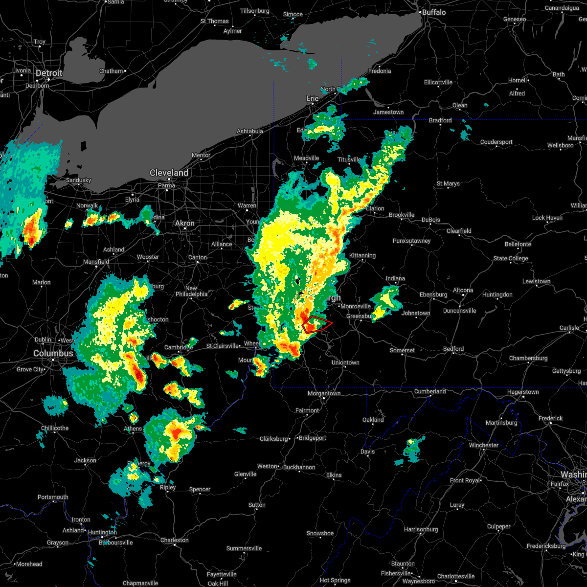 At 605 pm edt, a severe thunderstorm capable of producing a tornado was located over mcmurray, moving east at 45 mph (radar indicated rotation). Hazards include tornado. Flying debris will be dangerous to those caught without shelter. mobile homes will be damaged or destroyed. damage to roofs, windows, and vehicles will occur. tree damage is likely. this dangerous storm will be near, gastonville around 610 pm edt. south park township and jefferson hills around 615 pm edt. clairton around 620 pm edt. Other locations impacted by this tornadic thunderstorm include elizabeth, finleyville, west elizabeth and lincoln. At 605 pm edt, a severe thunderstorm capable of producing a tornado was located over mcmurray, moving east at 45 mph (radar indicated rotation). Hazards include tornado. Flying debris will be dangerous to those caught without shelter. mobile homes will be damaged or destroyed. damage to roofs, windows, and vehicles will occur. tree damage is likely. this dangerous storm will be near, gastonville around 610 pm edt. south park township and jefferson hills around 615 pm edt. clairton around 620 pm edt. Other locations impacted by this tornadic thunderstorm include elizabeth, finleyville, west elizabeth and lincoln.
|
| 5/3/2022 5:54 PM EDT |
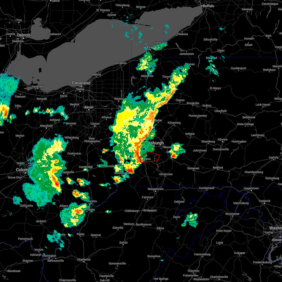 At 554 pm edt, a severe thunderstorm capable of producing a tornado was located over mcgovern, or near canonsburg, moving east at 45 mph (radar indicated rotation). Hazards include tornado. Flying debris will be dangerous to those caught without shelter. mobile homes will be damaged or destroyed. damage to roofs, windows, and vehicles will occur. tree damage is likely. this dangerous storm will be near, mcmurray around 605 pm edt. bethel park, gastonville and upper st. clair around 610 pm edt. south park township, jefferson hills, clairton and monongahela around 615 pm edt. Other locations impacted by this tornadic thunderstorm include elizabeth, finleyville, meadow lands, eighty four, baidland, new eagle, west elizabeth, houston, wickerham manor-fisher and lincoln. At 554 pm edt, a severe thunderstorm capable of producing a tornado was located over mcgovern, or near canonsburg, moving east at 45 mph (radar indicated rotation). Hazards include tornado. Flying debris will be dangerous to those caught without shelter. mobile homes will be damaged or destroyed. damage to roofs, windows, and vehicles will occur. tree damage is likely. this dangerous storm will be near, mcmurray around 605 pm edt. bethel park, gastonville and upper st. clair around 610 pm edt. south park township, jefferson hills, clairton and monongahela around 615 pm edt. Other locations impacted by this tornadic thunderstorm include elizabeth, finleyville, meadow lands, eighty four, baidland, new eagle, west elizabeth, houston, wickerham manor-fisher and lincoln.
|
| 5/3/2022 5:49 PM EDT |
 At 549 pm edt, a severe thunderstorm capable of producing a tornado was located over wolfdale, or near washington, moving east at 50 mph (radar indicated rotation). Hazards include tornado. Flying debris will be dangerous to those caught without shelter. mobile homes will be damaged or destroyed. damage to roofs, windows, and vehicles will occur. tree damage is likely. this dangerous storm will be near, canonsburg around 555 pm edt. cecil-bishop around 600 pm edt. mcmurray around 605 pm edt. bethel park, gastonville, south park township, jefferson hills and monongahela around 610 pm edt. clairton around 615 pm edt. Other locations impacted by this tornadic thunderstorm include elizabeth, finleyville, meadow lands, eighty four, green hills, baidland, new eagle, west elizabeth, houston and wickerham manor-fisher. At 549 pm edt, a severe thunderstorm capable of producing a tornado was located over wolfdale, or near washington, moving east at 50 mph (radar indicated rotation). Hazards include tornado. Flying debris will be dangerous to those caught without shelter. mobile homes will be damaged or destroyed. damage to roofs, windows, and vehicles will occur. tree damage is likely. this dangerous storm will be near, canonsburg around 555 pm edt. cecil-bishop around 600 pm edt. mcmurray around 605 pm edt. bethel park, gastonville, south park township, jefferson hills and monongahela around 610 pm edt. clairton around 615 pm edt. Other locations impacted by this tornadic thunderstorm include elizabeth, finleyville, meadow lands, eighty four, green hills, baidland, new eagle, west elizabeth, houston and wickerham manor-fisher.
|
| 3/31/2022 11:26 AM EDT |
 At 1126 am edt, severe thunderstorms were located along a line extending from near sarver to near clairton, moving east at 40 mph (radar indicated). Hazards include 60 mph wind gusts. Expect damage to trees and power lines, resulting in some power outages. locations impacted include, penn hills, monroeville, greensburg, mckeesport, jeannette, latrobe, vandergrift, kittanning, apollo, plum, west mifflin, and murrysville. hail threat, radar indicated max hail size, <. 75 in wind threat, radar indicated max wind gust, 60 mph. At 1126 am edt, severe thunderstorms were located along a line extending from near sarver to near clairton, moving east at 40 mph (radar indicated). Hazards include 60 mph wind gusts. Expect damage to trees and power lines, resulting in some power outages. locations impacted include, penn hills, monroeville, greensburg, mckeesport, jeannette, latrobe, vandergrift, kittanning, apollo, plum, west mifflin, and murrysville. hail threat, radar indicated max hail size, <. 75 in wind threat, radar indicated max wind gust, 60 mph.
|
| 3/31/2022 11:16 AM EDT |
 At 1116 am edt, severe thunderstorms were located along a line extending from near sarver to near jefferson hills, moving east at 40 mph (radar indicated). Hazards include 60 mph wind gusts. expect damage to trees and power lines, resulting in some power outages At 1116 am edt, severe thunderstorms were located along a line extending from near sarver to near jefferson hills, moving east at 40 mph (radar indicated). Hazards include 60 mph wind gusts. expect damage to trees and power lines, resulting in some power outages
|
| 10/21/2021 8:27 PM EDT |
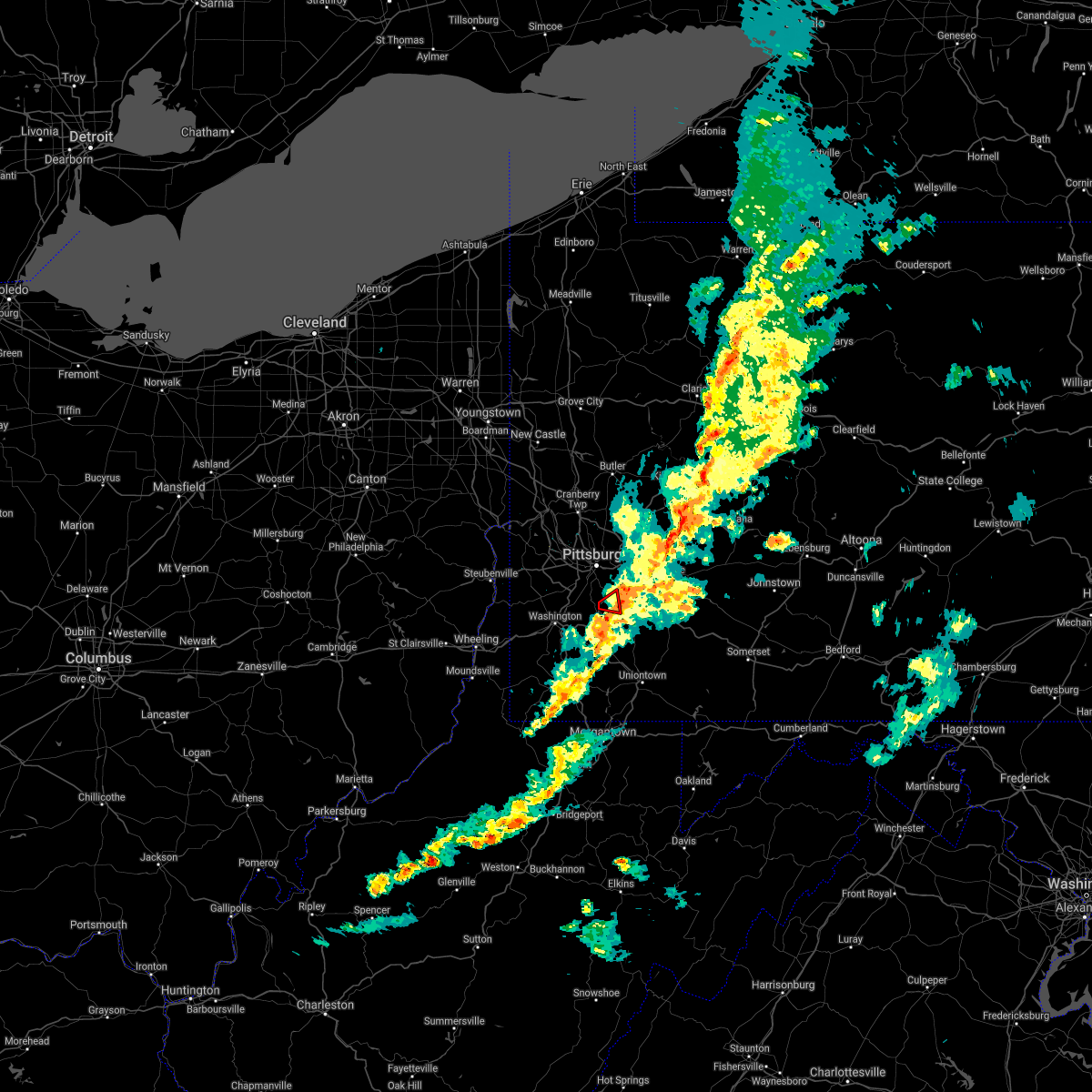 The tornado warning for northeastern washington and south central allegheny counties will expire at 830 pm edt, the storm which prompted the warning has weakened below severe limits, and no longer appears capable of producing a tornado. therefore, the warning will be allowed to expire. however gusty winds are still possible with this thunderstorm. The tornado warning for northeastern washington and south central allegheny counties will expire at 830 pm edt, the storm which prompted the warning has weakened below severe limits, and no longer appears capable of producing a tornado. therefore, the warning will be allowed to expire. however gusty winds are still possible with this thunderstorm.
|
| 10/21/2021 8:22 PM EDT |
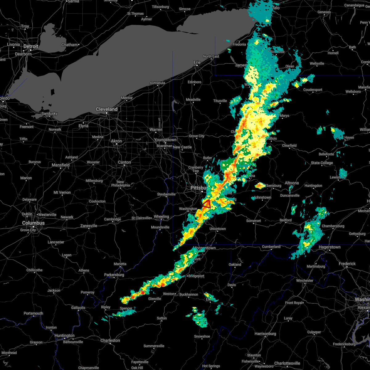 At 822 pm edt, a severe thunderstorm capable of producing a tornado was located over gastonville, moving east at 25 mph (radar indicated rotation). Hazards include tornado. Flying debris will be dangerous to those caught without shelter. mobile homes will be damaged or destroyed. damage to roofs, windows, and vehicles will occur. tree damage is likely. this dangerous storm will be near, clairton and glassport around 835 pm edt. liberty around 840 pm edt. Other locations impacted by this tornadic thunderstorm include west elizabeth, elizabeth and lincoln. At 822 pm edt, a severe thunderstorm capable of producing a tornado was located over gastonville, moving east at 25 mph (radar indicated rotation). Hazards include tornado. Flying debris will be dangerous to those caught without shelter. mobile homes will be damaged or destroyed. damage to roofs, windows, and vehicles will occur. tree damage is likely. this dangerous storm will be near, clairton and glassport around 835 pm edt. liberty around 840 pm edt. Other locations impacted by this tornadic thunderstorm include west elizabeth, elizabeth and lincoln.
|
| 10/21/2021 8:17 PM EDT |
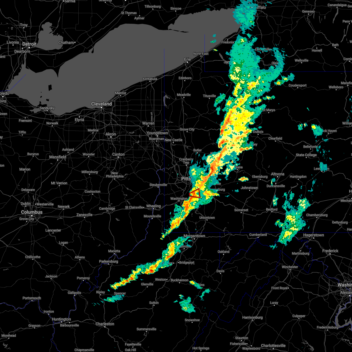 At 817 pm edt, a severe thunderstorm capable of producing a tornado was located over gastonville, moving east at 25 mph (radar indicated rotation). Hazards include tornado. Flying debris will be dangerous to those caught without shelter. mobile homes will be damaged or destroyed. damage to roofs, windows, and vehicles will occur. tree damage is likely. this dangerous storm will be near, gastonville around 820 pm edt. south park township and jefferson hills around 825 pm edt. pleasant hills around 830 pm edt. clairton around 835 pm edt. glassport and liberty around 840 pm edt. mckeesport around 845 pm edt. Other locations impacted by this tornadic thunderstorm include port vue, elizabeth, finleyville, west elizabeth, lincoln and dravosburg. At 817 pm edt, a severe thunderstorm capable of producing a tornado was located over gastonville, moving east at 25 mph (radar indicated rotation). Hazards include tornado. Flying debris will be dangerous to those caught without shelter. mobile homes will be damaged or destroyed. damage to roofs, windows, and vehicles will occur. tree damage is likely. this dangerous storm will be near, gastonville around 820 pm edt. south park township and jefferson hills around 825 pm edt. pleasant hills around 830 pm edt. clairton around 835 pm edt. glassport and liberty around 840 pm edt. mckeesport around 845 pm edt. Other locations impacted by this tornadic thunderstorm include port vue, elizabeth, finleyville, west elizabeth, lincoln and dravosburg.
|
| 10/21/2021 8:12 PM EDT |
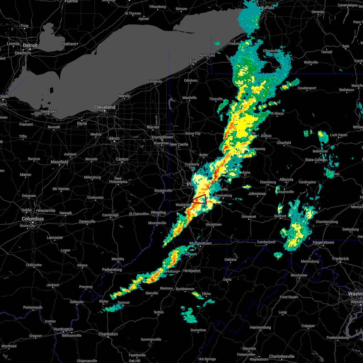 At 812 pm edt, a severe thunderstorm capable of producing a tornado was located over mcmurray, moving east at 25 mph (radar indicated rotation). Hazards include tornado. Flying debris will be dangerous to those caught without shelter. mobile homes will be damaged or destroyed. damage to roofs, windows, and vehicles will occur. tree damage is likely. this dangerous storm will be near, bethel park and gastonville around 820 pm edt. south park township, jefferson hills and pleasant hills around 825 pm edt. mckeesport, clairton, glassport and liberty around 830 pm edt. Other locations impacted by this tornadic thunderstorm include port vue, elizabeth, finleyville, west elizabeth, lincoln and dravosburg. At 812 pm edt, a severe thunderstorm capable of producing a tornado was located over mcmurray, moving east at 25 mph (radar indicated rotation). Hazards include tornado. Flying debris will be dangerous to those caught without shelter. mobile homes will be damaged or destroyed. damage to roofs, windows, and vehicles will occur. tree damage is likely. this dangerous storm will be near, bethel park and gastonville around 820 pm edt. south park township, jefferson hills and pleasant hills around 825 pm edt. mckeesport, clairton, glassport and liberty around 830 pm edt. Other locations impacted by this tornadic thunderstorm include port vue, elizabeth, finleyville, west elizabeth, lincoln and dravosburg.
|
| 10/21/2021 8:07 PM EDT |
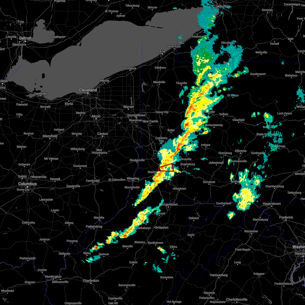 At 807 pm edt, a severe thunderstorm capable of producing a tornado was located over mcmurray, moving east at 25 mph (radar indicated rotation). Hazards include tornado. Flying debris will be dangerous to those caught without shelter. mobile homes will be damaged or destroyed. damage to roofs, windows, and vehicles will occur. tree damage is likely. this dangerous storm will be near, mcmurray around 810 pm edt. bethel park and gastonville around 820 pm edt. south park township, jefferson hills and pleasant hills around 825 pm edt. mckeesport, clairton, glassport and liberty around 830 pm edt. Other locations impacted by this tornadic thunderstorm include port vue, elizabeth, finleyville, west elizabeth, lincoln and dravosburg. At 807 pm edt, a severe thunderstorm capable of producing a tornado was located over mcmurray, moving east at 25 mph (radar indicated rotation). Hazards include tornado. Flying debris will be dangerous to those caught without shelter. mobile homes will be damaged or destroyed. damage to roofs, windows, and vehicles will occur. tree damage is likely. this dangerous storm will be near, mcmurray around 810 pm edt. bethel park and gastonville around 820 pm edt. south park township, jefferson hills and pleasant hills around 825 pm edt. mckeesport, clairton, glassport and liberty around 830 pm edt. Other locations impacted by this tornadic thunderstorm include port vue, elizabeth, finleyville, west elizabeth, lincoln and dravosburg.
|
| 8/12/2021 9:20 PM EDT |
 At 919 pm edt, a severe thunderstorm was located over new stanton, or 8 miles south of jeannette, moving east at 25 mph (radar indicated). Hazards include 60 mph wind gusts. Expect damage to trees and power lines, resulting in some power outages. locations impacted include, pittsburgh, monroeville, greensburg, mckeesport, jeannette, latrobe, west mifflin, murrysville, munhall, jefferson hills, north versailles, and pleasant hills. hail threat, radar indicated max hail size, <. 75 in wind threat, radar indicated max wind gust, 60 mph. At 919 pm edt, a severe thunderstorm was located over new stanton, or 8 miles south of jeannette, moving east at 25 mph (radar indicated). Hazards include 60 mph wind gusts. Expect damage to trees and power lines, resulting in some power outages. locations impacted include, pittsburgh, monroeville, greensburg, mckeesport, jeannette, latrobe, west mifflin, murrysville, munhall, jefferson hills, north versailles, and pleasant hills. hail threat, radar indicated max hail size, <. 75 in wind threat, radar indicated max wind gust, 60 mph.
|
| 8/12/2021 7:09 PM EDT |
 At 709 pm edt, severe thunderstorms were located along a line extending from new kensington to baldwin to near wolfdale, moving east at 35 mph (radar indicated). Hazards include 60 mph wind gusts. expect damage to trees and power lines, resulting in some power outages At 709 pm edt, severe thunderstorms were located along a line extending from new kensington to baldwin to near wolfdale, moving east at 35 mph (radar indicated). Hazards include 60 mph wind gusts. expect damage to trees and power lines, resulting in some power outages
|
| 8/12/2021 7:01 PM EDT |
 At 701 pm edt, severe thunderstorms were located along a line extending from new kensington to castle shannon to near west liberty, moving east at 30 mph (radar indicated). Hazards include 60 mph wind gusts. Expect damage to trees and power lines, resulting in some power outages. locations impacted include, pittsburgh, penn hills, mount lebanon, bethel park, ross township, mccandless township, monroeville, moon township, mcmurray, mckeesport, washington, and franklin park. hail threat, radar indicated max hail size, <. 75 in wind threat, radar indicated max wind gust, 60 mph. At 701 pm edt, severe thunderstorms were located along a line extending from new kensington to castle shannon to near west liberty, moving east at 30 mph (radar indicated). Hazards include 60 mph wind gusts. Expect damage to trees and power lines, resulting in some power outages. locations impacted include, pittsburgh, penn hills, mount lebanon, bethel park, ross township, mccandless township, monroeville, moon township, mcmurray, mckeesport, washington, and franklin park. hail threat, radar indicated max hail size, <. 75 in wind threat, radar indicated max wind gust, 60 mph.
|
| 8/11/2021 1:56 PM EDT |
 The severe thunderstorm warning for east central washington and south central allegheny counties will expire at 200 pm edt, the storm which prompted the warning has weakened below severe limits, and no longer poses an immediate threat to life or property. therefore, the warning will be allowed to expire. The severe thunderstorm warning for east central washington and south central allegheny counties will expire at 200 pm edt, the storm which prompted the warning has weakened below severe limits, and no longer poses an immediate threat to life or property. therefore, the warning will be allowed to expire.
|
| 8/11/2021 1:42 PM EDT |
 At 142 pm edt, a severe thunderstorm was located over jefferson hills, or over gastonville, moving southeast at 40 mph (radar indicated). Hazards include 60 mph wind gusts. Expect damage to trees and power lines, resulting in some power outages. locations impacted include, pittsburgh, mount lebanon, bethel park, mcmurray, mckeesport, gastonville, west mifflin, baldwin, upper st. clair, scott township, whitehall, and south park township. hail threat, radar indicated max hail size, <. 75 in wind threat, radar indicated max wind gust, 60 mph. At 142 pm edt, a severe thunderstorm was located over jefferson hills, or over gastonville, moving southeast at 40 mph (radar indicated). Hazards include 60 mph wind gusts. Expect damage to trees and power lines, resulting in some power outages. locations impacted include, pittsburgh, mount lebanon, bethel park, mcmurray, mckeesport, gastonville, west mifflin, baldwin, upper st. clair, scott township, whitehall, and south park township. hail threat, radar indicated max hail size, <. 75 in wind threat, radar indicated max wind gust, 60 mph.
|
| 8/11/2021 1:30 PM EDT |
 At 129 pm edt, a severe thunderstorm was located over upper st. clair, or over mcmurray, moving southeast at 40 mph (radar indicated). Hazards include 60 mph wind gusts. expect damage to trees and power lines, resulting in some power outages At 129 pm edt, a severe thunderstorm was located over upper st. clair, or over mcmurray, moving southeast at 40 mph (radar indicated). Hazards include 60 mph wind gusts. expect damage to trees and power lines, resulting in some power outages
|
| 8/11/2021 1:08 PM EDT |
 At 107 pm edt, a severe thunderstorm was located over churchill, or over penn hills, moving southeast at 30 mph (emergency management). Hazards include 60 mph wind gusts. Expect damage to trees and power lines, resulting in some power outages. locations impacted include, pittsburgh, penn hills, mount lebanon, bethel park, ross township, mccandless township, monroeville, mcmurray, mckeesport, gastonville, shaler township, and plum. hail threat, radar indicated max hail size, <. 75 in wind threat, radar indicated max wind gust, 60 mph. At 107 pm edt, a severe thunderstorm was located over churchill, or over penn hills, moving southeast at 30 mph (emergency management). Hazards include 60 mph wind gusts. Expect damage to trees and power lines, resulting in some power outages. locations impacted include, pittsburgh, penn hills, mount lebanon, bethel park, ross township, mccandless township, monroeville, mcmurray, mckeesport, gastonville, shaler township, and plum. hail threat, radar indicated max hail size, <. 75 in wind threat, radar indicated max wind gust, 60 mph.
|
| 8/11/2021 12:54 PM EDT |
 At 1253 pm edt, a severe thunderstorm was located over etna, or near ross township, moving southeast at 30 mph (emergency management). Hazards include 60 mph wind gusts. expect damage to trees and power lines, resulting in some power outages At 1253 pm edt, a severe thunderstorm was located over etna, or near ross township, moving southeast at 30 mph (emergency management). Hazards include 60 mph wind gusts. expect damage to trees and power lines, resulting in some power outages
|
| 8/10/2021 2:26 PM EDT |
 At 226 pm edt, a severe thunderstorm was located near new stanton, or 8 miles south of jeannette, moving east at 55 mph (radar indicated). Hazards include 60 mph wind gusts and quarter size hail. Minor hail damage to vehicles is possible. expect wind damage to trees and power lines, resulting in some power outages. locations impacted include, bethel park, greensburg, latrobe, connellsville, gastonville, west mifflin, south park township, jefferson hills, pleasant hills, white oak, monessen, and clairton. hail threat, radar indicated max hail size, 1. 00 in wind threat, radar indicated max wind gust, 60 mph. At 226 pm edt, a severe thunderstorm was located near new stanton, or 8 miles south of jeannette, moving east at 55 mph (radar indicated). Hazards include 60 mph wind gusts and quarter size hail. Minor hail damage to vehicles is possible. expect wind damage to trees and power lines, resulting in some power outages. locations impacted include, bethel park, greensburg, latrobe, connellsville, gastonville, west mifflin, south park township, jefferson hills, pleasant hills, white oak, monessen, and clairton. hail threat, radar indicated max hail size, 1. 00 in wind threat, radar indicated max wind gust, 60 mph.
|
| 8/10/2021 2:13 PM EDT |
 At 213 pm edt, a severe thunderstorm was located over monongahela, or near gastonville, moving east at 40 mph (radar indicated). Hazards include 60 mph wind gusts and quarter size hail. Minor hail damage to vehicles is possible. expect wind damage to trees and power lines, resulting in some power outages. locations impacted include, bethel park, greensburg, latrobe, connellsville, gastonville, west mifflin, south park township, jefferson hills, pleasant hills, white oak, monessen, and clairton. hail threat, radar indicated max hail size, 1. 00 in wind threat, radar indicated max wind gust, 60 mph. At 213 pm edt, a severe thunderstorm was located over monongahela, or near gastonville, moving east at 40 mph (radar indicated). Hazards include 60 mph wind gusts and quarter size hail. Minor hail damage to vehicles is possible. expect wind damage to trees and power lines, resulting in some power outages. locations impacted include, bethel park, greensburg, latrobe, connellsville, gastonville, west mifflin, south park township, jefferson hills, pleasant hills, white oak, monessen, and clairton. hail threat, radar indicated max hail size, 1. 00 in wind threat, radar indicated max wind gust, 60 mph.
|
| 8/10/2021 2:03 PM EDT |
 At 203 pm edt, a severe thunderstorm was located over monongahela, or near gastonville, moving east at 50 mph (radar indicated). Hazards include 60 mph wind gusts and quarter size hail. Minor hail damage to vehicles is possible. Expect wind damage to trees and power lines, resulting in some power outages. At 203 pm edt, a severe thunderstorm was located over monongahela, or near gastonville, moving east at 50 mph (radar indicated). Hazards include 60 mph wind gusts and quarter size hail. Minor hail damage to vehicles is possible. Expect wind damage to trees and power lines, resulting in some power outages.
|
| 7/16/2021 3:42 PM EDT |
 At 342 pm edt, a severe thunderstorm was located over pittsburgh, moving east at 40 mph (radar). Hazards include wind gusts to 60 mph. expect damage to trees and power lines, resulting in some power outages At 342 pm edt, a severe thunderstorm was located over pittsburgh, moving east at 40 mph (radar). Hazards include wind gusts to 60 mph. expect damage to trees and power lines, resulting in some power outages
|
| 7/13/2021 4:14 AM EDT |
 At 414 am edt, a severe thunderstorm was located over north versailles, or near mckeesport, moving east at 45 mph (radar). Hazards include wind gusts to 60 mph. Expect damage to trees and power lines, resulting in some power outages. locations impacted include, pittsburgh, penn hills, monroeville, greensburg, mckeesport, jeannette, plum, west mifflin, murrysville, wilkinsburg, munhall, north versailles, this includes the following highways, pennsylvania turnpike between mile markers 54 and 69. Interstate 376 in pennsylvania between mile markers 74 and 84. At 414 am edt, a severe thunderstorm was located over north versailles, or near mckeesport, moving east at 45 mph (radar). Hazards include wind gusts to 60 mph. Expect damage to trees and power lines, resulting in some power outages. locations impacted include, pittsburgh, penn hills, monroeville, greensburg, mckeesport, jeannette, plum, west mifflin, murrysville, wilkinsburg, munhall, north versailles, this includes the following highways, pennsylvania turnpike between mile markers 54 and 69. Interstate 376 in pennsylvania between mile markers 74 and 84.
|
| 7/13/2021 4:10 AM EDT |
 At 410 am edt, a severe thunderstorm was located over duquesne, or over mckeesport, moving east at 45 mph (radar). Hazards include wind gusts to 60 mph. expect damage to trees and power lines, resulting in some power outages At 410 am edt, a severe thunderstorm was located over duquesne, or over mckeesport, moving east at 45 mph (radar). Hazards include wind gusts to 60 mph. expect damage to trees and power lines, resulting in some power outages
|
| 7/7/2021 7:35 PM EDT |
 At 735 pm edt, a severe thunderstorm was located over baldwin, or near bethel park, moving northeast at 20 mph (radar). Hazards include wind gusts to 60 mph. Expect damage to trees and power lines, resulting in some power outages. Locations impacted include, pittsburgh, bethel park, mckeesport, gastonville, west mifflin, baldwin, whitehall, south park township, jefferson hills, brentwood, pleasant hills, white oak,. At 735 pm edt, a severe thunderstorm was located over baldwin, or near bethel park, moving northeast at 20 mph (radar). Hazards include wind gusts to 60 mph. Expect damage to trees and power lines, resulting in some power outages. Locations impacted include, pittsburgh, bethel park, mckeesport, gastonville, west mifflin, baldwin, whitehall, south park township, jefferson hills, brentwood, pleasant hills, white oak,.
|
| 7/7/2021 7:19 PM EDT |
 At 719 pm edt, a severe thunderstorm was located over bethel park, moving northeast at 20 mph (radar). Hazards include wind gusts to 60 mph. expect damage to trees and power lines, resulting in some power outages At 719 pm edt, a severe thunderstorm was located over bethel park, moving northeast at 20 mph (radar). Hazards include wind gusts to 60 mph. expect damage to trees and power lines, resulting in some power outages
|
| 7/7/2021 3:13 PM EDT |
 At 313 pm edt, a severe thunderstorm was located over bethel park, moving northeast at 10 mph (radar). Hazards include wind gusts to 60 mph and quarter-size hail. Minor hail damage to vehicles is possible. expect wind damage to trees and power lines, resulting in some power outages. locations impacted include, pittsburgh, mount lebanon, bethel park, mcmurray, canonsburg, gastonville, west mifflin, baldwin, upper st. clair, scott township, whitehall, south park township, this includes the following highways, interstate 79 in pennsylvania between mile markers 45 and 57. Interstate 376 in pennsylvania between mile markers 65 and 68. At 313 pm edt, a severe thunderstorm was located over bethel park, moving northeast at 10 mph (radar). Hazards include wind gusts to 60 mph and quarter-size hail. Minor hail damage to vehicles is possible. expect wind damage to trees and power lines, resulting in some power outages. locations impacted include, pittsburgh, mount lebanon, bethel park, mcmurray, canonsburg, gastonville, west mifflin, baldwin, upper st. clair, scott township, whitehall, south park township, this includes the following highways, interstate 79 in pennsylvania between mile markers 45 and 57. Interstate 376 in pennsylvania between mile markers 65 and 68.
|
| 7/7/2021 3:01 PM EDT |
 At 301 pm edt, a severe thunderstorm was located over mcmurray, moving northeast at 10 mph (radar). Hazards include wind gusts to 60 mph. expect damage to trees and power lines, resulting in some power outages At 301 pm edt, a severe thunderstorm was located over mcmurray, moving northeast at 10 mph (radar). Hazards include wind gusts to 60 mph. expect damage to trees and power lines, resulting in some power outages
|
| 6/30/2021 2:07 PM EDT |
 At 206 pm edt, a severe thunderstorm was located near greensburg, moving east at 30 mph (radar). Hazards include wind gusts to 60 mph. Expect damage to trees and power lines, resulting in some power outages. locations impacted include, pittsburgh, penn hills, bethel park, monroeville, mckeesport, jeannette, gastonville, plum, west mifflin, baldwin, murrysville, whitehall, this includes the following highways, interstate 70 in pennsylvania between mile markers 50 and 56. pennsylvania turnpike between mile markers 55 and 74. Interstate 376 in pennsylvania between mile markers 82 and 84. At 206 pm edt, a severe thunderstorm was located near greensburg, moving east at 30 mph (radar). Hazards include wind gusts to 60 mph. Expect damage to trees and power lines, resulting in some power outages. locations impacted include, pittsburgh, penn hills, bethel park, monroeville, mckeesport, jeannette, gastonville, plum, west mifflin, baldwin, murrysville, whitehall, this includes the following highways, interstate 70 in pennsylvania between mile markers 50 and 56. pennsylvania turnpike between mile markers 55 and 74. Interstate 376 in pennsylvania between mile markers 82 and 84.
|
| 6/30/2021 1:29 PM EDT | Em reporting sporadic trees and power lines down throughout count in allegheny county PA, 0.1 miles N of Clairton, PA |
| 6/30/2021 1:23 PM EDT |
 At 123 pm edt, a severe thunderstorm was located over munhall, or near mckeesport, moving east at 25 mph (radar). Hazards include wind gusts to 60 mph and quarter-size hail. Minor hail damage to vehicles is possible. Expect wind damage to trees and power lines, resulting in some power outages. At 123 pm edt, a severe thunderstorm was located over munhall, or near mckeesport, moving east at 25 mph (radar). Hazards include wind gusts to 60 mph and quarter-size hail. Minor hail damage to vehicles is possible. Expect wind damage to trees and power lines, resulting in some power outages.
|
| 6/30/2021 1:14 PM EDT |
 At 114 pm edt, a severe thunderstorm was located over castle shannon, or over mount lebanon, and is nearly stationary (radar). Hazards include wind gusts to 60 mph and quarter-size hail. Minor hail damage to vehicles is possible. expect wind damage to trees and power lines, resulting in some power outages. locations impacted include, pittsburgh, penn hills, mount lebanon, bethel park, monroeville, mcmurray, mckeesport, gastonville, plum, west mifflin, north side pittsburgh, baldwin, this includes the following highways, pennsylvania turnpike between mile markers 51 and 59. interstate 79 in pennsylvania near mile marker 47, and between mile markers 49 and 60. Interstate 376 in pennsylvania between mile markers 62 and 84. At 114 pm edt, a severe thunderstorm was located over castle shannon, or over mount lebanon, and is nearly stationary (radar). Hazards include wind gusts to 60 mph and quarter-size hail. Minor hail damage to vehicles is possible. expect wind damage to trees and power lines, resulting in some power outages. locations impacted include, pittsburgh, penn hills, mount lebanon, bethel park, monroeville, mcmurray, mckeesport, gastonville, plum, west mifflin, north side pittsburgh, baldwin, this includes the following highways, pennsylvania turnpike between mile markers 51 and 59. interstate 79 in pennsylvania near mile marker 47, and between mile markers 49 and 60. Interstate 376 in pennsylvania between mile markers 62 and 84.
|
| 6/30/2021 1:06 PM EDT |
 At 106 pm edt, a severe thunderstorm was located over upper st. clair, or over mount lebanon, moving east at 25 mph (radar). Hazards include wind gusts to 60 mph and quarter-size hail. Minor hail damage to vehicles is possible. Expect wind damage to trees and power lines, resulting in some power outages. At 106 pm edt, a severe thunderstorm was located over upper st. clair, or over mount lebanon, moving east at 25 mph (radar). Hazards include wind gusts to 60 mph and quarter-size hail. Minor hail damage to vehicles is possible. Expect wind damage to trees and power lines, resulting in some power outages.
|
| 6/21/2021 4:05 PM EDT |
 At 405 pm edt, severe thunderstorms were located along a line extending from near white oak to monongahela, moving southeast at 55 mph (radar). Hazards include wind gusts to 60 mph. expect damage to trees and power lines, resulting in some power outages At 405 pm edt, severe thunderstorms were located along a line extending from near white oak to monongahela, moving southeast at 55 mph (radar). Hazards include wind gusts to 60 mph. expect damage to trees and power lines, resulting in some power outages
|
| 6/14/2021 3:29 PM EDT |
 At 329 pm edt, a severe thunderstorm was located over white oak, or near mckeesport, moving east at 35 mph (radar). Hazards include wind gusts to 60 mph. expect damage to trees and power lines, resulting in some power outages At 329 pm edt, a severe thunderstorm was located over white oak, or near mckeesport, moving east at 35 mph (radar). Hazards include wind gusts to 60 mph. expect damage to trees and power lines, resulting in some power outages
|
| 6/14/2021 3:16 PM EDT |
 At 316 pm edt, a severe thunderstorm was located over pleasant hills, or near mckeesport, moving east at 40 mph (radar). Hazards include wind gusts to 60 mph. Expect damage to trees and power lines, resulting in some power outages. locations impacted include, pittsburgh, mount lebanon, bethel park, mcmurray, mckeesport, jeannette, gastonville, west mifflin, baldwin, upper st. clair, whitehall, south park township, this includes the following highways, pennsylvania turnpike between mile markers 64 and 68. Interstate 376 in pennsylvania between mile markers 73 and 76. At 316 pm edt, a severe thunderstorm was located over pleasant hills, or near mckeesport, moving east at 40 mph (radar). Hazards include wind gusts to 60 mph. Expect damage to trees and power lines, resulting in some power outages. locations impacted include, pittsburgh, mount lebanon, bethel park, mcmurray, mckeesport, jeannette, gastonville, west mifflin, baldwin, upper st. clair, whitehall, south park township, this includes the following highways, pennsylvania turnpike between mile markers 64 and 68. Interstate 376 in pennsylvania between mile markers 73 and 76.
|
| 6/14/2021 3:05 PM EDT |
 At 305 pm edt, a severe thunderstorm was located over scott township, or over mount lebanon, moving east at 40 mph (radar). Hazards include wind gusts to 60 mph. expect damage to trees and power lines, resulting in some power outages At 305 pm edt, a severe thunderstorm was located over scott township, or over mount lebanon, moving east at 40 mph (radar). Hazards include wind gusts to 60 mph. expect damage to trees and power lines, resulting in some power outages
|
| 6/13/2021 6:21 PM EDT |
 At 621 pm edt, a severe thunderstorm was located over braddock, or near mckeesport, moving southeast at 25 mph (radar). Hazards include wind gusts to 60 mph and quarter-size hail. Minor hail damage to vehicles is possible. expect wind damage to trees and power lines, resulting in some power outages. locations impacted include, pittsburgh, penn hills, mount lebanon, bethel park, monroeville, mckeesport, gastonville, shaler township, plum, west mifflin, north side pittsburgh, baldwin, this includes the following highways, pennsylvania turnpike between mile markers 48 and 66. Interstate 376 in pennsylvania between mile markers 65 and 84. At 621 pm edt, a severe thunderstorm was located over braddock, or near mckeesport, moving southeast at 25 mph (radar). Hazards include wind gusts to 60 mph and quarter-size hail. Minor hail damage to vehicles is possible. expect wind damage to trees and power lines, resulting in some power outages. locations impacted include, pittsburgh, penn hills, mount lebanon, bethel park, monroeville, mckeesport, gastonville, shaler township, plum, west mifflin, north side pittsburgh, baldwin, this includes the following highways, pennsylvania turnpike between mile markers 48 and 66. Interstate 376 in pennsylvania between mile markers 65 and 84.
|
| 6/13/2021 5:59 PM EDT |
 The national weather service in pittsburgh has issued a * severe thunderstorm warning for. east central washington county in southwestern pennsylvania. eastern allegheny county in southwestern pennsylvania. west central westmoreland county in southwestern pennsylvania. Until 645 pm edt. The national weather service in pittsburgh has issued a * severe thunderstorm warning for. east central washington county in southwestern pennsylvania. eastern allegheny county in southwestern pennsylvania. west central westmoreland county in southwestern pennsylvania. Until 645 pm edt.
|
| 11/15/2020 3:08 PM EST |
 At 308 pm est, severe thunderstorms were located along a line extending from near leechburg to near point marion, moving east at 50 mph (law enforcement). Hazards include wind gusts to 60 mph. Expect damage to trees and power lines, resulting in some power outages. locations impacted include, pittsburgh, penn hills, bethel park, monroeville, mckeesport, gastonville, shaler township, plum, west mifflin, baldwin, murrysville, hampton township, this includes the following highways, interstate 70 in pennsylvania between mile markers 29 and 48. pennsylvania turnpike between mile markers 40 and 60. interstate 79 in pennsylvania between mile markers 8 and 14. Interstate 376 in pennsylvania between mile markers 72 and 84. At 308 pm est, severe thunderstorms were located along a line extending from near leechburg to near point marion, moving east at 50 mph (law enforcement). Hazards include wind gusts to 60 mph. Expect damage to trees and power lines, resulting in some power outages. locations impacted include, pittsburgh, penn hills, bethel park, monroeville, mckeesport, gastonville, shaler township, plum, west mifflin, baldwin, murrysville, hampton township, this includes the following highways, interstate 70 in pennsylvania between mile markers 29 and 48. pennsylvania turnpike between mile markers 40 and 60. interstate 79 in pennsylvania between mile markers 8 and 14. Interstate 376 in pennsylvania between mile markers 72 and 84.
|
| 11/15/2020 2:51 PM EST |
 At 251 pm est, severe thunderstorms were located along a line extending from near sarver to 6 miles north of cassville, moving east at 50 mph (law enforcement). Hazards include wind gusts to 60 mph. Expect damage to trees and power lines, resulting in some power outages. locations impacted include, pittsburgh, penn hills, mount lebanon, bethel park, ross township, mccandless township, monroeville, cranberry, moon township, mcmurray, mckeesport, washington, this includes the following highways, interstate 70 in pennsylvania between mile markers 8 and 48. pennsylvania turnpike between mile markers 23 and 60. interstate 79 in pennsylvania between mile markers 8 and 86. Interstate 376 in pennsylvania between mile markers 54 and 84. At 251 pm est, severe thunderstorms were located along a line extending from near sarver to 6 miles north of cassville, moving east at 50 mph (law enforcement). Hazards include wind gusts to 60 mph. Expect damage to trees and power lines, resulting in some power outages. locations impacted include, pittsburgh, penn hills, mount lebanon, bethel park, ross township, mccandless township, monroeville, cranberry, moon township, mcmurray, mckeesport, washington, this includes the following highways, interstate 70 in pennsylvania between mile markers 8 and 48. pennsylvania turnpike between mile markers 23 and 60. interstate 79 in pennsylvania between mile markers 8 and 86. Interstate 376 in pennsylvania between mile markers 54 and 84.
|
| 11/15/2020 2:36 PM EST |
 At 236 pm est, severe thunderstorms were located along a line extending from mars to 9 miles southwest of waynesburg, moving east at 50 mph (law enforcement). Hazards include wind gusts to 60 mph. expect damage to trees and power lines, resulting in some power outages At 236 pm est, severe thunderstorms were located along a line extending from mars to 9 miles southwest of waynesburg, moving east at 50 mph (law enforcement). Hazards include wind gusts to 60 mph. expect damage to trees and power lines, resulting in some power outages
|
| 8/27/2020 7:13 PM EDT |
 At 712 pm edt, severe thunderstorms were located along a line extending from near irwin to near clairton to near gastonville, moving southeast at 40 mph (law enforcement). Hazards include wind gusts to 60 mph. Expect damage to trees and power lines, resulting in some power outages. locations impacted include, bethel park, monroeville, mcmurray, greensburg, mckeesport, uniontown, jeannette, latrobe, connellsville, gastonville, west mifflin, baldwin, this includes the following highways, interstate 70 in pennsylvania between mile markers 29 and 57. Pennsylvania turnpike between mile markers 57 and 95. At 712 pm edt, severe thunderstorms were located along a line extending from near irwin to near clairton to near gastonville, moving southeast at 40 mph (law enforcement). Hazards include wind gusts to 60 mph. Expect damage to trees and power lines, resulting in some power outages. locations impacted include, bethel park, monroeville, mcmurray, greensburg, mckeesport, uniontown, jeannette, latrobe, connellsville, gastonville, west mifflin, baldwin, this includes the following highways, interstate 70 in pennsylvania between mile markers 29 and 57. Pennsylvania turnpike between mile markers 57 and 95.
|
| 8/27/2020 6:41 PM EDT |
 At 641 pm edt, severe thunderstorms were located along a line extending from bellevue to near sturgeon-noblestown to 6 miles west of mcdonald, moving southeast at 45 mph (radar). Hazards include wind gusts to 60 mph. expect damage to trees and power lines, resulting in some power outages At 641 pm edt, severe thunderstorms were located along a line extending from bellevue to near sturgeon-noblestown to 6 miles west of mcdonald, moving southeast at 45 mph (radar). Hazards include wind gusts to 60 mph. expect damage to trees and power lines, resulting in some power outages
|
| 7/10/2020 6:41 PM EDT |
 At 640 pm edt, severe thunderstorms were located along a line extending from near ellwood city to etna to near white oak to near uniontown, moving east at 20 mph. several trees and power lines have been reported down with this line of thunderstorms (trained weather spotters). Hazards include wind gusts to 60 mph. Expect damage to trees and power lines, resulting in some power outages. locations impacted include, pittsburgh, penn hills, mount lebanon, bethel park, ross township, mccandless township, monroeville, cranberry, greensburg, mckeesport, butler, franklin park, this includes the following highways, interstate 70 in pennsylvania between mile markers 39 and 57. pennsylvania turnpike between mile markers 21 and 99. interstate 79 in pennsylvania between mile markers 70 and 104. Interstate 376 in pennsylvania between mile markers 67 and 84. At 640 pm edt, severe thunderstorms were located along a line extending from near ellwood city to etna to near white oak to near uniontown, moving east at 20 mph. several trees and power lines have been reported down with this line of thunderstorms (trained weather spotters). Hazards include wind gusts to 60 mph. Expect damage to trees and power lines, resulting in some power outages. locations impacted include, pittsburgh, penn hills, mount lebanon, bethel park, ross township, mccandless township, monroeville, cranberry, greensburg, mckeesport, butler, franklin park, this includes the following highways, interstate 70 in pennsylvania between mile markers 39 and 57. pennsylvania turnpike between mile markers 21 and 99. interstate 79 in pennsylvania between mile markers 70 and 104. Interstate 376 in pennsylvania between mile markers 67 and 84.
|
| 7/10/2020 6:32 PM EDT |
 At 631 pm edt, a severe thunderstorm was located over wilkins township, or near monroeville, moving northeast at 30 mph (radar). Hazards include wind gusts to 60 mph. Expect damage to trees and power lines, resulting in some power outages. locations impacted include, pittsburgh, penn hills, mount lebanon, bethel park, monroeville, mckeesport, shaler township, plum, west mifflin, north side pittsburgh, baldwin, murrysville, this includes the following highways, pennsylvania turnpike between mile markers 45 and 66. Interstate 376 in pennsylvania between mile markers 68 and 84. At 631 pm edt, a severe thunderstorm was located over wilkins township, or near monroeville, moving northeast at 30 mph (radar). Hazards include wind gusts to 60 mph. Expect damage to trees and power lines, resulting in some power outages. locations impacted include, pittsburgh, penn hills, mount lebanon, bethel park, monroeville, mckeesport, shaler township, plum, west mifflin, north side pittsburgh, baldwin, murrysville, this includes the following highways, pennsylvania turnpike between mile markers 45 and 66. Interstate 376 in pennsylvania between mile markers 68 and 84.
|
| 7/10/2020 6:30 PM EDT |
 At 629 pm edt, severe thunderstorms were located along a line extending from near ellwood city to millvale to near liberty to near uniontown, moving east at 20 mph (radar). Hazards include wind gusts to 60 mph. expect damage to trees and power lines, resulting in some power outages At 629 pm edt, severe thunderstorms were located along a line extending from near ellwood city to millvale to near liberty to near uniontown, moving east at 20 mph (radar). Hazards include wind gusts to 60 mph. expect damage to trees and power lines, resulting in some power outages
|
| 7/10/2020 5:54 PM EDT |
 At 554 pm edt, a severe thunderstorm was located over mcmurray, moving northeast at 30 mph (radar). Hazards include wind gusts to 60 mph. expect damage to trees and power lines, resulting in some power outages At 554 pm edt, a severe thunderstorm was located over mcmurray, moving northeast at 30 mph (radar). Hazards include wind gusts to 60 mph. expect damage to trees and power lines, resulting in some power outages
|
| 6/10/2020 6:47 PM EDT |
 At 646 pm edt, a severe thunderstorm was located near west newton, or 7 miles southeast of mckeesport, moving north at 40 mph (public). Hazards include wind gusts to 60 mph and quarter-size hail. Minor hail damage to vehicles is possible. expect wind damage to trees and power lines, resulting in some power outages. locations impacted include, mckeesport, jeannette, west mifflin, munhall, jefferson hills, north versailles, white oak, clairton, duquesne, north braddock, glassport, irwin, this includes the following highways, interstate 70 in pennsylvania between mile markers 49 and 51. Pennsylvania turnpike between mile markers 63 and 70. At 646 pm edt, a severe thunderstorm was located near west newton, or 7 miles southeast of mckeesport, moving north at 40 mph (public). Hazards include wind gusts to 60 mph and quarter-size hail. Minor hail damage to vehicles is possible. expect wind damage to trees and power lines, resulting in some power outages. locations impacted include, mckeesport, jeannette, west mifflin, munhall, jefferson hills, north versailles, white oak, clairton, duquesne, north braddock, glassport, irwin, this includes the following highways, interstate 70 in pennsylvania between mile markers 49 and 51. Pennsylvania turnpike between mile markers 63 and 70.
|
| 6/10/2020 6:32 PM EDT |
 At 631 pm edt, a severe thunderstorm was located near monessen, or 13 miles southeast of gastonville, moving north at 40 mph (radar). Hazards include wind gusts to 60 mph and quarter-size hail. Minor hail damage to vehicles is possible. Expect wind damage to trees and power lines, resulting in some power outages. At 631 pm edt, a severe thunderstorm was located near monessen, or 13 miles southeast of gastonville, moving north at 40 mph (radar). Hazards include wind gusts to 60 mph and quarter-size hail. Minor hail damage to vehicles is possible. Expect wind damage to trees and power lines, resulting in some power outages.
|
| 6/4/2020 5:14 PM EDT |
 At 514 pm edt, severe thunderstorms were located along a line extending from near mars to etna to near east washington, moving east at 30 mph (radar). Hazards include wind gusts to 60 mph. Expect damage to trees and power lines, resulting in some power outages. locations impacted include, pittsburgh, penn hills, mount lebanon, bethel park, monroeville, mcmurray, greensburg, mckeesport, indiana, jeannette, latrobe, connellsville, this includes the following highways, interstate 70 in pennsylvania between mile markers 20 and 57. pennsylvania turnpike between mile markers 41 and 99. interstate 79 in pennsylvania between mile markers 29 and 35. Interstate 376 in pennsylvania between mile markers 73 and 84. At 514 pm edt, severe thunderstorms were located along a line extending from near mars to etna to near east washington, moving east at 30 mph (radar). Hazards include wind gusts to 60 mph. Expect damage to trees and power lines, resulting in some power outages. locations impacted include, pittsburgh, penn hills, mount lebanon, bethel park, monroeville, mcmurray, greensburg, mckeesport, indiana, jeannette, latrobe, connellsville, this includes the following highways, interstate 70 in pennsylvania between mile markers 20 and 57. pennsylvania turnpike between mile markers 41 and 99. interstate 79 in pennsylvania between mile markers 29 and 35. Interstate 376 in pennsylvania between mile markers 73 and 84.
|
| 6/4/2020 4:59 PM EDT | Tree down blocking a lane of trave in allegheny county PA, 2.9 miles ESE of Clairton, PA |
| 6/4/2020 4:43 PM EDT |
 At 442 pm edt, severe thunderstorms were located along a line extending from near rochester to moon township to 6 miles west of wolfdale, moving east at 30 mph (radar). Hazards include wind gusts to 60 mph. expect damage to trees and power lines, resulting in some power outages At 442 pm edt, severe thunderstorms were located along a line extending from near rochester to moon township to 6 miles west of wolfdale, moving east at 30 mph (radar). Hazards include wind gusts to 60 mph. expect damage to trees and power lines, resulting in some power outages
|
| 6/4/2020 4:19 PM EDT |
 At 417 pm edt, severe thunderstorms were located along a line extending from near campbell to near east palestine to near shippingport to near wellsburg, moving east at 25 mph (radar). Hazards include wind gusts to 60 mph. Expect damage to trees and power lines, resulting in some power outages. locations impacted include, pittsburgh, penn hills, mount lebanon, bethel park, ross township, mccandless township, monroeville, cranberry, moon township, new castle, mcmurray, weirton, this includes the following highways, interstate 70 in pennsylvania between mile markers 14 and 33. pennsylvania turnpike between mile markers 1 and 56. interstate 79 in pennsylvania between mile markers 32 and 103. Interstate 376 in pennsylvania between mile markers 31 and 84. At 417 pm edt, severe thunderstorms were located along a line extending from near campbell to near east palestine to near shippingport to near wellsburg, moving east at 25 mph (radar). Hazards include wind gusts to 60 mph. Expect damage to trees and power lines, resulting in some power outages. locations impacted include, pittsburgh, penn hills, mount lebanon, bethel park, ross township, mccandless township, monroeville, cranberry, moon township, new castle, mcmurray, weirton, this includes the following highways, interstate 70 in pennsylvania between mile markers 14 and 33. pennsylvania turnpike between mile markers 1 and 56. interstate 79 in pennsylvania between mile markers 32 and 103. Interstate 376 in pennsylvania between mile markers 31 and 84.
|
| 6/4/2020 4:03 PM EDT |
 At 402 pm edt, severe thunderstorms were located along a line extending from near boardman to near east palestine to near midland to 6 miles north of tiltonsville, moving east at 45 mph (radar). Hazards include wind gusts to 60 mph. expect damage to trees and power lines, resulting in some power outages At 402 pm edt, severe thunderstorms were located along a line extending from near boardman to near east palestine to near midland to 6 miles north of tiltonsville, moving east at 45 mph (radar). Hazards include wind gusts to 60 mph. expect damage to trees and power lines, resulting in some power outages
|
| 4/8/2020 1:40 AM EDT |
 At 140 am edt, severe thunderstorms were located along a line extending from near homer city to near bentleyville, moving southeast at 65 mph (radar). Hazards include wind gusts to 60 mph and quarter-size hail. Minor hail damage to vehicles is possible. expect wind damage to trees and power lines, resulting in some power outages. locations impacted include, greensburg, jeannette, latrobe, homer city, murrysville, jefferson hills, white oak, monessen, clairton, california, donora, monongahela, this includes the following highways, interstate 70 in pennsylvania between mile markers 37 and 57. Pennsylvania turnpike between mile markers 62 and 76. At 140 am edt, severe thunderstorms were located along a line extending from near homer city to near bentleyville, moving southeast at 65 mph (radar). Hazards include wind gusts to 60 mph and quarter-size hail. Minor hail damage to vehicles is possible. expect wind damage to trees and power lines, resulting in some power outages. locations impacted include, greensburg, jeannette, latrobe, homer city, murrysville, jefferson hills, white oak, monessen, clairton, california, donora, monongahela, this includes the following highways, interstate 70 in pennsylvania between mile markers 37 and 57. Pennsylvania turnpike between mile markers 62 and 76.
|
| 4/8/2020 1:39 AM EDT |
 At 138 am edt, severe thunderstorms were located along a line extending from 8 miles northwest of indiana to near gastonville, moving southeast at 50 mph (radar). Hazards include wind gusts to 60 mph and quarter-size hail. Minor hail damage to vehicles is possible. Expect wind damage to trees and power lines, resulting in some power outages. At 138 am edt, severe thunderstorms were located along a line extending from 8 miles northwest of indiana to near gastonville, moving southeast at 50 mph (radar). Hazards include wind gusts to 60 mph and quarter-size hail. Minor hail damage to vehicles is possible. Expect wind damage to trees and power lines, resulting in some power outages.
|
| 4/8/2020 1:25 AM EDT | Parts of brick storefront brought down in clairto in allegheny county PA, 0.9 miles NNW of Clairton, PA |
| 4/8/2020 1:22 AM EDT |
 At 122 am edt, severe thunderstorms were located along a line extending from 6 miles south of ford city to near cecil-bishop, moving southeast at 65 mph (radar). Hazards include wind gusts to 70 mph. Trees snapped and uprooted. Power outages can be expected. At 122 am edt, severe thunderstorms were located along a line extending from 6 miles south of ford city to near cecil-bishop, moving southeast at 65 mph (radar). Hazards include wind gusts to 70 mph. Trees snapped and uprooted. Power outages can be expected.
|
| 3/28/2020 4:46 PM EDT |
 At 446 pm edt, a severe thunderstorm was located near white oak, or near mckeesport, moving east at 40 mph (radar). Hazards include wind gusts to 60 mph and quarter-size hail. Minor hail damage to vehicles is possible. expect wind damage to trees and power lines, resulting in some power outages. locations impacted include, pittsburgh, bethel park, monroeville, greensburg, mckeesport, jeannette, gastonville, west mifflin, baldwin, whitehall, south park township, munhall, this includes the following highways, interstate 70 in pennsylvania between mile markers 46 and 57. Pennsylvania turnpike between mile markers 62 and 78. At 446 pm edt, a severe thunderstorm was located near white oak, or near mckeesport, moving east at 40 mph (radar). Hazards include wind gusts to 60 mph and quarter-size hail. Minor hail damage to vehicles is possible. expect wind damage to trees and power lines, resulting in some power outages. locations impacted include, pittsburgh, bethel park, monroeville, greensburg, mckeesport, jeannette, gastonville, west mifflin, baldwin, whitehall, south park township, munhall, this includes the following highways, interstate 70 in pennsylvania between mile markers 46 and 57. Pennsylvania turnpike between mile markers 62 and 78.
|
| 3/28/2020 4:27 PM EDT |
 At 426 pm edt, a severe thunderstorm was located over bethel park, moving east at 50 mph (radar). Hazards include wind gusts to 60 mph and quarter-size hail. Minor hail damage to vehicles is possible. expect wind damage to trees and power lines, resulting in some power outages. locations impacted include, pittsburgh, mount lebanon, bethel park, monroeville, mcmurray, greensburg, mckeesport, jeannette, canonsburg, gastonville, west mifflin, baldwin, this includes the following highways, interstate 70 in pennsylvania between mile markers 46 and 57. pennsylvania turnpike between mile markers 62 and 78. interstate 79 in pennsylvania between mile markers 42 and 59. Interstate 376 in pennsylvania between mile markers 65 and 66. At 426 pm edt, a severe thunderstorm was located over bethel park, moving east at 50 mph (radar). Hazards include wind gusts to 60 mph and quarter-size hail. Minor hail damage to vehicles is possible. expect wind damage to trees and power lines, resulting in some power outages. locations impacted include, pittsburgh, mount lebanon, bethel park, monroeville, mcmurray, greensburg, mckeesport, jeannette, canonsburg, gastonville, west mifflin, baldwin, this includes the following highways, interstate 70 in pennsylvania between mile markers 46 and 57. pennsylvania turnpike between mile markers 62 and 78. interstate 79 in pennsylvania between mile markers 42 and 59. Interstate 376 in pennsylvania between mile markers 65 and 66.
|
| 3/28/2020 4:13 PM EDT |
 At 412 pm edt, a severe thunderstorm was located near mcdonald, or 8 miles northeast of avella, moving east at 45 mph (radar). Hazards include wind gusts to 60 mph and quarter-size hail. Minor hail damage to vehicles is possible. Expect wind damage to trees and power lines, resulting in some power outages. At 412 pm edt, a severe thunderstorm was located near mcdonald, or 8 miles northeast of avella, moving east at 45 mph (radar). Hazards include wind gusts to 60 mph and quarter-size hail. Minor hail damage to vehicles is possible. Expect wind damage to trees and power lines, resulting in some power outages.
|
| 1/11/2020 5:43 PM EST |
 The severe thunderstorm warning for central washington and allegheny counties will expire at 545 pm est, the storm that prompted the warning has weakened below severe limits and no longer pose an immediate threat to life and property. therefore, the warning will be allowed to expire. however gusty winds are still possible with this thunderstorm. The severe thunderstorm warning for central washington and allegheny counties will expire at 545 pm est, the storm that prompted the warning has weakened below severe limits and no longer pose an immediate threat to life and property. therefore, the warning will be allowed to expire. however gusty winds are still possible with this thunderstorm.
|
| 1/11/2020 5:33 PM EST |
 At 532 pm est, a severe thunderstorm was located over robinson township, or near mount lebanon, moving east at 45 mph (radar). Hazards include wind gusts to 60 mph. Expect damage to trees and power lines, resulting in some power outages. locations impacted include, pittsburgh, penn hills, mount lebanon, bethel park, ross township, mccandless township, monroeville, moon township, mcmurray, mckeesport, franklin park, canonsburg, this includes the following highways, pennsylvania turnpike between mile markers 38 and 58. interstate 79 in pennsylvania between mile markers 42 and 70. Interstate 376 in pennsylvania between mile markers 56 and 84. At 532 pm est, a severe thunderstorm was located over robinson township, or near mount lebanon, moving east at 45 mph (radar). Hazards include wind gusts to 60 mph. Expect damage to trees and power lines, resulting in some power outages. locations impacted include, pittsburgh, penn hills, mount lebanon, bethel park, ross township, mccandless township, monroeville, moon township, mcmurray, mckeesport, franklin park, canonsburg, this includes the following highways, pennsylvania turnpike between mile markers 38 and 58. interstate 79 in pennsylvania between mile markers 42 and 70. Interstate 376 in pennsylvania between mile markers 56 and 84.
|
| 1/11/2020 5:20 PM EST |
 At 519 pm est, a severe thunderstorm was located near mcdonald, or 9 miles northeast of avella, moving east at 45 mph (radar). Hazards include wind gusts to 60 mph. expect damage to trees and power lines, resulting in some power outages At 519 pm est, a severe thunderstorm was located near mcdonald, or 9 miles northeast of avella, moving east at 45 mph (radar). Hazards include wind gusts to 60 mph. expect damage to trees and power lines, resulting in some power outages
|
| 9/28/2019 7:58 PM EDT |
 The severe thunderstorm warning for eastern washington, southeastern allegheny, southwestern westmoreland and north central fayette counties will expire at 800 pm edt, the storm that prompted the warning has weakened below severe limits. therefore, the warning will be allowed to expire. The severe thunderstorm warning for eastern washington, southeastern allegheny, southwestern westmoreland and north central fayette counties will expire at 800 pm edt, the storm that prompted the warning has weakened below severe limits. therefore, the warning will be allowed to expire.
|
| 9/28/2019 7:50 PM EDT |
 At 750 pm edt, a severe thunderstorm was located near monongahela, or 7 miles east of gastonville, moving southeast at 25 mph (radar). Hazards include wind gusts to 60 mph and quarter-size hail. Minor hail damage to vehicles is possible. expect wind damage to trees and power lines, resulting in some power outages. locations impacted include, mckeesport, white oak, monessen, donora, monongahela, west newton, new stanton, perryopolis, north belle vernon, wickerham manor-fisher, versailles, elizabeth, this includes the following highways, interstate 70 in pennsylvania between mile markers 41 and 56. Pennsylvania turnpike between mile markers 73 and 75. At 750 pm edt, a severe thunderstorm was located near monongahela, or 7 miles east of gastonville, moving southeast at 25 mph (radar). Hazards include wind gusts to 60 mph and quarter-size hail. Minor hail damage to vehicles is possible. expect wind damage to trees and power lines, resulting in some power outages. locations impacted include, mckeesport, white oak, monessen, donora, monongahela, west newton, new stanton, perryopolis, north belle vernon, wickerham manor-fisher, versailles, elizabeth, this includes the following highways, interstate 70 in pennsylvania between mile markers 41 and 56. Pennsylvania turnpike between mile markers 73 and 75.
|
| 9/28/2019 7:29 PM EDT |
 At 729 pm edt, a severe thunderstorm was located over south park township, or over bethel park, moving southeast at 25 mph (radar). Hazards include wind gusts to 60 mph and quarter-size hail. Minor hail damage to vehicles is possible. expect wind damage to trees and power lines, resulting in some power outages. locations impacted include, pittsburgh, mount lebanon, bethel park, mcmurray, mckeesport, gastonville, west mifflin, baldwin, upper st. clair, whitehall, south park township, jefferson hills, this includes the following highways, interstate 70 in pennsylvania between mile markers 39 and 56. Pennsylvania turnpike between mile markers 73 and 75. At 729 pm edt, a severe thunderstorm was located over south park township, or over bethel park, moving southeast at 25 mph (radar). Hazards include wind gusts to 60 mph and quarter-size hail. Minor hail damage to vehicles is possible. expect wind damage to trees and power lines, resulting in some power outages. locations impacted include, pittsburgh, mount lebanon, bethel park, mcmurray, mckeesport, gastonville, west mifflin, baldwin, upper st. clair, whitehall, south park township, jefferson hills, this includes the following highways, interstate 70 in pennsylvania between mile markers 39 and 56. Pennsylvania turnpike between mile markers 73 and 75.
|
| 9/28/2019 7:15 PM EDT |
 At 715 pm edt, a severe thunderstorm was located over bridgeville, or over mount lebanon, moving southeast at 25 mph (radar). Hazards include wind gusts to 60 mph and quarter-size hail. Minor hail damage to vehicles is possible. Expect wind damage to trees and power lines, resulting in some power outages. At 715 pm edt, a severe thunderstorm was located over bridgeville, or over mount lebanon, moving southeast at 25 mph (radar). Hazards include wind gusts to 60 mph and quarter-size hail. Minor hail damage to vehicles is possible. Expect wind damage to trees and power lines, resulting in some power outages.
|
| 8/15/2019 3:38 PM EDT |
 At 338 pm edt, a severe thunderstorm was located over trafford, or near monroeville, moving east at 30 mph (radar). Hazards include wind gusts to 60 mph and quarter-size hail. Minor hail damage to vehicles is possible. Expect wind damage to trees and power lines, resulting in some power outages. At 338 pm edt, a severe thunderstorm was located over trafford, or near monroeville, moving east at 30 mph (radar). Hazards include wind gusts to 60 mph and quarter-size hail. Minor hail damage to vehicles is possible. Expect wind damage to trees and power lines, resulting in some power outages.
|
| 8/15/2019 3:29 PM EDT |
 At 329 pm edt, a severe thunderstorm was located over south park township, or over gastonville, moving southeast at 10 mph (radar). Hazards include wind gusts to 60 mph and quarter-size hail. Minor hail damage to vehicles is possible. expect wind damage to trees and power lines, resulting in some power outages. Locations impacted include, pittsburgh, mckeesport, west mifflin, baldwin, whitehall, south park township, munhall, jefferson hills, north versailles, brentwood, swissvale, pleasant hills,. At 329 pm edt, a severe thunderstorm was located over south park township, or over gastonville, moving southeast at 10 mph (radar). Hazards include wind gusts to 60 mph and quarter-size hail. Minor hail damage to vehicles is possible. expect wind damage to trees and power lines, resulting in some power outages. Locations impacted include, pittsburgh, mckeesport, west mifflin, baldwin, whitehall, south park township, munhall, jefferson hills, north versailles, brentwood, swissvale, pleasant hills,.
|
| 8/15/2019 3:22 PM EDT |
 At 321 pm edt, a severe thunderstorm was located over south park township, or over bethel park, moving southeast at 10 mph (radar). Hazards include wind gusts to 60 mph and quarter-size hail. Minor hail damage to vehicles is possible. expect wind damage to trees and power lines, resulting in some power outages. locations impacted include, pittsburgh, mount lebanon, bethel park, mckeesport, west mifflin, baldwin, upper st. Clair, whitehall, south park township, munhall, jefferson hills, north versailles, this includes interstate 376 in pennsylvania mile marker 71 and near mile marker 73. At 321 pm edt, a severe thunderstorm was located over south park township, or over bethel park, moving southeast at 10 mph (radar). Hazards include wind gusts to 60 mph and quarter-size hail. Minor hail damage to vehicles is possible. expect wind damage to trees and power lines, resulting in some power outages. locations impacted include, pittsburgh, mount lebanon, bethel park, mckeesport, west mifflin, baldwin, upper st. Clair, whitehall, south park township, munhall, jefferson hills, north versailles, this includes interstate 376 in pennsylvania mile marker 71 and near mile marker 73.
|
| 8/15/2019 2:59 PM EDT |
 At 259 pm edt, a severe thunderstorm was located over mount lebanon, moving southeast at 10 mph (radar). Hazards include wind gusts to 60 mph. expect damage to trees and power lines, resulting in some power outages At 259 pm edt, a severe thunderstorm was located over mount lebanon, moving southeast at 10 mph (radar). Hazards include wind gusts to 60 mph. expect damage to trees and power lines, resulting in some power outages
|
| 8/8/2019 5:32 PM EDT |
 At 532 pm edt, a severe thunderstorm was located over clairton, or near mckeesport, moving southeast at 30 mph (radar). Hazards include wind gusts to 60 mph. Expect damage to trees and power lines, resulting in some power outages. locations impacted include, pittsburgh, bethel park, mcmurray, mckeesport, gastonville, west mifflin, baldwin, whitehall, south park township, munhall, jefferson hills, north versailles, this includes the following highways, interstate 70 in pennsylvania between mile markers 40 and 51. Pennsylvania turnpike between mile markers 68 and 72. At 532 pm edt, a severe thunderstorm was located over clairton, or near mckeesport, moving southeast at 30 mph (radar). Hazards include wind gusts to 60 mph. Expect damage to trees and power lines, resulting in some power outages. locations impacted include, pittsburgh, bethel park, mcmurray, mckeesport, gastonville, west mifflin, baldwin, whitehall, south park township, munhall, jefferson hills, north versailles, this includes the following highways, interstate 70 in pennsylvania between mile markers 40 and 51. Pennsylvania turnpike between mile markers 68 and 72.
|
| 8/8/2019 5:10 PM EDT |
 At 510 pm edt, a severe thunderstorm was located over mount lebanon, moving southeast at 30 mph (radar). Hazards include wind gusts to 60 mph. Expect damage to trees and power lines, resulting in some power outages. locations impacted include, pittsburgh, mount lebanon, bethel park, mcmurray, mckeesport, gastonville, west mifflin, baldwin, upper st. clair, scott township, whitehall, south park township, this includes the following highways, interstate 70 in pennsylvania between mile markers 40 and 51. pennsylvania turnpike between mile markers 68 and 72. interstate 79 in pennsylvania between mile markers 50 and 62. Interstate 376 in pennsylvania between mile markers 61 and 73. At 510 pm edt, a severe thunderstorm was located over mount lebanon, moving southeast at 30 mph (radar). Hazards include wind gusts to 60 mph. Expect damage to trees and power lines, resulting in some power outages. locations impacted include, pittsburgh, mount lebanon, bethel park, mcmurray, mckeesport, gastonville, west mifflin, baldwin, upper st. clair, scott township, whitehall, south park township, this includes the following highways, interstate 70 in pennsylvania between mile markers 40 and 51. pennsylvania turnpike between mile markers 68 and 72. interstate 79 in pennsylvania between mile markers 50 and 62. Interstate 376 in pennsylvania between mile markers 61 and 73.
|
| 8/8/2019 4:54 PM EDT |
 At 453 pm edt, a severe thunderstorm was located over imperial, or near moon township, moving southeast at 30 mph (radar). Hazards include wind gusts to 60 mph. expect damage to trees and power lines, resulting in some power outages At 453 pm edt, a severe thunderstorm was located over imperial, or near moon township, moving southeast at 30 mph (radar). Hazards include wind gusts to 60 mph. expect damage to trees and power lines, resulting in some power outages
|
| 7/21/2019 2:35 PM EDT |
 The severe thunderstorm warning for central allegheny county will expire at 245 pm edt, the storm that prompted the warning has weakened below severe limits and no longer pose an immediate threat to life and property. therefore, the warning will be allowed to expire. however heavy rain is still possible with this thunderstorm. The severe thunderstorm warning for central allegheny county will expire at 245 pm edt, the storm that prompted the warning has weakened below severe limits and no longer pose an immediate threat to life and property. therefore, the warning will be allowed to expire. however heavy rain is still possible with this thunderstorm.
|
| 7/21/2019 2:31 PM EDT |
 At 230 pm edt, a severe thunderstorm was located over mckees rocks, or near pittsburgh, moving east at 30 mph (radar). Hazards include wind gusts to 60 mph. Expect damage to trees and power lines, resulting in some power outages. locations impacted include, pittsburgh, penn hills, mount lebanon, bethel park, mckeesport, shaler township, west mifflin, north side pittsburgh, baldwin, upper st. clair, scott township, wilkinsburg, this includes the following highways, interstate 79 in pennsylvania between mile markers 53 and 62. Interstate 376 in pennsylvania between mile markers 62 and 77. At 230 pm edt, a severe thunderstorm was located over mckees rocks, or near pittsburgh, moving east at 30 mph (radar). Hazards include wind gusts to 60 mph. Expect damage to trees and power lines, resulting in some power outages. locations impacted include, pittsburgh, penn hills, mount lebanon, bethel park, mckeesport, shaler township, west mifflin, north side pittsburgh, baldwin, upper st. clair, scott township, wilkinsburg, this includes the following highways, interstate 79 in pennsylvania between mile markers 53 and 62. Interstate 376 in pennsylvania between mile markers 62 and 77.
|
| 7/21/2019 2:24 PM EDT |
 At 224 pm edt, a severe thunderstorm was located over robinson township, or near moon township, moving east at 30 mph (radar). Hazards include wind gusts to 60 mph. Expect damage to trees and power lines, resulting in some power outages. locations impacted include, pittsburgh, penn hills, mount lebanon, bethel park, ross township, moon township, mckeesport, shaler township, west mifflin, north side pittsburgh, baldwin, upper st. clair, this includes the following highways, interstate 79 in pennsylvania between mile markers 53 and 67. Interstate 376 in pennsylvania between mile markers 54 and 78. At 224 pm edt, a severe thunderstorm was located over robinson township, or near moon township, moving east at 30 mph (radar). Hazards include wind gusts to 60 mph. Expect damage to trees and power lines, resulting in some power outages. locations impacted include, pittsburgh, penn hills, mount lebanon, bethel park, ross township, moon township, mckeesport, shaler township, west mifflin, north side pittsburgh, baldwin, upper st. clair, this includes the following highways, interstate 79 in pennsylvania between mile markers 53 and 67. Interstate 376 in pennsylvania between mile markers 54 and 78.
|
| 7/21/2019 2:17 PM EDT |
 The national weather service in pittsburgh has issued a * severe thunderstorm warning for. central allegheny county in southwestern pennsylvania. until 245 pm edt. At 216 pm edt, a severe thunderstorm was located over imperial, or near moon township, moving east at 30 mph. The national weather service in pittsburgh has issued a * severe thunderstorm warning for. central allegheny county in southwestern pennsylvania. until 245 pm edt. At 216 pm edt, a severe thunderstorm was located over imperial, or near moon township, moving east at 30 mph.
|
| 7/6/2019 5:04 PM EDT |
 At 457 pm edt, a severe thunderstorm was located over clairton, or near mckeesport, moving east at 35 mph (radar). Hazards include wind gusts to 60 mph. Expect damage to trees and power lines, resulting in some power outages. Locations impacted include, pittsburgh, bethel park, mckeesport, gastonville, west mifflin, baldwin, whitehall, south park township, munhall, jefferson hills, brentwood, pleasant hills, this includes interstate 70 in pennsylvania between mile markers 37 and 43. At 457 pm edt, a severe thunderstorm was located over clairton, or near mckeesport, moving east at 35 mph (radar). Hazards include wind gusts to 60 mph. Expect damage to trees and power lines, resulting in some power outages. Locations impacted include, pittsburgh, bethel park, mckeesport, gastonville, west mifflin, baldwin, whitehall, south park township, munhall, jefferson hills, brentwood, pleasant hills, this includes interstate 70 in pennsylvania between mile markers 37 and 43.
|
| 7/6/2019 4:57 PM EDT |
 At 457 pm edt, a severe thunderstorm was located over clairton, or near mckeesport, moving east at 35 mph (radar). Hazards include wind gusts to 60 mph. Expect damage to trees and power lines, resulting in some power outages. Locations impacted include, pittsburgh, bethel park, mckeesport, gastonville, west mifflin, baldwin, whitehall, south park township, munhall, jefferson hills, brentwood, pleasant hills, this includes interstate 70 in pennsylvania between mile markers 37 and 43. At 457 pm edt, a severe thunderstorm was located over clairton, or near mckeesport, moving east at 35 mph (radar). Hazards include wind gusts to 60 mph. Expect damage to trees and power lines, resulting in some power outages. Locations impacted include, pittsburgh, bethel park, mckeesport, gastonville, west mifflin, baldwin, whitehall, south park township, munhall, jefferson hills, brentwood, pleasant hills, this includes interstate 70 in pennsylvania between mile markers 37 and 43.
|
| 7/6/2019 4:50 PM EDT |
 At 450 pm edt, a severe thunderstorm was located over jefferson hills, or over gastonville, moving southeast at 35 mph (radar). Hazards include wind gusts to 60 mph. Expect damage to trees and power lines, resulting in some power outages. locations impacted include, pittsburgh, mount lebanon, bethel park, mcmurray, mckeesport, gastonville, west mifflin, baldwin, upper st. clair, scott township, whitehall, south park township, this includes the following highways, interstate 70 in pennsylvania between mile markers 34 and 43. Interstate 79 in pennsylvania between mile markers 56 and 58. At 450 pm edt, a severe thunderstorm was located over jefferson hills, or over gastonville, moving southeast at 35 mph (radar). Hazards include wind gusts to 60 mph. Expect damage to trees and power lines, resulting in some power outages. locations impacted include, pittsburgh, mount lebanon, bethel park, mcmurray, mckeesport, gastonville, west mifflin, baldwin, upper st. clair, scott township, whitehall, south park township, this includes the following highways, interstate 70 in pennsylvania between mile markers 34 and 43. Interstate 79 in pennsylvania between mile markers 56 and 58.
|
| 7/6/2019 4:41 PM EDT |
 At 441 pm edt, a severe thunderstorm was located over bethel park, moving southeast at 35 mph (radar). Hazards include wind gusts to 60 mph. Expect damage to trees and power lines, resulting in some power outages. locations impacted include, pittsburgh, mount lebanon, bethel park, mcmurray, mckeesport, gastonville, west mifflin, baldwin, upper st. clair, scott township, whitehall, south park township, this includes the following highways, interstate 70 in pennsylvania between mile markers 32 and 43. Interstate 79 in pennsylvania between mile markers 48 and 58. At 441 pm edt, a severe thunderstorm was located over bethel park, moving southeast at 35 mph (radar). Hazards include wind gusts to 60 mph. Expect damage to trees and power lines, resulting in some power outages. locations impacted include, pittsburgh, mount lebanon, bethel park, mcmurray, mckeesport, gastonville, west mifflin, baldwin, upper st. clair, scott township, whitehall, south park township, this includes the following highways, interstate 70 in pennsylvania between mile markers 32 and 43. Interstate 79 in pennsylvania between mile markers 48 and 58.
|
| 7/6/2019 4:33 PM EDT |
 At 433 pm edt, a severe thunderstorm was located over bridgeville, or over mount lebanon, moving southeast at 35 mph (radar). Hazards include wind gusts to 60 mph. expect damage to trees and power lines, resulting in some power outages At 433 pm edt, a severe thunderstorm was located over bridgeville, or over mount lebanon, moving southeast at 35 mph (radar). Hazards include wind gusts to 60 mph. expect damage to trees and power lines, resulting in some power outages
|
| 6/27/2019 4:57 PM EDT |
 The severe thunderstorm warning for southeastern allegheny county will expire at 500 pm edt, the storm that prompted the warning has weakened and is exiting the warned area. therefore, the warning will be allowed to expire. however heavy rain is still occurring with this thunderstorm. The severe thunderstorm warning for southeastern allegheny county will expire at 500 pm edt, the storm that prompted the warning has weakened and is exiting the warned area. therefore, the warning will be allowed to expire. however heavy rain is still occurring with this thunderstorm.
|
| 6/27/2019 4:48 PM EDT |
 At 447 pm edt, a severe thunderstorm was located over west mifflin, or over mckeesport, moving east at 10 mph (radar). Hazards include wind gusts to 60 mph. Expect damage to trees and power lines, resulting in some power outages. Locations impacted include, pittsburgh, penn hills, monroeville, mckeesport, west mifflin, baldwin, wilkinsburg, whitehall, munhall, jefferson hills, north versailles, brentwood,. At 447 pm edt, a severe thunderstorm was located over west mifflin, or over mckeesport, moving east at 10 mph (radar). Hazards include wind gusts to 60 mph. Expect damage to trees and power lines, resulting in some power outages. Locations impacted include, pittsburgh, penn hills, monroeville, mckeesport, west mifflin, baldwin, wilkinsburg, whitehall, munhall, jefferson hills, north versailles, brentwood,.
|
| 6/27/2019 4:24 PM EDT |
 At 423 pm edt, a severe thunderstorm was located over brentwood, or near pittsburgh, moving east at 5 mph (radar). Hazards include wind gusts to 60 mph. Expect damage to trees and power lines, resulting in some power outages. Locations impacted include, pittsburgh, penn hills, mount lebanon, bethel park, monroeville, mckeesport, plum, west mifflin, north side pittsburgh, baldwin, wilkinsburg, whitehall,. At 423 pm edt, a severe thunderstorm was located over brentwood, or near pittsburgh, moving east at 5 mph (radar). Hazards include wind gusts to 60 mph. Expect damage to trees and power lines, resulting in some power outages. Locations impacted include, pittsburgh, penn hills, mount lebanon, bethel park, monroeville, mckeesport, plum, west mifflin, north side pittsburgh, baldwin, wilkinsburg, whitehall,.
|
| 6/27/2019 4:15 PM EDT |
 At 415 pm edt, a severe thunderstorm was located over brentwood, or near pittsburgh, moving northeast at 15 mph (radar). Hazards include wind gusts to 60 mph and quarter-size hail. Minor hail damage to vehicles is possible. Expect wind damage to trees and power lines, resulting in some power outages. At 415 pm edt, a severe thunderstorm was located over brentwood, or near pittsburgh, moving northeast at 15 mph (radar). Hazards include wind gusts to 60 mph and quarter-size hail. Minor hail damage to vehicles is possible. Expect wind damage to trees and power lines, resulting in some power outages.
|
| 6/24/2019 7:08 PM EDT |
 The severe thunderstorm warning for northern washington, southern beaver, southwestern butler and allegheny counties will expire at 715 pm edt, the storms that prompted the warning have weakened below severe limits and no longer pose an immediate threat to life and property. therefore, the warning will be allowed to expire. however gusty winds and heavy rain with areas of minor flooding are still possible with these thunderstorms. a severe thunderstorm watch remains in effect until 1000 pm edt for western, southwestern and west central pennsylvania. The severe thunderstorm warning for northern washington, southern beaver, southwestern butler and allegheny counties will expire at 715 pm edt, the storms that prompted the warning have weakened below severe limits and no longer pose an immediate threat to life and property. therefore, the warning will be allowed to expire. however gusty winds and heavy rain with areas of minor flooding are still possible with these thunderstorms. a severe thunderstorm watch remains in effect until 1000 pm edt for western, southwestern and west central pennsylvania.
|
| 6/24/2019 6:50 PM EDT |
 At 649 pm edt, severe thunderstorms were located along a line extending from near ambridge to near mcdonald, moving east at 40 mph (radar). Hazards include wind gusts to 60 mph. Expect damage to trees and power lines, resulting in some power outages. Locations impacted include, pittsburgh, penn hills, mount lebanon, bethel park, ross township, mccandless township, monroeville, moon township, mcmurray, mckeesport, franklin park, aliquippa,. At 649 pm edt, severe thunderstorms were located along a line extending from near ambridge to near mcdonald, moving east at 40 mph (radar). Hazards include wind gusts to 60 mph. Expect damage to trees and power lines, resulting in some power outages. Locations impacted include, pittsburgh, penn hills, mount lebanon, bethel park, ross township, mccandless township, monroeville, moon township, mcmurray, mckeesport, franklin park, aliquippa,.
|
| 6/24/2019 6:25 PM EDT |
 At 625 pm edt, severe thunderstorms were located along a line extending from near wellsville to avella, moving east at 50 mph (radar). Hazards include wind gusts to 60 mph. expect damage to trees and power lines, resulting in some power outages At 625 pm edt, severe thunderstorms were located along a line extending from near wellsville to avella, moving east at 50 mph (radar). Hazards include wind gusts to 60 mph. expect damage to trees and power lines, resulting in some power outages
|
| 5/29/2019 3:55 PM EDT |
 At 354 pm edt, a severe thunderstorm was located near west newton, or 8 miles southwest of jeannette, moving east at 55 mph (radar). Hazards include wind gusts to 60 mph. Expect damage to trees and power lines, resulting in some power outages. locations impacted include, greensburg, mckeesport, jeannette, white oak, clairton, glassport, mount pleasant, scottdale, irwin, youngwood, west newton, liberty, this includes the following highways, interstate 70 in pennsylvania between mile markers 44 and 57. Pennsylvania turnpike between mile markers 67 and 84. At 354 pm edt, a severe thunderstorm was located near west newton, or 8 miles southwest of jeannette, moving east at 55 mph (radar). Hazards include wind gusts to 60 mph. Expect damage to trees and power lines, resulting in some power outages. locations impacted include, greensburg, mckeesport, jeannette, white oak, clairton, glassport, mount pleasant, scottdale, irwin, youngwood, west newton, liberty, this includes the following highways, interstate 70 in pennsylvania between mile markers 44 and 57. Pennsylvania turnpike between mile markers 67 and 84.
|
| 5/29/2019 3:37 PM EDT |
 At 337 pm edt, a severe thunderstorm was located over gastonville, moving east at 35 mph (radar). Hazards include wind gusts to 60 mph. expect damage to trees and power lines, resulting in some power outages At 337 pm edt, a severe thunderstorm was located over gastonville, moving east at 35 mph (radar). Hazards include wind gusts to 60 mph. expect damage to trees and power lines, resulting in some power outages
|
| 5/29/2019 3:28 PM EDT |
 At 328 pm edt, a severe thunderstorm was located over mcmurray, moving east at 35 mph (radar). Hazards include wind gusts to 60 mph. Expect damage to trees and power lines, resulting in some power outages. locations impacted include, mount lebanon, bethel park, mcmurray, greensburg, mckeesport, jeannette, canonsburg, gastonville, west mifflin, baldwin, upper st. clair, scott township, this includes the following highways, interstate 70 in pennsylvania between mile markers 42 and 57. pennsylvania turnpike between mile markers 66 and 83. Interstate 79 in pennsylvania between mile markers 45 and 54. At 328 pm edt, a severe thunderstorm was located over mcmurray, moving east at 35 mph (radar). Hazards include wind gusts to 60 mph. Expect damage to trees and power lines, resulting in some power outages. locations impacted include, mount lebanon, bethel park, mcmurray, greensburg, mckeesport, jeannette, canonsburg, gastonville, west mifflin, baldwin, upper st. clair, scott township, this includes the following highways, interstate 70 in pennsylvania between mile markers 42 and 57. pennsylvania turnpike between mile markers 66 and 83. Interstate 79 in pennsylvania between mile markers 45 and 54.
|
| 5/29/2019 2:55 PM EDT |
 At 255 pm edt, a severe thunderstorm was located over mcmurray, moving east at 40 mph (radar). Hazards include wind gusts to 60 mph. expect damage to trees and power lines, resulting in some power outages At 255 pm edt, a severe thunderstorm was located over mcmurray, moving east at 40 mph (radar). Hazards include wind gusts to 60 mph. expect damage to trees and power lines, resulting in some power outages
|
| 10/2/2018 4:50 PM EDT |
 At 450 pm edt, a severe thunderstorm was located over clairton, or near mckeesport, moving east at 30 mph (radar). Hazards include wind gusts to 60 mph and quarter-size hail. Minor hail damage to vehicles is possible. expect wind damage to trees and power lines, resulting in some power outages. locations impacted include, greensburg, mckeesport, jeannette, west mifflin, jefferson hills, north versailles, pleasant hills, white oak, clairton, duquesne, glassport, irwin, this includes the following highways, interstate 70 in pennsylvania between mile markers 52 and 57. pennsylvania turnpike between mile markers 63 and 83. A tornado watch remains in effect until 1100 pm edt for southwestern pennsylvania. At 450 pm edt, a severe thunderstorm was located over clairton, or near mckeesport, moving east at 30 mph (radar). Hazards include wind gusts to 60 mph and quarter-size hail. Minor hail damage to vehicles is possible. expect wind damage to trees and power lines, resulting in some power outages. locations impacted include, greensburg, mckeesport, jeannette, west mifflin, jefferson hills, north versailles, pleasant hills, white oak, clairton, duquesne, glassport, irwin, this includes the following highways, interstate 70 in pennsylvania between mile markers 52 and 57. pennsylvania turnpike between mile markers 63 and 83. A tornado watch remains in effect until 1100 pm edt for southwestern pennsylvania.
|
| 8/5/2018 3:21 PM EDT |
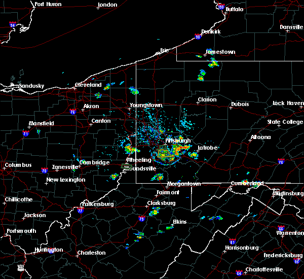 At 320 pm edt, a severe thunderstorm was located over mcmurray, moving south at 5 mph (radar). Hazards include wind gusts to 60 mph. Expect damage to trees and power lines, resulting in some power outages. locations impacted include, bethel park, mcmurray, gastonville, upper st. Clair, south park township, jefferson hills, pleasant hills, monongahela, new eagle, elizabeth, west elizabeth, finleyville,. At 320 pm edt, a severe thunderstorm was located over mcmurray, moving south at 5 mph (radar). Hazards include wind gusts to 60 mph. Expect damage to trees and power lines, resulting in some power outages. locations impacted include, bethel park, mcmurray, gastonville, upper st. Clair, south park township, jefferson hills, pleasant hills, monongahela, new eagle, elizabeth, west elizabeth, finleyville,.
|
| 8/5/2018 2:45 PM EDT |
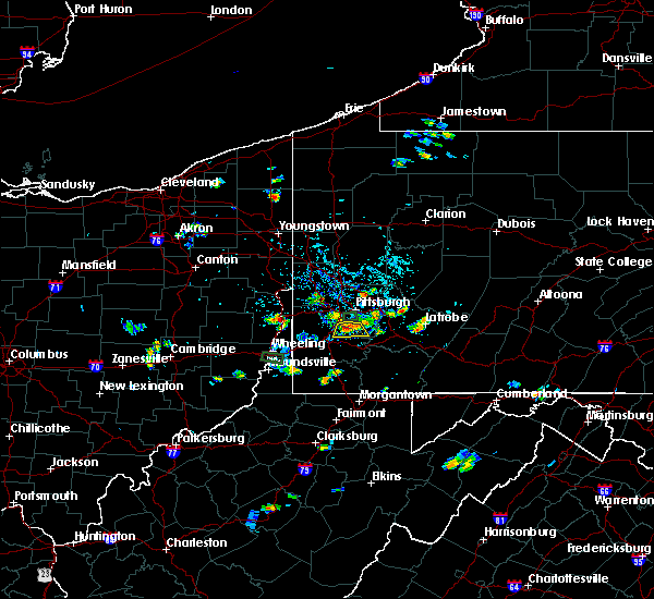 At 245 pm edt, a severe thunderstorm was located over bethel park, moving south at 5 mph (radar). Hazards include wind gusts to 60 mph and dime sized hail. expect damage to trees and power lines, resulting in some power outages At 245 pm edt, a severe thunderstorm was located over bethel park, moving south at 5 mph (radar). Hazards include wind gusts to 60 mph and dime sized hail. expect damage to trees and power lines, resulting in some power outages
|
| 7/2/2018 6:33 PM EDT |
 At 633 pm edt, a severe thunderstorm was located near liberty, or near mckeesport, moving north at 15 mph (radar). Hazards include wind gusts to 60 mph and quarter-size hail. Hail damage to vehicles. Damage to trees and power lines. At 633 pm edt, a severe thunderstorm was located near liberty, or near mckeesport, moving north at 15 mph (radar). Hazards include wind gusts to 60 mph and quarter-size hail. Hail damage to vehicles. Damage to trees and power lines.
|
| 5/22/2018 7:47 PM EDT |
 At 747 pm edt, a severe thunderstorm was located over south park township, or over bethel park, moving southeast at 30 mph (radar). Hazards include wind gusts to 60 mph. Damage to trees and power lines. Locations impacted include, mckeesport, gastonville, west mifflin, south park township, jefferson hills, pleasant hills, monessen, clairton, california, donora, glassport, monongahela, this includes interstate 70 in pennsylvania between mile markers 27 and 53. At 747 pm edt, a severe thunderstorm was located over south park township, or over bethel park, moving southeast at 30 mph (radar). Hazards include wind gusts to 60 mph. Damage to trees and power lines. Locations impacted include, mckeesport, gastonville, west mifflin, south park township, jefferson hills, pleasant hills, monessen, clairton, california, donora, glassport, monongahela, this includes interstate 70 in pennsylvania between mile markers 27 and 53.
|
| 5/22/2018 7:26 PM EDT |
 At 725 pm edt, a severe thunderstorm was located over mcmurray, moving southeast at 30 mph (radar). Hazards include wind gusts to 70 mph and quarter-size hail. Hail damage to vehicles. trees snapped and uprooted. Power outages. At 725 pm edt, a severe thunderstorm was located over mcmurray, moving southeast at 30 mph (radar). Hazards include wind gusts to 70 mph and quarter-size hail. Hail damage to vehicles. trees snapped and uprooted. Power outages.
|
| 5/12/2018 5:59 PM EDT |
 At 559 pm edt, severe thunderstorms were located along a line extending from near irwin to near donora to near mcmurray, moving east at 45 mph (radar). Hazards include wind gusts to 60 mph. Damage to trees and power lines. locations impacted include, mckeesport, canonsburg, gastonville, jefferson hills, white oak, monessen, clairton, california, donora, mount pleasant, monongahela, charleroi, this includes the following highways, interstate 70 in pennsylvania between mile markers 27 and 57. Pennsylvania turnpike between mile markers 67 and 80. At 559 pm edt, severe thunderstorms were located along a line extending from near irwin to near donora to near mcmurray, moving east at 45 mph (radar). Hazards include wind gusts to 60 mph. Damage to trees and power lines. locations impacted include, mckeesport, canonsburg, gastonville, jefferson hills, white oak, monessen, clairton, california, donora, mount pleasant, monongahela, charleroi, this includes the following highways, interstate 70 in pennsylvania between mile markers 27 and 57. Pennsylvania turnpike between mile markers 67 and 80.
|
| 5/12/2018 5:52 PM EDT |
 At 552 pm edt, a severe thunderstorm was located over donora, or 8 miles southeast of gastonville, moving southeast at 40 mph (radar). Hazards include quarter-size hail. Minor damage to vehicles is possible. locations impacted include, bethel park, mcmurray, mckeesport, jeannette, canonsburg, gastonville, west mifflin, south park township, jefferson hills, north versailles, pleasant hills, white oak, this includes the following highways, interstate 70 in pennsylvania between mile markers 25 and 57. Pennsylvania turnpike between mile markers 65 and 80. At 552 pm edt, a severe thunderstorm was located over donora, or 8 miles southeast of gastonville, moving southeast at 40 mph (radar). Hazards include quarter-size hail. Minor damage to vehicles is possible. locations impacted include, bethel park, mcmurray, mckeesport, jeannette, canonsburg, gastonville, west mifflin, south park township, jefferson hills, north versailles, pleasant hills, white oak, this includes the following highways, interstate 70 in pennsylvania between mile markers 25 and 57. Pennsylvania turnpike between mile markers 65 and 80.
|
| 5/12/2018 5:30 PM EDT |
 The national weather service in pittsburgh has issued a * severe thunderstorm warning for. southeastern washington county in southwestern pennsylvania. southeastern allegheny county in southwestern pennsylvania. southwestern westmoreland county in southwestern pennsylvania. Northeastern greene county in southwestern pennsylvania. The national weather service in pittsburgh has issued a * severe thunderstorm warning for. southeastern washington county in southwestern pennsylvania. southeastern allegheny county in southwestern pennsylvania. southwestern westmoreland county in southwestern pennsylvania. Northeastern greene county in southwestern pennsylvania.
|
| 4/3/2018 8:56 PM EDT |
 The severe thunderstorm warning for east central washington, northwestern indiana, southeastern allegheny, northwestern westmoreland and southeastern armstrong counties will expire at 900 pm edt, the storms that prompted the warning have weakened below severe limits and no longer pose an immediate threat to life and property. therefore, the warning will be allowed to expire. however gusty winds are still possible with these thunderstorms. a severe thunderstorm watch remains in effect until 100 am edt for southwestern pennsylvania. The severe thunderstorm warning for east central washington, northwestern indiana, southeastern allegheny, northwestern westmoreland and southeastern armstrong counties will expire at 900 pm edt, the storms that prompted the warning have weakened below severe limits and no longer pose an immediate threat to life and property. therefore, the warning will be allowed to expire. however gusty winds are still possible with these thunderstorms. a severe thunderstorm watch remains in effect until 100 am edt for southwestern pennsylvania.
|
| 4/3/2018 8:41 PM EDT | Tree down blocking entire roadwa in allegheny county PA, 3.8 miles E of Clairton, PA |
| 4/3/2018 8:33 PM EDT |
 At 833 pm edt, severe thunderstorms were located along a line extending from penn hills to near mcmurray, moving northeast at 60 mph (radar). Hazards include 60 mph wind gusts. expect damage to trees and power lines, resulting in some power outages At 833 pm edt, severe thunderstorms were located along a line extending from penn hills to near mcmurray, moving northeast at 60 mph (radar). Hazards include 60 mph wind gusts. expect damage to trees and power lines, resulting in some power outages
|
| 4/3/2018 8:09 PM EDT |
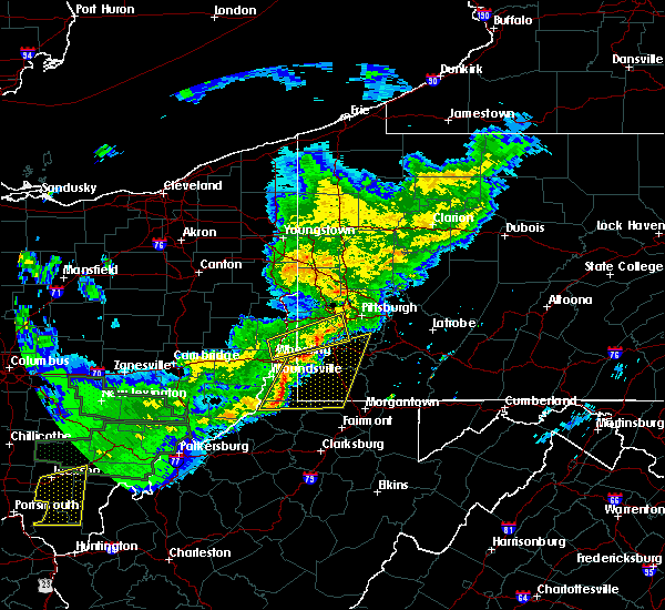 At 809 pm edt, severe thunderstorms were located along a line extending from near avella to near new martinsville, moving east at 50 mph (radar). Hazards include 60 mph wind gusts and quarter-size hail. Minor hail damage to vehicles is possible. Expect wind damage to trees and power lines, resulting in some power outages. At 809 pm edt, severe thunderstorms were located along a line extending from near avella to near new martinsville, moving east at 50 mph (radar). Hazards include 60 mph wind gusts and quarter-size hail. Minor hail damage to vehicles is possible. Expect wind damage to trees and power lines, resulting in some power outages.
|
| 8/22/2017 4:26 PM EDT |
 At 426 pm edt, severe thunderstorms were located along a line extending from near monongahela to near bentleyville to near jefferson boro, moving east at 40 mph (radar). Hazards include 60 mph wind gusts. expect damage to trees and power lines, resulting in some power outages At 426 pm edt, severe thunderstorms were located along a line extending from near monongahela to near bentleyville to near jefferson boro, moving east at 40 mph (radar). Hazards include 60 mph wind gusts. expect damage to trees and power lines, resulting in some power outages
|
| 8/22/2017 3:16 PM EDT |
 At 316 pm edt, severe thunderstorms were located along a line extending from plum to pitcairn to jefferson hills, moving east at 35 mph (radar). Hazards include 60 mph wind gusts. Expect damage to trees and power lines, resulting in some power outages. Locations impacted include, pittsburgh, penn hills, monroeville, mckeesport, plum, west mifflin, murrysville, wilkinsburg, south park township, new kensington, lower burrell, munhall, this includes pennsylvania turnpike between mile markers 49 and 60. At 316 pm edt, severe thunderstorms were located along a line extending from plum to pitcairn to jefferson hills, moving east at 35 mph (radar). Hazards include 60 mph wind gusts. Expect damage to trees and power lines, resulting in some power outages. Locations impacted include, pittsburgh, penn hills, monroeville, mckeesport, plum, west mifflin, murrysville, wilkinsburg, south park township, new kensington, lower burrell, munhall, this includes pennsylvania turnpike between mile markers 49 and 60.
|
| 8/22/2017 3:01 PM EDT |
 At 301 pm edt, severe thunderstorms were located along a line extending from sharpsburg to homestead to mcmurray, moving east at 35 mph (radar). Hazards include 60 mph wind gusts. Expect damage to trees and power lines, resulting in some power outages. locations impacted include, pittsburgh, penn hills, mount lebanon, bethel park, monroeville, mcmurray, mckeesport, gastonville, shaler township, plum, west mifflin, north side pittsburgh, this includes the following highways, pennsylvania turnpike between mile markers 44 and 60. interstate 79 in pennsylvania between mile markers 22 and 28. Parkway north between mile markers 1 and 2. At 301 pm edt, severe thunderstorms were located along a line extending from sharpsburg to homestead to mcmurray, moving east at 35 mph (radar). Hazards include 60 mph wind gusts. Expect damage to trees and power lines, resulting in some power outages. locations impacted include, pittsburgh, penn hills, mount lebanon, bethel park, monroeville, mcmurray, mckeesport, gastonville, shaler township, plum, west mifflin, north side pittsburgh, this includes the following highways, pennsylvania turnpike between mile markers 44 and 60. interstate 79 in pennsylvania between mile markers 22 and 28. Parkway north between mile markers 1 and 2.
|
| 8/22/2017 2:54 PM EDT |
 At 254 pm edt, severe thunderstorms were located along a line extending from west view to mount oliver to canonsburg, moving east at 30 mph (radar). Hazards include 60 mph wind gusts. damage to trees and power lines At 254 pm edt, severe thunderstorms were located along a line extending from west view to mount oliver to canonsburg, moving east at 30 mph (radar). Hazards include 60 mph wind gusts. damage to trees and power lines
|
| 8/22/2017 1:57 PM EDT |
 At 157 pm edt, a severe thunderstorm was located over mount lebanon, moving east at 35 mph (radar). Hazards include 60 mph wind gusts. damage to trees and power lines At 157 pm edt, a severe thunderstorm was located over mount lebanon, moving east at 35 mph (radar). Hazards include 60 mph wind gusts. damage to trees and power lines
|
| 8/22/2017 1:46 PM EDT |
 At 146 pm edt, a severe thunderstorm was located over bridgeville, or near mount lebanon, moving east at 35 mph (radar). Hazards include 60 mph wind gusts. Damage to trees and power lines. locations impacted include, pittsburgh, penn hills, mount lebanon, bethel park, ross township, mcmurray, mckeesport, shaler township, west mifflin, north side pittsburgh, baldwin, upper st. clair, this includes the following highways, interstate 79 in pennsylvania between mile markers 22 and 35. interstate 279 in pennsylvania between mile markers 1 and 7. Interstate 376 in pennsylvania between mile markers 57 and 77. At 146 pm edt, a severe thunderstorm was located over bridgeville, or near mount lebanon, moving east at 35 mph (radar). Hazards include 60 mph wind gusts. Damage to trees and power lines. locations impacted include, pittsburgh, penn hills, mount lebanon, bethel park, ross township, mcmurray, mckeesport, shaler township, west mifflin, north side pittsburgh, baldwin, upper st. clair, this includes the following highways, interstate 79 in pennsylvania between mile markers 22 and 35. interstate 279 in pennsylvania between mile markers 1 and 7. Interstate 376 in pennsylvania between mile markers 57 and 77.
|
| 8/22/2017 1:20 PM EDT |
 At 119 pm edt, a severe thunderstorm was located near avella, moving east at 40 mph (radar). Hazards include 60 mph wind gusts. damage to trees and power lines At 119 pm edt, a severe thunderstorm was located near avella, moving east at 40 mph (radar). Hazards include 60 mph wind gusts. damage to trees and power lines
|
| 8/19/2017 5:07 PM EDT |
 At 507 pm edt, a severe thunderstorm was located over clairton, or near mckeesport, moving southeast at 40 mph (radar). Hazards include 60 mph wind gusts and quarter-size hail. Minor hail damage to vehicles is possible. Expect wind damage to trees and power lines, resulting in some power outages. At 507 pm edt, a severe thunderstorm was located over clairton, or near mckeesport, moving southeast at 40 mph (radar). Hazards include 60 mph wind gusts and quarter-size hail. Minor hail damage to vehicles is possible. Expect wind damage to trees and power lines, resulting in some power outages.
|
| 8/19/2017 4:43 PM EDT |
 At 442 pm edt, a severe thunderstorm was located over cecil-bishop, or near canonsburg, moving east at 30 mph (radar). Hazards include 60 mph wind gusts. Expect damage to trees and power lines, resulting in some power outages. locations impacted include, pittsburgh, mount lebanon, bethel park, mcmurray, mckeesport, canonsburg, gastonville, west mifflin, baldwin, upper st. Clair, scott township, whitehall, this includes interstate 79 in pennsylvania between mile markers 22 and 30. At 442 pm edt, a severe thunderstorm was located over cecil-bishop, or near canonsburg, moving east at 30 mph (radar). Hazards include 60 mph wind gusts. Expect damage to trees and power lines, resulting in some power outages. locations impacted include, pittsburgh, mount lebanon, bethel park, mcmurray, mckeesport, canonsburg, gastonville, west mifflin, baldwin, upper st. Clair, scott township, whitehall, this includes interstate 79 in pennsylvania between mile markers 22 and 30.
|
| 8/19/2017 4:32 PM EDT |
 At 431 pm edt, a severe thunderstorm was located over robinson township, or near ross township, moving east at 30 mph (radar). Hazards include 60 mph wind gusts. expect damage to trees and power lines, resulting in some power outages At 431 pm edt, a severe thunderstorm was located over robinson township, or near ross township, moving east at 30 mph (radar). Hazards include 60 mph wind gusts. expect damage to trees and power lines, resulting in some power outages
|
| 8/19/2017 4:19 PM EDT |
 At 419 pm edt, a severe thunderstorm was located 7 miles northeast of avella, moving east at 30 mph (radar). Hazards include 60 mph wind gusts. expect damage to trees and power lines, resulting in some power outages At 419 pm edt, a severe thunderstorm was located 7 miles northeast of avella, moving east at 30 mph (radar). Hazards include 60 mph wind gusts. expect damage to trees and power lines, resulting in some power outages
|
| 6/23/2017 3:22 PM EDT |
 At 321 pm edt, a severe thunderstorm was located near east washington, or near washington, moving east at 45 mph (radar). Hazards include 60 mph wind gusts. Expect damage to trees and power lines, resulting in some power outages. Locations impacted include, washington, gastonville, south park township, jefferson hills, monessen, california, donora, monongahela, charleroi, mcgovern, bentleyville, brownsville, this includes interstate 70 in pennsylvania between mile markers 17 and 44. At 321 pm edt, a severe thunderstorm was located near east washington, or near washington, moving east at 45 mph (radar). Hazards include 60 mph wind gusts. Expect damage to trees and power lines, resulting in some power outages. Locations impacted include, washington, gastonville, south park township, jefferson hills, monessen, california, donora, monongahela, charleroi, mcgovern, bentleyville, brownsville, this includes interstate 70 in pennsylvania between mile markers 17 and 44.
|
| 6/23/2017 3:09 PM EDT |
 The national weather service in pittsburgh has issued a * severe thunderstorm warning for. southern washington county in southwestern pennsylvania. southeastern allegheny county in southwestern pennsylvania. western westmoreland county in southwestern pennsylvania. Northwestern fayette county in southwestern pennsylvania. The national weather service in pittsburgh has issued a * severe thunderstorm warning for. southern washington county in southwestern pennsylvania. southeastern allegheny county in southwestern pennsylvania. western westmoreland county in southwestern pennsylvania. Northwestern fayette county in southwestern pennsylvania.
|
| 6/16/2017 3:04 PM EDT |
 At 304 pm edt, a severe thunderstorm was located near clairton, or near mckeesport, moving east at 20 mph (radar). Hazards include 60 mph wind gusts. Expect damage to trees and power lines, resulting in some power outages. locations impacted include, greensburg, jefferson hills, clairton, glassport, youngwood, west newton, new stanton, versailles, elizabeth, lincoln, sutersville, west elizabeth, this includes the following highways, interstate 70 in pennsylvania between mile markers 49 and 57. Pennsylvania turnpike between mile markers 69 and 77. At 304 pm edt, a severe thunderstorm was located near clairton, or near mckeesport, moving east at 20 mph (radar). Hazards include 60 mph wind gusts. Expect damage to trees and power lines, resulting in some power outages. locations impacted include, greensburg, jefferson hills, clairton, glassport, youngwood, west newton, new stanton, versailles, elizabeth, lincoln, sutersville, west elizabeth, this includes the following highways, interstate 70 in pennsylvania between mile markers 49 and 57. Pennsylvania turnpike between mile markers 69 and 77.
|
| 6/16/2017 2:51 PM EDT |
 At 251 pm edt, a severe thunderstorm was located over monongahela, or near gastonville, moving east at 20 mph (radar). Hazards include 60 mph wind gusts and quarter-size hail. Minor hail damage to vehicles is possible. Expect wind damage to trees and power lines, resulting in some power outages. At 251 pm edt, a severe thunderstorm was located over monongahela, or near gastonville, moving east at 20 mph (radar). Hazards include 60 mph wind gusts and quarter-size hail. Minor hail damage to vehicles is possible. Expect wind damage to trees and power lines, resulting in some power outages.
|
| 6/13/2017 5:29 PM EDT |
 At 529 pm edt, a severe thunderstorm was located over clairton, or near mckeesport, moving south at 15 mph (radar). Hazards include 60 mph wind gusts and quarter-size hail. Minor hail damage to vehicles is possible. Expect wind damage to trees and power lines, resulting in some power outages. At 529 pm edt, a severe thunderstorm was located over clairton, or near mckeesport, moving south at 15 mph (radar). Hazards include 60 mph wind gusts and quarter-size hail. Minor hail damage to vehicles is possible. Expect wind damage to trees and power lines, resulting in some power outages.
|
| 6/13/2017 5:16 PM EDT |
 At 515 pm edt, a severe thunderstorm was located over mckeesport, moving southeast at 10 mph (trained weather spotters). Hazards include 60 mph wind gusts and quarter-size hail. Minor hail damage to vehicles is possible. expect wind damage to trees and power lines, resulting in some power outages. Locations impacted include, pittsburgh, penn hills, monroeville, greensburg, mckeesport, jeannette, plum, west mifflin, baldwin, murrysville, wilkinsburg, whitehall, this includes pennsylvania turnpike between mile markers 55 and 73. At 515 pm edt, a severe thunderstorm was located over mckeesport, moving southeast at 10 mph (trained weather spotters). Hazards include 60 mph wind gusts and quarter-size hail. Minor hail damage to vehicles is possible. expect wind damage to trees and power lines, resulting in some power outages. Locations impacted include, pittsburgh, penn hills, monroeville, greensburg, mckeesport, jeannette, plum, west mifflin, baldwin, murrysville, wilkinsburg, whitehall, this includes pennsylvania turnpike between mile markers 55 and 73.
|
| 6/13/2017 4:51 PM EDT |
 At 450 pm edt, a severe thunderstorm was located over mckeesport, moving east at 10 mph (radar). Hazards include ping pong ball-size hail and 60 mph wind gusts. People and animals outdoors will be injured. expect hail damage to roofs, siding, windows, and vehicles. expect wind damage to trees and power lines, resulting in some power outages. Locations impacted include, pittsburgh, penn hills, monroeville, greensburg, mckeesport, jeannette, plum, west mifflin, baldwin, murrysville, wilkinsburg, whitehall, this includes pennsylvania turnpike between mile markers 55 and 73. At 450 pm edt, a severe thunderstorm was located over mckeesport, moving east at 10 mph (radar). Hazards include ping pong ball-size hail and 60 mph wind gusts. People and animals outdoors will be injured. expect hail damage to roofs, siding, windows, and vehicles. expect wind damage to trees and power lines, resulting in some power outages. Locations impacted include, pittsburgh, penn hills, monroeville, greensburg, mckeesport, jeannette, plum, west mifflin, baldwin, murrysville, wilkinsburg, whitehall, this includes pennsylvania turnpike between mile markers 55 and 73.
|
| 6/13/2017 4:45 PM EDT |
 At 445 pm edt, a severe thunderstorm was located over glassport, or over mckeesport, moving east at 10 mph (radar). Hazards include 60 mph wind gusts and quarter-size hail. Minor hail damage to vehicles is possible. Expect wind damage to trees and power lines, resulting in some power outages. At 445 pm edt, a severe thunderstorm was located over glassport, or over mckeesport, moving east at 10 mph (radar). Hazards include 60 mph wind gusts and quarter-size hail. Minor hail damage to vehicles is possible. Expect wind damage to trees and power lines, resulting in some power outages.
|
| 6/13/2017 4:17 PM EDT |
 At 417 pm edt, a severe thunderstorm was located over white oak, or near mckeesport, moving southeast at 10 mph (radar). Hazards include 60 mph wind gusts and quarter-size hail. Minor hail damage to vehicles is possible. expect wind damage to trees and power lines, resulting in some power outages. Locations impacted include, pittsburgh, monroeville, mckeesport, west mifflin, munhall, jefferson hills, north versailles, swissvale, white oak, clairton, forest hills, wilkins township, this includes pennsylvania turnpike between mile markers 62 and 68. At 417 pm edt, a severe thunderstorm was located over white oak, or near mckeesport, moving southeast at 10 mph (radar). Hazards include 60 mph wind gusts and quarter-size hail. Minor hail damage to vehicles is possible. expect wind damage to trees and power lines, resulting in some power outages. Locations impacted include, pittsburgh, monroeville, mckeesport, west mifflin, munhall, jefferson hills, north versailles, swissvale, white oak, clairton, forest hills, wilkins township, this includes pennsylvania turnpike between mile markers 62 and 68.
|
| 6/13/2017 3:54 PM EDT |
 At 353 pm edt, a severe thunderstorm was located over west mifflin, or over mckeesport, moving southeast at 10 mph (radar). Hazards include 60 mph wind gusts and quarter-size hail. Minor hail damage to vehicles is possible. Expect wind damage to trees and power lines, resulting in some power outages. At 353 pm edt, a severe thunderstorm was located over west mifflin, or over mckeesport, moving southeast at 10 mph (radar). Hazards include 60 mph wind gusts and quarter-size hail. Minor hail damage to vehicles is possible. Expect wind damage to trees and power lines, resulting in some power outages.
|
| 5/31/2017 4:36 PM EDT |
 At 436 pm edt, severe thunderstorms were located along a line extending from near ford city to near murrysville to gastonville, moving east at 45 mph (radar). Hazards include 60 mph wind gusts. Expect damage to trees and power lines, resulting in some power outages. Locations impacted include, pittsburgh, penn hills, bethel park, monroeville, mcmurray, greensburg, mckeesport, jeannette, canonsburg, vandergrift, kittanning, apollo, this includes pennsylvania turnpike between mile markers 50 and 72. At 436 pm edt, severe thunderstorms were located along a line extending from near ford city to near murrysville to gastonville, moving east at 45 mph (radar). Hazards include 60 mph wind gusts. Expect damage to trees and power lines, resulting in some power outages. Locations impacted include, pittsburgh, penn hills, bethel park, monroeville, mcmurray, greensburg, mckeesport, jeannette, canonsburg, vandergrift, kittanning, apollo, this includes pennsylvania turnpike between mile markers 50 and 72.
|
| 5/31/2017 4:20 PM EDT |
 At 419 pm edt, severe thunderstorms were located along a line extending from near sarver to penn hills to near canonsburg, moving east at 45 mph (radar). Hazards include 60 mph wind gusts. Expect damage to trees and power lines, resulting in some power outages. locations impacted include, pittsburgh, penn hills, mount lebanon, bethel park, monroeville, mcmurray, greensburg, mckeesport, jeannette, canonsburg, vandergrift, kittanning, this includes the following highways, pennsylvania turnpike between mile markers 41 and 72. interstate 79 in pennsylvania between mile markers 22 and 30. Parkway north between mile markers 1 and 3. At 419 pm edt, severe thunderstorms were located along a line extending from near sarver to penn hills to near canonsburg, moving east at 45 mph (radar). Hazards include 60 mph wind gusts. Expect damage to trees and power lines, resulting in some power outages. locations impacted include, pittsburgh, penn hills, mount lebanon, bethel park, monroeville, mcmurray, greensburg, mckeesport, jeannette, canonsburg, vandergrift, kittanning, this includes the following highways, pennsylvania turnpike between mile markers 41 and 72. interstate 79 in pennsylvania between mile markers 22 and 30. Parkway north between mile markers 1 and 3.
|
| 5/31/2017 4:06 PM EDT |
 At 406 pm edt, severe thunderstorms were located along a line extending from near oak hills to millvale to near avella, moving east at 45 mph (radar). Hazards include 60 mph wind gusts. expect damage to trees and power lines, resulting in some power outages At 406 pm edt, severe thunderstorms were located along a line extending from near oak hills to millvale to near avella, moving east at 45 mph (radar). Hazards include 60 mph wind gusts. expect damage to trees and power lines, resulting in some power outages
|
| 5/1/2017 3:16 PM EDT |
 At 319 pm edt, severe thunderstorms were located along a line extending from white oak to near pleasant valley, moving east at 30 mph (radar). Hazards include 60 mph wind gusts. Expect damage to trees and power lines, resulting in some power outages. locations impacted include, morgantown, uniontown, connellsville, westover, star city, monessen, california, donora, mount pleasant, scottdale, charleroi, masontown, this includes the following highways, interstate 68 in west virginia between mile markers 1 and 14. interstate 70 in pennsylvania between mile markers 39 and 57. pennsylvania turnpike between mile markers 70 and 85. interstate 79 in pennsylvania between mile markers 0 and 2. interstate 79 in west virginia between mile markers 148 and 160. A tornado watch remains in effect until 700 pm edt for southwestern pennsylvania, and northern and northeastern west virginia. At 319 pm edt, severe thunderstorms were located along a line extending from white oak to near pleasant valley, moving east at 30 mph (radar). Hazards include 60 mph wind gusts. Expect damage to trees and power lines, resulting in some power outages. locations impacted include, morgantown, uniontown, connellsville, westover, star city, monessen, california, donora, mount pleasant, scottdale, charleroi, masontown, this includes the following highways, interstate 68 in west virginia between mile markers 1 and 14. interstate 70 in pennsylvania between mile markers 39 and 57. pennsylvania turnpike between mile markers 70 and 85. interstate 79 in pennsylvania between mile markers 0 and 2. interstate 79 in west virginia between mile markers 148 and 160. A tornado watch remains in effect until 700 pm edt for southwestern pennsylvania, and northern and northeastern west virginia.
|
| 5/1/2017 3:07 PM EDT |
 At 307 pm edt, severe thunderstorms were located along a line extending from 11 miles southwest of knox to 7 miles northwest of west kittanning to lower burrell to mckeesport, moving east at 40 mph (radar). Hazards include 70 mph wind gusts. Trees snapped and uprooted. power outages can be expected. locations impacted include, penn hills, monroeville, greensburg, mckeesport, jeannette, latrobe, vandergrift, kittanning, apollo, rimersburg, plum, west mifflin, this includes the following highways, pennsylvania turnpike between mile markers 47 and 71. interstate 80 in pennsylvania near mile marker 44. A tornado watch remains in effect until 700 pm edt for southwestern, northwestern and west central pennsylvania. At 307 pm edt, severe thunderstorms were located along a line extending from 11 miles southwest of knox to 7 miles northwest of west kittanning to lower burrell to mckeesport, moving east at 40 mph (radar). Hazards include 70 mph wind gusts. Trees snapped and uprooted. power outages can be expected. locations impacted include, penn hills, monroeville, greensburg, mckeesport, jeannette, latrobe, vandergrift, kittanning, apollo, rimersburg, plum, west mifflin, this includes the following highways, pennsylvania turnpike between mile markers 47 and 71. interstate 80 in pennsylvania near mile marker 44. A tornado watch remains in effect until 700 pm edt for southwestern, northwestern and west central pennsylvania.
|
| 5/1/2017 2:54 PM EDT |
 At 254 pm edt, severe thunderstorms were located along a line extending from castle shannon to near lumberport, moving east at 35 mph (radar). Hazards include 60 mph wind gusts. expect damage to trees and power lines, resulting in some power outages At 254 pm edt, severe thunderstorms were located along a line extending from castle shannon to near lumberport, moving east at 35 mph (radar). Hazards include 60 mph wind gusts. expect damage to trees and power lines, resulting in some power outages
|
| 5/1/2017 2:54 PM EDT |
 The national weather service in pittsburgh has issued a * severe thunderstorm warning for. southeastern washington county in southwestern pennsylvania. southeastern allegheny county in southwestern pennsylvania. southwestern westmoreland county in southwestern pennsylvania. Eastern greene county in southwestern pennsylvania. The national weather service in pittsburgh has issued a * severe thunderstorm warning for. southeastern washington county in southwestern pennsylvania. southeastern allegheny county in southwestern pennsylvania. southwestern westmoreland county in southwestern pennsylvania. Eastern greene county in southwestern pennsylvania.
|
| 5/1/2017 2:48 PM EDT | Tree down on house...payne hill roa in allegheny county PA, 2.3 miles ENE of Clairton, PA |
| 5/1/2017 2:47 PM EDT |
 At 247 pm edt, severe thunderstorms were located along a line extending from 8 miles east of grove city to butler to near hampton township to upper st. clair, moving east at 35 mph (radar). Hazards include 70 mph wind gusts. Trees snapped and uprooted. Power outages can be expected. At 247 pm edt, severe thunderstorms were located along a line extending from 8 miles east of grove city to butler to near hampton township to upper st. clair, moving east at 35 mph (radar). Hazards include 70 mph wind gusts. Trees snapped and uprooted. Power outages can be expected.
|
| 5/1/2017 2:41 PM EDT |
 At 241 pm edt, severe thunderstorms were located along a line extending from near mcdonald to 10 miles southwest of waynesburg, moving northeast at 55 mph (radar). Hazards include 70 mph wind gusts. Trees snapped and uprooted. power outages can be expected. locations impacted include, bethel park, morgantown, mcmurray, mckeesport, washington, canonsburg, waynesburg, star city, gastonville, west mifflin, baldwin, upper st. clair, this includes the following highways, interstate 70 in pennsylvania between mile markers 17 and 40. interstate 79 in pennsylvania between mile markers 0 and 21. interstate 79 in west virginia between mile markers 154 and 160. A tornado watch remains in effect until 700 pm edt for southwestern pennsylvania, and northern west virginia. At 241 pm edt, severe thunderstorms were located along a line extending from near mcdonald to 10 miles southwest of waynesburg, moving northeast at 55 mph (radar). Hazards include 70 mph wind gusts. Trees snapped and uprooted. power outages can be expected. locations impacted include, bethel park, morgantown, mcmurray, mckeesport, washington, canonsburg, waynesburg, star city, gastonville, west mifflin, baldwin, upper st. clair, this includes the following highways, interstate 70 in pennsylvania between mile markers 17 and 40. interstate 79 in pennsylvania between mile markers 0 and 21. interstate 79 in west virginia between mile markers 154 and 160. A tornado watch remains in effect until 700 pm edt for southwestern pennsylvania, and northern west virginia.
|
| 5/1/2017 2:36 PM EDT |
 At 236 pm edt, severe thunderstorms were located along a line extending from near cecil-bishop to 7 miles northeast of hundred, moving northeast at 55 mph (radar). Hazards include 70 mph wind gusts. Trees snapped and uprooted. power outages can be expected. locations impacted include, bethel park, morgantown, mcmurray, mckeesport, washington, canonsburg, waynesburg, star city, gastonville, west mifflin, baldwin, upper st. clair, this includes the following highways, interstate 70 in pennsylvania between mile markers 11 and 40. interstate 79 in pennsylvania between mile markers 0 and 21. interstate 79 in west virginia between mile markers 154 and 160. A tornado watch remains in effect until 700 pm edt for southwestern pennsylvania, and northern west virginia. At 236 pm edt, severe thunderstorms were located along a line extending from near cecil-bishop to 7 miles northeast of hundred, moving northeast at 55 mph (radar). Hazards include 70 mph wind gusts. Trees snapped and uprooted. power outages can be expected. locations impacted include, bethel park, morgantown, mcmurray, mckeesport, washington, canonsburg, waynesburg, star city, gastonville, west mifflin, baldwin, upper st. clair, this includes the following highways, interstate 70 in pennsylvania between mile markers 11 and 40. interstate 79 in pennsylvania between mile markers 0 and 21. interstate 79 in west virginia between mile markers 154 and 160. A tornado watch remains in effect until 700 pm edt for southwestern pennsylvania, and northern west virginia.
|
| 5/1/2017 2:27 PM EDT |
 At 226 pm edt, severe thunderstorms were located along a line extending from near avella to near hundred, moving northeast at 55 mph (radar). Hazards include 70 mph wind gusts. Trees snapped and uprooted. power outages can be expected. locations impacted include, bethel park, morgantown, mcmurray, mckeesport, washington, canonsburg, waynesburg, star city, gastonville, west mifflin, baldwin, upper st. clair, this includes the following highways, interstate 70 in pennsylvania between mile markers 3 and 40. interstate 79 in pennsylvania between mile markers 0 and 21. interstate 79 in west virginia between mile markers 154 and 160. A tornado watch remains in effect until 700 pm edt for southwestern pennsylvania, and northern west virginia. At 226 pm edt, severe thunderstorms were located along a line extending from near avella to near hundred, moving northeast at 55 mph (radar). Hazards include 70 mph wind gusts. Trees snapped and uprooted. power outages can be expected. locations impacted include, bethel park, morgantown, mcmurray, mckeesport, washington, canonsburg, waynesburg, star city, gastonville, west mifflin, baldwin, upper st. clair, this includes the following highways, interstate 70 in pennsylvania between mile markers 3 and 40. interstate 79 in pennsylvania between mile markers 0 and 21. interstate 79 in west virginia between mile markers 154 and 160. A tornado watch remains in effect until 700 pm edt for southwestern pennsylvania, and northern west virginia.
|
| 5/1/2017 2:11 PM EDT |
 At 210 pm edt, severe thunderstorms were located along a line extending from near west liberty to near pine grove, moving northeast at 55 mph (radar). Hazards include 70 mph wind gusts. Trees snapped and uprooted. Power outages can be expected. At 210 pm edt, severe thunderstorms were located along a line extending from near west liberty to near pine grove, moving northeast at 55 mph (radar). Hazards include 70 mph wind gusts. Trees snapped and uprooted. Power outages can be expected.
|
| 3/1/2017 8:32 AM EST |
 At 832 am est, a severe thunderstorm was located over bethlehem, moving east at 45 mph (radar). Hazards include 60 mph wind gusts. Expect damage to trees and power lines, resulting in some power outages. locations impacted include, bethel park, wheeling, mcmurray, washington, moundsville, canonsburg, martins ferry, st. clairsville, bellaire, warwood, bethlehem, west liberty, this includes the following highways, interstate 70 in ohio between mile markers 217 and 225. interstate 70 in west virginia between mile markers 0 and 14. interstate 70 in pennsylvania between mile markers 0 and 42. Interstate 79 in pennsylvania between mile markers 16 and 21. At 832 am est, a severe thunderstorm was located over bethlehem, moving east at 45 mph (radar). Hazards include 60 mph wind gusts. Expect damage to trees and power lines, resulting in some power outages. locations impacted include, bethel park, wheeling, mcmurray, washington, moundsville, canonsburg, martins ferry, st. clairsville, bellaire, warwood, bethlehem, west liberty, this includes the following highways, interstate 70 in ohio between mile markers 217 and 225. interstate 70 in west virginia between mile markers 0 and 14. interstate 70 in pennsylvania between mile markers 0 and 42. Interstate 79 in pennsylvania between mile markers 16 and 21.
|
| 3/1/2017 8:15 AM EST |
 At 814 am est, a severe thunderstorm was located over wheeling, moving east at 85 mph (radar). Hazards include 60 mph wind gusts. expect damage to trees and power lines, resulting in some power outages At 814 am est, a severe thunderstorm was located over wheeling, moving east at 85 mph (radar). Hazards include 60 mph wind gusts. expect damage to trees and power lines, resulting in some power outages
|
| 2/12/2017 7:59 PM EST |
 At 758 pm est, severe thunderstorms were located along a line extending from near blairsville to 7 miles southeast of valley grove, moving east at 45 mph (radar). Hazards include 60 mph wind gusts. expect damage to trees and power lines, resulting in some power outages At 758 pm est, severe thunderstorms were located along a line extending from near blairsville to 7 miles southeast of valley grove, moving east at 45 mph (radar). Hazards include 60 mph wind gusts. expect damage to trees and power lines, resulting in some power outages
|
| 2/12/2017 7:02 PM EST |
 At 701 pm est, severe thunderstorms were located along a line extending from near meridian to near toronto, moving east at 50 mph (radar). Hazards include 60 mph wind gusts. expect damage to trees and power lines, resulting in some power outages At 701 pm est, severe thunderstorms were located along a line extending from near meridian to near toronto, moving east at 50 mph (radar). Hazards include 60 mph wind gusts. expect damage to trees and power lines, resulting in some power outages
|
| 9/7/2016 4:25 PM EDT |
 At 424 pm edt, a severe thunderstorm was located near irwin, or near mckeesport, moving east at 30 mph (radar indicated). Hazards include 60 mph wind gusts and penny size hail. Expect damage to trees and power lines. resulting in some power outages. locations impacted include, mckeesport, jeannette, west mifflin, jefferson hills, north versailles, white oak, clairton, duquesne, glassport, irwin, manor, trafford, west newton, liberty, wilmerding, port vue, east mckeesport, east pittsburgh, versailles and elizabeth. this includes the following highways, interstate 70 in pennsylvania near mile marker 51. pennsylvania turnpike between mile markers 64 and 71. Please report severe weather by calling 4 1 2, 2 6 2, 1 9 8 8, posting to the nws pittsburgh facebook page, or using twitter @nwspittsburgh. At 424 pm edt, a severe thunderstorm was located near irwin, or near mckeesport, moving east at 30 mph (radar indicated). Hazards include 60 mph wind gusts and penny size hail. Expect damage to trees and power lines. resulting in some power outages. locations impacted include, mckeesport, jeannette, west mifflin, jefferson hills, north versailles, white oak, clairton, duquesne, glassport, irwin, manor, trafford, west newton, liberty, wilmerding, port vue, east mckeesport, east pittsburgh, versailles and elizabeth. this includes the following highways, interstate 70 in pennsylvania near mile marker 51. pennsylvania turnpike between mile markers 64 and 71. Please report severe weather by calling 4 1 2, 2 6 2, 1 9 8 8, posting to the nws pittsburgh facebook page, or using twitter @nwspittsburgh.
|
| 9/7/2016 4:11 PM EDT |
 At 411 pm edt, a severe thunderstorm was located over liberty, or over mckeesport, moving east at 30 mph (radar indicated). Hazards include 60 mph wind gusts and penny size hail. Expect damage to trees and power lines. Resulting in some power outages. At 411 pm edt, a severe thunderstorm was located over liberty, or over mckeesport, moving east at 30 mph (radar indicated). Hazards include 60 mph wind gusts and penny size hail. Expect damage to trees and power lines. Resulting in some power outages.
|
| 9/7/2016 4:05 PM EDT |
 The severe thunderstorm warning for east central washington and southeastern allegheny counties will expire at 415 pm edt, the storm which prompted the warning has weakened below severe limits, and no longer pose an immediate threat to life or property. therefore, the warning will be allowed to expire. The severe thunderstorm warning for east central washington and southeastern allegheny counties will expire at 415 pm edt, the storm which prompted the warning has weakened below severe limits, and no longer pose an immediate threat to life or property. therefore, the warning will be allowed to expire.
|
| 9/7/2016 3:57 PM EDT |
 At 357 pm edt, a severe thunderstorm was located over upper st. clair, or over bethel park, moving southeast at 20 mph (radar indicated). Hazards include 60 mph wind gusts and nickel size hail. Expect damage to trees and power lines. resulting in some power outages. locations impacted include, mount lebanon, bethel park, mcmurray, mckeesport, gastonville, west mifflin, baldwin, upper st. clair, scott township, whitehall, south park township, jefferson hills, castle shannon, pleasant hills, clairton, bridgeville, glassport, monongahela, liberty and port vue. this includes interstate 79 in pennsylvania mile marker 52 and near mile marker 54. Please report severe weather by calling 4 1 2, 2 6 2, 1 9 8 8, posting to the nws pittsburgh facebook page, or using twitter @nwspittsburgh. At 357 pm edt, a severe thunderstorm was located over upper st. clair, or over bethel park, moving southeast at 20 mph (radar indicated). Hazards include 60 mph wind gusts and nickel size hail. Expect damage to trees and power lines. resulting in some power outages. locations impacted include, mount lebanon, bethel park, mcmurray, mckeesport, gastonville, west mifflin, baldwin, upper st. clair, scott township, whitehall, south park township, jefferson hills, castle shannon, pleasant hills, clairton, bridgeville, glassport, monongahela, liberty and port vue. this includes interstate 79 in pennsylvania mile marker 52 and near mile marker 54. Please report severe weather by calling 4 1 2, 2 6 2, 1 9 8 8, posting to the nws pittsburgh facebook page, or using twitter @nwspittsburgh.
|
| 9/7/2016 3:48 PM EDT |
 At 348 pm edt, a severe thunderstorm was located over bridgeville, or near mount lebanon, moving southeast at 20 mph (radar indicated). Hazards include 60 mph wind gusts and nickel size hail. Expect damage to trees and power lines. Resulting in some power outages. At 348 pm edt, a severe thunderstorm was located over bridgeville, or near mount lebanon, moving southeast at 20 mph (radar indicated). Hazards include 60 mph wind gusts and nickel size hail. Expect damage to trees and power lines. Resulting in some power outages.
|
| 8/28/2016 7:34 PM EDT |
 At 734 pm edt, severe thunderstorms were located along a line extending from near gastonville to near east washington, moving southeast at 15 mph (radar indicated). Hazards include 60 mph wind gusts and quarter size hail. Hail damage to vehicles is expected. Expect wind damage to trees and power lines, resulting in some power outages. At 734 pm edt, severe thunderstorms were located along a line extending from near gastonville to near east washington, moving southeast at 15 mph (radar indicated). Hazards include 60 mph wind gusts and quarter size hail. Hail damage to vehicles is expected. Expect wind damage to trees and power lines, resulting in some power outages.
|
| 8/16/2016 6:05 PM EDT |
 At 604 pm edt, severe thunderstorms were located along a line extending from plum to north versailles, moving east at 40 mph (emergency management reports trees and power lines are down in mt lebanon and south fayette). Hazards include 60 mph wind gusts. Expect damage to trees and power lines. resulting in some power outages. locations impacted include, pittsburgh, penn hills, monroeville, greensburg, mckeesport, jeannette, shaler township, plum, west mifflin, baldwin, murrysville, hampton township, wilkinsburg, whitehall, south park township, new kensington, lower burrell, munhall, jefferson hills and north versailles. this includes the following highways, pennsylvania turnpike between mile markers 46 and 74. interstate 376 in pennsylvania between mile markers 73 and 84. Please report severe weather by calling 4 1 2, 2 6 2, 1 9 8 8, posting to the nws pittsburgh facebook page, or using twitter @nwspittsburgh. At 604 pm edt, severe thunderstorms were located along a line extending from plum to north versailles, moving east at 40 mph (emergency management reports trees and power lines are down in mt lebanon and south fayette). Hazards include 60 mph wind gusts. Expect damage to trees and power lines. resulting in some power outages. locations impacted include, pittsburgh, penn hills, monroeville, greensburg, mckeesport, jeannette, shaler township, plum, west mifflin, baldwin, murrysville, hampton township, wilkinsburg, whitehall, south park township, new kensington, lower burrell, munhall, jefferson hills and north versailles. this includes the following highways, pennsylvania turnpike between mile markers 46 and 74. interstate 376 in pennsylvania between mile markers 73 and 84. Please report severe weather by calling 4 1 2, 2 6 2, 1 9 8 8, posting to the nws pittsburgh facebook page, or using twitter @nwspittsburgh.
|
| 8/16/2016 5:50 PM EDT |
 At 550 pm edt, severe thunderstorms were located along a line extending from sharpsburg to brentwood, moving east at 40 mph (radar indicated). Hazards include 60 mph wind gusts. Expect damage to trees and power lines. resulting in some power outages. locations impacted include, pittsburgh, penn hills, mount lebanon, bethel park, ross township, mccandless township, monroeville, greensburg, mckeesport, jeannette, shaler township, plum, west mifflin, north side pittsburgh, baldwin, upper st. clair, murrysville, hampton township, scott township and wilkinsburg. this includes the following highways, pennsylvania turnpike between mile markers 45 and 74. interstate 79 in pennsylvania between mile markers 55 and 62. interstate 279 in pennsylvania between mile markers 1 and 9. interstate 376 in pennsylvania between mile markers 62 and 84. Please report severe weather by calling 4 1 2, 2 6 2, 1 9 8 8, posting to the nws pittsburgh facebook page, or using twitter @nwspittsburgh. At 550 pm edt, severe thunderstorms were located along a line extending from sharpsburg to brentwood, moving east at 40 mph (radar indicated). Hazards include 60 mph wind gusts. Expect damage to trees and power lines. resulting in some power outages. locations impacted include, pittsburgh, penn hills, mount lebanon, bethel park, ross township, mccandless township, monroeville, greensburg, mckeesport, jeannette, shaler township, plum, west mifflin, north side pittsburgh, baldwin, upper st. clair, murrysville, hampton township, scott township and wilkinsburg. this includes the following highways, pennsylvania turnpike between mile markers 45 and 74. interstate 79 in pennsylvania between mile markers 55 and 62. interstate 279 in pennsylvania between mile markers 1 and 9. interstate 376 in pennsylvania between mile markers 62 and 84. Please report severe weather by calling 4 1 2, 2 6 2, 1 9 8 8, posting to the nws pittsburgh facebook page, or using twitter @nwspittsburgh.
|
| 8/16/2016 5:35 PM EDT |
 At 535 pm edt, severe thunderstorms were located along a line extending from kennedy township to near sturgeon- noblestown, moving east at 40 mph (radar indicated). Hazards include 60 mph wind gusts. Expect damage to trees and power lines. Resulting in some power outages. At 535 pm edt, severe thunderstorms were located along a line extending from kennedy township to near sturgeon- noblestown, moving east at 40 mph (radar indicated). Hazards include 60 mph wind gusts. Expect damage to trees and power lines. Resulting in some power outages.
|
| 7/25/2016 3:23 PM EDT |
 At 323 pm edt, a severe thunderstorm was located over south park township, or near gastonville, moving east at 30 mph (radar indicated). Hazards include 60 mph wind gusts and quarter size hail. Hail damage to vehicles is expected. expect wind damage to trees and power lines, resulting in some power outages. locations impacted include, pittsburgh, bethel park, mcmurray, mckeesport, gastonville, west mifflin, baldwin, upper st. clair, whitehall, south park township, munhall, jefferson hills, north versailles, brentwood, castle shannon, pleasant hills, white oak, clairton, duquesne and donora. this includes the following highways, interstate 70 in pennsylvania between mile markers 46 and 52. pennsylvania turnpike between mile markers 62 and 68. Please report severe weather by calling 4 1 2, 2 6 2, 1 9 8 8, posting to the nws pittsburgh facebook page, or using twitter @nwspittsburgh. At 323 pm edt, a severe thunderstorm was located over south park township, or near gastonville, moving east at 30 mph (radar indicated). Hazards include 60 mph wind gusts and quarter size hail. Hail damage to vehicles is expected. expect wind damage to trees and power lines, resulting in some power outages. locations impacted include, pittsburgh, bethel park, mcmurray, mckeesport, gastonville, west mifflin, baldwin, upper st. clair, whitehall, south park township, munhall, jefferson hills, north versailles, brentwood, castle shannon, pleasant hills, white oak, clairton, duquesne and donora. this includes the following highways, interstate 70 in pennsylvania between mile markers 46 and 52. pennsylvania turnpike between mile markers 62 and 68. Please report severe weather by calling 4 1 2, 2 6 2, 1 9 8 8, posting to the nws pittsburgh facebook page, or using twitter @nwspittsburgh.
|
| 7/25/2016 3:16 PM EDT | Numerous trees down near south park in allegheny county PA, 3.7 miles E of Clairton, PA |
| 7/25/2016 3:07 PM EDT |
 At 307 pm edt, a severe thunderstorm was located over upper st. clair, or near mcmurray, moving east at 30 mph (radar indicated). Hazards include 60 mph wind gusts and quarter size hail. Hail damage to vehicles is expected. Expect wind damage to trees and power lines, resulting in some power outages. At 307 pm edt, a severe thunderstorm was located over upper st. clair, or near mcmurray, moving east at 30 mph (radar indicated). Hazards include 60 mph wind gusts and quarter size hail. Hail damage to vehicles is expected. Expect wind damage to trees and power lines, resulting in some power outages.
|
| 7/24/2016 5:02 PM EDT |
 At 502 pm edt, severe thunderstorms were located along a line extending from near leechburg to north braddock, moving east at 30 mph (radar indicated). Hazards include 60 mph wind gusts. Expect damage to trees and power lines. resulting in some power outages. locations impacted include, monroeville, greensburg, mckeesport, indiana, jeannette, vandergrift, apollo, plum, west mifflin, murrysville, south park township, jefferson hills, north versailles, pleasant hills, white oak, clairton, wilkins township, duquesne, turtle creek and north braddock. this includes the following highways, pennsylvania turnpike between mile markers 55 and 73. interstate 376 in pennsylvania between mile markers 83 and 84. Please report severe weather by calling 4 1 2, 2 6 2, 1 9 8 8, posting to the nws pittsburgh facebook page, or using twitter @nwspittsburgh. At 502 pm edt, severe thunderstorms were located along a line extending from near leechburg to north braddock, moving east at 30 mph (radar indicated). Hazards include 60 mph wind gusts. Expect damage to trees and power lines. resulting in some power outages. locations impacted include, monroeville, greensburg, mckeesport, indiana, jeannette, vandergrift, apollo, plum, west mifflin, murrysville, south park township, jefferson hills, north versailles, pleasant hills, white oak, clairton, wilkins township, duquesne, turtle creek and north braddock. this includes the following highways, pennsylvania turnpike between mile markers 55 and 73. interstate 376 in pennsylvania between mile markers 83 and 84. Please report severe weather by calling 4 1 2, 2 6 2, 1 9 8 8, posting to the nws pittsburgh facebook page, or using twitter @nwspittsburgh.
|
| 7/24/2016 4:48 PM EDT |
 At 448 pm edt, severe thunderstorms were located along a line extending from near freeport to mount oliver, moving east at 30 mph (radar indicated). Hazards include 60 mph wind gusts. Expect damage to trees and power lines. resulting in some power outages. locations impacted include, pittsburgh, penn hills, mount lebanon, bethel park, monroeville, greensburg, mckeesport, indiana, jeannette, vandergrift, apollo, plum, west mifflin, baldwin, upper st. clair, murrysville, wilkinsburg, whitehall, south park township and new kensington. this includes the following highways, pennsylvania turnpike between mile markers 49 and 73. interstate 376 in pennsylvania between mile markers 73 and 84. Please report severe weather by calling 4 1 2, 2 6 2, 1 9 8 8, posting to the nws pittsburgh facebook page, or using twitter @nwspittsburgh. At 448 pm edt, severe thunderstorms were located along a line extending from near freeport to mount oliver, moving east at 30 mph (radar indicated). Hazards include 60 mph wind gusts. Expect damage to trees and power lines. resulting in some power outages. locations impacted include, pittsburgh, penn hills, mount lebanon, bethel park, monroeville, greensburg, mckeesport, indiana, jeannette, vandergrift, apollo, plum, west mifflin, baldwin, upper st. clair, murrysville, wilkinsburg, whitehall, south park township and new kensington. this includes the following highways, pennsylvania turnpike between mile markers 49 and 73. interstate 376 in pennsylvania between mile markers 73 and 84. Please report severe weather by calling 4 1 2, 2 6 2, 1 9 8 8, posting to the nws pittsburgh facebook page, or using twitter @nwspittsburgh.
|
| 7/24/2016 4:25 PM EDT |
 At 425 pm edt, severe thunderstorms were located along a line extending from near sarver to robinson township, moving east at 30 mph (radar indicated). Hazards include 60 mph wind gusts. Expect damage to trees and power lines. Resulting in some power outages. At 425 pm edt, severe thunderstorms were located along a line extending from near sarver to robinson township, moving east at 30 mph (radar indicated). Hazards include 60 mph wind gusts. Expect damage to trees and power lines. Resulting in some power outages.
|
| 6/16/2016 4:28 PM EDT |
 At 428 pm edt, severe thunderstorms were located along a line extending from swissvale to near gastonville, moving east at 30 mph (law enforcement). Hazards include 60 mph wind gusts and quarter size hail. Hail damage to vehicles is expected. expect wind damage to trees and power lines, resulting in some power outages. locations impacted include, pittsburgh, penn hills, mount lebanon, bethel park, monroeville, mcmurray, mckeesport, gastonville, plum, west mifflin, north side pittsburgh, baldwin, upper st. clair, scott township, wilkinsburg, whitehall, south park township, robinson township, munhall and jefferson hills. this includes the following highways, interstate 70 in pennsylvania between mile markers 24 and 40. pennsylvania turnpike between mile markers 55 and 57. interstate 79 in pennsylvania between mile markers 54 and 56. interstate 279 in pennsylvania between mile markers 1 and 2. interstate 376 in pennsylvania between mile markers 64 and 84. Please report severe weather by calling 4 1 2, 2 6 2, 1 9 8 8, posting to the nws pittsburgh facebook page, or using twitter @nwspittsburgh. At 428 pm edt, severe thunderstorms were located along a line extending from swissvale to near gastonville, moving east at 30 mph (law enforcement). Hazards include 60 mph wind gusts and quarter size hail. Hail damage to vehicles is expected. expect wind damage to trees and power lines, resulting in some power outages. locations impacted include, pittsburgh, penn hills, mount lebanon, bethel park, monroeville, mcmurray, mckeesport, gastonville, plum, west mifflin, north side pittsburgh, baldwin, upper st. clair, scott township, wilkinsburg, whitehall, south park township, robinson township, munhall and jefferson hills. this includes the following highways, interstate 70 in pennsylvania between mile markers 24 and 40. pennsylvania turnpike between mile markers 55 and 57. interstate 79 in pennsylvania between mile markers 54 and 56. interstate 279 in pennsylvania between mile markers 1 and 2. interstate 376 in pennsylvania between mile markers 64 and 84. Please report severe weather by calling 4 1 2, 2 6 2, 1 9 8 8, posting to the nws pittsburgh facebook page, or using twitter @nwspittsburgh.
|
| 6/16/2016 3:57 PM EDT |
 At 355 pm edt, severe thunderstorms were located along a line extending from near sturgeon-noblestown to near wolfdale, moving east at 30 mph (radar indicated). Hazards include 60 mph wind gusts and quarter size hail. Hail damage to vehicles is expected. expect wind damage to trees and power lines, resulting in some power outages. locations impacted include, pittsburgh, penn hills, mount lebanon, bethel park, monroeville, mcmurray, mckeesport, washington, canonsburg, gastonville, plum, west mifflin, north side pittsburgh, baldwin, upper st. clair, scott township, wilkinsburg, whitehall, south park township and robinson township. this includes the following highways, interstate 70 in pennsylvania between mile markers 10 and 40. pennsylvania turnpike between mile markers 55 and 57. interstate 79 in pennsylvania between mile markers 50 and 61, and between mile markers 29 and 49. interstate 279 in pennsylvania between mile markers 1 and 2. interstate 376 in pennsylvania between mile markers 55 and 84. Please report severe weather by calling 4 1 2, 2 6 2, 1 9 8 8, posting to the nws pittsburgh facebook page, or using twitter @nwspittsburgh. At 355 pm edt, severe thunderstorms were located along a line extending from near sturgeon-noblestown to near wolfdale, moving east at 30 mph (radar indicated). Hazards include 60 mph wind gusts and quarter size hail. Hail damage to vehicles is expected. expect wind damage to trees and power lines, resulting in some power outages. locations impacted include, pittsburgh, penn hills, mount lebanon, bethel park, monroeville, mcmurray, mckeesport, washington, canonsburg, gastonville, plum, west mifflin, north side pittsburgh, baldwin, upper st. clair, scott township, wilkinsburg, whitehall, south park township and robinson township. this includes the following highways, interstate 70 in pennsylvania between mile markers 10 and 40. pennsylvania turnpike between mile markers 55 and 57. interstate 79 in pennsylvania between mile markers 50 and 61, and between mile markers 29 and 49. interstate 279 in pennsylvania between mile markers 1 and 2. interstate 376 in pennsylvania between mile markers 55 and 84. Please report severe weather by calling 4 1 2, 2 6 2, 1 9 8 8, posting to the nws pittsburgh facebook page, or using twitter @nwspittsburgh.
|
| 6/16/2016 3:43 PM EDT |
 At 342 pm edt, severe thunderstorms were located along a line extending from near imperial to near west liberty, moving east at 30 mph (radar indicated). Hazards include 60 mph wind gusts and quarter size hail. Hail damage to vehicles is expected. Expect wind damage to trees and power lines, resulting in some power outages. At 342 pm edt, severe thunderstorms were located along a line extending from near imperial to near west liberty, moving east at 30 mph (radar indicated). Hazards include 60 mph wind gusts and quarter size hail. Hail damage to vehicles is expected. Expect wind damage to trees and power lines, resulting in some power outages.
|
| 5/2/2016 4:15 AM EDT |
 At 415 am edt, a severe thunderstorm was located over stowe township, or near ross township, moving east at 45 mph (radar indicated. quarter size hail was reported in imperial). Hazards include 60 mph wind gusts and quarter size hail. Hail damage to vehicles is expected. expect wind damage to trees and power lines, resulting in some power outages. locations impacted include, pittsburgh, penn hills, mount lebanon, bethel park, ross township, mccandless township, monroeville, moon township, mcmurray, mckeesport, franklin park, canonsburg, gastonville, shaler township, plum, west mifflin, north side pittsburgh, baldwin, upper st. clair and hampton township. this includes the following highways, pennsylvania turnpike between mile markers 35 and 50. interstate 79 in pennsylvania between mile markers 50 and 73, and between mile markers 46 and 49. interstate 279 in pennsylvania between mile markers 1 and 13. interstate 376 in pennsylvania between mile markers 58 and 81. Please report severe weather by calling 4 1 2, 2 6 2, 1 9 8 8, posting to the nws pittsburgh facebook page, or using twitter @nwspittsburgh. At 415 am edt, a severe thunderstorm was located over stowe township, or near ross township, moving east at 45 mph (radar indicated. quarter size hail was reported in imperial). Hazards include 60 mph wind gusts and quarter size hail. Hail damage to vehicles is expected. expect wind damage to trees and power lines, resulting in some power outages. locations impacted include, pittsburgh, penn hills, mount lebanon, bethel park, ross township, mccandless township, monroeville, moon township, mcmurray, mckeesport, franklin park, canonsburg, gastonville, shaler township, plum, west mifflin, north side pittsburgh, baldwin, upper st. clair and hampton township. this includes the following highways, pennsylvania turnpike between mile markers 35 and 50. interstate 79 in pennsylvania between mile markers 50 and 73, and between mile markers 46 and 49. interstate 279 in pennsylvania between mile markers 1 and 13. interstate 376 in pennsylvania between mile markers 58 and 81. Please report severe weather by calling 4 1 2, 2 6 2, 1 9 8 8, posting to the nws pittsburgh facebook page, or using twitter @nwspittsburgh.
|
| 5/2/2016 3:58 AM EDT |
 At 358 am edt, a severe thunderstorm was located near imperial, or near moon township, moving east at 40 mph (radar indicated). Hazards include 60 mph wind gusts and quarter size hail. Hail damage to vehicles is expected. Expect wind damage to trees and power lines, resulting in some power outages. At 358 am edt, a severe thunderstorm was located near imperial, or near moon township, moving east at 40 mph (radar indicated). Hazards include 60 mph wind gusts and quarter size hail. Hail damage to vehicles is expected. Expect wind damage to trees and power lines, resulting in some power outages.
|
| 8/4/2015 12:13 AM EDT |
 At 1212 am edt, a severe thunderstorm was located over washington, moving east at 40 mph (radar indicated). Hazards include 60 mph wind gusts and quarter size hail. Hail damage to vehicles is expected. Expect wind damage to trees and some power outages. At 1212 am edt, a severe thunderstorm was located over washington, moving east at 40 mph (radar indicated). Hazards include 60 mph wind gusts and quarter size hail. Hail damage to vehicles is expected. Expect wind damage to trees and some power outages.
|
| 8/3/2015 8:54 PM EDT |
 The severe thunderstorm warning for southeastern allegheny, southwestern westmoreland and northeastern washington counties will expire at 900 pm edt, the storm which prompted the warning has weakened below severe limits and exited the warned area. therefore the warning will be allowed to expire. The severe thunderstorm warning for southeastern allegheny, southwestern westmoreland and northeastern washington counties will expire at 900 pm edt, the storm which prompted the warning has weakened below severe limits and exited the warned area. therefore the warning will be allowed to expire.
|
| 8/3/2015 8:21 PM EDT |
 At 820 pm edt, a severe thunderstorm was located over castle shannon, or over mount lebanon, moving east at 25 mph (trained weather spotters). Hazards include 60 mph wind gusts and quarter size hail. Hail damage to vehicles is expected. Expect wind damage to trees and some power outages. At 820 pm edt, a severe thunderstorm was located over castle shannon, or over mount lebanon, moving east at 25 mph (trained weather spotters). Hazards include 60 mph wind gusts and quarter size hail. Hail damage to vehicles is expected. Expect wind damage to trees and some power outages.
|
| 8/3/2015 6:19 PM EDT |
 At 618 pm edt, a severe thunderstorm was located near donora, or 8 miles east of gastonville, moving east at 40 mph (radar indicated). Hazards include 60 mph wind gusts and quarter size hail. Hail damage to vehicles is expected. expect wind damage to trees and some power outages. Locations impacted include, greensburg, jefferson hills, monessen, clairton, donora, glassport, mount pleasant, scottdale, monongahela, youngwood, west newton, new stanton, new eagle, wickerham manor-fisher, baidland, versailles, elizabeth, calumet-norvelt, lincoln and everson. At 618 pm edt, a severe thunderstorm was located near donora, or 8 miles east of gastonville, moving east at 40 mph (radar indicated). Hazards include 60 mph wind gusts and quarter size hail. Hail damage to vehicles is expected. expect wind damage to trees and some power outages. Locations impacted include, greensburg, jefferson hills, monessen, clairton, donora, glassport, mount pleasant, scottdale, monongahela, youngwood, west newton, new stanton, new eagle, wickerham manor-fisher, baidland, versailles, elizabeth, calumet-norvelt, lincoln and everson.
|
| 8/3/2015 6:14 PM EDT |
 At 613 pm edt, a severe thunderstorm was located over monongahela, or near gastonville, moving east at 30 mph (radar indicated). Hazards include 60 mph wind gusts and nickel size hail. expect damage to trees and some power outages locations impacted include, greensburg, gastonville, west mifflin, south park township, jefferson hills, pleasant hills, monessen, clairton, donora, glassport, mount pleasant, scottdale, monongahela, youngwood, west newton, liberty, new stanton, new eagle, wickerham manor-fisher and baidland At 613 pm edt, a severe thunderstorm was located over monongahela, or near gastonville, moving east at 30 mph (radar indicated). Hazards include 60 mph wind gusts and nickel size hail. expect damage to trees and some power outages locations impacted include, greensburg, gastonville, west mifflin, south park township, jefferson hills, pleasant hills, monessen, clairton, donora, glassport, mount pleasant, scottdale, monongahela, youngwood, west newton, liberty, new stanton, new eagle, wickerham manor-fisher and baidland
|
| 8/3/2015 5:43 PM EDT |
 At 543 pm edt, a severe thunderstorm was located over upper st. clair, or near bethel park, moving east at 40 mph (radar indicated). Hazards include 60 mph wind gusts and nickel size hail. expect damage to trees and some power outages At 543 pm edt, a severe thunderstorm was located over upper st. clair, or near bethel park, moving east at 40 mph (radar indicated). Hazards include 60 mph wind gusts and nickel size hail. expect damage to trees and some power outages
|
| 8/3/2015 5:00 PM EDT |
 At 459 pm edt, a severe thunderstorm was located over mckeesport, moving east at 25 mph (radar indicated). Hazards include 60 mph wind gusts and quarter size hail. Hail damage to vehicles is expected. expect wind damage to trees and some power outages. Locations impacted include, pittsburgh, penn hills, monroeville, mckeesport, plum, west mifflin, murrysville, munhall, jefferson hills, north versailles, swissvale, white oak, clairton, forest hills, wilkins township, duquesne, turtle creek, north braddock, glassport and irwin. At 459 pm edt, a severe thunderstorm was located over mckeesport, moving east at 25 mph (radar indicated). Hazards include 60 mph wind gusts and quarter size hail. Hail damage to vehicles is expected. expect wind damage to trees and some power outages. Locations impacted include, pittsburgh, penn hills, monroeville, mckeesport, plum, west mifflin, murrysville, munhall, jefferson hills, north versailles, swissvale, white oak, clairton, forest hills, wilkins township, duquesne, turtle creek, north braddock, glassport and irwin.
|
| 8/3/2015 4:41 PM EDT |
 At 440 pm edt, a severe thunderstorm was located over castle shannon, or over mount lebanon, moving east at 30 mph (radar indicated). Hazards include 60 mph wind gusts and quarter size hail. Hail damage to vehicles is expected. expect wind damage to trees and some power outages. locations impacted include, pittsburgh, penn hills, mount lebanon, bethel park, monroeville, mckeesport, shaler township, plum, west mifflin, north side pittsburgh, baldwin, upper st. Clair, murrysville, scott township, wilkinsburg, whitehall, south park township, robinson township, munhall and jefferson hills. At 440 pm edt, a severe thunderstorm was located over castle shannon, or over mount lebanon, moving east at 30 mph (radar indicated). Hazards include 60 mph wind gusts and quarter size hail. Hail damage to vehicles is expected. expect wind damage to trees and some power outages. locations impacted include, pittsburgh, penn hills, mount lebanon, bethel park, monroeville, mckeesport, shaler township, plum, west mifflin, north side pittsburgh, baldwin, upper st. Clair, murrysville, scott township, wilkinsburg, whitehall, south park township, robinson township, munhall and jefferson hills.
|
| 8/3/2015 4:22 PM EDT |
 At 422 pm edt, a severe thunderstorm was located over mcdonald, or near canonsburg, moving east at 30 mph (radar indicated). Hazards include 60 mph wind gusts and quarter size hail. Hail damage to vehicles is expected. Expect wind damage to trees and some power outages. At 422 pm edt, a severe thunderstorm was located over mcdonald, or near canonsburg, moving east at 30 mph (radar indicated). Hazards include 60 mph wind gusts and quarter size hail. Hail damage to vehicles is expected. Expect wind damage to trees and some power outages.
|
| 6/30/2015 6:30 PM EDT |
 At 630 pm edt, a severe thunderstorm was located over glassport, or over mckeesport, moving northeast at 20 mph (radar indicated). Hazards include 60 mph wind gusts and quarter size hail. Hail damage to vehicles is expected. Expect wind damage to roofs, siding and trees. At 630 pm edt, a severe thunderstorm was located over glassport, or over mckeesport, moving northeast at 20 mph (radar indicated). Hazards include 60 mph wind gusts and quarter size hail. Hail damage to vehicles is expected. Expect wind damage to roofs, siding and trees.
|
| 6/23/2015 3:19 PM EDT |
 At 319 pm edt, a severe thunderstorm was located over monongahela, or near gastonville, moving southeast at 30 mph (radar indicated). Hazards include 60 mph wind gusts and quarter size hail. Hail damage to vehicles is expected. Expect wind damage to roofs, siding and trees. At 319 pm edt, a severe thunderstorm was located over monongahela, or near gastonville, moving southeast at 30 mph (radar indicated). Hazards include 60 mph wind gusts and quarter size hail. Hail damage to vehicles is expected. Expect wind damage to roofs, siding and trees.
|
| 6/23/2015 2:53 PM EDT |
 At 253 pm edt, a severe thunderstorm was located over cecil-bishop, or over canonsburg, moving east at 45 mph (radar indicated). Hazards include 60 mph wind gusts and quarter size hail. Hail damage to vehicles is expected. Expect wind damage to roofs, siding and trees. At 253 pm edt, a severe thunderstorm was located over cecil-bishop, or over canonsburg, moving east at 45 mph (radar indicated). Hazards include 60 mph wind gusts and quarter size hail. Hail damage to vehicles is expected. Expect wind damage to roofs, siding and trees.
|
| 6/18/2015 9:35 PM EDT | At 935 pm edt, severe thunderstorms were located along a line extending from near murrysville to near clairton to near gastonville, moving southeast at 35 mph (radar indicated). Hazards include 60 mph wind gusts. Expect damage to roofs. Siding and trees. |
| 6/18/2015 9:27 PM EDT | At 925 pm edt, a severe thunderstorm was located over forest hills, or near monroeville, moving east at 35 mph (radar indicated). Hazards include 60 mph wind gusts. Expect damage to roofs. siding and trees. locations impacted include, pittsburgh, penn hills, mount lebanon, bethel park, ross township, monroeville, mcmurray, mckeesport, vandergrift, gastonville, shaler township, plum, west mifflin, north side pittsburgh, baldwin, upper st. Clair, murrysville, hampton township, scott township and wilkinsburg. |
| 6/18/2015 9:14 PM EDT | At 910 pm edt, a severe thunderstorm was located over north side pittsburgh, or over pittsburgh, moving east at 35 mph, with the line of strongest winds extending from north of mccandles township and extending south to upper st clair (radar indicated). Hazards include 60 mph wind gusts. Expect damage to roofs. siding and trees. Locations impacted include, pittsburgh, penn hills, mount lebanon, bethel park, ross township, mccandless township, monroeville, cranberry, moon township, mcmurray, mckeesport, franklin park, canonsburg, vandergrift, gastonville, shaler township, plum, west mifflin, north side pittsburgh and baldwin. |
| 6/18/2015 8:49 PM EDT | At 846 pm edt, a severe thunderstorm was located over moon township, moving southeast at 35 mph (radar indicated). Hazards include 60 mph wind gusts. Expect damage to roofs. Siding and trees. |
| 6/14/2015 9:10 PM EDT |
 At 909 pm edt, a severe thunderstorm capable of producing a tornado was located over clairton, or near mckeesport, moving east at 30 mph (radar indicated rotation). Hazards include tornado and dime size hail. Flying debris will be dangerous to those caught without shelter. mobile homes will be damaged or destroyed. damage to roofs, windows and vehicles will occur. tree damage is likely. this dangerous storm will be near, west newton around 920 pm edt. irwin and manor around 925 pm edt. jeannette around 935 pm edt. youngwood and new stanton around 940 pm edt. Other locations impacted by this tornadic thunderstorm include north irwin, madison, port vue, penn, grapeville, adamsburg, west elizabeth, hunker, lincoln and herminie. At 909 pm edt, a severe thunderstorm capable of producing a tornado was located over clairton, or near mckeesport, moving east at 30 mph (radar indicated rotation). Hazards include tornado and dime size hail. Flying debris will be dangerous to those caught without shelter. mobile homes will be damaged or destroyed. damage to roofs, windows and vehicles will occur. tree damage is likely. this dangerous storm will be near, west newton around 920 pm edt. irwin and manor around 925 pm edt. jeannette around 935 pm edt. youngwood and new stanton around 940 pm edt. Other locations impacted by this tornadic thunderstorm include north irwin, madison, port vue, penn, grapeville, adamsburg, west elizabeth, hunker, lincoln and herminie.
|
| 4/9/2015 6:17 PM EDT | The national weather service in pittsburgh has issued a * severe thunderstorm warning for. northwestern fayette county in southwestern pennsylvania. central greene county in southwestern pennsylvania. southwestern armstrong county in west central pennsylvania. Southern butler county in west central pennsylvania. |
| 4/9/2015 5:56 PM EDT | The national weather service in pittsburgh has issued a * severe thunderstorm warning for. northwestern greene county in southwestern pennsylvania. beaver county in western pennsylvania. southwestern butler county in west central pennsylvania. Washington county in southwestern pennsylvania. |
| 4/9/2015 5:56 PM EDT | The national weather service in pittsburgh has issued a * severe thunderstorm warning for. northwestern greene county in southwestern pennsylvania. beaver county in western pennsylvania. southwestern butler county in west central pennsylvania. Washington county in southwestern pennsylvania. |
Hail Maps for Clairton, PA
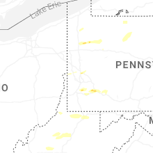
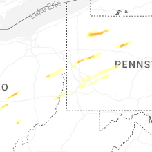


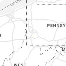


Connect with Interactive Hail Maps