

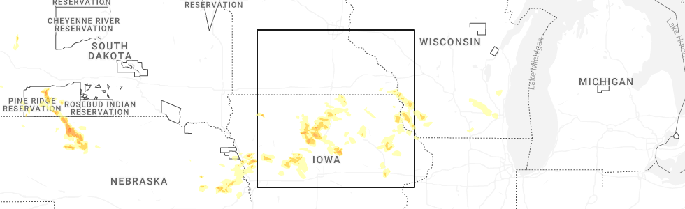
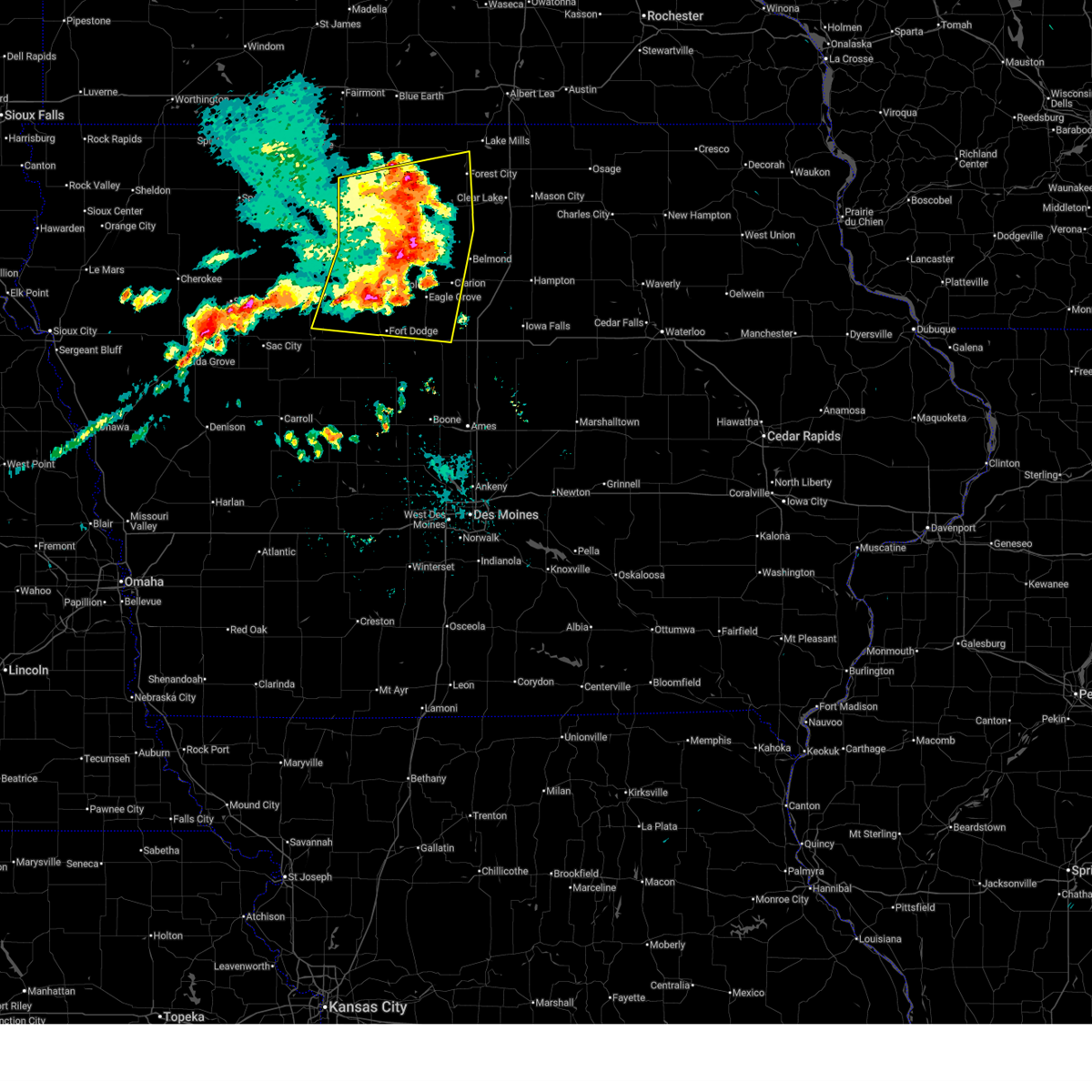
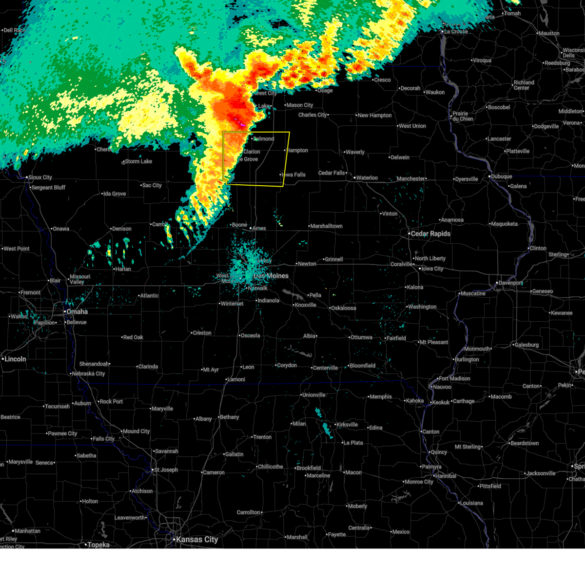
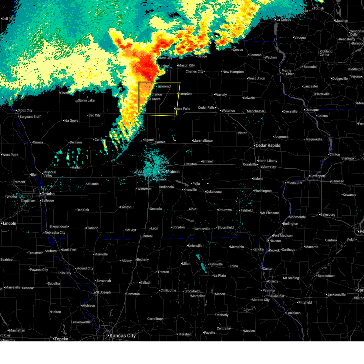
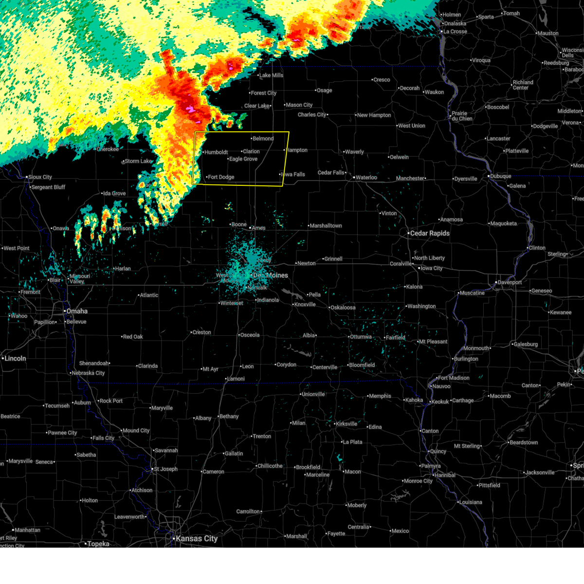
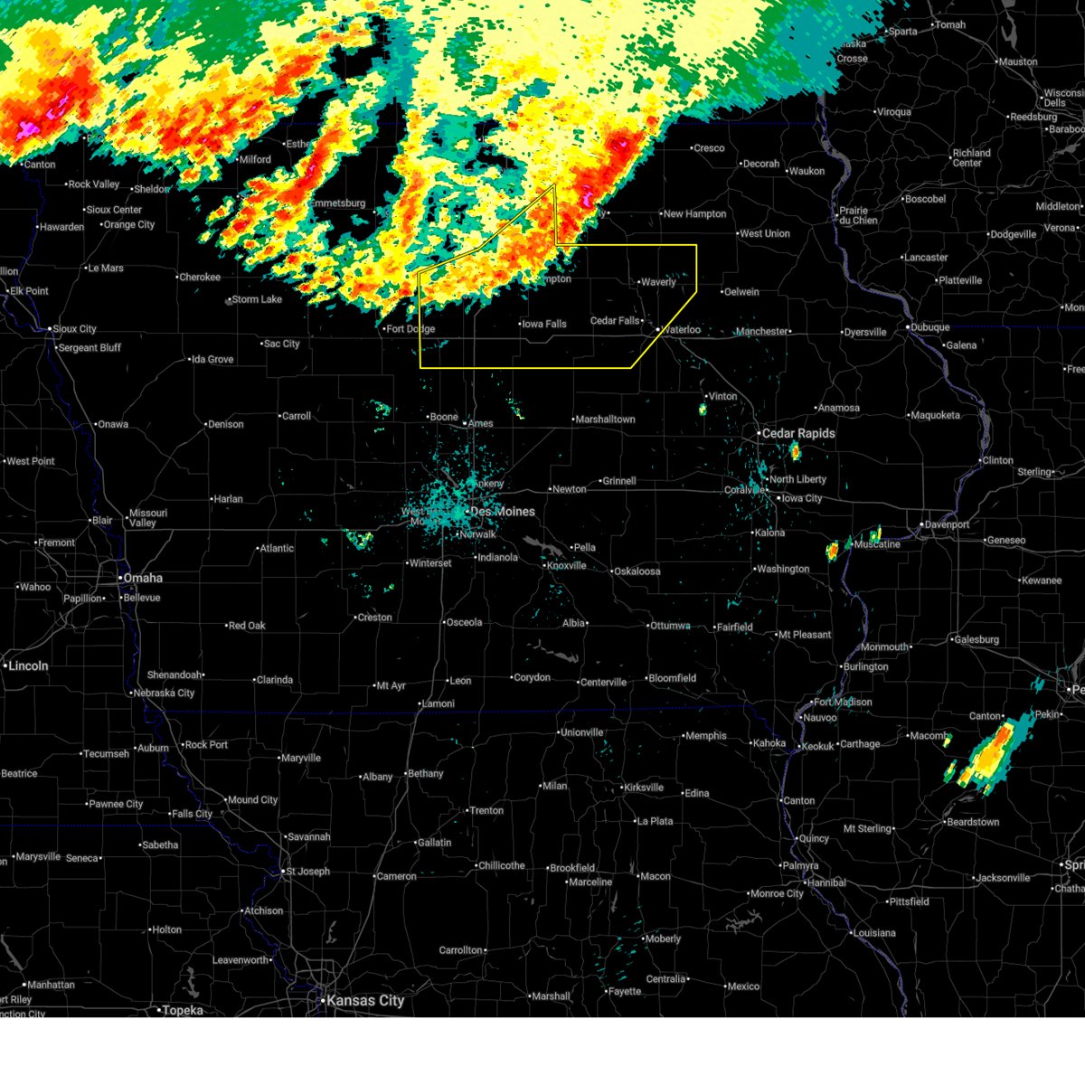
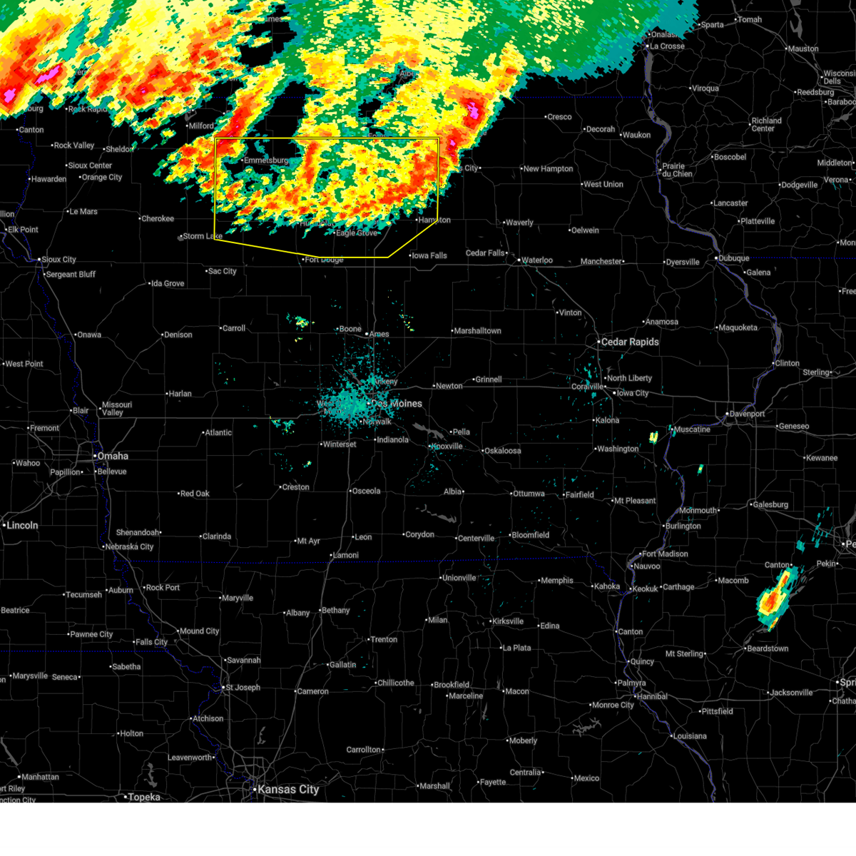
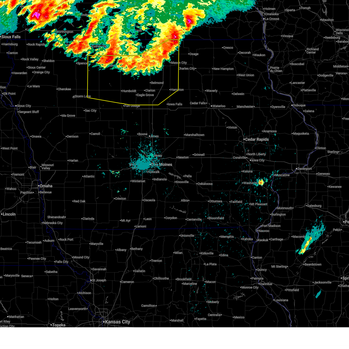
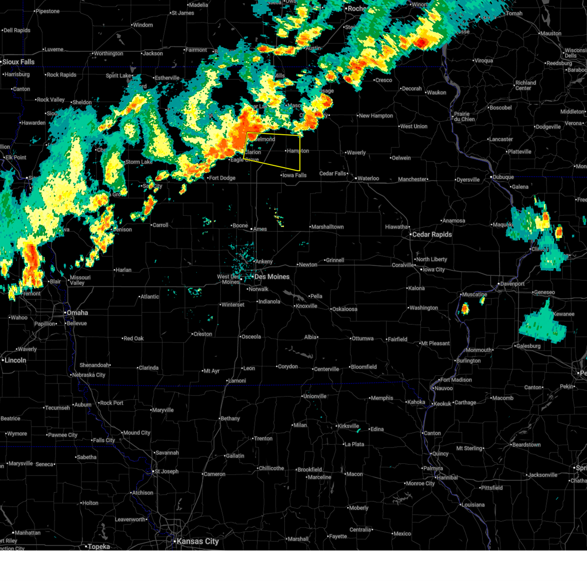
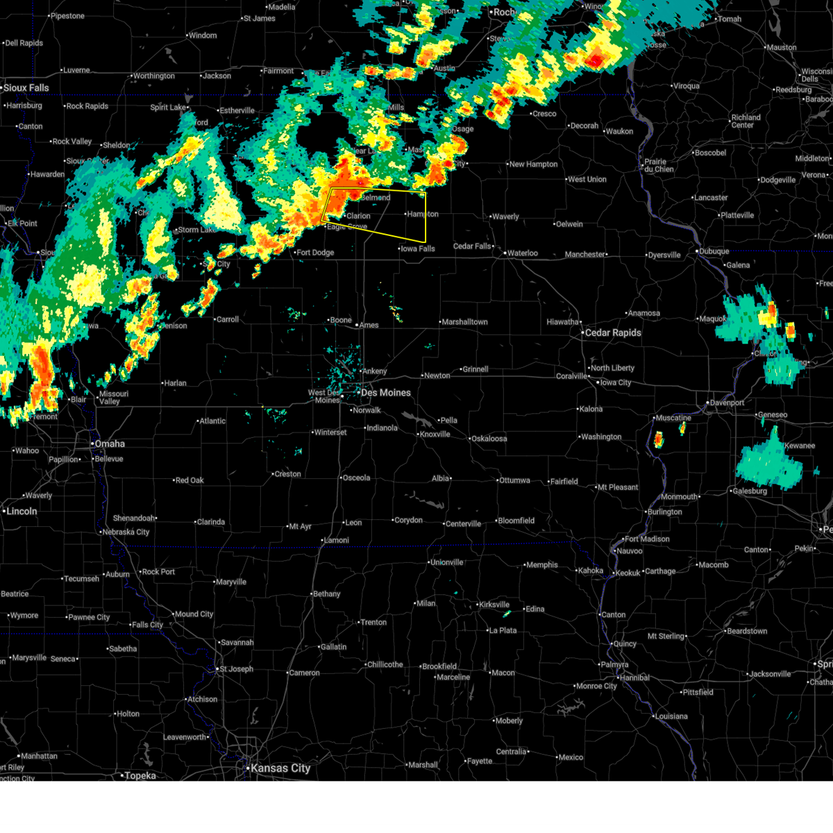
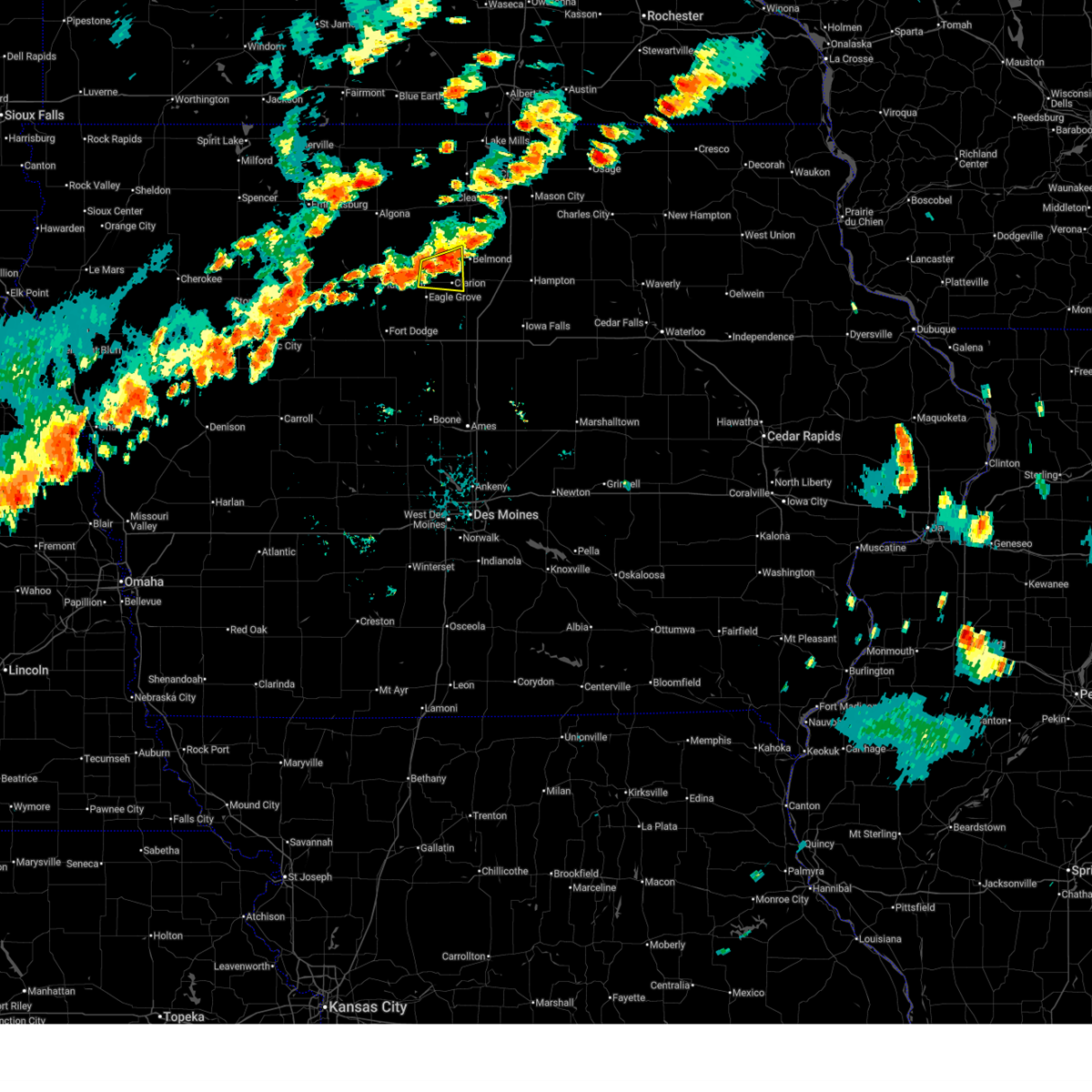
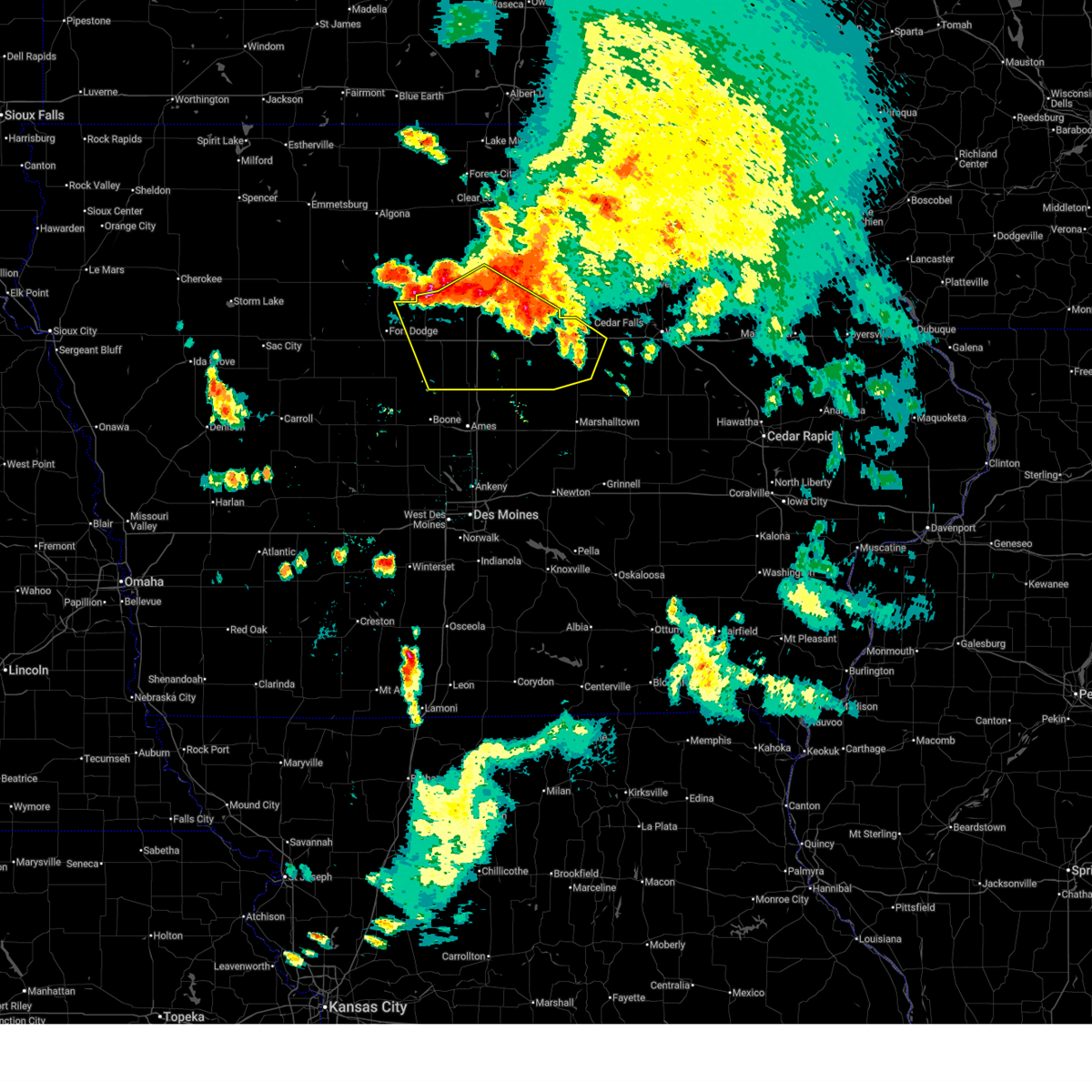
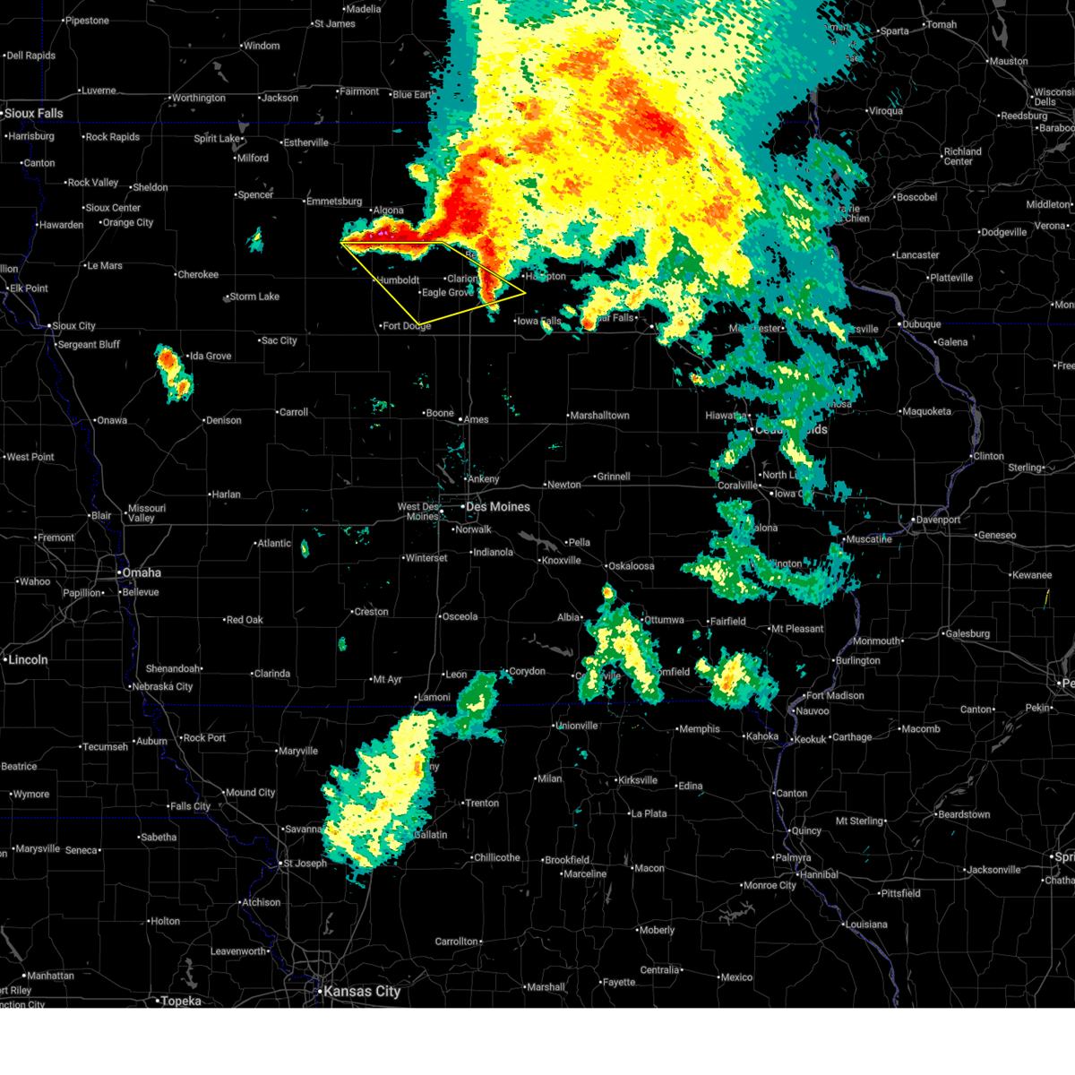
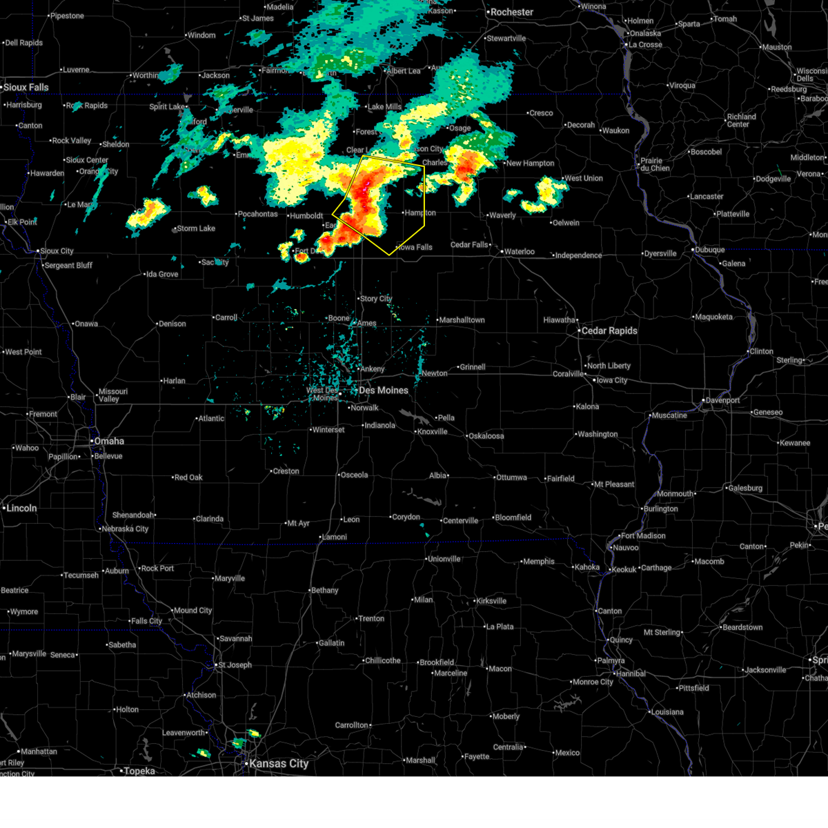
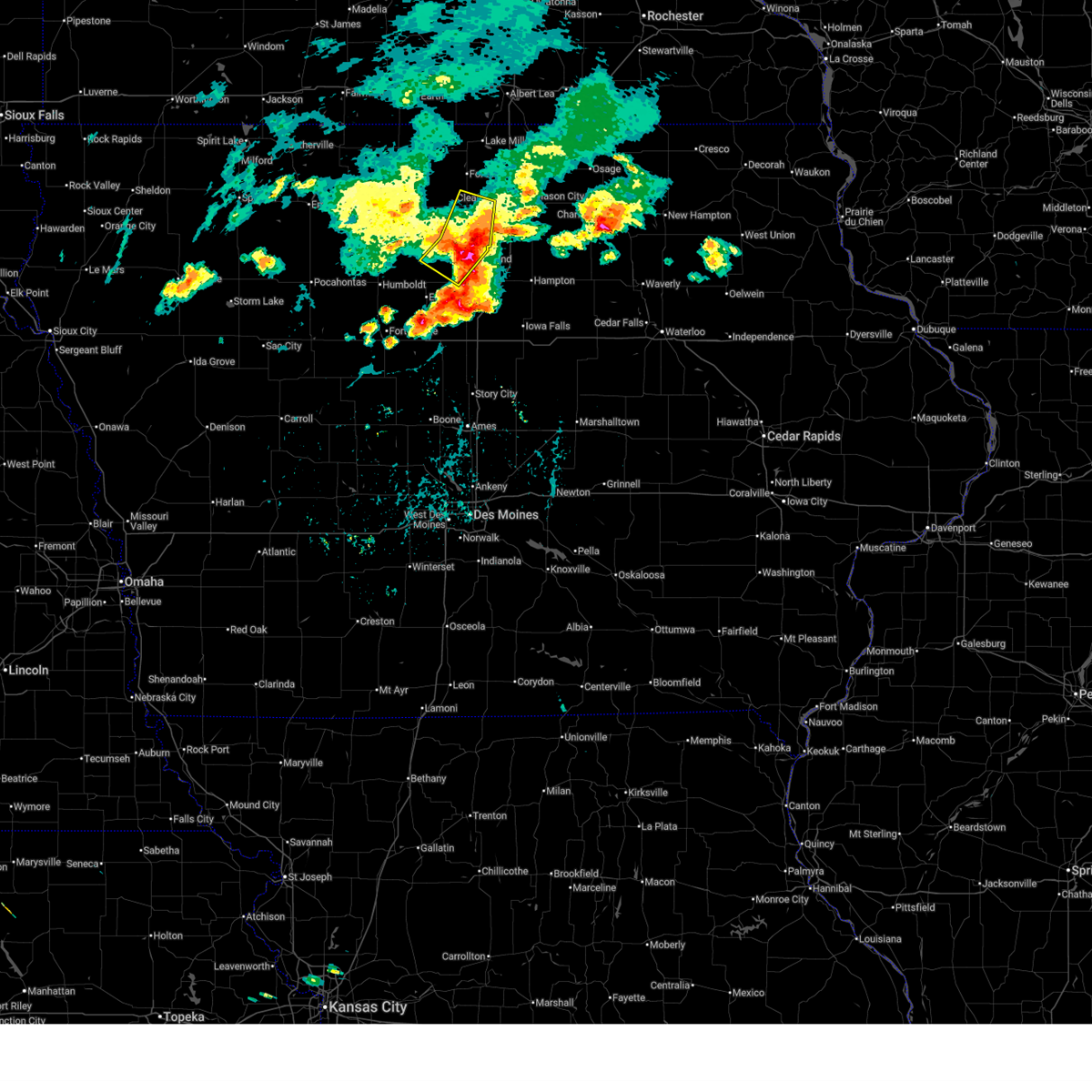
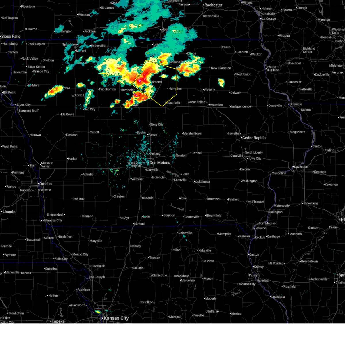
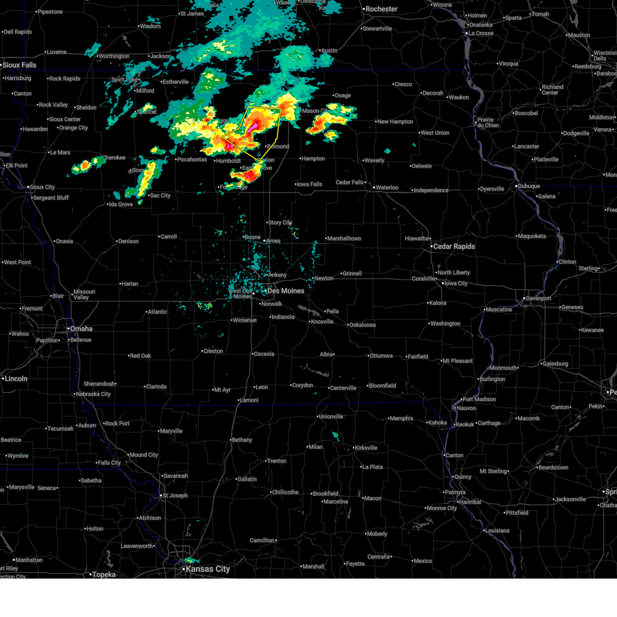
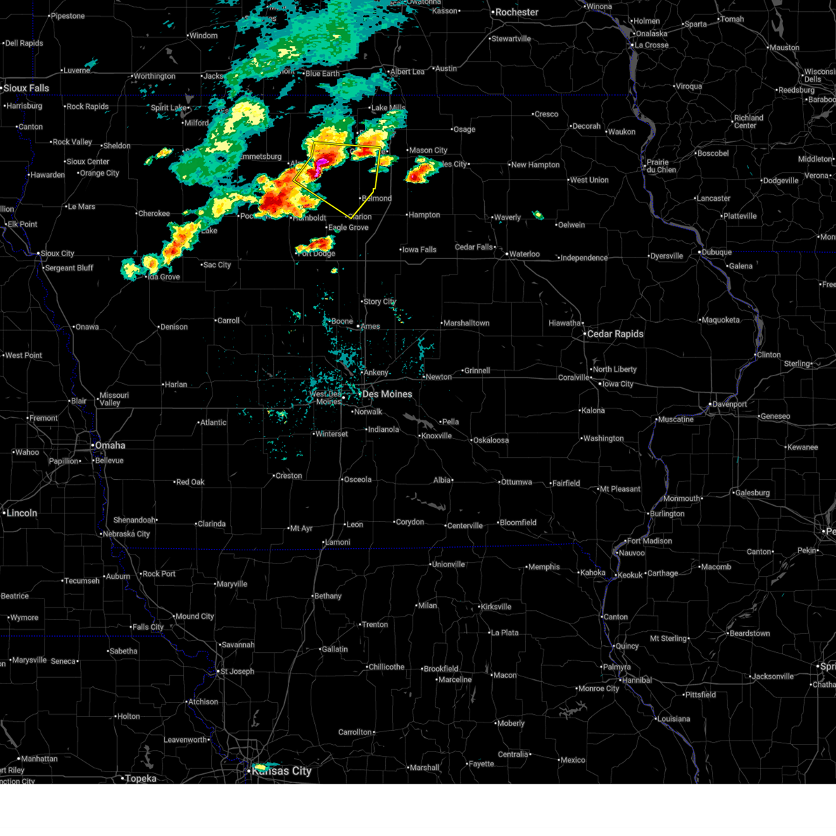
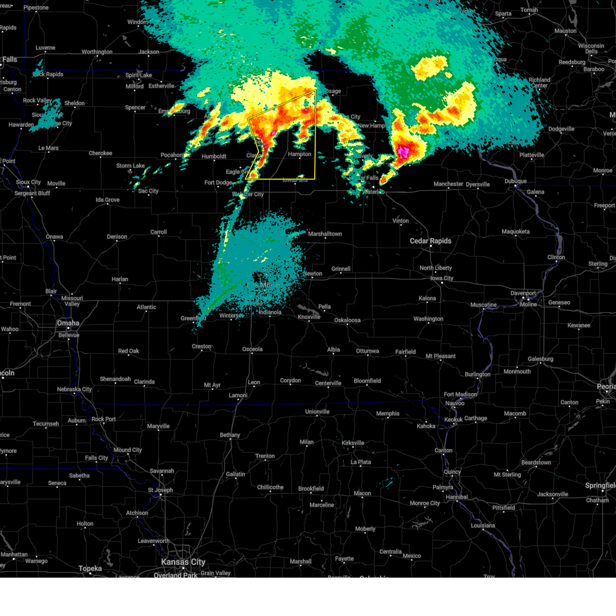
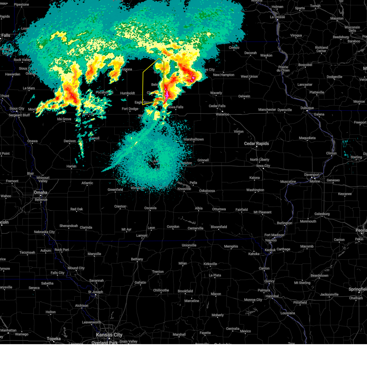
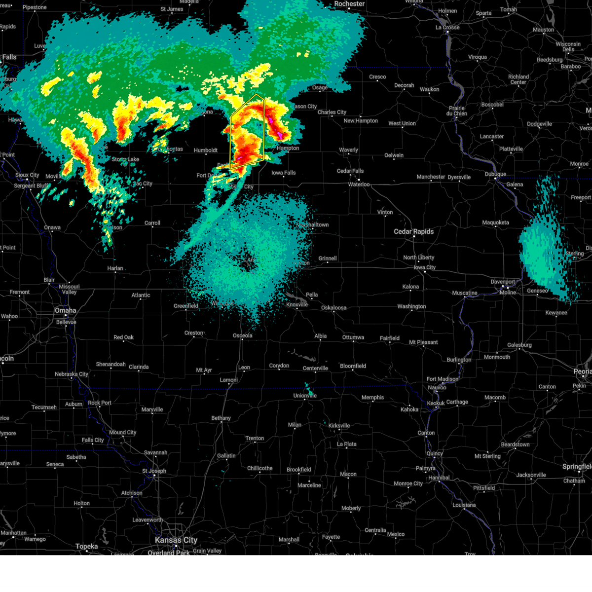
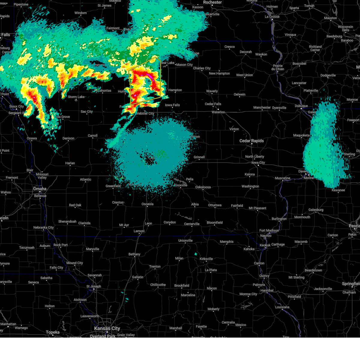
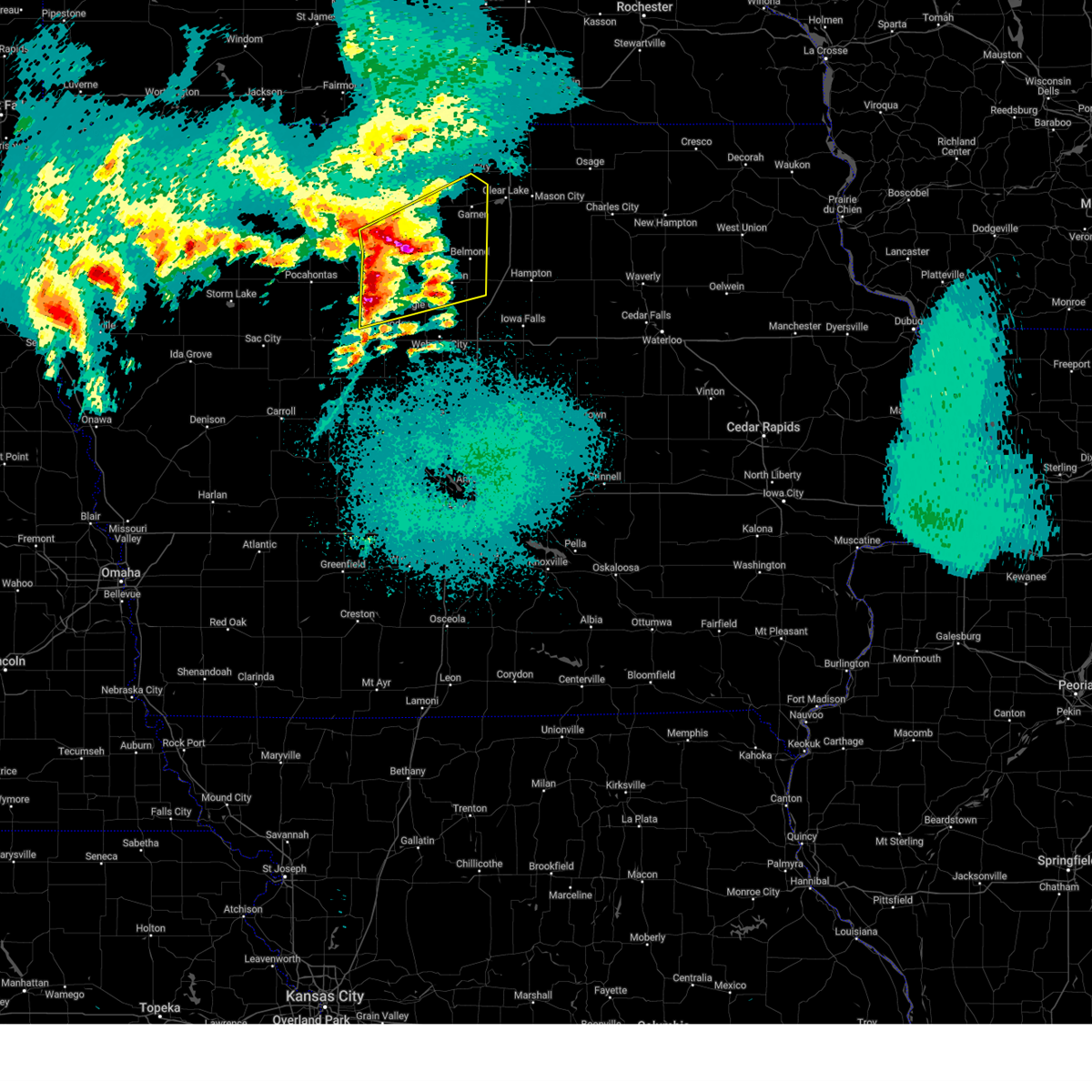
Hail Map for Clarion, IA
The Clarion, IA area has had 6 reports of on-the-ground hail by trained spotters, and has been under severe weather warnings 17 times during the past 12 months. Doppler radar has detected hail at or near Clarion, IA on 62 occasions, including 2 occasions during the past year.
| Name: | Clarion, IA |
| Where Located: | 39.2 miles SW of Mason City, IA |
| Map: | Google Map for Clarion, IA |
| Population: | 2850 |
| Housing Units: | 1346 |
| More Info: | Search Google for Clarion, IA |
4
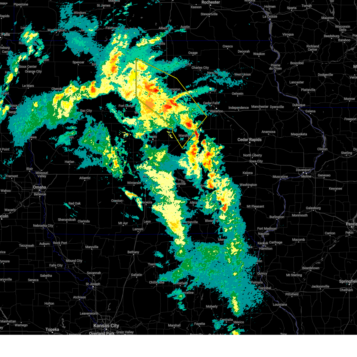
The Top Recent Hail Date for Clarion, IA is Monday, September 22, 2025 (4th out of 62)
Hail and Wind Damage Spotted near Clarion, IA
| Date / Time | Report Details |
|---|---|
| 5/17/2026 9:45 PM CDT |
 Tordmx the national weather service in des moines has issued a * tornado warning for, northwestern hardin county in central iowa, northeastern webster county in central iowa, southern wright county in north central iowa, southwestern franklin county in north central iowa, southeastern humboldt county in north central iowa, northern hamilton county in central iowa, * until 1030 pm cdt. * at 945 pm cdt, a severe thunderstorm capable of producing a tornado was located near sportsman park, or 10 miles northwest of webster city, moving east at 55 mph (radar indicated rotation). Hazards include tornado. Flying debris will be dangerous to those caught without shelter. mobile homes will be damaged or destroyed. damage to roofs, windows, and vehicles will occur. tree damage is likely. this dangerous storm will be near, woolstock around 950 pm cdt. big wall lake around 1000 pm cdt. dows and popejoy around 1010 pm cdt. other locations impacted by this tornadic thunderstorm include vincent, galt, latimer, dows, clarion municipal airport, goldfield, woolstock, rowan, coulter, and eagle grove municipal airport. This includes interstate 35 between mile markers 147 and 167. Tordmx the national weather service in des moines has issued a * tornado warning for, northwestern hardin county in central iowa, northeastern webster county in central iowa, southern wright county in north central iowa, southwestern franklin county in north central iowa, southeastern humboldt county in north central iowa, northern hamilton county in central iowa, * until 1030 pm cdt. * at 945 pm cdt, a severe thunderstorm capable of producing a tornado was located near sportsman park, or 10 miles northwest of webster city, moving east at 55 mph (radar indicated rotation). Hazards include tornado. Flying debris will be dangerous to those caught without shelter. mobile homes will be damaged or destroyed. damage to roofs, windows, and vehicles will occur. tree damage is likely. this dangerous storm will be near, woolstock around 950 pm cdt. big wall lake around 1000 pm cdt. dows and popejoy around 1010 pm cdt. other locations impacted by this tornadic thunderstorm include vincent, galt, latimer, dows, clarion municipal airport, goldfield, woolstock, rowan, coulter, and eagle grove municipal airport. This includes interstate 35 between mile markers 147 and 167.
|
| 5/17/2026 9:42 PM CDT |
 Svrdmx the national weather service in des moines has issued a * severe thunderstorm warning for, western hardin county in central iowa, webster county in central iowa, wright county in north central iowa, southwestern franklin county in north central iowa, southeastern calhoun county in west central iowa, southern humboldt county in north central iowa, hamilton county in central iowa, * until 1045 pm cdt. * at 942 pm cdt, severe thunderstorms were located along a line extending from near hardy to near fort dodge to near paton, moving east at 45 mph (radar indicated). Hazards include 60 mph wind gusts. expect damage to roofs, siding, and trees Svrdmx the national weather service in des moines has issued a * severe thunderstorm warning for, western hardin county in central iowa, webster county in central iowa, wright county in north central iowa, southwestern franklin county in north central iowa, southeastern calhoun county in west central iowa, southern humboldt county in north central iowa, hamilton county in central iowa, * until 1045 pm cdt. * at 942 pm cdt, severe thunderstorms were located along a line extending from near hardy to near fort dodge to near paton, moving east at 45 mph (radar indicated). Hazards include 60 mph wind gusts. expect damage to roofs, siding, and trees
|
| 4/23/2026 6:10 PM CDT |
 Svrdmx the national weather service in des moines has issued a * severe thunderstorm warning for, eastern greene county in west central iowa, eastern webster county in central iowa, wright county in north central iowa, eastern humboldt county in north central iowa, hamilton county in central iowa, boone county in central iowa, * until 700 pm cdt. * at 609 pm cdt, severe thunderstorms were located along a line extending from near renwick to vincent to near bagley, moving northeast at 45 mph (radar indicated). Hazards include 60 mph wind gusts and quarter size hail. Hail damage to vehicles is expected. Expect wind damage to roofs, siding, and trees. Svrdmx the national weather service in des moines has issued a * severe thunderstorm warning for, eastern greene county in west central iowa, eastern webster county in central iowa, wright county in north central iowa, eastern humboldt county in north central iowa, hamilton county in central iowa, boone county in central iowa, * until 700 pm cdt. * at 609 pm cdt, severe thunderstorms were located along a line extending from near renwick to vincent to near bagley, moving northeast at 45 mph (radar indicated). Hazards include 60 mph wind gusts and quarter size hail. Hail damage to vehicles is expected. Expect wind damage to roofs, siding, and trees.
|
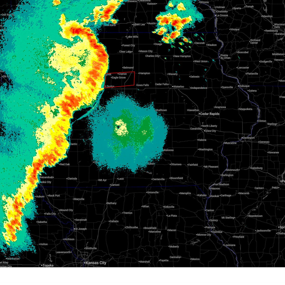
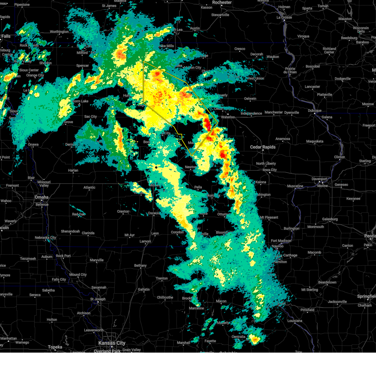
| 9/22/2025 7:59 PM CDT | Svrdmx the national weather service in des moines has issued a * severe thunderstorm warning for, southern wright county in north central iowa, * until 845 pm cdt. * at 759 pm cdt, a severe thunderstorm was located over clarion municipal airport, or over clarion, moving southeast at 15 mph (radar indicated). Hazards include 60 mph wind gusts and quarter size hail. Hail damage to vehicles is expected. Expect wind damage to roofs, siding, and trees. |
| 8/15/2025 2:00 PM CDT |
 Svrdmx the national weather service in des moines has issued a * severe thunderstorm warning for, northeastern wright county in north central iowa, franklin county in north central iowa, southeastern hancock county in north central iowa, southern cerro gordo county in north central iowa, * until 245 pm cdt. * at 200 pm cdt, severe thunderstorms were located along a line extending from near goodell to near elm lake to near galt, moving east at 35 mph (radar indicated). Hazards include 60 mph wind gusts. expect damage to roofs, siding, and trees Svrdmx the national weather service in des moines has issued a * severe thunderstorm warning for, northeastern wright county in north central iowa, franklin county in north central iowa, southeastern hancock county in north central iowa, southern cerro gordo county in north central iowa, * until 245 pm cdt. * at 200 pm cdt, severe thunderstorms were located along a line extending from near goodell to near elm lake to near galt, moving east at 35 mph (radar indicated). Hazards include 60 mph wind gusts. expect damage to roofs, siding, and trees
|
| 8/15/2025 1:30 PM CDT |
 The storms which prompted the warning have weakened below severe limits, and no longer pose an immediate threat to life or property. therefore, the warning has been allowed to expire. however, gusty winds are still possible with these thunderstorms. a severe thunderstorm watch remains in effect until 500 pm cdt for central, north central, northwestern and west central iowa. The storms which prompted the warning have weakened below severe limits, and no longer pose an immediate threat to life or property. therefore, the warning has been allowed to expire. however, gusty winds are still possible with these thunderstorms. a severe thunderstorm watch remains in effect until 500 pm cdt for central, north central, northwestern and west central iowa.
|
| 8/15/2025 1:22 PM CDT |
 At 121 pm cdt, severe thunderstorms were located along a line extending from 5 miles southeast of burt to near lu verne to near pioneer, moving east at 45 mph (radar indicated). Hazards include 60 mph wind gusts and nickel size hail. Expect damage to roofs, siding, and trees. Locations impacted include, fort dodge, webster city, algona, forest city, garner, clarion, dakota city, humboldt, eagle grove, britt, manson, elm lake, union slogh, fort dodge regional airport, eagle lake, west bend, kanawha, goldfield, rolfe, and badger. At 121 pm cdt, severe thunderstorms were located along a line extending from 5 miles southeast of burt to near lu verne to near pioneer, moving east at 45 mph (radar indicated). Hazards include 60 mph wind gusts and nickel size hail. Expect damage to roofs, siding, and trees. Locations impacted include, fort dodge, webster city, algona, forest city, garner, clarion, dakota city, humboldt, eagle grove, britt, manson, elm lake, union slogh, fort dodge regional airport, eagle lake, west bend, kanawha, goldfield, rolfe, and badger.
|
| 8/15/2025 1:12 PM CDT |
 the severe thunderstorm warning has been cancelled and is no longer in effect the severe thunderstorm warning has been cancelled and is no longer in effect
|
| 8/15/2025 1:12 PM CDT |
 At 111 pm cdt, severe thunderstorms were located along a line extending from 4 miles southwest of burt to st. joseph to near pioneer, moving east at 50 mph (radar indicated). Hazards include 60 mph wind gusts and quarter size hail. Hail damage to vehicles is expected. expect wind damage to roofs, siding, and trees. Locations impacted include, fort dodge, webster city, algona, forest city, garner, clarion, pocahontas, dakota city, humboldt, eagle grove, britt, manson, elm lake, union slogh, fort dodge regional airport, eagle lake, west bend, pomeroy, kanawha, and goldfield. At 111 pm cdt, severe thunderstorms were located along a line extending from 4 miles southwest of burt to st. joseph to near pioneer, moving east at 50 mph (radar indicated). Hazards include 60 mph wind gusts and quarter size hail. Hail damage to vehicles is expected. expect wind damage to roofs, siding, and trees. Locations impacted include, fort dodge, webster city, algona, forest city, garner, clarion, pocahontas, dakota city, humboldt, eagle grove, britt, manson, elm lake, union slogh, fort dodge regional airport, eagle lake, west bend, pomeroy, kanawha, and goldfield.
|
| 8/15/2025 12:50 PM CDT |
 Svrdmx the national weather service in des moines has issued a * severe thunderstorm warning for, northern webster county in central iowa, pocahontas county in northwestern iowa, wright county in north central iowa, northeastern sac county in west central iowa, kossuth county in north central iowa, northern calhoun county in west central iowa, humboldt county in north central iowa, hancock county in north central iowa, northwestern hamilton county in central iowa, southwestern winnebago county in north central iowa, palo alto county in northwestern iowa, * until 130 pm cdt. * at 1250 pm cdt, severe thunderstorms were located along a line extending from near cylinder to plover to near fonda, moving east at 55 mph (radar indicated). Hazards include 60 mph wind gusts and nickel size hail. expect damage to roofs, siding, and trees Svrdmx the national weather service in des moines has issued a * severe thunderstorm warning for, northern webster county in central iowa, pocahontas county in northwestern iowa, wright county in north central iowa, northeastern sac county in west central iowa, kossuth county in north central iowa, northern calhoun county in west central iowa, humboldt county in north central iowa, hancock county in north central iowa, northwestern hamilton county in central iowa, southwestern winnebago county in north central iowa, palo alto county in northwestern iowa, * until 130 pm cdt. * at 1250 pm cdt, severe thunderstorms were located along a line extending from near cylinder to plover to near fonda, moving east at 55 mph (radar indicated). Hazards include 60 mph wind gusts and nickel size hail. expect damage to roofs, siding, and trees
|
| 7/29/2025 12:06 AM CDT |
 At 1205 am cdt, severe thunderstorms were located along a line extending from near belmond to near webster city, moving east at 40 mph (public reported trees down in fort dodge along with power outages). Hazards include 60 mph wind gusts. Expect damage to roofs, siding, and trees. locations impacted include, webster city, iowa falls, hampton, clarion, eagle grove, belmond, sheffield, big wall lake, elm lake, alden, goldfield, dows, latimer, williams, coulter, meservey, blairsburg, alexander, woolstock, and rowan. This includes interstate 35 between mile markers 141 and 178. At 1205 am cdt, severe thunderstorms were located along a line extending from near belmond to near webster city, moving east at 40 mph (public reported trees down in fort dodge along with power outages). Hazards include 60 mph wind gusts. Expect damage to roofs, siding, and trees. locations impacted include, webster city, iowa falls, hampton, clarion, eagle grove, belmond, sheffield, big wall lake, elm lake, alden, goldfield, dows, latimer, williams, coulter, meservey, blairsburg, alexander, woolstock, and rowan. This includes interstate 35 between mile markers 141 and 178.
|
| 7/29/2025 12:06 AM CDT |
 the severe thunderstorm warning has been cancelled and is no longer in effect the severe thunderstorm warning has been cancelled and is no longer in effect
|
| 7/28/2025 11:27 PM CDT |
 Svrdmx the national weather service in des moines has issued a * severe thunderstorm warning for, northwestern hardin county in central iowa, northern webster county in central iowa, wright county in north central iowa, franklin county in north central iowa, humboldt county in north central iowa, northern hamilton county in central iowa, * until 1230 am cdt. * at 1125 pm cdt, severe thunderstorms were located along a line extending from near livermore to near lizard creek state recreation area, moving east at 50 mph (automated and personal weather stations. a personal weather station about 5 miles west of pocahontas reported a 63 mph wind gust at 1100 pm. wind gusts of 60 to 70 mph have been observed over portions of northwest iowa). Hazards include 70 mph wind gusts. Expect considerable tree damage. Damage is likely to mobile homes, roofs, and outbuildings. Svrdmx the national weather service in des moines has issued a * severe thunderstorm warning for, northwestern hardin county in central iowa, northern webster county in central iowa, wright county in north central iowa, franklin county in north central iowa, humboldt county in north central iowa, northern hamilton county in central iowa, * until 1230 am cdt. * at 1125 pm cdt, severe thunderstorms were located along a line extending from near livermore to near lizard creek state recreation area, moving east at 50 mph (automated and personal weather stations. a personal weather station about 5 miles west of pocahontas reported a 63 mph wind gust at 1100 pm. wind gusts of 60 to 70 mph have been observed over portions of northwest iowa). Hazards include 70 mph wind gusts. Expect considerable tree damage. Damage is likely to mobile homes, roofs, and outbuildings.
|
| 7/28/2025 12:13 AM CDT |
 Svrdmx the national weather service in des moines has issued a * severe thunderstorm warning for, hardin county in central iowa, western black hawk county in northeastern iowa, bremer county in northeastern iowa, wright county in north central iowa, franklin county in north central iowa, grundy county in central iowa, butler county in north central iowa, hamilton county in central iowa, southern cerro gordo county in north central iowa, * until 100 am cdt. * at 1212 am cdt, severe thunderstorms were located along a line extending from 4 miles south of greene to alden to 4 miles northeast of duncombe, moving southeast at 45 mph (radar indicated). Hazards include 60 mph wind gusts. expect damage to roofs, siding, and trees Svrdmx the national weather service in des moines has issued a * severe thunderstorm warning for, hardin county in central iowa, western black hawk county in northeastern iowa, bremer county in northeastern iowa, wright county in north central iowa, franklin county in north central iowa, grundy county in central iowa, butler county in north central iowa, hamilton county in central iowa, southern cerro gordo county in north central iowa, * until 100 am cdt. * at 1212 am cdt, severe thunderstorms were located along a line extending from 4 miles south of greene to alden to 4 miles northeast of duncombe, moving southeast at 45 mph (radar indicated). Hazards include 60 mph wind gusts. expect damage to roofs, siding, and trees
|
| 7/27/2025 11:59 PM CDT |
 At 1158 pm cdt, severe thunderstorms were located along a line extending from 4 miles west of aredale to near dows to badger to near pocahontas, moving south at 40 mph (public). Hazards include 60 mph wind gusts. Expect damage to roofs, siding, and trees. locations impacted include, mason city, fort dodge, algona, hampton, forest city, emmetsburg, garner, clarion, pocahontas, dakota city, humboldt, eagle grove, belmond, britt, nora springs, laurens, sheffield, rockwell, fort dodge regional airport, and big wall lake. This includes interstate 35 between mile markers 147 and 202. At 1158 pm cdt, severe thunderstorms were located along a line extending from 4 miles west of aredale to near dows to badger to near pocahontas, moving south at 40 mph (public). Hazards include 60 mph wind gusts. Expect damage to roofs, siding, and trees. locations impacted include, mason city, fort dodge, algona, hampton, forest city, emmetsburg, garner, clarion, pocahontas, dakota city, humboldt, eagle grove, belmond, britt, nora springs, laurens, sheffield, rockwell, fort dodge regional airport, and big wall lake. This includes interstate 35 between mile markers 147 and 202.
|
| 7/27/2025 11:59 PM CDT |
 the severe thunderstorm warning has been cancelled and is no longer in effect the severe thunderstorm warning has been cancelled and is no longer in effect
|
| 7/27/2025 11:23 PM CDT |
 Svrdmx the national weather service in des moines has issued a * severe thunderstorm warning for, northern webster county in central iowa, pocahontas county in northwestern iowa, wright county in north central iowa, hancock county in north central iowa, northern hamilton county in central iowa, palo alto county in northwestern iowa, northwestern hardin county in central iowa, worth county in north central iowa, franklin county in north central iowa, southern kossuth county in north central iowa, humboldt county in north central iowa, cerro gordo county in north central iowa, southern winnebago county in north central iowa, * until 1215 am cdt. * at 1123 pm cdt, severe thunderstorms were located along a line extending from mason city to near goodell to near st. joseph to ayrshire, moving south at 40 mph (public). Hazards include 60 mph wind gusts. expect damage to roofs, siding, and trees Svrdmx the national weather service in des moines has issued a * severe thunderstorm warning for, northern webster county in central iowa, pocahontas county in northwestern iowa, wright county in north central iowa, hancock county in north central iowa, northern hamilton county in central iowa, palo alto county in northwestern iowa, northwestern hardin county in central iowa, worth county in north central iowa, franklin county in north central iowa, southern kossuth county in north central iowa, humboldt county in north central iowa, cerro gordo county in north central iowa, southern winnebago county in north central iowa, * until 1215 am cdt. * at 1123 pm cdt, severe thunderstorms were located along a line extending from mason city to near goodell to near st. joseph to ayrshire, moving south at 40 mph (public). Hazards include 60 mph wind gusts. expect damage to roofs, siding, and trees
|
| 6/25/2025 6:03 PM CDT |
 At 603 pm cdt, a severe thunderstorm was located over coulter, or 9 miles west of hampton, moving east at 45 mph (radar indicated). Hazards include 60 mph wind gusts. Expect damage to roofs, siding, and trees. locations impacted include, hampton, clarion, belmond, ackley, sheffield, elm lake, dows, latimer, coulter, alexander, geneva, rowan, bradford, hansell, chapin, galt, beeds lake state park, hampton municipal airport, and belmond municipal airport. This includes interstate 35 between mile markers 157 and 176. At 603 pm cdt, a severe thunderstorm was located over coulter, or 9 miles west of hampton, moving east at 45 mph (radar indicated). Hazards include 60 mph wind gusts. Expect damage to roofs, siding, and trees. locations impacted include, hampton, clarion, belmond, ackley, sheffield, elm lake, dows, latimer, coulter, alexander, geneva, rowan, bradford, hansell, chapin, galt, beeds lake state park, hampton municipal airport, and belmond municipal airport. This includes interstate 35 between mile markers 157 and 176.
|
| 6/25/2025 5:46 PM CDT |
 Svrdmx the national weather service in des moines has issued a * severe thunderstorm warning for, central wright county in north central iowa, franklin county in north central iowa, * until 630 pm cdt. * at 545 pm cdt, a severe thunderstorm was located over elm lake, or near clarion, moving east at 50 mph (radar indicated). Hazards include 60 mph wind gusts and penny size hail. expect damage to roofs, siding, and trees Svrdmx the national weather service in des moines has issued a * severe thunderstorm warning for, central wright county in north central iowa, franklin county in north central iowa, * until 630 pm cdt. * at 545 pm cdt, a severe thunderstorm was located over elm lake, or near clarion, moving east at 50 mph (radar indicated). Hazards include 60 mph wind gusts and penny size hail. expect damage to roofs, siding, and trees
|
| 6/25/2025 5:45 PM CDT | Peak gust reported by clarion awo in wright county IA, 1.6 miles ESE of Clarion, IA |
| 6/25/2025 4:33 PM CDT |
 the severe thunderstorm warning has been cancelled and is no longer in effect the severe thunderstorm warning has been cancelled and is no longer in effect
|
| 6/25/2025 4:20 PM CDT |
 At 420 pm cdt, a severe thunderstorm was located near clarion municipal airport, or 6 miles northwest of clarion, moving east at 30 mph (radar indicated). Hazards include 60 mph wind gusts and nickel size hail. Expect damage to roofs, siding, and trees. Locations impacted include, clarion, elm lake, goldfield, eagle grove municipal airport, and clarion municipal airport. At 420 pm cdt, a severe thunderstorm was located near clarion municipal airport, or 6 miles northwest of clarion, moving east at 30 mph (radar indicated). Hazards include 60 mph wind gusts and nickel size hail. Expect damage to roofs, siding, and trees. Locations impacted include, clarion, elm lake, goldfield, eagle grove municipal airport, and clarion municipal airport.
|
| 6/25/2025 4:20 PM CDT |
 the severe thunderstorm warning has been cancelled and is no longer in effect the severe thunderstorm warning has been cancelled and is no longer in effect
|
| 6/25/2025 4:10 PM CDT |
 At 409 pm cdt, a severe thunderstorm was located over goldfield, or 11 miles west of clarion, moving east at 30 mph (radar indicated). Hazards include 60 mph wind gusts and nickel size hail. Expect damage to roofs, siding, and trees. Locations impacted include, clarion, elm lake, goldfield, renwick, hardy, eagle grove municipal airport, and clarion municipal airport. At 409 pm cdt, a severe thunderstorm was located over goldfield, or 11 miles west of clarion, moving east at 30 mph (radar indicated). Hazards include 60 mph wind gusts and nickel size hail. Expect damage to roofs, siding, and trees. Locations impacted include, clarion, elm lake, goldfield, renwick, hardy, eagle grove municipal airport, and clarion municipal airport.
|
| 6/25/2025 3:59 PM CDT |
 Svrdmx the national weather service in des moines has issued a * severe thunderstorm warning for, northwestern wright county in north central iowa, southeastern humboldt county in north central iowa, * until 445 pm cdt. * at 358 pm cdt, a severe thunderstorm was located near hardy, or 7 miles east of dakota city, moving east at 30 mph (radar indicated). Hazards include 60 mph wind gusts and nickel size hail. expect damage to roofs, siding, and trees Svrdmx the national weather service in des moines has issued a * severe thunderstorm warning for, northwestern wright county in north central iowa, southeastern humboldt county in north central iowa, * until 445 pm cdt. * at 358 pm cdt, a severe thunderstorm was located near hardy, or 7 miles east of dakota city, moving east at 30 mph (radar indicated). Hazards include 60 mph wind gusts and nickel size hail. expect damage to roofs, siding, and trees
|
| 6/20/2025 4:29 AM CDT |
 Svrdmx the national weather service in des moines has issued a * severe thunderstorm warning for, hardin county in central iowa, northeastern webster county in central iowa, southern wright county in north central iowa, southern franklin county in north central iowa, western grundy county in central iowa, hamilton county in central iowa, * until 530 am cdt. * at 428 am cdt, severe thunderstorms were located along a line extending from coulter to near dows to near big wall lake to vincent, moving southeast at 45 mph (radar indicated). Hazards include 60 mph wind gusts and penny size hail. expect damage to roofs, siding, and trees Svrdmx the national weather service in des moines has issued a * severe thunderstorm warning for, hardin county in central iowa, northeastern webster county in central iowa, southern wright county in north central iowa, southern franklin county in north central iowa, western grundy county in central iowa, hamilton county in central iowa, * until 530 am cdt. * at 428 am cdt, severe thunderstorms were located along a line extending from coulter to near dows to near big wall lake to vincent, moving southeast at 45 mph (radar indicated). Hazards include 60 mph wind gusts and penny size hail. expect damage to roofs, siding, and trees
|
| 6/20/2025 3:49 AM CDT |
 Svrdmx the national weather service in des moines has issued a * severe thunderstorm warning for, northeastern webster county in central iowa, wright county in north central iowa, southwestern franklin county in north central iowa, humboldt county in north central iowa, northwestern hamilton county in central iowa, * until 430 am cdt. * at 348 am cdt, a severe thunderstorm was located 5 miles northeast of renwick, or 12 miles northwest of clarion, moving southeast at 35 mph (radar indicated). Hazards include 70 mph wind gusts and penny size hail. Expect considerable tree damage. Damage is likely to mobile homes, roofs, and outbuildings. Svrdmx the national weather service in des moines has issued a * severe thunderstorm warning for, northeastern webster county in central iowa, wright county in north central iowa, southwestern franklin county in north central iowa, humboldt county in north central iowa, northwestern hamilton county in central iowa, * until 430 am cdt. * at 348 am cdt, a severe thunderstorm was located 5 miles northeast of renwick, or 12 miles northwest of clarion, moving southeast at 35 mph (radar indicated). Hazards include 70 mph wind gusts and penny size hail. Expect considerable tree damage. Damage is likely to mobile homes, roofs, and outbuildings.
|
| 6/11/2025 5:49 PM CDT |
 At 548 pm cdt, severe thunderstorms were located along a line extending from 4 miles southwest of clear lake state park to near alexander to near popejoy, moving east at 30 mph (clarion awos gusted to 58 mph). Hazards include 70 mph wind gusts and quarter size hail. Hail damage to vehicles is expected. expect considerable tree damage. wind damage is also likely to mobile homes, roofs, and outbuildings. locations impacted include, iowa falls, hampton, clarion, belmond, sheffield, rockwell, elm lake, alden, dows, klemme, latimer, thornton, coulter, meservey, alexander, geneva, swaledale, rowan, goodell, and bradford. This includes interstate 35 between mile markers 153 and 190. At 548 pm cdt, severe thunderstorms were located along a line extending from 4 miles southwest of clear lake state park to near alexander to near popejoy, moving east at 30 mph (clarion awos gusted to 58 mph). Hazards include 70 mph wind gusts and quarter size hail. Hail damage to vehicles is expected. expect considerable tree damage. wind damage is also likely to mobile homes, roofs, and outbuildings. locations impacted include, iowa falls, hampton, clarion, belmond, sheffield, rockwell, elm lake, alden, dows, klemme, latimer, thornton, coulter, meservey, alexander, geneva, swaledale, rowan, goodell, and bradford. This includes interstate 35 between mile markers 153 and 190.
|
| 6/11/2025 5:40 PM CDT |
 the severe thunderstorm warning has been cancelled and is no longer in effect the severe thunderstorm warning has been cancelled and is no longer in effect
|
| 6/11/2025 5:40 PM CDT |
 At 538 pm cdt, severe thunderstorms were located along a line extending from near ventura to meservey to near belmond, moving southeast at 30 mph (radar indicated). Hazards include 70 mph wind gusts and half dollar size hail. Hail damage to vehicles is expected. expect considerable tree damage. wind damage is also likely to mobile homes, roofs, and outbuildings. Locations impacted include, garner, clarion, belmond, elm lake, clear lake, ventura, kanawha, klemme, meservey, goodell, duncan, mcintosh woods state park, and belmond municipal airport. At 538 pm cdt, severe thunderstorms were located along a line extending from near ventura to meservey to near belmond, moving southeast at 30 mph (radar indicated). Hazards include 70 mph wind gusts and half dollar size hail. Hail damage to vehicles is expected. expect considerable tree damage. wind damage is also likely to mobile homes, roofs, and outbuildings. Locations impacted include, garner, clarion, belmond, elm lake, clear lake, ventura, kanawha, klemme, meservey, goodell, duncan, mcintosh woods state park, and belmond municipal airport.
|
| 6/11/2025 5:39 PM CDT | Awos station kcav clarion airpor in wright county IA, 2.3 miles ESE of Clarion, IA |
| 6/11/2025 5:30 PM CDT |
 Svrdmx the national weather service in des moines has issued a * severe thunderstorm warning for, northwestern hardin county in central iowa, wright county in north central iowa, franklin county in north central iowa, eastern hancock county in north central iowa, southern cerro gordo county in north central iowa, * until 615 pm cdt. * at 529 pm cdt, severe thunderstorms were located along a line extending from ventura to near alexander to near clarion, moving southeast at 35 mph (personal weather station reported a wind gust of 71 mph west of belmond). Hazards include 70 mph wind gusts and half dollar size hail. Hail damage to vehicles is expected. expect considerable tree damage. Wind damage is also likely to mobile homes, roofs, and outbuildings. Svrdmx the national weather service in des moines has issued a * severe thunderstorm warning for, northwestern hardin county in central iowa, wright county in north central iowa, franklin county in north central iowa, eastern hancock county in north central iowa, southern cerro gordo county in north central iowa, * until 615 pm cdt. * at 529 pm cdt, severe thunderstorms were located along a line extending from ventura to near alexander to near clarion, moving southeast at 35 mph (personal weather station reported a wind gust of 71 mph west of belmond). Hazards include 70 mph wind gusts and half dollar size hail. Hail damage to vehicles is expected. expect considerable tree damage. Wind damage is also likely to mobile homes, roofs, and outbuildings.
|
| 6/11/2025 5:17 PM CDT | Ping Pong Ball sized hail reported 6.1 miles SSE of Clarion, IA, ping pong size hail south of kanawha at 170th and jackson. |
| 6/11/2025 5:17 PM CDT |
 At 517 pm cdt, severe thunderstorms were located along a line extending from near hayfield to near klemme to near kanawha, moving southeast at 30 mph (radar indicated). Hazards include 70 mph wind gusts and half dollar size hail. Hail damage to vehicles is expected. expect considerable tree damage. wind damage is also likely to mobile homes, roofs, and outbuildings. Locations impacted include, garner, clarion, belmond, britt, elm lake, eagle lake, clear lake, ventura, kanawha, klemme, corwith, lu verne, meservey, goodell, duncan, miller, hayfield, mcintosh woods state park, eagle lake state park, and belmond municipal airport. At 517 pm cdt, severe thunderstorms were located along a line extending from near hayfield to near klemme to near kanawha, moving southeast at 30 mph (radar indicated). Hazards include 70 mph wind gusts and half dollar size hail. Hail damage to vehicles is expected. expect considerable tree damage. wind damage is also likely to mobile homes, roofs, and outbuildings. Locations impacted include, garner, clarion, belmond, britt, elm lake, eagle lake, clear lake, ventura, kanawha, klemme, corwith, lu verne, meservey, goodell, duncan, miller, hayfield, mcintosh woods state park, eagle lake state park, and belmond municipal airport.
|
| 6/11/2025 4:54 PM CDT |
 Svrdmx the national weather service in des moines has issued a * severe thunderstorm warning for, northern wright county in north central iowa, southeastern kossuth county in north central iowa, northeastern humboldt county in north central iowa, hancock county in north central iowa, southwestern cerro gordo county in north central iowa, * until 545 pm cdt. * at 453 pm cdt, severe thunderstorms were located along a line extending from near crystal lake to near hutchins to near corwith, moving southeast at 30 mph (radar indicated). Hazards include 70 mph wind gusts and half dollar size hail. Hail damage to vehicles is expected. expect considerable tree damage. Wind damage is also likely to mobile homes, roofs, and outbuildings. Svrdmx the national weather service in des moines has issued a * severe thunderstorm warning for, northern wright county in north central iowa, southeastern kossuth county in north central iowa, northeastern humboldt county in north central iowa, hancock county in north central iowa, southwestern cerro gordo county in north central iowa, * until 545 pm cdt. * at 453 pm cdt, severe thunderstorms were located along a line extending from near crystal lake to near hutchins to near corwith, moving southeast at 30 mph (radar indicated). Hazards include 70 mph wind gusts and half dollar size hail. Hail damage to vehicles is expected. expect considerable tree damage. Wind damage is also likely to mobile homes, roofs, and outbuildings.
|
| 4/18/2025 4:23 AM CDT |
 Svrdmx the national weather service in des moines has issued a * severe thunderstorm warning for, southeastern worth county in north central iowa, franklin county in north central iowa, eastern wright county in north central iowa, southeastern hancock county in north central iowa, cerro gordo county in north central iowa, * until 515 am cdt. * at 422 am cdt, severe thunderstorms were located along a line extending from near duncan to belmond to 4 miles east of woolstock, moving east at 55 mph (clarion awos reported a peak wind gust of 76 mph). Hazards include 70 mph wind gusts and quarter size hail. Hail damage to vehicles is expected. expect considerable tree damage. Wind damage is also likely to mobile homes, roofs, and outbuildings. Svrdmx the national weather service in des moines has issued a * severe thunderstorm warning for, southeastern worth county in north central iowa, franklin county in north central iowa, eastern wright county in north central iowa, southeastern hancock county in north central iowa, cerro gordo county in north central iowa, * until 515 am cdt. * at 422 am cdt, severe thunderstorms were located along a line extending from near duncan to belmond to 4 miles east of woolstock, moving east at 55 mph (clarion awos reported a peak wind gust of 76 mph). Hazards include 70 mph wind gusts and quarter size hail. Hail damage to vehicles is expected. expect considerable tree damage. Wind damage is also likely to mobile homes, roofs, and outbuildings.
|
| 4/18/2025 2:59 AM CDT |
 The storms which prompted the warning have moved out of the area. therefore, the warning will be allowed to expire. The storms which prompted the warning have moved out of the area. therefore, the warning will be allowed to expire.
|
| 4/18/2025 2:39 AM CDT |
 At 238 am cdt, severe thunderstorms were located along a line extending from 4 miles southeast of woden to near kanawha to 5 miles southwest of clarion, moving northeast at 50 mph (radar indicated). Hazards include 60 mph wind gusts and half dollar size hail. Hail damage to vehicles is expected. expect wind damage to roofs, siding, and trees. Locations impacted include, hayfield, galt, forest city municipal airport, goodell, clarion municipal airport, britt, elm lake, rowan, eagle grove municipal airport, kanawha, eagle lake state park, miller, garner, clarion, belmond, eagle grove, belmond municipal airport, klemme, duncan, and eagle lake. At 238 am cdt, severe thunderstorms were located along a line extending from 4 miles southeast of woden to near kanawha to 5 miles southwest of clarion, moving northeast at 50 mph (radar indicated). Hazards include 60 mph wind gusts and half dollar size hail. Hail damage to vehicles is expected. expect wind damage to roofs, siding, and trees. Locations impacted include, hayfield, galt, forest city municipal airport, goodell, clarion municipal airport, britt, elm lake, rowan, eagle grove municipal airport, kanawha, eagle lake state park, miller, garner, clarion, belmond, eagle grove, belmond municipal airport, klemme, duncan, and eagle lake.
|
| 4/18/2025 2:39 AM CDT |
 the severe thunderstorm warning has been cancelled and is no longer in effect the severe thunderstorm warning has been cancelled and is no longer in effect
|
| 4/18/2025 2:23 AM CDT |
 At 223 am cdt, severe thunderstorms were located along a line extending from sexton to 5 miles northeast of renwick to near vincent, moving northeast at 50 mph (radar indicated). Hazards include 60 mph wind gusts and half dollar size hail. Hail damage to vehicles is expected. expect wind damage to roofs, siding, and trees. locations impacted include, wesley, hutchins, forest city municipal airport, corwith, clarion municipal airport, goldfield, thor, rowan, kanawha, st. Benedict, eagle lake state park, garner, clarion, belmond, lu verne, belmond municipal airport, klemme, eagle lake, hayfield, and vincent. At 223 am cdt, severe thunderstorms were located along a line extending from sexton to 5 miles northeast of renwick to near vincent, moving northeast at 50 mph (radar indicated). Hazards include 60 mph wind gusts and half dollar size hail. Hail damage to vehicles is expected. expect wind damage to roofs, siding, and trees. locations impacted include, wesley, hutchins, forest city municipal airport, corwith, clarion municipal airport, goldfield, thor, rowan, kanawha, st. Benedict, eagle lake state park, garner, clarion, belmond, lu verne, belmond municipal airport, klemme, eagle lake, hayfield, and vincent.
|
| 4/18/2025 2:10 AM CDT |
 Svrdmx the national weather service in des moines has issued a * severe thunderstorm warning for, northern webster county in central iowa, wright county in north central iowa, southeastern kossuth county in north central iowa, humboldt county in north central iowa, hancock county in north central iowa, * until 300 am cdt. * at 210 am cdt, severe thunderstorms were located along a line extending from aa call state park to 5 miles south of corwith to 4 miles northwest of fort dodge regional airport, moving northeast at 50 mph (radar indicated). Hazards include 60 mph wind gusts and half dollar size hail. Hail damage to vehicles is expected. Expect wind damage to roofs, siding, and trees. Svrdmx the national weather service in des moines has issued a * severe thunderstorm warning for, northern webster county in central iowa, wright county in north central iowa, southeastern kossuth county in north central iowa, humboldt county in north central iowa, hancock county in north central iowa, * until 300 am cdt. * at 210 am cdt, severe thunderstorms were located along a line extending from aa call state park to 5 miles south of corwith to 4 miles northwest of fort dodge regional airport, moving northeast at 50 mph (radar indicated). Hazards include 60 mph wind gusts and half dollar size hail. Hail damage to vehicles is expected. Expect wind damage to roofs, siding, and trees.
|
| 3/14/2025 7:05 PM CDT |
 At 705 pm cdt, severe thunderstorms were located along a line extending from 4 miles southeast of britt to near hampton to holland, moving north at 60 mph (trained weather spotters. at 703pm, a 58 mph wind gust was reported at the hampton airport). Hazards include 60 mph wind gusts. Expect damage to roofs, siding, and trees. locations impacted include, iowa falls, steamboat rock, blairsburg, corwith, morrison, bradford, ackley, clarion municipal airport, wellsburg, meservey, buckeye, hampton municipal airport, eagle lake state park, belmond, st. anthony, lincoln, belmond municipal airport, eldora, aplington, and galt. This includes interstate 35 between mile markers 142 and 184. At 705 pm cdt, severe thunderstorms were located along a line extending from 4 miles southeast of britt to near hampton to holland, moving north at 60 mph (trained weather spotters. at 703pm, a 58 mph wind gust was reported at the hampton airport). Hazards include 60 mph wind gusts. Expect damage to roofs, siding, and trees. locations impacted include, iowa falls, steamboat rock, blairsburg, corwith, morrison, bradford, ackley, clarion municipal airport, wellsburg, meservey, buckeye, hampton municipal airport, eagle lake state park, belmond, st. anthony, lincoln, belmond municipal airport, eldora, aplington, and galt. This includes interstate 35 between mile markers 142 and 184.
|
| 3/14/2025 6:50 PM CDT |
 Svrdmx the national weather service in des moines has issued a * severe thunderstorm warning for, hardin county in central iowa, marshall county in central iowa, northwestern tama county in central iowa, franklin county in north central iowa, wright county in north central iowa, hancock county in north central iowa, grundy county in central iowa, southwestern butler county in north central iowa, northeastern hamilton county in central iowa, southwestern cerro gordo county in north central iowa, * until 745 pm cdt. * at 649 pm cdt, severe thunderstorms were located along a line extending from 5 miles northwest of clarion municipal airport to near iowa falls municipal airport to near conrad, moving north at 60 mph (radar indicated). Hazards include 60 mph wind gusts. expect damage to roofs, siding, and trees Svrdmx the national weather service in des moines has issued a * severe thunderstorm warning for, hardin county in central iowa, marshall county in central iowa, northwestern tama county in central iowa, franklin county in north central iowa, wright county in north central iowa, hancock county in north central iowa, grundy county in central iowa, southwestern butler county in north central iowa, northeastern hamilton county in central iowa, southwestern cerro gordo county in north central iowa, * until 745 pm cdt. * at 649 pm cdt, severe thunderstorms were located along a line extending from 5 miles northwest of clarion municipal airport to near iowa falls municipal airport to near conrad, moving north at 60 mph (radar indicated). Hazards include 60 mph wind gusts. expect damage to roofs, siding, and trees
|
| 3/14/2025 6:03 PM CDT |
 At 603 pm cdt, severe thunderstorms were located along a line extending from 6 miles northeast of varina to pioneer to near fort dodge regional airport to 6 miles north of ellsworth, moving north at 55 mph (radar indicated). Hazards include 60 mph wind gusts and quarter size hail. Hail damage to vehicles is expected. expect wind damage to roofs, siding, and trees. locations impacted include, ayrshire, curlew, corwith, whittemore, pomeroy, rinard, bradgate, brushy creek st recreation area, belmond, rolfe, havelock, galt, goodell, rutland, frank a gotch state park, eagle grove municipal airport, varina, coalville, laurens, and emmetsburg. This includes interstate 35 between mile markers 131 and 154. At 603 pm cdt, severe thunderstorms were located along a line extending from 6 miles northeast of varina to pioneer to near fort dodge regional airport to 6 miles north of ellsworth, moving north at 55 mph (radar indicated). Hazards include 60 mph wind gusts and quarter size hail. Hail damage to vehicles is expected. expect wind damage to roofs, siding, and trees. locations impacted include, ayrshire, curlew, corwith, whittemore, pomeroy, rinard, bradgate, brushy creek st recreation area, belmond, rolfe, havelock, galt, goodell, rutland, frank a gotch state park, eagle grove municipal airport, varina, coalville, laurens, and emmetsburg. This includes interstate 35 between mile markers 131 and 154.
|
| 3/14/2025 5:49 PM CDT |
 Svrdmx the national weather service in des moines has issued a * severe thunderstorm warning for, webster county in central iowa, pocahontas county in northwestern iowa, wright county in north central iowa, southern kossuth county in north central iowa, calhoun county in west central iowa, humboldt county in north central iowa, southern hancock county in north central iowa, hamilton county in central iowa, palo alto county in northwestern iowa, * until 645 pm cdt. * at 549 pm cdt, severe thunderstorms were located along a line extending from fonda to near knierim to near otho to randall, moving north at 55 mph (radar indicated). Hazards include 60 mph wind gusts and quarter size hail. Hail damage to vehicles is expected. Expect wind damage to roofs, siding, and trees. Svrdmx the national weather service in des moines has issued a * severe thunderstorm warning for, webster county in central iowa, pocahontas county in northwestern iowa, wright county in north central iowa, southern kossuth county in north central iowa, calhoun county in west central iowa, humboldt county in north central iowa, southern hancock county in north central iowa, hamilton county in central iowa, palo alto county in northwestern iowa, * until 645 pm cdt. * at 549 pm cdt, severe thunderstorms were located along a line extending from fonda to near knierim to near otho to randall, moving north at 55 mph (radar indicated). Hazards include 60 mph wind gusts and quarter size hail. Hail damage to vehicles is expected. Expect wind damage to roofs, siding, and trees.
|
| 7/6/2024 7:30 PM CDT |
 The storm which prompted the warning has moved out of the area. therefore, the warning will be allowed to expire. remember, a severe thunderstorm warning still remains in effect for portions of hardin, story, wright, and hamilton counties. The storm which prompted the warning has moved out of the area. therefore, the warning will be allowed to expire. remember, a severe thunderstorm warning still remains in effect for portions of hardin, story, wright, and hamilton counties.
|
| 7/6/2024 7:06 PM CDT |
 At 705 pm cdt, a severe thunderstorm was located near woolstock, or 8 miles north of webster city, moving southeast at 30 mph (radar indicated). Hazards include two inch hail and 60 mph wind gusts. People and animals outdoors will be injured. expect hail damage to roofs, siding, windows, and vehicles. expect wind damage to roofs, siding, and trees. locations impacted include, webster city, clarion, big wall lake, dows, blairsburg, kamrar, woolstock, popejoy, galt, and clarion municipal airport. This includes interstate 35 between mile markers 147 and 158. At 705 pm cdt, a severe thunderstorm was located near woolstock, or 8 miles north of webster city, moving southeast at 30 mph (radar indicated). Hazards include two inch hail and 60 mph wind gusts. People and animals outdoors will be injured. expect hail damage to roofs, siding, windows, and vehicles. expect wind damage to roofs, siding, and trees. locations impacted include, webster city, clarion, big wall lake, dows, blairsburg, kamrar, woolstock, popejoy, galt, and clarion municipal airport. This includes interstate 35 between mile markers 147 and 158.
|
| 7/6/2024 7:06 PM CDT |
 the severe thunderstorm warning has been cancelled and is no longer in effect the severe thunderstorm warning has been cancelled and is no longer in effect
|
| 7/6/2024 6:57 PM CDT |
 At 656 pm cdt, a severe thunderstorm was located near woolstock, or 10 miles southwest of clarion, moving southeast at 30 mph (radar indicated). Hazards include golf ball size hail and 60 mph wind gusts. People and animals outdoors will be injured. expect hail damage to roofs, siding, windows, and vehicles. expect wind damage to roofs, siding, and trees. locations impacted include, webster city, clarion, eagle grove, big wall lake, dows, blairsburg, kamrar, vincent, woolstock, popejoy, galt, clarion municipal airport, and sportsman park. This includes interstate 35 between mile markers 147 and 158. At 656 pm cdt, a severe thunderstorm was located near woolstock, or 10 miles southwest of clarion, moving southeast at 30 mph (radar indicated). Hazards include golf ball size hail and 60 mph wind gusts. People and animals outdoors will be injured. expect hail damage to roofs, siding, windows, and vehicles. expect wind damage to roofs, siding, and trees. locations impacted include, webster city, clarion, eagle grove, big wall lake, dows, blairsburg, kamrar, vincent, woolstock, popejoy, galt, clarion municipal airport, and sportsman park. This includes interstate 35 between mile markers 147 and 158.
|
| 7/6/2024 6:46 PM CDT |
 Svrdmx the national weather service in des moines has issued a * severe thunderstorm warning for, northeastern webster county in central iowa, southwestern franklin county in north central iowa, southern wright county in north central iowa, southeastern humboldt county in north central iowa, northern hamilton county in central iowa, * until 730 pm cdt. * at 645 pm cdt, a severe thunderstorm was located over eagle grove municipal airport, or 10 miles west of clarion, moving southeast at 30 mph (radar indicated). Hazards include 60 mph wind gusts and half dollar size hail. Hail damage to vehicles is expected. Expect wind damage to roofs, siding, and trees. Svrdmx the national weather service in des moines has issued a * severe thunderstorm warning for, northeastern webster county in central iowa, southwestern franklin county in north central iowa, southern wright county in north central iowa, southeastern humboldt county in north central iowa, northern hamilton county in central iowa, * until 730 pm cdt. * at 645 pm cdt, a severe thunderstorm was located over eagle grove municipal airport, or 10 miles west of clarion, moving southeast at 30 mph (radar indicated). Hazards include 60 mph wind gusts and half dollar size hail. Hail damage to vehicles is expected. Expect wind damage to roofs, siding, and trees.
|
| 7/6/2024 5:01 PM CDT |
 At 501 pm cdt, a severe thunderstorm was located over thor, or 8 miles east of dakota city, moving southeast at 15 mph (radar indicated). Hazards include 60 mph wind gusts and quarter size hail. Hail damage to vehicles is expected. expect wind damage to roofs, siding, and trees. Locations impacted include, clarion, eagle grove, goldfield, thor, woolstock, hardy, eagle grove municipal airport, sportsman park, and clarion municipal airport. At 501 pm cdt, a severe thunderstorm was located over thor, or 8 miles east of dakota city, moving southeast at 15 mph (radar indicated). Hazards include 60 mph wind gusts and quarter size hail. Hail damage to vehicles is expected. expect wind damage to roofs, siding, and trees. Locations impacted include, clarion, eagle grove, goldfield, thor, woolstock, hardy, eagle grove municipal airport, sportsman park, and clarion municipal airport.
|
| 7/6/2024 4:42 PM CDT |
 Svrdmx the national weather service in des moines has issued a * severe thunderstorm warning for, northeastern webster county in central iowa, southwestern wright county in north central iowa, eastern humboldt county in north central iowa, * until 530 pm cdt. * at 442 pm cdt, a severe thunderstorm was located near thor, or 5 miles east of dakota city, moving southeast at 15 mph (radar indicated). Hazards include 60 mph wind gusts and quarter size hail. Hail damage to vehicles is expected. Expect wind damage to roofs, siding, and trees. Svrdmx the national weather service in des moines has issued a * severe thunderstorm warning for, northeastern webster county in central iowa, southwestern wright county in north central iowa, eastern humboldt county in north central iowa, * until 530 pm cdt. * at 442 pm cdt, a severe thunderstorm was located near thor, or 5 miles east of dakota city, moving southeast at 15 mph (radar indicated). Hazards include 60 mph wind gusts and quarter size hail. Hail damage to vehicles is expected. Expect wind damage to roofs, siding, and trees.
|
| 5/24/2024 5:41 AM CDT |
 At 541 am cdt, severe thunderstorms were located along a line extending from near coulter to 4 miles northeast of clemons to 5 miles east of baxter, moving east at 45 mph (public). Hazards include 60 mph wind gusts and penny size hail. Expect damage to roofs, siding, and trees. locations impacted include, marshalltown, newton, grinnell, iowa falls, hampton, eldora, grundy center, toledo, allison, tama, belmond, colfax, parkersburg, reinbeck, ackley, state center, sheffield, aplington, conrad, and baxter. this includes the following highways, interstate 35 between mile markers 147 and 178. Interstate 80 between mile markers 151 and 168. At 541 am cdt, severe thunderstorms were located along a line extending from near coulter to 4 miles northeast of clemons to 5 miles east of baxter, moving east at 45 mph (public). Hazards include 60 mph wind gusts and penny size hail. Expect damage to roofs, siding, and trees. locations impacted include, marshalltown, newton, grinnell, iowa falls, hampton, eldora, grundy center, toledo, allison, tama, belmond, colfax, parkersburg, reinbeck, ackley, state center, sheffield, aplington, conrad, and baxter. this includes the following highways, interstate 35 between mile markers 147 and 178. Interstate 80 between mile markers 151 and 168.
|
| 5/24/2024 5:18 AM CDT |
 Svrdmx the national weather service in des moines has issued a * severe thunderstorm warning for, northwestern poweshiek county in central iowa, eastern polk county in central iowa, story county in central iowa, marshall county in central iowa, hardin county in central iowa, western tama county in central iowa, wright county in north central iowa, franklin county in north central iowa, grundy county in central iowa, western butler county in north central iowa, northern jasper county in central iowa, hamilton county in central iowa, * until 615 am cdt. * at 517 am cdt, severe thunderstorms were located along a line extending from 4 miles northwest of big wall lake to near mccallsburg to near mingo, moving east at 45 mph (radar indicated). Hazards include 60 mph wind gusts and quarter size hail. Hail damage to vehicles is expected. Expect wind damage to roofs, siding, and trees. Svrdmx the national weather service in des moines has issued a * severe thunderstorm warning for, northwestern poweshiek county in central iowa, eastern polk county in central iowa, story county in central iowa, marshall county in central iowa, hardin county in central iowa, western tama county in central iowa, wright county in north central iowa, franklin county in north central iowa, grundy county in central iowa, western butler county in north central iowa, northern jasper county in central iowa, hamilton county in central iowa, * until 615 am cdt. * at 517 am cdt, severe thunderstorms were located along a line extending from 4 miles northwest of big wall lake to near mccallsburg to near mingo, moving east at 45 mph (radar indicated). Hazards include 60 mph wind gusts and quarter size hail. Hail damage to vehicles is expected. Expect wind damage to roofs, siding, and trees.
|
| 5/24/2024 5:08 AM CDT |
 the severe thunderstorm warning has been cancelled and is no longer in effect the severe thunderstorm warning has been cancelled and is no longer in effect
|
| 5/24/2024 5:08 AM CDT |
 At 508 am cdt, severe thunderstorms were located along a line extending from near granada to bancroft to near lu verne, moving northeast at 55 mph (radar indicated). Hazards include 60 mph wind gusts and quarter size hail. Hail damage to vehicles is expected. expect wind damage to roofs, siding, and trees. Locations impacted include, algona, forest city, garner, clarion, dakota city, humboldt, belmond, britt, iowa lake, elm lake, union slogh, eagle lake, okamanpedan lake, armstrong, buffalo center, bancroft, kanawha, goldfield, swea city, and burt. At 508 am cdt, severe thunderstorms were located along a line extending from near granada to bancroft to near lu verne, moving northeast at 55 mph (radar indicated). Hazards include 60 mph wind gusts and quarter size hail. Hail damage to vehicles is expected. expect wind damage to roofs, siding, and trees. Locations impacted include, algona, forest city, garner, clarion, dakota city, humboldt, belmond, britt, iowa lake, elm lake, union slogh, eagle lake, okamanpedan lake, armstrong, buffalo center, bancroft, kanawha, goldfield, swea city, and burt.
|
| 5/24/2024 5:06 AM CDT |
 At 506 am cdt, severe thunderstorms were located along a line extending from near woolstock to 4 miles east of gilbert to adventureland amusement park, moving east at 55 mph (trained weather spotters). Hazards include 60 mph wind gusts and penny size hail. Expect damage to roofs, siding, and trees. locations impacted include, des moines, ames, west des moines, ankeny, urbandale, fort dodge, johnston, clive, altoona, waukee, boone, norwalk, pleasant hill, grimes, webster city, nevada, clarion, windsor heights, carlisle, and bondurant. this includes the following highways, interstate 35 between mile markers 66 and 72, and between mile markers 87 and 152. interstate 80 between mile markers 117 and 156. Interstate 235 between mile markers 1 and 14. At 506 am cdt, severe thunderstorms were located along a line extending from near woolstock to 4 miles east of gilbert to adventureland amusement park, moving east at 55 mph (trained weather spotters). Hazards include 60 mph wind gusts and penny size hail. Expect damage to roofs, siding, and trees. locations impacted include, des moines, ames, west des moines, ankeny, urbandale, fort dodge, johnston, clive, altoona, waukee, boone, norwalk, pleasant hill, grimes, webster city, nevada, clarion, windsor heights, carlisle, and bondurant. this includes the following highways, interstate 35 between mile markers 66 and 72, and between mile markers 87 and 152. interstate 80 between mile markers 117 and 156. Interstate 235 between mile markers 1 and 14.
|
| 5/24/2024 5:06 AM CDT |
 the severe thunderstorm warning has been cancelled and is no longer in effect the severe thunderstorm warning has been cancelled and is no longer in effect
|
| 5/24/2024 4:51 AM CDT |
 Svrdmx the national weather service in des moines has issued a * severe thunderstorm warning for, eastern emmet county in northwestern iowa, northwestern webster county in central iowa, eastern pocahontas county in northwestern iowa, northern wright county in north central iowa, kossuth county in north central iowa, humboldt county in north central iowa, hancock county in north central iowa, winnebago county in north central iowa, eastern palo alto county in northwestern iowa, * until 530 am cdt. * at 450 am cdt, severe thunderstorms were located along a line extending from 4 miles southeast of welcome to near fenton to near bode, moving northeast at 55 mph (radar indicated). Hazards include 60 mph wind gusts and quarter size hail. Hail damage to vehicles is expected. Expect wind damage to roofs, siding, and trees. Svrdmx the national weather service in des moines has issued a * severe thunderstorm warning for, eastern emmet county in northwestern iowa, northwestern webster county in central iowa, eastern pocahontas county in northwestern iowa, northern wright county in north central iowa, kossuth county in north central iowa, humboldt county in north central iowa, hancock county in north central iowa, winnebago county in north central iowa, eastern palo alto county in northwestern iowa, * until 530 am cdt. * at 450 am cdt, severe thunderstorms were located along a line extending from 4 miles southeast of welcome to near fenton to near bode, moving northeast at 55 mph (radar indicated). Hazards include 60 mph wind gusts and quarter size hail. Hail damage to vehicles is expected. Expect wind damage to roofs, siding, and trees.
|
| 5/24/2024 4:40 AM CDT |
 Svrdmx the national weather service in des moines has issued a * severe thunderstorm warning for, polk county in central iowa, story county in central iowa, northern madison county in south central iowa, webster county in central iowa, southern wright county in north central iowa, western jasper county in central iowa, boone county in central iowa, hamilton county in central iowa, northern warren county in south central iowa, eastern greene county in west central iowa, southwestern hardin county in central iowa, northeastern calhoun county in west central iowa, southeastern humboldt county in north central iowa, dallas county in central iowa, * until 530 am cdt. * at 439 am cdt, severe thunderstorms were located along a line extending from lizard creek state recreation area to near ogden to near waukee, moving east at 55 mph (trained weather spotters). Hazards include 60 mph wind gusts and penny size hail. expect damage to roofs, siding, and trees Svrdmx the national weather service in des moines has issued a * severe thunderstorm warning for, polk county in central iowa, story county in central iowa, northern madison county in south central iowa, webster county in central iowa, southern wright county in north central iowa, western jasper county in central iowa, boone county in central iowa, hamilton county in central iowa, northern warren county in south central iowa, eastern greene county in west central iowa, southwestern hardin county in central iowa, northeastern calhoun county in west central iowa, southeastern humboldt county in north central iowa, dallas county in central iowa, * until 530 am cdt. * at 439 am cdt, severe thunderstorms were located along a line extending from lizard creek state recreation area to near ogden to near waukee, moving east at 55 mph (trained weather spotters). Hazards include 60 mph wind gusts and penny size hail. expect damage to roofs, siding, and trees
|
| 5/21/2024 4:15 PM CDT |
 Svrdmx the national weather service in des moines has issued a * severe thunderstorm warning for, southwestern worth county in north central iowa, wright county in north central iowa, northwestern franklin county in north central iowa, hancock county in north central iowa, western cerro gordo county in north central iowa, * until 500 pm cdt. * at 415 pm cdt, a severe thunderstorm was located near kanawha, or 11 miles north of clarion, moving northeast at 65 mph (radar indicated). Hazards include 60 mph wind gusts and quarter size hail. Hail damage to vehicles is expected. Expect wind damage to roofs, siding, and trees. Svrdmx the national weather service in des moines has issued a * severe thunderstorm warning for, southwestern worth county in north central iowa, wright county in north central iowa, northwestern franklin county in north central iowa, hancock county in north central iowa, western cerro gordo county in north central iowa, * until 500 pm cdt. * at 415 pm cdt, a severe thunderstorm was located near kanawha, or 11 miles north of clarion, moving northeast at 65 mph (radar indicated). Hazards include 60 mph wind gusts and quarter size hail. Hail damage to vehicles is expected. Expect wind damage to roofs, siding, and trees.
|
| 5/21/2024 3:47 PM CDT |
 At 346 pm cdt, a severe thunderstorm was located near dolliver memorial state park, or 10 miles south of fort dodge, moving northeast at 70 mph (trained weather spotters). Hazards include 70 mph wind gusts and quarter size hail. Hail damage to vehicles is expected. expect considerable tree damage. wind damage is also likely to mobile homes, roofs, and outbuildings. locations impacted include, fort dodge, webster city, eagle grove, gowrie, big wall lake, dayton, stratford, coalville, otho, stanhope, lehigh, duncombe, callender, williams, harcourt, paton, blairsburg, kamrar, boxholm, and vincent. This includes interstate 35 between mile markers 139 and 147. At 346 pm cdt, a severe thunderstorm was located near dolliver memorial state park, or 10 miles south of fort dodge, moving northeast at 70 mph (trained weather spotters). Hazards include 70 mph wind gusts and quarter size hail. Hail damage to vehicles is expected. expect considerable tree damage. wind damage is also likely to mobile homes, roofs, and outbuildings. locations impacted include, fort dodge, webster city, eagle grove, gowrie, big wall lake, dayton, stratford, coalville, otho, stanhope, lehigh, duncombe, callender, williams, harcourt, paton, blairsburg, kamrar, boxholm, and vincent. This includes interstate 35 between mile markers 139 and 147.
|
| 5/21/2024 3:31 PM CDT |
 Svrdmx the national weather service in des moines has issued a * severe thunderstorm warning for, northeastern greene county in west central iowa, webster county in central iowa, southwestern wright county in north central iowa, northwestern boone county in central iowa, hamilton county in central iowa, * until 415 pm cdt. * at 330 pm cdt, a severe thunderstorm was located near churdan, or 13 miles north of jefferson, moving northeast at 65 mph. this is a destructive storm! (trained weather spotters). Hazards include 80 mph wind gusts and quarter size hail. Flying debris will be dangerous to those caught without shelter. mobile homes will be heavily damaged. expect considerable damage to roofs, windows, and vehicles. Extensive tree damage and power outages are likely. Svrdmx the national weather service in des moines has issued a * severe thunderstorm warning for, northeastern greene county in west central iowa, webster county in central iowa, southwestern wright county in north central iowa, northwestern boone county in central iowa, hamilton county in central iowa, * until 415 pm cdt. * at 330 pm cdt, a severe thunderstorm was located near churdan, or 13 miles north of jefferson, moving northeast at 65 mph. this is a destructive storm! (trained weather spotters). Hazards include 80 mph wind gusts and quarter size hail. Flying debris will be dangerous to those caught without shelter. mobile homes will be heavily damaged. expect considerable damage to roofs, windows, and vehicles. Extensive tree damage and power outages are likely.
|
| 4/16/2024 12:45 PM CDT |
 The storms which prompted the warning have weakened below severe limits, and no longer pose an immediate threat to life or property. therefore, the warning has been allowed to expire. however, gusty winds are still possible with these thunderstorms. a tornado watch remains in effect until 600 pm cdt for central and north central iowa. The storms which prompted the warning have weakened below severe limits, and no longer pose an immediate threat to life or property. therefore, the warning has been allowed to expire. however, gusty winds are still possible with these thunderstorms. a tornado watch remains in effect until 600 pm cdt for central and north central iowa.
|
| 4/16/2024 12:38 PM CDT |
 At 1238 pm cdt, severe thunderstorms were located along a line extending from goodell to near alden to near hubbard to near state center, moving northeast at 40 mph (radar indicated). Hazards include 60 mph wind gusts. Expect damage to roofs, siding, and trees. locations impacted include, nevada, iowa falls, clarion, eldora, story city, belmond, roland, big wall lake, elm lake, colo, hubbard, alden, zearing, radcliffe, dows, ellsworth, latimer, union, williams, and mccallsburg. This includes interstate 35 between mile markers 115 and 171. At 1238 pm cdt, severe thunderstorms were located along a line extending from goodell to near alden to near hubbard to near state center, moving northeast at 40 mph (radar indicated). Hazards include 60 mph wind gusts. Expect damage to roofs, siding, and trees. locations impacted include, nevada, iowa falls, clarion, eldora, story city, belmond, roland, big wall lake, elm lake, colo, hubbard, alden, zearing, radcliffe, dows, ellsworth, latimer, union, williams, and mccallsburg. This includes interstate 35 between mile markers 115 and 171.
|
| 4/16/2024 12:38 PM CDT |
 the severe thunderstorm warning has been cancelled and is no longer in effect the severe thunderstorm warning has been cancelled and is no longer in effect
|
| 4/16/2024 12:19 PM CDT |
 the severe thunderstorm warning has been cancelled and is no longer in effect the severe thunderstorm warning has been cancelled and is no longer in effect
|
| 4/16/2024 12:19 PM CDT |
 At 1218 pm cdt, severe thunderstorms were located along a line extending from 5 miles west of kanawha to 4 miles southeast of big wall lake to near drake airport to near zearing, moving northeast at 50 mph (radar indicated). Hazards include 60 mph wind gusts. Expect damage to roofs, siding, and trees. locations impacted include, ames, webster city, nevada, iowa falls, clarion, eldora, eagle grove, story city, huxley, belmond, roland, jewell junction, gilbert, elm lake, iowa state center, big wall lake, maxwell, colo, hubbard, and cambridge. This includes interstate 35 between mile markers 98 and 171. At 1218 pm cdt, severe thunderstorms were located along a line extending from 5 miles west of kanawha to 4 miles southeast of big wall lake to near drake airport to near zearing, moving northeast at 50 mph (radar indicated). Hazards include 60 mph wind gusts. Expect damage to roofs, siding, and trees. locations impacted include, ames, webster city, nevada, iowa falls, clarion, eldora, eagle grove, story city, huxley, belmond, roland, jewell junction, gilbert, elm lake, iowa state center, big wall lake, maxwell, colo, hubbard, and cambridge. This includes interstate 35 between mile markers 98 and 171.
|
| 4/16/2024 12:04 PM CDT |
 At 1203 pm cdt, severe thunderstorms were located along a line extending from near hardy to near kamrar to near roland to near nevada, moving northeast at 50 mph (radar indicated). Hazards include 60 mph wind gusts. Expect damage to roofs, siding, and trees. locations impacted include, ames, ankeny, fort dodge, johnston, boone, webster city, nevada, iowa falls, clarion, eldora, eagle grove, story city, polk city, huxley, belmond, slater, roland, jewell junction, gilbert, and elm lake. This includes interstate 35 between mile markers 98 and 171. At 1203 pm cdt, severe thunderstorms were located along a line extending from near hardy to near kamrar to near roland to near nevada, moving northeast at 50 mph (radar indicated). Hazards include 60 mph wind gusts. Expect damage to roofs, siding, and trees. locations impacted include, ames, ankeny, fort dodge, johnston, boone, webster city, nevada, iowa falls, clarion, eldora, eagle grove, story city, polk city, huxley, belmond, slater, roland, jewell junction, gilbert, and elm lake. This includes interstate 35 between mile markers 98 and 171.
|
| 4/16/2024 11:41 AM CDT |
 Svrdmx the national weather service in des moines has issued a * severe thunderstorm warning for, northwestern polk county in central iowa, story county in central iowa, northwestern marshall county in central iowa, hardin county in central iowa, eastern webster county in central iowa, wright county in north central iowa, western franklin county in north central iowa, eastern humboldt county in north central iowa, northeastern boone county in central iowa, hamilton county in central iowa, * until 1245 pm cdt. * at 1140 am cdt, severe thunderstorms were located along a line extending from near lehigh to 6 miles northeast of fraser to near kelley to alleman, moving northeast at 50 mph (radar indicated). Hazards include 60 mph wind gusts with brief tornadoes possible. expect damage to roofs, siding, and trees Svrdmx the national weather service in des moines has issued a * severe thunderstorm warning for, northwestern polk county in central iowa, story county in central iowa, northwestern marshall county in central iowa, hardin county in central iowa, eastern webster county in central iowa, wright county in north central iowa, western franklin county in north central iowa, eastern humboldt county in north central iowa, northeastern boone county in central iowa, hamilton county in central iowa, * until 1245 pm cdt. * at 1140 am cdt, severe thunderstorms were located along a line extending from near lehigh to 6 miles northeast of fraser to near kelley to alleman, moving northeast at 50 mph (radar indicated). Hazards include 60 mph wind gusts with brief tornadoes possible. expect damage to roofs, siding, and trees
|
| 7/12/2023 5:17 AM CDT |
 At 517 am cdt, a severe thunderstorm was located near clarion municipal airport, or 6 miles northwest of clarion, moving northeast at 30 mph (radar indicated). Hazards include 60 mph wind gusts and half dollar size hail. Hail damage to vehicles is expected. Expect wind damage to roofs, siding, and trees. At 517 am cdt, a severe thunderstorm was located near clarion municipal airport, or 6 miles northwest of clarion, moving northeast at 30 mph (radar indicated). Hazards include 60 mph wind gusts and half dollar size hail. Hail damage to vehicles is expected. Expect wind damage to roofs, siding, and trees.
|
| 7/5/2022 7:35 PM CDT |
 At 734 pm cdt, severe thunderstorms were located along a line extending from near hampton to iowa falls to near jewell junction to near boone, moving east at 45 mph (radar indicated). Hazards include 60 mph wind gusts. Expect damage to roofs, siding, and trees. locations impacted include, webster city, iowa falls, hampton, clarion, eldora, belmond, ackley, jewell junction, sheffield, rockwell, elm lake, big wall lake, hubbard, alden, stratford, radcliffe, dows, ellsworth, latimer and klemme. hail threat, radar indicated max hail size, <. 75 in wind threat, radar indicated max wind gust, 60 mph. At 734 pm cdt, severe thunderstorms were located along a line extending from near hampton to iowa falls to near jewell junction to near boone, moving east at 45 mph (radar indicated). Hazards include 60 mph wind gusts. Expect damage to roofs, siding, and trees. locations impacted include, webster city, iowa falls, hampton, clarion, eldora, belmond, ackley, jewell junction, sheffield, rockwell, elm lake, big wall lake, hubbard, alden, stratford, radcliffe, dows, ellsworth, latimer and klemme. hail threat, radar indicated max hail size, <. 75 in wind threat, radar indicated max wind gust, 60 mph.
|
| 7/5/2022 6:56 PM CDT |
 At 656 pm cdt, severe thunderstorms were located along a line extending from near belmond to 7 miles west of big wall lake to 11 miles southeast of fort dodge to near gowrie, moving east at 45 mph (radar indicated). Hazards include 60 mph wind gusts. expect damage to roofs, siding, and trees At 656 pm cdt, severe thunderstorms were located along a line extending from near belmond to 7 miles west of big wall lake to 11 miles southeast of fort dodge to near gowrie, moving east at 45 mph (radar indicated). Hazards include 60 mph wind gusts. expect damage to roofs, siding, and trees
|
| 7/5/2022 6:08 PM CDT |
 At 607 pm cdt, severe thunderstorms were located along a line extending from 8 miles west of algona to near pocahontas to 6 miles north of north twin lake to 7 miles east of sac city, moving southeast at 45 mph (radar indicated). Hazards include 60 mph wind gusts. expect damage to roofs, siding, and trees At 607 pm cdt, severe thunderstorms were located along a line extending from 8 miles west of algona to near pocahontas to 6 miles north of north twin lake to 7 miles east of sac city, moving southeast at 45 mph (radar indicated). Hazards include 60 mph wind gusts. expect damage to roofs, siding, and trees
|
| 6/5/2022 3:37 PM CDT |
 The severe thunderstorm warning for northeastern webster, southern wright and northern hamilton counties will expire at 345 pm cdt, the storm which prompted the warning has weakened below severe limits, and no longer poses an immediate threat to life or property. therefore, the warning will be allowed to expire. however gusty winds and heavy rain are still possible with this thunderstorm. to report severe weather, contact your nearest law enforcement agency. they will relay your report to the national weather service des moines. The severe thunderstorm warning for northeastern webster, southern wright and northern hamilton counties will expire at 345 pm cdt, the storm which prompted the warning has weakened below severe limits, and no longer poses an immediate threat to life or property. therefore, the warning will be allowed to expire. however gusty winds and heavy rain are still possible with this thunderstorm. to report severe weather, contact your nearest law enforcement agency. they will relay your report to the national weather service des moines.
|
| 6/5/2022 3:18 PM CDT |
 At 318 pm cdt, a severe thunderstorm was located near eagle grove, or 9 miles north of webster city, moving east at 25 mph (radar indicated). Hazards include 60 mph wind gusts and quarter size hail. Hail damage to vehicles is expected. expect wind damage to roofs, siding, and trees. locations impacted include, big wall lake and galt. hail threat, radar indicated max hail size, 1. 00 in wind threat, radar indicated max wind gust, 60 mph. At 318 pm cdt, a severe thunderstorm was located near eagle grove, or 9 miles north of webster city, moving east at 25 mph (radar indicated). Hazards include 60 mph wind gusts and quarter size hail. Hail damage to vehicles is expected. expect wind damage to roofs, siding, and trees. locations impacted include, big wall lake and galt. hail threat, radar indicated max hail size, 1. 00 in wind threat, radar indicated max wind gust, 60 mph.
|
| 6/5/2022 2:53 PM CDT |
 At 253 pm cdt, a severe thunderstorm was located 8 miles east of fort dodge regional airport, or 8 miles northeast of fort dodge, moving east at 25 mph (radar indicated). Hazards include 60 mph wind gusts and quarter size hail. Hail damage to vehicles is expected. expect wind damage to roofs, siding, and trees. this severe thunderstorm will be near, eagle grove and sportsman park around 310 pm cdt. other locations in the path of this severe thunderstorm include woolstock, big wall lake and galt. this includes interstate 35 between mile markers 146 and 152. hail threat, radar indicated max hail size, 1. 00 in wind threat, radar indicated max wind gust, 60 mph. At 253 pm cdt, a severe thunderstorm was located 8 miles east of fort dodge regional airport, or 8 miles northeast of fort dodge, moving east at 25 mph (radar indicated). Hazards include 60 mph wind gusts and quarter size hail. Hail damage to vehicles is expected. expect wind damage to roofs, siding, and trees. this severe thunderstorm will be near, eagle grove and sportsman park around 310 pm cdt. other locations in the path of this severe thunderstorm include woolstock, big wall lake and galt. this includes interstate 35 between mile markers 146 and 152. hail threat, radar indicated max hail size, 1. 00 in wind threat, radar indicated max wind gust, 60 mph.
|
| 6/5/2022 2:45 PM CDT |
 At 245 pm cdt, a severe thunderstorm was located near fort dodge regional airport, or 8 miles northeast of fort dodge, moving east at 25 mph (radar indicated). Hazards include 60 mph wind gusts and quarter size hail. Hail damage to vehicles is expected. expect wind damage to roofs, siding, and trees. this severe thunderstorm will be near, thor around 250 pm cdt. vincent around 255 pm cdt. sportsman park around 305 pm cdt. other locations in the path of this severe thunderstorm include eagle grove, eagle grove municipal airport, woolstock and clarion. hail threat, radar indicated max hail size, 1. 00 in wind threat, radar indicated max wind gust, 60 mph. At 245 pm cdt, a severe thunderstorm was located near fort dodge regional airport, or 8 miles northeast of fort dodge, moving east at 25 mph (radar indicated). Hazards include 60 mph wind gusts and quarter size hail. Hail damage to vehicles is expected. expect wind damage to roofs, siding, and trees. this severe thunderstorm will be near, thor around 250 pm cdt. vincent around 255 pm cdt. sportsman park around 305 pm cdt. other locations in the path of this severe thunderstorm include eagle grove, eagle grove municipal airport, woolstock and clarion. hail threat, radar indicated max hail size, 1. 00 in wind threat, radar indicated max wind gust, 60 mph.
|
| 4/23/2022 6:30 PM CDT |
 At 630 pm cdt, severe thunderstorms were located along a line extending from 11 miles northwest of elm lake to 6 miles north of ogden, moving northeast at 65 mph (radar indicated). Hazards include 60 mph wind gusts. Expect damage to roofs, siding, and trees. Locations impacted include, boone, webster city, clarion, eagle grove, boone speedway, elm lake, dayton, stratford, goldfield, coalville, stanhope, lehigh, duncombe, harcourt, boxholm, thor, vincent, pilot mound, woolstock and fraser. At 630 pm cdt, severe thunderstorms were located along a line extending from 11 miles northwest of elm lake to 6 miles north of ogden, moving northeast at 65 mph (radar indicated). Hazards include 60 mph wind gusts. Expect damage to roofs, siding, and trees. Locations impacted include, boone, webster city, clarion, eagle grove, boone speedway, elm lake, dayton, stratford, goldfield, coalville, stanhope, lehigh, duncombe, harcourt, boxholm, thor, vincent, pilot mound, woolstock and fraser.
|
| 4/23/2022 5:56 PM CDT |
 At 556 pm cdt, severe thunderstorms were located along a line extending from near dakota city to lake panorama, moving northeast at 35 mph (radar indicated). Hazards include 60 mph wind gusts. expect damage to roofs, siding, and trees At 556 pm cdt, severe thunderstorms were located along a line extending from near dakota city to lake panorama, moving northeast at 35 mph (radar indicated). Hazards include 60 mph wind gusts. expect damage to roofs, siding, and trees
|
| 4/12/2022 10:23 PM CDT | Storm damage reported in wright county IA, 0.2 miles N of Clarion, IA |
| 4/12/2022 10:13 PM CDT |
 At 1013 pm cdt, severe thunderstorms were located along a line extending from near garner to near fort dodge, moving east at 50 mph (radar indicated). Hazards include 60 mph wind gusts. Expect damage to roofs, siding, and trees. severe thunderstorms will be near, webster city around 1030 pm cdt. other locations in the path of these severe thunderstorms include big wall lake. this includes interstate 35 between mile markers 149 and 190. hail threat, radar indicated max hail size, <. 75 in wind threat, radar indicated max wind gust, 60 mph. At 1013 pm cdt, severe thunderstorms were located along a line extending from near garner to near fort dodge, moving east at 50 mph (radar indicated). Hazards include 60 mph wind gusts. Expect damage to roofs, siding, and trees. severe thunderstorms will be near, webster city around 1030 pm cdt. other locations in the path of these severe thunderstorms include big wall lake. this includes interstate 35 between mile markers 149 and 190. hail threat, radar indicated max hail size, <. 75 in wind threat, radar indicated max wind gust, 60 mph.
|
| 4/12/2022 9:40 PM CDT |
 At 939 pm cdt, severe thunderstorms were located along a line extending from 9 miles northeast of dakota city to 9 miles northwest of gowrie, moving east at 45 mph (radar indicated). Hazards include 60 mph wind gusts. Expect damage to roofs, siding, and trees. severe thunderstorms will be near, fort dodge regional airport around 955 pm cdt. other locations in the path of these severe thunderstorms include fort dodge, webster city and belmond. hail threat, radar indicated max hail size, <. 75 in wind threat, radar indicated max wind gust, 60 mph. At 939 pm cdt, severe thunderstorms were located along a line extending from 9 miles northeast of dakota city to 9 miles northwest of gowrie, moving east at 45 mph (radar indicated). Hazards include 60 mph wind gusts. Expect damage to roofs, siding, and trees. severe thunderstorms will be near, fort dodge regional airport around 955 pm cdt. other locations in the path of these severe thunderstorms include fort dodge, webster city and belmond. hail threat, radar indicated max hail size, <. 75 in wind threat, radar indicated max wind gust, 60 mph.
|
| 4/12/2022 8:10 PM CDT |
 At 810 pm cdt, a severe thunderstorm was located 11 miles northwest of clarion, moving northeast at 35 mph (radar indicated). Hazards include 60 mph wind gusts and quarter size hail. Hail damage to vehicles is expected. expect wind damage to roofs, siding, and trees. locations impacted include, clarion, belmond, elm lake, goldfield, livermore, lu verne, renwick, st. Joseph, hardy, clarion municipal airport and belmond municipal airport. At 810 pm cdt, a severe thunderstorm was located 11 miles northwest of clarion, moving northeast at 35 mph (radar indicated). Hazards include 60 mph wind gusts and quarter size hail. Hail damage to vehicles is expected. expect wind damage to roofs, siding, and trees. locations impacted include, clarion, belmond, elm lake, goldfield, livermore, lu verne, renwick, st. Joseph, hardy, clarion municipal airport and belmond municipal airport.
|
| 4/12/2022 7:45 PM CDT |
 At 745 pm cdt, a severe thunderstorm was located 7 miles west of eagle grove, or 7 miles east of dakota city, moving northeast at 40 mph (radar indicated). Hazards include 60 mph wind gusts and quarter size hail. Hail damage to vehicles is expected. Expect wind damage to roofs, siding, and trees. At 745 pm cdt, a severe thunderstorm was located 7 miles west of eagle grove, or 7 miles east of dakota city, moving northeast at 40 mph (radar indicated). Hazards include 60 mph wind gusts and quarter size hail. Hail damage to vehicles is expected. Expect wind damage to roofs, siding, and trees.
|
| 4/12/2022 6:54 PM CDT |
 At 654 pm cdt, a confirmed large and extremely dangerous tornado was located 7 miles northeast of dakota city, moving northeast at 40 mph. this is a particularly dangerous situation. take cover now! (weather spotters confirmed tornado). Hazards include damaging tornado. You are in a life-threatening situation. flying debris may be deadly to those caught without shelter. mobile homes will be destroyed. Considerable damage to homes, businesses, and vehicles is likely and complete destruction is possible. At 654 pm cdt, a confirmed large and extremely dangerous tornado was located 7 miles northeast of dakota city, moving northeast at 40 mph. this is a particularly dangerous situation. take cover now! (weather spotters confirmed tornado). Hazards include damaging tornado. You are in a life-threatening situation. flying debris may be deadly to those caught without shelter. mobile homes will be destroyed. Considerable damage to homes, businesses, and vehicles is likely and complete destruction is possible.
|
| 12/15/2021 6:34 PM CST |
 At 634 pm cst, severe thunderstorms were located along a line extending from near alden to near grundy center, moving east at 85 mph (radar indicated). Hazards include 70 mph wind gusts. Expect considerable tree damage. damage is likely to mobile homes, roofs, and outbuildings. these severe thunderstorms will remain over mainly rural areas of story, marshall, hardin, eastern wright, western franklin, northeastern kossuth, hancock, southeastern boone, eastern hamilton and winnebago counties, including the following locations, wesley, steamboat rock, ferguson, forest city municipal airport, radcliffe, bradford, maxwell, cambridge, melbourne and buffalo center. thunderstorm damage threat, considerable hail threat, radar indicated max hail size, <. 75 in wind threat, radar indicated max wind gust, 70 mph. At 634 pm cst, severe thunderstorms were located along a line extending from near alden to near grundy center, moving east at 85 mph (radar indicated). Hazards include 70 mph wind gusts. Expect considerable tree damage. damage is likely to mobile homes, roofs, and outbuildings. these severe thunderstorms will remain over mainly rural areas of story, marshall, hardin, eastern wright, western franklin, northeastern kossuth, hancock, southeastern boone, eastern hamilton and winnebago counties, including the following locations, wesley, steamboat rock, ferguson, forest city municipal airport, radcliffe, bradford, maxwell, cambridge, melbourne and buffalo center. thunderstorm damage threat, considerable hail threat, radar indicated max hail size, <. 75 in wind threat, radar indicated max wind gust, 70 mph.
|
| 12/15/2021 5:52 PM CST |
 At 552 pm cst, severe thunderstorms were located along a line extending from near swan lake to near slater, moving northeast at 85 mph. these are destructive storms for portions of central and northern iowa (radar indicated). Hazards include 80 mph wind gusts. Flying debris will be dangerous to those caught without shelter. mobile homes will be heavily damaged. expect considerable damage to roofs, windows, and vehicles. extensive tree damage and power outages are likely. severe thunderstorms will be near, slater and iowa state center around 555 pm cst. ames, nevada and huxley around 600 pm cst. other locations in the path of these severe thunderstorms include state center. this includes interstate 35 between mile markers 102 and 178. thunderstorm damage threat, destructive hail threat, radar indicated max hail size, <. 75 in wind threat, radar indicated max wind gust, 80 mph. At 552 pm cst, severe thunderstorms were located along a line extending from near swan lake to near slater, moving northeast at 85 mph. these are destructive storms for portions of central and northern iowa (radar indicated). Hazards include 80 mph wind gusts. Flying debris will be dangerous to those caught without shelter. mobile homes will be heavily damaged. expect considerable damage to roofs, windows, and vehicles. extensive tree damage and power outages are likely. severe thunderstorms will be near, slater and iowa state center around 555 pm cst. ames, nevada and huxley around 600 pm cst. other locations in the path of these severe thunderstorms include state center. this includes interstate 35 between mile markers 102 and 178. thunderstorm damage threat, destructive hail threat, radar indicated max hail size, <. 75 in wind threat, radar indicated max wind gust, 80 mph.
|
| 8/20/2021 9:29 PM CDT |
 At 929 pm cdt, a severe thunderstorm was located over clarion, moving east at 30 mph (radar indicated). Hazards include 60 mph wind gusts. Expect damage to roofs, siding, and trees. locations impacted include, belmond. hail threat, radar indicated max hail size, <. 75 in wind threat, radar indicated max wind gust, 60 mph. At 929 pm cdt, a severe thunderstorm was located over clarion, moving east at 30 mph (radar indicated). Hazards include 60 mph wind gusts. Expect damage to roofs, siding, and trees. locations impacted include, belmond. hail threat, radar indicated max hail size, <. 75 in wind threat, radar indicated max wind gust, 60 mph.
|
| 8/20/2021 9:05 PM CDT |
 At 905 pm cdt, a severe thunderstorm was located over eagle grove, or 8 miles west of clarion, moving east at 40 mph (radar indicated). Hazards include 60 mph wind gusts. Expect damage to roofs, siding, and trees. this severe thunderstorm will be near, clarion and elm lake around 920 pm cdt. other locations in the path of this severe thunderstorm include belmond. this includes interstate 35 between mile markers 156 and 164. hail threat, radar indicated max hail size, <. 75 in wind threat, radar indicated max wind gust, 60 mph. At 905 pm cdt, a severe thunderstorm was located over eagle grove, or 8 miles west of clarion, moving east at 40 mph (radar indicated). Hazards include 60 mph wind gusts. Expect damage to roofs, siding, and trees. this severe thunderstorm will be near, clarion and elm lake around 920 pm cdt. other locations in the path of this severe thunderstorm include belmond. this includes interstate 35 between mile markers 156 and 164. hail threat, radar indicated max hail size, <. 75 in wind threat, radar indicated max wind gust, 60 mph.
|
| 9/6/2020 3:50 AM CDT | Clarion airport observatio in wright county IA, 1.6 miles ESE of Clarion, IA |
| 9/6/2020 3:47 AM CDT |
 At 345 am cdt, a severe thunderstorm was located near belmond, or 11 miles south of garner, moving southeast at 45 mph. another strong thunderstorms is moving out of kossuth county and into wright county behind the first storm (radar indicated). Hazards include 60 mph wind gusts and quarter size hail. Hail damage to vehicles is expected. expect wind damage to roofs, siding, and trees. locations impacted include, clarion, belmond, britt, elm lake, kanawha, klemme, wesley, corwith, meservey, goodell, duncan, st. Benedict, sexton, hutchins, clarion municipal airport and belmond municipal airport. At 345 am cdt, a severe thunderstorm was located near belmond, or 11 miles south of garner, moving southeast at 45 mph. another strong thunderstorms is moving out of kossuth county and into wright county behind the first storm (radar indicated). Hazards include 60 mph wind gusts and quarter size hail. Hail damage to vehicles is expected. expect wind damage to roofs, siding, and trees. locations impacted include, clarion, belmond, britt, elm lake, kanawha, klemme, wesley, corwith, meservey, goodell, duncan, st. Benedict, sexton, hutchins, clarion municipal airport and belmond municipal airport.
|
| 9/6/2020 3:40 AM CDT |
 At 339 am cdt, severe thunderstorms were located along a line extending from near mason city to 8 miles northwest of clarion, moving southeast at 45 mph (radar indicated). Hazards include 60 mph wind gusts and quarter size hail. Hail damage to vehicles is expected. Expect wind damage to roofs, siding, and trees. At 339 am cdt, severe thunderstorms were located along a line extending from near mason city to 8 miles northwest of clarion, moving southeast at 45 mph (radar indicated). Hazards include 60 mph wind gusts and quarter size hail. Hail damage to vehicles is expected. Expect wind damage to roofs, siding, and trees.
|
| 9/6/2020 3:14 AM CDT |
 At 314 am cdt, a severe thunderstorm was located 7 miles west of britt, or 13 miles east of algona, moving southeast at 45 mph (radar indicated). Hazards include 60 mph wind gusts and half dollar size hail. Hail damage to vehicles is expected. Expect wind damage to roofs, siding, and trees. At 314 am cdt, a severe thunderstorm was located 7 miles west of britt, or 13 miles east of algona, moving southeast at 45 mph (radar indicated). Hazards include 60 mph wind gusts and half dollar size hail. Hail damage to vehicles is expected. Expect wind damage to roofs, siding, and trees.
|
| 6/5/2020 2:45 AM CDT |
 At 244 am cdt, a severe thunderstorm was located over elm lake, or near clarion, moving southeast at 30 mph (radar indicated). Hazards include 60 mph wind gusts and quarter size hail. Hail damage to vehicles is expected. Expect wind damage to roofs, siding, and trees. At 244 am cdt, a severe thunderstorm was located over elm lake, or near clarion, moving southeast at 30 mph (radar indicated). Hazards include 60 mph wind gusts and quarter size hail. Hail damage to vehicles is expected. Expect wind damage to roofs, siding, and trees.
|
| 6/5/2020 2:34 AM CDT |
 At 233 am cdt, severe thunderstorms were located along a line extending from 8 miles northeast of dakota city to near odebolt, moving southeast at 30 mph (radar indicated). Hazards include 60 mph wind gusts and quarter size hail. Hail damage to vehicles is expected. expect wind damage to roofs, siding, and trees. Locations impacted include, fort dodge, clarion, sac city, pocahontas, rockwell city, dakota city, humboldt, eagle grove, lake city, manson, lake view, odebolt, black hawk lake, elm lake, north twin lake, fort dodge regional airport, south twin lake, wall lake, schaller and pomeroy. At 233 am cdt, severe thunderstorms were located along a line extending from 8 miles northeast of dakota city to near odebolt, moving southeast at 30 mph (radar indicated). Hazards include 60 mph wind gusts and quarter size hail. Hail damage to vehicles is expected. expect wind damage to roofs, siding, and trees. Locations impacted include, fort dodge, clarion, sac city, pocahontas, rockwell city, dakota city, humboldt, eagle grove, lake city, manson, lake view, odebolt, black hawk lake, elm lake, north twin lake, fort dodge regional airport, south twin lake, wall lake, schaller and pomeroy.
|
| 6/5/2020 2:23 AM CDT |
 At 222 am cdt, severe thunderstorms were located along a line extending from 8 miles northeast of dakota city to near odebolt, moving southeast at 25 mph (radar indicated). Hazards include 60 mph wind gusts and quarter size hail. Hail damage to vehicles is expected. expect wind damage to roofs, siding, and trees. Locations impacted include, fort dodge, clarion, sac city, pocahontas, rockwell city, dakota city, humboldt, eagle grove, lake city, manson, lake view, odebolt, black hawk lake, elm lake, north twin lake, fort dodge regional airport, south twin lake, wall lake, west bend and schaller. At 222 am cdt, severe thunderstorms were located along a line extending from 8 miles northeast of dakota city to near odebolt, moving southeast at 25 mph (radar indicated). Hazards include 60 mph wind gusts and quarter size hail. Hail damage to vehicles is expected. expect wind damage to roofs, siding, and trees. Locations impacted include, fort dodge, clarion, sac city, pocahontas, rockwell city, dakota city, humboldt, eagle grove, lake city, manson, lake view, odebolt, black hawk lake, elm lake, north twin lake, fort dodge regional airport, south twin lake, wall lake, west bend and schaller.
|
| 6/5/2020 2:02 AM CDT |
 At 202 am cdt, severe thunderstorms were located along a line extending from near algona to near galva, moving southeast at 25 mph (radar indicated). Hazards include 60 mph wind gusts and quarter size hail. Hail damage to vehicles is expected. Expect wind damage to roofs, siding, and trees. At 202 am cdt, severe thunderstorms were located along a line extending from near algona to near galva, moving southeast at 25 mph (radar indicated). Hazards include 60 mph wind gusts and quarter size hail. Hail damage to vehicles is expected. Expect wind damage to roofs, siding, and trees.
|
| 8/5/2019 8:38 PM CDT |
 At 837 pm cdt, a severe thunderstorm was located over eagle grove, or 10 miles west of clarion, moving southeast at 45 mph (trained weather spotters. at 8:35pm, trained weather spotters 2 miles north of eagle grove reported a 60 mph wind gust). Hazards include 60 mph wind gusts. Expect damage to roofs, siding, and trees. locations impacted include, clarion, eagle grove, big wall lake, goldfield, duncombe, thor, vincent, woolstock, eagle grove municipal airport, sportsman park and clarion municipal airport. This includes interstate 35 between mile markers 150 and 153. At 837 pm cdt, a severe thunderstorm was located over eagle grove, or 10 miles west of clarion, moving southeast at 45 mph (trained weather spotters. at 8:35pm, trained weather spotters 2 miles north of eagle grove reported a 60 mph wind gust). Hazards include 60 mph wind gusts. Expect damage to roofs, siding, and trees. locations impacted include, clarion, eagle grove, big wall lake, goldfield, duncombe, thor, vincent, woolstock, eagle grove municipal airport, sportsman park and clarion municipal airport. This includes interstate 35 between mile markers 150 and 153.
|
| 8/5/2019 8:32 PM CDT |
 At 832 pm cdt, a severe thunderstorm was located 7 miles northwest of eagle grove, or 10 miles east of dakota city, moving southeast at 45 mph (radar indicated). Hazards include 60 mph wind gusts. expect damage to roofs, siding, and trees At 832 pm cdt, a severe thunderstorm was located 7 miles northwest of eagle grove, or 10 miles east of dakota city, moving southeast at 45 mph (radar indicated). Hazards include 60 mph wind gusts. expect damage to roofs, siding, and trees
|
| 8/5/2019 8:19 PM CDT |
 At 819 pm cdt, a severe thunderstorm was located over belmond, or 11 miles northeast of clarion, moving southeast at 30 mph (radar indicated). Hazards include 60 mph wind gusts. Expect damage to roofs, siding, and trees. Locations impacted include, clarion, belmond, elm lake, meservey, goodell, belmond municipal airport and clarion municipal airport. At 819 pm cdt, a severe thunderstorm was located over belmond, or 11 miles northeast of clarion, moving southeast at 30 mph (radar indicated). Hazards include 60 mph wind gusts. Expect damage to roofs, siding, and trees. Locations impacted include, clarion, belmond, elm lake, meservey, goodell, belmond municipal airport and clarion municipal airport.
|
| 8/5/2019 8:09 PM CDT |
 At 801 pm cdt, a severe thunderstorm was located 9 miles south of britt, or 13 miles southwest of garner, moving southeast at 30 mph (radar indicated). Hazards include 60 mph wind gusts. Expect damage to roofs, siding, and trees. Locations impacted include, clarion, belmond, elm lake, kanawha, klemme, corwith, meservey, goodell and belmond municipal airport. At 801 pm cdt, a severe thunderstorm was located 9 miles south of britt, or 13 miles southwest of garner, moving southeast at 30 mph (radar indicated). Hazards include 60 mph wind gusts. Expect damage to roofs, siding, and trees. Locations impacted include, clarion, belmond, elm lake, kanawha, klemme, corwith, meservey, goodell and belmond municipal airport.
|
| 8/5/2019 8:01 PM CDT |
 At 801 pm cdt, a severe thunderstorm was located 9 miles south of britt, or 13 miles southwest of garner, moving southeast at 30 mph (radar indicated). Hazards include 60 mph wind gusts. Expect damage to roofs, siding, and trees. Locations impacted include, clarion, belmond, elm lake, kanawha, klemme, corwith, meservey, goodell and belmond municipal airport. At 801 pm cdt, a severe thunderstorm was located 9 miles south of britt, or 13 miles southwest of garner, moving southeast at 30 mph (radar indicated). Hazards include 60 mph wind gusts. Expect damage to roofs, siding, and trees. Locations impacted include, clarion, belmond, elm lake, kanawha, klemme, corwith, meservey, goodell and belmond municipal airport.
|
| 8/5/2019 7:52 PM CDT |
 At 751 pm cdt, a severe thunderstorm was located 8 miles south of britt, or 15 miles southwest of garner, moving southeast at 30 mph (radar indicated). Hazards include 60 mph wind gusts. a personal weather station near garner recorded a 46 mph wind gust recently. Expect damage to roofs, siding, and trees. Locations impacted include, garner, clarion, belmond, britt, elm lake, eagle lake, kanawha, klemme, corwith, meservey, goodell, duncan, hutchins, eagle lake state park and belmond municipal airport. At 751 pm cdt, a severe thunderstorm was located 8 miles south of britt, or 15 miles southwest of garner, moving southeast at 30 mph (radar indicated). Hazards include 60 mph wind gusts. a personal weather station near garner recorded a 46 mph wind gust recently. Expect damage to roofs, siding, and trees. Locations impacted include, garner, clarion, belmond, britt, elm lake, eagle lake, kanawha, klemme, corwith, meservey, goodell, duncan, hutchins, eagle lake state park and belmond municipal airport.
|
| 8/5/2019 7:48 PM CDT |
 At 748 pm cdt, a severe thunderstorm was located 7 miles southwest of britt, or 15 miles southwest of garner, moving southeast at 30 mph (radar indicated). Hazards include 60 mph wind gusts. expect damage to roofs, siding, and trees At 748 pm cdt, a severe thunderstorm was located 7 miles southwest of britt, or 15 miles southwest of garner, moving southeast at 30 mph (radar indicated). Hazards include 60 mph wind gusts. expect damage to roofs, siding, and trees
|
| 7/20/2019 11:15 AM CDT | Storm damage reported in wright county IA, 1.6 miles ESE of Clarion, IA |
| 7/4/2019 7:09 PM CDT |
 At 709 pm cdt, a severe thunderstorm was located near clarion, moving east at 30 mph (radar indicated). Hazards include 60 mph wind gusts. Expect damage to roofs, siding, and trees. locations impacted include, clarion, eagle grove, belmond, elm lake, big wall lake, goldfield, dows, meservey, alexander, rowan, galt, clarion municipal airport, eagle grove municipal airport and belmond municipal airport. This includes interstate 35 between mile markers 152 and 162. At 709 pm cdt, a severe thunderstorm was located near clarion, moving east at 30 mph (radar indicated). Hazards include 60 mph wind gusts. Expect damage to roofs, siding, and trees. locations impacted include, clarion, eagle grove, belmond, elm lake, big wall lake, goldfield, dows, meservey, alexander, rowan, galt, clarion municipal airport, eagle grove municipal airport and belmond municipal airport. This includes interstate 35 between mile markers 152 and 162.
|
| 7/4/2019 6:47 PM CDT |
 At 646 pm cdt, a severe thunderstorm was located near eagle grove, or 7 miles west of clarion, moving east at 35 mph (radar indicated). Hazards include 60 mph wind gusts. expect damage to roofs, siding, and trees At 646 pm cdt, a severe thunderstorm was located near eagle grove, or 7 miles west of clarion, moving east at 35 mph (radar indicated). Hazards include 60 mph wind gusts. expect damage to roofs, siding, and trees
|
| 6/27/2019 12:41 PM CDT |
 The severe thunderstorm warning for northern hardin, eastern wright, franklin, southeastern hancock, western grundy, western butler, southern cerro gordo and northeastern hamilton counties will expire at 1245 pm cdt, the storms which prompted the warning have weakened below severe limits, and no longer pose an immediate threat to life or property. therefore, the warning will be allowed to expire. however small hail and gusty winds are still possible with these thunderstorms. a severe thunderstorm watch remains in effect until 700 pm cdt for central and north central iowa. The severe thunderstorm warning for northern hardin, eastern wright, franklin, southeastern hancock, western grundy, western butler, southern cerro gordo and northeastern hamilton counties will expire at 1245 pm cdt, the storms which prompted the warning have weakened below severe limits, and no longer pose an immediate threat to life or property. therefore, the warning will be allowed to expire. however small hail and gusty winds are still possible with these thunderstorms. a severe thunderstorm watch remains in effect until 700 pm cdt for central and north central iowa.
|
| 6/27/2019 12:24 PM CDT |
 At 1223 pm cdt, severe thunderstorms were located along a line extending from near rockwell to 7 miles southeast of big wall lake, moving east at 40 mph (radar indicated). Hazards include 60 mph wind gusts and quarter size hail. Hail damage to vehicles is expected. expect wind damage to roofs, siding, and trees. locations impacted include, iowa falls, hampton, garner, clarion, eldora, belmond, ackley, sheffield, greene, aplington, rockwell, elm lake, big wall lake, alden, wellsburg, dumont, dows, latimer, klemme and thornton. This includes interstate 35 between mile markers 147 and 190. At 1223 pm cdt, severe thunderstorms were located along a line extending from near rockwell to 7 miles southeast of big wall lake, moving east at 40 mph (radar indicated). Hazards include 60 mph wind gusts and quarter size hail. Hail damage to vehicles is expected. expect wind damage to roofs, siding, and trees. locations impacted include, iowa falls, hampton, garner, clarion, eldora, belmond, ackley, sheffield, greene, aplington, rockwell, elm lake, big wall lake, alden, wellsburg, dumont, dows, latimer, klemme and thornton. This includes interstate 35 between mile markers 147 and 190.
|
| 6/27/2019 12:04 PM CDT |
 At 1203 pm cdt, a severe thunderstorm was located 8 miles east of belmond, or 13 miles northwest of hampton, moving east at 50 mph (radar indicated). Hazards include 60 mph wind gusts and quarter size hail. Hail damage to vehicles is expected. Expect wind damage to roofs, siding, and trees. At 1203 pm cdt, a severe thunderstorm was located 8 miles east of belmond, or 13 miles northwest of hampton, moving east at 50 mph (radar indicated). Hazards include 60 mph wind gusts and quarter size hail. Hail damage to vehicles is expected. Expect wind damage to roofs, siding, and trees.
|
| 8/28/2018 12:35 PM CDT |
 The severe thunderstorm warning for northeastern webster, northwestern wright, southeastern kossuth and eastern humboldt counties will expire at 1245 pm cdt, the storm which prompted the warning has moved out of the area. therefore, the warning will be allowed to expire. The severe thunderstorm warning for northeastern webster, northwestern wright, southeastern kossuth and eastern humboldt counties will expire at 1245 pm cdt, the storm which prompted the warning has moved out of the area. therefore, the warning will be allowed to expire.
|
| 8/28/2018 12:23 PM CDT |
 At 1223 pm cdt, a severe thunderstorm was located 8 miles east of dakota city, moving northeast at 45 mph (radar indicated). Hazards include quarter size hail. Damage to vehicles is expected. Locations impacted include, clarion, eagle grove, elm lake, goldfield, renwick, thor, hardy, eagle grove municipal airport, sportsman park and clarion municipal airport. At 1223 pm cdt, a severe thunderstorm was located 8 miles east of dakota city, moving northeast at 45 mph (radar indicated). Hazards include quarter size hail. Damage to vehicles is expected. Locations impacted include, clarion, eagle grove, elm lake, goldfield, renwick, thor, hardy, eagle grove municipal airport, sportsman park and clarion municipal airport.
|
| 8/28/2018 12:15 PM CDT |
 At 1215 pm cdt, a severe thunderstorm was located near dakota city, moving northeast at 45 mph (radar indicated). Hazards include quarter size hail. damage to vehicles is expected At 1215 pm cdt, a severe thunderstorm was located near dakota city, moving northeast at 45 mph (radar indicated). Hazards include quarter size hail. damage to vehicles is expected
|
| 8/28/2018 7:44 AM CDT |
 At 744 am cdt, a severe thunderstorm was located 16 miles southeast of algona, moving east at 45 mph (trained weather spotters). Hazards include golf ball size hail and 60 mph wind gusts. People and animals outdoors will be injured. expect hail damage to roofs, siding, windows, and vehicles. Expect wind damage to roofs, siding, and trees. At 744 am cdt, a severe thunderstorm was located 16 miles southeast of algona, moving east at 45 mph (trained weather spotters). Hazards include golf ball size hail and 60 mph wind gusts. People and animals outdoors will be injured. expect hail damage to roofs, siding, windows, and vehicles. Expect wind damage to roofs, siding, and trees.
|
| 8/5/2018 5:20 AM CDT |
 At 511 am cdt, severe thunderstorms were located along a line extending from 8 miles south of britt to near big wall lake to 14 miles east of gowrie, moving east at 50 mph (radar indicated). Hazards include 60 mph wind gusts. Expect damage to roofs, siding, and trees. locations impacted include, webster city, garner, clarion, eagle grove, belmond, jewell junction, gowrie, big wall lake, elm lake, dayton, stratford, kanawha, goldfield, coalville, otho, dows, ellsworth, klemme, stanhope and lehigh. This includes interstate 35 between mile markers 127 and 154. At 511 am cdt, severe thunderstorms were located along a line extending from 8 miles south of britt to near big wall lake to 14 miles east of gowrie, moving east at 50 mph (radar indicated). Hazards include 60 mph wind gusts. Expect damage to roofs, siding, and trees. locations impacted include, webster city, garner, clarion, eagle grove, belmond, jewell junction, gowrie, big wall lake, elm lake, dayton, stratford, kanawha, goldfield, coalville, otho, dows, ellsworth, klemme, stanhope and lehigh. This includes interstate 35 between mile markers 127 and 154.
|
| 8/5/2018 5:12 AM CDT |
 At 511 am cdt, severe thunderstorms were located along a line extending from 8 miles south of britt to near big wall lake to 14 miles east of gowrie, moving east at 50 mph (radar indicated). Hazards include 60 mph wind gusts. Expect damage to roofs, siding, and trees. locations impacted include, webster city, garner, clarion, eagle grove, belmond, jewell junction, gowrie, big wall lake, elm lake, dayton, stratford, kanawha, goldfield, coalville, otho, dows, ellsworth, klemme, stanhope and lehigh. This includes interstate 35 between mile markers 127 and 154. At 511 am cdt, severe thunderstorms were located along a line extending from 8 miles south of britt to near big wall lake to 14 miles east of gowrie, moving east at 50 mph (radar indicated). Hazards include 60 mph wind gusts. Expect damage to roofs, siding, and trees. locations impacted include, webster city, garner, clarion, eagle grove, belmond, jewell junction, gowrie, big wall lake, elm lake, dayton, stratford, kanawha, goldfield, coalville, otho, dows, ellsworth, klemme, stanhope and lehigh. This includes interstate 35 between mile markers 127 and 154.
|
| 8/5/2018 4:58 AM CDT |
 At 457 am cdt, severe thunderstorms were located along a line extending from 11 miles east of algona to near eagle grove to 9 miles northeast of gowrie, moving east at 60 mph (radar indicated). Hazards include 60 mph wind gusts. Expect damage to roofs, siding, and trees. locations impacted include, fort dodge, webster city, algona, garner, clarion, dakota city, humboldt, eagle grove, belmond, britt, jewell junction, gowrie, elm lake, fort dodge regional airport, big wall lake, eagle lake, dayton, stratford, kanawha and goldfield. This includes interstate 35 between mile markers 127 and 154. At 457 am cdt, severe thunderstorms were located along a line extending from 11 miles east of algona to near eagle grove to 9 miles northeast of gowrie, moving east at 60 mph (radar indicated). Hazards include 60 mph wind gusts. Expect damage to roofs, siding, and trees. locations impacted include, fort dodge, webster city, algona, garner, clarion, dakota city, humboldt, eagle grove, belmond, britt, jewell junction, gowrie, elm lake, fort dodge regional airport, big wall lake, eagle lake, dayton, stratford, kanawha and goldfield. This includes interstate 35 between mile markers 127 and 154.
|
| 8/5/2018 4:41 AM CDT |
 At 441 am cdt, severe thunderstorms were located along a line extending from near algona to near dakota city to 10 miles east of rockwell city, moving east at 60 mph (radar indicated). Hazards include 70 mph wind gusts. Expect considerable tree damage. damage is likely to mobile homes, roofs, and outbuildings. locations impacted include, fort dodge, webster city, algona, garner, clarion, dakota city, humboldt, eagle grove, belmond, britt, jewell junction, gowrie, elm lake, fort dodge regional airport, big wall lake, eagle lake, dayton, west bend, stratford and kanawha. This includes interstate 35 between mile markers 127 and 154. At 441 am cdt, severe thunderstorms were located along a line extending from near algona to near dakota city to 10 miles east of rockwell city, moving east at 60 mph (radar indicated). Hazards include 70 mph wind gusts. Expect considerable tree damage. damage is likely to mobile homes, roofs, and outbuildings. locations impacted include, fort dodge, webster city, algona, garner, clarion, dakota city, humboldt, eagle grove, belmond, britt, jewell junction, gowrie, elm lake, fort dodge regional airport, big wall lake, eagle lake, dayton, west bend, stratford and kanawha. This includes interstate 35 between mile markers 127 and 154.
|
| 8/5/2018 4:24 AM CDT |
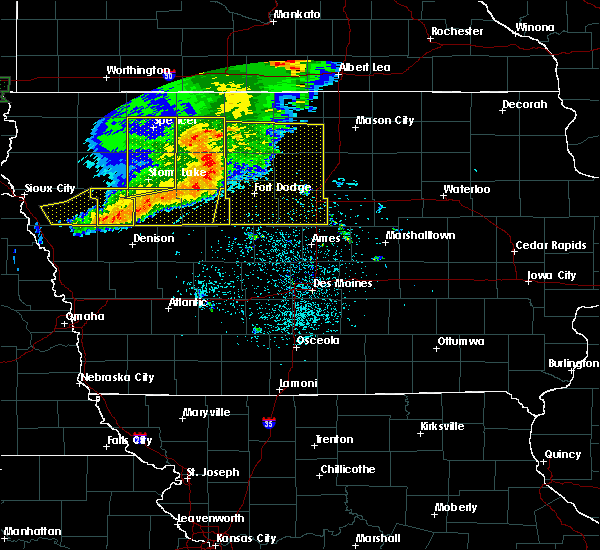 At 423 am cdt, severe thunderstorms were located along a line extending from five island lake to near pocahontas to near north twin lake, moving east at 60 mph. these are very dangerous storms (radar indicated). Hazards include 80 mph wind gusts and nickel size hail. Flying debris will be dangerous to those caught without shelter. mobile homes will be heavily damaged. expect considerable damage to roofs, windows, and vehicles. Extensive tree damage and power outages are likely. At 423 am cdt, severe thunderstorms were located along a line extending from five island lake to near pocahontas to near north twin lake, moving east at 60 mph. these are very dangerous storms (radar indicated). Hazards include 80 mph wind gusts and nickel size hail. Flying debris will be dangerous to those caught without shelter. mobile homes will be heavily damaged. expect considerable damage to roofs, windows, and vehicles. Extensive tree damage and power outages are likely.
|
| 7/25/2018 8:09 PM CDT |
 The severe thunderstorm warning for southeastern wright and west central franklin counties will expire at 815 pm cdt, the storm which prompted the warning has weakened below severe limits, and no longer poses an immediate threat to life or property. therefore, the warning will be allowed to expire. however gusty winds are still possible with this thunderstorm. a severe thunderstorm watch remains in effect until 1100 pm cdt for north central iowa. to report severe weather, contact your nearest law enforcement agency. they will relay your report to the national weather service des moines . remember, a severe thunderstorm warning still remains in effect for western wright county until 845 pm this evening. The severe thunderstorm warning for southeastern wright and west central franklin counties will expire at 815 pm cdt, the storm which prompted the warning has weakened below severe limits, and no longer poses an immediate threat to life or property. therefore, the warning will be allowed to expire. however gusty winds are still possible with this thunderstorm. a severe thunderstorm watch remains in effect until 1100 pm cdt for north central iowa. to report severe weather, contact your nearest law enforcement agency. they will relay your report to the national weather service des moines . remember, a severe thunderstorm warning still remains in effect for western wright county until 845 pm this evening.
|
| 7/25/2018 7:59 PM CDT |
 At 759 pm cdt, a severe thunderstorm was located 11 miles east of big wall lake, or 12 miles southwest of hampton, moving southeast at 40 mph (radar indicated). Hazards include 60 mph wind gusts and nickel size hail. Expect damage to roofs, siding, and trees. locations impacted include, clarion, elm lake, big wall lake, dows, latimer, coulter, alexander, rowan, galt and clarion municipal airport. This includes interstate 35 between mile markers 158 and 167. At 759 pm cdt, a severe thunderstorm was located 11 miles east of big wall lake, or 12 miles southwest of hampton, moving southeast at 40 mph (radar indicated). Hazards include 60 mph wind gusts and nickel size hail. Expect damage to roofs, siding, and trees. locations impacted include, clarion, elm lake, big wall lake, dows, latimer, coulter, alexander, rowan, galt and clarion municipal airport. This includes interstate 35 between mile markers 158 and 167.
|
| 7/25/2018 7:49 PM CDT |
 At 748 pm cdt, a severe thunderstorm was located 7 miles east of elm lake, or 9 miles east of clarion, moving southeast at 40 mph (radar indicated). Hazards include 60 mph wind gusts and nickel size hail. Expect damage to roofs, siding, and trees. locations impacted include, clarion, belmond, elm lake, big wall lake, dows, latimer, coulter, alexander, rowan, galt, clarion municipal airport and belmond municipal airport. This includes interstate 35 between mile markers 158 and 167. At 748 pm cdt, a severe thunderstorm was located 7 miles east of elm lake, or 9 miles east of clarion, moving southeast at 40 mph (radar indicated). Hazards include 60 mph wind gusts and nickel size hail. Expect damage to roofs, siding, and trees. locations impacted include, clarion, belmond, elm lake, big wall lake, dows, latimer, coulter, alexander, rowan, galt, clarion municipal airport and belmond municipal airport. This includes interstate 35 between mile markers 158 and 167.
|
| 7/25/2018 7:37 PM CDT |
 At 737 pm cdt, a severe thunderstorm was located over elm lake, or near clarion, moving southeast at 40 mph (radar indicated). Hazards include 60 mph wind gusts and nickel size hail. expect damage to roofs, siding, and trees At 737 pm cdt, a severe thunderstorm was located over elm lake, or near clarion, moving southeast at 40 mph (radar indicated). Hazards include 60 mph wind gusts and nickel size hail. expect damage to roofs, siding, and trees
|
| 6/30/2018 3:01 PM CDT |
 A severe thunderstorm warning remains in effect until 315 pm cdt for northern wright and southern hancock counties. at 301 pm cdt, severe thunderstorms were located along a line extending from 7 miles south of garner to near belmond, moving east at 35 mph. hazard. 70 mph wind gusts and half dollar size hail. A severe thunderstorm warning remains in effect until 315 pm cdt for northern wright and southern hancock counties. at 301 pm cdt, severe thunderstorms were located along a line extending from 7 miles south of garner to near belmond, moving east at 35 mph. hazard. 70 mph wind gusts and half dollar size hail.
|
| 6/30/2018 2:48 PM CDT |
 At 248 pm cdt, severe thunderstorms were located along a line extending from 10 miles south of britt to near belmond to near clarion, moving east at 45 mph (trained weather spotters). Hazards include 70 mph wind gusts and half dollar size hail. Hail damage to vehicles is expected. expect considerable tree damage. wind damage is also likely to mobile homes, roofs, and outbuildings. Locations impacted include, garner, clarion, belmond, elm lake, kanawha, goldfield, klemme, corwith, lu verne, renwick, thor, goodell, clarion municipal airport, eagle grove municipal airport and belmond municipal airport. At 248 pm cdt, severe thunderstorms were located along a line extending from 10 miles south of britt to near belmond to near clarion, moving east at 45 mph (trained weather spotters). Hazards include 70 mph wind gusts and half dollar size hail. Hail damage to vehicles is expected. expect considerable tree damage. wind damage is also likely to mobile homes, roofs, and outbuildings. Locations impacted include, garner, clarion, belmond, elm lake, kanawha, goldfield, klemme, corwith, lu verne, renwick, thor, goodell, clarion municipal airport, eagle grove municipal airport and belmond municipal airport.
|
| 6/30/2018 2:23 PM CDT |
 At 222 pm cdt, severe thunderstorms were located along a line extending from 13 miles southwest of britt to 15 miles north of eagle grove to 12 miles northeast of dakota city, moving northeast at 40 mph (trained weather spotters). Hazards include 70 mph wind gusts and half dollar size hail. Hail damage to vehicles is expected. expect considerable tree damage. Wind damage is also likely to mobile homes, roofs, and outbuildings. At 222 pm cdt, severe thunderstorms were located along a line extending from 13 miles southwest of britt to 15 miles north of eagle grove to 12 miles northeast of dakota city, moving northeast at 40 mph (trained weather spotters). Hazards include 70 mph wind gusts and half dollar size hail. Hail damage to vehicles is expected. expect considerable tree damage. Wind damage is also likely to mobile homes, roofs, and outbuildings.
|
| 6/6/2018 4:19 PM CDT |
 At 419 pm cdt, a severe thunderstorm was located near eagle grove, or near clarion, moving east at 15 mph (radar indicated). Hazards include 60 mph wind gusts and quarter size hail. Hail damage to vehicles is expected. Expect wind damage to roofs, siding, and trees. At 419 pm cdt, a severe thunderstorm was located near eagle grove, or near clarion, moving east at 15 mph (radar indicated). Hazards include 60 mph wind gusts and quarter size hail. Hail damage to vehicles is expected. Expect wind damage to roofs, siding, and trees.
|
| 5/28/2018 5:15 PM CDT |
 At 514 pm cdt, a severe thunderstorm was located near belmond, or 15 miles northeast of clarion, moving north at 20 mph (radar indicated). Hazards include golf ball size hail and 70 mph wind gusts. People and animals outdoors will be injured. expect hail damage to roofs, siding, windows, and vehicles. expect considerable tree damage. wind damage is also likely to mobile homes, roofs, and outbuildings. locations impacted include, mason city, forest city, garner, clarion, belmond, britt, sheffield, rockwell, clear lake, eagle lake, mason city municipal airport, elm lake, ventura, kanawha, klemme, latimer, thornton, coulter, meservey and crystal lake. This includes interstate 35 between mile markers 164 and 200. At 514 pm cdt, a severe thunderstorm was located near belmond, or 15 miles northeast of clarion, moving north at 20 mph (radar indicated). Hazards include golf ball size hail and 70 mph wind gusts. People and animals outdoors will be injured. expect hail damage to roofs, siding, windows, and vehicles. expect considerable tree damage. wind damage is also likely to mobile homes, roofs, and outbuildings. locations impacted include, mason city, forest city, garner, clarion, belmond, britt, sheffield, rockwell, clear lake, eagle lake, mason city municipal airport, elm lake, ventura, kanawha, klemme, latimer, thornton, coulter, meservey and crystal lake. This includes interstate 35 between mile markers 164 and 200.
|
| 5/28/2018 5:03 PM CDT |
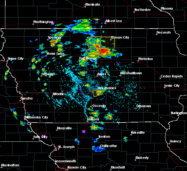 At 503 pm cdt, a severe thunderstorm was located near belmond, or 13 miles northeast of clarion, moving north at 20 mph (radar indicated). Hazards include 60 mph wind gusts and quarter size hail. Hail damage to vehicles is expected. Expect wind damage to roofs, siding, and trees. At 503 pm cdt, a severe thunderstorm was located near belmond, or 13 miles northeast of clarion, moving north at 20 mph (radar indicated). Hazards include 60 mph wind gusts and quarter size hail. Hail damage to vehicles is expected. Expect wind damage to roofs, siding, and trees.
|
| 5/28/2018 4:55 PM CDT |
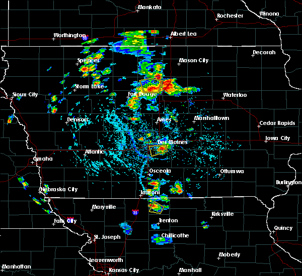 At 455 pm cdt, a severe thunderstorm was located near clarion, moving north at 20 mph (radar indicated). Hazards include 60 mph wind gusts and quarter size hail. Hail damage to vehicles is expected. expect wind damage to roofs, siding, and trees. Locations impacted include, clarion, belmond, elm lake, big wall lake, goldfield, rowan, galt and clarion municipal airport. At 455 pm cdt, a severe thunderstorm was located near clarion, moving north at 20 mph (radar indicated). Hazards include 60 mph wind gusts and quarter size hail. Hail damage to vehicles is expected. expect wind damage to roofs, siding, and trees. Locations impacted include, clarion, belmond, elm lake, big wall lake, goldfield, rowan, galt and clarion municipal airport.
|
| 5/28/2018 4:50 PM CDT | Awos station cav... clarion airpor in wright county IA, 1.6 miles ESE of Clarion, IA |
| 5/28/2018 4:35 PM CDT |
 At 434 pm cdt, a severe thunderstorm was located over big wall lake, or 8 miles south of clarion, moving north at 15 mph (radar indicated). Hazards include 60 mph wind gusts and quarter size hail. Hail damage to vehicles is expected. Expect wind damage to roofs, siding, and trees. At 434 pm cdt, a severe thunderstorm was located over big wall lake, or 8 miles south of clarion, moving north at 15 mph (radar indicated). Hazards include 60 mph wind gusts and quarter size hail. Hail damage to vehicles is expected. Expect wind damage to roofs, siding, and trees.
|
| 5/1/2018 7:15 PM CDT |
 At 656 pm cdt, a severe thunderstorm was located 13 miles northeast of dakota city, moving east at 35 mph (radar indicated. at 653 pm...half dollar sized hail was reported 2 miles north northeast of bode). Hazards include golf ball size hail and 60 mph wind gusts. People and animals outdoors will be injured. expect hail damage to roofs, siding, windows, and vehicles. expect wind damage to roofs, siding, and trees. locations impacted include, clarion, humboldt, kanawha, goldfield, livermore, corwith, bode, lu verne, renwick, rutland, st. Joseph, ottosen, hardy, clarion municipal airport, eagle grove municipal airport and humboldt municipal airport. At 656 pm cdt, a severe thunderstorm was located 13 miles northeast of dakota city, moving east at 35 mph (radar indicated. at 653 pm...half dollar sized hail was reported 2 miles north northeast of bode). Hazards include golf ball size hail and 60 mph wind gusts. People and animals outdoors will be injured. expect hail damage to roofs, siding, windows, and vehicles. expect wind damage to roofs, siding, and trees. locations impacted include, clarion, humboldt, kanawha, goldfield, livermore, corwith, bode, lu verne, renwick, rutland, st. Joseph, ottosen, hardy, clarion municipal airport, eagle grove municipal airport and humboldt municipal airport.
|
| 5/1/2018 6:57 PM CDT |
 At 656 pm cdt, a severe thunderstorm was located 13 miles northeast of dakota city, moving east at 35 mph (radar indicated. at 653 pm...half dollar sized hail was reported 2 miles north northeast of bode). Hazards include golf ball size hail and 60 mph wind gusts. People and animals outdoors will be injured. expect hail damage to roofs, siding, windows, and vehicles. expect wind damage to roofs, siding, and trees. locations impacted include, clarion, humboldt, kanawha, goldfield, livermore, corwith, bode, lu verne, renwick, rutland, st. Joseph, ottosen, hardy, clarion municipal airport, eagle grove municipal airport and humboldt municipal airport. At 656 pm cdt, a severe thunderstorm was located 13 miles northeast of dakota city, moving east at 35 mph (radar indicated. at 653 pm...half dollar sized hail was reported 2 miles north northeast of bode). Hazards include golf ball size hail and 60 mph wind gusts. People and animals outdoors will be injured. expect hail damage to roofs, siding, windows, and vehicles. expect wind damage to roofs, siding, and trees. locations impacted include, clarion, humboldt, kanawha, goldfield, livermore, corwith, bode, lu verne, renwick, rutland, st. Joseph, ottosen, hardy, clarion municipal airport, eagle grove municipal airport and humboldt municipal airport.
|
| 5/1/2018 6:40 PM CDT |
 At 639 pm cdt, a severe thunderstorm was located 9 miles north of dakota city, moving east at 35 mph (radar indicated). Hazards include two inch hail and 60 mph wind gusts. People and animals outdoors will be injured. expect hail damage to roofs, siding, windows, and vehicles. Expect wind damage to roofs, siding, and trees. At 639 pm cdt, a severe thunderstorm was located 9 miles north of dakota city, moving east at 35 mph (radar indicated). Hazards include two inch hail and 60 mph wind gusts. People and animals outdoors will be injured. expect hail damage to roofs, siding, windows, and vehicles. Expect wind damage to roofs, siding, and trees.
|
| 5/17/2017 5:38 PM CDT |
 At 537 pm cdt, severe thunderstorms were located along a line extending from 12 miles south of britt to 10 miles east of belmond to near ackley, moving northeast at 55 mph (radar indicated). Hazards include 60 mph wind gusts. Expect damage to roofs, siding, and trees. locations impacted include, hampton, clarion, belmond, sheffield, rockwell, elm lake, kanawha, goldfield, dows, klemme, latimer, thornton, corwith, coulter, meservey, alexander, geneva, swaledale, rowan and goodell. this includes interstate 35 between mile markers 154 and 185. A tornado watch remains in effect until 700 pm cdt for north central iowa. At 537 pm cdt, severe thunderstorms were located along a line extending from 12 miles south of britt to 10 miles east of belmond to near ackley, moving northeast at 55 mph (radar indicated). Hazards include 60 mph wind gusts. Expect damage to roofs, siding, and trees. locations impacted include, hampton, clarion, belmond, sheffield, rockwell, elm lake, kanawha, goldfield, dows, klemme, latimer, thornton, corwith, coulter, meservey, alexander, geneva, swaledale, rowan and goodell. this includes interstate 35 between mile markers 154 and 185. A tornado watch remains in effect until 700 pm cdt for north central iowa.
|
| 5/17/2017 5:16 PM CDT |
 At 516 pm cdt, severe thunderstorms were located along a line extending from 7 miles east of dakota city to near big wall lake to 6 miles northwest of eldora, moving northeast at 40 mph (radar indicated). Hazards include 60 mph wind gusts. expect damage to roofs, siding, and trees At 516 pm cdt, severe thunderstorms were located along a line extending from 7 miles east of dakota city to near big wall lake to 6 miles northwest of eldora, moving northeast at 40 mph (radar indicated). Hazards include 60 mph wind gusts. expect damage to roofs, siding, and trees
|
| 5/16/2017 9:43 PM CDT |
 At 942 pm cdt, a severe thunderstorm was located near belmond, or 13 miles north of clarion, moving northeast at 50 mph (trained weather spotters). Hazards include 70 mph wind gusts and penny size hail. Expect considerable tree damage. damage is likely to mobile homes, roofs, and outbuildings. locations impacted include, garner, clarion, eagle grove, belmond, britt, big wall lake, elm lake, eagle lake, clear lake, ventura, kanawha, goldfield, klemme, thornton, corwith, meservey, alexander, woolstock, rowan and goodell. This includes interstate 35 between mile markers 175 and 181. At 942 pm cdt, a severe thunderstorm was located near belmond, or 13 miles north of clarion, moving northeast at 50 mph (trained weather spotters). Hazards include 70 mph wind gusts and penny size hail. Expect considerable tree damage. damage is likely to mobile homes, roofs, and outbuildings. locations impacted include, garner, clarion, eagle grove, belmond, britt, big wall lake, elm lake, eagle lake, clear lake, ventura, kanawha, goldfield, klemme, thornton, corwith, meservey, alexander, woolstock, rowan and goodell. This includes interstate 35 between mile markers 175 and 181.
|
| 5/16/2017 9:35 PM CDT | West 48 gusting to 60 mp in wright county IA, 1.6 miles ESE of Clarion, IA |
| 5/16/2017 9:28 PM CDT |
 The severe thunderstorm warning for webster, southwestern wright, humboldt and western hamilton counties will expire at 930 pm cdt, the severe thunderstorm which prompted the warning has moved out of the warned area. therefore, the warning has been cancelled. a severe thunderstorm watch remains in effect until midnight cdt for central and north central iowa. a severe thunderstorm watch also remains in effect until 300 am cdt for central and north central iowa. remember, a severe thunderstorm warning still remains in effect for 1015 pm cdt. The severe thunderstorm warning for webster, southwestern wright, humboldt and western hamilton counties will expire at 930 pm cdt, the severe thunderstorm which prompted the warning has moved out of the warned area. therefore, the warning has been cancelled. a severe thunderstorm watch remains in effect until midnight cdt for central and north central iowa. a severe thunderstorm watch also remains in effect until 300 am cdt for central and north central iowa. remember, a severe thunderstorm warning still remains in effect for 1015 pm cdt.
|
| 5/16/2017 9:26 PM CDT |
 At 925 pm cdt, a severe thunderstorm was located 7 miles north of eagle grove, or 8 miles west of clarion, moving northeast at 50 mph (trained weather spotters). Hazards include 70 mph wind gusts and penny size hail. Expect considerable tree damage. Damage is likely to mobile homes, roofs, and outbuildings. At 925 pm cdt, a severe thunderstorm was located 7 miles north of eagle grove, or 8 miles west of clarion, moving northeast at 50 mph (trained weather spotters). Hazards include 70 mph wind gusts and penny size hail. Expect considerable tree damage. Damage is likely to mobile homes, roofs, and outbuildings.
|
| 5/16/2017 9:13 PM CDT |
 At 911 pm cdt, a severe thunderstorm was located near eagle grove, or 10 miles northwest of webster city, moving northeast at 55 mph (trained weather spotters). Hazards include 70 mph wind gusts and penny size hail. Expect considerable tree damage. damage is likely to mobile homes, roofs, and outbuildings. Locations impacted include, fort dodge, webster city, clarion, dakota city, humboldt, eagle grove, gowrie, fort dodge regional airport, big wall lake, dayton, stratford, goldfield, coalville, badger, otho, lehigh, duncombe, livermore, callender and harcourt. At 911 pm cdt, a severe thunderstorm was located near eagle grove, or 10 miles northwest of webster city, moving northeast at 55 mph (trained weather spotters). Hazards include 70 mph wind gusts and penny size hail. Expect considerable tree damage. damage is likely to mobile homes, roofs, and outbuildings. Locations impacted include, fort dodge, webster city, clarion, dakota city, humboldt, eagle grove, gowrie, fort dodge regional airport, big wall lake, dayton, stratford, goldfield, coalville, badger, otho, lehigh, duncombe, livermore, callender and harcourt.
|
| 5/16/2017 8:48 PM CDT |
 At 847 pm cdt, a severe thunderstorm was located near gowrie, or 11 miles southwest of fort dodge, moving northeast at 55 mph (70 mph wind gusts have been measured at several locations). Hazards include 70 mph wind gusts and quarter size hail. Hail damage to vehicles is expected. expect considerable tree damage. Wind damage is also likely to mobile homes, roofs, and outbuildings. At 847 pm cdt, a severe thunderstorm was located near gowrie, or 11 miles southwest of fort dodge, moving northeast at 55 mph (70 mph wind gusts have been measured at several locations). Hazards include 70 mph wind gusts and quarter size hail. Hail damage to vehicles is expected. expect considerable tree damage. Wind damage is also likely to mobile homes, roofs, and outbuildings.
|
| 5/15/2017 5:58 PM CDT |
 At 558 pm cdt, severe thunderstorms were located along a line extending from 6 miles southwest of marble rock to near big wall lake, moving east at 30 mph (radar indicated). Hazards include ping pong ball size hail and 60 mph wind gusts. People and animals outdoors will be injured. expect hail damage to roofs, siding, windows, and vehicles. Expect wind damage to roofs, siding, and trees. At 558 pm cdt, severe thunderstorms were located along a line extending from 6 miles southwest of marble rock to near big wall lake, moving east at 30 mph (radar indicated). Hazards include ping pong ball size hail and 60 mph wind gusts. People and animals outdoors will be injured. expect hail damage to roofs, siding, windows, and vehicles. Expect wind damage to roofs, siding, and trees.
|
| 5/15/2017 5:37 PM CDT |
 At 536 pm cdt, severe thunderstorms were located along a line extending from near rockford to eagle grove, moving east at 50 mph. at 528 pm cdt a trained spotter reported golf ball sized hail in goldfield (trained weather spotters). Hazards include two inch hail and 60 mph wind gusts. People and animals outdoors will be injured. expect hail damage to roofs, siding, windows, and vehicles. expect wind damage to roofs, siding, and trees. locations impacted include, hampton, clarion, eagle grove, belmond, sheffield, rockwell, big wall lake, elm lake, goldfield, dows, latimer, thornton, coulter, meservey, renwick, thor, alexander, swaledale, rowan and goodell. This includes interstate 35 between mile markers 151 and 188. At 536 pm cdt, severe thunderstorms were located along a line extending from near rockford to eagle grove, moving east at 50 mph. at 528 pm cdt a trained spotter reported golf ball sized hail in goldfield (trained weather spotters). Hazards include two inch hail and 60 mph wind gusts. People and animals outdoors will be injured. expect hail damage to roofs, siding, windows, and vehicles. expect wind damage to roofs, siding, and trees. locations impacted include, hampton, clarion, eagle grove, belmond, sheffield, rockwell, big wall lake, elm lake, goldfield, dows, latimer, thornton, coulter, meservey, renwick, thor, alexander, swaledale, rowan and goodell. This includes interstate 35 between mile markers 151 and 188.
|
| 5/15/2017 5:26 PM CDT |
 At 524 pm cdt, a line of severe thunderstorms was located from near eagle grove to around mason city, moving east at 25 mph. most of the line is producing wind gusts to near 60 mph and quarter sized hail. however, a particularly strong thunderstorm moving from southeastern humboldt into wright county is producing hail up to the size of hen eggs (radar indicated). Hazards include two inch hail and 60 mph wind gusts. People and animals outdoors will be injured. expect hail damage to roofs, siding, windows, and vehicles. expect wind damage to roofs, siding, and trees. locations impacted include, mason city, hampton, clarion, dakota city, humboldt, eagle grove, belmond, sheffield, rockwell, big wall lake, elm lake, mason city municipal airport, kanawha, goldfield, dows, latimer, thornton, coulter, meservey and renwick. This includes interstate 35 between mile markers 151 and 194. At 524 pm cdt, a line of severe thunderstorms was located from near eagle grove to around mason city, moving east at 25 mph. most of the line is producing wind gusts to near 60 mph and quarter sized hail. however, a particularly strong thunderstorm moving from southeastern humboldt into wright county is producing hail up to the size of hen eggs (radar indicated). Hazards include two inch hail and 60 mph wind gusts. People and animals outdoors will be injured. expect hail damage to roofs, siding, windows, and vehicles. expect wind damage to roofs, siding, and trees. locations impacted include, mason city, hampton, clarion, dakota city, humboldt, eagle grove, belmond, sheffield, rockwell, big wall lake, elm lake, mason city municipal airport, kanawha, goldfield, dows, latimer, thornton, coulter, meservey and renwick. This includes interstate 35 between mile markers 151 and 194.
|
| 5/15/2017 5:19 PM CDT |
 At 518 pm cdt, severe thunderstorms were located along a line extending from near mason city to near eagle grove, moving east at 50 mph. this warning replaces severe thunderstorm warnings that were previously in effect (radar indicated). Hazards include 60 mph wind gusts and quarter size hail. Hail damage to vehicles is expected. Expect wind damage to roofs, siding, and trees. At 518 pm cdt, severe thunderstorms were located along a line extending from near mason city to near eagle grove, moving east at 50 mph. this warning replaces severe thunderstorm warnings that were previously in effect (radar indicated). Hazards include 60 mph wind gusts and quarter size hail. Hail damage to vehicles is expected. Expect wind damage to roofs, siding, and trees.
|
| 4/9/2017 8:30 PM CDT |
 At 830 pm cdt, a severe thunderstorm was located near eagle grove, or 9 miles east of dakota city, moving northeast at 55 mph (radar indicated). Hazards include quarter size hail. damage to vehicles is expected At 830 pm cdt, a severe thunderstorm was located near eagle grove, or 9 miles east of dakota city, moving northeast at 55 mph (radar indicated). Hazards include quarter size hail. damage to vehicles is expected
|
| 3/6/2017 6:09 PM CST |
 At 609 pm cst, severe thunderstorms were located along a line extending from near belmond to 7 miles east of big wall lake to 8 miles north of jewell junction, moving northeast at 45 mph (radar indicated). Hazards include 60 mph wind gusts and quarter size hail. Hail damage to vehicles is expected. Expect wind damage to roofs, siding, and trees. At 609 pm cst, severe thunderstorms were located along a line extending from near belmond to 7 miles east of big wall lake to 8 miles north of jewell junction, moving northeast at 45 mph (radar indicated). Hazards include 60 mph wind gusts and quarter size hail. Hail damage to vehicles is expected. Expect wind damage to roofs, siding, and trees.
|
| 3/6/2017 6:00 PM CST |
 At 600 pm cst, severe thunderstorms were located along a line extending from 6 miles north of belmond to near big wall lake to 11 miles southwest of jewell junction, moving northeast at 60 mph (radar indicated). Hazards include 60 mph wind gusts and quarter size hail. Hail damage to vehicles is expected. expect wind damage to roofs, siding, and trees. locations impacted include, webster city, clarion, eagle grove, belmond, jewell junction, gowrie, big wall lake, elm lake, dayton, stratford, goldfield, coalville, otho, dows, ellsworth, stanhope, lehigh, duncombe, williams and harcourt. this includes interstate 35 between mile markers 127 and 163. A tornado watch remains in effect until 1000 pm cst for central and north central iowa. At 600 pm cst, severe thunderstorms were located along a line extending from 6 miles north of belmond to near big wall lake to 11 miles southwest of jewell junction, moving northeast at 60 mph (radar indicated). Hazards include 60 mph wind gusts and quarter size hail. Hail damage to vehicles is expected. expect wind damage to roofs, siding, and trees. locations impacted include, webster city, clarion, eagle grove, belmond, jewell junction, gowrie, big wall lake, elm lake, dayton, stratford, goldfield, coalville, otho, dows, ellsworth, stanhope, lehigh, duncombe, williams and harcourt. this includes interstate 35 between mile markers 127 and 163. A tornado watch remains in effect until 1000 pm cst for central and north central iowa.
|
| 3/6/2017 5:37 PM CST |
 At 537 pm cst, severe thunderstorms were located along a line extending from 14 miles north of eagle grove to 8 miles west of webster city to 9 miles southeast of gowrie, moving east at 45 mph (radar indicated). Hazards include golf ball size hail and 60 mph wind gusts. People and animals outdoors will be injured. expect hail damage to roofs, siding, windows, and vehicles. Expect wind damage to roofs, siding, and trees. At 537 pm cst, severe thunderstorms were located along a line extending from 14 miles north of eagle grove to 8 miles west of webster city to 9 miles southeast of gowrie, moving east at 45 mph (radar indicated). Hazards include golf ball size hail and 60 mph wind gusts. People and animals outdoors will be injured. expect hail damage to roofs, siding, windows, and vehicles. Expect wind damage to roofs, siding, and trees.
|
| 7/17/2016 11:05 AM CDT |
 At 1105 am cdt, a severe thunderstorm was located 7 miles east of elm lake, or 9 miles east of clarion, moving east at 35 mph (radar indicated). Hazards include 60 mph wind gusts and quarter size hail. Hail damage to vehicles is expected. expect wind damage to roofs, siding, and trees. Locations impacted include, clarion, belmond, elm lake, big wall lake, dows, rowan, galt and belmond municipal airport. At 1105 am cdt, a severe thunderstorm was located 7 miles east of elm lake, or 9 miles east of clarion, moving east at 35 mph (radar indicated). Hazards include 60 mph wind gusts and quarter size hail. Hail damage to vehicles is expected. expect wind damage to roofs, siding, and trees. Locations impacted include, clarion, belmond, elm lake, big wall lake, dows, rowan, galt and belmond municipal airport.
|
| 7/17/2016 10:54 AM CDT |
 A severe thunderstorm warning remains in effect until 1130 am cdt for northeastern hamilton and wright counties. at 1054 am cdt. a severe thunderstorm was located near clarion. moving east at 55 mph. hazard. 60 mph wind gusts and quarter size hail. source. Radar indicated. A severe thunderstorm warning remains in effect until 1130 am cdt for northeastern hamilton and wright counties. at 1054 am cdt. a severe thunderstorm was located near clarion. moving east at 55 mph. hazard. 60 mph wind gusts and quarter size hail. source. Radar indicated.
|
| 7/17/2016 10:42 AM CDT |
 At 1042 am cdt, a severe thunderstorm was located over eagle grove, or 10 miles west of clarion, moving east at 35 mph (radar indicated). Hazards include 60 mph wind gusts and quarter size hail. Hail damage to vehicles is expected. Expect wind damage to roofs, siding, and trees. At 1042 am cdt, a severe thunderstorm was located over eagle grove, or 10 miles west of clarion, moving east at 35 mph (radar indicated). Hazards include 60 mph wind gusts and quarter size hail. Hail damage to vehicles is expected. Expect wind damage to roofs, siding, and trees.
|
| 7/17/2016 3:39 AM CDT | The severe thunderstorm warning for central webster, southeastern hancock, northwestern hamilton, east central calhoun, southeastern humboldt and wright counties will expire at 345 am cdt, the storms which prompted the warning have moved out of the area. therefore the warning will be allowed to expire. |
| 7/17/2016 3:22 AM CDT |
 At 322 am cdt, severe thunderstorms were located along a line extending from near garner to near big wall lake to 8 miles southeast of fort dodge, moving east at 70 mph (radar indicated). Hazards include 70 mph wind gusts. Expect considerable tree damage. damage is likely to mobile homes, roofs, and outbuildings. Locations impacted include, fort dodge, webster city, clarion, eagle grove, belmond, fort dodge regional airport, elm lake, big wall lake, goldfield, coalville, badger, otho, klemme, lehigh, duncombe, vincent, moorland, woolstock, rowan and goodell. At 322 am cdt, severe thunderstorms were located along a line extending from near garner to near big wall lake to 8 miles southeast of fort dodge, moving east at 70 mph (radar indicated). Hazards include 70 mph wind gusts. Expect considerable tree damage. damage is likely to mobile homes, roofs, and outbuildings. Locations impacted include, fort dodge, webster city, clarion, eagle grove, belmond, fort dodge regional airport, elm lake, big wall lake, goldfield, coalville, badger, otho, klemme, lehigh, duncombe, vincent, moorland, woolstock, rowan and goodell.
|
| 7/17/2016 3:09 AM CDT |
 At 308 am cdt, severe thunderstorms were located along a line extending from near britt to eagle grove to 9 miles southwest of fort dodge, moving east at 70 mph (radar indicated). Hazards include 70 mph wind gusts. Expect considerable tree damage. damage is likely to mobile homes, roofs, and outbuildings. Locations impacted include, fort dodge, webster city, garner, clarion, dakota city, humboldt, eagle grove, belmond, britt, fort dodge regional airport, elm lake, big wall lake, kanawha, goldfield, coalville, badger, otho, klemme, lehigh and duncombe. At 308 am cdt, severe thunderstorms were located along a line extending from near britt to eagle grove to 9 miles southwest of fort dodge, moving east at 70 mph (radar indicated). Hazards include 70 mph wind gusts. Expect considerable tree damage. damage is likely to mobile homes, roofs, and outbuildings. Locations impacted include, fort dodge, webster city, garner, clarion, dakota city, humboldt, eagle grove, belmond, britt, fort dodge regional airport, elm lake, big wall lake, kanawha, goldfield, coalville, badger, otho, klemme, lehigh and duncombe.
|
| 7/17/2016 2:55 AM CDT |
 At 255 am cdt, severe thunderstorms were located along a line extending from 10 miles west of britt to near dakota city to north twin lake, moving east at 55 mph (radar indicated). Hazards include 60 mph wind gusts. Expect damage to roofs. siding. and trees. Locations impacted include, fort dodge, webster city, algona, garner, clarion, dakota city, humboldt, eagle grove, belmond, britt, manson, fort dodge regional airport, big wall lake, north twin lake, elm lake, west bend, pomeroy, kanawha, goldfield and fonda. At 255 am cdt, severe thunderstorms were located along a line extending from 10 miles west of britt to near dakota city to north twin lake, moving east at 55 mph (radar indicated). Hazards include 60 mph wind gusts. Expect damage to roofs. siding. and trees. Locations impacted include, fort dodge, webster city, algona, garner, clarion, dakota city, humboldt, eagle grove, belmond, britt, manson, fort dodge regional airport, big wall lake, north twin lake, elm lake, west bend, pomeroy, kanawha, goldfield and fonda.
|
| 7/17/2016 2:43 AM CDT |
 At 242 am cdt, severe thunderstorms were located along a line extending from near algona to 11 miles west of humboldt to 7 miles northwest of north twin lake, moving east at 70 mph (radar indicated). Hazards include 60 mph wind gusts. Expect damage to roofs. siding. And trees. At 242 am cdt, severe thunderstorms were located along a line extending from near algona to 11 miles west of humboldt to 7 miles northwest of north twin lake, moving east at 70 mph (radar indicated). Hazards include 60 mph wind gusts. Expect damage to roofs. siding. And trees.
|
| 6/22/2016 3:18 AM CDT |
 At 316 am cdt, severe thunderstorms were located along a line extending from clarion to 6 miles southwest of webster city, moving southeast at 60 mph (law enforcement. at 300 am cdt... law enforcement in fort dodge reported a tree branch downed onto a law enforcement vehicle). Hazards include 60 mph wind gusts. Expect damage to roofs. siding. and trees. Locations impacted include, webster city, clarion, eagle grove, jewell junction, elm lake, big wall lake, dows, duncombe, williams, blairsburg, kamrar, woolstock, rowan, popejoy, galt, clarion municipal airport, webster city municipal airport and brushy creek st recreation area. At 316 am cdt, severe thunderstorms were located along a line extending from clarion to 6 miles southwest of webster city, moving southeast at 60 mph (law enforcement. at 300 am cdt... law enforcement in fort dodge reported a tree branch downed onto a law enforcement vehicle). Hazards include 60 mph wind gusts. Expect damage to roofs. siding. and trees. Locations impacted include, webster city, clarion, eagle grove, jewell junction, elm lake, big wall lake, dows, duncombe, williams, blairsburg, kamrar, woolstock, rowan, popejoy, galt, clarion municipal airport, webster city municipal airport and brushy creek st recreation area.
|
| 6/22/2016 2:57 AM CDT |
 At 257 am cdt, severe thunderstorms were located along a line extending from 14 miles northwest of clarion to near fort dodge regional airport, moving southeast at 50 mph (radar indicated). Hazards include 60 mph wind gusts. Expect damage to roofs. siding. And trees. At 257 am cdt, severe thunderstorms were located along a line extending from 14 miles northwest of clarion to near fort dodge regional airport, moving southeast at 50 mph (radar indicated). Hazards include 60 mph wind gusts. Expect damage to roofs. siding. And trees.
|
| 8/9/2015 8:13 PM CDT |
 At 813 pm cdt, a severe thunderstorm was located 12 miles west of belmond, or 12 miles northwest of clarion, moving southeast at 25 mph (radar indicated). Hazards include 60 mph wind gusts. Expect damage to roofs. siding and trees. locations impacted include, clarion, belmond, elm lake, kanawha, dows, rowan, galt and belmond municipal airport. This includes interstate 35 between mile markers 153 and 154. At 813 pm cdt, a severe thunderstorm was located 12 miles west of belmond, or 12 miles northwest of clarion, moving southeast at 25 mph (radar indicated). Hazards include 60 mph wind gusts. Expect damage to roofs. siding and trees. locations impacted include, clarion, belmond, elm lake, kanawha, dows, rowan, galt and belmond municipal airport. This includes interstate 35 between mile markers 153 and 154.
|
| 8/9/2015 8:00 PM CDT |
 At 800 pm cdt, a severe thunderstorm was located 12 miles southwest of britt, or 17 miles northwest of clarion, moving southeast at 35 mph (radar indicated). Hazards include 60 mph wind gusts and quarter size hail. Hail damage to vehicles is expected. Expect wind damage to roofs, siding and trees. At 800 pm cdt, a severe thunderstorm was located 12 miles southwest of britt, or 17 miles northwest of clarion, moving southeast at 35 mph (radar indicated). Hazards include 60 mph wind gusts and quarter size hail. Hail damage to vehicles is expected. Expect wind damage to roofs, siding and trees.
|
| 6/22/2015 9:53 AM CDT |
 At 953 am cdt, a severe thunderstorm was located 6 miles east of eagle grove, or 6 miles southwest of clarion, moving east at 35 mph (radar indicated). Hazards include 60 mph wind gusts and penny size hail. Expect damage to roofs. siding and trees. Locations impacted include, clarion, eagle grove, elm lake, big wall lake, goldfield, badger, vincent, woolstock, sportsman park, clarion municipal airport and eagle grove municipal airport. At 953 am cdt, a severe thunderstorm was located 6 miles east of eagle grove, or 6 miles southwest of clarion, moving east at 35 mph (radar indicated). Hazards include 60 mph wind gusts and penny size hail. Expect damage to roofs. siding and trees. Locations impacted include, clarion, eagle grove, elm lake, big wall lake, goldfield, badger, vincent, woolstock, sportsman park, clarion municipal airport and eagle grove municipal airport.
|
| 6/22/2015 9:24 AM CDT |
 At 924 am cdt, a severe thunderstorm was located 5 miles southeast of dakota city, moving east at 35 mph (radar indicated). Hazards include 60 mph wind gusts and quarter size hail. Hail damage to vehicles is expected. Expect wind damage to roofs, siding and trees. At 924 am cdt, a severe thunderstorm was located 5 miles southeast of dakota city, moving east at 35 mph (radar indicated). Hazards include 60 mph wind gusts and quarter size hail. Hail damage to vehicles is expected. Expect wind damage to roofs, siding and trees.
|
| 6/22/2015 7:40 AM CDT |
 At 740 am cdt, severe thunderstorms were located along a line extending from 7 miles west of greene to 3 miles northeast of iowa falls to 7 miles west of jewell junction, moving east at 70 mph (radar indicated). Hazards include 60 mph wind gusts and penny size hail. Expect damage to roofs. siding and trees. locations impacted include, webster city, iowa falls, hampton, clarion, eldora, allison, eagle grove, belmond, parkersburg, ackley, clarksville, jewell junction, sheffield, greene, aplington, elm lake, big wall lake, hubbard, alden and wellsburg. This includes interstate 35 between mile markers 129 and 178. At 740 am cdt, severe thunderstorms were located along a line extending from 7 miles west of greene to 3 miles northeast of iowa falls to 7 miles west of jewell junction, moving east at 70 mph (radar indicated). Hazards include 60 mph wind gusts and penny size hail. Expect damage to roofs. siding and trees. locations impacted include, webster city, iowa falls, hampton, clarion, eldora, allison, eagle grove, belmond, parkersburg, ackley, clarksville, jewell junction, sheffield, greene, aplington, elm lake, big wall lake, hubbard, alden and wellsburg. This includes interstate 35 between mile markers 129 and 178.
|
| 6/22/2015 7:22 AM CDT |
 The tornado warning for central wright county will expire at 730 am cdt, the storm which prompted the warning has exited the warned area. therefore the warning will be allowed to expire. however gusty winds are still possible with this thunderstorm. a severe thunderstorm watch remains in effect until 1000 am cdt for north central iowa. The tornado warning for central wright county will expire at 730 am cdt, the storm which prompted the warning has exited the warned area. therefore the warning will be allowed to expire. however gusty winds are still possible with this thunderstorm. a severe thunderstorm watch remains in effect until 1000 am cdt for north central iowa.
|
| 6/22/2015 7:20 AM CDT | Significant damage to chicken facilities...just north of intersection of 250th and quincy avenue...time radar estimated in wright county IA, 3.9 miles WNW of Clarion, IA |
| 6/22/2015 7:17 AM CDT | Power lines and tree limbs down throughout the town. time estimated by radar. report via wo in wright county IA, 0.2 miles N of Clarion, IA |
| 6/22/2015 7:17 AM CDT |
 At 717 am cdt, a severe thunderstorm capable of producing a tornado was located near elm lake, or near clarion, moving east at 70 mph (radar indicated rotation). Hazards include tornado. Flying debris will be dangerous to those caught without shelter. mobile homes will be damaged or destroyed. damage to roofs, windows and vehicles will occur. tree damage is likely. This tornadic thunderstorm will remain over mainly rural areas of central wright county, including the following locations, clarion municipal airport. At 717 am cdt, a severe thunderstorm capable of producing a tornado was located near elm lake, or near clarion, moving east at 70 mph (radar indicated rotation). Hazards include tornado. Flying debris will be dangerous to those caught without shelter. mobile homes will be damaged or destroyed. damage to roofs, windows and vehicles will occur. tree damage is likely. This tornadic thunderstorm will remain over mainly rural areas of central wright county, including the following locations, clarion municipal airport.
|
| 6/22/2015 7:16 AM CDT |
 At 716 am cdt, severe thunderstorms were located along a line extending from 10 miles northeast of belmond to 4 miles west of big wall lake to 7 miles north of gowrie, moving east at 70 mph (radar indicated). Hazards include 60 mph wind gusts and penny size hail. Expect damage to roofs. Siding and trees. At 716 am cdt, severe thunderstorms were located along a line extending from 10 miles northeast of belmond to 4 miles west of big wall lake to 7 miles north of gowrie, moving east at 70 mph (radar indicated). Hazards include 60 mph wind gusts and penny size hail. Expect damage to roofs. Siding and trees.
|
| 6/22/2015 7:09 AM CDT |
 At 708 am cdt, severe thunderstorms were located along a line extending from 9 miles west of lake mills to 7 miles east of dakota city to 4 miles south of rockwell city, moving east at 60 mph (radar indicated). Hazards include 60 mph wind gusts and penny size hail. Expect damage to roofs. siding and trees. Locations impacted include, fort dodge, forest city, garner, clarion, pocahontas, rockwell city, dakota city, humboldt, eagle grove, britt, lake city, manson, fort dodge regional airport, north twin lake, eagle lake, south twin lake, pomeroy, kanawha, goldfield and fonda. At 708 am cdt, severe thunderstorms were located along a line extending from 9 miles west of lake mills to 7 miles east of dakota city to 4 miles south of rockwell city, moving east at 60 mph (radar indicated). Hazards include 60 mph wind gusts and penny size hail. Expect damage to roofs. siding and trees. Locations impacted include, fort dodge, forest city, garner, clarion, pocahontas, rockwell city, dakota city, humboldt, eagle grove, britt, lake city, manson, fort dodge regional airport, north twin lake, eagle lake, south twin lake, pomeroy, kanawha, goldfield and fonda.
|
| 6/22/2015 7:07 AM CDT |
 At 707 am cdt, a severe thunderstorm capable of producing a tornado was located 7 miles north of eagle grove, or 9 miles west of clarion, moving east at 60 mph (radar indicated rotation). Hazards include tornado. Flying debris will be dangerous to those caught without shelter. mobile homes will be damaged or destroyed. damage to roofs, windows and vehicles will occur. tree damage is likely. this dangerous storm will be near, clarion around 715 am cdt. elm lake around 720 am cdt. belmond around 725 am cdt. Other locations impacted by this tornadic thunderstorm include renwick, goldfield, belmond municipal airport, clarion municipal airport and hardy. At 707 am cdt, a severe thunderstorm capable of producing a tornado was located 7 miles north of eagle grove, or 9 miles west of clarion, moving east at 60 mph (radar indicated rotation). Hazards include tornado. Flying debris will be dangerous to those caught without shelter. mobile homes will be damaged or destroyed. damage to roofs, windows and vehicles will occur. tree damage is likely. this dangerous storm will be near, clarion around 715 am cdt. elm lake around 720 am cdt. belmond around 725 am cdt. Other locations impacted by this tornadic thunderstorm include renwick, goldfield, belmond municipal airport, clarion municipal airport and hardy.
|
| 6/22/2015 6:55 AM CDT |
 At 655 am cdt, a severe thunderstorm capable of producing a tornado was located 6 miles northeast of dakota city, moving east at 70 mph (radar indicated rotation). Hazards include tornado. Flying debris will be dangerous to those caught without shelter. mobile homes will be damaged or destroyed. damage to roofs, windows and vehicles will occur. tree damage is likely. this dangerous storm will be near, clarion around 710 am cdt. belmond and elm lake around 715 am cdt. Other locations impacted by this tornadic thunderstorm include renwick, goldfield, belmond municipal airport, hardy and clarion municipal airport. At 655 am cdt, a severe thunderstorm capable of producing a tornado was located 6 miles northeast of dakota city, moving east at 70 mph (radar indicated rotation). Hazards include tornado. Flying debris will be dangerous to those caught without shelter. mobile homes will be damaged or destroyed. damage to roofs, windows and vehicles will occur. tree damage is likely. this dangerous storm will be near, clarion around 710 am cdt. belmond and elm lake around 715 am cdt. Other locations impacted by this tornadic thunderstorm include renwick, goldfield, belmond municipal airport, hardy and clarion municipal airport.
|
| 6/22/2015 6:43 AM CDT |
 At 642 am cdt, severe thunderstorms were located along a line extending from 9 miles south of blue earth to 9 miles northeast of pocahontas to 4 miles west of sac city, moving east at 60 mph (emergency management). Hazards include 60 mph wind gusts and penny size hail. Expect damage to roofs. Siding and trees. At 642 am cdt, severe thunderstorms were located along a line extending from 9 miles south of blue earth to 9 miles northeast of pocahontas to 4 miles west of sac city, moving east at 60 mph (emergency management). Hazards include 60 mph wind gusts and penny size hail. Expect damage to roofs. Siding and trees.
|
| 5/3/2015 7:33 PM CDT | At 732 pm cdt, a severe thunderstorm was located 8 miles northwest of eagle grove, or 8 miles east of dakota city, moving southeast at 35 mph (radar indicated). Hazards include 60 mph wind gusts and quarter size hail. Hail damage to vehicles is expected. Expect wind damage to roofs, siding and trees. |
| 6/29/2014 7:15 AM CDT | 4 ft. diameter tree downed. fell on house and car in the 1000 block of s. main s in wright county IA, 0.2 miles N of Clarion, IA |
| 6/29/2014 7:15 AM CDT | Numerous power lines down causing power outages in clarion for 3 hour in wright county IA, 2 miles E of Clarion, IA |
| 6/29/2014 7:00 AM CDT | 4 ft. diameter tree downed. fell on house and car in the 1000 block of s. main s in wright county IA, 0.2 miles N of Clarion, IA |
| 6/29/2014 7:00 AM CDT | Numerous power lines down causing power outages in clarion for 3 hour in wright county IA, 2 miles E of Clarion, IA |
| 5/8/2014 2:20 AM CDT | Storm damage reported in wright county IA, 1.6 miles ESE of Clarion, IA |
| 7/22/2013 5:30 PM CDT | Ping Pong Ball sized hail reported 0.2 miles N of Clarion, IA, trained spotter reports mostly dime to quarter sized hail but with the largest stones measured at 1.5 inches. |
| 7/22/2013 5:30 PM CDT | Quarter sized hail reported 1.4 miles NW of Clarion, IA, dime to quarter size hail. |
| 7/22/2013 5:25 PM CDT | Hen Egg sized hail reported 0.2 miles N of Clarion, IA, from photo submitted to kcci. time estimated from radar. |
| 7/22/2013 5:08 PM CDT | Ping Pong Ball sized hail reported 4.4 miles SSW of Clarion, IA |
| 5/14/2013 4:50 PM CDT | Clarion awos measured a gust to 51 knot in wright county IA, 0.2 miles N of Clarion, IA |
| 4/24/2013 7:00 PM CDT | Storm damage reported in wright county IA, 2.3 miles ESE of Clarion, IA |
| 5/3/2012 4:45 AM CDT | Measured at clarion airport in wright county IA, 2.3 miles ESE of Clarion, IA |
| 5/3/2012 3:45 AM CDT | Measured at clarion airport in wright county IA, 2.3 miles ESE of Clarion, IA |
| 1/1/0001 12:00 AM | Quarter sized hail reported 0.2 miles N of Clarion, IA, quarter size hail in the town of clarion... |
Hail Maps for Clarion, IA
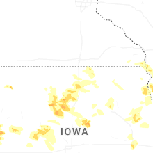
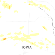
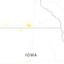
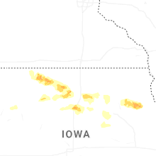

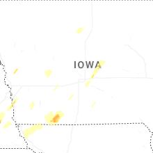


Connect with Interactive Hail Maps