

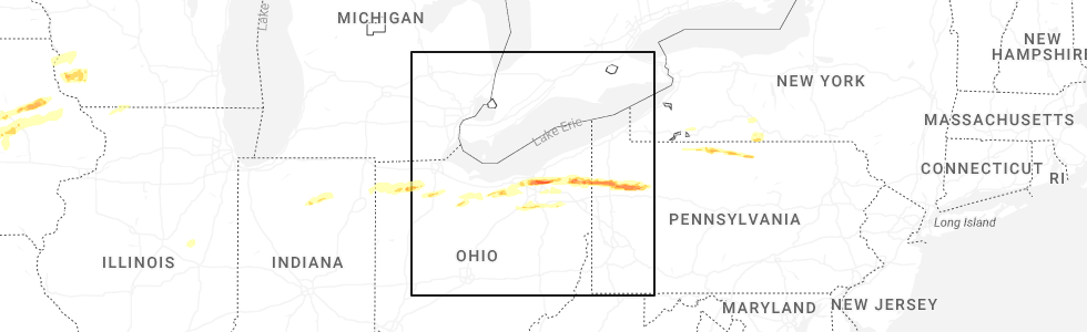
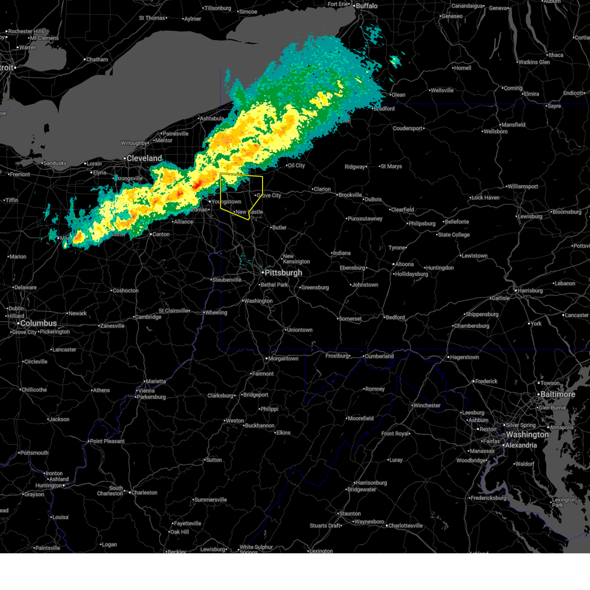
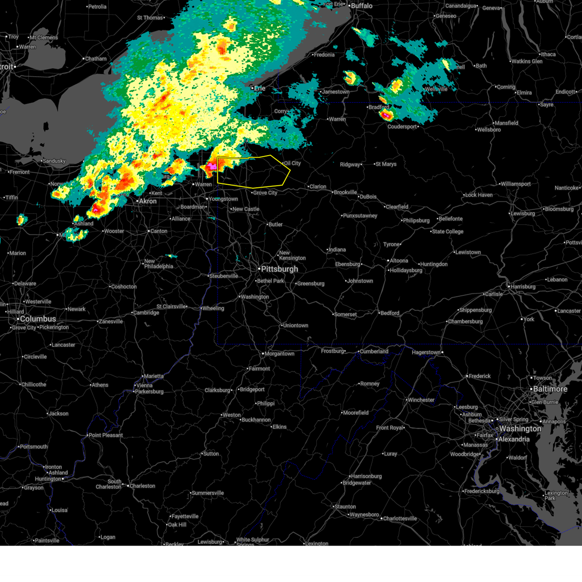
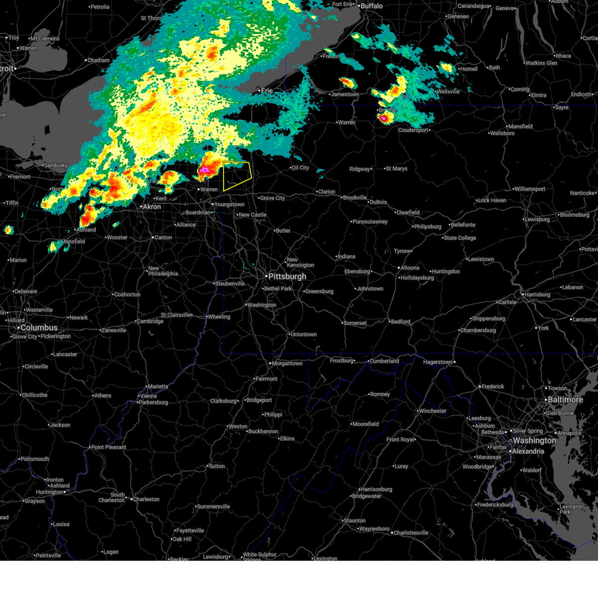
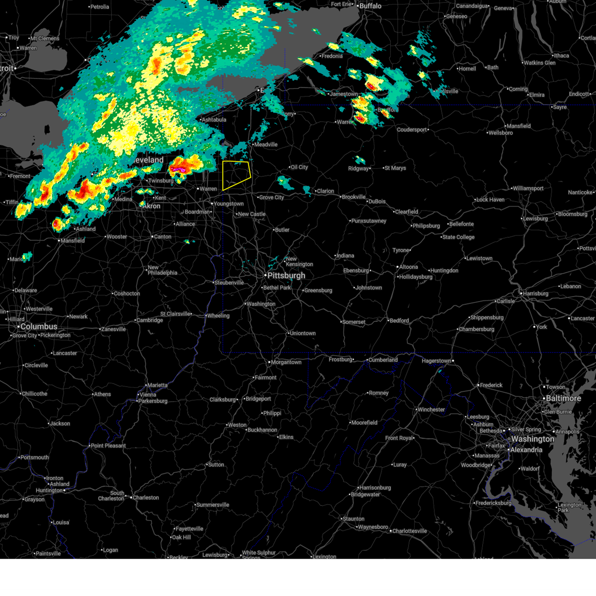
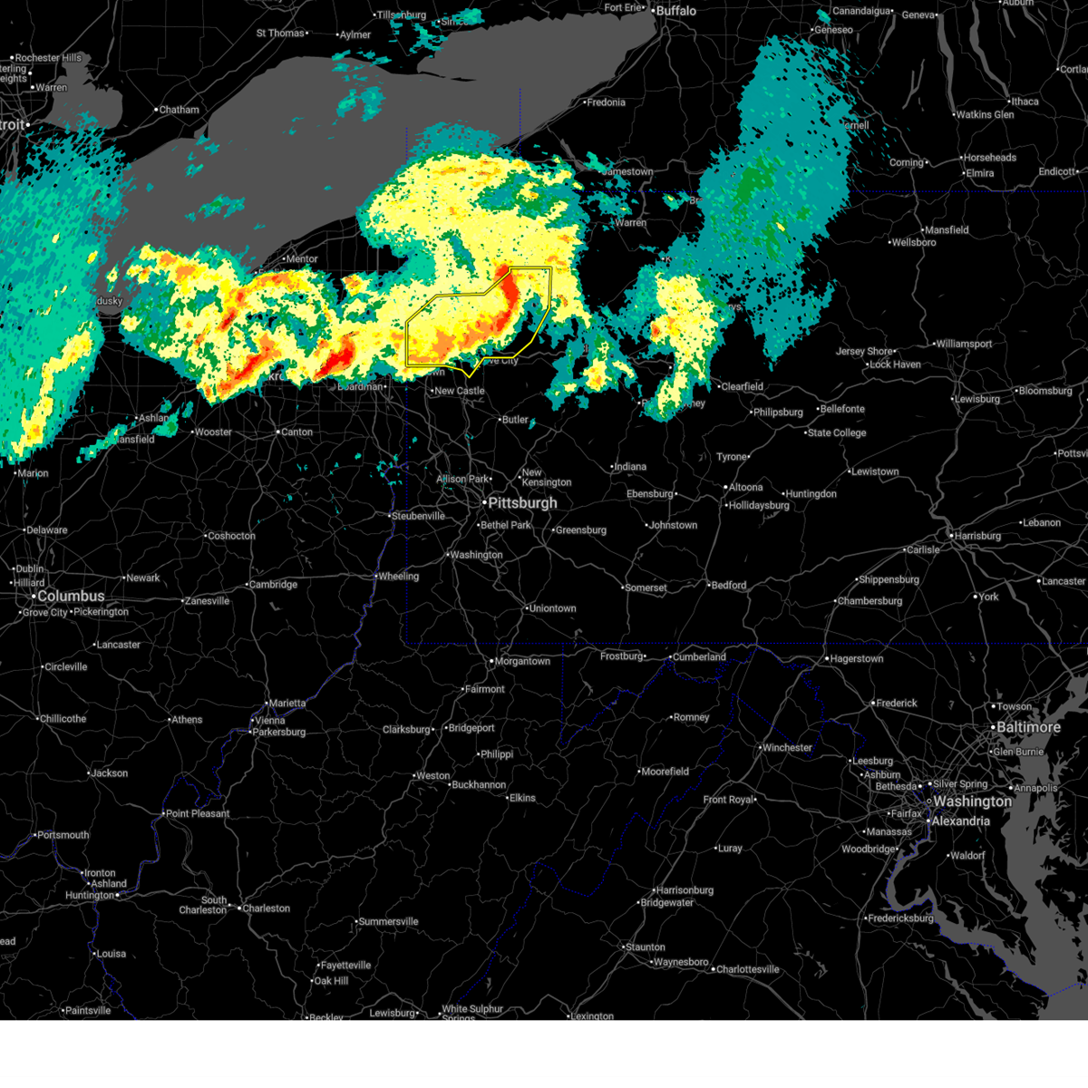
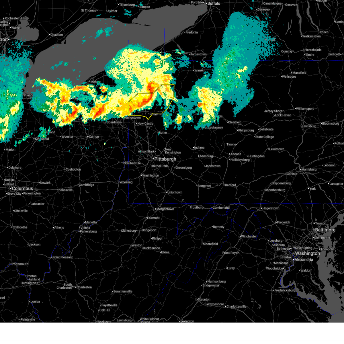
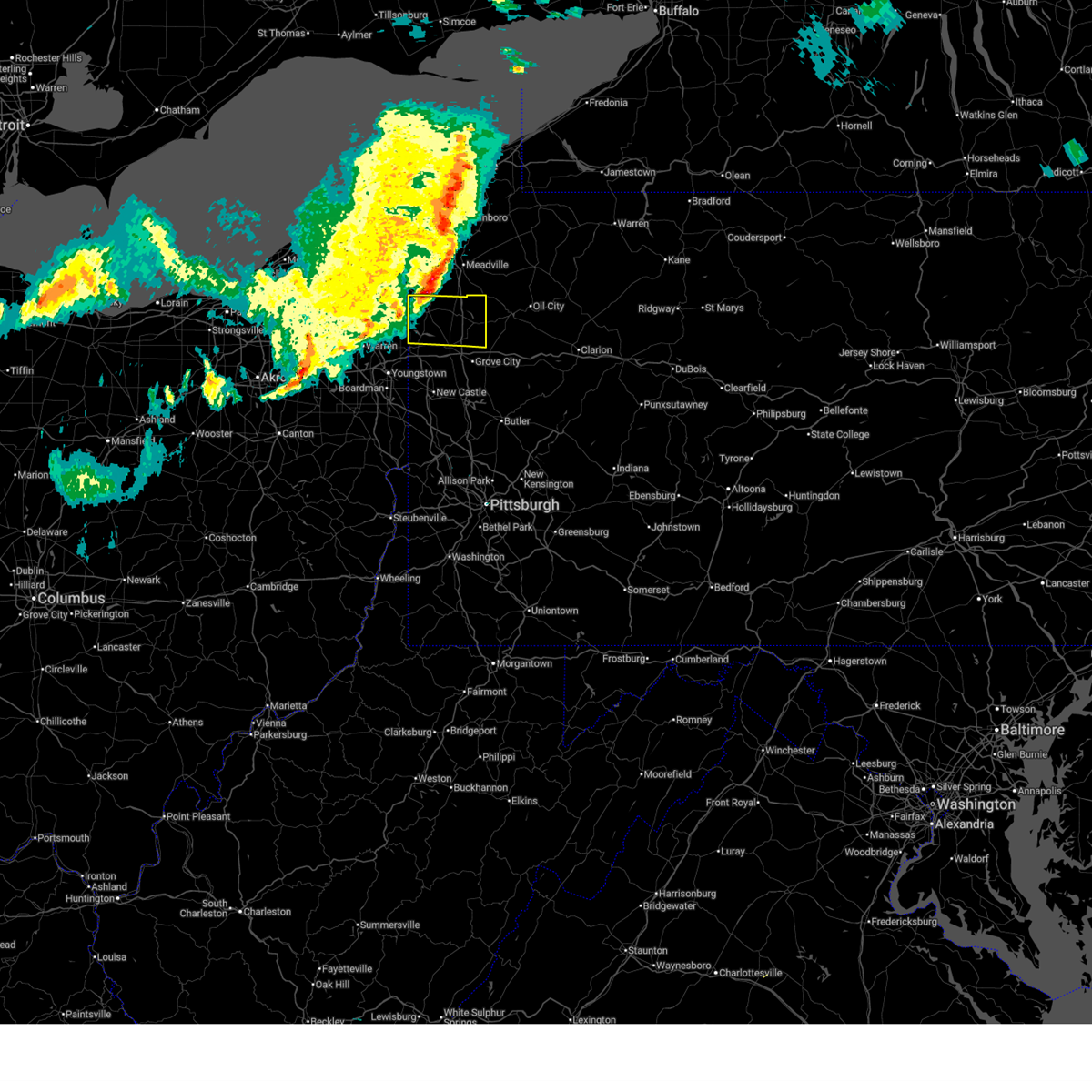
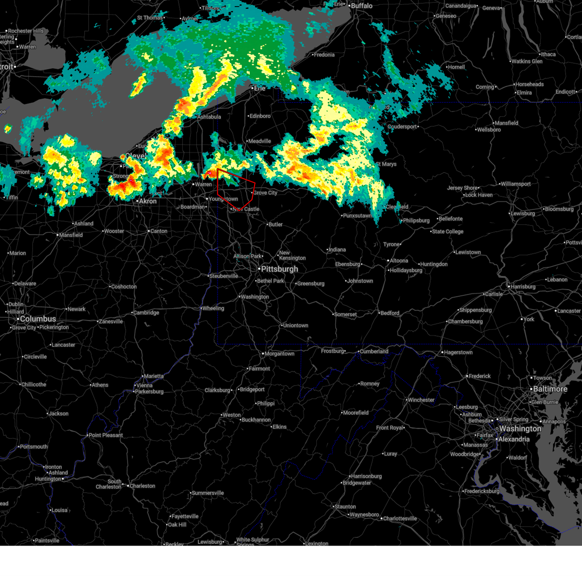
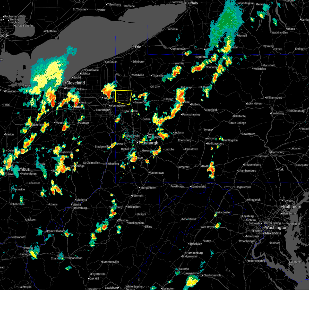
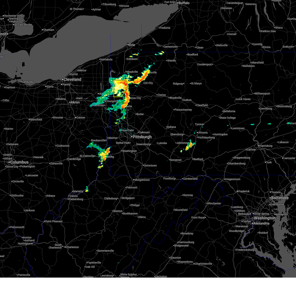
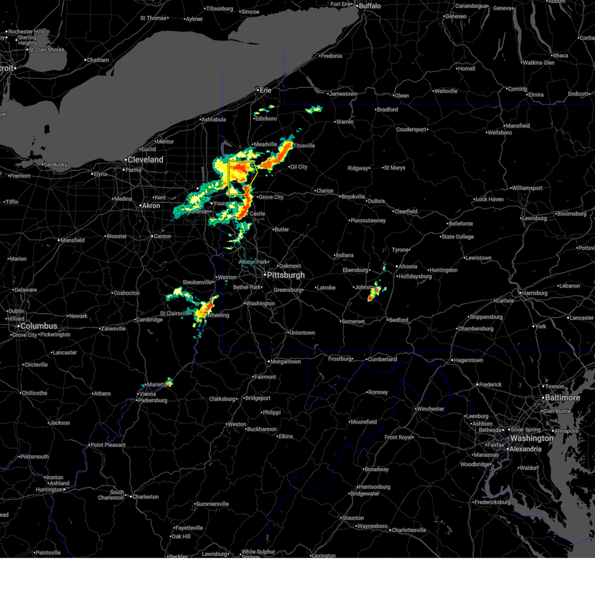
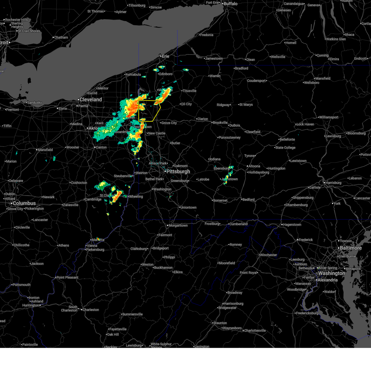
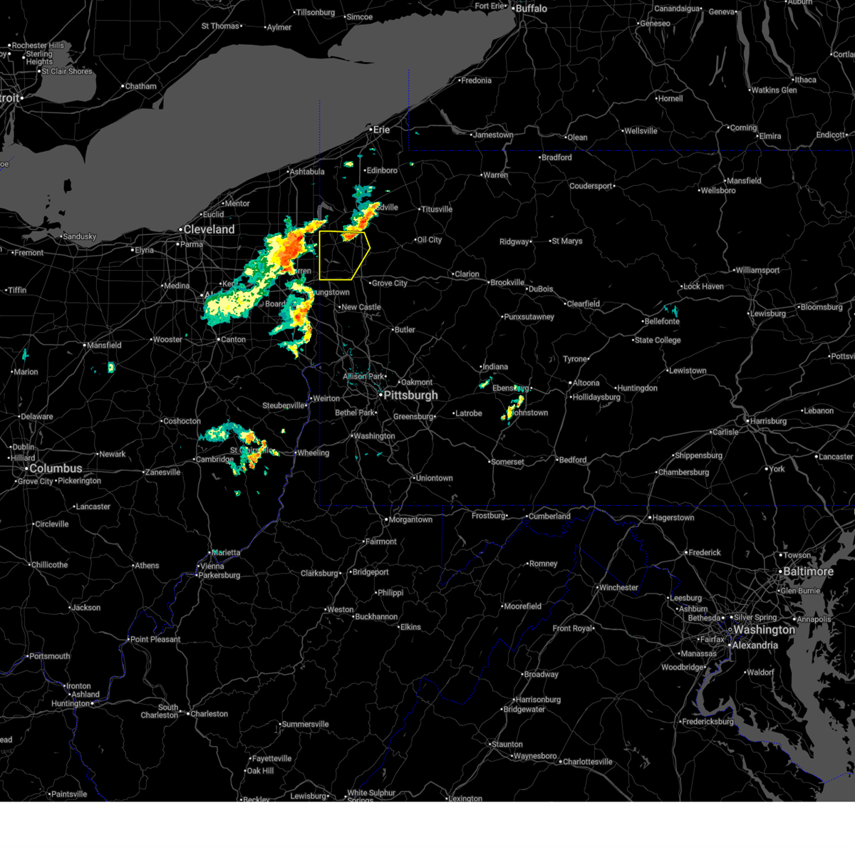
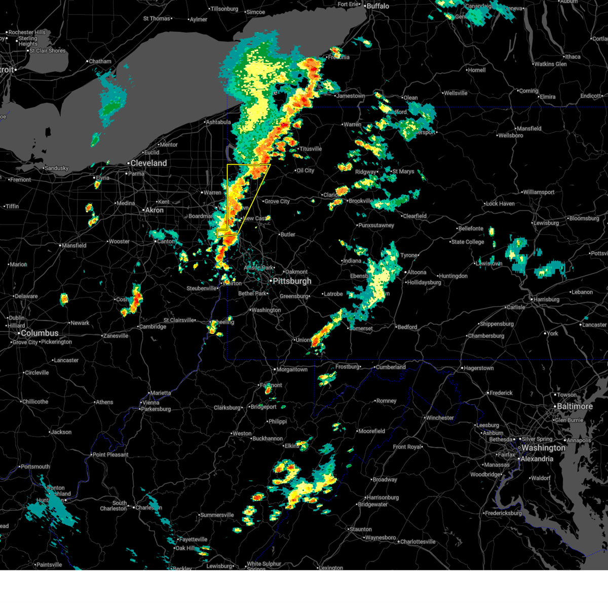
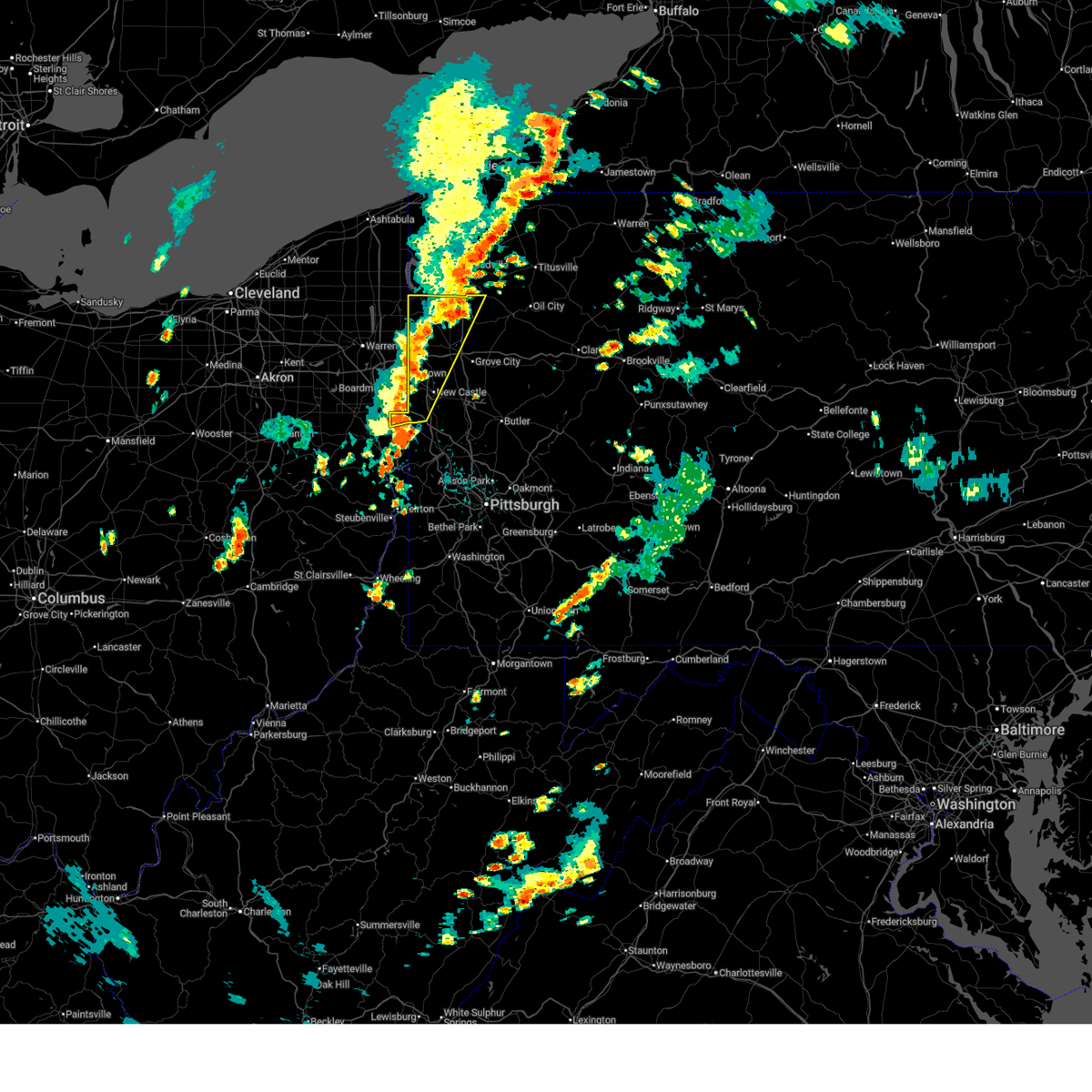
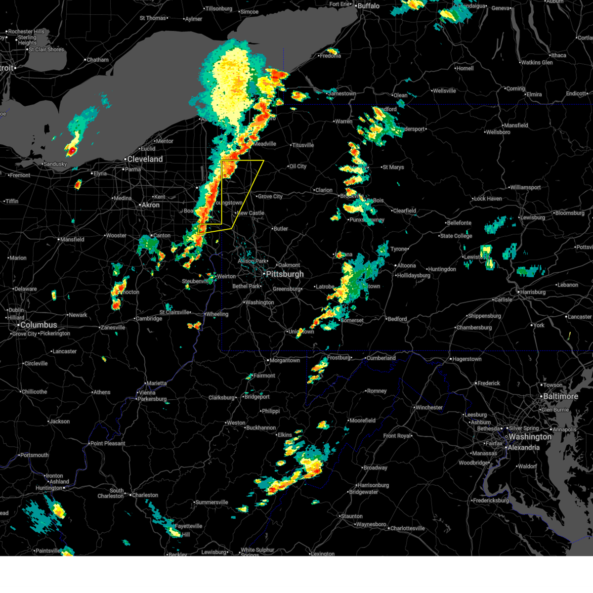
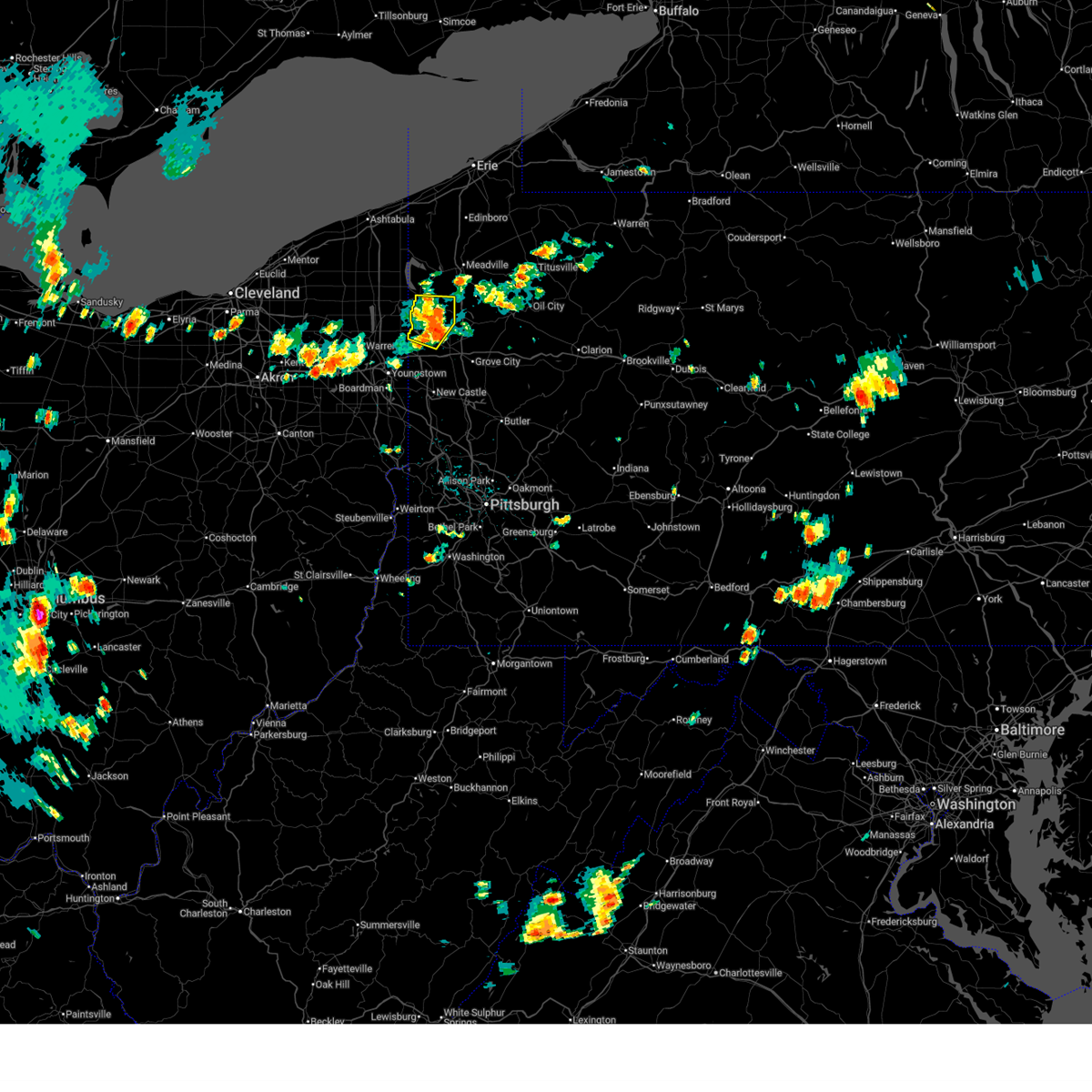
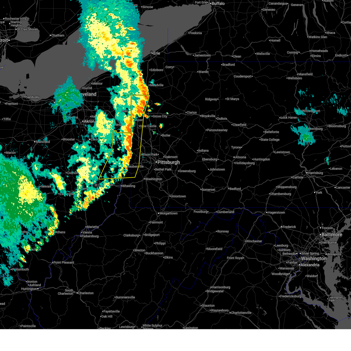
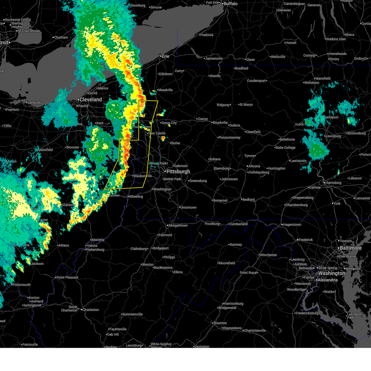
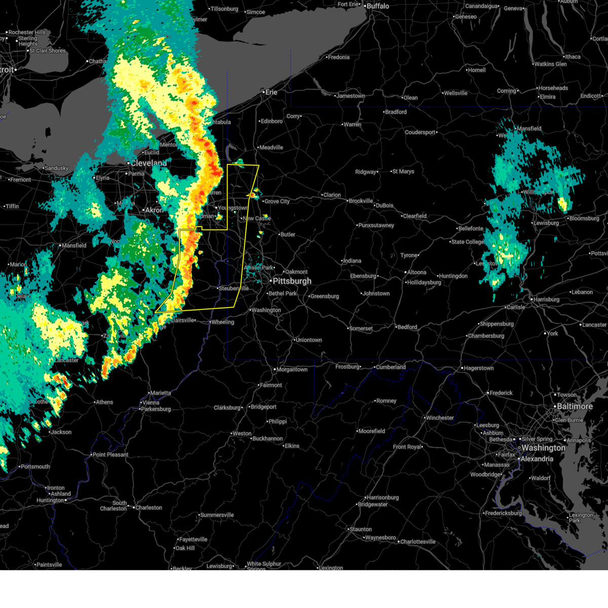
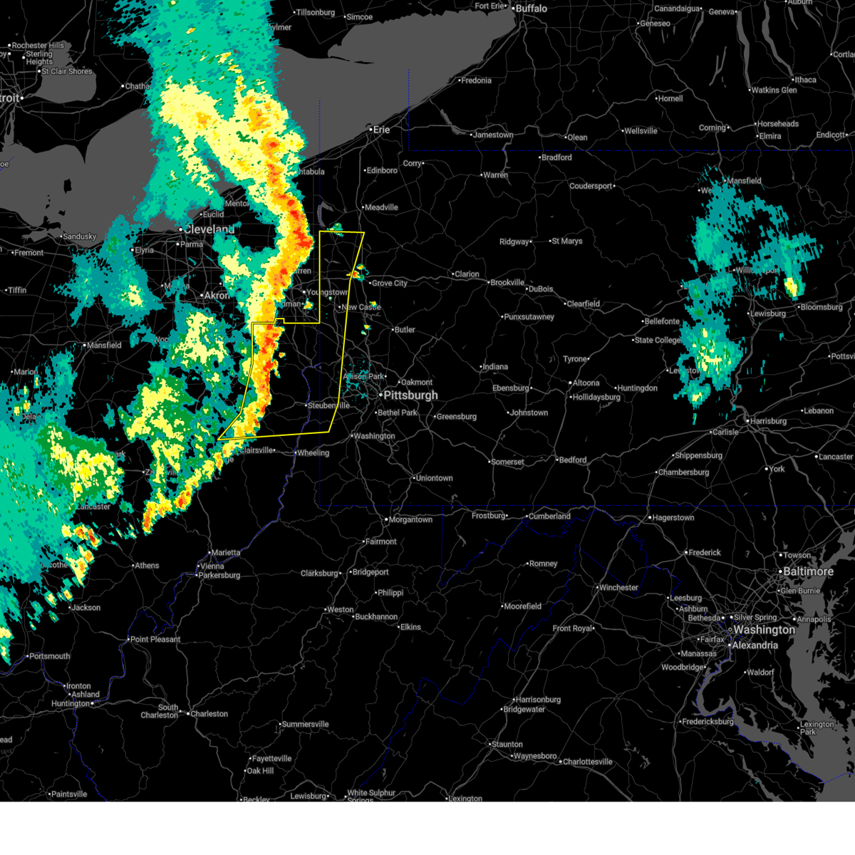
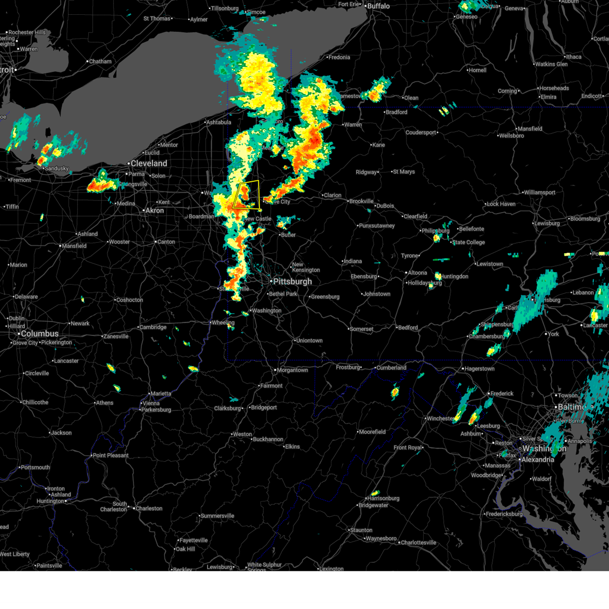
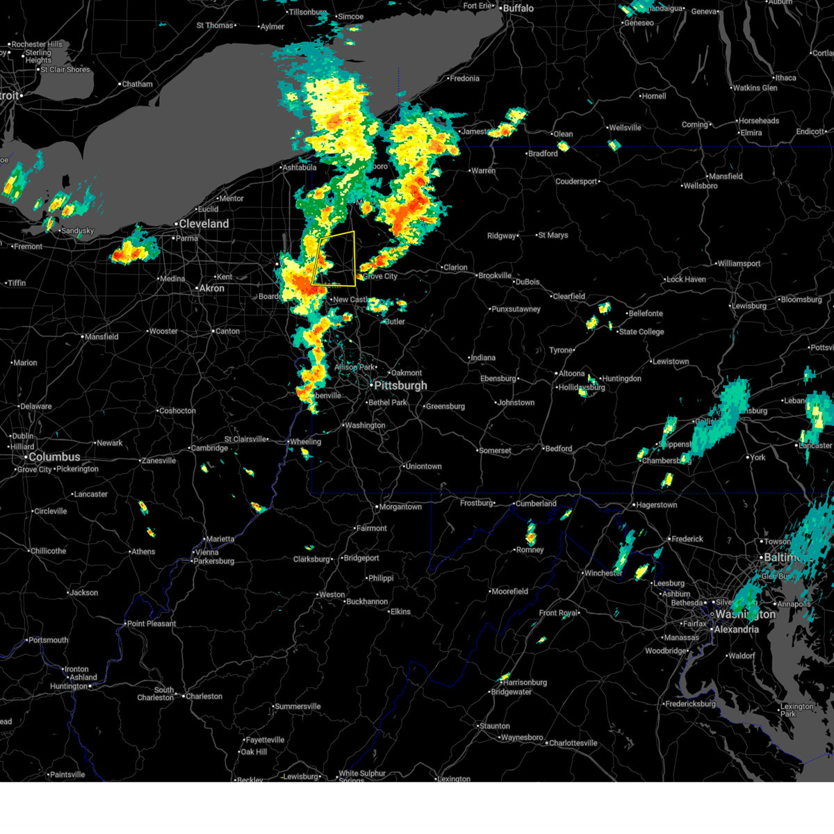
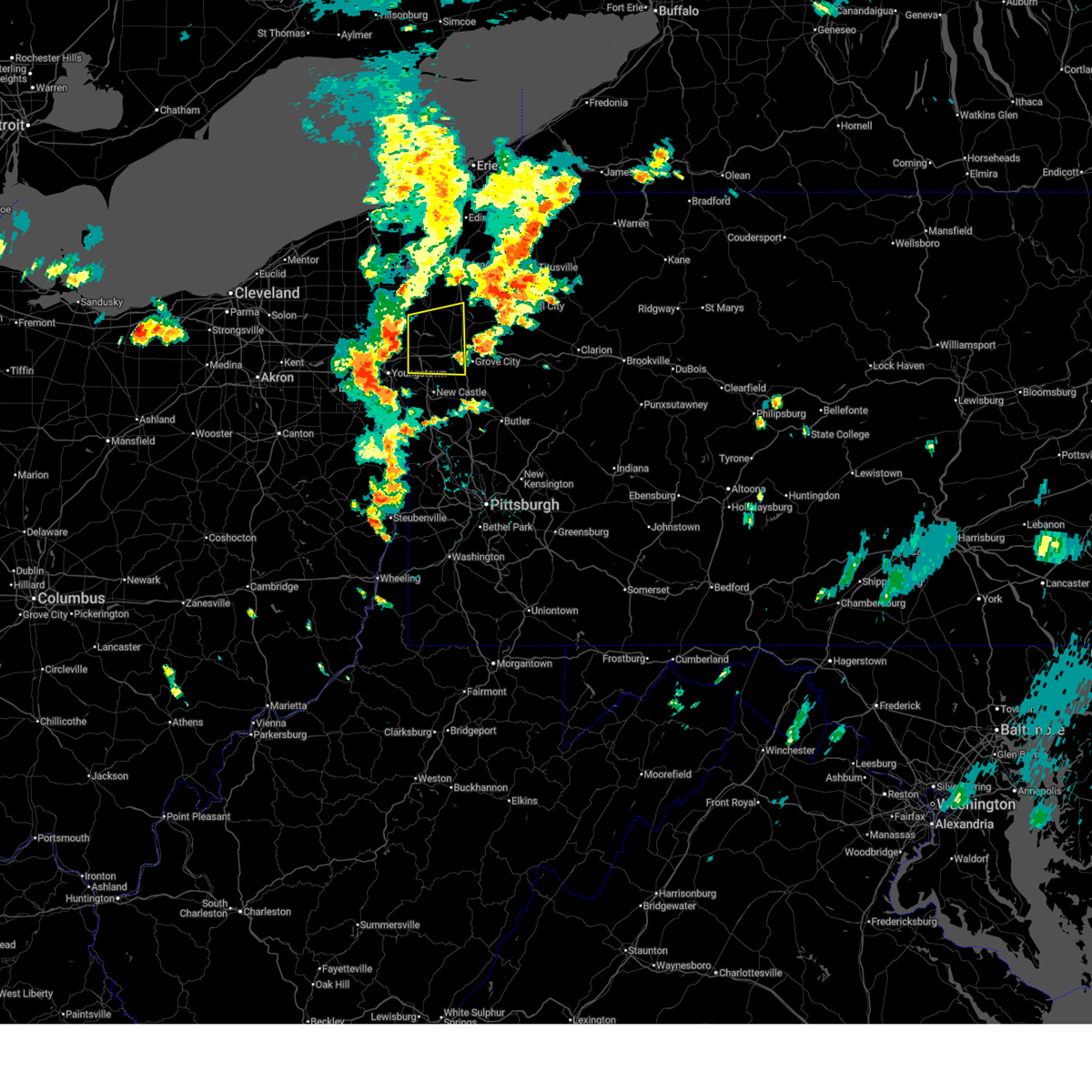
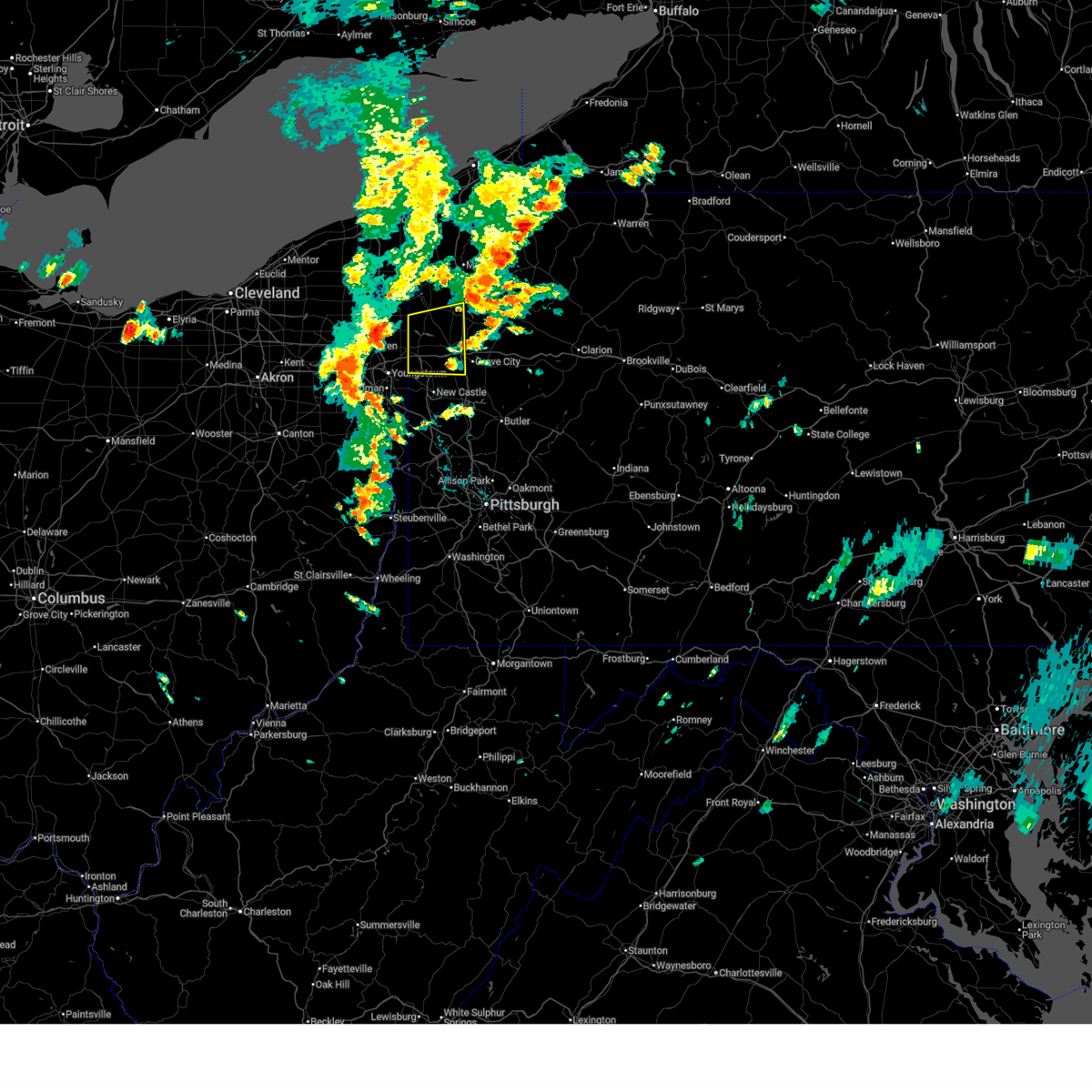
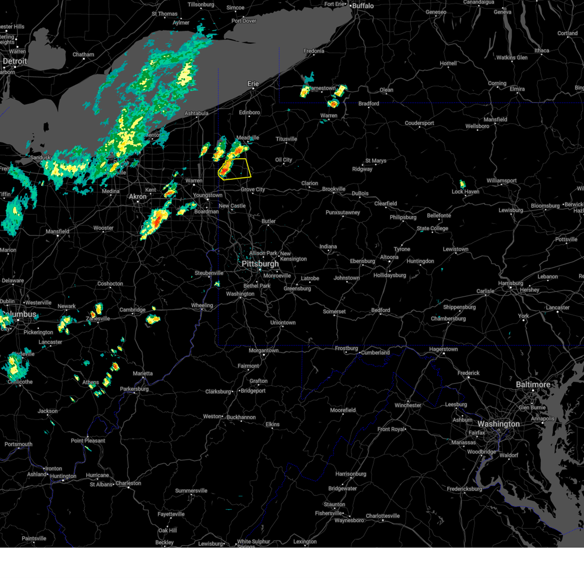
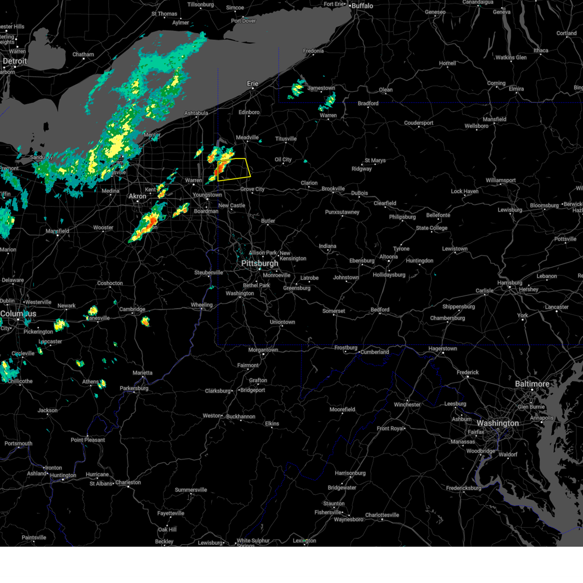
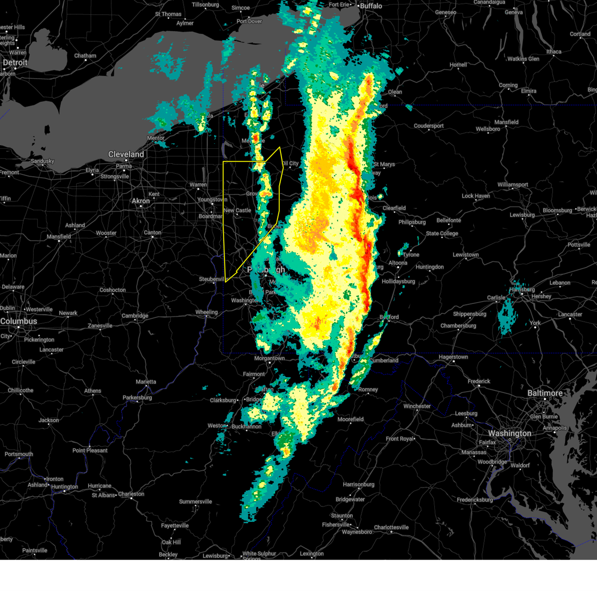
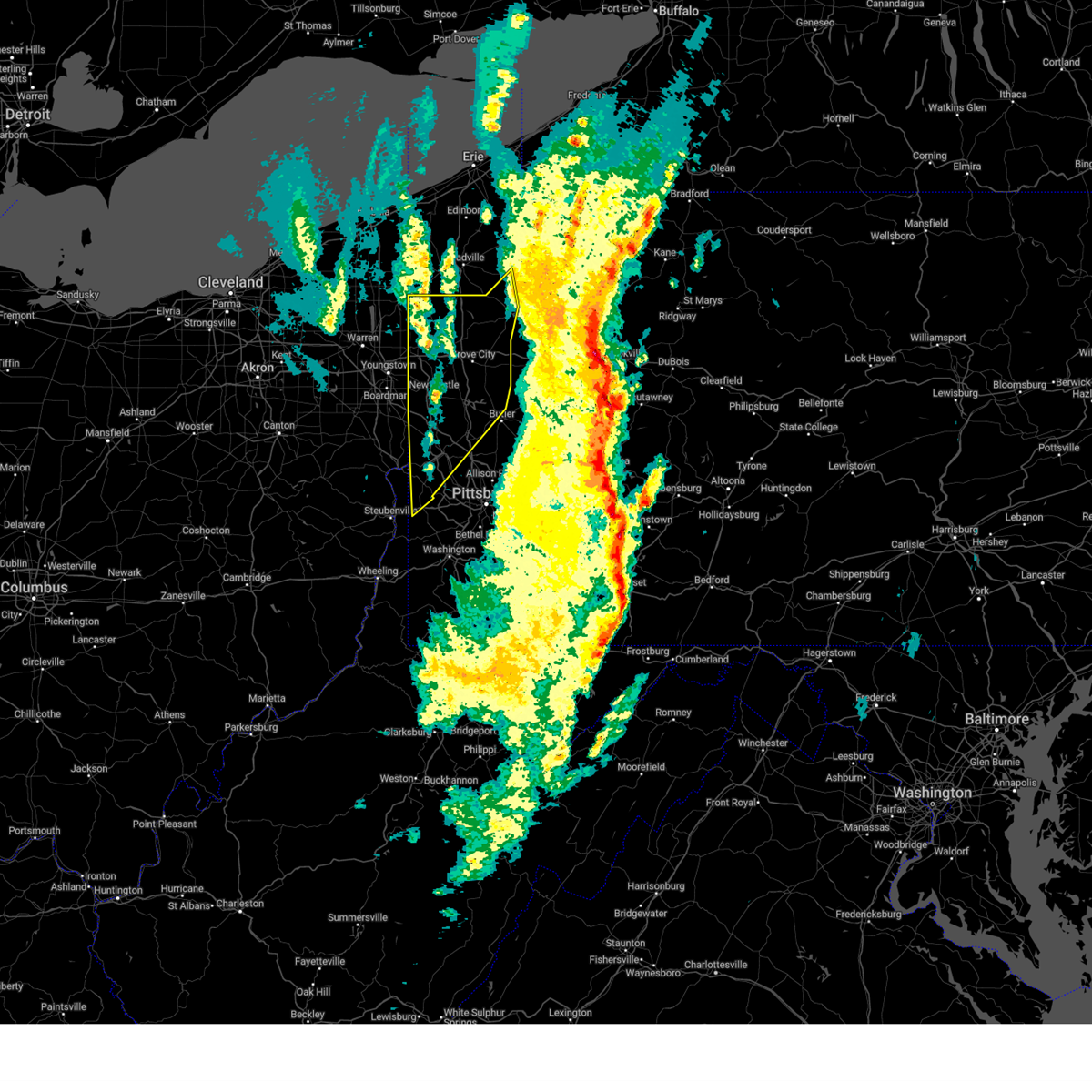
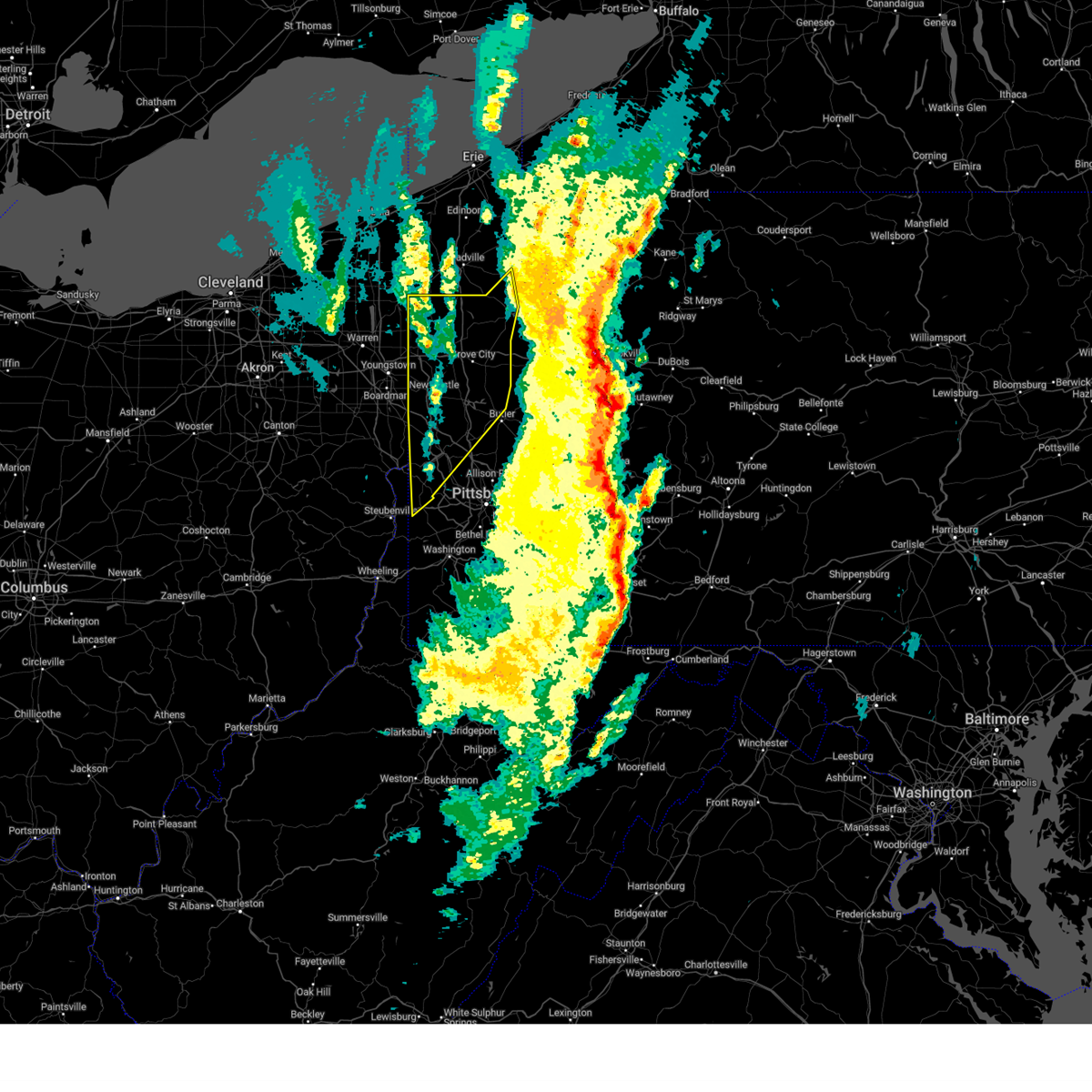
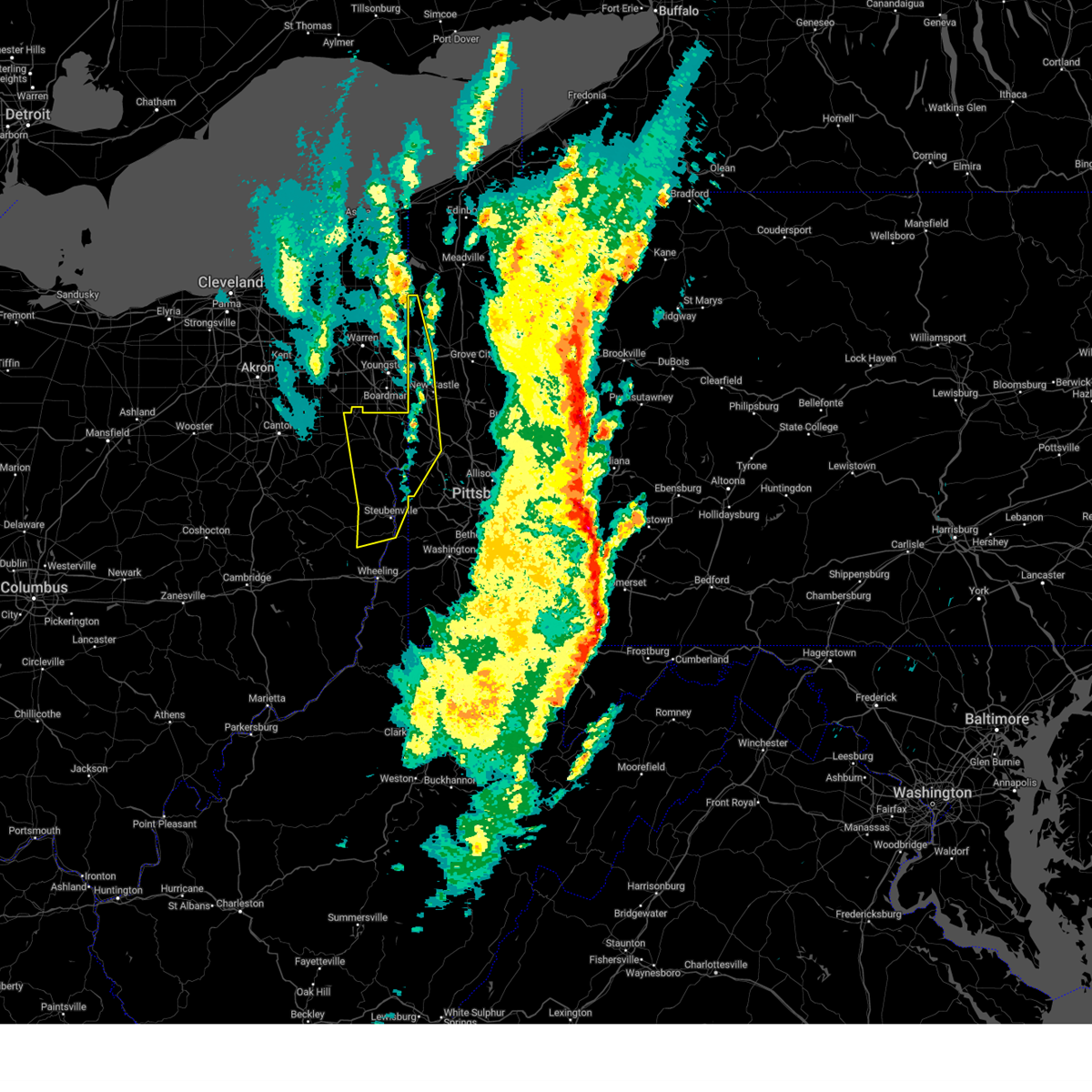
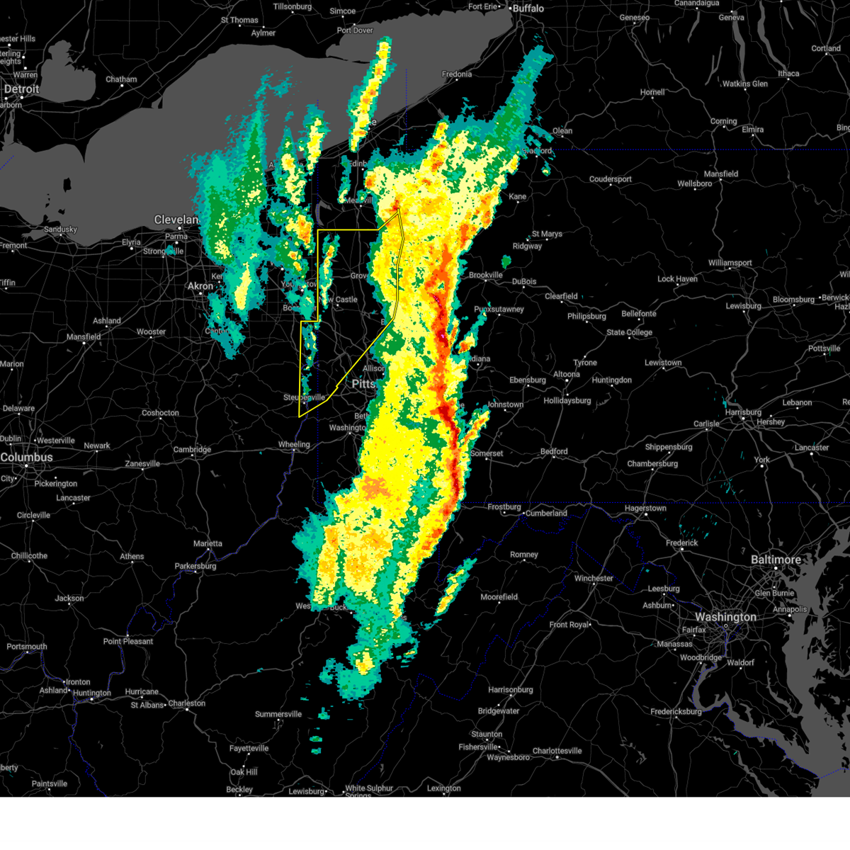
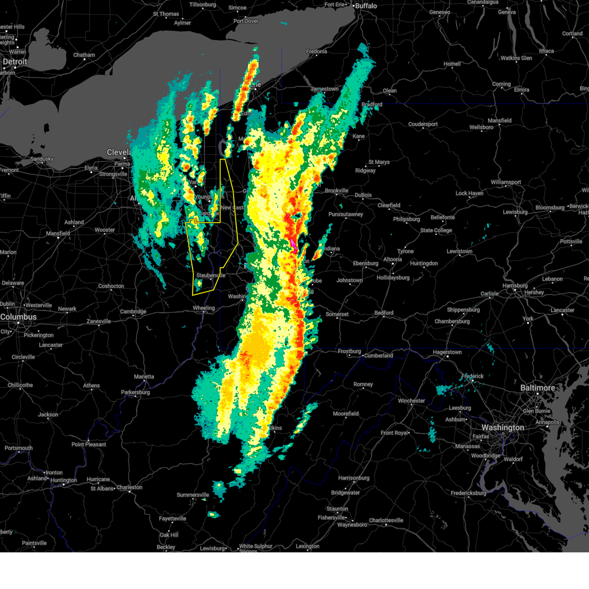
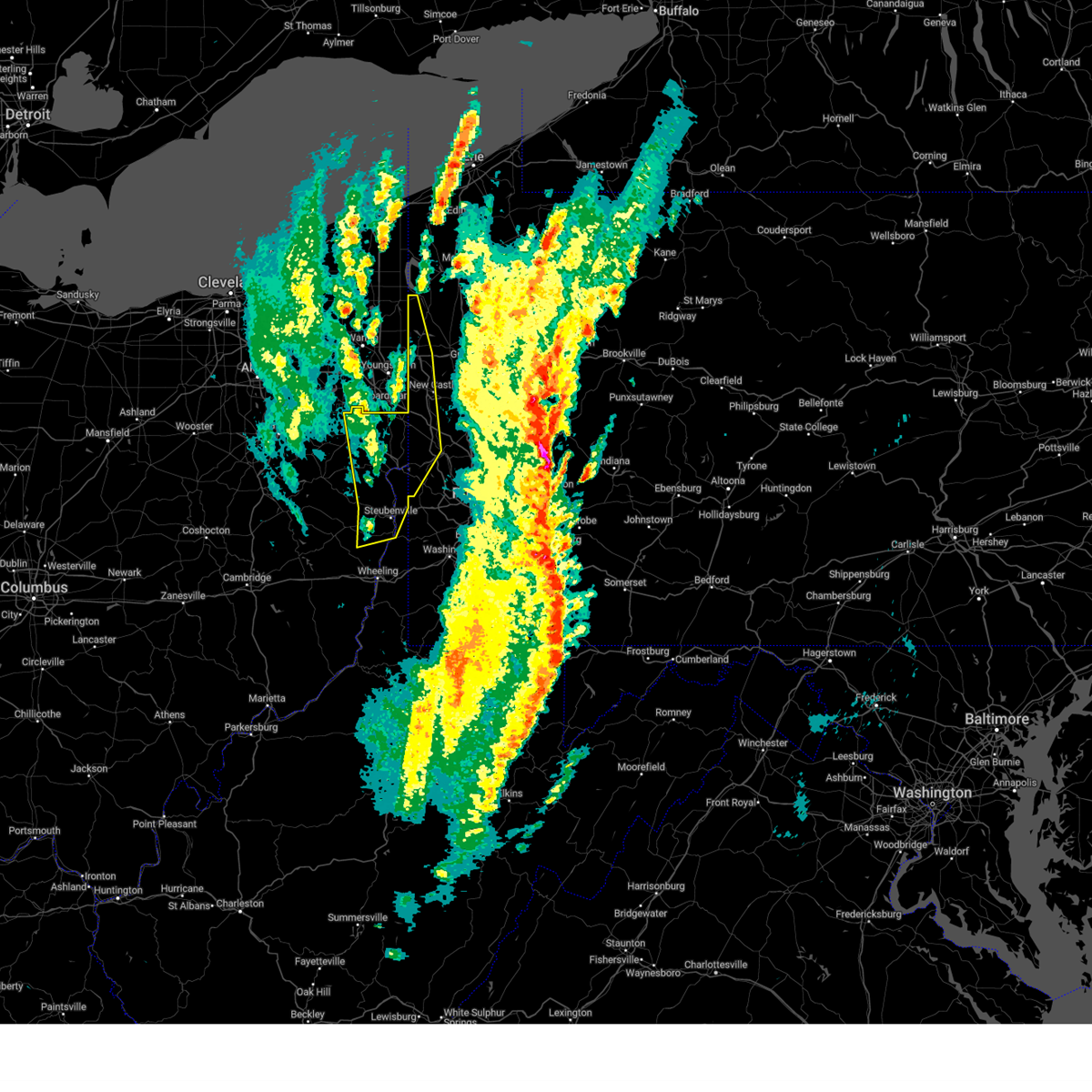
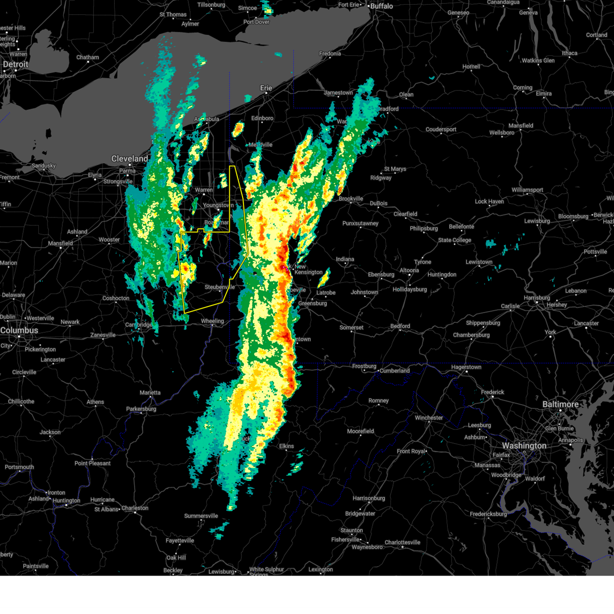
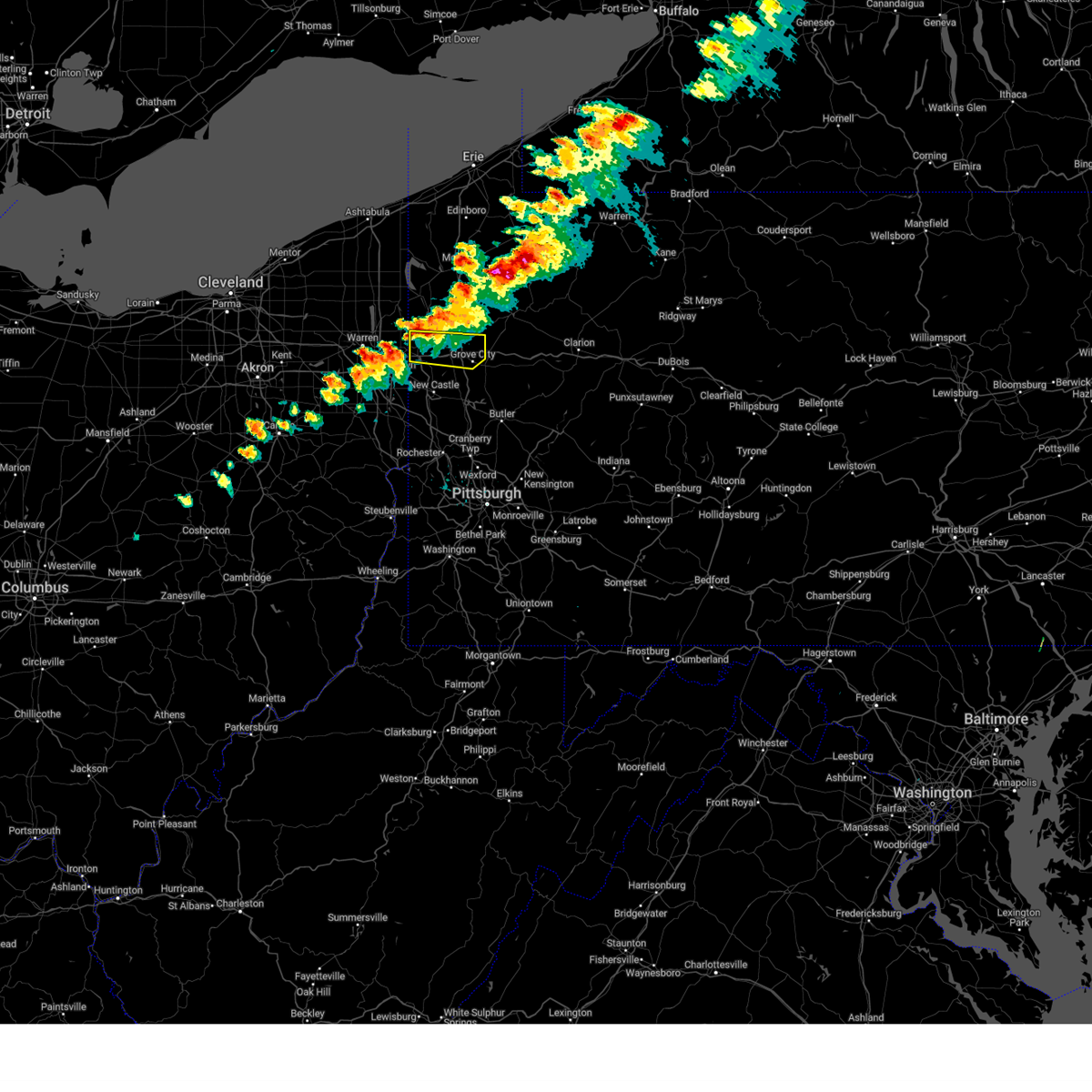
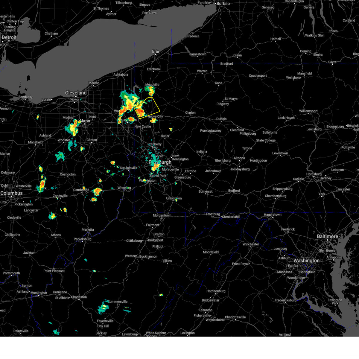
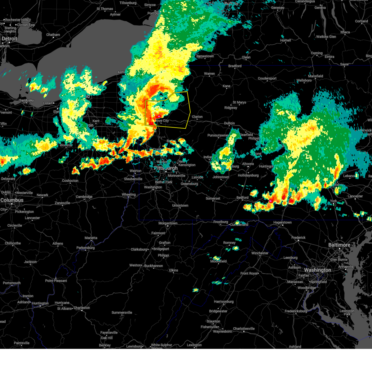
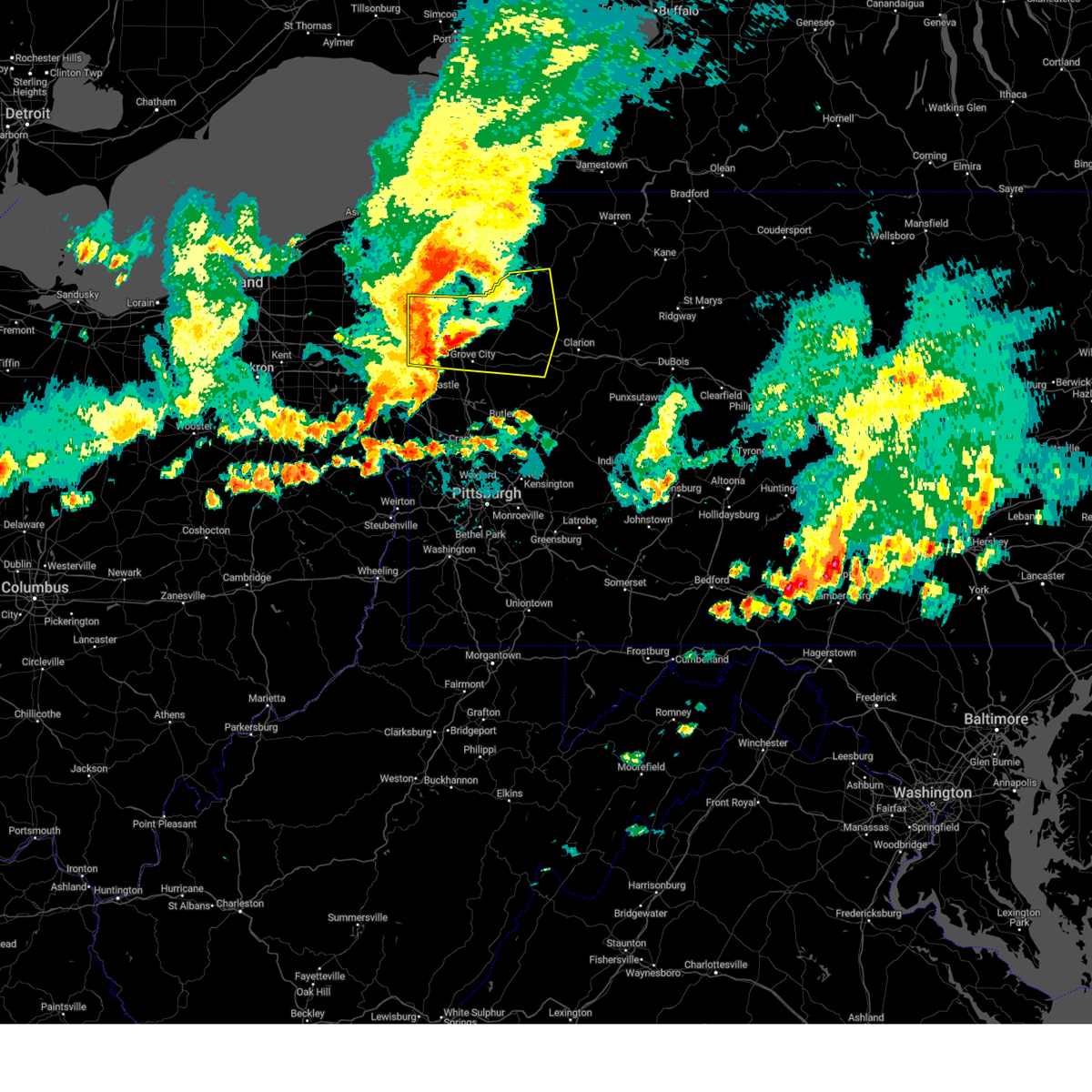
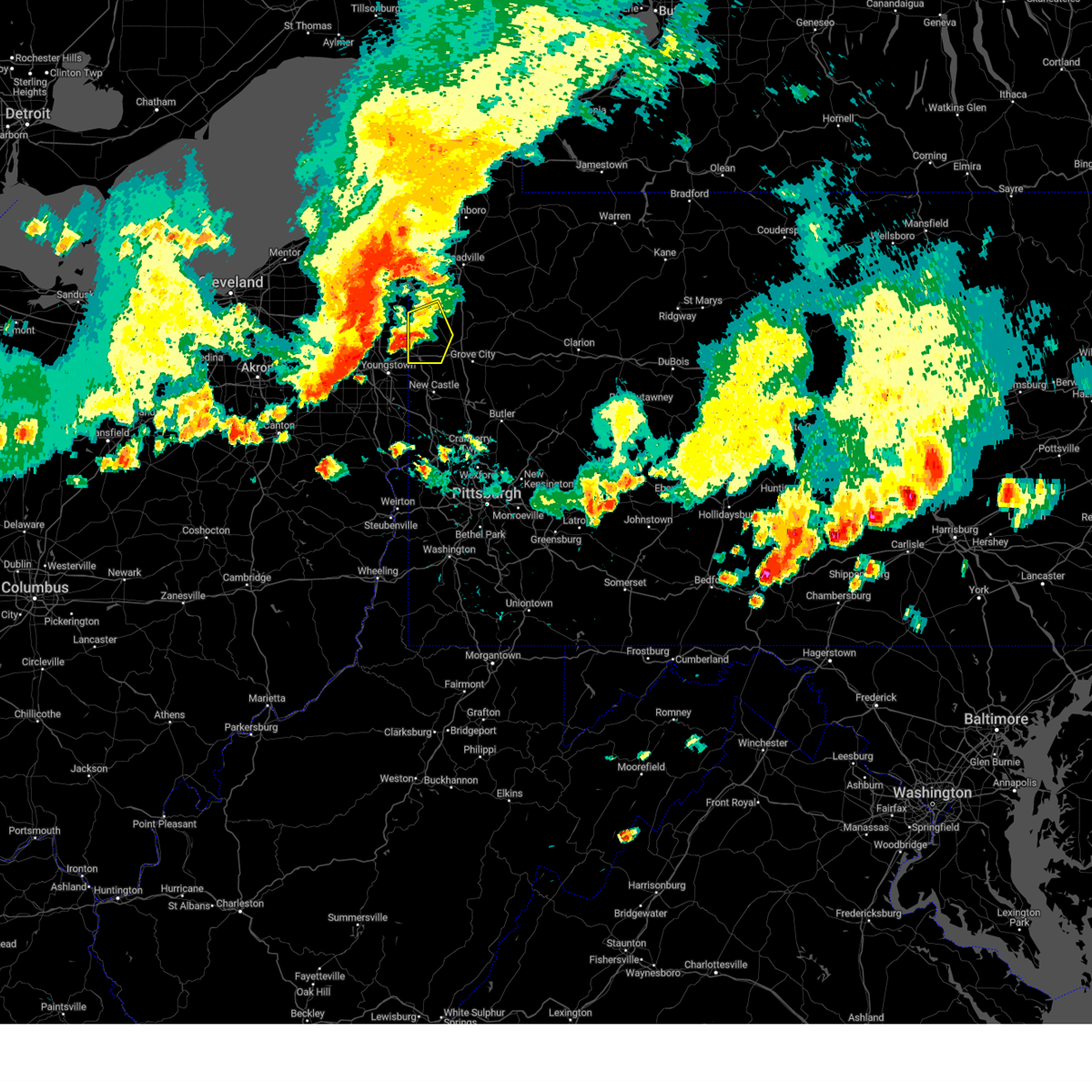
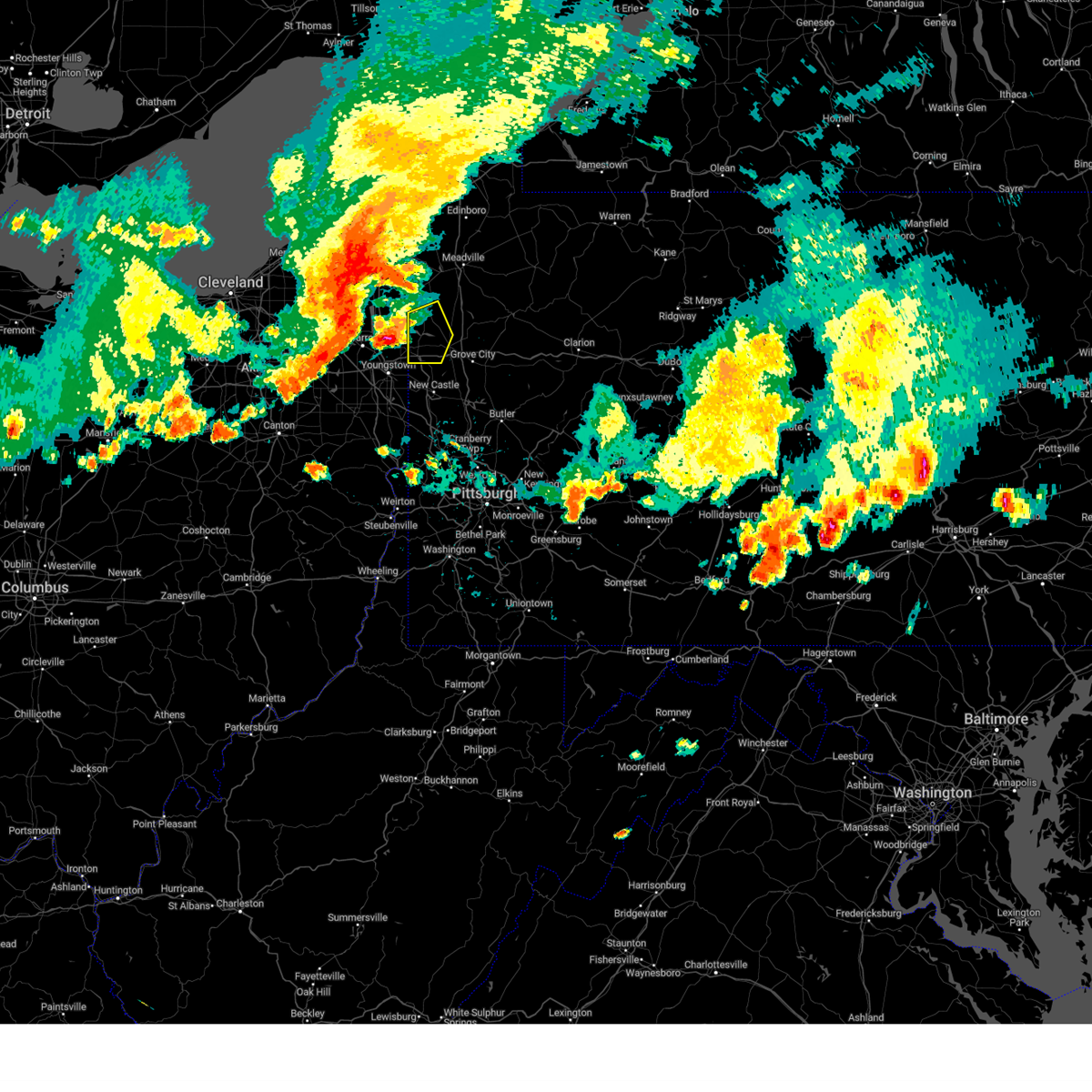
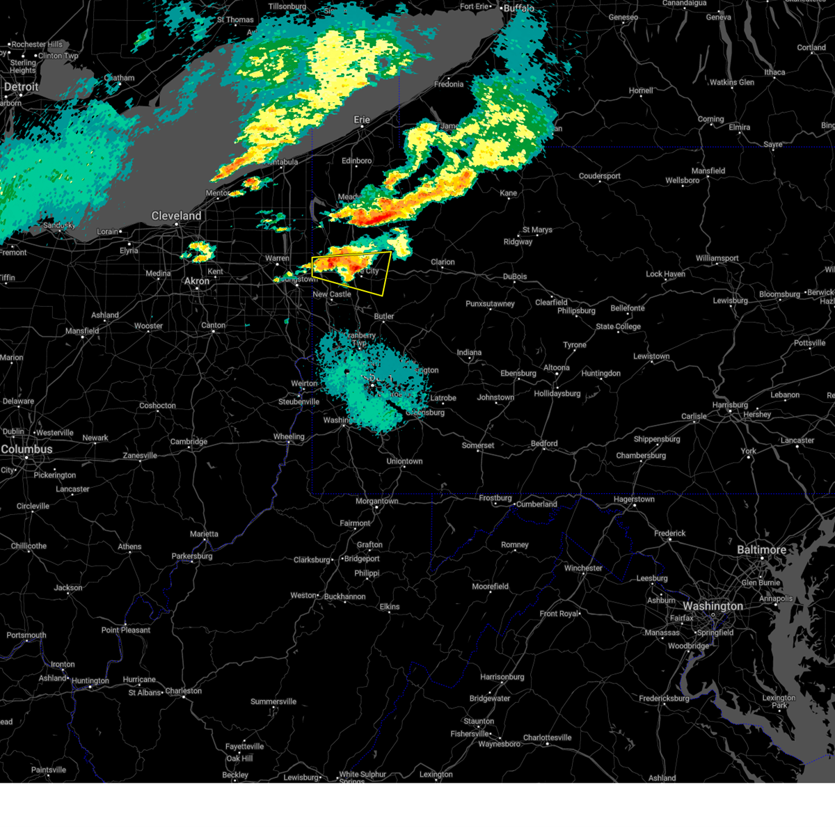
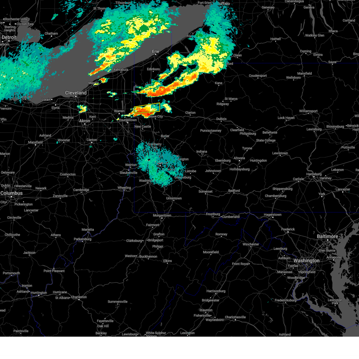
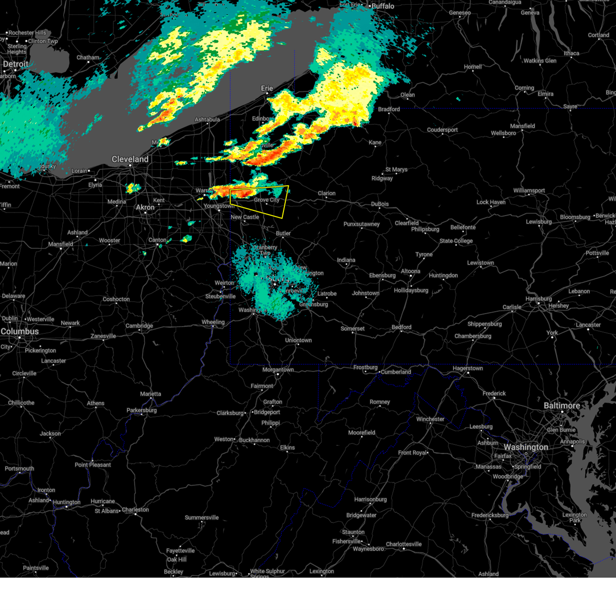
Hail Map for Clark, PA
The Clark, PA area has had 2 reports of on-the-ground hail by trained spotters, and has been under severe weather warnings 26 times during the past 12 months. Doppler radar has detected hail at or near Clark, PA on 40 occasions, including 1 occasion during the past year.
| Name: | Clark, PA |
| Where Located: | 62.5 miles NNW of Pittsburgh, PA |
| Map: | Google Map for Clark, PA |
| Population: | 640 |
| Housing Units: | 243 |
| More Info: | Search Google for Clark, PA |
0
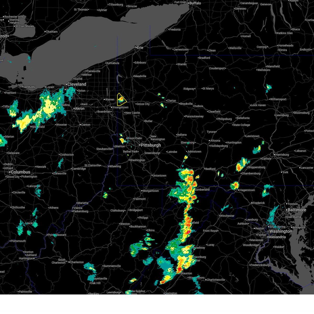
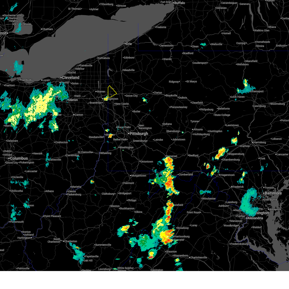
The Top Recent Hail Date for Clark, PA is Wednesday, April 15, 2026 (16th out of 40)
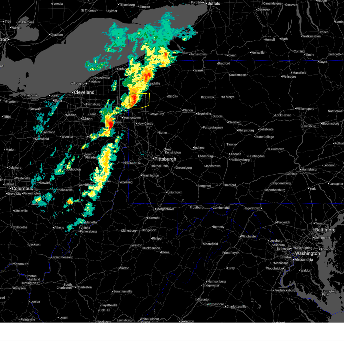
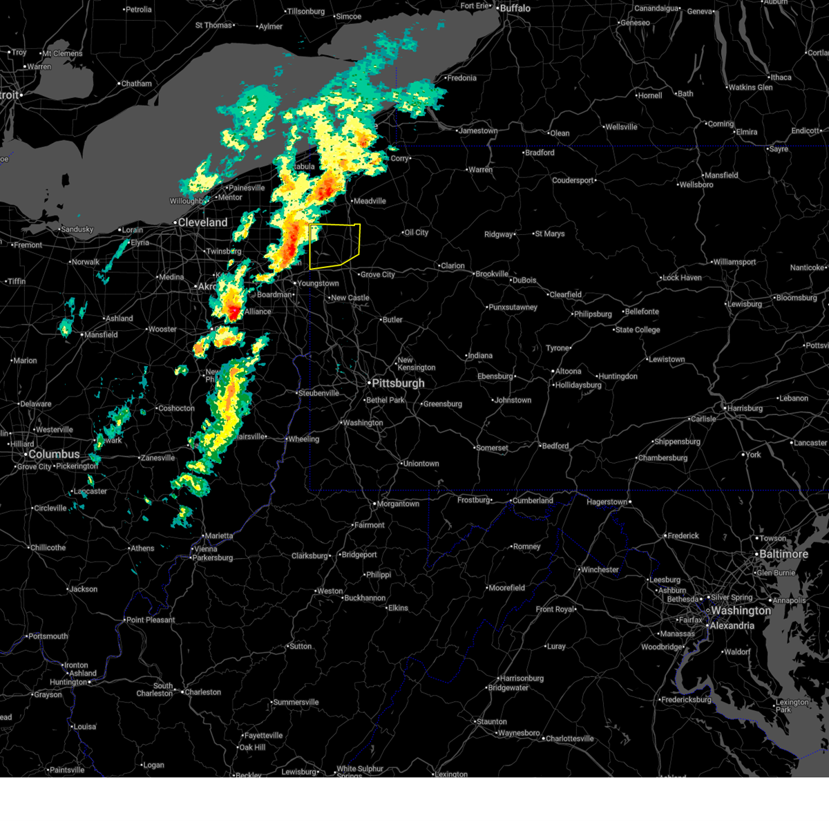
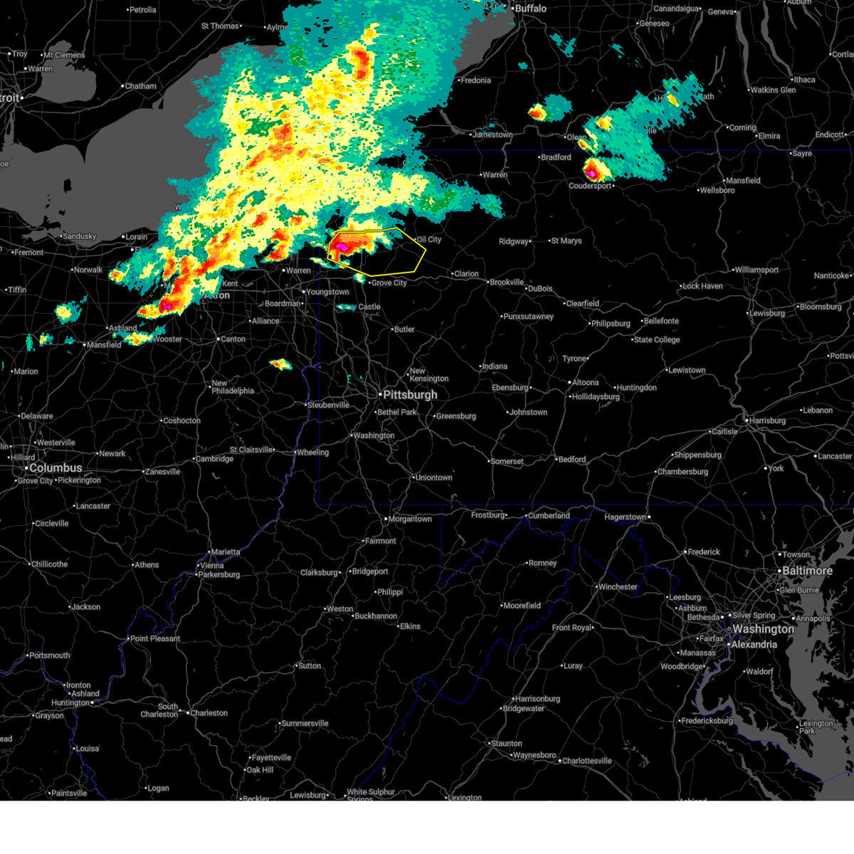
Hail and Wind Damage Spotted near Clark, PA
| Date / Time | Report Details |
|---|---|
| 6/20/2026 2:29 PM EDT |
 Svrpbz the national weather service in pittsburgh has issued a * severe thunderstorm warning for, southern mercer county in northwestern pennsylvania, southwestern venango county in northwestern pennsylvania, northwestern butler county in west central pennsylvania, northeastern lawrence county in western pennsylvania, * until 315 pm edt. * at 229 pm edt, a severe thunderstorm was located near hermitage, moving southeast at 30 mph (radar indicated). Hazards include quarter size hail. damage to vehicles is expected Svrpbz the national weather service in pittsburgh has issued a * severe thunderstorm warning for, southern mercer county in northwestern pennsylvania, southwestern venango county in northwestern pennsylvania, northwestern butler county in west central pennsylvania, northeastern lawrence county in western pennsylvania, * until 315 pm edt. * at 229 pm edt, a severe thunderstorm was located near hermitage, moving southeast at 30 mph (radar indicated). Hazards include quarter size hail. damage to vehicles is expected
|
| 6/14/2026 5:05 PM EDT |
 At 505 pm edt, severe thunderstorms were located along a line from 12 miles north of sugarcreek to over hermitage, or along a line from 15 miles north of franklin to over hermitage, moving east at 40 mph (radar indicated). Hazards include 60 mph wind gusts and small hail. Expect damage to roofs, siding, and trees. Locations impacted include, hermitage, sharon, oil city, franklin, sharpsville, sugarcreek, farrell, mercer, stoneboro, polk, sandy lake, clark, wheatland, rouseville, fredonia, cooperstown, jackson center, utica and new lebanon. At 505 pm edt, severe thunderstorms were located along a line from 12 miles north of sugarcreek to over hermitage, or along a line from 15 miles north of franklin to over hermitage, moving east at 40 mph (radar indicated). Hazards include 60 mph wind gusts and small hail. Expect damage to roofs, siding, and trees. Locations impacted include, hermitage, sharon, oil city, franklin, sharpsville, sugarcreek, farrell, mercer, stoneboro, polk, sandy lake, clark, wheatland, rouseville, fredonia, cooperstown, jackson center, utica and new lebanon.
|
| 6/14/2026 4:41 PM EDT |
 At 441 pm edt, severe thunderstorms were located along a line from 19 miles northeast of greenville to 13 miles west of sharon, or along a line from 24 miles northwest of franklin to 13 miles west of sharon, moving east at 40 mph (radar indicated). Hazards include 60 mph wind gusts and small hail. Expect damage to roofs, siding, and trees. Locations impacted include, hermitage, sharon, oil city, franklin, sharpsville, greenville, sugarcreek, farrell, mercer, stoneboro, polk, sandy lake, clark, wheatland, jamestown, rouseville, fredonia, cooperstown and jackson center. At 441 pm edt, severe thunderstorms were located along a line from 19 miles northeast of greenville to 13 miles west of sharon, or along a line from 24 miles northwest of franklin to 13 miles west of sharon, moving east at 40 mph (radar indicated). Hazards include 60 mph wind gusts and small hail. Expect damage to roofs, siding, and trees. Locations impacted include, hermitage, sharon, oil city, franklin, sharpsville, greenville, sugarcreek, farrell, mercer, stoneboro, polk, sandy lake, clark, wheatland, jamestown, rouseville, fredonia, cooperstown and jackson center.
|
| 6/14/2026 4:27 PM EDT |
 Svrpbz the national weather service in pittsburgh has issued a * severe thunderstorm warning for, mercer county in northwestern pennsylvania, northwestern venango county in northwestern pennsylvania, * until 530 pm edt. * at 427 pm edt, severe thunderstorms were located along a line from 17 miles north of greenville to 23 miles north of salem, or along a line from 27 miles north of sharpsville to 22 miles west of sharon, moving east at 40 mph (radar indicated). Hazards include 60 mph wind gusts and small hail. expect damage to roofs, siding, and trees Svrpbz the national weather service in pittsburgh has issued a * severe thunderstorm warning for, mercer county in northwestern pennsylvania, northwestern venango county in northwestern pennsylvania, * until 530 pm edt. * at 427 pm edt, severe thunderstorms were located along a line from 17 miles north of greenville to 23 miles north of salem, or along a line from 27 miles north of sharpsville to 22 miles west of sharon, moving east at 40 mph (radar indicated). Hazards include 60 mph wind gusts and small hail. expect damage to roofs, siding, and trees
|
| 5/9/2026 7:52 PM EDT |
 Svrpbz the national weather service in pittsburgh has issued a * severe thunderstorm warning for, mercer county in northwestern pennsylvania, northern lawrence county in western pennsylvania, * until 845 pm edt. * at 752 pm edt, a severe thunderstorm was located 13 miles west of sharon, moving east at 35 mph (radar indicated). Hazards include 60 mph wind gusts and small hail. expect damage to roofs, siding, and trees Svrpbz the national weather service in pittsburgh has issued a * severe thunderstorm warning for, mercer county in northwestern pennsylvania, northern lawrence county in western pennsylvania, * until 845 pm edt. * at 752 pm edt, a severe thunderstorm was located 13 miles west of sharon, moving east at 35 mph (radar indicated). Hazards include 60 mph wind gusts and small hail. expect damage to roofs, siding, and trees
|
| 4/16/2026 3:58 PM EDT |
 At 358 pm edt, a severe thunderstorm was located near greenville, or 12 miles northeast of sharpsville, moving east at 50 mph (radar indicated). Hazards include 60 mph wind gusts. Expect damage to roofs, siding, and trees. Locations impacted include, hermitage, greenville, stoneboro, sandy lake, clark, jamestown, fredonia, jackson center, sheakleyville and maurice k goddard state park. At 358 pm edt, a severe thunderstorm was located near greenville, or 12 miles northeast of sharpsville, moving east at 50 mph (radar indicated). Hazards include 60 mph wind gusts. Expect damage to roofs, siding, and trees. Locations impacted include, hermitage, greenville, stoneboro, sandy lake, clark, jamestown, fredonia, jackson center, sheakleyville and maurice k goddard state park.
|
| 4/16/2026 3:34 PM EDT |
 Svrpbz the national weather service in pittsburgh has issued a * severe thunderstorm warning for, northern mercer county in northwestern pennsylvania, * until 415 pm edt. * at 334 pm edt, a severe thunderstorm was located 11 miles northwest of sharon, moving east at 45 mph (radar indicated). Hazards include 60 mph wind gusts. expect damage to roofs, siding, and trees Svrpbz the national weather service in pittsburgh has issued a * severe thunderstorm warning for, northern mercer county in northwestern pennsylvania, * until 415 pm edt. * at 334 pm edt, a severe thunderstorm was located 11 miles northwest of sharon, moving east at 45 mph (radar indicated). Hazards include 60 mph wind gusts. expect damage to roofs, siding, and trees
|
| 4/15/2026 6:27 PM EDT |
 At 627 pm edt, a severe thunderstorm was located 8 miles east of greenville, or 14 miles northeast of hermitage, moving east at 50 mph (radar indicated). Hazards include golf ball size hail and 60 mph wind gusts. People and animals outdoors will be injured. expect hail damage to roofs, siding, windows, and vehicles. expect wind damage to roofs, siding, and trees. Locations impacted include, oil city, franklin, greenville, sugarcreek, stoneboro, seneca, polk, sandy lake, fredonia, cooperstown, kennerdell, jackson center, barkeyville, woodland heights, utica, new lebanon, sheakleyville, maurice k goddard state park and cranberry township. At 627 pm edt, a severe thunderstorm was located 8 miles east of greenville, or 14 miles northeast of hermitage, moving east at 50 mph (radar indicated). Hazards include golf ball size hail and 60 mph wind gusts. People and animals outdoors will be injured. expect hail damage to roofs, siding, windows, and vehicles. expect wind damage to roofs, siding, and trees. Locations impacted include, oil city, franklin, greenville, sugarcreek, stoneboro, seneca, polk, sandy lake, fredonia, cooperstown, kennerdell, jackson center, barkeyville, woodland heights, utica, new lebanon, sheakleyville, maurice k goddard state park and cranberry township.
|
| 4/15/2026 6:12 PM EDT |
 Svrpbz the national weather service in pittsburgh has issued a * severe thunderstorm warning for, mercer county in northwestern pennsylvania, southwestern venango county in northwestern pennsylvania, * until 700 pm edt. * at 612 pm edt, a severe thunderstorm was located near greenville, or 9 miles north of sharpsville, moving east at 50 mph (radar indicated). Hazards include two inch hail and 60 mph wind gusts. People and animals outdoors will be injured. expect hail damage to roofs, siding, windows, and vehicles. Expect wind damage to roofs, siding, and trees. Svrpbz the national weather service in pittsburgh has issued a * severe thunderstorm warning for, mercer county in northwestern pennsylvania, southwestern venango county in northwestern pennsylvania, * until 700 pm edt. * at 612 pm edt, a severe thunderstorm was located near greenville, or 9 miles north of sharpsville, moving east at 50 mph (radar indicated). Hazards include two inch hail and 60 mph wind gusts. People and animals outdoors will be injured. expect hail damage to roofs, siding, windows, and vehicles. Expect wind damage to roofs, siding, and trees.
|
| 4/15/2026 5:59 PM EDT |
 At 559 pm edt, a severe thunderstorm was located 9 miles northwest of sharpsville, moving east at 45 mph (radar indicated with a history of producing up to 2 inch diameter hail). Hazards include two inch hail and 60 mph wind gusts. People and animals outdoors will be injured. expect hail damage to roofs, siding, windows, and vehicles. expect wind damage to roofs, siding, and trees. Locations impacted include, hermitage, sharon, sharpsville, greenville, clark, jamestown, fredonia and sheakleyville. At 559 pm edt, a severe thunderstorm was located 9 miles northwest of sharpsville, moving east at 45 mph (radar indicated with a history of producing up to 2 inch diameter hail). Hazards include two inch hail and 60 mph wind gusts. People and animals outdoors will be injured. expect hail damage to roofs, siding, windows, and vehicles. expect wind damage to roofs, siding, and trees. Locations impacted include, hermitage, sharon, sharpsville, greenville, clark, jamestown, fredonia and sheakleyville.
|
| 4/15/2026 5:37 PM EDT |
 Svrpbz the national weather service in pittsburgh has issued a * severe thunderstorm warning for, northwestern mercer county in northwestern pennsylvania, * until 615 pm edt. * at 537 pm edt, a severe thunderstorm was located 21 miles northwest of sharon, moving east at 45 mph (radar indicated and history of producing up to 2 inch diameter hail). Hazards include golf ball size hail and 60 mph wind gusts. People and animals outdoors will be injured. expect hail damage to roofs, siding, windows, and vehicles. Expect wind damage to roofs, siding, and trees. Svrpbz the national weather service in pittsburgh has issued a * severe thunderstorm warning for, northwestern mercer county in northwestern pennsylvania, * until 615 pm edt. * at 537 pm edt, a severe thunderstorm was located 21 miles northwest of sharon, moving east at 45 mph (radar indicated and history of producing up to 2 inch diameter hail). Hazards include golf ball size hail and 60 mph wind gusts. People and animals outdoors will be injured. expect hail damage to roofs, siding, windows, and vehicles. Expect wind damage to roofs, siding, and trees.
|
| 3/31/2026 8:58 PM EDT |
 The severe thunderstorm warning that was previously in effect has been reissued for mercer and venango counties and is in effect until 1015 pm edt. please refer to that bulletin for the latest severe weather information. a severe thunderstorm watch remains in effect until 100 am edt wednesday for a portion of northwest pennsylvania. The severe thunderstorm warning that was previously in effect has been reissued for mercer and venango counties and is in effect until 1015 pm edt. please refer to that bulletin for the latest severe weather information. a severe thunderstorm watch remains in effect until 100 am edt wednesday for a portion of northwest pennsylvania.
|
| 3/31/2026 8:44 PM EDT |
 the severe thunderstorm warning has been cancelled and is no longer in effect the severe thunderstorm warning has been cancelled and is no longer in effect
|
| 3/31/2026 8:44 PM EDT |
 At 844 pm edt, severe thunderstorms were located along a line from 13 miles northwest of sugarcreek to 7 miles south of farrell, or along a line from 14 miles northwest of franklin to 9 miles south of sharon, moving east at 60 mph (radar indicated). Hazards include 60 mph wind gusts. Expect damage to roofs, siding, and trees. Locations impacted include, hermitage, sharon, oil city, grove city, franklin, sharpsville, greenville, sugarcreek, farrell, mercer, hasson heights, stoneboro, seneca, west middlesex, polk, sandy lake, clark, wheatland and rouseville. At 844 pm edt, severe thunderstorms were located along a line from 13 miles northwest of sugarcreek to 7 miles south of farrell, or along a line from 14 miles northwest of franklin to 9 miles south of sharon, moving east at 60 mph (radar indicated). Hazards include 60 mph wind gusts. Expect damage to roofs, siding, and trees. Locations impacted include, hermitage, sharon, oil city, grove city, franklin, sharpsville, greenville, sugarcreek, farrell, mercer, hasson heights, stoneboro, seneca, west middlesex, polk, sandy lake, clark, wheatland and rouseville.
|
| 3/31/2026 8:18 PM EDT |
 Svrpbz the national weather service in pittsburgh has issued a * severe thunderstorm warning for, mercer county in northwestern pennsylvania, venango county in northwestern pennsylvania, northern lawrence county in western pennsylvania, * until 900 pm edt. * at 818 pm edt, severe thunderstorms were located along a line from 18 miles north of greenville to 21 miles north of salem, or along a line from 27 miles north of sharpsville to 21 miles north of salem, moving east at 60 mph (radar indicated). Hazards include 60 mph wind gusts. expect damage to roofs, siding, and trees Svrpbz the national weather service in pittsburgh has issued a * severe thunderstorm warning for, mercer county in northwestern pennsylvania, venango county in northwestern pennsylvania, northern lawrence county in western pennsylvania, * until 900 pm edt. * at 818 pm edt, severe thunderstorms were located along a line from 18 miles north of greenville to 21 miles north of salem, or along a line from 27 miles north of sharpsville to 21 miles north of salem, moving east at 60 mph (radar indicated). Hazards include 60 mph wind gusts. expect damage to roofs, siding, and trees
|
| 3/31/2026 7:08 PM EDT |
 The storms which prompted the warning have weakened below severe limits, and have exited the warned area. therefore, the warning will be allowed to expire. a severe thunderstorm watch remains in effect until 100 am edt wednesday for a portion of northwest pennsylvania. The storms which prompted the warning have weakened below severe limits, and have exited the warned area. therefore, the warning will be allowed to expire. a severe thunderstorm watch remains in effect until 100 am edt wednesday for a portion of northwest pennsylvania.
|
| 3/31/2026 7:02 PM EDT |
 At 702 pm edt, severe thunderstorms were located along a line from 23 miles north of sugarcreek to 7 miles southeast of greenville, or along a line from 24 miles north of oil city to 11 miles northeast of hermitage, moving east at 60 mph (radar indicated). Hazards include 60 mph wind gusts and small hail. Expect damage to roofs, siding, and trees. Locations impacted include, hermitage, sharpsville, stoneboro, sandy lake, clark, fredonia, jackson center, new lebanon, sheakleyville and maurice k goddard state park. At 702 pm edt, severe thunderstorms were located along a line from 23 miles north of sugarcreek to 7 miles southeast of greenville, or along a line from 24 miles north of oil city to 11 miles northeast of hermitage, moving east at 60 mph (radar indicated). Hazards include 60 mph wind gusts and small hail. Expect damage to roofs, siding, and trees. Locations impacted include, hermitage, sharpsville, stoneboro, sandy lake, clark, fredonia, jackson center, new lebanon, sheakleyville and maurice k goddard state park.
|
| 3/31/2026 6:45 PM EDT |
 At 645 pm edt, severe thunderstorms were located along a line from 25 miles northwest of sugarcreek to 7 miles northwest of sharon, or along a line from 27 miles northwest of franklin to 7 miles northwest of sharpsville, moving east at 60 mph (radar indicated). Hazards include 60 mph wind gusts and small hail. Expect damage to roofs, siding, and trees. Locations impacted include, hermitage, sharpsville, greenville, stoneboro, sandy lake, clark, jamestown, fredonia, jackson center, new lebanon, sheakleyville and maurice k goddard state park. At 645 pm edt, severe thunderstorms were located along a line from 25 miles northwest of sugarcreek to 7 miles northwest of sharon, or along a line from 27 miles northwest of franklin to 7 miles northwest of sharpsville, moving east at 60 mph (radar indicated). Hazards include 60 mph wind gusts and small hail. Expect damage to roofs, siding, and trees. Locations impacted include, hermitage, sharpsville, greenville, stoneboro, sandy lake, clark, jamestown, fredonia, jackson center, new lebanon, sheakleyville and maurice k goddard state park.
|
| 3/31/2026 6:12 PM EDT |
 Svrpbz the national weather service in pittsburgh has issued a * severe thunderstorm warning for, mercer county in northwestern pennsylvania, * until 715 pm edt. * at 612 pm edt, severe thunderstorms were located along a line from 29 miles northwest of greenville to 30 miles north of salem, or along a line from 34 miles northwest of sharpsville to 27 miles west of sharon, moving east at 65 mph (radar indicated). Hazards include 70 mph wind gusts and small hail. Expect considerable tree damage. Damage is likely to mobile homes, roofs, and outbuildings. Svrpbz the national weather service in pittsburgh has issued a * severe thunderstorm warning for, mercer county in northwestern pennsylvania, * until 715 pm edt. * at 612 pm edt, severe thunderstorms were located along a line from 29 miles northwest of greenville to 30 miles north of salem, or along a line from 34 miles northwest of sharpsville to 27 miles west of sharon, moving east at 65 mph (radar indicated). Hazards include 70 mph wind gusts and small hail. Expect considerable tree damage. Damage is likely to mobile homes, roofs, and outbuildings.
|
| 3/26/2026 7:00 PM EDT |
 the tornado warning has been cancelled and is no longer in effect the tornado warning has been cancelled and is no longer in effect
|
| 3/26/2026 6:50 PM EDT |
 At 650 pm edt, a severe thunderstorm capable of producing a tornado was located over sharpsville, moving southeast at 45 mph (radar indicated rotation). Hazards include tornado. Flying debris will be dangerous to those caught without shelter. mobile homes will be damaged or destroyed. damage to roofs, windows and vehicles will occur. tree damage is likely. Locations impacted include, hermitage, sharon, grove city, sharpsville, farrell, new wilmington, mercer, pulaski, west middlesex, plain grove township, clark, wheatland and volant. At 650 pm edt, a severe thunderstorm capable of producing a tornado was located over sharpsville, moving southeast at 45 mph (radar indicated rotation). Hazards include tornado. Flying debris will be dangerous to those caught without shelter. mobile homes will be damaged or destroyed. damage to roofs, windows and vehicles will occur. tree damage is likely. Locations impacted include, hermitage, sharon, grove city, sharpsville, farrell, new wilmington, mercer, pulaski, west middlesex, plain grove township, clark, wheatland and volant.
|
| 3/26/2026 6:43 PM EDT |
 Torpbz the national weather service in pittsburgh has issued a * tornado warning for, southern mercer county in northwestern pennsylvania, northeastern lawrence county in western pennsylvania, * until 715 pm edt. * at 643 pm edt, a severe thunderstorm capable of producing a tornado was located 5 miles northwest of sharon, moving southeast at 50 mph (radar indicated rotation). Hazards include tornado. Flying debris will be dangerous to those caught without shelter. mobile homes will be damaged or destroyed. damage to roofs, windows and vehicles will occur. Tree damage is likely. Torpbz the national weather service in pittsburgh has issued a * tornado warning for, southern mercer county in northwestern pennsylvania, northeastern lawrence county in western pennsylvania, * until 715 pm edt. * at 643 pm edt, a severe thunderstorm capable of producing a tornado was located 5 miles northwest of sharon, moving southeast at 50 mph (radar indicated rotation). Hazards include tornado. Flying debris will be dangerous to those caught without shelter. mobile homes will be damaged or destroyed. damage to roofs, windows and vehicles will occur. Tree damage is likely.
|
| 7/12/2025 8:36 PM EDT |
 The storm which prompted the warning has weakened below severe limits, and has exited the warned area. therefore, the warning will be allowed to expire. however, gusty winds are still possible with this thunderstorm. The storm which prompted the warning has weakened below severe limits, and has exited the warned area. therefore, the warning will be allowed to expire. however, gusty winds are still possible with this thunderstorm.
|
| 7/12/2025 8:09 PM EDT |
 Svrpbz the national weather service in pittsburgh has issued a * severe thunderstorm warning for, southwestern mercer county in northwestern pennsylvania, * until 845 pm edt. * at 809 pm edt, a severe thunderstorm was located near farrell, or 5 miles south of sharon, moving northeast at 20 mph (radar indicated). Hazards include 60 mph wind gusts. expect damage to roofs, siding, and trees Svrpbz the national weather service in pittsburgh has issued a * severe thunderstorm warning for, southwestern mercer county in northwestern pennsylvania, * until 845 pm edt. * at 809 pm edt, a severe thunderstorm was located near farrell, or 5 miles south of sharon, moving northeast at 20 mph (radar indicated). Hazards include 60 mph wind gusts. expect damage to roofs, siding, and trees
|
| 7/7/2025 4:27 PM EDT |
 At 426 pm edt, a severe thunderstorm was located over hermitage, moving east at 25 mph (law enforcement reported trees down). Hazards include 60 mph wind gusts. Expect damage to trees and power lines, resulting in some power outages. Locations impacted include, hermitage, sharpsville, mercer, west middlesex, clark, fredonia, and jackson center. At 426 pm edt, a severe thunderstorm was located over hermitage, moving east at 25 mph (law enforcement reported trees down). Hazards include 60 mph wind gusts. Expect damage to trees and power lines, resulting in some power outages. Locations impacted include, hermitage, sharpsville, mercer, west middlesex, clark, fredonia, and jackson center.
|
| 7/7/2025 3:59 PM EDT |
 Svrpbz the national weather service in pittsburgh has issued a * severe thunderstorm warning for, southwestern mercer county in northwestern pennsylvania, * until 445 pm edt. * at 359 pm edt, a severe thunderstorm was located near vienna center, or 7 miles northwest of sharon, moving east at 25 mph (radar indicated). Hazards include 60 mph wind gusts. expect damage to trees and power lines, resulting in some power outages Svrpbz the national weather service in pittsburgh has issued a * severe thunderstorm warning for, southwestern mercer county in northwestern pennsylvania, * until 445 pm edt. * at 359 pm edt, a severe thunderstorm was located near vienna center, or 7 miles northwest of sharon, moving east at 25 mph (radar indicated). Hazards include 60 mph wind gusts. expect damage to trees and power lines, resulting in some power outages
|
| 6/28/2025 11:28 AM EDT |
 The severe thunderstorm warning that was previously in effect has been reissued for mercer county and is in effect until 1215 pm edt. please refer to that bulletin for the latest severe weather information. to report severe weather, contact your nearest law enforcement agency. they will send your report to the national weather service office. The severe thunderstorm warning that was previously in effect has been reissued for mercer county and is in effect until 1215 pm edt. please refer to that bulletin for the latest severe weather information. to report severe weather, contact your nearest law enforcement agency. they will send your report to the national weather service office.
|
| 6/28/2025 11:19 AM EDT |
 At 1119 am edt, severe thunderstorms were located along a line from 12 miles northeast of greenville to 11 miles northwest of grove city, or along a line from 18 miles west of franklin to 11 miles northwest of grove city, moving east at 40 mph (radar indicated). Hazards include 60 mph wind gusts. Expect damage to roofs, siding, and trees. Locations impacted include, hermitage, greenville, mercer, stoneboro, clark, jamestown, fredonia, sheakleyville and maurice k goddard state park. At 1119 am edt, severe thunderstorms were located along a line from 12 miles northeast of greenville to 11 miles northwest of grove city, or along a line from 18 miles west of franklin to 11 miles northwest of grove city, moving east at 40 mph (radar indicated). Hazards include 60 mph wind gusts. Expect damage to roofs, siding, and trees. Locations impacted include, hermitage, greenville, mercer, stoneboro, clark, jamestown, fredonia, sheakleyville and maurice k goddard state park.
|
| 6/28/2025 11:12 AM EDT | Power lines down on crestview drive near rutledge roa in mercer county PA, 2.1 miles SW of Clark, PA |
| 6/28/2025 11:02 AM EDT |
 At 1102 am edt, severe thunderstorms were located along a line from 8 miles northwest of greenville to near farrell, or along a line from 16 miles north of sharpsville to near sharon, moving east at 35 mph (radar indicated). Hazards include 60 mph wind gusts and small hail. Expect damage to roofs, siding, and trees. Locations impacted include, hermitage, sharon, sharpsville, greenville, farrell, mercer, stoneboro, west middlesex, clark, wheatland, jamestown, fredonia, sheakleyville and maurice k goddard state park. At 1102 am edt, severe thunderstorms were located along a line from 8 miles northwest of greenville to near farrell, or along a line from 16 miles north of sharpsville to near sharon, moving east at 35 mph (radar indicated). Hazards include 60 mph wind gusts and small hail. Expect damage to roofs, siding, and trees. Locations impacted include, hermitage, sharon, sharpsville, greenville, farrell, mercer, stoneboro, west middlesex, clark, wheatland, jamestown, fredonia, sheakleyville and maurice k goddard state park.
|
| 6/28/2025 10:46 AM EDT |
 Svrpbz the national weather service in pittsburgh has issued a * severe thunderstorm warning for, northern mercer county in northwestern pennsylvania, * until 1130 am edt. * at 1046 am edt, severe thunderstorms were located along a line from 14 miles northwest of greenville to 12 miles west of sharon, or along a line from 17 miles northwest of sharpsville to 12 miles west of sharon, moving east at 35 mph (radar indicated). Hazards include 60 mph wind gusts and small hail. expect damage to roofs, siding, and trees Svrpbz the national weather service in pittsburgh has issued a * severe thunderstorm warning for, northern mercer county in northwestern pennsylvania, * until 1130 am edt. * at 1046 am edt, severe thunderstorms were located along a line from 14 miles northwest of greenville to 12 miles west of sharon, or along a line from 17 miles northwest of sharpsville to 12 miles west of sharon, moving east at 35 mph (radar indicated). Hazards include 60 mph wind gusts and small hail. expect damage to roofs, siding, and trees
|
| 6/27/2025 3:53 PM EDT |
 The severe thunderstorm warning that was previously in effect has been reissued for columbiana, lawrence, and mercer counties and is in effect until 430 pm edt. please refer to that bulletin for the latest severe weather information. however, gusty winds are still possible with these thunderstorms. The severe thunderstorm warning that was previously in effect has been reissued for columbiana, lawrence, and mercer counties and is in effect until 430 pm edt. please refer to that bulletin for the latest severe weather information. however, gusty winds are still possible with these thunderstorms.
|
| 6/27/2025 3:38 PM EDT |
 At 338 pm edt, severe thunderstorms were located along a line from 13 miles east of greenville to 5 miles north of east palestine, or along a line from 15 miles west of franklin to 5 miles north of east palestine, moving east at 20 mph (radar indicated). Hazards include 60 mph wind gusts. Expect damage to roofs, siding, and trees. Locations impacted include, new castle, hermitage, sharon, columbiana, east palestine, sharpsville, greenville, farrell, new wilmington, oakwood, new castle northwest, new waterford, mercer, new beaver, pulaski, bessemer, stoneboro, new bedford, west middlesex and south new castle. At 338 pm edt, severe thunderstorms were located along a line from 13 miles east of greenville to 5 miles north of east palestine, or along a line from 15 miles west of franklin to 5 miles north of east palestine, moving east at 20 mph (radar indicated). Hazards include 60 mph wind gusts. Expect damage to roofs, siding, and trees. Locations impacted include, new castle, hermitage, sharon, columbiana, east palestine, sharpsville, greenville, farrell, new wilmington, oakwood, new castle northwest, new waterford, mercer, new beaver, pulaski, bessemer, stoneboro, new bedford, west middlesex and south new castle.
|
| 6/27/2025 3:12 PM EDT |
 Svrpbz the national weather service in pittsburgh has issued a * severe thunderstorm warning for, northeastern columbiana county in east central ohio, mercer county in northwestern pennsylvania, western lawrence county in western pennsylvania, * until 400 pm edt. * at 312 pm edt, severe thunderstorms were located along a line from near greenville to over columbiana, or along a line from 15 miles northeast of sharpsville to over columbiana, moving east at 15 mph (radar indicated). Hazards include 60 mph wind gusts. expect damage to roofs, siding, and trees Svrpbz the national weather service in pittsburgh has issued a * severe thunderstorm warning for, northeastern columbiana county in east central ohio, mercer county in northwestern pennsylvania, western lawrence county in western pennsylvania, * until 400 pm edt. * at 312 pm edt, severe thunderstorms were located along a line from near greenville to over columbiana, or along a line from 15 miles northeast of sharpsville to over columbiana, moving east at 15 mph (radar indicated). Hazards include 60 mph wind gusts. expect damage to roofs, siding, and trees
|
| 6/26/2025 2:41 PM EDT |
 The severe thunderstorm warning that was previously in effect has been reissued for mercer county and is in effect until 330 pm edt. please refer to that bulletin for the latest severe weather information. to report severe weather, contact your nearest law enforcement agency. they will send your report to the national weather service office. The severe thunderstorm warning that was previously in effect has been reissued for mercer county and is in effect until 330 pm edt. please refer to that bulletin for the latest severe weather information. to report severe weather, contact your nearest law enforcement agency. they will send your report to the national weather service office.
|
| 6/26/2025 2:32 PM EDT |
 At 232 pm edt, a severe thunderstorm was located near greenville, or 8 miles northeast of sharpsville, moving east at 15 mph (radar indicated). Hazards include 60 mph wind gusts. Expect damage to roofs, siding, and trees. Locations impacted include, hermitage, sharpsville, greenville, clark, jamestown, fredonia and sheakleyville. At 232 pm edt, a severe thunderstorm was located near greenville, or 8 miles northeast of sharpsville, moving east at 15 mph (radar indicated). Hazards include 60 mph wind gusts. Expect damage to roofs, siding, and trees. Locations impacted include, hermitage, sharpsville, greenville, clark, jamestown, fredonia and sheakleyville.
|
| 6/26/2025 2:20 PM EDT |
 At 220 pm edt, a severe thunderstorm was located near greenville, or 8 miles north of sharpsville, moving east at 15 mph (radar indicated). Hazards include 60 mph wind gusts. Expect damage to roofs, siding, and trees. Locations impacted include, hermitage, sharpsville, greenville, clark, jamestown, fredonia and sheakleyville. At 220 pm edt, a severe thunderstorm was located near greenville, or 8 miles north of sharpsville, moving east at 15 mph (radar indicated). Hazards include 60 mph wind gusts. Expect damage to roofs, siding, and trees. Locations impacted include, hermitage, sharpsville, greenville, clark, jamestown, fredonia and sheakleyville.
|
| 6/26/2025 2:03 PM EDT |
 Svrpbz the national weather service in pittsburgh has issued a * severe thunderstorm warning for, northwestern mercer county in northwestern pennsylvania, * until 245 pm edt. * at 203 pm edt, a severe thunderstorm was located 9 miles north of sharpsville, moving east at 15 mph (radar indicated). Hazards include 60 mph wind gusts. expect damage to roofs, siding, and trees Svrpbz the national weather service in pittsburgh has issued a * severe thunderstorm warning for, northwestern mercer county in northwestern pennsylvania, * until 245 pm edt. * at 203 pm edt, a severe thunderstorm was located 9 miles north of sharpsville, moving east at 15 mph (radar indicated). Hazards include 60 mph wind gusts. expect damage to roofs, siding, and trees
|
| 6/18/2025 11:00 PM EDT |
 The storms which prompted the warning have moved out of the area. a new severe thunderstorm warning has been issued for a portion of the area to the east. a severe thunderstorm watch remains in effect until 300 am edt for portions of east central ohio, pennsylvania, and the northern panhandle of west virginia. The storms which prompted the warning have moved out of the area. a new severe thunderstorm warning has been issued for a portion of the area to the east. a severe thunderstorm watch remains in effect until 300 am edt for portions of east central ohio, pennsylvania, and the northern panhandle of west virginia.
|
| 6/18/2025 10:54 PM EDT |
 Svrpbz the national weather service in pittsburgh has issued a * severe thunderstorm warning for, eastern columbiana county in east central ohio, eastern jefferson oh county in east central ohio, western forest county in northwestern pennsylvania, mercer county in northwestern pennsylvania, venango county in northwestern pennsylvania, allegheny county in southwestern pennsylvania, northern washington county in southwestern pennsylvania, northwestern westmoreland county in southwestern pennsylvania, western armstrong county in west central pennsylvania, butler county in west central pennsylvania, clarion county in west central pennsylvania, beaver county in western pennsylvania, lawrence county in western pennsylvania, brooke county in northern west virginia, hancock county in northern west virginia, * until midnight edt. * at 1054 pm edt, severe thunderstorms were located along a line from 11 miles northeast of greenville to near west liberty, or along a line from 18 miles west of franklin to near west liberty, moving east at 45 mph (law enforcement reported trees were reported down with this line of storms). Hazards include 60 mph wind gusts. expect damage to roofs, siding, and trees Svrpbz the national weather service in pittsburgh has issued a * severe thunderstorm warning for, eastern columbiana county in east central ohio, eastern jefferson oh county in east central ohio, western forest county in northwestern pennsylvania, mercer county in northwestern pennsylvania, venango county in northwestern pennsylvania, allegheny county in southwestern pennsylvania, northern washington county in southwestern pennsylvania, northwestern westmoreland county in southwestern pennsylvania, western armstrong county in west central pennsylvania, butler county in west central pennsylvania, clarion county in west central pennsylvania, beaver county in western pennsylvania, lawrence county in western pennsylvania, brooke county in northern west virginia, hancock county in northern west virginia, * until midnight edt. * at 1054 pm edt, severe thunderstorms were located along a line from 11 miles northeast of greenville to near west liberty, or along a line from 18 miles west of franklin to near west liberty, moving east at 45 mph (law enforcement reported trees were reported down with this line of storms). Hazards include 60 mph wind gusts. expect damage to roofs, siding, and trees
|
| 6/18/2025 10:42 PM EDT |
 the severe thunderstorm warning has been cancelled and is no longer in effect the severe thunderstorm warning has been cancelled and is no longer in effect
|
| 6/18/2025 10:42 PM EDT |
 At 1042 pm edt, severe thunderstorms were located along a line from 12 miles north of greenville to 8 miles east of cadiz, or along a line from 23 miles north of sharpsville to 8 miles east of cadiz, moving east at 45 mph (law enforcement reported). Hazards include 70 mph wind gusts. Expect considerable tree damage. damage is likely to mobile homes, roofs, and outbuildings. locations impacted include, new castle, weirton, steubenville, hermitage, sharon, salem, east liverpool, beaver falls, columbiana, east palestine, sharpsville, wellsville, cadiz, wellsburg, avella, ellwood city, new brighton, greenville, farrell and toronto. Trees and power lines have been reported down with this line of storms. At 1042 pm edt, severe thunderstorms were located along a line from 12 miles north of greenville to 8 miles east of cadiz, or along a line from 23 miles north of sharpsville to 8 miles east of cadiz, moving east at 45 mph (law enforcement reported). Hazards include 70 mph wind gusts. Expect considerable tree damage. damage is likely to mobile homes, roofs, and outbuildings. locations impacted include, new castle, weirton, steubenville, hermitage, sharon, salem, east liverpool, beaver falls, columbiana, east palestine, sharpsville, wellsville, cadiz, wellsburg, avella, ellwood city, new brighton, greenville, farrell and toronto. Trees and power lines have been reported down with this line of storms.
|
| 6/18/2025 10:28 PM EDT |
 the severe thunderstorm warning has been cancelled and is no longer in effect the severe thunderstorm warning has been cancelled and is no longer in effect
|
| 6/18/2025 10:28 PM EDT |
 At 1028 pm edt, severe thunderstorms were located along a line from 14 miles northwest of greenville to over cadiz, or along a line from 21 miles north of sharpsville to over cadiz, moving east at 45 mph (radar indicated). Hazards include 70 mph wind gusts. Expect considerable tree damage. damage is likely to mobile homes, roofs, and outbuildings. locations impacted include, new castle, weirton, steubenville, hermitage, sharon, salem, east liverpool, beaver falls, columbiana, east palestine, sharpsville, wellsville, cadiz, carrollton, wellsburg, avella, freeport, ellwood city, new brighton and greenville. Trees were reported down throughout tuscarawas county in ohio. At 1028 pm edt, severe thunderstorms were located along a line from 14 miles northwest of greenville to over cadiz, or along a line from 21 miles north of sharpsville to over cadiz, moving east at 45 mph (radar indicated). Hazards include 70 mph wind gusts. Expect considerable tree damage. damage is likely to mobile homes, roofs, and outbuildings. locations impacted include, new castle, weirton, steubenville, hermitage, sharon, salem, east liverpool, beaver falls, columbiana, east palestine, sharpsville, wellsville, cadiz, carrollton, wellsburg, avella, freeport, ellwood city, new brighton and greenville. Trees were reported down throughout tuscarawas county in ohio.
|
| 6/18/2025 10:15 PM EDT |
 At 1015 pm edt, severe thunderstorms were located along a line from 23 miles northwest of sharpsville to near freeport, moving east at 45 mph (radar indicated). Hazards include 70 mph wind gusts. Expect considerable tree damage. damage is likely to mobile homes, roofs, and outbuildings. Locations impacted include, new castle, weirton, steubenville, hermitage, sharon, salem, east liverpool, beaver falls, columbiana, east palestine, sharpsville, wellsville, cadiz, carrollton, wellsburg, avella, freeport, ellwood city, new brighton and greenville. At 1015 pm edt, severe thunderstorms were located along a line from 23 miles northwest of sharpsville to near freeport, moving east at 45 mph (radar indicated). Hazards include 70 mph wind gusts. Expect considerable tree damage. damage is likely to mobile homes, roofs, and outbuildings. Locations impacted include, new castle, weirton, steubenville, hermitage, sharon, salem, east liverpool, beaver falls, columbiana, east palestine, sharpsville, wellsville, cadiz, carrollton, wellsburg, avella, freeport, ellwood city, new brighton and greenville.
|
| 6/18/2025 10:01 PM EDT |
 Svrpbz the national weather service in pittsburgh has issued a * severe thunderstorm warning for, northwestern belmont county in east central ohio, carroll county in east central ohio, columbiana county in east central ohio, northeastern guernsey county in east central ohio, harrison county in east central ohio, jefferson oh county in east central ohio, eastern tuscarawas county in east central ohio, western mercer county in northwestern pennsylvania, northwestern washington county in southwestern pennsylvania, western beaver county in western pennsylvania, lawrence county in western pennsylvania, brooke county in northern west virginia, hancock county in northern west virginia, * until 1100 pm edt. * at 1001 pm edt, severe thunderstorms were located along a line from 30 miles northwest of sharon to 8 miles west of freeport, or along a line from 29 miles northwest of sharpsville to 8 miles west of freeport, moving east at 45 mph (radar indicated). Hazards include 70 mph wind gusts. Expect considerable tree damage. Damage is likely to mobile homes, roofs, and outbuildings. Svrpbz the national weather service in pittsburgh has issued a * severe thunderstorm warning for, northwestern belmont county in east central ohio, carroll county in east central ohio, columbiana county in east central ohio, northeastern guernsey county in east central ohio, harrison county in east central ohio, jefferson oh county in east central ohio, eastern tuscarawas county in east central ohio, western mercer county in northwestern pennsylvania, northwestern washington county in southwestern pennsylvania, western beaver county in western pennsylvania, lawrence county in western pennsylvania, brooke county in northern west virginia, hancock county in northern west virginia, * until 1100 pm edt. * at 1001 pm edt, severe thunderstorms were located along a line from 30 miles northwest of sharon to 8 miles west of freeport, or along a line from 29 miles northwest of sharpsville to 8 miles west of freeport, moving east at 45 mph (radar indicated). Hazards include 70 mph wind gusts. Expect considerable tree damage. Damage is likely to mobile homes, roofs, and outbuildings.
|
| 6/18/2025 4:53 PM EDT |
 At 453 pm edt, a severe thunderstorm was located 6 miles east of hermitage, moving east at 30 mph (trained spotters reported). Hazards include 60 mph wind gusts and small hail. Expect damage to roofs, siding, and trees. locations impacted include, hermitage, new wilmington, mercer, pulaski, plain grove township, clark, fredonia, jackson center and volant. Trees were reported down in sharon pa. At 453 pm edt, a severe thunderstorm was located 6 miles east of hermitage, moving east at 30 mph (trained spotters reported). Hazards include 60 mph wind gusts and small hail. Expect damage to roofs, siding, and trees. locations impacted include, hermitage, new wilmington, mercer, pulaski, plain grove township, clark, fredonia, jackson center and volant. Trees were reported down in sharon pa.
|
| 6/18/2025 4:45 PM EDT |
 At 445 pm edt, a severe thunderstorm was located over hermitage, moving east at 30 mph (trained spotters and doppler radar reported). Hazards include 60 mph wind gusts and small hail. Expect damage to roofs, siding, and trees. locations impacted include, hermitage, sharon, sharpsville, greenville, new wilmington, mercer, pulaski, new bedford, west middlesex, plain grove township, clark, wheatland, fredonia, jackson center, volant and maurice k goddard state park. Trees were reported down in sharon pa. At 445 pm edt, a severe thunderstorm was located over hermitage, moving east at 30 mph (trained spotters and doppler radar reported). Hazards include 60 mph wind gusts and small hail. Expect damage to roofs, siding, and trees. locations impacted include, hermitage, sharon, sharpsville, greenville, new wilmington, mercer, pulaski, new bedford, west middlesex, plain grove township, clark, wheatland, fredonia, jackson center, volant and maurice k goddard state park. Trees were reported down in sharon pa.
|
| 6/18/2025 4:39 PM EDT |
 At 439 pm edt, a severe thunderstorm was located over sharpsville, moving east at 25 mph (trained spotters and doppler radar reported). Hazards include 60 mph wind gusts and small hail. Expect damage to roofs, siding, and trees. locations impacted include, hermitage, sharon, sharpsville, greenville, farrell, new wilmington, mercer, pulaski, new bedford, west middlesex, plain grove township, clark, wheatland, fredonia, jackson center, volant, sheakleyville and maurice k goddard state park. Wind gusted to 58 mph at the youngstown warren regional airport. At 439 pm edt, a severe thunderstorm was located over sharpsville, moving east at 25 mph (trained spotters and doppler radar reported). Hazards include 60 mph wind gusts and small hail. Expect damage to roofs, siding, and trees. locations impacted include, hermitage, sharon, sharpsville, greenville, farrell, new wilmington, mercer, pulaski, new bedford, west middlesex, plain grove township, clark, wheatland, fredonia, jackson center, volant, sheakleyville and maurice k goddard state park. Wind gusted to 58 mph at the youngstown warren regional airport.
|
| 6/18/2025 4:27 PM EDT |
 At 427 pm edt, a severe thunderstorm was located 5 miles northwest of sharon, moving east at 25 mph (trained spotters and doppler radar reported). Hazards include 60 mph wind gusts and small hail. Expect damage to roofs, siding, and trees. locations impacted include, hermitage, sharon, sharpsville, greenville, farrell, new wilmington, mercer, pulaski, new bedford, west middlesex, plain grove township, clark, wheatland, fredonia, jackson center, volant, sheakleyville and maurice k goddard state park. A wind gust of 58 mph was reported at the youngstown warren regional airport in trumbull county ohio. At 427 pm edt, a severe thunderstorm was located 5 miles northwest of sharon, moving east at 25 mph (trained spotters and doppler radar reported). Hazards include 60 mph wind gusts and small hail. Expect damage to roofs, siding, and trees. locations impacted include, hermitage, sharon, sharpsville, greenville, farrell, new wilmington, mercer, pulaski, new bedford, west middlesex, plain grove township, clark, wheatland, fredonia, jackson center, volant, sheakleyville and maurice k goddard state park. A wind gust of 58 mph was reported at the youngstown warren regional airport in trumbull county ohio.
|
| 6/18/2025 4:18 PM EDT |
 Svrpbz the national weather service in pittsburgh has issued a * severe thunderstorm warning for, western mercer county in northwestern pennsylvania, northern lawrence county in western pennsylvania, * until 515 pm edt. * at 418 pm edt, a severe thunderstorm was located 8 miles west of sharon, moving east at 25 mph (radar indicated). Hazards include 60 mph wind gusts and small hail. expect damage to roofs, siding, and trees Svrpbz the national weather service in pittsburgh has issued a * severe thunderstorm warning for, western mercer county in northwestern pennsylvania, northern lawrence county in western pennsylvania, * until 515 pm edt. * at 418 pm edt, a severe thunderstorm was located 8 miles west of sharon, moving east at 25 mph (radar indicated). Hazards include 60 mph wind gusts and small hail. expect damage to roofs, siding, and trees
|
| 6/5/2025 1:51 PM EDT |
 At 151 pm edt, a severe thunderstorm was located over greenville, or 9 miles northeast of sharpsville, moving east at 20 mph (radar indicated). Hazards include 60 mph wind gusts. Expect damage to roofs, siding, and trees. Locations impacted include, greenville, stoneboro, clark, fredonia, sheakleyville and maurice k goddard state park. At 151 pm edt, a severe thunderstorm was located over greenville, or 9 miles northeast of sharpsville, moving east at 20 mph (radar indicated). Hazards include 60 mph wind gusts. Expect damage to roofs, siding, and trees. Locations impacted include, greenville, stoneboro, clark, fredonia, sheakleyville and maurice k goddard state park.
|
| 6/5/2025 1:39 PM EDT |
 Svrpbz the national weather service in pittsburgh has issued a * severe thunderstorm warning for, northern mercer county in northwestern pennsylvania, * until 230 pm edt. * at 139 pm edt, a severe thunderstorm was located 6 miles north of sharpsville, moving east at 20 mph (radar indicated). Hazards include 60 mph wind gusts. expect damage to roofs, siding, and trees Svrpbz the national weather service in pittsburgh has issued a * severe thunderstorm warning for, northern mercer county in northwestern pennsylvania, * until 230 pm edt. * at 139 pm edt, a severe thunderstorm was located 6 miles north of sharpsville, moving east at 20 mph (radar indicated). Hazards include 60 mph wind gusts. expect damage to roofs, siding, and trees
|
| 3/16/2025 1:53 PM EDT |
 The severe thunderstorm warning that was previously in effect has been reissued for butler, mercer, and venango counties and is in effect until 245 pm edt. please refer to that bulletin for the latest severe weather information. The severe thunderstorm warning that was previously in effect has been reissued for butler, mercer, and venango counties and is in effect until 245 pm edt. please refer to that bulletin for the latest severe weather information.
|
| 3/16/2025 1:30 PM EDT |
 the severe thunderstorm warning has been cancelled and is no longer in effect the severe thunderstorm warning has been cancelled and is no longer in effect
|
| 3/16/2025 1:30 PM EDT |
 At 130 pm edt, severe thunderstorms were located along a line from 33 miles north of greenville to near beaver falls, or along a line from 41 miles northwest of franklin to near beaver falls, moving northeast at 65 mph (radar indicated). Hazards include 70 mph wind gusts. Expect considerable tree damage. damage is likely to mobile homes, roofs, and outbuildings. Locations impacted include, cranberry, new castle, hermitage, sharon, aliquippa, beaver falls, grove city, franklin, monaca, sharpsville, economy, ellwood city, ambridge, homeacre-lyndora, new brighton, greenville, sugarcreek, farrell, shanor-northvue and beaver. At 130 pm edt, severe thunderstorms were located along a line from 33 miles north of greenville to near beaver falls, or along a line from 41 miles northwest of franklin to near beaver falls, moving northeast at 65 mph (radar indicated). Hazards include 70 mph wind gusts. Expect considerable tree damage. damage is likely to mobile homes, roofs, and outbuildings. Locations impacted include, cranberry, new castle, hermitage, sharon, aliquippa, beaver falls, grove city, franklin, monaca, sharpsville, economy, ellwood city, ambridge, homeacre-lyndora, new brighton, greenville, sugarcreek, farrell, shanor-northvue and beaver.
|
| 3/16/2025 1:22 PM EDT |
 The severe thunderstorm warning that was previously in effect has been reissued for hancock, lawrence, brooke, beaver, mercer, columbiana, and jefferson oh counties and is in effect until 200 pm edt. please refer to that bulletin for the latest severe weather information. a tornado watch remains in effect until 400 pm edt for portions of east central ohio, pennsylvania, and the northern panhandle of west virginia. The severe thunderstorm warning that was previously in effect has been reissued for hancock, lawrence, brooke, beaver, mercer, columbiana, and jefferson oh counties and is in effect until 200 pm edt. please refer to that bulletin for the latest severe weather information. a tornado watch remains in effect until 400 pm edt for portions of east central ohio, pennsylvania, and the northern panhandle of west virginia.
|
| 3/16/2025 1:13 PM EDT |
 Svrpbz the national weather service in pittsburgh has issued a * severe thunderstorm warning for, eastern columbiana county in east central ohio, northeastern jefferson oh county in east central ohio, mercer county in northwestern pennsylvania, western venango county in northwestern pennsylvania, northwestern washington county in southwestern pennsylvania, western butler county in west central pennsylvania, beaver county in western pennsylvania, lawrence county in western pennsylvania, brooke county in northern west virginia, hancock county in northern west virginia, * until 200 pm edt. * at 113 pm edt, severe thunderstorms were located along a line from 21 miles north of greenville to over east liverpool, or along a line from 30 miles north of sharpsville to over east liverpool, moving northeast at 65 mph (radar indicated). Hazards include 70 mph wind gusts. Expect considerable tree damage. Damage is likely to mobile homes, roofs, and outbuildings. Svrpbz the national weather service in pittsburgh has issued a * severe thunderstorm warning for, eastern columbiana county in east central ohio, northeastern jefferson oh county in east central ohio, mercer county in northwestern pennsylvania, western venango county in northwestern pennsylvania, northwestern washington county in southwestern pennsylvania, western butler county in west central pennsylvania, beaver county in western pennsylvania, lawrence county in western pennsylvania, brooke county in northern west virginia, hancock county in northern west virginia, * until 200 pm edt. * at 113 pm edt, severe thunderstorms were located along a line from 21 miles north of greenville to over east liverpool, or along a line from 30 miles north of sharpsville to over east liverpool, moving northeast at 65 mph (radar indicated). Hazards include 70 mph wind gusts. Expect considerable tree damage. Damage is likely to mobile homes, roofs, and outbuildings.
|
| 3/16/2025 1:06 PM EDT |
 the severe thunderstorm warning has been cancelled and is no longer in effect the severe thunderstorm warning has been cancelled and is no longer in effect
|
| 3/16/2025 1:06 PM EDT |
 At 106 pm edt, severe thunderstorms were located along a line from 24 miles northwest of sharon to over wintersville, or along a line from 24 miles northwest of sharpsville to 6 miles west of steubenville, moving northeast at 65 mph (radar indicated). Hazards include 70 mph wind gusts. Expect considerable tree damage. damage is likely to mobile homes, roofs, and outbuildings. Locations impacted include, new castle, weirton, steubenville, hermitage, sharon, salem, east liverpool, beaver falls, columbiana, east palestine, sharpsville, wellsville, wellsburg, new brighton, farrell, toronto, beaver, calcutta, wintersville and ohioville. At 106 pm edt, severe thunderstorms were located along a line from 24 miles northwest of sharon to over wintersville, or along a line from 24 miles northwest of sharpsville to 6 miles west of steubenville, moving northeast at 65 mph (radar indicated). Hazards include 70 mph wind gusts. Expect considerable tree damage. damage is likely to mobile homes, roofs, and outbuildings. Locations impacted include, new castle, weirton, steubenville, hermitage, sharon, salem, east liverpool, beaver falls, columbiana, east palestine, sharpsville, wellsville, wellsburg, new brighton, farrell, toronto, beaver, calcutta, wintersville and ohioville.
|
| 3/16/2025 12:51 PM EDT |
 Svrpbz the national weather service in pittsburgh has issued a * severe thunderstorm warning for, eastern carroll county in east central ohio, columbiana county in east central ohio, eastern harrison county in east central ohio, jefferson oh county in east central ohio, western mercer county in northwestern pennsylvania, western beaver county in western pennsylvania, western lawrence county in western pennsylvania, brooke county in northern west virginia, hancock county in northern west virginia, * until 130 pm edt. * at 1251 pm edt, severe thunderstorms were located along a line from 28 miles northwest of salem to near cadiz, moving northeast at 65 mph (radar indicated). Hazards include 60 mph wind gusts. expect damage to roofs, siding, and trees Svrpbz the national weather service in pittsburgh has issued a * severe thunderstorm warning for, eastern carroll county in east central ohio, columbiana county in east central ohio, eastern harrison county in east central ohio, jefferson oh county in east central ohio, western mercer county in northwestern pennsylvania, western beaver county in western pennsylvania, western lawrence county in western pennsylvania, brooke county in northern west virginia, hancock county in northern west virginia, * until 130 pm edt. * at 1251 pm edt, severe thunderstorms were located along a line from 28 miles northwest of salem to near cadiz, moving northeast at 65 mph (radar indicated). Hazards include 60 mph wind gusts. expect damage to roofs, siding, and trees
|
| 10/6/2024 6:03 PM EDT | Tree down on mcdowell road and rutledge roa in mercer county PA, 3.1 miles WSW of Clark, PA |
| 10/6/2024 6:00 PM EDT |
 Svrpbz the national weather service in pittsburgh has issued a * severe thunderstorm warning for, central and southern mercer county in northwestern pennsylvania, * until 645 pm edt. * at 600 pm edt, a severe thunderstorm was located near hermitage, moving east at 50 mph. a second developing severe thunderstorm east of youngstown will also move into western mercer county shortly (radar indicated). Hazards include 60 mph wind gusts and quarter size hail. Hail damage to vehicles is expected. Expect wind damage to roofs, siding, and trees. Svrpbz the national weather service in pittsburgh has issued a * severe thunderstorm warning for, central and southern mercer county in northwestern pennsylvania, * until 645 pm edt. * at 600 pm edt, a severe thunderstorm was located near hermitage, moving east at 50 mph. a second developing severe thunderstorm east of youngstown will also move into western mercer county shortly (radar indicated). Hazards include 60 mph wind gusts and quarter size hail. Hail damage to vehicles is expected. Expect wind damage to roofs, siding, and trees.
|
| 8/30/2024 5:44 PM EDT | Tree down on hopper roa in mercer county PA, 2.5 miles SW of Clark, PA |
| 8/30/2024 5:36 PM EDT |
 Svrpbz the national weather service in pittsburgh has issued a * severe thunderstorm warning for, central mercer county in northwestern pennsylvania, * until 615 pm edt. * at 536 pm edt, a severe thunderstorm was located near hermitage, moving northeast at 20 mph (radar indicated). Hazards include 60 mph wind gusts and quarter size hail. Minor hail damage to vehicles is possible. Expect wind damage to trees and power lines, resulting in some power outages. Svrpbz the national weather service in pittsburgh has issued a * severe thunderstorm warning for, central mercer county in northwestern pennsylvania, * until 615 pm edt. * at 536 pm edt, a severe thunderstorm was located near hermitage, moving northeast at 20 mph (radar indicated). Hazards include 60 mph wind gusts and quarter size hail. Minor hail damage to vehicles is possible. Expect wind damage to trees and power lines, resulting in some power outages.
|
| 8/6/2024 6:06 PM EDT |
 At 606 pm edt, severe thunderstorms were located along a line extending from 8 miles south of guys mills to 12 miles southwest of franklin to grove city, moving east at 50 mph (radar indicated). Hazards include 60 mph wind gusts and penny size hail. Expect damage to trees and power lines, resulting in some power outages. Locations impacted include, hermitage, oil city, grove city, franklin, greenville, sugarcreek, new wilmington, mercer, hasson heights, stoneboro, seneca, harrisville, parker, polk, sandy lake, clark, emlenton, rouseville, clintonville, and fredonia. At 606 pm edt, severe thunderstorms were located along a line extending from 8 miles south of guys mills to 12 miles southwest of franklin to grove city, moving east at 50 mph (radar indicated). Hazards include 60 mph wind gusts and penny size hail. Expect damage to trees and power lines, resulting in some power outages. Locations impacted include, hermitage, oil city, grove city, franklin, greenville, sugarcreek, new wilmington, mercer, hasson heights, stoneboro, seneca, harrisville, parker, polk, sandy lake, clark, emlenton, rouseville, clintonville, and fredonia.
|
| 8/6/2024 5:48 PM EDT |
 Svrpbz the national weather service in pittsburgh has issued a * severe thunderstorm warning for, mercer county in northwestern pennsylvania, venango county in northwestern pennsylvania, northeastern lawrence county in western pennsylvania, northeastern butler county in west central pennsylvania, northwestern armstrong county in west central pennsylvania, northwestern clarion county in west central pennsylvania, * until 630 pm edt. * at 547 pm edt, severe thunderstorms were located along a line extending from atlantic to near hermitage to near new wilmington, moving east at 50 mph (radar indicated). Hazards include 60 mph wind gusts and penny size hail. expect damage to trees and power lines, resulting in some power outages Svrpbz the national weather service in pittsburgh has issued a * severe thunderstorm warning for, mercer county in northwestern pennsylvania, venango county in northwestern pennsylvania, northeastern lawrence county in western pennsylvania, northeastern butler county in west central pennsylvania, northwestern armstrong county in west central pennsylvania, northwestern clarion county in west central pennsylvania, * until 630 pm edt. * at 547 pm edt, severe thunderstorms were located along a line extending from atlantic to near hermitage to near new wilmington, moving east at 50 mph (radar indicated). Hazards include 60 mph wind gusts and penny size hail. expect damage to trees and power lines, resulting in some power outages
|
| 8/6/2024 5:18 PM EDT |
 Svrpbz the national weather service in pittsburgh has issued a * severe thunderstorm warning for, western mercer county in northwestern pennsylvania, * until 545 pm edt. * at 518 pm edt, a severe thunderstorm was located over sharpsville, moving east at 30 mph (radar indicated). Hazards include 60 mph wind gusts and quarter size hail. Minor hail damage to vehicles is possible. Expect wind damage to trees and power lines, resulting in some power outages. Svrpbz the national weather service in pittsburgh has issued a * severe thunderstorm warning for, western mercer county in northwestern pennsylvania, * until 545 pm edt. * at 518 pm edt, a severe thunderstorm was located over sharpsville, moving east at 30 mph (radar indicated). Hazards include 60 mph wind gusts and quarter size hail. Minor hail damage to vehicles is possible. Expect wind damage to trees and power lines, resulting in some power outages.
|
| 8/6/2024 5:09 PM EDT |
 Svrpbz the national weather service in pittsburgh has issued a * severe thunderstorm warning for, western mercer county in northwestern pennsylvania, * until 545 pm edt. * at 509 pm edt, a severe thunderstorm was located near sharon, moving east at 30 mph (radar indicated). Hazards include 60 mph wind gusts and quarter size hail. Minor hail damage to vehicles is possible. Expect wind damage to trees and power lines, resulting in some power outages. Svrpbz the national weather service in pittsburgh has issued a * severe thunderstorm warning for, western mercer county in northwestern pennsylvania, * until 545 pm edt. * at 509 pm edt, a severe thunderstorm was located near sharon, moving east at 30 mph (radar indicated). Hazards include 60 mph wind gusts and quarter size hail. Minor hail damage to vehicles is possible. Expect wind damage to trees and power lines, resulting in some power outages.
|
| 8/6/2024 11:35 AM EDT |
 At 1134 am edt, a severe thunderstorm was located near grove city, moving east at 30 mph (law enforcement). Hazards include 70 mph wind gusts and quarter size hail. Minor hail damage to vehicles is possible. trees snapped and uprooted. power outages can be expected. Locations impacted include, hermitage, sharon, grove city, sharpsville, farrell, slippery rock, new wilmington, mercer, harrisville, west middlesex, plain grove township, clark, wheatland, clintonville, kennerdell, jackson center, barkeyville, volant, and boyers. At 1134 am edt, a severe thunderstorm was located near grove city, moving east at 30 mph (law enforcement). Hazards include 70 mph wind gusts and quarter size hail. Minor hail damage to vehicles is possible. trees snapped and uprooted. power outages can be expected. Locations impacted include, hermitage, sharon, grove city, sharpsville, farrell, slippery rock, new wilmington, mercer, harrisville, west middlesex, plain grove township, clark, wheatland, clintonville, kennerdell, jackson center, barkeyville, volant, and boyers.
|
| 8/6/2024 11:28 AM EDT |
 The storm which prompted the warning has moved out of the area. therefore, the warning will be allowed to expire. however, gusty winds and heavy rain are still possible with this thunderstorm. The storm which prompted the warning has moved out of the area. therefore, the warning will be allowed to expire. however, gusty winds and heavy rain are still possible with this thunderstorm.
|
| 8/6/2024 11:23 AM EDT |
 At 1122 am edt, a severe thunderstorm was located 8 miles northwest of grove city, moving east at 30 mph (radar indicated). Hazards include 70 mph wind gusts and quarter size hail. Minor hail damage to vehicles is possible. trees snapped and uprooted. power outages can be expected. Locations impacted include, hermitage, sharon, grove city, sharpsville, farrell, slippery rock, new wilmington, mercer, harrisville, west middlesex, plain grove township, clark, wheatland, clintonville, kennerdell, jackson center, barkeyville, volant, and boyers. At 1122 am edt, a severe thunderstorm was located 8 miles northwest of grove city, moving east at 30 mph (radar indicated). Hazards include 70 mph wind gusts and quarter size hail. Minor hail damage to vehicles is possible. trees snapped and uprooted. power outages can be expected. Locations impacted include, hermitage, sharon, grove city, sharpsville, farrell, slippery rock, new wilmington, mercer, harrisville, west middlesex, plain grove township, clark, wheatland, clintonville, kennerdell, jackson center, barkeyville, volant, and boyers.
|
| 8/6/2024 11:15 AM EDT |
 At 1115 am edt, a severe thunderstorm was located 8 miles southeast of greenville, or 8 miles northeast of hermitage, moving east at 30 mph (radar indicated). Hazards include 60 mph wind gusts. Expect damage to trees and power lines, resulting in some power outages. Locations impacted include, hermitage, sharon, sharpsville, stoneboro, sandy lake, clark, fredonia, jackson center, and maurice k goddard state park. At 1115 am edt, a severe thunderstorm was located 8 miles southeast of greenville, or 8 miles northeast of hermitage, moving east at 30 mph (radar indicated). Hazards include 60 mph wind gusts. Expect damage to trees and power lines, resulting in some power outages. Locations impacted include, hermitage, sharon, sharpsville, stoneboro, sandy lake, clark, fredonia, jackson center, and maurice k goddard state park.
|
| 8/6/2024 11:13 AM EDT |
 Svrpbz the national weather service in pittsburgh has issued a * severe thunderstorm warning for, southern mercer county in northwestern pennsylvania, southwestern venango county in northwestern pennsylvania, northeastern lawrence county in western pennsylvania, northwestern butler county in west central pennsylvania, * until noon edt. * at 1113 am edt, a severe thunderstorm was located near hermitage, moving east at 35 mph (radar indicated). Hazards include 60 mph wind gusts. expect damage to trees and power lines, resulting in some power outages Svrpbz the national weather service in pittsburgh has issued a * severe thunderstorm warning for, southern mercer county in northwestern pennsylvania, southwestern venango county in northwestern pennsylvania, northeastern lawrence county in western pennsylvania, northwestern butler county in west central pennsylvania, * until noon edt. * at 1113 am edt, a severe thunderstorm was located near hermitage, moving east at 35 mph (radar indicated). Hazards include 60 mph wind gusts. expect damage to trees and power lines, resulting in some power outages
|
| 8/6/2024 11:03 AM EDT |
 At 1101 am edt, a severe thunderstorm was located near sharpsville, moving east at 20 mph (radar indicated). Hazards include 60 mph wind gusts. Expect damage to trees and power lines, resulting in some power outages. Locations impacted include, hermitage, sharon, sharpsville, stoneboro, sandy lake, clark, fredonia, jackson center, new lebanon, and maurice k goddard state park. At 1101 am edt, a severe thunderstorm was located near sharpsville, moving east at 20 mph (radar indicated). Hazards include 60 mph wind gusts. Expect damage to trees and power lines, resulting in some power outages. Locations impacted include, hermitage, sharon, sharpsville, stoneboro, sandy lake, clark, fredonia, jackson center, new lebanon, and maurice k goddard state park.
|
| 8/6/2024 10:48 AM EDT |
 Svrpbz the national weather service in pittsburgh has issued a * severe thunderstorm warning for, mercer county in northwestern pennsylvania, * until 1130 am edt. * at 1047 am edt, a severe thunderstorm was located near greenville, or near sharpsville, moving east at 30 mph (radar indicated). Hazards include 60 mph wind gusts. expect damage to trees and power lines, resulting in some power outages Svrpbz the national weather service in pittsburgh has issued a * severe thunderstorm warning for, mercer county in northwestern pennsylvania, * until 1130 am edt. * at 1047 am edt, a severe thunderstorm was located near greenville, or near sharpsville, moving east at 30 mph (radar indicated). Hazards include 60 mph wind gusts. expect damage to trees and power lines, resulting in some power outages
|
| 7/24/2024 4:43 PM EDT |
 The storms which prompted the warning have moved into venango county. therefore, the warning will be allowed to expire. however, gusty winds are still possible with these thunderstorms. a new warning has been issued for venango county. The storms which prompted the warning have moved into venango county. therefore, the warning will be allowed to expire. however, gusty winds are still possible with these thunderstorms. a new warning has been issued for venango county.
|
| 7/24/2024 4:29 PM EDT |
 At 429 pm edt, severe thunderstorms were located along a line extending from 8 miles southeast of atlantic to near maplewood park, moving east at 30 mph (radar indicated). Hazards include 60 mph wind gusts. Expect damage to trees and power lines, resulting in some power outages. Locations impacted include, hermitage, sharon, grove city, sharpsville, sugarcreek, farrell, new wilmington, mercer, pulaski, stoneboro, west middlesex, polk, sandy lake, clark, wheatland, fredonia, cooperstown, jackson center, utica, and new lebanon. At 429 pm edt, severe thunderstorms were located along a line extending from 8 miles southeast of atlantic to near maplewood park, moving east at 30 mph (radar indicated). Hazards include 60 mph wind gusts. Expect damage to trees and power lines, resulting in some power outages. Locations impacted include, hermitage, sharon, grove city, sharpsville, sugarcreek, farrell, new wilmington, mercer, pulaski, stoneboro, west middlesex, polk, sandy lake, clark, wheatland, fredonia, cooperstown, jackson center, utica, and new lebanon.
|
| 7/24/2024 4:16 PM EDT |
 At 416 pm edt, severe thunderstorms were located along a line extending from near atlantic to near maplewood park, moving east at 30 mph (radar indicated). Hazards include 60 mph wind gusts. Expect damage to trees and power lines, resulting in some power outages. Locations impacted include, hermitage, sharon, grove city, sharpsville, greenville, sugarcreek, farrell, new wilmington, mercer, pulaski, stoneboro, west middlesex, polk, sandy lake, clark, wheatland, fredonia, cooperstown, jackson center, and utica. At 416 pm edt, severe thunderstorms were located along a line extending from near atlantic to near maplewood park, moving east at 30 mph (radar indicated). Hazards include 60 mph wind gusts. Expect damage to trees and power lines, resulting in some power outages. Locations impacted include, hermitage, sharon, grove city, sharpsville, greenville, sugarcreek, farrell, new wilmington, mercer, pulaski, stoneboro, west middlesex, polk, sandy lake, clark, wheatland, fredonia, cooperstown, jackson center, and utica.
|
| 7/24/2024 3:54 PM EDT |
 Svrpbz the national weather service in pittsburgh has issued a * severe thunderstorm warning for, mercer county in northwestern pennsylvania, northwestern venango county in northwestern pennsylvania, northwestern lawrence county in western pennsylvania, * until 445 pm edt. * at 354 pm edt, severe thunderstorms were located along a line extending from near adamsville to niles, moving east at 30 mph (radar indicated). Hazards include 60 mph wind gusts. expect damage to trees and power lines, resulting in some power outages Svrpbz the national weather service in pittsburgh has issued a * severe thunderstorm warning for, mercer county in northwestern pennsylvania, northwestern venango county in northwestern pennsylvania, northwestern lawrence county in western pennsylvania, * until 445 pm edt. * at 354 pm edt, severe thunderstorms were located along a line extending from near adamsville to niles, moving east at 30 mph (radar indicated). Hazards include 60 mph wind gusts. expect damage to trees and power lines, resulting in some power outages
|
| 6/18/2024 7:52 PM EDT |
 the severe thunderstorm warning has been cancelled and is no longer in effect the severe thunderstorm warning has been cancelled and is no longer in effect
|
| 6/18/2024 7:37 PM EDT |
 At 736 pm edt, a severe thunderstorm was located 7 miles southeast of greenville, or 11 miles northeast of hermitage, moving north at 15 mph (radar indicated). Hazards include 60 mph wind gusts and quarter size hail. Minor hail damage to vehicles is possible. expect wind damage to trees and power lines, resulting in some power outages. Locations impacted include, greenville, stoneboro, clark, fredonia, new lebanon, sheakleyville, and maurice k goddard state park. At 736 pm edt, a severe thunderstorm was located 7 miles southeast of greenville, or 11 miles northeast of hermitage, moving north at 15 mph (radar indicated). Hazards include 60 mph wind gusts and quarter size hail. Minor hail damage to vehicles is possible. expect wind damage to trees and power lines, resulting in some power outages. Locations impacted include, greenville, stoneboro, clark, fredonia, new lebanon, sheakleyville, and maurice k goddard state park.
|
| 6/18/2024 7:24 PM EDT |
 Svrpbz the national weather service in pittsburgh has issued a * severe thunderstorm warning for, northern mercer county in northwestern pennsylvania, * until 815 pm edt. * at 724 pm edt, a severe thunderstorm was located 8 miles northeast of hermitage, moving north at 15 mph (radar indicated). Hazards include 60 mph wind gusts and quarter size hail. Minor hail damage to vehicles is possible. Expect wind damage to trees and power lines, resulting in some power outages. Svrpbz the national weather service in pittsburgh has issued a * severe thunderstorm warning for, northern mercer county in northwestern pennsylvania, * until 815 pm edt. * at 724 pm edt, a severe thunderstorm was located 8 miles northeast of hermitage, moving north at 15 mph (radar indicated). Hazards include 60 mph wind gusts and quarter size hail. Minor hail damage to vehicles is possible. Expect wind damage to trees and power lines, resulting in some power outages.
|
| 6/18/2024 5:38 PM EDT |
 At 538 pm edt, a severe thunderstorm was located 5 miles south of greenville, or 7 miles northeast of sharpsville, moving northeast at 5 mph (radar indicated). Hazards include 60 mph wind gusts. Expect damage to roofs, siding, and trees. Locations impacted include, hermitage, greenville, clark, fredonia and sheakleyville. At 538 pm edt, a severe thunderstorm was located 5 miles south of greenville, or 7 miles northeast of sharpsville, moving northeast at 5 mph (radar indicated). Hazards include 60 mph wind gusts. Expect damage to roofs, siding, and trees. Locations impacted include, hermitage, greenville, clark, fredonia and sheakleyville.
|
| 6/18/2024 5:27 PM EDT |
 Svrpbz the national weather service in pittsburgh has issued a * severe thunderstorm warning for, northwestern mercer county in northwestern pennsylvania, * until 615 pm edt. * at 527 pm edt, a severe thunderstorm was located 6 miles north of hermitage, or 5 miles northeast of sharpsville, moving northeast at 5 mph (radar indicated). Hazards include 60 mph wind gusts. expect damage to roofs, siding, and trees Svrpbz the national weather service in pittsburgh has issued a * severe thunderstorm warning for, northwestern mercer county in northwestern pennsylvania, * until 615 pm edt. * at 527 pm edt, a severe thunderstorm was located 6 miles north of hermitage, or 5 miles northeast of sharpsville, moving northeast at 5 mph (radar indicated). Hazards include 60 mph wind gusts. expect damage to roofs, siding, and trees
|
| 6/17/2024 3:45 PM EDT |
 At 345 pm edt, severe thunderstorms were located along a line extending from near kinsman to near greenville to near maplewood park, moving northeast at 15 mph (law enforcement reported trees and wires down across mercer county). Hazards include 70 mph wind gusts and quarter size hail. Minor hail damage to vehicles is possible. trees snapped and uprooted. power outages can be expected. Locations impacted include, hermitage, sharon, sharpsville, greenville, farrell, new wilmington, mercer, pulaski, new bedford, west middlesex, clark, wheatland, jamestown, fredonia, and volant. At 345 pm edt, severe thunderstorms were located along a line extending from near kinsman to near greenville to near maplewood park, moving northeast at 15 mph (law enforcement reported trees and wires down across mercer county). Hazards include 70 mph wind gusts and quarter size hail. Minor hail damage to vehicles is possible. trees snapped and uprooted. power outages can be expected. Locations impacted include, hermitage, sharon, sharpsville, greenville, farrell, new wilmington, mercer, pulaski, new bedford, west middlesex, clark, wheatland, jamestown, fredonia, and volant.
|
| 6/17/2024 3:20 PM EDT |
 Svrpbz the national weather service in pittsburgh has issued a * severe thunderstorm warning for, western mercer county in northwestern pennsylvania, northwestern lawrence county in western pennsylvania, * until 415 pm edt. * at 319 pm edt, severe thunderstorms were located along a line extending from near kinsman to 6 miles northwest of sharpsville to campbell, moving northeast at 15 mph (radar indicated). Hazards include 60 mph wind gusts and quarter size hail. Minor hail damage to vehicles is possible. Expect wind damage to trees and power lines, resulting in some power outages. Svrpbz the national weather service in pittsburgh has issued a * severe thunderstorm warning for, western mercer county in northwestern pennsylvania, northwestern lawrence county in western pennsylvania, * until 415 pm edt. * at 319 pm edt, severe thunderstorms were located along a line extending from near kinsman to 6 miles northwest of sharpsville to campbell, moving northeast at 15 mph (radar indicated). Hazards include 60 mph wind gusts and quarter size hail. Minor hail damage to vehicles is possible. Expect wind damage to trees and power lines, resulting in some power outages.
|
| 5/22/2024 11:23 AM EDT |
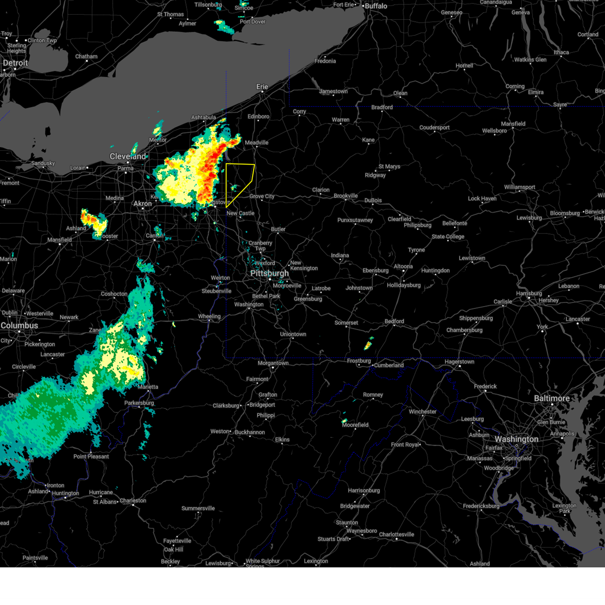 Svrpbz the national weather service in pittsburgh has issued a * severe thunderstorm warning for, northwestern mercer county in northwestern pennsylvania, northwestern lawrence county in western pennsylvania, * until 1215 pm edt. * at 1123 am edt, severe thunderstorms were located along a line extending from 7 miles southwest of andover to hilltop, moving northeast at 35 mph (radar indicated). Hazards include 60 mph wind gusts and small hail. expect damage to trees and power lines, resulting in some power outages Svrpbz the national weather service in pittsburgh has issued a * severe thunderstorm warning for, northwestern mercer county in northwestern pennsylvania, northwestern lawrence county in western pennsylvania, * until 1215 pm edt. * at 1123 am edt, severe thunderstorms were located along a line extending from 7 miles southwest of andover to hilltop, moving northeast at 35 mph (radar indicated). Hazards include 60 mph wind gusts and small hail. expect damage to trees and power lines, resulting in some power outages
|
| 4/14/2024 5:54 PM EDT |
 At 554 pm edt, severe thunderstorms were located along a line extending from near brockway to 13 miles southwest of knox to near new wilmington, moving east at 45 mph (radar indicated). Hazards include 65 mph wind gusts and half dollar size hail. Minor hail damage to vehicles is possible. expect wind damage to trees and power lines, resulting in some power outages. Locations impacted include, new castle, hermitage, sharon, grove city, clarion, sharpsville, brookville, knox, rimersburg, farrell, slippery rock, reynoldsville, new wilmington, oakwood, brockway, new bethlehem, new castle northwest, mercer, pulaski, and sykesville. At 554 pm edt, severe thunderstorms were located along a line extending from near brockway to 13 miles southwest of knox to near new wilmington, moving east at 45 mph (radar indicated). Hazards include 65 mph wind gusts and half dollar size hail. Minor hail damage to vehicles is possible. expect wind damage to trees and power lines, resulting in some power outages. Locations impacted include, new castle, hermitage, sharon, grove city, clarion, sharpsville, brookville, knox, rimersburg, farrell, slippery rock, reynoldsville, new wilmington, oakwood, brockway, new bethlehem, new castle northwest, mercer, pulaski, and sykesville.
|
| 4/14/2024 5:39 PM EDT |
 Svrpbz the national weather service in pittsburgh has issued a * severe thunderstorm warning for, southern mercer county in northwestern pennsylvania, southern venango county in northwestern pennsylvania, northern lawrence county in western pennsylvania, northern butler county in west central pennsylvania, jefferson county in west central pennsylvania, northern armstrong county in west central pennsylvania, clarion county in west central pennsylvania, south central forest county in northwestern pennsylvania, * until 630 pm edt. * at 539 pm edt, severe thunderstorms were located along a line extending from 8 miles west of portland mills to 12 miles south of franklin to hermitage, moving east at 65 mph (radar indicated). Hazards include 60 mph wind gusts and half dollar size hail. Minor hail damage to vehicles is possible. Expect wind damage to trees and power lines, resulting in some power outages. Svrpbz the national weather service in pittsburgh has issued a * severe thunderstorm warning for, southern mercer county in northwestern pennsylvania, southern venango county in northwestern pennsylvania, northern lawrence county in western pennsylvania, northern butler county in west central pennsylvania, jefferson county in west central pennsylvania, northern armstrong county in west central pennsylvania, clarion county in west central pennsylvania, south central forest county in northwestern pennsylvania, * until 630 pm edt. * at 539 pm edt, severe thunderstorms were located along a line extending from 8 miles west of portland mills to 12 miles south of franklin to hermitage, moving east at 65 mph (radar indicated). Hazards include 60 mph wind gusts and half dollar size hail. Minor hail damage to vehicles is possible. Expect wind damage to trees and power lines, resulting in some power outages.
|
| 4/14/2024 5:31 PM EDT |
 At 530 pm edt, severe thunderstorms were located along a line extending from near marienville to hermitage, moving southeast at 35 mph (radar indicated). Hazards include 60 mph wind gusts and half dollar size hail. Minor hail damage to vehicles is possible. expect wind damage to trees and power lines, resulting in some power outages. Locations impacted include, hermitage, sharon, oil city, grove city, franklin, clarion, sharpsville, knox, greenville, sugarcreek, farrell, tionesta, mercer, hasson heights, stoneboro, seneca, west middlesex, polk, sandy lake, and clark. At 530 pm edt, severe thunderstorms were located along a line extending from near marienville to hermitage, moving southeast at 35 mph (radar indicated). Hazards include 60 mph wind gusts and half dollar size hail. Minor hail damage to vehicles is possible. expect wind damage to trees and power lines, resulting in some power outages. Locations impacted include, hermitage, sharon, oil city, grove city, franklin, clarion, sharpsville, knox, greenville, sugarcreek, farrell, tionesta, mercer, hasson heights, stoneboro, seneca, west middlesex, polk, sandy lake, and clark.
|
| 4/14/2024 5:19 PM EDT |
 At 519 pm edt, severe thunderstorms were located along a line extending from near marienville to near hermitage, moving southeast at 55 mph (radar indicated). Hazards include 60 mph wind gusts and half dollar size hail. Minor hail damage to vehicles is possible. expect wind damage to trees and power lines, resulting in some power outages. Locations impacted include, hermitage, sharon, oil city, grove city, franklin, clarion, sharpsville, knox, greenville, sugarcreek, farrell, tionesta, mercer, hasson heights, stoneboro, seneca, west middlesex, polk, sandy lake, and clark. At 519 pm edt, severe thunderstorms were located along a line extending from near marienville to near hermitage, moving southeast at 55 mph (radar indicated). Hazards include 60 mph wind gusts and half dollar size hail. Minor hail damage to vehicles is possible. expect wind damage to trees and power lines, resulting in some power outages. Locations impacted include, hermitage, sharon, oil city, grove city, franklin, clarion, sharpsville, knox, greenville, sugarcreek, farrell, tionesta, mercer, hasson heights, stoneboro, seneca, west middlesex, polk, sandy lake, and clark.
|
| 4/14/2024 5:07 PM EDT |
 At 506 pm edt, severe thunderstorms were located along a line extending from 7 miles northeast of tionesta to near sharpsville, moving east at 60 mph (radar indicated). Hazards include 60 mph wind gusts and half dollar size hail. Minor hail damage to vehicles is possible. expect wind damage to trees and power lines, resulting in some power outages. Locations impacted include, hermitage, sharon, oil city, grove city, franklin, clarion, sharpsville, knox, greenville, sugarcreek, farrell, tionesta, mercer, hasson heights, stoneboro, seneca, west middlesex, polk, sandy lake, and clark. At 506 pm edt, severe thunderstorms were located along a line extending from 7 miles northeast of tionesta to near sharpsville, moving east at 60 mph (radar indicated). Hazards include 60 mph wind gusts and half dollar size hail. Minor hail damage to vehicles is possible. expect wind damage to trees and power lines, resulting in some power outages. Locations impacted include, hermitage, sharon, oil city, grove city, franklin, clarion, sharpsville, knox, greenville, sugarcreek, farrell, tionesta, mercer, hasson heights, stoneboro, seneca, west middlesex, polk, sandy lake, and clark.
|
| 4/14/2024 4:55 PM EDT |
 Svrpbz the national weather service in pittsburgh has issued a * severe thunderstorm warning for, mercer county in northwestern pennsylvania, venango county in northwestern pennsylvania, northwestern armstrong county in west central pennsylvania, northern clarion county in west central pennsylvania, western forest county in northwestern pennsylvania, * until 545 pm edt. * at 455 pm edt, severe thunderstorms were located along a line extending from 9 miles north of tionesta to 6 miles southeast of kinsman, moving southeast at 35 mph (radar indicated). Hazards include 60 mph wind gusts and quarter size hail. Minor hail damage to vehicles is possible. Expect wind damage to trees and power lines, resulting in some power outages. Svrpbz the national weather service in pittsburgh has issued a * severe thunderstorm warning for, mercer county in northwestern pennsylvania, venango county in northwestern pennsylvania, northwestern armstrong county in west central pennsylvania, northern clarion county in west central pennsylvania, western forest county in northwestern pennsylvania, * until 545 pm edt. * at 455 pm edt, severe thunderstorms were located along a line extending from 9 miles north of tionesta to 6 miles southeast of kinsman, moving southeast at 35 mph (radar indicated). Hazards include 60 mph wind gusts and quarter size hail. Minor hail damage to vehicles is possible. Expect wind damage to trees and power lines, resulting in some power outages.
|
| 8/25/2023 1:28 AM EDT |
 The severe thunderstorm warning for mercer, northwestern venango, northern lawrence and west central butler counties will expire at 130 am edt, the storms which prompted the warning have moved out of the area. therefore, the warning will be allowed to expire. however, gusty winds are still possible with these thunderstorms. a severe thunderstorm watch remains in effect until 300 am edt for western and northwestern pennsylvania. The severe thunderstorm warning for mercer, northwestern venango, northern lawrence and west central butler counties will expire at 130 am edt, the storms which prompted the warning have moved out of the area. therefore, the warning will be allowed to expire. however, gusty winds are still possible with these thunderstorms. a severe thunderstorm watch remains in effect until 300 am edt for western and northwestern pennsylvania.
|
| 8/25/2023 1:00 AM EDT |
 At 1259 am edt, severe thunderstorms were located along a line extending from 8 miles southeast of atlantic to near hermitage to near campbell, moving east at 55 mph (radar indicated). Hazards include 60 mph wind gusts. Expect damage to trees and power lines, resulting in some power outages. locations impacted include, new castle, hermitage, sharon, grove city, franklin, sharpsville, greenville, sugarcreek, farrell, new wilmington, oakwood, new castle northwest, mercer, pulaski, bessemer, stoneboro, new bedford, west middlesex, polk, and plain grove township. hail threat, radar indicated max hail size, <. 75 in wind threat, radar indicated max wind gust, 60 mph. At 1259 am edt, severe thunderstorms were located along a line extending from 8 miles southeast of atlantic to near hermitage to near campbell, moving east at 55 mph (radar indicated). Hazards include 60 mph wind gusts. Expect damage to trees and power lines, resulting in some power outages. locations impacted include, new castle, hermitage, sharon, grove city, franklin, sharpsville, greenville, sugarcreek, farrell, new wilmington, oakwood, new castle northwest, mercer, pulaski, bessemer, stoneboro, new bedford, west middlesex, polk, and plain grove township. hail threat, radar indicated max hail size, <. 75 in wind threat, radar indicated max wind gust, 60 mph.
|
| 8/25/2023 12:45 AM EDT |
 At 1243 am edt, severe thunderstorms were located along a line extending from near kinsman to warren to 6 miles north of sebring, moving east at 55 mph (radar indicated). Hazards include 60 mph wind gusts. expect damage to trees and power lines, resulting in some power outages At 1243 am edt, severe thunderstorms were located along a line extending from near kinsman to warren to 6 miles north of sebring, moving east at 55 mph (radar indicated). Hazards include 60 mph wind gusts. expect damage to trees and power lines, resulting in some power outages
|
| 8/17/2023 9:43 PM EDT | Mping report of wind damage along birchwood driv in mercer county PA, 0.9 miles S of Clark, PA |
| 8/12/2023 5:35 PM EDT |
 The severe thunderstorm warning for mercer county will expire at 545 pm edt, the storm which prompted the warning has weakened below severe limits, and no longer poses an immediate threat to life or property. therefore, the warning will be allowed to expire. however, gusty winds and heavy rain are still possible with this thunderstorm. a tornado watch remains in effect until 900 pm edt for northwestern pennsylvania. The severe thunderstorm warning for mercer county will expire at 545 pm edt, the storm which prompted the warning has weakened below severe limits, and no longer poses an immediate threat to life or property. therefore, the warning will be allowed to expire. however, gusty winds and heavy rain are still possible with this thunderstorm. a tornado watch remains in effect until 900 pm edt for northwestern pennsylvania.
|
| 8/12/2023 5:16 PM EDT |
 At 516 pm edt, a severe thunderstorm was located near greenville, or near sharpsville, moving east at 45 mph (radar indicated). Hazards include 60 mph wind gusts and quarter size hail. Minor hail damage to vehicles is possible. expect wind damage to trees and power lines, resulting in some power outages. Locations impacted include, hermitage, sharon, sharpsville, greenville, mercer, stoneboro, sandy lake, clark, fredonia, jackson center, new lebanon, sheakleyville, and maurice k goddard state park. At 516 pm edt, a severe thunderstorm was located near greenville, or near sharpsville, moving east at 45 mph (radar indicated). Hazards include 60 mph wind gusts and quarter size hail. Minor hail damage to vehicles is possible. expect wind damage to trees and power lines, resulting in some power outages. Locations impacted include, hermitage, sharon, sharpsville, greenville, mercer, stoneboro, sandy lake, clark, fredonia, jackson center, new lebanon, sheakleyville, and maurice k goddard state park.
|
| 8/12/2023 5:07 PM EDT |
 At 507 pm edt, a severe thunderstorm was located near kinsman, or 8 miles northwest of sharpsville, moving east at 40 mph (radar indicated). Hazards include 60 mph wind gusts and quarter size hail. Minor hail damage to vehicles is possible. Expect wind damage to trees and power lines, resulting in some power outages. At 507 pm edt, a severe thunderstorm was located near kinsman, or 8 miles northwest of sharpsville, moving east at 40 mph (radar indicated). Hazards include 60 mph wind gusts and quarter size hail. Minor hail damage to vehicles is possible. Expect wind damage to trees and power lines, resulting in some power outages.
|
| 7/26/2023 8:40 PM EDT |
 The severe thunderstorm warning for northern mercer county will expire at 845 pm edt, the storm which prompted the warning has weakened below severe limits, and no longer poses an immediate threat to life or property. therefore, the warning will be allowed to expire. however small hail, gusty winds and heavy rain are still possible with this thunderstorm. The severe thunderstorm warning for northern mercer county will expire at 845 pm edt, the storm which prompted the warning has weakened below severe limits, and no longer poses an immediate threat to life or property. therefore, the warning will be allowed to expire. however small hail, gusty winds and heavy rain are still possible with this thunderstorm.
|
| 7/26/2023 8:34 PM EDT |
 At 834 pm edt, a severe thunderstorm was located 8 miles southeast of greenville, or 12 miles northeast of hermitage, moving east at 35 mph (radar indicated). Hazards include 60 mph wind gusts and quarter size hail. Minor hail damage to vehicles is possible. expect wind damage to trees and power lines, resulting in some power outages. locations impacted include, greenville, stoneboro, sandy lake, clark, fredonia, jackson center, new lebanon, sheakleyville, and maurice k goddard state park. hail threat, radar indicated max hail size, 1. 00 in wind threat, radar indicated max wind gust, 60 mph. At 834 pm edt, a severe thunderstorm was located 8 miles southeast of greenville, or 12 miles northeast of hermitage, moving east at 35 mph (radar indicated). Hazards include 60 mph wind gusts and quarter size hail. Minor hail damage to vehicles is possible. expect wind damage to trees and power lines, resulting in some power outages. locations impacted include, greenville, stoneboro, sandy lake, clark, fredonia, jackson center, new lebanon, sheakleyville, and maurice k goddard state park. hail threat, radar indicated max hail size, 1. 00 in wind threat, radar indicated max wind gust, 60 mph.
|
| 7/26/2023 8:30 PM EDT |
 At 830 pm edt, a severe thunderstorm was located near hermitage, moving east at 35 mph (radar indicated). Hazards include 60 mph wind gusts and quarter size hail. Minor hail damage to vehicles is possible. expect wind damage to trees and power lines, resulting in some power outages. locations impacted include, hermitage, sharon, sharpsville, farrell, mercer, west middlesex, clark, wheatland, and jackson center. hail threat, radar indicated max hail size, 1. 00 in wind threat, radar indicated max wind gust, 60 mph. At 830 pm edt, a severe thunderstorm was located near hermitage, moving east at 35 mph (radar indicated). Hazards include 60 mph wind gusts and quarter size hail. Minor hail damage to vehicles is possible. expect wind damage to trees and power lines, resulting in some power outages. locations impacted include, hermitage, sharon, sharpsville, farrell, mercer, west middlesex, clark, wheatland, and jackson center. hail threat, radar indicated max hail size, 1. 00 in wind threat, radar indicated max wind gust, 60 mph.
|
| 7/26/2023 8:20 PM EDT |
 At 819 pm edt, a severe thunderstorm was located near sharpsville, moving northeast at 40 mph (radar indicated). Hazards include 60 mph wind gusts and quarter size hail. Minor hail damage to vehicles is possible. expect wind damage to trees and power lines, resulting in some power outages. locations impacted include, hermitage, sharpsville, greenville, stoneboro, sandy lake, clark, fredonia, jackson center, new lebanon, sheakleyville, and maurice k goddard state park. hail threat, radar indicated max hail size, 1. 00 in wind threat, radar indicated max wind gust, 60 mph. At 819 pm edt, a severe thunderstorm was located near sharpsville, moving northeast at 40 mph (radar indicated). Hazards include 60 mph wind gusts and quarter size hail. Minor hail damage to vehicles is possible. expect wind damage to trees and power lines, resulting in some power outages. locations impacted include, hermitage, sharpsville, greenville, stoneboro, sandy lake, clark, fredonia, jackson center, new lebanon, sheakleyville, and maurice k goddard state park. hail threat, radar indicated max hail size, 1. 00 in wind threat, radar indicated max wind gust, 60 mph.
|
| 7/26/2023 8:15 PM EDT |
 At 814 pm edt, a severe thunderstorm was located over sharpsville, moving east at 40 mph (radar indicated). Hazards include 60 mph wind gusts and quarter size hail. Minor hail damage to vehicles is possible. Expect wind damage to trees and power lines, resulting in some power outages. At 814 pm edt, a severe thunderstorm was located over sharpsville, moving east at 40 mph (radar indicated). Hazards include 60 mph wind gusts and quarter size hail. Minor hail damage to vehicles is possible. Expect wind damage to trees and power lines, resulting in some power outages.
|
| 7/26/2023 8:04 PM EDT |
 At 804 pm edt, a severe thunderstorm was located near greenville, or 13 miles north of sharpsville, moving northeast at 35 mph (radar indicated). Hazards include 60 mph wind gusts and quarter size hail. Minor hail damage to vehicles is possible. expect wind damage to trees and power lines, resulting in some power outages. locations impacted include, hermitage, sharpsville, greenville, stoneboro, sandy lake, clark, jamestown, fredonia, jackson center, new lebanon, sheakleyville, and maurice k goddard state park. hail threat, radar indicated max hail size, 1. 00 in wind threat, radar indicated max wind gust, 60 mph. At 804 pm edt, a severe thunderstorm was located near greenville, or 13 miles north of sharpsville, moving northeast at 35 mph (radar indicated). Hazards include 60 mph wind gusts and quarter size hail. Minor hail damage to vehicles is possible. expect wind damage to trees and power lines, resulting in some power outages. locations impacted include, hermitage, sharpsville, greenville, stoneboro, sandy lake, clark, jamestown, fredonia, jackson center, new lebanon, sheakleyville, and maurice k goddard state park. hail threat, radar indicated max hail size, 1. 00 in wind threat, radar indicated max wind gust, 60 mph.
|
| 7/26/2023 7:58 PM EDT |
 At 758 pm edt, a severe thunderstorm was located near greenville, or 10 miles north of sharpsville, moving northeast at 35 mph (radar indicated). Hazards include 60 mph wind gusts and quarter size hail. Minor hail damage to vehicles is possible. Expect wind damage to trees and power lines, resulting in some power outages. At 758 pm edt, a severe thunderstorm was located near greenville, or 10 miles north of sharpsville, moving northeast at 35 mph (radar indicated). Hazards include 60 mph wind gusts and quarter size hail. Minor hail damage to vehicles is possible. Expect wind damage to trees and power lines, resulting in some power outages.
|
| 7/20/2023 8:27 PM EDT |
 The severe thunderstorm warning for mercer, venango, lawrence, northern butler, northern jefferson, northwestern armstrong, clarion and forest counties will expire at 830 pm edt, the storms which prompted the warning have moved out of portions of the area. therefore, the warning will be allowed to expire. a new warning covers the new threat. a severe thunderstorm watch remains in effect until 300 am edt for east central ohio, and western, northwestern and west central pennsylvania. The severe thunderstorm warning for mercer, venango, lawrence, northern butler, northern jefferson, northwestern armstrong, clarion and forest counties will expire at 830 pm edt, the storms which prompted the warning have moved out of portions of the area. therefore, the warning will be allowed to expire. a new warning covers the new threat. a severe thunderstorm watch remains in effect until 300 am edt for east central ohio, and western, northwestern and west central pennsylvania.
|
| 7/20/2023 8:02 PM EDT |
 At 801 pm edt, severe thunderstorms were located along a line extending from near james city to 8 miles north of knox to near new wilmington, moving east at 60 mph (law enforcement reported trees down in mercer county). Hazards include 70 mph wind gusts and quarter size hail. Minor hail damage to vehicles is possible. trees snapped and uprooted. power outages can be expected. locations impacted include, new castle, hermitage, sharon, butler, oil city, grove city, franklin, clarion, sharpsville, brookville, marienville, knox, rimersburg, ellwood city, homeacre-lyndora, greenville, sugarcreek, farrell, shanor-northvue, and meridian. thunderstorm damage threat, considerable hail threat, radar indicated max hail size, 1. 00 in wind threat, radar indicated max wind gust, 70 mph. At 801 pm edt, severe thunderstorms were located along a line extending from near james city to 8 miles north of knox to near new wilmington, moving east at 60 mph (law enforcement reported trees down in mercer county). Hazards include 70 mph wind gusts and quarter size hail. Minor hail damage to vehicles is possible. trees snapped and uprooted. power outages can be expected. locations impacted include, new castle, hermitage, sharon, butler, oil city, grove city, franklin, clarion, sharpsville, brookville, marienville, knox, rimersburg, ellwood city, homeacre-lyndora, greenville, sugarcreek, farrell, shanor-northvue, and meridian. thunderstorm damage threat, considerable hail threat, radar indicated max hail size, 1. 00 in wind threat, radar indicated max wind gust, 70 mph.
|
| 7/20/2023 7:56 PM EDT |
 At 755 pm edt, severe thunderstorms were located along a line extending from near sheffield to 6 miles southeast of oil city to near farrell, moving east at 60 mph (radar indicated). Hazards include 70 mph wind gusts and quarter size hail. Minor hail damage to vehicles is possible. trees snapped and uprooted. power outages can be expected. locations impacted include, new castle, hermitage, sharon, butler, oil city, grove city, franklin, clarion, sharpsville, brookville, marienville, knox, rimersburg, ellwood city, homeacre-lyndora, greenville, sugarcreek, farrell, shanor-northvue, and meridian. thunderstorm damage threat, considerable hail threat, radar indicated max hail size, 1. 00 in wind threat, radar indicated max wind gust, 70 mph. At 755 pm edt, severe thunderstorms were located along a line extending from near sheffield to 6 miles southeast of oil city to near farrell, moving east at 60 mph (radar indicated). Hazards include 70 mph wind gusts and quarter size hail. Minor hail damage to vehicles is possible. trees snapped and uprooted. power outages can be expected. locations impacted include, new castle, hermitage, sharon, butler, oil city, grove city, franklin, clarion, sharpsville, brookville, marienville, knox, rimersburg, ellwood city, homeacre-lyndora, greenville, sugarcreek, farrell, shanor-northvue, and meridian. thunderstorm damage threat, considerable hail threat, radar indicated max hail size, 1. 00 in wind threat, radar indicated max wind gust, 70 mph.
|
| 7/20/2023 7:42 PM EDT |
 The severe thunderstorm warning for mercer, venango, lawrence, northwestern butler and western forest counties will expire at 745 pm edt, the warning will be allowed to expire, however a new warning is in effect. gusty winds and large hail are still possible with these thunderstorms. a severe thunderstorm watch remains in effect until 300 am edt for east central ohio, and western, northwestern and west central pennsylvania. remember, a severe thunderstorm warning still remains in effect for northwest pennsylvania. The severe thunderstorm warning for mercer, venango, lawrence, northwestern butler and western forest counties will expire at 745 pm edt, the warning will be allowed to expire, however a new warning is in effect. gusty winds and large hail are still possible with these thunderstorms. a severe thunderstorm watch remains in effect until 300 am edt for east central ohio, and western, northwestern and west central pennsylvania. remember, a severe thunderstorm warning still remains in effect for northwest pennsylvania.
|
| 7/20/2023 7:40 PM EDT |
 At 740 pm edt, severe thunderstorms were located along a line extending from near chapman state park to sugarcreek to vienna center, moving east at 60 mph (radar indicated). Hazards include 60 mph wind gusts and quarter size hail. Minor hail damage to vehicles is possible. Expect wind damage to trees and power lines, resulting in some power outages. At 740 pm edt, severe thunderstorms were located along a line extending from near chapman state park to sugarcreek to vienna center, moving east at 60 mph (radar indicated). Hazards include 60 mph wind gusts and quarter size hail. Minor hail damage to vehicles is possible. Expect wind damage to trees and power lines, resulting in some power outages.
|
| 7/20/2023 7:27 PM EDT |
 At 726 pm edt, severe thunderstorms were located along a line extending from near riceville to 10 miles south of guys mills to near canfield, moving east at 45 mph (radar indicated). Hazards include 60 mph wind gusts and half dollar size hail. Minor hail damage to vehicles is possible. expect wind damage to trees and power lines, resulting in some power outages. locations impacted include, new castle, hermitage, sharon, oil city, grove city, franklin, sharpsville, greenville, sugarcreek, farrell, slippery rock, new wilmington, oakwood, new castle northwest, tionesta, mercer, new beaver, pulaski, hasson heights, and bessemer. hail threat, radar indicated max hail size, 1. 25 in wind threat, radar indicated max wind gust, 60 mph. At 726 pm edt, severe thunderstorms were located along a line extending from near riceville to 10 miles south of guys mills to near canfield, moving east at 45 mph (radar indicated). Hazards include 60 mph wind gusts and half dollar size hail. Minor hail damage to vehicles is possible. expect wind damage to trees and power lines, resulting in some power outages. locations impacted include, new castle, hermitage, sharon, oil city, grove city, franklin, sharpsville, greenville, sugarcreek, farrell, slippery rock, new wilmington, oakwood, new castle northwest, tionesta, mercer, new beaver, pulaski, hasson heights, and bessemer. hail threat, radar indicated max hail size, 1. 25 in wind threat, radar indicated max wind gust, 60 mph.
|
| 7/20/2023 7:25 PM EDT |
 At 725 pm edt, severe thunderstorms were located along a line extending from near riceville to 10 miles south of guys mills to near canfield, moving southeast at 45 mph (radar indicated). Hazards include 60 mph wind gusts and penny size hail. Expect damage to trees and power lines, resulting in some power outages. locations impacted include, new castle, hermitage, sharon, oil city, grove city, franklin, sharpsville, greenville, sugarcreek, farrell, slippery rock, new wilmington, oakwood, new castle northwest, tionesta, mercer, new beaver, pulaski, hasson heights, and bessemer. hail threat, radar indicated max hail size, 0. 75 in wind threat, radar indicated max wind gust, 60 mph. At 725 pm edt, severe thunderstorms were located along a line extending from near riceville to 10 miles south of guys mills to near canfield, moving southeast at 45 mph (radar indicated). Hazards include 60 mph wind gusts and penny size hail. Expect damage to trees and power lines, resulting in some power outages. locations impacted include, new castle, hermitage, sharon, oil city, grove city, franklin, sharpsville, greenville, sugarcreek, farrell, slippery rock, new wilmington, oakwood, new castle northwest, tionesta, mercer, new beaver, pulaski, hasson heights, and bessemer. hail threat, radar indicated max hail size, 0. 75 in wind threat, radar indicated max wind gust, 60 mph.
|
| 7/20/2023 7:04 PM EDT |
 At 704 pm edt, severe thunderstorms were located along a line extending from near waterford to near harmonsburg to near garrettsville, moving southeast at 45 mph (radar indicated). Hazards include 60 mph wind gusts and quarter size hail. Minor hail damage to vehicles is possible. expect wind damage to trees and power lines, resulting in some power outages. locations impacted include, new castle, hermitage, sharon, oil city, grove city, franklin, sharpsville, greenville, sugarcreek, farrell, slippery rock, new wilmington, oakwood, new castle northwest, tionesta, mercer, new beaver, pulaski, hasson heights, and bessemer. hail threat, radar indicated max hail size, 1. 00 in wind threat, radar indicated max wind gust, 60 mph. At 704 pm edt, severe thunderstorms were located along a line extending from near waterford to near harmonsburg to near garrettsville, moving southeast at 45 mph (radar indicated). Hazards include 60 mph wind gusts and quarter size hail. Minor hail damage to vehicles is possible. expect wind damage to trees and power lines, resulting in some power outages. locations impacted include, new castle, hermitage, sharon, oil city, grove city, franklin, sharpsville, greenville, sugarcreek, farrell, slippery rock, new wilmington, oakwood, new castle northwest, tionesta, mercer, new beaver, pulaski, hasson heights, and bessemer. hail threat, radar indicated max hail size, 1. 00 in wind threat, radar indicated max wind gust, 60 mph.
|
| 7/20/2023 6:51 PM EDT |
 At 650 pm edt, severe thunderstorms were located along a line extending from near erie to 7 miles north of harmonsburg to near garrettsville, moving southeast at 45 mph (radar indicated). Hazards include 60 mph wind gusts and penny size hail. expect damage to trees and power lines, resulting in some power outages At 650 pm edt, severe thunderstorms were located along a line extending from near erie to 7 miles north of harmonsburg to near garrettsville, moving southeast at 45 mph (radar indicated). Hazards include 60 mph wind gusts and penny size hail. expect damage to trees and power lines, resulting in some power outages
|
| 4/1/2023 1:42 PM EDT |
 The severe thunderstorm warning for mercer, beaver, lawrence and brooke counties will expire at 145 pm edt, the storms which prompted the warning have moved out of the area. therefore, the warning will be allowed to expire. however very strong winds will continue this afternoon. to report severe weather, contact your nearest law enforcement agency. they will relay your report to the national weather service pittsburgh. The severe thunderstorm warning for mercer, beaver, lawrence and brooke counties will expire at 145 pm edt, the storms which prompted the warning have moved out of the area. therefore, the warning will be allowed to expire. however very strong winds will continue this afternoon. to report severe weather, contact your nearest law enforcement agency. they will relay your report to the national weather service pittsburgh.
|
| 4/1/2023 1:31 PM EDT |
 At 131 pm edt, severe thunderstorms were located along a line extending from andover to near new cumberland, moving northeast at 65 mph (radar indicated). Hazards include 60 mph wind gusts. Expect damage to trees and power lines, resulting in some power outages. locations impacted include, new castle, weirton, steubenville, hermitage, sharon, aliquippa, beaver falls, monaca, sharpsville, economy, ellwood city, and ambridge. hail threat, radar indicated max hail size, <. 75 in wind threat, radar indicated max wind gust, 60 mph. At 131 pm edt, severe thunderstorms were located along a line extending from andover to near new cumberland, moving northeast at 65 mph (radar indicated). Hazards include 60 mph wind gusts. Expect damage to trees and power lines, resulting in some power outages. locations impacted include, new castle, weirton, steubenville, hermitage, sharon, aliquippa, beaver falls, monaca, sharpsville, economy, ellwood city, and ambridge. hail threat, radar indicated max hail size, <. 75 in wind threat, radar indicated max wind gust, 60 mph.
|
| 4/1/2023 1:20 PM EDT |
 At 119 pm edt, severe thunderstorms were located along a line extending from near orwell to near wintersville, moving northeast at 65 mph (radar indicated). Hazards include 60 mph wind gusts. Expect damage to trees and power lines, resulting in some power outages. locations impacted include, cranberry, new castle, weirton, steubenville, hermitage, sharon, salem, east liverpool, aliquippa, beaver falls, columbiana, and monaca. hail threat, radar indicated max hail size, <. 75 in wind threat, radar indicated max wind gust, 60 mph. At 119 pm edt, severe thunderstorms were located along a line extending from near orwell to near wintersville, moving northeast at 65 mph (radar indicated). Hazards include 60 mph wind gusts. Expect damage to trees and power lines, resulting in some power outages. locations impacted include, cranberry, new castle, weirton, steubenville, hermitage, sharon, salem, east liverpool, aliquippa, beaver falls, columbiana, and monaca. hail threat, radar indicated max hail size, <. 75 in wind threat, radar indicated max wind gust, 60 mph.
|
| 4/1/2023 12:57 PM EDT |
 At 1256 pm edt, severe thunderstorms were located along a line extending from 6 miles south of burton to 6 miles west of cadiz, moving northeast at 65 mph (radar indicated). Hazards include 60 mph wind gusts. expect damage to trees and power lines, resulting in some power outages At 1256 pm edt, severe thunderstorms were located along a line extending from 6 miles south of burton to 6 miles west of cadiz, moving northeast at 65 mph (radar indicated). Hazards include 60 mph wind gusts. expect damage to trees and power lines, resulting in some power outages
|
| 3/25/2023 3:17 PM EDT |
 At 316 pm edt, a severe thunderstorm was located near meadville, moving northeast at 65 mph (911 call center). Hazards include 60 mph wind gusts. Expect damage to trees and power lines, resulting in some power outages. locations impacted include, grove city, franklin, greenville, sugarcreek, slippery rock, mercer, stoneboro, polk, plain grove township, sandy lake, clark, and fredonia. hail threat, radar indicated max hail size, 0. 75 in wind threat, radar indicated max wind gust, 60 mph. At 316 pm edt, a severe thunderstorm was located near meadville, moving northeast at 65 mph (911 call center). Hazards include 60 mph wind gusts. Expect damage to trees and power lines, resulting in some power outages. locations impacted include, grove city, franklin, greenville, sugarcreek, slippery rock, mercer, stoneboro, polk, plain grove township, sandy lake, clark, and fredonia. hail threat, radar indicated max hail size, 0. 75 in wind threat, radar indicated max wind gust, 60 mph.
|
| 3/25/2023 3:10 PM EDT |
 At 310 pm edt, a severe thunderstorm was located near atlantic, or 11 miles south of meadville, moving northeast at 65 mph (911 call center). Hazards include 60 mph wind gusts and penny size hail. expect damage to trees and power lines, resulting in some power outages At 310 pm edt, a severe thunderstorm was located near atlantic, or 11 miles south of meadville, moving northeast at 65 mph (911 call center). Hazards include 60 mph wind gusts and penny size hail. expect damage to trees and power lines, resulting in some power outages
|
| 9/22/2022 1:36 AM EDT |
 The severe thunderstorm warning for mercer, southwestern venango, northern lawrence and northwestern butler counties will expire at 145 am edt, the storm which prompted the warning has weakened below severe limits, and no longer poses an immediate threat to life or property. therefore, the warning will be allowed to expire. however small hail, gusty winds and heavy rain are still possible with this thunderstorm. The severe thunderstorm warning for mercer, southwestern venango, northern lawrence and northwestern butler counties will expire at 145 am edt, the storm which prompted the warning has weakened below severe limits, and no longer poses an immediate threat to life or property. therefore, the warning will be allowed to expire. however small hail, gusty winds and heavy rain are still possible with this thunderstorm.
|
| 9/22/2022 1:26 AM EDT |
 At 126 am edt, a severe thunderstorm was located 9 miles north of grove city, moving east at 50 mph (radar indicated). Hazards include 60 mph wind gusts and nickel size hail. Expect damage to trees and power lines, resulting in some power outages. locations impacted include, hermitage, grove city, franklin, greenville, slippery rock, new wilmington, mercer, pulaski, stoneboro, new bedford, harrisville, and west middlesex. hail threat, radar indicated max hail size, 0. 88 in wind threat, radar indicated max wind gust, 60 mph. At 126 am edt, a severe thunderstorm was located 9 miles north of grove city, moving east at 50 mph (radar indicated). Hazards include 60 mph wind gusts and nickel size hail. Expect damage to trees and power lines, resulting in some power outages. locations impacted include, hermitage, grove city, franklin, greenville, slippery rock, new wilmington, mercer, pulaski, stoneboro, new bedford, harrisville, and west middlesex. hail threat, radar indicated max hail size, 0. 88 in wind threat, radar indicated max wind gust, 60 mph.
|
| 9/22/2022 1:10 AM EDT |
 At 110 am edt, a severe thunderstorm was located near hermitage, moving east at 50 mph (radar indicated). Hazards include 60 mph wind gusts and nickel size hail. Expect damage to trees and power lines, resulting in some power outages. locations impacted include, hermitage, sharon, grove city, franklin, sharpsville, greenville, farrell, slippery rock, new wilmington, mercer, pulaski, and stoneboro. hail threat, radar indicated max hail size, 0. 88 in wind threat, radar indicated max wind gust, 60 mph. At 110 am edt, a severe thunderstorm was located near hermitage, moving east at 50 mph (radar indicated). Hazards include 60 mph wind gusts and nickel size hail. Expect damage to trees and power lines, resulting in some power outages. locations impacted include, hermitage, sharon, grove city, franklin, sharpsville, greenville, farrell, slippery rock, new wilmington, mercer, pulaski, and stoneboro. hail threat, radar indicated max hail size, 0. 88 in wind threat, radar indicated max wind gust, 60 mph.
|
| 9/22/2022 12:58 AM EDT |
 At 1258 am edt, a severe thunderstorm was located near sharon, moving east at 50 mph (radar indicated). Hazards include 60 mph wind gusts and nickel size hail. expect damage to trees and power lines, resulting in some power outages At 1258 am edt, a severe thunderstorm was located near sharon, moving east at 50 mph (radar indicated). Hazards include 60 mph wind gusts and nickel size hail. expect damage to trees and power lines, resulting in some power outages
|
| 7/25/2022 2:40 AM EDT |
 The severe thunderstorm warning for central mercer and western venango counties will expire at 245 am edt, the storm which prompted the warning has moved out of the area. therefore, the warning will be allowed to expire. however gusty winds and heavy rain are still possible with this thunderstorm. a tornado watch remains in effect until 700 am edt for northwestern pennsylvania. The severe thunderstorm warning for central mercer and western venango counties will expire at 245 am edt, the storm which prompted the warning has moved out of the area. therefore, the warning will be allowed to expire. however gusty winds and heavy rain are still possible with this thunderstorm. a tornado watch remains in effect until 700 am edt for northwestern pennsylvania.
|
| 7/25/2022 2:10 AM EDT |
 At 210 am edt, a severe thunderstorm was located 11 miles west of franklin, moving east at 30 mph (radar indicated). Hazards include 60 mph wind gusts. Expect damage to trees and power lines, resulting in some power outages. locations impacted include, hermitage, sharon, franklin, sharpsville, sugarcreek, farrell, mercer, stoneboro, west middlesex, polk, sandy lake, and clark. hail threat, radar indicated max hail size, <. 75 in wind threat, radar indicated max wind gust, 60 mph. At 210 am edt, a severe thunderstorm was located 11 miles west of franklin, moving east at 30 mph (radar indicated). Hazards include 60 mph wind gusts. Expect damage to trees and power lines, resulting in some power outages. locations impacted include, hermitage, sharon, franklin, sharpsville, sugarcreek, farrell, mercer, stoneboro, west middlesex, polk, sandy lake, and clark. hail threat, radar indicated max hail size, <. 75 in wind threat, radar indicated max wind gust, 60 mph.
|
| 7/25/2022 1:46 AM EDT |
 At 146 am edt, a severe thunderstorm was located near greenville, or 14 miles northeast of sharpsville, moving east at 30 mph (radar indicated). Hazards include 60 mph wind gusts. expect damage to trees and power lines, resulting in some power outages At 146 am edt, a severe thunderstorm was located near greenville, or 14 miles northeast of sharpsville, moving east at 30 mph (radar indicated). Hazards include 60 mph wind gusts. expect damage to trees and power lines, resulting in some power outages
|
| 7/25/2022 12:44 AM EDT |
 At 1244 am edt, a severe thunderstorm was located over kinsman, or 14 miles northwest of sharpsville, moving east at 25 mph (radar indicated). Hazards include 60 mph wind gusts. expect damage to trees and power lines, resulting in some power outages At 1244 am edt, a severe thunderstorm was located over kinsman, or 14 miles northwest of sharpsville, moving east at 25 mph (radar indicated). Hazards include 60 mph wind gusts. expect damage to trees and power lines, resulting in some power outages
|
| 6/16/2022 3:48 PM EDT | Golf Ball sized hail reported 0.9 miles S of Clark, PA |
| 6/16/2022 3:42 PM EDT | Hen Egg sized hail reported 1.7 miles SSW of Clark, PA, picture provided. |
| 6/16/2022 3:38 PM EDT |
 At 338 pm edt, a severe thunderstorm was located near kinsman, or 14 miles north of sharpsville, moving east at 40 mph (radar indicated). Hazards include tennis ball size hail and 60 mph wind gusts. People and animals outdoors will be injured. expect hail damage to roofs, siding, windows, and vehicles. expect wind damage to trees and power lines, resulting in some power outages. locations impacted include, hermitage, sharon, grove city, sharpsville, greenville, mercer, stoneboro, sandy lake, clark, jamestown, fredonia, and jackson center. thunderstorm damage threat, considerable hail threat, radar indicated max hail size, 2. 50 in wind threat, radar indicated max wind gust, 60 mph. At 338 pm edt, a severe thunderstorm was located near kinsman, or 14 miles north of sharpsville, moving east at 40 mph (radar indicated). Hazards include tennis ball size hail and 60 mph wind gusts. People and animals outdoors will be injured. expect hail damage to roofs, siding, windows, and vehicles. expect wind damage to trees and power lines, resulting in some power outages. locations impacted include, hermitage, sharon, grove city, sharpsville, greenville, mercer, stoneboro, sandy lake, clark, jamestown, fredonia, and jackson center. thunderstorm damage threat, considerable hail threat, radar indicated max hail size, 2. 50 in wind threat, radar indicated max wind gust, 60 mph.
|
| 6/16/2022 3:30 PM EDT |
 At 329 pm edt, a severe thunderstorm was located over kinsman, or 15 miles north of sharpsville, moving east at 40 mph (radar indicated). Hazards include ping pong ball size hail and 60 mph wind gusts. People and animals outdoors will be injured. expect hail damage to roofs, siding, windows, and vehicles. expect wind damage to trees and power lines, resulting in some power outages. locations impacted include, hermitage, sharon, grove city, sharpsville, greenville, mercer, stoneboro, sandy lake, clark, jamestown, fredonia, and jackson center. hail threat, radar indicated max hail size, 1. 50 in wind threat, radar indicated max wind gust, 60 mph. At 329 pm edt, a severe thunderstorm was located over kinsman, or 15 miles north of sharpsville, moving east at 40 mph (radar indicated). Hazards include ping pong ball size hail and 60 mph wind gusts. People and animals outdoors will be injured. expect hail damage to roofs, siding, windows, and vehicles. expect wind damage to trees and power lines, resulting in some power outages. locations impacted include, hermitage, sharon, grove city, sharpsville, greenville, mercer, stoneboro, sandy lake, clark, jamestown, fredonia, and jackson center. hail threat, radar indicated max hail size, 1. 50 in wind threat, radar indicated max wind gust, 60 mph.
|
| 6/16/2022 3:18 PM EDT |
 At 318 pm edt, a severe thunderstorm was located near kinsman, or 17 miles north of warren, moving east at 40 mph (radar indicated). Hazards include 60 mph wind gusts and quarter size hail. Minor hail damage to vehicles is possible. Expect wind damage to trees and power lines, resulting in some power outages. At 318 pm edt, a severe thunderstorm was located near kinsman, or 17 miles north of warren, moving east at 40 mph (radar indicated). Hazards include 60 mph wind gusts and quarter size hail. Minor hail damage to vehicles is possible. Expect wind damage to trees and power lines, resulting in some power outages.
|
| 6/1/2022 6:55 PM EDT |
 The severe thunderstorm warning for mercer and west central venango counties will expire at 700 pm edt, the storm which prompted the warning has moved out of the area. therefore, the warning will be allowed to expire. however gusty winds are still possible with this thunderstorm. a severe thunderstorm watch remains in effect until 1000 pm edt for northwestern pennsylvania. to report severe weather, contact your nearest law enforcement agency. they will relay your report to the national weather service pittsburgh. remember, a severe thunderstorm warning still remains in effect for southern mercer county until 730 pm. The severe thunderstorm warning for mercer and west central venango counties will expire at 700 pm edt, the storm which prompted the warning has moved out of the area. therefore, the warning will be allowed to expire. however gusty winds are still possible with this thunderstorm. a severe thunderstorm watch remains in effect until 1000 pm edt for northwestern pennsylvania. to report severe weather, contact your nearest law enforcement agency. they will relay your report to the national weather service pittsburgh. remember, a severe thunderstorm warning still remains in effect for southern mercer county until 730 pm.
|
| 6/1/2022 6:11 PM EDT |
 At 611 pm edt, a severe thunderstorm was located over greenville, or 11 miles northeast of sharpsville, moving east at 25 mph (radar indicated). Hazards include 60 mph wind gusts and nickel size hail. expect damage to trees and power lines, resulting in some power outages At 611 pm edt, a severe thunderstorm was located over greenville, or 11 miles northeast of sharpsville, moving east at 25 mph (radar indicated). Hazards include 60 mph wind gusts and nickel size hail. expect damage to trees and power lines, resulting in some power outages
|
| 6/1/2022 5:53 PM EDT |
 At 553 pm edt, a severe thunderstorm was located 11 miles north of grove city, moving east at 45 mph (radar indicated). Hazards include 60 mph wind gusts. Expect damage to trees and power lines, resulting in some power outages. locations impacted include, hermitage, greenville, stoneboro, sandy lake, clark, jamestown, fredonia, sheakleyville, and maurice k goddard state park. hail threat, radar indicated max hail size, 0. 88 in wind threat, radar indicated max wind gust, 60 mph. At 553 pm edt, a severe thunderstorm was located 11 miles north of grove city, moving east at 45 mph (radar indicated). Hazards include 60 mph wind gusts. Expect damage to trees and power lines, resulting in some power outages. locations impacted include, hermitage, greenville, stoneboro, sandy lake, clark, jamestown, fredonia, sheakleyville, and maurice k goddard state park. hail threat, radar indicated max hail size, 0. 88 in wind threat, radar indicated max wind gust, 60 mph.
|
| 6/1/2022 5:35 PM EDT |
 At 534 pm edt, a severe thunderstorm was located near greenville, or 9 miles north of sharpsville, moving east at 45 mph (radar indicated). Hazards include 60 mph wind gusts and nickel size hail. expect damage to trees and power lines, resulting in some power outages At 534 pm edt, a severe thunderstorm was located near greenville, or 9 miles north of sharpsville, moving east at 45 mph (radar indicated). Hazards include 60 mph wind gusts and nickel size hail. expect damage to trees and power lines, resulting in some power outages
|
| 5/21/2022 7:54 PM EDT |
 At 754 pm edt, severe thunderstorms were located along a line extending from near greenville to near new wilmington, moving northeast at 50 mph (radar indicated). Hazards include 60 mph wind gusts and quarter size hail. Minor hail damage to vehicles is possible. Expect wind damage to trees and power lines, resulting in some power outages. At 754 pm edt, severe thunderstorms were located along a line extending from near greenville to near new wilmington, moving northeast at 50 mph (radar indicated). Hazards include 60 mph wind gusts and quarter size hail. Minor hail damage to vehicles is possible. Expect wind damage to trees and power lines, resulting in some power outages.
|
| 5/1/2022 7:58 PM EDT |
 At 757 pm edt, a severe thunderstorm was located near greenville, or 11 miles northeast of hermitage, moving northeast at 30 mph. this storm was part of a line of severe storms stretching across most of mercer county (radar indicated). Hazards include 60 mph wind gusts and quarter size hail. Minor hail damage to vehicles is possible. expect wind damage to trees and power lines, resulting in some power outages. locations impacted include, hermitage, mercer, stoneboro, sandy lake, clark, fredonia, jackson center, new lebanon, sheakleyville, and maurice k goddard state park. hail threat, radar indicated max hail size, 1. 00 in wind threat, radar indicated max wind gust, 60 mph. At 757 pm edt, a severe thunderstorm was located near greenville, or 11 miles northeast of hermitage, moving northeast at 30 mph. this storm was part of a line of severe storms stretching across most of mercer county (radar indicated). Hazards include 60 mph wind gusts and quarter size hail. Minor hail damage to vehicles is possible. expect wind damage to trees and power lines, resulting in some power outages. locations impacted include, hermitage, mercer, stoneboro, sandy lake, clark, fredonia, jackson center, new lebanon, sheakleyville, and maurice k goddard state park. hail threat, radar indicated max hail size, 1. 00 in wind threat, radar indicated max wind gust, 60 mph.
|
| 5/1/2022 7:49 PM EDT |
 At 748 pm edt, severe thunderstorms were located along a line extending from near atlantic to near hubbard, moving northeast at 40 mph (radar indicated). Hazards include 60 mph wind gusts and quarter size hail. Minor hail damage to vehicles is possible. Expect wind damage to trees and power lines, resulting in some power outages. At 748 pm edt, severe thunderstorms were located along a line extending from near atlantic to near hubbard, moving northeast at 40 mph (radar indicated). Hazards include 60 mph wind gusts and quarter size hail. Minor hail damage to vehicles is possible. Expect wind damage to trees and power lines, resulting in some power outages.
|
| 10/21/2021 6:42 PM EDT |
 At 641 pm edt, a severe thunderstorm capable of producing a tornado was located over hermitage, moving east at 40 mph (radar indicated rotation). Hazards include tornado. Flying debris will be dangerous to those caught without shelter. mobile homes will be damaged or destroyed. damage to roofs, windows, and vehicles will occur. tree damage is likely. this dangerous storm will be near, grove city around 700 pm edt. Other locations impacted by this tornadic thunderstorm include stoneboro, clark, sandy lake, fredonia, jackson center, mercer, west middlesex and maurice k goddard state park. At 641 pm edt, a severe thunderstorm capable of producing a tornado was located over hermitage, moving east at 40 mph (radar indicated rotation). Hazards include tornado. Flying debris will be dangerous to those caught without shelter. mobile homes will be damaged or destroyed. damage to roofs, windows, and vehicles will occur. tree damage is likely. this dangerous storm will be near, grove city around 700 pm edt. Other locations impacted by this tornadic thunderstorm include stoneboro, clark, sandy lake, fredonia, jackson center, mercer, west middlesex and maurice k goddard state park.
|
| 10/21/2021 2:18 PM EDT |
 At 218 pm edt, severe thunderstorms were located along a line extending from near greenville to near oakwood, moving northeast at 55 mph (radar indicated). Hazards include 60 mph wind gusts. Expect damage to trees and power lines, resulting in some power outages. locations impacted include, new castle, hermitage, sharon, grove city, franklin, sharpsville, greenville, sugarcreek, farrell, slippery rock, new wilmington, and oakwood. hail threat, radar indicated max hail size, <. 75 in wind threat, radar indicated max wind gust, 60 mph. At 218 pm edt, severe thunderstorms were located along a line extending from near greenville to near oakwood, moving northeast at 55 mph (radar indicated). Hazards include 60 mph wind gusts. Expect damage to trees and power lines, resulting in some power outages. locations impacted include, new castle, hermitage, sharon, grove city, franklin, sharpsville, greenville, sugarcreek, farrell, slippery rock, new wilmington, and oakwood. hail threat, radar indicated max hail size, <. 75 in wind threat, radar indicated max wind gust, 60 mph.
|
| 10/21/2021 2:03 PM EDT |
 At 203 pm edt, severe thunderstorms were located along a line extending from near vienna center to leetonia, moving northeast at 60 mph (radar indicated). Hazards include 60 mph wind gusts. expect damage to trees and power lines, resulting in some power outages At 203 pm edt, severe thunderstorms were located along a line extending from near vienna center to leetonia, moving northeast at 60 mph (radar indicated). Hazards include 60 mph wind gusts. expect damage to trees and power lines, resulting in some power outages
|
| 8/29/2021 3:39 PM EDT |
 The severe thunderstorm warning for central mercer county will expire at 345 pm edt, the storm which prompted the warning has weakened below severe limits, and no longer poses an immediate threat to life or property. therefore, the warning will be allowed to expire. however gusty winds and heavy rain are still possible with this thunderstorm. The severe thunderstorm warning for central mercer county will expire at 345 pm edt, the storm which prompted the warning has weakened below severe limits, and no longer poses an immediate threat to life or property. therefore, the warning will be allowed to expire. however gusty winds and heavy rain are still possible with this thunderstorm.
|
| 8/29/2021 3:30 PM EDT |
 At 330 pm edt, a severe thunderstorm was located 8 miles northeast of hermitage, moving east at 20 mph (law enforcement). Hazards include 60 mph wind gusts. Expect damage to trees and power lines, resulting in some power outages. locations impacted include, hermitage, sharon, sharpsville, mercer, stoneboro, clark, fredonia, jackson center, and maurice k goddard state park. hail threat, radar indicated max hail size, <. 75 in wind threat, observed max wind gust, 60 mph. At 330 pm edt, a severe thunderstorm was located 8 miles northeast of hermitage, moving east at 20 mph (law enforcement). Hazards include 60 mph wind gusts. Expect damage to trees and power lines, resulting in some power outages. locations impacted include, hermitage, sharon, sharpsville, mercer, stoneboro, clark, fredonia, jackson center, and maurice k goddard state park. hail threat, radar indicated max hail size, <. 75 in wind threat, observed max wind gust, 60 mph.
|
| 8/29/2021 3:17 PM EDT |
 At 316 pm edt, a severe thunderstorm was located near hermitage, moving east at 20 mph (radar indicated). Hazards include 60 mph wind gusts. expect damage to trees and power lines, resulting in some power outages At 316 pm edt, a severe thunderstorm was located near hermitage, moving east at 20 mph (radar indicated). Hazards include 60 mph wind gusts. expect damage to trees and power lines, resulting in some power outages
|
| 8/12/2021 11:33 AM EDT |
 At 1133 am edt, a severe thunderstorm was located over farrell, or over sharon, moving east at 40 mph (radar indicated). Hazards include 60 mph wind gusts. expect damage to trees and power lines, resulting in some power outages At 1133 am edt, a severe thunderstorm was located over farrell, or over sharon, moving east at 40 mph (radar indicated). Hazards include 60 mph wind gusts. expect damage to trees and power lines, resulting in some power outages
|
| 7/13/2021 3:36 PM EDT |
 At 336 pm edt, a severe thunderstorm was located over greenville, or 12 miles north of sharpsville, moving northeast at 35 mph (radar). Hazards include wind gusts to 60 mph. Expect damage to trees and power lines, resulting in some power outages. Locations impacted include, hermitage, greenville, clark, jamestown, fredonia,. At 336 pm edt, a severe thunderstorm was located over greenville, or 12 miles north of sharpsville, moving northeast at 35 mph (radar). Hazards include wind gusts to 60 mph. Expect damage to trees and power lines, resulting in some power outages. Locations impacted include, hermitage, greenville, clark, jamestown, fredonia,.
|
| 7/13/2021 3:25 PM EDT |
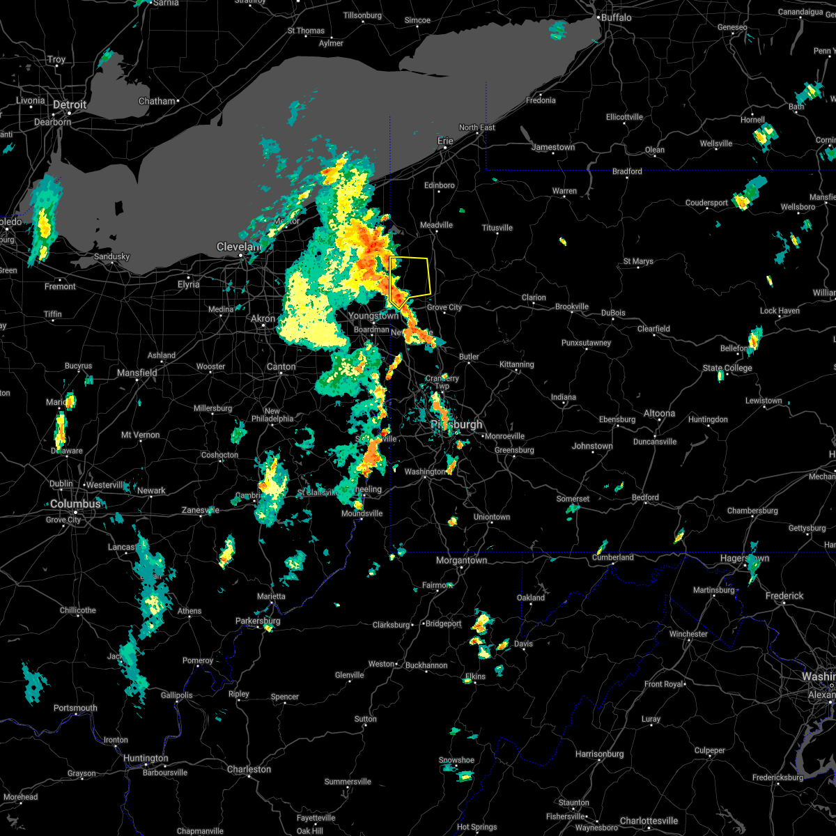 At 324 pm edt, a severe thunderstorm was located near sharpsville, moving northeast at 35 mph (radar). Hazards include wind gusts to 60 mph. expect damage to trees and power lines, resulting in some power outages At 324 pm edt, a severe thunderstorm was located near sharpsville, moving northeast at 35 mph (radar). Hazards include wind gusts to 60 mph. expect damage to trees and power lines, resulting in some power outages
|
| 7/7/2021 4:58 PM EDT |
 At 457 pm edt, a severe thunderstorm was located near new wilmington, or 8 miles southeast of hermitage, moving east at 15 mph (radar). Hazards include wind gusts to 60 mph. expect damage to trees and power lines, resulting in some power outages At 457 pm edt, a severe thunderstorm was located near new wilmington, or 8 miles southeast of hermitage, moving east at 15 mph (radar). Hazards include wind gusts to 60 mph. expect damage to trees and power lines, resulting in some power outages
|
| 6/19/2021 7:01 PM EDT |
 At 700 pm edt, a severe thunderstorm was located near new wilmington, or 8 miles west of grove city, moving southeast at 30 mph (radar). Hazards include wind gusts to 60 mph and quarter-size hail. Minor hail damage to vehicles is possible. expect wind damage to trees and power lines, resulting in some power outages. locations impacted include, hermitage, grove city, slippery rock, new wilmington, mercer, harrisville, west middlesex, plain grove township, clark, west liberty, barkeyville, volant, this includes the following highways, interstate 79 in pennsylvania between mile markers 104 and 121. Interstate 80 in pennsylvania between mile markers 3 and 32. At 700 pm edt, a severe thunderstorm was located near new wilmington, or 8 miles west of grove city, moving southeast at 30 mph (radar). Hazards include wind gusts to 60 mph and quarter-size hail. Minor hail damage to vehicles is possible. expect wind damage to trees and power lines, resulting in some power outages. locations impacted include, hermitage, grove city, slippery rock, new wilmington, mercer, harrisville, west middlesex, plain grove township, clark, west liberty, barkeyville, volant, this includes the following highways, interstate 79 in pennsylvania between mile markers 104 and 121. Interstate 80 in pennsylvania between mile markers 3 and 32.
|
| 6/19/2021 6:47 PM EDT |
 At 647 pm edt, a severe thunderstorm was located near hermitage, moving southeast at 30 mph (radar). Hazards include wind gusts to 60 mph and quarter-size hail. Minor hail damage to vehicles is possible. Expect wind damage to trees and power lines, resulting in some power outages. At 647 pm edt, a severe thunderstorm was located near hermitage, moving southeast at 30 mph (radar). Hazards include wind gusts to 60 mph and quarter-size hail. Minor hail damage to vehicles is possible. Expect wind damage to trees and power lines, resulting in some power outages.
|
| 5/26/2021 2:49 PM EDT |
 At 249 pm edt, a severe thunderstorm was located 9 miles northeast of hermitage, moving east at 50 mph (radar). Hazards include wind gusts to 60 mph. Expect damage to trees and power lines, resulting in some power outages. locations impacted include, hermitage, greenville, mercer, stoneboro, sandy lake, clark, fredonia, jackson center, new lebanon, maurice k goddard state park, this includes the following highways, interstate 79 in pennsylvania between mile markers 116 and 135. Interstate 80 in pennsylvania between mile markers 5 and 26. At 249 pm edt, a severe thunderstorm was located 9 miles northeast of hermitage, moving east at 50 mph (radar). Hazards include wind gusts to 60 mph. Expect damage to trees and power lines, resulting in some power outages. locations impacted include, hermitage, greenville, mercer, stoneboro, sandy lake, clark, fredonia, jackson center, new lebanon, maurice k goddard state park, this includes the following highways, interstate 79 in pennsylvania between mile markers 116 and 135. Interstate 80 in pennsylvania between mile markers 5 and 26.
|
| 5/26/2021 2:38 PM EDT |
 At 237 pm edt, a severe thunderstorm was located near sharpsville, moving east at 50 mph (radar). Hazards include wind gusts to 60 mph. Expect damage to trees and power lines, resulting in some power outages. locations impacted include, hermitage, sharon, grove city, sharpsville, greenville, farrell, mercer, stoneboro, west middlesex, sandy lake, clark, wheatland, this includes the following highways, interstate 79 in pennsylvania between mile markers 115 and 137. Interstate 80 in pennsylvania between mile markers 1 and 26. At 237 pm edt, a severe thunderstorm was located near sharpsville, moving east at 50 mph (radar). Hazards include wind gusts to 60 mph. Expect damage to trees and power lines, resulting in some power outages. locations impacted include, hermitage, sharon, grove city, sharpsville, greenville, farrell, mercer, stoneboro, west middlesex, sandy lake, clark, wheatland, this includes the following highways, interstate 79 in pennsylvania between mile markers 115 and 137. Interstate 80 in pennsylvania between mile markers 1 and 26.
|
| 5/26/2021 2:24 PM EDT |
 At 223 pm edt, a severe thunderstorm was located over vienna center, or near sharon, moving east at 50 mph (radar). Hazards include wind gusts to 60 mph. expect damage to trees and power lines, resulting in some power outages At 223 pm edt, a severe thunderstorm was located over vienna center, or near sharon, moving east at 50 mph (radar). Hazards include wind gusts to 60 mph. expect damage to trees and power lines, resulting in some power outages
|
| 11/15/2020 2:43 PM EST |
 The severe thunderstorm warning for mercer, northern beaver, western venango, lawrence and western butler counties will expire at 245 pm est, the storms which prompted the warning have moved out of the area. therefore, the warning will be allowed to expire. however gusty winds are still possible with these thunderstorms. a severe thunderstorm watch remains in effect until 400 pm est for east central ohio, and western, northwestern and west central pennsylvania. remember, a severe thunderstorm warning still remains in effect for eastern mercer, lawrence until 330 pm est. The severe thunderstorm warning for mercer, northern beaver, western venango, lawrence and western butler counties will expire at 245 pm est, the storms which prompted the warning have moved out of the area. therefore, the warning will be allowed to expire. however gusty winds are still possible with these thunderstorms. a severe thunderstorm watch remains in effect until 400 pm est for east central ohio, and western, northwestern and west central pennsylvania. remember, a severe thunderstorm warning still remains in effect for eastern mercer, lawrence until 330 pm est.
|
| 11/15/2020 2:27 PM EST |
 At 227 pm est, severe thunderstorms were located along a line extending from near meadville to near ellwood city, moving east at 45 mph (radar). Hazards include wind gusts to 60 mph. Expect damage to trees and power lines, resulting in some power outages. locations impacted include, cranberry, new castle, hermitage, sharon, beaver falls, grove city, franklin, sharpsville, ellwood city, new brighton, greenville, sugarcreek, this includes the following highways, pennsylvania turnpike between mile markers 1 and 26. interstate 79 in pennsylvania between mile markers 81 and 138. interstate 80 in pennsylvania between mile markers 0 and 32. Interstate 376 in pennsylvania between mile markers 4 and 35. At 227 pm est, severe thunderstorms were located along a line extending from near meadville to near ellwood city, moving east at 45 mph (radar). Hazards include wind gusts to 60 mph. Expect damage to trees and power lines, resulting in some power outages. locations impacted include, cranberry, new castle, hermitage, sharon, beaver falls, grove city, franklin, sharpsville, ellwood city, new brighton, greenville, sugarcreek, this includes the following highways, pennsylvania turnpike between mile markers 1 and 26. interstate 79 in pennsylvania between mile markers 81 and 138. interstate 80 in pennsylvania between mile markers 0 and 32. Interstate 376 in pennsylvania between mile markers 4 and 35.
|
| 11/15/2020 2:01 PM EST |
 At 200 pm est, severe thunderstorms were located along a line extending from pymatuning north to near new waterford, moving east at 45 mph (radar). Hazards include wind gusts to 70 mph. Trees snapped and uprooted. Power outages can be expected. At 200 pm est, severe thunderstorms were located along a line extending from pymatuning north to near new waterford, moving east at 45 mph (radar). Hazards include wind gusts to 70 mph. Trees snapped and uprooted. Power outages can be expected.
|
| 8/28/2020 9:17 AM EDT |
 At 917 am edt, a severe thunderstorm was located 8 miles north of grove city, moving east at 40 mph (radar). Hazards include wind gusts to 70 mph and ping pong ball-size hail. People and animals outdoors will be injured. expect hail damage to roofs, siding, windows, and vehicles. trees snapped and uprooted. power outages can be expected. locations impacted include, hermitage, grove city, franklin, sugarcreek, new wilmington, mercer, stoneboro, harrisville, west middlesex, polk, plain grove township, sandy lake, this includes the following highways, interstate 79 in pennsylvania between mile markers 108 and 135. Interstate 80 in pennsylvania between mile markers 4 and 37. At 917 am edt, a severe thunderstorm was located 8 miles north of grove city, moving east at 40 mph (radar). Hazards include wind gusts to 70 mph and ping pong ball-size hail. People and animals outdoors will be injured. expect hail damage to roofs, siding, windows, and vehicles. trees snapped and uprooted. power outages can be expected. locations impacted include, hermitage, grove city, franklin, sugarcreek, new wilmington, mercer, stoneboro, harrisville, west middlesex, polk, plain grove township, sandy lake, this includes the following highways, interstate 79 in pennsylvania between mile markers 108 and 135. Interstate 80 in pennsylvania between mile markers 4 and 37.
|
| 8/28/2020 8:56 AM EDT |
 At 856 am edt, a severe thunderstorm was located near kinsman, or 11 miles north of sharpsville, moving east at 50 mph (radar). Hazards include wind gusts to 60 mph. expect damage to trees and power lines, resulting in some power outages At 856 am edt, a severe thunderstorm was located near kinsman, or 11 miles north of sharpsville, moving east at 50 mph (radar). Hazards include wind gusts to 60 mph. expect damage to trees and power lines, resulting in some power outages
|
| 8/25/2020 12:18 PM EDT |
 At 1217 pm edt, severe thunderstorms were located along a line extending from 6 miles east of oil city to near hermitage, moving southeast at 45 mph (radar). Hazards include wind gusts to 60 mph and quarter-size hail. Minor hail damage to vehicles is possible. expect wind damage to trees and power lines, resulting in some power outages. locations impacted include, hermitage, oil city, franklin, greenville, sugarcreek, mercer, hasson heights, stoneboro, seneca, polk, sandy lake, clark, this includes the following highways, interstate 79 in pennsylvania between mile markers 120 and 138. Interstate 80 in pennsylvania between mile markers 6 and 8. At 1217 pm edt, severe thunderstorms were located along a line extending from 6 miles east of oil city to near hermitage, moving southeast at 45 mph (radar). Hazards include wind gusts to 60 mph and quarter-size hail. Minor hail damage to vehicles is possible. expect wind damage to trees and power lines, resulting in some power outages. locations impacted include, hermitage, oil city, franklin, greenville, sugarcreek, mercer, hasson heights, stoneboro, seneca, polk, sandy lake, clark, this includes the following highways, interstate 79 in pennsylvania between mile markers 120 and 138. Interstate 80 in pennsylvania between mile markers 6 and 8.
|
| 8/25/2020 11:58 AM EDT |
 At 1158 am edt, severe thunderstorms were located along a line extending from near titusville to near kinsman, moving southeast at 50 mph (radar). Hazards include wind gusts to 60 mph and quarter-size hail. Minor hail damage to vehicles is possible. Expect wind damage to trees and power lines, resulting in some power outages. At 1158 am edt, severe thunderstorms were located along a line extending from near titusville to near kinsman, moving southeast at 50 mph (radar). Hazards include wind gusts to 60 mph and quarter-size hail. Minor hail damage to vehicles is possible. Expect wind damage to trees and power lines, resulting in some power outages.
|
| 7/19/2020 6:44 PM EDT |
 At 644 pm edt, a severe thunderstorm was located near hubbard, or near youngstown, moving east at 45 mph (radar). Hazards include wind gusts to 70 mph. Trees snapped and uprooted. Power outages can be expected. At 644 pm edt, a severe thunderstorm was located near hubbard, or near youngstown, moving east at 45 mph (radar). Hazards include wind gusts to 70 mph. Trees snapped and uprooted. Power outages can be expected.
|
| 7/16/2020 5:08 PM EDT |
 At 508 pm edt, a severe thunderstorm was located 7 miles southeast of greenville, or 8 miles northeast of hermitage, moving northeast at 30 mph (radar). Hazards include wind gusts to 60 mph. Expect damage to trees and power lines, resulting in some power outages. Locations impacted include, hermitage, sharpsville, greenville, mercer, stoneboro, sandy lake, clark, fredonia, jackson center, new lebanon, sheakleyville, maurice k goddard state park, this includes interstate 79 in pennsylvania between mile markers 122 and 137. At 508 pm edt, a severe thunderstorm was located 7 miles southeast of greenville, or 8 miles northeast of hermitage, moving northeast at 30 mph (radar). Hazards include wind gusts to 60 mph. Expect damage to trees and power lines, resulting in some power outages. Locations impacted include, hermitage, sharpsville, greenville, mercer, stoneboro, sandy lake, clark, fredonia, jackson center, new lebanon, sheakleyville, maurice k goddard state park, this includes interstate 79 in pennsylvania between mile markers 122 and 137.
|
| 7/16/2020 5:02 PM EDT |
 At 501 pm edt, a severe thunderstorm was located near hermitage, moving northeast at 30 mph (radar). Hazards include wind gusts to 60 mph. expect damage to trees and power lines, resulting in some power outages At 501 pm edt, a severe thunderstorm was located near hermitage, moving northeast at 30 mph (radar). Hazards include wind gusts to 60 mph. expect damage to trees and power lines, resulting in some power outages
|
| 6/10/2020 10:15 PM EDT |
 At 1015 pm edt, severe thunderstorms were located along a line extending from 7 miles east of hermitage to 6 miles northwest of shanor-northvue to hampton township to mount oliver, moving northeast at 30 mph (radar). Hazards include wind gusts to 60 mph and quarter-size hail. Minor hail damage to vehicles is possible. expect wind damage to trees and power lines, resulting in some power outages. locations impacted include, pittsburgh, penn hills, mccandless township, hermitage, butler, grove city, shaler township, plum, hampton township, new kensington, harrison township, o`hara township, this includes the following highways, pennsylvania turnpike between mile markers 36 and 53. interstate 79 in pennsylvania between mile markers 111 and 138. Interstate 80 in pennsylvania between mile markers 13 and 42. At 1015 pm edt, severe thunderstorms were located along a line extending from 7 miles east of hermitage to 6 miles northwest of shanor-northvue to hampton township to mount oliver, moving northeast at 30 mph (radar). Hazards include wind gusts to 60 mph and quarter-size hail. Minor hail damage to vehicles is possible. expect wind damage to trees and power lines, resulting in some power outages. locations impacted include, pittsburgh, penn hills, mccandless township, hermitage, butler, grove city, shaler township, plum, hampton township, new kensington, harrison township, o`hara township, this includes the following highways, pennsylvania turnpike between mile markers 36 and 53. interstate 79 in pennsylvania between mile markers 111 and 138. Interstate 80 in pennsylvania between mile markers 13 and 42.
|
| 6/10/2020 9:52 PM EDT |
 At 951 pm edt, severe thunderstorms were located along a line extending from near maplewood park to near ellwood city to near robinson township to near cecil-bishop, moving northeast at 35 mph (radar). Hazards include wind gusts to 60 mph and quarter-size hail. Minor hail damage to vehicles is possible. Expect wind damage to trees and power lines, resulting in some power outages. At 951 pm edt, severe thunderstorms were located along a line extending from near maplewood park to near ellwood city to near robinson township to near cecil-bishop, moving northeast at 35 mph (radar). Hazards include wind gusts to 60 mph and quarter-size hail. Minor hail damage to vehicles is possible. Expect wind damage to trees and power lines, resulting in some power outages.
|
| 6/4/2020 4:16 PM EDT |
 At 415 pm edt, a severe thunderstorm was located near campbell, or 8 miles west of new castle, moving east at 15 mph (radar). Hazards include wind gusts to 60 mph. expect damage to trees and power lines, resulting in some power outages At 415 pm edt, a severe thunderstorm was located near campbell, or 8 miles west of new castle, moving east at 15 mph (radar). Hazards include wind gusts to 60 mph. expect damage to trees and power lines, resulting in some power outages
|
| 4/7/2020 11:35 PM EDT |
 At 1134 pm edt, a severe thunderstorm was located near hilltop, or near youngstown, moving east at 45 mph (radar). Hazards include wind gusts to 60 mph and quarter-size hail. Minor hail damage to vehicles is possible. Expect wind damage to trees and power lines, resulting in some power outages. At 1134 pm edt, a severe thunderstorm was located near hilltop, or near youngstown, moving east at 45 mph (radar). Hazards include wind gusts to 60 mph and quarter-size hail. Minor hail damage to vehicles is possible. Expect wind damage to trees and power lines, resulting in some power outages.
|
| 9/13/2019 11:57 PM EDT |
 At 1157 pm edt, severe thunderstorms were located along a line extending from 7 miles east of atlantic to near hermitage, moving east at 35 mph (radar). Hazards include wind gusts to 60 mph. Expect damage to trees and power lines, resulting in some power outages. Locations impacted include, hermitage, sharon, sharpsville, greenville, mercer, stoneboro, sandy lake, clark, fredonia, jackson center, utica, new lebanon, this includes interstate 79 in pennsylvania between mile markers 121 and 137. At 1157 pm edt, severe thunderstorms were located along a line extending from 7 miles east of atlantic to near hermitage, moving east at 35 mph (radar). Hazards include wind gusts to 60 mph. Expect damage to trees and power lines, resulting in some power outages. Locations impacted include, hermitage, sharon, sharpsville, greenville, mercer, stoneboro, sandy lake, clark, fredonia, jackson center, utica, new lebanon, this includes interstate 79 in pennsylvania between mile markers 121 and 137.
|
| 9/13/2019 11:38 PM EDT |
 At 1138 pm edt, severe thunderstorms were located along a line extending from near adamsville to hubbard, moving east at 35 mph (radar). Hazards include wind gusts to 60 mph. expect damage to trees and power lines, resulting in some power outages At 1138 pm edt, severe thunderstorms were located along a line extending from near adamsville to hubbard, moving east at 35 mph (radar). Hazards include wind gusts to 60 mph. expect damage to trees and power lines, resulting in some power outages
|
| 8/19/2019 1:56 AM EDT |
 A severe thunderstorm warning remains in effect until 215 am edt for central mercer and southwestern venango counties. at 155 am edt, a severe thunderstorm was located 8 miles east of hermitage, moving east at 30 mph. hazard. wind gusts to 60 mph. source. Radar. A severe thunderstorm warning remains in effect until 215 am edt for central mercer and southwestern venango counties. at 155 am edt, a severe thunderstorm was located 8 miles east of hermitage, moving east at 30 mph. hazard. wind gusts to 60 mph. source. Radar.
|
| 8/19/2019 1:50 AM EDT |
 A severe thunderstorm warning remains in effect until 215 am edt for mercer and southwestern venango counties. at 150 am edt, a severe thunderstorm was located near hermitage, moving east at 30 mph. hazard. wind gusts to 60 mph and quarter-size hail. source. Radar. A severe thunderstorm warning remains in effect until 215 am edt for mercer and southwestern venango counties. at 150 am edt, a severe thunderstorm was located near hermitage, moving east at 30 mph. hazard. wind gusts to 60 mph and quarter-size hail. source. Radar.
|
| 8/19/2019 1:39 AM EDT |
 At 139 am edt, a severe thunderstorm was located over hermitage, moving east at 35 mph (radar). Hazards include wind gusts to 60 mph and quarter-size hail. Minor hail damage to vehicles is possible. Expect wind damage to trees and power lines, resulting in some power outages. At 139 am edt, a severe thunderstorm was located over hermitage, moving east at 35 mph (radar). Hazards include wind gusts to 60 mph and quarter-size hail. Minor hail damage to vehicles is possible. Expect wind damage to trees and power lines, resulting in some power outages.
|
| 8/17/2019 4:24 PM EDT |
 At 423 pm edt, a severe thunderstorm was located 8 miles southeast of greenville, or 10 miles northeast of hermitage, moving east at 25 mph. this storm has produced some wind damage (radar). Hazards include wind gusts to 60 mph and quarter-size hail. Minor hail damage to vehicles is possible. expect wind damage to trees and power lines, resulting in some power outages. locations impacted include, grove city, mercer, stoneboro, sandy lake, fredonia, jackson center, this includes the following highways, interstate 79 in pennsylvania between mile markers 114 and 128. Interstate 80 in pennsylvania between mile markers 15 and 27. At 423 pm edt, a severe thunderstorm was located 8 miles southeast of greenville, or 10 miles northeast of hermitage, moving east at 25 mph. this storm has produced some wind damage (radar). Hazards include wind gusts to 60 mph and quarter-size hail. Minor hail damage to vehicles is possible. expect wind damage to trees and power lines, resulting in some power outages. locations impacted include, grove city, mercer, stoneboro, sandy lake, fredonia, jackson center, this includes the following highways, interstate 79 in pennsylvania between mile markers 114 and 128. Interstate 80 in pennsylvania between mile markers 15 and 27.
|
| 8/17/2019 4:13 PM EDT | Trees and powerlines down on hous in mercer county PA, 1.8 miles SSW of Clark, PA |
| 8/17/2019 4:13 PM EDT |
 The national weather service in pittsburgh has issued a * severe thunderstorm warning for. central mercer county in northwestern pennsylvania. until 500 pm edt. At 413 pm edt, a severe thunderstorm was located near greenville, or 7 miles northeast of sharpsville, moving east at 25 mph. The national weather service in pittsburgh has issued a * severe thunderstorm warning for. central mercer county in northwestern pennsylvania. until 500 pm edt. At 413 pm edt, a severe thunderstorm was located near greenville, or 7 miles northeast of sharpsville, moving east at 25 mph.
|
| 8/15/2019 6:32 PM EDT |
 At 631 pm edt, a severe thunderstorm was located 11 miles southeast of greenville, or 12 miles northwest of grove city, moving northeast at 20 mph (radar). Hazards include wind gusts to 60 mph and quarter-size hail. Minor hail damage to vehicles is possible. expect wind damage to trees and power lines, resulting in some power outages. Locations impacted include, greenville, stoneboro, sandy lake, clark, fredonia, jackson center, new lebanon, sheakleyville, maurice k goddard state park, this includes interstate 79 in pennsylvania between mile markers 122 and 137. At 631 pm edt, a severe thunderstorm was located 11 miles southeast of greenville, or 12 miles northwest of grove city, moving northeast at 20 mph (radar). Hazards include wind gusts to 60 mph and quarter-size hail. Minor hail damage to vehicles is possible. expect wind damage to trees and power lines, resulting in some power outages. Locations impacted include, greenville, stoneboro, sandy lake, clark, fredonia, jackson center, new lebanon, sheakleyville, maurice k goddard state park, this includes interstate 79 in pennsylvania between mile markers 122 and 137.
|
| 8/15/2019 6:18 PM EDT |
 At 618 pm edt, a severe thunderstorm was located 9 miles east of hermitage, moving northeast at 20 mph (radar). Hazards include wind gusts to 60 mph and quarter-size hail. Minor hail damage to vehicles is possible. Expect wind damage to trees and power lines, resulting in some power outages. At 618 pm edt, a severe thunderstorm was located 9 miles east of hermitage, moving northeast at 20 mph (radar). Hazards include wind gusts to 60 mph and quarter-size hail. Minor hail damage to vehicles is possible. Expect wind damage to trees and power lines, resulting in some power outages.
|
| 8/6/2019 4:40 PM EDT |
 At 420 pm edt, a severe thunderstorm was located near new wilmington, or 8 miles east of hermitage, moving northeast at 25 mph (radar). Hazards include wind gusts to 60 mph. Expect damage to trees and power lines, resulting in some power outages. locations impacted include, hermitage, mercer, stoneboro, west middlesex, sandy lake, clark, fredonia, jackson center, sheakleyville, maurice k goddard state park, this includes the following highways, interstate 79 in pennsylvania between mile markers 114 and 134. Interstate 80 in pennsylvania between mile markers 3 and 23. At 420 pm edt, a severe thunderstorm was located near new wilmington, or 8 miles east of hermitage, moving northeast at 25 mph (radar). Hazards include wind gusts to 60 mph. Expect damage to trees and power lines, resulting in some power outages. locations impacted include, hermitage, mercer, stoneboro, west middlesex, sandy lake, clark, fredonia, jackson center, sheakleyville, maurice k goddard state park, this includes the following highways, interstate 79 in pennsylvania between mile markers 114 and 134. Interstate 80 in pennsylvania between mile markers 3 and 23.
|
| 8/6/2019 4:21 PM EDT |
 At 420 pm edt, a severe thunderstorm was located near new wilmington, or 8 miles east of hermitage, moving northeast at 25 mph (radar). Hazards include wind gusts to 60 mph. Expect damage to trees and power lines, resulting in some power outages. locations impacted include, hermitage, mercer, stoneboro, west middlesex, sandy lake, clark, fredonia, jackson center, sheakleyville, maurice k goddard state park, this includes the following highways, interstate 79 in pennsylvania between mile markers 114 and 134. Interstate 80 in pennsylvania between mile markers 3 and 23. At 420 pm edt, a severe thunderstorm was located near new wilmington, or 8 miles east of hermitage, moving northeast at 25 mph (radar). Hazards include wind gusts to 60 mph. Expect damage to trees and power lines, resulting in some power outages. locations impacted include, hermitage, mercer, stoneboro, west middlesex, sandy lake, clark, fredonia, jackson center, sheakleyville, maurice k goddard state park, this includes the following highways, interstate 79 in pennsylvania between mile markers 114 and 134. Interstate 80 in pennsylvania between mile markers 3 and 23.
|
| 8/6/2019 4:04 PM EDT |
 At 403 pm edt, a severe thunderstorm was located near new wilmington, or 8 miles south of hermitage, moving northeast at 25 mph (radar). Hazards include wind gusts to 60 mph and quarter-size hail. Minor hail damage to vehicles is possible. Expect wind damage to trees and power lines, resulting in some power outages. At 403 pm edt, a severe thunderstorm was located near new wilmington, or 8 miles south of hermitage, moving northeast at 25 mph (radar). Hazards include wind gusts to 60 mph and quarter-size hail. Minor hail damage to vehicles is possible. Expect wind damage to trees and power lines, resulting in some power outages.
|
| 7/20/2019 7:58 AM EDT |
 At 757 am edt, a severe thunderstorm was located over farrell, or over sharon, moving southeast at 30 mph (radar). Hazards include wind gusts to 60 mph. expect damage to trees and power lines, resulting in some power outages At 757 am edt, a severe thunderstorm was located over farrell, or over sharon, moving southeast at 30 mph (radar). Hazards include wind gusts to 60 mph. expect damage to trees and power lines, resulting in some power outages
|
| 6/16/2019 5:11 PM EDT |
 At 511 pm edt, a severe thunderstorm capable of producing a tornado was located near hermitage, moving east at 30 mph (radar indicated rotation). Hazards include tornado. Flying debris will be dangerous to those caught without shelter. mobile homes will be damaged or destroyed. damage to roofs, windows, and vehicles will occur. tree damage is likely. this tornadic thunderstorm will remain over mainly rural areas of central mercer county, including the following locations, fredonia, mercer and clark. this includes interstate 80 in pennsylvania between mile markers 8 and 17. Please report severe weather by calling 412-262-1988, posting to the nws pittsburgh facebook page, or using twitter @nwspittsburgh. At 511 pm edt, a severe thunderstorm capable of producing a tornado was located near hermitage, moving east at 30 mph (radar indicated rotation). Hazards include tornado. Flying debris will be dangerous to those caught without shelter. mobile homes will be damaged or destroyed. damage to roofs, windows, and vehicles will occur. tree damage is likely. this tornadic thunderstorm will remain over mainly rural areas of central mercer county, including the following locations, fredonia, mercer and clark. this includes interstate 80 in pennsylvania between mile markers 8 and 17. Please report severe weather by calling 412-262-1988, posting to the nws pittsburgh facebook page, or using twitter @nwspittsburgh.
|
| 6/16/2019 4:59 PM EDT |
 At 458 pm edt, a severe thunderstorm capable of producing a tornado was located over sharon, moving east at 30 mph (radar indicated rotation). Hazards include tornado. Flying debris will be dangerous to those caught without shelter. mobile homes will be damaged or destroyed. damage to roofs, windows, and vehicles will occur. tree damage is likely. this tornadic thunderstorm will remain over mainly rural areas of southwestern mercer county, including the following locations, clark, fredonia, mercer and wheatland. this includes interstate 80 in pennsylvania between mile markers 7 and 17. Please report severe weather by calling 412-262-1988, posting to the nws pittsburgh facebook page, or using twitter @nwspittsburgh. At 458 pm edt, a severe thunderstorm capable of producing a tornado was located over sharon, moving east at 30 mph (radar indicated rotation). Hazards include tornado. Flying debris will be dangerous to those caught without shelter. mobile homes will be damaged or destroyed. damage to roofs, windows, and vehicles will occur. tree damage is likely. this tornadic thunderstorm will remain over mainly rural areas of southwestern mercer county, including the following locations, clark, fredonia, mercer and wheatland. this includes interstate 80 in pennsylvania between mile markers 7 and 17. Please report severe weather by calling 412-262-1988, posting to the nws pittsburgh facebook page, or using twitter @nwspittsburgh.
|
| 5/25/2019 6:58 PM EDT |
 At 658 pm edt, severe thunderstorms were located along a line extending from near tionesta to 10 miles southeast of greenville, moving east at 40 mph (radar). Hazards include wind gusts to 60 mph and quarter-size hail. Minor hail damage to vehicles is possible. Expect wind damage to trees and power lines, resulting in some power outages. At 658 pm edt, severe thunderstorms were located along a line extending from near tionesta to 10 miles southeast of greenville, moving east at 40 mph (radar). Hazards include wind gusts to 60 mph and quarter-size hail. Minor hail damage to vehicles is possible. Expect wind damage to trees and power lines, resulting in some power outages.
|
| 5/25/2019 6:31 PM EDT |
 At 631 pm edt, severe thunderstorms were located along a line extending from 6 miles northwest of oil city to near sharpsville, moving east at 40 mph (radar). Hazards include wind gusts to 60 mph. Expect damage to trees and power lines, resulting in some power outages. locations impacted include, hermitage, sharon, oil city, franklin, sharpsville, greenville, sugarcreek, mercer, hasson heights, stoneboro, seneca, polk, this includes the following highways, interstate 79 in pennsylvania between mile markers 117 and 138. Interstate 80 in pennsylvania between mile markers 17 and 24. At 631 pm edt, severe thunderstorms were located along a line extending from 6 miles northwest of oil city to near sharpsville, moving east at 40 mph (radar). Hazards include wind gusts to 60 mph. Expect damage to trees and power lines, resulting in some power outages. locations impacted include, hermitage, sharon, oil city, franklin, sharpsville, greenville, sugarcreek, mercer, hasson heights, stoneboro, seneca, polk, this includes the following highways, interstate 79 in pennsylvania between mile markers 117 and 138. Interstate 80 in pennsylvania between mile markers 17 and 24.
|
| 5/25/2019 6:17 PM EDT |
 At 617 pm edt, severe thunderstorms were located along a line extending from near atlantic to cortland, moving east at 45 mph (radar). Hazards include wind gusts to 60 mph. expect damage to trees and power lines, resulting in some power outages At 617 pm edt, severe thunderstorms were located along a line extending from near atlantic to cortland, moving east at 45 mph (radar). Hazards include wind gusts to 60 mph. expect damage to trees and power lines, resulting in some power outages
|
| 4/14/2019 6:59 PM EDT |
 At 659 pm edt, severe thunderstorms were located along a line extending from near vienna center to near campbell to near new waterford, moving northeast at 80 mph (radar). Hazards include wind gusts to 60 mph and quarter-size hail. Minor hail damage to vehicles is possible. Expect wind damage to trees and power lines, resulting in some power outages. At 659 pm edt, severe thunderstorms were located along a line extending from near vienna center to near campbell to near new waterford, moving northeast at 80 mph (radar). Hazards include wind gusts to 60 mph and quarter-size hail. Minor hail damage to vehicles is possible. Expect wind damage to trees and power lines, resulting in some power outages.
|
| 4/14/2019 6:31 PM EDT |
 At 631 pm edt, severe thunderstorms were located along a line extending from near andover to near kinsman to near vienna center, moving northeast at 60 mph (radar). Hazards include wind gusts to 60 mph. expect damage to trees and power lines, resulting in some power outages At 631 pm edt, severe thunderstorms were located along a line extending from near andover to near kinsman to near vienna center, moving northeast at 60 mph (radar). Hazards include wind gusts to 60 mph. expect damage to trees and power lines, resulting in some power outages
|
| 3/14/2019 9:27 PM EDT |
 At 927 pm edt, a severe thunderstorm was located over new castle northwest, or near new castle, moving northeast at 60 mph (radar). Hazards include wind gusts to 60 mph and quarter-size hail. Minor hail damage to vehicles is possible. expect wind damage to trees and power lines, resulting in some power outages. locations impacted include, new castle, hermitage, sharon, grove city, sharpsville, farrell, new wilmington, oakwood, new castle northwest, mercer, new beaver, pulaski, this includes the following highways, pennsylvania turnpike between mile markers 1 and 5. interstate 79 in pennsylvania between mile markers 106 and 132. interstate 80 in pennsylvania between mile markers 0 and 27. Interstate 376 in pennsylvania between mile markers 4 and 14. At 927 pm edt, a severe thunderstorm was located over new castle northwest, or near new castle, moving northeast at 60 mph (radar). Hazards include wind gusts to 60 mph and quarter-size hail. Minor hail damage to vehicles is possible. expect wind damage to trees and power lines, resulting in some power outages. locations impacted include, new castle, hermitage, sharon, grove city, sharpsville, farrell, new wilmington, oakwood, new castle northwest, mercer, new beaver, pulaski, this includes the following highways, pennsylvania turnpike between mile markers 1 and 5. interstate 79 in pennsylvania between mile markers 106 and 132. interstate 80 in pennsylvania between mile markers 0 and 27. Interstate 376 in pennsylvania between mile markers 4 and 14.
|
| 3/14/2019 9:13 PM EDT |
 At 913 pm edt, a severe thunderstorm was located 7 miles south of campbell, or 9 miles southeast of youngstown, moving northeast at 65 mph (radar). Hazards include wind gusts to 60 mph and quarter-size hail. Minor hail damage to vehicles is possible. expect wind damage to trees and power lines, resulting in some power outages. locations impacted include, new castle, hermitage, sharon, grove city, sharpsville, farrell, new wilmington, oakwood, new castle northwest, mercer, new beaver, pulaski, this includes the following highways, pennsylvania turnpike between mile markers 1 and 5. interstate 79 in pennsylvania between mile markers 106 and 132. interstate 80 in pennsylvania between mile markers 0 and 27. Interstate 376 in pennsylvania between mile markers 4 and 14. At 913 pm edt, a severe thunderstorm was located 7 miles south of campbell, or 9 miles southeast of youngstown, moving northeast at 65 mph (radar). Hazards include wind gusts to 60 mph and quarter-size hail. Minor hail damage to vehicles is possible. expect wind damage to trees and power lines, resulting in some power outages. locations impacted include, new castle, hermitage, sharon, grove city, sharpsville, farrell, new wilmington, oakwood, new castle northwest, mercer, new beaver, pulaski, this includes the following highways, pennsylvania turnpike between mile markers 1 and 5. interstate 79 in pennsylvania between mile markers 106 and 132. interstate 80 in pennsylvania between mile markers 0 and 27. Interstate 376 in pennsylvania between mile markers 4 and 14.
|
| 3/14/2019 8:58 PM EDT |
 At 857 pm edt, a severe thunderstorm was located near salem, moving northeast at 60 mph (radar). Hazards include wind gusts to 60 mph and quarter-size hail. Minor hail damage to vehicles is possible. Expect wind damage to trees and power lines, resulting in some power outages. At 857 pm edt, a severe thunderstorm was located near salem, moving northeast at 60 mph (radar). Hazards include wind gusts to 60 mph and quarter-size hail. Minor hail damage to vehicles is possible. Expect wind damage to trees and power lines, resulting in some power outages.
|
| 9/21/2018 6:32 PM EDT |
 At 631 pm edt, a line of thunderstorms were located along a line extending from sugarcreek to near new wilmington, moving east at 60 mph (radar). Hazards include wind gusts to 60 mph. expect damage to trees and power lines, resulting in some power outages At 631 pm edt, a line of thunderstorms were located along a line extending from sugarcreek to near new wilmington, moving east at 60 mph (radar). Hazards include wind gusts to 60 mph. expect damage to trees and power lines, resulting in some power outages
|
| 7/26/2018 9:22 PM EDT |
 At 921 pm edt, a severe thunderstorm was located near greenville, or 7 miles northeast of hermitage, moving east at 30 mph (radar). Hazards include wind gusts to 60 mph and quarter-size hail. Minor hail damage to vehicles is possible. expect wind damage to trees and power lines, resulting in some power outages. Locations impacted include, hermitage, sharpsville, greenville, mercer, clark, fredonia, this includes interstate 80 in pennsylvania between mile markers 14 and 18. At 921 pm edt, a severe thunderstorm was located near greenville, or 7 miles northeast of hermitage, moving east at 30 mph (radar). Hazards include wind gusts to 60 mph and quarter-size hail. Minor hail damage to vehicles is possible. expect wind damage to trees and power lines, resulting in some power outages. Locations impacted include, hermitage, sharpsville, greenville, mercer, clark, fredonia, this includes interstate 80 in pennsylvania between mile markers 14 and 18.
|
| 7/26/2018 9:10 PM EDT |
 At 910 pm edt, a severe thunderstorm was located near sharpsville, moving east at 25 mph (radar). Hazards include wind gusts to 60 mph and quarter-size hail. Minor hail damage to vehicles is possible. expect wind damage to trees and power lines, resulting in some power outages. Locations impacted include, hermitage, sharon, sharpsville, greenville, farrell, mercer, clark, fredonia, this includes interstate 80 in pennsylvania between mile markers 9 and 18. At 910 pm edt, a severe thunderstorm was located near sharpsville, moving east at 25 mph (radar). Hazards include wind gusts to 60 mph and quarter-size hail. Minor hail damage to vehicles is possible. expect wind damage to trees and power lines, resulting in some power outages. Locations impacted include, hermitage, sharon, sharpsville, greenville, farrell, mercer, clark, fredonia, this includes interstate 80 in pennsylvania between mile markers 9 and 18.
|
| 7/26/2018 8:54 PM EDT |
 At 854 pm edt, a severe thunderstorm was located near vienna center, or 7 miles northwest of sharpsville, moving east at 35 mph (radar). Hazards include wind gusts to 60 mph and quarter-size hail. Minor hail damage to vehicles is possible. Expect wind damage to trees and power lines, resulting in some power outages. At 854 pm edt, a severe thunderstorm was located near vienna center, or 7 miles northwest of sharpsville, moving east at 35 mph (radar). Hazards include wind gusts to 60 mph and quarter-size hail. Minor hail damage to vehicles is possible. Expect wind damage to trees and power lines, resulting in some power outages.
|
| 5/4/2018 3:47 PM EDT |
 At 347 pm edt, a severe thunderstorm was located over greenville, or 9 miles northeast of sharpsville, moving east at 50 mph (radar). Hazards include wind gusts to 70 mph. Trees snapped and uprooted. power outages can be expected. Locations impacted include, hermitage, sharon, sharpsville, greenville, stoneboro, sandy lake, clark, jamestown, fredonia, jackson center, new lebanon, sheakleyville, this includes interstate 79 in pennsylvania between mile markers 93 and 108. At 347 pm edt, a severe thunderstorm was located over greenville, or 9 miles northeast of sharpsville, moving east at 50 mph (radar). Hazards include wind gusts to 70 mph. Trees snapped and uprooted. power outages can be expected. Locations impacted include, hermitage, sharon, sharpsville, greenville, stoneboro, sandy lake, clark, jamestown, fredonia, jackson center, new lebanon, sheakleyville, this includes interstate 79 in pennsylvania between mile markers 93 and 108.
|
| 5/4/2018 3:34 PM EDT |
 At 333 pm edt, the lead storm in a line of severe thunderstorms was located near cortland, or 9 miles northwest of sharpsville, moving northeast at 65 mph (radar). Hazards include wind gusts of 60 to 70 mph. Trees snapped and uprooted. Power outages can be expected. At 333 pm edt, the lead storm in a line of severe thunderstorms was located near cortland, or 9 miles northwest of sharpsville, moving northeast at 65 mph (radar). Hazards include wind gusts of 60 to 70 mph. Trees snapped and uprooted. Power outages can be expected.
|
| 11/5/2017 7:46 PM EDT |
 At 645 pm est, severe thunderstorms were located along a line extending from 8 miles northeast of orwell to near lordstown, moving east at 50 mph (radar). Hazards include 60 mph wind gusts. expect damage to trees and power lines, resulting in some power outages At 645 pm est, severe thunderstorms were located along a line extending from 8 miles northeast of orwell to near lordstown, moving east at 50 mph (radar). Hazards include 60 mph wind gusts. expect damage to trees and power lines, resulting in some power outages
|
| 8/17/2017 7:35 PM EDT |
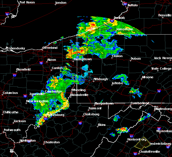 At 733 pm edt, a severe thunderstorm was located 7 miles north of sharpsville, moving east at 20 mph (radar). Hazards include 70 mph wind gusts. Trees snapped and uprooted. power outages can be expected. Locations impacted include, greenville, clark, fredonia,. At 733 pm edt, a severe thunderstorm was located 7 miles north of sharpsville, moving east at 20 mph (radar). Hazards include 70 mph wind gusts. Trees snapped and uprooted. power outages can be expected. Locations impacted include, greenville, clark, fredonia,.
|
| 8/17/2017 7:23 PM EDT |
 At 722 pm edt, a severe thunderstorm was located near cortland, or 7 miles northwest of sharpsville, moving east at 20 mph (radar). Hazards include 70 mph wind gusts. Trees snapped and uprooted. Power outages can be expected. At 722 pm edt, a severe thunderstorm was located near cortland, or 7 miles northwest of sharpsville, moving east at 20 mph (radar). Hazards include 70 mph wind gusts. Trees snapped and uprooted. Power outages can be expected.
|
| 6/29/2017 5:32 PM EDT |
 At 932 pm edt, a severe thunderstorm was located 9 miles east of hermitage, moving northeast at 15 mph (radar). Hazards include 60 mph wind gusts. Expect damage to trees and power lines, resulting in some power outages. locations impacted include, hermitage, mercer, stoneboro, sandy lake, clark, fredonia, jackson center, maurice k goddard state park, this includes the following highways, interstate 79 in pennsylvania between mile markers 88 and 105. Interstate 80 in pennsylvania between mile markers 7 and 23. At 932 pm edt, a severe thunderstorm was located 9 miles east of hermitage, moving northeast at 15 mph (radar). Hazards include 60 mph wind gusts. Expect damage to trees and power lines, resulting in some power outages. locations impacted include, hermitage, mercer, stoneboro, sandy lake, clark, fredonia, jackson center, maurice k goddard state park, this includes the following highways, interstate 79 in pennsylvania between mile markers 88 and 105. Interstate 80 in pennsylvania between mile markers 7 and 23.
|
| 6/29/2017 5:16 PM EDT |
 At 915 pm edt, a severe thunderstorm was located near hermitage, moving east at 15 mph (radar). Hazards include 60 mph wind gusts. expect damage to trees and power lines, resulting in some power outages At 915 pm edt, a severe thunderstorm was located near hermitage, moving east at 15 mph (radar). Hazards include 60 mph wind gusts. expect damage to trees and power lines, resulting in some power outages
|
| 6/18/2017 2:54 PM EDT |
 At 253 pm edt, severe thunderstorms were located along a line extending from near greenville to 11 miles northeast of hermitage to 7 miles north of new wilmington, moving east at 45 mph (radar). Hazards include 60 mph wind gusts. Expect damage to trees and power lines, resulting in some power outages. locations impacted include, hermitage, sharon, franklin, sharpsville, greenville, sugarcreek, farrell, mercer, stoneboro, west middlesex, polk, sandy lake, this includes the following highways, interstate 79 in pennsylvania between mile markers 90 and 109. Interstate 80 in pennsylvania between mile markers 0 and 13, and near mile marker 15. At 253 pm edt, severe thunderstorms were located along a line extending from near greenville to 11 miles northeast of hermitage to 7 miles north of new wilmington, moving east at 45 mph (radar). Hazards include 60 mph wind gusts. Expect damage to trees and power lines, resulting in some power outages. locations impacted include, hermitage, sharon, franklin, sharpsville, greenville, sugarcreek, farrell, mercer, stoneboro, west middlesex, polk, sandy lake, this includes the following highways, interstate 79 in pennsylvania between mile markers 90 and 109. Interstate 80 in pennsylvania between mile markers 0 and 13, and near mile marker 15.
|
| 6/18/2017 2:41 PM EDT |
 At 240 pm edt, a severe thunderstorm was located over hermitage, moving northeast at 60 mph (radar). Hazards include 60 mph wind gusts. expect damage to trees and power lines, resulting in some power outages At 240 pm edt, a severe thunderstorm was located over hermitage, moving northeast at 60 mph (radar). Hazards include 60 mph wind gusts. expect damage to trees and power lines, resulting in some power outages
|
| 5/1/2017 1:47 PM EDT |
 At 146 pm edt, severe thunderstorms were located along a line extending from 6 miles northwest of andover to near canfield, moving northeast at 50 mph (radar). Hazards include 60 mph wind gusts. expect damage to trees and power lines, resulting in some power outages At 146 pm edt, severe thunderstorms were located along a line extending from 6 miles northwest of andover to near canfield, moving northeast at 50 mph (radar). Hazards include 60 mph wind gusts. expect damage to trees and power lines, resulting in some power outages
|
| 1/12/2017 1:56 PM EST |
 At 155 pm est, severe thunderstorms were located along a line extending from 9 miles northwest of grove city to near new wilmington, moving east at 65 mph (radar indicated). Hazards include 60 mph wind gusts. expect damage to trees and power lines, resulting in some power outages At 155 pm est, severe thunderstorms were located along a line extending from 9 miles northwest of grove city to near new wilmington, moving east at 65 mph (radar indicated). Hazards include 60 mph wind gusts. expect damage to trees and power lines, resulting in some power outages
|
| 9/10/2016 7:44 PM EDT |
 At 743 pm edt, a severe thunderstorm was located 10 miles east of hermitage, moving northeast at 55 mph (radar indicated). Hazards include 60 mph wind gusts. Expect damage to trees and power lines. resulting in some power outages. locations impacted include, hermitage, greenville, mercer, stoneboro, sandy lake, clark, fredonia, jackson center, sheakleyville and maurice k goddard state park. this includes the following highways, interstate 79 in pennsylvania between mile markers 119 and 136. interstate 80 in pennsylvania between mile markers 6 and 12. Please report severe weather by calling 4 1 2, 2 6 2, 1 9 8 8, posting to the nws pittsburgh facebook page, or using twitter @nwspittsburgh. At 743 pm edt, a severe thunderstorm was located 10 miles east of hermitage, moving northeast at 55 mph (radar indicated). Hazards include 60 mph wind gusts. Expect damage to trees and power lines. resulting in some power outages. locations impacted include, hermitage, greenville, mercer, stoneboro, sandy lake, clark, fredonia, jackson center, sheakleyville and maurice k goddard state park. this includes the following highways, interstate 79 in pennsylvania between mile markers 119 and 136. interstate 80 in pennsylvania between mile markers 6 and 12. Please report severe weather by calling 4 1 2, 2 6 2, 1 9 8 8, posting to the nws pittsburgh facebook page, or using twitter @nwspittsburgh.
|
| 9/10/2016 7:31 PM EDT |
 At 731 pm edt, a severe thunderstorm was located over hermitage, moving northeast at 55 mph (radar indicated). Hazards include 60 mph wind gusts. Expect damage to trees and power lines. Resulting in some power outages. At 731 pm edt, a severe thunderstorm was located over hermitage, moving northeast at 55 mph (radar indicated). Hazards include 60 mph wind gusts. Expect damage to trees and power lines. Resulting in some power outages.
|
| 7/22/2016 9:46 AM EDT |
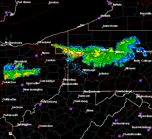 At 946 am edt, a severe thunderstorm was located near farrell, or near hermitage, moving southeast at 30 mph. another severe thunderstorm was near new wilmington and volant (radar indicated). Hazards include 60 mph wind gusts. Expect damage to trees and power lines. resulting in some power outages. locations impacted include, new castle, hermitage, sharon, sharpsville, farrell, new wilmington, oakwood, new castle northwest, new beaver, pulaski, west middlesex, plain grove township, wampum, south new castle, clark, wheatland, harlansburg and volant. this includes the following highways, interstate 79 in pennsylvania near mile marker 107. interstate 80 in pennsylvania between mile markers 0 and 12. interstate 376 in pennsylvania between mile markers 4 and 14. Please report severe weather by calling 4 1 2, 2 6 2, 1 9 8 8, posting to the nws pittsburgh facebook page, or using twitter @nwspittsburgh. At 946 am edt, a severe thunderstorm was located near farrell, or near hermitage, moving southeast at 30 mph. another severe thunderstorm was near new wilmington and volant (radar indicated). Hazards include 60 mph wind gusts. Expect damage to trees and power lines. resulting in some power outages. locations impacted include, new castle, hermitage, sharon, sharpsville, farrell, new wilmington, oakwood, new castle northwest, new beaver, pulaski, west middlesex, plain grove township, wampum, south new castle, clark, wheatland, harlansburg and volant. this includes the following highways, interstate 79 in pennsylvania near mile marker 107. interstate 80 in pennsylvania between mile markers 0 and 12. interstate 376 in pennsylvania between mile markers 4 and 14. Please report severe weather by calling 4 1 2, 2 6 2, 1 9 8 8, posting to the nws pittsburgh facebook page, or using twitter @nwspittsburgh.
|
| 7/22/2016 9:33 AM EDT |
 At 933 am edt, a severe thunderstorm was located over farrell, or over sharon, moving southeast at 30 mph (radar indicated). Hazards include 60 mph wind gusts. Expect damage to trees and power lines. Resulting in some power outages. At 933 am edt, a severe thunderstorm was located over farrell, or over sharon, moving southeast at 30 mph (radar indicated). Hazards include 60 mph wind gusts. Expect damage to trees and power lines. Resulting in some power outages.
|
| 6/6/2016 10:09 PM EDT |
 At 1009 pm edt, severe thunderstorms were located along a line extending from near kinsman to near hubbard, moving east at 45 mph (radar indicated). Hazards include 60 mph wind gusts and nickel size hail. Expect damage to trees and power lines. Resulting in some power outages. At 1009 pm edt, severe thunderstorms were located along a line extending from near kinsman to near hubbard, moving east at 45 mph (radar indicated). Hazards include 60 mph wind gusts and nickel size hail. Expect damage to trees and power lines. Resulting in some power outages.
|
| 6/5/2016 4:48 PM EDT |
 At 448 pm edt, a severe thunderstorm was located 7 miles east of greenville, or 16 miles northeast of hermitage, moving east at 50 mph (radar indicated). Hazards include 60 mph wind gusts and quarter size hail. Hail damage to vehicles is expected. expect wind damage to trees and power lines, resulting in some power outages. locations impacted include, hermitage, greenville, mercer, stoneboro, sandy lake, clark, fredonia, jackson center, new lebanon, sheakleyville and maurice k goddard state park. this includes interstate 79 in pennsylvania between mile markers 118 and 136. Please report severe weather by calling 4 1 2, 2 6 2, 1 9 8 8, posting to the nws pittsburgh facebook page, or using twitter @nwspittsburgh. At 448 pm edt, a severe thunderstorm was located 7 miles east of greenville, or 16 miles northeast of hermitage, moving east at 50 mph (radar indicated). Hazards include 60 mph wind gusts and quarter size hail. Hail damage to vehicles is expected. expect wind damage to trees and power lines, resulting in some power outages. locations impacted include, hermitage, greenville, mercer, stoneboro, sandy lake, clark, fredonia, jackson center, new lebanon, sheakleyville and maurice k goddard state park. this includes interstate 79 in pennsylvania between mile markers 118 and 136. Please report severe weather by calling 4 1 2, 2 6 2, 1 9 8 8, posting to the nws pittsburgh facebook page, or using twitter @nwspittsburgh.
|
| 6/5/2016 4:24 PM EDT |
 At 424 pm edt, a severe thunderstorm was located near kinsman, or 11 miles northwest of sharpsville, moving east at 50 mph (radar indicated). Hazards include 60 mph wind gusts and quarter size hail. Hail damage to vehicles is expected. Expect wind damage to trees and power lines, resulting in some power outages. At 424 pm edt, a severe thunderstorm was located near kinsman, or 11 miles northwest of sharpsville, moving east at 50 mph (radar indicated). Hazards include 60 mph wind gusts and quarter size hail. Hail damage to vehicles is expected. Expect wind damage to trees and power lines, resulting in some power outages.
|
| 5/11/2015 8:20 PM EDT | At 819 pm edt, severe thunderstorms were located along a line extending from near kinsman to new wilmington, moving northeast at 45 mph (radar indicated). Hazards include 60 mph wind gusts. Expect damage to roofs. siding and trees. locations impacted include, hermitage, sharon, sharpsville, greenville, farrell, mercer, pulaski, stoneboro, west middlesex, sandy lake, clark, wheatland, jamestown, fredonia, jackson center, new lebanon, sheakleyville and maurice k goddard state park. 75in. |
| 5/11/2015 8:02 PM EDT | At 802 pm edt, severe thunderstorms were located along a line extending from near cortland to near campbell, moving northeast at 45 mph (radar indicated). Hazards include 60 mph wind gusts. Expect damage to roofs. Siding and trees. |
| 4/4/2014 5:17 PM EDT | Several trees down in pymatuning in mercer county PA, 1.1 miles SE of Clark, PA |
Hail Maps for Clark, PA
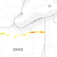


Connect with Interactive Hail Maps